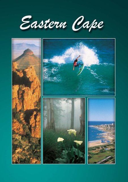
Eastern Cape Provincial Article - South African Vacations
Eastern Cape Provincial Article - South African Vacations
Eastern Cape Provincial Article - South African Vacations

Create successful ePaper yourself
Turn your PDF publications into a flip-book with our unique Google optimized e-Paper software.
Index<br />
CLIMATE...................................................................................................- 9 -<br />
ROUTES..................................................................................................- 10 -<br />
REGIONS ................................................................................................- 17 -<br />
NELSON MANDELA METROPOLITAN MUNICIPALITY - 18 -<br />
CACADU (WESTERN/TSITSIKAMMA) REGION.....................................- 19 -<br />
PORT ELIZABETH - 21 -<br />
ABERDEEN - 34 -<br />
ADDO - 36 -<br />
ALEXANDRIA - 38 -<br />
BATHURST - 40 -<br />
COOKHOUSE - 41 -<br />
GRAAFF-REINET - 42 -<br />
GRAHAMSTOWN - 48 -<br />
HANKEY - 53 -<br />
HUMANSDORP - 54 -<br />
JEFFREY’S BAY - 55 -<br />
JOUBERTINA - 58 -<br />
KAREEDOUW - 58 -<br />
KENTON ON SEA - 59 -<br />
KIRKWOOD - 60 -<br />
NIEU-BETHESDA - 60 -<br />
PATENSIE - 63 -<br />
PEARSTON - 63 -<br />
PORT ALFRED - 64 -<br />
SALEM - 66 -<br />
SOMERSET EAST - 66 -<br />
ST FRANCIS BAY - 69 -<br />
STEYTLERVILLE - 70 -<br />
UITENHAGE - 71 -<br />
WILLOWMORE - 73 -<br />
UKHAHLAMBA (NORTHERN) REGION ................................................- 74 -<br />
ALIWAL NORTH - 75 -<br />
BARKLY EAST - 77 -<br />
BURGERSDORP - 79 -<br />
CACADU (LADY FRERE) - 81 -<br />
CRADOCK - 82 -<br />
DORDRECHT - 85 -<br />
- 1 -
ELLIOT - 86 -<br />
HOFMEYR - 87 -<br />
INDWE - 88 -<br />
JAMESTOWN - 88 -<br />
LADY GREY - 89 -<br />
MACLEAR (including Ugie) - 91 -<br />
MIDDELBURG - 93 -<br />
MOLTENO - 95 -<br />
MOUNT FLETCHER - 96 -<br />
QUEENSTOWN - 96 -<br />
RHODES - 97 -<br />
STERKSPRUIT (including Herschel) - 99 -<br />
STERKSTROOM - 99 -<br />
STEYNSBURG - 100 -<br />
TARKASTAD - 101 -<br />
VENTERSTAD - 102 -<br />
WHITTLESEA - 104 -<br />
AMATOLE (CENTRAL) REGION ..........................................................- 105 -<br />
ADELAIDE - 106 -<br />
ALICE - 106 -<br />
BALFOUR - 107 -<br />
BEDFORD - 108 -<br />
BISHO - 109 -<br />
BUTTERWORTH/GCUWA - 109 -<br />
CATHCART - 109 -<br />
CINTSA - 111 -<br />
EAST LONDON (including Gonubie and Mdantsane) - 113 -<br />
FORT BEAUFORT (including Hertzog and the rural area of Mpofu) - 119 -<br />
HAGA-HAGA - 121 -<br />
HAMBURG - 123 -<br />
HOGSBACK - 124 -<br />
IDUTYWA (including Willowvale) - 128 -<br />
KEI MOUTH - 128 -<br />
KEISKAMMAHOEK - 129 -<br />
KING WILLIAM’S TOWN - 130 -<br />
MORGAN’S BAY - 132 -<br />
PEDDIE - 133 -<br />
SEYMOUR - 133 -<br />
STUTTERHEIM - 134 -<br />
- 2 -
WILD COAST REGION ..........................................................................- 136 -<br />
COFFEE BAY - 137 -<br />
ELLIOTDALE - 140 -<br />
FLAGSTAFF - 140 -<br />
HLULEKA AND MPANDE - 141 -<br />
KENTANI (including Qolora Mouth) - 142 -<br />
LIBODE - 143 -<br />
LUSIKISIKI - 143 -<br />
MATATIELE - 145 -<br />
MAZEPPA BAY - 145 -<br />
MOUNT AYLIFF - 146 -<br />
MOUNT FRERE (KWABHACA) - 146 -<br />
PORT GROSVENOR - 147 -<br />
PORT ST JOHNS - 147 -<br />
UMTATA - 150 -<br />
- 3
Overview<br />
<strong>Eastern</strong> <strong>Cape</strong> Tourism Board<br />
Street address: c/o Longfellow & Aquarium Rd, Quigney, East London, 5211<br />
Postal address: PO Box 18373, Quigney, East London, 5211<br />
Tel: +27 (0) 43 701 9600<br />
Fax: +27 (0) 43 701 9649<br />
E-mail: info@ectourism.co.za<br />
Website: www.ectourism.co.za<br />
Snow-covered mountain peaks, sun-drenched beaches, lush forests,<br />
stretched-out deserts – all this and much, much more, you will find in the<br />
<strong>Eastern</strong> <strong>Cape</strong> – the province where sea and land, mountains and valleys,<br />
deserts and forest all come together.<br />
The <strong>Eastern</strong> <strong>Cape</strong> is a wonder world where all seven of <strong>South</strong> Africa’s<br />
ecological vegetation types (biomes) are found. It is also the only place in the<br />
world that has a wildlife reserve where the “Big Seven” – elephant, lion,<br />
buffalo, rhino, leopard, southern right whale and great white shark, can be<br />
seen.<br />
It is <strong>South</strong> Africa’s second largest province (having approximately the same<br />
size as that of Austria, Switzerland and Denmark combined) and its coast lies<br />
ensconced between subtropical KwaZulu-Natal and the Western <strong>Cape</strong> with its<br />
Mediterranean climate. The Great Escarpment divides the interior into the<br />
southern region, with its many rivers and wetlands and the northern, more arid<br />
regions. Its almost 1 000-km coastline stretches from the Tsitsikamma<br />
National Park in the west, past St Francis Bay and Algoa Bay and up to Port<br />
- 4 -
Edward in the east. Most of the beaches of its popular coastal resort towns<br />
provide safe, warm bathing for the thousands of visitors who visit it annually,<br />
while the untamed Wild Coast offers unspoilt seclusion.<br />
The western region of the province extends from the forests of the<br />
Tsitsikamma National Park in the west to Algoa Bay in the east and from the<br />
Karoo plains and mountains in the north to the Indian Ocean coastline in the<br />
south, where the dusty plains are replaced by lush forest creepers and where<br />
the gurgling waters of its streams take over from creaking Karoo windmills.<br />
The natural beauty of the <strong>Eastern</strong> <strong>Cape</strong> is not confined to its land areas.<br />
Reefs of incomparable beauty and water that offers better colour at depth than<br />
anywhere else in the world are found just off the rugged coastlines of St<br />
Francis Bay and Algoa Bay. Divers are treated to views of colourful coral,<br />
delicate sea sponges, nearly transparent sea wasps, exotic sea anemones<br />
and shoals of tropical fish swimming among rocky pinnacles and the rusty<br />
remains of sunken ships.<br />
- 5 -
The attractions and activities offered by the province are rivalled only by the<br />
diversity of the types of landscape and vegetation. Hiking, biking,<br />
mountaineering, hang-gliding and paragliding are practised all over the<br />
province and two of the best-known hiking trails in the country, the Otter and<br />
the Tsitsikamma Hiking Trails, traverse the <strong>Eastern</strong> <strong>Cape</strong>.<br />
The magnificent underwater world of the Indian Ocean is a popular<br />
playground for scuba- and snorkel-divers. The coast is a surfer’s Mecca and<br />
some of the world’s most famous surfing competitions are held here. The<br />
“breaks” at Bruce’s were immortalised in the cult film, “Endless Summer”.<br />
The many lakes and strongly-flowing streams of the province offer a multitude<br />
of easily accessible fresh-water fishing sites and the <strong>Eastern</strong> <strong>Cape</strong> is<br />
particularly renowned for its trout-fishing. Rock-fishing and deep-sea angling<br />
are popular alternatives and huge shoals of shad and elf, cob, spotted grunter,<br />
“galjoen”, roman, bream, garrick, and rock cod are found in most parts of the<br />
<strong>Eastern</strong> <strong>Cape</strong>’s waters.<br />
And just when you thought you had the measure of the province, up crops<br />
another surprise - <strong>South</strong> Africa’s only ski lodge! During the winter months<br />
snow blankets the slopes of Ben MacDhui, the highest mountain peak in the<br />
north-eastern part of the province, and enthusiastic skiers from all over the<br />
country gather to enjoy the excellent skiing conditions.<br />
- 6 -
However, the <strong>Eastern</strong> <strong>Cape</strong> is not just a popular holiday destination; it is also<br />
a major crop producer. It is the world’s second largest producer of chicory and<br />
is a premier producer of tomatoes, deciduous fruit and citrus. At least 70 per<br />
cent of <strong>South</strong> Africa’s pineapples and one third of its tea are grown in the<br />
<strong>Eastern</strong> <strong>Cape</strong>.<br />
The province is synonymous with the motor industry and the <strong>Eastern</strong> <strong>Cape</strong><br />
provincial government has recently established two new industrial<br />
development zones (IDZs), one at East London (targeted at industries<br />
associated with the motor industry, textiles, chemicals, pharmaceuticals and<br />
high technology, especially electronics) and the other at Koega, 20 km east of<br />
Port Elizabeth, where a new deep-water port will cater for the giant newgeneration<br />
container ships that will soon be visiting our shores.<br />
Today, almost seven million people, including our former President, Nelson<br />
Mandela, “Madiba”, call this province “home”. Madiba recently retired to the<br />
small village of Qunu, where he spent the happiest part of his childhood.<br />
The San tribes were the first indigenous people to occupy the caves, gorges<br />
and inland valleys of the province, while nomadic herders, the Khoi-Khoi<br />
people, settled along the banks of the Gamtoos River and occupied the<br />
coastal areas. The rock art and the melodious names of some of the rivers<br />
and mountains attest to their occupancy.<br />
- 7 -
The Xhosa people, a mixture of North-East <strong>African</strong> Hamitic pastoralists and<br />
agriculturalists from West Africa, later migrated to the same area. From these<br />
migrants the great Xhosa nation, made up of a diversity of tribes of Nguni<br />
stock, developed and their men soon became known as bold and brave<br />
fighters. At the time when clashes between these tribes and the white<br />
frontiersmen took place they were ruled by two major chiefs, Ngqika (Gaika)<br />
the rightful heir, and his uncle Ndlambe who, loath to give up his regency, later<br />
settled west of the Great Fish River with his followers. Today, although each<br />
group of the Xhosa-speaking tribes has its own distinctive costumes and<br />
colours, they are bound together by the customs and traditions of their<br />
ancestors.<br />
The first European spark of interest in the area was ignited when the<br />
Portuguese navigator, Bartolomeu Diaz, landed on the coast in the late 1400s.<br />
Vasco da Gama was the next well-known European seafarer to arrive. Algoa<br />
Bay, as it is now called, is derived from the Portuguese term, Bahia de Lagoa<br />
(Lagoon Bay). At first these early Europeans merely used the bay to land their<br />
ships and to get fresh water. However, <strong>Cape</strong> Dutch “Voortrekkers”, trying to<br />
escape the yoke of British colonial rule soon arrived and established farms in<br />
the area. In 1820 they were joined by the British Settlers, who settled in an<br />
area extending from Algoa Bay in the west to the mouth of the Great Fish<br />
River in the east and inland for 300 km. This was the old frontier, an area of<br />
bitter contention between the white settlers and the indigenous Xhosa tribes.<br />
- 8 -
CLIMATE<br />
- 9 -<br />
The migration of different groups of<br />
people to this beautiful part of Africa<br />
has resulted in a fascinating mix of<br />
cultures and in the tangible<br />
architectural, historical and cultural<br />
evidence left behind in the form of<br />
San rock art, the remains of Xhosa<br />
villages and other artefacts, British,<br />
Scottish and German Settler houses,<br />
churches and town names, as well<br />
as Anglo-Boer War sites and the<br />
distinctive culture and cuisine of the<br />
Indian, Malay, Greek and<br />
Portuguese settlers.<br />
The inconsistencies in the <strong>Eastern</strong> <strong>Cape</strong>’s topography are echoed by the<br />
variety of climatic conditions experienced in the province. However, the<br />
weather is generally kind to visitors and rarely reaches extremes except<br />
during the hot Karoo summers. As one travels north towards the Free State,<br />
the increase in altitude also means lower temperatures and conditions more<br />
favourable to skiing than to sunbathing.<br />
Although the towns in the heart of the Karoo experience long, hot summer<br />
months and moderate winters, the towns in the north-east, along the Wild<br />
Coast, experience moderate winters and long summers, with hot, balmy<br />
conditions and a high rainfall.
ROUTES<br />
In order to make the province and its attractions more accessible to visitors,<br />
the <strong>Eastern</strong> <strong>Cape</strong> Tourism Authority has mapped out various tourism routes<br />
throughout the province. These routes give prominence to the many and<br />
diverse attractions of the province and are clearly indicated on road signs and<br />
marketing material. The routes are named after the areas they run through.<br />
Each tourist route falls under the jurisdiction of one or more of the newly-<br />
formed District Municipalities. Some of the routes are colour-coded or marked<br />
with distinctive, individual symbols. Some of the marked routes are smaller<br />
and shorter and actually form part of larger routes. These are all indicated by<br />
the symbols for the larger routes.<br />
TSITSIKAMMA ADVENTURE ROUTE (SYMBOL: LOERIE BIRD)<br />
The Tsitsikamma Adventure Route starts in Port Elizabeth and opens up the<br />
wondrous world of the indigenous forests of the Garden Route that lie<br />
between the Bloukrans River and Eerste River. Adrenaline addicts may<br />
demonstrate their courage by doing some black-water tubing down the Storms<br />
River or bungee-jumping from the Blaauwkranz Bridge (the world’s highest<br />
bungee jump). Other interesting activities include a trailer ride through the<br />
indigenous forest or, for something completely different: being suspended 25m<br />
above the forest floor in a full body harness on a steel-pulley system.<br />
Three of the country’s most popular hiking routes, the Otter, Tsitsikamma and<br />
Dolphin Trails, are located on this route.<br />
- 10 -
KOUGA ROUTE (SYMBOL: SHELL)<br />
The Kouga Route stretches from the Tsitsikamma River to the Van Stadens<br />
River and is situated between Port Elizabeth and the Garden Route. It<br />
incorporates the towns of Humansdorp, Patensie and Hankie in the Gamtoos<br />
Valley, the Langkloof Valley, the Baviaanskloof Wilderness area and the<br />
coastal towns of <strong>Cape</strong> St Francis, St Francis Bay and Jeffrey’s Bay. The<br />
Langkloof Valley offers spectacular scenic drives, especially during spring<br />
(August/October) when the apple, apricot, plum and peach orchards are in<br />
blossom. However, this route also offers access to an exceptional diversity of<br />
natural features, mountain-wilderness areas, clean, bilharzia-free rivers and a<br />
strip of coastline world-renowned for its excellent surfing. Human occupation<br />
in this area dates back to more than a million years ago and the world’s oldest<br />
cultural groups, the San and Khoi-Khoi (Khoisan), were responsible for the rock<br />
art that abounds.<br />
BAVIAANS ROUTE (SYMBOL: BABOON)<br />
This route takes you from Willowmore, closest town to the Baviaanskloof<br />
Wilderness area, on Road R329 to Steytlerville, nestled in the arms of the<br />
Winterhoek Mountains and to the tiny hamlet of Wolwefontein, with its<br />
interesting aloe and succulent garden on a farm nearby. Do not neglect to visit<br />
the giant fig tree and the Beervlei Flood Control Dam. Take a little extra time<br />
to make a detour to the magnificent 175 00-ha Baviaanskloof Wilderness<br />
area.<br />
- 11 -
LANGKLOOF FRUIT ROUTE (SYMBOL: APPLES)<br />
The Langkloof Fruit Route starts west of Humansdorp and follows the R62. It<br />
explores Langkloof (“Long Valley”), which has also been described as “the<br />
valley of a thousand vistas”. This route takes visitors past a thousand different<br />
views from fruit orchards and protea (flower)-bedecked hills in the Kouga and<br />
Baviaanskloof Mountain catchment area to the small towns of Kareedouw and<br />
Joubertina. There are many hiking, mountaineering, mountain-biking and birdwatching<br />
trails in the area, as well as 4x4 routes There are also many other<br />
wildlife and leisure activities to choose from.<br />
SUNSHINE COAST AND COUNTRY ROUTE (SYMBOL:<br />
SUN AND WAVES)<br />
This route explores the spectacular strip of coastline between East London<br />
and Port Elizabeth from the Van Stadens River, via Alexandria and Port<br />
Alfred. Among the route’s many attractions are its magnificent coastline, rivers<br />
and resorts, its fine wildlife, opportunities for dolphin- and whale-viewing and<br />
the world’s first “Big Seven” reserve: the Greater Addo Elephant National Park<br />
in the Sundays River Valley. Adventurers and historians alike will never want<br />
for something new to capture their interest. Hiking, biking and 4x4 trails and<br />
many other adventure sport options abound along this route, and there are<br />
many monuments and places of historical interest, especially in the cities of<br />
Port Elizabeth and East London.<br />
SUNDAYS RIVER VALLEY ROUTE (SYMBOL: ELEPHANT AND ORANGE)<br />
- 12 -
The Sundays River Valley, home to the elephants of the Greater Addo<br />
Elephant National Park and also renowned for its citrus and roses, can be<br />
reached either from the interchange at St George’s Strand, east of Port<br />
Elizabeth, or from the Paterson intersection on National Road N10. Visit the<br />
old-world, small towns of Addo, site of the annual Rose Festival (billed as one<br />
of the best of its kind in the world) and Kirkwood where Sir Percy Fitzpatrick,<br />
the acclaimed author of "Jock of the Bushveld", lies buried. Explore the<br />
Zuurberg Mountains on foot, on horseback or with your 4x4 and visit the<br />
nearby Sundays River to fish or to enjoy other forms of water sport.<br />
KAROO HEARTLAND ROUTE (SYMBOL: KAROO KOPPIE/HILLOCK)<br />
The Karoo Heartland Route starts at Port Elizabeth, traverses the vast central<br />
plateau of <strong>South</strong> Africa with its wide open spaces and picturesque small towns<br />
and villages and passes many interesting spots such as the house of Olive<br />
Schreiner, author of “The Story of an <strong>African</strong> Farm,” in Cradock, and the Owl<br />
House in the village of Nieu-Bethesda, to wonder at the exotic sculptures of<br />
artist Helen Martins. The Karoo Nature Reserve and Mountain Zebra National<br />
Park are also in this area.<br />
THE R63 BLUE CRANE ROUTE (SYMBOL: BLUE CRANE)<br />
This route stretches from Graaff-Reinet to the small town of Pearston and on<br />
to Somerset East, the picturesque town at the foot of the Bosberg Mountain<br />
Range, close to the Bosberg Mountain Reserve.<br />
THE MOUNTAIN ZEBRA/WAPADSBERG ROUTE<br />
From Graaff-Reinet the route winds through mountain scenery with sweeping<br />
views past the Mountain Zebra National Park to Cradock, 35 km further.<br />
THE MOHAIR ROUTE (SYMBOL: KAROO KOPPIE/HILLOCK)<br />
The R75 Mohair Route starts in historic Graaff-Reinet, centre for mohair<br />
(the silky fleece of the angora goat)-farming, crosses the Sundays River to<br />
Jansenville, the country’s third largest mohair-producing district and ends<br />
at Uitenhage, passing the Greater Addo Elephant National Park and the<br />
renowned Groendal Wilderness area. Sid Fourie House in Jansenville has<br />
interesting historical papers, books and pictures on view. Uitenhage, a major<br />
motor-manufacturing centre, boasts a display of all the old Volkswagen Beetle<br />
vehicles in its Drostdy Museum. Cuyler Manor Museum is the venue for the<br />
annual Prickly Pear Festival held in February each year and also gives live<br />
demonstrations of shearing and other old-time farming activities.<br />
- 13 -
THE OWL ROUTE (SYMBOL: OWL)<br />
The Owl Route starts 28 km outside Graaff-Reinet on the N9 to Middelburg<br />
and passes through the tiny hamlet of Nieu-Bethesda, famous for its intriguing<br />
Owl House and Camel Yard.<br />
THE MERINO ROUTE (SYMBOL: KAROO KOPPIE/HILLOCK)<br />
This route runs via Middelburg to Cradock, main centre of the Karoo Midlands<br />
and quite close to the Mountain Zebra National Park and on to Port Elizabeth,<br />
passing Cookhouse and the “Slagtersnek” Memorial, 8 km south of the town,<br />
and the historic hamlet of Middleton, just off the main road. Or travel to<br />
Bedford, situated at the foot of the lovely Kaga Mountains, and on to<br />
Grahamstown, Port Alfred and the Sunshine Coast.<br />
THE CAMDEBOO ROUTE (SYMBOL: KAROO KOPPIE/HILLOCK)<br />
This route starts at Willowmore and the Baviaanskloof Wilderness area,<br />
passes through the towns of Aberdeen (which has been declared an<br />
architectural conservation area) and Graaff-Reinet, “the Gem of the Karoo”, on<br />
through scenic mountain passes to Middelburg, a busy sheep and angora<br />
goat farming district.<br />
FRONTIER COUNTRY ROUTE (SYMBOL: ALOE)<br />
This route traverses the area that was the scene of nine Frontier Wars<br />
between the British and the Xhosa and the meeting place of five great<br />
cultures, San, Khoi-Khoi, Dutch, Xhosa and British. It is a prime gamewatching<br />
area with a wide selection of national, provincial, municipal and<br />
private game reserves to choose from - Double Drift, Koedoeskloof, Kwandwe<br />
and Mpofu, to name a few. Grahamstown is the main city in this area and is<br />
renowned for its beautiful churches, educational institutions and the National<br />
Art Festival, held here every year. Other towns en route include Alicedale,<br />
Salem, Fort Brown, Bedford, Adelaide and Fort Beaufort.<br />
THE N10 FROM NCANARA INTERCHANGE TO GRAHAMSTOWN<br />
This route traverses an area of rolling hills, farms and many malaria-free game<br />
reserves where the “Big Five” abound. Game reserves en route include the<br />
Amakhala Game Reserve, Scotia Safari Ranch and Shamwari Game<br />
Reserve.<br />
THE R67 ROUTE FROM GRAHAMSTOWN TO BATHURST<br />
This route goes south, crosses the Bloukrans River, passes the Bloukrans<br />
Nature Reserve on the way and ends at the historic little town of Bathurst.<br />
THE ROUTE FROM GRAHAMSTOWN TO THE FISH RIVER BRIDGE (N2)<br />
Going north from Grahamstown, this route takes visitors to the Fish River past<br />
a series of forts, posts and signal stations, as well as several British and<br />
Xhosa battlefields.<br />
- 14 -
- 15 -<br />
THE ROUTE FROM<br />
GRAHAMSTOWN TO<br />
BEDFORD (R35)<br />
This route passes through typical<br />
Settler country, with the small<br />
town of Bedford as a perfect<br />
example. The 1820 Settler,<br />
Scottish poet and writer, Thomas<br />
Pringle, settled here.<br />
THE ROUTE FROM<br />
GRAHAMSTOWN TO FORT<br />
BEAUFORT<br />
Take the N2 turn-off to the R67<br />
to reach the Kwandwe Private<br />
Game Reserve, the Fort Brown<br />
National Monument and the<br />
43 000-ha Great Fish Reserve<br />
Complex.<br />
THE ROUTE FROM<br />
GRAHAMSTOWN TO KENTON<br />
ON SEA (N2 AND R343<br />
JUNCTION)<br />
Follow this route to the lovely<br />
Thomas Baines Nature Reserve<br />
and the Settlers’ Dam picnic site<br />
before you reach the village of<br />
Salem, with its historic buildings<br />
and village green. There are<br />
turn-offs to the Kariega and Emlangeni Game Reserves on the way.<br />
AMATOLA MOUNTAIN ESCAPE ROUTE<br />
This route stretches from Adelaide in the west to Stutterheim in the east, with<br />
the majestic Amatola Mountains standing as a clear beacon on the horizon.<br />
Visit an area steeped in Xhosa culture and Settler history. From East London<br />
drive to King William’s Town where Black Consciousness leader, Steve Biko,<br />
is buried and on to Alice and the picturesque little town of Hogsback,<br />
inspiration for Tolkien’s book, “The Hobbit”. Other interesting places that<br />
warrant a stop-over are the towns of Fort Beaufort with its excellent museum,<br />
Keiskammahoek, where a great battle was waged between the Xhosa chief<br />
Ngqika and his uncle Ndlambe, and Seymour in the Kat River Valley, where<br />
one of the earliest published works in Afrikaans, the language that evolved<br />
with the <strong>Cape</strong> Dutch frontiersmen and -women, was written.
WILD COAST ROUTE<br />
As its name suggests this route takes you on a journey through an area of<br />
unspoilt natural beauty and kilometre upon kilometre of rugged and really<br />
“wild” coastline marked by shipwrecks and strandloper (“beachcomber”)<br />
caves. A host of horse-riding and hiking trails traverse the beach and inland<br />
area, a Xhosa stronghold and birthplace of Nelson Mandela. The route<br />
meanders through five municipal districts: Amatola, Ukhahlamba, Chris Hani,<br />
Alfred Nzo and Oliver Tambo. It includes towns such as Butterworth, Idutywa,<br />
Umtata, Lusikisiki and Mount Ayliff and the coastal towns and resorts<br />
stretching from Haga-Haga to Mazeppa Bay, Coffee Bay, Port St Johns and<br />
Port Edward on the KwaZulu-Natal border.<br />
THE FRIENDLY ROUTE (N6)<br />
The N6 motorway links Bloemfontein, capital of the Free State, with<br />
East London. It passes through open, rural countryside where sheep, cattle<br />
and goats graze, as well as past Anglo-Boer War battlefields and many small<br />
villages and towns. Motorists have dubbed this motorway “The Friendly Way”<br />
because of the hospitality of the people of these small, mostly farming,<br />
communities.<br />
- 16 -
REGIONS<br />
The <strong>Eastern</strong> <strong>Cape</strong> area was previously divided into four tourism regions,<br />
namely the Western/Tsitsikamma Region, the Northern Region, the<br />
Central/Amatola Region and the Wild Coast Region. In 2000, however, the<br />
<strong>Eastern</strong> <strong>Cape</strong> Province was restructured into two major metropolitan areas:<br />
the Nelson Mandela Metropolitan Municipality and the Buffalo City area, as<br />
well as several municipal districts under the jurisdiction of six District<br />
Municipalities:<br />
Cacadu District Municipality (Western/Tsitsikamma region)<br />
Ukhahlamba District Municipality (Northern region)<br />
Chris Hani District Municipality (Northern region: Stormberg, Cradock to<br />
Queenstown area)<br />
Amatola District Municipality (Central/Amatola region)<br />
Oliver Tambo District Municipality (Wild Coast region from the Mbashe River<br />
to the Mtamvuna River)<br />
Alfred Nzo District Municipality (Wild Coast region: Matatiele/Mount Fletcher<br />
area)<br />
- 17 -
NELSON MANDELA METROPOLITAN MUNICIPALITY<br />
Nelson Mandela Bay Tourism<br />
Postal address: PO Box 357, Port Elizabeth, 6000<br />
Tel: +27 (0) 41 581 7540<br />
Fax: + 27 (0) 41 582 2573<br />
Website: www.nelsonmandelatourism.co.za<br />
The Nelson Mandela Metropolitan Municipal area lies between the Sundays<br />
and Van Stadens Rivers and includes Port Elizabeth and the Algoa Bay<br />
area (now affectionately referred to as Mandela Bay), Uitenhage, Despatch<br />
and Kouga. It borders the Great Addo Elephant National Park, Groendal<br />
Wilderness area and the Van Stadensberg Mountain Range. The area has<br />
been identified as a national and global priority area for biodiversity<br />
conservation as it is the meeting place of six of <strong>South</strong> Africa’s seven<br />
vegetation biomes. The metropolis is also the centre of the largest wool- and<br />
mohair-farming area in <strong>South</strong> Africa. The “Garden Route”, <strong>South</strong> Africa’s most<br />
famous scenic highway links the Nelson Mandela Metropolis to <strong>Cape</strong> Town in<br />
the Western <strong>Cape</strong> province.<br />
Buffalo City Metropolitan Municipality<br />
Tourism Buffalo City<br />
Street address: 35 Aquarium Street, Esplanade, East London, 5201<br />
Postal address: PO Box 533, East London, 5200<br />
Tel: + 27 043 722 6015<br />
Fax: + 27 043 743 5091<br />
E-mail: info@tourismbuffalocity.co.za<br />
Website: http://www.visitbuffalocity.co.za<br />
Buffalo City situated in the eastern regions of the province, comprises the<br />
coastal town of East London, Bisho, the provincial capital, King William’s<br />
Town and the towns of Mdantsane and Berlin. It currently falls under the<br />
jurisdiction of the Amatola District Municipality but is awaiting confirmation of<br />
its status as the area’s second Metropolitan Municipality. Buffalo City is<br />
strategically located on the Sunshine Coast and Wild Coast Routes in the<br />
Amatola region with its spectacular beaches, mountains, waterfalls and rivers.<br />
It offers excellent sporting and recreational facilities and friendly hospitality.<br />
However, this area has also been identified as an economic growth point and<br />
East London has been singled out as an industrial development zone.<br />
- 18 -
CACADU (WESTERN/TSITSIKAMMA) REGION<br />
<strong>Eastern</strong> <strong>Cape</strong> Tourism Board (Western Region)<br />
Street address: 15 Annerley Terrace, Central Port Elizabeth, 6001.<br />
Postal address: PO Box 12605, Central Port Elizabeth, 6000.<br />
Tel: +27 (0) 41 585 7761<br />
Fax: +27 (0) 41 585 4975<br />
Website: www.ectourism.co.za<br />
This region is characterised by an extraordinary diversity of natural assets and<br />
features, both in the coastal and interior regions. Not only does this region<br />
have the mountains, some covered with indigenous forests while others are<br />
carpeted in fynbos, the renowned <strong>South</strong> <strong>African</strong> Floral Kingdom acclaimed by<br />
botanists all over the world, but they also have the sea, the sun and are home<br />
to six of <strong>South</strong> Africa’s seven plant biomes.<br />
The new boundaries of this region stretch from the village of Nieu-Bethesda in<br />
the north to Storms River and Coldstream in the south and from Willowmore in<br />
the west to Bathurst in the east. The Nelson Mandela Metropolitan<br />
Municipality does not form part of the region, but the region also incorporates<br />
the lovely areas east, north and west of Mandela Bay (Algoa Bay). These<br />
include the Kouga, Sunshine Coast, Tsitsikamma, parts of the Karoo<br />
Heartland and Frontier Park Tourism Route areas.<br />
- 19 -
The Kouga region is synonymous with the twin valleys of the Langkloof and<br />
Gamtoos and the massive Baviaanskloof Wilderness area lying beyond it. The<br />
Gamtoos River Valley includes the towns of Loerie, Hankey (Africa’s largest<br />
sundial can be seen at the entrance to the town) and Patensie, and is the<br />
gateway to this wilderness area. Other attractions in this area include the<br />
superbly beautiful Van Staden’s Flower Reserve, Loerie Geelhout Nature<br />
Reserve and the Loerie and Kouga Dams.<br />
The “Sunshine Coast” stretches from the forests of the Tsitsikamma in the<br />
west, home to <strong>South</strong> Africa’s first national marine park, along kilometres of<br />
warm, sandy beaches to East London in the east. This is also the location of<br />
the unique Alexandria dune fields and the heart of <strong>South</strong> Africa’s chicory<br />
industry. And, last but not least, <strong>South</strong> Africa’s only “Big Seven” nature<br />
reserve, the Greater Addo Elephant National Park in the Sundays River<br />
Valley, is in the region. The Sundays River Valley also supports a vibrant<br />
citrus industry and produces some of the finest quality lemons in the world.<br />
The Tsitsikamma area can only<br />
be described as lush and lovely<br />
beyond words! This is a place<br />
of rocky mountain peaks, lonely<br />
beaches and coastal rain<br />
forests with towering<br />
yellowwood trees where you<br />
may just be lucky enough to<br />
stumble upon the shy little<br />
duiker silently making his way<br />
through the undergrowth, while<br />
<strong>Cape</strong> clawless otters scour the<br />
river for food and the elusive<br />
Knysna loerie perches on a<br />
branch high in the air. The area<br />
is protected within the borders<br />
of the Tsitsikamma National<br />
Park with its renowned Otter,<br />
Tsitsikamma and Dolphin Hiking<br />
Trails and the Storms River<br />
Gorge, a prime ecotourism<br />
destination. The only Khoisan<br />
village of its kind is situated in<br />
The park and offers guided<br />
heritage tours, self-catering<br />
Khoi-hut accommodation,<br />
Khoisan cuisine and<br />
entertainment.<br />
- 20 -
The Cacadu Region also encompasses the stark beauty of the Karoo, the vast<br />
central plateau of <strong>South</strong> Africa. Here, in the land where dinosaurs used to<br />
roam, the visitor is exposed to sweeping skies, spacious horizons and a very<br />
special kind of brooding stillness and silence. Some of the main attractions of<br />
this area, apart from the mouth-watering cuisine and friendly hospitality of its<br />
people, include the Valley of Desolation, a ravine of giant dolerite pillars near<br />
Graaff-Reinet; the Mountain Zebra National Park near Cradock; excellent<br />
collections of fossils, rock art and Anglo-Boer War memorabilia as well as the<br />
Great Fish River Reserve, situated in the heart of “frontier” country.<br />
PORT ELIZABETH<br />
Port Elizabeth, the largest city in the <strong>Eastern</strong> <strong>Cape</strong>, is set on the beautiful<br />
coastline of Algoa Bay. Algoa Bay, discovered by the Portuguese in 1482, was<br />
for a long time the last port of call for ships sailing to India. When the British<br />
captured the <strong>Cape</strong> in 1795 a stone fort (Fort Frederick) was built on the hill<br />
overlooking the Algoa Bay anchorage and a thriving settlement soon grew<br />
here. In 1820, after the arrival of over 4 000 British Settlers, a town was<br />
officially established and named Port Elizabeth after the late wife of the acting<br />
Governor of the <strong>Cape</strong> Colony, Sir Rufane Donkin.<br />
- 21 -
Port Elizabeth is a year-round water sport paradise with its magnificent 40-km<br />
long coastline that offers a perfect combination of warm water and protected<br />
beaches. In addition to its beaches and the sea, the city also offers a diverse<br />
mix of eco-attractions that include scenic nature trails with magnificent wildlife<br />
and a rich and varied historical heritage. It is also often referred to as Sport<br />
Elizabeth because of its many sporting venues and facilities.<br />
The city, affectionately known as the “Friendly City”, is renowned for its<br />
friendly service and the hospitality of its easy-going people.<br />
An added “friendly” factor is the weather. The city is rated as having the most<br />
temperate climate in Africa and the fourth best weather conditions in the<br />
world. Port Elizabeth enjoys an annual daily average of seven and a half<br />
hours of sunshine - more sunshine and less rain during summer than any<br />
other major <strong>South</strong> <strong>African</strong> destination! The strong southeaster and offshore<br />
southwester winds create unpredictable, but generally favourable, sailing and<br />
yachting conditions.<br />
Port Elizabeth has recently been identified as a concentrated urbanisation<br />
intercity activity area and is now part of the Nelson Mandela Metropolitan<br />
Municipality, the area between the Sundays and Van Stadens Rivers and<br />
which includes the Algoa Bay area, now affectionately referred to as Nelson<br />
Mandela Bay, Uitenhage, Despatch and Kouga .<br />
- 22 -
Today, Port Elizabeth is regarded as the economic capital of the <strong>Eastern</strong><br />
<strong>Cape</strong> as well as an important cultural, administrative, business and tourist<br />
centre and has the fifth largest urban population in the country. The city is<br />
renowned for its motor-manufacturing industry and the many other products<br />
manufactured and exported from its seaport. Port Elizabeth is linked to other<br />
major cities and centres in <strong>South</strong> Africa by air, road and rail. It is situated some<br />
260 km from Knysna and approximately 800 km from <strong>Cape</strong> Town.<br />
ADVENTURE AND SPORT<br />
Algoa Grand Prix: This motor-sport venue is equipped with an indoor circuit<br />
with a very high standard of track and kart maintenance and has the latest<br />
technology in timing systems.<br />
Bushbuck Hiking Trail: The trail traverses the lush green indigenous forests of<br />
the Island Forest Reserve.<br />
Coastal and inland walking trails: Port Elizabeth offers a variety of walks that<br />
meander through coastal and valley areas. All the trails are clearly marked<br />
and hikers can attempt them on their own or can make prior arrangements to<br />
obtain the services of a guide. These trails are the 7,5-km Guinea Fowl Trail<br />
through the Baakens River Valley and the Sacramento Trail, an 8-km round<br />
trip through the Schoenmakers-Sardinia Nature Reserve, renowned for its<br />
beautiful scenery. At Schoenmakerskop, a cannon points towards the spot<br />
where the Sacramento, a Portuguese ship, sank in 1647.<br />
- 23 -
Cricket, swimming, bowling and rugby: The 73-ha St George’s Park in the<br />
heart of Port Elizabeth, is home to the country’s oldest cricket club, the Port<br />
Elizabeth Cricket Club. It also houses the St George’s Swimming Baths, the<br />
oldest bowling green in the country, Founders’ Green, as well as rugby fields<br />
and tennis courts. Many international sporting events have been hosted here.<br />
4x4 routes: Tourists are often unaware of the adventures and the beauty they<br />
miss by travelling only well-worn paths and roads. The answer to this lies in<br />
the 4x4 routes designed to help visitors discover the large areas that are<br />
usually inaccessible to ordinary vehicles. These routes take visitors through<br />
unspoilt countryside and along the giddy heights of mountain passes and also<br />
to more conventional tourist attractions. The <strong>Eastern</strong> <strong>Cape</strong> has it all and 4x4<br />
lovers can take their pick of forests, waterfalls, big-game country, semi-desert<br />
areas or miles of sandy beaches. The organised tours range from one-day<br />
tours to adventurous five-day tours.<br />
Golf Clubs: Humewood Golf Club, situated on the Algoa Bay shoreline, is<br />
rated among <strong>South</strong> Africa’s best golf courses and is also one of only a few<br />
genuine link courses. Wedgwood Park Country Club and Port Elizabeth Golf<br />
Club are rated as being of international standard. Golfers may also make use<br />
of the Walmer Country Club and Walmer Golf Club facilities.<br />
Horse racing: The city has two racecourses: St Andrew’s Racing Club in<br />
Arlington and Port Elizabeth’s Turf Club in Fairview.<br />
Mountain bike trails: Well-established and exciting mountain-bike trails in the<br />
vicinity include the Baakens River Mountain-Bike Trail, the Zwartkops<br />
Mountain-Bike Trails, the Longmore Forest Mountain-Bike Trail and the Van<br />
Stadens Wild Flower Reserve Trail.<br />
Otter Hiking Trail: The popular five-day Otter Trail between the Storms River<br />
mouth and Nature’s Valley in the Tsitsikamma National Park offers stunning<br />
views of the coast, cliff-top scrub forests, ferns, “fynbos” and spring flowers. It<br />
is one of the best-known hiking trails in the country.<br />
- 24 -
Sailing and other water sport: Algoa Bay is regarded as one of the world’s<br />
best sailing venues and offers excellent conditions for sailing, board-sailing and<br />
most other forms of water sport. Its waters are also ideal for scuba-diving and<br />
snorkelling among old shipwrecks and beautiful reefs with colourful coral<br />
species.<br />
Surfing: Various surfing spots have been identified in and around Port<br />
Elizabeth. The Fence is a hollow beach break and one of PE's most popular<br />
surfing spots.<br />
- 25 -
ARCHAEOLOGY AND PALAEONTOLOGY<br />
Museum Complex: Prepare to spend many fascinating hours in this<br />
magnificent complex. Within the complex is the Port Elizabeth Museum that<br />
houses one of the largest marine mammal collections in the world, a nationally<br />
important herpetological collection and the life-sized models of prehistoric<br />
mammals such as Algoa Bay’s own 14-m-long dinosaur. The museum also<br />
exhibits a valuable reference collection of fish otoliths (ear bones) and squid<br />
beaks that were part of the stomach contents of marine predators. Another<br />
significant exhibit depicts the stages of development of life on earth since<br />
some 300 million years ago.<br />
ART AND CRAFTS<br />
King George VI Art Gallery: The gallery houses a permanent collection of 19 th<br />
and 20 th century British art as well as collections of Oriental, <strong>South</strong> <strong>African</strong><br />
and other art. The gallery often presents lectures, films and concerts<br />
pertaining to these collections and is considered one of the best art galleries in<br />
<strong>South</strong> Africa.<br />
Wezandla Gallery and Craft Centre: The centre was set up to ensure the<br />
survival and preservation of <strong>African</strong>, and specifically, local Xhosa culture. It<br />
also hosts live cultural evenings that feature <strong>African</strong> dancing and are catered<br />
for with traditional <strong>African</strong> food. Wezandla sells superior examples of crafts<br />
made by local and other <strong>African</strong> artists. A good local “buy” to take home is a<br />
long-stemmed, wooden Xhosa tobacco pipe. These pipes, traditionally<br />
smoked by mature Xhosa women, represent two art forms: carving and<br />
beadwork and are quite unlike European pipes.<br />
CULTURAL/COMMUNITY TOURISM<br />
“Khaya Lendaba”: <strong>South</strong> Africa’s only<br />
centre for traditional healing and the<br />
training of sangomas (<strong>African</strong> herbalists<br />
and traditional healers) is located in the<br />
Shamwari Private Game Reserve. The<br />
house was built by Credo Mutwa, the<br />
renowned <strong>South</strong> <strong>African</strong> sangoma, artist<br />
and oral historian. Daily tours are<br />
conducted around the village (decorated<br />
with Mutwa’s spectacular sculptures) and<br />
visitors are introduced to local culture and <strong>African</strong> herbalism and may spend<br />
some time with the traditional healer. Traditional dishes and beer are also on<br />
offer.<br />
Township tours: Various accredited tour guides and operators offer visitors the<br />
opportunity to meet the local inhabitants, learn about their different cultures<br />
and get a feel of life in the townships. The tours expose visitors to the full<br />
spectrum of life in Port Elizabeth’s townships and include club and “shebeen”<br />
- 26 -
tours, weekend tours and visits to weddings or funerals as well as “contrasting<br />
worlds” tours that take visitors to both white and black areas. During the<br />
evening shebeen tours, visitors are encouraged to relax and mingle with the<br />
locals. Most township tours will include a visit to New Brighton, the oldest,<br />
official black township in Port Elizabeth where a wall of fame has recently<br />
been erected to honour those who helped to “shape” the township. Ample time<br />
is allowed for enjoying refreshments and to buy art and crafts from local<br />
artists. Visitors are advised to contact the local tourism board for a list of<br />
reputable township tour operators who know the area, before entering a<br />
township or informal settlement.<br />
ENTERTAINMENT AND SHOPPING<br />
Apple Express: A trip on the famous antique steam train, the Apple Express, is<br />
an absolute must. The train journey takes visitors on a 52-km trip to the quaint<br />
village of Thornhill. The outing also includes a walk over the Van Staden’s<br />
River Bridge, the highest narrow-gauge railway bridge in the world.<br />
Happy Valley: Take the family for a leisurely stroll from Humewood Beach to<br />
Happy Valley. There are waterfalls, lily ponds, rockeries, gigantic palms,<br />
flower beds, pools and a giant chessboard along the way, as well as coloured<br />
lights and set scenes depicting favourite nursery rhymes and fairy tales during<br />
the holiday season.<br />
Live shows: The city offers many live shows such as opera and symphony<br />
concerts in the stately Opera House and Feather Market Hall, as well as<br />
cabaret and dancing in its many night clubs.<br />
St George's Park: The park houses the Prince Alfred’s Guard Memorial<br />
and cenotaph, King George VI Art Gallery and Fine Arts Hall as well as the<br />
beautiful Victorian Pearson Conservatory built in 1882 and the world-famous<br />
St George’s Park cricket ground. A large flea market and “art-in-the-park”<br />
exhibition is held in the park on the first Sunday of every month.<br />
FAUNA AND FLORA<br />
Bird Island Nature Reserve: Chartered trips take visitors to the Bird Island<br />
Nature Reserve to observe the colony of approximately 140 000 gannets and<br />
their daily activities.<br />
<strong>Cape</strong> Recife Nature Reserve: The 366-ha <strong>Cape</strong> Recife Nature Reserve is a<br />
premier bird-watching destination. It was proclaimed in 1973 to preserve the<br />
indigenous bird life of the area. Numerous bird hides allow unobtrusive views<br />
of the many birds and the unspoilt beaches and natural dune vegetation. An<br />
added attraction is the <strong>Cape</strong> Recife lighthouse, built in 1851, with its<br />
characteristic big black and white horizontal stripes – applied to distinguish the<br />
lighthouse from the dunes behind it. Beachfront cruises to the reserve and the<br />
lighthouse are popular tourist activities.<br />
- 27 -
<strong>Eastern</strong> <strong>Cape</strong> Island Forest Reserve: The lush green indigenous forests of the<br />
<strong>Eastern</strong> <strong>Cape</strong> Island Forest Reserve cover 480 ha along the Alexandria<br />
coastline and offer numerous walks, including the well-known Bushbuck<br />
Hiking Trail. There are several picnic sites and barbecue areas in the reserve.<br />
Maitland Nature Reserve: This is a 127-ha indigenous coastal forest reserve in<br />
which many species of birds nest. The nature trails through the forest open up<br />
this wondrous world to hikers. The most popular route leads to the lead mines<br />
and the giant Maitland sand dunes.<br />
Ocean safaris: Since the launching of ocean safaris from the harbour, the<br />
antics of the dolphins and penguins in Port Elizabeth’s Algoa Bay have<br />
remained in the spotlight. The local environmentalist, who heads these charter<br />
trips, has an enduring passion for marine life and his talks inspire, entertain<br />
and educate visitors and locals alike. He often refers to the bay as an<br />
“ecological dream”, pointing out that it is inhabited by many attractive marine<br />
species, such as humpback- and bottlenose dolphins, marine birds and seals<br />
and the largest breeding colony of endangered <strong>African</strong> penguins on the<br />
planet, at St Croix Island Marine Reserve.<br />
- 28 -
Oceanarium: If you missed seeing dolphins at any of the lookout points on the<br />
coast, the Oceanarium offers you another opportunity. The daily shows, during<br />
which the dolphins and seals show off their natural talents and the tricks that<br />
they have been taught, are not to be missed.<br />
Pearson Conservatory: Located in St George’s Park, the conservatory houses<br />
a vast collection of plants and water lilies.<br />
- 29 -
Seaview Game and Lion Park: This park is situated 25 km from Port<br />
Elizabeth. The proudest addition to its population is a pride of endangered<br />
white lions. The first two white lions were discovered in 1975 at the Timbavati<br />
Game Reserve near the Kruger National Park and there are about 90 in the<br />
world. White lions are not albinos but carry a rare, recessive white gene that<br />
creates a condition known as leucism. They have near-normal eye colour but<br />
lack pigment in their hair and skin. The Park has also become an orphanage<br />
for lost wild animals. The reserve offers exciting activities, such as self-drive<br />
game viewing, camping, caravanning, <strong>African</strong> cuisine, “boma” evenings and<br />
night game drives.<br />
Settler’s Park Nature Reserve: This beautiful 76-ha park and reserve, in the<br />
city centre, sports a prolific bird life and lovely indigenous flora, rock pools, a<br />
network of footpaths and the Baakens River that flows through the park. The<br />
park also boasts a statuette replica of the 1820 Settlers Monument in<br />
Grahamstown, Anglo-Boer War trenches, and a section of the 18-km Guinea<br />
Fowl Hiking Trail.<br />
Shamwari Game Reserve: Shamwari is the only private game reserve in the<br />
<strong>Eastern</strong> <strong>Cape</strong> where the “Big Five” (lion, leopard, elephant, buffalo and<br />
rhinoceros) can be viewed. The name means “My friend” and the reserve is<br />
certainly a friend to the animals who have found sanctuary here. Luxury<br />
accommodation and highly-trained rangers afford visitors an unforgettable<br />
holiday. The reserve is internationally acclaimed for its conservation efforts<br />
and has won numerous international travel/tourism awards. It is situated near<br />
the Addo Elephant Reserve, about 45-minutes drive from Port Elizabeth.<br />
- 30 -
Snake Park and Tropical House: Situated in the Museum Complex in<br />
Humewood the Snake Park houses a wide variety of exotic and indigenous<br />
snakes and an impressive number of <strong>Eastern</strong> <strong>Cape</strong> reptiles and the Tropical<br />
House boasts a large variety of exotic plants and birds.<br />
Tsitsikamma National Park: The park is <strong>South</strong> Africa’s first marine reserve and<br />
is responsible for the protection of the unique, southern coastal forest, as well<br />
as of the area’s riverine and marine life. The dreams of the French Comte de<br />
Vasselot de Régné, Superintendent of Forests of the <strong>Cape</strong> Colony in 1880,<br />
were finally realised when the park was proclaimed. The landscape of the park<br />
includes a narrow coastal strip of indigenous forest along the steep cliffs as<br />
well as large beaches on the country’s south coast. It lies on the edge of the<br />
wave terrace and protects the marine conservation area from urban<br />
development and growing plantations. The park also protects a rich<br />
archaeological heritage where signs have been found to indicate that Stone<br />
Age people lived here as far back as 130 000 years ago. Some of the<br />
prehistoric signs include ash-heaps and deposits in caves. Several popular<br />
and renowned hiking trails, such as the famous Otter and Tsitsikamma Trails,<br />
have been mapped out in the reserve.<br />
Van Stadens Wild Flower Reserve: Situated 35 km from Port Elizabeth, the<br />
landscape of the reserve alternates dramatically, ranging from green<br />
river banks to a large open plateau and wooded slopes, each with its own type<br />
of vegetation. The descriptive term, “floral wonderland”, is certainly not an<br />
- 31 -
exaggeration, given the park’s spectacular range of unique, mostly<br />
endangered indigenous species, including natural fynbos and succulents.<br />
Trails with numerous picnic sites along the way have been set up to<br />
encourage visitors to experience the feel and fragrance of these unique<br />
plants.<br />
Whale-watching cruises: <strong>South</strong>ern right whales visit these waters from July<br />
to November and humpback whales from June to December. Coastal cruise<br />
operators are well informed and equipped to take visitors to the best spots for<br />
whale-watching. Stopping within 300 m of the whales, they switch off the echo<br />
sounders of their craft so that they do not interfere with the whales’ sonar<br />
signals.<br />
HISTORY AND ARCHITECTURE<br />
Air Force Museum: This museum is situated behind the Port Elizabeth Airport and<br />
houses numerous complete aircraft and other aviation items.<br />
Campanile: The 51,8-m-high campanile is situated at the entrance to the<br />
harbour. It houses a carillon of 23 bells and was erected to commemorate the<br />
centenary of the landing of the 1820 British Settlers. Take the 204 steps to the<br />
top for a panoramic view.<br />
Donkin Heritage Trail: The 5-km Donkin Heritage Trail winds its way through<br />
the leafy streets and historical heart of the city. The trail leads to some 47<br />
sites of historical importance including monuments, architectural works of art,<br />
gardens and churches and visitors may explore at their leisure.<br />
- 32 -
Donkin Reserve: The reserve is an open square that overlooks the city and<br />
the bay where Sir Rufane Donkin erected a stone pyramid, with a very<br />
touching inscription, in memory of his wife Elizabeth, who had died in India.<br />
Port Elizabeth was named after her.<br />
Donkin Street: A row of charming double-storied Victorian terrace houses<br />
faces the Donkin Reserve.<br />
Drill Hall, Prospect Hill: Headquarters of the second oldest volunteer regiment<br />
in <strong>South</strong> Africa, Prince Alfred’s Guard, the hall houses a collection of<br />
ceremonial badges, weapons and war photographs.<br />
Fort Frederick: Erected in 1799 to guard against a sea invasion and situated<br />
on Belmont Terrace, the fort overlooks the Baakens River Mouth. The fort is<br />
named after Frederick, Duke of York. Interestingly enough, no shot has ever<br />
been fired in anger from the fort.<br />
Horse Memorial: When it was unveiled the Horse Memorial was the only<br />
memorial of its kind in the world. A Port Elizabeth woman was so moved when<br />
she learned of the hundreds of thousands of horses that died during the<br />
Anglo-Boer War, that she raised the money to commission the sculptor<br />
Joseph Whitehead to create a sculpture in their honour. The sculpture<br />
features a horse drinking from a bucket held by a British soldier.<br />
Jewish Heritage Museum: The museum Is housed in a deconsecrated Jewish<br />
synagogue just off Russell Road.<br />
Motor Museum: Situated in Mowbray Street, Newton Park, the museum<br />
displays a collection of vintage and classic vehicles.<br />
- 33 -
Museum Complex: Situated on the beachfront at Humewood the Museum<br />
Complex comprises the Port Elizabeth Museum, Oceanarium, Aquarium,<br />
Snake Park and Reptile Rotunda and the Tropical House, a walk-through<br />
jungle environment. The museum depicts the natural, maritime and cultural<br />
history of the area with the use of exciting displays. One of the displays,<br />
Amaskiko, is an innovative exhibition of traditional storytelling and local<br />
culture. The history of local Xhosa beadwork and culture is displayed together<br />
with the genealogies of the various clans.<br />
Opera House: Visit the Victorian building in White Street that houses the<br />
oldest functioning opera house in the country; a fine example of a Victorian<br />
theatre.<br />
Piet Retief Monument: Located in Marine Drive in the gardens in front of the<br />
Summerstrand Village Shopping Centre, the monument commemorates the<br />
Voortrekker leader who led his people out of the <strong>Eastern</strong> <strong>Cape</strong> on the Great<br />
Trek to the interior of the country.<br />
Prester John Monument: Port Elizabeth’s most unusual monument honours a<br />
man who never lived — a mythical king-priest who was partly responsible for<br />
luring Portuguese seafarers to the <strong>South</strong>ern <strong>African</strong> coast in their quest to find<br />
his mythical kingdom.<br />
Settler Cottage: One of the oldest surviving Settler cottages in Port Elizabeth is<br />
situated at No 7, Castle Hill. The house, dating back to 1827, has been<br />
restored to its earlier grandeur and contains authentic period furniture as well<br />
as a lovely collection of dolls.<br />
Victorian architecture: Port Elizabeth features the finest collection of Victorian<br />
architecture to be found in any major <strong>South</strong> <strong>African</strong> city outside <strong>Cape</strong> Town.<br />
White House: The building is one of the best examples of art nouveau<br />
architecture in <strong>South</strong> Africa.<br />
ABERDEEN<br />
This small Karoo town, about 50 km south-west of Graaff-Reinet, is surrounded<br />
by the Camdeboo Mountains. Camdeboo is a Khoisan word meaning “green<br />
hole”, the name believed to have originally been given to a green valley<br />
situated between Aberdeen and Graaff-Reinet. This valley, known as the<br />
Camdeboo Conservancy, lies in the shadows of the towering mountain range.<br />
The perpetual sound of running water explains the existence of this oasis in<br />
an otherwise arid area. Aberdeen obtains its water from a natural spring that<br />
has never been known to dry up. The water is fed through a system of furrows<br />
- 34 -
(“leivore”) to each property. The town is named for the Scottish birthplace of<br />
the renowned Dutch Reformed minister, Andrew Murray, who regularly<br />
attended to the needs of the flock of the area. Aberdeen has a remarkable<br />
architectural heritage and has been declared an architectural conservation<br />
area. Its immaculately-preserved historical homes and cottages are<br />
exceptionally charming. The town lies in a primarily sheep- and angora-goat<br />
farming district, an area where the now extinct wild quagga, a type of zebra,<br />
was last seen.<br />
ADVENTURE AND SPORT<br />
Hiking: The best way to explore the beautiful and rugged Karoo surroundings<br />
is to follow one of several hiking trails in the vicinity of the town.<br />
Scenic drives: Take a drive in the countryside to some of the majestic peaks<br />
of the Camdeboo Mountains, such as the “Sleeping Giant”.<br />
Working farm holidays: Various farms in the area offer accommodation and<br />
an opportunity to experience farm life.<br />
ARCHAEOLOGY AND PALAEONTOLOGY<br />
Petrified forest: The forest can be viewed on a farm in the district but prior<br />
permission is necessary. Contact the local tourism office for more information.<br />
ART AND CRAFTS<br />
Art Route: The route takes visitors to the galleries and workshops of the many<br />
potters, weavers, artists and crafters who find their inspiration in the beautiful<br />
surroundings of Aberdeen. Carlos de Souza’s renowned découpage ostrich<br />
eggs are one example of the talents of the local artists. The Maritime Museum<br />
in Lisbon recently bought a collection of these eggs.<br />
FAUNA AND FLORA<br />
Aberdeen Municipal Nature Reserve: The reserve houses abundant game and<br />
bird life (including ostriches) and has trails, picnic sites and barbecue areas.<br />
Fonteinbos Nature Reserve: This 1 500- ha reserve boasts a perennial spring,<br />
dinosaur footprints and many species of antelopes and birds. View springbok,<br />
kudu and steenbok during the 20-km circular drive, or you can walk through<br />
the reserve.<br />
HISTORY AND ARCHITECTURE<br />
Dutch Reformed Church: This church is one of the largest churches in the<br />
country. Its organ is 100 years old and its 50-m-high spire, which is 45cm offcentre,<br />
is one of the tallest in the country.<br />
Eclectic architecture: Aberdeen offers a wonderful collection of eclectic<br />
architecture dating back to the last decades of the nineteenth century. Styles<br />
spotted in the town include Georgian, Karoo, German, Gothic, Russian and<br />
- 35 -
Flemish architectural examples. The Victorian architectural style is dominant<br />
and was often used to design the stately mansions of the ostrich barons.<br />
Examples of the latter style are houses such as De Denne and Pagel House.<br />
Post Office and Magistrate’s Court: Built in 1898, this building incorporates<br />
Victorian, <strong>Cape</strong> Dutch and Gothic influences. Take special note of the<br />
building’s gargoyles.<br />
OTHER ATTRACTIONS<br />
Meteorite site: The landing site of the meteorite is situated on a farm in the<br />
district and may be viewed by prior appointment. Contact the local tourism<br />
office for more information.<br />
ADDO<br />
The peaceful little village of Addo lies at the entrance to the Sundays River<br />
Valley with its aromatic citrus fruit orchards and vibrantly-coloured roses. The<br />
famous Shamwari Game Reserve and Greater Addo Elephant National Park<br />
are close by.<br />
ADVENTURE AND SPORT<br />
Cricket: Can be played at the Addo Polo Club.<br />
- 36 -
Darlington Dam: The dam is a popular venue for water sport lovers, hikers,<br />
and bird-watchers.<br />
4x4 trails: There are several trails mapped out in the area and in the Greater<br />
Addo Elephant Reserve.<br />
Hiking: There are several hiking trails available in the Zuurberg area and<br />
the Greater Addo Elephant Reserve.<br />
Horse riding: Morning and afternoon safaris on horseback through the Greater<br />
Addo Elephant Park, (accompanied by a ranger) and in the Zuurberg<br />
Mountains, are offered.<br />
Polo: The Addo Polo Club hosts regular polo games.<br />
FAUNA AND FLORA<br />
Addo Crocodile Range: View these water-loving predators as well as other<br />
carnivores, such as lions in their natural habitat.<br />
Greater Addo Elephant National Park: A visit to the Greater Addo Elephant<br />
National Park is a must if you are an admirer of these intelligent and graceful<br />
giants. The reserve was established in 1931 to save the endangered Addo or<br />
<strong>Eastern</strong> <strong>Cape</strong> Elephant from extinction. When only 15 elephants remained,<br />
some 5 157 000 ha of land in the Sundays River Valley, 70 km north of<br />
Port Elizabeth, was set aside to ensure their survival. Today, more than 300<br />
Addo elephants thrive in this secure environment. After the recent release of<br />
six Kalahari lions into the park, Addo now has the distinction of being the only<br />
park in the world that is home to the “Big Seven” (elephant, lion, buffalo, rhino,<br />
leopard, southern right whales and great white sharks). The park is also home<br />
to various species of antelope and more than 180 species of birds. A less<br />
well-known inhabitant is the unique flightless dung beetle, found almost<br />
exclusively in Addo, The typical evergreen Addo forest vegetation provides the<br />
four-legged inhabitants of the park with a nutritious diet of vines, creepers and<br />
tree fuchsias. The former Zuurberg Mountain Reserve, with its wooded<br />
mountains and valleys, has been incorporated into the Greater Addo Elephant<br />
National Park.<br />
Scotia Private Game Reserve: This, the oldest reserve of its kind in the<br />
<strong>Eastern</strong> <strong>Cape</strong>, borders the Greater Addo Elephant Park. The “tooth and claw”<br />
safari allows visitors views of numerous species of antelopes, as well as lions.<br />
Shamwari Game Reserve: A close neighbour to the Addo Elephant Park, this<br />
10 000-ha reserve offers luxury accommodation, superb <strong>African</strong> cuisine and<br />
unparalleled game-viewing of the Big Five, both by day and by night. Walking<br />
trails through the reserve will appeal to the hikers and bird watchers. A private<br />
<strong>African</strong> Rail Safari train runs between Johannesburg and a siding next to the<br />
- 37 -
park. Shamwari has gained international recognition for its conservation<br />
efforts and was recently awarded three major conservation rewards. The<br />
reserve also houses its own <strong>African</strong> arts and culture village, Khaya Lendaba.<br />
HISTORY AND ARCHITECTURE<br />
St Luke’s Church: Visit this charming little church situated next to the Addo<br />
Station and the Settler graveyard where you will find the grave of Miss<br />
Valentine Isobel Magniac, relative of Alice Liddell, the little girl immortalised by<br />
Lewis Carroll in his book “Alice in Wonderland”.<br />
Old Prison and Settler Houses: These offer reminiscent views of early<br />
European settlement and architecture.<br />
ALEXANDRIA<br />
Beautiful Alexandria was founded in 1856 and named after Rev Alexander<br />
Smith, who ministered to the pioneer population. It is the centre of <strong>South</strong><br />
Africa’s chicory industry and famed for its pineapples. It is also the first major<br />
holiday destination on Route R72 from Port Elizabeth to East London.<br />
ADVENTURE AND SPORT<br />
Biking and 4x4: Mountain-biking and 4x4 trails traverse the surrounding<br />
countryside of Alexandria, the sand dunes, seashore and forests.<br />
Golf, tennis and squash: Alexandria has a well-planned nine-hole golf course<br />
and facilities for tennis and squash.<br />
Hiking: Several routes traverse the area, e.g. trails through the Alexandria<br />
forest and through Leopards Kloof.<br />
Ox-wagon and horse-riding: For adventures of a different kind, book an oxwagon<br />
or go horse-riding along the beach.<br />
Sand-boarding: Alexandria’s dunes are ideal for sand-boarding. In fact, it is<br />
considered one of the ten best venues in the country for this activity.<br />
Wind-surfing: Stillewater is a Mecca for avid wind-surfers.<br />
ART AND CRAFTS<br />
Alexandria Art Group Gallery: The gallery has a generous selection of art<br />
works.<br />
Quinn Sculpture Garden: The garden displays a wide selection of sculptures.<br />
- 38 -
HISTORY AND ARCHITECTURE<br />
Anglican Church: The original church, built by the early British Settlers and<br />
beautifully restored since then, is noted for its stained-glass windows.<br />
Diaz Cross: A replica of the cross erected by the Portuguese navigator<br />
Bartolomeu Diaz is situated on the cliffs at Kwaaihoek.<br />
Dutch Reformed Church: The church is a national monument and typical<br />
example of denominational architecture.<br />
Grave of Nongqawuse: The grave of the young Xhosa prophetess, whose illfated<br />
vision led to the downfall of the Xhosa nation, is situated on the farm,<br />
Glen Shaw. She told her people that, if they slaughtered all their cattle and<br />
destroyed their crops, their dead ancestors would rise up, rid them of the white<br />
enemy and bring them untold riches. When the people followed her advice,<br />
thousands were cast into abject poverty and about 25 000 people, mainly of<br />
the Gcaleka section of the Xhosa nation, died of hunger.<br />
Karel Landman Memorial: The memorial was built to honour the man who was<br />
instrumental in establishing the Voortrekker Republic of Natalia. He was born<br />
in the vicinity.<br />
Maria Hall: In the 1830s farmers and their families took refuge in this hall<br />
during an attack by the Xhosas.<br />
Old Gaol: This is one of the oldest prisons in the <strong>Eastern</strong> <strong>Cape</strong> and is now a<br />
national monument.<br />
FAUNA AND FLORA<br />
Alexandria Forest Nature Reserve: The reserve covers 60 km of coastline<br />
from the Sundays River Mouth to Cannon Rocks and further inland, where<br />
part of the area is covered by a subtropical coastal forest, the Alexandria<br />
Forest. Sneezewood, yellowwood, ironwood, white milkwood and pear trees,<br />
as well as wild plums and figs and wild olives, are found here. The two-day<br />
Alexandria Hiking Trail meanders through forests and dunes along the<br />
seashore and crosses the Alexandria Dune Fields near Woody <strong>Cape</strong> Nature<br />
Reserve.<br />
Whale-watching cruises: Alexandria offers whale-watching cruises during the<br />
month of September.<br />
Woody <strong>Cape</strong> Nature Reserve: This 25 000-ha reserve, of great scenic beauty,<br />
includes the Alexandria Dune Fields, sometimes referred to as the “Dune<br />
Sea”, dense forests and a stunning seashore. Small animals and many birds,<br />
including the fish eagle and crowned eagle, can be seen in the reserve.<br />
- 39 -
NATURAL WONDERS<br />
On the eastern shores of Algoa Bay lie the Alexandria Dune Fields, one of the<br />
world’s most noted examples of dune field habitat. These high dune fields<br />
extend for 60 km along the coast and inland for several kilometres<br />
where their vegetation becomes part of the thick indigenous forest vegetation<br />
of the area.<br />
BATHURST<br />
Bathurst, with its oak-lined streets, is a typical example of a Settler town and<br />
is thus a very popular historical tourism destination. British tourists have<br />
likened the town to a typical hamlet in the English Cotswolds. The town was<br />
named after the British Colonial Secretary of the time, Lord Bathurst.<br />
Originally, Bathurst was to have been the seat of the magistracy in the new<br />
Settler district of Albany but the honour went to Grahamstown instead. Today,<br />
Bathurst is the centre of the fruit-farming community. Pineapples are the<br />
region’s main product.<br />
ADVENTURE AND SPORT<br />
Hiking: There are numerous hiking trails along the Kowie River and further<br />
inland to the Sarel Hayward Dam and in the Waters Meeting Nature Reserve.<br />
- 40 -
ENTERTAINMENT AND SHOPPING<br />
Big Pineapple Country House and Conference Centre: Situated on an 1820<br />
Settler farm just outside the town, the centre is indicated by a 16,7-m-high<br />
fibreglass replica of a pineapple, the area’s principal crop. The farm has a<br />
renovated barn housing a pub, coffee shop and gift shop. Visitors may climb<br />
to the top of the Big Pineapple for a scenic view of Bathurst.<br />
The Curiosity Shoppe: The shop offers an old-style shopping experience,<br />
allowing the visitor to browse through the shelves of curios, sweets,<br />
collectables and objets d’art.<br />
HISTORY AND ARCHITECTURE<br />
Anglican and Methodist Churches: Typical examples of 1820 Settler<br />
architecture, the churches served as religious institutions and retreats for the<br />
British Settlers during the Frontier Wars. St Johns is considered to be the<br />
oldest, unaltered Anglican Church in <strong>South</strong> Africa.<br />
Bathurst Agricultural Museum: The museum exhibits over a thousand farming<br />
items typically used by the Settlers. The equipment is no longer in use but is<br />
still in working order.<br />
Pig and Whistle Hotel: This, the oldest inn in <strong>South</strong> Africa, now a national<br />
monument, was built in 1831 as the Bathurst Inn and renamed by men of the<br />
43 Air School during the Second World War.<br />
Powder Magazine: Once part of a military post, the magazine dates back to<br />
1821 and is the oldest building in the town.<br />
Samuel Bradshaw Wool Mill: This water-driven mill was built in 1821 by the<br />
founder of <strong>South</strong> Africa’s wool industry. It was modified in 1835 to grind corn<br />
and was fully restored in 1976.<br />
Wesleyan Chapel: The chapel was built by Samuel Bradshaw in 1832 and<br />
contains the historic Jeremiah Goldswain Family Bible.<br />
COOKHOUSE<br />
Settlement in the Cookhouse area started when troops patrolling the eastern<br />
boundary along the Great Fish River pitched camp here. The first building was<br />
a small stone hut used for shelter and cooking. Today, the town is an<br />
important railway junction on the main route from Port Elizabeth to<br />
Johannesburg and an important centre serving an intensive irrigation-farming<br />
community. Dairy, merino sheep, angora goats, and ostrich farming are<br />
practised in the district.<br />
- 41 -
ENTERTAINMENT AND SHOPPING<br />
Bird in the Barley: For an interesting shopping experience visit the local<br />
cheese factory and old-fashioned country shop, Bird in the Barley, especially if<br />
you are interested in McDuck’s deer stalkers and tartan tam-o’-shanters.<br />
HISTORY AND ARCHITECTURE<br />
Slagtersnek Memorial: Situated 8 km south of the town, this memorial<br />
commemorates a rebellion by local farmers in 1815 against the <strong>Cape</strong><br />
government.<br />
NATURAL WONDERS<br />
Glen Avon Heads: The 1 400-m rock formation called Glen Avon Heads etches<br />
the town’s western horizon. Part of the world-famous Orange-Fish River<br />
tunnel is near this site.<br />
The Golden Valley: The beautiful valley is fed by the Great Fish River, which<br />
provides for the agricultural crops and natural vegetation. During winter,<br />
flowering aloes decorate the landscape with their vibrant colours.<br />
GRAAFF-REINET<br />
Graaff-Reinet, also known as “the gem of the Karoo”, is the oldest town in the<br />
<strong>Eastern</strong> <strong>Cape</strong> and the fourth oldest town in <strong>South</strong> Africa. It started as the site<br />
for a “Trek Boer” (migrating farmer) magistracy and was named after<br />
Governor Cornelius Jacob van de Graaff and his wife Reynet. The town has a<br />
unique setting – it is surrounded by a nature reserve! Graaff-Reinet has shown<br />
a strong commitment to preserving its historical, architectural and natural<br />
heritage. It has more than 240 national monuments and beautifully preserved<br />
- 42 -
ows of Victorian, typical Karoo and <strong>Cape</strong> Dutch houses and buildings that line<br />
the streets.<br />
ADVENTURE AND SPORT<br />
Hiking: The Graaff-Reinet area has many hiking trails. These include nature<br />
walks in the Valley of Desolation area, the Eerstefontein day walk that starts<br />
and ends at Spandau Kop and the Drie Koppe Hiking Trail, an overnight trail<br />
through the mountains.<br />
Paragliding and hang-gliding: Paragliding and hang-gliding from the hills<br />
outside the town and from a point near The Valley of Desolation is regarded<br />
as the ultimate adventure. Graaff-Reinet is one of the country’s most popular<br />
paragliding spots, because the thermal air currents take gliders up higher and<br />
keep them up longer than anywhere else in the country.<br />
The self-drive R63 Blue Crane Tourism Route: This route goes from Graaff-<br />
Reinet to the small town of Pearston and on to Somerset East, the<br />
picturesque town at the foot of the Bosberg Mountain Range, near the<br />
Bosberg Mountain Reserve.<br />
The self-drive R75 Mohair Route: This route starts in Graaff-Reinet, the<br />
centre of mohair (silky fleece of the Angora goat) farming area, crosses the<br />
Sundays River to Jansenville and goes on to Uitenhage, passing the Greater<br />
Addo Elephant National Park and the renowned Groendal Wilderness area.<br />
The self-drive R61 Mountain Zebra/Wapadsberg Tourism Route: This route<br />
links Graaff-Reinet and Cradock, passes through lovely mountainous areas<br />
with sweeping views and past the Mountain Zebra National Park.<br />
The self-drive Owl Route: This 50-km scenic route starts 28 km outside<br />
Graaff-Reinet on the N9 towards Middelburg and passes through the tiny<br />
village of Nieu-Bethesda, about 20km off the N9. Ganora farm, 7 km from<br />
the village, has some good examples of San rock art, engravings dating back<br />
to the Anglo-Boer War and a fossil walk.<br />
Water sport: Visit the Van Ryneveld Pass Dam for sailing, canoeing, skiing,<br />
rowing, board-sailing and angling. The dam is in the Karoo Nature Reserve.<br />
ARCHAEOLOGY AND PALAEONTOLOGY<br />
Fossils: Millions of years ago, mammal-like reptiles roamed the Karoo<br />
marshlands that only very much later evolved into the arid region it is today.<br />
As the animals died their remains settled into the sand and mud of this<br />
swampy basin that gradually hardened into stone, filling the basin with layer<br />
upon layer of fossil-bearing sandstone and shale, several thousand metres<br />
deep. Today, 200 million years later, the fossilised bones of these early<br />
- 43 -
inhabitants of the Karoo marshlands can be found on the slopes of the hills to<br />
the west of Graaff Reinet.<br />
Kalkkop Crater: A confirmed impact crater is found near Kendrew,<br />
approximately 48 km from Graaff-Reinet. This crater, a nearly circular 640-m<br />
diameter depression filled with crater sediment (limestone), is the third to be<br />
recognised in <strong>South</strong>ern Africa and is noted for its scientific value.<br />
ART AND CRAFTS<br />
Hester Rupert Art Museum: The museum is situated in a former activity<br />
centre, school and mission church dating back to 1821 that was saved by the<br />
Rembrandt Corporation in 1965 from demolition. The museum was named<br />
after the mother of Dr Anton Rupert, head of the Corporation. The cruciform<br />
building houses an amazing collection of contemporary <strong>South</strong> <strong>African</strong> art, the<br />
work of some 106 artists.<br />
Jan Rupert Centre: The centre comprises a cottage industry that concentrates<br />
on the spinning, knitting and weaving of locally-produced wool.<br />
CULTURAL/COMMUNITY TOURISM<br />
Robert Sobukwe Display: The Old Library Museum houses a display<br />
commemorating the role that Robert Sobukwe, who was born in Graaff-<br />
Reinet, played in establishing the Black Consciousness Movement in the<br />
1970s.<br />
- 44 -
FAUNA AND FLORA<br />
Van Ryneveld Pass Dam: The dam is in the Karoo Nature Reserve, site of the<br />
Valley of Desolation, and is famed for its many feathered inhabitants such as<br />
ducks, cormorants and flamingos.<br />
Karoo Nature Reserve: The reserve consists of 16 000 ha of land, divided into<br />
four distinct sections: the west with the renowned and awe-inspiring Valley of<br />
Desolation; a specially designed game-viewing area that is home to an<br />
abundant population of indigenous Karoo game species, the Van Ryneveld<br />
Pass Dam area and the mountainous, eastern area.<br />
HISTORY AND ARCHITECTURE<br />
The town has nearly 300 national monuments, more than any other<br />
town in <strong>South</strong> Africa. Although only a few are mentioned here, all are worthy<br />
of appreciation.<br />
Andries Pretorius Monument: The monument was built in honour of the<br />
eminent Voortrekker leader, Andries Pretorius.<br />
- 45 -
Anglo-Boer War Monument: The monument is dedicated to those who fought<br />
in this tragic war.<br />
Clock Tower: The clock tower of the College of Education was made in<br />
Liverpool so that it could produce Westminster chimes. The building is<br />
constructed in the late Victorian/early Edwardian style.<br />
Dutch Reformed Church: The 1886 Dutch Reformed Church with its neo-<br />
Gothic lines strongly resembles England’s Salisbury Cathedral. The vault of<br />
the church houses a priceless collection of <strong>Cape</strong> Dutch silver.<br />
Graaff-Reinet Pharmacy: The Graaff-Reinet Pharmacy is a prime example of<br />
a Victorian pharmacy. The old-world atmosphere is enhanced by the<br />
beautifully preserved original interior and exterior fittings.<br />
Huguenot Monument: Possibly the best-known monument in Graaff-Reinet, it<br />
commemorates the arrival of the French Huguenots in <strong>South</strong> Africa in 1688.<br />
Karoo architecture: The streets of Graaff-Reinet are lined with excellent<br />
examples of Karoo architecture. Some of the original coach houses built by<br />
Graaff-Reinet’s first wealthy inhabitants are an integral part of this heritage.<br />
Old Library Museum: The museum houses the Rykie Pretorius costume<br />
collection, R Townley Johnson’s reproductions of San artwork, the Rembrandt<br />
Van Rijn Art Foundation Exhibit, the William Roe photographic collection and<br />
the Lex Bremner fossil collection. It also possesses a unique collection of<br />
fossilised Karoo reptiles, the only remains of the 200 million-year-old<br />
inhabitants of the area. The life of Robert Sobukwe (1924 to 1978), founder of<br />
the Pan <strong>African</strong>ist Congress (PAC) is chronicled in one of the galleries.<br />
Reinet House: One of the country’s best examples of an H-shaped, six-gabled<br />
<strong>Cape</strong> Dutch building is Reinet House, where the Reverend Andrew Murray<br />
once lived. The building was completed in 1812 and fully restored in 1947 to<br />
serve as a cultural history museum. The interior includes a superb collection<br />
of yellowwood and stinkwood furniture. The largest black acorn vine in the<br />
world, planted in 1870 and covering over 120 square metres, grows in the<br />
garden.<br />
The Drostdy: The building was designed by Louis Thibault and completed in<br />
1806. It used to be the home of the landdrost (magistrate) and is a hotel<br />
today.<br />
Town Hall: Graaff-Reinet’s Town hall was constructed in the Victorian style to<br />
commemorate Queen Victoria’s reign.<br />
- 46 -
NATURAL WONDERS<br />
Spandau Kop: This imposing 1 400 metre mountain guards the town’s<br />
southern entrance.<br />
The Valley of Desolation: Situated<br />
within the boundaries of the Karoo<br />
Nature Reserve, the Valley of<br />
Desolation is a geological<br />
phenomenon characterised by sheer<br />
cliffs of what looks like perilously<br />
balanced dolerite pillars, some<br />
120 m high, rising from the valley<br />
floor. These pillars, exposed by<br />
millions of years of erosion and<br />
powerful geological processes are set<br />
high on a hill overlooking Graaff-<br />
Reinet. The barren and desolate valley<br />
with its distinctive rock formations also<br />
offers some remarkable local flora,<br />
wildlife and interesting palaeontological<br />
sites. A toposcope, mounted at the<br />
lookout point, gives visitors a<br />
panoramic view of Graaff-Reinet and<br />
the surrounding countryside.<br />
- 47 -
GRAHAMSTOWN<br />
The town was founded in 1812 when<br />
Colonel John Graham, who had been<br />
sent to quell the unrest on the border,<br />
selected Grahamstown, near the<br />
Kowie River, as one of two military<br />
stronghold sites. At this stage white<br />
settlers west of the Kowie River met<br />
with strong resistance from Xhosa<br />
tribes in the area. The tiny garrison<br />
stationed here was nearly wiped out in<br />
1819, during the “Battle of<br />
Grahamstown”. The Egazini (“Place of<br />
Blood”) Memorial commemorates the<br />
site of the battle.<br />
The Grahamstown of today is an<br />
important commercial, educational<br />
and industrial centre. It is also fondly<br />
referred to as the “City of Saints”<br />
because it has more than 40 churches<br />
and cathedrals. The city also has<br />
several museums and monuments.<br />
The broad tree-lined streets with their<br />
stunning old historic buildings and<br />
soaring spires echo with the eager<br />
young voices of the many students<br />
who attend the numerous educational<br />
centres, the well-known Rhodes<br />
University and the Technical College.<br />
ADVENTURE AND SPORT<br />
Golf: Enjoy a game of golf on<br />
Grahamstown’s 18-hole golf course.<br />
Hiking: Enquire at the local tourism<br />
office about the Oldenburgia Hiking<br />
Trail.<br />
Sky-diving and paragliding: The Grahamstown Sky-diving Club undertakes<br />
regular dives over the nearby coastal area of Port Alfred. Mountain Drive has<br />
ideal conditions for paragliding, good thermals and take-offs.<br />
ARCHAEOLOGY AND PALAEONTOLOGY<br />
Mummified Khoisan remains: In 1999 Dr Johan Binneman, archaeologist of<br />
the Albany Museum, discovered the mummified remains of an ancient<br />
- 48 -
Khoisan hunter-gatherer in the Kouga/Baviaanskloof area. The mummy is<br />
presently in storage at the museum.<br />
ART AND CRAFTS<br />
Dakwa Art and Craft Project: Voted one of the ten best craft cooperatives in<br />
the country, this Grahamstown-based community centre is modelled on its<br />
namesake, the Dakwa Art and Craft Centre in Tanzania. It trains and teaches<br />
local people high-quality weaving, textile printing and graphics techniques and<br />
helps them to sell their artwork and to obtain employment.<br />
Masithandane (“Let us love one another”) Project: The project started out as a<br />
community soup kitchen that provided food for the disadvantaged<br />
communities. Gradually, the local women were encouraged to learn new skills<br />
to support themselves and a powerful initiative was begun. Plastic bags were<br />
collected, thereby ridding the streets of litter and providing raw material for the<br />
making of hats, bags and mats. Traditional beadwork was combined with this<br />
enterprise and the endeavour has grown to such an extent that it is now a<br />
thriving tourism attraction.<br />
National Standard Bank Art Festival: Each July, the National Standard Bank<br />
Art Festival transforms Grahamstown into a Mecca of the arts. The festival<br />
provides opportunities for all the disciplines, including drama, dance, music,<br />
visual arts, cabarets and student drama. The book fair, film festival and openair<br />
craft markets also draw many visitors. The festival is widely regarded as<br />
one of the largest of its kind in the world and runs for about ten days.<br />
Accommodation is very scarce during this period and should be booked well in<br />
advance.<br />
Provost Prison: This former military prison, built in 1838, is now the venue for<br />
a lively arts and craft market.<br />
CULTURAL/COMMUNITY TOURISM<br />
International Library of <strong>African</strong> Music: The International Library of <strong>African</strong><br />
Music on the campus of Rhodes University is responsible for researching,<br />
- 49 -
teaching and publishing <strong>African</strong> music. In addition to recordings, books and<br />
catalogues, the library also exhibits over 200 <strong>African</strong> musical instruments that<br />
are all in perfect working order.<br />
Musical Instrument Factory: Guided tours are conducted at a small factory<br />
where traditional <strong>African</strong> musical instruments are manufactured. Music plays<br />
an important role in <strong>African</strong> communities.<br />
Valley of the Ancient Voice tours: Guided walks are conducted to this<br />
secretive rock pool, a San refuge and spiritual centre, situated on a game<br />
farm, approximately 20 minutes drive from Grahamstown. Talks about San<br />
rock art and other relics and artefacts as well as local San culture and<br />
customs, form part of the programme.<br />
FAUNA AND FLORA<br />
Grahamstown Botanical Garden: This is the country’s second oldest botanical<br />
garden and was established to protect the indigenous flora of <strong>South</strong> Africa.<br />
The English garden is reminiscent of the early Settler gardens and forms the<br />
centrepiece of this lovely area.<br />
Thomas Baines Nature Reserve: The 1 000-ha Thomas Baines Nature<br />
Reserve lies 13 km south of the town and is home to a wide variety of species<br />
of antelopes, the unique Addo species of the <strong>Cape</strong> Buffalo, white and black<br />
rhino and several other species of game. The Palmiet River flows through the<br />
reserve and permit-holders often angle here. Non-power boating is also<br />
allowed at the Settlers Dam. The reserve also protects a cave where Middle<br />
Stone Age people left behind layers of bones of small animals. The two-day<br />
hiking trail offers overnight accommodation and provides an excellent<br />
opportunity to explore the natural beauty of the area.<br />
Koedoeskloof Private Game Reserve: Set in the foothills of the Winterberg<br />
Mountains, this reserve offers a wide range of outdoor activities such as<br />
hiking, mountain-bike trails and horse riding.<br />
Queen’s Road: The first military highway built in <strong>South</strong> Africa stretches from<br />
Grahamstown to Fort Beaufort. The Great Fish River Complex, once the<br />
scene of bloody Frontier Wars, runs alongside part of the road. A lookout point<br />
high on a ledge (Adam’s Krantz) offers a spectacular view of the great river as<br />
it meanders through the hills.<br />
Self-drive Frontier Country Routes: Six Frontier Country Routes start or end in<br />
Grahamstown. These include: the N10 from Ncanara interchange to<br />
Grahamstown; the R67 route from Grahamstown to Bathurst; the route from<br />
Grahamstown to the Great Fish River Bridge; the route from Grahamstown to<br />
Bedford; the R67 route from Grahamstown to Fort Beaufort and the route from<br />
- 50 -
Grahamstown to Kenton on Sea. All these routes offer spectacular views of<br />
the countryside.<br />
HISTORY AND ARCHITECTURE<br />
Albany Museum Complex: The fascinating Albany Museum Complex includes<br />
Fort Selwyn, built by the Royal Engineers in 1836; the Provost Prison; the<br />
Observatory Museum and the History and Natural Sciences Museums.<br />
Cathedral of St Michael and St George: The cathedral took 128 years to<br />
complete and is one of the most impressive buildings in <strong>South</strong> Africa. Its spire<br />
and 45-m bell tower is a Grahamstown landmark and can be seen from<br />
afar.<br />
1820 Settlers Museum: The museum houses some impressive works by<br />
Thomas Baines and provides a genealogical service to researchers all over<br />
the world. It immortalises the contribution that the 1820 British Settlers made<br />
to the development of <strong>South</strong> Africa. The focal point of the Fountain Foyer is a<br />
yellowwood sculpture by the <strong>South</strong> <strong>African</strong> artist, Cecil Skotnes. The museum<br />
forms the hub of the Annual Standard Bank National Arts Festival. The main<br />
theatre can seat 900 people but there are several other conference areas.<br />
- 51 -
History Museum: This museum preserves the records and family trees of the<br />
1820 Settlers and other memorabilia from the Settler period. Other collections<br />
include an Egyptian mummy and an ethnographic collection of the culture of<br />
the Xhosa people.<br />
JLB Smith Institute of Ichthyology: The institute houses the National Collection<br />
of Fish, the largest in the <strong>South</strong>ern Hemisphere. In 1952 the second<br />
coelacanth to be caught in the world, was caught off the Comoro Islands and<br />
brought to the Institute to be studied. The coelacanth is a primitive marine fish<br />
with fleshy, limb-like pectoral fins. It was thought to be extinct until the first<br />
living fish was caught off the coast of East Africa in 1938. The second<br />
specimen is now an important exhibit at the Institute.<br />
National English Literary Museum: This museum was set up to promote<br />
reading and the appreciation of English literature. One of the museum’s<br />
proudest possessions is the personal archive of Sir Percy Fitzpatrick.<br />
Natural Sciences Museum: The museum features a fascinating reconstruction<br />
of a Stegosaurus, the first dinosaur fossil found in <strong>South</strong> Africa, over two<br />
million species of plants and animals, as well as material from the late Stone<br />
Age to the early Iron Age.<br />
Observatory Museum: Once a fairy-tale style Victorian house with a magic<br />
mirror, this museum has the only Victorian camera obscura in the <strong>South</strong>ern<br />
Hemisphere. Once the house of a former jeweller, Henry Galpin, the<br />
Observatory is also one of the country’s most beautiful buildings. It is also the<br />
place where, in 1867, Dr WG Atherstone identified the first diamond found in<br />
<strong>South</strong> Africa.<br />
Oldest Post Box in <strong>South</strong> Africa: This post box is situated at the corner of<br />
Somerset and Worcester Streets. Mail a letter to a friend and it will be franked<br />
with a special postmark.<br />
Piet Retief’s Trading Store: View this historical trading store, opened in 1819<br />
and belonging to one of the leaders of the “Great Trek”, the migration of<br />
hundreds of disillusioned and demoralised <strong>Cape</strong> Dutch settlers and farmers,<br />
from the <strong>Eastern</strong> <strong>Cape</strong> frontier area northwards to the interior.<br />
Rhodes University Classics Museum: The University Museum features objects<br />
originating from the ancient worlds of the Etruscans and Egyptians.<br />
<strong>South</strong> <strong>African</strong> Library for the Blind: The library provides a service to the entire<br />
country with its excellent collection of Braille books and multimedia sources.<br />
Victorian and Georgian architecture: Grahamstown is an architectural treasure<br />
trove of mainly Victorian and Georgian styles. The City Hall and some<br />
- 52 -
uildings in High Street are prime examples, as well as the Baptist, Wesleyan,<br />
Presbyterian, Trinity, Methodist and St Patrick’s Catholic churches.<br />
Yellow House: The first public building put up in Grahamstown was the Yellow<br />
House, where the old jail and court messenger’s house were located.<br />
HANKEY<br />
This town, named after the treasurer of the London Missionary Society,<br />
William Hankey, was founded on the farm Wagendrift, the property of Dr John<br />
Philip. Dr Philip was instrumental in starting a method of irrigation that has far<br />
outlived him and still forms the basis of one of the oldest such systems in the<br />
country. He initiated operations to cut a 270-m tunnel through the hill<br />
separating the Gamtoos River and the farmlands. Today, Hankey is the<br />
administrative centre of the Gamtoos River Valley and a popular tourist<br />
destination.<br />
ADVENTURE AND SPORT<br />
Andrieskraal Resort: The resort offers comfortable chalet accommodation and<br />
picnic spots at the Kouga Dam. Canoeing is also allowed.<br />
Golf: The town boasts a nine-hole golf course.<br />
HISTORY AND ARCHITECTURE<br />
Old Cemetery: The cemetery is the last resting place of some of the town’s<br />
founders.<br />
Sundial: What is claimed to be the largest sundial in Africa stands at the<br />
entrance to the town.<br />
Toposcope: Visit the lookout point at Vergaderingskop where the town’s<br />
toposcope is erected.<br />
William Hankey Tunnel: This is the original irrigation tunnel that carried water<br />
from the Gamtoos River to the farmlands. The tunnel is still in fine working<br />
order.<br />
FAUNA AND FLORA<br />
Loerie Dam: Situated near the small town of Loerie, the dam is a birdwatcher’s<br />
and picnic lover’s paradise.<br />
Stinkhoutberg Nature Reserve: The reserve is popular among nature lovers.<br />
Prior application needs to be made for permits, which can be obtained from<br />
the Otterford forestry area.<br />
- 53 -
Yellowwood Park Resort: A lovely picnic area has been developed at<br />
Yellowwood, on the Gamtoos River, just outside the town. Various short walks<br />
lead to view sites overlooking the Gamtoos River and Kleinrivier Valleys.<br />
NATURAL WONDERS<br />
The “Bergvenster” (”Window in the Mountain”): For a superb view of the<br />
Gamtoos River Valley climb to the “Bergvenster” view site, a window-sized<br />
hole on the mountain slope that was created by the forces of erosion.<br />
HUMANSDORP<br />
Humansdorp lies at the foot of the Kouga Mountains and at the entrance to<br />
the Kromme River Estuary. During the 1840s, the sheep farmers in the valley<br />
of the Kromme (“Crooked”) River became aware of the necessity for a church<br />
and rural community centre in the area. In 1849, Matthys Human donated a<br />
large portion of his farm for this purpose. When the village was laid out, it was<br />
named after Human in return for his generosity.<br />
Humansdorp is the first major economic centre between Port Elizabeth and<br />
<strong>Cape</strong> Town. Wool, oats and citrus farming are the primary economic activities<br />
and the town is an important railway station on the narrow-gauge Apple<br />
Express railway line. The town lies in an area renowned for the diversity of its<br />
fynbos flora. Proteas, ericas and orchids are some of the 2 000 species of<br />
plants identified in this area. Every year, Humansdorp celebrates this natural<br />
bounty by holding a Fynbos Festival.<br />
ADVENTURE AND SPORT<br />
Hiking: Various hiking trails and forest walks criss-cross the area.<br />
Boskloof Trail: The 3-km Boskloof Trail allows visitors the opportunity to enjoy<br />
the sight of some 46 species of birds and various species of game that have<br />
made the habitat of indigenous trees and fynbos vegetation their home. The<br />
unique “drie-bessie-bos” (“Three berry bush”) is found nowhere in the world,<br />
except in the <strong>Eastern</strong> <strong>Cape</strong>, and can be seen on this trail.<br />
Water port: The beautiful coastal resorts of St Francis Bay, <strong>Cape</strong> St Francis,<br />
Jeffrey’s Bay and Oyster Bay are within easy reach of Humansdorp.<br />
ARCHAEOLOGY AND PALAEONTOLOGY<br />
Klaasies River Cave: Human fossils, indicating that there were anatomically<br />
modern people in the region as long ago as 100 000 years, were excavated<br />
from this site.<br />
- 54 -
CULTURAL/COMMUNITY TOURISM<br />
Kouga Cultural Centre: A unique new, landmark “<strong>African</strong>” building, designed to<br />
symbolise the birth of the <strong>African</strong> Renaissance, was recently erected in<br />
Humansdorp. The main objective of the centre is to provide the local<br />
community and the visitor with an opportunity to experience and participate in<br />
the diverse cultures of the people of the Kouga Region. Activities presented at<br />
the centre strive to unite people from different backgrounds by recognising<br />
their cultural differences and diversity. The centre will preserve the art, culture<br />
and customs, areas of historical interest, monuments and museums of the<br />
people of the region. A one-stop information and business centre will be part<br />
of this multi-purpose community centre.<br />
FAUNA AND FLORA<br />
Fynbos Flora: This <strong>Cape</strong> Floral Kingdom, one of the six botanical kingdoms of<br />
the world is widely recognised and universally admired. <strong>South</strong> <strong>African</strong>s refer to<br />
this unique and characteristic group of plants as fynbos. Fynbos is found in<br />
great profusion in certain areas of the <strong>Eastern</strong> <strong>Cape</strong> but especially in the<br />
Humansdorp area. Insignificant in size, rarely exceeding 4 m in height,<br />
these wonderful plants are evergreen, highly drought-resistant and usually<br />
make an excellent recovery after veld fires. As they usually occupy very<br />
localised areas, you may find that a walk of a few hundred metres up a<br />
mountain slope or some other area will reveal a few dozen species, of which<br />
at least one will be in bloom at almost any time of the year. Up to 121 species<br />
have been counted in an area of just 100 square metres.<br />
Humansdorp Park: The park is probably the only garden in the world that is<br />
laid out in the form of the Union Jack.<br />
HISTORY AND ARCHITECTURE<br />
Humansdorp Museum: The museum houses a collection of farming<br />
implements and household items that add to the elegance of this charming<br />
building.<br />
Watermill: NPH Rademeyer built this old watermill in Humansdorp in 1874.<br />
The War Memorial: The memorial was built as a tribute to the inhabitants of<br />
the town who lost their lives in the two World Wars.<br />
JEFFREY’S BAY<br />
In 1849, the St Helena whaler, JA Jeffrey, established a harbour at this spot<br />
because it was ideally situated midway between the Gamtoos and Kromme<br />
Rivers and the estuaries of the Kabeljous and Seekoei Rivers. Jeffrey’s fresh<br />
produce business thrived until 1905, when a narrow-gauge railway was built<br />
and it ceased to be the only provider of produce to the Langkloof.<br />
- 55 -
Today, Jeffrey’s Bay, affectionately known as “J-Bay” is one of the most<br />
popular holiday destinations in the St Francis Bay area. It offers large shellcovered<br />
beaches, dolphin- and whale-sightings and is an internationally-<br />
renowned surfing spot. It is the venue for the annual International Billabong<br />
Pro Surfing Competition.<br />
ADVENTURE AND SPORT<br />
Fishing: Jeffrey’s Bay provides excellent opportunities for surf fishing along<br />
the beaches that stretch from the Gamtoos River to the Kabeljous River .<br />
Rock fishing is ideal from the Kabeljous River to Paradise Beach. Daily deepsea<br />
fishing expeditions can be chartered from Marina Martinique or Main<br />
Beach.<br />
Scuba-diving: Scuba-divers come from all over the world to explore life under<br />
the waters of Jeffrey’s Bay. The reefs are from 12 to 23 m deep with 5 to 15 m<br />
visibility and a comfortable water temperature that varies from 14 to 23 degrees<br />
Celsius (57 to 73 degrees Fahrenheit).<br />
Shell collecting: The beaches and coastline in the Jeffrey’s Bay area are<br />
considered to be the best places on the <strong>South</strong> <strong>African</strong> coast for finding shells.<br />
- 56 -
Surfing: Jeffrey’s Bay is known as the resort with the perfect waves and most<br />
surfers who love challenging the forces of the sea agree that Jeffrey’s Bay’s<br />
“super tubes” are the world’s best.<br />
FAUNA AND FLORA<br />
Kabeljous Estuary and Nature Reserve: The reserve has a safe beach for<br />
swimming and is particularly popular among fishermen. The reserve was<br />
established to preserve the natural habitat of various local species of<br />
waterfowl.<br />
Noorsekloof Nature Reserve: Noorsekloof is a 28-ha reserve that stretches up<br />
the valley to Wavecrest. The 3-km hiking trail offers excellent opportunities for<br />
bird watching.<br />
Paradise Beach: A suitable name for the beautiful spot on the lagoon where<br />
the Seekoei and Swart Rivers meet. One of the country’s largest swan<br />
colonies also realised the potential of this spot and have made this their<br />
breeding place.<br />
Seekoei River Nature Reserve: The reserve lies on the Seekoei River Estuary.<br />
The reserve is particularly popular among bird-watchers and hikers. The hiking<br />
trails start with an interesting difference – a raft trip across the lagoon!<br />
Van Staden’s Wild Flower Reserve: The Wild Flower Reserve, the Bird<br />
Sanctuary and Van Staden’s River Mouth combine to form one of the most<br />
spectacular wild flower areas in <strong>South</strong> Africa. There are picnic spots, walks,<br />
mountain-bike trails, as well as a scenic route for cars. The river mouth<br />
features a magnificent stretch of beach and the floral- and bird life along the<br />
Van Staden’s River is a feast for the eye.<br />
- 57 -
JOUBERTINA<br />
Joubertina lies between the Kouga and Baviaanskloof Mountain catchment<br />
areas in the north and the Tsitsikamma Mountain Range in the south. In 1807,<br />
the former Dutch Reformed Church Minister of Uniondale, Rev WA Joubert,<br />
established a Dutch Reformed rural community on the farm Langkloof. One of<br />
the conditions of the sale of the farm was that the consumption of any alcohol<br />
on the site was prohibited. This condition is still observed today.<br />
ADVENTURE AND SPORT<br />
Hiking and mountain biking: The Joubertina area has some 30 demarcated<br />
hiking and mountain bike trails. The trails range widely in difficulty and<br />
duration, from a few hours to four days.<br />
Hiking and mountaineering: More experienced mountain climbers enjoy the<br />
challenge presented by Peak Formosa. This trail starts at Louterwater Estate.<br />
HISTORY AND ARCHITECTURE<br />
Dutch Reformed Church: The church dates back to 1911 and was the first<br />
building erected in Joubertina. Sandstone was used to build the church and<br />
the beautiful yellowwood interior admirably complements the graceful building<br />
style.<br />
Kloof Hotel: The stylish Kloof Hotel once belonged to a descendant of Daniel<br />
Kritzinger, the original owner of the farm on which the town was built.<br />
The Lutheran Missionary Monument: The old church with its thatched roof, the<br />
first church of the missionary settlement in Haarlem, is preserved here.<br />
Miniature model cars: The Hotel Tavern boasts an interesting display of over a<br />
thousand model cars.<br />
KAREEDOUW<br />
Kareedouw, a quiet town on the outskirts of the Tsitsikamma Forest, forms the<br />
eastern entrance to the Langkloof fruit-growing area. The town was founded<br />
as a Dutch Reformed Church rural community in 1905 and developed around<br />
the timber industry that bloomed soon afterwards. It is believed that the town’s<br />
name comes from the Khoi-Khoi word meaning “path of many Karee trees”.<br />
Majestic mountain slopes, blanketed in flowering proteas and ericas, frame<br />
the town. Today, Kareedouw is a farming and timber area where <strong>South</strong><br />
Africa’s national flower, the protea, is grown for export.<br />
- 58 -
ADVENTURE AND SPORT<br />
Hiking, biking and mountaineering: Many adventure and sporting activities are<br />
available in the area. The town’s proximity to the nearby Tsitsikamma and<br />
Kouga Mountains and the Langkloof<br />
Valley makes it in ideal spot from<br />
where to participate in most<br />
adventure sports such as hiking,<br />
biking and mountaineering, to name<br />
but a few. Enquire at the local<br />
tourism office for more information.<br />
ENTERTAINMENT AND<br />
SHOPPING<br />
Indigenous Wood Factory: The<br />
yellowwood, blackwood, stinkwood<br />
and imbuia trees growing in the<br />
area are put to good use at the<br />
Indigenous Wood Factory, where<br />
exquisite furniture is made. Visitors<br />
may view and buy the products.<br />
FAUNA AND FLORA<br />
Willow Trees: The willow trees in<br />
the grounds of the Assegaaibosch<br />
Hotel are said to grow from cuttings<br />
taken from the trees at Napoleon’s<br />
grave, on the Island of St Helena.<br />
Many Boer prisoners of war<br />
were sent to this island during the<br />
Anglo-Boer War.<br />
HISTORY AND ARCHITECTURE<br />
Dutch Reformed Church: A stately sandstone church was erected here in<br />
1906.<br />
Forester’s Statue: The statue is a monument to those who contributed to the<br />
growth of the area’s timber industry.<br />
KENTON ON SEA<br />
The resort town of Kenton on Sea is one of the most popular holiday<br />
destinations in the country. Scenic trails along the Kariega and Bushman<br />
Rivers are great favourites among nature lovers. The Boesmansriviermond<br />
Resort is the centrepiece of the town.<br />
- 59 -
ADVENTURE AND SPORT<br />
Water sport: The magnificent beaches, sand dunes, shallow lagoons,<br />
sheltered coves and rock pools of this coastal area offer ample sporting and<br />
adventure opportunities. An added attraction is the cool waters of the<br />
Bushman River, enhanced by the lush forest that surrounds it. The river is<br />
ideal for water-skiing, speedboats, canoeing, sailing, bathing and fishing.<br />
FAUNA AND FLORA<br />
Kariega Game Reserve: The reserve is set in a malaria-free, pristine<br />
wilderness area above the Kariega River Valley, only 14 km from Kenton on<br />
Sea. View more than 20 species of game including rhino, giraffe, zebra and<br />
wildebeest as well as more than 200 species of birds. Hiking, 4x4 game<br />
drives, river cruises, canoeing, mountain biking, fishing and swimming can be<br />
done.<br />
KIRKWOOD<br />
The town was established in 1913 to serve as a commercial centre for the<br />
citrus estates of the area and was named after James Kirkwood, the first white<br />
farmer in these parts. The streets of the town are lined with golden shower<br />
and bougainvillea, reminiscent of early British horticulture and town planning.<br />
Roses also do very well here.<br />
FAUNA AND FLORA<br />
Diverse natural fauna and flora: The divergent landscapes around town have<br />
created homes for an amazingly large and diverse animal population. Within a<br />
relatively short space of time, the visitor can travel through the different worlds<br />
of evergreen forests, bushveld valleys and the famous fynbos habitat.<br />
HISTORY AND ARCHITECTURE<br />
Grave of Sir Percy Fitzpatrick: On a hill outside the town lies the grave of Sir<br />
Percy Fitzpatrick, the acclaimed author of “Jock of the Bushveld”, the timeless<br />
story of an intrepid dog and his master. What is less well known is that the<br />
author was also a pioneer of citrus farming in the Sundays River Valley.<br />
NIEU-BETHESDA<br />
The isolated little village of Nieu-Bethesda lies in a fertile valley of the<br />
Sneeuberg Mountains, at the foot of the 2 502-m-high Kompasberg. Modern<br />
life seems to have passed the town by and only in recent years was electricity<br />
introduced. The Rev Charles Murray deemed this spot the perfect site for a<br />
new Dutch Reformed rural community and promptly named it Bethesda.<br />
Today, the village is a popular retreat for artists who come from far to get<br />
inspiration from the Owl House and Miss Helen Martin’s extraordinary<br />
- 60 -
sculptures. The latter was made famous by the play “Road to Mecca” and the<br />
subsequent film about the artist’s life, written by Athol Fugard, the renowned<br />
<strong>South</strong> <strong>African</strong> author and playwright.<br />
ADVENTURE AND SPORT<br />
Mountain Biking: The Kompasberg 1 000 mountain biking event that takes<br />
place here annually has become one of the ten “classic” events on the <strong>South</strong><br />
<strong>African</strong> Mountain Bike Association’s calendar. The course of nearly 100 km<br />
passes 15 of the most beautiful farms in the Karoo and climbs to a height of<br />
1 000 feet up the spectacular Kompasberg Mountain. Fun rides of 5 to 10 km<br />
are open to less serious bikers who enjoy sharing the course with the more<br />
experienced pros.<br />
Road-running: The Owl’s Call race, a 42-km race for runners, takes place<br />
concurrently with the Kompasberg 1 000 mountain biking event.<br />
- 61 -
ARCHAEOLOGY AND PALAEONTOLOGY<br />
Aasvoëlberg: Prime examples of San rock art can be seen at various sites in<br />
the Aasvoëlberg (“Vulture”) Mountain Range.<br />
HISTORY AND ARCHITECTURE<br />
Dutch Reformed Church: Built in 1905, the gas-lit chandeliers, the only source<br />
of light in the church, bathe the intricate woodcarvings, the ancient organ and<br />
the stained-glass windows in soft, reverent light.<br />
Owl House: The eccentric artist Helen Martin was born in Nieu-Bethesda in<br />
1898 and lived the life of a recluse, especially after the death of her parents.<br />
She expressed her interest in <strong>Eastern</strong> philosophy and her constant search for<br />
“light and brightness” through her cement and glass statues and the interior<br />
and exterior decorations of her house. The latter makes the old house<br />
shimmer in the sun, the light reflecting off the ground glass that covers the<br />
walls. The backyard is a veritable wonderland with sculptures of animals and<br />
mythical creatures.<br />
- 62 -
PATENSIE<br />
The name of the town is derived from the Khoi-Khoi word for “cattle resting<br />
place”. Patensie is an important centre for the large citrus-, vegetable- and<br />
tobacco-farming area around it.<br />
ADVENTURE AND SPORT<br />
Hiking, climbing and biking: The Baviaanskloof Wilderness Area lies close by<br />
and includes the Kouga and Baviaanskloof Mountain Ranges. Fynbos and<br />
valley bushveld line the valleys and plateaux that are so popular with hikers<br />
and mountain bikers. There are also ample mountain-climbing opportunities.<br />
Water sport: The Kouga Dam supplies water to the Gamtoos area and<br />
provides excellent recreational and water sport opportunities.<br />
ENTERTAINMENT AND SHOPPING<br />
The Patensie Citrus Cooperative: The cooperative is open to the public on<br />
weekdays during the packing season, April to September.<br />
PEARSTON<br />
Pearston, a small Karoo farming town lies snugly at the foot of the<br />
Bruintjieshoogte Mountains. Its main claim to fame is that the eccentric fossilhunting<br />
Scotsman and physician Dr Robert Broom lived and worked here. Dr<br />
Broom later became a world-renowned palaeontologist and made many<br />
valuable finds. However, what really put this small town on the map were two<br />
books written by a former inhabitant of the area. Eve Palmer’s books, “The<br />
Plains of Camdeboo” and “Return to Camdeboo”, have attracted the attention<br />
of overseas visitors who regularly ask to visit the area.<br />
HISTORY AND ARCHITECTURE<br />
Drostdy: The old Drostdy building in town has been declared a national<br />
monument.<br />
Cranemere Private Museum: This museum was started by a relative of Eve<br />
Palmer and is situated on the Cranemere farm where her nephew still farms.<br />
Viewing is strictly by appointment only and visitors will be taken on conducted<br />
tours. The museum houses artefacts of early Stone Age man, fossils, natural<br />
history displays, old farm tools and old family photographs.<br />
- 63 -
PORT ALFRED<br />
This charming town on the banks of the tidal Kowie River lies halfway<br />
between Port Elizabeth and East London, on the famous Sunshine Coast.<br />
Port Alfred was named after Queen Victoria’s second son. It dates back to the<br />
time of the 1820 Settlers and, until the 1880s, was a busy port for sailing<br />
ships. Miles of golden beaches, on which more than 1 700 different seashells<br />
have been identified and collected, endless water sport opportunities, a<br />
temperate climate and fascinating history have made Port Alfred a popular<br />
holiday destination.<br />
ADVENTURE AND SPORT<br />
Hiking: Various hiking trails and walks such as the Oribi, Tharfield, Three<br />
Sisters, Kowie and Albany Trails, are waiting to be explored.<br />
Horse riding and mountain biking: Trails in the area are safe and offer a<br />
pleasant few hours of riding and biking.<br />
Kowie Canoe Trail: This trail starts at Port Alfred and ends 20 km upstream at<br />
Horseshoe Bend in the Waters Meeting Nature Reserve. Canoes can be<br />
hired.<br />
Water sport: Activities on the Kowie River and at the Royal Albert Marina<br />
include boating, fishing, canoeing, board-sailing, water-skiing and swimming,<br />
as well as diving among some of <strong>South</strong> Africa’s most colourful reefs.<br />
- 64 -
ENTERTAINMENT AND SHOPPING<br />
Fish River Sun Hotel, Casino and Country Club: This entertainment complex<br />
with its 24-hour slot-machine area, gambling tables, restaurants, golf course<br />
and children’s entertainment area, lies a short distance from Port Alfred on the<br />
N2.<br />
Horseshoe Bend Lookout Point: Situated within the Waters Meeting Nature<br />
Reserve, the lookout point offers beautiful views of the valley below and of the<br />
Kowie River with its characteristic horseshoe loop. It is the ideal choice for a<br />
leisurely stroll in beautiful surroundings or a picnic in the heart of nature.<br />
Port Alfred’s beaches: The beaches offer perfect conditions for sunbathing,<br />
swimming, shell-collecting, scuba-diving, surfing, long walks and surf-angling.<br />
Royal Alfred Marina: The marina offers everything a prospective seafarer<br />
could want; cruises, deep-sea fishing charters and a fully-equipped diving<br />
school.<br />
FAUNA AND FLORA<br />
Kowie Nature Reserve: This tiny, 200-ha reserve has the Kowie River as one<br />
of its boundaries and is linked to the Waters Meeting Nature Reserve. The<br />
dense vegetation offers protection to the rare cycads that grow here. The shy<br />
blue duiker and many species of birds have their homes in the reserve. The<br />
reserve can only be toured on foot on mapped-out hiking trails or by<br />
boat/canoe. There are facilities for picnics and braais (barbecues) on the<br />
banks of the Kowie River.<br />
- 65 -
Waters Meeting Nature Reserve: Less than 20 km east of Port Alfred, the<br />
thick valley bushveld and open grasslands offer refuge to animals such as<br />
kudu and bushbuck as well as bush pig. Bird life is varied and includes raptors<br />
and waterfowl. The Kowie Canoe Trail, on the Kowie River, stops at<br />
Horseshoe Bend where there is a hut.<br />
HISTORY AND ARCHITECTURE<br />
Kowie Museum: The Kowie River Heritage Collection focuses on the social<br />
and cultural history of the area. The exhibits range from shipwreck artefacts to<br />
Xhosa crafts and articles of 1820-Settler history.<br />
Railway Station: The station building was opened in 1884 and was briefly used<br />
as a pub and boarding house after the line was closed and before it<br />
was proclaimed a national monument in 1958.<br />
Settlers Church: Many generations of Settlers rest in the graveyard of this<br />
church that has been declared a national monument.<br />
SALEM<br />
Hezekiah Sephton, leader of an independent Settler Party of almost 100<br />
families, established this town along the Assegai Bosch River in 1820. One of<br />
the inhabitants, Chaplain William Shaw, named the town, Salem (“Peace”).<br />
The fine stone churches, historic cottages and village green on which cricket<br />
matches have been played since 1844 transport visitors back to the days of<br />
yesteryear and add to the town’s “old world” charm.<br />
HISTORY AND ARCHITECTURE<br />
The Richard Gush Monolith: A memorial to commemorate the Quaker<br />
carpenter, Richard Gush, stands opposite the church. During the Sixth<br />
Frontier War, Gush became a hero when he left the safety of the stronghold<br />
during a Xhosa raid to pacify the Xhosa impis. After the surprised Xhosas told<br />
him that they were hungry, he collected bread to be handed out to them and<br />
they departed peacefully.<br />
SOMERSET EAST<br />
Equidistant between Cradock and Graaff-Reinet at the foot of the Bosberg<br />
Mountains, lies charming Somerset East. The town is noted for its beautiful<br />
oak trees, whitewashed historic buildings (many of which are national<br />
monuments), mountain streams and waterfalls. It started life as a military farm<br />
after the “trekboer” (migrant farmer) Willem Prinsloo established some<br />
successful plantations near Bruintjieshoogte. This led to Governor Lord<br />
Charles Somerset’s decision that feed for the horses of the eastern frontier<br />
- 66 -
cavalry should be produced here. The town, named after him, was established<br />
in 1825. Angora-goat farming, citrus and dairy farming are the most important<br />
economic activities of the area.<br />
ADVENTURE AND SPORT<br />
Fishing, horse-riding, hunting, walks: Somerset East is well known for its great<br />
outdoor opportunities that include fishing, horse riding, hunting safaris and<br />
nature walks through the forests on the slopes of the nearby Bosberg<br />
Mountain.<br />
Auret Mountain Drive: Take this scenic, 10-km drive past the golf course and<br />
Besterhoek and along the Bosberg summit to fully appreciate the beauty of<br />
the area.<br />
Bosberg/Besterhoek Hiking Trail: Choose either the 4-km or 7-km circular<br />
Bosberg Hiking Trail or the two-day, 15-km Bosberg Mountain Trail through<br />
“fynbos” vegetation, trout-filled streams and areas where buck and zebra can<br />
be seen. There is also an easy, 1,5 km Besterhoek Trail to choose<br />
from.<br />
Golf: Somerset East is renowned for its excellent 18-hole golf course.<br />
- 67 -
ART AND CRAFTS<br />
Walter Battiss Art Gallery: The gallery houses the country’s largest collection<br />
of work by this acclaimed artist.<br />
Museum shop: Do not leave town before you have purchased a jar of the<br />
Museum’s home-made rose petal jam or apple mint jelly. Various other art and<br />
crafts are for sale at this venue and at the Walter Battiss Art Gallery.<br />
HISTORY AND ARCHITECTURE<br />
Andries Vosloo Monument: The fountain of the Andries Vosloo Monument, at<br />
the entrance to the Town Hall, commemorates Andries Vosloo, one-time<br />
Administrator of the <strong>Cape</strong>, who grew up in the town.<br />
Comley Memorial: Comley Memorial was erected in honour of Commander<br />
William Comley who fought in the Frontier Wars of the 1870s.<br />
Delville Wood Monument: The monument was erected to honour those<br />
citizens who died fighting in the two World Wars.<br />
Historical buildings: Paulet, Beaufort and Charles streets have many old,<br />
historical buildings. Noteworthy buildings include: Hope Church, the Anglican<br />
and Dutch Reformed Churches, the Walter Battiss Art Gallery, the old Mill<br />
House, believed to have been part of the first homestead in town, and the<br />
Langenhoven Library. The beautiful school buildings of Gill College High<br />
School include two national monuments.<br />
Old Pastorie (Rectory): The rectory is surrounded by a beautiful garden.<br />
Peace Cross: Representatives of all the inhabitants of the town erected this<br />
cross in 1993, along the scenic Auret Drive to the summit of Bosberg<br />
Mountain.<br />
Somerset East Museum: This Georgian-styled building, whose beauty is<br />
enhanced by some 700 rosebushes and an herb garden, has been declared a<br />
national monument. It gives visitors a glimpse of life in a nineteenth-century<br />
parsonage and features late Victorian household items and furniture, a<br />
collection of old wedding gowns, historical photographs and documents and<br />
handmade dolls. It also includes a blacksmith’s workshop and the town’s<br />
oldest existing graveyard.<br />
FAUNA AND FLORA<br />
Bosberg Nature Reserve: The 2 050-ha, thickly-wooded Bosberg Nature<br />
Reserve, with its prolific bird life and magnificent lookout points, overlooks<br />
Somerset East. It is situated 1 615 m above sea level and is overgrown<br />
with fynbos and the rare Dohne Sourveld vegetation. The two dams in the<br />
reserve, the Besterhoek and Bosberg Dams, are well stocked with trout. Take<br />
- 68 -
one of the two Bosberg Hiking Trails or the shorter Bestershoek Trail to see<br />
kudu, mountain zebra, blesbok, steenbok and duiker.<br />
NATURAL WONDERS<br />
Glen Avon Waterfall: Although prior permission is needed to visit this waterfall<br />
and the old Mill nearby, this spectacular 85-m-high waterfall is worth<br />
seeing.<br />
ST FRANCIS BAY<br />
St Francis Bay is approximately one hour’s drive from Port Elizabeth. The bay<br />
encompasses a large number of renowned and delightful holiday resorts such<br />
as <strong>Cape</strong> St Francis, St Francis Marina, with its characteristic white-walled,<br />
thatched buildings – even the shopping centre has a thatched roof - Jeffrey’s<br />
Bay and <strong>Cape</strong> Recife.<br />
This stretch of the Sunshine Coast can lay claim to warm summers and mild<br />
winters. The magnificent beaches offer safe bathing and ideal surfing<br />
conditions. Several nature reserves, a deep-water harbour and all the modern<br />
recreational amenities you can think of add to the attraction of this bay.<br />
ADVENTURE AND SPORT<br />
Air flips and boat trips: These trips can be organised through local operators.<br />
- 69 -
Outdoor activities: There are various hiking trails, both coastal and inland to<br />
choose from, horse riding opportunities from St Francis Bay resort, as well as<br />
some well-organised hunting safaris.<br />
Shell collecting: Try the beaches of Second Bush, Seal Bay and Oyster Bay<br />
for shelling.<br />
Surfing: The surf break between the lighthouse and Seal Bay, known locally<br />
as ”Seals”, is an internationally renowned surfing spot.<br />
Water sport: Opportunities include swimming, surfing, fishing, water-skiing,<br />
scuba-diving, snorkelling, yachting, rubber-ducking, jet-skiing, canoeing and<br />
wind-surfing; all supported by excellent facilities.<br />
FAUNA AND FLORA<br />
The <strong>Cape</strong> St Francis Nature Reserve: This reserve, which lies between <strong>Cape</strong><br />
St Francis and St Francis Bay is a popular destination for game lovers and<br />
anglers. Whales, dolphins and the rare black oystercatcher are some of the<br />
reserve’s most sought-after inhabitants.<br />
Swan Colony: A familiar landmark in the St Francis Bay area is the spot just<br />
off <strong>Cape</strong> St Francis where the <strong>Cape</strong> Recife was wrecked in 1929. After a<br />
compassionate crewmember released a pair of swans that were on the ship,<br />
they both made it safely to shore and today, their offspring, now wild and free,<br />
congregate around the Seekoei River estuary.<br />
HISTORY AND ARCHITECTURE<br />
Seal Point: On the bay’s western-most extremity lies Seal Point with its<br />
cylindrical lighthouse, the tallest masonry lighthouse in the country and which<br />
is now a national monument. According to local fishermen it is the best place<br />
in the country to catch yellowtail.<br />
STEYTLERVILLE<br />
The Winterhoek Mountains form an imposing backdrop to the town of<br />
Steytlerville. The town is reached via a scenic pass with spekboom-covered<br />
slopes. Steytlerville started out as a Dutch Reformed rural community on the<br />
farm Doorspoort in 1876 and was named after the founder, the Reverend<br />
A Steytler. The lovely, tree-lined streets in the town were built wide enough to<br />
enable an ox-wagon to turn around. Farmers in the district produce mainly<br />
ostrich, merino and mohair products.<br />
ADVENTURE AND SPORT<br />
Black Eagle Farm Holiday Route: For the ultimate outdoor experience follow<br />
this route that links several farms in the area and incorporates various<br />
- 70 -
activities, such as hiking routes, game- and bird watching trails, 4x4 trails,<br />
fishing, horse riding and mountain bike trails. What more could you possibly ask fo<br />
Mountaineering: There are many challenging climbs demarcated in the<br />
mountains surrounding the town.<br />
Paragliding: Conditions in the vicinity are excellent for paragliding.<br />
ART AND CRAFTS<br />
Art Gallery: The town’s art gallery in Victoria Street is worth a visit.<br />
HISTORY AND ARCHITECTURE<br />
D’Ouwe Pastorie (Rectory): This charming rectory was built before the turn of<br />
the nineteenth century and is now a museum.<br />
Historic Farmhouse: A beautifully restored old farmhouse with yellowwood and<br />
stinkwood furniture may be visited by appointment only. Other restored items<br />
that are worth seeing include a <strong>Cape</strong> cart, stinkwood wagon and buggy.<br />
Home of AG Visser: Visit the home of the well-known Afrikaans poet, A G Visser.<br />
Implement Museum: An open-air implement museum is situated at the<br />
northern entrance to the town.<br />
Victorian architecture: The town guards its valuable heritage of Victorian<br />
architecture well. The Anglican Church with its beautiful stained-glass<br />
windows, a 1 500-seat Dutch Reformed Church and a Methodist Church dating<br />
back to 1891 are but some of the exquisite architectural examples to be found<br />
in the town.<br />
UITENHAGE<br />
The southern-most town of the Karoo heartland, Uitenhage lies at the foot of<br />
the Winterhoek Mountains, dominated by the distinctive peaks of the<br />
Cockscomb Mountains. The town has managed to successfully combine the<br />
attractive colonial beauty of its past with its industrial present. Uitenhage has<br />
several magnificent parks and educational museums.<br />
The town was established in 1804 when the Commissary-General of the<br />
Batavian Republic, Jacob Uitenhage de Mist, formed a magistracy on the<br />
banks of the Swartkops River. Today, many industries can be found in this<br />
attractive town, notably the automotive industry.<br />
- 71 -
ADVENTURE AND SPORT<br />
Hiking, mountaineering, kloofing: There are several opportunities in the area<br />
for various types of adventure activities, e.g. the Groendal Wilderness Area<br />
and the Uitenhage Nature Reserve.<br />
Springs Pleasure Resort: Situated in the centre of the Uitenhage Nature<br />
Reserve with its many walks and trails, this resort with its natural spring offers<br />
opportunities for relaxation in beautiful surroundings.<br />
FAUNA AND FLORA<br />
Groendal Wilderness Area: The area is close by and encompasses all the<br />
unspoilt beauty of the indigenous plant- and wildlife of the mountains, forests<br />
and valleys. Various hiking trails traverse the area and there are also kloofing<br />
and mountaineering options to choose from.<br />
Parks: Uitenhage has two parks that are renowned for the richness of their<br />
plant life. Beautiful Magennis Park offers a profusion of dahlias, an aviary and<br />
an ornamental fountain and Strelitzia Park is home to a rich variety of species<br />
of bird and indigenous strelitzias.<br />
Uitenhage Nature Reserve: Hiking, bird watching and swimming are popular<br />
pastimes in the Uitenhage Nature Reserve. The nature reserve also has<br />
accommodation facilities.<br />
HISTORY AND ARCHITECTURE<br />
Cannon Hill Park Observation Tower: The observation tower was built to<br />
commemorate the coronation of King George VI. The elaborate main gate<br />
commemorates the coronation of Queen Elizabeth II.<br />
Cuyler Manor Farm Museum: Cuyler Manor, once the residency of the first<br />
magistrate, is a beautifully preserved period house of the early nineteenth<br />
century that belonged to the Cuyler family. The museum features a watermill,<br />
herb garden and mohair farm. Take tea at the restaurant and watch<br />
demonstrations of various old-style farming activities. The annual Prickly Pear<br />
Festival is held here.<br />
Historical Buildings: The Dutch Reformed Church was built in 1843 in a<br />
striking classical style and the elegant Town Hall finished in 1892. Both have<br />
been declared national monuments. Other buildings and places of<br />
architectural interest include, Centenary Square, the Victoria Tower, Heugh<br />
Slave House, Scheeper’s House (the town was established on Gert<br />
Scheepers’ farm, which Uitenhage de Mist purchased), and the old Riebeeck<br />
College.<br />
Old Drostdy: For a taste of both the old and the new, come and take a look at<br />
the collection of Volkswagen cars on exhibition behind the graceful, gabled<br />
- 72 -
façade of the Old Drostdy. The Volkswagen Museum focuses on the history of<br />
the automotive industry and the <strong>African</strong>a Museum depicts the town’s history.<br />
Railway Museum: The old Railway Station, reputed to be the oldest in <strong>South</strong><br />
Africa, resembles an intricate Victorian Dolls’ House and is now a museum. It<br />
houses exhibits on the town’s rail transport history and its displays include<br />
vintage steam trains and period furniture.<br />
War Memorials: Memorials include the Cenotaph, Garden of Remembrance,<br />
Cannon Hill, and the Anglo-Boer Memorial drinking fountain.<br />
WILLOWMORE<br />
The town, situated at the western entrance to the famous Baviaanskloof<br />
Nature Reserve, was established in 1864 on the farm “The Willows”. The<br />
name of the town is derived from the name of the farm and the name of the<br />
previous owner, William Moore. After the establishment of a church a<br />
magisterial district was proclaimed in 1874. Today, Willowmore is one of the<br />
main lucerne-, wool- and mohair-farming centres in the flood plains of the Groot,<br />
Tarka and Kariega Rivers. Vegetable seeds are also cultivated and produced<br />
here.<br />
- 73 -
ADVENTURE AND SPORT<br />
Hiking: Beervlei Dam: The dam is situated 27km out of town and the<br />
surrounding area has hiking trails, picnic spots and other sport facilities.<br />
FAUNA AND FLORA<br />
New plant species: Around the year 1900, Rudolf Marloth discovered several<br />
previously-unrecorded species of plants in the area. These species are part of<br />
the Karoo vegetation and grow undisturbed on Aasvoëlberg, north of<br />
Willowmore.<br />
N9 Camdeboo/Sneeuberg Tourist Route: The route starts in Willowmore and<br />
passes through some lovely countryside, through Aberdeen, Graaff-Reinet,<br />
Nieu Bethesda and on to Middelburg.<br />
HISTORY AND ARCHITECTURE<br />
Architecture: The town has many beautiful and elegant old Victorian and<br />
Edwardian buildings and houses.<br />
UKHAHLAMBA (NORTHERN) REGION<br />
<strong>Eastern</strong> <strong>Cape</strong> Tourism Board (Northern Region)<br />
Street address: 97 Somerset Street, Aliwal North, 9750<br />
Postal address: PO Box 198, Aliwal North, 9750<br />
Tel: +27 (0) 51 633 3567<br />
E-mail: ectban@intekom.co.za<br />
Website: www.ecotourism.co.za<br />
The Northern Region of the <strong>Eastern</strong> <strong>Cape</strong> is markedly different from the rest<br />
of the province. As the rivers of the Great Escarpment flow down to the Indian<br />
Ocean, the lands of the northern region rise towards the plateau. The area is<br />
characterised by semi-arid Karoo plains to the south and the wetlands of the<br />
Wild Coast to the east and beyond them, a mountainous area of spectacular,<br />
rugged peaks and troughs alternating with smooth grassy slopes and valleys.<br />
The position of the Northern Region, in relation to the Free State Province and<br />
Lesotho in the north, has caused unique historical events to take place in the<br />
area. In the early 19 th century “trekboere” (migrant farmers) from other parts of<br />
the <strong>Cape</strong> moved into these northern areas because of differences with the<br />
British government of the <strong>Cape</strong> Colony and because of continuing unrest and<br />
wars on the <strong>Eastern</strong> <strong>Cape</strong> Frontier. The towns they established on their<br />
journey all have very “Afrikaans” (the language spoken by the trekboere)<br />
names, such as Burgersdorp, Venterstad, and Steynsburg; a legacy of their<br />
“Great Trek” (migration) to the interior of the country.<br />
- 74 -
The primary economic activity of this area is agriculture, livestock farming<br />
(mainly cattle, sheep and goats) and crop production (mainly maize, wheat<br />
and potatoes). The area is also one of the largest wool producers in <strong>South</strong>ern<br />
Africa. The large Gariep Dam is the main generous source of water that<br />
sustains farming activities in the area. Visitors to this region can enjoy troutfishing,<br />
bird-watching, hiking, hunting and viewing fascinating San rock art and<br />
recently-discovered fossils. The area has the added distinction of being the<br />
only place in <strong>South</strong> Africa that can offer snow-skiing!<br />
This region falls under the Ukhahlamba and Chris Hani District Municipalities<br />
and is divided into four magisterial areas/districts: Gariep, an area that<br />
encompasses the Gariep Dam, Oviston Nature Reserve and Berg Game<br />
Reserve and towns such as Venterstad, Steynsburg and Burgersdorp;<br />
Maletswai, an area that incorporates Aliwal North with its hot-water spa and<br />
holiday resorts, Buffelspoort Game Reserve and Jamestown; Senqu, an area<br />
that includes the Witteberg Mission and the birthplace of renowned <strong>South</strong><br />
<strong>African</strong> author, Olive Schreiner, Holo Hlahatsi Dam, towns such as Lady Grey<br />
and Barkly East, the “Switzerland of <strong>South</strong> Africa”, and Elundini, an area<br />
renowned for its excellent examples of dinosaur footprints and San rock art.<br />
Other towns in the region include Cradock, Middelburg, Elliot, Tarkastad,<br />
Queenstown and Molteno.<br />
ALIWAL NORTH<br />
In 1849 Aliwal North was established as an administrative centre for the<br />
recently annexed territory north of the Stormberg Mountains. It was named for<br />
the town of Aliwal in India, the scene of a great victory over the Sikhs two<br />
years earlier by Sir Harry Smith, the Governor of the <strong>Cape</strong> Colony. The town<br />
was built around a strategic fort used by both the San and the “Boers”. It was<br />
later upgraded and today serves as a service and educational centre for a<br />
2 000 square kilometre wool-, maize- and wheat-production area. The town is<br />
famous for its hot springs and is a popular inland holiday resort.<br />
ADVENTURE AND SPORT<br />
Canoeing, fishing, hiking, mountaineering and river-rafting: There are several<br />
opportunities for these activities in the area.<br />
ARCHAEOLOGY AND PALAEONTOLOGY<br />
San Rock Art at Kalkoenkrans: This site in the Aliwal North/Jamestown region<br />
has been declared a national monument because of the level, variety and<br />
standard of the artwork displayed. The famous “White Lady of Kalkoenkrans”,<br />
discovered in 1967, is part of this fresco of rock art.<br />
San Rock Art at Sterkstroom: The rock art site on the farm, Sterkstroom, north<br />
of the town, is well protected and is noted for its vivid colours.<br />
- 75 -
San Rock Art at Thaba Nkulu: There are various rock art sites here with a<br />
wide variety of paintings depicting the usual variety of people and animals. An<br />
unusual feature found here are the depictions of what is believed to be the<br />
San people’s rain god.<br />
ENTERTAINMENT AND SHOPPING<br />
Aliwal Spa Holiday Resort: The resort was established around a series of<br />
mineral springs that produce water at temperatures of around 34 degrees<br />
Celsius. People come from all over the world to soak away their aches and<br />
pains in the healing “triple” waters – water with an equal concentration of<br />
chlorides, sulphates and carbohydrates. The resort offers a variety of indoor<br />
and outdoor pools, comfortable accommodation, a conference centre and<br />
various outdoor activities.<br />
The “Islands”: An extension of the spa, The Islands is situated in a lakeside<br />
environment that offers visitors a wide variety of water sport and other<br />
recreational activities.<br />
FAUNA AND FLORA<br />
Buffelspruit Nature Reserve: Hundreds of antelopes and buffaloes, roam the<br />
1 300-ha Buffelspruit Nature Reserve, on the banks of the Kraai River. The<br />
reserve keeps many of the antelope as breeding stock. Many species of<br />
waterfowl and other birds have found a home here.<br />
HISTORY AND ARCHTECTURE<br />
The Aliwal North Museum Complex: The complex comprises two buildings:<br />
the old Dutch Reformed Church dating back to 1864 and the Library Building<br />
- 76 -
in Smith Street that dates back to 1876. The complex covers the local history<br />
of the area with exhibits and collections featuring many different themes. The<br />
museum also has a fine collection of flints and stone tools used by the early<br />
San inhabitants as well as some bows, arrows and quivers.<br />
British Blockhouse: Three blockhouses built in 1901 during the Anglo-Boer<br />
War, stand guard just outside the town.<br />
Concentration Camp Garden and Garden of Remembrance: The garden was<br />
designed as a memorial to the women and children who died in the Anglo-<br />
Boer War Concentration Camp that was established outside the town, as well<br />
as to the soldiers who laid down their lives during the Anglo-Boer War.<br />
De Leon Park: The stately De Leon Park was named after Juana Maria de los<br />
Dolores de Leon, the Spanish-born wife of Sir Harry Smith, the Governor of<br />
the <strong>Cape</strong> at the time.<br />
Historic buildings: The Roman Catholic Church and St Paul’s Church offer a<br />
glimpse of the architectural style of an earlier time.<br />
Kraai River Bridge: Before the Frere Bridge was built in 1880 a pontoon was<br />
used to ferry people across the river. This bridge has since been demolished<br />
but its stone buttress can still be seen next to the new Hertzog Bridge.<br />
BARKLY EAST<br />
Barkly East, the “Switzerland of <strong>South</strong> Africa”, lies on the edge of the Kraai<br />
River Gorge in the Drakensberg. This town, one of the coldest and highest in<br />
<strong>South</strong> Africa, is surrounded by the Witteberge (White Mountains) where some<br />
of the peaks rise to as high as 3 000 m. The town was established on the farm<br />
Rocky Park in 1874 and named after the then Governor of the <strong>Cape</strong> Colony,<br />
Sir Henry Barkly. A unique railway line, with such steep gradients that trains<br />
are forced to make eight reverses, links the town with Lady Grey.<br />
- 77 -
ADVENTURE AND SPORT<br />
Balloch Garden Cottage: Balloch offers guided rock art and birding tours.<br />
Burnbrae Mountain Hideaway: Burnbrae offers a five-hour hiking trail to six rock<br />
shelters, five of which have San rock paintings.<br />
4x4, hunting, hiking: Opportunities for 4x4 trips, hunting, hiking, mountain-<br />
biking, camping and playing golf, abound in the area.<br />
Hiking: A number of trails, mostly on private property, traversing the valleys<br />
and slopes of the southern Drakensberg Mountains, have been established in<br />
the area.<br />
Snow-skiing: During winter, eager ski enthusiasts rush to the slopes of nearby<br />
Ben MacDhui Peak that soars to a height of 3 001 metres above sea level.<br />
Trout-fishing: The cool, clear waters of Langkloofspruit offer superb conditions<br />
for trout-fishing and pheasant-hunting along the banks. The annual Trout<br />
Festival, held in March, attracts fishermen from all over the country.<br />
ARCHAEOLOGY AND PALAEONTOLOGY<br />
San rock art: The San used many of the caves in the district, such as the<br />
renowned Septon Cave, as their art galleries.<br />
- 78 -
San rock art at Dinorbin: The farm Dinorbin, situated just above Barkly Pass,<br />
in the <strong>Cape</strong> Drakensberg Mountain Range, is the site of the longest San<br />
painting yet discovered, a panel extending horizontally for about 30 m,<br />
covered in paintings of antelope and human figures.<br />
CULTURAL/COMMUNITY TOURISM<br />
Nkululeko Township Tours: Several tour operators take visitors on guided<br />
tours of the Nkululeko Township, where traditional dancers entertain them and<br />
Xhosa ladies in traditional dress serve a traditional lunch. A visit to a local<br />
shebeen is included in the tour. Visitors are also introduced to the local<br />
Sinenjongo Cultural Crafts Project, a community-based project aimed at<br />
providing skills-training for rural, unemployed women. Lovely, local crafts and<br />
beadwork are on sale.<br />
HISTORY AND ARCHITECTURE<br />
Barkly East Museum: The displays in the museum focus on the town’s history<br />
and include such topics as the effects of the railway and of the two World<br />
Wars on the town and its people.<br />
Steam Locomotive: The town square has become the final resting place for<br />
one of the last Class 19D steam locomotive giants that once traversed the<br />
Kraai River Gorge.<br />
BURGERSDORP<br />
- 79 -
Burgersdorp, situated in the northern foothills of the Stormberg Mountain<br />
Range, was established in 1846 as a new parish of the Dutch Reformed<br />
Church of Graaff-Reinet. The parishioners called their new village<br />
Burgersdorp (“Citizens’ Village”) and administered their town according to their<br />
own solidly, conservative views based on biblical doctrine. It was therefore a<br />
logical next step for the town to become the site of the country’s first<br />
breakaway Reformed Theological Seminary, an early forerunner of the<br />
University of Potchefstroom. This institution played a major role in the struggle<br />
for the recognition of Afrikaans as an official language in <strong>South</strong> Africa. The<br />
Seminary has since been declared a national monument.<br />
ADVENTURE AND SPORT<br />
Kroonvlei: Situated 40 km from Burgersdorp, this private mountain resort is<br />
deeply ensconced in the beautiful Stormberg Mountains. Adventure trails, tennis<br />
courts, chalets and indoor barbecuing facilities are some of its attractions.<br />
Stormberg: Contact Stormberg regarding bird watching and hunting<br />
opportunities as well as comfortable accommodation.<br />
ARCHAEOLOGY AND PALAEONTOLOGY<br />
San rock art at Kapokkraal: There are interesting, well-preserved pictures at<br />
this site as well as evidence of some of the artist’s palettes; see the place<br />
where they mixed their colours. An added bonus is that plant fossils can also<br />
be seen in the area.<br />
San rock art at Leliekloof Farm: Visitors can hike to several San rock art sites<br />
on this farm, situated between Burgersdorp and Jamestown. Other sites in the<br />
vicinity feature ancient plant fossils.<br />
FAUNA AND FLORA<br />
Die Berg Nature and Game Reserve: The main attractions of this 500-ha<br />
reserve situated on the outskirts of the town, are its attractive surroundings<br />
against the backdrop of the Dorpsberg Mountain and the many antelopes,<br />
zebras and other small mammals that are found here.<br />
HISTORY AND ARCHITECTURE<br />
Afrikaans Language Monument: The monument commemorates creation of<br />
the Afrikaans language. The British stole the original monument during the<br />
Anglo-Boer War. After it was recovered it was placed in the town square. A<br />
replica made after the theft now stands in the library.<br />
Burgerdorp’s main church: Take time to view this magnificent-dressed<br />
sandstone building with its impressive steeple and clock tower, beautiful<br />
stained-glass rose windows and large silver dome and cupola.<br />
- 80 -
Historic sites trail: Follow this 2-km walking trail through the town that leads to<br />
all the town’s many cultural and historical treasures. It is well worth the effort.<br />
Museum Complex and Parsonage: In 1898, a new parsonage, in an adapted<br />
Victorian style, was built for Professor J Lion Cachet. Today, it is the main<br />
building of the Museum Complex and houses impressive collections of<br />
weapons and period clothing, a pioneer’s kitchen, language room, lecture<br />
room and the Postma/Cachet Chamber. The Coetzee House was built in 1847<br />
and houses the technological room, Xhosa and Voortrekker Room as well as a<br />
library with a rare collection of <strong>African</strong>a and Bibles. De Bruin House, built in<br />
1847, a typical Karoo design with cow-dung floors and reed ceilings, is also<br />
part of the complex. Period farm implements, wagons and carts are exhibited<br />
under the lean-tos.<br />
Old Gaol: Built in 1861, the old gaol is best remembered as the place where<br />
Piet Klopper, one of the first Boer “rebels” in the <strong>Cape</strong> Colony, was executed.<br />
Reformed Theological Seminary: On 11 November 1869, the outside building<br />
of Prof Dirk Postma’s parsonage was opened as the Reformed Theological<br />
Seminary. Prof Postma was the first lecturer and Prof J Lion Cachet the<br />
second. The building was used as seminary until the end of 1904 when the<br />
seminary was transferred to Potchefstroom. The present Potchefstroom<br />
University developed from this institution.<br />
Sentinel: Battle of Stormberg: A large number of Boers lost their lives at the<br />
Battle of Stormberg during the Anglo-Boer War. This British blockhouse is<br />
another reminder of the hardships endured during this tragic war.<br />
Victoria Jubilee Fountain: The fountain is one of only five similar fountains in<br />
the world, erected to commemorate Queen Victoria’s Diamond Jubilee.<br />
CACADU (LADY FRERE)<br />
Originally named after the wife of Sir Henry Bartle Frere, the then Governor of<br />
the <strong>Cape</strong>, the town’s name was changed to “Cacadu”, name of a nearby river,<br />
after the town was incorporated into the now defunct Homeland of Ciskei.<br />
Cacadu (Lady Frere) serves as the centre for the Glen Grey farming district.<br />
- 81 -
ARCHAEOLOGY AND PALAEONTOLOGY<br />
Dubeni San rock art site: The Dubeni rock art site is situated approximately<br />
50 km south-west of town in a lovely scenic setting above a waterfall and<br />
features two paintings of mostly eland buck.<br />
Cumakala San rock art site: This rock art site is situated in a cave on a hill<br />
called Kukere, about 4 km from the Yona Secondary School and about 11 km<br />
north-west of Cacadu (Lady Frere). The paintings depict eland with San<br />
hunters and other figures. Contact the Emalahleni District Municipality for<br />
more information or a guide.<br />
Esikhwangeni San rock art site: The site lies approximately 22 km south of<br />
Cacadu (Lady Frere) at Esweni, a few metres above the Cacadu River. This<br />
very interesting rock art site features what looks like a camel, a bull and a man<br />
riding a horse. Contact the Emalahleni District Municipality for more<br />
information.<br />
KuDaliwe San rock art site: KuDaliwe has two rock art sites at kuBengu<br />
village, near the Nogogo River and approximately 76 km east of Cacadu (Lady<br />
Frere) on the route to Qamata Great Place. The paintings cover a 20-m-long<br />
rock shelf and are very well preserved.<br />
Qolombeni San rock art site: This site is situated in a cave near Lamuni<br />
Village, 25 km from Cacadu (Lady Frere) on the route to Indwe. The rock art<br />
site consists of a 30-m fresco of paintings. Viewing by appointment only.<br />
Contact the Emalahleni District Municipality for more information.<br />
HISTORY AND ARCHITECTURE<br />
Historical buildings: The Dutch Reformed, Anglican and Methodist churches<br />
and old prison building offer visitors a glimpse of the building styles of<br />
yesteryear.<br />
NATURAL WONDERS<br />
Glen Grey Falls: The impressive, 400-m-high Glen Grey Falls are worth a<br />
visit.<br />
CRADOCK<br />
Cradock, the “Capital of the Midlands”, was founded in 1814, on the farm<br />
Buffelskloof. It was named after Sir John Cradock, who, realising the need<br />
to establish two new frontier strongholds, chose the site where<br />
Grahamstown stands today as the eastern frontier stronghold and the site<br />
where Cradock stands today as the western frontier stronghold. Today,<br />
Cradock serves as an important agricultural centre in this mohair-, lucerne-,<br />
dairy- and fruit-farming area.<br />
- 82 -
ADVENTURE AND SPORT<br />
Golf: Enjoy a quick round of golf on Cradock’s nine-hole golf course.<br />
Fish River Canoe Marathon: Cradock is a popular destination for canoeing<br />
and-white-water-rafting enthusiasts. Every October, the famous Fish River<br />
Canoe Marathon attracts large crowds to watch the best canoeists in <strong>South</strong><br />
Africa. The Marathon starts at Lake Arthur and Grassridge Dam.<br />
Hiking: Various hiking trails traverse the two reserves in the area, the<br />
Commando Drift Reserve and the Mountain Zebra Park. The shorter Bushman<br />
Trail and the 10-km Cradock Spa Hiking Trail offer slightly less strenuous<br />
alternatives.<br />
Water sport: The Commando Drift Dam in the Commando Drift Nature<br />
Reserve allows swimming, angling and boating.<br />
ARCHAEOLOGY AND PALAEONTOLOGY<br />
San rock art: The Mountain Zebra National Park’s protected heritage includes<br />
several San rock art sites.<br />
ENTERTAINMENT AND SHOPPING<br />
Cradock Mineral Spa: Relax in the healing, so-called “triple” mineral waters –<br />
water containing equal concentrations of chlorides, sulphates and<br />
bicarbonates. The resort has both indoor and outdoor pools to swim in.<br />
“Die Tuishuise”: For a night to remember, bed down for the night in one of the<br />
delightful, restored cottages in Market Street and experience true Karoo<br />
hospitality and cuisine.<br />
Shopping: Do not leave Cradock before purchasing a mohair carpet or jersey<br />
and a model windmill or car made of wire, all locally manufactured.<br />
HISTORY AND ARCHITECTURE<br />
Congregational Church: This church, a national monument, was originally built<br />
for the Reverend Robert Taylor. After renovations, the new pulpit was built<br />
directly over his tomb.<br />
Cultural History Museum: Within the Mountain Zebra National Park lies a<br />
Cultural History Museum that covers the history of the pioneers in great detail.<br />
Doornhoek House Museum: Another interesting feature of the Mountain Zebra<br />
National Park is the historic Doornhoek House Museum, a house of major<br />
importance in European Karoo history.<br />
- 83 -
Dutch Reformed Church: The first pastor of the parish had the church built in<br />
the same style as the St Martin’s-in-the-Field Church in London, in an effort to<br />
make his English-born wife feel more at home.<br />
Grave of Reginald Koettlitz: Koettlitz was a member of Robert Scott’s ill-fated<br />
Antarctic expedition of 1912 and his grave is one of Cradock’s major<br />
attractions.<br />
Great Fish River Cultural History Museum: The museum is housed in the<br />
second Dutch Reformed Church and depicts the typical settler lifestyle of<br />
1806, time of the second British occupation of the <strong>Cape</strong>.<br />
Local library: The library houses some of the works by Olive Schreiner as well<br />
as a first edition of the Encyclopaedia Britannica.<br />
Olive Schreiner House: Olive Schreiner, one of <strong>South</strong> Africa’s most revered<br />
writers, the author of “The Story of an <strong>African</strong> Farm”, lived a solitary existence<br />
in this house, built in typical Karoo architectural style. You can also visit her<br />
grave, a three to four-hour hike to the summit of Buffelskop Mountain.<br />
FAUNA AND FLORA<br />
Commando Drift Nature Reserve: The reserve is situated 60 km north of<br />
Cradock on the Tarkastad road. The Commando Drift Dam is situated within<br />
its borders, This 6 000 ha reserve, a mixture of grassveld and Karoo veld, is<br />
home to the endangered mountain zebra, blesbok, red hartebeest and<br />
springbok as well as about 200 species of birds. Swimming, boating and angling<br />
are allowed in the dam and the reserve also has a 28-km endurance hiking trail,<br />
a circular hike through the reserve.<br />
Great Fish River Reserve Complex: This vast 45 000-ha conservation area<br />
incorporates the Andries Vosloo, Sam Knott and Double Drift Nature<br />
Reserves. The river cuts through kilometres of pristine valley thicket where<br />
large game animals, such as rhinoceros, buffaloes, hippopotami and kudu<br />
roam. Waterfowl and game can be observed from the hide at the edge of a<br />
seasonal water pan. There are several forts, such as Fort Double Drift and<br />
Botha’s Post Fort, signalling towers, barracks and graves of historic interest in<br />
the reserve complex, a legacy of the Frontier Wars. Hunting is allowed in<br />
specially zoned areas.<br />
Mountain Zebra National Park: The mountains and narrow valleys of the<br />
Mountain Zebra National Park are home to the mountain zebra, one of the<br />
world’s most endangered species. The 6 400-ha park was set up in 1937<br />
specifically to protect the mountain zebra. Initially there were only six zebra,<br />
but the present population has grown to over 200. The park is dominated by<br />
the 2 012-m-high Bankberg and is covered with attractive trees, a large variety<br />
of aloes and flowering shrubs. A rich store of archaeological sites can be<br />
- 84 -
found throughout the park, including prime examples of San rock art. A<br />
Cultural History Museum and the Doornhoek House Museum are also found<br />
within the confines of the park.<br />
Oak Trees: Cradock’s streets are adorned with the distinctive ilex oak trees.<br />
Those on Dundas Street have been declared national monuments. The oak<br />
tree near the supermarket is believed to be one of the world’s biggest trees.<br />
Van Riebeeck Karoo Garden: A large collection of typical indigenous Karoo<br />
shrubs and succulents grows in the Van Riebeeck Karoo Garden.<br />
DORDRECHT<br />
The picturesque little town of Dordrecht was established in 1856 as a Dutch<br />
Reformed parish and named after the town of the same name in the<br />
Netherlands. During the Anglo-Boer War, burghers from the Free State<br />
annexed the town and declared it part of the Free State. However, after the<br />
war it was reintegrated into the <strong>Eastern</strong> <strong>Cape</strong>.<br />
ADVENTUR AND SPORT<br />
Kranskop Hiking Trail: The trail starts on the farm Gelegenfontein, near<br />
Dordrecht. It consists of a steep route up to the Kranskop Mountain with the<br />
added attraction of sleeping over in a cave on the mountain. The second leg<br />
of the hike includes a stop-over and lunch at the farm Waterval and then back<br />
to Gelegenfontein via steep and narrow kloofs. The Dutch Reformed Church<br />
Museum is situated on this route.<br />
ARCHAEOLOGY AND PALAEONTOLOGY<br />
San Rock Art: San rock art adorns many sites in Dordrecht Kloof and the other<br />
wooded ravines of the area. Visits to sites on private farms are by<br />
appointment only. To prepare yourself for the real site visits, first visit the<br />
Anderson Museum in the town for a photographic overview of all the sites in<br />
the area.<br />
San rock art at Clarksdale: At Clarksdale, just off the road to Molteno, the San<br />
rock painting depicts a man holding a fish, supposedly given to him by the rain<br />
animals.<br />
San rock art at Greenvale: Greenvale farm is situated approximately 10km<br />
from Dordrecht on the R56 road to Indwe. The rock art site is in a 10-m-wide<br />
cave and features well-preserved pictures of animals and the rain dance.<br />
- 85 -
HISTORY AND ARCHITECTURE<br />
Anderson Museum: Established in an old shop that was erected in 1903, the<br />
Anderson Museum features exhibits dealing with the history of the town. Every<br />
exhibit has a story of its own to tell, for example, the signpost pointing the way<br />
to Napoleon’s grave on the island of St Helena now resides in the museum.<br />
Many Boer soldiers were kept in prison camps on the island during the Anglo-<br />
Boer War and one can only assume that a Boer prisoner of war brought the<br />
signpost back with him. The rock art exhibit shows photographs of all the rock<br />
art sites in the area and the museum also offers guided site tours on request.<br />
Burgher Statue: The Burgher Statue, in front of the town’s Dutch Reformed<br />
Church, is a monument to the Boer victims and casualties of the Anglo-Boer<br />
War.<br />
Historical buildings: The town is blessed with some beautiful architectural<br />
specimens, reflecting the different periods of its history. The Dutch Reformed,<br />
Anglican and Presbyterian churches all date back to around 1880.<br />
ELLIOT<br />
Stunning views of the Drakensberg Mountain Range await visitors to this small<br />
village. The village was named after a previous Chief Magistrate of<br />
Tembuland, Sir Henry Elliot who was revered as a kind man with a unique<br />
ability to reason with antagonists and defuse potentially explosive situations.<br />
The most important agricultural product of the area, mushrooms, is<br />
incorporated in the town’s coat-of-arms.<br />
ADVENTURE AND SPORT<br />
Ekowa Hiking Trail: This well-marked, three-day trail passes through farmland,<br />
Protea woodland, Dohne Sourveld vegetation and patches of indigenous<br />
forest and up into the towering Drakensberg Mountains. The name of the trail<br />
is derived from the Xhosa word, “ekowa” that refers to the field mushrooms<br />
that grow so abundantly in this area. However, this trail is not for the<br />
faint-hearted. It is classed as one of the ten most rigorous hiking trails in the<br />
country because of the alarmingly sheer cliffs and steep gradients that need to<br />
be negotiated on the way up. The trail passes Gatberg, a well-known<br />
landmark in the area.<br />
Golf: The town boasts a nine-hole golf course in the shadow of the “Berg”.<br />
Water sport: Water sport facilities and picnic spots are available at Thompson<br />
Dam.<br />
- 86 -
ARCHAEOLOGY AND PALAEONTOLOGY<br />
San Rock Art: One of the country’s longest galleries of San paintings can be<br />
found on the farm Dinorbin, between Elliot and Barkly East.<br />
FAUNA AND FLORA<br />
Thompson Dam Nature Reserve: Both a nature reserve and a holiday resort,<br />
Thompson Dam lies on the banks of the Slang (“Snake”) River. Visitors will<br />
particularly enjoy the breathtaking views of the Drakensberg Mountain Range.<br />
NATURAL WONDERS<br />
The Gilliecullem Falls: This 80-m waterfall where the Slang River tumbles over<br />
the cliffs, is a truly stupendous sight. Follow the hiking trail that links the top<br />
and the bottom of the falls.<br />
Rock formations: The imposing mountain scenery in this area includes rock<br />
formations with such imaginative names as “The Pillars” and “Giant’s Castle”.<br />
HOFMEYR<br />
Originally called Maraisburg, this town was established in 1873 and renamed<br />
after Jan Hofmeyr, a linguist and champion of the Afrikaans language.<br />
- 87 -
HISTORY AND ARCHITECTURE<br />
Anglo-Boer War Memorial: The memorial commemorates the Boers who died<br />
in the Anglo-Boer War.<br />
Dutch Reformed Church: The pillars and portico of the church are similar to<br />
those of the church in Cradock. Before it was installed in the Dutch Reformed<br />
Church, the pulpit was used at the christening of Paul Kruger, the last<br />
president of the Transvaal Republic (<strong>South</strong> <strong>African</strong> Republic).<br />
Historical buildings: Several old buildings have been preserved in the town.<br />
Hofmeyr Museum: Learn more about the history of the town at the Hofmeyr<br />
Museum, in itself an interesting old building.<br />
INDWE<br />
Indwe is the Xhosa word for blue crane, the graceful birds that have made the<br />
area around this town their home. The town lies at the foot of the picturesque<br />
Stormberg Mountains. Dairy and sheep farming is the mainstay of the area.<br />
ENTERTAINMENT AND SHOPPING<br />
Water sport: The Doornrivier Dam is a popular venue for outdoor enthusiasts<br />
who enjoy fishing, boating, bird watching and camping. The resort also offers<br />
igloo accommodation, conference and barbecue facilities.<br />
JAMESTOWN<br />
This town was established in 1874 on the farm of one Johannes Jacobus<br />
Wagenaar, fondly referred to as “James”, by his English friends. And, it is by<br />
this nickname that the new town, situated on the banks of the Skulpspruit,<br />
eventually became known. The primary activities of the area are wheat and<br />
wool farming.<br />
ARCHAEOLOGY AND PALAEONTOLOGY<br />
San rock art at Buffelsfontein: Situated some 33 km south of Jamestown on<br />
the N6 National Route to Queenstown, “the Friendly Route”, the Buffelsfontein<br />
site is exceptionally long and has very distinctive paintings.<br />
San rock art at Eldorado: The farm is near Jamestown, approximately 6 km off<br />
the friendly N6 and the site consists of a large fresco of San rock paintings.<br />
- 88 -
HISTORY AND ARCHITECTURE<br />
Dutch Reformed Church: The stately sandstone Dutch Reformed Church is a<br />
landmark in the town.<br />
Louw Wepener Plaque: The plaque marks the area where the Anglo-Boer War<br />
hero, Louw Wepener, once farmed.<br />
LADY GREY<br />
Lady Grey, “the Village in the Mountains” lies tucked away in a valley below<br />
the Witteberg Mountains. The town was established in 1858, by the Dutch<br />
Reformed Church and named after the wife of Sir George Grey, Governor of<br />
the <strong>Cape</strong> Colony. A trip along Joubert Pass, the country’s third highest pass,<br />
affords magnificent views of the woods, the river and the majestic mountains.<br />
ADVENTURE TOURISM<br />
Fishing, 4x4, hunting, mountaineering: Abseiling, mountain climbing, mountain<br />
biking, 4x4 trails, fly- and trout-fishing and hunting are all popular activities in<br />
the area.<br />
Lammergeier Hiking Trail: This 60-km circular route through the Witteberg<br />
Mountains takes three days to complete and follows the route used by horse-<br />
and donkey-trading caravans from Lesotho. The first overnight stop is at the<br />
top of a magnificent valley near the border. On the second day the trail passes<br />
mountain streams, waterfalls and valleys to Burnet Farm House. From here<br />
- 89 -
hikers have the choice of following one of the two shorter routes back to the<br />
base camp or the longer, more scenic route back to Lady Grey.<br />
Sethunzini Hiking and Horse Riding Trail: This 60-km guided trail joins the<br />
Lammergeier Trail but has its own spectacular scenery and attractions, such<br />
as the impressive Karringmelk Canyon, San rock paintings and waterfalls.<br />
Accommodation on the trail is very comfortable and trails vary from<br />
weekender to three-day/four-night or four-day/three-night trails.<br />
Wartrail Mountain Trail: Take the three-day backpacking trail through the<br />
mountains in the Lady Grey district or the one-day Rock Art Trail, with an<br />
overnight stop in the Septon Ancestral Cave.<br />
ARCHAEOLOGY AND PALAEONTOLOGY<br />
Fossils: The area around Lady Grey has rich fossil beds and many San rock<br />
art sites, mostly on private farms.<br />
San rock art at Bultfontein: Hike or drive to this site with paintings depicting<br />
rhino, eland, reebok, baboon and a ”man” with a fish head.<br />
San rock art at <strong>Eastern</strong> <strong>Cape</strong> Mountain Safaris: Situated on an active sheep<br />
and cattle farm stocked with game, the various sites mainly depict eland.<br />
San rock art at Lammermoor: View this well-preserved site with its San<br />
pictures of elephants and reebok.<br />
ENTERTAINMENT AND SHOPPING<br />
The Old Gaol: For accommodation with a difference spend the night “behind<br />
bars” at the uniquely restored old gaol.<br />
The Steam Train Reverses: For a unique ride, board the old steam train<br />
huffing and puffing its way on the “reverse” railway branch line between Lady<br />
Grey and Barkly East. Shake your head in wonder at the tunnel built for a<br />
bridge that was never erected and pass by several stone arch bridges. Above<br />
all, do not be surprised when the train has to reverse down some of the<br />
steeper mountain slopes.<br />
FAUNA AND FLORA<br />
Aloe Nature Reserve: Follow the trail through the reserve to study these<br />
unique succulents from close up.<br />
Karringmelk <strong>Cape</strong> Vulture Sanctuary: This sanctuary was established to<br />
conserve the endangered <strong>Cape</strong> vulture. Take time to visit this reserve and<br />
see for yourself why vultures are such fascinating birds.<br />
- 90 -
Lady Grey Dam and Nature Reserve: Follow the lovely scenic drive<br />
meandering through the forested areas east of the town to reach the two<br />
reservoirs situated at the head of a pretty gorge. This is a popular venue for<br />
picnics, swimming and trout-fishing.<br />
Lammergeier Private Nature Reserve: The Lammergeier Reserve is a<br />
holistically-managed 800 ha private reserve in the Witteberge. The<br />
endangered lammergeier (bearded vulture) has given the reserve its name<br />
and shares the skies with the majestic black eagle and the <strong>Cape</strong> vulture.<br />
Other popular attractions include the beautiful wild flowers in the reserve, the<br />
game and other species of birds. Adventure opportunities such as trout-<br />
fishing, hiking, mountain biking, tubing and swimming, as well as 4x4 trails are<br />
on offer.<br />
HISTORY AND ARCHITECTURE<br />
Anglo-Boer War sites: Several Anglo-Boer War battles were fought in the area<br />
and these sites can be visited.<br />
"Footsteps into the Past” Trail: This interesting trail leads visitors past all the<br />
town’s historic sites.<br />
Old Water Mill: The mill dates back to the time when the town was first<br />
established. Several hand pumps and furrows can be seen.<br />
Powder Magazine: See the old powder magazine, used during the Anglo-Boer<br />
War, at the town’s Show Grounds.<br />
MACLEAR (including Ugie)<br />
In 1876, Thomas Maclear, Astronomer Royal at the <strong>Cape</strong>, established a<br />
settlement in the valley of the Mooi River, beneath the rocky cliffs of the<br />
Drakensberg Mountain Range. The town soon became the main centre of this<br />
2 500-square km sheep- and dairy-farming area. From Maclear a winding dirt<br />
road snakes its way up the highest road pass in <strong>South</strong> Africa, Naude’s Nek,<br />
which, in places, reaches an altitude of 2 920 m and is often blocked by<br />
snow in winter. A memorial to the Naude brothers who built the pass using<br />
picks, shovels and a horse-drawn cart, was erected at the Rhodes side of the<br />
bottom of the pass.<br />
<strong>South</strong> of Maclear lies the small town of Ugie, founded in 1863 by the<br />
Reverend William Murray and named after the Ugie River in Scotland. Ugie is<br />
situated on the banks of the willow-lined Inxu River beneath the sandstone<br />
cliffs of the southern Drakensberg Mountain Range. The impressive “Gatberg”<br />
peak (”Hole Mountain”) lies north of the road between Ugie and Maclear.<br />
- 91 -
Local inhabitants sometimes refer to this area as Nkapaailand after the Bhaca<br />
chief, Ncapayi who once ruled here.<br />
ADVENTURE AND SPORT<br />
Fishing: All forms of fishing, especially trout-, fly- and coarse-fishing can be<br />
indulged in, in the crystal-clear streams and rivers of this mountainous area.<br />
Prentjiesberg (Picture Mountain) Hiking Trail: The 1-to-4-day Prentjiesberg<br />
Hiking Trail lies north-west of Ugie and meanders through some 3 100 ha of<br />
spectacular mountain area. Named after the many San rock art sites<br />
(“prentjies”) along the escarpment, this 50-km trail offers breathtaking vistas<br />
and woodland covered in proteas (wild flowers).<br />
Skiing: Skiing is possible along the southern slopes of the Drakensberg<br />
Mountains during the winter months from May to August.<br />
Woodcliff Cave Hiking Trail: On offer is a choice of one-to-five-day trails from<br />
the farm Woodcliff in the picturesque Joëlshoek Valley, approximately 22km<br />
from Maclear. Overnight accommodation includes various sheltered caves<br />
(weather permitting) or one of three stone cottages along the way. The trail<br />
meanders through the grass-covered slopes of the Drakensberg foothills.<br />
ARCHAEOLOGY AND PALAEONTOLOGY<br />
- 92 -
Three characteristic aspects of San rock art, i.e. idiosyncratic images,<br />
paintings of colonists and significantly differentiated human figures, are all<br />
represented in the rock art of the Maclear/Ugie area.<br />
Dinosaur footprints: One of the most excellent examples of dinosaur tracks<br />
can be found on Oakleigh Farm, north of Maclear. The eight tracks on this<br />
farm are believed to be at least 200 million years old and are the earliest<br />
evidence of the existence of dinosaurs in <strong>South</strong>ern Africa.<br />
San rock art at Chamisso: One of the best San rock art sites in the area is<br />
situated at Chamisso, on Mondi’s, (North-East <strong>Cape</strong> Forests) land. A 4x4<br />
vehicle is needed to reach the site. The paintings are mostly of eland<br />
antelope.<br />
San rock art at Craigmore: The images at the Craigmore site on the<br />
Prentjiesberg Hiking Trail have definite supernatural meanings, an aspect<br />
characteristic of San art.<br />
San rock art at Rainbow Retreat: Situated near Ugie, Rainbow Retreat offers a<br />
scenic walk to the site of the rock paintings and the dinosaur footprint close<br />
by.<br />
San rock art at Woodcliff trails: Visit a large painted rock art site and pass on<br />
to a second site with fewer paintings but with accommodation facilities.<br />
NATURAL WONDERS<br />
Gatberg: Wind erosion has created a large hole at the summit of the mountain<br />
called Gatberg (“Hole Mountain”), situated south-west of Maclear.<br />
MIDDELBURG<br />
The name of this strategically-placed Karoo town means “town in the middle”.<br />
It was established in 1852 in the middle of the area created by the towns of<br />
Graaff-Reinet, Cradock, Steynsburg, Colesberg and Richmond. Like many<br />
other towns in the area, it was also founded as a result of the need for a new<br />
Dutch Reformed community. The town’s uniqueness lies in the fact that,<br />
despite its position in the semi-desert, no water restrictions have ever had to<br />
be imposed. The rich supply of borehole water has created a permanent oasis<br />
where vegetation flourishes.<br />
ADVENTURE AND SPORT<br />
Hiking: Several well-known hiking trails have been mapped through the<br />
splendid Upper Karoo scenery. The keen hiker can choose from the<br />
Kompasberg, Ventershoek and Trans-Karoo Trails. For more information<br />
contact the Middelburg Municipal Offices.<br />
- 93 -
Hunting: Hunting is allowed on some of the farms in the area.<br />
Mountaineering: Most mountaineers cannot resist an attempt on Kompasberg,<br />
at 2 502 m, the highest peak in the Great Karoo.<br />
FAUNA AND FLORA<br />
Self-drive Merino Tourism Route: Travel via Middelburg to Cradock, main<br />
centre of the Karoo Midlands and in close proximity to the Mountain Zebra<br />
National Park and onwards to Port Elizabeth, passing Cookhouse and the<br />
historic hamlet of Middleton, just off the main road. An alternative route starts<br />
in Middelburg, goes on to Cradock and Bedford, to Grahamstown, and Port<br />
Alfred and the Sunshine Coast.<br />
HISTORY AND ARCHITECTURE<br />
Historical Buildings: De Waal House is an excellent example of typical Karoo<br />
architecture. The house belonged to former attorney, local peacekeeper and<br />
mayor, Sir Nicholas de Waal. Other buildings of historic architectural value<br />
include the Gereformeerde Kerk (Reformed Church), Karoo House and the<br />
Ford Building.<br />
Burger Monument: This monument was built in memory of local Anglo-Boer<br />
War victims and is situated in the Mayor’s garden.<br />
Chair Monument: During the Anglo-Boer War, Boer commandants were<br />
executed at the spot where the Chair Monument was erected in Richmond<br />
Road, just outside town.<br />
Grootfontein College of Agriculture: The college is a highly-acclaimed<br />
institution where students are trained as sheep farmers. The college features<br />
many historical buildings on its campus, including a museum with historical,<br />
military and agricultural exhibits.<br />
Market Square: Visit Market Square, in the centre of town, and see the old<br />
water pump that was presented to the town in 1887 by Queen Victoria to<br />
commemorate her Golden Jubilee, as well as the Burger Monument and the<br />
Wall of Remembrance.<br />
Middelburg Cultural History Museum: Exhibits in the Middelburg Cultural<br />
History Museum depict the early Karoo lifestyle. It also includes memorabilia<br />
of famous residents of the town, such as playwright Athol Fugard.<br />
- 94 -
MOLTENO<br />
Established on the farm Onverwacht, this town was named after the then<br />
Prime Minister of the <strong>Cape</strong>, Sir John Molteno, and for some time, was a major<br />
coal-mining area. However, when richer coal seams were found in KwaZulu-<br />
Natal and the then Transvaal Province, mining activities stopped and the town<br />
soon lost most of its inhabitants. It eventually recovered, thanks to the good,<br />
old-fashioned, cooking skills of one of the local inhabitants, Aunty Nannie<br />
Greyvenstein, and her home-baked rusks. Today, most of <strong>South</strong> Africa’s<br />
rusks, potato crisps and savoury biscuits are produced in this town. Merino<br />
sheep farming is the other main economic activity of the area.<br />
ADVENTURE AND SPORT<br />
Water sport: Locals flock to the 7-km-long dam for fishing, boating and other<br />
water sport activities.<br />
ARCHAEOLOGY AND PALAEONTOLOGY<br />
San Rock Art at King’s Glen: Visit the San rock art site on the farm, King’s<br />
Glen, 5 km off the main tarred road from Molteno to Sterkstroom. This site,<br />
only recently discovered, lies well concealed within a cave on the farm.<br />
Another site not far from the homestead has a well-preserved painting of a<br />
“little man”. Viewings are by appointment only.<br />
San Rock Art and Fossils: There are various other rock art sites in the<br />
Sterkstroom/Tarkastad area such as the sites at Leyklikpoortjie and<br />
Falconridge. The area is also rich in fossil finds.<br />
ART AND CRAFTS<br />
Johannes Meintjies Collection: The local high school houses a selection of this<br />
well-known local artist’s work.<br />
HISTORY AND ARCHITECTURE<br />
Battle of Stormberg: Visit the site of the Battle of Stormberg, one of the British<br />
disasters that took place during the so-called “Black Week” of December<br />
1899. Find out more about this Anglo-Boer War battle at the Molteno Museum.<br />
Historical buildings: The Old Mill has been converted into a hall and<br />
conference centre. Look carefully at the old Clock Tower - if it looks familiar to<br />
you, it is because it was the emblem used on old patent medicine bottles.<br />
Molteno Museum: The museum is housed in the sandstone library building. Its<br />
exhibits cover local European cultural history, a history of the area’s<br />
indigenous people and include a selection of daguerreotypes of the town<br />
(photographs produced through one of the earliest photographic processes<br />
known).<br />
- 95 -
NATURAL WONDERS<br />
Volcanoes: A few extinct volcanoes are to be found east of town. These<br />
volcanoes yield rich hauls of semi-precious stones.<br />
MOUNT FLETCHER<br />
Although there is some dispute about the origin of the name of this small<br />
village, it is generally believed that it was named after the Reverend John<br />
Fletcher. Founded in 1882, the village can easily be mistaken for the <strong>African</strong><br />
version of a Wild West town with its dusty streets and colourfully clad<br />
horsemen of the Xesibe and Hluhi clans. Sheep farming is the main activity of<br />
the area.<br />
ADVENTURE AND SPORT<br />
Trout-fishing: Fishing for trout is a popular pastime and can be practised in<br />
many rivers in the area.<br />
ARCHAEOLOGY AND PALAEONTOLOGY<br />
San Rock Art: Some of the <strong>Eastern</strong> <strong>Cape</strong>’s finest examples of San rock art are<br />
found in the shelters and caves of the surrounding hills. For more information,<br />
enquire at the local tourism office.<br />
QUEENSTOWN<br />
In 1853, at the end of the Eighth Frontier War, Sir George Cathcart, Governor<br />
of the <strong>Cape</strong>, founded Queenstown when a new administrative centre and<br />
military outpost was needed. The town, situated on the banks of the Komani<br />
River, was named after Queen Victoria. It was laid out with a central piazza<br />
from which all the streets radiated so that cannon or rifle fire could be directed<br />
down the six radiating thoroughfares because, although the war had ended,<br />
the mood of the inhabitants was still geared towards survival. Today,<br />
Queenstown is renowned for its beautiful roses and as an important<br />
commercial and administrative centre.<br />
ADVENTURE AND SPORT<br />
Water sport: Bongolo Dam, fed by the Komani River, offers excellent<br />
recreational facilities.<br />
ARCHAEOLOGY AND PALAEONTOLOGY<br />
San rock art: Some of the country’s most fascinating examples of San rock art<br />
can be seen at various sites in the area. Contact the local tourism office for<br />
more information.<br />
- 96 -
ART AND CRAFTS<br />
JC Marshall Art Gallery: Local art and some excellent private collections are<br />
on view at the JC Marshall Art Gallery.<br />
HISTORY AND ARCHITECTURE<br />
Anglican Church: The St Michael’s and All Angels’ Anglican Church is an<br />
imposing piece of architecture that certainly merits a visit.<br />
City Hall: Queenstown’s City Hall dates back to 1882 and is a lovely example<br />
of the architecture of that time.<br />
Frontier Museum: This lovely museum, considered one of the ten best small<br />
town museums in the country, gives an insightful overview of local Settler<br />
history. The old Settler cottage is part of the exhibits and the museum also<br />
has a fine collection of beadwork.<br />
Library: The book collections of Sir William Bisset Berry, the town’s first mayor<br />
and Member of Parliament for Queenstown and of Rev Charles Pettman,<br />
a highly-respected Methodist minister and linguist, are on view at the local library.<br />
Queenstown Collector’s Museum: The museum focuses on an unusual<br />
subject matter, that is, people’s pastimes. It exhibits up to 40 different hobbies.<br />
The Ruth Lock shell art collection is only one of the many.<br />
FAUNA AND FLORA<br />
Lawrence de Lange Nature Reserve: The reserve is situated near<br />
Queenstown and is home to the indigenous plant species Aloe ferox, and the<br />
tamboekie thornbush (“wag-'n-bietjie”). The aloes present a lovely sight when<br />
in full bloom during the winter months. Many types of game can also be seen<br />
in the reserve.<br />
Longhill Nature Reserve: The reserve lies on the northern boundary of the<br />
town. Several species of game are found here as well as many cycads, often<br />
referred to as “living fossils”. Longhill also has several picnic spots that offer<br />
lovely views of the town.<br />
RHODES<br />
This small town was founded in 1893 and originally named Rossville after the<br />
Reverend David Ross. When the residents asked the Prime Minister of the<br />
<strong>Cape</strong>, Cecil John Rhodes, for a financial contribution, he sent them pine<br />
saplings. The town was then renamed in his honour and the descendants of<br />
those first saplings still adorn the town. Rhodes is mostly regarded as a winter<br />
holiday retreat because of its seasonal snowfalls that allow skiing on the<br />
- 97 -
3 001-m-high Ben MacDhui Mountain but there is also plenty to do in the<br />
summer months. The whole town has been declared a national monument.<br />
ADVENTURE AND SPORT<br />
Ben MacDhui Mountain Peak: The 3 001-m-high Ben MacDhui is the highest<br />
peak of the <strong>South</strong>ern Drakensberg Mountains in this region of the <strong>Eastern</strong><br />
<strong>Cape</strong>. In the summer months (October to March) hikers, grass-skiers, and<br />
mountain bikers frequent the grassy, green slopes, to be replaced by<br />
enthusiastic snow-boarders and snow-skiers during the winter months from<br />
June to September. The Tiffindell Ski Resort, situated on the slopes of the<br />
mountain, boasts the two highest pubs and the highest restaurant in <strong>South</strong><br />
Africa!<br />
Fishing: Excellent trout-fishing opportunities exist in the mountain streams.<br />
This is the opportunity to pit your skills against these wily, elusive fish.<br />
Road-running: The Rhodes Ultra-Marathon takes place here every July and<br />
follows a 60-km track through the mountainous landscape of the region.<br />
Shooting: Partridge-shooting is allowed but only in season.<br />
ARCHAEOLOGY AND PALAEONTOLOGY<br />
- 98 -
San Rock Art: There are several superb rock art sites in the Rhodes area.<br />
However, as most of the sites are situated on private farms, viewing is by prior<br />
arrangement only. For more information, contact the local tourism office.<br />
San Rock Art at Buttermead: This San rock art site is close to the Martindell<br />
site, easily accessible by foot and includes images of eland, birds, the<br />
“lightning bird” and distorted human figures.<br />
San Rock Art at Martindell: The San rock art at Martindell is one of the best<br />
preserved in the country and includes scenes of a hunt.<br />
STERKSPRUIT (including Herschel)<br />
This charming mountain town was part of the former “independent” Republic of<br />
Transkei.<br />
CULTURAL/COMMUNITY TOURISM<br />
Xhosa Traditional Village: Visit this traditional village to gain insight into the<br />
traditional Xhosa way of life. Visitors who want to see traditional dancing or<br />
enjoy some of the traditional cuisine need to make prior arrangements.<br />
HISTORY AND ARCHITECTURE<br />
Witteberge Mission Station: This mission station was the birthplace of the<br />
renowned <strong>South</strong> <strong>African</strong> author, Olive Schreiner, author of “The Story of an<br />
<strong>African</strong> Farm”.<br />
STERKSTROOM<br />
The small town was established, like so many others, out of the need for a<br />
new Dutch Reformed Church parish. Its name, meaning “strong stream”,<br />
refers to the Hex River that runs through the town. Sterkstroom is situated on<br />
the main railway line from the coast to Johannesburg. The town boasts<br />
several historical buildings dating from the beginning of the twentieth century.<br />
ADVENTURE AND SPORT<br />
Bass-fishing: The Henry Edward Hales Waterfowl Reserve allows bass-fishing<br />
within its borders.<br />
Hiking: There is a three-hour hiking trail laid out in the Henry Edward Hales<br />
Waterfowl Reserve and, for the more adventurous, there are hikes through the<br />
remote wilderness of the Black Eagle Nature Reserve.<br />
Hunting: Deer-stalking, trophy-hunting and partridge-shooting are allowed in<br />
the Black Eagle Nature Reserve.<br />
- 99 -
ARCHAEOLOGY AND PALAEONTOLOGY<br />
San rock art: There are numerous rock art sites on private farms in the<br />
Sterkstroom/Tarkastad area. Viewing is strictly by prior arrangement but the<br />
experience is certainly worth it. Contact the farm owners to view these<br />
paintings and per chance to experience a bit of “real” farm life too. Many of<br />
these farms offer accommodation and activities such as hiking, bird-watching<br />
and other outdoor adventures.<br />
FAUNA AND FLORA<br />
Black Eagle Nature Reserve: The reserve is situated in the Andries Mountain<br />
Range near Sterkstroom in a very remote area that is only accessible by fourwheel-drive<br />
vehicles. It is well stocked with game but gets its name from the<br />
elegant black eagle that graces the skies of the reserve. Other birds found<br />
here include <strong>Cape</strong> vultures and greywing partridges. Bird-watching and hiking<br />
as well as deer-stalking, trophy-hunting and partridge-shooting are allowed in<br />
the reserve, a national heritage site.<br />
Carnarvon Estates: Visit the Henry Edward Hales<br />
Waterfowl Reserve to get a glimpse of the more than 100 species of bird and<br />
waterfowl that have a home in the reserve. You can also try your hand at a<br />
spot of bass-fishing in the nearby dams or view herds of small buck that roam<br />
the reserve.<br />
Koos Ras Game Reserve: Situated just 3 km from Sterkstroom, the<br />
reserve is home to impala, gazelle, mountain zebra, wildebeest and several<br />
other smaller animals.<br />
Sterkstroom Nature Reserve: A visit to the Sterkstroom Nature Reserve on the<br />
banks of the Hex River is a natural remedy for stress. Visitors are welcome to<br />
make use of the picnic sites within the reserve.<br />
HISTORY AND ARCHITECTURE<br />
The Sterkstroom Museum: The town’s museum resembles a shop from the<br />
days of yesteryear. Among its treasures are collections of antique crockery,<br />
cutlery and other household items.<br />
STEYNSBURG<br />
Steynsburg is a typical Karoo town with a typical Karoo history — it was<br />
developed by the Dutch Reformed Church and named after Douwe Steyn,<br />
grandfather of Paul Kruger, the last President of the Transvaal Republic. The<br />
town lies in beautiful natural surroundings at the foothills of the Zuurberg<br />
- 100 -
Mountain Range, 1 385 m above sea level. Today, Steynsburg is the<br />
centre of a large wool-farming district.<br />
HISTORY AND ARCHITECTURE<br />
Bulhoek Homestead: The homestead on the farm Bulhoek was declared a<br />
national monument on the grounds that it was the birthplace of President Paul<br />
Kruger. However, historians later discovered that it had merely been his<br />
mother’s home.<br />
NATURAL WONDERS<br />
Rock Formations: On the edge of town, the shapes of two sandstone rock<br />
formations have earned them the names of “Teebus” and “Koffiebus” because<br />
they strongly resemble tea and coffee canisters.<br />
TARKASTAD<br />
In 1862 the Dutch Reformed Church established Tarkastad on the farm<br />
Boschfontein. This small, typical Karoo town is situated on the banks of the<br />
Tarka River, a major tributary of the Great Fish River, against the backdrop of<br />
the Winterberg Mountains.<br />
ADVENTURE AND SPORT<br />
Abseiling and Canoeing: There are several opportunities for abseiling and<br />
canoeing in the vicinity of the town.<br />
Hunting: Various operators in the area offer game viewing and trophy-hunting<br />
opportunities.<br />
Toorberg and Winterberg Hiking Trails: The two-day Toorberg and Winterberg<br />
hiking trails offer spectacular scenery and comfortable overnight facilities.<br />
ARCHAEOLOGY AND PALAEONTOLOGY<br />
San Rock Art at Bower’s Hope: To reach the farm, take the turn-off to Swartklei<br />
from the road to the Tsolwana Game Reserve. The rock art site is within easy<br />
walking distance from the parking site and is very accessible. Viewing is by<br />
prior appointment only.<br />
San Rock Art at Carrickmoor Guest Farm: The farm is situated 17 km from<br />
Tarkastad on the road to Queenstown. The site features paintings of San<br />
warriors, an elephant, black snake and a man with a stick in his hand riding a<br />
horse.<br />
San rock art at Falconridge Farm: The farm is situated approximately 55 km<br />
north of Tarkastad on the Sterkstroom road. It has two rock art sites, both with<br />
very clear and well-preserved pictures.<br />
- 101 -
San rock art at Groenfontein Farm: There are two rock art sites on this farm<br />
and, although some of the paintings have been damaged, others are in quite<br />
good condition and well worth the trip.<br />
San rock art at Hartebeesfontein Farm: Hartebeesfontein farm is situated<br />
near Groenfontein farm and approximately 63 km from Tarkastad. The site is<br />
a 6-m-long artwork with paintings of buck, giraffe and the characteristic San<br />
hunters. The dinosaur fossil, not far from this site, can also be seen.<br />
Leyklippoortjie Farm: This farm lies on the Tarkastad/Sterkstroom road. A<br />
200-m-walk takes you to the 1-m-long rock art site with its bright pictures.<br />
ENTERTAINMENT AND SHOPPING<br />
Blanco Farm Holiday Resort: Situated at the foot of the Winterberg in the<br />
Tarkastad/Queenstown district, this resort has been voted one of the ten best<br />
holiday farms in <strong>South</strong> Africa. Children are viewed as special guests and are<br />
taught to milk cows, feed pigs and groom horses, while the grown-ups have a<br />
choice of activities, such as tennis, squash, bowling and swimming.<br />
HISTORY AND ARCHITECTURE<br />
Historical Buildings: Some of the town’s noteworthy buildings include the<br />
Dutch Reformed Church and Parsonage, built soon after the town was<br />
established; the Presbyterian Church; the old watermills and inns and the old<br />
iron water hydrants and lamp standards near the municipal offices.<br />
Military posts: The old military posts in the area are stark reminders of the alltoo-familiar<br />
history of conflict, of battles fought, of lives lost. The grave of one<br />
soldier, Lieut. Sheridan, on the farm Modderfontein, is of particular interest as<br />
he was a cousin of the famous British statesman, Winston Churchill.<br />
NATURAL WONDERS<br />
Hills: Two distinctive flat-topped hills near town have been given the names<br />
Martha and Mary.<br />
VENTERSTAD<br />
Venterstad was laid out in 1875 on the farm of one Johannes Venter and was<br />
called “stad” (city) to avoid confusion with Ventersburg in the Free State.<br />
Although merino sheep farming is the primary economic activity in the area,<br />
this sleepy little town soon became a supply base for the teams of builders<br />
who arrived to construct the Gariep Dam (Hendrik Verwoerd Dam) and, later,<br />
for the water-sport enthusiasts who frequent the dam. The dam has a 400-km<br />
shoreline and, together with the PK le Roux Dam, forms the Orange River<br />
Project. The project has some 270 km of canals, tunnels and pipelines that<br />
- 102 -
ing water to areas as far afield as the Great Fish River and Sundays River<br />
Valley.<br />
ADVENTURE TOURISM<br />
Upper Orange Conservancy Hiking Trail: Guided tours are available through<br />
this wilderness area and the Oviston Nature Reserve where wildebeest,<br />
antelope, zebra and other animals roam free.<br />
Water-sport: The Gariep Dam Complex offers exciting opportunities for all<br />
sorts of water-sport such as swimming, fishing, boating, sailing, canoeing, as<br />
well as an 18-hole golf course, tennis courts, bowling greens and horse riding<br />
facilities.<br />
FAUNA AND FLORA<br />
Oviston Nature Reserve: During the construction of the Orange-Fish River<br />
tunnel, the world’s longest underground irrigation tunnel, a village called<br />
Oviston was built to house the workforce. The name Oviston is derived from<br />
the abbreviations of the Afrikaans words “Oranje-Vis Tonnel” (“Orange-Fish<br />
- 103 -
Tunnel”). Today the abandoned village is the main accommodation centre of<br />
the Oviston Nature Reserve. The reserve breeds game to supply other<br />
reserves and has large numbers of the larger species of antelope, such as<br />
eland, kudu and hartebeest, as well as large herds of springbok, zebra and<br />
wildebeest. Several water birds (and other species) can be seen near the<br />
dam.<br />
HISTORY AND ARCHITECTURE<br />
Birthplace of Paul Kruger: Paul Kruger, President of the Transvaal Republic,<br />
was born on the farm Vaalbank, in this vicinity.<br />
WHITTLESEA<br />
This village was established in 1847 as a military outpost to protect white<br />
settlers. It was named after Whittlesea, the hometown of the then Governor of<br />
the <strong>Cape</strong>, Sir Harry Smith. A British officer fortified five houses during the War<br />
of Mlanjeni (1850 to 1853), when the Xhosas besieged the settlement. One of<br />
these, which now forms part of the Post Office Complex, is still standing.<br />
ADVENTURE AND SPORT<br />
Water Sport: The Waterdown Dam, situated on the Klipplaat River can be<br />
reached by road from Whittlesea. It allows trout-fishing, canoeing, wind-surfing,<br />
skiing and sailing.<br />
HISTORY AND ARCHITECTURE<br />
Bulhoek Massacre Site: The Bulhoek massacre took place when members of<br />
an <strong>African</strong> religious sect called the “Israelites”, who insisted on independence<br />
from the government of the day, were mowed down by police.<br />
Kamistone Mission: The mission station is situated not far from Whittlesea.<br />
The famous explorer and artist, Thomas Baines, designed the lovely old<br />
mission church.<br />
- 104 -
AMATOLE (CENTRAL) REGION<br />
<strong>Eastern</strong> <strong>Cape</strong> Tourism Board (Amatole Region)<br />
Street address: c/o Longfellow and Aquarium Road, Quigney, East London, 5211<br />
Postal address: PO Box 18373, Quigney, East London<br />
Tel: +27 (0) 43 701 9600<br />
Fax: +27 (0) 43 701 9649<br />
E-mail: info@ecotourism.co.za<br />
The area south of where the Kei<br />
River flows into the Indian Ocean<br />
has been called many names,<br />
including ”Hinterland”, “Frontier<br />
Territory” and “Settler Country”.<br />
These names mainly refer to the<br />
tumultuous history of this area,<br />
but the area should also be<br />
recognised as the birthplace of a<br />
new people, forged through<br />
sacrifice, conflict and hardship, a<br />
people worthy of inheriting a new<br />
world. Today, the people of this<br />
region call it “the place of<br />
opportunities”.<br />
The Amatola Mountain Escape<br />
Tourist Route takes travellers<br />
through the region and to its<br />
many popular attractions.<br />
This fertile region includes a<br />
magnificent coastline, the<br />
Winterberg and Amatola<br />
Mountain Ranges and the foothills<br />
of the southern Drakensberg<br />
Mountain Range. The network of<br />
rivers, lagoons and estuaries that<br />
criss-cross the grassy plains and<br />
mountain ranges, provide visitors<br />
and inhabitants alike with<br />
adventures galore. The<br />
adventures include rock-climbing<br />
and abseiling, mountain biking,<br />
hiking, hunting, bird watching,<br />
4x4 trails, kayaking and some of<br />
- 105 -
the best fishing-, swimming- (the warm Mozambique current flows here) and<br />
surfing-spots in the world.<br />
For the more culturally-minded there is the world-renowned <strong>African</strong> art<br />
collection at Fort Hare University in Alice, (alma mater of former President<br />
Nelson Mandela) as well as numerous San rock art sites and cultural villages,<br />
to visit. The picturesque little village of Hogsback, set on the edge of the misty<br />
Amatola Mountains, is said to have inspired the renowned author Tolkien, to<br />
write his famous work, “The Hobbit”.<br />
Since earliest times, the major river of the area, the Buffalo River, has played<br />
an important role in the lives of all the inhabitants. The Khoi-Khoi, relatives of<br />
the nomadic San, called the river “Ingaab ab” (buffalo) and the Xhosa tribes,<br />
who arrived later, named it Bisho, also meaning buffalo. The British Settlers<br />
translated this name into English. At the mouth of the river lies <strong>South</strong> Africa’s<br />
only river port and the city of East London; now part of the Buffalo City<br />
Metropolitan Area.<br />
Buffalo City encompasses the coastal town of East London, Bisho, the<br />
provincial capital, King William’s Town and the towns of Mdantsane and<br />
Berlin. It falls under the jurisdiction of the Amatola District Municipality but is<br />
awaiting confirmation of its status as the areas’ second Metropolitan<br />
Municipality.<br />
ADELAIDE<br />
A military post built on the Koonap River at the start of the Sixth Frontier War<br />
gradually grew into this small town. The town was named after Queen<br />
Adelaide, wife of Britain’s King William IV. It is a centre for the wool and<br />
mohair industries and is situated in a citrus-, beef- and merino-farming district.<br />
HISTORY AND ARCHITECTURE<br />
Post Retief: An old Settler Fort, built during the frontier wars, still stands as a<br />
reminder of those turbulent times.<br />
Our Heritage Museum: This beautiful museum is surrounded by fragrant rose<br />
gardens and exhibits some exquisite period furniture, silverware and<br />
ceramics.<br />
ALICE<br />
In 1824, the Glasgow Missionary Society founded the Lovedale Mission<br />
Station on the west bank of the Tyume River. The station was abandoned in<br />
1834 during the Frontier Wars and re-established at its present site in 1836. It<br />
was abandoned again in 1846 and reoccupied by the missionaries in 1847,<br />
- 106 -
when Fort Hare was built there. The University of Fort Hare was later erected<br />
near the fort, the ruins of which now lie within the campus grounds. The town<br />
itself was named after Princess Alice, daughter of Queen Victoria. Wool,<br />
cattle, citrus, timber and tobacco farming are the major economic activities of<br />
the area.<br />
ART AND CRAFTS<br />
De Beers Centenary Gallery: The gallery exhibits some exquisite publications,<br />
graphics, sculptures and paintings, works of international as well as local<br />
artists.<br />
HISTORY AND ARCHITECTURE<br />
FS Malan Museum: Enjoy the publications, costumes, beadwork and wooden<br />
sculptures exhibited at the FS Malan Museum. Guided tours are available on<br />
request.<br />
Sandile Kop (Hillock): The hillock is named after the Xhosa Chief Sandile, who<br />
led his people in battle against the British during the last three Frontier Wars.<br />
A memorial to Rev James Stewart, one of the original Scottish missionaries in<br />
the area, was also erected on the hill.<br />
University of Fort Hare: The university was opened in 1916 and was the first<br />
<strong>South</strong> <strong>African</strong> university exclusively for black students. President Nelson<br />
Mandela and many other <strong>African</strong> leaders studied at this university. Today, the<br />
university is the repository of the ANC archives and also houses an<br />
outstanding collection of <strong>African</strong> Art.<br />
BALFOUR<br />
In 1828, the Glasgow Missionary Society founded a mission station near the<br />
Didima Mountain Range. The station was named after Robert Balfour, the<br />
society’s first secretary. Throughout the nine Frontier Wars, the town<br />
experienced some heavy fighting but peace has long since reigned and today<br />
tobacco, citrus, wool and beef farming are practised in the area.<br />
HISTORY AND ARCHITECTURE<br />
Anglican Church: The stately Anglican Church has exquisite architectural<br />
features and is well worth a visit.<br />
Fort Armstrong: The fort was built at the end of the Sixth Frontier War in 1835<br />
and was designed to withstand any form of attack. The fort was overrun by<br />
Khoi-Khoi during the Eighth Frontier War and much of it was destroyed.<br />
Post Retief: The site lies on the banks of the Koonap River on Piet Retief’s<br />
farm, 25km west of the town. In the 1830s, Retief was one of the leaders of<br />
- 107 -
the Great Trek. He and many of his followers were massacred in 1837 by the<br />
impis of the Zulu Chief Dingane.<br />
Tidbury Toll Hotel: This hotel used to be a tollhouse.<br />
BEDFORD<br />
The village of Bedford was founded in 1854 by the Deputy Governor of the<br />
<strong>Eastern</strong> <strong>Cape</strong>, Sir Andries Stockenstroom. He named the new village after his<br />
friend, the Duke of Bedford. The only Scots among the original group of 1820<br />
Settlers decided to make Bedford their home. Led by the Scottish writer/poet,<br />
Thomas Pringle, they farmed the area at the foot of the wooded Kaga<br />
Mountains, where some of their descendants still live. Roses grow profusely in<br />
this small town, which is also the centre of a lively cattle-, sheep- and horse-<br />
breeding district.<br />
ADVENTURE AND SPORT<br />
Golf: The town boasts a scenic nine-hole golf course.<br />
Hiking: Several trails are mapped out in the vicinity.<br />
Horse riding: A gymkhana is hosted in town every year.<br />
Hunting: Hunting packages are offered by some of the farms in the district.<br />
FAUNA AND FLORA<br />
Pringle Collection: A world-renowned, private collection of more than 6 000<br />
butterflies, succulents and bird eggs can be viewed on the farm Huntly Glen.<br />
Viewings are by prior appointment only.<br />
HISTORY AND ARCHITECTURE<br />
Bezuidenhout’s Cave: An ironstone needle marks the spot in the Baviaans<br />
River Valley where Fanie Bezuidenhout was killed, the incident that sparked<br />
the Slagtersnek Rebellion of 1815.<br />
Dutch Reformed Church: The music of the former national anthem of <strong>South</strong><br />
Africa, “Die Stem van Suid Afrika” (“The Voice of <strong>South</strong> Africa”), was<br />
composed in the red sandstone Dutch Reformed Church.<br />
1820 Settler Scottish Memorial Church: The church was built on the farm<br />
Eildon to honour the Scottish Settlers, who chose this district as their home.<br />
The remains of one of them, Thomas Pringle, was reinterred in the vestry of<br />
the church on the Pringle family farm. Viewings are by prior arrangement only.<br />
- 108 -
Glen Lynden Church: This church, built in 1827 by Scottish and Dutch Settlers,<br />
has been declared a national monument.<br />
Old Standard Bank: This building is one the oldest branches of one of the<br />
country’s largest banks.<br />
BISHO<br />
Bisho is the Xhosa word for “Buffalo”. It was named after the song by Ben<br />
Tyazashe who wrote of his longing for his home, Bisho, his name for King<br />
William’s Town. Bisho lies next to King William’s Town and gained<br />
“independence” as the capital of the “self-governing territory” of the Ciskei<br />
during the Apartheid years. In 1994, it was reincorporated into <strong>South</strong> Africa.<br />
Today, Bisho is part of the Buffalo City Metropolitan Municipality and the<br />
capital of the <strong>Eastern</strong> <strong>Cape</strong>.<br />
BUTTERWORTH/GCUWA<br />
Butterworth, the oldest town in the area, developed around the Wesleyan<br />
Mission Station and was built on the banks of the Gcuwa River in 1827.<br />
Although officially named after Joseph Butterworth, treasurer of the Wesleyan<br />
Missionary Society, Xhosa locals affectionately refer to the town as Gcuwa.<br />
The town saw much fighting during the Frontier Wars, and today it is an<br />
important industrial and commercial centre and the gateway to the<br />
southern-most resorts of the Wild Coast.<br />
NATURAL WONDERS<br />
Bawa Falls: Of all the natural waterfalls in the area, the 103 m Bawa Falls<br />
(reputedly a Xhosa place of execution in the early days) is one of the most<br />
impressive.<br />
Gcuwa River Cascades: The 90-m Gcuwa River Cascades are another<br />
powerful waterfall and definitely worth a visit.<br />
CATHCART<br />
Cathcart, situated at the foot of the Windvogelberg Mountain Range, was<br />
established in 1876 as a military outpost. It was named after the then<br />
Governor of the <strong>Cape</strong>, Sir George Cathcart, and became a municipality in<br />
1881. The beautiful natural surroundings and many old buildings with intricate<br />
trelliswork, iron pillars and arched windows make Cathcart a lovely stop-over.<br />
The town lies in a predominantly sheep- and farming-area.<br />
- 109 -
ADVENTURE AND SPORT<br />
Paragliding and hang-gliding: The area is renowned for its perfect gliding<br />
conditions. The hill slopes make perfect launching pads and the thermal air<br />
currents are ideal for supporting paragliders and hang-gliders.<br />
Trout-fishing: Koch Dam is stocked with trout from a nearby hatchery and<br />
offers pleasant hours of fishing.<br />
ARCHAEOLOGY AND PALAEONTOLOGY<br />
San rock art sites: There are many San rock art sites in the Cathcart district.<br />
However, as most of the sites are situated on privately owned farms, prior<br />
booking is essential. Some farms also have accommodation facilities and<br />
hiking trails.<br />
San rock art at Craik Cross: Situated approximately 20 km from town on the<br />
Friendly Route (the N6), this rock art site features a painting that depicts<br />
soldiers, possibly British, wearing “Busby”-type headdresses, as well as a<br />
rain-making scene.<br />
San rock art at Henderson Guest House: The farm has various shelters with<br />
San paintings and several species of game and birds can be seen.<br />
San rock art at Henderson Valley: There are numerous rock art sites in this<br />
lovely valley.<br />
San rock art at Longreach: Several rock art sites can be found along the<br />
banks of the Black Kei River, some of which were discovered as long ago as<br />
1870.<br />
San rock art at Middledrift: Visit the various rock art sites accompanied by a<br />
trained guide. The farm also offers accommodation facilities.<br />
ART AND CRAFTS<br />
Amatola Craft Amble: The route to Happy Valley leads to the Amatola Craft<br />
Amble with its many art and craft centres. The quality of the art works is such<br />
that you are guaranteed not to go home empty-handed.<br />
FAUNA AND FLORA<br />
Bontebok Flats: The fabled Bontebok flats, popular destination of many early<br />
nineteenth-century, big-game hunters, are situated just outside the town. Many<br />
species of game still roam the area.<br />
HISTORY AND ARCHITECTURE<br />
Blacker Building: The building now houses the library but a certain Mr Blacker<br />
originally built it as a store in 1883. He spent so much money on the art<br />
- 110 -
nouveau-style decorations of the shop that he eventually had to sell the<br />
building because he ran out of money.<br />
CM van Coller Museum: The former Library Building in Main Street now<br />
houses a museum and has been restored to look like a turn-of-the-century<br />
shop. Its collections and exhibits depict the history of the town and the region.<br />
Town Hall: The hall is a fine example of a stone building. The bell was<br />
salvaged from the wreck of the Russian sailing ship, the Orient, which was<br />
wrecked on Orient Beach in 1907.<br />
Kenya Corner: Kenya Corner is a cluster of Victorian wood-and-corrugated<br />
iron houses, declared a national monument. The houses were originally built<br />
in 1877 to house railway workers and restored in the 1960s to house refugees<br />
who had fled from the Mau-Mau uprisings in Kenya.<br />
CINTSA<br />
This unspoilt little coastal resort lies a few kilometres north of East London. It<br />
boasts a semi-tropical climate with winter daytime temperatures of about 21<br />
degrees Celsius and night-time temperatures that rarely fall below 10 degrees<br />
Celsius. Summers are warm and temperate, ideal conditions for strolling<br />
along the 15-km beachfront or watching the bird life at the estuaries of the<br />
Cintsa, Cefane, Kwenxura and Nyara Rivers. These major rivers all flow<br />
towards Cintsa Bay but do not all reach it.<br />
ADVENTURE AND SPORT<br />
Water sport: All manner of water sport such as swimming, board-sailing,<br />
angling and fishing are practised in the surf, rivers and lagoons.<br />
ART AND CRAFTS<br />
Jikeleza Craft Route: This route leads to various centres and spots where<br />
local artists and craftspeople sell their wares.<br />
FAUNA AND FLORA<br />
<strong>Cape</strong> Henderson Nature Reserve: The variety of bird life in this reserve is<br />
especially rich and expect to spot sacred ibises, ringed plovers, greenshanks,<br />
black storks, kelp gulls and many species of tern. During the summer months<br />
various European migrant waders pay a visit and during winter, droves of<br />
hungry gannets follow the sardine shoals north to KwaZulu-Natal’s shores.<br />
- 111 -
Inkwenkwezi Private Game Reserve: This magnificent 100-square-km coastal<br />
reserve has spectacular bird life, various species of game and lovely natural<br />
vegetation. A variety of day tours and trails can be attempted on foot or<br />
horseback or in a 4x4 vehicle to watch game such as rhino, buffalo, giraffe<br />
and kudu.<br />
- 112 -
EAST LONDON (including Gonubie and Mdantsane)<br />
Buffalo City Tourism, PO Box 533, East London, 5200<br />
Tel: +27 (0) 43 722 6015<br />
Fax: +27 (0) 43 743 5091<br />
E-mail: info@tourismbuffalocity.co.za<br />
Website: www.visitbuffalocity.co.za<br />
“Imonti”, the Xhosa name for East London, was derived from the Dutch word<br />
“mond” (mouth) and refers to the position of the city on the mouth of the<br />
Buffalo River. In 1836, George Rex was sent to survey the river mouth area.<br />
Not long after, the Union Jack was hoisted on Signal Hill, signifying the start of<br />
a new settlement. As the years passed, more people moved to the area,<br />
including a substantial German complement. Dredging of the harbour began in<br />
1886 and in 1935 the only double-+deck bridge in the country was built here.<br />
Today, East London is <strong>South</strong> Africa’s only river port and is home to many<br />
industries. Many products and materials, such as wood, citrus fruit and<br />
mineral ore are exported from here.<br />
East London is the gateway to the <strong>Eastern</strong> <strong>Cape</strong> hinterland with its<br />
picturesque Xhosa villages and towns of British, Dutch and German origin and<br />
- 113 -
equidistant between the Sunshine Coast to the west and the Wild Coast to the<br />
east.<br />
Pockets of natural vegetation are preserved within the immediate surrounds of<br />
the city and include typical indigenous trees and shrubs, as well as three<br />
distinct species of ancient cycads. The city also boasts some of the best<br />
sporting facilities in the <strong>Eastern</strong> <strong>Cape</strong> and provincial, national and international<br />
sporting events are often hosted here. It is much in demand as a conference,<br />
exhibition and incentive travel venue.<br />
In addition being an ideal holiday destination with a lovely temperate climate<br />
(average summer temperatures vary from 18 to 25 degrees Celsius and winter<br />
temperatures from 10 to 21 degrees Celsius in July, the coldest month of the<br />
year), East London is also a vibrant business centre that has been singled out<br />
as an industrial development zone. The East London Industrial Development<br />
Zone Corporation (IDZ) has identified the following as its focus sectors:<br />
automotive, textile, pharmaceutical, electronic, agro-processing and timberrelated<br />
products.<br />
Gonubie is a well-established resort town on the lagoon at the Gonubie River<br />
Mouth. The name of the town was derived from Qunube, the Xhosa word for<br />
brambleberries.<br />
- 114 -
ADVENTURE AND SPORT<br />
Beaches and resorts: Barbecuing, hiking, pony riding and boating can be<br />
enjoyed along the beautiful beach at the Avalon resort. Less strenuous<br />
activities include stopping at the restaurant and shopping for curios. Orient,<br />
Glengariff Bay, Nahoon, Bonza Bay, Gonubie, Fullers Bay and Shelley<br />
beaches provide safe swimming and long clean stretches of sand.<br />
Bridle Drift Dam: Situated 25km from East London, the dam is popular among<br />
boating, yachting and wind-surfing enthusiasts.<br />
Water sport at Gonubie: The boardwalk offers a vantage point from which to<br />
enjoy the lovely view of Gonubie Lagoon. This lovely beach with its large<br />
dunes, safe swimming waters and channels that can easily be navigated by<br />
small boats, is a popular tourist destination.<br />
Hiking: There are many hiking trails, both guided and unguided, in and around<br />
the city to choose from and many more as one travels further inland. Try the<br />
interesting Umtiza Forest walk through an area with unique cycads and trees<br />
or walk through the small Gonubie Sanctuary for a close encounter with<br />
crowned cranes, jacanas and many other birds. Flower lovers will be<br />
enchanted by the plants in the Dierama Reserve. Expert hiking trail guides are<br />
available to make the more strenuous hikes both safe and more informative.<br />
Shipwreck Trail: This 3-day, 53-km hiking trail runs along the Sunshine Coast<br />
from East London to Port Alfred. The remains of several shipwrecks are<br />
visible in the surf at low tide.<br />
Strandloper Hiking Trail: One of the most renowned trails of the Sunshine<br />
Coast is the Strandloper Hiking Trail between Kei Mouth and Gonubie. This<br />
5-day hike starts at the Strandloper Eco-tourism Centre at <strong>Cape</strong><br />
Morgan/Morgan’s Bay near Kei Mouth and is one of the best-known hiking<br />
trails in the country – billed an “ultimate coastal adventure”. The splendid<br />
scenery along the way, exquisite tidal pools, pristine estuaries, lush forests<br />
and white dunes and the four comfortable overnight stops make the trip well<br />
worthwhile. The term Strandloper (Beachcomber) refers more to a way of life<br />
than to a specific linguistic or racial group and embraces all who have combed<br />
the beaches and survived by foraging and fishing on the beach. This<br />
presupposes such diverse groups as Bushmen, the Khoi-Khoi and the Xhosa,<br />
as well as shipwrecked sailors and seaside settlers. Trained guides are<br />
available to accompany hikers on their trips.<br />
Surfing: Surfing is a very popular activity along this coastline and the two most<br />
renowned surfing beaches are <strong>Eastern</strong> Beach and Nahoon Beach. Some of<br />
the best breakers in the country are found at Nahoon Beach but be warned,<br />
there are sharks in this vicinity.<br />
- 115 -
Kwa Zunga Nature Trail: This relatively mild, two-hour (guided) off-road trail<br />
starts at a spot approximately 30-minutes drive from East London. The trail<br />
passes through lush fynbos vegetation as well as indigenous forests. The trail<br />
also offers possibilities for swimming and canoeing.<br />
ART AND CRAFTS<br />
Ann Bryant Art Gallery: The gallery is housed in a beautiful old Edwardian<br />
home, built in 1905. Mr Edward Bryant bequeathed the house, originally<br />
named “The Gables”, to the city on the death of his wife. His only condition<br />
was that it should be turned into an art museum. The gallery houses a<br />
valuable collection of works dating from 1880 to the present. The building itself<br />
is well worth a visit, the pressed steel ceilings and stained-glass windows<br />
being works of art in their own right.<br />
CULTURAL/COMMUNITY TOURISM<br />
Khaya la Bantu: This is an intimate Xhosa village, an actual family homestead<br />
on a working farm that has not been developed for tourist purposes. Instead,<br />
the two families that make up the group allow visitors to share in their daily<br />
routine. Interpreters accompany the visitors to explain the layout of the village<br />
as well as the traditional activities that the inhabitants engage in.<br />
Demonstrations of traditional singing and dancing and sheep-shearing (in<br />
season) are popular among visitors.<br />
Township Tours: Trained guides take visitors on tours of the township, filling<br />
them in on the history, culture and way of life of the local inhabitants and<br />
accompanying them to venues such as pubs and restaurants to meet the<br />
people.<br />
ENTERTAINMENT AND SHOPPING<br />
Craft markets: There are many formal and informal craft markets in and<br />
around the city and near the beaches, especially near the popular tourist<br />
venues.<br />
Latimer’s Landing: Historic Latimer’s Landing is an old fishing dock on the<br />
banks of the Buffalo River. This historic site is now an exciting waterfront<br />
development housing a variety of restaurants and pubs. A flea market is held<br />
here every Saturday and Sunday.<br />
Nightlife: East London is a modern city with a busy nightlife and all types of<br />
entertainment, both cultural and in a lighter vein, are catered for.<br />
Shops and malls: Bargain hunters will love the factory shops, especially those<br />
of the local textile industry, and the shops and malls in the inner city.<br />
- 116 -
FAUNA AND FLORA<br />
Amalinda Nature Conservation Station: The 134-ha Amalinda Nature<br />
Conservation Station is a breeding centre for fish, a nature reserve and a<br />
research centre. The coastal forest is the natural habitat of many game<br />
species. In addition to the wildlife, visitors can also enjoy angling and<br />
picnicking.<br />
Gonubie Nature Reserve: The wetland and coastal grassland of the Gonubie<br />
Nature Reserve is a safe haven for many birds such as crowned cranes and<br />
jacanas. The reserve is also recognised for the abundance of its indigenous<br />
flora.<br />
Nahoon River Estuary: Many indigenous species of wildlife have chosen the<br />
fertile Nahoon River Estuary as their home.<br />
Queens Park Zoo: Queens Park incorporates a 34-ha botanical garden<br />
as well as a zoo with over 1 200 animals. The zoo lies between the city centre<br />
and the Buffalo River. Pony rides and a refreshment kiosk provide some<br />
added entertainment.<br />
Umtiza Nature Reserve: A series of short nature trails has been mapped out<br />
to allow visitors to explore the Umtiza Nature Reserve at their leisure. The<br />
reserve lies 15 km from East London.<br />
HISTORY AND ARCHITECTURE<br />
Anglo-Boer War Memorial: A lifesize<br />
statue of a horse, sculpted<br />
by W Reynolds-Stevens, was<br />
erected to honour the local men<br />
who died in the Anglo-Boer War.<br />
Calgary Museum of Transport:<br />
The museum lies 13 km out of<br />
town on the Stutterheim road.<br />
The museum houses an<br />
assortment of animal-drawn<br />
vehicles, handcarts, wagons,<br />
saddles and agricultural<br />
machines, all used in the border<br />
area at some time or another. A<br />
blacksmith’s shop and gypsy<br />
caravan are also included.<br />
- 117 -
City Hall: The City Hall is a strikingly-designed, maroon-coloured edifice,<br />
featuring a beautiful marble staircase and a Victorian Hall and Clock Tower,<br />
built to commemorate Queen Victoria’s Diamond Jubilee.<br />
East London Museum: The museum certainly deserves its reputation as one<br />
of the country’s finest museums. The exhibits range from the only remaining<br />
dodo egg in the world to the first coelacanth caught off Chalumna Mouth in<br />
1938. Until then, this prehistoric species fish was thought to have been extinct<br />
for 70 million years. The museum also includes exhibits on the ethno-cultural<br />
history of the Xhosa people, marine wreckage and colonial history.<br />
Fort Glamorgan: The fort was built in the 1840s and houses a powder<br />
magazine.<br />
German Memorial: The memorial recognises the important contribution that<br />
the German immigrants made to the development of the town and was<br />
unveiled in 1960.<br />
Historical buildings: The architectural heritage of East London includes wellpreserved<br />
examples of late Victorian, ornate and neo-classical buildings,<br />
some of which are open to visitors as house museums.<br />
Hood Point Lighthouse: The lighthouse has been in service since 1895,<br />
warning ships to steer clear of Nahoon Reef. The “keyhole” windows, the<br />
upper gallery, the upper structure made of steel and the weathervane on top<br />
are typical lighthouse features.<br />
- 118 -
John Gately House: This house was once the home of John Gately, an Irish<br />
Settler who became mayor of East London in 1875. The house is an historical<br />
museum and was declared a national monument in 1973.<br />
Lock Street Gaol: The first prison for women in <strong>South</strong> Africa, Lock Street Gaol,<br />
was built in 1880. It is one of East London’s oldest buildings. The building was<br />
recently put to a more positive use when it was turned into a shopping<br />
complex where crafts and curios can be bought. The original gallows and the<br />
cells on death row are still on view. The infamous Daisy de Melker, who<br />
poisoned three of her husbands, was hanged here. Winnie Madikizela-<br />
Mandela (former wife of Nelson Mandela) was also jailed here during the<br />
Apartheid years.<br />
Pier at Orient Beach: The Russian ship, Orient, sank off the coast in 1907.<br />
The pier at Orient Beach was built over the wreck of the Orient.<br />
St Peters Church: This is the oldest church in the city and was completed in<br />
1857.<br />
Signal Hill Memorial: The memorial marks the spot where the Union Jack was<br />
hoisted in 1836 to proclaim the town British territory.<br />
Steve Biko Statue: The statue was only recently unveiled and pays tribute to<br />
one of the great heroes of the Black Consciousness Movement in <strong>South</strong><br />
Africa. Steve Biko was born in Ginsberg on the outskirts of town. He inspired<br />
black people to throw off the mental shackles of Apartheid and to start<br />
believing in themselves and their right to control their own destinies. Sadly, he<br />
died under suspicious circumstances while in police custody, before he could<br />
see his dreams come to fruition. His tiny house and his grave are open to the<br />
public and is part of an accompanied tour that will take visitors to many other<br />
related places of interest.<br />
War Memorial: The memorial was built to honour the memory of the brave<br />
soldiers who lost their lives during the First World War.<br />
FORT BEAUFORT (including Hertzog and the rural area of Mpofu)<br />
Fort Beaufort, in the Kat River Valley, is set in the horseshoe formed by the<br />
Kat River on the one side and the Brak River, on the other side. It was the site<br />
of one of the most effective forts set up to serve as a buffer between the<br />
Settlers and the Xhosa people during the Frontier Wars and was often used<br />
as a place of refuge. The fort was established in 1823 and named after the<br />
Duke of Beaufort, father of Lord Charles Somerset, the Governor of the <strong>Cape</strong><br />
at that time. In 1842 a military road, known as the Queen’s Road, was built by<br />
- 119 -
the famous road engineer, Andrew Bain, between Fort Beaufort and<br />
Grahamstown to give British troops rapid access to the frontier. This road was<br />
the first properly-constructed road in <strong>South</strong> Africa. The present tarmac road<br />
between Fort Beaufort and Grahamstown follows the same route and the stone<br />
bridges over the Kat and Great Fish Rivers are still in use.<br />
ADVENTURE AND SPORT<br />
Katberg Hiking Trail: The trail covers over 51 km of spectacular scenic terrain,<br />
forests and grass-covered hills between the Mpofu Game Reserve and the<br />
Benholm Forest Station.<br />
Water-sport: The Kat River Dam, the largest concave dam in <strong>South</strong> Africa,<br />
offers excellent fishing, boating, picnic and barbecue facilities.<br />
FAUNA AND FLORA<br />
Aquarium: The sophisticated aquarium houses over 400 marine and<br />
freshwater species.<br />
Fort Fordyce Nature Reserve: This small but beautiful reserve, situated 1 170m<br />
above sea level, overlooks the Hogsberg Mountains. The reserve<br />
incorporates forests of yellowwood, milkwood and pine trees where many<br />
species of birds and game reside. Four circular day-trails crisscross the<br />
reserve. There is also as a more strenuous two-day trail with overnight<br />
accommodation. A new rock-climbing project has been initiated in the reserve<br />
that includes abseiling and other rock-climbing activities.<br />
Katberg and Katberg River Valley: The mountain and valley, in the vicinity of<br />
town, is an area of great natural beauty, a patchwork of indigenous forest and<br />
aromatic pine plantations, fynbos and grasslands. Several nature reserves as<br />
well as game farms have been established in this area to preserve the natural<br />
beauty. There are ample opportunities for outdoor activities such as hiking,<br />
biking, horse riding and climbing.<br />
Mpofu Game Reserve: Situated north of Fort Beaufort in the Winterberg<br />
Mountain Range, this reserve offers abundant wildlife in a delightful setting of<br />
mountain grassland and valley bushveld on its lower slopes. Various caves<br />
with San rock art are found in this mountainous area. The reserve is close to<br />
the Kraal of the local Chief Maqoma. The Katberg Hiking Trail passes through<br />
the reserve.<br />
HISTORY AND ARCHITECTURE<br />
Dutch Reformed Mission Church: The church was completed in 1845 under<br />
the direction of William Thomson. Since then, the church has often been at the<br />
centre of racial and theological controversy.<br />
- 120 -
Fort Beaufort Historical Museum: The museum was originally the mess for the<br />
officers of the garrison. Today its exhibits include an overview of local history<br />
and culture, ranging from the military history of the area to a collection of<br />
Xhosa art and crafts. One of the relics from the Officers’ Mess is a squareshaped<br />
piano.<br />
Fort Beaufort Library: The original land-grant documents in the library tell the<br />
interesting tale of land-ownership in the area. For example, during the Frontier<br />
Wars, the British gave the Khoi-Khoi some villages in the hope that they would<br />
support them against the Xhosas. The villages were named after prominent<br />
men of the London Missionary Society. Then, when the Khoi-Khoi sided with<br />
the Xhosas, the British took back the land and the Khoi-Khoi were tried for<br />
treason.<br />
Graveyard: Stroll through the graveyard where you will find gravestones<br />
dating back to the time of the earlier Frontier and Settler Wars.<br />
Kat River Citrus Cooperative: The town is situated in a prime citrus-producing<br />
area and the cooperative dates back to 1922. Guided tours can be arranged.<br />
Martello Tower and Military Museum: The impregnable Martello Tower, Fort<br />
Beaufort’s most famous landmark, stands to this day. It was built in 1847 and<br />
is one of only two such towers in <strong>South</strong> Africa (the other is in Simon’s Town in<br />
the Western <strong>Cape</strong>). The museum displays a collection of relics dating from<br />
clashes between the Xhosas and the Settlers.<br />
Prophet Ntsikane’s grave: The well-known Xhosa prophet, Ntsikane, spent<br />
most of his life in the Kat River Valley. His grave is still visited by worshippers.<br />
Victoria Bridge: This triple-arch bridge was built by Andrew Geddes Bain in<br />
1844.<br />
HAGA-HAGA<br />
This charming seaside village lies 75 km north-east of East London. The warm<br />
summers and sunny winters offer ideal conditions for outdoor enthusiasts. The<br />
town and its surrounding area have been declared a conservancy to protect<br />
rare indigenous species of animals, such as the <strong>Cape</strong> clawless otter and the<br />
blue duiker (a small antelope).<br />
ADVENTURE AND SPORT<br />
Angling: Haga-Haga’s rocky coast has several spots where anglers can try<br />
their luck from the coast.<br />
- 121 -
Deep-sea fishing: Various operators in the area offer deep-sea fishing<br />
charters.<br />
Hiking and beach-combing: Try the rocky 8-km walk past Rooiwal to <strong>Cape</strong><br />
Henderson for a start and enquire at Hibiscus Farm about other hiking trails in<br />
the vicinity.<br />
Power-boating: There are two access points from which to launch powerboats<br />
from the beach. Please remember that no vehicles other than those used to<br />
launch boats, are allowed on the beach.<br />
Water-sport: Because the Haga-Haga River is quite shallow, local water<br />
enthusiasts board-sail and paddle-ski in the surf. Canoeing is another popular<br />
activity.<br />
ART AND CRAFTS<br />
Mtwentwe Beads: Beautiful traditional Xhosa beadwork is sold here as part of<br />
a proactive community initiative to generate an income for local inhabitants.<br />
ENTERTAINMENT AND SHOPPING<br />
Haga-Haga Farm Store: Visit the Haga-Haga Farm Store for a treasure trove<br />
of the essential and the “not-so-essential”, all sold under one roof.<br />
- 122 -
HISTORY AND ARCHITECTURE<br />
Haga-Haga Library: For those interested in local and provincial history, a visit<br />
to the Haga-Haga Library will be very informative.<br />
HAMBURG<br />
This village, originally called Tooi, was founded in 1857 to settle veterans of<br />
Britain’s disbanded German Legion. The name of this small seaside town on<br />
the Sunshine Coast was later changed to that of the German city Hamburg. Its<br />
position next to the ocean and on the banks of the Keiskamma River has<br />
earned it a reputation as a popular adventure tourism destination, especially<br />
for water sports.<br />
ADVENTURE AND SPORT<br />
Canoeing: The Keiskamma River offers excellent angling and other water-<br />
sport opportunities, including canoeing.<br />
Cruises: Various river- and deep-sea cruises are conducted, if the weather<br />
permits.<br />
Fishing and surfing: Some of the best coastal-fishing and surfing opportunities<br />
exist along the miles of beautiful beaches.<br />
Hamburg Nature Trail: The trail offers beautiful views of the bluegum<br />
plantation, the Umtata River Mouth and the coastline. Sunset barbecues lend<br />
a special flavour to the occasion and should be arranged in advance.<br />
- 123 -
Mpekweni Sun Marine Resort: Nature still reigns supreme at the Mpekweni<br />
Sun Marine Resort. Guests may choose to hike along clearly-marked trails,<br />
canoe up-river or spend the day lounging in the lagoon. The endless water-<br />
sport activities, inviting golden beaches and fascinating marine- and land life<br />
make this one of the most popular destinations in the country. Deep-sea and<br />
surf-fishing are also popular. Guests also enjoy the full use of the Fish River<br />
Sun facilities.<br />
Water sport: All types of water sports, such as sailing, power-boating,<br />
board-sailing and water-skiing are possible around town.<br />
CULTURAL/COMMUNITY TOURISM<br />
“<strong>African</strong> Experience”: The experience includes an evening visit to a local<br />
township and shebeen where visitors can taste the local food and enjoy<br />
traditional Xhosa dancing. Advance booking is essential.<br />
FAUNA AND FLORA<br />
Bird Watching: Wetland bird life, including various species of waders, seaeaters<br />
and migratory marine birds, abound in the area.<br />
Great Fish River Reserve Complex: The complex includes the Double Drift,<br />
Sam Knott and Andries Vosloo Game Reserves, each with its own unique<br />
attractions. Do not neglect to visit and stay over in this vast natural area with<br />
its many large game species and hippopotami, recently successfully reintroduced<br />
to the Fish River. Fishing, hiking and birding as well as hunting are<br />
allowed in certain areas.<br />
Oyster Farm: Situated on an island, the Oyster Farm hosts tours of the<br />
facilities, demonstrating how these creatures are farmed. Appointments<br />
should be made well in advance.<br />
HOGSBACK<br />
Opinions differ as to the origin of the name of this picturesque little town,<br />
situated at the western end of the great Amatola Mountain Range and<br />
surrounded by enchanting indigenous and pine forests. Some say the town<br />
may have been named after Capt. Hogg of Fort Mitchell, the first European<br />
settlement in the area but most believe that it was named after the nearby<br />
Hogsback Mountain Range with its three distinct mountain peaks, resembling<br />
a bristled-backed wild hog.<br />
ADVENTURE AND SPORT<br />
Forest walks: Various colour-coded, one-day trails are marked through the<br />
forests surrounding the town. Some lead to beautiful waterfalls with magical<br />
names such as “Madonna and Child” and “The 39 Steps”, while others<br />
- 124 -
continue high up the mountain to sites such as the 1 565-m-high Tor Doone<br />
Peak, from which the town and the surrounding areas can be surveyed.<br />
Hogsback Hiking Trail: Follow this 32-km, 2-day circular trail through the<br />
beautiful indigenous and pine forests of Hogsback, augmented by natural<br />
mountain fynbos vegetation.<br />
Mountain-biking: There are several well-mapped-out mountain biking trails in<br />
the vicinity of the town and the Hobbiton Mountain Bike Race is held every<br />
year.<br />
Trout-fishing: The area with its many pools and streams, is an ideal spot for<br />
trout fishing. Trout Lake is one of the most popular sites.<br />
ART AND CRAFTS<br />
Hogsback Arts Festival: Voted one of the ten best art festivals in the country,<br />
the Hogsback Arts Festival, hosted every September (Spring), is renowned for<br />
the way in which the barrier between audience and performers is broken down<br />
by employing the medium of interactive workshops.<br />
Local art: The town is renowned for its community of artists whose works are<br />
exhibited and sold in the shops and galleries in town.<br />
FAUNA AND FLORA<br />
Auckland Nature Reserve: This 218-ha reserve with its indigenous forests, lies<br />
on the road to Hogsback along the Tyume River Valley.<br />
- 125 -
The Buff Picnic Site: The site offers peace and beauty and is the perfect<br />
backdrop for a relaxing barbecue or picnic.<br />
Forests: Sparkling streams meander through the forests, their banks covered<br />
in white arum lilies, ferns, mosses, edible berries and bracken. Do not be<br />
surprised to find azaleas, rhododendrons, daffodils and other “European”<br />
plants and fruits growing profusely alongside their indigenous cousins. This<br />
variety is thanks to the efforts of one Thomas Summerton, a British market<br />
gardener who settled in the area more than 100 years ago. The forests<br />
resound with the sound of birdsong and, if you listen carefully, you may be<br />
able to recognise the song of the elusive Knysna lourie. <strong>Cape</strong> parrots and<br />
many other birds also hide in the branches of huge yellowwood and other<br />
indigenous and pine trees. As for the famous “mystical forest atmosphere” –<br />
just wait until the late afternoon mists come up to shroud the forest in their<br />
grey blanket!<br />
Hogsback State Forest: Various walks and trails afford visitors the opportunity<br />
to enjoy the beauty and protective shade of the Hogsback State Forest. Trout-<br />
fishing, picnicking and camping are allowed in certain areas.<br />
Little Timbers Garden and Arboretum: The beautifully laid-out gardens of the<br />
Little Timbers Garden and Arboretum and the nearby Trout Lake have a<br />
profusion of plants from all over the world. They form beautiful surroundings<br />
among which to enjoy some refreshments at the tea garden and are definitely<br />
worth a visit.<br />
- 126 -
HISTORY AND ARCHITECTURE<br />
Gaika’s Kop (Hill): This was the former home and headquarters of the fierce<br />
Xhosa chief, Ngqika(Gaika). A popular story told about him is that he<br />
sentenced offenders to “death by jumping” - in other words, they were thrown<br />
from a high hill. The Hogsback area was a mountain stronghold for the Xhosa<br />
people during the Frontier Wars.<br />
Historical Route: Follow the road from Hogsback to the Amatola Basin and<br />
Fort Cox and to other sites connected with the Frontier Wars and the history of<br />
the area.<br />
Saint Patrick-on-the-Hill Church: Many modern couples choose to commit to<br />
each other in this charmingly cosy thatched-roofed church on the hill.<br />
NATURAL WONDERS<br />
<strong>Eastern</strong> Monarch: The<br />
monarch is a 30-m-high,<br />
9-m-wide tree that has<br />
survived for many years.<br />
It is on the way to the<br />
Madonna and Child<br />
Waterfall.<br />
Waterfalls: There are<br />
many waterfalls in the<br />
area, each with a very<br />
descriptive name, such<br />
as “The 39 steps”,<br />
“Madonna and Child”,<br />
“Kettlespout”,<br />
“Swallowtail” and the<br />
Bridal Falls. As the<br />
names indicate, each<br />
waterfall has some<br />
unique features and<br />
characteristics.<br />
- 127 -
IDUTYWA (including Willowvale)<br />
Most motorists regard this little town only as the place where one turns off the<br />
N2 main road to reach the Dwesa Nature Reserve, Kobb Inn and Mazeppa<br />
Bay. However, the town has several hotels, sporting facilities and a camping<br />
site. It is also famous for hosting the ”Abakhwetha” dances that form part of<br />
the initiation ceremony of young Xhosa boys.<br />
Willowvale, not far from Idutywa, is the traditional seat of the paramount chief<br />
of the Gcaleka. This picturesque little town gets it name from the wild willow<br />
trees that once grew in the valleys along the rivers. The road through<br />
Willowvale leads to Qora Mouth and Nqabara Point on the Wild Coast.<br />
ADVENTURE AND SPORT<br />
Golf: Idutywa has its own golf course.<br />
Wild Coast Horse and Hiking Trail: The Dwesa/Cwebe Trail passes through the<br />
Dwesa and Cwebe Nature Reserves, a special area enclosing large tracts of<br />
indigenous forest, coastal grasslands, rivers and estuaries and abundant<br />
game and birds. The trail allows meetings with the local inhabitants and other<br />
community-and cultural-based activities. Activities such as birding, canoeing,<br />
whale- and dolphin-watching and scuba-diving are possible in certain areas.<br />
FAUNA AND FLORA<br />
Cwebe Nature Reserve: The 2 140-ha Cwebe Nature Reserve encloses<br />
forest, grassland and quiet beach areas. Follow the well-marked hiking trails<br />
and see a magnificent wonder of nature, the Mbunyana Falls. The lagoons<br />
provide a safe haven for many species of water birds, including the majestic<br />
fish eagle. Fishing is allowed on Shark’s Island.<br />
Dwesa Game Reserve: This reserve lies on the south side of the Mbashe<br />
River, opposite the Cwebe Nature Reserve. Many species of plants found in<br />
the Western <strong>Cape</strong> also grow here. This phenomenon can be explained by the<br />
fact that the sea currents deposit many of the plants here. Large game such<br />
as rhino, buffalo, antelope, zebra and many different species of birds can be<br />
seen in the reserve.<br />
KEI MOUTH<br />
The village of Kei Mouth was founded during the Frontier Wars to serve as a<br />
staging post. The Great Kei River is up to 200 m wide in places and flows into<br />
the Indian Ocean. The pontoon at Kei Mouth ferries vehicles across the Great<br />
Kei River to the road leading to the Kentani and Willowvale beach resorts.<br />
Today, the village boasts numerous hotels, bungalows, caravan sites as well<br />
- 128 -
as several shops and a library, indicating its increasing popularity as tourism<br />
destination.<br />
ADVENTURE AND SPORT<br />
Golf: The village has a pleasant nine-hole golf course.<br />
Water sport: Ample opportunities exist to swim, fish, do some river boating<br />
and other water sport activities.<br />
HISTORY AND ARCHITECTURE<br />
Hazel Jeffries Shell Museum: The museum houses a collection of more than<br />
2 500 shells from all over the world.<br />
KEISKAMMAHOEK<br />
Keiskammahoek lies in a curve of the Keiskamma River, protected by the<br />
Amatola Mountains and Hills. The town has several charming Victorian and<br />
German Settler buildings and various other buildings of national historical<br />
interest. A modern hospital takes pride of place, albeit in stark contrast to the<br />
ruined but still impressive stone Keiskammahoek Post, an extensive military<br />
complex.<br />
ADVENTURE AND SPORT<br />
Amatola Hiking Trail: The challenging Amatola to Hogsback Trail starts at<br />
Maden Dam, is 160 km long and takes six days with five overnight stops. This<br />
trail is one of the most popular and demanding trails in the country. It winds<br />
through plantations and primeval forests, over grasslands and up into some of<br />
the higher peaks of the Amatola Mountains.<br />
Piri/Evelyn Hike: This two-day hike through the beautiful Piri Forest and<br />
Amatola Mountain area is ideal for the less experienced hiker. Enjoy an<br />
overnight stay at Evelyn Hut, a farmhouse. For the very inexperienced there is<br />
a 4-hour, 9-kilometre walk through the Piri Forest, following the route of an<br />
old railway line built in 1910 to transport logs from the forest.<br />
Sandile Walk: The less strenuous Sandile Walk starting from Maden Dam is<br />
suitable for day visitors and will take you to the cave where, in 1878, the<br />
Xhosa chief, Sandile, took refuge from pursuing British troops.<br />
Zingcuka Trail: The trail is a two-day hike with overnight accommodation in a<br />
comfortable wooden log cabin.<br />
ENTERTAINMENT AND SHOPPING<br />
Yellowwood furniture: A factory in town produces various articles made from<br />
yellowwood. Orders can be placed and articles bought.<br />
- 129 -
FAUNA AND FLORA<br />
Natural fauna and flora: The natural plant- and wildlife of areas, such as the<br />
Amatola Basin, the Cata, Wolfridge and Dontsa Forests, Emnayameni Gorge,<br />
Sandile Dam and the Keiskamma River is without equal. There are several<br />
hiking trails and trout-fishing opportunities in the area.<br />
HISTORY AND ARCHITECTURE<br />
Ballantyne’s Wagon Works: The remains of the largest wagon-making factory<br />
in the <strong>Eastern</strong> <strong>Cape</strong> can still be seen.<br />
Fort Cox Monument: A military outpost was established here in 1835 and the<br />
fort was built in 1847.<br />
Fort Eyre: The ruins of Fort Eyre, a British military outpost established after<br />
the War of the Axe, are in this area.<br />
Frontier Wars sites: Many historical events took place in this area during the<br />
nine Frontier Wars. Reminders of these wars are scattered over the area and<br />
some historic buildings and sites from this time can still be seen.<br />
Ngqika’s Grave: The turn-off to the grave of Ngqika (Gaika), father of Chief<br />
Sandile, is reached after passing the 994-m-high Mount MacDonald. He was<br />
killed on the nearby plains of Amalinde during one of the bloodiest battles in<br />
Xhosa history.<br />
KING WILLIAM’S TOWN<br />
After the London Missionary Society’s mission station on the banks of the<br />
Buffalo River had been destroyed, the Governor, Sir Benjamin D’Urban,<br />
wanted to rebuild it and establish a town named after King William IV of<br />
Britain. When the British Government turned down his application to extend<br />
the territory of the <strong>Cape</strong>, the land was returned to the Xhosa nation. However,<br />
the mission station was subsequently rebuilt, local traders soon started<br />
meeting around the station and a town eventually developed. The town boasts<br />
a large number of historical buildings. Today, King William’s Town is part of<br />
the greater Buffalo City Metropolitan Municipality.<br />
ADVENTURE AND SPORT<br />
Hiking: Several hiking trails traverse the countryside.<br />
Trout- and bass-fishing. International trout-fishing competitions are<br />
often hosted at the Maden Dam.<br />
- 130 -
Bass-fishing, sail-boating and board-sailing can be enjoyed at the Rooikrantz<br />
Dam.<br />
FAUNA AND FLORA<br />
Botanical Gardens: King William’s Town is justifiably proud of its botanical<br />
gardens and its nature reserve where many species of indigenous flora grow<br />
unhindered.<br />
HISTORY AND ARCHITECTURE<br />
Amatole Museum: The Amatole Museum, formerly the Kaffrarian Museum,<br />
was founded in 1884 by the local naturalist society. The second largest<br />
collection of mammals in <strong>South</strong> Africa, 40 000 in total, can be seen here. One<br />
of the most interesting exhibits is Huberta, the legendary hippopotamus, who<br />
made a journey of over 800 km from the Richards Bay area in KwaZulu-Natal<br />
to Port St Johns where she stayed for about six months. Travelling<br />
southwards, she was eventually shot by hunters on the banks of the<br />
Keiskamma River. Huberta had been on the road from 1928 until 1930. The<br />
museum also houses exhibits on the history of the German population and the<br />
indigenous Xhosa people.<br />
British Kaffrarian Savings Bank: The British Kaffrarian Savings Bank has<br />
housed the local financial institution since the nineteenth century.<br />
Canons: The four muzzle-loading cannons at the base of the Queen Victoria<br />
Memorial, unveiled in 1800, were added years after the memorial was built.<br />
Engineers Lane: A trip down Engineers Lane includes a visit to the old military<br />
hospital and blacksmith shop housed in the former Royal Engineers Officers’<br />
Mess.<br />
Fort Murray: The fort was built on the banks of the Buffalo River, in 1848, after<br />
the Seventh Frontier War.<br />
Grey Hospital: The hospital was built in 1859 by the then Governor of the<br />
<strong>Cape</strong>, Sir George Grey.<br />
Old cannon: The old cannon on the Old Military Reserve was presented to the<br />
town by Maj. Gen. Frederick Eardley-Wilmot, in memory of his brother, who<br />
was killed during the Eighth Frontier War.<br />
Old Residency: The former home of the Governor, Sir Harry Smith, was built<br />
in 1826.<br />
<strong>South</strong> <strong>African</strong> Missionary Museum: The museum was established in the<br />
former Methodist Church that dates back to 1855. Exhibits focus on the<br />
eventful missionary history of the area.<br />
- 131 -
Steve Biko’s Grave: Steve Biko’s Grave at Ginsberg is the last resting place of<br />
this famous political martyr.<br />
Town Hall: The stately Town Hall was built in 1867 and often hosts events in<br />
its small theatre.<br />
KOMGA<br />
The scenic village of Komga –“Place of Clay”, lies 64 km from King William’s<br />
Town and was established near an old military camp. Komga is attractively<br />
set in rolling, green grasslands with fertile soil in an area with a high rainfall.<br />
Farming is the mainstay of the local community.<br />
ADVENTURE AND SPORT<br />
Hiking: Information on hiking trails can be obtained from the library.<br />
HISTORY AND ARCHITECTURE<br />
Anglican Church: The elegant Anglican Church was completed in 1866.<br />
Colonel Moore Memorial: Situated at Draaibos, this memorial is dedicated to<br />
Colonel Hans Garrett Moore, the first person to be awarded a Victoria Cross<br />
on <strong>South</strong> <strong>African</strong> soil.<br />
Library: The library building was completed in 1893 and is a national<br />
monument.<br />
MORGAN’S BAY<br />
This small town, just 16 km from Kei Mouth, is situated on the banks of the<br />
Ntshala River. The bay boasts a landscape of dramatic high cliffs and<br />
“kranzes”, a lovely lagoon, some 200 species of bird and fascinating<br />
indigenous flora. The town and its neighbour, <strong>Cape</strong> Morgan, both take their<br />
name from AF Morgan, master of the Barracouta, the ship that was used for a<br />
survey of the coastline in 1822.<br />
ADVENTURE AND SPORT<br />
Hiking: Various hiking routes are demarcated in the area. Routes include the<br />
coast between Morgan’s Bay and Kei Mouth; from Kob Inn to Morgan’s Bay<br />
(the 6-day Wild Coast Meander); from Qolora, north of the Kei River to Glen<br />
Garriff in the south (Wild Coast Amble) and along the northern Pondoland<br />
Coast (Wild Coast Pondo Walk) as well as further inland through indigenous<br />
forest valleys. Ultimately you can tackle the renowned 5-day Strandloper<br />
Hiking Trail from <strong>Cape</strong> Morgan/Kei Mouth to Gonubie/East London.<br />
- 132 -
Mountaineering: Scaling the high cliffs is a dangerous activity and is<br />
recommended only for very experienced climbers.<br />
Strandloper Hiking Trail: This 5-day hiking trail, the ultimate coastal adventure,<br />
starts at the Strandloper Ecotourism Centre at <strong>Cape</strong> Morgan and ends at<br />
Gonubie. The route promises scenic views, sandy beaches and beautiful<br />
estuaries, coastal forests, soaring cliffs, as well as opportunities for bird<br />
watching, fishing and swimming.<br />
Water-sport: The lagoon formed by the Ntshala River is ideal for swimming,<br />
canoeing, water-skiing, board-sailing and fishing.<br />
PEDDIE<br />
The historic little town of Peddie lies 50 km south-west of Bisho, on the<br />
Grahamstown road. In 1835, during the Sixth Frontier War, a fort was built at<br />
this spot and named after Colonel John Peddie of the Seaforth Highlanders. A<br />
village developed around the fort, which was built to protect the British and<br />
their allies, the Mfengo Tribe, against the indigenous Xhosa tribes. A road<br />
through the nearby Double Drift Game Reserve, now part of the Great Fish<br />
River Complex, links Peddie with the town of Alice.<br />
HISTORY AND ARCHITECTURE<br />
Anglican Rectory: The building was once used as a military hospital and<br />
mortuary during the Frontier Wars. The Church itself was formerly part of the<br />
original earthwork fort.<br />
Cavalry and Infantry Barracks: The old cavalry barracks is now the residence<br />
of the magistrate of the town and the old infantry barracks have been converted<br />
into the town’s courthouse.<br />
Resettlement Memorial: A bronze plaque on a milkwood tree commemorates<br />
the resettlement of the Xhosa tribe, the Mfengo, who cooperated with the<br />
British during all nine Frontier Wars. Each year, on May 14, Mfingo<br />
descendants visit this site, honouring their ancestors.<br />
Watchtower: The old watchtower on its hilltop was built in 1841, just in time to<br />
withstand a 4 000-strong Xhosa attack.<br />
SEYMOUR<br />
This little town, situated beneath the slopes of the Katberg and Elandsberg<br />
Mountain Ranges was built in 1862 and started off as a military outpost called<br />
- 133 -
Elands Post. It was later named after Colonel James Seymour, the private<br />
secretary to the Governor of the <strong>Cape</strong>. A small village soon developed around<br />
the fort. Today, the village lies close to the Kat River Dam and is the terminus<br />
of a branch line from Fort Beaufort.<br />
HISTORY AND ARCHITECTURE<br />
Colonial Hotel: The ornamental colonial hotel building was built as an Officer’s<br />
Mess for the British Troops.<br />
Elands Post: A fort, built in defence of the colony in 1846, is still intact.<br />
History of Afrikaans: Seymour and the Kat River Valley are closely associated<br />
with the history of the development of the Afrikaans language. A Seymour<br />
magistrate, Louis Henri Meurant, wrote one of the earliest published works in<br />
Afrikaans. Also, the renowned “Kaatje Kekkelbek from Kat River”, the<br />
character created by Andrew G Bain and John Rex in their humorous song,<br />
instantly became a household name and her fame lives on to this day.<br />
STUTTERHEIM<br />
The historic little town of Stutterheim, situated in a scenic setting<br />
encompassing mountains, rivers and woodlands, is a strong reminder of the<br />
German Settler influence in the region. It was named after Major General<br />
Baron Richard von Stutterheim, Commander of Britain’s disbanded German<br />
Legion, which had fought in the Crimean war. In 1857, after the war, the<br />
General and his men settled near the Bethal Mission Station, established 20<br />
years previously by Pastor JL Dohne. The eccentric General immediately set<br />
about building himself a castle (it subsequently blew down during a storm).<br />
After returning to Germany, he squandered the family fortunes and later<br />
committed suicide.<br />
ADVENTURE AND SPORT<br />
Boating, yachting, wind-surfing and angling: Enjoy a picnic and some boating<br />
(not motor), yachting and wind-surfing at the Gubu Dam, west of town. Angling<br />
and trout-fishing are allowed. International trout-fishing competitions are hosted<br />
here every year. The trout-fishing season extends from September to May.<br />
Kologha Hiking Trail: This two-day, 34,5-km trail takes hikers to areas of<br />
breathtaking natural beauty in the Kologha State Forest at the eastern end of<br />
the Amatola Mountains. Day visitors have a choice of several delightful short<br />
walks through the forest. Walks are colour-coded and all start at the Kologha<br />
picnic site.<br />
Kubusie State Forest Hiking Trails: There are various hiking trails in the<br />
Kubusie State Forest.<br />
- 134 -
Water sport: Wriggleswade Dam offers bass-fishing, boating, picnicking and<br />
camping.<br />
ARCHAEOLOGY AND PALAEONTOLOGY<br />
Haddon Museum: Discover the world of San rock art and learn to interpret art<br />
sites with the help of a comprehensive photograph display at this private Rock<br />
Art Museum situated at the junction of the N6 and the R63, near Stutterheim.<br />
Visits are by appointment only.<br />
HISTORY AND ARCHITECTURE<br />
Bethal Church: Some of the older Mission buildings have survived. The<br />
present church dates from 1865. Other church buildings in the town are just as<br />
old.<br />
Dohne Post: The lock-up part of the old Dohne Post, in the Caravan Park, was<br />
built before 1861.<br />
Fort Cunynghame was built in 1878 towards the end of the Ninth (and last)<br />
Frontier War and named after General Cunynghame. A small graveyard with<br />
several unmarked graves is situated near the fort.<br />
Grave of Chief Sandile: The grave of an honoured chief of the Ngqika (Gaika)<br />
Xhosa tribe lies in the area and has been declared a national monument.<br />
Old Mill: An Mill built in 1861 stands on the land granted to the eccentric<br />
German General.<br />
NATURAL WONDERS<br />
Waterfalls: Follow a meandering path under a canopy of stately yellowwood<br />
and white stinkwood trees to the various lovely waterfalls in the Kologha<br />
Forest. Linger awhile to enjoy these wonders of nature.<br />
OTHER ATTRACTIONS<br />
The Dohne merino-sheep breed, unique for its ability to eat the sour grasses<br />
of the area, was developed at the Dohne Agricultural Research Institute.<br />
- 135 -
WILD COAST REGION<br />
<strong>Eastern</strong> <strong>Cape</strong> Tourism Board (Wild Coast Region)<br />
Street address: 64 Owen Street, Umtata, 5100<br />
Postal address: PO Box 52791, Umtata, 5099<br />
Tel: +27 (0) 47 531 5290/2<br />
Fax: +27 (0) 47 531 5291<br />
E-mail: ectbwc@ectourism<br />
Website: http://www.ectourism.co.za<br />
Imagine huge waves rushing at a wild and rugged seashore, wild cliffs where<br />
waterfalls tumble into the sea, kilometres of isolated, shell-strewn beaches,<br />
tranquil river estuaries, mysterious coastal forests complete with rare<br />
mangrove swamps and the shy mangrove kingfisher and rural areas<br />
seemingly left unpolluted by man. Now add a humid climate, (caused by the<br />
warm Mozambique Current that flows along the coast), a few whales and<br />
dolphins frolicking in the waves and a gentle ocean breeze whispering: “life<br />
cannot get better than this” and know that you have just experienced the<br />
magic of the one and only Wild Coast!<br />
The Wild Coast area stretches along the coast from Port Edward in the north<br />
to the Kei River Mouth in the south and inland to the Drakensberg and<br />
Stormberg Mountain Ranges. The wild and dangerous waves, currents and<br />
tides on the coast have overwhelmed many a seagoing vessel, thereby<br />
- 136 -
earning the coast its name of Wild Coast. However, its inhabitants call it the<br />
“pearl” in the crown of the <strong>Eastern</strong> <strong>Cape</strong>. Former inhabitants include the<br />
ancient San and Khoi-Khoi, who hunted hippopotami in the area and left proof<br />
of their occupancy in the many rock paintings, the Nguni tribes from the<br />
north and European seafarers, who worked hard to make the coastline<br />
navigable and the land more accommodating, all left their indelible mark on<br />
the area.<br />
Notable landmarks of the region include the “Hole-in-the-Wall” near Coffee<br />
Bay; Umtata, an important centre of Xhosa culture and home of the new<br />
Nelson Mandela Museum; Mvezo, the birthplace of Nelson Mandela and Qunu<br />
where he grew up, now the site of the Nelson Mandela Youth and Heritage<br />
Centre and Community Museum.<br />
COFFEE BAY<br />
Many believe this seemingly untouched bay to be haunted by the ghosts of<br />
shipwrecked sailors after the treacherous Wild Coast proved to be their<br />
undoing. The town owes its name to a coffee-bearing ship that ran aground<br />
here and to the cask of coffee beans that washed ashore and quickly took<br />
root. Unfortunately none of the plants survived for long. The 1-km-long<br />
beach is littered with cowries and other exotic shells and is ideally suited<br />
for long walks, swimming and fishing.<br />
ADVENTURE AND SPORT<br />
Golf: Enjoy a game of golf on the windswept nine-hole course, set high above<br />
the cliffs that guard the bay’s northern shore.<br />
Shelling: Coffee Bay beach is renowned for its many shells found, especially<br />
at rocky points where they pile up in pockets at the low tide mark. Be on the<br />
look out for rare cowries.<br />
Water-sport: Swimming, fishing, board-sailing, spear-fishing and power-boating<br />
(on the Nenga River) are among the most popular outdoor activities at Coffee<br />
Bay. Surfing is another popular pastime, with the breakers off the bay’s<br />
southern point providing one of the few consistent surfing waves on the Wild<br />
Coast.<br />
Wild Coast Horse and Hiking Trail: An exciting development in the region is<br />
the establishment of the 280-km-long Wild Coast Horse and Hiking Trail, a<br />
Wild Coast Community Tourism initiative and collaborative project between<br />
coastal communities, local government and the <strong>Provincial</strong> Directorate of<br />
Environmental Affairs. The popular, old Wild Coast Hiking Trail has been<br />
regenerated and upgraded to maximise the participation of coastal<br />
communities in tourism activities along the trail. The Wild Coast Horse and<br />
- 137 -
Hiking Trail has five distinct sections: Amadiba Adventures, Pondoland Trails,<br />
Port St Johns-Coffee Bay Village Trails, Dwesa-Cwebe Trails and Mazeppa-<br />
Kei Trails. Amadiba Adventures operate in the northern 25 km of the Wild<br />
Coast and in the year 2000 won a Presidential Award for the best community-<br />
tourism project in <strong>South</strong> Africa. Pondoland Trails is a coastal camp trail with<br />
traditional village accommodation along an 85 -m stretch of the northern<br />
Pondoland Coast. Port St Johns-Coffee Bay Village Trails encompass a<br />
100 km hiking trail along the coastal villages in the area. Dwesa-Cwebe Trails<br />
explore large tracts of indigenous forest, coastal grasslands, rivers and<br />
estuaries and other cultural and historical attractions in and around the two<br />
reserves. The Mazeppa-Kei Trails traverse the southern Wild Coast area.<br />
Most of the routes offer hiking and horseback-riding facilities and activities<br />
such as bird watching, canoeing, whale- and dolphin-watching, scuba-diving<br />
and mountain biking are possible. Each section of the route has its own<br />
distinct character and, where possible, offers opportunities to meet the local<br />
inhabitants and/or to observe or take part in other community- and culturalbased<br />
activities have been incorporated into the trails.<br />
FAUNA AND FLORA<br />
<strong>Eastern</strong> <strong>Cape</strong> Tourism Reserve: A stay at the <strong>Eastern</strong> <strong>Cape</strong> Tourism Reserve<br />
allows the visitor to appreciate the natural beauty of the rocky seashore, the<br />
vast beaches, the lagoon and the evergreen forest. The reserve lies between<br />
Coffee Bay and Port St Johns. The large bird- and wildlife population could not<br />
have found a lovelier home and visitors are guaranteed regular sightings.<br />
Fishermen can exercise their sport while they watch the dolphins and whales<br />
- 138 -
frolic in the distance. A large salt marsh lies next to the lagoon and is home to<br />
the protected <strong>Cape</strong> clawless otter.<br />
Mtata Estuary: The Mtata River Valley, which forms the boundary between the<br />
Thembu and Mpondo tribal territories, lies a few kilometres inland of Coffee<br />
Bay. The river estuary is covered in white and black mangrove forests and<br />
hordes of fiddler and mud crabs can be observed scuttling around in the mud<br />
in search of food. If you look closely you may also spot a mangrove kingfisher<br />
or two.<br />
NATURAL WONDERS<br />
“Hole in the Wall”: The Hole in the Wall is one of the best-known natural rock<br />
formations in the <strong>Eastern</strong> <strong>Cape</strong>. It consists of a massive rocky outcrop with a<br />
large hole through it. The relentless pounding of the wind and the waves<br />
supposedly eroded the hole over the millennia. The local people call it<br />
“esiKhaleni” – “Place of Sound” and attribute this phenomenon to something<br />
quite mystical. Legend has it that the hole was made by a male water spirit to<br />
reach his beloved, a lovely Xhosa maiden who lived on the other side of the<br />
mass of rock.<br />
Mbanyana Falls: The nearby forest is home to Mbanyana Falls, which will hold<br />
you in their thrall as you witness the awesome power of the volumes of water<br />
rushing down the steep cliff.<br />
- 139 -
ELLIOTDALE<br />
The small village of Elliotdale lies approximately 50 km south of Umtata. It was<br />
established in 1878 and named after Sir Henry George Elliot, the Chief<br />
Magistrate of Thembuland and who, from 1891 to 1902 was the Chief<br />
Magistrate of the Transkeian Territories (the area covered by the previous<br />
Homeland of Transkei). Elliotdale is strategically situated on the route to the<br />
popular Wild Coast resort of Coffee Bay and is connected by gravel road to<br />
The Haven and the Cwebe and Dwesa Nature Reserves. The Mbashe River,<br />
once the traditional boundary separating the southern Xhosa and the northern<br />
Thembu people, lies close by and reaches the sea in a wide estuary flanked<br />
by white beaches.<br />
HISTORY AND ARCHITECTURE<br />
Mbashe River Bridge: The old iron bridge over the river, now rusty red, is still<br />
standing and offers spectacular views over the valley below and the river<br />
writhing its way through the countryside.<br />
NATURAL WONDERS<br />
Collywobbles: A unique feature of the Mbashe River is its meandering series<br />
of twists and double-backs known as the collywobbles. It received this name<br />
in 1859 when Regional Magistrate George Colley, while surveying the area and<br />
viewing the river, was said to have remarked, ”My, how it wobbles”,<br />
whereupon one of his men replied: “Yes, sir, it Colley Wobbles." And the name<br />
stuck. During springtime the area around the river develops some scarlet<br />
patches as the coral trees come into bloom.<br />
FLAGSTAFF<br />
In 1875, the paramount chief of Pondoland granted trading rights in the area<br />
to two European settlers, Z Bowles and G Owen. They subsequently opened<br />
a trading store in the hills north of Lusikisiki. As business boomed they found it<br />
more and more difficult to keep away customers who wanted to be served<br />
seven days a week. In desperation they erected a flagstaff next to the store so<br />
that, when a white flag was hoisted, people could see from afar that the store<br />
was closed – hence the name Flagstaff. Today the town is an important<br />
trading and road-transportation centre.<br />
ADVENTURE AND SPORT<br />
Hiking: There are several hiking trails in the area, for example, the 15-km<br />
Mkambati/Flagstaff Hiking Trail.<br />
- 140 -
ENTERTAINMENT AND SHOPPING<br />
Wild Coast Sun: The R61 road via Bizana takes the visitor to the popular Wild<br />
Coast Sun resort hotel and casino. Entertainment, shopping and gambling are<br />
but some of the activities on offer.<br />
HLULEKA AND MPANDE<br />
The turn-off to the Hluleke Nature Reserve and Mpande lies just past the<br />
village of Libode, on the R61 to Port St Johns. Mpande, with its beautiful<br />
beach where two rivers flow into the sea, lies to the north of Hluleka.<br />
ADVENTURE AND SPORT<br />
Fishing: Fishing is the main activity at both beaches, but harvesting mussels,<br />
oysters and rock lobsters is also popular. However, these activities are<br />
illegal without the necessary permits.<br />
Hiking: There are various longer hiking trails to choose from in this area but a<br />
short walk from the Hluleka chalets, past a lovely picnic spot on the verge of<br />
the forest, takes one to a semicircular beach with rocky points, crumbling cliffs<br />
and thick wild banana pickets.<br />
- 141 -
Shelling: Shells are washed up on the beach and collect in the pools at<br />
Hluleka Beach, where you can also do some snorkelling when the tide and<br />
swell permit.<br />
Whale-watching: There are several vantage points in the Hluleka Reserve<br />
from which whales and dolphins can be watched.<br />
FAUNA AND FLORA.<br />
Hluleka Nature Reserve: The reserve was originally called “Straghan’s<br />
Grant” after its previous owner, who bequeathed this beautiful 772-ha tract of<br />
land to the government. Today, the reserve, a combination of rocky seashore,<br />
lagoon and evergreen forest is popular for its magnificent scenery (some of<br />
the chalets in the rest camp have been raised on stilts to give visitors a better<br />
view), easy rambles, as well as its prolific bird- and animal life along the<br />
Hululeka River.<br />
KENTANI (including Qolora Mouth)<br />
The picturesque village of Kentani was established as a military post during<br />
the Ninth Frontier War. More than 5 000 Xhosa warriors tragically lost their<br />
lives here when they attacked the British-held stronghold on the advice of their<br />
witch doctor, Xito, who told them that the soldiers’ bullets could not harm them.<br />
Qolora (River) Mouth lies south-east of Kentani and the small resorts nestled<br />
here boast a beautiful beach, ideally suited for swimming and fishing. Roughly<br />
an hour’s walk from the river mouth lies Kobonqaba Point, a popular rock<br />
fishing spot and the place where the Greek coaster, Jacaranda, came to grief<br />
in 1971. The wreck remains intact and firmly wedged between the rocks. Kei<br />
River Mouth lies 6 km south of Qolora.<br />
HISTORY AND ARCHITECTURE<br />
Pool of Nongqawuse: A 4-km stroll inland from Qolora Mouth will bring you to<br />
the Pool of Nongqawuse on the Gxara River. Here, a young Xhosa girl had a<br />
vision of how, if her people destroyed all their cattle and crops, they would be<br />
freed of the presence of the white man. Unfortunately her vision had tragic<br />
consequences and led to the mass starvation of her people, after they had<br />
obeyed her.<br />
NATURAL WONDERS<br />
Rock formations: The Boiling Pot and Gates are rock formations that decorate<br />
the beaches of the Qolora Mouth area. Shells and other remnants of marine life<br />
often wash up on the beach.<br />
- 142 -
LIBODE<br />
This town lies about 25 km east of Umtata on the road to Port St Johns.<br />
According to legend the town got its name from Libode, an Mpondo Chief,<br />
who was killed in the area more than a century ago. Today the town is<br />
renowned for the beautiful beadwork created by the Mpondo and Mpondomise<br />
people who inhabit the town and the surrounding area. This traditional craft<br />
goes back many years and was used to compose many ardent love letters at<br />
a time when there was no written Xhosa language in which to communicate. A<br />
selection of these “love letters”, as well as other fascinating items dealing with<br />
traditional Xhosa culture, can be seen at the Port St Johns Cultural Museum in<br />
Port St Johns.<br />
ART AND CRAFTS<br />
Beadwork: The Mpondo and Mpondomise people are renowned for their<br />
exquisite beadwork, which they sell at most of the shops and stalls in the<br />
town. Come prepared to bargain and haggle over the price.<br />
NATURAL WONDERS<br />
Mhlengana Mountain Rock: The cliffs of the towering Mhlengana Mountain<br />
appear to hover protectively over the valley. One of its massive outcrops is<br />
shaped like a loaf of home-baked bread and was mistakenly christened<br />
”Executioner’s Rock” because English-speaking people in the area were<br />
under the impression that the cliffs had once been used for Xhosa executions.<br />
The executions were in actual fact carried out at a nearby cliff.<br />
LUSIKISIKI<br />
Lusikisiki, a trading, transport and labour-recruiting centre, about 40 km north<br />
of Port St Johns, derives its name from the Xhosa word for the sound of the<br />
wind rustling through the reeds at a nearby marsh and along the rivers in the<br />
area. The area between Lusikisiki and the coastal spots of Msikaba and<br />
Mbotyi are characterised by spectacular views of natural vegetation and lovely<br />
waterfalls.<br />
HISTORY AND ARCHITECTURE<br />
Mount Nelson: The home of Khotso Sethuntsa, a wealthy and respected<br />
herbalist, is in the area. Khotso is reputed to have fathered more than 200<br />
children.<br />
Seat of the Paramount Chief: Qawukeni, meaning “the elevated place”, the<br />
seat of the Paramount Chief of East Pondoland, is situated here.<br />
- 143 -
FAUNA AND FLORA<br />
Magwa Tea Estate: Take the turn-off to Magwa and drive through the<br />
1 000-ha tea plantation in the Magwa Tea Estate.<br />
Mkambati Nature Reserve: This 8 000-ha coastal reserve preserves the<br />
animal and plant species of the coastal area between the Msikaba and Mtentu<br />
Rivers. The automatic lighthouse on <strong>South</strong> Sand Bluff falls within the borders<br />
of the reserve. Other interesting and unique features of the reserve include the<br />
impressive Horseshoe Falls, the Msikaba Gorge, the Mzamba Fossil Beds<br />
(cliffs featuring fossils dating back some 60 million years) and the Pondo<br />
Coconut (Jubaeopsis caffra) – this is the only place in the world where it<br />
grows!<br />
Ntsubane Forest: It is quite an experience to pass through the twilight world of<br />
the Ntsubane Forest on the Lusikisiki/Mbotyi road. Be on the lookout for birds<br />
such as loeries, paradise flycatchers, bush shrikes, cuckoos and broadwinged,<br />
crowned eagles (the only forest-dwelling eagle) as well as small<br />
antelopes, bush pigs, monkeys and baboons.<br />
Lupatana Nature Reserve: Take the Mbotyi turn-off on the road from Lusikisiki<br />
to Mkambati to reach the delightful Lupatana Nature Reserve with its<br />
Milkwood Forest, Lupatana River and wild waves. Walk to Waterfall Bluff, the<br />
Cathedral Rock formations and the Mfihlelo Falls.<br />
NATURAL WONDERS<br />
Magwa Falls: A magnificent, 140-m-high waterfall, complete with rainbows,<br />
white plumes and “roaring smoke” that resembles the Victoria Falls in<br />
Zimbabwe, albeit on a smaller scale and only after good summer rains, is<br />
situated in the middle of the Magwa Tea Plantation.<br />
Mfihlelo Falls: These 160 m high falls, situated approximately 5 km north of<br />
Mbotyi, drop straight into the sea and are the highest falls in the world to do<br />
so! Walk to the falls from the Lupatana Nature Reserve.<br />
Waterfall Bluff: The main waterfall crashes into the sea near vertical<br />
sandstone cliffs, from a height of more than 100 m. However, the most<br />
exciting feature of the falls is that one can walk behind the cascading wall of<br />
water. The bluff extends about 5 km along the coast and contains two of the<br />
few waterfalls in the world that plunge directly into the sea. It is a place of<br />
exceptional beauty.<br />
Cathedral Rock: Years of erosion of the sandstone cliffs along the coastline<br />
has resulted in the formation of Cathedral Rock, a towering rock formation<br />
butting out of the sea, reminiscent of the flying buttresses of Gothic<br />
cathedrals.<br />
- 144 -
MATATIELE<br />
The town of Matatiele was founded on the edges of a marsh in the southern<br />
reaches of the Drakensberg Mountain Range. The marsh was given the Sotho<br />
name of “Madi-I-Yila”, meaning “The Ducks have Flown”, after the marsh had<br />
been drained. Until 1874 the area was the hideout of a collection of lawless<br />
smugglers, cattle and horse rustlers and other renegades. However, in that<br />
year the <strong>Cape</strong> government annexed the area and started to clean it up. Law<br />
and order were only really established in 1880 when the town was garrisoned<br />
by a detachment of the <strong>Cape</strong> Mounted Rifles. Today’s Matatiele is a pretty<br />
little town with lovely summer gardens and superb views of the mountains. It is<br />
the centre for a prosperous farming district in which horses are bred and<br />
where polo is the local sport.<br />
ADVENTURE AND SPORT<br />
Mehloding Horse and Hiking Trail: This 4-day trail traverses the foothills of the<br />
southern Drakensberg Mountains at the junction of the <strong>Eastern</strong> <strong>Cape</strong> (former<br />
Transkei area), KwaZulu-Natal and <strong>South</strong>ern Lesotho. Attractions include the<br />
fresh mountain air, views of unexplored peaks and crystal-clear streams,<br />
ancient San rock art sites, medicinal plants, indigenous trees, birds and<br />
wildlife, as well as local Xhosa and Sotho hospitality.<br />
FAUNA AND FLORA<br />
Bauer Nature Reserve: This pristine reserve plays host to various species of<br />
buck as well as the endangered oribi antelope.<br />
Mountain Lake Nature Reserve: This favourite spot for trout-anglers and<br />
nature lovers is set high in the mountains above the town.<br />
HISTORY AND ARCHITECTURE<br />
Catholic Church: The stone Catholic Church, set in a lovely garden, has an<br />
especially attractive cool, white interior.<br />
MAZEPPA BAY<br />
Mazeppa Bay, a small resort, 50 km north-east of Kentani, on the edge of the<br />
Manubi Forest, has some of the Wild Coast’s most idyllic beaches. The three<br />
beaches are all fringed by dense groves of wild date-palms and boast giant<br />
sand dunes, prehistoric shell middens and rich oyster beds. The bay was<br />
named after the Mazeppa, a nineteenth-century coastal trader, with an<br />
exciting nautical history. In 1839 the ship was used to transport a party of<br />
malaria-stricken Boer Trekkers from Delagoa Bay to Durban and, in 1842, it<br />
did service for the British during the Boer invasion of Durban.<br />
- 145 -
ADVENTURE AND SPORT<br />
Hiking: There is a 6-km walk from Mazeppa Bay along the beach to the resort<br />
at Qora Mouth. By road the route is over 100 km long.<br />
Shark fishing: If shark fishing is to your taste, Mazeppa Bay is the place to be;<br />
sharks weighing up to a record 791 kg have been hooked here. Cross the<br />
suspension bridge on First Beach to reach The Island, one of several ideal<br />
locations for deep-sea fishing and hooking sharks. The other spots are at<br />
Shark Point and The Boiling Pot.<br />
Swimming: First Beach, which fronts the hotel, is the best swimming beach.<br />
Shelly Beach and Second Beach on the southern side of the lagoon are<br />
well-suited for walking, swimming, picnicking, collecting shells and<br />
surfing - despite the presence of sharks!<br />
Wild Coast Horse and Hiking Trail: The Mazeppa to Kei part of this trail is in<br />
the southern Wild Coast area. Visitors can take part in hiking and horseback -<br />
riding, birding, canoeing, whale- and dolphin-watching and scuba-diving in<br />
certain areas, on the route. Meeting the local inhabitants and other community<br />
and cultural-based activities is also possible.<br />
FAUNA AND FLORA<br />
Manubi Forest: Huge yellowwood and sneezewood trees dominate in the<br />
Manubi Forest with its abundant bird- and animal life.<br />
MOUNT AYLIFF<br />
Mount Ayliff lies about 140 km north of Umtata and was probably named after<br />
the Rev John Ayliff who ran a missionary station nearby. However, two other<br />
men named Ayliff, William and James, who were government employees in<br />
the area during the 1870s, may also lay claim to this honour. Of these two<br />
James Ayliff is by far the best known, especially for his frankness and honesty<br />
concerning his part in the Battle of Gwadana in 1877. Apparently he<br />
confidently led the Mfengu into battle against the Gcaleka until his cannon<br />
burst and then, by his own admission: “I ran”. Today the town is a busy trading<br />
post and on a busy day looks like a scene from a “Wild West” movie, with<br />
horses tethered to hitching posts in front of every store and building.<br />
MOUNT FRERE (KWABHACA)<br />
This small village, 100 km north of Umtata on the N2, known by the locals as<br />
KwaBhaca – ”The Place of the Bhaca”, was established in 1876 and named<br />
after Sir Bartle Frere, Governor of the <strong>Cape</strong>. Today, the village, surrounded by<br />
- 146 -
green, indigenous forests, is the commercial centre of the local Bhaca people.<br />
The Bhaca people are noted for their colourful traditional costumes and<br />
intricate beadwork. The vast Mzimvubu River valley lies south of the town.<br />
CULTURAL/COMMUNITY TOURISM<br />
Isinamva Cultural Village: Delicious traditional dishes can be enjoyed at the<br />
Isinamva Cultural Village where visitors can meet and mingle with local Xhosa<br />
people. The village was not developed for tourism purposes and reflects the<br />
true circumstances of these people. Guests are greeted with enthusiasm and<br />
entertained with folk tales and stories depicting the history and traditions of<br />
their hosts. Guests may also learn and help with daily tasks such as milking,<br />
herding and fetching water.<br />
PORT GROSVENOR<br />
Port Grosvenor is situated on Lwambasi Bay where two rival traders<br />
attempted to establish a port for Pondoland in 1885. The undertaking was<br />
doomed to failure but the spot stayed in the news as numerous attempts were<br />
made to salvage the so-called treasures of the “Grosvenor”, a ship that sank<br />
here in 1782. The legend that the Grosvenor was laden with treasure,<br />
including the famous Peacock Throne of India, persisted, even though nothing<br />
of value was ever found. Large swells and strong currents make diving here<br />
very difficult.<br />
PORT ST JOHNS<br />
This beautiful coastal town is situated on the banks of the Umzimvubu River<br />
among spectacular, densely forested cliffs. It is commonly believed that the<br />
town was named after the Portuguese vessel, “São João” which ran aground<br />
at the mouth of the Umtamvuna River, about 80 km further north, in June 1552.<br />
It was thought that the river was the Umzimvubu and the ship’s name<br />
was applied to the area Of the 540 people on board 440 survived and<br />
reached the shore, only to face the daunting task of walking 700 km to<br />
Lourenço Marques (Maputo). The first Europeans settled here in 1846 and,<br />
although very remote, it was the ideal location for a trading post. The British<br />
maintained a garrison here for many years. The town has retained much of its<br />
isolated character, but one wonders for how long. There has recently been an<br />
invasion of very different kind – several local and foreign film producers have<br />
discovered it and use it as location to shoot their films.<br />
ADVENTURE AND SPORT<br />
Fishing: Deep-sea angling, rock-angling and shore-angling are excellent here.<br />
- 147 -
Canoeing and boating: According to canoeing enthusiasts, a trip on the<br />
Umzimvubu River is a singular experience. The river is navigable for 10km, a<br />
fact that boating enthusiasts need to keep in mind.<br />
Hiking: There are numerous walks and hikes through the beautiful forests and<br />
hills or along the beach. Try the pleasant walk to the <strong>Cape</strong> Hermes Lighthouse<br />
at the southern end of the estuary. Hiking trails in the Silaka Nature Reserve<br />
lead through evergreen forests, affording close views of mosses, orchids, lilies<br />
and lichens, birds and game.<br />
Water sport: Swimming is best indulged in at First Beach. The stretch of sea<br />
along Second Beach is known for its many sharks.<br />
Wild Coast Horse and Hiking Trail: This part of the trail, the Pondoland Trail,<br />
takes visitors to some of the most spectacular but previously inaccessible<br />
sections of the Wild Coast. Overnight stays in remote but visitor-friendly rural<br />
villages offer the opportunity to get to know the local communities and their<br />
culture. Tours include multi-day horse- and hiking expeditions along this<br />
110-km stretch of the spectacular northern Pondoland coast. Entry and exit<br />
pointsare located at Port St Johns, Msikaba and Mbotyi.<br />
ART AND CRAFTS<br />
Oliver Tambo Craft and Marketing Service Centre: Visit the centre for an<br />
unbelievable variety of art and crafts produced by the local inhabitants. Items<br />
- 148 -
on sale include handcrafted leatherwork, pottery, basketry, shell art,<br />
beadwork, furniture and much more. Crafters use “ugonothi” and “imbo”,<br />
bamboo-like reeds that grow along the Wild Coast, to weave their baskets and<br />
to make furniture.<br />
FAUNA AND FLORA<br />
Silaka Nature Reserve: This beautiful coastal reserve, situated south of Port<br />
St Johns, lies in a forested valley facing the sea. A small, sandy beach is<br />
located below the rest camp with its thatched bungalows. The reserve, a<br />
nesting area for many species of birds, affords visitors a chance to view such<br />
elusive bird species as the cinnamon dove, the Knysna lourie, the grey cuckoo<br />
as well as the red-billed wood hoopoe, chorister robin and forest weaver.<br />
Zebra, blue wildebeest and blesbok have also been introduced into the<br />
reserve and if you are very, very lucky, you may just spot the shy blue duiker.<br />
HISTORY AND ARCHITECTURE<br />
Grosvenor Cannon: This cannon originally formed part of the armament of the<br />
“Grosvenor”, one of the many ships that have been wrecked on the coast near<br />
the town.<br />
Huberta the Hippopotamus: One of Port St John’s most endearing visitors was<br />
Huberta the wandering hippopotamus, the first to be seen in this area for more<br />
than 100 years. Huberta started her wanderings at Richards Bay in KwaZulu-<br />
Natal in 1928, arrived at Port St Johns in March 1930, stayed for six months<br />
and steadily ate her way through the local gardens and then moved on.<br />
Everyone in the area was sad to see her leave and even sadder when she<br />
was killed by hunters several hundred kilometres further south, on the<br />
Keiskamma River. Today, Huberta occupies pride of place in the Amatola<br />
Museum (Kaffrarian Museum) in King William’s Town.<br />
Port St Johns Museum: The museum’s main focus is on the cultural history of<br />
the area although it also has interesting displays of fauna and molluscs.<br />
Another interesting exhibit is a collection of beaded Xhosa “love letters." This<br />
traditional craft was used to compose many ardent love letters at a time when<br />
there was no written Xhosa language. The museum houses a selection of<br />
“love letters”, as well as several other items dealing with Xhosa culture.<br />
Town Hall: The stately Town Hall is adorned with a ship’s bell, reputedly<br />
gambled away by the captain of the “Clan Gordon”.<br />
NATURAL WONDERS<br />
Blow Hole and the Gap: North of Second Beach lies the Gap, a deep gully that<br />
has almost detached the headland from a rocky outcrop. To reach the Blow<br />
Hole, where the incoming tide sends plumes of spray into the air, you need to<br />
climb down the cliff with the help of a cable and wooden ladder.<br />
- 149 -
Isinuka mineral spring: Visit Isinuka, 5 km out of town, for a relaxing soak in<br />
a warm mineral spring.<br />
UMTATA<br />
Umtata, set on the banks of the Umtata River, was the capital of the former<br />
homeland of Transkei. The town was established in the 1860s as a so-called<br />
“white buffer zone” between two warring Xhosa tribes, the Thembu and<br />
Mpondo and white settlers were encouraged to live along the Umtata River.<br />
Today, Umtata retains much of its historic charm despite being a modern<br />
town, boasting a university, several hotels and a casino.<br />
ADVENTURE AND SPORT<br />
Golf: Enjoy a relaxing game of golf at the Umtata Golf Course.<br />
Madiba Hiking Trail: The trail is named after President Nelson Mandela’s clan<br />
(a branch of the Thembu Royal Family). The trail leads hikers through areas of<br />
natural beauty on their way to places of historical interest such as his place of<br />
birth in Qunu.<br />
Water sport: Enjoy boat rides and picnicking at the Umtata Dam.<br />
FAUNA AND FLORA<br />
Nduli Game Reserve: The reserve is a peaceful refuge within the city limits<br />
with picnic sites and an attractive indigenous garden setting where zebra, blue<br />
wildebeest, eland and springbok graze.<br />
- 150 -
Luchaba Nature Reserve: This reserve, situated approximately 5 km out of<br />
town, was established to protect local plant- and bird life, especially the rare<br />
Stanley’s bustard and the longtailed widow. Picnics, fishing and boat rides are<br />
possible at the nearby Umtata Dam.<br />
HISTORY AND ARCHITECTURE<br />
Anglican Cathedral: Do take the time to have a look at Umtata’s impressive,<br />
stone cathedral.<br />
Bunga Building: For more than half a century this graceful domed building<br />
served as the seat of the now-abolished Transkeian Parliament. Today it<br />
houses the Nelson Mandela Museum.<br />
Dick King Cairn: This monument commemorates Dick King’s historic<br />
horseback ride in 1842 from Port Natal (Durban) to Grahamstown to get help<br />
from the British garrison there when Port Natal was besieged by the Boers. It<br />
is situated next to the road near the small village of Mqanduli, about 45 km<br />
from Umtata on the road to Coffee Bay and Hole-in-the Wall.<br />
Nelson Mandela Museum: The museum is spread across three historical sites:<br />
the Mvezo site, the Qunu site and the Umtata site. The open-air Mvezo site<br />
(approximately 67 km from Umtata), birthplace of Nelson Mandela, has been<br />
developed as a minimal interpretation facility, a place of pilgrimage where<br />
intervention was kept to the minimum to protect the natural and cultural<br />
environment of the site. The Qunu site (approximately 32 km from Umtata),<br />
the area where Mandela grew up, is the location of The Nelson Mandela<br />
Youth and Heritage Centre, which is aimed at teaching young people about<br />
topics such as leadership qualities and personal and indigenous cultural<br />
values. The Bunga Building in Umtata will house the “Gift to the Nation”<br />
exhibition of personal gifts and awards presented to Nelson Mandela in<br />
recognition of the role he played in the struggle for peace, freedom and<br />
democracy. On receiving these gifts and awards he indicated that he did so on<br />
behalf of all the people of <strong>South</strong> Africa. However, the core exhibition of the<br />
museum will be the story of Nelson Mandela’s life as expressed in his<br />
autobiography, “Long Walk To Freedom”.<br />
Town Hall: Umtata’s graceful, sandstone Town Hall, set in beautiful gardens,<br />
was completed in 1908 and is well worth a visit.<br />
Umtata Museum: The museum depicts the cultural and natural history of the<br />
area and its people.<br />
- 151 -
SOURCES<br />
Bulpin, T V. 1999. Majestic <strong>South</strong>ern Africa: A land of beauty and splendour.<br />
<strong>Cape</strong> Town: Reader’s Digest.<br />
Bulpin, T V. 1970. Discovering <strong>South</strong>ern Africa. <strong>Cape</strong> Town: Books of Africa.<br />
<strong>Eastern</strong> <strong>Cape</strong> Tourism Board: Various brochures obtained from the <strong>Eastern</strong><br />
<strong>Cape</strong> Tourism Board.<br />
<strong>Eastern</strong> <strong>Cape</strong> Tourism Website: www.ectourism.org.za<br />
Fox, J. 1999. Towers of the <strong>South</strong>ern Storms. Getaway, December, 11(9): 52-<br />
67.<br />
Gardiner, N. 1999. Gems of a Dry Land. <strong>South</strong> <strong>African</strong> Country Life,<br />
May/June, No 50: 52-65.<br />
Getaway’s Top Ten. 1998. <strong>Cape</strong> Town: Reader’s Digest.<br />
Illustrated Guide to the <strong>South</strong>ern <strong>African</strong> Coast. 1988. <strong>Cape</strong> Town: AA The<br />
Motorist Publications.<br />
Off the beaten track: selected day drives in <strong>South</strong>ern Africa. 1987. <strong>Cape</strong><br />
Town: AA The Motorist Publications.<br />
Olivier, W & Olivier, S. 1996. Exploring the Natural Wonders of <strong>South</strong> Africa.<br />
<strong>Cape</strong> Town: Struik Publishers.<br />
Olivier, W & Olivier, S. 1989. The guide to backpacking and wilderness trails.<br />
Johannesburg: <strong>South</strong>ern Book Publishers.<br />
Reader’s Digest Illustrated Guide to <strong>South</strong>ern Africa. 1982. <strong>Cape</strong> Town:<br />
Reader’s Digest.<br />
Rennie, G. 2000. Riding Rough and Doing Good. <strong>South</strong> <strong>African</strong> Country Life,<br />
September, No 50: 52-53.<br />
<strong>South</strong>ern Africa from the Highway. 1991. <strong>Cape</strong> Town: AA The Motorist<br />
Publications.<br />
Wasserfall, R. 2001. Aberdeen’s new Building Boom. <strong>South</strong> <strong>African</strong> Country<br />
Life, August, No 61: 46-49.<br />
- 152 -