

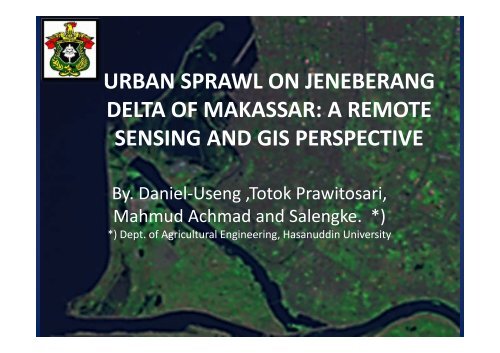
URBAN SPRAWL ON JENEBERANG DELTA OF MAKASSAR: A ...
URBAN SPRAWL ON JENEBERANG DELTA OF MAKASSAR: A ...
URBAN SPRAWL ON JENEBERANG DELTA OF MAKASSAR: A ...

Create successful ePaper yourself
Turn your PDF publications into a flip-book with our unique Google optimized e-Paper software.
<strong>URBAN</strong> <strong>SPRAWL</strong> <strong>ON</strong> <strong>JENEBERANG</strong><br />
<strong>DELTA</strong> <strong>OF</strong> <strong>MAKASSAR</strong>: A REMOTE<br />
SENSING AND GIS PERSPECTIVE<br />
By. Daniel-Useng ,Totok Prawitosari,<br />
Mahmud Achmad and Salengke. *)<br />
*) Dept. of Agricultural Engineering, Hasanuddin University
Background of the study<br />
• Makassar city is a metropolitan, waterfront city<br />
with total pop. 1.25 million (2009) and annual<br />
growth of 23 %.<br />
• The city shares the flood plain with the city of<br />
Sungguminasa on the downstream of Jeneberang<br />
river which experience regular flood from<br />
Jeneberang<br />
• The Bilibili Dam (functioned as flood regulator<br />
and municipal water supply) has been operated<br />
since 1999
Cont.<br />
• The development (conversion) of Jeneberang<br />
delta has flourished as the flood mitigation by<br />
the dam and the access road into the delta<br />
been constructed.<br />
• The function of the flood control has been<br />
doubted since the massive land slide on the<br />
upstream of the river in 2004
Land slide of Malino 2004 as threat to the<br />
downstream (Bilibili Dam and Jeneberang delta)<br />
Source: Google<br />
4
Method<br />
• Supervised classification is performed to<br />
identify the land use types of the delta<br />
(Lillesand 1994, El-Kawy 2011)<br />
• Source maps: Landsat 7TM (Sept. 1999),<br />
• Source maps: Landsat 7TM (Sept. 1999),<br />
Google Earth (Quikbird Apr. 2003 and Jul.<br />
2010)
Images of the study area<br />
01 Apr 1989 (LS4)- not used in analysis<br />
18 Apr. 2003 (Google Earth)<br />
13 Sep 1999 (LS7TM)<br />
13 Jul. 2010 (Google Earth)
Research Procedure
Results and discussion<br />
• Classification accuracy of Landsat image<br />
classification is 88% (accurate)and Kappa coeff.<br />
0.82 (Tab.1)<br />
• The land use compositions in 1999 (total 1001.24<br />
ha) are: Dryland farming and ricefield /natural<br />
vegetation 38%; Wetlnd 41% and Buidup area<br />
and residential 21% (Tab.2)<br />
• The wetland and dryland farming/rice fields<br />
continue to diminished (each left 14% in 2010)<br />
and buildup area increased up to 73% in 2010)<br />
(Tab. 3)
Table 1. The error matrix of Landsat<br />
classification over the study area (Landsat 1999)<br />
Land use<br />
Dry land and<br />
User's Acc. Comm.err. Prod. Acc. Omission err.<br />
RF 96% 4% 83% 17%<br />
Wetland 88% 12% 92% 8%<br />
Buildup 80% 20% 91% 9%<br />
Overall accuracy 88%<br />
Kappa coef. (KHAT) 0.82
Table 2. Land use change of the study area from 1999<br />
to 2003 and 2010<br />
Year<br />
1999<br />
(ha) %<br />
2003<br />
(ha) %<br />
2010<br />
(ha) %<br />
Dryland farming and<br />
ricefield 381.19 38% 347.60 35% 135.37 14%<br />
Wetland<br />
Buildup area and<br />
406.67 41% 264.48 26% 136.20 14%<br />
Residence 213.37 21% 389.16 39% 729.26 73%<br />
Total (ha) 1001.24 100% 1001.24 100% 1001.24 100%
The dynamics of land use change in the study<br />
area from 1999 to 2003 and 2010<br />
1999<br />
2003<br />
Legend:<br />
Wetlands<br />
Buildup area and residence<br />
Dryland farming and rice fields
Table 3. Land use changes in Jeneberang delta<br />
1999-2003 and 2003-2010 (ha)<br />
Year<br />
1999-<br />
2003<br />
%<br />
Change<br />
2003-<br />
2010<br />
%<br />
Change<br />
Dry land farming and rice<br />
field -33.59 -3% -212.23 -21%<br />
Wetland -142.19 -14% -128.28 -13%<br />
Buildup area and<br />
Residence 175.79 18% 340.10 34%
Future plan on the study area: The Center Point of Indonesia (CPI)
Conclusions<br />
• The availability of low-cost satellite imagery<br />
with high resolution provide solution to the<br />
monitoring of land cover change includes the<br />
urban sprawl.<br />
• The impacts of urban sprawl on the natural<br />
vegetation can be manage properly by using<br />
available satellite imageries.
Thank You for your attention