Atlas Final Web Version 6_14
Atlas Final Web Version 6_14
Atlas Final Web Version 6_14

Create successful ePaper yourself
Turn your PDF publications into a flip-book with our unique Google optimized e-Paper software.
Government of Ethiopia:<br />
Disaster Risk Management and<br />
Food Security Sector, MOARD<br />
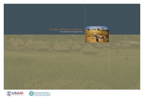
An <strong>Atlas</strong> of Ethiopian Livelihoods<br />
The Livelihoods Integration Unit
Government of Ethiopia:<br />
Disaster Risk Management and<br />
Food Security Sector, MOARD<br />
An <strong>Atlas</strong> of Ethiopian Livelihoods<br />
The Livelihoods Integration Unit
Contents<br />
The Livelihoods <strong>Atlas</strong> for Ethiopia The Livelihoods Integration Unit
Contents<br />
ii<br />
iii<br />
v<br />
Acknowledgements<br />
Glossary of terms<br />
Introduction<br />
Geography and Livelihoods<br />
2 Where do people live?<br />
Seasonality and Livelihoods<br />
12 Can someone please explain the rains in Ethiopia?<br />
<strong>14</strong> How do rainfall patterns translate into seasonal<br />
production patterns?<br />
16 What does it mean when the ‘belg’ rains fail?<br />
18 Do all people have the same hunger season?<br />
20 When should seasonal assessments occur?<br />
Crop Production and Livelihoods<br />
25 What dominates people’s economy?<br />
28 Where are the main cereal crops grown?<br />
30 Which crops are especially important during the<br />
hunger seasons?<br />
32 How do people grow what they grow?<br />
34 Is there an absolute shortage of oxen?<br />
35 How do the poor cope with their shortage of oxen?<br />
36 Where are tractors used?<br />
Livestock and Livelihoods<br />
40 Which livestock do people have?<br />
42 How many livestock do households have?<br />
43 How much does livestock income contribute to the<br />
household economy?<br />
44 Where is the dependence on livestock greatest?<br />
46 What do livestock mean for food purchasing power?<br />
48 How important are different livestock and their<br />
products?<br />
Pastoralist Livelihoods<br />
52 Where do pastoralists live?<br />
53 How much of the population is pastoralist or<br />
agropastoralist?<br />
54 How ‘wealthy’ are different herders?<br />
55 Are all herders the same?<br />
58 How dependent on the market are pastoralists vs<br />
agropastoralists?<br />
59 What are the most important cash sources for poor<br />
pastoralists?<br />
60 What are the seasonal patterns of production and<br />
hunger in pastoralist areas?<br />
Differences in Wealth<br />
64 Which areas of the country are the wealthiest &<br />
poorest?<br />
66 What variations in wealth do we see between<br />
different livelihood modes?<br />
67 What makes cropping areas wealthier or poorer?<br />
68 What variations in wealth do we see within different<br />
areas of the country?<br />
74 How skewed is the distribution of wealth in the form<br />
of land and livestock?<br />
75 Is there a relationship between better-off and poor<br />
household income?<br />
The Market and Livelihoods<br />
78 Where are the food surplus and deficit zones?<br />
79 How much do different households depend on the<br />
market for food?<br />
80 Where are poorer households able to purchase extra<br />
protein?<br />
81 What proportion of household income comes from<br />
market-related activities?<br />
84 Special focus on labor and livelihoods<br />
87 What proportion of household income comes from<br />
market-related activities?<br />
Evironmental Products and Livelihoods<br />
92 What role do environmental products play?<br />
Diet<br />
98 How much do different foods contribute to the<br />
annual diet?<br />
The Cost of Maintaining Livelihoods<br />
102 What is the cost of living in rural Ethiopia?<br />
104 What do people spend on production?<br />
106 What do people spend on ‘social services’?<br />
108 Where do people pay for water?<br />
Hazards, Coping Strategies and Livelihoods<br />
112 Which hazards affect people most?<br />
116 What do people turn to in bad years?<br />
Annex 1: The Livelihood Zones<br />
122 AFAR REGION<br />
123 AMHARA REGION<br />
124 OROMIA REGION (WESTERN)<br />
125 OROMIA REGION (EASTERN)<br />
126 SOUTHERN NATIONS, NATIONALITIES & PEOPLES<br />
REGION (SNNPR)<br />
128 BENISHANGUL GUMUZ & GAMBELLA REGIONS<br />
129 TIGRAY REGION<br />
130 SOMALI REGION<br />
Annex 2: Monitoring Livelihoods<br />
134 CROPS<br />
136 LIVESTOCK<br />
138 LABOR<br />
Contents<br />
The Livelihoods <strong>Atlas</strong> for Ethiopia The Livelihoods Integration Unit<br />
i
Acknowledgements<br />
USAID provided the funds for the work on the <strong>Atlas</strong>, having<br />
over five years funded all of the fieldwork on which the <strong>Atlas</strong><br />
is based. In both projects the support and encouragement of<br />
Suzanne Poland and Tigist Yifru has been unstinting.<br />
and for putting together the whole document. Julius Holt<br />
provided the text for all but the Seasonality section, written<br />
by Mark Lawrence. Zerihun Mekuria compiled the data for the<br />
<strong>Atlas</strong>, and worked on its uptake in Ethiopia.<br />
The <strong>Atlas</strong> is issued under the auspices of the Livelihood<br />
Integration Unit of the Disaster Risk Management and Food<br />
Security Sector of the Ministry of Agriculture. We thank its<br />
head, Ato Mathewos Hunde, and his officers for their constant<br />
Save the Children UK provided that data for Afar and Somali<br />
regions, and we are also grateful to them for reviewing the<br />
Pastoralist Livelihoods section. We thank Sue Lautze for initial<br />
consultations on the idea of the <strong>Atlas</strong>. <strong>Final</strong>ly we must pay<br />
Acknowledgements<br />
support of the work of the Unit, of which this <strong>Atlas</strong> is simply a<br />
reflection.<br />
The <strong>Atlas</strong> has been produced principally by members of FEG<br />
Consulting. It was the brain-child of Mark Lawrence, and he<br />
and Lorraine Coulter created the maps, an often experimental<br />
process during which, in the nature of these things, many<br />
tribute to the work of Jane MacAskill, the Chief of Party of<br />
the Livelihoods Integration Unit for three years, during which<br />
time she achieved the extraordinary task of developing and<br />
managing the fieldwork for six out of seven of the country’s<br />
agricultural Regions, and of making operational the livelihoods<br />
information covering the whole of Ethiopia.<br />
more maps were developed than are shown here. The task<br />
was assisted by Stephen Browne, and by Addisu Dereje who<br />
helped set up the base maps and produced the topography<br />
map. All color schemes in this atlas were developed using the<br />
Brewer templates (http://colorbrewer2.org/)<br />
The editorial team, April 2010<br />
Tanya Boudreau was the editor of the <strong>Atlas</strong>, and was<br />
responsible for its design, with support from Michele Shortley,<br />
ii<br />
The Livelihoods <strong>Atlas</strong> for Ethiopia The Livelihoods Integration Unit
Glossary of terms<br />
Belg<br />
Chat<br />
Deyr (Deyir)<br />
Enset<br />
Ethiopian Animal<br />
Income Unit<br />
(EAIU)<br />
Gesho<br />
Gu (Gana)<br />
Income<br />
Short rains between February and May, in southern, north-eastern,<br />
eastern and north central parts of the country; also used to describe<br />
the secondary agricultural season<br />
A shrub (Catha edulis) whose leaves, when chewed, provide a<br />
stimulant drug<br />
The lighter of two rainy seasons in the south-east of the country,<br />
mainly between October and November<br />
The ‘false banana’ tree (Ensete ventricosum) whose corm and stem<br />
provide a starch-based food<br />
This is a unit based upon an analysis of total income derived from<br />
each species nationally. EAIU calculation: 1 camel = 6 shoats; 1<br />
cow/ox = 4 shoats.<br />
‘Hops’ for traditional beer and mead: the leaf and twigs of a species<br />
of buckthorn (Rhamnus prinoides)<br />
The heavier of two rainy seasons in the south-east of the country,<br />
mainly April-May<br />
In this <strong>Atlas</strong> ‘income’ means any gain by the household: this<br />
includes crops or other items produced by the household and<br />
consumed directly as food = food income; and cash earned from<br />
the sale of produce, or from employment, or coming from gifts etc.<br />
= cash income.<br />
Livelihood zones<br />
Meher<br />
Nomadic<br />
Teff<br />
Shiro<br />
Shoats<br />
Total income<br />
Transhumant<br />
Areas within which households (on average) share similar livelihood<br />
patterns, i.e. they have access to the same set of food and<br />
cash income sources and to the same markets<br />
The primary agricultural season, or main growing season, associated<br />
with the kremt rains but including long-cycle crops (sorghum,<br />
maize) which may be sown in the belg season. Meher is one of the<br />
words for ‘harvest’ in the Amharic language.<br />
Herding households, usually in groups, who move between pastures<br />
during all the year and live in portable dwellings. Movement<br />
is often within a limited circuit – ‘restricted nomadism’.<br />
A very fine-sized grain (Eragrostis tef) with a grass-like stem, unique<br />
to Ethiopia as a staple<br />
A very common sauce made from ground pulses, mainly field peas<br />
or beans, sometimes chick-peas<br />
Sheep and goats taken together<br />
The sum of a household’s annual food income and cash income,<br />
converted to calorie equivalents, and expressed in relation to the<br />
household’s annual calorie requirement.<br />
Herders who move seasonally to far grazing with the main livestock,<br />
but who have a permanent home base or village with usually<br />
fixed houses where several or most members of the household<br />
stay during the movement of the livestock<br />
Glossary of Terms<br />
Injera<br />
Kebele<br />
Kremt (kiremt,<br />
kremti)<br />
The main form in which staple cereals are eaten across most of<br />
Ethiopia: a pancake-like bread made from fermented flour (usually<br />
teff, barley, sorghum, maize, or mixtures of these)<br />
‘Locality’: the smallest administrative unit, rural or urban<br />
The long rains between June and September throughout the cropping<br />
areas of the country<br />
Wealth group<br />
Woreda<br />
In this atlas, data is sometimes presented by wealth group. Distinctions<br />
were made among very poor, poor, middle, and better-off<br />
households during the field work, and the field data is organized<br />
accordingly. These are locally-determined groupings which reflect<br />
common access to livelihood capital (land, labor, livestock, etc.).<br />
For more on this, please refer to the Practitioners Guide to HEA,<br />
which can be found at: http://www.feg-consulting.com/resource/<br />
practitioners-guide-to-hea<br />
Administrative district. There are 677 woredas in Ethiopia.<br />
The Livelihoods <strong>Atlas</strong> for Ethiopia The Livelihoods Integration Unit<br />
iii
Introduction<br />
iv<br />
The Livelihoods <strong>Atlas</strong> for Ethiopia The Livelihoods Integration Unit
Introduction<br />
Why an <strong>Atlas</strong> of Ethiopian Livelihoods?<br />
geography for the whole country seemed to call for an <strong>Atlas</strong>, as<br />
We begin with some basic geography, showing how<br />
Our understanding of rural livelihoods in Ethiopia has<br />
developed greatly over the last two decades. The challenge has<br />
come from information needs on both the emergency and the<br />
development sides, in the quest for better-founded decisions<br />
on action and investment. One relatively recent government<br />
initiative, assisted by USAID, has been to put livelihoods<br />
analysis at the center of Ethiopia’s official early warning system.<br />
one good way to share the results with interested people both<br />
in and beyond the sphere of early warning. Here we should<br />
pay tribute to the IFPRI <strong>Atlas</strong> of the Ethiopian Rural Economy 2 ,<br />
which prompted us to think of using the present, separate set<br />
of data to offer a quite different, but we hope complementary,<br />
production.<br />
The problem was how to select and shape data from this<br />
topography, altitude, rainfall, and population density come<br />
together to form the environments in which households<br />
live. The most basic division is between pastoralists,<br />
agropastoralists and the majority population of farmers. But<br />
within each of these general categories, local factors make for<br />
further livelihood distinctions, so that we end up with a mosaic<br />
map of 175 livelihood zones.<br />
As a result, there has been an intensive field effort over a period<br />
of just under five years (2005 - 2009) to gather livelihoods<br />
information from every corner of rural Ethiopia, covering<br />
cultivators and herders in each of the country’s many contrasting<br />
environments 1 . The resulting data is tied to a framework of<br />
analysis which rests on a rounded view of livelihoods, seen<br />
from the point of view of household operations: because in the<br />
huge information resource in order to present as clearly as<br />
possible, in a geographical sense, what drives livelihoods and<br />
what distinguishes them from each other. And included in the<br />
mix, the differences recorded between poorer and wealthier<br />
households had to be presented, because not only are some<br />
areas better-favored than others, but within any community<br />
some households are better off than others.<br />
After this summary of the context of livelihoods, we launch<br />
into what people do to survive in their environments, and<br />
what differences in prosperity and poverty result. We begin<br />
with an account of seasonality, including an original analysis of<br />
USGS data, because the seasons rule rural life and are therefore<br />
fundamental to any system which monitors rural conditions.<br />
And seasonality in Ethiopia has it complications.<br />
Introduction<br />
end, the rural economy functions through the daily decisions<br />
and actions of millions of households.<br />
What is in the atlas?<br />
We then consider people’s assets in land, their production<br />
of both food and cash crops and how much they depend<br />
The other element of the framework is its geographical basis,<br />
which has required a zoning of each region by livelihood<br />
types. Such a unique combination of livelihoods analysis and<br />
1 This effort was carried out under the direction of the Livelihoods Integration Unit,<br />
which operates from within the Disaster Risk Management and Food Security Sector<br />
of the MOARD; and with Save the Children UK in Afar and Somali regions.<br />
As can be seen from the table of contents, we have opted for<br />
what we hope is a logical sequence of presentation. The data is<br />
put together to tell a story in maps.<br />
2 International Food Policy Research Institute, Washington DC. / Central Statistical<br />
Agency / Ethiopian Development Research Institute: <strong>Atlas</strong> of the Ethiopian Rural Economy.<br />
Published in Addis Ababa 2006<br />
on either. After that comes a separate account of livestock,<br />
because these are so important that nearly every rural<br />
household has some, even if it is only a couple of chickens. The<br />
section on livestock is followed by a closer look at pastoralists<br />
The Livelihoods <strong>Atlas</strong> for Ethiopia The Livelihoods Integration Unit<br />
v
and agropastoralists, limited populations who nevertheless<br />
pulses and vegetables and condiments to accompany the<br />
account of rural life which dealt only with production and direct<br />
take up a large part of the Ethiopian map. Throughout we look<br />
staple, and numbers of ‘non-food’ items, from soap to matches,<br />
consumption could hardly begin to explain food security, let<br />
at what part of their production people consume and what part<br />
whose cost mounts up surprisingly. This completes the basic<br />
alone livelihoods in the round. This is most acute in the case of<br />
they sell, these being fundamental livelihood decisions.<br />
household economy picture of where people get their food<br />
pastoralists: amongst them today only the minority of better-off<br />
We then take a geographical look at wealth differences, both<br />
comparing geographical areas and exemplifying for given<br />
livelihood zones the food and cash budgets of poorer and<br />
from, and where they get their cash from and how they spend it.<br />
This <strong>Atlas</strong> offers the ‘normal’ picture of livelihoods, rather than<br />
an account of rural life under drought or other severe stress.<br />
stock-owners have enough animals to be able to live principally<br />
from milk; the rest live principally on cereals they buy through<br />
selling animals.<br />
wealthier households. Then comes a good look at the market<br />
But it is by understanding in detail how people normally make<br />
But the case of farmers is not as different as one might expect.<br />
- in the sense of the exchange of both goods and services<br />
ends meet that we can most accurately judge the likely effect of<br />
In most areas, given the ownership of land and oxen and other<br />
through cash, including crop and livestock sales and purchases,<br />
shocks. We end with a summary geography of which hazards<br />
productive assets, it is only wealthier farmers who can basically<br />
Introduction<br />
and paid labor - with a special focus on the importance of paid<br />
labor in Ethiopia’s rural economy. Today the market is crucial to<br />
just about every household.<br />
people perceive to be the most important around the country,<br />
and which coping strategies they most employ in bad years,<br />
whether or not they are in receipt of official aid.<br />
eat fully from their harvest, and in some areas not even these.<br />
Otherwise, in a nutshell, the poorer that farmers are, the more<br />
they depend on cash for their very survival, beginning with the<br />
Two smaller sections follow: the first showing how much<br />
households rely on environmental products, such as trees, wild<br />
foods and gums/resins; and the second presenting information<br />
on rural diets, to the extent that the livelihood databases cover<br />
this subject.<br />
Next we look at household expenditure and note that beyond<br />
staple cereals, a very large proportion - especially of poorer<br />
people’s budgets - must go on the most ordinary daily items:<br />
What new knowledge does the atlas add?<br />
The <strong>Atlas</strong> of Ethiopian Livelihoods is an attempt to summarize<br />
a host of information usefully on the basis of a livelihoodsgrounded<br />
framework of analysis. It is not designed to pursue<br />
one or other economic theory or to reach grand conclusions.<br />
Nevertheless, certain themes shine out from the information.<br />
One, already evident in this introduction, is the role of cash:<br />
the rural economy is monetized even in its remotest reaches. An<br />
purchase of a good part – if not the greater part – of the staple<br />
food they consume in any year.<br />
Linked to this, another outstanding subject is paid labor,<br />
because this is chief amongst the ways that poorer farmers<br />
manage to find the cash for food and other of life’s necessities.<br />
On the geographical level, it is interesting to look at the country<br />
in terms of those areas which are productive enough for this<br />
crucial employment to be mainly offered locally by wealthier<br />
vi<br />
The Livelihoods <strong>Atlas</strong> for Ethiopia The Livelihoods Integration Unit
farmers; those which are so unfavorable as to be unable to offer<br />
much employment locally; and those areas - often with major<br />
cash-crops - which are so productive that they attract many<br />
workers from the unfavorable localities. Apart from selling<br />
their labor, poorer people also look to ‘free’ natural resources to<br />
sell, and we see that first amongst these is collected firewood.<br />
This is largely destined for town markets, which are also major<br />
customers for grain, especially teff, and the chief customers for<br />
livestock for slaughter.<br />
is channeled through the Productive Safety Nets Programme. It<br />
is worth saying that one message which ought to come out of<br />
this <strong>Atlas</strong> is that in not a single one of the 175 livelihood zones,<br />
from the harsh semi-desert to the barest mountain top, does<br />
this food and cash aid constitute the greater part of livelihoods.<br />
This is true even if we look at the poorest groups of households<br />
anywhere, except for the small minority who are economically<br />
inactive. Official support is important; but everywhere in<br />
Ethiopia the rural population live overwhelmingly by their own<br />
Thus the picture we see around the country today is very far<br />
from the subsistence farming (or herding) sometimes assumed<br />
in the usual sense of most families producing enough food to<br />
feed themselves, although without surplus. There are millions<br />
efforts.<br />
Introduction<br />
of households that do feed themselves and produce some<br />
surplus; but there are millions more that do not. It is the<br />
exchange between the one and the other group, in the market<br />
sense described, which as much as anything defines the rural<br />
economy.<br />
Over several decades Ethiopia has seen substantial food<br />
and cash aid for food insecure people, mainly in the more<br />
drought-prone eastern half of the country. Today most of this<br />
The Livelihoods <strong>Atlas</strong> for Ethiopia The Livelihoods Integration Unit<br />
vii
Geography and Livelihoods<br />
There are many ways to look at the geography of Ethiopia, and in our minds we usually<br />
combine several elements. There is the administrative geography of regions and woredas<br />
There are many ways to look at the geography of Ethiopia, and in our minds we usually combine several elements. There is the administrative<br />
and kebeles. There is the urban geography of bigger and smaller settlements, and the<br />
geography of regions and woredas and kebeles. There is the urban geography of bigger and smaller settlements, and the physical communications<br />
physical communications geography: the road network that links not only the towns to<br />
geography: the road network that links not only the towns to each other, but also increasingly the rural areas to the towns. But behind all this<br />
each other, but also increasingly the rural areas to the towns. But behind all this lies the<br />
lies the topography of mountains and plains and river gorges, and the ecology of temperatures and rainfall, soils and natural vegetation: and it<br />
topography of mountains and plains and river gorges, and the ecology of temperatures<br />
is these that present the factors which most shape rural activities, especially crop and livestock production. And so we come to rural livelihoods:<br />
and rainfall, soils and natural vegetation; and it is these that present the factors which<br />
what people do to survive in their particular environments - what they produce, what they consume, what they sell and where, who they work<br />
most shape rural activities, especially crop and livestock production. And so we come to<br />
for, what food and non-food essentials they need to buy, what services they need to pay for. In this section we focus on the physical elements of<br />
rural livelihoods: what people do to survive in their particular environments - what they<br />
altitude, rainfall and population density which in their different patterns are fundamental to determining the livelihood zones.<br />
produce, what they consume, what they sell and where, who they work for, what food<br />
and non-food essentials they need to buy, what services they need to pay for. In this<br />
section we focus on the physical elements of altitude, rainfall and population density<br />
which in their different patterns are fundamental to determining the livelihood zones.
Where do people live?<br />
The administrative boundaries<br />
The primary purpose of the livelihoods database upon which<br />
Regions of Ethiopia<br />
this atlas is constructed is to serve the government’s early<br />
warning system. The system itself is run on regional lines, and so<br />
it was natural to distinguish the livelihood zones and undertake<br />
the fieldwork on a regional basis, with regional teams.<br />
Within the regions, however, the livelihood zones are based<br />
Geography & Livelihoods<br />
on economic geography rather than administrative divisions.<br />
It is true that woreda boundaries are sometimes marked by<br />
mountain ridges, escarpments or river gorges, but on the whole<br />
they do not follow along ecological or economic boundaries.<br />
Therefore most of the livelihood zones cross woreda boundaries,<br />
and often enough administrative zone boundaries too 1 .<br />
In the maps which follow, the data is both sourced and expressed<br />
on the basis of livelihood zones, singly or in combination.<br />
However, we usually need to see information against the<br />
template of administrative divisions, and on each map therefore<br />
the outlines of both the regions and the administrative zones<br />
are also shown.<br />
1 The livelihood zones were defined with kebeles as the reference administrative unit,<br />
i.e. livelihood zone boundaries do not divide single kebeles.<br />
2 The Livelihoods <strong>Atlas</strong> for Ethiopia The Livelihoods Integration Unit
Topography and Drainage<br />
Topography and Drainage of Ethiopia<br />
The map presents a vivid image of Africa’s greatest highland<br />
massif rising out of Ethiopia’s vast lowlands. The different<br />
watersheds initiate major rivers, notably the Awash in the Rift<br />
Valley; the Abay (Blue Nile) and Tekeze rivers in the center and<br />
north; the Wabi Shebelle and Genale rivers of Somali Region;<br />
and in SNNPR the Omo River running into Lake Turkana.<br />
Topography and ecology are intimately linked. Grass and bush<br />
pastures grow in areas where rainfall is too low to support any<br />
crops, and most of the lowest-lying areas of the east and far<br />
south of the country are purely used for pastoralism. Where<br />
slightly higher elevations get more rainfall or where rivers and<br />
seasonal water-courses allow ‘flood-retreat’ cultivation, people<br />
do grow crops but mix the risk and the profit with a major<br />
Geography & Livelihoods<br />
dependence on herding - agropastoralism. The great majority<br />
of Ethiopians inhabit the high massif as cultivators in what we<br />
term the cropping areas - although anybody who can keeps<br />
animals too. This area includes the actually very low-lying areas<br />
in the far west of the country where rainfall nevertheless favors<br />
agriculture, as well as irrigated areas along the main rivers in<br />
Meters above/below<br />
sea level<br />
Somali Region.<br />
The Livelihoods <strong>Atlas</strong> for Ethiopia The Livelihoods Integration Unit 3
Where do people live?<br />
Altitude<br />
Different crops and livestock thrive at different altitudes. Altitude determines<br />
so much about rural life that it is the first thing Ethiopians tend to refer to when<br />
identifying a given area. Essentially, low elevation makes for hotter temperatures<br />
and less rainfall; higher elevations are cooler and wetter. This distinguishes the<br />
three main, traditional Ethiopian ecological/altitude divisions: the relatively hot<br />
and dry agricultural lowlands – Amh. qolla - below some 1500 meters above sea<br />
Altitude<br />
Meters above sea level<br />
< 1500<br />
1501 - 1900<br />
1901 - 2300<br />
2301 - 2700<br />
> 2700<br />
No data<br />
Geography & Livelihoods<br />
level (m.a.s.).; the temperate middle highlands – Amh. woyna dega – between<br />
about 1500 and 2300 m.a.s., often subdivided into ‘dry’, up to about 1900 m.a.s.,<br />
and ‘wet’ from 1900 to 2300 m.a.s.; and then upwards of 2300 the highlands –<br />
Amh. dega – which tend also to have the highest precipitation in addition to cool<br />
temperatures. The great majority of rural Ethiopians<br />
live in the middle-highlands and highlands. The very<br />
highest elevations, upwards of some 3500 m.a.s., are a<br />
tougher option, with very cold temperatures in season,<br />
Agro-pastoral &<br />
pastoral areas<br />
Altitude is a major<br />
determinant of livelihoods<br />
in Ethiopia because it sets<br />
out the boundaries of what<br />
can be grown or raised.<br />
Cropping areas<br />
high winds and frequent frosts – Amh. werch – after<br />
which these elevations are traditionally named. At the<br />
opposite extreme are the elevations under 1000 m.a.s<br />
in the east and south where crops may sometimes<br />
be grown, but which are mainly rangelands (Amh.<br />
bereha). These are the pastoral and agropastoral areas.<br />
4 The Livelihoods <strong>Atlas</strong> for Ethiopia The Livelihoods Integration Unit
Rainfall (mm)<br />
< 400<br />
401 - 700<br />
701 - 1000<br />
1001 - 1300<br />
> 1300<br />
No data<br />
Rainfall<br />
Rainfall<br />
Altitude is the most obvious factor in rainfall volume, but this is not an exact<br />
association. The seasonality, length and regularity of rains varies greatly by longitude<br />
and latitude. The west of the country is generally better-favored with rainfall from<br />
year to year than the east, so that, for instance, the mountain areas of eastern Oromia<br />
(Arsi-Bale) receive less rainfall than the middle-highlands of western Oromia or even<br />
the lowlands which characterize Benishangul Region. There is also a marked north/<br />
Rainfall determines not<br />
just what can be grown<br />
or raised, but how<br />
productive different<br />
livelihood zones can be.<br />
Agro-pastoral &<br />
pastoral areas<br />
south contrast. In the far north the single main rainy season is notably shorter than<br />
further south, and annual precipitation is less: the middle-highlands of Tigray Region<br />
are considerably drier than, for instance, the middle-highlands of western Amhara<br />
or of Harerge in the far east of Oromia; and the bimodal belg/kremt (short rains/long<br />
rains) pattern is most pronounced in the southern<br />
Cropping areas<br />
half of the country, giving more rainy months in all.<br />
(See the Seasonality & Livelihoods section for more on<br />
rainfall patterns.)<br />
Geography & Livelihoods<br />
Outright drought has been largely a phenomenon of<br />
the eastern half of the country in the last half-century.<br />
But it is the far more frequent, though less dramatic,<br />
rainfall irregularities in this half of the country that<br />
have continued to threaten food security amongst<br />
both cultivators and herders.<br />
The Livelihoods <strong>Atlas</strong> for Ethiopia The Livelihoods Integration Unit 5
Where do people live?<br />
Population Density<br />
Rural population density is related to the use people make of the land for primary<br />
production. The great majority of the country’s rural population inhabits the<br />
highlands and middle-highlands, which comprise less than one-third of the<br />
inhabited surface area. At the extreme, in some parts of SNNPR densities rise well<br />
Population Density<br />
Number of people<br />
per square kilometer<br />
< 50<br />
51 - 100<br />
101 - 150<br />
151 - 200<br />
> 200<br />
No data<br />
Geography & Livelihoods<br />
above 300 people per square km. The lowest density areas, down to under 10<br />
people per square km, are mainly those with pastoralist economies. The limiting<br />
factor here is the carrying capacity of the rangelands for livestock – and in turn how<br />
many people can live off that livestock. There is also very low population density<br />
in the remaining areas of original rain forest in north-west SNNPR and western<br />
Oromia, where the indigenous population practices<br />
shifting cultivation and also depends heavily on<br />
honey production and gathering forest products.<br />
Then there are the extensive lowlands of north-west<br />
Agro-pastoral &<br />
pastoral areas<br />
Population density<br />
determines the degree to<br />
which available resources<br />
must be shared. This is<br />
reflected in the relative<br />
wealth of an area.<br />
Cropping areas<br />
Amhara and west Tigray, relatively recently exploited<br />
by settled cultivators and still with a relatively low<br />
population density, but hosting the country’s major<br />
sesame growing industry. Taking all these lower-lying<br />
areas together, some 66% of Ethiopia’s inhabited land<br />
area holds just 17% of the country’s rural population.<br />
Source of data: National Population Census 2007<br />
6 The Livelihoods <strong>Atlas</strong> for Ethiopia The Livelihoods Integration Unit
Altitude<br />
Livelihood Zones of Ethiopia<br />
AFAR<br />
Annex 1 has a complete<br />
listing of the livelihood<br />
zones in Ethiopia, along<br />
with reference maps.<br />
Rainfall<br />
+ Markets =<br />
AFAR<br />
Geography & Livelihoods<br />
Population Density<br />
The Livelihoods <strong>Atlas</strong> for Ethiopia The Livelihoods Integration Unit 7
Where do people live?<br />
Livelihood zones of Ethiopia<br />
The map on Page 7 serves to show how much of a complex<br />
mosaic the different livelihood zones make. The mountainous<br />
Livelihood Zone Types<br />
or hilly nature of more than half of this big country tends to<br />
multiply the variety of areas in terms of production conditions,<br />
Geography & Livelihoods<br />
and influences the network of roads and markets. If we add the<br />
major north-south and east-west differences in rainfall, then<br />
the picture becomes still more divided, even without seeking to<br />
represent localized detail. By the same token, the great plains<br />
of the pastoral rangelands offer a less divided picture; yet there<br />
are sufficient, major local differences to warrant, for instance, 8<br />
livelihood zones in Afar Region and 17 in Somali Region. This<br />
has to do chiefly with the relative availability and quality of<br />
pastures and watering points, and in some cases factors such as<br />
extreme isolation from markets, or the presence of a salt-mining<br />
Pastoral<br />
Agropastoral<br />
Cropping<br />
No data<br />
industry. The agropastoral areas on the foothills or along rivers<br />
add to the mosaic.<br />
Despite the complexity, we can gain a broad perspective by<br />
simply looking at the division between pastoral, agropastoral<br />
and cropping livelihood zones, shown in the map to the right,<br />
which clusters zones into these three basic categories.<br />
8 The Livelihoods <strong>Atlas</strong> for Ethiopia The Livelihoods Integration Unit
The Livelihoods <strong>Atlas</strong> for Ethiopia The Livelihoods Integration Unit 9<br />
Geography & Livelihoods
Seasonality and Livelihoods<br />
Rural households in Ethiopia are deeply linked to the cycles of seasonal change. The onset<br />
of the rains, the peak of the rains, the end of the rains - each signals a new set of activities,<br />
and each translates into varied degrees of reliance on different food and income sources.<br />
Annual patterns of livelihood are an amalgamation of these seasonal variations. Ethiopia<br />
is particularly complex when it comes to seasonal variability. The following chapter helps<br />
untangle this complexity. We learn what forces create the distinct rainfall patterns in<br />
Ethiopia, and how these rainfall patterns translate into seasonal production patterns. We<br />
find out when the hunger seasons occur and where; and we investigate why it is that<br />
seasonal paid labor is so critical for poor households when it comes to making it through<br />
the hunger season. <strong>Final</strong>ly, new light is shed on the most appropriate time to conduct<br />
seasonal assessments in Ethiopia, and just how much lead time is required in different<br />
livelihood zones for a timely response.
Can someone please explain the rains in Ethiopia?<br />
Note: All rainfall maps in this chapter are based upon an analysis of satellite-derived<br />
estimates of long-term mean rainfall (Source of data: USGS) The analysis of the data<br />
was conducted by Mark Lawrence of FEG<br />
Rainfall by month<br />
The maps below illustrate the progressive movement of the rains throughout the year. In Ethiopia the rains are caused by both the northsouth<br />
migration of the Inter-Tropical Convergence Zone (ITCZ), which particularly influences the main season during the second half of the<br />
year; and offshore winds originating in the Arabian Sea, which affect the minor season during the first half of the year.<br />
Rainfall (mm)<br />
< 25<br />
26 - 75<br />
> 75<br />
Some basic meteorology<br />
Kremt (June-October)<br />
These are the main season rains for all<br />
December February April<br />
except the south-east of the country. They<br />
are caused by warm wet south-westerly<br />
winds from mainland Africa blowing into<br />
the Inter-Tropical Convergence Zone<br />
(ITCZ) 1 . The ITCZ moves progressively<br />
Seasonality & Livelihoods<br />
June August October<br />
north across Africa between December<br />
and August, before retreating south again<br />
in the second half of the year. The seasonal<br />
movement of the ITCZ can be seen most<br />
clearly by comparing the December and<br />
August maps. In December the ITCZ<br />
(roughly indicated by the 75 mm rainfall<br />
line) lies to the south of the Ethiopian<br />
border. By August it has reached into<br />
northern Sudan and Eritrea.<br />
Source: USGS<br />
1 The heat of the northern hemisphere summer creates<br />
a belt of low pressure across Africa that draws in winds<br />
from both the north (the north-east trade winds) and the<br />
south (the south-east and south-west trade winds). The<br />
two sets of winds converge in the Inter-Tropical Convergence<br />
Zone (ITCZ), creating an up-thrust of air and causing<br />
heavy rainfall as the moist air from the south rises,<br />
cools and condenses to form rain.<br />
12 The Livelihoods <strong>Atlas</strong> for Ethiopia The Livelihoods Integration Unit
The north-easterly movement of the ICTZ across Ethiopia means that the kremt season is<br />
longest in the south-west of the country and shortest in the north-east.<br />
Belg (Mar-May)<br />
The belg rains result from a weather system that develops to the north of the ITCZ between<br />
the successful cultivation of belg season sweet potatoes – a key hunger season crop.<br />
Gu (April-May) & Deyr (October-November) 2<br />
These are the main season rains for the pastoral areas in the south and south-east of the country.<br />
In terms of weather system they can be thought of as early and late kremt rains respectively.<br />
January and May.<br />
These rains are<br />
associated<br />
offshore<br />
with<br />
winds<br />
originating in the<br />
Arabian Sea. Belg<br />
rainfall peaks in April.<br />
The map for April<br />
clearly shows the<br />
belg rains falling on<br />
the north-east and<br />
Harerge Highlands.<br />
Rainfall in January<br />
and February (which<br />
can be thought of as<br />
early belg rainfall) is important in certain parts of the country. Coastal rains in these months<br />
are important for pastoral areas bordering northern Somalia, Djibouti and Eritrea (heys rains in<br />
Somali, dadac in Afar). In SNNPR rainfall in January-February (the sapia rains) is important for<br />
200<br />
150<br />
100<br />
50<br />
0<br />
400<br />
350<br />
200<br />
100<br />
0<br />
100<br />
80<br />
60<br />
40<br />
20<br />
0<br />
Belg<br />
J F M A M J J A S O N D<br />
J F M A M J J A S O N D<br />
Gu<br />
J F M A M J J A S O N D<br />
The gu rains start as<br />
the ITCZ passes over<br />
southern<br />
Ethiopia,<br />
and are brought to<br />
an end by relatively<br />
dry winds blowing<br />
north-east<br />
along<br />
the African coast<br />
from May onwards<br />
(see map for June,<br />
which shows a<br />
‘corridor’ of dryness<br />
along the coast) 3 .<br />
The<br />
southward<br />
movement of the<br />
ITCZ in the second half of the year brings renewed rainfall (deyr rains) between October and<br />
November.<br />
Kremt<br />
Kremt<br />
Deyr<br />
The ITCZ and coastal weather<br />
systems from the Arabian<br />
seas combine to create both<br />
bimodal and unimodal<br />
patterns of rainfall.<br />
The north-east and east have<br />
a bi-modal pattern (belg and<br />
kremt). The south-west of the<br />
country has one long rainy<br />
season (kremt). The southeast<br />
has a bi-modal gu and<br />
deyr pattern. The gu and<br />
deyr graphic shows clearly<br />
how gu and deyr correspond<br />
respectively to the beginning<br />
and end of the kremt.<br />
2 Amharic and Somali names are used to describe the seasons in this graphic. The Afar and Oromifa names are given in the text<br />
box on page 15.<br />
3 These winds are associated with low pressure over Asia created by the heat of the northern hemisphere summer. They blow<br />
from May-September.<br />
Seasonality & Livelihoods<br />
The Livelihoods <strong>Atlas</strong> for Ethiopia The Livelihoods Integration Unit 13
How do rainfall patterns translate into seasonal production patterns?<br />
Seasonality & Livelihoods<br />
The Afar<br />
sub-zone is a<br />
special case.<br />
See note<br />
beneath<br />
map.<br />
Notes: Bimodal means there has to be a drop of >= 20% in rainfall between the two<br />
peaks and no dekad with
Naming the seasons<br />
Almost all the cropping areas of the country receive more rain in the kremt than the belg<br />
Areas where kremt is the main season<br />
1st season<br />
Apr - May<br />
2nd season<br />
June - Sep<br />
3rd season<br />
Dec<br />
Afar Sugum Karma Dada<br />
season. In contrast, belg rainfall dominates in the southern pastoral and agropastoral lowlands.<br />
Further east, the kremt rains become dominant as one approaches the foothills of the Hararge<br />
Highlands, and it is at this point that Somali speakers begin to talk about the keren (kremt)<br />
Kremt areas<br />
Belg areas<br />
Tigrigna Belgi Kremti -<br />
Amharic Belg Kremt -<br />
Oromifa Afrasa Gana -<br />
Somali Diraac Keren Heys<br />
rains as the most important rather than the gu (belg) rains further south. The kremt dominant<br />
pattern extends into Afar, where the main rains are known as karma and the secondary rains<br />
as sugum. Somewhat confusingly, in Oromifa, the word gana is used for the kremt rains in the<br />
north and for the belg rains in the south.<br />
Cropping areas<br />
Seasonal production pattern<br />
Kremt dominant - bimodal<br />
Kremt dominant - 2 seasons<br />
Belg dominant - bimodal<br />
Belg dominant - 2 seasons<br />
Unimodal<br />
No data<br />
Areas where belg is the main season<br />
1st season<br />
Apr - May<br />
2nd season<br />
Oct - Nov<br />
Oromiya Gana Hagaya<br />
Somali Gu Deyr<br />
Note: In Amharic, kremt is the name give to the rains that fall from Jun-Sep, but meher is the name given to the harvest (Oct- Dec).<br />
cropping areas<br />
shown in white<br />
Pastoral and agropastoral areas<br />
Afar Sub-zone<br />
Seasonality & Livelihoods<br />
pastoral/agropastoral<br />
areas shown in white<br />
The Livelihoods <strong>Atlas</strong> for Ethiopia The Livelihoods Integration Unit 15
What does it mean when the ‘belg’ rains fail?<br />
Southern and eastern Ethiopia depend on belg rains<br />
Percent of grain production harvested in belg<br />
Percent of grain production planted in belg<br />
The belg rains are notoriously unreliable. Their late arrival<br />
or failure typically generates a flurry of activity among early<br />
% of annual grain<br />
production<br />
0 %<br />
1 - 33 %<br />
34 - 66 %<br />
> 66 %<br />
warning analysts and humanitarian agency planning staff, who<br />
want to know what the consequences will be on the ground.<br />
These next maps aim to speed up that process.<br />
The importance of belg rains for grain production fairly<br />
closely follows the pattern of rainfall. Not surprisingly, a large<br />
Seasonality & Livelihoods<br />
percentage of total production is harvested in the belg in those<br />
areas with two separate seasons, and where more rain falls in<br />
belg than kremt (the dark red areas in the ‘rainfall patterns’ map).<br />
In those areas with a bimodal rainfall pattern, but more rain in<br />
kremt (light blue on the ‘rainfalll patterns’ map), advantage is<br />
taken of the belg rains to plant higher yielding long cycle crops<br />
that will mature during the kremt season. In those areas with a<br />
single rainy season (orange on the ‘rainfall patterns’ map), the<br />
Rainfall patterns: cropping & agropastoral areas<br />
Belg dominant<br />
areas in red<br />
and pink<br />
This map shows that most<br />
belg-dominant<br />
cropping<br />
areas are in agropastoral<br />
and riverine livelihood<br />
zones<br />
Notes: ‘Grain’ production means total production of cereals and pulses.<br />
Oilseeds, roots, tubers and perennial crops (e.g. enset) are excluded.<br />
Crops were classified as follows for the harvest analysis:<br />
1) Crops harvested between February and August were categorised as<br />
belg crops. 2) Crops harvested from September to January were classified<br />
as meher crops. 3) Green maize (especially important in SNNPR) has been<br />
analysed separately from dry maize (e.g. maize harvested green in August<br />
is counted as a belg crop, maize harvested dry in October is treated as a<br />
meher crop).<br />
Crops were classified as follows for the planting analysis:<br />
1) In general, crops harvested in belg are planted between February and<br />
April, while crops harvested in meher are planted between June & September<br />
(and rarely in May). April was taken as the cut-off for defining a crop<br />
as planted in the belg.<br />
timing of planting of long-cycle crops is earlier in the south than<br />
the north (since the rains start later in the north). In the north,<br />
therefore, there is no planting during the belg (i.e. between<br />
February and April). Further south, there is some planting of<br />
long cycle crops before May, in line with the earlier start to the<br />
main kremt rains in these areas.<br />
Notes: Legend for this map is found on page 15. This map is different from the<br />
cropping area rainfall pattern map found there in that it includes agropastoral<br />
areas as well as traditional cropping areas.<br />
16 The Livelihoods <strong>Atlas</strong> for Ethiopia The Livelihoods Integration Unit
Planting & harvesting in belg<br />
Planting in belg & harvesting in meher<br />
Planting & harvesting in meher<br />
Yes<br />
No<br />
No Data<br />
Overall pattern of planting &<br />
harvesting<br />
Timing of activity<br />
M (Planting &<br />
harvesting in meher)<br />
B (Planting &<br />
harvesting in belg)<br />
BM (Planting in belg,<br />
harvesting in meher)<br />
B & BM<br />
B & M<br />
BM & M<br />
B & BM & M<br />
No Data<br />
Seasonal patterns of crop production<br />
are very complicated. Individual crops<br />
can be classified in one of three ways:<br />
1. planted and harvested in meher;<br />
2. planted and harvested in belg;<br />
3. planted in belg and harvested in<br />
meher. (See maps above.) Farmers<br />
in a single livelihood zone may grow<br />
crops from one, two or all of these<br />
categories, giving rise to six possible<br />
seasonal patterns of production, each<br />
of which is represented somewhere<br />
in the country (left-hand map). The<br />
Season of harvesting<br />
Harvest Seasons<br />
Meher only<br />
Belg only<br />
Belg & meher<br />
No Data<br />
Seasonality & Livelihoods<br />
greatest seasonal complexity is<br />
Results are plotted for crops<br />
that provide the equivalent of<br />
>=1 months food consumption<br />
(calculated on the basis of total<br />
income, food+cash).<br />
found in the south and the east of the<br />
country. This parallels the complexity<br />
of rainfall patterns in these areas.<br />
Note: Months of harvest for belg are Feb-Aug; and for meher are Sep-Jan<br />
The Livelihoods <strong>Atlas</strong> for Ethiopia The Livelihoods Integration Unit 17
Do all people have the same hunger season?<br />
Broadly speaking there are three seasonal patterns of hunger<br />
in the country. For the cropping areas of the country, seasonal<br />
hunger is a pre-harvest phenomenon. Where meher production<br />
The timing of the hunger seasons<br />
dominates (the north, center and east of the country), the main<br />
hunger season is typically from June-September/October.<br />
In the belg-producing areas (mainly in the south), the main<br />
hunger season occurs earlier in the year, from February-May/<br />
June. This is true even for areas that have less belg than meher<br />
Months<br />
June - Sep/Oct<br />
Feb - May/Jun<br />
Dec - Feb/Mar<br />
No Data<br />
Seasonality & Livelihoods<br />
production. This is because belg production is usually sufficient<br />
to cover the 3-4 month interval between the belg and meher<br />
harvests.<br />
The seasonal pattern of hunger is similar for all pastoral<br />
livelihood zones. Here, the main hunger season, from December-<br />
February/March, is brought to an end by the arrival of the belg<br />
rains in March and April. This is because livestock generally<br />
give birth twice a year in pastoral areas, at the beginning of the<br />
kremt and again at the beginning of the belg rains. The increase<br />
in milk supply and improved condition (and price) of animals<br />
at the start of the belg therefore signals the end of the main<br />
annual hunger season. This is true even for northern Afar, which<br />
receives the most irregular and unreliable belg rains.<br />
18 The Livelihoods <strong>Atlas</strong> for Ethiopia The Livelihoods Integration Unit
% minimum kcal required per hh per year<br />
Main types of paid labor during the<br />
hunger season<br />
<strong>14</strong>0<br />
120<br />
100<br />
80<br />
60<br />
40<br />
20<br />
0<br />
J A S O N D<br />
J<br />
F M A M<br />
J<br />
Not significant<br />
Local labor<br />
Migrant labor<br />
No Data<br />
% minimum kcal required per hh per year<br />
<strong>14</strong>0<br />
120<br />
100<br />
80<br />
60<br />
40<br />
20<br />
0<br />
J A S O N D<br />
Where do problems emerge before a failed harvest?<br />
We usually think that problems develop after the harvest has<br />
failed and people start to run out of food. However, problems<br />
can also develop before the harvest in areas where the poor<br />
depend to a significant extent upon agricultural labor as a<br />
source of income during the hunger season. Rain failure can<br />
result in reductions in area cultivated and therefore reduced<br />
demand for laborers to cultivate land and to weed crops.<br />
Together with rising food prices, this loss of agricultural labor<br />
income can result in more severe seasonal hunger than normal,<br />
even before the harvest has actually failed. The map to the left<br />
shows the areas in which poor households earn significant<br />
J<br />
F M A M<br />
J<br />
amounts of income from agricultural labor in the hunger<br />
season. For each livelihood zone, the most important type of<br />
labor (local or migrant) is also identified. The analysis below<br />
shows the increasingly severe deficit (in red) that results from<br />
1. a failure of the belg season sweet potato crop (second graph<br />
from the left) 2. a failure of the belg sweet potato crop plus a<br />
reduction in belg season agricultural labor (third from left); and<br />
3. finally, a doubling of maize prices in addition to the labor<br />
and crop problems (last graph on far right). This analysis helps<br />
explain why a failure of the belg rains can lead to rapid declines<br />
in nutritional status between January and June, which is what<br />
happened in SNNPR in 2008.<br />
Seasonal Analysis Showing the Effects of Severe Belg Rain Failure on Poor Households in the Wolayita Maize & Root Crop Livelihood Zone in SNNPR<br />
This graph illustrates seasonal consumption patterns<br />
in the reference year. The red in June shows that poor<br />
households can not cover livelihood proection costs.<br />
This graph shows the effects of a belg sweet potato<br />
failure. The livelihood protection deficit has expanded<br />
into a survival deficit in April, May and June.<br />
In this graph we see the deficit caused by the combined<br />
effects of a belg season sweet potato failure<br />
and a reduction in belg season agricultural labor.<br />
% minimum kcal required per hh per year<br />
<strong>14</strong>0<br />
120<br />
100<br />
80<br />
60<br />
40<br />
20<br />
0<br />
J A S O N D<br />
J<br />
F M A M<br />
J<br />
The compounded effects of a failure of the belg sweet<br />
potato crop, a reduction in belg season agricultural<br />
labor and a doubling of maize prices is seen here.<br />
% minimum kcal required per hh per year<br />
<strong>14</strong>0<br />
120<br />
100<br />
80<br />
60<br />
40<br />
20<br />
0<br />
J A S O N D<br />
J<br />
F M A M<br />
J<br />
Seasonality & Livelihoods<br />
own milk own crops labor migration other food food purchase - survival deficit livelihoods protection<br />
Note: The graphs show seasonal patterns of consumption, compared to two thresholds – the survival threshold and the livelihood protection threshold. Sources of food are shown by month (crops in green, purchase in yellow, etc.). Expenditure on livelihoods<br />
protection is shown in light blue.<br />
The Livelihoods <strong>Atlas</strong> for Ethiopia The Livelihoods Integration Unit 19
When should seasonal assessments occur?<br />
Seasonal assessments in Ethiopia<br />
are carried out twice a year: in<br />
Belg Season<br />
End of rains Peak harvest month Month for assessment<br />
June/July and in November. The<br />
Month<br />
June/July assessment checks on<br />
the status of the belg harvest; the<br />
None<br />
April<br />
May<br />
November assessment evaluates<br />
June<br />
the meher harvest. Based on the<br />
assumption that assessments<br />
should be carried out in<br />
July<br />
August<br />
No data<br />
Seasonality & Livelihoods<br />
cropping and agro-pastoral<br />
areas in the peak harvest month,<br />
and in pastoral areas towards<br />
the end of the month in which<br />
the rains end, the maps to the<br />
right provide a more refined<br />
seasonal assessment schedule.<br />
Note that it is assumed that a<br />
Kremt Season<br />
Month<br />
None<br />
Sept<br />
Oct<br />
Nov<br />
End of rains Peak harvest month Month for assessment<br />
belg assessment is not required<br />
Dec<br />
in cropping areas that receive<br />
Jan<br />
belg rain but do not harvest<br />
belg crops (e.g. the highlands of<br />
Feb<br />
No data<br />
Harerge).<br />
Notes: 1) End of rains analysis. Result mapped is ‘month in which 90% of seasonal rainfall has fallen in 11 (85%) of the last 13 years’. 2) Peak harvest month.is the month in which the largest proportion<br />
of seasonal food crop production is harvested (food crops = cereals, pulses plus root crops ). Belg crops are those harvested May-August. Meher crops are those harvested September to February.<br />
20 The Livelihoods <strong>Atlas</strong> for Ethiopia The Livelihoods Integration Unit
Lead time between assessment and onset of<br />
the hunger season<br />
Lead time for response<br />
The longest lead times between assessment and the start of the<br />
hunger season are observed in areas that harvest once a year,<br />
Lead time<br />
< = 2 months<br />
3 - 4 months<br />
5 - 6 months<br />
> 6 months<br />
No Data<br />
generally in meher areas. The typical picture in these areas is<br />
for the harvest to be gathered in November and for the hunger<br />
season to start the following June (giving a lead-time of 7<br />
months). Shorter lead-times are observed where the harvest is<br />
gathered later (e.g. parts of western Oromia and Benishangul)<br />
or where there are two harvests in the year (e.g. much of<br />
SNNPR and agropastoral areas of southern Somali Region). The<br />
shortest lead times are found for pastoral areas in Afar, Somali<br />
and southern Oromia Regions. The main reason for the longer<br />
lead times in cropping areas is that crops can be stored and<br />
consumed for several months after harvest. In pastoral areas<br />
the opportunities for storing seasonal production (milk) are<br />
Seasonality & Livelihoods<br />
Note: For pastoral areas, the lead-time is equal to the interval between the end of the rains preceding the hunger season and the start of the hunger season.<br />
For cropping and agropastoral areas, the lead time is the interval between the peak of the harvest preceding the hunger season and the start of the hunger<br />
season. An exception to this rule is when the harvest preceding the hunger season is minor (i.e. it provided less than 2 months of food consumption in the<br />
reference year), in which case this harvest was excluded from the calculation.<br />
limited and the hunger season therefore typically starts soon<br />
after the rains stop and animals lose condition. The only way<br />
to increase the lead time for pastoral areas is to undertake the<br />
assessment earlier in the season, before the outcome of the<br />
rains can be known for certain.<br />
Note that lead times for cropping areas will be shorter in years<br />
of crop failure.<br />
The Livelihoods <strong>Atlas</strong> for Ethiopia The Livelihoods Integration Unit 21
Crop Production and Livelihoods<br />
The vast majority of Ethiopia’s rural population live as smallholders in cropping areas.<br />
Insofar as their land and their market connections allow, farmers cultivate not only to eat<br />
but to sell - however little - because today, cash is essential to agricultural livelihoods.<br />
Therefore, in this section we look at both the food crops and the cash crops grown and<br />
their relative importance to farmers around the cultivated areas. We show which crops<br />
are most important to food security in different areas. And finally we take a look at how<br />
households grow what they grow. Given that oxen are critical for crop production in all<br />
parts of the country, we investigate the issue of whether there is an absolute shortage of<br />
oxen, and how poorer households cope with their lack of oxen.
What do people grow for consumption?<br />
Cereals are primary<br />
only in particular niches in SNNNPR and Oromia Regions. Even<br />
of teff is relatively limited, with most teff sold in order to generate<br />
here, cereals run enset a close second as a food source. On the<br />
The left-hand map serves to show just how cereals-based Ethiopia<br />
other hand, enset is an important secondary staple in a wider<br />
is. Enset is the only substantial non-cereal main staple, and then<br />
area, and so are sweet potatoes. The right-hand map shows<br />
- perhaps surprisingly -<br />
Main food crop grown for consumption<br />
that rural consumption<br />
cash for purchase of cheaper cereals and other necessities.<br />
Where herders grow no crops (white areas of the main map) it is<br />
still cereals - bought on the market - that are the basis of the diet,<br />
more than milk. (See Diet section for more on what people eat.)<br />
Crop Production & Livelihoods<br />
Type of food crop<br />
None<br />
Cereals<br />
Enset<br />
Root crops<br />
No Data<br />
To eat your harvest or to sell? The special nature of teff<br />
Teff is by some margin the most expensive cereal, because it is the most widely preferred<br />
and also the most difficult to produce, requiring much soil preparation. Teff is widely<br />
spread but grown in very different amounts in different localities relative to other<br />
crops. Where consumption is comparatively high, i.e. on average less than 50% is sold,<br />
this is usually because teff is a relatively minor crop, grown with a view to occasional<br />
Proportion of teff production<br />
that is sold<br />
Percentage of teff<br />
production sold<br />
75%<br />
No data<br />
consumption during<br />
the year. Elsewhere<br />
there is more<br />
concentration on teff<br />
and a higher degree<br />
of sales, and in special<br />
Notes: This map shows which type of crop grown in the livelihood zone contributes most to kilocalories<br />
consumed, for an average household. The analysis deals with consumption of own crop production only. Imports<br />
from other areas are excluded. See markets section for more on the contribution of purchased food.<br />
areas it is the ‘cash<br />
crop’, with less than a<br />
quarter consumed.<br />
24 The Livelihoods <strong>Atlas</strong> for Ethiopia The Livelihoods Integration Unit
What dominates people’s economy?<br />
This map shows whether people grow crops mainly for<br />
Most dominant type of production<br />
(by livelihood zone)<br />
consumption or for sale. It also shows where people rely<br />
more on livestock than on crops for their total income.<br />
The table below shows that 42% of the rural population lives<br />
in livelihood zones that are food crop dominant, i.e. where<br />
more than 50% of food crops are consumed rather than sold.<br />
Population by category of livelihood zone<br />
Dominance<br />
(see note under map)<br />
population % of total<br />
population<br />
Livestock 7,772,750 13%<br />
Cash crop 7,117,190 12%<br />
Crop sales 20,278,855 34%<br />
Food crop 25,302,326 42%<br />
Total 60,471,112 100%<br />
Livestock sales constitute more of the total household<br />
income on average than crop consumption and sales in all<br />
Livelihood zone type<br />
Livestock<br />
Food crops<br />
Crop sales<br />
Cash crops<br />
No data<br />
Crop Production & Livelihoods<br />
pastoral and agropastoral zones. Surprisingly, livestock sales<br />
dominate in some of the agricultural zones as well, whether<br />
because of poor crop production or market advantage. The<br />
big cash crops are coffee in the west and chat in the east,<br />
while chilies or ginger or other spices dominate in a few<br />
niche areas.<br />
Notes: Livestock dominant means that the total income from livestock (food+cash) is greater than the total income from crops. In the remaining categories<br />
total income (food+cash) from crops is greater than from livestock. Cash crop dominant means that cash income from cash crops is greater than 50% of<br />
total crop income (food+cash). Crop sales dominant means that cash income from crop sales is greater than 50% of total crop income. Food crop dominant<br />
means that more than 50% of food crops is consumed rather than sold. The following crops are defined as cash crops for the purposes of this analysis (i.e.<br />
only the traditional cash crops): bananas, fruit, vegetables, chat, coffee, ginger, peppers, spices, and gesho (hops). Trees and cactus fruit are excluded from<br />
crops for this analysis (for the atlas they are classified as environmental products).<br />
The Livelihoods <strong>Atlas</strong> for Ethiopia The Livelihoods Integration Unit 25
Dependence on crops for food and crops for cash<br />
Crops as a percentage of total food income<br />
(per annum)<br />
Percentage of food from own crops<br />
(kcals)<br />
Legend for first three<br />
maps to the left<br />
75 %<br />
No data/pastoral<br />
This page looks at both the<br />
consumption and sale of<br />
crops. All maps present data<br />
for a weighted average of all<br />
households. The top left-hand<br />
map is a combination, showing<br />
the value of all food and cash<br />
crops in relation to total household income (i.e. food and cash<br />
Crop Production & Livelihoods<br />
Crops as a percentage of total cash income<br />
(per annum)<br />
Livelihood zones where crops contribute less than<br />
50% of average food consumption (per annum)<br />
from all sources). The values are expressed in terms of calories<br />
from own crops plus calories available if the cash from crop<br />
sales all went to buy cereals. The top right-hand map shows the<br />
degree of self-sufficiency in food - high scores being mostly a<br />
western phenomenon.<br />
Livelihood zone type The bottom left-hand map<br />
Agro-pastoral<br />
shows that north-east<br />
Cropping<br />
No data/pastoral<br />
farmers and south-east<br />
agropastoralists earn very little<br />
on average from crop sales, since they essentially grow cereals<br />
for home consumption. In the bottom right-hand map the<br />
northern two red areas (in Tigray and Amhara) indicate very low<br />
productivity; the other red areas (in Oromia and SNNPR) result<br />
from a very high concentration on cash crops.<br />
26 The Livelihoods <strong>Atlas</strong> for Ethiopia The Livelihoods Integration Unit
What do people grow for sale?<br />
The map below on the left shows which areas generate the<br />
most cash income from staple cereal sales (i.e. all cereals except<br />
enset), and which areas rely upon cash income from other crops.<br />
Apart from staple cereals (excluding teff), the sesame industry<br />
in the far north-west stands out, as do the famous coffee areas<br />
of western Oromia, parts of SNNPR and Harerge, and chat again<br />
in Harerge. But the importance of teff all along the eastern edge<br />
of Amhara is striking, as is the prominence of pulses in the<br />
northern highlands as well as in the Rift Valley in Oromia, where<br />
the special crop is haricot beans. For households on average,<br />
areas that generate insignificant amounts of cash income from<br />
crops (i.e. cash equivalent to less than 5% of annual food needs)<br />
are shaded in white, and here the whiteness of northeastern<br />
Tigray is notable, since this is a cropping area. Once staple food<br />
sales (cereals, root crops and enset) are excluded (the right-hand<br />
map) the importance of teff and pulses expands considerably.<br />
Most important type of crop sold including staples<br />
Crop<br />
None<br />
Staple cereals<br />
Root cropsf<br />
Enset<br />
Teff<br />
Pulses<br />
Oilseeds<br />
Most important type of crop sold excluding staples<br />
Crop Production & Livelihoods<br />
Coffee<br />
Chat<br />
Fruit/vegetables<br />
Other cash crops<br />
No data<br />
Notes: The cut-off for including a crop in the cash crop patterns analysis is that it contributes the equivalent of at least 5% of annual kcals in cash for an average household. Fruit/veg includes bananas. Groundnuts included in pulses<br />
The Livelihoods <strong>Atlas</strong> for Ethiopia The Livelihoods Integration Unit 27
Where are the main cereal crops grown?<br />
Crop Production & Livelihoods<br />
Although altitude is not the sole determinant of what is grown,<br />
the map on this page does evidence the progression of main<br />
cereals mixes from low altitude to high altitude; it also suggests<br />
that farmers tend to grow as many varieties as they can. It is<br />
usually only at the extremes of altitude that the cereals mix is<br />
really restricted - to sorghum and maize (with some finger-millet)<br />
in low lowlands, and to barley with some wheat (and occasional<br />
oats) in high highlands. In terms of volume of national annual<br />
production, maize normally comes first, followed by wheat,<br />
sorghum, teff, barley and finger-millet in that order. At the most<br />
general level, in the north of the country it is field annuals –<br />
cereals, pulses, oilseeds - which predominate and are most<br />
sold. In the south there is a greater variety of produce, including<br />
the perennials enset, coffee and chat, and root crop annuals:<br />
largely sweet and Irish potatoes. Peppers, spices and ginger are<br />
dominant in relatively small localities. Pulses, especially field<br />
Cropping patterns for the main cereals<br />
Cereals Grown<br />
None<br />
SMM<br />
SMM & Teff<br />
SMM & WB<br />
SMM & WB & Teff<br />
WB & Teff<br />
WB<br />
No Data<br />
SMM: Sorghum, maize and millet<br />
WB: Wheat, Barley<br />
beans and the valuable lentils, are more grown at the higher<br />
altitudes than lower down - where chickpeas do succeed<br />
(especially around Lake Tana). Oilseeds are highly produced in a<br />
few major localities including the far western lowlands of Tigray<br />
and Amhara and in Benishangul (sesame), and the Arsi-Bale<br />
Notes: The cut-off for including a crop in the crop patterns analysis is that it should contribute the equivalent of at least 5% of annual kcals (either<br />
in food or cash) for an average household.<br />
Highlands of Oromia (flax and rapeseed).<br />
28 The Livelihoods <strong>Atlas</strong> for Ethiopia The Livelihoods Integration Unit
Sorghum, maize, and/or millet Wheat and/or barley<br />
Teff<br />
Root crops Enset<br />
Pulses Oilseeds Coffee Chat Peppers<br />
Spices Ginger Fruit and Vegetables Cotton<br />
Percentage of minimum<br />
calories required<br />
per hh per year<br />
< 5 %<br />
5 - 25 %<br />
> 25 %<br />
No data<br />
Crop Production & Livelihoods<br />
Notes: the maps shows the value of the<br />
total production of each crop as expressed<br />
in minimum food energy requirements for<br />
an average household. “Cotton” refers to<br />
household production, not commercial<br />
plantations.<br />
The Livelihoods <strong>Atlas</strong> for Ethiopia The Livelihoods Integration Unit 29
Which crops are especially important during the hunger seasons?<br />
Green Maize<br />
‘Green’ maize here refers to maize that is nearing maturity but is<br />
harvested for immediate consumption before it has thoroughly<br />
dried. It is not the same as ‘corn-on-the-cob’, which is very<br />
immature and has a relatively low calorie content. Green maize<br />
is cut in order to break the hunger season before the harvestproper.<br />
These maps provide an analysis of the role of green<br />
maize in areas with a ‘belg pattern’ hunger season, i.e. a hunger<br />
season that lasts from February-May/June and is brought to an<br />
end with the harvesting of belg crops in June/July. But how<br />
is it that some areas that have a belg ‘pattern’ hunger season<br />
have a kremt dominant rainfall pattern? (See map on right.)<br />
For SNNPR the answer is closely linked to the pattern of maize<br />
production and the early harvesting of green maize on a<br />
relatively large scale. As the map on the left shows, green maize<br />
typically provides about 2 months consumption across central<br />
and northern SNNPR. The effect of this is to bring the harvest<br />
forwards, to end the hunger season early and to create a ‘belg’<br />
rather than a ‘meher’ pattern of hunger season. In central SNNPR<br />
the performance of the belg rains is especially important for<br />
food security. If the belg rains are delayed or fail completely, the<br />
planting and therefore harvesting of maize is delayed, resulting<br />
in a prolonged and more severe hunger season compared to<br />
normal.<br />
Crop Production & Livelihoods<br />
Green maize consumption for poor<br />
households<br />
Number of months<br />
consumed<br />
0<br />
< 1.5<br />
1.5 - 3<br />
No Data<br />
The left-hand map shows how many<br />
months consumption is covered by belg<br />
season green maize (i.e. green maize<br />
harvested before September). Belg season<br />
green maize is especially important<br />
throughout central SNNPR.<br />
The right-hand map shows the pattern<br />
Rainfall pattern<br />
Dominant season<br />
Belg<br />
Kremt<br />
No Data<br />
of rainfall in areas with a ‘belg pattern’<br />
hunger season. In areas that get most<br />
of their rain during the belg season (the<br />
light-blue shaded areas), it is easy to<br />
understand that crop production will also<br />
be concentrated during the belg season<br />
and that the main hunger season will<br />
occur before the main belg harvests.<br />
30 The Livelihoods <strong>Atlas</strong> for Ethiopia The Livelihoods Integration Unit
Belg season sweet potatoes<br />
In highly-populated central SNNPR there are two sweet potato<br />
harvests, in the belg and meher seasons respectively. The belg<br />
sweet potatoes are especially important for food security.<br />
Enset The maps below show enset consumption in calorie<br />
equivalents for all enset growing areas of the country.<br />
Enset provides in excess of 2 months consumption in<br />
parts of northern, western and eastern SNNPR and<br />
neighboring areas of Oromia, but far less in central<br />
SNNPR, including Wolayita.<br />
Areas where enset is a coping strategy for<br />
the poor<br />
Typically the crop is harvested in the months March-May, right<br />
in the middle of the hunger season. Failure of belg season sweet<br />
Percentage of minimum<br />
calories required per hh<br />
per year<br />
potatoes therefore significantly increases hunger in these<br />
areas. The most common causes are a failure of the ‘sapia’ rains<br />
(i.e. the light rains normally expected in these areas in winter),<br />
and infestation by sweet potato butterfly (Acraea acerata).<br />
Belg season sweet potato<br />
consumption<br />
Central SNNPR<br />
Number of months<br />
consumed: poor<br />
households<br />
0<br />
< 1.5<br />
1.5 - 2.5<br />
No data<br />
Area of detail<br />
Wolayita<br />
0<br />
1 - 5 %<br />
5 - 15 %<br />
> 15 %<br />
No data<br />
% minimum kcal required per hh per year<br />
Enset Consumption<br />
reference year only<br />
reference and bad yrs<br />
No data<br />
Enset consumption by wealth group: Wolayita<br />
Maize and Root Crop Livelihood Zone<br />
10 %<br />
8 %<br />
6 %<br />
4 %<br />
2 %<br />
Poorer households<br />
consume very little<br />
enset<br />
Crop Production & Livelihoods<br />
Very poor<br />
Poor Middle Better Off<br />
0 %<br />
The Livelihoods <strong>Atlas</strong> for Ethiopia The Livelihoods Integration Unit 31
How do people grow what they grow?<br />
There are many factors that affect what and how much households<br />
are able to produce, but the most fundamental ones are the size of<br />
their land and the quality of plowing they are able to secure. These two<br />
subjects are illustrated geographically in the following pages. Other<br />
considerations are more specific to individual households within any<br />
given area, e.g. the fertility of their land, their ability to provide organic<br />
or chemical fertilizers, the labor available within the household and/or<br />
their ability to hire workers.<br />
How much can people cultivate?<br />
As a rule-of-thumb, an average household of 4 - 5 people needs<br />
at least one hectare of land in most cereals-based areas of<br />
the country to provide enough basic food plus the cash from<br />
Hectares cultivated per household<br />
produce sales to pay for the bare essentials of life. More than<br />
one-third of the population in the cropping areas fails to meet<br />
Crop Production & Livelihoods<br />
Hectares per hh<br />
0<br />
< 1<br />
1 - 2<br />
> 2<br />
No Data<br />
this minimum: this means that they must rely heavily on the<br />
market for food, with cash most often earned by working for<br />
others. The surplus that they and the urban populations buy is<br />
grown to a good extent in the western half of the country, where<br />
average landholdings are comparatively high.<br />
% of population by average area cultivated per hh<br />
21%<br />
36%<br />
> 2 ha/hh<br />
< 1 ha/hh<br />
1 - 2 ha/hh<br />
43%<br />
86 - 200%<br />
Note: This pie chart shows the % of the cropping/agropastoral population that<br />
lives in LZs with different amounts 210 of - cultivated 300% land per household.<br />
301 - 850%<br />
32 The Livelihoods <strong>Atlas</strong> for Ethiopia The Livelihoods Integration Unit
Where people cultivate all<br />
their land<br />
Population Density<br />
Pink = >100 people per sq km<br />
Light grey = pastoral<br />
Dark grey = no data<br />
What limits crop production for poor households?<br />
Any farmer can point to multiple constraints, and it is possible that some are not<br />
always brought up simply because there seems no solution: lack of rain, shortage of<br />
land. But it is instructive to see what does come top of the expressed list. The lack of<br />
oxen is keenly felt by poor households, because they must borrow them at a price.<br />
But in parts of western Oromia land is in a sense in shorter supply than oxen. In the<br />
extensive Arsi-Bale Highlands of south-central Oromia crop sales are so important<br />
even for poor people that pest damage is a particularly great worry. It is wild animal<br />
Blue = all land owned is cultivated according to wealth group interview data.<br />
White = not all land cultivated, either because of fallowing or grazing<br />
Light grey = pastoral<br />
Dark grey = no data<br />
Do farmers cultivate all their land?<br />
Farmers across much of agricultural Ethiopia tell us that land shortage has made fallowing a<br />
thing of the past, and crop rotation and fertilizers must suffice. Most high population density<br />
areas of the country are also the areas where we see that people cultivate all available land.<br />
(See both maps above.) This does mainly point to the pressure on land, but it is not always the<br />
damage that is a particular problem in the far western lowlands (Gambella and<br />
Benishangul).<br />
Most important perceived constraints for poor households<br />
Constraint<br />
Pastoral zones<br />
Land<br />
Rain<br />
Draft animals<br />
Inputs<br />
Pests/diseases<br />
Crop Production & Livelihoods<br />
case: there are still some limited areas where fertile land is available and people clear just as<br />
much as they can cultivate with their available labor.<br />
Labor<br />
Wild animals<br />
Extension services<br />
No data<br />
The Livelihoods <strong>Atlas</strong> for Ethiopia The Livelihoods Integration Unit 33
Crop Production & Livelihoods<br />
Is there an absolute shortage of oxen?<br />
Oxen are the engines of Ethiopian farm.<br />
agriculture, but they are hard to maintain<br />
with the required grazing and fodder. In<br />
most of Ethiopia, anybody who cultivates<br />
field crops uses oxen, whether or not<br />
he actually possesses them. It takes two<br />
oxen to form a plow-team. The upper<br />
map shows that in the greater part of the<br />
cropping areas most farmers do not own<br />
a team of oxen. But it is very rare to find<br />
land untilled for lack of draft-power. (See<br />
Where people cultivate all their land map<br />
on page 33.) This is firstly because a wellmaintained<br />
ox-team can plow several<br />
hectares in a season. Secondly, people<br />
with a single ox partner with their fellows.<br />
Thirdly, people with no oxen borrow a<br />
team from a better-off neighbor at the<br />
price of an agreed part of their harvest,<br />
including the fodder, or in return for an<br />
agreed amount of labor on the lender’s<br />
But even if virtually all land gets plowed,<br />
there is arguably a shortage of oxen in<br />
terms of productivity. The borrower is<br />
unlikely to get his plowing done at the<br />
optimal moment for sowing; and he is<br />
unlikely to achieve the optimal number<br />
of passes for the soil conditions and<br />
crop-type (teff in particular requires four<br />
to five passes for good results). There<br />
are increasing signs of fodder stress in<br />
oxen-keeping around the cropping areas,<br />
with farmers buying trained oxen for the<br />
growing season and then selling them off<br />
at the end to avoid having to maintain the<br />
oxen during the off season. Nevertheless,<br />
the lower map suggests that better off<br />
farmers are generally more concerned<br />
with pest damage and with the cost of<br />
fertilizers and other inputs than with an<br />
absolute shortage of oxen.<br />
Oxen per household<br />
< = 1<br />
1.1 - 1.5<br />
1.51 - 2<br />
> 2<br />
Pastoral areas<br />
No data<br />
Number of oxen per households<br />
Most important perceived constraints for better off households<br />
Constraint<br />
Pastoral zones<br />
Land<br />
Rain<br />
Draft animals<br />
Inputs<br />
Pests/diseases<br />
Labor<br />
Wild animals<br />
Extension services<br />
No data<br />
34 The Livelihoods <strong>Atlas</strong> for Ethiopia The Livelihoods Integration Unit
How do the poor cope with their shortage of oxen?<br />
Oxen ownership by wealth group: Amhara<br />
and Tigray<br />
The lack of oxen amongst poor<br />
farmers is particularly marked in<br />
Strategy for dealing with a shortage of oxen<br />
2.5<br />
most of the northern cropping<br />
Cultivation by hand<br />
Renting land out to<br />
better off<br />
No data<br />
2.0<br />
1.5<br />
1.0<br />
0.5<br />
0<br />
Very poor<br />
Poor Middle Better Off<br />
areas. Although they frequently<br />
borrow oxen from wealthier<br />
owners, the price they pay in<br />
harvest share, if not in labor, is felt<br />
to be heavy. Poorer farmers have<br />
to take account of their own lack<br />
of inputs for their crops, and the<br />
potential alternative use of such<br />
household labor as they have,<br />
including working for others for<br />
a direct wage. In many instances the<br />
decision is to simply rent out part of their<br />
Crop Production & Livelihoods<br />
land to better-off neighbors in return for a share<br />
of their harvest from the land. Elsewhere, for sorghum<br />
and maize, hand tilling is resorted to, although in parts of<br />
the far west this is in fact traditional.<br />
The Livelihoods <strong>Atlas</strong> for Ethiopia The Livelihoods Integration Unit 35
Where are tractors used?<br />
Historically in Ethiopia tractors have been limited mainly to use<br />
by state-run farms and by a small number of private investors.<br />
Today their use is still extremely limited, partly because of very<br />
low capitalization in the agricultural sector, partly because<br />
much of the terrain is rugged and unsuitable, and to a large<br />
Livelihood zones where tractors are used by some smallholders<br />
Western Tigray sesame<br />
production<br />
Rayya lowland<br />
extent because nationally nearly all of the roughly 12 million<br />
hectares is still cultivated by smallholders, and smallholdings<br />
are indeed small.<br />
Crop Production & Livelihoods<br />
Even in the areas shown on the map where tractor use is<br />
significant it is still at least rivaled by ox-plowing. In Tigray,<br />
the western area shown is the sesame industry, where<br />
some investors have hundreds of hectares but even some<br />
smallholders, including resettled farmers, hire tractors for<br />
their few hectares. In south-east Tigray the Rayya lowland<br />
is a new area for extensive cultivation, with high maize and<br />
teff production. By contrast, the Arsi-Bale mountain area<br />
Arsi Bale mountain area<br />
of south-central Oromia<br />
of south-central Oromia, is, very unusually, a highland area<br />
where tractor use is significant. Here the wheat and barley<br />
production is voluminous and market-oriented, including a link<br />
to the country’s modern brewing industry. Tractor use has been<br />
supported by local government services.<br />
36 The Livelihoods <strong>Atlas</strong> for Ethiopia The Livelihoods Integration Unit
The Livelihoods <strong>Atlas</strong> for Ethiopia The Livelihoods Integration Unit 37<br />
Crop Production & Livelihoods
Livestock and Livelihoods<br />
Livestock are the near-absolute basis of pastoralist livelihoods, and they are also crucial<br />
to agropastoralists for whom cultivation gives greater or lesser rewards depending on<br />
the local rainfall conditions. Crop cultivators, by contrast, might be thought to have only<br />
a mild interest in livestock. But this is an assumption which is challenged by some of the<br />
maps which follow. The importance of livestock to farmers goes far beyond the need for<br />
draft-oxen: cash from livestock and butter sales is sought everywhere, and is essential<br />
in areas of relatively low food and cash crop production, where households depend<br />
especially heavily on buying grain to make up their harvest deficit. Cattle are the great<br />
prize, but often require substantial harvest residues. Poorer households are usually able<br />
to raise a few sheep or goats on communal grass and bush land, as well as a handful of<br />
scavenging poultry. The maps also challenge any assumption that pastoralists simply<br />
drink milk for their sustenance. Most, in fact, depend fundamentally on buying grain and<br />
therefore on raising livestock for sale.
Which livestock do people have?<br />
Cattle, shoats and camels predominate<br />
Ethiopia’s three most numerous types of ruminant livestock –<br />
cattle, sheep and goats – are all kept in widely different types<br />
Camels<br />
Holdings per person<br />
0<br />
0.1 - 2<br />
> 2<br />
No Data<br />
Shoats<br />
Holdings per person<br />
0 - 2<br />
2.1 - 4<br />
> 4<br />
No Data<br />
of environment, from cool highlands upwards of 3,000 meters<br />
above sea level to hot pastoral rangelands. Donkeys as well<br />
as the far less numerous horses and mules can also be found<br />
everywhere but the rangelands. Poultry are kept wherever<br />
there is a settled population, and along with eggs, they often<br />
give the poorest households nearly all of their livestock<br />
Livestock & Livelihoods<br />
earnings. We can deal first with the exception - camels. These<br />
are adapted to hot temperatures and to browse (eating leaves),<br />
and so lowland bush terrain, especially the rangelands, is<br />
where they are found in Ethiopia – and then only in the eastern<br />
half of the country. Camels are also sometimes kept as pack<br />
animals in the eastern cropping lowlands of Amhara and Tigray,<br />
highest mountain areas sheep 1 are the only ruminants, and<br />
where farming land is most degraded there is virtually sheep<br />
pastoralism. Goats, as hardy browsers, are most successful at<br />
lower altitudes where bush cover predominates. The relatively<br />
Cattle<br />
Holdings per person<br />
0.1 - 1<br />
1.1 - 2<br />
> 2<br />
No Data<br />
bought from the neighboring Afar herders. Cattle are found<br />
large number of livestock per person in the sparsely populated<br />
almost throughout the pastoral and agropastoral areas, often<br />
rangelands simply means that herding is the only economic<br />
rivaling camels in numbers, and far outnumbering them in<br />
use that can be made of the terrain. But it is the much more<br />
southern Oromia. In the far west of the country they often even<br />
densely populated cropping areas, with their vegetation<br />
outnumber sheep and goats, although trypanosomiasis takes<br />
and crop residues, which contain by far the largest absolute<br />
its toll. Their ideal habitat is in the cropping elevations, although<br />
number of livestock.<br />
not at the highest or lowest (coldest or hottest) limits. In the<br />
1 Sheep and goats are grouped together as ‘shoats’ in the map on this page.<br />
40 The Livelihoods <strong>Atlas</strong> for Ethiopia The Livelihoods Integration Unit
What explains the difference in goat and sheep holdings?<br />
The market counts as well as the habitat<br />
In terms of ideal habitat, sheep are grazing animals of<br />
temperate to cool areas, while goats are essentially browsers<br />
of bushes and low trees and do well in the warmer and drier<br />
lowland environments. Of the two maps below, it is therefore<br />
the goat map that makes most sense on first viewing: they are<br />
kept almost everywhere in some numbers except in the highest<br />
elevations. There are a few anomalies, notably in the cropping<br />
areas of Gambella where both goats and sheep are kept only in<br />
small numbers.<br />
The sheep map is more problematic. They do predominate in<br />
the high areas, but why are they also numerous in lowlands –<br />
especially the Somali and Afar rangelands – which are not the<br />
best environment for them, even given species adaptation?<br />
The big reason is their market value: sheep meat is generally<br />
preferred amongst townspeople, and urban demand<br />
dominates the market (even though there is some new interest<br />
in goat-meat amongst urban middle classes for health reasons).<br />
But a big factor in the eastern rangelands is the high export<br />
demand, mainly from the Gulf countries, in particular for the<br />
blackhead variety of sheep. This is worth the extra work and risk<br />
of sheep-raising in these less suitable areas.<br />
Sheep<br />
Areas where sheep cover<br />
at least 5% of annual total<br />
income requirements<br />
(shown in red)<br />
Goats<br />
Areas where goats cover<br />
at least 5% of annual total<br />
income requirements<br />
(shown in purple)<br />
Livestock & Livelihoods<br />
The Livelihoods <strong>Atlas</strong> for Ethiopia The Livelihoods Integration Unit 41
How many livestock do households have?<br />
Differences across zones and within them.<br />
Generally speaking, a viable pastoralist community needs to<br />
Number of livestock per person<br />
hold above 15 shoat-equivalents per person, as is the case here.<br />
Agropastoralists are not very far from this level with at least<br />
Livestock & Livelihoods<br />
10, and in some areas, such as southern Oromia or western<br />
Gambella, they also hold more than 15. Cropping communities<br />
need oxen for plowing, and therefore just enough cows to<br />
produce them. But in fact cropping households aspire to hold<br />
as many livestock as possible: they are seen as a crucial asset.<br />
However, success is varied. We see wide areas where there are<br />
under 5 shoat-equivalents per person, notably in large parts<br />
of Amhara and Tigray. Where shoat-equivalents are higher<br />
this often represents a concentration on cattle. But within<br />
communities also there are great differences in holdings. (See<br />
page 74 for more on this.) For instance, the North-West Cash<br />
North-West Cash<br />
Crop Livelihood<br />
Zone<br />
Holdings per person<br />
< 5<br />
5.1 - 10<br />
10.1 - 15<br />
> 15<br />
No Data<br />
Crop Livelihood Zone (see map) is relatively rich in livestock, but<br />
poorer households hold on average some 3 shoats, maybe one<br />
ox and a couple of other cattle, while wealthier households on<br />
average hold around 12 shoats, 3-4 oxen and 13-<strong>14</strong> other cattle.<br />
Within pastoral communities too there are big differences:<br />
wealthier herders hold approximately five times more cattle or<br />
Notes: ‘Livestock’ here is calculated in shoat equivalents.<br />
camels than their poorer neighbors.<br />
42 The Livelihoods <strong>Atlas</strong> for Ethiopia The Livelihoods Integration Unit
How much does livestock income contribute to the household economy?<br />
Areas where cash income from livestock sales is more important than<br />
cash income from crop sales<br />
Livestock cash income<br />
more important than<br />
crop cash income<br />
No<br />
Yes<br />
No Data<br />
Livestock are critical - even for farmers<br />
This map represents one of the more remarkable findings of<br />
the livelihood studies. We expect the pastoral and agropastoral<br />
areas to be highlighted. But in quite substantial parts of the<br />
cropping area of the country, millions of people today get<br />
more cash from livestock than from crops. The data concern<br />
income averaged across the wealth groups, so this doesn’t<br />
only relate to the wealthy minority who hold larger herds,<br />
although they influence the values. Nor are these cropping<br />
areas all amongst the most wealthy in the country, investing<br />
crop profits in livestock. On the contrary, on balance they are<br />
poorer areas, including degraded mountain localities and river<br />
gorges in Amhara, unproductive areas of east and north Tigray,<br />
and densely populated parts of SNNPR. The growing market<br />
demand for butter and meat makes livestock rearing today<br />
Livestock & Livelihoods<br />
possibly more profitable than ever before. But livestock require<br />
feeding, and with reduced common grazing in agricultural areas<br />
it is farmers with more land, giving both peripheral grazing and<br />
crop residues, who can maintain more cattle. Poorer people<br />
may be able to keep only a handful of poultry and two or three<br />
Notes: Data are plotted for average households. Cash from livestock credit schemes is not included in livestock income.<br />
sheep or goats, but even for them livestock can earn crucial<br />
money to cover life’s essentials.<br />
The Livelihoods <strong>Atlas</strong> for Ethiopia The Livelihoods Integration Unit 43
Where is the dependence on livestock greatest?<br />
The food from livestock<br />
In both pastoral and cropping areas, by far the greater part of<br />
Percentage of food energy (kcals) from livestock<br />
Livestock & Livelihoods<br />
the food energy derived directly from livestock by households<br />
is from milk. However, although it is an excellent addition to<br />
the quality of diet, milk contains relatively few calories per unit<br />
volume. To obtain even one-quarter of their food-energy needs<br />
across the year from milk, a household of five members would<br />
need to drink a daily average of not less than 16 liters of whole<br />
milk, i.e. without butter production. At a generous average<br />
estimate of 2 liters per day produced per cow, this would require<br />
the household to have on average 8 cows in milk and therefore<br />
a herd of 20 or more cattle. This is more than the wealthiest<br />
households tend to possess in cropping zones, and so it is clear<br />
why these levels and above are only reached in pastoral and a<br />
few agropastoral areas (see page 52 for a map of pastoral and<br />
Percentage of minimum<br />
calories required per hh<br />
per year<br />
< 25 %<br />
26 - 50 %<br />
51 - 75 %<br />
No Data<br />
agropastoral zones), where milk from the numerous goats may<br />
contribute considerably alongside cow’s and/or camel milk.<br />
Even here it is rare to find localities where milk provides more<br />
than half of household calories on average: the wealthier herdowners<br />
may achieve above 75% of food energy from milk, but<br />
their poorer neighbors often cannot ever achieve 25% and so<br />
depend heavily on purchasing cereals.<br />
Notes: This map shows the contribution of livestock to direct food consumption. In other words, it shows the degree to which households’ own<br />
milk and meat contribute to a households’ minimum food requirements (in kcal terms). Cash from livestock credit schemes is not included in<br />
livestock income.<br />
44 The Livelihoods <strong>Atlas</strong> for Ethiopia The Livelihoods Integration Unit
Livestock income as a percentage of annual cash income<br />
The cash from livestock<br />
In terms of cash income, what is remarkable is the extent of<br />
the cropping areas where between one-quarter and one-half<br />
Lowland cash cropping<br />
zone in northwest<br />
Amhara<br />
Percentage of total hh<br />
cash per year<br />
< 25 %<br />
26 - 50 %<br />
51 - 75 %<br />
> 75 %<br />
No Data<br />
Highland belg-dependent<br />
area in northeast<br />
Amhara<br />
of household income averaged across all wealth groups is from<br />
livestock and livestock products. But is this because of high<br />
livestock holdings? Or is it because crop income is so low that<br />
any livestock holdings become relatively valuable?<br />
In fact, both are true depending on specific local conditions.<br />
Ethiopia covers a wide range of average household livestock<br />
holdings and income as well as big differences in crop<br />
production and income – in sum a wide range in average<br />
absolute income. For instance, if we compare in Amhara Region<br />
the lowland cash-cropping zone in far north-west and a high<br />
mountain belg-dependent area in the north-east, both are in<br />
Livestock & Livelihoods<br />
the band of 26-50% of total cash income from livestock. But<br />
average household cash income in the north-west is more than<br />
three times that in the north-east. (See pages 64 and 65.) The<br />
former is rich in sesame and cattle, whilst the latter has so little<br />
to sell of the barley, flax and lentils it produces that the modest<br />
Notes: This map shows the contribution of livestock to total cash income. The percentage here is in relation to total cash,<br />
as opposed to total food and cash income, shown in the previous map. Cash from livestock credit schemes is not included<br />
in livestock income.<br />
sales of sheep, together with the butter made from most of the<br />
cow’s milk, figure large in the annual budget.<br />
The Livelihoods <strong>Atlas</strong> for Ethiopia The Livelihoods Integration Unit 45
What do livestock mean for food purchasing power?<br />
Livestock buy a year of food in pastoralist areas<br />
Total cash income from livestock expressed in food terms<br />
This map complements the previous two by showing the value<br />
of livestock to households in a different way. The question<br />
here is: what proportion of their calorie requirement could<br />
populations cover if they spent all of their livestock earnings just<br />
on basic food?<br />
The need to purchase cereals is paramount in pastoral areas, and<br />
so for survival they must, and do, fall around the 100% mark for<br />
Percentage of minimum<br />
calories required per hh<br />
per year<br />
10 - 40 %<br />
41 - 80 %<br />
81 - 120 %<br />
> 120 %<br />
No data<br />
Livestock & Livelihoods<br />
calories they can purchase. The high scores in certain cropping<br />
areas tend to be associated with high cattle holdings, notably in<br />
north-west Amhara and western Oromia, where livestock and<br />
milk/butter sales add substantially to earnings from cash crops –<br />
variously sesame, coffee and teff. If the cattle-rich agropastoral<br />
areas in western Gambella and western SNNPR do not show<br />
quite so high a score, this is at least partly because livestock<br />
income there is affected by the area’s considerable distance<br />
from major markets. Although the story is not always clear to<br />
see, market access must affect other localities as well. Western<br />
Benishangul and central Gambella may be cases in point, but<br />
they actually have relatively few livestock altogether. There is<br />
Notes: Cash from livestock credit schemes is not included in livestock income.<br />
also a tendency for highland areas, where cattle numbers in<br />
particular are limited, to show the lower scores.<br />
46 The Livelihoods <strong>Atlas</strong> for Ethiopia The Livelihoods Integration Unit
Total cash income per Ethiopian Animal Income Unit (EAIU)<br />
Market access determines the value of your livestock<br />
Addis Ababa<br />
Cash income per EAIU<br />
Low (< 0.9 % kcals)<br />
Moderate (1 - 1.8 % kcals)<br />
High (> 1.8 % kcals)<br />
No Data<br />
Here we expand on a subject broached in the previous page:<br />
the influence on the value of livestock of proximity to main<br />
town markets or to main roads leading to them.<br />
The demand of the huge Addis Ababa market draws livestock<br />
not only on-the-hoof from the distance of several days’<br />
droving, but also by truck from markets remarkably far away,<br />
including in Harerge in eastern Oromia, the Bale highlands of<br />
south-central Oromia, and far western Oromia too, even if the<br />
formal ‘main-roads’ map does not always stretch to these. Major<br />
regional town demand also increases prices, e.g. around Dessie<br />
in southern Amhara, or in northern Tigray the line of Adigrat,<br />
Adwa, Aksum and Inda Selassie. The regional capital, Mekele,<br />
in the east-center, perhaps draws from so wide a hinterland<br />
Livestock & Livelihoods<br />
that the price effect is diluted locally. Elsewhere in the northeast<br />
highlands it seems the main road runs through relatively<br />
poorer areas where local demand does not add to animal values<br />
as it does elsewhere. <strong>Final</strong>ly there is the positive price-effect of<br />
cross-border livestock trade: in the far north-west of the country<br />
Notes: ’Total cash income means cash income from milk/butter sales and livestock sales. EAIU calculation: 1 camel = 6 shoats;<br />
1 cow/ox = 4 shoats. This is based upon an analysis of total income derived from each species nationally<br />
the trade with Sudan, and in the south of Somali Region the<br />
trade with southern Somalia served by the roads following the<br />
rivers across the border.<br />
The Livelihoods <strong>Atlas</strong> for Ethiopia The Livelihoods Integration Unit 47
How important are different livestock and their products?<br />
Cattle are the key livestock of virtually the whole of Ethiopia’s<br />
cropping area, and not only because draft-oxen are needed.<br />
The high value of beef, as well as of butter, is a major incentive.<br />
Grazing, cut grasses and crop residues are all crucial for holding<br />
numbers of cattle, and the high contribution of livestock<br />
in much of western Oromia and western Amhara reflects<br />
a combination of better crop production and higher landholdings<br />
on average. But their high contribution in densely<br />
populated parts of SNNPR as well as the Harerge highlands<br />
(eastern Oromia) indicates not large numbers, but relatively<br />
small livestock holdings in general amongst which cattle are<br />
given extra value by stall feeding and fattening for sale, or<br />
else for milking for butter production – much aimed at Addis<br />
Ababa, around which cattle values are particularly high. Sheep<br />
are crucial in the high highland areas showing deep pink in<br />
Amhara, while both sheep and goats are more prominent in<br />
the north-east highlands in general, where cattle are hard to<br />
keep in numbers, and again in the Genale riverine area in south<br />
Somali, destined for the cross-border markets of both Somalia<br />
and Kenya. Otherwise in the rangelands there is a clear division<br />
between the Boran and Guji cattle pastoralists of southern<br />
Oromia and the camel pastoralists of Somali.<br />
Livestock & Livelihoods<br />
Cattle<br />
The contribution of specific livestock as a percentage of Ethiopian Animal Income Units (EAIU)<br />
Note: See note under map on page 47 for explanation of EAIU<br />
% of total EAIU<br />
< 25 %<br />
26 - 50 %<br />
51 - 75 %<br />
> 75 %<br />
Shoats<br />
% of total EAIU<br />
< 25 %<br />
26 - 50 %<br />
> 50 %<br />
No Data<br />
Camels<br />
% of total EAIU<br />
0<br />
0.1 - 25 %<br />
26 - 50 %<br />
51 - 75 %<br />
No Data<br />
No Data<br />
48 The Livelihoods <strong>Atlas</strong> for Ethiopia The Livelihoods Integration Unit
Butter and/or milk sales<br />
Milk and/or<br />
butter sales<br />
Butter only<br />
Milk & butter<br />
Milk only<br />
No Data<br />
Milk and butter sales predominate<br />
Why is butter so dominant in the cropping areas? Aside from<br />
vestiges of traditional shame associated with selling milk, a<br />
major reason must be that milk is far more perishable than<br />
butter, so that most farmers would have to seek only local<br />
Income from sale of<br />
poultry<br />
Percentage of min.<br />
calories required<br />
per hh per year<br />
< 5 %<br />
6 - 15 %<br />
> 15 %<br />
No Data<br />
customers for milk. On the other hand there is a strong urban<br />
demand for butter, and prices have risen considerably over<br />
the years, so that producers concentrate on it for urban<br />
Income from sale of<br />
milk and butter<br />
Percentage of min.<br />
calories required<br />
per hh per year<br />
< 5 %<br />
6 - 15 %<br />
> 15 %<br />
No Data<br />
markets.<br />
Pastoralists do not usually buy butter, and so it is milk that is<br />
sold locally, while markets for butter are usually too distant<br />
to be feasible. In Afar milk sales are uncommon, and sales of<br />
butter in the north actually form a very small part of overall<br />
income and are chiefly associated with customers in the salt<br />
trade.<br />
Income from sale of<br />
honey<br />
Percentage of min.<br />
calories required<br />
per hh per year<br />
< 5 %<br />
6 - 15 %<br />
> 15 %<br />
No Data<br />
Livestock & Livelihoods<br />
For poultry the urban demand is again great, and so incomes<br />
are higher for those who live nearer to roads. Honey is sold in<br />
small amounts in many localities but is especially abundant<br />
in forested or dense-bush areas of the west and south.<br />
Note: Main roads shown in green<br />
Note: Main roads shown in orange<br />
The Livelihoods <strong>Atlas</strong> for Ethiopia The Livelihoods Integration Unit 49
Pastoralist Livelihoods<br />
Although they only form 6% of the country’s rural population, pastoralists inhabit a<br />
great part of the east and far south of the country. This is because only they can make a<br />
living out of the otherwise unpromising semi-arid environments where the rainfall will<br />
not support any crops. Although pastoralists consume far more milk than the cropping<br />
population, even than their agropastoral neighbors, only the better off minority of<br />
herders manages to live primarily on milk and meat. For the rest, the household economy<br />
centers on getting the cash to buy the grain that makes up the better part of their diet.<br />
In the main it is the sale of animals and their products, destined chiefly for distant urban<br />
consumption, that brings in the money. But poorer pastoralists with fewer animals to sell<br />
must usually supplement this by selling collected firewood or gums or bush products,<br />
or by paid work for others. Seasonal change means great fluctuations in milk availability<br />
and in animal condition and therefore sale prices. The annual hunger season is keenly felt<br />
by the majority of pastoralists, and they are particularly at risk if the rains that bring this<br />
period to an end fail.
Where do pastoralists live?<br />
Pastoralism is a lowland phenomenon<br />
Livelihood zones in pastoral and agro-pastoral areas<br />
Pastoralists today use lowland environments where rainfall<br />
is insufficient to support cultivation. This was not always<br />
the case, for some areas which today are firmly within the<br />
Please see Annex 1 for a<br />
complete listing of livelihood<br />
zones by region.<br />
cropping zone of Ethiopia were originally pastoralist areas,<br />
since then progressively settled by people from the highlands<br />
as well as by ex-pastoralists. Today, wide-spread localities<br />
Pastoralist Livelihoods<br />
between the cropping and the pastoral zones are occupied<br />
by agropastoralists, who balance the cropping potential and<br />
the herding potential. This is the case right around the low<br />
foothills of the high massif, from Somali and far eastern Oromia<br />
(Harerge) to the west of SNNPR and Gambella. The patchwork<br />
of livelihood zones on the map reflects the many variations<br />
in altitude, terrain, rainfall and vegetation. In Afar Region, for<br />
instance, there are major differences between the low-lying<br />
cropping areas<br />
shown in white<br />
Somali & Afar<br />
regions outlined in<br />
black<br />
The Hawd<br />
near-desert of the far north and the other (often still harsh)<br />
terrains where grasses and bush-cover and water are more<br />
available. Similarly in Somali Region there are considerable<br />
variations in the density and quality of bush and grass cover,<br />
while in the Hawd in the far east the lack of a water-table for<br />
wells means that rainfall run-off must be collected in ground<br />
‘tanks’.<br />
52 The Livelihoods <strong>Atlas</strong> for Ethiopia The Livelihoods Integration Unit
How much of the population is pastoralist or agropastoralist?<br />
It all depends on what can be done with the land<br />
Rural population by type of livelihood zone (2007 Census)<br />
Pastoralism is based on the capacity of the biomass to support<br />
livestock. Apart from localized water-spreading or other foddergenerating<br />
schemes, there is a strict limit to any expansion of<br />
this capacity. Insofar as human populations depend on their<br />
livestock alone, their numbers will always be limited. Cultivators<br />
can be thought of as increasing the useful biomass by growing<br />
crops. Thus pastoralism makes for very sparse populations and<br />
agriculture for much denser populations. And it is the ‘agro’<br />
in agropastoralism that allows their number to reach almost<br />
80% of the number of pastoralists even though their territory<br />
is far smaller. In rural Ethiopia as a whole, on the basis of the<br />
livelihood zones, at the time of the 2007 census pastoralists<br />
were 6% of the population, agropastoralists just under 5%, and<br />
farmers just over 89%. The value of livestock to pastoralists is<br />
not simply in the direct consumption of milk and meat. Herders<br />
today rely heavily on selling livestock and milk products in order<br />
Region Type of Livelihood Total<br />
Cropping Agro-pastoral Pastoral<br />
Tigray 3,471,733 0 0 3,471,733<br />
Amhara 15,003,844 0 0 15,003,844<br />
Benishangul 572,882 0 0 572,882<br />
SNNPR 13,021,540 374,491 0 13,396,031<br />
Oromia 22.011,592 1,289,805 484,806 23,786,203<br />
Gambella 110,113 118,925 0 229,038<br />
Somali 584,929 998,792 2,177,992 3,761,713<br />
Afar 0 <strong>14</strong>8,897 1,051,432 1,200,329<br />
National 54,776,634 2,930,909 3,7<strong>14</strong>,230 61,421,773<br />
National<br />
Tigray<br />
Amhara<br />
Benishangul<br />
SNNPR<br />
Oromia<br />
Cropping<br />
Agro-pastoral<br />
Pastoral<br />
Pastoralist Livelihoods<br />
to buy the grain on which all but the wealthiest primarily live<br />
(see pages 56/57). It follows that if the terms of trade between<br />
livestock and grain rise in favor of livestock over a period of<br />
time, then this will allow some limited expansion of the pastoral<br />
population, even if the livestock numbers remain the same.<br />
Gambella<br />
Somali<br />
Afar<br />
0% 20% 40% 60% 80% 100%<br />
The Livelihoods <strong>Atlas</strong> for Ethiopia The Livelihoods Integration Unit 53
How ‘wealthy’ are different herders?<br />
This map is one way of looking at the comparative wealth of<br />
Total income (food & cash) by type of livelihood zone<br />
Pastoralist Livelihoods<br />
different areas. We should not pretend that we can always<br />
explain differences which are dependent on the detail of local<br />
conditions, but here we can make one or two general points.<br />
So far from being failed pastoralists, agropastoralists seem to<br />
do better than pastoralists in the sense that there is only one<br />
area where they are comparatively poor in income. This is in<br />
the Omo plain of the far south of SNNPR, a harsh environment<br />
isolated in terms of major national or cross-border trade routes.<br />
Environment and market isolation also help to explain the<br />
relative poverty of much of Afar and of the far west of Somali<br />
Region. Otherwise we have to look for localized clues. For<br />
instance, in the far north of Afar it is the salt industry that makes<br />
the difference for both local traders and workers. In the far north<br />
of Somali Region pastoralists gain from a mix of livestock trade<br />
Northern<br />
Afar<br />
Percentage of min. calories<br />
required per hh per year<br />
Pastoral zones<br />
< 200 %<br />
200 - 300 %<br />
> 300 %<br />
Agropastoral zones<br />
< 200 %<br />
200 - 300 %<br />
< 300 %<br />
No data<br />
with, and remittances from Djibouti, and from renting out packcamels<br />
for the trade into the highlands. And the pastoralists of<br />
Omo plain in<br />
SNNPR<br />
the far south-west of Oromia are comparatively wealthy in their<br />
mix of cattle and smallstock; they manage to overcome their<br />
Southwest<br />
Oromia<br />
market isolation by strategic movements of livestock, and it<br />
is only in drought that they suffer because they cannot move<br />
weak animals far enough and fast enough to market.<br />
Notes: “Total income” is the total amount of food and cash income generated by a household, converted into kilocalorie equivalents and then compared to a<br />
household’s annual kilocalorie requirements. Cash income is converted into kilocalorie equivalents by estimating the total amount of food that the cash could<br />
purchase, assuming the cheapest staple and the average price of that staple in the reference year. In essence, the map above shows how much of a households’<br />
minimum annual kilocalorie needs are covered by livestock’s contribution if that contribution is in both direct food and cash terms.<br />
54 The Livelihoods <strong>Atlas</strong> for Ethiopia The Livelihoods Integration Unit
Are all herders the same?<br />
Dominant livestock type in pastoral and agro-pastoral areas by livelihood zone There are differences in the types of livestock held<br />
Livestock dominance<br />
Cropping zones<br />
Shoat<br />
Cattle<br />
Camels<br />
Shoats & cattle<br />
Cattle & camels<br />
Shoats & camels<br />
Shoats, cattle &<br />
camels<br />
The greatest divide is between camels and cattle in the southeast<br />
and south/south-west respectively. The reason is mainly<br />
environmental but with some interplay of long-standing<br />
historical and cultural factors differentiating the cattle herders<br />
of Oromia from the neighboring Somali camel herders.<br />
Where cattle do predominate in Somali Region is in agropastoral<br />
areas: in the Jijiga rainfed cultivation area beyond the Harerge<br />
foothills, and in the flood-retreat area in central Somali Region<br />
where camels are not raised at all. Next door to this northwards,<br />
in a further agropastoral setting, sheep and goats predominate<br />
partly because they were quicker to regenerate than cattle after<br />
losses during the droughts at the turn of the decade.<br />
Pastoralist Livelihoods<br />
Jijiga rainfed<br />
cultivation area<br />
Flood-retreat area<br />
of central Somali<br />
Region<br />
Camels are the common factor in most of Afar, alongside shoats<br />
or cattle. Again, the exception is in the agropastoral localities<br />
where cattle predominate: it seems that cattle are maximized<br />
where conditions allow. In the west and south-west of the<br />
country there are no camels, and the agropastoralists herd<br />
Notes: The map above depicts dominant livestock types in pastoral and agro-pastoral areas by livelihood zone. Livestock type dominance is defined for the<br />
purposes of these maps according to total income generated by each livestock type. The following definitions apply to each category: a. Single livestock type<br />
dominance: Livestock type generating the highest level of total income (%kcals), and which is at least 25% of its value above any other total income from another<br />
livestock type; b. Multiple livestock type dominance: Total income generated by more than one livestock falling within 25% of the highest total income<br />
livestock source. E.g. shoats & cattle would be dual-dominant if total income was 50% and 38%, respectively.<br />
mainly cattle, although in the Omo area of the far south of<br />
SNNPR better-off households in particular invest in very large<br />
numbers of goats.<br />
The Livelihoods <strong>Atlas</strong> for Ethiopia The Livelihoods Integration Unit 55
Are all herders the same?<br />
There are differences in diet and income<br />
Very poor and poor Average Better-off<br />
Kcals from own milk & meat<br />
Although most pastoralists depend heavily on<br />
Percentage of min.<br />
kcal required per<br />
household per year<br />
purchased grain, they want to consume as much<br />
< 25%<br />
milk and meat as they can. In the top set of maps,<br />
generally only the better-off stock-owners manage<br />
to approach this ideal with more than 50% of calories<br />
26 - 50 %<br />
> 50 %<br />
No data or<br />
cropping<br />
Pastoralist Livelihoods<br />
coming from milk and meat. Nevertheless, for the<br />
overall pastoral population in the reference years,<br />
milk and milk-products gave on average nearly<br />
40% of food calories. In agropastoral areas even<br />
the better-off consume on average less than 50%<br />
of calories from milk and meat, which is consistent<br />
with their economic balance between livestock and<br />
crops. The maps on the bottom row suggest that<br />
where we see lesser market dependence, extreme<br />
Kcals from own crops<br />
Kcals from purchase & food aid<br />
Percentage of min.<br />
kcal required per<br />
household per year<br />
0 %<br />
1 - 25 %<br />
26 - 50 %<br />
> 50 %<br />
No data or<br />
cropping<br />
distance from main grain markets must play a role,<br />
e.g. far western Somali. Neighboring pastoralists<br />
in far-southern Oromia and south-western Somali<br />
show respectively lesser and greater consumption of<br />
Percentage of min.<br />
kcal required per<br />
household per year<br />
< 50 %<br />
51 - 75 %<br />
milk and meat. There may be some influence of cattle<br />
> 75 %<br />
vs camel pastoralism, but the Somali are also more<br />
No data or<br />
cropping<br />
isolated from main trade roads to the highlands.<br />
56 The Livelihoods <strong>Atlas</strong> for Ethiopia The Livelihoods Integration Unit
Total cash income<br />
Very poor and poor<br />
Average<br />
Better-off<br />
Percentage of min.<br />
kcal required per<br />
household per year<br />
< 100 %<br />
101 - 200 %<br />
201 - 300 %<br />
> 300 %<br />
No data/crop<br />
These maps show cash income in terms of what<br />
proportion of household food requirement it could<br />
buy.<br />
From the top set of maps we can see that better-off<br />
households benefit from cross-border trade<br />
(south Oromia, south Somali) and from answering<br />
% cash income<br />
from livestock<br />
% cash income from<br />
crop sales<br />
Percentage of min.<br />
kcal required per<br />
household per year<br />
< 25%<br />
26 - 50 %<br />
50 - 75 %<br />
> 75 %<br />
No data/crop<br />
Percentage of min.<br />
kcal required per<br />
household per year<br />
0 %<br />
1 - 25 %<br />
26 - 35 %<br />
neighboring highland market demand for meat (in<br />
east/south-east Oromia, and in Afar where incomes<br />
are nevertheless comparatively low generally). In the<br />
second row we see that overall livestock cash can<br />
cover most food requirements, which is important,<br />
because most herders have far less milk than would<br />
be needed.<br />
The third row shows us that few agropastoralists get<br />
much from selling as opposed to consuming their<br />
crops. And in the fourth row we see that - in addition<br />
Pastoralist Livelihoods<br />
No data/crop<br />
to livestock sales - cash income for poorer people<br />
comes from salt industry employment in northern<br />
% cash income from self<br />
employ, labor, and other<br />
Percentage of min.<br />
kcal required per<br />
household per year<br />
< 25 %<br />
26 - 50 %<br />
> 50 %<br />
No data/crop<br />
Afar, from working on neighboring Awash irrigation<br />
schemes in southern Afar, from firewood sales and<br />
casual labor in neighboring Harerge highlands in<br />
eastern Oromia, and in south Somali from collecting<br />
and selling bush products.<br />
The Livelihoods <strong>Atlas</strong> for Ethiopia The Livelihoods Integration Unit 57
How dependent on the market are pastoralists vs agropastoralists?<br />
The differences is in food rather than cash<br />
The left-hand set of graphs show that agropastoralists get nearly<br />
half of their food requirement from their own fields, but also<br />
drink much more milk than croppers up the hill. Pastoralists, in<br />
turn, drink more than twice as much milk as agropastoralists but<br />
must buy the bulk of their food, in the form of cereals, from the<br />
market. Also, pastoralists have been more dependent on food aid<br />
to reach their minimum food requirement. The middle graphs<br />
show that differences in cash earnings are minimal: both groups<br />
depend to an overwhelming extent on selling livestock and<br />
their products, while in terms of other income, agropastoralists<br />
get more from ‘self-employment’, which largely means selling<br />
firewood: they have a better-wooded environment and are<br />
generally far nearer to highland markets than pastoralists. Poor<br />
pastoralists depend to a greater - though still modest - extent on<br />
paid work for their wealthier neighbors and sometimes the offer<br />
of herding or other work is in effect as much a kind of ‘solidarity’<br />
as the outright gifting of money by kin. In terms of overall<br />
income (right graphs), taking own-produced food together<br />
with cash earned, livestock are always most important. Given<br />
the risks faced by both groups in these semi-arid environments<br />
with frequent rainfall irregularities, it is notable that the poorest<br />
agropastoralists have a more diversified and balanced income<br />
set than the poorest pastoralists, and thus more options in the<br />
face of losses - whether of crops or livestock.<br />
Pastoralist Livelihoods<br />
% minimum kcal required per hh per year<br />
120 %<br />
100 %<br />
80 %<br />
60 %<br />
40 %<br />
20 %<br />
Sources of Food<br />
% minimum kcal required per hh per year<br />
180 %<br />
160 %<br />
<strong>14</strong>0 %<br />
120 %<br />
100 %<br />
80 %<br />
60 %<br />
40 %<br />
20 %<br />
Sources of Cash<br />
% minimum kcal required per hh per year<br />
350 %<br />
300 %<br />
250 %<br />
200 %<br />
150 %<br />
100 %<br />
50 %<br />
Total annual income (food and cash)<br />
0 %<br />
Agro-pastoral<br />
Pastoral<br />
Milk/meat Crops Purchase Gifts<br />
Food aid<br />
0 %<br />
Agro-pastoral<br />
Pastoral<br />
Crops sales Livestock sales Labor<br />
Self employment/other Gifts<br />
0 %<br />
Very poor Better-off Very poor Better-off<br />
A g r o - p a s t o r a l<br />
P a s t o r a l<br />
Crops Livestock Labor Self employ/other<br />
Gifts<br />
Note: This is the weighted average for all zones in each livelihood type<br />
Note: This is the weighted average for all zones in each livelihood type<br />
58 The Livelihoods <strong>Atlas</strong> for Ethiopia The Livelihoods Integration Unit
What are the most important cash sources for poor pastoralists?<br />
Most important source of cash for poor<br />
households (excluding livestock sales)<br />
Source of cash<br />
None<br />
Ag. labor<br />
Cropping areas<br />
Casual labor<br />
Labor migration<br />
Wood & charcoal<br />
Gums & resins<br />
Other bush products<br />
Salt<br />
Mineral mining<br />
Cropping areas in gray<br />
Remittances<br />
Gifts<br />
no data/cropping<br />
Livestock are usually the single biggest source of cash for<br />
poor pastoral and agropastoral households, if not for the very<br />
poorest. It is striking that firewood is the next biggest source,<br />
especially in agropastoral (and some pastoral) areas which are<br />
relatively near to the highland demand or on major trade routes.<br />
This is one (increasingly unsustainable) use of the semi-arid<br />
Pastoralist Livelihoods<br />
environment; another widespread use is the collection of gums<br />
and bush products. Unlike in the cropping areas (see inset<br />
map above), agricultural employment is rare (the Afar example<br />
regards irrigation schemes) and labor migration doesn’t feature.<br />
Otherwise there are particular instances: salt industry work in<br />
northern Afar, gold panning in far western SNNPR; or without<br />
other options, dependence on gifts and remittances – or not<br />
even that in far southern SNNPR.<br />
The Livelihoods <strong>Atlas</strong> for Ethiopia The Livelihoods Integration Unit 59
What are the seasonal patterns of production and hunger in pastoralist areas?<br />
Rainfall pattern in areas where pastoralists live<br />
TERU PASTORAL LIVELIHOOD ZONE<br />
C e n t r a l A f a r<br />
J F M A M J J A S O N D<br />
rainfall<br />
milk<br />
camels<br />
cattle<br />
hunger season<br />
Pastoralist Livelihoods<br />
AFDER PASTORAL LIVELIHOOD ZONE<br />
S o u t h e r n S o m a l i<br />
J F M A M J J A S O N D<br />
rainfall<br />
milk<br />
camels<br />
cattle<br />
hunger season<br />
Pattern of rainfall<br />
Kremt dominant - 2 seasons<br />
Belg dominant - 2 seasons<br />
Cropping livelihood zones<br />
No data<br />
LEGEND<br />
Monthly rainfall<br />
Livestock production<br />
> 25 mm milk production<br />
> 50 mm main season for births<br />
2nd season for births<br />
60 The Livelihoods <strong>Atlas</strong> for Ethiopia The Livelihoods Integration Unit
Pastoralists manage risks season on season and year on year<br />
Pastoralists live under very risky rainfall regimes. In the northeast,<br />
south-east and south of the country they have frequently<br />
been the recipients of emergency interventions. It has been<br />
important to establish the normal relationship between rainfall,<br />
livestock production and hunger seasons as a context for<br />
predicting the effects of rain failures.<br />
December to February/March, as the main dry season<br />
progresses following the shorter deyr rains around October<br />
and milk production dwindles. In the north the belg rains from<br />
March-April are lighter than the kremt rains which peak in<br />
July-August. The dry period between the rains is shorter than<br />
in the south, and there is a concentration of births in the belg,<br />
with the advantage of favorable grazing conditions normally<br />
up to or beyond September. But then the main dry season is<br />
very long, so that the hunger period deepens up to March, and<br />
livestock and herders are especially vulnerable to any lateness<br />
or inadequacy of the belg rains.<br />
The main hunger season in pastoral areas falls in the months<br />
before the belg rains. This is linked to patterns of livestock<br />
births and milk production and to the physical condition and<br />
marketability of livestock. Here we illustrate two livelihood<br />
zones, one in each of the two mainly pastoral regions, Somali<br />
and Afar. Most pastoral areas in Ethiopia have a bimodal pattern<br />
of rainfall, and livestock births occur at two periods of the year,<br />
at the beginning of each rainy season. In the south, the largest<br />
Milk production - which is critical for both consumption and cash income - is complicated to monitor because output<br />
depends not just on rainfall quality (and hence grazing) in the current season, but on rainfall in previous ones as well.<br />
This is because grazing affects livestock conditions, which determine whether the mother will carry her pregnancy to term:<br />
in a drought, animals are less likely to conceive in the first place; and with poor grazing conditions, aborted pregnancies<br />
are common. With lower rates of birth, the number of milking animals is reduced. So even if the current season’s grazing<br />
conditions are good, previous poor seasons can reduce this season’s milk production.<br />
Milk production this season...<br />
...depends on the quality of both the<br />
1st and 2nd rains of Year 1....<br />
...as well as the 1st rains<br />
in Year 2<br />
Pastoralist Livelihoods<br />
number of births occur at the beginning of the main belg (gu)<br />
rains of April-May, heralding the period of maximum milk<br />
production fuelled by the abundant pasture and ground water.<br />
At the same time animal condition peaks, and with it the prices<br />
received on the market for livestock; and so the livestock-grain<br />
Camels<br />
Cattle<br />
Shoats<br />
Year 1 Year 2<br />
M A M J J A S O N D J F M A M J J A S O N D J F<br />
1st rains 2nd rains 1st rains 2nd rains<br />
Pregnancy<br />
Pregnancy<br />
Pregnancy<br />
Lact.<br />
Lactation<br />
Lactation<br />
terms of trade tend to be favorable to the herders.<br />
The main hunger season for people is experienced from<br />
The rains during conception and pregnancy affect<br />
the health of the mother and determine whether the<br />
pregnancy is carried to term.<br />
Total milk production depends on the number of<br />
mothers that make it to term as well as grazing<br />
conditions during the lactation period.<br />
The Livelihoods <strong>Atlas</strong> for Ethiopia The Livelihoods Integration Unit 61
Differences in Wealth<br />
At the core of the livelihoods information on which this <strong>Atlas</strong> is based is the question of<br />
differences of wealth amongst the households that make up the livelihood zones. Even<br />
without this distinction we are able to show important wealth differences between areas<br />
based on the overall types and levels of production and market activity. But with it, we<br />
are able to enrich greatly our view of how local economies ‘work’: who holds what assets,<br />
who gets how much from their field and herds, who sells what, who employs whom. In<br />
the following pages we see that between the three grand livelihood divisions - cropping,<br />
pastoral, agropastoral - there is a similar pattern to the proportion of households in<br />
the different wealth groups, suggesting strong common factors revolving around the<br />
ownership of productive assets and capacities to use them. Beyond that, however,<br />
there are major differences both between and within areas. And we note that while<br />
food or cash assistance from the Productive Safety Net Programme regularly supports<br />
the poorest in some areas, it never approaches to being the largest item in livelihoods:<br />
people everywhere live overwhelmingly by their own efforts.
Which areas of the country are the wealthiest & poorest?<br />
For the cropping areas, small average landholdings make for<br />
relative poverty, as in Gambella Region, especially if combined<br />
Total income (food and cash) excluding aid<br />
with low fertility and/or restricted rainfall as in much of northern<br />
Amhara and Tigray, and even where there is high cash-crop<br />
production, as in densely-populated coffee or chat producing<br />
areas of SNNPR and some chat localities in eastern Oromia.<br />
Amongst the sparsely-populated pastoral areas, the quality/<br />
availability of pasture and water makes the difference, although<br />
Percentage of min.<br />
calories required per<br />
hh per year<br />
86 - 200 %<br />
201 - 300 %<br />
> 300 %<br />
No Data<br />
special local resources or proximity to main trade routes may<br />
Differences in Wealth<br />
increase wealth.<br />
% of population by total income (food and cash)<br />
22%<br />
42%<br />
36%<br />
Note: This pie chart shows the % of the population that lives in livelihood zones<br />
with the different levels of total income (food and cash) shown on the map.<br />
Note: Weighted average<br />
Please see explanation of<br />
‘total income’ in Glossary.<br />
64 The Livelihoods <strong>Atlas</strong> for Ethiopia The Livelihoods Integration Unit
Pastoralists and agropastoralists live in harsh physical conditions<br />
with risky climatic regimes, yet they do not dominate the<br />
Total income (food and cash) excluding aid by type<br />
of livelihood zone<br />
Percentage of min.<br />
calories required per<br />
hh per year<br />
Cropping zones<br />
86 - 200 %<br />
201 - 300 %<br />
301 - 850 %<br />
Pastoral/agropastoral<br />
zones<br />
132 - 200 %<br />
201 - 300 %<br />
301 - 344 %<br />
No data<br />
low-income areas of the map. This indicates above all the high<br />
value of livestock; but fewer agropastoralists than pastoralists<br />
are in the poorest band, suggesting that their mix of cereals<br />
harvesting and herds and their relative proximity to main<br />
markets have advantages. However, for both populations<br />
rain failures make poorer people frequently dependent on<br />
assistance. The same is true for croppers in the north-east<br />
highlands, where rainfall irregularities compound soil problems.<br />
This contrasts sharply with the generally favorable climatic and<br />
environmental conditions and greater incomes in the west and<br />
parts of the south of the country.<br />
% of population by total income (food and cash)<br />
7% 1%<br />
3%<br />
34%<br />
Differences in Wealth<br />
28%<br />
Note: Weighted average<br />
27%<br />
Note: This pie chart shows the % of the population by total income (food<br />
and cash) and livelihood zone type.<br />
The Livelihoods <strong>Atlas</strong> for Ethiopia The Livelihoods Integration Unit 65
What variations in wealth do we see between different livelihood modes?<br />
Looking first at the three modes of livelihood<br />
If we view the graph as a three-way wealth division, setting<br />
aside for the moment the distinction of the very poor, then what<br />
is perhaps most striking is the lack of difference between the<br />
columns. Give or take a few percentage points, the proportions<br />
of different levels of wealth are very similar between the types<br />
of livelihood. Yet to the left and right, settled croppers and<br />
nomadic or transhumant herders operate extremely different<br />
that the very poor group amongst pastoralists would be much<br />
greater than in the other livelihood types. Very poor households<br />
tend to live essentially by working for others and additionally<br />
selling firewood or other collected items. There is a limit to<br />
which employment can be offered within any of these kinds of<br />
communities, but especially amongst pastoralists who do not<br />
have the heavy labor of cultivation.<br />
Wealth breakdown by livelihood zone type<br />
100 %<br />
80 %<br />
60 %<br />
40 %<br />
Differences in Wealth<br />
economies, and in the center, agropastoralism is not some sort<br />
of mathematical half-way house but rather has a logic of its<br />
own as an economic operation. The implication is that there are<br />
strong common factors guiding wealth and poverty.<br />
What the three modes of economy have in common is firstly<br />
that they are based on primary production, whether of crops<br />
or livestock, so that possession of productive assets is the<br />
key: cultivated land, grazing land, or the livestock themselves<br />
where there is extensive communal or rangeland grazing.<br />
20 %<br />
0 %<br />
Cropping Agropastoral Pastoral<br />
Very poor Poor Middle Better Off<br />
Livelihood<br />
Zone Types<br />
Pastoral<br />
Agropastoral<br />
Cropping<br />
No data<br />
Secondly, all three types of livelihood are highly involved in<br />
cash transactions, selling crops or livestock or labor in order<br />
to buy food and other necessities. We may conclude that at<br />
some general level these factors end up distributing wealth in<br />
similar proportions. And there is no particular reason to suspect<br />
The graphs show proportions of absolute population, not households, falling within each<br />
wealth category for each type of livelihood zone. The fieldwork for the pastoralists generally<br />
split the households into three categories, with the very poor subsumed under “poor”.<br />
66 The Livelihoods <strong>Atlas</strong> for Ethiopia The Livelihoods Integration Unit
What makes cropping areas wealthier or poorer?<br />
The recipe for highest wealth amongst cropping areas is: large<br />
land holdings and land area cultivated per person; dependable<br />
rainfall; good available grazing; good market access; and good<br />
opportunities for poorer people to be employed as labor on<br />
cash-crop or surplus food crop production, while still producing<br />
the greater part of their own staple food. This combination<br />
makes the sesame cash-crop area of Tigray the wealthiest<br />
livelihood zone in the country in terms of total food and cash<br />
income. In much of western Oromia too, wealth is relatively<br />
commercially-oriented wheat, barley and oilseeds production<br />
in the Arsi-Bale Mountains of south-east Oromia. Again, the<br />
market demand of Addis Ababa is felt in a radius of several<br />
hundred kilometers and inevitably most affects wealth levels<br />
in its immediately neighboring areas, especially to the south<br />
and west, where production conditions are good and teff is<br />
produced in quantity. By contrast, most of the areas with lower<br />
total income levels, especially those in the lowlands of SNNPR<br />
and Amhara, are characterized by particularly poor market<br />
market, although teff sales bring in the greater part of such cash<br />
as households earn. Further north in Amhara on the Rayya Plain<br />
bordering Afar and south Tigray, there is another anomaly. On<br />
the one hand, there are normally substantial sales of teff, and<br />
good staple sorghum production, and high livestock earnings;<br />
on the other hand, there are numbers of poorer people on the<br />
Productive Safety Net register. The reasons are food insecurity<br />
due to periodic severe rain failure, and also the increasing<br />
settlement of former migrant workers on very small land<br />
high as coffee, a good mix of food crops, and valuable cattle all<br />
make the best of a fertile and humid environment.<br />
In other localities the absence of one element may be<br />
compensated for by the others. Around Lake Tana in central<br />
Amhara, for instance, landholdings are limited, but good<br />
rainfall, high fertility and the sales value of the abundant mix<br />
of crops (including some paddy rice) and livestock and butter<br />
make this one of the country’s wealthiest areas. Particular niche<br />
areas also have advantages, for instance the most southerly<br />
agricultural area of Oromia where coffee and enset together<br />
with maize make a powerful combination, as do peppers<br />
access, on which most of the very poor and poor households are<br />
nevertheless heavily dependent to buy food.<br />
In general in the cropping areas,<br />
wealth and relative self-sufficiency<br />
in food go together – as do poverty<br />
and food insecurity. But these<br />
tendencies are not absolute. There<br />
are areas which are relatively food<br />
self-sufficient but also relatively<br />
poor, for instance in the far south of<br />
Amhara ( Minjar middle-highland)<br />
Sesame cash<br />
crop area of<br />
Tigray<br />
Central<br />
Amhara<br />
Western<br />
Oromia<br />
holdings or none at all.<br />
Total income (food and cash) excluding aid by type of livelihood zone<br />
Cropping zones<br />
Lowlands of Amhara<br />
Rayya Plain in Amhara<br />
Far south of Amhara<br />
Percentage of min.<br />
calories required per hh<br />
per year<br />
Cropping zones<br />
86 - 200 %<br />
201 - 300 %<br />
301 - 850 %<br />
No data<br />
Note: See page 65 for full map<br />
and legend values for agropastoral<br />
and pastoral areas<br />
Differences in Wealth<br />
and maize/enset, and chat/spices and cereals, elsewhere in<br />
Oromia and western SNNPR. Then there is the large zone of<br />
where land holdings are too small<br />
to allow a substantial surplus for the<br />
Lowlands<br />
of SNNPR<br />
The Livelihoods <strong>Atlas</strong> for Ethiopia The Livelihoods Integration Unit 67
What variations in wealth do we see within different areas of the country?<br />
WCT = West Central Teff, Tigray Region.<br />
Relatively fertile, with dry (low) middle-highland crops<br />
- sorghum, teff, finger millet, maize, pulses - and with<br />
cattle and goats and sheep, all depending on a single<br />
and relatively short meher rainy season. More productive<br />
and food secure than the Tigray livelihood zones further<br />
east, but land holdings are very small.<br />
TER = Teru Pastoral, Afar Region.<br />
A zone of pastoralists with an accent on camels but also<br />
substantial cattle herds, and more goats than sheep.<br />
Physically isolated from neighboring Amhara and Tigray<br />
by a high escarpment, but critically dependent on their<br />
markets for grain (and therefore also on the success of<br />
their harvests) and for selling livestock, and even for<br />
grazing areas to migrate to in frequent years of poor<br />
rains.<br />
Differences in Wealth<br />
SME = South Wollo Meher, Amhara Region.<br />
A zone of hills and mountains on the Blue Nile watershed,<br />
with highland and wet (high) middle-highland crops<br />
depending only on the meher rains: mainly teff, wheat<br />
and pulses (including the valuable lentils which are mostly<br />
marketed). Substantial stands of eucalyptus bring profits<br />
from poles sold to the regional urban construction industry.<br />
The main livestock are cattle and sheep. Moderate size of<br />
landholdings and quite fertile, but the area is chronically<br />
food insecure due to frequent rainfall irregularities.<br />
ABW = Arsi-Bale Wheat and Barley, Oromia<br />
Region.<br />
Mainly wet (high) middle-highlands but also highland<br />
mountain areas including national park territory. A<br />
substantial surplus of wheat and barley, some of it<br />
contracted to the country’s modern brewing industry.<br />
One of the very few areas of Ethiopia with significant<br />
tractor use. Maize, pulses and oilseeds also grown.<br />
Moderate numbers of cattle and sheep.<br />
WMR = Wolayita Maize and Rootcrop,<br />
SNNPR. Dry (low) middle-highland and upper lowland<br />
ecology between the Rift Valley and the upper watershed<br />
of the Omo river. Maize, sweet potatoes, teff and field beans<br />
are the main annual crops; enset is a substantial food<br />
perennial; small amount of coffee. Very high population<br />
density, very small landholdings. Food insecurity made<br />
acute when there are late or reduced belg (early) rains. Very<br />
modest livestock numbers overall, but some milking cows<br />
and oxen for fattening are stall fed.<br />
FDP = Filtu-Dolow Pastoral, Somali Region.<br />
Camels outnumber cattle, and there are substantial<br />
flocks of goats and sheep. The better-off possess four<br />
times more camels and cattle than poor, and three times<br />
more smallstock. Collected bush products bring small<br />
amounts of cash seasonally, but otherwise the only<br />
resource is livestock. Cross-border trade from Dolow<br />
market increases the selling prices of animals.<br />
68 The Livelihoods <strong>Atlas</strong> for Ethiopia The Livelihoods Integration Unit
The study of livelihoods allows geographical comparisons of,<br />
households do not have enough land to satisfy their needs, and<br />
more cash than do crop sales. This is as much a testament to<br />
amongst other things, differences and similarities between<br />
a lack of oxen often pushes them to loan a part of their land<br />
the limited crop production as it is to the high prices received<br />
wealth groups. We have chosen as examples six livelihood<br />
to the wealthier or to engage in share-cropping arrangements.<br />
for butter and livestock in the major towns the trade reaches.<br />
zones from the north to the south of the country. On page 68<br />
In less productive areas it is, if anything, even more common<br />
But the ‘labor’ element reflects that everyone - even the<br />
we give snapshot zone descriptions. On pages 70 and 71 we<br />
for the poorer to loan land to the wealthier in this way, since<br />
better-off - engage to some extent in seasonal work migration<br />
show the patterns of the two pillars of livelihood: how people<br />
the latter are especially eager to extend their cultivation. As a<br />
of household members to the sesame fields of western Tigray.<br />
get their food, and how they obtain cash. The text below, which<br />
sign of differences in dietary quality, only the wealthier half of<br />
In SME the cash contributions received by the very poor and<br />
continues onto page 72, provides an explanation of the graphs<br />
households get to consume their own milk and meat in any<br />
poor from work in the Productive Safety Net Programme<br />
found on pages 70 and 71.<br />
significant quantity, since they are the owners of the majority<br />
exceed their earnings from private casual work; in contrast<br />
The agricultural areas<br />
The first message on sources of food (see graphs on page 70) is<br />
that the poor groups of households, let alone the very poor, do<br />
not approach self-sufficiency in own crops, and this is true even<br />
in the surplus production area ABW. Amongst all of Ethiopia’s<br />
livelihood zones, it is rare to find poor households typically<br />
approaching self sufficiency: these are mainly to be found in<br />
western Oromia and neighboring western SNNPR. On the other<br />
hand it is often the case that the middle as well as the better-off<br />
groups approach or exceed self-sufficiency even in zones which<br />
are in overall food deficit 1 . Even in productive areas the poorer<br />
1 It should be noted that even where wealthier households can well cover their requirements<br />
from their own crops, they very often choose to sell a part of these and<br />
buy preferred types that they do not cultivate, or not sufficiently, e.g. teff and pulses.<br />
Therefore households showing, say, 90% of self-sufficiency would likely be capable of<br />
100%+ self-sufficiency if they so chose.<br />
of livestock in any area. As regards food aid, in the examples<br />
shown here it is WMR in SNNPR which stand out. But there are<br />
many zones, especially across the more rain-failure prone north<br />
and east of the cropping area of the country, where food aid has<br />
formed a regular part of the household food budget, or cash aid<br />
as in SME and WCT shown here.<br />
The sources of cash (see graphs on page 71) reveal considerable<br />
differences. ABW shows the highest capacity across the wealth<br />
groups to depend upon crop sales, with some livestock. Only<br />
the very poor depend more on labor sales and still more on<br />
‘self employment’, here meaning men selling firewood and<br />
women selling traditional beer. By contrast, across the wealth<br />
groups in WCT the relatively few livestock surprisingly bring in<br />
the middle and better-off rely very substantially on sales of<br />
primary products. <strong>Final</strong>ly WMR shows a different picture still,<br />
and another livestock surprise. This is one of the country’s most<br />
densely populated areas, and little cash comes from crop sales,<br />
while the very poor are overwhelmingly dependent on working<br />
for others. But despite communal grazing being in extremely<br />
short supply, the few livestock account for well over half of the<br />
total cash earnings of better-off and middle households as well<br />
as significant income even for poor households. Access to the<br />
Addis Ababa market means that premium prices are got for<br />
any livestock sales (including poultry) as well as for butter, and<br />
careful stall feeding is worthwhile.<br />
Continued on page 72....<br />
Differences in Wealth<br />
The Livelihoods <strong>Atlas</strong> for Ethiopia The Livelihoods Integration Unit 69
What variations in wealth do we see within different areas of the country?<br />
% minimum kcal required per hh per year<br />
120<br />
100<br />
80<br />
60<br />
40<br />
20<br />
0<br />
Very Poor Poor Middle Better Off<br />
Sources of food by select livelihood zone<br />
and wealth group<br />
% minimum kcal required per hh per year<br />
120<br />
100<br />
80<br />
60<br />
40<br />
20<br />
0<br />
Poor Middle Better Off<br />
Differences in Wealth<br />
% minimum kcal required per hh per year<br />
120<br />
100<br />
80<br />
60<br />
40<br />
20<br />
0<br />
Very Poor Poor Middle Better Off<br />
% minimum kcal required per hh per year<br />
120<br />
100<br />
80<br />
60<br />
40<br />
20<br />
0<br />
Very Poor Poor Middle Better Off<br />
% minimum kcal required per hh per year<br />
120<br />
100<br />
80<br />
60<br />
40<br />
20<br />
0<br />
Very Poor Poor Middle Better Off<br />
Source of food<br />
Gifts, other<br />
Food aid<br />
Purchase<br />
Payment in kind<br />
Own milk/meat<br />
Own crops<br />
% minimum kcal required per hh per year<br />
120<br />
100<br />
80<br />
60<br />
40<br />
20<br />
0<br />
Poor Middle Better Off<br />
70 The Livelihoods <strong>Atlas</strong> for Ethiopia The Livelihoods Integration Unit
% minimum kcal required per hh per year<br />
450<br />
400<br />
350<br />
300<br />
250<br />
200<br />
150<br />
100<br />
50<br />
0<br />
Very Poor Poor Middle Better Off<br />
Sources of cash by select livelihood zone and<br />
wealth group<br />
% minimum kcal required per hh per year<br />
450<br />
400<br />
350<br />
300<br />
250<br />
200<br />
150<br />
100<br />
50<br />
0<br />
Poor Middle Better Off<br />
450<br />
450<br />
% minimum kcal required per hh per year<br />
400<br />
350<br />
300<br />
250<br />
200<br />
150<br />
100<br />
50<br />
0<br />
Very Poor Poor Middle Better Off<br />
% minimum kcal required per hh per year<br />
400<br />
350<br />
300<br />
250<br />
200<br />
150<br />
100<br />
50<br />
0<br />
Very Poor Poor Middle Better Off<br />
Differences in Wealth<br />
450<br />
450<br />
% minimum kcal required per hh per year<br />
400<br />
350<br />
300<br />
250<br />
200<br />
150<br />
100<br />
50<br />
0<br />
Very Poor Poor Middle Better Off<br />
Source of cash<br />
Aid<br />
Self employ/other<br />
Labor sales<br />
Livestock sales<br />
Crop sales<br />
% minimum kcal required per hh per year<br />
400<br />
350<br />
300<br />
250<br />
200<br />
150<br />
100<br />
50<br />
0<br />
Poor Middle Better Off<br />
The Livelihoods <strong>Atlas</strong> for Ethiopia The Livelihoods Integration Unit 71
What variations in wealth do we see within different areas of the country?<br />
...continued from page 69<br />
household members move with the main livestock on far<br />
proportion of annual food requirement they could purchase,<br />
Differences in Wealth<br />
The pastoral areas<br />
Between the two pastoral areas, regarding sources of food<br />
(see graphs on page 70) there is a clear pattern of increased<br />
milk consumption 1 as wealth rises, as one would expect given<br />
that the wealthier pastoralists possess several times more<br />
livestock than the poorer. Indeed, some of the milk drunk in<br />
poorer households is donated to them by wealthier kin in the<br />
encampments. But only the better-off tend to live primarily on<br />
milk, and then only when the rains give satisfactory pastures.<br />
Averaged across the wealth groups, the majority of pastoral<br />
households in Ethiopia - and beyond amongst Africa’s other<br />
pastoral populations - get the greater part of their food calories<br />
from purchased grain, sometimes added to by remarkable<br />
grazing migration, and so continue to drink the milk; or whether<br />
there are nearby markets for this perishable commodity. In<br />
TER the level of food aid consumption across the board, and<br />
the dependence by the poor on private gifts, raises questions<br />
about the marginal viability of that pastoral economy as a<br />
whole, or at least about the population’s extreme vulnerability<br />
to shocks, whether in terms of rain failure or hikes in the price of<br />
the grain which they buy from the highlands.<br />
Turning to sources of cash (see graphs on page 71), livestock<br />
sales are of course the prime element, particularly since<br />
in neither area is there a source of paid employment, and<br />
pastoralists tend to be very far from rural or urban employment<br />
opportunities beyond their zone. In TER they are relatively<br />
are higher in FDP than in TER across the wealth range.<br />
amounts of sugar. The higher overall milk consumption in the<br />
Somali FDR example than in the Afar TER example reflects the<br />
greater livestock holdings in FDR, putting camels, cattle and<br />
small stock together. (See page 40.) Levels of milk consumption<br />
vary considerably between pastoralist livelihood zones within<br />
each region, and may be affected, for instance, by how many<br />
1 By far the greater part of calories from animal products comes from milk consumption.<br />
isolated from markets and sell virtually no milk, while the FDP<br />
pastoralists are better served and sell substantial amounts of<br />
animal products. In both areas poorer people glean some profit<br />
from natural resources (self employ/other): in TER they collect<br />
gum arabic and mine salt from deposits within the zone or in<br />
neighboring areas; in FDP they collect and sell bush products.<br />
Overall the levels of cash earnings, seen in terms of the<br />
72 The Livelihoods <strong>Atlas</strong> for Ethiopia The Livelihoods Integration Unit
Poor Households<br />
Differences in sources of income<br />
Better-off Households<br />
Most important source of cash income<br />
Remarkably, in the north-east highlands, mainly<br />
Most important source of cash income<br />
because of unfavorable cultivating conditions, even<br />
the wealthier farmers make more from livestock<br />
and butter sales than from crops. Where migrant<br />
labor is uppermost amongst the poor, in the north<br />
and in SNNPR, whether through inferior land<br />
resources or dense population, this means the zones<br />
simply cannot support all their people. Elsewhere it<br />
is local cropping and employment that count. Most<br />
Most important source of cash income<br />
(excluding crops & livestock)<br />
wealthy pastoralists do nothing but raise livestock.<br />
In western Benishangul gold-mining (under ‘selfemployment’)<br />
takes first place for poorer and<br />
wealthier alike. Elsewhere self-employment usually<br />
means sales of collected items, notably firewood.<br />
Most important source of cash income<br />
(excluding crops & livestock)<br />
Differences in Wealth<br />
Source of cash<br />
None<br />
Labor (ag.)<br />
Labor (casual)<br />
Labor (migration)<br />
Self empl/petty trade<br />
Crop sales<br />
Livestock sales<br />
Gifts & remittances<br />
No data<br />
The Livelihoods <strong>Atlas</strong> for Ethiopia The Livelihoods Integration Unit 73
How skewed is the distribution of wealth in the form of land and livestock?<br />
The combined data from Tigray and Amhara regions<br />
Three things stand out. Firstly, there is the great difference in<br />
land and livestock assets between wealth groups despite the<br />
fact that this is almost universally a rural smallholder economy<br />
with strict limits to individual landholdings, given the policies<br />
since the 1970s which have aimed at preventing the existence<br />
of larger farmers or landlords. Secondly, there is the particular<br />
gap between the poorer two groups and the wealthier two<br />
groups: in other words wealth is quite highly concentrated in<br />
the better-off and middle households (which are usually not<br />
much greater in size than poorer households). And one aspect<br />
of this is the widespread tendency for wealthier households to<br />
‘rent’ land from poorer neighbors, giving in return a share of the<br />
harvest or some other benefit.<br />
Thirdly, there is actually a substantial gap between the poor<br />
and the very poor, most particularly in livestock ownership.<br />
A minority of the very poor are effectively landless, while the<br />
majority have especially low land holdings and minimal<br />
livestock, and virtually no ownership of that engine of crop<br />
production: the team of oxen. Their dependence on working for<br />
others, allied to their acute lack of capital assets, often renders<br />
them almost a kind of rural proletariat.<br />
Differences in Wealth<br />
Total area cultivated per household (ha) Oxen ownership per household Total livestock per household (shoat equivalents)<br />
2.5<br />
3.0<br />
70<br />
60<br />
2.5<br />
2.0<br />
50<br />
2.0<br />
1.5<br />
40<br />
1.5<br />
30<br />
1.0<br />
1.0<br />
20<br />
0.5<br />
0.5<br />
10<br />
0<br />
Very poor<br />
Poor Middle Better Off<br />
0<br />
Very poor<br />
Poor Middle Better Off<br />
0<br />
Very poor<br />
Poor Middle Better Off<br />
Note: Shoat equivalent:1 camel = 6 shoats; 1 cow/ox = 4 shoats<br />
74 The Livelihoods <strong>Atlas</strong> for Ethiopia The Livelihoods Integration Unit
Is there a relationship between better-off and poor household income?<br />
These graphs make two statements – and invite some<br />
explanation. On the left-hand graph, many of the wealthiest<br />
farmers are in cash-crop areas, notably coffee and sesame, or<br />
in surplus food-crop areas, notably teff. The poor have good<br />
opportunities for farm employment and/or relatively high labor<br />
rates especially at the crucial harvest times; and they also make<br />
some money from their own crops. In herding areas the same<br />
logic applies as regards numbers of livestock and the herding<br />
employment and holdings of the poor. In other words, wealthy<br />
areas reward poorer households. But only to a degree. In the<br />
right-hand graph, as the better-off get richer the income gap<br />
widens, from roughly 1.5 at the lower end of the scale to 3 at<br />
the higher end. This suggests a story of accumulation of assets<br />
by wealthier people: draft oxen, use of land, herds.<br />
Poor household income is higher where better-off<br />
household income is higher<br />
As better-off household income increases, the income<br />
gap widens<br />
350%<br />
6<br />
Total income: Poor<br />
300%<br />
250%<br />
annual kcal equivalents<br />
200%<br />
150%<br />
100%<br />
R 2 = 0.608<br />
Income Ratio: Better off to Poor<br />
5<br />
4<br />
3<br />
R 2 = 0.608<br />
R 2 = 0.2723<br />
Differences in Wealth<br />
50%<br />
2<br />
0%<br />
0%<br />
0% 200% 400% 600% 800% 1000%<br />
annual kcal equivalents<br />
Total income: Better off<br />
1<br />
0% 200% 400% 600% 800% 1000%<br />
0% 200% 400% 600% 800% 1000%<br />
annual kcal equivalents<br />
Total income: Better off<br />
The Livelihoods <strong>Atlas</strong> for Ethiopia The Livelihoods Integration Unit 75
The Market and Livelihoods<br />
Cash and the market are today important in every corner of the country, from the high<br />
mountain areas to the low rangelands to the western forests. It is not just a matter of<br />
wealthier producers selling their cereals surplus or cash-crops or livestock. The following<br />
pages show that poorer farmers simply could not survive without the market in its most<br />
general sense: the exchange of goods and services mediated by cash. For even in the<br />
most productive areas, poor farmers almost never manage to produce enough food for<br />
their basic requirements: they are not in that sense ‘subsistence’ farmers. So they have to<br />
use the market not only to purchase food but also to sell what they can to get the cash.<br />
For the most part it is their labor which they sell, to wealthier neighbors or sometimes<br />
in distant cash-crop or irrigated plantation areas. They also collect what nature gives<br />
for free: they cut and sell firewood and fodder grasses, and collect other bush or forest<br />
products. Pastoralists both rich and poor are the most dependent of all upon the market:<br />
few get as much as half of their food requirement from the milk of their herds, and the<br />
exchange of livestock for grain is at the center of their livelihoods.
Where are the food surplus and deficit zones?<br />
The first thing to note is that an individual net buyer may well<br />
sell crops: even poor people with wholly inadequate harvests<br />
Net sellers and net buyers of food crops<br />
must often sell some part immediately to pay pressing debts or<br />
for other needs. The data here represent the basic split between<br />
areas that are net exporters and net importers of food crops.<br />
Since the unit of reference is households, it is interesting that it<br />
is a slight majority who are net sellers.<br />
Legend<br />
Net sellers<br />
Net buyers<br />
No data<br />
North-east & central<br />
highland croppers<br />
48%<br />
net buyers<br />
net sellers<br />
This reflects the fact that around the country very nearly all<br />
52%<br />
The Market & Livelihoods<br />
food producers are smallholders. Even if some of the wealthier<br />
amongst these sell substantial surpluses in relation to<br />
household requirement, there are extremely few commercial<br />
farmers producing large tonnages of food crops who might<br />
tip the balance towards a minority of net sellers (as in countries<br />
with modern, mechanized agriculture).<br />
Agropastoralists<br />
There is a clear picture here of surplus in the western half of the<br />
country and in south-central Oromia, and of deficit not simply<br />
in the pastoral areas but amongst north-east, east and central<br />
highland croppers. For agropastoralists it is only those within<br />
the largely pastoral Somali and Afar Regions who are net sellers<br />
– and they have ready local or cross-border customers.<br />
Pastoralists<br />
Notes: A food crop is defined here as a crop of which at least 50% of total production (kg) is consumed by households in the livelihood zone. Wet<br />
and dry maize are calculated as one crop, with kgs green maize consumed included in the total calculations for kgs maize consumed. Purchased<br />
food crops include all staples and pulses purchased. Calculations are based on a weighted average for all wealth groups.<br />
78 The Livelihoods <strong>Atlas</strong> for Ethiopia The Livelihoods Integration Unit
How much do different households depend on the market for food?<br />
Percent of annual calorie needs purchased from the market<br />
Across the livelihood zones, the majority of households<br />
purchase some part of their staple food. But there are different<br />
Total population (weighted average)<br />
Better off households<br />
degrees of market dependence. The highest is where there<br />
is no crop production or it is a secondary activity, namely in<br />
the pastoral and agropastoral zones. In some cropping areas,<br />
especially in the north-east, limited land and rainfall make for<br />
particularly insufficient harvests for poorer households.<br />
Very poor and poor households<br />
Elsewhere, in more favorable environments, better-off farmers<br />
may devote a good part of their land to cash-crops, but they still<br />
try to secure most of their basic food requirements too.<br />
Poorer households only manage to secure most of their basic<br />
food requirements from their own land in high food producing<br />
areas of the western half of the country.<br />
The Market & Livelihoods<br />
Percentage of min.<br />
calories required per hh<br />
per year<br />
0 - 25 %<br />
26 - 50 %<br />
> 50 %<br />
No data<br />
The Livelihoods <strong>Atlas</strong> for Ethiopia The Livelihoods Integration Unit 79
Where are poorer households able to purchase extra protein?<br />
Roads matter<br />
Pulses are the most expensive food crops on the market apart<br />
from oil-seeds. But they are not just for wealthier households,<br />
although these may eat more of the costliest pulse - lentils.<br />
Percent of annual kilocalories from purchased pulses:<br />
very poor & poor households<br />
The Market & Livelihoods<br />
Dishes with field beans, chickpeas or split-peas, often ground to<br />
make shiro, are the most common accompaniment to the staple<br />
injera across much of the country. It is this which provides most<br />
of the extra protein above that from cereals 1 : poorer farmers<br />
consume extremely little milk or meat.<br />
The map contains a mixture of two different stories. One is the<br />
areas where pulses are grown in volume, notably the highlands<br />
of south-east and central Oromia and Amhara, so that local<br />
consumption is comparatively high even amongst poorer<br />
households. The other story is the areas, notably the far northwest<br />
sesame-growing zone, which grow hardly any pulses<br />
North-west<br />
sesame-growing<br />
areas<br />
Percentage of min.<br />
calories required per<br />
hh per year<br />
0 %<br />
1 - 4 %<br />
5 - 12 %<br />
No data<br />
Highlands of central and<br />
south-east Oromia &<br />
Amhara<br />
but which are comparatively wealthy, so that even poorer<br />
households can afford to buy more pulses than their fellows<br />
elsewhere. And the element which literally links the stories is<br />
the road network serving the urban and rural markets (only<br />
main highways are shown here).<br />
1 cereals flour or meal generally contains around 10% protein per unit weight, pulses<br />
around 20-25%<br />
Notes: The blue lines show main roads<br />
80 The Livelihoods <strong>Atlas</strong> for Ethiopia The Livelihoods Integration Unit
What proportion of household income comes from market-related activities?<br />
Cash income as a percentage of total annual income (food and cash)<br />
All households<br />
(weighted average)<br />
Percentage of min.<br />
calories required<br />
per hh per year<br />
26 - 34 %<br />
35 - 60 %<br />
61 - 80 %<br />
> 80 %<br />
No data<br />
Cash income<br />
The market-place is the main medium through which crops and<br />
livestock and firewood, etc. are exchanged for cash. Pastoralists<br />
are the people most dependent on the market, selling livestock<br />
and in addition bush products or mined salt to buy most of<br />
the food they consume (i.e. cereals). On a whole-region basis,<br />
Somali comes highest of all with cash income on average at<br />
nearly 80% of total income.<br />
Very poor and poor<br />
households<br />
Better off<br />
households<br />
Cash income in agropastoral areas makes up the second highest<br />
proportion of total income in the country (70%), and differences<br />
between wealthier and poorer turn mainly on the money from<br />
livestock sales. Within the overall cropping zone (at 66% cash<br />
income in total income) the cash income element is generally<br />
lower where food crops are dominant rather than cash crops<br />
(e.g. the coffee of western Oromia), and especially where there<br />
is little surplus sale, and livestock earnings are small, as in the<br />
The Market & Livelihoods<br />
far south of Amhara and in Gambella. Paid labor income is<br />
also important. Otherwise, food aid partly substitutes for cash<br />
income in the lowest-scoring, food insecure areas located in the<br />
north-eastern highlands in Amhara and central Tigray and in<br />
Notes: Total income excluding aid. Total income (food and cash income) is converted into a common unit – kcals – and expressed as a % of minimum kcal<br />
requirements.<br />
central and north-eastern SNNPR.<br />
The Livelihoods <strong>Atlas</strong> for Ethiopia The Livelihoods Integration Unit 81
What proportion of household income comes from market-related activities?<br />
Annual cash income from crop sales as a percentage of total income (food and cash)<br />
The importance of crop sales<br />
All households<br />
(weighted average)<br />
Percentage of min.<br />
calories required<br />
per hh per year<br />
0 %<br />
1 - 30 %<br />
31 - 60 %<br />
> 60 %<br />
No data<br />
The overwhelming majority of rural Ethiopians are smallholder<br />
farmers, and they are mainly highly cash-oriented. Overall, 65%<br />
of the population receives the equivalent of at least 65% of its<br />
food needs in terms of purchasing power from food-crop and<br />
cash-crop sales, indicating a very high level of rural-urban and<br />
rural-rural market activity. Areas with low cash income from<br />
crops tend also to be those that are normally food-insecure and<br />
The Market & Livelihoods<br />
Very poor and poor<br />
households<br />
Better off<br />
households<br />
receive food aid.<br />
Tigray, despite the very wealthy sesame cash-crop area in the<br />
far west and teff surpluses in the far south, gets on average the<br />
equivalent of only some 57% of calorie needs from crop sales<br />
– so low is production in most of the region. Amhara, Oromia,<br />
and SNNPR score markedly higher at 70 – 75%, and in some<br />
localities even poorer households get a major part of their<br />
cash income from crops. But for each region this masks wide<br />
variations: north-east Amhara cereals deficits versus center<br />
and west surpluses; in Oromia, major areas of coffee, chat, and<br />
surplus teff and wheat versus other much poorer cropping<br />
and agropastoral areas; and in densely-populated SNNPR,<br />
coffee and chat but very few localities with high crop incomes<br />
averaged across all households.<br />
82 The Livelihoods <strong>Atlas</strong> for Ethiopia The Livelihoods Integration Unit
Annual cash income from labor sales as a percentage of total income (food and cash)<br />
All households<br />
(weighted average)<br />
Percentage of min.<br />
calories required<br />
per hh per year<br />
0 %<br />
1 - 10 %<br />
11 - 20 %<br />
> 20 %<br />
No data<br />
Labor sales<br />
Today the cropping economy could not work without the<br />
selling and hiring of labor. This is a major message coming from<br />
the livelihoods studies. It is true even though very few farmers<br />
cultivate as much as five or six hectares. Wealthier farmers would<br />
survive, but they would be poorer, with considerably reduced<br />
productivity. Every stage of their farming tends to include some<br />
hired labor – perhaps least for plowing, more for weeding and<br />
Very poor and poor<br />
households<br />
Better off<br />
households<br />
most for harvesting, when timeliness is critical.<br />
On the other hand, most of the poorer half of the population<br />
would not be there: given the land and livestock and other<br />
assets they hold, they simply could not make ends meet<br />
without employment earnings. This is true whether they are<br />
in cereal surplus or deficit areas, or in cash crop areas. One<br />
has to go to forest areas of the far west of SNNPR to find two<br />
or three livelihood zones where food crops and livestock, and<br />
The Market & Livelihoods<br />
honey or coffee sales suffice for the poor without any significant<br />
employment income; in a further handful of far western<br />
livelihood zones in Oromia, Gambella and Benishangul it is only<br />
the very poor for whom employment is critical.<br />
Notes: Total income excluding aid. Total income (food and cash income) is converted into a common unit – kcals – and expressed as a % of minimum kcal requirements.<br />
Labor includes both migratory and local labor.<br />
The Livelihoods <strong>Atlas</strong> for Ethiopia The Livelihoods Integration Unit 83
Special focus on labor and livelihoods<br />
Which households undertake labor migration?<br />
No one lightly undertakes travel away to find laboring work for<br />
weeks or months: extra physical hardships are involved, and social<br />
costs at home. There are also the risks of capital outlay for transport<br />
and of taking able hands off work on the household’s own land.<br />
Thus there are wide areas of the country where the migration<br />
option is only taken up by poorer people in bad years. Arguable<br />
Poor household labor migration<br />
When undertaken<br />
Not significant<br />
Bad year only<br />
Reference and bad years<br />
No data<br />
The Market & Livelihoods<br />
exceptions are Benishangul localities conveniently near the northwest<br />
commercial sesame zone, and far north Somali pastoralists<br />
with intimate connections with Djibouti. Otherwise pastoralists are<br />
hardly involved, but in east/south-east Oromia agropastoralists in<br />
trouble commonly go up the hill to work in neighboring cropping<br />
areas. Generally, where the option is taken every year (dark green)<br />
this signals chronic local resource pressures and food insecurity.<br />
Magnet host areas are the north-west sesame zone for Tigray and<br />
northern and central Amhara; Rift Valley irrigated plantations<br />
for southern Amhara and SNNPR; and the western Oromia coffee<br />
harvests for workers from far across the regional boundaries. Addis<br />
Ababa and major regional towns also offer employment to many<br />
thousands in the agricultural off-seasons.<br />
84 The Livelihoods <strong>Atlas</strong> for Ethiopia The Livelihoods Integration Unit
Two areas stand out where poorer households have a particularly high dependence on<br />
labor migration. The biggest and most northerly area, joining Amhara and Tigray, essentially<br />
comprises lowlands and nearby middle-highlands in the watershed of the Tekeze River.<br />
These are mainly rugged terrains with poor soil resources and a recent history of rainfall<br />
irregularities stretching back to the catastrophic droughts of the early 1970s and mid 1980s<br />
whose ‘epicenter’ was here. They are therefore amongst the country’s poorest and most<br />
food insecure areas. But drought is not a necessary condition of such poverty. The second,<br />
smaller area, is the central mountain area of Amhara where sometimes excessive rainfall<br />
has helped accelerate the extreme erosion and degradation triggered by cultivation of<br />
slopes and cutting of natural vegetation. Here, very exceptionally, nearly all plowing is<br />
done with horse-power because oxen cannot be maintained. But elsewhere, as can be seen<br />
comparing the second map, not all migration is from the poorest areas. Resources and<br />
profits are sometimes concentrated amongst the wealthier to the extent that the poorest<br />
minority must seek employment outside their zone.<br />
Cash income from migratory labor: very poor and poor householods<br />
Relative wealth of livelihood zones by type<br />
Epicenter of<br />
famines in 1970s<br />
and 1980s<br />
Percentage of min.<br />
calories required per<br />
hh per year<br />
0 %<br />
1 - 15 %<br />
16 - 30 %<br />
31 - 54 %<br />
No data<br />
Cropping zones<br />
Poorer<br />
Middle<br />
Better-off<br />
Pastoral/agropastoral<br />
zones<br />
Poorer<br />
Middle<br />
Better-off<br />
No data<br />
The Market & Livelihoods<br />
Notes: This map shows the number of days labor required to purchase one quintal of the main staple locally<br />
Notes: ‘Wealth’ here is measured by ‘total income’. The same map is shown on page 65, in the Differences in Wealth section.<br />
The Livelihoods <strong>Atlas</strong> for Ethiopia The Livelihoods Integration Unit 85
Special focus on labor and livelihoods<br />
Where can you get the most for a day’s labor?<br />
Terms of trade for labor<br />
To offer some perspective, one quintal (100kg) of grain<br />
The Market & Livelihoods<br />
represents the calorie requirements of a household of 5<br />
people for about 40 days if we assume that 15% of their<br />
diet is other food. Therefore, we see here a good number of<br />
areas where people work for a daily wage that will just feed<br />
their family for a day. But in the majority of areas the wage is<br />
worth more than that, sometimes considerably more. What<br />
makes the difference? The major area of valuable wages is<br />
in Tigray, where the biggest influence is the western sesame<br />
cash-crop area, which also produces a surplus of sorghum.<br />
Producers need considerable labor; local laborers are too<br />
few; the sesame crop is extremely profitable; sorghum is<br />
relatively cheap; and tens of thousands of migrant workers<br />
Days required to buy<br />
one quintal of grain<br />
Not significant<br />
1 - 15<br />
16 - 30<br />
31 - 40<br />
No Data<br />
need to earn enough in weeks to feed their families for<br />
months. Elsewhere, local workers may be many, the crop less<br />
valuable or labor-intensive, grain expensive far from surplus<br />
markets. And so wages are as low as they can be: the price of<br />
a day’s food. The biggest area on the map is between these<br />
extremes.<br />
Notes: This map shows the number of days labor required to purchase one quintal of the main staple locally<br />
86 The Livelihoods <strong>Atlas</strong> for Ethiopia The Livelihoods Integration Unit
What proportion of household income comes from market-related activities?<br />
Annual cash income from livestock sales as a percentage of total income (food and cash)<br />
The importance of livestock sales<br />
Pastoralists naturally score highest: in Oromia their cash income<br />
All households<br />
(weighted average)<br />
Percentage of min.<br />
calories required<br />
per hh per year<br />
1 - 35%<br />
36 - 70 %<br />
> 70 %<br />
No data<br />
from livestock is in fact the equivalent of roughly 250% of<br />
calorie requirement on average, followed by Somali (180%) and<br />
Afar (100%). Agropastoralists naturally score next highly.<br />
But perhaps the real story here is the widespread cropping areas<br />
where livestock (including poultry) and butter sales bring in<br />
upwards of one-third of total income – sometimes much more.<br />
This does not mean these are all the wealthier areas: in Amhara<br />
the far north-west is wealthy in both crops and cattle, but much<br />
of the east is in food deficit. In Tigray, with its generally poor<br />
crop performance, the better-off commonly obtain more than<br />
half of their cash from livestock, sometimes more than 70%. In<br />
most of that region even the poor get over one-third of their<br />
The Market & Livelihoods<br />
Very poor and poor<br />
households<br />
Better off<br />
households<br />
total annual income from livestock. This begins to approach<br />
agropastoralism. It is also remarkable to see that much of the<br />
most crowded part of SNNPR owes more than one-third of total<br />
income to livestock and butter sales. The great geographical<br />
span of cropping Oromia contains every gradation; but cattle,<br />
especially in lower-lying ecologies, are a particularly important<br />
resource in both the wealthy west and the generally poorer east.<br />
The Livelihoods <strong>Atlas</strong> for Ethiopia The Livelihoods Integration Unit 87
What proportion of household income comes from market-related activities?<br />
The importance of petty trade and self employment<br />
‘Self-employment’ includes the sale of any natural resources,<br />
Annual cash income from petty trade & self employment as a percentage of total income<br />
(food and cash)<br />
and sometimes basketry. Petty trade means the retailing of<br />
small amounts of commodities or low-value goods, for often<br />
tiny profits. Firewood 1 is the most significant source of selfemployment<br />
income especially in lowland areas where that<br />
resource is exploited to sell uphill. Collected grasses for fodder<br />
sales are also important, notably around Addis Ababa where<br />
Self-employment and petty<br />
trade give earnings that<br />
do not depend on land or<br />
livestock assets, and they<br />
are therefore especially<br />
important for poorer<br />
households.<br />
All households<br />
(weighted average)<br />
Total annual income<br />
(food & cash)<br />
0 %<br />
1 - 30 %<br />
31 - 60 %<br />
> 60 %<br />
No data<br />
some city-dwellers keep a milking cow in the yard, but also in<br />
The Market & Livelihoods<br />
rural areas. In Benishangul and Gambella the sale of wild foods<br />
and fish is common. Elsewhere, in the more denuded highlands<br />
cow-dung is often collected and sold in dried cakes for fuel.<br />
But petty trade is more significant here, and it is also especially<br />
important in crowded parts of SNNPR where night markets<br />
are common and women are the main retailers. In far western<br />
Tigray wealthy farmers have small retail shops or businesses.<br />
In western Benishangul and far west SNNPR informal gold<br />
Very poor and poor<br />
households<br />
Better off<br />
households<br />
mining is uppermost. In the pastoral areas self-employment<br />
generally means collecting and selling gums, resins and other<br />
bush-products.<br />
1 See Environmental Products & Livelihoods section.<br />
88 The Livelihoods <strong>Atlas</strong> for Ethiopia The Livelihoods Integration Unit
The Livelihoods <strong>Atlas</strong> for Ethiopia The Livelihoods Integration Unit 89<br />
The Market & Livelihoods
Evironmental Products and Livelihoods<br />
In previous sections, under the category of ‘self-employment’ we have touched on<br />
items offered ‘free’ by nature if people are willing to expend the effort of collecting and<br />
selling them. It is poorer people with limited assets of their own who tend to exploit<br />
these resources. Here we look again at the most important item for people’s incomes<br />
- firewood - and at two much smaller items - cactus pear and gums/resins. We include<br />
here also eucalyptus trees: these are planted on smallholdings and so are not strictly<br />
‘free’, although mainly labor-free except when poles are stripped and carried on foot to<br />
the roadside for motor transport.
What role do environmental products play?<br />
Environmental Products & Livelihoods<br />
Firewood and charcoal<br />
Firewood as a natural resource is<br />
mainly found in rangelands and<br />
in lowland areas where cultivation<br />
has not taken up so much of the<br />
land as in the historically settled<br />
higher altitudes. Lowland trees<br />
and shrubs tend to consist of<br />
slow-growing hardwoods that<br />
burn longer than eucalyptus and<br />
can be converted into charcoal.<br />
Thus there is an important market<br />
in rural highlands for these fuels,<br />
in addition to the great demand<br />
of the towns; and there is some<br />
cross-border trade to Djibouti<br />
and into Somalia. Both wood and<br />
charcoal are mainly traded beside<br />
motor roads and bought by private<br />
truck and car drivers as well as<br />
specialized traders. Proximity to a<br />
main highway is a great advantage<br />
for rural sellers, but both men and<br />
women may also walk many hours<br />
with a donkey load – or even a load<br />
on top of their heads or backs – to<br />
weekly market sites. Answering<br />
this demand gives poorer people<br />
an important slice of their income.<br />
Ten percent of income may not<br />
seem great, but for households<br />
operating little above the<br />
threshold of survival, it<br />
is literally vital. In fact,<br />
it is sometimes a larger<br />
percentage of income:<br />
15% for poor households<br />
in south Afar; 22% for<br />
poor households in the<br />
extensive<br />
agropastoral<br />
zone on the southern<br />
foothills of Harerge, east<br />
Oromia; 25% of very poor<br />
income in the zone of<br />
south Amhara which runs<br />
along the Blue Nile gorge<br />
Southern<br />
Amhara zone<br />
and its Beshilo tributary, and 18%<br />
even in the relatively very wealthy<br />
sesame-growing area of far west<br />
Tigray. The environmental threat<br />
of the often illegal wood cutting is<br />
evident, but it is difficult to know<br />
what substitute income could be<br />
found for the cutters and what<br />
substitute fuel for their clients.<br />
Western Tigray<br />
Cash income from firewood and charcoal sales as a<br />
% of total cash income<br />
Southern Afar<br />
Very poor and poor<br />
households<br />
Southern foothills<br />
of Harerge<br />
Weighted average<br />
for all households<br />
Percentage of total<br />
cash income<br />
0 %<br />
1 - 5 %<br />
6 - 9 %<br />
> 9 %<br />
No data<br />
92 The Livelihoods <strong>Atlas</strong> for Ethiopia The Livelihoods Integration Unit
Tree sales<br />
Cash income from tree sales by altitude zone<br />
Level of income<br />
No tree income<br />
Dega<br />
High<br />
Middle<br />
Low<br />
Woina dega<br />
High<br />
Middle<br />
Low<br />
Kolla<br />
Middle<br />
Low<br />
No data<br />
This refers to the eucalyptus plantations of smallholders,<br />
sometimes in community-managed plots. Introduced in the late<br />
1800s, the fast-growing eucalyptus species can succeed almost<br />
wherever ground-water is sufficient. But they thrive particularly<br />
in highland and upper middle-highland areas, where they<br />
have now almost completely substituted for the disappearing<br />
indigenous juniper and other tree-types. In western Oromia<br />
conditions are favorable even in lowlands. From the mid-1990s<br />
the value of timber has multiplied due to the demand of the<br />
growing urban construction industry. The biggest trade for<br />
smallholders is in poles from trees of some 2-3 years growth<br />
used for scaffolding, where hundreds may be used for a single<br />
multi-story structure. Wealthier smallholders with the land for<br />
larger plantations may grow thousands of trees. Proximity to a<br />
motor road is a great advantage, and it is not surprising that<br />
the map shows a marked road bias in the main selling areas.<br />
The Addis Ababa demand has been so high that it accounts for<br />
Environmental Products & Livelihoods<br />
Note: Need to define high, middle, low<br />
a good part of the trade as far as central Amhara and southeast<br />
Oromia. Bigger trees give timber used for rural house/<br />
hut construction. Nothing of the cut tree is wasted: twigs and<br />
branches are used as fuel under the cooking-pot, and the dried<br />
leaves provide an even flame under the clay plate (mitad) for<br />
baking injera.<br />
The Livelihoods <strong>Atlas</strong> for Ethiopia The Livelihoods Integration Unit 93
What role do environmental products play?<br />
Cactus, gums and resins<br />
Introduced to the country in the mid-19th century, cactus<br />
pear (Opuntia ficus indica) both wild and planted is today<br />
particularly present in the far north. It is well adapted to dry<br />
is eaten in sufficient quantities to provide a substantial addition<br />
to people’s food intake, and a little is traded to markets in urban<br />
centers.<br />
products. Gum arabic and other resins are very widely present in<br />
Ethiopia’s lowlands, including cropping areas in the north-west<br />
- Tigray, Amhara, Benishangul. But here they are collected and<br />
Environmental Products & Livelihoods<br />
environments, invading rocky hillsides and often used to mark<br />
field boundaries. The plant provides not only fruit for human<br />
consumption but pulp for animal feed. In the very rugged Irob<br />
Mountains and the neighboring plateau in north-east Tigray it<br />
Total income (food and cash) from cactus for<br />
very poor and poor households<br />
It is in the eastern rangelands, in Afar and Somali, that the sale<br />
of gums and resins typically provides a significant income for<br />
poorer households, sometimes alongside other collected bush<br />
Percentage of min.<br />
calories required per hh<br />
per year<br />
0 %<br />
1 - 5 %<br />
6 - 10 %<br />
11 - 15 %<br />
No data<br />
sold only by a minority of people. The local market is especially<br />
for incense resins. Frankincense is a particularly valuable but<br />
rare and localized item notably in Tigray and Somali. Gum<br />
arabic is the most exported item.<br />
Total income (food and cash) from gums and<br />
resins for very poor and poor households<br />
Percentage of min.<br />
calories required per hh<br />
per year<br />
0 %<br />
1 - 15 %<br />
16 - 40 %<br />
41 - 50 %<br />
No data<br />
94 The Livelihoods <strong>Atlas</strong> for Ethiopia The Livelihoods Integration Unit
The Livelihoods <strong>Atlas</strong> for Ethiopia The Livelihoods Integration Unit 95<br />
Environmental Products & Livelihoods
Diet<br />
Although the databases that this <strong>Atlas</strong> draws on do not purposely track what people<br />
eat, there is still a great deal of dietary detail in them. The following spread shares this<br />
information, providing an overview of how much different components of people’s food<br />
basket contribute to the whole. The main conclusion is that diets of rural households in<br />
Ethiopia are generally quite limited, consisting mainly of cereals, with localized reliance<br />
on a variety of protein sources (mainly pulses, meat and milk), root crops, and oil seeds.
How much do different foods contribute to the annual diet?<br />
Rural diets are mainly limited in variety. The great majority of for the urban market to buy cheaper cereals in greater volume<br />
Annual kilocalories from cereals<br />
(incl teff)<br />
Percentage of min.<br />
calories required<br />
per hh per year<br />
< 40 %<br />
Diet<br />
rural Ethiopians depend on home-grown or purchased cereals<br />
for some 80% of their calories. The main exceptions are in<br />
pastoral areas and where milk, and sugar (especially in Somali<br />
Region) contribute significantly. Enset and root crops are<br />
important in SNNPR and parts of Oromia. Vegetables are found<br />
everywhere in cultivated areas, but consumption is generally<br />
infrequent except for the traditional onions, garlic, fresh<br />
green chilis and kale (gommen) or in the south some largerleaf<br />
varieties. Pulses are by far the most habitual addition to<br />
cereals in the diet and the biggest non-cereal source of dietary<br />
protein. Pulses are produced in quantity and much marketed<br />
in the eastern half of Amhara, while elsewhere, especially in<br />
the Arsi-Bale Highlands of south–east Oromia, most of the<br />
pulses grown are consumed by the households. However, the<br />
rural demand for pulses comes from nearly every corner of the<br />
non-pastoral parts of the country, including lowlands where<br />
they are hardly grown at all.<br />
in return. Only wealthier people tend to sell other crops and<br />
buy teff to consume.<br />
Enset is a relatively localized staple in SNNPR and in Oromia,<br />
but it is a secondary food – home-grown or purchased - in a<br />
far wider area of SNNPR. Thus enset is eaten by many millions<br />
of people, but is the main staple of relatively few. ‘Root crops’<br />
in SNNPR and in eastern Oromia are mainly sweet potatoes;<br />
in Benishangul and Gambella they are usually collected wild<br />
tubers and bulbs. In SNNPR sweet potatoes are a crucial<br />
buffer while people wait for the maize to mature. Processed<br />
vegetable oil is a luxury in rural Ethiopia, and crushed oilseeds<br />
are only modestly consumed because they are rarely produced<br />
in great quantity and they tend to be marketed to profit from<br />
their high prices. Exceptions are in the sesame area of western<br />
Tigray and in the Arsi-Bale Highlands where nug (niger seed),<br />
flax and rapeseed are produced on some scale.<br />
Annual kilocalories from pulses<br />
41 - 60 %<br />
61 - 80 %<br />
> 80 %<br />
No data<br />
Percentage of min.<br />
calories required<br />
per hh per year<br />
0 %<br />
1 - 5 %<br />
6 - 10 %<br />
> 10 %<br />
No data<br />
Teff is the preferred cereal in much of the country, and is<br />
naturally most consumed by rural populations where it is most<br />
produced, namely in middle-highland areas. But it is in fact<br />
virtually never the main staple across a population, because it<br />
is the most expensive cereal: most producers sell teff especially<br />
Substantial milk and butter consumption amongst<br />
populations is confined to pastoral and agropastoral zones;<br />
but in some cropping areas with much cattle, in the west and<br />
north-west, there is relatively high milk consumption too,<br />
although far from the levels amongst herding communities.<br />
Note: All maps show the weighted average by livelihood zone.<br />
98 The Livelihoods <strong>Atlas</strong> for Ethiopia The Livelihoods Integration Unit
Annual kilocalories from teff<br />
Percentage of min.<br />
calories required<br />
per hh per year<br />
Annual kilocalories from milk/butter<br />
Percentage of min.<br />
calories required<br />
per hh per year<br />
Annual kilocalories from oil/oilseeds<br />
Percentage of min.<br />
calories required<br />
per hh per year<br />
0 %<br />
< 5 %<br />
0 %<br />
1 - 10 %<br />
6 - 20 %<br />
1 - 5 %<br />
11 - 30 %<br />
21 - 40 %<br />
6 - 10 %<br />
No data<br />
> 40%<br />
No data<br />
No data<br />
Annual kilocalories from enset<br />
Percentage of min.<br />
calories required<br />
per hh per year<br />
Annual kilocalories from roots<br />
Percentage of min.<br />
calories required<br />
per hh per year<br />
Annual kilocalories from sugar<br />
Percentage of min.<br />
calories required<br />
per hh per year<br />
Diet<br />
0 %<br />
0 %<br />
0 %<br />
1 - 20 %<br />
1 - 20 %<br />
1 - 5 %<br />
21 - 40 %<br />
21 - 40 %<br />
6 - 10 %<br />
> 40 %<br />
No data<br />
> 10 %<br />
No data<br />
No data<br />
The Livelihoods <strong>Atlas</strong> for Ethiopia The Livelihoods Integration Unit 99
The Cost of Maintaining Livelihoods<br />
In the previous sections we have looked at what people produce, how much of their<br />
food comes from the market, and how they earn the cash to pay for this and other<br />
necessities. Here we complete the general picture by looking directly at what people<br />
spend their money on. Wealthier people have some margin of choice about the balance<br />
of expenditure between items of food to improve their diet, purchase of other household<br />
items and a few modest luxuries, investment in improving their crop or livestock<br />
production, and expenditure on education, ceremonies and charity. For poorer people,<br />
however, ‘balancing expenditure’ means as often as not hard choices between one thing<br />
and another. Yet even the very poor cannot live by bread alone, and it is remarkable to see<br />
the proportion of their expenditure that must go on other quite basic things – including,<br />
for instance, kerosene for a single lamp in the hut in the evenings. This tends to leave<br />
little or no room for investment in fertilizers or livestock, so that the cycle of poverty<br />
continues.
What is the cost of living in rural Ethiopia?<br />
The surprising cost of household items<br />
People use cash for a number of purposes, but poorer people<br />
in Christian areas also hops (gesho) for traditional beer. These<br />
by just about every household with children, even these days<br />
rarely have the margin to spend on anything beyond the bare<br />
are the most basic items of rural hospitality, and a household<br />
amongst nomadic pastoralists. Social services covers both<br />
necessities of life and livelihood. Looking at the legend, top left<br />
which cannot offer such to the occasional guest is in the depths<br />
education costs and spending on medical treatment. By far the<br />
on the facing page, the most obvious necessity is to buy staple<br />
of poverty. Further everyday items are milling fees, kerosene to<br />
greater part of tax & gifts is gifts to poorer kin or neighbors.<br />
food to make up whatever the harvest does not cover. To go<br />
light simple wick-lamps for two or three hours of the evening,<br />
It has to be said that it is sometimes difficult to draw the line<br />
with this there is the purchase of non-staple food: first and<br />
matches, soap for bathing and for clothes. Clothes or the cotton<br />
in field information between gifts and social obligations which<br />
foremost pulses, the essential accompaniment to the staple<br />
throws/blankets (gabi) may not be renewed by poor people<br />
come under other: funding or contributing to celebrations and<br />
The Cost of Maintaining Livelihoods<br />
amongst most farmers. Other items that we might consider<br />
essential additions are in fact the subject of careful purchasing<br />
decisions by most households. For instance, oil and vegetables:<br />
purchased vegetable oil, as opposed to crushed oilseeds, is<br />
generally used only very occasionally by poorer households,<br />
and even onions, usually produced with small-scale irrigation,<br />
are expensive enough to be used sparingly. Milk and meat are<br />
luxuries for poorer households and they may only consume<br />
them when offered by wealthier neighbors or kin, especially on<br />
religious feast days. And insofar as they produce butter, they are<br />
far more likely to sell it than consume it.<br />
as much as once a year. But even without these, the everyday<br />
items - while incremental on a daily basis - mount up to a major<br />
proportion of expenditure on an annual basis, especially for<br />
poorer households.<br />
Beyond the household necessities, there is investment in<br />
production - inputs. The big item tends to be chemical fertilizer,<br />
but there is also protection of crops (insecticides etc.) or livestock<br />
(veterinary drugs, vaccinations etc., and there are sometimes<br />
payments for watering); also the replacement of tools or plowparts.<br />
Wealthier farmers may occasionally purchase livestock to<br />
regenerate the herd or to replace an ox. This heading also covers<br />
ceremonies such as baptisms and weddings; payments into<br />
group savings or funeral clubs (equb, iddir); also the annual<br />
zakat contribution amongst Muslims; and finally contingencies<br />
such as bus transport.<br />
These are the basic categories of expenditure in rural<br />
households. In the graphs we look again at the six livelihood<br />
zones exemplified in the previous section. The set of graphs on<br />
the top shows expenditure by livelihood zone (on average). The<br />
graphs on the bottom left show expenditure by wealth group<br />
in one of these zones (Western Central Teff Livelihood Zone).<br />
These graphs are described further in the accompanying text<br />
Still on food, household items include condiments such as<br />
the hiring of labor. This is all expenditure on the annual cycle of<br />
on page 103.<br />
salt and spices, especially chilli pepper which is an important<br />
production. But expenditure on education is investment in the<br />
source of vitamin A. Other items are coffee, tea and sugar, and<br />
future. The field information tells us that it is taken very seriously<br />
102 The Livelihoods <strong>Atlas</strong> for Ethiopia The Livelihoods Integration Unit
Every day household items cost only small<br />
amounts on a daily basis, but they mount up to<br />
a major part of expenditure on an annual basis<br />
% minimum kcal required per hh per year<br />
200<br />
150<br />
100<br />
50<br />
0<br />
Very Poor<br />
Expenditure category<br />
Other<br />
Tax & gifts<br />
Social services<br />
Inputs<br />
Household items<br />
Non-staple food<br />
Staple food<br />
Household expenditure patterns<br />
Western Central Teff Livelihood Zone, Tigray<br />
Poor<br />
Middle<br />
Better Off<br />
% minimum kcal required per hh per year<br />
Expenditure patterns: weighted average by livelihood zone<br />
250<br />
200<br />
150<br />
100<br />
50<br />
0<br />
WMR SME TER WCT FDP ABW<br />
The example of the West Central Teff Livelihood<br />
Zone of Tigray (bottom left) shows that the poorer<br />
you are, the more your expenditure is limited to just<br />
feeding the family. And the more you need to spend<br />
on staples, the less you can spend on non-staple<br />
foods, which are important for the quality of the<br />
diet. Poorer people eat less, and less healthily. Yet<br />
even the very poor, although hardly able to meet<br />
their basic food requirements, still sacrifice some 3%<br />
of their impossibly tight budget for education. For<br />
the wealthier, input expenditure is far greater than<br />
for the poorer: wealth begets wealth.<br />
In the top graph, inputs expenditure is particularly<br />
marked in ABW, where cereals surpluses are the<br />
basis of the greater wealth of the area. In the other<br />
zones food aid reduces the volume of food purchase<br />
– in TER (Afar) it amounts to 22% of food (calories) for<br />
the whole population; elsewhere 6-13%.<br />
The Cost of Maintaining Livelihoods<br />
The Livelihoods <strong>Atlas</strong> for Ethiopia The Livelihoods Integration Unit 103
What do people spend on production?<br />
Crop production<br />
Overall, the clear pattern is for the biggest expenditure on<br />
Annual per capita expenditure on crop inputs<br />
inputs to be in the most productive areas. These include areas of<br />
The Cost of Maintaining Livelihoods<br />
surplus cereals (often with pulses or oilseeds) in Amhara, Tigray,<br />
Benishangul and parts of east, central and west Oromia, as well<br />
as the irrigated strip of Somali Region along the Wabi Shebelle<br />
River. Secondly, there are the areas with substantial cash-crops,<br />
especially the coffee of western Oromia and the sesame (with<br />
sorghum) zone of far north-west Amahara/west Tigray.<br />
Not all of these areas are amongst the wealthiest. In southern<br />
Amhara, for instance, quite modest producers invest in inputs<br />
at least for teff, because of the prices influenced by Addis<br />
Ababa. And not all cash-crop areas are high spenders: only<br />
middling investment is seen for the famous Sidama-Gedeo<br />
coffee area of far-east SNNPR, and the chat-growing areas of<br />
north SNNPR and Harerge in east Oromia. Among the areas<br />
Ethiopian Birr<br />
0<br />
1 - 35<br />
36 - 70<br />
> 71<br />
No data<br />
with lesser expenditure on inputs are the low-production ones<br />
of Tigray and north-east and south-central Amhara, as well as<br />
most agropastoral areas – while those of Afar spend nothing at<br />
all. The map is influenced by the expenditure of the wealthier<br />
households; however, those in low potential areas do not seem<br />
to feel that inputs will make much difference.<br />
Note: The map shows the result for the population overall (a weighted average). ETB expenditure is adjusted for inflation against a 2005-<br />
06 non-food inflation index based on CSA data.<br />
104 The Livelihoods <strong>Atlas</strong> for Ethiopia The Livelihoods Integration Unit
Annual per capita expenditure on livestock inputs<br />
Livestock production<br />
As one would expect, pastoral and agropastoral livelihood<br />
Western<br />
Benishangul<br />
Amhara - around<br />
Lake Tana<br />
Western Oromia<br />
Rayya lowlands<br />
Ethiopian Birr<br />
0<br />
1 - 15<br />
16 - 30<br />
> 31<br />
No data<br />
zones stand out (although Afar again proves the exception).<br />
But a number of cropping zones also show high expenditure<br />
on livestock inputs: in the Rayya lowlands of south-east Tigray,<br />
around Lake Tana in Amhara, in west Benishangul, in coffee<br />
and chat-growing areas of western Oromia, and in the cereal<br />
highlands of center-east Oromia, for instance. What these areas<br />
tend to have in common is relatively high incomes overall, so<br />
that the money is there to invest in the protection of livestock<br />
for greater profits, which come from butter/milk sales as well<br />
as sales of live animals. In several of these areas there is also a<br />
strong tendency for poorer households to gain as much as 20%<br />
of their income from livestock. It is not clear why the wealthy and<br />
cattle-rich sesame area of far north-west Amhara shouldn’t also<br />
show high average expenditure, except that here the very poor<br />
The Cost of Maintaining Livelihoods<br />
group has unusually minimal livestock and livestock earnings.<br />
Referring back to page 43, it is interesting that the relatively<br />
poor cropping areas in Tigray, Amhara and SNNPR, where<br />
Note: The map shows the result for the population overall (a weighted average). ETB expenditure is adjusted for inflation against a 2005-<br />
06 non-food inflation index based on CSA data.<br />
livestock earnings are more important than crop earnings, are<br />
amongst those that spend least on livestock inputs. It seems<br />
people here have little money to spend on anything.<br />
The Livelihoods <strong>Atlas</strong> for Ethiopia The Livelihoods Integration Unit 105
What do people spend on ‘social services’?<br />
The cost of a future<br />
Annual per capita expenditure on education<br />
The livelihoods data is rich in subject matter and detailed as to<br />
the central operations of household economy. But no survey<br />
The Cost of Maintaining Livelihoods<br />
can fully cover every aspect of life, and some that are only<br />
peripheral here invite much more specific study in their own<br />
right. Amongst the most important are payment for education<br />
and health. On education, we can say that there seem to be<br />
two general, although not universal, patterns here. One is not<br />
surprising: less is spent on education in the poorest areas, e.g.,<br />
much of Tigray and Afar, north-west and parts of central and<br />
south Amhara, Harerge in east Oromia, parts of SNNPR. By the<br />
same token the general pattern in the cropping areas is of most<br />
expenditure in the wealthier areas. But secondly, the higher<br />
expenditure in more remote, pastoral and agropastoral parts<br />
of Somali Region and south Oromia suggests that people are<br />
paying the cost of distance to schools. Sometimes there is no<br />
Ethiopian Birr<br />
0<br />
1 - 15<br />
16 - 30<br />
31 - 104<br />
No data<br />
nearby school, and parents must pay for children to live away<br />
from home, whether as boarders or with kin in centers. This<br />
must especially be true of the children of pastoralists. But even<br />
in ordinary cropping areas this cost is felt at secondary level,<br />
and poorer households very often cannot afford more than<br />
Note: The map shows the result for the population overall (a weighted average).<br />
primary education.<br />
106 The Livelihoods <strong>Atlas</strong> for Ethiopia The Livelihoods Integration Unit
Annual per capita expenditure on health<br />
The cost of health<br />
On health there also seem to be two patterns.<br />
Ethiopian Birr<br />
0<br />
1 - 15<br />
16 - 30<br />
31 - 56<br />
No data<br />
In the cropping areas, more starkly than for education, there is<br />
a general division between the poorest areas and the others.<br />
There is no evidence that treatment is cheaper in these areas:<br />
poorer people simply spend less, and must sometimes make<br />
very hard choices about whether to invest in treatment, often<br />
waiting until the patient’s condition demands action – and then<br />
expenditure is sometimes too late for a cure.<br />
But the pastoral and agropastoral areas clearly pay the price of<br />
remoteness: when illness is serious, the journey to treatment<br />
facilities must be made; and prices for locally marketed<br />
medicines, as for other items, may be relatively high.<br />
The Cost of Maintaining Livelihoods<br />
Note: The map shows the result for the population overall (a weighted average).<br />
The Livelihoods <strong>Atlas</strong> for Ethiopia The Livelihoods Integration Unit 107
Where do people pay for water?<br />
It is important to say that the water expenditure information<br />
shown here is indicative only, because much of the livelihoods<br />
Annual per capita expenditure on water<br />
The Cost of Maintaining Livelihoods<br />
fieldwork was done in the earliest years of the government’s<br />
new rural water improvement plan launched in 2005. Since<br />
then, expenditure on rural water supply, particularly for human<br />
consumption, has been on the rise, with an increased focus on<br />
cost recovery, i.e. payment for safe water. Nevertheless, some<br />
points may be made from the map.<br />
The highest expenditure tends to be related to water from<br />
mechanized boreholes. In pastoral and agropastoral areas<br />
the main expenditure is for livestock watering, and therefore<br />
by wealthier stock-owners. Depending on the performance<br />
of traditional deep wells, such as the ellas of south Oromia,<br />
average annual household payments for borehole water vary<br />
from ETB 40 to over ETB 1000. In the east of Somali Region the<br />
main payment is to private owners of ground-water collection<br />
Ethiopian Birr<br />
0<br />
1 - 200<br />
101 - 200<br />
> 210<br />
No data<br />
tanks (birkads). Regarding more modest costs of human<br />
consumption in the cropping highlands, poorer people still<br />
often avoid payment for safe water if there is the free alternative<br />
of an unprotected spring or well or stream. Payment for private<br />
irrigation remains highly localized in Ethiopia.<br />
Note: The map shows the result for the population overall (a weighted average).<br />
108 The Livelihoods <strong>Atlas</strong> for Ethiopia The Livelihoods Integration Unit
Ground water availability during drought<br />
Securing adequate water is essential for human survival; it<br />
also underpins the ability of households to earn cash income<br />
through water-dependent production activities such as<br />
High<br />
livestock keeping and small-scale irrigation. Households must<br />
balance the daily trade-offs associated with gaining access to<br />
water - allocating time, labor, and money that could otherwise<br />
be spent obtaining alternative income, or caring for children, or<br />
Low<br />
attending school, or purchasing other essential goods.<br />
As shown on the map to the left, from the British Geological<br />
Survey, water scarcity is especially prominent across Somali<br />
Region, where there are low rainfall levels and few significant<br />
aquifers (rocks that store and transport water beneath the<br />
ground). Livestock exert significant stress on the water base in<br />
this predominately lowland region. Groundwater availability is<br />
also a concern in Tigray, northern Afar and Benishangul, where<br />
unreliable rainfall is made worse by poor aquifers in many<br />
The Cost of Maintaining Livelihoods<br />
locations. In the central areas of the country - in Amhara and<br />
much of Oromia regions - rainfall is mostly reliable and aquifers<br />
exist, so that groundwater is most likely to be available even<br />
Map source: MacDonald AM, Calow RC, Nicol AL, Hope B and Robins NS. 2001. Ethiopia:<br />
Water Security and Drought. British Geological Survey Tech. Report WC/01/02. BGS,<br />
Keyworth, UK.<br />
No data (lakes)<br />
Regional boundaries<br />
during drought periods. Water insecurity here is more likely<br />
to be a function of high demand and poor access rather than<br />
absolute scarcity of water, even in years of low rainfall.<br />
The Livelihoods <strong>Atlas</strong> for Ethiopia The Livelihoods Integration Unit 109
Hazards, Coping Strategies and Livelihoods<br />
The livelihoods fieldwork on which this atlas is based aims primarily to represent a<br />
reference year that is more or less ‘normal’ in terms of levels of local economy and<br />
food security. This is the baseline against which the effects of the shocks of bad years<br />
are measured. Nevertheless, during the fieldwork some information was gathered on<br />
perceived main hazards and on reported main mechanisms to cope with their effects.<br />
The maps which follow summarize this information; and although it is not enumerated<br />
like the basic household economy data and is less complete in coverage, it is of interest<br />
as a complement to the baseline picture. On the other hand, the early warning system<br />
for which the livelihoods data was primarily developed regularly monitors and analyzes<br />
local production and market trends, as well as the hazards - or indeed the favorable<br />
conditions - which affect them.
Which hazards affect people most?<br />
Drought predominates but crop and livestock diseases cause consistent losses<br />
The first, composite map shows the single most important<br />
in the south of Somali Region may be influenced by recent<br />
of south-east Oromia evidently catch rainfall which frequently<br />
perceived short-term hazard faced by rural people from year<br />
disease events). Pastoralism is designed to live with very low<br />
misses the surrounding lowlands. But on the whole, the east<br />
to year - but not necessarily every year. This can be shown<br />
annual precipitation, but at this level disturbances can have<br />
of the cropping zone has been the scene of frequent rainfall<br />
geographically; what cannot be added conveniently is the<br />
big effects, especially the late arrival of pasture-reviving rains<br />
irregularities, as well as of the severe agricultural droughts<br />
second and third most important hazards stated. But it is a<br />
after long, hot dry seasons. It is a serious matter for croppers<br />
which have captured international attention.<br />
Hazards, Coping Strategies & Livelihoods<br />
lucky farmer who has only one hazard to report. Therefore the<br />
subsequent maps take the categories of hazard separately,<br />
and here a hazard is shown if it was amongst the three most<br />
important reported in the individual livelihood zones that in<br />
combination make up each map.<br />
This map complements pages 33 and 34 showing perceived<br />
constraints to crop production, with rainfall now featuring<br />
strongly as an unavoidable hazard. The lack of, or erratic, rainfall<br />
is by far the most widespread hazard reported, since in rural<br />
Ethiopia primary production of crops and livestock is the basis<br />
of livelihoods, and rainfall is the most fundamental determinant<br />
to have a diminished harvest, but when the rain comes back<br />
next season a new harvest is prepared - even after catastrophic<br />
drought. However, when pastoralists lose much livestock it<br />
takes several years to regenerate the herds, especially cattle.<br />
The agropastoral areas join this east and south lowland anxiety<br />
about rainfall, but not in far less failure-prone Gambella in the<br />
west.<br />
The east-west divide is also quite clear on a grand scale in the<br />
cropping zone, with rainfall generally higher and markedly<br />
more reliable in the west than in the east in comparable altitude<br />
bands. There are one or two exceptions that prove the rule. Thus<br />
Damaging frost is mainly a problem of highlands, notably in the<br />
north, but it is hail that farmers fear more widely, particularly<br />
in the immediate pre-harvest period when it hits the standing<br />
grain. Hail damage can be extreme on the delicate teff, because<br />
this very fine-sized grain is largely lost if falls to the ground. Teff<br />
farmers pay high labor rates to get in the harvest as soon as<br />
it is ready. Very localized flooding of fields under hillsides by<br />
rainfall run-off is a frequent problem, but in the foothills of the<br />
high mountain areas of north-west Amhara it is a particularly<br />
widespread hazard. In western Gambella the Baro and Gillo<br />
rivers allow ‘flood-retreat’ cultivation, but in some years the<br />
of what can be produced. Here two elements are in play: the<br />
in Tigray, the West Central Teff Livelihood Zone which shows<br />
flood is of the damaging sort. The same is the case for irrigated<br />
perennial fact of relatively low rainfall by comparison with<br />
white in the rainfall map is an upper middle-highland area<br />
crops on the banks of the Wabi Shebelle River in Somali, and to<br />
other places, and the threat of frequent and/or severe failures<br />
where the most feared rainfall irregularities are in fact excessive<br />
a lesser extent for irrigated plantations on the Awash River in<br />
within that regime. It is clear that the pastoral rangelands are<br />
showers which waterlog fields (the other main anxiety is about<br />
the Rift Valley. (Continued on page 1<strong>14</strong>...)<br />
almost universally places of anxiety about rainfall (the anomaly<br />
the local plague of the striga weed). The Arsi-Bale Highlands<br />
112 The Livelihoods <strong>Atlas</strong> for Ethiopia The Livelihoods Integration Unit
The most important hazard (as perceived by rural households)<br />
Type of Hazard<br />
Lack of/erratic rain<br />
Frost/hail<br />
Flooding<br />
Crop pests/disease<br />
Livestock disease<br />
Wild animals<br />
Conflict<br />
No data<br />
Hazards, Coping Strategies & Livelihoods<br />
The Livelihoods <strong>Atlas</strong> for Ethiopia The Livelihoods Integration Unit 113
Which hazards affect people most?<br />
(...continued from page 112)<br />
Livestock are found in every part of the country and so,<br />
Lack of/erratic rain<br />
Crop pest is a problem everywhere in agricultural Ethiopia,<br />
annually reducing the national food harvest by hundreds of<br />
thousands of tons.<br />
therefore, are livestock diseases. Like crop pests these present<br />
a great challenge to the government services, from Newcastle<br />
disease in poultry to pox in camels. Many common cattle<br />
and smallstock diseases are present – blackleg, anthrax,<br />
Hazards, Coping Strategies & Livelihoods<br />
In areas where there is an accent on crop sales - e.g. in the<br />
sesame zones of the far north-west, and around Lake Tana in<br />
Amhara, and in the teff-lands of east and south Amhara and the<br />
wheat lands of the Arsi-Bale Highlands of south-east Oromia,<br />
- farmers especially fear the very heavy losses to harvests<br />
that happen periodically. In the higher elevations, aphids,<br />
bollworm, rust and smut fungus are among the diseases that<br />
affect wheat, barley and teff; in the south, outbreaks of coffee<br />
wilt and blight on enset are concerns. Most of the pests are<br />
those found in many other African countries and beyond,<br />
such as stalk/stem-borers on sorghum and maize; or the rarer<br />
plagues of army-worm which hit small-grain crops and grasses;<br />
and termites in lowlands; and sweet potato butterfly in SNNPR.<br />
But Ethiopia has one or two special pests too, amongst which<br />
are the Wollo bush cricket (Decticoides brevipennis), spreading<br />
in the north and damaging a variety of grains, pulses and<br />
oilseeds.<br />
pasteurellosis – and trypanosomiasis has been an increasing<br />
problem to cattle in the west of the country, sometimes<br />
affecting cultivation through losses of oxen. It has to be<br />
admitted that there is no ready explanation for the particular<br />
fears of the ‘primary importance’ areas on the map, although<br />
the accident of recent disease events can influence local<br />
priorities. As regards wild animal damage, throughout<br />
agricultural Ethiopia standing crops are threatened at least<br />
by birds, and amongst the weapons deployed are children<br />
with slings sitting on platforms. Near the edges of highland<br />
escarpments, gelada baboons pose another threat to crops,<br />
and in lower-lying areas other baboons. But in western Oromia,<br />
especially in more forested lowlands, there is a particularly<br />
great problem of a combination of animals including not only<br />
monkeys and baboons but warthogs and bush pigs. <strong>Final</strong>ly,<br />
inter-clan or inter-ethnic conflict, sometimes cross-border,<br />
remains a problem amongst herding communities, although<br />
mainly at a low level.<br />
Frost/hail<br />
1<strong>14</strong> The Livelihoods <strong>Atlas</strong> for Ethiopia The Livelihoods Integration Unit
Flooding<br />
Crop pests/disease<br />
Livestock disease<br />
Legend<br />
Not important<br />
Primary importance<br />
Secondary importance<br />
No data<br />
Wild animals<br />
Conflict<br />
Hazards, Coping Strategies & Livelihoods<br />
The Livelihoods <strong>Atlas</strong> for Ethiopia The Livelihoods Integration Unit 115
What do people turn to in bad years?<br />
The first maps on page 117 show the single most frequently<br />
to attempting to increase collecting and/or earning activities<br />
glut to be of much help to their finances. It is interesting that<br />
cited coping mechanisms for poor and better-off households,<br />
that are normally available. Aside from eventual official relief,<br />
amongst household assets it is only livestock that are sold in an<br />
and the subsequent maps show individual coping mechanisms<br />
no new avenue of coping is evident. In catastrophic situations<br />
‘ordinary’ bad year: the sale of farming equipment or jewellery<br />
for poor households where they were one of the three most<br />
whole households may finally be forced to move away from the<br />
or even house timbers is reported only for famine years.<br />
cited in each livelihood zone. In any community at any time,<br />
village to camp at roadsides or in towns and beg for help. That<br />
some people are suffering individual misfortune. Where people<br />
is not coping, of course: it is the final breakdown.<br />
Increasing local agricultural labor employment is shown<br />
Hazards, Coping Strategies & Livelihoods<br />
cannot help themselves – for instance by selling a goat to pay for<br />
emergency medical treatment, or finding employment to cover<br />
some other urgent cost – the problems are mostly taken care<br />
of within the community through kinship or group solidarity:<br />
people will be supported with food, a kinsman will donate cash,<br />
a brother will plow the field of a deserted wife, a household will<br />
take in an orphan. But this social ‘insurance’ cannot cope with<br />
misfortune that hits the whole community. If crops or pastures<br />
fail, a farmer cannot give his neighbor a bag of grain, and a<br />
herder will have no cash to spare as livestock prices go down<br />
on a glutted market. In bad years for everybody, everybody<br />
The following text refers to pages 118 & 119<br />
The most widespread individual ‘insurance’ lies in selling extra<br />
livestock; apart from pastoral areas, it is the first recourse of<br />
even poor households in livestock-rich areas of the west (first<br />
map). But elsewhere it is really only feasible for wealthier people<br />
(second map). In highland Amhara people commonly refer to<br />
sheep and goats as ‘our money’ (genzebachin). But for poorer<br />
people with only a handful of goats this is not a big savings<br />
account; they very soon run out of animals to sell – and the<br />
as of primary importance only in a few, mainly lowland and<br />
somewhat remote localities. One exception is the Rayya plain<br />
which joins southern Tigray and north-east Amhara, and which<br />
is a major employer of labor on the teff fields, including much<br />
migrant labor. In a bad year local workers have first chance at<br />
getting such employment as is available and so do not need<br />
to migrate. If the data were available this would undoubtedly<br />
also be the case on the other side of Amhara in the sesame<br />
cash-crop are of the north-west - but rainfall is anyway much<br />
more reliable here. The increased search for work away from<br />
home - migrant labor - is a crucial coping mechanism for large<br />
must look to their own solution. Households will often try two<br />
sale of the last productive female will be ‘negative coping’, i.e.<br />
areas of the country, as it is in normal times, a topic dealt with<br />
or three solutions. For instance, as people in Afar run out of the<br />
a blow to reviving their post-crisis livelihood. This is particularly<br />
in detail in the Markets & Livelihoods section. Of course there<br />
gifts which they seem to expect, they will try to get more paid<br />
the case in the relatively poor north-east highlands, while in the<br />
is a limit to the capacity of host areas to offer employment at<br />
work in the salt industry in the north, or look more intensely for<br />
large agropastoral area of Harerge in eastern Oromia it appears<br />
the best of times; but the important thing is that the host area<br />
wild foods in the south or will try to sell more firewood up in<br />
that even the couple of cattle that poorer people own are too<br />
should not be having a bad year at the same time as the area<br />
highland markets. The repertoire of coping is limited essentially<br />
soon devalued in a bad year by their condition and the market<br />
116 The Livelihoods <strong>Atlas</strong> for Ethiopia The Livelihoods Integration Unit
The most important coping strategy in a bad year (as perceived by rural households)<br />
Poor households<br />
Coping Strategy<br />
Livestock sales<br />
Labor (local)<br />
Labor (migration)<br />
Firewood sales<br />
Self employment<br />
Wild foods<br />
Gifts<br />
Other<br />
No data<br />
Better off households<br />
Hazards, Coping Strategies & Livelihoods<br />
The Livelihoods <strong>Atlas</strong> for Ethiopia The Livelihoods Integration Unit 117
What do people turn to in bad years?<br />
that the extra migrants come from, otherwise they will find little<br />
it is reputed to be a drought resistant food ‘store’ in times of<br />
work and suffer hunger. This event is more likely in eastern than<br />
hunger. This topic would require further inquiry, but the first<br />
Livestock sales<br />
in western host areas. The catastrophic eastern drought of 1973<br />
indications are that poor people can no longer wait for enset<br />
was the first time ever for many men from north-west Amhara<br />
to mature for six or more years, and so they generally only have<br />
and adjacent parts of Tigray to venture far away from home to<br />
young plants which yield limited food.<br />
try to find work. Those who went west to Gojjam and Gonder<br />
often found employment, or at least some local, charitable<br />
Hazards, Coping Strategies & Livelihoods<br />
food support. Those who went south-east to Wollo teff areas<br />
or the Afar plantations generally found no work and ended up<br />
in famine camps in south Wollo, while the women and children<br />
ended up in the northern camps nearer home.<br />
Extra firewood sales and ‘self-employment’ (here separated)<br />
are both most prominent in lowland areas, and follow the<br />
pattern of normal years: foothill areas adjacent to the denuded<br />
highlands have an advantage in selling firewood, while in<br />
more remote rangeland areas it is gums and resins and bush<br />
Legend<br />
Not important<br />
Primary importance<br />
Secondary importance<br />
No data<br />
Local labor<br />
products which count. Similarly, it is especially in Gambella and<br />
Benishangul that wild foods are collected, and sometimes sold,<br />
every year; the search for this resource increases in bad years<br />
when cultivated food is scarce. On the other hand it is interesting<br />
to note that enset, in the areas where it is most grown, is only<br />
considered a secondary extra resource in bad years, although<br />
118 The Livelihoods <strong>Atlas</strong> for Ethiopia The Livelihoods Integration Unit
The importance of individual coping strategies for poor households<br />
Firewood sales<br />
Gifts<br />
Enset consumption<br />
Labor migration<br />
Self employment<br />
Wild foods<br />
Hazards, Coping Strategies & Livelihoods<br />
The Livelihoods <strong>Atlas</strong> for Ethiopia The Livelihoods Integration Unit 119
Annex 1: The Livelihood Zones<br />
Livelihood zones are areas within which households share - on average - the same<br />
options for obtaining access to food and cash income, and share access to the same<br />
markets. In Ethiopia, these delineations were determined through a standard process<br />
of zoning, which included regional workshops, reference to existing maps, and targeted<br />
field work. Annex 1 contains a full list of livelihood zones by region; these can be used as<br />
a reference for the maps throughout this atlas.
AFAR REGION<br />
Annex 1: The Livelihood Zones<br />
Code<br />
AAP<br />
AGA<br />
ARP<br />
ASP<br />
CNO<br />
ELP<br />
NMP<br />
TER<br />
Livelihood Zone Name<br />
Asale Agropastoral<br />
Awsa-Gewane Agropastoral<br />
Aramiss-Adaar Pastoral<br />
Asale Pastoral<br />
Chenno Agropastoral<br />
Eli Daar Pastoral<br />
Namalefan & Baadu Pastoral<br />
Teru Pastoral<br />
122 The Livelihoods <strong>Atlas</strong> for Ethiopia The Livelihoods Integration Unit
AMHARA REGION<br />
Code<br />
ABB<br />
ATW<br />
CBP<br />
CHV<br />
GHL<br />
MLS<br />
MTL<br />
MTS<br />
NHB<br />
NMC<br />
NSS<br />
NSW<br />
NWB<br />
NWC<br />
NWE<br />
NWS<br />
SME<br />
SWB<br />
SWM<br />
SWS<br />
SWT<br />
SWW<br />
TSG<br />
TZA<br />
WMB<br />
Livelihood Zone Name<br />
Abay Beshilo River Basin<br />
Abay Tekeze Watershed<br />
Central Highland Barley & Potato<br />
Cheffa Valley<br />
Guna Highland<br />
Merhabete Lowland Sorghum and Teff<br />
Minjar Teff and livestock<br />
Minjar Teff and Sorghum<br />
North Wollo Highland Belg<br />
North East Woyna Dega Mixed Cereal<br />
North Shewa Highland Sheep and Barley<br />
North Shewa Highland Wheat and Teff Productive<br />
N Highland Wheat, Barley & Sheep<br />
NorthWest Cash Crop<br />
North Wollo East Plain<br />
NorthWest Sorghum Belt<br />
South Wollo Meher<br />
South Wollo Belg<br />
South West Maize, Finger Millet and Teff Productive<br />
South Wollo & Oromia Eastern Lowland Sorghum & Cattle<br />
South East Woyna Dega Teff<br />
South West Woyna Dega Wheat<br />
Tekeze Lowland Sorghum and Goats<br />
Tana Zuria<br />
South Wollo Meher and Belg<br />
Annex 1: The Livelihood Zones<br />
The Livelihoods <strong>Atlas</strong> for Ethiopia The Livelihoods Integration Unit 123
OROMIA REGION (WESTERN)<br />
Code<br />
ACH<br />
ADC<br />
AMT<br />
ASM<br />
AWT<br />
Livelihood Zone Name<br />
Anfilo Coffee Monoculture & Honey<br />
Abe Dongoro-Diga-Sasiga Coffee & Sorghum<br />
Ambo Selale Ginderberet Teff & Wheat<br />
Abay Gorge Sesame, Maize & Honey<br />
Ameya-Wolisso-Ambo Teff & Cattle<br />
BAT<br />
Becho-Adea Teff & Chickpea<br />
CHT<br />
Central Horo Teff, Nug & Cattle<br />
CIE<br />
Chebo-Inchini Enset, Barley & Cattle<br />
Annex 1: The Livelihood Zones<br />
DLS<br />
DSM<br />
ETC<br />
GAM<br />
GBE<br />
GHT<br />
GMP<br />
HSF<br />
IMP<br />
JCC<br />
Dale-Lalo Sorghum & Maize<br />
Didessa-Gibe-Wama Valley Sorghum, Maize & Oilcrops<br />
Ebantu-Limu Teff & Cattle<br />
Guduru-Amuru Maize, Teff & Cattle<br />
Gerbo Enset & Chat<br />
Gera-Setema-Sale Forest Teff, Honey & Cattle<br />
Gibe Maize & Peppers<br />
Anger Maize, Sorghum & Finger Millet<br />
Illu-Wellega-Birbir Maize, Peppers & Sesame<br />
Jimma-Illubabur Coffee, Cereals & Chat<br />
JDB<br />
Jaldu-Dendi-Ilfata Barley & Potato<br />
JTM<br />
MAS<br />
MAW<br />
MMC<br />
NMT<br />
NTC<br />
NTF<br />
Jimma-Yama Logi Teff & Maize<br />
Muger-Abay-Jema Sorghum & Teff Belt<br />
Melka Awash-Ochocha Mid-Highland Wheat & Teff<br />
Mendi-Dabisu Maize, Sesame & Cattle<br />
Nadda-Gilgel Gibe Maize, Teff and Sorghum<br />
Nole-Meko-Diga Teff & Cattle<br />
Nejo-Dilla Teff, Finger Millet & Nug<br />
Code<br />
QBC<br />
SAW<br />
SHE<br />
WDH<br />
WKL<br />
WMS<br />
Livelihood Zone Name<br />
Keto-Begi Cereals & Cattle<br />
Selale-Ambo Highland Barley, Wheat and Horsebean Belt<br />
Soddo Highland Wheat, Barley & Enset<br />
Wellega-Dedo Highland Wheat & Barley<br />
Wuchale-Abichu-Kembebit Livestock, ‘Wild Oats’ & Barley/Wheat<br />
Wellega Coffee, Maize & Sorghum<br />
124 The Livelihoods <strong>Atlas</strong> for Ethiopia The Livelihoods Integration Unit
OROMIA REGION (EASTERN)<br />
Code<br />
ABW<br />
ADF<br />
AFC<br />
ASA<br />
BGC<br />
BGE<br />
BGP<br />
BLP<br />
BPA<br />
CGC<br />
CVG<br />
DBC<br />
GBC<br />
GBG<br />
GSW<br />
KKE<br />
MCB<br />
MCP<br />
MIP<br />
MKP<br />
NAP<br />
OAP<br />
RCS<br />
RVM<br />
SKV<br />
SMC<br />
STS<br />
WBP<br />
Livelihood Zone Name<br />
Arsi Bale Wheat, Barley & Potato<br />
Adaba Dodola Community Forest<br />
Agarfa, Gasera, Ginir & Gololcha Fruit, Coffee & Chat<br />
Abijata Shala Jido Agro-Pastoral<br />
Borena-Guji Maize, Wheat & Livestock<br />
Borena-Guji Coffee & Enset<br />
Borena-Guji Cattle Pastoralist<br />
Bale Agro-Pastoral<br />
Bale Pastoralist<br />
Chercher & Gololcha Chole Coffee, Maize & Chat<br />
Chat & Vegetables<br />
Dallo, Barbare & Arana-Buluk Coffee<br />
Guji-Borena Enset, Barley & Cattle<br />
Gursum-Babile Groundnuts & Sorghum<br />
Goro-Ginir Spice & Wheat<br />
Kofele Kokosa Enset & Cattle Belt<br />
Moyale Agro-Pastoral, Labour & Cross-Border Trade<br />
Moyale Cattle, Shoats & Camel Pastoralist<br />
Market-Isolated Cattle & Shoat Pastoralist<br />
Kereyu Pastoral<br />
North-East Agro-Pastoral<br />
Southern Agro-Pastoral<br />
Robe Chole Sude & Seru Teff Maize Haricot Bean Belt<br />
Rift Valley Maize & Horse Bean<br />
Siraro Kofele Potato & Vegetables<br />
Sorghum, Maize & Chat<br />
Shirka Ticho Spice & Teff<br />
Wheat, Barley & Potato<br />
Annex 1: The Livelihood Zones<br />
The Livelihoods <strong>Atlas</strong> for Ethiopia The Livelihoods Integration Unit 125
SOUTHERN NATIONS, NATIONALITIES & PEOPLES REGION (SNNPR)<br />
Annex 1: The Livelihood Zones<br />
126 The Livelihoods <strong>Atlas</strong> for Ethiopia The Livelihoods Integration Unit
Code<br />
ACE<br />
AEC<br />
AMP<br />
BAM<br />
BAP<br />
Livelihood Zone Name<br />
Amaro Coffee and Enset<br />
Awassa Chat and Enset<br />
Alaba-Mareko Lowland Pepper<br />
Badewacho-Alaba Maize<br />
Bilate Basin Agro-Pastoral<br />
Code<br />
SCO<br />
SDP<br />
SEB<br />
SMB<br />
SNA<br />
Livelihood Zone Name<br />
Sidama Coffee<br />
Surma Agro-Pastoral<br />
Sidama-Gedeo Highland Enset and Barley<br />
Sidama Maize Belt<br />
Southern Agro-Pastoral<br />
BCE<br />
Bench-Keffa Cereal and Enset<br />
SOC<br />
South Omo Crop<br />
BCR<br />
Basketo-Melo Coffee and Root Crop<br />
SCP<br />
Salamago Pastoral<br />
DMR<br />
Dawro-Konta Maize and Root Crop<br />
SPO<br />
Sheka Cereal and Enset<br />
ECS<br />
Western Coffee and Spices - Eastern Sub-zone<br />
WCE<br />
Sheka Cereal and Enset<br />
GCO<br />
GEB<br />
GEC<br />
GET<br />
GGE<br />
GLM<br />
GMR<br />
HGZ<br />
HMZ<br />
HWE<br />
Gedeo Coffee<br />
Gurage-Siltie Highland Enset and Barley<br />
Gurage-Siltie Midland Enset and Chat<br />
Gurage-Siltie Enset and Teff<br />
Gamo Gofa Enset and Barley<br />
Gurage Lowland Maize and Teff<br />
Gamo Gofa Maize and Root Crop<br />
Hadero Ginger<br />
Hadiya Maize<br />
Hadiya-Kembata Cereal and Enset - Hadiya Sub-zone<br />
WCG<br />
WCS<br />
WFP<br />
WMR<br />
WWB<br />
YCE<br />
Wolayita Ginger and Coffee<br />
Western Coffee and Spices - Western sub-zone<br />
Western Forest Products<br />
Wolayita Maize and Root Crop<br />
Wolayita Barley and Wheat<br />
Yem Cereal and Enset<br />
Annex 1: The Livelihood Zones<br />
IBA<br />
Chamo-Abaya Irrigated Banana<br />
KBC<br />
Kedida-Badewacho Coffee<br />
KCE<br />
Hadiya-Kembata Cereal and Enset - Kembata Sub-zone<br />
KEC<br />
Kaffa Cereal and Enset<br />
LCE<br />
Southern Special Woredas Lowland Cereal<br />
ORF<br />
Omo River Flood Recession<br />
OVM<br />
Omo Valley Maize and Sorghum<br />
SCE<br />
Southern Cereal, Enset and Root Crop<br />
The Livelihoods <strong>Atlas</strong> for Ethiopia The Livelihoods Integration Unit 127
BENISHANGUL GUMUZ & GAMBELLA REGIONS<br />
Annex 1: The Livelihood Zones<br />
Code<br />
BCK<br />
BCT<br />
BDK<br />
BMH<br />
GAG<br />
GHC<br />
GMA<br />
Livelihood Zone Name<br />
BENISHANGUL<br />
Central Kolla Sorghum, Maize & Millet<br />
Midland Teff & Coffee<br />
Western Dry Kolla Sorghum, Maize & Mining<br />
Meketel Highland Cereal & Pulses<br />
GAMBELLA<br />
Gambella Agropastoral<br />
Gambella Coffee, Honey & Cereal<br />
Gambella Mixed Agriculture<br />
128 The Livelihoods <strong>Atlas</strong> for Ethiopia The Livelihoods Integration Unit
TIGRAY REGION<br />
Code<br />
ALL<br />
AOH<br />
AWH<br />
CMC<br />
EDM<br />
EPL<br />
GWH<br />
HSS<br />
IRM<br />
MRB<br />
MTK<br />
RVL<br />
TSC<br />
WCT<br />
WRC<br />
WSE<br />
Livelihood Zone Name<br />
Adiyabo Lowland<br />
Alaje Ofla Highland<br />
Atsbi Womberta Highland<br />
Central Mixed Crop<br />
Enderta Dry Midland<br />
Eastern Plateau<br />
Gesho and Wheat Highland<br />
Humera Sesame and Sorghum<br />
Irob Mountains<br />
Mereb Basin<br />
Middle Tekeze<br />
Raya Valley<br />
Tsirare Catchment<br />
West Central Teff<br />
Werie Catchment<br />
Western Cereal and Sesame<br />
Annex 1: The Livelihood Zones<br />
The Livelihoods <strong>Atlas</strong> for Ethiopia The Livelihoods Integration Unit 129
SOMALI REGION<br />
Annex 1: The Livelihood Zones<br />
Code<br />
AFP<br />
DAP<br />
DGR<br />
FDP<br />
FKP<br />
GAP<br />
HDP<br />
JAP<br />
JSF<br />
KAP<br />
KGP<br />
LAP<br />
LHP<br />
MWP<br />
SAP<br />
SHP<br />
SHR<br />
Livelihood Zone Name<br />
Afder Pastoral<br />
Degahbur Agropastoral<br />
Dawa-Ganale Riverine<br />
Filtu-Dolo Pastoral<br />
Fik Pastoral<br />
Gode Agropastoral<br />
Harshin-Degahbur East Pastoral<br />
Jijiga Agropastoral<br />
Jijiga Sedentary Farming<br />
Korahe Agropastoral<br />
Korahe-Gode Pastoral<br />
Liban Agropastoral<br />
Lowland-Hawd Pastoral<br />
Moyale-Wayamo Pastoral<br />
Shinile Agropastoral<br />
Shinile Pastoral<br />
Shabelle Riverine<br />
130 The Livelihoods <strong>Atlas</strong> for Ethiopia The Livelihoods Integration Unit
The Livelihoods <strong>Atlas</strong> for Ethiopia The Livelihoods Integration Unit 131<br />
Annex 1: The Livelihood Zones
Annex 2: Monitoring Livelihoods<br />
Seasonal assessments in Ethiopia occur twice a year, to monitor production in the meher<br />
and in the belg seasons. The folllowing maps show where different components of the<br />
livelihood are significant enough to warrant their inclusion in a seasonal assessment.<br />
These are, in essence, ‘key parameter’ maps, providing a geographic reference for where<br />
a particular food or cash income source contributes at least 5% of households’ minimum<br />
annual requirements.
CROPS<br />
What to monitor<br />
Belg cereals<br />
Not a key parameter<br />
Quantity (only consumed)<br />
Quantity & Price<br />
(consumed and sold)<br />
Belg oilseeds<br />
Coffee<br />
Annex 2: Monitoring Livelihoods<br />
Belg pulses<br />
Belg root crops<br />
Meher cereals<br />
134 The Livelihoods <strong>Atlas</strong> for Ethiopia The Livelihoods Integration Unit
Enset<br />
Meher pulses<br />
Meher root crops<br />
Meher oilseeds<br />
Traditional cash crops (all)<br />
Traditional cash crops (excluding oilseeds)<br />
Annex 2: Monitoring Livelihoods<br />
The Livelihoods <strong>Atlas</strong> for Ethiopia The Livelihoods Integration Unit 135
LIVESTOCK<br />
Camel sales<br />
What to monitor<br />
Not a key parameter<br />
Quantity (only consumed)<br />
Quantity/holdings & Price<br />
(mostly sold)<br />
Cattle sales<br />
Annex 2: Monitoring Livelihoods<br />
Chicken and egg sales<br />
Equine sales<br />
136 The Livelihoods <strong>Atlas</strong> for Ethiopia The Livelihoods Integration Unit
Goat sales<br />
Honey sales<br />
Millk & butter<br />
Sheep sales<br />
Annex 2: Monitoring Livelihoods<br />
The Livelihoods <strong>Atlas</strong> for Ethiopia The Livelihoods Integration Unit 137
LABOR<br />
Local labor<br />
Migrant labor<br />
Annex 2: Monitoring Livelihoods<br />
Remittances<br />
138 The Livelihoods <strong>Atlas</strong> for Ethiopia The Livelihoods Integration Unit
Government of Ethiopia:<br />
Disaster Risk Management and<br />
Food Security Sector, MOARD<br />
A joint Government of Ethiopia<br />
and USAID Ethiopia Document<br />
Contact information<br />
Tel: +251-115-54-64-32/33/34<br />
E-mail: marua@dppc.gov.et