

16.6 MB pdf - IRIS
16.6 MB pdf - IRIS
16.6 MB pdf - IRIS

You also want an ePaper? Increase the reach of your titles
YUMPU automatically turns print PDFs into web optimized ePapers that Google loves.
Volume 1 -<br />
Project Description and<br />
Scientific Justification<br />
Proposal To NSF For Support Of<br />
SEISMOLOGICAL<br />
FACILITIES<br />
FOR THE<br />
ADVANCEMENT OF<br />
GEOSCIENCE AND<br />
EARTHSCOPE<br />
October 1, 2013– September 30, 2018<br />
VOLUME 1:<br />
Project Description and Scientiic Justiication
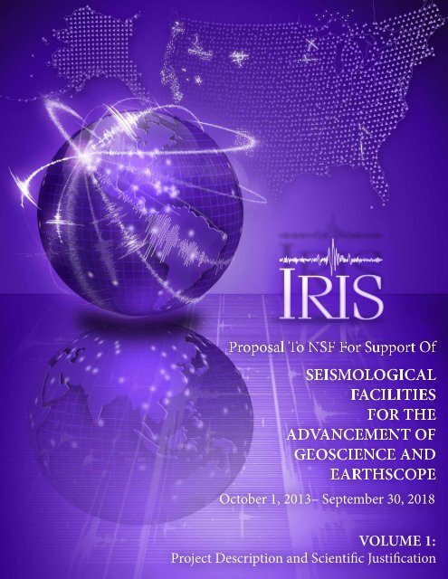
The cover of Seismological Facilities for the Advancement of Geoscience and<br />
EarthScope depicts some of the major resources provided by <strong>IRIS</strong> to support<br />
research and monitoring in seismology. The US map at the top shows the location<br />
of more than 1600 sites where USArray Transportable Array stations have<br />
been installed in the conterminous United States and 290 sites for proposed<br />
installation in Alaska. The smaller white symbols in the US map show the locations<br />
of recent experiments that have used USArray Flexible Array and PASSCAL<br />
equipment (numerous earlier PASSCAL experiments in the United States are<br />
not shown). The bright circles on the global maps (both east and west hemispheres)<br />
show the locations of Global Seismographic Network stations operated<br />
by <strong>IRIS</strong>, through the University of California, San Diego, in collaboration<br />
with the USGS. Seismograms are shown flowing into and out of the <strong>IRIS</strong> Data<br />
Management Center in Seattle, WA. The background in the lower half of the<br />
cover is from a seismogram showing a continuous 40-year record (1972–2012)<br />
of global earthquakes, created from digital waveform data archived at the <strong>IRIS</strong><br />
Data Management Center, from GSN station ANMO and its predecessor ALQ<br />
operated by the USGS in Albuquerque, NM.
Proposal To NSF For Support Of<br />
Seismological Facilities For the<br />
Advancement of Geoscience And EarthScope<br />
October 1, 2013 –September 30, 2018<br />
VOLUME 1:<br />
Project Description and<br />
Scientific Justification<br />
Submitted to the<br />
National Science Foundation<br />
Division of Earth Sciences<br />
By the<br />
Incorporated Research Institutions for Seismology<br />
1200 New York Avenue, NW, Suite 400<br />
Washington, DC 20005<br />
On Behalf of the<br />
Board of Directors and<br />
116 Member Research Institutions<br />
of the <strong>IRIS</strong> Consortium<br />
September 2012
VOLUME 1:<br />
Project Description and<br />
Scientific Justification<br />
Section I<br />
Introduction.......................................................................................................................... I-1<br />
Scientific Justification............................................................................................................ I-7<br />
EarthScope............................................................................................................................ I-14<br />
Governance and Management.............................................................................................. I-18<br />
Facility Description and Activities......................................................................................... I-23<br />
3.1. Instrumentation Services.......................................................................................... I-25<br />
3.1.1. Management.................................................................................................... I-26<br />
3.1.2. Governance...................................................................................................... I-26<br />
3.1.3. Portable Seismology........................................................................................ I-27<br />
3.1.4. Global Seismographic Network........................................................................ I-33<br />
3.1.5. Polar Support Services..................................................................................... I-38<br />
3.1.6. Transportable Array......................................................................................... I-43<br />
3.1.7. Magnetotellurics.............................................................................................. I-50<br />
3.1.8. IS-Coordinated Activities.................................................................................. I-53<br />
3.2. Data Services............................................................................................................ I-58<br />
3.3. Education and Public Outreach................................................................................ I-64<br />
3.4. Community Activities................................................................................................ I-70<br />
3.5. International Development Seismology................................................................... I-72<br />
Summary.............................................................................................................................. I-75<br />
Budget Plan.......................................................................................................................... I-76<br />
Acronym Glossary.................................................................................................................. I-85<br />
References Cited................................................................................................................... I-88
COVER SHEET FOR PROPOSAL TO THE NATIONAL SCIENCE FOUNDATION<br />
PROGRAM ANNOUNCEMENT/SOLICITATION NO./CLOSING DATE/if not in response to a program announcement/solicitation enter NSF 11-1<br />
NSF 11-1<br />
FOR CONSIDERATION BY NSF ORGANIZATION UNIT(S)<br />
EAR - INSTRUMENTATION & FACILITIES<br />
(Indicate the most specific unit known, i.e. program, division, etc.)<br />
FOR NSF USE ONLY<br />
NSF PROPOSAL NU<strong>MB</strong>ER<br />
DATE RECEIVED NU<strong>MB</strong>ER OF COPIES DIVISION ASSIGNED FUND CODE DUNS# (Data Universal Numbering System) FILE LOCATION<br />
EMPLOYER IDENTIFICATION NU<strong>MB</strong>ER (EIN) OR<br />
TAXPAYER IDENTIFICATION NU<strong>MB</strong>ER (TIN)<br />
NAME OF ORGANIZATION TO WHICH AWARD SHOULD BE MADE<br />
Incorporated Research Institutions for Seismology<br />
AWARDEE ORGANIZATION CODE (IF KNOWN)<br />
NAME OF PRIMARY PLACE OF PERF<br />
SHOW PREVIOUS AWARD NO. IF THIS IS<br />
A RENEWAL<br />
AN ACCOMPLISHMENT-BASED RENEWAL<br />
IS THIS PROPOSAL BEING SUBMITTED TO ANOTHER FEDERAL<br />
AGENCY? YES NO IF YES, LIST ACRONYM(S)<br />
ADDRESS OF AWARDEE ORGANIZATION, INCLUDING 9 DIGIT ZIP CODE<br />
ADDRESS OF PRIMARY PLACE OF PERF, INCLUDING 9 DIGIT ZIP CODE<br />
1261681<br />
08/30/2012 3 06030000 EAR 1580 183277938<br />
08/30/2012 12:50pm<br />
521362650<br />
4076212000<br />
Incorporated Research Institutions for Seismology<br />
1200 New York Avenue, NW<br />
Suite 400<br />
Washington, DC 20005-6142<br />
Incorporated Research Institutions for Seismology<br />
1200 New York Avenue NW<br />
Washington ,DC ,200056142 ,US.<br />
IS AWARDEE ORGANIZATION (Check All That Apply) SMALL BUSINESS MINORITY BUSINESS IF THIS IS A PRELIMINARY PROPOSAL<br />
(See GPG II.C For Definitions) FOR-PROFIT ORGANIZATION WOMAN-OWNED BUSINESS THEN CHECK HERE<br />
TITLE OF PROPOSED PROJECT<br />
REQUESTED AMOUNT<br />
PROPOSED DURATION (1-60 MONTHS) REQUESTED STARTING DATE SHOW RELATED PRELIMINARY PROPOSAL NO.<br />
$ 152,382,248 60 months<br />
10/01/13<br />
IF APPLICABLE<br />
CHECK APPROPRIATE BOX(ES) IF THIS PROPOSAL INCLUDES ANY OF THE ITEMS LISTED BELOW<br />
BEGINNING INVESTIGATOR (GPG I.G.2)<br />
HUMAN SUBJECTS (GPG II.D.7) Human Subjects Assurance Number<br />
DISCLOSURE OF LOBBYING ACTIVITIES (GPG II.C.1.e)<br />
Exemption Subsection<br />
or IRB App. Date<br />
PROPRIETARY & PRIVILEGED INFORMATION (GPG I.D, II.C.1.d)<br />
HISTORIC PLACES (GPG II.C.2.j)<br />
INTERNATIONAL COOPERATIVE ACTIVITIES: COUNTRY/COUNTRIES INVOLVED<br />
(GPG II.C.2.j)<br />
EAGER* (GPG II.D.2)<br />
RAPID** (GPG II.D.1)<br />
VERTEBRATE ANIMALS (GPG II.D.6) IACUC App. Date<br />
PHS Animal Welfare Assurance Number<br />
HIGH RESOLUTION GRAPHICS/OTHER GRAPHICS WHERE EXACT COLOR<br />
REPRESENTATION IS REQUIRED FOR PROPER INTERPRETATION (GPG I.G.1)<br />
PI/PD DEPARTMENT<br />
PI/PD POSTAL ADDRESS<br />
PI/PD FAX NU<strong>MB</strong>ER<br />
202-682-0633<br />
NAMES (TYPED) High Degree Yr of Degree Telephone Number Electronic Mail Address<br />
PI/PD NAME<br />
CO-PI/PD<br />
CO-PI/PD<br />
CO-PI/PD<br />
CO-PI/PD<br />
Seismological Facilities for the Advancement of Geoscience and<br />
EarthScope<br />
1200 New York Avenue, NW<br />
Suite 400<br />
Washington, DC 20005<br />
United States<br />
David W Simpson PhD 1973 202-682-2220 simpson@iris.edu<br />
Timothy K Ahern PhD 1980 206-547-0393 tim@iris.washington.edu<br />
John Taber PhD 1983 202-682-2220 taber@iris.edu<br />
Robert L Woodward PhD 1989 202-682-2220 woodward@iris.edu<br />
Page 1 of 2<br />
Electronic Signature
Project Summary<br />
Seismological Facilities for the Advancement of Geosciences and EarthScope<br />
Incorporated Research Institutions for Seismology<br />
August 2012<br />
The <strong>IRIS</strong> Consortium (Incorporated Research Institutions for Seismology) provides a suite of community-governed,<br />
multi-user facilities for instrumentation and data management to support research and<br />
education in seismology and the Earth sciences. A high-performance network of more than 150 permanent<br />
stations provides data for global studies of earthquakes and deep Earth structure. A mobile array of more<br />
than 400 seismometers and atmospheric sensors is completing a traverse of the conterminous United States<br />
and preparing for deployment in Alaska. More than 4000 portable instruments (including magnetotelluric<br />
systems) are available for short-and long-term loan to university-based researchers for detailed studies as<br />
part of NSF-funded field programs. Future observing needs are addressed via systematic engineering efforts.<br />
Data from all of these observational systems, along with extensive collections of seismic data contributed by<br />
other organizations, are freely and openly available through the <strong>IRIS</strong> Data Management Center.<br />
Intellectual Merit<br />
Data collected and distributed through <strong>IRIS</strong> facilities form the observational basis for most of the fundamental<br />
studies in seismology carried out by researchers at US universities and in many organizations worldwide.<br />
The stability and high quality of the permanent observatories capture both the short-term details of<br />
faulting during the seconds to minutes of rupture in major earthquakes as well as decadal-scale changes in<br />
global earthquake activity. Data from permanent, mobile, and portable arrays are used to resolve features<br />
in Earth structure over scales that range from the whole Earth, to lithosphere, to regional basins, to fault<br />
zones. Seismological observations provide fundamental information on Earth structure and processes that,<br />
in combination with other geoscience disciplines, contribute to enhanced understanding of how the active<br />
Earth evolves and deforms. As a part of EarthScope, these seismological observations contribute to multidisciplinary<br />
studies that focus on the structure and dynamics of North America and contribute to unraveling<br />
the history of deformation of the continent.<br />
Broader Impacts<br />
The <strong>IRIS</strong> program in Education and Public Outreach directly links the public and schools with the activities<br />
of an academic research community by demonstrating how basic seismological observations are made<br />
and used in Earth science investigations. Through a variety of activities that extend from the provision<br />
of classroom and web resources, to museum displays, public lectures, and internships, <strong>IRIS</strong> encourages<br />
students to engage in scientific inquiry and appreciate the importance of the Earth sciences in their lives.<br />
In addition to supporting fundamental research, the seismological resources provided by <strong>IRIS</strong> serve dual<br />
use by contributing directly to societal needs through reporting of global earthquake activity and applications<br />
in monitoring nuclear test ban treaties. Scientific and technical outreach by <strong>IRIS</strong> and its members as<br />
part of their international activities also provides assistance and guidance in the development and implementation<br />
of earthquake monitoring networks and hazard assessment, especially in developing countries.
Introduction<br />
Seismology, as a fundamental tool to monitor and understand<br />
earthquakes and probe Earth’s deep interior, has never<br />
been more relevant. The major earthquakes of the last decade<br />
have devastated countries and raised global awareness of our<br />
planet’s vulnerability, especially in the fragile infrastructure of<br />
the developing world. Earthquakes caused by the injection of<br />
fluids into the crust are attracting attention as new methods are<br />
being exploited for extracting hydrocarbons and sequestering<br />
carbon dioxide. The proliferation of smaller weapons in the<br />
fragmented geopolitical landscape is requiring ever greater<br />
knowledge of Earth structure to monitor potential nuclear<br />
tests. Meanwhile, basic scientific problems from Earth’s atmosphere<br />
to its core require information that can be best gleaned<br />
from seismic waves. The demands on the technical resources<br />
and skills of seismologists are being expanded constantly. The<br />
Seismological Facilities for the Advancement of Geosciences<br />
and EarthScope proposal is designed to meet these challenges.<br />
With this proposal, the Incorporated Research Institutions<br />
for Seismology (<strong>IRIS</strong>) responds to the January 2010 request<br />
from the National Science Foundation (NSF) to merge<br />
the management of the traditional <strong>IRIS</strong> core programs<br />
and the USArray component of EarthScope. USArray has<br />
been closely integrated with, and built on, <strong>IRIS</strong> core operations<br />
since the early planning stages for EarthScope in<br />
1998. Merging the management of all NSF Division of<br />
Global Great Earthquakes (Mw ≥ 8): 1906–2012<br />
Tohoku Foreshock, M w 7.3<br />
Total M 0<br />
6.26*10 23 N-m<br />
Tohoku Mainshock, M w 9.0<br />
Figure Intro-1. Mapped locations for earthquakes (M w ≥ 8) from 1/1/1906–<br />
12/25/2004 (blue circles); 12/26/2004–Present (magenta stars); and the 2004<br />
Sumatra, 2010 Chile, and 2011 Japan earthquakes (red stars). The pie chart shows<br />
the relative contribution of these groups to the total seismic moment released<br />
since 1906. The three largest, most recent earthquakes constitute 21% of the<br />
total moment and were all extensively recorded by <strong>IRIS</strong> broadband stations in<br />
the Global Seismographic Network and, when timing allowed, active PASSCAL<br />
deployments and the EarthScope Transportable Array stations. The two seismograms,<br />
recording two hours of north-south oriented ground motion at GSN<br />
station FURI (Ethiopia), show the difference in energy released by the M w 7.3<br />
Tohoku, Japan foreshock (3/9/11) and the M w 9.0 mainshock (3/11/11). Using <strong>IRIS</strong><br />
facilities, these events have been more fully quantified than any preceding great<br />
earthquakes in seismological history.<br />
Earth Sciences (EAR)-supported <strong>IRIS</strong> activities under one<br />
Cooperative Agreement presents challenging and potentially<br />
beneficial opportunities for streamlined management<br />
and synergies between programs. <strong>IRIS</strong> management and the<br />
Board of Directors have already responded to this challenge<br />
by implementing changes in the <strong>IRIS</strong> management and governance<br />
structure under the current Cooperative Agreement<br />
with NSF that began in 2010. Under the new structure, <strong>IRIS</strong><br />
observational programs have been merged into a single<br />
Instrumentation Services Directorate, and linkages have<br />
been strengthened between these activities and parallel structures<br />
for Data Services and Education and Public Outreach.<br />
At the technical level, the <strong>IRIS</strong> experience with USArray has<br />
opened opportunities for innovation in instrumentation, field<br />
practices, and data services that will be extended under this<br />
proposal to the benefit of all components of <strong>IRIS</strong> activities.<br />
For the scientific community served by <strong>IRIS</strong>, the opportunity<br />
to review and reflect on the structure and implementation of<br />
<strong>IRIS</strong> programs has stimulated broad discussions about how<br />
the well-established resources of the <strong>IRIS</strong> core programs can<br />
be sustained and merged with lessons learned during the very<br />
successful EarthScope program, in a way that stimulates new<br />
scientific pathways and experimental modalities.<br />
A series of community-led workshops and National<br />
Academies reports on scientific opportunities for seismology<br />
and the Earth sciences has informed the science goals that<br />
the integrated <strong>IRIS</strong> facilities are designed to serve. These<br />
reports include the 2010 Seismological Grand Challenges in<br />
Understanding Earth’s Dynamic Systems, the 2011 science plan<br />
for EarthScope (Unlocking the Secrets of the North American<br />
Continent) and the 2012 report from the National Academy<br />
of Science’s Board on Earth Sciences on New Research<br />
Opportunities for Earth Sciences. Various <strong>IRIS</strong>, EarthScope,<br />
and GeoPRISMS workshops, many of them directly related to<br />
planning for this proposal, have also provided opportunities<br />
for discussion of science goals and the way in which integrated<br />
<strong>IRIS</strong> facilities can contribute to both general and site-specific<br />
(e.g., Alaska, Cascadia) multidisciplinary research. This<br />
theme of the maintenance and evolution of integrated facilities<br />
serving integrated, multidisciplinary science provides a<br />
consistent thread throughout this proposal.<br />
Proposal Highlights<br />
Over the past 7.5 years, 15 great earthquakes (M w ≥ 8.0) have<br />
struck globally, with some causing unprecedented devastation<br />
and loss of life, and all of them prompting evolution of<br />
our understanding of how major earthquake ruptures occur.<br />
The December 24, 2004, Sumatra (M w 9.2) and March 11,<br />
2011, Japan (M w 9.0) earthquakes generated remarkable<br />
VOLUME 1 | Section I |Introduction I-1
Results of Prior NSF Awards<br />
The following are the two NSF awards most relevant to this<br />
proposal. Funding shows amounts awarded to August 2012.<br />
Results of Prior NSF Support: EAR-1063471, $26,384,286,<br />
Facilitating New Discoveries in Seismology and Exploring the<br />
Earth: The Next Decade (D. Simpson, PI), 10/1/11–9/30/13<br />
With support through previous awards from the Earth Science<br />
Division, Instrumentation and Facilities Program, <strong>IRIS</strong> has<br />
established, maintained, and developed a wide range of facilities<br />
to support research and education in seismology and the<br />
Earth sciences. The <strong>IRIS</strong> Data Management System archives<br />
and freely distributes data from the Global Seismographic<br />
Network and the Program for Array Seismic Studies of the<br />
Continental Lithosphere. These data are a primary resource<br />
for national and international research and these <strong>IRIS</strong> facilities<br />
have helped sustain the US position as a global leader in seismology<br />
research. Through collaborations with national and<br />
international mission agencies and organizations, <strong>IRIS</strong> data<br />
contribute to the monitoring of global earthquakes, tsunamis,<br />
and nuclear explosions. <strong>IRIS</strong> Education and Public Outreach<br />
programs encourage careers in the Earth sciences, inform the<br />
public of current earthquake activity, and provide visibility to<br />
NSF’s investments in support of geoscience research. The broad<br />
reach of the Consortium’s governance structure, and the active<br />
engagement of research scientists in guiding the management<br />
of <strong>IRIS</strong> programs, continue to ensure that the facilities meet<br />
the evolving needs of the academic research community.<br />
Results from Prior NSF Support: EAR-0733069, $73,609,490,<br />
EarthScope Facility Operation and Maintenance, (D. Simpson,<br />
R. Woodward, PI’s), 10/1/08–9/30/13<br />
<strong>IRIS</strong> has partnered with UNAVCO to develop and maintain<br />
the observational facilities to support EarthScope, a multidisciplinary<br />
Earth science initiative to study the structure and<br />
evolution of the North American continent and the physical<br />
processes responsible for earthquakes and volcanic eruptions.<br />
Initial funding for construction of the EarthScope facilities<br />
(2003–2008) came from NSF’s Major Research Equipment<br />
and Facilities Construction account, and support for operations<br />
and maintenance since 2008 has been provided through<br />
the EarthScope program. <strong>IRIS</strong> has been responsible for the<br />
creation and operation of USArray as the seismic component<br />
of EarthScope. USArray consists of a nested set of seismic<br />
observational systems, including contributions to a national<br />
backbone of permanent observatories (as part of the USGS<br />
National Network); a Transportable Array of 400 stations that<br />
has systematically traversed the continental United States on a<br />
70 km grid of more than 1600 locations, and a Flexible Array of<br />
more than 2000 broadband and short-period instruments for<br />
use in PI-led projects. An array of magnetotelluric instruments<br />
provides data for use in studies of the lithosphere’s electrical<br />
structure. The data from all USArray instruments are freely and<br />
openly available through the <strong>IRIS</strong> Data Management Center.<br />
tsunamis and demonstrated the need for and value of tsunami<br />
warning systems linked to rapid earthquake quantification.<br />
These events also demonstrated the flaws in some earthquake<br />
hazard assessment procedures, and are influencing global risk<br />
assessments. Surprises have been offered in terms of where<br />
great earthquake slip has occurred, with the April 1, 2007,<br />
Solomon Islands earthquake (M w 8.1) rupturing right across a<br />
triple junction where a ridge is subducting, and the February<br />
27, 2010, Chile rupture (M w 8.8) having its largest slip in<br />
regions outside of the seismic gap that had been expected to<br />
fail. Great earthquake doublets have involved triggering of<br />
intraplate faulting by interplate failure in the Kuril Islands,<br />
and vice versa in the Samoa-Tonga region. The April 11,<br />
2012, Indo-Australian earthquake sequence (M w 8.6 and<br />
8.2) involved the largest strike-slip faulting and largest intraplate<br />
faulting event that has ever been seismically recorded.<br />
Extensive seismic wave analysis of these events using both<br />
short-period signals recorded in large aperture arrays and<br />
global body and surface wave observations from <strong>IRIS</strong> and the<br />
International Federation of Digital Seismograph Networks<br />
(FDSN) stations indicates that five en echelon and conjugate<br />
faults ruptured during the two largest events. Such remarkable<br />
complexity would have gone unrecognized without<br />
availability of global, on-scale broadband seismic recordings.<br />
The facilities operated by <strong>IRIS</strong> and funded by NSF have<br />
contributed in fundamental ways to our ability to tease out<br />
the complex details of faulting during the 2–10 minutes of<br />
rupture in these great events. The density of high-quality,<br />
permanent Global Seismographic Network (GSN) and FDSN<br />
stations provide the core data to unravel the faulting geometry<br />
and time history of rupture. Denser arrays, such as<br />
EarthScope’s USArray Transportable Array (TA) and other<br />
high-density networks in Japan and Europe, make it possible<br />
to observe the spatial and temporal release of energy. In those<br />
places where dense networks of Global Positioning System<br />
(GPS) instruments are available, such as Japan, the merged<br />
analysis of seismic and geodetic data has increased the resolution<br />
of dynamic and static offsets. With the large volume<br />
of data being delivered from global seismic networks in real<br />
time, these resources, many of them initiated by <strong>IRIS</strong>, have<br />
also led to significant improvements in real-time reporting of<br />
earthquakes and substantially improved the ability to provide<br />
rapid warning of impending tsunamis.<br />
In this proposal, we request support to continue to maintain<br />
and improve operation of the Global Seismographic Network,<br />
in collaboration with the US Geological Survey and many international<br />
partners, as a foundation network for global earthquake<br />
monitoring and research. As part of an overall <strong>IRIS</strong> initiative<br />
in quality improvement and tracking, special emphasis will<br />
be placed on improvements in GSN data quality and revitalization<br />
of ultra-broadband sensors. We will also explore the design,<br />
enhancement, and application of arrays such as the USArray<br />
Transportable Array to study the rupture of great earthquakes<br />
I-2 VOLUME 1 | Section I | Introduction
and provide higher-resolution images of Earth’s deep interior, and<br />
encourage their development and implementation in collaborative<br />
projects worldwide.<br />
−15˚<br />
−20˚<br />
−75˚<br />
−70˚<br />
−65˚<br />
Chile<br />
Argentina<br />
Maule Aftershock Deployment<br />
<strong>IRIS</strong> CHAMP Stations<br />
One of seismology’s underlying strengths has been international<br />
collaboration in data exchange for both earthquake<br />
and tsunami monitoring and fundamental research on earthquakes<br />
and Earth structure. The <strong>IRIS</strong> Data Management<br />
Center has become the de facto international archive for<br />
high-quality digital seismic waveform data and the source of<br />
choice for national and international researchers. An essential<br />
component of achieving and sustaining this role as international<br />
leader in data exchange has been the development of a<br />
variety of powerful and user-friendly tools for data collection,<br />
data archiving, data distribution, and quality assessment.<br />
The <strong>IRIS</strong> Data Management System (DMS) has initiated<br />
a series of international metadata workshops that provide<br />
instruction and training on modern best practices in data<br />
collection and archiving.<br />
In collaboration with the University of Chile, a backbone<br />
network of 10 Global Reporting Observatories has been established<br />
in Chile with support from an NSF Major Research<br />
Instrumentation award to <strong>IRIS</strong> (Figure Intro-2). This network,<br />
based on USArray Transportable Array technology and<br />
experience, is an important asset for earthquake monitoring<br />
in Chile and provides a high-quality resource for detailed<br />
studies of subduction zone processes along the Andean arc.<br />
The network also greatly increases the coverage for monitoring<br />
earthquakes throughout the Southern Hemisphere.<br />
The productive interaction with Chile has involved the<br />
development of the backbone network, a unique international<br />
collaborative effort to deploy a temporary network<br />
following the 2010 M8.9 Maule earthquake, and the expansion<br />
of collaborative research with US scientists. These efforts<br />
provide a model for other international collaborations, especially<br />
in developing countries, that can be used to enhance<br />
both indigenous earthquake hazard assessment as well as the<br />
acquisition of data and resources that contribute to fundamental<br />
research efforts.<br />
In this proposal, the extensive <strong>IRIS</strong> Data Services in data archiving,<br />
distribution, and product development, and the underlying<br />
commitments to free and open access and quality review, will<br />
be strengthened. We request support to continue <strong>IRIS</strong> leadership<br />
in encouraging and strengthening international collaboration<br />
in data exchange, and to assist in the development of<br />
high-quality regional and national networks for earthquake<br />
monitoring. Through training provided to local operators on<br />
network operation and data management, we can provide valueadded<br />
leverage to substantially increase the quantity and quality<br />
of data available for research and, at the same time, contribute<br />
to national and regional programs in earthquake hazard assessment<br />
and mitigation.<br />
−25˚<br />
−30˚<br />
−35˚<br />
−40˚<br />
−45˚<br />
−50˚<br />
−55˚<br />
300 km<br />
−75˚<br />
−70˚<br />
EQ Depth (km)<br />
)<br />
0 − 100<br />
100 − 200<br />
200 − 500<br />
500 +<br />
Current<br />
Station<br />
GRO-Chile<br />
Feb. Aftershock 27, 2010<br />
Aftershock<br />
−65˚<br />
The recent spate of great earthquakes has increased<br />
concern in the United States about the potential for similar<br />
megathrust events along the Cascadia subduction zone in<br />
the Pacific Northwest and along the Aleutian Arc in Alaska.<br />
EarthScope resources, both USArray seismic stations and<br />
Plate Boundary Observatory (PBO) geodetic and strain<br />
instruments, have been deployed along the Pacific Northwest<br />
from northern California to southern Canada, and have been<br />
recently supplemented with the installation of ocean bottom<br />
seismographs off the coast of Oregon and Washington. A<br />
variety of multidisciplinary observations are being acquired,<br />
including data that document episodic tremor and slip. These<br />
data are revolutionizing our understanding of processes<br />
within subduction zones, which are potentially related to<br />
how deformation and slip evolve prior to great earthquakes.<br />
As USArray extends into Alaska, these joint USArray/PBO<br />
observations will be expanded, and collaboration with NSF’s<br />
Geodynamic Processes at Rifted and Subducting Margins<br />
(GeoPRISMS) program will further extend the multidisciplinary<br />
planning and implementation of these observational<br />
programs and research.<br />
In this proposal, we will continue to operate onshore USArray<br />
stations in Cascadia through the planned completion of the NSF<br />
Pacific Ocean<br />
Concepcion<br />
Santiago<br />
Andes<br />
100 km<br />
Figure Intro-2. Following the Maule,<br />
Chile, earthquake of February 27,<br />
2010, an NSF Rapid Response<br />
Research award funded the deployment<br />
of 58 portable PASSCAL/USArray<br />
stations (right), for five month’s<br />
observations of aftershocks (grey<br />
in map on left), in collaboration<br />
with Chilean, French, German, and<br />
British investigators. Yellow triangles<br />
in the left map show the 10 Global<br />
Reporting Observatories (GRO-Chile)<br />
installed by <strong>IRIS</strong> in collaboration with<br />
the University of Chile.<br />
VOLUME 1 | Section I |Introduction I-3
PBO GPS<br />
Telemetered Seismometer<br />
Cascadia Initiative OBS<br />
Figure Intro-3. Recently or presently operated stations throughout the Cascadia<br />
margin. The entire planned deployment of the Cascadia Initiative Ocean Bottom<br />
Seismometer (OBS) Experiment (2011–2015) has been represented. Real-time<br />
seismic and geodetic stations associated with EarthScope and regional operators<br />
are also represented.<br />
Division of Ocean Sciences-funded ocean bottom observations<br />
in 2015. Existing EarthScope PBO resources in Alaska will be<br />
enhanced with the installation of USArray Transportable Array<br />
stations and the availability of portable instruments for special<br />
studies along the Aleutian subduction zone. <strong>IRIS</strong> and UNAVCO will<br />
collaborate on exploration of how the EarthScope experience can<br />
be applied to future large-scale international experiments along<br />
other major subduction zones. (Figure Intro-3)<br />
At a different scale, earthquake activity in the past decade<br />
has also risen significantly in the United States. Clusters of<br />
small to moderate magnitude events in California, Texas,<br />
Colorado, Oklahoma, Arkansas, Ohio, and elsewhere have<br />
been related to various forms of human activities tied to fluid<br />
injection into the crust, including waste fluids associated with<br />
gas recovery following hydraulic fracturing. The coincidental<br />
timing of the advance of USArray’s Transportable Array across<br />
the United States and the rise in energy prices that stimulated<br />
the energy sector’s recent increase in domestic hydrocarbon<br />
recovery has been fortuitous. It has meant that a number of the<br />
triggered earthquake episodes have occurred within or near<br />
the Transportable Array footprint, allowing Transportable<br />
Array data to contribute substantially to the accurate location<br />
of these events and link them to the injection process. In<br />
addition, rapid, temporary deployments of dense networks of<br />
<strong>IRIS</strong> Program for Array Seismic Studies of the Continental<br />
Lithosphere (PASSCAL) instruments near clusters of induced<br />
earthquakes in Texas and Oklahoma have allowed even moredetailed<br />
studies of the extent of the seismicity and their relationship<br />
to disposal wells. Transportable Array recordings<br />
of moderate-sized mid-continental earthquakes are also<br />
providing quantitative data to predict the propagation of<br />
strong ground shaking during rare but potentially damaging<br />
larger events in the central and eastern United States.<br />
On August 23, 2011, an M5.8 event in central Virginia<br />
shook the area around Washington, DC, and was felt widely<br />
across the northeastern United States. This earthquake was<br />
one of the strongest in the eastern United States to be recorded<br />
by modern instrumentation. It produced accelerations that<br />
exceeded the design specifications at a nearby nuclear power<br />
plant and caused damage within the Washington, DC, metropolitan<br />
area, more than 100 km away. Portable instruments<br />
were quickly deployed to the epicentral area (and have<br />
remained there for more than 10 months) to locate aftershocks.<br />
USArray provided 208 high-frequency Texan instruments<br />
to test the concept of high-density recording of an<br />
aftershock sequence with the short-term deployment of these<br />
instruments in a tight array to dramatically improve earthquake<br />
hypocenter locations, which in turn will help define<br />
the causative fault and provide critical information on local<br />
crustal structure (Figure Intro-4).<br />
kilometers<br />
0 100<br />
Washington<br />
kilometers<br />
0 10<br />
Richmond<br />
North Anna<br />
Nuclear Station<br />
0<br />
N<br />
2<br />
4<br />
6<br />
8<br />
10<br />
12<br />
Aftershocks AIDA Stations<br />
10<br />
5<br />
0 0 5 10 15<br />
Distance (km) Distance (km)<br />
0<br />
0 E-W 10 0 N-S 7<br />
P<br />
P<br />
S<br />
S<br />
Time (s)<br />
10<br />
Figure Intro-4. <strong>IRIS</strong> / USArray response to<br />
the August 2011 M5.8 Mineral, VA earthquake.<br />
Map (top left) shows the location<br />
of main shock and its immediate<br />
aftershocks, and proximity to the North<br />
Anna Nuclear Power Plant. Triangles<br />
(blue) indicate stations deployed as<br />
part of a coordinated effort between<br />
the <strong>IRIS</strong>, USGS, Virginia Tech, Lamont Doherty Earth Observatory, and University<br />
of Memphis immediately following the earthquake. The inset map shows the<br />
Aftershock Imaging with Dense Arrays (AIDA) deployment (green) of USArray FA<br />
Texan seismometers deployed by Virginia Tech and Cornell Universities to locate<br />
aftershocks and image the fault region. The AIDA-located aftershocks delineate<br />
the fault surface (three dimensional volume, upper right). The AIDA seismograms<br />
(bottom right) show the P- and S-waves from an aftershock moving across the<br />
AIDA stations (AIDA results courtesy of John Hole).<br />
I-4 VOLUME 1 | Section I | Introduction
In this proposal, we request support to (1) continue to provide<br />
instrumentation for rapid-response deployments following significant<br />
earthquakes and (2) develop a new generation of portable<br />
instruments with enhanced capabilities that will lead to fundamental<br />
changes in field deployments for high-resolution aftershock<br />
studies and imaging of Earth’s interior. As part of a separately<br />
funded NSF initiative, it is anticipated that a subset of the USArray<br />
Transportable Array stations will be retained in the central and<br />
eastern United States to enhance the recording of natural and<br />
induced seismicity, and to provide information on ground motions<br />
important for re-evaluation of the design criteria for significant<br />
engineering structures, such as nuclear power plants.<br />
On April 28–29, 2012, more than 150,000 people, mainly<br />
school-age children and their families, flocked to the<br />
Washington, DC, Convention Center to visit the second<br />
USA Science and Engineering Festival. Most of those from<br />
the Washington, DC, area had felt the Virginia earthquake<br />
eight months earlier and they were eager to learn more<br />
about earthquakes and seismology at the booths hosted by<br />
<strong>IRIS</strong> and EarthScope. At this and other public forums, such<br />
as meetings of the National Science Teachers Association,<br />
the Society for the Advancement of Chicanos and Native<br />
Americans in Science, the American Geophysical Union, and<br />
the Geological Society of America, <strong>IRIS</strong> Education and Public<br />
Outreach (EPO) engages the public, teachers, and students<br />
in learning more about earthquakes and seismology. Through<br />
web-based products, such as Recent Earthquakes Teachable<br />
Moments and USArray Ground Motion Visualizations, EPO<br />
uses newsworthy earthquakes as another way to attract the<br />
public to the Earth sciences.<br />
In this proposal, we request support to continue to provide the<br />
public and educators with instructional and outreach resources<br />
related to seismology and the Earth sciences. Earthquakes and their<br />
effects are of great interest to the public and educators and provide<br />
a natural pathway for engaging a broad sector of the community<br />
and to encourage careers in the geosciences. (Figure Intro-5)<br />
Our understanding of the origin of earthquakes and other<br />
natural hazards, of the nature and origin of mineral and<br />
energy resources, and of humanity’s interaction with the environment<br />
depends intimately on our knowledge of the structure<br />
and composition of Earth’s interior. Seismic waves traveling<br />
through the planet’s interior are used to provide highly<br />
detailed images of it. <strong>IRIS</strong> data and instrumentation provide<br />
the fundamental observational underpinning for most of the<br />
seismological research on Earth structure funded by NSF<br />
and contribute strongly to earthquake and nuclear explosion<br />
research carried out by other US government agencies<br />
(US Geological Survey [USGS], Department of Energy<br />
[DOE], Department of Defense, and the National Oceanic<br />
and Atmospheric Administration [NOAA]), international<br />
universities, and intergovernmental organizations.<br />
Figure Intro-5. Andy Frassetto of <strong>IRIS</strong> explains the concept of building resonance to<br />
families visiting the <strong>IRIS</strong> booth at the 2012 USA Science and Engineering Festival.<br />
Since its founding in 1984, PASSCAL has fundamentally<br />
changed the way in which teams of individual scientists have<br />
designed and implemented portable field programs for US<br />
and global studies of both Earth structure and earthquakes.<br />
The <strong>IRIS</strong> model of multi-user, community-governed facilities<br />
has provided individual investigators with a wide range of<br />
equipment for use in a variety of portable experiment styles.<br />
This instrumentation covers the complete seismic spectrum,<br />
ranging from long-term “passive” deployments of tens<br />
to hundreds of instruments for earthquake observations, to<br />
short-term deployment of hundreds to thousands of instruments<br />
for “active-source” imaging of the lithosphere.<br />
With the advent of EarthScope, the seismological resources<br />
available for studies of the structure of both North America<br />
and selected regions of the deep Earth have expanded multifold.<br />
USArray Flexible Array (FA) instruments have almost<br />
doubled the inventory of stations available for temporary<br />
experiments. The expansion of USArray to include magnetotelluric<br />
instruments has opened up new opportunities for<br />
multidisciplinary investigations that include both the seismic<br />
and electrical properties of the lithosphere.<br />
In this proposal, we request support to continue to operate the<br />
merged pools of PASSCAL and USArray Flexible Array portable<br />
seismic equipment and magnetotelluric systems primarily in<br />
support of NSF-funded research. Currently, these programs<br />
support about 70 seismic field projects per year, most of them<br />
funded by NSF. None of this science could be achieved using<br />
only instruments owned by individual Principal Investigators.<br />
Continued support of <strong>IRIS</strong> Portable Seismology is essential for<br />
seismic research by US scientists.<br />
One of EarthScope’s major impacts has been the increased<br />
ability, provided by the USArray Transportable Array, to<br />
VOLUME 1 | Section I |Introduction I-5
image lithospheric structure beneath the United States. This<br />
success highlights the way in which the US academic geoscience<br />
community has again revolutionized the implementation<br />
of a multi-user facility resource for seismological observations.<br />
The quality of Transportable Array operations has<br />
been exceptional in providing low-noise, wide-bandwidth,<br />
high data return. In addition to being used in the systematic<br />
application of well-established techniques for structural<br />
studies, such as receiver functions, shear wave splitting,<br />
and surface wave inversions, the unique aspects of the<br />
Transportable Array, in terms of uniform data quality and<br />
gridded array design, have stimulated a number of innovative<br />
and powerful new techniques, including ambient noise<br />
analysis for investigations of lithospheric structure and back<br />
projection array analysis to study the source dynamics of large<br />
earthquakes. The recent addition of atmospheric pressure and<br />
infrasound sensors to all Transportable Array stations opens<br />
up new opportunities for interdisciplinary studies of interactions<br />
between the atmosphere and solid Earth.<br />
While data from the GSN and associated stations of the<br />
FDSN traditionally provided the primary resource for whole<br />
Earth modeling, there is increasing application of USArray<br />
Transportable Array data, and the “re-use” of data from all<br />
available broadband deployments, for high-resolution investigations<br />
of deep Earth structure.<br />
In this proposal, we request support to complete the operation<br />
of the USArray Transportable Array in the northeastern United<br />
States and to provide the major investment required to install<br />
Transportable Array stations in Alaska, completing the 15-year<br />
seismic component of the original EarthScope plan. Under the<br />
new <strong>IRIS</strong> Instrumentation Services structure, the Transportable<br />
Array and the portable instrumentation mentioned earlier will<br />
be closely coordinated with specialized instrumentation and<br />
services provided for seismological and glaciological studies in<br />
polar regions (funded under this proposal through supplementary<br />
funding from the NSF Office of Polar Programs) and with newly<br />
established <strong>IRIS</strong> responsibilities for management and coordination<br />
of the NSF National Ocean Bottom Seismograph Instrument<br />
Pool (separately funded by the NSF Division of Ocean Sciences).<br />
In the following sections of the proposal, we provide a<br />
summary of some of the significant scientific advances that<br />
have accrued based on the use of the seismological resources<br />
funded by NSF and managed by <strong>IRIS</strong>, an overview of the<br />
collaborative efforts by <strong>IRIS</strong> and UNAVCO in support of<br />
the EarthScope program, a brief description of <strong>IRIS</strong> governance<br />
and management structures, and descriptions of<br />
each of the service and operational units managed by <strong>IRIS</strong>,<br />
with identification of the activities proposed for support<br />
under this proposal.<br />
Proposal Goals<br />
The primary goals set out in this proposal are:<br />
• Maintain and improve the core <strong>IRIS</strong> seismological facilities.<br />
The core facility resources that have accrued from NSF<br />
investments in the <strong>IRIS</strong> core programs (GSN, PASSCAL,<br />
DMS, and EPO) are essential resources for the seismological<br />
research and education communities. Under this<br />
proposal, management of these resources will be merged<br />
with EarthScope’s USArray and funds are requested to<br />
continue to provide these communities with the highquality<br />
data and instrumentation resources that they<br />
rely on for their research and teaching. We will continue<br />
to enhance user services and, with sustained community<br />
leadership and advice, explore new opportunities to<br />
improve and expand these resources.<br />
• Complete the EarthScope facility plan. In collaboration with<br />
UNAVCO’s efforts under PBO, and with leadership from<br />
the EarthScope Science Steering Committee, <strong>IRIS</strong> will,<br />
during 2013–2018 continue to support the facility efforts<br />
required to implement the EarthScope science program.<br />
With the completion of installation of Transportable<br />
Array stations in Alaska by 2018, the initial design goals of<br />
EarthScope USArray will have been achieved. An important<br />
aspect of <strong>IRIS</strong> joint efforts with UNAVCO and the<br />
EarthScope Science Steering Committee and the broad<br />
EarthScope community will be to explore ways in which<br />
the experience of EarthScope can be used to leverage new<br />
multidisciplinary research efforts.<br />
• Educate our community and the public. The <strong>IRIS</strong> EPO<br />
program will continue to bring the excitement of seismology,<br />
earthquake studies, and the national reach of<br />
EarthScope to the public and the classroom, and highlight<br />
the value of NSF investments in research and in the Earth<br />
sciences. An increasing emphasis on undergraduate education,<br />
coupled with a very successful internship program,<br />
will expose students to seismological research and inspire<br />
careers in Earth sciences.<br />
• Look to the future. While the primary emphasis of activities<br />
will be to sustain the existing facilities managed by <strong>IRIS</strong>,<br />
constant review and renewal is required to ensure that the<br />
facilities <strong>IRIS</strong> provides to support seismological research<br />
remain in sync with evolving and new research opportunities.<br />
Investments will be made in the development of<br />
portable instrumentation and in the enhancement of data<br />
resources to ensure that the US seismology community<br />
continues to have access to state-of-the-art instrumentation<br />
and data services into the future.<br />
I-6 VOLUME 1 | Section I | Introduction
Scientific Justification<br />
Several recent Earth science plans—about seismological grand<br />
challenges, EarthScope science, earthquake resilience, and the<br />
broad sweep of the Earth sciences—collectively set forth challenges<br />
and opportunities for seismology. Seismology plays a<br />
key role in addressing an overall goal of developing a fundamental<br />
scientific understanding of Earth system dynamics<br />
as well as more strategically motivated societal issues. In this<br />
section, we summarize some of the key points from these<br />
science plans and articulate how <strong>IRIS</strong> will provide the critical<br />
facilities, data, products, and services required to meet the<br />
challenges and take advantage of the opportunities.<br />
Geosciences and a few other scientific fields, such as<br />
cosmology and evolutionary biology, require close consideration<br />
of “deep time” and the profound changes that can accrue<br />
from slow processes. The pace of some of these processes—<br />
so slow that changes may seem negligible even over human<br />
history, yet quick enough that advanced systems can reliably<br />
measure differences over just a few tens of years—simultaneously<br />
creates challenges and opportunities. Examples of<br />
such Earth processes include the dynamic evolution of fault<br />
systems, changes in atmospheric chemistry throughout<br />
Earth history, charging and depletion of aquifers, sometimes<br />
sudden and irreversible changes in ocean circulation, and<br />
glacier dynamics that are coupled to insolation, precipitation,<br />
sea level, and isostatic rebound. As outlined in New Research<br />
Opportunities in the Earth Sciences (NRC, 2012), a predictive<br />
understanding of these processes and the ability to inform the<br />
most effective related policies in broader society are founded<br />
on collecting data that span time periods much longer than<br />
most laboratory experiments. Important scientific and societal<br />
objectives require both collecting “the same data” year<br />
after year through reliable long-term operation of facilities,<br />
and continually improving the facilities to enable new modes<br />
of research.<br />
Through nearly two decades near the end of the twentieth<br />
century, <strong>IRIS</strong> built facilities to collect and manage modern<br />
seismological data—almost exclusively as part of Cooperative<br />
Agreements with the National Science Foundation. NSF<br />
funded and oversaw creation of this new generation of facilities<br />
partly because several technological advances, including<br />
feedback electronic circuits and digital data storage, enabled<br />
a revolution in seismology. Seismological Grand Challenges in<br />
Understanding Earth’s Dynamic Systems (Lay, 2009) describes<br />
how investigations using these facilities will continue to<br />
exemplify the Foundation’s core mission of discovery, innovation,<br />
and cutting-edge research.<br />
While the USArray component of EarthScope represents a<br />
mature use of these technologies, Unlocking the Secrets of the<br />
North American Continent (Williams et al., 2010) anticipates<br />
a rapid and accelerating pace of discovery in seismology and<br />
related fields of Earth sciences—taking advantage of ongoing<br />
development of new ways to process the data and extract additional<br />
information, accumulation of data for a sufficient time<br />
span to measure secular changes, and measurements of a small,<br />
but growing, number of very large earthquakes. Extending<br />
these extraordinary achievements requires exploiting the<br />
latest technological developments, such as micro-electromechanical<br />
systems (MEMS) and other sophisticated electronics,<br />
new battery and power systems, and wireless communications.<br />
Moreover, computing and numerical methods have<br />
now progressed to the point that simulation has become an<br />
integral part of modern Earth sciences—particularly for seismology<br />
and geodynamics—and large, high-performance<br />
computing resources will enable three-dimensional predictions<br />
at the resolution needed to match observations of deformation,<br />
uplift, subsidence, and flow patterns across a range of<br />
scales from meters to thousands of kilometers.<br />
Ambient Noise Tomography<br />
Continuous seismic data, such as those collected by EarthScope’s<br />
USArray and available at the <strong>IRIS</strong> Data Management Center,<br />
facilitate the use of ambient noise as a powerful probe of<br />
Earth structure. Background noise contains seismic waves<br />
that propagate coherently across arrays of seismographs. By<br />
correlating the recordings at two stations and averaging over<br />
long time periods, a coherent signal can be extracted, yielding<br />
measurements of seismic waves propagating from one station<br />
to the other. By combining noise data from many station pairs,<br />
a 3D tomographic image of subsurface velocity structure can<br />
be constructed. Even more recent advances include methods<br />
to determine anisotropy, attenuation, and temporal changes.<br />
Attenuation coefficients across the western United States inverted from<br />
12 s (left) and 24 s (right) period ambient noise. Geologic terrain boundaries<br />
(thin black lines, with labels) and Holocene volcanoes (red circles)<br />
are plotted for reference. High attenuation and low phase velocity (not<br />
shown) are observed along the margins of the Colorado Plateau, along<br />
the Rio Grande Rift, and beneath Yellowstone. (Lawrence and Prieto, 2011)<br />
VOLUME 1 | Section I | Scientific Justification I-7
Seismology plays key role in addressing many needs of<br />
broader society, including energy resources, environment,<br />
national security, and several natural hazards. In no area,<br />
however, are the uniquely important impacts from seismological<br />
research more evident than in addressing earthquake<br />
hazard. National Earthquake Resilience: Research,<br />
Implementation, and Outreach (NRC, 2011) details how seismologists<br />
must contribute by making near-field measurements<br />
to understand the physics of earthquake processes; evaluating<br />
and testing earthquake early warning systems and methods<br />
for operational earthquake forecasting; completing national<br />
seismic hazard maps and creating urban seismic hazard maps;<br />
enabling robust coupled simulations of fault rupture, seismic<br />
wave propagation, and soil response to reliably estimate losses<br />
and casualties; and contributing to scenarios so that communities<br />
can visualize earthquake impacts.<br />
Lowermost Mantle Global Structure<br />
Seismologists are collaborating with geodesists, geodynamicists<br />
and materials scientists to determine density, temperature<br />
and other mantle properties that cannot be measured from<br />
seismic wavespeeds alone (Simmons et al., 2010). This progress<br />
comes, in part, from resolving the structure of large, low-shear<br />
velocity provinces at the base of the mantle with the accumulation<br />
of high-quality broadband data from the GSN and its international<br />
counterparts, as well as dense PASSCAL and USArray<br />
deployments. This work brings out the distinct average velocity<br />
profiles within and outside irregularly shaped high- and lowvelocity<br />
provinces in the lowermost mantle. Modeling of broadband<br />
waves that propagate along and across the province<br />
borders show that they are sharp, indicating that the distinctive<br />
properties cannot be due only to temperature differences.<br />
If large, chemically distinct reservoirs continue to exist in the<br />
mantle, then occasional reorganization of mantle circulation<br />
could profoundly alter cycling of volatiles between Earth’s interior<br />
and the ocean and atmosphere.<br />
Independent models of global shear wave speed in the lower mantle<br />
are in increasingly good agreement. This map is composed of bins that<br />
are color-coded according to how many of five well-regarded models<br />
have a V S profile that cluster analysis identifies as distinctly slow. The<br />
analysis demonstrates consensus on two large low-shear wave speed<br />
provinces, the African and the Pacific, within a single, globally contiguous<br />
faster-than-average lower mantle. (Lekic et al., submitted)<br />
5<br />
4<br />
3<br />
2<br />
1<br />
0<br />
In what follows, a set of key questions derived from<br />
Seismological Grand Challenges in Understanding Earth’s<br />
Dynamic System (Lay, 2009) is used to illustrate the ways in<br />
which seismology, and the resources provided by the <strong>IRIS</strong><br />
facilities, contribute to a broad range of topics that enhance<br />
our understanding of fundamental Earth processes and the<br />
ways in which they impact our lives.<br />
Thermo-Chemical Internal Dynamics<br />
and Volatile Distribution<br />
How do Earth’s temperature, composition, and internal boundaries<br />
control mantle and core dynamics and the changing<br />
morphology of our living environment? How do the lithosphere<br />
and plate boundary systems evolve over Earth history?<br />
The solid Earth is a complex and dynamic system with<br />
processes that operate over spatial scales from nanometers<br />
to tens of thousands of kilometers and time scales from<br />
The Lithosphere-Asthenosphere<br />
Boundary and Plate Tectonics<br />
High-fidelity broadband records over long time spans at GSN<br />
stations and on dense spatial arrays from PASSCAL and USArray<br />
deployments have led to the surprising discovery of discontinuous<br />
decreases in seismic wave speeds at depths of 50 to<br />
130 km (Rychert and Shearer, 2009). In the ocean and in<br />
tectonic areas, this discontinuity is likely related to the lithosphere-asthenosphere<br />
boundary. But the discontinuity is also<br />
observed midway through old continental lithosphere, where<br />
it is associated with a several layers of distinct heterogeneity<br />
and anisotropy measured from long-period surface wave and<br />
overtone waveforms and SKS splitting data. Understanding this<br />
structure, which is difficult to explain through normal thermal<br />
mechanisms, will lead to fundamental new understanding of<br />
how melting is distributed within Earth, how plate motions<br />
affect and are influenced by variations in composition and rock<br />
fabric, and how continents are formed.<br />
A<br />
YKW3<br />
∆<br />
Layer 1<br />
∆<br />
FFC<br />
Layer 2<br />
Asthenosphere<br />
50<br />
60<br />
55<br />
45<br />
65<br />
Latitude (°)<br />
40<br />
35<br />
Cratonic cross section showing the departure of the fast axis of azimuthal<br />
anisotropy from the direction of absolute plate motion (APM)<br />
of the North American Plate in the hotspot reference frame. The midlithospheric<br />
discontinuity occurs in the depth range where a low velocity<br />
layer is detected from receiver function studies (black dots). (Yuan<br />
and Romanowicz, 2010).<br />
∆<br />
ULM<br />
LAB<br />
400<br />
300<br />
A’<br />
200<br />
0<br />
100<br />
Depth (km)<br />
I-8 VOLUME 1 | Section I | Scientific Justification
nanoseconds to billions of years—controlling geothermal<br />
evolution, driving long-term continental development, generating<br />
Earth’s magnetic field, and cycling volatiles between<br />
the interior and the ocean and atmosphere. Seismological<br />
measurements from the GSN continue to provide key information<br />
on global Earth structure. The USArray Transportable<br />
Array (TA) is demonstrating the power of a densified station<br />
deployment, and portable (PASSCAL and Flexible Array<br />
[FA]) deployments have allowed yet higher resolution of<br />
features of key interest. Progress on understanding the solid<br />
Earth system comes from a variety of disciplines, but seismology<br />
is critically situated because it best resolves their<br />
present configuration and near-term evolution. There is an<br />
ongoing need for the diverse components of seismological<br />
infrastructure in order to improve and test our ideas of how<br />
Earth systems operate. <strong>IRIS</strong> Data Services ensure quality,<br />
compatibility, and long-term security of these data so that the<br />
rate of discovery grows even more quickly. Recent improvements<br />
in wave imaging, modern sensor technology, and the<br />
computational capability available to model large, dense<br />
waveform data sets motivate both new observational strategies<br />
for seismology and development of products, services,<br />
and simulation capabilities to accommodate the substantial<br />
computational demands of modern geodynamics, seismology,<br />
geomagnetism, and mineral physics.<br />
USArray data are already providing unprecedented resolution<br />
in addressing questions about how mountain building,<br />
lithospheric deformation, and volcanism across the western<br />
United States have been influenced by tectonic history and<br />
the existence of the subducted lithospheric slab in the upper<br />
mantle. As the TA continues eastward, as the number of FA<br />
experiments in the eastern United States grows, and geophysicists<br />
and geologists start new collaborations, Earth scientists<br />
will investigate and illuminate the history of the North<br />
American craton from its formation to the present. North<br />
America has progressively grown through a punctuated<br />
history that includes two full cycles of continental collision,<br />
accretion, and rifting, and this history is written in the rocks.<br />
Some past geologic events resulted in mineral and fossil fuel<br />
deposits that are being exploited today. Processes currently<br />
occurring at great depth beneath the western United States<br />
cannot be directly observed but have signatures in rocks<br />
that have been uplifted and exposed in the older mountain<br />
belts of the eastern United States. Questions that we<br />
can answer specifically about this continent—Why did the<br />
Midcontinental Rift System fail to split North America?<br />
What was the nature of deformation during past closing and<br />
opening of the Atlantic Ocean?—will provide insight into<br />
processes that operate globally.<br />
In Alaska, TA stations and FA deployments will enable<br />
direct investigation of the diverse tectonics across a broad<br />
region, and additional insight into the thermo-chemical<br />
dynamics. Among many other objectives, better imaging of a<br />
nearly flat subducted slab that underlies a large part of Alaska<br />
will complement studies of analogous lithospheric evolution<br />
in the western conterminous United States during a critical<br />
period, the Laramide orogeny (~70 million years ago), when<br />
the Colorado Plateau and present Rocky Mountains developed.<br />
Faulting and Deformation Processes<br />
What is the relationship among stress, strain, and deformation as<br />
expressed in earthquakes, slow slip, volcanic eruptions, and movement<br />
of fluids within the crust?<br />
Deformation processes at scales ranging across orders<br />
of magnitude are relevant to mitigating geological hazards<br />
and understanding earthquake cycles, volcanism, and their<br />
interactions. The dynamics of the San Andreas Fault system,<br />
the Cascadia subduction zone, and deformation related to<br />
volcanic eruptions are being elucidated through FA studies.<br />
The eastern United States faces seismic hazards that result<br />
The Merging of Active and<br />
Passive Source Seismology<br />
Tomographic analysis of extraordinarily large sets of<br />
controlled-source data result in broad, high-resolution models<br />
of wave speed, while records of earthquakes at teleseismic<br />
distances provide complementary information. In novel<br />
processing methods, records from selected distant earthquakes<br />
are being used for “virtual source reflection analysis.”<br />
Structural information is extracted from these data by deconvolving<br />
the source pulse, leaving an underside reflection that<br />
acts as a virtual source for subsequent reflections off crustal<br />
interfaces. Thus, active-source tomography captures the low<br />
velocities of the sedimentary basins, while teleseismic virtual<br />
source imaging reveals deeper structure.<br />
The EarthScope Bighorn Project is an interdisciplinary program ultimately<br />
to explain how orogens can happen near the middle of stable<br />
continents. The active seismic component used many hundreds of<br />
“Texan” seismic systems to record dozens of shots at a total of about<br />
3000 recording sites, on a 2D grid that covered the entire Bighorn<br />
Arch. This virtual source reflection profile was made from earthquakes<br />
at teleseismic distances recorded on single-component geophones,<br />
superimposed upon a color background that represents P wave speed<br />
tomography from local controlled sources. Geophones are shown by<br />
small triangles plotted at station elevation. Red lines mark the top of<br />
the Tensleep formation; yellow lines are multiple reflectors near the<br />
Oregon Basin Fault (OBF). (Yang et al., 2012)<br />
VOLUME 1 | Section I | Scientific Justification I-9
from movement on geologic structures created by past<br />
tectonic events. The regularity and consistency of the TA<br />
make it possible to better understand these processes, which is<br />
required to assess if time-dependent seismic hazard estimates<br />
for sites of historical damaging earthquakes in central and<br />
eastern North America is even feasible. Our understanding<br />
will be widened with an enormous quantity of new data from<br />
the arc-trench system on the southern margin of Alaska, the<br />
active Aleutian volcanic arc, and the St. Elias Range where the<br />
Yakutat terrane collides with coastal Alaska.<br />
The availability of thousands of inexpensive and easily<br />
deployed sensors and data acquisition systems in the FA pool<br />
has facilitated rapid progress in studying episodic tremor and<br />
slip, and motivated innovation in data processing such as new<br />
multibeam back-projection methods that have been used to<br />
map migration of tremors over days and weeks. Newly discovered<br />
classes of earthquakes and patterns of tremor and slip<br />
have profound and as yet only partially understood implications<br />
for understanding the physics of fault friction and slip.<br />
Resonance in basins and focusing of seismic waves by<br />
surrounding structures are major contributors to geographic<br />
Episodic Tremor and Slip<br />
An exciting recent advance in seismology is recognition of<br />
a wide range of rupture behaviors in and near major faults<br />
zones, including “slow earthquakes” and regional seismic<br />
tremor synchronous with geodetically measured episodic slip.<br />
Seismic tremor was first recognized as a regional phenomenon,<br />
rather than a probably anthropomorphic effect at a<br />
single station, after deployment and joint analysis of dense<br />
regional arrays, such as the Transportable Array and dense<br />
permanent networks in Japan. The geodetic evidence shows<br />
tectonic slip many orders of magnitude slower and often<br />
deeper than “regular” earthquakes. Some tremor and slow slip<br />
events occur regularly with periods of months to years, others<br />
are aperiodic, and still others appear to be triggered by distant<br />
earthquakes, suggesting that deeper portions of the fault are<br />
only marginally stable.<br />
High-resolution tremor<br />
locations from multibeam<br />
back-projection<br />
during a major four-day<br />
episodic tremor and slip<br />
event under northern<br />
Washington State. Each<br />
black square represents<br />
a subarray of seismic<br />
stations. Circles show<br />
tremor epicenters, colored<br />
to indicate the time<br />
of activity, from August<br />
16 (dark blue) through<br />
August 19 (dark red).<br />
(Ghosh et al., 2010)<br />
variability in earthquake shaking so, along with fault geometries,<br />
high-resolution three-dimensional structural maps are<br />
required to improve earthquake hazard models and strong<br />
motion simulations. Compared to typical state-of-the-art<br />
university-based seismology, the need for such maps across<br />
broad areas compels a larger investment and innovative adaptation<br />
of deployment strategies developed for commercial<br />
applications. For this application, controlled-source data from<br />
50˚<br />
40˚<br />
30˚<br />
EarthScope and GeoPRISMS in<br />
Eastern North America<br />
The arrival of EarthScope’s Transportable Array on the East<br />
Coast, Flexible Array deployments underway and planned in<br />
the region, and availability of new geodetic data together<br />
present an important opportunities to vastly improve the<br />
resolution and accuracy of deformation models, more accurately<br />
map seismic attenuation, raise awareness of earthquake<br />
hazards, and motivate improved earthquake preparedness<br />
in eastern North America. The Implementation Plan for<br />
GeoPRSIMS identified eastern North America as a primary<br />
site for the program because the record of multiple Wilson<br />
cycles and significant along-strike geologic variations makes<br />
it an excellent place to study mountain-building processes,<br />
rift initiation, and the evolution, structure, and deformation<br />
of a passive continental margin. The M W 5.8 earthquake near<br />
Mineral, VA, during August 2011 was felt over a larger region of<br />
the United States than any previous instrumentally recorded<br />
earthquake; it serves as a reminder that passive margins are<br />
tectonically active and that real seismic hazards on the East<br />
Coast are poorly documented.<br />
0<br />
0<br />
-90˚ -80˚ -70˚ -60˚ -50˚<br />
The tectonic history of eastern North America is recorded in rift<br />
basins, suture zones, and other geologic structures. Evidence of the<br />
complex history is embedded in magnetic, gravity, and other geophysical<br />
anomalies, as well as numerous seismically active fault zones.<br />
(Shillington and Meltzer, pers. comm.)<br />
0<br />
0<br />
0<br />
Magnetic anomalies<br />
Rift basins<br />
select Paleozoic sutures<br />
East Coast Magnetic<br />
Anomaly<br />
0 10 20 30<br />
Earthquake depths (km)<br />
I-10 VOLUME 1 | Section I | Scientific Justification
100 or more explosive shots include multiple crossing lines<br />
of refraction and low-fold reflection data from thousands of<br />
recorders, each deployed at multiple sites. Some studies also<br />
involve thousands of airgun shots and water bottom sensors<br />
in lakes, onshore-offshore data, and broadband stations.<br />
Earthquake hazard in the central and eastern United States<br />
is a topic of growing concern for several reasons—including<br />
increased awareness following the magnitude 5.8 earthquake<br />
in Virginia during 2011, the likelihood of restarting construction<br />
of nuclear power plants (Andrews and Folger, 2012),<br />
and an apparently real increase in seismicity—exemplified by<br />
recent events in Texas, Arkansas, and Ohio—that might be<br />
due at least partly to fluid injection to store wastewater from<br />
hydrofracturing, to sequester carbon, or to extract geothermal<br />
Tohoku-Oki Earthquake<br />
The Global Seismographic Network’s earthquake recording<br />
capability played a critical role in understanding the extraordinary<br />
sequence of M ≥ 8.5 earthquakes during the past several<br />
years, in or near Indonesia (Sumatra, Nias, and Bengkulu),<br />
Chile, and Japan. With rapid advances in data processing,<br />
back projection imaging from seismic array data for these<br />
great earthquakes is now done quickly after large earthquakes<br />
(Kiser and Ishii, 2011), and has shown that seismic wave excitation<br />
is often strongly depth dependent, with high frequencies<br />
generated more efficiently down-dip and low frequencies<br />
dominating up dip. Several mechanisms have been proposed<br />
to explain different rupture behaviors, including pore-fluid<br />
pressurization, resistance from subducted seamounts, and<br />
combinations of dynamic nonlinear effects. GSN records from<br />
a wider range of such earthquakes are required to be confident<br />
of new inferences, and a Global Array of Arrays would<br />
enable higher-resolution imaging of future large earthquakes<br />
than is currently possible.<br />
energy. In addition to information from the TA and planned<br />
FA experiments in the eastern United States, recent portable<br />
deployments in Texas, Oklahoma, and Virginia have used<br />
different combinations of broadband systems and “Texans”<br />
for detailed source studies, fault mapping, and attenuation<br />
measurement to build on a foundation of improved<br />
regional coverage.<br />
Large earthquakes are rare on any given plate boundary<br />
segment, but over less than 20 years of full-scale operation,<br />
the GSN has created records of hundreds of moderately<br />
large earthquakes as well as a handful of “great” and<br />
infamously deadly events. With these and other data, we are<br />
steadily improving our understanding of stress accumulation<br />
and release, of rupture initiation and propagation. Both<br />
fine-scale structure and regional wave propagation from<br />
complex rupture scenarios can be modeled with dedicated<br />
high-performance computing resources to accurately predict<br />
strong motions. The results include a capability to generate<br />
Imaging Earth from the Seafloor<br />
Measuring Earth properties beneath ocean basins is challenging<br />
because islands rarely offer sites for seismic arrays<br />
that are sufficiently dense to support modern approaches to<br />
seismic imaging, or sufficiently wide aperture to image the<br />
deeper parts of important structures. Investigators are overcoming<br />
this limitation with temporary ocean bottom deployments<br />
that are progressively more sophisticated, improving<br />
bandwidth, noise levels, dynamic range, and data return<br />
rates. Often, the best opportunities for science return arise<br />
from combined networks of ocean bottom and land seismic<br />
stations. These results can support or refute global tectonic<br />
hypotheses, such as hot spots resulting from high-temperatures<br />
plume rising from the lower mantle.<br />
-3.0 -2.0 -1.0 0.0 1.0 2.0 3.0<br />
depth = 300 km<br />
S-wave % velocity anomaly<br />
168 166 164 162 160 158 156 154 152 150 148 146 144 142<br />
Longitude West<br />
-1.0 -0.7 -0.3 0.0 0.3 0.7 1.0<br />
depth = 900 km<br />
S-wave % velocity anomaly<br />
12 14 16 18 20 22 24 26 28 30<br />
Latitude<br />
200<br />
400<br />
600<br />
800<br />
1000<br />
1200<br />
1400<br />
1600<br />
1800<br />
2000<br />
depth (km)<br />
Total slip is contoured at lar, and shown with focal mechanisms of the<br />
foreshock, mainshock, and two normal-faulting aftershocks. Red symbols<br />
show the mainshock (star) and aftershocks (circles); blue symbols<br />
show the largest foreshock (star) and foreshocks (circles). The inset shows<br />
the moment-rate function. Snapshots of slip rate at different times during<br />
the earthquake are shown at right. (Ide et al., 2011).<br />
The PLUME project combined network of<br />
ocean bottom and island seismometers to<br />
collect data for three-dimensional images of<br />
shear-wave velocity beneath the Hawaiian<br />
Islands. In this cross section of S-wave<br />
velocities beneath Hawaii (from Wolfe et<br />
168 166 164 162 160 158 156 154 152 150 148 146 144 142 al., 2009), use of SKS arrivals in addition to<br />
Longitude West<br />
direct S makes it possible to resolve features<br />
as deep as 1500 km, and suggests a region of low velocities beneath<br />
Hawaii that may be several hundred kilometers wide and extend down<br />
into the mantle transition zone, in agreement with other transitionzone<br />
thinning inferred from the much sparser network of permanent<br />
seismic stations. (Wolfe et al., 2009)<br />
30<br />
28<br />
26<br />
24<br />
20 22<br />
Latitude<br />
18<br />
16<br />
14<br />
12<br />
VOLUME 1 | Section I | Scientific Justification I-11
ealistic shaking scenarios for regional demonstration projects<br />
with physics-based simulations of damage and improved<br />
earthquake hazard and loss assessment. The development of<br />
such new insights is accelerated dramatically by earthquakes<br />
or eruptions of particular significance, but the timing of these<br />
events cannot be anticipated. Thus, we must be ready by operating<br />
a fiducial network of seismic observatories, maintaining<br />
state-of-the-art portable instruments that can be deployed<br />
rapidly when important earthquake and volcanic eruption<br />
sequences occur, and developing capabilities for rapid<br />
warning of earthquake shaking.<br />
Change and Interactions Among Climate,<br />
Hydrology, Surface Processes, and Tectonics<br />
How do Earth dynamics and structure relate to the distribution<br />
of freshwater and energy resources? How do the coupled systems<br />
respond to natural and anthropogenic forcing?<br />
Seismology has an overwhelmingly important role to play in<br />
the development of energy options for the 21 st century, and<br />
is an important complement to other geophysical techniques<br />
in managing water resources. PASSCAL and FA deployments<br />
increasingly facilitate 3D seismic imaging at the reservoir<br />
and basin scales that are of central importance to oil and gas<br />
exploration and to optimal management of existing fields.<br />
Induced earthquakes monitored by networked instruments<br />
have had impacts on geothermal energy, where they have led<br />
to operations being shut down. Induced earthquakes have<br />
also had an impact on shale gas development where they have<br />
been implicated in operations to re-inject flowback water. If<br />
CO 2 sequestration is to happen at a scale to mitigate climate<br />
change, induced earthquakes are likely to place important<br />
constraints on that activity as well. The future of nuclear<br />
power plant construction and high-level radioactive waste<br />
disposal is critically dependent on developing a predictive<br />
understanding of earthquake behavior, particularly in areas<br />
of low seismic hazard.<br />
A new generation of integrated power and data acquisition<br />
systems developed by experienced PASSCAL and<br />
UNAVCO engineers has facilitated growth and success of the<br />
Polar Earth Observing Network (POLENET)—a project to<br />
collect seismic and geodetic data from autonomous systems<br />
deployed at remote sites spanning much of the Antarctic ice<br />
sheet to answer critical questions about their behavior in a<br />
warming world. Combining these POLENET measurements<br />
with ground-based measurements of gravity, sea level, and the<br />
atmosphere and with satellite measurements will lead to better<br />
ice sheet budgets, link ice sheet change to the global Earth<br />
system, and provide a deeper understanding of how polar ice<br />
sheets contribute to changing sea levels around the world.<br />
<strong>IRIS</strong>’s role in the Greenland Ice Sheet Monitoring Network<br />
(GLISN) has established a real-time array of seismic stations<br />
Glacial and Iceberg “Earthquakes”<br />
Recent deployments of broadband seismometers on ice sheets<br />
and icebergs have recorded breakup in the Ross Sea near<br />
Antarctica, calving of ice off the end of glaciers, and iceberg<br />
fracturing. The records are yielding new insights into these<br />
processes, which may be accelerating due to climate change.<br />
Glacial earthquakes were discovered recently as low-frequency<br />
signals in seismograms from the GSN. Many of the events that<br />
occur during the late summer along the coasts of Greenland<br />
are clustered near large outlet glaciers. The rate of glacialearthquake<br />
occurrence varies from year to year, increasing<br />
quickly between 2000 and 2005 but continuing at a steady<br />
rate more recently. Variations in glacier-terminus position and<br />
retreat rate between seasons and between years account in<br />
general for variation in the rate of occurrence of glacial earthquakes.<br />
Seismological measurement of glacier and iceberg<br />
dynamics adds a new tool both for monitoring and for retrospective<br />
studies of 20 th century activity, but on-site investigations<br />
to discover the mechanisms by which glacial phenomena<br />
generate seismic signals are needed to maximize returns from<br />
multidisciplinary data analysis.<br />
66.60<br />
66.55<br />
66.50<br />
66.45<br />
66.40<br />
66.35<br />
66.30<br />
GPS/NRS<br />
GPS/Gonz<br />
Camera<br />
Helheim Network 2009<br />
Seismometer<br />
AWS<br />
Tide gauge<br />
–38.7 –38.6 –38.5 –38.4 –38.3 –38.2 –38.1 –38.0<br />
“Studies of Earthquakes and Rapid Motions of Ice” used PASSCAL and<br />
other instruments to focus on East Greenland’s two largest outlet glaciers,<br />
Helheim glacier and Kangerdlugssuaq glacier. This map shows<br />
seismological, geodetic, photographic, and other systems used for local<br />
monitoring of Helheim glacier during the summer of 2009, collected<br />
in the field and via remote sensing, to build an understanding of flow<br />
dynamics and short-timescale glacier behavior. The data demonstrated<br />
that the times of glacial earthquakes are strongly correlated with large<br />
calving events, which result in rapid changes in glacier speed. The seismic<br />
signals were generated by impacts on the face of the glacier and the<br />
underlying solid Earth when cubic-kilometer-scale icebergs capsized.<br />
(Nettles and Ekström, 2010)<br />
I-12 VOLUME 1 | Section I | Scientific Justification
to enhance and upgrade the infrastructure for characterizing<br />
glacial earthquakes and other cryo-seismic phenomena, and<br />
is contributing to our understanding of ice sheet dynamics.<br />
Complementing data from satellites, geodesy, and other<br />
sources, GLISN is a powerful tool for detecting change and<br />
is advancing frontiers of research in glacial systems, the<br />
underlying geological and geophysical processes affecting<br />
the Greenland Ice Sheet, and interactions among the ocean,<br />
climate, and cryosphere.<br />
Through continuous monitoring by the GSN and federated<br />
FDSN stations, it has become apparent that there are seismic<br />
signals generated by interactions from the solid Earth with the<br />
ocean, atmosphere, and cryosphere. Here, seismology has the<br />
potential to provide unique insights into processes involving<br />
these complex and evolving systems that are increasingly<br />
susceptible to anthropogenic impacts. Within the last decade,<br />
seismologists have become adept at using microseisms generated<br />
by ocean wave action for several ends. Decadal variations<br />
of seismic noise show the signature of such large-scale<br />
climate variations as El Niño. Large glacial calving events show<br />
up seismically, as do episodic deformation transients from<br />
large Antarctic ice streams. PASSCAL experiments have been<br />
The Seismology of Rivers<br />
Rivers generate seismic waves as they rumble across the landscape.<br />
These waves directly record the stresses on the bed that<br />
contribute to carving river valleys. Recently geomorphologists<br />
have begun to exploit the seismic wave fields to glean<br />
information about these key pieces of the puzzle of landscape<br />
evolution. Observations from both portable arrays and permanent<br />
stations have shown that seismically recorded noise<br />
tracks water level both seasonally and within individual storm<br />
events. However, the details of the response function change<br />
over time with decreasing seismic wave responses after major<br />
storm events (Burtin et al., 2008; Hsu et al., 2011). The continuous<br />
probes of the natural system promise new insights into<br />
previously unattainable fundamental quantities.<br />
coordinated with ocean bottom seismometer deployments,<br />
ship-based seismic sources, and multichannel marine seismic<br />
surveys to make onshore/offshore seismology a key tool for<br />
mapping the subsurface in coastal environments—laying the<br />
groundwork for understanding and forecasting the response<br />
of coastal landscapes to sea level rise, climate change, and<br />
human and natural disturbance.<br />
Conclusion<br />
There are a wealth of opportunities to better understand our<br />
world and to serve broader society by mitigating hazards and<br />
utilizing resources—and a variety of challenges in making<br />
the best use of new technology to realize those opportunities.<br />
Several science communities have defined many specific<br />
targets for EarthScope and other seismological, geophysical,<br />
and geodetic facilities, but the next decade will also yield<br />
important unanticipated discoveries. Earth science facilities<br />
are producing data streams that are broad, deep, and accessible<br />
to all. <strong>IRIS</strong>-built seismological facilities were envisioned<br />
as tools to facilitate studies of the solid Earth and justified<br />
partly by their role in monitoring underground nuclear tests.<br />
But even while these applications continue to be important,<br />
the data are increasingly being used to map and measure a<br />
much wider variety of phenomena. Given the importance of<br />
the ocean, atmosphere, and cryosphere to the future of the<br />
planet in a changing climate, the role of seismology in understanding<br />
these systems is destined to grow, and seismologist<br />
must be prepared for that demand. Some of the most exciting<br />
discoveries, and perhaps those with the greatest impact on<br />
society, may come from scientists using seismological data,<br />
products, and services in new ways.<br />
Seismic wave amplitude<br />
(x 10 –6 m/s)<br />
1.0<br />
5000<br />
a<br />
0.8<br />
4000<br />
0.6<br />
3000<br />
0.4<br />
2000<br />
0.2<br />
1000<br />
0.0<br />
8/03/09 8/13/09<br />
0<br />
8/23/09<br />
Time (date)<br />
Discharge (m 3 /s)<br />
Seismic wave amplitude<br />
(m/s)<br />
10 –5<br />
10 –6<br />
10 –7<br />
b<br />
10 –8 10 1 10 2 10 3 10 3<br />
Discharge (m 3 /s)<br />
In a typical storm event, the temporal variation of seismic wave amplitude<br />
(gray gradient dots) and discharge (blue curve) are highly correlated.<br />
Analysis of hysteresis in the amplitude/discharge relationships,<br />
such as that shown by the dot gradient (becoming lighter gray with time)<br />
and arrows in the right panel demonstrates that fluvial seismology can<br />
detect river bed evolution over storm timescales. (Hsu et al., 2011)<br />
VOLUME 1 | Section I | Scientific Justification I-13
EarthScope<br />
Exploring the Structure<br />
and Evolution of the<br />
North American Continent<br />
EarthScope is an ambitious, multifaceted initiative to explore<br />
the structure, history, and dynamics of the North American<br />
continent, and is the world’s first interdisciplinary continentscale<br />
geophysical observatory. A broad and growing population<br />
of scientists utilize data collected by the EarthScope<br />
Facility to investigate processes that shape the Earth’s geological<br />
architecture and landscape, as well as those that produce<br />
natural resources and natural hazards. EarthScope science<br />
bears on processes that operate from the sub-second to billionyear<br />
time scales, from individual earthquakes to stresses<br />
driving lithospheric plate deformation. EarthScope’s target,<br />
the North American continent, provides a diverse range of<br />
geologic processes, yielding fundamental new insights into<br />
this dynamic planet.<br />
Three interlinking components comprise EarthScope:<br />
(1) the EarthScope Facility (PBO, SAFOD, and USArray)<br />
jointly operated by the UNAVCO and <strong>IRIS</strong> consortia,<br />
(2) a scientific research program that supports PI-led investigations,<br />
and (3) an investigator community, coordinated<br />
by an academic EarthScope National Office (ESNO), which<br />
actively participates in science planning, research, and facility<br />
governance. The EarthScope stakeholder community, broadly<br />
defined, also includes formal educators (e.g., K–12 teachers,<br />
university faculty) and informal educators (e.g., interpretive<br />
Park Rangers, museum educators) who make use of the<br />
education and outreach resources and programs provided<br />
by <strong>IRIS</strong>, UNAVCO, and ESNO, including online science<br />
content, published brochures, teacher professional-development<br />
workshops, and interpretive workshops for park<br />
and museum educators. These education and outreach<br />
activities are intended to maximize the broader impact<br />
of EarthScope science.<br />
The EarthScope Facility acquires, delivers, and archives<br />
data, develops data analysis protocols and products, provides<br />
engineering services for field instrument deployment, and<br />
organizes community forums. The EarthScope Science<br />
program at the NSF sponsors a broad range of PI-driven<br />
research and workshops, with a particular focus on multidisciplinary<br />
efforts that make use of EarthScope data sets. The<br />
EarthScope research community is a growing, broad, and<br />
diverse body, conducting innovative research, informal and<br />
formal education, and governance of EarthScope facilities.<br />
The continued vibrancy and success of EarthScope depends<br />
on the Facility for stability of operations and standards, on the<br />
research program for financial support, and on the science<br />
community as the energy source of innovation, discovery<br />
and communication.<br />
EarthScope Observatories<br />
The EarthScope Facility’s three components include USArray,<br />
the Plate Boundary Observatory (PBO), and the San Andreas<br />
Fault Observatory at Depth (SAFOD). These components<br />
began construction and operation in 2003, and have evolved<br />
into an integrated system of mature and robust observing<br />
systems, providing fundamentally important datasets that<br />
have thrust researchers into new realms of data analysis and<br />
discovery as documented in the published literature and<br />
highlighted elsewhere in this proposal.<br />
USArray has multiple observatory components: a<br />
Transportable Array (TA), a gridded network of 400 seismometers,<br />
barometers and infrasound sensors rolling across<br />
the lower 48 United States and parts of southern Canada<br />
deployed for ~2 years per site, a Flexible Array (FA), which<br />
includes more than 2,000 seismic systems available for<br />
PI-driven focused field experiments, and 20 magnetotelluric<br />
systems used for campaign deployments on discrete targets.<br />
PBO includes more than 1,100 continuous Global<br />
Positioning System (GPS) stations distributed across the<br />
United States, and concentrated on the active plate boundaries<br />
in the western contiguous US and southern Alaska<br />
(Figure ES-1). PBO also includes 75 borehole strainmeters and<br />
78 borehole seismometers deployed along the San Andreas<br />
Fault and above the Cascadia subduction zone and volcanic<br />
arc. Tiltmeters (26) and pore pressure sensors (22) are also<br />
collocated with the other borehole instruments. The integrated<br />
nature of EarthScope observations has been especially<br />
important in Cascadia, where broadband seismic observations<br />
from over 70 stations (27 of them established through<br />
This section was prepared jointly by <strong>IRIS</strong> and UNAVCO, with<br />
input from the EarthScope Science Steering Committee, PBO<br />
Advisory Committee and USArray Advisory Committee, for inclusion<br />
in both proposals. Additional boxes, identified later in the<br />
proposal, were also prepared jointly to describe other areas of<br />
common <strong>IRIS</strong> and UNAVCO activities.<br />
I-14 VOLUME 1 | Section I | EarthScope
EarthScope) and high-rate, low-latency real-time GPS<br />
geodetic observations at 372 PBO stations are being supplemented<br />
with offshore observations at over 60 ocean bottom<br />
seismic stations and a number of temporary USArray FA<br />
deployments. Geodetic imagery and geochronology services<br />
supported under GeoEarthScope extend fault histories to<br />
millennial timescales.<br />
SAFOD is a 3.1 km deep borehole penetrating the San<br />
Andreas Fault system near Parkfield, CA. Rock core was<br />
recovered during deep drilling sampled across the seismogenic<br />
zone, and is the focus of a variety of rock mechanics<br />
and related studies. At present a high-frequency seismometer<br />
is deployed and is maintained downhole by the USGS<br />
at SAFOD, recording a unique seismic data set at a depth of<br />
~660 m below the surface. Under the current NSF-CA for<br />
PBO, UNAVCO manages both PBO and SAFOD. SAFOD<br />
management will transition to a newly established SAFOD<br />
Management Office (SMO) in coordination with NSF<br />
in the near future.<br />
EarthScope Achievements<br />
EarthScope has become an international community platform<br />
for the Earth Sciences. Data collected by the EarthScope<br />
Facility have supported groundbreaking science, including<br />
new discoveries in Earth’s atmosphere, surface, crust, mantle,<br />
and core. Hundreds of published papers have used EarthScope<br />
data, and new results enabled by EarthScope are published<br />
weekly. EarthScope has enabled new data processing techniques<br />
as well as innovative visualization tools. EarthScope<br />
has enabled new discoveries that already mandate rewriting<br />
key portions of Earth Science textbooks.<br />
While many of the fundamentally new results that rely<br />
on EarthScope data are discipline-based, some of the more<br />
exciting discoveries have emerged from EarthScope’s goal of<br />
encouraging interdisciplinary studies that integrate geology,<br />
geodesy, seismology, geochemistry, geodynamics, and<br />
geophysics. EarthScope has encouraged a new generation of<br />
young scientists to start their careers in an interdisciplinary<br />
framework, and some of these scientists are now entering<br />
leadership positions within the scientific community. These<br />
efforts continue to challenge the community to maintain<br />
a broad scope of research activities. Ongoing EarthScope<br />
research support strengthens these research directions.<br />
Some examples of the breadth of EarthScope discovery<br />
and transformative science include:<br />
• Tracking, imaging and elucidating episodic tremor and<br />
slip (ETS) along the Cascadia and the San Andreas fault<br />
systems, characterizing this recently recognized mechanism<br />
that operates within the earthquake cycle.<br />
• More precise constraints on surface deformation driven by<br />
slip along the San Andreas fault.<br />
Figure ES-1. A map of the EarthScope Facility as envisioned in the early MREFC development phase showing the continental perspective and the multiscale and multiparameter<br />
observation systems. After a 10-year adventure, the design plan for EarthScope in the conterminous lower-48 is approaching full completion (“on-time<br />
and on-budget”) and the USArray is preparing to embark to Alaska and complement Plate Boundary Observatory observations already underway there. The nominal<br />
USArray locations shown on the map (small and large triangles for Transportable Array and Reference Network stations, respectively) have all been installed essentially<br />
where proposed, at sites located by university students from across the country. The Reference Network was completed during the construction phase, and over 1,400<br />
Transportable Array stations have been installed in year-round operations that have been ongoing since 2004 (this will be nearly 1,700 sites by September 2013 when<br />
the current award is complete). All data are archived and distributed via the <strong>IRIS</strong> Data Management Center. Hundreds of private landowners who have hosted USArray<br />
station sites continue to receive EarthScope newsletters. Not shown are thousands of Flexible Array station sites, at experiment locations spanning the United States, as<br />
well as over 360 magnetotelluric station sites. “As built” locations of the USArray station sites are shown in maps later in this proposal.<br />
VOLUME 1 | Section I | EarthScope I-15
Alaska: A Geoscience Frontier<br />
During 2013–2018, the collective observing power of EarthScope<br />
in Alaska will yield an extraordinary scientific impact. Some<br />
132 PBO GPS stations in Alaska have been operating for over five<br />
years, yielding precise time series, and thus useful constraints on<br />
regional surface deformation. In 2013 the USArray Transportable<br />
Array (TA) will begin to deploy a grid of ~290 stations across<br />
Alaska and into parts of Canada–each site equipped with broadband<br />
seismometers, infrasonic sensors, and (at some sites) strong<br />
motion accelerometers. Alaska promises to produce a rich data<br />
set given that it has: a seismicity rate five times higher than the<br />
lower 48 states combined; a complex crustal history; continentalscale<br />
fault systems; and significant surface motion everywhere<br />
relative to stable North America. Further, there is a high likelihood<br />
of recording a magnitude 7 or larger earthquake during<br />
any five-year time window and any major volcanic activity has a<br />
reasonable chance of being captured simultaneously by the PBO<br />
GPS network and the TA seismic and infrasound network.<br />
The 2011 EarthScope workshop report Opportunities<br />
for EarthScope Science in Alaska In Anticipation of USArray<br />
(Freymueller et al., 2011a) highlighted the pan-EarthScope<br />
science opportunities in Alaska. As the report notes, “In many<br />
ways Alaska is a geoscience frontier with enormous area never<br />
having been studied beyond reconnaissance level.” The reports<br />
highlights a number of globally relevant science topics that<br />
will be addressed by EarthScope in Alaska, including subduction<br />
processes, mantle flow, terrane accretion, far-field deformation,<br />
and glacial unloading. That the Alaskan subduction<br />
zone is capable of producing great earthquakes and devastating<br />
tsunamis heightens the societal relevance of the research. Taken<br />
together, the scale and scientific opportunities in Alaska make it<br />
an ideal target for EarthScope and more than justify the enormous<br />
operational challenges associated with deploying and<br />
maintaining stations there.<br />
PBO volcanic<br />
station clusters<br />
PBO volcanic<br />
station clusters<br />
PBO Realtime GPS<br />
Telemetered Seismometer<br />
Proposed TA Seismic Station<br />
Earthscope in Alaska, showing PBO GPS stations (yellow symbols), the<br />
proposed USArray Transportable Array deployment (red symbols) and<br />
existing real-time seismic stations (blue symbols).<br />
• Clear evidence for extremely low friction coefficients on<br />
fault rocks sampled by SAFOD, confirming that the fault<br />
slips under very low shear stresses.<br />
• Integration of accelerometer records with GPS data for<br />
characterizing earthquakes, advancing GPS-seismology<br />
and early warning systems.<br />
• Direct three-dimensional mapping of crustal deformation<br />
patterns and mountain uplift in the western US.<br />
• Unprecedented seismic imagery of the structure of the<br />
crust and mantle that underlies the western US, revealing<br />
the fate of more than 100 million years of Farallon plate<br />
subduction.<br />
• New seismic images of the lithosphere asthenosphere<br />
boundary, mantle transition zone and structures that<br />
provide a record of western US tectonomagmatic history.<br />
• New constraints on the location and geometry of lithospheric<br />
instabilities that influence the dynamics of western<br />
US deformation.<br />
• Insights into mechanisms of Great Basin deformation that<br />
accommodate gravitational collapse of the continental<br />
interior.<br />
• New seismic constraints on deep mantle dynamics, coremantle<br />
boundary, and core structure.<br />
Building on EarthScope Success: 2013–2018<br />
In October 2009 the EarthScope community met in Snowbird,<br />
Utah to discuss science goals, to plan for the future of the<br />
program, and to clearly articulate its underlying scientific<br />
priorities. The report from that meeting, Unlocking the Secrets<br />
of the North American Continent: An EarthScope Science Plan<br />
for 2010–2020 (Williams et al., 2010) charts the state and<br />
direction for EarthScope science.<br />
This proposal describes the status and direction of<br />
EarthScope science, providing an update to topics in the<br />
Science Plan, and includes additional topics that have come<br />
to the fore since 2009. Because of the breadth of disciplines<br />
and development of technologies that comprise EarthScope<br />
research, sustained efforts and unique opportunities continue<br />
to advance the sciences of Earth observation, modeling, integration,<br />
interpretation and dissemination of results.<br />
Over the next 5 years, the EarthScope Facility, will continue<br />
to support and advance this community science plan. Specific<br />
tasks outlined in this proposal include:<br />
• Growing the EarthScope community. Support for workshops,<br />
institutes, community involvement, education and<br />
outreach efforts, and governance will be essential to maintain<br />
this element.<br />
• Expanding EarthScope’s geographic focus. Completion of<br />
observations by the Transportable Array to the Eastern<br />
margin of North America, the expansion of the TA to<br />
Alaska and the continuation and augmentation of Plate<br />
Boundary Observatory observations will focus regional<br />
activities and opportunities for partnerships with other<br />
communities and programs such as GeoPRISMS.<br />
I-16 VOLUME 1 | Section I | EarthScope
• Strengthening data analysis, integration, and interpretation.<br />
Continued development of data products and cyberinfrastructure<br />
will be guided by the recent report A Preliminary<br />
Strategic Plan for EarthScope Cyberinfrastructure (Gurnis<br />
et al., 2012). Open access to higher-level data products<br />
that build on the expertise of community members will<br />
provide information that is easily accessible to an increased<br />
number of users.<br />
EarthScope Beyond 2018<br />
EarthScope has become the global standard for a broad-based,<br />
community-driven, integrative research facility that provides<br />
a nexus for interdisciplinary science. The Earth system<br />
processes of relevance to the EarthScope scientific community<br />
operate on time scales longer than the originally planned<br />
15-year lifespan of the facility, and we expect that a legacy<br />
of EarthScope observing systems will continue to sample<br />
time-varying phenomena beyond the 2018 horizon. Tectonic<br />
deformation is a predominately slow process, and commonly<br />
does not occur in a steady state. Earthquake cycle deformations,<br />
which are both subject to and offer insight into the<br />
rheology of the Earth, can vary over decades to centuries. Just<br />
as new and unexpected mechanisms of plate boundary deformation<br />
such as ETS were discovered when precise geodetic<br />
observations became available at interannual periods, and<br />
were better understood in light of high resolution seismic<br />
mapping, additional new, interesting, and important modes<br />
of deformation related to hydrogeodesy are revealed as interdecadal<br />
records become available. In addition, managing,<br />
mining, visualizing, and integrating very large, disparate<br />
datasets are now coming of age with enhanced cyberinfrastructure,<br />
driven by such new initiatives such as EarthCube at<br />
NSF and COOPEUS in Europe.<br />
Beyond 2018: A Subduction Zone Observatory?<br />
The success, knowledge, and experience of EarthScope provide an<br />
unprecedented launching point for <strong>IRIS</strong> and UNAVCO to collaborate on<br />
the creation of a planetary-scale Subduction Zone Observatory (SZO). This<br />
observatory, stretching 18,000 km along the eastern Pacific Ocean, from<br />
the Aleutians in the north, to the tip of Tierra del Fuego in the south,<br />
will provide an integrated, interdisciplinary approach to understanding<br />
the entire subduction zone as a system. SZO research will have enormous<br />
societal relevance, given the population centers all along the coast that<br />
are subject to earthquake-, tsunami-, and volcano-related hazards.<br />
Existing geophysical networks and observatories will provide the SZO’s<br />
starting backbone (see Figure). The Plate Boundary Observatory (PBO)<br />
core—the set of GNSS sites that will form the post-EarthScope backbone<br />
in North America—will be one among an anticipated federation of<br />
geodetic networks that will overlap with new SZO. Current NSF-funded<br />
<strong>IRIS</strong> and UNAVCO activities, such as the GRO-Chile seismic network, the<br />
COCONet GPS network, and the onshore and offshore stations of the<br />
Cascadia Initiative will provide key infrastructure. The SZO will grow<br />
through infill with strategic deployments of broadband seismometers<br />
and high-sample-rate GPS. Small, flexible PI-led projects can be designed<br />
and performed within this larger framework.<br />
An SZO will be a major international initiative, and <strong>IRIS</strong> and UNAVCO<br />
propose to begin now to collaborate on bringing together the necessary<br />
geographic, organizational, and disciplinary representation to develop<br />
the SZO concept and articulate the science benefits.<br />
Cascadia<br />
Initiative<br />
PBO<br />
GPS<br />
COCONet<br />
PBO GPS<br />
GRO-Chile<br />
EQ, volcano,<br />
tsunami<br />
monitoring<br />
stations<br />
The SZO, showing locations of present GPS (red) and seismic (blue)<br />
stations that report data in near-real time. (top) Aleutians-Alaska<br />
Peninsula. (left) US-Canada west coast. (center) Central America.<br />
(right) South America. The brown shading indicates the lateral extent of<br />
the seismogenic portions of subducting slabs, illustrating the tremendous<br />
variability in subduction processes and other plate boundaries<br />
along the length of the SZO. At present, the availability of observations<br />
along the SZO varies widely.<br />
VOLUME 1 | Section I | EarthScope I-17
Governance and Management<br />
The Consortium and Its Goals<br />
<strong>IRIS</strong> was formed in 1984 by the US academic seismology<br />
research community to define and prioritize the community’s<br />
facility needs to support their expanding research<br />
efforts, and to seek support from NSF to establish, develop,<br />
and operate these facilities. Incorporation as a 501c3 not-forprofit<br />
allowed <strong>IRIS</strong> to create the business and financial structures<br />
needed to receive and manage federal funds through<br />
Cooperative Agreements and other awards from NSF, on<br />
behalf of Consortium members. For the more than 25 years<br />
since its inception, <strong>IRIS</strong> has developed and grown the facilities<br />
that are now central to the Earth science research and<br />
education communities in seismology and related fields.<br />
Consortium membership has increased from the 27 original<br />
member institutions to 116 today. Recognizing the importance<br />
of educational and international outreach and cooperation,<br />
membership now includes 21 Educational and 116<br />
Foreign Affiliates.<br />
The 1984 founding proposal for <strong>IRIS</strong> identified a 10-year<br />
program to implement four national facilities for seismology,<br />
including “a Global Digital Seismic Array with real-time satellite<br />
telemetry from 100 observatories, a 1,000-unit portable digital<br />
seismograph Mobile Array, central data management and distribution<br />
facilities to provide rapid and convenient access to data<br />
for the entire research community, and a major computational<br />
facility capable of supporting analyses of the new data.”<br />
Today, the original <strong>IRIS</strong> goals for instrumentation and<br />
data management have been surpassed and new technologies<br />
and facility resources, unforeseen in the mid-1980s, have<br />
been incorporated. Community direction has provided the<br />
basis and motivation for the refinement and support of <strong>IRIS</strong><br />
development of these forward-looking facilities and services.<br />
The <strong>IRIS</strong> Mission<br />
• Facilitate and conduct geophysical investigations of seismic<br />
sources and Earth properties using seismic and other<br />
geophysical methods.<br />
• Promote exchange of geophysical data and knowledge,<br />
through use of standards for network operations, data<br />
formats, and exchange protocols, and through pursuing<br />
policies of free and unrestricted data access.<br />
• Foster cooperation among <strong>IRIS</strong> members, affiliates,<br />
and other organizations in order to advance geophysical<br />
research and convey benefits from geophysical progress to<br />
all of humanity.<br />
Facilitate Collaborate Educate<br />
The Board of Directors, the program standing committees,<br />
and other <strong>IRIS</strong> governing bodies all comprise active<br />
researchers who themselves carry out cutting-edge research<br />
and publish their results, and participate in dozens of scientific<br />
conferences, workshops, and review panels in the United<br />
States and around the world. The strength and validity of<br />
the Consortium depends on sustaining and adapting facilities<br />
to enhance these research opportunities, and relies on the<br />
continuous input of this research community. The ongoing<br />
support of any facility program requires a delicate balance<br />
among operating, maintaining, and refurbishing existing<br />
facilities, and investing in both technological innovation and<br />
new initiatives that advance the science. <strong>IRIS</strong> is committed<br />
to continue to support and maintain those core facilities and<br />
resources that form the essential underpinning for a broad<br />
sector of research support for the US academic community.<br />
At the same time, we seek to provide the infrastructure and<br />
facilities to support the research community in new and interdisciplinary<br />
lines of research in the Earth sciences.<br />
Achieving the <strong>IRIS</strong> goals has involved diversifying funding<br />
bases, collaboratively working with other agencies besides<br />
NSF to develop and sustain the facilities, and working with<br />
hundreds of international partners to provide the global<br />
coverage and communications facilities that underlie the<br />
facilities. NSF can legitimately view its investment in <strong>IRIS</strong><br />
facilities as being heavily leveraged to the benefit of the scientific<br />
undertakings of the seismological research community.<br />
The ultimate success of <strong>IRIS</strong> must be gauged by the<br />
scientific impact of the facilities. Open access to <strong>IRIS</strong> data<br />
and instruments has enfranchised seismological research<br />
programs at a large number of US universities, and these<br />
open data policies also have established a precedent for international<br />
sharing of many varieties of scientific data. The<br />
hundreds of peer-reviewed research papers published each<br />
year that are based on the use of <strong>IRIS</strong> facilities provide strong<br />
testimony to the importance of <strong>IRIS</strong> resources in enabling<br />
research (Figure Gov-1).<br />
<strong>IRIS</strong> Governance and Management<br />
The <strong>IRIS</strong> governance and management structure is the interface<br />
between the scientific community, funding agencies, and <strong>IRIS</strong><br />
programs. The structure is designed to ensure close involvement<br />
of the research community in the development of <strong>IRIS</strong><br />
facilities, to focus scientific talent on common objectives, to<br />
encourage broad participation, and to effectively manage <strong>IRIS</strong><br />
programs. Community involvement in <strong>IRIS</strong> governance and<br />
management has been a key to the Consortium’s success. Each<br />
year, over 80 scientists from more than 50 research institutions<br />
I-18 VOLUME 1 | Section I | GOVERNANCE AND Management
participate in the governance and management of <strong>IRIS</strong> through<br />
its Board of Directors, committees, and advisory groups.<br />
As a consortium of research universities, <strong>IRIS</strong> members<br />
provide advice and direction on <strong>IRIS</strong> activities. Through<br />
ongoing interactions with scientists at member institutions<br />
and through formal structures such as workshops, annual<br />
meetings, symposia, and newsletters, the research community<br />
interacts with <strong>IRIS</strong> and, through the Consortium, expresses<br />
its evolving needs to funding agencies. The enthusiasm and<br />
experience of its members guide <strong>IRIS</strong> in how it supports<br />
Earth science and encourages cutting-edge research.<br />
As a major facilities program for NSF, <strong>IRIS</strong> works closely<br />
with the NSF Division of Earth Sciences to develop programs<br />
focused on the support of facilities on which NSF-funded seismological<br />
research is based. Through a series of Cooperative<br />
Agreements, NSF has provided funding with which <strong>IRIS</strong>, on<br />
behalf of the research community, operates and manages the<br />
GSN, PASSCAL, DMS, EPO, and EarthScope’s USArray. In<br />
recent years, funding supplements have been provided by<br />
the NSF Office of Polar Programs and the Major Research<br />
Instrumentation program to develop and acquire special<br />
purpose instruments for use in polar regions. In 2011, an<br />
Ocean Bottom Seismograph Instrument Pool (OBSIP)<br />
Management Office was established, with funding from NSF’s<br />
Division of Ocean Sciences, for <strong>IRIS</strong> to coordinate the OBSIP.<br />
Because many operational aspects of the <strong>IRIS</strong> programs are<br />
closely integrated with activities at the USGS and other federal<br />
and international programs, joint <strong>IRIS</strong>/NSF coordination on<br />
interagency and intergovernmental activities is also essential<br />
to maintaining effective programs. Other federal agency<br />
support has included funds for the acquisition of portable<br />
and permanent station instrumentation by the Departments<br />
of Energy and State.<br />
As a corporation, <strong>IRIS</strong> provides the legal and fiscal structure<br />
through which NSF and other funding agencies can<br />
interact with <strong>IRIS</strong> for the stable operation of its facilities,<br />
and a mechanism for developing programs and bringing the<br />
wishes of its members to fruition. Through its professional<br />
staff, committees, and subawardees, <strong>IRIS</strong> provides continuity<br />
in institutional and personnel resources for operational and<br />
developmental activities.<br />
Consortium Membership<br />
<strong>IRIS</strong> bylaws specify that educational and not-for-profit institutions<br />
chartered in the United States with a major commitment<br />
to research in seismology and related fields may become<br />
Members of <strong>IRIS</strong>. Two- and four-year colleges and universities<br />
with a commitment to teaching Earth science, including seismology,<br />
may become Educational Affiliates. Research institutions<br />
and other not-for-profit organizations both inside and<br />
outside the United States engaged in seismological research<br />
and development that do not otherwise qualify for <strong>IRIS</strong><br />
membership, may be elected Affiliates or Foreign Affiliates.<br />
In June 2004, the <strong>IRIS</strong> membership modified the bylaws<br />
to transition from a structure in which all member institutions<br />
held seats on the Board of Directors to one in which a<br />
nine-member Board of Directors elected by representatives<br />
of Member Institutions executes the executive powers of the<br />
corporation. Under this new structure, Member Institutions<br />
retain significant powers, including voting to revise the<br />
bylaws, electing Board members, and calling special meetings.<br />
The Board of Directors meets in person three times per<br />
year, and holds frequent conference calls, to receive reports of<br />
programmatic activities, guide the development of ongoing<br />
programs and new activities, approve annual program plans<br />
and budgets, appoint members to supporting committees,<br />
monitor the fiscal state of the corporation, participate in the<br />
development and review of new proposals, and transact other<br />
activities that require Board action. The annual meeting of<br />
the full membership takes place in December during the<br />
American Geophysical Meeting in San Francisco. Consortium<br />
activities also take place at the annual <strong>IRIS</strong> or EarthScope<br />
Workshops (held in alternating years, most recently an <strong>IRIS</strong><br />
Workshop in Boise, ID, June 2012), where scientific sessions,<br />
technical training, and small group discussions provide an<br />
opportunity for the seismological community to learn of <strong>IRIS</strong><br />
and EarthScope activities and resources, and to provide input<br />
to the development of future plans.<br />
Figure Gov-1. <strong>IRIS</strong> maintains a bibliography of <strong>IRIS</strong>-related publications that<br />
has been developed through submission of citations by authors and through<br />
a detailed search of key journals. Annual searches through the contents of the<br />
eleven key journals listed in the figure have been used consistently since 1984 to<br />
identify articles that reference <strong>IRIS</strong> or use data from <strong>IRIS</strong>-related programs. More<br />
than 2700 peer-reviewed articles have appeared in these journals, 1984–2011<br />
(total number per journal are indicated). Four stages are apparent in the growth<br />
of publications. Early articles (1984–1987) dealt with descriptions of the nascent<br />
Consortium. Early PASSCAL experiments and limited GSN data were the basis for a<br />
moderate increase in publications (1988–1995). In 1995, significant expansion of<br />
the GSN, completion of a number of PASSCAL experiments, and initiation of the<br />
DMS archive resulted in a large increase in the rate of publications. With the start<br />
of EarthScope, and the emergence of Transportable Array data, the rate increased<br />
significantly between 2008 and 2010. The full <strong>IRIS</strong> bibliography contains more<br />
than 4800 articles. These long-term trends in increasing publication rate are evidence<br />
of the value of NSF’s decadal investments in the collection and preservation<br />
of Earth science data.<br />
VOLUME 1 | Section I | GOVERNANCE AND Management I-19
Governance<br />
The nine-member <strong>IRIS</strong> Board of Directors acts on behalf of the<br />
Member Institutions, and serves as the major decision-making<br />
forum for <strong>IRIS</strong> in guiding the programmatic, management,<br />
and fiscal activities of the Corporation and Consortium. It sets<br />
goals and policies, reviews and approves program plans and<br />
budgets, receives advice from Board-appointed committees,<br />
and directs the activities of the President and staff. The <strong>IRIS</strong><br />
bylaws stipulate “the Board of Directors may designate one or<br />
more standing committees for each major scientific, educational,<br />
or research program to which the Corporation provides<br />
scientific counsel and advice or management direction.” In<br />
addition, the President and the Board of Directors can appoint<br />
special advisory committees and ad hoc working groups. It is<br />
the role of all appointed committees to develop recommendations<br />
for the Board, which in turn, evaluates and acts upon<br />
such recommendations on behalf of the Member Institutions.<br />
The Board of Directors has three subcommittees drawn<br />
from Board membership—Budget and Finance, Membership,<br />
and Legal Affairs—that are responsible for coordination of<br />
key Board functions. The Board also appoints membership to<br />
the Nominations Committee to prepare a slate for the annual<br />
election. A Program Coordination Committee is led by the<br />
Board vice-Chair and includes a second Board representative,<br />
standing committee chairs, and program managers. It<br />
integrates activities that crosscut the individual programs and<br />
is charged with developing a coordinated program budget<br />
each year for presentation to the Board. The chairs of all<br />
Board-level committees participate in Board meetings on a<br />
nonvoting basis.<br />
Special joint committees have been established to provide<br />
oversight to <strong>IRIS</strong> programmatic activities that intersect with<br />
other organizations. The Polar Networks Science Committee<br />
is a joint committee with UNAVCO to guide development of<br />
geophysical facilities in the Arctic and Antarctic. An OBSIP<br />
Oversight Committee has been formed recently to guide new<br />
<strong>IRIS</strong> responsibilities in managing national facilities for ocean<br />
bottom seismic observations. The GSN Standing Committee<br />
plays a special role in coordinating activities and providing<br />
advice to the USGS Earthquake Hazards Program.<br />
Currently, standing committees represent each of the<br />
core <strong>IRIS</strong> programs (GSN, PASSCAL, DMS, and EPO), and<br />
a USArray Advisory Committee (formed in 2003) provides<br />
advice and coordination of the special USArray activities and<br />
their intersection with the core programs. With the recent<br />
Board-sanctioned reorganization of the <strong>IRIS</strong> management<br />
structure (described below), and the integration of the core<br />
and USArray programs presented in this proposal, the Board<br />
is in the process of developing adjustments to the governance<br />
structure that will streamline the interface among the Board,<br />
programs, and management, in parallel with the new management<br />
organization under Instrumentation Services, Data<br />
Services, and EPO. In its is deliberations, the Board is giving<br />
careful consideration to simplifying the governance structure<br />
and reducing the number (and expense) of committee meetings,<br />
while at the same time maintaining the essential engagement<br />
and direct input of the community through their<br />
participation on committees and working groups. These<br />
adjustments will be finalized over the next year, during<br />
ongoing consultation with the community membership, <strong>IRIS</strong><br />
management, NSF, and other stakeholders, and implemented<br />
with the start of the anticipated new Cooperative Agreement<br />
in October 2013.<br />
One of the greatest strengths of <strong>IRIS</strong> continues to be the<br />
strong engagement of a broad sector of the scientific community<br />
in the governance and management of the Consortium and<br />
facilities. Membership on the Board of Directors is restricted<br />
to individuals from Consortium Member Institutions, but the<br />
standing committees, other committees, and working groups<br />
can draw from any institution. Indeed, a number of scientists<br />
from government agencies and labs participate, enriching the<br />
input to the committees and enhancing interagency collaboration.<br />
While a number of committed individuals have been<br />
exemplary in their dedication through continued service over<br />
the years, often on multiple committees, there has also been an<br />
explicit effort to engage new committee members, especially<br />
younger scientists. This process of engagement and refreshment<br />
in governance is an important part of sustaining many<br />
of the underlying goals of <strong>IRIS</strong> and the principles under which<br />
the Consortium operates, such as the culture of open data<br />
sharing. The constant feedback and advice from a community<br />
of active scientists has been essential to the success and evolution<br />
of the programs and facilities operated by <strong>IRIS</strong>.<br />
Management Structure<br />
<strong>IRIS</strong> facility management is based on linked operational structures<br />
for the main programmatic areas—Instrumentation<br />
Services (GSN, Portable Seismology, USArray, Polar Support<br />
Services, and OBSIP), Data Services, and EPO. The central<br />
administrative and business functions are carried out through<br />
a Headquarters Office in Washington, DC. The programs are<br />
managed through offices or subawards linked to each of the<br />
programs. Overall management is under the direction of a<br />
full-time President, appointed by the Board, who works with<br />
a Senior Management Team that includes the directors of<br />
each of the primary program directorates (Instrumentation<br />
Services, Data Services, and Education and Public Outreach),<br />
Director of Program Support and Special Projects, and Chief<br />
Financial Officer.<br />
Each <strong>IRIS</strong> program operates under a standardized management<br />
and oversight structure (program manager and advisory<br />
committee) and is implemented through a combination<br />
of direct employees, subawards, and partnerships that varies<br />
depending on the requirements of the individual program.<br />
USArray has had a parallel management and oversight<br />
structure consisting of a director and advisory committee.<br />
Additional oversight and management of USArray, as part of<br />
the EarthScope Program, has been provided by NSF, through<br />
I-20 VOLUME 1 | Section I | GOVERNANCE AND Management
an EarthScope Management Team (with representatives from<br />
NSF, <strong>IRIS</strong>, and UNAVCO) and the EarthScope Science Steering<br />
Committee (closely linked to the EarthScope National Office,<br />
currently operated through Arizona State University).<br />
To establish more integration between programs, <strong>IRIS</strong><br />
management was restructured in 2010 to build on synergies<br />
between the core programs and USArray. The most significant<br />
high-level change integrates the key technical activities of <strong>IRIS</strong><br />
under three primary elements: Instrumentation Services, Data<br />
Services, and Education and Public Outreach (Figure Gov-2):<br />
• Instrumentation Services: Enhances coordination of technical<br />
activities, field programs, and development efforts<br />
involving GSN, PASSCAL, USArray, and related activities<br />
in Polar Support Services and OBSIP, while retaining the<br />
individual identities and disciplinary support for portable<br />
and permanent observations.<br />
• Data Services: Focuses the strengths of existing DMS activities<br />
and enhances user-centric, data-related services,<br />
quality control, and products.<br />
• Education and Public Outreach: Takes an expanded role in<br />
bringing the activities of <strong>IRIS</strong> and the seismology community<br />
to the public and the educational arenas. These efforts<br />
will be enhanced to coordinate pan-<strong>IRIS</strong> efforts in training,<br />
especially in collaboration with International Development<br />
Seismology, and documentation of best practices.<br />
These changes improve <strong>IRIS</strong> services by encouraging more<br />
interaction among programs and opening up new initiatives,<br />
especially in instrumentation, enhanced data services, international<br />
engagement, and polar programs.<br />
Full-time staff devoted to <strong>IRIS</strong> activities are located at<br />
the Data Management Center in Seattle, Washington, the<br />
PASSCAL Instrument Center in Socorro, New Mexico, the<br />
IDA/GSN and Array Network Facility groups at UC San Diego<br />
in California, and <strong>IRIS</strong> Headquarters in Washington, DC.<br />
There is the equivalent of approximately 135 full-time staff<br />
involved in the operation of <strong>IRIS</strong> facilities and <strong>IRIS</strong>-related<br />
programs: 60 full-time employees are on the <strong>IRIS</strong> payroll,<br />
and an approximately 75 more full-time equivalents are<br />
supported through major <strong>IRIS</strong> subawards. The USGS facility<br />
in Albuquerque, New Mexico, provides significant dedicated<br />
support for the GSN, but is separately funded by the USGS.<br />
<strong>IRIS</strong> Business Office (Financial Services and Sponsored<br />
Projects) at <strong>IRIS</strong> Headquarters is responsible for accounting<br />
and financial controls, contracts and awards, procurement,<br />
inventory, insurance, management policies and procedures,<br />
proposal submission, and reporting.<br />
Program Development and Review<br />
The primary instrument for <strong>IRIS</strong> support has been a series<br />
of five-year Cooperative Agreements between <strong>IRIS</strong> and NSF.<br />
These awards are based on proposals that review the current<br />
state of the facility and outline the goals for activities for the<br />
next five years. Separate five-year awards have been used to<br />
support the core programs (through NSF EAR Instrumentation<br />
and Facilities Program) and EarthScope/USArray, with other,<br />
smaller awards to support Polar Support Services and part of<br />
the EPO activities. The Board of Directors approves all <strong>IRIS</strong><br />
proposals and annual program plans and budgets, after development<br />
through a systematic process designed to distill the<br />
collective scientific interests and priorities of over 100 member<br />
research institutions. In addition to the five-year cycle of<br />
reviews carried out as part of the NSF proposal process, the<br />
<strong>IRIS</strong> management structure, and the organization within<br />
specific programs, have also been periodically reviewed and<br />
evaluated by internal and external committees. A Business<br />
Systems Review by the NSF Large Facilities Office and a series<br />
of audits by the NSF Office of Inspector General were recently<br />
completed and reported favorably on <strong>IRIS</strong> management and<br />
business practices. The mode of NSF funding for the <strong>IRIS</strong><br />
facilities—five-year Cooperative Agreements with annual<br />
program plans and budgets—has provided a level of both<br />
stability and flexibility that has allowed the facility resources to<br />
PRESIDENT<br />
INSTRUMENTATION SERVICES<br />
DATA SERVICES<br />
EDUCATION &<br />
PUBLIC OUTREACH<br />
IDS<br />
OMO POLAR GSN PORTABLE TA MT<br />
ACTIVITIES FUNDED UNDER THIS PROPOSAL<br />
<strong>IRIS</strong><br />
SUBAWARDS<br />
IIC’S NMT UCSD/IDA NMT UCSD OSU<br />
EAR<br />
OPP<br />
UTEP NMT<br />
FUNDED UNDER SEPARATE AWARD<br />
HONEYWELL<br />
OCE<br />
SUPPORTED BY INDIRECT COSTS<br />
G&A<br />
COMMUNITY<br />
ACTIVITIES<br />
MEETINGS &<br />
WORKSHOPS<br />
PUBLICATIONS<br />
BUSINESS<br />
SERVICES<br />
FINANCIAL<br />
SERVICES<br />
SPONSORED<br />
PROJECTS<br />
Figure Gov-2. The <strong>IRIS</strong> management structure was reorganized in 2010 under three service areas, a pan-<strong>IRIS</strong> activity in International Development Seismology (IDS) and<br />
Community Activities. Data Services and Education and Public Outreach activities are carried out primarily by <strong>IRIS</strong> staff with minor subawards. Instrumentation Services<br />
consolidates all <strong>IRIS</strong> instrumentation programs and includes a number of major subawards as shown in the figure. Support for Polar activities is requested in this proposal<br />
under separate funding provided by the NSF Office of Polar Programs. Funding for all other activities except OMO (OBSIP Management Office) is requested in this<br />
proposal. Acronyms are explained in the glossary at the end of this section of the proposal.<br />
VOLUME 1 | Section I | GOVERNANCE AND Management I-21
evolve in response to changing scientific needs and technical<br />
developments. Under this proposal for a new five-year (2013–<br />
18) Cooperative Agreement to integrate the core programs<br />
with USArray, it is anticipated that this tradition of close coordination<br />
between NSF and <strong>IRIS</strong> will continue and that interactions<br />
with UNAVCO will increase, as overall program goals<br />
and plans are established and annual budgets and tasks are set.<br />
The <strong>IRIS</strong> programs have also made ongoing adjustments<br />
to respond to international developments. As hardware and<br />
data procedures established by <strong>IRIS</strong> have become de facto<br />
standards, there have been increasing opportunities for<br />
international collaboration in areas such as station installation,<br />
data exchange, and field experiments. In this proposal,<br />
we place increasing emphasis on extending these standards<br />
to include metrics and procedures for assessing data quality,<br />
so as to leverage the utility of data that accrue from significant<br />
international investments in new observational technologies.<br />
Through the evolving <strong>IRIS</strong> program in International<br />
Development Seismology, we will also significantly improve<br />
and formalize <strong>IRIS</strong> investments in documenting best practices<br />
in observational seismology, data management, and<br />
education, to enhance the quality of growing international<br />
investments in national and regional earthquake monitoring<br />
networks and to encourage regional and global data exchange.<br />
In all of these areas, decisions to adjust facility priorities<br />
have been directed by the advisory committees and<br />
Board of Directors, based on consideration of their scientific<br />
and technical merits.<br />
Collaborations and Partnerships<br />
<strong>IRIS</strong> has entered into partnerships with both national and<br />
international agencies and groups whose scientific goals<br />
overlap those of <strong>IRIS</strong>. These partnerships range from formal<br />
documents and Memoranda of Understanding to “a handshake,”<br />
illustrating the flexibility with which <strong>IRIS</strong> can act in<br />
serving and furthering its scientific programs. In addition<br />
to various modes of interaction with Consortium Member<br />
Institutions, some of the principal organizations with which<br />
<strong>IRIS</strong> interacts in the United States include: the USGS, the<br />
Southern California Earthquake Center, the USGS Advanced<br />
National Seismic System (and many of the associated regional<br />
networks), the Global Centroid Moment Tensor group at<br />
Lamont, UNAVCO, the Network for Earthquake Engineering<br />
Simulation (NEES), GEON, Computational Infrastructure<br />
for Geodynamics, Cooperative Institute for Deep Earth<br />
Research, the UNIDATA program center of the University<br />
Consortium for Atmospheric Research, the American<br />
Association of State Geologists, the National Aeronautics and<br />
Space Administration Jet Propulsion Laboratory, DOE and its<br />
labs, and the Air Force Technical Applications Center.<br />
As partners in the operation of the EarthScope facility,<br />
coordination between <strong>IRIS</strong> and UNAVCO has increased over<br />
the past 10 years and close interactions will continue to be<br />
strengthened over the next five years. In addition to technical<br />
aspects of station operations and siting for PBO and USArray,<br />
there are a variety of related joint activities between <strong>IRIS</strong> and<br />
UNAVCO, especially in Education and Public Outreach, Data<br />
Services, and Polar Support Services, which are discussed<br />
in later sections of this proposal. Other key collaborations<br />
with US academic organizations that link to the EarthScope<br />
program are established interactions with the EarthScope<br />
National Office and various cyberinfrastructure initiatives,<br />
including Computational Infrastructure for Geodynamics<br />
and the EarthScope Cyberinfrastructure subcommittee,<br />
and exploratory interactions with supercomputer facilities<br />
supported by NSF and DOE.<br />
Among its US agency partners, <strong>IRIS</strong> has formed its strongest<br />
ties with the USGS. The USGS presence and stability<br />
have proven to be of great importance throughout the <strong>IRIS</strong><br />
programs. The USGS (through it Albuquerque Seismological<br />
Laboratory [ASL]) has been a partner with <strong>IRIS</strong> in the GSN<br />
since its inception. The ASL group is responsible for operation<br />
of more than 60% of the GSN stations. There has also<br />
been close collaboration among <strong>IRIS</strong>, EarthScope, and the<br />
USGS related to the USGS Advanced National Seismic<br />
System and its proposed enhancements using Transportable<br />
Array stations in the central and eastern United States.<br />
Collaborations with many international organizations<br />
have been essential to the health of <strong>IRIS</strong> as a global observing<br />
program. Each of the more than 100 GSN stations outside<br />
the United States represents some level of formal international<br />
partnership developed by <strong>IRIS</strong> and the USGS. These<br />
partnerships range from large and complex agreements with<br />
China, Russia, and many of the states of the former Soviet<br />
Union, to arrangements with national universities or geological<br />
surveys, to operating agreements with private organizations<br />
and individuals. Collaborative projects, many of<br />
them initiated by <strong>IRIS</strong> or resulting from university research<br />
programs using PASSCAL instruments, have made it possible<br />
to install modern seismic stations and gather first-class data<br />
from regions of the world that were inaccessible to seismologists<br />
25 years ago. GSN stations play an important role in<br />
the International Monitoring System for the Comprehensive<br />
Test Ban Treaty Organization. These and other partnerships<br />
provide an extremely cost-effective mechanism to operate a<br />
global facility, and provide an avenue for US researchers to<br />
work in regions of the world that otherwise would be difficult<br />
to access. Many PASSCAL experiments have been able<br />
to build on contacts that have emerged though <strong>IRIS</strong> interactions<br />
with foreign institutions. Conversely, many of the <strong>IRIS</strong><br />
Foreign Affiliates have joined as the result of interest in <strong>IRIS</strong><br />
and its programs developed though contacts made during<br />
GSN installations or PASSCAL-supported experiments. The<br />
<strong>IRIS</strong> activities in International Development Seismology seek<br />
to leverage these opportunities to assist developing nations<br />
in their efforts to establish modern earthquake monitoring<br />
systems and to enhance the opportunities for US researchers<br />
to engage with foreign partners in both research and training.<br />
I-22 VOLUME 1 | Section I | GOVERNANCE AND Management
Facility Description and Activities<br />
This proposal comes at a critical phase in the evolution of<br />
seismological research and <strong>IRIS</strong>. Maintaining a facility for<br />
research in seismology requires constant attention to the<br />
balance between sustaining high-quality, stable observations<br />
for tracking long-term changes in earthquake activity,<br />
and nurturing innovative technologies for expanding the<br />
observational base and exploring newly discovered aspects<br />
of Earth structure and the way in which the planet deforms.<br />
The original <strong>IRIS</strong> goals for instrumentation and data management<br />
have been met and surpassed and new technologies and<br />
facility resources, unforeseen in the mid-1980s, have been<br />
incorporated. As shown in previous sections of this proposal,<br />
research based on the existing facilities has revolutionized<br />
our understanding of many aspects of Earth structure and the<br />
processes that control earthquake rupture. With the merging<br />
of the original <strong>IRIS</strong> core programs and USArray, we have<br />
an opportunity to consolidate and streamline operations to<br />
sustain the current base and respond with a limited number<br />
of evolutionary new initiatives in response to the community’s<br />
constant stimulation to move in new and innovative<br />
directions. The following sections of the proposal describe the<br />
ways in which we intend to continue to mange each of the key<br />
elements of the <strong>IRIS</strong> facilities to achieve that balance between<br />
sustaining the core and innovating for the future.<br />
Current Facility Status<br />
The Global Seismographic Network is a globally distributed,<br />
state-of-the-art network of more than 153 stations<br />
sustained by a close partnership between NSF, the USGS, and<br />
many international partners. With the merging of PASSCAL<br />
and the USArray Flexible Array, Portable Seismology now<br />
includes more than 1300 three-component and 2500 singlechannel<br />
instruments that are loaned to researchers funded<br />
by NSF and other agencies and used worldwide in more<br />
than 70 experiments per year. The USArray Transportable<br />
Array is completing observations at a total of more than 1600<br />
sites in an unprecedented traverse across the conterminous<br />
United States, and it is preparing to transition to Alaska. <strong>IRIS</strong><br />
Data Services provides open and easy access to all <strong>IRIS</strong> data<br />
holdings and data products, along with even larger quantities<br />
of contributed data and virtual pathways to international<br />
data archives. There are approximately 170 terabytes of data<br />
archived in the Data Management Center, and more than<br />
300 terabytes are expected to be shipped to researchers in<br />
2012. With these facilities today, in the wake of a large global<br />
earthquake, any researcher can retrieve seismic waveform<br />
data in real time from over 2000 seismic stations around the<br />
world via the Internet.<br />
Education and outreach activities are integrated across all<br />
<strong>IRIS</strong> programs. The <strong>IRIS</strong> website receives over six million<br />
unique visitors annually and the majority of these visits are<br />
to nonspecialist pages. <strong>IRIS</strong> Education and Public Outreach<br />
has developed a variety of activities to motivate and prepare<br />
future Earth scientists, including a very successful internship<br />
program that has paired 129 undergraduates with researchers<br />
across the United States for summer projects. A remarkable<br />
90% of <strong>IRIS</strong> Intern alumni who have completed their undergraduate<br />
degree have gone on to graduate school and careers in<br />
the geosciences. A number of these interns have been instrumental<br />
in establishing a cadre of Early Career Investigators<br />
who are working with <strong>IRIS</strong> to develop a suite of special services<br />
(website, blog, teaching materials, speaker series, mentoring<br />
service) of interest to postdocs and pretenure faculty. Over<br />
114 students from 47 universities have taken a primary role<br />
in identifying sites for USArray Transportable Array stations.<br />
Twenty-one scientists have given over 115 public lectures at<br />
museums and education institutions across the country as<br />
<strong>IRIS</strong>/SSA Distinguished Lecturers. Over 1200 teachers and<br />
college faculty have attended one-day or longer <strong>IRIS</strong> teacher<br />
training workshops.<br />
<strong>IRIS</strong> programs have articulated new goals with each<br />
succeeding five-year proposal, many of them in support of<br />
training and outreach objectives. Data Services has supported<br />
international metadata workshops on data formats and digital<br />
network functions. Portable Seismology provides extensive<br />
training to ensure the adoption of best practices in field<br />
experiments and data collection. EPO has grown to become<br />
one of the most successful of NSF’s solid Earth science<br />
outreach efforts. Over the past ten years, the NSF Office of<br />
Polar Programs has supported <strong>IRIS</strong> activities in polar regions,<br />
including development of specialized cold-region instrumentation<br />
and enhancements to observational techniques and<br />
data recovery, especially for experiments in Antarctica. In<br />
2011, the Division of Ocean Sciences began funding <strong>IRIS</strong> to<br />
establish the OBSIP Management Office to coordinate activities<br />
at three national facilities for instrumentation in ocean<br />
bottom seismology. All of these new activities have been carefully<br />
reviewed and vetted through workshops, committee<br />
deliberations and Board actions, before being adopted to<br />
strengthen and enhance the core <strong>IRIS</strong> programs.<br />
Proposal Themes<br />
Underlying the specific activities and goals presented in the<br />
remainder of this proposal are the following general themes<br />
that have guided the Board’s development of the proposed<br />
plan and that underlie the <strong>IRIS</strong> approach to serving the<br />
facility needs of the US academic research community:<br />
VOLUME 1 | Section I | Facility Description and Activities I-23
• Establishing quality standards. A key step in the early<br />
development of <strong>IRIS</strong> facilities was the definition of technical<br />
specifications for a new generation of observational<br />
systems and data exchange formats. This investment in<br />
careful design, coupled with an active encouragement of<br />
the adoption of standards and open access to data, led to<br />
the significant improvements and uniformity in instrumentation<br />
in networks throughout the world. In this<br />
proposal, we describe activities that will place increased<br />
emphasis on the improvement, assessment and documentation<br />
of data quality. While the instrumentation may be<br />
similar in various networks throughout the world, there<br />
remain significant differences between networks in terms<br />
of operational practices, the quality of data collected and<br />
the modes of data access and distribution. Through the<br />
development and documentation of standardized procedures<br />
for station installation, data management, and<br />
quality assessment—coupled with training and the adoption<br />
of appropriate standards and metrics—we have the<br />
opportunity to leverage significant improvements in the<br />
value of data collected for research and hazard mitigation<br />
throughout the world. Documentation of <strong>IRIS</strong> policies and<br />
procedures will be an important part of this effort and this<br />
proposal includes requests to make the necessary investments,<br />
across all <strong>IRIS</strong> services, to develop and disseminate<br />
information describing our experience and “best practices.”<br />
• Developing synergy. The reorganization of the <strong>IRIS</strong> management<br />
structure in 2010 brought all of the <strong>IRIS</strong> observational<br />
programs under Instrumentation Services and simplified<br />
the interactions with Data Services and Education and<br />
Public Outreach. Over the past two years, and especially<br />
during the development of this proposal, it has become<br />
clear that this enhanced structure has great value in encouraging<br />
interactions between programs and implementing<br />
technical and organizational solutions. The <strong>IRIS</strong> Board is<br />
actively exploring changes to its governance structure to<br />
further strengthen this pan-<strong>IRIS</strong> approach with the goal of<br />
increased communication, enhanced responsiveness to the<br />
research community, and more effective use of resources.<br />
• Creating efficiency. <strong>IRIS</strong> seeks to operate all facilities efficiently,<br />
with continuous feedback and guidance from the<br />
governance structures to ensure programs are applying<br />
resources to optimize the science return. In the current<br />
proposal, this is particularly important as <strong>IRIS</strong>’ USArray<br />
and traditional core activities are fully integrated within a<br />
single funding structure. Operationally, these activities have<br />
been closely integrated since the initiation of EarthScope.<br />
USArray Flexible Array activities have always been integrated<br />
with the PASSCAL Instrument Center operational<br />
and management structures, similarly, for USArray Data<br />
Management and Siting Outreach activities. These integrated<br />
activities have realized substantial operational and<br />
cost efficiencies since the inception of EarthScope and<br />
have avoided the creation of redundancies in facilities or<br />
management. With this proposal we ensure the integration<br />
is complete and holistic throughout management, governance,<br />
subawards, new activities, and planning.<br />
• Sustaining NSF investments. Stable and continuous support<br />
from NSF for facilities and research has placed the US<br />
academic community at the forefront of global research<br />
in seismology. To continue that leadership requires<br />
constant vigilance and ongoing investments to ensure that<br />
the national infrastructure is sustained and the research<br />
community remains stimulated and engaged in forwardlooking<br />
exploration and discovery. This proposal seeks to<br />
sustain the core investments, though careful stewardship<br />
of the current investments in instrumentation, data, and<br />
educational resources, while making limited investments<br />
in new technologies as the basis for a future facility that<br />
remain vital and responsive to scientific needs.<br />
• Encouraging international activities and collaborations.<br />
Collaboration has long been an essential component of seismology<br />
as a global and international science. International<br />
partnerships with foreign research and government organizations<br />
have been critical in operating the GSN and DMS<br />
and, through Principal Investigator activities, in mounting<br />
PASSCAL projects throughout the world. <strong>IRIS</strong> recently<br />
established a program in International Development<br />
Seismology to assist in the development of the technical<br />
resources for earthquake hazard investigations in hazardprone<br />
areas of the developing world and to encourage partnerships<br />
with US academic institutions in training and the<br />
development of joint research programs. In addition to<br />
responding to societal needs in building a safer and more<br />
resilient world, these activities can contribute to fundamental<br />
research interests through enhanced observational<br />
systems and access to improved data.<br />
• Nurturing community engagement. <strong>IRIS</strong> relies on the<br />
pro bono leadership provided by community members<br />
engaged in <strong>IRIS</strong> governance as a founding strength of the<br />
Consortium. Outreach through our website, publications,<br />
annual <strong>IRIS</strong> and EarthScope meetings, and special workshops<br />
allows the broad community to remain informed<br />
and engaged in development and use of <strong>IRIS</strong> multi-user<br />
facilities. A key element in building for a productive future<br />
is to invest resources to engage and sustain the next generation.<br />
Through our EPO programs we reach out to students<br />
to stimulate their interests in the Earth sciences. Through<br />
the proactive engagement of Early Career Investigators,<br />
and the participation of young scientists in our standing<br />
committees, we encourage the next generation to be<br />
directly engaged in defining the future of their Consortium<br />
and its programs. As a Consortium representing the US<br />
academic research community in seismology, the primary<br />
mission of <strong>IRIS</strong> is to enable the success of that community’s<br />
research endeavors through activities that are only possible<br />
through a national facility.<br />
I-24 VOLUME 1 | Section I | Facility Description and Activities
3.1. Instrumentation Services<br />
A wide range of seismological research depends critically<br />
on carefully made instrumental observations. This is true<br />
whether the target is Earth’s core, continental-scale structure,<br />
or shallow sediments at Earth’s surface. This is true whether<br />
using signals of thousands of seconds period (to study Earth’s<br />
free oscillations, mega-earthquakes, and the response to tidal<br />
forcing); or signals of tens to thousands of Hertz (for highresolution<br />
structural mapping and near-source studies). This<br />
is true whether making observations of a few seconds duration<br />
(to capture an active-source explosion); or decadal-scale<br />
observations (to capture the evolution of subduction zones<br />
and even global climate). <strong>IRIS</strong> Instrumentation Services (IS)<br />
provides the infrastructure for these observations, whether<br />
by deploying and operating stations, making sensors available<br />
to others, setting and promoting global standards, or<br />
guiding the development of new observational technologies.<br />
Further, IS ensures these varied efforts are coordinated<br />
and efficient, best practices are identified, implemented, and<br />
documented, and knowledge is shared toward the common<br />
goal of enhancing capability, quality, and cost performance of<br />
observational seismology.<br />
Historically, specific programs within <strong>IRIS</strong> were designed<br />
to address targeted observations that required<br />
unique equipment or characteristics. For<br />
example, GSN (in collaboration with the<br />
USGS) makes exquisite decadal-scale<br />
ultra-long-period observations via<br />
instruments installed in carefully<br />
constructed vaults and boreholes,<br />
while PASSCAL enables PIs to<br />
take ruggedized station kits to<br />
the farthest reaches of the planet<br />
for temporary deployments.<br />
The Polar Support Services<br />
program creates cold-hardened<br />
systems that are deployed quickly<br />
during short field seasons, while<br />
the USArray Transportable Array<br />
(TA) has developed processes to efficiently<br />
migrate a 400-station array in<br />
year-round operations. However, with<br />
advances in technology, the different<br />
<strong>IRIS</strong> instrumentation programs and<br />
activities are now very similar in instrumentation<br />
and approach. For example,<br />
the GSN uses the same data loggers<br />
and (secondary) sensors as the TA—enabling common<br />
approaches to the management of these units. Several sensor<br />
models are common to all <strong>IRIS</strong> programs—allowing <strong>IRIS</strong> to<br />
work with vendors to drive development and negotiate favorable<br />
prices and delivery schedules. Common strategies for<br />
Figure IS-1. Instrumentation Services supports<br />
activities in a wide range of environments, from<br />
polar to equatorial, with installations ranging from<br />
permanent to highly temporary.<br />
sensor emplacement and orientation to optimize cost and<br />
performance are being pursued—the TA, GSN, and the USGS<br />
have recently created a testbed for evaluating sensor performance<br />
in low-cost “posthole” type installations (Figure IS-2).<br />
As all of these technologies and procedures evolve, the IS<br />
structure ensures that the multiple <strong>IRIS</strong> observing programs<br />
share knowledge and effort in pursuit of common goals.<br />
The IS management structure has continued to evolve<br />
since it was established two years ago as a first step in moving<br />
toward NSF’s stated desire for <strong>IRIS</strong> to merge management of<br />
the original core programs and USArray. Although numerous<br />
technologies and technical concerns bind IS together, it has<br />
evolved into more than just technical interchange. IS is an<br />
approach and a collaboration that is focused on best practices—both<br />
technical and management. A number of important<br />
best practices have been put in place over the past two<br />
years, and they provide the roadmap for the future.<br />
IS implementation of best practices in project management<br />
includes the use of procedures to better define and prioritize<br />
new projects. For example, Project Charters (a welldefined<br />
structure in project management) are used to define<br />
nascent projects in a structured way that identifies benefits<br />
and stakeholders, avoids redundancy, and communicates<br />
objectives across programs. Having<br />
clearly defined project goals and benefits<br />
focuses our efforts on those projects<br />
that deliver the greatest return,<br />
and ensures these projects deliver<br />
benefits to multiple programs.<br />
Current projects managed in<br />
this way range from the large<br />
and exciting, such as sensor<br />
emplacement testing, that will,<br />
over time, impact how scores<br />
of experiments deploy thousands<br />
of sensors, to the small<br />
and mundane, such as developing<br />
a new $20 test jig for validating<br />
correct calibration circuit function.<br />
The implementation of best practices<br />
in systems engineering entails the use<br />
of an engineering portfolio approach<br />
to manage the entire suite of technical<br />
and engineering activities that underpin<br />
programmatic activities. Projects are<br />
identified and cataloged, with standard<br />
templates used to describe and report project activities.<br />
Engineering portfolio reviews provide an opportunity for<br />
managers and engineering staff from across Instrumentation<br />
Services—<strong>IRIS</strong> staff and subawardee staff—to share and<br />
report progress and technical details of their projects. This<br />
VOLUME 1 | Section I | 3.1. Instrumentation Services I-25
Solid-Rock Corehole Sensor Placement<br />
Overview<br />
TA, Bob Busby, Allan Sauter, April 2012 - ongoing.<br />
Using a relatively light-weight core drill, we have cored several 4’ holes into solid rock<br />
with a 6 or 8” diameter, large enough to deploy Guralp 3T’s, Nanometrics PH120, and<br />
the new STS-4B’s. We have developed methods of orienting, packing, insulating, and<br />
bear-proofing the sensor.<br />
Objectives<br />
To develop seismically acceptable, lighterweight<br />
sensor placement methods that will<br />
work in AK<br />
C<br />
ff<br />
50 m<br />
augered/drilled<br />
holes (5-110 m depth)<br />
Scope<br />
This is a new project for 2012<br />
Project investment:<br />
2weeks engineering/procurement 4-6<br />
solid rock<br />
cored holes<br />
(~1 m depth)<br />
Albuquerque Seismological Laboratory (USGS)<br />
-50<br />
-100<br />
-150<br />
mini-vault<br />
(1 m depth)<br />
direct burial<br />
(1 m depth)<br />
Dotson Ranch Test Site (<strong>IRIS</strong>/NMT-PIC)<br />
Frequency (Hz)<br />
10 1 0.1 0.01 10 1 0.1 0.01<br />
-200<br />
ANMO BHN (1 month) TASM BHN (1 month)<br />
Figure IS-2. Instrumentation Services is coordinating a variety of sensor emplacement<br />
tests - summarized in this notional graphic. Test plans and project status<br />
are briefed to the entire IS Team as part of the IS Engineering Process (upper left).<br />
Testbeds are created, ranging from soft soil installations representative of typical<br />
portable installations (upper right), to shallow solid rock and intermediate depth<br />
boreholes co-located with a USGS-operated GSN site (lower left). Data are analyzed<br />
using Power Spectral Density techniques and other tools (lower right - from<br />
<strong>IRIS</strong> DMC automated QC processes) to measure results. The goal is to identify cost<br />
efficient emplacement strategies that yield optimum performance for different<br />
field conditions, using documented techniques that can be scaled to experiment<br />
goals and budgets.<br />
process facilitates a comprehensive sharing of information<br />
and often establishes connections and cross-project synergies<br />
that were not previously exploited.<br />
Finally, best practices in management means taking a team<br />
approach to Instrumentation Services. IS managers meet<br />
regularly as a team to review program status, identify issues,<br />
and coordinate activities. Subaward and procurement plans<br />
are reviewed and compared to identify potential synergies or<br />
savings. Routine policies and procedures that impact day-today<br />
efficiency are reviewed and refined. Plans and interactions<br />
with other programs or directorates within <strong>IRIS</strong> are identified<br />
and often consolidated. Communication with <strong>IRIS</strong> governance<br />
structures is also enhanced. For example, the committees<br />
that advise IS programs have held joint and/or overlapping<br />
meetings and IS managers coordinate materials so that<br />
committees are presented with a common level of detail. The<br />
Board receives integrated briefings and can now take a more<br />
pan-<strong>IRIS</strong> approach to instrumentation—by providing guidance<br />
and feedback on behalf of the community that is implemented<br />
consistently and appropriately across all IS programs.<br />
Looking ahead, several new activities provide significant<br />
benefits across all of IS and will be managed and coordinated<br />
as pan-IS activities rather than executed within any<br />
one IS program. These activities, described in Section 3.1.8<br />
(IS Coordinated Activities), include two key technology<br />
demonstration efforts, a seed effort to grow a future international<br />
program, and structured promulgation of instrumentation<br />
best practices. These activities form a suite of investments<br />
in the future of <strong>IRIS</strong> instrumentation facilities and<br />
services. The New Technology effort is particularly important<br />
as it will leverage emerging technology to create instrument<br />
Power (Db)<br />
systems that are smaller, lighter, use less power, and cost less.<br />
This effort is of interest Consortium-wide, and IS has motivated<br />
and facilitated discussions that have already engaged a<br />
large part of the community (as discussed further below).<br />
The entire set of Instrumentation Services activities are<br />
discussed in the following subsections, including the new IS<br />
Coordinated Activities.<br />
Proposed Activities<br />
3.1.1. Management<br />
All of <strong>IRIS</strong>’ instrumentation-related senior management are<br />
pulled together in an IS management team to ensure tight<br />
coordination. Under the leadership of the IS Director, this<br />
team oversees all of <strong>IRIS</strong>’ instrumentation programs, with<br />
each of the senior staff leading one or more major efforts. Each<br />
manager oversees staff, budgets, subawards, and procurement.<br />
As a team, this group engages in coordinated planning<br />
and budget preparation—among themselves, pan-<strong>IRIS</strong><br />
and with the Coordination Committee and the Board. In<br />
cases where subawards serve multiple projects the work statements<br />
are coordinated and consolidated (e.g., the New Mexico<br />
Tech subaward activities are coordinated across Portable<br />
Seismology, TA, and Polar Support Services). Procurements<br />
with equipment suppliers, both large and small, are coordinated<br />
and, where appropriate, bundled for better pricing and/<br />
or efficiency (e.g., sensors, station vaults, cellular modems).<br />
The Director of IS represents this IS management team on the<br />
<strong>IRIS</strong> Senior Management Team. This facilitates information<br />
flow and coordination, vertically and laterally, and ensures<br />
efficient use of the group’s time.<br />
3.1.2 Governance<br />
The community is involved in IS activities at a deep and<br />
fundamental level. The current governance structure includes<br />
standing committees for GSN and PASSCAL, a USArray<br />
Advisory Committee, a Polar Network Sciences Committee,<br />
and the Instrumentation Committee. Working groups have<br />
been created to provide more detailed technical guidance<br />
to the TA (the Transportable Array Working Group) and to<br />
MT (the Electromagnetic Working Group). The individual<br />
programmatic governance structures are described in greater<br />
detail below. As discussed earlier in the proposal, the <strong>IRIS</strong><br />
Board of Directors is currently looking at the evolution of the<br />
governance structure and considering a more closely aligned<br />
overlay between governance and management. Given the<br />
tight communication and feedback already in place, IS can<br />
readily accommodate the evolution of the governance structure<br />
as needed/desired.<br />
I-26 VOLUME 1 | Section I | 3.1. Instrumentation Services
3.1.3. Portable Seismology<br />
Portable Seismology provides instrumentation and expertise<br />
to support Principal Investigator (PI)-driven seismic data<br />
acquisition projects. The facility mobilizes equipment and<br />
personnel to support field experiments ranging from highresolution<br />
subsurface imaging of fault scarps and groundwater<br />
resources to continent-scale investigations of tectonics<br />
and upper mantle dynamics, leading to a host of new discoveries<br />
about Earth. In addition to gathering data for fundamental<br />
research, Portable Seismology provides experience<br />
and training for the next generation of seismologists.<br />
Graduate students participate in the planning and implementation<br />
of almost all field deployments and the equipment is<br />
used for teaching by regular and Educational Affiliate institutions.<br />
The facility provides professionally supported state-ofthe-art<br />
equipment, tools for standardized data retrieval and<br />
archiving, and advice and support in experiment logistics and<br />
planning. A turnkey facility approach allows the PI to focus on<br />
optimizing science productivity rather than supporting basic<br />
technology, engineering, and logistical expertise. Because<br />
few research institutions could create and maintain on their<br />
own the resources to stage modern large-scale data acquisition<br />
efforts, this <strong>IRIS</strong> facility vastly expands and democratizes<br />
the research community. By integrating instrumentation<br />
support, PI support, and data support under the direction of<br />
dedicated professional staff, <strong>IRIS</strong> has enabled the seismology<br />
community to mount hundreds of large-scale experiments<br />
throughout the world. An important aspect of the facility is<br />
standardization and archiving that make the acquired worldclass<br />
seismic data sets freely available to all researchers and<br />
educators via <strong>IRIS</strong> Data Services.<br />
Portable Seismology is a merger of the PASSCAL facility<br />
and the EarthScope USArray Flexible Array (FA). Since its<br />
inception in 1984, PASSCAL has supported over 900 experiments,<br />
including mobile arrays for recording of planned<br />
explosions, temporary deployments for aftershock studies,<br />
and longer-term deployments for observations of regional<br />
and teleseismic events. Starting in 2003, the PASSCAL model<br />
was incorporated within EarthScope as the Flexible Array,<br />
providing a separate set of instruments for experiments<br />
within the EarthScope footprint in North America. During<br />
this upcoming Cooperative Agreement, the FA and PASSCAL<br />
equipment pools will be merged into a single “portable”<br />
instrument pool. Responding to strong encouragement from<br />
the user community, the USArray Advisory Committee,<br />
and the PASSCAL Standing Committee to optimize facility<br />
resources and efficiency, the combined PASSCAL/FA pool<br />
will operate under a single set of policies governing instrument<br />
use, level of services provided to the PI, and the proprietary<br />
period granted to the PI for data analysis. The FA<br />
inventory will remain primarily dedicated to field projects<br />
funded by NSF’s EarthScope program, but the full integration<br />
into a single Portable Seismology facility and attendant<br />
management flexibility will enable improvements and efficiencies<br />
in operations.<br />
High-Resolution Seismic Studies of the Lithosphere<br />
New science objectives are achievable with larger-scale deployments<br />
that are made possible by joint use of the instrument pools<br />
and combined staff expertise represented by the USArray Flexible<br />
Array, PASSCAL, and ocean bottom seismometer programs. For<br />
example, the Salton Seismic Imaging Project (Han et al., 2011) will<br />
create a unified geometric model of the San Andreas, Imperial,<br />
and other faults that control the rifting and contribute to earthquake<br />
hazard in Southern California today. Instead of leading<br />
to seafloor spreading as in the Gulf of California, rifting here<br />
was affected by rapid sedimentation from the Colorado River<br />
and magmatism from below, which together added new continental<br />
crust more than 20 km thick. The dense, wide-aperture<br />
experiment is needed to image the structure of sedimentary<br />
basins in the Salton Trough and the three-dimensional distribution<br />
of seismic wavespeed in the crust and uppermost mantle.<br />
The goals of the Salton Seismic Imaging Project are to understand<br />
the initiation and evolution of nearly complete continental<br />
rifting in the Salton Trough and improve earthquake<br />
hazard models. In this map, red lines are faults while symbols<br />
are seismic sources or seismographs (see legend).<br />
VOLUME 1 | Section I | 3.1.3. Portable Seismology I-27
PASSCAL has influenced academic seismology in all<br />
parts of the world explored by US seismologists by providing<br />
instrumentation to spur or augment international collaborations<br />
and by introducing and supporting standardized digital<br />
data collection and field techniques to scientists in developing<br />
nations. Many of the standards and facilities pioneered by <strong>IRIS</strong><br />
for instrumentation and data collection, archival, and open<br />
exchange have been adopted by other seismological networks<br />
and portable facilities in the United States and worldwide.<br />
Through the years, PASSCAL has led exciting technical<br />
development efforts critical to the advancement and success of<br />
observational seismology. Initially, the program pioneered the<br />
development and use of portable systems based on 24-bit data<br />
acquisition systems and low-power, portable, three-component,<br />
broadband force-feedback sensors, with GPS absolutetime-base<br />
clocks and compact, high-capacity hard disks. In<br />
the early 1990s, PASSCAL collaborated with the University<br />
of Texas system to produce a highly portable and very easily<br />
deployed, single-channel recording system (the “Texan”)<br />
for use in controlled-source experiments and rapid deployments<br />
for earthquake aftershock studies. The advent of the<br />
EarthScope Flexible Array program in 2003 nearly doubled<br />
the size of portable instrument pool (both broadband and<br />
higher frequency). In this proposal, activities are proposed<br />
(WBS 3.1.8) to initiate the development of a new generation<br />
of portable systems that will alleviate pressures on the current<br />
pool and open up significant opportunities for new science.<br />
During the past year, the combined portable programs<br />
(PASSCAL and FA) supported over 70 new experiments, and<br />
helped to archive more than 6.4 Tb of data in the <strong>IRIS</strong> Data<br />
Management Center for public access. Portable Seismology<br />
resources remain fully subscribed for use in peer-reviewed<br />
research programs, which confirms the importance of this<br />
Table PS-1. Sensors and dataloggers included in the inventory of portable instruments at the PASSCAL<br />
Instrumentation Center in Socorro, NM. This includes the current PASSCAL and USArray Flexible Array (FA)<br />
instruments, a set of 10 instruments held on reserve for aftershock response (Rapid Array Mobilization<br />
Plan [RAMP]) and specialized cold-temperature Polar instruments acquired under the NSF OPP-funded<br />
Polar Support Services (WBS 3.1.5). This inventory does not include the ~420 broadband systems used in<br />
the USArray Transportable Array (WBS 3.1.6) described in a later section.<br />
PASSCAL<br />
Polar<br />
USArray<br />
FA RAMP Total<br />
Datalogger 3-Channel 834 48 419 1301<br />
Datalogger 6-Channel 26 3 50 10 89<br />
Datalogger 1-Channel (Texans) 902 1698 2600<br />
Broadband Sensor 505 75 354 934<br />
Intermediate-Period Sensor 104 6 10 120<br />
Short-Period Sensor 177 137 314<br />
High-Frequency Geophone (3 CH) 560 303 863<br />
High-Frequency Geophone (1 CH) 1230 1710 2940<br />
Accelerometer 9 20 10 39<br />
Multichannel (60 channel) 21 21<br />
facility to the Earth science community. Indeed, despite<br />
long-term growth in the size of the instrument pool, demand<br />
for instruments and technical support continues to rise.<br />
Demand and capacity remain major concerns, and balancing<br />
instrument inventory with scheduling requirements is<br />
an ongoing challenge.<br />
Program Operations<br />
Instrument and Institutional and Resources. Table PS-1<br />
provides an inventory of the combined PASSCAL and FA<br />
instruments to be supported by Portable Seismology. These<br />
scientific-grade systems are maintained, organized, and<br />
prepared for shipment worldwide in configurations from a<br />
few to a several thousand at a time, based on requirements<br />
specified by the research PIs. In-field data collection can last<br />
from days to years. PASSCAL Instrument Center (PIC) staff<br />
provide extensive pre-experiment training and assistance to<br />
PIs and can be available for limited advice and support in the<br />
field, but PI grants are responsible for the costs of field logistics<br />
and other experiment-specific activities, including shipping,<br />
installation, operation, and demobilization. The <strong>IRIS</strong><br />
instrument pool is in near-constant use, often in harsh field<br />
conditions, and is thus subject to significant degradation over<br />
time. Sustaining this resource through testing, repair, and<br />
replacement of failed components is a major effort at the PIC.<br />
Equipment requests for funded experiments presently<br />
conscript much of the existing inventory for the next few years.<br />
During the upcoming Cooperative Agreement, the facility<br />
will sustain the inventory of “traditional” broadband and<br />
high-frequency instrumentation at the current level, which<br />
is sufficient to support approximately 70 experiments per<br />
year as presently funded to the PI community. The Portable<br />
Seismology budget does not request<br />
funds for significant investments in<br />
acquiring new permanent equipment<br />
under this proposal, in light of<br />
proposed developmental work focused<br />
on future instrumentation. We will take<br />
two approaches to maintaining the<br />
current equipment inventory. First, we<br />
will continue our rigorous maintenance<br />
and repair program using in-house<br />
repair capability. Second, some broadband<br />
systems from the TA will become<br />
available as it migrates to Alaska, and<br />
these systems will be selectively used to<br />
replace failed or damaged equipment in<br />
the Portable Seismology pool.<br />
The majority of Portable Seismology<br />
support activities are implemented<br />
through a major subaward to New<br />
Mexico Tech (NMT), which staffs<br />
and operates the <strong>IRIS</strong> PIC in Socorro,<br />
NM, and through a minor subaward<br />
I-28 VOLUME 1 | Section I | 3.1.3. Portable Seismology
to University of Texas, El Paso (UTEP), to<br />
support a UTEP-owned pool of active-source<br />
recorders (Texans) and to provide active source<br />
expertise. The Socorro PIC is housed in a<br />
35,000 sq. ft. building, provided by NMT, with<br />
extensive office, laboratory, and warehouse<br />
space, including a number of seismometer<br />
testing vaults and local field sites (Figure PS-1).<br />
In addition to the staff that supports the<br />
Portable Seismology effort, staff at the PIC<br />
include personnel that support Polar Support<br />
Services and TA efforts. The subawards to<br />
NMT and UTEP are predominantly for salary<br />
and associated infrastructure costs for professional<br />
staff to carry out the program tasks listed<br />
below. <strong>IRIS</strong> directly purchases all major equipment<br />
items and most supplies and expendable<br />
materials used during experiments. In addition,<br />
costs for insurance, shipping, maintenance contracts<br />
and travel for management, subaward staff and committees<br />
are also budgeted as direct <strong>IRIS</strong> expenses.<br />
Program Services. In providing “turnkey instrumentation<br />
system support,” Portable Seismology must respond to the<br />
user community in the acquisition and maintenance of standard<br />
and specialized hardware and in the important and<br />
highly visible area of project support, which includes planning,<br />
training, field assistance, and data support provided<br />
by PIC staff to PIs, and to their students and staff. The key<br />
Portable Seismology service areas are:<br />
• Management and Governance: Provide technical advice,<br />
leadership, strategic planning, and oversight of operations<br />
for Portable Seismology in partnership with and on behalf<br />
of the scientific community, and continue community<br />
engagement through support of advisory committees and<br />
reporting to the <strong>IRIS</strong> Board of Directors.<br />
• Instrumentation Support: Continue to provide and maintain<br />
an extensive pool of high-frequency, short-period,<br />
and broadband recording systems and associated support<br />
equipment.<br />
• PI Support: Provide user services to train and support<br />
NSF-funded PIs, their staff, and students in carrying out<br />
portable field experiments, including training in instrument<br />
and software use and the facilitation of active sources.<br />
• Data Support: Provide user services to PIs to assist in data<br />
collection and in the preparation of data for archiving and<br />
redistribution at the <strong>IRIS</strong> Data Management Center.<br />
• Engineering and Technology Development: Provide engineering<br />
support for instrumentation and technical applications<br />
to sustain existing equipment and to assist in the integration<br />
of new technologies into both Portable Seismology<br />
and throughout <strong>IRIS</strong> Instrumentation Services.<br />
Figure PS-1. PASSCAL Instrument Center at New Mexico Tech in Socorro, NM.<br />
Integration Across <strong>IRIS</strong>. In addition to internal improvements<br />
in management from the merging of resources within Portable<br />
Seismology, links within the new Instrumentation Services<br />
structure will strengthen the sharing of technical and operational<br />
knowledge with Polar Support Services, the Global<br />
Seismographic Network, and USArray Transportable Array,<br />
and with data management activities under Data Services.<br />
Portable Seismology also provides key support to the broader<br />
<strong>IRIS</strong> mission through linkages with Education and Public<br />
Outreach, and International Development Seismology.<br />
Scientific justification<br />
PASSCAL and the FA have provided resources to assist<br />
research seismologists in a total of more than 900 experiments<br />
spanning all 50 states, all seven continents, and 58<br />
countries. Experiments have come in all shapes and sizes,<br />
ranging from small deployments (N=1–5) in hard-to-access<br />
or other special locations (e.g., to study seismicity associated<br />
with icebergs or calving glaciers; Martin et al., 2010; O’Neel et<br />
al., 2010; Walter et al., 2012); to modest-sized rapid-response<br />
deployments (N=10) to capture aftershocks (e.g., most<br />
recently in Oklahoma and Virginia; e.g., Keranen et al., 2012);<br />
to moderate-sized deployments (N=100) for characterizing<br />
tectonic tremor in subduction zones (e.g., Cascadia; Ghosh et<br />
al., 2010); to large active-source crustal imaging experiments<br />
(e.g., more than 2900 sensors used recently in the Salton Sea<br />
Seismic Imaging Project; e.g., Han et al., 2011; Fuis et al.,<br />
2012; and more than 1500 sensors used during the 2009–2012<br />
Bighorn Project; Miller et al., 2010; Yang et al., 2012).<br />
Hundreds of US-based PIs and their students have been<br />
directly involved in portable deployments through the<br />
PASSCAL program and, more recently, through the FA<br />
component of the EarthScope USArray program. In addition,<br />
scientists from around the globe presently download approximately<br />
40 Tb of data per year from portable data sets archived<br />
at the <strong>IRIS</strong> Data Management Center (DMC). These data are<br />
VOLUME 1 | Section I | 3.1.3. Portable Seismology I-29
used both for established avenues of inquiry and for followon<br />
scientific studies that were frequently not envisioned by<br />
the original PIs. The program has enabled scientists to efficiently<br />
deploy instruments in numbers and locations, and<br />
to collect data volumes, that would otherwise not have been<br />
possible. In so doing, <strong>IRIS</strong> has enabled scientific studies that<br />
have produced fundamental advances in knowledge of lithospheric<br />
and asthenospheric structure at multiple scales, in the<br />
nature of seismic sources (both previously known and novel),<br />
in the evolution of fault zones over time, and in increasingly<br />
detailed images of near-surface structures and processes<br />
relevant to society. Some of the scientific highlights from<br />
portable experiments are described in the earlier Scientific<br />
Justification section of this proposal and in the Seismological<br />
Grand Challenges report (Lay, 2009).<br />
One of the more important classes of investigations<br />
where <strong>IRIS</strong> Portable Seismology has played an essential role<br />
is in large-scale, multi-institutional and multidisciplinary<br />
studies in areas such as the Himalayas (e.g., Karplus et al.,<br />
Figure PS-2. Global extent of station coverage for the history of the PASSCAL program, now totaling more<br />
than 3800 stations. Photos: (1) Alaska. STEEP experiment. (2) La RISTRA,New Mexico. (3) Venezuela.<br />
Transporting gear the old fashioned way. (4) Tibet. Locals help with installation of a station. (5) Chile.<br />
Installing an intermediate period sensor. (6) Kenya. A short period station being serviced while local<br />
Masai look on. (7) Tiwi. Specialized enclosure for a rainy environment. (8) Mt. Erebus. An intermediate<br />
period sensor is installed directly onto the bedrock flanking the volcano.<br />
2011), the northwestern United States, and Yellowstone<br />
system (e.g., Obrebski et al., 2010), the North America<br />
Cordillera (e.g., Levander et al., 2011), the San Andreas<br />
and Sierra block systems (e.g., Schulte-Pelkum et al., 2012),<br />
and South America (e.g., Bezada et al., 2011; Russo et al.,<br />
2010). Methodologies and technologies pioneered with <strong>IRIS</strong><br />
portable instrumentation support have furthermore been<br />
leveraged in recent years to facilitate trailblazing experiments<br />
in Antarctica, Greenland, and other polar regions<br />
(see WBS 3.1.5 Polar Support Services). The seismological<br />
components of these experiments, many of which have<br />
involved significant international collaborations, have made<br />
fundamental contributions to our understanding of lithospheric<br />
dynamics, mantle structure, and continental evolution<br />
within the global tectonic system.<br />
Proposed Activities<br />
The scientific interests of the seismology community<br />
continue to evolve, and Portable Seismology seeks a balance<br />
between supporting ongoing seismology<br />
science objectives, while at the same time<br />
facilitating the use of portable instrumentation<br />
to address new and emerging scientific<br />
goals. Additionally, a number of other science<br />
communities have “discovered” the PASSCAL<br />
program and are increasingly using seismology<br />
in novel ways to complement and<br />
extend their disciplinary scientific interests.<br />
For example, Polar Support Services is the<br />
product of adapting and extending program<br />
resources to enable new science objectives in<br />
challenging and harsh environments and in<br />
support of new scientific interests in cryospheric<br />
dynamics. During the next five years,<br />
we plan to continue cultivating these relationships<br />
in areas such as the glaciology, ocean<br />
bottom seismology, atmospheric science,<br />
ocean science, and volcanology.<br />
A dedicated and well-trained staff that<br />
can focus on the unique requirements of<br />
supporting portable experiments is a critical<br />
element in sustaining the investments that<br />
NSF has made through the years in portable<br />
seismology resources. Key areas of attention<br />
include: sustaining PI support to deploy<br />
instruments and to collect and utilize highquality<br />
data; modernization and enhancement<br />
of strategic data support for quality<br />
control and for archival and redistribution;<br />
participation in Instrumentation Services-led<br />
instrument development; ongoing system<br />
upgrades and maintenance of existing field<br />
equipment; documentation of best practices<br />
I-30 VOLUME 1 | Section I | 3.1.3. Portable Seismology
for both field work and data management; and expanded<br />
support for active sources.<br />
3.1.3.1. MANAGEMENT<br />
The primary management activities are to guide operations<br />
and the PIC through the NMT subaward, to coordinate<br />
operations with other components of <strong>IRIS</strong> Instrumentation<br />
Services, to interact with <strong>IRIS</strong> and other community governance,<br />
and to interface with NSF and the PI community<br />
on instrumentation needs and scheduling. The Program<br />
Manager (PM) provides technical advice and leadership in<br />
the operations and development of the program, and serves as<br />
the primary interface between the program and user community.<br />
The PM attends meetings of advisory committees and<br />
represents the program at <strong>IRIS</strong> Board of Directors meetings.<br />
The PM, along with Instrumentation Services management,<br />
also coordinates new program developments with a particular<br />
focus on improved instrumentation and leveraging best<br />
practices and knowledge among Portable, Polar, GSN, and<br />
USArray operations.<br />
3.1.3.2. GOVERNANCE<br />
In the past, advice to guide the activities of Portable<br />
Seismology has come from the PASSCAL Standing<br />
Committee, the USArray Advisory Committee, and the<br />
joint <strong>IRIS</strong>/UNAVCO Polar Networks Science Committee.<br />
With the merging of the PASSCAL and USArray FA and the<br />
extended management integration under Instrumentation<br />
Services, we are exploring ways to streamline the governance<br />
structure while maintaining an effective, efficient, and transparent<br />
forum for community input directly to the <strong>IRIS</strong> Board<br />
and senior management. This is a particular challenge as the<br />
PASSCAL user community grows in both depth and breadth<br />
of its supported science. <strong>IRIS</strong> management will continue to<br />
work with the community to sustain the best possible governance<br />
structure to oversee and guide Portable Seismology in<br />
providing the research community with high quality instrumentation<br />
and services, and to continue to adapt to meet<br />
evolving scientific needs.<br />
3.1.3.3. OPERATIONS<br />
Instrumentation Support. The instrument pool requires<br />
personnel and facility resources at the PIC to maintain the<br />
equipment, to perform integration of new equipment into<br />
the pool, to test complete systems, and to manage inventory,<br />
storage, packing, and shipping. Maintenance of the pool<br />
requires ongoing repairs and replacement of items to ensure<br />
that the numbers of high-quality and well-calibrated instruments<br />
available to the scientific community remain sufficient<br />
to support funded experiments. As noted above, this<br />
proposal does not request funds for any substantial growth<br />
of the pool. During the upcoming Cooperative Agreement,<br />
we will work to sustain an already aging instrument pool and<br />
Figure PS-3. A field scientist prepares to deploy a broadband system as part of the<br />
active-source seismic experiment near the Bighorn Mountains, WY, 2010.<br />
provide input and guidance into new engineering and technology<br />
developments, in collaboration with other parts of<br />
Instrumentation Services.<br />
Principal Investigator Support. PI Support includes assistance<br />
to funded investigators through planning, logistics (including<br />
packing, shipping, and, for international projects, support<br />
in the exporting and importing of equipment to/from the<br />
United States), deployment training, software support, data<br />
handling, and in-field support (as requested and necessary).<br />
As field investigations have expanded in recent years<br />
into new areas with harsher physical environments, demand<br />
for experiment support and specialized components have<br />
grown steadily. A key premise of PI Support is that PIC-based<br />
experiment support is pivotal to optimizing PI success and to<br />
improving data quality and return rates. In the next five-year<br />
period, it is critical that we maintain and continue to improve<br />
the high level of support provided to PIs by the PIC. In<br />
collaboration with other Instrumentation Service programs,<br />
increased effort will be dedicated to documentation of best<br />
practices and distribution of these materials through the Web<br />
and via in-person interactions and training courses and materials.<br />
As next-generation instrumentation emerges out of the<br />
IS technology development effort, Portable Seismology will<br />
be responsible for supporting the initial use of these instruments<br />
in demonstration deployments.<br />
In recent years, the active-source crustal imaging community<br />
has called for programmatic-level support for special<br />
services related to permitting and access to active seismic<br />
sources (explosions and vibrators) that are used in reflection<br />
and refraction studies of the crust. We will support an<br />
expanded role for land-based active sources by including<br />
a subaward to UTEP to make their long-standing expertise<br />
in controlled seismic sources available to academic<br />
seismic projects, and to provide training for permitting and<br />
deploying explosive shots.<br />
Data Support. As a requirement for the use of NSF-supported<br />
equipment and experiments, PIs are responsible for<br />
VOLUME 1 | Section I | 3.1.3. Portable Seismology I-31
Figure PS-4. PASSCAL field engineers programming Texan recorders for the Salton<br />
Seismic Imaging Project, 2011.<br />
delivering data to the <strong>IRIS</strong> DMC for standardized archiving<br />
and for effective and efficient global redistribution. The Data<br />
Support group based at the PIC assists PIs with data quality<br />
issues related to conducting portable seismic experiments,<br />
and with preparing data and metadata for submission to<br />
the <strong>IRIS</strong> DMC for archiving and public access as soon as<br />
possible after they are collected from the field. A critical part<br />
of this process includes reviewing data continuity and verifying<br />
metadata and waveform quality in data sets recorded<br />
in the field, thereby ensuring data consistency and quality in<br />
the DMC archive. To minimize the impacts on PIs associated<br />
with larger experiments that generate very high volumes of<br />
data, and to make current data collection more efficient, we<br />
will continue to develop higher levels of data service. For the<br />
next five years, this will involve improvements in software<br />
to provide efficient “dirt to desktop” PI support, standardized<br />
across the entire Portable Seismology effort, for approximately<br />
70 experiments per year.<br />
Engineering and Technology Development. As PIs ambitions<br />
continue to challenge the limits of instrumentation technologies,<br />
Portable Seismology is actively seeking technical and<br />
engineering solutions to keep pace with changing and growing<br />
scientific demand. The current two-year wait time for broadband<br />
instruments for funded NSF grants clearly indicates<br />
that it is critical to maintain the current capability in portable<br />
broadband seismology. To maintain a viable pool of instruments<br />
and provide better techniques for data collection, we<br />
will continue to pursue incremental development and modifications<br />
to existing systems, in collaboration with instrument<br />
manufacturers. This effort will include specific focus on<br />
improving broadband sensor performance, power systems,<br />
and communications. For example, a key area of development<br />
for the existing instrument pool includes power system<br />
upgrades through improving battery technology and better<br />
engineering and system integration. Installation techniques<br />
for broadband seismometers are critical for ensuring highquality<br />
recordings with minimal noise and site effects, and<br />
new techniques are needed particularly as PIs push deployments<br />
into in new, remote, and increasingly harsh environments<br />
where standard vault-style deployments are logistically<br />
difficult, and/or wish to efficiently deploy greater numbers of<br />
instruments in individual experiments. The engineering and<br />
technology issues, and developments resulting from these<br />
efforts, will have relevance across multiple <strong>IRIS</strong> programs and<br />
will be coordinated through Instrumentation Services.<br />
As the USArray TA transitions to Alaska, we anticipate<br />
that there will be increased interest in deploying complementary<br />
portable experiments in the Alaskan and in other<br />
harsh environments. This will require instrumentation that is<br />
specifically designed for cold, wet, icy, and dark environments<br />
and exposed to hostile fauna (bears). For such environments,<br />
robust equipment that is lightweight and easy to deploy is<br />
critical. These issues are shared with Polar Support Services.<br />
Technical solutions can take many forms and will depend on<br />
the specific type of deployments planned. The unique needs<br />
of harsh environmental conditions will be met by modifying<br />
a component of the current Flexible Array and PASSCAL<br />
equipment pool.<br />
An important development under Instrumentation<br />
Services will be to respond to the long-standing community<br />
interest in deploying larger numbers of sensors in arrays or<br />
networks (see WBS 3.1.8 IS-Coordinated Activities). By the<br />
end of this Cooperative Agreement, we anticipate that our<br />
proposed development efforts will have led to a new generation<br />
of data recorders, sensors, and equipment packaging<br />
that will be smaller, lower power, easier to deploy, and more<br />
capable of operating in extreme environments for extended<br />
periods. Coordinated at the Instrumentation Services level,<br />
the Portable Seismology staff will test and prototype these<br />
systems, and will conduct field operations and data support<br />
for pilot experiments. Thus, over the next five years, Portable<br />
Seismology operations will remain focused on providing<br />
the research community with a stable pool of existing<br />
research-grade seismic instrumentation, while working<br />
with Instrumentation Services toward the development of<br />
new portable instrumentation technologies to advance the<br />
horizon of seismology and associated science.<br />
I-32 VOLUME 1 | Section I | 3.1.3. Portable Seismology
3.1.4. Global Seismographic Network<br />
The Global Seismographic Network’s 153 stations are now<br />
sited on all seven continents, from the South Pole to the high<br />
Arctic. This broad Earth coverage has been made possible with<br />
the cooperation of over 100 host organizations and seismic<br />
networks in 70 countries worldwide (Figure GSN-1). GSN data<br />
are freely and openly available to anyone via the <strong>IRIS</strong> DMC.<br />
The GSN is operated and maintained through a partnership<br />
between the USGS and <strong>IRIS</strong>. Funding for GSN operations is<br />
proportionate to the number of stations operated by each<br />
group: core <strong>IRIS</strong> funding from NSF covers approximately onethird<br />
of the total operation cost. (The University of California,<br />
San Diego, International Deployment of Accelerometers<br />
[UCSD-IDA], operates and maintains about one-third of the<br />
core network through a subaward from <strong>IRIS</strong>, and the USGS’<br />
ASL operates the other two-thirds). In addition to providing<br />
essential data for basic research, GSN data play a key role<br />
in mission-critical earthquake hazards-related applications<br />
by US and international agencies. The GSN is a vital source<br />
of data used by government agencies such as the USGS to<br />
rapidly estimate earthquake locations, assess long- and shortterm<br />
earthquake hazards, and provide intelligence needed to<br />
guide rapid earthquake emergency response. The GSN also<br />
provides critical data to scientists and operations at NOAA<br />
Tsunami Warning Centers, providing many of the critical<br />
real-time observations needed to define their rapid analysis of<br />
globally distributed earthquakes with tsunamigenic potential<br />
(Newman et al., 2011). The GSN is a member of the Global<br />
Earth Observing System of Systems and the network operation<br />
contributes substantially to the International Monitoring<br />
System for the Comprehensive Nuclear Test Ban Treaty<br />
KIP<br />
JOHN<br />
XMAS<br />
RAR<br />
POHA<br />
KDAK<br />
PTCN<br />
COLA<br />
ILAR<br />
FFC<br />
COR<br />
RSSD<br />
WCI<br />
NVAR CCM<br />
HRV<br />
C<strong>MB</strong> s PDAR<br />
SSPA<br />
ANMO<br />
PASC<br />
WVT<br />
BBSR<br />
PFO HKT<br />
TUC<br />
TXAR TEIG DWPF<br />
GTBY GRTK<br />
SJG<br />
SLBS<br />
MDTJ<br />
SDDR ANWB<br />
TGUH BC IP BBG H<br />
JTS<br />
GRGR<br />
SDV<br />
PAYG<br />
PTGA<br />
OTAV<br />
RPN<br />
NNA<br />
LVC<br />
LCO<br />
WANT<br />
GLOBAL SEISMOGRAPHIC NETWORK<br />
OCTOBER 2011<br />
SAML<br />
PMSA<br />
TRQA<br />
EFI<br />
ALE<br />
CMLA<br />
RCBR<br />
SFJD<br />
HOPE<br />
MACI<br />
SACV<br />
ASCN<br />
TRIS<br />
SHEL<br />
BORG<br />
ESK<br />
PAB<br />
KOWA<br />
BFO<br />
MSKU<br />
KBS<br />
KONO<br />
GRFO<br />
TSUM<br />
LBTB<br />
QSPA<br />
<strong>MB</strong>AR<br />
LSZ<br />
SUR<br />
FURI<br />
K<strong>MB</strong>O<br />
BRVK<br />
ARU<br />
UOSS<br />
MSEY<br />
NRIL<br />
KURK<br />
MAKZ<br />
<strong>IRIS</strong> / IDA Stations <strong>IRIS</strong> / USGS Stations Affiliate Stations Planned Stations<br />
Figure GSN-1. The current Global Seismographic Network configuration includes 80 <strong>IRIS</strong>/USGS,<br />
41 <strong>IRIS</strong>/IDA, 10 <strong>IRIS</strong>/China–USGS, and 22 GSN Affiliates (including USGS Caribbean Network of nine<br />
stations).<br />
ANTO<br />
KEV<br />
LVZ<br />
KIEV<br />
OBN<br />
KIV<br />
GNI<br />
RAYN<br />
ABKT<br />
ABPO<br />
AAK<br />
KBL<br />
PALK<br />
NIL<br />
WMQ<br />
LSA<br />
DGAR<br />
CASY<br />
TIXI<br />
TLY<br />
ULN<br />
CHTO<br />
HIA<br />
XAN<br />
KMI<br />
COCO<br />
VNDA<br />
SBA<br />
BJT<br />
NWAO<br />
YAK<br />
SSE<br />
BTDF<br />
ENH<br />
QIZ<br />
<strong>MB</strong>WA<br />
Organization (CTBTO). Thirty-one GSN stations and seven<br />
GSN Affiliates are linked directly to the CTBTO International<br />
Data Centre. GSN network management is closely coordinated<br />
with other international networks through the FDSN.<br />
GSN stations are designed to record seismic signals<br />
ranging from high-frequency strong motions to ultra-longperiod<br />
free oscillations and tidal motions. Recording this<br />
broad seismic energy spectrum requires specialized sensors,<br />
high-fidelity recording systems, and an infrastructure that<br />
minimizes natural and cultural noise and provides thermally<br />
stable and physically secure operating environments.<br />
Over the past several years, the GSN has benefited from<br />
NSF and USGS augmentation funds—provided through<br />
the American Recovery and Reinvestment Act (ARRA)—to<br />
procure and install the next generation of data acquisition<br />
systems and to update some of the aging GSN site infrastructure.<br />
The new systems provide higher dynamic range, reduce<br />
power consumption, and reduce logistics costs. In addition,<br />
funds for secondary sensor systems have permitted the addition<br />
of redundancy to the broadband sensor recordings and<br />
expanded the community’s ability to compare broadband<br />
sensor quality (funds via DOE and ARRA). These upgrades<br />
will be substantially completed by October 2013, and we are<br />
in the process of updating the Quality Assurance System<br />
(QAS) to ensure that both current stream and archived GSN<br />
data are of the highest possible quality.<br />
Scientific Justification<br />
For the last three decades, the GSN has facilitated substantial<br />
progress in imaging Earth’s interior and earthquake processes.<br />
The box on the next page illustrates one representation of this<br />
progress, and shows the model s40rts in two different spherical-harmonic<br />
(wavenumber) bands: one comparable<br />
to what was possible in the early 1980s, and the<br />
BILL<br />
MA2<br />
MDJ<br />
INCN<br />
TATO<br />
HKPS<br />
KAPI<br />
WRAB<br />
TAU<br />
YSS<br />
PET<br />
ERM<br />
MAJO<br />
GUMO<br />
DAV<br />
PMG<br />
MCQ<br />
ATTU<br />
CTAO<br />
SNZO<br />
WAKE<br />
KWAJ<br />
HNR<br />
ADK<br />
TARA<br />
MIDW<br />
FUNA<br />
MSVF<br />
RAO<br />
KNTN<br />
AFI<br />
other illustrating enhanced resolution available<br />
following a few decades of observations<br />
with the GSN and openly shared<br />
international facilities. These comparisons<br />
represent a minimal view of our<br />
advances. To transform these images<br />
into a more complete, accurate, and<br />
higher-resolution view of Earth’s<br />
interior, we must continue to invest<br />
in the GSN and to develop systems<br />
that ensure the highest-quality observations<br />
are obtained. Although the GSN has<br />
already set a very high bar for the quality<br />
and completeness of global seismic network<br />
operations, even more vigilance in highquality<br />
operations and data quality assurance<br />
will be required to allow researchers<br />
VOLUME 1 | Section I | 3.1.4. Global Seismographic Network I-33
to exploit enhanced analytical techniques, such as those<br />
involving amplitudes and waveform anomalies, to advance the<br />
resolution of Earth’s anelastic and anisotropic characteristics.<br />
The availability of a uniform and high-quality set of seismic<br />
observations has enabled construction of increasingly refined<br />
catalogs of earthquake location, size, and faulting geometry.<br />
The National Earthquake Information Center and the<br />
International Seismological Centre earthquake catalogs are<br />
globally complete down to a magnitude in the range 5.0–5.5,<br />
and the global centroid moment tensor catalog provides close<br />
to 35,000 estimates of earthquake size and faulting geometry,<br />
which is a valuable resource for seismic and tectonic investigations<br />
(Ekström et al., 2012). Recently, GSN, PASSCAL,<br />
and USArray data (in conjunction with UNAVCO and PBO<br />
data) have been used to study plate-boundary slip processes<br />
and slow-slip events in Cascadia and other subduction zones.<br />
The GSN has been a critical resource in efforts to map the<br />
kinematic processes of the increased number of very large<br />
(M~9) megathrust earthquakes in recent years (e.g., Sumatra,<br />
Chile, and Japan) (Ide et al., 2011). High-fidelity recordings<br />
of these “megaquakes” have illuminated source processes that<br />
suggest such events may differ in important ways from typical<br />
major and great earthquakes as noted in the Introduction.<br />
Although there have been tremendous advances in estimating<br />
Earth’s elastic structure, the imaging of Earth’s anelastic and<br />
S40RTS<br />
SAW642AN<br />
–7% Shear velocity variation<br />
S362ANI<br />
TX2008<br />
+7%<br />
Figure GSN-2. Maps of the variation in shear-wave velocity at a depth of 100 km for<br />
models (upper left) S40RTS (Ritsema et al., 2011), (upper right) S362ANI (Kustowski<br />
et al., 2008), (lower left) SAW642AN (Panning and Romanowicz, 2006), and (lower<br />
right) TX2008 (Simmons et al. 2009). These models were obtained via a variety of<br />
modeling and regularization algorithms, yet yield highly consistent results, in both<br />
pattern and amplitude—illustrating the significant impact of the GSN’s global<br />
data coverage. The models have 10 to 20 times the resolving power of models<br />
developed during the infancy of the GSN and exhibit consistency even in smaller<br />
details, such as the variation in structure beneath West Africa or northern Eurasia.<br />
Other models are embedding dense regional datasets, such as the Transportable<br />
Array, within the global data sets to create self-consistent global-regional models.<br />
anisotropic properties is still in its infancy. Joint interpretation<br />
of models of elastic, anelastic and anisotropic structure<br />
offer an opportunity to separate the effects of composition<br />
and thermal structure. This step is critical for understanding<br />
deep mantle structure, Earth’s dynamic history, and current<br />
global geologic processes. Seismic imaging of Earth’s interior<br />
requires waveform data of the highest quality. It is particularly<br />
important to have precise knowledge of the instrument<br />
response to ensure accurate measurements of seismic-wave<br />
amplitude and phase. These observations are sensitive not<br />
only to anelastic structure but also to short-wavelength elastic<br />
structure through focusing effects; they are therefore a potentially<br />
rich but currently underutilized data set for probing the<br />
mantle (Lay and Garnero, 2011). High-precision, absolute<br />
calibrations are required to distinguish between instrument<br />
effects and Earth properties.<br />
In addition to its basic science motivations, it is important<br />
to recognize that the GSN plays a key role in many monitoring<br />
efforts around the globe. Any modification of the GSN must<br />
consider the impact of station deployments on those monitoring<br />
organizations whose missions rely on the network and<br />
for which it gains strong interagency support. The groups<br />
include the hazard-related missions of the earthquake and<br />
tsunami monitoring communities mentioned above, as well<br />
as CTBTO treaty stations.<br />
Proposed Activities<br />
3.1.4.1. Management<br />
The GSN is managed by the GSN Program Manager (PM)<br />
who is a member of the <strong>IRIS</strong> Instrumentation Service<br />
management team. The PM coordinates GSN activities with<br />
the USGS-GSN program, and provides technical advice and<br />
leadership in the development and evolution of the GSN<br />
program and represents the program (along with the GSN<br />
Standing Committee chair) to the <strong>IRIS</strong> Board of Directors.<br />
The PM is the technical representative on all GSN subawards<br />
and contracts, including the UCSD-IDA operations award,<br />
and manages the budgets, program plans, and administrative<br />
coordination on GSN matters. The PM draws administrative<br />
and technical assistance from IS staff members as needed and<br />
coordinates administrative matters with the <strong>IRIS</strong> Financial<br />
Services and Sponsored Projects offices. GSN management<br />
also includes interactions with those government agencies<br />
who use GSN data (USGS, NOAA, and the Departments of<br />
Defense, Energy, and State), as well as all foreign partners in<br />
GSN and FDSN operations. The PM is the FDSN backbone<br />
representative for <strong>IRIS</strong>.<br />
Management of the network operators under the <strong>IRIS</strong><br />
GSN program is provided by the ASL Scientist-in-Charge<br />
for the USGS portion of the network, and by the Project<br />
IDA PI and Executive Director for the UCSD subaward<br />
portion of the network.<br />
I-34 VOLUME 1 | Section I | 3.1.4. Global Seismographic Network
3.1.4.2. Governance<br />
Community input to the GSN is achieved via the GSN<br />
Standing Committee (GSNSC). Its members are selected<br />
from <strong>IRIS</strong> member institutions and international operators<br />
with partnerships with the GSN. In addition, the GSNSC<br />
serves as the steering committee for the USGS GSN program<br />
and so includes a permanent member of the USGS GSN<br />
program in a voting role. The GSNSC meets twice per year<br />
and the chair represents the committee at Board and other<br />
<strong>IRIS</strong> committee meetings.<br />
30˚<br />
0˚<br />
-30˚<br />
60˚<br />
-60˚<br />
90˚<br />
a) Seismic Phase: ScP (30 o -50 o )<br />
3.1.4.3. Operations<br />
One of the GSN’s strengths comes from the decades-long<br />
consistency of the network. Therefore, the primary and most<br />
important activity of the GSN program is the continued operation<br />
and maintenance (O&M) of the network. <strong>IRIS</strong>/NSF<br />
funds basic O&M for 41 GSN stations through a subaward<br />
to the UCSD-IDA program, and the USGS directly funds<br />
90 stations (<strong>IRIS</strong>/USGS) through its ASL, with substantial<br />
coordination and collaboration between the groups. The<br />
remaining 22 stations in the network (known as GSN Affiliate<br />
stations) receive funding from outside the <strong>IRIS</strong>/NSF GSN<br />
program, although the USGS funds nine of these stations (the<br />
Caribbean network).<br />
Both network operators fulfill similar functions in operating<br />
and maintaining the GSN. Field, facility, and software<br />
personnel must manage the stations—not only the equipment<br />
(sensors, data acquisition, power, and telemetry), but<br />
also the data flow and metadata to ensure well-calibrated<br />
systems. Equipment must be procured, received, tested,<br />
integrated, inventoried, warehoused, shipped, and repaired.<br />
Station information, maintenance and installation reports,<br />
records of system modifications, export licenses, and shipping<br />
documents, supplies, and equipment schematics must<br />
be organized and maintained. Software must be maintained<br />
and tested across a variety of station configurations<br />
and throughout the data collection system, from the station<br />
data acquisition system, to the telemetry interface, to data<br />
archiving and delivery, to the <strong>IRIS</strong> Data Management System<br />
(DMS). Station state-of-health, telemetry systems, and data<br />
quality control must be monitored routinely. Close collaboration<br />
among GSN operators, Data Collection Center (DCC)<br />
personnel, and the <strong>IRIS</strong> DMC is essential to diagnose and<br />
resolve data-quality problems and ensure the data user<br />
community is aware of all issues that affect data quality. In<br />
addition to equipment and data issues, it is critical to establish<br />
and maintain a rapport with the local host institutions<br />
(often relationships that extend over decades) to optimize<br />
station operations.<br />
The dedicated technical staff at the network operation<br />
centers is a key component in successful GSN operations. The<br />
staffing levels at IDA and ASL maintain about one-third and<br />
two-thirds of the GSN, respectively. Data availability from the<br />
30˚<br />
0˚<br />
-30˚<br />
60˚<br />
-60˚<br />
-90˚<br />
-180˚ -120˚ -60˚ 0˚ 60˚ 120˚ 180˚<br />
Percentage of EQs<br />
b) Seismic Phase: Combined C<strong>MB</strong> sensitivity<br />
90˚<br />
0 10 20 30 40 50<br />
-90˚<br />
-180˚ -120˚ -60˚ 0˚ 60˚ 120˚ 180˚<br />
Avg Percentage of EQs<br />
0 5 10 15 20 25 30<br />
Figure GSN-3. Various seismic phases from deep earthquakes (red stars) have<br />
been modeled to determine optimal station coverage to maximize the data<br />
return from these events for target phases of interest. The top figure shows ScP<br />
phases (for detecting ultra low velocity zones) with higher hit counts in warmer<br />
colors and lower hits in the cool colors. The current GSN is shown in beige triangles.<br />
Similarly, the lower image shows other core-mantle boundary phase “sweet<br />
spots.” Using models like this, we can determine optimal strategic GSN deployments<br />
for maximum scientific return.<br />
network has been above the performance goal of 85%, and<br />
there are signs of significant improvements in this metric<br />
with the upgrade to the next-generation acquisition systems<br />
(Figure GSN-4). The acceleration of GSN upgrades, initiated<br />
in 2009, included supplemental personnel at IDA and ASL,<br />
as well as augmented travel support. By reducing the burden<br />
of maintaining obsolete equipment, the productivity and efficiency<br />
of our GSN field staff with the new standard equipment<br />
will permit increased emphasis on improved data quality for<br />
the whole network.<br />
As part of evolving and enhanced O&M, the GSN proposes<br />
to optimize station performance and data return, improve<br />
quality data, and assure robust operations of the network<br />
through the next five years and beyond. Significant activities<br />
associated with the challenges are:<br />
• Optimizing station performance<br />
- Selectively refurbishing station infrastructure<br />
VOLUME 1 | Section I | 3.1.4. Global Seismographic Network I-35
- Selectively relocating and/or strategically densifying<br />
station coverage<br />
• Enhancing the quality assurance effort<br />
• Searching for the next-next generation systems and sensors<br />
Optimal Station and Network Operations. To optimize network<br />
operations, new operational modes will be considered that<br />
include, but are not limited to: redistributing stations between<br />
network operators, relocating stations from highly covered<br />
areas to areas with sparse station spacing, relying on host<br />
countries to provide more operations support, and re-evaluating<br />
GSN specifications and station design to minimize longterm<br />
costs. Although redistributing GSN station operational<br />
responsibilities between the two network operators may not<br />
always reduce costs significantly, it may be possible to reduce<br />
the management burden through the re-evaluation of GSN<br />
station grouping and by introducing cost savings through<br />
optimization of O&M at the two depot facilities. There are<br />
aspects of operations and international collaboration/coordination<br />
that benefit from joint network operations by both a<br />
government entity and a university partner.<br />
As the GSN ages, optimal operations may require occasional<br />
changes to civil works and infrastructure, including<br />
relocation of a few GSN stations. Changing to more secure and<br />
reliable sites has the potential to reduce the number of visit<br />
to stations and permit strategic relocation to improve station<br />
performance, minimize costs, or enhance the GSN resolution<br />
over specific targets of interest, as determined by the GSNSC<br />
in coordination with the monitoring communities.<br />
Quality Assurance System. During 2011, <strong>IRIS</strong>, in collaboration<br />
with the USGS/GSN, the GSNSC, and the GSN network<br />
operators at the ASL and UCSD, began to implement a new<br />
Percentage Data Availability<br />
100<br />
90<br />
80<br />
70<br />
60<br />
50<br />
40<br />
30<br />
20<br />
10<br />
0<br />
Oct 2010<br />
Nov 2010<br />
GSN DATA AVAILABILITY – FY11<br />
Legacy DAS Next Generation DAS (Q330HR)<br />
Dec 2010<br />
Jan 2011<br />
Feb 2011<br />
Mar 2011<br />
Figure GSN-4. The upgrade to the next-generation field system has resulted in<br />
marked improvement in the data return from the GSN. The chart shows the<br />
monthly average data return for FY11 from those station that had been upgraded<br />
(green bars) and those that still used the older GSN systems (blue bars). The<br />
annual average data availability for upgraded stations was ~96% versus 81% for<br />
non-upgraded stations.<br />
Apr 2011<br />
May 2011<br />
Jun 2011<br />
Jul 2011<br />
Aug 2011<br />
Sep 2011<br />
data QAS. It defines new policies, procedures, metrics, and<br />
reporting schemes for describing GSN data quality, both<br />
within the operations community and to the data user<br />
community. Responsibility for implementation of QAS<br />
initially falls between the GSN operations centers and their<br />
respective DCCs. As a part of the overall DMS, the DCCs will<br />
coordinate and implement GSN data quality requirements in<br />
conjunction with the <strong>IRIS</strong> DMC. A new framework for implementing<br />
quality metrics within <strong>IRIS</strong> is underway and will be<br />
extensible to all <strong>IRIS</strong> data holdings. This effort will assure that<br />
the quality of data from the GSN is as high as possible and that<br />
the quality status of each station is clearly reported to the data<br />
user community. The QAS will provide a powerful tool for<br />
GSN management and governance to review station performance<br />
and prioritized investments in station operations and,<br />
as necessary, refurbishment, relocation, or closure. Through<br />
coordination between <strong>IRIS</strong> Instrumentation and Data<br />
Services, the GSN QAS will be expanded to all aspects of the<br />
<strong>IRIS</strong> facility that provide data to the seismological community,<br />
and existing quality programs will be coordinated.<br />
Next-Generation Field Systems. The current “next-generation”<br />
field system (NGS) will continue to be supported by their<br />
manufacturers for at least the next five years. Thus, we can<br />
normalize our GSN operations to a set field system through<br />
this performance period. However, the current NGS vendor<br />
has indicated that as new technologies emerge and current<br />
components become obsolete, the GSN acquisition system<br />
may not be commercially available after 2018. Therefore,<br />
during the next five years the GSN community and operators<br />
will need to explore next-NGS (N-NGS). This process will<br />
entail the following steps:<br />
• Identifying the technical specifications for the N-NGS<br />
• Developing testing and acceptance criteria<br />
• Testing and evaluating prototype technologies<br />
• A formal procurement effort for the recapitalization of the<br />
GSN field systems<br />
System development and testing can take several years, so<br />
it will be important over the next five years to reach a position<br />
from which this critical recapitalization effort may be initiated<br />
during the follow-on Cooperative Agreements (2018<br />
and beyond). The proposed efforts within Instrumentation<br />
Services for the evaluation of new technologies will certainly<br />
be well coordinated across all <strong>IRIS</strong> instrument programs and<br />
GSN specification and design requirements will be included<br />
in that projects search and selection criteria.<br />
GSN Primary Sensors. In recent years, the Streckeisen STS-1,<br />
the primary vault sensor for the GSN since inception in the<br />
mid-1980s, has shown signs of degradation in the stability of<br />
its long-period response at some stations. The failure rate of the<br />
primary borehole sensor (KS-54000) has also become unacceptable.<br />
Development of a replacement for these sensors was<br />
identified as major objective in the 2006 <strong>IRIS</strong> proposal and,<br />
I-36 VOLUME 1 | Section I | 3.1.4. Global Seismographic Network
with limited funding to <strong>IRIS</strong> and external support through<br />
the EAR Instrumentation and Facilities Program, significant<br />
progress has been made on new technologies and manufacturing<br />
procedures. Specifications for both vault and borehole<br />
sensor replacements have been developed and published by<br />
the <strong>IRIS</strong> Instrumentation Committee and GSNSC. Based on<br />
these specifications, we have begun procuring and testing<br />
potential prototype sensors. With a significant contribution<br />
from the DOE, the USGS and <strong>IRIS</strong> are beginning the procurement<br />
process for a large number of primary sensors and plan<br />
to begin installing these during the performance period of<br />
the proposed Cooperative Agreement. Replacing the entire<br />
GSN primary sensor suite will require ~$10M in capitalization<br />
and additional funding for deployment. The DOE has<br />
contributed nearly half of these funds for the initial investment<br />
and the remaining capitalization funds will continue to<br />
be sought from other organizations benefiting from the GSN<br />
facility. Deployment of the next-generation primary sensors<br />
will be incorporated within the basic station O&M of the<br />
GSN (core costs).<br />
3.1.4.4. Geophysical Observatories<br />
As a global observatory with real-time data communication,<br />
the GSN provides a unique platform for other types<br />
of geophysical observations. The GSN has encouraged the<br />
installation of auxiliary geophysical sensors as a part of the<br />
station infrastructure support system. This has allowed the<br />
colocated measurement of ancillary signals to not only take<br />
advantage of the GSN platform, but also to enhance the data<br />
set with related nonseismic measurements. These sensors<br />
have included microbarographs, magnetometers, and GPS<br />
observatories, and those for weather. We propose to continue<br />
the installation of these ancillary sensors with the inclusion<br />
of infrasound arrays (adding seismo-acoustic capabilities<br />
to the GSN stations) and meteorological packages to<br />
improve weather monitoring and assist in state-of-health<br />
determination to allow the comparison of seismic noise<br />
to weather phenomenon.<br />
Figure GSN-5. The high-quality<br />
operations of the GSN owes its success<br />
to the dedicated staff at the<br />
USGS Albuquerque Seismological<br />
Laboratory (above) and at UCSD<br />
Project IDA (right).<br />
is an opportunity to enhance our communications with the<br />
Ocean Bottom Seismic Instrument Pool (OBSIP) instrument<br />
centers as <strong>IRIS</strong> is now the OBSIP Management Office, coordinated<br />
through Instrumentation Services, and separately<br />
funded by NSF OCE. With this new opportunity for coordination,<br />
we will continue engaging the OBS community in<br />
the GSN scientific needs and facilitate interchange between<br />
the OBS and GSN communities through workshops, steering<br />
committee interactions, and closer coordination with NSF<br />
OCE managers. We propose a modest level of funding to<br />
facilitate this interaction and to provide seed funds for incremental<br />
GSN expansion to an existing experiment.<br />
In addition, continued efforts related to coordination and<br />
collaboration with the FDSN backbone community will be<br />
important to continue the encouragement of the open data<br />
sharing model and high data quality standards set by the GSN.<br />
3.1.4.5. Coverage<br />
A GSN design goal was to establish uniform coverage of highquality<br />
very broadband seismic stations around the globe. In<br />
order for the GSN to attain this goal, we depend on collaborations<br />
with the FDSN and ocean bottom seismometer (OBS)<br />
communities to assist in filling gaps in coverage. In particular,<br />
the current distribution of GSN stations exhibits major gaps<br />
in coverage in the ocean. However, the costs for ocean-based<br />
GSN-type stations are not realizable within the core funding<br />
of the <strong>IRIS</strong> program. There are other groups who are funded<br />
to perform OBS experiments and we would like to coordinate<br />
with these PIs and NSF’s Division of Ocean Sciences<br />
(OCE) to determine the incremental costs to add GSN-type<br />
sensors and operational goals to existing experiments. There<br />
VOLUME 1 | Section I | 3.1.4. Global Seismographic Network I-37
3.1.5. Polar Support Services<br />
Seismology provides unique and diverse contributions to<br />
geophysical and environmental studies of polar regions.<br />
Applying similar methodologies to those used by projects in<br />
more temperate regions, polar seismological studies advance<br />
understanding of the structure and evolution of Antarctica<br />
and the ocean-to-continent transitions in the Arctic. Polar<br />
seismological studies contribute to research on the essential<br />
components of ice sheet formation and glacial isostatic adjustment<br />
processes in presently and recently glaciated continental<br />
regions by helping to constrain key properties such as<br />
the elastic thickness of the lithosphere, geothermal heat flow,<br />
locations of hidden tectonic boundaries, and the viscosity of<br />
the underlying mantle (Barklage et al., 2009). Seismological<br />
observations near the pole of rotation are essential for interpreting<br />
core structure and its influence on the generation of<br />
Earth’s magnetic field (Song and Dai, 2008). Seismology is<br />
also an important tool for glaciologists in studies of ice structure<br />
and dynamics at all scales (Nettles and Ekström, 2012).<br />
In support of these research activities, <strong>IRIS</strong> involvement<br />
in polar regions has progressed from the early installation<br />
of GSN permanent stations in the 1980s, to limited use of<br />
PI-adapted PASSCAL equipment for pioneering crustal and<br />
mantle studies in the 1990s, to recent development and deployment<br />
of specialized cold-hardened, high-latitude systems for<br />
a rapidly expanding number of applications in geophysics and<br />
glaciology. With the enhanced capabilities <strong>IRIS</strong> has developed<br />
in the polar regions, new doors are being opened for studying<br />
seismological phenomena associated with the changing cryosphere,<br />
including englacial and calving-related glacial earthquakes,<br />
interaction processes between oceans and ice shelves,<br />
and sub-ice volcanic and tectonic seismicity. As such, the gap<br />
between the traditional GSN and PASSCAL bounds has been<br />
bridged; we now have the capability to operate permanent<br />
regional- to local-scale observatories on any landmass around<br />
the planet, including the most remote areas where unattended<br />
stations were previously infeasible.<br />
These greatly increased <strong>IRIS</strong> activities in the development<br />
and use of seismological facilities for polar studies<br />
have been made possible with supplemental funding from<br />
NSF’s Antarctic Division of the Office of Polar Programs<br />
(OPP). The activities in this section, and the request for<br />
Polar Support Services (PSS) in the accompanying budget,<br />
Table PSS-1. Polar equipment pool. Portable polar experiments also leverage<br />
the general <strong>IRIS</strong> portable pool in more temperate areas.<br />
Polar equipment #<br />
Quanterra Q330 51<br />
Triaxial Broadband sensors (≥ 120 sec) 75<br />
Intermediate Period Triaxial sensors 6<br />
Snow Streamers for active source sensors 9<br />
are included in this proposal to show the integration of<br />
these activities under <strong>IRIS</strong> Instrumentation Services. In the<br />
past, funding has been provided separately by OPP through<br />
an internal NSF fund transfer and included under a single,<br />
integrated NSF Cooperative Agreement, and we expect this<br />
structure to continue.<br />
Description of the Polar Facility<br />
With the increased interest in the study of polar environments,<br />
<strong>IRIS</strong> has developed capabilities that have allowed seismologists<br />
and glaciologists to acquire year-round seismic<br />
data from study areas that were previously out of reach. Over<br />
the past 10 years, NSF OPP has made a large investment in<br />
the expansion of these capabilities at <strong>IRIS</strong>. Through Major<br />
Research Instrumentation (MRI) awards for development<br />
and acquisition, and in collaboration with partner organizations<br />
(particularly UNAVCO), <strong>IRIS</strong> has successfully designed<br />
and developed smaller, lighter, and more robust observatory<br />
platforms that have facilitated high rates of data return from<br />
experiments in the most remote and extreme parts of the<br />
Arctic and Antarctic.<br />
<strong>IRIS</strong> presently supports approximately 70 new portable<br />
experiments per year worldwide, with ~20% of these experiments<br />
focusing on polar regions. Polar projects commonly<br />
require an incremental level of support beyond the standard<br />
level provided to all portable experiments. Specialized polar<br />
support allows for developing cold-related engineering solutions,<br />
equipment fabrication and preparation for extreme<br />
conditions, and enhanced and extended field support. The<br />
Polar Support Services staff focuses on:<br />
• Developing successful cold-station deployment strategies<br />
• Collaborating with vendors to develop and test cold-rated<br />
seismic and associated equipment<br />
• Integrating components into robust and complete fielddeployable<br />
systems<br />
• Maintaining a pool of cold-hardened seismic equipment<br />
components for use by the broad PI community<br />
• Building an engineering exchange with UNAVCO for<br />
development and experiment support<br />
• Creating an open-resource repository for cold-station<br />
techniques and test data for seismologists and others in the<br />
polar science community<br />
In just the past five years, typical data recovery rates from<br />
year-round, unattended observations have increased from<br />
< 50% to > 90%, largely due to the development of a winter<br />
data collecting capability. With data collection and scientific<br />
successes shown in the wide-ranging AGAP/GAMSEIS<br />
and POLENET/ANET International Polar Year experiments<br />
(located in East and West Antarctica, respectively), there is<br />
growing interest in expanding such projects and in generally<br />
enhancing sustained observations near Earth’s poles,<br />
including observations of changing glacial systems.<br />
I-38 VOLUME 1 | Section I | 3.1.5. Polar Support Services
<strong>IRIS</strong>’ founding principles are not only related to the collection<br />
and distribution of seismological data, but also to the<br />
education of the seismological community. As we improve<br />
our capabilities in polar regions, we can offer education and<br />
engineering support to national and international colleagues<br />
in successful deployments of polar seismological and other<br />
experiments. <strong>IRIS</strong> currently provides resources in the form<br />
of online documentation and consultation to other science<br />
disciplines such as climatology, glaciology, and physics. In<br />
addition, <strong>IRIS</strong> sees the need to be proactive in sharing information<br />
with the broader scientific community. In 2010, <strong>IRIS</strong><br />
facilitated an NSF OPP-funded workshop on autonomous<br />
polar observing systems (APOS; Wiens et al., 2011) that<br />
brought together members of a broad scientific community<br />
to advance more robust remote autonomous observations<br />
across a variety of field (e.g., seismology, geodesy, geomagnetics,<br />
atmospherics, space physics,). <strong>IRIS</strong> and UNAVCO<br />
have collaborated to advance remote autonomous station<br />
design for polar environments and have shared success stories<br />
and best practices during interchange with groups from other<br />
disciplines in targeted technical meetings such as the annual<br />
Polar Technology Conference as well as through major<br />
scientific meetings.<br />
With sustained core support, <strong>IRIS</strong> PSS will be able to<br />
continue incremental development efforts for improved cold<br />
region systems as part of ongoing field support.<br />
Scientific Justification<br />
Glaciology. The response of glaciers and ice sheets to climate<br />
change is critically important, but poorly understood. Climate<br />
change affects ice sheets, which in turn affect climate, and ice<br />
discharge from major glaciers makes a significant contribution<br />
to sea level change and to ocean circulation patterns. Variations<br />
in glacier flow speed (over timescales from minutes to years)<br />
lead to large internal deformations that include dynamic thinning<br />
of the ice. Understanding the physical controls on ice<br />
stream and outlet-glacier flow, and the time scales of response<br />
to climatic forcing, is necessary to properly model the transfer<br />
of freshwater from the polar ice caps to the world ocean.<br />
From a seismology perspective, glacial processes relevant<br />
to the interplay among ice, climate, and sea level rise generate<br />
seismic signals. These seismic signals (both impulsive events<br />
and emergent tremor) are associated with internal deformation<br />
of the ice in response to gravitational driving stresses<br />
and the sliding of ice across a basal substratum influenced<br />
by subglacial hydrology, including the drainage of supraglacial<br />
lakes into englacial and subglacial conduits. Additional<br />
seismic signals are generated by processes at the ice-ocean<br />
interface, such as ice shelf disintegration and the calving,<br />
collision, and capsizing of icebergs. All of these processes are<br />
integral to the overall dynamics of glaciers, and seismic observations<br />
of their signals thus provide a quantitative means<br />
for both understanding the processes and for monitoring<br />
changes in their behavior. To record these seismic signals,<br />
it is necessary to supplement the observations from global<br />
distances (thousands of kilometers away) with higher resolution<br />
data from regional (< 1000 km) and local (< 10 km)<br />
distances. Long-term seismic monitoring of ice sheets can<br />
contribute to identifying possible mechanisms and metrics<br />
relevant to ice sheet collapse or other dynamic behavior, and<br />
will provide new constraints on ice sheet dynamic processes<br />
and their potential roles in sea level rise during the coming<br />
decades. In addition, higher-resolution seismic studies using<br />
active-source instrumentation can help define the subglacial<br />
topography to better understand basal ice-rock interactions.<br />
Solid Earth Structure, Tectonics, and Ice Sheet Stability.<br />
Antarctica and Greenland constitute key regions where<br />
Earth’s major ice sheets interact with both ongoing geodynamic<br />
processes and inherited tectonic features. However,<br />
the geological, geophysical, and tectonic history of these<br />
regions is poorly understood. This is partially due to the fact<br />
that geological samples are difficult to obtain because of ice<br />
coverage, but also because of the limited history of seismic<br />
deployments resulting from the lack of specialized equipment.<br />
The relevance of solid Earth structure and tectonics to<br />
ice sheet dynamics and sea level rise is clear. Geodynamic<br />
processes in Antarctica and Greenland have strongly influenced<br />
the history and evolution of polar glaciation and<br />
climate through geothermal heat flux, lithospheric strength,<br />
mantle viscosity, and tectonic geomorphology. Understanding<br />
geodynamic processes at high latitudes is important for determining<br />
present-day conditions and for predicting the future<br />
behavior of ice sheets. Isostatic rebound modeling requires<br />
good knowledge of lithospheric and asthenospheric thicknesses<br />
and mantle viscosity (e.g., Ivins and James, 2005).<br />
Understanding of glacial isostatic adjustment is required in<br />
B<br />
A’<br />
30<br />
A<br />
30<br />
B’<br />
40<br />
DUFK<br />
PECA<br />
MECK<br />
WILS<br />
ST01<br />
FALL<br />
WHIT<br />
SURP<br />
HOWD<br />
ST02<br />
ST03<br />
WNDY<br />
ST04<br />
WAIS BYRD<br />
SIPL<br />
UPTW ST06 150 o W<br />
DNTW ST07<br />
THUR<br />
ST08<br />
ST13 ST14<br />
KOLR<br />
ST12 SILY<br />
MPAT<br />
ST09 CLRK<br />
ST10<br />
270°<br />
300°<br />
240°<br />
Figure PSS-1. Large-scale <strong>IRIS</strong>-supported portable broadband experiments<br />
deployed in Antarctica, with stations indicated by stars. Projects include the pioneering<br />
TAMSEIS (2000–2002), AGAP (2008–2011) (East Antarctica), and POLENET<br />
(2008–present) (West Antarctica). The underlying map shows crustal thickness<br />
derived jointly from ambient noise surface wave (Sun et al., 2011; Hansen, et al.,<br />
2009) and receiver function constraints (Chaput et al., 2012) using data from<br />
these deployments.<br />
30<br />
90 o W<br />
330°<br />
120 o W<br />
60 o W<br />
30<br />
210°<br />
30 o W<br />
30 40 50<br />
Moho Depth (km)<br />
40<br />
30<br />
40<br />
40<br />
0°<br />
0 o<br />
40<br />
180 o W<br />
MILR<br />
LONW<br />
DEVL<br />
FISH<br />
80 o S<br />
180°<br />
30 o E<br />
150 o E<br />
30°<br />
50<br />
60 o E<br />
120 o E<br />
150°<br />
90 o E<br />
40<br />
60°<br />
120°<br />
90°<br />
VOLUME 1 | Section I | 3.1.5. Polar Support Services I-39
order to estimate the present-day ice mass loss from satellite<br />
observations such as GRACE (e.g., Whitehouse et al., 2012).<br />
Coupled ice-sheet climate models (e.g., DeConto et al., 2012)<br />
require estimates of sediment thickness at the base of the ice<br />
sheet, which can lubricate the ice-rock interface. In particular,<br />
high heat flow could produce sub-ice water that reduces<br />
bed friction, and may lead to the formation of subglacial<br />
lakes. Obtaining new seismic data is critical for advancing<br />
our knowledge of solid Earth structure and tectonics in polar<br />
regions and consequently vital to understanding ice sheet<br />
stability and sea level rise.<br />
Deep Earth Structure. Global observatories in the polar<br />
regions, at best, provide sparse coverage for the study of axial<br />
symmetric properties of Earth. With only five GSN stations in<br />
Antarctica and eight to 10 in the Arctic, there are significant<br />
gaps in coverage for high-resolution studies of deep Earth<br />
structure in the polar regions. Although our international<br />
colleagues operate a few seismic stations around the poles,<br />
very few have data offered in real time, and all are co located<br />
with scientific bases, many of them coastal, that are subjected<br />
to increased background noise contamination from human<br />
sources and ocean-land interactions. With recent developments<br />
in remote, autonomous seismological observatories<br />
(funded by NSF through <strong>IRIS</strong> core, the Greenland Ice Sheet<br />
Monitoring Network, OPP, and the USGS), we have observed<br />
that moving away from scientific bases and coastal areas<br />
allows for phenomenal reduction in noise levels in seismic<br />
Figure PSS-2. Tremor associated with the slip of the Whillans Ice Stream, West<br />
Antarctica, as recorded by <strong>IRIS</strong> polar instrumentation (Winberry et al., submitted).<br />
Twice-daily slip events of a ~ 100 x 150 km region just upstream of the<br />
grounding line of the Whillans Ice Stream radiate teleseismic energy (Wiens et al.,<br />
2008). (a) Seismographs deployed on the ice stream shows that each slip event is<br />
accompanied by seismic tremor. (b) The slip velocity from GPS (black) and tremor<br />
spectra show harmonic spectral lines demonstrating “gliding” phenomena as<br />
their frequency changes proportional to slip velocity. Close examination of the<br />
seismograms reveals that the tremor is made up of many repeating microearthquakes,<br />
representing the repeated rupture of small asperities at the ice stream<br />
bed. The repeat rate changes as the slip velocity varies, producing the tremor<br />
spectral bands. Such studies provide a link between glaciology and the study of<br />
the physics of faulting.<br />
a<br />
b<br />
data, thus allowing substantial increases in the quality and<br />
quantity of signals that can be observed in these sparsely<br />
covered areas of the globe. This greatly enhances the value of<br />
data returned from these logistically expensive stations.<br />
Long-Term Vision for the Polar Facility<br />
Operating seismological observatories in the extreme polar<br />
environments requires highly specialized instrumentation<br />
and trained personnel to design and fabricate this equipment,<br />
and to deploy it under harsh conditions. Operation of<br />
seismological observatories under these conditions requires<br />
advancing the capabilities of the <strong>IRIS</strong> facility above and<br />
beyond typical requirements currently supported by the<br />
portable and permanent observatory programs (PASSCAL<br />
and GSN, respectively). Therefore, we seek to continue to<br />
augment core <strong>IRIS</strong> programs with incremental support for<br />
operations, design, and maintenance of the specialized polar<br />
equipment, as well to sustain the engineering expertise that<br />
<strong>IRIS</strong> has developed through prior OPP support.<br />
A workshop was held in the fall of 2011 that brought<br />
together representatives from the polar seismic and geodetic<br />
PI community, <strong>IRIS</strong> and UNAVCO facilities, and NSF OPP<br />
to establish a community-based long-range plan for the <strong>IRIS</strong><br />
and UNAVCO polar facilities. The recommendations made<br />
at this workshop are presented in A Facility Plan for Polar<br />
Seismic and Geodetic Science: Meeting Community Needs<br />
Through UNAVCO and <strong>IRIS</strong> Polar Services (PNSC, 2012)<br />
which received broad input from the workshop participants<br />
and other members of the <strong>IRIS</strong> and UNAVCO communities.<br />
The goal of this plan is to help provide guidance and recommendations<br />
for the maintenance and growth of the capabilities<br />
within these two NSF facilities to support the growing<br />
needs of science observations in polar regions. The activities<br />
proposed here are directly tied to recommendations put forth<br />
in this polar facility plan (PFP).<br />
Proposed Activities<br />
A dedicated, experienced, and well-trained staff that can focus<br />
on the unique requirements of polar experiments is a critical<br />
element in maintaining <strong>IRIS</strong>’s contributions to Arctic and<br />
Antarctic studies and to sustain the investments NSF has previously<br />
made in enhanced Polar Support Services. A core group<br />
of polar-dedicated FTEs allows <strong>IRIS</strong> to sustain a commitment<br />
to polar design and transform field experiments by reducing<br />
logistics requirements, optimizing field deployments, and<br />
increasing data returns. Operating in a truly bipolar sense, PSS<br />
staff are busy year-round in the direct support of Arctic and<br />
Antarctic field deployments, field season preparations, field<br />
season planning; engineering, fabrication, and development<br />
activities, and management of various PI experiment requirements<br />
(which can be highly specialized). Polar personnelsupport<br />
elements are distributed among all the following<br />
proposed activities, along with the other costs associated with<br />
I-40 VOLUME 1 | Section I | 3.1.5. Polar Support Services
maintaining current capabilities and assuring that there is<br />
community involvement and guidance for the facility.<br />
3.1.5.1. Management<br />
Management activities associated with PSS are driven by the<br />
coordination of activities across the <strong>IRIS</strong> Instrumentation<br />
Services Directorate; with UNAVCO; with NSF (both OPP<br />
and EAR); with PIs and science teams; and with the community<br />
governance structures. This broad coordination, and<br />
the complex logistics of working in polar regions, require<br />
significant technical and operational oversight and management.<br />
The recent PFP (PNSC, 2012) under development for<br />
NSF includes recommendations for improving polar facility<br />
management and <strong>IRIS</strong> intends to work with the community<br />
and NSF to implement changes required to assure that<br />
the facility, community, and NSF are all represented and the<br />
lines of communication are clear. To coordinate current polar<br />
activities, and especially to develop and expand PSS activities<br />
in technology development and field support, <strong>IRIS</strong> is<br />
prepared to establish a position fully dedicated to management<br />
of PSS. The funding guidelines provided by OPP for this<br />
proposal, however, are insufficient to support a full-time position.<br />
<strong>IRIS</strong> will continue to work with OPP to explore ways<br />
in which this support level might be increased. In the meantime,<br />
the tasks of Polar Management will be coordinated and<br />
delegated through the <strong>IRIS</strong> Instrumentation Services team,<br />
closely coupled with the management of the PSS team at the<br />
PASSCAL Instrument Center. A single point of contact will<br />
be identified to interact with the community and NSF and to<br />
represent the PSS at the Polar Network Science Committee<br />
(PNSC) and other program committee meetings and at the<br />
<strong>IRIS</strong> Board of Directors meetings.<br />
3.1.5.2. Governance<br />
The polar community is represented through the joint <strong>IRIS</strong>/<br />
UNAVCO PNSC. Four members of the PNSC (including<br />
a seismology co-chair) are selected by the <strong>IRIS</strong> Board of<br />
Directors to represent the seismology community’s interest<br />
in the polar regions, and these four members provide guidance<br />
to <strong>IRIS</strong> PSS on the size and makeup of the polar instrumentation<br />
pool, support requirements for PI experiments,<br />
specialized data handling, and telemetry needs. They also<br />
look to the future for engineering developments required<br />
to meet new polar challenges. Within <strong>IRIS</strong> Instrumentation<br />
Services, PSS activities are most closely tied to Portable<br />
Seismology and PSS interests currently are represented<br />
through PASSCAL Standing Committee, which provides the<br />
conduit to the Board of Directors. The seismology co-chair<br />
of the PNSC is a participant in the standing committee meetings<br />
and is invited to attend Board meetings, as necessary.<br />
The community has made recommendations in the PFP for<br />
enhanced governance within <strong>IRIS</strong> to improve efficient, effective,<br />
and transparent input from the community to PSS and to<br />
increase budget oversight. As<br />
discussed in the earlier<br />
section on <strong>IRIS</strong> Governance<br />
and Management, the <strong>IRIS</strong><br />
Board is reviewing the current<br />
governance <strong>IRIS</strong> structure and<br />
PFP recommendations will<br />
be included in this process<br />
as changes are implemented<br />
over the next year.<br />
Figure PSS-3. Mt Paterson,<br />
Antarctica: Joint <strong>IRIS</strong>/UNAVCO<br />
POLENET station in Antarctica.<br />
3.1.5.3. Operations<br />
Polar Pool Instrumentation.<br />
Through OPP supplemental<br />
funding and NSF MRI acquisition<br />
awards, <strong>IRIS</strong> PSS has established a pool of specialized,<br />
cold-rated instrumentation to be used for temporary<br />
experiments in the polar regions. The operating environment<br />
in the polar regions would put normal PASSCAL-type<br />
equipment far beyond the manufacturers specifications for<br />
low-temperature operations. We have worked with several<br />
vendors to lower these operating specifications, but have<br />
also had to improve the environmental controls to keep all<br />
systems running in ambient temperatures that can reach<br />
–80°C. In addition, power and communications systems need<br />
to be altered and redesigned for high latitudes, low temperatures,<br />
and extended periods of low-to-no sunlight operations.<br />
The pool requires personnel and facility resources to maintain<br />
the equipment in operating condition, perform integration<br />
of new equipment into the pool, perform cold testing of<br />
complete systems and storage, and to pack and ship equipment<br />
to remote locations. Maintenance of the pool will<br />
require occasional repairs and replacement of items to ensure<br />
the pool numbers remain constant. It is understood from<br />
NSF OPP that substantial growth of the pool should not be<br />
funded under the core <strong>IRIS</strong> proposal, but should come from<br />
supplemental proposals (experiment-specific) or additional<br />
acquisition MRI proposals. That said, it is clear from the PFP<br />
that the polar community wishes to increase the pool’s size,<br />
including adding a broader range of sensors, and enhance<br />
power systems and improve telemetry. We will continue to<br />
pursue pool growth through separate proposals.<br />
PI Support. Once seasonal plans for supported experiments<br />
are received from NSF OPP, the PSS staff at <strong>IRIS</strong> begins<br />
working with PIs to capture experiment-specific needs for<br />
pool equipment, environment, and operation specifications<br />
and to establish plans for integration, testing, packaging, shipping,<br />
and deployment/field support. If resources are required<br />
beyond the capabilities of the existing pool, the PSS staff will<br />
work with the Polar Manager to request supplemental equipment,<br />
materials, and supplies from NSF OPP. Most of the<br />
generic requirements are identified in the proposal stage, but<br />
actual needs are clarified once the awards are in place and<br />
VOLUME 1 | Section I | 3.1.5. Polar Support Services I-41
field plans are finalized. In addition to experiment-specific<br />
support, more general polar PI support includes training on<br />
deployments, software, and data handling, and logistics and<br />
field support, as necessary. Field support for polar activities<br />
leverages the core PASSCAL field engineering staff to cover<br />
intensive field seasons for short time periods.<br />
Data. Although core PASSCAL services provide general<br />
data handling, there are specific data handling requirements<br />
for polar experiments, as the communications topology is<br />
substantially different. Primarily, this involves the monitoring<br />
<strong>IRIS</strong>/UNAVCO Collaborations on Polar Efforts<br />
<strong>IRIS</strong> and UNAVCO have supported a collaborative effort on remote polar station<br />
design and technology development, successfully completing an engineering<br />
effort (MRI funded by the NSF Office of Polar Programs) to engineer a standardized,<br />
scalable, remote power and communications system that allows for robust<br />
recording of seismic (<strong>IRIS</strong>) and geodetic (UNAVCO) data in the harsh Antarctic environment.<br />
The funds were used to develop cold hardened enclosures that integrate<br />
primary and secondary power systems with cold rated switching electronics,<br />
wind- and cold-hardened structures for solar panel mounts, and a communications<br />
interface using Iridium satellites. These systems are capable of running<br />
continuously through the long periods of polar darkness. Techniques have been<br />
established for the installation of these systems to ensure high levels of survivability<br />
and data return.<br />
Using these designs, UNAVCO and <strong>IRIS</strong> participated in the POLENET experiment<br />
that colocated seismic and geodetic equipment throughout western Antarctica<br />
in the large, continental-scale demonstration of the new capabilities for these<br />
NSF facilities. Coordinating and sharing logistics support from the United States<br />
Antarctic Program demonstrate how the collaborative activities helped to optimize<br />
the logistics resources during this large experiment.<br />
Both facilities participated in the Autonomous Polar Observing Systems workshop<br />
to share these collaborative designs with the broader science community<br />
and annually exchange ideas during the Polar Technology Conferences. Recently,<br />
both facilities worked with the polar seismic and geodetic community to develop<br />
a Polar Facility Plan to help define the facility capabilities to meet the science<br />
needs in the polar regions.<br />
<strong>IRIS</strong> and UNAVCO have continued to work well together to exchange information,<br />
design, and logistics information to help improve scientific return while<br />
working optimally within the constraints of NSF’s polar resources.<br />
Developed jointly by UNAVCO and <strong>IRIS</strong>.<br />
Joint <strong>IRIS</strong>/UNAVCO collaboration on a<br />
remote autonomous seismic/geodetic<br />
station in Greenland (DYE2G - Raven<br />
Camp, Greenland). Photo by Dean Childs.<br />
of state-of-health (SOH) information through the Iridium<br />
telemetry links and coordination with PIs and field support<br />
for remote maintenance and field planning for follow-on<br />
seasons. When there are real-time telemetry links, PSS staff<br />
provide network monitoring of remote stations, metadata<br />
upkeep, SOH monitoring, data quality control, and software<br />
engineering support required for the telemetry systems.<br />
Engineering and Technology Development. To maintain an<br />
innovative Polar station pool, <strong>IRIS</strong> will continue to pursue<br />
incremental development and modifications to the existing<br />
station, communications, and power-system<br />
designs. Battery technologies are continually<br />
evolving and will likely continue to surge<br />
in design innovation over the next several<br />
years. Although the current polar station<br />
power system design is effective and compact,<br />
its cost is high. Having knowledgeable PSS<br />
staff to design new systems, and test and<br />
adapt emerging battery technologies for coldweather<br />
applications, will be essential to ensure<br />
that the most cost-effective technologies are<br />
implemented. Like battery technologies, highlatitude<br />
communications are quickly evolving.<br />
The current polar station design has a solution<br />
for SOH communications based on the<br />
relatively expensive and limited bandwidth of<br />
current low-Earth-orbit polar satellite systems.<br />
However, our science community continually<br />
stresses the need for real-time full-bandwidth<br />
data return, and solutions can be anticipated<br />
in the near future as communications<br />
systems evolve. With better communications<br />
and advanced battery technologies, we could<br />
truly approach the goal of robust, infrequently<br />
visited autonomous stations, thus reducing<br />
long-term logistics costs.<br />
Because power and telemetry designs are<br />
common to all remote autonomous observing<br />
systems in the polar regions, we will continue<br />
to interact with the broader polar community,<br />
in particular, our UNAVCO partners as well<br />
as the other participants in the PFP, to ensure<br />
that efficient design technology is shared and<br />
made available to the global science community.<br />
Recent activities show that this strategy<br />
is advancing; beginning with a collaborative<br />
design MRI between <strong>IRIS</strong> and UNAVCO on<br />
remote autonomous station design, efforts<br />
have expanded to the broader scientific<br />
observing community through the APOS<br />
workshop in 2010, the PFP in 2011, and within<br />
the annual Polar Technology Conferences.<br />
I-42 VOLUME 1 | Section I | 3.1.5. Polar Support Services
3.1.6. Transportable Array<br />
In less than a decade, data produced by the USArray<br />
Transportable Array have transformed the scale and detail<br />
at which the structure and deformation of a continent has<br />
been imaged and understood. The uniformly spaced and<br />
geographically expansive array of high-quality observations<br />
has enabled researchers from the United States and around<br />
the world to use new and existing tools, such as ambient<br />
noise tomography, travel-time tomography, receiver functions,<br />
and shear wave splitting measurements to study continental<br />
assembly, structure, and evolution at unprecedented<br />
scales and resolution. Further, it is the first seismic network<br />
to probe every corner of the country, bringing closer the fields<br />
of geology and seismology. As a continental-scale array, the<br />
TA has also provided unique new views into all parts of the<br />
planet, including the structure of the deep Earth and highresolution<br />
images of the rupture process during great earthquakes.<br />
Results from analyses of TA data are presented in<br />
numerous peer-reviewed publications each year, and are<br />
already being used in many Earth science textbooks.<br />
At present, the TA consists of ~450 stations operated in<br />
a uniform, wide-aperture array (Figure TA-1). Each station<br />
contains a three-component broadband seismometer that<br />
records a wide range of seismic signals. Stations also monitor<br />
various state-of-health parameters and are equipped with an<br />
infrasound microphone and barometer that record a similarly<br />
broadband spectrum of atmospheric pressure signals that are<br />
produced by, among other things, bolide air bursts and severe<br />
weather. The seismometer and complementary hardware are<br />
buried in a subsurface vault that has been carefully designed<br />
to minimize noise by providing high thermal insulation, while<br />
at the same time incorporating standardization and ease of<br />
installation. External solar panels that<br />
charge batteries provide power, enabling<br />
the station to operate continuously and<br />
autonomously. The solar panel mast also<br />
supports a GPS receiver and cellular/<br />
radio modem for precise timing and<br />
continuous real-time telemetry.<br />
TA station installation began in<br />
California in the fall of 2004. The TA<br />
completed its first 400 station footprint<br />
in 2007, spanning the entire western<br />
United States. Since then, the TA has<br />
rolled eastward at a rate of ~18 stations<br />
per month year-round. Crews at the<br />
front of the array construct stations and<br />
install instruments, while crews at the<br />
rear decommission the sites.<br />
Since its inception, the TA has maintained<br />
a high standard for quantity and<br />
quality of data returned. Telemetry<br />
gaps from TA stations are rare, and the<br />
real-time data return for stations is above 99%, well above<br />
NSF’s EarthScope performance metric of 85%. This performance<br />
is due, in part, to the uniformity of the design, construction,<br />
and installation of TA stations. Some station design<br />
aspects have evolved, for example, the vault (tank) materials<br />
were modified to suit the changing field conditions in eastern<br />
North America, making the station more resistant to flooding<br />
from shallower water tables. This proposal anticipates further<br />
design changes to the station enclosure, sensor emplacement,<br />
and data communications to support TA station operation in<br />
the Alaska and Yukon environment.<br />
TA operations are organized into distinct subcomponents<br />
overseen by the Transportable Array Manager. This structure<br />
has proven to be effective in both USArray and <strong>IRIS</strong><br />
core operations. The Array Operations Facility (AOF), operated<br />
through a subaward to NMT, supports the TA deployment<br />
by warehousing equipment, repairing hardware, and<br />
shipping instruments and other associated station materials.<br />
Station construction, installation, and removal are handled<br />
by contracted field crews. The Array Network Facility (ANF),<br />
operated through a subaward to UCSD, tracks the overall TA<br />
communications network, monitors and evaluates station<br />
quality, and assembles essential metadata that describe the<br />
station sensors. Data and metadata are routed immediately<br />
from the ANF to the <strong>IRIS</strong> DMC, which (as a separate proposal<br />
task) is responsible for the long-term archive and distribution<br />
of TA data to the scientific community and the public.<br />
TA stations are also operated outside of the current footprint<br />
as part of the Cascadia Initiative and as contributing stations<br />
to the USArray Reference Network (RefNet). The Cascadia<br />
Initiative is an NSF-initiated effort to create an integrated<br />
Ref. Network<br />
TA (present)<br />
TA (past/planned)<br />
TA (adopted)<br />
FA<br />
Figure TA-1. USArray stations spanning North America. The current (August 2012) TA footprint in the central<br />
and eastern United States (red symbols) is flanked by past TA station sites in the west and planned stations<br />
to the east (green). All planned sites will be completed by September 2013. PI-driven FA experiments (yellow<br />
symbols) have leveraged the presence of the migrating TA. Adopted TA stations (purple symbols) are a similar<br />
leveraging of the TA by regional network operators. The Reference Network provides a consistent backbone<br />
for both the TA and FA.<br />
VOLUME 1 | Section I | 3.1.6. Transportable Array I-43
onshore-offshore observing capability, and includes 27 TA<br />
stations installed along the Pacific Coast, from Canada to<br />
Northern California (other NSF-supported elements include<br />
ocean bottom seismometers deployed offshore, and high-rate<br />
real-time PBO GPS stations). The RefNet is a virtual network<br />
of ~100 stations across the contiguous United States that<br />
provides a fixed reference frame for the mobile TA. RefNet<br />
stations are spaced at intervals of 300 km, and are operated<br />
by the USGS (directly or via regional network operators) as<br />
part of the Advanced National Seismic System backbone. The<br />
TA added 20 stations to RefNet at locations that enhance the<br />
uniformity of its coverage.<br />
<strong>IRIS</strong> offers local network operators, universities, or state<br />
agencies the opportunity to acquire fully operational TA<br />
stations (colloquially referred to as “station adoption”). The<br />
cost of station equipment is reimbursed to the USArray<br />
program to purchase replacement hardware, and <strong>IRIS</strong> offers<br />
EARN, a program in which <strong>IRIS</strong> operates the station and data<br />
flow for an annual fee. So far, over 50 complete stations have<br />
been acquired in this manner and continue to provide highquality,<br />
open data to the seismological community.<br />
Installation of the Central and Eastern US Network. The<br />
President’s FY13 federal budget proposes support for a largescale<br />
program to retain TA stations in the central and eastern<br />
United States as a result of a coordinated, collaborative effort<br />
among multiple government agencies and the Office of Science<br />
Technology Policy. The intent of this program is to create a<br />
Central and Eastern US Network (CEUSN) by extending the<br />
observational period of 200 or more TA stations for five years<br />
to provide data critical to addressing both seismic hazard in<br />
the central and eastern United States as well as basic research<br />
questions in this region and beyond. The potential value of<br />
“leaving behind” operating some TA stations in-place in this<br />
region for longer time periods stations was reinforced by<br />
the 2011 Mineral, VA, earthquake and the recent observed<br />
increase in low-level seismicity related to wastewater injection<br />
related to hydraulic fracturing. TA stations provide a<br />
cost-effective way to address long term, multiagency needs as<br />
the stations are already in place and operating. As outlined in<br />
the FY13 budget, NSF will be funded to support the CEUSN<br />
from FY13–FY17. A committee representing federal, state,<br />
and university interests has prepared a prioritized list of<br />
stations to be retained, that best augment existing facilities<br />
and optimize multiple observing objectives. The operation of<br />
this TA legacy network, while not part of this proposal, may<br />
provide an opportunity to replace sensor equipment with<br />
models suitable to Alaska (discussed further below).<br />
Scientific Justification<br />
Already a number of special sessions at major national<br />
science conferences and workshops have been devoted to<br />
the advances in understanding Earth’s structure that have<br />
been enabled by TA data, and the peer-reviewed literature<br />
is documenting these findings. As the TA rolls across North<br />
America, it is revealing the structure of the continent in<br />
new detail (Figures TA-2 and -3). P and S receiver functions<br />
(e.g., Levander et al., 2011) are illuminating the crust and lithosphere,<br />
and fueling the discussion about the nature of the<br />
lithosphere-asthenosphere boundary and features such as the<br />
Yellowstone hotspot (Kerr, 2009). The Moho depth is being<br />
mapped with unprecedented uniformity (e.g., Gilbert, 2012).<br />
Surface wave-based techniques are mapping the 3D structure<br />
of the crust and upper mantle using unaliased surface wave<br />
amplitude and velocity fields across the continent (e.g., Yang<br />
et al., 2008). The vastly improved coverage of shear wave<br />
splitting measurements (West et al., 2009) are using upper<br />
mantle anisotropy to reveal dynamic processes under North<br />
America. And in Cascadia, TA stations are contributing to<br />
mapping the spatial and temporal patterns of tectonic tremor<br />
(Boyarko and Brudzinski, 2010).<br />
Source studies have also benefitted from TA data. As it<br />
migrates, the TA has significantly lowered the magnitude<br />
threshold of detectable seismicity (Astiz et al., 2012). Detailed<br />
reanalysis of TA data across specific regions has yielded<br />
regionally complete catalogs to M1.2, and detection of events<br />
as small as M0.0 (e.g., Lockridge et al., 2012, for Arizona).<br />
Advance of the TA into the seismically undersampled eastern<br />
United States provides an opportunity for increasing understanding<br />
of how continents form and then rift apart (Wolin et<br />
al., 2012). While rare, large earthquakes do occur in the East,<br />
and the opportunity to observe seismic wave attenuation and<br />
propagation with a dense, high-quality array is valuable for<br />
±1.50%<br />
EHB<br />
300 km<br />
±1.0%<br />
TA+EHB<br />
Figure TA-2. Tomographic models of P<br />
wave speed before and after TA deployment.<br />
Comparison shows map view at<br />
300 km depth and a vertical profile from<br />
0–1000 km depth. The model on the left<br />
uses only EHB catalog data. The model<br />
on the right also incorporates data from<br />
TA stations through May 2011, which<br />
includes sites from the Pacific coast to<br />
~91°W (i.e., roughly the north-south<br />
line from Minnesota to Louisiana). The<br />
comparison clearly demonstrates the<br />
increased resolving power produced<br />
by the use of TA data. (Models courtesy<br />
of Scott Burdick; see Burdick, et al.,<br />
2010, for details.)<br />
I-44 VOLUME 1 | Section I | 3.1.6. Transportable Array
–5 –4 –3 –2 –1 0 1 2 3 4<br />
Elevation (km)<br />
1.0 s<br />
2.0 s<br />
0.5 1.0 1.5 2.0<br />
Splitting Time (sec)<br />
Figure TA-3. Pre- and post-EarthScope compilation of SKS splitting measurements<br />
for the western United States. (left) The irregular distribution of measurements<br />
makes it difficult to discern the full pattern and magnitude of upper mantle<br />
anisotropy. (right) Splitting measurements and contoured splitting times after<br />
deployment of the TA and FA experiments, clearly revealing the large-scale pattern<br />
of anisotropy beneath western North America. (Figure courtesy of Matt Fouch)<br />
addressing a range of geological, geophysical, and engineering<br />
questions. The presence of high-quality seismometers in a<br />
region of increased shale-gas exploitation will provide new<br />
data to explore the relationship between hydraulic fracturing,<br />
disposal wells, and earthquake activity.<br />
TA data are also used to study Earth structure and seismicity<br />
outside of North America. The TA has proven to be a<br />
powerful tool for illuminating how distant, large earthquakes<br />
rupture, using back-projection of teleseismic P-wave arrivals<br />
(e.g., Lay et al., 2010; Wang and Mori, 2011). As the TA moves<br />
eastward, this technique becomes more applicable to events in<br />
the Mediterranean and Africa. Deployment of the TA in Alaska<br />
will provide a new azimuthal perspective for major locations<br />
of seismicity across the Pacific Ocean. Simultaneous operation<br />
of Alaska and CEUSN is an especially exciting binocular<br />
view. TA targets for deep Earth structure outside of North<br />
America include the lower mantle (e.g., Sun and Helmberger,<br />
2008) to the core-mantle boundary (e.g., Sun et al., 2010),<br />
and upper mantle discontinuities beneath South America and<br />
surrounding oceans (Schmerr and Garnero, 2007).<br />
The TA looks upwards, as well as down, and the infrasound<br />
and barometric pressure sensors that are now part of the TA<br />
are being used to understand the structure of the atmosphere<br />
and exotic atmospheric sources such as tornadoes (Tytell et<br />
al., 2011), and gravity waves (Hedlin et al., 2011). Even before<br />
these sensors were added to the USArray, the acoustic-toseismic<br />
converted energy recorded by the TA’s seismometers<br />
was enabling unprecedented observations of the azimuthal<br />
and distance dependence of acoustic energy propagation in<br />
the Earth’s atmosphere, providing observations the could<br />
finally directly corroborate modeling results (Hedlin, et al,<br />
2010; Walker et al., 2011).<br />
The broader scientific return from the TA’s deployment in<br />
Alaska will encompass the types of studies described above<br />
and much more. The science possibilities resulting from the<br />
proposed deployment to Alaska were discussed extensively at<br />
the EarthScope planning workshop (see box below) and were<br />
a significant factor in the choice of Alaska as a GeoPRISMS<br />
primary study site (Freymueller et al., 2011b).<br />
Opportunities for EarthScope Science in Alaska in Anticipation of USArray:<br />
A Planning Workshop Held May 16–17, 2011 in Austin, TX<br />
Alaska has a high rate of seismic activity and active volcanism, and<br />
plays a critical role in understanding basic Earth processes such as<br />
subduction. Yet seismometers have only been deployed in a few select<br />
areas of Alaska. The spatially unaliased view provided by the TA in<br />
Alaska will reveal never-before-seen structure. Further, because the<br />
rate of Alaskan seismicity is higher than in any other US region, so the<br />
TA will capture earthquake activity on a nearly continuous basis. An<br />
Alaska EarthScope workshop report and accompanying white papers<br />
provide the overarching vision for the key scientific targets that can be<br />
addressed via the combined presence of the TA and PBO GPS stations<br />
in Alaska. Some primary research targets include:<br />
• Delineating the presence and role of relic slabs and arcs<br />
• Studying strike-slip boundaries as lithospheric-scale structures<br />
• Examining mantle flow around slab edges<br />
• Contrasting differences between oceanic and continental arcs<br />
• Identifying the causes of earthquake rupture segments and the<br />
boundaries between them<br />
• Examining the lithospheric process of flat-slab subduction<br />
• Understanding terrane accretion and far-field deformation<br />
• Determining relationships between seismicity and uplift<br />
As in the lower-48, we anticipate that the TA will stimulate higherresolution<br />
FA experiments that leverage the TA as a “backbone.” These<br />
densely spaced deployments will operate at local and regional scales<br />
to address specific research targets, including intra-crustal-scale highresolution<br />
structural mapping, microseismicity surveys, and higher<br />
data-fold imaging of the crust and mantle. In many cases, these<br />
experiments are expected to be conducted in partnership with NSF’s<br />
GeoPRISMS program.<br />
Opportunities for EarthScope Science in Alaska in Anticipation of USArray <br />
Workshop report, J. Freymueller, S. Gulick, et al., October 2011 <br />
Opportunities for EarthScope Science in<br />
Alaska in Anticipation of USArray<br />
Workshop held May 16-17, 2011 in Austin, Texas <br />
FINAL REPORT 10/5/11 <br />
“The scale of EarthScope is ideal for Alaska” <br />
Workshop Conveners and Organizing Committee: Jeff Freymueller, Sean Gulick, Doug <br />
Christensen, Peter Haeussler, Roger Hansen, Stephane Mazzotti, Steve McNutt, Gary Pavlis, <br />
Terry Pavlis, Sarah Roeske, Jeanne M. Sauber-‐Rosenberg, Donna Shillington, Carl Tape, and <br />
Michael West.<br />
1 <br />
Seventy-six people attended<br />
a 2011 workshop addressing<br />
EarthScope science goals for<br />
Alaska, and also TA deployment<br />
strategies and priorities. The TA<br />
deployment plans presented<br />
in this proposal are based on<br />
plans presented, refined, and<br />
endorsed at this workshop<br />
and in response to the science<br />
objectives. For full report, see<br />
Freymueller et al. (2011a).<br />
VOLUME 1 | Section I | 3.1.6. Transportable Array I-45
Earthquakes in the Central and<br />
Eastern United States<br />
Information about seismicity from the Transportable Array is<br />
especially important in the central and eastern United States,<br />
where monitoring networks are sparser than in the West and<br />
where smaller earthquakes are important for characterizing<br />
faults and deformation produce earthquake that are infrequent<br />
but nevertheless occasionally very damaging. These data<br />
enhance understanding of tectonic events within the stable<br />
continent as well as human-induced events, as demonstrated<br />
in 2011 with the Arkansas earthquake swarm that culminated<br />
in a 4.7 event on 27 February, the 5.8 Virginia earthquake on<br />
23 August, the 5.6 Oklahoma earthquake on 5 November, the<br />
4.8 southern Texas earthquake on 20 October, and the 4.0<br />
Ohio earthquake on 31 December.<br />
~4%<br />
2004/04 to 2005/12<br />
~83%<br />
2008/07 to 2009/09<br />
Percentage of Events reported only by the ANF Seismic Bulletin<br />
~33%<br />
2006/01 to 2007/03<br />
~70%<br />
2009/10 to 2010/12<br />
~51%<br />
2007/04 to 2008/06<br />
~55%<br />
2011/01 to 2012/06<br />
Among hypocenters computed by the Array Network Facility, the<br />
proportion that are not found in any other catalogs is small in the West<br />
where many permanent stations provide coverage, but is dramatically<br />
greater further east. (Courtesy of Luciana Astiz)<br />
Proposed Activities<br />
Completion of the Lower-48 and Deployment to Alaska. The<br />
TA will complete installations in the lower-48 states and<br />
eastern Canada by September 2013. <strong>IRIS</strong> proposes to operate<br />
the stations in the lower-48 TA through 2015, removing<br />
stations from west to east at the current rate of ~18 per<br />
month. The removed equipment will be redeployed to Alaska.<br />
The 20 RefNet stations will operate through FY18 and the 27<br />
Cascadia stations will operate until the expected completion<br />
of the offshore instruments in FY15.<br />
The proposed deployment in Alaska includes operation<br />
of ~290 stations in a grid-like pattern with ~85 km spacing;<br />
covering all of interior Alaska and westernmost Canada.<br />
(Figure TA-4). The deployment will have a phased start in 2013<br />
and 2014 and accelerate over the following two summers and<br />
will be completed during the summer of 2018. Each station<br />
will be installed once (i.e., the array will not “roll” as in the<br />
lower 48). Removal of the stations will commence in FY19.<br />
Although this defers the cost of demobilization to a subsequent<br />
award (post-2018), the importance of the unique TA<br />
observations in Alaska, and the significant investment in<br />
deployment, argue for maximizing the observational period<br />
for the completed array. In addition, this extended observational<br />
period (two to five years) increases the opportunity to<br />
arrange for station “adoption” and conversion to permanent<br />
operation, by organizations and agencies with special interests<br />
in Alaskan seismicity. This deployment schedule further<br />
allows for the careful planning and implementation of additional<br />
FA experiments that are anticipated to build upon the<br />
TA baseline, including the possibility of experiments that<br />
extend from the continent into the ocean.<br />
Roughly 35 locations within the planned grid will use<br />
existing stations, which may require various levels of upgrade<br />
or support to meet TA performance goals. <strong>IRIS</strong> is working with<br />
the Alaska Regional Network, Alaska Volcano Observatory,<br />
and the Alaska Tsunami Warning Seismic System to leverage<br />
existing infrastructure, for example, upgrading the primary<br />
sensor at existing sites to include longer-period response,<br />
improving the sensor emplacement through drilling, or<br />
enabling new telemetry options. This approach has been<br />
successful in other areas with substantial existing capabilities<br />
like California as it yields long-term assets for the network<br />
and provides essential local experience to USArray.<br />
Several steps have been taken to anticipate and meet the<br />
logistical and environmental challenges inherent to working<br />
in Alaska. The primary challenge for the TA is to achieve<br />
economical and reliable installation of seismometers in<br />
permafrost. To this end, the TA operates a test and evaluation<br />
pilot station (TOLK; Figure TA-5) at Toolik Lake Field<br />
Station, Alaska (an NSF-LTER operated by the University<br />
of Alaska Fairbanks [UAF]). TOLK was installed in summer<br />
2011, and additional test stations are planned for deployment<br />
in 2012. The TOLK station uses auger holes with segmented<br />
PVC casing to test the isolation from frost heave during the<br />
freeze-thaw cycle. The broadband sensors are installed at 4 m<br />
Telemetered Seismometer<br />
Proposed TA Seismic Station<br />
Figure TA-4. Proposed deployment of Transportable Array stations superimposed<br />
on the current real-time seismic station coverage in Alaska from various<br />
network operators.<br />
I-46 VOLUME 1 | Section I | 3.1.6. Transportable Array
Surface<br />
Antennas<br />
Solar<br />
Panels<br />
EFOY<br />
Electronics<br />
and Power<br />
Enclosure<br />
Sensor<br />
Cable<br />
North<br />
Surface<br />
and 5 m depth, below the unstable active layer of permafrost.<br />
These seismometers have maintained a level orientation since<br />
installation, a robust performance under these circumstances.<br />
TOLK has the best long-period horizontal noise characteristics<br />
of any station in the TA, suggesting that the scientific<br />
value of TA data collected in Alaska will be especially high.<br />
In addition to permafrost installations, the TA is exploring<br />
the viability of new approaches for sensor emplacement in<br />
bedrock and competent (e.g., granitic) surface material. Four<br />
test instruments have been installed in boreholes at depths<br />
of 1.5 to 10 m at the USGS ASL. These sensors all exhibit<br />
improved noise performance compared to vaulted TA sensors<br />
throughout the lower-48 states.<br />
Another challenge to station operations in Alaska is the<br />
lack of sunlight during winter when the station solar array<br />
does not supply power. To overcome this problem, the station<br />
at TOLK is testing a methanol fuel cell to charge batteries<br />
during the winter. Issues with the station design and fuel cell<br />
operation were discovered during TOLK’s first winter and the<br />
design is being improved. Methanol fuel cells are only one<br />
method under consideration to enable year-round operation.<br />
More conventional approaches using air-cell primary<br />
batteries can easily support operation over two winters,<br />
and larger advanced chemistry (Lithium Iron Phosphate)<br />
batteries used in electric vehicles are now commercially<br />
available and are both lighter weight and rechargeable—<br />
allowing a large battery to coast through the winter and be<br />
recharged in summer. This approach is current practice for<br />
Alaska seismic stations, except that the necessary capacity is<br />
achieved by using ~1 ton of traditional deep-cycle lead-acid<br />
batteries per station.<br />
Communications options in Alaska are expensive, so the<br />
real-time receipt of waveforms and metadata will be more<br />
costly and logistically difficult than in the lower-48 states.<br />
Scoping options to control costs include the amount of data<br />
transmitted, whether data are sent in near-real time or in daily<br />
increments, and whether telemetry is disabled in low-power<br />
10'<br />
Sensor<br />
Figure TA-5. Schematic of the TA test site at Toolik Lake in Alaska and site photo.<br />
5M<br />
Surface<br />
conditions. This proposal anticipates a combination of data<br />
telemetry, primarily Ethernet radio to Internet points-ofpresence<br />
and satellite terminals at stations. Communications<br />
options advance rapidly and <strong>IRIS</strong> has been nimble in adopting<br />
the most optimal and cost effective solution(s). This situation<br />
is familiar—the original plan for TA in the lower-48 (developed<br />
in 1999–2002) anticipated extensive use of satellite<br />
telemetry, whereas it is now almost entirely cell modem as a<br />
result of consumer trends in the communications industry.<br />
During 2011–2012, <strong>IRIS</strong> contracted Honeywell Technical<br />
Services Incorporated (HTSI) to assemble a team of logisticians,<br />
civil engineers, air operations experts, and other<br />
specialists to analyze the logistics and costs associated with<br />
an Alaskan field operation, including procurement of basic<br />
supplies, staging, transportation, equipment, and construction<br />
materials. Only a fraction of stations will be deployable<br />
by road; most will be accessed via plane or helicopter. The<br />
proposed deployment model that minimizes both expense<br />
and time and maintains flexibility uses a central base of<br />
operations (e.g., Anchorage) and follows a “hub-and-spoke”<br />
model to access discrete portions of the TA footprint one<br />
area at a time (Figure TA-6). Each hub requires a landing strip<br />
(or road access) accessible by an aircraft (or truck) capable<br />
of hauling approximately 8–16 stations worth of equipment.<br />
From this staging area, helicopters will fly to stations at the<br />
ends of the spokes.<br />
Scientific Outreach and Collaboration. The TA will continue<br />
to serve as a foundation for scientific outreach and collaboration.<br />
<strong>IRIS</strong> has already made a significant effort (e.g., meeting<br />
attendance, articles in relevant publications) to engage Arcticfocused<br />
organizations and research groups in an effort to build<br />
cross-disciplinary scientific efforts and thereby reduce mutual<br />
operational costs. For example, the UAF group engaged in<br />
soil temperature profiling to study permafrost as part of the<br />
Figure TA-6. Hub-and-spoke deployment strategy for Alaska. Each hub is at<br />
a location accessible by road or large aircraft. The ends of the spokes are<br />
station locations.<br />
VOLUME 1 | Section I | 3.1.6. Transportable Array I-47
OPP-sponsored Arctic Observing Network is eager to cooperate<br />
on deploying thermistor strings as part of the seismometer<br />
emplacement, and the NOAA branch in Alaska and the<br />
Bureau of Land Management Fairbanks district office have<br />
expressed interest in supporting weather instrumentation.<br />
The TA will deploy and operate 30 meteorological stations<br />
in Alaska, providing a strong basis for leveraging additional<br />
resources to monitor atmospheric conditions across the TA.<br />
This effort builds on the success of groups beginning to use<br />
the atmospheric data produced by the lower-48 TA (e.g., the<br />
Mesowest project at the University of Utah). NSF’s involvement<br />
and engagement in these leveraging opportunities will<br />
be important. Small modifications to the TA work plan, with<br />
minimal cost impact, could yield major science returns for<br />
other (non-solid-Earth) science communities.<br />
<strong>IRIS</strong> sustains a close relationship with the landowners and<br />
communities hosting TA facilities. The On-Site newsletter is<br />
sent to all landowners along with information about their<br />
particular station. Academic and public engagement, tied<br />
closely with the <strong>IRIS</strong> EPO program, continues to be a priority.<br />
This emphasis on local engagement will continue in Alaska,<br />
with a special emphasis on linkages to Native and First Nation<br />
communities. Student siting will end following the summer<br />
of 2012, with future permitting to be performed by <strong>IRIS</strong><br />
employees or a subaward agency. Despite these changes, the<br />
TA will pursue outreach with the hosting landowners and<br />
agencies in Alaska, and establish partnerships with existing<br />
organizations involved in Arctic science outreach.<br />
3.1.6.1. Management and Governance<br />
The TA Manager and the Chief of Operations oversee all<br />
aspects of the TA. This includes staffing, planning, procurement,<br />
and depot and field operations. The TA is much like<br />
a high-precision manufacturing process—all parts of the<br />
process must mesh smoothly. Over the past nine years, the<br />
TA has developed a lean and efficient structure that oversees<br />
a year-round field operation and directs the choreography of<br />
personnel and equipment to allow simultaneous operations<br />
across thousands of square kilometers.<br />
The TA Manager communicates with the other <strong>IRIS</strong>/<br />
EarthScope program managers and standing committees,<br />
and is a key participant in the Instrumentation Services<br />
management structure. The USArray/TA management team<br />
will continue to work closely with the NSF, USGS, and other<br />
outside organizations to ensure smooth permitting, deployment,<br />
and operation of the TA. With the ongoing and planned<br />
international work in Canada, it will be especially important<br />
to maintain the engagement that is already well established<br />
with the Canadian government, the sovereign First nations,<br />
and the academic community.<br />
Close community interaction and guidance has been and<br />
will continue to be maintained through the Transportable<br />
Array Working Group, which provides advice on any issues<br />
concerning TA operation, especially those affecting science<br />
return. Most importantly, community input will guide<br />
scoping decisions if budget or performance issues arise<br />
during deployment.<br />
3.1.6.2. Equipment/Maintenance/Repair/<br />
Replacement<br />
Equipment used in the TA (in Alaska, Cascadia, and RefNet)<br />
will be maintained, repaired, and replaced as necessary. New<br />
equipment suitable for deployment in Alaska will be procured,<br />
tested, and integrated. The existing AOF in New Mexico and<br />
a new facility in Alaska will provide depot services for maintenance,<br />
repair, and replacement tasks. The New Mexicobased<br />
AOF takes advantage of the experience and facilities<br />
that are used to maintain similar instruments for the Portable<br />
Seismology program (see Section 3.1.3). The Alaska AOF<br />
will be responsible for assembling equipment into forward<br />
deployment bundles and coordinating the air logistics.<br />
As TA stations are retasked to create the CEUSN, the<br />
broadband seismometers and associated station hardware<br />
will be replaced using funds provided by the CEUSN project.<br />
This provides an opportunity to substitute instruments with<br />
ones that are more suitable for the planned design for the<br />
Alaska stations. As noted above, testing has demonstrated<br />
that auger-hole sensors and emplacements deliver excellent<br />
noise performance. Replacing part of the TA pool with<br />
“auger hole” compatible sensors will increase data quality and<br />
provide more flexible deployment options (though traditional<br />
vault-enclosed seismometers will be used in some circumstances).<br />
The current plan for the TA in Alaska assumes that<br />
the CEUSN plan is implemented as proposed, thus funding<br />
the purchase of replacement seismometers that will be used<br />
in Alaska. If the CEUSN plan is not realized, the deployment<br />
plan for Alaska will be rescoped to use existing sensors, albeit<br />
with less-optimal performance.<br />
3.1.6.3. Array Operations<br />
Data from TA stations will be managed as at present, with the<br />
ANF collecting data, monitoring station operations, maintaining<br />
metadata, and performing quality assurance review of<br />
the data. The data and metadata will be transmitted from the<br />
ANF to the <strong>IRIS</strong> DMC for archiving and distribution. Deployed<br />
stations will have a scheduled service after two years operation<br />
and, in so far as budget allows, when warranted by lack of<br />
telemetry or improper station operation. <strong>IRIS</strong> will continue to<br />
maintain a proactive quality-control process, monitoring the<br />
integrity of incoming data streams and also the quality of the<br />
actual data and the archive available to researchers. TA station<br />
quality assessment will benefit from new quality-control<br />
metrics and tools that are being developed as part of the major<br />
thrust in Quality Assessment under this proposal (see Data<br />
Services section for more details).<br />
As noted above, communications in Alaska are challenging,<br />
but every effort will be made to enable telemetry<br />
I-48 VOLUME 1 | Section I | 3.1.6. Transportable Array
from every station—to provide timely delivery of data for<br />
research as well as collaboration with operational networks<br />
in Alaska, and to enable station monitoring and control (a<br />
key issue for an investment of the scale of the TA in Alaska).<br />
The TA will continue to encourage the “adoption” of<br />
stations within its footprint by making information readily<br />
available to interested parties through the <strong>IRIS</strong> and USArray<br />
websites and outreach at community meetings, workshops,<br />
and in regular meetings with the Association of American<br />
State Geologists. Adoption of Alaskan stations is already a key<br />
Operating in Alaska:<br />
USArray and PBO Coordination<br />
USArray and PBO will share their experience and knowledge<br />
operating in the frequently challenging conditions in Alaska to<br />
improve technical performance and decrease costs. The Polar<br />
Operations groups at UNAVCO and <strong>IRIS</strong> already collaborate<br />
extensively, and both USArray and PBO reach out to, and share<br />
information with, a variety of other groups already operating in<br />
Alaska, including network operators and PIs who have led experiments<br />
in Alaska. Some areas of technical exchange specific to<br />
USArray and PBO operations in Alaska are described below.<br />
• Power. Power is a significant challenge facing PBO and<br />
USArray operations in Alaska. PBO and USArray are testing<br />
various battery types, as well as methanol fuel cells as overwinter<br />
power sources with multi-year life spans. They are also<br />
actively comparing notes on installation and operations strategies<br />
(e.g., system configuration, venting waste water, methanol<br />
transport, etc.).<br />
• Communications. Real-time communications options in<br />
Alaska are costly and bandwidth and power budgets must be<br />
finely tuned. PBO is sharing results from experiments with<br />
BGAN portable satellite telemetry systems and both groups<br />
are experimenting with Iridium systems.<br />
• Site Selection and Permitting. PBO’s wealth of knowledge in<br />
Alaska siting and permitting is being shared with USArray<br />
via ongoing discussions with UNAVCO’s permit coordinator,<br />
GPS operations manager, and regional engineer based in<br />
Anchorage. USArray has already used this information in<br />
discussions with federal and state permitting agencies and<br />
Native Corporations. PBO GPS station sites are being evaluated<br />
for compatibility with TA seismic installations, however,<br />
not all sites are compatible—due to general location and/or<br />
site characteristics.<br />
• Logistics. PBO has shared insights gained via their operations<br />
in Alaska, particularly related to the efficient utilization<br />
of both helicopter and fixed wing transportation. These<br />
“lessons learned” include helicopter contracting and field<br />
support procedures. USArray has established an Alaska depot<br />
in the same facility as PBO, which should enable some shared<br />
support activities.<br />
Developed jointly by UNAVCO and <strong>IRIS</strong>.<br />
discussion item with existing network operators because of<br />
the uniqueness of the opportunities provided by the TA, and<br />
the significant level of seismicity in Alaska.<br />
3.1.6.4. Station Deployment<br />
All activities required to site, permit, construct, install, and<br />
remove a station are addressed as an integrated task. TA<br />
stations will be removed from the conterminous United<br />
States (~428 stations) during FY14 and FY15, with the exception<br />
of those stations that will become part of the CEUSN. TA<br />
stations will be sited, permitted, constructed, and installed in<br />
Alaska and Canada over the course of the award. As discussed<br />
in the Portable Seismology section (WBS 3.1.3), any instruments<br />
that are not required for use in Alaska or CEUSN will<br />
be made available to help sustain the inventory in the Portable<br />
Seismology instrument pool.<br />
Permitting for TA sites in Alaska is already underway, and<br />
most stations will be positioned on state and federal land.<br />
Permitting activities will be managed by <strong>IRIS</strong> staff who will<br />
be responsible for addressing environmental, archeological<br />
and biological impacts, and engaging in consultations with<br />
native constituencies.<br />
Construction, installation, and removal of stations will<br />
build on <strong>IRIS</strong>’ extensive experience creating high-quality<br />
stations. This involves <strong>IRIS</strong> supervisory personnel, field engineers<br />
contracted through HTSI, and various contracted engineering<br />
support activities via existing network operators and<br />
experienced field hands. The transport logistics in Alaska<br />
are a new challenge. The hub-and-spoke deployment model<br />
will use helicopters to ferry equipment and personnel the last<br />
leg of travel. Thus, a large cost item in this proposal is the air<br />
logistics support. Detailed scenarios involving estimates of<br />
the weight, routes, number of sorties, optimization of to/from<br />
cargo loads, were used to build up the overall cost estimate.<br />
However, uncertainties will persist throughout the first years<br />
of installation and operation. These high costs and uncertainties<br />
are well known in existing network operations in Alaska,<br />
and <strong>IRIS</strong> has benefitted from extensive planning discussions<br />
with UAF and UNAVCO/PBO staff. Where possible, lower<br />
cost transport via road, river, or overland will be considered<br />
when that can be achieved safely.<br />
3.1.6.5. TRANSPORTABLE ARRAY Cascadia<br />
The 27 TA stations installed along Cascadia as part of the<br />
Cascadia Initiative will be operated and maintained through<br />
the anticipated duration of the offshore deployments, presently<br />
set to conclude in late 2015. All aspects of station operations,<br />
data collection, management, QC, and archiving are<br />
handled the same as for the other stations of the TA. The<br />
Cascadia Initiative is supported by NSF OCE and EAR and<br />
plans for activities beyond 2015 will depend on directions<br />
(and resources) to be developed with NSF.<br />
VOLUME 1 | Section I | 3.1.6. Transportable Array I-49
3.1.7. Magnetotellurics<br />
Magnetotellurics and seismology provide complementary<br />
techniques for mapping volumetric heterogeneity within the<br />
Earth. These techniques have different sensitivities to thermal<br />
and compositional variations and the presence of fluids. Thus,<br />
the datasets from the USArray Magnetotelluric (MT), TA,<br />
and FA observatories are even more powerful when interpreted<br />
jointly. MT observations exploit the natural variations<br />
in the Earth’s magnetic field caused by solar activity<br />
and lightning, which induce subsurface electrical currents.<br />
The USArray MT observatory makes orthogonal, longperiod<br />
(10–10,000 seconds or longer) measurements of these<br />
time-varying electromagnetic fields to determine subsurface<br />
resistivity from the mid-crust to depths of several hundred<br />
kilometers or deeper. At any given site, the measurements<br />
are obtained over days to weeks (or years, in some cases) to<br />
ensure a sufficient sampling of a region’s deep geoelectric<br />
structure at long periods.<br />
The USArray MT facility is operated by Oregon State<br />
University (OSU), funded by a subaward from <strong>IRIS</strong>. OSU<br />
operates the instrument depot for the EarthScope MT<br />
systems, handles data and data products, ships and stores<br />
instruments, builds and repairs hardware, and provides field<br />
computers and software support to field teams. Siting and<br />
construction of MT stations has typically been subawarded<br />
by OSU to specialized contractors.<br />
History of Deployments. The USArray MT facility has<br />
completed more than 360 stations over six years. The configuration<br />
of the MT Transportable Array (MT-TA) was designed<br />
to closely mirror the spacing and footprint of the seismic<br />
TA. Collection of USArray MT-TA data began with the pilot<br />
deployment of 30 stations across the Pacific Northwest during<br />
the summer of 2006, and has continued with campaign-style<br />
field deployments each summer since then. Between 2006<br />
2006-2010<br />
2008-2010<br />
2011-2012<br />
2012-2013<br />
backbone<br />
Figure MT-1. Deployments of USArray MT transportable array (circles) and backbone stations (triangles),<br />
through 2013. Stations in Canada (grey) were coordinated with USArray deployments by partners<br />
at the University of Alberta. All data, both USArray and Canadian, are archived at the <strong>IRIS</strong> DMC.<br />
and 2011, the MT-TA deployed across a quasi-uniform grid<br />
encompassing the northwestern United States (Figure MT-1).<br />
The deployment covered several features that were being<br />
actively studied with EarthScope’s seismic TA, including the<br />
Juan de Fuca subduction zone, Cascade volcanic arc, High Lava<br />
Plains, Yellowstone hotspot track, and central and northern<br />
Basin and Range. In the latter part of 2011, the northwestern<br />
footprint was completed and the instruments were shifted to<br />
a target deployment across the Midcontinent Rift (MCR) in<br />
the US Midwest. The MCR footprint will be completed over<br />
the course of the 2012 and 2013 field seasons, and will extend<br />
from southern Missouri north to the Canadian border spanning<br />
most of Missouri, Illinois, Iowa, Minnesota, Wisconsin,<br />
and Michigan, and including sections of Indiana, Nebraska,<br />
and South Dakota, for a total of ~205 stations.<br />
The deployment of seven permanent, MT backbone<br />
(MT-BB) observatories was completed by the summer of<br />
2008 as part of the USArray construction phase. These backbone<br />
stations are deployed across the lower-48 United States<br />
to provide more continuous and deeper-penetrating, longerperiod<br />
(up to 100,000 s) electromagnetic measurements than<br />
are typically available in temporary MT studies.<br />
Data Collection and Products. The MT facility uses NIMS<br />
(Narod Intelligent Magnetotelluric System) instruments<br />
to record continuously the ambient electric field across<br />
orthogonal pairs of grounded electric dipoles, as well as<br />
the three orthogonal components of the ambient magnetic<br />
field. Typically, each MT-TA station-site records for two to<br />
three weeks after which the NIMS is relocated to the next<br />
MT-TA site. Data are stored on the field computer, then data<br />
and metadata are mirrored to the MT facility using cloud<br />
storage services accessed through the cellular data network.<br />
Raw data are archived into the <strong>IRIS</strong> DMC during the course<br />
of each field season and are publicly available<br />
immediately thereafter. Additionally,<br />
the facility calculates MT transfer functions,<br />
which comprise the primary data product<br />
for users of MT data. The transfer functions<br />
define the frequency-dependent linear relationship<br />
between components of the electromagnetic<br />
field variability measured at discrete<br />
stations. The transfer functions are available<br />
through the Searchable Product Depository<br />
(SPUD) system at the <strong>IRIS</strong> DMC. The MT-TA<br />
stations have maintained a data delivery rate<br />
of over 95% since the program started. MT-BB<br />
stations have seen more varied data return due<br />
to periodic outages related to the challenges<br />
of operating year-round, but have been near<br />
the 85% minimum threshold expected for<br />
permanent stations.<br />
I-50 VOLUME 1 | Section I | 3.1.7. Magnetotellurics
1000<br />
Scientific Justification<br />
With data from the MT facility, the geoelectric structure of<br />
the crust and upper mantle beneath the western United States<br />
can be confidently resolved to a depth of several hundred kilometers<br />
(or deeper at MT-BB stations). Research groups from<br />
the United States and abroad are using recently developed<br />
3D MT inversion codes to invert data from the MT facility,<br />
providing the first ever regional-scale 3D models for crust and<br />
upper mantle electrical structure (Patro, et al, 2008; Feucht<br />
and Bedrosian, 2012; Meqbel et al., 2012; Zhdanov et al.,<br />
2012). Figure MT-2 shows results from one such effort, based<br />
on inversion of the full complement of MT-TA sites from the<br />
northwestern United States. The MT data reveal extensive<br />
areas of high conductivity in the lower crust and uppermost<br />
mantle beneath the extensional Basin and Range, High Lava<br />
Plains, and Snake River Plain provinces, as well as beneath the<br />
Cascade volcanic arc. Key features in the 3D models include:<br />
stable Proterozoic lithosphere in the northeastern part of<br />
the domain, with the thickest sections coinciding with the<br />
Wyoming and Medicine Hat Cratons; oceanic lithosphere of<br />
the subducting Juan de Fuca Plate beneath the Coast Ranges;<br />
and the seismically fast “slab curtain” beneath eastern Idaho,<br />
which has been interpreted as stranded Farallon lithosphere.<br />
There are also some “holes” in the conducting layer, including<br />
beneath the Yellowstone hotspot where higher resistivities at<br />
200–300 km depths may result from depletion of volatiles by<br />
previous (but episodic) melting events.<br />
A particular focus of these early studies is the conductivity<br />
structure of the Yellowstone-Snake River Plain region<br />
(Zhdanov et al., 2011; Kelbert et al., 2012; Avdeeva et al.,<br />
2012). There, magnetotelluric measurements have defined a<br />
strong zone of conductive material mirroring the Yellowstone<br />
hotspot track (Figure MT-3). The zone of high conductivity<br />
appears confined to shallower than 100 km and it is probably<br />
indicative of the location of melt within the crust and<br />
upper mantle. Studies focused on the deeper structure of<br />
the Yellowstone plume also reveal a wide conductive zone<br />
dipping westward to over 300 km depth, coinciding with the<br />
general location of a zone of unusually slow upper mantle<br />
resolved in seismic tomography studies, and inferred to be<br />
the Yellowstone plume.<br />
These exciting, emerging results were achieved despite the<br />
fact that many of the data were collected during a prominent<br />
solar minimum, which resulted in a diminished source for<br />
induced currents. This speaks to the quality of equipment,<br />
field procedures and data processing used by the EarthScope<br />
MT effort. As this solar activity now increases toward its periodic<br />
high in ~2014, the MT facility is well situated to capture<br />
new observations about the deep geoelectric structure of the<br />
North American continent. Preliminary review of data being<br />
returned from the MCR MT-TA stations indicates signals<br />
Resistivity (Ohm.m)<br />
100<br />
10<br />
1<br />
A A’<br />
Resistivity (Ohm.m) from 37.34 to 45.01 km<br />
A<br />
Pacific<br />
Ocean Oregon Idaho Wyoming A’<br />
0<br />
100<br />
C1a C1b<br />
200<br />
300 R1<br />
R2a<br />
400<br />
500<br />
42.2°N<br />
C2<br />
0 200 400 600 800 1000 1200 1400 1600 1800<br />
Distance (km)<br />
Figure MT-2. A 3D conductivity model of the northwestern United States based on<br />
inversion of 325 TA-MT sites (Meqbel et al., 2012). (top) Depth section, 37–45 km,<br />
showing spatial distribution of high conductivities (red areas C1 in cross section)<br />
near the Moho. (bottom) Representative east-west cross section at 42.2°N. R1 =<br />
resistive oceanic lithosphere; R2a = Wyoming craton; C1a, C1b = high conductivities<br />
(melt and fluids) near Moho; C2 = elevated asthenospheric mantle (consistent<br />
with moderate hydration).<br />
Depth (km)<br />
that may be associated with high conductivities in the rift<br />
region (this is an area of a well-known, and very significant<br />
geomagnetic anomaly).<br />
Proposed Activities<br />
3.1.7.1. Management and Governance<br />
The MT facility will continue to be operated by OSU through<br />
a subaward from <strong>IRIS</strong>. Both <strong>IRIS</strong> and OSU will work<br />
pro actively to ensure that the facility is well integrated into<br />
the larger framework of <strong>IRIS</strong> Instrumentation Services. The<br />
subaward PI/facility manager attends the meetings of the<br />
USArray Advisory Committee (USAAC) and reports to the<br />
<strong>IRIS</strong> Director of Instrumentation Services, who is charged<br />
with primary oversight of the MT facility. <strong>IRIS</strong> management<br />
will also conduct periodic subaward reviews of the MT facility<br />
to maintain a strong level of communication and ensure the<br />
facility meets all terms of the subaward.<br />
The scientific direction of the MT facility is guided by the<br />
USAAC via its Electromagnetic Working Group (EMWoG).<br />
The EMWoG chairperson reports to USAAC and the membership<br />
comprises researchers from the academic community and<br />
the USGS. The EMWoG advises USAAC, the <strong>IRIS</strong> Director<br />
of Instrumentation Services, and the MT facility subaward<br />
PI on the science objectives of the MT facility and will be<br />
responsible for developing recommendations for rescoping<br />
activities should budgetary or facility-related changes arise.<br />
This management and advisory structure has led to a smooth<br />
construction and operation of the MT facility.<br />
VOLUME 1 | Section I | 3.1.7. Magnetotellurics I-51
3.1.7.2. Permanent MT<br />
The MT facility will continue to operate seven permanent<br />
backbone stations distributed across the lower-48 states.<br />
These long-period sensors provide high-quality, extremely<br />
long-period sampling of Earth’s electromagnetic field. These<br />
stations will be periodically serviced to ensure continuous<br />
high-quality operation (as part of pan-Instrumentation<br />
Services collaboration, the backbone station in New Mexico<br />
is serviced by the seismic field engineers from the PASSCAL<br />
Instrument Center). The goal is to maintain 85% or higher<br />
data return at these sites, and a near-term focus will be hardening<br />
the sites against water infiltration and other factors that<br />
have resulted in downtime at several stations. Similarly, realtime<br />
telemetry will be improved through the implementation<br />
of a telemetry framework to buffer data at the stations, so that<br />
data records may be retrieved and error corrected on demand<br />
by instruction from the MT depot’s telemetry server.<br />
3.1.7.3. Transportable MT<br />
The MT-TA will systematically operate in discrete regions<br />
across the currently unoccupied portions of the lower-48<br />
states following completion of the established MCR footprint<br />
in 2013. Sites will be occupied at a target rate of 70-75 sites per<br />
year in the lower 48 states, using field teams subcontracted to<br />
OSU. Operations in the southern half of the United States,<br />
where seasonal obstacles are reduced, should allow an early<br />
start and later finish to each field season.<br />
The facility will operate and maintain 21 NIMS receivers<br />
dedicated for deployment as MT-TA stations. The MT-TA<br />
50<br />
100<br />
150<br />
A<br />
A Yellowstone NP A’<br />
200<br />
0 100 200 300 400 500 600 700<br />
Distance (km)<br />
Figure MT-3. Inversion of MT-TA data in the region of the Yellowstone hotspot<br />
track (Kelbert et al., 2012). (top) Map view of resistivity at 55 km depth.<br />
(bottom) Profile A–A’, parallel to the Yellowstone hotspot track along the Snake<br />
River Plain and Yellowstone showing a conductive anomaly at or below the crustmantle<br />
boundary throughout the region. This conductive feature intersects the<br />
surface near the modern Yellowstone caldera.<br />
800<br />
A’<br />
55 km<br />
1000<br />
300<br />
100<br />
30<br />
10<br />
3<br />
1<br />
0.3<br />
Resistivity (Ohm.m)<br />
will continue to use, on an as-available basis, instruments<br />
from a general purpose MT instrument pool of 25 NIMS, also<br />
operated at OSU as part of the National Geoelectromagnetic<br />
Facility (NGF). Fielding these additional instruments<br />
increases the efficiency of field operations. Plans also call for<br />
the replacement/addition of one MT instrument per year.<br />
Maintaining a high standard of data return remains an operational<br />
priority.<br />
The USAAC and EMWoG will continue to guide decisions<br />
on “footprint” selection, factoring in the results of<br />
the NSF-sponsored MT siting workshop held in 2008. The<br />
USAAC and EMWoG hold as a strong goal the completion<br />
of a continuous lower-48 MT grid by the conclusion<br />
of EarthScope. Completing this “full 48 states” coverage<br />
will require either supplementary funding or increasing the<br />
current interstation spacing, and options will be discussed by<br />
the EMWoG, USAAC, and <strong>IRIS</strong> Board of Directors. As the<br />
USArray seismic TA deploys into Alaska, the seismic and MT<br />
operations will explore a limited piggyback deployment of<br />
MT instruments, with station spacing of 200–250 km (using<br />
just the hub locations of the seismic TA’s planned hub and<br />
spoke deployment plan). The USAAC and EMWoG have<br />
endorsed this concept for limited use of MT instruments in<br />
Alaska, but such plans are contingent on the final form of the<br />
seismic TA operations, the suitability of the hub sites for MT<br />
observations, and other factors.<br />
3.1.7.4. Flexible MT<br />
PI-driven deployments will be able to use MT-FA instruments,<br />
as well as NIMS and ultra-wideband Zonge Zen/5<br />
electromagnetic/MT instruments from the NGF instrument<br />
pool. The MT facility will maintain close contact with<br />
NSF and PIs to ensure prioritized and complete availability<br />
of instruments for deployment. Training will be provided<br />
to PIs and their teams prior to going into the field, and they<br />
will receive support for processing their data after returning<br />
from the field.<br />
3.1.7.5. DATa<br />
The facility will continue timely archiving of MT data<br />
following MT-TA field campaigns and visits to MT-BB<br />
stations. Additionally, transfer functions for each station will<br />
continue to be delivered to the <strong>IRIS</strong> DMC. The MT group<br />
will work closely with the <strong>IRIS</strong> Data Services group to properly<br />
represent MT data in SEED format, and to make the<br />
transfer functions readily available via the SPUD system.<br />
Evaluation and development of more refined MT data quality<br />
metrics will continue, with the goal of quantifying performance,<br />
with reasonable confidence limits, for periods of<br />
20 to 10,000 seconds.<br />
I-52 VOLUME 1 | Section I | 3.1.7. Magnetotellurics
3.1.8. IS-Coordinated Activities<br />
The forefront of seismological research is constantly evolving.<br />
New scientific questions drive new algorithms and techniques,<br />
which in turn stimulate the need for new observatory<br />
and equipment capabilities. The resultant new data sets lead to<br />
even newer techniques that better exploit the data and can lead<br />
to new geological hypotheses. This feedback loop has been<br />
present since the inception of <strong>IRIS</strong> as a community facility<br />
to implement and operate the seismological infrastructure<br />
that supports the ever-changing science requirements of the<br />
community. The revolution in instrumentation and data standards<br />
that emerged in the 1980s was championed and adopted<br />
in the early years of <strong>IRIS</strong>—24-bit data loggers, broadband<br />
feedback seismometers, real-time telemetry and advanced<br />
data management systems—and have served to put the US<br />
academic community at the forefront of global seismological<br />
research. While there has continued to be evolution in <strong>IRIS</strong><br />
utilization of these technologies over the past 20 years, revolutionary<br />
technologies that are now available or on the close<br />
horizon offer the opportunity to stimulate another significant<br />
advance in seismological research. To this end, <strong>IRIS</strong> IS will<br />
undertake and coordinate four key instrumentation activities<br />
described below that will address the communities’ future<br />
instrumentation needs; build the foundations of future observatories;<br />
and promulgate knowledge and best practices to<br />
enhance data quality, availability, and impact.<br />
• Leverage new technological opportunities to define and<br />
demonstrate a forward-looking New Technology (NT)<br />
portable instrument pool to address the community’s<br />
needs for infrastructure that supports the needs of the<br />
evolving science.<br />
• Seed the exploration of a Global Array of Broadband<br />
Arrays (GABBA)—a worldwide distribution of arrays—for<br />
addressing a number of key science objectives, primarily<br />
in deep Earth structure and source dynamics of large<br />
earthquakes.<br />
• Lay the groundwork for a possible Subduction Zone<br />
Observatory (SZO) spanning the margin of the eastern<br />
Pacific Ocean, over 18,000 km from the Aleutians to the<br />
tip of Tierra del Fuego.<br />
• Share <strong>IRIS</strong>’ instrumentation experience to improve international<br />
seismological networks for the benefit of both<br />
research and hazard applications.<br />
3.1.8.1. Pan-iris new TEchnology<br />
Instrumentation Services will implement leading-edge<br />
technology to support PIs whose science objectives exceed<br />
the capabilities of today’s equipment. Virtually every field<br />
experiment, regardless of scale, seeks to use more sensors to<br />
improve resolution so as to avoid spatial aliasing, edge effects,<br />
and other characteristics of undersampling (Figure COORD-1).<br />
However, existing systems do not scale well to very large<br />
numbers of sensors. The logistics introduced by the size,<br />
weight, and power consumption of current systems limits<br />
the size of experiments, and the cost and complexity of the<br />
instruments have further limited the number of units that can<br />
be acquired and maintained.<br />
The NT effort will create a prototype system to address the<br />
community’s expressed desire for portable seismic sensing<br />
systems that can support large numbers of sensors (“large N”)<br />
that can be deployed easily and quickly. Such systems open<br />
the door for PIs to realistically consider designing experiments<br />
requiring potentially hundreds to thousands of sensors<br />
in a single experiment (Figure COORD-2). A wide range of<br />
existing deployments are already hitting the limits of the<br />
current instrument pool, including traditional PASSCAL and<br />
Flexible Array experiments, polar deployments, and aftershock<br />
studies. Other experiments, such as passive-source<br />
high-resolution arrays, cannot even be implemented without<br />
a dramatic increase in the number of sensors and an equally<br />
significant decrease in the deployment-related field logistics.<br />
This need is particularly acute for relatively unstudied but<br />
operationally challenging environments such as volcanoes<br />
and glaciers, where the availability of large N systems has the<br />
potential to yield transformative scientific results.<br />
Depth (km)<br />
Depth (km)<br />
A<br />
0<br />
50<br />
100<br />
150<br />
200<br />
0<br />
TA data fold<br />
TA data fold<br />
50<br />
Moho<br />
100<br />
Lithosphere-h<br />
150<br />
Asthenosphere<br />
Boundary<br />
200<br />
TA and Flex-Array data fold TA data fold<br />
42 41 40 39 38 37 36 35<br />
Latitude<br />
44<br />
Figure COORD-1. (above) Receiver function<br />
image along the Sierra Nevada<br />
A<br />
42<br />
range. (top) Transportable Array (TA)<br />
data-only image. (bottom) TA data augmented<br />
with Flexible Array (FA) data.<br />
40<br />
The TA-only image contains significant<br />
38<br />
imaging artifacts and is unreliable. Yet,<br />
the combined TA and FA image is much<br />
36<br />
higher quality, illuminating the negative<br />
velocity gradient associated with<br />
A’<br />
34<br />
the lithosphere-asthenosphere boundary.<br />
The combined data image fold is<br />
Flex Array<br />
Transportable Array<br />
32<br />
enhanced five times. The filter band is<br />
–126 –122 –118 –114 30–2 s and the image bin size is 100 km.<br />
(left) Topography, cross section, and<br />
station locations. The circles show the FA stations (red) and the TA stations<br />
(blue). (Figure courtesy of Ken Dueker and Katie Foster)<br />
A’<br />
0.10<br />
0.08<br />
0.06<br />
0.04<br />
0.02<br />
0.00<br />
–0.02<br />
–0.04<br />
–0.06<br />
–0.08<br />
VOLUME 1 | Section I | 3.1.8. IS-Coordinated Activities I-53
The key technical issues for creating next-generation<br />
portable systems are common across multiple <strong>IRIS</strong> programs.<br />
Thus, the NT effort will lead to increased observing capabilities<br />
and operational efficiency across <strong>IRIS</strong>. A side benefit of<br />
an equipment pool that contains a much larger numbers of<br />
sensors is increased instrument availability for small experiments,<br />
which may alleviate some pressure on the traditional<br />
broadband pool. Finally, the new technology effort will<br />
directly inform, if not directly address, other portable sensor<br />
pool recapitalization plans (e.g., the single-channel Texans or<br />
three-channel broadband instruments) by providing comprehensive<br />
user-needs analysis and validated technical performance<br />
characteristics. <strong>IRIS</strong> has been deferring its investments<br />
in refreshing the portable instrument pool while<br />
awaiting the maturation of developing new technologies that<br />
are now available and this project will guide these investments<br />
going forward.<br />
While the technology applicable to seismic instrumentation<br />
is changing rapidly, there are no silver bullets as the<br />
fundamental laws of physics still apply (i.e., the physics<br />
dictates certain relations between weight, power, bandwidth,<br />
and telemetry). System configuration and performance tradeoffs<br />
must be made. To this end, user needs must be defined,<br />
system specifications and requirements set, and performance<br />
and interoperability validated. This systematic approach is<br />
key to realizing this first demonstration of a system that can<br />
be scaled to very large numbers of highly-portable sensors<br />
and relies on historical experience with current instrumentation.<br />
This IS-coordinated activity will define both the portable<br />
instrument pool of the future and will substantially expand<br />
Figure COORD-2. Examples of large N instrument deployments and applications, assembled from the large N<br />
workshop, Seattle, WA, 5/24/2012. Top row, left to right: NodalSeismic Inc.’s deployment of 5,000 sensors<br />
across 35 km 2 in Long Beach, CA; fractal array (antenna) design concept (courtesy of Jesse Lawrence); array<br />
deployment to study episodic tremor and slip (courtesy of Ken Creager). Bottom row, left to right: Wavefield<br />
propagation imaged by the NodalSeismic Inc. deployment; a sample volcano array study on Mt. Erebus; traditional<br />
(white stations) and densified (black stations) rapid array deployments following the 2011 Virginia<br />
earthquake and its aftershocks (magenta symbols).<br />
the scientific opportunities for the design and implementation<br />
of all kinds of seismic experiments. There will also be an<br />
impact far beyond <strong>IRIS</strong>, as groups around the world follow<br />
<strong>IRIS</strong>’ lead in technology selection, implementation, and operational<br />
practice—resulting in a multiplier effect for the scientific<br />
community based on <strong>IRIS</strong>’ instrumentation investments.<br />
Scientific Justification. A wide range of science objectives<br />
require deploying sensors in large numbers, whether in tight<br />
spatial arrays or distributed over larger areas. In May 2012,<br />
27 researchers and instrumentalists representing a wide spectrum<br />
of seismology interests came together in Seattle for a<br />
full-day meeting to explore the science needs and goals for<br />
large N experiments. More recently, at the <strong>IRIS</strong> Workshop in<br />
June 2012, over 100 people participated in a standing-roomonly<br />
special interest group discussion on “Next-Generation<br />
Instrumentation for Portable Seismology.” Table COORD-1 is<br />
based on the discussions at these meetings and captures the<br />
key science objectives enabled by large N sensor systems.<br />
Proposed Activities. This effort will use well-defined systems<br />
engineering processes to specify, acquire, integrate and deploy<br />
a sensor system based primarily on existing and emerging<br />
technologies (commercial off the shelf [COTS] or COTSready<br />
technology). The project will not, to any significant<br />
degree, be engaged in component design and development.<br />
The first year of the multiyear process will focus on conducting<br />
community-driven assessments designed to further identify<br />
user needs and match them to system performance specifications<br />
(e.g., bandwidth, dynamic range) and operational<br />
characteristics (e.g., size, weight, power).<br />
In subsequent years, the resultant system<br />
specifications will drive validation testing<br />
of the underlying technology, followed<br />
by acquisition, system integration, and<br />
testing culminating in the deployment<br />
of a demonstration system. The system<br />
will be designed to address the community<br />
identified engineering, logistical, and<br />
environmental challenges, and provide a<br />
means to develop and test practical field<br />
operations and instrument management<br />
protocols as well as evaluate data quality.<br />
The number of sensors in the demonstration<br />
system will depend on the final<br />
cost per unit with the goal to create<br />
a system consisting of at least several<br />
hundred sensors in order to achieve the<br />
necessary scale for meaningful evaluation.<br />
In the fourth and fifth years of the<br />
award, the system will be tested in PI-led<br />
field experiments. Thus, even this demonstration<br />
system will enable new science.<br />
Critical lessons learned from the prototype<br />
I-54 VOLUME 1 | Section I | 3.1.8. IS-Coordinated Activities
Table COORD-1. Summary of science targets and goals and associated sensor deployment strategies enabled by large N systems. These themes emerged over<br />
the course of the numerous presentations and extensive discussion at the Seattle and <strong>IRIS</strong> workshop meetings.<br />
Target Subject Science Goals Required Sensor Deployments<br />
Earthquake<br />
physics<br />
Structure/<br />
imaging<br />
Volcanoes<br />
Energy and the<br />
environment<br />
Polar, fluvial<br />
and cryosphere<br />
Hazards<br />
• Distribution and timing of seismicity clusters<br />
• Deep fault structure<br />
• Evolution of faults with time<br />
• Interconnections of slip, tremor and earthquakes<br />
• Earth structure without spatial aliasing and spurious imaging<br />
artifacts<br />
• Crustal structure and properties, such as anisotropy<br />
• Lithosphere structure and lithosphere-asthenosphere transition<br />
• Mantle and core structure - bridging gap between imaging<br />
scatterers and full volumetric heterogeneity<br />
• Determine empirical structure through slowness, amplitude and<br />
spatial evolution of wavefield<br />
• Temporal changes in magmatic systems<br />
• Seismic interferometry of highly scattering volcanic systems<br />
• Improved facies characterization<br />
• Imaging geology beneath high-velocity surface layers<br />
• Porosity / permeability estimates<br />
• Mapping thin layers with P and S attributes<br />
• Sub-ice sheet Earth structure<br />
• Climate change<br />
• Sub-glacial waterflow and erosion<br />
• Ice thickness<br />
• Impact of sea level rise on calving glacier systems<br />
• Coupling of rivers and the solid earth<br />
• Operational aftershock forecasting<br />
• 4D mapping of post-earthquake stress and strain fields<br />
• Detection, mapping, forecasting of eruptive activity<br />
• Pre-, during-, and post-earthquake analysis of the behavior of<br />
the built environment<br />
• Proximal recordings over large regions of aftershocks<br />
• Long-term networks to capture fault rupture for significant<br />
earthquakes<br />
• Low noise, dense networks for small amplitude tremor signals<br />
• Dense deployments across key crustal targets<br />
• High resolution 2D regional scale deployments<br />
• Array deployments optimized for continental and global scale<br />
observations<br />
• Array deployments optimized for continuum seismic recording<br />
and wavefield gradiometry<br />
• Deployments in harsh, remote volcanic environments<br />
• Deployments with extreme sensor densities normally only<br />
available via cabled systems<br />
• Operations in urban and rural settings<br />
• Rapid deployment of instruments in environments with high<br />
field operations costs<br />
• Deployment on and around glaciers<br />
• Low impact deployments in sensitive environments<br />
• Extremely dense networks to capture scattered wavefield<br />
• Rapid deployment of dense sensor arrays over aftershock zone -<br />
to enable use of exploration industry imaging techniques<br />
• Deployment around volcanoes showing pre-eruptive activity<br />
• Deployments in or near structures<br />
array will be applied in future years to creating a sustainable<br />
portable large N system that supports PIs in acquiring unique<br />
and novel seismic data. The net result will be an enhanced<br />
capability to operate and maintain the portable instrument<br />
facility going forward in a cost-effective manner.<br />
3.1.8.2. Global Array of Broadband Arrays<br />
The proposed Global Array of Broadband Arrays will provide<br />
a detailed view into Earth via a global distribution of wideaperture<br />
broadband arrays (Figure COORD-3).<br />
Clearly, the development of such a facility is a<br />
long-term international effort, but momentum<br />
for building such a facility is increasing. There<br />
were well-attended special interest group discussions<br />
on the topic at the fall 2011 meeting of the<br />
American Geophysical Union, followed by a subsequent<br />
community-driven meeting at the 2012<br />
<strong>IRIS</strong> Workshop. A workshop on the same topic is<br />
planned for early 2013 and already a number of<br />
key international participants have indicated their<br />
interest in attending. The foundation of this ambitious<br />
effort will be a prototype GABBA array site<br />
within the conterminous United States, which can<br />
be created through the careful leveraging of NSF’s<br />
investment in TA stations. This first of (hopefully)<br />
many GABBA sites will demonstrate the<br />
GABBA concept and provide a testbed for array<br />
capability and operational models. Locating the array in the<br />
eastern United States will provide scientific synergies with<br />
GeoPRISMS’ Eastern North America primary site. The international<br />
community will be engaged to encourage follow-on<br />
GABBA arrays.<br />
Scientific Justification. The Seismological Grand Challenges<br />
report (Lay, 2009) recognizes that seismic arrays offer great<br />
potential for resolving important questions regarding such<br />
Figure COORD-3. Notional illustration of a<br />
global distribution of broadband array sites.<br />
Insets show schematic deployments for randomized<br />
and circular array configurations.<br />
VOLUME 1 | Section I | 3.1.8. IS-Coordinated Activities I-55
diverse topics as the nature of the lithosphere-asthenosphere<br />
boundary, how temperature and compositional variations<br />
control mantle and core convection, and how Earth’s<br />
internal boundaries are affected by dynamics. More recently,<br />
the report New Research Opportunities in the Earth Sciences<br />
(NRC, 2012) states (emphasis added):<br />
EAR should pursue the development of facilities and capabilities<br />
that will improve spatial resolution of deep structures in<br />
the mantle and core, such as dense seismic arrays that can<br />
be deployed in various favorable locations around Earth…<br />
This will provide definitive tests of many hypotheses for deep<br />
Earth structure and evolution advanced over the past decade.<br />
The large scope of such facilities will require a lengthy development<br />
and review process, and building the framework for such<br />
an initiative needs to commence soon.<br />
GABBA sites, working in concert and individually, will<br />
provide valuable information on deep-Earth structure as well<br />
as providing important constraints on rupture processes associated<br />
with large earthquakes. Figure COORD-4 illustrates the<br />
imaging power realized through combining multiple arrays.<br />
In this example, the simultaneous use of multiple regional<br />
networks/arrays yields an image far superior to what a single<br />
array can achieve. Arrays will also image rupture in ways<br />
that may transform our views of earthquake processes. For<br />
example, EarthScope Flexible Array instruments, deployed<br />
in Texas and New Mexico, were used to image a reversal in<br />
rupture propagation during the 2010 El Mayor-Cucapah<br />
earthquake. Such features of earthquake ruptures are difficult,<br />
if not impossible, to image without the power of arrays<br />
and in some cases are unanticipated prior to their observation—resulting<br />
in fundamental changes in our understanding<br />
of earthquakes source physics.<br />
Proposed Activities. The core of the prototype GABBA will<br />
be an existing 3 x 3 portion of the TA grid (nine stations,<br />
~20,000 km 2 ). This subset of TA stations will be selected<br />
based on a combination of favorable terrain and permitting,<br />
with an emphasis on avoiding cultural noise so as to maximize<br />
data quality. If possible, the selected grid will include<br />
TA stations that are planned for external O&M support (see<br />
CEUSN discussion under WBS 3.1.6), to reduce long-term<br />
operational costs. Nine additional stations will be subsequently<br />
installed within the grid, for a total of eighteen<br />
stations. The array design for the infill stations will be developed<br />
based on community modeling, as well as the analysis of<br />
data from (smaller) existing arrays. The infill sites will repurpose<br />
TA station hardware not required for the Alaska deployment.<br />
Station components that the TA requires for redeployment<br />
to Alaska, as well as consumable items (e.g., batteries,<br />
plastic station tank), will be replaced.<br />
Construction of the infill stations will be most efficiently<br />
accomplished in early FY14, when experienced TA construction<br />
and installation crews will be available for temporary<br />
retasking. Station maintenance and data flow will be<br />
managed in tandem with the remaining operating TA footprint.<br />
The GABBA project will take over the O&M of all<br />
18 array elements once regular TA operations conclude in<br />
the lower-48, at the end of FY15. Stations will be operated<br />
at increased sample rates, relative to regular TA stations to<br />
encourage synergistic use of the data for local earthquake<br />
studies and related activities (the GABBA design does<br />
not require high sample rates). This project will naturally<br />
encourage a temporary or long-term infill with more traditional<br />
short-period or intermediate-period array elements,<br />
ideally using a temporary deployment of the large N system.<br />
Demobilization is not included in this plan as it is outside the<br />
2014–2018 time window.<br />
Figure COORD-4. Data from regional networks / arrays (map on left) were<br />
used to generate semblance source maps (top six figures on right) for the<br />
onset of the M7.4 Java earthquake on September 2, 2009. These source<br />
maps are then combined to produce a dramatically improved semblance<br />
source map (bottom right). (Roessler et al., 2010)<br />
a<br />
c<br />
e<br />
b<br />
d<br />
f<br />
Combined<br />
6˚S<br />
8˚S<br />
105˚E 107˚E 109˚E<br />
3.1.8.3. Subduction Zone<br />
Observatory<br />
In the years after the completion of<br />
EarthScope, it will be possible to<br />
jointly leverage the highly successful<br />
EarthScope USArray and PBO efforts to<br />
create an unprecedented 18,000 km long<br />
Subduction Zone Observatory along<br />
the length of the east Pacific margin. An<br />
SZO stretching from the Aleutians in<br />
the north, to the tip of Tierra del Fuego<br />
in the south, can enable research on all<br />
facets of subduction zone processes (see<br />
highlight box in EarthScope section of<br />
this proposal). This effort provides the<br />
opportunity to integrate ocean-bottom<br />
and land-based seismology and geodesy<br />
and blend the efforts and experience of<br />
I-56 VOLUME 1 | Section I | 3.1.8. IS-Coordinated Activities
the broader <strong>IRIS</strong> and UNAVCO facilities to launch a major<br />
international effort.<br />
The seed funding proposed here will be used to develop<br />
and leverage, in collaboration with UNAVCO/PBO, additional<br />
partnerships to stimulate broad national and international<br />
participation in an organizational workshop. Creating<br />
an SZO is clearly a long-term project that will require substantial<br />
interactions with the international scientific community<br />
in the coming five years in order to motivate future investments<br />
necessary for implementation.<br />
Scientific Justification. An SZO will provide an integrated<br />
view of an entire continent-ocean plate boundary system. The<br />
observatory will encompass multiple subduction geometries,<br />
the transition into transform motion, multiple smaller tectonic<br />
plate geometries, the contrast between regions of vastly<br />
different seismicity rates, volcanism, great earthquakes, and<br />
areas with known tsunami-genic potential. Instrumentation<br />
sufficient to observe episodic tremor and slip has only been<br />
fielded along a small part of the SZO. The societal relevance<br />
of basic research within the SZO is extremely high, given the<br />
population density all along the west coast of the Americas.<br />
Proposed Activities. An organizational workshop will bring<br />
together a cross section of international interests across<br />
multiple disciplines, including at least seismology, geodesy,<br />
geology, geochemistry, geodynamics, volcanology, and atmospheric<br />
sciences. Principal instrumentation interests include<br />
land- and ocean-based seismology, geodesy, side-aperture<br />
radar, LiDAR, strain, and infrasound. The workshop will<br />
provide a means to inventory the existing national and international<br />
assets, motivate and possibly coordinate planned<br />
investments, and help identify the required investment in<br />
offshore technologies.<br />
The <strong>IRIS</strong> Instrumentation Services, International Development<br />
Seismology, and Data Services will work with UNAVCO<br />
to build on existing relationships in the region to encourage<br />
broad geographic representation in the workshop. A key<br />
workshop goal will be representation from all international<br />
stakeholders (particularly the 13 countries bordering the<br />
East Pacific) and to encourage open data flow and sharing of<br />
best practices across the region. The workshop will dovetail<br />
with the first of the best practices training courses (described<br />
below), which will be focused on enhancing the seismological<br />
infrastructure in Central America and South America.<br />
3.1.8.4. Training and Best Practices<br />
<strong>IRIS</strong> Instrumentation Services continuously seeks to maximize<br />
data quality and availability as well as increase the<br />
efficiency of <strong>IRIS</strong>’ instrumentation facilities. By sharing<br />
knowledge gained and lessons learned from over 25 years<br />
of operating seismological infrastructure, <strong>IRIS</strong> can provide<br />
others with a set of best practices and in the process further<br />
the broader community’s science. To this end, a series of best<br />
practices training courses will encourage the creation and/<br />
or operation of high quality, sustainable networks. Two types<br />
of courses are planned, targeting two different audiences:<br />
network managers and network installers/operators. The<br />
network manager course will focus on guidance for best practices<br />
in designing, acquiring, implementing, and sustaining<br />
seismic networks, and will be targeted at managers at the<br />
agency/government level. <strong>IRIS</strong> will collaborate with peers at<br />
organizations and agencies within the United States to facilitate<br />
the course. The network installers/operators courses will<br />
provide training in best practices for siting, installing, and<br />
operating seismic networks. Topics to be covered include<br />
vault construction, station installation, station subsystems<br />
(sensor, power, communications, data acquisition), and data<br />
and metadata management. These will be “hands on” courses<br />
that involve a mix of classroom and field activities to facilitate<br />
in-depth information exchange. “Networking” among<br />
the participants will be a strongly encouraged by-product of<br />
the courses, as regional peer-support structures can greatly<br />
enhance successful network operations.<br />
Scientific Justification. The scientific return for these training<br />
courses will be many times the investment. The courses<br />
increase the likelihood that more instruments will be successfully<br />
installed and that observatories and networks will<br />
produce better data that is openly shared. The net result will<br />
be increased global and regional station coverage.<br />
Proposed Activities. A total of four courses, targeted for<br />
two geographic regions, will be held. A “manager” and an<br />
“installer/operator” course is proposed for each region.<br />
Attendance at each pair of courses will be coordinated to<br />
reach multiple levels/specialties within the participating<br />
organizations. The first course pair will focus on Central and<br />
South America, as <strong>IRIS</strong> can build on numerous existing relationships<br />
in this region (both organizational relationships<br />
and peer-to-peer relationships established though numerous<br />
PASSCAL experiments and other exchanges) and will provide<br />
synergy with the more science-focused SZO workshop.<br />
The second target area will be Southeast Asia, as a natural<br />
follow-on to the recent Metadata Workshops and Advanced<br />
Studies Institutes held in that region by <strong>IRIS</strong> Data Services<br />
and International Development Seismology. IS, IDS, and DS<br />
groups at <strong>IRIS</strong> will work closely together to build on existing<br />
relationships, identify key participants and their roles within<br />
their own organizations, and to maximize the potential for<br />
follow-through by workshop participants.<br />
VOLUME 1 | Section I | 3.1.8. IS-Coordinated Activities I-57
3.2. Data Services<br />
Overview<br />
Data resources are only as good as a researcher’s ability to<br />
explore them. The facilitation of data discovery, preservation,<br />
and dissemination are therefore essential services of the <strong>IRIS</strong><br />
facility. These goals are particularly challenging because of<br />
diversity and the large and growing number of end users of<br />
seismic data. In addition to its traditional uses in earthquake<br />
mechanics, volcanology, explosion detection, and Earth<br />
structure studies, seismic data have recently been applied to<br />
glaciology, geomorphology, oceanography, and atmospheric<br />
physics. These novel and emerging applications place an even<br />
larger onus on the facility to provide high-quality, standardized<br />
data along with the necessary tools for efficient data<br />
exploration and utilization.<br />
Data Services (DS) provides for (1) secure and standardized<br />
archiving and preservation of unique, irreplaceable,<br />
and continuously accruing data and metadata assets; (2)<br />
Synergies Between UNAVCO and <strong>IRIS</strong> Data Centers<br />
Both <strong>IRIS</strong> and UNAVCO operate full service data centers to manage geodetic and<br />
seismological time series, and a wide array of geodetic and seismic imaging<br />
products. As we enter into the next five-year cooperative agreements between<br />
our organizations and NSF, we will continue to work together toward service<br />
integration between our data centers. <strong>IRIS</strong> and UNAVCO are involved in two<br />
significant projects where synergies between our data centers will continue to<br />
be enhanced.<br />
• With funding from the European Commission and from NSF, the COOPEUS<br />
project is an effort to coordinate data activities in five project pairs between<br />
Europe and the United States. Of specific interest are the coordination of<br />
data management between the European Plate Observing System (EPOS) and<br />
EarthScope. UNAVCO’s focus will be on vertical integration of web service<br />
techniques within geodetic data centers in the US and Europe while <strong>IRIS</strong> will<br />
work with US and European Data centers toward vertical integration of web<br />
services within seismology.<br />
• NSF’s EarthCube is a coordinated GEO- and OCI-sponsored initiative to create<br />
a data and knowledge management system in support of highly data-driven<br />
research across the geosciences in the 21 st century. <strong>IRIS</strong> and UNAVCO are<br />
partners in the Service Based Integration Platform for EarthCube (SBIP-E).<br />
UNAVCO and <strong>IRIS</strong> are actively working on horizontal integration between<br />
geodetic and seismic data, as well as data sets from other geoscience<br />
domains, as part of EarthCube.<br />
In addition to COOPEUS and EarthCube, <strong>IRIS</strong> and UNAVCO data centers are<br />
collaborating to make high rate displacement time series derived from geodetic<br />
observations available to the seismological community. Over the course of<br />
this five-year proposal the UNAVCO Data Center will provide the <strong>IRIS</strong> DMC with<br />
displacement-grams for distribution to the seismological community in formats<br />
and via services supported at the <strong>IRIS</strong> DMC.<br />
Developed jointly by UNAVCO and <strong>IRIS</strong>.<br />
generation and distribution of data products; (3) data access<br />
to researchers, educators, students, government agencies,<br />
the public, and other users, and (4) continuous and versatile<br />
quality assessment and other data review. DS interacts strongly<br />
with <strong>IRIS</strong> Instrumentation Services data collection activities<br />
(Portable Seismology, EarthScope, and GSN), and with<br />
associated EPO, and International Development Seismology<br />
efforts described in this proposal. <strong>IRIS</strong> DS provides key technical<br />
and methodological underpinnings driving US collaboration<br />
and leadership in global free and open data access.<br />
Overall, DS operations ensure the efficient and multilateral<br />
flow and use of data for the world’s largest archive of quality-controlled,<br />
fully metadata-associated, and professionally<br />
managed seismic data to advance US and international scientific<br />
and broader communities in the public interest.<br />
Data Services meets this challenge of serving a diverse<br />
community by establishing and maintaining a uniform and<br />
highly efficient global database of digital data<br />
recorded by research seismographs deployed<br />
over the past five decades (and, for some historical<br />
data sets, stretching back to early twentieth<br />
century). This archive is coupled with a customizable<br />
and robust data discovery and interpretation<br />
toolset to facilitate its broad applications.<br />
Data Services receives and conserves<br />
data and metadata from principal investigatordriven<br />
science and educational experiments<br />
conducted by a broad user community in a fully<br />
described and systematized database structure.<br />
This structure enables the efficient use, integration,<br />
and reuse of internationally standardized<br />
data collected from a large number of partner<br />
organizations and peer-reviewed seismological<br />
projects, including those funded by NSF,<br />
DOE, USGS, and other US and international<br />
programs. DS data request tools flexibly facilitate<br />
analyses and re-analyses of data from individual<br />
projects, and also allow the integration of<br />
multiple experiment/network DS resources into<br />
user-specified data volumes that optimally span<br />
original data source, time, and/or geographic<br />
divisions. Such customized data retrievals may<br />
be carried out either by accessing predefined<br />
<strong>IRIS</strong> DMC virtual networks of established<br />
community interest, or via a unique set of userdetermined<br />
criteria. This data request versatility<br />
permits efficient application of new or expanded<br />
analysis techniques to address both established<br />
and novel and evolving scientific goals using<br />
data resources that may have been originally<br />
collected for entirely different objectives.<br />
I-58 VOLUME 1 | Section I | 3.2. Data Services
Proposed Activities<br />
3.2.1. Management<br />
Data Services appears in the management structure at a<br />
parallel level with Instrument Services, and Education and<br />
Public Outreach. DS includes the Data Management Services<br />
(DMS) program. The DMS components include the <strong>IRIS</strong><br />
DMC in Seattle, associated activities at the University of<br />
Washington, the <strong>IRIS</strong>/IDA Data Collection Center and tight<br />
links to the EarthScope Array Network Facility, both at the<br />
University of California, San Diego, the USGS Albuquerque<br />
Seismological Laboratory, the PASSCAL Instrument Center<br />
at New Mexico Tech, and the Kazakh National Data Center.<br />
The DMC serves as the principal distribution point and<br />
staffing center for supporting data activities, and includes<br />
three strongly interacting groups: the Data Management<br />
(operations) Group, the Information Technology Group, and<br />
the Projects Group (which currently focuses on developing<br />
products and services). The DMC maintains and advances<br />
essential input, output, quality control, and other services<br />
and capabilities that are broadly used by the <strong>IRIS</strong> and international<br />
research communities. The heads of the three sections,<br />
along with the Director of Data Services and the DMC Office<br />
Manager, are organized into the Management Team. Working<br />
with the Data Management System Standing Committee<br />
(DMSSC) and other elements of <strong>IRIS</strong> community governance,<br />
the DMC Management Team ensures that projects and developments<br />
remain adaptively aligned with community needs<br />
and make optimal use of <strong>IRIS</strong> and community resources.<br />
3.2.2. Governance<br />
The DMSSC governs the Data Management System. DMSSC<br />
members are drawn from the research community, including<br />
university researchers and government agencies, and are<br />
appointed by the <strong>IRIS</strong> Board of Directors. Normally there are<br />
nine members of the DMSSC each serving for a three-year<br />
term. The DMSSC has one working group that reports to it.<br />
The Data Products Working Group provides guidance to DS<br />
related to the types of products that should be produced by<br />
DMC staff or community based products that should receive<br />
support from Data Services.<br />
3.2.3. DS AND DMC OPERATIONS<br />
Acquiring, Archiving, and Preservation. DMS core activities of<br />
archiving and preserving data are essential for the sustained<br />
support of research, and thus they remain the highest-priority<br />
activity for the foreseeable future. The primary responsibility<br />
of the DMS is to act as the conduit through which the US<br />
and global seismological community accesses high-quality<br />
data delivered by almost 20,000 seismic stations spanning five<br />
decades. Data volumes are accruing at a high but manageable<br />
rate, with the current archive of 170 terabytes (as of April<br />
2012) increasing in size at approximately 30 terabytes per year.<br />
We estimate that this increase is manageable for the foreseeable<br />
future with existing DMC support from a connectivity,<br />
technological, and staffing perspective. The rate at which<br />
data are being delivered from the DMC to the global scientific<br />
community is increasing exponentially, attesting to the<br />
keystone position that <strong>IRIS</strong> holds in seismological research<br />
and to the generally increasing demand for diverse data<br />
volumes. While the growth in delivered data is a positive testament<br />
to the value of the DMC, managing its rate of increase<br />
is more of a concern than accommodating the more slowly<br />
increasing ingestion rate. Meeting the increasing demands of<br />
data distribution will require the DMC to continue to explore<br />
and implement new distribution mechanisms and efficiencies<br />
in data management (Figure DS-1).<br />
3.2.4. INFORMATION TECHNOLOGY<br />
The <strong>IRIS</strong> Knowledge Base. As <strong>IRIS</strong> continues to serve an evergrowing<br />
and diversifying community, the number of user<br />
questions directed to a relatively small DMC staff continues to<br />
grow. To continue to serve an expanding community without<br />
devoting more resources, the DMC will continue to promote<br />
the <strong>IRIS</strong> Knowledge Base, a self-help interactive system that<br />
answers frequently asked questions.<br />
To augment the Knowledge Base, we will implement a selfhelp<br />
mail list server where users can direct questions to the<br />
broader <strong>IRIS</strong> community. This system will emulate the very<br />
popular SAC-HELP list server used by the SAC (seismic analysis<br />
code) community.<br />
Gigabytes<br />
350,000<br />
300,000<br />
250,000<br />
200,000<br />
150,000<br />
100,000<br />
50,000<br />
0<br />
2001<br />
2002<br />
DMC SHIPMENTS BY REQUEST TYPE<br />
As of April 1, 2012<br />
DHI-Archive WILBER<br />
DHI-<strong>IRIS</strong>DC Wiggles<br />
DHI-POND SeedLink<br />
DHI-BUD<br />
LISS<br />
WS-timeseries AutoDRM<br />
WS-dataselect Archive<br />
WS-BulkDataSelect<br />
2003<br />
2004<br />
2005<br />
Figure DS-1. Data, measured in gigabytes, distributed annually by the DMC since<br />
2001. The red portion shows traditional (typically email-based) requests, the yellow<br />
represents real-time data distributed by using the SeedLink protocol, the variant<br />
blue shades show the data sent via web service-based mechanisms introduced<br />
in December 2010, and the purple shades show data sent via the Data<br />
Handling Interface (DHI) mechanism. We project delivering more than one-third<br />
of a petabyte to the research community in 2012. Web services, first introduced<br />
in 2010, have grown very rapidly in popularity, and are anticipated to dominate<br />
overall data distribution methods beginning in 2012.<br />
2006<br />
2007<br />
2008<br />
2009<br />
2010<br />
2011<br />
2012<br />
(projected)<br />
VOLUME 1 | Section I | 3.2. Data Services I-59
Web Optimization. The <strong>IRIS</strong> DMC has a rich web presence,<br />
but the associated thousands of pages need constant maintenance<br />
and organization. As user demands increase, it is essential<br />
for users with varying capabilities, interests, and experience<br />
levels to be able to quickly navigate the <strong>IRIS</strong> web pages<br />
for information, and that this information be returned to<br />
users in a format they can most readily use. We will devote<br />
much effort to improving the usability of the <strong>IRIS</strong> web site<br />
and the overall user experience. The improvements will be<br />
across all of <strong>IRIS</strong>, although the initial focus will be directed<br />
toward DS.<br />
3.2.5. PRODUCTS AND SERVICES<br />
New Data Distribution Paradigm: Web Services. The <strong>IRIS</strong><br />
DMC has developed powerful and practical web-based mechanisms<br />
through which the scientific community can access<br />
waveform data and associated metadata, earthquake catalogs,<br />
data products, and a variety of other types of information.<br />
These methods are termed web services, and as we use web<br />
services in this proposal we mean the ability for a researcher<br />
to extract information from the DMC using simple URLs and<br />
well-documented query parameters. The availability of these<br />
50.0,–123.0<br />
NWUS11, NW–SE S-WAVE CROSS-SECTION<br />
SOUTHWEST OF YELLOWSTONE<br />
Distance (km)<br />
0 500 1000 1500<br />
Above LVZ<br />
LVZ<br />
Below LVZ<br />
Transition Zone<br />
Lower Mantle<br />
dvs (%)<br />
–2 –1 0 1<br />
Topography (km x 10) based on ETOPO5<br />
M7<br />
M6<br />
M5<br />
Figure DS-2. A NW-SE cross section southwest of Yellowstone of model NWUS11-S<br />
(James et al., 2011) created using the <strong>IRIS</strong> Earth Model Collaboration’s Generalized<br />
X-section Viewer. The cross section also shows earthquakes (blue dots) and volcanoes<br />
(red triangles) in the vicinity of the profile (within ±0.5°) with earthquake<br />
symbols scaled based on their magnitude. The section colors indicate variations<br />
in shear velocity perturbations and show a low-velocity feature that extends to<br />
the Snake River Plain/Yellowstone hotspot.<br />
40.5,–108.0<br />
0<br />
100<br />
200<br />
300<br />
400<br />
500<br />
600<br />
700<br />
800<br />
900<br />
1000<br />
Named boundaries of PEMC<br />
Events (M ≥ 5 and depth 0.0–1000.0 km) from www.iris.edu/ws/event<br />
Volcano data from www.ngdc.noaa.gov/hazard<br />
NWUS11-S (dVs, % perturbation), James, Fouch, Carlson, & Roth, 2011<br />
www.iris.edu/dms/products/emc<br />
Depth (km)<br />
web services means that researchers have simple access to<br />
most information that they need from the DMC. This access<br />
can be through a browser or through client applications or<br />
scripts running on the researcher’s local computing system.<br />
Meeting the needs of the broader scientific community and<br />
increasing data handling efficiency is a focus of future developments<br />
in web services. The DMC will continue to develop<br />
and distribute a variety of scripts, libraries, and methods that<br />
allow researchers to use these web services. The DMC will also<br />
revamp existing request tools to leverage this web services<br />
development and create new techniques to streamline data<br />
into widely used processing platforms such as MATLAB.<br />
Considering the growing scope of interdisciplinary Earth<br />
science research and that many stations now produce data<br />
from a wide variety of nonseismological instrumentation (e.g.,<br />
barometers, infrasound, hydrophones), it is timely for <strong>IRIS</strong> to<br />
support processing capabilities for making these nontraditional<br />
data very easily accessible (i.e., instrument corrected,<br />
resampled, output in simple formats) to a broader community<br />
of researchers in seismology and other disciplines.<br />
<strong>IRIS</strong> coordinates its activities in web service developments<br />
with FDSN partners, and will work with FDSN data centers<br />
to offer federated data access through these methods. We are<br />
presently focusing this effort on core web services by working<br />
with European data centers in the Netherlands, France,<br />
Germany, Italy, and Switzerland, and with US data centers<br />
at Caltech and UC Berkeley. These services provide access<br />
to a waveform data, station metadata, and earthquake catalogs<br />
in a uniform manner. They feature standard methods of<br />
formulating search and query parameters, and ensure that the<br />
results of a query are returned to the user in a uniform way<br />
from any of the federated data centers.<br />
Enhanced Processing Capability: Cycles Close to Data. For data<br />
centers with hundreds of terabytes of data, such as the <strong>IRIS</strong><br />
DMC, it is difficult to transfer large fractions of the archive to<br />
end users, and it may be difficult for them to ingest and use<br />
such volumes with local resources. For this reason, the DMC<br />
will examine models whereby a copy of the DMC’s holdings<br />
can be stored at a high-performance computing center<br />
or another highly capable facility that supports enhanced<br />
processing and storage capacities. The DMC would then<br />
enable users to upload their processing algorithms and access<br />
very large components of the data archive at that center via<br />
efficient web service access to locally served data.<br />
For example, the University of Washington currently calculates<br />
envelope functions of all the data in the DMC to detect<br />
fault zone or other tremor activity around the globe. This study<br />
requires access to a large fraction of the entire DMC archive<br />
and invokes considerable processing. To enable this activity,<br />
the University of Washington seismology group uses the Hyak<br />
computational facility operated by the e-Sciences Institute at<br />
the University of Washington. This is one model of how <strong>IRIS</strong><br />
can provide processing capability to make very large data<br />
I-60 VOLUME 1 | Section I | 3.2. Data Services
<strong>IRIS</strong> Web Services Examples<br />
Data Access services<br />
• Waveform access<br />
• Waveform availability<br />
• Complete station<br />
metadata<br />
• Time-series responses in<br />
multiple formats<br />
• Earthquake catalogs<br />
• Virtual network<br />
• Product access<br />
Processing Services<br />
• Units conversion/Gain<br />
correction<br />
• Instrument response<br />
deconvolution<br />
• Filtering (bandpass, low<br />
pass, high pass)<br />
Other Services<br />
• Format conversions<br />
• Distance/azimuth<br />
calculations<br />
• Flynn-Engdahl geographic<br />
regions<br />
analysis studies tractable for the user community. Funding<br />
for this type of activity can be acquired from external sources,<br />
thus, not requiring significant funding from core <strong>IRIS</strong>.<br />
Product Generation and Management. Data can be most useful<br />
when they are fully integrated into research-ready products.<br />
To facilitate both research and EPO efforts, <strong>IRIS</strong> develops<br />
and manages a suite of community-vetted products derived<br />
from observational data. These products include Teachable<br />
Moment activities following significant earthquakes, global<br />
earthquake moment tensor estimates, digitally registered seismically<br />
derived Earth structure models, and ground motion<br />
visualizations and record sections. Some of these products,<br />
such as the global moment tensor database, are among the<br />
most widely used of all seismological results that feed directly<br />
into research. <strong>IRIS</strong> staff develop and generate in-house products,<br />
and the broad research community generates externally<br />
developed products that are hosted at the DMC, for<br />
long-term curation, exploration, and distribution. <strong>IRIS</strong> will<br />
also continue to develop and maintain the associated SPUD<br />
management system for data products. Table DS-1 summarizes<br />
recent product activities.<br />
Cross WBS Element Tasks [WBS 3.2.3, 3.2.4, 3.2.5]<br />
Some tasks Data Services propose to undertake require<br />
resources from multiple WBS elements, including efforts<br />
related to the implementation of a Service-Oriented<br />
Architecture (SOA) and a task to produce researchready<br />
data sets.<br />
Service-Oriented Architecture [WBS 3.2.3, 3.2.4, 3.2.5]. <strong>IRIS</strong><br />
uses these same web services in its internal operations. In<br />
the past, internal applications accessed waveforms and metadata<br />
using a variety of legacy methods that had been developed<br />
over the DMC’s lifetime. This practice grew the quantity<br />
and diversity of code needing maintenance. To make internal<br />
applications more efficient, manageable, and standardized,<br />
the DMC has been transitioning for several years to an SOA,<br />
implemented through web services (see WBS Element 3.2.5<br />
above). Currently, most applications have transitioned to<br />
the same web services that are used to access data from the<br />
waveform repositories (i.e., real time and archive). The DMC<br />
will continue to transition to an SOA model for accessing<br />
waveforms and information in the Oracle database over the<br />
period covered by this proposal. Specifically, popular data<br />
access interfaces, such as WILBER, Breq_Fast, and jWeed,<br />
have been, or are being, transitioned to use web services. As<br />
software diversity decreases and efficiency improves through<br />
the leveraging of web services for both internal and external<br />
applications, DMC staff will be able to redirect their efforts<br />
toward new challenges.<br />
Research-Ready Data Sets [WBS 3.2.3, 3.2.4, 3.2.5]. A major<br />
new DS thrust is to allow the scientific community to filter<br />
their data requests at the DMC through a set of customized<br />
parameters. Currently, researchers request data without<br />
the ability to specify data characteristics. The MUSTANG<br />
(Modular Utility for STAtistical kNowledge Gathering)<br />
Quality Assurance System (see WBS 3.2.6 for details) will be<br />
operational in 2014, and will automatically assess a variety<br />
of data characteristics and store the results in a Postgres<br />
database management system. The metrics will be available<br />
through web services to assist users in selecting data subsets<br />
with user-specified quality and/or other criteria.<br />
DMC request servicing tools will be able to collate metrics<br />
determined by MUSTANG with user requirements and only<br />
Table DS-1. Data product shipments from February 2010 through February<br />
2011. The integrated development, management, and distribution of valueadded<br />
products from the DMC are becoming an increasingly important activity.<br />
Product Count Volume Unique IPs<br />
Back Projections 887 581 <strong>MB</strong> 165<br />
Calibrations (IDA) 112 5.7 <strong>MB</strong> 49<br />
EARS 630,756 54 GB 2,588<br />
Earth Model Coll. 6,129 6 GB 1175<br />
MT Trans. Functions 1,198 1 GB 29<br />
Event Plots 40,968 375 GB 5,395<br />
Event Bulletins 160 45 <strong>MB</strong> 79<br />
Film Chips 136 807 <strong>MB</strong> 79<br />
USArray GMVs 165,049 1.8 TB 28,141<br />
Customized GMVs 108 377 <strong>MB</strong> 20<br />
Moment Tensors 3,596 62 <strong>MB</strong> 1,156<br />
Power Spectral Density 29 147 <strong>MB</strong> 8<br />
TA Station Digest 59 229 <strong>MB</strong> 22<br />
X-Product Bundle 1 2.4 <strong>MB</strong> 1<br />
VOLUME 1 | Section I | 3.2. Data Services I-61
eturn time series that meet user-specified quality attributes.<br />
For example, a researcher working with a methodology that<br />
is gap-intolerant may simply request continuous data with a<br />
zero gap condition applied when requesting time-series data.<br />
Other request filters could also include, but are not limited<br />
to, signal-to-noise ratio over an event (or a subset of an<br />
event’s seismic phases), data completeness, or seismometer<br />
mass position. Another aspect of the research-ready data sets<br />
initiative would allow users to retrieve data with a uniform<br />
instrument response, seismic component coordinate system,<br />
and sampling rate, even if the contributing data sources were<br />
not uniform in these characteristics.<br />
By providing users with data filters, the data sets returned<br />
to the user will not require time-consuming post-request<br />
culling, will possess the optimal attributes for the researcher’s<br />
studies, and will generally greatly reduce the amount of<br />
time each researcher must spend to achieve scientific results.<br />
In addition, the amount of data the DMC distributes to the<br />
end user may decrease, making DMC data delivery activities<br />
more efficient. A further benefit of this approach is that the<br />
DMS will be able to determine which parts of the archive are<br />
not usable by elements of the research community. Network<br />
operators may further use this information to help identify<br />
which stations need improvements in quality so that they can<br />
become more generally useful to the community.<br />
Distance (degrees)<br />
180<br />
160<br />
140<br />
120<br />
100<br />
80<br />
60<br />
40<br />
20<br />
0<br />
2012/04/11 08:38:38 M8.7 Z = 33 km<br />
Lat = 2.3484 Lon = 93.0725<br />
OFF W COAST OF NORTHERN SUMATERA<br />
Global displacement wavefield filtered 20–125 sec<br />
GSN-Vertical Peak displacement = 2.7 cm<br />
3.5 km/s<br />
0 50 100 150 200 250 300 350<br />
Time (minutes)<br />
Figure DS-3. Interfering global displacement wave fields for the April 11, 2012,<br />
M8.6 and M8.2 Sumatra earthquakes recorded by the GSN displayed as a record<br />
section. Record sections are produced by the <strong>IRIS</strong> DMC within 2 hours after the<br />
onset of large events, but rarely would one see the wave fields from multitude M8<br />
events. The short-arc Rayleigh wave (R1), major-arc Rayleigh wave (R2) and their<br />
multiple orbits are clearly visible across the entire surface of the Earth for both<br />
events. Peak vertical displacement exceeded 1 cm at all stations. Data are from<br />
the <strong>IRIS</strong> DMC. Additional automatically generated data plots for this event are<br />
available through the DMC’s product management system, SPUD.<br />
3.2.6. QuaLITY ASSURANCE SYSTEMS<br />
Analyst Data Examination. The best way to ensure high-quality<br />
data is by computer-assisted examination of the data streams<br />
by human analysts. Data Services will support analysts at<br />
the <strong>IRIS</strong> DMC to continue reviewing data quality of a subset<br />
of <strong>IRIS</strong>-generated data, such as those from the EarthScope<br />
Transportable Array. Data Services will continue to support<br />
quality-control activities at both GSN Data Collection<br />
Centers (at the University of California, San Diego, as well as<br />
the USGS Albuquerque Seismological Laboratory), and funds<br />
are requested to support these GSN Data Collection Centers<br />
(DCCs). DS will also continue to support international data<br />
centers that collaborate with <strong>IRIS</strong> to increase the open global<br />
availability of and access to data. This support will provide<br />
the Kazakh National Data Center in Almaty with the means<br />
to coordinate data collection and production of metadata for<br />
several networks in Central Asia. DS will continue to support<br />
activities at the University of Washington, with an emphasis<br />
on developing quality-control protocols that can be applied<br />
to the entire DMC archive, and in continuing to develop <strong>IRIS</strong><br />
and Hyak high-performance computational facility partnerships<br />
at the host University of Washington.<br />
MUSTANG Automated Data Quality Control. As the incoming<br />
data streams have grown in volume and their ultimate applications<br />
have become increasingly diverse, quality-control<br />
assessment strategies beyond human expert examination<br />
have become necessary. Data Services is thus developing an<br />
automated and versatile quality metric estimation system<br />
called MUSTANG. As time-series data enter the DMC in real<br />
time or in new data volumes, or when a newly delivered or<br />
existing component of the archive undergoes quality assessment,<br />
the MUSTANG system will efficiently and automatically<br />
apply quality metric processes to the specified data, with<br />
results stored in a Postgres database management system. All<br />
MUSTANG metrics will be openly available outside of the<br />
DMC for researchers, network operators, and other members<br />
of the seismological community.<br />
The MUSTANG system’s efficiency and flexibility are<br />
leveraged by past and ongoing software developments in<br />
web services. Networks that contribute their data to the<br />
DMC will thus be able to additionally monitor the quality of<br />
their network data by accessing MUSTANG quality metrics<br />
through efficient and user-friendly web service methods. DS<br />
will develop examples of quality monitoring applications and<br />
will work with network operators and the scientific community<br />
to ensure that the MUSTANG system provides access<br />
to community consensus quality metrics in a useful manner.<br />
These tools will be implemented across <strong>IRIS</strong> and applied to all<br />
<strong>IRIS</strong>-generated data (GSN, Portable Seismology, EarthScope)<br />
as well as data contributed by <strong>IRIS</strong>’ partners around the United<br />
States and world (e.g., USGS, universities, and FDSN).<br />
MUSTANG is being developed using a modular and<br />
service-oriented architecture that will provide standardized<br />
I-62 VOLUME 1 | Section I | 3.2. Data Services
and customizable quality metrics to network operators and<br />
the scientific community. Resources will be assigned to the<br />
maintenance, extension, and performance of the MUSTANG<br />
system. Quality Assurance team members at the DMC will<br />
also be proactive in communicating quality concerns identified<br />
by the MUSTANG system to the network operators.<br />
These operators have the ability to address identified problems<br />
affecting data quality.<br />
MUSTANG and associated community activities will allow<br />
<strong>IRIS</strong> to catalyze improvements in the data quality of US and<br />
international waveform and metadata managed by <strong>IRIS</strong>,<br />
primarily through performing automated procedures and<br />
working with network operators. Ultimately, we will work<br />
closely with the FDSN to promulgate the <strong>IRIS</strong> quality initiative<br />
to other data centers both within and outside of the United<br />
States. MUSTANG can never entirely replace human qualitycontrol<br />
activities, but it is envisioned to significantly decrease<br />
the burden and cost of quality control by the start of this award<br />
while increasing its comprehensiveness and ultimate value.<br />
3.2.7. External Data Coordination<br />
<strong>IRIS</strong> Data Services, along with International Development<br />
Seismology, hold active and important positions in external<br />
data coordination—their activities support external<br />
observing networks that manage and share information from<br />
non-NSF supported seismic networks in the United States<br />
and around the globe. There are three primary components<br />
of our external data coordination. The first involves support<br />
for metadata workshops hosted roughly every 15 months at<br />
convenient locations in Central and South America, Southeast<br />
Asia, and Africa/Middle East. Approximately 35 people from<br />
networks within each of these regions typically attend these<br />
workshops. The metadata workshops are closely coordinated<br />
with IDS Advanced Studies Institutes that occur immediately<br />
after metadata workshops, thus optimizing resources. The<br />
second component is the Regional Exchange of Earthquake<br />
Data (REED) activity that works with networks to support<br />
telemetry components, allowing data sharing in real time.<br />
REED also supports the transfer of data from field stations<br />
to network centers for hazard monitoring. The third component<br />
supports enhancements to the widely used SeisComp-3<br />
network management software developed by the German<br />
Research Center for Geosciences (GFZ), now supported<br />
by the Potsdam GEMPA (Global Earthquake Monitoring,<br />
Processing, Analysis) group. Working with our FDSN partners,<br />
we identify new capabilities useful to SeisComp-3 users,<br />
and work with GEMPA to implement those capabilities. Most<br />
users of the SeisComp-3 system utilize it for the operation<br />
of seismic monitoring networks, but steps have been taken<br />
to also improve <strong>IRIS</strong>-brokered data availability from these<br />
networks to facilitate their broader scientific uses by the<br />
global research community.<br />
An Earth Sciences Computational Center<br />
Computing and numerical methods have progressed to the<br />
point that simulation has become an integral part of modern<br />
Earth sciences—particularly for seismology and geodynamics.<br />
The Transportable Array alone is providing so much data that<br />
analysis is keeping pace only for the computationally simpler<br />
methods, even as more demanding simulations are shown to<br />
improve the images derived from established methods such<br />
as ambient noise tomography (Tromp et al., 2010) and more<br />
computationally intensive analysis methods are being developed<br />
to extract additional information (Lin et al., 2012).<br />
Fully exploiting Transportable Array and other geophysical<br />
data requires powerful numerical modeling tools, automation<br />
of routine analysis, and high-performance computing<br />
facilities dedicated to the meeting the requirements for Earth<br />
science research, which differ markedly from those in other<br />
fields. The need is a system structured specifically for the Earth<br />
science community simulation and imaging needs, configured<br />
to support user interaction between iterations in computeintensive<br />
inversions as well as long run times, with large fast<br />
storage capacity, large memory, and many cores (Rietmann et<br />
al., 2012). A broad range of Earth scientists—involving <strong>IRIS</strong>,<br />
CIG, SCEC, CIDER, and DOE National Laboratories – have started<br />
discussions with NSF and other federal agencies about establishing<br />
an appropriate capability.<br />
This proposal does not request support for high-performance<br />
computing of the scale that is required, but the data<br />
resources of the DMC and the nascent activities in cloud<br />
computing proposed for Data Services could be closely integrated<br />
with an initiative to develop an Earth sciences computational<br />
center.<br />
A snapshot of the seismic wavefield for the April 6, 2009, L’Aquila earthquake—computed<br />
with a high-performance cluster using the Spectral<br />
Element Method—shows the influence of topography and variable<br />
Moho depth, as well as source effects. These high-frequency simulations,<br />
which are accurate up to 5 Hz, may be used to assess the response<br />
of engineered structures and may guide the development of better seismic<br />
building codes. (Peter et al., 2011)<br />
VOLUME 1 | Section I | 3.2. Data Services I-63
3.3. Education and Public Outreach<br />
Program Description<br />
The <strong>IRIS</strong> Education and Public Outreach (EPO) program<br />
is committed to advancing awareness and understanding<br />
of seismology and geophysics while inspiring careers in the<br />
Earth sciences. The program draws upon the rich seismological<br />
expertise of <strong>IRIS</strong> Consortium members and combines it<br />
with the educational and outreach expertise of the program<br />
staff to create products and activities for a wide range of audiences.<br />
Although relatively young when compared to the other<br />
<strong>IRIS</strong> programs, EPO has established itself as a model educational<br />
initiative among NSF-funded programs and has made<br />
significant impacts in a variety of arenas. Examples range<br />
from creating real-time seismicity displays for millions of<br />
Web users, visitor centers, and museum visitors, to contributing<br />
to the development of the Earth science workforce<br />
through a highly competitive summer research program for<br />
undergraduates. The guiding principles of the EPO program<br />
are to deliver programs, products, and services that:<br />
• Target a range of audiences, including grades 6–12 students<br />
and teachers, college students and faculty, researchers, and<br />
the public<br />
• Emphasize seismology and the use of seismic data<br />
• Benefit <strong>IRIS</strong> through broader impacts to students and<br />
society or through services supporting members’ needs<br />
• Undergo continuous improvement, leveraging both<br />
internal and external evaluations of products and programs<br />
• Promote increased participation of underrepresented<br />
groups<br />
• Maintain high levels of scientific accuracy while employing<br />
best educational practices<br />
The program’s recently updated strategic plan includes a<br />
set of broad goals that underpin the ongoing and new initiatives<br />
in this proposal. These goals include:<br />
Figure EPO-1. The Active Earth Monitor kiosk<br />
• Improve Seismology Education. Increase the quantity and<br />
enhance the quality of seismology education<br />
• Expand Earth Science Awareness. Expand opportunities for<br />
the public to understand and appreciate seismology<br />
• Support Consortium Members. Provide education and<br />
outreach products and services for members of the <strong>IRIS</strong><br />
community<br />
• Expand the Earth Sciences Workforce. Support development<br />
of a larger and more diverse Earth science workforce<br />
These goals allow the program to maintain successful<br />
programs in grades 6–12 and informal education while<br />
emphasizing new development efforts aimed at undergraduate<br />
instruction, and workshops and training for the <strong>IRIS</strong><br />
community. EPO will also expand its support of broader <strong>IRIS</strong><br />
activities, particularly through closer involvement with Data<br />
Services and International Development Seismology.<br />
Program Impact and Educational Justification<br />
• There were over 6 million visitors to the <strong>IRIS</strong> website in the<br />
past year<br />
• There have been over 1 million total visitors to the <strong>IRIS</strong><br />
YouTube channel<br />
• There were over 500,000 hits to the Recent Earthquake<br />
Teachable Moments pages in the past two years<br />
• 21 <strong>IRIS</strong>/SSA Distinguished Lecturers have given over<br />
117 presentations to public audiences<br />
• Over 1200 teachers and college faculty have attended<br />
one-day or longer <strong>IRIS</strong> workshops<br />
• Over 420 users of educational seismographs from 37 states<br />
and 18 countries have registered their station in the<br />
Seismographs in Schools database<br />
• 126 undergraduates have engaged in summer internships,<br />
with 90% of surveyed alumni who have completed<br />
their undergraduate degree in a geoscience career or<br />
graduate schools<br />
Recent Earthquake Teachable Moments. Newsworthy earthquakes<br />
can capture the attention and imagination of students,<br />
however, many instructors lack the time and/or background<br />
knowledge to synthesize available Web materials into a<br />
coherent package that tells an educational story. By delivering<br />
timely, easy-to-use resources following major (M≥7) earthquakes,<br />
the Teachable Moments presentations enhance Earth<br />
science education by expanding classroom discussion of seismology<br />
concepts and tectonic processes. The presentations<br />
are generally posted to the <strong>IRIS</strong> website within 24 hours of the<br />
event and are produced in collaboration with the University<br />
of Portland. Presentations contain interpreted USGS tectonic<br />
maps and summaries, animations, visualizations, and other<br />
event-specific information. Each presentation is formatted to<br />
I-64 VOLUME 1 | Section I | 3.3. Education and Public Outreach
national parks to small museums, schools, and departmental<br />
lobbies in universities. Packages of user-selected content<br />
pages, including general seismicity, and the seismic and<br />
tectonic settings of Cascadia, the Basin and Range, and New<br />
Madrid have been developed in collaboration with UNAVCO,<br />
the EarthScope National Office, the University of Memphis<br />
(Figure EPO-2), and others.<br />
Figure EPO-2. A new Welcome Center on Interstate 55 near New Madrid, Missouri<br />
includes an Active Earth Monitor connected to the Internet and signage about<br />
EarthScope, the USArray Transportable Array, and the region’s earthquake history<br />
that were provided by <strong>IRIS</strong>. The Welcome Center was designed with an earthquake<br />
theme, including the regional seismic hazard map built into the floor.<br />
allow an educator to tailor the materials to their particular<br />
audience, and the presentations are also available in Spanish.<br />
Professional Development for Teachers and College Faculty.<br />
Most middle and high school Earth science teachers have<br />
minimal science background in plate tectonics and seismology.<br />
To address this need, EPO offers a variety of professional<br />
development opportunities for teachers. Constructed<br />
to directly support lesson plans and other resources developed<br />
by <strong>IRIS</strong> or others, these workshops improve teachers’<br />
seismological content knowledge and pedagogical skills,<br />
and model use of appropriate curricular materials to enable<br />
teachers to effectively implement the activities. Professional<br />
development opportunities range from one-hour sessions at<br />
regional and national science teacher or informal educator<br />
conferences, to multiday workshops, often offered in partnership<br />
with other organizations.<br />
Web Resources, Animations, and Social Media. The <strong>IRIS</strong><br />
website is the face of the Consortium to the general public,<br />
and a key goal is to provide content that brings users back to<br />
the site (Figure EPO-3). This includes featuring timely information<br />
about recent seismological events as well as longerlasting<br />
information such as classroom activities and animations.<br />
<strong>IRIS</strong> also maintains a range of social networking<br />
channels spread over a variety of entities, including Facebook,<br />
Twitter, and YouTube to complement the website and engage<br />
additional users.<br />
Animations can make unfamiliar science concepts more<br />
accessible to students, and the dynamic nature of over 100<br />
<strong>IRIS</strong> animations helps engage the current generation of<br />
students. Accompanying video lectures both promote Earth<br />
science teachers’ grasp of new science content and support<br />
their classroom presentation of earthquake science. Most of<br />
the animation and video lecture sets also have links to classroom<br />
activities that promote active learning of key seismological<br />
topics.<br />
<strong>IRIS</strong>/SSA Lectureship. There is a strong demand at informal<br />
learning institutions like science museums and science cafes<br />
to provide local communities with direct contact with distinguished<br />
scientists. To help meet this need, two <strong>IRIS</strong>/SSA<br />
speakers are selected each year to convey both the excitement<br />
and the complexities of seismology to a general audience. To<br />
expand the number of viewers, most lectures are also placed<br />
online. The impact of the Lectureship Program is further<br />
increased by having many venues arrange additional events in<br />
Public Displays for Museums and Other<br />
Venues. Informal science venues are<br />
an important mechanism for scientific<br />
outreach to the general public, and the<br />
display of real-time seismic data offers<br />
the opportunity to capitalize on visitors’<br />
enthusiasm for current information. As<br />
an outgrowth of our experience creating<br />
large custom museum displays, including<br />
surveys of audience response (Smith et al.,<br />
2006), <strong>IRIS</strong> developed the Active Earth<br />
Monitor to provide a way to engage audiences<br />
in smaller venues (Figure EPO-1).<br />
These displays have been installed in<br />
locations ranging from visitor centers in<br />
Figure EPO-3. Daily <strong>IRIS</strong> web pages visits, 2010–2012. The the increase in traffic after an earthquake results<br />
in both a short-term peak and a long-term increase in users, as new users continue to come back to the site.<br />
VOLUME 1 | Section I | 3.3. Education and Public Outreach I-65
• New Generation of Information Consumers. Providing<br />
interactive content for mobile devices and enhanced Web<br />
access across all platforms<br />
• New Support for <strong>IRIS</strong>-Wide Activities. Expanding the reach<br />
through cross-program activities<br />
As the EPO program implements these new initiatives, the<br />
resulting programs and products will be subject to continuous<br />
evaluation and improvement. To ensure the most effective<br />
use of both time and financial resources, EPO activities will<br />
continue to be evaluated via a combination of both internal<br />
and external assessments. Results from these assessments<br />
inform the program’s decision-making process, allowing <strong>IRIS</strong><br />
to significantly enhance its EPO activities over time.<br />
Figure EPO-4. <strong>IRIS</strong> summer research interns set up a PASSCAL Geode during the<br />
intern orientation at New Mexico Tech.<br />
conjunction with the lectures, such as webcasts, radio interviews,<br />
and teacher workshops.<br />
Summer Internships for Undergraduates in Seismology. Since<br />
its inception in 1998, the <strong>IRIS</strong> Undergraduate Internship<br />
Program has provided undergraduates with the opportunity<br />
to work with leaders in seismological research and to produce<br />
research products worthy of presentation at large professional<br />
conferences. Capitalizing on the Consortium’s distributed, yet<br />
extensive host pool, students are exposed to research opportunities<br />
across the full spectrum of seismology (Figure EPO-4).<br />
Since 2006, this program has been jointly funded through<br />
three NSF Research Experience for Undergraduates (REU)<br />
site awards and through the <strong>IRIS</strong> core award. REU funding<br />
supports student costs, while the <strong>IRIS</strong> core funding supports<br />
infrastructure such as salaries and other oversight costs.<br />
Proposed Activities:<br />
Bringing Seismology to a Wider Audience<br />
EPO has reached a level of maturity and recognition within<br />
the Earth science education community where it can leverage<br />
its educational resources to greatly expand its audience, while<br />
still maintaining the core activities described above. EPO is<br />
also poised to provide more assistance across the Consortium,<br />
including documenting best practices of portable and permanent<br />
seismic networks, and working with International<br />
Development Seismology to reach a wider international<br />
audience. Five key areas are targeted for expansion in this<br />
proposal, and are described in the following sections:<br />
• New Instructors. Providing integrated online curriculum<br />
and professional development for teachers and college<br />
faculty<br />
• New Undergraduates. Developing targeted undergraduate<br />
programs, with an emphasis on Educational Affiliates<br />
• New Classrooms. Expanding the number of classrooms<br />
teaching seismology, with new sensors, software, and<br />
support resources<br />
3.3.1 and 3.3.2. Management and Governance<br />
The EPO Standing Committee, which has expertise in seismology<br />
as well as education and outreach, provides oversight<br />
and community input for EPO program activities and strategic<br />
direction. The EPO Director manages EPO program<br />
staff, consultants, and small limited-term subawards outlined<br />
in each WBS element. The Director also ensures the integration<br />
of EPO activities with other <strong>IRIS</strong> programs, and fosters<br />
collaborations with other organizations.<br />
3.3.3. Education and Professional Development<br />
New Middle School, High School, and Undergraduate Instructors<br />
While there will continue to be a need for in-person professional<br />
development, <strong>IRIS</strong> resources will be used by many<br />
more educators through the creation of an integrated system<br />
of online professional development and access to resources.<br />
The <strong>IRIS</strong>: InClass project is an online portal that combines<br />
and adds value to existing <strong>IRIS</strong> resources (e.g., activities,<br />
professional development workshops, posters, animations/<br />
video clips, data, software), and increases access to these<br />
resources while also improving the reach and impact of individual<br />
components. Key elements include:<br />
• Pedagogically sound learning sequences that combine<br />
resources together in a way that adds value to each individual<br />
piece by scaffolding student learning of individual<br />
concepts<br />
• Online video and text-based professional development<br />
that supports educators’ use of the learning sequences<br />
• A portal that allows users to discover additional resources<br />
that are closely related to those that the user was initially<br />
seeking<br />
The elements of the InClass portal will be linked to other<br />
resource sites, particularly Carlton’s Science Education<br />
Resource Center for undergraduate resources. The value<br />
added by the InClass site is the sequencing of a smaller number<br />
of topics, with links to all the associated resources, including<br />
video clips explaining the rationale behind each sequence.<br />
I-66 VOLUME 1 | Section I | 3.3. Education and Public Outreach
New Undergraduates<br />
Curriculum. Closely related to the development of the online<br />
learning portal is the development of new undergraduate<br />
resources by leveraging the talent and resources that are available<br />
within the Consortium membership, and making those<br />
resources available to a wider audience. <strong>IRIS</strong> will also build on<br />
modules that are nearing completion that are based around<br />
Seismological Grand Challenges in Understanding Earth’s<br />
Dynamic Systems (Lay, 2009). The objectives of this collaborative<br />
Course, Curriculum, and Laboratory Improvement<br />
project (with The College of New Jersey) include the creation<br />
of undergraduate instructional materials that correspond to<br />
each of the Grand Challenges, as well as six inquiry-based<br />
laboratory activities. Seismology faculty will also be invited<br />
to share their own rough exercises via a “faculty only” area<br />
on the <strong>IRIS</strong> website. <strong>IRIS</strong> will assist in editing the submitted<br />
materials to make them more easily usable by other faculty,<br />
and will offer a small stipend annually to a faculty member<br />
who is interested in devoting one to two months of time<br />
to creating and editing resources. EPO will also conduct<br />
workshops with undergraduate faculty to vet, improve, and<br />
disseminate these new materials.<br />
A collaboration with the InTeGrate project, a major fiveyear<br />
multi-institution program led by Carlton College to<br />
improve undergraduate geoscience education, will expand<br />
the reach of <strong>IRIS</strong> materials even further. <strong>IRIS</strong> will lead the<br />
effort to create introductory geoscience modules for upperlevel<br />
students in other sciences, math, and engineering.<br />
Two-Year Colleges. Over 50% of recent Bachelor of Science<br />
degrees in geoscience were awarded to students who attended<br />
two-year colleges (Houlton et al., 2012), and thus this is a critical<br />
audience to reach to expand awareness of Earth science<br />
and to reach potential geoscience majors. EPO can use its<br />
linkages to address this need by engaging the two-year college<br />
community and fostering partnerships with universities. This<br />
approach will include working with the National Association<br />
of Geoscience Teachers, and increasing the number of <strong>IRIS</strong><br />
Educational Affiliates, for whom we will provide specially<br />
designed workshops as well as travel to <strong>IRIS</strong> workshops, and<br />
travel to research universities to enable collaborative research.<br />
Involve More Undergraduates in Field Research. Each<br />
summer, numerous efforts to collect seismological data are<br />
underway within the <strong>IRIS</strong> community and most such experiments<br />
have a need for field assistants. To help fill this need,<br />
EPO will develop a recruitment tool for undergraduate field<br />
assistants. This clearinghouse will also provide opportunities<br />
for students not currently part of the <strong>IRIS</strong> community,<br />
including math or physics students who might have an interest<br />
in seismology but have never taken a course or participated in<br />
fieldwork, or two-year college students who do not have the<br />
prerequisites for an <strong>IRIS</strong> internship. EPO will ensure that the<br />
field assistantship is more than just manual labor by providing<br />
a structured PI application process that requires PIs to provide<br />
some related learning experiences for the field assistants.<br />
New Classrooms<br />
Expanding the use of seismic data in middle school through<br />
college classrooms requires not just easy access to data, but<br />
also robust ways for students to collect their own data, and<br />
intuitive analysis tools. Seismological observations are the<br />
one direct measurement that students and teachers can make<br />
from their location that reveal Earth’s interior dynamics.<br />
Based on 10 years of experience of supporting seismographs<br />
and providing data to schools, EPO has a goal of creating<br />
quality educational resources such that there are:<br />
• Hundreds of high-sensitivity sensors in classrooms to<br />
record global earthquakes<br />
• Thousands of USB and other motion sensors to teach the<br />
basics of ground motion<br />
• Hundreds of thousands of students using <strong>IRIS</strong> data via the<br />
Web in classroom activities<br />
While in the past EPO has focused primarily on one<br />
educational sensor for recording one’s own data, over the<br />
next five years the emphasis will be on providing recording<br />
and analysis software that will support multiple sensors. This<br />
will increase the availability of sensors and allows <strong>IRIS</strong> to<br />
focus on providing online resources for sharing data from<br />
Coordinated <strong>IRIS</strong>, UNAVCO, and ESNO<br />
education and Outreach Activities<br />
The UNAVCO Education and Community Engagement and <strong>IRIS</strong><br />
Education and Public Outreach programs have collaborated<br />
extensively over the past seven years and it is proposed to<br />
continue the successful partnership. The partnership has been<br />
particularly valuable for EarthScope-related activities, where<br />
UNAVCO and <strong>IRIS</strong> work closely with the EarthScope National<br />
Office (ESNO) to bring EarthScope science to national, regional<br />
and local audiences within the EarthScope footprint.<br />
Collaborations have ranged across each group’s products<br />
and services, including:<br />
• EarthScope-focused teacher workshops<br />
• EarthScope interpretive workshops for informal educators<br />
(led by ESNO)<br />
• Development of content for the <strong>IRIS</strong> Active Earth Monitor<br />
• Preparing PBO-, USArray-, and EarthScope-focused materials<br />
on topics such as episodic tremor and slip for wider<br />
distribution through print, Web, and mobile information<br />
technologies<br />
• Cooperation on diversity initiatives, including research<br />
experiences for undergraduates, and shared booths<br />
and student field trips at professional meetings that<br />
promote diversity<br />
Coordination is further enhanced through the E&O advisory<br />
committees of EarthScope, <strong>IRIS</strong>, and UNAVCO, with ex-officio<br />
participation in each by the three program directors.<br />
Developed jointly by UNAVCO and <strong>IRIS</strong>.<br />
VOLUME 1 | Section I | 3.3. Education and Public Outreach I-67
educational sensors and coordinating local and regional<br />
support efforts for teachers.<br />
<strong>IRIS</strong> experience with seismometers in schools has shown<br />
that ongoing support is an important element for success. The<br />
best way <strong>IRIS</strong> can expand the adoption of classroom sensors<br />
to hundreds of new classrooms is to work with and train<br />
regional network coordinators who then provide support to<br />
classroom teachers in their area. This approach has already<br />
been successful in such areas as Boston and Michigan, and<br />
will be expanded over the next five years. This expansion will<br />
be driven in part through collaboration with NASA’s newly<br />
announced InSight mission to land a seismograph on Mars.<br />
<strong>IRIS</strong> will provide the public access to the Mars seismograph<br />
data and is one of the lead subawardees for the EPO program<br />
focused on engaging students in the use of Mars seismic data<br />
and its comparison to earthquake data.<br />
The educational software suite to support the use of<br />
seismic data is defined such that each independent application<br />
contains a wide enough set of features so that most<br />
educational activities require using only one application. The<br />
primary applications are:<br />
• <strong>IRIS</strong> Earthquake Browser. IEB, developed by the <strong>IRIS</strong> DMS<br />
and now being modified for educational users, allows users<br />
to explore seismicity data via a Google map-based interface.<br />
Results of customized searches are displayed on the map<br />
and will be viewable in an integrated pseudo-3D viewer.<br />
• jAmaseis. The primary function of jAmaseis is to view and<br />
locally store data from educational seismographs. Nearly<br />
completed enhancements to jAmaseis will allow the data to<br />
be shared in near-real time with other schools, will display<br />
near-real-time data feeds from the DMS, and will continue<br />
to integrate with the online international Web database<br />
developed and maintained by <strong>IRIS</strong> (Figure EPO-5).<br />
• SeismicCanvas. This new application will be aimed mainly<br />
at undergraduate instruction and will have the primary<br />
goal of allowing easy use of DMS data sets in classroom<br />
Figure EPO-5. jAmaseis will contain graphical analysis tools for K–12 exercises<br />
including epicentral location and magnitude determination.<br />
and lab exercises. This application will include the ability to<br />
access, display, and manipulate waveform data and record<br />
sections with a very short learning curve.<br />
• QCN/MEMS. The software developed in collaboration with<br />
the Quake Catcher Network (QCN) will support the use<br />
of MEMS accelerometers in classroom activities, including<br />
the display and recording of single- and multiple-component<br />
waveform data from individual and multiple sensors.<br />
The DMS has recently developed a rich set of automatically<br />
produced data products and many of these products can be<br />
used for educational purposes, particularly at the undergraduate<br />
level (e.g., ground motion visualizations, record sections,<br />
back-projection movies). However, for nonseismologists,<br />
some context and instructional materials are needed, and<br />
we propose to create classroom PowerPoints and instructor<br />
guides to accompany the data products.<br />
3.3.4. Web, Mobile Delivery, and Public Displays<br />
New Generation of Information Consumers. Smart phones<br />
and tablet computers are becoming primary Web information<br />
tools, and it is critical that <strong>IRIS</strong> provide information in a<br />
form that can be accessed from these devices. Over the next<br />
five years it will also be important to evaluate and adapt efficiently<br />
to new methods of information dissemination as they<br />
become available, whether it be new mobile devices or new<br />
modes of social networking. Resources will include simplified<br />
near-real-time information pages for mobile devices, new<br />
animations and videos, and educational materials that involve<br />
the motion sensors in most new devices. Mobile apps highlighting<br />
<strong>IRIS</strong> data products will also be developed to complement<br />
existing Web tools.<br />
Use of social media will be expanded, building on experiences<br />
in the past two years, where a consistent following<br />
on Facebook has developed. The goal is to attract audiences<br />
already using those venues and to draw them to the main<br />
<strong>IRIS</strong> website for more detailed content. Targeted input will<br />
be provided to articles on Wikipedia via a collaboration with<br />
the Seismological Society of America, adding content to seismology-related<br />
material where appropriate.<br />
EPO is proposing to increase cross-program support<br />
for access to web-based products. For example, DMS web<br />
services provide very flexible access to data for seismologists,<br />
but a simplified graphical interface for educational users,<br />
with a target audience of undergraduate and two-year college<br />
geoscience instructors, will greatly expand the potential userbase.<br />
EPO will also provide web developer support for other<br />
programs, particularly International Development Seismology.<br />
While permanently mounted computer-monitor-based<br />
displays are the most common public display technology,<br />
and thus were the initial focus for Active Earth Monitor<br />
content, new content will be designed to be platform-independent<br />
with the ability to run on a variety of devices (iPad,<br />
tablets, smart phones, widescreen HD touch display panels),<br />
along with multitouch capability.<br />
I-68 VOLUME 1 | Section I | 3.3. Education and Public Outreach
3.3.5. Outreach<br />
New Support for <strong>IRIS</strong>-Wide Activities<br />
Workshops and Training for the <strong>IRIS</strong> and International<br />
Community. EPO has extensive experience planning and<br />
implementing high-quality professional development experiences<br />
for teachers and non-<strong>IRIS</strong> Consortium college faculty.<br />
As part of the strategic plan goal to support <strong>IRIS</strong> Consortium<br />
members, EPO proposes to combine that experience with<br />
<strong>IRIS</strong> community research and education expertise to work<br />
with other <strong>IRIS</strong> programs to provide workshops designed for<br />
Consortium graduate students and early career faculty that<br />
are more data intensive. An example of such a workshop is the<br />
USArray data processing short courses held in 2009–2011.<br />
Another workshop for <strong>IRIS</strong> researchers and students will<br />
focus on shallow active-source seismology, supporting the<br />
acquisition of new equipment by by the Portable Seismology<br />
program. In addition, EPO will work with International<br />
Development Seismology to provide educational materials<br />
and to provide support for capacity-building workshops,<br />
building on their successful Advanced Studies Institutes<br />
conducted in 2011 and 2012. This support will include the<br />
development of an online data processing library that will<br />
consist of software and sample data sets used in the short<br />
courses and the advanced studies institutes.<br />
Documenting Best Practices. As a global leader in scientific<br />
data collection and dissemination, it is imperative that<br />
<strong>IRIS</strong> maintains a leadership role in aiding the community<br />
with best practices in the technical, operational, and training<br />
aspects of seismic data collection. To do that requires the<br />
creation of online documentation for such topics as installation<br />
and management of portable (PASSCAL), temporary<br />
(Transportable Array), and permanent (GSN) seismic<br />
networks. In addition, generic materials will be developed<br />
to assist in outreach for PI-led portable experiments, both<br />
within the United States and internationally. For these documents<br />
to be widely used will require training, as well as facilitating<br />
the inclusion of international partners.<br />
Transportable Array Siting Outreach. Support for siting and<br />
deployment of the Transportable Array is tightly integrated<br />
with other EPO activities. Future activities will include interaction<br />
with university, local, regional, national, and international<br />
media to inform audiences about the Transportable<br />
Array and EarthScope; preparation of newsletters, information<br />
sheets, and other publications that provide information<br />
about the status and scientific findings from the project; and<br />
participation in technical meetings and exhibitions to share<br />
information about the Transportable Array with the scientific<br />
community. TA outreach and related educational activities<br />
in Alaska will involve working closely with Alaskan partners<br />
to leverage their experience and connections with teachers,<br />
students, and the general public, particularly native groups.<br />
VOLUME 1 | Section I | 3.3. Education and Public Outreach I-69
3.4. Community Activities<br />
Description<br />
Community Activities are an essential part of managing the<br />
<strong>IRIS</strong> facilities, keeping the Consortium membership and<br />
facility users aware of the resources available to them and<br />
providing various forums for communication and sharing of<br />
ideas. Some examples of Community Activities include:<br />
• Supporting broad community governance to ensure that<br />
ongoing services continue to meet quality and relevance<br />
criteria, and develop initiatives as needs emerge<br />
• Convening events both for the broad community to survey<br />
the range of services and science, and for community<br />
sectors to delve into specific aspects<br />
• Forming ad hoc working groups and committees to focus<br />
sustained attention on critical issues in a timely manner<br />
• Promoting ongoing communication among seismologists,<br />
policy specialists, and other professionals by participating<br />
in coalitions and events, maintaining the <strong>IRIS</strong> website, and<br />
distributing bulk email and publications<br />
• Providing a framework and resources to “Early Career<br />
Investigators” to allow them develop a suite of specialinterest<br />
services<br />
Community Activities interacts with other national and<br />
international associations and academic consortia at the<br />
highest levels, exploring initiatives and programs advantageous<br />
to the community, interacting with other organizations<br />
that manage geoscience facilities, and advocating for investment<br />
in geoscience research and education. The <strong>IRIS</strong> Board<br />
of Directors initiates and monitors these activities, and works<br />
closely with facility governance committees to explore issues<br />
specific to the various services and synergies among them.<br />
The free and open exchange principles under which <strong>IRIS</strong><br />
provides seismological services have engendered a supportive<br />
culture. It is common for geoscientists and multidisciplinary<br />
groups to use facility governance bodies as a framework to<br />
develop community initiatives, leverage individual programs,<br />
identify international partners, and meet educational and<br />
outreach objectives of individual projects. Conversely, NSF<br />
calls on the collective facilities management to convene meetings<br />
and workshops that permit the community of seismologists<br />
and related investigators to prepare for new initiatives<br />
that are beneficial to geoscience investigators whose interests<br />
extend far beyond services supporting seismology. Important<br />
recent examples include:<br />
• A community workshop on a long-range science plan for<br />
seismology, followed by preparation and production of<br />
Seismological Grand Challenges (Lay, 2009)<br />
• A series of meetings among diverse groups to develop a<br />
community consensus on hosting an OBSIP Management<br />
Office to coordinate national resources in portable ocean<br />
bottom seismology<br />
Seismological services are global by definition and have<br />
been international in practice. The GSN’s global scope rests<br />
on a foundation of international partnerships and agreements.<br />
PASSCAL experiments have been performed on every<br />
continent, usually in partnership with local university and<br />
government collaborators. The DMS participates in dataexchange<br />
agreements with other networks in the FDSN. This<br />
global geographic scope demands international credibility<br />
arising partly from Community Activities’ generous cooperation<br />
to enable international scientific collaborations on large<br />
and small scales.<br />
Proposed Activities<br />
Community Activities engage the seismological community,<br />
the broader geoscience community, and science agencies<br />
through the governance structure, meetings, and publications.<br />
This structure ensures the continued quality of and<br />
support for individual research projects by <strong>IRIS</strong> services.<br />
3.4.1. Workshops<br />
Infrastructure and Research In Seismology Workshops. The<br />
biennial <strong>IRIS</strong> Workshops are an enormously popular and<br />
effective way to bring together practitioners from many<br />
disciplines of academic seismology and a broad geosciences<br />
community to review programs and services, plan new initiatives,<br />
and stimulate interactions among individuals, research<br />
institutions, and government agencies. The Workshop structure<br />
includes plenary science sessions in themes developed<br />
through the facility governance, poster sessions organized<br />
around clusters recognized among openly solicited contributions,<br />
tutorials on using services, and small self-organized<br />
working groups on a wide range of topics.<br />
Figure CA-1. More than 237 participants gathered June 12–15 in Boise, ID, for the<br />
2012 Workshop—<strong>IRIS</strong>: The Next 25 Years—at which plenary themes included:<br />
Science Drivers and Enablers; Imagine–Anticipated Science to Meet New<br />
Challenges; New Technologies and Media; and Facilities for the Next 25 Years.<br />
I-70 VOLUME 1 | Section I | 3.4. Community Activities
The <strong>IRIS</strong> Workshop now extends to aspects of seismology<br />
beyond earthquakes, anthropogenic sources, and deep Earth<br />
processes to the societal impacts of seismology unique to<br />
developing countries, cryospheric and other polar studies,<br />
marine geophysics supported by OBSIP, and atmospheric<br />
science studies that use data from Transportable Array environmental<br />
sensors.<br />
Participation in the workshop has continued to be<br />
strong, even as demands on the time of faculty members<br />
and researchers have grown. As requested by NSF, the<br />
<strong>IRIS</strong> Workshops will alternate yearly with the EarthScope<br />
National meeting.<br />
Seismic Instrumentation Technology Symposia. In 2009, <strong>IRIS</strong><br />
initiated biennial “Seismic Instrumentation Technology<br />
Symposia” in collaboration with the USGS, DOE, and NEES<br />
to facilitate communication among academe, federal agencies,<br />
and industry with common or overlapping interests in<br />
observational seismology. These symposia are more focused<br />
than the larger <strong>IRIS</strong> Workshops, emphasizing exploration<br />
of emerging technologies that provide solutions to key technical<br />
challenges in sensors and data acquisition. The evolving<br />
needs of network and field operators are highlighted, as well<br />
as emerging trends in communications, power, and timing.<br />
Are the current scientific objectives for data quality, timeliness,<br />
bandwidth, and dynamic range being met? Can logistical<br />
and operational burdens be addressed more efficiently?<br />
Speakers from different user communities—permanent<br />
observatories, portable and transportable experiments, ocean<br />
bottom deployments, regional networks, strong motion,<br />
structures—offer perspectives on tasks that are difficult or<br />
expensive to accomplish and new capabilities that they are<br />
seeking. Manufacturers give brief presentations and engage<br />
in individual conversation at their posters. Scheduling these<br />
symposia in alternate years from the <strong>IRIS</strong> Workshops sustains<br />
mutual awareness of scientific requirements and technological<br />
developments.<br />
3.4.2. Publications<br />
Annual Report. By combining coverage of both seismological<br />
services and examples of the science that they facilitate, the<br />
<strong>IRIS</strong> Annual Report has been effective at demonstrating the<br />
benefits to the nation from infrastructure to facilitate seismological<br />
research. The audience for this popular report extends<br />
far beyond the principal investigators who benefit directly<br />
from the services, and includes undergraduates and graduate<br />
students who participate in the projects, educational and<br />
foreign affiliates who collaborate with the PIs, government<br />
agencies that provide funding or form academic partnerships<br />
to carry out projects, and science policy professionals.<br />
Annual Brochures. Each year, “<strong>IRIS</strong>-at-a-Glance” summarizes<br />
the status of seismological services and the facilities<br />
Figure CA-2. Examples of recent<br />
<strong>IRIS</strong> publications.<br />
that enable them. It is a quick-to-read reference that informs<br />
users, supporters, and even legislators.<br />
Science Highlights. A newly started collection of graphically<br />
oriented précis, these highlights showcase the extensive<br />
body of work produced by the community and illustrate the<br />
science that is enabled by seismological services. Each highlight<br />
is structured around a comprehensive, key visual that<br />
is combined with a short caption in a format is conducive<br />
to display in categorized galleries. The goal is an image and<br />
explanation for broad audiences of geoscience professionals.<br />
Exhibitions for Policy Makers<br />
Annual Congressional Exhibitions organized by the<br />
Coalition for National Science Funding, the Coalition for the<br />
US Geological Survey, and other groups represent recurring<br />
opportunities to inform legislators about the national benefits<br />
from research in seismology and other geosciences. In<br />
addition, occasional ad hoc Congressional exhibitions, such<br />
as the NSF Natural Hazards event, provide further opportunities<br />
to inform at the leadership level. An organization that<br />
both reflects the community and manages linked services is<br />
uniquely capable of putting on an exhibit that offers full information<br />
extending from facilities to science accomplishments<br />
and broader impacts.<br />
Pan-<strong>IRIS</strong> Collaborations<br />
One of the themes of this proposal is to enhance the documentation<br />
and dissemination of <strong>IRIS</strong> best practices for the<br />
benefit of other organizations, especially in education and the<br />
international development sphere. The resources for developing<br />
these materials lie within the programmatic budgets,<br />
but Community Activities will assist in dissemination of<br />
these materials at workshops, through pan-<strong>IRIS</strong> publications<br />
and in other national and international venues.<br />
VOLUME 1 | Section I | 3.4. Community Activities I-71
3.5. International Development Seismology<br />
Overview<br />
International Development Seismology (IDS) is <strong>IRIS</strong>’ newest<br />
initiative. Its mission is to coordinate and facilitate program<br />
and community activities in developing countries. With the<br />
US seismology community directing its focus toward globallevel,<br />
multidisciplinary scientific inquiry, IDS contributes<br />
to and draws from all aspects of <strong>IRIS</strong> facility operations.<br />
Although seismology has always been a global science, recent<br />
technological advances have greatly enhanced seismologists’<br />
ability to address questions requiring large-scale, high-precision<br />
observations that were not possible even just a few years<br />
ago. Given this reduction in technical constraints, two factors<br />
emerge as limiting accelerated scientific progress in developing<br />
countries: (1) the number of scientists, engineers, and<br />
technicians able to participate in seismology projects, and (2)<br />
the availability of financial resources to sustain large-scale<br />
international projects.<br />
Active participation of strategic, operational, and scientific<br />
collaborators from other countries in international projects<br />
leverages US research investments, and ensures the sustainability<br />
of observatory facilities. These long-standing productive<br />
partnerships have made possible some remarkably successful<br />
international projects such as the Global Seismographic<br />
Network. However, the availability of scientifically and technically<br />
able partners is often limited in developing countries,<br />
but can be substantially increased through education<br />
and training. While technological absorptive capacity varies<br />
widely among developing regions (Latin America, Southeast<br />
Asia, Africa, Middle East), many developing countries count<br />
on groups of interested individuals who have sufficient technical<br />
and scientific background to become potential collaborators<br />
and invaluable partners to leverage and facilitate<br />
US-initiated scientific projects. In most cases, engaging these<br />
potential partners requires investments in activities specifically<br />
designed to disseminate best practice principles and<br />
modern research techniques. This need for training spans the<br />
full spectrum of seismological research, from the technical<br />
aspects of network installation, management, and maintenance,<br />
to data acquisition, sharing, and analysis. Investment<br />
in building seismological capacity in developing countries is<br />
not only essential for sustainability of international science<br />
projects but also reflects proper stewardship of research funds,<br />
leveraging investments in research facilities.<br />
In addition to expanding the international scientific<br />
community, the increased ability to pursue global-scale science<br />
presents the seismology community with the opportunity to<br />
substantially increase data return and to raise seismic hazard<br />
awareness in developing countries, particularly in regions<br />
of the world with large dense populations. Increased hazard<br />
awareness has the potential to guide mitigation policies,<br />
leading to local government investment in national seismic<br />
hazard monitoring and support for coordination with the<br />
international seismology community. Moreover, increased<br />
focus on geophysical hazards in developing regions also has<br />
the potential of increasing investments in analysis of underlying<br />
phenomena by private and nongovernmental organizations,<br />
further leveraging US scientific investment.<br />
The breadth of actions needed to facilitate seismological<br />
research in developing countries overlaps with those actions<br />
needed to support general economic development and sustainability.<br />
These actions include: (1) expanding scientific and<br />
technologically competent workforces, (2) increasing seismic<br />
hazard awareness, leading to risk reduction strategies for<br />
housing and civil infrastructure, and (3) discovering natural<br />
resources. This overlap presents <strong>IRIS</strong> with the opportunity to<br />
support these activities via partnerships with a diversity of US,<br />
foreign, and international stakeholders, leveraging US scientific<br />
investment. The success and sustainability of these leveraging<br />
schemes will depend on the pursuit and development of<br />
appropriate and productive partnerships, and on the design of<br />
programs that satisfy all stakeholders’ missions and objectives.<br />
Figure IDS-1 illustrates the rationale for supporting seismological<br />
research through seismic hazard awareness and workforce<br />
development, leading to increased foreign and international<br />
investments, leveraging US research funding.<br />
IDS Background and Accomplishments<br />
IDS addresses the <strong>IRIS</strong> community’s recognition that education<br />
and training are fundamental to the advancement of<br />
geophysics around the world. Because activities related to<br />
seismology in developing countries are distributed across<br />
the breath of <strong>IRIS</strong> programs, the <strong>IRIS</strong> Board of Directors<br />
appointed the International Development Seismology<br />
Committee and hired the Director of IDS to coordinate<br />
efforts among the <strong>IRIS</strong> programs, and with external organizations.<br />
Since 2009, IDS activities have spanned a broad spectrum,<br />
including exploratory meetings, collaborative projects,<br />
multidisciplinary activities in response to destructive earthquakes,<br />
and international capacity-building activities.<br />
Exploratory Meetings<br />
Over the past three years, <strong>IRIS</strong> has conducted a series of meetings<br />
designed to identify and engage partners in developing<br />
countries who share <strong>IRIS</strong>’ vision and who are interested in<br />
collaborating with the <strong>IRIS</strong> community in increasing seismological<br />
research capacity. These have included a meeting<br />
between the IDS Committee and representatives from<br />
CERESIS (Centros Regionales de Sismologia en America del<br />
Sur) member countries in Lima, Peru, in October 2009; the<br />
I-72 VOLUME 1 | Section I | 3.5. International Development Seismology
workshop “Geophysical Hazards and Plate Boundary Processes<br />
in Central America, Mexico and the Caribbean: A Workshop to<br />
Build Seismological Collaboration and Capacity” in Heredia,<br />
Costa Rica, in October 2010; and the ALMAS (ALianza<br />
MesoAmericana de Sismologia, ALliance MesoAmericaine<br />
pour Siesmologie, ALliance for Middle America Seismology)<br />
meeting in Rio Grande, Puerto Rico, in February 2011. The<br />
common findings of these meetings have been the recognition<br />
of the heterogeneity of conditions that impact geophysical<br />
research as well as earthquake monitoring and preparedness<br />
among individual countries, and the need for intense, focused<br />
effort on professional and scientific training.<br />
Capacity Building<br />
In response to these identified needs, <strong>IRIS</strong> has conducted a<br />
variety of training activities to enable open data sharing and<br />
regional networking for seismologists who will be in positions<br />
of leadership in foreign earthquake hazard mitigation<br />
programs. These activities have included metadata workshops<br />
organized by <strong>IRIS</strong> Data Services in Kuala Lumpur, Malaysia<br />
(2008), Cairo, Egypt (2009), Foz do Iguaçu, Brazil (2010), and<br />
Bangkok, Thailand (2012), and research-focused Advanced<br />
Studies Institutes in Quito, Ecuador (2011, funded by NSF<br />
OISE), and in Bangkok, Thailand (2012), in coordination with<br />
the metadata workshop.<br />
Collaborative Projects<br />
Conducting research in developing countries presents challenges<br />
and rewards, particularly when these projects are led<br />
in collaboration with local partners. The optimal scenario for<br />
these international projects includes cost sharing from the<br />
corresponding national government. A model scheme for<br />
these collaborations was developed following the February<br />
27, 2010, M w 8.8 Maule earthquake in Chile. <strong>IRIS</strong> worked with<br />
scientists from US universities and the University of Chile<br />
on the deployment of 58 portable instruments funded by an<br />
NSF Rapid Response Research (RAPID) award, making all<br />
data freely open and available. This initial study, which built<br />
on long-standing collaboration between US and Chilean<br />
researchers, was further extended with the initiation of a joint<br />
plan to upgrade national and global observations in Chile.<br />
Multidisciplinary Activities in Response to<br />
Destructive Earthquakes<br />
Haiti’s earthquake on January 12, 2010, presented numerous<br />
challenges to the science and engineering communities,<br />
government agencies, and nongovernmental organizations.<br />
In light of these challenges, <strong>IRIS</strong> organized the workshop<br />
“Rebuilding for Resilience: How Science and Engineering<br />
Can Inform Haiti’s Reconstruction” upon the request by the<br />
National Science and Technology Council Subcommittee<br />
on Disaster Reduction. This international, multidisciplinary<br />
and cross-sector workshop was cosponsored by the US<br />
Department of State, USAID, and the United Nations Office<br />
for Disaster Risk Reduction, and was funded by NASA, NSF,<br />
and the USGS. It was held at the University of Miami on<br />
its Coral Gables, Florida, campus, establishing a model for<br />
multiagency support of transitional activities.<br />
Scientific Impact<br />
Proper characterization of Earth dynamics and earthquake<br />
mechanisms requires global seismic data coverage. While<br />
seismic station coverage in North America and Europe has<br />
increased tremendously in recent years, collection of researchquality<br />
data continues to lag in Central and South America,<br />
Africa, the Middle East, and Central and Southeast Asia<br />
because countries in these regions have limited resources to<br />
invest in seismological infrastructure, education, and training.<br />
<strong>IRIS</strong> has long been a leader in enabling US investigators to<br />
conduct research in these regions through various programs,<br />
and in enabling foreign collaborators to contribute to global<br />
seismological research. Examples of these international projects<br />
include (1) nearly 100 temporary deployments in developing<br />
countries and 18 deployments in China supported by<br />
PASSCAL, providing students in developing countries with<br />
opportunities for in-country training and access to US graduate<br />
programs in seismology; (2) over 60 GSN seismic stations<br />
deployed in developing countries, in close coordination with<br />
in-country hosts; (3) increased availability of seismic data<br />
from developing countries through dissemination of the use<br />
of standardized data formatting protocols, and by helping<br />
local seismic station operators with infrastructure for realtime<br />
data transmission through the DMS Regional Exchange<br />
of Earthquake Data (REED) program; (4) installation of 10<br />
permanent backbone geophysical observatories, including<br />
Leverage Point<br />
Training of<br />
technical and<br />
scientific<br />
workforce<br />
Partner<br />
Investment in<br />
Seismic<br />
Monitoring<br />
Infrastructure<br />
Prioritizing<br />
Seismic Hazard<br />
Mitigation<br />
Science Investment<br />
Research in<br />
Developing<br />
Country<br />
Relevant<br />
Research<br />
Product<br />
Leverage Point<br />
Culturally<br />
Adapted<br />
Education and<br />
Outreach<br />
Seismic Hazard<br />
Awareness<br />
Figure IDS-1. Multiple interdependent elements are necessary for successful<br />
global-scale or international projects involving research in developing countries.<br />
Strategic investments in education, public outreach and training are likely to lead<br />
to diversified stakeholder engagement, including local governments, leveraging<br />
US scientific investment.<br />
VOLUME 1 | Section I | 3.5. International Development Seismology I-73
oadband seismic stations in Chile, supported by the NSF<br />
MRI and in partnership with the University of Chile; and (5) the<br />
international aftershock deployment of 140 stations following<br />
the M w 8.8 2010 Maule earthquake, partly funded by the NSF<br />
RAPID award, that led to the International Maule Aftershock<br />
Deployment data set that is open to the community.<br />
3.5.1 Management<br />
IDS is managed by the IDS Director who is responsible for<br />
the implementation and cross-programmatic pan-<strong>IRIS</strong> coordination<br />
of these activities, as described in the linked WBS<br />
elements below. In addition, the IDS Director facilitates<br />
administrative and logistic support to other international<br />
activities initiated by the GSN and PASSCAL, including<br />
interaction with the Department of State and US embassies<br />
in project host countries. The director also supports and facilitates<br />
the engagement of <strong>IRIS</strong> members in these countries,<br />
assisting with coordination with the local academic, scientific,<br />
and technical communities. One assistant supports the<br />
director’s activities.<br />
Oversight for IDS priorities and activities is provided by<br />
the IDS Committee appointed by the Board of Directors, and<br />
by <strong>IRIS</strong> standing committees on activities relevant to their<br />
respective Programs. The IDS Committee meets in person<br />
once a year and maintains periodic online and teleconference<br />
communication.<br />
Coordination Among <strong>IRIS</strong> Programs<br />
Over the next decade, <strong>IRIS</strong> programs will continue to evolve<br />
in support of increasingly larger-scale international research<br />
projects. The <strong>IRIS</strong> mission of facilitating seismological<br />
research will require addressing the two emerging sciencelimiting<br />
factors: increasing the number of competent seismologists<br />
worldwide—particularly in developing countries—<br />
and securing resources to support operational facilities on a<br />
global scale. <strong>IRIS</strong> will undertake a pan-<strong>IRIS</strong> approach to both<br />
challenges through implementation of capacity-building<br />
activities covering all aspects of seismological practice, and<br />
through the development of concerted strategies to secure<br />
funding to leverage NSF investment in seismological facilities.<br />
These programs and activities will be integral to relevant<br />
<strong>IRIS</strong> programs and are detailed in the corresponding program<br />
sections. In addition, <strong>IRIS</strong> will pursue partnerships with other<br />
US and international organizations and agencies to provide<br />
<strong>IRIS</strong> members with the opportunity to become involved in<br />
activities of broad societal impact in developing countries.<br />
Coordination with IS (through WBS 3.1.8.4)<br />
In coordination with IDS, Instrumentation Services will work<br />
to provide network managers and operators with training in<br />
best practices for designing, acquiring, implementing, operating,<br />
and sustaining seismic networks with the goal of facilitating<br />
the generation of high-quality seismological data. IDS<br />
will coordinate the organization of these training opportunities<br />
with foreign partners, and will seek supplemental support<br />
from non-US government entities.<br />
Coordination with DS (through WBS 3.2.7)<br />
IDS will work with Data Services on activities such as metadata<br />
workshops for network managers and operators from<br />
developing countries, the REED program in support of<br />
network telemetry, and enhancements to the widely used and<br />
freely available SeisComp-3 network management software.<br />
IDS will support the coordination of these activities with<br />
foreign partners, and will pursue US and foreign supplementary<br />
funding sources.<br />
Coordination with EPO (through WBS 3.3.5)<br />
IDS will work with EPO to establish partnerships in developing<br />
countries to develop culturally adapted educational materials<br />
in seismology and earthquake-related hazards. In addition,<br />
IDS will assist in coordinating the contributions of EPO in<br />
support of international capacity-building efforts led by IS and<br />
DS, building on successful IDS Advanced Studies Institutes<br />
held in 2011 and 2012. This support will include development<br />
of an online data processing library of instructional software,<br />
sample data sets, and corresponding documentation.<br />
CONCLUSION<br />
Because of the long-term sustained support by NSF, the next<br />
decade will see a transformation of the scientific field of seismology<br />
from a methodical, data-driven, labor-intensive, and<br />
self-standing discipline, to a field that will reveal a wealth of<br />
knowledge about Earth’s structure and its intimate coexistence<br />
with its biosphere and atmosphere. The technological developments<br />
that are enabling this rapid evolution will also facilitate<br />
global-scale interdisciplinary observations through expanded<br />
international collaborations. These developments will result in<br />
an accelerated pace of discovery and in expanded opportunities<br />
to translate new knowledge into tangible societal benefits.<br />
<strong>IRIS</strong>’ commitment to facilitate seismological research<br />
encompasses multiple strategies for encouraging international<br />
partnerships and optimal stewardship of NSF funds. These<br />
include seizing opportunities to leverage <strong>IRIS</strong> resources to<br />
support the development of international cadres of partners<br />
and collaborators, and generally raise the profile of seismology,<br />
particularly in regions where scientifically interesting seismic<br />
activity represents a threat to local populations, or where the<br />
use of seismological techniques can lead to the discovery of<br />
natural resources with important social and economic impact.<br />
Through coordination of programmatic resources, <strong>IRIS</strong><br />
will undertake the dual opportunity and responsibility to<br />
embark in large-scale international projects and to develop<br />
and engage international partners who can lead and support<br />
the global societal impact of the science of seismology.<br />
I-74 VOLUME 1 | Section I | 3.5. International Development Seismology
Summary<br />
In this proposal we have outlined a plan for a suite of integrated<br />
seismological facilities that address pressing societal<br />
and basic science questions. To advance our understanding<br />
of the complex problems of earthquake physics and<br />
Earth structure requires long-term, dense, high-quality, and<br />
publicly accessible data. To ensure our data contribute to a<br />
broad array of scientific and societal issues, we encourage free<br />
and open access to data and seek opportunities for collaboration<br />
with other disciplines. Already <strong>IRIS</strong>-facilitated seismic<br />
data are becoming increasingly applied to related fields<br />
such as geomorphology, glaciology, atmospheric science,<br />
ocean dynamics, environmental science, hazard assessment,<br />
and volcanology.<br />
The Seismological Facilities for the Advancement of<br />
Geosciences and EarthScope are being developed and implemented<br />
through a community-based governance and management<br />
structure that is designed to ensure continuous involvement,<br />
guidance, and decision-making by the scientists that<br />
the facilities serve. The <strong>IRIS</strong> Consortium provides a structure<br />
and mechanism for the US research community to identify,<br />
articulate, and implement the facilities required to retain the<br />
position of US seismology at the forefront of global research<br />
in Earth sciences. This proposal is the road map identified by<br />
the community to develop and sustain our resources for the<br />
coming five years and to prepare for the future. Through the<br />
activities proposed here, <strong>IRIS</strong> will pursue the goals identified<br />
in the Introduction: maintain and improve the core facilities,<br />
complete the EarthScope facility plan, educate our community<br />
and the public, and look to the future to develop the<br />
instrumentation and services required to provide scientists<br />
everywhere with a window into Earth.<br />
This proposal builds upon past investments by NSF in<br />
instruments and facilities and continues the stewardship of<br />
these resources. A number of the activities proposed here<br />
are natural continuations of established programs that the<br />
community relies on throughout their research endeavors.<br />
The efficiency and operation of these programs will be<br />
improved through efforts such as the ongoing upgrade of the<br />
GSN, implementation of enhanced techniques to improve and<br />
track the quality of data, acquisition of specialized equipment<br />
for polar use, and integration of all instrumentation services.<br />
The completion of the TA in the eastern United States and<br />
its deployment to Alaska will provide exciting new data as<br />
part of the completion of the EarthScope facility plan. The<br />
operation of stations in Cascadia and the central and eastern<br />
United States will provide data sets critical to numerous new<br />
and evolving research questions. To ensure the continued<br />
leadership of the US research community, <strong>IRIS</strong> will explore<br />
new technologies focused on next generation instrumentation<br />
and their application in arrays and subduction zone<br />
observatories, along the way setting standards for observational<br />
systems that will benefit seismic networks throughout<br />
the world. The DMC will continue archiving a diverse collection<br />
of data and operating data management and distribution<br />
systems—providing access to the quality-controlled data and<br />
derived data products that are the lifeblood of observational<br />
seismology. Finally, we will communicate exciting and important<br />
issues to the public, students, and fellow scientists both<br />
in the United States and internationally by documenting best<br />
practices, enhancing international collaboration, and implementing<br />
new outreach at a number of educational levels.<br />
The <strong>IRIS</strong> Consortium, and the facilities it operates, are<br />
driven forward by a robust and active research community<br />
that continues to evolve in anticipation of, and in response<br />
to, new science questions, such as those as articulated in<br />
science planning documents from the National Academy<br />
of Sciences, federal agencies, and the community itself. The<br />
science opportunities that lay ahead provide the basis for an<br />
integrative facility that spans many activities. This proposal<br />
anticipates and encourages the participation of students,<br />
young researchers, and faculty as well as the established<br />
scientific community in defining this facility. Through the<br />
facilities it operates, <strong>IRIS</strong> provides data and instruments<br />
that are an essential component of the research infrastructure<br />
for seismology, but the Consortium is also an avenue<br />
for engagement of the community in the important tasks of<br />
governance and direction of their science resources over the<br />
coming years. Thus, NSF’s support for the Consortium in<br />
managing its multi-user facilities also helps develop the next<br />
generation of scientific leaders.<br />
VOLUME 1 | Section I | Summary I-75
Budget Plan<br />
Budget Summary<br />
This Budget Plan provides an overview of the primary budget<br />
components and funding structure for the activities presented<br />
in the Project Description. The Budget Summary presents<br />
various representations of the total five-year budget in tabular<br />
and graphical form. Brief explanations of the budget components<br />
and funding mechanisms for each of the programmatic<br />
components by Work Breakdown Structure (WBS) and some<br />
general information on cost assumptions used in developing<br />
the budget follow. Additional details and explanations are<br />
found in the NSF 1030 budget forms (with the annual and<br />
cumulative budgets for the full project and subawards) in<br />
Volume 2, Section II, and in the WBS Dictionary submitted<br />
as a supplementary document in Volume 2, Section III.<br />
Although NSF requested that budget details be provided at<br />
WBS level 3, information is provided here at WBS level 4 for<br />
Instrumentation Services (to provide more detail on these<br />
programmatic areas) and at level 3 for all other WBS elements.<br />
Table BP-1 presents the full annual and five-year cumulative<br />
budgets by WBS element. The five-year funding<br />
request follows the budget guidance provided by NSF for the<br />
combined <strong>IRIS</strong> core and USArray activities ($146,640,000),<br />
plus funds for Polar Support Services ($5,724,248), which<br />
follows guidance provided by the Office of Polar Programs.<br />
The total funding requested for five years is $152,382,248. The<br />
funds proposed will be expended starting October 1, 2013<br />
(start of FY14) and ending September 30, 2018 (end of FY18).<br />
The years in the text and tables of this proposal refer to the<br />
fiscal year in which the funds are planned for expenditure.<br />
Figure BP-1 shows the total five-year budget, as percentage<br />
and total funding request, for the primary WBS elements.<br />
Figure BP-2 shows the same five-year budget broken down<br />
into standard NSF 1030 budget categories.<br />
Table BP-1. Budget – Seismological Facilities for the Advancement of Geosciences and EarthScope – 2013–2018<br />
FY14<br />
Year 1<br />
FY15<br />
Year 2<br />
FY16<br />
Year 3<br />
FY17<br />
Year 4<br />
FY18<br />
Year 5<br />
5-Yr Totals<br />
3.0<br />
SEISMOLOGICAL FACILITIES FOR THE ADVANCEMENT<br />
OF GEOSCIENCES AND EARTHSCOPE<br />
28,697,779 29,562,743 30,447,391 31,363,429 32,310,907 152,382,248<br />
3.1 INSTRUMENTATION SERVICES 20,303,812 21,109,770 21,439,117 22,570,656 23,031,722 108,455,076<br />
3.1.1 IS MANAGEMENT 1,609,086 1,646,358 1,684,559 1,723,714 1,809,645 8,473,362<br />
3.1.2 IS GOVERNANCE 10,210 10,210 10,210 10,210 10,210 51,050<br />
3.1.3 PORTABLE SEISMOLOGY 4,325,001 4,460,001 4,560,000 4,510,000 4,510,000 22,365,002<br />
3.1.3.1 Management 67,000 67,000 67,000 67,000 67,000 335,000<br />
3.1.3.2 Governance 27,500 27,500 27,500 27,500 27,500 137,500<br />
3.1.3.3 Operations 4,230,501 4,365,501 4,465,500 4,415,500 4,415,500 21,892,502<br />
3.1.4 GLOBAL SEISMOGRAPHIC NETWORK (GSN) 3,052,639 2,928,204 3,231,213 3,233,432 3,038,872 15,484,360<br />
3.1.4.1 Management 69,750 69,750 69,750 69,750 69,750 348,750<br />
3.1.4.2 Governance 32,500 32,500 32,500 32,500 32,500 162,500<br />
3.1.4.3 GSN Operations 2,650,389 2,675,954 3,028,963 3,081,182 2,886,622 14,323,110<br />
3.1.4.4 Geophysical Observatories 275,000 125,000 75,000 25,000 25,000 525,000<br />
3.1.4.5 GSN Coverage 25,000 25,000 25,000 25,000 25,000 125,000<br />
3.1.5 POLAR SUPPORT SERVICES 1,077,779 1,112,743 1,147,391 1,183,429 1,220,907 5,742,249<br />
3.1.5.1 Management 91,475 93,121 93,121 93,121 93,121 463,959<br />
3.1.5.2 Governance 5,500 5,500 5,500 5,500 5,500 27,500<br />
3.1.5.3 Polar Operations 980,804 1,014,122 1,048,770 1,084,808 1,122,286 5,250,790<br />
Continued next page…<br />
I-76 VOLUME 1 | Section I | Budget Plan
Table BP-1. Budget – Seismological Facilities for the Advancement of Geosciences and EarthScope – 2013–2018, continued…<br />
FY14<br />
Year 1<br />
FY15<br />
Year 2<br />
FY16<br />
Year 3<br />
FY17<br />
Year 4<br />
FY18<br />
Year 5<br />
5-Yr Totals<br />
3.1.6 TRANSPORTABLE ARRAY 8,775,084 9,640,513 8,893,721 9,950,907 10,115,651 47,375,875<br />
3.1.6.1 Management 351,660 356,084 371,856 369,159 380,363 1,829,122<br />
3.1.6.2 Equipment 2,295,894 3,367,991 2,892,689 2,925,821 2,443,787 13,926,182<br />
3.1.6.3 Array Operations 3,177,292 2,824,956 3,063,231 3,995,114 5,155,661 18,216,254<br />
3.1.6.4 Station Deployment 2,700,708 2,839,612 2,565,945 2,660,813 2,135,840 12,902,918<br />
3.1.6.5 Cascadia 249,530 251,870 0 0 0 501,400<br />
3.1.7 MAGNETOTELLURICS 698,957 716,027 733,521 751,451 769,831 3,669,787<br />
3.1.7.1 Management 68,063 68,790 71,896 74,241 77,156 360,146<br />
3.1.7.2 Permanent MT 128,182 134,665 139,095 141,829 145,410 689,181<br />
3.1.7.3 Transportable MT 353,788 365,942 367,681 377,750 382,481 1,847,642<br />
3.1.7.4 Flexible MT 36,506 37,350 40,953 42,810 44,456 202,075<br />
3.1.7.5 Data 112,418 109,280 113,896 114,821 120,328 570,743<br />
3.1.8 IS COORDINATED ACTIVITIES 755,056 595,714 1,178,502 1,207,513 1,556,606 5,293,391<br />
3.1.8.1 Large N Prototype System 300,556 531,714 961,278 1,002,034 1,323,863 4,119,445<br />
3.1.8.2 Global Array of Broadband Arrays (GABBA) 348,500 64,000 217,224 118,479 118,743 866,946<br />
3.1.8.3 Subduction Zone Observatory (SZO) 106,000 0 0 0 0 106,000<br />
3.1.8.4 Training and Best Practices 0 0 0 87,000 114,000 201,000<br />
3.2 DATA SERVICES 5,719,880 5,853,062 6,142,946 5,998,686 6,237,131 29,951,705<br />
3.2.1 Management 1,125,336 1,152,719 1,180,788 1,209,554 1,239,045 5,907,442<br />
3.2.2 Governance 25,000 25,000 25,000 25,000 25,000 125,000<br />
3.2.3 Data Management and DMC Operations 1,468,066 1,490,424 1,663,342 1,536,829 1,560,904 7,719,565<br />
3.2.4 Information Technology 773,605 797,236 816,980 837,219 857,960 4,083,000<br />
3.2.5 Products and Services 982,449 1,062,133 1,088,328 1,115,173 1,142,686 5,390,769<br />
3.2.6 Quality Assurance Systems 1,156,924 1,137,050 1,165,008 1,193,661 1,223,036 5,875,679<br />
3.2.7 External Data Coordination 188,500 188,500 203,500 81,250 188,500 850,250<br />
3.3 EDUCATION AND PUBLIC OUTREACH 1,837,877 1,915,409 1,990,953 2,079,085 2,127,547 9,950,871<br />
3.3.1 Management 357,068 360,095 368,154 377,389 385,395 1,848,101<br />
3.3.2 Governance 31,000 31,000 31,331 31,331 31,500 156,162<br />
3.3.3 Education & Professional Development 419,788 468,099 503,009 524,588 542,356 2,457,840<br />
3.3.4 Web, Mobile Delivery, & Public Displays 685,596 706,467 729,486 753,545 773,021 3,648,115<br />
3.3.5 Outreach 344,425 349,748 358,973 392,232 395,275 1,840,653<br />
3.4 COMMUNITY ACTIVITIES 385,741 224,834 405,267 236,217 425,789 1,677,848<br />
3.4.1 Community Workshops 230,391 65,599 242,053 68,922 254,310 861,275<br />
3.4.2 Community Publications 155,350 159,235 163,214 167,295 171,479 816,573<br />
3.5 INTERNATIONAL DEVELOPMENT SEISMOLOGY 375,469 384,668 394,108 403,785 413,718 1,971,748<br />
MANAGEMENT FEES 75,000 75,000 75,000 75,000 75,000 375,000<br />
VOLUME 1 | Section I | Budget Plan I-77
3.1.6.<br />
Transportable<br />
Array<br />
(31%)<br />
3.2.<br />
Data<br />
Services<br />
(20%)<br />
3.1.3.<br />
Portable<br />
Seismology<br />
(15%)<br />
3.4. Community Activities (1%)<br />
3.5. International Development<br />
Seismology (1%)<br />
3.1.7. Magnetotellurics (2%)<br />
3.1.8. IS-Coordinated Activities (3%)<br />
3.1.5. Polar Support Services (4%)<br />
3.1.1. IS-Management &<br />
3.1.2. IS-Governance (6%)<br />
3.3. Education and<br />
Public Outreach (7%)<br />
3.1.4. Global Seismographic<br />
Network (10%)<br />
$50 M<br />
$45 M<br />
$40 M<br />
$35 M<br />
$30 M<br />
$25 M<br />
$20 M<br />
$15 M<br />
$10 M<br />
$5 M<br />
$0 M<br />
EarthScope Only<br />
<strong>IRIS</strong> CORE Only<br />
Merged Activities<br />
New Activities<br />
Office of Polar Programs<br />
3.4. Community Activities<br />
3.5. International Development Seismology<br />
3.1.7. Magnetotellurics<br />
3.1.8. IS-Coordinated Activities<br />
3.1.5. Polar Support Services<br />
3.1.1. IS-Management & 3.1.2. IS-Governance<br />
3.3. Education and Public Outreach<br />
3.1.4. Global Seismographic Network<br />
3.1.3. Portable Seismology<br />
3.2. Data Services<br />
3.1.6. Transportable Array<br />
Figure BP-1. Budget breakdown by primary WBS element in % budget total (left panel) and total funding request (right panel). Colors denote the differences in funding<br />
origins prior to this proposal (EarthScope only, <strong>IRIS</strong> CORE only, Merged activities, New activities, and Office of Polar Programs support; see color key in right panel).<br />
This presentation demonstrates how the proposed budget, per NSF’s request, leverages efficiencies in management, while both preserving traditional <strong>IRIS</strong> activities and<br />
enabling a robust continuation and evolution of USArray activities.<br />
Management Fees (0.25%)<br />
DMC Office O/H (1%)<br />
DC Office (1%)<br />
Other<br />
(7%)<br />
G&A<br />
(10%)<br />
Labor<br />
(21%)<br />
Subawards<br />
(47%)<br />
Equipment (4%)<br />
Travel (2%)<br />
Participant Support (1%)<br />
Materials & Supplies (5%)<br />
Publications (0.12%)<br />
Consultants (1%)<br />
Figure BP-2. Budget breakdown by standard NSF Form 1030 categories. Further breakdown for the<br />
2 major subawards to NMT and UCSD is provided in Figures BP-5 and BP-6. “Other” includes miscellaneous<br />
direct cost items such as meeting booths, rental, shipping, data communications, software<br />
licenses etc.<br />
I-78 VOLUME 1 | Section I | Budget Plan
Merged Facilities<br />
This proposal represents a merging of support previously<br />
provided to <strong>IRIS</strong> for core program activities (Global<br />
Seismographic Network, Data Management System,<br />
PASSCAL, Education and Public Outreach, Community<br />
Activities, and International Development Seismology) from<br />
the NSF Division of Earth Sciences (EAR) Instrumentation<br />
and Facilities (I&F) program and the support provided<br />
for EarthScope (Transportable Array, Flexible Array,<br />
Magnetotellurics, USArray Data Services, and E&O Siting<br />
Outreach) from the EAR EarthScope program. As described<br />
in Section 3.1, all of the instrumentation programs are now<br />
managed under Instrumentation Services and, as described<br />
in Section 3.1.3, the PASSCAL and USArray Flexible<br />
Array program elements are now merged under Portable<br />
Seismology. In Figure BP-1, similar colors have been used to<br />
identify those WBS elements that were previously funded<br />
only under the I&F core Cooperative Agreement (purple:<br />
Global Seismographic Network, Community Activities, and<br />
International Development Seismology); those that were<br />
funded only under EarthScope (green: Transportable Array<br />
and Magnetotellurics); those that represent a merging of<br />
activities previously funded under both awards (yellow: Data<br />
Services, Education and Public Outreach, Instrumentation<br />
Services Management, and Portable Seismology); and those<br />
activities that are new (peach: Instrumentation Services,<br />
Coordinated Activities). Table BP-2 shows this breakdown<br />
in five-year budget totals and percentage. Almost half (46%)<br />
of the budget is for merged activities, reflecting the way in<br />
which most of the EarthScope/USArray activities were built<br />
from the start as fully integrated with the original <strong>IRIS</strong> core<br />
programs. It also points to opportunities, enhanced by the<br />
new <strong>IRIS</strong> management structure, for increased synergies in<br />
the future. While the exciting and challenging deployment of<br />
the Transportable Array to Alaska (along with the continuing<br />
operation of Transportable Array stations remaining in<br />
Cascadia and the eastern United States) is the largest individual<br />
component of the budget (31%), this presentation<br />
places it in context with the rest of a well-balanced portfolio.<br />
This budget presentation also emphasizes that a relatively<br />
small part of the total budget (3%) is being invested in important<br />
new initiatives.<br />
Budget<br />
Table BP-2.<br />
% of<br />
Budget<br />
Category<br />
Subtotal<br />
% of<br />
Budget<br />
Core Only $19,133,956 13%<br />
GSN $15,484,360 10%<br />
Community $1,677,848 1%<br />
IDS $1,971,748 1%<br />
EarthScope Only $51,045,662 33%<br />
TA $47,375,875 31%<br />
MT $3,669,787 2%<br />
Merged $70,791,990 46%<br />
Data Services $29,951,705 20%<br />
ISM $8,524,412 6%<br />
Portable $22,365,002 15%<br />
EPO $9,950,871 7%<br />
New $5,293,391 3%<br />
IS Coord. Act. $5,293,391 3%<br />
OPP $5,742,249 4%<br />
Polar $5,742,249 4%<br />
Total Budget* $152,007,248 99.8%<br />
*Excluding Management Fees<br />
VOLUME 1 | Section I | Budget Plan I-79
Cross WBS Categories<br />
At the request of NSF, we present in Figure BP-3 and Table BP-3<br />
the allocation of budget resources into categories that cross<br />
multiple WBS elements (management, governance, instrumentation,<br />
and data). All WBS elements include expenses<br />
related to management and governance and most elements<br />
include components related to data and instrumentation.<br />
These categories are divided in the following manner:<br />
• Management and Governance includes those WBS elements<br />
identified as such.<br />
• Instrumentation includes all of Instrumentation Services<br />
(WBS 3.1) less the governance and management elements<br />
and the data element from Magnetotellurics (WBS 3.1.7.5).<br />
• Data includes all of Data Services (WBS 3.2) except governance<br />
and management, plus the data element for MT.<br />
• Other includes all remaining budget elements (primarily<br />
non-management activities under Education and Public<br />
Outreach and Community Activities).<br />
NSF Requested Cross-WBS Categories<br />
Data<br />
16%<br />
Other<br />
6% Management<br />
14%<br />
Governance<br />
0.4%<br />
Table BP- 3.<br />
Management $21,912,630 14.4%<br />
Governance $659,712 0.4%<br />
Instrumentation $95,695,444 62.8%<br />
Data $24,490,006 16.1%<br />
Other $9,624,456 6.3%<br />
Total Budget $152,382,248 100.0%<br />
Instrumentation<br />
63%<br />
Figure BP-3. Budget breakdown showing budget components<br />
that cross Work Breakdown Structure elements as<br />
requested by NSF. Table BP-3 provides the dollar amounts<br />
corresponding to this distribution.<br />
I-80 VOLUME 1 | Section I | Budget Plan
Program Elements – Management, Staffing, and Subawards<br />
In the remainder of this budget outline, we summarize the<br />
organizational structure related to management, staffing, and<br />
subawards for each WBS element and provide additional<br />
breakdown of the structure and costing of tasks within the<br />
two cross-programmatic subawards to New Mexico Tech and<br />
the University of California, San Diego. This information is<br />
intended to supplement the budget details that are found in<br />
the budget section of Volume 2 and in the Work Breakdown<br />
Structure Dictionary.<br />
The <strong>IRIS</strong> management diagram in the Governance and<br />
Management section earlier in this proposal shows the differences<br />
in organizational structure for the different service areas.<br />
For example, <strong>IRIS</strong> employees at <strong>IRIS</strong>-managed facilities carry<br />
out most of the Data Services and EPO activities, with minor<br />
subawards and consultant agreements for specialized tasks. In<br />
contrast, the activities under Portable Seismology, GSN, and<br />
TA are largely carried out through subawards. These differences<br />
in organizational structure between programs can be<br />
seen in Figure BP-4 as the relative balance between expenses<br />
for subawards and labor (<strong>IRIS</strong> salaries). In all cases, <strong>IRIS</strong><br />
Program Managers oversee programmatic activities, whether<br />
carried out through subawards or by <strong>IRIS</strong> staff, with advice<br />
from their respective governance committees.<br />
While the <strong>IRIS</strong> distributed management structure is not a<br />
traditional, hierarchical organizational structure, each <strong>IRIS</strong><br />
programmatic area has strategically evolved to leverage the<br />
diverse contributions and specialized expertise that exist<br />
within <strong>IRIS</strong> and at partner organizations. The evolution of<br />
the <strong>IRIS</strong> facility and its management structure has demonstrated<br />
distinct advantages in merging talents and intellectual<br />
resources at each host institution. Further, this structure pays<br />
unique dividends in community engagement and outreach to<br />
young faculty, scientists, and students.<br />
3.1.1-2. Instrumentation Services Management & Governance<br />
Under the new combined Instrumentation Services management<br />
structure, TA and MT management are integrated<br />
into the existing IS component, which currently comprises<br />
PASSCAL, GSN, Portable Seismology, and Polar Support<br />
Services management. The Instrumentation Services<br />
Management budget (WBS 3.1.1) includes the salary support<br />
for the Director of Instrumentation Services and the salaries<br />
of the program managers for each of the IS components, plus<br />
staff associates.<br />
3.1.3. Portable Seismology<br />
Portable Seismology combines the current PASSCAL and<br />
USArray Flexible Array activities supported under separate<br />
Cooperative Agreements from the NSF Instrumentation and<br />
Facilities and EarthScope programs. The core of the Portable<br />
Seismology operations is through the Portable Seismology<br />
task included in the subaward to New Mexico Tech for operation<br />
of the PASSCAL Instrument Center (PIC) and primarily<br />
covers staff support. A smaller subaward to UTEP provides<br />
support of the shared Texan instrument facility. All permanent<br />
equipment for PS and most field supplies and travel<br />
$50 M<br />
$45 M<br />
$40 M<br />
$35 M<br />
$30 M<br />
$25 M<br />
$20 M<br />
$15 M<br />
$10 M<br />
$5 M<br />
$0<br />
3.1.3. Portable Seismology<br />
3.1.1. IS-Management & 3.1.2. IS-Governance<br />
3.1.5. Polar Support Services<br />
3.1.4. Global Seismographic Network<br />
Total Budget by WBS and 1030 Categories<br />
3.1.7. Magnetotellurics<br />
3.1.6. Transportable Array<br />
3.1.8. IS-Coordinated Activities<br />
Indirect<br />
ODC (excluding subs)<br />
Subawards<br />
Travel/Participant<br />
Support<br />
Equipment/M&S<br />
Labor<br />
3.2. Data Services<br />
3.3. Education and Public Outreach<br />
3.4. Community Activities<br />
3.5. International Development Seismology<br />
Management Fee<br />
Figure BP-4. Budget breakdown<br />
showing distribution<br />
of cumulative five-year<br />
funds proposed for each<br />
NSF Form 1030 category for<br />
each WBS element.<br />
VOLUME 1 | Section I | Budget Plan I-81
are charged directly to <strong>IRIS</strong>, rather than through the New<br />
Mexico Tech subaward. IS Management includes salary for<br />
the Portable Seismology Program Manager.<br />
3.1.4. Global Seismographic Network<br />
The Global Seismographic Network task in the subaward to<br />
UC San Diego covers personnel and operational costs for<br />
station operations of the 41 stations in the IDA component<br />
of the GSN. <strong>IRIS</strong> directly pays for major equipment items and<br />
some of the communications costs. IS Management includes<br />
salary for the GSN Program Manager.<br />
Operation of the GSN is carried out in partnership with the<br />
USGS. A Memorandum of Understanding between the NSF<br />
and the USGS establishes the general framework for interagency<br />
collaboration in research in the Earth sciences, and an<br />
Annex on the GSN between NSF, USGS, and <strong>IRIS</strong> describes<br />
the arrangements for GSN support and operation. Until<br />
recently, all permanent equipment for both IDA and USGS<br />
stations was provided through <strong>IRIS</strong>/NSF. Recent augmentation<br />
of the USGS GSN budget and a special augmentation<br />
with ARRA funds appropriated to USGS in 2009 have allowed<br />
USGS to assume a larger role for the acquisition of equipment<br />
for their stations. Full funding for the GSN thus includes an<br />
additional approximately $4 M per year spent by the USGS to<br />
operate their component of the GSN.<br />
3.1.5. Polar Support Services<br />
This proposal includes a request (to be funded by NSF’s Office<br />
of Polar Programs) to utilize the staff and facilities of the Polar<br />
Support Services group at the PIC and to provide specialized<br />
cold-hardened instrumentation to support projects in both<br />
polar regions. The staffing support is funded under the Polar<br />
Support Services task in the New Mexico Tech subaward.<br />
Permanent equipment items and supplies are purchased<br />
directly by <strong>IRIS</strong>. It is anticipated that supplemental funding<br />
for equipment will be provided by OPP on an annual basis for<br />
any special instrumentation requirement arising from new<br />
PI projects. Management oversight for PSS will be coordinated<br />
through IS Management. The proposal includes partial<br />
support for a Polar Support Services Manager and we intend<br />
to seek funds through OPP or other sources to increase this<br />
level of support to hire a dedicated FTE for this position.<br />
3.1.6. Transportable Array<br />
The Transportable Array is managed by a small team of five<br />
<strong>IRIS</strong> employees, led by the TA Manager, which is responsible<br />
for oversight of all procurement, permitting, siting, installation,<br />
operation, and data collection activities. Staging and<br />
preparation of equipment (Array Operations Facility) and<br />
some permitting and field coordination (TA Coordinating<br />
Office) are performed at the PASSCAL Instrument Center<br />
under the TA task in the subaward to New Mexico Tech.<br />
Installation is carried out by an engineering team under a<br />
subaward to Honeywell Technical Services Incorporated. Data<br />
collection, network monitoring, and metadata management<br />
are performed at the Array Network Facility (the ANF task<br />
in the UCSD subaward). All equipment is purchased directly<br />
by <strong>IRIS</strong>. IS Management includes salary for the TA Manager.<br />
3.1.7. Magnetotellurics<br />
All MT activities are funded through a subaward to Oregon<br />
State University. Oversight and coordination are provided<br />
through IS Management by the Director of Instrumentation<br />
Services.<br />
3.1.8. Instrumentation Services Coordinated Activities<br />
The new technology developments proposed as IS Coordinated<br />
Activities will integrate activities across all IS programmatic<br />
elements. The subaward to New Mexico Tech includes<br />
tasking in this area for both participation in the development<br />
program and support during field testing of the pilot arrays.<br />
3.2. Data Services<br />
Most Data Services activities are carried out by <strong>IRIS</strong> staff at the<br />
Data Management Center in Seattle. The subaward to UCSD<br />
includes a Data Collection Center task, managed through<br />
Data Services, for preparation, quality control and metadata<br />
management of data from the <strong>IRIS</strong>/IDA/GSN stations.<br />
3.3. Education and Public Outreach<br />
The Education and Public Outreach staff, located at <strong>IRIS</strong><br />
Headquarters in Washington, DC, perform most of the<br />
EPO activities, using highly leveraged interactions with<br />
Consortium members and collaborating organizations. A<br />
number of small subawards are managed by EPO, primarily<br />
related to the development of educational materials.<br />
3.4. Community Activities<br />
Staff at <strong>IRIS</strong> Headquarters in Washington, DC, are responsible<br />
for organization and logistic arrangements for workshops<br />
and meetings and the production of <strong>IRIS</strong> publications.<br />
3.5. International Development Seismology<br />
The funding request for IDS is primarily for <strong>IRIS</strong> FTE positions<br />
to coordinate international activities, through crossprogrammatic<br />
activities across all service areas within <strong>IRIS</strong>,<br />
through exploration of interagency and international opportunities<br />
for support of seismology, and through interactions<br />
with Consortium members involved in international<br />
research projects.<br />
I-82 VOLUME 1 | Section I | Budget Plan
Major Cross-Programmatic Subawards<br />
As Figure BP-2 shows, a significant part of the proposed<br />
budget is to support multiple subawards. Two of the largest<br />
subawards, to UCSD and New Mexico Tech, involve activities<br />
that span tasks associated with multiple WBS elements.<br />
Under this merged proposal, all of the activities at these institutions,<br />
which had previously been carried out under individual<br />
programmatic subawards, are being funded under a<br />
single subaward to each institution. This is not only to coordinate<br />
management across activities and tasks, but also because<br />
of NSF limitations on the issuing of multiple subawards to a<br />
single institution under one Cooperative Agreement.<br />
The subaward documents from NMT and UCSD included<br />
in the budget section in Volume 2 show the annual and cumulative<br />
budgets for all tasks. To provide additional information<br />
on the costs related to individual tasks under each subaward,<br />
Figure BP-5 and Table BP-4 show the cumulative budgets for<br />
each task for under the NMT subaward and Figure BP-5 and<br />
Table BP-5 show a similar breakdown for UCSD. Further<br />
details on the activities and costing for each WBS are found<br />
in the WBS Dictionary.<br />
New Mexico Tech Subaward<br />
3.1.8. IS<br />
Coordinated New Mexico Tech Subaward<br />
Activities 3.1.5.<br />
3.1.8. IS<br />
Coordinated<br />
3%<br />
Polar<br />
Support<br />
Activities 3.1.5.<br />
Services<br />
3%<br />
Polar<br />
Support<br />
16%<br />
Services<br />
3.1.6. 16%<br />
3.1.3.<br />
Transportable<br />
Portable<br />
Array<br />
3.1.6.<br />
Seismology<br />
3.1.3.<br />
Transportable<br />
18%<br />
Portable<br />
63%<br />
Array<br />
Seismology<br />
18%<br />
63%<br />
Table BP- 4.<br />
WBS NMT Task Description NMT Budget<br />
% of<br />
Budget<br />
3.1.3. Portable Seismology PIC - Operations $17,015,002 62.69%<br />
3.1.6. Transportable Array AOF/TACO $4,863,003 17.92%<br />
3.1.8. IS Coordinated Activities New Technologies $750,002 2.76%<br />
3.1.5. Polar Support Services PIC - Polar $4,511,415 <strong>16.6</strong>2%<br />
NMT 5-Year Total $27,139,422 100.00%<br />
Figure BP-5. Cumulative activities across WBS<br />
elements for the New Mexico Tech subaward.<br />
This distribution of effort for several programs<br />
reflects the diversity of efforts provided by<br />
the subawardee as <strong>IRIS</strong> and EarthScope have<br />
evolved and matured.<br />
UCSD Subaward<br />
UCSD 3.2. Subaward<br />
Data<br />
Services 3.2.<br />
Data 15%<br />
Array<br />
Services<br />
3.1.6.<br />
28%<br />
15%<br />
3.1.4.<br />
Global<br />
Seismographic 3.1.4.<br />
Network Global<br />
Seismographic 57%<br />
Network<br />
57%<br />
3.1.6.<br />
Transportable<br />
Transportable<br />
Array<br />
28%<br />
Table BP- 5.<br />
WBS UCSD Task Description UCSD Budget<br />
% of<br />
Budget<br />
3.1.6. Transportable Array ANF/Metadata $6,059,863 27.59%<br />
3.1.4. Global Seismographic Network <strong>IRIS</strong>/IDA GSN Operations $12,604,360 57.38%<br />
3.2 Data Services <strong>IRIS</strong>/IDA Data Collection Center $3,302,227 15.03%<br />
UCSD Five-Year Total $21,966,450 100.00%<br />
Figure BP-6. Cumulative activities across WBS<br />
elements for the UC San Diego subaward. This<br />
distribution of effort for several programs<br />
reflects the diversity of efforts provided by<br />
the subawardee as <strong>IRIS</strong> and EarthScope have<br />
evolved and matured.<br />
VOLUME 1 | Section I | Budget Plan I-83
General Cost Assumptions<br />
A number of general cost assumptions that guided the preparation<br />
of the budget are summarized below.<br />
Labor Costs<br />
A list of all <strong>IRIS</strong> personnel supported through this award and<br />
senior personnel identified on subawards is included at the<br />
end of the Work Breakdown Structure Dictionary. Personnelrelated<br />
costs for each program include salaries, fringe, and<br />
overhead. For the purposes of estimating salary costs in this<br />
proposal, <strong>IRIS</strong> staff salaries are increased 2.5% annually.<br />
Salaries expense reflects the portion of total annual compensation<br />
that is projected to be charged as direct salaries expense<br />
to the award. The portion of total annual compensation associated<br />
with paid time off is allocated to a fringe benefits pool.<br />
Fringe benefits expenses have been budgeted at 56% of the<br />
direct salaries expense (i.e. total salary less compensation<br />
for paid time off). In addition to the portion of salary paid<br />
for holidays and leave, fringe benefits include payroll taxes,<br />
workers compensation, health and life insurances, short- and<br />
long-term disability insurance, retirement plan employer<br />
contributions, parking, commuting, and educational benefits.<br />
Indirect Expenses<br />
<strong>IRIS</strong>’ indirect rate agreement is negotiated annually with<br />
the Cost Analysis and Audit Resolution Branch of the NSF<br />
Division of Institution and Award Support. The rates used in<br />
this proposal are based on the projected maximum provisional<br />
rates submitted for the budget period July 1, 2012–June 30,<br />
2013. <strong>IRIS</strong>’ indirect rates are contingent upon the overall<br />
level of funding and program activities in any given budget<br />
year. The applicability of the current indirect rates is based<br />
on the projection that there will be no significant change to<br />
<strong>IRIS</strong>’ cost structure and general level of activity over the next<br />
five years. Indirect rates will be updated annually during the<br />
award period based on actual levels of funding.<br />
<strong>IRIS</strong> allocates indirect expenses through three indirect cost<br />
pools: two office overhead pools and an <strong>IRIS</strong>-wide general &<br />
administrative (G&A) expenses pool.<br />
Each office overhead pool includes costs associated with<br />
the specific office location, such as the office manager labor,<br />
rent, office supplies, office equipment leases, telephone,<br />
and Internet, that are shared by all <strong>IRIS</strong> staff at that location.<br />
Overhead rates are established separately for the <strong>IRIS</strong><br />
Headquarters in Washington, DC (37%), and the <strong>IRIS</strong> Data<br />
Management Center in Seattle, WA (20%). Office overhead is<br />
applied using as a base the total salaries expense of employees<br />
who work at each location.<br />
G&A expenses include all other allowable costs that<br />
benefit all programs and cannot be easily allocated directly<br />
to a specific award. These items include the senior executive,<br />
administrative, and accounting personnel salaries,<br />
human resources administrative expenses, corporate insurances,<br />
bank, auditing and legal fees, as well as Board governance<br />
and travel. The G&A rate is applied using a modified<br />
total cost base (total costs less equipment, participant support<br />
costs, and subcontract costs exceeding $25,000 per contract<br />
per year). The current proposed maximum provisional <strong>IRIS</strong><br />
G&A rate is 25%.<br />
<strong>IRIS</strong> management fees are budgeted at $75,000 per year,<br />
which is the total of the fees previously awarded under the<br />
current EarthScope award ($25K) plus earlier I&F <strong>IRIS</strong> core<br />
awards ($50K). No increase or escalation of management fees<br />
is requested.<br />
Committee Expenses<br />
Expenses for governance include reimbursed travel for<br />
committee members and other meeting expenses for<br />
standing committees, advisory committees and working<br />
groups. As discussed in the earlier section on Governance<br />
and Management, the Board is now carrying out an assessment<br />
of <strong>IRIS</strong> governance and considering changes intended<br />
to streamline the interface among the Board, programs, and<br />
management. In the proposal budget, each of the program<br />
areas retains their current advisory structure and associated<br />
expenses. As a new governance structure is implemented,<br />
the way in which the funds for governance are used may<br />
change. The continued engagement of the community in<br />
governance and management is essential. An example of the<br />
evolution of governance includes a greater emphasis on technology-assisted<br />
“virtual” meetings, which have already been<br />
used frequently with significant success. Further, committee<br />
structure may evolve to make more use of cross-programmatic<br />
committee engagement. As shown in Figure BP-3 and<br />
Table BP-3, the funds allocated to governance represent less<br />
than 0.5% of the total budget and this is considered to be a<br />
reasonable and important investment for the future health of<br />
the consortium and its facilities.<br />
I-84 VOLUME 1 | Section I | Budget Plan
Acronym Glossary<br />
AGAP............ Antarctica’s Gamburtsev Province – multidisciplinary program in Antarctica<br />
AGU.............. American Geophysical Union<br />
ANF.............. Array Network Facility – a USArray facility at UCSD<br />
AOF.............. Array Operations Facility – a USArray facility at NMT<br />
APOS............ Autonomous Polar Observing Systems<br />
ARRA ........... American Recovery and Reinvestment Act<br />
ASL .............. Albuquerque Seismological Laboratory – USGS facility<br />
CEUSN ......... Central and Eastern US Network – proposed enhancement to seismic networks<br />
CIDER........... Cyber-Infrastructure Digital Education and Research<br />
CIG............... Computational Infrastructure for Geophysics – NSF-funded program<br />
COTS............. Commercial off the shelf<br />
CTBTO ......... Comprehensive Nuclear Test Ban Treaty Organization<br />
DAS.............. Data Acquisition System<br />
DCC.............. Data Collection Center<br />
DMC............. Data Management Center<br />
DMS............. Data Management System, a program within Data Services<br />
DMSSC.......... Data Management System Standing Committee<br />
DoE.............. Department of Energy<br />
DS................ Data Services, an <strong>IRIS</strong> directorate<br />
EAR .............. NSF’s Division of Earth Sciences<br />
EGU.............. European Geosciences Commission<br />
EMWoG......... Electromagnetic Working Group – USArray group to advise MT program<br />
EPO.............. Education and Public Outreach<br />
ESNO............ EarthScope National Office<br />
ESC............... European Seismological Commission<br />
ESSC............. EarthScope Science Steering Committee<br />
ETS............... Episodic tremor and slip<br />
FA................. Flexible Array - component of USArray<br />
FDSN ........... International Federation of Digital Seismograph Networks<br />
FTE............... Full-time equivalent<br />
GABBA ......... Global Array of Broadband Arrays – as described in this proposal<br />
GAMSEIS....... Gamburtsev Antarctic Mountains Seismic Experiment<br />
GEMPA.......... Global Earthquake Monitoring, Processing, Analysis – German software development<br />
GEOFON....... Global seismology program operated by GFZ (GeoForschungsZentrum) Potsdam, Germany<br />
GEOSCOPE.... French global network of broad band seismic stations<br />
GLISN........... Greenland Ice Sheet monitoring Network – MRI funded<br />
GPS............... Global Positioning System<br />
GRACE.......... Gravity Recovery and Climate Experiment – NASA satellite program<br />
GSN.............. Global Seismographic Network<br />
GSNSC........... GSN Standing Committee<br />
VOLUME 1 | Section I | Acronym Glossary I-85
HTSI............. Honeywell Technical Services Incorporated – installation contractor for TA<br />
IASPEI........... International Association of Seismology and Physics of the Earth’s Interior<br />
IDA............... International Deployment of Accelerometers – UCSD operated component of the GSN<br />
IDS .............. International Development Seismology<br />
<strong>IRIS</strong>............... Incorporated Research Institutions for Seismology<br />
IS.................. Instrumentation Services, an <strong>IRIS</strong> directorate<br />
ISAES............ International Symposium on Antarctic Earth Sciences<br />
IUGG............. International Union of Geodesy and Geophysics<br />
MCR.............. Midcontinent Rift<br />
MEMS........... Micro-Electro-Mechanical System – possibly technology for seismometer development<br />
MREFC.......... Major Research Equipment and Facilities Construction – an NSF program<br />
MRI.............. Major Research Instrumentation – program at NSF<br />
MT................ Magnetotelluric<br />
MUSTANG..... Modular Utility for STAtistical kNowledge Gathering<br />
NASA............ National Aeronautics and Space Administration<br />
NIMS............ Narod Intelligent Magnetotelluric System<br />
NMT............. New Mexico Tech<br />
NGS.............. Next generation field system – for GSN stations<br />
N-NGS........... Next-next generation seismometer – for GSN stations<br />
NOAA........... National Oceanic and Atmospheric Administration<br />
NRC.............. National Research Council<br />
NSF............... National Science Foundation<br />
OBS.............. Ocean bottom seismometer<br />
OBSIP........... Ocean Bottom Seismic Instrument Pool – supported by NSF Division of Ocean Sciences<br />
OCE.............. NSF’s Division of Ocean Sciences<br />
O&M............. Operation and maintenance<br />
OPP.............. NSF’s Office of Polar Programs<br />
OSU.............. Oregon State University<br />
PASC............. PASSCAL Standing Committee<br />
PASSCAL........ Program for Array Seismic Studies of the Continental Lithosphere<br />
PBO.............. Plate Boundary Observatory – UNAVCO operated geodetic component of EarthScope<br />
PI................. Principal Investigator<br />
PIC............... PASSCAL Instrument Center – at New Mexico Tech<br />
PFP............... Polar facility plan – Report from NSF funded workshop in 2012<br />
PM................ Program Manager<br />
PNSC............ Polar Networks Science Committee – joint <strong>IRIS</strong>/UNAVCO committee<br />
POLENET...... Polar Earth Observing Network<br />
- ANET....... POLENET - Antarctic Network<br />
PS................. Portable Seismology<br />
PSS............... Polar Support Services – <strong>IRIS</strong> polar group<br />
QAS.............. Quality assurance system<br />
QA/QC.......... Quality Assurance/Quality Control<br />
QCN.............. Quake Catcher Network<br />
I-86 VOLUME 1 | Section I | Acronym Glossary
RAPID .......... Rapid Response Research program at the National Science Foundation<br />
REED............ Regional Exchange of Earthquake Data – <strong>IRIS</strong> Data Services program in Central Asia<br />
RefNet.......... Reference Network – reference for USArray, mainly USGS Advanced National Seismic System Backbone Network<br />
SAFOD.......... San Andreas Fault Observatory at Depth – part of EarthScope facility<br />
SCAR............. Scientific Committee on Antarctic Research<br />
SCEC............. Southern California Earthquake Center – NSF/USGS-funded program at the University of Southern California<br />
SEED............. Standard for the Exchange of Earthquake Data<br />
SOH.............. State-of-health<br />
SPUD............ Searchable Product Depository – the DMC’s primary data product management system<br />
SZO............... Subduction Zone Observatory – as described in this proposal<br />
TA................. USArray Transportable Array<br />
UCSD-IDA..... University of California, San Diego, Project IDA - <strong>IRIS</strong>-supported component of GSN<br />
USAAC.......... USArray Advisory Committee<br />
USGS............. US Geological Survey<br />
UTEP............ University of Texas, El Paso<br />
VSAT............. Very Small Aperture Terminal<br />
WBS.............. Work Breakdown Structure<br />
VOLUME 1 | Section I | Acronym Glossary I-87
References Cited<br />
Andrews, A., and P. Folger (2012), Nuclear Power Plant<br />
Design and Seismic Safety Considerations, Congressional<br />
Research Service, R41805, 38 pp.<br />
Astiz, L., F.L. Vernon, J.A. Eakins, V.M. Martynov, G.H.<br />
Karasu, J. Tytell, T.A. Cox, R. Newman, J. Reyes, G.A. Davis<br />
(2012), Regional seismicity recorded by the USArray: The<br />
ANF Bulletin, Seismol. Res. Lett., 83, 454.<br />
Avdeeva, A., M. Moorkamp and D. Avdeev (2012), Threedimensional<br />
joint inversion of magnetotelluric impedance<br />
tensor data and full distortion matrix, 21 st EM Induction<br />
Workshop, 25–31 July 2012, Darwin, Australia.<br />
Barklage, M., D. A. Wiens, A. Nyblade, and S. Anandakrishnan<br />
(2009), Upper mantle seismic anisotropy of South Victoria<br />
Land and the Ross Sea coast, Antarctica from SKS and<br />
SKKS splitting analysis, Geophys. J. Int., 178, 729–741,<br />
http://dx.doi.org/10.1111/j.1365-246X.2009.04158.x.<br />
Bezada, M.J., C.A. Zelt (2011), Gravity inversion using seismically<br />
derived crustal density models and genetic algorithms:<br />
an application to the Caribbean–South American<br />
Plate boundary, Geophys. J. Int., 185, 577–592, http://<br />
dx.doi.org/10.1111/j.1365-246X.2011.04965.x.<br />
Boyarko, D.C., and M.R. Brudzinski (2010), Spatial and<br />
temporal patterns of nonvolcanic tremor along the<br />
southern Cascadia subduction zone, J. Geophys. Res., 115,<br />
B00A22, http://dx.doi.org/10.1029/2008JB006064.<br />
Burdick, S., R.D. van der Hilst, F.L. Vernon, V. Martynov, T.<br />
Cox, J. Eakins, G.H. Karasu, J. Tylell, L. Astiz, and G.L.<br />
Pavlis (2010), Model update January 2010: Upper mantle<br />
heterogeneity beneath North America from traveltime<br />
tomography with global and USArray Transportable<br />
Array data, Seismol. Res. Lett., 81, 689–693, http://dx.doi.<br />
org/10.1785/gssrl.81.5.689.<br />
Burtin, A., L. Bollinger, J. Vergne, R. Cattin, and J.L. Nabelek<br />
(2008), Spectral analysis of seismic noise induced by rivers:<br />
A new tool to monitor spatio-temporal changes in stream<br />
hydrodynamics, J. Geophys. Res., 113, B05301, http://<br />
dx.doi.org/10.1029/2007JB005034.<br />
Chaput, J., R. Aster, A. Nyblade, D. Wiens, X. Sun, A.<br />
Huerta, T. Wilson, S. Hansen, S. Anandakrishnan, and the<br />
POLENET Group (2012), Crustal thickness across west<br />
Antarctica from POLENET, Eos Trans. AGU, Fall Meet.<br />
Suppl., submitted.<br />
DeConto, R.M., D. Pollard, and D. Kowalewski (2012),<br />
Modeling Antarctic ice sheet and climate variations<br />
during Marine Isotope Stage 31, Global and Planetary<br />
Change, 88–89, p. 45-52, http://dx.doi.org/10.1016/j.<br />
gloplacha.2012.03.003.<br />
Ekström, G., M. Nettles, A.M. Dziewoński (2012), The global<br />
CMT project 2004–2010: Centroid-moment tensors for<br />
13,017 earthquakes, Phys. Earth Planet. Int., 200, 1–9,<br />
http://dx.doi.org/10.1016/j.pepi.2012.04.002.<br />
Feucht, D.W., and P. A Bedrosian (2012), Structure and<br />
tectonics of the Pacific Northwest from EarthScope<br />
magnetotelluric data, 21 st EM Induction Workshop, 25–31<br />
July 2012, Darwin, Australia.<br />
Freymueller, J., S. Gulick, D. Christensen, P. Haeussler, R.<br />
Hansen, S. Mazzotti, S. McNutt, G. Pavlis, T. Pavlis, S.<br />
Roeske, J. Sauber-Rosenberg, D. Shillington, C. Tape, and<br />
M. West (2011a), Opportunities for EarthScope Science<br />
in Alaska in Anticipation of USArray, Workshop Report,<br />
Workshop of May 16–17, 2011, Austin, TX, 43 pp.<br />
Freymueller, J., P. Haeussler, J. Jaeger, D. Shillington, C.<br />
Thurber, and G. Yogodzinski (2011b), GeoPRISMS-<br />
EarthScope planning workshop for Alaska – An SCD<br />
primary site, GeoPRISMS Newsletter, 27, 13–16.<br />
Fuis, G.S., J. A. Hole, J. M. Stock, N. W. Driscoll (2012), The<br />
Salton Seismic Imaging Project: Investigating earthquake<br />
hazards and rifting processes in the Salton Trough,<br />
Southern California, <strong>IRIS</strong> Workshop, Boise, ID, June<br />
13–15, 2012.<br />
Ghosh, A., J.E. Vidale, J.R. Sweet, K.C. Creager, A.G.<br />
Wech, and H. Houston (2010), Tremor bands sweep<br />
Cascadia, Geophys. Res. Lett., 37, L08301, http://dx.doi.<br />
org/10.1029/2009GL042301.<br />
Gilbert, H. (2012), Crustal structure and signatures of recent<br />
tectonism as influenced by ancient terranes in the western<br />
United States, Geosphere, 8, 141–157, http://dx.doi.<br />
org/10.1130/GES00720.1.<br />
Gurnis, M. L. Flesch, D. Okaya, S. Peters, D. Walker, T. Ahern,<br />
F. Boler, and R. Arrowsmith (2012), A Preliminary Strategic<br />
Plan for EarthScope Cyberinfrastructure, EarthScope<br />
Cyberinfrastructure Steering Committee, 27 pp.<br />
Han, L., Hole, J.A., Stock, J.M., Fuis, G.S., Rymer, M.J.,<br />
Driscoll, N.W., Kent, G.M., Harding, A.J., Gonzalez-<br />
Fernandez, A., and O. Lazaro-Mancilla (2011), The Salton<br />
Seismic Imaging Project (SSIP): Active rift processes in the<br />
Brawley Seismic Zone. Eos Trans. Amer. Geophys. Union,<br />
92, Fall Meeting Suppl., Abstract T33G-2498.<br />
Hansen, S.E., J. Julià, A.A. Nyblade, M.L. Pyle, D.A. Wiens,<br />
and S. Anandakrishnan (2009), Using S-wave receiver<br />
functions to estimate crustal structure beneath ice sheets:<br />
An application to the Transantarctic Mountains and East<br />
Antarctic craton, Geochem. Geophys. Geosyst., 10, Q08014,<br />
http://dx.doi.org/10.1029/2009GC002576.<br />
Hansen, S.E., A.A. Nyblade, D. Heeszel, D.A. Wiens, P. Shore,<br />
and M. Kanao (2010), Crustal structure of the Gamburtsev<br />
Mountains, East Antarctica, from S-wave receiver functions<br />
and Rayleigh wave phase velocities, Earth Planet.<br />
I-88 VOLUME 1 | Section I | References Cited
Sci. Lett., 300, 395–401, http://dx.doi.org/10.1016/j.<br />
epsl.2010.10.022.<br />
Hedlin, M., C. deGroot-Hedlin, C., K. Walker, and B.<br />
Woodward (2011), Studying the atmosphere and atmospheric<br />
phenomena using the USArray TA, EarthScope<br />
National Meeting.<br />
Hedlin, M.A.H., D. Drob, K. Walker, and C. de Groot-<br />
Hedlin (2010), A study of acoustic propagation from<br />
a large bolide in the atmosphere with a dense seismic<br />
network, J. Geophys. Res., 115, B11312, http://dx.doi.<br />
org/10.1029/2010JB007669.<br />
Hongsresawat, S., and M. Panning, (2011), Robust Splitting<br />
Intensity Measurements of SKS waves and Imaging of<br />
Seismic Anisotropy beneath North America, Eos Trans.<br />
AGU, Fall Meet. Suppl., Abstract S44A-06.<br />
Houlton, H., C. Keane, and Carolyn Wilson (2012), Current<br />
trends in the geoscience workforce, paper presented<br />
at Preparing Students in Two-year Colleges for Geoscience<br />
Degrees and Careers workshop, Tacoma, WA, July, 2012,<br />
downloadable from http://serc.carleton.edu/sage2yc/<br />
workforce2012/program.html.<br />
Hsu, L., N.J. Finnegan, and E.E. Brodsky (2011), A seismic<br />
signature of river bedload transport during storm<br />
events, Geophys. Res. Lett., 38, L13407, http://dx.doi.<br />
org/10.1029/2011GL047759.<br />
Ide, S., A. Baltay, and G.C. Beroza (2011), Shallow dynamic<br />
overshoot and energetic deep rupture in the 2011 M w 9.0<br />
Tohoku-Oki earthquake, Science, 332, 1426–1429, http://<br />
dx.doi.org/10.1126/science.1207020.<br />
Ivins, E.R., and T.S. James (2005), Antarctic glacial isostatic<br />
adjustment: A new assessment, Antarctic Sci., 17, 541–553<br />
http://dx.doi.org/10.1017/S0954102005002968.<br />
James D.E., M.J. Fouch, R.W. Carlson, and J.B. Roth (2011),<br />
Slab fragmentation, edge flow and the origin of the<br />
Yellowstone hotspot track, Earth Planet. Sci. Lett, 311,<br />
124-135, http://dx.doi.org/10.1016/j.epsl.2011.09.007.<br />
Karplus, M.S., W. Zhao, S. L. Klemperer, Z. Wu, J. Mechie, D.<br />
Shi, L.D. Brown, and C. Chen (2011), Injection of Tibetan<br />
crust beneath the south Qaidam Basin: Evidence from<br />
INDEPTH IV wide-angle seismic data, J. Geophys. Res.,<br />
116, B07301, http://dx.doi.org/10.1029/2010JB007911.<br />
Kelbert, A., G.D. Egbert, and C. deGroot-Hedlin (2012),<br />
Crust and upper mantle electrical conductivity beneath the<br />
Yellowstone Hotspot Track Geology, 40, 447–450, http://<br />
dx.doi.org/10.1130/G32655.1.<br />
Keranen, K.M., A. Holland, H. Savage, E. Atekwana, E.<br />
Chochran, D. Sumy, J. Rubinstein, and J. Kaven (2012),<br />
Foreshock and aftershock sequences of the 2011 M<br />
5.6 Oklahoma earthquake, Seismol. Res. Lett., 83, 403<br />
(abstract).<br />
Kerr, R. (2009), Scoping out unseen forces shaping North<br />
America, Science, 325, 1620–1621, http://dx.doi.<br />
org/10.1126/science.325_1620a.<br />
Kiser, E., and M. Ishii (2011), The 2010 M w 8.8 Chile earthquake:<br />
Triggering on multiple segments and frequencydependent<br />
rupture behavior. Geophys. Res. Lett., 38,<br />
L07301, http://dx.doi.org/10.1029/2011GL047140.<br />
Kustowski, B., G. Ekström, and A.M. Dziewonski (2008),<br />
Anisotropic shear-wave velocity structure of the Earth’s<br />
mantle: A global model, J. Geophys. Res., 113, B06306,<br />
http://dx.doi.org/10.1029/2007JB005169.<br />
Lawrence, J.F., and G.A. Prieto (2011), Attenuation tomography<br />
of the western United States from ambient seismic<br />
noise, J. Geophys. Res., 116, B06302, http://dx.doi.<br />
org/10.1029/2010JB007836.<br />
Lay, T., ed. (2009), Seismological Grand Challenges in<br />
Understanding Earth’s Dynamic Systems. Report to the<br />
National Science Foundation, <strong>IRIS</strong> Consortium, 76 pp.<br />
Lay, T., C.J. Ammon, H. Kanamori, K. D. Koper, O. Sufri,<br />
and A.R. Hutko (2010), Teleseismic inversion for rupture<br />
process of the 27 February 2010 Chile (M w 8.8) earthquake,<br />
Geophys. Res. Lett., 37, L13301, http://dx.doi.<br />
org/10.1029/2010GL043379.<br />
Lay, T., and E.J. Garnero (2011), Deep mantle seismic modeling<br />
and imaging, Ann. Rev. Earth Planet. Sci., 39, 91–123,<br />
http://dx.doi.org/10.1146/annurev-earth-040610-133354.<br />
Lekic, V., S. Cottaar, A. Dziewonski, and B. Romanowicz<br />
(2012), The “Permian anomaly”: A new class of structure<br />
in the lower mantle, Earth Planet. Sci. Lett., submitted.<br />
Levander, A., B. Schmandt, M.S. Miller, K. Liu, K.E.<br />
Karlstrom, R.S. Crow, C.-T.A. Lee, and E.D. Humphreys<br />
(2011), Continuing Colorado Plateau uplift by delamination-style<br />
convective lithospheric downwelling, Nature,<br />
472, 461–465, http://dx.doi.org/10.1038/nature10001.<br />
Lin, F.-C., V. Tsai, and M.H. Ritzwoller (2012), The local<br />
amplification of surface waves: A new observable to<br />
constrain elastic velocities, density, and anelastic attenuation,<br />
J. Geophys. Res., 117, B06302, http://dx.doi.<br />
org/10.1029/2012JB009208.<br />
Lockridge, J.S., M.J. Fouch, and J.R. Arrowsmith (2012),<br />
Seismicity within Arizona during the deployment of the<br />
EarthScope USArray Transportable Array, Bull. Seismol.<br />
Soc. Amer., 102, 1850–1863, http://dx.doi.org/10.1785/<br />
0120110297, 2012.<br />
Martin, S., R. Drucker, R. Aster, F. Davey, E. Okal, T. Scambos,<br />
and D. MacAyeal (2010), Kinematic and seismic analysis<br />
of giant tabular iceberg breakup at Cape Adare,<br />
Antarctica, J. Geophys. Res., 115, B06311, http://dx.doi.<br />
org/10.1029/2009JB006700.<br />
Meqbel, N., G.D. Egbert, P. Wannamaker, and A. Schultz<br />
(2012), Three dimensional electrical conductivity models<br />
of the northwestern US derived from 3-D inversion<br />
of USArray magnetotelluric data, 21 st EM Induction<br />
Workshop, 25–31 July 2012, Darwin, Australia.<br />
Miller, K., E. Erslev, A. Sheehan, M. Anderson, C. Siddoway, S.<br />
Harder, L. Worthington, W. Yeck, V. Schulte-Pelkum, and<br />
K. Aydinian (2010), Genesis of basement-cored foreland<br />
VOLUME 1 | Section I | References Cited I-89
arches: Insights from the EarthScope Bighorn Project, Eos<br />
Trans. AGU, 91, Fall Meet. Suppl., Abstract T42C-08.<br />
National Research Council (2011), National Earthquake<br />
Resilience: Research, Implementation, and Outreach,<br />
Committee on National Earthquake Resilience—Research,<br />
Implementation, and Outreach, The National Academies<br />
Press, Washington, DC, 244 pp.<br />
National Research Council (2012), New Research Opportunities<br />
in the Earth Sciences, The National Academies Press,<br />
Washington, DC, 132 pp.<br />
Nettles, M., and G. Ekström (2010), Glacial earthquakes<br />
in Greenland and Antarctica, Ann. Rev. Earth<br />
Planet. Sci., 38, 467–491 http://dx.doi.org/10.1146/<br />
annurev-earth-040809-152414.<br />
Newman, A.V., G. Hayes, Y. Wei, and J. Convers (2011), The<br />
25 October 2010 Mentawai tsunami earthquake, from<br />
real-time discriminants, finite-fault rupture, and tsunami<br />
excitation, Geophys. Res. Lett., 38, L05302, http://dx.doi.<br />
org/10.1029/2010GL046498.<br />
Obrebski, M., R.M. Allen, M. Xue, and S.-H. Hung<br />
(2010), Slab-plume interaction beneath the Pacific<br />
Northwest, Geophys. Res. Lett., 37, L14305, http://dx.doi.<br />
org/10.1029/2010GL043489.<br />
O’Neel, S., C.F. Larsen, N. Rupert, and R. Hansen (2010),<br />
Iceberg calving as a primary source of regional-scale<br />
glacier-generated seismicity in the St. Elias Mountains,<br />
Alaska, J. Geophys. Res., 115, F04034, http://dx.doi.<br />
org/10.1029/2009JF001598.<br />
Panning, M.P., and B.A. Romanowicz (2006), A three dimensional<br />
radially anisotropic model of shear velocity in the<br />
whole mantle. Geophys. J. Int., 167, 361–379.<br />
Patro, P.K., and G.D. Egbert (2008), Regional conductivity<br />
structure of Cascadia: Preliminary results from 3D<br />
inversion of USArray Transportable Array magnetotelluric<br />
data, Geophys. Res. Lett., 35, L20311, http://dx.doi.<br />
org/10.1029/2008GL035326.<br />
Peter, D., D. Komatitsch, Y. Luo, R. Martin, N. Le Goff, E.<br />
Casarotti, P. Le Loher, F. Magnoni, Q. Liu, C. Blitz, T. Nissen-<br />
Meyer, P. Basini, and J. Tromp (2011), Forward and adjoint<br />
simulations of seismic wave propagation on fully unstructured<br />
hexahedral meshes, Geophys. J. Int., 186, 721–739,<br />
http://dx.doi.org/10.1111/j.1365-246X.2011.05044.x.<br />
Polar Networks Science Committee (2012), A Facility Plan<br />
for Polar Seismic and Geodetic Science: Meeting Community<br />
Needs Through UNAVCO and <strong>IRIS</strong> Polar Services, Report<br />
to the National Science Foundation, <strong>IRIS</strong> and UNAVCO<br />
Consortia, in preparation.<br />
Rietmann, M., P. Messmer, T. Nissen-Meyer, D. Peter, P.<br />
Basini, D. Komatitsch, O. Schenk, J. Tromp, L. Boschi,<br />
and D. Giardini (2012), Forward and adjoint simulations<br />
of seismic wave propagation on emerging large-scale<br />
GPU architectures, Proceedings of the Supercomputing<br />
Conference, Paper 475.<br />
Ritsema, J., A. Deuss, H. J. van Heijst, and J. H. Woodhouse<br />
(2011), S40RTS: A degree-40 shear-velocity model for the<br />
mantle from new Rayleigh wave dispersion, teleseismic<br />
traveltime and normal-mode splitting function measurements.<br />
Geophys. J. Int., 184, 1223–1236, http://dx.doi.<br />
org/10.1111/j.1365-246X.2010.04884.x.<br />
Roessler, D., F. Krueger, M. Ohrnberger, and L. Ehlert (2010),<br />
Rapid characterisation of large earthquakes by multiple<br />
seismic broadband arrays, Nat. Hazards Earth Syst. Sci., 10,<br />
923–932.<br />
Russo, R.M., A. Gallego, D. Comte, V.I. Mocanu, R.E. Murdie<br />
and J.C. VanDecar (2010), Source-side shear wave splitting<br />
and upper mantle flow in the Chile Ridge subduction<br />
region, Geology, 38, 707-710, http://dx.doi.org/10.1130/<br />
G30920.1<br />
Rychert, K., and P. Shearer (2009), A global view of the lithosphere-asthenosphere<br />
boundary, Science, 324, 495–498,<br />
http://dx.doi.org/10.1126/science.1169754.<br />
Schmerr, N., and E. Garnero (2007), Upper mantle discontinuity<br />
topography from thermal and chemical heterogeneity,<br />
Science, 318, 623–626, http://dx.doi.org/10.1126/<br />
science.1145962.<br />
Schulte-Pelkum, V., and Y. Ben-Zion (2012), Apparent<br />
vertical Moho offsets under continental strike-slip faults<br />
from lithology contrasts in the seismogenic crust, Bull.<br />
Seismol. Soc. Amer, submitted.<br />
Simmons, N. A., A. Forte, L. Boschi, and S. Grand (2010),<br />
GyPSuM: A joint tomographic model of mantle density<br />
and seismic wave speeds. J. Geophys. Res., 115, B12310,<br />
http://dx.doi.org/10.1029/2010JB007631.<br />
Simmons, N.A., A.M. Forte, and S.P. Grand (2009), Joint<br />
seismic, geodynamic and mineral physical constraints on<br />
three-dimensional mantle heterogeneity: Implications for<br />
the relative importance of thermal versus compositional<br />
heterogeneity. Geophys. J. Int., 177, 1284–1304.<br />
Smith, M., J. Taber, and M. Hubenthal (2006), Real-Time<br />
seismic displays in museum appeal to the public, EOS,<br />
Trans. AGU, 87, no. 8, 85.<br />
Sun, D., and D. Helmberger (2008), Lower mantle tomography<br />
and phase change mapping, J. Geophys. Res., 113,<br />
B10305, http://dx.doi.org/10.1029/2007JB005289.<br />
Sun, D., D.V. Helmberger, J.M. Jackson (2010), Direct observations<br />
of lateral variation at the core-mantle, Eos Trans.<br />
AGU, Fall Meet. Suppl., Abstract DI33A-1965.<br />
Song, X., and W. Dai (2008), Topography of Earth’s<br />
inner core boundary from high-quality waveform<br />
doublets. Geophys. J. Int., 175, 386–399, http://dx.doi.<br />
org/10.1111/j.1365-246X.2008.03909.x<br />
Sun, X., D. Wiens, A. Nyblade, S. Anandakrishnan, R. Aster,<br />
A. Huerta, T. Wilson, M. Kanao, and M. An (2011), Crust<br />
and upper mantle structure beneath Antarctica from<br />
seismic ambient noise study, Eos Trans. AGU, Fall Meet.<br />
Suppl., Abstract S43D-06.<br />
I-90 VOLUME 1 | Section I | References Cited
Tromp, J., Y. Luo, S. Hanasoge, and D. Peter (2010), Noise crosscorrelation<br />
sensitivity kernels, Geophys. J. Int., 183, 791–819,<br />
http://dx.doi.org/10.1111/j.1365-246X.2010.04721.x.<br />
Tytell, J. E., F.L. Vernon, R.W. Busby, J.A. Eakins, M.A.<br />
Hedlin, A. Muschinski, K.T. Walker, and R. Woodward<br />
(2011), Severe weather case studies from the USArray<br />
Transportable Array network, Eos Trans. AGU, Fall Meet.<br />
Suppl., Abstract A31A-0038.<br />
Walker, K.T., R. Shelby, M. A. H. Hedlin, C. de Groot-<br />
Hedlin, and F. Vernon (2011), Western U.S. infrasonic<br />
catalog: Illuminating infrasonic hot spots with the<br />
USArray, J. Geophys. Res., 116, B12305, http://dx.doi.<br />
org/10.1029/2011JB008579.<br />
Walter, F., J.M. Amundson, S. O’Neel, M. Truffer, M.<br />
Fahnestock, and H.A. Fricker (2012), Analysis of<br />
low-frequency seismic signals generated during a<br />
multiple-iceberg calving event at Jakobshavn Isbræ,<br />
Greenland, J. Geophys. Res., 117, F01036, http://dx.doi.<br />
org/10.1029/2011JF002132.<br />
Wang, D., and J. Mori, Rupture process of the 2011 off the<br />
Pacific coast of Tohoku Earthquake (M W 9.0) as imaged<br />
with back-projection of teleseismic P-waves, Earth<br />
Planets and Space, 63, 603–607, http://dx.doi.org/10.5047/<br />
eps.2011.05.029.<br />
West, J.D., M.J. Fouch, J.B. Roth, and L.T. Elkins-Tanton<br />
(2009), Vertical mantle flow associated with a lithospheric<br />
drip beneath the Great Basin, Nature Geosci, 2, 439–444,<br />
http://dx.doi.org/10.1038/ngeo526.<br />
Whitehouse, P.L., M.J. Bentley, G.A. Milne, M.A. King,<br />
I.D. Thomas (2012), A new glacial isostatic adjustment<br />
model for Antarctica: Calibrated and tested<br />
using observations of relative sea-level change and<br />
present-day uplift rates, Geophys. J. Int., http://dx.doi.<br />
org/10.1111/j.1365-246X.2012.05557.x.<br />
Wiens, D., S. Anandakrishnan, R. Aster, R. Clauer, M.<br />
Lazzara, M. Lessard, G. Hamilton, M. Nettles, L. Stearns,<br />
A. Weatherwax, and T. Wilson (2011), Autonomous<br />
Polar Observing Systems Workshop Report, Report to the<br />
National Science Foundation, <strong>IRIS</strong> Consortium, 31 pp.<br />
Downloadable from: http://www.passcal.nmt.edu/content/<br />
apos-report-now-available-online.<br />
Williams, M.L., K.M. Fischer, J.T. Freymueller, B. Tickoff,<br />
A.M. Tréhu, eds. (2010). Unlocking the Secrets of the North<br />
American Continent: An EarthScope Science Plan for 2010–<br />
2020, 78 pp.<br />
Wolfe, C.J., S.C. Solomon, G. Laske, J.A. Collins, R.S. Detrick,<br />
J.A. Orcutt, D. Bercovici, and E.H. Hauri (2009), Mantle<br />
shear-wave velocity structure beneath the Hawaiian hot<br />
spot, Science, 326, 1388–1390, http://dx.doi.org/10.1126/<br />
science.1180165.<br />
Wolin, E., S. Stein, F. Pazzaglia, A. Meltzer, A. Kafka, and C.<br />
Berti (2012), Mineral, Virginia, earthquake illustrates seismicity<br />
of a passive-aggressive margin, Geophys. Res. Lett.,<br />
39, L02305, http://dx.doi.org/10.1029/2011GL050310.<br />
Yang, Y., M.H. Ritzwoller, F.-C. Lin, M.P. Moschetti, and<br />
N.M. Shapiro (2008), Structure of the crust and uppermost<br />
mantle beneath the western United States revealed by<br />
ambient noise and earthquake tomography, J. Geophys. Res.,<br />
113, B12310, http://dx.doi.org/10.1029/2008JB005833.<br />
Yang, Z., A.F. Sheehan, W.L. Yeck, K.C. Miller, E.A. Erslev,<br />
L.L. Worthington, and S.H. Harder (2012), Imaging<br />
basin structure with teleseismic virtual source reflection<br />
profiles, Geophys. Res. Lett., 39, L02303, http://dx.doi.<br />
org/10.1029/2011GL050035.<br />
Yuan, H., and B. Romanowicz (2010), Lithospheric layering<br />
in the North American craton. Nature, 466, 1063–1068,<br />
http://dx.doi.org/10.1038/nature09332.<br />
Zhdanov, M.S., R.B. Smith, A. Gribenko, M. Cuma, and M.<br />
Green (2011), Three-dimensional inversion of large-scale<br />
EarthScope magnetotelluric data based on the integral<br />
equation method: Geoelectrical imaging of the Yellowstone<br />
conductive mantle plume, Geophys. Res. Lett., 38, L08307,<br />
http://dx.doi.org/10.1029/2011GL046953.<br />
Zhdanov, M.S., M. Endo, M. Cuma, A.V. Gribenko, L.H. Cox,<br />
G.A. Wilson (2012), Massively-parallel 3D integral equation<br />
modeling and inversion, 21 st EM Induction Workshop,<br />
25–31 July 2012, Darwin, Australia.<br />
VOLUME 1 | Section I | References Cited I-91


