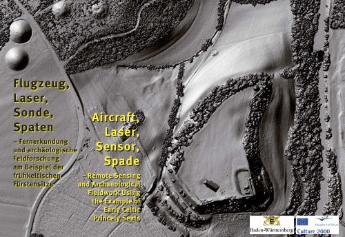
Flugzeug, Laser, Sonde, Spaten Flugzeug, Laser ... - Fuerstensitze.de
Flugzeug, Laser, Sonde, Spaten Flugzeug, Laser ... - Fuerstensitze.de
Flugzeug, Laser, Sonde, Spaten Flugzeug, Laser ... - Fuerstensitze.de

Sie wollen auch ein ePaper? Erhöhen Sie die Reichweite Ihrer Titel.
YUMPU macht aus Druck-PDFs automatisch weboptimierte ePaper, die Google liebt.
<strong>Flugzeug</strong>,<br />
<strong>Laser</strong>,<br />
<strong>Son<strong>de</strong></strong>,<br />
<strong>Spaten</strong><br />
Aircraft,<br />
<strong>Laser</strong>,<br />
Sensor,<br />
Spa<strong>de</strong><br />
– Fernerkundung<br />
und archäologische<br />
Feldforschung<br />
am Beispiel <strong>de</strong>r<br />
frühkeltischen<br />
– Remote Sensing<br />
Fürstensitze<br />
and Archaeological<br />
Fieldwork Using<br />
the Example of<br />
Early Celtic<br />
Princely Seats<br />
1
Jörg Bofinger<br />
<strong>Flugzeug</strong>, <strong>Laser</strong>,<br />
<strong>Son<strong>de</strong></strong>, <strong>Spaten</strong><br />
– Fernerkundung und<br />
archäologische Feldforschung am<br />
Beispiel <strong>de</strong>r frühkeltischen<br />
Fürstensitze<br />
Aircraft, <strong>Laser</strong>,<br />
Sensor, Spa<strong>de</strong><br />
– Remote Sensing and<br />
Archaeological Fieldwork Using<br />
the Example of Early Celtic<br />
Princely Seats<br />
3<br />
Esslingen 2007
4<br />
Umschlag / Cover:<br />
Detail <strong>de</strong>s LIDAR-<br />
Gelän<strong>de</strong>scans mit<br />
<strong>de</strong>m Areal <strong>de</strong>s<br />
Heuneburg-Plateaus.<br />
Abbildung: LAD Esslingen.<br />
Detail image from the<br />
LIDAR terrain scan<br />
showing the area of the<br />
Heuneburg plateau.<br />
Illustration: LAD Esslingen.<br />
© Regierungspräsidium Stuttgart<br />
Lan<strong>de</strong>samt für Denkmalpflege, Esslingen a. N. 2007<br />
Alle Rechte vorbehalten
Einführung: Fürstensitze und<br />
Forschungsprogramme<br />
Die frühkeltischen „Fürstensitze“ und „Fürstengräber“ mit ihrem<br />
oft komplexen und vielschichtigen Umland sind seit geraumer Zeit<br />
Forschungsschwerpunkte in <strong>de</strong>r Archäologie Mitteleuropas. Nicht selten<br />
erlauben sie faszinieren<strong>de</strong> Einblicke in die Welt während <strong>de</strong>r frühen Eisenzeit<br />
(ca. 750 – 450 v. Chr.) im Gebiet nördlich <strong>de</strong>r Alpen. Gera<strong>de</strong> die<br />
Beziehungen mit <strong>de</strong>m mediterranen Sü<strong>de</strong>n lassen ein erstes Aufblitzen<br />
von Elementen einer Hochkultur erkennen, die im sechsten und fünften<br />
vorchristlichen Jahrhun<strong>de</strong>rt nur vor <strong>de</strong>m Hintergrund eines intensiven<br />
Austausches und reger Kontakte mit Griechen, Etruskern und an<strong>de</strong>ren<br />
altitalischen Völkern zu verstehen sind.<br />
Introduction: Princely seats and<br />
research programmes<br />
The early Celtic „princely seats (fürstensitze),“ or chieftain’s<br />
strongholds, and princely tombs with their oftentimes complex and multi-layer<br />
surroundings have been focal points of research in the archaeology<br />
of Central Europe for a long time. They frequently allow fascinating insight<br />
into the world during the early Iron Age (ca. 750 – 450 BC) in the area<br />
north of the Alps. The relations with the Mediterranean world serve as a<br />
first twinkle of elements of a high culture, which can only be un<strong>de</strong>rstood<br />
in the sixth and fifth pre-Christian centuries against the background of<br />
intense exchange and significant contact with Greeks, Etruscans and other<br />
early Italic peoples.<br />
Apart from the so-called princely tombs, or chieftain’s tombs, of<br />
the Hallstatt period, the <strong>de</strong>signation given to the early Iron Age era in<br />
reference to the famous burial grounds at Hallstatt in the Austrian Salzkammergut,<br />
fortified hilltop settlements, or hillforts, have increasingly<br />
become a focus of scientific study in recent years. Among the most well-<br />
Red-figured Greek drinking cup plated in gold from the early La Tène period princely tomb<br />
(Fürstengrab) at Kleinaspergle, Ludwigsburg District (Ba<strong>de</strong>n-Württemberg).<br />
Photo: Lan<strong>de</strong>smuseum (State Museum) Württemberg, Stuttgart.<br />
Rotfigurige, mit Goldblechen belegte griechische Trinkschale aus <strong>de</strong>m frühlatènezeitlichen Fürstengrab<br />
Kleinaspergle, Kreis Ludwigsburg (Ba<strong>de</strong>n-Württemberg). Foto: Lan<strong>de</strong>smuseum Württemberg, Stuttgart.<br />
5
6<br />
Neben <strong>de</strong>n so genannten „Fürstengräbern“ <strong>de</strong>r Hallstattzeit, so<br />
die Bezeichnung dieser früheisenzeitlichen Epoche nach <strong>de</strong>m berühmten<br />
Gräberfeld von Hallstatt im Salzkammergut, Oberösterreich, traten<br />
in <strong>de</strong>n letzten Jahren vor allem die befestigten Höhensiedlungen verstärkt<br />
in <strong>de</strong>n Focus <strong>de</strong>r Wissenschaft. Zu <strong>de</strong>n bekanntesten dieser frühkeltischen<br />
Fürstensitze gehören <strong>de</strong>r Mont Lassois in Burgund, die Siedlung<br />
von Châtillon-sur-Glâne in <strong>de</strong>r Schweiz, <strong>de</strong>r Breisacher Münsterberg<br />
am Oberrhein, <strong>de</strong>r Hohenasperg im mittleren Neckarland, <strong>de</strong>r Ipf<br />
bei Bopfingen an <strong>de</strong>r ba<strong>de</strong>n-württembergisch-bayerischen Grenze und<br />
die Heuneburg an <strong>de</strong>r Oberen Donau sowie <strong>de</strong>r Glauberg in Hessen.<br />
Auffällig ist neben <strong>de</strong>r topographischen herausragen<strong>de</strong>n Situation<br />
gleichermaßen die verkehrsgeographisch äußerst günstige Lage, in <strong>de</strong>r<br />
diese „Fürstensitze“ in <strong>de</strong>r Regel zu fin<strong>de</strong>n sind.<br />
Der Mont Lassois (Burgund) am Oberlauf <strong>de</strong>r Seine, Dép. Côte d’Or, (Burgund).<br />
Foto: S. Jagiolla, Institut für Ur- und Frühgeschichte Kiel.<br />
known of the early Celtic princely seats are Mont Lassois in Burgundy,<br />
the settlement at Châtillon-sur-Glâne in Switzerland, the Münsterberg<br />
in Breisach on the Upper Rhine, the Hohenasperg in central Neckarland,<br />
the Ipf near Bopfingen on the bor<strong>de</strong>r between Ba<strong>de</strong>n Württemberg and<br />
Bavaria, and the Heuneburg on the Upper Danube as well as the Glauberg<br />
in Hesse. Equally as striking as the protruding topographical situation,<br />
is the especially favourable location with regard to transportation, in which<br />
these princely seats are usually found.<br />
The Mont Lassois (Burgundy) by the Seine River, Dép. Côte d’Or, (Burgundy).<br />
Photo: S. Jagiolla, Institut für Ur- und Frühgeschichte Kiel (Institute for Prehistoric and Early Civilizations in Kiel).
Der Breisacher Münsterberg, am Rhein gelegen, bot ebenfalls bereits in frühkeltischer Zeit<br />
einer befestigten Siedlung Platz, Kreis Breisgau-Hochschwarzwald (Ba<strong>de</strong>n-Württemberg).<br />
Importkeramik belegt auch hier Kontakte mit <strong>de</strong>m mediterranen Sü<strong>de</strong>n.<br />
Foto: O. Braasch, Landshut<br />
Located on the Rhine River, the Münsterberg in Breisach was also the site of a fortified<br />
settlement in the early Celtic period. Breisgau-Hochschwarzwald District (Ba<strong>de</strong>n-<br />
Württemberg). Imported ceramics found here are also evi<strong>de</strong>nce of contact with the<br />
Mediterranean world. Photo: O. Braasch, Landshut<br />
Das Plateau <strong>de</strong>s Hohenasperg ist heute nahezu vollständig durch neuzeitliche Festungsbaumaßnahmen<br />
überprägt, Kreis Ludwigsburg (Ba<strong>de</strong>n-Württemberg). Dennoch kann auch hier<br />
ein sog. frühkeltischer Fürstensitz lokalisiert wer<strong>de</strong>n. Foto: O. Braasch, Landshut<br />
The plateau of the Hohenasperg is nowadays almost completely characterised by mo<strong>de</strong>rn<br />
fortification measures, Ludwigsburg District (Ba<strong>de</strong>n-Württemberg). However a so-called<br />
early Celtic princely seat can also be pinpointed here. Photo: O. Braasch, Landshut<br />
7
8<br />
Der Ipf bei Bopfingen, Ostalbkreis (Ba<strong>de</strong>n-Württemberg). Deutlich<br />
hebt sich <strong>de</strong>r Zeugenberg über <strong>de</strong>n Meteorkrater <strong>de</strong>s Nördlinger Rieses.<br />
Foto: O. Braasch, Landshut<br />
The Ipf near Bopfingen, Ostalb District (Ba<strong>de</strong>n-Württemberg). The<br />
Zeugenberg rises clearly above the crater of the Nördlinger Ries.<br />
Photo: O. Braasch, Landshut<br />
Die Heuneburg direkt über <strong>de</strong>m heute regulierten Bett <strong>de</strong>r oberen Donau in Oberschwaben, Kreis<br />
Sigmaringen (Ba<strong>de</strong>n-Württemberg). Die räumliche Nähe von Burgberg und Großgrabhügel, hier im<br />
Hintergrund vor <strong>de</strong>m Waldrand, kann als „exemplarisch“ für das „Fürstensitzmo<strong>de</strong>ll“ angesehen<br />
wer<strong>de</strong>n.<br />
Foto: O. Braasch, Landshut<br />
The Heuneburg directly above the regulated Upper Danube river corridor in Upper Schwabia,<br />
Sigmaringen District (Ba<strong>de</strong>n-Württemberg). The spatial proximity of the hillfort and the big<br />
tumulus, as seen here in the background before the edge of the forest, can be consi<strong>de</strong>red „exemplary“<br />
for the princely seat mo<strong>de</strong>l.<br />
Photo: O. Braasch, Landshut
Ob es sich bei diesen befestigten „Burgen“ <strong>de</strong>s 7. – 5. Jahrhun<strong>de</strong>rts<br />
v. Chr. im Raum zwischen Ostfrankreich, <strong>de</strong>r Schweiz und <strong>de</strong>m<br />
Main einst um stadtartige Machtzentren mit überregionaler Be<strong>de</strong>utung<br />
han<strong>de</strong>lte, sollen Untersuchungen im Rahmen eines neuen Forschungsprogramms<br />
<strong>de</strong>r Deutschen Forschungsgemeinschaft klären. Der Titel<br />
dieses Schwerpunktprogramms lautet: „Frühe Zentralisierungs- und<br />
Urbanisierungsprozesse - Zur Genese und Entwicklung ‚frühkeltischer<br />
Fürstensitze‘ und ihres territorialen Umlan<strong>de</strong>s“.<br />
Mitteleuropa im 6. und 5. Jahrhun<strong>de</strong>rt v. Chr. Im frühkeltischen Siedlungsgebiet sind die<br />
bekanntesten <strong>de</strong>r frühkeltischen, befestigten Höhensiedlungen und Grabfun<strong>de</strong> eingetragen.<br />
Grafik: C. Nübold, Lan<strong>de</strong>samt für Denkmalpflege Ba<strong>de</strong>n-Württemberg, Reg.-Präs. Stuttgart (LAD) Esslingen.<br />
Central Europe in the 6th and 5th centuries BC. The most well-known sites of early Celtic<br />
hillforts and tumuli are plotted in the early Celtic settlement area.<br />
Illustration: C. Nübold, Lan<strong>de</strong>samt für Denkmalpflege (State Office for Historical<br />
Monuments) Ba<strong>de</strong>n-Württemberg, Stuttgart regional council (LAD) Esslingen.<br />
Determining whether these fortified strongholds<br />
in the area between Eastern France, Switzerland,<br />
and the River Main once comprised city-like<br />
power centres with supra-regional importance is the<br />
aim of investigations being carried out within the<br />
context of a new research programme of the German<br />
Research Foundation (Deutsche Forschungsgemeinschaft).<br />
The title of this priority programme is: „Early<br />
Centralisation and Urbanisation Processes – the Formation<br />
and Development of ‘Early Celtic Princely<br />
Seats’ and their Surrounding Area.“<br />
Chronologietabelle <strong>de</strong>r wichtigsten Siedlungen während <strong>de</strong>r<br />
frühen Eisenzeit in Mitteleuropa. Grafik: C. Frank, Kirchheim u. T.<br />
Chronological chart of the most important settlements<br />
during the early Iron Age in Central Europe.<br />
Illustration: C. Frank, Kirchheim u. T.<br />
9
10<br />
Gleichzeitig ermöglichte die Teilnahme an einem „Culture 2000“-<br />
För<strong>de</strong>rprogramm <strong>de</strong>r Europäischen Union weitergehen<strong>de</strong> Untersuchungen<br />
im Umfeld <strong>de</strong>r „Fürstensitze“. Im Rahmen dieses Projektes,<br />
„European Landscapes: Past, Present and Future“, ergaben sich Möglichkeiten<br />
vor allem in Hinblick auf unterschiedlichste Prospektionsmetho<strong>de</strong>n<br />
wie Luftbildarchäologie, geophysikalische Untersuchungen und<br />
Gelän<strong>de</strong>scans für ausgewählte „Fürstensitze“. Diese Metho<strong>de</strong>n erlauben<br />
uns die Erforschung <strong>de</strong>r Mikrotopographie <strong>de</strong>r archäologischen Denkmale<br />
selbst und ihres Umfel<strong>de</strong>s und ermöglichen so die Planung und<br />
Durchführung gezielter <strong>de</strong>nkmalschützerischer Maßnahmen. Voraussetzung<br />
dafür war die systematische Aufnahme <strong>de</strong>r Landschaft mit Luftbil<strong>de</strong>rn<br />
und flugzeuggestützten Gelän<strong>de</strong>scans für digitale Gelän<strong>de</strong>mo<strong>de</strong>lle,<br />
die ein <strong>de</strong>tailliertes Abbild <strong>de</strong>r Gelän<strong>de</strong>oberfläche auch in dicht bewal<strong>de</strong>ten<br />
Zonen liefern können.<br />
Halsreif und Armstulpe aus <strong>de</strong>m<br />
keltischen Fürstengrab von<br />
Hochdorf, Kreis Ludwigsburg<br />
(Ba<strong>de</strong>n-Württemberg). Die<br />
Ausstattung <strong>de</strong>r Toten mit<br />
reichen Goldbeigaben ist<br />
kennzeichnend für die Fürstengräber<br />
<strong>de</strong>s 6. Jahrhun<strong>de</strong>rts v. Chr.<br />
Foto: P. Frankenstein, J. Jordan,Stuttgart.<br />
A torc (neck ring) und arm<br />
guards from the early Celtic<br />
princely tomb of Hochdorf,<br />
Ludwigsburg District (Ba<strong>de</strong>n-<br />
Württemberg). Decorating the<br />
<strong>de</strong>ad with rich gold pieces is<br />
characteristic of the princely<br />
tombs from the 6 th century BC.<br />
Photo: P. Frankenstein,<br />
J. Jordan, Stuttgart.<br />
The participation in the European Union’s „Culture 2000“ support<br />
programme will simultaneously enable further investigation into the<br />
surroundings of the princely seats. Within the context of this project,<br />
„European Landscapes: Past, Present and Future,“ possibilities were<br />
generated primarily with regard to the different methods of prospection<br />
such as aerial archaeology, geophysical survey, and terrain mapping for<br />
selected „princely seats.“ These methods allow us to research the microtopography<br />
of the archaeological monuments themselves and their<br />
surroundings, and in doing so enable the planning and execution of<br />
targeted measures for protecting the monuments.<br />
The prerequisite for doing so was the systematic survey of the<br />
landscape using aerial photography and airborne terrain mapping to<br />
<strong>de</strong>velop digital terrain mo<strong>de</strong>ls, which can provi<strong>de</strong> the <strong>de</strong>tailed likeness of<br />
the terrain’s surface even in <strong>de</strong>nsely woo<strong>de</strong>d areas.<br />
Fragmente einer attisch-rotfigurigen Trinkschale <strong>de</strong>r Zeit um 460/50 v. Chr. aus <strong>de</strong>m<br />
Rechteckhof „Zaunäcker“ bei Kirchheim/Ries, Ostalbkreis (Ba<strong>de</strong>n-Württemberg). Die<br />
Fun<strong>de</strong> griechischer Keramik in <strong>de</strong>n frühkeltischen Siedlungsstellen sind eindrucksvolle<br />
Belege für die Kontakte mit Griechen und Etruskern. Foto: Y. Mühleis, LAD Esslingen.<br />
Fragments from an attic redfigured<br />
drinking cup from the<br />
period around 460/50 BC<br />
retrieved from the rectangular<br />
enclosure (rechteckhof)<br />
„Zaunäcker“ near Kirchheim/<br />
Ries, Ostalb District (Ba<strong>de</strong>n-<br />
Württemberg). The findings of<br />
Greek ceramics in the early<br />
Celtic settlement sites are telling<br />
evi<strong>de</strong>nce of contact with Greeks<br />
and Etruscans.<br />
Photo: Y. Mühleis, LAD Esslingen.
Die Heuneburg Heuneburg<br />
In erster Linie am Beispiel <strong>de</strong>r frühkeltischen Heuneburg soll im<br />
Folgen<strong>de</strong>n gezeigt wer<strong>de</strong>n, wie sich die Schwerpunkte <strong>de</strong>r bei<strong>de</strong>n<br />
Forschungsprogramme gegenseitig ergänzen und so in bestimmten Punkten<br />
völlig neue Einsichten und Erkenntnisse liefern können. Eingebettet<br />
in eine vielschichtige archäologische Landschaft mit Außensiedlung,<br />
Nekropolen, Befestigungswerken und Vorburg gilt die Heuneburg als<br />
Para<strong>de</strong>beispiel eines frühkeltischen Fürstensitzes. Auf einem Bergsporn<br />
oberhalb <strong>de</strong>r Donau gelegen, dominiert das etwa 3 ha große Plateau das<br />
Flusstal in strategisch günstiger Lage.<br />
Die Heuneburg liegt in Mitten einer komplexen archäologischen<br />
Landschaft. Nicht nur <strong>de</strong>r befestigte Burgberg son<strong>de</strong>rn auch das<br />
weitläufige Territorium einer Außensiedlung sowie zahlreiche<br />
Grabhügelnekropolen prägen das Umfeld <strong>de</strong>s „Fürstensitzes“.<br />
Grafik: C. Nübold, LAD Esslingen.<br />
The Heuneburg is located in the middle of a complex<br />
archaeological landscape. Not only the hillfort, but also the<br />
expansive territory of the outer settlement as well as numerous<br />
tumulus necropolises <strong>de</strong>fine the character of the princely seat’s<br />
surroundings. Illustration: C. Nübold, LAD Esslingen.<br />
11<br />
Primarily using the example of the Heuneburg, an early Celtic<br />
hillfort, the following is inten<strong>de</strong>d to <strong>de</strong>monstrate how the focal points of<br />
both research programmes can complement one another and, on certain<br />
points, thereby <strong>de</strong>liver completely new insight and knowledge. Embed<strong>de</strong>d<br />
in a multi-layer, archaeological landscape with an outer settlement,<br />
necropolises, fortifications, and a bailey, the Heuneburg is a prime example<br />
of an early Celtic princely seat. Situated on a promontory overlooking<br />
the Danube, the ca. 3 ha. plateau is strategically placed over the river<br />
valley.
12<br />
Nach Besiedlungsphasen während <strong>de</strong>r Jungsteinzeit und <strong>de</strong>r mittleren<br />
bis ausgehen<strong>de</strong>n Bronzezeit fällt die Blütezeit <strong>de</strong>r Besiedlung in<br />
die späte Hallstattzeit: Zwischen <strong>de</strong>r zweiten Hälfte <strong>de</strong>s 7. bis zum Beginn<br />
<strong>de</strong>s 5. Jahrhun<strong>de</strong>rts bestand hier eine befestigte Höhensiedlung,<br />
die zahlreiche Bauphasen erkennen lässt. Berühmt ist die Lehmziegelmauer<br />
<strong>de</strong>r Heuneburg, die zu Beginn <strong>de</strong>s 6. Jahrhun<strong>de</strong>rts v. Chr. die<br />
Holz-Er<strong>de</strong>-Befestigung auf <strong>de</strong>m Burgberg ersetzt. Die Mauer aus luftgetrockneten<br />
Lehmziegeln, verstärkt durch vorspringen<strong>de</strong> Bastionen, ist<br />
nach wie vor einmalig im Gebiet nördlich <strong>de</strong>r Alpen und darf als Resultat<br />
mehr o<strong>de</strong>r weniger intensiver Kontakte mit <strong>de</strong>r mediterranen Welt angesehen<br />
wer<strong>de</strong>n. Auch zahlreiche Fun<strong>de</strong> griechischer Keramik belegen diese<br />
Beziehungen nach Italien und Südgallien.<br />
Bislang waren wesentliche Bereiche <strong>de</strong>r ausge<strong>de</strong>hnten Außensiedlung<br />
im Umfeld <strong>de</strong>r Heuneburg und ihrer mit aufwändigen Wallanlagen<br />
befestigten Vorburg weitgehend unerforscht. Mittels mo<strong>de</strong>rner<br />
Metho<strong>de</strong>n <strong>de</strong>r Fernerkundung können nun einerseits großflächige Gebiete<br />
sehr genau erfasst wer<strong>de</strong>n, an<strong>de</strong>rerseits lassen sich dank gezielter<br />
Grabungen und Sondagen Hinweise zur Datierung <strong>de</strong>r Wall-Graben-<br />
Systeme sowie zur Struktur <strong>de</strong>r Besiedlung innerhalb <strong>de</strong>r Vorburg und<br />
<strong>de</strong>ren zeitliches Verhältnis zu <strong>de</strong>n bekannten Siedlungsphasen auf <strong>de</strong>m<br />
Plateau <strong>de</strong>r Heuneburg gewinnen.<br />
Following settlements phases during the New Stone Age and middle<br />
to late Bronze Age, the settlement’s height occurs in the late Hallstatt<br />
period: between the second half of the 7 th until the beginning of the 5 th<br />
century BC, a hillfort was erected that shows evi<strong>de</strong>nce of numerous<br />
building phases. The Heuneburg is well-known for its mudbrick wall,<br />
which replaced the wood and earth fortification at the beginning of the<br />
6 th century BC.<br />
The wall, ma<strong>de</strong> from air-dried mudbricks and reinforced with<br />
projecting bastions, is still unique in the area north of the Alps and can be<br />
viewed as the result of more or les intensive contact with the Mediterranean<br />
world. Numerous findings of Greek ceramics provi<strong>de</strong> evi<strong>de</strong>nce of<br />
contact with Italy and southern Gallia.<br />
Up to now significant areas of the expan<strong>de</strong>d outer settlement in<br />
the surroundings of the Heuneburg and its bailey, fortified with elaborate<br />
ramparts, have for the most part not been researched. Using mo<strong>de</strong>rn<br />
methods of remote sensing, it is now possible to make highly exact surveys<br />
of extensive areas for one, but also, thanks to targeted excavations and<br />
sondages, to gain direction in dating the rampart system as well as the<br />
structure of the settlement within the bailey and its relation to the known<br />
settlement phases on the plateau of the Heuneburg.<br />
Weinamphoren aus <strong>de</strong>r griechischen Kolonie Massilia,<br />
<strong>de</strong>m heutigen Marseille, sind unter <strong>de</strong>n Importfun<strong>de</strong>n<br />
<strong>de</strong>r Heuneburg relativ zahlreich vertreten.<br />
Foto nach M. Kuckenburg, Die Kelten in Mitteleuropa<br />
(Stuttgart 2004)<br />
Wine amphorae from the Greek colony Massilia<br />
(mo<strong>de</strong>rn Marseilles) comprise a relatively high number<br />
of the import findings of the Heuneburg.<br />
Photo from M. Kuckenburg, Die Kelten in Mitteleuropa<br />
(The Celts in Central Europe) (Stuttgart 2004).<br />
Ein Abschnitt <strong>de</strong>r Lehmziegelmauer <strong>de</strong>r<br />
Heuneburg wur<strong>de</strong> auf <strong>de</strong>m Plateau rekonstruiert<br />
und kann im Freilichtmuseum Heuneburg<br />
besichtigt wer<strong>de</strong>n. Foto: R. Hajdu, Stuttgart<br />
A section from the mudbrick wall of the<br />
Heuneburg was reconstructed on the plateau and<br />
can be viewed in the Heuneburg open-air museum.<br />
Photo: R. Hajdu, Stuttgart
14<br />
Luftbildarchäologie und LIDAR<br />
– Prospektion vom <strong>Flugzeug</strong><br />
Mo<strong>de</strong>rnste Technologie zur Erforschung längst vergangener Epochen<br />
ist für die archäologische Wissenschaft unverzichtbar und fin<strong>de</strong>t<br />
immer breiter gefächerte Einsatzgebiete.<br />
Am Beispiel <strong>de</strong>r Heuneburg lässt sich beson<strong>de</strong>rs <strong>de</strong>utlich die jeweils<br />
spezifische Arbeitsweise von Luftbildarchäologie auf <strong>de</strong>r einen und<br />
LIDAR-Airborne-Gelän<strong>de</strong>scans auf <strong>de</strong>r an<strong>de</strong>ren Seite zeigen. Gleichzeitig<br />
kann <strong>de</strong>utlich gemacht wer<strong>de</strong>n, wie sich die Ergebnisse dieser bei<strong>de</strong>n<br />
Metho<strong>de</strong>n ergänzen und so dazu beitragen, ein möglichst vollständiges<br />
Bild <strong>de</strong>r Landschaft und ihrer archäologischen Denkmäler zu zeichnen.<br />
Das <strong>Flugzeug</strong> <strong>de</strong>s Luftbildarchäologen Otto Braasch unmittelbar vor <strong>de</strong>m Start zu einem<br />
Ausbildungsflug während <strong>de</strong>r International Aerial Archaeology Training school in Foggia,<br />
Mai 2006. Im Hintergrund ist Klaus Leidorf, ebenfalls Luftbildarchäologe, zu erkennen.<br />
Foto: LAD Esslingen.<br />
The aircraft used by the aerial archaeologist Otto Braasch just before taking off for a training<br />
flight during the International Aerial Archaeology Training school in Foggia, May 2006.<br />
Klaus Leidorf, also an aerial archaeologist, can be seen in the background.<br />
Photo: LAD Esslingen.<br />
Aerial archaeology and LIDAR<br />
– Aerial Prospection<br />
Diagram of the methods used in airborne laser mapping (airborne LIDAR).<br />
Illustration: Toposys GmbH, Biberach, LAD Esslingen.<br />
Schema zur Metho<strong>de</strong><br />
<strong>de</strong>s flugzeuggestützten<br />
<strong>Laser</strong>scannings<br />
(airborne-LIDAR).<br />
Abbildungsvorlage<br />
Toposys GmbH, Biberach,<br />
LAD Esslingen.<br />
A mo<strong>de</strong>rn technology used to research long <strong>de</strong>parted periods of<br />
history is indispensable for the science of archaeology and is being used<br />
for an ever broa<strong>de</strong>r range of applications.<br />
Using the example of the Heuneburg, the respectively specific<br />
functions of aerial archaeology on the one hand and airborne LIDAR<br />
terrain mapping on the other hand are <strong>de</strong>monstrated. At the same time,<br />
it is revealed how the results of these two methods complement one<br />
another, and in doing so, contribute to the most complete mapping of<br />
the landscape and its archaeological monuments as is possible.
Metho<strong>de</strong> LIDAR<br />
Mittels eines <strong>Laser</strong>scans <strong>de</strong>r Landschaft, <strong>de</strong>r vom<br />
<strong>Flugzeug</strong> aus bewerkstelligt wird, kann in relativ kurzer<br />
Zeit ein sehr <strong>de</strong>tailliertes, aktuelles Abbild <strong>de</strong>r<br />
Landschaftsoberfläche gewonnen wer<strong>de</strong>n, das mannigfaltige<br />
Möglichkeiten <strong>de</strong>r Darstellung und Auswertung<br />
<strong>de</strong>r gemessenen Details bietet. Mit diesem so genannten<br />
LIDAR (LIght Detection And Ranging)-Gelän<strong>de</strong>scan<br />
existiert ein Werkzeug zur hochpräzisen Erfassung<br />
großer Flächen in relativ kurzer Zeit. Die Gelän<strong>de</strong>aufnahme<br />
basiert auf <strong>de</strong>r Aussendung von <strong>Laser</strong>strahlen in<br />
bestimmten, regelmäßigen Abstän<strong>de</strong>n. Dieser gepulste<br />
<strong>Laser</strong> ist im <strong>Flugzeug</strong>bo<strong>de</strong>n installiert und kann von dort<br />
mittels eines schnell rotieren<strong>de</strong>n Spiegels einen quer zur<br />
Flugrichtung liegen<strong>de</strong>n, bis zu 700 m breiten Gelän<strong>de</strong>streifen<br />
abtasten. Die <strong>Laser</strong>strahlen wer<strong>de</strong>n vom Erdbo<strong>de</strong>n<br />
bzw. von Vegetation und Bebauung reflektiert.<br />
Aus <strong>de</strong>r Berechnung von Winkel und Laufzeit <strong>de</strong>s <strong>Laser</strong>strahls<br />
können die Einzelpunkte <strong>de</strong>r Messung im dreidimensionalen<br />
Raum erfasst wer<strong>de</strong>n. Die Positions- und<br />
Höhenbestimmung <strong>de</strong>s <strong>Flugzeug</strong>s, auf die sich die<br />
Gelän<strong>de</strong>messungen beziehen, erfolgt über GPS (Global<br />
Position System) sowohl direkt, also bordintern, über<br />
Satellitenpeilung als auch über Referenzmessungen zu<br />
GPS-Bo<strong>de</strong>nstationen. Über Einstellung <strong>de</strong>s <strong>Laser</strong>pulses<br />
bzw. Geschwindigkeit beim Messflug kann die Punktdichte<br />
<strong>de</strong>r Messungen variiert wer<strong>de</strong>n. Die absoluten<br />
Höhenwerte können mit einer Genauigkeit von wenigen<br />
Zentimetern Abweichung registriert wer<strong>de</strong>n.<br />
Schema <strong>de</strong>r <strong>Laser</strong>abtastung von Gelän<strong>de</strong>oberflächen:<br />
Das „first echo“ wird von <strong>de</strong>r Gelän<strong>de</strong>oberfläche<br />
bzw. <strong>de</strong>r Vegetation o<strong>de</strong>r <strong>de</strong>r Bebauung<br />
reflektiert. Aus diesen Punkten wird das digitale<br />
Oberflächenmo<strong>de</strong>ll (DOM) berechnet. Nur aus<br />
<strong>de</strong>n Messungen <strong>de</strong>r „last echos“ wird das digitale<br />
Gelän<strong>de</strong>mo<strong>de</strong>ll (DTM, DGM) berechnet.<br />
Abbildung: LAD Esslingen.<br />
Procedure for the laser mapping of terrain surfaces:<br />
the „first echo“ is reflected by the terrain surface<br />
and/or vegetation or buildings. These data points<br />
are used to calculate the Digital Surface Mo<strong>de</strong>l<br />
(DSM). The measurements collected from the „last<br />
echos“ form the basis of the Digital Terrain Mo<strong>de</strong>l<br />
(DTM).<br />
Illustration: LAD Esslingen.<br />
LIDAR Methods<br />
15<br />
Through laser scanning of the landscape executed<br />
from an aircraft, a very <strong>de</strong>tailed and current image of<br />
the landscape’s surface can be generated in a relatively<br />
short time period, which offers a multitu<strong>de</strong> of possibilities<br />
for presenting and evaluating the measured <strong>de</strong>tails. With<br />
this so-called LIDAR (LIght Detection And Ranging)<br />
terrain mapping, one has a tool for the high-precision<br />
survey of large areas in a relatively short period of time.<br />
The scanning of the terrain is based on the transmission<br />
of the laser beams in regular, pre<strong>de</strong>termined intervals.<br />
This pulsed laser is installed in the aircraft floor, and<br />
with the use of a fast rotating mirror from this position,<br />
can scan a piece of terrain up to 700m wi<strong>de</strong> lying<br />
perpendicular to the course. The laser beams are<br />
reflected by the ground and/or the vegetation and<br />
constructions. From the calculation of the angle and the<br />
elapsed time of the laser beam, the individual points in<br />
the measurement can be collected in 3-dimensional<br />
space. The <strong>de</strong>termination of the aircraft’s position and<br />
altitu<strong>de</strong>, to which the terrain measurements refer, occurs<br />
via GPS (Global Positioning System) both directly, onboard<br />
via satellite bearing, as well as via reference point<br />
measurements to GPS ground stations. Through the<br />
adjustment of the laser beam and/or speed during the<br />
measurement flight, the point <strong>de</strong>nsity of the measurements<br />
can be varied. The absolute altitu<strong>de</strong> values can<br />
be recor<strong>de</strong>d with an accuracy of only a few centimetres<br />
<strong>de</strong>viation.
16<br />
Durch <strong>de</strong>n Einsatz <strong>de</strong>s lasergestützten Verfahrens vom <strong>Flugzeug</strong><br />
aus besteht die Möglichkeit, auch schwer zugängliche und mit dichter,<br />
flächiger Vegetation bestan<strong>de</strong>ne Gelän<strong>de</strong>bereiche zu erfassen und zu<br />
dokumentieren. Selbst bei Waldflächen ist die Zahl <strong>de</strong>r <strong>Laser</strong>strahlen,<br />
die durch das Blätterdach bis auf <strong>de</strong>n Bo<strong>de</strong>n gelangen, relativ hoch, so<br />
dass auch hier ein recht genaues Abbild <strong>de</strong>r Gelän<strong>de</strong>oberfläche ermittelt<br />
wer<strong>de</strong>n kann. Gera<strong>de</strong> in diesem Punkt können die Ergebnisse <strong>de</strong>r „konventionellen“<br />
Luftbildarchäologie entschei<strong>de</strong>nd bereichert wer<strong>de</strong>n. Um<br />
die Beeinträchtigungen <strong>de</strong>r Messungen durch die Vegetations<strong>de</strong>cke<br />
allerdings möglichst gering zu halten, wer<strong>de</strong>n die Messflüge in <strong>de</strong>r Regel<br />
während <strong>de</strong>r Wintermonate durchgeführt.<br />
Gegenüberstellung eines Luftbilds<br />
(links: Grundlage Google Earth) <strong>de</strong>r<br />
Gegend um <strong>de</strong>n „Hohmichele“,<br />
nordwestlich <strong>de</strong>r Heuneburg und <strong>de</strong>s<br />
Gelän<strong>de</strong>scans dieses Areals. Durch<br />
rechnerische Verfahren kann die<br />
Vegetations<strong>de</strong>cke entfernt und die<br />
archäologischen Strukturen, wie<br />
beispielsweise Grabhügel und<br />
Viereckschanze sichtbar gemacht<br />
wer<strong>de</strong>n.<br />
Abbildung: LAD Esslingen.<br />
By using the laser-supported method, the possibility exists of<br />
documenting and mapping terrains that are difficult to access or perhaps<br />
covered with thick and broad vegetation. Even with forest areas, the<br />
number of laser beams that penetrate the leaf canopy to reach the forest<br />
floor is relatively high allowing even in this case for a quite accurate image<br />
of the terrain’s surface. It is in this area where conventional aerial<br />
archaeology can be improved significantly. In or<strong>de</strong>r to minimize the<br />
interference of the vegetation canopy in the measurements, the<br />
measurement flights are generally flown in the winter months.<br />
Comparison of an aerial photograph (left: Google Earth photograph) of the area around the<br />
„Hohmichele,“ northwest of the Heuneburg, and the terrain scan of this area. Using<br />
computer methods, the vegetation covering can be removed, thereby exposing archaeological<br />
structures such as grave mounds and rectangular enclosures (viereckschanze).<br />
Illustration: LAD Esslingen.
Gelän<strong>de</strong>ausschnitt im Bereich<br />
<strong>de</strong>r Heuneburg in <strong>de</strong>r Darstellung<br />
mit Vegetation und<br />
Bebauung (DOM, links) und als<br />
reines Oberflächenabbild<br />
(DTM, DGM, rechts).<br />
Abbildung: LAD Esslingen.<br />
Terrain section in the area of the<br />
Heuneburg shown with<br />
vegetation and structures (DOM,<br />
left) and as a pure surface picture<br />
(DTM, DGM, right).<br />
Illustration: LAD Esslingen.<br />
Nach Abschluss eines Messfluges können mit Hilfe unterschiedlicher<br />
Rechen- und Interpolierungsverfahren unterschiedliche digitale<br />
Gelän<strong>de</strong>mo<strong>de</strong>lle am Computer errechnet wer<strong>de</strong>n. Im digitalen Oberflächen-Mo<strong>de</strong>ll<br />
(DOM) wer<strong>de</strong>n in <strong>de</strong>r Gelän<strong>de</strong>darstellung auch Vegetation<br />
und Bebauung berücksichtigt, im digitalen Gelän<strong>de</strong>-Mo<strong>de</strong>ll (DGM) sind<br />
diese Elemente durch rechnerische Verfahren eliminiert und die Darstellung<br />
ist auf ein Abbild <strong>de</strong>r Gelän<strong>de</strong>oberfläche reduziert. Mittlerweile existiert<br />
eine nahezu flächen<strong>de</strong>cken<strong>de</strong> LIDAR-Aufnahme für das Land Ba<strong>de</strong>n-Württemberg.<br />
17<br />
After the completion of a measurement flight, different digital terrain<br />
modals can be generated by a computer with the aid of various calculation<br />
and interpolation methods. In the Digital Surface Mo<strong>de</strong>l (DSM),<br />
vegetation and constructions are inclu<strong>de</strong>d in the <strong>de</strong>piction of the terrain;<br />
in the Digital Terrain Mo<strong>de</strong>l (DTM) these elements are removed using<br />
computer methods thereby reducing the <strong>de</strong>piction to an image of the<br />
terrain’s surface. In the meantime, LIDAR imagery is available for nearly<br />
all of Ba<strong>de</strong>n Württemberg.
18<br />
Neben <strong>de</strong>r Aussicht, bislang unbekannte Fundstellen, etwa einzelne<br />
Grabhügel im Gelän<strong>de</strong> i<strong>de</strong>ntifizieren zu können, sind vor allem die<br />
Einsatzmöglichkeiten <strong>de</strong>r LIDAR-Daten im Umfeld bekannter archäologischer<br />
Denkmale mannigfaltig. Die plastische, sehr anschauliche Darstellung<br />
<strong>de</strong>r Topographie in Form eines schattierten Graustufenbil<strong>de</strong>s<br />
(„sha<strong>de</strong>d relief“) lässt selbst kleinste Details <strong>de</strong>r Oberfläche an <strong>de</strong>n Fundstellen<br />
sowie in <strong>de</strong>ren Umgebung erkennen. Für Gelän<strong>de</strong>forschungen<br />
und für die Planung von Ausgrabungen können diese Erkenntnisse von<br />
großem Nutzen sein.<br />
Wall- und Grabenanlagen von Befestigungswerken<br />
lassen sich durch die Höhenunterschie<strong>de</strong><br />
meist sehr gut erkennen, aber auch alte<br />
Verkehrswege und Landmarken zeichnen sich<br />
<strong>de</strong>utlich ab.<br />
Selbstverständlich kann die LIDAR-Metho<strong>de</strong> die konventionelle<br />
Luftbildarchäologie nicht ersetzen, son<strong>de</strong>rn sie stellt<br />
eine wichtige Ergänzung dar. Der Verlauf <strong>de</strong>r Wall-<br />
Grabenanlage im Bereich <strong>de</strong>r Heuneburg-Außensiedlung<br />
etwa ist im LIDAR-Scan ebenfalls sehr gut zu erkennen,<br />
Details wie alte Grabungsschnitte etc. sind jedoch nur im<br />
Luftbild zu sehen.<br />
Foto: O. Braasch, Landshut.<br />
Of course, LIDAR methods cannot replace conventional<br />
aerial archaeology, rather it provi<strong>de</strong>s an important<br />
complement. The course of the ramparts in the area of the<br />
Heuneburg’s outer settlement can also be clearly recognised<br />
in the LIDAR scan, while <strong>de</strong>tails such as old trenches, etc.<br />
can only be seen in the aerial photograph.<br />
Photo: O. Braasch, Landshut<br />
Aufgabe und Herausfor<strong>de</strong>rung für die Archäologen ist es dann,<br />
aus <strong>de</strong>n dokumentierten Elementen das historische Bild <strong>de</strong>r Landschaft<br />
in <strong>de</strong>n unterschiedlichen Besiedlungsphasen zu zeichnen und die Landschaftsnutzung<br />
in einer Siedlungskammer herauszuarbeiten bzw. unterschiedliche<br />
Interpretationsmuster und Mo<strong>de</strong>lle dafür einan<strong>de</strong>r gegenüberzustellen.
In addition to making possible the i<strong>de</strong>ntification of unknown<br />
findings such as individual grave mounds in the terrain, the uses of LIDAR<br />
data in the surroundings of known archaeological monuments are<br />
manifold. The very clear, 3-dimensional image of the topography in the<br />
form of a sha<strong>de</strong>d relief map allows for the recognition of even the smallest<br />
<strong>de</strong>tails of the surface at the location of findings and also in their<br />
surroundings. This information can be of significant use in terrain research<br />
and the planning of excavations<br />
19<br />
The rampart system of fortifications can usually be recognised easily<br />
by the difference in altitu<strong>de</strong>, but also old transportation routes and<br />
landmarks are recor<strong>de</strong>d clearly.<br />
The task and challenge for archaeologists is to create a historical<br />
picture of the landscape in the various phases of settlement using the<br />
documented elements and to elaborate the use of landscape in a settlement<br />
region or to contrast different mo<strong>de</strong>ls and patterns of interpretation with<br />
each other.<br />
Most of the new discoveries of sites<br />
from the air are still achieved<br />
through conventional aerial<br />
archaeology.<br />
Photo: O. Braasch, Landshut<br />
Nach wie vor wird die Mehrzahl <strong>de</strong>r<br />
Neuent<strong>de</strong>ckungen von Fundstellen<br />
aus <strong>de</strong>r Luft <strong>de</strong>r „konventionellen“<br />
Luftbildarchäologie verdankt.<br />
Foto: O. Braasch, Landshut.
20<br />
Die Heuneburg<br />
– Ein frühkeltischer Fürstensitz in<br />
komplexem Umfeld<br />
Seit Beginn <strong>de</strong>s Forschungsschwerpunktes zu <strong>de</strong>n frühkeltischen<br />
Fürstensitzen führt die Universität Tübingen archäologische Feldforschungen<br />
zur Untersuchung <strong>de</strong>r Struktur und Aus<strong>de</strong>hnung <strong>de</strong>r<br />
späthallstattzeitlichen Außensiedlung durch, das Lan<strong>de</strong>samt für Denkmalpflege<br />
in Esslingen arbeitet im Bereich <strong>de</strong>r befestigten Vorburg und<br />
an <strong>de</strong>ren Wall-Graben-Systemen. Im Rahmen dieser neuen Forschungsansätze<br />
gehen die beteiligten Wissenschaftler auch Fragen zur Anbindung<br />
<strong>de</strong>r Heuneburg an das überregionale Verkehrsnetz nach. Erkundungen<br />
<strong>de</strong>r weitläufigen Befestigungs- und Grabensysteme von Vorburg und<br />
Außensiedlung sowie die Suche nach Furten, Wegtrassen und beson<strong>de</strong>ren<br />
Stellen wie beispielsweise zu vermuten<strong>de</strong> Schiffslän<strong>de</strong>n, Stapelplätze<br />
o<strong>de</strong>r ähnliches stehen im Zentrum <strong>de</strong>s Interesses. Die möglichst <strong>de</strong>tailgetreue<br />
Landschaftsaufnahme <strong>de</strong>s Umfelds <strong>de</strong>r Heuneburg war eine wichtige<br />
Voraussetzung zur Klärung solcher Fragen.<br />
Nach <strong>de</strong>n extrem trockenen Sommermonaten zeichneten sich vor<br />
allem in <strong>de</strong>r Donautalaue bei außergewöhnlich tiefem Grundwasserstand<br />
alte Flussschlingen und –arme beson<strong>de</strong>rs <strong>de</strong>utlich ab und boten einzigartige<br />
Bedingungen für ihre <strong>de</strong>taillierte Aufnahme und Kartierung. Für diese<br />
Aufnahme bot sich die mo<strong>de</strong>rne Metho<strong>de</strong> <strong>de</strong>s LIDAR-Gelän<strong>de</strong>scans an.<br />
Mit <strong>de</strong>r Erfassung eines 20 km 2 großen Ausschnittes <strong>de</strong>s Donautals im<br />
Gebiet <strong>de</strong>r Heuneburg wur<strong>de</strong> die Firma TOPOSYS, Biberach, beauftragt,<br />
die im Oktober 2003 die Befliegung und Datenerfassung durchführte.<br />
Dabei wur<strong>de</strong> das ausgewählte Terrain aus einer Flughöhe von<br />
500 m in einem Raster von 0,5 m aufgenommen. Die Messung <strong>de</strong>r rund<br />
The Heuneburg<br />
– An Early Celtic Princely Seat in<br />
Complex Surroundings<br />
Since the establishment of the focus of research on early Celtic<br />
princely seats, the University of Tübingen has conducted archaeological<br />
field studies to investigate the structure and expansiveness of the outer<br />
settlement from the late Hallstatt period. The State Office for Historical<br />
Monuments in Esslingen is working on the fortified bailey and its rampart<br />
system. Within the framework of this new research, the scientists involved<br />
are exploring questions of a connection between the Heuneburg and the<br />
supra-regional transportation infrastructure. Investigation into the extensive<br />
fortification and trench systems of the bailey and outer settlement<br />
as well as the search for fords, roads, and particular places, for example<br />
conjecturable archaic ports, storage places or the like, are the focal points<br />
of interest. A high resolution landscape mo<strong>de</strong>l of the Heuneburg<br />
surroundings were an important prerequisite in answering such questions.<br />
After the very dry summer months, old mean<strong>de</strong>rs and creeks,<br />
especially in the Danube floodplain at times of unusually low levels of<br />
groundwater, were clearly apparent, thereby offering excellent conditions<br />
for their <strong>de</strong>tailed survey and mapping. The mo<strong>de</strong>rn method of LIDAR<br />
terrain mapping was useful in making these recordings. The survey of a<br />
20 sq. km. section of the Danube valley in the area of the Heuneburg was<br />
commissioned to the company, TOPOSYS, located in Biberach, which<br />
conducted the aerial survey and data collection in October 2003. For this<br />
assignment, the selected terrain was surveyed from an altitu<strong>de</strong> of 500 m<br />
with a raster width of 0.5 m. The measurement of the approx. 80 million<br />
data points occurred during about a four-hour flight. The x, y, and z
21<br />
Ausschnitt aus <strong>de</strong>r topographischen Karte TK 50 000 Blatt L7922,<br />
Saulgau mit Eintrag <strong>de</strong>s durch <strong>de</strong>n LIDAR-Scan erfassten<br />
Untersuchungsgebietes im Umfeld <strong>de</strong>r Heuneburg an <strong>de</strong>r Oberen<br />
Donau.<br />
Abbildung: LAD Esslingen, Kartengrundlage © Lan<strong>de</strong>svermessungsamt Ba<strong>de</strong>n-<br />
Württemberg.<br />
Section from the topographical map TK 50 000 page L7922,<br />
Saulgau including the LIDAR scan of the investigation area in the<br />
Heuneburg’s surroundings on the Upper Danube.<br />
Illustration: LAD Esslingen, base map © Lan<strong>de</strong>svermessungsamt Ba<strong>de</strong>n-<br />
Württemberg.
22<br />
80 Millionen Einzelpunkte erfolgte während eines etwa vierstündigen<br />
Flugs. Von je<strong>de</strong>m dieser Einzelpunkte wur<strong>de</strong>n die x-, y- und z-Koordinaten<br />
(Rechts- und Hochwert sowie Höhe über N. N.) registriert und in<br />
das Lan<strong>de</strong>svermessungsnetz eingepasst. Als Ergebnis liegt nun ein<br />
hochgenaues, georeferenziertes digitales Gelän<strong>de</strong>mo<strong>de</strong>ll vor, das am PC<br />
weiterverarbeitet und in verschie<strong>de</strong>nen Varianten dargestellt wer<strong>de</strong>n kann.<br />
coordinates (longitu<strong>de</strong> and latitu<strong>de</strong> as well as elevation above sea level)<br />
were recor<strong>de</strong>d for each of these points and fit into the state surveying<br />
grid (Lan<strong>de</strong>svermessungsnetz). As a result, a highly accurate, geo-referenced<br />
digital terrain mo<strong>de</strong>l was created which can be processed further at a<br />
personal computer and displayed in different layouts.<br />
LIDAR-Scan <strong>de</strong>s Gebietes um die Heuneburg mit <strong>de</strong>m Donautal. Deutlich sind im<br />
Donautal zunächst einmal die alten Flussarme unterschiedlicher Donauverläufe zu<br />
erkennen. Abbildung: LAD Esslingen.<br />
LIDAR scan of the area around the Heuneburg with the Danube valley.<br />
The old creeks of the Danube’s various courses can be seen clearly.<br />
Illustration: LAD Esslingen.
Bei <strong>de</strong>n aktuellen Feldforschungen an <strong>de</strong>r Heuneburg im Rahmen<br />
<strong>de</strong>s eingangs erwähnten Schwerpunktprogramms <strong>de</strong>r Deutschen Forschungsgemeinschaft<br />
steht weniger das Plateau <strong>de</strong>r Heuneburg selbst als<br />
vielmehr ihr unmittelbares Vorfeld und das weitere Umland <strong>de</strong>s frühkeltischen<br />
Fürstensitzes im Zentrum <strong>de</strong>s Interesses. Dabei nehmen die<br />
Siedlungsstrukturen <strong>de</strong>r Heuneburg-Außensiedlung mit weitläufigen, teils<br />
erst ansatzweise erfassten Grabensystemen ebenso einen wichtigen Platz<br />
ein wie die Untersuchung <strong>de</strong>r Vorburg-Befestigung und <strong>de</strong>r von ihr umschlossenen<br />
Vorburg-Siedlung. Mit bei<strong>de</strong>n Untersuchungsschwerpunkten<br />
eng verknüpft ist die Frage nach <strong>de</strong>r Anbindung <strong>de</strong>r Heuneburg an das<br />
überregionale Verkehrsnetz. Gera<strong>de</strong> in diesem Zusammenhang ist die<br />
Topographie <strong>de</strong>s Donautals, wie sie im LIDAR-Scan abgebil<strong>de</strong>t wird, von<br />
beson<strong>de</strong>rer Be<strong>de</strong>utung.<br />
23<br />
Luftbild <strong>de</strong>r Heuneburg mit ihrer Umgebung. Während bis En<strong>de</strong><br />
<strong>de</strong>r 1970er Jahre allein die Burg selbst im Zentrum <strong>de</strong>r archäologischen<br />
Forschungen stand, sind es nun die Areale von Vorburg und<br />
Außensiedlung, in <strong>de</strong>nen gegenwärtig Feldforschungen durchgeführt<br />
wer<strong>de</strong>n.<br />
Foto: O. Braasch, Landshut<br />
Aerial photograph of the Heuneburg and its surroundings. While<br />
until the end of the 1970s the hillfort itself was the focus of<br />
archaeological research, nowadays the areas of the bailey and outer<br />
settlement are the focus of field studies.<br />
Photo: O. Braasch, Landshut<br />
In the case of the current field studies being conducted at the<br />
Heuneburg within the context of the aforementioned priority programme<br />
from the German Research Foundation, interest is centred not on the<br />
Heuneburg plateau but rather on the immediate vicinity and the other<br />
surroundings of the early Celtic princely seat. In this regard, the settlement<br />
structures of the Heuneburg’s outer settlement with its extensive but<br />
only rudimentarily recor<strong>de</strong>d trench systems are just as significant as the<br />
bailey fortifications and the bailey settlement enclosed by it. Closely linked<br />
to both of these points of investigation is the question of the connection<br />
between the Heuneburg and the supra-regional transportation structure.<br />
The topography of the Danube valley, as it is presented in the LIDAR<br />
mapping, has particular significance in this context.
24<br />
Die Blockdarstellung <strong>de</strong>r Landschaft im Donautal zeigt bei einer<br />
Hochwassersimulation am Computer einen auch bei hohem Wasserstand<br />
trockenen Kiesrücken im östlichen Drittel <strong>de</strong>r Talaue. Auf dieser Gelän<strong>de</strong>rippe<br />
verläuft die Trasse <strong>de</strong>r römischen Straße durch das Donautal. Obwohl<br />
keine ein<strong>de</strong>utigen archäologischen Nachweise für eine vorrömische<br />
Wegführung auf <strong>de</strong>r schwachen Erhebung vorliegen, scheint es doch sehr<br />
wahrscheinlich, dass sich die römischen Straßenbauingenieure an älteren<br />
Wegesystemen orientiert haben dürften. Die Grabhügel <strong>de</strong>r hallstattzeitlichen<br />
Bettelbühlnekropole und die ebenfalls früheisenzeitliche,<br />
benachbarte Siedlung belegen eindrucksvoll die prähistorische Nutzung<br />
<strong>de</strong>r überschwemmungsfreien Zonen im Donautal als Siedlungsgrund und<br />
Friedhofsareal.<br />
Computersimulation unterschiedlicher Hochwasserstän<strong>de</strong> im Donautal bei <strong>de</strong>r Heuneburg.<br />
Im östlichen Drittel zeichnet sich ein überschwemmungsfreier Kiesrücken ab, <strong>de</strong>ssen<br />
Be<strong>de</strong>utung als Verkehrsverbindung wohl bis in vorgeschichtliche Zeit zurückreicht.<br />
Abbildung: LAD Esslingen.<br />
The 3-dimensional display of the landscape in the Danube valley<br />
during a computer-generated flood simulation shows a dry esker – even<br />
at a high water level – in the eastern third of the floodplain. The route of<br />
the Roman road through the Danube valley follows this ridge. Although<br />
no clear archaeological indications of a pre-Roman roadway on the slight<br />
elevation are available, it seems very probable that Roman road-building<br />
engineers may have oriented their work towards previous transportation<br />
routes. The grave mounds of the Bettelbühl necropolises from the Hallstatt<br />
period and the neighbouring settlement dating from the early Iron<br />
Age tellingly document the prehistoric use of the flood-free zones in the<br />
Danube valley as a settlement site and a burial area.<br />
Computer simulation showing various levels of flood waters in the<br />
Danube valley at the Heuneburg. In the eastern third, a flood-free<br />
esker is visible whose significance as a transportation link likely dates<br />
back to the prehistoric period. Illustration: LAD Esslingen.
Detail aus <strong>de</strong>r Computersimulation mit hohem Hochwasserstand im Donautal bei <strong>de</strong>r<br />
Heuneburg. Abbildung: LAD Esslingen.<br />
Detail image from the computer simulation with a high level of flood waters in the Danube<br />
valley near the Heuneburg. Illustration: LAD Esslingen.<br />
Das Areal <strong>de</strong>r Bettelbühlnekropole südöstlich <strong>de</strong>r Heuneburg im Donautal<br />
im Gelän<strong>de</strong>scan mit <strong>de</strong>r Markierung <strong>de</strong>s römischen Straßendamms.<br />
Abbildung: LAD Esslingen.<br />
A terrain scan of the area around the Bettelbühl necropolises southeast of the<br />
Heuneburg in the Danube valley showing also the Roman road foundation.<br />
Illustration: LAD Esslingen.<br />
25
26<br />
Prospektion und archäologische<br />
Ausgrabung<br />
Luftbild <strong>de</strong>r Testgrabung unterhalb <strong>de</strong>r Nordspitze <strong>de</strong>r Heuneburg.<br />
Abbildung:LAD Esslingen.<br />
Aerial photograph of the test excavation below the northern peak of the Heuneburg.<br />
Illustration: LAD Esslingen.<br />
Die Kenntnisse zu Aus<strong>de</strong>hnung und Verlauf <strong>de</strong>r Befestigungssysteme<br />
<strong>de</strong>r Heuneburg-Vorburg können dank <strong>de</strong>s <strong>Laser</strong>scans in Verbindung<br />
mit <strong>de</strong>r Auswertung von Luftbil<strong>de</strong>rn sowie <strong>de</strong>m Einsatz geophysikalischer<br />
Prospektionsmetho<strong>de</strong>n ohne Bo<strong>de</strong>neingriffe <strong>de</strong>utlich erweitert<br />
wer<strong>de</strong>n. Doch vielfach ist eine archäologische Untersuchung bestimmter<br />
Strukturen zur ein<strong>de</strong>utigen I<strong>de</strong>ntifizierung und vor allem ihrer gesicherten<br />
Datierung unerlässlich. So konnten gezielte Baggerschnitte zur Klärung<br />
<strong>de</strong>r Befundlage in Bereich <strong>de</strong>s Befestigungsgrabens nördlich <strong>de</strong>r<br />
Heuneburg und Bohrungen in siedlungsnahen Flussschlaufen mit Mit-<br />
Prospection and archaeological<br />
Excavation<br />
Knowledge of the extensiveness and course of the fortification<br />
systems of the Heuneburg’s bailey was greatly improved without disturbing<br />
the ground thanks to a laser scan in conjunction with the evaluation of<br />
the aerial photographs as well as the use of geophysical prospection<br />
methods. However archaeological investigation of certain structures is<br />
essential for the clear i<strong>de</strong>ntification, and above all, their sure dating. In<br />
this manner, targeted exploration trenches were carried out to assess the<br />
findings situation in the area of the fortification trench north of the<br />
Heuneburg while drilling was conducted in river loops close to the<br />
Bohrungen in <strong>de</strong>r Donautalaue nördlich <strong>de</strong>r<br />
Heuneburg zur Lokalisierung von möglichen<br />
Siedlungsspuren im grundwassernahen Bereich.<br />
Abbildung: LAD Esslingen.<br />
Drillings in the Danube riverbed north of<br />
the Heuneburg aimed at locating potential<br />
settlement traces in the area near the<br />
groundwater. Illustration: LAD Esslingen.
teln <strong>de</strong>s För<strong>de</strong>rprogramms „Culture 2000“<br />
<strong>de</strong>r Europäischen Union im Rahmen <strong>de</strong>s<br />
Projekts „European Landscapes – past,<br />
present and future“ realisiert wer<strong>de</strong>n. Mit<br />
diesen Bohrungen, die mit einem Handbohrer<br />
bis in eine Tiefe von etwa 3 m in <strong>de</strong>n<br />
Grundwasserbereich abgetieft wur<strong>de</strong>n, wur<strong>de</strong><br />
versucht, Siedlungsspuren in <strong>de</strong>r Talaue<br />
<strong>de</strong>r Donau zu lokalisieren.<br />
Aber nicht nur für die Visualisierung<br />
naturräumlicher Voraussetzungen und topographischer<br />
Gegebenheiten, die für das Verständnis<br />
einer Fundstelle in ihrem Umfeld<br />
von großem Nutzen sein kann, bietet das<br />
kleinräumige, hochgenaue digitale Landschaftsmo<strong>de</strong>ll<br />
vielfältige Einsatzmöglichkeiten.<br />
Auch für die Planung und Präsentation<br />
archäologischer Ausgrabungen existiert<br />
mit <strong>de</strong>n Landschaftsscans eine ausgezeichnete<br />
Basis. Dies betrifft in erster Linie die<br />
Auswahl von Grabungsflächen und <strong>de</strong>ren<br />
Darstellung in <strong>de</strong>r Topographie. So ist es<br />
beispielsweise ohne allzu großen technischen<br />
Aufwand möglich, einzelne<br />
Messpunkte o<strong>de</strong>r auch die Grenzen von<br />
Grabungsflächen, die mit <strong>de</strong>m Tachymeter<br />
im Lan<strong>de</strong>skoordinatennetz aufgemessen<br />
wur<strong>de</strong>n, direkt und koordinatenscharf in<br />
<strong>de</strong>n Gelän<strong>de</strong>scan zu projizieren und entsprechend<br />
darzustellen.<br />
Darstellung <strong>de</strong>r Grabungsflächen <strong>de</strong>r Grabungskampagnen 2004 und<br />
2005 im Bereich <strong>de</strong>r Heuneburg-Vorburg. Die Eckkoordinaten <strong>de</strong>r<br />
Grabungsvermessung wur<strong>de</strong>n direkt in das Landschaftsmo<strong>de</strong>ll<br />
übernommen. Abbildung: LAD Esslingen.<br />
View of the excavation areas in the 2004 and 2005 excavation<br />
campaigns in the area of the Heuneburg bailey. The corner coordinates<br />
of the excavation survey were adopted directly into the landscape<br />
mo<strong>de</strong>l. Illustration: LAD Esslingen.<br />
27<br />
settlement with funds from the European<br />
Union’s support programme „Culture 2000“<br />
within the context of the project, „European<br />
Landscapes – past, present, and future.“ An<br />
attempt was un<strong>de</strong>rtaken with the drillings,<br />
performed by a hand auger to a <strong>de</strong>pth of 3<br />
m in the groundwater area, to locate settlement<br />
traces in the Danube’s floodplain.<br />
The small-scale, high-precision digital<br />
landscape mo<strong>de</strong>l offers a multitu<strong>de</strong> of<br />
applications beyond the visualization of nature-spatial<br />
prerequisites and topographical<br />
conditions, which can be very useful in<br />
un<strong>de</strong>rstanding the location of findings and<br />
the surroundings. Landscape scans also<br />
provi<strong>de</strong> an excellent basis for the planning<br />
and presenting of archaeological excavations.<br />
This primarily concerns the selection<br />
of excavation areas and their <strong>de</strong>piction<br />
in the topography. For example, it is in this<br />
manner possible to—without great technical<br />
expense— project individual measurement<br />
points or even the bor<strong>de</strong>rs of excavation<br />
areas as measured by the tacheometer in the<br />
state coordinate network (Lan<strong>de</strong>skoordinatennetz),<br />
directly and in relation to their<br />
coordinates into the terrain mapping and to<br />
present these accordingly.
28<br />
Steintor <strong>de</strong>r Heuneburg-Vorburgbefestigung<br />
während <strong>de</strong>r Ausgrabungen 2005.<br />
Foto: R. Hajdu, Stuttgart<br />
Stone gate of the fortification of the Heuneburg‘s<br />
bailey during the excavation of 2005.<br />
Photo: R. Hajdu, Stuttgart
30<br />
Detail <strong>de</strong>s LIDAR-<br />
Gelän<strong>de</strong>scans mit <strong>de</strong>m Areal<br />
<strong>de</strong>s Heuneburg-Plateaus.<br />
Abbildung: LAD Esslingen.<br />
Detail image from the LIDAR<br />
terrain scan showing the area<br />
of the Heuneburg plateau.<br />
Illustration: LAD Esslingen.
Tiefe Gräben – altes Holz<br />
Während die oben erwähnten Bohrungen erst ansatzweise erkennen<br />
lassen, mit welchen geologischen Verän<strong>de</strong>rungen im Lauf <strong>de</strong>r Jahrhun<strong>de</strong>rte<br />
und Jahrtausen<strong>de</strong> auf <strong>de</strong>r Terrasse östlich unterhalb <strong>de</strong>r<br />
Heuneburg und vor allem in Donautal selbst zu rechnen ist, ergaben<br />
Baggerschnitte durch die Befestigungsgräben bereits konkrete Hinweise<br />
auf Konstruktion und Alter <strong>de</strong>r Anlagen.<br />
Schon infolge <strong>de</strong>r Ausgrabungen <strong>de</strong>r Außenstelle Tübingen <strong>de</strong>r<br />
Archäologischen Denkmalpflege Ba<strong>de</strong>n-Württemberg im Parkplatzbereich<br />
seit <strong>de</strong>m Jahr 1999 hatten sich die Zweifel an einer mittelalterlichen<br />
Datierung <strong>de</strong>r Befestigungswerke im Vorfeld <strong>de</strong>r Heuneburg verstärkt.<br />
Um weitere Anhaltpunkte zu Struktur und Datierung <strong>de</strong>r Wall-<br />
Graben-Systeme zu bekommen, wur<strong>de</strong> bereits während <strong>de</strong>r ersten<br />
Grabungskampagne <strong>de</strong>s neuen Forschungsprojektes ein gezielter Schnitt<br />
durch <strong>de</strong>n Graben gelegt, <strong>de</strong>r die Heuneburg entlang ihrer westlichen<br />
und nördlichen Flanke säumt. Direkt unterhalb <strong>de</strong>r Nordspitze <strong>de</strong>s Burgplateaus<br />
wur<strong>de</strong> ein über 7 m tiefer Graben angetroffen, <strong>de</strong>r in wasserstauen<strong>de</strong>,<br />
tertiäre Schichten eingetieft war und völlig unerwartete Erhaltungsbedingungen<br />
bot. So überdauerte unter Sauerstoffabschluss nur<br />
Blick nach Abschluss <strong>de</strong>r Grabungsarbeiten im Herbst 2005 auf <strong>de</strong>n imposanten, gut 7 m<br />
tiefen Graben, <strong>de</strong>r im 6. Jahrhun<strong>de</strong>rt v. Chr. zum Befestigungssystem <strong>de</strong>r eisenzeitlichen<br />
Heuneburg gehörte und wesentlich zum eindrucksvollen Erscheinungsbild <strong>de</strong>s frühkeltischen<br />
Fürstensitzes beitrug. Abbildung: LAD Esslingen.<br />
View of the imposing, 7 m trench after the conclusion of the excavation work in the autumn<br />
of 2005, which comprised a part of the fortification system of the Iron Age Heuneburg in the<br />
6 th century BC and contributed <strong>de</strong>cisively to the formidable appearance of the early Celtic<br />
princely seat. Illustration: LAD Esslingen.<br />
Deep Trenches – Old Wood<br />
31<br />
While the aforementioned drillings provi<strong>de</strong>d only rudimentary<br />
indications of the geological changes that have likely occurred on the<br />
terrace east of and below the Heuneburg, and above all, in the Danube<br />
valley itself in the course of the centuries and millennia, the exploration<br />
diggings cut into the fortification trenches have already yiel<strong>de</strong>d information<br />
about the structure and age of the system.<br />
In view of the excavations performed since 1999 at the parking site<br />
by the Tübingen branch of Ba<strong>de</strong>n Württemburg’s State Office for<br />
Historical Monuments, doubts have been strengthened in regard to the<br />
dating to the Middle Ages of the fortification system in the vicinity of the<br />
Heuneburg. In or<strong>de</strong>r to obtain other indications for the structure and<br />
dating of the ramparts system, during the first excavation campaign of<br />
the new research project, a targeted cut was ma<strong>de</strong> through the trench<br />
that bor<strong>de</strong>rs the Heuneburg along its western and northern flanks. Directly<br />
below the northern point of the hillfort plateau, a trench more than 7 m
32<br />
wenig über <strong>de</strong>r Grabensohle eine ganze Reihe bearbeiteter Bauhölzer,<br />
die so gut erhalten waren, dass häufig noch die Facetten <strong>de</strong>r Beilhiebe<br />
von <strong>de</strong>r Holzbearbeitung zu erkennen waren. Unter <strong>de</strong>n verwen<strong>de</strong>ten<br />
Holzarten waren neben Eiche auch Buche, Tanne und Pappel zu ermitteln.<br />
Pfosten mit Verzapfungen belegen ebenso wie wenige Bretter ausgezeichnete<br />
Zimmermannstechniken während <strong>de</strong>r frühen Eisenzeit.<br />
<strong>de</strong>ep was discovered that was submerged in water-damming, tertiary layers<br />
but offered unexpected preservation conditions. In this setting, just above<br />
the trench bottom and sealed off from oxygen, a whole series of processed<br />
timber was uncovered which were so well preserved that in many instances<br />
the axe markings from the wood processing could be seen.<br />
The types of wood <strong>de</strong>tected among this wood inclu<strong>de</strong>d oak, beech,<br />
fir, and poplar. Posts with mortise and tenon joints as well as the presence<br />
of few boards are evi<strong>de</strong>nce of excellent carpentry work during the early<br />
Iron Age.<br />
Hallstattzeitliche Bauhölzer im<br />
Burggraben <strong>de</strong>r Heuneburg.<br />
Abbildung: LAD Esslingen.<br />
Hallstatt period building timbers<br />
in the Heuneburg’s moat.<br />
Illustration: LAD Esslingen.<br />
Beispiele bearbeiteter Eichenpfosten<br />
aus <strong>de</strong>m Burggraben <strong>de</strong>r<br />
Heuneburg. Schon bei einer ersten<br />
Reinigung unmittelbar nach <strong>de</strong>r<br />
Bergung sind die Spuren <strong>de</strong>r<br />
antiken Holzbearbeitung mit Beil<br />
und Dexel sehr gut zu erkennen.<br />
Abbildung: LAD Esslingen.<br />
Examples of the processed oak posts from the Heuneburg’s moat. Following the first cleaning<br />
immediately after the salvage, the traces of ancient wood processing by axe and adze are<br />
clearly visible. Illustration: LAD Esslingen.
Mit diesen Holzfun<strong>de</strong>n war es nun auch<br />
möglich, einen genauen Datierungsansatz mit absoluten<br />
Daten für <strong>de</strong>n Burggraben zu bekommen.<br />
Im <strong>de</strong>ndrochronologischen Labor <strong>de</strong>s Lan<strong>de</strong>samts<br />
für Denkmalpflege konnte durch die Auswertung<br />
<strong>de</strong>r Jahrringbreiten das Fälldatum eines<br />
Buchenholzes jahrgenau auf 578 v. Chr. ermittelt<br />
wer<strong>de</strong>n (Bestimmung und Datierung A. Billamboz<br />
und W. Tegel, Hemmenhofen). Auch anhand<br />
<strong>de</strong>r übrigen Hölzer konnte mit Daten wie beispielsweise<br />
591±10 v. Chr. (Eichenholz) und<br />
nach 584 v. Chr. (Tanne) eine Bautätigkeit im ersten<br />
Viertel <strong>de</strong>s 6. vorchristlichen Jahrhun<strong>de</strong>rts<br />
nachgewiesen und somit eine Datierung <strong>de</strong>s Grabens<br />
in die Eisenzeit zweifelsfrei belegt wer<strong>de</strong>n.<br />
Unklar war lediglich, zu welchem Zweck<br />
die Bauhölzer einst dienten. Deswegen wur<strong>de</strong> <strong>de</strong>r<br />
Grabungsschnitt im Sommer 2005 um etwa 6 m<br />
nach Westen hin erweitert. Zum einen sollte so<br />
mehr datierbares Holz gewonnen wer<strong>de</strong>n, zum<br />
an<strong>de</strong>ren war man auf <strong>de</strong>r Suche nach weiteren<br />
Indizien für <strong>de</strong>ssen einstmalige Verwendung. Tatsächlich<br />
konnten im neu ausgegrabenen Bereich<br />
– neben weiteren liegen<strong>de</strong>n Hölzern – sowohl in<br />
<strong>de</strong>r nördlichen wie auch in <strong>de</strong>r südlichen Grabenböschung<br />
zahlreiche Pfostengruben aufge<strong>de</strong>ckt<br />
Eine Reihe von Pfostengruben in <strong>de</strong>r nördlichen Böschung <strong>de</strong>s<br />
Befestigungsgrabens unterhalb <strong>de</strong>r Nordspitze <strong>de</strong>r Heuneburg.<br />
Stellenweise sind noch die Reste <strong>de</strong>r einst mächtigen<br />
Holzpfosten im Lehm erhalten. Abbildung: LAD Esslingen.<br />
Arbeitssituation während <strong>de</strong>r Freilegung und Bergung<br />
<strong>de</strong>r Hölzer im Burggraben <strong>de</strong>r Heuneburg, Grabungskampagne<br />
2006. Abbildung: LAD Esslingen.<br />
A series of the post pits in the northern bank of the<br />
fortification trench below the northern peak of the<br />
Heuneburg. In some places, remnants of the once mighty<br />
woo<strong>de</strong>n posts were found in the clay earth.<br />
Illustration: LAD Esslingen.<br />
33<br />
Work situation during the exposure and salvage of the timbers<br />
in the Heuneburg’s moat, 2006 excavation campaign.<br />
Illustration: LAD Esslingen.<br />
With these wood findings it became<br />
possible to get an exact dating approach with<br />
absolute dates for the moat. In the<br />
<strong>de</strong>ndrochronological laboratory of the State Office<br />
for Historical Monuments, a beech wood<br />
timber was <strong>de</strong>termined to have been from a tree<br />
that was cut in 578 BC – the estimate was ma<strong>de</strong><br />
accurate to the year by counting the tree rings<br />
(Determination and Dating A. Billamboz and W.<br />
Tegel, Hemmenhofen). Through the other<br />
timbers, it was proven with dates such as 591±10<br />
BC (oak) and after 584 BC (fir) that the<br />
construction occurred in the first quarter of the<br />
6 th century BC, thereby providing doubtless proof<br />
of the trench’s existence in the Iron Age.<br />
The only point remaining unclear was the<br />
purpose of the timbers. For this reason, the<br />
excavation trench was exten<strong>de</strong>d in the summer<br />
of 2005 by about 6 m to the west. Doing so served<br />
the aim of finding more datable wood and also<br />
indications of its earlier use. In<strong>de</strong>ed, in the newly<br />
excavated area, numerous post pits were<br />
uncovered in the northern and also in the<br />
southern trench bank in addition to other timbers.<br />
In some of the post holes, the butts were still<br />
conserved of the once up to 5 m woo<strong>de</strong>n posts.
34<br />
wer<strong>de</strong>n. In einigen <strong>de</strong>r Pfostenlöcher waren noch die Stümpfe <strong>de</strong>r ehemals<br />
bis zu 5 m langen Holzpfosten konserviert. Beim gegenwärtigen Stand<br />
<strong>de</strong>r Ausgrabungen erscheint es am plausibelsten, die Holzreste mit einer<br />
Brückenkonstruktion in Verbindung zu bringen. Für eine Böschungsverbauung,<br />
<strong>de</strong>ren Notwendigkeit in <strong>de</strong>n recht weichen Schichten, in die<br />
<strong>de</strong>r Graben eingetieft ist, durchaus zu be<strong>de</strong>nken ist, fallen die Hölzer<br />
insgesamt doch recht massiv aus. Auch spricht die Präsenz <strong>de</strong>r Pfostenspuren<br />
auf bei<strong>de</strong>n Seiten <strong>de</strong>r Grabenböschung und etwas spärlicher auch im<br />
Bereich <strong>de</strong>r Grabensohle eher für eine Brückenanlage, die während <strong>de</strong>r<br />
ersten Hälfte <strong>de</strong>s 6. Jahrhun<strong>de</strong>rts <strong>de</strong>n mächtigen, bis zu 7 m tiefen Burggraben<br />
querte und einen Zugang vom nördlichen Vorfeld <strong>de</strong>r Heuneburg<br />
auf die Ostterrasse ermöglichte (Untersuchungen A. Goldner, Esslingen).<br />
Damit konnte belegt wer<strong>de</strong>n, dass bereits zur früheisenzeitlichen<br />
Heuneburg ein über 6 m tiefer Graben gehörte, <strong>de</strong>r ihr Erscheinungsbild<br />
im 6. Jahrhun<strong>de</strong>rt v. Chr. entschei<strong>de</strong>nd prägte. Dieser Befestigungsgraben<br />
dürfte zwar einerseits fortifikatorische Funktion besessen haben,<br />
höher aber noch muss seine Be<strong>de</strong>utung in Bezug auf die damit verbun<strong>de</strong>ne<br />
Wirkung <strong>de</strong>s frühkeltischen Fürstensitzes eingeschätzt wer<strong>de</strong>n. Denn<br />
in enger Verbindung mit <strong>de</strong>m tiefen Graben müssen auch die steilen bzw.<br />
versteilten Hänge gesehen wer<strong>de</strong>n. Die eisenzeitliche Heuneburg erscheint<br />
nun in einem wesentlich monumentaleren Licht, als dies noch<br />
vor wenigen Jahren <strong>de</strong>r Fall war, als eben jene gera<strong>de</strong> genannten Elemente<br />
in <strong>de</strong>r Lehr- und Forschungsmeinung noch als mittelalterlich galten.<br />
In einigen Fällen waren noch die unteren Reste <strong>de</strong>r<br />
Holzpfosten in <strong>de</strong>n Pfostengruben selbst erhalten.<br />
Deutlich sind die oben abgewitterten En<strong>de</strong>n <strong>de</strong>r<br />
Hölzer zu erkennen. Abbildung: LAD Esslingen.<br />
In some cases, the bottom portions of the woo<strong>de</strong>n<br />
posts were still preserved in the post pits. The<br />
weathered ends of the timbers are clearly visible.<br />
Illustration: LAD Esslingen.<br />
At the current state of the excavations, it seems most plausible to link the<br />
woo<strong>de</strong>n remnants with a bridge construction. For a reinforced slope<br />
construction, which seems necessary given the rather soft layers in which<br />
the trench is built, the timbers appear too massive. The presence of the<br />
post traces on both si<strong>de</strong>s of the trench bank and somewhat more sparsely<br />
in the trench bottom also suggest a bridge system, which, in the first half<br />
of the 6 th century BC spanned the up to 7 m moat to enable access to the<br />
eastern terrace from the northern vicinity (research A. Goldner, Esslingen).<br />
This provi<strong>de</strong>d substance for the theory that the early Iron Age<br />
Heuneburg inclu<strong>de</strong>d a trench more than 6 m <strong>de</strong>ep, which was a <strong>de</strong>cisive<br />
characteristic of its appearance in the 6 th century BC. This fortification<br />
trench may have in<strong>de</strong>ed had a <strong>de</strong>fence function, however its significance<br />
must be assessed even higher in regard to the related effect of the early<br />
Celtic princely seat. The steep and/or steeply ren<strong>de</strong>red hillsi<strong>de</strong>s must be<br />
consi<strong>de</strong>red closely linked to the <strong>de</strong>ep trench. The Iron Age Heuneburg<br />
now appears in a more monumental light compared to the case a few<br />
years ago when the elements just named were, in the opinions of teachers<br />
and researchers, thought to be from the Middle Ages.<br />
Detailaufnahme von<br />
Hölzern in Fundlage<br />
Abbildung: LAD Esslingen.<br />
Detail of timbers in situ.<br />
Illustration: LAD Esslingen.
36<br />
Die Arbeiten im Burggraben<br />
waren oft sehr anspruchsvoll.<br />
Foto: LAD Esslingen.<br />
The excavation work in the moat<br />
were frequently very difficult.<br />
Photo: LAD Esslingen.
Der Graben muss <strong>de</strong>r sehr guten Erhaltung <strong>de</strong>r Hölzer zufolge<br />
dann recht schnell verfüllt wor<strong>de</strong>n sein, <strong>de</strong>nn sonst hätten sich Hölzer<br />
wie Pappel o<strong>de</strong>r Tanne kaum erhalten. Zahlreiche Holzspäne und -abfälle<br />
von <strong>de</strong>r Zurichtung und Bearbeitung <strong>de</strong>r Hölzer lagen ebenfalls in <strong>de</strong>n<br />
unteren Verfüllschichten <strong>de</strong>s Grabens. Sie lassen vermuten, dass die<br />
mutmaßliche Brücke wohl gezielt abgebaut wur<strong>de</strong> und lediglich die unteren,<br />
in <strong>de</strong>n feuchten Untergrund eingetieften und dadurch unbrauchbar<br />
gewor<strong>de</strong>nen Holzreste am Ort verblieben. Dies könnte auch die <strong>de</strong>utliche<br />
Dominanz <strong>de</strong>r Pfostenreste gegenüber <strong>de</strong>n Brettern im Fundaufkommen<br />
erklären. Einen Anhaltspunkt für <strong>de</strong>n Zeitpunkt <strong>de</strong>r Verfüllung<br />
kann das Fragment einer importierten Weinamphore geben, die in <strong>de</strong>n<br />
Grabensedimenten unmittelbar über <strong>de</strong>n Holzresten angetroffen wur<strong>de</strong>.<br />
Die Amphore gehört zu <strong>de</strong>n frühen, so ge-<br />
nannten massaliotischen Weinamphoren, die<br />
in <strong>de</strong>r Zeit zwischen etwa 530 und 500 v. Chr.<br />
im damals griechischen Marseille (Massalia)<br />
hergestellt wur<strong>de</strong>n.<br />
Allem Anschein nach verlor also <strong>de</strong>r<br />
Burggraben irgendwann während <strong>de</strong>s letzten<br />
Viertels <strong>de</strong>s 6. Jahrhun<strong>de</strong>rts v. Chr. seine Be<strong>de</strong>utung<br />
und wur<strong>de</strong> relativ rasch verfüllt. Ob<br />
dieser Vorgang nun freilich eine geplante Aktion<br />
im Rahmen einer Umstrukturierung und<br />
Neuorganisation <strong>de</strong>s gesamten Siedlungsgefüges<br />
im Umfeld <strong>de</strong>r Heuneburg war, nach<strong>de</strong>m<br />
die Lehmziegelmauer abgebrannt war,<br />
o<strong>de</strong>r ob <strong>de</strong>r Graben mangels kontinuierlicher<br />
Pflege und Instandhaltung zusedimentierte,<br />
ist gegenwärtig noch nicht zu entschei<strong>de</strong>n.<br />
Der Rand einer massaliotischen Weinamphore in Fundlage in <strong>de</strong>n<br />
Sedimenten über <strong>de</strong>n Holzfun<strong>de</strong>n. Foto: LAD Esslingen.<br />
The brim of a Massilian wine amphora among the findings in the<br />
sediment above the woo<strong>de</strong>n findings. Photo: LAD Esslingen.<br />
37<br />
Based on the excellent preservation of the timbers, the trench must<br />
have been filled rather quickly, as soft wood such as poplar and fir would<br />
have hardly survived otherwise. Numerous wood shavings and chips of<br />
wood from the finishing and processing of the wood were also found in<br />
the lower fill layers of the trench. These lead one to suspect that the<br />
conjecturable bridge was purposefully dismantled leaving at the site only<br />
the lower portions of wood, which were sunk in the moist subsoil, having<br />
thereby been ren<strong>de</strong>red unusable. This might also explain the clear<br />
dominance of post remains compared to boards among the findings. A<br />
fragment from an imported wine amphora uncovered in the trench<br />
sediment just above the wood remains may provi<strong>de</strong> an indication of the<br />
time of the filling: the amphora belongs to the early, so-called Massilian<br />
wine amphorae, which were manufactured<br />
between approx. 530 and 500 BC in what<br />
was at that time the Greek colony of Massilia<br />
(mo<strong>de</strong>rn Marseilles).<br />
In all likelihood, the moat lost its<br />
importance sometime in last quarter of the<br />
6 th century BC and was rather quickly filled<br />
in. It cannot be <strong>de</strong>ci<strong>de</strong>d at present whether<br />
this act was a planned operation within the<br />
context of restructuring and reorganising the<br />
whole settlement configuration in the surroundings<br />
of the Heuneburg after the mudbrick<br />
wall burned down or whether the trench<br />
filled in due to a lack of regular care and maintenance.
38<br />
Geophysikalische Erkundung<br />
<strong>de</strong>r Fürstensitze<br />
Mit <strong>de</strong>r geophysikalischen Prospektion verfügen wir über eine weitere<br />
wichtige Metho<strong>de</strong>, um auf zerstörungsfreie Art und Weise Einblicke<br />
in <strong>de</strong>n archäologischen Befund zu bekommen. Basierend auf Messungen<br />
<strong>de</strong>r physikalischen Eigenschaften <strong>de</strong>s Bo<strong>de</strong>ns können mit unterschiedlichen<br />
Verfahren im Erdreich solche Strukturen sichtbar gemacht wer<strong>de</strong>n,<br />
die es erlauben archäologische Hinterlassenschaften zu erkennen<br />
und zu interpretieren.<br />
Geophysical Survey<br />
of Princely Seats<br />
Geophysikalische Messungen auf <strong>de</strong>m Plateau<br />
<strong>de</strong>r Heuneburg im Winter 2004.<br />
Foto: LAD Esslingen.<br />
Geophysical measurements on the Heuneburg<br />
plateau in the winter of 2004.<br />
Photo: LAD Esslingen.<br />
With geophysical prospection, we have at our disposal another<br />
important method of achieving insight into archaeological findings in a<br />
non-<strong>de</strong>structive manner. Based on measurements of the ground’s physical<br />
characteristics, structures in the soil can be uncovered using various<br />
methods, which enable archaeological remnants to be <strong>de</strong>tected and<br />
interpreted.<br />
Mo<strong>de</strong>rn prospection methods lend themselves especially well to<br />
use at expansive settlement areas and ramparts, as is the case with the<br />
present investigations of the extensive outer settlement at the Heuneburg.<br />
However in investigating small-scale monument groups such as tumulus<br />
necropolises, valuable insight can also be gained thanks to the use of<br />
geophysical prospection.<br />
As examples for the use of the such measurements in surveying<br />
settlement structures, the previously named outer settlement at the<br />
Heuneburg as well as the Ipf (near Bopfingen) and the plateau at Mont<br />
Lassois in Burgundy should be mentioned.<br />
Furthermore, Celtic burial places were measured at the necropolises<br />
in the vicinity of the Ipf and in the area of the Kleinaspergle, an early<br />
La Tène period tumulus close to Hohenasperg (near Ludwigsburg).
Gera<strong>de</strong> bei großflächigen Siedlungsarealen und Befestigungsanlagen,<br />
wie sie beispielsweise gegenwärtig im Bereich <strong>de</strong>r weitläufigen Außensiedlung<br />
<strong>de</strong>r Heuneburg untersucht wer<strong>de</strong>n, bietet sich <strong>de</strong>r Einsatz solcher<br />
mo<strong>de</strong>rner Prospektionsmetho<strong>de</strong>n an. Aber auch bei <strong>de</strong>r Untersuchung<br />
kleinräumigerer Denkmalgruppen, wie etwa Grabhügelnekropolen,<br />
können dank <strong>de</strong>m Einsatz <strong>de</strong>r geophysikalischen Prospektion wertvolle<br />
Erkenntnisse gewonnen wer<strong>de</strong>n.<br />
Als Beispiele <strong>de</strong>s Einsatzes solcher Messungen zur Erkundung von<br />
Siedlungsstrukturen sollen hier die schon genannte Heuneburg-Außensiedlung,<br />
<strong>de</strong>r Ipf bei Bopfingen auf <strong>de</strong>r Ostalb und das Plateau <strong>de</strong>s Mont<br />
Lassois in Burgund genannt wer<strong>de</strong>n.<br />
Ferner wur<strong>de</strong>n bei <strong>de</strong>n Nekropolen im Vorfeld <strong>de</strong>s Ipfs und im Bereich<br />
<strong>de</strong>s Kleinaspergle, einem frühlatènezeitlichen Fürstengrabhügel nahe<br />
<strong>de</strong>m Hohenasperg bei Ludwigsburg, keltische Grablegen gemessen.<br />
Der Kleinaspergle mit <strong>de</strong>m Hohenasperg im Hintergrund. Foto: LAD Esslingen.<br />
The Kleinaspergle with the Hohenasperg in the background. Photo: LAD Esslingen.<br />
39<br />
Der Grabhügel Kleinaspergle. Ein reiches Inventar<br />
<strong>de</strong>r Frühlatènezeit wur<strong>de</strong> hier bereits im Jahr 1878<br />
ausgegraben. Foto: LAD Esslingen.<br />
The tumulus at Kleinaspergle. A rich inventory<br />
from the early La Tène period was excavated from<br />
this place in 1878. Photo: LAD Esslingen.<br />
Plan <strong>de</strong>r geophysikalischen Messergebnisse im Bereich <strong>de</strong>s Fürstengrabhügels Kleinaspergle<br />
unweit <strong>de</strong>s Hohenaspergs. Das Zentrum <strong>de</strong>s Hügels zeichnet sich als <strong>de</strong>utliche Anomalie ab<br />
(rechts im Bild), eventuell haben die kleineren, rot markierten Anomalien neben <strong>de</strong>r<br />
Hügelmitte archäologische Relevanz. Grafik: A. Pazelt, Mössingen.<br />
Plan of the geophysical measurement results in the area of the Kleinaspergle princely tumulus<br />
not far from the Hohenasperg. The centre of the grave mound appears as a clear anomaly (right<br />
si<strong>de</strong> of picture); it is possible that the small, anomalies marked in red and situated besi<strong>de</strong> the<br />
centre of the tumulus have archaeological relevance. Illustration: A. Pazelt, Mössingen.
40<br />
Heuneburg<br />
Vor allem die Kenntnis <strong>de</strong>r ausge<strong>de</strong>hnten Befestigungswerke <strong>de</strong>r<br />
Außensiedlung <strong>de</strong>r Heuneburg konnte aufgrund <strong>de</strong>s Einsatzes <strong>de</strong>r geophysikalischen<br />
Prospektion <strong>de</strong>utlich verbessert wer<strong>de</strong>n. So wur<strong>de</strong>n größere<br />
zusammenhängen<strong>de</strong> Flächen sowohl nördlich <strong>de</strong>s Giesübel-Wal<strong>de</strong>s<br />
wie auch westlich <strong>de</strong>r Heuneburg an <strong>de</strong>n Hängen <strong>de</strong>s Soppenbachtals<br />
geomagnetisch untersucht. Auf diese Weise konnten bislang unbekannte<br />
Teile eines weitläufigen Grabensystems<br />
nachgewiesen wer<strong>de</strong>n, das<br />
offenbar das Areal <strong>de</strong>r Heuneburg-<br />
Außensiedlung in unterschiedliche<br />
Bereiche bzw. Siedlungsareal unterteilte.<br />
Vielleicht han<strong>de</strong>lt es sich bei<br />
diesen Wall-Graben-Systemen weniger<br />
um fortifikatorische Anlagen als<br />
vielmehr um Abgrenzungselemente<br />
unterschiedlicher Siedlungsverbän<strong>de</strong>.<br />
Befestigungsanlagen im Vorfeld <strong>de</strong>r<br />
Heuneburg auf <strong>de</strong>r Grundlage <strong>de</strong>r Flurkarte<br />
und <strong>de</strong>s digitalen Gelän<strong>de</strong>mo<strong>de</strong>lls mit<br />
Eintrag <strong>de</strong>r Ergebnisse <strong>de</strong>r geophysikalischen<br />
Prospektion im Nor<strong>de</strong>n <strong>de</strong>s Giesübelwal<strong>de</strong>s.<br />
Grafik: S. Kurz, Tübingen.<br />
Heuneburg<br />
Above all the knowledge of the expansive fortifications of the outer<br />
settlement at the Heuneburg was greatly improved through the use of<br />
geophysical prospection. In this manner, large contiguous areas were<br />
geomagnetically investigated both north of Giessübel forest as well as<br />
west of the Heuneburg on the hillsi<strong>de</strong>s of the Soppenbach valley. This<br />
way previously unknown parts of the extensive trench system were able<br />
to be documented which clearly<br />
divi<strong>de</strong>d the area of the Heuneburg<br />
outer settlement in different sections<br />
or settlement areas. It is<br />
possible that this rampart system<br />
was inten<strong>de</strong>d less as a fortification<br />
but rather as boundary elements of<br />
different settlement groups.<br />
Ramparts in the vicinity of the Heuneburg<br />
based on the land register map and the<br />
digital terrain mo<strong>de</strong>l including the results of<br />
the geophysical prospection in the northern<br />
part of the Giesübel forest.<br />
Illustration: S. Kurz, Tübingen.
Im Sommer 2007 wur<strong>de</strong>n die<br />
nicht ausgegrabenen Bereiche<br />
<strong>de</strong>s Heuneburgplateaus<br />
geophysikalisch prospektiert.<br />
Im Magnetogramm zeichnen<br />
sich zahlreiche Strukturen <strong>de</strong>r<br />
Innenbebauung ab.<br />
Abbildung: LAD Esslingen,<br />
A. Pazelt, Mössingen.<br />
During summer 2007 the<br />
unexcavated parts of the<br />
Heuneburg plateau has been<br />
prospected by geophysics.<br />
Many settlement structures are<br />
visible in the plan.<br />
Illustration: LAD Esslingen,<br />
A. Pazelt, Mössingen.<br />
41
42<br />
Der Mont Lassois am Oberlauf <strong>de</strong>r Seine in Burgund.<br />
Foto: Aus Martin Kuckenburg, Die Kelten in Mitteleuropa 2004.<br />
Mont Lassois in the upper valley of the Seine, Burgundy.<br />
Photo: From Martin Kuckenburg,<br />
Die Kelten in Mitteleuropa 2004.
Geomagnetische<br />
Prospektionsergebnisse auf<br />
<strong>de</strong>m Plateau St. Marcel<br />
<strong>de</strong>s Mont Lassois, Dép.<br />
Côte d’Or, Burgund.<br />
Abbildung: H. v. d. Osten,<br />
LAD Esslingen.<br />
Mont Lassois<br />
Im Jahre 2002 begannen die Grabungen <strong>de</strong>s Instituts für Ur- und<br />
Frühgeschichte <strong>de</strong>r Christian-Albrechts-Universität Kiel an <strong>de</strong>r Ostkante<br />
<strong>de</strong>s Plateaus auf <strong>de</strong>m Mont Lassois in Burgund. Auch in diesem Fall<br />
ergänzten großflächig angelegte geomagnetische Untersuchungen die Ausgrabungsaktivitäten.<br />
Dank dieser zerstörungsfreien Prospektionsmetho<strong>de</strong><br />
konnten große Teile <strong>de</strong>s Siedlungsplans auf <strong>de</strong>m Plateau <strong>de</strong>s Mont Lassois<br />
sichtbar gemacht wer<strong>de</strong>n: Offenbar richtete sich <strong>de</strong>r frühkeltische<br />
Siedlungsplan an einer zentralen, nord-süd verlaufen<strong>de</strong>n Hauptachse aus.<br />
Auf bei<strong>de</strong>n Seiten davon konnten nämlich die Spuren einer komplexen<br />
Bebauungsstruktur in Holzbauweise nachgewiesen wer<strong>de</strong>n. Auch hier<br />
haben offenbar Umfriedungssysteme in Form von Gräben einzelne<br />
Siedlungseinheiten von einan<strong>de</strong>r abgegrenzt.<br />
The results of geomagnetic prospection on the St. Marcel<br />
of the Mont Lassois plateau, Dép. Côte d’Or, Burgundy.<br />
Illustration: H. v. d. Osten, LAD Esslingen.<br />
43<br />
Mont Lassois<br />
In 2002, the Institute for Prehistoric and Early Civilizations at the<br />
Christian Albrechts University began excavations at the eastern rim of<br />
the plateau at Mont Lassois in Burgundy. Geomagnetic investigations<br />
applied over a large area complemented the excavation activities here as<br />
well. With the aid of this non-<strong>de</strong>structive method of prospection, large<br />
parts of the settlement pattern on the plateau at Mont Lassois could be<br />
viewed: the early Celtic settlement pattern was evi<strong>de</strong>ntly aligned towards<br />
a central, principal axis running North-South. On both si<strong>de</strong>s of the axis,<br />
traces of a complex building structure in timber construction were verified.<br />
Evi<strong>de</strong>ntly, also here a system of enclosures in the form of trenches<br />
<strong>de</strong>marcated the individual settlement entities from one another.
44<br />
Ipf<br />
Ähnlich <strong>de</strong>m Mont Lassois, konnte auch nahezu das gesamte Gipfelplateau<br />
<strong>de</strong>s Ipfs bei Bopfingen am Rand <strong>de</strong>s Nördlinger Rieses mit geophysikalischen<br />
Messungen prospektiert wer<strong>de</strong>n.<br />
Der Siedlungsplan, <strong>de</strong>r auf Basis <strong>de</strong>s Magnetogramms gezeichnet<br />
wer<strong>de</strong>n konnte, zeigt lineare Strukturen, die vom antiken Zugang im<br />
Sü<strong>de</strong>n in das Zentrum <strong>de</strong>s Plateaus führen. Offenbar han<strong>de</strong>lt es sich bei<br />
<strong>de</strong>n linearen Strukturen um Gräbchen als Fundamentierungen von Baustrukturen<br />
<strong>de</strong>r ehemals hölzernen Bebauung. Diese Gräbchen wur<strong>de</strong>n<br />
offenbar über ihren gesamten Verlauf aus <strong>de</strong>m Fels gehauen. Dies wur<strong>de</strong><br />
bei einer Testgrabung bestätigt. Fundmaterial, das bei diesen Grabungen<br />
zu Tage kam, legt eine Datierung <strong>de</strong>r Strukturen in die späte Hallstattzeit<br />
nahe.<br />
Plan <strong>de</strong>r geomagnetischenProspektionsergebnisse<br />
auf <strong>de</strong>m<br />
Gipfelplateau <strong>de</strong>s Ipf<br />
bei Bopfingen,<br />
Ostalbkreis,<br />
Ba<strong>de</strong>n-Württemberg.<br />
Abbildung: H. v. d. Osten,<br />
LAD Esslingen.<br />
Plan of the geomagnetic<br />
prospection results on<br />
the summit plateau of<br />
the Ipf near Bopfingen,<br />
Ostalb District, Ba<strong>de</strong>n-<br />
Württemberg.<br />
Illustration: H. v. d. Osten,<br />
LAD Esslingen.<br />
Ipf<br />
Similar to Mont Lassois, nearly the entire summit plateau of Ipf<br />
(near Bopfingen) at the edge of the northern ream was prospected using<br />
geophysical measurements.<br />
The settlement pattern, which was drafted on the basis of a<br />
magnetogram, displays linear patterns that lead into the centre of the<br />
plateau from ancient access in the South. It is evi<strong>de</strong>nt that the linear<br />
patterns are foundation trenches remaining from the building of a former<br />
woo<strong>de</strong>n structure. These trenches were clearly cut out of the rock over<br />
their entire course. This was confirmed by a test excavation. Items found<br />
during these excavations suggests that the structures date back to the<br />
late Hallstatt period.<br />
Testgrabung auf <strong>de</strong>m Plateau<br />
<strong>de</strong>s Ipf. Die im Magnetogramm<br />
sichtbaren linearen Strukturen<br />
konnten als in <strong>de</strong>n Fels<br />
gehauene Gräbchen i<strong>de</strong>ntifiziert<br />
wer<strong>de</strong>n. Hallstattzeitliches<br />
Fundmaterial aus <strong>de</strong>n Gräbchen<br />
legt eine Datierung in die frühe<br />
Eisenzeit nahe.<br />
Foto: LAD Esslingen.<br />
Test excavation on the Ipf<br />
plateau. The linear structures<br />
visible in the magnetogram were<br />
i<strong>de</strong>ntified as trenches cut into<br />
the rock. Findings in the<br />
trenches from the Hallstatt<br />
period suggest that the artefacts<br />
can be dated to the early Iron<br />
Age.<br />
Photo: LAD Esslingen.
Luftbild <strong>de</strong>s im Jahre 2001 ent<strong>de</strong>ckten<br />
Großgrabhügels im unmittelbaren Umfeld<br />
<strong>de</strong>s Ipf, Kirchheim-Osterholz, Ostalbkreis.<br />
Im Bewuchs zeichnet sich <strong>de</strong>r Kreisgraben<br />
<strong>de</strong>s Hügels mit einem Durchmesser von über<br />
60 m ab. Foto: O. Braasch, Landshut.<br />
Aerial photograph of the big tumulus which<br />
was discovered in 2001 in close vicinity of<br />
the Ipf, Kirchheim-Osterholz, Ostalb<br />
District. Covered by vegetation, the ring<br />
trench of the mound has a diameter of more<br />
than 60 m. Photo: O. Braasch, Landshut.<br />
Das Plateau <strong>de</strong>s Ipfs, das während <strong>de</strong>r Hallstattzeit einer befestigten Siedlung Platz bot.<br />
Foto: O. Braasch, Landshut.<br />
The plateau of the Ipf which was the site of a fortified settlement during the Hallstatt period.<br />
Photo: O. Braasch, Landshut.<br />
Plan <strong>de</strong>r geomagnetischen Untersuchungen im Bereich <strong>de</strong>r bei<strong>de</strong>n Großgrabhügel von<br />
Osterholz, Ostalbkreis. Im Magnetogramm sind beim großen Hügel <strong>de</strong>utlich verschie<strong>de</strong>ne<br />
Elemente <strong>de</strong>r „Innenkonstruktion“ in Form von radialen Strukturen zu erkennen. Beim<br />
kleinen Hügel zeichnen sich die rechteckige Grabkammer sowie zwei konzentrische<br />
Gräbchen klar ab. Abbildung: LAD Esslingen.<br />
Plan of the geomagnetic investigations in the area of the two tumuli of Osterholz, Ostalb<br />
District. With the big mound, markedly different elements of „interior construction“ in the<br />
form of radial structures can be recognised<br />
in the magnetogram. With the small mound,<br />
the rectangular burial chambers as well as<br />
two concentric trenches are visible.<br />
Illustration: LAD Esslingen.<br />
45
46<br />
Vor <strong>de</strong>r östlichen Schwäbischen Alb erhebt sich <strong>de</strong>r Ipf über das Nebelmeer.<br />
Foto: O. Braasch, Landshut.<br />
The Ipf rises above the sea of fog in front of the eastern Swabian Alb.<br />
Photo: O. Braasch, Landshut.
Die Heuneburg an <strong>de</strong>r oberen Donau im Winter 2004.<br />
Foto: O. Braasch, Landshut.<br />
The Heuneburg on the Upper Danube in winter 2004.<br />
Photo: O. Braasch, Landshut.<br />
47
48<br />
Resumée Summary<br />
Das Hauptziel <strong>de</strong>s Einsatzes unterschiedlichster Forschungsmetho<strong>de</strong>n<br />
und –schwerpunkte im Umfeld <strong>de</strong>r Heuneburg ist es, die<br />
Kenntnis <strong>de</strong>r zahlreichen archäologischen Fundstellen zu verbessern. Die<br />
Betrachtung <strong>de</strong>r archäologischen Landschaft als Ganzes mit ihren einzelnen<br />
Denkmalen in diesem komplexen System aus Burgberg, offenen<br />
und befestigten Siedlungsstellen im Vorfeld, Befestigungsanlagen und<br />
Begräbnisplätzen muss Ausgangspunkt für weiterführen<strong>de</strong>s und gezieltes<br />
konservatorisches Han<strong>de</strong>ln sein.<br />
Nicht nur bei <strong>de</strong>r Heuneburg, son<strong>de</strong>rn auch in <strong>de</strong>n Siedlungskammern<br />
etwa um <strong>de</strong>n Ipf o<strong>de</strong>r um <strong>de</strong>n Hohenasperg hat sich gezeigt,<br />
dass das archäologische Umfeld außeror<strong>de</strong>ntlich komplex und vielschichtig<br />
ist und nur mit <strong>de</strong>m Einsatz unterschiedlichster und mo<strong>de</strong>rnster<br />
Forschungsmetho<strong>de</strong>n erfasst wer<strong>de</strong>n kann.<br />
Archäologischen Sondierungen und Ausgrabungen in Kombination<br />
mit Luftbildarchäologie als Prospektionsmetho<strong>de</strong>, sowie geophysikalischen<br />
Surveys, können <strong>de</strong>n Kenntnisstand einer jeweiligen archäologischen Fundlandschaft<br />
beträchtlich vergrößern. Nicht zu vergessen ist darüber hinaus<br />
auch das Studium alten Kartenmaterials, das notwendig ist, um die historische<br />
Landschaftsnutzung und –entwicklung einer Siedlungskammer zu verstehen.<br />
The main goal of applying very different research methods and<br />
points of research in the surroundings of the Heuneburg is to improve<br />
the knowledge of numerous archaeological findings sites. Viewing the<br />
archaeological landscape as a whole with its individual monuments within<br />
the complex system consisting of hillfort, open and fortified settlement<br />
sites in the vicinity, ramparts, and burial places must be the starting point<br />
for further, directed conservation work. This is true not only with the<br />
Heuneburg but also the settlement regions around the Ipf or the Hohenasperg<br />
have shown that the archaeological surroundings are extraordinarily<br />
complex and multi-layered and can only be recor<strong>de</strong>d by applying various<br />
forms of mo<strong>de</strong>rn research methods.<br />
Archaeological probings and excavations in combination with aerial<br />
archaeology as a method of prospection as well as geophysical surveys<br />
can enlarge the body of knowledge of a respective findings landscape<br />
consi<strong>de</strong>rably. Above and beyond this, it should not be forgotten that the<br />
study of ol<strong>de</strong>r geographical material is necessary in or<strong>de</strong>r to un<strong>de</strong>rstand<br />
the historical use of landscape and the <strong>de</strong>velopment of a settlement region.
Die „Ur-Flurkarte“ <strong>de</strong>s Areals um<br />
die Heuneburg aus <strong>de</strong>r Zeit von<br />
1819 – 1826. 1893 wur<strong>de</strong>n die roten<br />
Eintragungen <strong>de</strong>r Befestigungswerke<br />
<strong>de</strong>r Heuneburg durch Major Steiner,<br />
einem württembergischen<br />
Topographen, vorgenommen.<br />
49<br />
The „original“ land survey map of<br />
the area around the Heuneburg from<br />
the period 1819 – 1826. In 1893, the<br />
entries in red were ma<strong>de</strong> to <strong>de</strong>note<br />
the ramparts of the Heuneburg by<br />
Major Steiner, a topographer from<br />
Württemberg.
50<br />
Literatur und Internet<br />
Luftbildarchäologie – Aerial Archeology<br />
http://aarg.univie.ac.at/<br />
http://www.archeologie-aerienne.culture.gouv.fr/culture/arcnat/aerien/fr/<br />
accueil.htm<br />
Becker, H./Fassbin<strong>de</strong>r, J. W. E./Irlinger, W./Leidorf, K., Archäologische Prospektion:<br />
Luftbildarchäologie und Geophysik. Arbeitshefte <strong>de</strong>s Bayerischen<br />
Lan<strong>de</strong>samts für Denkmalpflege 59 (München 1996).<br />
Bewley, R. H./Raczkowski, W. (eds), Aerial archaeology: <strong>de</strong>veloping future<br />
practice. NATO Science Series, Vol 337, 2002.<br />
Bourgeois, J./Meganck, M. (eds), Aerial Photography and Archaeology 2003.<br />
A Century of Information. Archaeological Reports Ghent University 4 (Gent<br />
2005).<br />
Braasch, O., Vom heiteren Himmel …. Luftbildarchäologie. Porträt Archäologie<br />
1. (Esslingen 2005).<br />
Brophy, K./Cowley, D. (eds.), From the air: un<strong>de</strong>rstanding aerial archaeology<br />
(London 2005).<br />
Campana, S./Forte, M. (eds), Remote Sensing in Archaeology. All’Insegna <strong>de</strong>l<br />
Gigli, (Florenz 2001).<br />
Doneus, M./E<strong>de</strong>r-Hinterleitner, A./Neubauer, W. (eds), Archaeological<br />
Prospection: fourth international conference on archaeological prospection.<br />
(Wien 2001).<br />
Kunow, J. (ed.), Luftbildarchäologie in Ost- und Mitteleuropa (Aerial Archaeology<br />
in Eastern and Central Europe). Forschungen zur Archäologie im Land Bran<strong>de</strong>nburg<br />
3 (Wünsdorf 1995).<br />
Lloyd, H., Aerial Photography: professional techniques and commercial<br />
applications (New York 1990).<br />
Piccarreta, F./Ceraudo, G., Manuale di Aerofotografia Archeologica: metodologia,<br />
tecniche e applicazioni (Bari 2000).<br />
Planck, D./Braasch, O./Schlichtherle, H., Unterirdisches Ba<strong>de</strong>n-Württemberg:<br />
Archäologie und Luftbild (Stuttgart 1993).<br />
Wilson, D. R., Air Photo Interpretation for Archaeologists (London 1982/2000).<br />
LIDAR-Scanning in archaeology<br />
Bofinger, J./Kurz, S./Schmidt, S., Ancient Maps - mo<strong>de</strong>rn data sets: different<br />
investigative techniques in the landscape of the Early Iron Age princely hill fort<br />
Heuneburg, Ba<strong>de</strong>n- Württemberg. In: Campana, S./ Forte, M. (eds.), From Space<br />
to Place. 2nd International Conference on Remote Sensing in Archaeology<br />
[Proceedings 2nd Internat. Workshop Rome, Italy 2006]. BAR Internat. Ser. 1568<br />
(Oxford 2006) 87 – 92.<br />
Doneus, M./Briese, C., Full-waveform airborne laser scanning as a tool for<br />
archaeological reconnaissance. In Campana, S. and Forte, M. (eds.), From Space<br />
to Place. Proceedings of the 2nd International Conference on Remote Sensing<br />
in Archaeology. [Proceedings 2nd Internat. Workshop Rome, Italy 2006]. BAR<br />
Internat. Ser. 1568 (Oxford 2006) 99 – 106.<br />
Geophysikalische Prospektion<br />
Becker, H./Fassbin<strong>de</strong>r, J. W. E./Irlinger, W./Leidorf, K., Archäologische<br />
Prospektion: Luftbildarchäologie und Geophysik. Arbeitshefte <strong>de</strong>s Bayerischen<br />
Lan<strong>de</strong>samts für Denkmalpflege 59 (München 1996).<br />
Posselt, M. (ed.), Geophysik und Ausgrabung: Einsatz und Auswertung<br />
zerstörungsfreier Prospektion in <strong>de</strong>r Archäologie (Rah<strong>de</strong>n/Westf. 2007).<br />
Projekt Fürstensitze und Projekt „European Landscapes<br />
– past, present, future“.<br />
www.fuerstensitze.<strong>de</strong><br />
www.e-landscapes.com<br />
Biel, J./Krausse, D., Frühkeltische Fürstensitze. Älteste Städte und Herrschaftszentren<br />
nördlich <strong>de</strong>r Alpen? Internationaler Workshop zur keltischen<br />
Archäologie in Eberdingen-Hochdorf 12. und 13. September 2003. Arch. Inf.<br />
Ba<strong>de</strong>n-Württemberg 51 (Esslingen 2005).<br />
Krausse, D., Älteste Hochkultur Mitteleuropas? Arch. Deutschland 2004, 5, 34 – 38.
Krausse, D., Frühe Zentralisierungs- und Urbanisierungsprozesse. Zur Genese<br />
und Entwicklung frühkeltischer Fürstensitze und ihres territorialen Umlan<strong>de</strong>s.<br />
Ein Schwerpunktprogramm <strong>de</strong>r Deutschen Forschungsgemeinschaft. Arch.<br />
Nachrichtenbl. 9/4, 2004, 359 – 374.<br />
Krausse, D., Frühkeltische Fürstensitze. Lan<strong>de</strong>s<strong>de</strong>nkmalamt Ba<strong>de</strong>n-Württemberg<br />
koordiniert das neue archäologische Schwerpunktprogramm <strong>de</strong>r Deutschen<br />
Forschungsgemeinschaft. Denkmalpfl. Ba<strong>de</strong>n-Württemberg 33/4, 2004,<br />
237 – 245.<br />
Heuneburg<br />
Bofinger, J., Archäologische Untersuchungen in <strong>de</strong>r Vorburg <strong>de</strong>r Heuneburg -<br />
Siedlung und Befestigungssysteme am frühkeltischen Fürstensitz an <strong>de</strong>r Oberen<br />
Donau, Gemein<strong>de</strong> Herbertingen-Hun<strong>de</strong>rsingen, Kreis Sigmaringen. Arch.<br />
Ausgr. Ba<strong>de</strong>n-Württemberg 2004, 82 – 86.<br />
Bofinger, J., Wall und Graben, Haus und Tor – Archäologische Forschungen im<br />
Bereich <strong>de</strong>r Befestigung und <strong>de</strong>r Siedlung <strong>de</strong>r Heuneburg-Vorburg an <strong>de</strong>r Oberen<br />
Donau, Gemein<strong>de</strong> Herbertingen-Hun<strong>de</strong>rsingen, Kreis Sigmaringen.<br />
In: Bayer-Niemeier, E./Hagmann, S./Lauermann, E. (eds.), Donau, Fürsten und<br />
Drui<strong>de</strong>n. Kelten entlang <strong>de</strong>r Donau [Kat. Ausstellung Asparn an <strong>de</strong>r Zaya/Herbertingen/Künzing]<br />
(Haugsdorf 2006), 33 – 41.<br />
Gersbach, E., Ausgrabungsmethodik und Stratigraphie <strong>de</strong>r Heuneburg,<br />
3 Bän<strong>de</strong>: Teil I (Text); Teil II (Gesamtfundstellenverzeichnis); Teil III (Beilagenmappe).<br />
Heuneburgstudien VI; Röm.-Germ. Forsch. 45 (Mainz 1989).<br />
Kurz, S., Die Heuneburg-Außensiedlung. Forsch. u. Ber. Vor- u. Frühgesch. Ba<strong>de</strong>n-Württemberg<br />
72 (Stuttgart 2000).<br />
Kurz, S., Neue Ausgrabungen im Vorfeld <strong>de</strong>r Heuneburg bei Hun<strong>de</strong>rsingen an<br />
<strong>de</strong>r oberen Donau. Germania 76, 1998, 527 – 547.<br />
Kurz, S., Siedlungsforschungen im Umland <strong>de</strong>r Heuneburg. Fragestellungen<br />
und erste Ergebnisse. In: DFG-Graduiertenkolleg 462; Paläökosystemforschung<br />
und Geschichte. Beiträge zur Siedlungsarchäologie und zum Landschaftswan<strong>de</strong>l.<br />
Regensb. Beitr. Prähist. Archäologie 7 (Regensburg 2001) 187 – 226.<br />
Kurz, S., Untersuchungen zur Herausbildung <strong>de</strong>r hallstattzeitlichen Siedlung<br />
auf <strong>de</strong>r Heuneburg. Denkmalpfl. Ba<strong>de</strong>n-Württemberg 29, 2000, 20 – 25.<br />
Kurz, S./ Schiek, S., Bestattungsplätze im Umfeld <strong>de</strong>r Heuneburg. Forsch. u.<br />
Ber. Vor- u. Frühgesch. Ba<strong>de</strong>n-Württemberg 87 (Stuttgart 2002).<br />
51<br />
Reim, H., Grabungen im befestigten Vorwerk <strong>de</strong>r frühkeltischen Heuneburg bei<br />
Herbertingen-Hun<strong>de</strong>rsingen, Kreis Sigmaringen. Arch. Ausgr. Ba<strong>de</strong>n-Württemberg<br />
2000, 63 – 67.<br />
Reim, H., Spätbronzezeitliche Gräber und frühkeltische Siedlungsreste im Vorfeld<br />
<strong>de</strong>r Heuneburg bei Herbertingen-Hun<strong>de</strong>rsingen, Kreis Sigmaringen. Arch.<br />
Ausgr. Ba<strong>de</strong>n-Württemberg 2001, 57 – 60.<br />
Ipf<br />
Krause, R., Der Ipf. Keltischer Fürstensitz und Zentrum keltischer Besiedlung<br />
am Nördlinger Ries. Arch. Inf. Ba<strong>de</strong>n-Württemberg 47 (Stuttgart 2004).<br />
Krause, R., Ein Urahn <strong>de</strong>r keltischen Fürsten auf <strong>de</strong>m Ipf - Ein hallstattzeitlicher<br />
Grabhügel bei Osterholz, G<strong>de</strong>. Kirchheim am Ries, Ostalbkreis. Arch. Ausgr.<br />
Ba<strong>de</strong>n-Württemberg 2003, 66 – 70.<br />
Krause, R./Böhr, E./Guggisberg, M., Neue Forschungen zum frühkeltischen<br />
Fürstensitz auf <strong>de</strong>m Ipf bei Bopfingen, Ostalbkreis (Ba<strong>de</strong>n-Württemberg).<br />
Prähistorische Zeitschrift 80, 2005 (Berlin/New York 2005) 190 – 235.<br />
Krause, R./Patzelt, A., Geophysikalische Prospektionen <strong>de</strong>r keltischen<br />
Großgrabhügel am Ipf bei Osterholz, Gem. Kirchheim am Ries, Ostalbkreis.<br />
Arch. Ausgr. Ba<strong>de</strong>n-Württemberg 2002, 87 – 91.<br />
Mont Lassois<br />
Chaume, B., Vix et son territoire à l’âge du fer. Fouilles du mont Lassois et<br />
environnement du site princier. Protohist. Européenne 6 (Montagnac 2001).<br />
Chaume, B./Grübel, T. et al., Vix/Le mont Lassois. Recherches récentes sur le<br />
complexe aristocratique. Dossier d’Arch. 12, 2004, 30 – 37.
52<br />
Rekonstruierter Wehrgang und Häuserzeile<br />
im Freilichtmuseum Heuneburg.<br />
Foto: R. Hajdu, Stuttgart.<br />
Reconstructed part of the mud brick wall and one<br />
row of houses at the archaeological parc Heuneburg.<br />
Photo: R. Hajdu, Stuttgart.
53<br />
Rekonstruiertes „Donautor“ im<br />
Freilichtmuseum Heuneburg.<br />
Foto: R. Hajdu, Stuttgart.<br />
The reconstructed „Danube gate“ at the<br />
archaeological parc Heuneburg.<br />
Photo: R. Hajdu, Stuttgart.
54<br />
www.fuerstensitze.<strong>de</strong><br />
www.e-landscapes.com
56<br />
Esslingen 2007<br />
Photo: O. Braasch, Landshut.