River Severn - Canoe England
River Severn - Canoe England
River Severn - Canoe England

You also want an ePaper? Increase the reach of your titles
YUMPU automatically turns print PDFs into web optimized ePapers that Google loves.
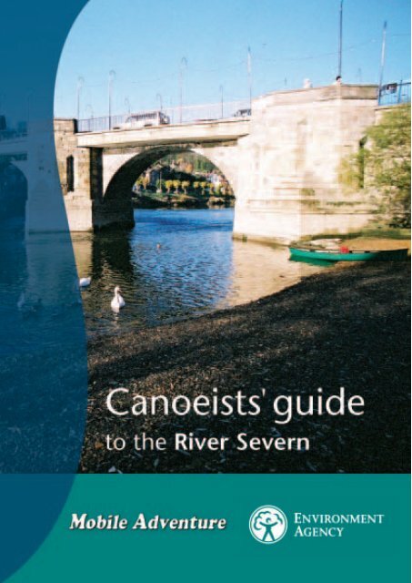
<strong>Canoe</strong>ing on the <strong>River</strong> <strong>Severn</strong>
Contents<br />
2 Introduction<br />
2 The <strong>River</strong> <strong>Severn</strong><br />
3 The <strong>Severn</strong> Bore<br />
3 Fish weirs<br />
4 Navigation and access<br />
5 Use of locks & weirs<br />
6 - 7<br />
Itinerary<br />
• Pool Quay – Melverley<br />
8 - 9 • Melverley – A5 Bridge<br />
10 - 11 • A5 Bridge – Shrewsbury Weir<br />
12 - 13 • Shrewsbury Weir – <strong>River</strong>side Inn<br />
14 - 15 • <strong>River</strong>side Inn – Ironbridge<br />
16 - 17 • Ironbridge – Hampton Loade<br />
18 - 19 • Hampton Loade – Stourport-on-<strong>Severn</strong><br />
20 - 21 • Stourport-on-<strong>Severn</strong> – Worcester<br />
22 - 23 • Worcester – Upton-upon-<strong>Severn</strong><br />
24 - 25 • Upton-upon-<strong>Severn</strong> – Ashleworth Quay<br />
26 - 27 • Ashleworth Quay – Gloucester<br />
28 Safety on the river<br />
28 Health & hygiene<br />
28 - 29 Leptospirosis (Weil’s Disease)<br />
30 Code of conduct<br />
31 The British <strong>Canoe</strong> Union<br />
32 Useful information<br />
32 Accommodation<br />
32 <strong>Canoe</strong> hire and instruction<br />
32 Maps<br />
33 Fishing seasons<br />
33 Useful addresses & publications<br />
1.
Introduction<br />
This guide is intended to provide useful information for canoeists using the <strong>River</strong><br />
<strong>Severn</strong>. It contains a detailed itinerary for a trip down the river, together with other<br />
information to help you plan and enjoy your canoeing trip.<br />
It has been produced by the Midlands Region of the Environment Agency. We have a<br />
duty under Section 16 of the Water Resource Act 1991 to promote the use of inland<br />
and coastal waters, and land associated with such waters for recreational purposes.<br />
We would like to thank Roger and Sue Drummond for their contribution to this guide and<br />
DJ Pannett for the information on fish weirs and Dr J Whitehead for advice prepared for the<br />
British <strong>Canoe</strong> Union (BCU) on Leptospirosis.<br />
Every effort has been made to ensure that the information contained within the guide<br />
is accurate. No liability can be accepted for any errors, inaccuracies or omissions. In<br />
particular, readers should be aware that details such as land ownership, campsites and<br />
landing places can change from year to year.<br />
The <strong>River</strong> <strong>Severn</strong><br />
The <strong>Severn</strong>, Britain’s longest river, rises on the slopes of Plynlimon in the Cambrian<br />
Mountains. It drops quickly through the Hafren Forest to Llanidloes and follows a<br />
generally north-easterly course through the quietly undulating hills of Powys until it<br />
meets the <strong>River</strong> Vyrnwy, where together they create a huge flood plain on the<br />
borders of <strong>England</strong> and Wales. The river then flows eastwards through the narrow<br />
Ironbridge Gorge, deepening and widening in Worcestershire, and becoming tidal in<br />
Gloucestershire, before finally emptying into the sea in the Bristol Channel.<br />
Throughout much of its length the <strong>Severn</strong> remains a natural waterway, wild and unspoilt<br />
in its upper reaches. Dippers, Little Ringed Plovers, Herons, Swans, Dragonflies,<br />
Damselflies and Otters are examples of wildlife dependent on the river. It contains nearly<br />
every native species of freshwater fish in the British Isles, including Salmon, Trout, Eels,<br />
and coarse fish, together with rare Twite and Allis Shad.<br />
It is the unspoilt state of the <strong>Severn</strong> that gives the canoeist some of the best journeying<br />
river to be found in Britain. The few towns along its course do not intrude and lack of<br />
riverside properties in the upper sections gives a ‘wildness’ feeling which is not easy to<br />
achieve in central <strong>England</strong> today.<br />
Below Gloucester the <strong>Severn</strong> is tidal. <strong>Canoe</strong>ing beyond Gloucester is possible, but not<br />
recommended and falls beyond the scope of this guide.<br />
2.
The <strong>Severn</strong> Bore<br />
The <strong>Severn</strong> Bore is a naturally occurring tide wave. This natural phenomenon occurs<br />
in the lower reaches of a few rivers throughout the world with large tidal ranges.<br />
The <strong>Severn</strong> Estuary has the second highest tidal range in the world and the difference<br />
between the lowest and highest tide in any one day can be more than 14.5 metres. The<br />
<strong>Severn</strong> Bore has been known to reach two metres in height and its average speed is 16km<br />
per hour. High or Spring tides occur on several days in each lunar cycle throughout the<br />
year. It usually appears during high Spring tides; winter floods and the resulting rise in<br />
water level can affect its size. The size of a bore can also be affected by opposing winds or<br />
high freshwater levels which reduce its height and delay its time of arrival, whereas a<br />
following wind can increase its height and advance the time it arrives. There is no true<br />
<strong>Severn</strong> Bore upstream of Gloucester because of weirs on the twin-armed channel near the city.<br />
Fish weirs<br />
The <strong>Severn</strong> Bore<br />
Special features of the <strong>River</strong> <strong>Severn</strong> are the sites and islands of ancient fish weirs<br />
created by large estates, medieval manors and monastic establishments to trap fish.<br />
Designed to catch migrating fish including Eels and Salmon, they were constructed<br />
of a wattle fence, supported by timber braces and piles, running across the river to<br />
form one or more v-shaped funnels pointing down stream.<br />
At various times in history fish weirs were closed, and eventually trapping fish by this<br />
method became illegal. In many cases the navigable barge gutter has silted up and<br />
disappeared but several of these islands remain in Shropshire.<br />
3.
Navigation<br />
Once one of the great navigable rivers, the <strong>Severn</strong> is now used mainly by<br />
recreational boaters. The days of barges and trows are all gone and the modern<br />
<strong>Severn</strong> is travelled by canoes, kayaks, and small powerboats and in the lower<br />
reaches, by cruisers of all sizes.<br />
At times of flood the <strong>Severn</strong> can rise rapidly, particularly in the upper reaches and can<br />
reach a level of over five metres above its normal summer height. It is not uncommon for<br />
the river to rise higher than its banks and spread out over the surrounding floodplain<br />
several times in the course of a normal winter. Flash floods can occur in the summer.<br />
Although navigation brought trade and wealth to the inland towns along its course, it<br />
was never totally reliable, being dependent upon the level of water, which was often too<br />
low in summer and flooded in winter. A tow path, which ran alongside the river, was used<br />
for hauling boats upstream, firstly by gangs of men and later by horses. Trade<br />
varied throughout the centuries eventually falling into decline perhaps with the advent of<br />
the railways.<br />
Access<br />
The public right of navigation existing on the <strong>Severn</strong> gives everyone the right to<br />
navigate from Pool Quay, near Welshpool, to Stourport. From Pool Quay to<br />
Stourport the river is generally hazard free, with the exception of Shrewsbury Weir<br />
and the rapids at Jackfield and Eymore. From Stourport to Gloucester, British<br />
Waterways are the navigation authority and a licence is required. The right of<br />
navigation, however, does not give the canoeist the right to cross privately owned<br />
land or launch a boat without landowner permission.<br />
4.
Locks and weirs on the <strong>River</strong> <strong>Severn</strong><br />
Locks<br />
The locks on the <strong>River</strong> <strong>Severn</strong> were built to enable navigation of the river by the<br />
many trading craft of yesteryear, carrying narrow boats, barges towed by steam<br />
tugs as well as <strong>Severn</strong> trows. The locks were, by necessity, built large and this means<br />
that canoes are discouraged from using the locks and should be lifted out and<br />
carried around.<br />
Tewkesbury Weir<br />
The following guidelines will be helpful if it is not possible to lift the canoe (portage)<br />
around the locks.<br />
Prior notice of arrival and numbers to be advised to the lock keeper.<br />
• powered craft to be given precedence<br />
• lock keepers’ directions and instructions must be followed without question<br />
• lock keeper should be advised if large groups are using the river.<br />
Telephone numbers are included at the end of the guide.<br />
Weirs<br />
Each lock has an accompanying weir. The ‘shooting’ of the weir is not allowed and is<br />
prohibited under the British Waterways byelaws.<br />
5.
Pool Quay to Melverley<br />
From Pool Quay to Crew Green the river is narrow and meandering. It is often<br />
overgrown, but rich in wildlife. It is thought that navigation once extended upstream to<br />
Abermule, but this became physically impossible when the monks of Strata Marcella<br />
Abbey constructed a stone weir to hold up water for mill leats. The broken abbey weir<br />
now creates a small riffle.<br />
Pool Quay was a <strong>Severn</strong>side settlement, originally the head of the navigation,<br />
although sufficient depth of water was only available during the winter months.<br />
Miles from<br />
Pool Quay<br />
NGR<br />
0 Abbey Weir SJ 251 104<br />
1 Pool Quay, bridge for farm SJ 259 115<br />
1 1/2 Old railway bridge - dismantled<br />
3 1/4 Stoney Rapid SJ 276 129<br />
8 3/4<br />
Llandrinio Bridge 1775, small<br />
stony riffle in low water SJ 298 169<br />
12 Confluence with <strong>River</strong> Vyrnwy SJ 328 158<br />
12 1/4 Melverley/Crew Green Bridge SJ 330 159<br />
NPH<br />
Pool Quay •<br />
<strong>River</strong> <strong>Severn</strong><br />
A483<br />
A458<br />
Narrow and meandering upper reaches of the <strong>River</strong> <strong>Severn</strong> Pool Quay launching point<br />
6.<br />
s<br />
Abbey Weir<br />
Stoney Rapid<br />
PH
Grey Heron Ardea cinerea The only Heron species of the region. The Heron<br />
is a colony nester with some heronries centuries old. The Heron can be<br />
found on many of our rivers and streams hunting fish, frogs & eels.<br />
The colloquial name for the Heron is a Frank.<br />
Llandrinio •<br />
2cm = 1km<br />
1.25 inches = 1 mile<br />
Breidden Forest<br />
A458<br />
Lower House •<br />
s - Telephone<br />
PH - Public house<br />
k - Camping<br />
WC - Toilet<br />
C - Official canoe access<br />
Crew Green •<br />
PH<br />
Melverley •<br />
PH s<br />
The Breidden Hills dominate the landscape for miles. The most northerly is<br />
the quarry-scarred Breidden Hill, noted for the Rodney Pillar, an 18th<br />
Century monument to Admiral Rodney (1719 – 92), who used<br />
Montgomeryshire timber for Royal Navy ships.<br />
At the Vyrnwy / <strong>Severn</strong> confluence, the <strong>Severn</strong> passes into <strong>England</strong> and for<br />
a time becomes the border between <strong>England</strong> and Wales.<br />
7.<br />
k<br />
PH<br />
B4393<br />
Breidden Hill and Rodney Pillar
Melverley to A5 Bridge<br />
It is possible to paddle into the Vyrnwy up to the village of Melverley where there is an<br />
interesting church. The 1401 chapel was destroyed by Owain Glyndwr but almost<br />
immediately replaced with a new church completed by 1406. With the <strong>Severn</strong> close-by<br />
and the Vyrnwy alongside, the church is vulnerable to flooding and is sometimes cut off.<br />
The disused railway bridge was converted to single track road bridge in 1962. Over this<br />
next stretch numerous clay humps become visible at normal level.<br />
s - Telephone<br />
PH - Public house<br />
k - Camping<br />
WC - Toilet<br />
C - Official canoe access<br />
Melverley •<br />
PH<br />
Crew Green<br />
•<br />
PH<br />
Disused railway bridge<br />
s<br />
<strong>River</strong> <strong>Severn</strong><br />
Edgerley •<br />
PH<br />
B4393<br />
k<br />
8.<br />
N<br />
PH<br />
Kinton •<br />
Pentre •<br />
Wilcott •<br />
Shrawardine, (or Sharden, as known by<br />
the locals), is an attractive place with<br />
timber-framed cottages and a sandstone<br />
church. Shrawardine Castle is now only a<br />
mound, a ditch and fragments of<br />
masonry in a field east of the village.<br />
Shrawardine Castle was dismantled by<br />
Cromwell’s troops in 1645, after a siege<br />
lasting five days. The stone was later<br />
used to repair Shrewsbury Castle.
Montford, is a quiet hamlet with a<br />
square towered sandstone church<br />
which dates to 1737-8. Once part<br />
of Powis Castle the church has a<br />
dominant position on high ground.<br />
St Peter’s Church, Melverley<br />
B4393<br />
A458<br />
• Shrawardine<br />
s<br />
Ford •<br />
Miles from<br />
Pool Quay<br />
NGR<br />
12 1/4 Melverley/Crew Green Bridge SJ 330 159<br />
14 3/4 The Royal Hill SJ 351 173<br />
17 1/4 Alberbury Priory - Right<br />
18 1/4 Shrawardine Islands SJ 392 152<br />
19 3/4 Montford Islands SJ 422 144<br />
22 1/4 A5 Bridge - 1992 - Road SJ 429 151<br />
A5<br />
Montford Bridge k s<br />
•<br />
k<br />
PH<br />
WC<br />
• Montford<br />
9.<br />
B4473<br />
B4380<br />
2cm = 1km<br />
1.25 inches = 1 mile<br />
Bicton •<br />
A5
A5 Bridge to Shrewsbury Weir<br />
Montford Bridge has spanned this point of the <strong>Severn</strong> since the early Middle Ages, but<br />
the present one was built in 1792 by Thomas Telford. This ancient river crossing was once<br />
the traditional meeting place for negotiations between English and Welsh leaders in times<br />
of conflict. In 1283, Daffydd ap Gruffudd, the last true Prince of Wales, was brought here<br />
in chains by his own countrymen and handed over to the English. He was tried for<br />
treason at a Parliament called by Edward I and held at Acton Burnell, south of<br />
Shrewsbury. Daffydd was convicted and subsequently dragged through the streets of<br />
Shrewsbury, tied to a horse’s tail, before being hanged, drawn and quartered.<br />
Montford Bridge<br />
It was the <strong>River</strong> <strong>Severn</strong> that<br />
determined Shrewsbury’s position,<br />
development and character. The<br />
natural moat created an excellent<br />
defence for the Saxon town, the<br />
one gap in the river is the site for<br />
the castle. By the 14th century,<br />
despite border conflicts, Shrewsbury<br />
was one of the wealthiest towns in<br />
<strong>England</strong>, with a busy inland port<br />
and a variety of trades.<br />
Shrewsbury Weir<br />
Miles from<br />
Pool Quay<br />
NGR<br />
22 Montford Bridge - 1972 - Road SJ 431 153<br />
23 Island - right pass either side<br />
23 Bromley Forge, confluence<br />
with <strong>River</strong> Perry<br />
SJ 440 166<br />
233/4 Brickley Coppice SJ 443 164<br />
25 The Isle - Isle Grange SJ 456 158<br />
31 Shelton water works SJ 467 137<br />
32 Shropshire & West Midlands<br />
Showground<br />
34 Frankwell, Shrewsbury SJ 492 129<br />
36 Shrewsbury Weir SJ 501 130<br />
Inspection recommended at all levels – can be dangerous! Large stopper in medium<br />
to high water. Portage left and re-enter at canoe launching point. Avoid fish pass on<br />
right bank at all times as it is an offence to disturb fish.<br />
10.
A458<br />
A5<br />
B4380<br />
Welsh Bridge - Shrewsbury<br />
2cm = 1km<br />
1.25 inches = 1 mile<br />
s - Telephone<br />
PH - Public house<br />
k - Camping<br />
WC - Toilet<br />
C - Official canoe access<br />
<strong>River</strong> <strong>Severn</strong><br />
B4386<br />
A488<br />
11.<br />
N<br />
WC<br />
The Quarry •<br />
B4380<br />
A528<br />
C C<br />
A5124<br />
Shrewsbury<br />
A5<br />
Shrewsbury canoe launch point<br />
WC C<br />
Weir<br />
a5112<br />
A458 B4380<br />
A519
Shrewsbury Weir to <strong>River</strong>side Inn<br />
The village of Uffington was once connected to Monkmoor by ferry. Behind Uffington is<br />
the flat-topped Haughmond Hill with its Forestry Commission plantations.<br />
The Shrewsbury to Birmingham Railway Bridge passes over the site of the old<br />
Haughmond Abbey fish weir. This is a good example of an extended fish weir, and was<br />
the last in operation in Shropshire. Water can be shallow here, so you need to pick your<br />
way through stones. This is also the site where Preston Boats rope-ferry used to operate.<br />
Shrewsbury Weir<br />
Note the two bridges next to each other at Atcham. John Gwynn, the Shrewsbury<br />
architect who also designed English Bridge, built the old bridge in 1776. The current road<br />
bridge was built in the 1920s.<br />
At the Tern / <strong>Severn</strong> confluence the remains of a lock wall are visible. The <strong>River</strong> Tern runs<br />
through the grounds of Attingham Hall and Deer Park, now owned by the National Trust.<br />
Attingham Hall was designed by George Stuart in 1783 – 5 for Noel Hill, the first<br />
Lord Berwick.<br />
The <strong>Severn</strong> over the next hundred yards becomes wider and shallower. St Eata’s Church,<br />
standing on the banks of the <strong>Severn</strong>, was built in the 11th century. It is the only church in<br />
Britain dedicated to the Celtic St Eata, who was consecrated by the Bishop of Lindisfarne<br />
in AD678.<br />
12.
Shrewsbury<br />
A5064<br />
A458<br />
N<br />
New and Old Bridge - Atcham<br />
PH s<br />
• Uffington<br />
A49<br />
A5<br />
Dismantled railway<br />
C<br />
Miles from<br />
Pool Quay<br />
NGR<br />
36 Shrewsbury Weir SJ 501 130<br />
36 3/4 Telford Way Bridge - 1964 - Road SJ 508 140<br />
38 3/4 Uffington - Inn ‘The Corbet Arms’-<br />
Left<br />
39 3/4 Belvedere Railway Bridge - 1846 SJ 519 125<br />
41 1/4 A5/A49 Bridge SJ 521 109<br />
43 1/4 Atcham SJ 541 093<br />
45 3/4 Confluence with <strong>River</strong> Tern SJ 553 091<br />
46 1/2 Wroxeter Island - pass right SJ 561 083<br />
48 Confluence with Cound Brook - SJ 566 062<br />
Right<br />
48 3/4 The <strong>River</strong>side Inn SJ 570 050<br />
C • Attingham<br />
• Atcham<br />
s<br />
• Cross Houses<br />
13.<br />
s - Telephone<br />
PH - Public house<br />
k - Camping<br />
WC - Toilet<br />
C - Official canoe access<br />
Wroxeter •<br />
<strong>River</strong> <strong>Severn</strong><br />
PH<br />
B5061<br />
2cm = 1km<br />
1.25 inches = 1 mile
<strong>River</strong>side Inn to Ironbridge<br />
The river flows through a plain and meanders over a sandy bed with views of the Wrekin<br />
and Leighton Hall.<br />
At Cressage, it has been claimed that the Pope’s emissary, St Augustine, preached to the<br />
Welsh bishop under the Cressage Oak (originally Christ’s Oak, from which the village<br />
name derives) which stood for centuries on the site now occupied by the<br />
war memorial.<br />
<strong>River</strong> <strong>Severn</strong> meanders<br />
PH<br />
View from <strong>River</strong>side Inn<br />
• Eyton-on-<strong>Severn</strong><br />
<strong>River</strong> <strong>Severn</strong><br />
A458<br />
• Cressage<br />
PH s<br />
B4066<br />
14.<br />
• Eaton Constantine<br />
B4380<br />
• Leighton<br />
• Sheinton<br />
Homer •
Miles from<br />
Pool Quay<br />
s<br />
• Buildwas<br />
• Little Wenlock<br />
A4169<br />
NGR<br />
48 3/4 The <strong>River</strong>side Inn SJ 570 050<br />
51 Cressage Bridge - 1913 - Road SJ 594 045<br />
56 Buildwas Bridge - rebuilt 1993 - SJ 644 045<br />
Road<br />
58 1/4 Ironbridge - 1779 - Foot SJ 673 035<br />
s - Telephone<br />
PH - Public house<br />
k - Camping<br />
WC - Toilet<br />
C - Official canoe access<br />
N<br />
WC<br />
2cm = 1km<br />
1.25 inches = 1 mile<br />
Ironbridge •<br />
B4375<br />
15.<br />
Buildwas Power Station<br />
Buildwas Village is on the left and<br />
the ruins of Buildwas Abbey on<br />
the right. The Abbey is now an<br />
English Heritage property and was<br />
founded in 1135 as a daughter<br />
house of Furness Abbey in<br />
Cumbria. The Abbey owned many<br />
of the surrounding farms and had<br />
its own ironworks. The power<br />
station is situated on the right<br />
bank. The Albert Edward Railway<br />
Bridge, built by John Fowler in<br />
1863, today carries coal trains<br />
fuelling the power station. The<br />
Dale End <strong>River</strong>side Park is just<br />
after the Ironbridge Rowing Club.
WC<br />
B4375<br />
Ironbridge<br />
• PH<br />
Jackfield Rapids<br />
• Broseley<br />
Ironbridge to<br />
Hampton Loade<br />
B4373<br />
2cm = 1km<br />
1.25 inches = 1 mile<br />
Coalport Bridge and the Woodbridge Inn<br />
It was at Coalbrookdale in 1709 that<br />
Abraham Darby discovered that coke<br />
could be used instead of charcoal for<br />
smelting iron. This small discovery<br />
sparked a revolution that changed the<br />
world. Iron could now be made cheaply<br />
in large quantities, instead of being<br />
dependent on the slow charcoal<br />
production process. For a time, the<br />
Ironbridge Gorge was the world’s<br />
foremost industrial centre.<br />
It was Darby’s grandson who constructed<br />
the world’s first bridge made from iron.<br />
Cast in 1779, it still spans the <strong>Severn</strong> at<br />
PH<br />
16.<br />
Apley Forge •<br />
• Linley Brook<br />
Ironbridge<br />
PH<br />
• Nordley<br />
A442<br />
<strong>River</strong><strong>Severn</strong><br />
Ironbridge. The industrial scars have<br />
healed and the gorge is green<br />
once more. The industrial relics have<br />
been transformed into a collection of<br />
museums, and Ironbridge is now a<br />
UNESCO-designated World Heritage Site.<br />
From the busy Ironbridge Gorge the river<br />
enters into quiet and peaceful Apley Forge.<br />
This stretch of the river is surrounded by<br />
woodland where Kingfishers are
egularly seen. The white suspension<br />
bridge was built in 1900 to link<br />
Apley Park with Linley Station on the<br />
<strong>Severn</strong> Valley Railway.<br />
In 912 King Alfred’s daughter,<br />
Ethelfled, built Bridgnorth as a<br />
fortified township above the <strong>Severn</strong>.<br />
Bridgnorth grew in importance<br />
and was a strategic port and<br />
crossing place.<br />
Bridgnorth<br />
A458<br />
B4373<br />
C<br />
WC<br />
WC<br />
C<br />
PH<br />
• Oldbury<br />
s - Telephone<br />
PH - Public house<br />
k - Camping<br />
WC - Toilet<br />
C - Official canoe access<br />
N<br />
A454<br />
Eardington •<br />
A458<br />
Miles from<br />
Pool Quay<br />
NGR<br />
58 1/4 Ironbridge SJ 673 038<br />
58 3/4 New Jackfield Bridge - 1994 - SJ 681 032<br />
Road<br />
60 1/4 Coalport SJ 701 020<br />
63 1/4 Apley Park Bridge - Private SJ 706 983<br />
67 1/4 Bridgnorth S0 719 930<br />
69 1/2 Quatford<br />
71 1/4 Confluence with the Mor Brook<br />
72 3/4 Hampton Loade S0 747 865<br />
s<br />
<strong>Severn</strong> Valley Railway<br />
17.<br />
B4555<br />
• Quatford<br />
A442<br />
k PH<br />
s<br />
Hampton •<br />
• Sutton<br />
Quatt •<br />
Bridgnorth<br />
Hampton<br />
Loade<br />
•
k PH<br />
s<br />
Hampton •<br />
N<br />
Highley •<br />
A442<br />
• Hampton Loade<br />
Alveley •<br />
B4555<br />
Hampton Loade to<br />
Stourport-on-<strong>Severn</strong><br />
The railway station in the village of<br />
Hampton Loade, was once the loading<br />
point of wicker baskets full of damsons,<br />
used for dye in the cotton trade in<br />
Manchester. This preserved station has<br />
appeared in many period films.<br />
The <strong>Severn</strong> Valley Country Park includes<br />
areas on both sides of the river which are<br />
linked by the Alverley foot-bridge. Both<br />
Alverley and Highley were once mining<br />
and quarry centres. It is believed that<br />
some of the stone used for Worcester<br />
Cathedral came from Highley and was<br />
transported by river.<br />
Upper Arley was known to the Saxons as<br />
Ernley – ‘the clearing where eagles live’ –<br />
although the eagles were likely to be<br />
buzzards, which can still be seen today.<br />
The 1971 footbridge replaced the ferry<br />
service which was first recorded back<br />
in 1323.<br />
PH<br />
<strong>River</strong> <strong>Severn</strong><br />
18.<br />
Upper Arley<br />
Wyre Forest<br />
Upper Arley<br />
PH<br />
• Upper Arley<br />
s PH<br />
B4194<br />
2cm = 1km<br />
1.25 inches = 1 mile<br />
s
Miles from<br />
Pool Quay<br />
NGR<br />
72 3/4 Hampton Loade S0 747 865<br />
74 1/2 Alveley Bridge - 1936 - Foot S0 748 839<br />
75 1/4 Highley - site of old ferry<br />
77 3/4 Arley S0 765 901<br />
78 1/2 Victoria Bridge - carries<br />
<strong>Severn</strong> Valley Railway<br />
79 1/4 Eymore Rapid S0 772 785<br />
81 1/2 Bewdley Bridge S0 787 754<br />
85 1/2 Stourport-on-<strong>Severn</strong> S0 808 710<br />
Bewdley was always a place of trade.<br />
It became one of four principal ports on<br />
the river, along with Worcester,<br />
Gloucester and Bridgnorth. Goods which<br />
travelled upstream from Bristol were<br />
loaded onto pack-ponies and wagons to<br />
be distributed throughout the Midlands.<br />
Bewdley’s own goods - brass, horn and<br />
leather products, were transported back<br />
downstream.<br />
C<br />
Bewdley<br />
A456<br />
B4195<br />
s - Telephone<br />
PH - Public house<br />
k - Camping<br />
WC - Toilet<br />
C - Official canoe access<br />
A451<br />
<strong>Severn</strong> Valley Railway<br />
Kingfisher Alcedo atthis Despite its colour<br />
the Kingfisher is not easy to see.<br />
It occurs on clear flowing rivers and<br />
streams. It feeds on small fish, which are<br />
dispatched by banging on the perch<br />
before devouring. A bird to brighten up<br />
the gloomiest days.<br />
Stourport-on-<strong>Severn</strong> exists due<br />
to the Staffordshire and<br />
Worcestershire Canal, which<br />
opened in 1772. Stourport is<br />
the only British town to come<br />
into being solely as a result of<br />
the canal system. The canal<br />
basins remain busy today, with<br />
boat repair yards, day trippers<br />
and leisure users. From<br />
Stourport the river has been<br />
canalised and navigation is<br />
under the control of British<br />
Waterways, from whom<br />
a licence is required.<br />
Stourport-on-<strong>Severn</strong> • Hartlebury<br />
19.<br />
C<br />
A4025<br />
Kingfisher
Stourport-on-<strong>Severn</strong><br />
s - Telephone<br />
PH - Public house<br />
k - Camping<br />
WC - Toilet<br />
C - Official canoe access<br />
A451<br />
C<br />
Weir<br />
A4025<br />
<strong>River</strong> <strong>Severn</strong><br />
Stourport-on-<strong>Severn</strong><br />
to Worcester<br />
The towering Redstone Rock, just south<br />
of the <strong>River</strong> Stour confluence was once<br />
inhabited by cave dwelling hermits,<br />
who probably also manned the ferry at<br />
Redstone Crossing, which was first<br />
recorded in the 13th century.<br />
The first and highest lock on the river is<br />
Lincombe Lock. (see section on use<br />
of locks)<br />
Horse racing in Worcester started in the<br />
18th century, but tends to be seasonal<br />
due to regular flooding of the riverside<br />
position. The footbridge shortly after the<br />
race course is Sabrina Bridge, the name<br />
given to the <strong>Severn</strong> by the Romans.<br />
Lock<br />
C<br />
The Worcester and Birmingham Canal<br />
joins the <strong>Severn</strong> at Diglis. The canal basin<br />
opened in 1815 and links Diglis directly<br />
with Gas Street Basin in Birmingham, the<br />
heart of Britain’s canal system.<br />
• Winnall<br />
PH<br />
Shrawley Wood<br />
20.<br />
<strong>Canoe</strong>ing on the <strong>Severn</strong><br />
A449<br />
2cm = 1km<br />
1.25 inches = 1 mile<br />
• Lineholt<br />
N<br />
Holt Fleet •<br />
k PH<br />
Lock PH<br />
Weir<br />
• Holt Heath<br />
Staffordshire and Worcestershire Canal meets the <strong>Severn</strong>
• Ombersley<br />
• Holt<br />
Worcester Cathedral<br />
A449<br />
PH<br />
Grimley•<br />
A443<br />
Lock<br />
Hallow •<br />
PH<br />
Miles from<br />
Pool Quay<br />
NGR<br />
85 1/2 Stourport-on-<strong>Severn</strong> S0 808 710<br />
87 Lincomb Lock S0 821 693<br />
88 Inn - The Hampstall - Left<br />
91 1/4 Holt Lock S0 821 633<br />
94 3/4 Bevere Lock S0 836 593<br />
98 1/4 Worcester S0 846 546<br />
For over 2000 years there has been a settlement at<br />
Worcester, as numerous Iron Age finds indicate. After the<br />
Roman period the Saxons moved in and Worcester<br />
became an ecclesiastical and political centre for West<br />
Mercia. It was under the Normans that Worcester began<br />
to grow into a city of considerable importance, the castle<br />
and cathedral were built and Richard the Lionheart<br />
visited in 1189.<br />
Weir<br />
A wooden cathedral is known to have existed in 680 but<br />
in 1084 Bishop Wulstan began to build in stone. Further<br />
building and alterations took place between 1225 and<br />
1395, completing the present building.<br />
k<br />
A449<br />
21.<br />
A44<br />
A38<br />
Worcester<br />
A4103<br />
A449<br />
A44<br />
k<br />
• Diglis<br />
Lock<br />
Weir
Great Crested Grebe<br />
Great Crested Grebe Podiceps cristatus<br />
Almost extinct at the turn of the 19th<br />
century due to the fashion trade’s desire for<br />
its head plumes. The Great Crested Grebe<br />
has made a remarkable recovery and is now<br />
a familiar sight on our slower moving waters.<br />
Worcester to<br />
Upton-upon-<strong>Severn</strong><br />
From Worcester, the <strong>River</strong> <strong>Severn</strong><br />
becomes much wider and flows through<br />
gentle countryside. The confluence with<br />
the <strong>River</strong> Teme is one of the sites on<br />
which the Battle of Worcester was fought<br />
in 1651 and the English Civil War began<br />
nearby, at Powick Bridge in 1642.<br />
Kempsey is one of the county’s oldest<br />
villages, the site of both Iron Age and<br />
Roman settlements. St Mary’s Church is<br />
built on an unexpectedly grand scale.<br />
The Malvern Hills can be viewed<br />
from the river, along with some<br />
impressive buildings.<br />
Worcester<br />
A44<br />
A4103<br />
22.<br />
A449<br />
Lock<br />
• Powick<br />
N<br />
Weir<br />
A44<br />
k<br />
• Diglis<br />
B4424<br />
Callow End •<br />
• Whittington<br />
• Cherry Orchard<br />
<strong>River</strong> <strong>Severn</strong><br />
A442<br />
B4424<br />
A38<br />
Kempsey<br />
•<br />
k s<br />
<strong>Severn</strong> Bank is situated in Cliff Wood, an<br />
imposing 19th century mansion with<br />
Gothic windows and crenellated walls.<br />
For 700 years the timber-framed <strong>Severn</strong><br />
End House was the home to the<br />
Lechmere Family, it was built in the 17th<br />
century and restored in 1896.<br />
Like many other <strong>Severn</strong>side habitations,<br />
Upton-upon-<strong>Severn</strong> became a thriving<br />
port. As early as 1289, the Bishop of<br />
Hereford was landing his wine supplies<br />
here from Bristol.
s<br />
• Clifton<br />
B4209<br />
A38<br />
B4211<br />
M5<br />
Diglis Lock<br />
2cm = 1km<br />
1.25 inches = 1 mile<br />
Miles from<br />
Pool Quay<br />
s PH<br />
• <strong>Severn</strong> Stoke<br />
• Kinnersley<br />
A4104<br />
NGR<br />
98 1/4 Worcester S0 808 710<br />
100 Confluence with the <strong>River</strong><br />
Teme<br />
S0 850 521<br />
109 1/4 Upton-upon-<strong>Severn</strong> S0 851 408<br />
• Baughton<br />
• Earl’s Croome<br />
• Holly Green<br />
PH<br />
A38<br />
• Naunton<br />
Upton-upon-<strong>Severn</strong><br />
23.<br />
s<br />
Diglis Weir<br />
s - Telephone<br />
PH - Public house<br />
k - Camping<br />
WC - Toilet<br />
C - Official canoe access
Upton-upon-<strong>Severn</strong><br />
A4104<br />
Upton-upon-<strong>Severn</strong> Marina<br />
PH<br />
Upton-upon-<strong>Severn</strong><br />
to Ashleworth<br />
Quay<br />
Holdfast was famous for sweet peas,<br />
which were grown by Hilda Hemus, and<br />
were sent to the London markets on the<br />
now closed railway. Just past the M50<br />
bridge is Pull Court Mansion, which for<br />
centuries was home to the Dowdeswell<br />
family. Now it is Bredon School, a boys’<br />
boarding school.<br />
There is evidence of Roman and Saxon<br />
occupation in Tewkesbury, but it was<br />
only after the Normans arrived that the<br />
great abbey was founded. The Battle of<br />
Tewkesbury in 1471 was a major event<br />
in national history, bringing to an end<br />
the second phase of the Wars of the<br />
Roses, and re-establishing Edward IV on<br />
the throne.<br />
24.<br />
• Ripple<br />
• Uckinghall<br />
M50<br />
Ashleworth Quay<br />
<strong>River</strong> <strong>Severn</strong><br />
A38<br />
A438<br />
At Wainlode Cliff, an almost sheer cliff<br />
rises abruptly from the waters edge. A<br />
number of boats have been sunk at the<br />
base of the cliff in an attempt to prevent<br />
further erosion.<br />
The original village of Ashleworth was<br />
by the quay, and a few 15th century<br />
buildings still survive, but later the village<br />
developed a short distance away from<br />
the river.<br />
Please note that the river is tidal as<br />
far as Tewkesbury and in the case of<br />
exceptionally high tides there can be<br />
an impact as far as Upton–upon–<strong>Severn</strong>.<br />
Please consult Arrowsmith Tide Table<br />
for the Bristol Channel.
Lock<br />
C<br />
Weir<br />
PH<br />
Haw Bridge •<br />
Ashleworth •<br />
Tewkesbury<br />
PH<br />
N<br />
PH<br />
PH<br />
A38<br />
• Deerhurst<br />
s<br />
PH<br />
s - Telephone<br />
PH - Public house<br />
k - Camping<br />
WC - Toilet<br />
C - Official canoe access<br />
PH<br />
B4213<br />
• Apperley<br />
s<br />
• Apperley Court<br />
Miles from<br />
Pool Quay<br />
NGR<br />
109 1/4 Upton-upon-<strong>Severn</strong> S0 851 408<br />
115 Mythe Bridge - 1825 - Road S0 888 331<br />
115 1/2 Confluence with <strong>River</strong> Avon S0 888 331<br />
116 Upper Lode Lock S0 880 308<br />
116 3/4 Lower Lode<br />
121 1/2 Haw Bridge - Road<br />
Inn - New Inn - Right<br />
S0 845 278<br />
124 3/4 Ashleworth Quay S0 819 250<br />
Mute Swan<br />
Mute Swan Ardea cinerea Although not really<br />
mute the Swan gets its name from being the<br />
least vocal of the three species of Swan that<br />
inhabit the British Isles. It is also the only one of<br />
the three that nests in this country. It can be<br />
encountered on most rivers in the region.<br />
PH k<br />
• Wainlode Hill<br />
25.<br />
2cm = 1km<br />
1.25 inches = 1 mile<br />
• Norton<br />
• Twigworth
Ashleworth Quay to Gloucester<br />
The beautiful stone house, Ashleworth Court, dates from 1460. The National Trust owns<br />
the nearby working tithe barn. The house and barn were built for St Augustine’s Abbey,<br />
at Bristol.<br />
Sandhurst Nature Reserve is a Gloucestershire Wildlife Trust site consisting of disused brick<br />
pits and osier beds. It has a mixture of wet woodlands, open water and has a rich variety<br />
of wildlife. Brick pits are a familiar feature along the <strong>Severn</strong> between Stourport and<br />
Gloucester. These pits were excavated in the 19th century and worked until 1924, as the<br />
local clay was ideal for brick making.<br />
When you reach Upper Parting<br />
the river splits into two channels.<br />
Gloucester is situated very close to<br />
a site were the Roman army built<br />
a fort around in AD50. This fort<br />
guarded the lowest safe crossing<br />
on the <strong>River</strong> <strong>Severn</strong>. When the<br />
army moved on, urban life began.<br />
During the reign of Edward the<br />
Confessor and his successor<br />
William the Conqueror, Gloucester<br />
was a regular meeting place for<br />
the King and Council.<br />
Gloucester owed much of its early<br />
success to its location on the river,<br />
although it was not until 1580<br />
that a Royal Charter granted it the<br />
status of a port.<br />
Kestrel<br />
Kestrel Falco tinnunculus The Kestrel is a familiar<br />
bird often seen hovering on the wind over rough<br />
pasture, hunting small rodents and birds, from<br />
which it takes its old name of Windhover.<br />
Miles from<br />
Pool Quay<br />
Ashleworth Court and tithe barn<br />
NGR<br />
124 3/4 Ashleworth Quay S0 819 250<br />
127 Long Reach to Upper Parting<br />
Upper Parting Gloucester<br />
26.<br />
Gloucester Docks thrived from 1794 and<br />
extended throughout the Victorian<br />
period, but by the 1980s waterborne<br />
commercial traffic had all but ceased and<br />
the huge dockside warehouses used for<br />
storage became redundant. The dock<br />
basin is now mainly used for leisure.
Haw Bridge •<br />
Ashleworth<br />
•<br />
A417<br />
PH<br />
PH<br />
PH<br />
<strong>River</strong> <strong>Severn</strong><br />
s - Telephone<br />
PH - Public house<br />
k - Camping<br />
WC - Toilet<br />
C - Official canoe access<br />
A40<br />
Maisemore •<br />
• Apperley<br />
PH<br />
s<br />
• Apperley Court<br />
PH<br />
Weir<br />
2cm = 1km<br />
1.25 inches = 1 mile<br />
PH k<br />
• Wainlode Hill<br />
• Sandhurst<br />
B4215<br />
• Upper Parting<br />
East Channel<br />
West Channel<br />
A40<br />
27.<br />
Entrance to Gloucester Docks<br />
• Walham<br />
C<br />
Weir<br />
Hempsted •<br />
A40<br />
B4063<br />
Gloucester<br />
A430<br />
B4072<br />
A38
Safety on the river<br />
The <strong>River</strong> <strong>Severn</strong> can be dangerous and has been the cause of many accidents<br />
and deaths. It is most dangerous where there are strong currents, when there<br />
are high water levels, and during cold weather conditions. DO NOT take any<br />
risks and NEVER UNDERESTIMATE the power of the river.<br />
The <strong>Severn</strong> is a fast flooding river, which can rise after heavy rain, at a rate in<br />
excess of 1 metre per hour in the upper reaches. When in flood, it is<br />
advisable not to go on the river at all. The Environment Agency monitors<br />
water levels at all times and provides a recorded river levels service.<br />
<strong>River</strong>Call 0906 619 7744 (calls charged at 60p per minute at all times).<br />
For instruction or safety advice, please contact the canoeing governing body<br />
the British <strong>Canoe</strong> Union (BCU). First Aid knowledge may be required on the<br />
river so a first aid course should be considered.<br />
Health and hygiene<br />
The quality of the water in the <strong>River</strong> <strong>Severn</strong> is generally good, but unlike tap<br />
water it is untreated and contains natural bacteria and other micro-organisms.<br />
Although the risk of contracting illness is small, if the following sensible<br />
precautions are followed, those involved in water sports can stay healthy.<br />
• Do not swallow river water<br />
• Wash your hands before eating<br />
Leptospirosis (Weil’s Disease)<br />
Leptospirosis is an animal infection. The infection is caught by direct contact<br />
with bacteria in urine or a polluted environment. The bacteria enter through<br />
skin abrasions or via eyes, nose or mouth.<br />
The illness<br />
The usual incubation is 2 to 12 days. Usually a ‘flu’-like illness occurs which<br />
resolves in 2-3 weeks. A few cases develop jaundice, and then the condition is<br />
known as Weil’s Disease.<br />
If you think you may have the infection, go to your doctor and tell him/her<br />
that there may be a risk of leptospirosis. The diagnosis is by clinical suspicion.<br />
Blood tests can rarely confirm the illness in time to affect treatment. They may<br />
subsequently confirm it. The microbiologist at the local hospital is the best<br />
source of advice.<br />
28.
Prevention<br />
• cover all cuts and abrasions with waterproof plasters<br />
• always wear foot-wear to avoid cutting feet<br />
• avoid capsize drill or rolling practice in suspect waters<br />
• where possible, shower soon after canoeing.<br />
If in doubt, contact your doctor early, particularly if you experience ‘flu-type’<br />
symptoms.<br />
Leptospirosis is very rare, and its deterioration into Weil’s Disease even<br />
more rare. Weil’s Disease is however a very serious illness, and must be swiftly<br />
diagnosed and treated.<br />
Riffle near Pool Quay<br />
Disturbance of spawning fish<br />
Salmon and Trout lay their eggs in gravel. During the period October to March<br />
trampling and launching of canoes on gravels used by Salmon and Trout may<br />
damage unhatched eggs and young fry. Please take particular care when the<br />
water level is low and DO NOT canoe if there is any risk of disturbance to<br />
gravels. It is a criminal offence to wilfully disturb breeding fish or spawning<br />
beds. Please leave the water if requested to do so by an Environment Agency<br />
Fisheries Inspector. A request will only be made where there is a real risk of<br />
disturbance. The complete Code of Conduct is available from the Environment<br />
Agency as a separate leaflet.<br />
29.
Code of conduct<br />
Both the Environment Agency and BCU have published a Code of Conduct,<br />
intended to help both canoeists and other river users enjoy the river, whilst<br />
having respect for all river users and the river environment.<br />
<strong>Canoe</strong>ists are requested to follow the relevant sections of both codes, which<br />
are given below.<br />
General guidance<br />
• look after the river environment and avoid damaging banks and bankside<br />
vegetation. Do not pick, uproot, or trample wild plants<br />
• take special care not to disturb gravel beds or beds of waterweeds<br />
• do not disturb birds and other wildlife found along the river. Avoid areas used<br />
by wintering wildfowl, nesting birds and spawning fish in the appropriate<br />
season. Stop canoeing if you are clearly disturbing wildlife<br />
• do not trespass on private banks or moorings. Whenever possible come<br />
ashore at recognised landing places<br />
• never throw rubbish in the river or leave it on the banks. Take it home or<br />
place it in a bin<br />
• please be as quiet as possible; have respect for other users of the river<br />
• obey the general rules of navigation and any local byelaws<br />
• avoid crossing the bows of oncoming craft of any kind, at close quarters.<br />
In particular remember that larger boats are less manoeuvrable and cannot<br />
use such shallow waters as canoes<br />
• give precedence to those engaged in organised competition and have regard<br />
to any instructions given by officials<br />
• have special regard for beginners, as you would for learner drivers on the road<br />
• hail to draw a person’s attention to a situation, which might result in<br />
inconvenience, damage or collision. Please treat a hail as a friendly warning<br />
and not an insult<br />
• pass anglers quietly. Try to:-<br />
- keep away from banks being fished<br />
- comply with reasonable directional requests<br />
- keep well clear of fishing tackle<br />
- avoid loitering in pools if anyone is fishing<br />
- cause as little disturbance as possible<br />
• park vehicles and trailers responsibly so that they do not cause a nuisance<br />
• groups of young or inexperienced canoeists should be accompanied by a<br />
suitably experienced, responsible person – preferably a qualified instructor.<br />
30.
The British <strong>Canoe</strong> Union<br />
British <strong>Canoe</strong> Union<br />
John Dudderidge House, Adbolton Lane, West Bridgford, Nottingham<br />
NG2 5AS<br />
Tel: 0115 9821100<br />
www.bcu.org.uk<br />
Welsh <strong>Canoe</strong>ing Association<br />
Canolfan Tryweryn, Frongoch, Bala, Gwynedd LL23 7NU<br />
Tel: 01678 521199<br />
www.welsh-canoeing.org.uk<br />
The British <strong>Canoe</strong> Union is the governing body for the sport and recreation of<br />
canoeing in the United Kingdom. It represents the interests of canoeists at<br />
local, national and international level, and is a member of the International<br />
<strong>Canoe</strong> Federation.<br />
The Specialist Access Committee of the BCU and WCA (Welsh <strong>Canoe</strong>ing<br />
Association) work to improve the availability of water to their members.<br />
A British Waterways licence is issued as part of the BCU membership package.<br />
This covers access to the <strong>River</strong> <strong>Severn</strong> below Gladder Brook by<br />
Stourport-on-<strong>Severn</strong> and an access sticker should be displayed on the boat.<br />
Amongst many other responsibilities the BCU and the WCA administer a very<br />
comprehensive coaching service for the improvement of safety awareness and<br />
skills of individuals and instructors.<br />
Local Access Officers<br />
BCU <strong>River</strong> <strong>Severn</strong> Access 01743 365022<br />
31.
Tourist Information Centres in the <strong>Severn</strong> valley<br />
Welshpool Vicarage Car Park, Welshpool, Powys<br />
Tel: 01938 552043<br />
Shrewsbury The Music Hall, The Square, Shrewsbury, Shropshire<br />
Tel: 01743 281200<br />
Ironbridge The Toll House, on the Ironbridge<br />
Tel: 01952 432166<br />
Bridgnorth The Library, Listley Street, Bridgnorth, Shropshire<br />
Tel: 01746 763358<br />
Bewdley Load Street, Bewdley, Worcestershire, DY12 2AE<br />
Tel: 01299 404740<br />
Worcester Guildhall, High Street, Worcester<br />
Tel: 01905 726311<br />
Tewkesbury 64 Barton Street, Tewkesbury, Gloucestershire<br />
Tel: 01684 295027<br />
Gloucester 28 South Gate St, Gloucester<br />
Tel: 01452 396572<br />
Accommodation<br />
Campsites and accommodation are available along the entire length of the<br />
<strong>River</strong> <strong>Severn</strong>, ownership and details do change so contact the Tourist<br />
Information Centres for further information.<br />
<strong>Canoe</strong> hire and instruction<br />
Several companies in the <strong>Severn</strong> valley offer canoes for hire and also offer<br />
instruction and will guide groups of canoeists.<br />
For details contact Tourist Information Centres.<br />
Maps<br />
Ordnance Survey 1:50,000 series<br />
Sheet 126 Pool Quay to Cressage<br />
Sheet 127 1 km above Leighton to 2km below Coalport<br />
Sheet 138 2km above Apley Forge to Grimley<br />
Sheet 150 5km above Worcester to 2km below Chaceley Stock<br />
Sheet 162 2km above Wainlode to <strong>Severn</strong> Road Bridge<br />
32.
Fishing season<br />
Salmon 1st February to 7th October<br />
Trout 18th March to 7th October<br />
Coarse 16th June to 14th March<br />
Canals No closed season (apart from SSSIs)<br />
British Waterways and lock keepers<br />
British Waterways<br />
Llanthony Warehouse, Gloucester Docks, Gloucester GL1 2EJ<br />
Tel: 01452 318000<br />
Lincomb Lock Stourport 01299 822887<br />
Holt Lock Worcester 01905 620218<br />
Bevere Lock Worcester 01905 640275<br />
Diglis Lock Worcester 01905 354280<br />
Upper Lode Lock Tewkesbury 01684 293138<br />
Useful publications<br />
The <strong>River</strong> <strong>Severn</strong> (Fact sheet pack) Environment Agency (Midlands Region)<br />
The <strong>Severn</strong> Bore Environment Agency (Midlands Region)<br />
The <strong>Severn</strong> Way Guide<br />
Web sites<br />
www.environment-agency.gov.uk www.welsh-canoeing.org.uk<br />
www.visitbritain.com www.svr.co.uk<br />
www.nationalrail.co.uk www.mobile-adventure.com<br />
Project Partner<br />
Europe’s open canoe specialists<br />
Marina Village, Preston Brook, Runcorn, Cheshire WA7 3DW<br />
Tel: 01928 716 666<br />
Fax: 01928 714 399<br />
33.
MI - 05/04 - 2.5K - BHXE Printed on Polyart<br />
MIDLANDS REGION ADDRESSES<br />
REGIONAL OFFICE<br />
Environment Agency<br />
Sapphire East<br />
550 Streetsbrook Road<br />
Solihull<br />
West Midlands B91 1QT<br />
Tel: 0121 711 2324<br />
Fax: 0121 711 5824<br />
UPPER SEVERN<br />
AREA OFFICE<br />
Environment Agency<br />
Hafren House<br />
Welshpool Road<br />
Shelton<br />
Shrewsbury SY3 8BB<br />
Tel: 01743 272 828<br />
Fax: 01743 272 138<br />
www.environment-agency.gov.uk<br />
LOWER SEVERN<br />
AREA OFFICE<br />
Environment Agency<br />
<strong>River</strong>smeet House<br />
Newtown Industrial Estate<br />
Northway Lane<br />
Tewkesbury GL20 8JG<br />
Tel: 01684 850 951<br />
Fax: 01684 293 599<br />
UPPER TRENT<br />
AREA OFFICE<br />
Environment Agency<br />
Sentinel House<br />
Wellington Crescent<br />
Fradley Park<br />
Lichfield WS13 8RR<br />
Tel: 01543 444 141<br />
Fax: 01543 444 161<br />
Shrewsbury<br />
UPPER SEVERN<br />
AREA<br />
LOWER TRENT<br />
AREA OFFICE<br />
Environment Agency<br />
Trentside Offices<br />
Scarrington Road<br />
West Bridgford<br />
Nottingham NG2 5FA<br />
Tel: 0115 945 5722<br />
Fax: 0115 981 7743<br />
Area Administrative Boundaries<br />
Regional Boundary<br />
Area Office<br />
Regional Headquarters<br />
UPPER<br />
TRENT<br />
AREA<br />
Tewkesbury<br />
Lichfield<br />
Solihull<br />
LOWER SEVERN<br />
AREA<br />
Nottingham<br />
LOWER TRENT<br />
AREA