City Docks (pdf, 4.5 MB) (opens new window - Bristol City Council
City Docks (pdf, 4.5 MB) (opens new window - Bristol City Council
City Docks (pdf, 4.5 MB) (opens new window - Bristol City Council

Create successful ePaper yourself
Turn your PDF publications into a flip-book with our unique Google optimized e-Paper software.
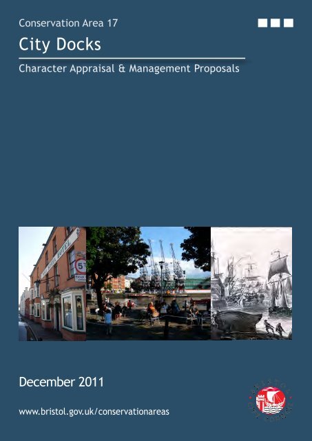
Conservation Area 17<br />
<strong>City</strong> <strong>Docks</strong><br />
Character Appraisal & Management Proposals<br />
December 2011<br />
www.bristol.gov.uk/conservationareas
<strong>City</strong> <strong>Docks</strong> Conservation Area
CONTENTS<br />
1. INTrODuCTION p. 1<br />
2. PlANNINg POlICy CONTExT p. 1<br />
3. lOCATION & SETTINg p. 2<br />
4. SummAry Of ChArACTEr & SPECIAl INTErEST p. 4<br />
5. hISTOrIC DEvElOPmENT & ArChAEOlOgy p. 5<br />
6. SPATIAl ANAlySIS<br />
6.1 routes & Spaces p. 14<br />
6.2 views p. 16<br />
6.3 landmark Buildings p. 21<br />
7. ChArACTEr ANAlySIS<br />
7.1 Overview & Character Areas p. 23<br />
7.1.1 Area 1 - Cumberland Basin p. 25<br />
7.1.2 Area 2 - Pooles Wharf p. 28<br />
7.1.3 Area 3 - The floating harbour p. 30<br />
7.1.4 Area 4 - Cumberland road & The New Cut p. 33<br />
7.1.5 Area 5 - Canons marsh p. 36<br />
7.1.6 Area 6 - Bathurst Basin p. 39<br />
7.2 relative merit of unlisted Buildings p. 41<br />
7.3 Townscape Details p. 43<br />
7.4 materials p. 44<br />
7.5 Wildlife & Trees p. 45<br />
8. TyPICAl lAND uSE & ISSuES<br />
8.1 Overview p. 46<br />
8.2 residential p. 47<br />
8.3 Cultural & leisure p. 48<br />
8.4 Industrial/Office p. 49<br />
8.5 maritime p. 50<br />
8.6 vacant Sites p. 51<br />
8.7 flooding p. 52<br />
9. NEgATIvE fEATurES p.<br />
10. mANAgEmENT PrOPOSAlS p. 56<br />
11. STATEmENT Of COmmuNITy INvOlvEmENT p. 59<br />
12. lOCAl guIDANCE, PuBlICATIONS & SOurCES Of furThEr INfOrmATION p. 60<br />
13. glOSSAry p. 62<br />
54<br />
3.i.
mAPS & fIgurES<br />
maps<br />
ClIfTON &<br />
map 1 <strong>City</strong> <strong>Docks</strong> Conservation Area within its local context p. 3<br />
map 2 Approximate Building Ages p. 13<br />
map 3 landmark Buildings p. 22<br />
map 4 Overview of Character Areas p. 24<br />
map 4a: Character Area 1 p. 25<br />
map 4b: Character Area 2 p. 28<br />
map 4c: Character Area 3 p. 30<br />
map 4d: Character Area 4 p. 33<br />
map 4e: Character Area 5 p. 36<br />
map 4f: Character Area 6 p. 39<br />
map 5 relative merit of unlisted Buildings p. 42<br />
map 6 Predominant land use in the Conservation Area p. 53<br />
figures<br />
figure: 1 great Western <strong>Docks</strong> p. 4<br />
figure: 2 Jessop’s Plan for the floating harbour, 1802 p. 6<br />
figure: 3 Baltic Wharf and the Albion graving Dock, 1828 p. 7<br />
figure: 4 Watercolour of the New gaol, Cumberland road by hugh O’Neil, 1821 p. 7<br />
figure: 5 Plumley and Ashmead’s Plan, 1828 p. 8<br />
figure: 6 first Edition Ordnance Survey, 1885-6 p. 8<br />
figure: 7 lavar’s view, 1887 p. 9<br />
figure: 8 Corporation granary on Princes Wharf, burnt out after blitz in 1941 p. 10<br />
figure: 9 The 1929 Tobacco Bond, Canon’s marsh, prior to demolition in 1987 p. 11<br />
figure: 10 hanover Quay p. 14<br />
figure: 11 railway tracks running E/W along south side of floating harbour p. 14<br />
figure: 12 gaol ferry Bridge crossing Avon New Cut p. 15<br />
figure: 13 Panoramic view (P17) from Bathurst Basin towards south <strong>Bristol</strong> p. 16<br />
figure: 14 Panoramic view (P22) from south side of floating harbour to Clifton Wood p. 17<br />
figure: 15 long view (l13) from Wapping Quay across floating harbour to the Cathedral p. 19<br />
figure: 16 local view (lC7) from millennium Promenade SW to ss great Britain p. 20<br />
figure: 17 Planetarium, millennium Square p. 21<br />
figure: 18 m Shed and Stothert & Pitt cranes, Princes Wharf p. 21<br />
figure: 19 Brunel Swing (Swivel) Bridge p. 26<br />
figure: 20 Ashton Swing Bridge (grade II) from south side of Avon New Cut p. 26<br />
figure: 21 Pooles Wharf p. 29<br />
ii.
figure: 22 <strong>Bristol</strong> marina p. 31<br />
figure: 23 Wapping railway Wharf p. 31<br />
figure: 24 Prince’s Wharf p. 31<br />
figure: 25 hoardings blighting historic Wapping Wharf boundary wall p. 34<br />
figure: 26 Avon New Cut looking northeast p. 34<br />
figure: 27 harbourside Development and Cathedral Walk p. 37<br />
figure: 28 former gas Works from Capricorn Quay p. 37<br />
figure: 29 Anchor Square from Pero’s Bridge p. 37<br />
figure: 30 Public art, millennium Square p. 37<br />
figure: 31 The louisiana Public house p. 40<br />
figure: 32 Bathurst Basin looking southwest p. 40<br />
figure: 33 Anchor, Wapping railway Wharf p. 43<br />
figure: 34 railway lines, Wapping Wharf p. 43<br />
5. iii.
ClIfTON CITy DOCKS & hOTWEllS<br />
1. IntroductIon<br />
1.1 A Conservation Area is ‘an area of special<br />
architectural or historic interest, the<br />
character or appearance of which it is<br />
desirable to preserve or enhance’ (Planning<br />
(listed Buildings & Conservation Areas) Act,<br />
1990).<br />
1.2 Since the designation of the first<br />
Conservation Areas in 1970, <strong>Bristol</strong> <strong>City</strong><br />
<strong>Council</strong> has undertaken a comprehensive<br />
programme of Conservation Area<br />
designation, extension and policy<br />
development. There are now 33<br />
Conservation Areas in <strong>Bristol</strong>, covering<br />
approximately 30% of the city.<br />
1.3 The statutory framework places <strong>Bristol</strong> <strong>City</strong><br />
<strong>Council</strong> under a duty of care to recognise<br />
the significance of its built environment and<br />
positively manage change within it. The<br />
<strong>City</strong> <strong>Council</strong> is continuing a comprehensive<br />
programme of producing a Character<br />
Appraisal for each Conservation Area.<br />
1.4 The Conservation Area Character Appraisals<br />
follow recent national guidance set out in<br />
English heritage’s guidance on Conservation<br />
Area Appraisals (2006), which require<br />
detailed appraisals of each Conservation<br />
Area in the form of formally approved and<br />
published documents.<br />
1.5 A Character Appraisal provides a point<br />
of reference for the planning authority,<br />
developers and communities in managing<br />
change appropriately. The consultation<br />
and adoption process values the specialist<br />
knowledge of local groups and is intended to<br />
ensure that features that communities value<br />
about a place, or feel are under threat, are<br />
properly considered.<br />
1.6 Once adopted a Character Appraisal<br />
provides a tool for development<br />
management officers, developers, residents<br />
and others to recognise the special interest<br />
of the area in order that it can be preserved<br />
or enhanced.<br />
2. PlannIng PolIcy context<br />
2.1 Planning Policy Statement 5 (march 2010)<br />
sets out the government’s national policies<br />
relating to the historic environment. This<br />
document underpins the local planning<br />
policy framework and is the foundation<br />
upon which the local authority will assess<br />
schemes affecting the historic environment.<br />
2.2 In exercising its planning functions in a<br />
Conservation Area, the local planning<br />
authority is under a duty to pay “special<br />
attention to the desirability of preserving<br />
or enhancing the character or appearance”<br />
of the area (s.72 Planning (listed Buildings<br />
and Conservation Areas) Act 1990). <strong>Bristol</strong>’s<br />
Conservation Areas are the subject of<br />
policies in the Core Strategy (adopted by<br />
full <strong>Council</strong> on 21 June 2011). Policy BCS22<br />
relates specifically to Conservation and the<br />
historic Environment. Policies B02 - B22,<br />
relating to the Built Environment have been<br />
saved from the 1997 adopted <strong>Bristol</strong> local<br />
Plan.<br />
2.3 Where sections within the Character<br />
Appraisal relate to policies from Core<br />
Strategy, or saved from the <strong>Bristol</strong> local<br />
Plan, extracts are highlighted within blue<br />
boxes at the end of that section. for full<br />
policy wording, please refer to the Core<br />
Strategy (2011) or Saved Policies from the<br />
<strong>Bristol</strong> local Plan (1997).<br />
2.4 <strong>City</strong> <strong>Docks</strong> was designated as a<br />
Conservation Area on 19 September 1979.<br />
Each adopted Character Appraisal will<br />
replace the relevant Conservation Area<br />
Enhancement Statement for that area.<br />
2.5 The <strong>City</strong> <strong>Docks</strong> Conservation Area<br />
Character Appraisal was adopted by Zoe<br />
Willcox, head of Planning Services, under<br />
delegated powers from the Strategic<br />
Director for Neighbourhoods on 28th<br />
November 2011.<br />
1.
CITy DOCKS<br />
3 locatIon & settIng<br />
3.1 The <strong>City</strong> <strong>Docks</strong> Conservation Area centres<br />
on the low lying land adjacent to the<br />
floating harbour and the New Cut,<br />
between Cumberland Basin in the west<br />
and Bathurst Basin in the east. Broadly<br />
it covers the area that once formed<br />
the working heart of <strong>Bristol</strong>’s dock and<br />
commercial activities, and has evolved<br />
into a hub of prime leisure and cultural<br />
attractions.<br />
3.2 The Conservation Area falls across three<br />
political wards - Southville, Cabot and<br />
Clifton. The boundaries of the area are<br />
broadly defined by the central portions of<br />
two of <strong>Bristol</strong>’s most vital waterways: the<br />
floating harbour and the Avon New Cut.<br />
(The floating harbour extends beyond the<br />
boundaries of the Conservation Area, from<br />
Cumberland Basin as far as The feeder,<br />
which continues to control the waterway<br />
up to Netham lock. The New Cut extends<br />
from the back of underfall as far as<br />
Totterdown lock).<br />
3.3 The harbour and New Cut separate three<br />
long land masses, the buildings and<br />
activities of which are focused towards<br />
the water. Coronation road to Clift house<br />
road is the southern route across the area;<br />
Cumberland road follows the water north<br />
of the New Cut; and Anchor road / hotwell<br />
road runs along the north side of the<br />
floating harbour.<br />
3.4 Concentrated in the Conservation Area is a<br />
significant cluster of <strong>Bristol</strong>’s most renown<br />
tourist destinations (including ‘m’ Shed, the<br />
ssgreat Britain and @<strong>Bristol</strong>), a Scheduled<br />
Ancient monument (underfall yard),<br />
and some nationally significant dockside<br />
installations (e.g Brunel’s Swivel Bridge).<br />
The central area known as Spike Island<br />
houses an exciting mix of creative, heritage<br />
and leisure destinations.<br />
3.5 Below the Avon New Cut, Clift house road<br />
forms the southern boundary, taking in the<br />
Tannery and former iron works industrial<br />
complex; ‘C’ Bond Warehouse; a pump<br />
house; and riverside garden Centre. The<br />
landscaped area to the far south west,<br />
designed by the late Sylvia Crowe, provides<br />
an important setting area and green space<br />
south of the Avon.<br />
3.6 Coronation road carries the southern<br />
Conservation Area boundary eastwards<br />
from Clift house road. This takes in the<br />
riverside cycle way; the nature corridor<br />
on the water’s southern edge; the three<br />
hugely significant footbridges over the<br />
water; and the Pennant retaining walls of<br />
the Cut. Some of the most significant views<br />
into the <strong>City</strong> <strong>Docks</strong> can be enjoyed from<br />
this southern perspective.<br />
map 1: <strong>City</strong> <strong>Docks</strong> Conservation Area &<br />
local context<br />
2.
map 1: <strong>City</strong> <strong>Docks</strong> Conservation Area & local context<br />
3.
ClIfTON CITy DOCKS & hOTWEllS<br />
4. summary of character &<br />
sPecIal Interest<br />
4.1 The <strong>City</strong> <strong>Docks</strong> Conservation Area covers<br />
the largest element of the waterways in<br />
the centre of <strong>Bristol</strong>. The topography of<br />
this area is formed by the river valley of<br />
two rivers - the frome and the Avon - that<br />
have produced a fairly low lying level<br />
valley bottom with pronounced hillsides on<br />
both the northern and southern sides. The<br />
floating harbour and the tidal course of the<br />
New Cut is a precious and significant asset<br />
to <strong>Bristol</strong>.<br />
4.2 The floating harbour is remarkable for its<br />
intimate relationship to the city. The port<br />
was never enclosed or separate; as a result,<br />
city streets opened onto wharfs and the<br />
working of the docks was carried out next<br />
to public highways. The physical proximity<br />
of the docks to the public realm has been<br />
critical in shaping <strong>Bristol</strong>’s sense of place as<br />
a great maritime city.<br />
4.3 The <strong>City</strong> <strong>Docks</strong> ceased to function as a<br />
commercial harbour in the mid 1970s and<br />
since that time the area has evolved into<br />
one of the most exciting districts in the<br />
city. Today the area boasts an impressive<br />
range of existing attractions, events and<br />
cultural facilities which sit adjacent to<br />
features of historical, architectural and<br />
industrial archaeological interest.<br />
4.4 The <strong>City</strong> <strong>Docks</strong> Conservation Area is unique<br />
in terms of the special relationship between<br />
the water courses that run central to it:<br />
the floating harbour and the New Cut. The<br />
wide expanse of water and local topography<br />
also offer some of the best views in and out<br />
of <strong>Bristol</strong>, and to major city landmarks and<br />
features of interest.<br />
figure 1: great Western Dockyard<br />
<strong>4.5</strong> The <strong>City</strong> <strong>Docks</strong> displays an amazing mix<br />
of land uses and building types. It is<br />
the retention and balance of domestic,<br />
commercial or industrial accommodation<br />
adjoining the harbour that has given the<br />
Conservation Area its interesting character<br />
and placed it ahead in the process of late<br />
20 th century urban re<strong>new</strong>al.<br />
4.6 The character of the <strong>City</strong> <strong>Docks</strong> also lies<br />
in the quality and diversity of its local<br />
details - street furniture, dock fittings,<br />
surfaces, the remains of railway lines, and<br />
the buildings - once seen as dispensable,<br />
now finding lively and sustainable uses.<br />
heritage Assets include many listed<br />
buildings, a Scheduled monument (underfall<br />
yard) and historic vessels. Included in the<br />
National historic fleet Core Collection<br />
are the ss great Britain (1843 passenger<br />
ship); the Mayflower (1861 tugboat); and<br />
the Pyronaut (1934 fireboat). The area<br />
also boasts working heritage assets such<br />
as Wapping Wharf, a vital resource for<br />
mv Balmoral and other visiting vessels,<br />
the harbour railway, and the functions<br />
undertaken at Albion Dry Dock and<br />
underfall yard.<br />
4.
CITy DOCKS<br />
5. hIstorIc develoPment &<br />
archaeology<br />
5.1 gaining an understanding and appreciation<br />
for the historic development of an area can<br />
be critical in establishing its significance.<br />
marking key periods in a locality’s history,<br />
and highlighting the survival of historic<br />
buildings, streets, layouts or events, can<br />
help determine the form of the Conservation<br />
Area and any features that are worthy of<br />
protection.<br />
5.2 Earliest Settlement<br />
There is as yet little evidence to support the<br />
idea of significant human activity in what<br />
is now central <strong>Bristol</strong> prior to the roman<br />
period. The earliest evidence of <strong>Bristol</strong> as<br />
a significant settlement dates back to the<br />
10 th century. The discovery of an early 11 th<br />
century coin that was minted within the<br />
town suggests that by this time <strong>Bristol</strong> was<br />
an established community and one of some<br />
substance.<br />
5.3 medieval Period<br />
<strong>Bristol</strong> had prospered because of the overall<br />
advantage of its westerly location, with<br />
earliest trade with the viking settlements<br />
of southern Ireland contributing to the<br />
town’s increasing prosperity. By the 12 th<br />
century, trade with france, in particular<br />
the south western regions such as Bayonne<br />
and Bordeaux, had become increasingly<br />
important. Commerce with more distant<br />
parts of Europe such as Spain and Portugal<br />
all contributed to <strong>Bristol</strong>’s status as a<br />
thriving and successful port.<br />
5.4 rising trade increased pressure for ships to<br />
gain access to <strong>Bristol</strong>’s quays, highlighting<br />
the inadequacies of the existing port. As well<br />
as pressure for space, only small boats were<br />
able to navigate through to <strong>Bristol</strong>’s central<br />
wharfs; larger ships were forced to unload<br />
further downstream. The tidal range of the<br />
river Avon was an additional problem, often<br />
grounding ships on rocks.<br />
5.5 In the 13 th century, the river frome was<br />
re-coursed through marshlands belonging to<br />
the Abbey of St Augustine’s and joined the<br />
river Avon at Canons marsh. Between 1240<br />
and 1247, the diversionary channel that was<br />
18 feet deep and 40 yards wide was cut,<br />
with extensive quays created alongside.<br />
Once complete, it provided a <strong>new</strong> harbour<br />
that was accessible for large ships whilst the<br />
soft mud of the trench meant it was a place<br />
where ships could rest at low tide without<br />
fear of damage. This was a major piece of<br />
civil engineering for its time and probably<br />
the crucial factor in <strong>Bristol</strong>’s emergence as<br />
England’s second port and city.<br />
5.6 16 th & 17 th Centuries<br />
By the 16 th century <strong>Bristol</strong>’s trading links<br />
were extensive extending as far as the Baltic<br />
and North Africa. In the 1630s <strong>Bristol</strong> was a<br />
major Atlantic port and by the end of the<br />
17 th century it was part of the transatlantic<br />
slave trade. By the 1730s <strong>Bristol</strong> was<br />
Britain’s leading slave port, exporting goods<br />
to Africa, which were exchanged for people<br />
to enslave and transport to the Caribbean<br />
plantations.<br />
5.7 During this period <strong>Bristol</strong>’s harbour was<br />
managed by the merchant venturers,<br />
a society formed in 1552 to represent<br />
the interests of <strong>Bristol</strong>’s merchants. In<br />
return for the income generated by the<br />
harbour, for ‘wharfage’, a charge that was<br />
levied on imported goods, the merchant<br />
venturers undertook to build <strong>new</strong> quays<br />
and improve the facilities of the old. Even<br />
with improvements, as the 17 th century<br />
progressed, the harbour came under<br />
increasing strain with its medieval wharves<br />
struggling to cope with the ever increasing<br />
volume of trade.<br />
5.
5.8 18 th Century<br />
By the 1690s change had begun, with work<br />
being undertaken to lengthen the quay. This<br />
work continued into the first half of the 18 th<br />
century with significant changes happening<br />
within the harbour area. In 1717, work<br />
began to further lengthen the quay to the<br />
corner of the frome channel, whilst in 1724<br />
The Back was lengthened. Around this time<br />
work also commenced on the ‘New Quay’,<br />
which later became known as The grove. As<br />
well as creating increased accessible space,<br />
facilities were also improved. Some of this<br />
involved repairing existing parts of the<br />
harbour, but <strong>new</strong> pieces of equipment were<br />
also installed.<br />
5.9 With the industrial revolution, came major<br />
evolutions in crane technology in the <strong>City</strong><br />
<strong>Docks</strong>. John Padmore’s ‘great Crane’,<br />
built by the side of the old mud dock was<br />
constructed in 1735 and was powered by a<br />
treadmill.<br />
5.10 An Act of Parliament in 1776 made it<br />
compulsory for ships to unload flammable<br />
materials; merchants Dock was established<br />
on the north side of the water. The Bonding<br />
yard, essentially an open-air storage area<br />
surrounded by a wall, was created as a store<br />
for timber, pitch and tar, covering an area of<br />
1.8 hectares.<br />
figure 2: Jessop’s Plan for the floating harbour, 1802 (© <strong>Bristol</strong> museum & Art gallery)<br />
5.11 Early to mid 19 th Century<br />
One of the most significant interventions<br />
that shaped <strong>Bristol</strong>’s history occurred<br />
with the creation of the floating harbour.<br />
<strong>Bristol</strong>’s tides, which fluctuate about 9<br />
metres (30 ft) between high and low water,<br />
meant that the river was easily navigable at<br />
high-tide but reduced to a muddy channel<br />
at low tide in which ships would often run<br />
aground. Increasing competition from other<br />
dock cities (e.g liverpool) meant a solution<br />
had to be found to ensure the viability of<br />
<strong>Bristol</strong> as a trade city.<br />
5.12 In 1802 the <strong>Bristol</strong> <strong>Docks</strong> Company<br />
commissioned William Jessop, who<br />
engineered a scheme to equalise the levels<br />
inside and outside the Dock for the passage<br />
of vessels to and from the Avon. Jessop built<br />
Cumberland Basin with two entrance locks<br />
from the Avon, and a wide junction lock<br />
between the Basin and what became known<br />
as the floating harbour. This arrangement<br />
provided flexibility of operation with the<br />
Basin being used as a lock when there were<br />
large numbers of arrivals and sailings. The<br />
harbour was officially opened on 1 May 1809.<br />
The course of the river Avon was diverted<br />
along the New Cut.<br />
6.
5.13 The construction of the floating harbour had<br />
a dramatic effect on the city’s topography,<br />
road systems and water transportation<br />
potential. The development of the city<br />
centre for commercial and residential<br />
uses, combined with the increasing size<br />
of ships that followed the change to<br />
iron construction, lead to a migration of<br />
shipbuilding and repair work to the south<br />
side of the river on ‘Spike Island’ and<br />
towards Cumberland Basin.<br />
5.14 The land on either side of the floating<br />
harbour was developed for commercial use;<br />
though this was done in an open-plan and<br />
flexible way to allow for different trades and<br />
industries. At its peak there were 17 firms<br />
of boat and shipbuilders around the harbour.<br />
The land around the present underfall yard<br />
was in use for shipbuilding and storage soon<br />
after the floating harbour was constructed.<br />
5.15 The area known as Baltic Wharf was once<br />
the home of several timber yards where<br />
ships from the Baltic, Canada and russia<br />
came to off-load cargoes. The quayside<br />
was never built up, so dockers had to run<br />
on planks laid across barges between ship<br />
and shore carrying long lengths of wood.<br />
The Cottage Public house at the end of this<br />
stretch was once the office for one of the<br />
timber firms.<br />
figure 3: Baltic Wharf and Albion graving dock,<br />
1826 (© <strong>Bristol</strong> museum & Art gallery)<br />
figure 4: Watercolour of The New gaol,<br />
Cumberland road, from harford’s [Bedminster]<br />
Bridge by hugh O’Neill, 1821 (Braikenridge<br />
Collection © <strong>Bristol</strong> museum & Art gallery)<br />
5.16 The banks of the New Cut were also<br />
developed, with industries such as iron<br />
works, foundries and tanneries being<br />
established beside the water. The ‘New<br />
gaol’ was opened in 1821 facing the New<br />
Cut and Cumberland road.<br />
5.17 While the floating harbour improved the<br />
efficiency of <strong>Bristol</strong>’s docks, it conversely<br />
created <strong>new</strong> problems particularly related<br />
to sewage and silt. The limited movement<br />
of the water combined with the continued<br />
dumping of waste into it meant the water<br />
soon degenerated into a putrid mess. The<br />
lack of tidal movement also led to the<br />
formation of areas of shallow water created<br />
by the accumulation of silt and mud. These<br />
shoals made the negotiation of the enclosed<br />
harbour area difficult and hazardous.<br />
7.
figure 5: Plumley & Ashmead’s Plan, 1828 (© <strong>Bristol</strong> museum & Art gallery)<br />
figure 6: first Edition Ordnance Survey, 1885-6 (© <strong>Bristol</strong> museum & Art gallery)<br />
8.
5.18 The harbour cost more than anticipated<br />
and high rates were levied to repay loans,<br />
reducing any benefit the <strong>new</strong> harbour had<br />
at drawing companies back from liverpool.<br />
In 1848 the city council bought the docks<br />
company to force down the rates. They<br />
employed Isambard Kingdom Brunel to make<br />
improvements, including <strong>new</strong> lock gates, a<br />
dredger and sluice gates designed to reduce<br />
siltation.<br />
5.19 Brunel concluded that to remove the silt,<br />
dredging was needed from the bottom of the<br />
harbour. To do this Brunel utilised a series of<br />
existing sluices, three shallow and one deep,<br />
which became known as the ‘underfall’. he<br />
also designed a boat which would drag the<br />
silt away from the harbour walls and guide<br />
it towards the sluices. When the deep water<br />
sluice opened at low tide the silt was carried<br />
away. This system remains in use today.<br />
5.20 Brunel’s work to solve the problems of the<br />
floating harbour was part of a range of<br />
alterations and improvements to the docks<br />
that were undertaken in the 19 th century.<br />
Other changes were carried out to enable<br />
the harbour to cater for the increasingly<br />
large ships that wanted to use <strong>Bristol</strong>’s<br />
facilities.<br />
figure 7: lavar’s view of the <strong>City</strong> Dock, 1887 (© <strong>Bristol</strong> museum & Art gallery)<br />
5.21 The great Western Dockyard, where the ss<br />
great Britain was built and now rests, is of<br />
great interest as the world’s first purposebuilt<br />
integrated iron steamship works.<br />
The great Western Steamship Company<br />
purchased the empty site in 1839, extended<br />
the existing dry dock, built the large<br />
Steamship Engine Works and probably the<br />
surviving Drawing Office. It proceeded to<br />
construct the ss great Britain, the world’s<br />
first iron passenger liner, here between 1839<br />
and 1843.<br />
5.22 In 1843 the ss great Britain was the largest<br />
ship in the world and it was found to be too<br />
large to pass through the lock of the floating<br />
harbour. It was only when parts of the dock<br />
were removed that the ship was able to<br />
make its departure. After 1852 the dockyard<br />
was leased to other shipbuilders and<br />
repairers until the ss great Britain returned<br />
as a hulk in 1970.<br />
9.
5.23 late 19 th Century<br />
The lengths of quayside established in<br />
medieval times remained basically the same<br />
until the mid 19 th century. Only minor works<br />
and alterations were carried out from time<br />
to time; the floating harbour absorbed the<br />
Trin tide-mill (formerly at the mouth of<br />
the malago river) for the construction of<br />
the harbour entrances at Bathurst Basin. In<br />
1865 a series of Acts empowered the <strong>Bristol</strong><br />
Corporation and the great Western railway<br />
Company to create lengths of quayside<br />
furnished with railway tracks and the <strong>new</strong><br />
style of warehouse, the transit shed. later in<br />
the 19 th century, a multiplicity of factories,<br />
warehouses, and railway installations<br />
characterised development in the <strong>City</strong><br />
<strong>Docks</strong>.<br />
5.24 The creation in the 1860s of deep water<br />
docks at Bathurst Basin and Princes Wharf<br />
created the first major cargo wharfs with<br />
railway connections. The 1870s saw yet<br />
another enlargement of the docks entrance<br />
lock. In the 1880s, the <strong>Docks</strong> Committee had<br />
purchased Nova Scotia yard and the Avon<br />
Crescent houses to enlarge the engineering<br />
facility at underfall yard and to be able to<br />
repair and operate the slip.<br />
5.25 Extensive works involving a virtual rebuilding<br />
of the workshops at underfall yard and<br />
construction of a <strong>new</strong> hydraulic pumping<br />
station to the north of the slipway to replace<br />
the one at Cumberland Basin were overseen<br />
by JW girdlestone after 1884.<br />
5.26 Buildings that appeared in the <strong>City</strong> <strong>Docks</strong><br />
around this time were constructed to high<br />
victorian engineering standards of design,<br />
robustness and simplicity. The 1890s saw<br />
the development of Canons marsh quays<br />
and construction of E and W Sheds (now<br />
Watershed).Prince Street swing bridge<br />
opened in 1878. The gaol was closed in 1883<br />
and largely demolished in 1898, only the<br />
gate and fragments of outer wall remains.<br />
5.27 The fairbairn steam crane on Wapping Wharf<br />
was built by manufacturers Stothert and<br />
Pitt in 1878 especially for <strong>Bristol</strong>’s docks.<br />
Another steam crane, on the Canons’ marsh<br />
quayside almost opposite, arrived in 1891.<br />
unfortunately this crane, on hanover Quay,<br />
was scrapped and only its stone tower<br />
remains. hydraulic (water powered) cranes<br />
arrived in the docks in 1892 and electric<br />
ones not long after, in 1906.<br />
5.28 Improving accessibility and navigation up the<br />
river Avon to <strong>Bristol</strong>’s port was considered,<br />
but the costs were prohibitive. In 1877 a <strong>new</strong><br />
dock was opened at Avonmouth, followed<br />
two years later by one at Portishead, which<br />
could cater for the large modern ships and<br />
tankers. The changes in the size of ships, as<br />
well as the infrastructure needed to support<br />
them, meant that <strong>Bristol</strong> <strong>City</strong> <strong>Docks</strong> became<br />
increasingly redundant.<br />
figure 8: Corporation granary on Princes Wharf,<br />
burnt out after blitz in 1941<br />
(© <strong>Bristol</strong> museum & Art gallery)<br />
10.
5.29 20 th Century - Today<br />
until the 20 th century, small coastal vessels<br />
were vital for the movement of bulk goods,<br />
livestock and passengers. The <strong>City</strong> <strong>Docks</strong><br />
not only catered for large vessels but also<br />
boasted a series of slipways and quays that<br />
enabled lifting of small ships for routine<br />
maintenance and emergency repair. In the<br />
mid 20 th century, this trade became virtually<br />
extinct and with it went much of the need<br />
for working slipways and dry docks.<br />
5.30 Trade continued into the mid 20 th century,<br />
albeit an a smaller scale, and improvements<br />
to the <strong>City</strong> <strong>Docks</strong> after the late 19 th century<br />
were modest. Despite this, the construction<br />
of significant warehouses to serve the<br />
Harbour continued into the first half of<br />
the 20 th century. The B Bond Warehouse<br />
constructed in 1908 was designed by the<br />
<strong>Docks</strong> Committee engineer, and built by<br />
William Cowlin & Sons. It was the first major<br />
building in Britain to use Edmond Coignet’s<br />
reinforced concrete system.<br />
5.31 Brunel’s lock was permanently sealed in the<br />
1950’s and the heavy wooden timbers that<br />
filled the unusual step on the Northern side<br />
were removed after World War II. World War<br />
II bombing caused significant damage to the<br />
<strong>City</strong> <strong>Docks</strong>, with many sites being razed. The<br />
dry dock at the great Western Dockyard,<br />
which had continued with ship repairs until<br />
well into the 20 th century, suffered in early<br />
1941 bombing raids that badly damaged the<br />
site and left the Steamship Engine Works as<br />
a ruined shell.<br />
5.32 In 1969 the <strong>City</strong> <strong>Council</strong> decided to close the<br />
docks and terminated commercial traffic<br />
in 1975. Since that time the <strong>City</strong> <strong>Docks</strong> has<br />
undergone considerable changes, having to<br />
adapt in an environment where little ‘value’<br />
was placed on the remnants of its industrial<br />
or commercial past. In 1969 proposals as<br />
radical as infilling the Floating Harbour, the<br />
feeder Canal and Temple Backs were put<br />
forward by the <strong>City</strong> <strong>Council</strong> causing great<br />
controversy. Sir hugh Casson of Casson,<br />
Conder and Partners was commissioned to<br />
prepare a study of <strong>Bristol</strong> <strong>City</strong> <strong>Docks</strong> that<br />
contributed to securing the harbour as the<br />
<strong>City</strong>’s primary asset.<br />
5.33 Since 1974 and the acceptance of retaining<br />
all the urban waterways, there has been<br />
a great amount of discussion on principles<br />
for development that followed the closure<br />
of the commercial docks. During the late<br />
1970s a flurry of residential and commercial<br />
development plans emerged, designed to<br />
revive the redundant <strong>City</strong> <strong>Docks</strong>. An Area<br />
Action Plan was established, and the first<br />
investment in a dockside building was the<br />
redevelopment of JT’s Bush Warehouse (now<br />
Arnolfini). A grant aid scheme for E shed<br />
enabled the opening of the Watershed in<br />
1982.<br />
figure 9: The 1929 Tobacco Bond, Canon’s marsh,<br />
prior to demolition in 1987<br />
(© <strong>Bristol</strong> museum & Art gallery)<br />
11.
5.34 Towards the end of the 20 th century, the<br />
<strong>City</strong> <strong>Docks</strong> has witnessed a re-evaluation<br />
of the value placed on the harbour and<br />
the city’s industrial heritage. <strong>Bristol</strong>’s Civic<br />
Society and other local groups fought to<br />
preserve features and the character integral<br />
to the <strong>Docks</strong>, so that today a number of<br />
buildings and quayside structures remain<br />
as preserved historic features. The <strong>City</strong><br />
<strong>Docks</strong> Conservation Area was designated in<br />
September 1979.<br />
5.35 major development appeared in the early<br />
1990s when lloyds Bank relocated to the<br />
‘Amphitheatre’. In 1994 English Partnerships<br />
declared Canons marsh a ‘priority area’.<br />
Waterfront housing was becoming<br />
increasingly popular, Baltic Wharf and<br />
merchants Quay became priority sites for<br />
development.<br />
5.36 much has changed since the <strong>City</strong> <strong>Docks</strong><br />
Conservation Area was first established:<br />
housing has increased and the area has<br />
become an increasingly popular (and<br />
expensive) place to live; employment has<br />
both changed and increased. The floating<br />
harbour is now one of the most well-used<br />
stretches of urban water in Britain. Tourism<br />
has increased and it is now an exciting<br />
cultural and leisure destination, especially<br />
celebrated for its maritime heritage.<br />
map 2: <strong>City</strong> <strong>Docks</strong> Approximate Building Ages<br />
relevant Policy references<br />
Planning Policy statement 5:<br />
Planning for the historic environment<br />
Policy he9.1 (extract): ‘There should be a<br />
presumption in favour of the conservation<br />
of designated heritage assets and the more<br />
significant the designated heritage asset,<br />
the greater the presumption in favour of its<br />
conservation should be...’<br />
core strategy (June 2011)<br />
Policy BCS22 - Conservation & The historic<br />
Environment<br />
12.
map 2: Approximate Building Ages<br />
13.
CITy DOCKS<br />
6. SPATIAl ANAlySIS<br />
6.1 routes & Spaces<br />
6.1.1 The historic street layout and the<br />
relationship of built form to open space<br />
define the framework of an area. The<br />
traditional pattern of development and<br />
the way an area is interpreted, front and<br />
rear building lines, planned open spaces,<br />
enclosed open spaces, street layout, and<br />
plot sizes should be respected and used to<br />
dictate the scale and level of enclosure or<br />
openness appropriate to the Conservation<br />
Area.<br />
6.1.2 The floating harbour cuts through most<br />
of the city centre neighbourhoods, and<br />
connects a series of important <strong>new</strong> and<br />
historic urban spaces. These include the<br />
Centre Promenade, millennium Square,<br />
and the lloyd’s Amphitheatre. Whilst the<br />
floating harbour is a well used pedestrian,<br />
boat and leisure route, the Avon New Cut is<br />
best experienced from the cycle route that<br />
follows it just below Cumberland road.<br />
6.1.3 Over the past half century, the water’s<br />
edge has evolved from an inaccessible<br />
industrial hinterland to a well-used<br />
recreation resource for the city. Over 80%<br />
of the harbour’s edge is now accessible<br />
to the public and much of the floating<br />
harbour, and Bathurst Basin, can only be<br />
accessed and interpreted on foot, by boat<br />
or rail. As a result, its importance as a<br />
pedestrian route is increasing, as is its role<br />
as a vantage point from which to enjoy the<br />
topography of the city. This adds greatly<br />
to the special character and charm of the<br />
area.<br />
6.1.4 The network of railway lines that once<br />
populated the south side of the floating<br />
harbour have all but disappeared.<br />
however, the <strong>Bristol</strong> harbour railway<br />
regularly run a weekend steam train<br />
between the ss great Britain and Princes<br />
Wharf; as well as along the Avon New Cut.<br />
figure 10: hanover Quay, floating harbour<br />
6.1.5 East to West communications across the<br />
area are excellent, but North to South<br />
they are poor; crossing points over the<br />
floating harbour are limited to the far east<br />
and west ends of the Conservation Area.<br />
The Cross-harbour ferry provides a vital<br />
service across the water from the great<br />
Western Dockyard to Capricorn Place.<br />
The harbourside ferry also circulates the<br />
water, as far as Temple meads. Crossing the<br />
Avon New Cut N/S is far easier, with gaol<br />
ferry Bridge, vauxhall Bridge and Ashton<br />
Swing Bridge providing a vital link with<br />
Coronation road and Southville.<br />
figure 11: railway tracks running E/W along<br />
south side of floating harbour<br />
6.1.6 Anchor road, hotwell road, Cumberland<br />
road and Coronation road carry the<br />
majority of vehicular traffic through the<br />
Conservation Area. Traffic along these<br />
routes is heavy and constant making<br />
crossing for bicycles and pedestrians<br />
difficult.<br />
14.
figure 12: gaol ferry Bridge crossing Avon New<br />
Cut between Cumberland road and Coronation<br />
road<br />
6.1.7 Away from these roads, streets are<br />
immediately quieter - used mainly for<br />
access and parking and intersected by<br />
footpaths, which add to the permeability<br />
and intimate character of the area.<br />
6.1.8 most of the land surrounding the floating<br />
harbour has been built up since the late<br />
20 th century, with tight-knit residential<br />
developments taking precedence.<br />
Successful developments are those<br />
that complement the maritime setting,<br />
which do not over-dominate the existing<br />
buildings. Where large-scale residential<br />
blocks have appeared, notably on the north<br />
side of the water, there has been some<br />
sterilisation of the historic character. Spike<br />
Island has experienced less development,<br />
and legibility of industrial/maritime<br />
character is most tangible.<br />
6.1.9 Of special interest is the surviving legibility<br />
of industrial/maritime character that<br />
remains throughout the Conservation Area,<br />
particularly along the south side of the<br />
floating harbour. Preserving or improving<br />
physical circulation, whilst maintaining or<br />
increasing views to key features within the<br />
<strong>City</strong> <strong>Docks</strong> and beyond, is a critical aspect<br />
to protect the character or appearance of<br />
the Conservation Area.<br />
relevant Policy references<br />
Planning Policy statement 5:<br />
Planning for the historic environment<br />
Policy he9.1<br />
core strategy (June 2011)<br />
Policy BCS22 - Conservation & The historic<br />
Environment<br />
saved adopted local Plan Policies (1997)<br />
following adoption of core strategy (2011)<br />
Policy B15 (extract):<br />
(I) ‘Townscape and landscape features that<br />
contribute to the character or appearance of<br />
streets and open spaces within Conservation<br />
Areas should be preserved or enhanced.’<br />
(II) Development will not be permitted where<br />
it would unacceptably harm landscapes, open<br />
spaces and gardens that contribute to the<br />
character of the area.<br />
(III) The introduction of car parking into areas<br />
historically used as gardens and forecourts will<br />
not be permitted where it erodes either the<br />
character of the street and/or the setting of<br />
historic buildings.<br />
15.
CITy DOCKS<br />
6.2 views<br />
6.2.1 Based in a valley at the lowest point of<br />
the rivers frome and Avon, <strong>Bristol</strong> grew<br />
to the north up the steep slopes of the<br />
escarpments of Kingsdown, Clifton and<br />
Brandon hill, and in the south up the<br />
slopes of Bedminster and Windmill hill.<br />
We have thus inherited a city which is<br />
strongly shaped by its topography, and the<br />
enjoyment of the varied views and vistas<br />
that this affords.<br />
6.2.2 The dockside land is relatively flat, and in<br />
a hilly city this provides numerous vantage<br />
points from which to view the city and<br />
beyond. Cumulatively views enjoyed from<br />
the Conservation Area, as well as views into<br />
it, make a significant contribution to its<br />
character and distinctiveness and are an<br />
essential part of the special interest of the<br />
<strong>City</strong> <strong>Docks</strong>.<br />
6.2.3 A number of the Conservation Area’s most<br />
dramatic views and vistas are most clearly<br />
visible from the ‘Cumberland Piazza’, the<br />
designed landscape created in 1965 by<br />
Dame Sylvia Crowe, former president of the<br />
Institute of landscape Architects. Crowe’s<br />
‘Piazza’ was located in the Cumberland Basin<br />
and views from within it include a panorama<br />
of the Avon gorge that encompasses the<br />
Suspension Bridge and the Observatory, as<br />
well as views into the city which include<br />
elements such as the ss great Britain and<br />
<strong>Bristol</strong> Cathedral. views such as these are an<br />
outstanding feature of the <strong>City</strong> <strong>Docks</strong>.<br />
6.2.4 The Conservation Area is rich in both<br />
long-range panoramic views, long views<br />
to specific features or landmarks, as<br />
well as short-range contained views and<br />
glimpses. views in the <strong>City</strong> <strong>Docks</strong> have been<br />
categorised into four types:<br />
• Panoramic views (P) - are far, wide reaching<br />
views that splay from a specific vantage<br />
point to show the topography of the city and<br />
surrounding landscape<br />
• long views (l) - are long-range views across<br />
the city to a narrow or specific feature or<br />
prominent city landmark<br />
• local views (lC) - tend to be shorter and<br />
confined within a Conservation Area. They<br />
may include views to more local landmarks,<br />
groups of buildings, or into squares and open<br />
spaces<br />
• glimpsed views (gv) - allow intriguing<br />
glances via gaps or intimate routes that<br />
permeate the local area. They make an<br />
important contribution to local character and<br />
distinctiveness<br />
figure 13: Panoramic view (P17) from Bathurst<br />
Basin towards south <strong>Bristol</strong> inc. tower of St<br />
Paul’s Church<br />
16.
6.2.5 Panoramic views<br />
The topography of the city and the attractive<br />
tight-grained townscape of Clifton Wood and<br />
Totterdown reveals itself from the harbours<br />
edge; as does the verdant land that bounds<br />
the city to the south and west. Bridges across<br />
the floating harbour provide important<br />
vantage points due to their elevated<br />
positions along broad and open vistas and<br />
high footfall. Some of the most significant<br />
panoramic views from the Conservation Area<br />
are identified below *.<br />
from To features<br />
P1 Cumberland<br />
Basin rd<br />
P2 Cumberland<br />
Basin rd<br />
P3 Brunel lock<br />
rd/Avon<br />
Crescent<br />
P4 Avon Crescent/<br />
Cumberland rd<br />
P5 Avon Crescent/<br />
Cumberland rd<br />
P6 Cumberland<br />
rd (via<br />
leisure Club)<br />
P7 Cumberland<br />
rd via<br />
mardyke<br />
ferry rd<br />
P8 Cumberland<br />
road<br />
between<br />
Aardman<br />
Building/<br />
no.119<br />
P9 Cumberland<br />
rd via Avon<br />
New Cut<br />
P10 Cumberland<br />
rd<br />
P11 Prince St<br />
Bridge<br />
W leigh Woods<br />
escarpment<br />
SW leigh Woods<br />
escarpment<br />
NE Clifton Wood<br />
escarpment<br />
S Clift house<br />
road<br />
NW leigh Woods<br />
NW Clifton<br />
escarpment<br />
N Clifton Wood<br />
escarpment<br />
N Brandon<br />
hill & St<br />
michael’s<br />
hill<br />
escarpment<br />
E Totterdown<br />
escarpment<br />
W leigh Woods<br />
escarpment<br />
N S E<br />
& W<br />
Ashton<br />
Court<br />
Industrial<br />
units, green<br />
bank<br />
Wills<br />
memorial<br />
Tower,<br />
royal<br />
fort, BrI<br />
chimney<br />
Ashton<br />
Court<br />
Cabot Tower<br />
Planetarium<br />
St mary<br />
redcliffe etc<br />
figure 14: Panoramic view (P22) from south<br />
side of floating harbour to Clifton Wood<br />
P12 St<br />
Augustine’s<br />
reach/Pero’s<br />
Bridge<br />
S Southville/<br />
Dundry hills<br />
P13 Anchor rd WSW leigh Woods floating<br />
harbour<br />
& Ashton<br />
Court<br />
P14 Anchor rd S South <strong>Bristol</strong><br />
to Dundry<br />
hills<br />
P15 Anchor rd S Wapping<br />
Dockyard<br />
P16 Anchor rd SE Totterdown<br />
escarpment<br />
floating<br />
harbour<br />
P17 Bathurst Basin SW Southville St Paul’s<br />
Church<br />
tower<br />
P18 Cumberland<br />
rd<br />
SE Totterdown<br />
escarpment<br />
P19 Clift house rd W leigh Woods<br />
escarpment<br />
P20 Clift house<br />
rd via <strong>Bristol</strong><br />
metal Spraying<br />
entrance<br />
NW Clifton<br />
terraces<br />
P21 <strong>Bristol</strong> marina W leigh Woods<br />
escarpment<br />
P22 South side<br />
of floating<br />
harbour<br />
N Clifton<br />
Wood<br />
Ashton<br />
Court<br />
underfall<br />
yard<br />
chimney,<br />
Suspension<br />
Bridge<br />
Ashton<br />
Court<br />
P23 Clift house rd NW Avon gorge Suspension<br />
Bridge<br />
17.
P24 hanover Quay W Clifton Wood<br />
escarpment<br />
P25 Princes Wharf NW Clifton Wood<br />
/ Brandon<br />
hill / Clifton<br />
Terraces /<br />
Cumberland<br />
Basin<br />
P26 Junction of<br />
Coronation<br />
road/Clift<br />
house road<br />
P27 Junction of<br />
Coronation<br />
road/Clift<br />
house road<br />
P28 formal<br />
viewpoint on<br />
Coronation<br />
road (upper)<br />
P29 formal<br />
viewpoint on<br />
Coronation<br />
road (lower)<br />
P30 Junction of<br />
Coronation<br />
road/Camden<br />
road<br />
P31 Camden<br />
road Outfall<br />
viewpoint<br />
W Ashton Court<br />
Estate<br />
SW Dundry<br />
hillside<br />
NW to<br />
NE via<br />
N<br />
W to E<br />
via N<br />
Clifton<br />
Escarpment-<br />
Brandon hill<br />
Clifton<br />
Escarpment,<br />
Avon gorge &<br />
the New Cut<br />
gas Works<br />
chimney<br />
/ leigh<br />
Woods /<br />
floating<br />
harbour<br />
ss great<br />
Britain<br />
<strong>Bristol</strong> <strong>City</strong><br />
football<br />
ground<br />
Include<br />
leigh<br />
Woods,<br />
Clifton<br />
Suspension<br />
Bridge,<br />
& Wills<br />
memorial<br />
Tower<br />
Include<br />
Bonds A and<br />
B, Baltic<br />
Wharf &<br />
Bathhurst<br />
Basin<br />
N The Point,<br />
Cabot<br />
Tower<br />
& Wills<br />
memorial<br />
Tower.<br />
W to N<br />
to E<br />
Includes<br />
Clifton,<br />
Cabot<br />
Tower, &<br />
the ss great<br />
Britain<br />
P32 Coronation<br />
road (outside<br />
No 100)<br />
P33 Junction of<br />
Coronation<br />
road/St<br />
John’s road<br />
P34 Asda car park<br />
frontage<br />
P35 vauxhall<br />
Bridge<br />
P36 vuaxhall<br />
Bridge North<br />
Extension<br />
P37 gaol ferry<br />
Bridge<br />
W to E Clifton<br />
Suspension<br />
Bridge,<br />
Cabot<br />
Tower &<br />
St Pauls<br />
Church,<br />
Southville<br />
Bathurst Basin<br />
W to<br />
N to E<br />
to S<br />
Bathurst Basin<br />
& the general<br />
hospital<br />
360 degree<br />
view<br />
Include<br />
Clifton<br />
Suspension<br />
Bridge,<br />
royal york<br />
Crescent<br />
& Wills<br />
memorial<br />
Building<br />
E, S, W Include<br />
C Bond,<br />
St mary<br />
redcliffe &<br />
Spike Island<br />
Arts<br />
E & W<br />
North<br />
vista<br />
Include<br />
Ashton<br />
Court<br />
Estate,<br />
rownham<br />
hill &<br />
Bedminster<br />
Bridge.<br />
P38 Ashton Swing<br />
Bridge<br />
P39 Pero’s Bridge N, S, E<br />
& W<br />
P40 Plimsoll Bridge NW Avon gorge Suspension<br />
Bridge,<br />
Clifton<br />
Terraces<br />
P41 harbour<br />
master Car<br />
Park<br />
N Clifton /<br />
Clifton<br />
Wood<br />
18.
6.2.6 long views<br />
long views are those that extend from the<br />
Conservation Area to prominent city centre<br />
landmark buildings, groups of buildings or<br />
features. Often views to these features have<br />
been deliberately protected in development<br />
schemes, e.g views to the Cathedral or ss<br />
great Britain, which helps to characterise the<br />
strong sense of place within the Conservation<br />
Area. Tall buildings are a notable omission<br />
in the built makeup of the <strong>City</strong> <strong>Docks</strong> (the<br />
bonded warehouses are the only buildings<br />
to feature in SPD 1: Tall Buildings). This<br />
relative lack of tall buildings contributes<br />
to the abundance of long views that are<br />
possible from within the Conservation Area.<br />
Some of the most significant long views<br />
from the Conservation Area are identified<br />
below *.<br />
figure 15: long view (l13) from Wapping Quay<br />
across floating harbour to the Cathedral<br />
from To<br />
l1 Cumberland road/<br />
Avon Crescent<br />
NNW Clifton Terraces<br />
l2 Cumberland rd via<br />
New Cut<br />
E St mary redcliffe<br />
l3 Cumberland rd via N Clifton Wood<br />
hanover Place<br />
terrace<br />
l4 gas ferry road N royal fort<br />
l5 Prince Street Bridge S Bedminster<br />
l6 Prince Street Bridge S St mary redcliffe /<br />
Temple Quarter<br />
l7 Anchor road E firehouse Chimney<br />
l8 Anchor road SW ‘A’, ‘B’ Bond<br />
Warehouse<br />
l9 Cumberland rd /<br />
Wapping rd junction<br />
NW <strong>Bristol</strong> Cathedral<br />
l10 Brunel Way N Church of holy<br />
Trinity, hotwell rd<br />
l11 Wapping Wharf N Brandon hill / Cabot<br />
Tower<br />
l12 millennium Square S Stothert & Pitt<br />
cranes / m Shed / St<br />
Paul’s Church<br />
l13 Wapping Quay via<br />
Cathedral Walk<br />
NE <strong>Bristol</strong> Cathedral<br />
l14 great Western, Wapping N former gas Works<br />
Dockyard<br />
/ Cabot Tower /<br />
roof of St george’s<br />
Primary<br />
l15 hotwell road W underfall yard<br />
l16 Junction of Coronation<br />
road & greenway Bush<br />
lane<br />
N Over vauxhall Bridge<br />
to Cumberland road<br />
19.
6.2.7 local views<br />
local views are generally to landmarks that<br />
add variety and interest to the more local<br />
context, or that are enjoyed from a more<br />
intimate vantage point. Some of the local<br />
views of significance from the Conservation<br />
Area are identified below *.<br />
from To<br />
lC1 Cumberland Basin<br />
rd<br />
lC2 Nova Scotia Bridge<br />
via floating harbour<br />
lC3 Anchor road via<br />
Canons Way<br />
S underfall yard<br />
Chimney<br />
E Trees surrounding<br />
Caravan site<br />
S Cumberland rd<br />
houses<br />
lC4 Anchor rd E firehouse Chimney<br />
lC5 Bathurst Parade NE redcliffe<br />
lC6 Cumberland rd /<br />
Stothert & Pitt<br />
Wapping rd junction<br />
cranes, rear of m<br />
Shed<br />
lC7 West end of millennium<br />
Promenade<br />
W ss great Britain<br />
lC8 Quayside and walkway N former gas Works<br />
of great Western<br />
buildings and<br />
Dockyard<br />
chimney, Capricorn<br />
Quay<br />
lC9 hanover Quay SW ss great Britain<br />
& linden homes<br />
development<br />
figure 16: local view (lC7) from millennium<br />
Promenade SW to ss great Britain<br />
6.2.8 glimpsed views<br />
glimpsed views are best found walking<br />
on foot around the Conservation Area and<br />
contribute greatly to a sense of how the<br />
locality has developed and the general<br />
charm of the area. glimpsed views are<br />
easily lost to <strong>new</strong> development or insensitive<br />
planning. Some of the glimpsed views of<br />
significance from the Conservation Area are<br />
identified below *.<br />
from Through To<br />
gv1 Nova Scotia /<br />
Swing Bridge<br />
S houses &<br />
bonded<br />
warehouses<br />
gv2 Cumberland rd NE Nos. 80 & 81<br />
Cumberland rd<br />
gv3 Anchor rd /<br />
hotwell rd<br />
gv4 Anchor rd /<br />
hotwell road<br />
gv5 Anchor rd /<br />
hotwell road<br />
S Capricorn<br />
Place<br />
South<br />
bank of<br />
New Cut<br />
St mary<br />
redcliffe<br />
Church<br />
spire<br />
ss great<br />
Britain<br />
SW gas Works great<br />
Western<br />
Dockyard<br />
S gas ferry rd<br />
(north)<br />
gv6 Clift house rd N garden<br />
Centre<br />
gv7 hanover Place /<br />
Sydney row<br />
gv8 Coronation road<br />
(outside number<br />
116)<br />
gv9 Coronation road<br />
(outside number<br />
129)<br />
great<br />
Western<br />
Dockyard<br />
‘A’ Bond<br />
warehouse<br />
NE graving Dock ss great<br />
Britain<br />
N houses/Trees Wills<br />
memorial<br />
Building<br />
N houses/Trees Clifton<br />
Suspension<br />
Bridge<br />
* A view not identified above does not necessarily<br />
preclude its significance.<br />
20.
CITy DOCKS<br />
6.3 landmark Buildings<br />
6.3.1 <strong>Bristol</strong> has a fine heritage of prominent<br />
landmark buildings, each bearing public,<br />
state or religious significance. Often these<br />
buildings are physically detached from<br />
surrounding buildings, occupy prominent<br />
positions and are designed to a high quality,<br />
utilising quality materials and a richness or<br />
distinctiveness of design.<br />
6.3.2 Landmarks identified for the purpose<br />
of character appraisals are buildings<br />
or structures that due to their height,<br />
location or detailed design stand out from<br />
their background. They contribute to the<br />
character and townscape of the area and<br />
provide navigation or focal points or key<br />
elements in views.<br />
figure 17: Planetarium, millennium Square<br />
figure 18: m Shed and Stothert & Pitt cranes,<br />
Princes Wharf<br />
6.3.3 The Landmark Buildings identified within<br />
the <strong>City</strong> <strong>Docks</strong> Consevation Area are:<br />
• The four Stothert & Pitt cranes, Princes<br />
Wharf<br />
• fairbairn steam crane, Wapping Wharf<br />
• @ <strong>Bristol</strong> and the Planetarium<br />
• <strong>Bristol</strong> Aquarium<br />
• ss great Britain & Brunel Institute<br />
• The Watershed<br />
• Spike Island building<br />
• Aardman building<br />
• ‘A’, ‘B’ & ‘C’ Bonded Warehouses<br />
• The Pump house Public house<br />
• former gas Works buildings and<br />
chimney, lime Kiln road<br />
• underfall yard and chimney<br />
• m Shed<br />
• lloyds Building<br />
• Old gaol gatehouse<br />
• firehouse Chimney, Anchor Square<br />
• Pero’s Bridge, St Augustine’s reach<br />
• Ashton Swing Bridge<br />
• vauxhall Bridge<br />
• gaol ferry Bridge<br />
• Plimsoll Bridge<br />
• Byzantine former Warehouse, Bathurst<br />
Parade<br />
• Crane base & weather vane, lloyds<br />
Amphitheatre<br />
• Brunel’s Swing (Swivel) Bridge, North<br />
Entrance lock<br />
• lock Control Buildings<br />
relevant Policy reference<br />
Policy B2 (I – Iv) (extract)<br />
‘Development should be designed with regard to<br />
the local context. Proposals which would cause<br />
unacceptable harm to the character and/or<br />
appearance of an area, or to the visual impact<br />
of historic buildings, views or landmarks, will not<br />
be permitted.<br />
21.
map 4: landmarks<br />
22.
CITy DOCKS<br />
7. ChArACTEr ANAlySIS<br />
7.1 Overview & Character Areas<br />
7.1.1 Within this broad context, there are<br />
pockets of distinct areas, where street<br />
layout, architecture or landscape<br />
contributes to a certain sense of place.<br />
7.1.2 There is considerable variation between<br />
parts of the Conservation Area, the<br />
character of which relates very much to<br />
its topography, developmental history and<br />
land use.<br />
7.1.3 The Conservation Area can be divided into<br />
a number of areas of distinct character,<br />
each reflecting a particular aspect that<br />
goes beyond planned layout and built form:<br />
• Character Area 1: Cumberland Basin<br />
• Character Area 2: Pooles Wharf<br />
• Character Area 3: The floating harbour<br />
• Character Area 4: Cumberland road &<br />
The New Cut<br />
• Character Area 5: Canons marsh<br />
• Character Area 6: Bathurst Basin<br />
map 4: <strong>City</strong> <strong>Docks</strong> Character Areas<br />
23.
map 5: <strong>City</strong> <strong>Docks</strong> Character Areas<br />
24.
Character Area 1<br />
Cumberland Basin<br />
Predominant characteristics<br />
scale & Proportions<br />
• large-scale industrial buildings, set in own<br />
substantial plots<br />
• many single storey sheds south of Avon New Cut<br />
up to 9 storey Bonded Warehouses<br />
• Cluster of 1930s residential cottages, 2 storey,<br />
on Ashton Avenue<br />
• Pitched and gabled roofs, or ‘m’ roofs<br />
concealed behind parapets Properties set in<br />
substantial grounds<br />
architectural treatment<br />
• victorian industrial/utilitarian design<br />
• 1930s cottage-style<br />
material Palette<br />
• red Cattybrook brick, Brandon hill stone,<br />
Pennant stone<br />
• Boundary treatments: Stone quay walls,<br />
Pennant rubble, red sandstone boundaries<br />
walls, steel railings, small length of iron railing<br />
• roof coverings: Natural slate, clay tile<br />
7.1.4a Cumberland Basin Character Area<br />
occupies the western end of floating<br />
harbour and the portion of land south of<br />
New Cut, north of Clift house road. To<br />
the north and west are Avon gorge and<br />
the escarpment and terraces of hotwells<br />
and Clifton.<br />
7.1.4b This area is characterised by a<br />
predominantly hard industrial dockside<br />
landscape and a concrete 20 th century<br />
highway landscape. The green landscape<br />
does much to soften the overall<br />
environment.<br />
7.1.4c historically, this area emerged as the<br />
entrance to the floating harbour,<br />
with early 19th century industrial<br />
development. This has been overlaid<br />
with the highway intersection in the<br />
late 20 th century. The early 20 th century<br />
warehouses are particularly significant.<br />
25.
Character Area 1<br />
Cumberland Basin<br />
7.1.4d landscape & Trees. The landscape<br />
architect Dame Sylvia Crowe was tasked<br />
with landscaping the flagship Cumberland<br />
Basin project in 1965. The now mature<br />
trees and green spaces provide a soft<br />
edge to an otherwise entirely urban<br />
environment, which is overlooked from<br />
Clifton, the Suspension Bridge, leigh<br />
Woods, Ashton Court etc, as well as<br />
enjoyed from within. As an entity this<br />
area gets a very large amount of adult<br />
use daily, albeit transient. This open<br />
space is under-appreciated in the wider<br />
city context but is a major asset to the<br />
Conservation Area.<br />
7.1.4e Key Buildings & features include:<br />
• lock gates and harbour walls by Brunel<br />
below 20 th century Plimsoll Bridge<br />
• Brunel’s Swing (Swivel) Bridge, North<br />
Entrance lock<br />
• Bonded warehouses<br />
• robert Ware & Sons Tannery complex<br />
• riverside garden Centre<br />
• Ashton Avenue Swing Bridge<br />
• railway lines of former docks railway<br />
• Diner Building, mcAdam Way (former<br />
transport cafe)<br />
• remains of ferry facilities at rownham<br />
mead<br />
7.1.4f Key views<br />
• from Clift house road, northwards<br />
towards Clifton Suspension Bridge and<br />
Avon gorge<br />
• Along floating harbour from Ashton<br />
Avenue<br />
• from humphry Davy Way westwards to<br />
Bower Ashton<br />
• from Clift house road westwards<br />
• from Cumberland basin road to south<br />
west<br />
• from Brunel lock road towards Poole’s<br />
Wharf<br />
figure 19: Brunel Swing (Swivel) Bridge<br />
figure 20: Ashton Swing Bridge (grade II) from<br />
south side of Avon New Cut<br />
26.
Character Area 1<br />
Cumberland Basin<br />
strengths opportunities<br />
robust harbour buildings and equipment, largescale<br />
but simple buildings<br />
Sylvia Crowe landscape and mature trees along<br />
harbour as well as wildlife habitat along railway<br />
lines<br />
Improved environs around bonded warehouses<br />
and links between buildings and spaces<br />
Improvement of underpass areas to better<br />
facilitate cycling/pedestrian movement rather<br />
than car parking<br />
high quality views out of area Improved management and maintenance of<br />
landscaping, especially around railway<br />
remnants of industrial heritage more interpretation of industrial heritage<br />
restoration and reuse of the Brunel swing<br />
bridge<br />
retention of industrial and commercial uses,<br />
notably south of Clift house road<br />
Weaknesses threats<br />
Over-development of elevated highways with<br />
dead areas of car parking beneath, high volume<br />
of vehicular traffic with noise and pollution<br />
Some dereliction in evidence around harbour<br />
structures, Brunel Swing Bridge, Ashton Avenue<br />
Swing Bridge, boundary walls of Thomas Ware<br />
Tannery<br />
Poor pedestrian/cyclist crossing and circulation<br />
routes, especially on Spike Island element<br />
restoration and increased use of Ashton Swing<br />
Bridge<br />
Increased decline of industrial buildings,<br />
bridges etc. contributing to a sense of neglect<br />
and a threatening environment<br />
Poor quality, utilitarian seating and lighting<br />
being installed that do not contribute positively<br />
to the local character<br />
Threat to key views and panoramas from<br />
within the character area to key landscapes or<br />
landmark features<br />
27.
Character Area 2<br />
Poole’s Wharf<br />
Predominant characteristics<br />
scale & Proportions<br />
• low-rise residential scale up to 4 storeys facing<br />
merchants road and hotwell road, largely two<br />
storeys facing water<br />
• Tight-knit flats and houses facing away from<br />
primary routes<br />
• Terraces around Oldfield Road<br />
architectural treatment<br />
• late victorian terraces, Classical or Italianate<br />
style around Oldfiled Place and Sandford Road<br />
• late 20 th century ‘Classical’ interpretation<br />
waterfront as primary focus<br />
material Palette<br />
• Pennant, brick, render, limestone dressings,<br />
some timber cladding and iron balconies<br />
• Boundaries: rubble sandstone, iron or metal<br />
railings<br />
• Clay tiles, natural slate<br />
• Timber joinery<br />
7.1.5a This character area, at the far north west<br />
end of the <strong>City</strong> <strong>Docks</strong> occupies the flat<br />
ground to north of floating harbour and<br />
southern edge of Clifton slopes. The area<br />
is almost entirely residential, in scale and<br />
character with late victorian terraces to<br />
the west of merchants road and to the<br />
east, the late 20 th century residential<br />
developments of rownham Court and<br />
Pooles Wharf facing the floating harbour.<br />
7.1.5b much of the residential development<br />
occurred towards the end of the 20 th<br />
century, when the commercial dockside<br />
activity had ceased and the vast<br />
merchant’s Quay and Pooles Wharf were<br />
redundant spaces. The hotwell road<br />
element still retains its original character,<br />
some of the area’s oldest buildings still<br />
retaining a mix of commercial uses at<br />
ground floor level.<br />
28.
Character Area 2<br />
Poole’s Wharf<br />
7.1.5c Key Buildings & features –<br />
• The Pump house Public house<br />
• Grenville Chapel, Oldfield Place<br />
• <strong>Bristol</strong> Bridge Club, Oldfield Road<br />
• former Chapel, hotwell road (SPAr shop)<br />
• group of buildings adjacent SPAr<br />
• 151 hotwell road<br />
• Poole’s Wharf gateway, hotwell road<br />
• Plume of feathers Public house, hotwell<br />
road<br />
• Terrace next to Plume of feathers<br />
• Albert Dock<br />
7.1.5d Key views<br />
• Northwards towards Clifton Wood<br />
• Southwards to Baltic Wharf<br />
strengths opportunities<br />
low-rise, residential character and quiet,<br />
intimate nature of streets and spaces away from<br />
main thoroughfares<br />
retention of historic buildings and original<br />
features, particularly along hotwell road and<br />
the Oldfield Road terraces<br />
Survival of commercial use at ground floor<br />
along hotwell road contrasting to the otherwise<br />
entirely residential land use<br />
Quality of waterfront views<br />
Weaknesses threats<br />
gyratory one-way system with associated heavy<br />
through traffic, fumes and noise and utilitarian<br />
road signs<br />
lack of trees and soft landscaping, particularly<br />
in the public realm<br />
Poor maintenance of older buildings, particularly<br />
on hotwell road<br />
hard landscaping and poor mix of cycle/<br />
pedestrian routes along waterfront<br />
use of unsympathetic materials especially<br />
uPVC in replacement <strong>window</strong>s, doors, soffits,<br />
shopfronts & signage, particularly along hotwell<br />
road<br />
figure 21: Pooles Wharf<br />
Encourage retention of existing retail uses and<br />
traditional shopfronts along hotwell road<br />
further reinstatement and restoration of<br />
traditional townscape features including lamp<br />
standards and benches<br />
Increase in dominance of traffic undermining<br />
character and appearance of Conservation Area<br />
reduction in existing trees and landscaping<br />
reducing visual amenity and softening of an<br />
otherwise entirely urban landscape<br />
Continued or increased use of inappropriate<br />
materials, especially uPvC <strong>window</strong>s, doors<br />
and soffits, undermining the character and<br />
appearance of the Conservation Area<br />
lack of maintenance of walkways and cycle<br />
paths or further introduction of utilitarian<br />
railings etc.<br />
29.
Character Area 3<br />
The floating harbour<br />
Predominant characteristics<br />
scale & Proportions<br />
• low rise, tightly planned residential developments<br />
to the west end - introverted away from main routes<br />
• One example of an 8 storey building at The Point<br />
• Industrial, low-rise warehouses and sheds facing the<br />
waterfront<br />
architectural treatment<br />
• high quality, contemporary design in residential<br />
development with waterfront as primary focus<br />
• Some ‘pastiche’ late 20 th century development<br />
• vernacular cottages<br />
• Classical terraces facing Avon Crescent<br />
• victorian robust industrial architecture of underfall<br />
yard<br />
• utilitarian industrial and transit sheds<br />
material Palette<br />
• Pennant, brick, render, limestone dressings, some<br />
timber cladding and iron balconies<br />
• Boundaries: rubble sandstone, iron or metal railings<br />
• Clay tiles, natural slate<br />
• Timber joinery<br />
7.1.6a This Character Area takes in the main<br />
body of the floating harbour and the lowlying<br />
land on the south bank that includes<br />
docks and shipyards as well as more<br />
recent residential development, known<br />
collectively as ‘Spike Island’.<br />
7.1.6b The floating harbour and Spike Island<br />
form a distinctive area, with a unique<br />
sense of place. It has succeeded in<br />
retaining a distinct dockland ambience<br />
with working boatyards, warehouses, a<br />
working steam railway, together with<br />
a fully operational dock infrastructure<br />
and many small-scale dockland features.<br />
Traditional and creative industries, water<br />
based leisure, heritage and cultural<br />
attractions all sit within a original<br />
docklands landscape.<br />
30.
Character Area 3<br />
The floating harbour<br />
7.1.6c This part of the Conservation Area<br />
provides the focus for <strong>Bristol</strong>’s nationally<br />
important maritime heritage which<br />
includes the ss great Britain and other<br />
ships belonging to the historic fleet. The<br />
area also provides regionally important<br />
shipbuilding and repair facilities for small<br />
ships and traditional vessels at the Albion<br />
Dockyard and underfall yard.<br />
7.1.6d Key Buildings & features –<br />
• Avon Crescent<br />
• Old Dock Cottages<br />
• Nova Scotia Public house<br />
• The Cottage Public house<br />
• Nova Scotia Place<br />
• hydraulic Engine house<br />
• machine Shop<br />
• Shipwright’s Shop<br />
• former Pattern-makers shop<br />
• underfall yard<br />
• Albert Dock<br />
• great Western Dock and SS great Britain<br />
• Brunel Office building at Great Western<br />
Dock<br />
• South Junction lock and Swing Bridge<br />
• Swing Bridge over North Entrance lock<br />
• harbourside walls and associated<br />
structures<br />
• fairbairn Steam Crane<br />
• m Shed<br />
• Pero’s Bridge<br />
• Prince’s Wharf and Wapping Wharf quays<br />
and bollards<br />
• mcArthur’s Warehouse<br />
• merchants row<br />
• liberty gardens<br />
• Westgate<br />
• Stothert & Pitt Cranes<br />
figure 22: <strong>Bristol</strong> marina<br />
figure 23: Wapping railway Wharf<br />
figure 24: Prince’s Wharf<br />
31.
Character Area 3<br />
The floating harbour<br />
strengths opportunities<br />
Diversity of cultural, leisure and heritage<br />
activity such as underfal yard sitting alongside<br />
residential developments<br />
Surviving dockside features along the waters<br />
edge and surviving railway<br />
Successful conversion or reuse of former<br />
industrial buildings or well-integrated <strong>new</strong><br />
developments that complement the historic<br />
character<br />
limited vehicular access along waterfront<br />
allowing leisurely pedestrian and cycle flow<br />
Quality and range of views from the waterfront<br />
to specific features and the wider city context<br />
Weaknesses threats<br />
vacant, undeveloped sites (Wapping railway<br />
Wharf) contributing to a sense of decline<br />
Poor pedestrian permeability, particularly at the<br />
west end of the area and limits to access and<br />
circulation of the floating harbour as a whole<br />
Improving public access and directional signage<br />
around the floating harbour and Spike Island<br />
Improvements to the cycle path network to<br />
allow greater penetration from Ashton gate and<br />
Southville and increased use of harbour ferry<br />
services to increase north/south circulation<br />
Increased small-scale mixed use development<br />
utilising existing building stock<br />
Partnership linking the <strong>City</strong> <strong>Council</strong>, leisure,<br />
cultural, heritage providers and community<br />
interest to provide the best managed<br />
development and change in the area<br />
Coherent plan for underfall yard to build<br />
sustainable business<br />
Overlaying of traditional surfaces (railway lines)<br />
or removal of dockyard features<br />
unsympathetic developments that result in loss<br />
of key views and panoramas or fail to respect<br />
the industrial character, scale and material<br />
palette of the area<br />
Increase in high-rise residential developments<br />
that unbalance the sensitive mix of commercial/<br />
industrial/leisure/cultural/residential uses<br />
gradual loss of employment use resulting in<br />
physical decline of historic character<br />
reduced permeability and legibility resulting<br />
from <strong>new</strong> developments<br />
32.
Character Area 4<br />
Cumberland road & The New Cut<br />
Predominant characteristics<br />
scale & Proportions<br />
• Buildings from 2.5 up to 4 storeys, set back<br />
from road behind well defined boundaries<br />
• residential scale, most dwellings semidetached<br />
pairs, terraces or flat blocks<br />
• Occasional large, detached industrial / office<br />
buildings set in substantial plots<br />
• Pitched and gabled roofs, or ‘m’ roofs<br />
concealed behind parapets<br />
architectural treatment<br />
• residential building, mix of Classical/regency<br />
and later interpretations<br />
• Industrial / Office buildings contemporary<br />
material Palette<br />
• main facades: rubble stone, render, brick,<br />
metal & timber cladding<br />
• Boundary Treatments: coursed lias rubble,<br />
wrought iron gates and cast iron railings,<br />
pennant rubble<br />
• roof coverings: Natural slate or clay with brick<br />
stacks and clay pots<br />
• Joinery: timber sashes and casements<br />
7.1.7a Character Area 4 runs along the south side<br />
of the Conservation Area, taking in the<br />
buildings that line Cumberland road and<br />
face the New Cut from Bathurst Basin in<br />
the east up to and including Spike Island.<br />
The New Cut was constructed in 1804-9.<br />
The earliest buildings are the group of<br />
substantial townhouses and the earliest<br />
buildings on its north bank.<br />
7.1.7b Buildings are predominantly residential<br />
in scale and character, the majority of<br />
which are terraced, with occasional<br />
semi-detached and flat blocks. Within this<br />
context are the few workshop and office<br />
buildings, which contribute to a varied<br />
townscape and context.<br />
33.
Character Area 4<br />
Cumberland road & The New Cut<br />
7.1.7c There is an interesting mix of land uses<br />
that combine traditional and creative<br />
industries. Two of <strong>Bristol</strong>’s leading<br />
creative industries are situated in<br />
this portion of the Conservation Area:<br />
Aardman Animations and the Spike Island<br />
Arts Centre.<br />
7.1.7d Key Buildings and features<br />
• Terraces along Cumberland road<br />
• 129 Cumberland road<br />
• The georgian house, gasferry road<br />
• Old <strong>City</strong> gaol gatehouse, and perimeter<br />
wall (remains of)<br />
• vauxhall Bridge<br />
• gaol ferry Bridge<br />
• Spike Island Artspace<br />
• railings along north side of Coronation<br />
road<br />
• Stone-paved slipways to site of gaol ferry<br />
• remains of St raphael’s Church,<br />
Cumberland road<br />
• Old gaol Workshop<br />
• The ‘Chocolate Block’ Path<br />
• victorian railings along railway line<br />
figure 25: hoardings blighting historic Wapping<br />
Wharf boundary wall and derelict sheds behind<br />
figure 26: Avon New Cut looking NE<br />
34.
Character Area 4<br />
Cumberland road & The New Cut<br />
strengths opportunities<br />
heritage buildings and structures<br />
Well-designed modern residential development<br />
front and rear gardens to houses largely intact<br />
Spike island Art Centre is focus for innovation<br />
and creativity in arts<br />
views up and down the New Cut and across to<br />
Bedminster<br />
Sensitive redevelopment of Wapping Wharf site<br />
and removal of associated hoardings<br />
greater use of New Cut for water transport<br />
restoration and reinstatement of railings along<br />
railway<br />
Biodiversity value of New Cut Improved pedestrian crossing points across<br />
Cumberland road<br />
Chocolate Block path cycle way and bridges<br />
allow appreciation of the Avon New Cut<br />
Weaknesses threats<br />
long term dereliction of Wapping Wharf site and<br />
works building at no. 119 Cumberland road<br />
Wapping Wharf development hoardings at corner<br />
of Cumberland road/Wapping road detracting<br />
from ‘gateway’ into the conservation area from<br />
Commercial road bridge<br />
Threat to species and biodiversity value of New<br />
Cut<br />
Continued dereliction of Wapping Wharf site<br />
and continuation of hoardings along Cumberland<br />
road<br />
lack of street trees and soft planting further loss of traditional features such as<br />
railings and boundary walls<br />
Speed of traffic along Cumberland Road<br />
combined with limited pedestrian crossing<br />
points from north and south side of Cumberland<br />
road, especially around Spike Island Artspace<br />
Poor condition of railings alongside the railway,<br />
which have wire mesh or modern fencing in<br />
some sections<br />
Continued dereliction and eventual loss of nos.<br />
119 Cumberland road and gaol gatehouse<br />
Increased traffic along Cumberland Road such<br />
as the proposed <strong>Bristol</strong> rapid Transit further<br />
impeding pedestrian and cycle amenity<br />
35.
Character Area 5<br />
Canons marsh<br />
Predominant characteristics<br />
scale & Proportions<br />
• Buildings from 2.5 up to 4 storeys, set back<br />
from road behind well defined boundaries,<br />
usually rubble stone walls<br />
• residential scale, most dwellings semidetached<br />
pairs, terraces or flat blocks<br />
• Occasional large, detached industrial / office<br />
buildings set in own substantial plots<br />
• Pitched and gabled roofs, or ‘m’ roofs<br />
concealed behind parapets Properties set in<br />
substantial grounds<br />
architectural treatment<br />
• In residential building, mix of Classical/regency<br />
and later interpretations<br />
• Industrial / Office buildings contemporary,<br />
high-quality design<br />
material Palette<br />
• main facades: rubble stone, render, brick,<br />
metal & timber cladding<br />
• Boundary Treatments: coursed lias rubble,<br />
wrought iron gates and cast iron railings,<br />
pennant rubble<br />
7.1.8a North of floating harbour on former<br />
marshland belonging to Augustinian Abbey<br />
Canons (now cathedral). later used for<br />
ship-building and built up with industrial<br />
buildings, many of which were gasworks<br />
buildings that contaminated the soil.<br />
It was redeveloped at the end of 20 th<br />
century as the ‘harbourside’, a mixed use<br />
area of offices, residential, entertainment<br />
and shops.<br />
36.
Character Area 5<br />
Canons marsh<br />
7.1.8b Key Buildings & features<br />
• Canons marsh goods Shed<br />
• former leadworks and attached chimney<br />
• Crane Base, Canon’s road<br />
• millennium Square<br />
• <strong>City</strong> of <strong>Bristol</strong> College<br />
• Capricorn Place<br />
• Canons house (lloyds TSB hQ)<br />
• Transit Sheds, Bordeaux Quay<br />
• @ <strong>Bristol</strong> and <strong>Bristol</strong> Aquarium<br />
• former gasworks Buildings<br />
• Walls to gasferry road<br />
• The Three Tuns Public house<br />
• 1-15 lower College Street<br />
• 1-3 St David’s mews<br />
figure 27: harbourside Development and<br />
Cathedral Walk<br />
figure 28: former gas Works from Capricorn<br />
Quay<br />
figure 29: Anchor Square from Pero’s Bridge<br />
figure 30: Public art, millennium Square<br />
37.
Character Area 5<br />
Canons marsh<br />
strengths opportunities<br />
Some robust large-scale buildings Increase of trees and soft planting<br />
heritage buildings and structures re-used Improve continuous pedestrian way along<br />
waterside<br />
Interesting public squares and spaces with public<br />
art<br />
Waterside walks enabling interpretation of<br />
the south side of the floating harbour and<br />
surrounding landscape<br />
flexibility of public open spaces to allow for<br />
events and festivals throughout the year<br />
views south across floating harbour to south<br />
<strong>Bristol</strong> and Dundry hills<br />
variety of cultural and leisure attractions<br />
contributing to <strong>Bristol</strong>’s wider economy<br />
Weaknesses threats<br />
Bland over-scaled facades to modern buildings<br />
and sterilisation of character particularly to the<br />
west end<br />
Encourage wider mix of independent leisure<br />
facilities<br />
Proposed restoration and re-use of historic<br />
gasworks buildings<br />
Protecting key views and panoramas in future<br />
development management negotiations that<br />
may have an impact on the area<br />
Continued economic decline contributing to<br />
increase of empty premises<br />
lack of trees and soft landscaping loss of views caused by <strong>new</strong> developments<br />
Poor connections behind and between buildings<br />
and lack of pedestrian permeability<br />
‘Chain’ bars and restaurants contributing to<br />
a late-night culture that conflicts with local<br />
residents and deters some visitors<br />
loss of traditional features and townscape<br />
details<br />
38.
Character Area 6<br />
Bathurst Basin<br />
Predominant characteristics<br />
scale & Proportions<br />
• Buildings from 2.5 up to 5 storeys (on west<br />
side), directly addressing pavement edge or<br />
footway<br />
• residential scale, most dwellings terraces or<br />
flat blocks<br />
• Occasional large, detached industrial / office<br />
still addressing pavement edge and forming a<br />
strong grouped building line<br />
• Pitched and gabled roofs, or ‘m’ roofs<br />
concealed behind parapets<br />
architectural treatment<br />
• In residential building, mix of Classical/regency<br />
and later interpretations<br />
• Industrial / Office buildings contemporary, or<br />
Byzantine<br />
material Palette<br />
• main facades: render, with limestone dressings<br />
brick<br />
• Joinery: timber<br />
7.1.9a located between the New Cut and the<br />
floating harbour, Bathurst Basin is a small<br />
triangular basin fronted by small-scale<br />
residential developments and bounded by<br />
Prince Street, mud Dock and the New Cut.<br />
7.1.9b The basin itself was built on an area of<br />
an old mill pond known as Trin mill Pond<br />
that received its water supply from the<br />
river malago before the creation of the<br />
New Cut. At one time Bathurst Basin<br />
formed a connection, through two sets<br />
of locks, between the floating harbour<br />
and the tidal river Avon in the New Cut.<br />
The lock to the New Cut was blocked<br />
at the beginning of the Second World<br />
War to ensure that in case of damage<br />
by bombing, the waters of the floating<br />
harbour could not drain into the river; it<br />
was shut permanently in 1952.<br />
39.
Character Area 6<br />
Bathurst Basin<br />
7.1.9c The area used to be an industrial dock<br />
with warehouses, but now has a small<br />
marina, with houseboats and residential<br />
quayside properties. A manually swung<br />
footbridge connects Bathurst Parade with<br />
redcliffe and New guinea Street. The<br />
basin is the home for Cabot Cruising Club<br />
who own the lightship John Sebastian.<br />
It was acquired by the Club in 1954 and<br />
opened as the Club's headquarters a few<br />
years later in 1959.<br />
7.1.9d Key Buildings & features<br />
• The louisiana Public house<br />
• former robinsons Warehouse<br />
• general hospital (within redcliffe<br />
Conservation Area)<br />
• views across floating harbour<br />
• views towards Bedminster<br />
• listed quay walls, bollards and locks<br />
strengths opportunities<br />
Quality of late georgian buildings with original<br />
features<br />
Intimate character of Bathurst Basin owing to<br />
lack of vehicular access<br />
views across the water to redcliffe and<br />
Bedminster<br />
Successful modern residential development<br />
that integrates well with the scale and of the<br />
traditional fabric<br />
Weaknesses threats<br />
Some views out of area blocked by over-scaled<br />
development<br />
Advertising boards and hoardings outside<br />
Wapping Wharf development undermining<br />
quality of architecture to east of Wapping road<br />
figure 31: The louisiana Public house<br />
figure 32: Bathurst Basin looking southwest<br />
Preservation of key views and panoramas<br />
out of the area through future development<br />
management negotiations<br />
removal of advertising boards and hoardings<br />
outside Wapping Wharf site<br />
Preservation of traditional architectural features<br />
and townscape details<br />
Potential unsympathetic redevelopment of sites<br />
to the east (<strong>Bristol</strong> general hospital and vacant<br />
site next to Ostrich Public house)<br />
Proposed <strong>Bristol</strong> rapid Transit, particularly the<br />
proposed <strong>new</strong> bridge across the New Cut<br />
40.
CITy DOCKS<br />
7.2 relative merit of unlisted Buildings<br />
7.2.1 relative to its size, there are relatively<br />
few listed buildings within the<br />
Conservation Area. In addition to listed<br />
buildings, many unlisted buildings in the<br />
<strong>City</strong> <strong>Docks</strong> Conservation Area make an<br />
important contribution to its character.<br />
Other buildings clearly detract from the<br />
quality of the area and could be replaced.<br />
7.2.2 for the purpose of this character<br />
appraisal, buildings within the<br />
Conservation Area have been categorised<br />
according to their special interest and the<br />
degree of contribution they make to the<br />
character of the <strong>City</strong> <strong>Docks</strong>.<br />
7.2.3 Buildings of merit are unlisted buildings<br />
that make a special contribution to the<br />
Conservation Area. These are usually<br />
of particular architectural or historic<br />
interest. The identification of a building<br />
within the Conservation Area as being<br />
of particular merit will be of material<br />
consideration in future planning decisions.<br />
Buildings of merit within the <strong>City</strong> <strong>Docks</strong><br />
Conservatin Area include:<br />
• m Shed<br />
• The Planetarium<br />
• J.S fry and Sons Warehouse<br />
• Old gaol Workshops<br />
• landmark Court<br />
• 94 -96 Cumberland road<br />
• 119 Cumberland road<br />
• Aardman Animation<br />
• mcArthur’s Warehouse<br />
• Old industrial building/warehouse<br />
hanover Place<br />
• The Cottage Inn Public house<br />
• former Ironworks, Coronation road<br />
• Part of the former tannery, Clift house<br />
road<br />
• grenville Chapel<br />
• <strong>Bristol</strong> Bridge Club, Oldfield Road<br />
• mission room (now a Spar) 181b hotwells<br />
road.<br />
• Poole’s Wharf – No 2<br />
• <strong>Docks</strong>ide buildings next to SS great<br />
Britain.<br />
• The former Albion Dockyard Office<br />
Building<br />
• Two unlisted buildings on the edge of the<br />
underfall yard<br />
7.2.4 grouped Buildings of merit are buildings<br />
that form an attractive group and are<br />
collectively of significance. It may be<br />
their method or date of construction,<br />
or distinctive architectural treatment,<br />
that is of interest. Such groups would be<br />
particularly sensitive to change that could<br />
undermine their group value. grouped<br />
buildings of merit within the <strong>City</strong> <strong>Docks</strong><br />
Conseration Area include:<br />
• 181a – 185 hotwells road<br />
• 120-126 St georges road<br />
• 1-9 merchants row<br />
• 1-11 Sydney row<br />
7.2.5 Character Buildings make a positive<br />
contribution to the overall character and<br />
sense of place of the Conservation Area.<br />
Their value is in their overall scale, form,<br />
materials or date, which helps form the<br />
built backcloth for the area.<br />
7.2.6 Neutral Buildings are buildings that<br />
make neither a positive nor negative<br />
41.
map 6: relative merit of unlisted Buildings<br />
42.
CITy DOCKS<br />
7.3 Townscape Details<br />
7.3.1 Other features and details in the<br />
townscape also contribute to a sense of<br />
local distinctiveness. These can range<br />
from distinctive boundary treatments<br />
and street furniture, to trees and hard<br />
landscaping. Individually and collectively<br />
they contribute to the overall quality of<br />
<strong>Bristol</strong>’s streetscape.<br />
7.3.2 The <strong>City</strong> <strong>Docks</strong> Conservation Area is rich in<br />
local townscape details that cumulatively<br />
give interest and quality to the street<br />
scene and make a positive contribution<br />
to the character and appearance of<br />
the area. To ensure the character and<br />
appearance of the Conservation Area<br />
is preserved, these details should be<br />
protected or replaced with sympathetic,<br />
quality, modern equivalents. It is the<br />
degradation and disappearance of<br />
traditional or locally distinctive details<br />
that can threaten to undermine the<br />
quality and interest of the area (see<br />
Negative features below).<br />
7.3.3 Traditional Street Surfaces<br />
Treatments such as stone setts and<br />
paving can be important elements in the<br />
townscape of an area. Paving, if well<br />
maintained and in high quality materials,<br />
contributes greatly to the character<br />
of an area, providing the backdrop to<br />
surrounding buildings or spaces with an<br />
intimate charm and distinctiveness.<br />
7.3.4 Pennant paving slabs are used on the<br />
footways and small scale lanes within<br />
<strong>City</strong> <strong>Docks</strong>. The use of Pennant stone in<br />
the pathways, as well as its presence in<br />
a number of buildings and the boundary<br />
walls, enhances the traditional grain<br />
of the Conservation Area and acts as a<br />
unifying feature, linking buildings and<br />
street surfaces and enclosing green<br />
spaces.<br />
7.3.5 A cohesive plan for the future of<br />
street surfaces, that reduces the<br />
hotchpotch treatments whilst considering<br />
maintenance, would greatly enhance the<br />
local environment. Where the opportunity<br />
arises, a scheme to restore the traditional<br />
street surfaces would greatly enhance the<br />
routes where it has been lost.<br />
7.3.6<br />
railings and Boundary Treatments<br />
railings and boundary walls contribute<br />
significantly to the character of the<br />
Conservation Area, they add interest and<br />
variety of scale in the street scene and<br />
provide a sense of enclosure.<br />
figure 33: Anchor, Wapping railway Wharf<br />
figure 34: railway lines, Wapping Wharf<br />
43.
CITy DOCKS<br />
7.3.7<br />
Street furniture<br />
The <strong>City</strong> <strong>Docks</strong> Conservation Area has a<br />
fascinating collection of historic street<br />
furniture, some of which is listed. The<br />
appropriate maintenance and protection<br />
of this is important, as is the need to<br />
prevent modern street clutter detracting<br />
from its setting.<br />
relevant Policy references<br />
Planning Policy statement 5:<br />
Planning for the historic environment<br />
Policy he9.1<br />
core strategy (June 2011)<br />
Policy Bcs22 - conservation & the historic<br />
environment<br />
saved adopted local Plan Policies (1997)<br />
following adoption of core strategy (2011)<br />
B15(I) (extract): ‘Townscape and landscape<br />
features that contribute to the character or<br />
appearance of streets and open spaces within<br />
the Conservation Area should be preserved or<br />
enhanced’<br />
The loss of private planting, the removal of<br />
boundary walls and railings, the introduction of<br />
car parking into traditional front garden areas,<br />
and the loss or replacement of traditional<br />
signage, street lighting, paving and street<br />
furniture can all adversely affect the character<br />
of the historic environment and will generally<br />
not be acceptable.<br />
7.4 materials<br />
7.4.1 Building materials give texture and<br />
interest to individual buildings, they<br />
also characterise an area.The strong<br />
material palette seen throughout the<br />
<strong>City</strong> <strong>Docks</strong> unites the area and gives an<br />
indication of building ages and patterns<br />
of development. Where infill or <strong>new</strong><br />
developments most successfully preserve<br />
or enhance the area, they respect their<br />
context and the dominant local materials.<br />
7.4.2 Where recent infills and <strong>new</strong><br />
developments have failed to respect the<br />
dominant palette, these undermine the<br />
character of the area as a whole.<br />
relevant Policy references<br />
Planning Policy statement 5:<br />
Planning for the historic environment<br />
Policy he9.1<br />
core strategy (June 2011)<br />
Policy BCS22 - Conservation & The historic<br />
Environment<br />
saved adopted local Plan Policies (1997)<br />
following adoption of core strategy (2011)<br />
B18 (i-vi) (extract): ‘Traditional materials<br />
should be retained, repaired and where<br />
necessary replaced, and not covered with<br />
paints or cladding which would be harmful to<br />
the appearance of the Conservation Area’.<br />
44.
CITy DOCKS<br />
7.5 WIlDlIfE & TrEES<br />
7.5.1 Trees and green spaces are vital to the<br />
quality and diversity of many parts of<br />
the city, particularly where they soften<br />
an otherwise built-up landscape. Trees<br />
and green spaces, public or private,<br />
contribute significantly to a sense of place<br />
and character; adding value to visual, and<br />
residential amenity.<br />
7.5.2 The environmental amenity benefits of<br />
trees largely depends on the extent of<br />
tree canopy cover. A high proportion of<br />
trees and a verdant character contributes<br />
positively towards physical and mental<br />
health, and mitigates pollution and climate<br />
change effects including flooding and<br />
temperature increase. The tidal waterway<br />
of the Avon New Cut is a valuable wildlife<br />
corridor as it is very fertile and can<br />
produce twice the plant growth of the<br />
same area of field. The land near the<br />
water also benefits from the nutrients<br />
produced in the mud which supports a<br />
variety of rare specie of birds and plants.<br />
7.5.3 Over 30 species of birds have been seen<br />
along the Cut, including the grey heron,<br />
Sandpiper, and Cormorant, feeding on fish<br />
from the Cut which indicates the health<br />
of the water.<br />
7.5.4 Over 19 species of butterfly and day<br />
moth have been spotted at ‘Butterfly<br />
Junction’, particularly attracted to<br />
brambles, grasses and buddleia commonly<br />
on redundant sites. The site also provides<br />
a safe home for a variety of grasshoppers,<br />
crickets, beetles and other insects.<br />
The variety of grasses that grow in the<br />
summer provide an abundant breeding<br />
ground for species including the marbled<br />
White, Ringlet and Skippers. Butterfly<br />
Junction is regularly monitored and<br />
maintained to encourage the grasses<br />
and keep the more invasive plants under<br />
control.<br />
7.5.5 Over 90 species of flowering plants are<br />
present between gaol ferry Bridge and<br />
Ashton Bridge. The Ivy Broomrape is<br />
extremely rare and found in a very few<br />
other habitats, and is the emblem of the<br />
friends of the Avon New Cut (frANC).<br />
7.5.6 Over 30 species of trees can be seen<br />
along the Cut, including fig trees which<br />
are believed to have grown from seeds<br />
deposited in ballast.<br />
7.5.7 Tall braod-leaved london plane trees are<br />
common in urban envirounments as their<br />
regularly shed their bark and are resilient<br />
to pollution. Planes give Coronation road<br />
and Commercial road the structure of<br />
“the boulevard” intended by Alderman<br />
Proctor when planting along the Avon New<br />
Cut in 1873.<br />
relevant Policy references<br />
Planning Policy statement 5:<br />
Planning for the historic environment<br />
Policy he9.1<br />
core strategy (June 2011)<br />
Policy Bcs22 - conservation & the historic<br />
environment<br />
saved adopted local Plan Policies (1997)<br />
following adoption of core strategy (2011)<br />
B15 (ii), NE2, NE3, NE9 (extract):<br />
‘historic parks and gardens and other designed<br />
landscapes of national and local importance...<br />
will be protected. Development which would<br />
adversely affect the character or appearance of<br />
historic landscapes and, in the case of nationally<br />
important sites, their setting, will not be<br />
permitted.’<br />
45.
CITy DOCKS<br />
8 TyPICAl lAND uSE & ISSuES<br />
8.1 Overview<br />
8.1.1 <strong>Bristol</strong> is the most competitive large<br />
English city outside of london and its<br />
central area is the region’s economic hub<br />
providing a wide range of employment,<br />
cultural, educational and service<br />
opportunities. In recent years it has also<br />
rediscovered its role as a place where<br />
people increasingly want to live. The<br />
more vital and vibrant districts tend to be<br />
those with the greatest mix of uses, with<br />
people living, working and socialising in<br />
the same area.<br />
8.1.2 Depending on the predominant land use,<br />
a specific locality will have differing<br />
issues that may affect its character or<br />
appearance, and most appropriate future<br />
management. maintaining the balance<br />
between the needs of different users in<br />
specific parts of the Conservation Area<br />
is vital in preserving or enhancing its<br />
character.<br />
8.1.3 The <strong>City</strong> <strong>Docks</strong> originated as the<br />
industrial/maritime heartland of<br />
<strong>Bristol</strong>, with some peripheral residential<br />
development. Since its inception, the<br />
area has transformed into a vibrant<br />
mixed-use suburb with a growing<br />
population; and as a centre for cultural<br />
and leisure attractions. Within this<br />
context there remains a small, but<br />
vital, number of industrial and maritime<br />
facilities that keep the area thriving and<br />
contribute to its diversity and special<br />
interest.<br />
8.1.4 land use types that broadly characterise<br />
the conservation area and issues that<br />
undermine it, tend to fall under one of<br />
the following categories:<br />
• residential<br />
• Cultural & leisure<br />
• Industrial / Office<br />
• maritime<br />
• vacant sites<br />
46.
CITy DOCKS<br />
8.2 residential<br />
Dwellinghouses, Residential institutions,<br />
hotels, boarding and guesthouses (C1, C2,<br />
C3 Uses)<br />
8.2.1 The residential portions of the<br />
Conservation Area tend to be<br />
characterised by pockets of victorian<br />
terraces, with a high quality townscape<br />
and the larger-scale residential complexes<br />
built since the late 20 th century. With<br />
the exception of Cumberland road,<br />
residential developments tend to be<br />
situated in quieter, some entirely<br />
private streets and cul-de-sacs. until the<br />
harbourside development, residential<br />
schemes were relatively low-rise<br />
(between 2 and 4 storeys above ground),<br />
unobtrusive in character.<br />
8.2.2 The popularity of the <strong>City</strong> <strong>Docks</strong> as a good<br />
place to live has increased the pressure<br />
for <strong>new</strong> residential developments and a<br />
drive to maximise land values by building<br />
high-density developments. There is<br />
a genuine threat to the character and<br />
sustainability of the Conservation Area<br />
if industrial buildings and land are<br />
redeveloped to the highest possible<br />
density. The recent change in economic<br />
climate has led to a surplus of one<br />
bedroom flats in the <strong>new</strong> Harbourside<br />
Development.<br />
main Issues Affecting residential Areas<br />
• unsympathetic alterations & loss of traditional<br />
architectural details<br />
• loss of trees<br />
• loss of boundary treatments and gardens to<br />
infill/off-street parking<br />
• loss or poor maintenance of traditional<br />
street surfaces or hotchpotch of modern<br />
replacement materials<br />
• loss or poor maintenance of traditional street<br />
furniture<br />
• volume of on-street parking<br />
• Wheelie bins/refuse issues<br />
• Subdivision of properties into flats adding<br />
pressure to the public realm<br />
47.
CITy DOCKS<br />
8.3 Cultural & leisure<br />
(D1 & D2 uses) schools, art galleries,<br />
museums; (A1-A5 uses) retail,<br />
restaurants, cafes<br />
8.3.1 The <strong>City</strong> <strong>Docks</strong> is part of the region’s<br />
fastest growing tourism and leisure<br />
development areas, with an impressive<br />
range of existing attractions, events and<br />
cultural facilities of national renown that<br />
include:<br />
• ‘m’ Shed<br />
• ss great Britain and Brunel Institute<br />
• Spike Island<br />
• Explore at-<strong>Bristol</strong><br />
• <strong>Bristol</strong> Aquarium & Imax<br />
• The Watershed Cinema<br />
• underfall yard (see also maritime use)<br />
• Arnolfini (outside the Conservation Area)<br />
8.3.2 Given the financial resources and<br />
aspirations for major institutions, <strong>new</strong><br />
developments and extensions tend to<br />
be of a highest quality of design, and<br />
sensitive to the heritage of the area.<br />
8.3.4 The continued growth and development<br />
of important cultural and leisure facilities<br />
is vital in securing their ongoing viability<br />
and value. The needs of the cultural<br />
institutions in maintaining and growing<br />
visitor numbers and revenue is vital,<br />
and striking the right balance between<br />
the institution in an imaginative way<br />
that meets the needs of the institutions<br />
as well as the historic environment is<br />
critical.<br />
8.3.5 Car and coach parking that give adequate<br />
facilities for some cultural attractions,<br />
particularly on Spike Island, is an issue.<br />
8.3.6 The Conservation Area’s leisure activity<br />
is vital to its character and to the wider<br />
context of <strong>Bristol</strong>. The <strong>City</strong> <strong>Docks</strong> boasts a<br />
diverse range of independent restaurants<br />
and bars, which contributes to <strong>Bristol</strong>’s<br />
reputation as a city that supports and<br />
thrives on its local distinctiveness.<br />
8.3.7 Conversely, the Canons marsh area has<br />
also had a number of national chain bars<br />
occupy its sites. Some of which have<br />
attracted ‘stag’ and ‘hen’ parties and<br />
can create a threatening environment,<br />
particularly at the weekend. In order to<br />
support the diversity and uniqueness of<br />
the <strong>City</strong> <strong>Docks</strong>, the volume of national<br />
chains would be carefully managed<br />
to avoid a sterilisation of the area’s<br />
character.<br />
8.3.8 Consequently, they are vulnerable to<br />
closure and economic decline. If retail<br />
uses are not viable, the shopfronts<br />
themselves are under threat to being lost<br />
to residential, which would deprive the<br />
area of active frontages.<br />
8.3.9 masterplans, establishing long-term<br />
aspirations and strategies, may be the<br />
best way for institutions and the local<br />
authority to establish a planning and<br />
environmental framework to provide a<br />
framework to best manage development<br />
plans in a sensitive way.<br />
main Issues Affecting Culture/leisure Areas<br />
• Parking pressures, managing needs of<br />
institutions to provide staff and visitor<br />
parking in an area of limited on-street<br />
parking<br />
• Unsympathetic infill development<br />
• unsympathetic extension or alterations as<br />
buildings are adapted for <strong>new</strong> uses<br />
• loss or poor maintenance of traditional<br />
street surfaces or hotchpotch of modern<br />
replacement materials<br />
• loss or poor maintenance of traditional<br />
street furniture<br />
• lack of parking provisions<br />
48.
CITy DOCKS<br />
8.4 Industrial / Office<br />
Business/Office (B1 uses)<br />
8.4.1 The Conservation Area once formed<br />
the working heart of <strong>Bristol</strong>’s dock and<br />
commercial activities. Today, many of<br />
the industrial sheds and warehouses have<br />
become cultural/leisure facilities. There<br />
does remain a vital number of industrial<br />
uses.<br />
8.4.2 Engineering, creativity and manufacture<br />
are all part of the heritage of the <strong>City</strong><br />
<strong>Docks</strong>, which still exist in pockets -<br />
notably in the Centre of Spike Island and<br />
north of Clift house road.<br />
8.4.3 Office uses have tended to appear in<br />
the Conservation Area since the late<br />
1980s, when lloyds Bank moved to the<br />
prominent waterfront location at the<br />
Amphitheatre. South of Anchor road are<br />
a number of substantial contemporary<br />
office blocks. Architecturally these have<br />
little relation to the character of the <strong>City</strong><br />
<strong>Docks</strong> and tend to be glass curtain-walled<br />
and occupying large plots.<br />
8.4.4 ‘B’ Bond, at the west end of the<br />
Conservation Area houses The Create<br />
Centre, the <strong>Bristol</strong> Record Office<br />
and BCC’s Property and Sustainable<br />
<strong>City</strong> departments. re-use of this vast<br />
warehouse has ensured the future<br />
viability of the listed asset, and<br />
provided vital activity to this part of the<br />
Conservation Area during the week.<br />
8.<strong>4.5</strong> Office buildings tend to be empty and<br />
quiet outside normal working hours. mixed<br />
use developments, which also contain<br />
residential portions, would better support<br />
activity at all times.<br />
Main Issues Affecting Industrial/Office Uses<br />
• Economic pressures impacting on land values<br />
and development viability<br />
• loss or poor maintenance of traditional<br />
street surfaces or hotchpotch of modern<br />
replacement materials<br />
• loss or poor maintenance of traditional street<br />
furniture<br />
• lack of parking provisions<br />
49.
CITy DOCKS<br />
8.5 maritime<br />
8.5.1 maritime activities remain an essential<br />
part of the Conservation Area, reflecting<br />
both the area’s history and providing<br />
functions and services that are necessary<br />
and relevant in the 21st century.<br />
8.5.2 The Albion Dockyard and underfall yard<br />
provide shipbuilding and repair facilities<br />
for small and traditional vessels. They<br />
serve as an ongoing reminder of the<br />
area’s ship building past and ensure the<br />
continued use of specialist craft skills.<br />
Perhaps most importantly though is that<br />
through their continued use the survival<br />
of these historic sites, the latter of which<br />
is a scheduled monument, is ensured.<br />
8.5.3 The <strong>City</strong> <strong>Docks</strong> provides the location for a<br />
variety of water based leisure activities,<br />
including sailing, canoeing and wind<br />
surfing, as well as fishing and boat tours.<br />
unsurprisingly the wide range of activities<br />
on offer has played a role in encouraging<br />
the growth of bars and restaurants as<br />
well as making the area a desirable<br />
place to live. As well as the residential<br />
developments which have grown up on<br />
the harbourside there are also a number<br />
of houseboats moored in the docks. These<br />
provide centrally based moderately priced<br />
accommodation, as well as adding to the<br />
character of the <strong>City</strong> <strong>Docks</strong> Conservation<br />
Area. The use of houseboats has become<br />
increasingly important in recent years,<br />
with the demand for moorings exceeding<br />
the supply of adequately serviced berths.<br />
main Issues Affecting maritime use<br />
• Economic pressures impacting on land<br />
values and development viability<br />
• Potential loss of historic character if land<br />
use changes<br />
• Preasure on mooring space<br />
50.
CITy DOCKS<br />
8.6 vacant Sites<br />
8.6.1 There are two major vacant sites within<br />
the <strong>City</strong> <strong>Docks</strong> Conservation Area. The<br />
first of these is on Gas Ferry Road to the<br />
north of the docks, where the grade II<br />
listed remains of the former gas works<br />
have remained derelict for a number of<br />
years, whilst the second is at Wapping<br />
Wharf to the south of the docks on<br />
Cumberland road. As with the site on gas<br />
ferry road, Wapping Wharf is home to a<br />
number of listed structures at risk, the<br />
grade II listed entrance wall and gateway<br />
to the Old <strong>City</strong> gaol and the remains of its<br />
eastern wing, which is also grade II listed.<br />
8.6.2 The presence of vacant sites and<br />
derelict buildings within the <strong>City</strong> <strong>Docks</strong><br />
Conservation Area are both a weakness<br />
and an opportunity. The deteriorating<br />
buildings give an impression of neglect<br />
which impacts on the surrounding<br />
area whilst, despite the presence of<br />
hoardings, the derelict sites act as a draw<br />
for those intent on graffiti, vandalism<br />
and destruction; factors which are to<br />
the detriment of the appearance and<br />
character of the conservation area.<br />
8.6.3 however, vacant sites are also an<br />
opportunity for further development, as<br />
well as the conservation and reuse of the<br />
historic structures that that are located<br />
on them. At Wapping Wharf development<br />
is underway, with the remains of the<br />
Old <strong>City</strong> goal being incorporated into<br />
a scheme that will include housing,<br />
local services, office space and a hotel.<br />
Planning consent has also been granted<br />
for residential development and shops for<br />
the eastern part of the gas ferry road<br />
site (the Eastern Purifier House), whilst<br />
plans for offices in the western part of the<br />
former gas works (the Western Purifier<br />
house and the Engine house and chimney)<br />
have also been announced.<br />
main Issues Affecting vacant Sites<br />
• Economic pressures impacting on land values<br />
and development viability<br />
• loss of views within, into and out of the<br />
Conservation Area as land is redeveloped<br />
• Deterioration and loss of heritage assets<br />
51.
CITy DOCKS<br />
8.7 flooding<br />
8.7.1 The Conservation Area is unique in Britain<br />
in that the most significant element<br />
of the designated area, the floating<br />
harbour, plays a vital role in protecting<br />
the city from flooding by providing storm<br />
water storage during times of peak flow.<br />
however, the harbour itself is at risk<br />
of flooding from high tides in the River<br />
Avon that in turn could cause widespread<br />
flooding to homes and businesses in the<br />
harbour area. The risk of tidal flooding<br />
is anticipated to grow with expected sea<br />
level rise.<br />
8.7.2 These flood risk issues pose some unique<br />
threats to the special character of the<br />
conservation area both in terms of<br />
potential tidal inundation as well as<br />
any measures taken to mitigate these<br />
risks such as improvements to harbour<br />
installations. A careful balance needs<br />
to be struck between safegaurding the<br />
city’s residents, property and businesses<br />
whilst preserving or enhancing the special<br />
character of the <strong>City</strong> <strong>Docks</strong>.<br />
main Issues Associated with flood risk<br />
• Tidal inundation and associated flooding<br />
• Out of character flood defence measures<br />
• Impact to historic fabric of docks, such as<br />
loss of historic lock gates<br />
• flood damage to historic structures<br />
52.
map 7: Overview of land uses<br />
53.
CITy DOCKS<br />
9. negatIve features<br />
9.1 The value or importance of a Conservation<br />
Area can be vulnerable to harm as<br />
negative elements detract from the local<br />
environment, and threaten to undermine<br />
its special interest. This can include<br />
small-scale alterations, loss of traditional<br />
features, or large-scale developments.<br />
Negative features and threats present<br />
an opportunity for enhancement or<br />
restoration, as detailed in Section 10.<br />
9.2 Pedestrian and Traffic Conflicts<br />
The high volume of vehicular traffic<br />
through parts of the Conservation Area,<br />
notably around the periphery routes,<br />
can cause conflicts with visual amenity<br />
and visitor experience. Cumberland<br />
Road is a fast, heavily trafficked route;<br />
parking spaces are on the south side, and<br />
pedestrians have to cross the busy main<br />
road to reach Spike Island, ssgreat Britain<br />
and south side of the floating harbour. An<br />
increase in pedestrian crossing points may<br />
improve the situation.<br />
9.3<br />
loss or Poor maintenance of Traditional<br />
Street Surfaces, Townscape & Industrial/<br />
maritime features<br />
The Conservation Area has a high quality<br />
and relatively unique public realm, which<br />
includes many traditional townscape<br />
features and surviving remnants of the<br />
area’s industrial/maritime heritage.<br />
Traditional quay walls, original dock<br />
furniture, industrial machinery, bridges,<br />
street surfaces, railings and boundary<br />
walls all add to the quality and diversity<br />
of interest of the <strong>City</strong> <strong>Docks</strong>. Where<br />
traditional features are removed,<br />
poorly maintained or replaced with nontraditional<br />
materials, this is gradually<br />
eroding the character and special interest<br />
of the area.<br />
9.4 Derelict Buildings & vacant Sites<br />
The lack of care and maintenance of<br />
individual properties and sites is seriously<br />
undermining the appearance of parts of<br />
the Conservation Area and contributing<br />
to a sense of a declining character. Some<br />
larger sites throughout the Conservation<br />
Area have been derelict for some time,<br />
which have been impacted on by a<br />
depressed development market. The poor<br />
condition of certain buildings or sites is<br />
currently a major conflict with the area’s<br />
otherwise thriving and bustling character.<br />
9.5 If the condition of empty buildings<br />
declines through lack of maintenance<br />
or use then their future viability can be<br />
compromised. Where listed, unlisted<br />
Buildings of merit and Character Buildings<br />
are allowed to deteriorate, this could lead<br />
to their eventual loss and an erosion of<br />
the character and diversity that makes the<br />
Conservation Area so special.<br />
9.6 Advertising Boards & hoardings<br />
Any oversized and unsympathetically<br />
located hoardings detract significantly<br />
from individual buildings, the street scene,<br />
and the quality of the wider Conservation<br />
Area. The corner of Wapping road /<br />
Cumberland road represents a gateway<br />
into the Conservation Area, which is<br />
currently compromised by a series of<br />
large advertising boards and hoardings<br />
associated with the Wapping Wharf site.<br />
54.
9.7 Unsympathetic Infill & New Development<br />
New development or infill that fails to<br />
respect the character of an area, ignores<br />
the predominant building lines, scale,<br />
proportions, details or materials, or which<br />
obstructs important views or cuts of<br />
pedestrian routes, can cause serious harm<br />
to the special interest of the Conservation<br />
Area.<br />
9.8 loss of views<br />
The loss of views, either to key landmarks<br />
within or outside the conservation area, or<br />
to landscapes or sites beyond is impacting<br />
negatively on the character of the<br />
Conservation Area. Proposed development<br />
north of the floating harbour (Building 4)<br />
will result in the loss of a key view from<br />
the south of the water to the Cathedral.<br />
55.
CITy DOCKS<br />
10. mANAgEmENT PrOPOSAlS<br />
10.1 It is expected that the effective<br />
management of the <strong>City</strong> <strong>Docks</strong> can, for the<br />
most part, be met through an effective<br />
policy framework and the positive use<br />
of existing development management<br />
and enforcement powers. The analysis<br />
of the character and appearance of the<br />
Conservation Area within this appraisal<br />
therefore identifies those elements the<br />
<strong>Council</strong> will seek to protect, as well as<br />
negative features, which may present<br />
opportunities for enhancement.<br />
10.2 The following provides proposals for<br />
remedying those features identified<br />
as ‘negative’ in Section 9. The<br />
implementation of the Potential Actions<br />
may depend on the existing and future<br />
financial and staff resources that <strong>Bristol</strong><br />
<strong>City</strong> <strong>Council</strong> departments work within.<br />
10.3 Negative feature<br />
Pedestrian & Traffic Conflicts<br />
If improvements were made to facilitate<br />
pedestrian movement, especially across<br />
busy traffic routes, it would greatly<br />
enhance the visitor experience and overall<br />
quality of the Conservation Area. Calming<br />
and safety schemes that are designed<br />
with sensitivity to the local character and<br />
context would greatly enhance streets and<br />
improve pedestrian/cycle flow and safety<br />
10.4 Potential Actions<br />
Work with other <strong>Bristol</strong> <strong>City</strong> <strong>Council</strong><br />
departments, especially highways and<br />
lighting, on strategies to improve and<br />
increase safe crossing points across busy<br />
routes, especially Cumberland road<br />
10.5 Work with highways and lighting<br />
departments on future schemes that<br />
involve the introduction of <strong>new</strong> street<br />
furniture and signage into sensitive<br />
areas in order to mitigate impact<br />
10.6 Encourage imaginative design of<br />
railings and safety measures on <strong>new</strong><br />
developments that meet adequate<br />
standards but also have a minimal<br />
impact on the character or appearance<br />
of the local environment<br />
10.7 Negative feature<br />
loss or Poor maintenance of Traditional<br />
Street Surfaces, Townscape & Industrial /<br />
maritime features<br />
Schemes to restore and regularly maintain<br />
the traditional street surfaces and<br />
townscape features would greatly enhance<br />
and protect the character of the area<br />
promote its historic context. An audit and<br />
condition survey of industrial/maritime<br />
features in the Conservation Area could<br />
provide a basis for a cohesive plan for the<br />
protection of these features. Where the<br />
opportunity arises, schemes to repair or<br />
reinstate traditional street surfaces or<br />
townscape features would greatly enhance<br />
areas where they have been lost<br />
10.8 Potential Actions<br />
Encourage retention and regular<br />
maintenance of traditional street surfaces<br />
and townscape features<br />
10.9 Encourage retention/reinstatement of<br />
cobbles, setts, stone kerbing, Pennant<br />
paving etc.; where those materials<br />
are ‘fit for purpose’. Where wholesale<br />
replacement is proposed work should be<br />
undertaken to ensure consistency and<br />
quality of replacement materials<br />
56.
10.10 retain or reinstate, and ensure good<br />
maintenance of, traditional street<br />
furniture where appropriate.<br />
10.11 Support local conservation groups and<br />
amenity societies who may seek to<br />
maintain or reinstate traditional street<br />
furniture in their local areas or undertake<br />
and audit/condition survey of traditional<br />
features in the Conservation Area<br />
10.12 Negative feature<br />
Advertising Boards and hoardings<br />
Potential Actions<br />
Investigate the possibility of implementing<br />
regulation 7 controls on estate agents’<br />
boards in areas where there tends to be a<br />
proliferation.<br />
10.13 Seek enforcement action against any<br />
breach of planning permission or conditions<br />
where there is a negative impact on<br />
the character or appearance of the<br />
Conservation Area<br />
10.14 undertake a city-wide review of existing<br />
licensed advertising hoardings and seek to<br />
serve a discontinuance notice and removal<br />
of any that have a negative impact on the<br />
appearance of the Conservation Area<br />
10.15 resist the introduction of any <strong>new</strong><br />
advertising boards or hoardings that could<br />
have a negative impact on the character<br />
or appearance of the Conservation Area,<br />
especially around sites with a uncertain<br />
timescale for development<br />
10.16 Negative feature<br />
Unsympathetic Infill & New Development<br />
Potential Actions<br />
resist unsympathetic applications which<br />
would harm the character or appearance<br />
of the Conservation Area. high quality<br />
design and materials will be encouraged<br />
through existing development<br />
management powers<br />
10.17 Where consent is required, resist<br />
unsympathetic alterations or additions<br />
through positive use of existing<br />
development management powers<br />
10.18 Seek enforcement action against any<br />
breach of planning permissions of<br />
conditions where there is a negative<br />
impact on the character or appearance<br />
of the Conservation Area<br />
10.20 Ensure that predominant height, scale,<br />
massing, footprint, layout, materials,<br />
details, roofscape and front and rear<br />
and building lines are respected in line<br />
with the BLP/LDF policies and findings<br />
within the Conservation Area Character<br />
Appraisal<br />
10.21 Encourage appropriate reinstatement of<br />
traditional architectural details in future<br />
development management negotiations<br />
10.22 Negative feature<br />
loss of views<br />
Potential Actions<br />
Where applications for <strong>new</strong><br />
development arise, ensure these are<br />
sensitive to the character or appearance<br />
of the Conservation Area through<br />
positive use of existing development<br />
management powers<br />
10.23 Seek enforcement action, where<br />
appropriate, against unauthroised<br />
development.<br />
57.
CITy DOCKS<br />
addItIonal PotentIal actIons<br />
10.24 Increase Awareness<br />
Increase awareness of conservation issues<br />
and understanding of the character of the<br />
Conservation Area through the promotion<br />
of this Character Appraisal and other<br />
means<br />
10.25 Investigate the possibility of producing a<br />
leaflet for house owners advising them on<br />
what is and is not covered by Permitted<br />
Development rights and how best to<br />
maintain their property in a way that<br />
is consistent with the character of the<br />
Conservation Area as identified in this<br />
Appraisal<br />
10.26 Direction Controlling<br />
Permitted Development<br />
Investigate the possibility of implementing<br />
a Direction to remove certain Permitted<br />
Development rights in order to protect<br />
features considered important to<br />
the character or appearance of the<br />
Conservation Area<br />
10.27 unauthorised Works<br />
Seek enforcement action against<br />
unauthorised works where a breach of<br />
planning control has occurred and there<br />
is a negative impact on the character or<br />
appearance of the Conservation Area<br />
10.28 Increase awareness of conservation issues<br />
and understanding of the character of the<br />
Conservation Area through promotion of<br />
the Character Appraisal<br />
58.
CITy DOCKS<br />
11. statement of communIty<br />
Involvement<br />
11.1 The participation of local interest groups<br />
in the production of character appraisals<br />
is greatly valued by <strong>Bristol</strong> <strong>City</strong> <strong>Council</strong>.<br />
The opinions held by the local community<br />
on what characterises their locality adds<br />
depth and a <strong>new</strong> perspective to the local<br />
authority view.<br />
11.2 <strong>Bristol</strong> <strong>City</strong> <strong>Council</strong> recognises the value<br />
in gaining input from local groups at an<br />
early stage in the hope that the appraisal<br />
can be completed as efficiently and<br />
accurately as possible. In August 2010<br />
letters and an introductory overview to<br />
the forthcoming <strong>City</strong> <strong>Docks</strong> Conservation<br />
Area Character Appraisal was compiled<br />
and circulated via the harbourside<br />
forum, Conservation Advisory Panel,<br />
local amenity societies and on the <strong>Bristol</strong><br />
<strong>City</strong> <strong>Council</strong> website to invite interested<br />
parties to come forward with their views<br />
and input. Consultation finder was also<br />
updated to provide information on this<br />
initial stage of public consultation.The<br />
consultation lasted until October 8th<br />
2010.<br />
11.3 following this consultation a small<br />
steering group was set up with key<br />
interested parties (such as the underfall<br />
yard and the ss great Britain) and an<br />
initial meeting was held at great Western<br />
Dockyard on October 21st 2010. At this<br />
meeting the general format of a character<br />
appraisal was discussed as well as how the<br />
subject areas that would be covered in a<br />
<strong>City</strong> <strong>Docks</strong> Conservation Area Character<br />
Appraisal could be adapted to best reflect<br />
the special interest of the <strong>City</strong> <strong>Docks</strong>. The<br />
steering group were asked for their input<br />
on a number of areas in particular those<br />
related to important views, landmark<br />
buildings, unlisted buildings of merit,<br />
negative features, character zones, and<br />
boundary extensions. feedback from<br />
the steering group continued until mid<br />
December 2010.<br />
11.4 With the information gained from the<br />
initial consultation, feedback from the<br />
steering group and research undertaken<br />
by <strong>Bristol</strong> <strong>City</strong> <strong>Council</strong>’s urban Design<br />
and Conservation team, the formulation<br />
of an initial draft began. Whilst this first<br />
draft was being written, communication<br />
between <strong>Bristol</strong> <strong>City</strong> <strong>Council</strong> and<br />
members of the steering group continued.<br />
This enabled the urban Design and<br />
Conservation team to keep interested<br />
parties informed of the progress of the<br />
appraisal, for example <strong>Bristol</strong> <strong>City</strong> <strong>Council</strong><br />
officers gave an update on their progress<br />
to the harbourside forum at a meeting on<br />
April 6th 2011; it also generated further<br />
input from interested groups.<br />
11.5 The draft document of the <strong>City</strong> <strong>Docks</strong><br />
Conservation Area Character Appraisal<br />
was published on the <strong>Bristol</strong> <strong>City</strong> <strong>Council</strong><br />
website in July 2011 and a further phase<br />
of consultation began. This consultation,<br />
which lasted from the 5th July 2011 until<br />
the 5th August 2011 was publicised in a<br />
number of ways including on the <strong>Bristol</strong><br />
<strong>City</strong> <strong>Council</strong> website and on Consultation<br />
finder.<br />
11.6 following this consultation the draft<br />
document was updated in light of<br />
comments received. It was presented<br />
to the Development Control (Central)<br />
Committee on 27th July, 2011 and to<br />
the housing, Property Services and<br />
regeneration Executive member on 12th<br />
September, 2011.<br />
11.7 The <strong>City</strong> <strong>Docks</strong> Conservation Area<br />
Character Appraisal is available to<br />
down-load at: www.bristol.gov.uk/<br />
conservationareas or hard copies<br />
purchased via conservation@bristol.gov.uk<br />
59.
CITy DOCKS<br />
12. local guidance, Publications &<br />
Sources of further Information<br />
Information on the <strong>City</strong> <strong>Docks</strong><br />
Conservation Area can be sought from:<br />
• <strong>Bristol</strong> urban Archaeological Assessment<br />
• CBA research report No. 74 Waterfront<br />
Archaeology edited by gl good, rh Jones<br />
and mW Ponsford<br />
• A Celebration of the Avon New Cut: A<br />
great Engineering Achievement compiled<br />
by Katie White Doveton Press<br />
• <strong>Bristol</strong> Parks forum www.bristolparks.org.<br />
uk<br />
for further information on Conservation<br />
Area Character Appraisals or conservation<br />
issues in general, contact:<br />
urban Design & Conservation<br />
<strong>City</strong> Design group<br />
Planning Services Division<br />
<strong>Bristol</strong> <strong>City</strong> <strong>Council</strong><br />
Tel: 0117 922 3097<br />
fax: 0117 922 3101<br />
E-mail: conservation@bristol.gov.uk<br />
Adopted and consultation draft Character<br />
Appraisals and details of the programme<br />
for reviewing Conservation Areas can<br />
be viewed at www.bristol.gov.uk/<br />
conservationareas<br />
for advice on alterations to buildings or<br />
<strong>new</strong> development within the <strong>City</strong> <strong>Docks</strong><br />
Conservation Area Conservation Area,<br />
contact:<br />
Central Area Planning Team<br />
Planning Services Division<br />
<strong>Bristol</strong> <strong>City</strong> <strong>Council</strong><br />
Tel: 0117 922 3097<br />
fax: 0117 922 3417<br />
development.management@bristol.gov.uk<br />
The <strong>City</strong> <strong>Docks</strong> Conservation Area<br />
Character Appraisal & management<br />
Proposals will form part of the emerging<br />
local Development framework and<br />
should be considered within the context<br />
of existing Supplementary Planning<br />
guidance (SPgs), Supplementary Planning<br />
Documents (SPDs), and Planning Advice<br />
Notes (PANs) including:<br />
• <strong>City</strong> Centre Strategy and Action Plan<br />
• SPD 1 - Tall Buildings Adopted January<br />
2005<br />
• SPD 7 ‘Archaeology and Development’<br />
• PAN 6 – Off-street residential parking in<br />
Conservation Areas<br />
• PAN 7 – Conservation Policies<br />
• PAN 8 – Shopfront Design guides<br />
• PAN 15 – responding to local Character –<br />
A Design guide<br />
• PAN 17 - Control of food and Drink uses<br />
<strong>Bristol</strong>’s Environmental Access Standards,<br />
2006 should also be used by those who<br />
are planning, designing and implementing<br />
schemes in the built environment.<br />
<strong>Bristol</strong> <strong>City</strong> <strong>Council</strong>’s planning policies are<br />
set out in the adopted <strong>Bristol</strong> local Plan<br />
(BlP) 1997 and 2003 Proposed Alterations<br />
to the local Plan. These documents can<br />
viewed at<br />
www.bristol.gov.uk/planning<br />
<strong>Bristol</strong>’s Strategic flood risk Assessment<br />
can be viewed at<br />
www.bristol.gov.uk/page/strategic-floodrisk-assessment-sfra<br />
60.
further information on listed buildings,<br />
Conservation Areas, and guidance on<br />
Character Appraisals can be obtained<br />
from:<br />
National Policy guidance:<br />
• Planning Policy Statement 5: Planning<br />
for the historic Environment (2010) and<br />
accompanying Practice guide (2010)<br />
English heritage Publications:<br />
• guidance on Conservation Area appraisals<br />
(2006)<br />
• guidance on the management of<br />
Conservation Areas (2006)<br />
• The heritage of historic Suburbs (2007)<br />
• understanding Place: historic Area<br />
Assessment - Principles and Practice<br />
(2010)<br />
English Heritage (Head Office)<br />
1 Waterhouse Square<br />
138 – 142 holborn<br />
london EC1N 2ST<br />
general Enquiries: 020 7973 3000<br />
www.english-heritage.org.uk<br />
English heritage (South West)<br />
29 Queen Square<br />
<strong>Bristol</strong> BS1 4ND<br />
Tel: 0117 950 0700<br />
for technical guidance and lists of<br />
specialist suppliers relating to historic<br />
buildings, contact:<br />
The Society for the Protection of Ancient<br />
Buildings (SPAB)<br />
37 Spital Square<br />
london E1 6Dy<br />
Tel: 020 7377 1644<br />
www.spab.org.uk<br />
The georgian group<br />
6 fitzroy Square<br />
london W1T 5Dx<br />
Tel: 0871 750 2936<br />
www.georgiangroup.org.uk<br />
The victorian Society<br />
1 Priory gardens<br />
Bedford Churchyard<br />
london W4 1TT<br />
Tel: 020 8994 1019<br />
www.victorian-society.org.uk<br />
The Twentieth Century Society<br />
70 Cowcross Street<br />
london EC1m 6EJ<br />
Tel: 020 7250 3857<br />
www.c20society.org.uk<br />
Institute of historic Building Conservation<br />
(IhBC)<br />
www.ihbc.org.uk<br />
61.
CITy DOCKS<br />
13. glossary<br />
13.1 glossary of architectural terms<br />
Aesthetics<br />
relating to, or sensitive to, visual beauty<br />
Accretions<br />
A gradual build-up of small additions and layers<br />
Ashlar<br />
Finely finished blocks of stone masonry, laid in<br />
horizontal courses with vertical joints, creating a<br />
smooth, formal effect<br />
Brises-soleil<br />
An arrangement of horizontal or vertical fins<br />
used to shade <strong>window</strong> openings<br />
Bathstone<br />
Even grained, poorly fossiliferous, cream<br />
coloured, oolitic limestone. Plentiful in the<br />
Bath and Cotswold area and can be sawn when<br />
freshly quarried. huge quarries were opened by<br />
ralph Allen in the 18 th century and connected<br />
to wharves on the river Avon. used for whole<br />
buildings, sawn as squared dressings and corners,<br />
or carved as <strong>window</strong> and door surrounds<br />
Bay<br />
A vertical division of the exterior of a building<br />
marked by fenestration, an order, buttresses,<br />
roof compartments etc.<br />
Cast Iron<br />
An iron-based alloy containing more than 2%<br />
carbon. The molten iron is poured into a sand<br />
or cast mould rather than being hammered<br />
into shape. This allows for regular and uniform<br />
patterns and high degrees of detail to be<br />
represented. The finished product is chunkier,<br />
though more brittle, than wrought iron<br />
Chimney Stack<br />
Masonry or brickwork containing several flues,<br />
projecting above the roof and terminating in<br />
chimney pots<br />
Classical (neo-Classicism)<br />
A revival of the principles of greek or roman<br />
architecture and an attempt to return to the<br />
rule of artistic laws of nature and reason;<br />
emphasizing formal and spatial qualities of order<br />
and symmetry. Begun in Britain c. 1616 and<br />
continued up to the 1930s, though most popular<br />
during the mid 18 th -19 th centuries<br />
Cornice<br />
In Classical architecture, the top projecting<br />
section of an entablature. Also any projecting<br />
ornamental moulding along the top of a building,<br />
wall, arch etc., finishing or crowning it<br />
Curtilage<br />
The land around a domestic or commercial<br />
property, forming a contiguous unit with it (e.g<br />
the garden around a house)<br />
Door Surround<br />
Timber assembly around a door, usually based on<br />
the classical motif of column, frieze and cornice<br />
Dormer Window<br />
A <strong>window</strong> placed vertically in a sloping roof and<br />
with a roof of its own. Name comes from french<br />
to sleep<br />
Dressings<br />
Stone worked into a finished face, whether<br />
smooth or moulded, and used around an angle,<br />
<strong>window</strong>, or any feature<br />
façade<br />
The frontage of a building<br />
fenestration<br />
The arrangement of <strong>window</strong>s in a building’s<br />
façade<br />
flashing<br />
Strip of metal, usually lead, used to prevent<br />
water penetration through a roof or dormer<br />
flue<br />
Smoke duct in chimney<br />
62.
gable<br />
The upper portion of a wall at the end of a<br />
pitched roof; can have straight sides or be<br />
shaped or crowned with a pediment (known as a<br />
Dutch gable)<br />
georgian<br />
The period in British history between 1714-<br />
1830 and the accession of george I and death<br />
of george Iv. Also includes the regency Period,<br />
defined by the Regency of George IV as Prince of<br />
Wales during the madness of his father george III<br />
glazing Bars<br />
Bars, usually of timber, which subdivide a<br />
casement or sash <strong>window</strong><br />
gothic<br />
A style of European architecture, particularly<br />
associated with cathedrals and churches, that<br />
began in 12 th century france. The style focused<br />
on letting light into buildings and so emphasizes<br />
verticality, glass, and pointed arches. A series of<br />
gothic revivals began in mid 18 th century, mainly<br />
for ecclesiastical and university buildings<br />
half-timbered (or timber frame)<br />
A building technique using timber framing,<br />
infilled with non-structural walling such as<br />
lath and plaster with a wattle and daub finish.<br />
Sometimes the frame is covered with render or<br />
timber boarding<br />
hipped roof<br />
A roof with sloped instead of vertical ends<br />
mansard roof<br />
Takes its name from the french architect<br />
francois mansart. Normally comprises a steep<br />
pitched roof with a shallower secondary pitch<br />
above and partially hidden behind a parapet<br />
wall. The design allows extra accommodation at<br />
roof level<br />
mortar<br />
mixture of lime, cement, sand and water, used<br />
for bonding bricks or stones<br />
Pantile (& Double roman)<br />
Roofing tile, of clay, with curved ‘S’-shaped<br />
or corrugated section. Double roman tiles are<br />
flat in the middle, with a concave curve at one<br />
end at a convex curve at the other, to allow<br />
interlocking.<br />
Parapet<br />
A low wall, placed to protect from a sudden drop<br />
– often on roofs – and a distinctive feature of<br />
Classical architecture<br />
Pediment<br />
A Classical architectural element consisting of<br />
a triangular section or gable found above the<br />
entablature, resting on columns or a framing<br />
structure<br />
Pennant Stone<br />
Hard, fine-grained, blue/grey coloured<br />
sandstone. Quarried in South Wales and the<br />
<strong>Bristol</strong> area and commonly used, throughout<br />
the country, as a stone roofing or street surface<br />
material<br />
Pilaster<br />
rectangular column projecting slightly from a<br />
wall<br />
Pitched roof<br />
A roof consisting of two halves that form a peak<br />
in the middle where they meet<br />
Plinth<br />
The projecting base of a wall or column<br />
generally angled at the top<br />
Pointing<br />
Mortar filling between stones and bricks in a<br />
wall, which acts as adhesive and weatherproofing<br />
Portland Stone<br />
A light coloured limestone from the Jurassic<br />
period, quarried on the Isle of Portland in Dorset<br />
Quoins<br />
Cornerstones of buildings, usually running from<br />
the foundations up to the eaves<br />
63.
ender<br />
Covering material, e.g plaster, over a stone or<br />
brick surface<br />
reveal<br />
The wall structure exposed by setting-back<br />
<strong>window</strong> or door joinery from the face of the<br />
building<br />
Sash Window<br />
A <strong>window</strong> formed with sliding glazed frames<br />
running vertically<br />
victorian<br />
Period often defined as the years of Queen<br />
victoria’s reign (1837-1902), though the reform<br />
Act of 1832 is often taken as the start of this<br />
<strong>new</strong> cultural era<br />
Wrought Iron<br />
made by iron being heated and plied by a<br />
blacksmith using a hammer and anvil. Predates<br />
the existence of cast iron and enjoyed a<br />
renaissance during the late 19 th century. Wrought<br />
iron is not as brittle as cast and seldom breaks<br />
13.2 glossary of Planning Policy terms<br />
Article 4 and Article 4 (2) Directions<br />
restrict the right of landowners to carry out<br />
certain categories of development which would<br />
otherwise be automatically permitted; where<br />
that type of permitted development would<br />
have a particularly unfortunate effect on the<br />
appearance of the area. The Secretary of<br />
State’s approval is not required in the case of<br />
a direction made under Article 4 (2) relating to<br />
land in a Conservation Area<br />
Building at risk register<br />
listed buildings “at risk” are those in danger<br />
of being lost due to: lack of use; under-use;<br />
disrepair; or dereliction. Alongside a national<br />
register, maintained by English heritage, the<br />
city council also produces a register of Buildings<br />
at risk, which is revised and updated every two<br />
years. Buildings are categorised (1-3) according<br />
to their state of disrepair<br />
Character<br />
The design, materials and pattern of land use<br />
of the built environment provide character and<br />
definition to a locality and can enable local<br />
planning authorities to better understand the<br />
appropriateness of proposed development. (PPS5<br />
Practice guide para. 34.) It is a government<br />
objective that the positive contribution of the<br />
historic environment and its heritage assets to<br />
local character and sense of place is recognised<br />
and valued<br />
Conservation Area<br />
“An area of special architectural or historic<br />
interest, the character or appearance of which<br />
it is desirable to preserve or enhance”. Set out<br />
in Section 69 of the Planning (listed Buildings<br />
and Conservation Areas) Act 1990. The planning<br />
authority has extra powers to control works and<br />
demolition of buildings to protect or improve the<br />
character or appearance of the area<br />
Curtilage listing<br />
“Any object or structure within the curtilage<br />
of the building which, although not fixed to<br />
the building, forms part of the land and has<br />
done so since before 1 st July 1948”. This would<br />
mean listed building consent is required for<br />
its demolition, in whole or in part, and for any<br />
works of alteration or extension which would<br />
affect its character as a building of special<br />
architectural or historic interest<br />
Discontinuance Notices<br />
Where an advertisement is being displayed with<br />
the benefit of deemed consent, any authority<br />
may serve a discontinuance notice on the owner<br />
and occupier of the land and on the advertiser,<br />
requiring the advertisement to be removed<br />
64.
heritage Asset<br />
A building, monument, site, place, area or<br />
landscape positively identified as having a<br />
degree of significance meriting consideration<br />
in planning decisions. heritage assets are the<br />
valued components of the historic environment.<br />
They include designated heritage assets and<br />
assets identified by the local planning authority<br />
during the process of decision-making or through<br />
the plan-making process<br />
historic Environment<br />
All aspects of the environment resulting from the<br />
interaction between people and places through<br />
time, including all surviving physical remains<br />
of past human activity, whether visible, buried<br />
or submerged, and landscaped and planted or<br />
managed flora. Those elements of the historic<br />
environment that hold significance are called<br />
heritage assets<br />
house in multiple Occupation (hmO)<br />
A house which is occupied by three of more<br />
unrelated persons, who do not form a single<br />
household – this definition is supported by<br />
Sections 254, 257 and 258 of the housing Act<br />
2004<br />
listed Building<br />
A building, object or structure that has been<br />
judged to be of national importance in terms of<br />
architectural or historic interest and included on<br />
a special register, called the list of Buildings of<br />
Special Architectural or historic Interest.<br />
When a building is listed, it is listed in its<br />
entirety, which means that both the exterior and<br />
the interior are protected. listed buildings are<br />
classified into grades as follows:<br />
grade I - buildings of exceptional interest<br />
(approximately 2% of all listed buildings)<br />
Grade II* - particularly important and more than<br />
special interest (approximately 4%)<br />
grade II - buildings of special interest,<br />
warranting every effort being made to preserve<br />
them (94%)<br />
landmark Building<br />
A conspicuous building or structure that, whether<br />
due to its height, location, specific use or<br />
detailed design, stands out from its background.<br />
may also be a navigation or focal point, or a key<br />
element in views, both locally and in the wider<br />
context<br />
listed Building Consent<br />
listed building control is a type of planning<br />
control, which protects buildings of special<br />
architectural or historical interest.<br />
The controls apply to any works for the<br />
demolition of a listed building, or for its<br />
alteration or extension, which is likely to<br />
affect its character as a building of special<br />
architectural or historical interest<br />
Negative features<br />
Elements within a locality that detract from its<br />
special character or appearance, which offer a<br />
potential for beneficial change<br />
Permitted Development<br />
There are a number of categories of minor<br />
works for which a planning application is not<br />
normally needed for certain works to enlarge,<br />
improvement, or other alter a dwelling house<br />
as they are automatically permitted by a<br />
general or special development order as in The<br />
Town and Country Planning (general Permitted<br />
Development) (Amendment) (No. 2) (England)<br />
Order, 2008’<br />
Planning Policy Statement: 5 (PPS5)<br />
Sets out planning policies on the conservation<br />
of the historic environment. The policies are a<br />
material consideration which must be taken into<br />
account in development management decisions,<br />
where relevant<br />
65.
egister of historic Churchyards and gardens<br />
historic Churchyards and gardens are designed<br />
landscapes which, because of their layout,<br />
features and architectural ornament, are<br />
of special historic interest. Many significant<br />
Churchyards and gardens, which were originally<br />
identified in a Register compiled by the Avon<br />
gardens Trust, are protected by Policy NE9 of<br />
the <strong>Bristol</strong> local Plan. English heritage also<br />
maintains a register of historic Churchyards and<br />
Gardens. Entries are Graded I, II* or II<br />
regulation 7 Directions<br />
A local planning authority may seek a direction<br />
under regulation 7 restricting the display<br />
of advertising of: various official signs and<br />
advertisements;<br />
miscellaneous small signs;<br />
estate agents’ boards; site boards; signs on<br />
business premises; advertisements on flags;<br />
posters on hoardings etc. If a Direction is in<br />
place it means that the particular category of<br />
advertisement can be displayed, but only if<br />
it has been the subject of a grant of express<br />
consent<br />
Section 106 Agreement<br />
Section 106 (S106) of the Town and Country<br />
Planning Act 1990 allows a local planning<br />
authority (lPA) to enter into a legally-binding<br />
agreement or planning obligation with a<br />
landowner in association with the granting of<br />
planning permission.<br />
These agreements are a way of delivering or<br />
addressing matters that are necessary to make a<br />
development acceptable in planning terms. They<br />
are used to support the provision of services and<br />
infrastructure, such as highways, recreational<br />
facilities, education, health and affordable<br />
housing<br />
Setting<br />
The surroundings in which a heritage asset is<br />
experienced. Its extent is not fixed and may<br />
change as the asset and its surroundings evolve.<br />
Elements of a setting may make a positive or<br />
negative contribution to the significance of an<br />
asset, may affect the ability to appreciate that<br />
significance or may be neutral<br />
Significance<br />
The value of a heritage asset to this and<br />
future generations because of its heritage<br />
interest. That interest may be archaeological,<br />
architectural, artistic or historic<br />
Tree Preservation Order (TPO)<br />
The Town and Country Planning Act 1990<br />
and associated regulations enables the local<br />
authority to protect trees in the interests of<br />
amenity, by making tree preservation orders<br />
(TPOs). The making of an order, in general,<br />
makes it an offence to cut down, top, lop,<br />
uproot, wilfully damage or wilfully destroy a tree<br />
without our permission<br />
66.
© <strong>City</strong> Design group 2011<br />
With special thanks to the harbourside forum for their input and support<br />
<strong>Bristol</strong> <strong>City</strong> <strong>Council</strong><br />
Brunel house<br />
St. georges road<br />
<strong>Bristol</strong><br />
BS1 5uy<br />
conservation@bristol.gov.uk<br />
www.bristol.gov.uk/conservationareas