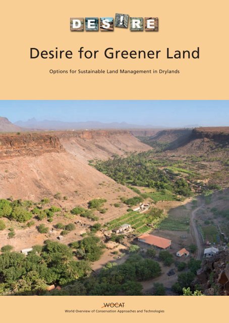
Desire for Greener Land
Desire for Greener Land
Desire for Greener Land

You also want an ePaper? Increase the reach of your titles
YUMPU automatically turns print PDFs into web optimized ePapers that Google loves.
<strong>Desire</strong> <strong>for</strong> <strong>Greener</strong> <strong>Land</strong><br />
Options <strong>for</strong> Sustainable <strong>Land</strong> Management in Drylands<br />
World Overview of Conservation Approaches and Technologies
<strong>Desire</strong> <strong>for</strong> <strong>Greener</strong> <strong>Land</strong><br />
Options <strong>for</strong> Sustainable <strong>Land</strong> Management in Drylands
DESIRE – WOCAT <strong>Desire</strong> <strong>for</strong> <strong>Greener</strong> <strong>Land</strong>
<strong>Desire</strong> <strong>for</strong> <strong>Greener</strong> <strong>Land</strong><br />
Options <strong>for</strong> Sustainable <strong>Land</strong> Management in Drylands<br />
Editors and lead authors<br />
Gudrun Schwilch, Rudi Hessel and Simone Verzandvoort<br />
Associate editors and authors<br />
Erik van den Elsen, Hanspeter Liniger, Godert van Lynden, Coen Ritsema and Sarah Buckmaster<br />
DESIRE – Desertification Mitigation and Remediation of <strong>Land</strong> - a Global Approach <strong>for</strong> Local Solutions<br />
WOCAT – World Overview of Conservation Approaches and Technologies<br />
DESIRE – WOCAT 2012
Co-published by University of Bern, Centre <strong>for</strong> Development and Environment CDE; Alterra, Wageningen UR; ISRIC - World Soil In<strong>for</strong>mation and<br />
CTA - Technical Centre <strong>for</strong> Agricultural and Rural Cooperation;<br />
on behalf of the EU FP6 project ‘Desertification Mitigation and Remediation of <strong>Land</strong> - a Global Approach <strong>for</strong> Local Solutions’<br />
(DESIRE) and the World Overview of Conservation Approaches and Technologies (WOCAT)<br />
Financed by European Commission, Directorate General <strong>for</strong> Research, Framework Programme 6, Global Change and Ecosystems (Contract<br />
Number 037046 GOCE; scientific officer Marie Yeroyanni)<br />
Dutch Ministry of Economic Affairs, Agriculture and Innovation (part of the strategic research program KBIV “Sustainable spatial<br />
development of ecosystems, landscapes, seas and regions” carried out by Wageningen University & Research Centre).<br />
The governments of Italy, France, Spain, Mexico and The Netherlands through among others the: National Research Council<br />
(CNR, Italy), Institut de Recherche pour le Développement (IRD, France), Agencia Estatal Consejo Superior de Investigaciones<br />
Científicas (CSIC, Spain), Universidad Nacional Autónoma de México (UNAM, Mexico), International Institute <strong>for</strong> Geo-in<strong>for</strong>mation<br />
Science and Earth Observation (ITC, Netherlands) and ISRIC – World Soil In<strong>for</strong>mation.<br />
Swiss Agency <strong>for</strong> Development and Cooperation (SDC), Bern<br />
Editors and<br />
lead authors<br />
Gudrun Schwilch, Rudi Hessel and Simone Verzandvoort<br />
Associate editors<br />
and authors<br />
Erik van den Elsen, Hanspeter Liniger, Godert van Lynden, Coen Ritsema and Sarah Buckmaster<br />
Figures and maps Gudrun Schwilch, Godert van Lynden, Simone Kummer and Ulla Gämperli<br />
Language editing Sarah Buckmaster and Rick Shakesby<br />
Layout Simone Kummer<br />
Printed by K-print, Tallinn, Estland<br />
Citation Schwilch, G., Hessel, R. and Verzandvoort, S. (Eds). 2012. <strong>Desire</strong> <strong>for</strong> <strong>Greener</strong> <strong>Land</strong>. Options <strong>for</strong> Sustainable <strong>Land</strong> Management<br />
in Drylands. Bern, Switzerland, and Wageningen, The Netherlands: University of Bern - CDE, Alterra - Wageningen UR,<br />
ISRIC - World Soil In<strong>for</strong>mation and CTA - Technical Centre <strong>for</strong> Agricultural and Rural Cooperation.<br />
Copyright © 2012 University of Bern - CDE, Alterra - Wageningen UR, ISRIC - World Soil In<strong>for</strong>mation and CTA - Technical Centre <strong>for</strong><br />
Agricultural and Rural Cooperation<br />
Acquisition, duplication and transmission of this publication is permitted with clear acknowledgement of the source.<br />
Acquisition, duplication and transmission is not permitted <strong>for</strong> commercial purposes and/or monetary gain.<br />
Acquisition, duplication and transmission is not permitted of any parts of this publication <strong>for</strong> which the copyrights clearly rest<br />
with other parties and/or are reserved.<br />
ISBN 978-94-6173-329-0<br />
Cover photo Cape Verde (by Erik van den Elsen)<br />
Co-publishers’ in<strong>for</strong>mation and disclaimers<br />
University of Bern - CDE Alterra, Wageningen UR<br />
Hallerstrasse 10 P.O. Box 47<br />
3012 Bern 6700 AJ Wageningen<br />
Switzerland The Netherlands<br />
www.cde.unibe.ch www.alterra.nl<br />
info@cde.unibe.ch info@alterra.nl<br />
ISRIC - World Soil In<strong>for</strong>mation<br />
P.O. Box 353<br />
6700, Wageningen<br />
The Netherlands<br />
www.isric.org<br />
soil.isric@wur.nl<br />
CTA<br />
P.O. Box 380<br />
6700 AJ Wageningen<br />
The Netherlands<br />
www.cta.int<br />
cta@cta.int<br />
The co-publishers assume no liability <strong>for</strong> any losses resulting from the use of the research results or recommendations in this report.<br />
The opinions expressed in this publication are those of the individual project consortia and do not necessarily reflect the views of the funders.<br />
DESIRE – WOCAT <strong>Desire</strong> <strong>for</strong> <strong>Greener</strong> <strong>Land</strong>
Table of contents<br />
Preface VII<br />
Acknowledgements IX<br />
Contributing authors and DESIRE consortium members X<br />
Executive summary XII<br />
Introduction 1<br />
Part 1 Methodology, analysis and synthesis 6<br />
1.1 The process of identifying and trialling options <strong>for</strong> SLM 9<br />
Identifying and trialling options <strong>for</strong> sustainable land management – the methodology 9<br />
I Setting the context 9<br />
II Identifying, evaluating and selecting SLM strategies 14<br />
III Trialling and monitoring selected SLM strategies 18<br />
IV Up-scaling SLM strategies 19<br />
V Dissemination 21<br />
Conclusion 23<br />
1.2 Analysis of degradation and SLM maps 25<br />
Introduction 25<br />
The WOCAT-LADA-DESIRE Mapping Method 25<br />
<strong>Land</strong> use 25<br />
Mapping land degradation 27<br />
Sustainable <strong>Land</strong> Management: dominant measures and groups, extent, effectiveness and trend 32<br />
1.3 Analysis of assessed SLM technologies and approaches across DESIRE sites 39<br />
Compilation of case studies 39<br />
Analysis of SLM technologies 40<br />
Analysis of SLM approaches 58<br />
1.4 Conclusions and policy points 63<br />
The DESIRE approach to remediation 63<br />
WOCAT/LADA/DESIRE mapping of land degradation and current SLM 65<br />
WOCAT questionnaires on SLM technologies and approaches 66<br />
Policy points 67<br />
Part 2 Case studies 68<br />
2.1 SLM case studies<br />
Global map and location of SLM case studies 70<br />
SLM case studies – titles and short descriptions 72<br />
Cropping management<br />
No tillage preceded by subsoiling K Chile 77<br />
Olive groves under no tillage operations K Greece 81<br />
Reduced contour tillage of cereals in semi-arid environments K Spain 85<br />
Reduced tillage of almonds and olives K Spain 89<br />
Crop rotation with legumes K Chile 93<br />
Crop rotation: cereals / fodder legumes (lupin) K Morocco 97<br />
Ecological production of almonds and olives using green manure K Spain 101<br />
Fodder crop production K Turkey 105<br />
Water management<br />
Jessour K Tunisia 109<br />
Tabia K Tunisia 113<br />
Water harvesting from concentrated runoff <strong>for</strong> irrigation purposes K Spain 117<br />
Transport of freshwater from local streams K Greece 121<br />
Recharge well K Tunisia 125<br />
Drip irrigation K Turkey 129<br />
Drip irrigation K Russia 133<br />
Roof rainwater harvesting system K Botswana 137<br />
Table of contents DESIRE – WOCAT 2012<br />
V
Cross-slope barriers<br />
Progressive bench terrace K China 141<br />
Woven wood fences K Turkey 145<br />
Vegetated earth-banked terraces K Spain 149<br />
Olive tree plantations with intercropping K Morocco 153<br />
Aloe Vera living barriers K Cape Verde 157<br />
<strong>Land</strong> reclamation by agave <strong>for</strong>estry with native species K Mexico 161<br />
Gully control by plantation of Atriplex K Morocco 165<br />
Grazing land management<br />
Rangelands resting K Tunisia 169<br />
Controlled grazing in deciduous woods as an alternative to grazing on rangeland K Italy 173<br />
Forest management<br />
Af<strong>for</strong>estation K Cape Verde 177<br />
Assisted cork oak regeneration K Morocco 181<br />
Primary strip network system <strong>for</strong> fuel management K Portugal 185<br />
Prescribed fire K Portugal 189<br />
Biogas K Botswana 193<br />
Approaches<br />
Dissemination of soil conservation technologies in dryland areas K Chile 197<br />
Training, in<strong>for</strong>mation and awareness raising K Cape Verde 201<br />
Participative actions <strong>for</strong> economic benefits of agave <strong>for</strong>estry K Mexico 205<br />
Development of rainfed agriculture K Morocco 209<br />
Forest Intervention Area (ZIF) K Portugal 213<br />
Concerted thinking on common problems of water scarcity K Russia 217<br />
Regional rural development programme K Spain 221<br />
Dryland watershed management approach K Tunisia 225<br />
2.2 Mapping case studies<br />
Global map and location of mapping case studies 230<br />
Mapping types 232<br />
Spain – Torrealvilla 235<br />
Portugal – Mação 236<br />
Portugal – Góis 237<br />
Italy – Rendina 238<br />
Greece – Crete 239<br />
Greece – Nestos 240<br />
Turkey – Karapinar 241<br />
Turkey – Eskeşehir 242<br />
Morocco – Sehoul 243<br />
Tunisia – Koutine 244<br />
Russia – Dzhanibek 245<br />
Russia – Novy 246<br />
China – Kelaigou 247<br />
Botswana – Boteti 248<br />
Mexico – Cointzio 249<br />
Chile – Cauquenes 250<br />
Cape Verde – Santiago 251<br />
2.3 DESIRE methodology examples<br />
Eskişehir (Turkey) 253<br />
Yan River Basin (China) 260<br />
Annex<br />
Explanation pages of case studies 270<br />
Pictograms 278<br />
List of acronyms 281<br />
Logos of partners 282<br />
VI DESIRE – WOCAT <strong>Desire</strong> <strong>for</strong> <strong>Greener</strong> <strong>Land</strong>
Preface<br />
Humankind currently faces interconnected, worldwide challenges<br />
of feeding our rapidly growing population while<br />
simultaneously preserving our natural resource base, adapting<br />
to climate change, and creating or maintaining favourable<br />
living conditions <strong>for</strong> present and future generations.<br />
The world’s population is growing exponentially. It is expected<br />
to rise from seven to more than nine billion people in<br />
the next few decades. Currently, around one-seventh of the<br />
world’s population – the so-called “bottom billion” – does<br />
not have a secure food supply, while an expanding middle<br />
class in rapidly developing countries is placing increasing<br />
pressure on the limited natural resources available <strong>for</strong> food<br />
production. Projections indicate that agricultural production<br />
will have to increase by about 70% by 2050 in order to keep<br />
pace with population growth. This has far-reaching implications<br />
<strong>for</strong> the way we use and manage our agricultural lands.<br />
Food production depends on the availability of fertile land,<br />
water, favourable climatic conditions, and related ecosystem<br />
services. At present, humans are overexploiting natural<br />
resources in many regions of the globe in order to obtain<br />
short-term benefits. This is leading to clearance of land, an<br />
increase in degraded ecosystems, and declining biodiversity.<br />
Additionally, global warming is causing anomalies in rainfall<br />
patterns and is increasing the occurrence of extreme weather<br />
events like prolonged droughts, floods, and cyclones. In this<br />
way, climate change is aggravating pressure on land and<br />
water resources, increasing people’s vulnerability by affecting<br />
ecosystem resilience and food production potentials,<br />
particularly in marginal regions like the drylands in arid,<br />
semi-arid, and sub-humid climatic zones.<br />
Desertification is land degradation in drylands that results<br />
from climate variation and human impact. It leads to losses<br />
of biological productivity, threatened livelihoods, and outmigration<br />
of dryland inhabitants. Over 250 million people<br />
and an estimated 10–20% of dryland areas are directly<br />
affected by desertification, and about one billion people in<br />
over 100 countries are at risk as land degradation continues<br />
to worsen. These people include many of the world’s poorest<br />
and most marginalised citizens.<br />
Combatting desertification is considered essential to ensure<br />
the long-term productivity of inhabited drylands, and<br />
the United Nations Convention to Combat Desertification<br />
(UNCCD) is the international treaty to promote action<br />
through local programmes and international, scientific partnerships.<br />
Preferably, degradation assessments involve both<br />
local land users and scientists in developing scientifically<br />
sound solutions to land degradation problems, solutions<br />
that are relevant and appropriate at that particular scale.<br />
What is needed is an approach that combines scientific rigor<br />
and accuracy with relevance and sensitivity to local perspectives<br />
and contexts.<br />
Table of contents DESIRE – WOCAT 2012<br />
Recently, it was acknowledged by international policy and<br />
scientific <strong>for</strong>a that Sustainable <strong>Land</strong> Management (SLM)<br />
might be the key to addressing land degradation and desertification,<br />
while also contributing to increased food production,<br />
mitigating climate change, and preserving our natural<br />
resource base. SLM strategies are interventions at the local<br />
to regional scale that aim to increase productivity, improve<br />
people’s livelihoods, and preserve ecosystems. As such, they<br />
are particularly relevant in dryland regions.<br />
In the EU-funded DESIRE project (www.desire-project.eu)<br />
– “Desertification mitigation and remediation of land – A<br />
global approach <strong>for</strong> local solutions” – specific attention<br />
was paid to exploring the potentials of SLM strategies to<br />
prevent and combat degradation and desertification in a<br />
range of dryland areas around the world. To that end, a<br />
project consortium was established comprising 26 partners<br />
from academic, NGO, and governmental backgrounds; study<br />
sites were identified and embedded from 13 countries; and<br />
project activities were implemented between 2007 and 2012.<br />
The total project budget amounted to nearly nine million<br />
Euros, of which around seven million were contributed by<br />
the European Commission, with the remainder contributed<br />
by the governments of France, Italy, Spain, Mexico and the<br />
Netherlands.<br />
DESIRE designed a global, widely applicable, methodological<br />
framework <strong>for</strong> identifying, prioritising, testing, evaluating<br />
and disseminating SLM technologies in close collaboration<br />
with local stakeholders. Such an integrative and interdisciplinary<br />
framework that involves stakeholders is needed<br />
to obtain a full understanding of the complex interplay of<br />
biophysical and socio-economic causes of desertification.<br />
Only through such an understanding is it possible to develop<br />
mitigation and restoration methods that are physically effective<br />
as well as socio-economically acceptable. The framework<br />
includes assessment of potentials <strong>for</strong> upscaling as well as of<br />
related costs and benefits, by means of innovative, coupled<br />
biophysical and economic models. A subsequent larger scale<br />
demonstration phase would additionally allow implementing<br />
selected technologies and approaches in real-life situations,<br />
assessing the cost-effectiveness of measures to restore<br />
soil functions and mitigate land degradation, and finally<br />
enhancing the adoption of SLM. To date, various national<br />
and international governmental bodies – including the<br />
UNCCD – have embraced this integrated methodological<br />
framework, endorsing its continued use and implementation.<br />
The results of the scientific innovations achieved within<br />
the DESIRE project are due to be published in three special<br />
issues of international scientific journals. In addition, the<br />
online DESIRE Harmonised In<strong>for</strong>mation System (http://www.<br />
desire-his.eu/) houses the complete story of DESIRE research<br />
in each of the 17 study areas. Material is presented using<br />
various <strong>for</strong>mats, and the language used is less scientific in<br />
order to address a wider audience. Multiple translations are<br />
available. The project’s broad definition of stakeholders,<br />
from schoolchildren to national policymakers, means that<br />
dissemination of results and ideas must also include these<br />
audiences. DESIRE has produced posters and audiovisual<br />
products <strong>for</strong> those without access to the internet.<br />
VII
The present DESIRE publication describes the methodology<br />
that was applied in the different study sites to identify, prioritise,<br />
test, and evaluate promising SLM strategies. It also<br />
describes ways of extending the results <strong>for</strong> application at a<br />
wider spatial scale, enabling estimation of related costs and<br />
the benefits of implementation. All of the DESIRE SLM case<br />
studies are presented using harmonised <strong>for</strong>mats, previously<br />
developed by partners in the WOCAT network (www.wocat.<br />
net). The SLM case studies presented encompass interventions<br />
addressing cropping management, water management,<br />
cross-slope barriers, grazing land management, and<br />
<strong>for</strong>est management. Special attention is given to stakeholder<br />
participation and dissemination, embedded in the<br />
project approach from start to finish. Another key emphasis<br />
is assessing the state of degradation and conservation by<br />
means of a recently developed mapping methodology. Two<br />
detailed examples are presented that show application of<br />
the full cycle of DESIRE activities – in the Chinese and Turkish<br />
study sites – and demonstrate the strengths, advantages,<br />
and potentials of the developed methodology.<br />
The DESIRE consortium<br />
Globally, sustainable use and management of our land is still<br />
the exception rather than the rule. Thus, it is crucial that<br />
we exchange knowledge about SLM as well as promote and<br />
enable its implementation by practitioners in the field. We<br />
trust that this publication will be of interest to a wide range<br />
of audiences and especially those concerned about drylands.<br />
We hope this volume will contribute to protecting our environment<br />
and help to create a healthy and sustainable basis<br />
<strong>for</strong> current and future generations.<br />
Prof. Dr. Coen J. Ritsema<br />
DESIRE Project Coordinator<br />
Alterra, Wageningen University<br />
Wageningen<br />
The Netherlands<br />
Erik van den Elsen<br />
VIII DESIRE – WOCAT <strong>Desire</strong> <strong>for</strong> <strong>Greener</strong> <strong>Land</strong>
Acknowledgements<br />
Without the great ef<strong>for</strong>t of the land users who implemented<br />
sustainable land management practices in their fields, as well<br />
as the SLM specialists who supported them, this book would<br />
not have been possible. We would there<strong>for</strong>e first like to<br />
thank all of these men and women who dedicated their time<br />
to carefully managing their land and were willing to share<br />
their experiences with us. In order to make their knowledge<br />
available to a worldwide audience, numerous researchers<br />
and experts worked to compile a wealth of in<strong>for</strong>mation in<br />
the WOCAT framework <strong>for</strong> documenting and evaluating<br />
SLM technologies, approaches, and maps. We are very grateful<br />
to all of these individuals; not only did they endeavour<br />
to translate from their own language into English, they<br />
also sought to translate land users’ ways of understanding<br />
into the standardised WOCAT terminology. On more than<br />
one occasion, they were asked to update and improve their<br />
documents and did so with the utmost patience. Their names<br />
are all listed on the next pages as contributing authors to<br />
the case studies. We would also like to thank those who<br />
helped to review the draft case studies that were initially<br />
submitted <strong>for</strong> a DESIRE contest, namely Jean Poesen and his<br />
team at the Catholic University of Leuven (Belgium). Finally,<br />
Rick Shakesby from Swansea University (UK) helped us to<br />
improve the English of the final versions of the case studies.<br />
Part I of the book is the result of a joint ef<strong>for</strong>t by the editors<br />
and associate editors as well as many others who we<br />
would like to acknowledge by name. These are, first and<br />
<strong>for</strong>emost, the DESIRE consortium partners and their teams,<br />
in particular the working block leaders and NGO staff who<br />
contributed to the DESIRE methodology and provided data<br />
from their working blocks: Godert van Lynden and Stephan<br />
Mantel (working block 1), Christos Karavitis, Constantinos<br />
Kosmos and Vassilia Fassouli (working block 2), Gudrun<br />
Schwilch and Felicitas Bachmann (working block 3), Victor<br />
Jetten and Dhruba Shresta (working block 4), Mark Reed<br />
and Mike Kirkby (working block 5), Nichola Geeson and<br />
Jane Brandt (working block 6), Patrice Burger and Maude<br />
Gentit (CARI), and Marie José van der Werff ten Bosch and<br />
Karen Witsenburg (Both ENDS). All the DESIRE contributors<br />
are listed on the next pages as well. The presentation and<br />
analysis of the SLM maps and case studies build on background<br />
works by others who also deserve recognition. We<br />
wish to thank Kurt Gerber and Carin Pretorius <strong>for</strong> the technical<br />
implementation of the WOCAT databases and the map<br />
viewer, Jan Huting <strong>for</strong> preparing the maps, Caroline Amsler<br />
and Dominic Schuppli <strong>for</strong> their supporting bachelor study,<br />
and Cinzia de Maddalena and Cyprien Hauser <strong>for</strong> their persistent<br />
work in compiling the four-page summaries. Thanks<br />
are also in order <strong>for</strong> Simone Kummer and Ulla Gämperli,<br />
who rendered everything in an attractive layout, closely following<br />
the standards set by this volume’s <strong>for</strong>erunner “where<br />
the land is greener” (WOCAT, 2007).<br />
Preface DESIRE – WOCAT 2012<br />
Finally, we wish to acknowledge the generous support of<br />
our donors. The European Commission, Sixth Framework<br />
Programme, “Global Change and Ecosystems”, was the main<br />
funder of the DESIRE project, with Marie Yeroyanni as<br />
the Scientific Officer. The research was also conducted as<br />
part of the strategic research program KBIV “Sustainable<br />
spatial development of ecosystems, landscapes, seas and<br />
regions”, funded by the Dutch Ministry of Economic Affairs,<br />
Agriculture and Innovation, and carried out by Wageningen<br />
UR (University & Research centre). The DESIRE project was<br />
also supported by the governments of Italy, France, Spain,<br />
Mexico, and The Netherlands through among others the:<br />
National Research Council (CNR, Italy), Institut de Recherche<br />
pour le Développement (IRD, France), Agencia Estatal<br />
Consejo Superior de Investigaciones Científicas (CSIC, Spain),<br />
Universidad Nacional Autónoma de México (UNAM, Mexico),<br />
International Institute <strong>for</strong> Geo-in<strong>for</strong>mation Science and<br />
Earth Observation (ITC, Netherlands) and ISRIC – World Soil<br />
In<strong>for</strong>mation. Lastly, we particularly wish to thank the Swiss<br />
Agency <strong>for</strong> Development Cooperation (SDC) <strong>for</strong> their longterm<br />
commitment and funding of the WOCAT programme,<br />
and we would like to thank the three WOCAT management<br />
institutions: the UN Food and Agriculture Organisation (FAO),<br />
ISRIC World Soil In<strong>for</strong>mation (Wageningen, the Netherlands)<br />
and the Centre <strong>for</strong> Development and Environment (CDE,<br />
University of Bern, Switzerland).<br />
IX
Contributing authors and DESIRE consortium members<br />
Açıkalın, Sanem - Eskişehir Osmangazi University (Turkey)<br />
Akanyang, Lawrence - Botswana College of Agriculture<br />
(Botswana)<br />
Alcalá de Jesus, Maria - Universidad Michoacana San Nicolas<br />
de Hidalgo (UMSNH) (Mexico)<br />
Al Karkouri, Jamal - FLSH, University Ibn Tofail, Kénitra<br />
(Morocco)<br />
Argaman, Eli – LDD, Wageningen University (The<br />
Netherlands)<br />
Atlhopheng, Julius - University of Botswana (Botswana)<br />
Ávila García, Patricia - Universidad Nacional Autómona de<br />
México (UNAM-CIEco) Mexico<br />
Baartman, Jantiene - LDD, Wageningen University (The<br />
Netherlands)<br />
Bachmann, Felicitas - University of Bern CDE (Switzerland)<br />
Bai, Zhango - ISRIC-World Soil In<strong>for</strong>mation (The<br />
Netherlands)<br />
Bangalore, Venkata Chalapathi Shruti (ITC, The<br />
Netherlands)<br />
Baptista, Isaurinda - INIDA (Cape Verde)<br />
Bartolini, Devis - CNR-IRPI, Florence (Italy)<br />
Bento, Célia - IPC-ESAC (Portugal) 1<br />
Ben Zaied, Mongi - Institut des Régions Arides (IRA)<br />
(Tunisia)<br />
Borselli, Lorenzo - CNR-IRPI, Florence (Italy)<br />
Brandt, Jane - MEDES (Italy)<br />
Burger, Patrice - CARI (France)<br />
Carreiras, Manuela - IPC-ESAC (Portugal)<br />
Cassi, Paola - CNR-IRPI, Florence (Italy)<br />
Chaker, Miloud - Chaire UNESCO-GN, FLSH, UM5A<br />
(Morocco)<br />
Chanda, Raban - University of Botswana (Botswana)<br />
Chniter, Mongi - Commissariat Régional au Développement<br />
Agricole de Médenine (Tunisia)<br />
Coelho, Celeste - University of Aveiro (Portugal)<br />
De Maddalena, Cinzia - University of Bern CDE<br />
(Switzerland)<br />
Del Pozo, Alejandro - Universidad de Talca (Chile)<br />
de Graaff, Jan - LDD, Wageningen University (The<br />
Netherlands)<br />
de Vente, Joris - EEZA-CSIC (Spain)<br />
Dhaou, Hanen - Institut des Régions Arides (IRA) (Tunisia)<br />
Ermolaeva, Olga - Moscow State University of<br />
Environmental Engineering (Russia)<br />
Engler, Alejandra - Universidad de Talca (Chile)<br />
Enneb, Ibtissem - Institut des Régions Arides (IRA) (Tunisia)<br />
Espinoza, Soledad - Instituto de Investigaciones<br />
Agropecuarias (INIA La Cruz) (Chile)<br />
Esteves, Tanya - IPC-ESAC (Portugal)<br />
X<br />
Etchevers Barra, Jorge - Colegio de Postgraduados (Colpos),<br />
Laboratorio de Fertilidad de Suelo, Montecillo (Mexico)<br />
Fassouli, Vassilia - Agricultural University of Athens (AUA)<br />
(Greece)<br />
Ferreira, António José Dinis - IPC-ESAC (Portugal)<br />
Ferreira, Carla - IPC-ESAC (Portugal) 1<br />
Fetoui, Mondher - Institut des Régions Arides (IRA) (Tunisia)<br />
Fleskens, Luuk - University of Leeds (UK)<br />
Gabathuler, Ernst - University of Bern CDE (Switzerland)<br />
Gao, Peng - Institute of Soil and Water Conservation, CAS<br />
and MWR (China)<br />
Geeson, Nichola - MEDES (Italy)<br />
Gentit, Maude - CARI (France)<br />
Gkiougkis, John - Democritus University of Thrace (Greece)<br />
Gonzalez, Daniel Iura - UNAM-CIGA (Centro de<br />
Investigación de Geografía Ambiental) (Mexico)<br />
Hauser, Cyprien - University of Bern CDE (Switzerland)<br />
Hessel, Rudi - Alterra, Wageningen UR (the Netherlands)<br />
Hongxia, Xie - Institute of Soil and Water Conservation,<br />
CAS and MWR (China)<br />
Hurni, Hans - University of Bern CDE (Switzerland)<br />
Irvine, Brian - University of Leeds (UK)<br />
Jetten, Victor - ITC (the Netherlands)<br />
Jones, Nadia - Wageningen University (The Netherlands)<br />
Kairis, Orestis - Agricultural University of Athens (AUA)<br />
(Greece)<br />
Karamesouti, Mina - Agricultural University of Athens<br />
(AUA) (Greece)<br />
Karavitis, Christos - Agricultural University of Athens (AUA)<br />
(Greece)<br />
Kosmas, Constantinos - Agricultural University of Athens<br />
(AUA) (Greece)<br />
Kirkby, Mike - University of Leeds (UK)<br />
Kounalaki, Aikaterini - Agricultural University of Athens<br />
(AUA) (Greece)<br />
Laouina, Abdellah - Chaire UNESCO-GN, FLSH, UM5A, Rabat<br />
(Morocco)<br />
Liniger, Hanspeter - University of Bern CDE (Switzerland)<br />
Li, Rui - Institute of Soil and Water Conservation, CAS and<br />
MWR (China)<br />
Lollino, Piernicola - CNR-IRPI, Bari (Italy)<br />
Machouri, Nadia - Chaire UNESCO-GN, FLSH, UM5A, Rabat<br />
(Morocco)<br />
Machmachi, Issam - Chaire UNESCO-GN, FLSH, UM5A, Rabat<br />
(Morocco)<br />
Mahdhi, Naceur - Institut des Régions Arides (IRA) (Tunisia)<br />
Maetens, Willem - Catholic University of Leuven (Belgium)<br />
Magole, Lapologang - University of Botswana (Botswana)<br />
Mahdi, Naceur - Institut des Régions Arides (IRA) (Tunisia)<br />
DESIRE – WOCAT <strong>Desire</strong> <strong>for</strong> <strong>Greener</strong> <strong>Land</strong>
Mantel, Stephan - ISRIC-World Soil In<strong>for</strong>mation (the<br />
Netherlands)<br />
Martinez, Ingrid - Instituto de Investigaciones<br />
Agropecuarias (INIA) (Chile)<br />
Martínez, Palacios Alejandro - Universidad Michoacana San<br />
Nicolas de Hidalgo (UMSNH) (Mexico)<br />
Mendoza, Cantú Manuel - UNAM-CIGA (México)<br />
Mitaritonna, Giuseppina - CNR-IRPI, Bari (Italy)<br />
Mphinyane, Wanda - University of Botswana (Botswana)<br />
Mulale, Kutlwano - University of Botswana (Botswana)<br />
Nafaa, Rachida - Université Hassan II, FLSH, Mohammédia<br />
(Morocco)<br />
Naïmi, Kacem - Chaire UNESCO-GN, FLSH, UM5A, Rabat<br />
(Morocco)<br />
Nainggolan, Doan - University of Leeds (UK)<br />
Ocakoğlu, Faruk - Eskişehir Osmangazi University (Turkey)<br />
Ouessar, Mohamed - Institut des Régions Arides (IRA)<br />
(Tunisia)<br />
Ouled Belgacem, Azaiez - Institut des Régions Arides<br />
(Tunisia)<br />
Ovalle, Carlos - Instituto de Investigaciones Agropecuarias<br />
(INIA) (Chile)<br />
Palheiro, Pedro - Gestão Integrada De Fogos Florestais Sa<br />
(GIFF), (Portugal)<br />
Perkins, Jeremy - University of Botswana (Botswana)<br />
Poesen, Jean - Catholic University of Leuven (Belgium)<br />
Prat, Christian - Institut de Recherche pour le<br />
Développement (IRD) (France)<br />
Quaranta, Giovanni - MEDES (Italy)<br />
Reed, Mark - University of Leeds (UK)<br />
Reis, Eduardo Amarildo - INIDA (Cape Verde)<br />
Ríos Patrón, Eduardo - Secretaría de Medio Ambiente y<br />
Recursos Naturales (SEMARNAT) (Mexico)<br />
Ritsema, Coen - Alterra, Wageningen UR (The Netherlands)<br />
Ruiz, Carlos - Instituto de Investigaciones Agropecuarias<br />
(INIA) (Chile)<br />
Ruiz, German - Ministry of Agriculture (Chile)<br />
Salvador Sanchis, Pilar - CNR-IRPI, Florence (Italy)<br />
Salvia, Rosanna - MEDES (Italy)<br />
Sanchez Moreno, Juan Francisco - ITC (The Netherlands)<br />
Schwilch, Gudrun - University of Bern CDE (Switzerland)<br />
Sebego, Reuben - University of Botswana (Botswana)<br />
Semenov, Vyacheslav - Moscow State University of<br />
Environmental Engineering (Russia)<br />
Sfa, Mohammed - Chaire UNESCO-GN, FLSH, UM5A, Rabat<br />
(Morocco)<br />
Sghaier, Mongi - Institut des Régions Arides (IRA) (Tunisia)<br />
Shakesby, Rick - Swansea University (UK)<br />
Shresta, Druba - ITC (The Netherlands)<br />
Soares, João - University of Aveiro (Portugal)<br />
Solé Benet, Albert - EEZA-CSIC (Spain)<br />
Stoof, Cathelijne - LDD, Wageningen University<br />
(The Netherlands) 2<br />
Stroosnijder, Leo - LDD, Wageningen University<br />
(The Netherlands)<br />
Susperregui, Anne-Sophie - Université Joseph Fourier<br />
(France)<br />
Taamallah, Houcine - Institut des Régions Arides (IRA)<br />
(Tunisia)<br />
Tavares, Jacques - INIDA (Cape Verde)<br />
Tolay, İnci - Akdeniz University (Turkey)<br />
Tsesmelis, Dimitrios - Agricultural University of Athens<br />
(AUA) (Greece)<br />
Urbanek, Emilia - Swansea University (UK)<br />
Valente, Sandra - University of Aveiro (Portugal)<br />
Van den Elsen, Erik - Alterra, Wageningen UR (The<br />
Netherlands)<br />
Van der Werff ten Bosch, Marie José - Both ENDS<br />
(The Netherlands)<br />
Van Lynden, Godert - ISRIC-World Soil In<strong>for</strong>mation<br />
(The Netherlands)<br />
Vanmaercke, Matthias - Catholic University of Leuven<br />
(Belgium)<br />
Verzandvoort, Simone - Alterra, Wageningen UR (The<br />
Netherlands)<br />
Walsh, Rory - Swansea University (UK)<br />
Wang, Fei - Institute of Soil and Water Conservation, CAS<br />
and MWR (China)<br />
Witsenburg, Karen - Both ENDS (The Netherlands)<br />
Youssef, Feras - LDD, Wageningen University (The<br />
Netherlands)<br />
Yahyaoui, Houcine - Commissariat Régional au<br />
Développement Agricole de Médenine (Tunisia)<br />
Yao, Zhihong - Institute of Soil and Water Conservation,<br />
CAS and MWR (China)<br />
Zeiliguer, Anatoly - Moscow State University of<br />
Environmental Engineering (Russia)<br />
Zengin, Mehmet - University of Selcuk (Turkey)<br />
1 Also temporarily employed at Swansea University (UK)<br />
2 Currently employed at Cornell University (USA)<br />
DESIRE consortium and contributors of the case studies DESIRE – WOCAT 2012 XI
<strong>Desire</strong> <strong>for</strong> <strong>Greener</strong> <strong>Land</strong> - Options <strong>for</strong> Sustainable <strong>Land</strong><br />
Management in Drylands<br />
Executive summary<br />
The need <strong>for</strong> Sustainable <strong>Land</strong> Management<br />
Current global developments call <strong>for</strong> more thoughtful<br />
management of our land. These developments include: the<br />
increased demand <strong>for</strong> land-based agricultural products <strong>for</strong> a<br />
growing world population; the increasing scarcity of water,<br />
fuel, and minerals; the impacts of global climate change,<br />
increased commodity prices in the agricultural sector, and<br />
growing competition <strong>for</strong> land resources. Globally, large<br />
areas of land are being affected by land degradation, partly<br />
resulting from unsustainable land use. This is particularly<br />
the case in dryland areas, which are especially vulnerable<br />
to overexploitation, inappropriate land use, and climate<br />
change. Bad land management – including overgrazing and<br />
inappropriate irrigation and de<strong>for</strong>estation practices – often<br />
undermines land’s productivity. In dryland areas, land degradation<br />
is referred to as desertification. It encompasses soil<br />
erosion by water and wind, physical soil deterioration (e.g.<br />
compaction, crusting, and sealing), chemical soil deterioration<br />
(e.g. fertility decline and salinization), biological degradation<br />
(e.g. biomass and vegetation cover decline as well as<br />
<strong>for</strong>est fires), and water degradation (e.g. aridification).<br />
Sustainable <strong>Land</strong> Management (SLM) is the key to these<br />
challenges, and it is the subject of this book. SLM is a <strong>for</strong>m<br />
of land management that is targeted towards improving or<br />
stabilising agricultural productivity, improving people’s livelihoods,<br />
and improving ecosystems. SLM strategies seek to<br />
combine and optimise the ecological, technical, institutional,<br />
socio-cultural, economic, and scientific aspects of land management<br />
in response to desertification. This book is aimed<br />
at land users and practitioners, agricultural specialists and<br />
scientists, students and teachers in environmental science, as<br />
well as concerned citizens. It is also intended <strong>for</strong> policymakers<br />
interested in the potential of SLM strategies to improve<br />
productivity, people’s livelihoods, and ecosystems in their<br />
regions of interest.<br />
The DESIRE response to desertification<br />
This book presents options <strong>for</strong> SLM in drylands that grew out<br />
of the EU-funded DESIRE project (2007–2012) 1 . Further, it<br />
explains an approach – developed in the DESIRE project – <strong>for</strong><br />
establishing promising SLM strategies in response to desertification.<br />
The DESIRE approach consists of five steps: (1)<br />
establishing land degradation and SLM context and sustainability<br />
goals; (2) identifying, evaluating, and selecting SLM<br />
strategies; (3) trialling and monitoring SLM strategies; (4)<br />
upscaling SLM strategies; and (5) disseminating the knowledge<br />
gathered in the previous steps. The DESIRE approach<br />
was applied in 17 areas affected by desertification, accounting<br />
<strong>for</strong> a wide variety of biophysical and socioeconomic<br />
conditions found worldwide. The DESIRE approach can be<br />
applied by agricultural advisors, government institutions,<br />
or in any project that aims to combat land degradation. To<br />
date, it has been incorporated in publications and initiatives<br />
by the United Nations Convention to Combat Desertification<br />
(UNCCD), the UN Food and Agriculture Organisation (FAO),<br />
and the Global Environment Facility (GEF).<br />
XII<br />
Thanks to its potential <strong>for</strong> identifying needs and sharing<br />
knowledge in SLM, the WOCAT 2 methodology is an important<br />
cornerstone of the DESIRE approach. Within the DESIRE<br />
project, WOCAT tools 3 were adapted to map the current<br />
status of land degradation and conservation. Further, the<br />
tools were integrated with a stakeholder learning approach<br />
and a decision support system <strong>for</strong> identifying, documenting,<br />
and selecting SLM strategies. The WOCAT databases and<br />
tools, updated with the SLM options presented in this book,<br />
are available online to a worldwide audience. In<strong>for</strong>mation<br />
on SLM options is now being standardised and collated,<br />
facilitating the exchange of land management strategies to<br />
combat desertification.<br />
This book presents guidelines <strong>for</strong> setting up and structuring<br />
land-degradation mitigation projects, using the DESIRE<br />
project as a model. It discusses the potential of using the<br />
WOCAT-based methods and tools in such projects (chapter<br />
1.1), presents an analysis of the spatial context of SLM<br />
(chapter 1.2), and introduces the SLM strategies applied in<br />
the DESIRE project (chapter 1.3). Further, it presents recommendations<br />
and policy points based on the analyses (chapter<br />
1.4) and case studies from all the DESIRE study sites; this also<br />
covers the spatial context of land degradation, existing SLM<br />
practices, and the SLM technologies and approaches implemented<br />
(Part 2).<br />
Four key requirements emerged from the project, which<br />
appear essential <strong>for</strong> successful application of the DESIRE<br />
approach: (1) an integrated, multidisciplinary project setup;<br />
(2) close collaboration between scientists and stakeholders<br />
from start to finish; (3) a sound scientific basis, <strong>for</strong> example<br />
through field experimentation and state-of-the-art modelling,<br />
and, (4) from day one, a continuous dissemination and<br />
communication process between stakeholders, policymakers,<br />
and scientists. Requirements (1), (2), and (4), in particular,<br />
are relatively new in the world of applied environmental science.<br />
They proved indispensable in the DESIRE project.<br />
Mapping land degradation and SLM<br />
During the project, mapping of land degradation and current<br />
SLM showed that land degradation in the 17 DESIRE<br />
study sites mainly occurred as water erosion on cultivated<br />
land and land under mixed use. Degradation was found to<br />
be increasing in most sites, primarily caused by inappropriate<br />
soil management. Indirectly, land degradation appeared to<br />
be caused most frequently by population pressure, insecure<br />
land tenure, and poverty in combination with aspects of<br />
governance, institutional functioning, and politics.<br />
The SLM measures already found to exist in the study sites<br />
mainly comprised grazing land management technologies<br />
and conservation agriculture. Combinations of SLM measures<br />
appeared to per<strong>for</strong>m better than applying one type of<br />
measure by itself.<br />
<strong>Land</strong> degradation negatively affected ecosystem services <strong>for</strong><br />
almost all degraded areas. Provision of ecosystem services –<br />
such as production of food, fodder, wood, water, and energy<br />
– was most affected in areas of mixed land use, followed<br />
by areas of cultivated land and grazing land. High negative<br />
DESIRE – WOCAT <strong>Desire</strong> <strong>for</strong> <strong>Greener</strong> <strong>Land</strong>
impacts were observed regarding regulation of ecosystem<br />
services – such as regulation of water and nutrient flows,<br />
carbon sequestration, pollination, and pest control – indicating<br />
that these require particular attention when developing<br />
and implementing remediation strategies.<br />
SLM measures appeared most effective on cultivated land,<br />
but positive impacts from SLM on ecosystem services were<br />
also recorded <strong>for</strong> relatively large areas of <strong>for</strong>est and grazing<br />
land. Overall, there appears to be scope <strong>for</strong> improving SLM<br />
contributions to ecosystem services in cultivated land.<br />
SLM technologies and approaches<br />
There were 38 case studies investigated in the DESIRE project;<br />
30 <strong>for</strong> SLM technologies and eight <strong>for</strong> SLM approaches.<br />
The physical practices used in the field to control land degradation<br />
and enhance productivity – the SLM technologies,<br />
in other words – could be divided into five groups: cropping<br />
management, water management, cross-slope barriers,<br />
grazing land management, and <strong>for</strong>est management. They<br />
addressed all the main types of land degradation. Most of<br />
them were applied on cropland, although grazing land is<br />
equally important – perhaps even more important in spatial<br />
terms – in drylands. Depending on the kind of degradation<br />
addressed, agronomic, vegetative, structural, or management<br />
measures were used, or some combination of these.<br />
Most of the technologies aimed to prevent or mitigate<br />
degradation; only a few were described as intended <strong>for</strong><br />
rehabilitation. This reflected the state of land degradation in<br />
the study sites, which had not passed thresholds of extreme<br />
loss of productivity or provision of ecosystem services. The<br />
main functions of the SLM technologies assessed included<br />
their ability to increase infiltration capacity, control runoff,<br />
and improve ground cover. Most of the technologies were<br />
applied by small-scale land users, a group that is often<br />
underestimated regarding investment and innovation, not<br />
to mention their role in worldwide agricultural production.<br />
Individual and regulated communal land ownership and<br />
land use rights facilitated the implementation of SLM, confirming<br />
the results of previous studies.<br />
The SLM technologies positively affected biophysical processes<br />
relevant <strong>for</strong> agricultural production and positively<br />
affected the ecological services of the land. Water harvesting<br />
technologies and more efficient use of irrigated water<br />
showed the greatest potential and benefits. Most of the<br />
applied technologies appear resilient to expected climatic<br />
variations and half of them provide off-site benefits, such<br />
as reduced damage to neighbouring fields, public or private<br />
infrastructure, and reduced downstream flooding. This<br />
opens up the possibility of promoting SLM technologies to<br />
protect goods and services by means of reward schemes<br />
aimed at farming communities. It also highlights the capacity<br />
of SLM technologies to support disaster risk reduction.<br />
Low-cost technologies (mostly below 100 USD/ha) were<br />
mainly found in the groups of cropping management and<br />
grazing land management, though their maintenance costs<br />
can be considerable. The most expensive technologies<br />
(2,000–10,000 USD/ha) were related to water management;<br />
however, technologies in this group also bear the highest<br />
potential <strong>for</strong> increasing profits and their maintenance<br />
costs are usually relatively low, i.e., below 300 USD/ha/year.<br />
Analyses showed that nearly half of the land users earned<br />
most of their income outside of their farm. All the technologies<br />
were found to be profitable in the long run; however,<br />
half of them were found to be less profitable, or not profitable<br />
at all, in the short run. It was found that land users typi-<br />
cally pay one-third of the implementation costs and all of<br />
the maintenance costs. This suggests that providing funding<br />
<strong>for</strong> implementation of technologies – e.g., through revolving<br />
funds or payments <strong>for</strong> ecosystem services – could be<br />
an effective way of enhancing adoption among land users,<br />
since the costs of implementation may make such measures<br />
unprofitable in the short run.<br />
SLM approaches are understood as ways and means of supporting<br />
introduction, implementation, adaptation, and promotion<br />
of SLM technologies. Regarding the SLM approaches<br />
studied in the DESIRE project, SLM specialists often made<br />
the final decision to implement certain SLM measures; but<br />
this was always done in consultation with land users. All the<br />
approaches were set up using an existing advisory service<br />
system that ensures long-term continuation of approach<br />
activities. The approaches were perceived to have impacts<br />
on SLM that ranged from moderate to great, and most were<br />
found to enhance people’s livelihoods, decrease poverty,<br />
and generally improve the situation of socially and economically<br />
disadvantaged groups. <strong>Land</strong> users’ main reasons <strong>for</strong><br />
implementing SLM measures were related to expectations<br />
of increased production, profitability, and/or payments or<br />
subsidies. Environmental consciousness played a minor role.<br />
<strong>Land</strong> users’ motivation to implement SLM measures can likely<br />
be increased by making them more aware of environmental<br />
issues as well as short- and long-term advantages (such as<br />
increasing profitability), and enabling them to participate in<br />
assessing the benefits of SLM by including them in research.<br />
Policy recommendations<br />
The main policy recommendations to emerge from the<br />
DESIRE project and the investigations of SLM options are<br />
closely related to the approach presented in this book.<br />
The recommendations and the approach emphasise: collaboration<br />
of scientists with stakeholders; the need to link<br />
local knowledge with the latest technologies emerging<br />
from the scientific community, using a structured participatory<br />
process with stakeholders; the need to include<br />
stakeholder-defined criteria <strong>for</strong> selecting SLM options; and<br />
the benefits of per<strong>for</strong>ming standardised assessments using<br />
WOCAT tools. The latter could also be used as a tool in the<br />
reporting of countries to UNCCD, and thus can contribute<br />
directly to the implementation of the UNCCD convention.<br />
Policy briefs, fact sheets and key messages are available<br />
from the DESIRE Project Harmonised In<strong>for</strong>mation System<br />
(www.desire-his.eu/en/key-messages).<br />
Above all, the DESIRE project and the SLM case studies documented<br />
in this book reveal the many ecological, economic,<br />
and social benefits of SLM. These benefits go beyond reducing<br />
land degradation and desertification. They also address global<br />
concerns about water scarcity, resource use efficiency, energy<br />
supply, food security, poverty alleviation, climate change, and<br />
biodiversity conservation. As such, investments in SLM appear<br />
indispensable and funding from both the private and the public<br />
sector is justified, especially on behalf of small-scale land<br />
users and marginalised population groups. This book aims<br />
to help decision makers and donors in their ef<strong>for</strong>ts to invest<br />
wisely in the sustainable management of land.<br />
1 Desertification Mitigation and Remediation of <strong>Land</strong>,<br />
www.desire-project.eu and www.desire-his.eu<br />
2 World Overview of Conservation Approaches and Technologies,<br />
www.wocat.net<br />
3 The WOCAT/LADA/DESIRE mapping questionnaire (QM), the WOCAT<br />
questionnaires <strong>for</strong> Technologies (QT) and Approaches (QA), and<br />
associated databases<br />
XIII
XIV<br />
DESIRE – WOCAT <strong>Desire</strong> <strong>for</strong> <strong>Greener</strong> <strong>Land</strong>
Introduction<br />
All over the world, land users are required to maximise the<br />
economic and social benefits from the land while fighting<br />
against land degradation and desertification. Sustainable<br />
<strong>Land</strong> Management (SLM) is the key answer to these challenges<br />
and provides the key theme <strong>for</strong> this book. Sustainable<br />
<strong>Land</strong> Management (SLM) is the management of land by<br />
human societies targeted at improving agricultural productivity,<br />
improving livelihoods and improving ecosystems 1 .<br />
Sustainable <strong>Land</strong> Management (SLM) is defined as the use of land<br />
resources, including soils, water, animals and plants, <strong>for</strong> the production<br />
of goods to meet changing human needs, while simultaneously ensuring<br />
the long-term productive potential of these resources and the maintenance<br />
of their environmental functions (WOCAT, 2007).<br />
Current global developments call <strong>for</strong> a more thoughtful<br />
management of our land than ever be<strong>for</strong>e. These developments<br />
include the increase of the world population,<br />
requiring a doubling of the production of food, fodder and<br />
biomass <strong>for</strong> other purposes until 2050, and the increasing<br />
scarcity of resources like water, fuel and minerals. We look<br />
to the land to provide our food and biomass needs, as well<br />
as other resources, but there are clear limits on the amount<br />
of additional land and water that can be used <strong>for</strong> agriculture<br />
2 . At the same time large parts of land in the world are<br />
being affected by degradation, as global drivers of change<br />
(e.g. climate change, increasing competition <strong>for</strong> land) interact<br />
strongly with local circumstances (e.g. soil fertility, water<br />
availability or socio-economic conditions), resulting in often<br />
complex scale interactions 3 . This applies particularly to dryland<br />
areas, where SLM deserves even greater attention.<br />
The aim of this book is to present options <strong>for</strong> Sustainable<br />
<strong>Land</strong> Management in Drylands. It is written <strong>for</strong> land users<br />
and practitioners, agricultural specialists and scientists, students<br />
and teachers in environmental science, but also <strong>for</strong><br />
policy makers interested in the potential of SLM strategies<br />
to improve productivity, livelihoods and ecosystems in their<br />
regions of interest. Finally, interested citizens of both rural<br />
and urban areas may find in<strong>for</strong>mation and inspiration from<br />
this book on how to sustainably manage the land that provides<br />
benefits <strong>for</strong> us all.<br />
Introduction DESIRE – WOCAT 2012<br />
Russia, Anatoli Zeiliguer<br />
<strong>Land</strong> degradation is a complex global environmental problem<br />
that can threaten future global food and energy security,<br />
water availability, capacities to adapt to and mitigate<br />
climate change and biodiversity conservation 4 . As a result,<br />
land degradation has the ability to adversely affect millions<br />
of livelihoods 5 . Desertification, being land degradation<br />
in drylands, is perceived to be one of the major problems<br />
that currently face mankind. The UNCCD (United Nations<br />
Convention to Combat Desertification), <strong>for</strong> example, states<br />
that one third of the Earth’s land surface, along with 250<br />
million people, are directly affected by desertification.<br />
Furthermore, 1 billion people in more than 100 countries are<br />
reported to be at risk 6 .<br />
Desertification is defined by the UNCCD (2007) as land degradation<br />
in arid, semi-arid and dry sub-humid areas resulting<br />
from various factors, including climatic fluctuations and<br />
human activities. Desertification occurs because dryland ecosystems<br />
are vulnerable to over-exploitation, inappropriate<br />
land use and climate change. Poverty, political instability,<br />
de<strong>for</strong>estation, overgrazing and bad irrigation practices can<br />
all undermine the productivity of the land. Desertification<br />
is often regarded as a process that progressively increases,<br />
and that will ultimately result in a loss of the functions that<br />
ecosystems provide, either temporarily (if reversible) or permanently<br />
(if not reversible).<br />
Desertification is a very broad term that encompasses all<br />
kinds of degradation processes in drylands, such as erosion<br />
by water and wind, soil compaction, overgrazing,<br />
salinization and <strong>for</strong>est fires. Furthermore, desertification is<br />
a problem that is usually caused by an interplay of different<br />
causes, including socio-economic and cultural factors.<br />
Desertification is there<strong>for</strong>e a complex problem that is also<br />
highly site-specific in the way in which it manifests itself.<br />
Combatting desertification through SLM, by prevention,<br />
mitigation or rehabilitation, is essential to ensure the<br />
long-term productivity of inhabited drylands. The UNCCD<br />
highlights the importance of both scientific and civic society<br />
approaches and promotes action to combat desertification<br />
through both local programmes and academic partnerships.<br />
Actions must emphasise participation to enable local people<br />
1 Liniger et al., 2011<br />
2 e.g. Fischer et al., 2001; Rockström et al., 2009<br />
3 Wilbanks and Kates, 1999<br />
4 see World Bank, 2008; MA, 2005; Neely et al., 2009; UNCBD, 1992<br />
5 Pretty and Ward, 2001<br />
6 UNCCD, 2007<br />
1
Figure 1: Desertification vulnerability (source: USDA)<br />
and NGOs to reverse land degradation in an environment<br />
supported by governments and fully integrated into national<br />
policies. What is needed is an approach that combines<br />
scientific rigour and accuracy with relevance and sensitivity<br />
to local perspectives and context. Conservationists, scientists,<br />
authorities, land managers and local communities need to<br />
work together towards shared goals. Current management<br />
techniques should be adapted or replaced so they are better<br />
able to cope with a variable and changing climate, deal<br />
with increasing and competing demands and work towards<br />
decreasing the risk of land degradation. SLM strategies offer<br />
an opportunity to combine the technical, institutional, sociocultural,<br />
economic and scientific aspects of land management<br />
in response to desertification.<br />
Recent research has generated important data, methodologies<br />
and models, which have been instrumental in deepening<br />
the understanding of the physical and human causes and<br />
effects of land degradation and desertification in Europe<br />
and the world (e.g. the Special Issue “Understanding Dryland<br />
Degradation Trends” resulting from the First Scientific<br />
Conference of the UNCCD) 7 . Many research projects have<br />
made ‘scientifically based’ suggestions and recommendations<br />
on ways to mitigate, stop or reverse the process of land<br />
degradation. However, the output has tended to be too fragmented<br />
<strong>for</strong> practical policy-making 8 . The EU-funded DESIRE<br />
project (2007-2012) tried to overcome these limitations by<br />
adopting an integrative approach in which local knowledge,<br />
generated from bottom-up, participatory approaches 9 ,<br />
was combined with knowledge gained through more topdown,<br />
science-led approaches. The philosophy behind the<br />
2 DESIRE – WOCAT <strong>Desire</strong> <strong>for</strong> <strong>Greener</strong> <strong>Land</strong><br />
Morocco, Gudrun Schwilch
Figure 2: <strong>Desire</strong> study sites; colour of margin indicates dominant desertification process<br />
concept is that local stakeholders know the characteristics<br />
of their land and the way to work it, while scientists are able<br />
to suggest alternative techniques and evaluate their results.<br />
Both groups are then able to support and complement each<br />
other.<br />
The main aim of the DESIRE project was to establish promising<br />
alternative land use and management strategies based<br />
on a close participation of scientists with stakeholder groups<br />
in 17 areas affected by desertification, located in 13 countries<br />
around the world. Such strategies are referred to as<br />
Sustainable <strong>Land</strong> Management strategies. The 17 selected<br />
study sites within the DESIRE projects (Figure 2) all showed<br />
individual bio-physical and socio-economic characteristics<br />
and desertification processes.<br />
The integrative participatory approach used in DESIRE ensures<br />
both the acceptability and feasibility of SLM technologies,<br />
Introduction DESIRE – WOCAT 2012<br />
Cape Verde, Gudrun Schwilch<br />
and gives them a sound scientific basis <strong>for</strong> the effectiveness<br />
at various scales. DESIRE developed its own methodological<br />
approach <strong>for</strong> this, which is discussed in chapter 1.1 of this<br />
book.<br />
Within DESIRE, the WOCAT methodology played a prominent<br />
role. WOCAT (World Overview of Conservation Approaches<br />
and Technologies, www.wocat.net) is an established global<br />
network of SLM specialists. WOCAT’s goal is to prevent and<br />
reduce land degradation through SLM technologies and<br />
their implementation approaches. The network provides<br />
tools that allow SLM specialists to identify needs of action<br />
and share their valuable knowledge in land management.<br />
The tools provided aim to assist these specialists in their<br />
search <strong>for</strong> appropriate SLM technologies and approaches<br />
and support them in making decisions, both in the field and<br />
at the planning level, as well as when up-scaling identified<br />
best practices (www.wocat.net).<br />
7 <strong>Land</strong> Degradation & Development, March/April 2011<br />
8 Engelen, 2003; DESIRE/Drynet/eniD, 2008<br />
9 (e.g. the Learning <strong>for</strong> Sustainability approach)<br />
10 i.e. the WOCAT questionnaires and databases on SLM technologies<br />
and approaches and the WOCAT-LADA-DESIRE Mapping questionnaire<br />
and database<br />
3
In DESIRE, WOCAT methods and tools 10 were adapted and<br />
used to map the current status of land degradation and conservation<br />
and to select strategies that can be used to combat<br />
this degradation. The WOCAT questionnaires and databases<br />
of SLM technologies and approaches were used to document<br />
SLM strategies in a standardised way. This was part of a structured<br />
participatory process to identify, assess and select SLM<br />
strategies and involved two stakeholder workshops with a<br />
period of detailed evaluation and documentation in between.<br />
Data collected using the WOCAT questionnaires was entered<br />
into the online open-access WOCAT databases. These databases<br />
offer search facilities <strong>for</strong> agricultural advisors, land users<br />
and practitioners worldwide to find strategies that might be<br />
suitable <strong>for</strong> their own situation. It should be kept in mind,<br />
however, that because of the highly site-specific bio-physical<br />
and socio-economic circumstances, any SLM strategy that is<br />
selected should be adapted to the local conditions be<strong>for</strong>e<br />
implementation. In DESIRE, the WOCAT databases as well as<br />
the WOCAT questionnaires, completed <strong>for</strong> each DESIRE study<br />
sites during the evaluation period, were used in the selection<br />
process. This resulted in a selection of strategies to implement<br />
<strong>for</strong> testing. Thus, the existing WOCAT methodology was<br />
adapted and enhanced to make it more suitable as a practical<br />
tool in projects that combat degradation and desertification.<br />
A number of SLM technologies and approaches and SLM<br />
maps resulted from the application of the ‘DESIRE approach’<br />
in the 17 study sites. The aim of this book is to present these<br />
options <strong>for</strong> Sustainable <strong>Land</strong> Management in drylands, and<br />
to explain the ‘DESIRE approach’. This DESIRE approach can<br />
be applied in any project that aims to combat degradation,<br />
and has so far been incorporated in publications and initiatives<br />
by UNCCD, FAO and GEF.<br />
This book presents:<br />
K Guidelines to set-up and structure land degradation mitigation<br />
projects, using the DESIRE project as an example<br />
(1.1)<br />
K The potential of using the WOCAT-based methods and<br />
tools in such projects (1.1)<br />
K An analysis of the spatial context of SLM (1.2) and the SLM<br />
strategies (1.3) applied in the DESIRE project<br />
K Recommendations and policy points based on this analysis<br />
(1.4)<br />
K Case studies of implemented SLM technologies and<br />
approaches from all DESIRE study sites (2.1)<br />
K Mapping case studies of the spatial occurrence of land<br />
degradation and existing SLM practices (2.2)<br />
K DESIRE methodology examples from Eskisehir (Turkey) and<br />
the Yan River Basin (China) (2.3)<br />
The book demonstrates that managing land in a sustainable<br />
way is possible, also in drylands, and that this is best<br />
achieved in a concerted and joint ef<strong>for</strong>t of various stakeholders.<br />
Future projects and initiatives might learn and<br />
benefit from the experiences of the DESIRE project. It is<br />
there<strong>for</strong>e hoped that this book will contribute to increased<br />
use of SLM worldwide.<br />
Italy, Gudrun Schwilch Morocco, Gudrun Schwilch<br />
4 DESIRE – WOCAT <strong>Desire</strong> <strong>for</strong> <strong>Greener</strong> <strong>Land</strong>
References:<br />
n DESIRE/Drynet/eniD. 2008. Is the UNCCD stuck in a knowledge traffic jam? Discussion paper <strong>for</strong> CRIC 7 by DESIRE/Drynet/eniD.<br />
n Engelen, G. 2003. Development of a Decision Support System <strong>for</strong> the integrated assessment of policies related to desertification and land degradation<br />
in the Mediterranean. In: Giupponi, C. and Shechter, M. (eds.) Climate Change in the Mediterranean: Socio-economic perspectives of impacts,<br />
vulnerability and adaptation, Edward Elgar Publishing Ltd, Cheltemham, UK.<br />
n Fischer, G., Mahendra S., van Velthuizen, H. and Nachtergaele, F. 2001. Global Agro-ecological Assessment <strong>for</strong> Agriculture in the 21st Century.<br />
International Institute <strong>for</strong> Applied Systems Analysis: Laxenburg, Austria.<br />
n Liniger, H.P., Mekdaschi Studer, R., Hauert, C. and Gurtner, M. 2011. Sustainable <strong>Land</strong> Management in Practice – Guidelines and Best Practices <strong>for</strong><br />
Sub-Saharan Africa. TerrAfrica, World Overview of Conservation Approaches and Technologies (WOCAT) and Food and Agriculture Organization of<br />
the United Nations (FAO).<br />
n MA (Millennium Ecosystem Assessment). 2005. Ecosystems and Human Well-being Synthesis. Island Press, Washington D.C.<br />
n Neely, C., Bunning, S., Wilkes, A. (eds). 2009. Review of evidence on drylands pastoral systems and climate change: Implications and opportunities<br />
<strong>for</strong> mitigation and adaptation. <strong>Land</strong> and Water Discussion Paper 8, Food and Agriculture Organization of the United Nations, Rome.<br />
n Pretty, J., Ward, H. 2001. Social capital and the environment. World Development 29: 209–227.<br />
n Rockström, J., Steffen, W., Noone, K., Persson, Å., Chapin, F. S., Lambin, E., Lenton, T. M., Scheffer, M., Folke, C., Schellnhuber, H., Nykvist, B., De<br />
Wit, C. A., Hughes, T., van der Leeuw, S., Rodhe, H., Sörlin, S., Snyder, P. K., Costanza, R., Svedin, U., Falkenmark, M., Karlberg, L., Corell, R. W.,<br />
Fabry, V. J., Hansen, J., Walker, B., Liverman, D., Richardson, K., Crutzen, P., and Foley, J. 2009. Planetary boundaries: exploring the safe operating<br />
space <strong>for</strong> humanity. Ecology and Society 14(2): 32. [online] www. ecologyandsociety.org/vol14/iss2/art32/<br />
n Wilbanks, T.J. and Kates, R.W. 1999. Global change in local places: How scale matters. Climatic Change, 43: 601-628.<br />
n UNCBD. 1992. United Nations convention on biological diversity. UNCBD Secretariat: Montreal.<br />
n UNCCD. 2007. What is desertification? http://www.unccd.int/knowledge/faq.php. (accessed July 23rd, 2007).<br />
n WOCAT. 2007. Where the land is greener: Case studies and analysis of soil and water conservation initiatives worldwide. Liniger, H.P. Critchley, W.,<br />
Centre <strong>for</strong> Development and Environment, Institute of Geography, University of Berne, Berne.<br />
n World Bank. 2008. Global Monitoring Report 2008. MDGs and the Environment: Agenda <strong>for</strong> Inclusive and Sustainable Development. The<br />
International Bank <strong>for</strong> Reconstruction and Development & World Bank.<br />
Introduction DESIRE – WOCAT 2012<br />
China, Hanspeter Liniger<br />
10 i.e. the WOCAT questionnaires and databases on SLM technologies<br />
and approaches and the WOCAT-LADA-DESIRE Mapping questionnaire<br />
and database<br />
5
Part 1
Methodology, analysis and<br />
synthesis<br />
Morocco, Gudrun Schwilch
8 DESIRE – WOCAT <strong>Desire</strong> <strong>for</strong> <strong>Greener</strong> <strong>Land</strong><br />
Spain, Erik van den Elsen
1.1 The process of identifying and trialling options<br />
<strong>for</strong> SLM<br />
Identifying and trialling options <strong>for</strong><br />
sustainable land management – the<br />
methodology<br />
As discussed in the introduction, the main aim of this book<br />
is to present options <strong>for</strong> SLM in drylands, which have been<br />
identified by the DESIRE project as a result of building on<br />
WOCAT methodology. However, be<strong>for</strong>e we begin to detail<br />
the outputs from DESIRE in detail, this chapter will describe<br />
the methodology used within the project.<br />
The DESIRE project has worked to develop a comprehensive<br />
methodology in which existing WOCAT 1 and LADA 2 tools<br />
have been integrated with a stakeholder learning approach,<br />
a decision support system, mapping, trialling and monitoring<br />
in the field, scenario modelling and dissemination.<br />
The result is a methodological framework that has global<br />
relevance whilst remaining adaptable and flexible enough<br />
to cater <strong>for</strong> the variation of local situations. Based on the<br />
belief that neither science nor local experimentation alone<br />
can lead to sustainable solutions to combat desertification<br />
and land degradation processes, the WOCAT methodology<br />
is developed on several fundamental principles:<br />
K A wealth of experience in SLM already exists, but has not<br />
yet been well enough tapped and shared (WOCAT, 2007).<br />
Be<strong>for</strong>e envisaging new technical solutions to combat<br />
desertification and land degradation processes, there<strong>for</strong>e,<br />
it is worthwhile to look at what is already applied locally.<br />
K The key to success lies in a concerted ef<strong>for</strong>t, bringing<br />
together local experience and innovation with ecological<br />
and technical expertise, as well as taking into consideration<br />
local environmental conditions and the related socioeconomic,<br />
legal and institutional framework. Linking<br />
scientific, technical expertise and local knowledge makes it<br />
possible to derive a range of alternative options, including<br />
current innovations and new or non-local solutions.<br />
K Enhancing applicability, feasibility and ownership of solutions<br />
requires mutual learning of all stakeholders involved.<br />
The methodology described in this chapter has been tested<br />
in several dryland areas around the world (two examples<br />
given in Part 2) and by sharing the lessons learned through<br />
Turkey, Sanem Açıkalın<br />
The process of identifying and trialling options <strong>for</strong> SLM DESIRE – WOCAT 2012<br />
this process, we hope the experiences of the DESIRE project<br />
can benefit those currently involved in sustainable land management,<br />
from local land users and practitioners to national<br />
and international policy makers. We also hope the in<strong>for</strong>mation<br />
within this section will be of use to researchers, teachers<br />
and students who are looking to study and/or design similar<br />
SLM research projects. This first chapter will then outline the<br />
methodology used in DESIRE and provide direction to further<br />
in<strong>for</strong>mation <strong>for</strong> those readers wishing to follow similar<br />
processes. Illustrated in Figure 1, the methodological framework<br />
will be described in the following five steps:<br />
I. Establishing land degradation and SLM context and sustainability<br />
goals;<br />
II. Identifying, evaluating and selecting SLM strategies;<br />
III. Trialling and monitoring SLM strategies;<br />
IV. Up-scaling SLM strategies; and finally<br />
V. Disseminating the in<strong>for</strong>mation.<br />
I Setting the context<br />
Introduction<br />
Global investments in SLM have been huge in the past<br />
century. However, in<strong>for</strong>mation as to how effective these<br />
investments have been is largely unknown. As a result, we<br />
still do not have a clear idea of just what condition our land<br />
is in and whether the implemented SLM strategies are, or to<br />
what extent have been, effective. Hence, be<strong>for</strong>e decisions<br />
can be made as to how we can best fund future SLM activities,<br />
we need to know exactly what we are dealing with:<br />
K Where is land degradation taking place?<br />
K What kind of degradation is taking place and at what<br />
intensity?<br />
K How are land users currently addressing the problem?<br />
I.e. what sustainable land management practices are currently<br />
being used?<br />
Since 1992, WOCAT has been striving to provide answers to<br />
these questions. Pulling together a global network of SLM<br />
specialists, the programme has put together a wealth of<br />
1 World Overview of Technologies and Approaches (www.wocat.org)<br />
2 <strong>Land</strong> Degradation Assessment in Dryland Areas (www.fao.org/nr/lada)<br />
9
Figure 1: Methodological framework of the DESIRE approach.<br />
worldwide in<strong>for</strong>mation on SLM approaches, SLM technologies,<br />
and the areas they apply to. What’s more, WOCAT has<br />
gathered this in<strong>for</strong>mation using a standardised and internationally<br />
recognised methodology that is easy to understand<br />
and apply. This enables all SLM research projects to contribute<br />
to, and benefit from, an ever-growing knowledge-base.<br />
Aims and objectives<br />
While maps of soil and land degradation exist at national or<br />
regional level, the only global overview so far remains the<br />
GLASOD map by ISRIC and UNEP from 1991. Maps on the<br />
extent of soil and water conservation or sustainable land<br />
management are seriously lacking. As a result, policy makers<br />
and implementing institutions cannot have a good spatial<br />
overview of their and others’ past and ongoing activities.<br />
With this in mind, and being driven by the key questions<br />
mentioned above, this initial stage of the methodology aims<br />
to produce a series of desertification context maps, detailing:<br />
1. current land degradation status;<br />
2. future land degradation risk; and<br />
3. existing sustainable land management strategies.<br />
Mexico, Christian Prat Greece, Erik van den Elsen<br />
10 DESIRE – WOCAT <strong>Desire</strong> <strong>for</strong> <strong>Greener</strong> <strong>Land</strong>
Table 1: DESIRE Study Sites<br />
17 study sites in total (two study sites located in Portugal).<br />
Nr. Country Site Size (km2 ) <strong>Land</strong> use Degradation<br />
1 Spain Guadalentin (Rambla 250 Arable (irrigated / non-irrigated), <strong>for</strong>est, Erosion, salinisation<br />
de Torrealvilla)<br />
orchards<br />
2 Portugal a) Mação<br />
b) Góis<br />
Methodology<br />
400 Mostly <strong>for</strong>est, some agriculture<br />
Shrubland and <strong>for</strong>est<br />
Gaining a clear picture of the desertification context entails<br />
five main steps: (i) selecting study sites; (ii) identifying system<br />
boundaries and stakeholder priorities; (iii) analysing<br />
socio-economic context and drivers of change; (iv) determining<br />
current land degradation status, using the WOCAT-<br />
LADA-DESIRE Mapping Questionnaire; and (v) determining<br />
future land degradation risk, using an indicator survey.<br />
i Select study sites<br />
Wildfires, erosion<br />
Wildfires, erosion<br />
3 Italy Rendina 410 Mainly arable (dry; cereals), olives, <strong>for</strong>est Erosion, mass movements, sedimentation<br />
4 Greece Crete 1000 Widespread olives, shrub and bushland, pasture Soil erosion, soil and water salinisation, water<br />
stress<br />
5 Greece Nestos 50 Irrigated agriculture, marshes Salinisation<br />
6 Turkey Karapinar 150 Irrigated agriculture Salinisation, groundwater level, wind erosion<br />
7 Turkey Eskisehir 90 Dryland / irrigated agriculture, pasture Soil erosion, urbanisation, droughts<br />
8 Morocco Mamora/Sehoul 400 Decreasing cork oak, increasing agriculture and<br />
grazing<br />
Erosion, biological degradation<br />
9 Tunisia Zeuss-Koutine 900 Rangeland, agriculture Biological degradation, erosion by wind and<br />
water, drought<br />
10 Russia Djanybek 12370 Grassland, Artificial <strong>for</strong>est belts Vegetation degradation, salinisation, erosion by<br />
wind and water<br />
11 Russia Novy-Saratov 29000 Irrigated agriculture Salinisation, waterlogging<br />
12 China Loess plateau 7680 Arable farming, cash crops, grass planting and<br />
vegetables<br />
Water erosion<br />
13 Botswana Boteti 34960 Mixed land use, grassland savannah Vegetation degradation, wind erosion<br />
14 Mexico Cointzio 650 Cropland, <strong>for</strong>est, grassland Soil erosion by water<br />
15 Chile Secano Interior 9100 Cereals, <strong>for</strong>est plantations Soil erosion by water<br />
16 Cape Verde Ribeira Seca 70 Mainly rainfed agriculture Soil erosion by water, drought<br />
For more detailed in<strong>for</strong>mation about DESIRE study sites, see the compilation and synthesis of DESIRE study site descriptions 3 .<br />
Morocco, Erik van den Elsen<br />
The process of identifying and trialling options <strong>for</strong> SLM DESIRE – WOCAT 2012<br />
The selection of study sites will be dependent on a particular<br />
project’s aims and objectives.<br />
Within the DESIRE project, it was always the strategy to work<br />
with study sites in which research had been on-going <strong>for</strong> several<br />
years prior to the project, so that the work of the project<br />
could build on previous experience and benefit from existing<br />
datasets. However, this was just one of many criteria that<br />
resulted in DESIRE selecting 17 study sites distributed across<br />
the world from southern Europe, southern America and Africa<br />
3 Available to download at http://www.desire-his.eu/en/study-site-contexts/desires-study-sites<br />
11
to Russia and China (see Table 1). All located in semi-arid<br />
environments, the sites vary in size from less than 100 km² to<br />
several thousand km² and, most importantly, at the time of<br />
selection, were each affected by one or more desertificationrelated<br />
problems, including erosion (caused by wind and<br />
water), salinisation, vegetation degradation and wild fire.<br />
ii Identify system boundaries and stakeholders’ priorities<br />
When the study sites have been selected, it is time to identify<br />
the key land use systems that are in place within and around<br />
these sites, as well as identifying the key players within those<br />
systems. Many of these key players, or stakeholders, will<br />
have conflicting views about land management solutions. It<br />
is valuable to be aware of any existing or potential conflicts<br />
during the planning phase of a project.<br />
Within DESIRE, an inventory of relevant stakeholders in each<br />
of the study sites was achieved through a stakeholder mapping<br />
exercise. This process involves assessing the “stakes” of<br />
relevant groups and individuals and it led to the identification<br />
of a variety of key stakeholders <strong>for</strong> the DESIRE project,<br />
including Natural Resource Management (NRM) Institutions,<br />
land users, NGOs and policy makers. The variety of stakeholders<br />
involved with the DESIRE project is discussed further<br />
in the final section of this chapter.<br />
iii Describe socio-cultural, economic, technological,<br />
political and environmental context, including drivers<br />
of change<br />
To ensure a good understanding of the study site context,<br />
drivers and barriers as well as opportunities need to be<br />
assessed <strong>for</strong> each location. The strength of many applied<br />
land management practices is that they are well established,<br />
traditional systems that have proved to work under the prevailing<br />
conditions. However, in a world where change is the<br />
only constant, all systems and practices are under increasing<br />
pressure from population growth, market pressures, urbanisation,<br />
climate change and agricultural intensification. The<br />
overall relevance of each of these factors, there<strong>for</strong>e, must<br />
be examined in order to set the desertification context.<br />
This stage also includes the examination of policies, which<br />
can themselves be important drivers but also influence the<br />
impact of other drivers. For example, in the EU context the<br />
Common Agriculture Policy re<strong>for</strong>m, and in particular the<br />
Water Framework Directive and the possibly upcoming Soil<br />
Framework Directive, will have a major influence on the<br />
ways to achieve sustainable agriculture in Europe.<br />
Within DESIRE, the study site teams were asked what they<br />
considered to be the main desertification drivers in their<br />
area and to identify what the impacts of those drivers were.<br />
In most of the sites, it was reported that although local and<br />
national laws exist, implementation was often ineffective.<br />
As a result, it was often the case that conservation laws or<br />
policies were not adequately en<strong>for</strong>ced. A lack of cross-sectoral<br />
planning and collaboration was also identified as a common<br />
problem and although the EU Common Agricultural<br />
Policy has led to some positive impacts in some locations, it<br />
resulted in the cultivation of unsuitable land in other places.<br />
iv Determine current status, using the WOCAT-LADA-<br />
DESIRE mapping questionnaire<br />
The WOCAT-LADA-DESIRE Mapping Questionnaire and online<br />
WOCAT-LADA-DESIRE Mapping Database 4 enable the production<br />
of a series of maps that illustrate what type of land degradation<br />
is taking place, where and why, and what is being done<br />
in terms of sustainable land management. The in<strong>for</strong>mation<br />
needed <strong>for</strong> these maps is collected using the WOCAT-LADA-<br />
DESIRE Mapping Questionnaire 5 . Available <strong>for</strong> anyone to use 6 ,<br />
the questionnaire is completed by a team of local experts<br />
familiar with the area, including, where possible, agronomists,<br />
soil and water specialists and extension officers.<br />
For each distinctive land use type, the WOCAT-LADA-DESIRE<br />
Mapping Questionnaire and Database helps users to evaluate<br />
(i) what type of land degradation is happening, where<br />
and why, and (ii) what <strong>for</strong>ms of land conservation practices<br />
are being used. The steps of this process are as follows:<br />
1. The area to be mapped is divided into distinctive land use<br />
systems (LUS).<br />
2. The team gathers the necessary data on land degradation<br />
and conservation <strong>for</strong> each LUS.<br />
3. For each LUS, the type, extent, degree, impact on ecosystem<br />
services, direct and indirect causes of degradation, as<br />
well as all land conservation practices, are determined.<br />
4. Once collected, the data can be entered in the on-line<br />
WOCAT-LADA-DESIRE Mapping Database from which the<br />
various maps are generated.<br />
v Determine future risk, using an indicator questionnaire<br />
Desertification and land degradation are complex processes<br />
with causes that range from climate change to changes in<br />
land use or alterations in environmental legislation. The way<br />
in which an area responds to these pressures is determined<br />
by the resilience of the landscape (soil, water, vegetation)<br />
Tunisia, Cyprien Hauser Morocco, Erik van den Elsen<br />
12 DESIRE – WOCAT <strong>Desire</strong> <strong>for</strong> <strong>Greener</strong> <strong>Land</strong>
The basic spatial unit of evaluation: The <strong>Land</strong> Use System (LUS)<br />
The principle of the WOCAT-LADA-DESIRE mapping methodology is<br />
that land degradation and SLM are mapped on predefined spatial units.<br />
Since land use and land use practices are considered the most influential<br />
factors <strong>for</strong> land degradation, these provide the starting point <strong>for</strong> the<br />
basic unit of evaluation; the <strong>Land</strong> Use System (LUS) 7 .<br />
The LUS units, in combination with administrative units, enable the user<br />
to evaluate trends and changes in time of the land degradation and<br />
conservation practices applied.<br />
In the DESIRE project, the original LUS defining procedure from the LADA<br />
project was adapted to be applicable to small study sites. The procedure<br />
includes:<br />
a) Definition of the main land use type, e.g. Cropland, Grazing land,<br />
Forest/woodland, Mixed, or Other.<br />
b) Subdivision of main land use types, <strong>for</strong> example cropland into annual<br />
and perennial cropping and grazing into extensive or intensive grazing.<br />
c) Further subdivisions based on physiographic or geomorphologic<br />
criteria, administrative units or socio-economic criteria.<br />
and the local economy. As has been pointed out by the<br />
UNCCD 8 , indicators can be valuable tools to help measure<br />
this resilience, and, as a result, can be useful in assessing how<br />
vulnerable an area is to desertification and how effective<br />
the actions being taken to mitigate that risk are. By using an<br />
appropriate number of indicators, complex processes such as<br />
soil erosion, soil salinization, and overgrazing may be effectively<br />
described without using complex mathematical expressions<br />
or models that require an excessive amount of data 9 .<br />
“An environmental indicator is a parameter, which provides<br />
in<strong>for</strong>mation about the situation or trends in the state<br />
of environment, in the human activities that affect or are<br />
affected by the environment, or about relationships among<br />
such variables (USA EPA, 1995; EEA, 1998).”<br />
<strong>Land</strong> degradation indicators are a sub-set of environmental indicators<br />
focusing on a particular trend in state of the land and associated human<br />
activities.<br />
Within DESIRE, an Expert System has been developed to<br />
calculate desertification risk <strong>for</strong> various desertification processes,<br />
using a limited number of indicators <strong>for</strong> each process.<br />
Data on these indicators can be collected using the indica-<br />
Morocco, Erik van den Elsen<br />
The process of identifying and trialling options <strong>for</strong> SLM DESIRE – WOCAT 2012<br />
tor questionnaire developed in the DESIRE project 10 , and<br />
entered in the Expert System 11 to inspect the desertification<br />
risk of specific dryland areas. Because of the distribution of<br />
DESIRE study sites in dryland areas around the world, the<br />
expert system can be applied globally in other dryland areas.<br />
For a more detailed description of the indicators identified<br />
in each of the DESIRE study sites and further reading on the<br />
expert system put in place to implement those indicators,<br />
see DESIRE report 2.1.1 and 2.2.2 12 . The process of developing<br />
the DESIRE Expert System is described in the box below.<br />
DESIRE Expert System<br />
To develop the Expert System, the DESIRE project:<br />
a) Defined a practical number of indicators based on a shortlist of<br />
indicators available from literature, previous and ongoing research<br />
programmes.<br />
b) Documented and developed a harmonised database of indicators<br />
used by different parties in the selected study areas, by conducting<br />
field surveys on prevailing land use types subject to desertification.<br />
c) Compared and linked indicators and land management practices<br />
among the study sites.<br />
d) Selected the most relevant indicators based on a statistical analysis<br />
of the harmonised database of indicators.<br />
e) Developed equations to calculate desertification risk <strong>for</strong> different<br />
degradation processes in main land use categories, based on the indicator<br />
database.<br />
f) Developed an expert system to calculate desertification risk using the<br />
developed equations.<br />
Figure 2: The DESIRE expert system using indicators <strong>for</strong><br />
assessing desertification risk.<br />
4 http://www.wocat.net/en/knowledge-base/slm-mapping.html<br />
5 For more in<strong>for</strong>mation on this, see Liniger et al., 2008.<br />
6 The questionnaire can be downloaded at http://www.wocat.net/<br />
fileadmin/user_upload/documents/QM/MapQuest_V1.pdf<br />
7 For more in<strong>for</strong>mation, see Nachtergaele et al, 2007<br />
8 United Nations Convention to Combat Desertification<br />
9 For further in<strong>for</strong>mation about indictors and their uses, EEA, 1998<br />
10 Downloadable from http://tinyurl.com/bmgr65p<br />
11 Presented on the DESIRE online Harmonised In<strong>for</strong>mation System and<br />
downloadable at http://www.desire-his.eu/en/assessment-with-indicators/desertification-risk-assessment<br />
12 These are available to download at: http://www.desire-his.eu/<br />
13
DRI = 5.4<br />
Very high desertification risk<br />
DRI = 4.4<br />
High desertification risk<br />
Figure 3: <strong>Land</strong>scapes in one landuse type with different<br />
desertification risk.<br />
vi Collating all the in<strong>for</strong>mation from steps I-V, determine<br />
current land degradation status, existing soil-water<br />
conservation, and future land degradation risk<br />
The result of the first methodological step described above<br />
is a series of maps that document land degradation, as well<br />
as conservation status. In addition, the in<strong>for</strong>mation gathered<br />
by the indicator questionnaire enables the related causes<br />
and impacts of land degradation to be assessed. Collating<br />
this in<strong>for</strong>mation provides an in<strong>for</strong>mative picture of the<br />
distribution and characteristics of land degradation and<br />
conservation activities <strong>for</strong> a district, a province, a country, a<br />
region and, ultimately, world-wide. It is from this point that<br />
a three-part procedure <strong>for</strong> the identification, assessment<br />
and selection of SLM strategies can be carried out.<br />
II Identifying, evaluating and selecting SLM<br />
strategies<br />
Identifying SLM strategies, using a<br />
participatory learning process<br />
Introduction<br />
<strong>Land</strong> owners and farmers have been managing their land<br />
<strong>for</strong> centuries and, as a result, they often have a wealth of<br />
SLM knowledge and experience, as well as demonstrating,<br />
in some cases, truly innovative approaches to land management<br />
challenges. Be<strong>for</strong>e envisaging new technical solutions<br />
to combat desertification and land degradation, there<strong>for</strong>e,<br />
it is of real value to examine what is already applied locally.<br />
With this mind, it makes sense to listen to those people who<br />
know the land best when looking to identify existing SLM<br />
strategies. In other words, it is time to learn from the people<br />
who work on and manage the land on a day-to-day basis.<br />
Aims and objectives<br />
The aim at this stage is to work with stakeholders to identify<br />
promising SLM strategies <strong>for</strong> further assessment. Using a stakeholder<br />
workshop and taking a collective learning approach to<br />
this stage enables stakeholders to identify potential strategies<br />
and, as a result, fosters a sense of participation and input into<br />
the research process. In the case of the DESIRE project, a stakeholder<br />
workshop in the local context was seen as a vital step<br />
towards building a common vision of what can and needs to<br />
be done to achieve more sustainable land management.<br />
Within DESIRE, the workshop programme followed a logical<br />
and consecutive sequence of specific exercises, each with its<br />
own objectives, method, procedure, and expected results 13 .<br />
Overall, the workshop objectives were as follows:<br />
1. To initiate a mutual learning process among local and<br />
external participants by sharing experience and jointly<br />
reflecting on current and potential problems and solutions<br />
regarding land degradation and desertification.<br />
2. To create a common understanding of problems, potentials<br />
and opportunities of the respective study site by<br />
integrating external and internal perceptions.<br />
3. To strengthen trust and collaboration among stakeholders.<br />
4. To identify existing and new strategies to prevent or mitigate<br />
land degradation and desertification.<br />
5. To select strategies <strong>for</strong> further evaluation and documentation<br />
with the WOCAT methodology.<br />
China, Hanspeter Liniger Spain, Gudrun Schwilch<br />
14 DESIRE – WOCAT <strong>Desire</strong> <strong>for</strong> <strong>Greener</strong> <strong>Land</strong>
The outcome of this initial stakeholder workshop should<br />
be a set of SLM strategies (either existing or potential) that<br />
have been selected by the relevant stakeholders. It is fundamental<br />
to the success of stakeholder workshops such as<br />
these that the group is heterogeneous with regard to age,<br />
gender, ethnicity and activities related to land use. All those<br />
invited to participate in the DESIRE stakeholder workshops<br />
had experience in and knowledge about the specific rural<br />
environment, however, they came from a variety of backgrounds<br />
and expertise, from local farmers to regional and<br />
national decision-makers.<br />
Figure 4: 3-part methodology.<br />
Evaluating existing Sustainable <strong>Land</strong><br />
Management strategies using WOCAT<br />
questionnaires<br />
Introduction<br />
Following the initial stakeholder workshop, the suggested<br />
strategies need to be documented and evaluated in a structured<br />
and standardised way to enable in<strong>for</strong>mation to be<br />
shared as easily as possible with other land managers around<br />
the world.<br />
Aims and objectives<br />
The aim of this stage is to evaluate the effectiveness of<br />
the identified SLM strategies, both in terms of the technical<br />
measures applied in the field, i.e. SLM technologies,<br />
and the ways and means of support that help to introduce,<br />
implement, adapt, and promote those technologies, i.e. SLM<br />
approaches. Thus, the objectives of this stage are:<br />
1. to document and evaluate each identified locally applied<br />
technology and approach in a structured and standardised<br />
way,<br />
2. to guarantee a certain level of data quality through a<br />
review and quality assurance process, and<br />
Morocco, Gudrun Schwilch<br />
The process of identifying and trialling options <strong>for</strong> SLM DESIRE – WOCAT 2012<br />
3. to enter this in<strong>for</strong>mation into the WOCAT database in<br />
order to share it with other actors involved in SLM around<br />
the globe.<br />
Methodology<br />
To evaluate identified SLM strategies, the WOCAT programme<br />
has developed comprehensive questionnaires and<br />
an online database. The use of questionnaires follows a<br />
structured and standardised process which helps to better<br />
understand the reasons behind successful sustainable land<br />
management technologies and approaches. The corresponding<br />
database serves as a basis <strong>for</strong> knowledge exchange<br />
between stakeholders in different sites and with other land<br />
managers around the world.<br />
The WOCAT questionnaires<br />
The WOCAT questionnaires allow teams of researchers and<br />
specialists to document and evaluate together with land<br />
users all relevant aspects of technical measures, as well as<br />
implementation approaches. Furthermore, all in<strong>for</strong>mation is<br />
gathered, stored and assessed using a standardised <strong>for</strong>mat.<br />
As a result, using this widely accepted WOCAT methodology<br />
enables global sharing of best practices.<br />
This standardised evaluation involves the use of two questionnaires<br />
14 , one on SLM technologies (QT) and the other<br />
on SLM approaches (QA). Together the corresponding technology<br />
and approach describe a sustainable land management<br />
strategy within a selected area. SLM technologies are<br />
the physical practices in the field, like mulching. An SLM<br />
approach includes the ways and means of support that help<br />
to introduce, implement, adapt, and promote SLM technologies<br />
on the ground.<br />
For SLM technologies, the questionnaire addresses the specifications<br />
of the technology (purpose, classification, design<br />
and costs) and the natural and human environment where<br />
it is used. It also includes an analysis of the benefits, advantages<br />
and disadvantages, economic impacts, and acceptance<br />
and adoption of the technology. Impacts are approximated<br />
through simple scoring, but supplemented by data where<br />
available. For SLM approaches, questions focus on objectives,<br />
operations, participation by land users, financing,<br />
and direct and indirect subsidies. Analysis of the approach<br />
described involves monitoring and evaluation methods, as<br />
well as an impact analysis.<br />
13 For detailed in<strong>for</strong>mation about these exercises, see http://www.<br />
desire-his.eu/en/potential-strategies/part-1-identifying-strategiesthematicmenu-177<br />
14 Both questionnaires can be found on the WOCAT website at<br />
http://www.wocat.net/en/methods/case-study-assessment-qtqa/<br />
questionnaires.html.<br />
15
Table 2 provides a more detailed description of SLM technologies<br />
and approaches.<br />
Table 2: A description of SLM technologies and<br />
SLM approaches<br />
A SLM technology A SLM approach<br />
These are the physical practices in the<br />
field that control land degradation<br />
and enhance productivity in the field.<br />
They are:<br />
K agronomic (e.g. intercropping,<br />
contour cultivation, mulching),<br />
K vegetative (e.g. tree planting,<br />
hedge barriers, grass strips),<br />
K structural (e.g. graded banks or<br />
bunds, level bench terrace),<br />
K management measures (e.g.<br />
land use change, area closure,<br />
rotational grazing).<br />
Combinations of above measures<br />
which are complementary and thus<br />
enhance each other are part of a<br />
Technology.<br />
Selecting sustainable land management<br />
strategies; the decision support process<br />
Aims and objectives<br />
The associated SLM approaches are<br />
the ways and means of support that<br />
help to introduce, implement, adapt,<br />
and promote those technologies on<br />
the ground.<br />
An SLM approach involves:<br />
K All participants (policy-makers,<br />
administrators, experts, technicians,<br />
land users, i.e. actors at all<br />
levels);<br />
K inputs and means (financial,<br />
material, legislative, etc.); and<br />
K know-how (technical, scientific,<br />
practical).<br />
An approach may include different levels<br />
of intervention, from the individual<br />
farm, through the community level,<br />
the extension / advisory system, the<br />
regional or national administration, or<br />
the policy level, to the international<br />
framework. Besides conservation<br />
activities introduced through projects<br />
or programmes, indigenous conservation<br />
measures and spontaneous adoptions<br />
or adaptations of technologies<br />
are also included.<br />
The aim of this third and final stage of the selection process<br />
is to select promising (existing and potential) SLM strategies<br />
<strong>for</strong> field testing in the study sites. Taking the options<br />
identified and selected in the previous two phases along<br />
with additional options from the global WOCAT database,<br />
this stage involves stakeholders working together to jointly<br />
select the best strategies that will then be tested in the field.<br />
This stage uses a second stakeholder workshop, which builds<br />
on the analysis and discussions made in the first one. The<br />
main aim of this process is to jointly select one or two SLM<br />
options to be tested in the selected study site. The second<br />
workshop, there<strong>for</strong>e, has the following objectives:<br />
1. Select possible implementation options from a basket of<br />
options, including those originating from the study area<br />
and those available in the online WOCAT databases on<br />
SLM technologies and approaches 15 ;<br />
2. compare, score and rank these options;<br />
3. negotiate the best option <strong>for</strong> implementation; and finally<br />
4. decide upon one or two SLM strategies <strong>for</strong> implementation.<br />
Methodology<br />
The selection of the most promising SLM option <strong>for</strong> implementation<br />
is complex and requires the stakeholders to<br />
carefully consider both the costs and benefits <strong>for</strong> man and<br />
ecosystem. To guide the workshop participants through the<br />
decision-making process and allow them to negotiate the<br />
best option(s) in a structured way, the methodology applied<br />
in this stage consists of three main elements: (i) the WOCAT<br />
database is used to choose the options or strategies of land<br />
conservation; (ii) Decision Support System (DSS) software<br />
is used to support the single steps of the evaluation and<br />
decision-making process and, finally, (iii) a participatory<br />
approach guides and leads workshop participants through<br />
the process of evaluation and decision-making.<br />
To demonstrate how a decision is reached using the participatory<br />
workshop approach, see the step-by-step guide<br />
(Table 3).<br />
The WOCAT databases on SLM technologies and<br />
approaches<br />
For each of the objectives identified at the beginning of<br />
the workshop, a number of options need to be selected and<br />
listed. These options are based on the locally applied and<br />
evaluated strategies as well as on worldwide documented<br />
experiences, all of them included in the WOCAT databases of<br />
SLM technologies and approaches. These databases contain<br />
a full range of different case studies documented from all<br />
over the world. The searching and retrieving of options from<br />
the WOCAT databases entails going through a series of key<br />
questions and using a predefined ‘search-by-criteria’ <strong>for</strong>m<br />
to find the most suitable technologies and approaches. To<br />
ensure that the full variety of technologies and approaches<br />
are available <strong>for</strong> selection from the WOCAT databases, all<br />
Morocco, Gudrun Schwilch Morocco, Gudrun Schwilch<br />
16 DESIRE – WOCAT <strong>Desire</strong> <strong>for</strong> <strong>Greener</strong> <strong>Land</strong>
Table 3: Step-by-step: Reaching a decision<br />
Steps Objectives<br />
Step 1:<br />
Review and adjustment<br />
of objectives<br />
Step 2:<br />
Identification of<br />
options<br />
Step 3:<br />
Identification of<br />
relevant criteria <strong>for</strong><br />
evaluation<br />
Step 4:<br />
Scoring the options<br />
Step 5:<br />
Creating a hierarchy<br />
and ranking criteria<br />
Step 6:<br />
Analysis and<br />
interpretation<br />
Step 7:<br />
Prioritising of options<br />
– negotiation and<br />
decision making<br />
Step 8:<br />
Embedding into the<br />
overall strategy and<br />
seeking a commitment<br />
K To recall and refresh main discussions and<br />
results from the first stakeholder workshop.<br />
K To decide on which objectives to focus on <strong>for</strong> the<br />
selection of options that will be implemented<br />
later.<br />
• To identify with the help of the WOCAT database<br />
a range of options (technologies and<br />
approaches) that fit the selected objectives.<br />
• To visualise the potential options.<br />
• To identify and agree on a set of 9-12 criteria<br />
(ecological, economic, and socio-cultural) per<br />
objective, relevant <strong>for</strong> the local context, along<br />
which the different options can be evaluated.<br />
• To assess <strong>for</strong> each option, to which extent it<br />
fulfils the different criteria identified in step 3,<br />
i.e. to assess the options by the criteria.<br />
• To organise criteria in a hierarchical order.<br />
• To visualise the relative merits of the different<br />
options.<br />
• To interpret the results.<br />
• To find a final agreement on which option<br />
should be selected <strong>for</strong> test-implementation in<br />
the study site.<br />
• To refine the overall strategy and to ensure that<br />
the options selected <strong>for</strong> test-implementation fit<br />
in and framework conditions are considered.<br />
• To get a certain commitment of participants to<br />
support the test-implementation process.<br />
Workshop evaluation • To evaluate contents, methodology, and results<br />
of the workshop.<br />
local solutions put <strong>for</strong>ward in the first stakeholder workshop<br />
should be documented and evaluated with the WOCAT<br />
questionnaires and entered into the WOCAT databases<br />
be<strong>for</strong>e this second stakeholder workshop.<br />
The WOCAT databases act as a basket of diverse options and<br />
ideas, which can be used as a model <strong>for</strong> the development<br />
of a context specific version but should not be confused<br />
with a blueprint solution. Biophysical and socio-economic<br />
Morocco, Gudrun Schwilch<br />
The process of identifying and trialling options <strong>for</strong> SLM DESIRE – WOCAT 2012<br />
conditions vary so much between sites that the options from<br />
the WOCAT databases must be assessed and reflected, and<br />
where necessary adapted to local circumstances, such as to<br />
local plant species, slope conditions or market mechanisms.<br />
The Decision Support Tool<br />
A comparative selection and decision support tool is applied<br />
during the second stakeholder workshop to support the<br />
negotiation process. The tool allows a better appreciation<br />
and negotiation of the various SLM strategies, and objective<br />
evaluation through scoring of options with regard to a list<br />
of pre-defined criteria.<br />
Facilitated by the workshop moderator, participants conduct<br />
a multi-criteria evaluation to rank existing and potential<br />
SLM technologies and/or approaches <strong>for</strong> field trials. This<br />
involves stakeholders identifying and weighing relevant<br />
criteria (e.g. technical requirements, costs and benefits<br />
of implementation, social acceptability, etc.) and taking<br />
into account the technical, bio-physical, socio-cultural, economic<br />
and institutional dimensions. The only purpose of<br />
the Decision Support Tool is to calculate what participants<br />
evaluate in the course of the different working steps, and<br />
to visualise it. The decision support software is used in the<br />
stakeholder workshop, but many steps are done on paper<br />
and without a computer. Within the DESIRE project, the<br />
open-source software ‘Facilitator’ 16 proved to be most suitable<br />
<strong>for</strong> the envisaged purpose, mainly because it is simple<br />
and adaptable to almost any situation requiring negotiation<br />
and decision by a group of stakeholders.<br />
Summary<br />
Overall, the step-by-step process <strong>for</strong> the identification,<br />
assessment and selection of SLM options described above is<br />
fairly easy to apply and, when done properly, helps to successfully<br />
facilitate joint decision-making processes among<br />
stakeholders. As described, this stage has, at its core, three<br />
key elements: the WOCAT databases on SLM technologies<br />
and approaches, the Decision Support Tool and participatory<br />
facilitation. What is most valuable about the combination<br />
of the three key elements is that it makes the stakeholders<br />
work together from the very beginning to understand and<br />
evaluate the SLM options. Each stakeholder group has an<br />
equal say in determining the criteria that they will use to<br />
assess each SLM option and in doing so, they not only learn<br />
about SLM options, but also learn from each other. They<br />
are <strong>for</strong>ced to consider each other’s positions and opinions,<br />
be<strong>for</strong>e entering into negotiations to come to an acceptable<br />
15 The WOCAT databases on SLM technologies and approaches can be<br />
accessed on http://www.wocat.net/en/knowledge-base/<br />
technologiesapproaches.html<br />
16 Heilman et al., 2002<br />
17
decision. This leads to solutions being selected that are not<br />
only widely accepted, but also financially feasible. In addition,<br />
the process creates a sense of ownership of the implemented<br />
choices.<br />
III Trialling and monitoring selected<br />
SLM strategies<br />
Introduction<br />
The question, “how well does a strategy work?” is at the<br />
heart of this stage because in spite of decades of research<br />
and experience, it is not an easy question to answer.<br />
Although there is a wealth of SLM knowledge and experience,<br />
the fact is that the world is changing rapidly and old<br />
technologies and approaches need to be adapted or new<br />
ones designed to keep up with the pressures of climate<br />
change, resource scarcity and population growth. Also, technologies<br />
selected from the WOCAT database that have not<br />
yet been implemented be<strong>for</strong>e in a specific area, should be<br />
tested in order to prove effectiveness in that specific setting.<br />
Simply described, this step of the methodology is where the<br />
effectiveness of the SLM strategies, selected by stakeholders<br />
during the workshops, is tested at a number of study sites<br />
round the world.<br />
Aims and objectives<br />
As described above, the main aims of this stage are to trial<br />
and monitor the SLM technologies and approaches selected<br />
by the stakeholders in the preceding workshop activities.<br />
The effectiveness of a particular strategy needs to be tested<br />
against two goals:<br />
1. The expectancy of the land users, in general farmers,<br />
pastoralists or <strong>for</strong>esters, who have to implement the SLM<br />
measures. The goal of this particular stakeholder group is<br />
generally a direct improvement of their yield and/or security,<br />
or reductions in the risk of crop/grazing failure, which<br />
they expect to happen within the lifecycle of the project.<br />
2. The effects on the environment, and mitigation of desertification<br />
processes. This is often the primary goal of the<br />
environmental scientists involved, although many stakeholders<br />
recognise the negative impact of desertification<br />
processes and also wish to improve this in the long run.<br />
Italy, Erik van den Elsen<br />
Methodology<br />
This step of the methodology involves running a series of<br />
comparative field trials <strong>for</strong> several years. The step-by-step<br />
process to carry this out can be described in three stages:<br />
i Design phase<br />
In order to have a structure to a number of experiments on<br />
different study sites and to facilitate comparison between<br />
the sites, a Site Implementation Plan (SIP) was used within<br />
the DESIRE project. The SIP is a summary of the situation on<br />
the monitoring locations, followed by a practical implementation<br />
of the SLM technologies and/or approaches chosen by<br />
stakeholders and a detailed monitoring activity plan, divided<br />
into several categories. This plan should be comprehensible<br />
on its own, without many references to other project documents,<br />
so that it can be understood by ‘outsiders’ and provide<br />
a concise overview of activities.<br />
Within DESIRE, each SIP had the following sections:<br />
1. General: Location of the monitoring plots.<br />
2. Summary: A brief overview of the problems at this particular<br />
location and the SLM technologies chosen. This is<br />
based on the site descriptions and in<strong>for</strong>mation from the<br />
outcome of methodological step II.<br />
3. Location description, including a brief outline of the<br />
environmental setting: A description of geomorphology,<br />
soil types, relief, climate, and photographs of the field<br />
location.<br />
4. In<strong>for</strong>mation about the stakeholder(s) involved.<br />
5. <strong>Land</strong> use and management, <strong>for</strong> example crops, rotation,<br />
tillage practices, irrigation, fertilizer use, grazing practices,<br />
<strong>for</strong>estry practices.<br />
6. Conservation measures and experimental setup: A short<br />
description of SLM technologies, experimental setup, plot<br />
layout, situation map/sketch.<br />
7. Monitoring activities:<br />
a. Climate/rainfall monitoring details<br />
b. One time measurements (of relatively slowly varying<br />
environmental properties, like topography)<br />
c. Repeated visual monitoring of environmental properties<br />
that vary of time, supported by digital photography<br />
(soil cover, structure, tillage activities, erosion<br />
traces )<br />
d. Repeated measurements of environmental properties<br />
that vary over time (e.g. instrumental monitoring and<br />
logging), and selected indicators.<br />
e. Stakeholder activities (e.g. tillage activities)<br />
Morocco, Gudrun Schwilch Spain, Erik van den Elsen<br />
18 DESIRE – WOCAT <strong>Desire</strong> <strong>for</strong> <strong>Greener</strong> <strong>Land</strong>
8. Yield assessment or assessment of other returns (quantity,<br />
quality) and a general stakeholder appraisal.<br />
To assist the design of the experiments, the DESIRE project<br />
compiled a manual of field measuring and monitoring methods<br />
<strong>for</strong> on-site effects of SLM technologies. Provided in the<br />
manual is an overview of currently available methods, techniques<br />
and instruments 17 .<br />
ii Implementation and Monitoring phase<br />
After collecting the background data, each study site can<br />
begin implementing the selected SLM strategies. During the<br />
implementation practical adaptations can be made to better<br />
fit the circumstances. However, this should always be done<br />
in discussion with the stakeholders. During this time, study<br />
sites are monitored closely and all in<strong>for</strong>mation is recorded 18 .<br />
Within DESIRE, each site reported regularly based on the<br />
variables and situations described in the SIP.<br />
iii Analysis<br />
To ensure a standardised approach to comparing experiment<br />
results both within and between study sites, this stage of the<br />
DESIRE methodology uses part of the WOCAT Technologies<br />
Questionnaire (QT), described in detail in Step II of this<br />
chapter.<br />
Firstly, the monitoring results are analysed and set in a<br />
climatic context. A scientific analysis of the experimental<br />
results is carried out, followed by an interpretation of the<br />
results that translates them into terms of per<strong>for</strong>mance of<br />
the SLM technology or approach. It is at this stage that the<br />
WOCAT QT questionnaire is used to evaluate all results in a<br />
standardised manner. Secondly, the in<strong>for</strong>mation gathered<br />
from the scientific reports and WOCAT QT questionnaire<br />
is used to compare results both within and across study<br />
sites, enabling the identification of common denominators.<br />
Finally, the results are translated to define “good land<br />
management practices” and advise both land users and local<br />
government on how to integrate the SLM measures in their<br />
annual farming plans.<br />
Furthermore, the in<strong>for</strong>mation gathered at this stage can<br />
also be used to evaluate the use of indicators in monitoring.<br />
Applying technologies and/or approaches to a piece of land,<br />
such as happens as part of this methodological step, can result<br />
in changes to identified indicators. Many indicators remain<br />
unaffected by the strategies, but some will change (e.g. plant<br />
Morocco, Gudrun Schwilch<br />
The process of identifying and trialling options <strong>for</strong> SLM DESIRE – WOCAT 2012<br />
cover could change). Combining the knowledge gained at this<br />
stage with the in<strong>for</strong>mation developed as part of the indicator<br />
work in Step I, we can calculate whether applying strategies<br />
results in a change of the risk <strong>for</strong> desertification.<br />
Summary<br />
These field trials take place over several years and so persistent<br />
and accurate recording is essential throughout this period<br />
to ensure effective and realistic outcomes. We hope that<br />
lessons learned and documents developed within the DESIRE<br />
project can go some way to help those readers planning to<br />
implement similar field trials. For more detailed in<strong>for</strong>mation<br />
on trialling and monitoring SLM strategies, please visit the<br />
DESIRE Harmonised In<strong>for</strong>mation System (HIS) 19 .<br />
After concentrating with this step of the methodology at the<br />
plot scale, the next section considers testing SLM technologies<br />
and approaches at a larger scale.<br />
IV Up-scaling SLM strategies<br />
Introduction<br />
Even when promising SLM strategies have been tested in<br />
field experiments, there remain many challenges to developing<br />
general recommendations <strong>for</strong> their use. Firstly, experimental<br />
conditions during field trials will always be limited<br />
and, as a result, cannot reflect the variable conditions within<br />
a region. For example, rains may have been so plentiful during<br />
the trial period that water conservation did not boost<br />
yields. Secondly, the time it takes <strong>for</strong> strategies to develop<br />
full effectiveness and deliver their full range of benefits is<br />
longer than they can be tested during the usual lifespan of<br />
a research project. For example, build up of soil organic matter<br />
after changing tillage methods or crop rotations is a slow<br />
process, and long-term yield increases will not have been<br />
observed. Finally, policy and decision makers would like to<br />
know whether a technology or approach per<strong>for</strong>ms across a<br />
range of conditions be<strong>for</strong>e supporting its implementation.<br />
Apart from differences in environmental conditions and the<br />
time it takes to develop full benefits, the investment costs<br />
and access to markets are important factors influencing the<br />
viability of an SLM strategy.<br />
The challenge then is to evaluate the likely environmental<br />
effects of adopting different SLM strategies at a regional<br />
scale and assess their financial viability.<br />
17 “Field measuring and monitoring methods <strong>for</strong> on-site effects of soil<br />
and water conservation measures”, by Jetten et al., 2008, available <strong>for</strong><br />
download on the HIS at http://tinyurl.com/c6hqc8v<br />
18 For more in<strong>for</strong>mation on the monitoring methods used within the<br />
DESIRE project, see deliverable 4.2.1, available <strong>for</strong> download at http://<br />
www.desire-his.eu/<br />
19 Details of the field trials in each study site can be found at<br />
www.desire-his.eu/en/implementing-field-trials/field-experiments<br />
19
Aims and objectives<br />
This penultimate step of the methodology has several main<br />
objectives:<br />
1. Identify the likely environmental effects of the proposed<br />
SLM strategies.<br />
2. Evaluate the financial viability of the selected SLM strategies.<br />
3. Assess how different policy incentives might influence<br />
the uptake of strategies, and what the wider economic<br />
impacts of such policies might be.<br />
4. Come to a conclusion as to what SLM strategies should<br />
be implemented where to achieve desertification policy<br />
targets at least cost.<br />
Methodology<br />
There are two phases to this methodological step. For the<br />
first stage, models are used as a tool to work with the environmental<br />
and socio-economic data. The in<strong>for</strong>mation and<br />
outputs from this modelling is then presented, in the second<br />
stage, to stakeholders during a third and final workshop.<br />
At the first stage, models are used to evaluate (i) the<br />
environmental and economic effects of the SLM strategies<br />
selected by stakeholders at both field and regional scales;<br />
(ii) potential policy scenarios; and (iii) global scenarios, <strong>for</strong><br />
example about climate change and food security.<br />
Within the DESIRE project, two interlinked modelling<br />
approaches were developed and applied 20 :<br />
1. A biophysical model 21 was used to investigate the likely<br />
environmental effects of the selected SLM options. This<br />
model was an extension of the PESERA model, adapted to<br />
consider a wide range of SLM options and processes, <strong>for</strong><br />
example <strong>for</strong>est fires and grazing. Adapted to each study<br />
site, the model was developed to closely reflect the indicators<br />
and land degradation drivers identified at earlier<br />
methodological steps. Model outputs were then used to<br />
look at the likely regional biophysical effects of different<br />
SLM options that had previously been trialled in study<br />
areas at a local (usually field) scale, to help <strong>for</strong>mulate<br />
extension and policy recommendations.<br />
2. The DESMICE (Desertification Mitigation Cost Effectiveness)<br />
model was used to evaluate the related socio-economic<br />
effects. This model was newly developed within the<br />
DESIRE project to scale up the economic assessment of SLM<br />
strategies from field to regional scale. To do this, it uses<br />
Figure 5: WB5 approach to modelling with PESERA/DESMICE.<br />
a spatially-explicit cost-benefit analysis. Taking the SLM<br />
strategies selected in stakeholder workshops in each study<br />
site as a starting point, DESMICE establishes how costs<br />
and value generated by those strategies change based<br />
on environmental conditions and things like distance to<br />
markets. Using the combination of biophysical and socioeconomic<br />
modelling, it is possible to determine the field<br />
conditions in which different SLM strategies are likely<br />
to be most cost-effective and adoptable. Furthermore,<br />
DESMICE output can be tailored to stakeholder needs:<br />
from a land manager’s perspective, it demonstrates spatially<br />
where each promising technology is likely to per<strong>for</strong>m<br />
most efficiently; from a policy makers’ perspective,<br />
analyses can be made to see how different policies might<br />
affect the viability of different strategies across a region,<br />
or help policy makers identify what environmental targets<br />
can be satisfied at what cost. Finally, DESMICE can be used<br />
to assess the cost-benefit effects of SLM strategies under<br />
global scenarios, e.g. to select the SLM technologies with<br />
the highest mitigating effect on land degradation, by<br />
comparing the costs and productivity the area would have<br />
<strong>for</strong> different SLM technologies.<br />
At the second stage of this methodological step, a third<br />
and final stakeholder workshop is held to present and discuss<br />
the combined results from the models and field trials.<br />
Following a similar methodology as the preceding workshops<br />
(described in step II of this chapter), this participatory<br />
process enables stakeholders to make a final selection of<br />
what technologies they consider to be worthwhile <strong>for</strong> dissemination,<br />
based on a combination of environmental, social<br />
and economic considerations. The in<strong>for</strong>mation and stakeholder<br />
feedback gathered at this stage can go some way to<br />
20 DESIRE – WOCAT <strong>Desire</strong> <strong>for</strong> <strong>Greener</strong> <strong>Land</strong><br />
China, Erik van den Elsen
Figure 6: Cost benefit analysis in DESMICE.<br />
<strong>for</strong>mulating recommendations <strong>for</strong> extension and policy. If<br />
fed specifically to regional and/or national level policy makers,<br />
the hope is that they will create the boundary conditions<br />
(legislation, subsidies etc) that will enable stakeholders to<br />
actually implement the selected technologies.<br />
V Dissemination<br />
Introduction<br />
In order <strong>for</strong> any research to be implemented, it needs to<br />
be communicated to the right people, in the right way, at<br />
the right time. Any effective research project, there<strong>for</strong>e,<br />
requires an effective communication strategy to ensure<br />
research outcomes lead to effective actions. From the very<br />
start of the DESIRE project, making sure the key messages<br />
were communicated to a wide range of stakeholders was<br />
an important part of the process. As a result, the project<br />
worked to address groups and individuals at many different<br />
levels, from land users and teachers, to policy makers at local<br />
to national and global levels.<br />
Aims and objectives<br />
The aim of the DESIRE project was to involve local people<br />
in choosing, trialling and evaluating technologies and<br />
approaches to combat desertification. As a result, communication<br />
and dissemination were at the heart of the research<br />
process. The main objectives of this dissemination stage <strong>for</strong><br />
DESIRE, there<strong>for</strong>e, were;<br />
1. to disseminate research outcomes to all relevant stakeholders,<br />
and<br />
2. to develop a group of researchers who are well trained in<br />
research dissemination.<br />
Morocco, Erik van den Elsen<br />
The process of identifying and trialling options <strong>for</strong> SLM DESIRE – WOCAT 2012<br />
Methodology<br />
In its simplest <strong>for</strong>m, this step of the methodology involves<br />
four main stages;<br />
i Identifying the range of audiences that communication<br />
and dissemination products must reach<br />
Within DESIRE, a stakeholder was identified as anyone who<br />
would like to know more about sustainable land use in<br />
their local area or region. Lists of all relevant stakeholders<br />
were made <strong>for</strong> each of the project’s study sites. These lists<br />
generally included land users, land owners, communitybased<br />
organisations, government officials, local and national<br />
administrators, NGOs, UNCCD, researchers and scientists.<br />
The variety of stakeholders involved with DESIRE is demonstrated<br />
in lists <strong>for</strong> particular study sites that include firemen,<br />
tourist institutes, unions, local and national media, as well<br />
as local education institutions and youth committees, and<br />
including teachers and school children.<br />
For many following SLM projects, the relevant stakeholders<br />
will be similar to those involved with the DESIRE project.<br />
However, carrying out a comprehensive stakeholder analysis<br />
process at the beginning of any research project ensures that<br />
all the relevant key players are identified. For further in<strong>for</strong>mation<br />
about stakeholder analysis and management, see the articles<br />
in the Further Reading section at the end of this chapter.<br />
ii Tailor the communication materials to the identified<br />
audiences<br />
When we transfer knowledge, it will be translated by the<br />
recipient based on their experiences and opinions. So it is<br />
essential to consider how they will engage with the material.<br />
Although it is unrealistic to attempt to produce communication<br />
outputs <strong>for</strong> all stakeholder groups individually,<br />
material can be provided at different levels of complexity.<br />
For example, at the most complex level, a researcher would<br />
write a scientific paper using scientific language, whilst at<br />
the simplest level, an illustration or poster could be used<br />
to communicate with a less literate audience. Within SLM<br />
projects, there are many levels of complexity that need to be<br />
acknowledged and catered <strong>for</strong>.<br />
iii Make the dissemination materials available <strong>for</strong> the<br />
relevant audiences in the most appropriate way<br />
It is often the case that research projects do not have sufficient<br />
funding to print and distribute a comprehensive range<br />
20 For more details on these models and their use, please see deliverable<br />
5.4.2, available to download at http://www.desire-his.eu/, or the model<br />
descriptions on www.desire-his.eu/en/regional-remediation-strategies/<br />
model-descriptions<br />
21 This model is described in detail in Deliverable 5.1.2 “Improved Process<br />
Descriptions in the PESERA Model”, available to download as above.<br />
21
Figure 7: The DESIRE Project has focussed on promoting the value of participatory collaboration between researchers and<br />
stakeholders, and providing in<strong>for</strong>mation <strong>for</strong> a wide range of audiences in appropriate languages.<br />
of material widely, so using an online in<strong>for</strong>mation hub is<br />
often an effective, and achievable, solution.<br />
Within the DESIRE project, the whole story of research is<br />
presented within the Harmonised In<strong>for</strong>mation System (HIS,<br />
www.desire-his.eu). This system is easy to access and uses<br />
mainly non-scientific language. To make the HIS easy to dip<br />
in and out of, the project in<strong>for</strong>mation is presented through<br />
each study site and/or the series of project research themes.<br />
Key messages and recommendations are highlighted so that<br />
they can be easily accessed by land users, land owners and<br />
policy makers, as appropriate. In<strong>for</strong>mation is often presented<br />
in simple, pictorial poster <strong>for</strong>mats, and video clips. Where<br />
there is written in<strong>for</strong>mation, it is mostly available in multiple<br />
languages, and if not, there is also a facility to use Google<br />
automatic translate.<br />
Turkey, Gudrun Schwilch Portugal, Gudrun Schwilch<br />
22 DESIRE – WOCAT <strong>Desire</strong> <strong>for</strong> <strong>Greener</strong> <strong>Land</strong>
For those who do not have access to the internet, non-scientific<br />
summaries and explanations related to the research<br />
have been compiled into booklets, leaflets and briefing<br />
notes. These are all stored on the HIS and can be printed off<br />
and distributed by the project team or users outside DESIRE,<br />
including Agricultural Extension Officers. Apart from these<br />
summaries, the HIS also stores all other dissemination products<br />
that deal with DESIRE, such as newspaper articles, television<br />
broadcasts and a film that was specifically made <strong>for</strong><br />
DESIRE. For those who do have access to the internet, social<br />
media outlets, such as Twitter, provide an additional communication<br />
pathway to new and varied audiences. DESIRE<br />
announces new publications and items of interest regularly<br />
through email networks, email subscriber lists and international<br />
newsletters related to desertification.<br />
DESIRE also paid specific attention to dissemination to policy<br />
makers. This included talks with local policy makers, as well<br />
as attending high level UNCCD and other political meetings.<br />
Spreading the DESIRE message at international policy level<br />
was assisted by two NGOs that were members of the DESIRE<br />
consortium.<br />
iv Provide dissemination training to all members of the<br />
project team<br />
This involves training a research team to (i) identify the<br />
range of stakeholder groups; (ii) identify the complexity of<br />
in<strong>for</strong>mation required; and (iii) identify the ideal <strong>for</strong>mats <strong>for</strong><br />
the in<strong>for</strong>mation that needs to be communicated, including<br />
planning timetables to put these methods into action. For<br />
example, team members learn when to distribute leaflets,<br />
show DVDs or put on a community event or exhibition 22 to<br />
ensure optimal impact. Timing can be especially important<br />
<strong>for</strong> dissemination at (international) policy levels, as <strong>for</strong> these<br />
levels there may be windows of opportunity during which<br />
specific messages about (global) political urgencies can be<br />
delivered.<br />
Summary<br />
The results of DESIRE demonstrate the multiple benefits of<br />
investing in an effective dissemination strategy and, hopefully,<br />
provide some of the materials and templates necessary<br />
to help other research projects do the same. A key output<br />
from the DESIRE dissemination work has been a comprehensive<br />
manual of communication and dissemination. Supported<br />
by further practical advice and a series of PowerPoint presentations,<br />
the manual aims to provide guidelines about how<br />
China, Erik van den Elsen<br />
Morocco, Hanspeter Liniger<br />
The process of identifying and trialling options <strong>for</strong> SLM DESIRE – WOCAT 2012<br />
Figure 8: The on-line Harmonised In<strong>for</strong>mation System (HIS)<br />
(www.desire-his.eu) provides in<strong>for</strong>mation in non-scientific<br />
language. On this example page the aims and procedures<br />
of the WOCAT Workshop 2 to select SLM strategies are<br />
explained. The HIS menus are designed to follow both the<br />
succession of research themes, and in<strong>for</strong>mation <strong>for</strong> each<br />
individual study site.<br />
to continue sharing knowledge and building networks with<br />
stakeholders and to provide ideas about how to effectively<br />
communicate or “disseminate” project outputs (results, messages<br />
and products) to all kinds of stakeholders, inside and<br />
outside the research project. Originally assembled to address<br />
dissemination issues being encountered specifically within<br />
the DESIRE project, a version of this manual <strong>for</strong> more general<br />
use is now available <strong>for</strong> download.<br />
Conclusion<br />
The methodological approach described in this chapter<br />
incorporates multiple knowledge sources and types (including<br />
land manager perspectives) from local to national and<br />
international scales. In doing so, it aims to provide outputs<br />
<strong>for</strong> policy-makers and land managers that have the potential<br />
to enhance the sustainability of land management in<br />
drylands, from the field scale to the region, and to national<br />
and international levels.<br />
22 For more in<strong>for</strong>mation regarding team member dissemination training,<br />
see the Dissemination section of the HIS; http://www.desire-his.eu/<br />
23
References:<br />
n EEA-European Environmental Agency. 1998. Identification of indicators <strong>for</strong> a Transport and Environment Reporting System. Final Report.<br />
n Heilman, P., Davis, G., Lawrence, P., Hatfield, J.l., Huddleston, J. 2002. The facilitator – an open source ef<strong>for</strong>t to support multiobjective decision mak-<br />
ing. 1st Biennial Meeting: Integrated Assessment and Decision Support, The International Environmental Modelling and Software Society (IEMSS),<br />
Lugano, 253–258.<br />
n Nachtergaele, F., Petri, M. 2008. Mapping land use systems at global and regional scales <strong>for</strong> land degradation assessment analysis. LADA. FAO.<br />
n Liniger, HP., van Lynden, G., Nachtergaele, F., Schwilch, G. (eds). 2008. WOCAT-LADA-DESIRE Mapping Questionnaire. Centre <strong>for</strong> Development and<br />
Environment, Institute of Geography, University of Berne, Berne.<br />
n USA EPA-United States Environmental Protection Agency. 1995. Conceptual framework to support development and use of environmental in<strong>for</strong>mation<br />
in decision making. Document No. 239-R-95-012, Washington.<br />
n WOCAT. 2007. Where the land is greener: Case studies and analysis of soil and water conservation initiatives worldwide, Liniger, H.P. Critchley, W.,<br />
Centre <strong>for</strong> Development and Environment, Institute of Geography, University of Berne, Berne.<br />
Further reading:<br />
n FAO. 2011. The state of the world’s land and water resources <strong>for</strong> food and agriculture (SOLAW) - Managing systems at risk. Food and Agriculture<br />
Organization of the United Nations, Rome and Earthscan, London.<br />
n Morris, C. 2001. Getting the write message right: a review of guidelines <strong>for</strong> producing and evaluating print agricultural in<strong>for</strong>mation materials.<br />
Agricultural Research Council - Range and Forage Institute, Pietermaritzburg <strong>for</strong> In<strong>for</strong>mation Studies, University of Natal, Pietermaritzburg.<br />
n Reed, M.S., Graves, A., Dandy, N., Posthumus, H., Hubacek, K., Morris, J., Prell, C., Quinn, C.H., Stringer, L.C. 2009. Who’s in and why? Stakeholder<br />
analysis as a prerequisite <strong>for</strong> sustainable natural resource management. Journal of Environmental Management 90: 1933–1949.<br />
n Reed, M.S., Fazey, I., Stringer, L.C., Raymond, C.M., Akhtar-Schuster, M., Begni, G., Bigas, H., Brehm, S., Briggs, J., Bryce, R., Buckmaster, S., Chanda,<br />
R., Davies, J., Diez, E., Essahli, W., Evely, A., Geeson, N., Hartmann, I., Holden, J., Hubacek, K., Ioris, I., Kruger, B., Laureano, P., Phillipson, J., Prell, C.,<br />
Quinn, C.H., Reeves, A.D., Seely, M., Thomas, R., van der Werff Ten Bosch, M-J., Vergunst, P., Wagner, L. (in press) Knowledge management <strong>for</strong> land<br />
degradation monitoring and assessment: an analysis of contemporary thinking. <strong>Land</strong> Degradation & Development.<br />
n Reed, M.S., Buenemann, M., Atlhopheng, J., Akhtar-Schuster, M., Bachmann, F., Bastin, G., Bigas, H., Chanda, R., Dougill, A.J., Essahli, W., Evely, A.C.,<br />
Fleskens, L., Geeson, N., Glass, J.H., Hessel, R., Holden, J., Ioris, A., Kruger, B., Liniger, H.P., Mphinyane, W., Nainggolan, D., Perkins, J., Raymond,<br />
C.M., Ritsema, C.J., Schwilch, G., Sebego, R., Seely, M., Stringer, L.C., Thomas, R., Twomlow, S., Verzandvoort, S. 2011. Cross-scale monitoring and<br />
assessment of land degradation and sustainable land management: a methodological framework <strong>for</strong> knowledge management. <strong>Land</strong> Degradation &<br />
Development 22: 261-271.<br />
n Schwilch, G., Bachmann, F., de Graaff, J. 2012. Decision support <strong>for</strong> selecting SLM technologies with stakeholders. Applied Geography 34: 86-98. Doi<br />
10.1016/j.apgeog.2011.11.002.<br />
n Schwilch, G., Bestelmeyer, B, Bunning, S., Critchley, W., Herrick, J., Kellner, K., Liniger, H.P., Nachtergaele, F., Ritsema, C.J., Schuster, B., Tabo, R., van<br />
Lynden, G., Winslow, M. 2011. Experiences in Monitoring and Assessment of Sustainable <strong>Land</strong> Management. <strong>Land</strong> Degradation & Development 22<br />
(2), 214-225. Doi 10.1002/ldr.1040.<br />
n Schwilch, G., Bachmann, F., Liniger, H.P. 2009. Appraising and selecting conservation measures to mitigate desertification and land degradation<br />
based on stakeholder participation and global best practices. <strong>Land</strong> Degradation & Development 20: 308–326. Doi 10.1002/Ldr.920.<br />
Morocco, Gudrun Schwilch China, Hanspeter Liniger<br />
24 DESIRE – WOCAT <strong>Desire</strong> <strong>for</strong> <strong>Greener</strong> <strong>Land</strong>
1.2 Analysis of degradation and SLM maps<br />
Introduction<br />
The mapping of land degradation phenomena and their<br />
control measures originates from the aim of WOCAT 1<br />
to improve the Global Assessment of Soil Degradation<br />
(GLASOD) 2 . WOCAT was also the first to provide a spatial<br />
view of the effectiveness of Sustainable <strong>Land</strong> Management<br />
SLM in response to this land degradation. By collaborating<br />
with the LADA 3 and DESIRE 4 projects, WOCAT has been able<br />
to provide a scale-independent method to map land degradation<br />
and conservation <strong>for</strong> predefined spatial units based<br />
on land use, which is the basis <strong>for</strong> assessing land degradation<br />
and conservation.<br />
In this chapter, the WOCAT mapping methodology and the<br />
outputs from the process will be described in detail.<br />
The WOCAT-LADA-DESIRE Mapping Method<br />
Maps of degradation and conservation properties provide a<br />
powerful tool to obtain a spatial overview of land degradation<br />
and conservation in a country, a region, or worldwide.<br />
The WOCAT mapping methodology employs a mapping<br />
questionnaire and database 5 .<br />
The WOCAT-LADA-DESIRE Mapping Questionnaire (QM)<br />
complements the in<strong>for</strong>mation provided by the individual<br />
case studies on SLM Technologies (QT) and Approaches (QA),<br />
described in chapter 1.3. The Mapping Questionnaire evaluates<br />
what type of land degradation is happening where, as<br />
well as assessing the response to land degradation in terms<br />
of SLM. Within the DESIRE project, the in<strong>for</strong>mation obtained<br />
through the mapping questionnaire <strong>for</strong> the DESIRE study<br />
sites was entered in the online Mapping Database. The<br />
accompanying map viewer allows the user to inspect various<br />
aspects of land degradation and conservation <strong>for</strong> each site.<br />
The mapping method consists of a spatial assessment of individual<br />
map units on the predefined land use map (base map).<br />
This is carried out with the use of a questionnaire. The hierarchical<br />
system <strong>for</strong> defining <strong>Land</strong> Use Systems, originally developed<br />
by the LADA project, was used to construct the base<br />
Greece, Erik van den Elsen<br />
Analysis of degradation and SLM maps DESIRE – WOCAT 2012<br />
maps <strong>for</strong> each study site 6 . The LUS system, originally developed<br />
to map regions and countries, was adapted to be also applicable<br />
to small DESIRE study sites. The steps to define the base<br />
map units are explained in chapter 1.1 (Box 1). The starting<br />
point <strong>for</strong> mapping degradation and conservation is land use<br />
and land management, since these are considered the major<br />
factors that influence land degradation and conservation.<br />
In<strong>for</strong>mation on land degradation and conservation is collected<br />
<strong>for</strong> each unit on the base map according to the characteristics<br />
listed in Table 1. Following the principles of all WOCAT<br />
questionnaires, the collected data are largely qualitative,<br />
based on expert opinion and consultation of land users.<br />
This permits a rapid and general spatial assessment of land<br />
degradation and SLM, including in<strong>for</strong>mation on the causes<br />
and impacts of degradation and SLM on ecosystem services.<br />
Table 1: Characteristics of land degradation and SLM<br />
documented in the WOCAT-LADA-DESIRE Mapping<br />
Questionnaire and Database.<br />
Degradation assessed <strong>for</strong> each<br />
Mapping unit<br />
<strong>Land</strong> use<br />
Within the DESIRE study sites, the areas of cultivated land,<br />
grazing land and mixed land are approximately the same<br />
size covering 175.000 - 200.000 ha. Forestry covers about<br />
100.000 ha, mainly in the two Portugese sites and Mexico.<br />
Grazing and mixed land are predominant in Botswana<br />
1 World Overview of Conservation Approaches and Technologies<br />
(http://www.wocat.net/)<br />
2 Oldeman et al., 1990<br />
3 <strong>Land</strong> Degradation Assessment in Drylands (http://www.fao.org./nr/lada)<br />
4 Desertification mitigation and remediation of land (http://www.desireproject.eu/)<br />
5 The mapping questionnaire and database can be accessed on<br />
http://www.wocat.net/en/knowledge-base/slm-mapping.html<br />
6 Nachtergaele and Petri, 2008<br />
SLM assessed <strong>for</strong> each<br />
Mapping unit<br />
Type Name / Group / Measure<br />
Extent (area) Extent (area)<br />
Degree Effectiveness<br />
Impact on ecosystem services (type Impact on ecosystem services (type<br />
and level)<br />
and level)<br />
Direct causes<br />
Indirect causes Degradation type addressed<br />
Recommendation<br />
25
Area (x1000 Ha)<br />
Major land use types per study site<br />
300<br />
250<br />
200<br />
150<br />
100<br />
100%<br />
50<br />
90%<br />
80%<br />
70%<br />
60%<br />
50%<br />
40%<br />
30%<br />
20%<br />
10%<br />
0<br />
0%<br />
Botswana<br />
Botswana<br />
Cape Verde<br />
Cape Verde<br />
Chile<br />
Chile<br />
China<br />
China<br />
Greece/Crete<br />
Greece/Crete<br />
Greece/Nestos<br />
Greece/Nestos<br />
Italy<br />
Italy<br />
Mexico<br />
Mexico<br />
Morocco<br />
Morocco<br />
Portugal/Gois<br />
Portugal/Gois<br />
Portugal/Maçao<br />
Portugal/Maçao<br />
Russia/Dzhanibek<br />
Russia/Dzhanibek<br />
Figure1: Study site size and land use types (top) and distribution of major land use types per site (bottom).<br />
Cultivation<br />
DESIRE - WOCAT 2012<br />
26 DESIRE – WOCAT <strong>Desire</strong> <strong>for</strong> <strong>Greener</strong> <strong>Land</strong><br />
Russioa/Novy<br />
Russioa/Novy<br />
Spain<br />
Spain<br />
Tunisia<br />
Turkey/Karapinar<br />
Tunisia<br />
Turkey/Karapinar<br />
Turkey/Eskisehir<br />
Turkey/Eskisehir<br />
Forestry<br />
Grazing /<br />
Ranging<br />
Mixed<br />
Other<br />
Settlement<br />
Cultivation<br />
Forestry<br />
Grazing /<br />
Ranging<br />
Mixed<br />
Other<br />
Settlement<br />
DESIRE - WOCAT 2012<br />
Morocco, Hanspeter Liniger China, Hanspeter Liniger
(which covers by far the largest area in absolute terms),<br />
Russia, the two Turkish sites and Tunisia. Cultivated land and<br />
grazing/ranging are the dominant major land use types in<br />
relative terms (Figure 1).<br />
Historical trends in the extent and intensity of land use can<br />
help us predict future land degradation and, as a result, may<br />
enable the implementation of relevant SLM strategies. The<br />
increase or decrease in area with the major land use types<br />
was assessed over the past 10 years (Figure 2). Box 1 shows<br />
the classifications used to describe the changes.<br />
Box 1 Classification of trends in areal coverage of major<br />
land use type.<br />
2: area coverage is rapidly increasing in size; i.e. with > 10% of the<br />
land use type area/10 years<br />
1: area coverage is slowly increasing in size, i.e. with < 10% of the land<br />
use type area/10 years<br />
0: area coverage remains stable<br />
-1: area coverage is slowly decreasing in size, i.e. with < 10% of the<br />
land use type area/10 years<br />
-2: area coverage is rapidly decreasing in size, i.e. > 10% of that specific<br />
land use type area/10 years<br />
As can be seen in Figure 2, the area covered by the major<br />
land use types in the majority of the study sites has remained<br />
stable over the past 10 years. Cultivated land, <strong>for</strong>estry and<br />
grazing land have expanded, but decreases in areal coverage<br />
were also recorded <strong>for</strong> grazing and range land. At the same<br />
time, due to increased numbers of livestock in the study sites<br />
in Botswana, Crete and Tunisia over the last ten years, the<br />
land use intensity of grazing and ranging has increased in<br />
about 20% of the grazing land.<br />
Mapping land degradation<br />
Degradation types, extent and degree<br />
A spatial design of SLM activities requires a spatial overview<br />
of the types, extent and causes of actual land degradation<br />
phenomena. The WOCAT-LADA-DESIRE mapping method<br />
distinguishes six major types of land degradation, each with<br />
several subtypes:<br />
B: Biological degradation, e.g. reduction of vegetation cover<br />
(Bc), Quality and species composition / diversity decline<br />
(Bs), Detrimental effects of fires (Bf), Quantity / biomass<br />
decline (Bq)<br />
Analysis of degradation and SLM maps DESIRE – WOCAT 2012<br />
Area (* 100 Ha)<br />
<strong>Land</strong> use area & area trend<br />
300<br />
250<br />
200<br />
150<br />
100<br />
50<br />
0<br />
Cultivation<br />
Forestry<br />
Grazing /<br />
Ranging<br />
Mixed<br />
C: Chemical soil deterioration, e.g. soil fertility decline/loss<br />
of organic matter (Cn), Salinization (Cs)<br />
E: Soil erosion by wind, mainly loss of topsoil (Et)<br />
H: Water degradation, e.g. Aridification (Ha),<br />
Change in quantity of surface water (Hs), Change in<br />
groundwater / aquifer level (Hg)<br />
P: Physical soil deterioration, e.g. compaction (Pc) and<br />
Sealing/Crusting (Pk)<br />
W: Soil erosion by water, e.g. sheet erosion (Wt), gully erosion<br />
(Wg), mass movements (Wm) or off-site effects like<br />
flooding and siltation (Wo)<br />
Figure 3 shows the distribution of major degradation types<br />
within the DESIRE study sites. Water erosion (W), in particular<br />
sheet erosion by water (Wt), is the most commonly<br />
reported type of degradation, occuring in all sites except<br />
Botswana, Greece (Nestos site), Russia (Novy site) and Turkey<br />
(Karapinar site). In about 70% of the degraded area various<br />
types of degradation occur, and there<strong>for</strong>e have a combined<br />
effect (e.g. erosion and soil nutrient decline) (only the major<br />
type is presented in Figure 3 and 4).<br />
Figure 4 shows that the largest surfaces of degraded land<br />
occur in cultivated land and land under mixed use, covering<br />
89% and 100% of these areas respectively.<br />
Soil erosion by water (W) or wind (E) are important <strong>for</strong>ms of<br />
land degradation in all land use types, and is most important<br />
in cultivated land. In cultivated land, grazing land and mixed<br />
Other<br />
Settlement<br />
2<br />
1<br />
0<br />
-1<br />
-2<br />
DESIRE - WOCAT 2012<br />
Figure 2: Trend in area of major land use types <strong>for</strong> all study<br />
sites, from rapidly decreasing in size (-2) to rapidly increasing<br />
in size (+2). See Box 1 <strong>for</strong> a detailed explanation of trend<br />
indices.<br />
Cape Verde, Hanspeter Liniger Mexico, Christian Prat<br />
27
Major land degradation types per study site<br />
100%<br />
90%<br />
80%<br />
70%<br />
60%<br />
50%<br />
40%<br />
30%<br />
20%<br />
10%<br />
0%<br />
Botswana<br />
Cape Verde<br />
Chile<br />
China<br />
Greece/Crete<br />
Greece/Nestos<br />
Italy<br />
Mexico<br />
Morocco<br />
Portugal/Gois<br />
Figure 3: Major land degradation types per study site.<br />
Area (* 100 Ha)<br />
Major degradation types per (major) LUS<br />
250<br />
200<br />
150<br />
100<br />
50<br />
0<br />
Cultivation<br />
Forestry<br />
Grazing /<br />
Ranging<br />
Mixed<br />
Other<br />
Settlement<br />
B<br />
H<br />
P<br />
C<br />
E<br />
W<br />
NoDeg<br />
Portugal/Maçao<br />
DESIRE - WOCAT 2012<br />
Figure 4: Major land degradation types per land use type.<br />
See Figure 3 <strong>for</strong> explanation of symbols.<br />
land all types of land degradation occur. In <strong>for</strong>est mainly<br />
water erosion, chemical and biological degradation were<br />
recorded. Due to its vegetation cover and the absence of<br />
mechanical agricultural operations wind erosion and physical<br />
soil deterioration are less likely to occur here.<br />
The degree of degradation refers to the intensity of the<br />
land degradation process. For example, in the case of soil<br />
erosion it is the amount of soil washed or blown away. The<br />
Russia/Dzhanibek<br />
28 DESIRE – WOCAT <strong>Desire</strong> <strong>for</strong> <strong>Greener</strong> <strong>Land</strong><br />
Russioa/Novy<br />
Spain<br />
Tunisia<br />
Turkey/Karapinar<br />
Turkey/Eskisehir<br />
B: Biological degradation<br />
C: Chemical soil deterioration<br />
E: Soil erosion by wind<br />
H: Water degradation<br />
P: Physical soil deterioration<br />
W: Soil erosion by water<br />
DESIRE - WOCAT 2012<br />
larger part of degraded land in the DESIRE study sites was<br />
recorded as being degraded at moderate to strong degrees<br />
(Figure 5, Figure 6). Extreme <strong>for</strong>ms, i.e. land degradation<br />
beyond restoration were only recorded <strong>for</strong> the study sites in<br />
Spain and Turkey. For the Turkish site the degradation refers<br />
to wind erosion and soil fertility decline in the Karapinar<br />
site, and to several degradation types in the Eskişehir site<br />
(soil fertility decline, water erosion, biological degradation,<br />
water degradation).<br />
Rate of land degradation<br />
While the degree of land degradation indicates the state of<br />
degradation at the moment of observation, the degradation<br />
rate indicates the trend of degradation over a recent period<br />
of time (about 10 years). A severely degraded area may be<br />
stable at present (i.e. low rate, no trend towards further<br />
degradation), whereas an area that is currently only slightly<br />
degraded may be characterised by a high degradation rate,<br />
or a trend towards rapid further deterioration. Identifying<br />
the rate of degradation is not only useful to prioritise areas<br />
<strong>for</strong> SLM interventions, but also to reveal areas where land<br />
health is improving due to SLM.<br />
<strong>Land</strong> degradation appeared to have increased moderately to<br />
rapidly in most of the DESIRE study sites, in particular in the<br />
Italian and Portugese (Góis) sites, Tunisia, Botswana, Turkey<br />
Tunisia, Cyprien Hauser Morocco, Gudrun Schwilch
Area (*1000 Ha)<br />
Degradation extent and degree per study site<br />
80<br />
70<br />
60<br />
50<br />
40<br />
30<br />
20<br />
10<br />
0<br />
Botswana<br />
Cape Verde<br />
Chile<br />
China<br />
Greece/Crete<br />
Greece/Nestos<br />
Analysis of degradation and SLM maps DESIRE – WOCAT 2012<br />
Italy<br />
Mexico<br />
Morocco<br />
Portugal/Gois<br />
Portugal/Maçao<br />
Russia/Dzhanibek<br />
Russioa/Novy<br />
Spain<br />
Tunisia<br />
Turkey/Karapinar<br />
Turkey/Eskisehir<br />
Degree<br />
4<br />
3<br />
2<br />
1<br />
DESIRE - WOCAT 2012<br />
Figure 5: Total areal extent of degradation types <strong>for</strong> all study sites, and degree of degradation. 1: light (some<br />
indications, repaired with minor ef<strong>for</strong>ts), 2: moderate (apparent, full rehabilitation possible with considerable<br />
ef<strong>for</strong>ts), 3: strong (evident signs, very difficult to restore within reasonable time) and 4: extreme (degradation<br />
beyond restoration) degree of degradation.<br />
Degradation extent and degree per study site<br />
100%<br />
90%<br />
80%<br />
70%<br />
60%<br />
50%<br />
40%<br />
30%<br />
20%<br />
10%<br />
0%<br />
Botswana<br />
Cape Verde<br />
Chile<br />
China<br />
Greece/Crete<br />
Greece/Nestos<br />
Italy<br />
Mexico<br />
Morocco<br />
Portugal/Gois<br />
Portugal/Maçao<br />
Russia/Dzhanibek<br />
Russioa/Novy<br />
Spain<br />
Tunisia<br />
Turkey/Karapinar<br />
Turkey/Eskisehir<br />
Degree<br />
4<br />
3<br />
2<br />
1<br />
DESIRE - WOCAT 2012<br />
Figure 6: Relative extent of degradation degree per total degredation area of each study site. 1: light, 2: moderate,<br />
3: strong and 4: extreme degree of degradation.<br />
Cape Verde, Hanspeter Liniger Greece, Hanspeter Liniger<br />
29
Rate of degradation per study site<br />
100%<br />
90%<br />
80%<br />
70%<br />
60%<br />
50%<br />
40%<br />
30%<br />
20%<br />
10%<br />
0%<br />
Botswana<br />
Cape Verde<br />
Chile<br />
China<br />
Greece/Crete<br />
Greece/Nestos<br />
Italy<br />
Mexico<br />
Morocco<br />
Portugal/Gois<br />
Portugal/Maçao<br />
Russia/Dzhanibek<br />
DESIRE - WOCAT 2012<br />
30 DESIRE – WOCAT <strong>Desire</strong> <strong>for</strong> <strong>Greener</strong> <strong>Land</strong><br />
Russioa/Novy<br />
Spain<br />
Tunisia<br />
Turkey/Karapinar<br />
Turkey/Eskisehir<br />
Figure 7: Relative (areal) extent of the rate of degradation per study site. 3: rapidly increasing degradation, 2:<br />
moderately increasing degradation, 1: slowly increasing degradation, 0: no change in degradation, 1: slowly<br />
decreasing degradation, 2: moderately decreasing degradation, -3: rapidly decreasing degradation.<br />
(both sites) and Greece (Crete site) (Figure 7). These sites<br />
exhibit moderate to strong land degradation. Degradation<br />
is increasing predominantly in mixed land use (45% of the<br />
land with increasing degradation), followed by cultivated<br />
land (31%) and grazing land (24%). For some sites slowly<br />
decreasing degradation was reported (China and Portugal<br />
(Mação)) as a result of SLM ef<strong>for</strong>ts already in place. This is<br />
confirmed by the mean effectiveness of conservation measures<br />
reported <strong>for</strong> these sites.<br />
Direct causes of degradation<br />
Various human activities and natural causes may lead to land<br />
degradation. The emphasis in the degradation assessment is<br />
on human-induced degradation, but sometimes degradation<br />
due to natural causes also requires measures to be taken.<br />
Natural causes include, <strong>for</strong> example, droughts, topography<br />
or flash floods, although these in turn may be influenced<br />
by human activities, as explained <strong>for</strong> the indirect causes in<br />
chapter 1.4.4.<br />
Figure 8 shows that inappropriate soil management is by far<br />
the most common cause of land degradation. It is responsible<br />
<strong>for</strong> about half of the degraded area in the DESIRE study<br />
sites. Inappropriate soil management includes, <strong>for</strong> example,<br />
Rate<br />
3<br />
Relative distribution of direct causes of degradation<br />
2<br />
1<br />
0<br />
-1<br />
-2<br />
-3<br />
Soil management<br />
Natural causes<br />
Overgrazing<br />
De<strong>for</strong>estation and<br />
removal of natural<br />
vegetation<br />
Crop and rangeland<br />
management<br />
Over - exploitation<br />
of vegetation <strong>for</strong><br />
domestic use<br />
Others<br />
DESIRE - WOCAT 2012<br />
Figure 8: Relative distribution of direct causes of land degradation<br />
in the DESIRE study sites, expressed in the share of<br />
the degraded area.<br />
China, Hanspeter Liniger Turkey, Sanem Açıkalın
Relative distribution of indirect causes of degradation<br />
9%<br />
6%<br />
41%<br />
5%<br />
2%<br />
Population pressure<br />
<strong>Land</strong> tenure<br />
Labour availability<br />
Poverty<br />
Education, awareness<br />
raising<br />
Others<br />
Analysis of degradation and SLM maps DESIRE – WOCAT 2012<br />
37%<br />
DESIRE - WOCAT 2012<br />
Figure 9: Relative distribution of indirect causes of land degradation<br />
in the DESIRE study sites, expressed as the share of<br />
the degraded area.<br />
cultivation of highly unsuitable or vulnerable soils, the<br />
missing or insufficient soil conservation or erosion control<br />
measures, or the use of heavy machinery. In contrast, crop<br />
or rangeland management refers to the improper management<br />
of annual, perennial (e.g. grass) shrub and tree crops,<br />
like the reduction of plant cover and residues <strong>for</strong> burning 7 .<br />
In more than 50% of the mapping units (covering almost<br />
70% of the degraded area in the total area of DESIRE study<br />
sites), more than one causative factor is responsible <strong>for</strong> land<br />
degradation. In 20% of the degraded area five or more direct<br />
causes of land degradation apply. This illustrates the complexity<br />
of land degradation, and highlights the need <strong>for</strong> SLM<br />
technologies to address multiple <strong>for</strong>ms of land degradation.<br />
Indirect causes of land degradation<br />
Indirect causes of land degradation include socio-economic<br />
factors. Population pressure and land tenure were reported<br />
as the two most important indirect drivers of land degradation<br />
in the DESIRE study sites (Figure 9). This is confirmed in<br />
the literature 8 . In most study sites a combination of indirect<br />
causes of land degradation was reported; with three or more<br />
causes accounting <strong>for</strong> 28% of the degraded area. The most<br />
frequent combination of indirect causes included population<br />
pressure, land tenure and poverty, combined with governance,<br />
institutions and politics (14% of the degraded area).<br />
Impact of land degradation on ecosystem services<br />
Ecosystem services are defined as the benefits people derive<br />
from ecosystems 9 . These include the production of food and<br />
Greece, Hanspeter Liniger<br />
biomass, water and energy (provisioning services), regulating<br />
services like the prevention of soil erosion and the<br />
regulation of water flows, cultural services like in<strong>for</strong>mation<br />
<strong>for</strong> education, and habitat services (e.g. the maintenance of<br />
genetic diversity).<br />
The same degree of land degradation can have different<br />
impacts on ecosystem services in different places. For example,<br />
the removal of a 5 cm layer of soil may have a greater<br />
impact on the crop or fodder production on a poor shallow<br />
soil than on a deep, fertile soil. In WOCAT-LADA-DESIRE<br />
Mapping, the impact of land degradation on ecosystem services<br />
is compared to situations without land degradation at<br />
present (e.g. areas that are already well conserved).<br />
The WOCAT-LADA-DESIRE Mapping Method regroups the<br />
ecosystem services into the following categories 10 :<br />
P Productive services (provisioning services)<br />
E Ecological services (regulating and habitat services)<br />
S Socio-cultural services (cultural services)<br />
<strong>Land</strong> degradation was reported to have negative impacts on<br />
all categories of ecosystem services in the DESIRE study sites<br />
(Figure 10). Negative impacts on ecosystem services were<br />
reported <strong>for</strong> 94% of the degraded area, of mostly moderate<br />
degree, and referring to more than one category of ecosystem<br />
services in 35% of the degraded area. Negative impacts<br />
on ecosystem services were most widespread in cultivated<br />
land (36% of the degraded area), followed by grazing land<br />
and mixed land use (20 and 19%).<br />
% of degraded area<br />
Impact of degradation on ecosystem services<br />
60<br />
50<br />
40<br />
30<br />
20<br />
10<br />
0<br />
DESIRE - WOCAT 2012<br />
Figure 10: Extent of impact of land degradation on ecosystem<br />
services (ES) in all DESIRE study sites. P: production<br />
services, E: ecological services, S: socio-cultural services.<br />
Negative numbers: negative contributions to changes in ES<br />
(-3: >50%, -2: 10-50%; -1: 0-10%); positive numbers: positive<br />
contributions to changes in ES (3: >50%, 2: 10-50%; 1:<br />
0-10%).<br />
7 Liniger et al., 2008<br />
P E S<br />
8 e.g. Cotula, 2011; Flintan, 2011; Liniger et al., 2011<br />
9 www.maweb.org; TEEB, 2010<br />
10 TEEB (2010) groups in between brackets<br />
Impact<br />
+3<br />
+2<br />
+1<br />
-1<br />
-2<br />
-3<br />
31
Production services were affected over the largest part of<br />
the degraded area (Figure 10). Degraded land with negative<br />
impacts on uniquely production services (not on ecological<br />
or socio-cultural services) covers 20% of the total degraded<br />
area in the study sites. Of this land, mixed land use was most<br />
affected (49%), followed by cultivated land (24%) and grazing<br />
land (19%). In <strong>for</strong>est the largest part of the degraded<br />
area experiences negative impacts from land degradation on<br />
all categories of ecosystem services.<br />
The largest part of the area under high negative impact on<br />
ecosystem services (-3) was observed <strong>for</strong> regulating ecosystem<br />
services, indicating that these require specific attention<br />
in the process of developing and implementing remediation<br />
strategies against land degradation. Negative impacts<br />
on regulating ecosystem services were reported <strong>for</strong> equally<br />
large areas in cultivated land, grazing land and <strong>for</strong>est.<br />
Sustainable <strong>Land</strong> Management: dominant<br />
measures and groups, extent, effectiveness<br />
and trend<br />
Mapping conservation and SLM<br />
As shown in Table 1, the land conservation mapping is analogous<br />
to the land degradation mapping. The mapping of<br />
conservation measures includes the identification of the SLM<br />
Major conservation groups per study site<br />
100%<br />
90%<br />
80%<br />
70%<br />
60%<br />
50%<br />
40%<br />
30%<br />
20%<br />
10%<br />
0%<br />
Botswana<br />
Cape Verde<br />
Chile<br />
China<br />
Greece/Crete<br />
Greece/Nestos<br />
Italy<br />
Mexico<br />
Morocco<br />
Portugal/Gois<br />
Portugal/Maçao<br />
Russia/Dzhanibek<br />
Box 2 Conservation groups in the WOCAT-LADA-DESIRE Mapping<br />
Method.<br />
Conservation technologies are clustered into groups which have names<br />
familiar to most SLM specialists and rural development specialists. The<br />
technology groups cover the main types of existing soil and water conservation<br />
systems.<br />
CA: Conservation agriculture / mulching<br />
NM: Manuring / composting / nutrient management<br />
RO: Rotational system / shifting cultivation / fallow / slash and burn<br />
VS: Vegetative strips / cover<br />
AF: Agro<strong>for</strong>estry<br />
AP: Af<strong>for</strong>estation and <strong>for</strong>est protection<br />
RH: Gully control / rehabilitation<br />
TR: Terraces<br />
GR: Grazing land management<br />
WH: Water harvesting<br />
SA: Groundwater / salinity regulation / water use efficiency<br />
WQ: Water quality improvements<br />
SD: Sand dune stabilization<br />
CB: Coastal bank protection<br />
PR: Protection against natural hazards<br />
SC: Storm water control, road runoff<br />
WM: Waste management<br />
CO: Conservation of natural biodiversity<br />
OT: Other<br />
DESIRE - WOCAT 2012<br />
Figure 11: Relative distribution of major Conservation Groups per study site. Legend: see Box 2. Group 1<br />
includes all groups not specified in the legend.<br />
32 DESIRE – WOCAT <strong>Desire</strong> <strong>for</strong> <strong>Greener</strong> <strong>Land</strong><br />
Russioa/Novy<br />
Spain<br />
Tunisia<br />
Turkey/Karapinar<br />
Turkey/Eskisehir<br />
WH<br />
VS<br />
TR<br />
SD<br />
SA<br />
RO<br />
OT<br />
GR<br />
CA<br />
AP<br />
AF<br />
Group1<br />
China, Hanspeter Liniger Greece, Hanspeter Liniger
technologies applied in the field, including their combinations.<br />
Technologies are grouped into broader ‘conservation<br />
groups’ (Box 2). The extent of the technologies is assessed,<br />
along with their (trend of) effectiveness, and the impact on<br />
ecosystem services.<br />
SLM technologies in the groups of ‘Grazing land management’<br />
and ‘Conservation agriculture and mulching’ are the<br />
most widely applied in the DESIRE study sites (GR and CA in<br />
Figure 11). Grazing land management is dominant in grazing<br />
land and mixed land use (Figure 13). The largest variety in<br />
conservation groups is found in cultivated land (Figure 13).<br />
The variety in conservation groups recorded <strong>for</strong> the different<br />
Analysis of degradation and SLM maps DESIRE – WOCAT 2012<br />
study sites appeared to correspond to the variety in types of<br />
land degradation. For example, in the Moroccan study site,<br />
rotational systems and conservation agriculture and mulching<br />
were applied in response to soil erosion by water (loss<br />
of topsoil/surface erosion) on cropland, while af<strong>for</strong>estation<br />
and <strong>for</strong>est protection were practiced in areas with biological<br />
degradation (reduction of the vegetation cover and/or<br />
biomass decline) (Figure 12).<br />
Effectiveness of implemented SLM measures<br />
The effectiveness of SLM measures is defined in the WOCAT-<br />
LADA-DESIRE Mapping Method in terms of how much the<br />
Figure 12: Types of dominant land degradation and conservation groups in the Moroccan study site. Source: research team of the<br />
Sehoul study site in Morocco from University Mohammed V, Chaire UNESCO-GN, Morocco.<br />
Cape Verde, Hanspeter Liniger Morocco, Hanspeter Liniger<br />
33
% of area under conservation measures<br />
Major conservation groups per LUS<br />
100%<br />
90%<br />
80%<br />
70%<br />
60%<br />
50%<br />
40%<br />
30%<br />
20%<br />
10%<br />
0%<br />
Cultivation<br />
Forestry<br />
Grazing /<br />
Ranging<br />
Mixed<br />
Other<br />
Settlement<br />
WH<br />
VS<br />
TR<br />
SD<br />
SA<br />
RO<br />
PR<br />
OT<br />
GR<br />
CA<br />
AP<br />
AF<br />
Group1<br />
DESIRE - WOCAT 2012<br />
Figure 13: Relative distribution of major Conservation<br />
Groups per land use type. Legend: see Box 2. Group 1<br />
includes all groups not specified in the legend.<br />
measures reduce the degree of degradation, or how well<br />
they prevent degradation (Box 3). SLM measures appeared<br />
to be most effective in cultivated land: high to very high<br />
effectiveness was reported in cultivated land over 20% of<br />
the land under SLM measures, compared to only 2 and 4%<br />
of the land under respectively <strong>for</strong>est and grazing. For most<br />
conservation groups applied in the DESIRE study sites the<br />
effectiveness is moderate to high (Figure 14). Water harvesting<br />
and groundwater salinity regulation appear to be highly<br />
effective technologies <strong>for</strong> the areas concerned.<br />
The conservation ef<strong>for</strong>ts reported do not necessarily correspond<br />
directly with the degradation occurrences in the<br />
same mapping unit: areas with no degradation may have<br />
this status because of effective conservation, or conversely<br />
strong degradation occurs because of lacking conservation.<br />
For example, in the Goís study site in Portugal, land degradation<br />
in the <strong>for</strong>m of soil erosion and degradation of the <strong>for</strong>est<br />
was found in 80-100% of map units where no conservation<br />
measures had been implemented (Figure 16).<br />
The effectiveness of conservation technologies differs considerably<br />
between the study sites (Figure 15). Highly effective<br />
conservation technologies over the entire area of<br />
application were reported <strong>for</strong> Tunisia, but far less effective<br />
technologies <strong>for</strong> Italy and Mexico. The techniques applied in<br />
Tunisia are ancient and have a long record of development<br />
and experimentation. The sites in Italy and Mexico experi-<br />
Box 3 Classification of effectiveness of conservation measures in<br />
the WOCAT-LADA-DESIRE Mapping Method.<br />
4: Very high: the measures not only control the land degradation<br />
problems appropriately, but even improve the situation compared<br />
to the situation be<strong>for</strong>e degradation occurred. For example, soil<br />
loss is less than the natural rate of soil <strong>for</strong>mation, while infiltration<br />
rate and/or water retention capacity of the soil are increased,<br />
as well as soil fertility; only maintenance of the measures is needed.<br />
Either the measures have strongly improved water availability<br />
and quality (addressing water degradation), or vegetation cover<br />
and habitats have been highly improved (addressing biological<br />
degradation).<br />
3: High: the measures control the land degradation problems<br />
appropriately. For example, soil loss does not greatly exceed the<br />
natural rate of soil <strong>for</strong>mation, while infiltration rate and water<br />
retention capacity of the soil are sustained, as well as soil fertility;<br />
only maintenance of the measures is needed. Concerning<br />
water and vegetation degradation, the measures are able to stop<br />
further deterioration, but improvements are slow.<br />
2: Moderate: the measures are acceptable <strong>for</strong> the given situations.<br />
However, loss of soil, nutrients, and water retention capacity<br />
exceeds the natural or optimal (as with “high”) situation. Besides<br />
maintenance, additional inputs are required to reach a “high”<br />
standard. Regarding water and vegetation degradation, the measures<br />
only slow down the degradation process, but are not sufficient.<br />
1: Low: the measures need local adaptation and improvement in<br />
order to reduce land degradation to acceptable limits. Much additional<br />
ef<strong>for</strong>t is needed to reach a “high” standard.<br />
ence severe soil erosion by water, which is aggravated by<br />
land levelling (Italy), and inadequately managed by the conservation<br />
measures applied (agro<strong>for</strong>estry in Mexico and sod<br />
seeding, no tillage, fallow and cover crops in Italy).<br />
Conservation measures<br />
The WOCAT framework distinguishes four categories of conservation<br />
measures:<br />
1. Agronomic (.g. mulching)<br />
2. Vegetative (e.g. contour grass strips)<br />
3. Structural (e.g. check dams)<br />
4. Management (e.g. resting of land).<br />
A conservation measure is a component of an SLM technology,<br />
which may consist of a combination of several conservation<br />
measures. For instance, a terracing system is a SLM<br />
technology which typically comprises structural measures –<br />
the terrace riser, bed and a drainage ditch – often combined<br />
Spain, Erik van den Elsen Cape Verde, Hanspeter Liniger<br />
34 DESIRE – WOCAT <strong>Desire</strong> <strong>for</strong> <strong>Greener</strong> <strong>Land</strong>
Area (*1000 Ha)<br />
Effectiveness of conservation per conservation group<br />
60<br />
50<br />
40<br />
30<br />
20<br />
10<br />
0<br />
GR CA OT WH TR AP SA AF RO VS SD PR<br />
Analysis of degradation and SLM maps DESIRE – WOCAT 2012<br />
Effectiveness<br />
4<br />
3<br />
2<br />
1<br />
DESIRE - WOCAT 2012<br />
Figure 14: Extent and effectiveness of major conservation groups in the DESIRE study sites. Legend <strong>for</strong> conservation<br />
groups in Box 2; <strong>for</strong> effectiveness in Box 3.<br />
Conservation extent and effectiveness per study site<br />
100%<br />
90%<br />
80%<br />
70%<br />
60%<br />
50%<br />
40%<br />
30%<br />
20%<br />
10%<br />
0%<br />
Botswana<br />
Cape Verde<br />
Chile<br />
China<br />
Greece/Crete<br />
Greece/Nestos<br />
Italy<br />
Mexico<br />
Morocco<br />
Portugal/Gois<br />
Portugal/Maçao<br />
Russia/Dzhanibek<br />
Russioa/Novy<br />
Spain<br />
Tunisia<br />
Turkey/Karapinar<br />
Turkey/Eskisehir<br />
Effectiveness<br />
4<br />
3<br />
2<br />
1<br />
DESIRE - WOCAT 2012<br />
Figure 15: Relative effectiveness of conservation technologies per study site in terms of areal coverage.<br />
China, Hanspeter Liniger Greece, Hanspeter Liniger<br />
35
Figure 16: Effectiveness of conservation measures and extent of land degradation in the Goís study site, Portugal. Source:<br />
research teams of the Goís study site from ESAC and the University of Aveiro.<br />
with other conservation measures, such as grass on the risers<br />
<strong>for</strong> stabilisation and fodder (a vegetative measure), or contour<br />
ploughing (an agronomic measure).<br />
The categories of conservation measures applied vary<br />
between the major land use types (Figure 17). In cultivated<br />
land, all categories are found, but in <strong>for</strong>est, agronomic<br />
and vegetative measures dominate. Management measures<br />
are most applied in mixed land use and grazing land.<br />
Combinations of conservation measures occur in all land use<br />
types, and take up the largest absolute area in cultivated<br />
land. Structural measures are relatively most applied in<br />
settlements, since this type of measure is most suitable to<br />
control the large runoff volumes generated in built-up area.<br />
Figure 18 shows that in the DESIRE study sites, agronomic<br />
measures are the most widespread. However, combinations<br />
of two or more measures were reported <strong>for</strong> about 40%<br />
of the mapping units or approximately 20% of the area<br />
under conservation. Sites with single conservation measures<br />
appeared to have a relatively low effectiveness of conservation.<br />
This confirms that combinations of conservation measures<br />
are more effective than single measures, as is often<br />
reported in the literature 11 .<br />
Morocco, Gudrun Schwilch Tunisia, Cyprien Hauser<br />
36 DESIRE – WOCAT <strong>Desire</strong> <strong>for</strong> <strong>Greener</strong> <strong>Land</strong>
% of area under conservation measures<br />
Conservation measures per LUS<br />
100%<br />
90%<br />
80%<br />
70%<br />
60%<br />
50%<br />
40%<br />
30%<br />
20%<br />
10%<br />
0%<br />
Cultivation<br />
Forestry<br />
Grazing /<br />
Ranging<br />
Mixed<br />
DESIRE - WOCAT 2012<br />
Figure 17: Relative distribution of categories of conservation<br />
measures in major land use types (LUS). M: management,<br />
A: agronomic, V: vegetative, S: structural measures.<br />
Conservation measures per study site<br />
100%<br />
90%<br />
80%<br />
70%<br />
60%<br />
50%<br />
40%<br />
30%<br />
20%<br />
10%<br />
0%<br />
Botswana<br />
Cape Verde<br />
Chile<br />
China<br />
Greece/Crete<br />
Other<br />
Greece/Nestos<br />
Italy<br />
Settlement<br />
Mexico<br />
Comb. (> 1<br />
measure)<br />
M<br />
A<br />
V<br />
S<br />
Morocco<br />
Portugal/Gois<br />
Portugal/Maçao<br />
Russia/Dzhanibek<br />
Impact on ecosystem services<br />
Conservation measures in the DESIRE study sites have positive<br />
impacts on ecosystem services over the largest part of the area<br />
under conservation (Figure 19). Impacts are relatively most<br />
positive on regulating ecosystem services, which may help<br />
to balance the relatively high level of negative impacts from<br />
land degradation observed be<strong>for</strong>e.<br />
Negative impacts of conservation measures were also reported<br />
<strong>for</strong> production services and socio-cultural services <strong>for</strong><br />
respectively 20% and 5% of the area under conservation.<br />
Negative impacts on production services can be explained by<br />
loss of land due to area occupied by conservation measures,<br />
like structures or vegetative strips. For socio-cultural ecosystem<br />
services, negative impacts of conservation may originate<br />
from conflicts due to the implementation of measures, <strong>for</strong><br />
example due to closure of rangeland or <strong>for</strong>est <strong>for</strong> the regeneration<br />
of the vegetation.<br />
Considering positive impacts on all three categories of ecosystem<br />
services in the total area under conservation measures<br />
in the study sites (largely 195.000 ha, or 23% of the total<br />
area), positive impacts of conservation measures were mostly<br />
observed in <strong>for</strong>est and grazing land (resp. 19% and 15%<br />
of the area under conservation measures). Only 8% of the<br />
Russioa/Novy<br />
Spain<br />
Tunisia<br />
Turkey/Karapinar<br />
Turkey/Eskisehir<br />
Comb. (> 1<br />
measure)<br />
M<br />
A<br />
V<br />
S<br />
DESIRE - WOCAT 2012<br />
Figure 18: Relative distribution of conservation measures per study site, expressed in % coverage of the treated<br />
area. M: management, A: agronomic, V: vegetative, S: structural measures.<br />
Cape Verde, Hanspeter Liniger<br />
11 e.g. WOCAT, 2007; FAO, 2011; Liniger et al., 2011<br />
37
Conservation impact on ecosystem services<br />
100%<br />
90%<br />
80%<br />
70%<br />
60%<br />
50%<br />
40%<br />
30%<br />
20%<br />
10%<br />
0%<br />
P E S<br />
Impact<br />
+3<br />
+2<br />
+1<br />
-1<br />
-2<br />
-3<br />
DESIRE - WOCAT 2012<br />
Figure 19: Impact of conservation on ecosystem services (ES)<br />
in all study sites. P: production services, E: ecological services,<br />
S: socio-cultural services. Negative numbers: negative contributions<br />
to changes in ES (-3: >50%, -2: 10-50%; -1: 0-10%);<br />
positive numbers: positive contributions to changes in ES (3:<br />
>50%, 2: 10-50%; 1: 0-10%).<br />
area under conservation measures with positive impacts<br />
on ecosystem services was found in cultivated land. At the<br />
same time, the effectiveness of conservation measures in<br />
cultivated land was reported to be high (in 20% of the cultivated<br />
area under conservation) (section 1.5.2). This implies<br />
that if conservation measures are effective in remediating<br />
land degradation processes, this does not necessarily entail<br />
positive changes in the level of ecosystem services provided<br />
by the land. Obviously there is scope <strong>for</strong> improving contributions<br />
from SLM to ecosystem services in cultivated land.<br />
References:<br />
n Cotula, L. 2011. <strong>Land</strong> deals in Africa: what is in the contracts? IIED, London.<br />
n FAO. 2011. The state of the world’s land and water resources <strong>for</strong> food and agriculture (SOLAW) - Managing systems at risk. Food and Agriculture<br />
Organization of the United Nations, Rome and Earthscan, London.<br />
n Flintan, F. 2011. Broken lands: Broken lives? Causes, processes and impacts of land fragmentation in the rangelands of Ethiopia, Kenya and Uganda.<br />
REGLAP (Regional Learning and Advocacy Programme), Nairobi.<br />
n Liniger, HP., van Lynden, G., Nachtergaele, F., Schwilch, G. (eds). 2008. WOCAT-LADA-DESIRE Mapping Questionnaire. Centre <strong>for</strong> Development and<br />
Environment, Institute of Geography, University of Berne, Berne.<br />
n Liniger, H.P., Mekdaschi Studer, R., Hauert, C. and Gurtner, M. 2011. Sustainable <strong>Land</strong> Management in Practice – Guidelines and Best Practices <strong>for</strong><br />
Sub-Saharan Africa. TerrAfrica, World Overview of Conservation Approaches and Technologies (WOCAT) and Food and Agriculture Organization of<br />
the United Nations (FAO).<br />
n Nachtergaele F., Petri M. 2008. Mapping land use systems at global and regional scales <strong>for</strong> land degradation assessment analysis. LADA. FAO.<br />
n Oldeman, L. R., Hakkeling, R. T. A. and Sombroek, W. G. 1990. World Map of the Status of Human-Induced Soil Degradation; Explanatory Note. The<br />
Global Assessment of Soil Degradation, ISRIC and UNEP in cooperation with the Winand Staring Centre, ISSS, FAO and ITC; 27 pages.<br />
n TEEB. 2010. The Economics of Ecosystems and Biodiversity: Mainstreaming the Economics of Nature: A synthesis of the approach, conclusions and<br />
recommendations of TEEB.<br />
n WOCAT. 2007. Where the land is greener: Case studies and analysis of soil and water conservation initiatives worldwide. Liniger, H.P. Critchley, W.,<br />
Centre <strong>for</strong> Development and Environment, Institute of Geography, University of Berne, Berne.<br />
38 DESIRE – WOCAT <strong>Desire</strong> <strong>for</strong> <strong>Greener</strong> <strong>Land</strong><br />
China, Erik van den Elsen
1.3 Analysis of assessed SLM technologies and<br />
approaches across DESIRE sites<br />
Compilation of case studies<br />
In this chapter, the selection of SLM strategies presented<br />
in Part II will be analysed and evaluated. The compilation<br />
of these case studies, consisting of 30 technologies and 8<br />
approaches, was based on various criteria. Essentially, the<br />
selection comprises of what was identified and documented<br />
through the participative procedure described in chapter 1.1<br />
(step II). Most of these SLM technologies were also trialled<br />
in step III and their documentation was updated based on<br />
the monitoring of this experience. Some new technologies<br />
were documented only after the field trials carried out as<br />
part of the DESIRE project. It is important to note that in<br />
principle WOCAT is documenting only real field experience,<br />
which is why the technologies and approaches are presented<br />
in a case study <strong>for</strong>mat. The selection of cases is based on the<br />
completeness of the description and their relevance in the<br />
Table 1: SLM technology groups<br />
DESIRE process. A primary aim of the project was to achieve<br />
a wide variety of SLM strategies, study sites, land use types,<br />
degradation types, etc. and yet still keep a manageable number<br />
of cases in order to achieve a high quality output. The<br />
in<strong>for</strong>mation compiled through the WOCAT questionnaires<br />
was put into an attractive four-page summary <strong>for</strong>mat. All<br />
documentation was reviewed and quality assured through<br />
an interactive process with the authors from the study sites.<br />
To support the following discussion of the analysis, the<br />
DESIRE project experiences as well as the overall WOCAT<br />
database have been used, but the figures are based on the<br />
DESIRE case studies only. It is important to note that the case<br />
studies analysed do not represent a ‘random sample’ from<br />
which statistical significance can be drawn. What the analysis<br />
does provide is an insight into common denominators of<br />
what are, in most cases, successful examples.<br />
SLM group Country SLM technology name WOCAT code<br />
Cropping management Chile No tillage preceded by subsoiling CHL01<br />
Greece Olive groves under no tillage GRE01<br />
Spain Reduced contour tillage of cereals SPA01<br />
Spain Reduced tillage of almonds and olives SPA06<br />
Chile Crop rotation with legumes CHL02<br />
Morocco Crop rotation: cereals / fodder legumes (lupin) MOR12<br />
Spain Ecological production of almonds and olives using green manure SPA05<br />
Turkey Fodder crop production TUR04<br />
Water management Tunisia Jessour TUN09<br />
Tunisia Tabia TUN12<br />
Spain Water harvesting from concentrated runoff <strong>for</strong> irrigation purposes SPA04<br />
Greece Transport of freshwater from local streams GRE05<br />
Tunisia Recharge well TUN14<br />
Turkey Drip irrigation TUR03<br />
Russia Drip irrigation RUS01<br />
Botswana Roof rainwater harvesting system BOT04<br />
Cross-slope barriers China Progressive bench terrace CHN53<br />
Turkey Woven wood fences TUR05<br />
Spain Vegetated earth-banked terraces SPA02<br />
Morocco Olive tree plantations with intercropping MOR14<br />
Cape Verde Aloe Vera living barriers CPV06<br />
Mexico <strong>Land</strong> reclamation by agave <strong>for</strong>estry with native species MEX02<br />
Morocco Gully control by plantation of Atriplex MOR15<br />
Grazing land management Tunisia Rangeland resting TUN11<br />
Italy Controlled grazing in deciduous woods ITA01<br />
Forest management Cape Verde Af<strong>for</strong>estation CPV03<br />
Morocco Assisted cork oak regeneration MOR13<br />
Portugal Primary strip network system <strong>for</strong> fuel management POR01<br />
Portugal Prescribed fire POR02<br />
Botswana Biogas BOT05<br />
Analysis of assessed SLM technologies and approaches across DESIRE sites DESIRE – WOCAT 2012<br />
39
Analysis of SLM technologies<br />
Introduction<br />
For the purpose of this analysis the 30 case studies are clustered<br />
into five groups, which are presented in Table 1.<br />
The five groups are characterised as follows:<br />
1. Cropping management: includes soil fertility management<br />
(benefits of use of organic and inorganic plant<br />
nutrients, minimum disturbance of the soil, crop rotation<br />
and permanent soil cover, including agro<strong>for</strong>estry systems).<br />
They are applied on cropland and mixed land use<br />
systems (crop-tree and crop-grazing).<br />
2. Water management: includes rain water harvesting,<br />
improved irrigation efficiency and provision of drinking<br />
water <strong>for</strong> domestic and livestock use. It involves different<br />
land uses, mostly related to crop production through irrigation<br />
and water harvesting but also water supply systems.<br />
There can be combinations of uses <strong>for</strong> the same technology,<br />
such as provision of irrigation and drinking water.<br />
3. Cross slope barriers: measures on sloping lands in the<br />
<strong>for</strong>m of soil bunds, stone lines, barriers in gullies, vegetative<br />
strips and all <strong>for</strong>ms of terraces. They are applied on<br />
various land uses systems but often related to cropland or<br />
control of gullies.<br />
4. Grazing land management: includes controlled grazing,<br />
resting periods and is only applied on grazing land use<br />
systems<br />
5. Forest management: includes af<strong>for</strong>estation, assisted<br />
regeneration of <strong>for</strong>ests and fire control. The biogas technology<br />
from Botswana is also assigned to this group, as its<br />
major land degradation related role is to reduce pressure<br />
on <strong>for</strong>est and wood resources.<br />
The following analysis is often carried out in relation to the<br />
five conservation groups, enabling similarities and differences<br />
to be identified.<br />
<strong>Land</strong> use<br />
Most technologies are rather specific <strong>for</strong> a certain land use<br />
type. No tillage, <strong>for</strong> example, can only relate to cropland.<br />
The introduction of a technology sometimes induces a shift<br />
from one land use (e.g. cropland) to another (e.g. agro<strong>for</strong>estry).<br />
After the implementation of the SLM practice,<br />
40% of the technologies are applied only on cropland, 7%<br />
on grazing land and only one out of 30 (3%) is applied in<br />
<strong>for</strong>ested land. The other half is applied in mixed systems,<br />
such as cropland and <strong>for</strong>ests (agro<strong>for</strong>estry) or cropland and<br />
<strong>Land</strong> use after conservation<br />
1<br />
3%<br />
2<br />
7%<br />
grazing land. After the introduction of the technology the<br />
agro<strong>for</strong>estry systems increased at the expense of the grazing<br />
land systems.<br />
The area where the technology is applied is in most cases<br />
rather small, often between 10 and 100 km 2 , but in a number<br />
of cases also below 10 ha. WOCAT aims to document the<br />
experience of unique SLM Technologies, which should cover<br />
a homogeneous set of natural (bio-physical) and human<br />
(socio-economic) conditions. Larger areas tend to include<br />
variations in climatic or altitudinal zones, differences in<br />
slope categories or diverse conditions of land tenure.<br />
Degradation<br />
cropland / mixed (agro<strong>for</strong>estry)<br />
cropland<br />
cropland / grazing land<br />
grazing land<br />
<strong>for</strong>est / grazing<br />
<strong>for</strong>est<br />
<strong>for</strong>est / mixed<br />
DESIRE - WOCAT 2012<br />
Degraded land is defined as land that, due to natural processes<br />
or human activity, is no longer able to properly sustain<br />
an economic function and / or the original ecological function<br />
1 . WOCAT differentiates between six major degradation<br />
types, namely soil erosion by water, soil erosion by wind,<br />
chemical soil deterioration (incl. soil fertility decline), physical<br />
soil deterioration (e.g. compaction), biological degradation<br />
(e.g. reduction of vegetation) and water degradation<br />
(e.g. aridification).<br />
Cropping management technologies are used against all<br />
types of degradation and often address combinations of<br />
these. The other technology groups are more targeted at<br />
fewer degradation types, i.e. water management technologies<br />
mainly address water degradation, cross-slope barriers<br />
are established against soil erosion by water, and grazing<br />
land and <strong>for</strong>est management technologies mainly address<br />
biological degradation. Surprisingly, soil crusting and sealing<br />
(physical soil deterioration), a phenomena often observed in<br />
40 DESIRE – WOCAT <strong>Desire</strong> <strong>for</strong> <strong>Greener</strong> <strong>Land</strong><br />
2<br />
7%<br />
4<br />
13%<br />
3<br />
10%<br />
12<br />
40%<br />
6<br />
20%<br />
Figure1: Study site size and land use types.<br />
Morocco, Abdellah Laouina Turkey, Sanem Açıkalın
No. of case studies<br />
Degradation types addressed<br />
16<br />
14<br />
12<br />
10<br />
8<br />
6<br />
4<br />
2<br />
0<br />
Cropping<br />
management<br />
Water<br />
management<br />
Cross-slope<br />
barriers<br />
Grazing land<br />
management<br />
SLM technology groups<br />
Forest<br />
management<br />
Water degradation<br />
Biological degradation<br />
Physical soil deterioration<br />
Chemical soil deterioration<br />
Soil erosion by wind<br />
Soil eroison by water<br />
DESIRE - WOCAT 2012<br />
Figure 2: Degradation types addressed by the DESIRE technologies.<br />
A technology may address several types of degradation<br />
and the total sum of items displayed is there<strong>for</strong>e<br />
more than the total of 30 technologies.<br />
drylands, is only mentioned in one technology description<br />
of Spain (reduced contour tillage). Another surprising result<br />
is that soil fertility is mentioned as a problem only <strong>for</strong> four<br />
case studies (Chile, Spain and both Turkish sites).<br />
The only study site to be majorly affected by salinization<br />
is Nestos in Greece, which suffers from seawater intrusion.<br />
However, salinization is also mentioned as a minor degradation<br />
type in the Russian drip irrigation case study.<br />
Stage of SLM intervention<br />
Depending on what stage of land degradation has been<br />
reached, there are three types of SLM intervention that can<br />
be made: (i) prevention of expected land degradation; (ii)<br />
mitigation of on-going land degradation; or (iii) rehabilitation<br />
of already degraded land.<br />
Prevention implies employment of SLM measures that maintain<br />
natural resources and their environmental and productive<br />
function on land, which may be at risk of degradation.<br />
The implication is that good land management practice is<br />
already in place.<br />
Mitigation is intervention intended to reduce ongoing degradation.<br />
This comes in at a stage when degradation has<br />
Spain, Felicitas Bachmann<br />
Stage of SLM intervention<br />
8<br />
27%<br />
5<br />
17%<br />
already begun. The main aim here is to halt further degradation<br />
and to start improving resources and their ecosystem<br />
functions. Mitigation impacts tend to be noticeable in the<br />
short to medium term; the observed impact then provides a<br />
strong incentive <strong>for</strong> further ef<strong>for</strong>ts.<br />
Rehabilitation is required when the land is already degraded<br />
to such an extent that the original use is no longer possible.<br />
In this situation, the land has become practically unproductive<br />
and the ecosystem seriously disturbed. Rehabilitation<br />
usually implies high investment costs with medium- to longterm<br />
benefits.<br />
Inputs and achievements depend very much on the stage<br />
of degradation at which SLM interventions are made. The<br />
best input-benefit ratio will normally be achieved through<br />
measures <strong>for</strong> prevention, followed by mitigation, and then<br />
rehabilitation 2 . This is confirmed by the DESIRE case studies,<br />
where the technologies <strong>for</strong> rehabilitation indeed have<br />
a lower cost-benefit ratio than those <strong>for</strong> prevention and<br />
mitigation. It implies that while the impacts of rehabilitation<br />
ef<strong>for</strong>ts can be highly visible, the related achievements need<br />
to be critically considered in terms of the cost and associated<br />
benefits.<br />
Of the 30 technologies analysed here, 12 were classified<br />
as prevention, eight as mitigation and five as combining<br />
mitigation with prevention. Only five were described as<br />
rehabilitation, mostly trying to put highly degraded <strong>for</strong>est<br />
or grazing land back into production. These include biogas<br />
in Botswana, which allows the <strong>for</strong>est to regenerate and four<br />
vegetative measures in Cape Verde, Mexico and Morocco,<br />
which use high-value trees and shrubs to rehabilitate gullies<br />
1 ISO, 1996<br />
2 WOCAT, 2007<br />
Analysis of assessed SLM technologies and approaches across DESIRE sites DESIRE – WOCAT 2012<br />
5<br />
16%<br />
12<br />
40%<br />
prevention<br />
prevention / mitigation<br />
mitigation<br />
rehabilitation<br />
DESIRE - WOCAT 2012<br />
Figure 3: Prevention, mitigation or rehabilitation of land<br />
degradation by the 30 case studies.<br />
41
Table 2: WOCAT categories of SLM measures<br />
or degraded slopes. It is good to see that the major ef<strong>for</strong>ts<br />
of SLM in these dryland sites go into prevention and mitigation.<br />
Examples <strong>for</strong> prevention include crop rotation systems<br />
(Chile, Morocco), fire prevention in <strong>for</strong>ests, controlled grazing<br />
in <strong>for</strong>ests (Italy), water harvesting systems (Tabia from<br />
Tunisia), and drip irrigation in Turkey.<br />
Conservation measures<br />
WOCAT categorises technologies into specific measures in<br />
order to help understand how they function (see Table 2).<br />
A technology group, as presented in Table 1, may consist<br />
of several such measures. Not surprisingly, the technologies<br />
within a particular group all have similar compositions in<br />
terms of their component measures (see Figure 5).<br />
Structural and agronomic are the most frequent measures<br />
of the 30 cases presented in this chapter. In contrast to the<br />
experiences in other case studies 3 , there are very few combi-<br />
Agronomic measures: measures that improve soil cover (e.g. green cover, mulch);<br />
measures that enhance organic matter / soil fertility (e.g. manuring); soil surface<br />
treatment (e.g. conservation tillage); subsurface treatment (e.g. deep ripping).<br />
Vegetative measures: plantation / reseeding of tree and shrub species (e.g. live<br />
fences; tree crows), grasses and perennial herbaceous plants (e.g. grass strips).<br />
Structural measures: terraces (bench, <strong>for</strong>ward / backward sloping); bunds banks /<br />
level, graded); dams, pans; ditches (level, graded); walls, barriers, palisades.<br />
Management measures: change of land use type (e.g. area enclosure); change of<br />
management / intensity level (e.g. from grazing to cut-and-carry); major change in<br />
timing of activities; control / change of species composition.<br />
nations mentioned. A typical combination is the bench terrace<br />
from Spain, which is combined with a vegetative measure<br />
– drought-resistant shrubs with a good surface cover – to stabilize<br />
the structure.<br />
The analysis <strong>for</strong> the five groups (Figure 5) shows that <strong>for</strong> the<br />
cropping management purely agronomic measures were used,<br />
whereas <strong>for</strong> the grazing land purely management measures<br />
were used, i.e. without additional planting of trees or grasses<br />
and without implementing structures. In the water management<br />
group structural measures were applied in all except<br />
one of the case studies. Cross-slope barriers and <strong>for</strong>est management<br />
consist of various measures.<br />
Technical function<br />
Figure 6 shows through which technical functions the SLM<br />
technology is combatting land degradation. Combinations of<br />
different functions are very common. One of the most impor-<br />
Morocco, Gudrun Schwilch Portugal, Gudrun Schwilch<br />
42 DESIRE – WOCAT <strong>Desire</strong> <strong>for</strong> <strong>Greener</strong> <strong>Land</strong>
Type of SLM measure<br />
10<br />
33%<br />
5<br />
17%<br />
1<br />
3%<br />
5<br />
17%<br />
8<br />
27%<br />
Figure 4: Type of SLM measures.<br />
No. of case studies<br />
Type of SLM measure<br />
9<br />
8<br />
7<br />
6<br />
5<br />
4<br />
3<br />
2<br />
1<br />
0<br />
Cropping<br />
management<br />
Water<br />
management<br />
Cross-slope<br />
barriers<br />
Grazing land<br />
management<br />
SLM technology groups<br />
1<br />
3%<br />
agronomic<br />
vegetative / agronomic<br />
vegetative<br />
structural / vegetative<br />
structural<br />
management<br />
DESIRE - WOCAT 2012<br />
management<br />
structural<br />
structural / vegetative<br />
vegetative<br />
vegetative / agronomic<br />
agronomic<br />
tant functions of the DESIRE SLM technologies is an increase<br />
of infiltration. This is found in all technology groups. Only<br />
the grazing land management technologies group does not<br />
include this function. Often an increased infiltration is envisaged<br />
together with an increase or maintenance of water stored<br />
in soil (see Figure 20 on increased soil moisture). Remarkably<br />
this does not apply to the water management group, where<br />
infiltration of water is rather a secondary aim after control of<br />
concentrated runoff (Spain, Tunisia) or replenishment of saline<br />
groundwater with surface freshwater (Greece).<br />
Forest<br />
management<br />
DESIRE - WOCAT 2012<br />
Figure 5: Type of SLM measures in relation to the SLM technology<br />
groups.<br />
Cape Verde, Erik van den Elsen<br />
Technical functions<br />
40<br />
Cropping<br />
management<br />
Out of the many functions the technologies have, the following<br />
need to be highlighted:<br />
K Improvement of ground cover is a key function in all SLM<br />
groups, except <strong>for</strong> water management. Several other<br />
functions are related to improvement of soil cover, such<br />
as increase of infiltration and, as a consequence, reduction<br />
of surface runoff and erosion.<br />
K Increase of infiltration is important, except in the grazing<br />
land management group. Due to the envisaged improvement<br />
in ground cover <strong>for</strong> both grazing land examples,<br />
infiltration is most probably also improving, but not considered<br />
specifically.<br />
K Control of runoff appears everywhere, except in the grazing<br />
land management group. For these two technologies<br />
it is not a primary issue of concern.<br />
K Improvement of soil structure can be found in all groups<br />
as an aim of some, but rather few technologies.<br />
K Increase in soil organic matter is mainly mentioned <strong>for</strong><br />
the cropping management technologies, where it plays<br />
an important role as an input factor <strong>for</strong> agricultural productivity.<br />
K Water harvesting appears mainly in water management<br />
and partly <strong>for</strong> cross-slope barriers.<br />
K Sediment retention is only attributed to cross-slope barriers.<br />
K Increase of biomass / vegetation species is mainly related to<br />
cross-slope barriers, but appears everywhere to some extent.<br />
3 WOCAT, 2007<br />
Analysis of assessed SLM technologies and approaches across DESIRE sites DESIRE – WOCAT 2012<br />
No. of case studies<br />
35<br />
30<br />
25<br />
20<br />
15<br />
10<br />
5<br />
0<br />
Water<br />
management<br />
Cross-slope<br />
barriers<br />
Grazing land<br />
management<br />
SLM technology groups<br />
Forest<br />
management<br />
control of fires<br />
promotion of vegetation<br />
species and varieties<br />
increase of biomass (quantity)<br />
sediment retention / trapping,<br />
sediment harvesting<br />
water harvesting / increase<br />
water supply<br />
increase of groundwater level,<br />
recharge of groundwater<br />
increase of infiltration<br />
increase in organic matter /<br />
nutrient cycling<br />
improvement of soil structure<br />
improvement of ground cover<br />
reduction of slope angle / length<br />
control of runoff<br />
white dotted = secondary function<br />
DESIRE - WOCAT 2012<br />
Figure 6: Technical functions in relation to the SLM technology<br />
groups. A technology may fulfil several types of functions<br />
and the total sum of items displayed is there<strong>for</strong>e more<br />
than the total of 30 technologies.<br />
43
Origin of technology<br />
SLM technologies can be of local or external origin. They<br />
can also be recently introduced or originate from a long<br />
time ago. These combinations of origin and age <strong>for</strong> the<br />
DESIRE technologies are presented in Figure 7. In total, eight<br />
technologies are older than 50 years, nine are between 10<br />
and 50 years old and thirteen are younger than 10 years.<br />
Ten technologies are from land users’ initiatives, either traditional<br />
or innovative, six are from experiments / research<br />
and fourteen are from projects. Almost all combinations are<br />
represented in each technology group, except the two grazing<br />
management technologies, which are both from land<br />
user’s initiative. It is remarkable that three quarters of the<br />
technologies documented were implemented within the last<br />
50 years. This coincides with the boost of investments in agricultural<br />
research and extension by the Food and Agriculture<br />
Organization of the United Nations (FAO) and governments<br />
since the 1960s, which is especially known in Asia as having<br />
led to the Green Revolution. This fact is also reflected by the<br />
high percentage of externally introduced technologies (e.g.<br />
through projects, but not necessarily from another country),<br />
under which two thirds of all technologies fall.<br />
No. of case studies<br />
Origin of SLM technology<br />
9<br />
8<br />
7<br />
6<br />
5<br />
4<br />
3<br />
2<br />
1<br />
0<br />
Cropping<br />
management<br />
Water<br />
management<br />
Cross-slope<br />
barriers<br />
Grazing land<br />
management<br />
SLM technology groups<br />
Forest<br />
management<br />
through experiments / research;<br />
50 years ago<br />
externally / introduction through<br />
project; 50 years ago<br />
through land user's initiative;<br />
recent (mostly 10 – 50 years ago)<br />
through land user's initiative;<br />
traditional (>50 years ago)<br />
DESIRE - WOCAT 2012<br />
Figure 7: Origin and age of SLM technologies in relation to<br />
the SLM technologies group.<br />
Natural environment<br />
Due to the focus of the DESIRE project on drylands and<br />
desertification, most of the technologies are applied in<br />
semi-arid agro-climatic zones. Some are even applied in arid<br />
zones, and a few in sub-humid zones. Rainfall is below 750<br />
mm / year in almost all sites, mostly falling between 250-500<br />
mm annually. Most of the technologies are applied at altitudes<br />
between 100 and 500 m a.s.l.<br />
In order to accurately understand the conditions under<br />
which each technology is applied, many parameters of the<br />
natural environment are documented within the WOCAT<br />
questionnaire. In this analysis, we only focus on a few issues<br />
that are most relevant to the dryland and desertification<br />
context found in the DESIRE sites.<br />
Figure 8 presents the slope categories where the technologies<br />
are applied. As expected, cross-slope barriers and <strong>for</strong>est management<br />
technologies are mostly found on sloping land. In<br />
total, half of all technologies are applied on slopes above 8%,<br />
which demonstrates the focus of and need <strong>for</strong> SLM on sloping<br />
(marginal) land. It is erosion and water loss that are the main<br />
very steep (>60%)<br />
steep (30–60%)<br />
hilly (16–30%)<br />
rolling (8–16%)<br />
moderate (5–8%)<br />
gentle (2–5%)<br />
flat (0–2%)<br />
44 DESIRE – WOCAT <strong>Desire</strong> <strong>for</strong> <strong>Greener</strong> <strong>Land</strong><br />
No. of case studies<br />
Slope<br />
9<br />
8<br />
7<br />
6<br />
5<br />
4<br />
3<br />
2<br />
1<br />
0<br />
Cropping<br />
management<br />
Water<br />
management<br />
Cross-slope<br />
barriers<br />
Grazing land<br />
management<br />
SLM technology groups<br />
Forest<br />
management<br />
DESIRE - WOCAT 2012<br />
Figure 8: Slope categories in relation to the SLM technology<br />
groups. (Note that <strong>for</strong> each technology only the major category<br />
was selected).<br />
Mexico, Christian Prat Morocco, Gudrun Schwilch
No. of case studies<br />
Soil fertility<br />
9<br />
8<br />
7<br />
6<br />
5<br />
4<br />
3<br />
2<br />
1<br />
0<br />
Cropping<br />
management<br />
Water<br />
management<br />
Cross-slope<br />
barriers<br />
Grazing land<br />
management<br />
SLM technology groups<br />
very low<br />
low<br />
medium<br />
high<br />
degradation problems requiring mitigation action in these<br />
areas. Cropping management and water management technologies<br />
are mainly applied on flat to gentle slopes, where<br />
other degradation problems are prevalent, such as fertility<br />
depletion, vegetation degradation or salinization.<br />
23 of the 30 technologies (77%) are practiced on soils with<br />
low or very low soil fertility. None of the case studies are<br />
applied on soils which initially had a very high fertility and<br />
only one technology is on a soil with high initial fertility.<br />
Compared to earlier assessments, including all climatic<br />
zones 4 , more focus is given to improve the management of<br />
low fertility soils in the drylands of this study. This reflects<br />
the reality of drylands, where soils are generally less fertile<br />
due to less weathering and the prevalence of unfavourable<br />
substrates. It has not been assessed how far degradation and<br />
nutrient mining have contributed to a reduced soil fertility.<br />
Topsoil organic matter is closely related to soil fertility and<br />
has an impact on physical, chemical and biological properties.<br />
Similar to soil fertility, the majority of cases have low<br />
topsoil organic matter. Naturally, topsoil organic matter is<br />
rather low in drylands due to the reduced biological activities<br />
under arid and semi-arid climatic conditions. Because<br />
most soils where SLM has been applied contain a low level of<br />
soil organic matter, they have potential to increase organic<br />
Forest<br />
management<br />
DESIRE - WOCAT 2012<br />
Figure 9: Level of soil fertility in relation to the SLM technology<br />
groups be<strong>for</strong>e intervention. (Note that <strong>for</strong> each technology<br />
only the major category was selected).<br />
Morocco, Gudrun Schwilch<br />
China, Erik van den Elsen<br />
Availability of surface water<br />
9<br />
Cropping<br />
management<br />
matter and nutrient holding capacity and simultaneously<br />
sequester carbon in the degraded soil. This is an important<br />
functionality of reduced tillage, crop rotation with legumes<br />
and agro<strong>for</strong>estry systems.<br />
Figure 23, which is presented later in this chapter, shows an<br />
interesting comparison of the initial soil organic matter and<br />
the impacts of the SLM technology.<br />
As expected, the availability of surface water (proximity of<br />
streams or lakes) is very poor in most cases (see Figure 10).<br />
More on the impacts of this issue can be found below.<br />
Sensitivity of, and tolerance to, climate change<br />
The technologies were documented <strong>for</strong> the current climatic<br />
situation of the study sites. If climate is changing, then the<br />
positive-functioning of a technology could be negatively<br />
affected. Equally, under certain situations the effect could<br />
be positive. If the species used are not drought tolerant,<br />
a reduction of seasonal rainfall may cause hedge rows to<br />
become ineffective. The WOCAT questionnaire there<strong>for</strong>e<br />
assesses the perceived tolerance and sensitivity of an applied<br />
technology during extreme conditions, be it seasons with<br />
exceptionally low or high rainfall, temperatures or heavy<br />
storm (wind or rain).<br />
4 WOCAT, 2007<br />
Analysis of assessed SLM technologies and approaches across DESIRE sites DESIRE – WOCAT 2012<br />
No. of case studies<br />
8<br />
7<br />
6<br />
5<br />
4<br />
3<br />
2<br />
1<br />
0<br />
Water<br />
management<br />
Cross-slope<br />
barriers<br />
Grazing land<br />
management<br />
SLM technology groups<br />
Forest<br />
management<br />
poor / none<br />
medium<br />
good<br />
DESIRE - WOCAT 2012<br />
Figure 10: Availability of surface water in relation to the SLM<br />
technology groups. (Note that <strong>for</strong> each technology only the<br />
major category was selected).<br />
45
Table 3: Sensitivity of and tolerance to climate change<br />
Cropping<br />
management<br />
Water<br />
management<br />
Cross-slope<br />
barriers<br />
Grazing land<br />
management<br />
Forest<br />
management<br />
CHL01<br />
GRE01<br />
SPA01<br />
SPA06<br />
CHL02<br />
MOR12<br />
SPA05<br />
TUR04<br />
TUN09<br />
TUN12<br />
SPA04<br />
GRE05<br />
TUN14<br />
TUR03<br />
RUS01<br />
BOT04<br />
CHN53<br />
TUR05<br />
SPA02<br />
MOR14<br />
CPV06<br />
MEX02<br />
MOR15<br />
TUN11<br />
ITA01<br />
CPV03<br />
MOR13<br />
POR01<br />
POR02<br />
BOT05<br />
temperature<br />
increase<br />
seasonal<br />
rainfall<br />
increase<br />
tolerant sensitive not known / not applicable<br />
Morocco, Hanspeter Liniger<br />
seasonal<br />
rainfall<br />
decrease<br />
heavy<br />
rainfall<br />
events<br />
windstorms<br />
/ duststorms<br />
floods droughts /<br />
dry spells<br />
decreasing<br />
length of<br />
growing<br />
period<br />
Cape Verde, Erik van den Elsen Turkey, Erik van den Elsen<br />
46 DESIRE – WOCAT <strong>Desire</strong> <strong>for</strong> <strong>Greener</strong> <strong>Land</strong>
It is notable that all cropping management technologies<br />
are sensitive to droughts and dry spells. However, this can<br />
be explained because of their sole dependence on annual<br />
crops. In dryland areas, crops usually receive close to the<br />
minimum amount of water that they need to give yield;<br />
hence any decrease of water availability might induce crop<br />
failure. Temporal variability, such as periods of drought, also<br />
affects crop growth. Besides, these systems do not provide<br />
an alternative source of income, such as with agro<strong>for</strong>estry<br />
systems or other technologies. On the other hand, the sensitivity<br />
to droughts might be reduced due to the applied SLM<br />
technology, as water is better stored in the soil with the help<br />
of improved infiltration and better soil cover. This could lead<br />
to an increase in the amount of water made available to the<br />
plant, especially during dry periods.<br />
Water management technologies are also sensitive to<br />
droughts, but even more so to floods, which is indicated as<br />
a problem by six out of the eight water management technologies.<br />
It is a special challenge to have water harvesting<br />
structures which are strong enough to withstand the power<br />
of floods.<br />
Apart from droughts, coping with heavy storms and a<br />
decrease of seasonal rainfall are two additional concerns<br />
<strong>for</strong> dryland regions. It must be highlighted that except <strong>for</strong><br />
five technologies (17%) all of the others are tolerant to such<br />
extreme events. Some of them, especially the cross slope<br />
barriers, have been designed to cope with extreme storm<br />
events. With regards to the seasonal decrease of rainfall,<br />
approximately one third is sensitive (11 out of 30), which is<br />
spread over all groups, except the <strong>for</strong>est management. The<br />
two grazing land management examples are both sensitive<br />
to seasonal rainfall decrease, which diminishes the availability<br />
of fodder. Again this illustrates that good practices<br />
today are already designed to cope with climatic extremes<br />
and possible shifts.<br />
In general, most of the technologies are tolerant to the<br />
expected climatic variations. In a few areas there might<br />
even be an opportunity <strong>for</strong> increased rainwater availability.<br />
However, especially <strong>for</strong> the Mediterranean region, in which<br />
most of the selected case studies are located, most of the<br />
climate prediction scenarios <strong>for</strong>ecast declining rainfalls 5 .<br />
Human environment<br />
To identify the type of land users applying the SLM technology,<br />
the WOCAT questionnaire assesses if the land user<br />
is working (i) individually and at household level or (ii) in<br />
Spain, Erik van den Elsen<br />
Morocco, Erik van den Elsen<br />
Cropping<br />
management<br />
groups / communities, (iii) in cooperatives or (iv) as employee<br />
of a company or the government. Almost all DESIRE SLM<br />
technologies are applied at the individual or household<br />
level, except those of the <strong>for</strong>est management group.<br />
Another issue used to characterise the land users is their size<br />
of scale, i.e. from small scale land users to large scale land<br />
users. Here, the picture of the DESIRE case studies is more<br />
diversified, although the majority (57%) is small-scale land<br />
users (see Figure 11). This helps to support the theory that<br />
within the smallholder farming sector there is significant<br />
and underestimated worldwide investment and innovation<br />
in conservation 6 .<br />
<strong>Land</strong> ownership and land use rights are important issues<br />
that can hinder or facilitate the uptake of SLM technologies.<br />
The majority of results from previous studies demonstrate<br />
that individual ownership of the land facilitates the implementation<br />
of SLM 7 . Figure 12 confirms this picture. <strong>Land</strong> use<br />
rights might be even more important than land ownership<br />
because security of tenure can provide the same degree of<br />
confidence to carry out SLM as titled ownership. For the<br />
DESIRE case studies, the data on land use rights shows an<br />
almost identical pattern as the data on land ownership.<br />
Cropping land management technologies are all individually<br />
owned and titled. Thus, SLM successes on cropland are all<br />
on private land. This statement also counts <strong>for</strong> cross-slope<br />
4 WOCAT, 2007<br />
5 EEA, 2008<br />
6 WOCAT, 2007; Wegner and Zwart, 2011<br />
7 WOCAT, 2007<br />
Analysis of assessed SLM technologies and approaches across DESIRE sites DESIRE – WOCAT 2012<br />
No. of case studies<br />
<strong>Land</strong> users applying the SLM technology<br />
9<br />
8<br />
7<br />
6<br />
5<br />
4<br />
3<br />
2<br />
1<br />
0<br />
Water<br />
management<br />
Cross-slope<br />
barriers<br />
Grazing land<br />
management<br />
SLM technology groups<br />
Forest<br />
management<br />
n.a.<br />
large scale land user<br />
medium scale land user<br />
small scale land user<br />
DESIRE - WOCAT 2012<br />
Figure 11: <strong>Land</strong> users applying the SLM technology in relation<br />
to the SLM technologies groups.<br />
47
No. of case studies<br />
<strong>Land</strong> Ownership<br />
9<br />
8<br />
7<br />
6<br />
5<br />
4<br />
3<br />
2<br />
1<br />
0<br />
Cropping<br />
management<br />
Water<br />
management<br />
Cross-slope<br />
barriers<br />
Grazing land<br />
management<br />
SLM technology groups<br />
state<br />
communal / village<br />
individual, not titled<br />
individual, titled<br />
barriers, where all except one SLM technologies have individual<br />
and, <strong>for</strong> the most part, titled ownership. The expensive<br />
water management group has more than one third of<br />
the SLM practices in communal and state ownership. Water<br />
management technologies, such as dams and water supply<br />
systems, might be large-scale projects carried out by state<br />
or communal bodies on public land. An example of this is<br />
the case study in Tunisia where the well technology used to<br />
recharge the deep groundwater aquifers is mainly exploited<br />
by the government agencies. Private irrigated farms are also<br />
benefiting indirectly by increased groundwater availability.<br />
Grazing land degradation is often attributed to the ‘tragedy<br />
of the common’, i.e. state or common ownership and the<br />
open access rights lead to irresponsible overuse. Both grazing<br />
land examples in this study, however, have individual<br />
ownership and rights. As a result, these two examples are<br />
special. This supports the assumption that it is difficult to<br />
find good examples of SLM on communal and state land<br />
without private rights. There is a stark contrast between the<br />
ownership of cropping land and <strong>for</strong>est land; whereas cropping<br />
land is all individually owned, <strong>for</strong>est land is almost all<br />
communally or state owned. On <strong>for</strong>ests that are not privatized,<br />
there also seem to be good management options.<br />
Water use rights are generally regulated to a lesser extent<br />
than land use rights. However, almost half of the case studies<br />
within DESIRE are based on individual or leased water use<br />
Forest<br />
management<br />
DESIRE - WOCAT 2012<br />
Figure 12: <strong>Land</strong> ownership in relation to the SLM technology<br />
groups.<br />
open access (unorganised)<br />
communal (organised)<br />
leased<br />
individual<br />
rights, as illustrated in Figure 13. The most difficult situations<br />
are open access regimes, both <strong>for</strong> land and water use. This is<br />
the case <strong>for</strong> seven of the DESIRE case studies, none of which<br />
are in the water management group, which would probably<br />
cause conflicts over water use. It should however be noted<br />
that most technologies concern rainfed agriculture, where<br />
water use is less of an issue than with irrigation systems.<br />
The relative level of wealth is classified according to local rather<br />
than international standards. Poverty and well-being can<br />
be causes as well as impacts of land degradation. Looking at<br />
Figure 14 shows that 60% of the land users applying the SLM<br />
technologies are of average wealth; only a few are either very<br />
poor or very rich. The technology group of cross-slope barriers<br />
has mainly rich and average land users, which makes sense<br />
because of the higher costs associated to this technology.<br />
Figure 15 illustrates the high importance of off-farm income<br />
<strong>for</strong> most of the land users applying the documented technologies.<br />
Almost half of the land users (43%) depend on an<br />
income of more than 50% from additional activities outside<br />
farming. This is especially the case <strong>for</strong> rainfed systems, <strong>for</strong><br />
example; <strong>for</strong> the Cape Verde Aloe Vera Living Barrier technology<br />
the dependence on off-farm income is reduced from<br />
over 50% to 30-40% if irrigation water is used. Access to<br />
employment is generally considered low and it can there<strong>for</strong>e<br />
be assumed that the rate of off-farm employment would<br />
48<br />
DESIRE – WOCAT <strong>Desire</strong> <strong>for</strong> <strong>Greener</strong> <strong>Land</strong><br />
No. of case studies<br />
Water use rights<br />
9<br />
8<br />
7<br />
6<br />
5<br />
4<br />
3<br />
2<br />
1<br />
0<br />
Cropping<br />
management<br />
Water<br />
management<br />
Cross-slope<br />
barriers<br />
Grazing land<br />
management<br />
SLM technology groups<br />
Forest<br />
management<br />
DESIRE - WOCAT 2012<br />
Figure 13: Water use rights in relation to the SLM technology<br />
groups.<br />
Italy, Erik van den Elsen Morocco, Erik van den Elsen
No. of case studies<br />
Relative level of wealth<br />
9<br />
8<br />
7<br />
6<br />
5<br />
4<br />
3<br />
2<br />
1<br />
0<br />
Cropping<br />
management<br />
Water<br />
management<br />
Cross-slope<br />
barriers<br />
Grazing land<br />
management<br />
SLM technology groups<br />
Forest<br />
management<br />
very poor<br />
poor<br />
average<br />
rich<br />
very rich<br />
DESIRE - WOCAT 2012<br />
Figure 14: Relative level of wealth of the land users applying<br />
the SLM technology.<br />
No. of case studies<br />
Off-farm income<br />
9<br />
8<br />
7<br />
6<br />
5<br />
4<br />
3<br />
2<br />
1<br />
0<br />
Cropping<br />
management<br />
Water<br />
management<br />
Cross-slope<br />
barriers<br />
Grazing land<br />
management<br />
SLM technology groups<br />
less than 10% of all income<br />
10–50% of all income<br />
>50% of all income<br />
be even higher if access to it was facilitated. Out-migration<br />
might be one answer and is an issue observed in some of the<br />
sites (e.g. Portugal).<br />
Forest<br />
management<br />
DESIRE - WOCAT 2012<br />
Figure 15: Off-farm income of the land users applying the<br />
SLM technology.<br />
Analysis of assessed SLM technologies and approaches across DESIRE sites DESIRE – WOCAT 2012<br />
Production and socio-economic impacts<br />
Improved production can be observed <strong>for</strong> almost all of the<br />
technologies. This is important as it indicates that SLM technologies<br />
in general are successful in increasing production,<br />
and are, there<strong>for</strong>e, suitable to support increasing demands<br />
<strong>for</strong> food, fodder and other products. Depending on the land<br />
use type, the result is more crop yield increase, more fodder<br />
or animal production or more wood production. Cross-slope<br />
barriers seem to have the highest benefit in terms of production.<br />
Still, in each technology group there are one or two<br />
technologies with no increase in production, such as the two<br />
no tillage of olive (and almond) orchards in Spain and Greece.<br />
Their benefit is related to lower costs, rather than improved<br />
production, and a net increase in farm income is still achieved.<br />
Other technologies are not assessed regarding agricultural<br />
production increase (such as the biogas example). A third of<br />
all technologies reduce the risk of production failure, and<br />
these are mainly found in the water management group.<br />
Farm income is related, on the one hand, to the inputs (expenditures)<br />
needed to apply the technology and, on the other, to<br />
the increased production (see previous Figure 16). Increased<br />
farm income, generated from improved land management<br />
through the technology, was recorded in three-quarters of<br />
the cases (excluding <strong>for</strong>est management technologies, <strong>for</strong><br />
which this analysis is not applicable). Both cross slope barri-<br />
No. of case studies<br />
Increased production (crop yield, fodder, animal and wood)<br />
9<br />
8<br />
7<br />
6<br />
5<br />
4<br />
3<br />
2<br />
1<br />
0<br />
Cropping<br />
management<br />
Water<br />
management<br />
Cross-slope<br />
barriers<br />
Grazing land<br />
management<br />
SLM technology groups<br />
Forest<br />
management<br />
none / n.a.<br />
little<br />
medium<br />
high<br />
DESIRE - WOCAT 2012<br />
Figure 16: Increased production across the SLM technology<br />
groups.<br />
Spain, Gudrun Svhwilch Cape Verde, Hanspeter Liniger<br />
49
No. of case studies<br />
Increased farm income<br />
9<br />
8<br />
7<br />
6<br />
5<br />
4<br />
3<br />
2<br />
1<br />
0<br />
Cropping<br />
management<br />
Water<br />
management<br />
Cross-slope<br />
barriers<br />
ers and water management are rather costly. However, they<br />
show the whole range from “high” (meaning the investment<br />
resulted in much higher benefits), to “no”, where there was<br />
no additional gain (meaning that the investment did neither<br />
reduce nor increase the overall farm income). This indicates<br />
that if investments can be made, the benefits can be<br />
increased. External inputs and subsidies might be justified in<br />
such cases, especially where establishment costs go beyond<br />
the means of the local land users. Such issues are covered by<br />
the approach questionnaire.<br />
In general, socio-economic disadvantages were not often<br />
mentioned. Nine technologies increase the land user’s expenses<br />
on agricultural inputs, mainly in the cropping management<br />
group due to investments in special machinery (e.g. no tillage)<br />
or in seeds (e.g. leguminous). Still, these all report about a<br />
net farm income increase. The highest increased expenses are<br />
reported from the two Botswana case studies (biogas and roof<br />
rainwater harvesting) as both of them require high investments.<br />
These two technologies can there<strong>for</strong>e only be implemented<br />
with subsidies, especially <strong>for</strong> poor land users.<br />
Socio-cultural impacts<br />
Grazing land<br />
management<br />
SLM technology groups<br />
none / n.a.<br />
little<br />
medium<br />
high<br />
The socio-cultural benefits most often mentioned are<br />
‘improved conservation / erosion knowledge’; see Figure 18.<br />
Other socio-cultural benefits were only mentioned <strong>for</strong> specif-<br />
Forest<br />
management<br />
DESIRE - WOCAT 2012<br />
Figure 17: Increased farm income across the SLM technology<br />
groups.<br />
ic cases, such as increased recreational opportunities <strong>for</strong> the<br />
two ecological production examples in Spain. Community<br />
or national institution strengthening is a benefit primarily<br />
reported by <strong>for</strong>est management technologies, <strong>for</strong> which<br />
this seems to be an important issue. Conflict mitigation was<br />
reported <strong>for</strong> seven technologies from all groups except cropping<br />
management. This is probably due to the fact that the<br />
technologies in this group are usually applied on individual<br />
land where the potential <strong>for</strong> conflicts is reduced, except<br />
where neighbours are suffering e.g. by too much withdrawals<br />
of irrigation water from rivers.<br />
On the other hand, four of the five <strong>for</strong>est management<br />
technologies seem to increase socio-cultural conflicts, albeit<br />
only a small amount. For the land reclamation with agave<br />
<strong>for</strong>estry, a significant increase in conflicts is expected due<br />
to the high economic benefits and the alcohol problem,<br />
although these disadvantages have not yet been witnessed.<br />
Ecological impacts<br />
Water issues<br />
Reduction of uncontrolled runoff is a benefit particularly<br />
related to erosion control and downstream flooding.<br />
Furthermore, in drylands, surface runoff is a great loss of<br />
precious rainwater, especially during the short periods of<br />
heavy rain storms. Where storm water cannot be retained<br />
50<br />
DESIRE – WOCAT <strong>Desire</strong> <strong>for</strong> <strong>Greener</strong> <strong>Land</strong><br />
No. of case studies<br />
Improved conservation / erosion knowledge<br />
9<br />
8<br />
7<br />
6<br />
5<br />
4<br />
3<br />
2<br />
1<br />
0<br />
Cropping<br />
management<br />
Water<br />
management<br />
Cross-slope<br />
barriers<br />
Grazing land<br />
management<br />
SLM technology groups<br />
Forest<br />
management<br />
no<br />
little<br />
medium<br />
high<br />
DESIRE - WOCAT 2012<br />
Figure 18: Improved conservation / erosion knowledge across<br />
the SLM technology groups.<br />
Cape Verde,Gudrun Schwilch Italy, Rudi Hessel
No. of case studies<br />
Reduced surface runoff<br />
9<br />
8<br />
7<br />
6<br />
5<br />
4<br />
3<br />
2<br />
1<br />
0<br />
Cropping<br />
management<br />
Water<br />
management<br />
Cross-slope<br />
barriers<br />
Grazing land<br />
management<br />
SLM technology groups<br />
no<br />
little<br />
medium<br />
high<br />
and stored it will not be available <strong>for</strong> later use during the<br />
dry seasons. Reducing surface runoff is thus a major concern<br />
in drylands. As indicated by the authors of the case studies,<br />
the most effective technologies are improved cropping management<br />
and cross-slope barriers. For both, they indicated<br />
that runoff and erosion is a major problem to be addressed<br />
on cropland. For the two grazing land experiences they did<br />
not indicate an impact on runoff, which, as noted earlier,<br />
does not seem to be an issue <strong>for</strong> these cases. Experiences<br />
from other WOCAT cases show that especially overused grazing<br />
areas have the highest runoff and that improved grazing<br />
land management leads to significant reductions of runoff<br />
and erosion.<br />
Improving soil moisture through in-situ conservation of<br />
rainwater or irrigation water is effective water conservation.<br />
This is another key function that is most important to<br />
drylands. Cropping management and cross-slope barriers<br />
show the greatest potential to increase the water availability<br />
to crops in that way. Under dryland conditions, this often<br />
results in increased yields.<br />
Reduced evaporation was only reported in three case studies<br />
(Af<strong>for</strong>estation Cape Verde, Roof Rainwater Harvesting<br />
Botswana and Drip Irrigation Turkey). Drylands usually suffer<br />
from extreme evaporation losses on the bare soil surface,<br />
which accounts <strong>for</strong> 40-70% of the already scarce rainfall 8 .<br />
Forest<br />
management<br />
DESIRE - WOCAT 2012<br />
Figure 19: Reduced surface runoff across the SLM technology<br />
groups.<br />
Morocco, Erik van den Elsen<br />
No. of case studies<br />
Increased soil moisture<br />
9<br />
8<br />
7<br />
6<br />
5<br />
4<br />
3<br />
2<br />
1<br />
0<br />
Cropping<br />
management<br />
Water<br />
management<br />
Cross-slope<br />
barriers<br />
Grazing land<br />
management<br />
SLM technology groups<br />
no<br />
little<br />
medium<br />
high<br />
Yet, evaporation loss is often not perceived and there<strong>for</strong>e<br />
not seen as a problem. The role and importance of these<br />
technologies to reduce water losses through unproductive<br />
evaporation of the soil surface needs to be recognized.<br />
Improved soil cover management (see impact on reduced<br />
surface runoff, Figure 19) can heavily reduce such losses.<br />
The potential of improved soil water availability has been<br />
highlighted in previous WOCAT analyses, especially in the<br />
guidelines <strong>for</strong> Sub-Saharan Africa, where water scarcity is<br />
the main challenge 9 . Increase of soil moisture can also be<br />
combined with improved water harvesting techniques.<br />
Improved harvesting and collection of water (Figure 21) is<br />
achieved by improved water management, e.g. collecting<br />
excess water from the fields or from episodic streams, storing<br />
it in intermediate storage facilities such as dams, ponds<br />
and tanks and guiding it to areas where the water is most<br />
productive. It is mainly the technologies aiming at improving<br />
available water, such as the water management technologies<br />
and the cross-slope barriers, which do show highly positive<br />
results, especially where availability of surface water was<br />
poor be<strong>for</strong>e the technology implementation. No impact was<br />
mentioned <strong>for</strong> all grazing and <strong>for</strong>est management technologies<br />
and <strong>for</strong> most of the cropping management technologies.<br />
Looking at the impact of those technologies <strong>for</strong> which water<br />
decrease was indicated as a degradation problem be<strong>for</strong>e<br />
Forest<br />
management<br />
DESIRE - WOCAT 2012<br />
Figure 20: Increased soil moisture across the SLM technology<br />
groups.<br />
8 Liniger et al., 2011<br />
9 WOCAT, 2007, Liniger et al., 2011<br />
Analysis of assessed SLM technologies and approaches across DESIRE sites DESIRE – WOCAT 2012<br />
51
No. of case studies<br />
Improved harvesting / collection of water<br />
9<br />
8<br />
7<br />
6<br />
5<br />
4<br />
3<br />
2<br />
1<br />
0<br />
Cropping<br />
management<br />
Water<br />
management<br />
Cross-slope<br />
barriers<br />
Grazing land<br />
management<br />
SLM technology groups<br />
no<br />
little<br />
medium<br />
high<br />
(aridification, decline in surface water), reveals that this<br />
problem was best tackled with the Jessour technology of<br />
Tunisia. However, the other water management technologies<br />
also seem to adequately mitigate this major problem.<br />
It is also remarkable that many of the technologies have a<br />
positive impact on water availability in one way or another<br />
(water harvesting, soil moisture increase, reduced runoff,<br />
etc.). This confirms that even in cases where water decrease<br />
was not specifically reported as a degradation problem,<br />
increased water availability on the surface or in the soil is a<br />
desired and achieved impact.<br />
Increased water quality and reduced salinity, rather than<br />
improved water quantity, was an impact of the water<br />
management technology in Nestos, Greece (transport of<br />
freshwater from local streams), as the major problem at this<br />
study site was the salinization of irrigation water. The Nestos<br />
example is also one of the seven technologies that report an<br />
impact on groundwater availability. The recharge of groundwater<br />
table / aquifer was mainly an issue <strong>for</strong> the water management<br />
technologies, where a small to medium increase<br />
was assessed <strong>for</strong> four technologies in Greece, Spain and<br />
Tunisia, and a high increase <strong>for</strong> the Recharge Well of Tunisia<br />
due to its specific target on this. Two <strong>for</strong>est management<br />
technologies also found a recharge of groundwater, namely<br />
af<strong>for</strong>estation in Cape Verde (medium) and the assisted cork<br />
oak regeneration in Morocco (little).<br />
Forest<br />
management<br />
DESIRE - WOCAT 2012<br />
Figure 21: Improved harvesting / collection of water across<br />
the SLM technology groups.<br />
Soil issues<br />
Soil erosion by water or wind is one of the most common<br />
degradation problems mentioned within the DESIRE project.<br />
Figure 22 shows that most technologies do indeed manage<br />
to decrease soil loss. And even those <strong>for</strong> which it was not<br />
identified as a problem report reduced soil loss, especially<br />
in the groups of grazing and cropping management technologies.<br />
Once again, these mainly concern the crop rotation<br />
examples and less the no / minimum tillage technologies.<br />
This means, that crop rotation is preventing soil loss<br />
even where it was not considered a problem. On the other<br />
hand, there are three technologies <strong>for</strong> which soil erosion<br />
was mentioned as a degradation problem, but <strong>for</strong> which no<br />
reduction in soil loss was measured after the application of<br />
the technology. This concerns Gully Treatment with Fodder<br />
Shrubs in Morocco and Woven Wood Fences in Turkey. These<br />
technologies were installed only very recently and a soil loss<br />
reduction will probably only be measurable after some time.<br />
no soil erosion, but reduced<br />
soil loss<br />
no soil erosion - no impact<br />
no impact<br />
medium impact on soil<br />
loss reduction<br />
high impact on soil loss<br />
reduction<br />
Organic matter and soil fertility decrease was only indicated<br />
as a degradation problem in those sites where a cropping<br />
management technology was applied. None of the other<br />
sites seem to suffer from this problem. This could be because<br />
it is not deemed as relevant in these locations. Looking at<br />
the impact assessed after implementation, increased soil<br />
52 DESIRE – WOCAT <strong>Desire</strong> <strong>for</strong> <strong>Greener</strong> <strong>Land</strong><br />
No. of case studies<br />
Reduced soil loss where soil erosion indicated as degradation problem<br />
9<br />
8<br />
7<br />
6<br />
5<br />
4<br />
3<br />
2<br />
1<br />
0<br />
Cropping<br />
management<br />
Water<br />
management<br />
Cross-slope<br />
barriers<br />
Grazing land<br />
management<br />
SLM technology groups<br />
Forest<br />
management<br />
DESIRE - WOCAT 2012<br />
Figure 22: Reduced soil loss where soil erosion was indicated<br />
as a degradation problem.<br />
Portugal, Gudrun Schwilch Turkey, Felicitas Bachmann
No. of case studies<br />
Increased organic matter compared to initial soil organic matter content<br />
9<br />
8<br />
7<br />
6<br />
5<br />
4<br />
3<br />
2<br />
1<br />
0<br />
Cropping<br />
management<br />
Water<br />
management<br />
Cross-slope<br />
barriers<br />
Grazing land<br />
management<br />
SLM technology groups<br />
high medium increase<br />
high no increase<br />
medium medium or high<br />
increase<br />
medium no or little increase<br />
low medium to high<br />
increase<br />
low little increase<br />
low no increase<br />
organic matter was between medium and high <strong>for</strong> most of<br />
the cropping management technologies. Some increase in<br />
organic matter was also identified in five other technologies<br />
in all groups (except water management).<br />
As stated earlier, most cases indicated a low topsoil organic<br />
matter be<strong>for</strong>e implementation. Comparing this with the<br />
impact now does not show high increases.<br />
Surprisingly, most technologies which are applied on soils<br />
with low organic matter content do not improve the problem<br />
at all. This could be because it takes a long time <strong>for</strong><br />
such an increase to be seen. Equally, it could be due to the<br />
difficulty of increasing organic matter under dry conditions.<br />
Exceptions are those cropping management technologies,<br />
which aim directly at improving soil organic matter. The<br />
reduced tillage examples from Spain and Greece already<br />
have a medium level of soil organic matter and there<strong>for</strong>e<br />
only improve it slightly. For all the other case studies,<br />
organic matter improvement is only one amongst several<br />
major impacts. Most of the water management, the crossslope<br />
barriers and the <strong>for</strong>est management technologies do<br />
not impact on soil organic matter. However the reason <strong>for</strong><br />
this could be that, due to its insignificance <strong>for</strong> these technologies,<br />
increasing organic matter was not assessed. This<br />
is despite the fact that the build-up of soil organic matter is<br />
much larger in grassland and <strong>for</strong>est under sustainable land<br />
Forest<br />
management<br />
DESIRE - WOCAT 2012<br />
Figure 23: Increased organic matter compared to initial soil<br />
organic matter content.<br />
management. This is probably because soil organic matter<br />
plays a more important role as an input factor <strong>for</strong> agricultural<br />
productivity on cropland.<br />
Reduced soil crusting and sealing was not only observed<br />
<strong>for</strong> the reduced contour tillage example of Spain, where it<br />
was indicated as an observed degradation type, but also <strong>for</strong><br />
some other technologies.<br />
These are almost all within the cropping management<br />
group, where the Greece example of olive groves under<br />
no tillage showed the highest impact with over 50% of<br />
crusting reduction. The same level was also achieved by the<br />
other Greece example, the transport of freshwater from<br />
local streams, as salinization and, as a result, crusting is also<br />
reduced tremendously.<br />
Vegetation issues<br />
As improved soil cover (by crops, fodder, weeds, shrubs or<br />
dead material) is usually linked to more vegetation cover,<br />
it is <strong>for</strong> these same technologies that an increase in biomass<br />
(and related above ground carbon) was reported. An<br />
increase in soil cover or biomass was not indicated <strong>for</strong> any of<br />
the water management technologies. Although there were<br />
reports about increased production, it did not improve the<br />
level or time of soil being covered.<br />
Improved soil cover<br />
9<br />
Analysis of assessed SLM technologies and approaches across DESIRE sites DESIRE – WOCAT 2012<br />
No. of case studies<br />
8<br />
7<br />
6<br />
5<br />
4<br />
3<br />
2<br />
1<br />
0<br />
Cropping<br />
management<br />
Water<br />
management<br />
Cross-slope<br />
barriers<br />
Grazing land<br />
management<br />
SLM technology groups<br />
Forest<br />
management<br />
no<br />
little<br />
medium<br />
high<br />
DESIRE - WOCAT 2012<br />
Figure 24: Improved soil cover across the SLM technology<br />
groups.<br />
China, Erik van den Elsen Morocco, Gudrun Schwilch<br />
53
No. of case studies<br />
Increased plant, animal and habitat diversity<br />
9<br />
8<br />
7<br />
6<br />
5<br />
4<br />
3<br />
2<br />
1<br />
0<br />
Cropping<br />
management<br />
Water<br />
management<br />
Cross-slope<br />
barriers<br />
Grazing land<br />
management<br />
SLM technology groups<br />
Figure 25 presents a combination of plant, animal and habitat<br />
diversity, which was assessed separately. All reported<br />
impacts, however, refer mainly to increased plant diversity;<br />
only in six technologies do the impacts also refer to<br />
increased animal diversity and / or maintained habitat diversity.<br />
Considering that cropland usually has a low biodiversity<br />
compared to grazing land and <strong>for</strong>ests 10 , it is interesting that<br />
the cropping management technologies have a considerable<br />
impact here. From the documentation it becomes clear, that<br />
this relates mainly to the new plant species used in rotational<br />
systems.<br />
An improved biological pest and diseases control was only<br />
reported from three case studies, namely (i) the ‘ecological<br />
production of almonds and olives using green manure’ from<br />
Spain; (ii) the ‘land reclamation with agave <strong>for</strong>estry’ from<br />
Mexico (both with high improvement); and (iii) the ‘prescribed<br />
fire’ from Portugal with little improvement.<br />
Off-site benefits and disadvantages<br />
no<br />
little<br />
medium<br />
high<br />
Apart from the on-site benefits, such as increased productivity<br />
and better water availability, the off-site impacts of SLM<br />
practices, such as reduced flooding and damage on neighbouring<br />
fields, need to be evaluated. Reduced downstream<br />
flooding (see Figure 26), as a result of better management<br />
of intensive and extreme storms, can greatly benefit peo-<br />
Forest<br />
management<br />
DESIRE - WOCAT 2012<br />
Figure 25: Increased plant, animal and habitat diversity<br />
across the SLM technology groups.<br />
ple some distance away from where the land has been<br />
improved. Although not easy to prove, all groups of technologies<br />
make some contribution to reducing floods; four<br />
out of seven cross-slope barriers have been assessed to have<br />
54 DESIRE – WOCAT <strong>Desire</strong> <strong>for</strong> <strong>Greener</strong> <strong>Land</strong><br />
No. of case studies<br />
Reduced downstream flooding<br />
9<br />
8<br />
7<br />
6<br />
5<br />
4<br />
3<br />
2<br />
1<br />
0<br />
Cropping<br />
management<br />
Water<br />
management<br />
Cross-slope<br />
barriers<br />
Grazing land<br />
management<br />
SLM technology groups<br />
Forest<br />
management<br />
no<br />
little<br />
medium<br />
high<br />
DESIRE - WOCAT 2012<br />
Figure 26: Reduced downstream flooding across the SLM<br />
technology groups.<br />
No. of case studies<br />
Reduced damage on neighbours' fields or on public / private infrastructure<br />
9<br />
8<br />
7<br />
6<br />
5<br />
4<br />
3<br />
2<br />
1<br />
0<br />
Cropping<br />
management<br />
Water<br />
management<br />
Cross-slope<br />
barriers<br />
Grazing land<br />
management<br />
SLM technology groups<br />
Forest<br />
management<br />
no<br />
little<br />
medium<br />
high<br />
DESIRE - WOCAT 2012<br />
Figure 27: Reduced damage on neighbours’ fields or on public<br />
/ private infrastructure.<br />
China, Erik van den Elsen China, Erik van den Elsen
medium to high impacts, both grazing land practices have<br />
medium impacts, and three of the five <strong>for</strong>est management<br />
practices have been attributed with little to high impacts.<br />
Benefits on neighbours’ fields and public or private infrastructure<br />
(see Figure 27) have been particularly attributed<br />
to cross-slope barriers and <strong>for</strong>est and cropping management,<br />
and less to the direct water management. Still, all groups<br />
showed some reduction of damage off-site, demonstrating<br />
that damage caused by excessive water is a land management,<br />
rather than a purely water engineering, issue.<br />
Costs<br />
In compiling the cost of a technology it is often difficult to<br />
separate normal agricultural inputs from additional expenses.<br />
In some cases, e.g. reduced or no tillage, the costs are<br />
actually less than <strong>for</strong> the normal or conventional practice.<br />
Thus it is relatively difficult to determine the incremental (or<br />
alternative) costs (and benefits) <strong>for</strong> SLM 11 .<br />
Establishment costs are defined as those specific one-off, initial<br />
costs which are incurred during the setting up of a SLM<br />
technology 12 . These investments are made over a period of<br />
time that can last anything from a few weeks to two or three<br />
years. These costs typically include extra labour, purchase or<br />
hire of machinery and equipment, and seedlings. In general,<br />
No. of case studies<br />
Establishment costs<br />
9<br />
8<br />
7<br />
6<br />
5<br />
4<br />
3<br />
2<br />
1<br />
0<br />
Cropping<br />
management<br />
Water<br />
management<br />
Cross-slope<br />
barriers<br />
Grazing land<br />
management<br />
SLM technology groups<br />
Forest<br />
management<br />
US$ / ha<br />
>10,000<br />
2000–10,000<br />
500–2000<br />
100–500<br />
0–100<br />
DESIRE - WOCAT 2012<br />
Figure 28: Establishment costs in relation to the SLM technology<br />
groups.<br />
Portugal, Gudrun Schwilch<br />
there is no establishment phase involved in agronomic measures,<br />
but investments into specialised machinery like directseeding<br />
tractors can be considerable.<br />
The “cheapest” SLM practices are within the cropping<br />
management group, where the majority of technologies<br />
require no extra costs compared to the more conventional<br />
land management practices. Grazing land practices are not<br />
expensive either but with these practices, the potential of<br />
production increase is smaller. Cross slope barriers range<br />
from cheap to expensive. The most expensive group is the<br />
water management. Compared with the potential benefits<br />
(see e.g. Figure 16), this group also has the highest potential<br />
of increasing the benefits / profits, thus making the investments<br />
worthwhile.<br />
Maintenance costs are those that relate to maintaining a<br />
functioning system. They are regularly incurred and are<br />
accounted <strong>for</strong> on an annual basis 13 . In general, these are<br />
made up of labour, equipment, and agricultural inputs.<br />
Compared to the establishment cost, the maintenance of<br />
the cropping management group can be quite high (over<br />
300 $/ha). The reason <strong>for</strong> this is that this group of practices<br />
require annual inputs, such as renting machines and purchasing<br />
seeds, herbicides and fertilizer. As with the establishment<br />
costs, the water management group also has high<br />
10 Alkemade et al., 2009<br />
11 WOCAT, 2007<br />
12 WOCAT, 2007<br />
13 WOCAT, 2007<br />
Analysis of assessed SLM technologies and approaches across DESIRE sites DESIRE – WOCAT 2012<br />
No. of case studies<br />
Maintenance costs<br />
9<br />
8<br />
7<br />
6<br />
5<br />
4<br />
3<br />
2<br />
1<br />
0<br />
Cropping<br />
management<br />
Water<br />
management<br />
Cross-slope<br />
barriers<br />
Grazing land<br />
management<br />
SLM technology groups<br />
Forest<br />
management<br />
US$ / ha / year<br />
>1000<br />
600–1000<br />
300–600<br />
100–300<br />
50–100<br />
0–50<br />
DESIRE - WOCAT 2012<br />
Figure 29: Maintenance costs in relation to the SLM technology<br />
groups.<br />
55
No. of case studies<br />
No. of case studies<br />
Short-term benefits in relation to establishment costs<br />
9<br />
8<br />
7<br />
6<br />
5<br />
4<br />
3<br />
2<br />
1<br />
0<br />
Cropping<br />
management<br />
Water<br />
management<br />
Cross-slope<br />
barriers<br />
Grazing land<br />
management<br />
SLM technology groups<br />
very neg. - neg.<br />
slightly neg.<br />
neutral - slightly pos.<br />
pos. - very pos.<br />
Figure 30: Perceived benefits of SLM technologies in the short and long term and related to establishment and maintenance costs.<br />
maintenance costs. In contrast to this, cross-slope barriers<br />
are obviously rather cheap to maintain, even after heavy<br />
investments <strong>for</strong> their establishment, unless they happen to<br />
become damaged in extreme events. In the current analysis,<br />
grazing land and <strong>for</strong>est land management practices seem to<br />
incur low maintenance costs.<br />
Forest<br />
management<br />
Long-term benefits in relation to establishment costs<br />
9<br />
8<br />
7<br />
6<br />
5<br />
4<br />
3<br />
2<br />
1<br />
0<br />
Cropping<br />
management<br />
Water<br />
management<br />
Cross-slope<br />
barriers<br />
Grazing land<br />
management<br />
SLM technology groups<br />
Forest<br />
management<br />
DESIRE - WOCAT 2012<br />
very neg. - neg.<br />
slightly neg.<br />
neutral - slightly pos.<br />
pos. - very pos.<br />
DESIRE - WOCAT 2012<br />
Short-term benefits in relation to maintenance costs<br />
9<br />
n.a.<br />
very neg. - neg.<br />
slightly neg.<br />
neutral - slightly pos.<br />
pos. - very pos.<br />
<strong>Land</strong> users do not always have to pay the full establishment<br />
and maintenance costs. In the studied cases, land users<br />
either paid almost all establishment costs (11 cases with<br />
contributions of 90-100%) or almost nothing (9 cases with<br />
contributions of 0-10%). Five case studies were somewhere<br />
between these two extremes and another five did not have<br />
56 DESIRE – WOCAT <strong>Desire</strong> <strong>for</strong> <strong>Greener</strong> <strong>Land</strong><br />
No. of case studies<br />
No. of case studies<br />
8<br />
7<br />
6<br />
5<br />
4<br />
3<br />
2<br />
1<br />
0<br />
Cropping<br />
management<br />
Cropping<br />
management<br />
Water<br />
management<br />
Cross-slope<br />
barriers<br />
Grazing land<br />
management<br />
SLM technology groups<br />
Water<br />
management<br />
Cross-slope<br />
barriers<br />
Forest<br />
management<br />
Long-term benefits in relation to maintenance costs<br />
9<br />
8<br />
7<br />
6<br />
5<br />
4<br />
3<br />
2<br />
1<br />
0<br />
Grazing land<br />
management<br />
SLM technology groups<br />
Forest<br />
management<br />
DESIRE - WOCAT 2012<br />
n.a.<br />
very neg. - neg.<br />
slightly neg.<br />
neutral - slightly pos.<br />
pos. - very pos.<br />
DESIRE - WOCAT 2012<br />
Morocco, Gudrun Schwilch Cape Verde, Gudrun Schwilch
any establishment costs. Overall, land users paid 36% of the<br />
overall establishment costs (median value), the rest being<br />
subsidized by projects or the government. However, more<br />
than half of the technologies are fully maintained on land<br />
users’ expenses. Experiences from other evaluations show<br />
that support <strong>for</strong> the land users <strong>for</strong> the establishment can be<br />
very helpful and lift the production to much higher levels. As<br />
long as the maintenance costs are fully covered by the land<br />
users, there are good chances of the system continuing without<br />
dependencies on external inputs. As such, costs can be a<br />
barrier <strong>for</strong> poor land users, even if their investment would<br />
pay off in the end. Having said this, it is necessary <strong>for</strong> any<br />
investment to also evaluate the benefits; the costs are only a<br />
valuable criteria when compared to the associated benefits.<br />
Cost-benefit ratio<br />
Cost and benefits are extremely difficult to assess, but are<br />
obviously a crucial factor in justifying SLM interventions.<br />
The basic problem is the lack of hard and reliable data 14 .<br />
Furthermore, non-economic costs and benefits are not perceived<br />
in the same way by different people and WOCAT<br />
is there<strong>for</strong>e interested in a subjective assessment by the<br />
authors. Many authors had difficulties in deciding what to<br />
include and what monetary value to attribute to inputs<br />
and benefits, which made a comparison rather difficult.<br />
Regardless of these difficulties, the bottom line is that without<br />
a positive perception of benefits, land users or donors<br />
are unlikely to invest in SLM.<br />
Figure 31 shows that <strong>for</strong> most technologies, the long-term<br />
benefits in relation to costs (of any type) are positive to very<br />
positive. However, the picture <strong>for</strong> the short-term benefits is<br />
somewhat different. The short-term benefits are negative in<br />
relation to establishment costs <strong>for</strong> a significant number of<br />
technologies, especially in the water management, cross-slope<br />
barrier and <strong>for</strong>est management groups. This implies that most<br />
implementations of SLM technologies can be expected to give<br />
negative returns on investment in the first 1-3 years, and in<br />
order to generate economic value from the SLM technologies<br />
in the long term (5-10 years), land users will need support from<br />
revolving funds, PES, or other financial mechanisms.<br />
Figure 30 confirms the observation made earlier that the<br />
Water Management technologies are the most expensive<br />
ones. Their cost-benefit ratio in the short term is there<strong>for</strong>e<br />
mostly negative or even very negative. Exceptions to this<br />
pattern include the recharge well in Tunisia and the transport<br />
of freshwater in Greece, although they are both very<br />
expensive. For the cross-slope barriers, only one of the tech-<br />
Spain, Erik van den Elsen<br />
nologies (terraces China) has a slightly positive cost-benefit<br />
ratio. More than half of the <strong>for</strong>est management group also<br />
have negative or even very negative cost-benefit ratios. An<br />
exception here is the prescribed fire from Portugal, due to<br />
its immediate benefit in preventing more damaging wildfire.<br />
In the long term, all investments made <strong>for</strong> the establishment<br />
are giving a positive return. Regarding maintenance, 83%<br />
of the cases perceived positive, or at least neutral, benefits<br />
within the first five years. In the long term, the maintenance<br />
inputs gave positive returns in all cases. It is only some of the<br />
cropping management technologies that remain at a neutral<br />
to slightly positive level.<br />
Adoption<br />
In 62% of the cases, the land users have implemented the<br />
technology with external material support (eg payment,<br />
subsidised machinery) and in 38% of cases, they have done it<br />
wholly voluntarily. From the figures available, there are over<br />
4000 families who are engaged in sustainable land management<br />
within the DESIRE study sites.<br />
More than half of the technologies report a growing spontaneous<br />
adoption trend, see Figure 31. For others it is too<br />
early to know. Of course, not all technologies are suited<br />
to spontaneous adoption by land users. Some technologies<br />
require high initial investments, which need to be provided<br />
by a project or through subsidies.<br />
Adoption trend of technology<br />
14 WOCAT, 2007<br />
Analysis of assessed SLM technologies and approaches across DESIRE sites DESIRE – WOCAT 2012<br />
3<br />
10%<br />
9<br />
30%<br />
6<br />
20%<br />
8<br />
27%<br />
4<br />
13%<br />
no<br />
little<br />
moderate<br />
strong<br />
n.a. | too early<br />
DESIRE - WOCAT 2012<br />
Figure 31: Adoption trend towards (growing) spontaneous<br />
adoption of the Technology.<br />
57
Analysis of SLM approaches<br />
Introduction<br />
According to WOCAT, a SLM approach constitutes ‘the ways<br />
and means of support that help introduce, implement, adapt<br />
and apply SLM technologies on the ground’. An overall concept<br />
that best describes the two basic ways in which adoption<br />
can spread, namely through promotion (incentives) and<br />
spontaneously, is an ‘enabling environment’ within which<br />
conservation thrives 15 . Compared to the 30 technologies,<br />
analysed above, only 8 corresponding approaches were<br />
documented to illustrate how these technologies were<br />
implemented in the field.<br />
The approaches documented in this book range from<br />
examples of testing and disseminating new technologies to<br />
training and awareness raising campaigns, rural development<br />
programmes and government programmes in <strong>for</strong>est<br />
regulations.<br />
Approach type and focus<br />
WOCAT differentiates between three types of approaches;<br />
(i) traditional / indigenous; (ii) recent local initiative / innovative<br />
and (iii) project / programme based. Six out of the eight<br />
approaches are project or programme based and only the<br />
Tunisian case is based on a recent innovation. The Mexican<br />
approach is a combination of all three types.<br />
The focus of the approach is not always on SLM, but can also<br />
be on other activities. Having said this, half of the DESIRE<br />
approaches do indeed focus on the conservation aspect;<br />
two include other aspects and another two focus mainly<br />
on other activities, such as registered alcohol production in<br />
Type of approach<br />
1<br />
Figure 32: Type of approaches.<br />
1<br />
6<br />
recent local initiative / innovative<br />
project / programme based<br />
traditional and innovative and<br />
poject based<br />
DESIRE - WOCAT 2012<br />
Mexico and <strong>for</strong>est activities’ productivity and profitability.<br />
Often, SLM is just one element of a wider rural development<br />
programme.<br />
Objectives<br />
It was often the case that the authors of the approaches<br />
paid more attention to environmental impacts than to institutional<br />
strengthening or training. As a result, most case<br />
studies primarily mention the control of degradation and<br />
desertification as the first objective. A second objective is<br />
the enhancement of productivity and the intensification of<br />
production. Another important objective mentioned by the<br />
majority of authors is the improvement of farmers’ livelihoods,<br />
primarily through more income. More specific objectives<br />
include the implementation of national and regional<br />
<strong>for</strong>est management policy at the local level in Portugal and<br />
removing marginality and socio-economic opening up the<br />
region in Morocco.<br />
Payment <strong>for</strong> labour<br />
Support <strong>for</strong> labour<br />
Labour provided by land users is only fully paid in two of the<br />
documented approaches. All others rely, at least partially, on<br />
voluntary contribution by land users; three of the cases rely<br />
fully on these voluntary contributions. In Cape Verde, labour<br />
is fully paid because of widespread poverty.<br />
Funding sources<br />
Roughly one third of funding comes from international<br />
sources, such as international institutions (e.g. FAO) or<br />
research programmes (e.g. EU). This varies from 0% in two<br />
cases to 100% in one case (Russia). The national government<br />
is the most important donor, supplying over 50% of<br />
58 DESIRE – WOCAT <strong>Desire</strong> <strong>for</strong> <strong>Greener</strong> <strong>Land</strong><br />
1<br />
3<br />
1<br />
2<br />
1<br />
paid in cash<br />
voluntary / paid in cash<br />
voluntary<br />
voluntary / paid in cash /<br />
rewarded with material support<br />
voluntary / rewarded with<br />
material support<br />
DESIRE - WOCAT 2012<br />
Figure 33: Rewarding labour under the reported approaches.<br />
Turkey, Sanem Açıkalın Greece, Hanspeter Liniger
funding, mainly in the government programmes of Chile,<br />
Mexico, Morocco and Tunisia. The local government is only<br />
important as a funding source in Spain. The local community<br />
and the land users themselves contribute in only three case<br />
studies, namely in Portugal (40%), in Mexico (10%) and in<br />
Tunisia (10%). This seems to contradict what was said earlier<br />
in the technology analysis section, but here we refer to eight<br />
approaches only and combine the technology implementation<br />
costs with the approach costs (e.g. training).<br />
Funding sources<br />
49%<br />
10%<br />
7%<br />
Community involvement<br />
34%<br />
international<br />
government<br />
local government<br />
local community / land user<br />
DESIRE - WOCAT 2012<br />
Figure 34: Average proportions of funding sources in reported<br />
approaches.<br />
In more than half of the case studies, the local community is<br />
actively involved in all stages of the approach. This is a clear<br />
plea <strong>for</strong> participatory development, already recognised in<br />
earlier approach analyses 16 . However, it is also remarkable<br />
that especially in monitoring & evaluation and research,<br />
almost half of the approaches don’t involve the local stakeholders<br />
at all (although, it should be noted that some have<br />
not started this phase yet).<br />
This analysis shows that most of the case studies are clearly<br />
driven by experts. This is supported by the fact that in six of<br />
the eight approaches, the decision on the choice of the SLM<br />
technology was made by SLM specialists in consultation with<br />
land users. Only in Mexico was it a joint decision of various<br />
stakeholders, and in Tunisia it was a decision made by the<br />
land users supported by SLM specialists.<br />
Most case studies noted a moderate to great difference<br />
between participation of men and women. Usually, men per<strong>for</strong>m<br />
the hard manual work in the field or in the implementation<br />
of SLM measures, while women are more responsible<br />
<strong>for</strong> the work in and around the house. Only Portugal and<br />
China, Hanspeter Liniger<br />
Russia did not identify a gender difference. It is remarkable<br />
that in Cape Verde, 40% of the households are headed by<br />
women due to migration of their husbands to other areas<br />
or countries.<br />
Disadvantaged groups are often specifically involved, except<br />
in the Moroccan approach. In particular, there is a special<br />
focus on poor or unemployed people.<br />
Community involvement<br />
9<br />
Chile<br />
Cape Verde<br />
Training, advisory service and research<br />
These elements often <strong>for</strong>m a key element of an approach.<br />
Training was provided in all eight approaches, mostly to<br />
land users and field staff / agricultural advisors. The training<br />
was provided in the <strong>for</strong>m of public meetings, in<strong>for</strong>mation<br />
sessions, site visits, demonstration areas, on-the-job and<br />
farmer to farmer sessions. All approaches work with an existing<br />
advisory service system, which is in most cases entirely<br />
adequate to ensure the continuation of the started SLM<br />
approach activities. This is a strong argument <strong>for</strong> further<br />
support of extension services.<br />
The effectiveness of training and extension was mostly considered<br />
good to excellent, except in Spain.<br />
Apparently, there is a serious lack of training <strong>for</strong> land users<br />
in Spain. The authors write that currently the extension<br />
16 WOCAT, 2007<br />
Analysis of assessed SLM technologies and approaches across DESIRE sites DESIRE – WOCAT 2012<br />
No. of case studies<br />
8<br />
7<br />
6<br />
5<br />
4<br />
3<br />
2<br />
1<br />
0<br />
Mexico<br />
Morocco<br />
Portugal<br />
Russia<br />
Spain<br />
Tunisia<br />
none<br />
passive<br />
active: payment / incentives<br />
active: interactive<br />
active: self-mobilization<br />
DESIRE - WOCAT 2012<br />
Figure 35: Community involvement in different stages of the<br />
approach.<br />
59
system is focused on control rather than advice and training<br />
activities. There is more in<strong>for</strong>mation and awareness building<br />
required <strong>for</strong> land users, as in<strong>for</strong>mation is often only available<br />
at political or research level.<br />
Research was part of the approach in all cases, which is<br />
not surprising as all these approaches were documented<br />
through the DESIRE research project which is based on local<br />
research institutions. All indicated a moderate or great level<br />
of research inclusion, except <strong>for</strong> Cape Verde, where only little<br />
research was used. Almost all research is based both on<br />
on-station, as well as on-farm experiments.<br />
Impacts and adoption<br />
All approaches perceive a moderate (3 cases) to great (5<br />
cases) impact on improved SLM.<br />
Adoption of the approach by other land users, other projects<br />
or in other areas is reported to be widespread. Almost<br />
all authors answer the respective question with ‘yes, many’,<br />
except <strong>for</strong> Russia (‘some’) and Mexico, <strong>for</strong> which it is too<br />
early to answer this.<br />
Whether the approach has led to improved livelihoods /<br />
human well-being, improved the situation of socially and<br />
economically disadvantaged groups or helped to alleviate<br />
poverty was answered as shown in Figure 36.<br />
Five out of the eight approaches have an impact on all<br />
three socio-economic issues. For Mexico, it is too early to<br />
assess these impacts. In Morocco, poverty alleviation is not<br />
achieved, because the small farmers and landless peasants<br />
were not sufficiently involved and have there<strong>for</strong>e not really<br />
benefited from the approach.<br />
The use of subsidies and their long-term impact on the<br />
implementation of SLM was not considered to be a problem<br />
in any of the study sites. On the contrary, in six approaches<br />
the impact of subsidies was valued greatly positive and in<br />
one still slightly positive (Morocco). Only in Tunisia has the<br />
willingness to invest in SLM technologies without receiving<br />
financial support decreased due to the land users relying on<br />
being paid <strong>for</strong> the area treated. However, it is not only in<br />
Tunisia that there is uncertainty around whether land users<br />
can continue the approach activities without support, but<br />
also in Chile and Spain. In Portugal, it is impossible, as the<br />
<strong>for</strong>est owners do not have the financial capacity to apply<br />
and support the activities by themselves. This demonstrates<br />
that in these eight studied dryland areas, SLM approaches<br />
Impacts<br />
9<br />
improved<br />
livelihoods/<br />
human<br />
well-being<br />
Improved the<br />
situation of<br />
socially and<br />
economically<br />
disadvantaged<br />
groups<br />
are not capable of generating a self-supporting, market driven<br />
mechanism in which the continuation of the approach<br />
is guaranteed. This implies that financial mechanisms are<br />
required to support the starting phase of SLM approaches.<br />
Such mechanisms could include revolving funds, contracts or<br />
payment <strong>for</strong> environmental services schemes.<br />
Motivation of land users<br />
n/a<br />
no<br />
little<br />
moderate<br />
great<br />
In most SLM approaches, land users are driven by benefits<br />
from increased production, profitability, and/or payments<br />
and subsidies. It is remarkable that in the two Western<br />
European examples, from Spain and Portugal, the land users<br />
are mainly motivated by rules and regulations (fines) or<br />
en<strong>for</strong>cement. This is not the case anywhere else. As already<br />
discussed above, payments and subsidies play a key role in<br />
most of the approaches (exceptions here are Russia and<br />
Portugal). In five approaches, production and / or increased<br />
profit(ability) and / or improved well-being / livelihood are<br />
very important. Aesthetic and environmental consciousness<br />
seem to play a minor role.<br />
60 DESIRE – WOCAT <strong>Desire</strong> <strong>for</strong> <strong>Greener</strong> <strong>Land</strong><br />
No. of case studies<br />
8<br />
7<br />
6<br />
5<br />
4<br />
3<br />
2<br />
1<br />
0<br />
helped to<br />
alleviate<br />
poverty<br />
Figure 36: Socio-economic impact of approaches.<br />
DESIRE - WOCAT 2012<br />
Turkey, Felicitas Bachmann Morocco, Gudrun Schwilch
6<br />
4<br />
5<br />
4<br />
3<br />
2<br />
1<br />
0<br />
Community Community involvement involvement<br />
6<br />
asthetic<br />
well-being and livelihoods<br />
5<br />
improvement<br />
environmental consciousness,<br />
moral, health<br />
affiliation to movement /<br />
project / group / networks<br />
3<br />
Community involvement<br />
reduced workload<br />
2<br />
6<br />
payments / subsidies<br />
rules and regulations (fines) /<br />
1<br />
0<br />
Community en<strong>for</strong>cement involvement<br />
Community Community involvement Community involvement<br />
Community involvement<br />
Community involvement<br />
5 involvement increased profit(ability),<br />
6 improved cost-benefit-ratio<br />
6 6 6 6 6 6 6 6<br />
4<br />
production asthetic asthetic asthetic asthetic asthetic asthetic asthetic asthetic<br />
5<br />
well-being well-being well-being and well-being livelihoods and well-being livelihoods and livelihoods well-being and livelihoods well-being and well-being livelihoods and livelihoods and livelihoods and livelihoods<br />
5 5 5 5<br />
improvement<br />
5 5 5 5<br />
improvement improvement<br />
3<br />
environmental environmental consciousness,<br />
environmental consciousness,<br />
environmental consciousness,<br />
environmental consciousness,<br />
4<br />
moral, moral, health moral, health moral, health moral, health moral, health moral, health moral, health health<br />
4 4 4 4 4 4 4 4<br />
2<br />
affiliation affiliation affiliation to movement affiliation to movement to affiliation movement / to affiliation movement / affiliation to movement / affiliation to movement / to movement / to movement / / /<br />
project project / group / group / networks / networks<br />
3<br />
project project / group project / group / project networks / group / project networks / group project / networks / group / networks / group / networks / networks<br />
3 3 3 3 3 3 3 3<br />
reduced reduced workload reduced workload reduced workload workload<br />
1<br />
reduced reduced workload reduced workload reduced workload workload<br />
2<br />
1<br />
0<br />
2<br />
1<br />
0<br />
2<br />
1<br />
0<br />
2<br />
1<br />
0<br />
2<br />
1<br />
0<br />
2<br />
1<br />
0<br />
2<br />
1<br />
0<br />
2<br />
1<br />
0<br />
0<br />
2<br />
1<br />
0<br />
payments payments payments / subsidies payments / subsidies / payments subsidies / payments subsidies payments / subsidies payments / subsidies / subsidies / subsidies<br />
rules rules and regulations and DESIRE regulations - WOCAT (fines) 2012<br />
rules rules and regulations and rules regulations rules and (fines) / regulations rules and (fines) / rules regulations and (fines) / regulations and (fines) / regulations (fines) / (fines) / (fines) / /<br />
en<strong>for</strong>cement en<strong>for</strong>cement en<strong>for</strong>cement en<strong>for</strong>cement<br />
increased increased increased profit(ability), increased profit(ability), profit(ability),<br />
increased profit(ability),<br />
increased increased profit(ability), increased profit(ability), improved cost-benefit-ratio<br />
improved improved improved cost-benefit-ratio<br />
improved cost-benefit-ratio<br />
improved cost-benefit-ratio<br />
improved improved cost-benefit-ratio<br />
improved cost-benefit-ratio<br />
production<br />
production production production production production production production<br />
Chile<br />
Chile<br />
Cape Verde<br />
Chile<br />
Cape Verde<br />
Chile<br />
Mexico<br />
Cape Cape Verde<br />
Morocco<br />
Mexico Chile<br />
Cape Verde<br />
Mexico Chile<br />
Cape Morocco Verde<br />
Portugal<br />
Mexico<br />
Chile<br />
Russia<br />
Cape Morocco Verde<br />
Portugal Mexico Chile<br />
Cape Morocco Verde<br />
Portugal Mexico Chile<br />
Morocco<br />
Cape Verde Russia<br />
Spain<br />
Portugal Mexico Spain<br />
Tunisia Russia<br />
Morocco Cape Verde<br />
Portugal<br />
Spain<br />
Chile<br />
Morocco<br />
Tunisia<br />
Russia<br />
Portugal<br />
Spain<br />
Mexico<br />
Cape Verde<br />
Portugal Spain<br />
Tunisia<br />
Russia Morocco<br />
Spain Mexico<br />
Tunisia Russia<br />
Spain Portugal<br />
Tunisia Morocco<br />
Spain<br />
Tunisia Russia<br />
Portugal<br />
Spain<br />
Russia<br />
Tunisia<br />
Spain<br />
Figure 37: Main motivation of the land user to implement SLM.<br />
Chile<br />
Tunisia<br />
Portugal<br />
Mexico<br />
Cape Morocco Verde Russia<br />
Portugal<br />
Mexico<br />
Spain<br />
Morocco<br />
Russia<br />
Analysis of assessed SLM technologies and approaches across DESIRE sites DESIRE – WOCAT 2012<br />
Tunisia<br />
Russia<br />
Tunisia<br />
asthetic<br />
well-being and livelihoods<br />
improvement<br />
environmental consciousness,<br />
moral, health<br />
asthetic<br />
affiliation well-being and to livelihoods movement /<br />
improvement project / group / networks<br />
environmental consciousness,<br />
asthetic<br />
moral, health<br />
reduced well-being workload and livelihoods<br />
affiliation to movement /<br />
project / group<br />
improvement<br />
/ networks<br />
payments environmental / subsidies<br />
reduced workload<br />
consciousness,<br />
moral, health<br />
rules payments and / subsidies<br />
affiliation regulations to movement (fines) / /<br />
en<strong>for</strong>cement<br />
rules and regulations project / group (fines) / networks /<br />
en<strong>for</strong>cement<br />
reduced workload<br />
increased profit(ability),<br />
increased payments profit(ability),<br />
improved cost-benefit-ratio<br />
/ subsidies<br />
improved production<br />
rules cost-benefit-ratio<br />
and regulations (fines) /<br />
en<strong>for</strong>cement<br />
production increased profit(ability),<br />
Tunisia<br />
DESIRE DESIRE - WOCAT DESIRE - WOCAT 2012DESIRE<br />
- WOCAT 2012-<br />
DESIRE WOCAT 2012 DESIRE - 2012 WOCAT DESIRE - WOCAT 2012DESIRE<br />
- WOCAT 2012-<br />
WOCAT 2012 2012<br />
DESIRE - WOCAT 2012<br />
DESIRE - WOCAT 2012<br />
DESIRE - WOCAT 2012<br />
Morocco, Gudrun Schwilch Spain, Erik van den Elsen<br />
61
References:<br />
n Alkemade, J. R. M., van Oorschot, M., Miles, L., Nellemann, C., Bakkenes, M. and ten Brink, B. 2009. GLOBIO3: A framework to investigate options<br />
<strong>for</strong> reducing global terrestrial biodiversity loss. Ecosystems 12:374-390.<br />
n EEA. 2008. Impacts of Europe’s changing climate — 2008 indicator-based assessment. EEA Report No 4/2008.<br />
n Liniger, H.P., Mekdaschi Studer, R., Hauert, C. and Gurtner, M. 2011. Sustainable <strong>Land</strong> Management in Practice – Guidelines and Best Practices <strong>for</strong><br />
Sub-Saharan Africa. TerrAfrica, World Overview of Conservation Approaches and Technologies (WOCAT) and Food and Agriculture Organization of<br />
the United Nations (FAO).<br />
n Wegner, L. and Zwart, G. 2011. Who will feed the world? The production challenge. Oxfam Research Reports, April 2011. 66 pp.<br />
n WOCAT. 2007. Where the land is greener: Case studies and analysis of soil and water conservation initiatives worldwide, Liniger, H.P. Critchley, W.,<br />
Centre <strong>for</strong> Development and Environment, Institute of Geography, University of Berne, Berne.<br />
n WOCAT. 2008a. Questionnaire on SLM Technologies (Basic). A Framework <strong>for</strong> the Evaluation of sustainable land management (revised). Liniger H.P.,<br />
Schwilch G., Gurtner M., Mekdaschi Studer R., Hauert C., van Lynden G., Critchley W. (eds), Centre <strong>for</strong> Development and Environment, Institute of<br />
Geography, University of Berne, Berne.<br />
n WOCAT. 2008b. Questionnaire on SLM Approaches (Basic). A Framework <strong>for</strong> the Evaluation of sustainable land management (revised). Liniger H.P.,<br />
Schwilch G., Gurtner M., Mekdaschi Studer R., Hauert C., van Lynden G., Critchley W. (eds), Centre <strong>for</strong> Development and Environment, Institute of<br />
Geography, University of Berne, Berne.<br />
62 DESIRE – WOCAT <strong>Desire</strong> <strong>for</strong> <strong>Greener</strong> <strong>Land</strong><br />
Spain, Erik van den Elsen
1.4 Conclusions and policy points<br />
This book has discussed and evaluated strategies <strong>for</strong><br />
Sustainable <strong>Land</strong> Management (SLM) that were developed<br />
and tested, with the aim to combat degradation and<br />
desertification, in 17 dryland areas in different parts of the<br />
world. The work and associated outcomes have been taken<br />
from a large research project involving scientists, land users,<br />
local communities and NGOs. The project developed a new<br />
approach (the DESIRE approach) <strong>for</strong> stakeholder – science<br />
collaboration in SLM projects and programmes. The DESIRE<br />
approach is founded on WOCAT methodology and tools,<br />
which have been under continuous development since their<br />
initiation in the 1990s, and have shown to foster successful<br />
implementations of SLM strategies in many places in the<br />
world 1 .<br />
The embedding of WOCAT methods and tools in the DESIRE<br />
approach was demonstrated to be of particular value <strong>for</strong> the<br />
identification, assessment and negotiation of SLM technologies<br />
and approaches in the DESIRE study sites, despite the<br />
large differences in their biophysical and socio-economic<br />
contexts.<br />
Through the DESIRE project, 38 case studies were investigated;<br />
30 <strong>for</strong> SLM technologies and 8 <strong>for</strong> SLM approaches.<br />
These case studies spanned a wide range of countries and<br />
covered a wide variety of bio-physical and socio-economic<br />
conditions. As a result, they provided valuable practical data<br />
that can be used to extract a wealth of generic recommendations<br />
and policy points. Some of these points are new, while<br />
others provide a confirmation of earlier case studies, such as<br />
those presented in previous WOCAT book ‘where the land is<br />
greener’ (WOCAT, 2007) and ‘Sustainable <strong>Land</strong> Management<br />
in Practice: Guidelines and Best Practices <strong>for</strong> Sub-Saharan<br />
Africa’ 2 .<br />
This chapter provides a summary of the DESIRE approach<br />
(chapter 1.1) and the project results (chapters 1.2 and 1.3). It<br />
aims to describe important issues and practicalities that have<br />
to be considered <strong>for</strong> a successful implementation of SLM<br />
projects. In conclusion, it summarises a number of important<br />
policy points.<br />
Conclusions and policy points DESIRE – WOCAT 2012<br />
Morocco, Gudrun Schwilch<br />
The DESIRE approach to remediation<br />
In a nutshell the DESIRE approach consists of 5 steps:<br />
1. Establishing land degradation and SLM context and sustainability<br />
goals. This includes the description and mapping<br />
of the site, outlining the particular desertification<br />
problems, using indicator sets and the tool developed in<br />
DESIRE to make an ex-ante assessment of desertification<br />
risk, and finally stakeholder analysis, along with <strong>for</strong>mulating<br />
the sustainability goals of all stakeholders involved.<br />
2. Identifying, evaluating and selecting SLM strategies.<br />
This involves the identification, assessment and selection<br />
of SLM options in a participatory process, which brings<br />
together researchers and other stakeholders.<br />
3. Trialling and monitoring SLM strategies, which entails<br />
implementing and monitoring SLM technologies in field<br />
trials.<br />
4. Up-scaling SLM strategies. This involves the regional modelling<br />
of biophysical and socio-economic effects of SLM<br />
strategies.<br />
5. Disseminating the in<strong>for</strong>mation, which refers to the communication<br />
and dissemination to stakeholders and relevant<br />
policy arena.<br />
The DESIRE approach can be effectively implemented by any<br />
project or programme that aims to combat land degradation.<br />
However, <strong>for</strong> the DESIRE process to be successfully<br />
applied, there are four key requirements:<br />
1. An integrated multi-disciplinary approach,<br />
2. Close collaboration between scientists and stakeholders,<br />
3. A sound scientific basis, <strong>for</strong> example through field experimentation<br />
and state of the art modelling, and finally,<br />
4. A continuous dissemination and communication process<br />
aimed at stakeholders and policy makers that is initiated<br />
right from the start.<br />
These four key factors are discussed in detail below:<br />
1. Integrated multi-disciplinary approach<br />
Desertification, being a complex problem, requires an<br />
integrated approach, in which various disciplines are<br />
involved. This integration is necessary so that a full site<br />
specific understanding of bio-physical, as well as socioeconomic,<br />
issues can be obtained be<strong>for</strong>e measures are<br />
1 WOCAT. 2007. Where the land is greener – case studies and analysis of<br />
soil and water conservation initiatives worldwide. Eds: Hanspeter Liniger<br />
and William Critchley. CTA, FAO, UNEP and CDE, Berne, Switzerland.<br />
2 Liniger H.P., Mekdaschi Studer R., Hauert C. and Gurtner M. 2011.<br />
Sustainable <strong>Land</strong> Management in Practice – Guidelines and Best<br />
Practices <strong>for</strong> Sub-Saharan Africa. TerrAfrica, World Overview of<br />
Conservation Approaches and Technologies (WOCAT) and Food and<br />
Agriculture Organization of the United Nations (FAO).<br />
63
actually implemented in the field. In the DESIRE project,<br />
the involvement of different disciplines (environmental<br />
sciences, social sciences, development specialists, agronomists)<br />
allowed a greater depth of understanding regarding<br />
the biophysical and socio-economic issues in the specific<br />
dryland sites.<br />
2. Stakeholder – science collaboration<br />
It is also vital to involve local stakeholders from the very<br />
start of a project, as this ensures that their site specific<br />
knowledge and experience can be taken into account,<br />
and that their views and practical experience are integrated<br />
into the project. The close collaboration in such a<br />
transdisciplinary approach creates a greater sense of ownership,<br />
and increases the chance that selected strategies<br />
will actually be implemented and adopted more widely.<br />
Most important aspects of involving local stakeholders<br />
are motivation and ownership, and these should never be<br />
underestimated. When local people are not motivated to<br />
cooperate and do not feel part of the project, because,<br />
<strong>for</strong> example, they do not see the value of the research,<br />
or perhaps do not see what they stand to gain from it,<br />
it can seriously jeopardise the success and effectiveness<br />
of project outcomes. Getting people involved as partners<br />
and keeping them motivated requires a continuous ef<strong>for</strong>t<br />
of stimulating them and in<strong>for</strong>ming them about what is<br />
happening within the project. Stakeholder participation<br />
can be further advanced by also involving (local) NGOs<br />
from the start of a project. Facilitation of the whole<br />
stakeholder process itself, embedded within the ‘DESIRE<br />
approach’, needs to be done by people trained <strong>for</strong> this<br />
purpose, such as skilled moderators.<br />
Without such an integrated, site specific understanding of<br />
the desertification issues at hand, and without the involvement<br />
of stakeholders, it is almost impossible to come to a<br />
selection of strategies against desertification that is a) suitable<br />
<strong>for</strong> the specific area in question, b) physically effective,<br />
as well as c) socially and economically acceptable.<br />
3. A sound scientific basis<br />
Local knowledge needs to be backed-up by scientific<br />
knowledge. Participative approaches should not be misused<br />
to justify inaction due to scientific uncertainty, but<br />
need to be supplemented by rigorous scientific research<br />
<strong>for</strong> several reasons.<br />
Firstly, scientists generally have better access to remediation<br />
technologies that have been developed elsewhere.<br />
It is easier <strong>for</strong> them to find the right in<strong>for</strong>mation sources<br />
and, as a result, they are well placed to pass relevant<br />
in<strong>for</strong>mation on to local stakeholders. Scientists also have<br />
access to software tools that enable objective evaluation<br />
of technologies, such as the use of evaluator software in<br />
step 2 of the DESIRE approach. These tools enable local<br />
stakeholders to make a well-in<strong>for</strong>med decision as to what<br />
SLM strategy is most suitable and effective <strong>for</strong> them,<br />
incorporating both physical and socio-economic criteria.<br />
Scientists can, through their understanding of the principles<br />
on which measures are based, also assist in adapting<br />
measures to local conditions, thus optimising the chance<br />
of implementation success.<br />
Secondly, scientists are needed to support the land user in<br />
testing and monitoring the selected SLM technologies and<br />
approaches in the field. Scientists have access to technical<br />
tools, which can effectively evaluate the impacts of different<br />
land management options in the field (eg. yields, soil<br />
moisture values, nutrient concentrations, etc.), as described<br />
in step 3 of the DESIRE methodology (chapter 1.1).<br />
Finally, scientists have access to state-of-the-art mapping<br />
and modelling methods, which can be used to up-scale<br />
the findings. This will ensure that expectations to increase<br />
productivity and reduce land degradation, whilst protecting<br />
important ecosystem services, can be met when they<br />
are applied in different contexts.<br />
4. Dissemination and communication from the start<br />
Continuously providing the right in<strong>for</strong>mation, to the right<br />
people, in the right <strong>for</strong>m is vital, not only to keep stakeholders<br />
involved, but also to optimise the chance that<br />
project results will actually be used. DESIRE recognises<br />
that in<strong>for</strong>mation and knowledge held by researchers and<br />
non-scientist stakeholders must be shared much more<br />
effectively to ensure the research outcomes can achieve<br />
the maximum possible impact in desertification-affected<br />
countries.<br />
There<strong>for</strong>e, a dissemination strategy should be developed<br />
at the start of a research project and should clearly<br />
outline who the relevant stakeholders are and what<br />
in<strong>for</strong>mation they should be given at what stage of the<br />
project. The communication strategy should not only<br />
include stakeholders that are directly involved with the<br />
project, like farmers, local and regional policy makers,<br />
contributing NGOs and scientists, but also relevant<br />
and influential politicians, as well as local, national and<br />
international, media. Each type of stakeholder needs to<br />
be addressed in ways that are suitable <strong>for</strong> them. DESIRE<br />
China, Hanspeter Liniger Morocco, Gudrun Schwilch<br />
64 DESIRE – WOCAT <strong>Desire</strong> <strong>for</strong> <strong>Greener</strong> <strong>Land</strong>
is, there<strong>for</strong>e, using a wide range of dissemination products,<br />
from the written word to videos and podcasts, to<br />
explain the science and recommendations from the start<br />
of the project. To achieve this, the DESIRE project makes<br />
research outcomes and recommendations available in a<br />
web-based Harmonised In<strong>for</strong>mation System, presented in<br />
non-scientific language. This is a direct in<strong>for</strong>mation service<br />
<strong>for</strong> those who have internet access, but also provides<br />
printable material to be circulated in traditional ways to<br />
those who do not.<br />
The role of WOCAT instruments in the DESIRE project<br />
The WOCAT/LADA/DESIRE mapping questionnaire (QM) and<br />
the associated database provide vital data on which type<br />
of degradation processes are occurring, where, why, and<br />
in which degree, enabling researchers to obtain relevant<br />
site specific expert knowledge quickly and efficiently. The<br />
questionnaire especially facilitates mapping of current SLM<br />
technologies in the area, including their effectiveness and<br />
impacts on the threatened ecosystem services. The WOCAT/<br />
LADA/DESIRE mapping questionnaire is best employed in the<br />
first step of SLM projects (setting the context).<br />
The use of the WOCAT questionnaires <strong>for</strong> Technologies (QT)<br />
and Approaches (QA), along with the associated databases,<br />
played a vital role in the participatory approach, in which<br />
the SLM technologies that will be implemented in the field<br />
are identified, assessed and selected, in collaboration with<br />
stakeholders (step 2 of the DESIRE approach).<br />
Both the WOCAT/LADA/DESIRE mapping method and the<br />
WOCAT questionnaires and associated databases are available<br />
on-line, and are thus available world-wide <strong>for</strong> anyone to use.<br />
As a result, in<strong>for</strong>mation on SLM options, that was previously<br />
scattered and inaccessible, is now being standardised and collated,<br />
facilitating the sharing of land management strategies<br />
to combat desertification. Through its search facilities, the<br />
WOCAT database can be used to find strategies that could be<br />
suitable in a certain location, based on its similarity in humanenvironmental<br />
characteristics to other locations described in<br />
the WOCAT database. Although in many cases, any potentially<br />
suitable strategies would have to be adapted to local circumstances,<br />
this database does allow the introduction of new strategies,<br />
based on tried and tested experiences in other places.<br />
Finally, WOCAT methods provide a way to compare in<strong>for</strong>mation<br />
between different sites because the same standardised<br />
methods are used across all sites.<br />
Conclusions and policy points DESIRE – WOCAT 2012<br />
WOCAT/LADA/DESIRE mapping of land<br />
degradation and current SLM<br />
The main conclusions from the application of the WOCAT/<br />
LADA/DESIRE mapping in the DESIRE study sites are as follows.<br />
Within the DESIRE study sites, the areas of cultivated land,<br />
grazing land and mixed land are approximately the same<br />
size (between 175.000 and 200.000 ha in total). Forestry covers<br />
about 100.000 ha. Cropland and grazing are the dominant<br />
major land use types in relative terms. The area covered<br />
by the major land use types has remained stable over the<br />
past 10 years, but the land use intensity has increased in<br />
about 20% of the grazing land.<br />
The main degradation type in the DESIRE study sites was<br />
found to be erosion by water; however, in 70% of the<br />
degraded areas, more than one degradation type is found.<br />
The largest surfaces of degraded land occur in cultivated land<br />
and land under mixed use, covering 89% and 100% of these<br />
areas respectively. The degree of degradation was found to<br />
be moderate or strong in most cases, with only small areas<br />
showing extreme degradation. However, in most sites, degradation<br />
was found to be increasing, mainly under mixed land<br />
use, followed by cultivated land and grazing land.<br />
Inappropriate soil management was identified as the most<br />
important direct cause <strong>for</strong> degradation, but in more than<br />
half of the mapping units, multiple causes were identified;<br />
<strong>for</strong> 20% of the degraded area five or more causes were<br />
found. This illustrates the complexity of the desertification<br />
problem, and highlights the need <strong>for</strong> SLM technologies to<br />
address multiple <strong>for</strong>ms of land degradation. Population<br />
pressure and land tenure were found to be the two most<br />
important indirect causes; again often in combination with<br />
other indirect causes. The most frequent combination of<br />
indirect causes included population pressure, land tenure<br />
and poverty, combined with governance, institutions and<br />
politics (14% of the degraded area).<br />
<strong>Land</strong> degradation was reported to have moderately negative<br />
impacts on ecosystem services in the DESIRE study sites<br />
over 94% of the degraded area. Production services were<br />
most affected in mixed land use (49% of the area with<br />
impacts on production services only), followed by cultivated<br />
land (24%) and grazing land (19%). The largest part of the<br />
area under high negative impact on ecosystem services was<br />
observed <strong>for</strong> regulating ecosystem services, indicating that<br />
these require specific attention in the process of developing<br />
and implementing remediation strategies.<br />
China, Erik van den Elsen Morocco, Gudrun Schwilch<br />
65
Concerning SLM, the most widely applied technologies were<br />
SLM technologies in the groups of ‘Grazing land management’<br />
and ‘Conservation agriculture and mulching’. The technologies<br />
<strong>for</strong> cultivated land cover a larger total area, but are categorised<br />
in more different conservation groups. SLM measures<br />
appeared to be most effective on cultivated land where over<br />
20% of the land under SLM measures had high to very high<br />
effectiveness, compared to less than 4% of the land under<br />
<strong>for</strong>est and grazing. For most conservation groups applied in<br />
the DESIRE study sites the effectiveness is moderate to high.<br />
Combinations of two or more conservation measures were<br />
reported <strong>for</strong> about 40% of the mapping units or approximately<br />
20% of the area under conservation. Sites with single conservation<br />
measures appeared to have a relatively low effectiveness<br />
of conservation. This confirms that combinations of conservation<br />
measures are more effective than single measures.<br />
Conservation measures in the DESIRE study sites have positive<br />
impacts on ecosystem services over the largest part of<br />
the area under conservation. Impacts are most positive on<br />
regulating ecosystem services and were mostly observed in<br />
<strong>for</strong>est and grazing land. Only 8% of the area under conservation<br />
measures with positive impacts on ecosystem services<br />
was found in cultivated land. Negative impacts of conservation<br />
measures were reported <strong>for</strong> production services and<br />
socio-cultural services <strong>for</strong> respectively 20% and 5% of the<br />
area under conservation (but only at a few sites). Obviously<br />
there is scope <strong>for</strong> improving contributions from SLM to ecosystem<br />
services, especially in cultivated land.<br />
WOCAT questionnaires on SLM technologies<br />
and approaches<br />
SLM technologies<br />
The 30 case studies of technologies discussed in this book<br />
covered five groups of SLM technologies, namely cropping<br />
management, water management, cross-slope barriers, grazing<br />
land management and <strong>for</strong>est management. Most of them<br />
are applied on cropland, although grazing land is playing a<br />
key role in drylands, at least regarding its spatial dimension<br />
(see mapping results above). They also addressed all six types<br />
of degradation: water degradation, biological degradation,<br />
physical soil deterioration, chemical soil deterioration, wind<br />
erosion and water erosion. Depending on the kind of degradation<br />
addressed, agronomic, vegetative, structural and<br />
management measures were used, or a combination thereof.<br />
Most of the technologies aimed to prevent or mitigate<br />
degradation, and only few were described as rehabilitation<br />
technologies, mostly putting highly degraded <strong>for</strong>est or grazing<br />
land back into production. This reflected the state of land<br />
degradation in the various study sites, which had not passed<br />
thresholds of extreme loss of productivity or ecosystem service<br />
provisioning and, as such, did not yet require rehabilitation.<br />
Technically, the SLM technologies assessed are mainly functioning<br />
through increasing the infiltration, controlling runoff<br />
and improving ground cover. These actions support each other<br />
and can be considered key functions of SLM technologies in<br />
drylands. Most technologies are applied by small-scale land<br />
users, a group that is often underestimated regarding their<br />
investment and innovation, as well as their role in worldwide<br />
agricultural production 3 . As confirmed by previous studies,<br />
individual, as well as regulated communal land ownership and<br />
land use rights, facilitated the implementation of SLM.<br />
The results show that, <strong>for</strong> the most part, the SLM technologies<br />
had positive effects on bio-physical processes, relevant<br />
to agricultural production, and on ecological services of the<br />
land, although in varying degrees. For example, organic matter<br />
content did not increase very much, but water availability did<br />
increase and land and water degradation were reduced. An<br />
obvious issue <strong>for</strong> drylands is the importance of improved water<br />
management. One of the main aims of SLM in rainfed systems<br />
is reducing water losses through runoff, and direct evaporation<br />
loss from unprotected soil surface. On irrigated land water use<br />
efficiency of the irrigation system and water harvesting technologies<br />
show the greatest potential and benefits.<br />
Cropping management technologies and cross-slope barriers<br />
are the ones being most effective in reducing surface runoff<br />
and increasing soil moisture, which are major concerns in<br />
drylands. At the same time this confirms that the desired<br />
technical functions of the SLM technologies (see above) are<br />
achieved. Cropping management measures were found to<br />
be especially sensitive to increased droughts and dry spells,<br />
which is a particular concern in view of current climate<br />
change. However, most of the technologies are tolerant<br />
to the expected climatic variations, and, in some cases, the<br />
technologies are even able to reduce vulnerability to climatic<br />
threats, e.g. due to improved soil water availability.<br />
Half of the technologies also provide off-site benefits, such<br />
as reduced damages on neighbours’ fields, public / private<br />
infrastructure or reduced downstream flooding. This might<br />
be an argument to provide reward schemes to farming communities<br />
<strong>for</strong> providing ecosystem services. In view of disaster<br />
risk reduction, technologies with additional off-site benefits<br />
need more attention.<br />
Italy, Erik van den Elsen Morocco, Gudrun Schwilch<br />
66 DESIRE – WOCAT <strong>Desire</strong> <strong>for</strong> <strong>Greener</strong> <strong>Land</strong>
The costs of a technology are difficult to assess, especially in<br />
cases where the costs are actually less than <strong>for</strong> the normal or<br />
conventional practice (e.g. with no tillage). Low-cost technologies<br />
(mostly below 100 US$/ha) are primarily found within the<br />
cropping management and grazing land management group,<br />
although their maintenance costs can be considerable. The<br />
water management technologies are the most expensive (2000<br />
– 10,000 US$/ha), but this group also has the highest potential<br />
of increasing the profits, thus making the investments very<br />
worthwhile. Furthermore, the maintenance costs are usually<br />
rather low, i.e. below 300 US$ / ha / year.<br />
The cost-benefit analysis showed that nearly half of the land<br />
users earn most of their income outside of their farm. It was<br />
also found that, <strong>for</strong> the most part, technologies are profitable<br />
in the long run, but less, and in some cases not at all, profitable<br />
in the short run. Furthermore, land users themselves<br />
were found to pay around a third of the implementation costs<br />
(often in the <strong>for</strong>m of labour), but usually all of the maintenance<br />
costs. This suggests that providing funding to implement<br />
technologies, e.g. through revolving funds or payments<br />
<strong>for</strong> ecosystem services, can be an effective way to enhance<br />
adoption, as the implementation costs are what makes measures<br />
unprofitable in the short run. This is especially the case<br />
<strong>for</strong> the more expensive cross-slope barriers and water management<br />
technologies. However, despite the constraints due to<br />
investment costs, there was a growing spontaneous adoption<br />
trend <strong>for</strong> more than half of the technologies.<br />
SLM Approaches<br />
Eight SLM approaches were studied within DESIRE and are<br />
discussed in detail in this book. In at least half of these cases,<br />
the local community was involved right from the very beginning.<br />
The decision to implement certain measures was still<br />
often taken by SLM specialists, but always in consultation<br />
with land users. All approaches work with an existing advisory<br />
service system, which ensures the long-term continuation<br />
of the approach activities. In many countries, agricultural<br />
advisory services have been reduced due to economic pressure.<br />
However, these services have proven to be a key <strong>for</strong><br />
up-scaling SLM and should, as a result, be strengthened to<br />
enable promotion, further development and adaptation of<br />
SLM to changing environments and needs.<br />
Approaches were perceived to have moderate to great<br />
impacts on SLM, and most approaches were found to contribute<br />
to improved livelihoods, decreased poverty and improved<br />
situations <strong>for</strong> socially and economically disadvantaged groups.<br />
The main reasons that land users choose to implement SLM<br />
Conclusions and policy points DESIRE – WOCAT 2012<br />
Turkey, Erik van den Elsen<br />
measures were found to be increased production, profitability,<br />
and/or payments or subsidies. Environmental consciousness<br />
played a minor role. Thus, the challenge is to devise<br />
policies that are beneficial to environmental, economic and<br />
social concerns, i.e. decreasing degradation and improving<br />
ecosystems, while at the same time enhancing agricultural<br />
productivity and the livelihoods of land users. Research is<br />
needed to show and quantify these desired impacts of SLM<br />
practices. Making land users more aware of environmental<br />
issues and short- and long-term advantages, such as<br />
increased profitability, as well as including them in assessing<br />
the benefits of SLM – by being part of the research – will<br />
increase their motivation to implement SLM measures.<br />
Policy points<br />
This final section summarises the main conclusions arising from<br />
the DESIRE project that are of relevance to policy makers:<br />
K SLM options need to be developed and evaluated by capitalising<br />
on close collaboration of scientists with stakeholders,<br />
and tailoring options to local needs and priorities.<br />
K It is important to consider local knowledge and traditional<br />
approaches to land management alongside the latest technologies<br />
emerging from the research community and work<br />
to combine insights from both of these sources.<br />
K A structured process where stakeholders work together at<br />
a local level to identify, evaluate and select SLM options <strong>for</strong><br />
field testing has proven to be effective. The implementation<br />
and monitoring phase needs to take into account the<br />
criteria <strong>for</strong> success, as identified by the stakeholders during<br />
the participatory planning process.<br />
K Standardized assessment and documentation, with the<br />
help of the WOCAT tools, enables the evaluation of current<br />
practices, the comparison of implemented SLM technologies<br />
and approaches across sites, and the mutual sharing<br />
of experiences through a variety of <strong>for</strong>mats. 4<br />
K Rigorous impact assessment is required to evaluate whether<br />
the expected bio-physical and socio-economic benefits<br />
have been realised.<br />
K SLM has multiple ecological, economic and social benefits,<br />
which go beyond the potential to reduce land degradation<br />
and desertification, e.g. addressing global concerns of<br />
water scarcity, resource use efficiency, energy supply, food<br />
security, poverty alleviation, climate change and biodiversity<br />
conservation.<br />
K When taking into account the multiple benefits, investments<br />
in SLM are completely justified and may require funding<br />
schemes from private and public sectors, especially when<br />
involving small-scale land users and marginalized people.<br />
3 IAASTD, 2009. Summary <strong>for</strong> Decision Makers of the Global Report.<br />
International Assessment of Agricultural Knowledge, Science and<br />
Technology <strong>for</strong> Development. Island Press, 46 pp.<br />
4 Accessible at www.wocat.net and through the DESIRE Harmonised<br />
In<strong>for</strong>mation System at www.desire-his.eu<br />
67
Part 2<br />
DESIRE – WOCAT <strong>Desire</strong> <strong>for</strong> <strong>Greener</strong> <strong>Land</strong>
Case studies<br />
Cape Verde, Erik van den Elsen
<strong>Desire</strong> <strong>for</strong> <strong>Greener</strong> <strong>Land</strong><br />
Mexico<br />
<strong>Land</strong> reclamation by<br />
agave <strong>for</strong>estry with<br />
native species p 161<br />
Vegetated earth-banked<br />
terraces<br />
p 149<br />
Participative actions <strong>for</strong><br />
economic benefits of<br />
agave <strong>for</strong>estry p 205<br />
No tillage preceded by<br />
subsoiling<br />
p 77<br />
Crop rotation with<br />
legumes<br />
p 93<br />
Dissemination of soil conservation<br />
technologies in<br />
dryland areas p 197<br />
Reduced tillage of<br />
almonds and olives<br />
p 89<br />
Primary strip network<br />
system <strong>for</strong> fuel<br />
management p 185<br />
Forest Intervention<br />
Area (ZIF)<br />
p 213<br />
Prescribed fire<br />
Case studies of sustainable land management<br />
30 technologies and 8 approaches documented under the WOCAT methodology<br />
by DESIRE contributors<br />
Chile<br />
p 189<br />
Reduced contour tillage<br />
of cereals in semi-arid<br />
environments p 85<br />
Crop rotation: cereals /<br />
fodder legumes (lupin)<br />
p 97<br />
Planting of olive trees<br />
with intercropping<br />
p 153<br />
Gully control by<br />
plantation of Atriplex<br />
p 165<br />
Assisted cork oak<br />
regeneration<br />
p 181<br />
Development of rainfed<br />
agriculture<br />
p 209<br />
Water harvesting from<br />
concentrated runoff <strong>for</strong><br />
irrigation purposes p 117<br />
Ecological production of<br />
almonds and olives using<br />
green manure p 101<br />
Cape Verde<br />
Regional rural development<br />
programme<br />
p 221<br />
70 70<br />
DESIRE – WOCAT <strong>Desire</strong> <strong>for</strong> <strong>Greener</strong> <strong>Land</strong><br />
Portugal<br />
Morocco<br />
Training, in<strong>for</strong>mation<br />
and awareness raising<br />
p 201<br />
Aloe Vera living barriers<br />
Af<strong>for</strong>estation<br />
p 157<br />
p 177<br />
Spain
Controlled grazing in deciduous<br />
woods<br />
p 173<br />
Tunisia<br />
Italy<br />
Jessour<br />
Greece<br />
p 109<br />
Botswana<br />
Transport of freshwater<br />
from local streams<br />
p 121<br />
Turkey<br />
Recharge well<br />
Drip irrigation<br />
p 125<br />
Case studies DESIRE – WOCAT 2012<br />
Olive groves under no<br />
tillage operations<br />
p 81<br />
p 129<br />
Rangelands resting<br />
Russian<br />
Woven wood fences<br />
Fodder crop production<br />
p 169<br />
Tabia<br />
Roof rainwater<br />
harvesting system<br />
p 137<br />
Biogas<br />
p 145<br />
p 105<br />
p 113<br />
p 193<br />
Dryland watershed<br />
management approach<br />
p 225<br />
Drip irrigation<br />
p 133<br />
Concerted thinking on<br />
common problems of<br />
water scarcity p 217<br />
P. R. China<br />
Progressive bench<br />
terrace<br />
p 141<br />
71
2.1 SLM case studies<br />
Case studies – titles and short descriptions<br />
Cropping management<br />
Chile Spain Spain Greece Chile<br />
Turkey Spain Morocco<br />
Water management<br />
Spain Tunisia Tunisia<br />
SLM Technology<br />
No tillage preceded by subsoiling<br />
No tillage preceded by subsoiling consists in the use of a subsoiler at a 50 cm depth<br />
every 5 years be<strong>for</strong>e per<strong>for</strong>ming no tillage agriculture.<br />
Olive groves under no tillage operations<br />
Olive groves under no tillage and no herbicide application.<br />
Reduced contour tillage of cereals in semi-arid environments<br />
Reduced contour tillage in a rotational system of winter cereals and fallow land.<br />
p 85<br />
Reduced tillage of almonds and olives<br />
Reduced tillage of almonds and olives to improve physical and chemical soil properties<br />
and reduce runoff and soil erosion.<br />
p 89<br />
Crop rotation with legumes<br />
Biological Nitrogen Fixation (BNF) of legumes as a source of N in crop rotations with<br />
cereals in Mediterranean Chile.<br />
Crop rotation: cereals / fodder legumes (lupin)<br />
Crops rotation: cereals / fodder legumes (lupin), with a biennial crop rotation.<br />
p 97<br />
Ecological production of almonds and olives using green manure<br />
Ecological production of almonds and olives under dryland conditions using green<br />
manure to increase soil fertility, to protect against soil erosion and to obtain a<br />
high-value product.<br />
p 101<br />
Fodder crop production<br />
Production of fodder crops every year both <strong>for</strong> feeding livestock and increasing soil<br />
fertility.<br />
Jessour<br />
Jessour is an ancient runoff water harvesting technique widely practised in the arid<br />
highlands.<br />
Tabia<br />
The tabia earthen dyke is a water harvesting technique used in the foothill and<br />
piedmont areas.<br />
72<br />
DESIRE – WOCAT <strong>Desire</strong> <strong>for</strong> <strong>Greener</strong> <strong>Land</strong><br />
p 77<br />
p 81<br />
p 93<br />
p 105<br />
p 109<br />
p 113<br />
Water harvesting from concentrated runoff <strong>for</strong> irrigation purposes<br />
Water harvesting from intermittent streams to nearby fields and terraces during runoff<br />
events.<br />
p 117
Case studies – titles and short descriptions<br />
Water management (continued)<br />
Botswana Russia<br />
Turkey Tunisia Greece<br />
Cross-slope barriers<br />
Cape Verde Morocco Spain Turkey China<br />
Mexico<br />
SLM Technology<br />
Case studies DESIRE – WOCAT 2012<br />
Transport of freshwater from local streams<br />
Freshwater transport from local streams <strong>for</strong> irrigation purposes, in order to replace the<br />
traditional <strong>for</strong>m of irrigation (by pumping saline groundwater from wells).<br />
p 121<br />
Recharge well<br />
A recharge well comprises a drilled hole, up to 30-40 m deep that reaches the water<br />
table, and a surrounding filter used to allow the direct injection of floodwater into the<br />
aquifer.<br />
p 125<br />
Drip irrigation<br />
Drip irrigation is a method designed <strong>for</strong> minimum use of water and labour <strong>for</strong> the<br />
optimum irrigation of plants in arid and semi-arid regions.<br />
p 129<br />
Drip irrigation<br />
Drip irrigation systems gradually apply water into the zone around the stem of the<br />
irrigated plant.<br />
p 133<br />
Roof rainwater harvesting system<br />
Roof rainwater catchment system using galvanised iron roof material, feeding an<br />
underground water tank.<br />
p 137<br />
Progressive bench terrace<br />
Bench terraces are progressively expanded to <strong>for</strong>m a fully developed terrace system in<br />
order to reduce runoff and soil erosion on medium- to high- angled loess slopes.<br />
p 141<br />
Woven wood fences<br />
Wooden fences are an effective and relatively cheap way of conserving soil from water<br />
erosion by decreasing overland flow. They also increase crop yield by encouraging<br />
better infiltration.<br />
p 145<br />
Vegetated earth-banked terraces<br />
Earth-banked terraces in cereal and almond cropland covered with drought-resistant<br />
shrubs.<br />
p 149<br />
Olive tree plantaions with intercropping<br />
Contour planting of olive trees with crops, legumes and vegetables intercropping.<br />
p 153<br />
Aloe Vera living barriers<br />
A technique which uses the structure of a cross-slope barrier of Aloe vera to combat<br />
soil erosion by decreasing surface wash and increasing infiltration.<br />
p 157<br />
<strong>Land</strong> reclamation by agave <strong>for</strong>estry with native species<br />
Agave <strong>for</strong>estry land reclamation system with native agaves, trees, shrubs and grasses<br />
planted through participatory action <strong>for</strong> a sustainable production generating high<br />
incomes.<br />
p 161<br />
73
Case studies – titles and short descriptions<br />
Cross-slope barriers (continued)<br />
Morocco<br />
Grazing land management<br />
Italy Tunisia<br />
Forest management<br />
Botswana Portugal Portugal Morocco Cape Verde<br />
SLM Technology<br />
Gully control by plantation of Atriplex<br />
Rehabilitation of a gullied slope and gully control, by plantation of Atriplex halimus<br />
fodder shrubs.<br />
Rangeland resting<br />
This technique is based on the principle of leaving the rangeland protected (by<br />
excluding grazing during 2-3 years) to allow the plant cover to recover.<br />
74<br />
DESIRE – WOCAT <strong>Desire</strong> <strong>for</strong> <strong>Greener</strong> <strong>Land</strong><br />
p 165<br />
p 169<br />
Controlled grazing in deciduous woods as an alternative to grazing on<br />
rangeland<br />
Controlled grazing in deciduous woods seasonally limited in summer when grass cover<br />
in rangeland suffers water stress.<br />
p 173<br />
Af<strong>for</strong>estation<br />
Af<strong>for</strong>estation is one of the key technologies to address the fragility of ecosystems: it<br />
provides better protection against erosion and makes better use of rainfall in order to<br />
maintain the sustainability of agricultural systems.<br />
p 177<br />
Assisted cork oak regeneration<br />
Assisted cork oak regeneration in the Sehoul <strong>for</strong>est, by acorn seeding and seedling<br />
plantation (derived from a plant nursery), involving careful husbandry and long<br />
intervals between cultivation.<br />
p 181<br />
Primary strip network system <strong>for</strong> fuel management<br />
Linear strips are strategically located in areas where total or partial removal of the <strong>for</strong>est<br />
biomass is possible. This technology contributes towards preventing the occurrence<br />
and spread of large <strong>for</strong>est fires and reducing their consequences <strong>for</strong> the environment,<br />
people, infrastructures, etc. p 185<br />
Prescribed fire<br />
Use of prescribed fire (or ‘controlled burn’) to reduce the fuel load in the <strong>for</strong>m of live<br />
and dead plant material and thus to prevent the likelihood of more damaging wildfire.<br />
p 189<br />
Biogas<br />
Production of methane gas from cow-dung <strong>for</strong> use in household cooking, heating and<br />
lighting in order to reduce firewood demand.<br />
p 193
Case studies – titles and short descriptions<br />
SLM Approaches<br />
Portugal Morocco Mexico Cape Verde Chile<br />
Tunisia Spain Russia<br />
SLM Approach<br />
Case studies DESIRE – WOCAT 2012<br />
Dissemination of soil conservation technologies in dryland areas<br />
Dissemination of no tillage with subsoiling in the Municipality of Yumbel<br />
p 197<br />
Training, in<strong>for</strong>mation and awareness raising<br />
Integration of stakeholders in the implementation of natural resource conservation<br />
activities.<br />
p 201<br />
Participative actions <strong>for</strong> economic benefits of agave <strong>for</strong>estry<br />
<strong>Land</strong> reclamation with local agave (to produce Mezcal) associated with trees, shrubs<br />
and grasses planted through participative actions <strong>for</strong> economic benefit.<br />
p 205<br />
Development of rainfed agriculture<br />
Development of unfavourable zones by integrating all components which can enhance the<br />
production, increase incomes and provide a sustainable natural resources management<br />
Forest Intervention Area (ZIF)<br />
This approach assembles and organizes small <strong>for</strong>est holders and defines a joint<br />
intervention <strong>for</strong> <strong>for</strong>est management and protection.<br />
Concerted thinking on common problems of water scarcity<br />
Testing and disseminating a water saving technology like drip irrigation.<br />
p 209<br />
p 213<br />
p 217<br />
Regional rural development programme<br />
Regional development programme to protect natural resources and stimulate rural<br />
economies.<br />
p 221<br />
Dryland watershed management approach<br />
Integrated land and water management approach, including vegetative, management,<br />
and agronomic measures.<br />
p 225<br />
75
76 DESIRE – WOCAT <strong>Desire</strong> <strong>for</strong> <strong>Greener</strong> <strong>Land</strong>
No N tillaage<br />
preeceded<br />
by subbsoilin<br />
ng<br />
Chile C - Cero labranza<br />
con subssolado<br />
(Spanis sh)<br />
No N tillage preceeded<br />
by subsoiling<br />
consist ts in the use oof<br />
a subsoiler at a 50 cm<br />
depth<br />
every 5 yyears<br />
be<strong>for</strong>e pper<strong>for</strong>ming<br />
no o tillage agricuulture.<br />
In n the “secano interior” of thhe<br />
Mediterrane ean climate area<br />
of central Chile, water<br />
er rosion and inapppropriate<br />
agricultural<br />
system ms along hillsloopes<br />
are the ma ajor causes of<br />
so oil degradationn.<br />
Subsoil<br />
tillage is per<strong>for</strong>med wwith<br />
a three-p pointed 50-cm chisel plough (see photo),<br />
without w turning the soil. Subsooiling<br />
is neede ed every five yyears<br />
to break the hard pan<br />
af fter soil compaction.<br />
Then ccrops<br />
are dire ectly seeded wwithout<br />
any tillage<br />
and with<br />
st tubble left on thhe<br />
field.<br />
The<br />
area has a subhumid Mediterranean<br />
climate<br />
with an aaverage<br />
annua al precipitation<br />
of f 695 mm (80% % concentratedd<br />
in winter), with<br />
five months oof<br />
drought. Soils<br />
are Alfisols<br />
of f the Cauquenees<br />
type, classiffied<br />
as Ultic Pa alexeralfs. The soil is made up u of materials<br />
of f granite originn<br />
with moderaate<br />
acidic cond ditions and loww<br />
organic carb bon. Soil clay<br />
co ontent is 15% between 0 annd<br />
18 cm depth h, below this ddepth<br />
it is high her than 44%.<br />
Topography<br />
is a hillside with 110<br />
to 20 % slop pe and the maain<br />
traditional crop<br />
rotation is<br />
oa at-wheat or whheat-natural<br />
pasture.<br />
SLM Technology: No tillage with subsoiling, Chile DESIRE – WOCAT 2012<br />
Above left: NNo<br />
tillage agricu ulture (Photo: CCarlos<br />
Ruiz)<br />
Above right: Wheat sown with w no tillage<br />
(Photo: Carloos<br />
Ovalle)<br />
Subsoiling<br />
befoore<br />
zero tillagee<br />
agriculture mitigates m wateer<br />
erosion com mpared to the<br />
traditional<br />
tillagee.<br />
In heavy rainfall<br />
events, zero<br />
tillage reduuced<br />
soil loss by more than<br />
72 2% compared to conventionnal<br />
tillage. In addition, a the rrunoff<br />
coefficie ent during the<br />
ra ainy period waas<br />
70% lower wwith<br />
zero tillag ge. These resuults<br />
show the importance i<br />
of<br />
co onservation tillage<br />
and crop stubble manag gement <strong>for</strong> deccreasing<br />
erosio on, especially Location: Bío<br />
in n years when extreme rainfaall<br />
events lead d to a high ppotential<br />
<strong>for</strong> so oil erosion. In Region: Cauq<br />
re elation to soil ccompaction,<br />
coomparing<br />
the re esistance to peenetration<br />
in th he soil profile, Technology<br />
th he traditional tillage<br />
system sshowed<br />
a stron ngly compactedd<br />
layer at a de epth of 10 cm Conservation<br />
(> >1300 kPa), whhich<br />
increased to over 2000 kPa k at depths of 15-20 cm. In<br />
contrast, no Stage of inte<br />
til llage precededd<br />
by subsoiling<br />
showed less<br />
compaction, , beyond 20 cm c below the Origin: extern<br />
th hreshold of 20000<br />
kPa, definedd<br />
by several au uthors as the ccritical<br />
threshold d <strong>for</strong> radicular <strong>Land</strong> use: cro<br />
gr rowth. Moreovver,<br />
cereal prooduction<br />
showed<br />
higher biommass<br />
and gra ain yield. It is Climate: sub<br />
co oncluded that subsoiling bef<strong>for</strong>e<br />
no tillage agriculture wwith<br />
stubble ret tained on the WOCAT data<br />
su urface was thee<br />
best option to mitigate soil erosion. e<br />
cdewocat.uni<br />
DESIRE site<br />
The<br />
main disadvvantage<br />
of thee<br />
system is that t the farmer reequires<br />
more ca apital to lease his.eu/en/sec<br />
machinery, m whicch<br />
in the traditional<br />
system is done with animal<br />
traction, and<br />
the horses Related appr<br />
or r oxen are frrom<br />
their ownn<br />
property. However,<br />
the iimproved<br />
yield d covers the experimental<br />
machinery m leasse<br />
costs. Addditionally,<br />
the system pushees<br />
small farm mers into co- Compiled by<br />
op peratives, becaause<br />
it is not ppossible<br />
<strong>for</strong> ev veryone to ownn<br />
the equipmen nt. To resolve Investigacione<br />
th his problem thee<br />
project prommoted<br />
the creat tion of small eenterprises<br />
(of 10 people) to Date: 9<br />
jo ointly purchase no-tillage macchinery.<br />
th obio and Maule<br />
quenes<br />
area: 10 km<br />
Mar<br />
2<br />
e Region<br />
n measure: ag gronomic<br />
ervention: mitigation<br />
/ reduct<br />
nally - recent (
Classification<br />
<strong>Land</strong> use problems: The soil shows severe water erosion. 75% of the area has slope over 15% and most soils are moderately to<br />
severely eroded. Soils with low infiltration (only 4%) are very compacted, because of agricultural practices.<br />
<strong>Land</strong> use Climate Degradation Conservation measure<br />
annual<br />
cropping<br />
Stage of intervention<br />
Prevention<br />
Mitigation / Reduction<br />
Rehabilitation<br />
Soil depth (cm)<br />
0-20<br />
20-50<br />
50-80<br />
80-120<br />
>120<br />
subhumid,<br />
temperate<br />
Origin<br />
physical soil<br />
deterioration:<br />
compaction<br />
<strong>Land</strong> user's initiative<br />
Experiments / research<br />
Externally introduced: < 10 years ago<br />
Main causes of land degradation:<br />
Direct causes – human induced: soil and crop management; natural: Heavy / extreme rainfall<br />
Indirect causes: poverty / wealth<br />
Main technical functions:<br />
- increase of infiltration<br />
- improvement of topsoil structure (compaction)<br />
- increase / maintain water stored in soil<br />
Environment<br />
Natural Environment<br />
Average annual rainfall<br />
(mm)<br />
> 4000<br />
3000-4000<br />
2000-3000<br />
1500-2000<br />
1000-1500<br />
750-1000<br />
500-750<br />
250-500<br />
< 250<br />
Growing season(s): 300 days (Mar - Nov)<br />
Soil texture: medium (loam)<br />
Soil fertility: very low<br />
Topsoil organic matter: low ( 4000<br />
3000-4000<br />
2500-3000<br />
2000-2500<br />
1500-2000<br />
1000-1500<br />
500-1000<br />
100-500<br />
Human Environment<br />
Cropland per household<br />
(ha)<br />
10,000<br />
Implementation activities, inputs and costs<br />
Establishment activities<br />
1. No tillage machinery<br />
2. Subsoiling every 5 years<br />
Maintenance/recurrent activities<br />
1. Herbicide application<br />
2. Seeding<br />
3. Fertilization<br />
<strong>Land</strong> user: Individual privileged small scale land<br />
users, mainly men<br />
Population density: 10-50 persons/km 2<br />
Annual population growth: < 0.5%<br />
<strong>Land</strong> ownership: individual, titled<br />
<strong>Land</strong> use rights: individual<br />
Water use rights: individual<br />
Relative level of wealth: mainly poor land users,<br />
which own 60% of the land<br />
Remarks:<br />
Availability of machinery is the most determining factor affecting the costs.<br />
SLM Technology: No tillage with subsoiling, Chile DESIRE – WOCAT 2012<br />
Importance of off-farm income: 10-50% of all<br />
income:<br />
Access to service and infrastructure: low: drinking<br />
water and sanitation; moderate: health, education,<br />
technical assistance, employment, energy, roads &<br />
transport, financial services<br />
Market orientation: mixed (subsistence and<br />
commercial)<br />
Technical drawing<br />
Photo of subsoiling drill (photo by Carlos Ruiz).<br />
The subsoiler is a 3-point chisel plough that breaks<br />
up the soil hardpan to a depth of 30 to 50 cm<br />
Establishment inputs and costs per ha<br />
Inputs Costs (US$) % met by<br />
land user<br />
Labour 50 100<br />
Equipment<br />
- renting seeder machine<br />
- renting subsoiling machine<br />
60<br />
70<br />
TOTAL 180 28<br />
Maintenance/recurrent inputs and costs per ha per year<br />
Inputs Costs (US$) % met by<br />
land user<br />
Labour<br />
Equipment<br />
30 100<br />
- renting seeder machine<br />
Agricultural<br />
60<br />
0<br />
- seeds<br />
50<br />
0<br />
- fertilizer<br />
174<br />
0<br />
- herbicide<br />
20<br />
0<br />
TOTAL 334 9<br />
0<br />
0<br />
79
Assessment<br />
Impacts of the Technology<br />
Production and socio-economic benefits Production and socio-economic disadvantages<br />
increased crop yield<br />
decreased labour constraints<br />
decreased workload<br />
simplified farm operations<br />
reduced risk of production failure<br />
increased farm income<br />
increased expenses on agricultural inputs<br />
Socio-cultural benefits Socio-cultural disadvantages<br />
improved conservation / erosion knowledge<br />
improved food security /self sufficiency<br />
community institution strengthening<br />
Ecological benefits Ecological disadvantages<br />
improved soil cover<br />
increased biomass / above ground C<br />
increased nutrient cycling recharge<br />
reduced soil loss<br />
reduced soil crusting / sealing<br />
reduced soil compaction<br />
increased soil organic matter / below ground C<br />
Off-site benefits Off-site disadvantages<br />
reduced surface runoff<br />
increased water availability<br />
Contribution to human well-being/livelihoods<br />
improved tillage improves crop yields and thus household income increases<br />
Benefits/costs according to land user<br />
Acceptance/adoption:<br />
Benefits compared with costs short-term: long-term:<br />
Establishment positive positive<br />
Maintenance/recurrent positive positive<br />
The adoption of the technology has been subject to the establishment of transfer programmes with smallholder farmers. In particular, in<br />
two communes of the “secano interior” (Ninhue and Yumbel), 100% of the families who were part of the technology transfer programme<br />
on no tillage adopted the technology. In terms of the area covered, the programme covered 1000 ha and 35% of the area adopted no<br />
tillage. Only a few land user families have implemented the technology voluntarily.<br />
There is no trend towards (growing) spontaneous adoption of the technology.<br />
Concluding statements<br />
Strengths and how to sustain/improve Weaknesses and how to overcome<br />
No tillage preceded by subsoiling as part of the incentive<br />
programme <strong>for</strong> the recovery of degraded soils managed by the<br />
Agriculture and Livestock Service (SAG) Adjusting incentives<br />
according to timing of the expenses and investments and also<br />
conditioning incentives to the adoption of the technologies<br />
The availability of machines is the main obstacle <strong>for</strong> adopting zero<br />
tillage and subsoiling To create and promote small companies of<br />
agricultural machinery, managed by farmers themselves. Two<br />
examples already exist in the counties of San Carlos and Ninhue.<br />
Key reference(s): Del Pozo, A., Del Canto, P. 1999. Areas agroclimaticas y sistemasproductivos en la VII y VIII Región. (INIA)<br />
Contact person(s): Ovalle Carlos, Instituto de Investigaciones Agropecuarias. covalle@inia.cl<br />
80 DESIRE – WOCAT <strong>Desire</strong> <strong>for</strong> <strong>Greener</strong> <strong>Land</strong>
Olive O groves<br />
under no–tillage<br />
operati o ons<br />
Greece G – Ελααιώνες<br />
σε ακααλλιέργεια<br />
(G Greek)<br />
Olive O groves unnder<br />
no tillagee<br />
and no herb bicide applicattion.<br />
Sustainable<br />
farmming<br />
may include<br />
several measures m <strong>for</strong> pprotecting<br />
natural<br />
resources.<br />
One O measure, that of no-tillage,<br />
relates to t reduced sooil<br />
erosion. Th his may have<br />
fa avourable effects<br />
on soil agggregation<br />
and<br />
protection ffrom<br />
soil crus sting and soil<br />
er rosion. In a noo-tillage<br />
systemm,<br />
the residue es are concenttrated<br />
on the surface s of the<br />
so oil, which enhaances<br />
aggregatte<br />
stability and protects the sooil<br />
from erosion n.<br />
SLM Technology: Olive groves under no-tillage operations, Greece DESIRE – WOCAT 2012<br />
Above left annd<br />
right: Olive e grove under nno<br />
tillage land mmanagement<br />
pr ractice in the arrea<br />
of<br />
Chania, Cretee<br />
(Photo: Costas<br />
Kosmas)<br />
The<br />
most frequeently<br />
used covver<br />
crop is Oxa alis pescaprae, , a species co onsidered as a<br />
weed w but with a positive effecct<br />
on soil and water w conservaation.<br />
It is left to t grow during<br />
winter w to improvve<br />
water infiltraation<br />
into the so oil and to help prevent soil erosion. e Owing<br />
to o its high sensitivity<br />
to droughht,<br />
Oxalis tends s to reach wiltinng<br />
point in late e spring due to<br />
la ack of water inn<br />
the upper sooil<br />
layer. Disc-p ploughing oncee<br />
every four to o five years is<br />
ne ecessary to destroy<br />
the perennial<br />
vegeta ation and incorporate<br />
fertilizers<br />
and plant<br />
re esidues into the<br />
soil. This prractice<br />
is comm mon locally and<br />
was establis shed 30 years<br />
ag go by the collaaboration<br />
of nattional<br />
specialis sts and land ussers.<br />
It has bee en applied in a<br />
va ariety of naturral<br />
and humann<br />
environmenta al conditions tyypical<br />
of the Mediterranean<br />
M<br />
Location: Kisssamos<br />
provin<br />
re egion.<br />
Region: Chaania-Crete<br />
Technology area: 532 km<br />
There<br />
is no exxtra<br />
cost invollved<br />
in applyin ng the technoology.<br />
In fact, farm income Conservatio<br />
in ncreases, sincce<br />
production costs decrea ase without aany<br />
reduction n in olive oil Stage of inte<br />
pr roduction.<br />
land degrada<br />
Origin: <strong>Land</strong><br />
<strong>Land</strong> use: C<br />
Climate: tem<br />
WOCAT data<br />
cdewocat.uni<br />
DESIRE site<br />
his.eu/en/cret<br />
Related appr<br />
tillage operat<br />
Compiled by<br />
University of A<br />
Date: 12th Ja<br />
2<br />
nce<br />
2<br />
on measure: ag gronomic<br />
ervention: miti igation / reducttion<br />
of<br />
ation<br />
d users - 10-50 years ago<br />
ropland and mixed m use<br />
mperate<br />
abase reference:<br />
QT GRE011<br />
on<br />
ibe.ch/wocatQT T<br />
in<strong>for</strong>mation: www.desire-<br />
ete-greece<br />
roach: Olive groves g under noo<br />
tions (QA GRE01)<br />
y: Costas Kosm mas, Agriculturral<br />
Athens<br />
an 2009 update ed 11th May 20011<br />
81
Class sification<br />
<strong>Land</strong> d use problems:<br />
increassing<br />
production n costs when the technique is not applied d, high soil eroosion<br />
rates an nd a decrease in<br />
groundwater<br />
rechargge<br />
<strong>Land</strong> use<br />
tree and d shrub<br />
cropping g<br />
Stage e of interventioon<br />
Main causes of land<br />
degradationn:<br />
Direct t causes - human<br />
induced: sooil<br />
managemen nt<br />
Main technical funcctions:<br />
- cont trol of disperseed<br />
runoff: retainn<br />
/ trap<br />
Envir ronment<br />
Natural<br />
Environmennt<br />
Avera age annual rainfall<br />
(mm)<br />
Altiitude<br />
(m a.s.l.) )<br />
Soil depth d (cm)<br />
0-20<br />
20-50<br />
50-80<br />
80-120<br />
>120<br />
aagro<strong>for</strong>estry<br />
Prevention<br />
Mitigation / RReduction<br />
Rehabilitatioon<br />
> 4000<br />
3000-4000<br />
2000-3000<br />
1500-2000<br />
1000-1500<br />
750-1000<br />
500-750<br />
250-500<br />
< 250<br />
Climate<br />
semi-arid,<br />
temperate<br />
Origin<br />
Deegradation<br />
soill<br />
erosion by<br />
watter:<br />
losss<br />
of topsoil /<br />
surrface<br />
erosion<br />
<strong>Land</strong> L user's inittiative:<br />
10-50 ye ears ago<br />
Experiments E<br />
/ rresearch:<br />
< 10 years ago<br />
Externally E introdduced<br />
> 40000<br />
3000-40000<br />
2500-30000<br />
2000-25500<br />
1500-20000<br />
1000-15500<br />
500-10000<br />
100-5500<br />
Human Environment<br />
Mixed land per household (ha)<br />
10,000<br />
Implementation activities, inputs and costs<br />
Establishment activities<br />
<strong>Land</strong> user: Individual small-scale land users and<br />
average land users, mainly men<br />
Population density: 10-50 persons/km 2<br />
Annual population growth: 1% - 2%<br />
<strong>Land</strong> ownership: individual, titled<br />
<strong>Land</strong> use rights: open access<br />
Water use rights: communal (organised)<br />
Relative level of wealth: average, which<br />
represent 75%; 90% of the total land areas is<br />
owned by average land users.<br />
1. Removal of weeds if they interfere significantly with the<br />
collection of the olive crop<br />
Maintenance/recurrent activities<br />
SLM Technology: Olive groves under no-tillage operations, Greece DESIRE – WOCAT 2012<br />
Importance of off-farm income: less than 10%<br />
of all income:<br />
Access to service and infrastructure:<br />
moderate: education, technical assistance, roads<br />
& transport;<br />
high: health, market, financial services<br />
Market orientation: mixed (subsistence and<br />
commercial)<br />
Mechanization: mechanised<br />
Livestock grazing on cropland: yes<br />
Technical drawing<br />
Establishment inputs and costs per ha<br />
Olive groves occur widely throughout Crete<br />
(Greece). One of the main cultivation<br />
practices adopted recently is minimum or no<br />
tillage. Under this land management practice,<br />
weeds are allowed to grow, covering and<br />
protecting the soil surface from raindrop<br />
impact. The most widely distributed weed is<br />
Oxalis pescaprae, a plant species that has<br />
positive effects on soil and water<br />
conservation. Oxalis grows during winter<br />
improving water infiltration into the soil and<br />
helping to prevent soil erosion. Owing to its<br />
high sensitivity to drought, Oxalis reaches<br />
wilting point during late spring due to a lack of<br />
soil water in the upper soil layer. The plant is<br />
indigenous to South Africa and highly<br />
invasive. The plant has a reputation <strong>for</strong> being<br />
very difficult to eradicate once it has become<br />
established. Olive trees, planted close<br />
together, partially prevent the growth of<br />
understorey vegetation. In the Crete study<br />
area, rows of olive trees are spaced at<br />
intervals of 8 m and trees are planted 5 m<br />
apart in the rows (C. Kosmas)<br />
Inputs Costs (US$) % met by<br />
land user<br />
TOTAL 0 0<br />
Maintenance/recurrent inputs and costs per ha per year<br />
no maintenance Inputs Costs (US$) % met by<br />
land user<br />
Remarks:<br />
No factors affect costs since Oxalis grows in the area under natural conditions<br />
TOTAL 0 0<br />
83
Assessment<br />
Impacts of the Technology<br />
Production and socio-economic benefits Production and socio-economic disadvantages<br />
increased farm income (2200-2500 €/ha) hindered farm operations<br />
Socio-cultural benefits Socio-cultural disadvantages<br />
improved conservation / erosion knowledge<br />
Ecological benefits Ecological disadvantages<br />
reduced soil crusting<br />
reduced surface runoff<br />
increased water quantity<br />
increased soil moisture<br />
reduced soil loss<br />
reduced soil compaction<br />
reduced demand on irrigation water<br />
Off-site benefits Off-site disadvantages<br />
reduced downstream flooding<br />
reduced groundwater / river pollution<br />
Contribution to human well-being/livelihoods<br />
increase in farmers income and reduction of the off-site effects<br />
Benefits/costs according to land user<br />
Acceptance/adoption:<br />
Benefits compared with costs short-term: long-term:<br />
Establishment positive positive<br />
Maintenance/recurrent positive positive<br />
In all, 55% of land user families (1850 families; 45% of area) have implemented the technology with external material support.<br />
In all, 45% of land user families (800 families; 65% of area) have implemented the technology voluntarily.<br />
There is moderate (growing) trend towards spontaneous adoption of the technology.<br />
Concluding statements<br />
Strengths and how to sustain/improve Weaknesses and how to overcome<br />
Technologies <strong>for</strong> conserving soil and water resources and<br />
combating desertification in Crete mainly relate to land<br />
management. Olive groves are widespread on the island as a result<br />
of the importance of olive oil <strong>for</strong> everyday cooking. Furthermore,<br />
olive groves can survive adverse weather and soil conditions<br />
providing a significant income <strong>for</strong> farmers <strong>for</strong> a relatively low labour<br />
input. <strong>Land</strong> management practices have been adopted in the area<br />
based on tradition and knowledge transfer by local institutes and<br />
specialists. No-tillage land management practice with olives can be<br />
considered as an important technique to protect against land<br />
degradation and desertification and increase farmers’ incomes <br />
education of farmers<br />
Production costs can be cut, but may create problems <strong>for</strong> olive<br />
harvesting the necessity to cut weeds during harvesting<br />
Key reference(s): -<br />
Contact person(s): Costas Kosmas, Agricultural University of Athens. E-Mail: Isos2kok@aua.gr<br />
A slight decrease in water availability <strong>for</strong> the growing trees no<br />
solution to this problem<br />
The field is ‘clean’ in readiness <strong>for</strong> harvesting the necessity to<br />
cut weeds during harvesting<br />
84 DESIRE – WOCAT <strong>Desire</strong> <strong>for</strong> <strong>Greener</strong> <strong>Land</strong>
Reduced contour tillage of cereals in<br />
semi-arid environments<br />
Spain - Labranza reducida de cereal en contra de la pendiente en ambientes<br />
semi-áridos (Spanish)<br />
Reduced contour tillage in a rotational system of winter cereals and fallow land<br />
This technology is a type of conservation tillage with minimal economic ef<strong>for</strong>t and is<br />
adapted to semi-arid conditions. Tillage is reduced to a maximum of three times<br />
surface (20-30cm) tillage in two years with a disc- or a chisel-plough. The disc-plough<br />
is only used where there is a dense weed or crop residue cover. The disc-plough<br />
breaks-up the soil top layer better than the chisel-plough, while the chisel tends to<br />
plough slightly deeper (~30cm) than the disc-plough (~20cm). The advantage of the<br />
chisel-plough is that it leaves a higher surface roughness and is less destructive to soil<br />
aggregates. Under conventional tillage, fields are ploughed up to five times every two<br />
years, once with a mouldboard plough. In both systems, cereals are cropped in a<br />
rotational system with fallow land. Cereals are sown in autumn (October) and<br />
harvested in June followed by a fallow year. Under reduced tillage the crop residues<br />
are left on the field throughout the autumn and winter periods. This provides increased<br />
protection against soil erosion. Tillage is per<strong>for</strong>med on fallow land in early spring<br />
(March-April) to prepare the land <strong>for</strong> sowing in October. With conventional tillage, fields<br />
are ploughed with a mouldboard plough in autumn. Traditional sowing machinery can<br />
be used so no investments are needed in specialised equipment. Tillage is per<strong>for</strong>med<br />
parallel to the contour lines to prevent rill and gully <strong>for</strong>mation. No herbicides are<br />
required since annual weeds are mixed with the upper soil layer during ploughing.<br />
Owing to increased organic matter content and a better infiltration capacity, soil water<br />
retention capacity, soil humidity and crop yields will increase within 3-5 years after<br />
implementation.<br />
The aim of this technology is to increase the soil organic matter content by retaining it<br />
in soil aggregates and to reduce soil erosion by water and tillage. The higher infiltration<br />
capacity and better surface cover with crop residues in autumn and winter protects the<br />
soil against water erosion, reducing soil erosion by over 50% and runoff by 30%. In<br />
addition, the better organic matter content increases overall soil quality in terms of soil<br />
structure and water holding capacity. Compared to traditional multiple tillage<br />
operations with a mouldboard plough, under reduced tillage, tillage erosion is reduced<br />
by having fewer tillage operations, but also through tillage of fallow land resulting in<br />
lower tillage erosion rates than secondary tillage operations of already loosened soil.<br />
Fuel use by tractors is decreased, leading to a reduction of 40% in production costs<br />
and reduced CO2 emissions. Some studies showed that in first 2-3 years after<br />
implementation, the soil can be denser and have a lower infiltration capacity than<br />
under traditional tillage regimes. Yet, when the organic matter content and soil<br />
structure have increased, infiltration rates are higher than under traditional ploughing<br />
and result in increased soil water content and crop yields.<br />
The technology is applied on loamy soils with a calcareous substrate, of shallow to<br />
medium depth, and slopes are gentle to moderate (5-15%). The climate is semi-arid<br />
with a mean annual rainfall of around 300 mm. Droughts, centred in summer<br />
commonly last <strong>for</strong> more than 4-5 months. Annual potential evapotranspiration rates<br />
greater than 1000 mm are common. The production system is highly mechanised and<br />
market oriented but depends strongly on agricultural subsidies.<br />
SLM Technology: Reduced contour tillage of cereals in semi-arid environments, Spain DESIRE – WOCAT 2012<br />
Above left: Crop residue in August of cereals<br />
that were harvested around May/June. This field<br />
will remain like this until March/April next year<br />
when it will be ploughed <strong>for</strong> sowing in autumn<br />
(Photo: Joris de Vente)<br />
Above right: Cereal harvest in June. (Photo:<br />
Joris de Vente)<br />
Location: Murcia<br />
Region: Guadalentín catchment<br />
Technology area: 10 - 100 km 2<br />
Conservation measure: agronomic<br />
Stage of intervention: prevention of land<br />
degradation, mitigation / reduction of land<br />
degradation<br />
Origin: <strong>Land</strong> Users - recent (
Classification<br />
<strong>Land</strong> use problems: There is a lack of water <strong>for</strong> irrigation of crops limiting the crop types that can be planted as well as the crop yield of<br />
dryland farming. A lack of water availability seriously limits the production potential of the soil and results in a low vegetation/crop cover.<br />
The relatively high soil erosion rates cause various off-site related problems (i.e. flooding, reservoir siltation) and on-site problems (i.e.<br />
gully <strong>for</strong>mation and reduced soil depth).<br />
<strong>Land</strong> use Climate Degradation Conservation measure<br />
annual<br />
cropping<br />
(rainfed)<br />
Stage of intervention<br />
Prevention<br />
Mitigation / Reduction<br />
Rehabilitation<br />
Soil depth (cm)<br />
0-20<br />
20-50<br />
50-80<br />
80-120<br />
>120<br />
semi-arid,<br />
subtropics<br />
Origin<br />
water<br />
degradation:<br />
aridification,<br />
physical soil<br />
deterioration:<br />
sealing and<br />
crusting,<br />
<strong>Land</strong> user's initiative: 4000<br />
3000-4000<br />
2500-3000<br />
2000-2500<br />
1500-2000<br />
1000-1500<br />
500-1000<br />
100-500<br />
Human Environment<br />
Cropland per household<br />
(ha)<br />
10,000<br />
<strong>Land</strong> user: Individual and common small scale<br />
land users, mainly men<br />
Population density: 10-50 persons/km 2<br />
Annual population growth: < 0.5%<br />
<strong>Land</strong> ownership: individual, titled<br />
<strong>Land</strong> use rights: individual (all cropland is<br />
privately owned)<br />
Water use rights: individual. Water use is<br />
organised by permits to water extraction from<br />
aquifers on an individual basis. Water rights are<br />
provided and controlled by the water authority of<br />
the Segura river basin.<br />
Relative level of wealth: average, which<br />
represents 80% of land users; 75% of the total<br />
land area is owned by average land users<br />
Importance of off-farm income: > 50% of all income:<br />
There is no difference in the ones who apply the<br />
technology and those who do not. Most farmers do<br />
have an off-farm income <strong>for</strong> example from hunting,<br />
work in a factory or office.<br />
Access to service and infrastructure: moderate:<br />
employment, energy; high: education, technical<br />
assistance, market, roads & transport, drinking water<br />
and sanitation, financial services<br />
Market orientation: commercial / market<br />
Mechanization: mechanised<br />
Livestock grazing on cropland: yes<br />
Technical drawing:<br />
Left: Photo of the disc-plough used <strong>for</strong> superficial ploughing (~20cm depth) where there is a large amount of crop residue and/or<br />
perennial vegetation. Right: Chisel-plough (Photos: Joris de Vente)<br />
Implementation activities, inputs and costs<br />
Initial investment<br />
Establishment inputs and costs per unit<br />
1. Disc-plough Inputs Costs (US$) % met by<br />
land user<br />
Maintenance/recurrent activities<br />
Equipment<br />
- tools<br />
794 100<br />
TOTAL 794 100<br />
Maintenance/recurrent inputs and costs per ha per year<br />
1. Tillage with disc-plough Inputs Costs (US$) % met by<br />
land user<br />
Labour<br />
Equipment<br />
12 100<br />
- machine use (tractor &<br />
fuel)<br />
50 100<br />
TOTAL 62 100<br />
Remarks: Fuel price is the most determinate factor affecting the costs. The costs are indicated per ha of land where the technology is<br />
implemented. The disc plough costs $7937, but assuming an average farm size of 10 ha, this means a per ha cost of $794. The local<br />
wage rate is 79 US$/day. (Prices are <strong>for</strong> spring 2008).<br />
SLM Technology: Reduced contour tillage of cereals in semi-arid environments, Spain DESIRE – WOCAT 2012<br />
87
Assessment<br />
Impacts of the Technology<br />
Production and socio-economic benefits Production and socio-economic disadvantages<br />
increased crop yield<br />
increased farm income<br />
decreased workload<br />
increased expenses on agricultural inputs<br />
Socio-cultural benefits Socio-cultural disadvantages<br />
improved conservation / erosion knowledge<br />
Ecological benefits Ecological disadvantages<br />
reduced soil loss<br />
reduced surface runoff<br />
improved soil cover<br />
improved harvesting / collection of water<br />
increased soil moisture<br />
increased nutrient cycling recharge<br />
reduced emission of carbon and greenhouse gases<br />
reduced soil crusting / sealing and compaction<br />
Off-site benefits Off-site disadvantages<br />
reduced damage on neighbours fields<br />
reduced downstream flooding<br />
reduced downstream siltation<br />
reduced wind transported sediments<br />
reduced damage on public / private infrastructure<br />
Contribution to human well-being/livelihoods<br />
Farm income may increase with up to12%. There is no known effect on education, health etc. The subsidies applied <strong>for</strong> cereal<br />
production in a rotation system of fallow & <strong>for</strong> contour ploughing contribute to improved livelihood of most farmers.<br />
Benefits/costs according to land user<br />
Benefits compared with costs short-term: long-term:<br />
Establishment slightly negative slightly positive<br />
Maintenance/recurrent slightly positive slightly positive<br />
When a disc-plough was not already used in normal farming operations, this implies a slightly negative influence on farm income during<br />
establishment.<br />
Acceptance/adoption:<br />
There are no subsidies <strong>for</strong> reduced tillage. Nevertheless, 100% of land user families have implemented the technology with external<br />
material support since there are subsidies <strong>for</strong> parts of the technology such as contour ploughing and rotational farming allowing a fallow<br />
period (1-2 years) after harvest. Practically 100 % of farmers use these subsidies; still reduced tillage is implemented 100% voluntary.<br />
There is a little trend towards spontaneous adoption of the technology. There seems to be a growing public awareness of the fact that<br />
frequent deep rotational ploughing is not always necessary and results in higher production costs.<br />
Concluding statements<br />
Strengths and how to sustain/improve Weaknesses and how to overcome<br />
This is a low-cost technology that requires limited initial investments in<br />
equipment and potentially results in a slightly increased farm income,<br />
as well as a decrease in land degradation and an increase in soil<br />
quality and water-holding capacity In some higher areas with<br />
sufficient rainfall, the technology might be adapted to conservation<br />
tillage with direct sowing, reducing the tillage operations even more.<br />
However, this implies an important investment in machinery and a high<br />
level of organisation at the agricultural cooperation level.<br />
An increased soil surface cover throughout autumn and winter<br />
provides a good protection against soil erosion reducing rill and gully<br />
<strong>for</strong>mation Sometimes a field is left fallow <strong>for</strong> two consecutive years,<br />
but it is still ploughed between them. This ploughing might be avoided<br />
as well.<br />
The most important weakness of this technology is that it does<br />
not significantly improve farm income and so may not be<br />
stimulating enough <strong>for</strong> farmers to apply Provide in<strong>for</strong>mation<br />
on all the advantages of good soil management that include<br />
many costs <strong>for</strong> society (including floods, reservoir siltation, etc.)<br />
and stress the fact that reduced tillage will lead to less work <strong>for</strong><br />
the same or slightly higher profit.<br />
In order to apply <strong>for</strong> subsidies <strong>for</strong> cereal cultivation in a rotation<br />
system with fallow, farmers are obliged to plough after each<br />
fallow period to control weeds, even when two consecutive<br />
years of fallow are applied. This is considered unnecessary It<br />
might be worthwhile to test the need <strong>for</strong> this and look <strong>for</strong><br />
alternatives without ploughing.<br />
Key reference(s): López-Fando, C., Dorado, J. and Pardo, M.T., 2007. Effects of zone-tillage in rotation with no-tillage on soil properties and crop yields in a semiarid<br />
soil from central Spain. Soil and Tillage Research, 95(1-2): 266-276; Ozpinar, S., 2006. Effects of tillage systems on weed population and economics <strong>for</strong> winter<br />
wheat production under the Mediterranean dryland conditions. Soil and Tillage Research, 87(1): 1-8; Holland, J.M., 2004. The environmental consequences of<br />
adopting conservation tillage in Europe: reviewing the evidence. Agriculture, Ecosystems & Environment, 103(1): 1-25<br />
Contact person(s): Joris de Vente, EEZA-CSIC, Spain, Joris@sustainable-ecosystems.org<br />
88 DESIRE – WOCAT <strong>Desire</strong> <strong>for</strong> <strong>Greener</strong> <strong>Land</strong>
Reduce R ed tillagge<br />
of almond a ds and olives<br />
Spain<br />
– Labranzza<br />
reducida dee<br />
almendros y olivos o (Spanishh)<br />
Reduced R tillage<br />
of almondss<br />
and olives to t improve physical<br />
and chemical c soil<br />
properties<br />
and reduce runofff<br />
and soil eros sion.<br />
Reduced R tillagee<br />
of almond aand<br />
olive orch hards is used to decrease fuel use and<br />
em mission of greenhouse<br />
gasees<br />
and maintain n a higher surf rface cover by weeds during<br />
winter w time in orrder<br />
to protect tthe<br />
soil from er rosion.<br />
Above left: aalmond<br />
plantation<br />
with reduceed<br />
tillage regimee<br />
(Photo: Joris de Vente)<br />
Above right: : ploughing of a field with reduced<br />
tillage just bee<strong>for</strong>e<br />
summer starts s (Photo: Joris<br />
de<br />
Vente)<br />
Under U reducedd<br />
tillage, the fields are plo oughed twice a year: onc ce in autumn<br />
(N November) andd<br />
once in late sping (June), whereas undeer<br />
conventiona al tillage fields<br />
ar re ploughed 33-5<br />
times per year. The aim m of reduced ttillage<br />
is to maintain m better<br />
su urface cover dduring<br />
winter mmonths<br />
to redu uce runoff andd<br />
soil erosion. After several<br />
ye ears this will reesult<br />
in a higheer<br />
soil organic matter contentt,<br />
a better soil structure, and<br />
a higher soil waater<br />
infiltration ccapacity.<br />
The soil s cover by wweeds<br />
reduces the sensitivity<br />
of f the soil to suurface<br />
crustingg<br />
and reduces surface runofff<br />
and soil ero osion by up to<br />
60 0%. Workload and energy uuse<br />
with reduc ced tillage is uup<br />
to 50% lower<br />
than under<br />
co onventional aggriculture.<br />
The increased farm<br />
income prevvents<br />
land abandonment<br />
of<br />
marginal m lands with low produuctivities<br />
under r conventional farming. Redu uced tillage of Location: Muurcia<br />
al lmonds does nnot<br />
require special<br />
establishm ment activities oor<br />
investments in specialized Region: Guaadalentín<br />
catch hment<br />
eq quipment.<br />
Technology area: 10 - 100 0 km2<br />
Conservatioon<br />
measure: ag gronomic<br />
Reduced R tillage can easily be combined with h green manurre<br />
and ecologic cal agriculture Stage of inteervention:<br />
prevention<br />
of landd<br />
as s is described in QT SPA05: ecological production<br />
of almonds<br />
and olive es using green degradation, mitigation / red duction of land<br />
manure. m Soils have<br />
mostly a sshallow<br />
to medi ium depth (betwween<br />
20-60 cm m), and slopes degradation<br />
ar re gentle to mmoderate<br />
betweeen<br />
5 and 15% %. The climatte<br />
is semi-arid with a mean Origin: exterrnally<br />
- recent (
Class sification<br />
<strong>Land</strong> use problemss:<br />
Lack of wateer<br />
<strong>for</strong> irrigation of crops limiting<br />
the crop types<br />
that can be<br />
planted as wwell<br />
as the crop p yield of drylaand<br />
farmin ng. A lack of wwater<br />
availabilitty<br />
seriously lim mits the producction<br />
potential of the soil and d results in a llow<br />
vegetation n/crop cover. TThe<br />
relatively<br />
high soil erosion<br />
rates caause<br />
various off-site o related problems (i.e. flooding, reser rvoir siltation) aand<br />
on-site pro oblems (i.e. guully<br />
<strong>for</strong>mat tion and reduceed<br />
soil depth).<br />
<strong>Land</strong> use<br />
tree and d shrub<br />
cropping g<br />
(rainfed) )<br />
Stage of interventioon<br />
Main causes c of landd<br />
degradationn:<br />
Direct causes - humaan<br />
induced: sooil<br />
management,<br />
crop manageement<br />
(annual, , perennial, tree e/shrub)<br />
Indirec ct causes: educcation,<br />
access to knowledge and support seervices<br />
Main technical t funcctions:<br />
- impro ovement of groound<br />
cover<br />
- contr rol of dispersedd<br />
runoff: retain / trap<br />
- contr rol of dispersedd<br />
runoff: impedde<br />
/ retard<br />
- contr rol of concentraated<br />
runoff: rettain<br />
/ trap<br />
Envir ronment<br />
Natural<br />
Environmennt<br />
Avera age annual rainfall<br />
(mm)<br />
Altiitude<br />
(m a.s.l.) )<br />
Soil depth d (cm)<br />
0-20<br />
20-50<br />
50-80<br />
80-120<br />
>120<br />
agro<strong>for</strong>restry<br />
Prevention<br />
Mitigation / RReduction<br />
Rehabilitatioon<br />
> 4000<br />
3000-4000<br />
2000-3000<br />
1500-2000<br />
1000-1500<br />
750-1000<br />
500-750<br />
250-500<br />
< 250<br />
Climate<br />
semi-arid,<br />
subtropics<br />
Origin<br />
Degraadation<br />
soil erossion<br />
by<br />
water:<br />
offsite<br />
degradaation<br />
effects<br />
La and user's initiaative:<br />
10-50 ye ears ago<br />
Experiments<br />
/ reesearch:<br />
10-50 0 years ago<br />
Externally<br />
introdduced:<br />
< 10 yea ars ago<br />
> 40000<br />
3000-40000<br />
2500-30000<br />
2000-25500<br />
1500-20000<br />
1000-15500<br />
500-10000<br />
100-5500<br />
Human Environment<br />
Cropland per household (ha)<br />
10,000<br />
Implementation activities, inputs and costs<br />
Initial investment<br />
No initial investment<br />
<strong>Land</strong> user: Individual and common small scale<br />
land users, mainly men<br />
Population density: 10-50 persons/km 2<br />
Annual population growth: < 0.5%<br />
<strong>Land</strong> ownership: individual, titled<br />
<strong>Land</strong> use rights: individual (all cropland is<br />
privately owned).<br />
Water use rights: individual. Water use is<br />
organised by permits to water extraction from<br />
aquifers on individual basis. Water rights are<br />
provided and controlled by the Water authority of<br />
the Segura river basin.<br />
Relative level of wealth: average, which<br />
represents 80% of land users; 75% of the total<br />
land area is owned by average land users<br />
Importance of off-farm income: > 50% of all<br />
income: There is no difference in the ones who<br />
apply the technology and those who don’t. Most<br />
farmers do have an off-farm income <strong>for</strong> example<br />
from hunting, work in a factory, or office.<br />
Access to service and infrastructure:<br />
moderate: employment, energy; high: education,<br />
technical assistance, market, roads & transport,<br />
drinking water and sanitation, financial services<br />
Market orientation: commercial / market<br />
Mechanization: mechanized<br />
Livestock grazing on cropland: yes<br />
Technical drawing<br />
Autumn ploughing of an almond orchard with<br />
reduced tillage (Photo: Joris de Vente)<br />
Maintenance/recurrent activities Maintenance/recurrent inputs and costs per ha per year<br />
compared to conventional ploughing<br />
1. Ploughing twice a year instead of 3-5 times<br />
(resulting in a reduction of the costs compared to the<br />
conventional tillage practice)<br />
Inputs Costs (US$) % met by<br />
land user<br />
Labour<br />
Equipment<br />
- 25 100<br />
- machine use<br />
- 72 100<br />
TOTAL - 97 100<br />
Remarks:<br />
Costs were assessed comparing conventional land management with reduced tillage, which needs less inputs thus meaning a saving<br />
compared to conventional practice. Fuel price is the most determining factor affecting the costs. The local wage rate is 79 US$/day.<br />
Prices are <strong>for</strong> spring 2008.<br />
SLM Technology: Reduced tillage of almonds and olives, Spain DESIRE – WOCAT 2012<br />
91
Assessment<br />
Impacts of the Technology<br />
Production and socio-economic benefits Production and socio-economic disadvantages<br />
decreased workload<br />
increased farm income<br />
Socio-cultural benefits Socio-cultural disadvantages<br />
improved conservation / erosion knowledge<br />
increased recreational opportunities<br />
Ecological benefits Ecological disadvantages<br />
reduced surface runoff<br />
reduced soil loss<br />
improved soil cover<br />
increased soil organic matter / below ground C<br />
reduced emission of carbon and greenhouse gases<br />
increased soil moisture<br />
reduced soil crusting / sealing<br />
increased plant diversity<br />
Off-site benefits Off-site disadvantages<br />
reduced damage on neighbours fields<br />
reduced downstream siltation<br />
Contribution to human well-being/livelihoods<br />
farm income of most farmers has increased due to lower production costs<br />
Benefits/costs according to land user<br />
Benefits compared with costs short-term: long-term:<br />
Establishment slightly positive slightly positive<br />
Maintenance/recurrent slightly positive slightly positive<br />
Acceptance/adoption:<br />
One hundred per cent of land user families have implemented the technology voluntarily. There is currently no support <strong>for</strong> reduced tillage<br />
of almond orchards. There is moderate trend towards (growing) spontaneous adoption of the technology.<br />
Concluding statements<br />
Strengths and how to sustain/improve Weaknesses and how to overcome<br />
Reduced tillage has a very positive effect on the reduction of<br />
erosion and runoff, on soil quality and biodiversity If maintained it<br />
will lead potentially to higher yields after several years.<br />
Production costs are reduced Yield and farm income may be<br />
increased by combining this technology with green manure under<br />
ecological agriculture (QT SPA05)<br />
On the short term no increase in yield is obtained Combine the<br />
technique with green manure or ecological agriculture as described<br />
in QT SPA05<br />
Key reference(s): Holland, J.M., 2004. The environmental consequences of adopting conservation tillage in Europe: reviewing the evidence. Agriculture,<br />
Ecosystems & Environment, 103(1): 1-25.<br />
Contact person(s): Joris de Vente, EEZA-CSIC, Spain, Joris@sustainable-ecosystems.org<br />
92 DESIRE – WOCAT <strong>Desire</strong> <strong>for</strong> <strong>Greener</strong> <strong>Land</strong>
Crop rotation with legumes<br />
Chile – Rotación de cultivos con leguminosas (Spanish)<br />
Biological Nitrogen Fixation (BNF) of legumes as a source of N in crop rotations<br />
with cereals in Mediterranean Chile<br />
In the past, legumes were commonly used as a biological and economic source of N<br />
<strong>for</strong> farming systems. Nowadays, N-fixing legumes have been recovering as viable<br />
crops because of the increased cost of N fertilizer and the need to develop more<br />
sustainable farming systems. These systems combine phases of legumes of different<br />
duration, in which N is fixed and accumulates in the soil, followed by phases of cereal<br />
growing during which accumulated N is extracted. In this new rotation <strong>for</strong> rainfed<br />
agricultural systems in Central Chile, four legume-wheat rotations were compared to a<br />
monoculture crop rotation (wheat followed by oat). The legume species are: the<br />
narrow-leaf lupin (Lupinus angustifolium); Wonga (early-flowering and high-yielding<br />
narrow-leafed lupin variety), yellow lupin (Lupinus luteus); Motiv, Peas (Pisum<br />
sativum); Rocket and a fodder mixture of vetch (Vicia atropurpurea) with oats. Legume<br />
seeds were inoculated with a specific Rhizobium. In the year following the legume<br />
crop, wheat was seeded without N fertilisation on the incorporated residues of grain<br />
legumes and green manure (vetch with oats). The BNF in the grain legumes varies<br />
from 124 to 178 kg N ha -1, depending on the type of legume. Peas are the most<br />
efficient fixing legume crop. In the lupins - wheat (L. angustifolius) rotation without<br />
application of N to the wheat after lupins, production of wheat was between 79 and<br />
110% of that when fertilised with N. In the peas - wheat rotation, a yield equivalent to<br />
72 and 105% of the wheat fully fertilised with N was obtained. While peas (Pisum<br />
sativum) can be eaten as a green vegetable, lupins and Vicia are used as fodder<br />
supplements <strong>for</strong> animals.<br />
The new rotations were developed and evaluated experimentally. Then, through a<br />
technology transfer programme, the technology was transferred to real conditions with<br />
farmers in a programme covering 250 ha in the municipality of Yumbel.<br />
The area has a subhumid Mediterranean climate with an average annual precipitation<br />
of 695 mm (80% concentrated in winter), with five months of drought. Soils are Alfisols<br />
of the Cauquenes type, classified as Ultic Palexeralfs. The soil is <strong>for</strong>med from<br />
weathered granite with moderately acidic conditions and low organic carbon. Clay<br />
content in the soil is 15% at depths of 0-18 cm depth. Below this depth, it is above<br />
44%. The topography comprises a hillslope with a gradient of 10-20 % and the main<br />
traditional crop rotation is oat-wheat or wheat-natural pasture. The farmers are<br />
smallholders working on their own land. The sizes of the holdings on the dryland soils<br />
vary from 5 to 20 ha.<br />
SLM Technology: Crop rotation with legumes, Chile DESIRE – WOCAT 2012<br />
Above left: Wheat in the crop rotation after<br />
peas (Photo: Soledad Espinoza)<br />
Above right: Peas in the crop rotation (Photo:<br />
Carlos Ovalle)<br />
Location: Secano interior, Mediterranean Chile<br />
Region: Cauquenes and Bíobio<br />
Technology area: 250 km 2<br />
Conservation measure: agronomic<br />
Stage of intervention: prevention of land<br />
degradation<br />
Origin: through experiments / research, < 10<br />
years ago<br />
<strong>Land</strong> use: annual cropping<br />
Climate: subhumid, temperate<br />
WOCAT database reference: QT CHL02 on<br />
cdewocat.unibe.ch/wocatQT<br />
DESIRE site in<strong>for</strong>mation: www.desirehis.eu/en/secano-interior-chile<br />
Related approach: not documented<br />
Compiled by: Carlos Ovalle and Soledad<br />
Espinoza, Instituto de Investigaciones<br />
Agropecuarias (INIA La Cruz)<br />
Date: 10th Nov 2011<br />
93
Classification<br />
<strong>Land</strong> use problems: In rainfed areas of the Mediterranean region of Chile, bread wheat (Triticum aestivum) is mainly produced in<br />
rotation with oats (Avena sativa) and there<strong>for</strong>e N is obtained from the soil and synthetic N fertilizers applied during sowing and ploughing.<br />
These intensive crop rotations have resulted in deterioration of the physical properties and a depletion of soil fertility as a result of the<br />
drastic reduction in organic matter content of these soils.<br />
<strong>Land</strong> use Climate Degradation Conservation measure<br />
annual<br />
cropping<br />
Stage of intervention<br />
Prevention<br />
Mitigation / Reduction<br />
Rehabilitation<br />
Soil depth (cm)<br />
0-20<br />
20-50<br />
50-80<br />
80-120<br />
>120<br />
subhumid,<br />
temperate<br />
Origin<br />
chemical soil<br />
deterioration:<br />
reduced organic<br />
matter content<br />
<strong>Land</strong> user's initiative<br />
Experiments / research:
Human Environment<br />
Mixed land per household<br />
(ha)<br />
10,000<br />
Implementation activities, inputs and costs<br />
Establishment activities<br />
None<br />
Maintenance/recurrent activities<br />
<strong>Land</strong> user: Individual small scale land users,<br />
mainly men<br />
Population density: 10-50 persons/km 2<br />
Annual population growth: < 0.5%<br />
<strong>Land</strong> ownership: individual<br />
<strong>Land</strong> use rights: individual<br />
Water use rights: individual<br />
Relative level of wealth: mainly poor land<br />
users, which represent 80% of land users; 60%<br />
of the total land area is owned by poor land<br />
users<br />
The additional activities compared to the normal monocropping<br />
are:<br />
1. Seeding legumes<br />
2. Application of fertilizer<br />
3. Harvesting with special machinery<br />
The farmer needs legume seeds, fertilizer and proper<br />
machinery <strong>for</strong> seeding and harvesting<br />
Importance of off-farm income: 50-70 % of the<br />
total income<br />
Access to service and infrastructure: good:<br />
energy, drinking water and sanitation; moderate:<br />
health, education, technical assistance, employment,<br />
roads & transport,<br />
Low: financial services<br />
Market orientation: mixed (subsistence and<br />
commercial)<br />
Technical drawing<br />
Lupins <strong>for</strong>ming part of the crop sequence (Lupinus<br />
angustifolium) Photo: Soledad Espinoza<br />
Maintenance/recurrent inputs and costs per ha per year<br />
Inputs Costs (US$) % met by<br />
land user<br />
Labour 146 100<br />
Equipment<br />
- renting seeder machine<br />
- renting harvester<br />
293<br />
60<br />
Agricultural<br />
- seeds<br />
- p fertilizers<br />
- herbicide<br />
306<br />
80<br />
TOTAL 745 76<br />
Remarks: There are not establishment inputs and costs because in annual crops all the cost are recurrent<br />
SLM Technology: Crop rotation with legumes, Chile DESIRE – WOCAT 2012<br />
95
Assessment<br />
Impacts of the Technology<br />
Production and socio-economic benefits Production and socio-economic disadvantages<br />
increased crop yield<br />
increased fodder production<br />
increased fodder quality<br />
reduced risk of production failure<br />
increased farm income<br />
increased product diversification (lupin, peas)<br />
diversification of income sources (new products)<br />
increased labour constraints<br />
Socio-cultural benefits Socio-cultural disadvantages<br />
improved conservation / erosion knowledge<br />
improved food security /self sufficiency<br />
improved health<br />
Ecological benefits Ecological disadvantages<br />
increased biomass / above ground C<br />
increased soil organic matter / below ground C<br />
reduced hazard towards adverse events<br />
improved soil cover<br />
increased nutrient cycling recharge<br />
reduced soil loss and soil crusting / sealing<br />
Off-site benefits Off-site disadvantages<br />
reduced surface runoff<br />
increased water availability<br />
Contribution to human well-being/livelihoods: The incorporation of the legume to the crop rotation improves livelihoods, as the farmer<br />
has new products such as vegetables (peas) or grain legumes to be sold in the local market, or used as a good supplement <strong>for</strong> their<br />
animals (sheep or cattle) in the case of lupins, which additionally allows improvement of lamb and wool production.<br />
Benefits/costs according to land user<br />
Benefits compared with costs short-term: long-term:<br />
Establishment Positive positive<br />
Maintenance/recurrent Positive positive<br />
Acceptance/adoption: This is a new approach to the cereal production system in rainfed areas. Initially the adoption has been slow, as<br />
the results obtained in the project are recent. The crop rotation with legumes has been adopted by 50 families covering an area of 250 ha<br />
in the municipality of Yumbel. However, the technology has been incorporated into the System of Incentives <strong>for</strong> the Recovery of<br />
Degraded Soils supported by the Ministry of Agriculture of Chile. Hence it is expected that in the future the adoption of this technology<br />
increases up to 20,000 ha in the “secano interior” of south-central Chile.<br />
Concluding statements<br />
Strengths and how to sustain/improve Weaknesses and how to overcome<br />
Reduces the costs of fertiliser: the incorporation of legumes in the<br />
rotation cycle means a saving of 30% of nitrogen fertilizer in cereal<br />
production costs keep the phases of legumes sufficiently<br />
frequent and long<br />
Increases the economic benefits. When analysing the whole<br />
farming system, replacing the traditional rotation of wheat followed<br />
by natural pasture, implies two economic benefits <strong>for</strong> the producer:<br />
increasing the income by the incorporation of a new crop (legumes)<br />
and the reduction of costs in the fertilization of cereals.<br />
Increase soil organic matter: the new rotation system means a new<br />
concept in the management of crop residues. These should be<br />
incorporated into the soil, which in the medium and long term will<br />
involve an increase in the soil organic matter content ensure<br />
application of the new management of crop residues<br />
The new rotation system involves an increase in productivity of the<br />
land, as it incorporates new cultures and improves the physical and<br />
chemical conditions of the soils.<br />
Necessity of more training <strong>for</strong> the farmers improve / enhance<br />
agricultural extension<br />
Key reference(s): Espinoza, S., Ovalle, C., del Pozo, A., Zagal, E., Urquiaga, S. 2011. Biological Fixation of N2 in mono and polyspecific legume pasture in the<br />
humid Mediterranean zone of Chile. Chilean Journal of Agricultural Research. 71(1):132-139.<br />
Contact person(s): Ovalle Carlos, Instituto de Investigaciones Agropecuarias. covalle@inia.cl<br />
96 DESIRE – WOCAT <strong>Desire</strong> <strong>for</strong> <strong>Greener</strong> <strong>Land</strong>
Crop C rootation:<br />
cerea als / foddder<br />
l egumees<br />
(lupiin)<br />
Morocco M – Bernnicha<br />
(amazigh – berber langu uage)<br />
Crops C rotationn:<br />
cereals / foodder<br />
legumes<br />
(lupin), withh<br />
a biennial crop c rotation<br />
Above left: A series of two cultivation areeas<br />
on<br />
slopes, with lupin<br />
above (on n poor and stonny<br />
soil)<br />
and maize beelow<br />
(on thicke er soil) (Photo: Jamal<br />
Al Karkouri)<br />
Above right: : Detailed view w of the white luupin<br />
(Photo: Jamaal<br />
Al Karkouri)<br />
Farming<br />
is the main activity oof<br />
the Sehoul population. Inn<br />
the past, it was w based on<br />
su ubsistence culltivation<br />
and eespecially<br />
on extensive e breeeding<br />
outside the t farm. The<br />
cu ultivation practtice<br />
mostly appplied<br />
was barley<br />
monoculturee.<br />
Nowadays, crop c rotation is<br />
more m and more diversified (usse<br />
of other cere eal species andd<br />
mainly legum mes). Because<br />
of f land degradaation<br />
on <strong>for</strong>esst<br />
pasture, farm mers increasinngly<br />
use their farm land <strong>for</strong><br />
fo odder or legumme<br />
production ssuch<br />
as oats and a lupin. Whitte<br />
lupins were introduced in<br />
th he region durinng<br />
the coloniaal<br />
era (1912-19 956), through individual initia atives with no<br />
ex xternal supportt.<br />
The advantaages<br />
of lupin cu ultivation are itss<br />
ability to grow w on poor and<br />
st tony soils andd,<br />
like other leeguminous<br />
cro ops, it does nnot<br />
need nitrogen<br />
fertilizers<br />
be ecause of its aability<br />
to fix nitrrogen<br />
from the air, which redduces<br />
the costs s. Additionally,<br />
lu upin does not require much water (a minimum<br />
of 350 mm per year is sufficient).<br />
Considering C thee<br />
importance off<br />
pastoral activ vity in the production<br />
system of the Sehoul<br />
di istrict, this tecchnology<br />
meetss<br />
the expectat tions of the poopulation<br />
as fo ollows. Firstly,<br />
th here is improveement<br />
of foddeer<br />
production. Lupin is a leguminous<br />
crop which can be<br />
ea aten by ruminnants<br />
either aas<br />
green fodd der or as graain.<br />
Secondly, there is soil Location: Seehoul<br />
im mprovement through<br />
a betterr<br />
structure, an increased soil organic matte er content and Region: Saléé<br />
province<br />
be etter nitrogen retention that can be used <strong>for</strong> f the next cuultivation.<br />
Third dly, there is a Technology area: 2 km<br />
be etter soil coveer<br />
because luppin<br />
is an inva asive plant witth<br />
efficient roo ots <strong>for</strong> finding Conservatio<br />
nu utrients, which allows its cultivation<br />
on poor r soils.<br />
Stage of inte<br />
degradation<br />
The<br />
lupin cultivvation<br />
techniqque<br />
consists of o the followinng:<br />
spreading the seed in Origin: introd<br />
October-Novem<br />
O<br />
mber, and posssibly<br />
until mid-December.<br />
Early sowing shows good years ago<br />
yields,<br />
becausee<br />
cold temperaatures<br />
cause early e blossoming.<br />
For white lupin, sowing <strong>Land</strong> use: cr<br />
de ensity is aboutt<br />
100 kg/ha. Ploughing<br />
(20-2 25 cm deep plooughing<br />
is suff ficient) to bury Climate: sub<br />
th he seed is per<strong>for</strong>med<br />
with a swing ploug gh and two muules<br />
on slopes s, and with a WOCAT data<br />
metallic m plough or a tractor onn<br />
plains. No we eeding or fertilizzation<br />
activities<br />
are required on cdewocat.<br />
be ecause of the lupin's good nnitrogen<br />
fixation n capacity. Howwever,<br />
an additional<br />
second DESIRE site<br />
or r third ploughinng<br />
can improvee<br />
the harvest, but b is often connstrained<br />
by a lack<br />
of means. his.eu/en/seh<br />
A first grazing iss<br />
allowed in March<br />
but afterw wards it is left sso<br />
that it can recover r again. Related appr<br />
Harvesting H is done<br />
manually with sickles in n August and residues are grazed again. Compiled by<br />
Seed<br />
productionn<br />
is 8-10 quintaals/ha,<br />
biomass s is 3000 kg/haa.<br />
IbnTofail, Kén<br />
Date: 21 Mar<br />
This<br />
technologyy<br />
is applied onn<br />
plateau mar rgins with steeep<br />
slopes, whe ere traditional<br />
sm mall-scale land<br />
use includees<br />
predominan ntly winter croop<br />
cultivations s (wheat and<br />
ba arley) and secoondary<br />
spring food cultivation ns (broad beanns,<br />
chickpea, maize). m On the<br />
pl lateau, bigger and better maaintained<br />
farms s per<strong>for</strong>m irrigated<br />
cultivation<br />
with ground<br />
water. w The corkk<br />
oak <strong>for</strong>ests are coveted as a pasture landd<br />
and firewoo od source and<br />
th here<strong>for</strong>e they are regarded as important <strong>for</strong> their freee<br />
natural fodd der resources.<br />
Pasture<br />
land (exxcept<br />
<strong>for</strong>ests) ccovers<br />
a small area (12% of tthe<br />
Sehoul are ea) because of<br />
la and appropriatiion<br />
and cultivaation.<br />
Only the e collective annd<br />
the fallow la ands are now<br />
us sed as pasture<br />
lands and generally show<br />
important and alarming g degradation<br />
pr rocesses.<br />
2<br />
on measure: ag gronomic<br />
ervention: prevention<br />
of landd<br />
duced by colon nists, more thann<br />
50<br />
ropland<br />
bhumid, subtrop pics<br />
abase reference:<br />
QT MOR012e<br />
.unibe.ch/woca atQT<br />
e in<strong>for</strong>mation: www.desire-<br />
houl-morocco<br />
roach: not doc cumented<br />
y: Al Karkouri Jamal, J Universsity<br />
nitra<br />
r 2011, updated<br />
19 Oct 2011<br />
SLM Technology: Crop rotation: cereals / fodder legumes (lupin), Morocco DESIRE – WOCAT 2012<br />
97
Classification<br />
<strong>Land</strong> use problems: Decrease of productivity, continued exploitation on poor land leading to sealing and crusting, poor soils, cultivation<br />
with low ground cover, soil depletion, decrease of fertility and organic matter<br />
<strong>Land</strong> use Climate Degradation Conservation measure<br />
annual<br />
cropping<br />
(rainfed)<br />
Soil depth (cm)<br />
0-20<br />
20-50<br />
50-80<br />
80-120<br />
>120<br />
subhumid,<br />
subtropics<br />
Stage of intervention Origin<br />
Prevention<br />
Mitigation / Reduction<br />
Rehabilitation<br />
biological<br />
degradation:<br />
quantity/<br />
biomass<br />
decline<br />
<strong>Land</strong> user's initiative:<br />
Experiments / research<br />
Externally introduced<br />
Other: introduced by colonists: > 50 years ago<br />
Growing season(s): 300 days (October to July)<br />
Soil texture: medium (loam)<br />
Soil fertility: low<br />
Topsoil organic matter: low ( 4000<br />
3000-4000<br />
2000-3000<br />
1500-2000<br />
1000-1500<br />
750-1000<br />
500-750<br />
250-500<br />
< 250<br />
Secondary technical functions:<br />
- increase in organic matter<br />
- increase in nutrient availability (supply, recycling,…)<br />
- promotion of vegetation species and varieties (quality, e.g.<br />
palatable fodder)<br />
Altitude (m a.s.l.) <strong>Land</strong><strong>for</strong>m Slope (%)<br />
> 4000<br />
3000-4000<br />
2500-3000<br />
2000-2500<br />
1500-2000<br />
1000-1500<br />
500-1000<br />
100-500<br />
Human Environment<br />
Cropland per household (ha)<br />
10,000<br />
Implementation activities, inputs and costs<br />
Initial Investment<br />
<strong>Land</strong> user: Individual/household, small-scale land<br />
users, common / average land users, mainly men<br />
Population density: 10-50 persons/km 2<br />
Annual population growth: 0.5% - 1%<br />
<strong>Land</strong> ownership: individual, titled<br />
<strong>Land</strong> use rights: open access (not organised)<br />
(Mainly “melk” (private property, 52%) and<br />
associations (13%))<br />
Water use rights: (Mainly “melk” (private property,<br />
52%) and associations (13%))<br />
Relative level of wealth: very poor, which<br />
represents 20% of land users; 60% of the total land<br />
area is owned by very poor land users<br />
There are no special investment costs. The following costs are<br />
also required <strong>for</strong> the conventional cereal monocropping:<br />
- animal traction (2 mules): 2703 US$<br />
- cart: 203 US$<br />
- metallic plough: 42 US$<br />
- swing plough: 20 US$<br />
- sickles (4): 12 US$<br />
Lifetime of a swing plough is 10 years and, of all the other<br />
equipment, is 30 years<br />
Recurrent activities<br />
Normal recurrent activities and labour costs include<br />
- ploughing: 30 US$<br />
- spreading the seeds: 10 US$<br />
- harvesting: 15 US$<br />
- collecting: 15 US$<br />
There are no additional costs <strong>for</strong> lupin cultivation except the<br />
seeds.<br />
Importance of off-farm income: less than 10%<br />
of all income: There are no major differences<br />
Access to service and infrastructure: low:<br />
health, education, employment (e.g. off-farm),<br />
drinking water and sanitation, financial services;<br />
moderate: technical assistance, market, energy,<br />
roads & transport<br />
Market orientation: subsistence (self-supply),<br />
mixed (subsistence and commercial)<br />
Mechanization: manual labour, animal traction<br />
Livestock grazing on cropland: yes<br />
Technical drawing<br />
Establishment inputs and costs<br />
The lupin plot occupies the upper part of the<br />
watershed, characterized by very fragile soils<br />
because of their thinness (20-40cm) and low<br />
organic matter content. (Jamal Al Karkouri and<br />
Issam Machmachi)<br />
Inputs Costs (US$) % met by<br />
land user<br />
TOTAL 0 -<br />
Maintenance/recurrent inputs and costs per ha per year<br />
Inputs Costs (US$) % met by<br />
land user<br />
Labour<br />
Agricultural<br />
0 -<br />
- seeds<br />
42 100<br />
TOTAL 42 100<br />
Remarks:<br />
Equipment and seed costs concern the hectare of cultivated land. The labour costs <strong>for</strong> a working day are 5 US$ per person.<br />
SLM Technology: Crop rotation: cereals / fodder legumes (lupin), Morocco DESIRE – WOCAT 2012<br />
99
Assessment<br />
Impacts of the Technology<br />
Production and socio-economic benefits Production and socio-economic disadvantages<br />
increased product diversification<br />
reduced expenses on agricultural inputs<br />
increased crop yield<br />
increased fodder production<br />
increased farm income<br />
reduced fodder production<br />
increased expenses on agricultural inputs<br />
Socio-cultural benefits Socio-cultural disadvantages<br />
Ecological benefits Ecological disadvantages<br />
increased nutrient cycling recharge<br />
increased soil organic matter / below ground C<br />
reduced soil loss<br />
increased plant diversity<br />
increased soil moisture<br />
Off-site benefits Off-site disadvantages<br />
increased water availability reduced sediment yields<br />
Contribution to human well-being/livelihoods<br />
this technology allows a better yield and a farm income increase<br />
Benefits/costs according to land user<br />
Benefits compared with costs short-term: long-term:<br />
Establishment negative positive<br />
Maintenance/recurrent neutral / balanced slightly positive<br />
Rotation benefits can only appear in the long-term, after the amortization of implementation expenses.<br />
Acceptance/adoption:<br />
100% of land user families (40 families; 100% of area) have implemented the technology voluntary. There is no trend towards (growing)<br />
spontaneous adoption of the technology. This technology is in decline because of the use of fertilizers which allow a crop/crop rotation<br />
and because of the increased seeds prices. As <strong>for</strong> food leguminous plants, this cultivation requires the mobilization of the family labour,<br />
nowadays not available taking into account the factor of emigration.<br />
Concluding statements<br />
Strengths and how to sustain/improve Weaknesses and how to overcome<br />
Maintenance of the soil fertility Encourage the crop rotation by<br />
subsidy of the administration<br />
Low-cost technology Make demonstrations <strong>for</strong> the benefit of the<br />
population<br />
Technology not very demanding in SWC knowledge Technical<br />
support to use the technology better<br />
Better soil fertility management Make demonstrations <strong>for</strong> the<br />
benefit of the population<br />
Erosion risks <strong>for</strong> the spring cultivations (maize), because the soil is<br />
bare during a high rainfall period. Introduce a catch crop<br />
cultivation be<strong>for</strong>e the legumes or maize cultivation in order to cover<br />
the soil during the heavy rains. Mulching can also be done.<br />
Very demanding on the family and animal work<strong>for</strong>ce <br />
Mechanization<br />
Reduce the use of crop rotation and move the animals away from<br />
the exploited land occupied by cultivations throughout the year. <br />
Replace legumes by fodder crop on the open-field<br />
Key reference(s): GHOULIMI. S., 1999 Les communes rurales et les problèmes de développement local. Cas de la commune des Sehouls.<br />
Thèse de DES. Géographie humaine. 283 p.<br />
Contact person(s): Jamal, Al Karkouri, University IbnTofail. Kenitra, Maroc, alkarkourij@yahoo.fr<br />
100 DESIRE – WOCAT <strong>Desire</strong> <strong>for</strong> <strong>Greener</strong> <strong>Land</strong>
Ecological production of almonds and<br />
olives using green manure<br />
Spain - Agricultura ecológica de almendros y olivos con abono verde (Spanish)<br />
Ecological production of almonds and olives under dryland conditions using<br />
green manure to increase soil fertility, to protect against soil erosion and to<br />
obtain a high-value product.<br />
Ecological agriculture is a strictly controlled production system that does not use<br />
synthetic chemical products like fertilizers, insecticides or pesticides. Also genetically<br />
modified organisms and materials are not used. Green manure or low quantities of<br />
organic fertilizers, preferably from dung (sheep, goat, cow, chicken), are used to<br />
increase and maintain soil fertility. Green manure is provided by seeding a mixture of<br />
leguminous nitrogen-fixing species and cereals in autumn (October) and incorporating<br />
this into the soil with tillage in springtime (May). To optimize the fertilizer effect, there is<br />
still scientific discussion on the need <strong>for</strong> mowing the green manure and letting it dry <strong>for</strong><br />
several days be<strong>for</strong>e it is ploughed into the soil. For this system, no ploughing is<br />
per<strong>for</strong>med in winter, which reduces fuel use and emission of greenhouse gases. In<br />
addition to its fertilising effect, green manure provides a continuous surface cover<br />
during winter time protecting the soil from erosion. The products grown under this<br />
ecological system command a higher market price than those grown under<br />
conventional production schemes.<br />
The aim of ecological agriculture is to protect biodiversity and the environment and<br />
maintain or improve soil fertility and reduce soil, water, and air pollution. Under<br />
ecological agriculture and by using green manure, soil cover, soil organic matter, and<br />
soil biological activity will increase, which positively affects soil structure, soil fertility<br />
and soil water infiltration capacity. This reduces the sensitivity of the soil to surface<br />
crusting and it reduces surface runoff and soil erosion by up to 60%. Workload and<br />
energy use are up to 50% lower than under conventional agriculture, and benefits may<br />
increase around 40% due to higher yields. Moreover, a higher market price of<br />
ecologically produced almonds and olives will lead to increased farm income. This<br />
better economic return discourages land abandonment of marginal lands with low<br />
productivities under conventional farming. Ecological almonds and olives production<br />
does not require special establishment activities or investments in specialized<br />
equipment.<br />
Infestations by, <strong>for</strong> example, insects and caterpillars are treated twice yearly by<br />
degradable products based on copper salts (Oxicloruro, max 3‰ solution) and mineral<br />
oils in winter, or the spores and proteins produced by the bacteria Bacillus<br />
thuringiensis or based on natural pyrethrins (from the Chrysanthemum<br />
cinerariaefolium; max 1.5 l/ha) in springtime. In ecological agriculture, farmers are<br />
obliged to take advice and instructions regarding plague control and fertilizer use from<br />
technicians specialized in ecological agriculture. Soils mostly have a shallow to<br />
medium depth (between 20-60 cm), and slopes are gentle to moderate (between 5 and<br />
15%). The climate is semi-arid with a mean annual rainfall around 300 mm. Droughts,<br />
in summer, commonly last <strong>for</strong> more than 4-5 months. Annual potential<br />
evapotranspiration rates larger than 1000 mm are common. The production system is<br />
highly mechanised and market-oriented but depends strongly on agricultural subsidies.<br />
All cropland is privately owned.<br />
SLM Technology: Ecological production of almonds and olives using green manure, Spain DESIRE – WOCAT 2012<br />
Above left: ecological almond plantation with a<br />
dense understorey of leguminous and cereal<br />
species in spring (Photo: Joris de Vente)<br />
Above right: detailed view of flowering green<br />
manure (Vicia sativa and barley) in early spring<br />
(Photo: Joris de Vente)<br />
Region: Murcia, Guadalentín catchment<br />
Technology area: 10 - 100 km 2<br />
Conservation measure: agronomic<br />
Stage of intervention: prevention of land<br />
degradation, mitigation / reduction of land<br />
degradation<br />
Origin: externally - recent (
Classification<br />
<strong>Land</strong> use problems: There is a lack of water <strong>for</strong> irrigation of crops limiting the crop types that can be planted as well as the crop yield of<br />
dryland farming. A lack of water availability seriously limits the production potential of the soil and results in a low vegetation/crop cover.<br />
The relatively high soil erosion rates cause various off-site related problems (i.e. flooding, reservoir siltation) and on-site problems (i.e.<br />
gully <strong>for</strong>mation and reduced soil depth).<br />
<strong>Land</strong> use Climate Degradation Conservation measure<br />
tree and shrub<br />
cropping<br />
(rainfed)<br />
Soil depth (cm)<br />
0-20<br />
20-50<br />
50-80<br />
80-120<br />
>120<br />
agro<strong>for</strong>estry<br />
semi-arid,<br />
subtropics<br />
Stage of intervention Origin<br />
Prevention<br />
Mitigation / Reduction<br />
Rehabilitation<br />
soil erosion by<br />
water: offsite<br />
degradation<br />
effects<br />
water<br />
degradation:<br />
decline of<br />
groundwater<br />
quality<br />
<strong>Land</strong> user's initiative: 10-50 years<br />
Experiments / research: 10-50 years<br />
Externally introduced: < 10 years ago<br />
Growing season(s): 220 days (Nov - Jun)<br />
Soil texture: medium (loam)<br />
Soil fertility: low<br />
Topsoil organic matter: low ( 4000<br />
3000-4000<br />
2000-3000<br />
1500-2000<br />
1000-1500<br />
750-1000<br />
500-750<br />
250-500<br />
< 250<br />
agronomic:<br />
green manure<br />
Level of technical knowledge<br />
Agricultural advisor<br />
<strong>Land</strong> user<br />
Secondary technical functions:<br />
- increase in organic matter<br />
- increase of infiltration<br />
- increase / maintain water stored in soil<br />
- improvement of water quality, buffering/filtering water<br />
Altitude (m a.s.l.) <strong>Land</strong><strong>for</strong>m Slope (%)<br />
> 4000<br />
3000-4000<br />
2500-3000<br />
2000-2500<br />
1500-2000<br />
1000-1500<br />
500-1000<br />
100-500<br />
Human Environment<br />
Cropland per household (ha)<br />
10,000<br />
Implementation activities, inputs and costs<br />
Initial investment<br />
No initial investment<br />
Maintenance/recurrent activities<br />
1. ploughing green manure<br />
2. seeding green manure<br />
3. organic fertilizer of cow dung (optional)<br />
4. ecological treatment against plagues days<br />
<strong>Land</strong> user: Individual and common small scale land<br />
users, mainly men<br />
Population density: 10-50 persons/km2<br />
Annual population growth: < 0.5%<br />
<strong>Land</strong> ownership: individual, titled<br />
<strong>Land</strong> use rights: individual (all cropland is privately<br />
owned).<br />
Water use rights: individual. Water use is organised<br />
by permits to water extraction from aquifers on<br />
individual basis. Water rights are provided and<br />
controlled by the Water authority of the Segura river<br />
basin.<br />
Relative level of wealth: average, which represent<br />
80% of land users; 75% of the total land area is<br />
owned by average land users<br />
SLM Technology: Ecological production of almonds and olives using green manure, Spain DESIRE – WOCAT 2012<br />
Importance of off-farm income: > 50% of all<br />
income: There is no difference in the ones who<br />
apply the technology and those who don’t. Most<br />
farmers do have an off-farm income <strong>for</strong> example<br />
from hunting, work in a factory, or office.<br />
Access to service and infrastructure:<br />
moderate: employment, energy; high:<br />
education, technical assistance, market, roads<br />
& transport, drinking water and sanitation,<br />
financial services<br />
Market orientation: commercial / market<br />
Mechanization: mechanized<br />
Livestock grazing on cropland: yes<br />
Technical drawing<br />
Mixture of barley and vetch (Vicia sativa) seeds<br />
used <strong>for</strong> seeding green manure. (Photo: Joris de<br />
Vente)<br />
Maintenance/recurrent inputs and costs per ha per year<br />
Inputs Costs (US$) % met by<br />
land user<br />
Labour<br />
Equipment<br />
25 37<br />
- machine use<br />
Agricultural<br />
72<br />
37<br />
- seeds<br />
96<br />
37<br />
- organic fertilizer (optional)<br />
79<br />
37<br />
- biocides (only when needed)<br />
159<br />
37<br />
TOTAL 431 37<br />
Remarks:<br />
Fuel price, ecological pesticides and organic fertilizer are the most determining factors affecting the costs. Cow dung costs approximately<br />
US $350 per tonne and will there<strong>for</strong>e increase the costs significantly if applied. The costs are calculated assuming the application of<br />
green manure, ecological pesticides and organic fertilizer. However, many farmers decide not to use organic fertilizer because of their<br />
high costs. As part of the Rural Development Programme (QASPA01), ecological agriculture receives a subsidy of 476 US $ per ha<br />
during the first 3 years of production, after which the subsidy is reduced to 380 US $ per ha. The local wage rate is 79 US$/day. Prices<br />
are <strong>for</strong> spring 2008.<br />
103
Assessment<br />
Impacts of the Technology<br />
Production and socio-economic benefits Production and socio-economic disadvantages<br />
increased crop yield<br />
decreased workload<br />
increased farm income<br />
use of organic fertilizer and biocides is expensive and<br />
requires subsidies<br />
Socio-cultural benefits Socio-cultural disadvantages<br />
improved conservation / erosion knowledge<br />
improved health (reduced soil and groundwater contamination)<br />
improved cultural opportunities (people nourish and care more <strong>for</strong> their land)<br />
increased recreational opportunities (more attractive cultural landscape)<br />
Ecological benefits Ecological disadvantages<br />
reduced surface runoff<br />
reduced soil loss<br />
increased biological pest disease control<br />
improved soil cover<br />
increased soil organic matter / below ground C<br />
reduced emission of carbon and greenhouse gases<br />
increased animal diversity<br />
increased plant diversity<br />
increased beneficial species<br />
increased nutrient cycling recharge<br />
reduced soil crusting / sealing<br />
Off-site benefits Off-site disadvantages<br />
reduced damage on neighbours fields<br />
reduced groundwater / river pollution<br />
reduced downstream siltation<br />
Contribution to human well-being/livelihoods<br />
farm income of most ecological farmers has increased due to higher market price, higher yield and subsidies<br />
Benefits/costs according to land user<br />
Benefits compared with costs short-term: long-term:<br />
Establishment neutral/balanced neutral/balanced<br />
Maintenance/recurrent slightly positive slightly positive<br />
First years require some adaptation, but after 1-2 years the higher market price and crop yield will generate a slightly higher income.<br />
Acceptance/adoption:<br />
In all, 95% of land user families have implemented the technology with external material support. The majority are convinced by the<br />
subsidies provided <strong>for</strong> ecological agriculture. Only 5% of land user families have implemented the technology voluntarily. There is a<br />
limited number of farmers who had already started this <strong>for</strong>m of farming be<strong>for</strong>e the existence of subsidies. There is a moderate (growing)<br />
trend towards spontaneous adoption of the technology. The trend is spontaneous, but strongly driven by available subsidies.<br />
Concluding statements<br />
Strengths and how to sustain/improve Weaknesses and how to overcome<br />
Ecological agriculture and green manure have a very positive effect<br />
on soil quality, biodiversity and reduction of runoff and erosion <br />
Reduced costs related to pest control<br />
High quality products of ecological agriculture provide a good<br />
impression and an attractive product Better marketing of ecoalmond<br />
and olives<br />
High quality products with a good market price are produced Costs<br />
of pest control should fall<br />
Application of organic fertilizers and ecological pest control is<br />
relatively expensive and depend on subsidies especially in the<br />
first few years of implementation Look <strong>for</strong> cheaper methods<br />
and combine possibly with other techniques such as reduced<br />
tillage to further reduce the costs. After several years, normally<br />
less pest control is required due to increased natural control and<br />
ecosystem integrity.<br />
Key reference(s): Regional advisory board on ecological agriculture: CARM 2008, http://www.caermurcia.com; Programa de Desarrollo Rural de la Región de Murcia 2<br />
http://www.carm.es/neweb2/servlet/integra.servlets.ControlPublico?IDCONTENIDO=4689&IDTIPO=100&RASTRO=c431$m1219<br />
Contact person(s): Joris de Vente, EEZA-CSIC, Joris@sustainable-ecosystems.org<br />
104 DESIRE – WOCAT <strong>Desire</strong> <strong>for</strong> <strong>Greener</strong> <strong>Land</strong>
Fodder F r crop pproduc<br />
ction<br />
Turkey<br />
- Yem Bitkileri<br />
Yetiştiricciliği<br />
(Turkish)<br />
Production<br />
of ffodder<br />
crops every year bo oth <strong>for</strong> feedingg<br />
livestock an nd increasing<br />
so oil fertility.<br />
Fodder<br />
crops (mmaize,<br />
alfalfa, ssainfoin,<br />
comm mon vetch, triticcale,<br />
oat, fodde er beet, wheat<br />
an nd barley) are grown <strong>for</strong> hay production <strong>for</strong> livestock feeding.<br />
Growing fo odder crops is<br />
a part of sustainnable<br />
agriculture.<br />
The soil is protected in drry<br />
farming area as by covering<br />
th he soil surfacee<br />
and leguminnous<br />
fodder species<br />
(alfalfaa,<br />
sainfoin, com mmon vetch),<br />
which w increasess<br />
the soil fertilitty<br />
by nitrogen fixation. Applyying<br />
the techno ology does not<br />
re equire extra innputs<br />
different from other ag gricultural cropps.<br />
All that is needed is to<br />
id dentify a crop rootation<br />
plan inccluding<br />
fodder production andd<br />
regular agricu ultural crops.<br />
Different D fodder r crops (legumiineous<br />
and gra amineous plantts)<br />
are produce ed to feed the<br />
fa armers’ own livvestock.<br />
By enaabling<br />
widespre ead and densee<br />
surface cover r, It helps both<br />
in n dry farming annd<br />
irrigated areeas<br />
to protect the t soil from waater<br />
and wind erosion. e<br />
Above left: FFodder<br />
product tion as animal food<br />
in central Anaatolia<br />
(Photo: İnci<br />
Tolay, Eskiişehir)<br />
Above right: : Extensive irrig gated fodder crrop<br />
production in semi-arid central<br />
Anatolia (PPhoto:<br />
İnci Tolay, Esskişehir)<br />
Usually U the soil is first plougheed.<br />
Soil cultiva ation machineryy<br />
(tractor, disc plough, wide-<br />
sw weep cultivator,<br />
disc harrow,<br />
fertilizer and seed drill) is used to prepa are the soil <strong>for</strong> Location: Es<br />
cu ultivation, to feertilize<br />
the soil and to sow the e seeds. After seeding and growing g of the Region: Kes<br />
cr rops, special mmachinery<br />
is ussed<br />
<strong>for</strong> harvesting.<br />
Technology<br />
Conservatio<br />
Farmers<br />
who pproduce<br />
both livestock and d field crops in particular can use this Stage of inte<br />
te echnology and get an improvved<br />
benefit. Th hey can increaase<br />
income and d at the same degradation<br />
tim me protect theiir<br />
soil.<br />
Origin: land<br />
<strong>Land</strong> use: cr<br />
Climate: sem<br />
WOCAT data<br />
cdewocat.uni<br />
DESIRE site<br />
his.eu/en/esk<br />
Related appr<br />
Sustainable A<br />
Compiled by<br />
University, Fa<br />
Date: 30 th skişehir<br />
skin Watershed d<br />
area: 10 - 100 0 km<br />
on measure: ag<br />
ervention: pre<br />
user's initiative<br />
ropland<br />
mi-arid, temper<br />
abase referen<br />
ibe.ch/wocatQT<br />
in<strong>for</strong>mation:<br />
kiehir-turkey<br />
roach: Fodder<br />
Agriculture (QA<br />
y: İnci Tolay, E<br />
aculty of Agricu<br />
Juul<br />
2008, update<br />
2<br />
gronomic<br />
vention of land<br />
e (> 50 years a<br />
ate<br />
ce: QT TUR04<br />
T<br />
www.desirer<br />
Crops <strong>for</strong><br />
A TUR04)<br />
Eskişehir Osma<br />
ulture<br />
ed 7 th d<br />
go)<br />
4 on<br />
angazi<br />
Jul 2011<br />
SLM Technology: Fodder crop production, Turkey DESIRE – WOCAT 2012<br />
105
Classification<br />
<strong>Land</strong> use problems: Insufficient technical help and interest to agriculture problems by government, urbanization pressure, land<br />
fragmentation, monoculture in dry farming areas, insufficient irrigation and rainfall, overgrazing, false cultivation techniques.<br />
<strong>Land</strong> use Climate Degradation Conservation measure<br />
annual<br />
cropping<br />
(rainfed, partly<br />
supplementary<br />
irrigation)<br />
Stage of intervention<br />
Prevention<br />
Mitigation / Reduction<br />
Rehabilitation<br />
Soil depth (cm)<br />
0-20<br />
20-50<br />
50-80<br />
80-120<br />
>120<br />
semi-arid,<br />
temperate<br />
Origin<br />
chemical soil<br />
deterioration:<br />
fertility decline<br />
and reduced<br />
organic matter<br />
content<br />
<strong>Land</strong> user's initiative (>50 years ago)<br />
Experiments / research<br />
Externally introduced<br />
Main causes of land degradation:<br />
Direct causes - Human induced: crop management (annual, perennial, tree/shrub)<br />
Indirect causes: land tenure, governance / institutional<br />
Main technical functions:<br />
- improvement of ground cover<br />
Environment<br />
Natural Environment<br />
Average annual rainfall<br />
(mm)<br />
> 4000<br />
3000-4000<br />
2000-3000<br />
1500-2000<br />
1000-1500<br />
750-1000<br />
500-750<br />
250-500<br />
< 250<br />
Growing season(s): 180 days (Nov – Apr)<br />
Soil texture: mainly medium (loam), partly coarse<br />
(sandy) and fine (clay)<br />
Soil fertility: medium<br />
Topsoil organic matter: low ( 4000<br />
3000-4000<br />
2500-3000<br />
2000-2500<br />
1500-2000<br />
1000-1500<br />
500-1000<br />
100-500<br />
Human Environment<br />
Cropland per household<br />
(ha)<br />
10,000<br />
Implementation activities, inputs and costs<br />
Initial investments<br />
<strong>Land</strong> user: Individual medium-scale land users<br />
Population density: 10-50 persons/km 2<br />
Annual population growth: < 0.5%<br />
<strong>Land</strong> ownership: individual, titled<br />
<strong>Land</strong> use rights: individual<br />
Water use rights: leased<br />
Relative level of wealth: average – which<br />
represents 96% of the land users; 70% of the total<br />
land area is owned by average land users<br />
1. Harvesting machinery (cutting): The cost is calculated per<br />
ha, assuming a large cropping area and without considering<br />
the lifetime of the machine (no depreciation)<br />
Maintenance/recurrent activities<br />
1. Ploughing<br />
2. Providing seeds from agricultural agencies<br />
3. Fertilizing<br />
4. (Irrigation)<br />
These are the special activities and costs required <strong>for</strong> fodder<br />
production<br />
SLM Technology: Fodder crop production, Turkey DESIRE – WOCAT 2012<br />
Importance of off-farm income: less than 10% of<br />
all income: only 1% of land users have an off-farm<br />
income<br />
Access to service and infrastructure: low:<br />
employment; moderate: health, education, technical<br />
assistance, market, drinking water and sanitation,<br />
financial services; high: energy, roads and transport<br />
Market orientation: commercial / market<br />
Mechanization: mechanised<br />
Livestock grazing on cropland: yes<br />
Technical illustration<br />
A special harvesting machine used to bale fodder<br />
(Photo: http://turhaltarim.gov.tr/images)<br />
Establishment inputs and costs per ha<br />
Inputs Costs (US$) % met by<br />
land user<br />
Equipment 50 100<br />
TOTAL 50 100<br />
Maintenance/recurrent inputs and costs per ha per year<br />
Inputs Costs (US$) % met by<br />
land user<br />
Labour (300) 100<br />
Equipment<br />
- machine use<br />
- ploughing<br />
Agricultural<br />
- seeds<br />
- irrigation<br />
- fertilizer<br />
- biocides<br />
25<br />
(175)<br />
300<br />
(280)<br />
100<br />
20<br />
100<br />
100<br />
75<br />
100<br />
100<br />
100<br />
TOTAL 445 83<br />
Remarks:<br />
Costs in brackets include normal cropping activities and are there<strong>for</strong>e excluded from the total. Certified seed material and tillage costs<br />
(e.g. oil, machines) are the most determining factors affecting the costs. The local wage rate is 20 US$/day.<br />
107
Assessment<br />
Impacts of the Technology<br />
Production and socio-economic benefits Production and socio-economic disadvantages<br />
increased crop yield<br />
increased fodder production<br />
increased fodder quality<br />
increased farm income<br />
increased demand <strong>for</strong> irrigation water<br />
increased expenses on agricultural inputs (seeds,<br />
fertilizer, biocides)<br />
Socio-cultural benefits Socio-cultural disadvantages<br />
improved conservation / erosion knowledge<br />
improved food security / self-sufficiency<br />
improved health<br />
Ecological benefits Ecological disadvantages<br />
improved harvesting / collection of water<br />
increased soil moisture<br />
reduced surface runoff<br />
reduced wind velocity<br />
improved soil cover<br />
increased biomass / above ground C<br />
increased nutrient cycling recharge<br />
increased soil organic matter / below ground C<br />
reduced soil loss<br />
reduced salinity<br />
increased beneficial species<br />
increased plant and habitat diversity<br />
decreased water quantity<br />
lowering of ground water table<br />
Off-site benefits Off-site disadvantages<br />
improved buffering / filtering capacity<br />
reduced wind transported sediments<br />
Contribution to human well-being/livelihoods<br />
The improved livestock feeding increases income<br />
Benefits/costs according to land user<br />
Benefits compared with costs short-term: long-term:<br />
Establishment positive very positive<br />
Maintenance/recurrent positive very positive<br />
Acceptance/adoption: Ninety-five per cent of land user families (95 families; 95% of area) have implemented the technology with<br />
external material support (financial support in cash). Five per cent of land user families (5 families; 5% of area) have implemented the<br />
technology voluntary. Because of the high costs of the inputs land users do not want to apply the technology without external support<br />
There is a slight (and growing) trend towards spontaneous adoption of the technology. Input prices are increasing and there<strong>for</strong>e farmers<br />
do not readily adopt the technology without some inducement.<br />
Concluding statements<br />
Strengths and how to sustain/improve Weaknesses and how to overcome<br />
It improves the soil fertility Technical and economic support is<br />
needed<br />
It improves the livestock health by means of mixed fodder <br />
Technical and economic support is needed<br />
Increased protection of soil from water erosion Trials in plots<br />
should be done to demonstrate the magnitude of this advantage, so<br />
that the farmers can easily accept this technology<br />
It reduces the costs of fodder input Subsidies should be<br />
continued<br />
It increases productivity of livestock Technical knowledge should<br />
be given<br />
Technology increases water use Drip irrigation of the crops<br />
suitable <strong>for</strong> this can be a partial solution<br />
<strong>Land</strong> users awareness is low They can be trained<br />
Key reference(s): Ryder, M.H., Fares, A., 2008. Evaluating cover crops (sudex, sunn hemp, oats) <strong>for</strong> use as vegetative filters to control sediment and nutrient<br />
loading from agricultural runoff in a Hawaiian watershed. J. Am. Water Res. Assoc. 44, 640–653. De Baets, S., Poesen, J., Meersmans, J., Serlet, L., 2011. Cover<br />
crops and their erosion-reducing effects during concentrated flow erosion. Catena, 85: 237–244.<br />
Contact person(s): Assis. Prof. Dr. İnci Tolay, Eskişehir Osmangazi University, Faculty of Agriculture; incitolay@akdeniz.edu.tr<br />
108 DESIRE – WOCAT <strong>Desire</strong> <strong>for</strong> <strong>Greener</strong> <strong>Land</strong>
Jessour<br />
Tunisia - Jesser, Katra (Arabic)<br />
Jessour is an ancient runoff water harvesting technique widely practised in the<br />
arid highlands<br />
Jessour technology is generally practised in mountain dry regions (less than 200 mm<br />
annually) with medium to high slopes. This technology was behind the installation of<br />
very old olive orchards based on rainfed agriculture in rugged landscapes which<br />
allowed the local population not only to ensure self-sufficiency but also to provide<br />
neighbouring areas many agricultural produces (olive oil, dried figs, palm dates, etc.).<br />
Jessour is the plural of jessr, which is a hydraulic unit made of three components: the<br />
impluvium, the terrace and the dyke. The impluvium or the catchment is the area which<br />
collects and conveys runoff water. It is bordered by a natural water divide line (a line<br />
that demarcates the boundary of a natural area or catchment, so that all the rain that<br />
falls on this area is concentrated and drained towards the same outlet). Each unit has<br />
its own impluvium, but can also receive excess water from upstream units. The terrace<br />
or cropping zone is the area in which farming is practised. It is <strong>for</strong>med progressively by<br />
the deposition of sediment. An artificial soil will then be created, which can be up to 5<br />
m deep close to the dyke. Generally, fruit trees (e.g. olive, fig, almond, and date palm),<br />
legumes (e.g. pea, chickpeas, lentil, and faba bean) and barley and wheat are<br />
cultivated on these terraces.<br />
Although the jessour technique was developed <strong>for</strong> the production of various<br />
agricultural crops, it now also plays three additional roles: (1) aquifer recharge, via<br />
runoff water infiltration into the terraces, (2) flood control and there<strong>for</strong>e the protection of<br />
infrastructure and towns built downstream, and (3) wind erosion control, by preventing<br />
sediment from reaching the downstream plains, where windspeeds can be particularly<br />
high.<br />
In the Jessour, a dyke (tabia, sed, katra) acts as a barrier used to hold back sediment<br />
and runoff water. Such dykes are made of earth, and are equipped with a central<br />
and/or lateral spillway (masref and/or manfes) and one or two abutments (ktef),<br />
assuring the evacuation of excess water. They are trapezoidal and measure 15-50 m<br />
in length, 1-4 m in width and 2-5 m in height. In old units, the dyke is stabilised with a<br />
covering of dry stones to overcome the erosive effects of water wave action on the<br />
front and back of the dyke. The spillway is made of stones arranged in the <strong>for</strong>m of<br />
stairs, in order to dissipate the kinetic energy of the overflow.<br />
This technology is currently encountered in the mountain ranges of Matmata of South<br />
Eastern Tunisia where the local agricultural activities are based mainly on rainfed<br />
agriculture and livestock breeding. However, high rates of migration to cities may<br />
threaten the long-term maintenance of those structures.<br />
SLM Technology: Jessour, Tunisia DESIRE – WOCAT 2012<br />
Above left: Jessour is the plural of a Jessr<br />
which is the hydraulic unit comprising a dyke,<br />
spillway, terrace (cropping area: fruit trees and<br />
annuals), and impluvium (runoff catchment<br />
area). (Photo: van Delden H.)<br />
Above right: Jessour is an ancient runoff water<br />
harvesting technique widely practised in the arid<br />
highlands of southern Tunisia. After each<br />
rainfall event, significant volumes of runoff water<br />
accumulate on the terrace and infiltrate into the<br />
soil to sustain trees and crops. The spillway<br />
ensures sharing the runoff water with<br />
downstream users and the safe discharge of<br />
excess water. (Photo: Ouessar M.)<br />
Location: Medenine<br />
Region: Beni Khedache<br />
Technology area: 100 km 2 - 1,000 km 2<br />
Conservation measure: structural<br />
Stage of intervention: mitigation / reduction of<br />
land degradation<br />
Origin: land users - traditional (>50 years ago)<br />
<strong>Land</strong> use: grazing land<br />
Climate: arid, subtropics<br />
WOCAT database reference: QT TUN09 on<br />
cdewocat.unibe.ch/wocatQT<br />
DESIRE site in<strong>for</strong>mation: www.desirehis.eu/en/zeuss-koutine-tunisia<br />
Related approach: Dryland watershed<br />
management approach (QA TUN09)<br />
Compiled by: Mohamed Ouessar, Mongi Ben<br />
Zaied, Mongi Chniter, Institut des Régions Arides<br />
(IRA)<br />
Date: 22nd Sep 2008 updated 10th Jun 2011<br />
109
Classification<br />
<strong>Land</strong> use problems: Loss of surface water (runoff), problems of flooding, water erosion, soil degradation, drought<br />
<strong>Land</strong> use Climate Degradation Conservation measure<br />
annual tree and shrub<br />
cropping cropping<br />
(rainfed) (rainfed)<br />
extensive grazing land (be<strong>for</strong>e)<br />
tree and shrub cropping (after)<br />
Stage of intervention<br />
Prevention<br />
Mitigation / Reduction<br />
Rehabilitation<br />
Soil depth (cm)<br />
0-20<br />
20-50<br />
50-80<br />
80-120<br />
>120<br />
arid, subtropics soil erosion by water degra-<br />
water: loss of dation:<br />
topsoil / surface aridification<br />
erosion<br />
Origin<br />
<strong>Land</strong> user's initiative: >50 years<br />
Experiments / research<br />
Externally introduced<br />
Main causes of land degradation:<br />
Direct causes - Human induced: crop management (annual, perennial, tree/shrub)<br />
Direct causes - Natural: change of seasonal rainfall, heavy / extreme rainfall<br />
Indirect causes: poverty / wealth<br />
Main technical functions:<br />
- harvesting of runoff water / water trapping<br />
- increase of infiltration<br />
- sediment retention / trapping, sediment harvesting<br />
Environment<br />
Natural Environment<br />
Average annual rainfall<br />
(mm)<br />
> 4000<br />
3000-4000<br />
2000-3000<br />
1500-2000<br />
1000-1500<br />
750-1000<br />
500-750<br />
250-500<br />
< 250<br />
Growing season(s): 180 days (Oct - Mar)<br />
Soil texture: medium (loam)<br />
Soil fertility: very low<br />
Topsoil organic matter: low ( 4000<br />
3000-4000<br />
2500-3000<br />
2000-2500<br />
1500-2000<br />
1000-1500<br />
500-1000<br />
100-500<br />
Human Environment<br />
Mixed land per household<br />
(ha)<br />
10,000<br />
Implementation activities, inputs and costs<br />
Establishment activities<br />
1. Dyke construction<br />
2. Plantations<br />
3. Spillway construction<br />
Maintenance/recurrent activities<br />
1. Crop and trees maintenance<br />
2. Dyke and spillway maintenance<br />
3. Repairs<br />
4. Tillage (against soil sealing)<br />
SLM Technology: Jessour, Tunisia DESIRE – WOCAT 2012<br />
<strong>Land</strong> user: Individual and common small-scale land<br />
users, mainly men<br />
Population density: 10-50 persons/km 2<br />
Annual population growth: < 0.5%<br />
<strong>Land</strong> ownership: individual, not titled<br />
<strong>Land</strong> use rights: individual (the communal rule<br />
applies in this region: the farmer owns the terrace (the<br />
cropping area) and its impluvium from which the runoff<br />
is harvested).<br />
Water use rights: individual<br />
Relative level of wealth: average, which represents<br />
80% of land users; 75% of the total land area is owned<br />
by average land users<br />
Importance of off-farm income: > 50% of all<br />
income: the technology is very ancient and,<br />
there<strong>for</strong>e, all the farmers apply this technology.<br />
The only difference is the number of the owned<br />
Jessour. Off-farm incomes come from migration,<br />
construction works, commerce, tourism sector,<br />
administration or in<strong>for</strong>mal activities.<br />
Access to service and infrastructure: low:<br />
financial services; moderate: health, technical<br />
assistance, employment, market, energy, roads &<br />
transport, drinking water and sanitation; high:<br />
education<br />
Market orientation: subsistence (self-supply)<br />
Technical drawing<br />
Left: Cross-section of dyke (locally called tabia) and<br />
terrace (cropping area).<br />
The Jessour ensure the collection of both runoff<br />
water and sediments allowing creating very deep<br />
‘artificial’ soils (terrace) which <strong>for</strong>m a very good<br />
reservoir <strong>for</strong> water and nutrients to be used by fruit<br />
trees and annual crops.<br />
Right: The spillway allows the overflow to the other<br />
Jessour downstream. It also represents the symbol<br />
of water sharing equity between different farmers in<br />
the same watershed. (Drawing adapted from El<br />
Amami (1984)) (Ouessar M.)<br />
Establishment inputs and costs per one Jessour per year<br />
Inputs Costs (US$) % met by<br />
land user<br />
Labour 1200<br />
Construction material 1000<br />
Agricultural 800<br />
TOTAL 3000 100*<br />
Maintenance/recurrent inputs and costs per one Jessour per year<br />
Inputs Costs (US$) % met by<br />
land user<br />
Labour 400<br />
Construction material 300<br />
Agricultural 200<br />
TOTAL 900 100*<br />
Remarks:<br />
Found in inaccessible and even remote areas, labour is the most determining factors affecting the costs of this system. The local wage<br />
rate is 10 US$/day.<br />
* The technology establishment and maintenance costs met by the land users are 100% if executed on a private basis, but it can range<br />
from 10 to 50% when the site is subject to a publicly-funded programme.<br />
111
Assessment<br />
Impacts of the Technology<br />
Production and socio-economic benefits Production and socio-economic disadvantages<br />
increased crop yield<br />
reduced risk of production failure<br />
increased farm income<br />
diversification of income sources<br />
Socio-cultural benefits Socio-cultural disadvantages<br />
improved conservation / erosion knowledge<br />
improved situation of disadvantaged groups<br />
improved food security / self sufficiency<br />
reduced grazing lands<br />
reduced available runoff <strong>for</strong> downstream users<br />
socio cultural conflicts<br />
Ecological benefits Ecological disadvantages<br />
improved harvesting / collection of water<br />
reduced surface runoff<br />
reduced hazard towards adverse events<br />
reduced soil loss<br />
recharge of groundwater table aquifer<br />
Off-site benefits Off-site disadvantages<br />
increased water availability<br />
reduced downstream flooding<br />
reduced downstream siltation<br />
decreased damage on infrastructure<br />
Contribution to human well-being/livelihoods<br />
Benefits/costs according to land user<br />
reduced river flows (only during floods)<br />
reduced sediment yields<br />
Benefits compared with costs short-term: long-term:<br />
Establishment very negative very positive<br />
Maintenance/recurrent neutral positive<br />
Acceptance/adoption: Ten per cent of land user families have implemented the technology with external material support.<br />
Ninety per cent of land user families have implemented the technology voluntary. This technique is ancient and it is there<strong>for</strong>e already fully<br />
adopted / used in the region.<br />
Concluding statements<br />
Strengths and how to sustain/improve Weaknesses and how to overcome<br />
This technique allowed a expansion of cropping lands in the<br />
mountain area encourage maintenance of existing structure<br />
Allows crop production in very dry environments (with less than 200<br />
mm of rainfall) encourage maintenance of existing structure<br />
Collects and accumulates water, soil and nutrients behind the tabia<br />
and makes it available to crops encourage maintenance of<br />
existing structure<br />
Reduced damage by flooding encourage maintenance of existing<br />
structure<br />
Well adapted technology <strong>for</strong> the ecological environment ensure<br />
maintenance works<br />
Well known technique by the local population training of new<br />
generations<br />
Risks related to the climatic changes it needs to be combined<br />
with supplemental irrigation<br />
Risk of local know-how disappearance training of new<br />
generations<br />
<strong>Land</strong> ownership fragmentation agrarian re<strong>for</strong>m<br />
Productivity of the land is very low development of alternative<br />
income generation activities<br />
<strong>Land</strong> ownership fragmentation new land access<br />
Key reference(s): El Amami, S. 1984. Les aménagements hydrauliques traditionnels en Tunisie. Centre de Recherche en Génie Rural (CRGR), Tunis, Tunisia. 69<br />
pp. / Ben Mechlia, N., Ouessar, M. 2004. Water harvesting systems in Tunisia. In: Oweis, T., Hachum, A., Bruggeman, A. (eds). Indigenous water harvesting in<br />
West Asia and North Africa, , ICARDA, Aleppo, Syria, pp: 21-41.<br />
Contact person(s): Ouessar Mohamed (Med.Ouessar@ira.agrinet.tn), Sghaier Mongi (sghaier.mon@gmail.com), Institut des Régions Arides, 4119 Medenine,<br />
Tunisia<br />
112 DESIRE – WOCAT <strong>Desire</strong> <strong>for</strong> <strong>Greener</strong> <strong>Land</strong>
Tabia T<br />
Tunisia T<br />
The<br />
tabia earthhen<br />
dyke is a wwater<br />
harvesti ing techniquee<br />
used in the fo oothill and<br />
piedmont<br />
areass.<br />
The<br />
tabia technnology<br />
is similaar<br />
to the jessou ur system but is<br />
used in the gently-sloping<br />
g<br />
fo oothill and pieedmont<br />
areas. . It is conside ered to be a relatively ne ew technique,<br />
de eveloped by mmountain<br />
dwelllers<br />
who migr rated to the pplains.<br />
Tabias, like jessour,<br />
co omprise an eaarthen<br />
dyke (500-150<br />
m in len ngth, 1-2 m in height), a spi illway (central<br />
an nd/or lateral) aand<br />
an associaated<br />
water har rvesting area. The ratio betw ween the area<br />
where w water is aapplied<br />
(croppeed<br />
area) and th he total area frrom<br />
which wate er is collected<br />
va aries from 1:6 to 1:20. The differences be etween the tabbia<br />
and the jes ssour systems<br />
ar re that the foormer<br />
containss<br />
two additiona al lateral bundds<br />
(up to 30 m long) and<br />
so ometimes a ssmall<br />
flood diversion<br />
dyke (mgoud). Smmall<br />
tabia are e constructed<br />
manually m using shovels, picklees<br />
and carts. La arger construct ctions are done mechanically<br />
us sing tractors annd<br />
bulldozers.<br />
Above left: TTabia<br />
on the pie edmont area. TTree<br />
products (olivve,<br />
almond, fig, palm) and annnuals<br />
(barley) can bbe<br />
harvested. (Photo: ( Mongi<br />
Chniter)<br />
Above right: Tabia earthen n dam in the plaain.<br />
Olive trees arre<br />
generally gro own along the dam,<br />
where the harrvested<br />
water infiltrates i betteer<br />
(Photo: Mohaamed<br />
Ouessar) )<br />
Tree<br />
products aand<br />
annual crops<br />
are commonly<br />
grown usinng<br />
tabia. Besides<br />
their water<br />
ha arvesting qualiities,<br />
tabias alsso<br />
have a posit tive effect on soil<br />
erosion and d groundwater<br />
re echarge.<br />
Location: Meedenine<br />
Region: Meddenine<br />
nord<br />
The<br />
tabia runoff-water<br />
harveesting<br />
techniqu ue is widely ppractised<br />
in ce entral Tunisia. Technology area: 10 - 100 0 km<br />
Tabias<br />
are usuaally<br />
installed oon<br />
the piedmont,<br />
where the slope does no ot exceed 3% Conservationn<br />
measure: st<br />
an nd where the ssoil<br />
is relatively<br />
deep. Ancient<br />
remnants off<br />
tabias have been b found in Stage of inteervention:<br />
prev<br />
th he region of GGafsa<br />
(south wwest<br />
Tunisia). The T system haas<br />
been adopt ted by people degradation<br />
liv ving in the neigghbouring<br />
footthills<br />
and plains<br />
of the centraal<br />
and southea astern regions Origin: externnally<br />
(10-50 ye<br />
(J Jeffara) of the ccountry,<br />
followiing<br />
the trans<strong>for</strong> rmation of theirr<br />
pasture to cultivated<br />
fields. <strong>Land</strong> use: cro ropland, grazin<br />
Climate: aridd,<br />
subtropics<br />
WOCAT dataabase<br />
referenc<br />
cdewocat.unibe.ch/wocatQT<br />
DESIRE site in<strong>for</strong>mation: w<br />
his.eu/en/zeuuss-koutine-tun<br />
Related apprroach:<br />
Dryland<br />
management t approach (QA<br />
Compiled byy:<br />
Mohamed O<br />
Chniter, Instittut<br />
des Régions<br />
Tunisia<br />
Date: 30th Jaan<br />
2009 update<br />
2<br />
tructural<br />
vention of land<br />
ears ago)<br />
g land<br />
ce: QT TUN122<br />
on<br />
T<br />
www.desireisia<br />
d watershed<br />
A TUN09)<br />
uessar, Mongi<br />
s Arides (IRA),<br />
ed 5th Jul 20111<br />
SLM Technology: Tabia, Tunisia DESIRE – WOCAT 2012<br />
113
Classification<br />
<strong>Land</strong> use problems: soil erosion by water, runoff and soil loss, overgrazing<br />
<strong>Land</strong> use Climate Degradation Conservation measure<br />
tree and shrub extensive<br />
cropping grazing land<br />
(rainfed)<br />
Stage of intervention<br />
Prevention<br />
Mitigation / Reduction<br />
Rehabilitation<br />
Soil depth (cm)<br />
0-20<br />
20-50<br />
50-80<br />
80-120<br />
>120<br />
arid, subtropics soil erosion by<br />
water:<br />
loss of topsoil /<br />
surface erosion<br />
Origin<br />
Main causes of land degradation:<br />
Direct causes - Natural: heavy / extreme rainfall<br />
Indirect causes: land tenure<br />
Main technical functions:<br />
- control of concentrated runoff: retain / trap<br />
Environment<br />
Natural Environment<br />
Average annual rainfall<br />
(mm)<br />
> 4000<br />
3000-4000<br />
2000-3000<br />
1500-2000<br />
1000-1500<br />
750-1000<br />
500-750<br />
250-500<br />
< 250<br />
<strong>Land</strong> user's initiative: traditional (> 50 years ago)<br />
Experiments / research<br />
Externally introduced: 10-50 years ago<br />
Growing season(s): 180 days (Oct - Apr)<br />
Soil texture: medium (loam)<br />
Soil fertility: very low<br />
Topsoil organic matter: low ( 4000<br />
3000-4000<br />
2500-3000<br />
2000-2500<br />
1500-2000<br />
1000-1500<br />
500-1000<br />
100-500<br />
Human Environment<br />
Mixed land per household<br />
(ha)<br />
10,000<br />
Implementation activities, inputs and costs<br />
Establishment activities<br />
1. Diversion channel<br />
2. Plantation<br />
3. Spillway construction<br />
4. Terracing<br />
<strong>Land</strong> user: individual and common small-scale land<br />
users, mainly men<br />
Population density: 10-50 persons/km 2<br />
Annual population growth: 0.5% - 1%<br />
<strong>Land</strong> ownership: individual, titled<br />
<strong>Land</strong> use rights: individual<br />
Water use rights: individual<br />
Relative level of wealth: average, which<br />
represents 70% of land users; 75% of the total land<br />
area is owned by average land users<br />
Importance of off-farm income: > 50% of all<br />
income:<br />
Access to service and infrastructure: low:<br />
financial services; moderate: health, technical<br />
assistance, employment, market, energy, roads and<br />
transport, drinking water and sanitation; high:<br />
education<br />
Market orientation: mixed (subsistence and<br />
commercial)<br />
Technical drawing<br />
Tabia with natural water collection area (upper) and<br />
tabia on an expanded system with additional flood<br />
water diversions (lower). (Adapted from Alaya et al.<br />
1993)<br />
Found in flatter areas, tabia can accommodate more<br />
trees on the terrace especially when it can receive<br />
additional water from floods.<br />
Establishment inputs and costs per per medium-sized Tabia<br />
Inputs Costs (US$) % met by<br />
land user<br />
Labour<br />
500<br />
Other 170<br />
TOTAL 670 100*<br />
Maintenance/recurrent activities Maintenance/recurrent inputs and costs per per medium-sized<br />
Tabia<br />
1. Dyke and spillway maintenance<br />
2. Reconstruction<br />
Inputs Costs (US$) % met by<br />
land user<br />
Labour<br />
150<br />
Other 50<br />
TOTAL 200 100*<br />
Remarks:<br />
Labour is the most determining factor affecting the costs. The local wage rate is 10 US$/day.<br />
* The technology establishment and maintenance costs met by the land users are 100% if executed on a private basis, but it can range<br />
from 10 to 50% when the site is part of a publicly-funded programme.<br />
SLM Technology: Tabia, Tunisia DESIRE – WOCAT 2012<br />
115
Assessment<br />
Impacts of the Technology<br />
Production and socio-economic benefits Production and socio-economic disadvantages<br />
increased crop yield<br />
reduced risk of production failure<br />
increased farm income<br />
increased production area<br />
loss of grazing land<br />
Socio-cultural benefits Socio-cultural disadvantages<br />
improved conservation / erosion knowledge<br />
improved food security / self sufficiency<br />
Ecological benefits Ecological disadvantages<br />
improved harvesting / collection of water<br />
reduced surface runoff<br />
reduced hazard towards adverse events<br />
reduced soil loss / erosion<br />
recharge of groundwater table aquifer<br />
increased evaporation<br />
Off-site benefits Off-site disadvantages<br />
increased water availability<br />
reduced downstream flooding<br />
reduced downstream siltation<br />
reduced damage on public / private infrastructure<br />
Contribution to human well-being/livelihoods<br />
Benefits/costs according to land user<br />
Acceptance/adoption:<br />
35% of land user families have implemented the technology with external material support.<br />
65% of land user families have implemented the technology voluntary.<br />
There is a strong trend towards (growing) spontaneous adoption of the technology.<br />
Concluding statements<br />
reduced river flows (only during floods)<br />
reduced sediment yields<br />
Benefits compared with costs short-term: long-term:<br />
Establishment negative very positive<br />
Maintenance/recurrent positive very positive<br />
Strengths and how to sustain/improve Weaknesses and how to overcome<br />
This technique allows a rapid expansion of cropping lands in the<br />
piedmont and flat areas encourage maintenance of existing<br />
structure<br />
Allows crop production in very dry environments (with less than 200<br />
mm of rainfall) encourage maintenance of existing structure<br />
Collects and accumulates water, soil and nutrients behind the tabia<br />
and makes it available to crops encourage maintenance of<br />
existing structure<br />
Reduced damage by flooding encourage maintenance of existing<br />
structure<br />
Risks related to the climatic changes it needs to be combined<br />
with supplementary irrigation<br />
Risk of local know-how disappearance training of new<br />
generations<br />
<strong>Land</strong> ownership fragmentation agrarian re<strong>for</strong>m<br />
Productivity of the land is very low development of alternative<br />
income generation activities<br />
Drought spells supplementary irrigation<br />
Expansion is done at the expense of natural grazing land<br />
Key reference(s): Alaya, K., Viertmann, W., Waibel, Th. 1993. Les tabias. Imprimerie Arabe de Tunisie, Tunis, Tunisia. 192 pp., Genin, D., Guillaume, H.,<br />
Ouessar, M., Ouled Belgacem, A., Romagny, B., Sghaier, M., Taamallah, H. (eds) 2006. Entre la désertification et le développement: la Jeffara tunisienne. CERES,<br />
Tunis, 351 pp.<br />
Contact person(s): Ouessar Mohamed (Med.Ouessar@ira.agrinet.tn), Chniter Mongi, Insitut des Régions Arides, 4119 Medenine, Tunisia<br />
116 DESIRE – WOCAT <strong>Desire</strong> <strong>for</strong> <strong>Greener</strong> <strong>Land</strong>
Water harvesting from concentrated<br />
runoff <strong>for</strong> irrigation purposes<br />
Spain - Boqueras (Spanish)<br />
Water harvesting from intermittent streams to nearby fields and terraces during<br />
runoff events.<br />
Water shortage is one of the most limiting factors <strong>for</strong> sustainable agriculture in large<br />
parts of SE-Spain. Part of the solution of this problem may come from the restoration<br />
of traditional water harvesting structures. Many of these structures were widely used in<br />
SE-Spain already during Arab and Roman times, and are also widespread in N-Africa<br />
and the Middle East. However, nowadays in Spain many of them are abandoned and<br />
<strong>for</strong>gotten. Here, we describe the technology of a small earthen- or stone- built bund<br />
that diverts flood water from intermittent streams towards cultivated fields with almond<br />
orchards and/or cereals. The diverted water will temporarily flood the fields and provide<br />
the crops with water. Depending on the slope gradient and the amount of water to be<br />
harvested, the fields are organised as single terraces, or as a staircase of terraces. On<br />
fields with gradients above ~3%, terraces are necessary to reduce the gradient and to<br />
retain the floodwater as long as possible. Water is diverted from one terrace to the next<br />
through small spillways in the terrace. The spillways can best be <strong>for</strong>tified with stones to<br />
prevent bank gully <strong>for</strong>mation. The extra input of surface water can double the almond<br />
yield. The use of these water harvesting structures is only possible under certain<br />
environmental and topographic conditions. The cultivated fields should be at a<br />
relatively short distance from an intermittent stream (
Classification<br />
<strong>Land</strong> use problems: There is a lack of water <strong>for</strong> irrigation of crops limiting the crop types that can be planted as well as the crop yield of<br />
dryland farming. A lack of water availability seriously limits the production potential of the soil and results in a low vegetation/crop cover.<br />
The relatively high soil erosion rates cause various off-site related problems (i.e. flooding, reservoir siltation) and on-site problems (i.e.<br />
gully <strong>for</strong>mation and loss of soil depth).<br />
<strong>Land</strong> use Climate Degradation Conservation measure<br />
tree and shrub<br />
cropping<br />
(rainfed)<br />
Soil depth (cm)<br />
0-20<br />
20-50<br />
50-80<br />
80-120<br />
>120<br />
agro<strong>for</strong>estry semi-arid,<br />
subtropics<br />
Stage of intervention Origin<br />
Prevention<br />
Mitigation / Reduction<br />
Rehabilitation<br />
Main causes of land degradation:<br />
Direct causes - natural: droughts<br />
Main technical functions:<br />
- water harvesting / increase water supply<br />
- control of concentrated runoff: retain / trap<br />
- control of concentrated runoff: impede / retard<br />
- control of concentrated runoff: drain / divert<br />
- increase of infiltration<br />
Environment<br />
Natural Environment<br />
Average annual rainfall<br />
(mm)<br />
> 4000<br />
3000-4000<br />
2000-3000<br />
1500-2000<br />
1000-1500<br />
750-1000<br />
500-750<br />
250-500<br />
< 250<br />
water<br />
degradation:<br />
aridification<br />
<strong>Land</strong> user's initiative: > 50 years ago<br />
Experiments / research<br />
Externally introduced:<br />
Growing season(s): 220 days (November until June)<br />
Soil texture: medium (loam)<br />
Soil fertility: low<br />
Topsoil organic matter: medium (1-3%)<br />
Soil drainage/infiltration: poor (eg sealing /crusting)<br />
structural:<br />
bunds and bench<br />
terraces (slope<br />
of terrace bed 4000<br />
3000-4000<br />
2500-3000<br />
2000-2500<br />
1500-2000<br />
1000-1500<br />
500-1000<br />
100-500<br />
Human Environment<br />
Cropland per household (ha)<br />
10,000<br />
Implementation activities, inputs and costs<br />
Establishment activities<br />
<strong>Land</strong> user: Individual and common small scale<br />
land users, mainly men<br />
Population density: 10-50 persons/km 2<br />
Annual population growth: < 0.5%<br />
<strong>Land</strong> ownership: individual, titled<br />
<strong>Land</strong> use rights: individual (most land is privately<br />
owned). The streams are not privately owned.<br />
There<strong>for</strong>e permits are required to construct a<br />
water harvesting structure. Some shrubland or<br />
<strong>for</strong>est is state-owned.<br />
Water use rights: individual. Water rights are<br />
provided and controlled by the water authority of<br />
the Segura river basin (CHS).)<br />
Relative level of wealth average, which<br />
represents 80% of land users; 75% of the total<br />
land area is owned by average land users<br />
Importance of off-farm income: > 50% of all<br />
income: there is no difference in the ones who<br />
apply the technology and those who do not. Most<br />
farmers do have an off-farm income <strong>for</strong> example<br />
from hunting, work in a factory or office.<br />
Access to service and infrastructure: moderate:<br />
employment, energy;<br />
high: health, education, technical assistance,<br />
market, roads & transport, drinking water and<br />
sanitation, financial services<br />
Market orientation: commercial / market<br />
Mechanization: mechanised<br />
Livestock grazing on cropland: yes<br />
Technical drawing<br />
Establishment inputs and costs per ha<br />
Sketch of a water harvesting structure consisting of<br />
an earthen- or stone- built bund that diverts water<br />
into cultivated fields. Several terraces are present<br />
in the fields in order to reduce slope gradient and<br />
retain water longer within the fields to allow<br />
maximum infiltration. Depending on the expected<br />
inflow of water several spillways can be made per<br />
terrace to prevent excessive concentration of flow<br />
in each spillway. (Joris de Vente)<br />
1. Construction of a bund (dam) Inputs Costs (US$) % met by<br />
land user<br />
Maintenance/recurrent activities<br />
Labour<br />
Equipment<br />
150 100<br />
- machine use<br />
Construction material<br />
350<br />
100<br />
- concrete<br />
400<br />
100<br />
TOTAL 900 100<br />
Maintenance/recurrent inputs and costs per ha per year<br />
1. Restoration of the bund Inputs Costs (US$) % met by<br />
land user<br />
Labour<br />
Equipment<br />
4 100<br />
- machine use<br />
Construction material<br />
12<br />
100<br />
- concrete<br />
25<br />
100<br />
TOTAL 41 100<br />
Remarks:<br />
Labour costs and price of concrete are the most determinate factors affecting the costs.<br />
The costs were indicated assuming a length of the bund dimensions of 5*1*1 metres. Maintenance is required once every 5 years, so<br />
yearly costs are the total costs divided by 5. The local wage rate is 79 US$/day (Prices are <strong>for</strong> spring 2008).<br />
SLM Technology: Water harvesting from concentrated runoff <strong>for</strong> irrigation purposes, Spain DESIRE – WOCAT 2012<br />
119
Assessment<br />
Impacts of the Technology<br />
Production and socio-economic benefits Production and socio-economic disadvantages<br />
increased crop yield<br />
increased farm income<br />
increased irrigation water availability / quality<br />
reduced risk of production failure<br />
increased expenses on agricultural inputs<br />
Socio-cultural benefits Socio-cultural disadvantages<br />
improved conservation / erosion knowledge increased conflict over downstream effects<br />
Ecological benefits Ecological disadvantages<br />
improved harvesting / collection of water<br />
increased water quantity<br />
increased soil moisture<br />
reduced surface runoff<br />
improved excess water drainage<br />
recharge of groundwater table aquifer<br />
Off-site benefits Off-site disadvantages<br />
reduced downstream flooding<br />
reduced damage on public / private infrastructure<br />
Contribution to human well-being/livelihoods<br />
during Roman and Arab times when most structures were operative they increased significantly the production. Nowadays, most<br />
of them are abandoned. However, those that are operational do cause increased crop yields.<br />
Benefits/costs according to land user<br />
Benefits compared with costs short-term: long-term:<br />
Establishment negative positive<br />
Maintenance/recurrent positive positive<br />
Implementation of the technology is relatively expensive. Once installed, maintenance is not expensive and pays off because of higher<br />
productivity.<br />
Acceptance/adoption:<br />
One hundred per cent of land user families have implemented the technology voluntarily.<br />
There is no (growing) trend towards spontaneous adoption of the technology. Much of this knowledge is <strong>for</strong>gotten and not applied or<br />
maintained anymore<br />
Concluding statements<br />
Strengths and how to sustain/improve Weaknesses and how to overcome<br />
This technology is very effective at increasing water available <strong>for</strong><br />
crop production and so increasing crop yield and farm income <br />
Temporarily store the harvested water in a cistern to be used <strong>for</strong><br />
irrigation using drip irrigation when most needed.<br />
The technology takes advantage of floodwater that is otherwise lost<br />
because of the erratic character and short duration of flow <br />
Finding the optimal location <strong>for</strong> the water harvesting structures<br />
using a modelling approach<br />
The implementation costs are relatively high when the bunds are<br />
made of concrete Use of cheap materials that are freely<br />
available (stones from the fields). However, it is important to make<br />
the structure as resistant as possible against flood events.<br />
The water provided by these techniques is mostly interesting <strong>for</strong><br />
small- and medium- scale rainfed farming. Intensively irrigated<br />
farming requires more water and a guarantee <strong>for</strong> water<br />
independently of flood events Intensively irrigated farming might<br />
use this technology as an additional source of water and may store<br />
the harvested water in a cistern <strong>for</strong> use when needed.<br />
Farmers consider it relatively expensive to implement and there is<br />
no guarantee <strong>for</strong> water as this depends on the rainfall events. <br />
Subsidies might help to install these structures where feasible.<br />
There<strong>for</strong>e, good assessments of expected water inflow volumes<br />
are required be<strong>for</strong>e construction<br />
Key reference(s): Frot, E., van Wesemael, B., Benet, A.S. and House, M.A., 2008. Water harvesting potential in function of hillslope characteristics: A case study<br />
from the Sierra de Gador (Almeria province, south-east Spain). Journal of Arid Environments, 72(7): 1213-1231<br />
Contact person(s): Joris de Vente, EEZA-CSIC, Joris@sustainable-ecosystems.org<br />
120 DESIRE – WOCAT <strong>Desire</strong> <strong>for</strong> <strong>Greener</strong> <strong>Land</strong>
Transp T port of ffreshw<br />
water frrom<br />
loc cal<br />
stream s s<br />
Greece G - Μεταφφορά<br />
γλυκού αππό<br />
γειτονικά αρ ρδευτικά κανάλια<br />
(Greek)<br />
Freshwater<br />
traansport<br />
from local stream ms <strong>for</strong> irrigatioon<br />
purposes, , in order to<br />
re eplace the traaditional<br />
<strong>for</strong>mm<br />
of irrigation (by pumpingg<br />
saline groun ndwater from<br />
wells). w<br />
In n low-lying reggions<br />
sufferingg<br />
from overuse<br />
of the grouund<br />
water <strong>for</strong> irrigation and<br />
se eawater intrusiion,<br />
pumping ggroundwater<br />
is detrimental annd<br />
results in so oil degradation<br />
(s salinization) annd<br />
reduced plannt<br />
growth. For this reason, freeshwater<br />
is tra ansported over<br />
di istances of up to 500 m (or more) from surface<br />
streams, , <strong>for</strong> irrigation using u water of<br />
be etter quality. Inn<br />
this way, overrexploitation<br />
of f the aquifer is being reduced.<br />
The<br />
pumps trannsfer<br />
water fromm<br />
canals or st treams <strong>for</strong> irriggation<br />
purposes s. A pumping<br />
st tation (10HP), pipes (PP-R, Ø 1100mm) <strong>for</strong> r water transpoort<br />
and diesel or<br />
electricity <strong>for</strong><br />
pu ump operationn<br />
are the majoor<br />
items neede ed to replace ggroundwater<br />
with w freshwater<br />
irr rigation. Howevver,<br />
annual maaintenance<br />
of the<br />
pump and nnetwork<br />
is nece essary.<br />
Above left: Irrigation<br />
canal that brings<br />
freshwater too<br />
arable land (P Photo: Vasileioss<br />
Diamantis)<br />
Above right: : Electric wate er pump that prrovides<br />
irrigation wateer<br />
directly from m canal (Photo: :<br />
Alexandros PPechtelidis)<br />
The<br />
majority off<br />
families livinng<br />
in the rese earch area maake<br />
their living g mostly from<br />
ag gricultural activvities<br />
but alsoo<br />
from livestoc ck. Croplands are dominantl ly irrigated by<br />
wells w (groundwater)<br />
and onlyy<br />
those which are close to streams are irrigated with Location: Prrefecture<br />
of Xanthi<br />
freshwater.<br />
Owiing<br />
to over-pumping<br />
of the aquifer a in ordeer<br />
to irrigate th he crop fields, Region: East stern Macedonia<br />
and Thrace<br />
th here has beenn<br />
seawater intrusion<br />
over th he past years. As a result, irrigation with Technology area: 9.59 km m<br />
gr roundwater ledd<br />
to saline soilss.<br />
The group affected a by thiss<br />
process comp prises farmers Conservatioon<br />
measure: m<br />
who w are now beeginning<br />
to understand<br />
the extent e of the desertification<br />
problem p in the Stage of inteervention:<br />
pre<br />
ar rea. The degraadation<br />
processs<br />
significantly affects a the quality<br />
of life of the e local people. degradation<br />
Saline<br />
soils leadd<br />
to low produuctivity<br />
and thu us to lower incoomes<br />
(causing g poverty) and Origin: expeeriments<br />
- recen<br />
th hus an increasse<br />
in social unnrest.<br />
Although h the farmers aare<br />
totally awa are of the on- <strong>Land</strong> use: crropland<br />
go oing degradation<br />
problem that<br />
affects their r fields and theeir<br />
livelihoods, they seem to Climate: semmi-arid,<br />
temper<br />
be e unwilling to cchange<br />
the waay<br />
they irrigate e their fields (wwith<br />
groundwate er) as long as WOCAT dataabase<br />
referen<br />
th hey do not haave<br />
an alternative<br />
source of f irrigation succh<br />
as freshwater<br />
from local cdewocat.uniibe.ch/wocatQT<br />
st treams. The lacck<br />
of in<strong>for</strong>matioon<br />
about how the t salt-affecteed<br />
fields can be e restored also DESIRE site e in<strong>for</strong>mation:<br />
makes m the farmers<br />
believe thaat<br />
this situation is permanent and will extend d over a wider his.eu/en/nesstos-river-delta<br />
ar rea.<br />
Related apprroach:<br />
Comba<br />
(QA GRE05)<br />
Compiled byy:<br />
John Gkioug<br />
University of Thrace, Greec<br />
Date: 28th Nov<br />
2008 updat<br />
2<br />
management<br />
vention of landd<br />
nt (
Class sification<br />
<strong>Land</strong> use problemss:<br />
Soil salinizattion<br />
and sodific cation.<br />
<strong>Land</strong> use<br />
annual cropping c<br />
(full irrig gation)<br />
Stage e of interventioon<br />
Prevention<br />
Mitigation / Reduction<br />
Rehabilitatioon<br />
Main causes of land<br />
degradationn:<br />
Huma an induced: distturbance<br />
of waater<br />
cycle (infiltration<br />
/ runoff), , over abstracti ion / excessive e<br />
withdr rawal of water ( (<strong>for</strong> irrigation, industry,<br />
etc.)<br />
Direct t causes - Natuural:<br />
seawater iintrusion<br />
in coa astal aquifers oof<br />
the area, poo or soil drainage e<br />
Indirec ct causes: incrreased<br />
pressurre<br />
on groundwa ater <strong>for</strong> irrigatioon<br />
Main technical funcctions:<br />
- repla acing saline grooundwater<br />
withh<br />
surface freshw water<br />
- reduce<br />
pressure/ovverexploitation<br />
on aquifer<br />
Envir ronment<br />
Natural<br />
Environmennt<br />
Avera age annual rainfall<br />
Altituude<br />
(m a.s.l.)<br />
(mm)<br />
> 4000<br />
3000-4000<br />
2000-3000<br />
1500-2000<br />
1000-1500<br />
750-1000<br />
500-750<br />
250-500<br />
< 250<br />
Soil depth d (cm)<br />
0-20<br />
20-50<br />
50-80<br />
80-120<br />
>120<br />
Climate<br />
semi-arid,<br />
temperate<br />
Origin<br />
<strong>Land</strong><br />
user's initiiative<br />
Experiments E<br />
/ reesearch:<br />
40000<br />
3000-40000<br />
2500-30000<br />
2000-25000<br />
1500-20000<br />
1000-15000<br />
500-10000<br />
100-5000<br />
Human Environment<br />
Cropland per household (ha)<br />
10,000<br />
Implementation activities, inputs and costs<br />
Establishment activities<br />
1. Purchase of the materials: pump, pipes, etc.<br />
2. Construction of irrigation network<br />
Maintenance/recurrent activities<br />
<strong>Land</strong> user: groups / community of small and<br />
average scale land users, mixed<br />
Population density: 10-50 persons/km 2<br />
Annual population growth: < 0.5%<br />
<strong>Land</strong> ownership: individual, titled<br />
<strong>Land</strong> use rights: individual<br />
Water use rights: communal (organised)<br />
Relative level of wealth: average, which represent<br />
70% of land users, 80% of the total land area is<br />
owned by average land users<br />
SLM Technology: Transport of freshwater from local streams, Greece DESIRE – WOCAT 2012<br />
Importance of off-farm income: 10-50% of all<br />
income: Animal breeders or/and factories<br />
workers.<br />
Access to service and infrastructure: low:<br />
financial services; moderate: education,<br />
employment; high: health, technical assistance,<br />
market, energy, roads & transport, drinking<br />
water and sanitation<br />
Market orientation: commercial / market<br />
Mechanization: mechanised<br />
Livestock grazing on cropland: yes little<br />
Technical drawing<br />
Scheme showing the SLM technology application<br />
(Alexandros Pechtelidis)<br />
Establishment inputs and costs per ha / one irrigation unit<br />
Inputs Costs (US$) % met by<br />
land user<br />
Labour<br />
Equipment<br />
969 80<br />
- hire of an excavator<br />
Construction material<br />
1107<br />
100<br />
- water transport pipes<br />
Other<br />
3598 100<br />
- pumping station (10hp)<br />
3460 100<br />
TOTAL 9129 97<br />
Maintenance inputs and costs per ha / one irrigation unit<br />
1. Network maintenance Inputs Costs (US$) % met by<br />
land user<br />
Remarks:<br />
Diesel or electricity price affects the final cost.<br />
The above costs are calculated on May 2011.<br />
Labour 138 100<br />
Other<br />
- pumping station spare parts<br />
- diesel fuel / electricity<br />
275<br />
1512 / 824<br />
100<br />
100<br />
TOTAL 1924 / 1237 100<br />
123
Assessment<br />
Impacts of the Technology<br />
Production and socio-economic benefits Production and socio-economic disadvantages<br />
decreased demand <strong>for</strong> groundwater<br />
increased crop yield<br />
reduced risk of production failure<br />
increased farm income<br />
decreased surface irrigation water quantity<br />
increased demand <strong>for</strong> irrigation water<br />
Socio-cultural benefits Socio-cultural disadvantages<br />
improved conservation / erosion knowledge<br />
Ecological benefits Ecological disadvantages<br />
increased water quality<br />
reduced soil crusting / sealing<br />
reduced salinity<br />
recharge of groundwater table aquifer<br />
Off-site benefits Off-site disadvantages<br />
reduced groundwater / river pollution<br />
reduced downstream flooding<br />
Contribution to human well-being/livelihoods<br />
income increase and thus well-being.<br />
Benefits/costs according to land user Benefits compared with<br />
costs<br />
reduced river flows<br />
short-term: long-term:<br />
Establishment positive positive<br />
Maintenance/recurrent<br />
neutral /<br />
balanced<br />
The benefits are obvious from the first year of application of the SLM technology and the maintenance cost is logical.<br />
Acceptance/adoption:<br />
neutral / balanced<br />
100% of land user families (50 families; 50% of area) have implemented the technology voluntarily. The remaining area (50 %) is<br />
irrigated with groundwater.<br />
There is a moderate and growing trend towards spontaneous adoption of the technology.<br />
Concluding statements<br />
Strengths and how to sustain/improve Weaknesses and how to overcome<br />
Increased irrigation water quality which result in a better soil<br />
quality Construction of more irrigation canals<br />
Remediation of soils Better drainage systems<br />
Groundwater recharge Construction of more irrigation canals<br />
Improved quality/quantity of yield Selection of the most<br />
suitable crop type<br />
Improved livelihood of the locals Better local products<br />
promotion<br />
Better yield Application of fertilizers<br />
More income due to improved crop quality Selection of crop<br />
type<br />
Better future perspective <strong>for</strong> the area Financial motives<br />
Installation cost Financial aid from the government/EU<br />
Applicable only <strong>for</strong> fields adjacent or very close to a freshwater source<br />
Construction of canals<br />
Bureaucratic problems Promotion of fast-track financial<br />
programmes<br />
Key reference(s): Gkiougkis I. et. al. (2010) Proceedings of the 12th International Congress, Geological Society of Greece, Patras, May, 2010<br />
Contact person(s): John Gkiougkis and Alexandros Pechtelidis, Democritus University of Thrace, Greece, jgiougis@civil.duth.gr<br />
124 DESIRE – WOCAT <strong>Desire</strong> <strong>for</strong> <strong>Greener</strong> <strong>Land</strong>
Recharge well<br />
Tunisia - Puits filtrant (French)<br />
A recharge well comprises a drilled hole, up to 30-40 m deep that reaches the<br />
water table, and a surrounding filter used to allow the direct injection of<br />
floodwater into the aquifer.<br />
The main worldwide used methods to enhance groundwater replenishment are through<br />
recharge basins or recharge wells. Though groundwater recharge aiming at storage of<br />
water in the periods of abundance <strong>for</strong> recovery in times of drought has a long history<br />
dating back millennia, the recharge wells began to be used only in the twentieth<br />
century, especially during the Second World War following concerns on attacks of the<br />
water supply facilities. Its use was extended later to sea intrusion control, treated<br />
waste water, water harvesting in the dry areas, and strategic water storage.<br />
Recharge wells are used in combination with gabion check dams to enhance the<br />
infiltration of floodwater into the aquifer. In areas where the permeability of the<br />
underlying bedrock in front of a gabion is judged too low, recharge wells could be<br />
installed in wadi (ephemeral river) beds. Water is retained by the gabion check dam<br />
and it flows through the recharge well allowing accelerated percolation into the aquifer.<br />
A recharge well consists of a long inner tube surrounded by an outer tube, the<br />
circumference of which ranges between 1 and 2 m. The area between the tubes is<br />
filled with river bed gravel which acts as a sediment filter. Water enters the well<br />
through rectangular-shaped openings (almost 20 cm long and a few mm in width)<br />
located in the outer tube, and it flows in the inner hole having passed through the<br />
gravel and the rectangular shaped openings of the drill hole. The above-ground height<br />
is around 2 to 3 m whereas the depth is linked to the depth of the water table (normally<br />
up to 40 m). The drill hole connects directly with the aquifer, where it is connected<br />
either directly with the water table or indirectly via cracks. Pond volume is dependent<br />
on the size of the gabion check dam but generally ranges between 500 and 3000 m 3 .<br />
The filtered water can directly flow into the aquifer at a rate exceeding what would<br />
occur naturally through the soil and the underlying strata.<br />
The design should be conducted primarily by a hydrogeologist and a soil and water<br />
conservation specialist in order to determine the potential sites and the required drilling<br />
equipment. Drilling needs to be carried out by a specialized company.<br />
Depending on the geological setting, the overall cost is around 5000 to 10000 US$.<br />
The recharge wells are used to recharge the deep groundwater aquifers, which are<br />
mainly exploited by government agencies. However, private irrigated farms are<br />
benefiting indirectly by increased groundwater availability.<br />
SLM Technology: Recharge well, Tunisia DESIRE – WOCAT 2012<br />
Above left: A recharge well reduces the length<br />
of time of standing water, and thus evaporation,<br />
by injecting flood water rapidly into the aquifer,<br />
where it is stored and recovered later to be<br />
used <strong>for</strong> different purposes. This is an example<br />
of a recharge well behind a gabion check dam<br />
after rain. (Photo: Ouessar M.)<br />
Above right: A recharge well needs to be<br />
always combined with a gabion check dam<br />
which prevents floodwater movement<br />
downstream and creates a temporary pond<br />
(Photo: Temmerman S.)<br />
Location: Medenine<br />
Region: Medenine nord<br />
Technology area: 10 - 100 km 2<br />
Conservation measure: structural<br />
Stage of intervention: prevention of land<br />
degradation<br />
Origin: externally - 10-50 years ago<br />
<strong>Land</strong> use: cropland, grazing land<br />
Climate: arid, subtropics<br />
WOCAT database reference: QT TUN14 on<br />
cdewocat.unibe.ch/wocatQT<br />
DESIRE site in<strong>for</strong>mation: www.desirehis.eu/en/zeuss-koutine-tunisia<br />
Related approach: Dryland watershed<br />
management approach (QA TUN09)<br />
Compiled by: Mohamed Ouessar, Houcine<br />
Yahyaoui, Institut des Régions Arides (IRA),<br />
Tunisia<br />
Date: 31 st Jan 2009, updated 10 th Jun 2011<br />
125
Classification<br />
<strong>Land</strong> use problems: Runoff water loss, riverbank erosion, flooding risk, aridity<br />
<strong>Land</strong> use Climate Degradation Conservation measure<br />
tree and shrub extensive grazing<br />
cropping land<br />
Stage of intervention<br />
Prevention<br />
Mitigation / Reduction<br />
Rehabilitation<br />
Soil depth (cm)<br />
0-20<br />
20-50<br />
50-80<br />
80-120<br />
>120<br />
Growing season(s): 180 days (Oct - Apr)<br />
Soil texture: medium (loam)<br />
Soil fertility: very low<br />
Topsoil organic matter: low (
Human Environment<br />
Mixed land per household<br />
(ha)<br />
10,000<br />
Implementation activities, inputs and costs<br />
Establishment activities<br />
1. Drilling<br />
2. Installation<br />
Maintenance/recurrent activities<br />
1. Desilting of the filter<br />
2. Repairs<br />
<strong>Land</strong> user: employee (company, government)<br />
Population density: 10-50 persons/km 2<br />
Annual population growth: 0.5% - 1%<br />
<strong>Land</strong> ownership: state<br />
<strong>Land</strong> use rights: communal (organised)<br />
Water use rights: communal (organised)<br />
Relative level of wealth: average, which<br />
represents 70% of land users; 75% of the total<br />
land area is owned by average land users<br />
Importance of off-farm income: > 50% of all<br />
income<br />
Access to service and infrastructure: low:<br />
financial services; moderate: health, technical<br />
assistance, employment, market, energy, roads &<br />
transport, drinking water and sanitation; high:<br />
education<br />
Market orientation: mixed (subsistence and<br />
commercial)<br />
Technical drawing<br />
Establishment inputs and costs per unit<br />
Schematic representation of the main<br />
components of a recharge well. The flood<br />
water retained behind the gabion check<br />
dam flows through the outer tube and the<br />
gravel filter into the water table. Clogging of<br />
the filter is one of the major problems to be<br />
considered and solved. (Ouessar M.)<br />
Inputs Costs (US$) % met by<br />
land user<br />
Labour<br />
7000<br />
0<br />
Construction material 1000 0<br />
TOTAL 8000 0<br />
Maintenance/recurrent inputs and costs per unit per year<br />
Inputs Costs (US$) % met by<br />
land user<br />
Labour<br />
500<br />
0<br />
Construction material 100 0<br />
TOTAL 600 0<br />
Remarks:<br />
The costs per unit can be taken as per one hectare of land benefiting from the recharge well. Labour is the most determining factor<br />
affecting the costs. The local wage rate is 10 US$/day.<br />
SLM Technology: Recharge well, Tunisia DESIRE – WOCAT 2012<br />
127
Assessment<br />
Impacts of the Technology<br />
Production and socio-economic benefits Production and socio-economic disadvantages<br />
increased drinking water availability<br />
increased water availability / quality <strong>for</strong> livestock<br />
increased irrigation water availability / quality<br />
Socio-cultural benefits Socio-cultural disadvantages<br />
conflict mitigation<br />
improved conservation / erosion knowledge<br />
Ecological benefits Ecological disadvantages<br />
recharge of groundwater table / aquifer<br />
improved harvesting / collection of water<br />
reduced hazard towards adverse events (flooding, drought)<br />
reduced salinity<br />
Off-site benefits Off-site disadvantages<br />
increased water availability<br />
reduced downstream flooding<br />
reduced damage on public / private infrastructure<br />
Contribution to human well-being/livelihoods<br />
increased availability of water <strong>for</strong> drinking, agriculture and livestock<br />
Benefits/costs according to land user<br />
Long-term benefits are slightly reduced due to silting problems.<br />
Acceptance/adoption:<br />
risks of contamination of aquifers<br />
reduction of surface water to reach downstream areas<br />
Benefits compared with costs short-term: long-term:<br />
Establishment very positive positive<br />
Maintenance/recurrent very positive positive<br />
No land-user families have implemented the technology with external material support. It is solely constructed by the government<br />
agencies.<br />
Concluding statements<br />
Strengths and how to sustain/improve Weaknesses and how to overcome<br />
Replenishment of the aquifer Good selection of the site and<br />
drilling methods<br />
Silting up of the filter Maintenance of the filters.<br />
Malfunction due to aquifer geometry and characteristics Good<br />
selection of the sites<br />
Retain water <strong>for</strong> downstream users Proper watershed<br />
management plan<br />
Key reference(s): Yahyaoui, H., Ouessar, M. 2000. Abstraction and recharge impacts on the ground water in the arid regions of Tunisia: Case of Zeuss-Koutine<br />
water table. UNU Desertification Series, 2: 72-78.; Temmerman, S. 2004. Evaluation of the efficiency of recharge wells on the water supply to the water table in<br />
South Tunisia. Graduation dissertation, Ghent University, Belgium.<br />
Contact person(s): Ouessar Mohamed, Institut des Régions Arides, 4119 Medenine, Tunisia, Yahyaoui Houcine, CRDA, 4100 Medenine, Tunisia,<br />
Med.ouessar@ira.agrinet.tn<br />
128 DESIRE – WOCAT <strong>Desire</strong> <strong>for</strong> <strong>Greener</strong> <strong>Land</strong>
Drip D irrrigation<br />
n<br />
Turkey<br />
- Damla Sulama (Turkiish)<br />
Drip D irrigation is a method ddesigned<br />
<strong>for</strong> minimum m use oof<br />
water and labour<br />
<strong>for</strong> the<br />
optimum<br />
irrigaation<br />
of plants in arid and se emi-arid regioons.<br />
In n drought–affected<br />
regions, fruit trees, vin neyards, vegettables<br />
and oth her field crops<br />
su uch as maize, sugarbeet, pootatoes,<br />
onion,<br />
etc. are wateered<br />
by drip-ir rrigation using<br />
pi ipes with dripfeeed<br />
points. Thhis<br />
saves water r and maximumm<br />
benefit is ac chieved with a<br />
minimum m of waater.<br />
In this sysstem,<br />
plant roo ots receive waater<br />
at the righ ht time and in<br />
su ufficient quantities.<br />
Labour exxpenses<br />
with th he system are low, but the first<br />
investment<br />
ex xpenses are hiigh.<br />
At current prices, it costs s about 2000 UUS$<br />
per ha, which<br />
varies with<br />
th he density of thhe<br />
network requuired<br />
<strong>for</strong> the sp pecific crop.<br />
Above left: MMain<br />
and secondary<br />
pipe<br />
organization oof<br />
a drip irrigat tion system (Phhoto:<br />
http://www.neetafim.com.tr)<br />
Above right: : Drip irrigation n of potato croppland<br />
within the Karapnar<br />
hotspo ot (Photo: Mehmmet<br />
Zengin)<br />
Depending D on thhe<br />
size of the ffield<br />
to be wate ered, a main nnetwork<br />
of PVC C pipes able to<br />
co ope with the pressure<br />
necesssary<br />
to convey y water to secoondary/lateral<br />
pipe systems.<br />
These<br />
pipes aree<br />
mostly 2.5cmm<br />
in diameter and a have dripfeeed<br />
points at th heir ends. The<br />
sy ystem is suitabble<br />
<strong>for</strong> water cconservation,<br />
because b it enables<br />
watering to be focused<br />
where w required, , i.e. close to the root zone of the crops, but without wasting w water.<br />
However, H increaased<br />
use in rainfed<br />
areas will<br />
increase the ooverall<br />
water demand. d From<br />
th he viewpoint off<br />
surface sealinng<br />
of the soil, it has advantaages<br />
since it causes c wetting Location: Ko<br />
on nly in limited aareas.<br />
Problemms<br />
such as salinization<br />
and leeaching<br />
of nutr rients are also Region: Kara<br />
re educed by limitting<br />
the waterinng.<br />
At the same<br />
time, the meethod<br />
considera ably increases Technology<br />
fa arm income as excessive wattering<br />
is avoide ed.<br />
Conservatio<br />
Stage of inte<br />
The<br />
basic land use types targgeted<br />
with the e technology aare<br />
perennial tr ree crops (i.e. degradation<br />
or rchard and stoony<br />
fruit crops)<br />
and annual crops c with individual<br />
plant stems s such as Origin: expe<br />
po otato, maize aand<br />
sunflower. Maize is used d as fodder. It is particularly useful in arid <strong>Land</strong> use: cr<br />
an nd semi-arid reegions<br />
where eevapotranspiration<br />
is high, suurface<br />
waters are a scarce and Climate: sem<br />
gr roundwater is threatened duue<br />
to high exploitation.<br />
It ggrows<br />
under all a topographic WOCAT data<br />
co onditions.<br />
cdewocat.uni<br />
DESIRE site<br />
From<br />
the viewpooint<br />
of human eenvironment,<br />
the<br />
technology is profitable fo or farmers who his.eu/en/kar<br />
ha ave a pressurized<br />
pumping system conne ected to a grouundwater<br />
sour rce. The basic Related appr<br />
co osts are <strong>for</strong> thee<br />
planning of thhe<br />
irrigation sys stem, the hardd<br />
PVC pipes an nd its set-up in (QA TUR03)<br />
th he field. Thesse<br />
services are provided by specializzed<br />
companie es, while the Compiled by<br />
maintenance m<br />
of the system caan<br />
be done by the t farmers theemselves.<br />
The volume of the Selcuk, Facu<br />
cr rops produced in this system is high and int tended <strong>for</strong> commmercial<br />
use.<br />
Date: 1 st onya<br />
apnar<br />
area: 1 km<br />
Mar<br />
2<br />
on measure: st tructural<br />
ervention: prevention<br />
of land<br />
eriments - recen nt (
Classification<br />
<strong>Land</strong> use problems: The main problem in the Konya closed basin is the rapidly dropping groundwater levels. For this reason electricity<br />
expenses <strong>for</strong> watering is intolerably increasing <strong>for</strong> the farmers and groundwater resources are irreversibly rapidly decreasing. Moreover,<br />
other types of watering (sprinkler and flowing) in the Karapnar area cause secondary degradation problems such as salinization and<br />
sealing.<br />
<strong>Land</strong> use Climate Degradation Conservation measure<br />
annual<br />
cropping<br />
(be<strong>for</strong>e)<br />
Soil depth (cm)<br />
0-20<br />
20-50<br />
50-80<br />
80-120<br />
>120<br />
annual and tree<br />
cropping,<br />
full irrigation<br />
(after)<br />
Stage of intervention<br />
Prevention<br />
Mitigation / Reduction<br />
Rehabilitation<br />
semi-arid,<br />
temperate<br />
Origin<br />
water<br />
degradation:<br />
extreme exploita-<br />
tion of ground-<br />
water<br />
<strong>Land</strong> user's initiative<br />
Experiments / research: 4000<br />
3000-4000<br />
2500-3000<br />
2000-2500<br />
1500-2000<br />
1000-1500<br />
500-1000<br />
100-500<br />
Human Environment<br />
Cropland per household (ha)<br />
10,000<br />
Implementation activities, inputs and costs<br />
Establishment activities<br />
1. Installation of drip irrigation system<br />
2. Farmers training<br />
Maintenance/recurrent activities<br />
1. Change of drippers<br />
2. Change of sediment filters<br />
3. Overall cleaning of the system<br />
<strong>Land</strong> user: individual and privileged medium<br />
scale land users<br />
Population density: 10-50 persons/km 2<br />
Annual population growth: 0.5% - 1%<br />
<strong>Land</strong> ownership: individual, titled<br />
<strong>Land</strong> use rights: individual<br />
Water use rights: individual<br />
Relative level of wealth: average, which<br />
represents 70% of land users; 10% of the total<br />
land area is owned by average land users<br />
Importance of off-farm income: less than 10% of<br />
all income<br />
Access to service and infrastructure: low:<br />
employment; moderate: health, technical assistance,<br />
market, energy, drinking water and sanitation,<br />
financial services; high: education<br />
Market orientation: mixed (subsistence and<br />
commercial)<br />
Technical drawing<br />
A sufficiently powerful pump provides pressurized<br />
water into the system. Be<strong>for</strong>e entering the<br />
distribution pipes, the water is cleared of silt<br />
particles in the filters and fertilizers are added if<br />
needed (http://www.ziraialet.com/haber).<br />
Establishment inputs and costs per ha<br />
Inputs Costs (US$) % met by<br />
land user<br />
Labour<br />
Other<br />
100 90<br />
- drip irrigation system: tools<br />
2000<br />
90<br />
TOTAL 2100 90<br />
Maintenance/recurrent inputs and costs per ha per year<br />
Inputs Costs (US$) % met by<br />
land user<br />
Labour<br />
Other<br />
100 100<br />
- drip irrigation system: tools 200 100<br />
TOTAL 200 100<br />
Remarks:<br />
The main network of hard PVC pipes, pressure indicators, main distributor, and labour <strong>for</strong>ce are the main costs. The local wage rate is<br />
25 US$/day.<br />
In the calculation, it is assumed that the crop is a legume with 50 cm regular row intervals and the distance between individual plants is<br />
of the order of 30 cm.<br />
SLM Technology: Drip irrigation, Turkey DESIRE – WOCAT 2012<br />
131
Assessment<br />
Impacts of the Technology<br />
Production and socio-economic benefits Production and socio-economic disadvantages<br />
increased fodder production<br />
increased crop yield<br />
increased fodder quality<br />
increased irrigation water availability / quality<br />
increased farm income<br />
diversification of income sources<br />
increased demand <strong>for</strong> irrigation water<br />
Socio-cultural benefits Socio-cultural disadvantages<br />
improved conservation / erosion knowledge<br />
community institution strengthening<br />
conflict mitigation<br />
improved health<br />
Ecological benefits Ecological disadvantages<br />
reduced evaporation<br />
increased water quantity<br />
increased soil moisture<br />
increased water quality<br />
reduced surface runoff<br />
Off-site benefits Off-site disadvantages<br />
increased water availability<br />
Contribution to human well-being/livelihoods<br />
Certainly the technology supplies richness, easiness and low water consumption. It supports high quality and quantity of<br />
production due to the fact that plants grow without no water or excessive water stress.<br />
Benefits/costs according to land user<br />
Benefits compared with costs short-term: long-term:<br />
Establishment negative very positive<br />
Maintenance/recurrent very positive very positive<br />
Short- and long-term benefits are very positive. But the technique is new and there is not enough knowledge of this system, especially in<br />
fertigation (watering + fertilizing). First investment costs are high and users do not believe drip water will feed the plants.<br />
Acceptance/adoption:<br />
The drip irrigation system is actively applied in 10% of the Apak Yayla area by 290 families, representing 30% of the population. In recent<br />
times, the area affected reached 20%, because the Turkish Government gives credit with no interest to farmers in dry regions. Seventy<br />
per cent of these land user families have implemented the technology with external material support; thirty per cent have implemented it<br />
voluntarily. Initially, only rich farmers used this system because it is expensive.<br />
There is a general and growing trend towards spontaneous adoption of the technology amongst farmers. The government has responded<br />
positively to this situation by giving no-interest credit <strong>for</strong> 5 years.<br />
Concluding statements<br />
Strengths and how to sustain/improve Weaknesses and how to overcome<br />
Minimum water use, easy using, low energy demand (fuel, electric,<br />
labour, etc.) Subsidizing.<br />
Sufficient watering enables an increased crop yield education<br />
regarding the watering frequency would be useful.<br />
Ease of watering with this system Training and subsidies.<br />
Users do not know how to use this new system exactly. In<br />
particular, farmers do not know “fertigation” methods <strong>for</strong> their<br />
different plants such as maize, sugar beet, potato, and orchards. <br />
More education and demonstration of fertigation methods by state<br />
institutions.<br />
Drip irrigation system has a short life (1-5 years) UV-tolerant<br />
plastic must be manufactured and used.<br />
Key reference(s): Kara, M., 2005. Sulama ve Sulama Tesisleri. S.Ü. Ziraat Fak. Tarmsal Yaplar ve Sulama Böl., Konya, Turkiye.<br />
Şahin, M. ve Kara, M., 2006. Konya İklim Koşullarnda Farkl Sulama Uygulamalarnn Çim Gelişimine Etkisi ve Su Kstna Yönelik Sulama Alternatifleri. S.Ü. Ziraat<br />
Fak. Derg., 20(39), 118-128, Konya.<br />
Contact person(s): Assoc. Prof. Dr. Mehmet Zengin, University of Selcuk, Faculty of Agriculture; mzengin@selcuk.edu.tr<br />
132 DESIRE – WOCAT <strong>Desire</strong> <strong>for</strong> <strong>Greener</strong> <strong>Land</strong>
Above left: SStakeholders<br />
in n the field (Phooto:<br />
Zeiliguer Anaatoly.)<br />
Drip D irrrigation<br />
n<br />
Above right: : Students man naging water suupply<br />
Russian R Federaation<br />
- Капельнное<br />
орошение (Russian)<br />
and controllinng<br />
pipes of drip p irrigation systtem<br />
at<br />
experimental parcel with dri ip irrigation of<br />
tomatoes (Phhoto:<br />
Zeiliguer Anatoly.) A<br />
Drip D irrigation systems graddually<br />
apply water w into thee<br />
zone around d the stem of<br />
th he irrigated plant.<br />
Drip D irrigation exxperiments<br />
have<br />
been carrie ed out on the left<br />
bank of the e Volga River.<br />
Economic<br />
problems,<br />
regional re<strong>for</strong>ms and shortage s of inveestments<br />
in municipal<br />
water<br />
su upply infrastruccture<br />
led to prooblems<br />
of wate er quality and quantity<br />
of available<br />
water <strong>for</strong><br />
in ndustrial, agriccultural<br />
and doomestic<br />
uses. The situationn<br />
is getting worse<br />
with the<br />
ef ffects of regional<br />
climate chhange.<br />
Especia ally during summmer,<br />
the stud dy region has<br />
pr roblems with sshortage<br />
of watter<br />
not just <strong>for</strong> irrigation of aggricultural<br />
fields,<br />
or gardens,<br />
bu ut also <strong>for</strong> doomestic<br />
use. Inn<br />
such situatio ons, more efficcient<br />
water us se is required<br />
th hrough introduucing<br />
water-saving<br />
technolog gies. One of these well-known<br />
irrigation<br />
te echnologies is drip irrigation.<br />
Small quantities<br />
of water aare<br />
directly de elivered to the<br />
pl lants by a pipee<br />
system. This technology is the t most effecttive<br />
from the point<br />
of view of<br />
gr reen water usee<br />
efficiency. Correct<br />
applicat tion of drip irriggation<br />
technolo ogy drastically<br />
de ecreases wateer<br />
losses by runoff<br />
and evapo oration as well<br />
as deep perc colation to soil<br />
de epths inaccesssible<br />
to root uptake.<br />
Water ca an be provided to plants from surface water<br />
re eservoirs, wateer<br />
tanks or grouundwater<br />
wells s through a nettwork<br />
of plastic c pipes (under<br />
lo ow water presssure)<br />
and delivvered<br />
through a water drip syystem.<br />
The flow w rate can be Location: Saaratov<br />
Region<br />
ad djusted to the nneeds<br />
of the paarticular<br />
stage of plant growthh,<br />
to soil hydraulic<br />
properties Region: Marrksovsky<br />
Distric ct<br />
an nd to the prevvailing<br />
weatheer<br />
conditions. The low-presssure<br />
supply sy ystem can be Technology area: < 0.1 km m<br />
op perated using a header tankk<br />
or directly by y using a wateer<br />
pump to rais se water from Conservatioon<br />
measure: st<br />
ne earby surface water storage or a groundw water well. The aim of this tec chnology is to Stage of inteervention:<br />
miti<br />
sh how the effecctiveness<br />
of freshwater us sage in irrigatting<br />
vegetable es (tomatoes, land degradaation<br />
pe eppers) at the scale of subsiddiary<br />
plots or small s irrigation systems (seve eral ha in size) Origin: Exterrnally<br />
- recent (<br />
in n a region with scarce water resources both<br />
as a water-ssaving<br />
measure e and an eco- <strong>Land</strong> use: crropland<br />
friendly<br />
alternattive<br />
to furrow irrigation. Owing<br />
to the relaative<br />
narrownes ss of the drip Climate: semmi-arid,<br />
temper<br />
fe eeders, they aare<br />
prone to blockages fro om organic mmatter,<br />
minera al particles or WOCAT dataabase<br />
referen<br />
di issolved compounds.<br />
To prollong<br />
the lifetim me of the drip irrrigation<br />
equipm ment, it needs cdewocat.uniibe.ch/wocatQT<br />
to o be maintainedd<br />
using prevenntive<br />
and remedial<br />
measures such as visua al inspection of DESIRE site in<strong>for</strong>mation:<br />
pi ipes and wateer<br />
supply sourcces,<br />
filter installations<br />
as well<br />
as flushing the t tubes and his.eu/en/novvy-russia<br />
dr rip emitters to rremove<br />
deposits.<br />
Related apprroach:<br />
Living t<br />
In n general, a number<br />
of mediuum-scale<br />
farme ers are using fuurrow<br />
irrigation of vegetables on common ( (QA RUS01)<br />
as s their main agricultural acctivity.<br />
Drip-irrigation<br />
technoology<br />
was tes sted with four Compiled byy:<br />
Anatoly Zeili<br />
fa amilies and coompared<br />
to furrrow<br />
irrigation in order to ccompare<br />
water r consumption State Universsity<br />
of Environm<br />
(w water use efficiiency<br />
as rate oof<br />
yield and volume<br />
of water uused<br />
<strong>for</strong> irrigation)<br />
as well as Date: 20th Feeb<br />
2011 updat<br />
its s impact on ssoil<br />
degradatioon<br />
and ground d-water. The wwater<br />
use effic ciency of drip 2011<br />
irr rigation is 3 - 10 times higgher<br />
than that t of furrow irriigation,<br />
depen nding on local<br />
co onditions and qualification oof<br />
furrow irrigators.<br />
Furthermmore,<br />
this technology<br />
avoids<br />
water w loss throuugh<br />
soil surfacee<br />
evaporation, percolation to deep soil layers<br />
and ground<br />
water, w and runooff<br />
into near wwater<br />
bodies (causing pollution<br />
by chemi icals used <strong>for</strong><br />
ag gricultural activvities<br />
at irrigateed<br />
fields like fer rtilizers and plaant<br />
protectors). . The negative<br />
im mpact of furroww<br />
irrigation on ssoil<br />
productivity y is usually veryy<br />
high due to soil s erosion.<br />
Experimentationns<br />
and demonsstration<br />
of drip irrigation weree<br />
done at two le evels. The first<br />
le evel involved laarge-scale<br />
farmms<br />
with the aim m of demonstraating<br />
the considerable<br />
gains<br />
to o be made tthrough<br />
the eefficient<br />
use of water, thrrough<br />
the development<br />
of<br />
re epresentative eexperimental<br />
pplots<br />
on fields used <strong>for</strong> furroww<br />
irrigation by y two farmers.<br />
During D the growwing<br />
season, we<br />
demonstrate ed these plots tto<br />
local farmers s as well as to<br />
fa armers from otther<br />
municipaliities<br />
and locations<br />
in the reggion.<br />
The seco ond level was<br />
de eveloped <strong>for</strong> ssmall-scale<br />
farmmers<br />
and hous seholders to demonstrate<br />
the e efficiency of<br />
water w saving in gardening.<br />
2 (10 ha)<br />
tructural<br />
igation / reducttion<br />
of<br />
(
Classification<br />
<strong>Land</strong> use problems: Scarcity of fresh water resources, change of local seasonal climate patterns related to change in rainfall, scarcity of<br />
freshwater resources, soil salinization, disappearance of some species of flora and fauna.<br />
<strong>Land</strong> use Climate Degradation Conservation measure<br />
annual cropping<br />
(irrigated)<br />
Soil depth (cm)<br />
0-20<br />
20-50<br />
50-80<br />
80-120<br />
>120<br />
semi-arid,<br />
temperate<br />
Stage of intervention Origin<br />
Prevention<br />
Mitigation / Reduction<br />
Rehabilitation<br />
water<br />
degradation:<br />
decline of<br />
surface water<br />
quality and<br />
quantity (soil<br />
and water<br />
bodies) s<br />
<strong>Land</strong> user's initiative: >50 years ago<br />
Experiments / research<br />
Externally introduced<br />
Main causes of land degradation:<br />
Direct causes - human induced: disturbance of water cycle (infiltration / runoff)<br />
Indirect causes: inputs and infrastructure<br />
Main technical functions:<br />
- saving water resources<br />
Environment<br />
Natural Environment<br />
Average annual rainfall<br />
(mm)<br />
> 4000<br />
3000-4000<br />
2000-3000<br />
1500-2000<br />
1000-1500<br />
750-1000<br />
500-750<br />
250-500<br />
< 250<br />
Growing season(s): 120 days (May - Sept)<br />
Soil texture: medium (loam)<br />
Soil fertility: very low<br />
Topsoil organic matter: low ( 4000<br />
3000-4000<br />
2500-3000<br />
2000-2500<br />
1500-2000<br />
1000-1500<br />
500-1000<br />
100-500<br />
Human Environment<br />
Cropland per household (ha)<br />
10,000<br />
<strong>Land</strong> user: Individual small-scale land users<br />
Population density: < 10 persons/km 2<br />
Annual population growth: < 0.5%<br />
<strong>Land</strong> ownership: communal / village<br />
<strong>Land</strong> use rights: individual<br />
Water use rights: communal (organised)<br />
Relative level of wealth: poor (70% of all land users). In<br />
all, 80% of the total land area is owned by poor land<br />
users<br />
Importance of off-farm income: less than<br />
10% of all income<br />
Access to service and infrastructure:<br />
low: drinking water and sanitation, technical<br />
assistance, employment, market, financial<br />
services; moderate: health, education,<br />
energy, roads & transport<br />
Market orientation: subsistence (selfsupply)<br />
Mechanization: mechanised<br />
Livestock grazing on cropland: yes<br />
Technical drawing<br />
Schematic diagram of an experimental plot with drip irrigation at the large-scale farm level, showing the location of access tubes <strong>for</strong> soil<br />
moisture monitoring (Semenov V.)<br />
Implementation activities, inputs and costs<br />
Establishment activities<br />
1. installation of pipe network<br />
2. tapping the source of water supply<br />
Maintenance/recurrent activities<br />
Establishment inputs and costs per ha<br />
Inputs Costs (US$) % met by<br />
land user<br />
Labour<br />
Equipment<br />
60 100<br />
- tools<br />
3000<br />
0<br />
TOTAL 3060 100<br />
Maintenance/recurrent inputs and costs per ha per year<br />
1. Reinstallation of pipe network every year. Inputs Costs (US$) % met by<br />
land user<br />
Remarks:<br />
The pipe system is the most determining factor affecting the costs. Costs are given <strong>for</strong> 1 ha of land.<br />
Labour 60 100<br />
TOTAL 60 100<br />
135
Assessment<br />
Impacts of the Technology<br />
Production and socio-economic benefits Production and socio-economic disadvantages<br />
reduced demand <strong>for</strong> irrigation water<br />
increased product diversification<br />
increased crop yield<br />
relatively high costs <strong>for</strong> purchasing, installation and<br />
maintenance.<br />
Socio-cultural benefits Socio-cultural disadvantages<br />
improved food security / self sufficiency<br />
Ecological benefits Ecological disadvantages<br />
increased soil moisture<br />
reduced evaporation<br />
Off-site benefits Off-site disadvantages<br />
no runoff, no water erosion, no ground water rising<br />
Contribution to human well-being/livelihoods<br />
this technology will help people to receive more diverse food.<br />
Benefits/costs according to land user<br />
Benefits compared with costs short-term: long-term:<br />
Establishment neutral / balanced positive<br />
Maintenance/recurrent positive positive<br />
Even in the first year the labour time is much less compare to the labour needed <strong>for</strong> irrigation by furrows.<br />
Acceptance/adoption:<br />
In all, 100% of land user families (4 families; 100% of area) have implemented the technology with external support in terms of materials.<br />
The system is at an experimental phase.<br />
There is a moderate (growing) trend towards spontaneous adoption of the technology. People are interested in the technology and are<br />
watching their benefits on the experimental plots<br />
Concluding statements<br />
Strengths and how to sustain/improve Weaknesses and how to overcome<br />
Saving water By implementing water saving technologies, not<br />
only in irrigation, but in other fields of water application like<br />
gardening, greenhouses etc.<br />
Diversification of crop production <strong>Land</strong>-users can grow<br />
vegetables, which were not possible with the application of large<br />
amounts of water during the drought season.<br />
Savings of soil fertility topsoil is not washed away with runoff<br />
during irrigation applied to the furrows.<br />
Requires preventive and regular maintenance monitoring and<br />
independent control of water use efficiency as well as through<br />
financial instruments (pressure on inefficient users)<br />
High investment costs due to expensive pipe system provide<br />
subsidies <strong>for</strong> drip irrigation user.<br />
Key reference(s): Zeiliguer, A., G. Sokolova, V. Semeonv, O. Ermolaeva. Results of field experimentations at 2008 to grow tomatoes under drip irrigation at<br />
Pallasovsky District of Volgograd Region. Proceeding of conference at MSUEE. 2008, p. 45-56.<br />
Contact person(s): Anatoly Zeiliguer, MSUEE – Moscow State University <strong>for</strong> Environmental Engineering, 19, Prjanishnikov Street, 127550 Moscow, Russia.<br />
Tel/fax : +7499 9764907, e-mail: azeiliguer@hotmail.ru<br />
136 DESIRE – WOCAT <strong>Desire</strong> <strong>for</strong> <strong>Greener</strong> <strong>Land</strong>
Roof rainwater harvesting system<br />
Botswana – Lekidi (Setswana)<br />
Roof rainwater catchment system using galvanised iron roof material, feeding<br />
an underground water tank.<br />
A roof of galvanised iron (corrugated iron) with the dimensions 7 x 6m is constructed<br />
on a support of gum poles (see photos). The roof catches the rain. The rain water<br />
flows over the roof into pipes at the rear end of the roof (sloping side) into an<br />
underground conical water tank. The tank is made of bricks and mortar. The<br />
underground tank serves two key roles: i) it stores water <strong>for</strong> use during the dry spells<br />
or times of no rain; and ii) the tank keeps the water cool in this hot environment. The<br />
technology is most preferred <strong>for</strong> so-called ‘lands’ areas, to provide household drinking<br />
water. On average, these lands are distant from water sources (e.g. 2-15 km). Other<br />
benefits of storing rainwater include less pressure on natural water ponds, but this<br />
would be a secondary concern.<br />
Water is critical <strong>for</strong> human consumption and needed around the home. The cool water<br />
is effective in quenching the thirst; it reduces labour time to collect water thus freeing<br />
time to concentrate on other farm activities. The water is mainly <strong>for</strong> household drinking<br />
and household chores like washing. Some is used as drinking water <strong>for</strong> chickens and<br />
<strong>for</strong> the animals used <strong>for</strong> draught power (e.g. donkeys during ploughing). The units are<br />
<strong>for</strong> use by individual farmers and thus restricted to individual households. The owner or<br />
the farmer has exclusive rights to the use of the water. Some farmers indicated that, in<br />
times of no rain, or be<strong>for</strong>e the first rains, they collect water from the village in drums,<br />
and pour it into this underground water tank, thus using it as a reservoir. They<br />
especially like the persistent coolness of water stored in the underground tank.<br />
The technology is <strong>for</strong> rainwater collection in four villages. Rainwater that flows over the<br />
roof is collected, <strong>for</strong> example, on galvanised iron roofs. The water then runs through<br />
gutters and a pipe to the underground water tank. To build the underground tank, the<br />
ground is excavated, to about 2m deep and about 3m wide. Within this hole, a drumlike<br />
feature is built with concrete bricks and mortar. After the wall of the tank is<br />
complete, it is then lined with mortar from the inside, and the base is also lined to <strong>for</strong>m<br />
the completed tank. It is then sealed at over most of the surface leaving an opening<br />
with a lid. This opening is large enough <strong>for</strong> a man to enter <strong>for</strong> occasional cleaning of<br />
the groundwater tank. Thus the system comprises a roof, <strong>for</strong> collecting rainwater, and<br />
an underground tank <strong>for</strong> storing it.<br />
The environment is semi-arid and seasonal rainfall dominates during the summer<br />
months of October to April. People depend on nearby boreholes <strong>for</strong> water in the lands<br />
areas or have to travel to the village (about 2-5km away on average, but can be up to<br />
15km) to fetch water. Most boreholes are either privately owned or communal and<br />
water is rationed to about two drums per week or even <strong>for</strong>tnightly. Most of the borehole<br />
water in the area is brackish. Thus roof rainwater (which is fresh) acts as the preferred<br />
alternative source of water. The underground tank, once full, is equivalent to 110<br />
drums. Most normal rain events fill the tank, and the water remains in use till the next<br />
rainy season, which was found to be the case at all four pilot sites visited. Thus the<br />
rainwater catchments systems offer water security in the lands areas; water of very<br />
good drinking quality (sweet taste, cooler).<br />
SLM Technology: Roof rainwater harvesting system, Botwana DESIRE – WOCAT 2012<br />
Above left: View of roof rainwater system at<br />
the lands in Mokoboxhane (Photo: L. Magole)<br />
Above right: Taking dimensions <strong>for</strong> a rainwater<br />
system in Mopipi lands (Photo: M. Moemedi)<br />
Location: Boteti area, in the Central District of<br />
Botswana<br />
Region: Central District<br />
Technology area: 0.01 km 2<br />
Conservation measure: structural<br />
Stage of intervention: mitigation / reduction of<br />
land degradation<br />
Origin: Externally - 10-50 years ago<br />
<strong>Land</strong> use: Cropland, grazing land<br />
Climate: semi-arid, subtropics<br />
WOCAT database reference: QT BOT04 on<br />
cdewocat.unibe.ch/wocatQT<br />
DESIRE site in<strong>for</strong>mation: www.desirehis.eu/en/boteti-botswana<br />
Related approach: not documented<br />
Compiled by: Julius Atlhopheng, University of<br />
Botswana<br />
Date: 18th Mar 2009 updated 3rd Jun 2011<br />
137
Classification<br />
<strong>Land</strong> use problems: Water shortage and poor water quality. The water harvesting system is critical in a semi-arid environment, where<br />
water shortages are common. To augment water supplies, storage is needed especially in arable land areas where there are no<br />
coordinated water distributions like standpipes, as is the case in villages. People at the lands eke a living out of the arable fields, and<br />
assured water availability enables families to remain longer close to the fields <strong>for</strong> essential crop management, hence increased yields.<br />
<strong>Land</strong> use Climate Degradation Conservation measure<br />
annual<br />
cropping<br />
Soil depth (cm)<br />
0-20<br />
20-50<br />
50-80<br />
80-120<br />
>120<br />
extensive<br />
grazing land<br />
Stage of intervention<br />
Prevention<br />
Mitigation / Reduction<br />
Rehabilitation<br />
Main causes of land degradation:<br />
Direct causes - Natural: droughts<br />
Indirect causes: land tenure<br />
Main technical functions:<br />
- water harvesting / increase water supply<br />
Environment<br />
Natural Environment<br />
Average annual rainfall<br />
(mm)<br />
> 4000<br />
3000-4000<br />
2000-3000<br />
1500-2000<br />
1000-1500<br />
750-1000<br />
500-750<br />
250-500<br />
< 250<br />
semi-arid,<br />
subtropics<br />
Origin<br />
Growing season(s): 197 days (Oct - Mar)<br />
Soil texture: coarse / light (sandy)<br />
Soil fertility: very low<br />
Topsoil organic matter: low (
Human Environment<br />
Cropland per household<br />
(ha)<br />
10,000<br />
The top lid of the underground tank<br />
Implementation activities, inputs and costs<br />
Establishment activities<br />
1. Digging pit<br />
2. Transporting sand, cement and concrete blocks<br />
3. Construction<br />
Maintenance/recurrent activities<br />
1. Cleaning roof<br />
2. Cleaning storage tank<br />
<strong>Land</strong> user: Individual small scale land users and<br />
disadvantaged land users<br />
Population density: < 10 persons/km 2<br />
Annual population growth: 2% - 3%<br />
<strong>Land</strong> ownership: communal / village<br />
<strong>Land</strong> use rights: open access (unorganised)<br />
(Communal grazing and individual land ownership <strong>for</strong><br />
ploughing. Water availed through communal boreholes<br />
in lands and cattle posts, but with individual standpipes<br />
in villages. Open access to surface water resources <strong>for</strong><br />
livestock e.g. pans after rains. Dual grazing rights<br />
problem, whereby private ranchers graze in the<br />
commons, but the opposite not possible.)<br />
Water use rights: communal (organised) (Communal<br />
grazing and individual land ownership <strong>for</strong> ploughing.<br />
Water availed through communal boreholes in lands<br />
and cattle posts, but with individual standpipes in<br />
villages.<br />
SLM Technology: Roof rainwater harvesting system, Botwana DESIRE – WOCAT 2012<br />
Open access to surface water resources <strong>for</strong><br />
livestock e.g. pans after rains. Dual grazing rights<br />
problem, whereby private ranchers graze in the<br />
commons, but the opposite not possible.)<br />
Relative level of wealth: very poor, which<br />
represent 30%; 20% of the total land area is<br />
owned by very poor land users<br />
Importance of off-farm income: less than 10% of<br />
all income: Saves labour time to fetch water. Very<br />
limited off-farm income opportunities <strong>for</strong> everyone,<br />
including non-adopters of the technology<br />
Access to service and infrastructure: low:<br />
employment, energy, financial services; moderate:<br />
health, education, technical assistance, market,<br />
roads & transport, drinking water and sanitation<br />
Market orientation: subsistence (self-supply)<br />
Technical drawing<br />
Rain water falls onto the corrugated roof surface,<br />
which usually measures 7 x 6m. This water flows<br />
down into the gutters, then down through the pipe<br />
into an underground water storage tank (built from<br />
concrete blocks which are lined with a coating of<br />
mortar, or mortar is applied to wire mesh. Most<br />
storage tanks, when full, have a capacity of about<br />
110 drums (a drum holds 200 litres). Without this<br />
system, a farmer usually only has about 2 drums<br />
per week. (Atlhopheng Julius).<br />
Establishment inputs and costs per unit<br />
Circular underground tank<br />
Inputs Costs (US$ / local<br />
currency)<br />
% met by<br />
land user<br />
Labour<br />
Construction material<br />
12.5 100<br />
- sand, cement, concrete<br />
block<br />
Other<br />
1500 100<br />
- labour by government<br />
person (8 person days)<br />
500 0<br />
TOTAL 2012.5 75<br />
Maintenance/recurrent inputs and costs per unit per year<br />
Inputs Costs (US$ / local<br />
currency)<br />
% met by<br />
land user<br />
Labour 12.5 100<br />
TOTAL 12.5 100<br />
Remarks:<br />
Cost of building materials, specifically iron sheets, timber, concrete blocks, cement and the professional builder from the government.<br />
Prices of construction material <strong>for</strong> the roof rainwater system, fitted with the underground water storage system. All prices and exchange<br />
rates were calculated <strong>for</strong> 29 September 2008. The government subsidy was such that, men pay 30% of all costs, while women pay 20%.<br />
The 20-30% could be paid through labour (i.e. digging the pit, transporting sand and cement and serving as a labour hand during<br />
construction. Thus if the farmer offers labour, then he does not pay anything. The costs are calculated with labour input and its price or<br />
the local wage, which is 5 US$ per day. Each roof catchment unit is supposed to benefit one household, so it serves on average 4<br />
people, who farm a 2-3 ha area (5-15km away from the main village).<br />
139
Assessment<br />
Impacts of the Technology<br />
Production and socio-economic benefits Production and socio-economic disadvantages<br />
reduced risk of production failure<br />
increased drinking water availability<br />
increased crop yield<br />
diversification of income sources<br />
decreased workload<br />
increased animal production<br />
increased expenses on agricultural inputs<br />
increased economic inequity<br />
Socio-cultural benefits Socio-cultural disadvantages<br />
improved health<br />
conflict mitigation<br />
community institution strengthening<br />
improved situation of disadvantaged groups<br />
improved food security / self-sufficiency<br />
Ecological benefits Ecological disadvantages<br />
increased water quantity and quality<br />
improved harvesting / collection of water<br />
reduced evaporation<br />
reduced emission of carbon and greenhouse gases<br />
Off-site benefits Off-site disadvantages<br />
increased water availability<br />
Contribution to human well-being/livelihoods<br />
water.<br />
worsen situation of disadvantaged groups<br />
decreased water quality (if roof not cleaned)<br />
Many educational tours made on these demonstration sites. Fresh rainwater is good <strong>for</strong> health compared to borehole (salty)<br />
Benefits/costs according to land user<br />
Benefits compared with costs short-term: long-term:<br />
Establishment very negative very positive<br />
Maintenance/recurrent very negative very positive<br />
Very costly to set up, if no government aid. It is however, very good <strong>for</strong> long term water provision.<br />
Acceptance/adoption: The technology is generally deemed to be too expensive by the less wealthy farmers; and inadequate <strong>for</strong> the rich<br />
farmers (need to water many cattle) who drill their own boreholes. Thus only about 1% of land user families (1 families; 1% of area) have<br />
implemented the technology with external material support. There is one such structure per village in Boteti sub-district - and they are all<br />
demonstration schemes. There was no public uptake following demonstration, as government subsidy changed and was later stopped. It<br />
is too costly e.g. building materials, hiring of professional builder and cement to set up in lands areas. There is no trend towards<br />
(growing) spontaneous adoption of the technology. High capital or start-up costs. The area has low income groups who get water from<br />
communal boreholes, while rich cattle owners obtain water from their private boreholes, and hence desalination is favoured rather than<br />
rainwater systems.<br />
Concluding statements<br />
Strengths and how to sustain/improve Weaknesses and how to overcome<br />
Provides cool water in hot summers keep it working<br />
Provides water in lands areas, where it is most needed maintain the<br />
structure, or increase tank capacity<br />
Farmers appreciate the good water quality and clean system annually<br />
keep it working<br />
It has low maintenance costs, it is easy to use keep it working<br />
Useful as shelter or storage keep it working<br />
Costly to set up subsidies by government, NGOs, private<br />
sector<br />
Seen as dependent on rains, thus fails during droughts <br />
research, in<strong>for</strong>mation dissemination to stakeholders<br />
Water quality issues (concerns) Education on keeping<br />
storage clean and boiling water <strong>for</strong> human consumption<br />
Costly to set up, due to the price of building materials <br />
Government subsidies, private sector, NGOs<br />
Fear that their land would be taken away by the government<br />
after financial assistance Education on subsidies to allay<br />
fears<br />
Key reference(s): Ministry of Agriculture Headquarters, Department of Crop Production, Engineering Division, Water Development Section, P/Bag 003, Gaborone,<br />
Botswana. dcp@gov.bw [department of crop production] or kmphokedi@gov.bw [<strong>for</strong> director] and [blaolalng@gov.bw] <strong>for</strong> technical officer<br />
Contact person(s): Julius Atlhopheng, ATLHOPHE@mopipi.ub.bw<br />
140 DESIRE – WOCAT <strong>Desire</strong> <strong>for</strong> <strong>Greener</strong> <strong>Land</strong>
Progressive bench terrace<br />
China - 树盘,逐年扩盘 (Chinese)<br />
Bench terraces are progressively expanded to <strong>for</strong>m a fully developed terrace<br />
system in order to reduce runoff and soil erosion on medium- to high- angled<br />
loess slopes<br />
In Miaowan Village, the technology is mainly applied to apple tree plantations. Tree<br />
seedlings are planted in rows every 4 m along the contour with a spacing of 2.5-3.5 m<br />
between rows. Trees are planted in pits 40 cm diameter and 30-40 cm deep. Manure<br />
and/or fertilizer are applied and the seedlings are watered.<br />
Around each tree, soil from the upper parts of the slope is removed and deposited<br />
below in order to extend the flat terrain. Over 5-10 years, the terraces become<br />
enlarged around each tree and <strong>for</strong>m a terrace with the neighbouring trees along the<br />
contour, such that the slopes are trans<strong>for</strong>med into level bench terraces. The fruit trees<br />
are located in the middle of the terrace. All the work is done manually using shovels.<br />
The establishment phase thus takes 5-10 years. Afterwards maintenance inputs are<br />
restricted to repairing the terrace walls.<br />
The main purpose of this technology is to reduce runoff and soil erosion on the slope<br />
and to improve soil quality and soil moisture retention. It is a sustainable land use<br />
technology <strong>for</strong> small farmers because farmers can use their spare time to improve the<br />
land’s condition during the growth of the trees.<br />
A major aim is to conserve water and reduce runoff. Soil erosion in this village is very<br />
severe and the soil erosion rate be<strong>for</strong>e amounted to 60-100 tonnes per hectare per<br />
year and was reduced practically to zero as a result of building the terraces. Slope<br />
gradients are very steep (around 20-35 degrees). The main income of local farmers is<br />
from orchards.<br />
SLM Technology: Progressive bench terrace, China DESIRE – WOCAT 2012<br />
Above left: Young apple trees in small pits, the<br />
traditional method (Photo: Wang Fei)<br />
Above right: The progressive bench terraces<br />
with apple trees (Photo: Wang Fei)<br />
Location: Shaanxi<br />
Region: Miaowan village, Xuejiagou watershed<br />
Technology area: 2.55 km 2<br />
Conservation measure: structural<br />
Stage of intervention: prevention of land<br />
degradation<br />
Origin: through land user’s initiative 10-50<br />
years ago<br />
<strong>Land</strong> use: cropland<br />
Climate: semi-arid, temperate<br />
WOCAT database reference: QT CHN53 on<br />
cdewocat.unibe.ch/wocatQT<br />
DESIRE site in<strong>for</strong>mation: www.desirehis.eu/en/yan-river-basin-china<br />
Related approach: year-after-year terraced<br />
land (QA CHN53)<br />
Compiled by: Wang Fei, Institute of Soil and<br />
Water Conservation, CAS and MWR, China<br />
Date: 23rd Dec 2008 updated 14th Jun 2011<br />
141
Classification<br />
<strong>Land</strong> use problems: On moderate- to high-angled slopes, water loss and soil erosion are very high. Outside the protected canopy of<br />
the trees rainsplash impact during heavy storms is very severe. The local farmers clear all the wild grasses and shrubs, such as<br />
Korshinsk Peashrub, Artemisia scoparia, Leymus secalinus, Stipa bungeana, Lespedeza davurica etc. to reduce competition with the fruit<br />
trees. Consequently, the soil is bare and unprotected<br />
<strong>Land</strong> use Climate Degradation Conservation measure<br />
tree and shrub<br />
cropping,<br />
(rainfed)<br />
Stage of intervention<br />
Prevention<br />
Mitigation / Reduction<br />
Rehabilitation<br />
Soil depth (cm)<br />
0-20<br />
20-50<br />
50-80<br />
80-120<br />
>120<br />
semi-arid,<br />
temperate<br />
Origin<br />
soil erosion by<br />
water:<br />
loss of topsoil,<br />
surface erosion,<br />
water loss<br />
<strong>Land</strong> user's initiative: 10-50 years ago<br />
Experiments / research<br />
Externally introduced<br />
Main causes of land degradation:<br />
Direct causes - Natural: Heavy / extreme rainfall, orchards on steep slopes without conservation<br />
measures.<br />
Indirect causes: poverty / wealth<br />
Main technical functions:<br />
- control of concentrated runoff: retain / trap<br />
- reduced soil loss<br />
Environment<br />
Natural Environment<br />
Average annual rainfall<br />
(mm)<br />
> 4000<br />
3000-4000<br />
2000-3000<br />
1500-2000<br />
1000-1500<br />
750-1000<br />
500-750<br />
250-500<br />
< 250<br />
Growing season(s): 300 days (Mar - Nov)<br />
Soil texture: medium (loam)<br />
Soil fertility: very low<br />
Topsoil organic matter: low ( 4000<br />
3000-4000<br />
2500-3000<br />
2000-2500<br />
1500-2000<br />
1000-1500<br />
500-1000<br />
100-500<br />
Human Environment<br />
Cropland per household (ha)<br />
10,000<br />
Implementation activities, inputs and costs<br />
Establishment activities<br />
<strong>Land</strong> user: individual / household, small scale<br />
land users, common / average land users,<br />
women and men<br />
Population density: 50-100 persons/km 2<br />
Annual population growth: < 0.5%<br />
<strong>Land</strong> ownership: state<br />
<strong>Land</strong> use rights: individual<br />
Water use rights: open access (no<br />
organisation)<br />
Relative level of wealth: rich, which<br />
represents 30% of land users; 30 % of the total<br />
land area is owned by rich land users<br />
1. Plant the young trees with small pits.<br />
2. The soils from the upper parts of the slope is shovelled<br />
away and deposited on the lower side of the trees<br />
3. Expand the pits into a large plat<strong>for</strong>m year by year.<br />
4. 3.4 years after planning the trees a level plat<strong>for</strong>m of 2 to 3<br />
square meters around the trees is build.<br />
5. The plat<strong>for</strong>ms increase and the space between trees is<br />
change into terrace.<br />
Maintenance/recurrent activities<br />
SLM Technology: Progressive bench terrace, China DESIRE – WOCAT 2012<br />
Importance of off-farm income: 10-50% of all<br />
income: Only a few land users have implemented<br />
this measure because there are other market based<br />
activities that bring higher returns. Sometimes<br />
farmers have enough money to buy more fertilizer<br />
<strong>for</strong> the orchard.<br />
Access to service and infrastructure: low:<br />
drinking water and sanitation; moderate: health,<br />
employment, financial services; high: education,<br />
roads & transport<br />
Market orientation: commercial / market<br />
Mechanization: manual labour<br />
Livestock grazing on cropland: no<br />
Technical drawing<br />
i: first year: planting of fruit trees along the contour in<br />
small pits<br />
ii: after 3-4 years: a small terrace is built up around<br />
each tree (as the tree grows it needs more water,<br />
which is collected from the plat<strong>for</strong>m around the<br />
trees.<br />
iii: after 5-8 years: terraces develop<br />
iv: final stage: fully developed level bench terraces<br />
Owing to the soil properties of loess, there is no<br />
need to separate surface and subsoil as there is<br />
little difference between them. There<strong>for</strong>e, soil can be<br />
moved directly from upper to lower parts of the<br />
terrace without changing soil fertility.<br />
(Wang Fei)<br />
Establishment inputs and costs per ha<br />
Inputs Costs (US$) % met by<br />
land user<br />
Labour (450 days) 6398 100<br />
TOTAL 6398 100<br />
Maintenance/recurrent inputs and costs per ha per year<br />
1. Repair the bank of progressive bench terraces Inputs Costs (US$) % met by<br />
land user<br />
Labour (15 days) 219.6 100<br />
TOTAL 219.6 100<br />
Remarks:<br />
Slope is the most important factor. The steeper it is, the higher the cost. Labour was not considered as a cost be<strong>for</strong>e, but now it is<br />
expensive so that some local farmers do not use this technology. The costs are calculated assuming a local wage rate of 14.2 US$/day.<br />
143
Assessment<br />
Impacts of the Technology<br />
Production and socio-economic benefits Production and socio-economic disadvantages<br />
increased crop yield (fruits)<br />
increased farm income<br />
increased labour constraints<br />
Socio-cultural benefits Socio-cultural disadvantages<br />
groups<br />
improved situation of social and economic disadvantaged<br />
Ecological benefits Ecological disadvantages<br />
reduced surface runoff<br />
reduced soil loss<br />
Off-site benefits Off-site disadvantages<br />
reduced downstream flooding reduced river flows<br />
Contribution to human well-being/livelihoods<br />
The stable income from orchards improves the standard of living, and people can buy enough food and meat. The nine-year<br />
compulsory education in China, which once had to be paid <strong>for</strong>, is now free.<br />
Benefits/costs according to land user<br />
Benefits compared with costs short-term: long-term:<br />
Establishment slightly positive positive<br />
Maintenance/recurrent positive positive<br />
It is very cheap to maintain this measure. More trees could be planted on degraded land in future.<br />
Acceptance/adoption: All land user families (65 families; covering 15% of their area) have implemented the technology voluntarily<br />
without any external support or inputs. In this area, there are many other practices, such as re<strong>for</strong>estation, enclosure (to prevent grazing)<br />
and terrace construction.<br />
There is a moderate (growing) trend towards spontaneous adoption of the technology. Even the local farmers know the benefits of<br />
progressive bench terraces, but with the increased labour costs, fewer people apply this technology.<br />
Concluding statements<br />
Strengths and how to sustain/improve Weaknesses and how to overcome<br />
Establishing the technology over a long time. Local farmers have<br />
enough time to do it. Show to land users that they have time and<br />
can spread to work over many years and fit the labour into the time<br />
they have available.<br />
It can reduce water loss and soil erosion and prevent the<br />
degradation of land Give subsidy to the local farmers to reduce<br />
the sediment delivery into the downstream river.<br />
It can increase soil moisture Makes people understand the<br />
importance of conserving water with such a technology.<br />
Higher yield and income Share ideas through meeting in the field.<br />
Present this measure to more people and show them how to apply it<br />
and promote the technology to more farmers.<br />
It takes considerable time to establish and labour is more and more<br />
expensive so that farmers are looking <strong>for</strong> paid work Subsidy <strong>for</strong><br />
farmers using this measure.<br />
Key reference(s): Soil and water conservation records of Shaanxi Province. 2000. Shaanxi People's Press, Xi'an City, China Library of ISWC, CAS<br />
Contact person(s): Wang Fei, Institute of Soil and Water Conservation, CAS and MWR, China. wafe@ms.iswc.ac.cn. wang.fei.cas@gmial.com<br />
144 DESIRE – WOCAT <strong>Desire</strong> <strong>for</strong> <strong>Greener</strong> <strong>Land</strong>
Woven W wood fences s<br />
Turkey<br />
– Odunddan<br />
Örme Çitleer<br />
(Turkish)<br />
Wooden W fencess<br />
are an effective<br />
and relati ively cheap wway<br />
of conserv ving soil from<br />
water w erosion by decreasinng<br />
overland flow.<br />
They alsso<br />
increase crop c yield by<br />
encouraging<br />
beetter<br />
infiltratioon.<br />
Dry D croplands inn<br />
semi-arid reggions<br />
are gener rally subjected to intense soil erosion in<br />
hi illslopes due too<br />
sudden heavyy<br />
rainfalls. In th hese areas, conserving<br />
soil and a water by<br />
ch heap technologgies<br />
that could be installed by y the farmers wwith<br />
available re esources and<br />
kn nowledge becoomes<br />
important.<br />
Woven W wood fennces<br />
representt<br />
a technology applied and deemonstrated<br />
su uccessful in<br />
se emi-arid mounttainous<br />
dry crooplands<br />
in Eskişehir,<br />
central AAnatolia.<br />
They consist of<br />
wooden w posts 150<br />
cm height inserted<br />
into the<br />
ground and bbranches<br />
wove en between<br />
th hese posts. Erooded<br />
soil from upslope becom mes trapped onn<br />
the upslope side s of the<br />
fe ence and overlaand<br />
flow is deccreased.<br />
The distance<br />
betweeen<br />
the fences is<br />
determined<br />
with w respect to ssoil<br />
texture andd<br />
field gradient.<br />
It is 30 m in hhillslopes<br />
of 10% % gradient<br />
co overed by sanddy<br />
loams in thee<br />
Eskişehir region.<br />
Above left: A series of wov ven wooden fennces<br />
set up on hillsslopes<br />
of the Eskişehir E area<br />
(Photo: Farukk<br />
Ocakoğlu)<br />
Above right: : Close-up view w of a fence<br />
prepared <strong>for</strong> a dry-farmed barley b crop (Phhoto:<br />
Faruk Ocakoğ oğlu)<br />
The<br />
basic costs are <strong>for</strong> the maaterials,<br />
its transportation<br />
andd<br />
the labour inv volved in<br />
in nstallation. Thee<br />
posts and braanches<br />
are derived<br />
either fromm<br />
trees on the farmers’ f fields Location: Eğ<br />
or r from nearby sstate-owned<br />
foorests.<br />
For 2009 9, the cost of innstallation<br />
was s about 1350 Region: Cen<br />
US$/ha. U The maaintenance<br />
cossts<br />
of this medium-term<br />
(20 yeears)<br />
technolog gy are only Technology<br />
th he labour needed<br />
to repair thee<br />
damaged fen nces/terraces aafter<br />
extreme ra ainfalls. Conservatio<br />
Technological<br />
change<br />
includess<br />
contour (rather<br />
than downslope)<br />
tillage be etween the Stage of inte<br />
fe ences, which caauses<br />
a minor increase (10% %) in the expensses<br />
of tillage operations.<br />
degradation<br />
Origin: expe<br />
The<br />
technology can be appliedd<br />
both by small-<br />
and large-sccale<br />
farmers in quite different <strong>Land</strong> use: cr<br />
so oil and slope gradient<br />
conditions.<br />
Results in ndicate that croop<br />
yield double es (1300 kg/ha Climate: sem<br />
of f barley) and sooil<br />
loss appareently<br />
diminishes s using this tecchnology.<br />
WOCAT data<br />
cdewocat.uni<br />
DESIRE site<br />
his.eu/en/esk<br />
Related appr<br />
Compiled by<br />
Osmangazi U<br />
and Architect<br />
Date: 10 th ğriöz village, Es skişehir<br />
ntral Anatolia<br />
area: 1.15 ha<br />
on measure: st tructural<br />
ervention: prevention<br />
of land<br />
riments - recen nt (
Classification<br />
<strong>Land</strong> use problems: The current dry cropland use requires the fields to be fallow every second year due to insufficient water in the soil.<br />
For this reason drought radically decreases crop yield. Owing to heavy rainfall, removal of both topsoil and subsoil occurs in places<br />
causing increased stoniness in the soil, which decreases its fertility and makes the tillage operations difficult.<br />
<strong>Land</strong> use Climate Degradation Conservation measure<br />
annual cropping<br />
rainfed irrigation<br />
Stage of intervention<br />
Prevention<br />
Mitigation / Reduction<br />
Rehabilitation<br />
Soil depth (cm)<br />
0-20<br />
20-50<br />
50-80<br />
80-120<br />
>120<br />
semi-arid,<br />
temperate<br />
Origin<br />
Growing season(s): 220 days (Nov - June)<br />
Soil texture: medium (loam)<br />
Soil fertility: low<br />
Topsoil organic matter: low (
Human Environment<br />
Cropland per household<br />
(ha)<br />
10,000<br />
Implementation activities, inputs and costs<br />
Establishment activities<br />
<strong>Land</strong> user: individual, small- to medium-scale,<br />
disadvantaged land users<br />
Population density: 10-50 persons/km 2<br />
Annual population growth: 0.5% - 1%<br />
<strong>Land</strong> ownership: individual, titled<br />
<strong>Land</strong> use rights: individual<br />
Water use rights: individual<br />
Relative level of wealth: poor – 50% of poor land<br />
users own 20% of the total land area<br />
1. Building the fences (providing wooden material, excavations,<br />
terracing)<br />
Maintenance/recurrent activities<br />
SLM Technology: Woven wood fences, Turkey DESIRE – WOCAT 2012<br />
Importance of off-farm income: as high as 30% of<br />
all income<br />
Access to service and infrastructure: low:<br />
employment, health, technical assistance;<br />
moderate: market, energy, drinking water and<br />
sanitation, financial services; education<br />
Market orientation: mixed (subsistence and<br />
commercial)<br />
Technical details<br />
Plan of the site implementation in Eskişehir. Solid<br />
lines depict contours at 1 m intervals.<br />
The implementation area (at the centre of the Figure<br />
on the left) has a gradient of 10 %. Fence spacing is<br />
30 m and each fence is 60 m long. Posts provide the<br />
strength of the structure and are inserted up to 30<br />
cm into the ground. Branches are woven between<br />
the posts. Eroded soil trapped on the upslope side<br />
produces an earth bank.<br />
Establishment inputs and costs per ha<br />
Inputs Costs (US$) % met by<br />
land user<br />
Labour 550 10<br />
Construction material<br />
(wood)<br />
600 0<br />
Other<br />
- transportation, oil<br />
200 90<br />
TOTAL 1350 17<br />
Maintenance/recurrent inputs and costs per ha per year<br />
1. Repair of fences Inputs Costs (US$) % met by<br />
land user<br />
Labour 100 100<br />
Construction material 10 100<br />
TOTAL 110 100<br />
Remarks:<br />
In the account above, we do not consider regular cropping activities (ploughing, tillage, fertilization etc.) but only the basic costs of the new<br />
technology.<br />
147
Assessment<br />
Impacts of the Technology<br />
Production and socio-economic benefits Production and socio-economic disadvantages<br />
increased crop yield<br />
increased animal production<br />
increased farm income<br />
reduced demand <strong>for</strong> irrigation water<br />
loss of land<br />
increased labour constraints<br />
Socio-cultural benefits Socio-cultural disadvantages<br />
improved conservation / erosion knowledge<br />
improved food security / self-sufficiency<br />
Ecological benefits Ecological disadvantages<br />
improved harvesting / collection of water<br />
Off-site benefits Off-site disadvantages<br />
reduced damage on neighbouring fields<br />
reduced downstream siltation<br />
Contribution to human well-being/livelihoods<br />
The technology produces a large crop yield increase and also conserves soil and water. As a result it increases farm income<br />
considerably.<br />
Benefits/costs according to land user<br />
Benefits compared with costs short-term: long-term:<br />
Establishment<br />
neutral/slightly<br />
negative<br />
very positive<br />
Maintenance/recurrent very positive very positive<br />
The long-term benefits are very positive while short-term ones are neutral to slightly negative due to the high investment rates. The<br />
technique is new and there is not enough knowledge of it. Initial investment costs are relatively high compared to farmers’ incomes.<br />
Acceptance/adoption:<br />
All land user families (1 family; 100% of area) have implemented the technology with external material support.<br />
Farmers expect state subsidies <strong>for</strong> further adoption of technology.<br />
Concluding statements<br />
Strengths and how to sustain/improve Weaknesses and how to overcome<br />
Increase in crop yield Rotational cropping may further increase<br />
the yield<br />
Increase in farm income Cropping new species tolerant to<br />
drought<br />
Small parcels left in the very borders of the terraces cause a loss of<br />
field Smaller tractors with more manoeuvre capability<br />
Key reference(s): Gates J. B., Scanlon B. R., Mu, X., Zhang, L., 2011. Impacts of soil conservation on groundwater recharge in the semi-arid Loess Plateau,<br />
China. Hydrogeology Journal, 19: 865–875.<br />
Ağaçlandrma ve Erozyon Kontrolü Genel Müdürlüğü, 2011. Su Erzoyonu ile Mücadele. http://www.agm.gov.tr/AGM/AnaSayfa/faliyetler/erozyon<br />
Contact person(s): Prof. Dr. Faruk Ocakoğlu, Eskişehir Osmangazi University, Faculty of Engineering and Architecture, focak@ogu.edu.tr; Assis. Prof. Dr. İnci<br />
Tolay, itolay@akdeniz.edu.tr<br />
148 DESIRE – WOCAT <strong>Desire</strong> <strong>for</strong> <strong>Greener</strong> <strong>Land</strong>
Vegeta V ted earrth-ban<br />
nked teerraces<br />
s<br />
Spain<br />
- Terrazass<br />
de tierra vegetadas<br />
(Spanis sh)<br />
Earth-banked<br />
tterraces<br />
in cerreal<br />
and almond<br />
cropland ccovered<br />
with drought- d<br />
re esistant shrubbs.<br />
The<br />
technology is generally appplied<br />
on soils of shallow to mmedium<br />
depth (20 – 60 cm),<br />
an nd slopes are gentle to mooderate<br />
(5-15% %). The climatee<br />
is semi-arid with a mean<br />
an nnual rainfall aaround<br />
300 mmm.<br />
Droughts, peaking<br />
in summmer<br />
commonly y last <strong>for</strong> more<br />
th han 4-5 months.<br />
Annual poteential<br />
evapotra anspiration ratees<br />
larger than 1000 mm are<br />
co ommon. The production syystem<br />
is highly<br />
mechanizedd<br />
and market t-oriented but<br />
de epends stronglly<br />
on agriculturral<br />
subsidies. All A cropland is pprivately-owned<br />
d.<br />
Above left: VVegetated<br />
earth-banked<br />
terraaces<br />
in<br />
an almond orrchard<br />
(Photo: Joris de Ventee)<br />
Above right: : Vegetated ea arth-banked terraces<br />
in a cereal fieeld<br />
with almond ds on the terracce<br />
ridge (Photo: Joris de Vente e)<br />
Earth-banked<br />
teerraces<br />
are coonstructed<br />
by carefully remooving<br />
a superfi icial soil layer<br />
(~ ~10-20 cm) froom<br />
one part of a field, concentrating<br />
it on tthe<br />
lower end of that field in<br />
or rder to reducce<br />
slope graddient<br />
and leng gth. Another terrace is cre eated directly<br />
do ownslope to foorm<br />
a cascade of terraces. Te errace risers haave<br />
to be of restricted<br />
height<br />
(~ ~50-150 cm) too<br />
prevent steeep<br />
and unstable<br />
terraces. Stoones<br />
from the fields can be<br />
us sed to rein<strong>for</strong>cce<br />
the terrace ridge. After ter rrace construcction,<br />
fields sho ould be gently<br />
sl loping (~30%)<br />
Location: Mu<br />
th hroughout the year (e.g. Stippa<br />
tenacisima, Rosmarinus officinalis, Thy ymus vulgaris,<br />
Region: Gua<br />
Ulex U parvifloruss,<br />
Rhamnus llycioides,<br />
Pist tacia lentiscuss).<br />
Natural regeneration<br />
of<br />
Technology<br />
ve egetation is aallowed<br />
withouut<br />
limitation on o the terracee<br />
ridges, so no herbicide<br />
Conservatio<br />
ap pplication or burning<br />
are carrried<br />
out to rem move weeds. WWhere<br />
possible,<br />
regeneration<br />
Stage of inte<br />
sh hould be stimuulated<br />
by plannting<br />
the same e adapted speecies<br />
in at leas st 25% of the<br />
degradation,<br />
te errace ridge. OOptionally,<br />
in the other 75% % of the terraace<br />
ridge, cer reals or other<br />
degradation<br />
le eguminous speecies<br />
can be soown,<br />
but should d not be harvessted<br />
or used fo or grazing.<br />
Origin: Deve<br />
initiative, trad<br />
This<br />
technologyy<br />
reduces floooding,<br />
damage e to infrastruccture<br />
and silta ation of water<br />
introduced th<br />
re eservoirs, whilee<br />
maintaining ( (or slightly incr reasing) crop pproductivity.<br />
Th his is achieved<br />
ago)<br />
by y reducing runnoff,<br />
soil erosioon<br />
and hydraulic<br />
connectivityy<br />
through a dec creased slope<br />
<strong>Land</strong> use: cr<br />
gr radient and ann<br />
increased vegetation<br />
cover r. The terrace rridge<br />
functions s as a sink <strong>for</strong><br />
Climate: sem<br />
ru unoff within fiellds<br />
and reducees<br />
runoff veloc city. The vegetaation<br />
leads to increased soil<br />
WOCAT data<br />
or rganic matter ccontent<br />
below pplants,<br />
producing<br />
an improveed<br />
soil structure e and a higher<br />
cdewocat.uni<br />
in nfiltration capacity.<br />
The use of stones fro om the fields tto<br />
rein<strong>for</strong>ce th he terraces is<br />
DESIRE site<br />
op ptional, but faacilitates<br />
crop production in the fields annd<br />
makes the e ridges more<br />
his.eu/en/gua<br />
re esistant to highher<br />
runoff veloccities.<br />
The tech hnology requirees<br />
an initial inve estment in the<br />
Related appr<br />
co onstruction of the terraces. TTerraces<br />
can best b be locatedd<br />
on thalwegs and on areas<br />
programme (Q<br />
where w gully <strong>for</strong>mmation<br />
is oftenn<br />
observed. Maintenance M<br />
coonsists<br />
of filling<br />
up possible<br />
Compiled by<br />
ba ank gullies devveloped<br />
in thee<br />
terraces after<br />
important rainfall<br />
events an nd, if needed,<br />
Date: 5<br />
su ubstitute decayyed<br />
shrubs withh<br />
new ones.<br />
th urcia<br />
adalentin catchment<br />
area: 10 - 100 0 km<br />
on measure: ve<br />
ervention: pre<br />
mitigation / red<br />
eloped through<br />
ditional (>50 ye<br />
hrough project,<br />
ropland and mi<br />
mi-arid, subtrop<br />
abase referen<br />
ibe.ch/wocatQT<br />
in<strong>for</strong>mation:<br />
adalentin-spain<br />
roach: Region<br />
(QA SPA01)<br />
y: Joris de Ven<br />
Aprril<br />
2011<br />
2<br />
egetative, strucctural<br />
vention of landd<br />
duction of land<br />
land user`s<br />
ears ago); exterrnally<br />
/<br />
recent (
Class sification<br />
<strong>Land</strong> use problemss:<br />
Lack of wateer<br />
<strong>for</strong> irrigation n of crops limitiing<br />
the crop types<br />
that can be<br />
planted as wwell<br />
as the crop p yield of drylaand<br />
farmin ng. A lack of wwater<br />
availabilitty<br />
seriously lim mits the producction<br />
potential of the soil and d results in a llow<br />
vegetation n/crop cover. TThe<br />
relativ vely high soil eerosion<br />
rates caause<br />
various off-site o related problems (i.e. flooding, reservoir<br />
siltation) aand<br />
on-site pro oblems (i.e. guully<br />
<strong>for</strong>mation<br />
and loss oof<br />
soil depth).<br />
<strong>Land</strong> use<br />
annual<br />
cropping g<br />
(rainfed)<br />
Stage e of interventioon<br />
Main causes of land<br />
degradationn:<br />
Direct t causes - human<br />
induced: croop<br />
management<br />
(annual, treee),<br />
disturbance e of water cycle e (infiltration / ru runoff), other hu uman induced<br />
cause es: cropping of relatively steepp<br />
slopes sensit tive to erosion because of slo ope gradient<br />
Indirec ct causes: govvernance<br />
/ instittutional<br />
(spatia al planning of laand<br />
use results s in <strong>for</strong>mation of o too large fieldds<br />
without field d boundaries)<br />
Main technical funcctions:<br />
- control<br />
of concentraated<br />
runoff: rettain<br />
/ trap<br />
- control<br />
of concentraated<br />
runoff: impede<br />
/ retard<br />
- control<br />
of dispersedd<br />
runoff: retain / trap<br />
- control<br />
of dispersedd<br />
runoff: impedde<br />
/ retard<br />
- reduction<br />
of slope aangle<br />
- incre ease of infiltration<br />
- incre ease / maintainn<br />
water stored iin<br />
soil<br />
Envir ronment<br />
Natural<br />
Environmennt<br />
Avera age annual rainfall<br />
(mm)<br />
Altiitude<br />
(m a.s.l.) )<br />
Soil depth d (cm)<br />
0-20<br />
20-50<br />
50-80<br />
80-120<br />
>120<br />
agrofo <strong>for</strong>esty<br />
Prevention<br />
Mitigation / RReduction<br />
Rehabilitatioon<br />
> 4000<br />
3000-4000<br />
2000-3000<br />
1500-2000<br />
1000-1500<br />
750-1000<br />
500-750<br />
250-500<br />
< 250<br />
Climate<br />
semi-arid,<br />
subtropics<br />
Origin<br />
<strong>Land</strong> L user's inittiative:<br />
> 50 yea ars ago<br />
Experiments E<br />
/ rresearch<br />
Externally E introdduced:<br />
< 10 ye ears ago<br />
> 40000<br />
3000-40000<br />
2500-30000<br />
2000-25500<br />
1500-20000<br />
1000-15500<br />
500-10000<br />
100-5500<br />
Human Environment<br />
Cropland per household<br />
(ha)<br />
10,000<br />
Implementation activities, inputs and costs<br />
Establishment activities<br />
<strong>Land</strong> user: individual / household, medium scale<br />
land users, common / average land users, mainly<br />
men<br />
Population density: 10-50 persons/km2<br />
Annual population growth: < 0.5%<br />
<strong>Land</strong> ownership: individual, titled<br />
<strong>Land</strong> use rights: individual (all cropland is privately<br />
owned, some shrubland or <strong>for</strong>est is state property)<br />
Water use rights: individual. Water use is organised<br />
by permits to water extraction from aquifers on<br />
individual basis. Water rights are provided and<br />
controlled by the water authority of the Segura river<br />
basin.<br />
Relative level of wealth: average, which represents<br />
80% of land users; 75% of the total land area is<br />
owned by average land users<br />
1. Construction of terraces<br />
2. Plantation of shrubs and cereals or leguminous species<br />
(optional)<br />
Maintenance/recurrent activities<br />
1. Filling up bank gullies in terraces<br />
2. Replace died shrubs (optional)<br />
SLM Technology: Vegetated earth-banked terraces, Spain DESIRE – WOCAT 2012<br />
Importance of off-farm income: > 50% of all<br />
income: There is no difference in the ones who<br />
apply the technology and those who do not. Most<br />
farmers do have an off-farm income <strong>for</strong> example<br />
from hunting, work in a factory, or office.<br />
Access to service and infrastructure: moderate:<br />
employment (e.g. off-farm), energy; high: health,<br />
education, technical assistance, market, roads &<br />
transport, drinking water and sanitation, financial<br />
services<br />
Market orientation: commercial / market<br />
Mechanization: mechanised<br />
Livestock grazing on cropland: yes<br />
Technical drawing<br />
Quickbird satellite image showing the<br />
concentration of terraces along natural drainage<br />
lines (thalwegs) where runoff concentrates.<br />
Drainage lines are indicated with dotted lines.<br />
Establishment inputs and costs per ha<br />
Inputs Costs (US$) % met by<br />
land user<br />
Labour<br />
Equipment<br />
270 10<br />
- machine use<br />
Other<br />
428<br />
10<br />
- shrub seedlings and seeds<br />
218<br />
10<br />
TOTAL 916 10<br />
Maintenance/recurrent inputs and costs per ha per year<br />
Inputs Costs (US$) % met by<br />
land user<br />
Labour<br />
Equipment<br />
28 10<br />
- machine use<br />
Other<br />
24<br />
10<br />
- shrub seedlings and seeds<br />
22<br />
10<br />
TOTAL 74 10<br />
Remarks:<br />
Price of fuel and labour are the most important determinants of the costs. The local wage rate is 79 US$/day.<br />
The costs were indicated assuming a distance between terraces of 50 meter, meaning two terraces of 100 meter long per hectare. Prices<br />
are <strong>for</strong> spring 2008. Subsidies are <strong>for</strong>eseen <strong>for</strong> the installation of the vegetated terraces and <strong>for</strong> maintenance during at least 4 years if all<br />
requirements are fulfilled that are described in the regional development programme.<br />
151
Assessment<br />
Impacts of the Technology<br />
Production and socio-economic benefits Production and socio-economic disadvantages<br />
decreased workload (less damage to fields due to less gully<br />
<strong>for</strong>mation)<br />
increased expenses on agricultural inputs<br />
hindered farm operations<br />
Socio-cultural benefits Socio-cultural disadvantages<br />
improved conservation / erosion knowledge<br />
conflict mitigation (less damage to neighbours’ fields)<br />
Ecological benefits Ecological disadvantages<br />
reduced soil loss<br />
reduced hazard towards adverse events<br />
reduced surface runoff<br />
improved harvesting / collection of water<br />
increased soil moisture<br />
improved soil cover<br />
increased soil organic matter / below ground C<br />
increased animal diversity (terraces provide corridors<br />
connecting fields and provide shelter)<br />
increased plant diversity<br />
increased beneficial species<br />
increased / maintained habitat diversity<br />
Off-site benefits Off-site disadvantages<br />
reduced downstream flooding<br />
reduced downstream siltation<br />
reduced damage on neighbours fields<br />
reduced damage on public / private infrastructure<br />
improved buffering / filtering capacity<br />
Contribution to human well-being/livelihoods<br />
There is less damage to fields and to infrastructure due to gully <strong>for</strong>mation and flooding.<br />
Benefits/costs according to land user<br />
Benefits compared with costs short-term: long-term:<br />
Establishment negative<br />
neutral /<br />
balanced<br />
Maintenance/recurrent neutral / balanced slightly positive<br />
Implementation of the terraces is relatively expensive. Additionally planting of shrubs is also relatively expensive and requires a subsidy.<br />
Once installed, maintenance is not expensive and pays off because of less damage to fields and infrastructure.<br />
Acceptance/adoption:<br />
Eighty per cent of land user families have implemented the technology with external material support. Terraces are traditionally<br />
widespread in the region. Most of them were installed without external support. Nowadays there are subsidies <strong>for</strong> construction and<br />
maintenance of vegetated strips and terraces. Twenty per cent of land user families have implemented the technology voluntary.<br />
There is no trend towards (growing) spontaneous adoption of the technology. There is acceptance, but it is not growing. In some parts<br />
terraces are removed to make larger fields, and some new ones are also constructed. Recently installed subsidies may change this<br />
Concluding statements<br />
Strengths and how to sustain/improve Weaknesses and how to overcome<br />
This technology is very effective at reducing surface runoff and<br />
erosion by reducing slope gradients and connectivity. In addition,<br />
it has a water harvesting effect. So it reduces on-site and off-site<br />
erosion problems and potentially increases water retention in the<br />
fields. The technology can be enhanced by providing more<br />
in<strong>for</strong>mation and publicity so that existing terraces are maintained.<br />
The terraces prevent gully <strong>for</strong>mation and damage to the fields<br />
and to their neighbours maintenance is needed and should be<br />
promoted.<br />
The technology does not improve farm income and has a significant<br />
implementation cost Provide in<strong>for</strong>mation on all the advantages that<br />
include many costs <strong>for</strong> society (including floods, reservoir siltation<br />
etc.). The subsidy <strong>for</strong> implementation already solves the problem of<br />
implementation costs.<br />
It is considered relatively expensive to implement and particularly the<br />
optional planting of woody species is considered complicated in dry<br />
years Subsidies <strong>for</strong> terrace construction and planting of woody<br />
species as well as cooperation between farmers to reduce costs of<br />
maintenance when subsidies stop.<br />
Key reference(s): CARM 2008. Programa de Desarrollo Rural de la Región de Murcia 2007-2013 Tomo I. 508pp,<br />
http://www.carm.es/neweb2/servlet/integra.servlets.ControlPublico?IDCONTENIDO=4689&IDTIPO=100&RASTRO=c431$m1219<br />
Contact person: Joris de Vente, EEZA-CSIC, Joris@sustainable-ecosystems.com<br />
152 DESIRE – WOCAT <strong>Desire</strong> <strong>for</strong> <strong>Greener</strong> <strong>Land</strong>
Olive tree plantations with<br />
intercropping<br />
Morocco - Plantations d’oliviers avec cultures intercalaires (French), Jnane Zitoune<br />
(Arabic)<br />
Contour planting of olive trees with crops, legumes and vegetables<br />
intercropping<br />
On gentle slopes of the Sehoul municipality, heavy or prolonged rainfall causes runoff<br />
and erosion on cultivated lands cleared at the beginning of the 20th century. In the last<br />
10 years, in some plots, land users have started to implement contour plantations<br />
separated by intercropping strips with annual crops. Only the immediate tree<br />
surroundings involve harvesting and storing rainwater and runoff. No additional water<br />
harvesting structure has been built. A fence around the plot prevents livestock from<br />
entering.<br />
The economic objective of the technology is to improve income, because cultivation of<br />
cereals only gives low yields (500-600 kg/ha). Olive trees can provide an attractive<br />
yield and can be an alternative to crops especially during drought. As the olive tree is<br />
considered a revered tree, the technology is also beneficial from a social viewpoint.<br />
Environmental objectives include surface protection against erosion as well as the<br />
maintenance and improvement of soil fertility.<br />
To implement the change, a boundary of barbed wire (Chabkka) or cactus to <strong>for</strong>m a<br />
natural hedge is installed in order to prevent livestock intrusion. Plantation work<br />
includes breaking up the soil, digging holes along the contour and planting the trees.<br />
Animal manure and chemical fertilizers are used as inputs. Weeding, pesticide<br />
application and manual watering are required regularly to support tree growth. As a<br />
drip-irrigation technique, watering cans with per<strong>for</strong>ations are left to drop water<br />
continuously until the cans are empty.<br />
The plantations are on a fragile substrate of marl underlying Plio-Quaternary and<br />
loamy-stony deposits with more than 40 cm of fersialitic and sandy soil on low-angled<br />
slopes (
Classification<br />
<strong>Land</strong> use problems: Irregular rainfall and drought, lack of surface water and depth of the groundwater table are major environmental<br />
problems. Excessive runoff causes gullying in the event of exceptional heavy rainfall. All fields on slopes are subject to soil loss because<br />
of sheet erosion, especially in early autumn, when lands are bare and without a plant cover due to summer grazing. Gully erosion also<br />
results from concentrated runoff from bare ground upslope, especially on steep slopes. There is a lack of support from the authorities and<br />
agricultural services and insufficient knowledge about water conservation. Technologies <strong>for</strong> surface water harvesting do not exist.<br />
<strong>Land</strong> use Climate Degradation Conservation measure<br />
annual<br />
cropping<br />
(rainfed)<br />
(be<strong>for</strong>e)<br />
Soil depth (cm)<br />
0-20<br />
20-50<br />
50-80<br />
80-120<br />
>120<br />
agro<strong>for</strong>estry<br />
(after)<br />
subhumid,<br />
subtropics<br />
Stage of intervention Origin<br />
Prevention<br />
Mitigation / Reduction<br />
Rehabilitation<br />
Main causes of land degradation:<br />
Direct causes - human induced: crop management<br />
Main technical functions:<br />
- improvement of ground cover<br />
Environment<br />
Natural Environment<br />
Average annual rainfall<br />
(mm)<br />
> 4000<br />
3000-4000<br />
2000-3000<br />
1500-2000<br />
1000-1500<br />
750-1000<br />
500-750<br />
250-500<br />
< 250<br />
soil erosion<br />
by water:<br />
loss of topsoil/<br />
surface erosion:<br />
<strong>Land</strong> user's initiative<br />
Experiments / research<br />
Externally introduced: < 10 years ago<br />
Growing season(s): 270 days (October to June)<br />
Soil texture: medium (loam)<br />
Soil fertility: medium<br />
Topsoil organic matter: medium (1-3%)<br />
Soil drainage/infiltration: poor<br />
vegetative:<br />
tree and<br />
shrub cover<br />
Secondary technical functions:<br />
- increase of infiltration<br />
agronomic:<br />
contour<br />
ploughing<br />
Level of technical knowledge<br />
Agricultural advisor<br />
<strong>Land</strong> user<br />
Altitude (m a.s.l.) <strong>Land</strong><strong>for</strong>m Slope (%)<br />
> 4000<br />
3000-4000<br />
2500-3000<br />
2000-2500<br />
1500-2000<br />
1000-1500<br />
500-1000<br />
100-500<br />
Human Environment<br />
Cropland per household (ha)<br />
10,000<br />
Implementation activities, inputs and costs<br />
Establishment activities<br />
1. Holes dug <strong>for</strong> tree plantation<br />
2. Manure application<br />
3. Plantation<br />
4. Soil preparation by tillage<br />
Maintenance/recurrent activities<br />
Olive tree strips:<br />
1. Early tillage <strong>for</strong> soil preparation (September)<br />
2. Manure spreading around the olive tree plants (autumn)<br />
3. Pruning of olive trees (January)<br />
4. Treatment of olive tree against disease (if necessary)<br />
5. Olive harvest (October – November)<br />
Cropping strips:<br />
1. Early tillage <strong>for</strong> breaking up the soil<br />
2. Sowing of beans<br />
3. Harrowing <strong>for</strong> aeration of the soil and weeding<br />
4. Treatment against bean parasites<br />
5. Harvest and collection of grains<br />
<strong>Land</strong> user: Individual / household, small scale land<br />
users, common / average land users, men and<br />
women<br />
Population density: 10-50 persons/km 2<br />
Annual population growth: negative<br />
<strong>Land</strong> ownership: individual, titled<br />
<strong>Land</strong> use rights: individual (small properties due to<br />
heritage)<br />
Water use rights: open access (unorganised)<br />
Relative level of wealth: average, which represents<br />
12% of the land users; 25 % of the total land area is<br />
owned by average land users<br />
SLM Technology: Olive tree plantations with intercropping, Morocco DESIRE – WOCAT 2012<br />
Importance of off-farm income: less than<br />
10% of all income<br />
Access to service and infrastructure:<br />
health : low<br />
education : moderate<br />
technical assistance : low<br />
roads and transport: moderate<br />
drinking water and sanitation: low<br />
Market orientation: mixed (subsistence and<br />
commercial)<br />
Mechanization: manual labour, animal<br />
traction<br />
Livestock grazing on cropland: no<br />
Technical drawing<br />
Establishment inputs and costs per ha<br />
The spatial arrangement of olive trees planted<br />
symmetrically (at 6m intervals) with<br />
intercropping. The beans grow in the stripes,<br />
and there is a barbed wire fence and cactus<br />
hedge to prevent livestock intrusion. (Larbi<br />
Elktaibi)<br />
Inputs Costs (US$ / local<br />
currency)<br />
% met by<br />
land user<br />
Labour 568 52<br />
Equipment<br />
- machine use<br />
- animal traction<br />
- tools<br />
Other Agricultural<br />
- seedlings<br />
- compost/manure<br />
25<br />
15<br />
96<br />
307<br />
80<br />
TOTAL 1091 36<br />
Maintenance/recurrent inputs and costs per ha per year<br />
Inputs Costs (US$ / local<br />
currency)<br />
2<br />
1<br />
9<br />
28<br />
8<br />
% met<br />
by land<br />
user<br />
Labour 64 22<br />
Equipment<br />
- machine use<br />
- animal traction<br />
Agricultural<br />
- seedlings<br />
- biocides<br />
- compost/manure<br />
50<br />
35<br />
40<br />
18<br />
80<br />
TOTAL 287 19<br />
Remarks:<br />
Labour and seedlings are the most determining factors affecting the costs. The local wage rate is 5 US$/day.<br />
Costs are calculated on the basis of initial expenses <strong>for</strong> buying tillage tools and seedlings, and maintenance expenses <strong>for</strong> tillage,<br />
seedlings buying and fertilizers.<br />
17<br />
12<br />
14<br />
6<br />
28<br />
155
Assessment<br />
Impacts of the Technology<br />
Production and socio-economic benefits Production and socio-economic disadvantages<br />
increased crop yield<br />
increased farm income<br />
reduced fodder production<br />
grazing land reduction<br />
Socio-cultural benefits Socio-cultural disadvantages<br />
improved conservation / erosion knowledge socio cultural conflicts<br />
Ecological benefits Ecological disadvantages<br />
reduced surface runoff<br />
reduced wind velocity<br />
increased soil organic matter / below ground C<br />
reduced soil loss<br />
higher soil fertility<br />
increased soil moisture<br />
reduced soil crusting / sealing<br />
Off-site benefits<br />
reduction of overland flow and flooding<br />
reduction of siltation in the dam reservoir<br />
Contribution to human well-being/livelihoods<br />
Increase habitat <strong>for</strong> birds that invade crops (negligible)<br />
Off-site disadvantages<br />
Incomes from the implemented technology are still low because of the low olive and oil production. They are expected to<br />
increase 7 years after plantation.<br />
Benefits/costs according to land user<br />
Over the long term, increase in olive production creates great financial resources<br />
Acceptance/adoption:<br />
Benefits compared with costs short-term: long-term:<br />
Establishment negative positive<br />
Maintenance/recurrent slightly negative positive<br />
Seventy per cent of land user families have implemented the technology with external material support. Thirty per cent of land user<br />
families have implemented the technology voluntarily. This technology is a new agricultural practice which becomes more and more<br />
interesting <strong>for</strong> land users. There is a strong (growing) trend towards spontaneous adoption of the technology. This technology is rapidly<br />
growing because it is a promising alternative to combat climatic irregularities and rural poverty.<br />
Concluding statements<br />
Strengths and how to sustain/improve Weaknesses and how to overcome<br />
Ecological balance: olive tree plantations allow soil conservation<br />
through reduction of the erosion risks. It also provides benefits on<br />
water resources due to infiltration improvement. Intensification<br />
of olive tree plantations and support of individual plantation<br />
projects, manure and fertilizers buying and technical supervision<br />
Improvement in socio-economic conditions: olive tree plantations<br />
provide more financial resources <strong>for</strong> land users, and provide high<br />
added value activities. By promoting awareness-raising and<br />
technical supervision<br />
Over the long term, this cultivation activity is more profitable than<br />
cereals Promotion of olive tree plantation by subsidies<br />
Olive tree plantations are a less sensitive to irregular rainfalls<br />
than other cultivations search <strong>for</strong> drought-resistant species<br />
Decrease in breeding activities because of protected areas and<br />
grazing land reduction Additional fodder supply and promotion of<br />
fodder cultivation and stalling<br />
Insignificant economic benefits and low profitability provided by the<br />
technology over the short term Promotion of intercropping to<br />
overcome the period be<strong>for</strong>e production begins, and give land users<br />
subsidies <strong>for</strong> fodder, seeds and fertilizers<br />
Owing to limited water resources, irrigation can be difficult during a<br />
dry year Support in localized irrigation implementation (drip system)<br />
Conflicts occur because of protected areas Allowing access <strong>for</strong><br />
livestock<br />
Key reference(s): DPA (2001): Projet de mise en valeur des terres en bour de Sehoul. Direction Provinciale de l’Agriculture, Rabat<br />
Contact person(s): Abdellah Elhazziti, Centre des travaux agricoles Bouknadel, Route de Kénetra Bouknadel (CT221) Salé, Tél +212041274340<br />
156 DESIRE – WOCAT <strong>Desire</strong> <strong>for</strong> <strong>Greener</strong> <strong>Land</strong>
Aloe Vera living barriers<br />
Cape Verde - Barreiras Vivas de Aloe vera (Portuguese)<br />
It is a technique which uses the structure of a cross-slope barrier of Aloe vera to<br />
combat soil erosion by decreasing surface wash and increasing infiltration.<br />
Aloe vera is a durable herbaceous plant which is planted in the <strong>for</strong>m of living barriers to<br />
recover degraded slopes on the Cape Verde Islands.<br />
The plants are closely planted along the contour to build an efficient barrier <strong>for</strong><br />
retention of eroded sediments and superficial runoff. The living hedges of Aloe vera<br />
stabilize the soil, increase soil humidity by improving infiltration and soil structure.<br />
Groundwater is recharged indirectly. Soil cover is improved, and thus evaporation and<br />
erosion reduced.<br />
Implementation is relatively simple. The contour lines are demarcated using a water<br />
level. Seedlings are planted along one line at a distance of 30-50 cm between plants;<br />
spacing between the rows varies between 3-5 m according to the slope. The<br />
technology is applied in subhumid and semi-arid areas, on steep slopes with shallow<br />
soils, a poor vegetation cover and high soil erosion rates. These areas are generally<br />
used by poor subsistence farmers <strong>for</strong> rainfed agriculture with crops such as maize and<br />
beans, which are considered inappropriate <strong>for</strong> such slope angles. On slopes steeper<br />
than 30% the living barriers are often combined with stone walls (width 40-50 cm;<br />
height 80-90 cm). The plants stabilize the stone risers, making this combined<br />
technology one of the most efficient measures <strong>for</strong> soil erosion control on the Cape<br />
Verde Islands.<br />
The herbaceous plant is well adapted to the local biophysical conditions and to the<br />
land use system: it can be grown with any crop, is available <strong>for</strong> any farmer,<br />
establishment and transport are simple, its green leaves are not palatable <strong>for</strong> livestock,<br />
the plant is extremely resistant to water stress and grows on any bioclimatic zone on<br />
the island. Furthermore, Aloe is known <strong>for</strong> its multiple uses in traditional medicine.<br />
SLM Technology: Aloe Vera living barriers, Cape Verde DESIRE – WOCAT 2012<br />
Above left: Aloe vera living barriers are often<br />
combined with stone walls to enhance the<br />
erosion control on steep slopes (Photo:<br />
Hanspeter Liniger)<br />
Above right: Aloe vera in an agro<strong>for</strong>estry<br />
farming system (Photo: M. Moemedi)<br />
Location: Ribeira Seca catchment<br />
Region: Santiago Island, Cape Verde<br />
Technology area: 71.5 km 2<br />
Conservation measure: vegetative, sometimes<br />
in combination with structural: contour furrows<br />
and stone walls<br />
Stage of intervention: rehabilitation /<br />
reclamation of denuded land<br />
Origin: North Africa during slavery in the 15 th<br />
century, externally / introduced through project<br />
(10-50 years ago)<br />
<strong>Land</strong> use: cropland and grazing land<br />
Climate: semi-arid, tropics<br />
WOCAT database reference: QT CPV06e on<br />
cdewocat.unibe.ch/wocatQT<br />
DESIRE site in<strong>for</strong>mation: www.desirehis.eu/en/ribeira-seca-cape-verde<br />
Related approach: Training, In<strong>for</strong>mation and<br />
Awareness-raising (QA CPV01)<br />
Compiled by: Jacques Tavares, Instituto<br />
Nacional de Investigação e Desenvolvimento<br />
Agrário (INIDA)<br />
Date: 5 th Mar 2009, updated 31 th Aug 2011<br />
157
Classification<br />
<strong>Land</strong> use problems: Low productive land, shallow soil depth, loss of soil by runoff water, reducing its thickness and fertility<br />
<strong>Land</strong> use Climate Degradation Conservation measure<br />
annual cropping<br />
(rainfed)<br />
Soil depth (cm)<br />
0-20<br />
20-50<br />
50-80<br />
80-120<br />
>120<br />
extensive<br />
grazing land<br />
Stage of intervention<br />
Prevention<br />
Mitigation / Reduction<br />
Rehabilitation<br />
semi-arid,<br />
tropics<br />
Origin<br />
<strong>Land</strong> user's initiative<br />
Experiments / research<br />
Externally introduced<br />
Growing season(s): 90 days (August to October)<br />
Soil texture: medium (loam)<br />
Soil fertility: medium<br />
Topsoil organic matter: medium (1-3%)<br />
Soil drainage/infiltration: medium<br />
soil erosion by<br />
water: gully<br />
erosion/gullying,<br />
loss of topsoil,<br />
surface erosion<br />
vegetative:<br />
grasses and<br />
perennial<br />
herbaceous<br />
plants<br />
Main causes of land degradation:<br />
Direct causes - Human induced: soil management, overgrazing, weeding<br />
Direct causes - Natural: droughts, heavy rainfalls , Steep slopes: Low vegetation cover accelerates the runoff<br />
Indirect causes: poverty / wealth, education, access to knowledge and support services<br />
Main technical functions:<br />
- reduction of slope length<br />
- improvement of ground cover<br />
- improvement of topsoil structure (compaction)<br />
- stabilization of soil (e.g. by tree roots against landslides)<br />
- increase of groundwater level, recharge of groundwater (expected)<br />
- sediment retention / trapping, sediment harvesting<br />
- increase of biomass (quantity)<br />
Environment<br />
Natural Environment<br />
Average annual rainfall<br />
(mm)<br />
> 4000<br />
3000-4000<br />
2000-3000<br />
1500-2000<br />
1000-1500<br />
750-1000<br />
500-750<br />
250-500<br />
< 250<br />
Secondary technical functions:<br />
- control of raindrop splash<br />
- reduction of slope angle<br />
- increase of surface roughness<br />
optional<br />
structural: stone<br />
walls and<br />
ditches<br />
Level of technical knowledge<br />
Agricultural advisor<br />
<strong>Land</strong> user<br />
Altitude (m a.s.l.) <strong>Land</strong><strong>for</strong>m Slope (%)<br />
> 4000<br />
3000-4000<br />
2500-3000<br />
2000-2500<br />
1500-2000<br />
1000-1500<br />
500-1000<br />
100-500<br />
Human Environment<br />
Cropland per household (ha)<br />
10,000<br />
Implementation activities, inputs and costs<br />
Establishment activities<br />
<strong>Land</strong> user: individual / household, medium scale<br />
land users, leaders / no gender bias<br />
Population density: 100-200 persons/km 2<br />
Annual population growth: > 4%<br />
<strong>Land</strong> ownership: individual, titled, Diocese<br />
<strong>Land</strong> use rights: leased<br />
Water use rights: communal (organized)<br />
Relative level of wealth: among 125 land users<br />
contacted, 40 % own their land<br />
1. Demarcation of contour lines, using water levels<br />
2. Collection of Aloe Vera plants (Aloe vera grows naturally on<br />
upper slopes and in depressions)<br />
3. Planting<br />
Not including collecting stones and building stone barriers<br />
Maintenance/recurrent activities<br />
1. Vegetative control: removal of Aloe vera plants that are<br />
invading cropland (maize, peas) between the living barriers.<br />
2. Replanting of Aloe vera to fill gaps in living barriers (very rare,<br />
survival rate is over 95%)<br />
SLM Technology: Aloe Vera living barriers, Cape Verde DESIRE – WOCAT 2012<br />
Importance of off-farm income: if rainfed then<br />
> 50%, if also irrigated land:30-40%<br />
Access to service and infrastructure:<br />
moderate: health, technical assistance,<br />
employment, market, drinking water and<br />
sanitation, financial services; high: education,<br />
energy, roads & transport<br />
Market orientation: subsistence (self-supply)<br />
Mechanization: manual labour<br />
Livestock grazing on cropland: yes<br />
Technical drawing<br />
Aloe Vera Living Barriers on slope of more than<br />
60%. The soil accumulated behind the barrier<br />
can reach depths of 55 cm (Jacques Tavares)<br />
Establishment inputs and costs per ha<br />
Inputs Costs (US$) % met by<br />
land user<br />
Labour<br />
Equipment<br />
215 100<br />
- tools<br />
13 100<br />
TOTAL 228 100<br />
Maintenance/recurrent inputs and costs per ha per year<br />
Inputs Costs (US$) % met by<br />
land user<br />
Labour 33 100<br />
TOTAL 33 100<br />
Remarks:<br />
The labour used in this technique consists of individuals from poor or very poor rural communities who come to work in search of an<br />
income with a payment of 250 Escudos per day. Labour inputs <strong>for</strong> implementation are rewarded by project: individuals of poor<br />
communities receive a salary of 3.3 US$ per day. Plants are collected locally; their value on the market would be around 3-4 US$ per<br />
plant. Establishment costs do not include labour-intensive construction of stone risers (supportive measure). Maintenance costs are<br />
borne by land users.<br />
159
Assessment<br />
Impacts of the Technology<br />
Production and socio-economic benefits Production and socio-economic disadvantages<br />
reduced risk of production failure<br />
increased crop yield<br />
Socio-cultural benefits Socio-cultural disadvantages<br />
improved cultural opportunities (additional crops possible)<br />
improved conservation / erosion knowledge<br />
improved food security / self sufficiency<br />
Ecological benefits Ecological disadvantages<br />
improved harvesting / collection of water<br />
reduced surface runoff and suspended sediment<br />
reduced soil loss<br />
improved soil cover<br />
increased biomass / above ground C<br />
increased water quantity<br />
increased soil moisture<br />
Off-site benefits Off-site disadvantages<br />
increased water availability<br />
Contribution to human well-being/livelihoods<br />
Aloe vera is used in traditional medicine, and is also used in personal hygiene.<br />
Benefits/costs according to land user<br />
loss of land (about 8% if the production area is 1 ha)<br />
Benefits compared with costs short-term: long-term:<br />
Establishment slightly negative very positive<br />
Maintenance/recurrent neutral / balanced very positive<br />
The structure does not require costly maintenance, it is simply controlling the spacing of the barrier (vegetative control) and punctual<br />
replanting.<br />
Acceptance/adoption:<br />
95% of land user families (380 families; 9% of area) have implemented the technology with external material support. 5% of land user<br />
families (20 families; 1% of area) have implemented the technology voluntary. There is little trend towards (growing) spontaneous<br />
adoption of the technology.<br />
Concluding statements<br />
Strengths and how to sustain/improve Weaknesses and how to overcome<br />
Recover the degraded land and increase the production area The<br />
vegetation of the area between the barriers will make the recovery and<br />
protection of the soil layer is stronger<br />
Stabilizes the soil making it more resistant to the impact of the rain<br />
water Sedimentation behind the barriers is favored along the time<br />
due to the continued growth of the plant Aloe vera<br />
Improves the thickness of the soil leaving it stronger and more<br />
productive The mineral and organic matter retained behind the lines<br />
of Aloe vera will promote an increase in the thickness of the soil,<br />
improving also the volume of water retained in the soil, resulting in<br />
better root development. There<strong>for</strong>e, the process of soil <strong>for</strong>mation is<br />
best done.<br />
Reduction of the production area, which is occupied by bands of<br />
Aloe vera Annual vegetative control within cultivated area and<br />
by cutting Aloe vera plants growing outside the living barriers,<br />
using it more economically<br />
Key reference(s): Field Trip Guide, INIDA - Cabo Verde, 2008 / Técnicas de Conservação de Solos e Água em Cabo Verde, MPAR &CILSS, 1994 / Consercação<br />
de Solos e Água (Teoria e Prática), Sabino, António Adnino, 1991<br />
Contact person(s): Jacques Tavares, Instituto Nacional de Investigação e Desenvolvimento Agrário (INIDA), Cape Verde, jacques.tavares@gmail.com<br />
160 DESIRE – WOCAT <strong>Desire</strong> <strong>for</strong> <strong>Greener</strong> <strong>Land</strong>
<strong>Land</strong> L reeclamaation<br />
by y agavve<br />
<strong>for</strong>es stry<br />
with w naative<br />
sppecies<br />
Mexico M - Recuperación<br />
de tierrras<br />
degradada as por agave<strong>for</strong>restería<br />
con<br />
es species localess<br />
de agaves, aarboles<br />
y herba aceas (Spanishh)<br />
Agave A <strong>for</strong>estryy<br />
land reclamaation<br />
system with w native agaaves,<br />
trees, sh hrubs and<br />
grasses<br />
planteed<br />
through parrticipatory<br />
act tion <strong>for</strong> a susttainable<br />
produ uction of<br />
mezcal m and othher<br />
products in<br />
order to gen nerate high incomes<br />
<strong>for</strong> far rmers.<br />
Rehabilitation R<br />
oof<br />
degraded lannd<br />
is achieved using native aagave<br />
(Agave inaequidens),<br />
trees<br />
and/or fruuit<br />
trees, shrubbs<br />
and grasse es to create, oover<br />
the mediu um-term (7-10<br />
ye ears), sustainaable<br />
productioon<br />
of a traditio onal alcoholic drink (mezca al) made from<br />
ag gave and/or coosmetic<br />
and mmedicinal<br />
produ ucts, and/or fibbres<br />
and/or fod dder <strong>for</strong> cattle<br />
an nd/or wood. Beetween<br />
the aggave<br />
plants, na ative vegetationn<br />
is managed or planted <strong>for</strong><br />
us se as food, foddder<br />
and/or meedicinal<br />
product ts. Depending on the slope and<br />
the level of<br />
la and degradatioon,<br />
continuouss<br />
planted rows s of agave proovide<br />
a ’green n’ barrier that<br />
co ontrols soil eroosion<br />
and runofff.<br />
Above left: NNative<br />
agave (A A. inaequidenss;<br />
"maguey brutto")<br />
freshly planted<br />
on erodedd<br />
soil<br />
(Acrisol type) ) in the Cointzio o basin, Michoacán<br />
de Ocampo sstate<br />
(Photo: C. C Prat, IRD)<br />
Above right: : Example of a plantation (2002)<br />
of<br />
Agave cupreaata<br />
(“maguey papalote”) p with and<br />
without a treee<br />
cover. Titzio project, Michoaacán<br />
de Ocampo sstate<br />
(Photo: A. A Martínez, UMMSNH)<br />
The<br />
main purpoose<br />
is to achievve<br />
sustainable land rehabilitaation<br />
while gen nerating a high<br />
in ncome <strong>for</strong> the ffarmer.<br />
This allows<br />
reducing the amount oof<br />
livestock and d overgrazing,<br />
which w is the maain<br />
cause of sooil<br />
erosion in th his region. Thee<br />
production of f mezcal gives<br />
lo ocal farmers high<br />
incomes. TTrees,<br />
shrubs and a grasses foor<br />
medicinal us ses, food, and<br />
fo odder are commplements<br />
of aagave<br />
productio on and are prrocessed<br />
main nly by women,<br />
while w agave harvesting<br />
is a mmale<br />
activity. As A it is very aattractive<br />
financ cially, farmers<br />
st tay in the commmunities<br />
insttead<br />
of emigr rating to citiess<br />
or abroad. Biodiversity B is Location: Mo<br />
pr reserved and iincreased<br />
usinng<br />
native plants<br />
(agaves, treees,<br />
shrubs, gra asses). These Region: Coin<br />
pl lant associations<br />
are effectivee<br />
at controlling g plant pests annd<br />
diseases. Turning T eroded Technology<br />
in nto productive soil sequesterrs<br />
carbon and increases watter<br />
availability as a result of Conservatio<br />
th he new soil covver.<br />
Stage of inte<br />
Unlike U most agave,<br />
Agave inaequidens reproduces ffrom<br />
seed, which w requires reclamation o<br />
ha arvesting the seeds from native<br />
plants in n the fields. OOne<br />
plant gene erates 80,000 Origin: Deve<br />
se eeds with a 900%<br />
success raate<br />
of germina ation, which iss<br />
enough to co over 25 ha of research, rec<br />
ag gave <strong>for</strong>estry pplantations<br />
sett<br />
up to control soil erosion. AAfter<br />
harvestin ng seeds from introduced th<br />
na ative agaves, trees and sshrubs,<br />
seedlings<br />
and smaall<br />
plants are raised in a ago)<br />
gr reenhouse andd<br />
nursery mannaged<br />
by the owners o and tennants<br />
of the la and in the first <strong>Land</strong> use: G<br />
ye ear. At the begginning<br />
of the rainy season, these are planted<br />
in plots protected p from (be<strong>for</strong>e), Mixe<br />
ca attle grazing foor<br />
at least the first two years s after plantingg.<br />
The harvesti ing activity <strong>for</strong> Climate: sem<br />
trees,<br />
shrubs annd<br />
grasses is done annually y, but <strong>for</strong> the aagaves<br />
only on nce every 7 to WOCAT data<br />
12 2 years depennding<br />
on thee<br />
degree of soil degradatiion.<br />
Some months m be<strong>for</strong>e cdewocat.uni<br />
ha arvesting, the fflower<br />
from thee<br />
stem has to be cut. The leaaves<br />
are then cut and left in DESIRE site<br />
th he plot while thhe<br />
50 kg hearrt<br />
of the agave e (“piña”) is remmoved.<br />
Mezca al is produced his.eu/en/coin<br />
from<br />
the heart and requires an average of o three weekss<br />
and at least<br />
two men to Related appr<br />
pr rocess 25 agavve<br />
plants (1.5 ttonnes),<br />
which produces about<br />
300 litres of mezcal. economic ben<br />
Poverty<br />
levels in the area aare<br />
medium to o high and thhe<br />
income fro om agriculture Compiled by<br />
ac ccounts <strong>for</strong> only<br />
10 to 20% oof<br />
the total fam mily budget. Peeople,<br />
there<strong>for</strong>e e, do not have Recherche po<br />
tim me to install soil erosion protection sys stems in the fields. Cattle graze freely France and A<br />
ev verywhere andd<br />
the number of animals is increasing annnually,<br />
which also a increases Universidad M<br />
so oil erosion. Loccals<br />
know howw<br />
to produce mezcal, m but theey<br />
prefer to buy y it from other Hidalgo (UMS<br />
pe eople who takee<br />
wild plants frrom<br />
their lands to process theem.<br />
The proxim mity of the site Date: 1<br />
to o the Michoacáán<br />
of Ocampoo<br />
state capital and the recoggnition<br />
of the designation d of<br />
or rigin <strong>for</strong> mezcaal<br />
by the authorrities<br />
will enhan nce its value foor<br />
future produc ction.<br />
st orelia municipa ality<br />
ntzio watershed d, Michoacán s<br />
area: 0.1 - 1 km k<br />
on measure: ve<br />
ervention: reh<br />
of denuded lan<br />
eloped through<br />
cent (
Class sification<br />
<strong>Land</strong> use problemss:<br />
Soil erosionn<br />
by water due e to storms and<br />
improper lan nd use, mainly y overgrazing ddue<br />
to uncontr rolled grazing by<br />
cattle.<br />
<strong>Land</strong> use u<br />
extensiv ve grazing agro<strong>for</strong>restry<br />
land (be<strong>for</strong>e)<br />
(after)<br />
Stage of interventioon<br />
Prevention<br />
Mitigation / RReduction<br />
Rehabilitatioon<br />
Main causes c of landd<br />
degradationn:<br />
Direct causes - humaan<br />
induced: soil<br />
management t, overgrazing.<br />
Indirec ct causes: poveerty<br />
/ wealth<br />
Main technical t funcctions:<br />
- impro ovement of groound<br />
cover<br />
- increase<br />
of biomasss<br />
(quantity)<br />
- prom motion of vegetaation<br />
species aand<br />
varieties (q quality, eg palattable<br />
fodde er)<br />
- contr rol of concentraated<br />
runoff: retaain<br />
/ trap<br />
- sedim ment retention / trapping, seddiment<br />
harvesting<br />
Envir ronment<br />
Natural<br />
Environmennt<br />
Avera age annual rainfall<br />
(mm)<br />
Altiitude<br />
(m a.s.l.) )<br />
> 4000<br />
3000-4000<br />
2000-3000<br />
1500-2000<br />
1000-1500<br />
750-1000<br />
500-750<br />
250-500<br />
< 250<br />
Soil depth d (cm)<br />
0-20<br />
20-50<br />
50-80<br />
80-120<br />
>120<br />
Climate<br />
semi-arid,<br />
subtropics<br />
Origin<br />
Deegradation<br />
soil erosion by<br />
wateer:<br />
loss of<br />
topssoil<br />
/ surface<br />
erossion,<br />
gully<br />
erossion,<br />
<strong>Land</strong> L user's initiiative:<br />
traditional<br />
(< 50 years ago)<br />
Experiments E<br />
/ reesearch:<br />
< 10 years ago<br />
Externally E introdduced:<br />
< 10yea ars ago<br />
> 40000<br />
3000-40000<br />
2500-30000<br />
2000-25500<br />
1500-20000<br />
1000-15500<br />
500-10000<br />
100-5500<br />
Human Environment<br />
Mixed land per household<br />
(ha)<br />
10,000<br />
Implementation activities, inputs and costs<br />
Establishment activities<br />
<strong>Land</strong> user: groups / community, small scale land<br />
users, common / average land users, men and<br />
women<br />
Population density: 10-50 persons/km 2<br />
Annual population growth: 1 - 2%<br />
<strong>Land</strong> ownership: communal / village, “ejido”<br />
<strong>Land</strong> use rights: communal (organised): "ejido" is<br />
the community organisation in Mexico: land belongs<br />
to the state but it is managed by the community.<br />
Some areas can be used by everybody; others are<br />
assigned to the land user families.<br />
Water use rights: water concession given by<br />
National Water Authority to the “ejido”<br />
Relative level of wealth: average (owning 34% of<br />
the land); poor (owning 33%), very poor (owning<br />
33%)<br />
1. Selection and collection of agave and tree seeds<br />
2. Building of greenhouses incl. soil and organic matter<br />
3. Fencing of greenhouses with barbed wire, poles and nails<br />
(0.5 ha)<br />
4. Sowing & maintaining seedlings in greenhouses (3 months)<br />
5. Installation of a nursery <strong>for</strong> agaves and trees and<br />
transplantation of seedlings into plastic bags<br />
6. Plant care and maintaining in nursery (9 months)<br />
7. Transportation of plants in plastic bags<br />
8. Planting of plants (agaves and trees)<br />
Maintenance/recurrent activities<br />
1. Weeding around plants to give them space during the first<br />
3 years (10 person days/ha)<br />
2. Cutting the stalks be<strong>for</strong>e the harvest (15 person days/ha)<br />
3. Replanting of agaves after 7 to 14 years (restarting of a<br />
new cycle of production, see establishment activities)<br />
SLM Technology: <strong>Land</strong> reclamation by <strong>for</strong>estry with native species, Mexico DESIRE – WOCAT 2012<br />
Importance of off-farm income: Off-farm<br />
incomes represent between 80-90% of the annual<br />
incomes: "external" job, business, trade, or by<br />
money sent by family members from the USA<br />
Access to service and infrastructure: moderate:<br />
technical assistance, employment (e.g. off-farm),<br />
financial services; high: health, education, market,<br />
energy, roads & transport, drinking water and<br />
sanitation<br />
Market orientation: mixed (subsistence and<br />
commercial)<br />
Technical drawing<br />
Agave production is based on planting them with<br />
trees along the contour. Herbaceous plants are<br />
maintained / planted or sown between the plants.<br />
Depending on the slope, one or more dense lines of<br />
agaves (1 plant every 25 cm) is planted <strong>for</strong> control of<br />
soil erosion and runoff, including a lateral gradient to<br />
the gully which will evacuate the excessive runoff.<br />
Footpaths are planned <strong>for</strong> the maintenance of the<br />
plantation (Design of Alejandro Martinez).<br />
Establishment inputs and costs per ha<br />
Inputs Costs (US$) % met by<br />
land user<br />
Labour 153 10<br />
Equipment<br />
- greenhouse (10 years life)<br />
- transport (trucks)<br />
Construction material<br />
- earth<br />
- plastic bag <strong>for</strong> plants<br />
- barbed wire (10 years life)<br />
Agricultural<br />
- seedlings<br />
18<br />
16<br />
23<br />
12<br />
11<br />
10<br />
10<br />
10<br />
10<br />
10<br />
100 10<br />
TOTAL 333 10<br />
Maintenance/recurrent inputs and costs per ha per year<br />
Inputs Costs (US$) % met by<br />
land user<br />
Agricultural<br />
- cleaning around plants<br />
- cutting scape<br />
37<br />
17<br />
TOTAL 54 10<br />
Remarks:<br />
The most important factors determining the costs are: 1) the materials to build a greenhouse and the personnel to take care of young<br />
plants; 2) the difficulties of making holes in the indurated soils, which takes time and ef<strong>for</strong>ts; and 3) the distance between the nursery and<br />
the field requires time and ef<strong>for</strong>ts (truck carrying the plants).<br />
Calculations are <strong>for</strong> the plantation of 200,000 plants (agaves and trees) which correspond to the numbers of plants <strong>for</strong> 100 ha in the<br />
agave <strong>for</strong>estry example presented here. The main portion of these plants is planted by the community on their own land; the rest is given<br />
or sold to other communities or private people. The lifetime of the greenhouse, nursery and fencing installations is around 10 years. The<br />
local wage rate is 12 US$/day.<br />
10<br />
10<br />
163
Assessment<br />
Impacts of the Technology<br />
Production and socio-economic benefits Production and socio-economic disadvantages<br />
increased farm income, diversification of income sources<br />
increased production area and diversification<br />
increased crop yield<br />
increased wood and fodder production and quality<br />
reduced animal production<br />
anticipated impact on the community due to the huge<br />
benefits which may induce corruption, violence, etc.<br />
Socio-cultural benefits Socio-cultural disadvantages<br />
improved conservation / erosion knowledge<br />
improved situation of disadvantaged groups<br />
improved food security / self-sufficiency<br />
conflict mitigation<br />
improved health (through medicinal plants and income)<br />
Ecological benefits Ecological disadvantages<br />
improved harvesting of water, increased soil moisture<br />
reduced surface runoff and soil loss<br />
improved soil cover<br />
increased animal, plant and habitat diversity<br />
increased biomass and nutrient cycling<br />
socio cultural conflicts<br />
increased health problems (due to alcohol)<br />
increased fire risk<br />
Off-site benefits Off-site disadvantages<br />
reduced downstream flooding and siltation<br />
reduced damage on neighbours fields and on public / private infrastructure<br />
increased biodiversity<br />
increased water availability<br />
Contribution to human well-being/livelihoods<br />
the production of the mezcal drink (with designation of origin) from agaves, and/or medicinal products, will generate very high<br />
incomes <strong>for</strong> stakeholders which change their life and allow farmer's sons to stay in the community and work in their fields.<br />
Benefits/costs according to land user<br />
That is why state institutions fund the installations of this<br />
system, although the production has not started yet. After<br />
that, benefits generated will be enough to motivate people to<br />
increase the surface to remediate by themselves, without<br />
economical helps.<br />
Benefits compared with costs short-term: long-term:<br />
Establishment negative very positive<br />
Maintenance/recurrent negative very positive<br />
Acceptance/adoption:<br />
All the land user families (50 families; 10% of area) who implemented the technology received an external material support. As the<br />
programme only started in 2010, it is impossible to have an exact overview of the results (end of 2011). As the land users belong to the<br />
same community ("ejido"), <strong>for</strong>mally, all the inhabitants are involved in some way. It is too early to identify an adoption trend.<br />
Concluding statements<br />
Strengths and how to sustain/improve Weaknesses and how to overcome<br />
Remediation of degraded land turning it to a sustainable production<br />
generating very high incomes in the medium term life will change<br />
drastically and not necessarily <strong>for</strong> the better. Transparency and<br />
communication regarding benefits and land use are necessary<br />
Low-cost project but it needs to be funded and supported with<br />
technical and institutional advice to initiate the first cycle of the<br />
project Farmers can start to produce their mezcal from the wild<br />
agaves to sell them to wholesalers and use this money to pay <strong>for</strong><br />
the project.<br />
As a result of the economic benefits, young people will stay in the<br />
communities Involve the young to guarantee the future: develop<br />
the marketing, the diversification of the products, the quality of<br />
production, etc.<br />
It will hopefully reduce the number of cattle, which are the main<br />
cause of soil erosion, as farmers lose interest in cattle raising <br />
Authorities need to monitor this and in<strong>for</strong>m the farmers about the<br />
ecological impact of too much free cattle grazing<br />
Obligation to find external funds to pay the first steps of the system<br />
(greenhouse, planting etc.) due to the lack of incomes amongst<br />
farmers Involvement of all stakeholders in the project<br />
Ensuring that alcohol production will not be consumed in excess in<br />
the community control of the volume of the production, and the<br />
sufficiently high selling price should avoid "losing" the production at<br />
local scale<br />
Risk that the benefits will be captured by few people <br />
transparency and stakeholder communication in accounting <strong>for</strong> the<br />
benefits<br />
Marketing and selling the products authorities help the farmers to<br />
contact sellers. The <strong>for</strong>mation of communities of producers, leading<br />
to products con<strong>for</strong>ming to regulations that maintain good quality<br />
and provide certification.<br />
Owing to the high incomes, life will change drastically and not<br />
necessarily <strong>for</strong> the better.<br />
Key reference(s): Colunga-García Marín P., D. Zizumbo-Villareal, J.T. Martínez. 2007. Tradiciones en el aprovechamiento de los agaves mexicanos: una aportación<br />
a la protección legal y conservación de su diversidad biológica y cultural. In: En lo Ancestral hay Futuro: del Tequila, los Mezcales y otros Agaves. P. Colunga-<br />
GarcíaMarín, L. Eguiarte, A. Larqué, D. Zizumbo-Villarreal (eds). CICY-CONACYT-CONABIO-SEMARNAT-INE. México D.F., pp. 85-112.<br />
Contact person(s): Alejandro Martínez Palacios, UMSNH-Universidad Michoacana San Nicolas de Hidalgo, Morelia, Mexico, apalacios56@gmail.com<br />
Christian Prat, IRD-Institut de Recherche pour le Développement, France, christian.prat@ird.fr<br />
164 DESIRE – WOCAT <strong>Desire</strong> <strong>for</strong> <strong>Greener</strong> <strong>Land</strong>
Gully G ccontrol<br />
by pla antationn<br />
of At triplex<br />
Morocco M<br />
Rehabilitation<br />
R<br />
of a gullied slope and gully<br />
control, by plantation n of Atriplex<br />
halimus<br />
fodderr<br />
shrubs.<br />
Above left: TThe<br />
field during g Atriplex plantting<br />
in<br />
April 2009 (PPhoto:<br />
Gudrun Schwilch) S<br />
Above right: : The vegetatio on cover 2 yearrs<br />
after<br />
Atriplex plantting,<br />
showing th he boundary feence<br />
(Photo: Gudrrun<br />
Schwilch)<br />
The<br />
experimenttal<br />
plot, with a size of 5000m m², correspondds<br />
to an old fa allow field and<br />
st trongly gullied slope. The gullies<br />
are paralle el and start aroound<br />
the middle e of the slope.<br />
They<br />
extend by retreat of the ggully<br />
heads ups slope. Each guully<br />
is 2 to 4 m large and 1 to<br />
2 m deep and uup<br />
to 120 m loong.<br />
Downslope,<br />
the gullies llose<br />
their dept th and deposit<br />
fa ans composed of material erooded<br />
upstream,<br />
be<strong>for</strong>e they jooin<br />
the channel<br />
of Hannanet,<br />
which w has the teendency<br />
to inciise<br />
its bed (mo ore than 4 m deeep)<br />
inside colluvial<br />
deposits<br />
made m of sand, cclay<br />
and beds of pebbles. Th he plot was plaanted<br />
with shru ubs of Atriplex<br />
ha alimus, and ennclosed<br />
with a ffence<br />
since Ap pril 2009. Plantiing<br />
was organised<br />
in strips 6<br />
m apart, with the<br />
objective of stabilizing the gullies and resstoring<br />
biodive ersity. Planting<br />
de ensity is aboutt<br />
760 shrubs/hha,<br />
with a rate of success of about 89.5%. Owing to late<br />
pl lantation in sppring<br />
it was irrrigated<br />
every 20 2 days duringg<br />
the summer r months. It is<br />
pl lanned to openn<br />
it again to graazing<br />
2.5 years s after its plantaation.<br />
Location: Se<br />
The<br />
objective oof<br />
the fencing to prevent encroachment<br />
off<br />
animals is to o improve the Region: Salé<br />
ve egetation coveer<br />
through reduuction<br />
of loss th hrough grazingg<br />
and reduced compaction of Technology<br />
th he soil. This immproves<br />
biodivversity<br />
and als so provides riccher<br />
and more e varied grass Conservatio<br />
fo odder in additioon<br />
to the fodder<br />
from the sh hrubs. The impproved<br />
cover density d retains Stage of inte<br />
water w in the soiil<br />
and reduces runoff. The ai im is to reducee<br />
the catchment<br />
area of the reclamation o<br />
gu ullies, and the amount of water<br />
collected in order to progreessively<br />
diminish<br />
the gullies. Origin: deve<br />
research and<br />
Several<br />
phasess<br />
were undertaaken<br />
in the est tablishment of f this experime ental plot: The project, recen<br />
pl lants were obbtained<br />
from a nursery in the t Beni Mellal<br />
region (from<br />
the Forest <strong>Land</strong> use: gr<br />
au uthority). The ssecond<br />
activityy<br />
was the prepa aration of holess<br />
(760 holes of 40x40x40cm) Climate: sem<br />
an nd the establisshment<br />
of a wire<br />
fence around<br />
the plot, in order to ensu ure no grazing WOCAT data<br />
du uring the first 2 years. After planting the sh hrubs, irrigationn<br />
was necessa ary <strong>for</strong> the first cdewocat.uni<br />
fe ew months duriing<br />
the dry seaason.<br />
DESIRE site<br />
his.eu/en/seh<br />
The<br />
climate is semi-arid<br />
with aaround<br />
450 mm m of rain annuaally.<br />
The topogr raphy consists Related appr<br />
of f a plateau, inccised<br />
by channnels,<br />
with short t tributaries exttending<br />
into the e Grou valley. Compiled by<br />
The<br />
slope anglle<br />
is between 10 and 50 %. % The soils oon<br />
the slope are often not Unesco-GN,<br />
de eveloped. Thee<br />
thick colluviuum,<br />
which is made m of erodible<br />
reddish sa and and clay, Sciences Hum<br />
ex xplains the deppth<br />
and width oof<br />
the gullies. The T economy rrelies<br />
on a sys stem based on Date: 09<br />
ce ereals and graazing.<br />
The inccome<br />
of this system is loww<br />
because of the extensive<br />
ch haracter and thhe<br />
reduction of<br />
yield due to degradation. d<br />
MMany<br />
changes are occurring,<br />
su uch as changees<br />
in land cover<br />
and in emig gration, land aabandonment<br />
and a increased<br />
lin nks to urban acctivities.<br />
th ehoul<br />
é province<br />
area: 0.005 km m<br />
on measure: ve<br />
ervention: reh<br />
of denuded lan<br />
eloped through<br />
d externally / in<br />
nt (
Classification<br />
<strong>Land</strong> use problems: Decrease in yield, decrease in the availability of water and of its level in wells. Retreat and degradation of the<br />
vegetation cover, degradation of soil quality, development of signs of water erosion, namely rills and on some slopes gullies with rapid<br />
extension. Progressive expansion of abandoned lands not recolonized by vegetation, which create patches of desertified land in the area.<br />
<strong>Land</strong> use Climate Degradation Conservation measure<br />
extensive grazing<br />
land<br />
(be<strong>for</strong>e)<br />
Soil depth (cm)<br />
0-20<br />
20-50<br />
50-80<br />
80-120<br />
>120<br />
intensive<br />
grazing/fodder<br />
production<br />
(rainfed)<br />
(after)<br />
Stage of intervention<br />
Prevention<br />
Mitigation / Reduction<br />
Rehabilitation<br />
semi-arid,<br />
subtropics<br />
Origin<br />
soil erosion by<br />
water: gully<br />
erosion/gullying<br />
<strong>Land</strong> user's initiative:<br />
Experiments / research:
Human Environment<br />
Grazing land per<br />
household (ha)<br />
10,000<br />
<strong>Land</strong> user: individual, medium to large scale,<br />
privileged land user, mainly men<br />
Population density: 10-50 persons/km 2<br />
Annual population growth: < 0.5%<br />
<strong>Land</strong> ownership: individual, not titled<br />
<strong>Land</strong> use rights: open access<br />
Water use rights: open access<br />
Relative level of wealth: average, which<br />
represent 25% of land users; 12% of the total<br />
land area is owned by average land<br />
Implementation activities, inputs and costs<br />
Establishment activities<br />
1. Digging Holes: 40 * 40 * 40 cm<br />
2. Wood stakes and fencing<br />
3. Plantation<br />
4. Irrigation 4 times<br />
Maintenance/recurrent activities<br />
1. No maintenance activities yet, but maybe a temporal<br />
enclosure will be necessary again to protect the atriplex<br />
SLM Technology: Gully control by plantation of Atriplex, Morocco DESIRE – WOCAT 2012<br />
Importance of off-farm income: 10-50% of all income<br />
Access to service and infrastructure: low: health,<br />
education, market, energy, drinking water and<br />
sanitation, financial services; moderate: technical<br />
assistance, employment (eg off-farm), roads &<br />
transport<br />
Market orientation: mixed (subsistence and<br />
commercial)<br />
Livestock density: 25-50 LU /km 2<br />
Technical drawing<br />
The drawing shows a slope eroded by parallel gullies.<br />
The incision develops in colluvial red material.<br />
Downstream, the gullies deposit the transported<br />
material and deposit it in the <strong>for</strong>m of large fans made of<br />
pebbles washed by water which transports the fine<br />
elements to the main channel and to the Grou valley.<br />
The technology consists in the plantation of Atriplex<br />
shrubs planted along the contours. The small ridges on<br />
the downstream side of the shrubs and the shrubs<br />
themselves retain water and improve infiltration, which<br />
creates better conditions <strong>for</strong> growing grass. (Abdellah<br />
Laouina)<br />
Establishment inputs and costs per ha<br />
Inputs Costs (US$) % met by<br />
land user<br />
Labour 2344 0<br />
Equipment<br />
- plants<br />
- water<br />
Construction material<br />
- wood<br />
- metallic fence<br />
563<br />
500<br />
205<br />
650<br />
TOTAL 4262 0<br />
Maintenance/recurrent inputs and costs per ha per year<br />
Inputs Costs (US$) % met by<br />
land user<br />
TOTAL 0 0<br />
Remarks:<br />
The cost is determined by the amount of work necessary <strong>for</strong> plantation and fencing the plots. The local wage rate is 31 US$/day<br />
0<br />
0<br />
0<br />
0<br />
167
Assessment<br />
Impacts of the Technology<br />
Production and socio-economic benefits Production and socio-economic disadvantages<br />
increased fodder production<br />
increased fodder quality<br />
hindered farm operations<br />
the free displacement of flocks is blocked<br />
loss of land<br />
increased labour constraints<br />
Socio-cultural benefits Socio-cultural disadvantages<br />
improved conservation / erosion knowledge<br />
national <strong>for</strong>est institution strengthening by better regulation<br />
(in the long term)<br />
improved situation of disadvantaged groups<br />
Ecological benefits Ecological disadvantages<br />
improved soil cover<br />
increased biomass above ground C<br />
increased soil moisture<br />
increased plant diversity<br />
reduced soil compaction<br />
Off-site benefits Off-site disadvantages<br />
widely)<br />
reduced downstream flooding (if implemented more widely)<br />
reduced damage on neighbours fields (if implemented more<br />
reduced downstream siltation (if implemented more widely)<br />
Contribution to human well-being/livelihoods<br />
The implementation of Atriplex planting and fencing have an effect in the long-term while in the short-term, the effects are still<br />
not apparent<br />
Benefits/costs according to land user<br />
The outputs could be really positive after at least 7 years<br />
Acceptance/adoption:<br />
Benefits compared with costs short-term: long-term:<br />
Establishment slightly negative positive<br />
Maintenance/recurrent neutral / balanced positive<br />
Only one family has implemented the technology with incentives within this framework of experimentation. No trend in adaptation yet.<br />
Concluding statements<br />
Strengths and how to sustain/improve Weaknesses and how to overcome<br />
Rehabilitation of degraded land engagement of the<br />
government in subsidizing part of the inputs and in creating<br />
awareness among the people to maintain the technology<br />
Change in land cover by vegetation temporary fencing when<br />
necessary<br />
Change in hydrological behaviour of the surface and improved<br />
water balance on- and off-site maintain vegetation cover<br />
Improvement of the fodder quality and quantity temporary<br />
fencing when necessary, enrichment of herbs by controlling the<br />
grazing period and number of animals<br />
Less loss of land (due to gullies) and reduced risk of erosion<br />
expand technology and maintain vegetation cover, planting of<br />
other shrubs, such as Cactus opuntia to control gully incision<br />
Availability of fodder when the plots are opened to grazing <br />
temporary fencing when necessary<br />
High costs of implementation government to subsidize part of the<br />
inputs<br />
Non-grazing due to fences during a 2 year period rotation between<br />
grazing plots<br />
Key reference(s): Laouina A., Aderghal M., Al Karkouri J., Chaker M., Machmachi I., Machouri N., Sfa M. (2010) : Utilisation des sols, ruissellement et<br />
dégradation des terres, le cas du secteur Sehoul, région atlantique, Maroc. Sécheresse, 21, 4, 309-316.<br />
Contact person(s): Abdellah Laouina, Chaire Unesco-GN, Faculté des Lettres et des Sciences Humaines, Rabat, Morocco; laouina.abdellah@gmail.com<br />
168 DESIRE – WOCAT <strong>Desire</strong> <strong>for</strong> <strong>Greener</strong> <strong>Land</strong>
Rangel R and reesting<br />
Tunisia<br />
- G'del (Arabic)<br />
This<br />
techniquee<br />
is based on the principle of leaving thhe<br />
rangeland protected p (by<br />
ex xcluding grazzing<br />
during 2-33<br />
years) to allo ow the plant ccover<br />
to recov ver.<br />
To<br />
tackle degraadation<br />
and thee<br />
negative effe ects of droughtt<br />
on rangeland ds, leaving the<br />
ra angeland proteected<br />
<strong>for</strong> rehabbilitation<br />
is one e of the commmon<br />
practices used u <strong>for</strong> many<br />
de ecades by loccal<br />
people in aarid<br />
areas of Tunisia. This technique is based on the<br />
pr rinciple of not aallowing<br />
grazinng<br />
<strong>for</strong> a period and thus restinng<br />
the rangela and so that the<br />
pl lant cover cann<br />
recover. Thee<br />
grazing-free period lasts coommonly<br />
from 2 to 3 years<br />
de epending on the ecosysteem<br />
resilience (its capacity to recover) and climatic<br />
co onditions. Owwing<br />
to the high cost of fencing, an agreement between the<br />
ad dministration aand<br />
users is acchieved<br />
regard ding the bounddaries<br />
(generally<br />
making use<br />
of f natural ones such as a moountain<br />
chain, wadi, w etc.). Ussers<br />
are totally y committed to<br />
re espect the prootection<br />
of the site during th he fixed periodd.<br />
In return, th hey receive a<br />
su ubsidy to comppensate<br />
<strong>for</strong> thee<br />
loss of produc ction during thiis<br />
period. It is estimated e at a<br />
qu uantity of barleey<br />
equivalent too<br />
70 US $ per hectare h per yeaar.<br />
Above left: TThe<br />
rangelands s need only to be<br />
protected fromm<br />
grazing to produce<br />
an imprroved<br />
plant cover. ( (Photo: Ouled Belgacem B A.)<br />
Above right: : Without protection<br />
from grazzing<br />
the land is ovvergrazed<br />
and vegetation covver<br />
is<br />
heavily reducced<br />
(Photo: Ouled<br />
Belgacem A.)<br />
Applied A in seveeral<br />
types of iimproved<br />
land d managementts<br />
(rangeland improvement,<br />
du unes stabilizattion,<br />
national pparks,<br />
etc.), this s technique givves<br />
good results<br />
in terms of Location: Me<br />
re egeneration of f vegetation in arid and eve en desert areaas<br />
of Tunisia. However, the Region: Bén<br />
ef ffectiveness off<br />
this techniquee<br />
varies accord ding to several factors which determine the Technology<br />
po otential <strong>for</strong> reegeneration<br />
of<br />
the treated area (rainfalll,<br />
soil proper rties, level of Conservatio<br />
de egradation reaached,<br />
etc.).<br />
Stage of inte<br />
land degrada<br />
The<br />
resting perriod<br />
is recommmended<br />
even in n heavily overg rgrazed sites, but b only if the Origin: land<br />
ve egetation still hhas<br />
its resiliencce<br />
capacity (ind dicated by the presence of so ome remnants <strong>Land</strong> use: gr<br />
of f key and goood<br />
range speccies)<br />
so that regeneration r<br />
iss<br />
possible. To o have a fast, Climate: arid<br />
su ubstantial andd<br />
convincing impact, this technique should<br />
be appl lied in those WOCAT data<br />
ra angelands thatt<br />
still contain reelics<br />
of good pastoral p speciees<br />
and where soil s is more or cdewocat.uni<br />
le ess covered byy<br />
sediments whhich<br />
allow good d infiltration. Thhese<br />
wind depo osits are used DESIRE site<br />
as s seed bed andd<br />
act as mulch.<br />
In situations of o extreme deggradation,<br />
there e is no point in his.eu/en/zeu<br />
ap pplying this tecchnique,<br />
since in these situat tions the soil seeed<br />
stocks are e often lacking Related appr<br />
an nd/or the soil hhas<br />
reached a vvery<br />
degraded and shallow sttate.<br />
management<br />
Compiled by<br />
des Régions<br />
Date: 3 rd edenine<br />
ni Khédache - El E Athmane<br />
area: 1 - 10 km m<br />
on measure: m<br />
ervention: miti<br />
ation<br />
users - traditio<br />
razing land<br />
d, subtropics<br />
abase referen<br />
ibe.ch/wocatQT<br />
in<strong>for</strong>mation:<br />
uss-koutine-tun<br />
roach: Dryland<br />
t approach (QA<br />
y: Azaiez Oule<br />
Arides (IRA), T<br />
Oct t 2008 updated<br />
2<br />
management<br />
igation / reduct<br />
nal (> 50 years<br />
ce: QT TUN11<br />
T<br />
www.desirenisia<br />
d watershed<br />
A TUN09)<br />
d Belgacem, In<br />
Tunisia<br />
d, 23 rd tion of<br />
s ago)<br />
1 on<br />
nstitut<br />
Jun 20111<br />
SLM Technology: Rangeland resting, Tunisia DESIRE – WOCAT 2012<br />
169
Classification<br />
<strong>Land</strong> use problems: low potential of rangelands, increase in feed costs, degradation of plant cover, loss of plant diversity (mainly<br />
perennial species), abundance of unpalatable species, soil erosion.<br />
<strong>Land</strong> use Climate Degradation Conservation measure<br />
extensive<br />
grazing land<br />
(rainfed)<br />
Stage of intervention<br />
Prevention<br />
Mitigation / Reduction<br />
Rehabilitation<br />
Soil depth (cm)<br />
0-20<br />
20-50<br />
50-80<br />
80-120<br />
>120<br />
arid, subtropics biological<br />
degradation:<br />
quality and<br />
species<br />
composition/<br />
diversity decline<br />
Origin<br />
Main causes of land degradation:<br />
Overgrazing, tree and cereal crop expansion, fuel wood collection<br />
Main technical functions:<br />
- improvement of ground cover<br />
Environment<br />
Natural Environment<br />
Average annual<br />
rainfall (mm)<br />
> 4000<br />
3000-4000<br />
2000-3000<br />
1500-2000<br />
1000-1500<br />
750-1000<br />
500-750<br />
250-500<br />
< 250<br />
<strong>Land</strong> user's initiative: >50 years ago<br />
Experiments / research<br />
Externally introduced: 10-50 years ago<br />
Growing season(s): 240 days (Oct - May)<br />
Soil texture: coarse / light (sandy), medium (loam)<br />
Soil fertility: very low<br />
Topsoil organic matter: low ( 4000<br />
3000-4000<br />
2500-3000<br />
2000-2500<br />
1500-2000<br />
1000-1500<br />
500-1000<br />
100-500<br />
Human Environment<br />
Mixed land per household<br />
(ha)<br />
10,000<br />
Implementation activities, inputs and costs<br />
Establishment activities<br />
<strong>Land</strong> user: Individual and common small scale<br />
land users, mainly men<br />
Population density: < 10 persons/km 2<br />
Annual population growth: < 0.5%<br />
<strong>Land</strong> ownership: individual, titled<br />
<strong>Land</strong> use rights: individual / communal<br />
(unorganised)<br />
Water use rights: individual / communal<br />
(unorganised)<br />
Relative level of wealth: poor, which<br />
represents 20% of the total land users; 20% of<br />
the total land area is owned by poor land users<br />
1. Agreement between the rangelands users and the National<br />
Office of Livestock and Pasture (OEP)<br />
2. Identification and delimitation of the rangelands to be left<br />
fallow.<br />
Maintenance/recurrent activities<br />
1. Provide subsidies <strong>for</strong> the owners<br />
2. The owner has to guard the rested rangelands (otherwise<br />
subsidies can be suspended)<br />
SLM Technology: Rangeland resting, Tunisia DESIRE – WOCAT 2012<br />
Importance of off-farm income: > 50% of all<br />
income: off-farm incomes come from migration,<br />
construction works, commerce, tourism sector,<br />
administration or in<strong>for</strong>mal activities.<br />
Access to service and infrastructure: low:<br />
employment, market; moderate: health, education,<br />
technical assistance, energy, roads & transport,<br />
drinking water and sanitation, financial services<br />
Market orientation: subsistence (self-supply)<br />
Establishment inputs and costs per ha<br />
Inputs Costs (US$) % met by<br />
land user<br />
Other<br />
- social delimitation of<br />
rested rangelands<br />
- subsidies (animal feed<br />
barely)<br />
TOTAL 80 31.25<br />
Maintenance/recurrent inputs and costs per ha per year<br />
Inputs Costs (US$) % met by<br />
land user<br />
Other<br />
- subsidies (animal feed<br />
barely)<br />
Technical drawing<br />
Overgrazed (left) and rested<br />
(right) rangelands (M. Ouessar,<br />
2011)<br />
TOTAL 70 0<br />
Remarks:<br />
The subsidies (barely) are fully provided by the government in the framework of the national strategy. The local wage rate is 10 US$/day.<br />
50<br />
30<br />
70<br />
50<br />
0<br />
0<br />
171
Assessment<br />
Impacts of the Technology<br />
Production and socio-economic benefits Production and socio-economic disadvantages<br />
increased fodder production<br />
increased fodder quality<br />
increased animal production<br />
increased farm income<br />
loss of land<br />
Socio-cultural benefits Socio-cultural disadvantages<br />
national institution strengthening<br />
conflict mitigation<br />
improved conservation / erosion knowledge<br />
improved food security / self sufficiency<br />
Ecological benefits Ecological disadvantages<br />
improved soil cover<br />
increased biomass / above ground C<br />
increased plant diversity<br />
reduced soil loss<br />
increased soil organic matter / below ground C<br />
Off-site benefits Off-site disadvantages<br />
reduced downstream flooding<br />
reduced wind transported sediments<br />
reduced damage on public / private infrastructure<br />
Contribution to human well-being/livelihoods<br />
combat the rural exodus and improve the income of agriculture (20%)<br />
Benefits/costs according to land user<br />
Acceptance/adoption:<br />
Benefits compared with costs short-term: long-term:<br />
Establishment positive very positive<br />
Maintenance/recurrent positive very positive<br />
In all, 98% of land user families have implemented the technology with external material support.<br />
Only 2% of land user families have implemented the technology voluntary.<br />
There is a moderate trend towards (growing) spontaneous adoption of the technology.<br />
Concluding statements<br />
Strengths and how to sustain/improve Weaknesses and how to overcome<br />
Traditional technology - not expensive by the participation of the<br />
land user's<br />
Reduce the costs of supplementation of livestock subsidies of<br />
the government<br />
Limitation of the grazing area subsidies from the government<br />
and/or reduce animal numbers.<br />
Heavily based on government subsidies alternative feed,<br />
rangeland seeding, etc.<br />
Key reference(s): Ouled Belgacem A., Chaieb M., Neffati M., Tiedeman J. 2006. Response of Stipa lagascae R. & Sch. to protection under arid condition of<br />
southern Tunisia. Pakistan Journal of Biological Science. 9(3):465-469., Ouled Belgacem, A., Ben Salem H., Bouaicha A., El Mourid Mohamed. 2008. Communal<br />
rangeland rest in arid area, a tool <strong>for</strong> facing animal feed costs and drought mitigation: the case of Chenini community, southern Tunisia. J. Bio. Sc., 8(4): 822-825.,<br />
Contact person(s): A. Ouled Belgacem Institut des Régions Arides, 4119 Medenine – Tunisia, Azaiez.OuledBelgacem@ira.rnrt.tn<br />
Mliki Salem, OEP - 4100 Medenine - Tunisia<br />
172 DESIRE – WOCAT <strong>Desire</strong> <strong>for</strong> <strong>Greener</strong> <strong>Land</strong>
Contro C lled grrazing<br />
in i deciduous<br />
woods w as an alterna ative too<br />
grazin ng on<br />
rangela r and<br />
Ita aly – Pascolo ccontrollato<br />
(Itallian)<br />
Controlled C graazing<br />
in decidduous<br />
woods s seasonally limited in su ummer when<br />
grass<br />
cover in rangeland suffers<br />
water str ress.<br />
During D the driesst<br />
season, farmmers<br />
shifts graz zing to deciduoous<br />
<strong>for</strong>est. Gra azing in <strong>for</strong>est<br />
is s controlled beecause<br />
it is limmited<br />
to specific<br />
areas and wwith<br />
a controlled<br />
number of<br />
an nimals (cows aand<br />
goats). In ddeciduous<br />
<strong>for</strong>e est, the animalss<br />
can still find green g grass in<br />
th he dry season. This action prevents<br />
excess sive stress in tthe<br />
surroundin ng rangelands,<br />
which w are sufferring<br />
from a seaasonal<br />
summer<br />
water deficit, as is typical of o areas with a<br />
Mediterranean M<br />
cclimate.<br />
When W controlled<br />
grazing is aadopted<br />
as th he conventionaal<br />
managemen nt technology,<br />
se elective cuttingg<br />
of trees every<br />
20 years is also used to provide additi ional earnings<br />
from<br />
the sale of firewood.<br />
Above left: CControlled<br />
graz zing - goats (Phhoto:<br />
Dino Torri)<br />
Above right: : Controlled gra azing in deciduuous<br />
oak <strong>for</strong>est (Phhoto:<br />
Dino Torri)<br />
One O purpose off<br />
this managemment<br />
technolog gy is to allow ggrazing<br />
in environments<br />
that<br />
st till preserve ggrasses<br />
in thee<br />
summer dry season. Morreover,<br />
this technology<br />
can<br />
pr revent overgraazing<br />
(and its consequences s in rangelandd<br />
and pasture es). Controlled<br />
gr razing is typicaal<br />
in the Renddina<br />
watershed d (Basilicata, Ittaly).<br />
The upp per part of the<br />
watershed w is loccated<br />
above 8000<br />
m a.s.l. and d is characterizzed<br />
by deciduo ous oak <strong>for</strong>est,<br />
which w every 20 years is subjecct<br />
to selective cutting. Selecttive<br />
cutting invo olves cutting a<br />
hi igh percentagee<br />
of a limited raange<br />
of tree sp pecies. Within aabout<br />
10 years,<br />
regeneration Location: Re<br />
of f the whole woooded<br />
area is possible. This allows <strong>for</strong> a cconstant<br />
regen neration of the Region: Pote<br />
woodland w and reduces the pprobability<br />
of a progressive degradation as a well as of Technology<br />
wildfires w due too<br />
an excessivee<br />
build-up of the t fuel load. The surrounding<br />
areas are Conservatio<br />
ei ither cultivatedd<br />
or rangeland and suffer from m the soil erossion<br />
and landslides<br />
that give Stage of inte<br />
ris se to degradation<br />
and hence to the loss of arable a lands.<br />
degradation<br />
Origin: throu<br />
Annual A rainfall is 500 mm wwith<br />
two rainy seasons (Octoober-Novembe<br />
er and March- years ago<br />
May). M Potential evapotranspiraation<br />
is up to 1100<br />
mm annuaally.<br />
The Rendina<br />
catchment <strong>Land</strong> use: fo<br />
ra anges from humid-subhumid<br />
to subhumid-s semiarid conditions.<br />
The surrounding<br />
area Climate: sub<br />
ra anges from (subhumid)-semiaarid<br />
to semiarid d-arid.<br />
WOCAT data<br />
cdewocat.uni<br />
Forests<br />
are eitther<br />
governmeent-owned<br />
or privately-ownned,<br />
but contr rolled grazing DESIRE site<br />
woodland w areass<br />
are mostly government-ow wned. Based on the numb ber of grazing his.eu/en/ren<br />
an nimals admitteed,<br />
the farmerss<br />
need to pay a tax to the muunicipalities<br />
or regions. Each Related appr<br />
fa armer has a sppecific<br />
number of animals adm mitted to the wwoodland<br />
area and there is a Compiled by<br />
ov verall maximum<br />
of animals especially dur ring summer, when a risk of o overgrazing Date: 3<br />
ex xists. Access too<br />
private <strong>for</strong>estt,<br />
on the other hand, is arrangged<br />
directly wit th the owners.<br />
Grazing G is organized<br />
on a daily<br />
basis by the e herdsman. TThe<br />
controlled grazing areas<br />
ar re always locaated<br />
in the wooodlands<br />
where e selective cutting<br />
is carried d out. In such<br />
ar reas livestock during summeer<br />
can enter an nd move moree<br />
easily in the relatively cool<br />
co onditions.<br />
th endina Basin<br />
enza / Regione<br />
area: 10 km<br />
Nov<br />
2<br />
e Basilicata<br />
on measure: management<br />
m<br />
ervention: prevention<br />
of land<br />
ugh land user’s initiative 10-50<br />
orests / woodlands<br />
and mixed<br />
bhumid, temper rate<br />
abase reference:<br />
QT ITA01<br />
ibe.ch/wocatQT T<br />
in<strong>for</strong>mation: www.desire-<br />
ndina-italy<br />
roach: not doc cumented<br />
y: Lorenzo Bor rselli, CNR<br />
v 2008, updated<br />
5 th d<br />
0<br />
d<br />
on<br />
Jun 2011<br />
SLM Technology: Controlled grazing in deciduous woods as an alternative to grazing on rangeland, Italy DESIRE – WOCAT 2012<br />
173
Classification<br />
<strong>Land</strong> use problems: The land users claim about reduction of vegetation cover. This impacts water and tillage erosion and landslides but<br />
is not considered as main issue by land user, yet.<br />
<strong>Land</strong> use Climate Degradation Conservation measure<br />
selective cutting<br />
of (semi-) natural<br />
<strong>for</strong>est (be<strong>for</strong>e)<br />
Soil depth (cm)<br />
0-20<br />
20-50<br />
50-80<br />
80-120<br />
>120<br />
mixed: silvopastoralism<br />
(after)<br />
Stage of intervention<br />
Prevention<br />
Mitigation / Reduction<br />
Rehabilitation<br />
subhumid,<br />
temperate<br />
Origin<br />
Main causes of land degradation:<br />
Direct causes - human induced: overgrazing<br />
Indirect causes: land tenure<br />
Main technical functions:<br />
- improvement of ground cover<br />
Environment<br />
Natural Environment<br />
Average annual rainfall<br />
(mm)<br />
> 4000<br />
3000-4000<br />
2000-3000<br />
1500-2000<br />
1000-1500<br />
750-1000<br />
500-750<br />
250-500<br />
< 250<br />
biological<br />
degradation:<br />
reduction of<br />
vegetation<br />
cover<br />
<strong>Land</strong> user's initiative: 10-50 years ago<br />
Experiments / research<br />
Externally introduced<br />
Growing season(s): 90 days (Apr - Jun)<br />
Soil texture: medium (loam)<br />
Soil fertility: medium<br />
Topsoil organic matter: high (>3%)<br />
Soil drainage/infiltration: good<br />
management:<br />
displacement of<br />
livestock during<br />
the dry season<br />
Level of technical knowledge<br />
Agricultural advisor<br />
<strong>Land</strong> user<br />
Secondary technical functions:<br />
- stabilisation of soil (e.g. tree roots against landslides)<br />
Altitude (m a.s.l.) <strong>Land</strong><strong>for</strong>m Slope (%)<br />
> 4000<br />
3000-4000<br />
2500-3000<br />
2000-2500<br />
1500-2000<br />
1000-1500<br />
500-1000<br />
100-500<br />
Human Environment<br />
Mixed land per household<br />
(ha)<br />
10,000<br />
Implementation activities, inputs and costs<br />
Establishment activities<br />
1. Selective cutting of woodland<br />
Maintenance/recurrent activities<br />
1. Selective cutting of woodland every 20 years<br />
2. Shifting animals in closed woodland areas<br />
<strong>Land</strong> user: Individual, medium scale, averaged<br />
land users, mainly men<br />
Population density: 10-50 persons/km 2<br />
Annual population growth: < 0.5%<br />
<strong>Land</strong> ownership: individual, not titled<br />
<strong>Land</strong> use rights: individual<br />
Water use rights: individual<br />
Relative level of wealth: average, which<br />
represents 60% of land users; 80 % of the total<br />
land area is owned by average land users<br />
Importance of off-farm income: less than 10% of<br />
all income<br />
Access to service and infrastructure: low:<br />
employment; moderate: education, technical<br />
assistance, market, roads & transport, financial<br />
services; high: health, energy, drinking water and<br />
sanitation<br />
Market orientation: mixed (subsistence and<br />
commercial), commercial / market<br />
Establishment inputs and costs per ha<br />
Inputs Costs (US$) % met by<br />
land user<br />
Labour 100 100<br />
TOTAL 100 100<br />
Maintenance/recurrent inputs and costs per ha per year<br />
Inputs Costs (US$) % met by<br />
land user<br />
Labour 75 100<br />
TOTAL 75 100<br />
Remarks:<br />
Labour costs are the most important determining factor affecting the costs. The local wage rate is 100 US$/day.<br />
SLM Technology: Controlled grazing in deciduous woods as an alternative to grazing on rangeland, Italy DESIRE – WOCAT 2012<br />
175
Assessment<br />
Impacts of the Technology<br />
Production and socio-economic benefits Production and socio-economic disadvantages<br />
reduced risk of production failure<br />
increased farm income<br />
increased labour constraints<br />
Socio-cultural benefits Socio-cultural disadvantages<br />
improved conservation / erosion knowledge<br />
Ecological benefits Ecological disadvantages<br />
reduced hazard towards adverse events<br />
improved soil cover<br />
increased biomass above ground C<br />
reduced soil loss<br />
Off-site benefits Off-site disadvantages<br />
reduced damage on public / private infrastructure<br />
reduced downstream flooding<br />
reduced downstream siltation<br />
Contribution to human well-being/livelihoods<br />
The technology can contribute to education of young farmers.<br />
Benefits/costs according to land user<br />
risk of overgrazing in the woodland if grazing is not well<br />
controlled<br />
Benefits compared with costs short-term: long-term:<br />
Establishment slightly positive positive<br />
Maintenance/recurrent positive positive<br />
It is very cheap to maintain the measure. In the surrounding areas, where land should be less degraded due to reduced grazing, more<br />
trees can be planted and allowed to grow in future.<br />
Acceptance/adoption:<br />
50% of land user families have implemented the technology with external material support.<br />
50% of land user families have implemented the technology voluntarily.<br />
There is no trend towards any increase in spontaneous adoption of the technology.<br />
Concluding statements<br />
Strengths and how to sustain/improve Weaknesses and how to overcome<br />
Good impact with low cost facilitate access to public <strong>for</strong>est land<br />
Good animal production the general quality of the products of the<br />
grazing (milk, beef and cheese) is improved due to the availability<br />
of more grass and water in the driest periods of the year.<br />
Limited wooded areas are available <strong>for</strong> public access creation of<br />
managed enclosures in order to increase natural re<strong>for</strong>estation or<br />
af<strong>for</strong>estation.<br />
Rights of access to public lands and <strong>for</strong>est management rules <br />
the regional legislative process should define better the<br />
management of the access of farmers to public lands and in<br />
general the whole controlled grazing process.<br />
Risk of overgrazing of the woodland area, if the area is not well<br />
controlled ensure control mechanisms<br />
Key reference(s): Official Bulletin of the Basilicata region (Italy): N. 29 – 29/04/2002; N. 22 – 16/06/2008.<br />
Cocca C. & Campanile G. (2005). Pascolo in bosco solo se controllato. Agrifoglio, N. 7, pages 20-21.<br />
Contact person(s): Lorenzo Borselli, Instituto de Geologia / Fac. De Ingegneria, Universitad Autonoma de San Luis Potosì (UASLP), Mexico. borselli@gmail.com<br />
176 DESIRE – WOCAT <strong>Desire</strong> <strong>for</strong> <strong>Greener</strong> <strong>Land</strong>
Af<strong>for</strong>estation<br />
Cape Verde - Arborização / floresta (Portuguese)<br />
Af<strong>for</strong>estation is one of the key technologies to address the fragility of<br />
ecosystems: it provides better protection against erosion and makes better use<br />
of rainfall in order to maintain the sustainability of agricultural systems.<br />
Mountain <strong>for</strong>est areas are considered protective due to their role in regulating water<br />
(infiltration of storm water, regulation of surface runoff, and groundwater recharge)<br />
within the watershed. The main species used are Prosopis juliflora, Parkinsonia<br />
aculeata, Jatropha curcas, Atriplex spp, Acacia holosericea, Acacia victoriae, Lantana<br />
camara and others, in arid areas and Eucalyptus camaldulensis, Grevillea robusta,<br />
Pinus and Cupressus ssp. in highland and humid areas.<br />
The climatic conditions are characterized by high spatial and temporal variability of the<br />
rainfall. The rains are concentrated in two or three months (August and September or<br />
October); the highlands and the N-NE parts are wetter compared to the low lands or<br />
coastal areas, which are very dry. The average annual rainfall is about 225 mm over<br />
the whole island; it has declined since the 1960s, with negative effects on farming<br />
conditions, and water supply. However, in areas located more than 500 m above sea<br />
level and exposed to trade winds, rainfall can exceed 700 mm. About 20% of the<br />
precipitation is lost through runoff, 13% infiltrates the soil and recharges aquifers and<br />
67% evaporates. The evaporation loss is a limiting factor <strong>for</strong> any agriculture or <strong>for</strong>estry.<br />
There<strong>for</strong>e, it is necessary to adapt the af<strong>for</strong>estation implementation to the specific local<br />
conditions (slope, stone cover, climate, etc). To overcome and minimize the problem of<br />
water scarcity, several measures are applied: (a) caldeira or half-moon structures<br />
achieved with earth or stone; (b) contour furrows or level bench terraces with stone<br />
walls arranged along the contour; (c). small dams to protect gullies. The aim is to<br />
maximize retention of water and control surface runoff. This not only allows better<br />
infiltration of water <strong>for</strong> the tree plantations, but also protects against soil erosion and<br />
facilitates groundwater recharge.<br />
The success of the re<strong>for</strong>estation may be indicated not only by the area covered but<br />
also by the number of introduced plants. In 1975, there were about 3,000 ha of<br />
af<strong>for</strong>ested land. By 2011, there are over 90,000 ha of af<strong>for</strong>ested land with almost 50<br />
million trees. Af<strong>for</strong>estation has focused mainly on the island of Santiago and Santo<br />
Antão, (13% of the total area re<strong>for</strong>ested). Nowadays, more than 20% of the country is<br />
af<strong>for</strong>ested. The <strong>for</strong>est has had a great importance in the context of combating<br />
desertification, rehabilitation of vegetation cover, in meeting energy needs and <strong>for</strong>age<br />
production and in developing agrosilvopastoral systems, as well as having undoubtedly<br />
contributed to a significant modification of the landscape in Cape Verde. The<br />
af<strong>for</strong>estation activities also contributed to increase biodiversity of some species of<br />
birds, including “Galinha di mato” (Numida meleagris), “Codorniz” (Coturnix coturnix),<br />
“Passarinha” (Halcyon leucocephala) and others.<br />
The <strong>for</strong>est species are mainly used <strong>for</strong> land protection and <strong>for</strong> production of fuel wood<br />
and coal. Because of the poor growing conditions, the <strong>for</strong>est species are not well<br />
suited to the construction industry or wood processing.<br />
SLM Technology: Af<strong>for</strong>estation, Cape Verde DESIRE – WOCAT 2012<br />
Above left: Forest area in the mountains with<br />
several species: Eucalyptus spp., Dichrostachys<br />
cinerea and Lantana camara on steep slopes.<br />
(Photo: Jacques Tavares)<br />
Above right: Summit area invaded by<br />
Dichrostachys cinerea and Lantana camara<br />
towards the bottom. In the middle and foot slope<br />
areas there is an association of rainfed<br />
agriculture with fruit trees (mangoes) on land<br />
protected with stone terraces. (Photo: Jacques<br />
Tavares).<br />
Location: Ribeira Seca<br />
Region: Santiago Island / Cape Verde<br />
Technology area: 71.5 km 2<br />
Conservation measure: vegetative<br />
Stage of intervention: rehabilitation of land<br />
degradation<br />
Origin: developed externally / introduced<br />
through project, 10-50 years ago<br />
<strong>Land</strong> use: <strong>for</strong>est land and mixed<br />
Climate: arid, tropical<br />
WOCAT database reference QT CPV03 on<br />
cdewocat.unibe.ch/wocatQT<br />
DESIRE site in<strong>for</strong>mation: www.desirehis.eu/en/ribeira-seca-cape-verde<br />
Related approach: Training, in<strong>for</strong>mation and<br />
awareness-raising (QA CPV01)<br />
Compiled by Jacques Tavares, INIDA, Cape<br />
Verde<br />
Date: 4 th Mar 2009, updated 10 th October 2011<br />
177
Classification<br />
<strong>Land</strong> use problems: Soil erosion by runoff, low productive soils, low organic matter, low soil cover, fertility and depth particularly in the<br />
agro-systems with rainfed agriculture.<br />
<strong>Land</strong> use Climate Degradation Conservation measure<br />
silvo-pastoralism<br />
(in arid and semiarid<br />
areas),<br />
Soil depth (cm)<br />
0-20<br />
20-50<br />
50-80<br />
80-120<br />
>120<br />
agro <strong>for</strong>estry (in<br />
semi-arid and<br />
sub humid<br />
areas).<br />
Stage of intervention<br />
Prevention<br />
Mitigation / Reduction<br />
Rehabilitation<br />
<strong>for</strong>estry (in<br />
highlands)<br />
semi-arid, tropical<br />
Origin<br />
Growing season(s): 90 days (Aug – Oct)<br />
Soil texture: medium (loam)<br />
Soil fertility: medium<br />
Topsoil organic matter: medium (1-3%)<br />
Soil drainage/infiltration: good<br />
biological<br />
degradation:<br />
loss of habitat,<br />
reduction of<br />
vegetation cover<br />
soil erosion by<br />
water: gully<br />
erosion,<br />
gullying, loss of<br />
topsoil, surface<br />
erosion<br />
<strong>Land</strong> user's initiative<br />
Experiments / research<br />
Externally introduced: 10-50 years ago<br />
Main causes of land degradation:<br />
Direct causes - human induced: soil management, crop management (annual, perennial, tree/shrub)<br />
Indirect causes: poverty / wealth, education, access to knowledge and support services<br />
Main technical functions:<br />
- improvement of soil cover<br />
- control of raindrop splash<br />
- stabilisation of soil (e.g. by tree roots against landslides)<br />
- increase of infiltration<br />
- increase of groundwater level, recharge of groundwater<br />
Environment<br />
Natural Environment<br />
Average annual rainfall<br />
(mm)<br />
> 4000<br />
3000-4000<br />
2000-3000<br />
1500-2000<br />
1000-1500<br />
750-1000<br />
500-750<br />
250-500<br />
< 250<br />
vegetative:<br />
tree and shrub<br />
cover<br />
Secondary technical functions:<br />
- increase in organic matter<br />
- increase / maintain water stored in soil<br />
- reduction in wind speed<br />
Level of technical knowledge<br />
Agricultural advisor<br />
<strong>Land</strong> user<br />
Altitude (m a.s.l.) <strong>Land</strong><strong>for</strong>m Slope (%)<br />
> 4000<br />
3000-4000<br />
2500-3000<br />
2000-2500<br />
1500-2000<br />
1000-1500<br />
500-1000<br />
100-500<br />
Human Environment<br />
Mixed land per<br />
household (ha)<br />
10,000<br />
Implementation activities, inputs and costs<br />
Establishment activities<br />
<strong>Land</strong> user: employee (company, government), large<br />
scale land users<br />
Population density: 100-200 persons/km 2<br />
Annual population growth: > 4%<br />
<strong>Land</strong> ownership: individual, state<br />
<strong>Land</strong> use rights: individual, communal (organised),<br />
Water use rights: communal (organised)<br />
Relative level of wealth poor, which represents 75 %<br />
of land users (rainfed agriculture). 1% of the total area<br />
is owned by poor land users<br />
1. Quantification of the area to be af<strong>for</strong>ested<br />
2. Production of plants in nursery ( 500 - 1300 plants)<br />
3. Treatment of area (slope) with:<br />
3.1 Building terraces (15 m / person / day) or<br />
3.2 Making half-moons “Caldeiras” (3 / person / day)<br />
4. Excavating the pits (10 / person / day): 60x60x60 cm<br />
5. Planting (50 /person / day): 5 to 5 metres<br />
6. Initial maintenance (8 /persons / day)<br />
Materials: To set out the terraces along the contour requires the<br />
following materials:<br />
1. Measuring tape<br />
2. 30 cm wooden stakes<br />
3. Flags<br />
4. Spirit level<br />
5. Square timber beams<br />
Maintenance/recurrent activities<br />
SLM Technology: Af<strong>for</strong>estation, Cape Verde DESIRE – WOCAT 2012<br />
Importance of off-farm income: less than 10%<br />
of all income: <strong>for</strong>est production (mainly grass and<br />
wood) generate an annual income of<br />
approximately $2,500<br />
Access to service and infrastructure: low:<br />
employment (e.g. off-farm), market, drinking water<br />
and sanitation, financial services; moderate:<br />
education, technical assistance, energy, roads &<br />
transport<br />
Market orientation: Mixed (subsistence and<br />
commercial). Forest products are quite limited:<br />
lumber, firewood, charcoal and fodder from the<br />
pods. Firewood is the most important product but<br />
marketing is quite limited in time and space.<br />
Technical drawing<br />
Treatment of slope be<strong>for</strong>e af<strong>for</strong>estation<br />
(Author: Jacques Tavares)<br />
Establishment inputs and costs per ha<br />
Inputs Costs (US$) % met by land user<br />
Labour<br />
Equipment & material<br />
28,218 0<br />
- tools<br />
- wood<br />
Agricultural<br />
410<br />
10<br />
-seeds<br />
942<br />
0<br />
TOTAL 29570 0.1<br />
Maintenance/recurrent inputs and costs per ha per year<br />
1. <strong>for</strong>est cleaning Inputs Costs (US$) % met by land user<br />
Labour 142 52<br />
TOTAL 142 52<br />
Remarks:<br />
The labour affects the costs more than other factors. Paid labour is a way to achieve additional income <strong>for</strong> many people in this area. The<br />
employer (Directorate General of Agriculture, Sylviculture and Livestock of the Ministry of Rural Development) provides 90% of the cost<br />
of the equipment. The lifetime of the equipment is 10-15 years. Costs are estimated according to the time required <strong>for</strong> af<strong>for</strong>estation and<br />
the entity contracted <strong>for</strong> the implementation of the activities.<br />
179
Assessment<br />
Impacts of the Technology<br />
Production and socio-economic benefits Production and socio-economic disadvantages<br />
increased fodder production<br />
increased fodder quality<br />
increased drinking water availability / quality<br />
increased irrigation water availability / quality<br />
increased expenses on agricultural inputs<br />
increased economic inequity<br />
Socio-cultural benefits Socio-cultural disadvantages<br />
improved cultural opportunities<br />
improved situation of disadvantaged groups<br />
socio-cultural conflicts<br />
Ecological benefits Ecological disadvantages<br />
reduced evaporation<br />
increased soil moisture<br />
recharge of groundwater / table aquifer<br />
reduced wind velocity<br />
improved soil cover<br />
increased soil organic matter / below ground C<br />
reduced emission of carbon and greenhouse gases<br />
reduced soil loss<br />
increased competition<br />
increase of invasive species<br />
Off-site benefits Off-site disadvantages<br />
increased water availability<br />
reduced downstream siltation<br />
reduced wind transported sediments<br />
reduced downstream flooding<br />
Contribution to human well-being/livelihoods<br />
it improves air quality, promotes the production of endemic species and its use as medicine<br />
Benefits/costs according to land user<br />
Increased damage to neighbours’ fields: The <strong>for</strong>est<br />
areas provide genuine refuges <strong>for</strong> Numida meleagris (Helmeted<br />
Guineafowl) and monkeys. We have observed in some fields (in<br />
every bioclimatic zone) a decrease in corn yield due to damage<br />
generated by guineafowl after sowing, because they open the<br />
pits and consuming the seeds be<strong>for</strong>e germination. The monkeys<br />
also attack the fields and cause serious damage in the<br />
mountainous areas<br />
Benefits compared with costs short-term: long-term:<br />
Establishment negative positive<br />
Maintenance/recurrent neutral / balanced very positive<br />
The high costs are associated with its implementation; afterwards they are significantly reduced and the technology builds up the benefits<br />
Acceptance/adoption: Only the state has implemented this technology, because it changes the use of land and, without any subsidies,<br />
other land users are not encouraged to agree to it. There is a moderate (growing) trend towards spontaneous adoption of the technology,<br />
as there is a continuing campaign of af<strong>for</strong>estation of state land. There are voluntary associations working in this technology <strong>for</strong> a better<br />
environment.<br />
Concluding statements<br />
Strengths and how to sustain/improve Weaknesses and how to overcome<br />
Increases the quality of the landscape and reduces the loss of soil by<br />
runoff. increasing the tree cover in areas with low coverage<br />
Encourages the production of livestock, and fuel wood integrate the<br />
community in managing the <strong>for</strong>est, and manage it in a sustainable<br />
way.<br />
Production of firewood and grass make more <strong>for</strong>est operations such<br />
as pruning or cutting of new seedlings<br />
Protection of soil strengthen maintenance operations<br />
Reduces the percentage of land <strong>for</strong> agricultural production <br />
increase productivity in cultivated land and reduce the need <strong>for</strong><br />
the use of <strong>for</strong>est land, and implement new production<br />
technologies such as greenhouses<br />
Impossibility of farming in the <strong>for</strong>est land off-farm income<br />
creation to compensate<br />
Lack of involvement of farmers in the management of <strong>for</strong>est<br />
areas capacity building of land users in <strong>for</strong>est management<br />
strategies, elaboration of contracts between State and land<br />
users <strong>for</strong> the management of <strong>for</strong>est perimeters<br />
Key reference(s): OCDE, CILSS, 1982. Análise do Sector Florestal e Propostas para Cabo Verde. Sahel D (82) 179 – Club do Sahel, pp 203.<br />
MAAA/DGASP, 1996. Rapport de pays pour la Conférence Technique Internationale de la FAO sur les Ressources Phytogénétiques, Leipzig,<br />
1996, pp 38.<br />
Contact person(s): Jacques de Pina Tavares, Instituto Nacional de Investigação e Desenvolvimento Agrário (INIDA), Cape Verde<br />
(jacques.tavares@gmail.com)<br />
180 DESIRE – WOCAT <strong>Desire</strong> <strong>for</strong> <strong>Greener</strong> <strong>Land</strong>
Assiste A ed corkk<br />
oak re egenerration<br />
Morocco M – Takhhlif<br />
Madoum Elgghaba<br />
(arabic) )<br />
Assisted A cork ooak<br />
regenerattion<br />
in the Seh houl <strong>for</strong>est, byy<br />
acorn seedin ng and<br />
se eedling plantaation<br />
(derived from a plant nursery), invoolving<br />
careful husbandry<br />
and<br />
protection from grazing<br />
Because<br />
of the accelerated ddegradation<br />
of the Sehoul <strong>for</strong>rest<br />
and the difficulties d with<br />
na atural regeneraation,<br />
the Morooccan<br />
State ha as planned andd<br />
adopted a policy,<br />
based on<br />
a global and inntegrated<br />
vieww.<br />
The preservation<br />
of <strong>for</strong>estts<br />
is an impor rtant topic <strong>for</strong><br />
so ocio-economic development. . The National l Plan <strong>for</strong> Refoorestation<br />
defines<br />
the main<br />
lin nes of the natioonal<br />
re<strong>for</strong>estation<br />
strategy an nd is the frameework<br />
<strong>for</strong> the im mplementation<br />
of f this technologgy.<br />
The goal off<br />
this technolog gy is to preparee<br />
plots where acorns a should<br />
be e sown or corrk<br />
oak seedlinngs<br />
from plant t nurseries plaanted.<br />
These test t plots are<br />
gu uarded, maintained<br />
and waatered<br />
to allow w young plantss<br />
to grow. Th hus, cork oak<br />
re egeneration ennsures<br />
the coontinued<br />
existe ence and devvelopment<br />
of the <strong>for</strong>est. It<br />
co onserves soil aand<br />
water and fights against desertification.<br />
There are se everal benefits<br />
su uch as cork pproduction,<br />
woood<br />
production, fodder production<br />
and bett ter soil cover.<br />
Furthermore<br />
thiis<br />
technology positively impacts<br />
the socioo-economic<br />
de evelopment of<br />
lo ocal populationns,<br />
and servicces<br />
production (landscape, wwelfare<br />
and re ecreation) <strong>for</strong><br />
ur rban populationns.<br />
Above left: EExample<br />
of a 10<br />
year old <strong>for</strong>est<br />
regenerated bby<br />
assisted re-af<strong>for</strong>estation<br />
technology (PPhoto:<br />
Miloud Chaker) C<br />
Above right: Degraded cor rk oak <strong>for</strong>est laccking<br />
young trees aand<br />
with a weak<br />
cover of<br />
unpalatable hherbs<br />
(Photo: Abdellah A Laouinna)<br />
The<br />
implementaation<br />
of this tecchnology<br />
need ds the followingg<br />
activities: in general, g good Location: Se<br />
qu uality acorns aand<br />
seedlings are required. Seedlings shhould<br />
come fro om the same Region: Salé<br />
re egion where thhey<br />
are planteed<br />
and be cert tified by the aauthorities.<br />
An initial step in Technology<br />
im mplementation is the clearingg<br />
and shredding<br />
of small, wooody<br />
plants. So oil preparation Conservation<br />
co onsists of 30 cm deep plouughing<br />
to loos sen the topsoiil,<br />
and to allow w easier root Stage of inte<br />
gr rowth. Then roows<br />
of pits aree<br />
dug. Generally,<br />
it is crucial<br />
to apply corr rect plantation land degradat<br />
an nd seedling acccording<br />
to the<br />
season (win nter), to ensurre<br />
a depth of 50 cm in the Origin: devel<br />
pl lanting hole, and<br />
to water coopiously<br />
after planting p to ensuure<br />
a good con ntact between research (>50<br />
th he soil and rooots.<br />
A fence installed to protect<br />
areas ffrom<br />
grazing is i temporarily <strong>Land</strong> use: fo<br />
re equired until the<br />
trees are robbust<br />
enough to o cope with broowsing<br />
cattle. The T enclosure Climate: sem<br />
pe eriod usually laasts<br />
a minimumm<br />
of 6 years.<br />
WOCAT data<br />
cdewocat.uni<br />
The<br />
natural conndition<br />
is semi-arid<br />
with precipitation<br />
ranginng<br />
from 350 to o 450 mm per DESIRE site<br />
ye ear. The undeerlying<br />
geologyy<br />
consists of quartzite<br />
and saandstone,<br />
covered<br />
by marl. his.eu/en/seh<br />
Soils<br />
are varied,<br />
but the main types are hydromorph<br />
and fferrous.<br />
Socially,<br />
the Sehoul Related appr<br />
fo orest is populaated<br />
by poor faarmers,<br />
strongly<br />
dependent oon<br />
<strong>for</strong>est reso ources (fodder agriculture (Q<br />
an nd firewood). The <strong>for</strong>est iss<br />
owned by the t governmeent,<br />
but managed<br />
by local Compiled by<br />
co ommunities, wwho<br />
benefit from<br />
its use (ma arketing of corkk,<br />
pharmaceut tical products, Lettres et Scie<br />
ch harcoal, etc.). The rights off<br />
free <strong>for</strong>est ex xploitation <strong>for</strong> the local pop pulation are a Date: 19<br />
po olitical problemm<br />
which needds<br />
to be res solved in ordeer<br />
to achieve good <strong>for</strong>est<br />
management. m<br />
EEconomically,<br />
the contributio on of <strong>for</strong>estry to the GDP is s low, but its<br />
en nvironmental roole<br />
is essential.<br />
th ehoul<br />
é province<br />
area: 0.2 km<br />
Au<br />
2<br />
n measure: ve egetative<br />
ervention: mitigation<br />
/ reduct<br />
tion<br />
loped through experiments /<br />
0 years ago)<br />
rests / woodlan nds<br />
mi-arid, subtrop pics<br />
abase referenc ce: QT MOR13<br />
be.ch/wocatQT T<br />
in<strong>for</strong>mation: www.desire-<br />
w<br />
houl-morocco<br />
roach: Development<br />
of rainfe<br />
QA MOR014e)<br />
y: Miloud Chak ker, Faculté des<br />
ences Humaines,<br />
Rabat, Mo<br />
ug 2008, update ed 17 th ion of<br />
3e on<br />
ed<br />
s<br />
rocco<br />
Aug 2011<br />
SLM Technology: Assisted cork oak regeneration, Morocco DESIRE – WOCAT 2012<br />
181
Classification<br />
<strong>Land</strong> use problems: Overuse is leading to no regeneration and there<strong>for</strong>e <strong>for</strong>est ageing, loss of biodiversity and degradation processes,<br />
which can ultimately lead to desertification.<br />
<strong>Land</strong> use Climate Degradation Conservation measure<br />
natural <strong>for</strong>est, and<br />
extensive grazing<br />
land (be<strong>for</strong>e)<br />
Soil depth (cm)<br />
0-20<br />
20-50<br />
50-80<br />
80-120<br />
>120<br />
plantation<br />
<strong>for</strong>estry<br />
(after)<br />
semi-arid,<br />
subtropics<br />
Stage of intervention Origin<br />
Prevention<br />
Mitigation / Reduction<br />
Rehabilitation<br />
biological<br />
degradation:<br />
reduction of<br />
vegetation cover<br />
<strong>Land</strong> user's initiative:<br />
Experiments / research: > 50 years ago<br />
Externally introduced<br />
Main causes of land degradation:<br />
Direct causes - human induced: over-exploitation of vegetation <strong>for</strong> domestic use<br />
Indirect causes: urban capital invested in excessive livestock, roads, unorganized tourism and leisure<br />
Main technical functions:<br />
- improvement of ground cover<br />
- increase in organic matter<br />
- increase of biomass (quantity)<br />
- promotion of vegetation species and varieties (quality, eg palatable<br />
fodder)<br />
Environment<br />
Natural Environment<br />
Average annual<br />
rainfall (mm)<br />
> 4000<br />
3000-4000<br />
2000-3000<br />
1500-2000<br />
1000-1500<br />
750-1000<br />
500-750<br />
250-500<br />
< 250<br />
Growing season(s): n/a<br />
Soil texture: coarse / light (sandy)<br />
Soil fertility: low<br />
Topsoil organic matter: high (>3%)<br />
Soil drainage/infiltration: medium<br />
vegetative:<br />
tree and<br />
shrub cover<br />
Level of technical knowledge<br />
Secondary technical functions:<br />
- increase of surface roughness<br />
- stabilization of soil<br />
- increase of infiltration<br />
- increase / maintain water stored in soil<br />
Agricultural advisor<br />
<strong>Land</strong> user<br />
Altitude (m a.s.l.) <strong>Land</strong><strong>for</strong>m Slope (%)<br />
> 4000<br />
3000-4000<br />
2500-3000<br />
2000-2500<br />
1500-2000<br />
1000-1500<br />
500-1000<br />
100-500<br />
Human Environment<br />
Forests / woodlands per<br />
household (ha)<br />
10,000<br />
Implementation activities, inputs and costs<br />
Establishment activities<br />
1. Soil preparation, weeding<br />
2. Ploughing and digging planting pits<br />
3. Planting and watering<br />
4. Fencing<br />
5. Reduction of density, replacement of weak / dead<br />
plants<br />
Maintenance/recurrent activities<br />
1. Weeding and ploughing<br />
2. Watering (first two years)<br />
3. Guarding<br />
<strong>Land</strong> user: employee (company, government)<br />
Population density: 10-50 persons/km 2<br />
Annual population growth: < 0.5%<br />
<strong>Land</strong> ownership: state<br />
<strong>Land</strong> use rights: communal (organized) (In Morocco,<br />
<strong>for</strong>est belongs to the State but the population has the<br />
right to per<strong>for</strong>m pastoral activities, to gather wood, to<br />
collect aromatic and medicinal plants, acorns, etc.)<br />
Water use rights: open access (unorganized)<br />
Relative level of wealth: average 80% of land users;<br />
80% of the total land area is owned by average land<br />
users<br />
Establishment inputs and costs per ha<br />
Importance of off-farm income: less than<br />
10% of all income:<br />
Access to service and infrastructure: low:<br />
health, employment (e.g. off-farm), drinking<br />
water and sanitation; moderate: education,<br />
technical assistance, energy, roads &<br />
transport<br />
Market orientation: commercial / market<br />
(producing and selling cork and related<br />
products)<br />
Technical drawing<br />
Contour planting in strips where Cistus has<br />
been removed (in order to allow more light<br />
and avoid competition <strong>for</strong> moisture) (Chaker<br />
Miloud)<br />
Inputs Costs (US$) % met by land user<br />
Labour 435 0<br />
Agricultural<br />
- seeds<br />
- cultivation and weeding (2x)<br />
208<br />
125<br />
TOTAL 768 0<br />
Maintenance/recurrent inputs and costs per ha per year<br />
Inputs Costs (US$) % met by land user<br />
Labour 35 0<br />
Agricultural<br />
- ploughing, weeding, and<br />
watering<br />
125<br />
TOTAL 160 0<br />
Remarks:<br />
If planting coincides with a dry season, it takes watering on several occasions, which makes applying the technology more expensive -<br />
Stronger fences and more supervising are required if near to habitation. The local wage rate is 5 US$/day.<br />
SLM Technology: Assisted cork oak regeneration, Morocco DESIRE – WOCAT 2012<br />
0<br />
0<br />
0<br />
0<br />
183
Assessment<br />
Impacts of the Technology<br />
Production and socio-economic benefits Production and socio-economic disadvantages<br />
increased fodder production<br />
increased animal production<br />
increased wood production<br />
reduction of <strong>for</strong>est pastoral area<br />
Socio-cultural benefits Socio-cultural disadvantages<br />
conflict resolution and reduction (long term)<br />
improved conservation / erosion knowledge<br />
community institution strengthening<br />
national institution strengthening<br />
improved health (human recreation)<br />
socio-cultural conflicts (short term due to area<br />
enclosure)<br />
Ecological benefits Ecological disadvantages<br />
increased soil moisture<br />
reduced surface runoff<br />
reduced soil loss<br />
increased biomass / above ground C<br />
increased animal and vegetation diversity<br />
increased soil organic matter / below ground C<br />
reduced soil crusting / sealing<br />
recharge of groundwater table / aquifer<br />
Off-site benefits Off-site disadvantages<br />
reduced damage on neighbours fields (less floods and soil loss)<br />
reduced wind transported sediments<br />
reduced downstream siltation<br />
reduced downstream flooding<br />
Contribution to human well-being/livelihoods<br />
Increased grazing pressure on neighbouring<br />
184 DESIRE – WOCAT <strong>Desire</strong> <strong>for</strong> <strong>Greener</strong> <strong>Land</strong><br />
areas<br />
In the long term. It is too early to assess the technology impacts on the livelihood.<br />
Benefits/costs according to land user<br />
Benefits compared with costs short-term: long-term:<br />
Establishment negative positive<br />
Maintenance/recurrent negative positive<br />
Acceptance/adoption:<br />
Demonstration plot implemented by the government, but not applied by the local communities yet.<br />
Concluding statements<br />
Strengths and how to sustain/improve Weaknesses and how to overcome<br />
Natural resources conservation and fight against desertification Problems because of the high cost of this technology (about 8000<br />
Involve local population in the <strong>for</strong>est management<br />
dh/ha, 768 US$) Costs can be reduced if population commit to<br />
respect the converted plots, even without fences and guards.<br />
Cork oak regeneration in order to ensure the existence of cork oak<br />
<strong>for</strong>ests Review the <strong>for</strong>est exploitation modalities by local<br />
populations (beneficiaries)<br />
Improve silvo-pastoral activities Participative management <strong>for</strong> the<br />
population<br />
Cork production enhancement Improve cork extraction, timing and<br />
marketing techniques<br />
Improved fodder production in the long term provide compensation<br />
<strong>for</strong> enclosure time<br />
Forest users ask <strong>for</strong> subsidies in case of resting processes <br />
Define the beneficiaries <strong>for</strong> the <strong>for</strong>est exploitation and its rules, its<br />
calendar and its rest areas by founding associations and unions<br />
For land users, the <strong>for</strong>est potential by pastoral activities needs to<br />
be improved by seeding of palatable species farmers must be<br />
included in the choice of implemented species<br />
Key reference: Project PMVB 2001, Ministère d’agriculture de Maroc<br />
Contact person: Miloud Chaker, Université Mohamed V, Départment de Géographie, Rabat, Morocco, chaker.m@gmail.com
Primary P y strip netwo ork systtem<br />
<strong>for</strong> f fuell<br />
managemen<br />
nt<br />
Portugal<br />
- Redee<br />
Primária de FFaixas<br />
de Gestã ão de Combusstível<br />
(RPFGC) (Portuguese)<br />
Linear<br />
strips aare<br />
strategicallly<br />
located in areas where total or partia al removal of<br />
th he <strong>for</strong>est biomass<br />
is possible. Th his technoloogy<br />
contribut tes towards<br />
preventing<br />
the occurrence and spread of large foorest<br />
fires and<br />
reducing<br />
th heir consequeences<br />
<strong>for</strong> the eenvironment,<br />
people, infrasstructures,<br />
etc c.<br />
There<br />
are three types of strip <strong>for</strong> fuel manag gement in <strong>for</strong>esst<br />
areas: prima ary, secondary<br />
an nd tertiary, deefined<br />
by the LLaw<br />
17/2009. The most impportant<br />
differen nces between<br />
th hem are in termms<br />
of size (primmary<br />
being the widest and thee<br />
tertiary the narrowest) n and<br />
sc cale (primary referring to thhe<br />
district leve el, secondary to the munici ipal level and<br />
te ertiary to the pparish<br />
level). TThe<br />
primary st trip network syystem<br />
<strong>for</strong> fuel management<br />
(R RPFGC) is inteegrated<br />
in the National Syste em to Preventt<br />
and Protect Forest F against<br />
Fires<br />
and it is deefined<br />
by the NNational<br />
Forest Authority (AFNN).<br />
Above left: RReduction<br />
of th he density of treees<br />
and vegetatioon<br />
removal using<br />
machinery.<br />
(Photo: João Soares)<br />
Above right: : Primary strip network systemm<br />
<strong>for</strong><br />
fuel managemment.<br />
(Photo: João J Soares)<br />
The<br />
RPFGC aiims<br />
to re-arrange<br />
landscape e elements, through<br />
the est tablishment of<br />
di iscontinuities inn<br />
the vegetatioon<br />
cover, in <strong>for</strong>est<br />
areas andd<br />
in the rural landscape<br />
(<strong>for</strong><br />
ex xample using water bodiess,<br />
agricultural land, pasture, , rocky outcro ops, shrubland<br />
an nd valuable <strong>for</strong>rest<br />
stands). Laand<br />
tenure is private p in most of the areas covered c by the<br />
RPFGC. R The mmain<br />
objectives of this technology<br />
are: to deecrease<br />
the are ea affected by<br />
la arge fires; to eenable<br />
direct access<br />
by fire fighters; f to redduce<br />
fire effect ts and protect Location: Po<br />
ro oads, infrastrucctures<br />
and soccial<br />
equipment t, urban areas and <strong>for</strong>est are eas of special Region: Maç<br />
va alue; and to isoolate<br />
potential ffire<br />
ignition sou urces.<br />
Technology<br />
17,52 km<br />
These<br />
primary sstrips<br />
are ≥ 1225<br />
metres wide e and preferabbly<br />
between 50 00 and 10,000<br />
ha a in area. Thee<br />
tree cover shhould<br />
be less than t 50% of thhe<br />
area and th he base of the<br />
tree<br />
canopy shoould<br />
not be lowwer<br />
than 3 me etres. The RPFFGC<br />
concept should s include<br />
th he adoption off<br />
a maintenannce<br />
programme.<br />
The implemmentation<br />
and maintenance<br />
op perations can be per<strong>for</strong>med<br />
through diff ferent agro-<strong>for</strong>rest<br />
technolog gies, such as<br />
cl learance of buushes<br />
and treees,<br />
pruning, prescribed<br />
fire, hharrowing<br />
and d cultivation of<br />
th he ground beneeath<br />
the trees. Timber products<br />
can be soldd<br />
and the remo oved litter can<br />
be e used in a bioomass<br />
power pplant<br />
or applied d to the fields tto<br />
improve soil fertility, using<br />
mulching m technoology.<br />
This<br />
SWC Techhnology<br />
needs considerable financial resouurces<br />
in terms of labour and<br />
eq quipment at tthe<br />
implementation<br />
phase. Costs, howeever,<br />
undergo considerable<br />
re eduction thereaafter.<br />
The impplementation<br />
of f this infrastruccture<br />
to preven nt and protect<br />
th he land from foorest<br />
fire is entirely<br />
funded by y the governmeent<br />
and implem mented by the<br />
fo orest municipal services.<br />
2 ortugal<br />
ção, Portugal<br />
area: 400 km<br />
)<br />
Conservatio<br />
Stage of inte<br />
degradation<br />
Origin: Exter<br />
<strong>Land</strong> use: fo<br />
Climate: sub<br />
WOCAT data<br />
cdewocat.uni<br />
DESIRE site<br />
his.eu/en/mac<br />
Related appr<br />
(QA POR01)<br />
Compiled by<br />
and Sandra V<br />
Portugal<br />
Date: Februa<br />
2<br />
(strips will occcupy<br />
on measure: st tructural<br />
ervention: prevention<br />
of landd<br />
rnally - recent (
Class sification<br />
<strong>Land</strong> use problemss:<br />
Forest fires increase due to t rural depopuulation<br />
and to la and manageme ent abandonmeent.<br />
<strong>Land</strong> use<br />
natural <strong>for</strong>ests f agro<strong>for</strong>eestry<br />
Stage e of interventioon<br />
Prevention<br />
Mitigation / Reduction<br />
Rehabilitatioon<br />
Main causes of land<br />
degradationn:<br />
Direct t causes - Humman<br />
induced: dee<strong>for</strong>estation<br />
/ re emoval of natuural<br />
vegetation (incl. <strong>for</strong>est fire es)<br />
Indirec ct causes: Property<br />
size<br />
Main technical funcctions:<br />
- control<br />
of fires<br />
Envir ronment<br />
Natural<br />
Environmennt<br />
Avera age annual rainfall<br />
(mm)<br />
AAltitude<br />
(m a.s s.l.)<br />
> 4000<br />
3000-4000<br />
2000-3000<br />
1500-2000<br />
1000-1500<br />
750-1000<br />
500-750<br />
250-500<br />
< 250<br />
Soil depth d (cm)<br />
0-20<br />
20-50<br />
50-80<br />
80-120<br />
>120<br />
Climate e<br />
subhumid, ,<br />
temperate e<br />
Origin<br />
<strong>Land</strong> user's innitiative<br />
Experiments / research<br />
Externally intrroduced:<br />
< 10 years y ago<br />
> 4000<br />
30000-4000<br />
25000-3000<br />
20000-2500<br />
15000-2000<br />
10000-1500<br />
5000-1000<br />
1000-500<br />
Human Environment<br />
Mixed land per household<br />
(ha)<br />
10,000<br />
<strong>Land</strong> user: implemented by government official on<br />
private land of small-scale <strong>for</strong>est owners<br />
Population density: 10-50 persons/km 2<br />
Annual population growth: negative<br />
<strong>Land</strong> ownership: individual, not titled<br />
<strong>Land</strong> use rights: individual<br />
Water use rights: open access (unorganised)<br />
(Individual, not titled)<br />
Relative level of wealth: mainly average (50% of<br />
land users), some poor (50% of land users)<br />
Importance of off-farm income: > 50% of all<br />
income<br />
Access to service and infrastructure: low:<br />
employment; moderate: education, technical<br />
assistance, telecommunications; high: health,<br />
market, energy, roads & transport, drinking water<br />
and sanitation, financial services<br />
Market orientation: mixed (subsistence and<br />
commercial)<br />
Technical drawing<br />
This technical drawing indicates the technical specifications, dimensions and spacing <strong>for</strong> the Primary Strip Network System <strong>for</strong> Fuel<br />
Management (J. Soares). The figure shows a road as the axis of the RPFGC, but it can also be a river or a ridge, amongst other breaks in<br />
the <strong>for</strong>est cover.<br />
Implementation activities, inputs and costs<br />
Establishment activities<br />
1. Primary system design<br />
2. Shrubs cleaning + Thinning (reduction of fuel load) +<br />
Pruning<br />
3. Removing the cut waste material<br />
4. Litter Shredding<br />
5. Transport to the Biomass Plant<br />
Maintenance/recurrent activities<br />
Establishment inputs and costs per ha<br />
Inputs Costs (US$) % met by<br />
land user<br />
Labour 1076 0<br />
Equipment<br />
- machine use<br />
- transport<br />
568<br />
100<br />
TOTAL 1744 0<br />
Maintenance/recurrent inputs and costs per ha per year<br />
1. Not known yet Inputs Costs (US$) % met by land user<br />
Labour<br />
TOTAL<br />
Remarks:<br />
The costs include the activities to ensure the vertical and horizontal discontinuity of the fuel load and also the activities needed to<br />
manage the waste produced from the shrubs cleaning and thinning. The costs calculation was made <strong>for</strong> the implementation of the first<br />
section of the RPFGC. The implementation phase lasted <strong>for</strong> 2 or 3 months during the dry season. This section included 28 ha and 4<br />
teams of <strong>for</strong>est sappers were involved. The local wage rate is 19 US$/day.<br />
SLM Technology: Primary strip network system <strong>for</strong> fuel management, Portugal<br />
0<br />
0<br />
187
Assessment<br />
Impacts of the Technology<br />
Production and socio-economic benefits Production and socio-economic disadvantages<br />
reduced risk towards adverse events (droughts, floods and<br />
storms)<br />
increased fodder production<br />
increased fodder quality<br />
increased animal production<br />
increased energy production: biomass<br />
costs of implementation<br />
reduced wood production<br />
increased maintenance costs<br />
Socio-cultural benefits Socio-cultural disadvantages<br />
community institution strengthening<br />
national institution strengthening<br />
improved cultural opportunities<br />
improved SWC/ erosion knowledge<br />
Ecological benefits Ecological disadvantages<br />
reduced hazard towards adverse events<br />
reduced fire risk<br />
improved soil cover (outside strips)<br />
Off-site benefits Off-site disadvantages<br />
reduced damage on public / private infrastructure<br />
reduced damage on neighbours fields<br />
Contribution to human well-being/livelihoods<br />
reduced risk of wildfire<br />
Benefits/costs according to land user<br />
socio cultural conflicts (due to affected private land)<br />
decreased soil cover (in strips)<br />
increased surface water runoff<br />
decreased soil organic matter<br />
increased soil erosion locally<br />
increased habitat fragmentation<br />
Benefits compared with costs short-term: long-term:<br />
Establishment neutral / balanced positive<br />
Maintenance/recurrent neutral / balanced positive<br />
The maintenance will only start 2 or 3 years after the technology implementation, so no returns are expected at short-term.<br />
Acceptance/adoption: A positive trend towards spontaneous adoption of the technology is expected. After the implementation period<br />
there was a high local acceptance of the technology. It is also expected that grazing activities contribute to the technology maintenance<br />
Concluding statements<br />
Strengths and how to sustain/improve Weaknesses and how to overcome<br />
Fuel load reduction This will be achieved using prescribed fire<br />
and specialised machinery. The efficacy of prescribed fire depends<br />
on the collaboration of technicians and <strong>for</strong>est sapper teams. To<br />
guarantee the effectiveness of RPFGC implementation, long-term<br />
maintenance has to be ensured.<br />
Rein<strong>for</strong>cement of the <strong>for</strong>est path system Clearing the strips of the<br />
RPFGC can enhance the <strong>for</strong>est track network.<br />
Forest fire prevention and fighting The know-how of the local<br />
stakeholders and communities will contribute to the design of the<br />
RPFGC . This in<strong>for</strong>mation should be integrated into the Municipal<br />
Plans to Prevent and Protect Forest Against Fires (PMDFCI). Any<br />
further in<strong>for</strong>mation should be provided to the Civil Protection<br />
Agencies and to the Forest Technical Office and also to the local<br />
fire-brigade team.<br />
Increase in landscape resilience This will only be effective if the<br />
RPFGC is continuous and without gaps. The acceptance of the<br />
RPFGC by the landowners is fundamental to widespread the use of<br />
this technology. In<strong>for</strong>mation and awareness about the need to<br />
change vegetation cover is also very important, in order to avoid<br />
extensive areas of monoculture.<br />
Soil erosion increase Forestry good practices should be used in<br />
the RPFGC implementation, especially concerning the use of<br />
machinery and avoiding disturbance of soil at depth. Soil cover<br />
after the removal of the existing vegetation should be promoted (by<br />
seeding, mulching or creating a low intensity pasture).<br />
Soil cover reduction Soil cover after the removal of the existing<br />
vegetation should be promoted (by seeding, mulching or creating a<br />
low intensity pasture).<br />
Runoff increase Soil cover after the removal of the existing<br />
vegetation should be promoted (by seeding, mulching or creating a<br />
low intensity pasture). Excessive vegetation removal should be<br />
avoid, especially near water courses where the removal should be<br />
nil or minimum.<br />
Budget <strong>for</strong> implementation and maintenance European and<br />
national funds. Collaboration of the local government providing<br />
equipment and labour <strong>for</strong>ce. In<strong>for</strong>mation and awareness to the<br />
landowners about the importance of this technology. Campaigns of<br />
national awareness and definition of this technology as ‘public use’<br />
to overcome some potential social conflicts concerning the land<br />
rights.<br />
Key reference(s): Decree-Law n. 124/2006, 28 June. Official Gazette n. 123 – I series: 4586-4599; Decree-Law n. 17/2009, 14 January. Official Gazette n. 9 – I<br />
series: 273-295.<br />
Contact person(s): Coelho Celeste, Soares João and Valente Sandra, Department of Enviornment and Planning, Centre <strong>for</strong> Environmental and Marine Studies,<br />
University of Aveiro, 3810 - 193 Aveiro, Portugal. coelho@ua.pt, Sandra.valente@ua.pt<br />
188 DESIRE – WOCAT <strong>Desire</strong> <strong>for</strong> <strong>Greener</strong> <strong>Land</strong>
Prescribed fire<br />
Portugal - Fogo Controlado (Portuguese)<br />
Use of prescribed fire (or ‘controlled burn’) to reduce the fuel load in the <strong>for</strong>m of<br />
live and dead plant material and thus to prevent the likelihood of more damaging<br />
wildfire.<br />
This technique is an essential management tool that applies fire to control the quantity<br />
of <strong>for</strong>est or scrubland fuels. The type of fire depends on the specific goals and on the<br />
weather conditions. Firstly, it is important to consider slope angle and the kind of fuels<br />
to be burned. Weather conditions include temperature, wind direction and air humidity.<br />
Another important aspect is the ability to control the speed of flame spread. In order to<br />
carry out the controlled fire, a plan has to be drawn up and approved and a fullytrained,<br />
authorised technician must be present in addition to the appropriate support<br />
teams (fire fighters, <strong>for</strong>est management teams). These teams use water or other<br />
means of combating the fire in the event of it possibly getting out of control and are in<br />
charge of the burning process.<br />
The main purposes are enhancement of grazing areas and the creation of the socalled<br />
primary network <strong>for</strong> wildfire defence, which is a national network to limit the<br />
spread of wildfire. It involves strategically burning key sites (e.g. mountain ridges) to<br />
restrict the spread of the wildfire.<br />
An analysis of weather conditions is made prior to carry out the prescribed fire. On the<br />
day of the prescribed fire itself, safety checks are made and the specific tasks of all the<br />
team members are defined. Wind direction and strength need to be minimal and are<br />
strictly controlled during burning. The size of the team depends on the specific<br />
problems of the area to be treated. Team size needed <strong>for</strong> about 10 ha is around 10<br />
persons. The team members start along a line working from the top on the mountain<br />
along the contour and move downwards. Gentle breeze should be against the direction<br />
of the spreading of the fire. Workers use a drip-feed fuel can. There is also a strategy<br />
<strong>for</strong> prescribed fires by burning a strip along ridges of the mountains to avoid spreading<br />
of accidental wildfires and to burn in catchments the lowest point from which fire can<br />
spread to different areas and spread in different directions on the slopes.<br />
Improved grazing management might also reduce the fuel load. Abandoning grazing in<br />
the <strong>for</strong>est can increase the fuel load and aggravate the occurrence and impact of<br />
wildfires. The creation or maintenance of grazing areas is determined by the size of the<br />
herd. Prescribed fire used as a means of improving grazing enables the local<br />
population needs to be addressed while considering environmental concerns. The<br />
prescribed fire also helps to protect the local population and their property by reducing<br />
the likelihood of devastating wildfire.<br />
SLM Technology: Prescribed fire, Portugal DESIRE – WOCAT 2012<br />
Above left: fire fighter monitoring the spread of<br />
a prescribed fire (Photo: Hans de Herder)<br />
Above right: a fire torch being prepared in<br />
order to start a prescribed fire (Photo: Hans de<br />
Herder)<br />
Location: Castanheira de Pêra<br />
Region: Leiria<br />
Technology area: 0.57 km 2<br />
Conservation measure: management<br />
Stage of intervention: mitigation / reduction of<br />
land degradation<br />
Origin: <strong>Land</strong> user - traditional (>50 years ago)<br />
<strong>Land</strong> use: <strong>for</strong>ests / woodlands, grazing land<br />
Climate: subhumid, temperate<br />
WOCAT database reference: QT POR02 on<br />
cdewocat.unibe.ch/wocatQT<br />
DESIRE site in<strong>for</strong>mation: http://www.desirehis.eu/en/gois-portugal<br />
Related approach: Forest Intervention Area<br />
(QA POR01)<br />
Compiled by: Manuela Carreiras (IPC-ESAC),<br />
António Dinis Ferreira (IPC-ESAC) and Pedro<br />
Palheiro (Forestry Engineer)<br />
Date: 9 th Feb 2009, updated 13 th Oct 2011<br />
189
Classification<br />
<strong>Land</strong> use problems: The problem is linked to the loss of traditional natural pasture use. Since there is nowadays no grazing/pasture use<br />
of <strong>for</strong>ests, the fuel load remains uncontrolled. It is also linked to minimising wildfire impacts and the creation of grazing land. As more<br />
people visit <strong>for</strong>est areas <strong>for</strong> leisure and accidentally set fire. Another problem is vandalism and arson.<br />
<strong>Land</strong> use Climate Degradation Conservation measure<br />
intensive<br />
grazing<br />
(fodder<br />
production)<br />
Stage of intervention<br />
Soil depth (cm)<br />
0-20<br />
20-50<br />
50-80<br />
80-120<br />
>120<br />
natural <strong>for</strong>est subhumid,<br />
temperate<br />
Prevention<br />
Mitigation / Reduction<br />
Rehabilitation<br />
Origin<br />
biological<br />
degradation:<br />
detrimental<br />
effects of fires on<br />
<strong>for</strong>est, bush,<br />
grazing and<br />
cropland<br />
(burning of<br />
residues)<br />
<strong>Land</strong> user's initiative: >50 years ago<br />
Experiments / research<br />
Externally introduced<br />
Growing season(s): 240 days<br />
Soil texture: coarse / light (sandy), medium (loam)<br />
Soil fertility: low<br />
Topsoil organic matter: low ( 4000<br />
3000-4000<br />
2000-3000<br />
1500-2000<br />
1000-1500<br />
750-1000<br />
500-750<br />
250-500<br />
< 250<br />
Level of technical knowledge<br />
Agricultural advisor<br />
<strong>Land</strong> user<br />
Fire men<br />
Secondary technical functions:<br />
- control of dispersed runoff: impede/retard<br />
- increase of infiltration<br />
Altitude (m a.s.l.) <strong>Land</strong><strong>for</strong>m Slope (%)<br />
> 4000<br />
3000-4000<br />
2500-3000<br />
2000-2500<br />
1500-2000<br />
1000-1500<br />
500-1000<br />
100-500<br />
50 m<br />
Availability of surface water: poor / none<br />
Water quality: good drinking water<br />
Biodiversity: medium<br />
Tolerant of climatic extremes: Not permitted during prolonged dry periods<br />
Sensitive to climatic extremes: Weather conditions (wind direction and velocity, temperature and air humidity)<br />
If sensitive, what modifications were made / are possible: As a result of the characteristics of the technique, it is not possible to make<br />
modifications except to select the right weather conditions and the fuel load.<br />
190 DESIRE – WOCAT <strong>Desire</strong> <strong>for</strong> <strong>Greener</strong> <strong>Land</strong>
Human Environment<br />
Cropland per household (ha)<br />
10,000<br />
Implementation activities, inputs and costs<br />
Establishment activities<br />
1. Planning and implementation<br />
2. Fire control equipment<br />
3. Monitoring prescribed fire<br />
Maintenance/recurrent activities<br />
<strong>Land</strong> user: employee (company, government)<br />
Population density: < 10 persons/km 2<br />
Annual population growth: negative<br />
<strong>Land</strong> ownership: communal / village<br />
<strong>Land</strong> use rights: communal (organised)<br />
Water use rights: open access<br />
Relative level of wealth: poor, which represents<br />
75% of land users; 50% of the total land area is<br />
owned by poor land users<br />
1. No maintenance is necessary. Every 3 to 5 years,<br />
prescribed fire is carried out again, repeating the process<br />
described above.<br />
Establishment inputs and costs per ha<br />
Importance of off-farm income: none<br />
Access to service and infrastructure: low:<br />
health, education, technical assistance,<br />
employment, market, roads & transport,<br />
financial services; moderate: energy, drinking<br />
water and sanitation<br />
Market orientation: mixed (subsistence and<br />
commercial),<strong>for</strong> example, mechanised<br />
agro<strong>for</strong>estry<br />
Technical drawing<br />
Prescribed fire is a practice used to manage<br />
vegetation in wildfire-prone areas. It consists of<br />
slowly burning strategic areas in the wet season,<br />
under specific weather and ground conditions<br />
and procedures: the soil should be moist,<br />
burning typically carried out in thin strips<br />
(normally 10m distance between two fire lines)<br />
from the top to the bottom of the slope, there<br />
should be only a gentle breeze blowing upslope<br />
and the ignition points should be 2m apart along<br />
the contour. The fire is allowed to progress<br />
downslope against the wind, which there<strong>for</strong>e<br />
provides some control. Burning is achieved by a<br />
number of the team who are prepared to dowse<br />
the flames if the fire gets out of hand. This<br />
degree of control is only possible when burning<br />
small areas with the same slope angle.<br />
Inputs Costs (US$) % met by<br />
land user<br />
Labour<br />
Equipment<br />
100 0<br />
- machine use<br />
100<br />
0<br />
TOTAL 200 0<br />
Maintenance/recurrent inputs and costs per ha per year<br />
Remarks:<br />
Prescribed fire costs: timing, the right number in the team, fuel type and specific local conditions (slope and vegetation) are the most<br />
important determining factors affecting the costs.<br />
Calculation of costs has been made based on the prescribed fire conducted <strong>for</strong> the DESIRE project. They represent the costs to burn 3-<br />
4ha, during a morning and including human resources (12 people), equipment (fire torch, fuel, special fire protection clothing, scythes,<br />
and hoses) and specialized fire fighting vehicles.<br />
SLM Technology: Prescribed fire, Portugal DESIRE – WOCAT 2012<br />
191
Assessment<br />
Impacts of the Technology<br />
Production and socio-economic benefits Production and socio-economic disadvantages<br />
increased fodder production<br />
increased fodder quality (now natural fodder)<br />
reduced risk of production failure<br />
avoid extreme/catastrophic events of hot fires<br />
Socio-cultural benefits Socio-cultural disadvantages<br />
community institution strengthening<br />
national institution strengthening<br />
improved food security / self sufficiency<br />
Ecological benefits Ecological disadvantages<br />
reduced invasive alien species<br />
reduced wild fire risk<br />
increased / maintained habitat diversity<br />
increased biological pest disease control<br />
decreased soil moisture<br />
decreased soil cover<br />
Off-site benefits Off-site disadvantages<br />
reduced downstream flooding<br />
improved buffering / filtering capacity<br />
reduced wind transported sediments<br />
reduced downstream siltation<br />
increased stream flow in dry season<br />
Contribution to human well-being/livelihoods<br />
risk of damage to life and property<br />
Livelihoods are directly affected where prescribed fire is carried out to improve grazing. Where carried out to prevent the<br />
occurrence of wildfire, the contribution is indirect.<br />
Benefits/costs according to land user<br />
Benefits compared with costs short-term: long-term:<br />
Establishment very positive very positive<br />
Maintenance/recurrent not specified not specified<br />
The major benefit it is to prevent wildfires by reducing fuel quantities. A second benefit it is the improvement in grazing in years after the<br />
burn.<br />
Acceptance/adoption:<br />
There is a strong trend towards (growing) spontaneous adoption of the technology. In vulnerable areas, there is a need <strong>for</strong> reduction of<br />
the fuel load, removal of the vegetative cover or promotion of new plant growth.<br />
Concluding statements<br />
Strengths and how to sustain/improve Weaknesses and how to overcome<br />
The vegetation is adapted to the fire – impact minimisation. <br />
more use of controlled fires.<br />
With prescribed burning, larger areas can be treated compared to<br />
other fire control techniques, limited to strips in strategic areas,<br />
which are so difficult and expensive, whereas with prescribed<br />
burning, there is effective control of the vegetation over a large<br />
area”. continue the use of controlled burning.<br />
Difficult operating conditions and high costs make the technology<br />
unsuitable <strong>for</strong> certain areas continued use of the controlled fire<br />
technique instead of other techniques.<br />
Air pollution ensure that the wind direction does not carry smoke<br />
over settlements. However, it is not possible to eliminate the smoke<br />
problem. In particular, a certain degree of moisture is required in the<br />
fuel load to enable the fire to be controlled, in order that the burning<br />
temperature is low and this tends to produce smoke.<br />
Lack of knowledge of people living near the burnt areas improved<br />
education via schools, community meetings and in pamphlets.<br />
Possibility of loss of control of the prescribed fire care needed to<br />
prevent this happening.<br />
Safety of the personnel carrying out the burning conduct risk<br />
assessment exercises, carry out detailed planning and only apply the<br />
technology under the right weather conditions<br />
Key reference(s): Fernandes, P., Botelho, H., Loureiro, C. 2002. Manual de <strong>for</strong>mação para a técnica do fogo controlado. CNEFF, UTAD, Maio de 2002<br />
Contact person(s): Carreiras Manuela & Ferreira António Dinis, CERNAS, IPC/ESAC, Bencanta, 3040-316 Coimbra, Portugal, mcarreiras@esac.pt,<br />
aferreira@esac.pt<br />
192 DESIRE – WOCAT <strong>Desire</strong> <strong>for</strong> <strong>Greener</strong> <strong>Land</strong>
Biogas B s<br />
Botswana B - GGase<br />
ya Boloko<br />
(Setswan na)<br />
Production<br />
oof<br />
methane gas from cow-dung c<br />
foor<br />
use in ho ousehold<br />
cooking,<br />
heaating<br />
and liighting<br />
in order o to redduce<br />
firewood<br />
demand.<br />
Biogas<br />
plant: Thhe<br />
biogas plannt<br />
can be cons structed in sevveral<br />
ways as long as it can<br />
pr rovide a mediuum<br />
<strong>for</strong> the bioloogical<br />
material l be digested. Biogas is the name n given to<br />
th he gas that is pproduced<br />
durinng<br />
the decomp position of somme<br />
organic was ste specifically<br />
to o produce methhane<br />
gas. Thee<br />
gas is then captured in a storage tank<br />
(on site) to<br />
be<br />
used <strong>for</strong> hoousehold<br />
eneergy<br />
needs. In<br />
many partss<br />
of the world<br />
where this<br />
te echnology is used (includding<br />
Botswan na) the mostt<br />
common fo orm of input<br />
material m is coow<br />
dung maaking<br />
it more e appropriatee<br />
<strong>for</strong> rural environments.<br />
Advantages: A<br />
thee<br />
technology offfers<br />
two major r advantages; ffirst,<br />
at every le evel of use i.e.<br />
in ndividual or insttitutional,<br />
savinngs<br />
in terms of energy is realized.<br />
The only costs that are<br />
bo orne are at insstallation,<br />
otherrwise<br />
input of cow c dung has a minimal cos st of collection<br />
(if f any at all). Thhe<br />
second advantage<br />
is that there is reduceed<br />
usage of fue el wood which<br />
translates<br />
into less cutting down of trees s leading to reduced defo orestation and<br />
de egradation of land. A disadvvantage<br />
is the e initial investmment<br />
which is significant <strong>for</strong><br />
po oor farmers.<br />
Above left: TThe<br />
photo show ws the gas collection<br />
tank resting oon<br />
the concrete e-built digester.<br />
Pipes/tubes aat<br />
the top of the e gas tank supply<br />
the<br />
house with mmethane<br />
gas. (P Photo: R.J. Sebbego)<br />
Above right: : This photo sh hows the pilot bbiogas<br />
plant construccted<br />
by the DE ESIRE team in<br />
Mopipi. It wass<br />
installed at one<br />
household tto<br />
serve as a deemonstration<br />
to o the village<br />
community. ( Photo: R.J. Se ebego)<br />
Construction C<br />
off<br />
the biogas pplant:<br />
construc ction of the pllant<br />
consists of o three main Location: So<br />
ch hambers: nammely,<br />
the Diggester<br />
pit whe ere all the mmicrobiological<br />
reactions or Region: Kan<br />
de ecomposition of the materiaal<br />
takes place e. The digesteer<br />
has to be built b to be air- Technology<br />
tig ght with the rreleased<br />
gas oonly<br />
escaping g into the gas holder. The gas holder is Conservatio<br />
co onnected to thhe<br />
digester byy<br />
way of a pip pe. Its main ppurpose<br />
is to collect c all the Stage of inte<br />
ga as that has beeen<br />
fermentedd.<br />
The mixing pit is the inpuut<br />
chamber wh here the dung reclamation o<br />
is s mixed with wwater<br />
and fedd<br />
into the dige ester. The ammount<br />
and quality<br />
of water Origin: Exter<br />
re equired <strong>for</strong> thiss<br />
is no constraint,<br />
even in this t water streessed<br />
area. Co onstruction of <strong>Land</strong> use: Fo<br />
th he biogas plannt<br />
has to be doone<br />
according g to specificatioons.<br />
A technic cal drawing of Climate: sem<br />
th he plant is shoown<br />
on page 33.<br />
The purpose e of the technoology<br />
is to use e it <strong>for</strong> house- WOCAT data<br />
ho old energy (foor<br />
cooking, lighhting<br />
and running<br />
appliancess).<br />
cdewocat.uni<br />
DESIRE site<br />
In n Botswana, tthe<br />
technology<br />
was introdu uced by the RRural<br />
Industrie es Innovation his.eu/en/bote<br />
Center C which iss<br />
a governmennt<br />
funded rese earch institutioon.<br />
Despite the e existence of Related appr<br />
th his company foor<br />
many yearss,<br />
the uptake has h been veryy<br />
low due to po oor marketing Compiled by<br />
and<br />
extension sservices<br />
and lack<br />
of financia al assistance tto<br />
poor farmer rs.<br />
Botswana<br />
Date: 19<br />
Biogas B is suitaable<br />
either <strong>for</strong> a farm, cattle e post or ruraal<br />
setting whe ere the inputs<br />
(c cow dung) aree<br />
easily availaable.<br />
But there e are possibillities<br />
of experimenting<br />
with<br />
ot ther bio-degraadable<br />
materials<br />
in major centres wheree<br />
cow dung is i not readily<br />
av vailable.<br />
th outhern District t<br />
nye village<br />
area: point loc cation<br />
on measure: management<br />
m<br />
ervention: rehabilitation<br />
/<br />
of denuded land<br />
rnally - 10-50 years y ago<br />
orest land and mixed<br />
mi-arid, subtrop pics<br />
abase reference:<br />
QT BOT05<br />
ibe.ch/wocatQT T<br />
in<strong>for</strong>mation: www.desire-<br />
teti-botswana<br />
roach: not doc cumented<br />
y: Sebego Reu uben, University<br />
Feeb<br />
2009, updated<br />
6 th 5 on<br />
y of<br />
Jun 2011<br />
SLM Technology: Biogas, Botswana DESIRE – WOCAT 2012<br />
193
Classification<br />
<strong>Land</strong> use problems: Overgrazing of the commons, droughts, saline water and over-harvesting of fuelwood <strong>for</strong> cooking, heating leading<br />
to de<strong>for</strong>estation and land degradation.<br />
<strong>Land</strong> use Climate Degradation Conservation measure<br />
natural <strong>for</strong>est<br />
selective felling<br />
of (semi-) natural<br />
<strong>for</strong>ests<br />
Soil depth (cm)<br />
0-20<br />
20-50<br />
50-80<br />
80-120<br />
>120<br />
agro-pastoralism<br />
(rainfed)<br />
Stage of intervention<br />
Prevention<br />
Mitigation / Reduction<br />
Rehabilitation<br />
semi-arid,<br />
subtropics<br />
Origin<br />
Growing season(s): 179 days (Oct - Mar)<br />
Soil texture: coarse / light (sandy)<br />
Soil fertility: very low<br />
Topsoil organic matter: low (
Human Environment<br />
Mixed land per household<br />
(ha)<br />
10,000<br />
<strong>Land</strong> user: individual privileged large scale<br />
land users<br />
Population density: < 10 persons/km 2<br />
Annual population growth: 2% - 3%<br />
<strong>Land</strong> ownership: communal / village<br />
<strong>Land</strong> use rights: open access (unorganised)<br />
(The SLM can be used by anybody - not<br />
specified to any group. Dual grazing rights are<br />
a problem because private ranchers can also<br />
use the commons).<br />
Water use rights: communal (organised) (The<br />
SLM can be used by anybody - not specified to<br />
any group).<br />
Relative level of wealth: very rich, which<br />
represent 10% of land users; 50% of the total<br />
land area is owned by very rich land users<br />
Implementation activities, inputs and costs<br />
Establishment activities<br />
1. Construction<br />
Maintenance/recurrent activities<br />
1. Filling up with cow dung and water<br />
SLM Technology: Biogas, Botswana DESIRE – WOCAT 2012<br />
Importance of off-farm income: less than 10% of all<br />
income: Saves money <strong>for</strong> buying commercial gas and<br />
electric power. Helps conserve the <strong>for</strong>ests. Limited offfarm<br />
income opportunities <strong>for</strong> everyone including nonadopters<br />
of the technology.<br />
Access to service and infrastructure: low: technical<br />
assistance, employment, market, energy, financial<br />
services; moderate: health, education, roads & transport,<br />
drinking water and sanitation<br />
Market orientation: mixed (subsistence and commercial)<br />
Technical drawing<br />
The diagram shows the technical layout of a biogas plant;<br />
showing the position of the main components: Digester,<br />
Gas holder, Mixing pit, and outlet. Cow dung & or kitchen<br />
waste (except bones) is mixed with water to <strong>for</strong>m a<br />
sludge. This sludge is fed into the digester pit where<br />
decomposition and fermentation takes place. As the<br />
sludge ferments, methane gas is produced. Methane is a<br />
combustible gas and can there<strong>for</strong>e be used <strong>for</strong> cooking<br />
and lighting. Specially designed gas stoves and lanterns<br />
may be required as the gas would not be purified and<br />
hence ‚thicker‘ than commercially produced gasses.<br />
However, the design can include a water filled pipe bend<br />
(u shaped) between the gas holder and outlet pipe. The<br />
water in this pipe would help to purify the gas be<strong>for</strong>e it is<br />
fed to the household appliances. The gas holder tank<br />
floats in water, through which the gas bubbles escape and<br />
methane gas collects into the floating tank. An outlet<br />
through which decomposed material leaves the plant is<br />
necessary. Old sludge would float and be removed<br />
through this opening (Diagram drawn by G. Koorutwe,<br />
Department of Environmental Science, University of<br />
Botswana).<br />
Establishment inputs and costs per unit<br />
Inputs Costs (US$) % met by<br />
land user<br />
Labour 198 100<br />
Equipment<br />
- tank<br />
- bricks<br />
- cement<br />
- plumbing material<br />
Construction material<br />
- earth<br />
615<br />
77<br />
123<br />
154<br />
100<br />
100<br />
100<br />
100<br />
31 100<br />
TOTAL 1198 100<br />
Maintenance/recurrent inputs and costs per unit per year<br />
Inputs<br />
Construction material<br />
Costs (US$) % met by<br />
land user<br />
- cow dung<br />
33 100<br />
TOTAL 33 100<br />
Remarks: Material, labour and equipment used in construction are the most determining factors affecting the costs (installation cost is<br />
US$ 1198). Costs were calculated <strong>for</strong> labour and material based on the real cost of construction at the Mopipi Site. The local wage rate is<br />
1 US$/day. Each biogas unit is beneficial to one household, so it serves on average 6 persons.<br />
195
Assessment<br />
Impacts of the Technology<br />
Production and socio-economic benefits Production and socio-economic disadvantages<br />
decreased workload<br />
energy generation (eg hydro, bio)<br />
decreased labour constraints<br />
reduced crop production (removal of dung)<br />
Socio-cultural benefits Socio-cultural disadvantages<br />
improved conservation / erosion knowledge<br />
improved situation of disadvantaged groups<br />
increased expenses on agricultural inputs (fertilizer)<br />
where taboos exist <strong>for</strong> women harvesting dung from<br />
kraals (livestock enclosure); this could constrain adoption<br />
socio-cultural conflicts, in case of no own cattle<br />
unpleasant smell around the village<br />
Ecological benefits Ecological disadvantages<br />
increased plant diversity (only specific species collected)<br />
improved soil cover (more trees)<br />
increased biomass / above ground C (more trees)<br />
reduced concentration of nutrients (dung)<br />
Off-site benefits Off-site disadvantages<br />
improved buffering / filtering capacity<br />
reduced wind transported sediments<br />
increased water availability<br />
reduced damage on neighbours fields<br />
increased stream flow in dry season<br />
Contribution to human well-being/livelihoods<br />
decreased soil organic matter (reduced animal manure)<br />
Provides cheaper and alternative source of energy. Reduces workload <strong>for</strong> fuel wood collection <strong>for</strong> women and the girl child.<br />
Benefits/costs according to land user<br />
Benefits compared with costs short-term: long-term:<br />
Establishment negative positive<br />
Maintenance/recurrent positive positive<br />
Very costly to set up, if no government aid. It is however very good <strong>for</strong> long term water provision.<br />
Acceptance/adoption: 1% of land users (10 families) have implemented the technology with external material support. A very<br />
insignificant number of individual farmers have used this technology. The technology has mostly been used where the research institution<br />
has installed in farmers' properties. Only in very few instances around the country have individuals installed it <strong>for</strong> themselves. There is<br />
little trend towards (growing) spontaneous adoption of the technology. There seems to be very little marketing of biogas in the country.<br />
Concluding statements<br />
Strengths and how to sustain/improve Weaknesses and how to overcome<br />
Low maintenance and inputs are required <strong>for</strong> this technology There<br />
is need <strong>for</strong> promotion of the technology<br />
The structures to be put in place are very basic There is need <strong>for</strong><br />
the government to subsidize farmers in installing biogas plants,<br />
especially in the rural areas.<br />
Good <strong>for</strong> rural households where firewood is used extensively. <br />
Improve income of rural families so that they could af<strong>for</strong>d the<br />
technology<br />
Problems of diminishing firewood species are reduced. Because it is<br />
not every or all species that is used <strong>for</strong> firewood, the targeted species<br />
are quickly diminished<br />
Cost of getting firewood is reduced Distance to wood collection<br />
places are ever increasing hence users have to buy from truck or<br />
donkey cart owners<br />
More time is freed This especially applies to children (of school<br />
going age) in that they would have more time <strong>for</strong> their home works.<br />
Too expensive <strong>for</strong> poor farmers to adopt without assistance <br />
Donor/government subsidies<br />
Key reference(s): Brown, V. J., 2006. BIOGAS: A Bright Idea <strong>for</strong> Africa. Environ Health Perspectives. 114(5), pp. A300–A303.<br />
Contact person(s): Sebego Reuben, University of Botswana, SEBEGORJ@mopipi.ub.bw<br />
196 DESIRE – WOCAT <strong>Desire</strong> <strong>for</strong> <strong>Greener</strong> <strong>Land</strong>
Dissemination of soil conservation<br />
technologies in dryland areas<br />
Chile - Cero labranza con subsolado (Spanish)<br />
Dissemination of no tillage with subsoiling in the Municipality of Yumbel<br />
The Commune of Yumbel is a rural territory in the secano interior of central-south<br />
Chile, which has historically been an area of cereal crops and pulses. This has<br />
represented <strong>for</strong> many years the mainstay of the economy of small and medium farmers<br />
in the area. Owing to the sharp deterioration in the quality of the soil, caused by years<br />
of cultivation without respect <strong>for</strong> conservation, production potential was quickly fading<br />
and plunging farmers into an economic and social crisis caused by low yields and low<br />
income from agriculture. However, despite degradation, the commune still has<br />
abundant natural resources of soil and water, which will not be used by the <strong>for</strong>estry<br />
industry, and which can be recovered <strong>for</strong> productive and profitable agriculture. In May<br />
2009, the team of researchers from INIA Quilamapu started this initiative based on<br />
promising results obtained in the EU DESIRE project <strong>for</strong> zero tillage, subsoiling and<br />
new crop rotations. The initiative was oriented towards transferring the technologies<br />
developed in DESIRE. The project received financial support from the Municipality of<br />
Yumbel.<br />
Aim / objectives: The aim was to revitalise agriculture in the district of Yumbel, improve<br />
traditional crops using a conservation approach, which enables small- and mediumscale<br />
farmers to improve their incomes, create jobs and improve their quality of life.<br />
Specific objectives:<br />
To develop new farming systems based on the application of soil conservation<br />
practices (no tillage and subsoiling) that prevent erosion, and allow the<br />
development of a more sustainable and economic agriculture.<br />
To improve crop rotations, introduce grain and pasture legumes to diversify<br />
production and use of nitrogen inputs <strong>for</strong> lower nitrogen fertilizer costs.<br />
To build-up again the production of grain legumes and cereals in the district of<br />
Yumbel<br />
To renew the genetic material of crop species and varieties currently available to<br />
farmers in the area, allowing access to improved varieties of higher yield potential<br />
and resistance to diseases.<br />
Methodology: We used a participatory approach, incorporating small producers in the<br />
extension programme from the beginning. Three representative areas were selected.<br />
Leader farmers were chosen in each sector who were responsible <strong>for</strong> field work. No<br />
tillage machinery was provided by INIA and acquired by a local farmer. The project<br />
directly involved 50 farmers and 250 ha of land. Further 400 farmers are being<br />
benefited by training on technologies of soil conservation and crop rotations and<br />
management.<br />
Role of stakeholders:Municiplity of Yumbel: financing the project of technology transfer<br />
INIA and DESIRE project: human and material resources (machinery, transportation<br />
researchers, etc.). Ministry of Agriculture (INDAP, Institute of Agricultural<br />
Development): financing of management plans <strong>for</strong> soil conservation.<br />
Technology transfer companies: technical assistance directly to the small farmers<br />
Farmers: conducting field work and incorporating new technologies.<br />
SLM Approach: Dissemination of soil conservation technologies in dryland areas, Chile DESIRE – WOCAT 2012<br />
Above left: In 2010, 30 ha of a no-tillage wheatoat<br />
crop rotation with subsoiling and contour<br />
ploughing together with barrier hedges were<br />
implemented by farmers of the County of<br />
Yumbel (Photo: Carlos Ovalle).<br />
Above right: Almost all the landscape of<br />
Yumbel city is affected by erosion. (Photo:<br />
Ingrid Martínez)<br />
Location: Bíobio and Maule region,<br />
Cauquenes, Chile<br />
Approach area: 5000 km 2<br />
Type of Approach: project/programme based<br />
Focus: on conservation only<br />
WOCAT database reference: QA CHL002<br />
Related technology: No Tillage preceded by<br />
subsoiling (QT CHL01); crop rotation with<br />
legumes (QT CHL 02)<br />
Compiled by: Carlos Ovalle<br />
Date: 11th May 2011<br />
197
Problem, objectives and constraints<br />
Problems:<br />
1. Lack of machinery in the area<br />
2. Few service providers<br />
3. Lack of technical knowledge<br />
4. Lack of cash to invest in SLM<br />
5. Failure to implement a subsidy programme <strong>for</strong> farmers so that they can be organized around the creation of small company of service<br />
providers of machinery <strong>for</strong> subsoiling and no-tillage sowing.<br />
Aims / Objectives:<br />
To revitalising agriculture in the district of Yumbel, improve traditional crops with a conservation approach, which enables small- and<br />
medium-scale farmers to improve their incomes, to create jobs and to improve their quality of life.<br />
Constraints addressed<br />
Constraints Treatments<br />
Financial Lack of capital and financial resources of the<br />
farmers.<br />
Social / cultural / religious The traditional farming system. Farmers have used<br />
the mouldboard plough as the primary tillage<br />
implement.<br />
Technical Lack of knowledge on sustainable farming<br />
practices.<br />
Institutional Absence or lack of coordination between institutions<br />
responsible <strong>for</strong> rural development.<br />
Participation and decision making<br />
State instruments and aids to implement soil<br />
conservation plans in the fields of the producers.<br />
Showing in farm days, the excellent results obtained<br />
in the experimental sites with no tillage and new<br />
crop rotation.<br />
Implementation of a soil conservation programme<br />
under the real conditions of the farmers with an<br />
environmental and economic sustainability<br />
approach.<br />
Implementation of a participatory rural development<br />
project <strong>for</strong> soil conservation and improvement of<br />
agriculture, inspired by the methodologies and<br />
experience of the project.<br />
Stakeholders / target groups Approach costs met by:<br />
international 30%<br />
government 70%<br />
Total 100%<br />
land users,<br />
individual<br />
SLM specialists<br />
/ agricultural<br />
advisors<br />
teachers /<br />
school children /<br />
students<br />
politicians /<br />
decision makers<br />
Annual budget <strong>for</strong> SLM component: US$ 60000<br />
Decisions on choice of the Technology (ies): mainly by SLM specialists with consultation of land users<br />
Decisions on method of implementing the Technology(ies): mainly by SLM specialists with consultation of land users<br />
Approach designed by: national specialists, international specialists, land users<br />
Implementing bodies: government<br />
<strong>Land</strong> user involvement<br />
Phase Involvement Activities<br />
Initiation/motivation Active<br />
Planning Interactive<br />
The producers themselves and the municipality of Yumbel demanded the project<br />
implementation given the severe problems of rural poverty and the soil degradation<br />
The technologies are being applied and implementation has been made through<br />
interaction with farmers, municipalities, INIA and INDAP<br />
Implementation Interactive The farmers implemented the conservation practice in their lands.<br />
Monitoring/evaluation Interactive Researchers evaluated this results<br />
Research Interactive<br />
Differences between participation of men and women: Yes, moderate<br />
Men are more involved in tillage activities.<br />
Men per<strong>for</strong>m hard labour job in the land, while women participate in household tasks<br />
Involvement of disadvantaged groups: No<br />
198 DESIRE – WOCAT <strong>Desire</strong> <strong>for</strong> <strong>Greener</strong> <strong>Land</strong>
Technical support<br />
Training / awareness raising: Training provided <strong>for</strong> land user, field staff/agricultural advisor. Training was on-the-job, site visits /<br />
farmer to farmer, demonstration areas, public meetings, courses<br />
Advisory service: The extension system is very adequate to ensure continuation of activities.<br />
Research: Yes, great research. Topics covered include technology. Mostly on station and on-farm research. There are three<br />
experimental sites with evaluations to determine the best choice of conservation tillage systems and crop rotations. Different<br />
conservation tillage systems were evaluated and compared to conventional tillage. On these experimental sites, several indicators<br />
(chemical, physical and biological) were evaluated.<br />
External material support / subsidies<br />
Contribution per area (state/private sector): Yes. INDAP (INDAP, Institute of Agricultural Development)<br />
Labour: Voluntary..<br />
Input: Equipment (machinery, tools, etc.), agricultural (seeds, fertilizers, etc.), construction material (stone, wood, etc.), infrastructure<br />
(roads, schools, etc): fully financed<br />
Credit: The funding <strong>for</strong> the implementation of new technologies are 50% from the state (programme of recovery of degraded soils of<br />
the Government of Chile <strong>for</strong> soil conservation practices) and 50% of the producers themselves (materials, labour, etc.)<br />
Support to local institutions: The Yumbel project has had permanent participation of INIA (project DESIRE) and INDAP.<br />
Monitoring and evaluation<br />
Monitored aspects Methods and indicators<br />
bio-physical<br />
Soil fertility (soil nutrient content N, P, K, S), erosion (soil loss, loss of nutrients), quality of soil<br />
(compaction, bulk density, structure, aggregate stability) measurements by project staff<br />
economic / production Crop production (yield, quality), gross margin, profitability observations by project staff<br />
Changes as result of monitoring and evaluation: There were no changes in the approach and in the technology.<br />
SLM Approach: Dissemination of soil conservation technologies in dryland areas, Chile DESIRE – WOCAT 2012<br />
199
Impacts of the Approach<br />
Improved sustainable land management: Yes, greatly improved; Mitigation of water erosion effects and better yields.<br />
Adoption by other land users / projects: Yes, many; because of the great results obtained by few farmers, the approach is being<br />
adopted by others.<br />
Improved livelihoods / human well-being: Yes, greatly improved; farmers that per<strong>for</strong>m conservation obtained better yields, less<br />
work on the sowing and more time to attend to other activities on the land.<br />
Improved situation of disadvantaged groups: This programme targets small farmers of the commune, who have no access to the<br />
technology or to State aid. The results are highly promising regarding the incorporation to the development of this sector.<br />
Poverty alleviation: The improvement in yields and profitability of crops, the diversification of the production and the mitigation of<br />
land degradation are the strategies that are being implemented to alleviate poverty.<br />
Training, advisory service and research:<br />
Training effectiveness<br />
<strong>Land</strong> users - poor<br />
SLM specialists - excellent<br />
Agricultural advisor / trainers - good<br />
School children / students – good<br />
Politicians / decision makers – excellent<br />
Advisory service effectiveness<br />
<strong>Land</strong> users - good<br />
Politicians / decision makers - good<br />
Technicians / conservation specialists –<br />
excellent<br />
Research contributing to the approach's<br />
effectiveness<br />
Greatly, The results obtained in the experimental<br />
sites (Cauquenes), as a result of the DESIRE<br />
Project, are being adopted by Policy Makers<br />
(SAG) to generate new policies and financing<br />
instruments to help the farmers.<br />
<strong>Land</strong>/water use rights: These do not apply because in the area there are no water rights as there is rainfed agriculture and the farmers<br />
are all owners of their land.<br />
Long-term impact of subsidies: Positive long-term impact - Greatly<br />
Main motivation of land users to implement: Increased production , Increased profit(ability), improve cost-benefit-ratio , Rules and<br />
regulations (fines) / en<strong>for</strong>cement , Prestige / social pressure , Payments / subsidies, Reduced workload, Affiliation to movement / project<br />
/ group / networks, Environmental consciousness, moral, health, Well-being and livelihoods improvement, Aesthetic<br />
SLM: Sustainability of activities: It is uncertain whether the land users will be able to sustain the approach activities.<br />
Concluding statements<br />
Strengths and how to overcome Weaknesses and how to overcome<br />
Great interest of farmers to improve their incomes and conditions<br />
of life<br />
A strong commitment from the local authorities with the project<br />
High rural population in this commune, involvement of young<br />
farmers (under 40 years)<br />
Assistance programmes from the State oriented towards tackling<br />
soil degradation This project has been sustained over time and<br />
will remain at least <strong>for</strong> 3 to 4 years.<br />
Key reference(s): -<br />
Contact person(s): Ovalle Carlos, Instituto de Investigaciones Agropecuarias. covalle@inia.cl<br />
Insufficient training on soil conservation <strong>for</strong> the farmers or <strong>for</strong><br />
technical assistance companies training, field days,<br />
demonstrative sowings, explanatory publications, practical work with<br />
farmers and technicians.<br />
Delay in allocation of resources of the instruments of the state <br />
synchronizing the availability of resources with the needs of the<br />
farmers <strong>for</strong> the execution of the work (supply purchases, rental<br />
equipment, etc.)<br />
Lack of no-tillage machinery organization of associative farmers<br />
enterprises <strong>for</strong> the purchase of machinery and agricultural<br />
implements.<br />
200 DESIRE – WOCAT <strong>Desire</strong> <strong>for</strong> <strong>Greener</strong> <strong>Land</strong>
Training, in<strong>for</strong>mation and awareness<br />
raising<br />
Cape Verde – Formação, In<strong>for</strong>mação e Sensibilização (Portuguese)<br />
Integration of stakeholders in the implementation of natural resource<br />
conservation activities.<br />
Aim / objectives: Immediately after independence, the Cape Verde government<br />
initiated in collaboration with its international partners an unprecedented campaign of<br />
af<strong>for</strong>estation. Its main goal consists of fighting desertification and the drought impacts<br />
that previously produced thousands of victims and <strong>for</strong>ced migration of the Cape Verde<br />
population.<br />
Methods: Among the specific objectives are: 1) reduction of soil erosion; 2) firewood<br />
production improvement <strong>for</strong> rural families; 3) better land production; and 4) land user<br />
vulnerability mitigation.<br />
Stages of implementation: To achieve this objective, the Cape Verde government was<br />
in need of labour provided by the population, which was easily accepted. With the<br />
financial and technical support of the government, municipalities, international projects<br />
of rural development (FAO, GTZ, etc.), NGOs (Plat<strong>for</strong>ms of Local and National<br />
Associations,), the technical assistance of the Rural Development Ministry (MDR) and<br />
the help of the local population, nowadays, more than 20% of the surface area of the<br />
archipelago is planted with trees. Several steps have been reached: firstly the<br />
population has been prepared (in<strong>for</strong>mation, awareness raising and training), then<br />
reconnaissance, topographical surveys and treatments of watershed were carried out<br />
where plantations were established. It was also necessary to import seeds from many<br />
countries, to create nurseries, to treat seeds and to train Cape Verde technicians.<br />
Role of stakeholders: The role of the population was to participate in field work, to<br />
work in collaboration with the MDR technicians, to operate the nursery and finally to<br />
transport the seedlings to the field and plant them. All these steps were achieved with<br />
the technical support of the MDR and some fund providers.<br />
The village suffers from substantial soil erosion, amounting to 6-10,000 tons per<br />
square km per year be<strong>for</strong>e the af<strong>for</strong>estation campaigns. The slopes are very steep<br />
(around 20-35 degrees). The main income of local farmers is from orchards.<br />
SLM Approach: Training, in<strong>for</strong>mation and awareness raising, Cape Verde DESIRE – WOCAT 2012<br />
Above left: One of the key steps in the<br />
participatory approach is good socialization so<br />
that all stakeholders (with 15 partner groups)<br />
are well in<strong>for</strong>med of the various stages of<br />
project (Photo: Jacques Tavares)<br />
Above right: Photograph taken during a field<br />
trip to exchange ideas, experiences and<br />
viewpoints in the field (basin of Longueira) to<br />
understand better the problems of desertification<br />
(aridity) and land degradation (caused by runoff)<br />
(Photo: Jacques Tavares)<br />
Location: Watershed of Ribeira Seca, Island of<br />
Santiago, Cape Verde<br />
Approach area: 71.5 km 2<br />
Type of Approach: project/ programme based<br />
Focus: on conservation only<br />
WOCAT database reference: QA CPV001e on<br />
cdewocat.unibe.ch/wocatQA<br />
DESIRE site in<strong>for</strong>mation: www.desirehis.eu/en/ribeira-seca-cape-verde<br />
Related technology(ies): Fruit tree<br />
af<strong>for</strong>estation (QT CPV03), Aloe vera live barriers<br />
(QT CPV06). Dams, Wall of stones, Contour<br />
furrows. etc.<br />
Compiled by: Jacques Tavares, INIDA, Cape<br />
Verde<br />
Date: 10 Oct 2011<br />
201
Problem, objectives and constraints<br />
Problems:<br />
- desertification, drought, lack of water, erosion, loss of soil fertility, low soil cover, lack of firewood, loss of biodiversity,<br />
- low take-up by the local population in the management of technologies (soil and water conservation measures), the low education<br />
level of some farmers including women, and the degree of land user poverty.<br />
Aims / Objectives:<br />
- fight against the desertification and the drought impacts,<br />
- improvement of the living standards of the local population and particularly of the rural population through vegetation and animal<br />
production increase<br />
Constraints addressed<br />
Constraints Treatments<br />
Financial Hydraulic measures such as check dams and<br />
contour wall stones need more financial resources<br />
Legal / land use and / water<br />
rights<br />
Lack of mechanisms <strong>for</strong> the implementation and the<br />
monitoring of created laws<br />
Social / cultural / religious <strong>Land</strong> tenure problems and socio-economic<br />
vulnerability of rural families<br />
Participation and decision making<br />
Better involvement of the donors and the State<br />
Boosting the local authorities (town council) and<br />
the main community associations so that they can<br />
be taken as a model.<br />
Strengthening the awareness raising activities <strong>for</strong><br />
large land owners about land conservation to<br />
protect the long term productivity. Balancing the<br />
socio-economical gap between urban and rural<br />
communities by supporting farmers, pastoralists<br />
and associations<br />
Stakeholders / target groups *Approach costs met by:<br />
International 50.2%<br />
Government 49.8%<br />
Total 100%<br />
SLM specialists<br />
/ agricultural<br />
advisors<br />
land users,<br />
individual,<br />
groups<br />
planners<br />
politicians /<br />
decision<br />
makers<br />
Total budget: 15,119,500 US$<br />
*In the framework of the project of management and enhancement of Picos and Engenhos watersheds on Santiago Island (2005-2010)<br />
Decisions on choice of the Technology (ies): mainly by SLM specialists with consultation of land users<br />
Decisions on method of implementing the Technology(ies): mainly by SLM specialists with consultation of land users<br />
Approach designed by: national specialists, international specialists<br />
Implementing bodies: international, government, NGOs, local community / land users<br />
<strong>Land</strong> user involvement<br />
Phase Involvement Activities<br />
Initiation/motivation Capacity building<br />
Planning none<br />
accelerated method of participatory research (rapid rural appraisal?),<br />
interviews/questionnaires, workshops/seminars<br />
Implementation payment intermittent works, responsibilities over small steps<br />
Monitoring/evaluation none<br />
Research none<br />
Differences between participation of men and women: Yes, moderate<br />
Generally women stay at home <strong>for</strong> the household. That is why 40% of the homes are managed by women, because men migrate to other<br />
areas or countries (women as heads of families).<br />
Involvement of disadvantaged groups: Yes, great<br />
More than 80% of land users in Cape Verde have small incomes. <strong>Land</strong> users are involved in all the work carried out in the field<br />
implementation steps. More than 90% of the work<strong>for</strong>ce comes from socially and economically disadvantaged groups.<br />
202 DESIRE – WOCAT <strong>Desire</strong> <strong>for</strong> <strong>Greener</strong> <strong>Land</strong>
1. Ministry of rural development (MDR)<br />
2. Municipalities<br />
3. NGOs<br />
1. LARD (Local Associations <strong>for</strong> Rural Development)<br />
2. <strong>Land</strong> users and stock breeders<br />
3. Members of NGOs<br />
4. Members of MDR’s Delegation<br />
1. Technicians of MDR<br />
2. Consultants<br />
Technical support<br />
Flow diagram of the<br />
training approach<br />
Training / awareness raising: Training provided to specialists of SLM, students, politician / decision maker, field staff / agricultural<br />
advisor, land users. Training was on-the-job, through site visits and farmer to farmer interaction<br />
Advisory service: Name: ZOPP (German Participative Approach Method), Key elements: 1, Participative 2. Integrated 3. Practical.<br />
The extension service and rural extension are under the responsibility of delegations of Directorate General <strong>for</strong> Agriculture, Forestry and<br />
Livestock (DGASP), which are distributed over different municipalities. These delegations sometimes act as bridges between farmers<br />
and the advisory service. The extension system is very adequate to ensure continuation of activities. Ninety-nine per cent of these<br />
practices are achievable by the technicians of the government. However, dams of medium importance require external support.<br />
Research: Yes, a little research. Topics covered include sociology, economics / marketing, ecology. Mostly on-station and on-farm<br />
research.<br />
External material support / subsidies<br />
Contribution per area (state/private sector): Technical assistance is a general <strong>for</strong>m provided by the State unless the event is<br />
organized and conducted by an NGO or delegations of MDR.<br />
Labour: Paid in cash. Because of poverty, labour is paid.<br />
Input: The use of inputs depends on the type of farming system. In other words, with respect to rainfed agriculture, the purchase of<br />
seed (800 g costs about 100 escudos, about 1.20 US$) represents a general input and remains the only input that the project introduced<br />
in the agricultural fields. However, <strong>for</strong> irrigated agriculture inputs are more important, in particular fertilizers and pesticides.<br />
Credit: Agricultural credit is one of the lowest in Cape Verde. This idea was born during the 1980s, several years after the<br />
Independence of Cape Verde. It all started in the framework of co-operation with the United States, in which an agency worked directly<br />
with community-based organizations with support from the government. In the 2000s, the system worked very well. The interest rate<br />
was indeed very low (less than 5%) but the amount made available to the associations or direct beneficiaries was quite limited. In 2005,<br />
within the project "Management and Enhancement of the watersheds of Piocs and Engenhos in the Island of Santiago", agricultural<br />
credit was introduced with an interest rate of 5% <strong>for</strong> the livestock sector and irrigated agriculture. Although the number of members was<br />
limited, it worked relatively well. However, <strong>for</strong> the area of rainfed agriculture and <strong>for</strong>estry, there is no credit <strong>for</strong> the time being.<br />
Support to local institutions: Yes, great support with finances, training and equipment.<br />
Monitoring and evaluation<br />
Monitored aspects Methods and indicators<br />
bio-physical Regular measurements by – Technicians and researchers of the Ministry of Rural Development<br />
area treated Regular measurements by – Technicians and researchers of the Ministry of Rural Development and OASIS<br />
no. of land users involved<br />
Financials<br />
Trainees<br />
Regular measurements by - Technicians’ and Researchers of the Ministry of Rural Development DGASP/<br />
Delegations of Ministry of Rural Development/OASIS/ Plat<strong>for</strong>m of local Associations <strong>for</strong> Rural Development<br />
SLM Approach: Training, in<strong>for</strong>mation and awareness raising, Cape Verde DESIRE – WOCAT 2012<br />
Trainers<br />
203
Impacts of the Approach<br />
Improved sustainable land management: Yes, a large impact.<br />
Adoption by other land users / projects: Yes, many. All projects of MDR (Ministry of Rural Development) adopt this approach.<br />
Improved livelihoods / human well-being: Currently, the Cape Verdean agriculture presents a significant improvement over the<br />
previous decades as well as irrigated agriculture. As <strong>for</strong> rainfed agriculture, a lot of agricultural land has been reclaimed or created.<br />
However, cereal yields have increased only slightly due to the high variability of rainfall, low soil fertility and water erosion. However,<br />
the irrigated sector recorded year after year very positive results due to the improvement in the provision of surface water (with tanks,<br />
dams, etc.), the introduction of new irrigation techniques (drip irrigation), capacity building of farmers and increasing demand <strong>for</strong><br />
garden products. These findings have resulted in a significant improvement in farmers' income and their living conditions in a general<br />
<strong>for</strong>m.<br />
Improved situation of disadvantaged groups: All shares of capacity building are oriented to both men and women and also young<br />
land users. However, the status of some women as household heads limits sometimes their participation.<br />
Poverty alleviation: Capacity building campaigns have played a role in the notorious burden of poverty. Many land users were able<br />
to increase their income through increased agricultural output, working as stonemasons, security guard, etc.<br />
Training, advisory service and research:<br />
Training effectiveness:<br />
<strong>Land</strong> users - good<br />
SLM specialists - good<br />
Agricultural advisor / trainers - good<br />
School children / students - moderate<br />
Politicians / decision makers - moderate<br />
Advisory service effectiveness<br />
<strong>Land</strong> users - excellent<br />
Politicians / decision makers - moderate<br />
Planners - good<br />
Teachers - good<br />
Technicians / conservation specialists - good<br />
<strong>Land</strong>/water use rights: The approach moderately reduced the land/water use rights problems because managing multiple sources of<br />
irrigation water is currently the responsibility of local farmers organized in association.<br />
Long-term impact of subsidies: Positive long-term impact – greatly / negative long-term impact - none<br />
Main motivation of land users to implement: The implementation of actions and works of soil and water conservation is a source of<br />
income <strong>for</strong> farmers and especially the poorest farmers and women as unemployed heads of households. For several years the<br />
implementation of these actions against desertification and land degradation were achieved through local associations of farmers<br />
under contract. These associations received technical support from the Ministry of Rural Development, especially <strong>for</strong> certain works<br />
such as small dams and other waterworks.<br />
SLM: Sustainability of activities: The involvement and empowerment of community-based associations in the implementation of rural<br />
development actions intended to ensure the sustainability of these actions. Thus, the handling and monitoring of short- and mediumrange<br />
actions are in the hands of intervention associations. In contrast, far-reaching actions such as hydraulic works are the<br />
responsibility of the State regarding their handling.<br />
Concluding statements<br />
Strengths and how to sustain/improve Weaknesses and how to overcome<br />
The approach works with existing decentralized bodies (central<br />
government, municipalities or local governments, MDR delegations) <br />
Strengthen human, financial and material resources of these entities.<br />
Create synergies and boost communication between these entities.<br />
Creation of multidisciplinary teams The monitoring system of<br />
measures and actions to conserve and protect natural resources<br />
should be provided by a representative and multidisciplinary team.<br />
Involvement of community associations and NGOs in the approaches<br />
implementation NGOs as community representatives are<br />
spearheading the fight against desertification and the conservation of<br />
natural resources. Their effective involvement requires, among other<br />
things, to understand not only their needs but also the priorities of their<br />
requirements.<br />
Active participation of stakeholders in the process The<br />
sustainability of participation requires a particular <strong>for</strong>m of involvement<br />
that happens through the enhancement of their knowledge but also<br />
through actions or measures of small and medium size which are<br />
carried out by them through a fair and proper contract.<br />
Established land tenure system could not be solved with the approach <br />
The church should be more integrated in the land problems, because it<br />
owns a large part of agricultural lands.<br />
The high rural poverty could not be tackled sufficiently More dynamic<br />
programmes against poverty are required<br />
Santiago is still the most favoured island benefiting from the approach<br />
compared with others Programmes should be more integrated<br />
Weak exchanges (knowledge) between the land users of the various<br />
islands Create a fund able to support the exchange of knowledge<br />
between the land users of the main agricultural islands<br />
A slow process between the consultation and identification phases and<br />
the implementation Reduce this time<br />
Not enough financial resources to solve the agricultural problems of the<br />
land users Rein<strong>for</strong>ce the synergies and dialogue between the rural<br />
development programs and projects<br />
Key reference(s): And Emilia, V., 1995. Diagnostico inicial junto da comunidade. Volume II, Guia Para o Formador. Minstério de Agricultura-Projecto<br />
GCP/CVI/032/ITA “ Consolidação das actividades do Centro de Formação de São Jorge”, pp 99.<br />
Contact person(s): Jacques de Pina Tavares, INIDA-MDR, jacques.tavares@gmail.com; Amarildo dos Reis, INIDA-MDR areis@inida.gov.cv<br />
204 DESIRE – WOCAT <strong>Desire</strong> <strong>for</strong> <strong>Greener</strong> <strong>Land</strong>
Above left: A 7-year-old plantation<br />
of Agaave<br />
cupreata ("MMaguey<br />
papalot te”). Titzio projeect,<br />
Particip P pative actions s <strong>for</strong> econom<br />
mic Michoacán dde<br />
Ocampo state<br />
(Photo: Chriistian<br />
Prat)<br />
benefit b ts of aggave<br />
fo orestry<br />
Above right:<br />
A 1-year-old Agave inaequiidens<br />
plantation onn<br />
eroded soil (A Acrisol) and vollcanic<br />
Mexico M - Recupperación<br />
de tierrras<br />
degradada as por agavefoorestería<br />
tuff (so-calledd<br />
'tepetate') in El Calabozo –<br />
a traves de acciiones<br />
participaativas<br />
para beneficios<br />
económmicos<br />
(Spanish h)<br />
Potrerillos suub-catchment<br />
of o Cointzio basin,<br />
Michoacán dde<br />
Ocampo state.<br />
(Photo: Eduuardo<br />
<strong>Land</strong> L reclamattion<br />
with locaal<br />
agave (to produce p Mezccal)<br />
associate ed with trees, Ríos)<br />
shrubs s and graasses<br />
plantedd<br />
through participative<br />
actioons<br />
<strong>for</strong> economic<br />
benefit<br />
Aim A / objectives:<br />
Rehabilitatioon<br />
of degraded<br />
land is achieeved<br />
by using g native agave<br />
(A Agave inaequiddens)<br />
and treees,<br />
shrubs and grasses whichh<br />
creates, ove er the medium-<br />
te erm (7-10 yeaar),<br />
a sustainaable<br />
productio on of an alcoholic<br />
drink (m mezcal) and/or r<br />
pharmaceutical<br />
p<br />
products and/ /or fodder <strong>for</strong> cattle and/or wwood.<br />
Further objectives are<br />
water w conservvation,<br />
biodiveersity,<br />
genera ation of permmanent<br />
emplo oyment (plant<br />
re eproduction, planting, alccoholic<br />
drink/ / pharmaceuutical<br />
product tion), carbon<br />
sequestration,<br />
ggeneration<br />
of hhigher<br />
family incomes<br />
and a reduction in the amount of f<br />
liv vestock and nnumber<br />
of animmals<br />
and uncontrolled<br />
graziing<br />
(the main cause of soil<br />
erosion). e Thesee<br />
positive impacts<br />
of the ap pproach contribbute<br />
to preven nting the rural<br />
population p fromm<br />
emigrating to the cities or ab broad.<br />
Methods: M Coorrdination,<br />
coopperation<br />
and systematic paarticipatory<br />
pr rocess among<br />
stakeholders<br />
arre<br />
the basis of the approach. . Promoting paarticipatory<br />
processes<br />
occurs<br />
th hrough workshhops,<br />
interviewws<br />
with comm munity leaders, field visits co onducted with<br />
owners o of the laand<br />
to recognizze<br />
the problem ms and identify aareas<br />
of oppor rtunity, training<br />
courses,<br />
exchaange<br />
of experriences<br />
with other o people wwho<br />
are deve eloping similar r<br />
projects p at diffeerent<br />
stages. TTechnical<br />
advic ce and the linkss<br />
with scientist ts, technicians<br />
and a public officiials<br />
in charge oof<br />
project bene eficiaries is givven<br />
under a two o-way process<br />
of o mutual learrning<br />
and seeeking<br />
to stren ngthen self-maanagement<br />
ca apabilities that<br />
in nspires innovaation<br />
at the diifferent<br />
stages s. The key to success of a participatory<br />
approach a lies inn<br />
liberating andd<br />
developing community c leaddership<br />
and se elf-organization<br />
processes. p<br />
Stages S of impleementation:<br />
Thhe<br />
project is part p of a regioonal<br />
planning context and a<br />
basin b scale appproach<br />
of intervvention.<br />
The watershed w of thee<br />
site project is s included in a<br />
special<br />
programmme<br />
of the Ministry<br />
of Enviro onment and NNatural<br />
Resour rces of Mexico<br />
which w gives thhe<br />
opportunity of developing g and financinng<br />
a medium-<br />
to long-term<br />
project. p The parrticipatory<br />
proccess<br />
is delivere ed from planninng,<br />
organizing, , programming<br />
and a implementing<br />
to financingg,<br />
training, mon nitoring and dissseminating<br />
th he results. The<br />
strategic<br />
persppective<br />
of the project includ des capacity-bbuilding<br />
of lan nd owners <strong>for</strong><br />
greenhouse<br />
andd<br />
nursery mannagement,<br />
the technical asseessment<br />
<strong>for</strong> the e improvement<br />
of o the agave <strong>for</strong>estry systeem,<br />
guidance with quality production of f mezcal and<br />
marketing m suppport<br />
to diversiffy<br />
products an nd sell them inn<br />
order to make<br />
the project<br />
financially<br />
self-ssustaining<br />
and profitable. All these stages ra range from sho ort- to medium-<br />
and a long-term.<br />
Role R of stakehoolders:<br />
The goovernment<br />
fina ances the projeect<br />
through gra ant resources,<br />
promotes p the paarticipation<br />
of bbeneficiaries<br />
and<br />
monitors it, seeking the management m<br />
of f<br />
re esources and intersectoral participation. Scientists aand<br />
academics s share their<br />
Location: Michoacán<br />
state<br />
Approach arrea:<br />
0.1-1 km<br />
Type of app<br />
project based<br />
Focus: main<br />
WOCAT data<br />
cdewocat.un<br />
DESIRE site<br />
his.eu/en/coi<br />
Related tech<br />
agave <strong>for</strong>estr<br />
on cdewocat<br />
DESIRE site<br />
his.eu/en/coi<br />
Compiled by<br />
Recherche p<br />
France, Aleja<br />
Universidad M<br />
Hidalgo (UMS<br />
Patrón, Secre<br />
Recursos Na<br />
en Michoacá<br />
Date: 21 May<br />
knowledge,<br />
teechniques<br />
andd<br />
methodolog gies <strong>for</strong> impplementation,<br />
improvement,<br />
evaluation e and monitoring off<br />
each stage, and they suppport<br />
capacity-b building of the<br />
community.<br />
Thee<br />
owners of thee<br />
land and the community impplement<br />
and de evelop each of f<br />
th he activities frrom<br />
building aand<br />
maintainin ng the greenhhouse<br />
and nur rsery, planting<br />
agaves, a trees aand<br />
shrubs, to the use and production p of mmezcal<br />
and other<br />
commercial<br />
products. p<br />
2<br />
e, Morelia, Mexxiko<br />
proach: traditio onal, innovativee,<br />
and<br />
d<br />
nly on other act tivities than SLM<br />
abase referen nce: QA MEX002<br />
on<br />
ibe.ch/wocatQ QT<br />
e in<strong>for</strong>mation: http://www.dessire<br />
ntzio-mexico<br />
hnology: <strong>Land</strong> d reclamation bby<br />
ry with native species, s QT MEEX002<br />
t.unibe.ch/woca atQA<br />
e in<strong>for</strong>mation: www.desire-<br />
ntzio-mexico<br />
y: Christian Prat,<br />
Institut de<br />
pour le Dévelop ppement (IRD), ,<br />
andro Martínez z Palacios,<br />
Michoacana San<br />
Nicolas de<br />
SNH), Mexico and Eduardo RRíos<br />
retaria del Medio<br />
ambiente y<br />
aturales (SEMA ARNAT), Deleggación<br />
án, Mexico.<br />
y 2010, update ed Nov 2011<br />
SLM Approach: Participative actions <strong>for</strong> economic benefits of agave <strong>for</strong>estry, Mexico DESIRE – WOCAT 2012<br />
205
Problem, objectives and constraints<br />
Problems:<br />
Social and economic problems: Agriculture and livestock in the region are primarily <strong>for</strong> subsistence. The level of poverty and<br />
marginalization of the people of the project site is medium to high with low education levels. People need to migrate to the cities or<br />
outside the country to supplement the family budget. Prices of farmer productions are too low and do not allow economic survival.<br />
There<strong>for</strong>e, only 10 to 20% of the total incomes are derived from agricultural products! This explains why the children of farmers do not<br />
want to become farmers and lands are less and less cultivated. In correlation, as the livestock price is good and animals can be raised<br />
with little input of time. Thus the number of animals is increasing and as they are grazing everywhere, they have a strong soil erosion<br />
impact.<br />
Aims / Objectives:<br />
Rehabilitation of degraded land is done using native agave (Agave inaequidens), trees, shrubs and grasses which creates, over the<br />
medium-term (7-10 years) sustainable production of an alcoholic drink (mezcal) and/or pharmaceutical products and/or fodder <strong>for</strong> cattle<br />
and/or wood.<br />
Constraints addressed<br />
Constraints Treatments<br />
Financial Potential constraints in the final stages of the project<br />
when receiving revenue from the sale of mezcal and<br />
other products<br />
Social / cultural / religious The social arrangement of the “ejido” requires all<br />
people to agree on moving <strong>for</strong>ward with different<br />
activities. The level of education and migration.<br />
Institutional The risk that the six-year change in administration<br />
does not follow the care programme in the area.<br />
Technical Lack of validation and technology transfer of agave<br />
<strong>for</strong>estry. Lack of in<strong>for</strong>mation on the requirements of<br />
these species of agave. Potential risk to move from<br />
non-intensive system to an intensive one due to<br />
economic and market factors.<br />
Legal / land use and / water<br />
rights<br />
Participation and decision making<br />
Federal, state and municipal regulations <strong>for</strong><br />
preventing clearance of woods, biodiversity uses,<br />
<strong>for</strong>est exploitation, water concessions and water<br />
quality must be applied. Mexican official standards of<br />
mezcal production must be used.<br />
Strengthening capacities of organization and<br />
administration, promoting transparency and<br />
accountability in the community. Development and<br />
consolidation of the <strong>for</strong>mation of cooperatives as<br />
an alternative to social enterprise<br />
Systematic and constant promotion of the<br />
participatory process through community assembly<br />
meetings, workshops, community exchange travel,<br />
experiences and training. Promote<br />
complementarity and targeting of resources from<br />
other sectors.<br />
Strengthening self-management capabilities of the<br />
group of beneficiaries of the project. Involving<br />
other government levels and sectors funding<br />
training and monitoring of subsequent stages.<br />
Development of technological packages <strong>for</strong> an<br />
agave <strong>for</strong>estry system as a basis <strong>for</strong> the production<br />
of mezcal, considering soil erosion levels and<br />
system arrangements. Promote only ecologically<br />
diversified, non-intensive systems. Design<br />
environmental and ecological monitoring stage.<br />
Conduct a thorough review with a focus on<br />
prospective different stages of a project and the<br />
legal implications and regulations that must be met<br />
at these stages. In<strong>for</strong>m land owners about their<br />
rights, obligations and mechanisms of fulfilment.<br />
Stakeholders / target groups Approach costs in % met by:<br />
- government 80<br />
- local government (district, county,<br />
municipality, village, etc.) 10<br />
- local community / land user(s) 10<br />
SLM specialists<br />
/ agricultural<br />
advisors<br />
land users,<br />
individual,<br />
groups<br />
planners<br />
politicians /<br />
decision<br />
makers<br />
teachers /<br />
school children<br />
/ students<br />
Total 100<br />
Total budget 2,000-10,000 US$<br />
(estimated budget by ha, without alcoholic drink<br />
production)<br />
Decisions on choice of the Technology: It is the result of proposals, visits and discussions between all the stakeholders, so it is a joint<br />
decision.<br />
Decisions on method of implementing the Technology: It is the result of proposals, visits and discussions between all the<br />
stakeholders, so it is a joint decision.<br />
Approach designed by: Federal environmental authority, national and international scientists and land owners<br />
206 DESIRE – WOCAT <strong>Desire</strong> <strong>for</strong> <strong>Greener</strong> <strong>Land</strong>
<strong>Land</strong> L user involvement<br />
Phase<br />
Involvement<br />
In nitiation/motivattion<br />
Self-mobilisation<br />
Planning<br />
Im mplementation<br />
Monitoring/evalu<br />
M<br />
uation Self-mobilisation<br />
Research R<br />
Differences D between<br />
particippation<br />
of men and women: Yes, moderate e<br />
Traditionally, T<br />
woomen<br />
have beeen<br />
more respon nsible <strong>for</strong> the hhouse<br />
and the area a close to it t. They are lesss<br />
involved in th he field activitiees<br />
of<br />
th he agave <strong>for</strong>estry<br />
project, but are involved in n production annd<br />
commercialization.<br />
On the e other hand, wwomen<br />
are worried<br />
about the<br />
possible<br />
impacts<br />
of alcoholic ddrink<br />
on communities,<br />
becausse<br />
alcoholism is<br />
a social conc cern.<br />
In nvolvement off<br />
disadvantageed<br />
groups: Ye es, high<br />
There T has beenn<br />
no discriminattion<br />
inside the communities uup<br />
to now<br />
Technical T suupport<br />
Interacctive<br />
Self-mobilisation<br />
Interacctive<br />
Training T / awaareness<br />
raisinng:<br />
Training was w provided fo <strong>for</strong> the land us sers, field staff f/agricultural addvisors.<br />
Training<br />
was on-thee-job<br />
and<br />
during d public mmeetings.<br />
Trainiing<br />
focused on explaining whhich<br />
plants to se elect <strong>for</strong> seeds,<br />
how to createe<br />
and maintain plants in greenhouses,<br />
how h to transplaant<br />
them and how<br />
to organise e their planting in the field dep pending on the e aim (scatteredd<br />
<strong>for</strong> productio on or in rows too<br />
create a<br />
green g barrier foormed<br />
from treees,<br />
shrubs, gra asses and agaaves)<br />
Advisory A serviice:<br />
Name: N Plant (native<br />
agave, treees,<br />
shrubs, gr rasses) producction<br />
advises.<br />
Key K elements:<br />
1. 1 Plant selectioon<br />
2. 2 Management<br />
of plants undeer<br />
greenhouse e<br />
The T extension ssystem<br />
is well suited to ensur re continuationn<br />
of activities<br />
Research: R Yess,<br />
a considerabble<br />
amount. To opics covered iinclude<br />
econom mics / marketin ng, ecology, tecchnology.<br />
Mos stly on-station rresearch.<br />
No N in<strong>for</strong>mation exists about thhe<br />
production conditions c of thhis<br />
agave spec cies, especially concerning thee<br />
sugar quantity<br />
and quality pproduced<br />
by b the plant wwhich<br />
will be uused<br />
<strong>for</strong> alcoho olic drink prodduction<br />
(e.g. whether w it grow ws better in thhe<br />
shade or in n full sunlight, or more<br />
appropriate a <strong>for</strong> mature or young<br />
plants).<br />
External E material<br />
suppoort<br />
/ subsidie es<br />
Contribution C<br />
pper<br />
area (statee/private<br />
secto or): No<br />
Labour: L Volunttary,<br />
paid in caash.<br />
AActivities<br />
BBalance<br />
alternatives<br />
and take e decision to teest<br />
the agave fo orestry<br />
PPlanning,<br />
orga anizing and programming<br />
the project, definin ng responsibilitties,<br />
ttime<br />
and initial investment. Id dentification of agave seeds and a a proper place<br />
to<br />
iinstall<br />
the gree enhouse and nu ursery.<br />
BBuilding<br />
and maintenance m<br />
of greenhouse annd<br />
nursery, selecting<br />
the sitees<br />
<strong>for</strong><br />
tthe<br />
plantation and a planting. Training T of landd<br />
users by othe er land users too<br />
pproduce<br />
mesca al according to quality rules foor<br />
a recognized d product.<br />
IIn<br />
each field: monitoring m plant<br />
growth, statuss<br />
of the protec ction against caattle<br />
ggrazing,<br />
indica ations of soil ero osion.<br />
MMonitoring<br />
by some s land users<br />
of some parrameters<br />
define ed by scientistss.<br />
Works shop with wome en from eight rrural<br />
communit ties of the Calaabozo<br />
-<br />
Potrerillos<br />
watershed d. They are deffining<br />
their problems<br />
and proposing<br />
solutio ons. EU-DESIR RE project annd<br />
small catch hments SEMAARNAT<br />
project t, San Rafael Coapa commmunity,<br />
Morelia<br />
municipalityy,<br />
April<br />
2010 (Photo: ( C. Prat)<br />
SLM Approach: Participative actions <strong>for</strong> economic benefits of agave <strong>for</strong>estry, Mexico DESIRE – WOCAT 2012<br />
207
Input:<br />
- Equipment (machinery, tools, etc.): shovel, hammer, pickaxe; partly financed<br />
- Agricultural (seeds, fertilizers, etc.): plastic bags <strong>for</strong> plants, soil, compost; partly financed<br />
- Construction material (stone, wood, etc.): wood, metal tube, stones, plastic <strong>for</strong> greenhouse; fully financed<br />
- Transport: transportation of people and materials, partly financed<br />
Credit: Credit was not available<br />
Support to local institutions: Yes, good support with finance, training, equipment, transport<br />
Monitoring and evaluation<br />
Monitored aspects Methods and indicators<br />
bio-physical<br />
technical<br />
Biodiversity, water quality, water usage, degradation and soil rehabilitation indicators.<br />
Participatory collection of data by landowners, public officials and technicians.<br />
Indicators of improvement of technical capabilities of the nursery operators, capacity building <strong>for</strong><br />
the production of mezcal and other products and comparative indicators of different<br />
arrangements of agrosystems based on other biophysical and economic indicators.<br />
socio-cultural Migration, poverty, education indicators by surveys and statistical models.<br />
economic / production<br />
Indicators of profitability, revenue from each stage per person, economic valuation of soil<br />
improvement<br />
area treated Regular observations by project staff, government and land users.<br />
Changes as result of monitoring and evaluation: There were no changes in the approach and the technology.<br />
Impacts of the Approach<br />
Improved sustainable land management: Yes, a high impact - it is a new and easily-implemented technology with a high economic<br />
potential (commercialisation of products of very high value)<br />
Adoption by other land users / projects: it is too early to answer this question<br />
Improved livelihoods / human well-being: it is too early to judge, but it is supposed to improve it<br />
Improved situation of disadvantaged groups: it is too early to judge, but it is supposed to improve it<br />
Poverty alleviation: it is too early to judge, but it is supposed to alleviate it<br />
Training, advisory service and research:<br />
Training effectiveness<br />
<strong>Land</strong> users - excellent<br />
SLM specialists - excellent<br />
Agricultural advisor / trainers - excellent<br />
Advisory service effectiveness<br />
<strong>Land</strong> users - excellent<br />
Technicians / conservation specialists -<br />
good<br />
Research contributing to the approach's<br />
effectiveness<br />
A large contribution (owing to the lack of in<strong>for</strong>mation<br />
about the species of agave as well as the native<br />
trees, shrubs and grasses to be used, research is<br />
fundamental to find the best approach)<br />
<strong>Land</strong>/water use rights: Help – existing land / water use rights helped greatly in the implementation of the approach.<br />
Long-term impact of subsidies: Positive long-term impact – greatly; negative long-term impact – none (The major part of subsides will<br />
finish at medium-term of the SLM approach because, as the project is supposed to generate very large funds as a result of the sale of<br />
alcoholic drink. Part of this money will replace the subsides.)<br />
Main motivation of land users to implement: Production, increased profit(ability), improved cost-benefit-ratio, payments / subsidies,<br />
environmental awareness, morale, health, well-being and livelihood improvement<br />
SLM: Sustainability of activities: Yes, the land users can sustain the activities required <strong>for</strong> the approach.<br />
Concluding statements<br />
Strengths and how to sustain/improve Weaknesses and how to overcome<br />
Productive project which generates economic benefits over the<br />
medium-term as a result of the money earned, it will be<br />
possible to extend the area concerned and subsides will not be<br />
necessary anymore<br />
The project is done in a participative way where different kinds of<br />
stakeholders are involved: administrators, politicians, scientists<br />
and the public. maintenance of the interaction between<br />
stakeholders from the workshops, present results to other<br />
authorities and appropriate <strong>for</strong>a.<br />
Selling alcoholic drink is not necessarily beneficial from a health and<br />
societal point of view maintenance of a campaign to reduce<br />
consumption and develop a responsible attitude to alcohol<br />
Women particularly, are worried about the possibility of the increase in<br />
alcohol consumption since alcoholic drink will be produced in a semiindustrial<br />
way <strong>for</strong> the external market, it is not supposed to be<br />
consumed by the communities themselves<br />
Key reference(s): Colunga-García Marín P., D. Zizumbo-Villareal, J.T. Martínez. 2007. Tradiciones en el aprovechamiento de los agaves mexicanos: una aportación<br />
a la protección legal y conservación de su diversidad biológica y cultural. In: En lo Ancestral hay Futuro: del Tequila, los Mezcales y otros Agaves. P Colunga-<br />
GarcíaMarín, L Eguiarte, A Larqué, D Zizumbo-Villarreal (eds). CICY-CONACYT-CONABIO-SEMARNAT-INE. México D.F., pp:85-112<br />
Contact person(s): Alejandro Martínez Palacios, UMSNH-Universidad Michoacana San Nicolas de Hidalgo, Morelia, Mexico, apalacios56@gmail.com<br />
Christian Prat, IRD-Institut de Recherche pour le Développement, France christian.prat@ird.fr<br />
Eduardo Ríos Patrón, Secretaria del Medio ambiente y Recursos Naturales (SEMARNAT), Delegación en Michoacán, Mexico, eduardo.rios@semarnat.gob.mx<br />
208 DESIRE – WOCAT <strong>Desire</strong> <strong>for</strong> <strong>Greener</strong> <strong>Land</strong>
Development of rainfed agriculture<br />
Morocco – Projet de mise en valeur des terres en Bour de Sehoul (PMVB) (French)<br />
Development of unfavourable zones by integrating all components which can<br />
enhance the production, increase incomes and provide a sustainable natural<br />
resources management<br />
Aim / objectives: The main objectives are to involve all the partners in the development<br />
of rainfed agriculture, the conservation of the natural resources, the enhancement of<br />
crop and animal agricultural production, the increase in income and improvement of<br />
farmers’ conditions of life, and a better response to the needs and protection of the<br />
production potential. A further aim is the integration of the local agriculture into the<br />
national context and the opening up to the outside world.<br />
Stages of implementation and methods: The implementation of the project goes<br />
through several phases including:<br />
The identification phase of people's needs and farming or environmental problems of<br />
the region.<br />
- Formulation of the proposed development by a committee of administrators and local<br />
stakeholders.<br />
- Feasibility study and planning of the implementation steps in technical terms.<br />
- Implementation of project components after the effective registration of the project in<br />
the Finance Act, with distribution of tree seedlings and support <strong>for</strong> the establishment of<br />
water harvesting structures <strong>for</strong> olive trees on sloping land.<br />
- Assistance of project operation and maintenance. The aim is to support farmers’<br />
organisations benefiting from the project in order to develop their necessary skills <strong>for</strong><br />
efficient project operation, establishment and maintenance and other issues that can<br />
ensure sustainability.<br />
- Evaluation of the completed project in order to capitalize on the experience gained<br />
during preparation and execution of the project.<br />
Role of stakeholders:<br />
- <strong>Land</strong> users: participation in the consultations made by the SLM specialists, who are<br />
responsible <strong>for</strong> monitoring the projects.<br />
- SLM specialists / agricultural advisors: implementation of the technology after<br />
consultation with the population.<br />
- Politicians / decision makers: discussion with the population<br />
- Planners: Participatory diagnosis, meetings with target population, questionnaires<br />
SLM Approach: Development of rainfed agriculture, Morocco DESIRE – WOCAT 2012<br />
Above left: 5-year old olive tree plantation with<br />
intercropping (Photo: Nadia Machouri)<br />
Above right: 12-year old olive tree plantation,<br />
which was implemented as part of the Sehoul<br />
PMVB. Production intensification and soil<br />
improvement are achieved through fruit tree<br />
plantations. (Photo: Nadia Machouri)<br />
Location: Sehoul, Salé province, Morocco<br />
Approach area: 0.4 km 2<br />
Type of Approach: project/programme based<br />
Focus: mainly on conservation with other<br />
activities<br />
WOCAT database reference: QA MOR14e on<br />
cdewocat.unibe.ch/wocatQA<br />
DESIRE site in<strong>for</strong>mation: www.desirehis.eu/en/sehoul-morocco<br />
Related technology: Planting of olive trees with<br />
intercropping (QT MOR14e)<br />
Compiled by: Rachida Nafaa<br />
Date: 29 th Jan 2009, updated 19 th Aug 2011 by<br />
Nadia Machouri<br />
209
Problem, objectives and constraints<br />
Problems:<br />
Cereal crops only provide irregular incomes (due to the frequency of bad years) and they cause degradation on sloping land,<br />
because the ground is bare at the beginning of the rainy season. Pasture, the second activity in terms of land use, but the<br />
primary activity in terms of history and incomes, also causes land degradation. Tree crop harvesting is there<strong>for</strong>e an<br />
economic and ecological alternative. The tree plantations should there<strong>for</strong>e be implemented with SWC measures, which<br />
requires know-how that is un<strong>for</strong>tunately still lacking. The goal of the project is to overcome this lack of knowledge.<br />
Aims / Objectives:<br />
- Increase in land users’ incomes<br />
- Intensification of agricultural production (animal and crops)<br />
- Opening up of the region to <strong>for</strong>m a national and worldwide perspective, and remove its marginality<br />
Constraints addressed<br />
Constraints Treatments<br />
Financial High costs <strong>for</strong> the technology implementation <strong>for</strong> a<br />
mainly poor population<br />
Social / cultural / religious Distrust of the population due to the fear of land<br />
expropriations<br />
Bearing the technology implementation costs by the<br />
project<br />
Participative approach to gain the confidence of the<br />
population<br />
Technical Lack of know-how in modern agro<strong>for</strong>estry Agricultural extension and support <strong>for</strong> users who<br />
per<strong>for</strong>m this new land use<br />
Legal / land use and / water<br />
rights<br />
Act on private lands belonging to people who fear<br />
land expropriation during the project<br />
Other Extensive pastoralism based on grazing in fallow<br />
land, stubble fields and Mediterranean vegetation is<br />
reduced, what causes conflicts among inhabitants<br />
Participation and decision making<br />
Contracts between the beneficiaries and the project<br />
about the duties of each stakeholder<br />
Incentive measures <strong>for</strong> animal housing and fodder<br />
cultivation<br />
Stakeholders / target groups Approach costs met by:<br />
International (World bank, FAO) 30%<br />
Local government (Ministry of Agriculture) 70%<br />
Local community / land user(s) 0%<br />
Total 100%<br />
land users,<br />
groups<br />
SLM specialists<br />
/ agricultural<br />
advisors<br />
planners<br />
politicians /<br />
decision makers<br />
teachers /<br />
school children /<br />
students<br />
Annual budget <strong>for</strong> SLM component: US$100,000-<br />
1,000,000<br />
Decisions on choice of the Technology (ies): mainly by SLM specialists with consultation of land users<br />
Decisions on method of implementing the Technology(ies): by SLM specialists alone (top-down)<br />
Approach designed by: national specialists<br />
Implementing bodies: government (at the national scale, this approach is implemented by the Ministry of Agriculture as part of the 33-<br />
94 law about PMVB), other (at the regional scale, the external services of the Ministry of Agriculture are responsible <strong>for</strong> the approach<br />
implementation)<br />
<strong>Land</strong> user involvement<br />
Phase Involvement Activities<br />
Initiation/motivation None<br />
Planning Interactive Participative assessment, meetings with the target population, questionnaires<br />
Implementation Payment/external support<br />
Monitoring/evaluation None<br />
Research None<br />
This is achieved by SLM specialists appointed by the implementing bodies of<br />
the Ministry of Agriculture<br />
Differences between participation of men and women: Only men participated in the approach.<br />
Involvement of disadvantaged groups: No<br />
210 DESIRE – WOCAT <strong>Desire</strong> <strong>for</strong> <strong>Greener</strong> <strong>Land</strong>
Technical support<br />
Organogram: Legally, the<br />
project of rainfed agriculture<br />
development (PMVB) is<br />
based on the 33-94 law,<br />
which is coordinated by the<br />
Directorate of Management<br />
in the Ministry of Agriculture.<br />
Training / awareness raising: Training was conducted through site visits and farmer to farmer. Training focused on soil working, use<br />
of productive seeds, fertilization, livestock genetic improvement, livestock accompaniment.<br />
Advisory service: The agricultural extension focuses on: 1. Neighbourhood services ensured by the local technicians; 2. Field trips<br />
to the land users; 3. Livestock vaccination campaigns.<br />
The extension system is entirely adequate to ensure continuation of activities. The external services of the Ministry of Agriculture are<br />
responsible each year <strong>for</strong> the distribution of olive tree seedlings with 80% subsidies to enhance land users’ planting ef<strong>for</strong>ts.<br />
Research: Yes, moderate research. Mostly on station and on-farm research. Academic research on different parts of the project.<br />
External material support / subsidies<br />
Contribution per area (state/private sector): No contribution per area. The private sector did not really participate; only farmers<br />
participated by their work.<br />
Labour: Paid in cash. Local work<strong>for</strong>ce employed <strong>for</strong> the project is paid in cash <strong>for</strong> all the work achieved.<br />
Input: Agricultural (seeds, fertilizers, etc): Fruit tree seeds are fully financed<br />
Credit: Credit was not available.<br />
Support to local institutions: Yes, moderate support to population organisations.<br />
Monitoring and evaluation<br />
Monitored aspects Methods and indicators<br />
bio-physical Ad hoc observations by project staff<br />
technical Ad hoc observations by project staff<br />
economic / production Ad hoc measurements by project staff<br />
no. of land users involved Regular measurements by project staff<br />
management of approach Ad hoc measurements by project staff<br />
Changes as result of monitoring and evaluation: There were no changes in the approach and in the technology.<br />
Impacts of the Approach<br />
SLM Approach: Development of rainfed agriculture, Morocco DESIRE – WOCAT 2012<br />
211
Impacts of the Approach<br />
Improved sustainable land management: Yes, moderate – farmers’ income increased after olive tree planting.<br />
Adoption by other land users / projects: Yes, many - land users showed an increasing interest after the PMVB implementation.<br />
Improved livelihoods / human well-being: Yes, a little - incomes have been improved a little, <strong>for</strong> the few land users who have<br />
initially implemented this approach. This includes, however, only a small part of the population.<br />
Improved situation of disadvantaged groups: -<br />
Poverty alleviation: No, because the small farmers and landless peasants have not really benefited from the PMVB approach<br />
Training, advisory service and research:<br />
Training effectiveness<br />
<strong>Land</strong> users - poor<br />
SLM specialists - good<br />
Agricultural advisor / trainers - good<br />
Teachers - fair<br />
School children / students – fair<br />
Planners - fair<br />
Politicians / decision makers – fair<br />
Training was not very useful <strong>for</strong> land users because it had a very short<br />
duration and it consisted only of a few trips and field visits.<br />
Advisory service effectiveness<br />
<strong>Land</strong> users - good<br />
Politicians / decision makers - poor<br />
Planners - poor<br />
Teachers - poor<br />
Technicians / conservation specialists – good<br />
School children / students – poor<br />
Technicians of the local work centres provided necessary advices <strong>for</strong> the<br />
land users using tree growing<br />
<strong>Land</strong>/water use rights slightly hindered the implementation of the approach. It was difficult to act on private land because of the fear of<br />
land expropriation by the project. The approach moderately reduced the land/water use rights problem. The project approach is based<br />
on incentives like contracting procedures and total financing of technology implementations done on private lands.<br />
Long-term impact of subsidies: Low positive long-term impact and no negative long-term impact.<br />
Seedlings have been provided free of charge by the Ministry of Agriculture to encourage land users to change the system, because 3 to<br />
4 years are needed be<strong>for</strong>e the trees become productive. Furthermore, tree plantations stop animal breeding activities on that piece of<br />
land. That is why this approach leads toward an integrated change. Incentives were not enough, and they were supplied more too large<br />
land users who did not need them than to small land users.<br />
Main motivation of land users to implement: Payments / subsidies, production and increased profit(ability), better cost-benefit-ratio.<br />
SLM: Sustainability of activities: Yes, the land users can sustain the approach activities.<br />
Concluding statements<br />
Strengths and how to overcome Weaknesses and how to overcome<br />
Creation of a local dynamic Support stakeholders organizations<br />
Wide coverage of diverse agro-ecological zones Approach<br />
extension towards the most disadvantaged agro-ecological zones<br />
Implication of all local stakeholders and national or international<br />
beneficiaries Strengthen the cooperation between the private<br />
sector and every potential stakeholder<br />
Development of assessment abilities at local and central scale <br />
Spreading this assessment abilities and rein<strong>for</strong>ce them<br />
<strong>Land</strong> users support Strengthen local structures in charge of<br />
agricultural extension<br />
Financial support to help poor land users to implement SLM<br />
technologies Subsidies <strong>for</strong> expensive SLM activities<br />
Lack of agricultural strategies <strong>for</strong> this region, which is impaired by<br />
the nearby growing urbanization Agriculture should not only be<br />
planned when needs are dictated by the cities of Rabat and Salé<br />
(primarily horticulture)<br />
Low level of involvement of local stakeholders Elected local<br />
people have to integrate agricultural development programmes in<br />
their global strategies and not only suggest services in order to<br />
win the elections<br />
Few synergies between all development actors Because of the<br />
proximity of Rabat and Salé, the management of this region is<br />
done from the cities. Local autonomy can be a first step in more<br />
local development involvement.<br />
Few training and supervision <strong>for</strong> young people Incentive<br />
measures <strong>for</strong> young people and women through developing their<br />
human capacities<br />
Inadequate government subsidies The government has to<br />
provide help in order to meet the needs (fodder, support <strong>for</strong> poor<br />
land users) in order to implement SLM activities, to change land<br />
uses or to adopt more profitable cultivation<br />
Key reference(s): Le PMVB des Sehoul, evaluation, Ministère de l’Agriculture, Direction Provinciale de l’Agriculture, Rabat-Salé, 2003.<br />
Contact person(s): Nadia Machouri, Université Mohammed V, Rabat, nadachouri@yahoo.fr<br />
212 DESIRE – WOCAT <strong>Desire</strong> <strong>for</strong> <strong>Greener</strong> <strong>Land</strong>
Forest F Interveention<br />
Area (ZZIF)<br />
Portugal<br />
- Zona de Intervenção<br />
Florestal (Po ortuguese)<br />
Forest<br />
Intervenntion<br />
Area (ZZIF)<br />
is a territorial<br />
unit, whhere<br />
the main n land use is<br />
fo orestry. This approach asssembles<br />
and d organizes ssmall<br />
<strong>for</strong>est holders and<br />
defines<br />
a jointt<br />
intervention <strong>for</strong> <strong>for</strong>est management<br />
and<br />
protection n. Defined by<br />
la aw in 2005, annd<br />
revised in 22009,<br />
each ZIF F of private <strong>for</strong>rest<br />
has to inc clude at least<br />
a contiguous aarea<br />
of 750 haa,<br />
50 landowners<br />
and 100 f<strong>for</strong>est<br />
plots, and a has to be<br />
managed m by a single body, ddefined<br />
by ZIF F members.<br />
Aim A / objectivess:<br />
The ZIF oveerall<br />
objective is<br />
to promote tthe<br />
efficient management<br />
of<br />
fo orest and to mmitigate<br />
currennt<br />
constraints of o <strong>for</strong>est intervvention<br />
(e.g. land l size and<br />
te enure). Other objectives aree<br />
to develop structural<br />
meassures<br />
<strong>for</strong> fire prevention, to<br />
in ntegrate local aand<br />
central addministration<br />
actions<br />
and to implement the e national and<br />
re egional <strong>for</strong>est mmanagement<br />
ppolicy<br />
at the loc cal level. The ffinal<br />
purpose of o ZIF areas is<br />
to o improve productivity<br />
in rural <strong>for</strong>est areas, contributing c to rural developm ment.<br />
Role R of stakehoolders:<br />
The fouunding<br />
group is i mainly compposed<br />
of <strong>for</strong>es st owners and<br />
pr roducers and is the startinng<br />
point <strong>for</strong> creating c a ZIFF.<br />
The manag gement entity<br />
ad dministers the ZIF in order to<br />
achieve their<br />
main purposses<br />
and the aim ms defined on<br />
th he plans. AFN will support annd<br />
monitor ZIF F activities. ZIFF<br />
non-supportin ng landowners<br />
ar re obliged to haave<br />
a PGF <strong>for</strong> their land, as well w as to accoomplish<br />
the PEIF<br />
of the ZIF.<br />
Above left: ZZIF<br />
In<strong>for</strong>mation n Session (Phooto:<br />
AFLOMAÇÃOO)<br />
Above right: : Forest Interve ention Areas inn<br />
Mação Municcipality<br />
(Photo: João Soares)<br />
Methods: M The idea emerged<br />
after the catastrophic c<br />
wwildfires<br />
of 20 003 and was<br />
de eveloped and ppresented<br />
by a group of stak keholders (landdowners,<br />
<strong>for</strong>est t associations,<br />
City C Council, ammong<br />
others) to the Ministr ry of Agriculturre,<br />
Rural Deve elopment and<br />
Fisheries.<br />
The ZZIF<br />
approach wwas<br />
legislated by Law 127/20005,<br />
and revised<br />
under Law<br />
15 5/2009. Each ZIF assemblees<br />
small prope erties, which wwill<br />
be jointly managed m by a<br />
si ingle entity, which<br />
can be a non-profit-ma aking and voluuntary<br />
organiza ation or some<br />
ot ther group of people approvved<br />
by the <strong>for</strong> rest owners. EEach<br />
ZIF will have h a Forest Location: Maação,<br />
Portugal<br />
Management M<br />
Pllan<br />
(PGF), wheere<br />
the <strong>for</strong>estry y operations annd<br />
activities <strong>for</strong><br />
ZIF area are Approach arrea:<br />
400 km<br />
de efined accordingly<br />
to the guidelines<br />
of the e Regional Plaan<br />
<strong>for</strong> Forestry Management Type of App<br />
an nd Planning (PPROF),<br />
and a SSpecific<br />
Plan to o Forest Proteection<br />
(PEIF), which w includes Focus: increa<br />
ac ctions to protecct<br />
<strong>for</strong>est againsst<br />
biotic and ab biotic risks. Thee<br />
management<br />
entity should profitability<br />
ha ave a team witth<br />
qualificationns<br />
and experience<br />
in <strong>for</strong>estry y and with tech hnical ability to WOCAT data<br />
de esign these plaans.<br />
cdewocat.uni<br />
DESIRE site<br />
Stages<br />
of impleementation:<br />
The<br />
legal constitu ution of ZIF inccludes<br />
six man ndatory steps, his.eu/en/mac<br />
na amely the consstitution<br />
of the founding group<br />
(group of lanndowners<br />
with at least 5% of Related tech<br />
a continuous aarea<br />
inside tthe<br />
ZIF), the prior consulttation<br />
meeting g, the public system <strong>for</strong> fue<br />
co onsultation, the<br />
final audiennce<br />
meeting, the t proposal ssubmission<br />
to o the National Prescribed fir<br />
Forest<br />
Authorityy<br />
(AFN) and leegal<br />
publication n of each ZIF (already done e). After these Compiled by<br />
pr rocedures, the PGF and PEIFF<br />
of each ZIF will w be designeed<br />
by the mana agement entity and João Soa<br />
an nd evaluated and approvedd<br />
by AFN. Th he implementaation<br />
activities can then be Date: Februa<br />
im mplemented byy<br />
the managemment<br />
entity or by b individual lanndowners<br />
following<br />
the rules<br />
de escribed on the<br />
plans. PEIF validity is five years and PGGF<br />
validity is 25 5 years (still in<br />
pr reparation). [Seee<br />
figure beloww].<br />
2 (2 29 ZIF)<br />
proach: project t/programme based<br />
ease land mana agement and<br />
abase reference:<br />
QA POR011<br />
on<br />
ibe.ch/wocatQA A<br />
in<strong>for</strong>mation: www.desirecao-portugal<br />
hnology(ies): Primary P strip NNetwork<br />
el managemen nt (QT POR01) ),<br />
re (QT POR02)<br />
y: Celeste Coe elho, Sandra Vaalente<br />
ares, University<br />
of Aveiro<br />
ary 2009, updated<br />
Septemberr<br />
2011<br />
SLM Approach: Forest Intervention Area (ZIF), Portugal DESIRE – WOCAT 2012<br />
213
Problem, objectives and constraints<br />
Problems:<br />
- lack of <strong>for</strong>est planning and management, <strong>for</strong>est fires, land structure and tenure, land abandonment, rural depopulation and ageing.<br />
Constraints addressed<br />
Constraints Treatments<br />
Financial High implementation cost Governmental incentives<br />
Institutional Scepticism about the practical effects of this<br />
approach. Very high costs <strong>for</strong> implementation and<br />
lack of private investment<br />
Legal, land use and water<br />
rights<br />
ZIF pilot areas will motivate implementation and<br />
investment into other ZIFs.<br />
<strong>Land</strong> structure and tenure (private holdings) Minimum area to constitute a ZIF is 750 ha.<br />
Social / cultural / religious Social resistance to this approach. <strong>Land</strong>owners fear<br />
to lose tenure rights. Difficult to reach and find<br />
owners due to inheritance and out-migration. Rural<br />
depopulation occurred in the last decades.<br />
Participation and decision making<br />
Financial support, creation of new job opportunities<br />
in rural areas.<br />
Stakeholders / target groups Approach costs met by:<br />
ZIF constitution: Permanent Forest Fund<br />
ZIF implementation activities:<br />
100%<br />
National Strategic Reference Framework ~ 60%<br />
<strong>Land</strong> users ~ 40%<br />
land users,<br />
individual<br />
SLM specialists<br />
/ agricultural<br />
advisors<br />
politicians /<br />
decision<br />
makers<br />
Total 100%<br />
Overall budget <strong>for</strong> the implementation of 1 ZIF with<br />
1000 ha in about 5 years: US$> 1,200,000<br />
Decisions on choice of the Technology (ies): mainly by SLM specialists with consultation of land users<br />
Decisions on method of implementing the Technology(ies): by SLM specialists alone (top-down)<br />
Approach designed by: national specialists (based on an initial idea from Mação local specialists; the national ZIF legislation emerged<br />
in 2005 and was revised in 2009)<br />
Implementing bodies: local community / land users, other (private organizations), local government (district, county, municipality,<br />
parish)<br />
<strong>Land</strong> user involvement<br />
Phase Involvement Activities<br />
Initiation/motivation Interactive<br />
Balance alternatives and take decision to test the agave <strong>for</strong>estry<br />
in<strong>for</strong>mation sessions about ZIF approach; in<strong>for</strong>mal contacts, door-to-door<br />
approaches and <strong>for</strong>mal agreement of the landowners to become ZIF<br />
members<br />
Planning Passive in<strong>for</strong>mation sessions to present the ZIF plans (PGF and PEIF).<br />
Implementation Interactive<br />
Monitoring/evaluation Interactive not defined yet<br />
Research Interactive<br />
Differences between participation of men and women: No<br />
management activities can be made by the land owners or by the ZIF<br />
management entity. Regular meetings with ZIF members<br />
on-farm research, good practice demonstration and collaboration with<br />
research projects.<br />
Involvement of disadvantaged groups: Yes (in the sense that the majority of <strong>for</strong>est owners are usually pensioners, with low incomes)<br />
214 DESIRE – WOCAT <strong>Desire</strong> <strong>for</strong> <strong>Greener</strong> <strong>Land</strong>
Technical support<br />
Organogram:<br />
Legal process related with the ZIF<br />
constitution (blue)<br />
Elaboration and approval of the ZIF<br />
plans (orange)<br />
Implementation of the plans<br />
(orange)<br />
Training / awareness raising: Yes, through in<strong>for</strong>mation sessions and individual contacts with opinion leaders.<br />
Advisory service: In<strong>for</strong>mation sessions with the following key elements: 1. About ZIF process; 2. Explaining rational of ZIF <strong>for</strong> specific<br />
municipality and its conditions like depopulation, <strong>for</strong>est fires, etc.; 3. Elaboration of the ZIF plans. The extension system is well set up to<br />
ensure follow-up activities.<br />
Research: Topics on <strong>for</strong>estry, politics, sociology, economics / marketing, ecology.<br />
Mostly on station and on-farm research.<br />
External material support / subsidies<br />
Contribution per area (state/private sector): Yes, through FFP (Permanent Forest Fund) and QREN (National Strategic Reference<br />
Framework).<br />
Labour: Voluntary: landowners can work on their properties or can be substituted by the ZIF management entity. Some activities, such<br />
as the implementation of the Primary Strips Network System <strong>for</strong> Fuel Management can be supported by the municipality services.<br />
Input: Equipment (machinery, tools, etc.), printer, toners, map production (fully financed)<br />
Credit: Not available<br />
Support to local institutions: Yes. City council supports the <strong>for</strong>est association activities.<br />
Monitoring and evaluation<br />
Monitored aspects Methods and indicators<br />
The monitoring procedures are not structured yet<br />
SLM Approach: Forest Intervention Area (ZIF), Portugal DESIRE – WOCAT 2012<br />
215
Impacts of the Approach<br />
Improved sustainable land management: Yes, to a considerable degree. Reduction of the number and likelihood of <strong>for</strong>est fires.<br />
Adoption by other land users / projects: Yes, many instances. The initial social resistance to the approach will diminish through the<br />
existence of a successful ZIF.<br />
Improved livelihoods / human well-being: Yes, moderate.<br />
Improved situation of disadvantaged groups: Yes, moderate; It is expected that the increase in land productivity through the<br />
implemented technologies will help to improve the socio-economic situation of these rural groups.<br />
Poverty alleviation: Yes, moderate. It is expected that the implementation of this approach will contribute to the improvement of rural<br />
socio-economic conditions through productivity increase, creation of employment and promotion of local products.<br />
Training, advisory service and research:<br />
Training effectiveness<br />
SLM specialists - good<br />
Advisory service effectiveness<br />
<strong>Land</strong> users - good (In<strong>for</strong>mation sessions; Dissemination)<br />
<strong>Land</strong>/water use rights: Private ownership greatly hinders the implementation of the approach, but the approach greatly reduces the<br />
land/water use rights problem.<br />
Long-term impact of subsidies: Great positive long-term impacts<br />
Main motivation of land users to implement: Rules and regulations (fines) / en<strong>for</strong>cement, affiliation to movement / project / group /<br />
networks, aesthetic, <strong>for</strong>est fires<br />
Sustainability of activities: No, the <strong>for</strong>est owners do not have the financial capacity to apply and support these activities by<br />
themselves.<br />
Concluding statements<br />
Strengths and how to sustain/improve Weaknesses and how to overcome<br />
Improve <strong>for</strong>est management promotion of the planting of more<br />
fire-resilient species which are better adapted to the local<br />
conditions. AFN should: (i) provide in<strong>for</strong>mation about the<br />
guidelines; (ii) develop new policies and tools, which are more<br />
suitable to the local level; (iii) support and implement public<br />
awareness campaigns about <strong>for</strong>est values and services, and (iv)<br />
provide financial support to ZIF constitution and implementation<br />
activities.<br />
Increase productivity present land tenure and structure of <strong>for</strong>est<br />
holdings constitute a bottleneck <strong>for</strong> <strong>for</strong>est productivity. The<br />
integrated management of the ZIF will allow a better management<br />
and use of the land, increasing the exploitation of timber and nontimber<br />
products and also increasing the resilience to wildfires.<br />
Restoration of burnt areas The use of <strong>for</strong>est species to enable<br />
the protection and recovery of degraded soils or soils with high<br />
erosion risk has a very positive influence on the rehabilitation of<br />
burnt areas. However, many of these species are not<br />
economically attractive at short or medium term. The<br />
management of the land using ZIF model will allow the definition<br />
of the most affected areas <strong>for</strong> an urgent intervention.<br />
Prevention of <strong>for</strong>est fires the increase of <strong>for</strong>est management<br />
will contribute to the decrease of large <strong>for</strong>est fires. The<br />
implementation of integrated and global measures to fire<br />
prevention will be suitable within the ZIF approach.<br />
Social conscience through awareness campaigns and<br />
in<strong>for</strong>mation sessions provided at national and local level.<br />
Costs related to the approach major financial support from the<br />
government needs to be provided.<br />
Rather complex process: unclear role <strong>for</strong> the non-adherent<br />
landowners within the ZIF; ZIF has to follow many laws and plans;<br />
control and monitoring activities still not defined clarification and<br />
simplification of the bureaucratic process of the ZIF.<br />
Highly bureaucratic nature of the ZIF approach simplification of the<br />
bureaucratic process.<br />
Unattractive investment (low public support and lack of private<br />
support) the need to review and re<strong>for</strong>m the existing QREN or<br />
provide others means of support. Incentives to private initiative or<br />
donors should be found.<br />
Key reference(s): Decree- Law 127/2005, 5 August. Official Gazette n. 150 - I series A.: 4521-4527; Decree-Law 15/2009, 14 January. Official Gazette n. 9 - I<br />
series: 254-267; AFN (2011). Caracterização das Zonas de Intervenção Florestal. Lisboa, Autoridade Florestal Nacional: 54.<br />
Contact person(s): Coelho Celeste, Valente Sandra, Soares João, Department of Environment and Planning, Centre <strong>for</strong> Environmental and Marine Studies,<br />
University of Aveiro, 3810-193 Aveiro, Portugal; coelho@ua.pt, sandra.valente@ua.pt<br />
216 DESIRE – WOCAT <strong>Desire</strong> <strong>for</strong> <strong>Greener</strong> <strong>Land</strong>
Concerted thinking on common<br />
problems of water scarcity<br />
Russian Federation - :Жить рядом – думать об общей воде (Russian)<br />
Testing and disseminating a water-saving technology like drip<br />
irrigation<br />
Aim / objectives: The objective of the Rural Development Programme (RDP) is to<br />
assist farmers who have to deal with difficult environmental conditions (drought, steep<br />
slopes) in applying sustainable farming practices either at the implementation phase or<br />
<strong>for</strong> maintenance. The programme is carried out to: 1) improve the socio-economic<br />
conditions of rural areas; 2) prevent land abandonment, and 3) prevent on-site and offsite<br />
damage caused by land degradation and erosion. To achieve these objectives,<br />
the RDP identifies different lines of action: 1) compensation <strong>for</strong> difficult natural<br />
conditions; 2) combating erosion; 3) reducing farming intensity; and 4) promoting ecofriendly<br />
agricultural practices.<br />
Methods: The main method used in RDP is to provide farming subsidies <strong>for</strong> farming<br />
practices following a cross-compliance principle. Each line of action implies a<br />
combination of conservation measures that are subsidised, but only when applied in<br />
combination. Hence, single conservation measures outside of these lines of action are<br />
not subsidised.<br />
Role of stakeholders: The level of subsidy is based on estimated implementation and<br />
maintenance costs and possible loss of productivity caused by the conservation<br />
measures. These values were obtained after consultation with various stakeholder<br />
groups including farmer organisations with agricultural cooperatives. However,<br />
because of limited resources, not all farmers will receive subsidies <strong>for</strong> conservation<br />
measures. Priority is given to: 1) farmers who have 50% of their land within the Nature<br />
2000 network, a European-wide network of protected areas <strong>for</strong> the preservation of<br />
habitats and threatened species; 2) farmers with >50% of their land in unfavourable<br />
zones; and 3) farmers who did not receive subsidy in previous RDPs.<br />
Furthermore, areas with slopes of more than 20% are not subsidised in this<br />
programme since it is recommended that no agriculture should take place. Instead,<br />
re<strong>for</strong>estation of these areas is subsidised. RDPs are developed <strong>for</strong> a period of seven<br />
years. At the end of this period, a new RDP is defined and priorities and levels of<br />
subsidies may be changed. The present RDP is valid <strong>for</strong> the period 2007-2013.<br />
Above left and right: Stakeholders at the<br />
experimental plot with drip irrigation (Photos:<br />
Anatoly Zeiliguer)<br />
SLM Approach: Concerted thinking on common problems of water scarcity, Russian Federation DESIRE – WOCAT 2012<br />
Location: Russia, Pallasovsky district,<br />
Volgograd region<br />
Approach area: 1000 km 2<br />
Type of Approach: project/programme-based<br />
Focus: on conservation only<br />
WOCAT database reference: QA RUS001 on<br />
cdewocat.unibe.ch/wocatQA<br />
DESIRE site in<strong>for</strong>mation: www.desirehis.eu/en/dzhanibek-russia<br />
and www.desirehis.eu/en/novy-russia<br />
Related technology(ies): Drip irrigation (QT<br />
RUS01<br />
Compiled by: Anatoly Zeiliguer, Moscow State<br />
University of Environmental Engineering<br />
Date: 27 th Feb 2009, updated November 2011<br />
217
Problems, objectives, and constraints<br />
Problems:<br />
The main problem to be addressed by this approach is the conflicts over the common use of water supplied to the villages. In this dry<br />
area, water is scarce and has to be brought from remote rivers, lakes and artificial water storage facilities through irrigation channels.<br />
In the dry season, when water demand exceeds availability, there is a pivotal problem of poor water availability <strong>for</strong> all villagers. During<br />
the most difficult period, water even has to be transported to the villagers’ houses by car.<br />
Aims / Objectives:<br />
To consider the common problems of water scarcity at villages remote from water sources. To provide the best examples of water<br />
usage and initiate implementation of water-saving technologies.<br />
Constraints addressed<br />
Constraints Treatments<br />
Social / cultural / religious People do not know much about water-saving<br />
technologies. Whatever they learn about, they are<br />
convinced that it is very complicated or too costly<br />
Participation and decision making<br />
Organization of training seminars, sharing ideas<br />
between farmers.<br />
Stakeholders / target groups Approach costs met by:<br />
international non-government<br />
(EU research project DESIRE)<br />
100%<br />
Total 100%<br />
SLM specialists<br />
/ agricultural<br />
advisors<br />
land users,<br />
individual,<br />
groups<br />
politicians /<br />
decision<br />
makers<br />
Annual budget <strong>for</strong> SLM component: US$2,000-<br />
10,000<br />
Decisions on choice of the Technology(ies): ): mainly by SLM specialists in consultation with land users<br />
Decisions on method of implementing the Technology(ies): mainly by land users supported by SLM specialists<br />
Approach designed by: national specialists<br />
Implementing bodies: local community / land users<br />
<strong>Land</strong> user involvement<br />
Phase Involvement Activities<br />
Initiation/motivation Interactive<br />
Planning Interactive<br />
Implementation<br />
Monitoring/evaluation<br />
Research<br />
Active – payment / external<br />
support (materials <strong>for</strong> drip<br />
irrigation)<br />
Active – payment / external<br />
support (materials <strong>for</strong> drip<br />
irrigation)<br />
Active – payment / external<br />
support (materials <strong>for</strong> drip<br />
irrigation)<br />
SLM specialists - introducing the technology to people<br />
Planners - introducing the technology to people ready <strong>for</strong> testing it<br />
SLM specialists - planning of test implementation<br />
<strong>Land</strong> users - agreement to test the technology<br />
SLM specialists – implementation of schemes development<br />
<strong>Land</strong> users – preparation of experimental plots<br />
<strong>Land</strong> users - simple monitoring of drip irrigation system per<strong>for</strong>mance<br />
<strong>Land</strong> users – reporting of water used <strong>for</strong> irrigation, workload and harvested yield<br />
Differences between participation of men and women: No.<br />
Involvement of disadvantaged groups: Yes, moderate. Owing to simple installation and control of drip irrigation, it is promising that<br />
disadvantaged people grow vegetables and fruits <strong>for</strong> their own consumption in order to improve their income and to save water <strong>for</strong><br />
domestic use<br />
218 DESIRE – WOCAT <strong>Desire</strong> <strong>for</strong> <strong>Greener</strong> <strong>Land</strong>
Technical support<br />
Training / awareness raising: Training provided <strong>for</strong> land users. Training in the <strong>for</strong>m of demonstration areas, public meetings<br />
Training focused on drip irrigation technology, knowledge about varying quantities <strong>for</strong> plants during the growing season according to the<br />
hydrological cycle, etc.<br />
Advisory service:<br />
Name: Drip irrigation technology<br />
Key elements:<br />
1. Water cycle: elaborated and explained to stakeholders during an initial stakeholder workshop as well as during field visits<br />
2. Water-saving technologies: explained to stakeholders during stakeholder workshops. They were based on conceptual approaches<br />
and data gathered during field monitoring<br />
The extension system is quite adequate to ensure continuation of activities. The government cannot provide special services in order to<br />
ensure its continuation; however, farmer-to-farmer dissemination is working.<br />
Research: Yes, a moderate amount of research. The major topic covered the technology implementation<br />
Mostly on station and on-farm research.<br />
The implementation of drip irrigation technology under local conditions was per<strong>for</strong>med by a team from the Moscow State University of<br />
Environmental Engineering under the framework of the EU-DESIRE project.<br />
External material support / subsidies<br />
Contribution per area (state/private sector): agricultural activities are subsidised by government<br />
Labour: Voluntary, paid in cash and rewarded with material support. Materials (pipes <strong>for</strong> irrigation system, water tank) <strong>for</strong> the<br />
implementation of the experimental plots were supplied to land users. Some of the land users’ activities, like monitoring of soil water<br />
capacity, were paid with small amounts of cash. Other work was implemented voluntarily.<br />
Input:<br />
Equipment – tools; fully financed. As this drip irrigation is in a testing phase, the materials <strong>for</strong> the irrigation system were financed by the<br />
project and not by the land users.<br />
Credit: This was not made available.<br />
Support to local institutions: Yes, moderate support with training<br />
The local administration organized some demonstration and training activities <strong>for</strong> local users.<br />
Monitoring and evaluation<br />
Monitored aspects Methods and indicators<br />
bio-physical<br />
technical<br />
Ad hoc measurements by government through farm visits and sampling of soils <strong>for</strong> chemical parameters<br />
(<strong>for</strong> example to control <strong>for</strong> ecological farming practices)<br />
Comparison of water consumption using drip irrigation and furrow irrigation. The very high water efficiency<br />
as well as the minimal rate of water used <strong>for</strong> crop growing by drip irrigation was clearly demonstrated.<br />
economic / production Ad hoc measurements by land users by comparing production between years<br />
Changes as result of monitoring and evaluation: There were no changes in the approach, but there were several changes in the<br />
technology. Some changes were made as a result of bio-physical monitoring of plant development according to water quantities,<br />
fertilizer application, etc.<br />
SLM Approach: Concerted thinking on common problems of water scarcity, Russian Federation DESIRE – WOCAT 2012<br />
219
Impacts of the Approach<br />
Improved sustainable land management: Yes, considerable; decreased water use.<br />
Adoption by other land users / projects: Yes, some. <strong>Land</strong> users share their knowledge and experience with each other. Where this<br />
occurs, drip irrigation disseminates amongst the stakeholders.<br />
Improved livelihoods / human well-being: Yes, moderate. Possibilities to grow vegetables, to increase their income and to diversify<br />
their food.<br />
Improved situation of disadvantaged groups: Yes, moderate. It enables people with low income to avoid having to buy vegetables<br />
in the market by growing them <strong>for</strong> their own use and <strong>for</strong> sale.<br />
Poverty alleviation: Yes, a little. The practice allows people to produce food on their subsidiary plots.<br />
Training, advisory service and research:<br />
Training effectiveness<br />
<strong>Land</strong> users - good<br />
SLM specialists - fair<br />
Agricultural advisor / trainers - good<br />
Advisory service effectiveness<br />
<strong>Land</strong> users - good<br />
Planners – good<br />
Technicians / conservation specialists – good<br />
Research contributing to the approach's<br />
effectiveness<br />
Moderately, research is not finished yet<br />
<strong>Land</strong>/water use rights: The implementation of the approach moderately hindered by existing land/water use rights.<br />
Long-term impact of subsidies: Subsidies may help to start implementation that will have long-term positive impacts on efficient water<br />
use at villages with scarce water resources.<br />
Main motivation of land users to implement: Production: by using this technology people can increase food production.<br />
Well-being and livelihoods are improved: People want to save water, but also to improve their well-being<br />
SLM Sustainability of activities: Yes, land users can sustain the approach activities.<br />
Concluding statements<br />
Strengths and how to sustain/improve Weaknesses and how to overcome<br />
Concerted thinking by stakeholders on common problems of water<br />
scarcity in villages remote from water sources Provide bestpractice<br />
examples of water usage and initiate implementation of<br />
water-saving technologies<br />
Sharing water-saving knowledge with other users Implementation<br />
of water-saving technologies and dissemination of these skills to<br />
neighbours.<br />
Combating land degradation sharing this knowledge with other<br />
users<br />
Reduction of labour input Giving people more time <strong>for</strong> other<br />
activities<br />
Increasing the well-being of people: food availability <strong>for</strong> land users<br />
becomes enriched in terms of vegetables and some vegetables can<br />
be sold on the market Dissemination of these opportunities to<br />
other people<br />
Relatively high starting implementation costs<br />
Key reference(s): Zeiliguer, A., G. Sokolova, V. Semeonv, O. Ermolaeva. Results of field experimentations at 2008 to grow tomatoes under drip irrigation at<br />
Pallasovsky District of Volgograd Region. Proceeding of conference at MSUEE. 2008, p. 45-56.<br />
Contact person: Anatoly Zeiliguer, MSUEE – Moscow State University <strong>for</strong> Environmental Engineering, 19, Prjanishnikov Street, 127550 Moscow, Russia.<br />
Tel/fax:+7499 9764907, e-mail: azeiliguer@hotmail.ru<br />
220 DESIRE – WOCAT <strong>Desire</strong> <strong>for</strong> <strong>Greener</strong> <strong>Land</strong>
Regional rural development<br />
programme<br />
Spain - Programa de desarrollo rural de la región de Murcia (Spanish)<br />
Regional development programme to protect natural resources and stimulate<br />
rural economies.<br />
Aim / objectives: The objective of the Rural Development Programme (RDP) is to<br />
assist farmers who have to deal with difficult environmental conditions (drought, steep<br />
slopes) to apply sustainable farming practices either in the implementation phase or <strong>for</strong><br />
maintenance. The programme is carried out to: 1) improve the socio-economic<br />
conditions of rural areas; 2) prevent land abandonment, and 3) prevent on-site and offsite<br />
damages caused by land degradation and erosion. To achieve these objectives,<br />
the RDP identifies different lines of action: 1) compensate <strong>for</strong> difficult natural<br />
conditions; 2) fight against erosion; 3) reduce farming intensity; and 4) promote<br />
ecological agriculture.<br />
Methods: The main method used in the RDP is through subsidies of farming practices<br />
following a cross-compliance principle. Each line of action implies a combination of<br />
conservation measures that are subsidised, but only when applied in combination.<br />
Hence, single conservation measures outside of these lines of action are not<br />
subsidies.<br />
Role of stakeholders: The level of the subsidy is based on estimated implementation<br />
and maintenance costs and possible loss of productivity caused by the conservation<br />
measures. These values were obtained after consultation of various stakeholder<br />
groups including farmer organisations with agricultural cooperatives. However,<br />
because of limited resources, not all farmers will receive subsidies <strong>for</strong> the conservation<br />
measures. Priority is given to: 1) farmers who have 50% of their land within the Nature<br />
2000 network, a European wide network of protected areas <strong>for</strong> the preservation of<br />
habitats and threatened species; 2) farmers with >50% of their land in unfavourable<br />
zones; and 3) farmers who did not receive subsidy in previous RDPs.<br />
Furthermore, areas with slopes of more than 20% are not subsidised in this<br />
programme since it is recommended that no agriculture takes place in these areas.<br />
Instead, re<strong>for</strong>estation of these areas is subsidised. RDPs are developed <strong>for</strong> a period of<br />
7 years. Every seven years, a new RDP is defined and priorities and levels of<br />
subsidies can change. The present RDP is valid <strong>for</strong> the period 2007-2013.<br />
SLM Approach: Regional rural development programme, Spain DESIRE – WOCAT 2012<br />
Above left and right: Discussion in a workshop<br />
on the usefulness of soil conservation measures<br />
and the need <strong>for</strong> agricultural subsidies (Photo:<br />
Joris de Vente).<br />
Location: Murcia, Guadalentín basin, Spain<br />
Approach area: 11,313 km 2<br />
Type of Approach: project/programme-based<br />
Focus: mainly on conservation with other<br />
activities<br />
WOCAT database reference: QT SPA01 on<br />
cdewocat.unibe.ch/wocatQA<br />
DESIRE site in<strong>for</strong>mation: www.desirehis.eu/en/guadalentin-spain<br />
Related technology(ies): Reduced contour<br />
tillage in semi-arid environments (QT SPA01),<br />
Vegetated bench terraces (QT SPA02),<br />
Ecological agriculture of almonds and olives<br />
using green manure (QT SPA05), Reduced<br />
tillage of almonds and olives (QT SPA06)<br />
Compiled by: Joris de Vente, EEZA-CSIC<br />
Date: 12 May 2009<br />
221
Problem, objectives and constraints<br />
Problems:<br />
The main problems addressed by the approach are low income and low productivity of farmers in rural areas, subsequent land<br />
abandonment, and erosion and land degradation processes causing on-site and off-site damage.<br />
Aims / Objectives: 1) improve the socio-economic situation of rural areas; 2) prevent land abandonment; and 3) prevent on-site and<br />
off-site damage caused by land degradation and erosion.<br />
Constraints addressed<br />
Constraints Treatments<br />
Financial Many technologies require an investment and<br />
maintenance, or even reduce productivity because<br />
they occupy land<br />
Social / cultural / religious The problem is not always recognised by everyone<br />
and certain practices are cultural<br />
Technical Some technologies require establishment of<br />
vegetation cover, which is difficult under arid<br />
conditions<br />
Participation and decision making<br />
A subsidy equal to the loss of productivity and<br />
implementation and maintenance costs.<br />
In<strong>for</strong>mation and training by the regional extension<br />
services and the farmers organisations.<br />
Advice about which vegetation types to use and<br />
subsidy to cover the implementation costs.<br />
Stakeholders / target groups Approach costs met by:<br />
International 41%<br />
Government 10%<br />
local government (district, county,<br />
municipality, village, etc.) 49%<br />
Total 100%<br />
SLM specialists,<br />
agricultural<br />
advisors<br />
land users,<br />
groups<br />
politicians,<br />
decision<br />
makers<br />
Total budget US$> 1,000,000<br />
Decisions on choice of the Technology(ies): mainly by SLM specialists<br />
Decisions on method of implementing the Technology(ies): by politicians / leaders<br />
Approach designed by: national specialists, international specialists<br />
Implementing bodies: international, government, local government (district, county, municipality, village, etc.), land users<br />
<strong>Land</strong> user involvement<br />
Phase Involvement Activities<br />
Initiation/motivation Self-mobilisation<br />
Planning Interactive<br />
Implementation Interactive<br />
Monitoring/evaluation None<br />
Research None<br />
Petitions towards policy makers and farmers organizations to pay attention <strong>for</strong> production<br />
under difficult environmental conditions<br />
<strong>Land</strong> users were sporadically consulted through farmers organizations, and participated in<br />
protest meetings against initial versions of the RDP that they considered insufficient regarding<br />
payments <strong>for</strong> the agricultural sector<br />
<strong>Land</strong> users implemented SLM technologies themselves with help from technicians of regional<br />
government and farmers organisations<br />
Differences between participation of men and women: Yes, moderate. Traditionally land users and agricultural activities are<br />
dominated by men.<br />
Involvement of disadvantaged groups: Yes, little. The focus of the approach is on the socio-economic situation of farmers with a<br />
relatively low income and under marginal conditions.<br />
222 DESIRE – WOCAT <strong>Desire</strong> <strong>for</strong> <strong>Greener</strong> <strong>Land</strong>
Technical support<br />
Organogram<br />
To be fit <strong>for</strong> purpose, since 2007 the RDPs are designed at the regional<br />
level using advice from scientific institutes. The boundary conditions<br />
regarding the overall environmental and economic objectives and available<br />
finances are received from the European and national level. The regional<br />
extension services have a role in the dissemination of in<strong>for</strong>mation and<br />
control of correct implementation of measures by farmers.<br />
Training / awareness raising: Training provided <strong>for</strong> field staff/agricultural advisor. Training was on-the-job through site visits and<br />
farmer to farmer. Training focused on technical assistance <strong>for</strong> implementation of technologies by technicians of farmers’ organisations<br />
and from the extension services.<br />
Advisory service: Name: agricultural extension services (Oficina Comarcal Agraria, OCA)<br />
Key elements: 1. Control 2. advice<br />
Currently, the extension system is strongly focused on control rather than advice and training activities. There is more in<strong>for</strong>mation and<br />
awareness building required <strong>for</strong> land users. In<strong>for</strong>mation is often only available at political/research level and to some extent at the level<br />
of the farmers organisations but not at farm level.<br />
Research: Yes, moderate research. Topics covered include economics / marketing, ecology, technology, geography.<br />
Results from national and international research projects of recent decades were used as well as experimental results from regional and<br />
national research institutes such as the ‘Instituto Murciano de Investigación y Desarrollo Agrario y Alimentario’(IMIDA) and the Spanish<br />
national research council (CSIC).<br />
External material support / subsidies<br />
Contribution per area (state/private sector): Yes. Subsidies are provided by the regional ministry, state and EU programmes.<br />
Labour: <strong>Land</strong> users implement measures themselves on a voluntary basis<br />
Input:<br />
- Agricultural (seeds, fertilizers, etc.): seeds, partly financed; fertilizer and biocides, fully financed<br />
- Construction material (stone, wood, etc.): stones, fully financed<br />
- Productivity loss: Fully financed<br />
Credit: Credit was not available.<br />
Support to local institutions: Yes, little support with training. In<strong>for</strong>mation to agricultural cooperatives.<br />
Monitoring and evaluation<br />
Monitored aspects Methods and indicators<br />
bio-physical<br />
technical<br />
Ad hoc measurements by government through farm visits and sampling of soils <strong>for</strong> chemical<br />
parameters (<strong>for</strong> example to control <strong>for</strong> ecological farming practices)<br />
Ad hoc measurements by government through farm visits to control the actual implementation of SLM<br />
measures<br />
economic / production Ad hoc measurements by land users by comparing production between years<br />
area treated Regular observations by government by farm visits and mapping with GIS tools<br />
no. of land users involved<br />
Regular observations by government by documentation of all farmers who participate in the subsidy<br />
programme<br />
Changes as result of monitoring and evaluation: There were several changes in the approach and the associated technologies. RDP's<br />
are evaluated and redefined every 7 years.<br />
SLM Approach: Regional rural development programme, Spain DESIRE – WOCAT 2012<br />
223
Impacts of the Approach<br />
Improved sustainable land management: Yes, moderate. Awareness and motivation to apply SLM amongst land users has<br />
increased due to the approach.<br />
Adoption by other land users / projects: Yes, many. RDPs are developed <strong>for</strong> all regions in Spain, and need approval from national<br />
government and from the EU.<br />
Improved livelihoods / human well-being: Yes, little. Because of the approach the economic situation of farmers is slightly improved.<br />
Improved situation of disadvantaged groups: Yes, moderate. Because of the approach the economic situation of farmers in<br />
marginal areas is slightly improved.<br />
Poverty alleviation: Yes, little. Because of the approach the economic situation of farmers in marginal areas is slightly improved.<br />
Training, advisory service and research:<br />
Training effectiveness<br />
(There is strong lack of training of land<br />
users.)<br />
<strong>Land</strong> users - poor<br />
SLM specialists - fair<br />
Agricultural advisor / trainers - good<br />
Advisory service effectiveness<br />
<strong>Land</strong> users - poor<br />
Politicians / decision makers - fair<br />
Research contributing to the approach's<br />
effectiveness<br />
- Moderately<br />
Advice from various research institutes was<br />
used to design the RDP and technologies.<br />
<strong>Land</strong>/water use rights: None hindered the implementation of the approach<br />
Long-term impact of subsidies:<br />
Positive (moderate) long-term impact. The subsidies are there during the period of the RDP. In a new phase of a RDP a subsidy may<br />
disappear or change considerably. This introduces a level of uncertainty <strong>for</strong> farmers to make long-term investments.<br />
Main motivation of land users to implement:<br />
Rules and regulations (fines) / en<strong>for</strong>cement<br />
Payments / subsidies<br />
Environmental consciousness, moral, health<br />
SLM Sustainability of activities:<br />
It is uncertain whether the land users will be able to sustain the approach activities.<br />
Concluding statements<br />
Strengths and how to sustain/improve Weaknesses and how to overcome<br />
The approach is an ef<strong>for</strong>t to provide an integrated way of how<br />
SLM can be achieved. There<strong>for</strong>e, no separate measures but a<br />
complete SLM plan at the farm level Include more SLM<br />
measures in the approach.<br />
All implementation and maintenance costs as well as loss of<br />
productivity are subsidised There should be enough funding<br />
<strong>for</strong> all farmers willing to apply the measures, and there should be<br />
continuity between new versions of the RDPs.<br />
There is a lack of land user participation in the design, implementation<br />
and training of the approach Organise stakeholder meetings,<br />
in<strong>for</strong>mation sessions and trainings <strong>for</strong> land users.<br />
There is a lack of transparency in communication Farmers’<br />
organizations and regional extension services should have a more<br />
active role to coordinate activities and communication<br />
There is a lack of organization amongst land users Farmers’<br />
organizations and regional extension services should have a more<br />
active role in co-ordinating activities and communication.<br />
Key reference(s): CARM 2008. Programa de Desarrollo Rural de la Región de Murcia 2007-2013 Tomo I. 508pp,<br />
http://www.carm.es/neweb2/servlet/integra.servlets.ControlPublico?IDCONTENIDO=4689&IDTIPO=100&RASTRO=c431$m1219<br />
Contact person : Joris de Vente, EEZA-CSIC, Joris@sustainable-ecosystems.org<br />
224 DESIRE – WOCAT <strong>Desire</strong> <strong>for</strong> <strong>Greener</strong> <strong>Land</strong>
Dryland watershed management approach<br />
Tunisia<br />
Integrated land and water management approach, including vegetative,<br />
management, and agronomic measures.<br />
Aim / objectives: The overall purpose of the approach is to prevent soil and water loss<br />
by combined measures and to provide a better environment. Soil and water<br />
conservation (SWC) technologies, based on harvesting area of surface water and<br />
underground water, are implemented to conserve soil and water and to improve the<br />
production and the biodiversity.<br />
Methods: This approach is designed <strong>for</strong> the exploitation of water runoff <strong>for</strong> agricultural<br />
development, particularly <strong>for</strong> fruit trees cropping (mainly olives). This can be achieved<br />
through erosion reduction and aquifer recharge via runoff water infiltration into the<br />
terraces, slope angle and length reduction, runoff retaining, infiltration increase and<br />
soil loss reduction.<br />
The system is based on various runoff water harvesting systems, as jessour, tabias. It<br />
is marked by fruit tree development, notably olives. On the terraces, the fruit trees are<br />
arranged in inter-rows with the three main species encountered in the study areas.<br />
Generally, olive trees are planted, with in between rows almonds and/ or fig trees.<br />
SWC technologies play an importance role in arid zones. Since the 1970s, the<br />
Tunisian state has encouraged the local population to conserve water and soil in arid<br />
zone. Successive programmes and strategies of water and soil conservation have<br />
been developed and were implemented in all three natural regions of Tunisia (North,<br />
Centre and South).These techniques can be implemented by farmer with<br />
governmental subsidies or by government intervention in the projects and<br />
programmes of water and soil conservation. During the last decade, the Tunisian<br />
government implemented the first national strategy <strong>for</strong> soil and water conservation<br />
(1990-2000) and the second national strategy <strong>for</strong> soil and water conservation (2001-<br />
2011). These strategies mobilized important funds at national and regional levels.<br />
About 672.5 ha of SWC technologies were built and about 550 ha of SWC<br />
technologies are planned <strong>for</strong> the second national strategy.<br />
Stages of implementation: 1) Assessment of the current natural resources and socioeconomic<br />
conditions; 2) Proposition of actions at local and regional level; 3)<br />
Aggregation and coherence at the national level; 4) implementation of national action<br />
plan at local and regional level.<br />
Role of stakeholders: Different levels of intervention are observed from the individual<br />
farm, through the community level, the extension / advisory system, the regional or<br />
national administration, or the policy level, to the international framework. The<br />
participative approach is usually applied in the construction of SWC technologies.<br />
SLM Approach: Dryland watershed management approach, Tunisia DESIRE – WOCAT 2012<br />
Above left: Stakeholders discussing in the field<br />
various aspects of SLM approach. (Photo:<br />
Cyprien Hauser).<br />
Above right: The system is based on various<br />
runoff water harvesting systems, as jessour,<br />
tabias. (Photo: Mongi Sghaier).<br />
Location: Oum Zessar Watershed, South-east<br />
of Tunisia<br />
Approach area: 350 km 2<br />
Type of Approach: recent initiative / innovative<br />
Focus: on conservation only<br />
WOCAT database reference: QA TUN09 on<br />
cdewocat.unibe.ch/wocatQA<br />
DESIRE site in<strong>for</strong>mation: www.desirehis.eu/en/zeuss-koutine-tunisia<br />
Related technologies: Rangeland resting (QT<br />
TUN11), Gabion check dams (QT TUN10),<br />
Jessour (QT TUN09)<br />
Compiled by: Mongi Sghaier, Mohamed<br />
Ouessar, Mongi Ben Zaied, Naceur Mahdi, IRA,<br />
Tunisia<br />
Date: 9 th Jun 2009, updated Sep 2011<br />
225
Problem, objectives and constraints<br />
Problems: The problems originate in the scarcity of water which is leading to conflicts over resource use between farmers.<br />
Oversized techniques leading to prevention of runoff from upstream to downstream reduce agricultural production and there<strong>for</strong>e the farm<br />
income, which causes a lack of cash to invest in SLM. In some cases irreversible land degradation is the result. The problems are mainly<br />
related to the lack of technical knowledge, the high costs of investment and the lack of tangible and assessable impacts of SWC<br />
activities, technically or socially.<br />
Aims / Objectives: The objectives of the approach are to control soil and water loss to reduce floods and enhance fertility, to<br />
enhance rainfed agriculture productivity, to improve the livelihoods of farmers, to contribute to the production increase among<br />
farmers and pastoralists, to recharge the groundwater and to extend the area of cropland.<br />
Constraints addressed<br />
Constraints Treatments<br />
Financial High cost investment Public projects (National strategy of SWC),<br />
subsidies<br />
Institutional <strong>Land</strong> fragmentation, complexity of land tenure Users organization, participation<br />
Technical Designing parameters Training , enhancing SWC specialists guidance<br />
Participation and decision making<br />
Stakeholders / target groups Approach costs met by:<br />
International 20%<br />
Government 55%<br />
Local community / land user(s) 20%<br />
National non-government 5%<br />
land users,<br />
individual and<br />
groups<br />
SLM<br />
specialists /<br />
agricultural<br />
advisors<br />
planners<br />
Total 100%<br />
Total budget: US$ 10,000 - 100,000<br />
Decisions on choice of the Technology (ies): mainly by land users supported by SLM specialists<br />
Decisions on method of implementing the Technology(ies): mainly by SLM specialists with consultation of land users<br />
Approach designed by: national specialists, international specialists, land users<br />
Implementing bodies: government, local community / land users<br />
<strong>Land</strong> user involvement<br />
Phase Involvement Activities<br />
Initiation/motivation Interactive<br />
Planning Interactive<br />
Implementation<br />
Payment/extern<br />
al support<br />
Farmers and local population are very familiar with traditional SWC applied. There<strong>for</strong>e the<br />
receptiveness to these techniques is very high. There is state encouragement through<br />
subsidies.<br />
Workshops/seminars; After a programme is granted, the implementing agency and local<br />
communities work together.<br />
Responsibilities are divided into major steps; In practice, local communities are the major part<br />
to manage and carry out.<br />
Monitoring/evaluation Interactive Participative evaluation; Interviews/questionnaires.<br />
Research Interactive It can give some suggestions or questionnaires.<br />
Differences between participation of men and women: These are moderate. Special attention has been paid to make women<br />
participate in the approach. Nevertheless, men have much more technical knowledge and skills than women.<br />
If SWC technologies have to be constructed by manual labour, men can achieve more.<br />
Involvement of disadvantaged groups: Yes, great<br />
Poor and old people are especially involved through their participation in the special programme against unemployment in rural area.<br />
Some unemployed young people may benefit from agricultural development programmes.<br />
226 DESIRE – WOCAT <strong>Desire</strong> <strong>for</strong> <strong>Greener</strong> <strong>Land</strong>
Technical support<br />
SLM Approach: Dryland watershed management approach, Tunisia DESIRE – WOCAT 2012<br />
The treatment of the catchment starts<br />
from the upstream and continues to<br />
piedmont areas, and ends in the<br />
downstream section of the catchment.<br />
Attention should be given to ensure<br />
sufficient water allocation to all the<br />
sections of the catchment as well as to<br />
the different users (rainfed agriculture<br />
and rangelands, irrigated areas,<br />
drinking water, industry and tourism).<br />
(Drawing: Patricia Home, in Genin<br />
D., Guillaume H., Ouessar M., Ouled<br />
Belgacem A., Romagny B., Sghaier<br />
M., Taamallah H. (Eds.), 2003: Entre<br />
Désertification et Développement: la<br />
Jeffara tunisienne. IRA-IRD.)<br />
Training / awareness raising: Training was provided <strong>for</strong> land users and field staff/agricultural advisors. The capacity building<br />
programme and activities have benefited farmers representing the diversity of land users (women and men); representatives of NGO;<br />
local and external stakeholders, engineers and technicians responsible of the services of agriculture and <strong>for</strong>est. Training focused on<br />
teaching them how to design and build SWC technologies, how to implement these technologies and about the participatory approach.<br />
Advisory service: 1) Training and demonstration open days; 2) Demonstration plots implemented in private farms; 3) Target farmers<br />
groups are visited by specialist to help and advise them.<br />
The extension system is adequate to ensure continuation of activities. At each governorate level, there is a SWC division which is in<br />
charge of SWC activities, including its extension.<br />
Research: There has been good use of research results. Topics covered include technologies and approaches. Mostly on station and<br />
on-farm research. <strong>Land</strong> users have been involved. SWC technologies construction is based on scientific design, according to local<br />
conditions.<br />
External material support / subsidies<br />
Contribution per area (state/private sector): Yes, construction material<br />
Labour: Voluntary, rewarded with in-kind support by government subsidies<br />
Input: Machinery equipment and construction material (stone) was partly financed, fertilizer was not financed.<br />
Credit: Credit was promoted through agricultural banks with various interest rates, usually lower than market rates<br />
Support to local institutions: moderate support with financial resources, capacity building, training, institutional support.<br />
The financial schema is made of three main components: self-financing from farmers and beneficiaries, subsidies from the government<br />
and credit from bank.<br />
Monitoring and evaluation<br />
Monitored aspects Methods and indicators<br />
bio-physical Ad hoc measurements by project staff – Indicators are runoff loss, sediment load, soil moisture<br />
socio-cultural Ad hoc observations by project staff – Investigation of land users perceptions of cultural change<br />
economic / production Ad hoc measurements by project staff - investigation/ of yield, income of land users, rainfed productivity<br />
area treated Ad hoc measurements by government<br />
management of Approach Ad hoc measurements by government - Impact assessment<br />
Changes as result of monitoring and evaluation: There were few changes in the approach <strong>for</strong> local adaptation, <strong>for</strong> example at the<br />
institutional level.<br />
227
Impacts of the Approach<br />
Improved sustainable land management: Yes, moderate. <strong>Land</strong> users can harvest water and irrigate crops in dry seasons.<br />
Meanwhile, the cropland area is enlarged.<br />
Adoption by other land users / projects: Yes, many.<br />
Improved livelihoods / human well-being: Yes, there is considerable improvement, because of increased farm income.<br />
Improved situation of disadvantaged groups: Yes, considerable; <strong>for</strong> disadvantaged women and men, there are employment<br />
opportunities and food self-sufficiency.<br />
Poverty alleviation: Yes, considerable; this approach increases the farm income, the food self-sufficiency and employment<br />
opportunities<br />
Training, advisory service and research:<br />
Training effectiveness<br />
<strong>Land</strong> users - good<br />
SLM specialists - good<br />
Politicians / decision makers –good<br />
Advisory service effectiveness<br />
<strong>Land</strong> users - good<br />
Politicians / decision makers - good<br />
Training was effective <strong>for</strong> all target groups. The land users accept the approach when they get the real benefit. The decision makers<br />
accept the approach when they realize that the approach can produce combined social, economic and ecological benefits.<br />
<strong>Land</strong>/water use rights: The approach helped in the privatization of the land and has there<strong>for</strong>e greatly reduced the land/water use<br />
rights problems. This in turn has rendered the local interventions much more efficient.<br />
Long-term impact of subsidies: As more and more payment is currently being made to land users on the basis of the area treated,<br />
land users rely more and more on being paid <strong>for</strong> investments into SWC. The willingness to invest in SWC measures without<br />
receiving financial support has decreased. Thus the use of incentives in the current approach is considered to have a negative longterm<br />
impact.<br />
Main motivation of land users to implement: Increased profit(ability), improve cost-benefit-ratio by increasing farm income,<br />
production by increasing yield and food self-sufficiency, payments / subsidies by investing in SWC technologies, well-being and<br />
livelihoods improvement by more employment opportunities.<br />
SLM: Sustainability of activities: It is uncertain whether the land users will be able to sustain the approach activities.<br />
Concluding statements<br />
Strengths and how to sustain/improve Weaknesses and how to overcome<br />
Many people involved and trained at different levels (pyramid<br />
system) participatory approach<br />
More participation and involvement of local population <br />
Improve participatory approach and increase confidence<br />
between partners<br />
Improvement of livelihood spreading and improvement of a<br />
more holistic SLM approach focusing on livelihoods<br />
Reduction of soil erosion ensure the durability of the works<br />
implemented<br />
High costs: farmers depend on external support from the<br />
government; they are not willing to invest their labour without<br />
payments New approach should give farmers loans <strong>for</strong><br />
construction as now they use machines to do the work. In addition,<br />
search <strong>for</strong> cheaper SWC technologies and <strong>for</strong> improving the<br />
benefits.<br />
Less confidence between partners and less participation <br />
improve dialog and communication; improve efficiency of SWC<br />
activities and participatory approach.<br />
Low impact on livelihood conditions improve efficiency of SWC<br />
activities and participatory approach<br />
Abandonment of the works, less maintenance Continue to<br />
support farmers and local institution and organisation. Repairing<br />
and maintaining in time.<br />
Key reference(s): Genin D., Guillaume H., Ouessar M., Ouled Belgacem A., Romagny B., Sghaier M., Taamallah H. (Eds) 2006. Entre la désertification et le<br />
développement : la Jeffara tunisienne. CERES, Tunis; de Graaff J. & Ouessar M. (Eds.) 2002. Water harvesting in Mediterranean zones: an impact assessment<br />
and economic evaluation. TRMP paper n° 40, Wageningen University, The Netherlands<br />
Contact person(s): Sghaier Mongi (sghaier.mon@gmail.com), Ouessar Mohamed (Med.Ouessar@ira.agrinet.tn), Institut des Régions Arides, 4119 Medenine,<br />
Tunisia<br />
228 DESIRE – WOCAT <strong>Desire</strong> <strong>for</strong> <strong>Greener</strong> <strong>Land</strong>
229
<strong>Desire</strong> <strong>for</strong> <strong>Greener</strong> <strong>Land</strong><br />
Opopejo<br />
Quiroga<br />
Tzintzuntzãn<br />
Chanco<br />
Mexico<br />
Cauquenes Empedrado p 250<br />
Quirihue<br />
Lagunillas<br />
Acuitzio<br />
del Canje<br />
Tiripetio<br />
Cauquenes<br />
Louisã<br />
Pocillas<br />
Castanheira<br />
de Péra<br />
Pedrógão<br />
Grande<br />
Morelia M ia<br />
Vila Nova<br />
do Ceira<br />
Cerdeira<br />
Alvares<br />
Cointzio p 249<br />
10 km<br />
20 km<br />
Góis p 237<br />
Góis<br />
Muro<br />
Location of mapping case studies<br />
10 km<br />
Teixeira<br />
Maçao Sertã<br />
p 236<br />
Chile<br />
10 km<br />
Freixoero<br />
Sehoul p 243<br />
Salé S<br />
Cape Verde<br />
230 230<br />
DESIRE – WOCAT <strong>Desire</strong> <strong>for</strong> <strong>Greener</strong> <strong>Land</strong><br />
Amendoa<br />
Mação<br />
Proença-a-Nova ova<br />
RABAT<br />
Dar Caïd<br />
Ibrahim<br />
Tnine Sidi<br />
Azzuz<br />
10 km<br />
Torrealvilla p 235<br />
Ribeira<br />
da Barca<br />
5 km<br />
10 km<br />
Vento<br />
del Estrecho<br />
Assomada<br />
Porto<br />
Gouveia<br />
Torrealvilla<br />
Lorcaa<br />
Cidade<br />
Velha a<br />
La Juncosa<br />
Caletha<br />
PRAIA<br />
Portugal<br />
Santiago p 251<br />
Morocco<br />
Spain
Tunisia<br />
Rendina p 238<br />
Italy<br />
Melfi<br />
Rionero in Vulture tu<br />
10 km<br />
Avigliano<br />
Greece<br />
Lavello o<br />
Venosa<br />
Botswana<br />
Turkey<br />
Koutine p 244<br />
20 km<br />
Matmatah<br />
Tujan<br />
Beharya<br />
Khsar Haluf<br />
Beni Kheddache<br />
Arram<br />
Medenine<br />
Tataouine<br />
Jakobs<br />
Nestos Microchori<br />
p 240 Messara p 239 Dzhanibek Romashiki<br />
p 245<br />
Avato Avdira<br />
Nestos Aegean Sea<br />
Zilotis<br />
Dasochroi<br />
Aegean Sea<br />
Russian<br />
Dauga<br />
Boteti p 248<br />
15 km<br />
5 km<br />
Mopipi<br />
Erodios<br />
Yesilyurt<br />
Zemzemiye m<br />
5 km<br />
Timbakion ba<br />
Voroi<br />
P. R. China<br />
Location of mapping case studies DESIRE – WOCAT 2012 231<br />
Morai<br />
Zaros<br />
Rufas<br />
Moroni<br />
Platio<br />
Karapinar p 241<br />
Karapinar<br />
Hotamis<br />
Islik<br />
5 km<br />
Ortaca<br />
10 km<br />
Eskişehir p 242<br />
Uludere<br />
Cukurhisar<br />
Keskin<br />
Yukalisögütonü<br />
Eskishir<br />
Prudentov<br />
Sovetskoye<br />
Russian Federation<br />
Krasnaya<br />
Marks<br />
Kaysakovo ak<br />
Voskresenskoye<br />
Stepnoye<br />
Front Mazuang<br />
Wuju<br />
Dzanybek<br />
Savinka<br />
Kazakhstan n<br />
El‘ton<br />
Kelaigou<br />
Podlesnoye<br />
Agartu<br />
Konyrat<br />
Leninzhol<br />
Kelaigou p 247<br />
Qianninan<br />
Zhongzhuang<br />
1 km<br />
25 km<br />
Novy p 246<br />
10 km<br />
Shangqiao<br />
Zolotoye
2.2 Mapping case studies<br />
This section shows examples of degradation and SLM maps of the DESIRE study sites. The aim is to give a spatial overview of<br />
the land degradation phenomena and of SLM technologies in the areas, complementary to the in<strong>for</strong>mation provided by the<br />
individual case studies on Technologies (QT) and Approaches (QA) in section 2.1. The maps were created using the WOCAT-<br />
LADA-DESIRE mapping methodology (WOCAT/LADA/DESIRE 2008), as described in chapter 1.2. The various map themes of<br />
land degradation and SLM that can be produced with the method are explained in the table below. The selection of map<br />
themes per study site includes the land use type map, which served as base map <strong>for</strong> determining land degradation and SLM,<br />
plus three other map themes. The three themes, which may vary between different sites, were chosen to illustrate some of<br />
the spatial relationships between the land use types and degradation and SLM in each site.<br />
<strong>Land</strong> use<br />
<strong>Land</strong> degradation<br />
<strong>Land</strong> use type<br />
Featuring the main land use types, e.g. cropland, grazing land, <strong>for</strong>est/<br />
woodland, mixed land use, or other land use. In some cases including<br />
subdivisions of main land use types, <strong>for</strong> example cropland into annual<br />
and perennial cropping and grazing into extensive or intensive grazing.<br />
Further subdivisions are possible based on physiographic or geomorphologic<br />
criteria, administrative units or socio-economic criteria.<br />
Area trend of land use<br />
The increase or decrease in areas with the major land use types over<br />
the past 10 years.<br />
Intensity trend of land use<br />
The increase or decrease in intensity of use of the major land use types<br />
over the past 10 years.<br />
Dominant types of land degradation<br />
The major types of land degradation, each with several subtypes:<br />
B: Biological degradation, e.g. reduction of vegetation cover (Bc),<br />
quality and species composition / diversity decline (Bs), detrimental<br />
effects of fires (Bf), quantity / biomass decline (Bq)<br />
C: Chemical soil deterioration, e.g. soil fertility decline/loss of organic<br />
matter (Cn), salinisation (Cs)<br />
E: Soil erosion by wind, mainly loss of topsoil (Et)<br />
H: Water degradation, e.g. aridification (Ha), change in quantity of<br />
surface water (Hs), change in groundwater / aquifer level (Hg)<br />
P: Physical soil deterioration, e.g. compaction (Pc) and sealing/crusting<br />
(Pk)<br />
W: Soil erosion by water, e.g. sheet erosion (Wt), gully erosion (Wg),<br />
mass movements (Wm) or off-site effects like flooding and siltation<br />
(Wo)<br />
232 DESIRE – WOCAT <strong>Desire</strong> <strong>for</strong> <strong>Greener</strong> <strong>Land</strong>
<strong>Land</strong> conservation<br />
Extent of land degradation<br />
Extent of the degraded area in % of the area of each map unit.<br />
Degree of land degradation (weighted by area)<br />
The degree of degradation, referring to the intensity of the land<br />
degradation process, weighted against the extent <strong>for</strong> each map unit:<br />
Degree * Extent (%)/100.<br />
Rate of land degradation (weighted by area)<br />
The degradation rate indicates the trend of degradation over the past<br />
10 years, weighted against the extent <strong>for</strong> each map unit: Rate * Extent<br />
(%)/100.<br />
<strong>Land</strong> conservation groups<br />
SLM technologies are clustered into groups which have names familiar<br />
to most SLM specialists and rural development specialists. The technology<br />
groups cover the main types of existing SLM systems.<br />
CA: Conservation agriculture / mulching<br />
NM: Manuring / composting / nutrient management<br />
RO: Rotational system / shifting cultivation / fallow / slash and burn<br />
VS: Vegetative strips / cover<br />
AF: Agro<strong>for</strong>estry<br />
AP: Af<strong>for</strong>estation and <strong>for</strong>est protection<br />
RH: Gully control / rehabilitation<br />
TR: Terraces<br />
GR: Grazing land management<br />
WH: Water harvesting<br />
SA: Groundwater / salinity regulation / water use efficiency<br />
WQ: Water quality improvements<br />
SD: Sand dune stabilization<br />
CB: Coastal bank protection<br />
PR: Protection against natural hazards<br />
SC: Storm water control, road runoff<br />
WM: Waste management<br />
CO: Conservation of natural biodiversity<br />
OT: Other<br />
<strong>Land</strong> conservation measures<br />
A conservation measure is a component of an SLM Technology,<br />
which may consist of a combination of several conservation measures.<br />
The WOCAT framework distinguishes four categories of conservation<br />
measures:<br />
1. Agronomic (e.g. mulching)<br />
2. Vegetative (e.g. contour grass strips)<br />
3. Structural (e.g. check dams)<br />
4. Management (e.g. resting of land)<br />
233
<strong>Land</strong> recommendation<br />
<strong>Land</strong> conservation – total area extent<br />
Extent of the area under SLM measures in % of the area of each map<br />
unit.<br />
Effectiveness of conservation measures (weighted by area)<br />
Effectiveness of SLM measures in reducing the degree of degradation<br />
or preventing degradation, weighted against the extent <strong>for</strong> each map<br />
unit: Effectiveness * Extent (%)/100.<br />
Effectiveness trend of conservation measures (weighted<br />
by area)<br />
Historical trends in the effectiveness of conservation measures.<br />
The increase or decrease in effectiveness was assessed over the past<br />
10 years, weighted against the extent <strong>for</strong> each map unit: Effectiveness<br />
trend * Extent (%)/100.<br />
Expert recommendation<br />
Expert recommendation concerning interventions on how to address<br />
degradation:<br />
A: Adaptation to the problem: the degradation is either too serious to<br />
deal with and is accepted as a fact of life, or it is not worthwhile the<br />
ef<strong>for</strong>t to invest in.<br />
P: Prevention implies the use of conservation measures that maintain<br />
natural resources and their environmental and productive function<br />
on land that may be prone to further degradation, where some has<br />
already occurred. The implication is that good land management<br />
practice is already in place: it is effectively the antithesis of humaninduced<br />
land degradation.<br />
M: Mitigation: is intervention intended to reduce on-going degradation.<br />
This comes in at a stage when degradation has already begun. The<br />
main aim here is to halt further degradation and to start improving<br />
resources and their functions. Mitigation impacts tend to be noticeable<br />
in the short to medium term: this then provides a strong incentive<br />
<strong>for</strong> further ef<strong>for</strong>ts. The word ‘mitigation’ is also sometimes used<br />
to describe reducing the impacts of degradation.<br />
R: Rehabilitation: is intervention when the land is already degraded<br />
to such an extent that the original use is only possible with extreme<br />
ef<strong>for</strong>ts as land has become practically unproductive. Here longerterm<br />
and more costly investments are needed to show any impact.<br />
References:<br />
n WOCAT/LADA/DESIRE 2008. A Questionnaire <strong>for</strong> Mapping <strong>Land</strong> Degradation and Sustainable <strong>Land</strong> Management. Liniger H.P., van Lynden G.,<br />
Nachtergaele F., Schwilch G. (eds), Centre <strong>for</strong> Development and Environment, Institute of Geography, University of Berne, Berne.<br />
234 DESIRE – WOCAT <strong>Desire</strong> <strong>for</strong> <strong>Greener</strong> <strong>Land</strong>
Spain – Torrealvilla<br />
The Torrealvilla area has many different land uses, including pine <strong>for</strong>est, almond and olive orchards, cereals, irrigated horticulture,<br />
viticulture and grazing in shrub- and rangelands. The area covered by orchards is rapidly increasing, while the area with<br />
cereals is decreasing. <strong>Land</strong> degradation is predominantly in the <strong>for</strong>m of surface erosion by water, and by the decrease of the<br />
groundwater level in irrigated areas. The degradation is most severe (at highest degree) in the area with irrigated horticulture,<br />
and in some of the almond and olive orchards. About half of the area is already treated with various conservation measures:<br />
vegetative measures addressing tree and shrub cover in the areas covered by <strong>for</strong>est, the orchards and the grazing land, structural<br />
measures in the irrigated land, and agronomic measures addressing the cover of the soil surface in the land with cereal<br />
culture. Although the effectiveness of some of these measures is high, especially in the irrigated area, experts recommend SLM<br />
technologies targeted to prevention and mitigation of SLM in all non-<strong>for</strong>est land use types. An example from the ones documented<br />
in this book is the use of concentrated runoff by water harvesting <strong>for</strong> irrigation purposes, to reduce the extraction of<br />
irrigation water from the groundwater.<br />
Maps of degradation and SLM DESIRE – WOCAT 2012<br />
235
Portugal – Maçao<br />
The Maçao area has widespread land degradation in the <strong>for</strong>est in the <strong>for</strong>m of soil erosion by water and biological degradation<br />
due to fire. Soil erosion by water is also reported to affect the cropland, where its rate is slowly increasing, but the<br />
degree is larger in the <strong>for</strong>est. Conservation measures to remediate the soil erosion are implemented over more than 80%<br />
of the <strong>for</strong>ested area with soil erosion. These include agronomic measures, aiming to increase the vegetation and soil cover.<br />
However, the effectiveness of these measures is low and decreasing. This offers scope <strong>for</strong> the SLM technologies documented<br />
in this book (primary strip network system <strong>for</strong> fuel management and prescribed fire).<br />
236 DESIRE – WOCAT <strong>Desire</strong> <strong>for</strong> <strong>Greener</strong> <strong>Land</strong>
Portugal – Góis<br />
The Góis area is covered with Eucalyptus and Pine <strong>for</strong>est, with a major increase of use intensity in parts, and at the same<br />
time a decrease in other parts. <strong>Land</strong> degradation (by soil erosion and some biological degradation) is extensive in the areas<br />
with increasing intensity of use of the <strong>for</strong>est due to out-migration of the land users. In these areas, there are no conservation<br />
measures at present, or measures with low effectiveness (terraces). SLM technologies remediating the incidence of <strong>for</strong>est<br />
fires (primary strip networks and prescribed fire) are proposed <strong>for</strong> the area and described in this book.<br />
Maps of degradation and SLM DESIRE – WOCAT 2012<br />
237
Italy – Rendina<br />
The Rendina area experiences soil erosion by water in large parts of the area under cropland (>60%), at a rapidly increasing<br />
rate. This is aggravated by land levelling. Existing conservation measures (no tillage, fallow and cover crops) are inadequate in<br />
reducing the soil erosion. This is testified by the low effectiveness of current conservation measures.<br />
238 DESIRE – WOCAT <strong>Desire</strong> <strong>for</strong> <strong>Greener</strong> <strong>Land</strong>
Greece – Crete (Messara)<br />
The cultivated area in the study site in Crete has widespread land degradation. Soil erosion due to surface runoff and tillage<br />
operations, collapse of terraces, overgrazing, and salinization of lowland, and overexploitation of groundwater are the major<br />
processes of land degradation in the area. Current conservation measures include contour tillage and mulching. Their effectiveness<br />
is low to moderate, as indicated in the effectiveness map. The SLM technology documented in this book (olive groves<br />
under no-tillage operations) aims to minimize soil losses.<br />
Maps of degradation and SLM DESIRE – WOCAT 2012<br />
239
Greece – Nestos<br />
This area has chemical deterioration such as salinization and alkalinisation, and water degradation of various <strong>for</strong>ms in the cultivated<br />
irrigated part (aridification, change in groundwater level, decline of quality).<br />
The rate of this degradation is moderately increasing, despite conservation measures <strong>for</strong> soil surface treatment in this area<br />
(covering 30-90%). The SLM technique proposed in this book (transport of fresh water from local streams) addresses all mentioned<br />
<strong>for</strong>ms of degradation.<br />
240 DESIRE – WOCAT <strong>Desire</strong> <strong>for</strong> <strong>Greener</strong> <strong>Land</strong>
Turkey – Karapinar<br />
The Karapinar area is used <strong>for</strong> growing cereals and grazing. The intensity of (irrigated) cereal production is increasing. In<br />
recent years irrigated agriculture has rapidly expanded due to new market pressures, developing techniques and subsidies,<br />
as a result ground water levels have dropped dramatically. The area is affected by wind erosion, the grazing area to a larger<br />
extent than the cropped land. Current conservation measures include the change of management and intensity level in the<br />
area with grazing and soil surface treatment and increased vegetation cover in the cropland. These measures are applied<br />
over large parts of the pasture land (>60%) and of the cropland (>40%), but the effectiveness is low, especially in the cropland.<br />
Drip irrigation is proposed and documented in this book as an SLM technology <strong>for</strong> the cropland to save groundwater.<br />
Maps of degradation and SLM DESIRE – WOCAT 2012<br />
241
Turkey – Eskişehir<br />
The Eskeheşir study site has industrial activities and intensive agricultural land use in the <strong>for</strong>m of irrigated sugar beet and<br />
sunflower and rainfed cereals. The intensity of agriculture is expected to increase due the increased investments in the country.<br />
The cropland experiences land degradation in the <strong>for</strong>m of surface erosion by water, sealing and crusting, and soil fertility<br />
decline and reduced soil organic matter content. <strong>Land</strong> degradation is most widespread and severe in the pastures close to<br />
the settlements, especially in the central part of the area near the lake, where it causes a decline in the quality and diversity<br />
of the species composition of the herbs.<br />
Current land conservation is most widespread in the northern part of the area under pasture, where rotational systems are<br />
being used to remediate surface erosion by water. The effectiveness is low to moderate. Conservation agriculture and mulching<br />
are applied to remediate surface erosion and sealing and crusting in the cropland. The effectiveness to remediate soil<br />
erosion is low. This book documents fodder crop production as a SLM technology to remediate respectively surface erosion<br />
and quality and diversity decline in the pasture area.<br />
242 DESIRE – WOCAT <strong>Desire</strong> <strong>for</strong> <strong>Greener</strong> <strong>Land</strong>
Morocco – Sehoul<br />
The Sehoul area has rainfed and irrigated cropland with cereals on the plateaux, and remnants of natural cork oak <strong>for</strong>est, used<br />
<strong>for</strong> grazing apart from the timber and non-timber <strong>for</strong>est products. Extensive pastoralism is practiced on the steep borders of<br />
the plateaux, resulting in land degradation by mostly soil erosion (surface erosion and gullying). Soil erosion is also prominent<br />
in part of the cultivated area. Biological degradation is found on the plateau borders and in the <strong>for</strong>est due to the reduction of<br />
the vegetation cover and the decline of biomass and biodiversity. Current conservation measures include agronomic measures<br />
in the cropland addressing soil organic matter and fertility decline, and vegetative measures improving tree and shrub cover<br />
in the <strong>for</strong>est. The effectiveness of the measures in cropland is low, motivating the SLM technologies of cereal-legume rotations<br />
described in this book. For the plateau borders measures remediating gullying are proposed by planting Atriplex.<br />
Maps of degradation and SLM DESIRE – WOCAT 2012<br />
243
Tunisia – Koutine<br />
The Koutine area in Tunisia is used <strong>for</strong> cropland, including the production of cereals, and <strong>for</strong> grazing in various types of rangeland.<br />
The areas with agriculture behind tabia 1 and with cereals are increasing, while the rangeland is shrinking. As a result, the<br />
remaining rangeland is being used more intensively.<br />
<strong>Land</strong> degradation of many different <strong>for</strong>ms (soil erosion by water and wind, biological, physical and chemical degradation) is<br />
affecting more than half of the area, except <strong>for</strong> the area used <strong>for</strong> agriculture behind tabias. A wide range of traditional soil<br />
and water conservation techniques is applied in the area. The measures are most widespread in the areas behind tabia and<br />
jessour 1 (covering more than 40%), and have a high effectiveness. But in the rangelands current conservation measures have a<br />
low effectiveness, and the rate of land degradation is increasing. Rangeland resting is recommended by the local specialists as<br />
an SLM technique <strong>for</strong> these areas, and documented in this book.<br />
1 Tabias and jessour are runoff water harvesting techniques comprised of a dyke (50-150 m in length, 1-1.5 m 10<br />
in height), a spillway (central and/or lateral) and an impluvium. The tabia systems contains two additional lateral<br />
bunds (up to 30 m long) and sometimes a small flood diversion dyke (mgoud) (Alaya et al., 1993, in: DESIRE WB-3<br />
StakeholderWorkshop 1 report by Sghaier et al., 2008).<br />
244 DESIRE – WOCAT <strong>Desire</strong> <strong>for</strong> <strong>Greener</strong> <strong>Land</strong>
Russia – Dzhanibek<br />
The Dzhanibek area, mainly used <strong>for</strong> grazing and cropland, is characterised by various <strong>for</strong>ms of land degradation, mostly<br />
chemical and physical soil deterioration, and water degradation. Various conservation measures are implemented in the area<br />
over small surfaces (10-30% of the grazing area, 5-10% of the cropland). These include soil surface treatment and a reduced<br />
intensity of use in the grazing area in response to acidification and compaction. In the cropland measures aiming to increase<br />
the vegetation and soil cover are meant to remediate the decline of soil fertility and soil organic matter. The effectiveness of<br />
conservation measures is low. Drip irrigation is an example of the SLM technologies proposed <strong>for</strong> this area to address the water<br />
degradation in the cropland and mixed land use.<br />
Maps of degradation and SLM DESIRE – WOCAT 2012<br />
245
Russia – Novy<br />
<strong>Land</strong> use in the Novy site mainly consists of cropland and grazing land. The circular shapes of the areas previously (or still) irrigated<br />
with pivot sprinkler systems are clearly visible. These areas are degraded by surface erosion or water logging. Adjacent<br />
cropland is affected by off-site effects of surface erosion, and by soil salinization and alkalinisation. Current conservation<br />
measures in the area include ditches to drain and convey irrigation water, and surface treatments in the irrigated cropland.<br />
The effectiveness of these measures is low at most places. Experts recommend adaptation of irrigation practices in the cropland,<br />
and of grazing practices in the area used <strong>for</strong> grazing, and SLM techniques targeted to prevention and rehabilitation of<br />
the mentioned <strong>for</strong>ms of land degradation in the cropland area, including part of the areas <strong>for</strong>merly irrigated using the pivot<br />
sprinkler systems. An example of an SLM technique that can be used <strong>for</strong> both prevention and rehabilitation is drip irrigation,<br />
documented in this book.<br />
246 DESIRE – WOCAT <strong>Desire</strong> <strong>for</strong> <strong>Greener</strong> <strong>Land</strong>
China – Kelaigou<br />
Natural <strong>for</strong>est covers the larger part of the area. No degradation is reported <strong>for</strong> this area. <strong>Land</strong> degradation (reported uniquely<br />
in the <strong>for</strong>m of surface erosion by water) is severe in the areas with tree and shrub cropping and mixtures of land use types. The<br />
rate of land degradation is slowly decreasing in all degraded areas, but not changing in the areas with mixed land use types,<br />
although this area under conservation measures <strong>for</strong> more than 75%, and the effectiveness is reported as high. This may point<br />
at a time lag in the response of land degradation to the implementation of conservation measures. This is confirmed by the<br />
increasing trend of effectiveness reported <strong>for</strong> these areas. Only small parts of the severely degraded land with tree and shrub<br />
cropping are under conservation measures (
Botswana – Boteti<br />
The main land use type is grazing. Dominant types of degradation are water degradation (aridification) and salinization<br />
and alkalinization in the areas with salt pans, and degradation of the vegetation in all other land use types. The degree of<br />
degradation is moderate to strong in the areas with salt pans, and moderate in the mixed land use south of Boteti river.<br />
Degradation is slowly increasing <strong>for</strong> all land use types, except in the grazing land in the northern part. Current conservation<br />
measures include changes in the timing of cropping activities in the floodplain, and changes in the intensity of grazing<br />
in the grazing land around the villages (village grazing) and in the cattle ranging. However, in the larger part of the<br />
area, used <strong>for</strong> grazing and mixed land use, no conservation measures are applied (‘Others’ in the legend). For this area, the<br />
biogas conservation technology documented in this book was proposed. It addresses the degradation of vegetation by benefiting<br />
from the high livestock intensity to produce biogas as an alternative source of fuel. Roof rainwater harvesting offers<br />
an alternative water source in response to the declining groundwater table and the high salinity of this water source.<br />
248 DESIRE – WOCAT <strong>Desire</strong> <strong>for</strong> <strong>Greener</strong> <strong>Land</strong>
Mexico – Cointzio<br />
The Cointzio area is characterised by a scattered pattern of cropland, <strong>for</strong>est, grazing land and shrubland. <strong>Land</strong> degradation<br />
occurs mainly in the <strong>for</strong>m of soil erosion by water and wind, which is slowly increasing in the cropland, and moderately in<br />
the closed grassland and shrubland. High livestock numbers and uncontrolled grazing are the main cause of soil erosion on<br />
the grazing land. Present conservation measures include agro<strong>for</strong>estry in the closed <strong>for</strong>est and closed grassland. In the closed<br />
grassland the extent is low (
Chile – Cauquenes<br />
The Cauquenes area has cereals, <strong>for</strong>est plantations, grass and shrubland as the main land use types. The main land degradation<br />
process, affecting all main land use types, is soil erosion by water due to inappropriate land management, soil mining, destruction<br />
of natural woodland vegetation. As a result, soil fertility depletion affects the sustainability of traditional crop production.<br />
Existing conservation measures include conservation agriculture and mulching in response to soil erosion and fertility decline in<br />
grassland and cropland. Their effectiveness is mapped as low, but with a tendency to increase. Rehabilitation of the cropland<br />
and grassland and shrubland is recommended by experts <strong>for</strong> the largest part of the degraded area. This book describes no tillage<br />
preceded by subsoiling and crop rotations with legumes as new conservation measures <strong>for</strong> the area under cropland.<br />
250 DESIRE – WOCAT <strong>Desire</strong> <strong>for</strong> <strong>Greener</strong> <strong>Land</strong>
Cape Verde – Santiago<br />
The Santiago area in Cape Verde has physical land degradation in various <strong>for</strong>ms of soil erosion (surface erosion, gullying, mass<br />
movements) on land in use <strong>for</strong> rainfed subsistence agriculture, and chemical land degradation (salinisation and alkalinisation)<br />
in the cultivated land under irrigation. The degree of degradation is very light to moderate, possibly due to the large extent of<br />
land conservation measures, covering 80-100% of the cultivated rainfed area. Two examples of successful and promising conservation<br />
measures are described in this book: Aloe vera living barriers and af<strong>for</strong>estation.<br />
Maps of degradation and SLM DESIRE – WOCAT 2012<br />
251
252 DESIRE – WOCAT <strong>Desire</strong> <strong>for</strong> <strong>Greener</strong> <strong>Land</strong>
2.3 DESIRE methodology examples<br />
Case study of the DESIRE methodology – Eskişehir, Turkey<br />
(This case study is structured according to the 5 steps of DESIRE approach as explained in chapter 1)<br />
I Establishing land degradation and SLM<br />
context and sustainability goals<br />
Socio-cultural, economic and environmental context<br />
The Eskişehir region is situated in the inner Northwestern<br />
Anatolian region, on the north rim of the Eskişehir plain,<br />
covering an area of 90 km 2 , and situated between 800 and<br />
1400 m altitude. The area has been strongly influenced<br />
by agricultural and industrial activities due to its proximity<br />
to Eskişehir city. In the coming decades, urbanisation is<br />
projected to increase, as well as the demand <strong>for</strong> water <strong>for</strong><br />
industrial, domestic and agricultural needs. At the same time<br />
the incidence of droughts is expected to increase.<br />
Degradation problems in the area include soil erosion by<br />
water and wind, salinization, surface water pollution and<br />
groundwater depletion.<br />
<strong>Land</strong> use is mainly rainfed agriculture (mostly cereals), irrigated<br />
cultivation (sugar beet and sunflower), pasture and<br />
man-made <strong>for</strong>ests (mainly pine and oak trees).<br />
Geology and soils: the substrate consists of metamorphic<br />
rocks with sandstones and conglomerates and alluvial deposits.<br />
Marble lenses in the metamorphic rocks are mined.<br />
The climate is dry continental climate with an annual precipitation<br />
of 380 mm, with temperatures generally below 0°C<br />
during winter and possibly exceeding 40°C in summer days.<br />
Existing conservation measures: conservation measures to<br />
protect land, water and biodiversity resources are limited in<br />
the area. Crop rotation, fodder crop production and re<strong>for</strong>estation<br />
are practiced.<br />
Socio-economic situation: the Eskişehir area has a high productivity<br />
in the agricultural and manufacturing sectors compared<br />
to other regions in the country, but the educational<br />
and income levels of the village inhabitants and farmers are<br />
low. The study site has 3040 inhabitants.<br />
Location of the Eskişehir study site in the Eskişehir plain.<br />
Case study of the DESIRE methodology – Eskişehir, Turkey DESIRE – WOCAT 2012<br />
Institutional and political setting: Several state organisations<br />
and research institutes at the national and provincial<br />
level coordinate land and water management in the area.<br />
The municipality decides on land use and management<br />
within its borders. Several civil society organisations provide<br />
extension services to land users, including financial support.<br />
The national NGO TEMA is active in combating soil erosion<br />
and the restoration and protection of natural habitats.<br />
There is limited communication between stakeholders and<br />
local and national policy representatives.<br />
Stakeholders, goals and drivers<br />
The main stakeholder groups include the villagers holding<br />
livestock, land users of the cropland, farmer unions,<br />
the municipality, provincial directorates <strong>for</strong> infrastructure,<br />
water, environment and <strong>for</strong>estry, several research institutes<br />
and two environmental NGOs. The sustainability goals identified<br />
<strong>for</strong> the Eskişehir area reflect the needs of the livestock<br />
holders, farmers and state organizations.<br />
The main socio-economic and environmental drivers are summarized<br />
below. Policies to protect land and water resources<br />
include a national law on soil preservation and land use.<br />
Sustainability goals<br />
Goal 1 Increasing biological diversity<br />
Goal 2 Improving productivity of fodder production on pasture lands<br />
Goal 3 Conservation and improvement of soil fertility<br />
Goal 4 Forest cover increase and maintenance<br />
Goal 5 Efficient use of groundwater sources<br />
253
Status of land degradation, sustainable land<br />
management and risk<br />
The cropland in the Eskişehir site experiences land degradation<br />
in the <strong>for</strong>m of surface erosion by water, sealing and<br />
crusting, and soil fertility decline and reduced soil organic<br />
matter content. <strong>Land</strong> degradation is most widespread and<br />
severe in the pasture areas close to the settlements.<br />
Indicators of the bio-physical, land use and socio-economic<br />
conditions in the Eskişehir site relevant to soil erosion by<br />
water were collected <strong>for</strong> 52 locations in agricultural land, <strong>for</strong><br />
3 locations in <strong>for</strong>est, and <strong>for</strong> 16 locations in the pasture land.<br />
Climate indicators were collected <strong>for</strong> 70 locations. Based on<br />
these indicators, and using the expert system <strong>for</strong> desertification<br />
risk assessment, a desertification risk was calculated<br />
with regard to soil erosion by water. The Eskişehir study site<br />
is subject to a very high desertification risk over almost its<br />
entire area, also in areas with currently a very light degree<br />
of land degradation.<br />
254<br />
Socio-economic drivers<br />
• Low institutional capacity cooperation<br />
• Poor extension services, access to market difficult (also <strong>for</strong> purchase<br />
of management inputs)<br />
• Low level of organization among farmers<br />
• Low level of contact between stakeholders<br />
• Large difference between farm gate price and market price: role of<br />
middle men<br />
• Urban priorities dominate the rural region because of tourism (city to<br />
rural areas), soil excavation <strong>for</strong> bricks (urban construction)<br />
• <strong>Land</strong> fragmentation<br />
Environmental drivers<br />
• Low vegetative cover<br />
• Arid climate<br />
• De<strong>for</strong>estation<br />
• Torrential summer and autumn rains<br />
• Low vegetative cover<br />
• Inappropriate tillage<br />
• Overgrazing<br />
<strong>Land</strong> use types (left) and degree of land degradation (right) in the Eskişehir study site, Turkey. Source: Godert van Lynden (ISRIC).<br />
Desertification risk due to water erosion<br />
in the Eskişehir study site, Turkey.<br />
Source: AUA, Greece<br />
DESIRE – WOCAT <strong>Desire</strong> <strong>for</strong> <strong>Greener</strong> <strong>Land</strong>
II Identifying, evaluating and selecting SLM<br />
strategies<br />
Identify, document and evaluate SLM options<br />
The first stakeholder workshop gathered some 40 stakeholders,<br />
among whom land users, representatives of the<br />
provincial authorities on agriculture, environment and water<br />
management, researchers, the farmer and irrigation unions,<br />
NGOs and the municipality. The workshop was meant to<br />
draft an overall strategy <strong>for</strong> SLM in the area (see box), and<br />
to identify potential SLM technologies (see table). The high<br />
level of motivation of local stakeholders was evaluated as a<br />
strength of the workshop. The lack of financial aids and the<br />
lack of women in the representation of stakeholders were<br />
noted as weaknesses.<br />
Fodder crop production was selected <strong>for</strong> evaluation and<br />
documentation with the WOCAT questionnaires both as<br />
a SLM technology and an SLM approach. The technology<br />
‘woven wood fences’ was added to remediate soil erosion in<br />
cropland. The 4-page summaries of these technologies are<br />
available in this book.<br />
Overall strategy<br />
• To increase soil fertility (through crop rotation, mulching and tree<br />
planting)<br />
• To limit water loss (through drip irrigation and improving grassland)<br />
• To prevent water and soil loss by erosion (through terracing and<br />
check dams)<br />
Sanem Açıkalın<br />
Identification of disturbances in water and biomass cycles by<br />
stakeholders.<br />
Case study of the DESIRE methodology – Eskişehir, Turkey DESIRE – WOCAT 2012<br />
Prioritise and select remediation options<br />
In the second stakeholder workshop, stakeholders set the<br />
objectives <strong>for</strong> SLM in the Eskişehir study site: protection of<br />
dry-farming areas from water erosion and rehabilitation of<br />
pasturelands. Remediation options corresponding to these<br />
objectives were selected from the WOCAT database on technologies.<br />
The options selected in the first stakeholder workshop<br />
based on an inventory of locally applied technologies<br />
were not selected, since they were only applicable in small<br />
areas (like gardens). Stakeholders selected economic, ecological,<br />
socio-cultural and off-site criteria to prioritise and<br />
select remediation options. The table below lists the criteria<br />
<strong>for</strong> the protection of the area <strong>for</strong> dryland farming.<br />
Using the criteria, stakeholders scored the remediation<br />
options in groups of farmers and SLM experts. For the protection<br />
of dryland farming areas, the highest scores were<br />
obtained <strong>for</strong> the contour planting technology; <strong>for</strong> pastureland<br />
rehabilitation a vegetative measure was selected<br />
(Caragana korschinskii planting), mainly based on its benefits<br />
as fodder material. Stakeholders concluded that a<br />
combination of measures would deliver the best scores on<br />
the criteria.<br />
The workshop revealed that leadership and authorisation of<br />
the implementation of technologies by governmental organisations<br />
is of ultimate importance. Farmers did not believe in<br />
significant contributions from governmental organisations<br />
(GOs) to the implementation. The representatives of the GOs<br />
did express the feasibility of technologies during the workshops,<br />
but were not able to grant any responsibilities to the<br />
implementation process.<br />
Sanem Açıkalın<br />
Images of the prioritisation and selection of remediation<br />
options in the stakeholder workshop in the Eskişehir study site.<br />
255
Examples of potential SLM technologies <strong>for</strong> the Eskişehir study site identified by local and external stakeholders.<br />
Local<br />
(L) or<br />
External<br />
(E)<br />
stakeholders<br />
256<br />
Technology<br />
/ approach<br />
L Improving<br />
grassland<br />
E Improving<br />
grassland<br />
L Fodder crops<br />
production<br />
E Fodder crops<br />
production<br />
Already<br />
applied or<br />
potential<br />
solution?<br />
On land use<br />
type (e.g.<br />
crop land<br />
/ grazing<br />
land, etc.)<br />
Labour<br />
required<br />
(initial and<br />
maintenance)<br />
Costs<br />
(initial<br />
and<br />
maintenance)<br />
Impact / Effectiveness<br />
ST: short term<br />
LT: long term<br />
economic ecological socio-cultural<br />
ST LT ST LT ST LT<br />
Limiting<br />
factors /<br />
constraints<br />
Potential Pasture High High + +++ ++ +++ 0 ++ Driving <strong>for</strong>ce,<br />
financial support<br />
Potential Pasture Medium Medium 0 +++ ++ +++ 0 + Responsibility<br />
<strong>for</strong> continual<br />
conservation<br />
Partly<br />
already<br />
applied<br />
Partly<br />
already<br />
applied<br />
Agricultural Medium Medium + ++ ++ +++ 0 0 Only can<br />
be applied<br />
by a part of<br />
the farmers<br />
(livestock<br />
producers)<br />
Agricultural Medium Medium + ++ ++ +++ 0 0 Only can<br />
be applied<br />
by a part of<br />
the farmers<br />
(livestock<br />
producers)<br />
Criteria <strong>for</strong> the evaluation of SLM options in the Eskişehir study site selected by stakeholders<br />
Protection of dryland farming areas<br />
Economic / production Ecological Socio-cultural Offsite<br />
– product diversification<br />
– fodder/animal production increase<br />
– crop yield increase<br />
– reduced risk of production failure<br />
– low expenses of inputs<br />
– soil organic matter increase<br />
– water quantity increase<br />
– invasive alien species reduction<br />
– soil loss reduction<br />
Sanem Açıkalın<br />
– food security<br />
– conservation/erosion knowledge<br />
– suitability <strong>for</strong> small/large scale land<br />
users<br />
– community institutional<br />
strengthening<br />
Overall<br />
assessment<br />
of the<br />
potential<br />
<strong>for</strong> the local<br />
context<br />
Very positive<br />
Positive<br />
Positive<br />
Positive<br />
– reduced downstream siltation<br />
Sanem Açıkalın<br />
DESIRE – WOCAT <strong>Desire</strong> <strong>for</strong> <strong>Greener</strong> <strong>Land</strong>
III Trialling and monitoring<br />
Contour ploughing and terracing and (wooden) terracing<br />
were implemented in field trials in cereal fields to increase<br />
infiltration and increase the soil moisture storage. The overall<br />
objective was to decrease surface runoff and to reduce<br />
soil loss.<br />
Properties of the soil surface (e.g. mulch cover), the soil<br />
moisture status, germination rate, yield and income were<br />
monitored between 2009 and 2011 during three growing<br />
seasons.<br />
Experimental field <strong>for</strong> the field trials in the Eskişehir study site (top) and wooden fence (below).<br />
SWC (%)<br />
40<br />
30<br />
20<br />
10<br />
Faruk Ocakoğlu<br />
dec<br />
7-90<br />
jan<br />
6-10<br />
mar<br />
22-10<br />
apr.<br />
26-10<br />
may<br />
1-10<br />
jun<br />
4-10<br />
jun<br />
12-10<br />
jun<br />
28-10<br />
nov.<br />
27-11<br />
feb<br />
27-11<br />
apr<br />
30-11<br />
Contour<br />
Terrace<br />
Non-tech<br />
Case study of the DESIRE methodology – Eskişehir, Turkey DESIRE – WOCAT 2012<br />
The field experiments showed that contour ploughing and<br />
terracing increased soil moisture due to reduced runoff, but<br />
this depended on the seasonal rainfall. The combination of<br />
these technologies helped to improve soil conditions and<br />
crop growth, and increased yield three times. The consultation<br />
of land users during the monitoring revealed that<br />
terracing involves additional costs and possibly loss of some<br />
land, whereas contour ploughing has only costs <strong>for</strong> fuel<br />
use. However, contour ploughing requires training on how<br />
to practice it on steeper slopes. Overall, based on the field<br />
experiments contour ploughing is considered to be applicable<br />
in wider hill slope areas of semi-arid Central Anatolia.<br />
Faruk Ocakoğlu<br />
Faruk Ocakoğlu<br />
Consultation with farmers on field experiments in the<br />
Eskişehir study site.<br />
Soil water content (SWC) under contour ploughing and terracing<br />
compared to the control situation without technologies<br />
(non-tech).<br />
<strong>Land</strong><strong>for</strong>ms (left) and actual erosion rate (right) in the Eskişehir study site. Pie charts indicate the part of the area covered by<br />
each erosion class.<br />
257
IV Up-scaling SLM strategies<br />
Actual erosion rate in the Eskişehir area was simulated with<br />
the adapted PESERA model <strong>for</strong> the current situation. The<br />
erosion rate appeared to be higher than 1 t/ha/y, the generally<br />
accepted tolerable level, over 80% of the area, in the<br />
slopes and ridges. The current biomass production is highest<br />
in the irrigated valley floors and plains (>3500 kg/ha),<br />
compared to 500-1000 kg/ha in the footslopes and mountain<br />
slopes with rainfed agriculture.<br />
Simulations with the coupled PESERA-DESMICE model of<br />
the implementation of contour ploughing where applicable<br />
(on slopes between 2 and 35%) confirm the findings of the<br />
field trials that the technology would increase yield: contour<br />
ploughing would increase the biomass production by 600-<br />
1500 kg/ha, or by more than 100% in 90% of the area where<br />
it is applicable. The technology requires no additional costs,<br />
and is thus profitable everywhere where it increases productivity.<br />
The net present value of the cultivation of cereals would<br />
increase over more than 75% of the area by 200 to 1000 TL/y.<br />
Stakeholders evaluated the model results in a third stakeholder<br />
workshop. They preferred woven fences over contour<br />
ploughing based on increased crop yields observed in the<br />
field experiments. In addition, they were concerned that<br />
contour ploughing would not be effective under high intensity<br />
rainfall. The modelling results support the idea that<br />
contour ploughing is not very effective in areas with high<br />
erosion rates. Stakeholders acknowledged the investment<br />
costs of woven fences.<br />
Net present value of cereal cultivation under traditional ploughing and contour ploughing.<br />
258<br />
Change in biomass production due to contour ploughing.<br />
DESIRE – WOCAT <strong>Desire</strong> <strong>for</strong> <strong>Greener</strong> <strong>Land</strong>
V Disseminating the in<strong>for</strong>mation<br />
The Turkish research team from Eskişehir Osmangazi<br />
University, Turkey, used various communication <strong>for</strong>mats to<br />
disseminate the results of the DESIRE project to three main<br />
stakeholder groups: the local and provincial authorities and<br />
policy makers, farmers and the general public. An example<br />
of communication to policy makers is the policy brief on the<br />
wooden fences technology. In this policy brief, stakeholders<br />
and the DESIRE project experts recommended state-funded<br />
subsidies <strong>for</strong> installing fences and the setup of training courses<br />
<strong>for</strong> the technology, as crucial preconditions <strong>for</strong> the adoption<br />
of the technology by farmers. See the DESIRE Harmonised<br />
In<strong>for</strong>mation System content <strong>for</strong> the Eskişehir study site dissemination<br />
products, including the policy brief on wooden<br />
fences, at http://www.desire-his.eu/en/eskiehir-turkey.<br />
The research team organised an exchange visit between<br />
farmers from the Eskişehir and Karapinar study sites, aiming<br />
at exchanging knowledge on ways to reduce water and<br />
wind erosion (a problem in the Karapinar site), and to save<br />
water. The workshop was supported by the Turkish Ministry<br />
of Forests and Water, which has a dedicated Directorate<br />
General to Combat Desertification. The team reported on<br />
the exchange visit in a leaflet, that was disseminated among<br />
land users, local and regional authorities, and through the<br />
DESIRE Harmonized In<strong>for</strong>mation System (www.desire-his.<br />
eu/en/eskiehir-turkey/599-exchange-visits-between-farmersfrom-turkish-study-sites).<br />
Case study of the DESIRE methodology – Eskişehir, Turkey DESIRE – WOCAT 2012<br />
Policy brief on wooden fences technology (left) and leaflet<br />
on farmers’ exchange visit in the Turkish DESIRE study sites<br />
(right) (by Faruk Ocakoğlu et al.).<br />
In order to reach the general public, the research team<br />
published various articles in local and regional newspapers,<br />
and figured in TV Broadcasts. These can be visited at http://<br />
tinyurl.com/88ba3zz (papers) and http://tinyurl.com/3y442hx<br />
(TV broadcasts).<br />
Article in a local newspaper reporting on the DESIRE project and starting screen of TV Broadcast<br />
259
Case study of the DESIRE methodology – Yan River Basin,<br />
China<br />
(This case study is structured according to the 5 steps of DESIRE approach as explained in chapter 1)<br />
I Establishing land degradation and SLM<br />
context and sustainability goals<br />
Socio-cultural, economic and environmental context<br />
The Yan River catchment is situated on the Chinese Loess<br />
Plateau and covers an area of 7680 km 2 .<br />
Degradation problems: mainly water erosion (severe), also<br />
wind erosion and vegetation degradation. Erosion and<br />
water shortage are the main limiting factors.<br />
<strong>Land</strong> use: arable farming, cash crops, grass, secondary <strong>for</strong>ests<br />
and vegetables<br />
Geology and soils: mainly loess<br />
Climate: semi-arid with about 500 mm per year<br />
Existing conservation measures: mainly dams, terraces and<br />
tree planting<br />
Socio-economic situation: population density about 70<br />
people/km 2 , income about 1600 Yuan (about 200 Euro) per<br />
person. Mostly small farmers with increasing amount of offfarm<br />
work.<br />
Institutional and political setting: importance of policies like<br />
‘Grain <strong>for</strong> Green Project’, which aim to replace cropland on<br />
steep slopes with other land uses such as <strong>for</strong>est, grassland<br />
or orchards.<br />
Stakeholders, goals and drivers<br />
The main stakeholder groups include government/project<br />
staff, public administration, research centres and universities,<br />
schools and land users. Eight sustainability goals were<br />
defined, some examples are presented on the right.<br />
Examples of identified drivers, their impact and the response<br />
Protection of dryland farming areas<br />
260<br />
Location of the Yan River Basin.<br />
Sustainability goals<br />
Goal 1 Reduction of soil erosion and runoff losses;<br />
Goal 2 Improvement of the water use efficiency of precipitation;<br />
Goal 6 Improvement of local socio-economic condition;<br />
Goal 7 Reduction of sediment load of the Yellow River;<br />
Drivers Impact Responses Policies<br />
Easily eroded soil Soil erosion Revegetation, re<strong>for</strong>estation,<br />
terracing, reduction of local<br />
population<br />
Inappropriate land management<br />
(agriculture on steep slopes)<br />
Soil erosion and land fragmentation Prohibit planting slopes steeper than<br />
25 degree and impose a fine on<br />
actions that provoke erosion<br />
Regulations on the Protection of<br />
Basic Farmland (1998-12-27),<br />
Regulations on Conversion of<br />
Farmland to Forests (2003-1-20)<br />
Flood Control of The People’s<br />
Republic of China (1998-1-1),<br />
Law of the People’s Republic of<br />
China on Prevention and Control of<br />
Desertification (2002-1-1)<br />
Climate change Water loss and shortage of soil water Terrace Law of The People’s Republic of<br />
China on Water and Soil Conservation<br />
(1991-6-29 issued, and 2010-12-25<br />
revised)<br />
DESIRE – WOCAT <strong>Desire</strong> <strong>for</strong> <strong>Greener</strong> <strong>Land</strong>
Status of land degradation, sustainable land management and risk<br />
WOCAT maps on degree of land degradation and on land conservation measures.<br />
Status of land degradation, sustainable land<br />
management and risk<br />
Two results from the use of the WOCAT mapping methodology<br />
are presented above.<br />
150 indicator questionnaires were completed, 30 <strong>for</strong> each of<br />
the land uses settlement, <strong>for</strong>est, orchard, grazing land and<br />
cropland.<br />
The expert system to estimate desertification risk based on<br />
indicators was applied using data collected in the indicator<br />
questionnaire and also using data from the WOCAT mapping<br />
questionnaire.<br />
Desertification risk due to water erosion in the Kelaigou study site, China<br />
Source: AUA, Greece<br />
Case study of the DESIRE methodology – Yan River Basin, China DESIRE – WOCAT 2012<br />
Distribution of estimated desertification risk<br />
Study site Distribution of land desertification<br />
risk classes (%)<br />
No risk Slight Moderate High Very<br />
high<br />
Yan River<br />
Basin, Loess<br />
Plateau,<br />
China<br />
22.8 21.7 16.5 21.3 17.7<br />
261
II Identifying, evaluating and selecting SLM<br />
strategies<br />
Identify, document and evaluate SLM options<br />
The first stakeholder workshop gave the following main<br />
results. Separate evaluations of SLM technologies were per<strong>for</strong>med<br />
by local and external stakeholders. Below the assessment<br />
made by the local stakeholders:<br />
Examples of potential SLM technologies <strong>for</strong> the China study site identified by local stakeholders<br />
Technology /<br />
approach<br />
Interview to complete the WOCAT questionnaire.<br />
262<br />
Already<br />
applied or<br />
potential<br />
solution?<br />
On land use<br />
type<br />
Labour<br />
required<br />
(initial and<br />
maintenance)<br />
Costs<br />
(initial and<br />
maintenance)<br />
Effectiveness<br />
(long-term)<br />
Limiting factors<br />
/ constraints<br />
The following technologies were selected to be evaluated:<br />
1. Planting trees, 2. Building dam, 3. Building terraced field,<br />
4. Closure against grazing and 5. Interplanting. The WOCAT<br />
SLM technology description of the progressive bench terrace<br />
is described in this book.<br />
Prioritise and select remediation options<br />
Overall<br />
potential <strong>for</strong><br />
local context<br />
Building dam applied cropland high high + funds are limited hard but<br />
beneficial<br />
Building terraces applied cropland high high ++ much funds and<br />
labour needed<br />
good<br />
Planting trees applied <strong>for</strong>est medium medium ++ survival of trees good<br />
Closed <strong>for</strong><br />
grazing<br />
applied grazing low low + education level good<br />
Interplanting applied cropland low low + soil fertility good but takes<br />
more ef<strong>for</strong>t<br />
Protection of dryland farming areas<br />
Wang Fei<br />
In the second stakeholder workshop the main technologies<br />
selected earlier were considered, as well as a few new ones<br />
from the WOCAT database. Criteria were defined to evaluate<br />
the technologies with respect to economics/production,<br />
ecology and socio-cultural issues.<br />
Two groups of stakeholders, local or external participants, per<strong>for</strong>med<br />
the evaluation. The final score represents the average<br />
of the scores of different stakeholder groups. The scoring of<br />
options is shown in the table below <strong>for</strong> some of the criteria.<br />
The results were entered into the Facilitator software.<br />
Criteria <strong>for</strong> the evaluation of SLM options in the China study site selected by stakeholders<br />
Economic / production Ecological Socio-cultural<br />
cost effectiveness effectiveness in reducing runoff reduce conflicts over water<br />
Increase yield reduce evaporation suitability <strong>for</strong> smallholders<br />
little financial inputs required <strong>for</strong> maintenance reduce siltation downstream no increase of woman workload<br />
resilience to hazards improve drinking water quantity and quality —<br />
DESIRE – WOCAT <strong>Desire</strong> <strong>for</strong> <strong>Greener</strong> <strong>Land</strong>
SLM technology options<br />
Level bench terrace Re<strong>for</strong>estation<br />
Option Effectiveness<br />
in reducing<br />
runoff<br />
Reduce<br />
evaporation<br />
Wang Fei<br />
Check dam land Contour ridging<br />
Wang Fei<br />
Fish-scale pits Mulching<br />
Rudi Hessel<br />
Reduce<br />
siltation<br />
downstream<br />
Improve drinking<br />
water quantity<br />
and quality<br />
Case study of the DESIRE methodology – Yan River Basin, China DESIRE – WOCAT 2012<br />
Cost<br />
effectiveness<br />
Increase yield Water<br />
Level bench terrace 7 3 6 4 6 7 7<br />
Re<strong>for</strong>estation 5 1 4 2 4 1 2<br />
Check dam land 7 1 7 7 3 4 4<br />
Contour ridging 5 4 5 3 4 5 6<br />
Fish-scale pits 4 3 3 2 2 1 2<br />
Mulching 4 5 5 4 6 5 5<br />
Wang Fei<br />
Rudi Hessel<br />
Wang Fei<br />
263
The results showed that the best option in this area is<br />
check dam land, then level bench terrace and re<strong>for</strong>estation.<br />
Constructing check dams requires design and great<br />
financial input. It was there<strong>for</strong>e not possible to implement<br />
it in DESIRE. There<strong>for</strong>e level bench terrace and re<strong>for</strong>estation<br />
have been selected <strong>for</strong> implementation.<br />
III Trialling and monitoring terraces<br />
Experiments were carried out to monitor soil moisture and<br />
soil loss in different land use types in sloping areas and also<br />
in terraced land. High intensity rainfall was generated with<br />
a rainfall simulator, and data were collected <strong>for</strong> rain events<br />
lasting 30 and 60 minutes. Soil samples were collected to<br />
determine soil moisture level. Runoff samples were collected<br />
to determine sediment content and soil loss.<br />
Results<br />
Results showed that soil loss was different <strong>for</strong> different<br />
land use types: no soil loss was observed on terraces, while<br />
orchards had very high soil loss. Results also showed that the<br />
longer rainfall event caused more erosion than the shorter<br />
one, but not twice as much as might have been expected<br />
based on the difference in duration.<br />
The results were also evaluated from a production, sociocultural<br />
and economic point of view, using the part of the<br />
WOCAT system that evaluates conservation technologies<br />
(www.wocat.net). The bars in the figure on the next page<br />
express the estimated or measured effect compared to the<br />
reference situation (untreated plots). This change can be<br />
positive (blue) or negative (red). Overall, the results were<br />
positive.<br />
Variable 2009 2010<br />
Meteo<br />
Moisture<br />
Yield<br />
Erosion<br />
Input<br />
Output<br />
264<br />
Soil erosion modulus (tons.km-2)<br />
10000<br />
9000<br />
8000<br />
7000<br />
6000<br />
5000<br />
4000<br />
3000<br />
2000<br />
1000<br />
0<br />
Main conclusions<br />
Erosion - 30 minutes<br />
Erosion - 60 minutes<br />
Terrace Re<strong>for</strong>estation land Grassland Orchard bare land<br />
<strong>Land</strong> use type<br />
Wang Fei<br />
– Terracing improves soil moisture condition, controls soil<br />
erosion and increases agricultural production.<br />
– The farmers are convinced that soil and water conservation<br />
practices help to protect the land from degradation, but<br />
they do not think that it is possible to get more income<br />
from the land. They hope that the results of DESIRE influence<br />
local government to invest more to build terraces.<br />
DESIRE – WOCAT <strong>Desire</strong> <strong>for</strong> <strong>Greener</strong> <strong>Land</strong>
Case study of the DESIRE methodology – Yan River Basin, China DESIRE – WOCAT 2012<br />
Wang Fei Wang Fei<br />
265
IV Up-scaling SLM strategies<br />
Some results <strong>for</strong> year-after-year terraced land.<br />
266<br />
The technology is applicable on land under arable<br />
or tree crops on slopes higher than 2%.<br />
Without technology<br />
The maps above show soil erosion and indicate that even in<br />
the initial years of application, erosion is reduced (although<br />
the level remains fairly high). In the long term erosion would<br />
decrease further when ground cover is improved. The figure<br />
below shows that the technology is not profitable in the<br />
short term (up to at least 10 years). However, the technology<br />
was found to be profitable in the area in the long term<br />
(20 years).<br />
Net present value after 10 years<br />
0<br />
0-‐0.2<br />
0.2-‐0.5<br />
0.5-‐1<br />
1-‐2<br />
2-‐5<br />
5-‐10<br />
10-‐20<br />
20-‐50<br />
> 50<br />
Applicable<br />
Not applicable<br />
Initial years of implementation of the technology<br />
V Disseminating the in<strong>for</strong>mation<br />
Evaluation of remediation options with stakeholders<br />
The workshop was held with two sessions. The first session<br />
was held on 22 June 2011 with local farmers, including<br />
six village heads. The farmers who carried out monitoring<br />
of soil erosion and soil water and conducted an economic<br />
survey were also present. The second half of the workshop<br />
was conducted with policy makers at the county level on 23<br />
June 2011. Additional interviews are planned with selected<br />
Government departments and experts in the following<br />
months to further disseminate project findings.<br />
Priority remediation strategies selected in the initial stakeholder<br />
workshop were ranked in the same order after<br />
participants had been presented with evidence from field<br />
trials and modelling. The three strategies prioritised during<br />
the initial workshop are clearly the most important options<br />
in this region given their benefits in relation to ecological,<br />
economic and socio-cultural criteria. This was supported by<br />
field trial results.<br />
DESIRE – WOCAT <strong>Desire</strong> <strong>for</strong> <strong>Greener</strong> <strong>Land</strong><br />
Applicable<br />
Not applicable<br />
0<br />
0-‐0.2<br />
0.2-‐0.5<br />
0.5-‐1<br />
1-‐2<br />
2-‐5<br />
5-‐10<br />
10-‐20<br />
20-‐50<br />
> 50
Examples from the dissemination plan<br />
China participated in several dissemination products,<br />
such as DESIRE newsletters, DESIRE factsheets, DESIRE HIS<br />
(Harmonised In<strong>for</strong>mation System – www.desire-his.eu/en/<br />
yan-river-basin-china) and scientific papers.<br />
A policy brief was also written about ways to reduce erosion<br />
in apple orchards (see www.desire-his.eu/en/yan-river-basinchina/738-policy-brief).<br />
The policy brief recommended the<br />
use of terraces, mulching and grass cover to decrease erosion<br />
rates in orchards. In this policy brief it is also recommended<br />
that policies should cover three components:<br />
– Actions to improve the awareness of SLM need to be communicated<br />
and initiated with the full range of stakeholders,<br />
from local farmers to administrative managers;<br />
– SLM should be planned, designed and implemented at the<br />
same time as planting new trees on the slopes;<br />
– Financial subsidies could be paid to households as an incentive<br />
to implement and maintain the SLM practices that<br />
have resulted from DESIRE.<br />
Target audience Location of target<br />
audience<br />
1 Soil and water conservation<br />
office of Yan<br />
River Basin<br />
Yan River Basin, Yan’an<br />
City, Ansai County<br />
Message Reduce siltation<br />
downstream<br />
Benefit analysis of different<br />
practices;<br />
Recommendation of soil<br />
and water conservation;<br />
2 Local farmers Ansai County Suggestion on the<br />
land management of<br />
orchards<br />
– Paper and report<br />
– Policy brief<br />
Case study of the DESIRE methodology – Yan River Basin, China DESIRE – WOCAT 2012<br />
Policy brief on ways to reduce erosion (by Wang Fei et al.).<br />
– Presentation<br />
– Poster<br />
Wang Fei<br />
Improve drinking<br />
water quantity and<br />
quality<br />
Cost effectiveness<br />
Poster and discussion – To think more about<br />
SLM;<br />
– Agreement on SLM of<br />
DESIRE<br />
– At meetings<br />
– Knowledge of SLM<br />
– Hand out to villages<br />
267
268<br />
DESIRE – WOCAT <strong>Desire</strong> <strong>for</strong> <strong>Greener</strong> <strong>Land</strong>
Annex<br />
Explanation pages of case studies<br />
Pictograms<br />
List of acronyms<br />
Logos of partners<br />
Annex DESIRE – WOCAT 2012<br />
269
Explanation pages of case studies: SLM technologies<br />
QT: refers to<br />
Questionnaire<br />
on<br />
Technologies<br />
and its related<br />
database<br />
Name of Technology (QT 1.2.1)<br />
Two photographs are included here to provide – ideally – an overview and detail of the technology:<br />
from QT 2.1.3<br />
Above left: Crop residue in August of cereals<br />
that were harvested around May/June. This field<br />
Reduced contour tillage of cereals in will remain like this until March/April next year<br />
when it will be ploughed <strong>for</strong> sowing in autumn<br />
semi-arid environments<br />
(Photo: Joris de Vente)<br />
Above right: Cereal harvest in June. (Photo:<br />
Spain - Labranza reducida de cereal en contra de la pendiente en ambientes<br />
Joris de Vente)<br />
semi-áridos (Spanish)<br />
Location: Murcia<br />
Region: Guadalentín catchment<br />
Technology area: 10 - 100 km 2<br />
Above left: Crop residue in August of cereals<br />
that were harvested around May/June. This field<br />
Reduced contour tillage of cereals in will remain like this until March/April next year<br />
when it will be ploughed <strong>for</strong> sowing in autumn<br />
semi-arid environments<br />
(Photo: Joris de Vente)<br />
Above right: Cereal harvest in June. (Photo:<br />
Spain - Labranza reducida de cereal en contra de la pendiente en ambientes<br />
Joris de Vente)<br />
semi-áridos (Spanish)<br />
Reduced contour tillage in a rotational system of winter cereals and fallow land<br />
This technology is a type of conservation tillage with minimal economic ef<strong>for</strong>t and is<br />
adapted to semi-arid conditions. Tillage is reduced to a maximum of three times<br />
surface (20-30cm) tillage in two years with a disc- or a chisel-plough. The disc-plough<br />
is only used where there is a dense weed or crop residue cover. The disc-plough<br />
breaks-up the soil top layer better than the chisel-plough, while the chisel tends to<br />
plough slightly deeper (~30cm) than the disc-plough (~20cm). The advantage of the<br />
chisel-plough is that it leaves a higher surface roughness and is less destructive to soil<br />
aggregates. Under conventional tillage, fields are ploughed up to five times every two<br />
years, once with a mouldboard plough. In both systems, cereals are cropped in a<br />
rotational system with fallow land. Cereals are sown in autumn (October) and<br />
harvested in June followed by a fallow year. Under reduced tillage the crop residues Location: Murcia<br />
are left on the field throughout the autumn and winter periods. This provides increased Region: Guadalentín catchment<br />
protection against soil erosion. Tillage is per<strong>for</strong>med on fallow land in early spring Technology area: 10 - 100 km<br />
(March-April) to prepare the land <strong>for</strong> sowing in October. With conventional tillage, fields<br />
are ploughed with a mouldboard plough in autumn. Traditional sowing machinery can<br />
be used so no investments are needed in specialised equipment. Tillage is per<strong>for</strong>med<br />
parallel to the contour lines to prevent rill and gully <strong>for</strong>mation. No herbicides are Conservation measure: agronomic<br />
required since annual weeds are mixed with the upper soil layer during ploughing. Stage of intervention: prevention of land<br />
Owing to increased organic matter content and a better infiltration capacity, soil water degradation, mitigation / reduction of land<br />
retention capacity, soil humidity and crop yields will increase within 3-5 years after degradation<br />
implementation.<br />
Origin: <strong>Land</strong> Users - recent (
Classification<br />
<strong>Land</strong> use problems: There is a lack of water <strong>for</strong> irrigation of crops limiting the crop types that can be planted as well as the crop yield of<br />
dryland farming. A lack of water availability seriously limits the production potential of the soil and results in a low vegetation/crop cover.<br />
The relatively high soil erosion rates cause various off-site related problems (i.e. flooding, reservoir siltation) and on-site problems (i.e.<br />
gully <strong>for</strong>mation and reduced soil depth).<br />
<strong>Land</strong> use Climate Degradation Conservation measure<br />
annual<br />
cropping<br />
(rainfed)<br />
Stage of intervention:<br />
from QT 2.2.2.3<br />
<strong>Land</strong> use problems: This brief description of the major land use problems – without SWC – in the area<br />
is derived from the specialists’ and the land users opinions combined, both of which questions fall under<br />
QT 2.2.1<br />
Stage of intervention<br />
Prevention<br />
Mitigation / Reduction<br />
Rehabilitation<br />
Soil depth (cm)<br />
0-20<br />
20-50<br />
50-80<br />
80-120<br />
>120<br />
semi-arid,<br />
subtropics<br />
Origin<br />
<strong>Land</strong> user's initiative: 4000<br />
3000-4000<br />
2500-3000<br />
2000-2500<br />
1500-2000<br />
1000-1500<br />
500-1000<br />
100-500<br />
3%) / medium (1–3%) / low (
Cropland (or grazing land, mixed land, <strong>for</strong>est land) per household*<br />
Table (size of land per household in hectares): ranked (very important/<br />
most common): (important): (less important); dependent on what<br />
<strong>for</strong>m of land use where the SWC is implemented: whether<br />
QT 2.8.8 (cropland); 2.8.9 (grazing land); 2.8.10 (<strong>for</strong>est/ woodland)<br />
*Note: title of this box will change depending on land use<br />
Human Environment<br />
Cropland per household<br />
(ha)<br />
10,000<br />
<strong>Land</strong> user: Individual and common small scale<br />
land users, mainly men<br />
Population density: 10-50 persons/km 2<br />
Annual population growth: < 0.5%<br />
<strong>Land</strong> ownership: individual, titled<br />
<strong>Land</strong> use rights: individual (all cropland is<br />
privately owned)<br />
Water use rights: individual. Water use is<br />
organised by permits to water extraction from<br />
aquifers on an individual basis. Water rights are<br />
provided and controlled by the water authority of<br />
the Segura river basin.<br />
Relative level of wealth: average, which<br />
represents 80% of land users; 75% of the total<br />
land area is owned by average land users<br />
Importance of off-farm income: > 50% of all income:<br />
There is no difference in the ones who apply the<br />
10–50% / >50% of all income<br />
technology and those who do not. Most farmers do<br />
have an off-farm income <strong>for</strong> example from hunting,<br />
work in a factory or office.<br />
Access to that service income and infrastructure: moderate:<br />
employment, energy; high: education, technical<br />
assistance, market, roads & transport, drinking water<br />
and sanitation, financial services<br />
Market orientation: QT 2.8.10.1/QT commercial 2.8.11.1 / market<br />
Mechanization: mechanised<br />
Livestock grazing on cropland: yes<br />
Technical drawing:<br />
Top: Photo of the disc-plough used <strong>for</strong> superficial ploughing (~20cm depth) where there is a large amount of crop residue and/or<br />
perennial vegetation. Bottom: Chisel-plough (Photos: Joris de Vente)<br />
Here a technical drawing of the technology (if available): originally from<br />
QT 2.4.1, but usually redrawn <strong>for</strong> consistency<br />
Implementation activities, inputs and costs<br />
Initial investment<br />
Establishment inputs and costs per unit<br />
1. Disc-plough Inputs<br />
Equipment<br />
Costs (US$) % met by<br />
land user<br />
- tools<br />
794 100<br />
TOTAL 794 100<br />
Establishment activities<br />
The establishment activities <strong>for</strong> the SLM measures (whether<br />
agronomic, vegetative, structural and/ or management) are<br />
described here in sequence: 1. / 2./ 3./ 4.; etc. In<strong>for</strong>mation is added<br />
on source of energy, equipment used, timing of operations etc.<br />
Taken from the questions: QT 2.5.1.2; QT 2.5.2.2; QT 2.5.3.2; QT<br />
2.5.4.2. The duration of the establishment phase is given (usually<br />
either within one year – or a number of years)<br />
<strong>Land</strong> user: from QT 2.8.1<br />
Population density: from QT 2.8.2<br />
Annual population grow: from QT 2.8.3<br />
<strong>Land</strong> ownership: state / company / communal/village /<br />
group / individual – not titled / individual – titled; QT 2.8.4<br />
<strong>Land</strong>-/water use rights: open access (unorganised) / communal<br />
(organised) / leased / individual; QT 2.8.4<br />
Relative level of wealth: from QT 2.8.5<br />
Importance of off-farm income: from QT 2.8.6:
Impacts of the technology: This in<strong>for</strong>mation is asked of the specialist under questions<br />
QT 3.1.2 – QT 3.1.5. Categories are then ranked (+=little, ++=medium, +++=high), listed<br />
according to rank and additional comments/specifications given in brackets where available<br />
e.g. crop yield increase (maize +200%; beans +150%).<br />
Assessment<br />
Impacts of the Technology<br />
Production and socio-economic benefits Production and socio-economic disadvantages<br />
increased crop yield<br />
increased farm income<br />
decreased workload<br />
Acceptance / Adoption<br />
The in<strong>for</strong>mation below relates to the spread of the technology.<br />
improved conservation / erosion knowledge<br />
Within the area covered by the case study (the ‘technology area’:<br />
see box on page one) we are considering only those people who<br />
have applied the technology reduced soil (though loss often this means all/ nearly<br />
reduced surface runoff<br />
all the households). The infomation below refers to how the spread<br />
improved soil cover<br />
has occured/ is still occuring improved – harvesting with a special / collection focus of water on the role<br />
of incentives. The following increased details soil moisture are given:<br />
- % land users / number increased of families nutrient cycling who recharge accepted the technology<br />
reduced emission of carbon and greenhouse gases<br />
with incentives; from QT 3.3.1.1<br />
reduced soil crusting / sealing and compaction<br />
- % land users / number of families who accepted the technology<br />
without incentives (spontaneous adoption); from QT 3.3.2.1<br />
reduced damage on neighbours fields<br />
- which groups accepted with/ without incentives? What were<br />
reduced downstream flooding<br />
these incentives and reduced what downstream were their siltation reasons <strong>for</strong> adoption?<br />
From QT 3.3.1.2 and reduced QT 3.3.2.2 wind transported sediments<br />
- is there a trend towards reduced growing damage on spontaneous public / private adoption?<br />
infrastructure<br />
comments here Contribution from QT to 3.3.2.2 human well-being/livelihoods<br />
increased expenses on agricultural inputs<br />
Socio-cultural benefits Socio-cultural disadvantages<br />
Ecological benefits Ecological disadvantages<br />
Off-site benefits Off-site disadvantages<br />
Farm income may increase with up to12%. There is no known effect on education, health etc. The subsidies applied <strong>for</strong> cereal<br />
production in a rotation system of fallow & <strong>for</strong> contour ploughing contribute to improved livelihood of most farmers.<br />
Benefits/costs according to land user<br />
<strong>for</strong> establishment: QT 3.2.1<br />
Benefits compared with costs short-term: long-term:<br />
Establishment slightly negative slightly positive<br />
Maintenance/recurrent slightly positive slightly positive<br />
When a disc-plough was not already used in normal farming operations, this implies a slightly negative influence on farm income during<br />
establishment.<br />
Acceptance/adoption:<br />
There are no subsidies <strong>for</strong> reduced tillage. Nevertheless, 100% of land user families have implemented the technology with external<br />
material support since there are subsidies <strong>for</strong> parts of the technology such as contour ploughing and rotational farming allowing a fallow<br />
period (1-2 years) after harvest. Practically 100 % of farmers use these subsidies; still reduced tillage is implemented 100% voluntary.<br />
There is a little trend towards spontaneous adoption of the technology. There seems to be a growing public awareness of the fact that<br />
frequent deep rotational ploughing is not always necessary and results in higher production costs.<br />
Concluding statements<br />
Concluding statements:<br />
Strengths and how to sustain/improve Weaknesses and how to overcome<br />
The answers to QT 3.4.1 and 3.4.2<br />
This is a low-cost technology that requires limited initial investments in The most important weakness of this technology is that it does<br />
equipment and potentially results in a slightly increased summarise farm income, the technology’s not significantly strong improve farm income and so may not be<br />
as well as a decrease in land degradation and an increase in soil stimulating enough <strong>for</strong> farmers to apply Provide in<strong>for</strong>mation<br />
and weak points and how these could<br />
quality and water-holding capacity In some higher areas with on all the advantages of good soil management that include<br />
sufficient rainfall, the technology might be adapted be, to conservation respectively, sustained/ many costs improved <strong>for</strong> society (including floods, reservoir siltation, etc.)<br />
tillage with direct sowing, reducing the tillage operations even more. and stress the fact that reduced tillage will lead to less work <strong>for</strong><br />
However, this implies an important investment in machinery or overcome. and a high The questions the same or were slightly higher profit.<br />
level of organisation at the agricultural cooperation divided level. into two: the author’s opinion<br />
In order to apply <strong>for</strong> subsidies <strong>for</strong> cereal cultivation in a rotation<br />
An increased soil surface cover throughout autumn and and the winter land user’s’ system viewpoints. with fallow, The farmers are obliged to plough after each<br />
provides a good protection against soil erosion reducing answers rill and (which gully often fallow coincided period to control and weeds, even when two consecutive<br />
<strong>for</strong>mation Sometimes a field is left fallow <strong>for</strong> two consecutive years, years of fallow are applied. This is considered unnecessary It<br />
but it is still ploughed between them. This ploughing were might seldom be avoided contradictory) might be worthwhile have been to test the need <strong>for</strong> this and look <strong>for</strong><br />
as well.<br />
alternatives without ploughing.<br />
Annex DESIRE – WOCAT 2012<br />
combined in this table.<br />
<strong>for</strong> maintenance/ recurrent: QT 3.2.2<br />
Key reference(s): López-Fando, C., Dorado, J. and Pardo, M.T., 2007. Effects of zone-tillage in rotation with no-tillage on soil properties and crop yields in a semiarid<br />
soil from central Spain. Soil and Tillage Research, 95(1-2): 266-276; Ozpinar, S., 2006. Effects of tillage systems on weed population and economics <strong>for</strong> winter<br />
wheat production under the Mediterranean dryland conditions. Soil and Tillage Research, 87(1): 1-8; Holland, J.M., 2004. The environmental consequences of<br />
adopting conservation tillage in Europe: reviewing the evidence. Agriculture, Ecosystems & Environment, 103(1): 1-25<br />
Contact person(s): Joris de Vente, EEZA-CSIC, Spain, Joris@sustainable-ecosystems.org<br />
Key reference(s)<br />
References to literature are specified here: not just taken from the questionnaire annex 1, but in some<br />
cases added to by the editors. Many technologies have not been documented be<strong>for</strong>e.<br />
Contact person(s)<br />
The name and contacts of the author(s) so that specific interests/ question from readers can be followed<br />
up, taken from annex 1.<br />
Benefits/costs according land user<br />
Short-term / long-term categories: the land<br />
users’ view of how beneficial the technology<br />
is with respect to establishment and to maintenance<br />
activities, and in the short- term and<br />
the longterm <strong>for</strong> each. Note: this is essentially<br />
a qualitative question, having seven possible<br />
answers ranging from ‘very negative’ through<br />
‘neutral/ balanced’ to ‘very positive’. Another<br />
consideration is that when incentives are used<br />
<strong>for</strong> establishment, land users may view the<br />
benefits <strong>for</strong> establishment as ‘positive’ relating<br />
the benefits to the incentives rather than the<br />
impact of the SWC technology.<br />
273
Explanation pages of case studies: SLM approaches<br />
QA: refers to<br />
Questionnaire<br />
on Approaches<br />
and its related<br />
database<br />
Name of Approach (QA 1.2.1)<br />
Country – local name of approach<br />
Two photographs of approach activities are included here: from QA 1.3.3 or from the WOCAT photographic<br />
database<br />
Regional rural development<br />
programme<br />
Spain - Programa de desarrollo rural de la región de Murcia (Spanish)<br />
Regional development programme to protect natural resources and stimulate<br />
rural economies.<br />
Aim / objectives: The objective of the Rural Development Programme (RDP) is to<br />
assist farmers who have to deal with difficult environmental conditions (drought, steep<br />
slopes) to apply sustainable farming practices either in the implementation phase or <strong>for</strong><br />
maintenance. The programme is carried out to: 1) improve the socio-economic<br />
conditions of rural areas; 2) prevent land abandonment, and 3) prevent on-site and offsite<br />
damages caused by land degradation and erosion. To achieve these objectives,<br />
the RDP identifies different lines of action: 1) compensate <strong>for</strong> difficult natural<br />
conditions; 2) fight against erosion; 3) reduce farming intensity; and 4) promote<br />
ecological agriculture.<br />
A summarised definition of the approach in one<br />
sentence: from/ based on QA 2.1.1.1<br />
Above left and right: Discussion in a workshop<br />
on the usefulness of soil conservation measures<br />
and the need <strong>for</strong> agricultural subsidies (Photo:<br />
Joris de Vente).<br />
Location: Murcia, Guadalentín basin, Spain<br />
Approach area: 11,313 km 2<br />
Methods: The main method used in the RDP is through subsidies of farming practices<br />
following a cross-compliance principle. Each line of action implies a combination of<br />
conservation measures that are subsidised, but only when applied in combination.<br />
Hence, single conservation measures outside of these lines of action are not<br />
subsidies.<br />
Role of stakeholders: The level of the subsidy is based on estimated implementation<br />
from QA 1.3.1<br />
and maintenance costs and possible loss of productivity caused by the conservation Type of Approach: project/programme-based<br />
measures. These values were obtained after consultation of various stakeholder Focus: mainly on conservation with other<br />
groups including farmer organisations with agricultural cooperatives. However, activities<br />
because of limited resources, not all farmers will receive subsidies <strong>for</strong> the conservation WOCAT database reference: QT SPA01<br />
measures. Priority is given to: 1) farmers who have 50% of their land within the Nature Related technology(ies): Reduced contour<br />
2000 network, a European wide network of protected areas <strong>for</strong> the preservation of tillage in semi-arid environments (QT SPA 01),<br />
habitats and threatened species; 2) farmers with >50% of their land in unfavourable Vegetated bench terraces (QT SPA02),<br />
zones; and 3) farmers who did not receive subsidy in previous RDPs.<br />
Ecological agriculture of almonds and olives<br />
using green manure (QT SPA05), code Reduced<br />
Furthermore, areas with slopes of more than 20% are not subsidised in this tillage of almonds and olives (QT SPA06)<br />
programme since it is recommended that no agriculture takes place in these areas. Compiled by: Joris de Vente<br />
Instead, re<strong>for</strong>estation of these areas is subsidised. RDPs are developed <strong>for</strong> a period of Date: 12 May 2009<br />
7 years. Every seven years, a new RDP is defined and priorities and levels of<br />
subsidies can change. The present RDP is valid <strong>for</strong> the period 2007-2013.<br />
This body of text constitutes a concise description<br />
of the approach, usually including the overall<br />
purpose, specific objectives, methods (including<br />
incentives), stages of implementation, role of<br />
participants, project description, donors, project<br />
dates (where relevant). It is based on the answer<br />
to QA 2.1.1.2: ‘summary of approach with main<br />
characteristics’. The intention is that this section<br />
should give the reader a descriptive overview<br />
of the approach, which is then supplemented by<br />
data in the rest of the case study.<br />
Above left and right: Photo caption<br />
and name of photographer(s)<br />
Location: location, district, country:<br />
Approach area: in km2 indicating the<br />
particular site studied; from QA 1.3.1<br />
Type of approach: from QA 2.1.1.3<br />
Focus: from QA 1.2.4<br />
WOCAT database reference: QA<br />
Related technology: name of related<br />
technology given in related QT<br />
Compiled by: <strong>for</strong> original and<br />
updated versions (if these differ)<br />
name and address of main author<br />
Date: of original data collection and<br />
update – month and year<br />
274 DESIRE – WOCAT <strong>Desire</strong> <strong>for</strong> <strong>Greener</strong> <strong>Land</strong>
Problem<br />
A list of the main problems addressed by the approach, in order of importance: from QA 2.1.3.1,<br />
intended to indicate what gaps the approach was intended to fill, so that the associated technologies<br />
could be effectively implemented.<br />
Problem, objectives and constraints<br />
Problems:<br />
The main problems addressed by the approach Objectives are low income and low productivity of farmers in rural areas, subsequent land<br />
abandonment, and erosion and land degradation processes causing on-site and off-site damage.<br />
Description of the main objectives of the approach: text taken directly or summarised from<br />
Aims / Objectives: 1) improve the socio-economic QA 2.1.4.1 situation of rural areas; 2) prevent land abandonment; and 3) prevent on-site and<br />
off-site damage caused by land degradation and erosion.<br />
Constraints addressed<br />
Constraints Treatments<br />
Financial Many technologies require an investment and<br />
maintenance, or even reduce productivity because<br />
they occupy land<br />
A subsidy equal to the loss of productivity and<br />
implementation and maintenance costs.<br />
Constraints addressed<br />
This is a list of the Social specific / cultural constraints / religious ‘hindering The problem theis implementation not always recognised of the by everyone SWC technology’ In<strong>for</strong>mation and an training by the regional extension<br />
and certain practices are cultural<br />
services and the farmers organisations.<br />
indication of ‘the treatment offered by the approach’ to overcome these. These are grouped under<br />
Technical Some technologies require establishment of Advice about which vegetation types to use and<br />
‘major’ and ‘minor’ categories, such as ‘social’, vegetation ‘financial’ cover, which and is ‘legal’: difficult under fromarid QA 2.1.3.2. subsidy The inten- to cover the implementation costs.<br />
tion here was to highlight those problemsconditions that arose, especially after the approach was put into<br />
practice, and how these were tackled.<br />
Participation and decision making<br />
Target groups<br />
Stakeholders / target groups Approach costs met by:<br />
International 41%<br />
Government 10%<br />
local government (district, county,<br />
municipality, village, etc.) 49%<br />
or estimates<br />
Total 100%<br />
SLM specialists,<br />
agricultural<br />
advisors<br />
land users,<br />
groups<br />
politicians,<br />
decision<br />
makers<br />
Meaning those identified to be addressed through the approach – from QA 2.2.1.1.<br />
For definition of pictograms refer to page 272.<br />
Total budget US$> 1,000,000<br />
Decisions on choice of the Technology(ies): mainly by SLM specialists<br />
Decisions on method of implementing the Technology(ies): by politicians / leaders<br />
Approach designed by: national specialists, international specialists<br />
Implementing bodies: international, government, Decisions local on government choice (district, of the county, technology: municipality, Categories village, etc.), here land are users specified in QA 2.1.5.1, and<br />
comments allowed<br />
Decisions on method of implementing the technology: Categories here are specified in<br />
<strong>Land</strong> user involvement<br />
QA 2.1.5.2, and comments allowed<br />
Phase Involvement Activities<br />
Approach designed by: Taken from QA 2.1.6.1: where the four options of ‘national specialists’,<br />
Petitions towards policy makers and farmers organizations to pay attention <strong>for</strong> production<br />
Initiation/motivation Self-mobilisation ‘international under difficult environmental specialist’, conditions ‘land users’ and ‘others’ are specified<br />
<strong>Land</strong> users were sporadically consulted through farmers organizations, and participated in<br />
Planning Interactive protest meetings against initial versions of the RDP that they considered insufficient regarding<br />
payments <strong>for</strong> the agricultural sector<br />
<strong>Land</strong> users implemented SLM technologies themselves with help from technicians of regional<br />
Implementation Interactive<br />
government and farmers organisations<br />
Monitoring/evaluation None<br />
Research None<br />
<strong>Land</strong> user involvement<br />
This table below is based on a mix<br />
of answers to questions QA 2.2.2.1 and QA<br />
2.2.3.2<br />
phase / Involvement* / activities<br />
* either ‘none’ ‘passive’ ‘payment/ incentives’<br />
‘interactive’ or ‘self-mobilisation’<br />
Differences between participation of men and women: Yes, moderate. Traditionally land users and agricultural activities are<br />
dominated by men.<br />
Involvement of disadvantaged groups: Yes, little. The focus of the approach is on the socio-economic situation of farmers with a<br />
relatively low income and under marginal conditions.<br />
Annex DESIRE – WOCAT 2012<br />
Approach costs met by<br />
The various donors/ contributors<br />
listed in QA 2.3.1.1, based on figures<br />
Differences in participation between men and women: Taken from question QA 2.2.2.2 this is<br />
a summary of the different roles played by women and men under the approach, with reasons <strong>for</strong><br />
these differences explained where possible.<br />
Involvement of disadvantaged groups: from QA 2.2.2.3<br />
275
Here appears an organogram – if available from the answer to QA 2.1.2:<br />
where this is not the case, <strong>for</strong> example in an approach which is basically<br />
a tradition, a drawing or a photograph is included in its place<br />
Technical support<br />
Organogram<br />
To be fit <strong>for</strong> purpose, since 2007 the RDPs are designed at the regional<br />
level using advice from scientific institutes. The boundary conditions<br />
regarding the overall environmental and economic objectives and available<br />
finances are received from the European and national level. Caption The regional<br />
extension services have a role in the dissemination of in<strong>for</strong>mation and<br />
control of correct implementation of measures by farmers.<br />
Training / awareness raising: Training provided <strong>for</strong> field staff/agricultural advisor. Training was on-the-job through site visits and<br />
Technical support<br />
farmer to farmer. Training focused on technical assistance <strong>for</strong> implementation of technologies by technicians of farmers’ organisations<br />
and from the extension services. Training: A short piece of text, <strong>for</strong>mulated from the answers to QA 2.4.1.2 and QA 2.4.1.3<br />
Advisory service: Name: agricultural extension (the subjects services and (Oficina <strong>for</strong>m/ Comarcal method Agraria, of training) OCA) and from QA 3.2.4.1 where the effectiveness of training<br />
Key elements: 1. Control 2. advice<br />
(‘poor’, ‘fair’, ‘good’ ‘excellent’) on different specified target groups is rated.<br />
Currently, the extension system is strongly focused on control rather than advice and training activities. There is more in<strong>for</strong>mation and<br />
awareness building required <strong>for</strong> land users. Advisory In<strong>for</strong>mation service: is often Aonly similar available piece at political/research of text here, level <strong>for</strong>mulated and to some fromextent QA at 2.4.2.1 the level which asks <strong>for</strong> the<br />
of the farmers organisations but not at farm ‘name level. of extension approach’ and its ‘key elements’ and a description of the adequacy of extension<br />
Research: Yes, moderate research. Topics covered include economics / marketing, ecology, technology, geography.<br />
services to continue SWC activities in the future (QA 2.4.2.5) supplemented by a rating of effective-<br />
Results from national and international research projects of recent decades were used as well as experimental results from regional and<br />
national research institutes such as the ‘Instituto ness ofMurciano extension de Investigación (‘poor’, ‘fair’, y Desarrollo ‘good’ ‘excellent’) Agrario y Alimentario’(IMIDA) on different target and the groups Spanish with an explanation<br />
national research council (CSIC). – from QA 3.2.4.2<br />
Research: Was applied research part of approach? QA 2.4.3.2 asks this basic question and requires<br />
External material support / subsidies<br />
an overall rating of ‘not’, ‘low’, ‘moderate’ or ‘great’. It further asks <strong>for</strong> a list of topics researched.<br />
Contribution per area (state/private sector): The text Yes. here Subsidies goesare onprovided to describe by the regional and explain ministry, impact state and of EU theprogrammes. applied research on the effectiveness<br />
Labour: <strong>Land</strong> users implement measures ofthemselves the approach on a voluntary – takenbasis from QA 3.2.4.3<br />
Input:<br />
- Agricultural (seeds, fertilizers, etc.): seeds, partly financed; fertilizer and biocides, fully financed<br />
- Construction material (stone, wood, etc.): stones, fully financed<br />
- Productivity loss: Fully financed<br />
Credit: Credit was not available.<br />
Support to local institutions: Yes, little support with training. In<strong>for</strong>mation to agricultural cooperatives.<br />
Monitoring and evaluation<br />
Monitored aspects Methods and indicators<br />
Incentives<br />
Labour: This section answers the question of whether labour <strong>for</strong> implementation was voluntary, or<br />
rewarded with incentives. If it was rewarded, specifications of those incentives <strong>for</strong> land user’s labour<br />
bio-physical<br />
Ad hoc measurements by government through farm visits and sampling of soils <strong>for</strong> chemical<br />
parameters (<strong>for</strong> example to control <strong>for</strong> ecological farming practices)<br />
technical<br />
Ad hoc measurements input are given. by government It is taken through fromfarm QAvisits 2.5.1.1 to control the actual implementation of SLM<br />
measures<br />
economic / production Ad hoc measurements by land users by comparing production between years<br />
Inputs: Under this heading there is the answer to QA 2.5.1.2 which seeks to find out whether<br />
inputs were provided, and if so, what inputs and whether financed. And if financed, under what<br />
conditions and what terms?<br />
Credit: The answer to QA 2.5.2.1 <strong>for</strong>ms the basis <strong>for</strong> this in<strong>for</strong>mation: whether credit was provided<br />
<strong>for</strong> activities under the approach, and if so whether the interest rate was equal to, or lower than,<br />
the commercial market rate.<br />
Support to local institutions: Here is a sentence or two, taken from the answer from QA 2.5.3<br />
which asks whether local institutions were specifically supported under the approach, to what<br />
extent and in what way. Naturally some projects or programmes focus strongly on institution-building,<br />
other not so.<br />
area treated Regular observations by government by farm visits and mapping with GIS tools<br />
no. of land users involved<br />
Regular observations by government by documentation of all farmers who participate in the subsidy<br />
programme<br />
Changes as result of monitoring and evaluation: There were several changes in the approach and the associated technologies. RDP's<br />
are evaluated and redefined every 7 years.<br />
276 DESIRE – WOCAT <strong>Desire</strong> <strong>for</strong> <strong>Greener</strong> <strong>Land</strong>
Monitoring and Evaluation<br />
Monitored aspects: Taken from QA 3.1.1.1 with aspects that had been monitored under the<br />
approach, including methods and indicators.<br />
Impacts of the Approach<br />
Improved sustainable land management: Yes, moderate. Awareness and motivation to apply SLM amongst land users has<br />
increased due to the approach.<br />
Adoption by other land users / projects: Yes, many. RDPs are developed Impacts <strong>for</strong> all of regions the in approach Spain, and need approval from national<br />
government and from the EU.<br />
Improved livelihoods / human well-being: Yes, little. Because of the approach the economic situation of farmers is slightly improved.<br />
Improved situation of disadvantaged groups: Yes, moderate. Because of the approach the economic situation of farmers in<br />
marginal areas is slightly improved.<br />
Poverty alleviation: Yes, little. Because of the approach the economic situation of farmers in marginal areas is slightly improved.<br />
Training, advisory service and research:<br />
Training effectiveness<br />
(There is strong lack of training of land<br />
users.)<br />
<strong>Land</strong> users - poor<br />
SLM specialists - fair<br />
Agricultural advisor / trainers - good<br />
Advisory service effectiveness<br />
<strong>Land</strong> users - poor<br />
Politicians / decision makers - fair<br />
<strong>Land</strong>/water use rights: None hindered the implementation of the approach<br />
Long-term impact of subsidies:<br />
Positive (moderate) long-term impact. The subsidies are there during the period of the RDP. In a new phase of a RDP a subsidy may<br />
disappear or change considerably. This introduces a level of uncertainty <strong>for</strong> QAfarmers 3.2.3.2 to make long-term investments.<br />
Main motivation of land users to implement:<br />
Rules and regulations (fines) / en<strong>for</strong>cement<br />
Payments / subsidies<br />
Environmental consciousness, moral, health<br />
SLM Sustainability of activities:<br />
QA 3.3.1.1<br />
It is uncertain whether the land users will be able to sustain the approach activities.<br />
Concluding statements<br />
Annex DESIRE – WOCAT 2012<br />
Strengths and how to sustain/improve Weaknesses and how to overcome<br />
Concluding statements<br />
The approach is an ef<strong>for</strong>t to provide an integrated way of how There is a lack of land user participation in the design, implementation<br />
SLM can be achieved. There<strong>for</strong>e, no separate Themeasures answersbut toa QA 3.3.2 and training and QA of the 3.3.3 approach Organise stakeholder meetings,<br />
complete SLM plan at the farm level Include more SLM in<strong>for</strong>mation sessions and trainings <strong>for</strong> land users.<br />
measures in the approach. summarise the approach’s strong and<br />
There is a lack of transparency in communication weak points and how these could be<br />
Farmers’<br />
All implementation and maintenance costs as well as loss of organizations and regional extension services should have a more<br />
productivity are subsidised There should sustained/improved be enough funding active or overcome. role to coordinate The activities and communication<br />
<strong>for</strong> all farmers willing to apply the measures, and there should be<br />
questions were divided into two: the<br />
continuity between new versions of the RDPs.<br />
There is a lack of organization amongst land users Farmers’<br />
author’s opinion andorganizations the land users’ and regional extension services should have a more<br />
active role in co-ordinating activities and communication.<br />
viewpoints. The answers (which often<br />
coincided and were seldom contradictory)<br />
have been combined in this table.<br />
Key reference(s): CARM 2008. Programa de Desarrollo Rural de la Región de Murcia 2007-2013 Tomo I. 508pp,<br />
http://www.carm.es/neweb2/servlet/integra.servlets.ControlPublico?IDCONTENIDO=4689&IDTIPO=100&RASTRO=c431$m1219<br />
Contact person : Joris de Vente, EEZA-CSIC, Joris@sustainable-ecosystems.org<br />
Improved sustainable land management: A very brief assessment<br />
and grading of what improvements to SLM, if any, were adopted by land<br />
users as a result of the approach. Taken from QA 3.2.1.1.<br />
Adoption of the approach by other projects/land users: Taken from<br />
question QA 3.2.2.1: whether the approach had spread to other projects<br />
or been institutionalised. Research contributing to the approach's<br />
Improved livelihoods effectiveness / human well-being: Taken from question<br />
- Moderately<br />
QA 3.2.2.2<br />
Advice from various research institutes was<br />
Improvement situation used to design of disadvantaged the RDP and technologies. groups: Taken from<br />
question QA 3.2.2.3<br />
Poverty alleviation: Taken from question QA 3.2.2.4<br />
Training, advisory and research: Taken from question QA 3.2.3.1;<br />
<strong>Land</strong>/water use rights: Taken from question QA 3.2.4.1<br />
Long-term impact of subsidies: Taken from question QA 3.2.5.1<br />
Main motivation of land users to implement: Taken from question<br />
SLM Sustainability of activities: Taken from question QA 3.3.1.2<br />
Key reference(s)<br />
References to literature are specified here: not just taken from the questionnaire annex A1, but in some<br />
cases added to by the editors. Many approaches have not been documented be<strong>for</strong>e.<br />
Contact person(s)<br />
The name and contacts of the author(s) so that specific interests/ question from readers can be followed<br />
up, taken from annex A1.<br />
277
Pictograms SLM technology<br />
<strong>Land</strong> use types<br />
Annual cropping: land under temporary/ annual crops<br />
usually harvested within one, maximally within two years<br />
(eg maize, rice, wheat, vegetables)<br />
Perennial (non-woody) cropping: land under permanent<br />
(not woody) crops that may be harvested after 2 or more<br />
years, or only part of the plants are harvested (eg sugar<br />
cane, banana, sisal, pineapple)<br />
Tree and shrub cropping: permanent woody plants with<br />
crops harvested more than once after planting and usually<br />
lasting <strong>for</strong> more than 5 years (eg coffee, tea, grapevines, oil<br />
palm, cacao, coconut, fodder trees, fruit trees)<br />
Extensive grazing land: grazing on natural or semi-natural<br />
grasslands, grasslands with trees/ shrubs (savannah vegetation)<br />
or open woodlands <strong>for</strong> livestock and wildlife<br />
Intensive grazing land: grass production on improved<br />
or planted pastures, including cutting <strong>for</strong> fodder materials<br />
(<strong>for</strong> livestock production)<br />
Natural <strong>for</strong>ests: <strong>for</strong>ests composed of indigenous trees,<br />
not planted by man<br />
Plantations, af<strong>for</strong>estations: <strong>for</strong>est stands established<br />
by planting or/and seeding in the process of af<strong>for</strong>estation<br />
or re<strong>for</strong>estation<br />
Agro<strong>for</strong>estry: crops and trees (mixed)<br />
Agropastoral: cropland and grazing land (mixed)<br />
Agrosilvopastoral: cropland, grazing land and <strong>for</strong>est<br />
(mixed)<br />
Silvopastoral: <strong>for</strong>est and grazing land (mixed)<br />
Mines and extractive industries<br />
Settlements, infrastructure networks: roads, railways,<br />
pipe lines, power lines<br />
Climate<br />
Degradation<br />
Wastelands, deserts, glaciers, swamps, etc<br />
Arid: length of growing period (LGP) 0–74 days<br />
Semi-arid: LGP 75–179 days<br />
Subhumid: LGP 180–269 days<br />
Humid: LGP >270 days<br />
The length of growing period (LGP) is defined as the period<br />
when precipitation exceeds 50% of the potential evapotranspiration<br />
and the temperature is higher than 6.5° C.<br />
Water erosion: loss of topsoil by water; gully erosion;<br />
mass movements; riverbank erosion / coastal erosion; offsite<br />
effects: deposition of sediments, downstream flooding,<br />
siltation of reservoirs and waterways, etc<br />
Wind erosion: loss of topsoil by wind; deflation and<br />
deposition; offsite effects of wind erosion: Covering of the<br />
terrain with windborne sand particles from distant sources<br />
(‘overblowing’)<br />
Chemical deterioration: fertility decline and reduced<br />
organic matter content; acidification; lowering of the soil<br />
pH; soil pollution; salinisation/alkalinisation<br />
Physical deterioration: soil compaction; sealing and<br />
crusting; waterlogging; subsidence of organic soils; loss<br />
of bio-productive function due to other activities (eg construction,<br />
mining)<br />
Water degradation: aridification/soil moisture problem;<br />
water quality decline (pollution of water bodies by<br />
chemicals and eroded sediments); water quantity decline<br />
(groundwater, surface water).<br />
Vegetation degradation: reduction of vegetation cover;<br />
quality and species composition decline; quantity decline<br />
(loss of vegetative production)<br />
278 DESIRE – WOCAT <strong>Desire</strong> <strong>for</strong> <strong>Greener</strong> <strong>Land</strong>
Pictograms SWC technology continued<br />
SWC measures<br />
Agronomic measures: measures that improve soil cover (eg<br />
green cover, mulch); measures that enhance organic matter/<br />
soil fertility (eg manuring); soil surface treatment (eg conservation<br />
tillage); subsurface treatment (eg deep ripping)<br />
Vegetative measures: plantation/reseeding of tree<br />
and shrub species (eg live fences; tree rows), grasses and<br />
perennial herbaceous plants (eg grass strips)<br />
Structural measures: terraces (bench, <strong>for</strong>ward/ backward<br />
sloping); bunds, banks (level, graded); dams, pans; ditches<br />
(level, graded); walls, barriers, palisades<br />
Management measures: change of land use type (eg area<br />
enclosure); change of management/intensity level:<br />
(eg from grazing to cut-and-carry); major change in timing<br />
of activities; control/ change of species composition<br />
Annex DESIRE – WOCAT 2012<br />
Pictograms SWC approach<br />
Targed groups<br />
<strong>Land</strong> users<br />
SWC specialists/extensionists<br />
Planners<br />
Teachers/students<br />
Politicians/decision makers<br />
279
280 DESIRE – WOCAT <strong>Desire</strong> <strong>for</strong> <strong>Greener</strong> <strong>Land</strong>
Acronyms<br />
CAP EU Common Agriculture Policy<br />
DESIRE Desertification Mitigation and Remediation of <strong>Land</strong><br />
DESMICE Desertification Mitigation Cost Effectiveness model<br />
DSS Decision support system<br />
EU European Union<br />
FAO UN Food and Agriculture Organisation<br />
GEF Global Environmental Facility<br />
GLASOD Global Assessment of Soil Degradation<br />
HIS DESIRE Harmonised In<strong>for</strong>mation System<br />
LADA <strong>Land</strong> Degradation Assessment in Drylands<br />
LUS <strong>Land</strong> Use System<br />
LUT <strong>Land</strong> Use Type<br />
NGO Non-Governmental Organisation<br />
NRM Natural Resource Management<br />
PESERA Pan-European Soil Erosion Risk Assessment<br />
QT WOCAT questionnaire on SLM technologies<br />
QA WOCAT questionnaire on SLM approaches<br />
QM WOCAT questionnaire <strong>for</strong> mapping land degradation and SLM<br />
SIP Site Implementation Plan<br />
SLM Sustainable <strong>Land</strong> Management<br />
UNCCD United Nations Convention to Combat Desertification<br />
UNEP United Nations Environmental Programme<br />
WOCAT World Overview of Conservation Approaches and Technologies<br />
281
Logos of partners<br />
282 DESIRE – WOCAT <strong>Desire</strong> <strong>for</strong> <strong>Greener</strong> <strong>Land</strong>
<strong>Desire</strong> <strong>for</strong> <strong>Greener</strong> <strong>Land</strong><br />
Options <strong>for</strong> Sustainable <strong>Land</strong> Management in Drylands<br />
<strong>Desire</strong> <strong>for</strong> <strong>Greener</strong> <strong>Land</strong> compiles options <strong>for</strong> Sustainable <strong>Land</strong> Management (SLM) in drylands.<br />
It is a result of the integrated research project DESIRE (Desertification Mitigation and<br />
Remediation of <strong>Land</strong> - A Global Approach <strong>for</strong> Local Solutions). Lasting five years (2007–2012)<br />
and funded within the EU’s Sixth Framework Programme, DESIRE brought together the expertise<br />
of 26 international research institutes and non-governmental organisations. The DE-<br />
SIRE project aimed to establish promising alternative land use and management strategies<br />
in 17 degradation and desertification sites around the world, relying on close collaboration<br />
between scientists and local stakeholder groups. The study sites provided a global laboratory<br />
in which researchers could apply, test, and identify new and innovative approaches to<br />
combatting desertification. The resulting SLM strategies are local- to regional-scale interventions<br />
designed to increase productivity, preserve natural resource bases, and improve<br />
people’s livelihoods. These were documented and mapped using the internationally recognised<br />
WOCAT (World Overview of Conservation Approaches and Technologies) methodological<br />
framework, which <strong>for</strong>med an integral part of the DESIRE project.<br />
The DESIRE approach offers an integrated multidisciplinary way of working together from<br />
the beginning to the end of a project; it enables scientists, local stakeholders and policy<br />
makers to jointly find solutions to desertification. This book describes the DESIRE approach<br />
and WOCAT methodology <strong>for</strong> a range of audiences, from local agricultural advisors to<br />
scientists and policymakers. Links are provided to manuals and online materials, enabling<br />
application of the various tools and methods in similar projects. The book also includes an<br />
analysis of the current context of degradation and SLM in the study sites, in addition to<br />
analysis of the SLM technologies and approaches trialled in the DESIRE project. Thirty SLM<br />
technologies, eight SLM approaches, and several degradation and SLM maps from all the<br />
DESIRE study sites are compiled in a concise and well-illustrated <strong>for</strong>mat, following the style<br />
of this volume’s <strong>for</strong>erunner where the land is greener (WOCAT 2007). Finally, conclusions<br />
and policy points are presented on behalf of decision makers, the private sector, civil society,<br />
donors, and the research community. These are intended to support people’s ef<strong>for</strong>ts to<br />
invest wisely in the sustainable management of land – enabling greener drylands to become<br />
a reality, not just a desire.