

Download - Gujarat Biodiversity Board - GSBB
Download - Gujarat Biodiversity Board - GSBB
Download - Gujarat Biodiversity Board - GSBB

You also want an ePaper? Increase the reach of your titles
YUMPU automatically turns print PDFs into web optimized ePapers that Google loves.
648422<br />
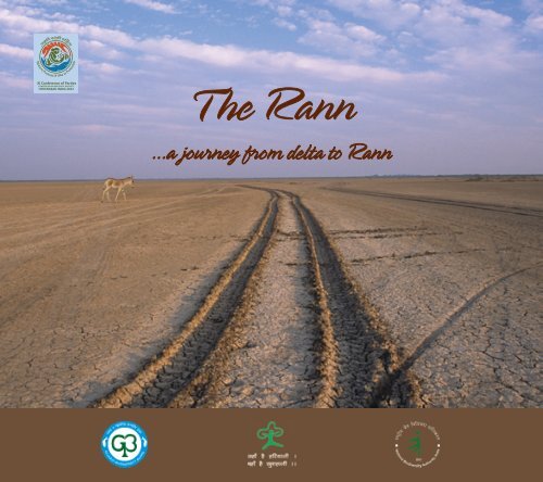
T he Rann<br />
...a journey from delta to Rann
Contents<br />
1. Fossil Park at Khadir bet in the Great Rann<br />
2. The prehistoric man<br />
3. Delta to Rann<br />
4. Dholavira : a magnificent city of Bronze Age<br />
5. Kotada : a town of the Indus valley civilisation<br />
6. Vigakot Ford<br />
7. The Rann in the Second Millennium<br />
8. Uniqueness of the Rann<br />
9. The Little Rann - The Wild Ass Sanctuary<br />
10. The Great Rann - Kachchh Desert Wildlife Sanctuary<br />
11. Flora and fauna<br />
12. World of raptors in the Rann<br />
13. The Indian Wild Ass<br />
14. Flamingo City<br />
15. Wildlife in Security Zone<br />
16. The Jackals of Temple<br />
17. Wetlands<br />
18. Banni Grassland<br />
19. Dhordo - a tourist site of white desert<br />
The First visit to the Black Hills, the White Rann, Flamingo City and the land of Indian Wild Ass brings many thoughts<br />
in mind. When you read the natural history of the area, visit second time, and interact with maldharis of Banni, your<br />
attraction towards the Rann may increase, compelling you to visit this fascinating land again and again. Visits in different<br />
season to the area - wetlands in monsoon, the mudflats dotted with wetlands in winter and then extreme dry saline land<br />
in summer will make one understand the madness called Rann.<br />
Dr H. S. Singh, IFS<br />
Chairman, <strong>Gujarat</strong> <strong>Biodiversity</strong> <strong>Board</strong><br />
Gandhinagar
Fossil Park - Khadir Bet<br />
A view of White Rann from the Park<br />
Wood fossil<br />
Fossil Park at Khadir bet in the Great Rann<br />
The foot prints of migrating people and old civilizations are<br />
embedded in the muds of Rann and its surrounding areas in<br />
the form of remnants of plants and animals, pollens, artefacts<br />
and other human related materials of the time. Before the<br />
prehistoric man, fossil materials and geological formations<br />
reveal the sequence of changes. It is believed that evolution<br />
of the Rann is closely connected with seismic disturbances,<br />
climate changes, histories of the rivers, and development and<br />
collapse of human civilization. Homo sapiens, while migrating<br />
from Africa to India and then to south-east Asia and Australia,<br />
used changing conditions of the areas-shallow sea, delta,<br />
mouth of rivers and the swampy & dry Rann, in different times.<br />
To describe the history of the Rann, it is necessary to know the<br />
natural history before man reached there.<br />
Natural history of Kachchh, particularly “The Rann” is unique and<br />
has international conservation significance. Fossils of different<br />
periods - Pre-Jurassic, Jurassic, Cretaceous and skeleton of<br />
marine animals of a later period are found in different parts<br />
of Kachchh. Fossils of Dinosaurs and other animals and plants<br />
related to that period have also been recovered from the area.<br />
The <strong>Gujarat</strong> Forest Department has discovered an area rich in<br />
wood and marine fossil, and fenced it as a fossil park. The site<br />
is near Dholavira - a site of Hadappan Civilisation at Khadir bet.<br />
Fossils of big sized trees at the site are very interesting. For<br />
naturalists and tourists, it is a paradise.
The prehistoric man<br />
The recent excavation on the fringe of the Little Rann at<br />
Loteshwer Mahadev and Runi village reveals that the prehistoric<br />
man - the hunters and gatherers lived in the area. At Runi village,<br />
Vadodara University and experts from a European country have<br />
found tools, bones of fish and antelopes which were used by<br />
the prehistoric man, and they opined about the existence of<br />
several such sites. There are all reasons to believe that shallow<br />
sea, deltaic land and its surrounding areas provided full<br />
security of food to pre-historic man. For the humans migrating<br />
through the coast of Arabian Sea to south-east Asia and then to<br />
Australia, this area served as a food rich habitat.<br />
Bones of animal and fish and tools of prehistoric man in<br />
Runi village at fringe of the Little Rann (near Loteshwer)<br />
Excavation works jointly by Vadodara University and Spanish National Research Council in December, 2011 at Runi village in Patan district<br />
near the Rann border. The bones and tools used by the pre-historic man were found in the excavation
Indus<br />
Saraswati River (Ghaggar - Hakra)<br />
Luvanavati<br />
(Luni)<br />
Yamuna<br />
Ganga<br />
Narmada<br />
Map of Saraswati River<br />
A herd of Wild Ass in the Rann in background of sunset<br />
The Great Rann which was deep water channel<br />
thousand years ago<br />
Delta to Rann<br />
The site of the present Rann was similar to the delta of<br />
Sundarbans, about five thousand years ago when mighty<br />
Indus and Saraswati Rivers emptied in the area. A journey of<br />
ecological succession from shallow sea to the delta and then<br />
to the Rann, is an interesting story which people may not<br />
believe easily. Remnant of branchy corals material derived<br />
from plants and animals in form of fossils and other organic<br />
forms and pollens are found in the Gulf of Kachchh. Apart from<br />
this, foot print of humans in form of buried cities, skeleton and<br />
remnant of prehistoric men, mythological and historical stories<br />
and land locked mangroves at Shravan Kawadiya at fringe of<br />
Banni leave enough evidences to reconstruct the ecological<br />
history and succession of plants & animals in the area. These<br />
facts may also explain how the mighty delta transformed into<br />
the present saline dry mudflats in form of the Rann.<br />
During 7000-3000 BC, the present area of the Rann was an<br />
arm of the Arabian Sea and the major rivers were located in<br />
Sindh and the Western Thar Desert. Thousands of years ago,<br />
rivers such as Saraswati and Indus flowing through Rajasthan<br />
and Pakistan, emptied in the Arabian Sea through big<br />
water channels or creeks in the present area of the Rann,<br />
contributing to the formation of a delta. Saraswati dried up<br />
and the Indus river system gradually shifted to the west due<br />
to seismic disturbances. The area of ancient delta transformed<br />
into the Rann or saline grasslands, and lagoon like a large<br />
ecosystem transformed into swampy grasslands of Banni.<br />
Gradually, the live delta moved westward through present<br />
area of Rann, and reached the west of the network of Kori
creek. The carbon dating studies have revealed that the<br />
ground water below the ancient river bed of Saraswati<br />
is about 4000 years old. A group of scientists under<br />
Sarasvati Nadi Shodh Project found that the search for<br />
the “mythical” Sarasvati had reached a stage where it<br />
could be said that the river was neither a myth nor a<br />
legend, but a fact. The Sutlej and Yamuna rivers were<br />
tributaries of Sarasvati. The scientists also mapped the<br />
“palaeo channels” relics of the river and its tributaries<br />
using satellite and ground water data.<br />
Post-Vedic literature, mainly the Mahabharata, has<br />
references to the drying river Saraswati. It is a subject<br />
of debate how and when this mighty river was lost.<br />
In the north-western part of Jaisalmer district, the<br />
groundwater at a depth of about 50-60 m along the<br />
course of the defunct river is rich in stable isotope<br />
content as compared to other Himalayan rivers. There<br />
is evidence of rise in the ground level on the line of<br />
Aravallis which caused the turning of the river Yamuna<br />
eastwards to join the Ganges at Prayag-Allahabad.<br />
This river’s diversion denied the waters of Yamuna to<br />
Saraswati. Another blow to the river Saraswati was<br />
when Sutlej took a sharp turn at Ropar moving to flow<br />
parallel to the river Beas, the Vedic Vipasa. Having<br />
lost both of its perennial tributaries, i.e., Yamuna and<br />
Sutlej, river Saraswati would have been a drying river<br />
in around 2000 BC. It is probable that desertification<br />
of Rajasthan paced up at that time. As supported by<br />
the hydro-geological evidence, the ground faults and<br />
sand movement would have caused the seepage of the<br />
remaining waters of river Saraswati to underground<br />
channels, leaving a dry riverbed.<br />
The delta in the present area of Rann gradually dried<br />
up and turned into a saline desert. The present delta<br />
adjoining the Rann covers an area of about 41,440 km²<br />
near the border in Pakistan, and is approximately 210<br />
kilometers across where it meets the sea. Unlike many<br />
other deltas, the Indus River Delta consists of clay and<br />
other infertile soils, and is very swampy. Pakistan’s<br />
fifth largest city, Hyderabad, lies about 210 kilometers<br />
north of the mouths of the Indus. Towns are found<br />
throughout the river valley, but there is no evidence<br />
of cities near the river in south of Hyderabad. Several<br />
sites of ancient human civilization exist in the Indus<br />
valley, in Rajasthan and around Rann. This indicates<br />
that the present low lying plains near the Rann or<br />
the Indus valley plains towards the sea had different<br />
phases - shallow sea to delta and then to the plains or<br />
Rann. It was extensively used by the migrating people<br />
when to reach there.<br />
Remnants of plants and animals in the form of wood,<br />
pollens, animal and human bones and material<br />
related to human civilization were carried by river<br />
water and deposited in the delta which is now the<br />
Rann. The layers of muds in the Rann perhaps contain<br />
all these materials, including boats, man made articles<br />
and their signature in different forms. Decoding the<br />
message embedded in the layer of the Rann may<br />
provide full and accurate history of flora and fauna<br />
along with humans since they landed in the area.
Dholavira at Khadir bet<br />
Dholavira at Khadir bet<br />
Kotada near Khawada at foot of Kaladungar<br />
Dholavira: a magnificent city of Bronze Age<br />
Dholavira at Khadir bet has emerged as a model city in<br />
terms of planning, sophisticated architecture, amazing water<br />
management system, a long succession of cultures of the<br />
Bronze age (2800 - 1700 BC), a variety in funerary architecture<br />
and overall for its unique inscription of large Hadappan signs.<br />
The site of Dholavira is one amongst the six largest cites of<br />
the Hadappan or the Indus Valley civilization and ranks with<br />
Mohen-jo-daro, and Harappa (Punjab, Pakistan).<br />
The city in its heyday was spread over an area of almost fifty<br />
hectares. It was zealously guarded by massive walls, which<br />
enclosed a series of water tanks and three principal divisions<br />
of the city designated as the Citadel, the Middle Town and the<br />
Lower Town respectively after the Parama, Madhyama, and<br />
Avama divisions occurring in the Rigveda. Water harvesting and<br />
storage works were outstanding at the site.<br />
Kotada - a town of the Indus valley civilisation<br />
Kotada, an ancient town (Harappan period) at the foot of<br />
Kaladungar was perhaps a trade centre or human settlement<br />
between the waterline of delta or river and the hill. The people<br />
of this town enjoyed delta of the Indus river through creek<br />
connecting the human habitation. Excavation is incomplete.<br />
Full details about the human settlement may be available after<br />
excavation of the site. This site is located at about two to three<br />
kilometers from Kuran village and about ten kilometers from<br />
Khawada. India bridge is also near this site.
Vigakot Fort<br />
An old damaged fort of medieval period at Vigakot in the deeper<br />
part of the Great Rann near Pakistan border leaves remnant of<br />
its past glory when the Indus river irrigated this marshy and<br />
prosperous land. Perhaps this fort belonged to local king or<br />
Jagirdar. Sweet water of the river continued to flow, perhaps till<br />
1889 AD when the Great Earth Quake changed the landmass<br />
near Pakistan by raising its land and diverting the last branch of<br />
the river to Pakistan.<br />
Typical dry Rann vegetation near Vigakot<br />
Remnant of Vigakot ford which in the Great Rann was important economic centre in the medieval period
Typical area of the Little Rann - future of Wild Ass<br />
A large water body between Nada bet and Pakistan border<br />
Luni and other rivers emptied here in the past<br />
It was a part of delta, now Rann where<br />
Chinkaras can be seen in winter and summer<br />
The Rann in the Second Millennium<br />
Mythological stories, incidences as mentioned in Puran such as<br />
submergence of Dwarka city, famous capital of Lord Krishna, the<br />
record of the rulers of Kachchh, folk memory and description by<br />
Rushbrook Williams (1956) in his book -“The Black Hills - Kutch<br />
in History and Legend” provide some information to construct<br />
the history of evolution of the Rann. There were several major<br />
seismic disturbances which brought changes in the geological<br />
formation and evolution of the Rann, but only a few of them<br />
were recorded. Submergence of Dwarka during the epic period,<br />
retreat of sea during the twelfth century AD when Jadeja<br />
Dynasty was taking root, and the last major earth quake in 1819<br />
are some which got place in the records. It is beyond doubt that<br />
the evolution of the present Rann was incomplete before the<br />
migration of the Hindus from Sindh due to attack of Muslims<br />
when a part of it was under sea water or under a network of<br />
creeks in the dying delta. It is believed that the earth quakes<br />
(atleast twice in the twelfth century) brought a major change<br />
in the Rann. Despite climatic and seismographic change in and<br />
around the area, sea navigation channel was open when the<br />
great saint Dharamnath started his penance. There is a story that<br />
a great saint Dharamnath began a twelve-year penance in the<br />
12 th century AD at Raipur (near Mandvi). The people’s behavior<br />
during the penance annoyed the saint. When Dharamnath<br />
had completed his penance, he learned what had happened<br />
during his penance. He pronounced the famous curse “Pattan<br />
sun dattan”- May all the wealthy be overthrown. Thereupon<br />
Raipur town (near Mandvi) was destroyed by an earth quake
and the sea retreated and dried up the creek near<br />
Raipur. After causing destruction of Raipur through<br />
seismic disturbance, he sought another sanctuary on<br />
the hill of Dhinodhar, from the top of which Rann can<br />
be seen. He began another twelve year penance of an<br />
even more formidable kind. So great were the merits<br />
in penance that the god himself begged him to desist<br />
from it, but he replied that if he did so, the first spot<br />
on which his eyes fell would be barren. This difficulty<br />
was overcome by directing his gaze towards the sea<br />
to the north of Dhinodhar, which thereupon dried<br />
up, leaving boats, vessels and marine life hopelessly<br />
stranded in the marshes which now form a part of<br />
the Great Rann. The fire at one of the hills in Kachchh<br />
due to the earth quake was also mentioned. The folk<br />
memory naturally associates the influence of the great<br />
saint on major seismic disturbances or earth quakes<br />
which changed the geo - morphological character of<br />
the areas.<br />
During the rule of Rao Khenger in Kachchh in 16 th<br />
century, the Rann could be crossed by determined<br />
party men on foot, though passage was perilous.<br />
Lakhapat was an important port two hundred years<br />
ago when it yielded a major revenue to the king from<br />
rice cultivation. Rushbrook describes that, in 1765, the<br />
people of Lakhapat used water channel of Sindh River<br />
to irrigate their rice crop. It is recorded that a ruler<br />
of Sindh attempted to raise an artificial earthwork to<br />
divert one branch of the Indus channel so that people<br />
suffer from loss of cultivation. It cannot be explained<br />
here how he was successful at that time, but his wish<br />
turned a reality when a major earthquake in 1889<br />
diverted the last branch of the Indus River towards<br />
Pakistan.<br />
Although the Indus river system shifted westward<br />
but one of branches continued to charge the marshy<br />
land till the major earth quake in 1819. Till this year,<br />
Kachchh supplied grain to Sindh. On June 16, 1819, a<br />
major earthquake took place in Kachchh and the after<br />
shocks continued almost every day for a week. Palace<br />
of the king became inhabitable, human casualties<br />
were very high in Bhuj, Mandvi, Anjar and Lakhpat,<br />
many thousands were buried under the buildings.<br />
Parts of the Rann were changed from dry land into<br />
salt water and Lakhpat fort was destroyed. A land<br />
mass in form of low mound in length of about 50<br />
km was thrown up, shutting off the Indus water. This<br />
low mound, later called as God’s Dyke or Allahbund,<br />
changed the history of the Rann. Subsequently,<br />
remnant delta in the western Rann disappeared and<br />
shifted towards Pakistan, but a patch of landlocked<br />
mangroves at Shravan Kawadiya survived to indicate<br />
its linkage with the deltaic mangroves which now<br />
shifted around the Kori creek at India and Pakistan<br />
border. The degradation of grassland and increasing<br />
salinity in Banni was also guided by such natural<br />
factors.
Kaladungar - Black Hills<br />
Numerous water bodies support number of migratory birds<br />
Uniqueness of the Rann<br />
The Rann of Kachchh is incomparable in the world due to<br />
following unique features.<br />
(i) The Rann is the largest wetland of hybrid environment<br />
during monsoon when entire area, leaving dotted bets,<br />
goes under knee deep water as a result of discharge of<br />
rain water by numerous rivers and streams and inundation<br />
of tidal water.<br />
(ii) In winter, dry flat saline desert dotted with numerous<br />
water bodies support large population of migratory birds,<br />
including many threatened species of birds.<br />
(iii) “Flamingo City”, an area with sheet of water in the Rann<br />
is one of the largest nesting ground for two species of<br />
Flamingos in the world where some times about half<br />
million birds have congregated to nest in good seasons.<br />
(iv) The Rann is home for single population of the Indian Wild<br />
Ass in the world where over 4,000-4,100 wild asses find<br />
suitable home (about 3,000 in the Little Rann, 500-600 in<br />
the Great Rann and about 500-600 in the fringe areas).<br />
(v) The Rann along with Kachchh is only area in the country<br />
where the fossil material of plants and animals (including<br />
Dinosaurs) of Pre-Jurassic, Jurassic, Cretaceous and<br />
Tertiary periods are abundant. The fossil park at Khadir bet<br />
is an center of attraction for tourists.<br />
(vi) The Rann has a very high historical and cultural significance<br />
as Dholavira, an ancient town of bronze age - civilization
(2100BC to 1500BC) on Khadir Bet in the Rann is a site<br />
of the Indus Valley Civilisation. Similar sites also exist at<br />
Katada near Khawada and other areas. Viga fort near the<br />
Pakistan border, now buried under mud and sands was<br />
perhaps an important economic centre and a check post<br />
for the traders.<br />
(vii) Recognising the uniqueness and ecological significance,<br />
the area has been declared by the Government of India<br />
(GOI), as Biosphere Reserve, and also identified for the<br />
nomination of World Heritage Site.<br />
(viii) The Rann is a large reserve of salt as about one fourth of<br />
total salt production of the country comes from the Little<br />
Rann.<br />
(ix) The Bets and fringe areas of the Rann support one of the<br />
highest populations of Chinkara and Indian Wolf and some<br />
threatened mammalian species like Caracal, Desert Cat<br />
and Desert Fox.<br />
(x) The Rann possesses two largest sanctuaries in the country,<br />
covering an area of 12,459 km 2 .<br />
one fourth of total salt production of the country comes from the Little Rann<br />
Desert fox (male) in the Little Rann<br />
Common fox<br />
Rann and fringe area support a good number of Indian wolf
The Little Rann after monsoon<br />
Typical Rann vegetation on uplands-Bet or Dhasi<br />
A herd of wild ass on Pung Bet - a resource rich area<br />
The Little Rann - The Wild Ass Sanctuary<br />
The Little Rann (23 0 10’ N to 23 0 45’N lat. and 70 0 45’E to 71 0 45’E long.),<br />
former extension of the Gulf of Kachchh, owe its origin to the<br />
transgression through the Gulf. The uplift of the land due to<br />
tectonic movement during the late quaternary period coupled<br />
with withdrawal of the sea has led to the formation of this<br />
landmass, detaching from the Gulf of Kachchh. Earlier many<br />
streams from the <strong>Gujarat</strong> mainland dumped a good amount of<br />
terrestrial detritus from north east in the area during early to<br />
middle quaternary, which was winnowed and redistributed by<br />
the Gulf water. During the monsoon, the portion at the head of<br />
the Gulf of Kachchh was flooded as it happens now, by surface<br />
run-off from the surrounding highlands as also by the Arabian<br />
Sea waters, which drove up the creeks during storm tides. These<br />
tidal waters perhaps caused a lot of sediments to be brought<br />
from the Indus delta region also. Thus, mudflats of the Little<br />
Rann have gradually built up year after year. A narrow channel-<br />
highland connecting it with the Great Rann still exists and can<br />
be seen near Adesar in Rapar taluka of Kachchh district.<br />
The Wild Ass Sanctuary, declared in 1973 to save the Indian<br />
Wild Ass (Equus hemionus khur), covers an area of about 4,954<br />
km 2 comprising about 3,569 km 2 area of the Little Rann and<br />
1,384 km 2 area of the fringe adjoining the Little Rann. Tikar,<br />
Dhrangadhra, Malwan, Bajana, Kharaghoda, Odu, Zinzuwada<br />
of Surendranagar district, Visnagar of Mahesana district,<br />
Santalpur of Banaskantha and Rapar, Adesar and Gagodar of<br />
Kachchh district are some notable towns/villages around the<br />
Little Rann. Bio-geographically, its falls in the Biogeographic<br />
region 3A- Kachchh Desert.
The area, characterized by dry (semi-arid) tropical<br />
monsoon climate, receives an average annual rainfall<br />
of less than 400 mm. The season of monsoon sets<br />
in July and continues till September. Brief erratic<br />
monsoon, hot summer and cold winter characterize<br />
the climate of the area. The maximum temperature<br />
sometimes reaches as high as 50 0 C during extreme<br />
summer and minimum temperature as low as 1 0 C.<br />
The area has the highest annual evaporation rate in<br />
the country suitable for salt preparation.<br />
The Little Rann is dotted with about 74 elevated lands<br />
or islands; locally called ‘Bet’, which have a total area<br />
of 178 km 2 . Pung, with an area of 3000 ha is the largest<br />
island. Six Bets in the Sanctuary have area more than<br />
1,000 ha. The highest bet- Mardak is 55 m above the<br />
MSL. Because of the excessive salinity and long dry<br />
spells, the sediments of Rann show poor development<br />
of organic life. When the Rann gets flooded with the<br />
rain water, the coarser fluvial sands and silts are<br />
deposited at the mouths of the inflowing rivers, while<br />
the fine sediments are carried further into the Rann<br />
to mingle with the marine sediments of the inter- tidal<br />
flats.<br />
The Little Rann, which gradually rises by about 4m<br />
above the M.S.L., annually gets flooded under 0.5 to<br />
1.0 m deep waters during monsoon. However, most of<br />
the Rann gets dried by the end of November or mid-<br />
December, except the low- lying parts near Bajana,<br />
and Adesar where the waters dry in the late winter or<br />
early summer. The rivers like the Banas, the Saraswati<br />
and the Rupen are the sources of the freshwaters<br />
besides innumerable seasonal streams and surface<br />
water run-off.<br />
Congregation of migratory birds
Chainkara - common on bets in the Rann<br />
Montagu’s Harrier<br />
Grassland on a bet in the Great Rann<br />
The Great Rann - Kachchh Desert Wildlife Sanctuary<br />
The largest Sanctuary in <strong>Gujarat</strong> with city of flamingo, buried<br />
cities of bronze- age, barren mud-flats with salt-smear and<br />
white desert in its deeper part, islands with hills support<br />
xerophytic plants in thorny forest or saline grasslands<br />
dominated by Salvadora, Euphorbia, Commiphora, Acacias,<br />
and Prosopis; herds of chinkara, wild ass, blue bull and wild<br />
boar; jackals, foxes, numerous rodents, spiny-tailed lizards<br />
on sandy bets; numerous species of small mammals and<br />
thousands of flamingos, pelicans, cranes, avocets and about<br />
two dozen species of raptors. Some of these species are rare<br />
and threatened. Major part of the Great Rann, including<br />
Flamingo City, covering an area of 7,505.2 km 2 has been<br />
declared as Desert Wildlife Sanctuary. Only about 109 km 2<br />
area of the sanctuary is forest land and the rest is revenue<br />
wasteland or the Rann. The area of the Great Rann is almost<br />
double the area of the sanctuary. Except hills on bets, its<br />
average altitude is a few meters from the Mean Sea Level<br />
(MSL). The fringe areas of the 42 villages adjoining the Great<br />
Rann are resource rich areas for the mammals. Although major<br />
population of wild ass is found in the Little Rann, the fringe<br />
areas and bets in the Great Rann support about 500 wild asses.<br />
About one third of total population of chinkara as well as wolf<br />
in <strong>Gujarat</strong> is in and around the Great Rann.<br />
The Pachchham island, at the distance of about 80 km from<br />
Bhuj, supports the hill called ‘Kala Dungar’, which represents<br />
the highest point (438 m) within the Sanctuary. Pachchham<br />
island is about 25 km long and 9 km wide. Another hill called
‘Goro Dungar’ is slightly shorter and narrower than Kala<br />
Dungar. Khadir bet (80 km north of Rapar), having an area of<br />
about 313 sq. km., supports the hill called Chhapariya Dungar,<br />
whose northern flank overlooks the mudflats of the Great<br />
Rann. Bela bet, the eastern most major hilly island in Kachchh<br />
district, supports two hills namely ‘Nilvo’ and ‘Muvano’. Apart<br />
from these hilly islands, there also exist several plateaus, barely<br />
raised above the level of the mudflats. They are devoid of any<br />
hillocks. Such islands (‘bets’) are Tragadi, Nani Tragadi, Nana<br />
Vangara, Mota Vangara, Henat, etc.<br />
On the hilly island, there exist several micro- habitats such<br />
as grassland, scrub land, barren wasteland, agricultural land,<br />
village ponds, streams etc. All of them provide a habitat to<br />
the fauna of one or the other type. Apart from the `bets’,<br />
the mudflat of the Rann, near the edges of the `bet’ provide<br />
feeding, resting or roosting habitats to various wild animals.<br />
At the edges of Nana Vangara and Mota Vangara near Khadir<br />
and in certain localities of Bela bet, one can see MacQueen’s<br />
Bustard in a good number.<br />
Spiny-tailed Lizard - an important reptile in Rann<br />
Prosopis thickets provide shelter to Hyaena also<br />
Wetland on Nada bet -Vegetation type is totally changed after invasion of Prosopis sp.
Commiphora - Gugad on rocky bet in the Rann<br />
Desert Monitor Lizard<br />
MacQueen’s Bustard<br />
Flora and fauna<br />
The Rann is internationally famous for the endangered Asiatic<br />
Wild Ass (Equus hemionus khur). It is an abode of a variety of<br />
other mammals, birds, reptiles, amphibians, fish and micro/<br />
macro invertebrates and plants. The soils of the Rann is<br />
halomorphic and the halophytic vegetation, chiefly composed<br />
of Sueada, Salsola, Salicornia, Haloxyon, Atriplex, Cressa,<br />
Aeluropus, Sporobolus and Halopurum occurs here. Though<br />
indigenous trees such as Prosopis cineraria, Commiphora<br />
wightii, Salvadora sp. exist here, the exotic thorny tree, Prosopis<br />
juliflora has successfully spread and colonised several Bets and<br />
fringes of the Rann. Over 280 species of flowering plants have<br />
been recorded in the Rann.<br />
During the late monsoon and early winter, the sheet of shallow<br />
water having optimum salinity serves as a vast nursery/feeding<br />
ground for ‘Kachchh Prawn’ (Metapenaeus kutchensis), several<br />
species of fish and invertebrates. During the same period, it also<br />
serves as feeding, resting and roosting ground for a variety of<br />
migratory and resident waterfowl of the Indian subcontinent.<br />
The area in fact, falls on the migratory route of many bird<br />
species and apart from various waterfowl species, threatened<br />
terrestrial bird like Houbara Bustard (Chlamydotis undulata)<br />
and over a dozen threatened raptors also immigrates to Bets<br />
and the fringe areas of the Rann.<br />
Spiny- tailed Lizard and Saw-scaled Viper are examples of<br />
important reptiles whereas chinkara, blackbuck, blue bull, wolf,<br />
jackal, foxes - common and desert, cats - jungle and desert,<br />
hyena and wild boar are important mammals of this Rann.<br />
A total of over 178 bird species have been listed in the Rann.
World of raptors in the Rann<br />
Diversity and abundance of hunting birds - raptors are high in the<br />
Rann and the important raptors found in the Rann are follow.<br />
Brahminy Kite Haliastur i. indus<br />
Eastern Imperial Eagle Aquila heliaca<br />
Indian or Lesser Spotted Eagle Aquila pamarina hastata<br />
Palla’s Sea Eagle Haliaeetus leucoryphus<br />
White-tailed Sea Eagle Haliaeetus albicilla<br />
Booted Hawk Eagle Hieraaetus pennatus<br />
Osprey Pandion haliaetus<br />
Indian Shikra Accipiter badius<br />
Lagger Falcon Falco jugger or Falco biarmicus jugger<br />
Shaheen or Peregrine Falcon Falco peregrinus perigrinus<br />
Saker falcon Falco cherrug<br />
Lesser Kestrel Falco naumanni<br />
Four species of the vultures, half dozen species of owls and many<br />
endangered bird species are also found.<br />
Booted Eagle<br />
Peregrine Falcon<br />
Imperial Eagle<br />
Eurasian Eagle Owl
Indian Wild Ass population<br />
Year<br />
Year Population<br />
1962 362<br />
1976 720<br />
1983 1,990<br />
1990 2,070<br />
1999 2,840<br />
2004 3,860<br />
2008 4,040<br />
The Indian Wild Ass<br />
Like the Asiatic lion, the Indian wild ass, Equus hemionus khur,<br />
has a single population in the Little Rann of Kachchh in the<br />
world. During the last century, the Indian wild ass had a fairly<br />
wide distribution in the dry region of the north west of India<br />
and Pakistan. Gradually, this animal disappeared from most<br />
of its previous habitat, except the Rann of Kachchh. Dr Salim<br />
Ali (1946) estimated a population between 3000 to 4000 wild<br />
asses in the Rann. Number and distribution range of the animal<br />
declined subsequently. Outbreak of the Surra disease, caused<br />
by Tryspanosoma evansi, in 1960 also caused the decline of wild<br />
ass population. As a result, only about 870 individuals survived<br />
in 1962. Subsequently, the attack of the South African Horse<br />
Sickness in 1963 caused death of some animal. As a result, only<br />
362 animals were counted in the entire distribution range in<br />
1969 by an aerial survey.<br />
Conservation measures started in the late 1970s, after<br />
declaration of the sanctuary. Habitat protection and<br />
improvement works, including creation of water facilities<br />
for the wild life were carried out. Wild ass responded to<br />
the conservation measures. The number of the wild ass<br />
increased consistently from 720 in 1976 to 4,040 in 2008. The<br />
Indian wild ass is not only saved from its extinction but the<br />
animal has had an impressive recovery during the last three<br />
and half decades since declaration of the sanctuary. In other<br />
words, the number of the Indian wild ass has increased by over<br />
five times since its first counting after the notification of the<br />
sanctuary.
Flamingo City<br />
The Rann is a wonderful land, incomparable for wildlife.<br />
Flamingo City - a nature’s wonder-breeding centre of Flamingo<br />
is about 30 kilometer from Chidia chauk. The world famous<br />
‘flamingo city’ is located in the mudflats of the Rann, at the<br />
distance of around 10 km from the Nir out-post. Hundreds<br />
of thousands of flamingoes breed here, normally during the<br />
year of optimum level of inundation. They construct their<br />
muddy nests, lay eggs and rear young ones. The nesting<br />
was first reported in 1883 by the late Maharao Khengarji of<br />
Kachchh, which was later documented by Dr. Salim Ali. In 1945,<br />
Dr. Salim Ali visited Flamingo city and estimated a population<br />
of about half million birds at nesting city. Nestings were also<br />
documented by the Forest Department during the recent<br />
years. Sometimes nesting was also observed in the Little Rann<br />
and one such nesting was recorded in 1998 when about 70,000<br />
birds nested near Vachchhraj Solanki bet.<br />
Flamingos prefer sheet of shallow water for nesting (about<br />
15-20 cm depth) in a large area so that young ones get food<br />
after their comming out of the eggs. The communal nesting<br />
colony of the bird was observed by naturalists but all such<br />
nestings were not recorded because people find difficulties<br />
to visit this area. A team of naturalists have to travel a long<br />
distance in shallow water and muds to see nature’s wonders.<br />
A team of foresters used boat to go nesting site near Pakistan<br />
in 2006 and documented one of such nesting of about 60,000<br />
- 70,000 birds.<br />
Flamingo nesting colony in the Rann<br />
Juvenile Flamingos with an adult
Desert cat kittens<br />
Wild Boar<br />
Number of water birds reaches near hundred thousands during<br />
the winter<br />
Wildlife in Security Zone<br />
The land beyond Indira Bridge, after Khavada in Kachchh up to<br />
Pakistan border, is a protected zone where human activities are<br />
disallowed and therefore the landscape remains pristine. Here<br />
soldiers of Border Security Force (BSF) are vigilant to guard<br />
India’s border but its direct benefit goes to rare and threatened<br />
wildlife such as Chinkara, Desert Fox, Common Fox, Desert Cat,<br />
Wild Boar, Spiny-tailed Lizard, MacQueen’s bustard, flamingos<br />
and many more. The habitats of these species are intact, as<br />
man cannot enter this zone without permission of the BSF.<br />
The land beyond the bridge is relatively virgin. A small herd of<br />
chinkara can be seen through the Gugal forest, an endangered<br />
medicinal plant. From India Bridge to Vigakot (last security<br />
checkpost at Pakistan border), there are a series of bets -<br />
Kunwar bet, Mori bet, Dharmasala Chauki bet, Chidia - eagle<br />
Chauk bet and Vigakot. Commiphora - Euphorbia, Acacia<br />
senegal and Suaeda sp. and grasses dominate the Kunwar and<br />
Mori bet, perhaps the ideal habitat for chinkara. There are<br />
extensive patches of Suaeda and grass cover in the area which<br />
are used by MacQueen’s bustard and the raptors - hunting<br />
birds. From India bridge to Vigakot and the last check post at<br />
the Pakistan border, one certainly come across several small<br />
groups of Chinkara.
The Jackals of the Temple<br />
After sunset, one may witness a unique drama of jackals of<br />
a temple. After daily Arti by Pujari in Datray temple at top<br />
of Kaladungar in evening, a man places about 10 kg Prasad<br />
(cooked floor mixed with ghee and sugar, normally donated<br />
by pilgrims) every day at the platform at the time of sunset.<br />
After man moves away, over two dozen jackals appear one<br />
by one from behind the Euphorbia bushes. Although jackals<br />
are carnivores, here they have adapted to this secured food.<br />
This is also repeated at forenoon but the number of jackals<br />
remains low compared to the size of group in the evening. It is<br />
believed that size of group was bigger in the past. This practice<br />
has continued for so many years and people regularly witness<br />
this drama in the evening. This is India, where all creatures are<br />
respected, and some of them are worshiped.<br />
A devotee from temple placing Prasad at platform in evening<br />
Outdoor exhibits Interpretation developed at Kaladungar<br />
Jackals feeding on Prasad A magnificent view from Kaladungar
Wetlands<br />
Although entire Rann is wetland during the monsoon, several low lying areas or mouth of rivers turns wonderful<br />
wetlands in the winter. The Rann supports a plethora of water birds such as Greater and Lesser Flamingo, Great<br />
Crested Grebe, Pelicans, Cormorant, Indian Shag, Black Stork, Brahminy Duck, Pintail, Spotbill Duck, Shoveller,<br />
Mallard, Wigeon, Common Pochard, Tuffed Pochard, White-eyed Pochard, Sandpipers, Gulls, Terns, Stints,<br />
Plovers, Cranes and about two dozen species of raptors in winter. Tundi tower wetland near Bajana, wetland<br />
between Amrapur (Khadir) and Lodrani, Nanda wetland near Adesar, Sawada wetland near Patadi, Surajbari<br />
creek, and Nada wetland - a large water body between Nada bet and Pakistan border represent some of the<br />
best wetlands in Kachchh and each of them qualify for the Ramsar site. Over 80,000 water-birds were counted at<br />
four wetlands in the Little Rann in 1998. The number at the wetlands in the Great Rann during winter normally<br />
remains higher than the birds in the Little Rann. Ponds and lakes adjoining the Rann are equally important for<br />
water-birds.<br />
Wetlands in the fringe of the Rann support plethora of water birds
Banni Grassland<br />
Description of the Rann without Banni is incomplete because<br />
ecological evolution of Bann is linked with the Great Rann.<br />
Banni, with about 2,497 km 2 of the forest land, is one of the<br />
largest grassland in the country, and has been supporting a<br />
wide range of well-adapted wildlife. The perimeter of Banni<br />
is about 367 km and a total of 48 villages are located inside<br />
it. This grassland has evolved, from perhaps a swampy land,<br />
when it received fresh water in the past. With change of<br />
climate and reduction in fresh water flow, the healthy grassland<br />
transformed to a saline area and then to Prosopis scrub during<br />
the last three decades. Six decades ago, Prosopis was absent in<br />
Banni. Subsequently, it invaded a large area, transforming over<br />
37,000 ha (15 % of geographical area) into dense Prosopis cover<br />
(satellite data in 2003). The Government has liberalized cutting<br />
of Prosopis and using its wood for charcoal preparation. As a<br />
result, the dense Prosopis declined and process of balancing it<br />
with the grass cover has been initiated.<br />
There are several wetlands, locally called Dhandh in the Banni.<br />
Chharidhandh in the Nani Banni, now a Conservation Reserve,<br />
is the largest among them. This wetland is known for richness<br />
of birds, including nesting of some of them. The Banni remains<br />
swampy during monsoon then changes to a saline grassland,<br />
dotted with swampy lands and lakes in winter, which attract<br />
hundred thousands of birds. The concentration of migratory<br />
cranes, sometimes near hundred thousands, attract tourists.<br />
About 300 species of birds have been listed in the area,<br />
including ten internationally threatened species. Although<br />
Marshy land in Banni, adjoining Rann<br />
Chharidhandh - a conservation reserve
A maldhari in Banni<br />
several species of mammals are found in the area, it is a good<br />
habitat for Chinkara and Wolf.<br />
Banni buffalo is recognized as the 11 th breed of India by the<br />
National Bureau of Animal Genetic Resources (NBAGAR). This<br />
breed in the harsh environment is highly resistant to disease.<br />
The Banni is known for its buffalo and butter production. The<br />
Jat community, the buffalo breeders in Banni, had come to<br />
Banni hundred years ago from Haleb in Afganistan and they<br />
have established their profession of buffalo rearing. The area is<br />
also known for camel breeders but their profession is not doing<br />
well due to the lack of demand for camels. The people, their<br />
culture, tradition, artifacts and arts are unique which need to<br />
be nurtured and conserved.<br />
Banni is also known for its camel
Dhordo - a tourist site of white desert<br />
Dhordo is the last village in the west of Banni at the edge<br />
of the white desert which attract a large number of tourists<br />
in January. The government has also started tourist festival -<br />
Ranotsav during the winter. Just a few kilometer from Dhordo,<br />
there is the spectacular White Desert situated in the Great<br />
Rann. Dhordo is about 80 km from Bhuj. The White Desert is a<br />
result of accumulated salt - during the rains it comes under sea<br />
water marginally diluted by the rain water, but during winters<br />
as the water evaporates, the salt accumulates over the muds to<br />
turn it into the spectacular White Desert. To get the very best<br />
of this visual experience, one should be there on a full moon<br />
night - the entire area glitters with the reflection of moon light.<br />
Salt industries also have their eyes on this salt rich area.<br />
True wilderness still prevails in a part of Kachchh, including<br />
the Rann. The Rann is one of a few areas in the country<br />
where ecological integrity is intact till now but the pace of<br />
developments during the recent years have had some impact.<br />
Like other natural areas, anthropogenic activities started<br />
increasing in this area also. Protecting the wilderness character<br />
of this wonderful and unique landscape is a challenge to all of<br />
us.<br />
Modern tents at Dhordo during Ranotsav
White<br />
Desert<br />
Location of Rann in Kachchh district<br />
Vighakot<br />
Dhordo<br />
Mandvi<br />
Chharidhundh<br />
Pakistan<br />
Bhuj<br />
Mundra<br />
Flamingo City<br />
Kaladungar<br />
Anjar<br />
Great Rann<br />
Khadir<br />
Bhachau<br />
Morbi<br />
Nada bet<br />
Rajasthan<br />
Little Rann
Content : Dr. H. S. Singh, IFS, Chairman, <strong>Gujarat</strong> <strong>Biodiversity</strong> <strong>Board</strong><br />
Photographs : Dr. H. S. Singh, IFS, Manoj Dholakia, Yogendra Shah