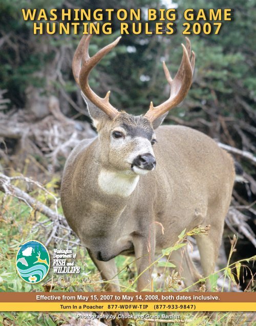
2007-2008 Big Game Hunting Seasons and Rules (Washington State)
2007-2008 Big Game Hunting Seasons and Rules (Washington State)
2007-2008 Big Game Hunting Seasons and Rules (Washington State)

You also want an ePaper? Increase the reach of your titles
YUMPU automatically turns print PDFs into web optimized ePapers that Google loves.
WASHINGTON BIG GAME<br />
HUNTING RULES <strong>2007</strong><br />
Effective from May 15, <strong>2007</strong> to May 14, <strong>2008</strong>, both dates inclusive.<br />
Turn In a Poacher 877-WDFW-TIP (877-933-9847)<br />
Photography by Chuck <strong>and</strong> Grace Bartlett
Errata for the <strong>2007</strong> <strong>Big</strong> <strong>Game</strong> <strong>Hunting</strong> Pamphlet<br />
Page 20- Hunt choice 1028 East Okanogan B the date should be Oct. 13-28.<br />
Page 45- Footnote “g” is missing at the bottom of the page. Should read:<br />
g<br />
May only hunt on privately owned l<strong>and</strong>s. Must use archery or legal shotgun (10 or 12<br />
gauge; slugs only).<br />
Page 77- legal description for new Deer Area 2012, Methow Valley is missing.<br />
Deer Area 2012 Methow Valley (Okanogan County):<br />
All private l<strong>and</strong> in the Methow Watershed located outside the external boundary of the<br />
Okanogan National Forest <strong>and</strong> north of the following boundary: starting where the Libby<br />
Creek Road (County road 1049) intersects the Okanogan National Forest boundary; west<br />
on road 1049 to <strong>State</strong> Hwy 153; north on Hwy 153 to the Old Carlton Road; east on the<br />
Old Carlton Road to the Texas Creek Road (County road 1543); east on the Texas Creek<br />
Road to the Vintin Road (County road 1552); northeast on the Vintin Road to the<br />
Okanogan National Forest boundary.<br />
Page 79- There is an omission in the legal description for GMU 136. It should read:<br />
GMU 136-HARRINGTON (Lincoln & Grant cos.):<br />
Beginning at town of Gr<strong>and</strong> Coulee at SR 174 & Rd W N.E. (Gr<strong>and</strong> Coulee Hill Rd); SE<br />
on SR 174 to US Hwy 2 at town of Wilbur; E on US Hwy 2 to SR231, S on SR 231to<br />
SR 23, S on SR 23 to I-90; SW on I-90 to Danekas Rd (Interstate HwyExit 231); W on<br />
Danekas Rd to Tokio Rd; W on Tokio Rd to Marcellus Rd; N on Marcellus Rd to Davis<br />
Rd; W on Davis Rd to Rd 12 N.E.; W on Rd 12 N.E. to Rd W N.E.; N on Rd W N.E. to<br />
Rd X N.E. at town of Marlin; N on Rd X N.E. to Kiner Rd (Lincoln Co. Rd 9115); NE,<br />
E, N, E, & N on Kiner Rd to US Hwy 2, E of town of Almira; SW on US Hwy 2 to<br />
Maxwell Rd; W on Maxwell Rd to Old Coulee Rd at town of Almira; N on Old Coulee<br />
Rd to Douglas Rd; W on Douglas Rd to Peterson Rd; N on Peterson Rd to Rd X N.E.; N<br />
on Rd X N.E. to Rd 52 N.E.; E on Rd 52 N.E. to Rd W N.E.; N on Rd W N.E. to Gr<strong>and</strong><br />
Coulee Hill Rd; N on Gr<strong>and</strong> Coulee Hill Rd to SR 174 in town of Gr<strong>and</strong> Coulee<br />
& point of beginning.
6<br />
Multi-Season Permits<br />
Hunt <strong>Big</strong> <strong>Game</strong> from<br />
September to December<br />
■ Deer <strong>and</strong> elk permits will be available<br />
■ Winning hunters may hunt during all general seasons beginning with archery<br />
<strong>and</strong> continuing on for muzzleloader <strong>and</strong> modern firearm in any open unit<br />
■ Elk multi-season tag holders may hunt Eastern <strong>and</strong> Western <strong>Washington</strong><br />
■ The annual bag limit for this permit is one deer or elk<br />
■ Applications will be automatically submitted once purchased<br />
■ Winners must comply with all regulations <strong>and</strong> weapon restrictions for the<br />
season in effect<br />
■ Winners may apply for any weapon type special hunting permits<br />
LOOK FOR MORE INFORMATION<br />
FEBRUARY – MARCH <strong>2008</strong><br />
ON OUR WEBSITE AT<br />
FISHHUNT.DFW.WA.GOV<br />
OR BY CALLING (360) 902-2464
<strong>2007</strong><br />
General Information <strong>and</strong> Regulations<br />
Chronic Wasting Disease ....................................................10<br />
Department of Fish <strong>and</strong> Wildlife Offices ..............................11<br />
License Fees <strong>and</strong> Requirements ........................................13<br />
License, Tag <strong>and</strong> Permit information ..................................14<br />
M<strong>and</strong>atory Reporting............................................................14<br />
Age Requirements................................................................15<br />
Hunter Orange......................................................................15<br />
Raffle Permit Hunts (<strong>2007</strong>) ............................................29, 71<br />
<strong>Hunting</strong> Hours (<strong>2007</strong>) ..........................................................53<br />
Violations <strong>and</strong> Penalties ......................................................63<br />
Definitions ............................................................................64<br />
Equipment <strong>and</strong> <strong>Hunting</strong> Methods ........................................65<br />
Prohibited <strong>Hunting</strong> Methods ................................................66<br />
Persons with Disabilities ......................................................66<br />
<strong>Hunting</strong> Access <strong>and</strong> Restrictions ........................................67<br />
Tagging <strong>and</strong> Transporting ....................................................69<br />
Cooperative Road Management Areas (<strong>2007</strong>) ....................70<br />
Special <strong>Hunting</strong> Season Permit/Application Instructions ....72<br />
Hunter’s Code of Conduct....................................................90<br />
Vehicle Use Permits ............................................................92<br />
Hunter Education..................................................................93<br />
Summary of <strong>Hunting</strong> <strong>and</strong> Fishing <strong>Seasons</strong> (<strong>2007</strong>) ........94, 95<br />
Area Descriptions<br />
Area <strong>and</strong> Unit Descriptions<br />
<strong>Big</strong>horn Sheep Units ....................................................75<br />
Elk <strong>and</strong> Deer Areas ..................................................75-77<br />
Mtn. Goat Units ........................................................77-78<br />
GMU 100 ..................................................................78-80<br />
GMU 200 ..................................................................80-82<br />
GMU 300 ..................................................................82-83<br />
GMU 400 ..................................................................83-85<br />
GMU 500 ..................................................................85-87<br />
GMU 600 ..................................................................88-89<br />
Maps<br />
Deer Areas (<strong>2007</strong>) ....................................................31<br />
<strong>Game</strong> Management Units (Western) ..................32<br />
<strong>Game</strong> Management Units (Eastern) ....................33<br />
Elk Tag Areas ............................................................34<br />
Elk Areas (<strong>2007</strong>)........................................................50<br />
<strong>Big</strong>horn Sheep Units (<strong>2007</strong>) ..................................59<br />
Mountain Goat Units (<strong>2007</strong>) ..................................60<br />
Other Map Sources..................................................74<br />
Turn In a Poacher<br />
877-WDFW-TIP<br />
(877-933-9847)<br />
Contents<br />
Deer <strong>Seasons</strong> <strong>and</strong> Permits<br />
Deer <strong>Seasons</strong><br />
<strong>Hunting</strong> Requirements <strong>and</strong> General Definitions............16<br />
Modern Firearm General ..........................................................17<br />
Archery General..............................................................................18<br />
Muzzleloader General ..................................................................19<br />
Deer Special Permits ............................................................20-28<br />
Deer L<strong>and</strong>owner <strong>Hunting</strong> Permits ................................30<br />
Elk <strong>Seasons</strong> <strong>and</strong> Permits<br />
Elk <strong>Seasons</strong><br />
Elk Tag Areas <strong>and</strong> <strong>Hunting</strong> Methods ............................34<br />
General Definitions ........................................................35<br />
Modern Firearm General ..............................................36<br />
Archery General ............................................................37<br />
Muzzleloader General ..................................................38<br />
Elk Special Permits ..................................................39-47<br />
Elk L<strong>and</strong>owner <strong>Hunting</strong> Permits ..............................47-49<br />
Black Bear<br />
General Season .......................................................... 56<br />
Spring Permit Season ..................................................56<br />
Cougar<br />
General Season .......................................................... 57<br />
Hide Sealing Requirements ..........................................57<br />
Goat, Moose, <strong>Big</strong>horn Sheep<br />
Goat, Moose, Sheep Permits ..............................58<br />
Other <strong>Seasons</strong><br />
<strong>2007</strong><br />
Small <strong>Game</strong><br />
Bobcat, Coyote, Fox, Grouse ................................................61<br />
Raccoon, Rabbit & Hare ..........................................................61<br />
Wild Turkey Early <strong>and</strong> Late Fall ............................................62<br />
Major changes are typed in red.<br />
Noteworthy information is typed in blue.<br />
WAC SUMMARY INFORMATION<br />
This pamphlet is a summary of the hunting regulations <strong>and</strong> seasons<br />
adopted by the <strong>Washington</strong> Fish <strong>and</strong> Wildlife Commission. This pamphlet<br />
does not contain nor is it intended to contain all Department regulations.<br />
Regulations specific to the hunting seasons described in this pamphlet<br />
are found in Sections 232-28-248 through 232-28-515, <strong>and</strong> 232-12-001<br />
through 232-12-830, of the <strong>Washington</strong> Administrative Code.<br />
GENERAL<br />
INFORMATION<br />
DEER SEASON<br />
AND PERMITS<br />
ELK SEASONS<br />
AND PERMITS<br />
BLACK BEAR<br />
AND COUGAR<br />
GOAT, MOOSE,<br />
BIGHORN SHEEP<br />
OTHER<br />
SEASONS<br />
AREA<br />
DESCRIPTIONS 9
HUNTERS TRAVELING TO OTHER STATES<br />
If you are going to hunt deer, elk, or moose in the following states this year please<br />
be advised that there have been some rule changes passed by the <strong>Washington</strong><br />
Fish <strong>and</strong> Wildlife Commission that regulate how you can bring your meat <strong>and</strong><br />
10<br />
<strong>2007</strong><br />
trophies home.<br />
New Mexico<br />
South Dakota<br />
Utah<br />
Wyoming<br />
If you hunt deer, elk, or moose in these states or provinces only the following items may<br />
be imported to <strong>Washington</strong> to reduce the risk of transmitting chronic wasting disease.<br />
• Meat that has been de-boned in the state or province where it was harvested<br />
<strong>and</strong> is imported as boned-out meat.<br />
• Skulls <strong>and</strong> antlers, antlers attached to the skull plate, or upper canine teeth<br />
(bugler, whistlers, ivories) from which all soft tissue has been removed.<br />
• Hides or capes without heads attached.<br />
• Tissue imported for use by a diagnostic or research laboratory.<br />
• Finished taxidermy mounts.<br />
Chronic Wasting Disease<br />
<strong>Washington</strong> Dept. of Fish <strong>and</strong> Wildlife has been testing for chronic wasting disease (CWD)<br />
since 1995. To date, CWD has not been detected in the state of <strong>Washington</strong>.<br />
We urge hunters to help us maintain our healthy deer, elk <strong>and</strong> moose populations.<br />
For further information on CWD, check our related web pages<br />
http://wdfw.wa.gov/wlm/cwd/ <strong>and</strong> http://wdfw.wa.gov/wlm/cwd/factsheet.htm<br />
Kansas<br />
Colorado<br />
Nebraska<br />
Alberta, Canada<br />
Saskatchewan, Canada<br />
Illinois<br />
New York<br />
Wisconsin<br />
West Virginia<br />
Violation of this rule is a Gross Misdemeanor having a maximum<br />
penalty of $5,000 fine or one year in jail. (RCW 77.15.290)<br />
In addition, if you are notified by another state fish <strong>and</strong> wildlife agency that the deer, elk,<br />
or moose you have harvested has tested positive for chronic wasting disease, you have<br />
24 hours to notify <strong>Washington</strong> Department of Fish <strong>and</strong> Wildlife. Violation of this rule is an<br />
infraction. (RCW 77.15.160)<br />
If you have any questions, please contact the Wildlife Program<br />
at <strong>Washington</strong> Department of Fish <strong>and</strong> Wildlife.<br />
(360) 902-2515<br />
<strong>2007</strong>
<strong>Washington</strong> Department of Fish <strong>and</strong> Wildlife (WDFW)<br />
Web Site: wdfw.wa.gov<br />
For information, please call our Olympia office or visit any of our offices (Monday-Friday, 8:00 a.m. -5:00 p.m.)<br />
Olympia Main Office<br />
(360) 902-2200 TDD (800) 833-6388<br />
Enforcement: (360) 902-2936<br />
Hunter Education: (360) 902-8111<br />
Licensing: (360) 902-2464<br />
Wildlife: (360) 902-2515<br />
Olympia Mailing Address<br />
Department of Fish <strong>and</strong> Wildlife<br />
600 Capitol Way N<br />
Olympia, WA 98501-1091<br />
Regional Offices<br />
Region 1 - Spokane: (509) 892-1001 2315 N. Discovery Place, Spokane Valley, WA 99216-1566<br />
Region 2 - Ephrata: (509) 754-4624 1550 Alder St. NW, Ephrata, WA 98823-9699<br />
Wenatchee Office: (509) 662-0452 3860 Chelan Highway N, Wenatchee, WA 98801-9607<br />
Region 3 - Yakima: (509) 575-2740 1701 S 24th Ave., Yakima, WA 98902-5720<br />
Region 4 - Mill Creek: (425) 775-1311 16018 Mill Creek Blvd., Mill Creek, WA 98012-1541<br />
Region 5 - Vancouver: (360) 696-6211 2108 Gr<strong>and</strong> Blvd., Vancouver, WA 98661-4624<br />
Region 6 - Montesano: (360) 249-4628 48 Devonshire Road, Montesano, WA 98563-9618<br />
<strong>Washington</strong> Fish <strong>and</strong> Wildlife Commission<br />
Jerry Gutzwiler, Chair, Wenatchee<br />
Mir<strong>and</strong>a Wecker, Vice Chair, Naselle<br />
Fred Shiosaki, Spokane<br />
Dr. Kenneth Chew, Seattle<br />
Dr. Conrad Mahnken, Bainbridge Isl<strong>and</strong><br />
Chuck Perry, Moses Lake<br />
Will Roehl, Bellingham<br />
Shirley Solomon, Mount Vernon<br />
Gary Douvia, Kettle Falls<br />
Department of Fish <strong>and</strong> Wildlife<br />
Jeff P. Koenings, Ph.D., Director<br />
Wildlife Program<br />
Dave Brittell, Assistant Director<br />
Turn In a Poacher<br />
877-WDFW-TIP<br />
(877-933-9847)<br />
GENERAL<br />
INFORMATION<br />
11
12<br />
<strong>2007</strong><br />
Jerry Gutzwiler, Chair<br />
<strong>Washington</strong> Fish <strong>and</strong> Wildlife Commission<br />
We’ve all heard talk about the<br />
power of partnership, <strong>and</strong> this fall<br />
hunters can see the results of cooperative<br />
efforts by the <strong>Washington</strong><br />
Department of Fish <strong>and</strong> Wildlife<br />
(WDFW), private l<strong>and</strong>owners, volunteers,<br />
stakeholder groups <strong>and</strong> tribes.<br />
Several new elk opportunities<br />
awaiting hunters this fall are the direct<br />
result of such partnerships, aimed at<br />
rebuilding herds, maintaining sustainable<br />
habitats, improving hunter access<br />
<strong>and</strong> conducting orderly, quality hunts.<br />
For the first time in more than 10<br />
years, hunters will be able to take part<br />
in a permit-only elk hunt in the<br />
Nooksack watershed in Whatcom<br />
County. This hunt marks the first step<br />
in re-opening Nooksack elk hunting,<br />
following a three-year joint effort by<br />
WDFW <strong>and</strong> the Point Elliott treaty<br />
tribes to rebuild the Nooksack herd.<br />
Over the past three years, the state<br />
<strong>and</strong> tribes have worked together to<br />
increase elk numbers for recreational,<br />
subsistence <strong>and</strong> ceremonial hunts, as<br />
well as viewing opportunities.<br />
Maintaining the Nooksack elk herd<br />
into the future at healthy, sustainable<br />
levels is vitally important. We plan to<br />
continue our cooperative management<br />
of the herd <strong>and</strong> look forward to further<br />
improvements.<br />
Another significant elk hunting<br />
Jeff Koenings, Ph.D, Director<br />
<strong>Washington</strong> Department of Fish <strong>and</strong> Wildlife<br />
Partnerships lead to<br />
new hunting opportunities<br />
opportunity—this one due to partnership<br />
with industrial timberl<strong>and</strong> owners—<br />
will take place in the Mount St.<br />
Helens area.<br />
Currently, the herd is estimated to<br />
number more than 12,000 elk, ranging<br />
from Interstate 5 to the Cascade crest<br />
<strong>and</strong> from <strong>State</strong> Route 12 to the Oregon<br />
border. In most years, the Mount St.<br />
Helens elk herd supports the highest<br />
number of elk for harvest statewide.<br />
Because much of the western<br />
Mount St. Helens herd area is privately<br />
owned <strong>and</strong> managed largely for timber<br />
production, partnership with timber<br />
owners is essential in gaining hunter<br />
access to the area.<br />
Access to private timberl<strong>and</strong>s will<br />
be carefully managed through a joint<br />
effort among WDFW, private timber<br />
companies <strong>and</strong> local citizen groups. In<br />
the coming fall hunt season, trained<br />
volunteers will staff road gates <strong>and</strong><br />
direct hunters to avoid active logging<br />
<strong>and</strong> other sensitive areas. WDFW also<br />
will increase enforcement efforts to<br />
ensure an orderly hunt. With a combination<br />
of careful planning <strong>and</strong> hunter<br />
compliance, we hope improved access<br />
will continue into the future. Good<br />
hunter conduct <strong>and</strong> consideration for<br />
private l<strong>and</strong>owners will be essential in<br />
maintaining access to future hunting<br />
opportunities.<br />
Yet more good news awaits elk<br />
hunters in the western Blue<br />
Mountains, where improved bull elk<br />
survival will result in significantly higher<br />
permit levels. Permit numbers have<br />
risen substantially over the past two<br />
years <strong>and</strong> we expect this trend to continue.<br />
In addition, coordination with<br />
Umatilla tribal co-managers has<br />
improved harvest management in the<br />
area.<br />
Not all the news about the condition<br />
of our wildlife is good. This coming<br />
hunt season also will have some<br />
reduction in hunting opportunity. The<br />
most notable is declining anterless<br />
mule deer hunting opportunity along<br />
the east slope of the Cascades. A nonnative<br />
parasite has infected this herd,<br />
causing high winter mortality. Harvest<br />
levels are being reduced while wildlife<br />
biologists monitor the situation.<br />
Lastly, there will be opportunities<br />
this fall to provide public input as<br />
WDFW proceeds with updating the<br />
state’s <strong>Game</strong> Management Plan. This<br />
document guides management of<br />
hunted species <strong>and</strong> provides herd<br />
population objectives that ultimately<br />
drive hunting regulations. We encourage<br />
you to get involved in this planning<br />
process. Watch for more information<br />
on the WDFW website at<br />
http://wdfw.wa.gov/.<br />
WDFW is committed to sciencebased<br />
game management <strong>and</strong> to<br />
actively involving <strong>Washington</strong>’s citizens<br />
in the season-setting process.<br />
Our thanks to all of you who work diligently<br />
with the Department to preserve<br />
<strong>and</strong> sustain our game populations.<br />
Wherever you hunt this fall,<br />
remember to report your hunting activity<br />
when you return home. Accurate<br />
harvest information provided by<br />
hunters is a critical data link in managing<br />
game populations <strong>and</strong> setting<br />
future hunting seasons.<br />
We wish you good hunting <strong>and</strong> a<br />
successful <strong>2007</strong> season.<br />
Jerry Gutzwiler, Chair,<br />
<strong>Washington</strong> Fish <strong>and</strong> Wildlife Commission<br />
Jeff Koenings, Ph.D, Director<br />
<strong>Washington</strong> Department of Fish <strong>and</strong> Wildlife
<strong>Hunting</strong> License Fees <strong>and</strong> Requirements<br />
License requirements <strong>and</strong> fees are set by the <strong>Washington</strong> <strong>State</strong> Legislature.<br />
Licenses are based on an April 1 - March 31 license year, not calendar year.<br />
Options are divided into big & small game license packets.<br />
<strong>Big</strong> <strong>Game</strong> — The big game package contains five options. All prices include<br />
license & tags. Forest grouse & unclassified wildlife (including coyote) may be<br />
hunted with either a small game license or a big game license.<br />
Small <strong>Game</strong> — The small game license allows the holder to hunt for wild animals<br />
& wild birds, except big game. The small game license includes a prorated surcharge<br />
for Eastern <strong>Washington</strong> pheasant enhancement.<br />
<strong>Hunting</strong> License Options <strong>and</strong> Fee Schedule<br />
(Fees listed below include a 9.5% transaction charge) Youth (Under 16)<br />
<strong>Big</strong> <strong>Game</strong> License Options Res Adult/Sr. Non-Res / Res Disabl Vet<br />
#1 Deer + elk + cougar + bear ................$72.27 ..............$722.70 ....................$36.14<br />
#2 Deer + elk ........................................................61.32 ................613.20........................30.66<br />
#3 Deer or elk + cougar + bear ..................50.37 ................503.70........................25.19<br />
#4 Deer or elk ......................................................39.42 ................394.20........................19.71<br />
#5 Bear + cougar ................................................21.90 ................219.00........................10.95<br />
Small <strong>Game</strong> License Options<br />
Small <strong>Game</strong> License ......................................$32.85 ..............$164.25 ....................$16.43<br />
With purchase of <strong>Big</strong> <strong>Game</strong> Package ....17.52 ....................87.60 ..........................8.76<br />
Primary Turkey Tag ........................................15.33 ..................43.80 ........................Free<br />
Additional Turkey Tags ................................15.33 ..................65.70 ..........................9.86<br />
3-day Small <strong>Game</strong> ................................................n/a ......................54.75 ..........................n/a<br />
Note: Special permit applicants for sheep, goat, & moose do not need to buy a<br />
license to submit an application. Successful applicants must purchase their special<br />
license within 15 days after receipt of Department notification.<br />
Other Licenses, Tags, & Permits Resident Non-Res Youth (Under 16)<br />
Special permit application (per species) ........$5.48 ..........$54.75 ....................$3.29<br />
Second deer (if selected for special permit) ..21.90 ..........219.00 ....................10.95<br />
Second elk (if selected for special permit) ......21.90 ..........219.00 ....................10.95<br />
Second bear ................................................................10.95 ..........109.50 ......................5.48<br />
Second cougar ..........................................................10.95 ..........109.50 ......................5.48<br />
Goat license & tag*(r<strong>and</strong>om drawing)............109.50 ......1,095.50 ....................54.75<br />
Moose license & tag*(r<strong>and</strong>om drawing)........109.50 ......1,095.50 ....................54.75<br />
Sheep license & tag*(r<strong>and</strong>om drawing) ........109.50 ......1,095.50 ....................54.75<br />
Western WA Pheasant Permit............................39.42 ..............39.42 ....................19.71<br />
3-day Western WA Pheasant Permit ..............21.90 ..............21.90 ......................n/a<br />
Migratory bird validation (state) ..........................10.95 ..............10.95 .................... n/a<br />
Trapping license* ......................................................36.00 ..........180.00 ....................15.00<br />
Taxidermist license* ..............................................180.00 .............. n/a ..........................n/a<br />
*These are sold only by WDFW Olympia Headquarters Office, Licensing Division<br />
(360-902-2464, option 3, option 1, or see additional contact information to the right).<br />
License Dealer fees may be charged: up to $2.00 for licenses & $0.50 for tags,<br />
stamps, & permits.<br />
There are no senior citizen discounts on hunting licenses, tags, or permits.<br />
Drawing for Lifetime License<br />
The drawing for Lifetime Privileges offers hunters <strong>and</strong> anglers an opportunity to<br />
receive complimentary annual recreational licenses for the rest of their lives.<br />
Application tickets for resident privileges are $6.50 each; non-resident applications<br />
are $12.50 each. Tickets have a 365-day lifespan, <strong>and</strong> will be eligible for all drawings held within<br />
that time. For license year <strong>2007</strong> drawings are scheduled for 6/1/07, 9/30/07, 12/31/07, <strong>and</strong><br />
3/31/08. Tickets may be given as gifts; the purchaser must claim <strong>and</strong> transfer lifetime eligibility<br />
within 15 days of notification date. Gift cards are available on request.<br />
Visit http://fishhunt.dfw.wa.gov for more information.<br />
• #1 <strong>Big</strong> <strong>Game</strong> Package (Deer, Elk, Bear, Cougar)<br />
• Western WA Pheasant Permit (Choice of Odd or Even)<br />
• Small <strong>Game</strong> License<br />
• Migratory Waterfowl<br />
• Vehicle Use Permit<br />
• Annual Combination Fishing<br />
• Puget Sound Crab Endorsement<br />
Lifetime privilege winners may choose all of the above, or only those items that fit their plans for<br />
a given license year. Additional items from the list may be added at any time. Lifetime eligibility<br />
does not include adjunct privileges (special hunts, raffles, additional vehicle use permits, etc.)<br />
Contact the Licensing Division<br />
Licensing Info: 360-902-2464<br />
Dealer Information: 360-902-2434<br />
Licensing Manager: 360-902-2453<br />
E-mail: licensing@dfw.wa.gov<br />
Mailing Address:<br />
600 Capitol Way N.<br />
Olympia, WA 98501-1091<br />
Internet Sales<br />
You may purchase recreational hunting & fishing<br />
licenses, & non-license items, via the<br />
Internet: fishhunt.dfw.wa.gov.<br />
WILD Telephone Sales<br />
Licenses are available for purchase by<br />
telephone at 1-866-246-9453.<br />
Dealer Outlet Sales<br />
Licenses may be purchased at over 600<br />
license dealers across the state. For a dealer<br />
near you, check our website:<br />
wdfw.wa.gov/lic/vendors/vendors.htm<br />
M<strong>and</strong>atory <strong>Hunting</strong> Activity<br />
Reporting<br />
Submit hunter reports & special permit<br />
applications toll-free at 1-877-945-3492.<br />
or on Internet at http://fishhunt.dfw.wa.gov/<br />
Social Security Numbers<br />
Federal <strong>and</strong> state law requires persons 15 or<br />
older to give their Social Security Number in<br />
order to obtain a license. (Federal Law US<br />
Code: Title 42, Section 666, Paragraph 13,<br />
Section A; <strong>and</strong> RCW 77.32.014)<br />
New: Watchable Wildlife Decals<br />
You can purchase a Watchable Wildlife decal.<br />
The decal will come with educational wildlife<br />
viewing material & a vehicle use permit that<br />
provides access to WDFW-managed l<strong>and</strong>s<br />
throughout the state. The decal cost is $30.<br />
This will be available online at<br />
http://fishhunt.dfw.wa.gov/, via phone at 1-866-<br />
246-9453, or wherever fishing <strong>and</strong> hunting<br />
licenses are sold.<br />
Youth Donations<br />
100% of your youth donation will be<br />
used to support youth outdoor education.<br />
Donations can be made by phone<br />
(1-866-246-9453), online<br />
(fishhunt.dfw.wa.gov), or at a dealer near you<br />
(wdfw.wa.gov/lic/vendors/vendors.htm).<br />
Call 360-902-2344 for more info.<br />
Purchasing Licenses<br />
Using the WILD System<br />
Think of your WILD ID as your permanent<br />
license number. Your WILD ID will:<br />
• Decrease the time spent purchasing your<br />
license<br />
• Prevent duplication<br />
• Increase accuracy of your licenses<br />
• Maintain your license history<br />
13
<strong>2007</strong><br />
License, Tag <strong>and</strong> Permit Information<br />
DUPLICATE LICENSES<br />
AND TAGS<br />
If hunting license or tag documents are lost, duplicates can<br />
be obtained from license dealers for a cost.<br />
REFUNDS/EXCHANGES<br />
No refunds of hunting licenses or transport tags.<br />
Exchanges of hunting license documents will not be made<br />
for hunters applying for a special permit, or after the hunting<br />
season opens.<br />
MANDATORY<br />
REPORTING<br />
REQUIRED OF<br />
DEER, ELK,<br />
BLACK BEAR,<br />
AND TURKEY<br />
HUNTERS<br />
<strong>2007</strong><br />
SPECIAL LICENSES<br />
Taxidermy (to practice taxidermy for profit) <strong>and</strong> trapping<br />
licenses are sold only at the WDFW Olympia office.<br />
VEHICLE USE PERMIT<br />
A Vehicle Use Permit (formerly known as a Stewardship<br />
Decal) is required for use of all posted WDFW l<strong>and</strong>s. It is<br />
free with the purchase of a hunting, fishing or trapping<br />
license. The permit must be clearly displayed <strong>and</strong> visible<br />
from outside of the vehicle. It can be placed on the dash or<br />
hung from the rearview mirror.<br />
HUNTING ACTIVITY REPORTING – Hunters must report their hunting<br />
activity for each deer, elk, bear, <strong>and</strong> turkey tag acquired by January 31, <strong>2008</strong>.<br />
Hunters not reporting by January 31 will be subject to a $10 penalty<br />
which must be paid before they can purchase a <strong>2008</strong> license. One hunter<br />
report is required for each transport tag acquired. Deer, elk, bear, <strong>and</strong> turkey<br />
all have general hunting seasons. The report covers your activity during the<br />
general hunting season <strong>and</strong> the special hunt. There is no separate hunting<br />
activity report for special hunts. Complete the hunter report after you are<br />
completely done hunting for that species. Simply answer the<br />
questions asked on the toll-free automated telephone reporting line at 1-877-<br />
945-3492 or on the Internet at http://fishhunt.dfw.wa.gov. For each transport<br />
tag that hunters report their hunting activity, they will receive <strong>and</strong> should<br />
retain a confirmation number of the report.<br />
To qualify to be entered into the Incentive Permit Drawing, hunters must submit<br />
<strong>2007</strong> hunter reports within ten days of a kill or, if unsuccessful, by January<br />
10, <strong>2008</strong>. The deadline to submit <strong>2007</strong> hunter reports is January 31, <strong>2008</strong> -<br />
unless the special hunting season or general hunting season extends beyond<br />
that date. In those cases, the hunter must report within ten days of the close<br />
of the hunting season <strong>and</strong> will be included in the Incentive Permit Drawing.<br />
Hunters who report within 10 days of killing an animal <strong>and</strong> unsuccessful hunters<br />
who report by midnight January 10, will be entered in a drawing for one of nine<br />
deer or elk special incentive permits. To be eligible for the drawing, hunters<br />
must report their hunting activity for each transport tag acquired. There will be<br />
two (2) any elk permits for western <strong>Washington</strong>, two (2) any elk special incentive<br />
permits for eastern <strong>Washington</strong>, <strong>and</strong> five (5) statewide any deer special<br />
incentive permits valid for any area open to general hunting seasons or special<br />
permit hunting seasons, except a select number of closed GMUs determined<br />
by the Fish <strong>and</strong> Wildlife Commission. The hunt dates are September 1 to<br />
December 31, <strong>2008</strong>. Open Season: The deer or elk permits will require a hunter<br />
to use archery equipment during archery seasons, muzzleloader equipment<br />
during muzzleloader seasons, <strong>and</strong> any legal weapon at other times if there are<br />
no firearm restrictions. Hunters who win the special incentive permit must send<br />
the appropriate license fee to the Department of Fish <strong>and</strong> Wildlife headquarters<br />
in Olympia. The Department will issue the license <strong>and</strong> transport tag <strong>and</strong> send it<br />
to the incentive permit winner. Hunters who have not reported hunting activity<br />
for the tags acquired the previous year will be required to complete a hunting<br />
report for those species before a new license for that species will be issued.<br />
ALL HUNTERS MUST REPORT!<br />
14 All Hunters Report <strong>Hunting</strong> Activity by calling Toll Free 1-877-945-3492 or Reporting on the internet at http://fishhunt.dfw.wa.gov.
<strong>2007</strong><br />
PROOF OF HUNTER EDUCATION<br />
All individuals born after January 1, 1972, when purchasing<br />
a license, must show proof that they have completed a<br />
hunter education class or that they are not first-time hunting<br />
license buyers. A <strong>Washington</strong> hunting license from a preceding<br />
year is considered legal proof if the previous year<br />
license has the hunter ed. certificate number or previous<br />
year license number entered in the box.<br />
NON-U.S. CITIZENS<br />
Special regulations concerning firearms possession may<br />
apply to non-U.S. citizens. If you are not a U.S. citizen <strong>and</strong><br />
plan to hunt with a modern firearm, contact the <strong>Washington</strong><br />
Department of Licensing (360) 664-6616 or your consulate<br />
before you purchase a hunting license. NOTE: Licenses,<br />
tags, stamps, or permits may be required for wildlife-related<br />
activities not covered in this pamphlet.<br />
AGE REQUIREMENTS AND RESTRICTIONS<br />
Anyone, regardless of age, must have in their possession a<br />
valid hunting license <strong>and</strong> any required tags, permits or<br />
stamps to hunt wildlife. Youth under 16 need a state hunting<br />
license but not a federal migratory waterfowl stamp.<br />
Youth are eligible for reduced license fees.<br />
Hunter Orange Requirements<br />
Under the following conditions a<br />
minimum of 400 square inches of<br />
fluorescent hunter orange exterior<br />
clothing is required. It must be worn<br />
above the waist <strong>and</strong> be visible from<br />
all sides. A hat, by itself, does not<br />
meet this requirement.<br />
1.Anyone hunting deer or elk in an<br />
area currently open to modern<br />
firearm deer or elk hunting is<br />
required to wear fluorescent hunter<br />
orange clothing. This includes<br />
archers <strong>and</strong> muzzleloaders while<br />
hunting in units which overlap<br />
modern firearm seasons.<br />
Required to Hunt<br />
2.Anyone hunting in an area that is<br />
open for modern firearm deer or<br />
elk hunting must meet hunter<br />
orange requirements if they are<br />
hunting any of the following<br />
species: Bear, Bobcat, Cougar,<br />
Coyote, Deer, Elk, Fox, Grouse,<br />
Hare, Rabbit, or Raccoon.<br />
3.During any upl<strong>and</strong> game bird<br />
season, anyone hunting upl<strong>and</strong><br />
game birds or rabbits with a<br />
modern firearm is required to<br />
wear fluorescent hunter orange<br />
clothing. (Grouse are not upl<strong>and</strong><br />
game birds.)<br />
<strong>2007</strong><br />
EXHIBIT OF LICENSE, PERMITS,<br />
STAMPS, TAGS AND WILDLIFE<br />
You are required to show a license, tag or permit, or display<br />
wildlife taken when asked to by a Fish <strong>and</strong> Wildlife officer or<br />
other law officer. You are also required to comply with the<br />
directions of WDFW personnel related to the collection of<br />
sampling data <strong>and</strong>/or material from wildlife.<br />
FISH AND WILDLIFE CHECK STATIONS<br />
All hunters may be directed to stop at WDFW check stations<br />
<strong>and</strong> produce wildlife in their possession. Fish <strong>and</strong><br />
Wildlife Officers may stop any person involved in a hunting<br />
or fishing activity for the purpose of inspecting hunting <strong>and</strong><br />
fishing equipment, licenses, tags, or catch record cards <strong>and</strong><br />
to inspect all fish <strong>and</strong> wildlife in their possession.<br />
MAJOR CAUSES OF HUNTING ACCIDENTS<br />
Careless h<strong>and</strong>ling of firearms is the cause of most huntingrelated<br />
accidents. Careless h<strong>and</strong>ling accidents can be prevented<br />
if shooters follow three simple rules:<br />
1.Treat every firearm as if it were loaded. Keep the firearm<br />
pointed in a safe direction at all times.<br />
2.Keep the firearm's safety on <strong>and</strong> the chamber empty until<br />
ready to fire.<br />
3.Keep fingers away from the trigger until ready to fire.<br />
Hunter Orange Clothing<br />
NOT Required<br />
1.During an upl<strong>and</strong> game bird<br />
season, anyone hunting upl<strong>and</strong><br />
game birds with a muzzleloading<br />
firearm, bow <strong>and</strong> arrow, or falconry<br />
is not required to wear fluorescent<br />
hunter orange clothing.<br />
2.While hunting in a muzzleloading<br />
or archery only GMU, anyone<br />
possessing a valid muzzleloading<br />
or archery deer or elk tag is not<br />
required to wear fluorescent hunter<br />
orange clothing.<br />
Wildlife Area Users And Hydraulic Project Approval Applicants<br />
WDFW is developing two habitat conservation plans for<br />
species listed under the federal Endangered Species Act.<br />
One plan will cover activities that require a Hydraulic Project<br />
Approval issued by the agency <strong>and</strong> the other HCP will cover<br />
recreational activities occurring on WDFW Wildlife Areas.<br />
Find out more about how this could affect your use of the<br />
Wildlife Areas <strong>and</strong> the Hydraulic Project Approval program<br />
<strong>and</strong> how you can be involved.<br />
http://wdfw.wa.gov/hcp/index.html<br />
15
3 Pt. Minimum: A legal deer taken in these GMUs must<br />
have at least 3 antler points on one side. (A 3x3, 3x2, or<br />
3x1 are legal in a 3 Pt. min. unit.) All antler points must<br />
be at least one inch long measured on the longest side.<br />
Eye guards are antler points when they are at least one<br />
inch long.<br />
3 Pt. Minimum GMUs: All mule deer in 100, 200, <strong>and</strong><br />
300 series GMUs. White-tailed deer in GMUs 127, 130,<br />
133, 136, 139, 142, 145, 149, 154, 162, 163, 166, 169,<br />
172, 175, 178, 181, <strong>and</strong> 186.<br />
Deer General Information<br />
2 Pt. Minimum: A legal deer taken in these GMUs must<br />
have at least<br />
2 antler points on one side. (A 2x2 or a 2x1 are legal in a<br />
2 Pt. min. unit.) All antler points must be at least one inch<br />
long measured on the longest side. Eye guards are<br />
antler points when they are at least one inch long.<br />
2 Pt. Minimum GMUs: 437, 574, 578, 636, 654 <strong>and</strong> 681.<br />
1"<br />
▲<br />
<strong>2007</strong><br />
▲<br />
All antler points<br />
must be at least<br />
one inch long.<br />
To hunt deer in <strong>Washington</strong>, you need to:<br />
1. Purchase a big game hunting license with a deer option.<br />
2. Choose the appropriate deer transport tag for one of the following<br />
hunting methods: modern firearm, muzzleloader, or archery.<br />
3. Hunt only the seasons outlined for the hunting method option.<br />
Bag Limit: One deer per hunter during the <strong>2007</strong> hunting season,<br />
except for successful 2nd deer permit applicants.<br />
General Season Listings: The next few pages provide general<br />
deer seasons for each hunting method option.<br />
Special Deer Permit Hunts: These are listed at the end of the<br />
Deer Section. Hunters may apply for these special deer permitonly<br />
hunts. Check the Deer Permit table (pgs. 20-28) for hunt<br />
dates <strong>and</strong> the deer tag needed to apply.<br />
Permit Only Units: The following GMUs require a special permit<br />
to hunt deer: 290 (Desert), 329 (Quilomene), 371 (Alkali), <strong>and</strong> 485<br />
(Green River).<br />
GMUs Closed to Deer <strong>Hunting</strong>: 157 (Mill Creek Watershed),<br />
490 (Cedar River), <strong>and</strong> 522 (Loo-wit).<br />
Firearm Restriction Areas are listed on page 67.<br />
Antlerless: Deer without antlers. Doe or fawn deer are antlerless.<br />
Any Buck: Any deer with visible antlers may be taken (fawns<br />
illegal).<br />
Black-tailed Deer: Any member of black-tailed/mule deer<br />
(species Odocoileus hemionus) found west of a line drawn from<br />
the Canadian border south on the Pacific Crest Trail <strong>and</strong> along the<br />
Yakama Indian Reservation boundary in Yakima County to<br />
Klickitat County; in Klickitat County along the Yakama Indian<br />
Reservation boundary to Summit Creek Rd; southwest on Summit<br />
Creek Rd to the Glenwood-Goldendale Highway; northwest on<br />
the Glenwood-Goldendale Highway to Lakeside Rd; south on<br />
Lakeside Rd to Fisher Hill Rd (P-2000); south on Fisher Hill Rd to<br />
Fisher Hill bridge crossing Klickitat River; southwest down<br />
Klickitat River to the Columbia River.<br />
Mule Deer: Any member of black-tailed/mule deer (species<br />
Odocoileus hemionus) found east of a line drawn from the<br />
Canadian border south on the Pacific Crest Trail <strong>and</strong> along the<br />
Yakama Indian Reservation boundary in Yakima County to<br />
Klickitat County; in Klickitat County along the Yakama Indian<br />
Reservation boundary to Summit Creek Rd; southwest on Summit<br />
Creek Rd to the Glenwood-Goldendale Highway; northwest on<br />
the Glenwood-Goldendale Highway to Lakeside Rd; south on<br />
Lakeside Rd to Fisher Hill Rd (P-2000); south on Fisher Hill Rd to<br />
Fisher Hill bridge crossing Klickitat River; southwest down<br />
Klickitat River to the Columbia River.<br />
White-tailed Deer: Means any white-tailed deer (member of the<br />
species Odocoileus virginianus) except the Columbian Whitetailed<br />
Deer (species Odocoileus virginianus leucurus).<br />
Mule<br />
Deer<br />
Antlers<br />
fork<br />
evenly<br />
Deer Identification<br />
Black-tailed Deer Antlers fork evenly<br />
Scent or Metatarsal Gl<strong>and</strong><br />
16 All Hunters Report <strong>Hunting</strong> Activity by calling Toll Free 1-877-945-3492 or Reporting on the internet at http://fishhunt.dfw.wa.gov.<br />
▲<br />
▲<br />
<strong>2007</strong><br />
▲<br />
Whitetailed<br />
Deer<br />
Tines<br />
off a<br />
single<br />
beam
<strong>2007</strong><br />
<strong>2007</strong> <strong>Game</strong> Management<br />
Hunt Area Dates Units (GMUs)/Areas Legal Deer<br />
High<br />
Buck<br />
<strong>Seasons</strong><br />
Early <strong>Seasons</strong><br />
Western<br />
<strong>Washington</strong><br />
Black-tailed<br />
Deer<br />
Eastern<br />
<strong>Washington</strong><br />
White-tailed<br />
Deer<br />
Eastern<br />
<strong>Washington</strong><br />
Mule Deer<br />
Late Buck Hunts<br />
Western<br />
<strong>Washington</strong><br />
Black-tailed<br />
Deer<br />
Eastern<br />
<strong>Washington</strong><br />
White-tailed Deer<br />
Eastern<br />
<strong>Washington</strong><br />
White-tailed Deer<br />
Eastern<br />
<strong>Washington</strong><br />
White-tailed<br />
Deer<br />
Modern Firearm General Deer <strong>Seasons</strong><br />
Sept. 15-25<br />
Oct. 13-31 407, 418, 426, 448-466, 501-520,<br />
524-556<br />
Any buck<br />
a , 560, 568, 572, 601-633,<br />
638-673, 684<br />
410, 564, Deer Areas 4013,<br />
4926, <strong>and</strong> 6014<br />
Any deer<br />
437, 574, 578, 636, 654, 681 2 pt. min.<br />
Oct. 13-28 GMUs 101, 204 Any White-tailed buck<br />
Oct. 13-26 105-124 Any White-tailed buck<br />
Oct. 13-21 All 200 <strong>and</strong> 300 series GMUs (except Any White-tailed buck<br />
permit-only in 290, 329 <strong>and</strong> 371)<br />
Oct. 13-21 127-154, 162-186 White-tailed 3 pt. min. buck<br />
379 Any White-tailed deer<br />
Oct. 13-21 All 100, 200 <strong>and</strong> 300 series GMUs,<br />
(except permit only in GMUs 290,<br />
329, 371 <strong>and</strong> closed in GMU 157)<br />
Mule Deer, 3 pt. min.<br />
379 Any Mule Deer<br />
Oct. 13-26 373, 382, 388 Mule Deer, 3 pt min.<br />
Nov. 15-18 407, 454, 466, <strong>and</strong> 500 <strong>and</strong> Any buck, except 2 pt.<br />
600 series GMUs (except closed min. in GMUs 636,<br />
in GMUs 522, 574, 578) 654, 681<br />
GMUs 410, 564, Any deer<br />
Deer Areas 4013, 4926, 6014<br />
Nov. 5-19 105-124 Any White-tailed buck<br />
Youth <strong>and</strong> Hunters with Disabilities<br />
Alpine Lakes, Glacier Peak,<br />
Pasayten, <strong>and</strong> Olympic Peninsula<br />
Wilderness Areas; Lake Chelan<br />
Recreation Area; <strong>and</strong> Henry<br />
Jackson Wilderness Area<br />
(See page 74 for USFS maps)<br />
3 pt. min.<br />
Oct. 27- 105-124 White-tailed,<br />
Nov. 4 Antlerless only<br />
Hunters 65 <strong>and</strong> over, Hunters with Disabilities, or Youth <strong>Seasons</strong><br />
Oct. 13-26<br />
& Nov 5-19<br />
105-124 Any White-tailed deer<br />
Oct. 13-28 101 Any White-tailed deer<br />
Oct. 13-21 127-142, 145-154, 162, 172-181 White-tailed 3 pt. min. buck<br />
or White-tailed Antlerless<br />
Advanced Hunter Education (AHE) Master Hunter Season<br />
License Required: A valid<br />
big game hunting license<br />
which includes a deer<br />
species option.<br />
Tag Required: Valid<br />
modern firearm deer tag on<br />
his/her person.<br />
<strong>Hunting</strong> Method: Modern<br />
firearm deer tag hunters<br />
may use rifle, h<strong>and</strong>gun,<br />
shotgun, archery, or<br />
muzzleloader, but only<br />
during modern firearm<br />
seasons. Modern firearm,<br />
archery, <strong>and</strong> muzzleloader<br />
equipment must meet<br />
equipment regulations on<br />
page 65.<br />
Hunter Orange: Is required<br />
for anyone hunting in an<br />
area open to modern<br />
firearm deer or elk seasons.<br />
See page 15.<br />
Firearm Restriction Areas:<br />
Occur in GMUs 251, 334,<br />
407, 410, 454, 504, 554,<br />
564, 624, 627, 633, 652,<br />
658, 660, 666, 681, <strong>and</strong> 684<br />
have rifle restrictions<br />
adopted by the Fish <strong>and</strong><br />
Wildlife Commission.<br />
Be sure to read Firearm<br />
Restriction Areas on<br />
page 67.<br />
Season Overlap: Early<br />
archery deer <strong>and</strong> early<br />
muzzleloader deer hunters<br />
hunt in common with<br />
modern firearm hunters in<br />
the high buck season in<br />
Wilderness Areas <strong>and</strong> Lake<br />
Chelan Recreation Area.<br />
Eastern<br />
<strong>Washington</strong><br />
White-tailed<br />
Deer<br />
Dec. 9-15 130-142 White-tailed-Antlerless<br />
only<br />
aSee Cathlamet <strong>Big</strong> <strong>Game</strong> Closure on Page 68<br />
All Hunters Report <strong>Hunting</strong> Activity by calling Toll Free 1-877-945-3492 or Reporting on the internet at http://fishhunt.dfw.wa.gov.<br />
17<br />
DEER SEASON<br />
AND PERMITS
18<br />
<strong>2007</strong><br />
License Required:<br />
A valid big game hunting license<br />
which includes a deer species<br />
option.<br />
Tag Required:<br />
Valid archery deer tag on his/<br />
her person for the area hunted.<br />
<strong>Hunting</strong> Method:<br />
Archery Only. Archery tag<br />
holders can only hunt during<br />
archery seasons <strong>and</strong> must hunt<br />
with archery equipment. Archery<br />
equipment must meet<br />
regulations on page 65.<br />
Hunter Orange:<br />
Is required for anyone hunting in<br />
an area open to modern firearm<br />
deer or elk seasons.<br />
See page 15.<br />
Early <strong>and</strong> Late Season<br />
Overlap:<br />
Early archery deer seasons<br />
overlap the modern firearm high<br />
buck hunt. Early <strong>and</strong> late<br />
archery deer seasons may<br />
overlap damage control hunts<br />
for elk in Elk Area 3911 <strong>and</strong> Elk<br />
Area 3912 in portions of GMUs<br />
328, 329, 334, 335 336, 340,<br />
342, <strong>and</strong> 368. Early archery<br />
deer seasons overlap modern<br />
firearm damage control hunts for<br />
elk in Elk Area 2032 <strong>and</strong> Elk<br />
Area 2033, in GMU 251. Check<br />
season dates <strong>and</strong> hunter orange<br />
requirements before hunting.<br />
Late Season Overlap:<br />
Late archery deer seasons<br />
overlap late muzzleloader deer<br />
seasons in GMUs 410 (Isl<strong>and</strong>s);<br />
<strong>and</strong> 666 (Deschutes). Late<br />
archery deer seasons overlap<br />
late muzzleloader elk seasons in<br />
GMU 454 (Issaquah); 505<br />
(Mossyrock); 601 (Hoko); 652<br />
(Puyallup); 666 (Deschutes);<br />
<strong>and</strong> 667 (Skookumchuck).<br />
Note:<br />
Grouse, bear, cougar, mountain<br />
goat, <strong>and</strong> bighorn sheep<br />
seasons may be open<br />
concurrent with archery<br />
seasons.<br />
Archery General Deer <strong>Seasons</strong><br />
<strong>2007</strong> <strong>Game</strong> Management<br />
Hunt Area Dates Units (GMUs)/Areas Legal Deer<br />
Early Archery Deer Deer <strong>Seasons</strong> <strong>Seasons</strong><br />
Western<br />
<strong>Washington</strong><br />
Black-tailed<br />
Deer<br />
Eastern<br />
<strong>Washington</strong><br />
Mule Deer<br />
Eastern<br />
<strong>Washington</strong><br />
White-tailed<br />
Deer<br />
Sept. 1-30 407-426, 448-466, 501-520, Any deer, except buck<br />
524-556 a , 560, 564, 568, 572, only in GMUs 460, 503<br />
601-633, 638-653, 658-673, 684, 699 506, 530 a , 550, 673<br />
437, 574, 578, 636, 654, 681 2 pt. min.or Antlerless<br />
Sept. 1-30 105-127,162, 163, 166, 169, 243, 3 pt. min.<br />
328, 334-340, 346-368<br />
142-154, 172-186, Deer Area 1010, 3 pt. min. or Antlerless<br />
244-247, 249-251, 260, 372,<br />
373, 388<br />
379, 381 Any Mule Deer<br />
Sept. 1-15 101,130-139, 204-242, 248, 254,<br />
262, 266, 269, 272, 278, 284, 382<br />
3 pt. min.<br />
Sept. 16-30 101,130-139, 204-242, 248, 254,<br />
262, 266, 269, 272, 278, 284, 382<br />
3 pt. min. or Antlerless<br />
Sept. 1-30 101-124, 204-284, 379, 381 Any White-tailed deer<br />
127-154, 162-186 White-tailed, 3 pt. min.<br />
or Antlerless<br />
Late Archery Deer <strong>Seasons</strong><br />
Western<br />
<strong>Washington</strong><br />
Black-tailed<br />
Deer<br />
Eastern<br />
<strong>Washington</strong><br />
Mule Deer<br />
Eastern<br />
<strong>Washington</strong><br />
White-tailed<br />
Deer<br />
<strong>2007</strong><br />
Nov. 21-Dec. 8 437, 654 2 pt. min. or Antlerless<br />
Nov. 21-Dec. 15 636, 681 2 pt. min. or Antlerless<br />
466, 510-520, 524, 556,<br />
601, 607-618, 638, 648, 699<br />
Any deer<br />
Nov. 21-Dec. 15 460, 506, 530, 560, 572 Buck only<br />
Nov. 21-Dec. 31 407, 410, 454, 505, 564, 603, 624,<br />
627, 642, 652, 660-672<br />
Any deer<br />
Nov. 20-Dec. 8 209, 215, 233, 243, 346, 352, 364,<br />
368<br />
3 pt. min.<br />
145, 163, 178, 250, 272, 278, 373,<br />
381, 388<br />
3 pt. min. or Antlerless<br />
Nov. 20-30 133, 136 Antlerless<br />
Dec. 9-31 Deer Area 1021 3 pt. min. or Antlerless<br />
Nov. 10-Dec.15 101 Any White-tailed deer<br />
Nov. 20-Dec.15 105, 108, 117, 121,124 Any White-tailed deer<br />
127 White-tailed, 3 pt. min.<br />
or Antlerless<br />
Nov. 20-Dec. 8 145, 163, 178 White-tailed, 3 pt. min.<br />
or Antlerless<br />
204, 209, 215, 233, 243, 250,<br />
272, 278<br />
Any White-tailed deer<br />
Nov. 20-30 133, 136 Antlerless<br />
a See Cathlamet <strong>Big</strong> <strong>Game</strong> Closure on Page 68<br />
All Hunters Report <strong>Hunting</strong> Activity by calling Toll Free 1-877-945-3492 or Reporting on the internet at http://fishhunt.dfw.wa.gov.
<strong>2007</strong><br />
<strong>2007</strong> <strong>Game</strong> Management<br />
Hunt Area Dates Units (GMUs)/Areas Legal Deer<br />
High Buck<br />
Hunts<br />
Muzzleloader General Deer <strong>Seasons</strong><br />
Sept. 15-25 Alpine Lakes, Glacier Peak, 3 pt. min.<br />
Pasayten, <strong>and</strong> Olympic Peninsula<br />
Wilderness Areas; Lake Chelan<br />
Recreation Area; <strong>and</strong><br />
Henry Jackson Wilderness Area<br />
(See page 74 for USFS maps)<br />
Early Muzzleloader Deer <strong>Seasons</strong><br />
Western<br />
<strong>Washington</strong><br />
Black-tailed<br />
Deer<br />
Eastern<br />
<strong>Washington</strong><br />
White-tailed<br />
Deer<br />
Eastern<br />
<strong>Washington</strong><br />
Mule Deer<br />
Oct. 6-12 407, 418, 426, 448, 450, 501, 504,<br />
505, 513, 520, 530<br />
Any buck<br />
a , 554, 568, 603,<br />
612, 624, 638, 642, 660, 663,<br />
672, 673, 684<br />
410, 454, 564, 627, 652, 666,<br />
Deer Area 4926<br />
Any deer<br />
437, 578 2 pt. min.<br />
Oct. 6-12 204, 209, 233, 239, 242, 243, 244,<br />
245, 246, 250, 251, 278, 284<br />
White-tailed, any buck<br />
133, 142, 145, 149, 181, 381 White-tailed, 3 pt. min.,<br />
or Antlerless<br />
101-124, 379 Any White-tailed deer<br />
Oct. 6-12 101-124, 133, 142, 145, 149, 181,<br />
204, 209, 233, 239, 242, 243, 244,<br />
245, 246, 250, 251, 284, 328,<br />
330-342, 352-360, 368, 382<br />
Mule deer, 3 pt. min.<br />
278, 381 Mule deer, 3 pt. min.<br />
or Antlerless<br />
379 Any mule deer<br />
Late Muzzleloader Deer <strong>Seasons</strong><br />
Western<br />
<strong>Washington</strong><br />
Black-tailed<br />
Deer<br />
Eastern<br />
<strong>Washington</strong><br />
White-tailed<br />
Deer<br />
Eastern<br />
<strong>Washington</strong><br />
Mule Deer<br />
Nov. 21- 407, 410, 501, 504, 564, 633, 666 Any deer<br />
Dec. 15 684, Deer Area 4926<br />
654 2 pt. min.<br />
460, 550, 602 Any buck<br />
Nov. 21-Dec. 6 651, 673 Any buck<br />
Dec. 7-15 651, 673 Any deer<br />
Dec. 1-15 578 2 pt. min.<br />
Nov. 20-Dec. 8 113, 379 Any White-tailed deer<br />
172, 181 White-tailed, 3 pt. min.<br />
or Antlerless<br />
Nov. 20-30 130, 139 White-tailed, 3 pt. min.<br />
or Antlerless<br />
Nov. 20-30 382 3 pt. min.<br />
130 Antlerless<br />
Nov. 20-Dec. 8 379 Any mule deer<br />
a See Cathlamet <strong>Big</strong> <strong>Game</strong> Closure on Page 68<br />
License Required:<br />
A valid big game hunting<br />
license which includes a<br />
deer species option.<br />
All Hunters Report <strong>Hunting</strong> Activity by calling Toll Free 1-877-945-3492 or Reporting on the internet at http://fishhunt.dfw.wa.gov.<br />
<strong>2007</strong><br />
Tag Required:<br />
Valid muzzleloader deer tag<br />
on his/her person for the<br />
area hunted.<br />
<strong>Hunting</strong> Method:<br />
Muzzleloader only.<br />
Muzzleloader tag holders<br />
can only hunt during<br />
muzzleloader seasons <strong>and</strong><br />
must hunt with<br />
muzzleloader equipment.<br />
Muzzleloading equipment<br />
must meet regulations on<br />
page 65.<br />
Early <strong>and</strong> Late Season<br />
Overlap:<br />
High buck muzzleloader<br />
deer seasons overlap the<br />
modern firearm high buck<br />
hunt. Early muzzleloader<br />
deer seasons may overlap<br />
damage control hunts for<br />
elk in Elk Area 3911 <strong>and</strong><br />
Elk Area 3912 in portions of<br />
GMUs 328, 329, 334, 335<br />
336, 340, 342, <strong>and</strong> 368.<br />
Check season dates <strong>and</strong><br />
hunter orange requirements<br />
before hunting.<br />
Late Season Overlap:<br />
Late muzzleloader deer<br />
seasons overlap late<br />
archery deer seasons in<br />
GMUs 410 (Isl<strong>and</strong>s); <strong>and</strong><br />
666 (Deschutes).<br />
Hunter Orange:<br />
Is required for anyone<br />
hunting in an area open to<br />
modern firearm deer or elk<br />
seasons. See page 15.<br />
Firearm Restriction<br />
Areas:<br />
Modern firearm <strong>and</strong> other<br />
firearm restrictions may<br />
apply. See page 67 for<br />
restrictions by county.<br />
19<br />
DEER SEASON<br />
AND PERMITS
20<br />
<strong>2007</strong><br />
Special Deer Permits<br />
HUNTS OPEN TO DEER PERMIT HOLDERS ONLY<br />
APPLICATION DEADLINE: JUNE 28, <strong>2007</strong> – SEE PAGE 72 FOR APPLICATION INFORMATION AND PROCEDURES.<br />
You may submit only one Special Deer Permit Application. The application may contain 1-4 hunt choices.<br />
Use the 4-digit Hunt Choice Number when submitting your application. Hunters may hunt only with hunting method in compliance with tag.<br />
(NOTE: Hunt Choice Numbers change every year.)<br />
Hunt Last<br />
Choice Hunt Permit Special Boundary <strong>2007</strong> Season’s<br />
No. Name Season Restrictions Description Permits Apps.<br />
Modern Firearm Deer Permit Hunts (Only modern firearm deer tag holders may apply)<br />
1001 Sherman Oct. 13-28 White-tailed, antlerless GMU 101 75 514<br />
1002 Kelly Hill Oct. 13-26 & Nov. 5-19 White-tailed, antlerless GMU 105 150 441<br />
1003 Douglas Oct. 13-26 & Nov. 5-19 White-tailed, antlerless GMU 108 300 596<br />
1004 Aladdin A Oct. 13-26 & Nov. 5-19 White-tailed, antlerless GMU 111 75 438<br />
1005 Aladdin B Nov. 21-25 White-tailed, any buck GMU 111 50 589<br />
1006 Selkirk Oct. 13-26 & Nov. 5-19 White-tailed, antlerless GMU 113 50 439<br />
1007 49 Degrees North c Oct. 13-26 & Nov. 5-19 White-tailed, antlerless GMU 117 350 1237<br />
1008 Huckleberry A Oct. 13-26 & Nov. 5-19 White-tailed, antlerless GMU 121 600 1773<br />
1009 Mt. Spokane A c Oct. 13-26 & Nov. 5-19 White-tailed, antlerless GMU 124 400 1193<br />
1010 Mica Peak A c Oct. 13-21 White-tailed, antlerless GMU 127 150 327<br />
1011 Cheney A c Oct. 13-21 Antlerless GMU 130 200 463<br />
1012 Roosevelt c Oct. 13-21 Antlerless GMU 133 200 900<br />
1013 Harrington Oct. 13-21 Antlerless GMU 136 125 549<br />
1014 Steptoe c Oct. 13-21 & Nov. 5-19 Antlerless GMU 139 300 935<br />
1015 Almota A c Oct. 13-21 & Nov. 5-19 Antlerless GMU 142 100 829<br />
1016 Palouse c Nov. 5-19 White-tailed, 3-pt. min. GMUs 127-142 625 1211<br />
1017 Mayview A Nov. 1-12 Antlerless GMU 145 50 478<br />
1018 Prescott A c Nov. 1-12 Antlerless GMU 149 50 984<br />
1019 Blue Creek c Nov. 5-19 White-tailed, antlerless GMU 154 100 537<br />
1020 Dayton A c Nov. 5-19 White-tailed, antlerless GMU 162 150 897<br />
1021 Dayton B c Nov. 5-19 Antlerless Deer Area 1010 75 659<br />
1022 Marengo Nov. 1-12 White-tailed, antlerless GMU 163 75 366<br />
1023 Peola c Nov. 1-12 White-tailed, antlerless GMU 178 50 234<br />
1024 Blue Mtns. Foothills A Nov. 5-19 White-tailed, 3 pt. min. GMUs 149, 154, 100 1975<br />
or antlerless 162-166<br />
1025 Blue Mtns. Foothills B Nov. 5-19 White-tailed, 3 pt. min. GMUs 145, 50 877<br />
or antlerless 172-181<br />
1026 East Okanogan A Nov. 1-18 Any white-tailed GMU 204 50 931<br />
1027 East Okanogan B Oct. 13-28 White-tailed, antlerless GMU 204 100 525<br />
1028 West Okanogan A Nov. 1-18 Any white-tailed GMUs 218-242 100 599<br />
1029 West Okanogan B Oct. 13-21 White-tailed, antlerless GMUs 218-242 100 283<br />
1030 Sinlahekin A Nov. 1-18 Any white-tailed GMU 215 50 487<br />
1031 Sinlahekin B Oct. 13-21 White-tailed, antlerless GMU 215 75 230<br />
1032 Chewuch A Nov. 1-18 Any deer GMU 218 20 1364<br />
1033 Pearrygin A Nov. 1-18 Any deer GMU 224 20 2425<br />
1034 Gardner A Nov. 1-18 Any deer GMU 231 15 1270<br />
bMilitary installation; access may be extremely limited.<br />
cPrivate l<strong>and</strong>s; access is extremely limited. If you cannot secure access to private l<strong>and</strong>s do not apply for this hunt.<br />
Use numbers in this column for the Hunt Choice Number!<br />
<strong>2007</strong><br />
All Hunters Report <strong>Hunting</strong> Activity by calling Toll Free 1-877-945-3492 or Reporting on the internet at http://fishhunt.dfw.wa.gov.
Special Deer Permits (continued)<br />
<strong>2007</strong> <strong>2007</strong><br />
Hunt Last<br />
Choice Hunt Permit Special Boundary <strong>2007</strong> Season’s<br />
No. Name Season Restrictions Description Permits Apps.<br />
Modern Firearm Deer Permit Hunts continued (Only modern firearm deer tag holders may apply)<br />
1035 Pogue A Nov. 1-18 Any deer GMU 233 15 687<br />
1036 Chiliwist A Nov. 1-18 Any deer GMU 239 15 951<br />
1037 Alta A Nov. 1-18 Any deer GMU 242 15 1522<br />
1038 Manson Nov. 1-18 Any deer GMU 243 5 425<br />
1039 Chiwawa A Nov. 1-18 Any deer GMU 245 38 1962<br />
1040 Slide Ridge A Nov. 1-18 Any deer GMU 246 20 1018<br />
1041 Entiat A Nov. 1-18 Any deer GMU 247 65 4453<br />
1042 <strong>Big</strong> Bend A Nov. 1-18 Antlerless GMU 248 150 443<br />
1043 Swakane A Nov. 1-18 Any deer GMU 250 40 2260<br />
1044 Mission A Nov. 1-18 Any deer GMU 251 35 1450<br />
1045 Mission B Oct. 13-28 Antlerless GMU 251 210 483<br />
1046 St. Andrews Oct. 13-21 Antlerless GMU 254 115 316<br />
1047 Foster Creek A Oct. 13-21 Antlerless GMU 260 75 253<br />
1048 Foster Creek B Nov. 1-18 Antlerless GMU 260 75 283<br />
1049 Withrow A Oct. 13-21 Antlerless GMU 262 50 216<br />
1050 Badger Nov. 1-18 Antlerless GMU 266 15 262<br />
1051 Ritzville A Nov. 1-18 3 pt. min. or antlerless GMU 284 5 356<br />
1052 Desert A Nov. 1-12 Any deer GMU 290 15 5395<br />
1053 Desert B Nov. 26-Dec. 2 Antlerless GMU 290 75 398<br />
1054 Naneum A Nov. 12-18 Any buck GMU 328 17 682<br />
1055 Quilomene A Nov. 5-18 3 pt. min. GMU 329 15 2407<br />
1056 Teanaway A Nov. 12-18 Any buck GMU 335 19 979<br />
1057 L.T. Murray A Nov. 12-18 Any buck GMUs 336, 340 18 2913<br />
1058 Bethel A Nov. 5-18 Any buck GMU 360 15 1443<br />
1059 Cowiche A Nov. 5-18 Any buck GMU 368 10 560<br />
1060 Alkali A b Nov. 17-25 Any buck GMU 371 75 2532<br />
1061 Alkali B b Nov. 17-25 Antlerless GMU 371 70 292<br />
1062 Kahlotus A Dec. 9-15 Antlerless GMU 381 75 465<br />
1063 East Klickitat A Oct. 13-26 3 pt. min. or antlerless GMU 382 45 354<br />
1064 Grayback A Oct. 13-26 3 pt. min. or antlerless GMU 388 55 687<br />
1065 Grayback B Nov. 15-18 3 pt. min. GMU 388 50 1342<br />
1066 Sauk Nov. 13-16 2 pt. min. GMU 437 25 240<br />
1067 Stillaguamish Nov. 13-16 Any buck GMU 448 10 231<br />
1068 Snoqualmie Nov. 13-16 Any buck GMU 460 25 191<br />
1069 Green River A Oct. 27-Nov. 2 Any buck GMU 485 10 550<br />
1070 Lincoln A Oct. 13-31 Any deer GMU 501 40 372<br />
1071 Stella A Oct. 13-31 Any deer GMU 504 35 165<br />
1072 Mossyrock A Oct. 13-31 Any deer GMU 505 85 546<br />
1073 Stormking A Oct. 13-31 Any deer GMU 510 30 348<br />
1074 South Rainier A Oct. 13-31 Any deer GMU 513 30 275<br />
1075 Packwood A Oct. 13-31 Any deer GMU 516 50 578<br />
1076 Winston A Oct. 13-31 Any deer GMU 520 50 736<br />
1077 Yale A Oct. 13-31 Any deer GMU 554 15 162<br />
b Military installation; access may be extremely limited.<br />
c Private l<strong>and</strong>s; access is extremely limited. If you cannot secure access to private l<strong>and</strong>s do not apply for this hunt.<br />
Use numbers in this column for the Hunt Choice Number!<br />
All Hunters Report <strong>Hunting</strong> Activity by calling Toll Free 1-877-945-3492 or Reporting on the internet at http://fishhunt.dfw.wa.gov.<br />
21<br />
DEER SEASON<br />
AND PERMITS
Special Deer Permits (continued)<br />
<strong>2007</strong> <strong>2007</strong><br />
Hunt Last<br />
Choice Hunt Permit Special Boundary <strong>2007</strong> Season’s<br />
No. Name Season Restrictions Description Permits Apps.<br />
Modern Firearm Deer Permit Hunts continued (Only modern firearm deer tag holders may apply)<br />
1078 Coweeman A Oct. 13-31 Any deer GMU 550 20 906<br />
1079 Toutle A Oct. 13-31 Any deer GMU 556 25 813<br />
1080 Lewis River A Oct. 13-31 Any deer GMU 560 35 535<br />
1081 Washougal A Oct. 13-31 Any deer GMU 568 10 new<br />
1082 Siouxon A Oct. 13-31 Any deer GMU 572 35 427<br />
1083 Wind River A Oct. 13-31 2 pt. min. or antlerless GMU 574 10 250<br />
1084 Wind River B Nov. 15-18 2 pt. min. GMU 574 40 613<br />
1085 West Klickitat A Oct. 13-31 2 pt. min. or antlerless GMU 578 30 456<br />
1086 West Klickitat B Nov. 15-18 2 pt. min. GMU 578 40 838<br />
1087 Pysht Oct. 13-31 Any deer GMU 603 15 145<br />
1088 Olympic A Oct. 13-31 Any deer GMU 621 35 379<br />
1089 Kitsap Oct. 13-31 Any deer GMU 627 20 203<br />
1090 Skokomish A Oct. 13-31 Any deer GMU 636 20 new<br />
1091 Wynoochee A Oct. 13-31 Any deer GMU 648 110 875<br />
1092 Wynoochee B Nov. 1-11 Any buck GMU 648 10 648<br />
1093 Satsop A Nov. 1-11 Any buck GMU 651 10 663<br />
1094 Mashel Oct. 13-31 Any deer GMU 654 40 new<br />
1095 North River A Oct. 13-31 Any deer GMU 658 70 507<br />
1096 Minot Peak Oct. 13-31 Any deer GMU 660 20 522<br />
1097 Capitol Peak A Oct. 13-31 Any deer GMU 663 15 643<br />
1098 Capitol Peak B Nov. 1-11 Any buck GMU 663 10 484<br />
1099 Deschutes Oct. 13-31 Any deer GMU 666 80 315<br />
1100 Skookumchuck A Oct. 13-31 Any deer GMU 667 20 878<br />
1101 Skookumchuck B Nov. 1-11 Any buck GMU 667 10 599<br />
Muzzleloader Only Deer Permit Hunts (Only muzzleloader tag holders may apply.)<br />
1102 Green Bluff Dec. 9-31 White-tailed, antlerless That portion of 90 94<br />
GMU 124 east of Hwy 2<br />
1103 Mayview B Oct. 6-12 Antlerless GMU 145 25 28<br />
1104 Prescott B Oct. 6-12 Antlerless GMU 149 25 81<br />
1105 Blue Mtns. Nov. 20-Dec. 8 White-tailed, 3 pt. min. GMUs 149, 154, 60 373<br />
Foothills C or antlerless 162, 166<br />
1106 Wannacut A Oct. 6-12 Antlerless GMU 209 50 75<br />
1107 Chiwawa B Nov. 19-30 Any deer GMU 245 3 237<br />
1108 Chiwawa C Oct. 6-12 Antlerless GMU 245 70 54<br />
1109 Swakane B Oct. 6-12 Antlerless GMU 250 35 35<br />
1110 Mission C Oct. 6-12 Antlerless GMU 251 45 54<br />
1111 Foster Creek C Dec. 1-31 Antlerless GMU 260 100 125<br />
1112 Moses Coulee A Nov. 1-18 Any deer GMU 269 20 147<br />
1113 Moses Coulee B Dec. 1-31 Antlerless GMU 269 100 152<br />
1114 Ritzville B Nov. 19-30 Mule deer, 3 pt. min. or GMU 284 5 109<br />
antlerless; any white-tailed deer<br />
1115 Benge A Dec. 1-15 Antlerless Deer Area 2010 20 39<br />
bMilitary installation; access may be extremely limited.<br />
cPrivate l<strong>and</strong>s; access is extremely limited. If you cannot secure access to private l<strong>and</strong>s do not apply for this hunt.<br />
Use numbers in this column for the Hunt Choice Number!<br />
22<br />
All Hunters Report <strong>Hunting</strong> Activity by calling Toll Free 1-877-945-3492 or Reporting on the internet at http://fishhunt.dfw.wa.gov.
<strong>2007</strong> Special Deer Permits (continued) <strong>2007</strong><br />
Hunt Last<br />
Choice Hunt Permit Special Boundary <strong>2007</strong> Season’s<br />
No. Name Season Restrictions Description Permits Apps.<br />
Muzzleloader Only Deer Permit Hunts Continued (Only muzzleloader tag holders may apply.)<br />
1116 Lakeview A Nov. 1-18 Antlerless Deer Area 2011 10 6<br />
1117 Desert C Oct. 25-31 Any deer GMU 290 2 495<br />
1118 Naneum B Nov. 5-11 Any buck GMU 328 2 196<br />
1119 Quilomene B Oct. 6-12 3 pt. min. GMU 329 2 122<br />
1120 Teanaway C Nov. 5-11 Any buck GMU 335 2 152<br />
1121 L.T. Murray B Nov. 5-11 Any buck GMUs 336, 340 2 297<br />
1122 Alkali C b† Dec. 1-8 Any buck GMU 371 11 241<br />
1123 Alkali D b† Dec. 1-8 Antlerless GMU 371 15 47<br />
1124 Whitcomb A Sept. 10-15 Antlerless Deer Area 3071 7 4<br />
1125 Whitcomb B Sept. 16-21 Antlerless Deer Area 3071 7 new<br />
1126 Whitcomb C Sept. 24-Oct. 5 Any deer Deer Area 3071 7 new<br />
1127 Paterson A Sept. 10-15 Antlerless Deer Area 3072 10 13<br />
1128 Paterson B Sept. 16-21 Antlerless Deer Area 3072 10 new<br />
1129 Paterson C Sept. 24-Oct. 5 Any deer Deer Area 3072 10 new<br />
1130 Kahlotus B Nov. 20-Dec. 8 Any deer GMU 381 25 254<br />
1131 East Klickitat B Nov. 21-30 3 pt. min or antlerless GMU 382 20 182<br />
1132 Grayback C Oct. 6-12 3 pt. min. or antlerless GMU 388 10 105<br />
1133 West Klickitat C Dec. 1-15 2 pt. min. or antlerless GMU 578 30 287<br />
1134 Mossyrock B Oct. 6-12 Any deer GMU 505 10 66<br />
1135 Stormking B Oct. 6-12 Any deer GMU 510 5 31<br />
1136 South Rainier B Oct. 6-12 Any deer GMU 513 5 34<br />
1137 Packwood B Oct. 6-12 Any deer GMU 516 5 50<br />
1138 Winston B Oct. 6-12 Any deer GMU 520 5 55<br />
1139 Coweeman B Oct. 6-12 Any deer GMU 550 30 183<br />
1140 Yale B Oct. 6-12 Any deer GMU 554 2 50<br />
1141 Toutle B Oct. 6-12 Any deer GMU 556 3 117<br />
1142 Lewis River B Oct. 6-12 Any deer GMU 560 5 94<br />
1143 Washougal B Oct. 6-12 Any deer GMU 568 10 new<br />
1144 Siouxon B Oct. 6-12 Any deer GMU 572 5 51<br />
1145 Wind River C Oct. 6-12 2 pt. min. or antlerless GMU 574 1 38<br />
1146 Olympic B Oct. 6-12 Any deer GMU 621 20 52<br />
1147 North River B Oct. 6-12 Any deer GMU 658 5 49<br />
Archery Only Deer Permit Hunts (Only archery deer tag holders may apply.)<br />
1148 Chiwawa D Dec. 1-12 Any deer GMU 245 27 528<br />
1149 Entiat B Nov. 20-29 Any deer GMU 247 160 1260<br />
1150 Entiat C Nov. 30-Dec. 8 Any deer GMU 247 150 1293<br />
1151 <strong>Big</strong> Bend B Nov. 20-Dec. 8 Any deer GMU 248 10 108<br />
1152 Desert D Nov. 13-26 Any deer GMU 290 12 758<br />
1153 Naneum C Nov. 20-Dec. 8 Any buck GMU 328 13 436<br />
1154 Quilomene C Nov. 20-Dec. 8 3 pt. min. GMU 329 12 360<br />
1155 Teanaway D Nov. 20-Dec. 8 Any buck GMU 335 13 560<br />
1156 L.T. Murray C Nov. 20-Dec. 8 Any buck GMU 336, 340 6 580<br />
1157 Alkali Eb† Dec. 9-25 Any deer GMU 371 99 263<br />
bMilitary installation; access may be extremely limited.<br />
cPrivate l<strong>and</strong>s; access is extremely limited. If you cannot secure access to private l<strong>and</strong>s do not apply for this hunt.<br />
† Must wear hunter orange.<br />
Use numbers in this column for the Hunt Choice Number!<br />
23<br />
DEER SEASON<br />
AND PERMITS
Special Deer Permits (continued)<br />
<strong>2007</strong> <strong>2007</strong><br />
Hunt Last<br />
Choice Hunt Permit Special Boundary <strong>2007</strong> Season’s<br />
No. Name Season Restrictions Description Permits Apps.<br />
Special Modern Firearm Deer Permit Hunts for Hunters 65 or older<br />
1158 Blue Mtns. Foothills D Oct. 13-21 Antlerless GMUs 145, 149 30 91<br />
1159 East Okanogan C Oct. 13-21 Antlerless GMU 204 15 90<br />
1160 Wannacut B Oct. 13-21 Antlerless GMU 209 20 44<br />
1161 Sinlahekin C Oct. 13-21 Antlerless GMU 215 25 87<br />
1162 Chewuch B Oct. 13-21 Antlerless GMU 218 35 85<br />
1163 Pearrygin B Oct. 13-21 Antlerless GMU 224 35 113<br />
1164 Gardner B Oct. 13-21 Antlerless GMU 231 25 51<br />
1165 Pogue B Oct. 13-21 Antlerless GMU 233 20 64<br />
1166 Chiliwist B Oct. 13-21 Antlerless GMU 239 25 63<br />
1167 Alta B Oct. 13-21 Antlerless GMU 242 25 46<br />
1168 Chiwawa E Oct. 13-28 Antlerless GMU 245 15 41<br />
1169 Entiat E Oct. 13-28 Antlerless GMU 247 15 63<br />
1170 Swakane C Oct. 13-28 Antlerless GMU 250 15 50<br />
1171 Mission D Oct. 13-28 Any deer GMU 251 15 83<br />
1172 Bridgeport A Oct. 13-21 Antlerless GMUs 248, 260 20 51<br />
1173 Palisades A Oct. 13-21 Antlerless GMUs 266, 269 10 38<br />
1174 Sunnyside A Oct. 13-21 Antlerless GMU 372 15 8<br />
1175 Horse Heaven Hills A Oct. 13-21 Antlerless GMU 373 10 14<br />
1176 Kahlotus C Oct. 13-21 Antlerless GMU 381 15 28<br />
1177 East Klickitat C Oct. 13-26 3 pt. min. or antlerless GMU 382 20 63<br />
1178 Grayback D Oct. 13-26 3 pt. min. or antlerless GMU 388 10 88<br />
1179 Lincoln B Oct. 13-31 Any deer GMU 501 5 36<br />
1180 Stella B Oct. 13-31 Any deer GMU 504 5 23<br />
1181 Mossyrock C Oct. 13-31 Any deer GMU 505 15 67<br />
1182 Stormking C Oct. 13-31 Any deer GMU 510 5 33<br />
1183 South Rainier C Oct. 13-31 Any deer GMU 513 5 31<br />
1184 Packwood C Oct. 13-31 Any deer GMU 516 5 53<br />
1185 Winston C Oct. 13-31 Any deer GMU 520 5 54<br />
1186 Yale C Oct. 13-31 Any deer GMU 554 5 13<br />
1187 Toutle C Oct. 13-31 Any deer GMU 556 10 86<br />
1188 Lewis River C Oct. 13-31 Any deer GMU 560 5 42<br />
1189 Washougal C Oct. 13-31 Any deer GMU 568 10 36<br />
1190 Siouxon C Oct. 13-31 Any deer GMU 572 5 43<br />
1191 Wind River D Oct. 13-31 2 pt. min. or antlerless GMU 574 2 28<br />
1192 West Klickitat D Oct. 13-31 2 pt. min. or antlerless GMU 578 5 57<br />
1193 Copalis Oct. 13-31 Any deer GMU 642 20 38<br />
1194 North River C Oct. 13-31 Any deer GMU 658 10 74<br />
1195 Williams Creek Oct. 13-31 Any deer GMU 673 20 76<br />
b Military installation; access may be extremely limited.<br />
c Private l<strong>and</strong>s; access is extremely limited. If you cannot secure access to private l<strong>and</strong>s do not apply for this hunt.<br />
Use numbers in this column for the Hunt Choice Number!<br />
24<br />
All Hunters Report <strong>Hunting</strong> Activity by calling Toll Free 1-877-945-3492 or Reporting on the internet at http://fishhunt.dfw.wa.gov.
Special Deer Permits (continued)<br />
<strong>2007</strong> <strong>2007</strong><br />
Hunt Last<br />
Choice Hunt Permit Special Boundary <strong>2007</strong> Season’s<br />
No. Name Season Restrictions Description Permits Apps.<br />
Hunters with Disabilities Deer Permits<br />
(Hunters must use method/weapon listed on their tag. All weapon types may apply unless otherwise noted)<br />
1196 East Okanogan D Antlerless GMU 204 15 55<br />
1197 Wannacut C RESTRICTED TO Antlerless GMU 209 20 29<br />
1198 Sinlahekin D Antlerless GMU 215 25 52<br />
1199 Chewuch C GENERAL Antlerless GMU 218 35 50<br />
1200 Pearrygin C Antlerless GMU 224 35 86<br />
1201 Gardner C EARLY SEASON Antlerless GMU 231 25 51<br />
1202 Pogue C Antlerless GMU 233 20 37<br />
1203 Chiliwist C BY TAG CHOICE Antlerless GMU 239 25 54<br />
1204 Alta C Antlerless GMU 242 25 40<br />
1205 Chiwawa F Oct. 13-28 Antlerless, modern firearm only GMU 245 15 21<br />
1206 Entiat F Oct. 13-28 Antlerless, modern firearm only GMU 247 25 33<br />
1207 Mission E Oct. 13-28 Any deer, modern firearm only GMU 251 25 29<br />
1208<br />
1209<br />
Bridge Port B<br />
Palisades B<br />
RESTRICTED TO<br />
Any deer<br />
Any deer<br />
GMUs 248, 260<br />
GMUs 266, 269<br />
15<br />
5<br />
37<br />
35<br />
1210 Sunnyside B GENERAL Antlerless GMU 372 10 15<br />
1211 Kahlotus D EARLY SEASON Antlerless GMU 381 10 15<br />
1212<br />
1213<br />
East Klickitat D<br />
Grayback E<br />
BY TAG CHOICE<br />
3 pt. min. or antlerless<br />
3 pt. min. or antlerless<br />
GMU 382<br />
GMU 388<br />
20<br />
10<br />
28<br />
45<br />
1214 Green River B Oct. 27-Nov. 2 Any deer, modern firearm only GMU 485 5 48<br />
1215 Lincoln C Any deer GMU 501 3 33<br />
1216 Stella C Any deer GMU 504 3 11<br />
1217 Mossyrock D Any deer GMU 505 5 47<br />
1218 Stormking D<br />
RESTRICTED TO<br />
Any deer GMU 510 3 24<br />
1219 South Rainier D Any deer GMU 513 3 16<br />
1220 Packwood D Any deer GMU 516 3 42<br />
1221 Winston D Any deer GMU 520 3 50<br />
GENERAL<br />
1222 Yale D Any deer GMU 554 3 16<br />
1223 Toutle D Any deer GMU 556 5 60<br />
1224 Lewis River D Any deer GMU 560 2 27<br />
1225 Washougal D EARLY SEASON Any deer GMU 568 10 21<br />
1226 Siouxon D Any deer GMU 572 3 20<br />
1227 Wind River E 2 pt. min. or antlerless GMU 574 1 14<br />
1228 West Klickitat E BY TAG CHOICE 2 pt. min. or antlerless GMU 578 3 25<br />
1229 Capitol Peak C Any deer GMU 663 30 96<br />
1230 Skookumchuck C Any deer GMU 667 30 116<br />
1231 North River D Any deer GMU 658 5 56<br />
b Military installation; access may be extremely limited.<br />
c Private l<strong>and</strong>s; access is extremely limited. If you cannot secure access to private l<strong>and</strong>s do not apply for this hunt.<br />
Use numbers in this column for the Hunt Choice Number!<br />
All Hunters Report <strong>Hunting</strong> Activity by calling Toll Free 1-877-945-3492 or Reporting on the internet at http://fishhunt.dfw.wa.gov.<br />
25<br />
DEER SEASON<br />
AND PERMITS
Special Deer Permits (continued)<br />
<strong>2007</strong> <strong>2007</strong><br />
Hunt Last<br />
Choice Hunt Permit Special Boundary <strong>2007</strong> Season’s<br />
No. Name Season Restrictions Description Permits Apps.<br />
Youth Special Deer Permit Hunts (Must be eligible for the youth hunting license <strong>and</strong> accompanied by an adult during the hunt.)<br />
Modern Firearm Only<br />
1232 Blue Mtns. Foothills E Oct. 13-21 Antlerless GMUs 149, 154, 162-163 40 156<br />
1233 Blue Mtns. Foothills F Oct. 13-21 Antlerless GMUs 145, 172-181 40 81<br />
1234 East Okanogan E Oct. 13-21 Antlerless GMU 204 70 142<br />
1235 Wannacut D Oct. 13-21 Antlerless GMU 209 40 66<br />
1236 Sinlahekin E Oct. 13-21 Antlerless GMU 215 80 112<br />
1237 Chewuch D Oct. 13-21 Antlerless GMU 218 135 144<br />
1238 Pearrygin D Oct. 13-21 Antlerless GMU 224 135 245<br />
1239 Gardner D Oct. 13-21 Antlerless GMU 231 50 118<br />
1240 Pogue D Oct. 13-21 Antlerless GMU 233 40 74<br />
1241 Chiliwist D Oct. 13-21 Antlerless GMU 239 80 115<br />
1242 Alta D Oct. 13-21 Antlerless GMU 242 90 100<br />
1243 Chiwawa G Oct. 13-28 Antlerless GMU 245 85 78<br />
1244 Entiat G Oct. 13-28 Antlerless GMU 247 55 138<br />
1245 Swakane D Oct. 13-28 Antlerless GMU 250 30 101<br />
1246 Mission F Oct. 13-28 Antlerless GMU 251 210 127<br />
1247 Bridge Port C Oct. 13-21 Antlerless GMUs 248, 260 175 99<br />
1248 Palisades C Oct. 13-21 Antlerless GMUs 266, 269 50 101<br />
1249 Lakeview C Oct. 13-21 Any deer Deer Area 2011 10 39<br />
1250 Benge B Oct. 23-31 Antlerless Deer Area 2010 20 12<br />
1251 Desert E Sept. 22-23 Any deer GMU 290 2 643<br />
1252 Horse Heaven Hills B Oct. 13-21 Antlerless GMU 373 10 25<br />
1253 Kahlotus E Oct. 13-21 Antlerless GMU 381 20 44<br />
1254 Grayback F Oct. 13-26 Any deer GMU 388 20 142<br />
1255 East Klickitat E Oct. 13-26 Any deer GMU 382 30 110<br />
1256 Green River C Oct. 27-Nov. 2 Antlerless GMU 485 5 44<br />
1257 Lincoln D Oct. 13-31 Any deer GMU 501 10 48<br />
1258 Stella D Oct. 13-31 Any deer GMU 504 10 36<br />
1259 Mossyrock E Oct. 13-31 Any deer GMU 505 10 72<br />
1260 Stormking E Oct. 13-31 Any deer GMU 510 10 46<br />
1261 South Rainier E Oct. 13-31 Any deer GMU 513 10 43<br />
1262 Packwood E Oct. 13-31 Any deer GMU 516 10 59<br />
1263 Winston E Oct. 13-31 Any deer GMU 520 10 83<br />
1264 Yale E Oct. 13-31 Any deer GMU 554 10 34<br />
1265 Toutle E Oct. 13-31 Any deer GMU 556 60 166<br />
1266 Lewis River E Oct. 13-31 Any deer GMU 560 10 73<br />
1267 Washougal E Oct. 13-31 Any deer GMU 568 10 55<br />
1268 Siouxon E Oct. 13-31 Any deer GMU 572 10 70<br />
1269 Wind River F Oct. 13-31 Any deer GMU 574 15 70<br />
1270 West Klickitat F Oct. 13-31 Any deer GMU 578 15 100<br />
b Military installation; access may be extremely limited.<br />
c Private l<strong>and</strong>s; access is extremely limited. If you cannot secure access to private l<strong>and</strong>s do not apply for this hunt.<br />
Use numbers in this column for the Hunt Choice Number!<br />
26
Special Deer Permits (continued)<br />
<strong>2007</strong> <strong>2007</strong><br />
Hunt Last<br />
Choice Hunt Permit Special Boundary <strong>2007</strong> Season’s<br />
No. Name Season Restrictions Description Permits Apps.<br />
Youth Special Deer Permit Hunts continued<br />
(Must be eligible for the youth hunting license <strong>and</strong> accompanied by an adult during the hunt.)<br />
Modern Firearm Only<br />
1271 Satsop B Oct. 13-31 Any deer GMU 651 10 94<br />
1272 Skookumchuck D Oct. 6-31 Any deer GMU 667 60 267<br />
1273 North River E Oct. 13-31 Any deer GMU 658 10 65<br />
Youth Special Deer Permit Hunts<br />
(Must be eligible for the youth hunting license <strong>and</strong> accompanied by an adult during the hunt.)<br />
Muzzleloader Only<br />
1274 East Okanogan F Oct 6-12 Antlerless GMU 204 10 8<br />
1275 Wannacut E Oct 6-12 Antlerless GMU 209 10 5<br />
1276 Pogue E Oct 6-12 Antlerless GMU 233 10 8<br />
1277 Chiliwist E Oct 6-12 Antlerless GMU 239 10 11<br />
1278 Alta E Oct 6-12 Antlerless GMU 242 10 6<br />
1279 Mission G Oct 1-12 Any deer GMU 251 20 14<br />
1280 Ritzville C Oct 6-12 Antlerless GMU 284 50 1<br />
1281 Desert F Sept. 8-9 Any deer GMU 290 2 58<br />
1282 Whitcomb D Sept. 1-7 Antlerless Deer Area 3071 7 2<br />
1283 Paterson B Sept. 1-7 Antlerless Deer Area 3072 10 5<br />
Youth Special Deer Permit Hunts<br />
(Must be eligible for the youth hunting license <strong>and</strong> be accompanied by an adult during the hunt.)<br />
Archery Only<br />
1284 Desert G Sept. 15-16 Any deer GMU 290 2 23<br />
Special Deer Permits - Second Deer Tag<br />
These permits are only valid when a second license <strong>and</strong> tag is purchased. Hunters must use the method/weapon listed on their tag.<br />
These second deer special permit hunts will not affect hunters’ accumulated points.<br />
The second deer license <strong>and</strong> tag type must be the same tag type as the first one.<br />
1285 Huckleberry B White-tailed, antlerless GMU 121 400 1255<br />
1286 Mt. Spokane Bc White-tailed, antlerless GMU 124 500 1197<br />
1287 Almota Bc RESTRICTED TO<br />
GENERAL SEASONS BY<br />
TAG CHOICE<br />
Antlerless GMU 142 100 543<br />
1288 Mica Peak Bc White-tailed, antlerless GMU 127 200 489<br />
1289 Northeast White-tailed, antlerless GMUs 105, 108,<br />
121, 124<br />
400 364<br />
1290 Benge C Dec. 16-31 Antlerless Deer Area 2010 20 100<br />
1291 Lakeview C Jan. 1-30 Antlerless Deer Area 2011 20 129<br />
1292 Methowc,m MODERN FIREARM AND<br />
ARCHERY GENERAL<br />
SEASON ONLY<br />
ARCHERY TAG REQUIRED.<br />
ANY OPEN ARCHERY HUNT.<br />
MUST USE ARCHERY<br />
EQUIPMENT.<br />
Sept. 4-Oct. 12 Antlerless Deer Area 2012 50 new<br />
1293 High Prairie RESTRICTED TO<br />
GENERAL EARLY<br />
SEASON BY TAG CHOICE.<br />
Antlerless Deer Area 3088 50 101<br />
b Military installation; access may be extremely limited.<br />
c Private l<strong>and</strong>s; access is extremely limited. If you cannot secure access to private l<strong>and</strong>s do not apply for this hunt.<br />
m This is a damage related hunt on private l<strong>and</strong>. L<strong>and</strong>owners will determine appropriate weapon types(s).<br />
Use numbers in this column for the Hunt Choice Number!<br />
27<br />
DEER SEASON<br />
AND PERMITS
28<br />
Special Deer Permits (continued)<br />
<strong>2007</strong> <strong>2007</strong><br />
Hunt Last<br />
Choice Hunt Permit Special Boundary <strong>2007</strong> Season’s<br />
No. Name Season Restrictions Description Permits Apps.<br />
Special Deer Permits - Second Deer Tag continued<br />
These permits are only valid when a second license <strong>and</strong> tag is purchased. Hunters must use the method/weapon listed on their tag.<br />
These second deer special permit hunts will not affect hunters’ accumulated points.<br />
The second deer license <strong>and</strong> tag type must be the same tag type as the first one.<br />
1294 Shawc Any deer Deer Area 4004 50 18<br />
1295 Lopezc 1296 Orcas<br />
Any deer Deer Area 4005 50 55<br />
c Any deer Deer Area 4006 50 34<br />
1297 Decaturc Any deer Deer Area 4007 50 12<br />
1298 Blakelyc 1299 Cypress<br />
Any deer Deer Area 4008 50 31<br />
c Any deer Deer Area 4009 50 28<br />
1300 San Juanc 1301 Camano<br />
Any deer Deer Area 4010 50 43<br />
c Antlerless Deer Area 4011 50 14<br />
1302 Whidbeyc Antlerless Deer Area 4012 125 105<br />
1303 Vashon-Mauryc 1304 Guemes<br />
Antlerless Deer Area 4013 125 71<br />
c 1305 Anderson<br />
Antlerless Deer Area 4926 50 37<br />
c RESTRICTED TO<br />
GENERAL<br />
SEASONS BY TAG<br />
CHOICE<br />
Antlerless Deer Area 6014 50 37<br />
Advanced Hunter Education (AHE) Master Hunter Special Deer Permit Hunts:<br />
Only AHE master hunters may apply; antlerless only hunts will not affect accumulated points; any weapon may be used.<br />
1306 Lakeview D Dec. 9-31 Antlerless Deer Area 2011 20 7<br />
bMilitary installation; access may be extremely limited.<br />
cPrivate l<strong>and</strong>s; access is extremely limited. If you cannot secure access to private l<strong>and</strong>s do not apply for this hunt.<br />
Use numbers in this column for the Hunt Choice Number!<br />
Every year poachers steal hunting opportunities <strong>and</strong> hundreds of<br />
animals from the citizens of <strong>Washington</strong>. You can help protect our<br />
resources by reporting violations. The Turn In a Poacher (TIP)<br />
program provides the public the opportunity to confidentially report<br />
fish <strong>and</strong> wildlife violations. A person who provides information that<br />
leads to an arrest may be eligible for a cash reward or bonus points.<br />
Turn In a Poacher<br />
877-WDFW-TIP<br />
(877-933-9847)<br />
HELP STOP<br />
POACHING<br />
<strong>Washington</strong> Department of Fish <strong>and</strong> Wildlife<br />
Enforcement Program<br />
360-902-2936<br />
wdfw.wa.gov/enf/poaching
<strong>2007</strong> RAFFLE HUNTS<br />
Why purchase a raffle ticket?<br />
✔ For a chance to hunt elk or deer from Sept. 1-Dec. 31<br />
✔ For a chance to hunt bighorn sheep, moose, or mountain goats.<br />
• Buy online at www.fishhunt.dfw.wa.gov<br />
• Buy by calling toll free 1-866-246-9453<br />
• Buy at any WDFW license dealer.<br />
Don’t miss your chance, buy a raffle ticket now!<br />
DEADLINE TO BUY A RAFFLE TICKET AUGUST 6, <strong>2007</strong> — See page 71 for more information on raffle tickets <strong>and</strong> hunts<br />
29
30<br />
Deer L<strong>and</strong>owner <strong>Hunting</strong> Permits<br />
<strong>2007</strong> <strong>2007</strong><br />
Hunters must possess both an access permit from the l<strong>and</strong>owner <strong>and</strong> a hunting permit from the department when<br />
hunting on l<strong>and</strong>s <strong>and</strong> for species covered under the L<strong>and</strong>owner <strong>Hunting</strong> Permit program.<br />
BUCKRUN<br />
<strong>Hunting</strong> on Buckrun is managed for a quality experience by scheduling hunt dates <strong>and</strong> keeping the number of hunters in the<br />
field low. Hunters with limited flexibility for hunt dates may experience scheduling problems. Hunters can generally expect one<br />
day hunts during the permit seasons with written authorization from the Buckrun manager. All hunters must check in <strong>and</strong> out<br />
on hunt day. Schedule hunts in advance by calling 509-345-2577.<br />
Deer — <strong>2007</strong> Buckrun LANDOWNER <strong>Hunting</strong> Permits<br />
The manager of Buckrun will distribute<br />
these hunting permits. An access fee<br />
may be charged in order to utilize these<br />
permits. No access fee will be charged<br />
for the raffle permit winners. Only<br />
hunters possessing a modern firearm<br />
deer tag are eligible for permits on<br />
Buckrun properties. Contact the manager at 509-345-2577 for public raffle or other information.<br />
Deer — <strong>2007</strong> Buckrun SPECIAL <strong>Hunting</strong> Permits<br />
Hunters apply to <strong>Washington</strong><br />
Department of Fish <strong>and</strong> Wildlife for<br />
these permits. Only hunters possessing<br />
a modern firearm deer tag are eligible<br />
for Buckrun special permits. All hunters<br />
must check in <strong>and</strong> out on hunt day. Schedule hunts in advance by calling 509-345-2577.<br />
4-O CATTLE COMPANY<br />
Deer — <strong>2007</strong> 4-O Cattle Company LANDOWNER <strong>Hunting</strong> Permits<br />
The 4-O Cattle Company is located in<br />
southwest Asotin County near the<br />
<strong>Washington</strong>/Oregon border. A legal<br />
description of the property is in the<br />
contract between the 4-O Cattle<br />
Company <strong>and</strong> the department. The<br />
manager of the 4-O Cattle Company will<br />
distribute these hunting permits. An access fee may be charged in order to utilize these permits. Only hunters possessing the<br />
appropriate modern firearm deer tag are eligible.<br />
Deer — <strong>2007</strong> 4-O Cattle Company SPECIAL <strong>Hunting</strong> Permits<br />
Hunters apply to <strong>Washington</strong><br />
Department of Fish <strong>and</strong> Wildlife for<br />
these permits. Only hunters possessing<br />
the appropriate modern firearm deer<br />
tag are eligible. All hunters must check<br />
in <strong>and</strong> out on hunt day. Successful<br />
applicants may contact the 4-O Cattle<br />
Hunt Access Special Boundary<br />
Name Quota Season Restrictions Description<br />
Buckrun 10 Sept. 1 - Dec. 31 Antlerless Mule Deer Buckrun<br />
or any Whitetail Deer<br />
Buckrun 30 Sept. 1 - Dec. 31 Any deer Buckrun<br />
Buckrun Raffle 10 Sept. 1 - Dec. 31 Any deer Buckrun<br />
Hunt Hunt Permit Special Boundary Permit<br />
Choice No Name Season Restrictions Description Number<br />
1307 Buckrun Sept. 1 - Antlerless Mule Deer Buckrun 10<br />
Dec. 31 or any Whitetail Deer<br />
Hunt Access Special Boundary<br />
Name Quota Season Restrictions Description<br />
4-O Cattle 1 Nov. 15-19 Any White-tailed 4-O Cattle<br />
Company Buck Company<br />
4-O Cattle 6 Oct. 13-16 Any Mule Deer Buck 4-O Cattle<br />
Company Company<br />
Hunt Hunt Permit Special Boundary Permit<br />
Choice No Name Season Restrictions Description Number<br />
1308 4-O White-tailed Nov. 20-25 Any White-tailed 4-O Cattle 1<br />
Buck Deer Buck Company<br />
1309 4-O Mule Deer Oct. 17-21 Any Mule Deer 4-O Cattle 2<br />
Buck Buck Company<br />
Company Hunt Manager after August 1, <strong>2007</strong> at 509-256-3232 to schedule their hunts. All other hunting regulations apply.
32<br />
http://wdfw.wa.gov/mapping/gohunt/
http://wdfw.wa.gov/mapping/gohunt/<br />
33<br />
MAPS
E= Eastern <strong>Washington</strong> Area:<br />
Open Area: All 100, 200, <strong>and</strong> 300 series<br />
GMUs except permit only for all hunters<br />
in GMUs 157, 371 <strong>and</strong> Elk Area 3068.<br />
Modern firearms are restricted in GMU 334.<br />
EA - Eastern <strong>Washington</strong><br />
Archery Tag<br />
EF - Eastern <strong>Washington</strong><br />
Modern Firearm Tag<br />
EM - Eastern <strong>Washington</strong><br />
Muzzleloader Tag<br />
Elk General Information<br />
W = Western <strong>Washington</strong> Area E = Eastern <strong>Washington</strong> Area<br />
Elk Tag Areas <strong>and</strong> <strong>Hunting</strong> Methods<br />
W = Western <strong>Washington</strong> Area:<br />
Open Area: All 400, 500, <strong>and</strong> 600 series GMUs except closed in GMUs 437<br />
(Except for Elk Area 4941), 490, <strong>and</strong> modern firearm restrictions in a portion of<br />
GMU 660. GMU 554 (Yale) is open only for early archery <strong>and</strong> muzzleloader<br />
seasons. Permit only in GMUs 485, 522, 524, 556, 621, 636, 653. Elk Area 6064<br />
in GMU 638 (Quinault) is open to AHE Master Hunters only. See firearm<br />
restrictions on page 67. Most GMUs in western <strong>Washington</strong> are 3 Pt. Min.<br />
WA - Western <strong>Washington</strong> Archery Tag<br />
WF - Western <strong>Washington</strong> Modern Firearm Tag<br />
WM - Western <strong>Washington</strong> Muzzleloader Tag<br />
HELP WDFW MANAGE YOUR WILDLIFE RESOURCES<br />
Return Radio-Collars<br />
To better underst<strong>and</strong> the big game species the Department manages in <strong>Washington</strong>, researchers often put radio-transmitter<br />
collars on animals. These collars should be marked with the Name, Address, <strong>and</strong> Phone Number of the state, federal, tribal, or<br />
university contact person conducting the research. Recovering radio-collars from hunter-harvested animals can provide valuable<br />
information to biologists conducting this work. The Department asks that you please return any radio-collars from animals that<br />
you have harvested. Contact the researcher or government agency marked on the radio-collar, or notify your local WDFW<br />
Enforcement Officer or Biologist that you have harvested a radio-marked animal <strong>and</strong> they will make arrangements to return the<br />
equipment to the appropriate individuals. Your cooperation will help us manage for healthy, viable big game populations.<br />
34<br />
<strong>2007</strong> <strong>2007</strong><br />
Turn In a Poacher<br />
877-WDFW-TIP (877-933-9847)
Any Elk: Any elk may be taken. (Has been<br />
referred to as "Either Sex" in the past.)<br />
Antler Points: To qualify as a point, an<br />
antler point must be at least one-inch in<br />
length measured on the longest side. See 3<br />
Point Minimum elk definition below.<br />
Visible Antler: A horn-like growth projecting<br />
above the hairline.<br />
Any Bull Elk <strong>Seasons</strong>: Open only to the<br />
taking of elk with visible antlers (bull calves<br />
are illegal).<br />
Spike Bull Restrictions: Elk taken in these<br />
units must have at least one antler that has<br />
only one antler point above the ear.<br />
3 Point Minimum Elk: A 3 Pt. Min. elk<br />
means that a legal elk in these GMUs must<br />
have at least 3 antler points on one side, at<br />
least 2 antler points above the ear.<br />
Spring Closures: Some WDFW l<strong>and</strong>s<br />
adjacent to winter feeding sites are closed<br />
March 1-May 1 <strong>and</strong> others to May 15 to all<br />
public entry. During this period wildlife are<br />
recovering from winter stress <strong>and</strong> cannot<br />
tolerate disturbance in critical green up<br />
areas. Areas will be defined by posted<br />
notices <strong>and</strong> maps at all major entry points.<br />
Bag Limit: One elk per hunter during the<br />
<strong>2007</strong> hunting season, except for 2nd elk tag<br />
special permitees.<br />
Description: To hunt elk in <strong>Washington</strong>:<br />
1. Purchase a big game hunting license<br />
with an elk tag option.<br />
2. Choose the elk tag that designates the<br />
area you will hunt in <strong>and</strong> the hunting<br />
method you will use.<br />
a. Elk Tag Area: You must choose<br />
either eastern or western <strong>Washington</strong><br />
to hunt <strong>and</strong> buy the tag for that<br />
area. Elk areas are shown on the<br />
map on the previous page.<br />
b. <strong>Hunting</strong> Method: You must select<br />
one hunting method modern<br />
firearm, archery, or muzzleloader.<br />
GMUs Closed to Elk <strong>Hunting</strong>: 490 (Cedar<br />
River), <strong>and</strong> 437 (Sauk) except for Elk Area<br />
4941.<br />
General Elk <strong>Seasons</strong>: After you have chosen<br />
the area you will hunt <strong>and</strong> the hunting<br />
method you will use, go to the corresponding<br />
page (modern firearm, archery, muzzleloader)<br />
for general season dates.<br />
Special Permit Hunts: Tag holders may<br />
apply for hunts that are open to hunters by<br />
special permit only. See pgs. 39-47 for a list<br />
of permit hunts <strong>and</strong> the specific tag needed<br />
in order to apply for each hunt.<br />
Elk General Information<br />
<strong>2007</strong> <strong>2007</strong><br />
Spike Bull Restrictions: Elk taken in these units must have at least one<br />
antler that has only one antler point above the ear. An animal with a<br />
spike on one side (1x2) is legal in spike only units. An animal with more<br />
than one antler point above the ears on both sides (2x2) is illegal. Spike<br />
bull only GMUs: 145-154, 162-186, 251, 328, 329, <strong>and</strong> 335-368.<br />
3 Point Minimum Elk: Legal bull elk must have at least 3 antler points<br />
on one side with at least 2 of those antler points above the ear. Eye<br />
guards are antler points when they are at least one inch long. A 1x3 <strong>and</strong><br />
a 2x3 are legal elk in a 3 Pt. Min. unit. Antler restrictions apply to all<br />
hunters during any open season. 3 Pt. GMUs: All of Western<br />
<strong>Washington</strong>, except for GMUs 454, 564, 568, 574, 578, 652 for archers,<br />
666, 684, <strong>and</strong> Elk Area 4941.<br />
All Hunters Report <strong>Hunting</strong> Activity by calling Toll Free 1-877-945-3492 or Reporting on the internet at http://fishhunt.dfw.wa.gov.<br />
35<br />
ELK SEASONS<br />
AND PERMITS
License Required: A valid big game<br />
hunting license with an elk tag option.<br />
Tag Required: Valid modern firearm<br />
elk tag on his/her person for the<br />
appropriate area.<br />
Elk Tag Area: You must choose<br />
either eastern or western <strong>Washington</strong><br />
to hunt elk. Elk tag areas are shown<br />
on the map on page 34.<br />
<strong>Hunting</strong> Method: May use modern<br />
firearm, archery, or muzzleloader, but<br />
only during modern firearm seasons.<br />
<strong>Hunting</strong> equipment must meet regulations<br />
on page 65.<br />
Firearm Restrictions: The GMU you<br />
hunt in may be affected by a firearm<br />
restriction that will not allow you to<br />
use a rifle. The following GMUs have<br />
Commission-designated firearm<br />
restrictions affecting all or portions of<br />
a unit: GMUs 251, 334, 410, 504,<br />
554, 564, 624, 627, 633, 652, 658,<br />
660, 666, <strong>and</strong> 681, 684, Elk Area<br />
5062, Elk area 6066.<br />
Hunter Orange: 400 square inches<br />
of Hunter Orange is required for anyone<br />
hunting deer or elk in an area<br />
currently open to modern firearm<br />
deer or elk hunting.<br />
See page 15.<br />
Permit Only Units: The following<br />
<strong>Game</strong> Management Units are closed<br />
to general season hunting <strong>and</strong><br />
require a special permit to hunt elk:<br />
GMUs 157 (Mill Creek Watershed);<br />
371 (Alkali);<br />
418 (Nooksack); 485 (Green-river);<br />
522 (Loo-wit); 524 (Margaret);<br />
556 (Toutle); 621 (Olympic);<br />
636 (Skokomish); <strong>and</strong><br />
653 (White River); Elk area 3068.<br />
36<br />
Modern Firearm General Elk <strong>Seasons</strong><br />
<strong>2007</strong> <strong>2007</strong><br />
<strong>Game</strong><br />
Elk <strong>2007</strong> Management<br />
Hunt Area Tag Dates Units (GMUs)/Areas Legal Elk<br />
Eastern<br />
<strong>Washington</strong><br />
Western<br />
<strong>Washington</strong><br />
EF Oct. 27-Nov. 4 111, 113, 117 Any bull<br />
Oct. 27-Nov. 4 145-154, 162-186, 249, Spike bull<br />
251, 328, 329, 335-368<br />
Sept 8-21 Elk Area 3722* Antlerless<br />
Oct. 27-Nov. 4 101, 105, 108, 121-142, Any elk<br />
372*, 382, 388<br />
Dec. 9-31 AHE Master Hunters only Any elk<br />
127-142<br />
Oct. 27-Nov. 15 203-248, 250, 254-290, Any elk<br />
373, 379, 381 (except<br />
closed within 1/2 mile<br />
of the Columbia River<br />
in Douglas <strong>and</strong> Grant<br />
counties)<br />
Aug. 1- AHE Master Hunters only Antlerless<br />
Jan. 30, <strong>2008</strong> 371, Elk Areas 3911** only<br />
<strong>and</strong> 3912<br />
WF Nov. 3-12 407, 448, 460, 466, 3 pt. min.<br />
503-520, 530 a , 550, 560,<br />
572, 601-618, 624 (except<br />
for Elk Area 6071),<br />
627-633, 638-652, 654-684<br />
(except AHE Master<br />
Hunters only in<br />
Elk Area 6064)<br />
Nov. 3-12 501 3 pt. min.<br />
or<br />
Antlerless<br />
Nov. 3-12 564, 568, 574, 578, 666 Any elk<br />
Nov. 3-12 454 Any bull<br />
*Majority of area is private l<strong>and</strong>. Access is limited. Hunters are advised not to try hunting these areas without making prior<br />
arrangements for access. See page 67.<br />
**Advanced Hunter Education Master Hunters who hunt in Elk Area 3911 may purchase an AHE, Elk Area 3911, second elk<br />
transport tag. Any legal weapon may be used. AHE, Elk Area 3911 second elk transport tags will be valid only for Elk Area 3911<br />
for the time period listed above. All hunters participating in the Elk Area 3911 hunt must wear hunter orange.<br />
a See Cathlamet <strong>Big</strong> <strong>Game</strong> Closure on page 68<br />
All Hunters Report <strong>Hunting</strong> Activity by calling Toll Free 1-877-945-3492 or Reporting on the internet at http://fishhunt.dfw.wa.gov.
<strong>Game</strong><br />
Elk <strong>2007</strong> Management<br />
Hunt Area Tag Dates Units (GMUs)/Areas Legal Elk<br />
Early Archery Elk <strong>Seasons</strong><br />
Eastern<br />
<strong>Washington</strong><br />
EA Sept. 8-21<br />
Sept. 8-21<br />
101-142, 243, 247, 249, 250, 388 Any elk<br />
145, 162, 166-172, 181, 186, 328, 329, 335 Spike bull<br />
Western<br />
<strong>Washington</strong><br />
Late Archery Elk <strong>Seasons</strong><br />
Eastern<br />
<strong>Washington</strong><br />
Western<br />
<strong>Washington</strong><br />
Archery General Elk <strong>Seasons</strong><br />
<strong>2007</strong> <strong>2007</strong><br />
Sept. 8-21 149, 154, Elk Area 1010, Elk Area 1013, Spike bull or<br />
163, 175, 178, 330, 334, 336, 340, 352, Antlerless<br />
356, 364<br />
WA Sept. 8-21 454, 564, 568, 574, 578, 652, 666 Any elk<br />
Sept. 8-21 407, 448, 501-505, 520, 550, 554, 3 pt. min. or<br />
560, 572, 624 (except for Elk Area<br />
6071), 654, 660, 663, 667-673, 684, 699<br />
<strong>and</strong> Elk Area 6061<br />
Antlerless<br />
Sept. 8-21 460, 466, 506, 510, 513, 516, 530a ,<br />
601, 602, 603, 607, 612-618, 627, 633,<br />
638-648, 651, 658, 681. (except AHE<br />
master hunters only in Elk Area 6064)<br />
3 pt. min.<br />
Oct. 1-31 Elk Area 4941 Any Elk<br />
EA Nov. 20-Dec. 8 101, 105, 108, 117-127, 388 Any elk<br />
Nov. 20-Dec. 8 178 Antlerless<br />
only<br />
Dec. 9-31 AHE Master Hunters only 127-142.<br />
Must wear hunter orange.<br />
Any elk<br />
Dec. 9-Jan. 30 Elk Area 1010, 163 Antlerless<br />
only<br />
Oct. 27-Nov. 15 203-248, 250, 254-290, 373, 379, 381<br />
(except closed within 1/2 mile of the<br />
Columbia River in Douglas <strong>and</strong> Grant<br />
counties) Must wear hunter orange.<br />
Any elk<br />
Aug. 1-Jan. 30, AHE Master Hunters only Antlerless<br />
<strong>2008</strong> 371, Elk Areas 3911** <strong>and</strong> 3912<br />
Must wear hunter orange.<br />
only<br />
Nov. 20-Dec. 8 328 Spike bull<br />
Nov. 20-Dec. 8 335, 336, 346, 352, 364, 368 Spike bull or<br />
Antlerless<br />
WA Nov. 21-Dec. 15 407, 503, 505, 520, 648, 667, 672, 681, 3 pt. min. or<br />
Elk Area 6066 in GMU 660, 699,<br />
Elk Area 6064 (except AHE Master<br />
Hunters only in Elk Area 6064)<br />
antlerless<br />
Nov. 21-Dec. 15 454, 564, 666 Any elk<br />
Nov. 21-Dec. 15 603, 612, 615, 638 3 pt. min.<br />
Nov. 21-Dec. 7 506, 530a 3 pt. min or<br />
Antlerless<br />
Dec. 8-15 506, 530a 3 pt. min.<br />
License Required:<br />
A valid big game hunting<br />
license with an elk tag option.<br />
Tag Required:<br />
Valid archery elk tag on<br />
his/her person for the area<br />
hunted in both early <strong>and</strong> late<br />
seasons.<br />
Elk Tag Area:<br />
You must choose one of two<br />
areas to hunt elk. Elk tag<br />
areas are shown on the map<br />
on page 34.<br />
<strong>Hunting</strong> Method:<br />
Archery only. Archery tag<br />
holders can only hunt during<br />
archery elk seasons <strong>and</strong><br />
must hunt with archery<br />
equipment. <strong>Hunting</strong><br />
equipment must meet archery<br />
regulations on page 65.<br />
Special Permit Hunts:<br />
Archery elk tag holders may<br />
apply for hunts in the Special<br />
Permit tables that list their<br />
corresponding tag. See<br />
permit table for tag eligibility.<br />
Hunter Orange:<br />
Is required in overlaps with<br />
modern firearm deer or elk<br />
seasons. See page 15.<br />
Early Season Overlaps:<br />
Early archery elk season<br />
overlaps the damage control<br />
Elk Area 3911 (Fairview) hunt<br />
in portions of GMUs 328<br />
(Naneum), 329 (Quilomene),<br />
<strong>and</strong> 334 (Ellensburg).<br />
Late Season Overlaps:<br />
Late archery elk season<br />
overlaps late muzzleloader<br />
elk in GMUs 454 (Issaquah);<br />
505 (Mossyrock);<br />
564 (Battleground);<br />
666 (Deschutes); <strong>and</strong><br />
667 (Skookumchuck).<br />
Elk hunting in GMU 699<br />
requires a refuge permit;<br />
contact Willapa National<br />
Wildlife Refuge at<br />
(360)484-3482.<br />
Note: Grouse, bear, cougar,<br />
goat, <strong>and</strong> sheep seasons<br />
may be open concurrent with<br />
archery seasons.<br />
*Majority of area is private l<strong>and</strong>. Access is limited. Hunters are advised not to try hunting these areas without making prior arrangements for access.<br />
See page 67.<br />
**Advanced Hunter Education Master Hunters who hunt in Elk Area 3911 may purchase an AHE, Elk Area 3911, second elk transport tag. Any legal<br />
weapon may be used. AHE, Elk Area 3911 second elk transport tags will be valid only for Elk Area 3911 for the time period listed above. All hunters<br />
participating in the Elk Area 3911 hunt must wear hunter orange.<br />
a See Cathlamet <strong>Big</strong> <strong>Game</strong> Closure on page 68<br />
37<br />
ELK SEASONS<br />
AND PERMITS
38<br />
Muzzleloader General Elk <strong>Seasons</strong><br />
<strong>2007</strong> <strong>2007</strong><br />
License Required: A valid<br />
big game hunting license<br />
with an elk tag option.<br />
Tag Required: Valid<br />
muzzleloader elk tag on<br />
his/her person for the hunt<br />
area in both early <strong>and</strong> late<br />
seasons.<br />
Elk Tag Area: You must<br />
choose one of two areas to<br />
hunt elk. Elk tag areas are<br />
shown on the map on<br />
page 34.<br />
<strong>Hunting</strong> Method:<br />
Muzzleloader only.<br />
Muzzleloader tag holders<br />
can hunt only during the<br />
muzzleloader seasons <strong>and</strong><br />
must hunt with muzzleloader<br />
equipment. Muzzleloader<br />
equipment must meet<br />
muzzleloader regulations<br />
on page 65.<br />
Special Permit Hunts:<br />
Muzzleloader elk tag holders<br />
may apply for hunts in the<br />
Special Permit tables where<br />
their corresponding tag is<br />
listed. See permit table for<br />
tag eligibility.<br />
Late Season Overlap: Late<br />
muzzleloader elk seasons<br />
overlap late archery deer<br />
seasons in GMUs<br />
454 (Issaquah);<br />
505 (Mossyrock);<br />
564 (Battleground);<br />
666 (Deschutes); <strong>and</strong><br />
667 (Skookumchuck).<br />
Hunter Orange: Is required<br />
in overlaps with modern<br />
firearm deer or elk seasons.<br />
See page 15.<br />
<strong>Game</strong><br />
Elk <strong>2007</strong> Management<br />
Hunt Area Tag Dates Units (GMUs)/Areas Legal Elk<br />
Early Muzzleloader Elk <strong>Seasons</strong><br />
Eastern<br />
<strong>Washington</strong><br />
Western<br />
<strong>Washington</strong><br />
EM Oct. 6-12 111, 113, 117, 247 Any bull<br />
Oct. 6-12 101-108, 121-142, 250 Any elk<br />
Oct. 6-12 172, 245, Elk Area 2051, Spike bull<br />
335-342, 352-360, 368<br />
WM Oct. 6-12 454, 564, 568, 574, 578, Any elk<br />
Late Muzzleloader Elk <strong>Seasons</strong><br />
Eastern<br />
<strong>Washington</strong><br />
Western<br />
<strong>Washington</strong><br />
666, 684<br />
Oct. 6-12 460, 504, 513, 530 a , 554, 3 pt. min.<br />
602, 603, 607, 658, 660, 672<br />
Oct. 6-12 501, 503, 652, 654, 663, 667 3 pt. min. or<br />
Antlerless<br />
EM Nov. 20-Dec. 8 130-142* Any elk<br />
Dec. 9-31 AHE Master Hunters only 127-142. Any elk<br />
Must wear hunter orange.<br />
Oct. 27-Nov. 15 203-248, 250, 254-290, 373, Any elk<br />
379, 381 except closed within<br />
1/2 mile of the Columbia River<br />
in Douglas <strong>and</strong> Grant counties.<br />
Must wear hunter orange.<br />
Aug. 1- AHE Master Hunters only Antlerless only<br />
Jan. 30, <strong>2008</strong> 371, Elk Areas 3911** <strong>and</strong> 3912.<br />
Must wear hunter orange.<br />
WM Nov. 1-<br />
Jan. 30, <strong>2008</strong><br />
Elk Area 4941 Any elk<br />
Nov. 22-Dec. 8 501, 503, 505, 652 3 pt. min. or<br />
Antlerless<br />
Nov. 21-Dec. 15 454, 564, 568, 666, 684 Any elk<br />
Nov. 21-30 574, 578 Any elk<br />
Nov. 21-Dec. 15 504, 550, 601, 667 3 pt. min.<br />
*Majority of area is private l<strong>and</strong>. Access is limited. Hunters are advised not to try hunting these areas without making prior<br />
arrangements for access. See page 67.<br />
**Advanced Hunter Education Master Hunters who hunt in Elk Area 3911 may purchase an AHE, Elk Area 3911, second elk<br />
transport tag. Any legal weapon may be used. AHE, Elk Area 3911 second elk transport tags will be valid only for Elk Area 3911<br />
for the time period listed above. All hunters participating in the Elk Area 3911 hunt must wear hunter orange.<br />
aSee Cathlamet <strong>Big</strong> <strong>Game</strong> Closure on page 68
Special Elk Permits<br />
<strong>2007</strong> <strong>2007</strong><br />
HUNTS OPEN TO ELK PERMIT HOLDERS ONLY<br />
APPLICATION DEADLINE: JUNE 28, <strong>2007</strong> – SEE PAGE 72 FOR APPLICATION INFORMATION AND PROCEDURES.<br />
You may submit only one Special Elk Permit Application. The application may contain 1-4 hunt choices.<br />
Use the 4-digit Hunt Choice Number when submitting your application. Hunters may hunt only with hunting method in compliance with tag.<br />
(NOTE: Hunt Choice Numbers change every year.)<br />
Hunt Last<br />
Choice Hunt Permit Special Boundary <strong>2007</strong> Season’s<br />
No. Name Season Restrictions Elk Tag Description Permits Apps.<br />
Modern Firearm Bull Permit Hunts (Only modern firearm elk tag holders may apply.)<br />
2001 Prescott A Oct. 22-Nov. 4 Any bull EF GMU 149 2 215<br />
2002 Blue Creek A Oct. 22-Nov. 4 Any bull EF GMU 154 2 735<br />
2003 Watershed Oct. 27-Nov. 4 3 pt. min. EA, EF, EM GMU 157 45 1270<br />
or antlerless<br />
2004 Dayton A Oct. 22-Nov. 4 Any bull EF GMU 162 13 1702<br />
2005 Tucannon A Oct. 22-Nov. 4 Any bull EF Elk Area 1014 4 682<br />
2006 Wenaha A Oct. 22-Nov. 4 Any bull EF GMU 169 17 1053<br />
<strong>2007</strong> Mountain View A Oct. 22-Nov. 4 Any bull EF GMU 172 6 482<br />
<strong>2008</strong> Couse A Oct. 22-Nov. 4 Any bull EF GMU 181 1 112<br />
2009 Mission A Oct. 22-Nov. 4 Any bull EF GMU 251 2 583<br />
2010 Colockum A Oct. 22-Nov. 4 Any bull EF GMUs 328, 329 9 2867<br />
2011 Teanaway A1 Oct. 22-Nov. 4 Any bull EF GMU 335 1 new<br />
2012 Teanaway A Dec. 19-30 Any bull EF GMU 335 22 1675<br />
2013 Peaches Ridge A Oct. 22-Nov. 4 Any bull EF GMUs 336, 346 135 3859<br />
2014 Little Naches A Oct. 1-10 Any bull EF GMU 346 15 3285<br />
2015 Observatory A Oct. 22-Nov. 4 Any bull EF GMUs 340, 342 80 3690<br />
2016 Goose Prairie A Oct. 22-Nov. 4 Any bull EF GMUs 352, 356 96 2151<br />
2017 Bethel A Oct. 22-Nov. 4 Any bull EF GMU 360 62 2457<br />
2018 Rimrock A Oct. 22-Nov. 4 Any bull EF GMU 364 123 2111<br />
2019 Cowiche A Oct. 22-Nov. 4 Any bull EF GMU 368 24 1501<br />
2020 Klickitat Meadows A i Oct. 22-Nov. 4 Any bull EF Elk Area 3068 1 132<br />
2021 Nooksack A Oct. 13-Nov. 11 Any bull WF GMU 418 6 new<br />
2022 Green River Oct. 27 - Nov. 2 Any bull WF GMU 485 3 468<br />
2023 Margaret A Nov. 3-12 Any bull WF GMU 524 35 4547<br />
2024 Toutle A Nov. 3-12 Any bull WF GMU 556 130 4096<br />
2025 Clearwater Oct. 1-10 Any bull WA, WF, WM GMU 615 2 697<br />
2026 Matheny Oct. 1-10 Any bull WA, WF, WM GMU 618 3 439<br />
2027 Olympic A Nov. 1-9 3 pt. min WF GMU 621 14 351<br />
EXCEPT for Elk Area 6071<br />
2028 Skokomish A Nov. 1-9 3 pt. min WF GMU 636 9 302<br />
2029 Wynoochee Oct. 1-10 Any bull WA, WF, WM GMU 648 1 470<br />
2030 White River A Nov. 3-12 Any bull WF GMU 653 40 399<br />
a See Cathlamet <strong>Big</strong> <strong>Game</strong> Closure on Page 68.<br />
b Military installation; access may be extremely limited.<br />
c Private l<strong>and</strong>s; access is extremely limited. If you cannot secure access to private l<strong>and</strong>s do not apply for this hunt.<br />
d Access may be restricted on Weyerhaeuser’s Mt. Saint Helens Tree Farm (see page 67).<br />
e TBA Hunters will be notified of dates <strong>and</strong> final permit types on their permits.<br />
f Muzzleloaders only. Scopes are allowed in JBH hunt. All hunters must attend pre-hunt meeting, must check in daily, foot access only, adhere to restrictions<br />
on NWR, <strong>and</strong> submit requested elk parts for disease testing.<br />
i Elk Area 3068 (Klickitat Meadows) is within the Yakama Indian Reservation. A permit from the Yakama Nation will be required to hunt in this area.<br />
No access is allowed for scouting prior to the permit season dates <strong>and</strong> no camping is allowed within the Yakama Reservation<br />
HM This is a damage hunt administered by a WDFW designated Hunt Master. Successful applicants will be contacted on an as-needed basis to help with specific<br />
sites of elk damage on designated l<strong>and</strong>owner’s property. Not all successful applicants will be contacted in any given year depending on elk damage activity<br />
for that year.<br />
Use numbers in this column for the Hunt Choice Number!<br />
All Hunters Report <strong>Hunting</strong> Activity by calling Toll Free 1-877-945-3492 or Reporting on the internet at http://fishhunt.dfw.wa.gov.<br />
39<br />
ELK SEASONS<br />
AND PERMITS
<strong>2007</strong> Special Elk Permits (continued) <strong>2007</strong><br />
Hunt Last<br />
Choice Hunt Permit Special Boundary <strong>2007</strong> Season’s<br />
No. Name Season Restrictions Elk Tag Description Permits Apps.<br />
Modern Firearm Elk Permit Hunts (Only modern firearm elk tag holders may apply.)<br />
2031 Aladdin A Oct. 27-Nov. 4 Any elk EF GMU 111 15 302<br />
2032 Selkirk A Oct. 27-Nov. 4 Any elk EF GMU 113 20 464<br />
2033 49 Degrees North A c Oct. 27-Nov. 4 Any elk EF GMU 117 45 548<br />
2034 Blue Creek B c Oct. 27-Nov. 4 Antlerless EF GMUs 149, 154 100 631<br />
2035 Prescott B c Oct. 27-Nov. 4 Antlerless EF GMU 149 75 254<br />
2036 Dayton B c Oct. 27-Nov. 4 Antlerless EF GMU 163 <strong>and</strong> Elk Area 1011 100 668<br />
2037 Dayton C c Oct. 27-Nov. 4 Antlerless EF GMU 149 <strong>and</strong> Elk Area 1012 100 505<br />
2038 Peola A c Oct. 27-Nov. 4 Antlerless EF GMU 178 50 254<br />
2039 Couse B c Oct. 1-12 Antlerless EF GMU 181 30 157<br />
2040 Mountain View B c Oct. 27-Nov. 6 Antlerless EF Elk Area 1013 20 247<br />
2041 Lick Creek A Oct. 27-Nov. 4 Antlerless EF GMU 175 25 508<br />
2042 Malaga A Sept. 8-30 Any elk EF Elk Area 2032 5 242<br />
2043 Malaga B Sept. 15-25 Antlerless EF Elk Area 2032 35 573<br />
2044 Malaga C Nov. 6-Dec. 31 Antlerless EF Elk Area 2032 100 230<br />
2045 Malaga D Nov. 6-Dec. 18 Any elk EF Elk Area 2032 7 679<br />
2046 Peshastin A Sept. 15-Oct. 5 Antlerless EF Elk Area 2033 20 80<br />
2047 Peshastin B Oct. 13-31 Any elk EF Elk Area 2033 5 152<br />
2048 West Bar A Oct. 27-31 Antlerless EF GMU 330 5 192<br />
2049 West Bar B Nov. 1-4 Antlerless EF GMU 330 5 194<br />
2050 Teanaway B Dec. 19-Jan. 13, <strong>2008</strong> Antlerless EF GMU 335 100 1543<br />
2051 Taneum A Oct. 31-Nov. 4 Antlerless EF GMU 336 150 1050<br />
2052 Manastash A Oct. 31-Nov. 4 Antlerless EF GMU 340 250 2978<br />
2053 Umtanum A Oct. 31-Nov. 4 Antlerless EF GMU 342 250 2338<br />
2054 Cleman Dec. 1-15 Antlerless EF Elk Area 3944 50 685<br />
2055 Little Naches B Oct. 31-Nov. 4 Antlerless EF GMU 346 150 1841<br />
2056 Nile A Oct. 31-Nov. 4 Antlerless EF GMU 352 50 983<br />
2057 Bumping B Oct. 31-Nov. 4 Antlerless EF GMU 356 100 1280<br />
2058 Bethel B Oct. 31-Nov. 4 Antlerless EF GMU 360 100 1755<br />
2059 Rimrock B Oct. 31-Nov. 4 Antlerless EF GMU 364 150 1398<br />
2060 Cowiche B Oct. 31-Nov. 4 Antlerless EF GMU 368 150 1245<br />
2061 Klickitat Meadows B i Oct. 31-Nov. 4 Spike bull EF Elk Area 3068 9 71<br />
or Antlerless<br />
2062 Alkali A<br />
40 All Hunters Report <strong>Hunting</strong> Activity by calling Toll Free 1-877-945-3492 or Reporting on the internet at http://fishhunt.dfw.wa.gov.<br />
b Oct. 20-Nov. 4 Any elk EF GMU 371 25 433<br />
a<br />
b<br />
c<br />
d<br />
e<br />
f<br />
See Cathlamet <strong>Big</strong> <strong>Game</strong> Closure on Page 68.<br />
Military installation; access may be extremely limited.<br />
Private l<strong>and</strong>s; access is extremely limited. If you cannot secure access to private l<strong>and</strong>s do not apply for this hunt.<br />
Access may be restricted on Weyerhaeuser’s Mt. Saint Helens Tree Farm (see page 67).<br />
TBA Hunters will be notified of dates <strong>and</strong> final permit types on their permits.<br />
Muzzleloaders only. Scopes are allowed in JBH hunt. All hunters must attend pre-hunt meeting, must check in daily, foot access only, adhere to<br />
restrictions on NWR, <strong>and</strong> submit requested elk parts for disease testing.<br />
i Elk Area 3068 (Klickitat Meadows) is within the Yakama Indian Reservation. A permit from the Yakama Nation will be required to hunt in this area.<br />
No access is allowed for scouting prior to the permit season dates <strong>and</strong> no camping is allowed within the Yakama Reservation<br />
HM This is a damage hunt administered by a WDFW designated Hunt Master. Successful applicants will be contacted on an as-needed basis to help with<br />
specific sites of elk damage on designated l<strong>and</strong>owner’s property. Not all successful applicants will be contacted in any given year depending on elk<br />
damage activity for that year.<br />
Use numbers in this column for the Hunt Choice Number!
Special Elk Permits (continued)<br />
<strong>2007</strong> <strong>2007</strong><br />
Hunt Last<br />
Choice Hunt Permit Special Boundary <strong>2007</strong> Season’s<br />
No. Name Season Restrictions Elk Tag Description Permits Apps.<br />
Modern Firearm Elk Permit Hunts continued (Only modern firearm elk tag holders may apply.)<br />
2063 Mossyrock A Nov. 3-12 Antlerless WF GMU 505 50 new<br />
2064 Willapa Hills A Nov. 3-12 Antlerless WF GMU 506 35 1236<br />
2065 Winston A Nov. 3-12 Antlerless WF GMU 520 130 953<br />
2066 Margaret B Nov. 3-12 Antlerless WF GMU 524 50 1285<br />
2067 Margaret C Nov. 24-Dec. 2 Antlerless WF GMU 524 50 new<br />
2068 Ryderwood A Nov. 3-12 Antlerless WF GMU 530 35 1128<br />
2069 Coweeman A Nov. 3-12 Antlerless WF GMU 550 225 1082<br />
2070 Coweeman B Jan. 1-15, <strong>2008</strong> Antlerless WF GMU 550 50 new<br />
2071 Toutle B Nov. 3-12 Antlerless WF GMU 556 70 1876<br />
2072 Toutle C Nov. 24-Dec. 2 Antlerless WF GMU 556 100 new<br />
2073 Toledo A Nov. 3-12 Antlerless WF Elk Area 5029 20 276<br />
2074 Green Mtn. C Nov. 3-12 Antlerless WF Elk Area 5051 10 237<br />
2075 Carlton Sept. 22-30 Any bull WF Elk Area 5057 5 355<br />
2076 West Goat Rocks Sept. 22-30 Any bull WF Elk Area 5058 5 813<br />
2077 Mt. Adams Sept. 22-30 Any bull WF Elk Area 5059 5 1059<br />
2078 Wildwood A Jan. 16-30, <strong>2008</strong> Antlerless WF Elk Area 5061 15 289<br />
2079 Lewis River A Nov. 3-12 Antlerless WF GMU 560 375 1876<br />
2080 Siouxon A Nov. 3-12 Antlerless WF GMU 572 125 1082<br />
2081 Raymond A Nov. 5-10 3 pt. Min. WF Elk Area 6010 20 236<br />
or antlerless<br />
2082 Raymond B Dec. 16-31 Antlerless WF Elk Area 6010 30 475<br />
2083 Raymond C Jan. 1-30, <strong>2008</strong> Antlerless WF Elk Area 6010 15 480<br />
2084 Raymond D Feb. 1-28, <strong>2008</strong> Antlerless WF Elk Area 6010 15 343<br />
2085 Chehalis Valley A c Oct. 1-31 Antlerless WF Elk Area 6066 5 98<br />
2086 Chehalis Valley B c Nov. 5-10 Antlerless WF Elk Area 6066 5 76<br />
2087 North Minot A Oct. 20-31 Antlerless WF Elk Area 6067 20 340<br />
2088 Deschutes Jan. 15-23, <strong>2008</strong> Antlerless WF GMU 666 10 76<br />
2089 North River Nov. 8-13 Antlerless WF GMU 658 10 501<br />
2090 Williams Creek Nov. 8-13 Antlerless WF GMU 673 50 928<br />
2091 Tri-Valley A Dec. 1-Jan. 30, <strong>2008</strong> Antlerless WF Elk Area 6012 10 245<br />
2092 North Shore A Nov. 4-8 Antlerless WF Elk Area 6068 5 31<br />
a<br />
b<br />
c<br />
d<br />
e<br />
f<br />
See Cathlamet <strong>Big</strong> <strong>Game</strong> Closure on Page 68.<br />
Military installation; access may be extremely limited.<br />
Private l<strong>and</strong>s; access is extremely limited. If you cannot secure access to private l<strong>and</strong>s do not apply for this hunt.<br />
Access may be restricted on Weyerhaeuser’s Mt. Saint Helens Tree Farm (see page 67).<br />
TBA Hunters will be notified of dates <strong>and</strong> final permit types on their permits.<br />
Muzzleloaders only. Scopes are allowed in JBH hunt. All hunters must attend pre-hunt meeting, must check in daily, foot access only, adhere to<br />
restrictions on NWR, <strong>and</strong> submit requested elk parts for disease testing.<br />
i Elk Area 3068 (Klickitat Meadows) is within the Yakama Indian Reservation. A permit from the Yakama Nation will be required to hunt in this area.<br />
No access is allowed for scouting prior to the permit season dates <strong>and</strong> no camping is allowed within the Yakama Reservation<br />
HM This is a damage hunt administered by a WDFW designated Hunt Master. Successful applicants will be contacted on an as-needed basis to help with<br />
specific sites of elk damage on designated l<strong>and</strong>owner’s property. Not all successful applicants will be contacted in any given year depending on elk<br />
damage activity for that year.<br />
Use numbers in this column for the Hunt Choice Number!<br />
All Hunters Report <strong>Hunting</strong> Activity by calling Toll Free 1-877-945-3492 or Reporting on the internet at http://fishhunt.dfw.wa.gov.<br />
41<br />
ELK SEASONS<br />
AND PERMITS
Special Elk Permits (continued)<br />
<strong>2007</strong> <strong>2007</strong><br />
Hunt Last<br />
Choice Hunt Permit Special Boundary <strong>2007</strong> Season’s<br />
No. Name Season Restrictions Elk Tag Description Permits Apps.<br />
Muzzleloader Bull Permit Hunts (Only muzzleloader elk tag holders may apply.)<br />
Note: Fire closures may limit access during early October seasons.<br />
2093 Prescott C c Oct. 1-10 Any bull EM GMU 149 1 44<br />
2094 Blue Creek C c Oct. 1-10 Any bull EM GMU 154 1 154<br />
2095 Dayton D Oct. 1-10 Any bull EM GMU 162 2 211<br />
2096 Tucannon B Oct. 1-10 Any bull EM Elk Area 1014 1 92<br />
2097 Wenaha B Oct. 1-10 Any bull EM GMU 169 3 111<br />
2098 Mountain View C Oct. 1-10 Any bull EM GMU 172 2 94<br />
2099 Couse D c Oct. 1-10 Any bull EM GMU 181 1 37<br />
2100 Mission B Oct. 1-10 Any bull EM GMU 251 1 176<br />
2101 Colockum B Oct. 1-10 Any bull EM GMUs 328, 329 2 333<br />
2102 Teanaway C Dec. 9-18 Any elk EM GMU 335 7 268<br />
2103 Peaches Ridge B Oct. 1-10 Any bull EM GMUs 336, 346 19 876<br />
2104 Observatory B Oct. 1-10 Any bull EM GMUs 340, 342 23 725<br />
2105 Goose Prairie B Oct. 1-10 Any bull EM GMUs 352, 356 14 533<br />
2106 Bethel C Oct. 1-10 Any bull EM GMU 360 12 381<br />
2107 Rimrock C Oct. 1-10 Any bull EM GMU 364 17 510<br />
2108 Cowiche C Oct. 1-10 Any bull EM GMU 368 8 567<br />
2109 Klickitat Meadows C i Oct. 1-10 Any bull EM Elk Area 3068 1 52<br />
2110 Nooksack B Sept. 29-Oct. 12 <strong>and</strong> Any bull WM GMU 418 3 new<br />
Nov. 12-30<br />
2111 Margaret D Oct. 6-12 Any bull WM GMU 524 8 1011<br />
2112 Toutle D Oct. 6-12 Any bull WM GMU 556 26 1028<br />
2113 Olympic B Oct. 4-10 Any bull WM GMU 621 3 121<br />
EXCEPT for Elk Area 6071<br />
2114 Skokomish B Oct. 4-10 Any bull WM GMU 636 2 52<br />
2115 White River B Oct. 1-10 Any bull WM GMU 653 3 176<br />
Muzzleloader Permit Hunts (Only muzzleloader elk tag holders may apply.)<br />
2116 Aladdin B Oct. 6-12 Any elk EM GMU 111 10 95<br />
2117 Selkirk B Oct. 6-12 Any elk EM GMU 113 10 151<br />
2118 49 Degrees North B c Oct. 6-12 Any elk EM GMU 117 20 161<br />
2119 Blue Creek D c Dec. 9-Jan. 30, <strong>2008</strong> Antlerless EM GMUs 149, 154 60 335<br />
2120 Mountain View D c Oct. 1-12 Antlerless EM Elk Area 1013 20 87<br />
2121 Lick Creek B Oct. 1-10 Antlerless EM GMU 175 25 133<br />
2122 Couse E c Dec. 1-31 Antlerless EM GMU 181 30 114<br />
2123 Couse F c Jan. 1-30, <strong>2008</strong> Antlerless EM GMU 181 30 113<br />
2124 Malaga E Oct. 1-21 Antlerless EM Elk Area 2032 50 141<br />
2125 Malaga F Oct. 1-21 Any elk EM Elk Area 2032 8 174<br />
a See Cathlamet <strong>Big</strong> <strong>Game</strong> Closure on Page 68.<br />
b Military installation; access may be extremely limited.<br />
c Private l<strong>and</strong>s; access is extremely limited. If you cannot secure access to private l<strong>and</strong>s do not apply for this hunt.<br />
d Access may be restricted on Weyerhaeuser’s Mt. Saint Helens Tree Farm (see page 67).<br />
e TBA Hunters will be notified of dates <strong>and</strong> final permit types on their permits.<br />
f Muzzleloaders only. Scopes are allowed in JBH hunt. All hunters must attend pre-hunt meeting, must check in daily, foot access only, adhere to<br />
restrictions on NWR, <strong>and</strong> submit requested elk parts for disease testing.<br />
i Elk Area 3068 (Klickitat Meadows) is within the Yakama Indian Reservation. A permit from the Yakama Nation will be required to hunt in this area.<br />
No access is allowed for scouting prior to the permit season dates <strong>and</strong> no camping is allowed within the Yakama Reservation<br />
HM This is a damage hunt administered by a WDFW designated Hunt Master. Successful applicants will be contacted on an as-needed basis to help with<br />
specific sites of elk damage on designated l<strong>and</strong>owner’s property. Not all successful applicants will be contacted in any given year depending on elk<br />
damage activity for that year.<br />
Use numbers in this column for the Hunt Choice Number!<br />
42 All Hunters Report <strong>Hunting</strong> Activity by calling Toll Free 1-877-945-3492 or Reporting on the internet at http://fishhunt.dfw.wa.gov.
Special Elk Permits (continued)<br />
<strong>2007</strong> <strong>2007</strong><br />
Hunt Last<br />
Choice Hunt Permit Special Boundary <strong>2007</strong> Season’s<br />
No. Name Season Restrictions Elk Tag Description Permits Apps.<br />
Muzzleloader Permit Hunts continued (Only muzzleloader elk tag holders may apply.)<br />
2126 West Bar C Oct. 6-12 Antlerless EM GMU 330 5 39<br />
2127 Taneum B Oct. 6-12 Antlerless EM GMU 336 25 218<br />
2128 Manastash B Oct. 6-12 Antlerless EM GMU 340 25 336<br />
2129 Umtanum B Oct. 6-12 Antlerless EM GMU 342 250 576<br />
2130 Nile B Oct. 6-12 Antlerless EM GMU 352 40 298<br />
2131 Bumping B Oct. 6-12 Antlerless EM GMU 356 90 428<br />
2132 Bethel D Oct. 6-12 Antlerless EM GMU 360 40 339<br />
2133 Cowiche D Oct. 6-12 Antlerless EM GMU 368 225 636<br />
2134 Klickitat Meadows D i Oct. 6-12 Spike bull or antlerless EM Elk Area 3068 4 46<br />
2135 Alkali B †b Oct. 1-15 Any elk EM GMU 371 15 62<br />
2136 Stella A Nov. 21-Dec. 15 Antlerless WM GMU 504 150 280<br />
2137 Stella B Jan. 1-16, <strong>2008</strong> Antlerless WM GMU 504 100 286<br />
2138 Toledo B Dec. 7-20 Antlerless WM Elk Area 5029 30 143<br />
2139 Mossyrock B Jan. 1-16, <strong>2008</strong> Antlerless WM Elk Area 5052 30 224<br />
2140 R<strong>and</strong>le A Jan. 1-16, <strong>2008</strong> Antlerless WM Elk Area 5053 15 173<br />
2141 Boistfort A Jan. 1-16, <strong>2008</strong> Antlerless WM Elk Area 5054 40 246<br />
2142 Willapa Hills B Nov. 21-Dec. 15 Antlerless WM GMU 506 15 287<br />
2143 Green Mt. A Jan. 1-16, <strong>2008</strong> Antlerless WM Elk Area 5051 30 190<br />
2144 Wildwood B Jan. 1-15, <strong>2008</strong> Antlerless WM Elk Area 5061 15 148<br />
2145 Winston B Nov. 21-Dec. 15 Antlerless WM GMU 520 60 142<br />
2146 Margaret E Oct. 6-12 Antlerless WM GMU 524 40 375<br />
2147 Ryderwood B Oct. 6-12 Antlerless WM GMU 530 15 219<br />
2148 Coweeman C Nov. 21-Dec. 15 Antlerless WM GMU 550 60 453<br />
2149 Toutle E Oct. 6-12 Antlerless WM GMU 556 75 554<br />
2150 Lewis River B Oct. 6-12 Antlerless WM GMU 560 225 263<br />
2151 Siouxon B Oct. 6-12 Antlerless WM GMU 572 75 172<br />
2152 Yale A Oct. 6-12 Antlerless WM GMU 554 75 new<br />
2153 Yale B Nov. 21 – Dec. 15 3 pt. min. or antlerless WM GMU 554 75 579<br />
2154 Twin Satsop A Jan. 5-15, <strong>2008</strong> Antlerless WM Elk Area 6061 10 66<br />
2155 Mashel A Jan. 1-15, <strong>2008</strong> Antlerless WM Elk Area 6054 25 90<br />
2156 North River Nov. 26-Dec. 15 Antlerless WM GMU 658 20 251<br />
2157 North Minot B Oct. 1-7 Antlerless WM Elk Area 6067 20 122<br />
2158 Raymond E Oct. 1-31 Antlerless WM Elk Area 6010 30 109<br />
2159 Chehalis Valley C c Jan. 1-30, <strong>2008</strong> Antlerless WM Elk Area 6066 15 99<br />
2160 Capitol Peak A Nov. 19-Dec. 15 Antlerless WM GMU 663 15 56<br />
2161 Tri Valley B Dec. 16-Jan. 30, <strong>2008</strong> Antlerless WM Elk Area 6012 30 125<br />
a See Cathlamet <strong>Big</strong> <strong>Game</strong> Closure on Page 68.<br />
b Military installation; access may be extremely limited.<br />
c Private l<strong>and</strong>s; access is extremely limited. If you cannot secure access to private l<strong>and</strong>s do not apply for this hunt.<br />
d Access may be restricted on Weyerhaeuser’s Mt. Saint Helens Tree Farm (see page 67).<br />
e TBA Hunters will be notified of dates <strong>and</strong> final permit types on their permits.<br />
f Muzzleloaders only. Scopes are allowed in JBH hunt. All hunters must attend pre-hunt meeting, must check in daily, foot access only, adhere to<br />
restrictions on NWR, <strong>and</strong> submit requested elk parts for disease testing.<br />
i Elk Area 3068 (Klickitat Meadows) is within the Yakama Indian Reservation. A permit from the Yakama Nation will be required to hunt in this area.<br />
No access is allowed for scouting prior to the permit season dates <strong>and</strong> no camping is allowed within the Yakama Reservation<br />
HM This is a damage hunt administered by a WDFW designated Hunt Master. Successful applicants will be contacted on an as-needed basis to help with<br />
specific sites of elk damage on designated l<strong>and</strong>owner’s property. Not all successful applicants will be contacted in any given year depending on elk<br />
damage activity for that year.<br />
† Must wear hunter orange.<br />
Use numbers in this column for the Hunt Choice Number!<br />
43<br />
ELK SEASONS<br />
AND PERMITS
Special Elk Permits (continued)<br />
<strong>2007</strong> <strong>2007</strong><br />
Hunt Last<br />
Choice Hunt Permit Special Boundary <strong>2007</strong> Season’s<br />
No. Name Season Restrictions Elk Tag Description Permits Apps.<br />
Archery Permit Hunts (Only archery elk tag holders may apply.)<br />
Note: Fire closures may limit access during September seasons.<br />
2162 Prescott D c Sept. 8-21 Any bull EA GMU 149 1 25<br />
2163 Blue Creek E c Sept. 8-21 Any bull EA GMU 154 2 175<br />
2164 Dayton E Sept. 8-21 Any bull EA GMU 162 7 431<br />
2165 Tucannon C Sept. 8-21 Any bull EA Elk Area 1014 3 231<br />
2166 Wenaha C Sept. 8-21 Any bull EA GMU 169 4 309<br />
2167 Mountain View E Sept. 8-21 Any bull EA GMU 172 3 138<br />
2168 Couse G c Sept. 8-21 Any bull EA GMU 181 1 54<br />
2169 Colockum C Sept. 8-21 Any bull EA GMUs 328, 329 3 1010<br />
2170 Teanaway E Nov. 20-Dec. 8 Any bull EA GMU 335 34 564<br />
2171 Peaches Ridge C Sept. 8-21 Any bull EA GMUs 336, 346 104 1654<br />
2172 Observatory C Sept. 8-21 Any elk EA GMUs 340, 342 91 915<br />
2173 Goose Prairie C Sept. 8-21 Any bull EA GMUs 352, 356 138 1297<br />
2174 Bethel E Sept. 8-21 Any bull EA GMU 360 43 732<br />
2175 Rimrock D Sept. 8-21 Any bull EA GMU 364 93 873<br />
2176 Cowiche E Sept. 8-21 Any bull EA GMU 368 18 567<br />
2177 Klickitat Meadows E i Oct. 11-22 Any elk EA Elk Area 3068 1 69<br />
2178 Klickitat Meadows F i Oct. 11-22 Spike bull EA Elk Area 3068 9 33<br />
or antlerless<br />
2179 Malaga G Sept. 1-7 Antlerless EA Elk Area 2032 25 92<br />
2180 Peshastin C Sept. 1-14 Any elk EA Elk Area 2033 15 117<br />
2181 Nooksack C Sept. 1-28 <strong>and</strong> Any bull WA GMU 418 3 new<br />
Dec. 1-31<br />
2182 Margaret F Sept. 15-30 <strong>and</strong> Any bull WA GMU 524 13 1834<br />
Dec. 1-15<br />
2183 Margaret G Sept. 15-30 <strong>and</strong> Antlerless WA GMU 524 50 new<br />
Dec. 1-15<br />
2184 Toutle F Sept. 15-30 <strong>and</strong> Any bull WA GMU 556 66 1544<br />
Dec. 1-15<br />
2185 Toutle G Sept. 15-30 <strong>and</strong> Antlerless WA GMU 556 90 new<br />
Dec. 1-15<br />
2186 Lewis River C Nov. 21-Nov. 30 3 pt. min. or WA GMU 560 50 new<br />
antlerless<br />
2187 Siouxon C Nov. 21-30 3 pt. min. or WA GMU 572 25 new<br />
antlerless<br />
2188 Olympic C Sept. 8-21 3 pt. min. WA GMU 621, 7 311<br />
EXCEPT for Elk Area 6071<br />
2189 Skokomish C Sept. 8-21 3 pt. min. WA GMU 636 6 217<br />
2190 White River C Sept. 8-21 Any bull WA GMU 653 11 420<br />
a See Cathlamet <strong>Big</strong> <strong>Game</strong> Closure on Page 68.<br />
b Military installation; access may be extremely limited.<br />
c Private l<strong>and</strong>s; access is extremely limited. If you cannot secure access to private l<strong>and</strong>s do not apply for this hunt.<br />
d Access may be restricted on Weyerhaeuser’s Mt. Saint Helens Tree Farm (see page 67).<br />
e TBA Hunters will be notified of dates <strong>and</strong> final permit types on their permits.<br />
f Muzzleloaders only. Scopes are allowed in JBH hunt. All hunters must attend pre-hunt meeting, must check in daily, foot access only, adhere to<br />
restrictions on NWR, <strong>and</strong> submit requested elk parts for disease testing.<br />
i Elk Area 3068 (Klickitat Meadows) is within the Yakama Indian Reservation. A permit from the Yakama Nation will be required to hunt in this area.<br />
No access is allowed for scouting prior to the permit season dates <strong>and</strong> no camping is allowed within the Yakama Reservation<br />
HM This is a damage hunt administered by a WDFW designated Hunt Master. Successful applicants will be contacted on an as-needed basis to help with<br />
specific sites of elk damage on designated l<strong>and</strong>owner’s property. Not all successful applicants will be contacted in any given year depending on elk<br />
damage activity for that year.<br />
Use numbers in this column for the Hunt Choice Number!<br />
44<br />
All Hunters Report <strong>Hunting</strong> Activity by calling Toll Free 1-877-945-3492 or Reporting on the internet at http://fishhunt.dfw.wa.gov.
Special Elk Permits (continued)<br />
<strong>2007</strong> <strong>2007</strong><br />
Hunt Last<br />
Choice Hunt Permit Special Boundary <strong>2007</strong> Season’s<br />
No. Name Season Restrictions Elk Tag Description Permits Apps.<br />
Advanced Hunter Education (AHE) Master Hunter Special Elk Permit Hunts:<br />
Only AHE master hunters may apply; antlerless only hunts will not affect accumulated points; <strong>and</strong> any weapon may be used.<br />
Must Wear Hunter Orange.<br />
2191 Peshastin D Aug. 18-31 Any elk Any elk tag Elk Area 2033 5 30<br />
2192 Mossyrock C Jan. 17-30, <strong>2008</strong> Antlerless Any elk tag Elk Area 5052 20 78<br />
2193 R<strong>and</strong>le B Jan. 17-30, <strong>2008</strong> Antlerless Any elk tag Elk Area 5053 15 77<br />
2194 Quinault Ridge Oct. 1-10 3 pt. min. or antlerless Any elk tag GMU 638 5 197<br />
2195 Green Mt. B Jan. 17-30, <strong>2008</strong> Antlerless Any elk tag Elk Area 5051 20 106<br />
2196 Merwin A Nov. 21-Dec 15 Antlerless Any elk tag Elk Area 5060 10 52<br />
2197 Merwin B Jan. 17-30, <strong>2008</strong> Antlerless Any elk tag Elk Area 5060 10 82<br />
Advanced Hunter Education (AHE) Master Hunter, Second Elk Tag Hunts: Only AHE Master Hunters may<br />
apply; these hunts will not affect accumulated points; a second tag may be purchased by successful applicants as needed (second tag purchase<br />
deadlines do not apply to these hunts); <strong>and</strong> any weapon may be used unless tag restriction is noted. The second elk license <strong>and</strong> tag type must<br />
be the same tag type as the first one. Must Wear Hunter Orange.<br />
2198 Peola Bc Oct. 1-12 Antlerless Any elk tag GMU 178 15 17<br />
2199 Malaga H Aug. 1-Mar. 31, <strong>2008</strong> Antlerless Any elk tag Elk Area 2032 100HM 37<br />
2200 Malaga I Aug. 1-Mar. 31, <strong>2008</strong> Any Elk Any elk tag Elk Area 2032 20HM new<br />
2201 Peshastin E Aug. 1-Mar. 31, <strong>2008</strong> Antlerless Any elk tag Elk Area 2033 50HM new<br />
2202 Peshastin F Aug. 1-Feb. 28, <strong>2008</strong> Any Elk Any elk tag Elk Area 2033 20HM new<br />
2203 Fairview A Feb. 1-29, <strong>2008</strong> Antlerless Any elk tag Elk Area 3911 20HM 37<br />
2204 Rattlesnake Hills Aug. 1-Feb. 29, <strong>2008</strong> Antlerless or Any elk tag Designated areas 20HM 23<br />
spike bull in GMU 372<br />
2205 Toledo C Dec. 21-31 Antlerless <strong>and</strong> spike bull Any elk tag Elk Area 5029 20 65<br />
2206 Toledo D Aug. 1-7 Antlerless <strong>and</strong> spike bull Any archery elk tag Elk Area 5029 5 3<br />
2207 Toledo E Aug 8-14 Antlerless <strong>and</strong> spike bull Any archery elk tag Elk Area 5029 5 2<br />
2208 Toledo F Aug 15-21 Antlerless <strong>and</strong> spike bull Any archery elk tag Elk Area 5029 5 1<br />
2209 Toledo G Aug 22-28 Antlerless <strong>and</strong> spike bull Any archery elk tag Elk Area 5029 5 5<br />
2210 Boistfort B Aug 1-7 Antlerless <strong>and</strong> spike bull Any archery elk tag Elk Area 5054 5 4<br />
2211 Boistfort C Aug 8-14 Antlerless <strong>and</strong> spike bull Any archery elk tag Elk Area 5054 5 4<br />
2212 Boistfort D Aug 15-21 Antlerless <strong>and</strong> spike bull Any archery elk tag Elk Area 5054 5 2<br />
2213 Boistfort E Aug 22-28 Antlerless <strong>and</strong> spike bull Any archery elk tag Elk Area 5054 5 3<br />
2214 JBHf Nov. 12-Feb. 28, <strong>2008</strong> Antlerless Any elk tag Elk Area 5090 20HM 24<br />
2215 Trout Lake Ag Nov. 21-30 Antlerless Any elk tag Elk Area 5062 5 1<br />
2216 Trout Lake Bg Dec. 1-14 Antlerless Any elk tag Elk Area 5062 5 3<br />
2217 Trout Lake Cg Dec. 15-31 Antlerless Any elk tag Elk Area 5062 5 2<br />
2218 Trout Lake Dg Jan. 1-14, <strong>2008</strong> Antlerless Any elk tag Elk Area 5062 5 12<br />
2219 Trout Lake Eg Jan. 15-30, <strong>2008</strong> Antlerless Any elk tag Elk Area 5062 5 13<br />
a See Cathlamet <strong>Big</strong> <strong>Game</strong> Closure on Page 68.<br />
b Military installation; access may be extremely limited.<br />
c Private l<strong>and</strong>s; access is extremely limited. If you cannot secure access to private l<strong>and</strong>s do not apply for this hunt.<br />
d Access may be restricted on Weyerhaeuser’s Mt. Saint Helens Tree Farm (see page 67).<br />
e TBA Hunters will be notified of dates <strong>and</strong> final permit types on their permits.<br />
f Muzzleloaders only. Scopes are allowed in JBH hunt. All hunters must attend pre-hunt meeting, must check in daily, foot access only, adhere to<br />
restrictions on NWR, <strong>and</strong> submit requested elk parts for disease testing.<br />
i Elk Area 3068 (Klickitat Meadows) is within the Yakama Indian Reservation. A permit from the Yakama Nation will be required to hunt in this area.<br />
No access is allowed for scouting prior to the permit season dates <strong>and</strong> no camping is allowed within the Yakama Reservation<br />
HM This is a damage hunt administered by a WDFW designated Hunt Master. Successful applicants will be contacted on an as-needed basis to help with<br />
specific sites of elk damage on designated l<strong>and</strong>owner’s property. Not all successful applicants will be contacted in any given year depending on elk<br />
damage activity for that year.<br />
Use numbers in this column for the Hunt Choice Number!<br />
All Hunters Report <strong>Hunting</strong> Activity by calling Toll Free 1-877-945-3492 or Reporting on the internet at http://fishhunt.dfw.wa.gov.<br />
45<br />
ELK SEASONS<br />
AND PERMITS
46<br />
Special Elk Permits (continued)<br />
<strong>2007</strong> <strong>2007</strong><br />
Advanced Hunter Education (AHE) Master Hunter, Second Elk Tag Hunts: Only AHE Master Hunters may<br />
apply; these hunts will not affect accumulated points; a second tag may be purchased by successful applicants as needed (second tag purchase<br />
deadlines do not apply to these hunts); <strong>and</strong> any weapon may be used unless tag restriction is noted. The second elk license <strong>and</strong> tag type must<br />
be the same tag type as the first one. Must Wear Hunter Orange.<br />
2220 North River B Dec. 16-Feb. 28, <strong>2008</strong> Antlerless Any elk tag Designated areas 10HM in GMU 658<br />
15<br />
2221 Chehalis Valley Dc Aug. 1-Feb. 28, <strong>2008</strong> Antlerless Any elk tag Designated areas 10HM in Elk Area 6066<br />
26<br />
2222 Raymond F Dec. 1-Mar. 31, <strong>2008</strong> Antlerless Any elk tag Elk Area 6010 10HM 30<br />
2223 Hanaford C Aug. 1-Mar. 31, <strong>2008</strong> Antlerless Any elk tag Designated areas 5HM Hunt Last<br />
Choice Hunt Permit Special Boundary <strong>2007</strong> Season’s<br />
No. Name Season Restrictions Elk Tag Description Permits Apps.<br />
in Elk Area 6069<br />
14<br />
2224 Dungeness A Sept. 1-Feb. 28, <strong>2008</strong> 3 pt. min. Any elk tag Elk Area 6071 12 14<br />
north of Hwy 101 only<br />
2225 Dungeness B Oct. 1-Dec. 31 Antlerless Any elk tag Elk Area 6071 8 8<br />
north of Hwy 101 only<br />
Youth - Special Elk Permit Hunts: Must be eligible for the Youth <strong>Hunting</strong> License <strong>and</strong> accompanied by an adult during the hunt.<br />
2226 Mudflow A Oct. 9-14 Antlerless WF Elk Area 5099 6 new<br />
2227 Mudflow B Oct. 23-28 Antlerless WF Elk Area 5099 6 new<br />
2228 Mudflow C Nov. 20-25 Antlerless WF Elk Area 5099 6 new<br />
2229 Dungeness C Sept. 1-Feb. 28, <strong>2008</strong> Any elk Any elk tag Elk Area 6071 4 9<br />
north of Hwy 101 only<br />
2230 Sol Duc Valley Aug. 1-Jan. 22, <strong>2008</strong> Antlerless Any elk tag Elk Area 6072 10 175<br />
2231 Clearwater Valley Aug. 1-Mar. 31, <strong>2008</strong> Antlerless Any elk tag Elk Area 6073 1 158<br />
Hunters With Disabilities Only - Special Elk Permit Hunts<br />
2232 Sol Duc Valley B Aug. 1-Jan. 22, <strong>2008</strong> Antlerless Any elk tag Elk Area 6072 5 new<br />
2233 Observatory D Oct. 22-Nov 4 Any elk EF or EM GMUs 340, 342 7 243<br />
2234 Little Naches C Oct. 1-10 Any elk EF, EM, EA GMU 346 5 279<br />
2235 Little Naches D Oct. 31-Nov. 4 Antlerless EF, EM, EA GMU 346 8 129<br />
2236 Alkali Cb Oct. 20-Nov. 4 Any elk EF GMU 371 4 58<br />
2237 Mudflow D Sept. 25-30 Any elk Any elk tag Elk Area 5099 6 210<br />
2238 Mudflow E Oct. 2-7 Any elk Any elk tag Elk Area 5099 6 new<br />
2239 Mudflow F Oct. 16-21 Antlerless Any elk tag Elk Area 5099 6 228<br />
2240 Mudflow G Oct. 30-Nov. 4 Antlerless Any elk tag Elk Area 5099 6 new<br />
2241 Centralia Mine A Oct. 27-28 Antlerless Any elk tag Elk Area 6011 2 137<br />
2242 Centralia Mine B Nov. 3-4 Antlerless Any elk tag Elk Area 6011 2 119<br />
2243 North Shore B Oct. 1-31 Antlerless Any elk tag Elk Area 6068 5 52<br />
2244 North Shore C Dec. 16-31 Antlerless Any elk tag Elk Area 6068 5 53<br />
2245 Chehalis Valley Ec Dec. 16-31 Antlerless Any elk tag Elk Area 6066 15 109<br />
2246 Hanaford Ac Jan. 1-15, <strong>2008</strong> Antlerless Any elk tag Elk Area 6069 5 75<br />
a See Cathlamet <strong>Big</strong> <strong>Game</strong> Closure on Page 68.<br />
b Military installation; access may be extremely limited.<br />
c Private l<strong>and</strong>s; access is extremely limited. If you cannot secure access to private l<strong>and</strong>s do not apply for this hunt.<br />
d Access may be restricted on Weyerhaeuser’s Mt. Saint Helens Tree Farm (see page 67).<br />
e TBA Hunters will be notified of dates <strong>and</strong> final permit types on their permits.<br />
f Muzzleloaders only. Scopes are allowed in JBH hunt. All hunters must attend pre-hunt meeting, must check in daily, foot access only, adhere to restrictions<br />
on NWR, <strong>and</strong> submit requested elk parts for disease testing.<br />
HM This is a damage hunt administered by a WDFW designated Hunt Master. Successful applicants will be contacted on an as-needed basis to help with<br />
specific sites of elk damage on designated l<strong>and</strong>owner’s property. Not all successful applicants will be contacted in any given year depending on elk<br />
damage activity for that year.<br />
Use numbers in this column for the Hunt Choice Number!<br />
All Hunters Report <strong>Hunting</strong> Activity by calling Toll Free 1-877-945-3492 or Reporting on the internet at http://fishhunt.dfw.wa.gov.
Special Elk Permits (continued)<br />
<strong>2007</strong> <strong>2007</strong><br />
Hunt Last<br />
Choice Hunt Permit Special Boundary <strong>2007</strong> Season’s<br />
No. Name Season Restrictions Elk Tag Description Permits Apps.<br />
Hunters 65 or older only - Special Elk Permit Hunts<br />
2247 Hanaford B c Jan. 16-30, <strong>2008</strong> Antlerless Any elk tag Elk Area 6069 5 134<br />
2248 Mudflow H Sept. 18-23 Antlerless Any elk tag Elk Area 5099 6 new<br />
2249 Mudflow I Nov. 6-12 Antlerless Any elk tag Elk Area 5099 6 new<br />
2250 Mudflow J Nov. 27-Dec. 2 Antlerless Any elk tag Elk Area 5099 6 new<br />
Elk L<strong>and</strong>owner <strong>Hunting</strong> Permits<br />
<strong>2007</strong> <strong>2007</strong><br />
Hunters must possess both an access permit from the l<strong>and</strong>owner <strong>and</strong> a hunting permit from the department when<br />
hunting on l<strong>and</strong>s <strong>and</strong> for species covered under the L<strong>and</strong>owner <strong>Hunting</strong> Permit program.<br />
4-O CATTLE COMPANY<br />
ELK — <strong>2007</strong> 4-O Cattle Company LANDOWNER <strong>Hunting</strong> Permits<br />
The 4-O Cattle Company is<br />
located in southwest Asotin<br />
Hunt<br />
Name Quota<br />
Access<br />
Season<br />
Special<br />
Restrictions<br />
Boundary<br />
Description<br />
County near the<br />
4-O Cattle Company 1 Sept. 15-24 Any Bull 4-O Cattle Company<br />
<strong>Washington</strong>/Oregon border.<br />
A legal description of the<br />
4-O Cattle Company 6 Oct. 27-Nov. 4 Spike Only 4-O Cattle Company<br />
property is in the contract 4-O Cattle Company 5 Oct. 1-7 Antlerless Only 4-O Cattle Company<br />
between the 4-O Cattle<br />
Company <strong>and</strong> the<br />
4-O Cattle Company 10 Oct. 31-Nov. 6 Antlerless Only 4-O Cattle Company<br />
department. The manager of 4-O Cattle Company 3 Nov. 23-30 Antlerless Only 4-O Cattle Company<br />
the 4-O Cattle Company will<br />
distribute these hunting<br />
permits. An access fee may<br />
4-O Cattle Company 5 Dec. 29-Jan. 4 Antlerless Only 4-O Cattle Company<br />
be charged to utilize these permits. Only hunters possessing the appropriate modern firearm elk tag are eligible.<br />
ELK — <strong>2007</strong> 4-O Cattle Company SPECIAL <strong>Hunting</strong> Permits<br />
Hunters apply to<br />
<strong>Washington</strong> Department of<br />
Fish <strong>and</strong> Wildlife for these<br />
permits. Only hunters<br />
possessing the appropriate<br />
modern firearm elk tag are<br />
eligible. Antlerless elk<br />
hunters can generally<br />
expect one to three days of<br />
hunting during the permit<br />
season with written<br />
authorization from the hunt<br />
manager. All hunters must<br />
check in <strong>and</strong> out on hunt<br />
day. Successful applicants<br />
may contact the 4-O Cattle<br />
Company Hunt Manager<br />
after August 1, <strong>2007</strong> at<br />
509-256-3232 to schedule<br />
their hunts. All other hunting<br />
regulations apply.<br />
Hunt Hunt Permit Special Boundary Permit<br />
Choice No Name Season Restrictions Description<br />
2251 4-O Any Bull Elk Sept. 26- Oct. 6 Any Bull 4-O Cattle Company 1<br />
2252 4-O Spike Bull Elk Oct. 27 – Nov 4 Spike Bull Only 4-O Cattle Company 2<br />
2253 4-O Antlerless Elk A Oct. 1-7 Antlerless Only 4-O Cattle Company 15<br />
2254 4-O Antlerless Elk B Oct. 31 – Nov. 6 Antlerless Only 4-O Cattle Company 10<br />
2255 4-O Antlerless Elk C Nov. 23-30 Antlerless Only 4-O Cattle Company 7<br />
2256 4-O Antlerless Elk D Dec. 1-7 Antlerless Only 4-O Cattle Company 5<br />
2257 4-O Antlerless Elk E Dec. 8 - 14 Antlerless Only 4-O Cattle Company 5<br />
2258 4-O Antlerless Elk F Dec. 15-21 Antlerless Only 4-O Cattle Company 5<br />
2259 4-O Antlerless Elk G Dec. 22-28 Antlerless Only 4-O Cattle Company 5<br />
2260 4-O Antlerless Elk H Dec. 29 – Jan. 4 Antlerless Only 4-O Cattle Company 3<br />
2261 4-O Antlerless Elk I Jan. 12 - 18 Antlerless Only 4-O Cattle Company 5<br />
2262 4-O Antlerless Elk J Jan. 26 - 31 Antlerless Only 4-O Cattle Company 5<br />
47<br />
ELK SEASONS<br />
AND PERMITS
48<br />
Elk L<strong>and</strong>owner <strong>Hunting</strong> Permits<br />
<strong>2007</strong> <strong>2007</strong><br />
Hunters must possess both an access permit from the l<strong>and</strong>owner <strong>and</strong> a hunting permit from the department when hunting<br />
on l<strong>and</strong>s <strong>and</strong> for species covered under the L<strong>and</strong>owner <strong>Hunting</strong> Permit program.<br />
SILVER DOLLAR ASSOCIATION<br />
ELK — <strong>2007</strong> Silver Dollar Association LANDOWNER <strong>Hunting</strong> Permits<br />
Silver Dollar is located in Yakima<br />
<strong>and</strong> Benton counties, on the<br />
western edge of the Hanford<br />
Reservation. A legal description of<br />
the property is in the contract<br />
Hunt Access Special Boundary<br />
Name Quota Season Restrictions Description<br />
Silver Dollar 24 Aug. 1-March 31 Any Elk Silver Dollar<br />
Silver Dollar 15 Aug. 1-March 31 Antlerless Silver Dollar<br />
between Silver Dollar <strong>and</strong> the department. The manager of Silver Dollar will distribute these hunting permits. An access fee may be<br />
charged in order to utilize these permits.<br />
ELK — <strong>2007</strong> Silver Dollar Association SPECIAL <strong>Hunting</strong> Permits<br />
Hunters apply to <strong>Washington</strong><br />
Department of Fish <strong>and</strong> Wildlife<br />
for these permits. Only hunters<br />
possessing the appropriate<br />
modern firearm elk tag are<br />
eligible. Hunters can generally<br />
expect one to three days of<br />
hunting during the permit season<br />
with written authorization from the<br />
hunt manager. All successfully<br />
drawn permit applicants will<br />
receive an information packet<br />
detailing hunt rules, regulations,<br />
<strong>and</strong> scheduling.<br />
BLACKROCK RANCHES<br />
Hunt Hunt Permit Special Boundary Permit<br />
Choice No Name Season Restrictions Description Number<br />
2263 Silver Dollar Aug. 1 - March 31 Youth Only, Silver Dollar 6<br />
Any Elk<br />
2264 Silver Dollar Aug. 1 - March 31 Youth Only, Silver Dollar 12<br />
Antlerless Elk Antlerless Elk Only<br />
2265 Silver Dollar Aug. 1 – March 31 Persons of Silver Dollar 2<br />
Any Elk Disability Only, Any Elk<br />
2266 Silver Dollar Aug 1 – March 31 Persons of Silver Dollar 3<br />
Antlerless Elk Disability Only, Antlerless Elk Only<br />
ELK — <strong>2007</strong> Blackrock Ranches LANDOWNER <strong>Hunting</strong> Permits<br />
Blackrock Ranches is located in<br />
Yakima County, west of the<br />
Hunt<br />
Name Quota<br />
Access<br />
Season<br />
Special<br />
Restrictions<br />
Boundary<br />
Description<br />
Hanford Reservation.<br />
Blackrock Ranches 6 Aug. 1-March 31 Any Elk Blackrock Ranches<br />
A legal description of the property<br />
is in the contract between<br />
Blackrock Ranches 8 Aug. 1-March 31 Antlerless Blackrock Ranches<br />
Blackrock Ranches <strong>and</strong> the department. The manager of Blackrock Ranches will distribute these hunting permits.<br />
An access fee may be charged in order to utilize these permits.<br />
ELK — <strong>2007</strong> Blackrock Ranches SPECIAL <strong>Hunting</strong> Permits<br />
Hunt Hunt Permit Special Boundary Permit<br />
Choice No Name Season Restrictions Description Number<br />
Hunters apply to <strong>Washington</strong><br />
Department of Fish <strong>and</strong> Wildlife<br />
for these permits. Only hunters<br />
possessing the appropriate<br />
modern firearm elk tag are<br />
eligible. Hunters can generally<br />
expect one to three days of<br />
hunting during the permit season<br />
with written authorization from the<br />
hunt manager. All successfully<br />
drawn permit applicants will<br />
receive an information packet detailing hunt rules, regulations, <strong>and</strong> scheduling.<br />
2267 Blackrock Aug. 1-March 31 Any Elk Blackrock 1<br />
Ranches A Ranches<br />
2268 Blackrock Aug. 1-March 31 Antlerless Only Blackrock 4<br />
Ranches B Ranches<br />
2269 Blackrock Aug 1-March 31 Youth Only, Blackrock 1<br />
Ranches C Any Elk Ranches<br />
2270 Blackrock Aug 1-March 31 Youth Only, Blackrock 4<br />
Ranches D Antlerless Only Ranches
Elk L<strong>and</strong>owner <strong>Hunting</strong> Permits<br />
<strong>2007</strong> <strong>2007</strong><br />
Hunters must possess both an access permit from the l<strong>and</strong>owner <strong>and</strong> a hunting permit from the department when hunting<br />
on l<strong>and</strong>s <strong>and</strong> for species covered under the L<strong>and</strong>owner <strong>Hunting</strong> Permit program.<br />
TEANAWAY RANCH<br />
ELK — <strong>2007</strong> Teanaway Ranch LANDOWNER <strong>Hunting</strong> Permits<br />
The Teanaway Ranch is located in<br />
Kittitas County, 7 miles east of Cle Elum.<br />
Hunt<br />
Name Quota<br />
Access<br />
Season<br />
Special<br />
Restrictions<br />
Boundary<br />
Description<br />
A legal description of the property is in Teanaway 1 Aug. 1-March 31 Any Bull Teanaway<br />
the contract between the Teanaway Ranch<br />
<strong>and</strong> the department. The manager of the<br />
Ranch Ranch<br />
Teanaway Ranch will distribute this hunting permit. An access fee may be charged in order to utilize this permit.<br />
ELK — <strong>2007</strong> Teanaway Ranch SPECIAL <strong>Hunting</strong> Permits<br />
Hunters apply to the <strong>Washington</strong><br />
department of fish <strong>and</strong> wildlife for these<br />
permits.<br />
Hunt Hunt Permit Special Boundary Permit<br />
Choice No Name Season Restrictions Description Number<br />
2271 Teanaway Ranch Aug. 1-March 31 Any Bull Teanaway Ranch 1<br />
HELP STOP<br />
Every year poachers steal<br />
hunting opportunities <strong>and</strong><br />
hundreds of animals from the<br />
citizens of <strong>Washington</strong>. You can<br />
help protect our resources by<br />
reporting violations. The Turn In<br />
a Poacher (TIP) program provides<br />
the public the opportunity to<br />
confidentially report fish <strong>and</strong><br />
wildlife violations. A person who<br />
provides information that leads<br />
to an arrest may be eligible for<br />
a cash reward or bonus points.<br />
Turn In a Poacher<br />
877-WDFW-TIP<br />
(877-933-9847)<br />
POACHING<br />
<strong>Washington</strong> Department of Fish <strong>and</strong> Wildlife<br />
Enforcement Program<br />
360-902-2936<br />
wdfw.wa.gov/enf/poaching<br />
49
The <strong>Washington</strong> <strong>State</strong> Department<br />
of Fish <strong>and</strong> Wildlife, Enforcement<br />
Program has a procedure for reporting<br />
fish/wildlife violations or reporting<br />
emergency situations, such as dangerous<br />
wildlife incidents. This encourages<br />
any citizen who witnesses a fish<br />
<strong>and</strong> wildlife offense, who has knowledge<br />
of a fish or wildlife offense, or<br />
has an encounter with dangerous<br />
wildlife, to report the violation/incident.<br />
Individuals who witness <strong>and</strong> would<br />
like to report a violation, can call tollfree<br />
1-800-477-6224. Reports are<br />
confidential <strong>and</strong> are forwarded to a<br />
<strong>Hunting</strong> Hours<br />
— Always know your target. The “golden hour” may be an effective time for finding game, but as light diminishes,<br />
so does your ability to identify your target. In these situations, make sure you know your target <strong>and</strong> what is beyond.<br />
<strong>2007</strong>-<strong>2008</strong> OFFICIAL HUNTING HOURS FOR GAME ANIMALS AND FOREST GROUSE*<br />
September 1, <strong>2007</strong> to January 31, <strong>2008</strong><br />
WESTERN WASHINGTON EASTERN WASHINGTON<br />
Dates (Inclusive) A.M. to P.M.<br />
Daylight Savings Time<br />
A.M. to P.M.<br />
Saturday September 1 - Sunday September 2 ........................6:00 ............8:20 ......................................5:45 ............8:10<br />
Monday September 3 - Sunday September 9 ........................6:05 ............8:10 ......................................5:50 ............8:00<br />
Monday September 10 - Sunday September 16 ......................6:15 ............7:55 ......................................6:00 ............7:45<br />
Monday September 17 - Sunday September 23 ......................6:20 ............7:40 ......................................6:10 ............7:30<br />
Monday September 24 - Sunday September 30 ......................6:30 ............7:25 ......................................6:20 ............7:15<br />
Monday October 1 - Sunday October 7 ............................6:40 ............7:15 ......................................6:30 ............7:00<br />
Monday October 8 - Sunday October 14 ..........................6:50 ............7:00 ......................................6:40 ............6:45<br />
Monday October 15 - Sunday October 21 ..........................7:00 ............6:45 ......................................6:50 ............6:35<br />
Monday October 22 - Sunday October 28 ..........................7:10 ............6:35 ......................................7:00 ............6:20<br />
Monday October 29 - Saturday November 3..........................7:20 ............6:20 ......................................7:10 ............6:10<br />
Sunday<br />
Pacific St<strong>and</strong>ard Time<br />
November 4......................................................................6:20 ............5:20 ......................................6:10 ............5:10<br />
Monday November 5 - Sunday November 11........................6:35 ............5:10 ......................................6:20 ............5:00<br />
Monday November 12 - Sunday November 18........................6:45 ............5:05 ......................................6:30 ............4:50<br />
Monday November 19 - Sunday November 25........................6:55 ............4:55 ......................................6:40 ............4:45<br />
Monday November 26 - Sunday December 2..........................7:05 ............4:50 ......................................6:50 ............4:40<br />
Monday December 3 - Sunday December 9..........................7:10 ............4:50 ......................................7:00 ............4:35<br />
Monday December 10 - Sunday December 16........................7:20 ............4:50 ......................................7:05 ............4:35<br />
Monday December 17 - Sunday December 23........................7:25 ............4:50 ......................................7:10 ............4:35<br />
Monday December 24 - Sunday December 30........................7:25 ............4:55 ......................................7:15 ............4:40<br />
Monday December 31 - Sunday January 6 ............................7:25 ............5:00 ......................................7:15 ............4:50<br />
Monday January 7 - Sunday January 13 ..........................7:25 ............5:10 ......................................7:15 ............4:55<br />
Monday January 14 - Sunday January 20 ..........................7:20 ............5:15 ......................................7:10 ............5:05<br />
Monday January 21 - Sunday January 27 ..........................7:15 ............5:25 ......................................7:05 ............5:15<br />
Monday January 28 - ThursdayJanuary 31 ..........................7:10 ............5:35 ......................................7:00 ............5:25<br />
* These are lawful hunting hours (one-half hour before sunrise to one-half hour after sunset) for game animals <strong>and</strong> forest grouse (ruffed,<br />
blue, spruce) during established seasons. EXCEPTIONS: (a) Bobcat <strong>and</strong> raccoon are exempt from hunting hour restrictions during<br />
established bobcat <strong>and</strong> raccoon seasons except when that area is open to modern firearm hunting of deer or elk, hunting hours shall be<br />
one-half hour before sunrise to one-half hour after sunset. (b) <strong>Hunting</strong> hours for falconry seasons (except migratory game bird seasons)<br />
are exempt from these hunting hours, except on designated pheasant release sites.<br />
ENFORCEMENT<br />
EMERGENCY/INCIDENT<br />
HOTLINE<br />
Call Toll-Free at<br />
1-800-477-6224<br />
Fish & Wildlife Officer for investigation.<br />
Remember, this is not an informational<br />
hotline! This number is for<br />
emergencies only. Timeliness when<br />
reporting a violation is crucial.<br />
Hunters, who provide violator information,<br />
leading to an arrest <strong>and</strong> conviction,<br />
could be eligible for a cash<br />
reward or Hunter Bonus Points.<br />
Bonus Points give you a better<br />
chance for the special permit season<br />
drawings.<br />
Violation Information:<br />
- Date/Time of Violation:<br />
- GMU/Marine Area Code:<br />
- County:<br />
- Nearest Town:<br />
- Specific Location:<br />
- Type of Violation/Species Involved:<br />
Suspect(s) Information:<br />
- First <strong>and</strong> Last Name (If known):<br />
- Address:<br />
- City/<strong>State</strong>:<br />
- Zip:<br />
- Age:<br />
- Hair:<br />
- Height/Weight:<br />
- Race/Sex:<br />
Vehicle Information:<br />
- Make/model/color:<br />
- License number/<strong>State</strong>:<br />
- Distinguishing characteristics:<br />
Other Information (Please provide<br />
any other information you feel would<br />
be helpful).<br />
If reporting a violation that<br />
has already occurred, call:<br />
WDFW Regional Offices,<br />
8 a.m.- 4 p.m., Monday - Friday<br />
(Closed on state holidays)<br />
Report hunting accidents to a<br />
regional WDFW office (see<br />
page 11) or the local <strong>State</strong> Patrol.<br />
<strong>State</strong> Patrol Phone Numbers<br />
Aberdeen/Hoquiam (360) 533-5707<br />
Bellevue....................(425) 649-4370<br />
Bellingham .............. (360) 676-2076<br />
Bremerton .............. (360) 478-4646<br />
Burlington ................(360) 757-1175<br />
Centralia/Chehalis .. (360) 748-6633<br />
Ephrata.................... (509) 754-3571<br />
Gig Harbor .............. (253) 858-8800<br />
Long Beach<br />
Peninsula .............. (360) 533-5707<br />
Longview/Kelso ...... (360) 577-2050<br />
Marysville ................(360) 658-1345<br />
Olympia .................. (360) 596-1999<br />
Port Angeles............ (360) 452-3394<br />
Shelton .................... (360) 426-6674<br />
Spokane .................. (509) 456-4101<br />
Tacoma .................. (253) 536-6210<br />
Vancouver .............. (360) 260-6333<br />
Wenatchee .............. (509) 663-9721<br />
Yakima .................... (509) 575-2320
54<br />
Tired Of Criminals Poaching Our Fish And Wildlife<br />
Become A Certified Witness For Our Resources<br />
Join us in protecting <strong>Washington</strong>'s fish <strong>and</strong> wildlife by attending an<br />
EIW Crime Observation & Reporting Training (CORT). Learn from<br />
WDFW Enforcement Officers how to identify, document <strong>and</strong> report<br />
natural resource crimes.<br />
Our Goal is to create a network of trained citizens dedicated to<br />
reducing poaching <strong>and</strong> other natural resource abuses through this<br />
non-confrontational expert witness program.<br />
www.eyesinthewoods.org<br />
CORT CLASS SCHEDULE MAY <strong>2007</strong>-APRIL <strong>2008</strong><br />
Date Time Location Hosting Club or Location Contact Person Phone Email/Website<br />
5/19/07 ......Day time......Go Play Outside Exposition, Longview ............WA. Wildlife Coalition ..................John Arnold............360-520-4330 ....................john@glenoma.com<br />
6/6/07 ........7-9:00pm............117 NE Hampe Way, Chehalis ..............Joe’s Outdoor Sports Inc. ..............Joe Rosbach ..........360-740-6219........................joss@quik.com<br />
6/7/07 ........7-9:00pm ......14318 Littlerock Rd. SW., Littlerock ..........Capitol City Rifle & Pistol................Chris Moffet............360-791-9912 ................smokepole94@msn.com<br />
6/7/07 ........7-9:00pm............1111 Hudson Ave., Longview ..................Bob’s Sporting Goods ..............<strong>Hunting</strong> Counter ........360-425-3870 ..................www.bobsmerch.com<br />
6/13/07 ......7:-9:00pm....13215 B. SE. Millplain Blvd. Vancouver........G.I. Joe’s Sporting Goods....................Jenifer ................360-253-2420 ....................tom.dietz@joes.com<br />
6/14/07 ......7-9:00pm........16601 HWY 12, Naches Oak Creek......................Wildlife Area ......................John McGowan ........509-653-2390................................None<br />
6/19/07 ......7-9:00pm........180 Rock Isl<strong>and</strong> Rd. E. Wenatchee ............ Wenatchee Sportsman’s ................Ron Bruno ............509-884-9369 ..................ron.bruno@verizon.net<br />
6/27/07 ......7-9:00pm ..........16409 Canyon Rd. E. Puyallup ..................Tacoma Sportsman’s ................Am<strong>and</strong>a Knoop ........253-537-6151 ....................tsc@worldstar.com<br />
7/25/07 ......7-9:00pm ............20009 SE 127th St. Issaquah ..................Issaquah Sportsmen’s ................Tom Mechler ..........425-255-0922..................tommechler@msn.com<br />
8/1/07 ........7-9:00pm ..................4602 20th St E, Fife ......................SPORTCO Sporting Goods................John Dahll ............253-922-2222................jdahll@farwestsports.com<br />
8/8/07 ........6-8:00pm ........6603 W. Canal Drive, Kennewick ..............Sportsman’s Warehouse............Customer Service........509-736-2200 ......bhowald@sporsmanswarehouse.com<br />
8/15/07 ......7-9:00pm............117 NE Hampe Way, Chehalis ..............Joe’s Outdoor Sports Inc. ..............Joe Rosbach ..........360-740-6219........................joss@quik.com<br />
8/16/07 ......7-9:00pm............1111 Hudson Ave., Longview ..................Bob’s Sporting Goods ..............<strong>Hunting</strong> Counter ........360-425-3870 ..................www.bobsmerch.com<br />
8/21/07 ......7-9:00pm..........KC’s Diner HWY395, Kettle Falls ..................Mt. Jacob Outfitters ....................Kelly White ............509-738-4790................................None<br />
8/22/07 ......7-9:00pm ............6116 N. Market St., Spokane ..............Inl<strong>and</strong> NW Wildlife Council............Lloran Johnson ........509-487-8552 ........................inwc@aol.com<br />
8/23/07 ......7-9:00pm..............1220 Marvin Rd. NE, Lacey ..................Sportsman’s Warehouse............Customer Service........360-459-5800 ....mlarsson@sportsmanswarehouse.com<br />
9/5/07 ........7-9:00pm ......9577 Ridgetop Blvd. NW, Silverdale............Sportsman’s Warehouse............Customer Service........360-307-6900 ........eglick@sportsmanswarehouse.com<br />
9/12/07 ......7-9:00pm........C-Street Fish-hatchery, Bellingham............Bellingham Tech. Collage ................Earl Steele ............360-715-8352 ....................esteele@btc.ctc.edu<br />
9/18/07 ......7-9:00pm ..........U.S Rangers Station, Cle Elum ............Kittitas Field & Stream Club................Lee Davis..............509-968-9337 ....................leerdavis@elltel.net<br />
9/19/07 ......7-9:00pm ....13215 B. SE Millplain Blvd., Vancouver........G.I. Joe’s Sporting Goods ..................Jennifer ..............360-253-2420 ....................tom.dietz@joes.com<br />
9/20/07 ......7-9:00pm............1111 Hudson Ave., Longview ..................Bob’s Sporting Goods ..............<strong>Hunting</strong> Counter ........360-425-3870 ..................www.bobsmerch.com<br />
10/17/07 ....7-9:00pm ....13215 B. SE Millplain Blvd., Vancouver........G.I. Joe’s Sporting Goods ..................Jennifer ..............360-253-2420 ....................tom.dietz@joes.com<br />
11/14/07 ....7-9:00pm ..........14014 E. Indiana Ave., Spokane ..............Sportsman’s Warehouse............Customer Service........509-891-1900 ..rcunningham@sportsmanswarehouse.com<br />
11/29/07 ....7-9:00pm............1111 Hudson Ave., Longview ..................Bob’s Sporting Goods ..............<strong>Hunting</strong> Counter ........360-425-3870 ..................www.bobsmerch.com<br />
1/7/08 ........7-9:00pm............1111 Hudson Ave., Longview ..................Bob’s Sporting Goods ..............<strong>Hunting</strong> Counter ........360-425-3870 ..................www.bobsmerch.com<br />
1/9/08 ........7-9:00pm ..........16409 Canyon Rd. E. Puyallup ..............Tacoma Sportsman’s Club ............Am<strong>and</strong>a Knoop ........253-537-6151 ....................tsc@worldstar.com<br />
2/6/08 ........7-9:00pm........Enumclaw/Franklin Rd., Enumclaw ..............Cedar River Bowman ................Dave Garrison ..........253-288-1775 ....................daveg@eskimo.com<br />
3/5/08 ........7-9:00pm..............1220 Marvin Rd. NE, Lacey ..................Sportsman’s Warehouse............Customer Service........360-459-5800 ....mlarsson@sportsmanswarehouse.com<br />
3/6/08 ........7-9:00pm............1111 Hudson Ave., Longview ..................Bob’s Sporting Goods ..............<strong>Hunting</strong> Counter ........360-425-3870 ..................www.bobsmerch.com<br />
3/12/08 ......6-8:00pm ........6603 W. Canal Drive, Kennewick ..............Sportsman’s Warehouse............Customer Service........509-736-2200 ....bhowald@sporsmanswarehouse.com<br />
3/13/08 ......7-9:00pm ..............105 Cedar St. Snohomish ..................Snohomish Sportsman’s ................Rick Hoskin ............425-334-7873 ....................fulltag@netzero.net<br />
3/19/08 ......7-9:00pm ......9577 Ridgetop Blvd. NW, Silverdale............Sportsman’s Warehouse............Customer Service........360-307-6900 ........eglick@sportsmanswarehouse.com<br />
4/2/08 ........7-9:00pm ..................4602 20th St E, Fife ......................SPORTCO Sporting Goods................John Dahll ............253-922-2222................jdahll@farwestsports.com<br />
4/2/08 ........7-9:00pm ......HWY 105- 7miles south of Aberdeen ............Grays Harbor Bowmen ................Linda Parker............360-533-4698......................wsaa@olynet.com<br />
4/10/08 ......7-9:00pm............1111 Hudson Ave., Longview ..................Bob’s Sporting Goods ..............<strong>Hunting</strong> Counter ........360-425-3870 ..................www.bobsmerch.com<br />
4/14/08 ......7-9:00pm ..........14014 E. Indiana Ave., Spokane ..............Sportsman’s Warehouse............Customer Service........509-891-1900 ..rcunningham@sportsmanswarehouse.com<br />
4/16/08 ......7-9:00pm ............6116 N. Market St., Spokane ..............Inl<strong>and</strong> NW Wildlife Council............Lloran Johnson ........509-487-8552 ........................inwc@aol.com<br />
4/24/07 ......7-9:00pm ................16601 HWY 12, Naches......................Oak Creek Wildlife Area ..............John McGowan ........509-653-2390................................None<br />
IMPORTANT - PLEASE CALL OR EMAIL THE HOST CLUB CONTACT PERSON TO SIGN UP!
License Required:<br />
A valid big game hunting license which<br />
includes black bear as a species option is<br />
required to hunt black bear.<br />
Tag information:<br />
One black bear transport tag/license is<br />
included with a big game license that has<br />
black bear as a species option. A second<br />
black bear transport tag/license must be<br />
purchased to take a second bear.<br />
<strong>State</strong>wide Annual Bag Limit:<br />
Two (2) black bear during the <strong>2007</strong> hunting<br />
season only one of which may be taken in<br />
Eastern <strong>Washington</strong> (hunters may purchase<br />
a maximum of two black bear transport<br />
tag/licenses.)<br />
<strong>Hunting</strong> Method:<br />
Hunters may use any lawful big game<br />
modern firearm, archery, or muzzleloader<br />
equipment for hunting black<br />
bear. The use of hounds <strong>and</strong>/or bait<br />
to hunt black bear is prohibited.<br />
56<br />
Black Bear <strong>and</strong> Cougar Season<br />
Grizzlies are Protected by<br />
<strong>State</strong> <strong>and</strong> Federal Law<br />
Black Bear<br />
Shorter<br />
Claws<br />
Note: Color <strong>and</strong> size can’t be used for identification.<br />
Grizzly Bear<br />
Longer<br />
Claws<br />
Front Track<br />
Front Track<br />
<strong>2007</strong> <strong>2007</strong><br />
Know Your Bears<br />
Larger<br />
Pointed<br />
Ears<br />
Straight<br />
Face<br />
Profile<br />
Smaller<br />
Rounded<br />
Ears<br />
Dish<br />
Face<br />
Profile<br />
Black Bear General Season<br />
Hunt Name <strong>2007</strong> Season Hunt Area<br />
General Eastern Aug. 1-Nov. 15 GMUs 121-142, 203-290,<br />
328-382, 388, 578<br />
Northeastern Sept. 4-Nov. 15 GMUs 101-117<br />
Blue Mountains Sept. 4-Nov. 15 GMUs 145-154, 162-186<br />
General Western Aug. 1-Nov. 15 GMUs 407-466, 485g ,<br />
501-520, 524-574, 601-684<br />
Long Isl<strong>and</strong> Sept. 4-Nov. 15 GMU 699h g Special deer permit required to hunt black bear<br />
Hunters are<br />
urged not<br />
to shoot a<br />
sow with cub(s)<br />
No Shoulder Hump<br />
Shoulder Hump<br />
Hunt Hunt <strong>2008</strong> <strong>2007</strong><br />
Choice No. Name Area Permits Applications<br />
7001 Sherman GMU 101 15 452<br />
7002 Kelly Hill GMU 105 10 304<br />
7003 Douglas GMU 108 5 194<br />
7004 Aladdin GMU 111 10 313<br />
7005 49 Degrees N GMU 117 15 436<br />
7006 Huckleberry GMU 121 15 477<br />
7007 Blue Creek GMU 154 30 443<br />
7008 Dayton GMU 162 22 577<br />
7009 Tucannon GMU 166 7 328<br />
7010 Wenaha GMU 169 45 336<br />
7011 Mountain View GMU 172 22 175<br />
7012 Lick Creek GMU 175 22 193<br />
7013 Gr<strong>and</strong>e Ronde GMU 186 7 56<br />
7014 Copalis GMU 642 n 100 519<br />
7015 Kapowsin k GMUs 653 j & 654 j 100 483<br />
7016 Capitol Forest GMU 663 i 50 652<br />
Submitting Bear Teeth<br />
Successful black bear hunters must submit the black bear premolar<br />
tooth, which is located behind the canine tooth of the upper jaw.<br />
First Premolar<br />
Canine<br />
h Archery only<br />
Spring Permit Season<br />
Application Submission Period: Jan. 1 to Mar. 13, <strong>2008</strong><br />
(see page 72 for permit application instructions).<br />
Eastern WA season dates: Apr. 15 to May 31, <strong>2008</strong>.<br />
Western WA season dates: Apr. 15 to Jun. 15, <strong>2008</strong>.<br />
i Hunt area only includes that portion of GMU 663 within Capitol Forest boundary<br />
j Hunt area only includes portions of Kapowsin Tree Farm<br />
k If selected must purchase a l<strong>and</strong>owner access permit<br />
n Hunt area only includes portions of Rayonier timber company l<strong>and</strong>s.<br />
Crown<br />
Root<br />
Tooth envelopes are available at all regional offices <strong>and</strong> at the Olympia office<br />
(see page 11).<br />
All Hunters Report <strong>Hunting</strong> Activity by calling Toll Free 1-877-945-3492 or Reporting on the internet at http://fishhunt.dfw.wa.gov.
Cougar General Season<br />
Hunt Area Season Dates Special Restrictions<br />
Cougar<br />
License Required: A valid big game<br />
hunting license which includes cougar as<br />
a species option is required to hunt<br />
cougar.<br />
Bag Limit: Two (2) cougar during the<br />
<strong>2007</strong>-<strong>2008</strong> hunting season. It is illegal to<br />
kill or possess spotted cougar kittens or<br />
an adult cougar accompanied by spotted<br />
kittens.<br />
Black Bear <strong>and</strong> Cougar Season<br />
<strong>2007</strong> <strong>2007</strong><br />
Attention Hunters<br />
General cougar season in Chelan, Okanogan, Ferry, Stevens, <strong>and</strong> Pend Oreille counties has changed<br />
<strong>State</strong>wide, except GMUs 101-121,<br />
203, 204, 209-247, 249-251 within<br />
Chelan, Okanogan, Ferry, Stevens,<br />
or Pend Oreille counties<br />
GMUs 101-121, 203, 204, 209-247,<br />
249-251 within Chelan, Okanogan,<br />
Ferry, Stevens, or Pend Oreille<br />
counties<br />
Tag Information: One cougar transport<br />
tag/license is included with a big game<br />
license that has cougar as a species<br />
option. A second cougar transport tag/<br />
license must be purchased to take a second<br />
cougar.<br />
<strong>Hunting</strong> Method: Hunters may use any<br />
lawful big game modern firearm, archery,<br />
or muzzleloader equipment for hunting<br />
cougar, except during archery or<br />
muzzleloader only seasons in GMUs<br />
101-121, 203, 204, 209-247, 249-251<br />
within Chelan, Okanogan, Ferry, Stevens,<br />
Hide Sealing Requirements<br />
Successful cougar hunters must:<br />
Notify WDFW within 72 hours of kill (excluding legal state holidays).<br />
Present the cougar skull <strong>and</strong> pelt to WDFW within 5 days of notification<br />
of kill for sealing. Must leave proof of sex attached to pelt.<br />
Aug. 1, <strong>2007</strong>-Mar. 15, <strong>2008</strong> Any legal weapon<br />
Oct. 13-Nov. 19, <strong>2007</strong> Any legal weapon<br />
Sept. 1-Nov. 30, <strong>2007</strong> Archery or muzzleloader only<br />
Archery <strong>and</strong> muzzleloader deer<br />
or elk hunters may hunt for<br />
cougar during their respective<br />
deer or elk season <strong>and</strong> must<br />
use equipment consistent with<br />
their deer or elk tag.<br />
or Pend Oreille counties. Cougar may also<br />
be hunted with a 22 caliber or larger<br />
centerfire rifle. Rimfire 22 caliber is not<br />
lawful. The use of hounds to hunt cougar<br />
is prohibited statewide except during<br />
public safety cougar removals or<br />
commission authorized hunts.<br />
For information on hound hunting seasons<br />
or public safety cougar removals, please<br />
contact the Olympia office or one of our<br />
regional offices, or check the WDFW<br />
website.to g<br />
Successful bobcat hunters must:<br />
Present the raw bobcat pelt, within 20 days<br />
of the close of the hunting or trapping season<br />
in which it was killed, to WDFW for sealing.<br />
Present skull <strong>and</strong> hide so that teeth <strong>and</strong> biological samples can be taken. Placing a stick or wedge in the cougar's mouth<br />
after harvesting it, aids in the removal of teeth for biological sampling.<br />
No one may possess an open department seal for cougar or bobcat unless the seal has been cut by a licensed taxidermist<br />
or fur dealer who has received <strong>and</strong> invoiced the pelt for processing.<br />
Both must call regional office to make appointment for sealing. Both must submit skulls or hides that are not frozen.<br />
All Hunters Report <strong>Hunting</strong> Activity by calling Toll Free 1-877-945-3492 or Reporting on the internet at http://fishhunt.dfw.wa.gov.<br />
57<br />
BLACK BEAR<br />
AND COUGAR
Who May Apply: Anyone with the EXCEP-<br />
TION of those who harvested a mountain<br />
goat in <strong>Washington</strong> <strong>State</strong> in 1999 or later.<br />
Beginning in 1999, an individual may only<br />
harvest one mountain goat during their lifetime<br />
(waived for raffle <strong>and</strong> auction hunts).<br />
Bag Limit: One (1) adult goat of either sex<br />
with horns four (4) inches or longer.<br />
WDFW urges hunters to refrain from shooting<br />
nannies.<br />
Permit Season:<br />
Permit hunters may start hunting Sept. 1 with archery equipment. The permit season for any legal weapon is Sept. 15-<br />
Oct. 31. During this season any legal hunting method is allowed.<br />
58<br />
Goat, Moose, <strong>Big</strong>horn Sheep<br />
<strong>2007</strong> <strong>2007</strong><br />
Mountain Goat Permit Hunts<br />
Moose Permit Hunts<br />
Who May Apply: Anyone with the<br />
EXCEPTION of those who have harvested<br />
a moose in <strong>Washington</strong> <strong>State</strong>. An individual<br />
may only harvest one moose during<br />
their lifetime (waived for hunters who have<br />
<strong>Big</strong>horn Sheep Permit Hunts<br />
Hunt Permit Hunt<br />
Choice Hunt Boundary <strong>2007</strong> Last Season’s<br />
No. Name Boundary Permits Applications<br />
6001 Chelan North Goat Unit 2-1 1 1303<br />
6002 Methow Goat Unit 2-2 2 1906<br />
6003 Naches Pass/Corral Pass Goat Unit 3-6, 4-38 2 3411<br />
6004 Bumping River Goat Unit 3-7 2 3077<br />
6005 Blazed Ridge Goat Unit 3-10 2 3005<br />
6006 Tatoosh Goat Unit 5-2 1 1176<br />
6007 Smith Creek Goat Unit 5-3 1 1194<br />
6008 Goat Rocks/Tieton River Goat Unit 5-4, 3-9 5 4750<br />
6009 Chowder Ridge Goat Unit 4-3 1 new<br />
6010 Avalanche Gorge Goat Unit 4-7 1 new<br />
harvested a moose in an antlerless only<br />
hunt, <strong>and</strong> raffle <strong>and</strong> auction hunts).<br />
Applicants for Youth only hunts must be<br />
under 16 years of age until Nov. 30 <strong>and</strong><br />
must be accompanied by an adult during<br />
the hunt. Applicants for 49 Degrees<br />
North B Hunt must have a Hunter with<br />
Who May Apply: Anyone with the<br />
EXCEPTION of those who have harvested<br />
a bighorn sheep in <strong>Washington</strong> <strong>State</strong>. An<br />
individual may only harvest one bighorn<br />
Disability Permit. Applicants for 49<br />
Degrees North C hunt must be 65 years of<br />
age or older by Nov. 30 during the license<br />
year they are applying for.<br />
Bag Limit: One (1) moose.<br />
Permit Season: The permit season for<br />
any legal hunting method is Oct. 1-Nov. 30.<br />
Hunt Hunt Permit Hunt Special <strong>2007</strong> Last Season’s<br />
Choice No. Name Boundary Description Restrictions Permits Applications<br />
8001 Kettle Range GMUs 101, 105 Any Moose 2 1864<br />
8002 Selkirk Mountains A GMU 113 Any Moose 25 9750<br />
8003 Mt. Spokane A GMU 124 east of Hwy 395 Any Moose 10 8283<br />
8004 Mt. Spokane B GMU 124 east of Hwy 395 Antlerless Only 12 3006<br />
8005 Mt. Spokane - Youth Only GMU 124 east of Hwy 395 Antlerless Only 8 996<br />
8006 49 Degrees North A GMU 117 Any Moose 26 10800<br />
8007 49 Degrees North B - GMU 117 Antlerless Only 3 454<br />
Hunters with Disabilities Only<br />
8008 49 Degrees North C GMU 117 Antlerless Only 2 new<br />
Hunters 65 <strong>and</strong> Older Only<br />
8009 49 Degrees North - Youth Only GMU 117 Antlerless Only 2 new<br />
8010 Three Forks GMU 108, 111 Any Moose 8 4530<br />
8011 Hangman A GMUs 127, 130 Any Moose 5 1708<br />
8012 Hangman B GMUs 127, 130 Antlerless Only 5 818<br />
8013 Huckleberry Range GMUs 121,124 west of Hwy 395 Any Moose 6 3617<br />
sheep during their lifetime (waived for<br />
raffle <strong>and</strong> auction hunts).<br />
Bag Limit: One (1) bighorn ram.<br />
Hunt Hunt Permit Hunt <strong>2007</strong> Last Season’s<br />
Choice No. Name Boundary Description Dates Permits Applications<br />
5001 Vulcan Mountain Sheep Unit 2 Sept. 15-Oct. 10 2 1068<br />
5002 Selah Butte Sheep Unit 4 Nov. 4-30 5 4068<br />
5003 Umtanum Sheep Unit 5 Sept. 15-Oct. 10 5 5125<br />
5004 Cleman Mountain A Sheep Unit 7 Sept. 15-Oct. 10 4 4416<br />
5005 Cleman Mountain B Sheep Unit 7 Nov. 4-30 4 3868<br />
5006 Mt. Hull Sheep Unit 10 Sept. 15-Oct. 10 2 1120<br />
5007 Wenaha Sheep Unit 11 Sept. 15-Oct. 10 1 1267<br />
5008 Lincoln Cliffs Sheep Unit 12 Sept. 15-Oct. 10 1 1218<br />
5009 Quilomene Sheep Unit 13 Sept. 15-Oct. 10 4 2409<br />
5010 Swakane Sheep Unit 14 Sept. 15-Oct. 10 1 1785<br />
5011 Tieton Sheep Unit 15 Sept. 15-Oct. 10 3 1966<br />
5012 Manson Sheep Unit 16 Nov. 4-30 2 1241<br />
Horn Marking Requirements: A hunter who kills or possesses a bighorn sheep taken in <strong>Washington</strong> must present the horns for<br />
inspection <strong>and</strong> marking within 10 days to a Department of Fish <strong>and</strong> Wildlife Regional Office. A Department employee will<br />
permanently mark an identification number on one of the horns.
<strong>2007</strong> Goat, Moose, <strong>Big</strong>horn Sheep <strong>2007</strong><br />
59<br />
GOAT, MOOSE<br />
BIGHORN SHEEP
60<br />
<strong>2007</strong> Goat, Moose, <strong>Big</strong>horn Sheep <strong>2007</strong>
A small game license is required for all small game except<br />
forest grouse <strong>and</strong> coyotes which can be hunted<br />
if the hunter has a big game or small game license<br />
Bag Limit Season Dates Notes/Exceptions<br />
Bobcat none <strong>State</strong>wide: Sept. 4, <strong>2007</strong> - Mar. 15, <strong>2008</strong> Sealing of pelt required. See page 57.<br />
Coyote none <strong>State</strong>wide, open year round<br />
If hounds are used, season is:<br />
Sept. 4, <strong>2007</strong> - Mar. 15, <strong>2008</strong><br />
(Except year round with hounds in Adams,<br />
Benton, Franklin, & Grant counties)<br />
Fox none <strong>State</strong>wide: Sept. 4, <strong>2007</strong> - Mar. 15, <strong>2008</strong> CLOSED within the exterior boundaries of the<br />
Mt. Baker-Snoqualmie, Okanogan, Wenatchee,<br />
<strong>and</strong> Gifford Pinchot National Forests <strong>and</strong><br />
GMUs 407 <strong>and</strong> 410.<br />
Raccoon none <strong>State</strong>wide: Sept. 4, <strong>2007</strong> - Mar. 15, <strong>2008</strong> CLOSED on Long Isl<strong>and</strong> within Willapa<br />
National Wildlife Refuge.<br />
Cottontail <strong>and</strong> 5/day <strong>State</strong>wide Possession limit: 15 Straight or mixed bag<br />
Snowshoe Hare see note Sept. 1, <strong>2007</strong> - Mar. 15, <strong>2008</strong><br />
Forest Grouse 3/day <strong>State</strong>wide: Sept. 1 - Dec. 31, <strong>2007</strong> Possession limit: 9 Straight or mixed bag<br />
see note<br />
Crow none <strong>State</strong>wide: Oct. 1, <strong>2007</strong> - Jan. 31, <strong>2008</strong> Crows in the act of depredation<br />
may be taken at any time.<br />
Lynx Closed statewide, year round<br />
Small <strong>Game</strong> <strong>Seasons</strong><br />
<strong>2007</strong> <strong>2007</strong><br />
Pygmy Rabbit <strong>and</strong> Jackrabbit Closed statewide, year round<br />
Ptarmigan, Sage Grouse, Sharp-tailed Grouse Closed statewide, year round<br />
Beaver, Badger, Weasels, Marten, Mink, Muskrat, <strong>and</strong> River Otter<br />
Cannot Be Hunted — See trapping regulations<br />
Migratory Waterfowl <strong>and</strong> Upl<strong>and</strong> <strong>Game</strong> <strong>Seasons</strong><br />
The Migratory Waterfowl <strong>and</strong> Upl<strong>and</strong> <strong>Game</strong> <strong>Seasons</strong> Pamphlet will be published following the August meeting of the<br />
<strong>Washington</strong> Fish <strong>and</strong> Wildlife Commission. Information on upcoming upl<strong>and</strong> game seasons <strong>and</strong> September seasons for<br />
migratory game birds is available online at http://wdfw.wa.gov/wlm/game/seasons.htm.<br />
To inquire about regulation information, contact: <strong>Washington</strong> Department of Fish <strong>and</strong> Wildlife (360) 902-2200.<br />
To advertise in the Migratory Waterfowl <strong>and</strong> Upl<strong>and</strong> <strong>Game</strong> <strong>Seasons</strong> pamphlet in <strong>Washington</strong> or for<br />
printing information contact: Seattle Times Publications (253) 813-9900.<br />
Night <strong>Hunting</strong> <strong>and</strong> Hound <strong>Hunting</strong><br />
During Deer <strong>and</strong> Elk <strong>Hunting</strong> <strong>Seasons</strong><br />
Bobcat, raccoon, <strong>and</strong> coyote may be hunted at night during established bobcat <strong>and</strong> raccoon seasons, EXCEPT that: It is<br />
unlawful to hunt any wildlife at night or wild animals with dogs (hounds) during the months of September, October, or<br />
November in any area open to a centerfire rifle deer or elk season.<br />
The use of hounds to hunt black bear, cougar or bobcat is prohibited year round except during commission authorized<br />
hunts. There is no longer a hound license.<br />
All Hunters Report <strong>Hunting</strong> Activity by calling Toll Free 1-877-945-3492 or Reporting on the internet at http://fishhunt.dfw.wa.gov.<br />
61<br />
OTHER<br />
SEASONS
62<br />
Wild Turkey Fall <strong>Hunting</strong> General Regulations<br />
<strong>2007</strong> <strong>2007</strong><br />
• A valid turkey transport tag is required to hunt turkey.<br />
• Hunters who harvested two birds in eastern <strong>Washington</strong> during the spring CAN participate in fall turkey seasons.<br />
• Bag Limit: One (1) turkey of either sex taken during the general or early fall permit season AND one (1) turkey of<br />
either sex taken during the late fall permit season.<br />
• <strong>Hunting</strong> Hours for Turkeys: One-half hour before sunrise to sunset.<br />
• It is illegal to hunt turkeys with anything other than a shotgun (modern or muzzleloader), bow <strong>and</strong> arrow, or<br />
falconry.<br />
• Turkey hunters are required to report their hunting activity (see page 14).<br />
• It is unlawful to use dogs, electronic calls or electronic decoys to hunt turkey.<br />
• Baiting game birds is illegal.<br />
Wild Turkey Fall General Hunt<br />
Who may participate: Anyone who has a valid turkey transport tag <strong>and</strong> a small game license.<br />
Season Dates: September 22 – October 5, <strong>2007</strong><br />
Hunt Area: GMUs 101 - 124<br />
Wild Turkey Early Fall Permit Hunts<br />
Who may apply: Anyone who has a valid small game hunting license.<br />
NOTE: Hunters MUST have a valid turkey transport tag to participate in this hunt.<br />
Permit Season Dates: September 22 – October 5, <strong>2007</strong><br />
APPLICATION DEADLINE: JUNE 28, <strong>2007</strong>.<br />
Hunt Hunt Name Hunt Area <strong>2007</strong> Last Season’s<br />
Choice No. Permits Applications<br />
3001 Mica Peak c GMU 127 150 206<br />
3002 Roosevelt c GMU 133 200 504<br />
3003 Blue Mountains East GMUs 145, 172-186 100 304<br />
3004 Blue Mountains West GMUs 149-163 200 452<br />
3005 Klickitat GMUs 382, 388, 568 - 578 75 471<br />
Wild Turkey Late Fall Permit Hunt<br />
Who may apply: Anyone who has a valid small game hunting license.<br />
NOTE: Hunters MUST have a valid turkey transport tag to participate in this hunt.<br />
Permit Season: November 20 – December 15, <strong>2007</strong><br />
APPLICATION DEADLINE: AUGUST 31, <strong>2007</strong><br />
Hunt Choice No. Hunt Name Hunt Area <strong>2007</strong> Permits<br />
3006 Northeast <strong>Washington</strong> GMUs 101 - 124 800<br />
c Private l<strong>and</strong>s; access is extremely limited. If you cannot secure access to private l<strong>and</strong>s do not apply for this hunt.<br />
applications will be ( available in August)
LICENSE AND TAG VIOLATIONS<br />
You may:<br />
—NOT buy, possess or attempt to<br />
obtain any license, tag, or permit by<br />
using false information; or if your<br />
license, tag, etc. has been revoked or<br />
the privilege has been suspended.<br />
—NOT purchase or possess more<br />
than one of each license or tag, permit,<br />
or stamp during the same year, unless<br />
it is a legally-obtained duplicate or<br />
authorized by the Fish <strong>and</strong> Wildlife<br />
Commission.<br />
—NOT transfer, loan to or borrow from<br />
another person any license, tag, permit,<br />
or stamp.<br />
—NOT purchase or possess a resident<br />
license from another state, if hunting<br />
as a resident in <strong>Washington</strong> <strong>State</strong>.<br />
COMMON VIOLATIONS<br />
The most common violations are the<br />
easiest to avoid:<br />
• Have valid <strong>and</strong> appropriate licenses,<br />
tags, <strong>and</strong> permits on your person<br />
when you hunt.<br />
• Don't have a loaded shotgun or rifle<br />
in or on a motor driven vehicle.<br />
• Immediately <strong>and</strong> completely remove<br />
the tag notches that indicate the<br />
month <strong>and</strong> day the animal was killed.<br />
• Immediately attach your appropriate<br />
tag to the animal you've killed.<br />
FIREARM LAWS<br />
Aliens <strong>and</strong> felons may not possess<br />
firearms.<br />
LOADED FIREARMS IN A VEHICLE<br />
It is illegal to carry, convey, transport,<br />
possess, or control a loaded shotgun<br />
or rifle in or on any motor vehicle. A<br />
rifle or shotgun containing shells or<br />
cartridges in either the chamber or<br />
Violations <strong>and</strong> Penalties<br />
Avoid Violations of the Law — Read through the regulations outlined on the following pages<br />
magazine, or a muzzleloading firearm<br />
that is loaded <strong>and</strong> capped or primed is<br />
considered loaded.<br />
LICENSE SUSPENSIONS AND<br />
PROPERTY FORFEITURE<br />
<strong>Washington</strong> <strong>State</strong>’s Fish <strong>and</strong> Wildlife<br />
Enforcement Code (Revised Code of<br />
<strong>Washington</strong> Chapter 77.15) requires<br />
the m<strong>and</strong>atory suspension of a person’s<br />
hunting privileges if a person is<br />
convicted of one of the following violations:<br />
• assaulting a Fish <strong>and</strong> Wildlife<br />
Enforcement Officer or an employee<br />
or agent of the Department performing<br />
official duties<br />
• unlawful hunting of big game<br />
• first degree waste of fish <strong>and</strong><br />
wildlife<br />
• harvesting endangered fish or<br />
wildlife<br />
• hunting big game with an artificial<br />
light or spotlight<br />
• violating the prohibition on hunting<br />
bear with bait or the limitations on<br />
using dogs to hunt bear, cougar,<br />
bobcat, or lynx<br />
• unlawfully purchasing or using a<br />
license<br />
• committing a crime that involves a<br />
willful or wanton disregard for conservation<br />
of wildlife<br />
• shooting another person or domestic<br />
livestock while hunting<br />
In addition, repeat offenders—any<br />
person with two strikes within ten<br />
years for big game hunting violations<br />
<strong>and</strong> three strikes within ten years for<br />
all other recreational hunting <strong>and</strong> fishing<br />
violations—receive a m<strong>and</strong>atory<br />
two-year suspension of all fishing <strong>and</strong><br />
hunting privileges. The law treats an<br />
uncontested notice of infraction, a bail<br />
forfeiture (payment of the fine on a<br />
citation), or a guilty plea as a conviction<br />
that will be counted. You will<br />
permanently lose your fishing <strong>and</strong><br />
hunting privileges if you hunt or fish<br />
on a suspended license or demonstrate<br />
a willful or wanton disregard for<br />
the conservation of fish or wildlife.<br />
The privilege to hunt or fish in<br />
<strong>Washington</strong> will also be revoked if<br />
notice of a suspension is received<br />
from another state whose suspensions<br />
<strong>Washington</strong> has agreed to<br />
honor. Similarly, <strong>Washington</strong> will<br />
report the issuance of a suspension in<br />
this state to other states.<br />
Property that is used to violate any<br />
fishing <strong>and</strong> hunting regulations, or that<br />
is held with the intention of committing<br />
a violation, may be seized for evidence<br />
<strong>and</strong> may ultimately be forfeited<br />
to the state.<br />
CRIMINAL WILDLIFE PENALTY<br />
ASSESSMENT<br />
In addition to criminal penalties, courts<br />
assess a criminal wildlife penalty for<br />
conviction of illegally killing or possessing:<br />
deer, elk, bear, or cougar —<br />
$2,000; moose, antelope, bighorn<br />
sheep, mountain goat, or any endangered<br />
species — $4,000; trophy deer<br />
(four points or better), or elk (five points<br />
or better) — $6,000; <strong>and</strong> mountain<br />
caribou, grizzly bear, or trophy mountain<br />
sheep (3/4 curl or better) —<br />
$12,000.<br />
It is unlawful to aid or assist anyone in the commission of a game law violation.<br />
PROPERTY LAWS<br />
AIDING AND ASSISTING<br />
There is no excuse for<br />
careless firearms h<strong>and</strong>ling<br />
<strong>and</strong> there is no way to<br />
call back a bullet!<br />
1. DO NOT TRESPASS — The state of <strong>Washington</strong> has strict laws prohibiting trespass on private l<strong>and</strong> <strong>and</strong> owners are not<br />
required to post their l<strong>and</strong>.<br />
2. LITTERING — You may NOT place or leave litter on any l<strong>and</strong>, either public or private, which is not your own.<br />
3. TRAPS — It is illegal to take a wild animal from another person’s trap without permission or to damage, remove, or destroy<br />
a trap. Exception: A trap may be removed by the property owner.<br />
4. DRIVING VEHICLES ON WDFW LANDS — You may NOT operate a motor-driven vehicle on l<strong>and</strong>s owned, controlled, or<br />
managed by the WDFW, except as authorized. (Off-road travel on Department l<strong>and</strong>s is usually prohibited).<br />
63<br />
GENERAL<br />
INFORMATION
Antler Point-Deer: A projection off any<br />
part of the antler measuring at least one (1)<br />
inch in length measured from the longest<br />
side. Eye guards are antler points if they<br />
are at least one inch long.<br />
Antler Point-Elk: A projection off any part<br />
of the antler measuring at least one (1)<br />
inch in length measured from the longest<br />
side. Eye guards are antler points if they<br />
are at least one inch long.<br />
Antlerless: Deer or elk without antlers;<br />
doe <strong>and</strong> fawn deer <strong>and</strong> cow <strong>and</strong> calf elk<br />
are antlerless.<br />
Any Buck/Bull: Only deer/elk with visible<br />
antlers may be taken (fawns/calves illegal).<br />
Visible antler is a horn-like growth projecting<br />
above the hairline.<br />
Bag Limit: Maximum number of game animals<br />
or game birds that may be taken,<br />
caught, killed, or possessed by a person<br />
for a specific period of time, or limits on the<br />
size, sex, or species.<br />
<strong>Big</strong> <strong>Game</strong>: Elk, deer, bear, moose,<br />
mountain goat, bighorn sheep, <strong>and</strong> cougar.<br />
Black-tailed Deer: Any member of blacktailed/mule<br />
deer (species Odocoileus<br />
hemionus) found west of a line drawn from<br />
the Canadian border south on the Pacific<br />
Crest Trail <strong>and</strong> along the Yakama Indian<br />
Reservation boundary in Yakima County to<br />
Klickitat County; in Klickitat County along<br />
the Yakama Indian Reservation boundary<br />
to Summit Creek Rd; southwest on Summit<br />
Creek Rd to the Glenwood-Goldendale<br />
Highway; northwest on the Glenwood-<br />
Goldendale Highway to Lakeside Rd;<br />
south on Lakeside Rd to Fisher Hill Rd (P-<br />
2000); south on Fisher Hill Rd to Fisher Hill<br />
bridge crossing Klickitat River; southwest<br />
down Klickitat River to the Columbia River.<br />
Closed Area: Area where the hunting of<br />
some species of wild animals or wild birds<br />
is prohibited.<br />
Closed Season: All times, areas, <strong>and</strong><br />
manners when the taking of wild animals<br />
<strong>and</strong> wild birds is prohibited.<br />
Dashed --------- Lines or Hyphens:<br />
"Through" <strong>and</strong> is inclusive of those items;<br />
e.g., Sept. 1-30 means: Sept. 1 through<br />
Sept. 30. GMUs 124-136 means: all GMUs<br />
from 124 through 136.<br />
Hunter with Disability: See page 66.<br />
Eastern <strong>Washington</strong>: Includes all areas<br />
lying east of the Pacific Crest Trail <strong>and</strong><br />
east of the <strong>Big</strong> White Salmon River in<br />
Klickitat <strong>and</strong> Skamania counties.<br />
Endangered Species: Wildlife so designated<br />
by the Fish <strong>and</strong> Wildlife Commission<br />
because the species is seriously threatened<br />
with extinction.<br />
64<br />
Definitions<br />
General Season: Any hunting season that<br />
is open to all licensed hunters, excluding<br />
special permit-only, damage <strong>and</strong> l<strong>and</strong>owner<br />
damage hunts.<br />
GMU: <strong>Game</strong> Management Unit Boundary<br />
descriptions are used for management<br />
purposes.<br />
Horn: A hard body permanent projection<br />
that grows on the head of mountain goats<br />
<strong>and</strong> bighorn sheep.<br />
Hunt Choice Number: The four-digit number<br />
required on special permit applications.<br />
To Hunt: Any effort to kill, capture, injure,<br />
or harass a wild animal or wild bird.<br />
Migratory <strong>Game</strong> Birds: Coots, ducks,<br />
geese (including brant), mourning doves,<br />
b<strong>and</strong>-tailed pigeons, <strong>and</strong> snipe.<br />
Military Personnel: Military personnel,<br />
permanently stationed at a military installation<br />
within the state of <strong>Washington</strong>, regardless<br />
of length of time in the state, are entitled<br />
to purchase a resident license. All military<br />
personnel must have appropriate<br />
license, tags, stamps, or permits to fish or<br />
hunt anywhere in the state. Dependents<br />
must establish a 90-day residency.<br />
Mule Deer: Any member of blacktailed/mule<br />
deer (species Odocoileus<br />
hemionus) found east of a line drawn from<br />
the Canadian border south on the Pacific<br />
Crest Trail <strong>and</strong> along the Yakama Indian<br />
Reservation boundary in Yakima County to<br />
Klickitat County; in Klickitat County along<br />
the Yakama Indian Reservation boundary<br />
to Summit Creek Rd; southwest on Summit<br />
Creek Rd to the Glenwood-Goldendale<br />
Highway; northwest on the Glenwood-<br />
Goldendale Highway to Lakeside Rd;<br />
south on Lakeside Rd to Fisher Hill Rd (P-<br />
2000); south on Fisher Hill Rd to Fisher Hill<br />
bridge crossing Klickitat River; southwest<br />
down Klickitat River to the Columbia River.<br />
Non-resident: A person who has not fulfilled<br />
the qualifications (90 days) of a resident.<br />
(Exception—See Military Personnel)<br />
Open Season: All times, areas, <strong>and</strong> manner<br />
for legally hunting or possessing game<br />
animals or game birds. All hunting season<br />
dates listed in this pamphlet are inclusive.<br />
Permit Only Season: Any hunting season<br />
that is open to a limited number (quota) of<br />
hunters.<br />
Protected Wildlife: Wildlife designated by<br />
the Fish <strong>and</strong> Wildlife Commission that are<br />
not to be hunted or fished.<br />
Public Highway: Any road, regardless of<br />
surface, maintained by public funds.<br />
Resident: A person who has maintained a<br />
permanent place of abode within this state<br />
for at least 90 days immediately preceding<br />
an application for a WDFW license; has<br />
established by formal evidence (drivers<br />
license or voter registration card) an intent<br />
to continue residing within this state; <strong>and</strong><br />
who is not licensed to hunt or fish as a resident<br />
in another state.<br />
Safety Zone: An area posted to no<br />
hunting by the WDFW for safety purposes.<br />
Special <strong>Hunting</strong> <strong>Seasons</strong>: <strong>Hunting</strong> seasons<br />
set by rule of the Fish <strong>and</strong> Wildlife<br />
Commission for the purpose of taking<br />
specified wildlife with a special hunting permit.<br />
Spike Bull Areas: Bull elk taken in these<br />
areas must have at least one antler that<br />
has only one antler point above the ear. An<br />
animal with more than one antler point<br />
above the ears on both sides is illegal (2x2<br />
or greater).<br />
Two Point Minimum Buck: Any buck<br />
deer with at least two antler points on one<br />
antler is legal. (See page 16)<br />
Three Point Minimum Buck: Any buck<br />
deer with at least three (3) antler points on<br />
one antler is legal. (See page 16)<br />
Three Point Minimum Bull: Any bull elk<br />
with at least 3 antler points on one side<br />
with at least 2 of those antler points above<br />
the ear.<br />
Upl<strong>and</strong> <strong>Game</strong> Birds: Quail, chukar,<br />
pheasant, <strong>and</strong> gray partridge. Grouse are<br />
not upl<strong>and</strong> birds.<br />
Valid License: A current unaltered license<br />
issued to the holder for the specific game<br />
animal hunted.<br />
Valid Tag: A current, unaltered, unnotched<br />
tag issued to the holder to hunt for the specified<br />
game animal on the tag.<br />
Visible Antler: A horn-like growth on the<br />
head of deer, elk, or moose that projects<br />
above the hairline.<br />
Western <strong>Washington</strong>: All areas west of<br />
the Pacific Crest Trail <strong>and</strong> west of (<strong>and</strong><br />
including) the <strong>Big</strong> White Salmon River in<br />
Klickitat <strong>and</strong> Skamania counties.<br />
White-tailed Deer: Means any white-tailed<br />
deer (species Odocoileus virginianus)<br />
except the Columbian White-tailed deer<br />
(species Odocoileus virginianus leucurus).<br />
Wild Animals: Includes all mammals<br />
except feral domestic mammals <strong>and</strong> old<br />
world rats <strong>and</strong> mice.<br />
Wild Birds: All species of birds that exist<br />
in <strong>Washington</strong> in the wild state.<br />
Youth: Under 16 years of age.
1. Modern Firearm Regulations<br />
Rifles—Elk, deer, <strong>and</strong> bear may be<br />
hunted with a minimum of 24 caliber<br />
(6mm) centerfire rifle. Cougar may<br />
be hunted with 22 caliber centerfire<br />
rifle. Rimfire rifles are not legal.<br />
H<strong>and</strong>guns must have minimum barrel<br />
length of 4 inches per manufacturers<br />
specification, <strong>and</strong> fire a minimum<br />
24 caliber centerfire cartridge.<br />
Shotguns—Deer, bear, <strong>and</strong> cougar<br />
may be hunted with 20 gauge to 10<br />
gauge shotguns shooting slugs or #1<br />
or larger buckshot. Other big game<br />
may be hunted with a 10 or 12 gauge<br />
shotgun using slugs.<br />
2. Muzzleloaders<br />
(a) It is illegal to carry or possess any<br />
firearm during muzzleloading seasons<br />
which does not meet the following<br />
specification for muzzleloader: Is<br />
loaded from the muzzle <strong>and</strong> uses<br />
black powder or a black powder substitute<br />
as recommended by the manufacturer<br />
for use in muzzleloading<br />
firearms. Has a single or double barrel<br />
of at least 20 inches, rifled or<br />
smoothbore. Ignition is to be wheellock,<br />
match-lock, flintlock, or percussion<br />
using original style percussion<br />
caps that fit on the nipple <strong>and</strong> are<br />
exposed to the elements. Shot shell<br />
<strong>and</strong> 209 primers are not legal. Sights<br />
must be open, peep, or of other open<br />
sight design. Telescopic sights or<br />
sights containing glass are prohibited.<br />
Except hunters with disabilities<br />
who meet the definition of being<br />
visually impaired in WAC 232-12-<br />
828 may receive a special use permit<br />
that would allow the use of<br />
scopes or other visual aids. Contact<br />
the Department’s ADA coordinator<br />
for further information. Fiber optic<br />
sights are legal. It is unlawful to have<br />
any electrical device or equipment<br />
attached to a muzzleloading firearm<br />
while hunting.<br />
(b) A muzzleloading firearm used for<br />
deer must fire a single, non-jacketed<br />
lead projectile of nominal 40 caliber or<br />
Equipment <strong>and</strong> <strong>Hunting</strong> Methods<br />
larger except that buckshot size #1 or<br />
larger, may be used in a smoothbore<br />
of 60 caliber or larger. Lead bullets<br />
with polymer tips are legal.<br />
(c) A muzzleloading firearm used for<br />
all other big game must fire a single,<br />
non-jacketed lead projectile of<br />
nominal 50 caliber or larger, or fire a<br />
single, non-jacketed lead projectile of<br />
at least 170 grains. Lead bullets with<br />
polymer tips are legal.<br />
(d) Muzzleloader hunters can carry a<br />
h<strong>and</strong>gun designed to be charged with<br />
black powder only. It is NOT legal for<br />
hunting or dispatching big game.<br />
(e) Muzzleloader hunters may lawfully<br />
hunt game birds with a muzzleloader<br />
shotgun.<br />
(f) Only one barrel of a double barrel<br />
muzzleloader may be loaded with<br />
powder or bullet or capped at any one<br />
time while hunting in a muzzleloading<br />
season. Muzzle-loaders hunting in a<br />
firearm restriction area, outside of a<br />
muzzleloader season, may have both<br />
barrels charged.<br />
(g) In-line Muzzleloader: In-line<br />
muzzleloaders are legal only if<br />
ignition uses original style percussion<br />
caps that fit on the nipple.<br />
3. Archery<br />
(a) It is illegal to hunt big game animals<br />
with a bow that has less than 40<br />
pounds of pull measured at 28 inches<br />
or less draw length. It is illegal to hunt<br />
big game animals with any arrow,<br />
including broadhead, measuring less<br />
than 20 inches in length, weighing<br />
less than 6 grains per pound of draw<br />
weight with a minimum arrow weight<br />
of 300 grains, <strong>and</strong> having sharp<br />
broadhead blade or blades less than<br />
seven-eighths inches wide. It is<br />
unlawful to hunt with a broadhead<br />
blade unless the broadhead is<br />
unbarbed <strong>and</strong> completely closed to<br />
the back end of the blade or blades by<br />
a smooth, unbroken surface starting<br />
at maximum blade width forming a<br />
smooth line toward the feather end of<br />
the shaft <strong>and</strong> such line does not angle<br />
toward the point. Retractable styled<br />
broadheads are illegal.<br />
(b) It is illegal to carry or have in<br />
possession any firearm while in the<br />
field archery hunting, during the<br />
archery season specified for that area.<br />
(c) It is illegal to shoot at wildlife with<br />
an arrow from a vehicle or from,<br />
across, or along the maintained<br />
portion of a public highway.<br />
(d) It is illegal to use any device<br />
secured to or supported by the bow<br />
for the purpose of maintaining the bow<br />
at full draw or in a firing position,<br />
except for hunters with disabilities<br />
with archery special use permits in<br />
compliance with WAC 232-12-054.<br />
(e) It is illegal to have any electrical<br />
equipment or device(s) attached to<br />
the bow or arrow while hunting.<br />
(f) It is unlawful to hunt wildlife with<br />
a crossbow, except for hunters with<br />
disabilities with archery special use<br />
permits in compliance with WAC 232-<br />
12-054.<br />
(g) It is unlawful to hunt wildlife with<br />
any bow or crossbow equipped with a<br />
scope. Except hunters with<br />
disabilities who meet the definition of<br />
being visually impaired in WAC 232-<br />
12-828 may receive a special use<br />
permit that would allow the use of<br />
scopes or other visual aids. Contact<br />
the Department’s ADA coordinator for<br />
further information.<br />
4. Dispatching wounded game<br />
A hunter can only use a hunting<br />
method that meets the equipment<br />
requirements of his/her tag to<br />
dispatch wounded game.<br />
5. Loaded firearms in a vehicle<br />
It is illegal to carry, convey, transport,<br />
possess, or control a loaded shotgun<br />
or rifle in or on any motor vehicle. A<br />
rifle or shotgun containing shells or<br />
cartridges in either the chamber or<br />
magazine, or a muzzleloading firearm<br />
that is loaded <strong>and</strong> capped or primed<br />
is considered loaded.<br />
For information about outdoor skills training<br />
workshops for women, visit our website at:<br />
www.washingtonoutdoorwomen.org<br />
or call (425) 455-1986<br />
65<br />
GENERAL<br />
INFORMATION
WDFW issues a Disabled Hunter Permit to<br />
persons with permanent disabilities under<br />
certain conditions. For a complete underst<strong>and</strong>ing,<br />
read WAC 232-12-828. Hunters<br />
with disabilities must follow all hunting regulations<br />
<strong>and</strong> restrictions while using this<br />
permit. Not every person with a disability<br />
will qualify for the WDFW disabled hunter<br />
permit.<br />
A person with a disability means a person<br />
with a PERMANENT disability who is:<br />
(1) not ambulatory over natural terrain<br />
without a prosthesis or assistive device<br />
such as, but not limited to wheelchair,<br />
crutches, cane, or<br />
(2) unable to hold or shoot a firearm or<br />
other legal hunting device, or<br />
(3) totally blind or visually impaired.<br />
Visually impaired means central visual<br />
acuity that does not exceed 20/200 in the<br />
better eye with corrective lenses, or the<br />
widest diameter of the visual field is no<br />
greater than 20 degrees.<br />
(This definition includes, but is not limited<br />
to persons with upper or lower extremity<br />
impairments who have lost the use of one<br />
or both upper or lower extremities, or who<br />
66<br />
Prohibited <strong>Hunting</strong><br />
Methods<br />
1. <strong>Hunting</strong> with artificial lights<br />
<strong>Hunting</strong> big game with the aid of an<br />
artificial light or spotlight is prohibited.<br />
2. Shooting at wild animals or wild<br />
birds while they are on any utility<br />
line, pole, its crossarm or insulator<br />
is prohibited.<br />
3. Using aircraft<br />
Using aircraft to spot, locate, or report<br />
the location of wildlife for the purpose<br />
of hunting, or hunting big game on the<br />
same day you are airborne, except for<br />
a regularly scheduled commercial<br />
flight, is prohibited.<br />
4. <strong>Hunting</strong> wildlife from a motor<br />
vehicle is prohibited (Exceptions:<br />
see Hunters with Disabilities below)<br />
5. Using aircraft, boats, or motor<br />
driven vehicles<br />
Using aircraft, boats, or motor driven<br />
vehicles to pursue, concentrate, or<br />
harass wildlife is prohibited. This includes<br />
ATVs. <strong>Hunting</strong> from boats with<br />
motors is permitted if the motor is<br />
off <strong>and</strong> it is not contributing to the<br />
boat's propulsion.<br />
6. Discharging a firearm from, across,<br />
or along the maintained portion of<br />
any public highway, regardless of<br />
surface, is prohibited, except for<br />
hunters with disabilities in compliance<br />
with WAC 232-12-828.<br />
7. Failure to Tag Properly<br />
It is illegal to use another hunter’s tag<br />
for an animal you have killed. It is illegal<br />
for another hunter to use your tag on an<br />
animal they have killed.<br />
8. Using Dogs<br />
<strong>Hunting</strong> wild animals with dogs during<br />
any deer or elk modern firearm season<br />
is prohibited.<br />
<strong>Hunting</strong> or pursuing any big game animal<br />
or bobcat with dogs is prohibited<br />
except cougar hunting as permitted by<br />
the Fish <strong>and</strong> Wildlife Commission.<br />
Allowing a dog, owned or controlled by<br />
you, to pursue or injure deer or elk or to<br />
accompany you while you are hunting<br />
deer or elk is prohibited.<br />
9. <strong>Hunting</strong> during modern firearm deer<br />
or elk seasons<br />
You may not hunt wildlife during any<br />
modern firearm deer or elk season, with<br />
any firearm 24 caliber or larger or containing<br />
slugs or buckshot for big game,<br />
unless you have a valid license, permit<br />
<strong>and</strong> tag for one of the following: deer,<br />
elk, black bear, cougar, mountain goat,<br />
bighorn sheep, or moose.<br />
During any modern firearm deer or elk<br />
season, it is illegal to hunt any wildlife<br />
after legal hunting hours.<br />
(See exception to legal big game<br />
hunting hours on center pull-out.)<br />
Persons with Disabilities<br />
have a significant limitation in the use of<br />
upper or lower extremities, or who have a<br />
diagnosed disease or disorder which substantially<br />
impairs or interferes with mobility<br />
or the use of upper extremities.)<br />
Road Access Entry Program for<br />
Hunters with Disabilities<br />
Many new opportunities are being developed<br />
<strong>and</strong> existing areas may be changing<br />
for hunters with disabilities using a motor<br />
vehicle to enter “walk-in” only (closed<br />
roads) areas. These opportunities are in<br />
cooperation with the Department of Natural<br />
Resources (DNR), US Forest Service,<br />
Department of Fish <strong>and</strong> Wildlife, <strong>and</strong> private<br />
timber companies. Hunters with disabilities<br />
who have the official WDFW<br />
Disabled Hunter Orange Placard displayed,<br />
<strong>and</strong> under certain conditions identified<br />
by special entry permits, MAY be<br />
allowed to drive on some roads, otherwise<br />
closed to all other unauthorized vehicles.<br />
Proper signage <strong>and</strong> vehicle identification is<br />
required. (Able-bodied walk-in hunters<br />
please respect hunters’ with disabilities<br />
rights in these areas, <strong>and</strong> remember no<br />
harassment of properly identified persons<br />
with disabilities is allowed).<br />
10. Prohibited firearms/hunting methods<br />
It is illegal to:<br />
a. Hunt game birds with a shotgun<br />
capable of holding more than three<br />
shells.<br />
b. Hunt game birds with a rifle or pistol,<br />
except forest grouse.<br />
c. Hunt game birds or game animals<br />
with anything other than a firearm, a<br />
bow <strong>and</strong> arrow, or by falconry.<br />
Bullfrogs may only be taken by<br />
angling, h<strong>and</strong> dip netting, gigging,<br />
<strong>and</strong> bow & arrow.<br />
d. Hunt game animals or game birds<br />
with a shotgun larger than 10 gauge.<br />
e. Hunt wildlife with a crossbow except<br />
for hunters with disabilities with<br />
archery special use permits in compliance<br />
with WAC 232-12-054.<br />
f. Hunt wildlife with a fully automatic<br />
firearm.<br />
11. Using night vision <strong>and</strong> laser sights<br />
It is illegal to hunt deer or elk with the<br />
aid of infrared night vision equipment<br />
or with laser sights (not to include<br />
range finders) capable of projecting a<br />
beam onto the target, while in possession<br />
or control of a firearm, bow <strong>and</strong><br />
arrow, or crossbow.<br />
12. Using decoys <strong>and</strong> calls<br />
It is illegal to hunt waterfowl, turkey, or<br />
deer with the use or aid of electronic<br />
calls <strong>and</strong> battery powered or other<br />
electronic devices as decoys.<br />
Access roads are identified<br />
through signage at the gated<br />
entry points.<br />
Information about road entry<br />
opportunities will be posted on the department’s<br />
web page at wdfw.wa.gov.<br />
Information regarding the drawing for special<br />
entry areas will be posted on the web<br />
page. Information packets will be available<br />
at WDFW regional offices after areas have<br />
been secured, or after June 30th. For information<br />
about opportunities on DNR L<strong>and</strong>s<br />
Only, call 1-877-283-3633. For other information<br />
about any other areas call WDFW<br />
at 360-902-2349.<br />
Other opportunities are available through<br />
the special deer <strong>and</strong> elk permit drawings in<br />
this pamphlet. Accessible duck <strong>and</strong> goose<br />
blinds are located around the state on private,<br />
state, <strong>and</strong> federal l<strong>and</strong>s (also located<br />
on the website or call 360-902-2349). For<br />
more information contact any office of<br />
WDFW. To request an application for a<br />
Disabled Hunter Permit contact the WDFW<br />
License Division at 360-902-2464 or<br />
360-902-2349.
1. Military installations. <strong>Hunting</strong> is<br />
allowed on some military l<strong>and</strong>s, but<br />
these areas usually require permission<br />
or a permit from military<br />
authorities. Hunters should check<br />
with the military installation before<br />
entering these l<strong>and</strong>s.<br />
2. <strong>State</strong> l<strong>and</strong>s. Most state l<strong>and</strong>s are<br />
open to hunting unless they are<br />
closed by state, local, or municipal<br />
laws. <strong>State</strong> parks are closed to hunting<br />
<strong>and</strong> trapping.<br />
3. U.S. Fish <strong>and</strong> Wildlife Refuge<br />
l<strong>and</strong>s. <strong>Hunting</strong> is allowed on most<br />
National Wildlife Refuges with specific<br />
restrictions applying to species, bag<br />
limits, season dates, <strong>and</strong> legal<br />
weapons. Hunters should contact the<br />
refuge directly to obtain information<br />
before hunting on National Wildlife<br />
Refuge l<strong>and</strong>s.<br />
4. Private l<strong>and</strong>s. It is unlawful to trespass.<br />
<strong>State</strong> hunting regulations apply<br />
to hunting private l<strong>and</strong>, but do not<br />
guarantee access. Entry onto any<br />
l<strong>and</strong>s which are fenced, posted, cultivated,<br />
or used for commercial agricultural<br />
crops or aquaculture without permission<br />
is considered trespass. Some<br />
private l<strong>and</strong>owners (individuals or corporations)<br />
have chosen to deny<br />
access to, or across, their property.<br />
Check with l<strong>and</strong>owners before entering<br />
their property. It is always best to<br />
obtain l<strong>and</strong>owner permission before<br />
entering private property.<br />
It is unlawful to:<br />
...Hunt in areas posted with <strong>Hunting</strong><br />
Only by Written Permission, without a<br />
permission card signed by the<br />
l<strong>and</strong>owner on your person.<br />
...Hunt or shoot behind a Safety Zone<br />
sign.<br />
...Operate a motor vehicle (including<br />
ORVs) behind a No Unauthorized<br />
Vehicles sign unless specifically<br />
authorized by the l<strong>and</strong>owner under the<br />
Regulated Access Cooperative<br />
Agreement with the WDFW.<br />
Some private l<strong>and</strong>s may be open weekends<br />
only.<br />
Weyerhaeuser St. Helens Tree Farm<br />
Access Hotline 1-866-636-6531.<br />
<strong>Hunting</strong> Access <strong>and</strong> Restrictions<br />
Restricted <strong>and</strong> Prohibited<br />
<strong>Hunting</strong> Areas<br />
These areas are closed by Fish <strong>and</strong><br />
Wildlife Commission action. Other areas<br />
may be closed to hunting by local, state,<br />
or federal regulations. It is illegal to hunt,<br />
except where provided, in the following<br />
areas:<br />
1. Parker Lake (GMU 117) (Pend Oreille<br />
Co.): All l<strong>and</strong>s S. of Ruby Creek Rd.<br />
(USFS Rd. 2489), N. of Tacoma Creek<br />
Rd. (USFS Rd. 2389) <strong>and</strong> W. of<br />
Bonneville Power Administration powerlines<br />
are designated as “CLOSED<br />
AREA” to the hunting of wild animals<br />
<strong>and</strong> wild birds year around. The Parker<br />
Lake closure was established to provide<br />
a protected area for the Air Force<br />
Military Survival Training Program.<br />
2. Columbia River <strong>and</strong> all the isl<strong>and</strong>s in<br />
the river, <strong>and</strong> the Benton County<br />
shoreline below the high water mark,<br />
<strong>and</strong> any peninsula originating on the<br />
Benton County shoreline, between<br />
Vernita Bridge (Hwy. 24) downstream<br />
to the old Hanford townsite powerline<br />
crossing (wooden towers) in Sec. 24,<br />
T 13 N, R 27 E, is designated as a<br />
“CLOSED AREA” to the hunting of wild<br />
animals <strong>and</strong> wild birds.<br />
3. Green River (GMU 485) (King Co.):<br />
Except for GMU 485 permit hunters,<br />
who may also take a black bear <strong>and</strong>/or<br />
cougar with the appropriate license/tag<br />
options, all l<strong>and</strong>s within GMU 485 are<br />
designated as a CLOSED AREA to the<br />
hunting of wildlife by WDFW regulated<br />
hunters. The City of Tacoma enforces<br />
trespass within GMU 485 on l<strong>and</strong>s<br />
owned or controlled by the City during<br />
all times of the year.<br />
4. McNeil Isl<strong>and</strong> (Pierce Co.): McNeil<br />
Isl<strong>and</strong> (part of GMU 652) is closed to<br />
hunting year around.<br />
5. Loo-wit (GMU 522): Closed to hunting<br />
<strong>and</strong> trapping within GMU 522 (Loo-wit),<br />
except for the hunting of elk by special<br />
permit holders during established seasons<br />
<strong>and</strong> designated areas.<br />
6. The Voice of America Dungeness<br />
Recreation Area County Park in<br />
Clallam County is closed to all hunting<br />
except Wednesdays, weekends, <strong>and</strong><br />
holidays, from the first weekend in<br />
October to the end of January.<br />
Firearm Restriction Areas<br />
The firearm restriction areas listed have<br />
been established by the Fish <strong>and</strong> Wildlife<br />
Commission. Centerfire <strong>and</strong> rimfire rifles<br />
are not legal for hunting in these areas.<br />
In firearm restriction areas, hunters may<br />
hunt only during the season allowed by<br />
their tag.<br />
1)Archery tag holders may hunt during<br />
archery seasons with archery equipment.<br />
2)Muzzleloader tag holders may hunt<br />
during muzzleloader seasons with<br />
muzzleloader equipment except in the<br />
GMU 652 restriction area outlined for<br />
King County.<br />
3)Modern firearm tag holders may hunt<br />
during modern firearm seasons with<br />
bows <strong>and</strong> arrows, muzzleloaders, or<br />
revolver-type h<strong>and</strong>guns meeting equipment<br />
restrictions, or legal shotguns firing<br />
slugs or buckshot.<br />
Firearm Restriction Areas<br />
(By County):<br />
PLEASE NOTE - Other firearm restriction<br />
areas are established by local ordinance.<br />
Please consult your local sheriff or city for<br />
other firearm restriction areas.<br />
Chelan - That portion of GMU 251<br />
(Mission) beginning at the intersection<br />
of the Duncan Road <strong>and</strong> Highway 2; S<br />
on Duncan Road to Mountain Home<br />
Road; S along Mountain Home Road<br />
to the Icicle Irrigation Ditch; S <strong>and</strong> W<br />
along the Icicle Irrigation Ditch to the<br />
Snow Lake Trail; W <strong>and</strong> N along the<br />
Snow Lake Trail <strong>and</strong> across the Icicle<br />
River to Icicle River Road; E <strong>and</strong> N<br />
along Icicle River Road to the<br />
Wenatchee River; NW along the<br />
Wenatchee River to Highway 2; N <strong>and</strong><br />
E on Highway 2 to Duncan Road <strong>and</strong><br />
the point of beginning.<br />
Clallam - The portion of GMU 624<br />
(Coyle) within Clallam Co.<br />
Clark - That portion GMU 554 (Yale in<br />
Clark Co.)<br />
Clark - GMU 564 (Battle Ground).<br />
Cowlitz - GMU 554 (Yale); GMU 504<br />
(Stella). That portion of GMU 564<br />
(Battle Ground) in Cowlitz Co.<br />
continued on next page<br />
67<br />
GENERAL<br />
INFORMATION
Grays Harbor - That portion of GMU 658<br />
(North River) beginning at Bay City; then<br />
west along Highway 105 to Twin<br />
Harbors <strong>State</strong> Park; then south along<br />
Highway 105 to Grayl<strong>and</strong> Grocery; then<br />
east on Cranberry Road to Turkey<br />
Road; then east <strong>and</strong> north on Turkey Rd<br />
to Bayview Logging Road; then north<br />
<strong>and</strong> east along Bayview Logging Road<br />
to Mallard Slough; then east <strong>and</strong> south<br />
along the Bayview Road to Andrews<br />
Creek; then north along main channel of<br />
Andrews Creek to Grays Harbor; then<br />
north <strong>and</strong> west along the main navigation<br />
channel to Bay City <strong>and</strong> point of<br />
beginning.<br />
Grays Harbor Elk Area 6066 - The<br />
Chehalis Valley restriction applies<br />
only during elk seasons: That portion<br />
of GMU 660 (Minot Peak) described as<br />
follows: Beginning at Highway 12 <strong>and</strong><br />
Highway 107 junction near Montesano;<br />
east <strong>and</strong> south on Highway 12 to<br />
Oakville; south on the Oakville-Brooklyn<br />
Road to a point one mile west of South<br />
Bank Road; northwest along a line one<br />
mile southwest of the South Bank Road<br />
to Delzene Road; north along Delzene<br />
Road to South Bank Road; northwest<br />
along South Bank Road to Wakefield<br />
Road; north on Wakefield Road to the<br />
Chehalis River; west along the Chehalis<br />
River to Highway 107 bridge; north on<br />
Highway 107 to Highway 12 to the point<br />
of beginning.<br />
Isl<strong>and</strong> - The portion of GMU 410 (Isl<strong>and</strong>)<br />
on Camano <strong>and</strong> Whidbey isl<strong>and</strong>s.<br />
Jefferson - Indian <strong>and</strong> Marrowstone<br />
isl<strong>and</strong>s.<br />
King - The area W of Hwy 203 (Monroe-<br />
Fall City), then Fall City-Preston Rd to<br />
I-90, I-90 to Hwy 18, Hwy 18 to I-5, I-5 to<br />
Pierce-King Co. line; Vashon <strong>and</strong> Maury<br />
isl<strong>and</strong>s.<br />
68<br />
HUNTING ACCESS AND RESTRICTIONS<br />
continued from previous page<br />
King - This area restricted to archery only.<br />
The following portion of GMU 652<br />
(Puyallup): Beginning at the intersection<br />
of Hwy 410 <strong>and</strong> southeast Mud<br />
Mountain Dam Rd near the King-Pierce<br />
Co. line N of Buckley; E on southeast<br />
Mud Mountain Rd to 284th Ave SE; N on<br />
284th Ave SE to Hwy 410; W on Hwy<br />
410 to point of beginning.<br />
Kitsap - E of Hwy 16 originating at the<br />
Tacoma Narrows Bridge to Gorst, <strong>and</strong> E<br />
of Hwy 3 to Newbury Hill Rd, N of<br />
Newbury Hill Rd <strong>and</strong> Bremerton-<br />
Seabeck Hwy to <strong>Big</strong> Beef Creek Bridge;<br />
all of Bainbridge Isl<strong>and</strong>; <strong>and</strong> Bangor<br />
Military Reservation.<br />
Kittitas - GMU 334 (Ellensburg) Closed to<br />
centerfire rifles during deer <strong>and</strong> elk seasons.<br />
Klickitat - Elk Area 5062 (Trout Lake)<br />
closed to centerfire rifles, h<strong>and</strong>guns, <strong>and</strong><br />
muzzleloaders October 1 to December<br />
15.<br />
Mason - GMU 633 (Mason Lake) S of<br />
Hammersley Inlet; <strong>and</strong> all of Hartstene<br />
Isl<strong>and</strong>.<br />
Pacific - GMU 684 (Long Beach) W of<br />
S<strong>and</strong> Ridge Rd. The portion of GMU 658<br />
(North River) south <strong>and</strong> west of <strong>State</strong><br />
Hwy 105 <strong>and</strong> Airport Rd between<br />
Raymond <strong>and</strong> North River Bridge. GMU<br />
681 between U.S. Highway 101,<br />
Chinook Valley Road <strong>and</strong> the Columbia<br />
River from Astoria - Megler bridge to the<br />
Wallacut River.<br />
Pierce - GMU 652 (Anderson <strong>and</strong> Ketron<br />
isl<strong>and</strong>s) limited to archery, shotgun, <strong>and</strong><br />
muzzleloader. McNeil Isl<strong>and</strong> closed to<br />
hunting. See GMU 652 restriction area<br />
outlined for King County. GMU 627<br />
(Kitsap) S of Hwy 302 on Longbranch<br />
Peninsula is a firearm restriction area.<br />
San Juan - All San Juan County.<br />
Snohomish - All areas west of Highway 9,<br />
until the intersection of Highway 9 <strong>and</strong><br />
Highway 2, then east along Highway 2<br />
to Highway 203, then all areas west of<br />
Highway 203 to the Snohomish/King<br />
County line.<br />
Unlawful Possession of Firearms<br />
<strong>Washington</strong> <strong>State</strong> Law, RCW 9.41.040, states:<br />
“A person, whether an adult or juvenile, is guilty of the crime of unlawful possession<br />
of a firearm in the first degree, if the person owns, has in his or her possession,<br />
or has in his or her control any firearm after having previously been<br />
convicted in this state or elsewhere of any serious offense as defined in this<br />
chapter.”<br />
Have you previously been convicted in this state or elsewhere of a crime which<br />
may affect your privilege to carry a firearm? If you have been convicted of one<br />
of the offenses as defined in Chapter 9.41 RCW <strong>and</strong> are found in possession<br />
of a firearm while hunting you may be subject to arrest. If you are in doubt, seek<br />
appropriate legal counsel. Possession rights may in some cases be restored<br />
per Chapter 9.41 RCW.<br />
Skagit - All mainl<strong>and</strong> areas <strong>and</strong> isl<strong>and</strong>s in<br />
Skagit County west of I-5 <strong>and</strong> north of<br />
the Skagit/Snohomish County line.<br />
Skamania- That portion of GMU 564<br />
(Battle Ground in Skamania Co.)<br />
Thurston - GMU 666 (Deschutes) N of<br />
U.S. Hwy 101 <strong>and</strong> I-5 between Oyster<br />
Bay <strong>and</strong> the mouth of Nisqually River.<br />
Whatcom - All mainl<strong>and</strong> areas <strong>and</strong> isl<strong>and</strong>s<br />
of Whatcom County that are west of I-5.<br />
<strong>Big</strong> <strong>Game</strong> Closures<br />
1. Clark, Cowlitz, Pacific, <strong>and</strong> Wahkiakum<br />
counties are closed to Columbian<br />
white-tailed deer hunting.<br />
2. Cathlamet: Beginning in the town of<br />
Skamokawa; E on SR 4 to Risk Rd; S &<br />
E on Risk Rd to Foster Rd; S on Foster<br />
Rd to Elochoman River; upstream along<br />
Elochoman River to Elochoman Valley<br />
Rd (old SR 407); W on Elochoman<br />
Valley Rd to SR 4; E on SR 4 to SR 409;<br />
S on SR 409 to Cathlamet Channel of<br />
Columbia River; E along N shore of<br />
Cathlamet Channel to Cape Horn; S in<br />
Columbia River to the state line; W<br />
along the state line to a point directly S<br />
of the mouth of Skamokawa Creek; N on<br />
Skamokawa Creek to SR 4 <strong>and</strong> point of<br />
beginning. This area is closed to deer<br />
<strong>and</strong> elk hunting to protect the Columbian<br />
white-tailed deer except by special permit.<br />
3. Willapa National Wildlife Refuge:<br />
Except for Long Isl<strong>and</strong>, Willapa National<br />
Wildlife Refuge is closed to all big game<br />
hunting.<br />
4. Walla Walla Mill Creek Watershed<br />
(GMU 157): All l<strong>and</strong>s in the Mill Creek<br />
Watershed are designated as a<br />
“CLOSED AREA” to the hunting of all<br />
wild animals <strong>and</strong> wild birds except for<br />
holders of special elk permits during the<br />
established open season. This area is<br />
closed to motorized vehicles. Entry shall<br />
be allowed only by Forest Service<br />
Permit for the duration of the hunt. Any<br />
entry into the Mill Creek Watershed at<br />
other times is prohibited.<br />
5. Westport: Closed to hunting of all big<br />
game animals on that part of Westport<br />
Peninsula lying N of <strong>State</strong> Hwy 105 from<br />
the west end of the Elk River Bridge <strong>and</strong><br />
Schafer Isl<strong>and</strong> Road to the ocean<br />
beach.<br />
6. Colville: The taking or hunting of big<br />
game or grouse within the Colville Indian<br />
Reservation boundaries is prohibited.<br />
The trapping of furbearers within the<br />
Colville Indian Reservation boundaries<br />
is prohibited.
1.Tag your big game immediately<br />
Immediately after any big game animal<br />
has been killed, the appropriate<br />
tag of the person who has taken the<br />
animal must be:<br />
• Validated (The proper triangle<br />
notches noting the month <strong>and</strong> day of<br />
the kill must be completely removed.)<br />
• Securely attached to the carcass in<br />
a visible manner.<br />
Notches must be completely<br />
removed.<br />
A slit is not acceptable.<br />
2. Transporting wildlife<br />
You must transport any big game<br />
animal with the proper tag attached.<br />
The properly validated tag must<br />
remain with the meat until it is eaten<br />
(including cold storage). If quartered,<br />
the tag should remain with the<br />
carcass or largest portion of the<br />
carcass. If you need to take the head<br />
to a taxidermist <strong>and</strong> the meat to be<br />
processed, you can complete a<br />
taxidermy ledger or invoice, providing<br />
information outlined under<br />
"Possession <strong>and</strong> Use of Wildlife" for<br />
the taxidermist, <strong>and</strong> keep the tag with<br />
the meat at the processor. The tag<br />
should remain attached to the hide of<br />
a bear or cougar until it is tanned.<br />
3. Evidence of animal's sex<br />
(a) The feathered heads of game<br />
birds must be attached to the carcass<br />
when they are in your possession in<br />
the field or are being transported.<br />
(b) It is illegal to possess or transport<br />
big game animals unless evidence of<br />
Tagging <strong>and</strong> Transporting<br />
the animal's sex is left naturally<br />
attached to the carcass until the<br />
carcass is processed or stored for<br />
consumption. Evidence of sex means:<br />
Male — head with antlers or horns<br />
attached or penis or testes naturally<br />
attached to at least one quarter of the<br />
carcass or to the largest portion of<br />
meat.<br />
Female — the head or udder must be<br />
naturally attached to at least one<br />
quarter of the carcass or to the largest<br />
portion of meat.<br />
(c) <strong>Big</strong> game taken in antler or horn<br />
restriction areas: The head or skull<br />
plate, with both horns or both antlers<br />
naturally attached, must accompany<br />
the carcass while in transit or in<br />
possession.<br />
4. New hunter reporting requirements<br />
All deer, elk, black bear, <strong>and</strong> turkey<br />
hunters must report their hunting<br />
activity for each tag acquired by<br />
January 31 by calling Toll Free<br />
1-877-945-3492 or over the Internet<br />
at http://fishhunt.dfw.wa.gov<br />
Possession <strong>and</strong><br />
Use of Wildlife<br />
1. Transporting game or portions of<br />
meat taken by somebody else<br />
If you transport or possess wildlife (or<br />
parts) killed by someone else, you<br />
must possess a written statement<br />
showing the name, address, license,<br />
permit or tag number; the number <strong>and</strong><br />
kind of animal provided, the date<br />
killed, county, <strong>and</strong> area it was taken<br />
in, <strong>and</strong> the hunter’s signature.<br />
2. Waste of wildlife<br />
You may NOT allow game animals or<br />
game birds you have taken to<br />
recklessly be wasted.<br />
3. Purchasing or selling wildlife or<br />
their parts<br />
Non-edible portions of wild animals<br />
<strong>and</strong> game birds may be sold or traded<br />
(antlers, hides, teeth), except for<br />
cougar; bighorn sheep; mountain<br />
goat; velvet antlers of deer or elk; or<br />
the gall bladder, claws, <strong>and</strong> teeth of<br />
bear, except those claws or teeth permanently<br />
attached to a full bear skin<br />
or mounted bear or the raw fur of a<br />
wild animal or the wild animal itself, if<br />
the wild animal, has been trapped in<br />
this state with a body gripping trap.<br />
4. Wildlife found dead<br />
You may remove <strong>and</strong> dispose of<br />
wildlife found dead on your property<br />
or an adjoining public roadway, but<br />
you must first notify WDFW. Dead<br />
wildlife can only be removed for disposal,<br />
not for personal use or consumption.<br />
5. Possession of antlers<br />
It is legal to possess naturally shed<br />
antlers of deer, elk, <strong>and</strong> moose.<br />
6. Stolen wildlife<br />
Lawfully-tagged wildlife is personal<br />
property. Theft of wildlife should be<br />
reported to local law enforcement.<br />
7. Endangered Species<br />
It is illegal to hunt, possess, or control<br />
protected wildlife or endangered<br />
species. Endangered species are:<br />
pygmy rabbit; fisher; gray wolf; grizzly<br />
bear; sea otter; sei, fin, blue,<br />
humpback, black right, <strong>and</strong> sperm<br />
whales; Columbian white-tailed deer;<br />
woodl<strong>and</strong> caribou; American white<br />
<strong>and</strong> brown pelicans; s<strong>and</strong>hill crane;<br />
snowy plover; upl<strong>and</strong> s<strong>and</strong>piper;<br />
spotted owl; western pond <strong>and</strong><br />
leatherback sea turtles; mardon<br />
skipper <strong>and</strong> Oregon silverspot<br />
butterflies; <strong>and</strong> Oregon spotted <strong>and</strong><br />
northern leopard frogs.<br />
8. Protected Wildlife<br />
It is illegal to hunt, kill, possess, or<br />
control protected wildlife. Protected<br />
wildlife are: Cascade golden-mantled<br />
ground, golden mantled ground,<br />
<strong>Washington</strong> ground, red, Douglas,<br />
northern flying <strong>and</strong> western gray<br />
squirrels; steller <strong>and</strong> California sea<br />
lions; seals; dolphins; porpoises;<br />
whales, green sea, loggerhead sea<br />
<strong>and</strong> painted turtles; Larch Mountain<br />
salam<strong>and</strong>ers; pygmy whitefish,<br />
margined sculpins; Olympic<br />
mudminnows; cony or pika; North<br />
American lynx; common loon; least,<br />
yellow-pine, Townsend’s red-tailed<br />
chipmunks; hoary <strong>and</strong> Olympic<br />
marmots; wolverines; California<br />
mountain kingsnakes; all birds not<br />
classified as game birds, except,<br />
starlings, house sparrows, rock doves<br />
(pigeons) <strong>and</strong> magpies; all bats,<br />
except when found in or immediately<br />
adjacent to a dwelling or other<br />
occupied building.<br />
9. Depredating Wildlife<br />
Rock doves (pigeons), starlings, <strong>and</strong><br />
house sparrows may be taken at any<br />
time. Crows may be taken during the<br />
crow season or in the act of<br />
depredation. Crow season: <strong>State</strong>wide,<br />
no limit, Oct. 1, <strong>2007</strong>-Jan. 31, <strong>2008</strong>.<br />
Magpies may be taken only in the act<br />
of depredation (damaging crops or<br />
other property).<br />
69<br />
GENERAL<br />
INFORMATION
70<br />
<strong>2007</strong> Cooperative Road Management Areas<br />
WDFW, with the help of state, federal<br />
<strong>and</strong> private l<strong>and</strong>owners, coordinates the<br />
closure of certain roads to reduce hunter<br />
crowding <strong>and</strong> disturbance to wildlife.<br />
Roads have been closed to vehicular traffic<br />
in over 65 areas, providing over a million<br />
acres of relatively undisturbed prime<br />
hunting habitat. It is illegal to operate a<br />
motor-driven vehicle on closed roads<br />
unless exempted by WDFW or the cooperative<br />
agency or company. Road management<br />
areas are not closed to all entry,<br />
just motorized vehicles. You can walk,<br />
bicycle, or horseback ride in the area as<br />
much as you like!<br />
There two types of road closures in the<br />
program.<br />
1. “Posted Closed” System. Roads that<br />
are closed in an area are posted “closed<br />
to vehicular traffic, including ATVs”.<br />
101 Sherman Storm King (Disabled) Apr. 1-Dec. 31<br />
101 Sherman Sherman Creek Dec. 1-Apr. 1<br />
111 Aladdin Dominion Mountain Year-round<br />
113 Selkirk Sullivan Lake Year-round<br />
113 Selkirk Snyder Hill Sept. 1-Nov. 30<br />
113 Selkirk CCA 15 Year-round<br />
113 Selkirk Loop Creek Year-round<br />
113 Selkirk USFS road closures:<br />
"ID Panh<strong>and</strong>le Travel map"<br />
117 49 Degrees N Winchester 35 Year-round<br />
117 49 Degrees N Donaldson Year-round<br />
117 49 Degrees N Buck Creek Year-round<br />
117 49 Degrees N Nelson Peak Year-round<br />
121 Huckleberry Lane Mtn Year-round<br />
121 Huckleberry Dry Crk/Service Crk Year-round<br />
121 Huckleberry Huckleberry Crk Apr. 1-Dec. 31<br />
121 Huckleberry Deer Crk Year-round<br />
121 Huckleberry Crk/Disabled Apr. 1-Dec. 31<br />
121 Huckleberry Little Sweden (Disabled) Apr. 1-Dec. 31<br />
124 Mt. Spokane Blanchard Year-round<br />
162 Dayton Griffen Peak/Chase Mt Oct. 1-Nov. 30<br />
175 Lick Creek Hogback/Triple Ridge Oct. 1-Nov. 30<br />
175 Lick Creek Lick Creek Closures variable;<br />
"Umatilla USFS Road Mgmt. guide"<br />
251 Mission Naneum* Year-round<br />
328 Naneum Naneum* Year-round<br />
329 Quilomene Naneum* Year-round<br />
329 Quilomene Whiskey Dick* Year-round<br />
336 Taneum L.T. Murray* Year-round<br />
340 Manastash L.T. Murray* Year-round<br />
342 Umtanum Cleman Mt./Wenas* Year-round<br />
360 Bethel Oak Creek* Year-round<br />
368 Cowiche Ahtanum/Cowiche* Year-round<br />
388 Grayback Grayback Sept. 1-Dec. 31<br />
388 Grayback Lyle April 1-June 15<br />
Nov. 22-Dec. 1<br />
2. Green Dot System. Under this system,<br />
all roads in an area are closed unless<br />
posted OPEN with a green dot. You may<br />
drive on any roads that have circular<br />
green reflectors posted along the roadway.<br />
Roads without green reflectors are<br />
closed to motor vehicles. To help users,<br />
large information boards can be found at<br />
major points of entry into the area.<br />
Areas under the Green Dot System are<br />
designated with (*) below.<br />
Only portions of the identified GMUs below<br />
contain road management areas. Due to<br />
changes in l<strong>and</strong> ownership <strong>and</strong> multi-partner<br />
agreements, the final status of<br />
Cooperative Road Management areas<br />
may change. Check with cooperating l<strong>and</strong><br />
owners <strong>and</strong> Regional WDFW offices for<br />
any changes.<br />
Why Close Roads?<br />
Studies in the Pacific Northwest have<br />
shown that most big game animals avoid<br />
active roads by at least one-quarter mile,<br />
<strong>and</strong> some move as much as four miles to<br />
escape traffic. Closing roads can provide<br />
large undisturbed areas for wildlife, like elk,<br />
deer, bighorn sheep, eagles, <strong>and</strong> wild<br />
turkeys during critical times of the year.<br />
Intensively managed forests may have<br />
three to nine miles of road for each square<br />
mile of habitat. For each mile of road, at<br />
least four acres are directly removed as<br />
productive habitat.<br />
Every animal has a limited amount of energy<br />
to survive. Energy spent moving away<br />
from disturbances can deplete the energy<br />
needed to survive to late spring or give<br />
birth to a healthy elk calf. By limiting disturbance,<br />
road closures can enhance the<br />
health, reproduction, <strong>and</strong> number of animals<br />
in an area.<br />
GMU Name Area Effective Period GMU Name Area Effective Period<br />
506 Willapa Hills Pe Ell Year-round<br />
607 Soleduck Soleduck River Year-round<br />
615 Clearwater Clearwater Year-round<br />
618 Matheny Matheny Year-round<br />
618 Matheny Salmon Block Year-round<br />
621 Olympic Lilliwaup Oct. 1-Apr. 15<br />
621 Olympic Quilcene Year-round<br />
621 Olympic Burnt Hill Year-round<br />
636 Skokomish Upper Wynoochee R Oct. 1-Apr. 30<br />
636 Skokomish Skokomish River Oct. 1-Apr. 30<br />
636 Skokomish Lake Cushman Oct. 1-Apr. 30<br />
636 Skokomish Humptulips Year-round<br />
638 Quinault Ridge Humptulips Year-round<br />
638 Quinault Ridge Quinault Ridge Year-round<br />
648 Wynoochee Furlough Creek/ Year-round<br />
Jones Creek<br />
648 Wynoochee Polson/Hoppers Year-round<br />
648 Wynoochee Lwr Wynoochee R Oct. 1-Apr. 30<br />
648 Wynoochee East Hoquiam Ext. Year-round<br />
648 Wynoochee West Wynoochee Year-round<br />
648 Wynoochee East Wishkaw R Year-round<br />
653 White River Greenwater R, Nov. 26-May 1<br />
Winter Range<br />
653 White River Dalles Ridge Nov. 26-May 1<br />
Winter Range<br />
653 White River W Fork White River Nov. 1-May 1<br />
653 White River White R Nov. 1-May 1<br />
654 Mashel Champion/ Year-round<br />
Plum Crk**<br />
654 Mashel Elbe Hills Sept. 1-Mar. 15<br />
660 Minot Peak Lower Chehalis Sept. 1-Apr. 30<br />
660 Minot Peak Williams Creek Year-round<br />
663 Capitol Peak Capitol Forest Sept. 1-Dec. 31<br />
666 Deschutes Black River/Scatter Crk Year-round<br />
672 Fall River Pe Ell Year-round<br />
* Green Dot System Roads **Contact Hancock Forest Management for permits to use their fee access areas 1-800-782-1493.
Proceeds from the sale of raffle tickets<br />
will be used for the management <strong>and</strong><br />
benefit of these species.<br />
There is no limit on the number of tickets<br />
a person may purchase. Residents<br />
<strong>and</strong> non-residents are eligible to purchase<br />
tickets. There will be no refunds<br />
for any raffle ticket purchases. The<br />
“Once in a Lifetime Harvest restriction<br />
is waived for auction <strong>and</strong> raffle hunts,<br />
antlerless only moose hunts, <strong>and</strong><br />
mountain goats harvested prior to<br />
1999.<br />
Raffle tickets may be purchased by<br />
internet: http://fishhunt.dfw.wa.gov,<br />
telephone: (866) 246-9453 or from<br />
license dealers.<br />
Raffle ticket prices: Deer, Elk,<br />
Moose, Mountain Goat: $4.93/ticket,<br />
<strong>Big</strong>horn Sheep: $10.40/ticket.<br />
Raffle tickets must be purchased by<br />
August 6, <strong>2007</strong>.<br />
One winner <strong>and</strong> two alternates will be<br />
drawn for each hunt.<br />
The winner of the deer, elk, bighorn<br />
sheep, moose or mountain goat raffle<br />
will be issued the appropriate license<br />
<strong>and</strong> tag at no cost. The winner of the<br />
deer <strong>and</strong> elk raffle may purchase an<br />
additional deer or elk license/tag for<br />
the <strong>2007</strong> season.<br />
The raffle will be done by computer<br />
<strong>and</strong> the winning ticket holder will be<br />
notified by August 16, <strong>2007</strong>.<br />
Raffle Permit Hunts<br />
Westside Deer Raffle Permit Hunt<br />
Number of permits: 1<br />
Bag limit: One additional any buck<br />
deer.<br />
Open area: Western <strong>Washington</strong><br />
EXCEPT GMU 485 <strong>and</strong> those<br />
GMUs closed to deer hunting by<br />
the Fish <strong>and</strong> Wildlife Commission.<br />
Open season: September 1 -<br />
December 31, <strong>2007</strong>.<br />
Weapon: Any legal weapon.<br />
Eastside Deer Raffle Permit Hunt<br />
Number of permits: 1.<br />
Bag limit: One additional any buck<br />
deer.<br />
Open area: Eastern <strong>Washington</strong><br />
EXCEPT those GMUs closed to<br />
deer hunting by the Fish <strong>and</strong><br />
Wildlife Commission.<br />
Open season: September 1 -<br />
December 31, <strong>2007</strong>.<br />
Weapon: Any legal weapon.<br />
Westside Elk Raffle Permit Hunt<br />
Number of permits: 1<br />
Bag limit: One additional any bull elk.<br />
Open area <strong>and</strong> season: Western<br />
<strong>Washington</strong>, EXCEPT GMU 485<br />
<strong>and</strong> those GMUs closed to elk hunting,<br />
<strong>and</strong> those GMUs not opened to<br />
branch-antlered bull elk hunting by<br />
the Fish <strong>and</strong> Wildlife Commission.<br />
Open season: September 1-<br />
December 31, <strong>2007</strong>.<br />
Weapon: Any legal weapon.<br />
Eastside Elk Raffle Permit Hunt<br />
Number of permits: 1<br />
Bag limit: One additional any bull elk.<br />
Open area <strong>and</strong> season: Eastern<br />
<strong>Washington</strong>, EXCEPT GMU 157<br />
<strong>and</strong> those GMUs closed to elk hunting,<br />
<strong>and</strong> those GMUs not opened to<br />
branch-antlered bull elk hunting by<br />
the Fish <strong>and</strong> Wildlife Commission.<br />
Open season: September 1-<br />
December 31, <strong>2007</strong>.<br />
Weapon: Any legal weapon.<br />
California <strong>Big</strong>horn Sheep Raffle<br />
Permit Hunt<br />
Number of permits: 1<br />
Bag limit: One bighorn ram.<br />
<strong>2007</strong> license area: Any open sheep<br />
unit with 2 or more permits during<br />
the <strong>2007</strong> license year, except<br />
sheep units in Walla Walla,<br />
Columbia, Garfield, Asotin, or Pend<br />
Oreille counties.<br />
Open season: September 1 -<br />
December 31, <strong>2007</strong>.<br />
Weapon: Any legal weapon.<br />
Moose Raffle Permit Hunt<br />
Number of permits: 2<br />
Bag limit: One moose of either sex.<br />
Open area: Any moose unit open.<br />
Open season: September 1 -<br />
December 31, <strong>2007</strong>.<br />
Weapon: Any legal weapon.<br />
Rocky Mountain<br />
<strong>Big</strong>horn Sheep Raffle<br />
Mountain Goat Raffle Permit Hunt:<br />
Number of Permits: 2<br />
Bag limit: One mountain goat of either<br />
sex.<br />
Open area: Any open mountain goat<br />
unit with 2 or more permits.<br />
Open season: September 1-<br />
December 31, <strong>2007</strong><br />
Weapon: Any legal weapon.<br />
The <strong>Washington</strong> Chapter of the Foundation for North American<br />
Wild Sheep is conducting a WDFW sponsored raffle for one<br />
Rocky mountain bighorn sheep permit in the Blue Mountains.<br />
Please visit their website at www.wafnaws.com for more information.<br />
Ticket orders must be received by July 31, <strong>2007</strong>.<br />
71<br />
GENERAL<br />
INFORMATION
72<br />
Special <strong>Hunting</strong> Season Permit/Application Instructions<br />
NEW THIS YEAR - If You Are<br />
Applying For Deer Or Elk Special<br />
Permits, You Must Select Your<br />
Transport Tag, Including Weapon<br />
Type And Location, Before You Can<br />
Purchase Your Special Permit<br />
Application.<br />
Special Permit applications may be<br />
purchased in any of the following<br />
ways:<br />
1) <strong>Hunting</strong> <strong>and</strong> fishing license dealerships.<br />
2) The toll-free telephone license<br />
sales number at 1-866-246-9453.<br />
3) The Internet at<br />
http://fishhunt.dfw.wa.gov.<br />
Special hunt permit applications for<br />
deer, elk, goat, sheep, moose, <strong>and</strong><br />
early fall turkey are available for sale<br />
from May 15 to June 28, <strong>2007</strong>.<br />
The base cost of an application for a<br />
special hunt permit is $5.00 for residents,<br />
$50.00 for non-residents, <strong>and</strong><br />
$3.00 for youth.<br />
The Application Submission Period<br />
for the <strong>2008</strong> Spring Bear Drawing is<br />
January 1 to midnight March 13,<br />
<strong>2008</strong>. After that time, special hunt permit<br />
application submissions for bear<br />
will NOT be accepted.<br />
The Application Submission Period<br />
for the <strong>2007</strong> Deer, Elk, Mountain<br />
Goat, Moose, <strong>Big</strong>horn Sheep, <strong>and</strong><br />
Early Fall Turkey Drawing is May 15<br />
to midnight June 28, <strong>2007</strong>. After that<br />
time, special hunt permit application<br />
submissions will NOT be accepted.<br />
Late Fall Turkey Applications will<br />
be available in August. Deadline for<br />
Late Fall Turkey Application submission<br />
is August 31, <strong>2007</strong>.<br />
How to Apply – After the application<br />
is purchased, there are two ways to<br />
submit an application for a special<br />
hunt permit. You may either call the<br />
toll-free permit application submission<br />
telephone number 1-877-945-3492 or<br />
visit the Internet website at<br />
http://fishhunt.dfw.wa.gov.<br />
Please note: There is no other way to<br />
submit an application – Paper documents<br />
are no longer accepted.<br />
The Application Process - To submit<br />
an application for a special hunt permit:<br />
Read the <strong>2007</strong> <strong>Big</strong> <strong>Game</strong> <strong>Hunting</strong><br />
<strong>Seasons</strong> <strong>and</strong> <strong>Rules</strong> pamphlet to see<br />
what hunt choices are available for<br />
deer, elk, mountain goat, moose,<br />
bighorn sheep, <strong>and</strong> turkey. The <strong>2007</strong><br />
spring bear hunt choices are printed in<br />
the <strong>2007</strong> <strong>Big</strong> <strong>Game</strong> <strong>Hunting</strong> <strong>Seasons</strong><br />
<strong>and</strong> <strong>Rules</strong> pamphlet <strong>and</strong> will be posted<br />
on the WDFW Internet website at<br />
http://wdfw.wa.gov/wlm/game/hunter/<br />
specperm/quotas.<br />
Purchase the required hunting license<br />
<strong>and</strong> select the appropriate transport<br />
tag if you are going to apply for permits<br />
for deer, elk, bear, or turkey.<br />
(The use of this form is recommended—but not required.)<br />
Purchase a special hunt application.<br />
The receipt will display your WILD<br />
identification number, the species for<br />
which you purchased an application,<br />
<strong>and</strong> the cost of each application.<br />
Decide if you want to apply as (1) an<br />
individual, (2) the leader of a group, or<br />
(3) as a member of a group. If you<br />
want to apply as a member of a group,<br />
decide who will be the leader of the<br />
group. The leader of the group must<br />
submit his or her application FIRST,<br />
before the members of the group do.<br />
Decide which hunt choices you would<br />
prefer, <strong>and</strong> in what order.<br />
Submit the application. Either call the<br />
toll-free special hunt permit application<br />
number at 1-877-945-3492 or visit the<br />
Internet website at<br />
http://fishhunt.dfw.wa.gov.<br />
WILD Identification Number (WILD<br />
ID) – You will be asked to provide your<br />
WILD ID—which is printed on each<br />
license or transport tag you purchase—<strong>and</strong><br />
your sales receipts. This<br />
number is your permanent identification<br />
number. It will be necessary to<br />
provide your last name <strong>and</strong> birth date<br />
when submitting special hunt permit<br />
applications using the Internet.<br />
Choose a Species – Choose a<br />
species for which you would like to submit<br />
an application. The license system<br />
will only accept applications for species<br />
for which you have already purchased<br />
a special hunt permit application.<br />
Special Hunt Permit Application Reference Form<br />
DO NOT MAIL THIS FORM AS A SPECIAL HUNT PERMIT APPLICATION. IT WILL NOT BE ACCEPTED.<br />
Toll-Free Permit Application Line 1-877-945-3492 Internet Application Form http://fishhunt.dfw.wa.gov<br />
Your WILD Identification Number _ _ _ _ - _ _ _ - _ _ _ _<br />
Species Choose Group<br />
Individual, Group Leader Pass code<br />
Leader,or WILD ID (If one is Hunt Hunt Hunt Hunt Confirmation<br />
Member Number desired) Choice #1 Choice #2 Choice #3 Choice #4 Number<br />
Spring Bear<br />
Deer<br />
Elk<br />
Mountain<br />
Goat<br />
Moose<br />
<strong>Big</strong>horn<br />
Sheep<br />
Fall Turkey
Application Type – You will be<br />
asked if you want to apply as an individual,<br />
a leader of a group, or a member<br />
of a group.<br />
Individual Application – Respond<br />
with your hunt choices, review them<br />
for accuracy, <strong>and</strong> submit your application.<br />
Group Application<br />
Leader of the Group – Choose a<br />
pass code (if desired), write it down<br />
for later reference, <strong>and</strong> respond with<br />
your hunt choices. Review your<br />
choices for accuracy <strong>and</strong> submit your<br />
application.<br />
Member of the Group – Identify the<br />
leader of the group by his or her<br />
WILD ID number <strong>and</strong> the pass code*<br />
for the application. You will NOT be<br />
asked to provide hunt choice numbers.<br />
The leader of your group has<br />
already done that. Submit the application.<br />
Write down your confirmation number.<br />
If you are not issued a confirmation<br />
number, your application was<br />
NOT submitted <strong>and</strong> you must try<br />
again until one is issued.<br />
*Pass code – A pass code is useful<br />
for a group application. It is a fourdigit<br />
number (used like a PIN). Your<br />
pass code ensures that others are<br />
prevented from inadvertently becoming<br />
part of your group. Use of a pass<br />
code is not required, but if used, the<br />
pass code must be told to each member<br />
of the group before his or her<br />
application can be successfully submitted.<br />
Confirmation Number – When a<br />
hunter submits a special hunt application<br />
using the automated telephone<br />
system or the Internet, a confirmation<br />
number is issued by the<br />
WILD system. It is useful to keep this<br />
number for your records. One will<br />
only be issued if your application is<br />
successfully included in the database.<br />
If you are not issued a confirmation<br />
number, your application was<br />
NOT accepted <strong>and</strong> you must try<br />
again.<br />
Ghost Hunt Numbers – If you want<br />
to continue to build points, but want<br />
to make sure you do not get selected<br />
for a permit, special hunt choice<br />
numbers are provided for your use. If<br />
you apply for the following hunts<br />
only, your application cannot be<br />
awarded a permit <strong>and</strong> you will automatically<br />
accrue your point for the<br />
year. It is still necessary for you to do<br />
everything everyone else is required<br />
to do. Applications <strong>and</strong> supporting<br />
hunting licenses or transport tags<br />
need to be purchased on time. The<br />
application also needs to be submitted<br />
on time.<br />
1999 - Deer<br />
2999 - Elk<br />
3999 - Turkey<br />
5999 - <strong>Big</strong>horn Sheep<br />
6999 - Mountain Goat<br />
7999 - Black Bear<br />
8999 - Moose<br />
9999 - Cougar<br />
Multiple Hunt Choices – It is possible<br />
to apply for a maximum of four<br />
hunts. It is not necessary to apply for<br />
more than one hunt, but if more than<br />
one hunt choice is requested, each<br />
hunt will be considered in the drawing<br />
in order of priority. Each hunter<br />
must be eligible to apply for each<br />
hunt requested. If the application is<br />
for deer, elk, or bear make sure that<br />
you <strong>and</strong> each group member have<br />
the correct transport tag or are eligible<br />
for each hunt on the application.<br />
Group Applications – If a group<br />
application is selected for permits, all<br />
of the hunters in the group receive a<br />
permit <strong>and</strong> each hunter can take an<br />
animal. The points accumulated by<br />
each hunter in the group are averaged<br />
<strong>and</strong> applied to the group application.<br />
The maximum group sizes for each<br />
category are as follows:<br />
12 Deer<br />
12 Elk<br />
2 Mountain Goat<br />
2 <strong>Big</strong>horn Sheep<br />
2 Moose<br />
2 Black Bear<br />
2 Cougar<br />
4 Turkey<br />
Bear, Cougar, Deer, <strong>and</strong> Elk<br />
Transport Tags – Applicants for<br />
bear, cougar, deer, or elk special<br />
hunt permits must have a valid bear,<br />
cougar, deer, or elk transport tag. For<br />
deer or elk, the transport tag must<br />
match the transport tag specified for<br />
the hunt listed in the special hunt<br />
tables.<br />
Small <strong>Game</strong> <strong>Hunting</strong> Licenses for<br />
Turkey Permit Applicants –<br />
Applicants for a fall turkey special<br />
hunt permit must have a valid small<br />
game hunting license before an<br />
application for a turkey special hunt<br />
permit can be submitted.<br />
<strong>Hunting</strong> Licenses for Mountain<br />
Goat, Moose, or <strong>Big</strong>horn Sheep<br />
may only be purchased by hunters<br />
who are selected for a special hunt<br />
permit. Selected hunters must send a<br />
check or money order for the appropriate<br />
fee, to the WDFW Olympia<br />
office within 15 days of the notification<br />
date listed below or the permit<br />
will become VOID <strong>and</strong> will be offered<br />
to the alternate. No refunds or<br />
exchanges will be made for those<br />
purchasing a hunting license for<br />
mountain goat, moose, or bighorn<br />
sheep.<br />
Notification of drawing results –<br />
All hunters who submit an application<br />
for a special hunt permit for the <strong>2008</strong><br />
spring bear hunt will receive notice of<br />
the results in the mail by March 31,<br />
<strong>2008</strong>. Those submitting applications<br />
for deer, elk, mountain goat, bighorn<br />
sheep, moose, or early fall turkey<br />
permits will receive notice in the mail<br />
by July 31, <strong>2007</strong>. If a hunter has not<br />
received a notice by the notification<br />
date, the results of the drawing can<br />
be checked by logging onto the<br />
WDFW Internet website (http://wdfw.<br />
wa.gov/cgi-bin/shp_tmp/permit.cgi)<br />
on the hunting page or by calling the<br />
WDFW Olympia office or one of the<br />
WDFW regional offices.<br />
The Weighted Point Permit<br />
Drawing System is designed to give<br />
applicants who have failed to be<br />
selected in the past a better chance<br />
to be awarded a permit in the future.<br />
It is based on the application history<br />
of each applicant. Each year those<br />
who are not selected for a permit for<br />
a species earn a point. Points accumulate<br />
in each species category.<br />
When a hunter is selected, the<br />
hunter's point total for that species<br />
drops to zero. Everyone has a<br />
chance to be selected, but those with<br />
more points have a better chance of<br />
being awarded a permit.<br />
73<br />
GENERAL<br />
INFORMATION
Maps provided in this pamphlet are for<br />
general reference only. For specific<br />
boundaries, refer to the legal descriptions<br />
on pages 75-89. Arnolds Maps, LC Sportmaps,<br />
Metsker Maps <strong>and</strong> Northwest Map<br />
<strong>and</strong> Travel all sell maps with <strong>Game</strong><br />
Management Unit Boundaries:<br />
Arnolds Map Service<br />
Maps with GMU boundaries on them.<br />
USGS<br />
Topographic Maps <strong>and</strong> other maps<br />
119 W 24th Street<br />
Vancouver, WA 98660 (360) 695-7897<br />
mapman@pacifier.com<br />
Benchmark Maps<br />
<strong>Washington</strong> Road & Recreation Atlas<br />
Public l<strong>and</strong>s maps with GMU overlays<br />
Local bookstores (916) 371-3930<br />
http://www.benchmarkmaps.com<br />
Champion Timberl<strong>and</strong>s Visitor<br />
Recreation Map<br />
31716 Camp One Road<br />
Orting, WA 98360 (800) 782-1493<br />
Department of Natural Resources<br />
Major Public L<strong>and</strong>s maps & aerial photos<br />
www.dnr.wa.gov<br />
L C Sportsmaps<br />
Maps with GMU boundaries on them <strong>and</strong><br />
USGS topographic maps.<br />
20606 SE 240th Street<br />
Maple Valley, WA 98038 (425) 432-5508<br />
74<br />
Other Map Sources<br />
STATE LANDS<br />
The <strong>Washington</strong> Department of Natural Resources (DNR) manages 3 million acres of state trust l<strong>and</strong>. These l<strong>and</strong>s are managed<br />
primarily to generate income to build public schools, universities, <strong>and</strong> provide other public benefits. They also are managed to provide<br />
habitat for fish <strong>and</strong> wildlife, <strong>and</strong> offer the public opportunities for recreation, such as camping, hunting <strong>and</strong> fishing.<br />
Each year, millions of people recreate on public l<strong>and</strong>s; most of them treat the l<strong>and</strong> <strong>and</strong> its resources with respect, but a few do not.<br />
Increasingly, private l<strong>and</strong>owners are closing their l<strong>and</strong>s to protect them from v<strong>and</strong>alism <strong>and</strong> theft. DNR wants to continue to keep trust<br />
l<strong>and</strong>s open for hunting <strong>and</strong> fishing, but we need your help.<br />
As a l<strong>and</strong> manager, DNR has the responsibility to manage its l<strong>and</strong> to support wildlife <strong>and</strong> maintain water quality. Wildlife need snags,<br />
trees <strong>and</strong> brush; fish need streams with clean water <strong>and</strong> gravel. Healthy habitats help provide healthy fish <strong>and</strong> wildlife populations.<br />
You can help. When you’re hunting or fishing, please remember the following:<br />
• Keep vehicles on roads <strong>and</strong> out of streams <strong>and</strong> wetl<strong>and</strong>s.<br />
• Check your vehicle for weeds, they can grow <strong>and</strong> crowd out native vegetation.<br />
• Get a permit before cutting firewood.<br />
• Snags are best used for wildlife habitat, not for firewood.<br />
• Leave your campsite clean when you leave. Pack it in Pack it out.<br />
• Only tree st<strong>and</strong>s that cause no permanent damage to trees should be used on state l<strong>and</strong>s.<br />
• Check road conditions, roads damaged, due to soft conditions, often lead to them being closed.<br />
• Remember to get l<strong>and</strong>owner approval to access DNR l<strong>and</strong>s that do not have a public access.<br />
• Leave all gates as you found them, if they are open leave them open, if closed leave them closed.<br />
For information on the nearest DNR region office, go to our website www.dnr.wa.gov. Report violators when you see abuse. Help keep<br />
public l<strong>and</strong>s open to the public.<br />
Where To Get Maps<br />
Metsger Maps<br />
9616 40th Ave. S.W.<br />
Lakewood, WA 98499 (253) 588-5222<br />
WA <strong>State</strong> Department of Printing<br />
Fulfillment Center<br />
TOPO <strong>and</strong> public l<strong>and</strong>s maps<br />
7580 New Market St SW<br />
Tumwater WA 98501 (360) 570-5024<br />
<strong>Washington</strong> Atlas <strong>and</strong> Gazetteer<br />
Local bookstores<br />
U.S. Geological Survey<br />
Box 25046, MS 504<br />
Denver Federal Center<br />
Denver, CO 80225<br />
Bureau of L<strong>and</strong> Management<br />
Spokane District<br />
1103 North Fancher<br />
Spokane, WA 99202 (509) 536-1200<br />
www.blm.gov/or/<br />
Northwest Map <strong>and</strong> Travel<br />
525 West Sprague Ave.<br />
Spokane, WA 99201 (509) 455-6981<br />
www.nwmaps.com<br />
WDFW Road Management Areas<br />
Each WDFW regional office has maps of<br />
road management areas in that region.<br />
Idaho Panh<strong>and</strong>le, Okanogan <strong>and</strong> Umatilla<br />
National Forests each have maps of road<br />
closures in those forests.<br />
U. S. Forest Service Maps:<br />
Many national forest trailheads in<br />
<strong>Washington</strong> now charge an access fee.<br />
You may contact the Forest Service for<br />
access fees <strong>and</strong> maps at any of the following<br />
forest service offices:<br />
Forest Service www.fs.fed.us/<br />
Colville NF<br />
765 S Main, Federal Bldg<br />
Colville, WA 99114<br />
Gifford Pinchot NF<br />
100600 NE 51st Circle<br />
(509) 684-3711<br />
Vancouver, WA 98682 (360) 891-5000<br />
Mt. Baker-Snoqualmie National Forest<br />
21905 64th Ave. W<br />
Mountlake Terrace, WA 98043-2278<br />
(425) 775-9702<br />
Okanogan NF<br />
(800) 627-0062<br />
1240 South Second Avenue<br />
Okanogan, WA 98840<br />
Olympic NF<br />
1835 Black Lake Blvd SW<br />
(509) 826-3275<br />
Olympia, WA 98512<br />
Umatilla NF<br />
2517 SW Hailey Avenue<br />
(360) 956-2300<br />
Pendleton, OR 97801<br />
Wenatchee NF<br />
215 Melody Lane<br />
(541) 278-3716<br />
Wenatchee, WA 98801 (509) 664-9200<br />
http://wdfw.wa.gov/mapping/gohunt/
Area Descriptions<br />
<strong>Big</strong>horn Sheep Units ........................page 75<br />
Elk <strong>and</strong> Deer Areas............................page 75-77<br />
Goat Units ..........................................page 77-78<br />
100 series GMUs................................page 78-80<br />
200 series GMUs................................page 80-82<br />
300 series GMUs................................page 82-83<br />
400 series GMUs................................page 83-85<br />
500 series GMUs................................page 85-87<br />
600 series GMUs................................page 88-89<br />
<strong>Big</strong>horn Sheep<br />
Unit Descriptions<br />
Sheep Unit 2 Vulcan Mountain: Permit Area:<br />
Ferry County North of the Kettle River near<br />
Curlew.<br />
Sheep Unit 4 Selah Butte: Permit Area: That part<br />
of Yakima & Kittitas cos. between Ellensburg &<br />
Yakima E of the Yakima Rvr & N of Selah Crk, W<br />
of I-82 <strong>and</strong> S of I-90.<br />
Sheep Unit 5 Umtanum: Permit Area: Those portions<br />
of Yakima <strong>and</strong> Kittitas cos. W of the Yakima<br />
Rvr, N of Wenas Crk, <strong>and</strong> E of USFS Rd 1701 to<br />
Manastash Lake <strong>and</strong> its drainage; S <strong>and</strong> E along<br />
the South Fork Manastash Crk to Manastash Crk<br />
<strong>and</strong> Yakima Rvr.<br />
Sheep Unit 7 Cleman Mountain: Permit Area:<br />
That part of Yakima Co. S of Wenas Crk <strong>and</strong> E of<br />
USFS Road 1701, N of Hwy 410 <strong>and</strong> Hwy 12 <strong>and</strong><br />
W of Yakima Rvr<br />
Sheep Unit 10 Mt. Hull: Permit Area: That part of<br />
Okanogan Co. within the following described<br />
bndry: Beginning at Oroville; S along U.S. Hwy 97<br />
to the Swanson’s Mill Rd (old Mt. Hull Rd) near<br />
Lake Andrews; E to the Dry Gulch Rd; N to<br />
Oroville- Toroda Crk Rd (Molson Grade Rd); W to<br />
Oroville <strong>and</strong> point of beginning.<br />
Sheep Unit 11: Wenaha Wilderness: Permit Area:<br />
That part of GMU 169 within Crooked creek<br />
drainage.<br />
Sheep Unit 12 Lincoln Cliffs: Permit Area: That<br />
part of Lincoln Co. N of Hwy 2.<br />
Sheep Unit 13 Quilomene: Permit Area: GMUs<br />
329, 330 <strong>and</strong> 251 south of Colockum Creek.<br />
Sheep Unit 14 Swakane: Permit Area: GMU 250.<br />
Sheep Unit 15 Tieton: Permit Area: GMU 360.<br />
Sheep Unit 16 Manson: Permit Area: GMU 243.<br />
Elk Area Descriptions<br />
Elk Area No. 1010 (Columbia County): GMU 162<br />
excluding National Forest l<strong>and</strong> <strong>and</strong> the Rainwater<br />
Wildlife Area.<br />
Elk Area No. 1011 (Columbia County): That part<br />
of GMU 162 east of the North Touchet Road,<br />
excluding National Forest l<strong>and</strong>.<br />
Elk Area No. 1012 (Columbia County): That part<br />
of GMU 162 west of the North Touchet Road,<br />
excluding National Forest l<strong>and</strong> <strong>and</strong> the Rainwater<br />
Wildlife Area.<br />
Elk Area No. 1013 (Asotin County): GMU 172,<br />
excluding National Forest l<strong>and</strong>s.<br />
Elk Area No. 1014 (Columbia-Garfield counties):<br />
That part of GMU 166 Tucannon west of the<br />
Tucannon River <strong>and</strong> USFS Trail No. 3110 (Jelly<br />
Spr.-Diamond Pk. Trail).<br />
Elk Area No. 2032 Malaga (Kittitas <strong>and</strong> Chelan<br />
counties): Beginning at the mouth of Davies<br />
Canyon on the Columbia River; west along Davies<br />
Canyon to the cliffs above (N of) the North Fork<br />
Tarpiscan Creek; west <strong>and</strong> N along the cliffs to the<br />
Area Descriptions<br />
Bonneville Power Line; SW along the power line to<br />
the North Fork Tarpiscan Road in Section 9,<br />
Township 20N, Range 21E; N <strong>and</strong> west along<br />
North Fork Tarpiscan Road to Colockum Pass<br />
Road (Section 9, Township 20N, Range 21E); S<br />
<strong>and</strong> west on Colockum Pass Road to section line<br />
between Sections 8 & 9; N along the section line<br />
between Sections 8 <strong>and</strong> 9 as well as Sections 4 &<br />
5 (T20N, R21E) & Sections 32 & 33 (T21N, R21E)<br />
to Moses Carr Road; west <strong>and</strong> N on Moses Carr<br />
Road to Jump Off Road; S <strong>and</strong> west on Jump Off<br />
Road to Shaller Road; N <strong>and</strong> west on Shaller Road<br />
to Upper Basin Loop Road; N <strong>and</strong> west on Upper<br />
Basin Loop Road to Wheeler Ridge Road; N on<br />
Wheeler Ridge Road to the Basin Loop Road<br />
(pavement) in Section 10 (T21N, R20E); N on<br />
Basin Loop Road to Wenatchee Heights Road;<br />
west on Wenatchee Heights Road to Squilchuck<br />
Road; S on Squilchuck Road to Beehive Road<br />
(USFS Rd 9712); NW on Beehive Road to USFS<br />
Rd 7100 near Beehive Reservoir; N <strong>and</strong> west on<br />
USFS Rd 7100 to Peavine Canyon Road (USFS<br />
Rd 7101); N <strong>and</strong> east on Peavine Canyon Road to<br />
Number Two Canyon Road; N on Number Two<br />
Canyon Road to Crawford Street in Wenatchee;<br />
east on Crawford Street to the Columbia River; S<br />
<strong>and</strong> east along the Columbia River to Davies<br />
Canyon <strong>and</strong> point of beginning. (Naneum Green<br />
Dot, <strong>Washington</strong> Gazetteer, Wenatchee National<br />
Forest)<br />
Elk Area No. 2033 Peshastin (Chelan County):<br />
Beginning at Crawford Street <strong>and</strong> the Columbia<br />
River in Wenatchee; west on Crawford Street <strong>and</strong><br />
Number Two Canyon Road to USFS 7101 Road<br />
(Peavine Canyon); west on USFS 7101 Road to<br />
Mission Creek Road; N on Mission Creek Road to<br />
USFS 7104 Road (S<strong>and</strong> Creek Road); west on<br />
USFS 7104 Road (S<strong>and</strong> Creek Road) to Camas<br />
Creek; west up Camas Creek to where Camas<br />
Creek crosses USFS 7200 Road, T22N, R18E,<br />
Section 4; N along USFS 7200 Road to U.S.<br />
Highway 97; N on U.S. Highway 97 to USFS 7300<br />
Road (Mountain Home Road); N on the USFS<br />
7300 Road to the Wenatchee River at<br />
Leavenworth; down the Wenatchee River <strong>and</strong><br />
Columbia River to the point of beginning.<br />
Elk Area No. 2051 Tronsen (Chelan County): All<br />
of GMU 251 except that portion described as follows:<br />
Beginning at the junction of Naneum Ridge<br />
Road (WDFW Rd 9) <strong>and</strong> Ingersol Road (WDFW<br />
Rd 1); N <strong>and</strong> east on Ingersol Road to Colockum<br />
Road (WDFW Rd 10); east on Colockum Road<br />
<strong>and</strong> Colockum Creek to the intersection of<br />
Colockum Creek <strong>and</strong> the Columbia River; S on the<br />
Columbia River to mouth of Tarpiscan Creek; west<br />
up Tarpiscan Creek <strong>and</strong> Tarpiscan Road (WDFW<br />
Rd 14) <strong>and</strong> North Fork Road (WDFW Rd 10.10) to<br />
the intersection of North Fork Road <strong>and</strong> Colockum<br />
Road; SW on Colockum Road to Naneum Ridge<br />
Road; west on Naneum Ridge Road to Ingersol<br />
Road <strong>and</strong> the point of beginning.<br />
Elk Area No. 3028 Cooke Creek (Kittitas<br />
County): Beginning at the junction of the Naneum<br />
Ridge <strong>and</strong> Swift Creek Road in T20N, R20E,<br />
Section 16, east on the Naneum Ridge Road to the<br />
Colockum Road; S on the Colockum <strong>and</strong> Brewton<br />
roads to the power lines in T20N, R21E, Section<br />
29; S <strong>and</strong> west on the power lines to the Coleman<br />
Creek Road; N on the Coleman Creek Road to the<br />
Swift Creek Road <strong>and</strong> point of beginning, excluding<br />
Arthur Coffin <strong>Game</strong> Reserve.<br />
Elk Area No. 3068 Klickitat Meadows<br />
(Yakima County): Beginning at Darl<strong>and</strong><br />
Mountain, southeast along the main divide<br />
between the Diamond Fork drainage <strong>and</strong> the<br />
Ahtanum Creek drainage to the point due west<br />
of the headwaters of Reservation Creek<br />
(Section 18, T12N, R14E); then along a line due<br />
west to Spencer Point (as represented in the<br />
DNR 100k map); northeast from Spencer Point<br />
to US Forest Service (USFS) Trail 1136; north<br />
along USFS Trail 1136 to USFS Trail 615; east<br />
on USFS Trail 615 to Darl<strong>and</strong> Mountain <strong>and</strong> the<br />
point of beginning.<br />
Elk Area No. 3721 Corral Canyon (Benton<br />
<strong>and</strong> Yakima counties): That part of GMU 372<br />
beginning at the Yakima River Bridge on SR<br />
241 just north of Mabton; north along SR 241 to<br />
the Rattlesnake Ridge Road (mile post #19);<br />
east on Rattlesnake Ridge Road to the Hanford<br />
Reach National Monument’s (HRNM) southwest<br />
corner boundary; east <strong>and</strong> south along the<br />
HRNM boundary to SR 225; south on SR 225 to<br />
the Yakima River Bridge in Benton City; west<br />
(upstream) along Yakima River to point of<br />
beginning (SR 241 Bridge).<br />
Elk Area No. 3722 Blackrock (Benton <strong>and</strong><br />
Yakima counties): That part of GMU 372<br />
beginning at southern corner of the Yakima<br />
Training Center border on Columbia River,<br />
northwest of Priest Rapids Dam; southeast on<br />
southern shore of Columbia River (Priest<br />
Rapids Lake) to Priest Rapids Dam; east along<br />
Columbia River to the Hanford Reach National<br />
Monument’s (HRNM) western boundary; south<br />
along the HRNM boundary to the Rattlesnake<br />
Ridge Road; west on Rattlesnake Ridge Road<br />
to SR 241; south on SR 241 to the Yakima<br />
River Bridge just north of Mabton; west along<br />
Yakima River to SR 823 (Harrison Road) south<br />
of town of Pomona; east along SR 823<br />
(Harrison Road) to SR 821; southeast on SR<br />
821 to Firing Center Road at I-82; east on Firing<br />
Center Road to main gate of Yakima Training<br />
Center; south <strong>and</strong> east along Yakima Training<br />
Center boundary to southern corner of Yakima<br />
Training Center boundary on Columbia River<br />
<strong>and</strong> point of beginning.<br />
Elk Area No. 3911 Fairview (Kittitas County):<br />
Beginning at the intersection of the BPA Power<br />
Lines in T20N, R14E, Section 36 <strong>and</strong> Interstate<br />
90; east along the power lines to Highway 903<br />
(Salmon La Sac Road); northwest along<br />
Highway 903 to USFS Road 4305 (Bear Creek<br />
Road); west on USFS Road 4305 to Corral<br />
Creek, east along Corral Creek to West Fork<br />
Teanaway River; east along West Fork<br />
Teanaway River to North Fork Teanaway River;<br />
north along North Fork Teanaway River to<br />
Teanaway Road; southeast on Teanaway Road<br />
to Ballard Hill Road; east on Ballard Hill Rd <strong>and</strong><br />
Swauk Prairie Road to Hwy 970; northeast on<br />
Hwy 970 to Hwy 97; south on Hwy 97 to the<br />
power lines in T20N, R17E, Section 34; east on<br />
the power lines to Naneum Creek; south on<br />
Naneum Creek approximately 1/2 mile to power<br />
lines in T19N, R19E, Section 20; east along<br />
BPA power lines to Colockum Pass Road in<br />
T19N, R20E, Section 16; south on Colockum<br />
Pass Road to BPA power lines in T18N, R20E,<br />
Section 6; east <strong>and</strong> south along power lines to<br />
Parke Creek; north on Parke Creek to Whiskey<br />
Jim Creek; east on Whiskey Jim Creek to<br />
Beacon Ridge Road; south on Beacon Ridge<br />
Road to the Vantage Highway; east along the<br />
Vantage Highway to I-90; west along I-90 to the<br />
Yakima Training Center boundary; south <strong>and</strong><br />
west along the Yakima Training Center boundary<br />
to I-82; north on I-82 to Thrall Road; west on<br />
Thrall Road to Wilson Creek; south on Wilson<br />
75<br />
AREA<br />
DESCRIPTIONS
Creek to Yakima River; north on Yakima River to<br />
gas pipeline crossing in T17N, R18E, Section 25;<br />
south <strong>and</strong> west on the gas pipeline to Umtanum<br />
Creek; west on Umtanum Creek to the Durr Road;<br />
north on the Durr Road to Umtanum Road; north<br />
on Umtanum Road to South Branch Canal; west<br />
on South Branch Canal to Bradshaw Road; west<br />
on Bradshaw Road to the elk fence; north <strong>and</strong><br />
west along the elk fence to power line crossing in<br />
T19N, R16E, Section 10; west along the power<br />
line (south branch) to the Cabin Creek Road; east<br />
<strong>and</strong> north on Cabin Creek Road to Easton <strong>and</strong> I-<br />
90; east on I-90 to point of beginning.<br />
Elk Area No. 3912 Old Naches (Yakima County):<br />
Starting at the elk fence <strong>and</strong> Roza Canal along the<br />
S boundary T14N, R19E, Section 8; following the elk<br />
fence to the sheep feeding site in T15N, R16E,<br />
Section 36; S on the feeding site Access Road to the<br />
Old Naches Highway; west <strong>and</strong> S on the Old<br />
Naches Highway to <strong>State</strong> Route 12 <strong>and</strong> the Naches<br />
River; down the Naches River to the Tieton River; up<br />
the Tieton River approximately 2 miles to the elk<br />
fence in T14N, R16E, Section 3; due S from the start<br />
of the elk fence to the top of the cliff; SW along the<br />
cliff/rimrock to the irrigation canal in T14N, R16E,<br />
Section 9; SW along the irrigation canal to the elk<br />
fence in T14N, R16E, Section 8; the elk fence to the<br />
township line between T12N, R15E <strong>and</strong> T12N,<br />
R16E; S along the township line to the South Fork<br />
Ahtanum Creek; South Fork Ahtanum Creek to<br />
Ahtanum Creek to Yakima River; up the Yakima<br />
River to Roza Canal <strong>and</strong> point of beginning.<br />
Elk Area No. 3944 Clemen (Yakima County): That<br />
portion of GMU 342 beginning at the junction of<br />
Highway 410 <strong>and</strong> USFS Road 1701 (<strong>Big</strong> Bald<br />
Mountain Road); N to USFS Road 1712; east on<br />
USFS Road 1712 (Clemen Ridge Road) to the elk<br />
fence gate (T15N; R17E; Section 23 NE 1/4) at the<br />
top of Austin Spur Road; S <strong>and</strong> west along the elk<br />
fence to Highway 410 to the point of beginning.<br />
Elk Area No. 4041 Gr<strong>and</strong>y Creek (Skagit County):<br />
Begin at the intersection of CP 190 Road <strong>and</strong> CP<br />
132 Road (Section 28, T36N, R5E); east along the<br />
CP 132 Road to the CP 130 Road; east <strong>and</strong> S along<br />
CP 130 Road to CP 110 Road, west, S <strong>and</strong> east<br />
along CP 110 Road to Childs Creek; S down Childs<br />
Creek to <strong>State</strong> Route 20; east on <strong>State</strong> Route 20 to<br />
Gr<strong>and</strong>y Creek; S down Gr<strong>and</strong>y Creek to the Skagit<br />
River; S on a line to South Skagit Hwy; west on<br />
South Skagit Hwy to <strong>State</strong> Route 9; N on <strong>State</strong><br />
Route 9 to <strong>State</strong> Route 20; east on <strong>State</strong> Route 20<br />
to Helmick Road; N on Helmick Road to CP 190<br />
Road to CP 132 Road <strong>and</strong> the point of beginning.<br />
(WA Atlas & Gazetteer & Mt. Baker-Snoqualmie<br />
National Forest Map)<br />
Elk Area No. 4941 Skagit River (Skagit County):<br />
Beginning at the intersection of <strong>State</strong> Route 9 <strong>and</strong><br />
<strong>State</strong> Route 20; east on <strong>State</strong> Route 20 to Gr<strong>and</strong>y<br />
Creek; S down Gr<strong>and</strong>y Creek to the Skagit River; S<br />
on a line to South Skagit Highway; west on South<br />
Skagit Highway to <strong>State</strong> Route 9; N on <strong>State</strong> Route<br />
9 to point of beginning.<br />
Elk Area No. 5029 Toledo (Lewis <strong>and</strong> Cowlitz<br />
counties): Beginning at the Cowlitz River <strong>and</strong> <strong>State</strong><br />
Highway 505 junction; east along the Cowlitz River<br />
to the Weyerhaeuser 1800 Road; S along<br />
Weyerhaeuser 1800 Road to Cedar Creek Road;<br />
east along Cedar Creek Road to Due Road; S on<br />
Due Road to Weyerhaeuser 1823 Road; S along<br />
Weyerhaeuser 1823 Road to the Weyerhaeuser<br />
1945 Road; S along the Weyerhaeuser 1945 Road<br />
to the Weyerhaeuser 1900 Road; S along the<br />
Weyerhaeuser 1900 Road to the North Fork Toutle<br />
River; west along the North Fork Toutle River to the<br />
Toutle River; west on the Toutle River to the Cowlitz<br />
76<br />
Area Descriptions<br />
River; North along the Cowlitz River to the junction<br />
of <strong>State</strong> Highway 505 <strong>and</strong> the point of beginning.<br />
Elk Area No. 5051 Green Mountain (Cowlitz<br />
County): Beginning at the junction of the Cowlitz<br />
River <strong>and</strong> the Toutle River; east along the Toutle<br />
River to the North Fork Toutle River; east along the<br />
North Fork Toutle River to the Weyerhaeuser 1900<br />
Road; S along the Weyerhaeuser 1900 Road to the<br />
Weyerhaeuser 1910 Road; S along the<br />
Weyerhaeuser 1910 Road to the Weyerhaeuser<br />
2410 Road; S along the Weyerhaeuser 2410 Road<br />
to the Weyerhaeuser 4553 Road; S along the<br />
Weyerhaeuser 4553 Road to the Weyerhaeuser<br />
4500 Road; S along the Weyerhaeuser 4500 Road<br />
to the Weyerhaeuser 4400 Road; S along the<br />
Weyerhaeuser 4400 Road to the Weyerhaeuser<br />
4100 Road; east along the Weyerhaeuser 4100<br />
Road to the Weyerhaeuser 4700 Road; S along the<br />
Weyerhaeuser 4700 Road to the Weyerhaeuser<br />
4720 Road; west along the Weyerhaeuser 4720<br />
Road to the Weyerhaeuser 4730 Road; west along<br />
the Weyerhaeuser 4730 Road to the Weyerhaeuser<br />
4732 Road; west along the Weyerhaeuser 4732<br />
Road to the Weyerhaeuser 4790 Road; west along<br />
the Weyerhaeuser 4790 Road to the Weyerhaeuser<br />
1390 Road; S along the Weyerhaeuser 1390 Road<br />
to the Weyerhaeuser 1600 Road; west along the<br />
Weyerhaeuser 1600 Road to the Weyerhaeuser<br />
Logging Railroad Tracks at Headquarters; west<br />
along the Weyerhaeuser Logging Railroad Track to<br />
Ostr<strong>and</strong>er Creek; west along Ostr<strong>and</strong>er Creek to the<br />
Cowlitz River; N along the Cowlitz River to the<br />
Toutle River <strong>and</strong> point of beginning.<br />
Elk Area No. 5052 Mossyrock (Lewis County):<br />
Beginning at the intersection of Winston Creek Road<br />
<strong>and</strong> <strong>State</strong> Highway 12; east on <strong>State</strong> Highway 12 to<br />
the Cowlitz River; east on the Cowlitz River to Riffe<br />
Lake; southeast along the S shore of Riffe Lake to<br />
Swofford Pond outlet creek; S on Swofford Pond<br />
outlet creek to Green Mountain Road; west on<br />
Green Mountain Road to Perkins Road; west on<br />
Perkins Road to Longbell Road; S on Longbell Road<br />
to Winston Creek Road; N on Winston Creek Road<br />
to <strong>State</strong> Highway 12 <strong>and</strong> the point of beginning. (All<br />
l<strong>and</strong>s owned <strong>and</strong> managed by the Cowlitz Wildlife<br />
Area are excluded from this Elk Area.)<br />
Elk Area No. 5053 R<strong>and</strong>le (Lewis County):<br />
Beginning at the town of R<strong>and</strong>le <strong>and</strong> the intersection<br />
of U.S. Highway 12 <strong>and</strong> <strong>State</strong> Route 131 (Forest<br />
Service 23 <strong>and</strong> 25 roads); S on <strong>State</strong> Route 131 to<br />
Forest Service 25 Road; S on Forest Service 25<br />
Road to the Cispus River; west along the Cispus<br />
River to the Champion 300 line bridge; S <strong>and</strong> west<br />
on the Champion 300 line to the Champion Haul<br />
Road; N along the Champion Haul Road to Kosmos<br />
Road; N on Kosmos Road to U.S. Highway 12; east<br />
on U.S. Highway 12 to R<strong>and</strong>le <strong>and</strong> point of beginning.<br />
(All l<strong>and</strong>s owned <strong>and</strong> managed by the Cowlitz<br />
Wildlife Area are excluded from this Elk Area.)<br />
Elk Area No. 5054 Boistfort (Lewis County):<br />
Beginning at the town of Vader; west along <strong>State</strong><br />
Highway 506 to the Wildwood Road; N along the<br />
Wildwood Road to the Abernathy 500 line gate<br />
(Section 20, T11N, R3W, Willamette Meridian); NW<br />
along the 500, 540, <strong>and</strong> 560 lines to the Weyerhaeuser<br />
813 line; NW along the 813, 812, 5000J,<br />
5000 <strong>and</strong> 4000 lines to the Pe Ell/McDonald Road<br />
(Section 15, T12N, R4W); west along the Pe Ell/<br />
McDonald Road to the Lost Valley Road; NE along<br />
the Lost Valley Road to the Boistfort Road; N along<br />
the Boistfort Road to the King Road; east along the<br />
King Road to the town of Winlock <strong>and</strong> <strong>State</strong><br />
Highway 603; S along Highway 505 to Interstate 5;<br />
S along Interstate 5 to <strong>State</strong> Hwy 506; west along<br />
<strong>State</strong> Hwy 506 to the town of Vader <strong>and</strong> the point of<br />
beginning.<br />
Elk Area No. 5056 Grays River Valley<br />
(Wahkiakum County): On or within 3/4 mile of agricultural<br />
l<strong>and</strong> in the Grays River Valley within the following<br />
sections: T10N, R7W, Sections 8, 9, 17, 18<br />
<strong>and</strong> T10N, R8W, Sections 13, 23, 24, 26.<br />
Elk Area No. 5057 Carlton (Lewis County): That<br />
part of 513 (South Rainier) lying east of Highway<br />
123 <strong>and</strong> N of Highway 12.<br />
Elk Area No. 5058 West Goat Rocks (Lewis<br />
County): Goat Rocks Wilderness west of the Pacific<br />
Crest Trail.<br />
Elk Area No. 5059 Mt. Adams Wilderness<br />
(Skamania <strong>and</strong> Yakima counties): The Mt. Adams<br />
Wilderness.<br />
Elk Area No. 5060 Merwin (Cowlitz County):<br />
Begin at the <strong>State</strong> Route 503 <strong>and</strong> the Longview<br />
Fibre Road WS-8000 junction; N <strong>and</strong> west on the<br />
Longview Fibre Road WS-8000 to Day Place Road;<br />
west on Day Place Road to Dubois Road; S on<br />
Dubois Road to <strong>State</strong> Route 503; east on <strong>State</strong><br />
Route 503 to the <strong>State</strong> Route 503 <strong>and</strong> the Longview<br />
Fibre Road WS-8000 junction <strong>and</strong> point of beginning.<br />
Elk Area No. 5061 Wildwood (Lewis County):<br />
Beginning at the junction of the Pacific West<br />
Timber (PWT) 600 Road <strong>and</strong> the Wildwood Road<br />
(SE1/4 S29 T11N R3W); southwest on the 600<br />
Road to the 800 Road (NW1/4 S36 T11N R4W);<br />
southwest on the 800 Road to the 850 Road<br />
(SW1/4 S3 T10N R4W); northwest on the 850<br />
Road to the Weyer-haeuser 4720 Road (S20<br />
T11N R4W); north on the Weyerhaeuser 4720<br />
Road to the Weyerhaeuser 4700 Road (S17<br />
T11N R4W); east on the Weyerhaeuser 4700<br />
road to the Weyerhaeuser 5822 Road (NW1/4<br />
S16 T11N R4W); east on the Weyerhaeuser<br />
5822 Road to the Weyerhaeuser 5820 Road<br />
(NW1/4 S10 T11N R4W); southeast on the<br />
Weyerhaeuser 5820 Road to the PWT 574 Road<br />
(SE1/4 S10 T11N R4W); south on the PWT 574<br />
Road to the 570 Road (NW1/4 S14 T11N R4W);<br />
south on the 570 Road to the 500 Road (NW1/4<br />
S14 T11N R4W); northeast on the 500 Road to<br />
the 560 Road (SW1/4 S12 T11N R4W); east on<br />
the 560 Road to the 540 Road (SE1/4 S12 T11N<br />
R4W); east <strong>and</strong> south on the 540 Road to the<br />
500 Road (SE1/4 S18 T11N R3W); east on the<br />
PWT 500 Road to the Wildwood Road (N 1/2 S20<br />
T11N R3W); south on the Wildwood Road to the<br />
point of beginning, the PWT 600 Road junction<br />
(SE1/4 S29 T11N R3W).<br />
Elk Area No. 5062 Trout Lake (Klickitat<br />
County): Those portions of GMUs 560 (Lewis<br />
River) <strong>and</strong> 578 (West Klickitat) beginning at the<br />
intersection of SR 141 <strong>and</strong> Sunnyside Road;<br />
north on Sunnyside Road to Mount Adams<br />
Recreational Area Road; north on Mount Adams<br />
Recreational Area Road to USFS Road 23; north<br />
on USFS Road 23 to DNR T-4300 Road; west on<br />
DNR T-4300 Road to Trout Lake Creek Road;<br />
south on Trout Lake Creek Road to SR 141; east<br />
<strong>and</strong> south on SR 141 to the intersection of SR<br />
141 <strong>and</strong> Sunnyside Road to the point of beginning.<br />
Elk Area No. 5090 JBH (Wahkiakum County): The<br />
mainl<strong>and</strong> portion of the Julia Butler Hansen National<br />
Wildlife Refuge, as administered by the U.S. Fish<br />
<strong>and</strong> Wildlife Service as described: Beginning at the<br />
junction of <strong>State</strong> Route 4 <strong>and</strong> Steamboat Isl<strong>and</strong><br />
Slough Road, NW on Steamboat Isl<strong>and</strong> Slough<br />
Road to Brooks Slough Road, east on Brooks<br />
Slough Road to <strong>State</strong> Route 4, S on <strong>State</strong> Route 4<br />
to Steamboat Slough Road <strong>and</strong> point of beginning.
Elk Area No. 5099 Mudflow (Cowlitz County):<br />
That part of GMU 522 (Loo-wit) that is within the<br />
boundary of the St. Helens Wildlife Area.<br />
Elk Area No. 6010 Mallis (Pacific County): That<br />
part of GMUs 506, 672, <strong>and</strong> 673 within one mile<br />
either side of <strong>State</strong> Road 6 between the east end<br />
of Elk Prairie Road <strong>and</strong> the Mallis L<strong>and</strong>ing Road.<br />
Elk Area No. 6011 Centralia Mine (Lewis<br />
County): That portion of GMU 667 within Centralia<br />
Mine property boundary.<br />
Elk Area No. 6012 Tri Valley (Grays Harbor<br />
<strong>and</strong> Mason counties): Those portions of GMU<br />
648 (Wynoochee) <strong>and</strong> GMU 651 (Satsop) within<br />
one mile of Brady-Matlock Road from <strong>State</strong><br />
Highway 12 north to the junction with Schaefer<br />
<strong>State</strong> Park Road (east Satsop Road) <strong>and</strong> all<br />
l<strong>and</strong>s within one mile of Wynoochee Valley<br />
Road from <strong>State</strong> Highway 12 north to the junction<br />
with Cougar Smith Road, <strong>and</strong> all l<strong>and</strong>s within<br />
one mile of Wishkah Valley Road from north<br />
Aberdeen city limit to the junction with Wishkah-<br />
East Hoquiam Road <strong>and</strong> all l<strong>and</strong>s within 2 miles<br />
north of SR 12 between the Satsop River <strong>and</strong><br />
Schouweiler <strong>and</strong> Hurd Roads <strong>and</strong> then a line<br />
north from the end of Hurd Road to a point two<br />
miles north of SR 12.<br />
Elk Area No. 6054 Puyallup River (Pierce<br />
County): That part of GMU 654 S of the Puyallup<br />
River.<br />
Elk Area No. 6061 Twin Satsop Farms (Mason<br />
County): That portion of GMU 651 starting at the<br />
junction of the Deckerville Road <strong>and</strong> the Brady-<br />
Matlock Road; SW to the junction with the West<br />
Boundary Road; N on West Boundary Road to the<br />
Deckerville Road; east on the Deckerville Road to<br />
the junction of Brady-Matlock Road <strong>and</strong> point of<br />
beginning. In addition, the area within a circle with<br />
a radius of two miles centered on the junction of<br />
<strong>State</strong> Route 108 <strong>and</strong> the Eich Road.<br />
Elk Area No. 6062 South Bank (Grays Harbor<br />
County): That portion of GMU 660 (Minot Peak)<br />
described as follows: Beginning at Highway 12 <strong>and</strong><br />
Wakefield Road Junction (South Elma); S on<br />
Wakefield Road, across the Chehalis River to the<br />
South Bank Road; southeast on the South Bank<br />
Road to Delezene Road; S on the Delezene Road<br />
to a point one mile from the South Bank Road;<br />
southeast along a line one mile SW of the South<br />
Bank Road to the Oakville-Brooklyn Road; east on<br />
the Oakville-Brooklyn Road to Oakville <strong>and</strong><br />
Highway 12; NW on Highway 12 to Wakefield<br />
Road to Elma <strong>and</strong> the point of beginning.<br />
Elk Area No. 6063 (Grays Harbor <strong>and</strong> Jefferson<br />
counties): Private l<strong>and</strong>s within Elk Area 6064 east<br />
of Highway 101.<br />
Elk Area No. 6064 Quinault Valley (Grays<br />
Harbor <strong>and</strong> Jefferson counties): That portion of<br />
GMU 638 (Quinault) within the Quinault River<br />
watershed.<br />
Elk Area No. 6066 Chehalis Valley (Grays<br />
Harbor County): That portion of GMU 660 (Minot<br />
Peak) beginning at Highway 12 <strong>and</strong> Highway 107<br />
junction near Montesano; east <strong>and</strong> S on Highway<br />
12 to Oakville; S on Oakville-Brooklyn Road to a<br />
point one mile west of South Bank Road; NW<br />
along a line one mile SW of South Bank Road to<br />
Delezene Road; N along Delezene Road to South<br />
Bank Road; NW along South Bank Road to<br />
Wakefield Road; N on Wakefield Road to Chehalis<br />
River; west on Chehalis River to Highway 107<br />
bridge; N on Highway 107 to Highway 12 <strong>and</strong> the<br />
point of beginning.<br />
Elk Area No. 6067 North Minot (Grays Harbor<br />
County): The portion of GMU 660 (Minot Peak)<br />
beginning at the junction on <strong>State</strong> Route 107 <strong>and</strong><br />
Area Descriptions<br />
the Melbourne A-line, on the Melbourne A-line to<br />
the Vesta F-line; S on Vesta F-line to Vesta H-line<br />
(Vesta Creek Road); S on Vesta Creek Road to<br />
the North River Road; S <strong>and</strong> east on North River<br />
Road to the Brooklyn Road; east on Brooklyn<br />
Road to the Garrard Creek Road; east <strong>and</strong> N on<br />
Garrard Creek Road to the South Bank Road; east<br />
on South Bank to South <strong>State</strong> Street (Oakville); N<br />
on South <strong>State</strong> Street to U.S. 12; NW <strong>and</strong> west on<br />
U.S. 12 to <strong>State</strong> Route 107; S <strong>and</strong> SW on SR 107<br />
to the Melbourne A-line <strong>and</strong> the point of beginning.<br />
Elk Area No. 6068 Willapa (Grays Harbor<br />
County): That part of GMU 658 S of SR 105<br />
between the intersection of SR 105 <strong>and</strong> Hammond<br />
Road <strong>and</strong> the SR 105 bridge over Smith Creek;<br />
<strong>and</strong> within one mile N of SR 105 west from<br />
Hammond Road <strong>and</strong> east of the SR 105 bridge<br />
over Smith Creek.<br />
Elk Area No. 6069 Hanaford (Lewis <strong>and</strong><br />
Thurston counties): That part of GMU 667<br />
(Skookumchuck) beginning at the intersection of<br />
Salzer Valley Road <strong>and</strong> Centralia-Alpha Road;<br />
east <strong>and</strong> N on Salzer Valley Road to Little<br />
Hanaford Road; west on Little Hanaford Road to<br />
Teitzel Road; N on Teitzel Road to <strong>Big</strong> Hanaford<br />
Road; west on <strong>Big</strong> Hanaford Road to <strong>State</strong> Route<br />
507; N on <strong>State</strong> Route 507 to Skookumchuck<br />
Road; east on Skookumchuck Road to the first<br />
bridge over the Skookumchuck River; east along<br />
the Skookumchuck River to the Skookumchuck<br />
Road bridge; east on Skookumchuck Road to the<br />
steel tower power line; SW along the power line to<br />
<strong>Big</strong> Hanaford Road; east <strong>and</strong> S along <strong>Big</strong><br />
Hanaford Road to Weyerhaeuser Road E150; east<br />
on Weyerhaeuser Road E150 to Weyerhaeuser<br />
Road E247; S <strong>and</strong> west on Weyerhaeuser Road<br />
E247 to Weyerhaeuser Road E240; S on<br />
Weyerhaeuser Road E240 to North Fork Road; S<br />
on North Fork Road to Centralia-Alpha Road; west<br />
on Centralia-Alpha Road to Salzer Valley Road<br />
<strong>and</strong> the point of beginning.<br />
Elk Area No. 6071 Dungeness (Clallam<br />
County): Portions of GMU 621 (Olympic) <strong>and</strong> 624<br />
(Coyle) Beginning at the mouth of the Dungeness<br />
River; east <strong>and</strong> S along the coast of the Strait of<br />
Juan De Fuca to the mouth of Jimmycomelately<br />
Creek on Sequim Bay; S <strong>and</strong> west up<br />
Jimmycomelately Creek to Don Schmith Road; N<br />
on Don Schmith Road to Palo Alto Road; west <strong>and</strong><br />
SW on Palo Alto Road to US Forest Service Road<br />
2880; SW on US Forest Service Road 2880 to the<br />
Dungeness River; N down the Dungeness River to<br />
its mouth <strong>and</strong> the point of beginning.<br />
Elk Area No. 6072 Sol Duc Valley (Clallam<br />
County): That portion of GMU 607 (Sol Duc)<br />
between the Sol Duc River <strong>and</strong> Hwy 101 from a<br />
point at the Sol Duc River bridge over Hwy 101<br />
approximately 2 miles north of Forks to the<br />
westernmost Sol Duc River bridge over Hwy<br />
101 at a point approximately 1 mile east of lake<br />
Pleasant.<br />
Elk Area No. 6073 Clearwater Valley<br />
(Jefferson County): That portion of GMU 615<br />
(Clearwater) within one mile of the Clearwater<br />
Road from the Quinault Indian Reservation<br />
boundary to a point 4 miles to the north.<br />
Deer Area Descriptions<br />
Deer Area No. 1010 (Columbia Co.): GMU 162<br />
excluding Nat. Forest l<strong>and</strong> & Rainwater Wildlife<br />
Area.<br />
Deer Area No. 1020 Prescott (Columbia &<br />
Garfield cos.): That portion of GMU 149 between<br />
Hwy 261 & Hwy 127.<br />
Deer Area No. 1021 Clarkston (Asotin<br />
County): That portion of GMU 178 beginning at<br />
the junction of the Highway 12 bridge <strong>and</strong><br />
Alpowa Creek; east on Highway 12 to Silcott<br />
Road; south <strong>and</strong> east on Silcott Road to<br />
Highway 128; southwest on Highway 128 to<br />
McGuire Gulch Road; southeast along the bottom<br />
of McGuire Gulch to Asotin Creek; east on<br />
Asotin Creek to the Snake River; north <strong>and</strong><br />
west on the Snake River to Alpowa Creek;<br />
southwest of Alpowa Creek to the Highway 12<br />
bridge <strong>and</strong> the point of beginning.<br />
Deer Area No. 2010 Benge (Adams County):<br />
That part of GMU 284 beginning at the town of<br />
Washtucna; north on SR 261 to Weber Road;<br />
east on Weber Road to Bengel Road; north on<br />
Bengel Road to Wells<strong>and</strong>t Road; east on<br />
Wells<strong>and</strong>t Road to McCall Road; east on<br />
McCall Road to Gering Road; east on Gering<br />
Road to Lakin Road; east on Lakin Road to<br />
Revere Road; south on Revere Road to Rock<br />
Creek; south along Rock Creek to the Palouse<br />
River; south <strong>and</strong> west along the Palouse River<br />
to SR 26; west on SR 26 to Washtucna <strong>and</strong> the<br />
point of beginning.<br />
Deer Area No. 2011 Lakeview (Grant Co.): That<br />
part of GMU 272 beginning at junction of SR 28 &<br />
First Ave. in Ephrata; W on First Ave. to<br />
Sagebrush Flats Rd; W on Sagebrush Flats Rd to<br />
Davis Canyon Rd; N on Davis Canyon Rd to E Rd<br />
NW; N on E Rd NW to Grant-Douglas Co. line: E<br />
along Co. line to point where Co. Line turns N;<br />
from this point continue due E to SR 17; S on SR<br />
17 to SR 28 at Soap Lake; S on SR 28 to junction<br />
with First Ave. in Ephrata & point of beginning.<br />
Deer Area No. 3071 Whitcomb (Benton Co.):<br />
That part of GMU 373 made up by Whitcomb Unit<br />
of Umatilla Nat. Wildlife Refuge.<br />
Deer Area No. 3072 Paterson (Benton Co.): That<br />
part of GMU 373 made up by Paterson Unit of<br />
Umatilla Nat. Wildlife Refuge.<br />
Deer Area No. 3088 High Prairie (Klickitat<br />
County): That portion of GMU 388 (Grayback)<br />
that is south of SR 142.<br />
Deer Area No. 4004 (San Juan County): That<br />
part of GMU 410 made up of Shaw Isl<strong>and</strong>.<br />
Deer Area No. 4005 (San Juan County): That<br />
part of GMU 410 made up of Lopez Isl<strong>and</strong>.<br />
Deer Area No. 4006 (San Juan County): That<br />
part of GMU 410 made up of Orcas Isl<strong>and</strong>.<br />
Deer Area No. 4007 (San Juan County): That<br />
part of GMU 410 made up of Decatur Isl<strong>and</strong>.<br />
Deer Area No. 4008 (San Juan County): That<br />
part of GMU 410 made up of Blakely Isl<strong>and</strong>.<br />
Deer Area No. 4009 (Skagit County): That<br />
part of GMU 410 made up of Cypress Isl<strong>and</strong>.<br />
Deer Area No. 4010 (San Juan County): That<br />
part of GMU 410 made up of San Juan Isl<strong>and</strong>.<br />
Deer Area No. 4011 (Isl<strong>and</strong> County): That<br />
part of GMU 410 made up of Camano Isl<strong>and</strong>.<br />
Deer Area No. 4012 (Isl<strong>and</strong> County): That<br />
part of GMU 410 made up of Whidbey Isl<strong>and</strong>.<br />
Deer Area No. 4013 (King County): That part<br />
of GMU 454 made up of Vashon <strong>and</strong> Maury<br />
isl<strong>and</strong>s.<br />
Deer Area No. 4926 Guemes (Skagit Co.): That<br />
part of GMU 407 (N Sound) on Guemes Isl<strong>and</strong>.<br />
Deer Area No. 6014 (Pierce County): That<br />
part of GMU 652 made up of Anderson Isl<strong>and</strong>.<br />
Goat Unit Descriptions<br />
Goat Unit 2-1 Chelan N. (Chelan Co.): Permit<br />
Area: Beginning at mouth of Fish Crk on Lake<br />
Chelan (Moore Point): then NE up Fish Crk &<br />
77<br />
AREA<br />
DESCRIPTIONS
USFS trail 1259 to Sawtooth crest near Deephole<br />
Spring; then SE along Sawtooth crest, which separates<br />
Chelan & Okanogan Co., to Horsethief Basin &<br />
headwaters of Safety Harbor Crk; S along Safety<br />
Harbor Crk to Lake Chelan, NW along N shore of<br />
Lake Chelan to mouth of Fish Crk at Moore Point &<br />
point of beginning.<br />
Goat Unit 2-2 Methow Area: Permit Area:<br />
Okanogan Co. within following described bndry:<br />
Begin at Twisp, W along Twisp Rvr Rd (Co. Rd<br />
4440) to Rds End; W up Twisp Pass Trail 432 to<br />
Twisp Pass & Okanogan Co. line; N on Okanogan<br />
Co. line through <strong>Washington</strong> Pass to Harts Pass; SE<br />
down Harts Pass (Rd 5400) to Lost Rvr; along Lost<br />
Rvr-Mazama Rd to Mazama; SW to <strong>State</strong> Hwy 20;<br />
SE on <strong>State</strong> Hwy 20 to Twisp & point of beginning.<br />
Goat Unit 3-6 Naches Pass: Permit Area: Yakima<br />
& Kittitas Cos. within following described bndry:<br />
Begin at Chinook Pass; N along Pacific Crest Trail to<br />
Naches Pass; E to USFS Rd 19 & con tinuing to<br />
<strong>State</strong> Hwy 410; W along <strong>State</strong> Hwy 410 to Chinook<br />
Pass & point of beginning.<br />
Goat Unit 3-7 Bumping River: Permit Area: GMU<br />
356.<br />
Goat Unit 3-9 Tieton River: Permit Area: GMU 364.<br />
Goat Unit 3-10 Blazed Ridge: Permit Area: Kittitas<br />
& Yakima Cos. within following described bndry:<br />
Begin at mouth of Cabin Crk on Yakima Rvr; W<br />
along Cabin Crk to headwaters near Snowshoe<br />
Butte; S along Cascade Crest separating Green &<br />
Yakima Rvr drainage to Pyramid Peak; SE along N.<br />
Fork; Little Naches, & Naches Rvr to Yakima Rvr; N<br />
along Yakima Rvr to mouth of Cabin Crk & point of<br />
beginning.<br />
Goat Unit 4-3 Chowder Ridge: Permit Area:<br />
Whatcom County within the following described<br />
boundary: Beginning where Wells Creek intersects<br />
the North Fork Nooksack River; then up<br />
Wells Creek to Bar Creek; then southwest up Bar<br />
Creek to the Mazama Glacier; then continue<br />
southwest up Mazama Glacier to the summit of<br />
Mt. Baker; then northwest between Roosevelt<br />
Glacier <strong>and</strong> Coleman Glacier to Kulshan Cabin<br />
<strong>and</strong> the headwaters of Kulshan Creek <strong>and</strong><br />
Grouse Creek to Smith Creek; then north down<br />
Smith Creek to Glacier Creek; continue north<br />
down Glacier Creek to the North Fork Nooksack<br />
River; then east along the North Fork Nooksack<br />
River to Wells Creek <strong>and</strong> the point of beginning.<br />
Goat Unit 4-7 Avalanche Gorge: Permit Area:<br />
Whatcom County within the following described<br />
boundary: Beginning at the intersection of the<br />
Baker Lake Road (USFS Road 394) <strong>and</strong> Park<br />
Creek; then northwest up Park Creek to Park<br />
Glacier; then continue northwest up Park Glacier<br />
to the summit of Mt. Baker; then northeast down<br />
Mazama Glacier to the 6,500 ft. elevation; then<br />
east to the Portals; then continue east along the<br />
ridge line to Coleman Pinnacle; then northeast<br />
along the Camp Kiser Trail 683 (Ptarmigan<br />
Ridge) to the extreme southeast extension of<br />
Kulshan Ridge; then due east to the Lake Ann<br />
Trail 600; then east along the Lake Ann Trail 600<br />
to the boundary of North Cascades National<br />
Park; then south <strong>and</strong> east along the park boundary<br />
to the Baker River <strong>and</strong> down the Baker River<br />
to the Baker Lake Road (USFS Road 394); then<br />
west along the Baker Lake Road (USFS Road<br />
394) to Park Creek <strong>and</strong> the point of beginning.<br />
Goat Unit 4-38 Corral Pass: Permit Area: Pierce<br />
Co. within following described bndry: Beginning<br />
where Goat Crk intersects Corral Pass Rd; SE up<br />
Goat Crk to Cascade Crest; N along Crest to USFS<br />
Trail 1188; NW along said trail to USFS Trail 1176;<br />
N on said trail to Corral Pass; W on Corral Pass Rd<br />
78<br />
Area Descriptions<br />
to its intersection with Goat Crk & point of beginning.<br />
Goat Unit 5-2 Tatoosh: Permit Area: Lewis Co.<br />
within following described bndry: Begin at junction of<br />
southern Mt. Rainier Nat’l Park Bndry & <strong>State</strong> Hwy<br />
123; S on <strong>State</strong> Hwy 123 to US Hwy 12; SW on Hwy<br />
12 to Skate Crk Rd (USFS Rd 52); NW on USFS Rd<br />
52 to junction of Morse Crk Rd (old road to Longmire<br />
Campground); N on Morse Crk Rd to Mt. Rainier<br />
Nat’l Park Boundary; E along southern park bndry to<br />
point of beginning.<br />
Goat Unit 5-3 Smith Crk: Permit Area: Lewis Co.<br />
within following described bndry: Begin at R<strong>and</strong>le; E<br />
along US Hwy12 to USFS Rd 21; SE on USFS Rd<br />
21 to USFS Rd 22; NE & NW on USFS Rd 22 to<br />
USFS Rd 23; E & NW on USFS Rd 23 to USFS Rd<br />
25; N on USFS Rd 25 to R<strong>and</strong>le & point of beginning.<br />
Goat Unit 5-4 Goat Rocks: Permit Area: Lewis Co.<br />
S of White Pass Hwy (US Hwy 12) & E of Johnson<br />
Crk Rd (USFS Rd 1302).<br />
100 Series: GMUs 101-186<br />
WAC 232-28-331 <strong>Game</strong> management units<br />
(GMUs) bndry descriptions- Region one.<br />
GMU 101-SHERMAN (Ferry & Okanogan cos.):<br />
Beginning at Kettle Rvr & US-Canadian border near<br />
Ferry Customs Office, N of town of Toroda; E on US-<br />
Canadian border to Kettle Rvr, E of town of Laurier;<br />
S down Kettle Rvr (Ferry-Stevens Co. line) to mouth<br />
of Kettle Rvr on Lake Roosevelt; S down western<br />
shore of Lake Roosevelt to northeastern corner of<br />
Colville Indian reservation; W on northeastern<br />
Colville Indian reservation bndry to SR 21; N on SR<br />
21 to SR 20 at town of Republic; NW on SR 20 to<br />
Toroda Crk Rd (Okanogan Co. Rd 9495) at town of<br />
Wauconda; NE on Toroda Crk Rd (Okanogan Co.<br />
Rd 9495 & Ferry Co. Rd 502) to Toroda Crk at town<br />
of Toroda; E along Toroda Crk to its mouth on Kettle<br />
Rvr; N up Kettle Rvr to US-Canadian border near<br />
Ferry Customs Office N of town of Toroda & point of<br />
beginning.<br />
GMU 105-KELLYHILL (Stevens Co.): Beginning at<br />
Kettle Rvr (Ferry-Stevens Co. line) & US-Canadian<br />
border E of town of Laurier; E on US-Canadian border<br />
to Lake Roosevelt (Columbia Rvr); SW along<br />
eastern shore of Lake Roosevelt to US Hwy 95<br />
bridge; W on US Hwy 95 over bridge to western<br />
shore of Lake Roosevelt; N on western shore of<br />
Lake Roosevelt to mouth of Kettle Rvr; N up Kettle<br />
Rvr to US-Canadian border E of town of Laurier &<br />
point of beginning.<br />
GMU 108-DOUGLAS (Stevens Co.): Beginning at<br />
junction of US Hwy 395 & SR 20 in town of Colville;<br />
NW on US Hwy 395 (SR 20) to bridge over Lake<br />
Roosevelt; N up southeastern shore of Lake<br />
Roosevelt & Columbia Rvr to SR 25 bridge over<br />
Columbia Rvr at town of Northport; S on SR 25 to<br />
Aladdin Rd in town of Northport; SW on Aladdin Rd<br />
to SR 20, E of town of Colville; W on SR 20 to Hwy<br />
395 at town of Colville & point of beginning.<br />
GMU 111-ALADDIN (Stevens & Pend Oreille<br />
cos.): Beginning at junction of Aladdin Rd & SR 20<br />
on E side of Colville; N on Aladdin Rd to SR<br />
25 at town of Northport; N on SR 25 to bridge over<br />
Columbia Rvr; NE along southeastern shoreline of<br />
Columbia Rvr to US-Canadian border; E along US-<br />
Canadian border to Pend Oreille Rvr; S along<br />
Western shoreline of Pend Oreille Rvr to Tiger E Rd,<br />
which is due E of town of Tiger; W on Tiger E Rd to<br />
SR 20 at town of Tiger; W & S on SR 20 to junction<br />
with Aladdin Rd, E of town of Colville & point of<br />
beginning.<br />
GMU 113-SELKIRK (Pend Oreille Co.): Beginning<br />
on Western shore of Pend Oreille Rvr at US-<br />
Canadian border; E on US-Canadian border to<br />
<strong>Washington</strong>-Idaho state line; S on <strong>Washington</strong>-<br />
Idaho state line to southwestern shore of Pend<br />
Oreille Rvr at town of Newport; NW along southwestern<br />
shore of Pend Oreille Rvr to US-Canadian<br />
border & point of beginning.<br />
GMU 117-49 DEGREES NORTH (Stevens & Pend<br />
Oreille cos.): Beginning at junction of SR 20 & US<br />
Hwy 395 at town of Colville; E on SR 20 to Tiger E<br />
Rd at town of Tiger; E on Tiger E Rd to western<br />
shore of Pend Oreille Rvr; S along southwestern<br />
shore of Pend Oreille Rvr to <strong>Washington</strong>-Idaho state<br />
line; S along <strong>Washington</strong>-Idaho state line to US Hwy<br />
2 in town of Newport; SW & S on US Hwy 2 to Deer<br />
Park-Milan Rd; W on Deer Park-Milan Rd to US Hwy<br />
395 at town of Deer Park; NW on US Hwy 395 to its<br />
junction with SR 20 at town of Colville & point of<br />
beginning.<br />
GMU 121-HUCKLEBERRY (Stevens Co.): Beginning<br />
at US Hwy 395 bridge over Lake Roosevelt<br />
(Columbia Rvr) NW of town of Kettle Falls; SE on<br />
US Hwy 395 through Colville & Chewelah to SR 292<br />
at Loon Lake; W on SR 292 to SR 231 at town of<br />
Springdale; S on SR 231 to NE corner of Spokane<br />
Indian reservation; W on northern bndry of Spokane<br />
Indian reservation to western bndry of Colville Indian<br />
reservation on Ferry-Okanogan Co. line on Lake<br />
Roosevelt; N along Colville Indian reservation bndry<br />
to its northern corner on Lake Roosevelt; W along<br />
Colville Indian reservation bndry to western shore of<br />
Lake Roosevelt; N along western shore of Lake<br />
Roosevelt to US Hwy 395 bridge over Lake Roosevelt<br />
NW of town of Kettle Falls & point of beginning.<br />
GMU 124-MOUNT SPOKANE (Spokane, Stevens<br />
& Pend Oreille cos.): Beginning at junction of SR<br />
231 & SR 292 at town of Springdale; E on SR 292 to<br />
US Hwy 395 at Loon Lake; SE on US Hwy 395 to<br />
Deer Park-Milan Rd; E on Deer Park-Milan Rd to US<br />
Hwy 2; N & NE on US Hwy 2 to <strong>Washington</strong>-Idaho<br />
state line at town of Newport; S on <strong>Washington</strong>-<br />
Idaho state line to Spokane Rvr; W & NW down N<br />
shore of Spokane Rvr to Spokane Indian reservation<br />
bndry (Chamokane Crk) N along eastern bndry of<br />
Spokane Indian reservation bndry to northeastern<br />
corner of Spokane Indian reservation; E from northeastern<br />
corner of Spokane Indian reservation to SR<br />
231; N on SR 231 to SR 292 at town of Springdale<br />
& point of beginning.<br />
GMU 127-MICA PEAK (Spokane Co.): Beginning<br />
at mouth of Latah Crk (Hangman Crk) on Spokane<br />
Rvr; E up S shore of Spokane Rvr to Maple St.<br />
Bridge; N across Maple St. Bridge to N shore of<br />
Spokane Rvr; E on N shore of Spokane Rvr to<br />
<strong>Washington</strong>-Idaho state line; S on <strong>Washington</strong>-<br />
Idaho state line to SR 274 at town of Willard; SW on<br />
SR 274 to SR 27 at town of Tekoa; NW on SR 27 to<br />
Fairbanks Rd; W on Fairbanks Rd to Dunn Rd; SW<br />
on Dunn Rd to Merrit Rd; W on Merrit Rd to US<br />
Route 195; N on US Route 195 to I-90; E on I-90 to<br />
Latah Crk ; N down Latah Crk to Spokane Rvr &<br />
point of beginning.<br />
GMU 130-CHENEY (Spokane & Lincoln cos.):<br />
Beginning on Spokane Rvr & SR 231; E up N shore<br />
of Spokane Rvr to Maple St. Bridge; S on Maple St.<br />
Bridge to S shore of Spokane Rvr; W on S shore of<br />
Spokane Rvr to Latah Crk (Hangman Crk) in<br />
Spokane; S up Latah Crk to I-90; W on I-90 to US<br />
Hwy 195; S on US Hwy 195 to Rosalia exit & S to<br />
Gashouse Rd in town of Rosalia; W on Gashouse<br />
Rd to Squaw Rd; NW on Squaw Rd to Blackman Rd;<br />
W on Blackman Rd to Texas Ferry Rd; S on Texas<br />
Ferry Rd to Siegal Rd; W on Siegal Rd to Belsby Rd;<br />
W on Belsby Rd to Henderson Rd; W on Henderson<br />
Rd to Mullinix Rd; N on Mullinix Rd to Reed Rd; W<br />
on Reed Rd to Spuller Rd; S on Spuller Rd to Dewey
Rd; W on Dewey Rd to Stoner Rd; SW on Stoner<br />
Rd to SR 23; NW along SR 23 to SR 231; N on SR<br />
231 to US Hwy 2; E on US Hwy 2 to SR 231 at<br />
town of Reardan; N along <strong>State</strong> Hwy 231 to<br />
Spokane Rvr & to point of beginning.<br />
GMU 133-ROOSEVELT (Lincoln Co.): Beginning<br />
at W end of Gr<strong>and</strong> Coulee Dam at Lake Roosevelt;<br />
E along Grant-Okanogan, Lincoln-Okanogan,<br />
Lincoln-Ferry Co. lines on Lake Roosevelt to<br />
Spokane Rvr; E up Spokane Rvr, following<br />
Lincoln-Stevens Co. line, to SR 231; S on SR 231<br />
to US Hwy 2 at town of Reardan; W on US Hwy 2<br />
to SR 21 at town of Wilbur; N on SR 21 to SR 174;<br />
NW on SR 174 to SR 155 at town of Gr<strong>and</strong><br />
Coulee; NE on SR 155 to access road to Gr<strong>and</strong><br />
Coulee Dam causeway (access restricted); E on<br />
causeway access road to W end of Gr<strong>and</strong> Coulee<br />
Dam at Lake Roosevelt & point of beginning.<br />
GMU 136-HARRINGTON (Lincoln & Grant cos.):<br />
Beginning at town of Gr<strong>and</strong> Coulee at SR 174 &<br />
Rd W N.E. (Gr<strong>and</strong> Coulee Hill Rd); SE on SR 174<br />
to US Hwy 2 at town of Wilbur; E on US Hwy 2 to<br />
I-90; SW on I-90 to Danekas Rd (Interstate Hwy<br />
Exit 231); W on Danekas Rd to Tokio Rd; W on<br />
Tokio Rd to Marcellus Rd; N on Marcellus Rd to<br />
Davis Rd; W on Davis Rd to Rd 12 N.E.; W on Rd<br />
12 N.E. to Rd W N.E.; N on Rd W N.E. to Rd X<br />
N.E. at town of Marlin; N on Rd X N.E. to Kiner Rd<br />
(Lincoln Co. Rd 9115); NE, E, N, E, & N on Kiner<br />
Rd to US Hwy 2, E of town of Almira; SW on US<br />
Hwy 2 to Maxwell Rd; W on Maxwell Rd to Old<br />
Coulee Rd at town of Almira; N on Old Coulee Rd<br />
to Douglas Rd; W on Douglas Rd to Peterson Rd;<br />
N on Peterson Rd to Rd X N.E.; N on Rd X N.E. to<br />
Rd 52 N.E.; E on Rd 52 N.E. to Rd W N.E.; N on<br />
Rd W N.E. to Gr<strong>and</strong> Coulee Hill Rd; N on Gr<strong>and</strong><br />
Coulee Hill Rd to SR 174 in town of Gr<strong>and</strong> Coulee<br />
& point of beginning.<br />
GMU 139-STEPTOE (Lincoln, Whitman, &<br />
Spokane cos.): Beginning at <strong>Washington</strong>-Idaho<br />
state line & SR 274 at town of Willard; W on SR<br />
274 to SR 27 at town of Tekoa; NW on SR 27 to<br />
Fairbanks Rd; W on Fairbanks Rd to Dunn Rd; SW<br />
on Dunn Rd to Merrit Rd; W on Merrit Rd to town<br />
of Rosalia; from Rosalia, W on Gashouse Rd to<br />
Squaw Rd; NW on Squaw Rd to Blackman Rd; W<br />
on Blackman Rd to Texas Ferry Rd; S on Texas<br />
Ferry Rd to Siegal Rd; W on Siegal Rd to Belsby<br />
Rd; W on Belsby Rd to Henderson Rd; W on<br />
Henderson Rd to Mullinix Rd; N on Mullinix Rd to<br />
Reed Rd; W on Reed Rd to Spuller Rd; S on<br />
Spuller Rd to Dewey Rd; W on Dewey Rd to<br />
Stoner Rd; SW on Stoner Rd to SR 23; N on SR<br />
23 to Lamont Rd; SW on Lamont Rd to Revere Rd;<br />
S on Revere Rd to Rock Crk; S down Rock Crk to<br />
Palouse Rvr; S down Palouse Rvr to SR 26; E<br />
along SR 26 to US Hwy 195 at town of Colfax; S<br />
on US Hwy 195 to SR 270; E on SR 270 to<br />
<strong>Washington</strong>-Idaho state line; N on <strong>Washington</strong>-<br />
Idaho state line to SR 274 at town of Willard &<br />
point of beginning.<br />
GMU 142-ALMOTA (Whitman Co.): Beginning at<br />
US Hwy 195 & SR 26 at town of Colfax; SE on US<br />
Hwy 195 to SR 270; E on SR 270, through town of<br />
Pullman to <strong>Washington</strong>-Idaho state line near<br />
Moscow, Idaho; S along <strong>Washington</strong>-Idaho state<br />
line to Snake Rvr (Asotin-Whitman Co. line), N of<br />
town of Clarkston; W along Snake Rvr (Asotin-<br />
Whitman, Garfield-Whitman, & Columbia-Whitman<br />
Co. line) to mouth of Palouse Rvr (Franklin-<br />
Whitman Co. line); N & E up Palouse Rvr to SR 26,<br />
W of town of Gordon; E on SR 26 (Washtucna-<br />
Lacrosse Hwy) to US Hwy 195 at town of Colfax &<br />
point of beginning.<br />
Area Descriptions<br />
GMU 145-MAYVIEW (Garfield & Asotin cos.):<br />
Beginning at SR 127 bridge crossing Snake Rvr<br />
(Whitman-Garfield Co. line) at Central Ferry; E<br />
along Snake Rvr (Whitman-Asotin & Whitman-<br />
Garfield Co. lines) to mouth of Alpowa Crk; S up<br />
Alpowa Crk to US Hwy 12 bridge; W on US Hwy 12<br />
to SR 127; N on SR 127 (Central Ferry Hwy) to<br />
bridge crossing Snake Rvr (Garfield-Whitman Co.<br />
line) at Central Ferry & point of beginning.<br />
GMU 149-PRESCOTT (Walla Walla, Columbia,<br />
& Garfield cos.): Beginning on Columbia Rvr at<br />
mouth of Snake Rvr (Benton-Franklin-Walla Walla<br />
Co. line); NE & E along Snake Rvr (Franklin-Walla<br />
Walla, Whitman-Columbia, & Whitman-Garfield<br />
Co. lines) to SR 127 bridge at Central Ferry; S on<br />
SR 127 (Central Ferry Hwy) to US Hwy 12 at<br />
Dodge Junction; SW on US Hwy 12, through towns<br />
of Dayton & Waitsburg, to SR 125 at town of Walla<br />
Walla; S on SR 125 to <strong>Washington</strong>-Oregon state<br />
line; W on <strong>Washington</strong>-Oregon state line to<br />
Columbia Rvr (Benton-Walla Walla Co. line); N<br />
along Columbia Rvr to mouth of Snake Rvr & point<br />
of beginning.<br />
GMU 154-BLUE CREEK (Walla Walla &<br />
Columbia cos.): Beginning on US Hwy 12 at town<br />
of Waitsburg; NE on US Hwy 12 to Hogeye Rd at<br />
Long Station; E on Hogeye Rd to Payne Hollow<br />
Rd; S on Payne Hollow Rd to Jasper Mt. Rd; S on<br />
Jasper Mt. Rd to Mt. Pleasant Rd; S on Mt.<br />
Pleasant Rd to Dent Rd; S on Dent Rd to Lewis<br />
Peak Rd; S on Lewis Peak Rd to Lewis Peak Trail;<br />
SE on Lewis Peak Trail to USFS Trail 3211 (Mill<br />
Crk Watershed Intake Trail); SW on USFS Trail<br />
3211 to <strong>Washington</strong>-Oregon state line; W on<br />
<strong>Washington</strong>-Oregon state line to SR 125; N on SR<br />
125 to US Hwy 12; NE on US Hwy 12 to town of<br />
Waitsburg & point of beginning.<br />
GMU 157-MILL CREEK WATERSHED (Walla<br />
Walla & Columbia cos.): Beginning at USFS Trail<br />
3211 (Mill Crk Watershed Intake Trail) at<br />
<strong>Washington</strong>-Oregon state line; NE & E on USFS<br />
Trail 3211 to USFS Rd 64; S on USFS Rd 64 to<br />
<strong>Washington</strong>-Oregon state line; W on <strong>Washington</strong>-<br />
Oregon state line to USFS Trail 3211 & point of<br />
beginning.<br />
GMU 162-DAYTON (Walla Walla & Columbia<br />
cos.): Beginning at junction of US Hwy 12 & Patit<br />
Rd in town of Dayton; E on Patit Rd to Hartsock<br />
Grade Rd-Maloney Mt. Rd intersection; S on<br />
Maloney Mt. Rd to USFS Rd 4625 (Maloney Mt.<br />
Rd); S & W on to USFS Rd 4625 to Skyline Dr. Rd;<br />
SE on Skyline Dr. Rd to USFS Rd 46 (Skyline Dr.<br />
Rd); S on USFS Rd 46 to USFS Rd 64; S on USFS<br />
Rd 64 to USFS Trail 3211 (Mill Crk Watershed<br />
Intake Trail); W on USFS Trail 3211 to Lewis Peak<br />
Trail; NW on Lewis Peak Trail to Lewis Peak Rd; N<br />
on Lewis Peak Rd to Dent Rd; N on Dent Rd to Mt.<br />
Pleasant Rd; N on Mt. Pleasant Rd to Jasper Mt.<br />
Rd; N on Jasper Mt. Rd to Payne Hollow Rd; N on<br />
Payne Hollow Rd to Hogeye Rd; W on Hogeye Rd<br />
to US Hwy 12 at Long Station; NE on US Hwy 12<br />
to its junction with Patit Rd at town of Dayton &<br />
point of beginning.<br />
GMU 163-MARENGO (Columbia & Garfield<br />
cos.): Beginning at junction of US Hwy 12 & Patit<br />
Rd in town of Dayton; N & E on US Hwy 12 to<br />
Tatman Mt. Rd at Zumwalt; SE on Tatman Mt. Rd<br />
to Linville Gulch Rd; S on Linville Gulch Rd to Blind<br />
Grade Rd; SW on Blind Grade Rd to Tucannon<br />
Rd; N on Tucannon Rd to Hartsock Grade Rd; S<br />
on Hartsock Grade Rd to Patit Rd; W on Patit Rd<br />
to US Hwy 12 in town of Dayton & point of beginning.<br />
GMU 166-TUCANNON (Columbia & Garfield<br />
cos.): Beginning at intersection of Hartsock Grade<br />
Rd & Tucannon Rvr Rd; SE on Tucannon Rvr Rd<br />
to elk drift fence at northern bndry of W.T. Wooten<br />
Wildlife Area; E & S along elk drift fence to USFS<br />
Rd 40 (Mt. Rd) at Umatilla Nat. Forest's northern<br />
bndry; S on USFS Rd 40 to USFS Rd 4030<br />
(Diamond Peak Rd); W on USFS Rd 4030 to<br />
USFS Trail 3113 (Diamond Peak Trail-Bullfrog<br />
Springs Trail-Oregon Butte Trail) at Diamond<br />
Peak; W on USFS Trail 3113 to USFS Trail 3136<br />
(Teepee Trail); W along USFS Trail 3136 to USFS<br />
Rd 4608 (Teepee Rd) at Teepee Camp; W on<br />
USFS Rd 4608 to USFS Rd 46 (Skyline Dr. Rd); N<br />
on USFS Rd 46 to Skyline Dr. Rd; N on Skyline Dr.<br />
Rd to Maloney Mt. Rd; W on Maloney Mt. Rd to<br />
USFS Rd 4625 (Maloney Mt. Rd); W & N on USFS<br />
Rd 4625 to Hartsock Grade Rd; N on Hartsock<br />
Grade Rd to Tucannon Rvr Rd & point of beginning.<br />
GMU 169-WENAHA (Columbia, Garfield &<br />
Asotin cos.): Beginning on <strong>Washington</strong>-Oregon<br />
state line at USFS Rd 64; N on USFS Rd 64 to<br />
USFS Rd 46 (Skyline Dr); E on USFS Rd 46 to<br />
USFS Rd 4608 (Teepee Rd) at Godman Springs;<br />
E on USFS Rd 4608 to USFS Trail 3136 (Teepee<br />
Trail) at Teepee Camp; E on USFS Trail 3136 to<br />
USFS Trail 3113 (Oregon Butte Trail-Bullfrog<br />
Springs Trail-Diamond Peak Trail); E on USFS<br />
Trail 3113 to USFS Rd 4030 (Diamond Peak Rd)<br />
at Diamond Peak; E on USFS Rd 4030 to USFS<br />
Rd 40 (Mt. Rd); S along USFS Rd 40 to USFS Rd<br />
4039 (S Boundary Rd); SW along USFS Rd 4039<br />
to USFS Trail 3133 (Three Forks Trail); NW on<br />
USFS Trail 3133 to USFS Trail 3100; S on USFS<br />
Trail 3100 to <strong>Washington</strong>-Oregon state line; due W<br />
on <strong>Washington</strong>-Oregon state line to USFS Rd 64 &<br />
point of beginning.<br />
GMU 172-MOUNTAIN VIEW (Garfield & Asotin<br />
cos.): Beginning on <strong>Washington</strong>-Oregon state line<br />
at USFS Trail 3100; N on USFS Trail 3100 to<br />
USFS Trail 3133 (Three Forks Trail); SE on USFS<br />
Trail 3133 to USFS Rd 4039 (S Boundary Rd); NE<br />
on USFS Rd 4039 to USFS Rd 40 (Mt. Rd); N on<br />
USFS Rd 40 to USFS Rd 44 (Mount Misery-<strong>Big</strong><br />
Butte Rd) at Misery junction; E on USFS Rds 44,<br />
43, & 4304 to W Mt. Rd; NE on W Mt. Rd to<br />
Bennett Ridge Rd-Mill Rd; N & E on Bennett Ridge<br />
Rd-Mill Rd to SR 129 at town of Anatone; SW on<br />
SR 129 to <strong>Washington</strong>-Oregon state line; due W<br />
on <strong>Washington</strong>-Oregon state line to USFS Trail<br />
3100 & point of beginning.<br />
GMU 175-LICK CREEK (Garfield & Asotin cos.):<br />
Beginning at intersection of USFS Rd 40 (Mt. Rd)<br />
& elk drift fence on Umatilla Nat. Forest's northern<br />
bndry; E along elk drift fence to its end at eastern<br />
border section line of Section 2, T9N, R43E; due S<br />
from end to elk drift fence on section line of Section<br />
2, T9N, R43E to Charley Crk; E down Charley Crk<br />
to Asotin Crk; S down Asotin Crk to S Fork Asotin<br />
Crk Rd; S up S Fork Asotin Crk Rd to Campbell<br />
Grade Rd; E on Campbell Grade Rd to Back Rd<br />
(Asotin Co. Rd 01550); N & E on Back Rd to<br />
Cloverl<strong>and</strong> Rd; S on Cloverl<strong>and</strong> Rd to its junction<br />
with Umatilla Nat. Forest's eastern bndry fence; E<br />
& S on USFS bndry fence past <strong>Big</strong> Butte to USFS<br />
Rd 4303 (<strong>Big</strong> Butte Rd-Mount Misery Rd); W on<br />
USFS Rds 4304, 43, & 44 to USFS Rd 40 (Mt. Rd)<br />
at Misery junction; NW on USFS Rd 40 to intersection<br />
with elk drift fence on Umatilla Nat.<br />
Forest's northern bndry & point of beginning.<br />
GMU 178-PEOLA (Garfield & Asotin cos.):<br />
Beginning at intersection of US Hwy 12 & Tatman<br />
Mt. Rd at Zumwalt; E on US Hwy 12 to bridge near<br />
mouth of Alpowa Crk; N down Alpowa Crk to<br />
Snake Rvr; E & S along Snake Rvr (Asotin-<br />
Whitman Co. line, <strong>Washington</strong>-Idaho state line) to<br />
79<br />
AREA<br />
DESCRIPTIONS
mouth of Asotin Crk; W along Asotin Crk to Charley<br />
Crk; W along Charley Crk to unit bndry marker at<br />
eastern border section line of Section 2, T9N, R43E;<br />
N on eastern border section line of Section 2, T9N,<br />
R43E to end of elk drift fence; W along elk drift fence<br />
to bndry of W.T. Wooten Wildlife Area; NW & W<br />
along elk drift fence to Tucannon Rvr Rd; N on<br />
Tucannon Rvr Rd to Blind Grade Rd; NE up Blind<br />
Grade Rd to Linville Gulch Rd; N on Linville Gulch<br />
Rd to Tatman Mt. Rd; NW up Tatman Mt. Rd to US<br />
Hwy 12 at Zumwalt & point of beginning.<br />
GMU 181-COUSE (Asotin Co.): Beginning at<br />
mouth of Asotin Crk on Snake Rvr at town of Asotin;<br />
S along Snake Rvr (<strong>Washington</strong>-Idaho state line) to<br />
Gr<strong>and</strong>e Ronde Rvr; W along N shore of Gr<strong>and</strong>e<br />
Ronde Rvr to SR 129; NW on SR 129 to Mill Rd in<br />
town of Anatone; S & W on Mill Rd-Bennett Ridge<br />
Rd to W Mt. Rd; SW on W Mt. Rd to Umatilla Nat.<br />
Forest eastern bndry fence at <strong>Big</strong> Butte; N along<br />
Umatilla Nat. Forest bndry fence to Cloverl<strong>and</strong> Rd;<br />
NE on Cloverl<strong>and</strong> Rd to Back Rd (Asotin Co. Rd<br />
01550); W & S on Back Rd to Campbell Grade Rd;<br />
W on Campbell Grade Rd to S Fork Asotin Crk Rd;<br />
NE on S Fork Asotin Crk Rd to Asotin Crk; NE down<br />
Asotin Crk to Snake Rvr at town of Asotin & point of<br />
beginning.<br />
GMU 186-GRANDE RONDE (Asotin Co.):<br />
Beginning on <strong>Washington</strong>-Oregon state line & SR<br />
129; N on SR 129 to Gr<strong>and</strong>e Ronde Rvr; E along N<br />
shore of Gr<strong>and</strong>e Ronde Rvr to Snake Rvr<br />
(<strong>Washington</strong>-Idaho state line); S along Snake Rvr to<br />
<strong>Washington</strong>-Oregon state line; W on <strong>Washington</strong>-<br />
Oregon state line to SR 129 & point of beginning.<br />
200 Series: GMUs 203-290<br />
WAC 232-28-332 <strong>Game</strong> management units<br />
(GMUs) bndry descriptions-Region two.<br />
GMU 203-PASAYTEN (Okanogan & Whatcom<br />
cos.): Beginning at western junction of Pasayten<br />
Wilderness Area-Ross Lake Nat. Recreational Area<br />
border & US-Canadian border; E along US-<br />
Canadian border to eastern junction of Pasayten<br />
Wilderness Area bndry & US-Canadian border; S on<br />
Pasayten Wilderness border to USFS Trail 375; W<br />
on USFS Trail 375 to USFS Trail 341; SW on USFS<br />
Trail 341 to its junction with USFS Trail 533 & USFS<br />
Trail 343; W on USFS Trail 343 to USFS Trail 342;<br />
SW on USFS Trail 342 to Pasayten Wilderness<br />
bndry; W on Pasayten Wilderness bndry to USFS<br />
Trail 478 (Robinson Crk Trail); N on USFS Trail 478<br />
to USFS Trail 575; S on USFS Trail 575 to USFS<br />
Trail 498; NW overl<strong>and</strong> from junction of USFS Trails<br />
575 & 498 to junction of USFS Trails 576 & 472; W<br />
on USFS Trail 576 to USFS Trail 2000 (Pacific Crest<br />
Trail); N on USFS Trail 2000 to Pasayten<br />
Wilderness Area border at Jim Pass; W on Pasayten<br />
Wilderness Area border to Ross Lake Nat.<br />
Recreational Area border; N on Pasayten<br />
Wilderness Area-Ross Lake Nat. Recreational Area<br />
border to US-Canadian border & point of beginning.<br />
GMU 204-OKANOGAN E (Okanogan & Ferry<br />
cos.): Beginning on eastern shore of Osoyoos Lake<br />
& US-Canadian border; E on US-Canadian border to<br />
Kettle Rvr near Ferry Customs Office, N of town of<br />
Toroda; S down Kettle Rvr to mouth of Toroda Crk;<br />
W up Toroda Crk to Toroda Crk Rd (Ferry Co. Rd<br />
502); SW on Toroda Crk Rd (Ferry Co. Rd 502 &<br />
Okanogan Co. Rd 9495) to SR 20 at town of<br />
Wauconda; E on SR 20 to SR 21 at town of<br />
Republic; S on SR 21 to northern border of Colville<br />
Indian reservation; W on northern border of Colville<br />
Indian reservation to Okanogan Rvr; N up eastern<br />
shore of Okanogan Rvr & eastern shore of Osoyoos<br />
Lake to US-Canadian border & point of beginning.<br />
80<br />
Area Descriptions<br />
GMU 209-WANNACUT (Okanogan Co.):<br />
Beginning where Similkameen Rd (Co. Rd 4568)<br />
crosses US-Canadian border; E on US-Canadian<br />
border to eastern shore of Lake Osoyoos; S along<br />
eastern shore of Lake Osoyoos & eastern shore of<br />
Okanogan Rvr to Fourth St. Bridge at town of<br />
Tonasket; NW on Fourth St. on Fourth St. Bridge to<br />
Co. Hwy 7; S on Co. Hwy 7 to N Pine Crk Rd (Co.<br />
Rd 9410); SW on N Pine Crk Rd to Horse Springs<br />
Coulee Rd (Co. Rd 4371), N of Aeneas Lake; N on<br />
Horse Springs Coulee Rd to Loomis-Oroville Hwy<br />
(Co. Rd 9425) W of Spectacle Lake; W & N on<br />
Loomis-Oroville Hwy to Similkameen Rd (Co. Rd<br />
4568); N on Similkameen Rd to US-Canadian border<br />
& point of beginning.<br />
GMU 215-SINLAHEKIN (Okanogan Co.):<br />
Beginning at eastern bndry of Pasayten Wilderness<br />
border & US-Canadian border; E on US-Canadian<br />
border to border station on Similkameen Rd (Co. Rd<br />
4568); SE on Similkameen Rd to Loomis-Oroville Rd<br />
(Co. Rd 9425); S on Loomis-Oroville Rd, through<br />
town of Loomis,then E to Horse Springs Coulee Rd<br />
(Co. Rd 4371) W of Spectacle Lake; S on Horse<br />
Springs Coulee Rd to N Pine Crk Rd (Co. Rd 9410);<br />
NE on N Pine Crk Rd to Co. Hwy 7; NE on Co. Hwy<br />
7 to Fourth St. & Fourth St. Bridge which crosses<br />
Okanogan Rvr into town of Tonasket; SE onto<br />
Fourth St. Bridge & Okanogan Rvr; S along eastern<br />
shore of Okanogan Rvr to bridge crossing<br />
Okanogan Rvr at town of Riverside; SW from said<br />
bridge to junction of Riverside Cutoff Rd (Co. Rd<br />
9260) & US Hwy 97; N on US Hwy 97 to S Pine Crk<br />
Rd (Co. Rd 9410); W on S Pine Crk Rd to Fish Lake<br />
Rd (Co. Rd 4290); W on Fish Lake Rd to S Fish<br />
Lake Rd (Co. Rd 4282), along S shore of Fish Lake;<br />
SW on S Fish Lake Rd, to Sinlahekin Rd (Co. Rd<br />
4015); SW on Sinlahekin Rd, along N shore of<br />
Conconully Lake, to Salmon Crk N Fork Rd (Co. Rd<br />
2361), at town of Conconully; N on USFS Rd 38<br />
(Salmon Crk N Fork Rd, Co. Rd 2361) to USFS Rd<br />
3820; N on USFS Rd 3820 over Lone Frank Pass,<br />
to USFS Rd 39; N on USFS Rd 39 to USFS Rd 300<br />
at Long Swamp trailhead; W on USFS 300 to USFS<br />
Trail 342; N on USFS Trail 342 to USFS Trail 343; E<br />
on USFS Trail 343 to USFS Trail 341; E on USFS<br />
Trail 341 to USFS Trail 375; E on USFS Trail 375 to<br />
eastern bndry of Pasayten Wilderness Area; N on<br />
Pasayten Wilderness Area bndry to US-Canadian<br />
border & point of beginning.<br />
GMU 218-CHEWUCH (Okanogan Co.): Beginning<br />
at Harts Pass on USFS Trail 2000 (Pacific Crest<br />
Trail); N on USFS Trail 2000 to USFS Trail 576 at<br />
Buffalo Pass; E on USFS Trail 576 to its junction<br />
with USFS Trail 472; SE overl<strong>and</strong> from junction of<br />
USFS Trails 576 & 472 to junction of USFS Trails<br />
498 & 575; NE on USFS Trail 575 to USFS Trail 478<br />
(Robinson Crk Trail); SE on USFS Trail 478 to<br />
Pasayten Wilderness Area bndry; E on Pasayten<br />
Wilderness Area bndry to USFS Trail 342; S on<br />
USFS Trail 342 to USFS Rd 300; SW on USFS Rd<br />
300 to USFS Rd 39 (Middle Fork Toats Coulee Crk<br />
Rd) at Long Swamp Trailhead; S on USFS Rd 39 to<br />
USFS Rd 37 (Boulder Crk Rd); SW & S on USFS Rd<br />
37 to Eastside Chewuch Rvr Rd (Co. Rd 9137); S on<br />
Eastside Chewuch Rvr Rd to SR 20 at town of<br />
Winthrop; NW on SR 20 to USFS Trail 2000 (Pacific<br />
Crest Trail); N on USFS Trail 2000 to Harts Pass &<br />
point of beginning.<br />
GMU 224-PEARRYGIN (Okanogan Co.):<br />
Beginning at USFS Rd 39 & USFS Rd 3820; S on<br />
USFS Rd 3820, through Lone Frank Pass, to N Fork<br />
Salmon Crk Rd (USFS Rd 38); SE on N Fork<br />
Salmon Crk Rd (USFS Rd 38, Co. Rd 2361) to W<br />
Fork Rd (Co. Rd 2017) at town of Conconully; SW<br />
on W Fork Rd to USFS Rd 42 (N Summit Rd); SW<br />
on USFS Rd 42 to SR 20 at Loup Loup Summit; W<br />
on SR 20, through town of Twisp, to Eastside<br />
Chewuch Rvr Rd at town of Winthrop; N on Eastside<br />
Chewuch Rvr Rd to USFS Rd 37 (Boulder Crk Rd);<br />
NE on USFS Rd 37 to USFS Rd 39 (Middle Fork<br />
Boulder Crk Rd); NE on USFS Rd 39 to USFS Rd<br />
3820 & point of beginning.<br />
GMU 231-GARDNER (Okanogan Co.): Beginning<br />
at crossing of USFS Trail 2000 (Pacific Crest Trail)<br />
& SR 20; S & E on SR 20 to Twisp Rvr Rd at the<br />
town of Twisp; W on Twisp Rvr Rd (Co. Rd 9114,<br />
USFS Rd 44, USFS Rd 4440) to USFS Trail 432 (N<br />
Fork Twisp Rvr Trail); N on USFS Trail 432 to N<br />
Cascades Nat. Park bndry at Twisp Pass; N & W on<br />
N Cascades Nat. Park bndry USFS Trail 2000<br />
(Pacific Crest Trail); N on USFS Trail 2000 to SR 20<br />
& point of beginning.<br />
GMU 233-POGUE (Okanogan Co.): Beginning at<br />
Sinlahekin Rd (Co. Rd 4015) & W Fork Rd (Co. Rd<br />
2017) at town of Conconully; N on Sinlahekin Rd to<br />
S Fish Lake Rd (Co. Rd 4282); NE on S Fish Lake<br />
Rd, along S end of Fish Lake to Fish Lake Rd (Co.<br />
Rd 4290); E on Fish Lake Rd to S Pine Crk Rd (Co.<br />
Rd 9410); E on S Pine Crk Rd to US Hwy 97; S on<br />
US Hwy 97 to its junction with Rvrside Cutoff Rd at<br />
town of Rvrside; NE from junction of Rvrside Cutoff<br />
Rd & US Hwy 97 to bridge crossing Okanogan Rvr<br />
at town of Rvrside; S down Okanogan Rvr, through<br />
town of Omak, to SR 20 at town of Okanogan; W on<br />
SR 20 to USFS Rd 42 (N Summit Rd), E of Loup<br />
Loup Summit; N on USFS Rd 42 to W Fork Rd (Co.<br />
Rd 2017); N on W Fork Rd to town of Conconully &<br />
point of beginning.<br />
GMU 239-CHILIWIST (Okanogan Co.): Beginning<br />
at intersection of SR 153 & SR 20, SE of town of<br />
Twisp; E on SR 20, past Loup Loup Summit, to<br />
bridge crossing over Okanogan Rvr at town of<br />
Okanogan; SE on to bridge over Okanogan Rvr at<br />
town of Okanogan; S along Okanogan Rvr to<br />
Columbia Rvr (Douglas-Okanogan Co. line); W<br />
along Columbia Rvr to a point on Co. line due E of<br />
US Hwy 97 bridge crossing mouth of Methow Rvr at<br />
town of Pateros; SE on US Hwy 97 to SR 153; NW<br />
& N on SR 153 to SR 20, SE of town of Twisp, &<br />
point of beginning.<br />
GMU 242-ALTA (Okanogan Co.): Beginning at<br />
junction of Sawtooth Ridge line (Chelan-Okanogan<br />
Co. line) & USFS Trail 432 at Twisp Pass; E on<br />
USFS Trail 432 to Twisp Rvr Rd at Rds End<br />
Campground; E on Twisp Rvr Rd (USFS Rd 4440,<br />
USFS Rd 44, Co. Rd 9114) to SR 20 at town of<br />
Twisp; S & E on SR 20 to SR 153; S & SE on SR<br />
153 to US Hwy 97; N on US Hwy 97 to bridge crossing<br />
mouth of Methow Rvr at town of Pateros; E from<br />
US Hwy 97 bridge to Douglas-Okanogan Co. line in<br />
Lake Pateros (Columbia Rvr); S along Douglas-<br />
Okanogan Co. line in Lake Pateros to Wells Dam;<br />
NW from Wells Dam to junction of Azwell Rd & US<br />
Hwy 97; S on US Hwy 97 to Apple Acres Rd; W on<br />
Apple Acres Rd to Antoine Crk Rd (Chelan Co. Rd<br />
8140); NW on Antoine Crk Rd to USFS Rd 8020<br />
(Manastash Ridge); N on USFS Rd 8020 to<br />
Sawtooth Ridge line at Fox Peak; NW on Sawtooth<br />
Ridge line to its intersection with USFS Trail 432 at<br />
Twisp Pass & point of beginning.<br />
GMU 243-MANSON (Chelan Co.): Beginning at<br />
Chelan Rvr in town of Chelan, NW to Lake Chelan;<br />
NW along S shore of Lake Chelan to Stehekin Rvr;<br />
SE along N shore of Lake Chelan to Lake Chelan<br />
Nat. Recreation bndry; NE along Nat. Recreation<br />
Area bndry to Sawtooth Ridge; SE along Sawtooth<br />
Ridge line (Chelan-Okanogan Co. line) to USFS Rd<br />
8020 at Fox Peak; SE on USFS Rd 8020 to USFS<br />
Rd 8140 (Antoine Crk Rd); SE on USFS Rd 8140 to<br />
Apple Acres Rd; NE on Apple Acres Rd to US Hwy
97; NE on US Hwy 97 to its junction with Azwell<br />
Rd; SE from junction of US Hwy 97 & Azwell Rd to<br />
Wells Dam on Columbia Rvr; SW down Columbia<br />
Rvr (Chelan-Douglas Co. line) to Chelan Rvr; NW<br />
up Chelan Rvr to town of Chelan & point of beginning.<br />
GMU 244-CLARK (Chelan Co.): Beginning at<br />
mouth of Stehekin Rvr on Lake Chelan; SE along<br />
S shore of Lake Chelan to Glacier Peak<br />
Wilderness bndry at Bearcat Ridge; S, W & N on<br />
Glacier Peak Wilderness bndry to Pacific Crest<br />
Trail (USFS Trail 2000) at Kodak Peak; N on<br />
Pacific Crest Trail to N Cascades Nat. Park; N & E<br />
on N Cascades Nat. Park bndry to Lake Chelan<br />
Nat. Recreation bndry at Hock Mt.; S along Lake<br />
Chelan Nat. Recreation Area bndry to N shore of<br />
Lake Chelan; NW along N shore of Lake Chelan to<br />
Stehekin Rvr & point of beginning.<br />
GMU 245-CHIWAWA (Chelan Co.): Beginning on<br />
USFS Trail 2000 (Pacific Crest Trail) & Glacier<br />
Peak Wilderness bndry at Kodak Peak; SE & NE<br />
on Glacier Peak Wilderness Area bndry to Entiat<br />
Rvr; SE down Entiat Rvr to USFS Rd 5700 (Mad<br />
Rvr Rd) at town of Ardenvoir; NW on USFS Rd<br />
5700 to USFS Rd 5800; SW on USFS Rd 5800 to<br />
USFS Rd 7520 (Eagle Crk Rd) at French Corral;<br />
SW on USFS Rd 7520 to SR 209 (Chumstick Hwy)<br />
N of Leavenworth; S on SR 209 to US Hwy 2; W &<br />
N on US Hwy 2 to USFS Trail 2000 (Pacific Crest<br />
Trail) at Stevens Pass; N on USFS Trail 2000 to<br />
Glacier Peak Wilderness bndry at Kodak Peak &<br />
point of beginning.<br />
GMU 246-SLIDE RIDGE (Chelan Co.): Beginning<br />
on S shore of Lake Chelan at Glacier Peak<br />
Wilderness bndry at Bearcat Ridge; SE along S<br />
shore of Lake Chelan to Twenty-five Mile Crk; SW<br />
up Twenty-five Mile Crk to USFS Rd 8410 (Slide<br />
Ridge Rd); S & E on USFS Rd 8410 to USFS Trail<br />
1448, at Stormy Mt.; NW on USFS Trail 1448 to<br />
USFS Trail 1445 (Fourmile Ridge Trail); W on<br />
USFS Trail 1445 to USFS Trail 1443; W on USFS<br />
Trail 1443 to Lake Crk; SW down Lake Crk to<br />
Entiat Rvr; NW up Entiat Rvr to Glacier Peak<br />
Wilderness Area bndry; NW on Glacier Peak<br />
Wilderness bndry to S shore of Lake Chelan at<br />
Bearcat Ridge & point of beginning.<br />
GMU 247-ENTIAT (Chelan Co.): Beginning at<br />
Twenty-five Mile Crk on S shore of Lake Chelan;<br />
SE along S shore of Lake Chelan to Chelan Rvr;<br />
SE down Chelan Rvr to Columbia Rvr (Chelan-<br />
Douglas Co. line); SW along Columbia Rvr to<br />
mouth of Entiat Rvr; NW up Entiat Rvr to Lake Crk;<br />
NE up Lake Crk to USFS Trail 1443; E on USFS<br />
Trail 1443 to USFS Trail 1445 (Fourmile Ridge<br />
Trail); E on USFS Trail 1445 to USFS Trail 1448;<br />
SE on USFS Trail 1448 to USFS Rd 8410 (Slide<br />
Ridge Rd) at Stormy Mt.; N on USFS Rd 8410 to<br />
Twenty-five Mile Crk; N down Twenty-five Mile Crk<br />
to S shore of Lake Chelan & point of beginning.<br />
GMU 248-BIG BEND (Douglas & Grant cos.):<br />
Beginning on SR 17 at Chalk Hills Rd (K N.E. Rd);<br />
N on Chalk Hills Rd to Box Canyon Rd (L N.E. Rd);<br />
N on Box Canyon Rd to first intermittent stream<br />
crossed in Section 30, T30N, R27E; N on first<br />
intermittent stream crossed in Section 30 T30N,<br />
R27E by Box Canyon Rd to Columbia Rvr; E up<br />
Columbia Rvr to W end of Gr<strong>and</strong> Coulee Dam; W<br />
on Gr<strong>and</strong> Coulee Dam causeway access road<br />
(Limited Access) to SR 155; SW on SR 155 to SR<br />
174; NE on SR 174 to Gr<strong>and</strong> Coulee Dam feeder<br />
canal; SW up Gr<strong>and</strong> Coulee Dam feeder canal to<br />
Banks Lake; S along W shore of Banks Lake to a<br />
point due E from Mold Rd (Rd 9 N.E.); W from<br />
point due E of Mold Rd on W shore of Banks Lake<br />
to Mold Rd; W on Mold Rd to SR 17; N along SR<br />
Area Descriptions<br />
17 to SR 172; W on SR 172, through town of<br />
Mansfield, to Bridgeport Hill Rd (Mathieson Rd, B<br />
N.E. Rd); N on Bridgeport Hill Rd to W Foster Crk<br />
Rd; N on W Foster Crk Rd to SR 17; E on SR 17<br />
to Chalk Hills Rd & point of beginning.<br />
GMU 249-ALPINE (Kittitas & Chelan cos.):<br />
Beginning on USFS Trail 2000 (Pacific Crest Trail)<br />
& Alpine Lakes Wilderness bndry near Josephine<br />
Lake S of Stevens Pass; E, S, & W on Alpine<br />
Lakes Wilderness bndry to USFS Trail 2000 near<br />
Kendall Peak Lake; N on USFS Trail 2000 to<br />
Alpine Lakes Wilderness bndry near Josephine<br />
Lake & point of beginning.<br />
GMU 250-SWAKANE (Chelan Co.): Beginning at<br />
intersection of US Hwy 2 & Chumstick Hwy (SR<br />
209); SE on US Hwy 2 to Columbia Rvr (Chelan-<br />
Douglas Co. line); NE on Chelan-Douglas Co. line<br />
(the Columbia Rvr) to Entiat Rvr; NW up Entiat Rvr<br />
to Mad Rvr Rd (USFS Rd 5700) at town of<br />
Ardenvoir; N on Mad Rvr Rd to USFS Rd 5800;<br />
SW on USFS Rd 5800 to USFS Rd 7520 at French<br />
Corral; S on USFS Rd 7520 to USFS Rd 7520<br />
(Eagle Crk Rd); SW on USFS Rd 7520 to SR 209<br />
(Chumstick Hwy); S on SR 209 to US Hwy 2 &<br />
point of beginning.<br />
GMU 251-MISSION (Kittitas & Chelan cos.):<br />
Beginning at US Hwy 2 & Columbia Rvr (Chelan-<br />
Douglas Co. line); S down Columbia Rvr to<br />
Tarpiscan Crk; W up Tarpiscan Crk to N Fork<br />
Tarpiscan Crk; W up N Fork Tarpiscan Crk to WA<br />
Dept. of Fish & Wildlife Rd No. 14 (Tarpiscan Rd);<br />
N approximately 100 feet on WA Dept. of Fish &<br />
Wildlife Rd No. 14 to WA Dept. of Fish & Wildlife<br />
Rd No. 10.10 (N Fork Tarpiscan Crk Rd); W along<br />
WA Dept. of Fish & Wildlife Rd No. 10.10 to WA<br />
Dept. of Fish & Wildlife Rd 10 (Colockum Pass<br />
Rd); W along WA Dept. of Fish & Wildlife Rd 10 to<br />
WA Dept. of Fish & Wildlife Rd 9 (Naneum Ridge<br />
Rd); NW on WA Dept. of Fish & Wildlife Rd 9 to<br />
Naneum Ridge (Chelan-Kittitas Co. line) at<br />
Wenatchee Mt.; NW along Naneum Ridge, past<br />
Mission Peak, to USFS Rd 9712 (Liberty-Beehive<br />
Rd); NW on USFS Rd 9712 to USFS Rd 9716; N<br />
on USFS Rd 9716 to US Hwy 97 at Swauk Pass;<br />
NW on Wenatchee Mt. Range divide (Kittitas-<br />
Chelan Co. line) to Alpine Lakes Wilderness Area<br />
bndry at Navaho Peak; N & E on Alpine Lakes<br />
Wilderness Area bndry to USFS Trail 2000 (Pacific<br />
Crest Trail); N on USFS Trail 2000 to US Hwy 2; E<br />
on US Hwy 2 to Columbia Rvr & point of beginning.<br />
GMU 254-SAINT ANDREWS (Douglas & Grant<br />
cos.): Beginning at town of Mansfield on SR 172;<br />
E on SR 172 to SR 17; S on SR 17 to Mold Rd (Rd<br />
9 N.E.); E on Mold Rd to road's end; due E from<br />
end of Mold Rd to western shore of Banks Lake; S<br />
along W shore of Banks Lake to US Hwy 2; W on<br />
US Hwy 2 to SR 172; N & E on SR 172 to town of<br />
Mansfield & point of beginning.<br />
GMU 260-FOSTER CREEK (Douglas Co.):<br />
Beginning at town of Brewster & Columbia Rvr<br />
(Douglas-Okanogan Co. line); E on Columbia Rvr,<br />
past town of Bridgeport to first intermittent stream<br />
crossed in Section 30, T30N, R27E by Box<br />
Canyon Rd (L N.E. Rd); S up first intermittent<br />
stream crossed in Section 30, T30N, R27E by Box<br />
Canyon Rd to Box Canyon Rd; E & S on Box<br />
Canyon Rd to Chalk Hills Rd (K N.E. Rd); SW on<br />
Chalk Hills Rd to SR 17; W on SR 17 to W Foster<br />
Rd; S on W Foster Rd to Dyer Hill Rd; W & N on<br />
Dyer Hill Rd to Gallaher Rd (20 N.E. Rd); W on<br />
Gallaher Rd to Dyer Hill Rd (N Division Rd); N on<br />
Dyer Hill Rd to Cold Springs Rd (Bonita Flats Rd)<br />
at town of Dyer; W on Cold Springs Rd to<br />
Columbia Rvr then W to Douglas-Okanogan Co.<br />
line on Columbia Rvr; N up Columbia Rvr to town<br />
of Brewster & point of beginning.<br />
GMU 262-WITHROW (Douglas Co.): Beginning<br />
at Cold Spring Rd & Dyer Hill Rd at town of Dyer;<br />
S on Dyer Hill Rd (N Division Rd) to Gallaher Rd<br />
(20 N.E. Rd); E on Gallaher Rd to Bridgeport Hill<br />
Rd (B N.E. Rd); S on Bridgeport Hill Rd to SR 172;<br />
W & S on SR 172 to US Hwy 2; W on US Hwy 2,<br />
through town of Waterville, to Columbia Rvr at<br />
town of Orondo then W to Chelan-Douglas Co. line<br />
in Columbia Rvr; N up Columbia Rvr (Chelan-<br />
Douglas Co. line), past Wells Dam, to point due W<br />
of Cold Springs Rd; E from point on Columbia Rvr<br />
(Chelan-Douglas Co. line) which is due E of Cold<br />
Springs Rd to Cold Springs Rd; E on Cold Springs<br />
Rd to town of Dyer & point of beginning.<br />
GMU 266-BADGER (Douglas Co.): Beginning at<br />
US Hwy 2 at town of Orondo; E on US Hwy 2,<br />
through towns of Waterville & Douglas, to Werman<br />
Rd (K S.W. Rd); S on Werman Rd to Alstown Rd<br />
(3 S.W. Rd) at town of Alstown; W on Alstown Rd<br />
to Titchenal Canyon Rd; SW on Titchenal Canyon<br />
Rd to Sheehan Rd; S on Sheehan Rd to Rock<br />
Isl<strong>and</strong> Grade Rd; SW on Rock Isl<strong>and</strong> Grade Rd to<br />
Columbia Rvr (Chelan-Douglas Co. line) at Rock<br />
Isl<strong>and</strong> Dam; N up Columbia Rvr, through town of<br />
Wenatchee, to a point in Columbia due E of town<br />
of Orondo; E to US Hwy 2 at town of Orondo &<br />
point of beginning (includes Turtle Rock Isl<strong>and</strong>).<br />
GMU 269-MOSES COULEE (Douglas & Grant<br />
cos.): Beginning on US Hwy 2 & Werman Rd (K<br />
S.W. Rd); E on US Hwy 2 to Moses Coulee Rd; S<br />
on Moses Coulee Rd to Coulee Meadows Rd; S on<br />
Coulee Meadows Rd to Rd J N.W. at Douglas-<br />
Grant Co. line; S on Rd J N.W. to Rd 23 N.W.; E<br />
on Rd 23 N.W. to Sagebrush Flats Rd; S on<br />
Sagebrush Flats Rd to Rd J N.W.; S on Rd J N.W.<br />
to Overen Rd (Rd 20 N.W.); SW on Overen Rd to<br />
Baird Springs Rd; SW on Baird Springs Rd across<br />
SR 28 to Crescent Bar Rd; S along Crescent Bar<br />
Rd to Crescent Bar boat launch on Columbia Rvr;<br />
W from Crescent Bar boat launch to Douglas-<br />
Kittitas Co. line on Columbia Rvr; N up Columbia<br />
Rvr (Douglas-Kittitas Co. line) to Rock Isl<strong>and</strong><br />
Grade Rd at Rock Isl<strong>and</strong> Dam; N on Rock Isl<strong>and</strong><br />
Grade Rd to Sheehan Rd; N on Sheehan Rd to<br />
Titchenal Canyon Rd; N on Titchenal Rd Canyon<br />
Rd to Alstown Rd (3 S.W. Rd); E on Alstown Rd,<br />
through town of Alstown to Werman Rd (K Rd<br />
S.W.); N on Werman Rd to US Hwy 2 & point of<br />
beginning.<br />
GMU 272-BEEZLEY (Grant, Lincoln, & Douglas<br />
cos.): Beginning at junction of SR 155 & SR 174 in<br />
town of Gr<strong>and</strong> Coulee; SE on SR 174 to Rd W<br />
N.E.(Gr<strong>and</strong> Coulee Hill Rd); S on Rd W N.E. to Rd<br />
52 N.E.; E on Rd 52 N.E. to X Rd N.E.; S on X Rd<br />
N.E. to Peterson Rd; S on Peterson Rd to Douglas<br />
Rd; E on Douglas Rd to Old Coulee Rd; S on Old<br />
Coulee Rd to Maxwell Rd at town of Almira; E on<br />
Maxwell Rd to SR 2; E on SR 2 to Kiner Rd; S on<br />
Kiner Rd to Rd X N.E.; S on Rd X N.E. to Rd W<br />
N.E. at town of Marlin; S on Rd W N.E. to N<br />
Frontage Rd; W on N Frontage Rd to Rd U N.E.; S<br />
on Rd U N.E. to I-90; W on I-90 to Columbia Rvr<br />
(Grant-Kittitas Co. line) at Vantage Bridge; N up<br />
Columbia Rvr to a point due W of Crescent Bar<br />
boat launch; E from Grant-Kittitas Co. line on<br />
Columbia Rvr to Crescent Bar boat launch &<br />
Crescent Bar Rd; N on Crescent Bar Rd to SR 28;<br />
N across SR 28 to Baird Springs Rd; NE on Baird<br />
Springs Rd to Overen Rd; NE on Overen Rd to Rd<br />
J N.W.; N on Rd J N.W. to Sagebrush Flats Rd; N<br />
on Sagebrush Flats Rd to Coulee Meadows Rd at<br />
Grant-Douglas Co. line; N on Coulee Meadows Rd<br />
to Moses Coulee Rd; N on Moses Coulee Rd to<br />
US Hwy 2; E on US Hwy 2 to W shore of Banks<br />
Lake; N along W shore of Banks Lake to feeder<br />
81<br />
AREA<br />
DESCRIPTIONS
canal for Gr<strong>and</strong> Coulee Dam; NE along feeder canal<br />
to SR 174; SW on SR 174 to SR 155 & point of<br />
beginning.<br />
GMU 278-WAHLUKE (Grant, Franklin, & Adams<br />
cos.): Beginning at I-90 & Columbia Rvr (Grant-<br />
Kittitas Co. line) at Vantage Bridge; NE & E on I-90<br />
to Beverly Burke Rd; S on Beverly Burke Rd to<br />
Frenchman Hills Rd; E on Frenchman Hills Rd to SR<br />
262; E on SR 262 to SR 17; N on SR 17 to I-90; E<br />
on I-90 to Rd U S.E.; S on Rd U S.E. to Booker Rd;<br />
S on Booker Rd to SR 26; W on SR 26 to SR 17; S<br />
on SR 17 to Scootney Rd; SW on Scootney Rd to<br />
Mail Rd; W on Mail Rd to Muse Rd; W on Muse Rd<br />
to SR 24; W on SR 24 to Columbia Rvr (Benton-<br />
Grant Co. line) at Vernita Bridge; W & N along<br />
Columbia Rvr (Benton-Grant-Kittitas Yakima Co.<br />
lines) to I-90 at Vantage Bridge & point of beginning.<br />
GMU 284-RITZVILLE (Adams, Grant, Lincoln, &<br />
Whitman cos.): Beginning at I-90 & Rd U N.E.; N on<br />
Rd U N.E. to N Frontage Rd; E on N Frontage Rd to<br />
Rd W N.E.; N on Rd W N.E. to Rd 12 N.E.; E on Rd<br />
12 N.E. to Davis Rd; E on Davis Rd to Marcellus Rd;<br />
S on Marcellus Rd to Tokio Rd; E on Tokio Rd to<br />
Danekas Rd; E on Danekas Rd to I-90; NE on I-90<br />
to SR 23; S on SR 23 to Lamont Rd; SW on Lamont<br />
Rd to Revere Rd; S on Revere Rd to Rock Crk; S<br />
down Rock Crk to Palouse Rvr; S & W down<br />
Palouse Rvr to Old SR 26, W of town of Hooper; W<br />
on Old SR 26, across Palouse Rvr to SR 26; W on<br />
SR 26 to Booker Rd; N on Booker Rd to Rd U S.E.;<br />
N on Rd U S.E. to I-90 & point of beginning.<br />
GMU 290-DESERT (Grant Co.): Beginning at I-90 &<br />
Beverly Burke Rd (Rd R S.W.), SW of town of<br />
George; E on I-90 to SR 17; S on SR 17 to SR 262;<br />
W on SR 262 to Frenchman Hills Rd (Rd 7 S.W.); W<br />
on Frenchman Hills Rd (Rd 7 S.W.) to Beverly Burke<br />
Rd; N along Beverly Burke Rd to I-90 & point of<br />
beginning.<br />
300 Series: GMUs 328-382<br />
WAC 232-28-333 <strong>Game</strong> management units<br />
(GMUs) boundary descriptions--Region three.<br />
GMU 328-NANEUM (Kittitas <strong>and</strong> Chelan counties):<br />
Beginning US Hwy 97 <strong>and</strong> US Forest Service<br />
Rd 9716 at Blewett Pass; E on US Forest Service<br />
Rd 9716 to US Forest Service Rd 9712 (Liberty-<br />
Beehive Rd); E on US Forest Service Rd 9712<br />
(Liberty-Beehive Rd) to the Naneum Ridge (Chelan-<br />
Kittitas county line) at the west boundary of Section<br />
22, T21N, R19E; SE along the Naneum Ridge<br />
(Chelan-Kittitas county line), past Mission Peak, to<br />
Naneum Ridge Rd (WA Dept. of Fish <strong>and</strong> Wildlife<br />
Rd 9) at Wenatchee Mountain; SE on Naneum<br />
Ridge Rd (WA Dept. of Fish <strong>and</strong> Wildlife Rd 9) to<br />
Colockum Pass Rd (WA Dept. of Fish <strong>and</strong> Wildlife<br />
Rd 10); S on Colockum Pass Rd (WA Dept. of Fish<br />
<strong>and</strong> Wildlife Rd 10) to the Highline Canal (North<br />
Branch Canal); NW along the Highline Canal (North<br />
Branch Canal) to Lower Green Canyon Rd; S on<br />
Lower Green Canyon Rd to US Hwy 97; N on US<br />
Hwy 97 to Blewett Pass <strong>and</strong> the point of beginning.<br />
GMU 329-QUILOMENE (Kittitas <strong>and</strong> Chelan<br />
counties): Beginning on the Columbia River at the<br />
mouth of Tarpiscan Creek; E from Tarpiscan Creek<br />
to the Douglas-Kittitas county line on the Columbia<br />
River; S along the Columbia River (Douglas-Kittitas<br />
county line) to a point north of Cape Horn; S from the<br />
Columbia River (Douglas-Kittitas county line) to<br />
Cape Horn; S up Cape Horn to its rim; SE along the<br />
top of Cape Horn <strong>and</strong> the rim of the West Bar Cliffs<br />
(cliffs overlooking West Bar) to WA Dept. of Fish <strong>and</strong><br />
Wildlife Rd 14.14; E along WA Dept. of Fish <strong>and</strong><br />
Wildlife Rd 14.14 to WA Dept. of Fish <strong>and</strong> Wildlife<br />
Rd 14.17; S along WA Dept. of Fish <strong>and</strong> Wildlife Rd<br />
82<br />
Area Descriptions<br />
14.17 to WA Dept. of Fish <strong>and</strong> Wildlife Rd 14 rear<br />
gate; S on WA Dept. of Fish <strong>and</strong> Wildlife Rd 14 to<br />
Tekison Creek; SE along Tekison Creek its mouth<br />
on the Columbia River; E from Tekison Creek to the<br />
Grant-Kittitas county line on the Columbia River; S<br />
along Columbia River (Grant-Kittitas county line) to<br />
I-90 bridge at the town of Vantage; W along I-90 to<br />
Highline Canal (North Branch Canal); N on Highline<br />
Canal (North Branch Canal) to Colockum Rd (WA<br />
Dept. of Fish <strong>and</strong> Wildlife Rd 10); N on Colockum Rd<br />
to North Fork Tarpiscan Rd (WA Dept. of Fish <strong>and</strong><br />
Wildlife Rd 10.10); E on North Fork Tarpiscan Rd to<br />
Tarpiscan Rd (WA Dept. of Fish <strong>and</strong> Wildlife Rd 14);<br />
S on Tarpiscan Rd (WA Dept. of Fish <strong>and</strong> Wildlife<br />
Rd 14) approximately 100 feet to Tarpiscan Creek;<br />
E down Tarpiscan Creek to its mouth on the<br />
Columbia River <strong>and</strong> the point of beginning.<br />
GMU 330-West Bar (Kittitas County): Beginning<br />
on the Columbia River at Cape Horn; S up Cape<br />
Horn to its rim; SE along the rim of Cape Horn <strong>and</strong><br />
West Bar Cliffs (the cliffs overlooking West Bar) to<br />
WA Dept. of Fish <strong>and</strong> Wildlife Rd 14.14; E along Rd<br />
14.14 to WA Dept. of Fish <strong>and</strong> Wildlife Rd 14.17; S<br />
along WA Dept. of Fish <strong>and</strong> Wildlife Rd 14.17 to WA<br />
Dept. of Fish <strong>and</strong> Wildlife Rd 14 near the gate; S on<br />
WA Dept. of Fish <strong>and</strong> Wildlife Rd. 14 to Tekison<br />
Creek; SE down Tekison Creek to its mouth on the<br />
Columbia River; E from Tekison Creek to the<br />
Kittitas-Grant county line on the Columbia River; N<br />
<strong>and</strong> W along the Columbia River (Kittitas-Grant then<br />
Kittitas-Douglas county lines) to a point north of<br />
Cape Horn; S from the aforesaid point in the<br />
Columbia River to Cape Horn <strong>and</strong> the point of beginning.<br />
GMU 334-ELLENSBURG (Kittitas County): Beginning<br />
on US Hwy 97 <strong>and</strong> Lower Green Canyon Rd; N<br />
on Lower Green Canyon Rd to Highline Canal; N, E<br />
<strong>and</strong> S along Highline Canal to I-90 <strong>and</strong> the Yakima<br />
Training Center boundary; S <strong>and</strong> W along the<br />
Yakima Training Center boundary to I-82; N on I-82<br />
to Thrall Rd; W on Thrall Rd to Wilson Creek; S<br />
down Wilson Creek to Yakima River; N up Yakima<br />
River to Umptanum Rd; S up Umptanum Rd to the<br />
South Branch Extension Canal; W on South Branch<br />
Extension Canal to Bradshaw Rd; W on Bradshaw<br />
Rd to the elk fence; N along the elk fence to Taneum<br />
Creek; NE down Taneum Creek to the Yakima<br />
River; NE down the Yakima River to Thorp Hwy; NW<br />
along the Thorp Hwy to SR 10; SE on SR 10 to US<br />
Hwy 97 junction; N on US Hwy 97 to Lower Green<br />
Canyon Rd <strong>and</strong> point of beginning.<br />
GMU 335-TEANAWAY (Kittitas County):<br />
Beginning at I-90 <strong>and</strong> US Forest Service Trail 2000<br />
(Pacific Crest Trail) at Snoqualmie Pass; N on US<br />
Forest Service Trail 2000 (Pacific Crest Trail) to the<br />
Alpine Lakes Wilderness boundary; E on the Alpine<br />
Lakes Wilderness boundary to the Chelan-Kittitas<br />
county line; E on US Forest Service Trail 1226 to US<br />
Hwy 97 at Blewett Pass; S on US Hwy 97 to SR 10;<br />
N <strong>and</strong> W on SR 10 to Thorp Hwy; SE on Thorp Hwy<br />
to Yakima River; SW up the Yakima River to<br />
Taneum Creek; SW up Taneum Creek to I-90; W on<br />
I-90 to US Forest Service Trail 2000 (Pacific Crest<br />
Trail) at Snoqualmie Pass <strong>and</strong> the point of beginning.<br />
GMU 336-TANEUM (Kittitas County): Beginning at<br />
US Forest Service Trail 2000 (Pacific Crest Trail)<br />
<strong>and</strong> I-90 at Snoqualmie Pass; E on I-90 to Taneum<br />
Creek; W up Taneum Creek to the south fork of<br />
Taneum Creek; W up the south fork of Taneum<br />
Creek to US Forest Service Trail 1367; W on US<br />
Forest Service Trail 1367 to US Forest Service Trail<br />
1363; S on US Forest Trail 1363 (Peaches Ridge<br />
Trail) to US Forest Service Trail 1388; W on US<br />
Forest Service Trail 1388 to US Forest Service Trail<br />
2000 (Pacific Crest Trail) to Blowout Mountain; N on<br />
US Forest Service Trail 2000 (Pacific Crest Trail) to<br />
I-90 at Snoqualmie Pass <strong>and</strong> the point of beginning.<br />
GMU 340-MANASTASH (Kittitas County):<br />
Beginning at I-82 <strong>and</strong> SR 821; N on SR 821 to SR<br />
823 (Harrison Rd); W on SR 823 (Harrison Rd) to<br />
Yakima River; N up Yakima River to Umtanum<br />
Creek; W up Umtanum Creek to Ellensburg-Wenas<br />
Rd; W <strong>and</strong> S along Ellensburg-Wenas Rd to North<br />
Fork Wenas Rd (Audubon Rd, W5000); NW along<br />
North Fork Wenas Rd to Barber Springs Rd; W on<br />
Barber Springs Rd to US Forest Service Trail<br />
4W694; NW on US Forest Service Trail 4W694 to<br />
US Forest Service Trail 4W307; NW on US Forest<br />
Service Trail 4W307 to US Forest Service Trail<br />
1388; NW on US Forest Service Trail 1388 to US<br />
Forest Service Trail 4W306; NW on US Forest<br />
Service Trail 4W306 to US Forest Service Trail 1388<br />
at Quartz Mountain; NW along US Forest Service<br />
Rd 1388 to US Forest Service Trail 1363 (Peaches<br />
Ridge Trail); N <strong>and</strong> E along US Forest Service Trail<br />
1363 (Peaches Ridge Trail) to US Forest Service<br />
Trail 1367; SE along US Forest Service 1367 to<br />
South Fork Taneum Creek; E down the South Fork<br />
Taneum Creek to Taneum Creek; E down Taneum<br />
Creek to the elk fence; SE along the elk fence to<br />
Bradshaw Rd; E on Bradshaw Rd to South Branch<br />
Extension Canal; SE along the South Branch<br />
Extension Canal to Umtanum Rd; N on Umtanum<br />
Rd to Yakima River; S down the Yakima River to<br />
Wilson Creek; NE up Wilson Creek to Thrall Rd; E<br />
on Thrall Rd to I-82; SE <strong>and</strong> SW on I-82 to SR 821<br />
<strong>and</strong> the point of beginning.<br />
GMU 342-UMTANUM (Kittitas <strong>and</strong> Yakima counties):<br />
Beginning at US Forest Service Rd 1701 <strong>and</strong><br />
Barber Springs Rd (WA Dept. of Natural Resources<br />
Rd W5000) at T17N, R15E, NE 1/4 of Section 12;<br />
SE on Barber Springs Rd to the North Fork Wenas<br />
Rd (Audubon Rd); SE on the North Fork Wenas Rd<br />
to Wenas-Ellensburg Rd; NE on Wenas-Ellensburg<br />
Rd to Umtanum Creek; E down the Umtanum Creek<br />
to the Yakima River; S down the Yakima River to I-<br />
82; SE on I-82 to US Hwy 12 at the city of Yakima;<br />
NW on US Hwy 12 to SR 410; NW on SR 410 to US<br />
Forest Service Rd 1701; N on US Forest Service Rd<br />
1701 to Barber Spring Rd-US Forest Service Trail<br />
4W694 intersection <strong>and</strong> the point of beginning.<br />
GMU 346-LITTLE NACHES (Yakima <strong>and</strong> Kittitas<br />
counties): Beginning at US Forest Service Rd 1388<br />
<strong>and</strong> US Forest Service Trail 2000 (Pacific Crest<br />
Trail) at Blowout Mountain; SE on US Forest Service<br />
Rd 1388 to US Forest Service Trail 4W306; SE on<br />
US Forest Service Trail 4W306 to US Forest Service<br />
Trail 1388; SE on US Forest Service Trail 1388 to<br />
US Forest Service Trail 4W307; SE on US Forest<br />
Service Trail 4W307 to US Forest Service Trail<br />
4W694; E on US Forest Service Trail 4W694 to US<br />
Forest Service Rd 1701 (T17N, R15E, NW 1/4 of<br />
Section 12); S on US Forest Service Rd 1701 to SR<br />
410; NW <strong>and</strong> SW on SR 410 to US Forest Service<br />
Trail 2000 (Pacific Crest Trail) near Chinook Pass; N<br />
on US Forest Service Trail 2000 (Pacific Crest Trail)<br />
to US Forest Service Rd 1388 at Blowout Mountain<br />
<strong>and</strong> the point of beginning.<br />
GMU 352-NILE (Yakima County): Beginning on the<br />
Bumping Lake Rd <strong>and</strong> SR 410; E <strong>and</strong> S on SR 410<br />
to the Lower Nile Loop Rd; W <strong>and</strong> N on the Lower<br />
Nile Loop Rd to US Forest Service Rd 1500; W on<br />
US Forest Service Rd 1500 to US Forest Service Rd<br />
1502 (McDaniel Lake Rd); W on the US Forest<br />
Service Rd 1502 (McDaniel Lake Rd) to Rattlesnake<br />
Creek; N down Rattlesnake Creek to the North Fork<br />
of Rattlesnake Creek; W up the North Fork of
Rattlesnake Creek to US Forest Service Trail 973<br />
(Richmond Mine Rd); N on US Forest Service Trail<br />
973 (Richmond Mine Trail) to US Forest Service<br />
Rd 1800 (Bumping Lake Rd); N on the US Forest<br />
Service Rd 1800 (Bumping Lake Rd) to SR 410<br />
<strong>and</strong> the point of beginning.<br />
GMU 356-BUMPING (Yakima County):<br />
Beginning on US Forest Service Trail 2000 (Pacific<br />
Crest Trail) <strong>and</strong> SR 410 at Chinook Pass; NE on<br />
SR 410 to US Forest Service Rd 1800 (Bumping<br />
Lake Rd); SW on the US Forest Service Rd 1800<br />
(Bumping Lake Rd) to US Forest Service Trail 973<br />
(Richmond Mine Rd); SE on US Forest Service<br />
Trail 973 (Richmond Mine Rd) to the north fork of<br />
Rattlesnake Creek; SE down the north fork of<br />
Rattlesnake Creek to US Forest Service Rd 1502<br />
(McDaniel Lake Rd); SE on US Forest Service Rd<br />
1502 (McDaniel Lake Rd) to US Forest Service Rd<br />
1500; S on US Forest Service Rd 1500 to US Hwy<br />
12; W on US Hwy 12 to US Forest Service Trail<br />
2000 (Pacific Crest Trail) at White Pass; N on the<br />
US Forest Service Trail 2000 (Pacific Crest Trail)<br />
to SR 410 at Chinook Pass <strong>and</strong> the point of beginning.<br />
(L<strong>and</strong>s within the boundary of Mt. Rainier<br />
National Park along the Pacific Crest Trail are not<br />
open to hunting.)<br />
GMU 360-BETHEL (Yakima County): Beginning<br />
on SR 410 <strong>and</strong> the Lower Nile Loop Rd; SE on SR<br />
410 to US Hwy 12; SW on US Hwy 12 to US Forest<br />
Service Rd 1500; N <strong>and</strong> E on US Forest Service<br />
Rd 1500 to Nile Loop Rd; SE on Nile Loop Rd to<br />
SR 410, southeast of the town of Nile, <strong>and</strong> the<br />
point of beginning.<br />
GMU 364-RIMROCK (Yakima County):<br />
Beginning on US Forest Service Trail 2000 (Pacific<br />
Crest Trail) <strong>and</strong> US Hwy 12 at White Pass; E on<br />
US Hwy 12 to US Forest Service 1302 (Jump Off<br />
Rd) at Windy Point; SW on US Forest Service<br />
1302 (Jump Off Rd) to US Forest Service Trail<br />
1127, southeast of the Jump Off Lookout; SW on<br />
US Forest Service Trail 1127 to US Forest Service<br />
Rd 613; SW on US Forest Service Rd 613 to US<br />
Forest Service Rd 1020; SW on US Forest Service<br />
Rd 1020 to US Forest Service Rd 615; SW on US<br />
Forest Service Rd 615 to US Forest Service Trail<br />
1136; SW on US Forest Service Trail 1136 to its<br />
southernmost point; W from US Forest Service<br />
Trail 1136 to Spenser Point; NW on the Yakama<br />
Indian reservation boundary from Spenser Point to<br />
the US Forest Service Trail 2000 (Pacific Crest<br />
Trail); N on the US Forest Service Trail 2000<br />
(Pacific Crest Trail) to US Hwy 12 at White Pass<br />
<strong>and</strong> the point of beginning.<br />
GMU 368-COWICHE (Yakima County):<br />
Beginning on US Hwy 12 to US Forest Service<br />
Rd 1302 (Jump Off Rd) at Windy Point; NE <strong>and</strong><br />
SE on US Hwy 12 to I-82; NW on I-82 to the<br />
Yakima River; S down the Yakima River to<br />
Ahtanum Creek; W up Ahtanum Creek to the<br />
south fork of Ahtanum Creek; SW up the south<br />
fork of Ahtanum Creek to its junction with<br />
Reservation Creek; SW up Reservation Creek<br />
<strong>and</strong> the Yakama Indian Reservation boundary<br />
to the main divide between the Diamond Fork<br />
drainage <strong>and</strong> Ahtanum Creek drainage; N<br />
along the crest of the main divide between the<br />
Diamond Fork drainage <strong>and</strong> the Ahtanum<br />
Creek drainage to Darl<strong>and</strong> Mountain; NE on US<br />
Forest Service Trail 615 to US Forest Service<br />
Rd 1020; NE on US Forest Service Rd 1020 to<br />
US Forest Service Rd 613; NE on US Forest<br />
Service Rd 613 to US Forest Service Trail<br />
1127; NE on US Forest Service Trail 1127 to<br />
US Forest Service Rd 1302 (Jump Off Rd), SE<br />
Area Descriptions<br />
of the Jump Off Lookout Station; NE on US<br />
Forest Service Rd 1302 (Jump Off Rd) to US<br />
Hwy 12 <strong>and</strong> the point of beginning.<br />
GMU 371-ALKALI (Kittitas <strong>and</strong> Yakima counties):<br />
Beginning at the Vantage Bridge where I-90<br />
crosses the Columbia River; S down the Columbia<br />
River (Kittitas-Grant <strong>and</strong> Grant-Yakima county<br />
line) to the Priest Rapids Dam; NW on the southern<br />
shore of the Columbia River (Priest Rapids<br />
Lake) to the Yakima Training Center boundary; S<br />
<strong>and</strong> W along the Yakima Training Center boundary<br />
to the main gate on Firing Center Rd; W along<br />
Firing Center Rd to I-82; N along I-82 to Yakima<br />
Training Center boundary at V<strong>and</strong>erbuilt Gap; N<br />
<strong>and</strong> E along the Yakima Training Center boundary<br />
to I-90; E on I-90 to the Vantage Bridge on<br />
Columbia River <strong>and</strong> the point of beginning.<br />
GMU 372 RATTLESNAKE HILLS (Benton<br />
<strong>and</strong> Yakima counties): Beginning at southern<br />
corner of Yakima Training Center border on the<br />
Columbia River, northwest of the Priest Rapids<br />
Dam; SE on the southern shore of the Columbia<br />
River (Priest Rapids Lake) to the Priest Rapids<br />
Dam; E along the Columbia River (Yakima-<br />
Grant, Grant-Benton county lines) to the Vernita<br />
Bridge on SR 24; E <strong>and</strong> S down the Grant-<br />
Benton county line then the Benton-Franklin<br />
county line, along the Columbia River, to the<br />
mouth of the Yakima River; NW up the Yakima<br />
River to SR 823 (Harrison Rd) south of the town<br />
of Pomona; E along SR 823 (Harrison Rd) to<br />
SR 821; SE on SR 821 to Firing Center Rd at I-<br />
82; E on Firing Center Rd to the main gate of<br />
the Yakima Training Center; S <strong>and</strong> E along the<br />
Yakima Training Center boundary to southern<br />
corner of the Yakima Training Center boundary<br />
on the Columbia River <strong>and</strong> the point of beginning.<br />
GMU 373-Horse Heaven (Benton <strong>and</strong> Yakima<br />
counties): Beginning at the mouth of the Yakima<br />
River <strong>and</strong> Columbia River; SE down the Columbia<br />
River (Franklin-Benton <strong>and</strong> Benton-Walla Walla<br />
county lines) to the <strong>Washington</strong>-Oregon state line;<br />
W on the Columbia River (<strong>Washington</strong>-Oregon<br />
state line) from the southern junction of the<br />
Benton-Walla Walla county lines to Alder Creek<br />
(including all isl<strong>and</strong>s in the Columbia River north of<br />
the Oregon state line <strong>and</strong> between Alder Creek<br />
<strong>and</strong> the junction of the Benton-Walla Walla county<br />
lines); N on Alder Creek to SR 14; E on SR 14 to<br />
Alderdale Rd; N on the Alderdale Rd to Ridge Rd;<br />
W <strong>and</strong> S on Ridge Rd to Donaho Rd; W on<br />
Donaho Rd to Mabton-Bickleton Hwy (Glade Rd);<br />
N on Mabton-Bickleton Rd to the power transmission<br />
lines; SW on the power transmission lines to<br />
the power line access road in Section 3, T6N,<br />
R20E; N on power line access road to Yakama<br />
reservation Road 272 at the Yakama Indian reservation<br />
boundary; NE on the Yakama Indian reservation<br />
boundary to the Mabton-Sunnyside Rd; N<br />
on the Mabton-Sunnyside Rd to the Yakima River;<br />
E along the Yakima River the point of beginning.<br />
GMU 379-Ringold (Franklin, Grant, <strong>and</strong><br />
Adams Counties): Beginning at the Vernita<br />
bridge on SR 24 <strong>and</strong> the west shore of the<br />
Columbia River (Grant/Benton County line); N<br />
<strong>and</strong> E on SR 24 to Muse Rd; E on Muse Rd to<br />
Mail Rd; E on Mail Rd to Scootney Rd; N on<br />
Scootney Rd to SR 17; S on SR 17 to US 395;<br />
S on US 395 through Pasco (via westbound I-<br />
182) to the US 395 blue bridge <strong>and</strong> the<br />
Franklin/Benton County line in the Columbia<br />
River; W <strong>and</strong> N along the Columbia River<br />
(Benton/ Franklin County line) to the Vernita<br />
bridge <strong>and</strong> the point of beginning.<br />
GMU 381- Kahlotus (Franklin <strong>and</strong> Adams<br />
Counties): Beginning at the junction of SR 17<br />
<strong>and</strong> SR 26; E on SR 26 to Old SR 26; E on Old<br />
SR 26 to the Palouse River (Whitman-Franklin<br />
county line); S down the Palouse River to<br />
Snake River (Franklin-Walla Walla county line);<br />
W <strong>and</strong> SW down the Snake River to the<br />
Columbia River (Franklin-Benton-Walla Walla<br />
county line junction); NW up the Columbia River<br />
(Franklin-Benton county line) to the US 395<br />
blue bridge; N on US 395 through Pasco (via<br />
eastbound I-182) to SR 17; N on SR 17 to the<br />
SR 26 junction <strong>and</strong> the point of beginning.<br />
GMU 382-EAST KLICKITAT (Klickitat County):<br />
Beginning at the US Hwy 97 Bridge on the<br />
Columbia River at the town of Maryhill; N on US<br />
Hwy 97 to the Yakama Indian reservation at Satus<br />
Pass; E along the Yakama Indian reservation<br />
boundary to Yakama Reservation Rd 272 <strong>and</strong> the<br />
power line access road; S <strong>and</strong> E on the power line<br />
access road to the electrical transmission lines; N<br />
<strong>and</strong> E on the electrical transmission lines to the<br />
Mabton-Bickleton Hwy (Glade Rd); S on the<br />
Mabton-Bickleton Hwy to Donaho Rd; E on<br />
Donaho Rd to Ridge Rd; E <strong>and</strong> N on Ridge Rd to<br />
Alderdale Rd; SE <strong>and</strong> S on Alderdale Rd to SR 14;<br />
W on SR 14 to Alder Creek; S down Alder Creek<br />
to the Columbia River; W down the Columbia River<br />
to the US Hwy 97 Bridge at the town of Maryhill<br />
<strong>and</strong> the point of beginning including all isl<strong>and</strong>s in<br />
the Columbia River both north of the <strong>Washington</strong>-<br />
Oregon state line <strong>and</strong> between Alder Creek <strong>and</strong><br />
the US Hwy 97 Bridge at Maryhill.<br />
GMU 388-GRAYBACK (Klickitat County):<br />
Beginning at the US Hwy 97 bridge crossing the<br />
Columbia River; W down the Columbia River to<br />
the mouth of the Klickitat River at the town of<br />
Lyle (including all isl<strong>and</strong>s in the Columbia River<br />
which are both north of the <strong>Washington</strong> <strong>State</strong><br />
line <strong>and</strong> between the US Hwy 97 bridge <strong>and</strong> the<br />
Klickitat River); N up the Klickitat River to the<br />
Fisher Hill Rd (P-2000) at the Fisher Hill bridge;<br />
N along Fisher Hill Rd to Lakeside Rd; N on<br />
Lakeside Rd to Glenwood-Goldendale Hwy; E<br />
<strong>and</strong> SE on Glenwood-Goldendale Hwy to<br />
Summit Creek Rd; NE on Summit Creek Rd to<br />
the Yakama Indian Reservation; E along the<br />
southern boundary of the Yakama Indian<br />
Reservation to US Hwy 97 (Satus Pass Hwy); S<br />
on US Hwy 97 to US Hwy 97 bridge crossing<br />
the Columbia River <strong>and</strong> the point of beginning.<br />
400 Series: GMUs 407-490<br />
WAC 232-28-334 <strong>Game</strong> management units<br />
(GMUs) bndry descriptions--Region four.<br />
GMU 407-NORTH SOUND (Whatcom, Skagit,<br />
Snohomish & King cos.): Beginning at NW corner<br />
of Whatcom Co. line & US-Canadian border; E<br />
on US-Canadian border to a point due N of Silver<br />
Lake Rd; S to Silver Lake Rd; S on Silver Lake Rd<br />
to SR 542 (Mount Baker Hwy); SW on SR 542 to<br />
Mosquito Lake Rd; S on Mosquito Lake Rd to SR<br />
9 (Valley Hwy); S on SR 9 through town of Sedro-<br />
Woolley then S on SR 9 to SR 530 at town of<br />
Arlington; NE on SR 530 to Jim Crk-Trafton Rd at<br />
Trafton School in town of Trafton; SE along Jim<br />
Crk-Trafton Rd (242nd St. NE) to City of Seattle<br />
power transmission line; SW on transmission line<br />
to Jordan Rd in Section 20, T31N, R6E; SE along<br />
Jordan Rd to SR 92 at town of Granite Falls; E on<br />
SR 92 to S Alder Ave; S on S Alder Ave to E<br />
Pioneer St; E & SE on E Pioneer St to Menzel<br />
Lake Rd; S on Menzel Lake Rd to N Lake Roesiger<br />
83<br />
AREA<br />
DESCRIPTIONS
Rd; S on N Lake Roesiger Rd to S Lake Roesiger<br />
Rd; S on S Lake Roesiger Rd to Woods Crk Rd; S<br />
on Woods Crk Rd to US Hwy 2 at town of Monroe;<br />
W on US Hwy 2 to SR 203 at town of Monroe; S on<br />
SR 203 to N.E. Woodinville-Duvall Rd at town of<br />
Duvall; W on N.E. Woodinville-Duvall Rd to<br />
Snoqualmie Rvr; N down Snoqualmie Rvr to<br />
Snohomish Rvr; W down Snohomish Rvr to its<br />
mouth on Puget Sound; W from mouth of<br />
Snohomish Rvr to northern tip of Gedney Isl<strong>and</strong>;<br />
due W from northern tip of Gedney Isl<strong>and</strong> to a point<br />
on Snohomish-Isl<strong>and</strong> Co. line; N along Isl<strong>and</strong>-<br />
Snohomish Co. line in Possession Sound & Port<br />
Susan to Juniper Beach & N through Davis Slough<br />
to Isl<strong>and</strong>-Snohomish-Skagit Co. junction; W & N<br />
along Isl<strong>and</strong>-Skagit Co. line through Skagit Bay & W<br />
through Deception Pass to San Juan-Skagit Co.<br />
line; N on San Juan-Skagit Co. line to a point due W<br />
of Kelly's Point on Guemes Isl<strong>and</strong>; E from San Juan-<br />
Skagit Co. line to Bellingham Channel; N through<br />
middle of Bellingham Channel; NE from Bellingham<br />
Channel to Carter Point on Lummi Isl<strong>and</strong>; NW from<br />
Carter Point to Skagit-Whatcom Co. line; W along<br />
Skagit-Whatcom Co. line to Whatcom-San Juan Co.<br />
line; NW along Whatcom-San Juan Co. line to US-<br />
Canadian border & point of beginning.<br />
GMU 410-ISLANDS (San Juan & Isl<strong>and</strong> cos.):<br />
Beginning at junction of San Juan-Whatcom Co.<br />
lines & US-Canadian border at northernmost point in<br />
San Juan Co.; SE on San Juan-Whatcom Co. line to<br />
junction of San Juan-Whatcom-Skagit Co. lines; E<br />
on Skagit-Whatcom Co. line to first point where<br />
Skagit-Whatcom Co. line turns SE; SE from Skagit-<br />
Whatcom Co. line to Carter Point on Lummi Isl<strong>and</strong>;<br />
SW down middle of Bellingham Channel to a point<br />
due W of Kelly's Point on Guemes Isl<strong>and</strong> & including<br />
Cypress Isl<strong>and</strong>; W to Skagit-San Juan Co. line; S<br />
through Rosario Strait on San Juan-Skagit Co. line<br />
to San Juan-Skagit-Isl<strong>and</strong> Co. line; E on Skagit-<br />
Isl<strong>and</strong> Co. line through Deception Pass & S through<br />
Skagit Bay to Isl<strong>and</strong>-Snohomish-Skagit Co. junction;<br />
SE on Isl<strong>and</strong>-Snohomish Co. line through Davis<br />
Slough, Juniper Beach, Port Susan, Possession<br />
Sound to Isl<strong>and</strong>-Kitsap Co. line; NW on Isl<strong>and</strong>-<br />
Kitsap-Jefferson Co. line through Puget Sound,<br />
Admiralty Inlet, & Strait of Juan De Fuca; W on<br />
Clallam-Jefferson-San Juan Co. lines to US-<br />
Canadian border; N on US-Canadian border,<br />
through Middle Bank, Haro Strait, & Boundary Pass,<br />
to northernmost corner of San Juan-Whatcom Co.<br />
line & point of beginning.<br />
GMU 418-NOOKSACK (Whatcom & Skagit cos.):<br />
Beginning at US-Canadian border & western border<br />
of N Cascades Nat. Park; S on N Cascades Nat.<br />
Park bndry to Noisy Diobsud Wilderness Area<br />
bndry; W & S on Noisy Diobsud Wilderness Area<br />
bndry to a point due E of head waters of Watson<br />
Crk; W to headwaters of Watson Crk; S down<br />
Watson Crk to Thunder Crk; W down Thunder Crk to<br />
Baker Rvr Rd; S along Baker Rvr Rd to SR 20 at<br />
town of Concrete; W along SR 20 to SR 9 at town of<br />
Sedro-Woolley; N along SR 9 to Mosquito Lake Rd;<br />
N on Mosquito Lake Rd to SR 542 (Mount Baker<br />
Hwy); N on SR 542 to Silver Lake Rd; N on Silver<br />
Lake Rd to its northern most point; N from Silver<br />
Lake Rd to US-Canadian border; E on US-Canadian<br />
border to western border of N Cascades Nat. Park &<br />
point of beginning.<br />
GMU 426-DIABLO (Skagit & Whatcom cos.):<br />
Beginning at US-Canadian border & western bndry<br />
of Ross Lake Nat. Recreation Area; S on Ross Lake<br />
Nat. Recreation Area bndry across SR 20 (N<br />
Cascades Hwy) & Skagit Rvr; NE & E on Ross Lake<br />
Nat. Recreation Area bndry to a point 2 miles E of<br />
84<br />
Area Descriptions<br />
Panther Crk, where recreation bndry connects with<br />
Okanogan Nat. Forest bndry; S on N Cascades Nat.<br />
Park bndry to Skagit-Chelan Co. line at Fisher Peak;<br />
SE along Skagit-Chelan Co. line, across SR 20 to<br />
USFS Trail 2000 (Pacific Crest Trail); N on USFS<br />
Trail 2000 (Pacific Crest Trail) to Pasayten<br />
Wilderness bndry at Jim Pass; W along Pasayten<br />
Wilderness bndry to Ross Lake Nat. Recreation<br />
Area bndry; N along Ross Lake Nat. Recreation<br />
Area-Pasayten Wilderness Area bndry to US-<br />
Canadian border; W along US-Canadian border to<br />
NW corner of Ross Lake Nat. Recreation Area &<br />
point of beginning.<br />
GMU 437-SAUK (Skagit & Snohomish cos.):<br />
Beginning at intersection of SR 9 & SR 20, W of<br />
town of Sedro-Woolley; E along SR 20 to Baker Rvr<br />
Rd at town of Concrete; N on Baker Rvr Rd to<br />
Thunder Crk; E up Thunder Crk to Watson Crk; N up<br />
Watson Crk to its headwaters; E from headwaters of<br />
Watson Crk to Noisy Diobsud Wilderness bndry; N &<br />
E on Noisy Diobsud Wilderness bndry to N<br />
Cascades Nat. Park bndry; N, E, N, W & N on N<br />
Cascades Nat. Park bndry to US-Canadian border;<br />
E on US-Canadian border to western Ross Lake<br />
Nat. Recreation Area bndry, W of Ross Lake; S<br />
along Ross Lake Nat. Recreation Area bndry,<br />
across SR 20 (N Cascade Hwy) & Skagit Rvr; E<br />
along Ross Lake Nat. Recreation Area bndry to N<br />
Cascades Nat. Park bndry near <strong>Big</strong> Devil Peak; SE<br />
on N Cascades Nat. Park bndry to Cascade Rvr Rd;<br />
S on Cascade Rvr Rd to USFS Rd 1590; S on USFS<br />
Rd 1590 to USFS Trail 769 (S Fork Cascade Rvr<br />
Trail); S on USFS Trail 796 to Glacier Peak<br />
Wilderness Area bndry; W & S on Glacier Peak<br />
Wilderness Area Boundary to Suiattle Rvr; W down<br />
Suiattle Rvr to Sauk Rvr; N on Sauk Rvr to SR 530<br />
(Sauk Valley Rd); S on SR 530 to town of<br />
Darrington; W on SR 530 to SR 9 at town of<br />
Arlington; N on SR 9 to SR 20, W of town of Sedro-<br />
Woolley, & point of beginning excluding l<strong>and</strong>s in N<br />
Cascades Nat. Park.<br />
GMU 448-STILLAGUAMISH (Snohomish & Skagit<br />
cos.): Beginning at intersection of Hwy 530<br />
(Arlington-Darrington Hwy) & Jim Crk Rd at town of<br />
Trafton; NE on SR 530 to town of Darrington; N on<br />
SR 530 (Sauk Valley Rd) to Sauk Rvr; S on Sauk<br />
Rvr to Suiattle Rvr; E along Suiattle Rvr to Glacier<br />
Peak Wilderness Area bndry; S on Glacier Peak<br />
Wilderness Area bndry to USFS Trail 650 W of June<br />
Mt.; W on USFS Trail 650, to USFS Trail 1050<br />
(Quartz Crk Trail) at Curry Gap; S on USFS Trail<br />
1050 to USFS Rd 6300; E on USFS Rd 6300 to<br />
USFS Trail 1051; NE on Trail 1051 to Henry M.<br />
Jackson Wilderness bndry; S along Henry M.<br />
Jackson Wilderness bndry to Meadow Crk; S down<br />
Meadow Crk to Rapid Rvr; E up Rapid Rvr to USFS<br />
Trail 2000 (Pacific Crest Trail) at Lake Janus; S on<br />
USFS Trail 2000 (Pacific Crest Trail) to SR 2 at<br />
Stevens Pass; W on SR 2 to Woods Crk Rd at town<br />
of Monroe; N on Woods Crk Rd to S Lake Roesiger<br />
Rd; N on S Lake Roesiger Rd to N Lake Roesiger<br />
Rd; N on N Lake Roesiger Rd to Menzel Lake Rd; N<br />
on Menzel Lake Rd to E Pioneer St; NW & W on E<br />
Pioneer St to S Alder Ave; N on S Alder Ave to SR<br />
92; W on SR 92 to Jordan Rd; NW on Jordan Rd,<br />
through town of Jordan, to City of Seattle power<br />
transmission lines; NE on transmission lines to Jim<br />
Crk-Trafton Rd (242nd St. NE); W on Jim Crk-<br />
Trafton Rd to SR 530 at town of Trafton & point of<br />
beginning.<br />
GMU 450-CASCADE (Skagit & Snohomish cos.):<br />
Beginning on Glacier Peak Wilderness bndry &<br />
Jordan Crk, W of Jordan Lakes; N & E on wilderness<br />
bndry to USFS Trail 769; N on USFS Trail 769 to<br />
USFS Rd 1590; N on USFS Rd 1590 to USFS Rd 15<br />
(Cascade Rvr Rd); N on USFS Rd 15 to N Cascades<br />
Nat. Park bndry; E on N Cascades Nat. Park bndry<br />
to USFS Trail 2000 (Pacific Crest Trail); S on USFS<br />
Trail 2000 to Rapid Rvr at Lake Janus; NW down<br />
Rapid Rvr to Meadow Crk; N up Meadow Crk to<br />
Henry M. Jackson Wilderness Area bndry; N along<br />
Henry M. Jackson Wilderness bndry to USFS Trail<br />
1051; S on USFS Trail 1051 to USFS Rd 6300; W<br />
on USFS Rd 6300 to USFS Trail 1050; N on USFS<br />
Trail 1050 to USFS Trail 650 at Curry Gap; E on<br />
USFS Trail 650 to Glacier Peak Wilderness bndry W<br />
of June Mt.; N on Glacier Peak Wilderness bndry,<br />
across Suiattle Rvr, to Jordan Crk & point of beginning.<br />
GMU 454-ISSAQUAH (King & Snohomish cos.):<br />
Beginning at mouth of Snohomish Rvr at city of<br />
Everett; SE up Snohomish Rvr to Snoqualmie<br />
Rvr; SE up Snoqualmie Rvr to NE Woodinville-<br />
Duvall Rd; E on NE Woodinville-Duvall Rd to SR<br />
203 at town of Duvall; S on SR 203 to SR 202 (Fall<br />
City-Snoqualmie Rd) at town of Fall City; S on SR<br />
202, across Snoqualmie Rvr to Preston-Fall City Rd;<br />
SW on Preston-Fall City Rd to I-90 at town of<br />
Preston; E on I-90 to SR 18; S on SR 18 to Raging<br />
Rvr; SE along Raging Rvr to Kerriston Rd; S on<br />
Kerriston Rd to City of Seattle Cedar Rvr Watershed<br />
bndry; W, S & E along Cedar Rvr Watershed bndry<br />
to USFS Rd 5100; S along USFS Rd 5100 to posted<br />
bndry of Green Rvr Watershed; S along posted<br />
bndry of Green Rvr Watershed to USFS Rd 5410; S<br />
on USFS Rd 5410 to USFS Rd 5400; E on USFS Rd<br />
5400 to junction with posted bndry of Green Rvr<br />
Watershed; S on posted Tacoma Green Rvr<br />
Watershed bndry to USFS Rd 7110 (Weyerhaeuser<br />
5200 line) near Lynn Lake; SW on USFS Rd 7110 to<br />
US Hwy 410; W on SR 410 to SR 164 at city of<br />
Enumclaw; W on SR 164 to SR 18 at city of Auburn;<br />
W on SR 18 to SR 99; N on SR 99 to SR 509; W on<br />
SR 509 to Redondo Way S; NW on Redondo Way S<br />
to town of Redondo on Puget Sound; SW across<br />
Admiralty Inlet on Pierce-King Co. line to point<br />
where Co. line turns SE, NW of Dash Point; W & N<br />
along King Co. line to King, Snohomish, & Kitsap<br />
Co. line junction in Puget Sound W of Point Wells; N<br />
on Snohomish Co. line through Possession Sound<br />
to a point on Snohomish Co. line due W of northern<br />
tip of Gedney Isl<strong>and</strong> (Hat Isl<strong>and</strong>); E to northern tip of<br />
Gedney Isl<strong>and</strong>; E from northern tip of Gedney Isl<strong>and</strong><br />
to mouth of Snohomish Rvr & point of beginning.<br />
GMU 460-SNOQUALMIE (King & Snohomish<br />
cos.): Beginning at SR 203 & SR 2 at town of Monroe;<br />
E on SR 2 to USFS Trail 2000 (Pacific Crest<br />
Trail) at Stevens Pass; S on USFS Trail 2000 to City<br />
of Seattle Cedar Rvr Watershed; W on Cedar Rvr<br />
Watershed bndry to Kerriston Rd; N on Kerriston Rd<br />
to Raging Rvr; W & N along Raging Rvr to SR 18; N<br />
on SR 18 to I-90; W on I-90 to Preston-Fall City Rd;<br />
N on Preston-Fall City Rd to SR 202 (Fall City-<br />
Snoqualmie Rd); N on SR 202 (Fall City-Snoqualmie<br />
Rd), across Snoqualmie Rvr, to SR 203; N on SR<br />
203 to SR 2 at town of Monroe & point of beginning.<br />
GMU 466-STAMPEDE (King Co.): Beginning on<br />
USFS Trail 2000 (Pacific Crest Trail) & E bndry of<br />
City of Seattle Cedar Rvr Watershed; S on USFS<br />
Trail 2000 past Blowout Mt. to USFS Rd 7038 at its<br />
closest point to Pacific Crest Trail near Windy Gap N<br />
of Pyramid Peak; NW on USFS Rd 7038 to USFS<br />
Rd 7036; NW on USFS Rd 7036 to USFS Rd 7030;<br />
NW on USFS Rd 7030 to USFS Rd 7032; NW on<br />
USFS Rd 7032 to USFS Trail 1172; W on USFS<br />
Trail 1172 to about 1/4 mile past Williams Hole to<br />
posted bndry of City of Tacoma Green Rvr<br />
Watershed; N on posted City of Tacoma Green Rvr
Watershed bndry to City of Seattle Cedar Rvr<br />
Watershed bndry; N along City of Seattle Cedar<br />
Rvr Watershed bndry to USFS Trail 2000 & point<br />
of beginning.<br />
GMU 485-GREEN RIVER (King Co.): Beginning<br />
at junction of NW corner of city of Tacoma Green<br />
Rvr Watershed & USFS Rd 5100; E on bndry<br />
between Green Rvr Watershed & Cedar Rvr<br />
Watershed to USFS Rd 5060; S on USFS Rd 5060<br />
to posted bndry of Green Rvr Watershed; along<br />
southern bndry of Green Rvr Watershed over<br />
Huckleberry Mt. & Grass Mt. to USFS Rd 5400;<br />
NW along USFS Rd 5400 to USFS Rd 5410; N<br />
along USFS Rd 5410 to posted bndry of City of<br />
Tacoma Green Rvr Watershed; N along posted<br />
bndry of City of Tacoma Green Rvr Watershed to<br />
USFS Rd 5100; N along USFS Rd 5100 to City of<br />
Tacoma Green Rvr Watershed & City of Seattle<br />
Cedar Rvr Watershed borde & point of beginning.<br />
GMU 490-CEDAR RIVER (King Co.): The area<br />
within posted bndry of city of Seattle's Cedar Rvr<br />
Watershed.<br />
500 Series: GMUs 501-588<br />
WAC 232-28-335 <strong>Game</strong> management units<br />
(GMUs) bndry descriptions--Region five.<br />
GMU 501-LINCOLN (Lewis, Thurston, Pacific, &<br />
Grays Harbor cos.): Beginning at intersection of I<br />
-5 & SR 6; W on SR 6 to Stevens Rd; NW on<br />
Stevens Rd to Elk Crk Rd at town of Doty; W on<br />
Elk Crk Rd to Weyerhaeuser 7000 line; W & N on<br />
Weyerhaeuser 7000 line to Weyerhaeuser 7400<br />
line; N on Weyerhaeuser 7400 line to<br />
Weyerhaeuser 7050 line; NE on Weyerhaeuser<br />
7050 line to Weyerhaeuser 7000 line; NW & N on<br />
Weyerhaeuser 7000 line to Weyerhaeuser 7800<br />
line; N on Weyerhaeuser 7800 line to<br />
Weyerhaeuser 7800 F line; NE on Weyerhaeuser<br />
7800 F line to Weyerhaeuser 720 line; E on<br />
Weyerhaeuser 720 line to Weyerhaeuser 723 line;<br />
NW on Weyerhaeuser 723 line to Weyerhaeuser C<br />
line; NE on Weyerhaeuser C line to Garrard Crk<br />
Rd; NE on Garrard Crk Rd to S Bank Rd; E on S<br />
Bank Rd to N <strong>State</strong> St; N on N <strong>State</strong> St to US Hwy<br />
12 at town of Oakville; E on US Hwy 12 to I-5; S on<br />
I-5 to SR 6 & point of beginning.<br />
GMU 503-RANDLE (Lewis Co.): Beginning at<br />
intersection of US Hwy 12 & Rainier Timber 100<br />
Mainline (Kosmos Rd, Old Champion Haul Rd); E<br />
on US Hwy 12 to SR 131; S on SR 131 to USFS<br />
Rd 25; S on USFS Rd 25 to Cispus Rvr; W on<br />
Cispus Rvr to Rainier Timber 271 line; S on<br />
Rainier Timber 271 line to Rainier Timber 300 line;<br />
W on Rainier Timber 300 line to Rainier Timber<br />
100 line; N on Rainier Timber 100 line to US Hwy<br />
12 & point of beginning.<br />
GMU 504-STELLA (Cowlitz Co.): Beginning at<br />
mouth of Cowlitz Rvr on Columbia Rvr; W down<br />
Columbia Rvr to mouth of Germany Crk (including<br />
all isl<strong>and</strong>s in Columbia Rvr which are both N of<br />
<strong>Washington</strong>-Oregon state line & between Cowlitz<br />
Rvr & Germany Crk); N up Germany Crk to SR 4;<br />
E on SR 4 to Germany Crk Rd; N on Germany Crk<br />
Rd to International Paper 1000 line; N on<br />
International Paper 1000 line to International<br />
Paper 1050 line; E on International Paper 1050<br />
line to International Paper 2200 line; E & S on<br />
International Paper 2200 to Woodside Dr; NE on<br />
Woodside Dr to Delameter Rd; E on Delameter Rd<br />
to three power lines; N along three power lines to<br />
Weyerhaeuser 9312 line; E on Weyerhaeuser<br />
9312 line to Growlers Gulch Rd; E on Growlers<br />
Gulch Rd to Public Hwy 10 Rd; E along Public Hwy<br />
10 Rd to A St. bridge over Cowlitz Rvr at town of<br />
Area Descriptions<br />
Castle Rock; S down Cowlitz Rvr to Columbia Rvr<br />
& point of beginning.<br />
GMU 505-MOSSYROCK (Lewis Co.): Beginning<br />
on I-5 & Cowlitz Rvr; NE up Cowlitz Rvr to Mayfield<br />
Dam; NE along S shore of Mayfield Lake to US<br />
Hwy 12 bridge; NE on US Hwy 12 to Winston Crk<br />
Rd; SE on Winston Crk Rd to Longbell Rd; E on<br />
Longbell Rd to Perkins Rd; NE on Perkins Rd to<br />
Green Mt. Rd; E on Green Mt. Rd to outlet of<br />
Swofford Pond; E along Swofford Pond outlet to<br />
Riffe Lake; E along S shore of Riffe Lake to Cowlitz<br />
Rvr; up Cowlitz Rvr to Rainier Timber 100<br />
Mainline; N on Rainier Timber 100 Mainline to US<br />
Hwy 12; W on US Hwy 12 to SR 7 at town of<br />
Morton; N on SR 7 to SR 508; W on Hwy 508 to<br />
Centralia-Alpha Rd; W & N on Centralia-Alpha Rd<br />
to Salzer Valley Rd; W on Salzer Valley Rd to<br />
Summa St at town of Centralia; W on Summa St to<br />
Kresky Rd; N on Kresky Rd to Tower St; N on<br />
Tower St to SR 507; W on SR 507 (Cherry St,<br />
Alder St, & Mellen St) to I-5; S on I-5 to Cowlitz Rvr<br />
& point of beginning.<br />
GMU 506-WILLAPA HILLS (Wahkiakum, Pacific<br />
& Lewis cos.): Beginning at SR 6 & 3rd St S at<br />
town of Pe Ell; S on 3rd St S to Muller Rd; S on<br />
Muller Rd to Weyerhaeuser 1000 line; S on<br />
Weyerhaeuser 1000 line to Weyerhaeuser 1800<br />
line; S on Weyerhaeuser 1800 line to<br />
Weyerhaeuser 500 line; SE on Weyerhaeuser 500<br />
line to SR 407 (Elochoman Valley Rd) at Camp 2;<br />
S on SR 407 to Elochoman Rvr; down Elochoman<br />
Rvr to Foster Rd; N on Foster Rd to Risk Rd; W &<br />
N along Risk Rd to SR 4; W on SR 4 to<br />
Skamokawa Crk; SW down Skamokawa Crk to<br />
Columbia Rvr; W along Columbia Rvr to mouth of<br />
Deep Rvr (including all isl<strong>and</strong>s in Columbia Rvr<br />
which are both N of <strong>Washington</strong> state line &<br />
between Skamokawa Crk & Deep Rvr); N along<br />
Deep Rvr to SR 4; NW on SR 4 to Salmon Crk Rd;<br />
NE on Salmon Crk Rd to Weyerhaeuser 5000 line;<br />
N on Weyerhaeuser 5000 line to Weyerhaeuser<br />
5800 line; NE on Weyerhaeuser 5800 line to power<br />
transmission line; N on power transmission line to<br />
SR 6; E on SR 6 to town of Pe Ell & point of beginning.<br />
GMU 510-STORMKING (Lewis Co.): Beginning<br />
on US Hwy 12 at Silver Crk bridge; N up Silver Crk<br />
to Silverbrook Rd; E on Silverbrook Rd to USFS<br />
Rd 47; N on USFS Rd 47 to USFS Rd 85; W & N<br />
on USFS Rd 85 to USFS Rd 52; N on USFS Rd 52<br />
to Nisqually Rvr; W down Nisqually Rvr to SR 7; S<br />
on Hwy 7 to US Hwy 12 at town of Morton; E on<br />
US Hwy 12 to Silver Crk bridge & point of beginning.<br />
GMU 513-SOUTH RAINIER (Lewis Co.):<br />
Beginning on US Hwy 12 at Silver Crk bridge; N up<br />
Silver Crk to Silverbrook Rd; E on Silverdale Rd to<br />
USFS Rd 47; N on USFS Rd 47 to USFS Rd 85;<br />
W & N on USFS Rd 85 to USFS Rd 52; W & N on<br />
USFS Rd 52 to Nisqually Rvr; E up Nisqually Rvr<br />
to southern bndry of Mount Rainier Nat. Park; E<br />
along S park bndry to Pacific Crest Trail (USFS<br />
Trail 2000); S along Pacific Crest Trail (USFS Trail<br />
2000) to US Hwy 12; W on US Hwy 12 to Silver<br />
Crk bridge & point of beginning.<br />
GMU 516-PACKWOOD (Lewis & Skamania<br />
cos.): Beginning at US Hwy 12 & Pacific Crest<br />
Trail at White Pass; S on Pacific Crest Trail (USFS<br />
Trail 2000) to USFS Trail 98 at Sheep Lake; W on<br />
USFS Trail 98 to USFS Rd 2160 at Walupt Lake;<br />
W on USFS Rd 2160 to USFS Rd 21; S & W on<br />
USFS Rd 21 to USFS Rd 23; S on USFS Rd 23 to<br />
USFS Trail 263; S & W on USFS Trail 263 to<br />
USFS Trail 261; S on USFS Trail 261 to USFS<br />
Trail 1; W on USFS Trail 1 to USFS Rd 99; W on<br />
USFS Rd 99 to USFS Rd 26; N on USFS Rd 26 to<br />
USFS Rd 2612; W on USFS Rd 2612 to USFS<br />
Trail 217; N & W on USFS Trail 217 to<br />
Weyerhaeuser 2600 line; Weyerhaeuser 2600 line<br />
to Weyerhaeuser 2658 line; N on Weyerhaeuser<br />
2658 line to Rainier Timber (Campbell Group) 430<br />
line; N on Rainier Timber 430 line to Rainier<br />
Timber Mainline 400 line; N & E on Rainier Timber<br />
Mainline 400 line to Rainier Timber 300 line; E on<br />
Rainier Timber 300 line to Rainier Timber 271 line;<br />
N on Rainier Timber 271 line to Cispus Rvr; E on<br />
Cispus Rvr to USFS Rd 25; N on USFS Rd 25 to<br />
SR 131; N on SR 131 to US Hwy 12; E on US Hwy<br />
12 to Pacific Crest Trail at White Pass & point of<br />
beginning.<br />
GMU 520-WINSTON (Cowlitz, Lewis &<br />
Skamania cos.): Beginning at bridge at intersection<br />
of I-5 & Cowlitz Rvr; S down Cowlitz Rvr to<br />
Toutle Rvr; E up Toutle Rvr to S Fork Toutle Rvr;<br />
SE up S Fork Toutle Rvr to Johnson Crk; NE up<br />
Johnson Crk to Weyerhaeuser 4400 line; N along<br />
Weyerhaeuser 4400 line to Weyerhaeuser 2421<br />
line; N along Weyerhaeuser 2421 line to<br />
Weyerhaeuser 2400 line; NW along<br />
Weyerhaeuser 2400 line to Alder Crk; NW down<br />
Alder Crk to N Fork Toutle Rvr; W down N Fork<br />
Toutle Rvr to Green Rvr; E up Green Rvr to USFS<br />
Rd 2612; E on USFS Rd 2612 to USFS Trail 217;<br />
N & W on USFS Trail 217 to Weyerhaeuser 2600<br />
line; W on Weyerhaeuser 2600 line to<br />
Weyerhaeuser 2658 line; N on Weyerhaeuser<br />
2658 line to Rainier Timber (Campbell Group) 430<br />
line; N on Rainier Timber 430 line to Rainier<br />
Timber 400 Mainline; N & E on Rainier Timber 400<br />
Mainline to Rainier Timber 100 Mainline; N on<br />
Rainier Timber 100 Mainline to Cowlitz Rvr; W<br />
down Cowlitz Rvr to Riffe Lake; W along S shore<br />
to Swofford Pond outlet; W along Swofford Pond<br />
outlet to Green Mt. Rd; W on Green Mt. Rd to<br />
Perkins Rd; SW on Perkins Rd to Longbell Rd; W<br />
on Longbell Rd to Winston Crk Rd; NW on Winston<br />
Crk Rd to US Hwy 12; SW on US Hwy 12 to<br />
Mayfield Lake bridge at Mayfield Lake; SW down S<br />
shore of Mayfield Lake to Cowlitz Rvr at Mayfield<br />
Dam; SW down Cowlitz Rvr to I-5 bridge crossing<br />
Cowlitz Rvr & point of beginning.<br />
GMU 522-LOO-WIT (Cowlitz & Skamania cos.):<br />
Beginning on N Fork Toutle Rvr at mouth of<br />
Hoffstadt Crk; SE up N Fork Toutle Rvr to Deer<br />
Crk; SE up Deer Crk to Weyerhaeuser 3020 line;<br />
NW along Weyerhaeuser 3020 line to<br />
Weyerhaeuser 3000 line; E along Weyerhaeuser<br />
3000 line to USFS Trail 216G; SE along USFS<br />
Trail 216G to intersection of USFS Trail 238 &<br />
USFS Trail 216; S on USFS Trail 238 to S Fork of<br />
Toutle Rvr; E along S Fork Toutle Rvr to its headwaters<br />
& Mount St. Helens crater's edge; E along<br />
Mount St. Helens crater's southern edge to headwaters<br />
of Ape Canyon Crk; NE down Ape Canyon<br />
Crk to USFS Trail 225 (Smith Crk Trail); N & NW<br />
on USFS Trail 225 to USFS Rd 99; NE along<br />
USFS Rd 99 to USFS Rd 26; N on USFS Rd 26 to<br />
USFS Trail 1; W on USFS Trail 1 to USFS Trail<br />
214; NW on USFS Trail 214 to USFS Trail 211; W<br />
on USFS Trail 211 to Coldwater Crk; W down<br />
Coldwater Crk to Coldwater Lake; SW along NW<br />
shore of Coldwater Lake to outlet of Coldwater<br />
Lake; SW down outlet stream from Coldwater Lake<br />
to SR 504 bridge at mile post 45; W on SR 504 to<br />
Hoffstadt Crk Bridge on Hoffstadt Crk; S & W down<br />
Hoffstadt Crk to N Fork Toutle Rvr & point of beginning.<br />
GMU 524-MARGARET (Cowlitz, Skamania &<br />
Lewis cos.): Beginning on N Fork Toutle Rvr at<br />
mouth of Green Rvr; SE up N Fork Toutle Rvr to<br />
85<br />
AREA<br />
DESCRIPTIONS
mouth of Hoffstadt Crk; N & E up Hoffstadt Crk to SR<br />
504 bridge over Hoffstadt Crk; E on SR 504 to<br />
bridge over outlet to Coldwater Lake at mile post 45;<br />
NE up outlet stream of Coldwater Lake to Coldwater<br />
Lake; NE along NW shoreline of Coldwater Lake to<br />
Coldwater Crk inlet; E up Coldwater Crk to USFS<br />
Trail 211; NE on USFS Trail 211 to USFS Trail 214;<br />
SE on USFS Trail 214 to USFS Trail 1; E on USFS<br />
Trail 1 to USFS Rd 26; N on USFS Rd 26 (Ryan<br />
Lake Rd) to USFS Rd 2612; W on USFS Rd 2612 to<br />
Green Rvr; W down Green Rvr to its mouth on N<br />
Fork of Toutle Rvr & point of beginning.<br />
GMU 530-RYDERWOOD (Cowlitz, Lewis &<br />
Wahkiakum cos.): Beginning at Stevens Rd & SR<br />
6, S of town of Doty; E on SR 6 to I-5 at town of<br />
Chehalis; S on I-5 to Cowlitz Rvr; S along Cowlitz<br />
Rvr to Public Hwy 10 on A St. bridge at town of<br />
Castle Rock; W on Public Hwy 10 to Growler's Gulch<br />
Rd; W on Growler's Gulch Rd to Weyerhaeuser<br />
9312 line; W on Weyerhaeuser 9312 line to three<br />
power lines; S on three power lines to Delameter<br />
Rd; SW on Delameter Rd to Woodside Dr; SW on<br />
Woodside Dr to International Paper Rd 2200; N & W<br />
on International Paper Rd 2200 to International<br />
Paper Rd 1050; W on International Paper Rd 1050<br />
to International Paper Rd 1000; S on International<br />
Paper Rd 1000 to Germany Crk Rd; S on Germany<br />
Crk Rd to SR 4; W on SR 4 to Germany Crk; S along<br />
Germany Crk to its mouth at Columbia Rvr; W along<br />
Columbia Rvr to Skamokawa Crk (including all<br />
isl<strong>and</strong>s in Columbia Rvr which are both N of<br />
<strong>Washington</strong> state line & between Skamokawa Crk &<br />
Germany Crk); NE up Skamokawa Crk to SR 4; E on<br />
SR 4 to Risk Rd; SE on Risk Rd to Foster Rd; S on<br />
Foster Rd to Elochoman Rvr; SE up Elochoman Rvr<br />
to SR 407 (Elochoman Valley Rd); NE on SR 407 to<br />
Weyerhaeuser 500 line at Camp 2; NW on<br />
Weyerhaeuser 500 line to Weyerhaeuser 1800 line;<br />
N on Weyerhaeuser 1800 line to Weyerhaeuser<br />
1000 line; N on Weyerhaeuser 1000 line to Muller<br />
Rd; N on Muller Rd to 3rd St S in town of Pe Ell; N<br />
on 3rd St S to SR 6 at town of Pe Ell; N on SR 6 to<br />
Stevens Rd, S of town of Doty, & point of beginning.<br />
No hunting on all l<strong>and</strong>s & isl<strong>and</strong>s S of SR 4 between<br />
Skamokawa Crk & Cape Horn.<br />
GMU 550-COWEEMAN (Cowlitz Co.): Beginning at<br />
mouth of Toutle Rvr on Cowlitz Rvr; E along Toutle<br />
Rvr to S Fork Toutle Rvr; up S Fork Toutle Rvr to<br />
Weyerhaeuser 4100 line; E on Weyerhaeuser 4100<br />
line to Weyerhaeuser 4950 line; S & E on<br />
Weyerhaeuser 4950 line to Weyerhaeuser 235 line;<br />
SE on Weyerhaeuser 235 line to Weyerhaeuser 200<br />
line; W on Weyer- haeuser 200 line to<br />
Weyerhaeuser 240 line; SE on Weyerhaeuser 240<br />
line to Weyerhaeuser 243 line; E on Weyerhaeuser<br />
243 line to Weyerhaeuser 135A line; S on<br />
Weyerhaeuser 135A line to Weyerhaeuser 135 line;<br />
E on Weyerhaeuser 135 line to Weyerhaeuser 134<br />
line; SW on Weyer- haeuser 134 line to<br />
Weyerhaeuser 133 line; SW on Weyerhaeuser 133<br />
line to Weyerhaeuser 130 line; SW on<br />
Weyerhaeuser 130 line to Weyerhaeuser 1680 line;<br />
W on Weyerhaeuser 1680 line to Weyerhaeuser<br />
1600 line; SE on Weyerhaeuser 1600 line to<br />
Weyerhaeuser 1400 line; W on Weyerhaeuser 1400<br />
line to Weyerhaeuser 1420 line which is<br />
Kalama/Coweeman Summit; SE on Weyerhaeuser<br />
1420 line to Weyerhaeuser 1426 line; W on<br />
Weyerhaeuser 1426 line to Weyerhaeuser 1428<br />
line; SW on Weyerhaeuser 1428 line to Weyerhaeuser<br />
1429 line which turns into Weyerhaeuser<br />
6400 line; SW down Weyerhaeuser 6400 line to<br />
Weyerhaeuser 6000 line; E on Weyerhaeuser 6000<br />
line to Weyerhaeuser 6450 line; SE for approxi-<br />
86<br />
Area Descriptions<br />
mately one mile on Weyerhaeuser 6450 line (crossing<br />
Kalama Rvr) to Weyerhaeuser 6452 line; SE on<br />
Weyerhaeuser 6452 line to Dubois Rd; SE on<br />
Dubois Rd to SR 503; W on SR 503 to Cape Horn<br />
Crk; SE down Cape Horn Crk to Merwin Reservoir;<br />
SW along N shore of Merwin Reservoir to Lewis Rvr;<br />
SW down Lewis Rvr to power transmission lines in<br />
Section 4, T5N, R2E; NW along power transmission<br />
lines to NW Natural Gas Pipeline located E of town<br />
of Kalama, approximately 1/2 mile E of China<br />
Gardens Rd; N up Natural Gas Pipeline right of way<br />
to Ostr<strong>and</strong>er Crk; W down Ostr<strong>and</strong>er Crk to Cowlitz<br />
Rvr; N on Cowlitz Rvr to Toutle Rvr & point of beginning.<br />
GMU 554-YALE (Cowlitz & Clark Cos.): Beginning<br />
on SR 503 at its crossing of Cape Horn Crk; E on SR<br />
503 to Weyerhaeuser 6600 line (Rock Crk Rd); NE<br />
on Weyerhaeuser 6600 line (Rock Crk Rd) to<br />
Weyerhaeuser 6690 Rd; N & E on Weyerhaeuser<br />
6690 line to W Fork Speelyai Crk; SE down W Fork<br />
Speelyai Crk to main stem of Speelyai Crk; SW &<br />
SE down Speelyai Crk to SR 503; NE on SR 503 to<br />
Dog Crk; S down Dog Crk to Yale Reservoir; S & W<br />
along western shore of Reservoir to Yale Dam & N<br />
Fork Lewis Rvr; W along northern shore of N Fork<br />
Lewis Rvr to SR 503 bridge crossing; S & W along<br />
SR 503 to N.E. 221st Ave; N about 1/4 mile on N.E.<br />
221st Ave to N.E. Cedar Crk Rd; W along N.E.<br />
Cedar Crk Rd to N.E. Pup Crk Rd; N on N.E. Pup<br />
Crk Rd to N.E. Buncome Hollow Rd; N about 1/4<br />
mile on N.E. Buncome Hollow Rd to electrical transmission<br />
line; S & W on the electrical transmission<br />
line to N shore of N Fork Lewis Rvr; NE along N<br />
shore of N Fork Lewis Rvr to Merwin Reservoir at<br />
Merwin Dam; NE along N shore of Merwin Reservoir<br />
to Cape Horn Crk; NW up Cape Horn Crk to SR 503<br />
& point of beginning.<br />
GMU 556-TOUTLE (Cowlitz Co.): Beginning on<br />
intersection of SR 503 (Lewis Rvr Rd) & USFS Rd<br />
81 (Merrill Lake Rd); N on USFS Rd 81 to<br />
Weyerhaeuser 7200 line; NW on Weyer- haeuser<br />
7200 line to Weyerhaeuser 7400 line; N on<br />
Weyerhaeuser 7400 line to Weyerhaeuser 5500<br />
line; E & N on Weyerhaeuser 5500 line to<br />
Weyerhaeuser 5670 line; N & E on Weyerhaeuser<br />
5670 line to Weyerhaeuser 5660 line; N on<br />
Weyerhaeuser 5660 line about a 1/4 mile to S Fork<br />
Toutle Rvr; E on S Fork Toutle Rvr to USFS Trail<br />
238; N on USFS Trail 238 to intersection of USFS<br />
Trail 216 & USFS Trail 216G; NW on USFS Trail<br />
216G to Weyerhaeuser 3000 line; W on<br />
Weyerhaeuser 3000 line to Weyerhaeuser 3020<br />
line; SE on Weyerhaeuser 3020 line to Deer Crk;<br />
NW down Deer Crk to N Fork Toutle Rvr; down N<br />
Fork Toutle Rvr to Alder Crk; up Alder Crk to<br />
Weyerhaeuser 2400 line; S on Weyerhaeuser 2400<br />
line to Weyerhaeuser 2421 line; S on Weyerhaeuser<br />
2421 line to Weyerhaeuser 4400 line; S & W along<br />
Weyerhaeuser 4400 line to Johnson Crk; S along<br />
Johnson Crk to S Fork Toutle Rvr; SE up S Fork<br />
Toutle Rvr to Weyerhaeuser 4100 line; E on<br />
Weyerhaeuser 4100 line to Weyerhaeuser 4950<br />
line; S & E on Weyerhaeuser 4950 line to<br />
Weyerhaeuser 235 line; SE on Weyerhaeuser 235<br />
line to Weyerhaeuser 200 line; W on Weyerhaeuser<br />
200 line to Weyerhaeuser 240 line; SE on<br />
Weyerhaeuser 240 line to Weyerhaeuser 234 line; E<br />
on Weyerhaeuser 234 line to Weyerhaeuser 135A<br />
line; S on Weyerhaeuser 135A line to Weyerhaeuser<br />
135 line; E on Weyerhaeuser 135 line to<br />
Weyerhaeuser 134 line; SW on Weyerhaeuser 134<br />
line to Weyerhaeuser 133 line; SW on<br />
Weyerhaeuser 133 line to Weyerhaeuser 130 line;<br />
SW on Weyerhaeuser 130 line to Weyerhaeuser<br />
1680 line; W on Weyerhaeuser 1680 line to<br />
Weyerhaeuser 1600 line; SE on Weyerhaeuser<br />
1600 line to Weyerhaeuser 1400 line; W on<br />
Weyerhaeuser 1400 line to Weyerhaeuser 1420 line<br />
which is Kalama/Coweeman Summit; SE on Weyerhaeuser<br />
1420 line to Weyerhaeuser 1426 line; W on<br />
Weyerhaeuser 1426 line to Weyerhaeuser 1428<br />
line; SW on Weyerhaeuser 1428 line to<br />
Weyerhaeuser 1429 line; SW on Weyerhaeuser<br />
1429 line to Weyerhaeuser 6400 line; SW on<br />
Weyerhaeuser 6400 line to Weyerhaeuser 6000<br />
line; E on Weyerhaeuser 6000 line to Weyerhaeuser<br />
6450 line; SE for approximately one mile on<br />
Weyerhaeuser 6450 line (crossing Kalama Rvr) to<br />
Weyerhaeuser 6452 line; SE on Weyerhaeuser<br />
6452 line to Dubois Rd; SE on Dubois Rd to SR 503;<br />
E on SR 503 to Weyerhaeuser 6600 line (Rock Crk<br />
Rd); NE on Weyerhaeuser 6600 line (Rock Crk Rd)<br />
to Weyerhaeuser 6690 Rd; N & E on Weyerhaeuser<br />
6690 line to W Fork Speelyai Crk; SE down W Fork<br />
Speelyai Crk to main stem of Speelyai Crk; SW &<br />
SE down Speelyai Crk to SR 503; NE on SR 503 to<br />
USFS Rd 81 & point of beginning.<br />
GMU 560-LEWIS RIVER (Cowlitz, Skamania,<br />
Klickitat, Yakima <strong>and</strong> Lewis counties):<br />
Beginning on SR 141 <strong>and</strong> Mount Adams<br />
Recreational Area Rd at the town of Trout Lake;<br />
N on the Mount Adams Recreational Area Rd to<br />
US Forest Service Rd 80 (Mount Adams<br />
Recreational Area Rd); N on US Forest Service<br />
Rd 80 (Mount Adams Recreational Area Rd) to<br />
US Forest Service Rd 82 (Mount Adams<br />
Recreational Area Rd); N on US Forest Service<br />
Road 82 to Yakama Indian Reservation boundary<br />
(Section 16, T7N, R11E); N along the<br />
Yakama Indian reservation boundary (Cascade<br />
Mountain Range Crest) to US Forest Service<br />
Trail 2000 (Pacific Crest Trail) in Section 3,<br />
T11N, R11E; S on US Forest Service Trail 2000<br />
(Pacific Crest Trail) to US Forest Service Trail 98<br />
at Sheep Lake; W on US Forest Service Trail 98<br />
to US Forest Service Rd 2160 at Walupt Lake; W<br />
on US Forest Service Rd 2160 to US Forest<br />
Service Rd 21; S <strong>and</strong> W on US Forest Service Rd<br />
21 to US Forest Service Rd 23; S on US Forest<br />
Service Rd 23 to US Forest Service Trail 263; S<br />
<strong>and</strong> W on US Forest Service Trail 263 to US<br />
Forest Service Trail 261; S on US Forest Service<br />
Trail 261 to US Forest Service Trail 1; W on US<br />
Forest Service Trail 1 to US Forest Service Rd<br />
99; S <strong>and</strong> W on US Forest Service Rd 99 to US<br />
Forest Service Trail 225 (Smith Creek Trail) S on<br />
US Forest Service Trail 225 to Ape Canyon<br />
Creek; S <strong>and</strong> W up Ape Canyon Creek to Mount<br />
St. Helens crater’s eastern edge; W along Mount<br />
St. Helens crater’s southern edge to headwaters<br />
of S Fork Toutle River; W along S Fork Toutle<br />
River to Weyerhaeuser 5660 line; S along<br />
Weyerhaeuser 5660 line to Weyerhaeuser 5670<br />
line; S <strong>and</strong> W on Weyerhaeuser 5670 line to<br />
Weyerhaeuser 5500 line; S <strong>and</strong> W on<br />
Weyerhaeuser 5500 line to Weyerhaeuser 7400<br />
line; S <strong>and</strong> E on Weyerhaeuser 7400 line to<br />
Weyerhaeuser 7200 line; S <strong>and</strong> E on<br />
Weyerhaeuser 7200 line to US Forest Service Rd<br />
81; S on US Forest Service Rd 81 to <strong>State</strong> Route<br />
503; N <strong>and</strong> E on <strong>State</strong> Route 503 to Dog Creek;<br />
S down Dog Creek to the N shore of Yale<br />
Reservoir; E along N shore of Yale Reservoir to<br />
N Fork Lewis River; E up the Lewis River to Swift<br />
Dam <strong>and</strong> Swift Reservoir; E along the N shore of<br />
Swift Reservoir to N Fork Lewis River; E up N<br />
Fork Lewis River to US Forest Service Rd 90<br />
Bridge (Eagle Cliff); E on US Forest Service Rd
90 to US Forest Service Rd 51 (Curly Creek<br />
Rd); SE on US Forest Service Rd 51 (Curly<br />
Creek Rd) to US Forest Service Rd 30; NE on<br />
US Forest Service Rd 30 to US Forest Service<br />
Rd 24; SE on US Forest Service Rd 24 to SR<br />
141; NE on SR 141 to Mount Adams<br />
Recreational Area Rd, at the town of Trout Lake<br />
<strong>and</strong> point of beginning.<br />
GMU 564-BATTLE GROUND (Clark, Skamania,<br />
& Cowlitz cos.): Beginning at mouth of Ostr<strong>and</strong>er<br />
Crk on Cowlitz Rvr; E up Ostr<strong>and</strong>er Crk approximately<br />
1 1/2 miles to second NW Natural Gas<br />
Pipeline right of way crossing Ostr<strong>and</strong>er Crk, E of<br />
railroad crossing; S along NW Natural Gas<br />
Pipeline right of way to power transmission lines<br />
right of way located E of town of Kalama, approximately<br />
1/2 mile E of China Garden Rd; SE along<br />
power transmission lines right of way across N fork<br />
of Lewis Rvr in NE corner of Section 4, T5N, R2E<br />
to N.E. Buncome Hollow Rd; S on N.E. Buncome<br />
Hollow Rd to N.E. Pup Crk Rd; S on N.E. Pup Crk<br />
Rd to N.E. Cedar Crk Rd; E on N.E. Cedar Crk Rd<br />
to 221st Ave; S along 221st Ave about 1/4 mile to<br />
SR 503; SE along SR 503 to N.E. Amboy Rd; S on<br />
N.E. Amboy Rd to N.E. Yacolt Rd; E on Yacolt Rd<br />
to Railroad Ave; SE on Railroad Ave to Lucia Falls<br />
Rd; W on Lucia Falls Rd to Hantwick Rd; SE on<br />
Hantwick Rd to Basket Flats Rd; W on Basket<br />
Flats Rd to N.E. 197th Ave; S on N.E. 197th Ave<br />
to N.E. 279th St; W on N.E. 279th St to N.E. 182nd<br />
Ave; S on N.E. 182nd Ave to N.E. 259th St; E on<br />
N.E. 259th St to N.E. 220th Ave; S on N.E. 220th<br />
Ave to N.E. Cresap Rd; SE on N.E. Cresap Rd to<br />
N.E. 222nd Ave; S on N.E. 222nd Ave to N.E.<br />
Allworth Rd; E on N.E. Allworth Rd to NE 232nd<br />
Ave; S on N.E. 232nd Ave to N.E. 237th St; E on<br />
N.E. 237th St to N.E. 240th Ave; S on N.E. 240th<br />
Ave to N.E. Berry Rd; NE on N.E. Berry Rd to DNR<br />
L-1410 Rd; SE on L-1410 Rd to DNR L-1400 Rd;<br />
W on L-1400 Rd to N.E. Rawson Rd; W on N.E.<br />
Rawson Rd to N.E. Powell Rd; SW on N.E. Powell<br />
Rd to N.E. 212th Ave; S on N.E. 212th Ave to N.E.<br />
109th St; E on N.E. 109th St to N.E. 222nd Ave; S<br />
on N.E. 222nd Ave to N.E. 83rd St; W on N.E. 83rd<br />
St to N.E. 217th Ave; S on N.E. 217th Ave to N.E.<br />
68th St; E on N.E. 68th St to N.E. 232nd Ave; S on<br />
N.E. 232nd Ave to SR 500; SE on SR 500 to N.E.<br />
53rd St; E on N.E. 53rd St to N.E. 292nd Ave; S on<br />
N.E. 292nd Ave to N.E. Irel<strong>and</strong> Rd; E on N.E.<br />
Irel<strong>and</strong> Rd to N.E. Stauffer Rd; SW on N.E.<br />
Stauffer Rd to N.E. 292nd Ave; S on N.E. 292nd<br />
Ave to N.E. Reilly Rd; SW on N.E. Reilly Rd to<br />
N.E. Blair Rd; SE on N.E. Blair Rd to N.E. Zeek<br />
Rd; E on N.E. Zeek Rd to N.E. 10th St; E on N.E.<br />
10th St to N.E. 312th Ave; S on N.E. 312th Ave to<br />
N.E. 9th St; E on N.E. 9th St to N.E. 322nd Ave; N<br />
on N.E. 322nd Ave to N.E. Ammeter Rd; NE on<br />
N.E. Ammeter Rd approximately 1/8th mile to<br />
power transmission lines; E along northern margin<br />
of power transmission lines to N.E. Hughes Rd; N<br />
on N.E. Hughes Rd to N.E. 392nd Ave; N on N.E.<br />
392nd Ave to N.E. 28th St; E on N.E. 28th St to<br />
N.E. Miller Rd; NE on N.E. Miller Rd to N.E. 39th<br />
St; E on N.E. 39th St to Skye Rd; SE on Skye Rd<br />
to Washougal Rvr Rd; S on Washougal Rvr Rd to<br />
SR 140; SE on SR 140 to Cape Horn Rd; S on<br />
Cape Horn Rd to Columbia Rvr; W down Columbia<br />
Rvr to Cowlitz Rvr (including all isl<strong>and</strong>s in<br />
Columbia Rvr which are both on <strong>Washington</strong> side<br />
of state line & between Cape Horn Rd & Cowlitz<br />
Rvr); N along Cowlitz Rvr to Ostr<strong>and</strong>er Crk & point<br />
of beginning.<br />
GMU 568-WASHOUGAL (Clark & Skamania<br />
cos.): Beginning on Lewis Rvr at SR 503; E on<br />
Lewis Rvr (Cowlitz-Clark Co. line) to Canyon Crk;<br />
Area Descriptions<br />
SE along Canyon Crk to N.E. Healy Rd; E on N.E.<br />
Healy Rd to USFS Rd 54; E on USFS Rd 54 to<br />
USFS Rd 37; NW on USFS Rd 37 to USFS Rd 53;<br />
S on USFS Rd 53 to USFS Rd 4205 (Gumboat<br />
Rd); S on USFS Rd 4205 to USFS Rd 42 (Green<br />
Fork Rd); SW on USFS Rd 42 to USFS Rd 41 at<br />
Sunset Falls; E on USFS Rd 41 to USFS Rd 406<br />
at Little Lookout Mt.; SE on USFS Rd 406 to bndry<br />
of Gifford Pinchot Nat. Forest; due E on national<br />
forest bndry to Rock Crk; SE along Rock Crk to<br />
Columbia Rvr at town of Stevenson; W down<br />
Columbia Rvr to Cape Horn Rd (including all<br />
isl<strong>and</strong>s in Columbia Rvr which are both on<br />
<strong>Washington</strong> side of state line & between Cape<br />
Horn Rd & Rock Crk); N on Cape Horn Rd to SR<br />
140; W on SR 140 to Washougal Rvr Rd; E on<br />
Washougal Rvr Rd to Skye Rd; NW on Skye Rd to<br />
N.E. 39th St; W on N.E. 39th St to N.E. Miller Rd;<br />
SW on N.E. Miller Rd to N.E. 28th St; W on N.E.<br />
28th St to N.E. 392nd Ave; S on N.E. 392nd Ave<br />
to N.E. Hughes Rd; S on N.E. Hughes Rd approximately<br />
1/8th mile to power transmission lines; W<br />
along northern margin of power transmission lines<br />
to N.E. Ammeter Rd; SW on N.E. Ammeter Rd to<br />
N.E. 322nd Ave; S on N.E. 322nd Ave to N.E. 9th<br />
St; W on N.E. 9th St to N.E. 312th Ave; N on N.E.<br />
312th Ave to N.E. 10th St; W on N.E. 10th St to<br />
N.E. Zeek Rd; W on N.E. Zeek Rd to N.E. Blair Rd;<br />
NW on N.E. Blair Rd to N.E. Reilly Rd; NE on N.E.<br />
Reilly Rd to N.E. 292nd Ave; NE on N.E. 292nd<br />
Ave to N.E. Stauffer Rd; NE on N.E. Stauffer Rd to<br />
N.E. Irel<strong>and</strong> Rd; W on N.E. Irel<strong>and</strong> Rd to N.E.<br />
292nd Ave; N on N.E. 292nd Ave to N.E. 53rd St;<br />
W on N.E. 53rd St to SR 500; NW on SR 500 to<br />
N.E. 232nd Ave; N on N.E. 232nd Ave to N.E. 68th<br />
St; W on N.E. 68th St to N.E. 217th Ave; N on N.E.<br />
217th Ave to N.E. 83rd St; E on N.E. 83rd St to<br />
N.E. 222nd Ave; N on N.E. 222nd Ave to NE 109th<br />
St; W on N.E. 109th St to N.E. 212th Ave; N on<br />
N.E. 212th Ave to N.E. Powell Rd; NE on N.E.<br />
Powell Rd to N.E. Rawson Rd; E on Rawson Rd to<br />
DNR L-1400 Rd; E on DNR L-1400 Rd to DNR L-<br />
1410 Rd; NW on DNR L-1410 Rd to N.E. Berry Rd;<br />
SW on N.E. Berry Rd to N.E. 240th Ave; N on N.E.<br />
240th Ave to N.E. 237th St; W on N.E. 237th St to<br />
N.E. 232nd Ave; N on N.E. 232nd Ave to N.E.<br />
Allworth Rd; W on N.E. Allworth Rd to N.E. 222nd<br />
Ave; N on N.E. 222nd Ave to N.E. Cresap Rd; NW<br />
on N.E. Cresap Rd to N.E. 220th Ave; N on N.E.<br />
220th Ave to N.E. 259th St; W on N.E. 259th St to<br />
N.E. 182nd Ave; N on N.E. 182nd Ave to N.E.<br />
279th St; E on N.E. 279th St to N.E. 197th Ave; N<br />
on N.E. 197th Ave to N.E. Basket Flats Rd; E on<br />
N.E. Basket Flats Rd to N.E. Hantwick Rd; NW on<br />
N.E. Hantwick Rd to Lucia Falls Rd; E on Lucia<br />
Falls Rd to Railroad Ave; NW on Railroad Ave to<br />
N.E. Yacolt Rd; W on N.E. Yacolt Rd to N.E.<br />
Amboy Rd; N on N.E. Amboy Rd to N.E. 221st<br />
Ave; N on 221st Ave to SR 503; NE along SR 503<br />
to Lewis Rvr & point of beginning.<br />
GMU 572-SIOUXON (Skamania <strong>and</strong> Clark<br />
counties): Beginning at the Yale Dam at Yale<br />
Lake; N then E along the shore of Yale Lake to<br />
the Lewis River; NE along the Lewis River to<br />
Swift Reservoir; E along the north shore Swift<br />
Reservoir to US Forest Service Rd 90 at the<br />
Eagle Cliff bridge; E on US Forest Service Rd<br />
90 to US Forest Service Rd 51 (Curly Creek<br />
Rd); SE on US Forest Service Rd 51 to US<br />
Forest Service Rd 30 (Wind River Rd); N on US<br />
Forest Service Rd 30 to US Forest Service Rd<br />
24 (Twin Butte Rd); S on US Forest Service Rd<br />
24 to US Forest Service Rd 60 (Carson Guler<br />
Rd); SW on US Forest Service Rd 60 to US<br />
Forest Service Rd 65; SW on US Forest<br />
Service Rd 65 to the Wind River Rd; NW on the<br />
Wind River Rd to Hemlock Rd at the town of<br />
Stabler; W on Hemlock Rd to US Forest<br />
Service Rd 41 (Sunset-Hemlock Rd); W on the<br />
US Forest Service Rd 41 to US Forest Service<br />
Road 42 (Green Fork Rd) at Sunset Falls; NE<br />
on US Forest Service Rd 42 to US Forest<br />
Service Rd 4205 (Gumboat Rd); N on US<br />
Forest Service Rd 4205 to US Forest Service<br />
Rd 53; NW on US Forest Service Rd 53 to US<br />
Forest Service Rd 54 (N.E. Healy Rd); W on US<br />
Forest Service Rd 54 to Canyon Creek; N down<br />
Canyon Creek to the Lewis River; NE up the<br />
Lewis River to the Yale Dam <strong>and</strong> the point of<br />
beginning.<br />
GMU 574-WIND RIVER (Skamania & Klickitat<br />
cos.): Beginning at SR 141 & US Forest Rd 86,<br />
SW of town of Trout Lake; S on USFS Rd 86 to<br />
USFS Rd 1840; S on USFS Rd 1840 to USFS Rd<br />
18 (Oklahoma Rd); S on USFS Rd 18 to Willard<br />
Rd, at town of Willard; E on Willard Rd to Little<br />
White Salmon Rvr; S down Little White Salmon<br />
Rvr to Columbia Rvr; W down Columbia Rvr to<br />
mouth of Rock Crk (including all isl<strong>and</strong>s in<br />
Columbia Rvr that are both N of <strong>Washington</strong> state<br />
line & between White Salmon Rvr & Rock Crk);<br />
NW along Rock Crk through town of Stevenson to<br />
southern bndry of Gifford Pinchot Nat. Forest; W<br />
along southern bndry of Gifford Pinchot Nat.<br />
Forest to USFS Rd 4100-406; NW on USFS Rd<br />
4100-406 to USFS Rd 41 (Sunset-Mowich Rd) at<br />
Little Lookout Mt.; E on USFS Rd 41 to Hemlock<br />
Rd; E on Hemlock Rd to Wind Rvr Rd at town of<br />
Stabler; SE on Wind Rvr Rd to Old SR; E on Old<br />
SR to USFS Rd 65 (Panther Crk Rd); N on USFS<br />
Rd 65 to USFS Rd 60 (Carson-Guler); NE on<br />
USFS 60 to USFS 24 (also called Carson-Guler);<br />
E on USFS Rd 24 to SR 141; NE, E & SE on SR<br />
141 to USFS Rd 86, SW of town of Trout Lake, &<br />
point of beginning.<br />
GMU 578-W KLICKITAT (Klickitat, Yakima, &<br />
Skamania cos.): Beginning at mouth of Little<br />
White Salmon Rvr on Columbia Rvr; N up Little<br />
White Salmon Rvr to Willard Rd bridge, E of<br />
Willard; W on Willard Rd to USFS Rd<br />
18(Oklahoma Rd); N on USFS Rd 18 to USFS<br />
1840; N on USFS Rd 1840 to USFS Rd 86; N on<br />
USFS Rd 86 to SR 141; NE on SR 141 to Mount<br />
Adams Recreation Area Rd, at town of Trout Lake;<br />
N on Mount Adams Recreational Area Rd to USFS<br />
Rd 80(Mount Adams Recreational Area Rd); N on<br />
USFS Rd 80 (Mount Adams Recreational Area<br />
Rd) to USFS Rd 82; N on USFS Rd 82 to Yakama<br />
Indian Reservation bndry (Section 16, T7N,<br />
R11E);S along Yakama Indian Reservation bndry<br />
to Reservation’s SW corner at King Mt. (Section<br />
27, T7N,R11E); E along Yakama Indian<br />
Reservation bndry to end of King Mt. Rd, about 1<br />
mile; N along Yakama Indian Reservation bndry to<br />
its corner in Section 2, T7N, R11E; E along<br />
Yakama Indian Reservation Boundary to NE corner<br />
of Section 4, T7N R12E; SE along Yakama<br />
Indian Reservation Boundary to Summit Crk Rd;<br />
SW on Summit Crk Rd to Glenwood-Goldendale<br />
Hwy; NW on Glenwood-Goldendale Hwy to<br />
Lakeside Rd; S on Lakeside Rd to Fisher Hill<br />
Rd(P-2000); S on Fisher Hill Rd to Fisher Hill<br />
bridge crossing Klickitat Rvr; S & SW down<br />
Klickitat Rvr to Columbia Rvr; W down Columbia<br />
Rvr to mouth of Little White Salmon Rvr & point of<br />
beginning (including all isl<strong>and</strong>s in Columbia Rvr<br />
which are both N of <strong>Washington</strong> state line &<br />
between Klickitat Rvr & Little White Salmon Rvr).<br />
87<br />
AREA<br />
DESCRIPTIONS
600 Series: GMUs 601-699<br />
WAC 232-28-336 <strong>Game</strong> management units<br />
(GMUs) bndry descriptions--Region six.<br />
GMU 601-HOKO (Clallam Co.): Beginning on<br />
Makah Indian reservation bndry & Strait of Juan de<br />
Fuca; SE along shore of Strait of Juan de Fuca to<br />
mouth of Hoko Rvr; S along Hoko Rvr to SR 112;<br />
SE on SR 112 to Hoko-Ozette Rd; SW on Hoko-<br />
Ozette Rd to Olympic Nat. Park bndry near Ozette;<br />
N along Olympic Nat. Park bndry to Makah Indian<br />
reservation bndry; E & N along Makah Indian reservation<br />
bndry to Strait of Juan de Fuca & point of<br />
beginning.<br />
GMU 602-DICKEY (Clallam Co.): Beginning at<br />
mouth of Hoko Rvr & Strait of Juan de Fuca; SE<br />
along shore of Strait of Juan de Fuca to mouth of<br />
Clallam Rvr; S along Clallam Rvr to SR 112; S on<br />
SR 112 to Burnt Mt. Rd (SR 113); S on Burnt Mt.<br />
Rd to US Hwy 101 at town of Sappho; SW on US<br />
Hwy 101 to LaPush Rd; SW on LaPush Rd to<br />
Olympic Nat. Park bndry; N along Olympic Nat.<br />
Park bndry to Hoko-Ozette Rd; NE on Hoko-Ozette<br />
Rd to SR 112; NW on SR 112 to Hoko Rvr; NW on<br />
Hoko Rvr to its mouth on Strait of Juan De Fuca &<br />
point of beginning.<br />
GMU 603-PYSHT (Clallam Co.): Beginning at<br />
mouth of Clallam Rvr on Strait of Juan de Fuca; E<br />
along shore of Strait of Juan de Fuca to mouth of<br />
Elwha Rvr; S along Elwha Rvr to Olympic Nat. Park<br />
bndry; W along Olympic Nat. Park bndry to one<br />
mile W of Lake Crescent; S on Olympic Nat. Park<br />
bndry to US Hwy 101; W on US Hwy 101 to Burnt<br />
Mt. Rd (SR 113); N on Burnt Mt. Rd to SR 112; N<br />
on SR 112 to Clallam Rvr; N along Clallam Rvr to<br />
its mouth & point of beginning, GMU 607-SOL<br />
DUC (Clallam Co.): Beginning at US Hwy 101 at<br />
town of Sappho; E on US Hwy 101 to Olympic Nat.<br />
Park bndry; S & W along Olympic Nat. Park bndry<br />
to Bogachiel Rvr; W along Bogachiel Rvr to US<br />
Hwy 101; N on US Hwy 101, through town of Forks,<br />
to town of Sappho & point of beginning.<br />
GMU 612-GOODMAN (Jefferson & Clallam<br />
cos.): Beginning approximately two miles E of<br />
town of LaPush on Olympic Nat. Park bndry &<br />
LaPush Rd intersection; NE on LaPush Rd to US<br />
Hwy 101 at town of Forks; S on US Hwy 101,<br />
across Hoh Rvr, & W to Olympic Nat. Park<br />
Boundary; N on Olympic Nat. Park bndry to<br />
LaPush Rd & point of beginning.<br />
GMU 615-CLEARWATER (Jefferson Co.):<br />
Beginning on US Hwy 101 & Bogachiel Rvr; E<br />
along Bogachiel Rvr to Olympic Nat. Park bndry;<br />
SE & W on Olympic Nat. Park bndry to Quinault<br />
Indian reservation bndry; W on Quinault Indian<br />
reservation bndry to Olympic Nat. Park bndry; N<br />
along Olympic Nat. Park bndry to US Hwy 101; E,<br />
N, & W on US Hwy 101 to Bogachiel Rvr & point of<br />
beginning.<br />
GMU 618-MATHENY (Jefferson & Grays Harbor<br />
cos.): Beginning at bndry junction of Olympic Nat.<br />
Park & Quinault Indian reservation, E of Queets<br />
Rvr Rd; N, E, S, & W along Olympic Nat. Park<br />
bndry to park & Quinault Indian reservation bndry<br />
junction N of Lake Quinault; NW along Quinault<br />
Indian reservation bndry to its junction with bndry of<br />
Olympic Nat. Park, E of Queets Rvr Rd, & point of<br />
beginning, including Olympic Nat. Forest l& & private<br />
l<strong>and</strong> one mile W of Lake Quinault & bounded<br />
by Olympic Nat. Park & Quinault Indian reservation.<br />
GMU 621-OLYMPIC (Jefferson, Clallam &<br />
Mason cos.): Beginning at Olympic Nat. Park<br />
bndry & Elwha Rvr; N along Elwha Rvr to US Hwy<br />
101; E on US Hwy 101, through Port Angeles &<br />
88<br />
Area Descriptions<br />
Sequim, to Chimacum Center Rd at town of<br />
Quilcene; N on Chimacum Center Rd to E Quilcene<br />
Rd; E on E Quilcene Rd to Quilcene Bay; S along<br />
shore of Quilcene Bay to Dabob Bay; S along<br />
shore of Dabob Bay to Hood Canal; SW along<br />
shore of Hood Canal to Finch Crk; upstream on<br />
Finch Crk to US Hwy 101; S on US Hwy 101 to SR<br />
119; W on SR 119 to St<strong>and</strong>still Dr (Power Dam<br />
Rd); W on St<strong>and</strong>still Dr to Upper Cushman Dam &<br />
shore of Lake Cushman; NW on W shore of Lake<br />
Cushman to N Fork Skokomish Rvr; N along N<br />
Fork Skokomish Rvr to Olympic Nat. Park bndry; N<br />
& W on Olympic Nat. Park bndry to Elwha Rvr &<br />
point of beginning.<br />
GMU 624-COYLE (Clallam & Jefferson cos.):<br />
Beginning at mouth of Elwha Rvr & Strait of Juan<br />
de Fuca; N from mouth of Elwha Rvr to Clallam Co.<br />
line in Strait of Juan De Fuca; NE on Clallam Co.<br />
line to Clallam-San Juan Co. line; NE on Clallam-<br />
San Juan Co. line to Jefferson-San Juan Co. line;<br />
NE on Jefferson-San Juan Co. line to Jefferson-<br />
Isl<strong>and</strong> Co. line; S then SE on Jefferson-Isl<strong>and</strong> Co.<br />
line to Kitsap-Isl<strong>and</strong> Co. line; SE on Kitsap-Isl<strong>and</strong><br />
Co. line to a point due E of Point No Point; W from<br />
Kitsap-Isl<strong>and</strong> Co. line to Point No Point; NW, S, N,<br />
& SW along coast of Kitsap peninsula to Cougar<br />
Spit; W from Cougar Spit to Finch Crk at town of<br />
Hoodsport; NE along E shore of Hood Canal to<br />
Dabob Bay; N along shore of Dabob Bay &<br />
Quilcene Bay to E Quilcene Rd; W on E Quilcene<br />
Rd to Chimacum Center Rd; S on Chimacum<br />
Center Rd to US Hwy 101; N & W on US Hwy 101<br />
through Sequim & Port Angeles to Elwha Rvr; N<br />
down Elwha Rvr to its mouth & Strait of Juan de<br />
Fuca & point of beginning.<br />
GMU 627-KITSAP (Kitsap, Mason, & Pierce<br />
cos.): Beginning at Hood Canal Bridge; E, S, N, &<br />
SE along shore of Kitsap peninsula to Point No<br />
Point; due E from Point No Point to Kitsap-Isl<strong>and</strong><br />
Co. line in Puget Sound; S along Kitsap-Isl<strong>and</strong> Co.<br />
line to Kitsap-Snohomish Co. line; S along Kitsap-<br />
Snohomish Co. line to Kitsap-King Co. line; S along<br />
Kitsap-King Co. line to King-Pierce Co. line; S on<br />
King-Pierce Co. line to outlet of Tacoma Narrows;<br />
S through Tacoma Narrows, past Fox Isl<strong>and</strong> (which<br />
is included in this GMU), to Carr Inlet; NW up Carr<br />
Inlet around McNeil & Gertrude Isl<strong>and</strong>s (which are<br />
excluded from this GMU), to Pitt Passage; SW<br />
through Pitt Passage & Drayton Passage to Pierce-<br />
Thurston Co. line in Nisqually Reach; NW along<br />
Pierce-Thurston Co. line to Pierce-Mason Co. line;<br />
NW on Pierce-Mason Co. line in Nisqually Reach<br />
to N Bay; along E shore of N Bay to SR 3 at town<br />
of Allyn; N on SR 3 to Old Belfair Hwy at town of<br />
Belfair; N on Old Belfair Hwy to Bear Crk-Dewatto<br />
Rd; W on Bear Crk-Dewatto Rd to Dewatto Rd W;<br />
N along Dewatto Rd to its intersection with Albert<br />
Pfundt Rd; N on Albert Pfundt Rd to Anderson Crk;<br />
E down Anderson Crk to E shore of Hood Canal; N<br />
from Anderson Crk along E shore of Hood Canal to<br />
Hood Canal bridge & point of beginning.<br />
GMU 633-MASON (Mason & Kitsap cos.):<br />
Beginning at mouth of Anderson Crk on eastern<br />
shore of Hood Canal; W along Anderson Crk to<br />
Albert Pfundt Rd; S on Albert Pfundt Rd to W<br />
Dewatto Rd; S on W Dewatto Rd to Bear Crk-<br />
Dewatto Rd; E along Bear Crk-Dewatto Rd to Old<br />
Belfair Hwy; S on Old Belfair Hwy to SR 3 at town<br />
of Belfair; S on SR 3 to N Bay at town of Allyn; N<br />
along W shore of N Bay; S along E shore of N Bay<br />
to Pierce-Mason Co. line at Case Inlet; SE along<br />
Pierce-Mason Co. line through Case Inlet to<br />
Mason-Thurston Co. line; W along Mason-<br />
Thurston Co. line through Dana Passage, Squaxin<br />
Passage, & Totten Inlet to US Hwy 101 at Oyster<br />
Bay; N on US Hwy 101 Finch Crk at town of<br />
Hoodsport; E from Finch Crk across Hood Canal to<br />
Cougar Spit on E shore of Hood Canal; N from<br />
Cougar Spit along E shore of Hood Canal to mouth<br />
of Anderson Crk & point of beginning.<br />
GMU 636-SKOKOMISH (Grays Harbor & Mason<br />
cos.): Beginning on Olympic Park bndry & N Fork<br />
Skokomish Rvr; S along N Fork Skokomish Rvr to<br />
Lake Cushman; SE along W shore of Lake<br />
Cushman to St<strong>and</strong>still Dr (Power Dam Rd) at<br />
Upper Cushman Dam; E on St<strong>and</strong>still Dr to SR<br />
119; SE on Lake Cushman Rd to US Hwy 101 at<br />
town of Hoodsport; S on US Hwy 101 to Shelton-<br />
Matlock Rd at town of Shelton; W on Shelton-<br />
Matlock Rd to Matlock-Brady Rd; S on Matlock-<br />
Brady Rd to Deckerville Rd S of town of Matlock; W<br />
on Deckerville Rd to Boundary Rd (Middle Satsop<br />
Rd); W & S on Boundary Rd (Middle Satsop Rd) to<br />
Kelly Rd; N on Kelly Rd to USFS Rd 2368<br />
(Simpson Timber 500 line); N on USFS Rd 2368 to<br />
USFS Rd 2260 (Simpson Timber 600 line); W on<br />
USFS Rd 2260 to Wynoochee Rd (USFS Rd 22);<br />
NW & W on USFS Rd 22 (Wynoochee Rd) to<br />
USFS Rd 2294, 1/4 mile E of <strong>Big</strong> Crk; NW on<br />
USFS Rd 2294 which parallels <strong>Big</strong> Crk, to junction<br />
with USFS Rd 2281; W on USFS Rd 2281, to<br />
watershed divide between Humptulips Rvr watershed<br />
& Wynoochee Rvr watershed; N on ridge<br />
between Humptulips Rvr watershed & Wynoochee<br />
Rvr watershed to Olympic Nat. Park bndry; E along<br />
Olympic Nat. Park bndry to N fork of Skokomish<br />
Rvr & point of beginning.<br />
GMU 638-QUINAULT RIDGE (Grays Harbor &<br />
Jefferson cos.): Beginning on Olympic Nat. Park<br />
bndry & Quinault Indian reservation bndry at NW<br />
corner of Lake Quinault; NE along W shore of Lake<br />
Quinault to Quinault Rvr; NE on Olympic Nat. Park<br />
bndry, along Quinault Rvr, to Olympic Nat. Park<br />
bndry W of Bunch Crk; S & NE on Olympic Nat.<br />
Park bndry to ridge between Wynoochee Rvr<br />
watershed & Humptulips Rvr watershed; S along<br />
ridge between Humptulips Rvr watershed &<br />
Wynoochee Rvr watershed to its intersection with<br />
USFS Rd 2281; E along USFS Rd 2281 to USFS<br />
Rd 2294; SE on USFS Rd 2294, paralleling <strong>Big</strong><br />
Crk, to USFS Rd 22 (Donkey Crk Rd); W on USFS<br />
Rd 22 to US Hwy 101; N on US Hwy 101 to<br />
Quinault Indian reservation bndry; NE on reservation<br />
bndry to Lake Quinault; NW along S shore of<br />
Lake Quinault to Olympic Nat. Park bndry & point<br />
of beginning.<br />
GMU 642-COPALIS (Grays Harbor Co.):<br />
Beginning at Quinault Indian reservation & US Hwy<br />
101 S of Lake Quinault; S on US Hwy 101 to<br />
Hoquiam Rvr in city of Hoquiam; S along Hoquiam<br />
Rvr to N shore of Grays Harbor; W along N shore<br />
of Grays Harbor to Pacific Ocean; N along shore of<br />
Pacific Ocean to Quinault Indian reservation bndry;<br />
E & NE along Quinault Indian reservation to US<br />
Hwy 101 S of Lake Quinault & point of beginning.<br />
GMU 648-WYNOOCHEE (Grays Harbor Co.):<br />
Beginning at junction of US Hwy 101 & Donkey Crk<br />
Rd; NE along Donkey Crk Rd (USFS Rd 22)<br />
to its junction with Donkey Crk-Grisdale Rd; continuing<br />
E on this road to Camp Grisdale (S of<br />
Wynoochee Lake); S along Wynoochee Rd to<br />
USFS Rd 2260 (Simpson Timber 600 line); E on<br />
USFS Rd 2260 to USFS Rd 2368 (Simpson Timber<br />
500 line); S on USFS Rd 2368 (Simpson Timber<br />
500 line) to Kelly Rd; S on Kelly Rd to Boundary Rd<br />
(Middle Satsop Rd); S on Boundary Rd to Cougar<br />
Smith Rd; W on Cougar Smith Rd to W fork of<br />
Satsop Rvr; S down W fork Satsop Rvr to Satsop<br />
Rvr; S down Satsop Rvr to US Hwy 12; W along<br />
US Hwy 12 to its junction with US Hwy 101 in town
of Aberdeen; SE along US Hwy 101 to N shore of<br />
Chehalis Rvr; W along N shore of Chehalis Rvr to<br />
N shore of Grays Harbor; W along N shore of<br />
Grays Harbor to mouth of Hoquiam Rvr; N up<br />
Hoquiam Rvr to US Hwy 101; W & N along US<br />
Hwy 101 to its junction with Donkey Crk Rd &<br />
point of beginning. INCLUDES Rennie Isl<strong>and</strong>.<br />
GMU 651-SATSOP (Grays Harbor, Mason &<br />
Thurston cos.): Beginning at US Hwy 12 bridge<br />
on Satsop Rvr; N up Satsop Rvr to its junction<br />
with W fork of Satsop Rvr; N up W fork of Satsop<br />
Rvr to Cougar Smith Rd; E on Cougar Smith Rd<br />
to Boundary Rd (Middle Satsop Rd); N & E on<br />
Boundary Rd to Deckerville Rd; E on Deckerville<br />
Rd to Matlock-Brady Rd; N on Matlock-Brady Rd<br />
to town of Matlock; E on Shelton-Matlock Rd to its<br />
junction with US Hwy 101 W of town of Shelton;<br />
S on US Hwy 101 to its junction with SR 8; W on<br />
SR 8 to its junction with US Hwy 12; W along US<br />
Hwy 12 to bridge over Satsop Rvr & point of<br />
beginning.<br />
GMU 652-PUYALLUP (Pierce & King cos.):<br />
Beginning at Redondo Junction on shore of Puget<br />
Sound & Redondo Way S; SE on Redondo Way<br />
S to SR 509; E on SR 509 to Pacific Hwy S (Old<br />
Hwy 99) (SR 99); S on Pacific Hwy S to SR 18 at<br />
city of Auburn; E on SR 18 to SR 164; SE on SR<br />
164 to SR 410 (Chinook Pass Hwy) at town of<br />
Enumclaw; E on SR 410 to second set of power<br />
transmission lines near Mud Mt. Dam Rd; SW on<br />
power transmission lines to White Rvr; NW along<br />
White Rvr to Kapowsin Tree Farm ownership line<br />
(along W line of Section 6, T19N, R7E); W & S<br />
along Kapowsin Tree Farm ownership line to S<br />
Prairie Crk (Section 14, T19N, R6E); S up S<br />
Prairie Crk to first intersection with a power transmission<br />
line; SW on this power transmission line<br />
to Orville Rd E at Puyallup Rvr; S on Orville Rd E<br />
to SR 161; S on SR 161 to Mashel Rvr; down<br />
Mashel Rvr to Nisqually Rvr (Pierce-Thurston Co.<br />
line); NW along Nisqually Rvr, which is Pierce-<br />
Thurston Co. line, to Nisqually Reach in Puget<br />
Sound; NW along Thurston-Pierce Co. line in<br />
Nisqually Reach to a point on Thurston-Pierce<br />
Co. line SE of Drayton Passage Channel; NE<br />
through Drayton Passage & Pitt Passage to Carr<br />
Inlet; E & S around McNeil Isl<strong>and</strong> to a point SW of<br />
Tacoma Narrows (including McNeil, Gertrude,<br />
Anderson & Ketron Isl<strong>and</strong>s); NE through Tacoma<br />
Narrows to a point on Pierce-King Co. line NE of<br />
main channel of Tacoma Narrows; E on Pierce-<br />
King Co. line to point where Co. line turns SE,<br />
NW of Dash Point; E to Redondo Junction on<br />
eastern shore of Puget Sound & point of beginning;<br />
except Private L<strong>and</strong>s Wildlife Management<br />
Area 401 (Campbell Group) (Kapowsin Tree<br />
Farm).<br />
GMU 653-WHITE RIVER (King & Pierce cos.):<br />
Beginning at lookout station at Grass Mt. mainline<br />
(USFS Rd 7110) & city of Tacoma Green Rvr<br />
Watershed bndry; E on Green Rvr Watershed<br />
bndry to USFS Rd 7032; E along USFS Rd 7032<br />
to USFS Rd 7030; SE along USFS Rd 7030 to<br />
Forest Service Rd 7036; SE along USFS Rd<br />
7036 to USFS Rd 7038; SE on USFS Rd 7038 to<br />
USFS Trail 2000 (Pacific Crest Trail) at its closest<br />
point to USFS Rd 7038 near Windy Gap N of<br />
Pyramid Peak; S on USFS Trail 2000 to Mount<br />
Rainier Nat. Park bndry at Chinook Pass; N & W<br />
on Mount Rainier Nat. Park bndry to Carbon Rvr;<br />
NW down Carbon Rvr to power transmission line;<br />
NE along power transmission line to S Prairie<br />
Crk; N along S Prairie Crk to intersection with<br />
Kapowsin Tree Farm ownership line (Section 14,<br />
T19N, R6E); E & N along Kapowsin Tree Farm<br />
Area Descriptions<br />
ownership line to White Rvr (along W line of<br />
Section 6, T19N, R7E); SE along White Rvr to<br />
power transmission lines on N side of White Rvr<br />
near Mud Mt. Dam Rd; NE on power transmission<br />
lines to SR 410; E on SR 410 to USFS Rd 7110;<br />
N on USFS Rd 7110 to city of Tacoma Green Rvr<br />
Watershed & point of beginning.<br />
GMU 654-MASHEL (Pierce Co.): Beginning at<br />
power transmission line at Puyallup Rvr Bridge on<br />
Orville Rd E; NE on power transmission line to<br />
Carbon Rvr; SE along Carbon Rvr to W bndry of<br />
Mt. Rainier Nat. Park; S on Mt. Rainier Nat. Park<br />
bndry to Nisqually Rvr; W down Nisqually Rvr to<br />
mouth of Mashel Rvr; N up Mashel Rvr to SR 161<br />
bridge (Eatonville-LaGr<strong>and</strong>e Rd); N on SR 161<br />
through Eatonville to Orville Rd E (Kapowsin-<br />
Eatonville Rd); N on Orville Rd E to Puyallup Rvr<br />
bridge & point of beginning.<br />
GMU 658-NORTH RIVER (Grays Harbor &<br />
Pacific cos.): Beginning at Pacific Ocean & S<br />
shore of Grays Harbor at Westport Jetty; E along<br />
S shore of Grays Harbor to mouth of Chehalis Rvr<br />
at town of Aberdeen; E up Chehalis Rvr to US<br />
Hwy 101 bridge & US Hwy 101; S on US Hwy 101<br />
to Willapa Rvr at town of Raymond; W down<br />
Willapa Rvr to Willapa Bay; W along N shore of<br />
Willapa Bay to Pacific Ocean; N along Pacific<br />
Ocean to S shore of Grays Harbor at Westport<br />
Jetty & point of beginning.<br />
GMU 660-MINOT PEAK (Grays Harbor &<br />
Pacific cos.): Beginning at intersection of US<br />
Hwy 12 & US Hwy 101 at town of Aberdeen; E &<br />
S on US Hwy 12 to N <strong>State</strong> St at town of Oakville;<br />
S on N <strong>State</strong> St to S Bank Rd; W on S Bank Rd<br />
to Garrard Crk Rd; SW on Garrard Crk Rd to<br />
Oakville-Brooklyn Rd; W on Oakville-Brooklyn Rd<br />
to N Rvr Valley Rd; W on N Rvr Valley Rd to<br />
Smith Crk Rd; W on Smith Crk Rd to US Hwy<br />
101; N on US Hwy 101 to US Hwy 12 at town of<br />
Aberdeen & point of beginning.<br />
GMU 663-CAPITOL PEAK (Grays Harbor &<br />
Thurston cos.): Beginning at US Hwy 12 & SR 8<br />
at town of Elma; E on SR 8 to US Hwy 101; E on<br />
US Hwy 101 to Delphi Rd SW; S on Delphi Rd<br />
SW to 110th Ave SW; E on 110th Ave SW to<br />
Littlerock Rd; S on Littlerock Rd to US Hwy 12;<br />
NW on US Hwy 12 to SR 8 at town of Elma &<br />
point of beginning.<br />
GMU 666-DESCHUTES (Thurston Co.):<br />
Beginning on US Hwy 101 at Mason-Thurston<br />
Co. line SE of Oyster Bay; NE on Mason-<br />
Thurston Co. line, through Totten Inlet, Squaxin<br />
Passage & Dana Passage, to Pierce-Thurston<br />
Co. line in Nisqually Reach; SE through Nisqually<br />
Reach along Pierce-Thurston Co. line to mouth of<br />
Nisqually Rvr; SE on Nisqually Rvr to SR 507;<br />
SW on SR 507 to Old Hwy 99 SE (SR 99) at town<br />
of Tenino; SW on Old Hwy 99 SE to I-5; W on SR<br />
12 to Littlerock Rd; N on Littlerock Rd to 110th<br />
Ave SW; W on 110th Ave SW to Delphi Rd SW;<br />
N on Delphi Rd SW to US Hwy 101; NW on US<br />
Hwy 101 to Mason-Thurston Co. line SE of<br />
Oyster Bay & point of beginning.<br />
GMU 667-SKOOKUMCHUCK (Thurston &<br />
Lewis cos.): Beginning at SR 507 bridge on<br />
Nisqually Rvr; SE up Nisqually Rvr (Pierce-<br />
Thurston Co. line) SR 7 bridge at town of Elbe on<br />
Alder Lake; S on SR 7 to SR 508 at town of<br />
Morton; W on SR 508 to Centralia-Alpha Rd; W &<br />
N on Centralia-Alpha Rd to Salzer Valley Rd; W<br />
on Salzer Valley Rd to Summa St at town of<br />
Centralia; W on Summa St to Kresky Rd; N on<br />
Kresky Rd to Tower St; N on Tower St to SR 507;<br />
W on SR 507 (Cherry St, Alder St, & Mellen St) to<br />
I-5; N on I-5 to Old Hwy 99 SE (SR 99); NE on<br />
Old Hwy 99 SE to SR 507; NE on SR 507 to<br />
Nisqually Rvr bridge & point of beginning.<br />
GMU 672-FALL RIVER (Pacific, Lewis & Grays<br />
Harbor cos.): Beginning at intersection of US<br />
Hwy 101 & SR 6 at town of Raymond; N on US<br />
Hwy 101 to Smith Crk Rd; NE on Smith Crk Rd to<br />
N Rvr Valley Rd; E on N Rvr Valley Rd to<br />
Oakville-Brooklyn Rd; E on Oakville-Brooklyn Rd<br />
to Garrard Crk Rd; S on Garrard Crk Rd to<br />
Weyerhaeuser C line at mile post 5; W on<br />
Weyerhaeuser C line to Weyerhaeuser 723 line;<br />
S on Weyerhaeuser 723 line to Weyerhaeuser<br />
720 line; W on Weyerhaeuser 720 line to<br />
Weyerhaeuser 7800 F line; S on Weyerhaeuser<br />
7800 F line to Weyerhaeuser 7800 line; S & SE<br />
on Weyerhaeuser 7800 line to Weyerhaeuser<br />
7000 line; SW on Weyerhaeuser 7000 line to<br />
Weyerhaeuser 7050 line; S on Weyerhaeuser<br />
7050 line to Weyerhaeuser 7400 line; S & E on<br />
Weyerhaeuser 7400 line to Weyerhaeuser 7000<br />
line; E on Weyerhaeuser 7000 line to Elk Crk Rd;<br />
E on Elk Crk Rd to Stevens Rd at town of Doty; E<br />
on Stevens Rd to SR 6; S, W & NW on SR 6 to<br />
US Hwy 101 at town of Raymond& point of beginning.<br />
GMU 673-WILLIAMS CREEK (Pacific Co.):<br />
Beginning at US Hwy 101 bridge crossing Willapa<br />
Rvr at town of Raymond; S on US Hwy 101 to SR<br />
6; SE on SR 6 to Trap Crk A line; S & W on Trap<br />
Crk A line to power transmission lines; S & SW on<br />
power transmission lines to Weyerhaeuser 5800<br />
line (Section 22, T11N, R8W); SW along<br />
Weyerhaeuser 5800 line to Weyerhaeuser 5000<br />
line (Deep Rvr main line); SW on Weyerhaeuser<br />
5000 line (Deep Rv main line) to Salmon Crk Rd;<br />
SW along Salmon Crk Rd to SR 4; W on SR 4 to<br />
US Hwy 101 at Johnson's L<strong>and</strong>ing; W on US Hwy<br />
101 to Naselle Rvr bridge; W down the Naselle<br />
Rvr to Willapa Bay; N along E shore of Willapa<br />
Bay to Willapa Rvr; SE & NE up Willapa Rvr to<br />
US Hwy 101 bridge & the point of beginning.<br />
GMU 681-BEAR RIVER (Pacific & Wahkiakum<br />
cos.): Beginning at US Hwy 101 bridge at<br />
Naselle Rvr; E on US Hwy 101 to SR 4; SE on SR<br />
4 to Deep Rvr bridge; S down Deep Rvr to<br />
Columbia Rvr; W along shore of Columbia Rvr to<br />
mouth of Wallacut Rvr (including all isl<strong>and</strong>s in<br />
Columbia both N of <strong>Washington</strong>-Oregon state<br />
line & between Deep Rvr & Wallacut Rvr); N up<br />
Wallacut Rvr to US Hwy 101; NW on US Hwy 101<br />
to alternate US Hwy 101, N of Ilwaco Airport; N<br />
on alternate US Hwy 101 to US Hwy 101; E & NE<br />
on US Hwy 101 to Bear Rvr; N down Bear Rvr to<br />
Willapa Bay; N along eastern shore of Willapa<br />
Bay to mouth of Naselle Rvr; SE up Naselle Rvr<br />
to US Hwy 101 bridge & point of beginning.<br />
GMU 684-LONG BEACH (Pacific Co.):<br />
Beginning at mouth of Bear Rvr on Willapa Bay;<br />
S up Bear Rvr to US Hwy 101; W & SW on US<br />
Hwy 101 to alternate US Hwy 101 N of Ilwaco<br />
Airport; S on alternate US Hwy 101 to US Hwy<br />
101; W on US Hwy 101 to Wallacut Rvr; S along<br />
Wallacut Rvr to Columbia Rvr; W down Columbia<br />
Rvr to its mouth on Pacific Ocean (including all<br />
isl<strong>and</strong>s in Columbia Rvr both N of <strong>Washington</strong>-<br />
Oregon state line & between Wallacut Rvr &<br />
mouth of Columbia Rvr); N, E, S, & E along<br />
shoreline of Long Beach peninsula to Bear Rvr &<br />
point of beginning.<br />
GMU 699-LONG ISLAND (Pacific Co.): Includes<br />
all of Long Isl<strong>and</strong>.<br />
89<br />
AREA<br />
DESCRIPTIONS
Respect the Environment <strong>and</strong> Wildlife<br />
Show respect for the wildlife you hunt by<br />
taking only clean, killing shots, then retrieving<br />
<strong>and</strong> properly h<strong>and</strong>ling your game. Take<br />
only what you will use, even if it is under<br />
the legal limit.<br />
Learn to tread lightly while afield. Use vehicles<br />
only on established roads <strong>and</strong> trails,<br />
practice low-impact camping <strong>and</strong> travel,<br />
<strong>and</strong> pack out your trash, including cigarette<br />
butts <strong>and</strong> spent shell casings.<br />
Report illegal activities immediately.<br />
Respect Property <strong>and</strong> L<strong>and</strong>owners<br />
Always get permission to hunt on private<br />
l<strong>and</strong>.<br />
Close any gates you open, <strong>and</strong> never damage<br />
crops or property, including fences,<br />
outbuildings or livestock.<br />
Alert l<strong>and</strong>owners or l<strong>and</strong> managers about<br />
any problems you find on their property.<br />
Share your game with the l<strong>and</strong>owner, or<br />
say thank you in some other way.<br />
Show Consideration of Non-Hunters<br />
Remember that the future of hunting<br />
depends on hunters <strong>and</strong> non-hunters alike.<br />
Be considerate of non-hunters’ sensibilities,<br />
<strong>and</strong> strive to leave them with positive<br />
images of hunting <strong>and</strong> hunters.<br />
Don't flaunt your kill. Treat game carcasses<br />
in an inoffensive manner particularly<br />
during transport.<br />
This program receives Federal assistance from the U.S.<br />
Fish <strong>and</strong> Wildlife Service. Title VI of the Civil Rights Act of<br />
1964, Section 504 of the Rehabilitation Act of 1973, Title II<br />
of the Americans with Disabilities Act of 1990, the Age<br />
Discrimination Act of 1975, <strong>and</strong> Title IX of the Education<br />
Amendments of 1972, the U.S. Department of the Interior<br />
<strong>and</strong> its bureaus prohibit discrimination on the bases of race,<br />
color, national origin, age, disability <strong>and</strong> sex (in educational<br />
programs). If you believe that you have discriminated<br />
against in any program, activity or facility, please contact<br />
the WDFW, ADA Coordinator at 600 Capitol Way North,<br />
Olympia WA 98501 or write to:<br />
U.S. Fish <strong>and</strong> Wildlife Service<br />
Office of External programs<br />
4040 N. Fairfax Drive, Suite 130<br />
Arlington, VA 22203<br />
The publication of these regulations was paid for through sale<br />
of advertising. The <strong>Washington</strong> Department of Fish <strong>and</strong><br />
Wildlife neither endorses products or services listed nor<br />
accepts any liability arising from the use of products or<br />
services listed.<br />
Published for the <strong>Washington</strong> Department of Fish <strong>and</strong> Wildlife<br />
by: Seattle Times Publications • 6600 South 231st Street,<br />
Kent, <strong>Washington</strong> 98032. Advertising sales, publication<br />
design <strong>and</strong> production were performed by Seattle Times<br />
Publications (253) 813-9900.<br />
90<br />
Hunter’s Code of Conduct<br />
BE CONSIDERATE OF ALL OUTDOOR<br />
USERS, INCLUDING OTHER HUNTERS.<br />
Hunt Safely<br />
Exercise caution at all times.<br />
Fire your gun or bow only when you are<br />
absolutely sure of your target <strong>and</strong> its background.<br />
Use binoculars, not your rifle<br />
scope, to identify your target.<br />
Wear hunter orange whenever appropriate<br />
or required while afield.<br />
Remember that<br />
hunting <strong>and</strong> alcohol don't mix<br />
Know <strong>and</strong> Obey the Law<br />
Obtain proper tags <strong>and</strong> licenses.<br />
Hunt only in allowed areas <strong>and</strong> during<br />
designated times <strong>and</strong> seasons.<br />
Obey bag <strong>and</strong> possession limits.<br />
Use only legal hunting methods <strong>and</strong><br />
equipment.<br />
Support Wildlife <strong>and</strong> Habitat<br />
Conservation<br />
Provide h<strong>and</strong>s-on <strong>and</strong> financial support for<br />
conservation of game <strong>and</strong> non-game<br />
species <strong>and</strong> their habitats.<br />
Learn more about wildlife <strong>and</strong> habitat<br />
issues, <strong>and</strong> urge policymakers to support<br />
strong conservation initiatives.<br />
Become involved in wildlife conservation<br />
organizations <strong>and</strong> their programs.<br />
Purchase state <strong>and</strong> federal wildlife conservation<br />
stamps, even if such stamps are not<br />
required for hunting.<br />
Pass on an Ethical <strong>Hunting</strong> Tradition<br />
Invite a young person or a non-hunter next<br />
time you go afield to scout or hunt.<br />
Attend a hunter education course, <strong>and</strong><br />
urge others to do the same.<br />
Set high ethical st<strong>and</strong>ards for future generations<br />
of hunters to help ensure hunting<br />
will continue.<br />
Strive to Improve Outdoor Skills <strong>and</strong><br />
Underst<strong>and</strong>ing of Wildlife<br />
Know the limitations of your skills <strong>and</strong><br />
equipment, <strong>and</strong> hunt within those limits.<br />
Improve your outdoor skills to become<br />
more observant, a better hunter, <strong>and</strong> a better<br />
teacher. Sight-in your firearm <strong>and</strong> bow,<br />
<strong>and</strong> practice shooting to ensure a clean kill<br />
in the field.<br />
Learn more about the habits <strong>and</strong> habitats<br />
of game <strong>and</strong> non-game wildlife <strong>and</strong> their<br />
management needs.<br />
Hunt Only with Ethical Hunters<br />
Take pride in being an ethical hunter.<br />
Insist that your hunting partners behave in<br />
a responsible, ethical manner. Compete<br />
only with yourself.<br />
You Can Make a Difference <strong>and</strong> Make a<br />
<strong>State</strong>ment With Personalized License Plates<br />
The <strong>Washington</strong> Department of Fish <strong>and</strong> Wildlife (WDFW)<br />
has launched a “Make A Difference – Make A <strong>State</strong>ment”<br />
campaign that is aimed at increasing public awareness of<br />
our state’s Personalized License Plate program.<br />
Proceeds from the sale of personalized license plates<br />
directly benefit <strong>Washington</strong>’s wildlife species <strong>and</strong> their natural<br />
habitat. By buying personalized license plates,<br />
<strong>Washington</strong> vehicle owners support wildlife research, recovery<br />
efforts, <strong>and</strong> viewing opportunities for wildlife species<br />
such as bald eagles, burrowing owls, Columbian white-tailed<br />
deer, <strong>and</strong> spotted frogs.<br />
Personalized plates are available for <strong>Washington</strong> passenger<br />
vehicles for $44, with a yearly renewal fee of $30. Forty<br />
dollars of the initial purchase <strong>and</strong> the entire renewal fee<br />
helps conserve wildlife species through WDFW’s Wildlife<br />
Program. Personalized license plates allow motorists to<br />
“Make A <strong>State</strong>ment” while they “Make a Difference” to<br />
<strong>Washington</strong>’s wildlife.<br />
For more information on personalized license plates or to<br />
receive an application in the mail, call the <strong>Washington</strong><br />
Department of Licensing at (360) 902-3770. Applications are<br />
available at your nearby license vendor. You can also log-on<br />
to the Department of Licensing web site at www.wa.gov/dol<br />
for an electronic application.
The Department manages 800,000 acres of prime wildlife<br />
habitat <strong>and</strong> 600+ lake <strong>and</strong> river access sites across the state<br />
for your use <strong>and</strong> enjoyment.<br />
Print license number in ink on vehicle use Permit.<br />
Vehicle use permits are required to park vehicles at all posted WDFW wildlife areas <strong>and</strong> water<br />
access sites. These permits generate funding for maintenance of WDFW l<strong>and</strong>s <strong>and</strong> water access<br />
sites used by hunters, anglers, boaters, bird watchers, <strong>and</strong> other recreationalists. Vehicle Use<br />
Permits are issued once per year with the purchase of an annual hunting or fishing license (excluding<br />
shellfish/seaweed <strong>and</strong> razor clam licenses) at no additional charge, or may be purchased separately<br />
for $10.95 each. Permits are transferable between two vehicles. Additional permits may be purchased for $5.48 each. Permits<br />
must be clearly displayed <strong>and</strong> visible from outside the vehicle. They can be placed on the dash or hung from the rear-view mirror.<br />
Rear-view mirror hangers are available at http://fishhunt.dfw.wa.gov/.<br />
For a list of locations requiring permits, go to our website at http://wdfw.wa.gov/l<strong>and</strong>s/wildarea.htm or visit a WDFW office in<br />
Spokane, Ephrata, Wenatchee, Yakima, Mill Creek, Olympia, Vancouver, or Montesano.<br />
92<br />
Vehicle Use Permits<br />
Vehicle Use Permit<br />
Thanks, hunting license buyers! Your<br />
youth outdoor recreation donations helped<br />
make these events possible:<br />
• Youth Outdoor Jamboree<br />
• Kids of Disability Fishing Event<br />
• Colfax Fishing Kids<br />
• Youth Archery Program<br />
• Firearms Safety Target Mobile Trailer<br />
Rear-view Mirror Hanger<br />
Tell your license clerk at the time of purchase you wish to contribute<br />
to the “Go Play Outside” program. Your continued support helps<br />
pass on the traditions of our Northwest outdoor heritage<br />
www.washingtonwildlife.org
<strong>2007</strong><br />
Other Questions About<br />
The Hunter Education<br />
Training Program?<br />
Please contact a member of the hunter<br />
education staff if you have questions about<br />
training requirements, class schedules,<br />
Advanced Hunter Education, etc. Our<br />
hunter education staff is here to help you!<br />
Eastern <strong>Washington</strong><br />
Ephrata office at (509) 754-4624.<br />
Western <strong>Washington</strong><br />
Olympia headquarters office at<br />
(360) 902-8111.<br />
Web site<br />
http://wdfw.wa.gov<br />
Hunter Education<br />
<strong>2007</strong> Update<br />
A once-in-a-lifetime, one-year deferral of<br />
hunter education training is available (after<br />
July 21, <strong>2007</strong>) to individuals who are<br />
accompanied by a <strong>Washington</strong>-licensed<br />
hunter who has held a <strong>Washington</strong> hunting<br />
license for the prior three years. There is a<br />
special fee to apply.<br />
For the latest information regarding the<br />
once-in-a-lifetime deferral of hunter<br />
education training, please check the hunter<br />
education web site at:<br />
http://wdfw.wa.gov/enf/huntered/<br />
Hunter Education Safety Classes <strong>2007</strong><br />
On-line Learning<br />
Hunter education<br />
training <strong>and</strong><br />
information is now<br />
available online.<br />
Enroll in a<br />
<strong>Washington</strong> online course to complete<br />
required training, or simply review updated<br />
information about hunter safety, ethics <strong>and</strong><br />
wildlife management. Free practices tests<br />
are available online to challenge new <strong>and</strong><br />
experienced hunters alike. For more<br />
information, log on at<br />
http://hunter-ed.com/wa/<br />
Bowhunter education<br />
is now available<br />
online. Study online to<br />
complete the<br />
knowledge <strong>and</strong> testing<br />
portion of the training program <strong>and</strong> then<br />
sign-up for a Saturday field day to complete<br />
the practical skills exercises. The<br />
<strong>Washington</strong> program is approved by the<br />
National Bowhunter Education Foundation<br />
<strong>and</strong> meets all their requirements. For more<br />
information log on at<br />
http://www.bowhunter-ed.com/wa/index.htm<br />
Hunter Education Instructor Incentive Permits<br />
Home Study Hunter<br />
Education Training<br />
The best way to learn <strong>and</strong> develop<br />
safe hunting skills is in a training<br />
program taught by certified hunter<br />
education instructors. Hunter education<br />
classes are popular <strong>and</strong> fill up quickly,<br />
so be sure to register early for hunter<br />
education classes in your area.<br />
If classes are full or unavailable in<br />
your area, you may obtain information<br />
about completing the Home Study<br />
program by writing to the Department of<br />
Fish <strong>and</strong> Wildlife, Hunter Education<br />
Program, 600 Capitol Way N, Olympia,<br />
WA 98501-1091. You may also learn<br />
more about the Home Study Program by<br />
looking at the hunter education web site.<br />
Please note that the Home Study<br />
Program requires discipline, time <strong>and</strong><br />
individual motivation. It is not an easy<br />
alternative to a traditional class!<br />
Advanced Hunter<br />
Education Training<br />
The Advanced Hunter Education (AHE)<br />
Program today directs its focus on both<br />
access issues <strong>and</strong> l<strong>and</strong>owner relations.<br />
The AHE enrollment period runs from<br />
January 1 - March 31. AHE applications<br />
<strong>and</strong> brochures are available only during<br />
those dates.<br />
For the latest information regarding<br />
AHE, please check the AHE web site at:<br />
http://wdfw.wa.gov/enf/huntered/ahe.htm<br />
– Special deer, elk <strong>and</strong> moose permits will be allocated through a r<strong>and</strong>om drawing to those hunter education instructors that qualify.<br />
– Permit hunters must use archery equipment during archery seasons, muzzleloader equipment during muzzleloader seasons, <strong>and</strong><br />
any legal weapon during modern firearm seasons.<br />
– Qualifying hunter education instructors must be certified <strong>and</strong> have been in active status for a minimum of three consecutive years,<br />
inclusive of the year prior to the permit drawing.<br />
– Instructors who are drawn, accept a permit, <strong>and</strong> are able to participate in the hunt, will not be eligible for these incentive permits<br />
for a period of ten years thereafter.<br />
– Permittees may purchase a second license for use with the permit hunt only.<br />
Area Dates Restrictions GMUs Permits<br />
Region 1 Any white-tailed deer Any 100 series GMU except GMU 157 2<br />
Region 2 Any white-tailed deer GMUs 204-215 2<br />
Region 2<br />
Region 2<br />
Region 3<br />
Region 3<br />
ALL GENERAL<br />
SEASON AND<br />
PERMIT<br />
Any deer<br />
Any deer<br />
Any deer<br />
Any elk<br />
GMUs 215 - 251<br />
GMU 290<br />
GMUs 335 - 368, 382, 388<br />
GMUs 335-368<br />
1<br />
1<br />
1<br />
2<br />
Region 4 SEASONS Any deer Any 400 series GMU except GMU 485 2<br />
Region 5 ESTABLISHED Legal buck for 500 series Any 500 series GMU open for a general 6<br />
FOR GMUS GMU of choice or antlerless deer hunting season or a special deer<br />
INCLUDED WITH<br />
permit hunting season<br />
Region 5<br />
Region 6<br />
THE PERMIT<br />
Any elk<br />
Legal buck for GMU of choice<br />
All 500 series GMUs except GMU 522<br />
GMUs 654, 660, 672, 673, 681<br />
4<br />
1<br />
Region 6 Any elk GMUs 654, 660, 672, 673, 681 1<br />
Region 1 Antlerless Only Moose GMU 113 2<br />
93<br />
GENERAL<br />
INFORMATION