Attachment 1-7 - City of Ryde
Attachment 1-7 - City of Ryde
Attachment 1-7 - City of Ryde

You also want an ePaper? Increase the reach of your titles
YUMPU automatically turns print PDFs into web optimized ePapers that Google loves.
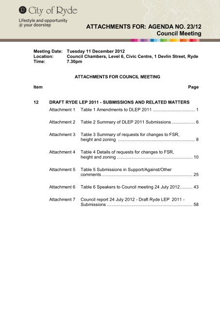
ATTACHMENTS FOR: AGENDA NO. 23/12<br />
Council Meeting<br />
Meeting Date: Tuesday 11 December 2012<br />
Location: Council Chambers, Level 6, Civic Centre, 1 Devlin Street, <strong>Ryde</strong><br />
Time: 7.30pm<br />
ATTACHMENTS FOR COUNCIL MEETING<br />
Item Page<br />
12 DRAFT RYDE LEP 2011 - SUBMISSIONS AND RELATED MATTERS<br />
<strong>Attachment</strong> 1 Table 1 Amendments to DLEP 2011 .................................. 1<br />
<strong>Attachment</strong> 2 Table 2 Summary <strong>of</strong> DLEP 2011 Submissions ................... 6<br />
<strong>Attachment</strong> 3 Table 3 Summary <strong>of</strong> requests for changes to FSR,<br />
height and zoning .............................................................. 8<br />
<strong>Attachment</strong> 4 Table 4 Details <strong>of</strong> requests for changes to FSR,<br />
height and zoning ............................................................. 10<br />
<strong>Attachment</strong> 5 Table 5 Submissions in Support/Against/Other<br />
comments ......................................................................... 25<br />
<strong>Attachment</strong> 6 Table 6 Speakers to Council meeting 24 July 2012 .......... 43<br />
<strong>Attachment</strong> 7 Council report 24 July 2012 - Draft <strong>Ryde</strong> LEP 2011 -<br />
Submissions ..................................................................... 58
Council <strong>Attachment</strong>s Page 1<br />
ITEM 12 (continued) ATTACHMENT 1<br />
Table 1 – Amendments to DLEP 2011<br />
Proposed Amendment Basis for amendment<br />
1. Wholesale supplies, Building<br />
identification signs and<br />
Recreation facility (indoor) be<br />
added to uses permitted in the<br />
IN2 Light Industrial zone.<br />
2. Emergency services facilities<br />
be deleted from uses<br />
prohibited in the IN2 Light<br />
Industrial zone.<br />
3. Home business and Home<br />
industries be added as a<br />
permitted use with Council<br />
consent in the R2, R3 and R4<br />
zones.<br />
4. Add to Schedule 1 Additional<br />
permitted uses<br />
131 & 133 Herring Rd and 208<br />
Epping Road – Development<br />
for the purposes <strong>of</strong> a medical<br />
centre is permitted with<br />
consent.<br />
5. Home based child care centres<br />
where permitted without<br />
consent in the land use table<br />
be made development<br />
permitted with consent.<br />
6. Schedule 2 Exempt<br />
Development – Signage<br />
(temporary )<br />
Additional condition added<br />
(d) Must not be illuminated<br />
7. Land Reservation Acquisition<br />
Map be amended in line with<br />
requested R&MS boundary<br />
changes (with corresponding<br />
changes to the Land Zoning<br />
Map) and that the inclusion <strong>of</strong><br />
land in Vimiera Rd on the Land<br />
Reservation Acquisition (LRA)<br />
Map be highlighted to DoPI for<br />
their consideration.<br />
<strong>Attachment</strong> 1 - Table 1 Amendments to DLEP 2011<br />
In response to a submission – see<br />
Council report <strong>of</strong> the 24 July 2012<br />
Draft <strong>Ryde</strong> LEP 2011 - Submissions.<br />
In response to a submission – see<br />
Council report <strong>of</strong> the 24 July 2012<br />
Draft <strong>Ryde</strong> LEP 2011 - Submissions<br />
In response to a submission – see<br />
Council report <strong>of</strong> the 24 July 2012<br />
Draft <strong>Ryde</strong> LEP 2011 - Submissions<br />
In response to a submission – see<br />
Council report <strong>of</strong> the 24 July 2012<br />
Draft <strong>Ryde</strong> LEP 2011 - Submissions<br />
In response to a submission – see<br />
Council report <strong>of</strong> the 24 July 2012<br />
Draft <strong>Ryde</strong> LEP 2011 - Submissions<br />
In response to a submission – see<br />
Council report <strong>of</strong> the 24 July 2012<br />
Draft <strong>Ryde</strong> LEP 2011 - Submissions<br />
In response to a submission – see<br />
Council report <strong>of</strong> the 24 July 2012<br />
Draft <strong>Ryde</strong> LEP 2011 - Submissions
<strong>Attachment</strong> 1 - Table 1 Amendments to DLEP 2011<br />
Council <strong>Attachment</strong>s Page 2<br />
ITEM 12 (continued) ATTACHMENT 1<br />
Proposed Amendment Basis for amendment<br />
8. 4.5B(c) Macquarie Park In response to a submission – see<br />
Corridor be expanded to read Council report <strong>of</strong> the 24 July 2012<br />
“To encourage greater public<br />
transport and active transport<br />
options”<br />
Draft <strong>Ryde</strong> LEP 2011 - Submissions<br />
9. Amend Clause 1.2(2)(f) to read<br />
“ to improve access to the city,<br />
minimise vehicle kilometres<br />
travelled, facilitate the<br />
maximum use <strong>of</strong> public<br />
transport and encourage<br />
walking and cycling”<br />
10. Clause 6.6 (f) – Environmental<br />
Sustainability be expanded to<br />
read<br />
“Transport initiative to reduce<br />
car dependence such as<br />
providing bicycle and<br />
pedestrian facilities, car share<br />
/carpool/small vehicle parking<br />
spaces and public transport<br />
information and the<br />
development <strong>of</strong> a workplace<br />
travel plan.”<br />
11. Update the DLEP 2011<br />
Centres map for <strong>Ryde</strong> Town<br />
Centre, West <strong>Ryde</strong> Town<br />
Centre and Gladesville Town<br />
Centre .<br />
12. Amend the Land Zoning Map<br />
for the property 391 Blaxland<br />
Rd <strong>Ryde</strong> to R2.<br />
13. Amend the Land Zoning Map<br />
for St Michaels Church &<br />
School Huges St Meadowbank<br />
to SP2 Educational<br />
Establishment and Place <strong>of</strong><br />
Public Worship<br />
14. <strong>Ryde</strong> Town Centre<br />
- Amend FSR map to 2:1 for<br />
the whole <strong>of</strong> Precinct 3 and<br />
land within the <strong>Ryde</strong> Town<br />
Centre with an FSR 1.8:1<br />
under the Draft Plan.<br />
In response to a submission – see<br />
Council report <strong>of</strong> the 24 July 2012<br />
Draft <strong>Ryde</strong> LEP 2011 - Submissions<br />
In response to a submission – see<br />
Council report <strong>of</strong> the 24 July 2012<br />
Draft <strong>Ryde</strong> LEP 2011 - Submissions<br />
In response to a submission – see<br />
Council report <strong>of</strong> the 24 July 2012<br />
Draft <strong>Ryde</strong> LEP 2011 - Submissions<br />
In response to a submission – see<br />
Council report <strong>of</strong> the 24 July 2012<br />
Draft <strong>Ryde</strong> LEP 2011 - Submissions<br />
In response to a submission – see<br />
Council report <strong>of</strong> the 24 July 2012<br />
Draft <strong>Ryde</strong> LEP 2011 - Submissions<br />
In response to a submission – see<br />
Council report <strong>of</strong> the 24 July 2012<br />
Draft <strong>Ryde</strong> LEP 2011 - Submissions
Council <strong>Attachment</strong>s Page 3<br />
ITEM 12 (continued) ATTACHMENT 1<br />
Proposed Amendment Basis for amendment<br />
- Amend the HOB map for the<br />
corresponding area mentioned<br />
above to a height <strong>of</strong> 18.5 m.<br />
- Amend HOB Map to make<br />
area F as referred to in Clause<br />
4.3(2A) to correspond with<br />
area described above.<br />
- Amend FSR Map for <strong>Ryde</strong><br />
Town Centre by combining<br />
area H and I into area H.<br />
- Amend Clause (4.3)(2A)(f)<br />
to 6m for area F<br />
- Amend Clause (4.4)(2A) as<br />
follows;<br />
Subclause (h) amended to<br />
read<br />
- (h) 0.5:1 if the building is in<br />
area H and if the building is on<br />
a site having an area <strong>of</strong> at<br />
least 900sqm and provides<br />
laneway access and is mixed<br />
development.<br />
- Clause 2 (4.4)(2A) (i) to be<br />
deleted.<br />
15. Update the DLEP 2011 <strong>Ryde</strong><br />
Civic Precinct map to include<br />
additional areas as identified in<br />
Draft DCP 2011 - Part 4.4<br />
<strong>Ryde</strong> Town Centre<br />
16. Amend clause 4.3 (2C) so that<br />
the maximum height for<br />
dwellings in both multi dwelling<br />
housing and dual occupancy<br />
development that do not have<br />
frontage to a street is 5m.<br />
17. Schedule 2 Exempt<br />
development - Amend controls<br />
for Signage (real estate sign<br />
for a residential site)<br />
<strong>Attachment</strong> 1 - Table 1 Amendments to DLEP 2011<br />
Determination <strong>of</strong> precincts for <strong>Ryde</strong><br />
Town Centre completed after<br />
submission <strong>of</strong> DLEP to DoPI .<br />
Consistency between LEP and DCP<br />
required.<br />
The clause at present only applies to<br />
multi dwelling housing developments<br />
and to ensure consistent controls<br />
exist governing the height <strong>of</strong> all rear<br />
dwellings the clause should include<br />
dual occupancy developments,<br />
An error occurred in the Schedule in<br />
that the controls for Signage (retail<br />
premises windows) was repeated for<br />
Signage(real estate sign for a<br />
residential site). It is proposed to<br />
reinstate the existing controls under<br />
LEP 2010 for Signage(real estate<br />
sign for a residential site).
<strong>Attachment</strong> 1 - Table 1 Amendments to DLEP 2011<br />
Council <strong>Attachment</strong>s Page 4<br />
ITEM 12 (continued) ATTACHMENT 1<br />
Proposed Amendment Basis for amendment<br />
18. Amend LEP 2011 Heritage Council has one archaeological<br />
Map to be in line with DoPI heritage item in Gladesville which is<br />
requirements that<br />
identified in Schedule 5<br />
Archaeological Heritage Items Environmental heritage as an<br />
be identified separately to archaeological item but which has<br />
General Heritage Items been mapped as a general item.<br />
19. Amend LEP 2011 Lot Size A number <strong>of</strong> properties have been<br />
Map to delete all areas from rezoned in the Land Zoning Map from<br />
the map which are not zoned a residential to a business zone .This<br />
residential in the Land Zoning change however was not carried<br />
Map.<br />
through to the Lot Size Map which<br />
only relates to residential properties.<br />
20. Amend LEP 2011 Floor Space<br />
Ratio Map with respect to 1<br />
Monash Road Gladesville to<br />
bring it in line with <strong>Ryde</strong> LEP<br />
(Gladesville Town Centre and<br />
Victoria Road Corridor) 2010<br />
Floor Space Ratio Map.<br />
21. Amend Schedule 5<br />
Environmental heritage with<br />
respect to Item I204 - 36<br />
Hillview Road Eastwood.<br />
22. Add a new clause Macquarie<br />
Park Corridor – Serviced<br />
apartments in Zone B3<br />
Commercial Core prohibiting the<br />
strata subdivision <strong>of</strong> serviced<br />
apartments<br />
23. Amend Clause 4.5A(b) Density<br />
Controls for Zone R2 Low Density<br />
Residential by deleting<br />
reference to access to private<br />
open space in multi dwelling<br />
housing.<br />
24. Upon direction from DoPI<br />
amend LEP maps relating to<br />
zoning, fsr and height for<br />
Macquarie University as<br />
required.<br />
Under <strong>Ryde</strong> LEP (Gladesville Town<br />
Centre and Victoria Road Corridor)<br />
2010 Floor Space Ratio Map the<br />
subject property, which is a heritage<br />
item has no FSR. An error occurred in<br />
the transfer <strong>of</strong> FSR controls for the<br />
site and under DLEP 2011 it has<br />
been given a FSR.<br />
To ensure that the entire building is<br />
listed as a heritage item, the<br />
reference for I204 needs to be<br />
expanded to include34 Hillview Road<br />
(Lot 46 DP 8043) and 32 Hillview<br />
Road (Lot 47 DP 8043).<br />
In the report <strong>of</strong> the 27 September<br />
2011 it was stated that Council should<br />
make a formal submission to DLEP<br />
2011 once on exhibition requesting<br />
the reinstatement <strong>of</strong> Clause 4.5B(5) in<br />
LEP 2010 with respect to prohibiting<br />
the subdivision <strong>of</strong> such developments<br />
The clause requires that separate<br />
access to private open space from an<br />
unbuilt upon portion <strong>of</strong> the site. This<br />
requirement is more appropriately<br />
covered in a DCP in that specific<br />
ways <strong>of</strong> achieving such access such<br />
as through a garage can be specified.<br />
The land is identified as a State<br />
Significant site under SEPP (Major<br />
Development) 2005. Differences exist<br />
between the zoning, height and fsr<br />
controls for the land under the LEP<br />
and the SEPP.
<strong>Attachment</strong> 1 - Table 1 Amendments to DLEP 2011<br />
Council <strong>Attachment</strong>s Page 5<br />
ITEM 12 (continued) ATTACHMENT 1<br />
Proposed Amendment Basis for amendment<br />
25. Amend the land use table for Secondary dwellings are permitted<br />
the R1, R2, R3 and R4 zones under SEPP (Affordable Rental<br />
to include secondary dwellings Housing ) 2009 in all residential<br />
as being permitted with zones. To reduce existing<br />
Council consent.<br />
administrative procedures and to<br />
ensure the provision <strong>of</strong> design criteria<br />
secondary dwellings should be<br />
permitted with Council consent in all<br />
residential zones.<br />
26. Rezone North <strong>Ryde</strong> Common In response to a submission –<br />
from SP2 to RE1 Public Request from NSW Health see<br />
Recreation<br />
Council report <strong>of</strong> the 24 July 2012<br />
Draft <strong>Ryde</strong> LEP 2011 - Submissions<br />
27. Rezone 100 – 104 Rowe St In response to a submission –<br />
Eastwood B4 Mixed Use in line flooding issues can be dealt with by<br />
with its current zoning under infrastructure works on the site.<br />
LEP 2010 and delete the<br />
property from the Land<br />
Reservation Acquisition Map.<br />
Minor amendments to Written<br />
document if necessary to incorporate<br />
any changes required by DoPI or<br />
identified drafting or description errors<br />
Minor amendments to Map if<br />
necessary to ensure maps are in line<br />
with DoPI requirements and to<br />
improve legibility <strong>of</strong> maps.
Council <strong>Attachment</strong>s Page 6<br />
ITEM 12 (continued) ATTACHMENT 2<br />
Group/Area No. <strong>of</strong><br />
submissions<br />
received<br />
TABLE 2 -Formal Exhibition (includes all late submissions) - Summary <strong>of</strong> DLEP 2011 submissions<br />
In support<br />
<strong>of</strong> DLEP<br />
Against changes<br />
in DLEP<br />
<strong>Attachment</strong> 2 - Table 2 Summary <strong>of</strong> DLEP 2011 Submissions<br />
Request for<br />
changes to FSR,<br />
Height, Zoning,<br />
Land use table<br />
Request for<br />
changes to<br />
aims/objectives<br />
Objections/Comments<br />
Environment/Open<br />
Space/Existing Controls/<br />
Specific clauses<br />
<strong>Ryde</strong> Council 4 0 0 3 1 0<br />
Govt agencies 14 0 0 7 3 4<br />
(2 submissions -no comment)<br />
West <strong>Ryde</strong> 5 2 0 3 0 0<br />
Eastwood 26 22<br />
4<br />
6<br />
0 0<br />
(includes Issues -<br />
(6 support change<br />
Petition) Shaftesbury Rd rezoning, amenity, but requests<br />
traffic & parking<br />
additional<br />
rezoning)<br />
Meadowbank 14 7 0 14<br />
(7 support plan but<br />
request additional<br />
height/fsr)<br />
0 0<br />
Macquarie Park 13 0 1<br />
Issue- zoning <strong>of</strong> roads RE1<br />
9 0 3<br />
Gladesville 119 10 101<br />
12<br />
0 80<br />
26 individual, 16- pro forma 1 (5 support change<br />
(includes pro former letters - 57& 22<br />
57 –pro former 2<br />
but request<br />
objection letters )<br />
Issues - height, traffic , amenity additional fsr /height)<br />
Issues – height , amenity , traffic<br />
<strong>Ryde</strong> 13 11<br />
0 1 0 1<br />
(2 Petitions)<br />
Issues - Height <strong>of</strong> <strong>Ryde</strong> Civic Centre)<br />
General 37 3 0 18 1(6 Clare St) 15<br />
Dual occupancy 18 13 2<br />
0 0 5 (2 support )<br />
Issues- Lot size and width <strong>of</strong> block<br />
Issues- Lot size and frontage<br />
Total 263 68 108 73 (incl.18 in 5 108(includes 2 in support and 79<br />
support)<br />
against DLEP)
Council <strong>Attachment</strong>s Page 7<br />
ITEM 12 (continued) ATTACHMENT 2<br />
Group/Area No. <strong>of</strong><br />
submissions<br />
received<br />
TABLE 2A - Community Consultation - Summary <strong>of</strong> DLEP 2011 submissions<br />
In<br />
support<br />
<strong>of</strong> DLEP<br />
Against changes<br />
in DLEP<br />
<strong>Attachment</strong> 2 - Table 2 Summary <strong>of</strong> DLEP 2011 Submissions<br />
Request for<br />
changes to FSR,<br />
Height, Zoning,<br />
Land use table<br />
Request for<br />
changes to<br />
aims/objective<br />
s<br />
Objections/Comments<br />
Environment/Open<br />
Space/Existing Controls/<br />
Specific clauses<br />
<strong>Ryde</strong> Council 1 0 0 0 0 1<br />
Govt agencies 9 0 0 8 0 2 (1counted in request for<br />
changes)<br />
West <strong>Ryde</strong> 3 0 0 3 0 0<br />
Eastwood 5 4 0 1 0 0<br />
Meadowbank 4 1 0 2 0 1<br />
Macquarie<br />
Park<br />
2 0 0 1 0 1<br />
Gladesville 2 1 1 0 0 0<br />
<strong>Ryde</strong> 213 1 211<br />
(1 individual/pro forma –<br />
210)<br />
General 2756 2 2740<br />
(1 individual and pro forma 2<br />
Dual<br />
occupancy/mul<br />
ti dwelling<br />
housing<br />
– 2739)<br />
1 0 0<br />
10 0 4<br />
16 10 0 0 0 8<br />
(2 counted in support)<br />
Heritage 1 1 0 0 0 0<br />
Total 3012 20 2952 26 0 14
Council <strong>Attachment</strong>s Page 8<br />
ITEM 12 (continued) ATTACHMENT 3<br />
TABLE 3 – DLEP 2011 Formal exhibition<br />
Summary <strong>of</strong> Requests/Council response - changes to fsr zoning, height and land use table<br />
Abbreviations used - LPS – Local Planning Study, CR – Council Resolution ,SD – CoR Strategic Direction<br />
Group /Area No <strong>of</strong><br />
Planning Part <strong>of</strong> Change not supported Change supported<br />
submissions proposal DLEP 2010<br />
requesting<br />
changes to fsr,<br />
required (Amend 1) Not in<br />
line<br />
Not in<br />
line<br />
Not<br />
in<br />
DoPI<br />
advice<br />
zoning, height &<br />
with with line<br />
land use table<br />
LPS CR with<br />
SD<br />
<strong>Ryde</strong> <strong>City</strong> Of <strong>Ryde</strong><br />
Council<br />
3 2 1 0 0 0 0 0<br />
Govt agencies 7 0 1 0 2 2 0 2<br />
(land use table & zoning to RE1)<br />
West <strong>Ryde</strong> 3 2 0 0 1 0 0 0<br />
Eastwood 6 0 0 6 0 0 0 0<br />
Meadowbank 14 0 0 12 0 2 0 0<br />
Macquarie Park 9 2 3 0 0 3 1 0<br />
Gladesville<br />
12 3 0 8 0 1 0<br />
<strong>Ryde</strong> 1 0 0 0 0 0 0 1<br />
(FSR and height changes to<br />
Precinct 3 and surrounds - RTC)<br />
General 18 3 0 1 3 4 2<br />
600<br />
Victoria<br />
Rd<br />
/Bulky<br />
goods<br />
premise<br />
<strong>Attachment</strong> 3 - Table 3 Summary <strong>of</strong> requests for changes to FSR, height and zoning<br />
5<br />
3 submissions re IN2 zoning<br />
table(except bulky goods premises)<br />
131 – 133 Herring Rd-Schedule1<br />
amendment<br />
391 Blaxland Rd – reinstate<br />
existing zoning
Council <strong>Attachment</strong>s Page 9<br />
ITEM 12 (continued) ATTACHMENT 3<br />
TABLE 3A – DLEP 2011 – Community Comment<br />
Summary <strong>of</strong> Requests/Council Response - changes to fsr, zoning, height and land use table<br />
Abbreviations used - LPS – Local Planning Study, CR – Council Resolution ,SD – CoR Strategic Direction<br />
Group /Area No <strong>of</strong><br />
Planning Part <strong>of</strong> Change not supported Change supported<br />
submissions proposal DLEP 2010<br />
requesting required (Amend 1) Not in Not in Not DoPI<br />
changes to fsr,<br />
line line in advice<br />
zoning, height &<br />
with with line<br />
land use table<br />
LPS CR with<br />
SD<br />
<strong>Ryde</strong> <strong>City</strong> Of <strong>Ryde</strong><br />
Council<br />
0 0 0 0 0 0 0 0<br />
Govt agencies 8 0 0 0 7 0 1<br />
West <strong>Ryde</strong> 3 0 0 3 0 0<br />
Eastwood 1 0 0 1 0 0 0 0<br />
Meadowbank 2 0 0 2 0 0 0 0<br />
Macquarie Park 1 0 1 0 0 0 0 0<br />
Gladesville<br />
0 0 0 0 0 0 0 0<br />
<strong>Ryde</strong> 1 0 0 1 0 0 0 0<br />
General 10 6 1 3<br />
IN2 land use<br />
table(except bulky goods<br />
premises)<br />
131 – 133 Herring Rd<br />
R2, R3 & R4 landuse<br />
table<br />
<strong>Attachment</strong> 3 - Table 3 Summary <strong>of</strong> requests for changes to FSR, height and zoning
Council <strong>Attachment</strong>s Page 10<br />
ITEM 12 (continued) ATTACHMENT 4<br />
TABLE 4 – DLEP 2011 Formal exhibition<br />
Details <strong>of</strong> Requests/Council response - changes to fsr zoning, height and land use table<br />
Abbreviations used LEP –Local Environmental Plan, DCP – Development Control Plan DoPI – Department <strong>of</strong> Planning and Infrastructure,<br />
R&MS – Roads and Maritime Services<br />
Area/Group No. <strong>of</strong><br />
Subs<br />
Requested change Response Reason<br />
<strong>Ryde</strong> <strong>City</strong> 3 1. 130 Talavera Rd Macquarie 1. To be considered 1. Planning provisions for Corridor<br />
Council<br />
Park – rezone to B4<br />
as part <strong>of</strong> LEP<br />
under review – separate process<br />
2. Provide outdoor<br />
2010(Amendment to DLEP 2011.<br />
advertisement/<br />
1) Macquarie<br />
sponsorship signage on<br />
Park.<br />
land that is owned by or 2. Planning proposal 2. Need for the community to have<br />
under the care control and<br />
management <strong>of</strong> Council.<br />
required.<br />
an opportunity to consider.<br />
3. Rezone a number <strong>of</strong><br />
3. Planning proposal 3. Need for the community to have<br />
Council properties (some<br />
required<br />
an opportunity to consider and<br />
SP2) to residential and<br />
Council resolution <strong>of</strong> 14<br />
business zones.<br />
February 2012 that DLEP does<br />
not rezone any current SP2 land<br />
to any other purpose.<br />
Government 7 1. NSW Rural Fire Service 1. Change<br />
1. Development is classed by RFS<br />
agencies<br />
Requests Home based<br />
supported.<br />
as Special Fire Protection<br />
childcare be permitted with<br />
Purpose and requires an<br />
consent only in all zones.<br />
assessment under section<br />
100B <strong>of</strong> the Rural Fires Act<br />
1997.<br />
2. Ausgrid (Formerly Energy 2. Change not<br />
2. Council resolution 14 February<br />
Australia).-Requests the<br />
supported -<br />
2012 that DLEP 2011 does not<br />
<strong>Attachment</strong> 4 - Table 4 Details <strong>of</strong> requests for changes to FSR, height and zoning
4. NSW Health - Macquarie<br />
Hospital – Requests North<br />
<strong>Ryde</strong> zoned more<br />
appropriately (RE1).<br />
5. NSW Planning and<br />
Infrastructure Requests<br />
rezoning <strong>of</strong> M2 surplus land<br />
from SP2 to R3 and RE1<br />
and corner Talavera Road<br />
and Christie Road B7 to B4.<br />
6. State Property Authority -<br />
3A and 3B Smalls Road<br />
<strong>Ryde</strong> -Request the land be<br />
rezoned from SP2 to R2.<br />
<strong>Attachment</strong> 4 - Table 4 Details <strong>of</strong> requests for changes to FSR, height and zoning<br />
Council <strong>Attachment</strong>s Page 11<br />
ITEM 12 (continued) ATTACHMENT 4<br />
Area/Group No. <strong>of</strong><br />
Subs<br />
Requested change Response Reason<br />
rezoning <strong>of</strong> land (which is<br />
Council resolution rezone any current SP2 land to<br />
surplus to needs) from SP2<br />
to R2:<br />
any other purpose.<br />
3. NSW Transport Roads 3. Change not<br />
3. Land is zoned E2 which<br />
and Maritime Services –<br />
supported –<br />
adequately protects the areas.<br />
Requests Buffalo Creek,<br />
Shrimptons Creek and<br />
Kitty’s Creek etc be zoned<br />
W2 Environmental<br />
Protection.<br />
Strategic direction<br />
4. Change<br />
4. Rezoning to RE1 reflective <strong>of</strong><br />
supported – land<br />
to be zoned RE1.<br />
existing use.<br />
5. To be considered<br />
as part <strong>of</strong> LEP<br />
2010(Amendment<br />
1) Macquarie<br />
Park<br />
6. Change not<br />
supported –<br />
Council<br />
resolution.<br />
5. Planning provisions for Corridor<br />
under review – separate<br />
process to DLEP 2011<br />
6. Council resolution 14 February<br />
2012 that DLEP 2011 does not<br />
rezone any current SP2 land to<br />
any other purpose.
Council <strong>Attachment</strong>s Page 12<br />
ITEM 12 (continued) ATTACHMENT 4<br />
Area/Group No. <strong>of</strong><br />
Subs<br />
Requested change Response Reason<br />
7. Housing NSW and the<br />
Department <strong>of</strong> Finance &<br />
Services (Land and<br />
Housing Corporation –<br />
requests rezoning <strong>of</strong> 3<br />
areas from R2 to R3<br />
West <strong>Ryde</strong> 3 1. 127, 131, 133 <strong>Ryde</strong>dale Rd,<br />
4,6,10 Terry Rd West <strong>Ryde</strong><br />
– requests land be rezoned<br />
to R4 and changes to fsr<br />
and height.<br />
2. 8, 10 and12 Chatham Rd –<br />
rezoning <strong>of</strong> land to mixed<br />
retail.<br />
Eastwood 6 1. Glen Street to be the same<br />
zoning rather than two<br />
zones as it is already a<br />
heavy commercial zone.<br />
Gladsesville 12 1. 2 College Street Gladesville<br />
- requests rezoning <strong>of</strong> land<br />
from R2 to B4 Mixed Use<br />
and increases in height and<br />
fsr<br />
2. 142 – 154 Victoria Rd & 1<br />
Meriton St Gladesville.-<br />
<strong>Attachment</strong> 4 - Table 4 Details <strong>of</strong> requests for changes to FSR, height and zoning<br />
7. Change not<br />
supported –<br />
Strategic<br />
direction.<br />
1. Change not<br />
supported –<br />
Council<br />
resolution.<br />
2. Planning proposal<br />
required<br />
1. Change not<br />
supported – Local<br />
Planning Study<br />
1. Planning<br />
proposal<br />
required.<br />
2. Changes not<br />
supported –<br />
Strategic<br />
7. The DLEP identifies that<br />
residential growth should occur in<br />
close proximity to centres and<br />
services. The 3 nominated<br />
precincts are located at some<br />
distance from a centre.<br />
1. Council resolution 3 August<br />
2010 that the land bounded by<br />
<strong>Ryde</strong>dale Road and Terry Road<br />
be deleted from the Draft West<br />
<strong>Ryde</strong> Masterplan.<br />
2. Need for the community to have<br />
an opportunity to consider<br />
1. Based on recommendations <strong>of</strong><br />
Local Planning Study<br />
1. Need for the community to have<br />
an opportunity to consider.<br />
2. .A FSR <strong>of</strong> 3.5:1 is applied to a<br />
key site which delivers a plaza<br />
space and other community
5. 2a & 2b Westminster -<br />
requests land be rezoned<br />
from B6 to B4 with changes<br />
to fsr and height and in<br />
support <strong>of</strong> changes to 44-<br />
48 Eltham St.<br />
6. 2-14 Tennyson Rd –<br />
requests zoning change<br />
from IN2 to mixed use with<br />
increases in fsr and height.<br />
7. Requests changes to 78<br />
Eltham to minimise the<br />
impact <strong>of</strong> adjoining<br />
<strong>Attachment</strong> 4 - Table 4 Details <strong>of</strong> requests for changes to FSR, height and zoning<br />
5. Changes not<br />
supported –<br />
Local Planning<br />
Study.<br />
6. Planning<br />
proposal<br />
required.<br />
7. Planning<br />
proposal<br />
required.<br />
Council <strong>Attachment</strong>s Page 13<br />
ITEM 12 (continued) ATTACHMENT 4<br />
Area/Group No. <strong>of</strong><br />
Subs<br />
Requested change Response Reason<br />
requests increase in fsr<br />
direction<br />
benefit. The subject site does<br />
not have the capacity to deliver<br />
community benefits.<br />
3. 11 – 15 Farm St – requests 3. Changes not 3. The DLEP is consistent with the<br />
changes to fsr and height (5 supported –<br />
Primrose Hill site height<br />
submissions )<br />
Local Planning<br />
controls as this is 12m (3<br />
Study.<br />
storeys) fronting Farm Street.<br />
4. 46 Eltham Street – requests 4. Changes not 4. Based on Local Planning Study<br />
44,46 & 48 Eltham St be<br />
supported –<br />
. Expansion <strong>of</strong> the B4/B6 zone<br />
zoned B4 zone and<br />
Local Planning<br />
into Eltham St was not<br />
changes to height and fsr (2 Study.<br />
considered suitable due to the<br />
separate submissions)<br />
residential nature <strong>of</strong> the street.<br />
5. Based on recommendation <strong>of</strong><br />
Local Planning Study .<br />
6. Commercial land uses may<br />
assist to expand the jobs<br />
diversity <strong>of</strong> the site. .Need for<br />
the community to have an<br />
opportunity to consider.<br />
7. A DA has been approved for a<br />
commercial mixed use
3. 3 – 9 Angus St<br />
Meadowbank – requests<br />
increase in height and fsr.<br />
4. Land currently the subject <strong>of</strong><br />
a Part 3A<br />
application/determination –<br />
requests height increases in<br />
line with Part 3A.<br />
5. 21-24 Railway Rd<br />
Meadowbank – requests.<br />
increases in height and fsr<br />
<strong>Attachment</strong> 4 - Table 4 Details <strong>of</strong> requests for changes to FSR, height and zoning<br />
3. Changes not<br />
supported– Local<br />
Planning Study<br />
4. Changes not<br />
supported– Local<br />
Planning Study<br />
5. Changes not<br />
supported– Local<br />
Planning Study.<br />
Council <strong>Attachment</strong>s Page 14<br />
ITEM 12 (continued) ATTACHMENT 4<br />
Area/Group No. <strong>of</strong><br />
Subs<br />
Requested change Response Reason<br />
development on the land.<br />
development at the corner <strong>of</strong><br />
Monash and Victoria Rds. The<br />
property 78 Eltham which is<br />
zoned R2 adjoins to the rear <strong>of</strong><br />
the DA site.<br />
Meadowbank 14 1. 125 – 135 Church St <strong>Ryde</strong> 1. Change not<br />
1. Based on recommendations <strong>of</strong><br />
– requests fsr and height be supported – Local Local Planning Study.<br />
increased.(7 submissions) Planning Study.<br />
2. Land has been zoned B4 Mixed<br />
2. 76 Belmore St and 8<br />
2. Change not<br />
Use since June 2002 and is<br />
Junction St – requests<br />
supported –<br />
subject to a Part 3A Concept<br />
rezoning to SP1<br />
Strategic<br />
Plan which has been<br />
(Community facilities)<br />
direction.<br />
determined by DoPI .<br />
3. Based on recommendations <strong>of</strong><br />
Local Planning Study.<br />
4. Based on recommendations <strong>of</strong><br />
Local Planning Study.<br />
5. Based on recommendations <strong>of</strong><br />
Local Planning Study.
<strong>Attachment</strong> 4 - Table 4 Details <strong>of</strong> requests for changes to FSR, height and zoning<br />
Council <strong>Attachment</strong>s Page 15<br />
ITEM 12 (continued) ATTACHMENT 4<br />
Area/Group No. <strong>of</strong><br />
Subs<br />
Requested change Response Reason<br />
6. Changes not 6. Based on recommendations <strong>of</strong><br />
6. 11-13 Angas St – requests supported– Local Local Planning Study<br />
increases to fsr and height. Planning Study<br />
Macquarie<br />
Park<br />
9 1. 31 – 33 Waterloo Rd -<br />
requests<br />
Shop top housing be added<br />
to permitted with consent in<br />
B3 zone and fsr and height<br />
increases.<br />
2. 137 – 143 Herring Rd –<br />
requests increases to height<br />
and fsr.<br />
3. 86 Blenheim Rd/12 – 14<br />
Epping Rd -Request<br />
rezoning <strong>of</strong> land from R2 to<br />
R4 with increases in height<br />
and fsr.<br />
4. 120 – 126 Herring Rd -<br />
requests increased building<br />
heights and FSR.<br />
1. Planning proposal<br />
required.<br />
2. To be considered<br />
in DLEP 2010<br />
(Amendment 1)<br />
3. Change not<br />
supported –<br />
Strategic<br />
direction.<br />
4. To be considered<br />
in DLEP 2010<br />
(Amendment 1).<br />
1. Council resolution <strong>of</strong> the 12<br />
June 2012 required a<br />
residential/commercial mix<br />
master plan to be prepared<br />
.Need for the community to<br />
have an opportunity to consider<br />
2. Planning provisions for Corridor<br />
under review – separate<br />
process to DLEP 2011.<br />
3. The site is island site<br />
surrounded by parkland and<br />
located on Epping Road - the<br />
site is not contextually<br />
associated with Macquarie park<br />
Corridor and not in line with<br />
Council’s strategic approach <strong>of</strong><br />
providing increased densities in<br />
Centres.<br />
4. Planning provisions for Corridor<br />
under review – separate<br />
process to DLEP 2011.
<strong>Attachment</strong> 4 - Table 4 Details <strong>of</strong> requests for changes to FSR, height and zoning<br />
Council <strong>Attachment</strong>s Page 16<br />
ITEM 12 (continued) ATTACHMENT 4<br />
Area/Group No. <strong>of</strong><br />
Subs<br />
Requested change Response Reason<br />
5. Macquarie Park Precinct – 5. Change not<br />
5. CoR believes residential<br />
seeking residential<br />
supported. –<br />
development on the fringes <strong>of</strong><br />
development - encourages Strategic<br />
Macquarie Park is appropriate<br />
a change <strong>of</strong> zoning to<br />
direction.<br />
but not at the expense <strong>of</strong> the<br />
permit mixed use (B4).<br />
Commercial Core (B3) and B7<br />
Business Park zone.<br />
6. 80 Waterloo Rd and 16 6. To be considered<br />
Byfield St – requests site<br />
in DLEP 2010 6. Planning provisions for Corridor<br />
be zoned B4 Mixed Use and (Amendment 1)<br />
under review – separate<br />
changes to height , fsr and<br />
parking.<br />
process to DLEP 2011.<br />
7. 1 and 1a Trafalgar Place –<br />
increases to fsr and height<br />
requested.<br />
8. Macquarie University –<br />
requests zoning , fsr and<br />
heights to reflect SEPP<br />
controls over land.<br />
9. Recommends that Council<br />
adopt the generic definition<br />
<strong>of</strong> ‘Food and Drink<br />
Premises’ in the B7 zone<br />
7. Masterplan and<br />
planning proposal<br />
required.<br />
8. Change not<br />
supported at this<br />
time.<br />
9. Change not<br />
supported –<br />
Strategic direction<br />
7. Based on recommendations <strong>of</strong><br />
Local Planning Study.<br />
8. DoPI have advised they will<br />
liaise with Council should the<br />
controls for Macquarie<br />
University need to be<br />
transferred from the Major<br />
Development SEPP into the<br />
DLEP 2011.<br />
9. Food and Drink premises<br />
includes pubs, restaurants and<br />
cafes and take away food and<br />
drink premises. The B7 zone
<strong>Attachment</strong> 4 - Table 4 Details <strong>of</strong> requests for changes to FSR, height and zoning<br />
Council <strong>Attachment</strong>s Page 17<br />
ITEM 12 (continued) ATTACHMENT 4<br />
Area/Group No. <strong>of</strong><br />
Subs<br />
Requested change Response Reason<br />
permits with Council consent<br />
Restaurants and café’s.<br />
Expansion <strong>of</strong> such uses could<br />
result in the undermining <strong>of</strong> the<br />
intent <strong>of</strong> the B7 zone.<br />
<strong>Ryde</strong> 1 1. 120-128 Blaxland Rd. – 1. Changes supported 1. Accepted that base fsr is too<br />
requests additional FSR for all <strong>of</strong> Precinct 3<br />
low for all properties in Precinct<br />
and height to address and additional<br />
3 and surrounding land, and a<br />
issues relating to feasibility surrounding lands.<br />
mismatch exists between height<br />
and to ensure that<br />
and FSR. The incentive height<br />
redevelopment occurs that<br />
provisions for the area should<br />
is more in line with the scale<br />
<strong>of</strong> the surrounds<br />
be increased.<br />
General 18 1. Requests expansion <strong>of</strong> land 1. Changes<br />
1. Land use changes considered<br />
uses in IN2 zone to include supported with appropriate. Bulky goods not<br />
– bulky goods premises,<br />
the exception <strong>of</strong> permitted based on advice from<br />
Recreation facility (indoor)<br />
bulky goods<br />
DoPI.<br />
Wholesale supplies Building<br />
identification signs,<br />
Emergency Service facilities.<br />
(3 submissions)<br />
premises (based<br />
on advice from<br />
DoPI).<br />
2. 131 – 133 Herring Rd & 209<br />
Epping Rd – request<br />
amendment to Schedule 1<br />
Additional land uses to<br />
permit a medical facility on<br />
the land.<br />
2. Change to<br />
supported.<br />
2. Supporting expansion <strong>of</strong> existing<br />
approved use <strong>of</strong> 133 Herring Rd<br />
as a pr<strong>of</strong>essional consulting room
4. Requests that residential<br />
accommodation be allowed<br />
on the ground floor B1<br />
zones.(2 submissions)<br />
5. 142, 144 – 148, 203 – 213<br />
and 215 Cox’s Rd N <strong>Ryde</strong> –<br />
requests no building height<br />
or fsr controls - Council<br />
should rely on the master<br />
plan that it adopts to control<br />
development.<br />
6. 391 Blaxland Rd <strong>Ryde</strong> -<br />
Submission requests<br />
reinstatement <strong>of</strong> existing<br />
R2.<br />
<strong>Attachment</strong> 4 - Table 4 Details <strong>of</strong> requests for changes to FSR, height and zoning<br />
4. Changes not<br />
supported –<br />
Strategic<br />
direction.<br />
5. Changes not<br />
supported –<br />
Strategic<br />
direction.<br />
6. Change<br />
supported.<br />
Council <strong>Attachment</strong>s Page 18<br />
ITEM 12 (continued) ATTACHMENT 4<br />
Area/Group No. <strong>of</strong><br />
Subs<br />
Requested change Response Reason<br />
3. 136 – 138 Pittwater Rd 3. Changes not 3. Council on the 2 November 2010<br />
Boronia Park. – request<br />
supported –<br />
resolved to remove Boronia Park<br />
increases to fsr and height Council<br />
from the Small Centres Study<br />
resolution.<br />
resulting in no change to the<br />
Centre.<br />
4. Land use change would<br />
undermine objectives <strong>of</strong> B1 zone.<br />
5. Planning provisions for Cox’s Rd<br />
under review – a separate<br />
process to DLEP .<br />
6. Land is currently zoned R2 and is<br />
part <strong>of</strong> a small group <strong>of</strong> shops on<br />
Blaxland Rd. The Local Planning<br />
Study recommended the group<br />
be zoned B1 in accordance with<br />
usage. Owner has advised that<br />
the property has been used for a<br />
residence only for a number <strong>of</strong><br />
years .
9. St Michaels Church &<br />
School Huges St & 47 Gaza<br />
Rd Meadowbank -Request<br />
the SP2 zone reflect the<br />
correct land uses on the<br />
site.<br />
10. 600 Victoria Rd <strong>Ryde</strong><br />
(RRCS) - Requests that if<br />
<strong>Attachment</strong> 4 - Table 4 Details <strong>of</strong> requests for changes to FSR, height and zoning<br />
9. Change in zoning<br />
supported for St<br />
Michaels.<br />
Changes to<br />
zoning <strong>of</strong> 47<br />
Gaza Rd not<br />
supported<br />
10. Changes not<br />
supported – DoPI<br />
Council <strong>Attachment</strong>s Page 19<br />
ITEM 12 (continued) ATTACHMENT 4<br />
Area/Group No. <strong>of</strong><br />
Subs<br />
Requested change Response Reason<br />
7. 293 – 299 Quarry Rd 117 – 7. Planning proposal 7. Need for the community to have<br />
119 North <strong>Ryde</strong> Denistone<br />
East.- requests an<br />
increase in building height ,<br />
fsr and rezoning <strong>of</strong> 8 Rocca<br />
St from R2 to B1 Vehicle<br />
Repair Stations to included<br />
in land use table.<br />
required.<br />
an opportunity to consider.<br />
8. Submission reviewed by Public<br />
8. 100 – 104 Rowe St<br />
8. Change not<br />
Works Group and determined<br />
Eastwood Objects to zoning supported in<br />
flood issues can be dealt with by<br />
<strong>of</strong> property RE1.<br />
report <strong>of</strong> 24 July<br />
2012 however<br />
based on<br />
additional<br />
information is now<br />
supported<br />
infrastructure works on the site.<br />
9. Change in zoning in line with<br />
current approved use <strong>of</strong> land.<br />
10. DoPI required SEPP controls for<br />
the land in LEP 2010. Any
<strong>Attachment</strong> 4 - Table 4 Details <strong>of</strong> requests for changes to FSR, height and zoning<br />
Council <strong>Attachment</strong>s Page 20<br />
ITEM 12 (continued) ATTACHMENT 4<br />
Area/Group No. <strong>of</strong><br />
Subs<br />
Requested change Response Reason<br />
DoPI approves modification<br />
change should be at the<br />
the LEP controls be<br />
updated to reflect the<br />
modified Concept Plan<br />
height and FSR controls for<br />
the land.<br />
requirement <strong>of</strong> DoPI.<br />
11. 20 Waterview Street Putney 11. Planning proposal 11. Need for the community to have<br />
- Request for expansion <strong>of</strong><br />
uses on the site to include;<br />
Residential flat buildings,<br />
Food and drink premises.<br />
required.<br />
an opportunity to consider.<br />
12. “Masters” a hardware chain:<br />
requests more land to be<br />
zoned B5 or B6 in areas where<br />
Council seek to concentrate<br />
bulky good uses and IN2 zone<br />
to include ‘garden centres’ as<br />
a permissible use.<br />
13. 130 – 132 Pittwater Road<br />
Gladesville- Request to<br />
increase in height from 9.5<br />
to 11.5 and FSR from 0.8:1<br />
to 1.3:1.<br />
14. Blenheim Road Small<br />
Centre - Merging 3 shops<br />
12. Planning proposal<br />
required<br />
13. Changes not<br />
supported –<br />
Council<br />
resolution.<br />
14. Changes not<br />
supported – Local<br />
Planning Study<br />
12. The rezoning <strong>of</strong> land to B5 and<br />
B6 and the introduction <strong>of</strong> bulky<br />
goods/garden centres into the<br />
IN2 zone requires further<br />
research.<br />
13. Council on the 2 November 2010<br />
resolved to remove Boronia Park<br />
from the Small Centres Study<br />
resulting in no change to the<br />
Centre.<br />
14. The incentive floor space and<br />
height have been master planned<br />
on the basis <strong>of</strong> a minimum lot
<strong>Attachment</strong> 4 - Table 4 Details <strong>of</strong> requests for changes to FSR, height and zoning<br />
Council <strong>Attachment</strong>s Page 21<br />
ITEM 12 (continued) ATTACHMENT 4<br />
Area/Group No. <strong>of</strong><br />
Subs<br />
Requested change Response Reason<br />
not achievable – incentive<br />
size to achieve a built form<br />
ratio should be 6:1 for 2<br />
outcome. - Not in line with Local<br />
shops and 3:1 for a shop<br />
developing alone.<br />
Planning Study<br />
<strong>Ryde</strong> <strong>City</strong><br />
Council<br />
Government<br />
agencies<br />
0<br />
15. Bulky goods premises – IN2<br />
Light Industrial zone<br />
8 Sydney Water<br />
22 Henry St <strong>Ryde</strong>, 20 Goulding Street<br />
& 865 Victoria Rd - requests the land<br />
be rezoned from SP2 to R2. ( 5)<br />
submissions)<br />
Roads and Maritime Services<br />
Changes to the Land Reservation<br />
Acquisition Map including ;<br />
- M2 Motorway/Vimiera Rd<br />
(area approximately 9<br />
500sqm) to be indicated on<br />
the LRA Map<br />
- Rezone Devlin Street and<br />
Blaxland Road as they pass<br />
through <strong>Ryde</strong> Town Centre<br />
SP2 – Classified Road<br />
- Zone only existing and<br />
proposed Motorways, Transit<br />
15. Changes not<br />
supported – DoPI<br />
Change not supported –<br />
Council resolution<br />
Change supported<br />
Change not supported –<br />
DoPI<br />
No change required<br />
15. Bulky goods not permitted based<br />
on advice from DoPI.<br />
Council resolved on 14 February 2012<br />
that DLEP 2011 does not rezone any<br />
current SP2 land to any other purpose<br />
The land is zoned SP2 Classified Road<br />
under DLEP 2011 and owned by DoPI.<br />
Change to be highlighted to DoPI.<br />
The land has been zoned B4 (or<br />
equivalent) since 2006 and is in<br />
accordance with DoPI PN 10 – 001.<br />
Request should be highlighted to DoPI.<br />
Based on a Schedule <strong>of</strong> Classified Roads<br />
and State and Regional Road produced<br />
by the RTA and dated 31 January 2011 all<br />
roads in DLEP 2011 are appropriately
<strong>Attachment</strong> 4 - Table 4 Details <strong>of</strong> requests for changes to FSR, height and zoning<br />
Council <strong>Attachment</strong>s Page 22<br />
ITEM 12 (continued) ATTACHMENT 4<br />
Area/Group No. <strong>of</strong><br />
Subs<br />
Requested change Response Reason<br />
ways and Classified Road SP2 Change not supported – zoned.<br />
.- all other roads should adopt<br />
the adjacent zone.<br />
Council resolution<br />
NSW Land & Property Management<br />
Authority<br />
Supports rezoning <strong>of</strong> Small Road<br />
<strong>Ryde</strong> to R2<br />
Energy Australia<br />
71 – 85 Constitution Rd Meadowbank<br />
requests the land be rezoned from<br />
SP2 to R4.<br />
West <strong>Ryde</strong> 3 6-8 Wattle St, 80 Anzac Ave, 29 – 33<br />
Herbert St should have the same FSR<br />
as properties along Herbert St –<br />
1.25:1.<br />
(3 submissions).<br />
Eastwood 1 Areas zoned R4 (south <strong>of</strong> May St to<br />
Blaxland Rd and Rowe Lane and on<br />
the northern side <strong>of</strong> First Ave) should<br />
be zoned B4 with associated FSR and<br />
height. R2 areas adjacent areas to the<br />
Centre south <strong>of</strong> Rutledge St should be<br />
zoned R4.<br />
Meadowbank 2 21 – 24 Railway Road Meadowbank.<br />
Request for height and floor space<br />
changes<br />
Change not supported –<br />
Council resolution.<br />
Change not supported –<br />
Strategic direction.<br />
Change not supported (at<br />
this time)<br />
Change not supported –<br />
Local Planning Study.<br />
Council resolved on 14 February 2012<br />
that DLEP 2011 does not rezone any<br />
current SP2 land to any other purpose.<br />
Council resolved on 14 February 2012<br />
that DLEP 2011 does not rezone any<br />
current SP2 land to any other purpose<br />
Based on examination <strong>of</strong> existing<br />
developments in the R4 zone and nature<br />
<strong>of</strong> uses permitted (predominately<br />
residential flat buildings) – DLEP FSR<br />
considered appropriate.<br />
A Master Plan for the Eastwood Town<br />
Centre is being developed and includes<br />
areas <strong>of</strong> R4 land on the eastern side <strong>of</strong><br />
Eastwood. Further changes will be<br />
addressed in the Master Plan .<br />
Based on recommendations <strong>of</strong> Local<br />
Planning Study
<strong>Attachment</strong> 4 - Table 4 Details <strong>of</strong> requests for changes to FSR, height and zoning<br />
Council <strong>Attachment</strong>s Page 23<br />
ITEM 12 (continued) ATTACHMENT 4<br />
Area/Group No. <strong>of</strong><br />
Subs<br />
Requested change Response Reason<br />
Macquarie Park 1 Cottonwood and Lachlan Avenue – To be considered in DLEP Planning provisions for Corridor under<br />
Increase height <strong>of</strong> the two areas from<br />
6 to 10 plus storeys similar to the<br />
corners next to the train station to<br />
encourage development<br />
2010 (Amendment 1) review – separate process to DLEP 2011.<br />
Gladesville 0<br />
<strong>Ryde</strong> Town 1 46 Gladstone Ave <strong>Ryde</strong> and adjacent Change not supported – Based on recommendations <strong>of</strong> Local<br />
Centre<br />
property. Request increase in height<br />
to 14m or a minimum 11.5m to<br />
capitalise on views and to align with<br />
the other side <strong>of</strong> Victoria Rd.<br />
Local Planning Study. Planning Study.<br />
General 10 208 Epping Rd, 131 & 133 Herring Rd<br />
. Requests rezoning to permit a<br />
medical facility.<br />
Food business from a dwelling house<br />
– should be permitted<br />
DLEP fails to recognise “advertising<br />
signage” as a legitimate land use<br />
activity. Inconsistency <strong>of</strong> the Draft<br />
LEP with SEPP No.64.<br />
Request expansion <strong>of</strong> land uses in<br />
IN2 zone to include;-:<br />
Change supported<br />
Change supported.<br />
Change not supported –<br />
Strategic direction<br />
Changes supported with<br />
the exception <strong>of</strong> bulky<br />
goods premises.<br />
Supporting expansion <strong>of</strong> existing<br />
approved use <strong>of</strong> 133 Herring Rd.<br />
As all other forms <strong>of</strong> home business and<br />
home industry are permitted by virtue <strong>of</strong> a<br />
SEPP amending the land use table for<br />
the R2 , R3 and R4 zones to permit food<br />
businesses is considered reasonable.<br />
Afact sheet relating to such activities is to<br />
be undertaken.<br />
Signage as a land use if permitted would<br />
allow third party advertising . Such<br />
signage is considered unsuitable.<br />
Land use changes considered<br />
appropriate. Bulky goods not permitted
<strong>Attachment</strong> 4 - Table 4 Details <strong>of</strong> requests for changes to FSR, height and zoning<br />
Council <strong>Attachment</strong>s Page 24<br />
ITEM 12 (continued) ATTACHMENT 4<br />
Area/Group No. <strong>of</strong><br />
Subs<br />
Requested change Response Reason<br />
Bulky goods premises<br />
Wholesale supplies<br />
Hardware and building supplies<br />
Storage premises<br />
Recreational facilities – indoor<br />
based on advice from DoPI.<br />
Emergency services facilities<br />
Change not supported – A Small Centres Master Plan Study was<br />
Local Planning Study undertaken to consider the long term<br />
Request that Height and FSR for<br />
planning <strong>of</strong> five small centres one <strong>of</strong><br />
Putney Village area be increased to<br />
which was Putney village.<br />
be Height 3 storeys.FSR :1 1 (many<br />
As an outcome <strong>of</strong> the Councillor workshop<br />
already have such a FSR) (6<br />
it was recommended that no changes be<br />
submissions)<br />
made to the existing planning controls for<br />
Putney village.
Council <strong>Attachment</strong>s Page 25<br />
ITEM 12 (continued) ATTACHMENT 5<br />
TABLE 5 – DLEP 2011 Formal exhibition<br />
Submissions in Support/Against/Other comments<br />
Area/Group<br />
<strong>Ryde</strong> Council<br />
No.<br />
Subs<br />
Issue Response Reason<br />
Support DLEP 0<br />
Against DLEP 0<br />
Existing Controls/ 1 Changes to aims/objectives <strong>of</strong> zones Change Certain changes not possible as part <strong>of</strong> SI and not<br />
Open Space/<br />
and certain clauses to emphasis supported where necessary as covered sufficiently in DLEP.<br />
Environment/Other<br />
Govt agencies<br />
aspects <strong>of</strong> sustainable development considered<br />
appropriate.<br />
Support DLEP 0<br />
Against DLEP 0<br />
Existing Controls/ 7 Health – Northern Sydney Local Health Change Certain changes not possible as part <strong>of</strong> SI and/or a<br />
Open Space/<br />
District - New objectives to zones, supported state government issue.<br />
Environment/Other amend aims <strong>of</strong> the Plan and clauses to where<br />
encourage healthy lifestyle and considered<br />
sustainable development.<br />
appropriate.<br />
The Office <strong>of</strong> Environment and<br />
Heritage - recommends that Council<br />
has biodiversity mapping in the LEP<br />
and that flood studies include<br />
modelling <strong>of</strong> sea level rise coastal<br />
inundation and flooding impacts.<br />
Hornsby & Parramatta Councils – No<br />
comment<br />
<strong>Attachment</strong> 5 - Table 5 Submissions in Support/Against/Other comments<br />
No change<br />
proposed<br />
No response<br />
required.<br />
Council has a series <strong>of</strong> mapping overlays such as<br />
urban bushland, foreshore and waterways , overland<br />
flow paths, endangered vegetation that are used as<br />
part <strong>of</strong> the development assessment which is<br />
considered adequate until appropriate work in<br />
biodiversity areas can be carried out .DLEP 2011<br />
introduces Clause 6.5 Flooding which is supported by<br />
DCP 2011 Part 8.6 Floodplain Management.
NSW Land and Housing Corporation<br />
Information on the <strong>Ryde</strong> Housing<br />
Market provided and key issues for<br />
<strong>Ryde</strong> identified.<br />
<strong>Attachment</strong> 5 - Table 5 Submissions in Support/Against/Other comments<br />
Comments<br />
noted<br />
Council <strong>Attachment</strong>s Page 26<br />
ITEM 12 (continued) ATTACHMENT 5<br />
Area/Group No.<br />
Subs<br />
Issue Response Reason<br />
Dept <strong>of</strong> Primary Industries -Suggested Changes not Existing aims <strong>of</strong> Plan sufficiently cover the areas<br />
amendments to the draft LEP and DCP supported at requested. Also protection <strong>of</strong> the environment is a<br />
to facilitate the protection and<br />
this time. high level aim and as such should not be listed in<br />
enhancement <strong>of</strong> waterways, riparian<br />
zoning objectives.<br />
land, groundwater and dependent<br />
Council’s Integrated Open Space Strategy is a high<br />
ecosystems.<br />
level document that will result in the development <strong>of</strong><br />
management plans to guide the provisions and use <strong>of</strong><br />
open space including zoning <strong>of</strong> land and linkages to<br />
active transport corridors. Appropriate clauses in<br />
support <strong>of</strong> ecological sustainability and protection <strong>of</strong><br />
groundwater etc in line with the Strategy will be<br />
reviewed in the development <strong>of</strong> the management<br />
plans.<br />
West <strong>Ryde</strong><br />
Support DLEP 2<br />
Against DLEP 0<br />
Existing Controls/ 0<br />
Open Space/<br />
Environment/Other<br />
The DLEP addresses issues <strong>of</strong> housing choice<br />
through:-<br />
- strata subdivision <strong>of</strong> dual occupancy,<br />
- additional zoned areas <strong>of</strong> mixed use<br />
development eg West <strong>Ryde</strong> and <strong>Ryde</strong> Town<br />
Centre.<br />
- the use <strong>of</strong> the SI which mandates that<br />
Boarding houses are a permitted use with<br />
consent in all residential zones.
2. Notification process – letters sent<br />
out did not mention Shaftesbury<br />
Rd only Glen St /Lakeside Rd.<br />
3. Affect on traffic in surrounding<br />
streets<br />
4. Proposed height <strong>of</strong> 4 storeys<br />
<strong>Attachment</strong> 5 - Table 5 Submissions in Support/Against/Other comments<br />
Council <strong>Attachment</strong>s Page 27<br />
ITEM 12 (continued) ATTACHMENT 5<br />
Area/Group<br />
Eastwood<br />
No.<br />
Subs<br />
Issue Response Reason<br />
Background information<br />
Zoning, FSR and height changes are proposed under DLEP 2011 to Glen Street/Lakeside Road/Shaftesbury Road Eastwood resulting in 3- 4<br />
storey developments being possible where the amalgamation <strong>of</strong> sites occur.<br />
Support DLEP 22<br />
Against DLEP 4 Objections to<br />
Change not 1. The Local Planning Study adopted by Council<br />
1. Rezoning <strong>of</strong> Shaftesbury Road supported.<br />
on 7 December 2010 rezoned 173 – 183<br />
properties from R2 to R4- on the<br />
Shaftesbury Road from R2 to R4 The additional<br />
original master plan only 3<br />
sites (179 – 183 Shaftesbury Rd were included<br />
properties were identified<br />
in the rezoning as a result <strong>of</strong> their isolation from<br />
other residential areas by school lands.<br />
2. Concerns noted.<br />
Existing Controls/<br />
Open Space/<br />
Environment/Other<br />
0<br />
3. Traffic impacts were considered as part <strong>of</strong> the<br />
Glen Street/Lakeside Rd Master Plan and each<br />
DA submitted will be assessed with respect to<br />
traffic and parking issues.<br />
4. A 4 storey transition down to 3 storey in<br />
Shaftesbury Road is only possible with site<br />
amalgamations. The heights are considered<br />
appropriate in view <strong>of</strong> the desired future<br />
character <strong>of</strong> the Eastwood Town Centre.<br />
Gladesville<br />
Background information<br />
<strong>Ryde</strong> LEP (Gladesville Town Centre and Victoria Rd Corridor) 2010 was gazetted in 2010 and resulted in zoning, height and FSRs in the<br />
Gladesville Town Centre (GTC). A number <strong>of</strong> properties on the periphery <strong>of</strong> the LEP boundary were not included in the LEP because <strong>of</strong> timing
<strong>Attachment</strong> 5 - Table 5 Submissions in Support/Against/Other comments<br />
Council <strong>Attachment</strong>s Page 28<br />
ITEM 12 (continued) ATTACHMENT 5<br />
Area/Group No.<br />
Subs<br />
Issue Response Reason<br />
and technical issues. In the Local Planning Study - Centres and Corriodors it was considered appropriate those properties e.g. 14 – 28 Oxford<br />
St should now be included in the Gladesville Town Centre with zoning and development controls similar to the surrounding land in the Centre.<br />
Support DLEP 10<br />
Against DLEP 101 Objections to<br />
No change<br />
1. Rezoning <strong>of</strong> Lady Queen <strong>of</strong> proposed. 1. The Local Planning Study that was adopted by<br />
(Total <strong>of</strong> 101<br />
Peace School (14 – 28)Oxford<br />
Council on the 7 December 2010 recommended<br />
submissions<br />
St from R2 to B4.<br />
that the subject property be rezoned B4 with a<br />
26 individual<br />
2. New heights <strong>of</strong> 6 and 8 storeys<br />
FSR <strong>of</strong> 1.5:1 and a height <strong>of</strong> 3 storeys.<br />
16 pro former 1<br />
along Victoria Rd and 4 storeys<br />
2. Changes have resulted from the gazettal <strong>of</strong> LEP<br />
57 pro former 2<br />
in Farm St - adverse impact on<br />
(Gladesville TC & VRC) on 14 January 2010 and<br />
local community due to noise ,<br />
the Local Planning Study adopted by Council in<br />
traffic, road safety, loss <strong>of</strong><br />
privacy, increased pressure on<br />
December 2010.<br />
amenities and public transport<br />
3. LEP 2010 involved extensive community<br />
and loss <strong>of</strong> sunlight<br />
consultation with the Local Study involving more<br />
3. Plan not in the community<br />
targeted consultation (land owners affected by<br />
interest (particular mention <strong>of</strong><br />
Gladesville and Victoria Road<br />
proposed change).<br />
Precinct.)<br />
4. Any DA for the subject land would require<br />
4. Victoria Rd /Monash Rd<br />
notification <strong>of</strong> adjoining owners and traffic and<br />
intersection - uses and height<br />
amenity issues would be considered on a<br />
not acceptable due to loss <strong>of</strong><br />
residential amenity.<br />
individual basis.<br />
5. Traffic and parking in Farm St<br />
5. Residential amenity, traffic management and<br />
not addressed.<br />
parking will be addressed as part <strong>of</strong> any DA.<br />
6. Eltham Street - Traffic and on<br />
6. A traffic study was part <strong>of</strong> the Master Plan work<br />
street parking on going issues.<br />
carried out for Gladesville Town Centre and<br />
Victoria Rd Corridor. Traffic impact was assessed<br />
as being within guidelines and considered<br />
acceptable.
<strong>Attachment</strong> 5 - Table 5 Submissions in Support/Against/Other comments<br />
Council <strong>Attachment</strong>s Page 29<br />
ITEM 12 (continued) ATTACHMENT 5<br />
Area/Group No.<br />
Subs<br />
Issue Response Reason<br />
Existing Controls/ 80 Objections to:-<br />
1. There are no changes proposed to Eltham<br />
Open Space/<br />
1. Eltham Street Gladesville -<br />
Street in the DLEP.The DDCP provides details<br />
Environment/Other<br />
DLEP and DDCP will cause the<br />
<strong>of</strong> a potential accessway abutting the rear <strong>of</strong><br />
environmental capacity <strong>of</strong> Eltham<br />
properties in Eltham Street. This is a DCP<br />
(all submissions<br />
St to be exceeded and<br />
matter and will be reviewed when submissions<br />
expressing<br />
significantly reduce amenity <strong>of</strong><br />
on the DDCP are presented to Council.<br />
concern over<br />
the street.<br />
2. See background information. There are no<br />
existing controls-<br />
2. Heights along Victoria Rd<br />
changes proposed to height and floor space for<br />
79 counted in<br />
and Farm St.<br />
properties along Victoria Rd.<br />
Against DLEP)<br />
3. Loss <strong>of</strong> sunlight, visual<br />
3. Residential amenity, traffic management and<br />
pollution, traffic, increased noise,<br />
road safety, increased pressure<br />
on amenities<br />
parking will be addressed as part <strong>of</strong> any DA.<br />
Meadowbank<br />
Support DLEP 7<br />
Against DLEP 0<br />
Existing Controls/<br />
Open Space/<br />
Environment/Other<br />
Macquarie<br />
Park<br />
0<br />
Support DLEP 0<br />
Against DLEP 1 Concern that Land Zoning Map shows No change In line with Council resolution <strong>of</strong> 5 May 2009 that LEP<br />
section <strong>of</strong> Council roadway in<br />
proposed 2010 Land Zoning Map be amended by zoning the<br />
Macquarie Estate with a zoning <strong>of</strong> RE1<br />
road to RE1 for the length <strong>of</strong> the boundary that the<br />
Public Recreation.<br />
zone/park abuts that road. The zoning referred to in<br />
the submission is a result <strong>of</strong> this resolution.<br />
Existing Controls/ 3 1. Request incentive for new hotel No change<br />
1. Not considered appropriate for Council to be<br />
Open Space/<br />
accommodation within N <strong>Ryde</strong> proposed<br />
involved in benefiting specific land uses within<br />
Environment/Other<br />
and Macquarie Park including –<br />
in any zone.
Council <strong>Attachment</strong>s Page 30<br />
ITEM 12 (continued) ATTACHMENT 5<br />
Area/Group No.<br />
Subs<br />
Issue Response Reason<br />
Floor space bonuses.<br />
<strong>Ryde</strong><br />
Support DLEP 11<br />
Against DLEP 0<br />
Existing Controls/<br />
Open Space/<br />
Environment/Other<br />
General<br />
Support DLEP 3<br />
Against DLEP 0<br />
Existing Controls/<br />
Open Space/<br />
Environment/Other<br />
2. Concerns raised are that Clause<br />
4.4B Macquarie Park Floor<br />
space ratio has been deleted.<br />
The submission requests that<br />
an incentive clause be re –<br />
instated in the LEP .<br />
3. Land use table amended to be<br />
clearer that industries and<br />
neighbourhood shops are<br />
permitted in B3 and B7 zones.<br />
1 DLEP 2011 has <strong>Ryde</strong> Civic Precinct at<br />
RL130 this was a result <strong>of</strong> a spot<br />
rezoning . Submission requests that<br />
height be readjusted to RL90.<br />
15 1. Clarification sought re ability to<br />
strata subdivide shop and<br />
dwelling.<br />
2. DLEP does not incorporate<br />
zoning for linking and moving<br />
between open space areas in<br />
<strong>Ryde</strong>.<br />
<strong>Attachment</strong> 5 - Table 5 Submissions in Support/Against/Other comments<br />
No change<br />
proposed<br />
No change<br />
proposed<br />
No change<br />
proposed.<br />
No change<br />
required<br />
No change<br />
proposed<br />
2. Planning provisions for Corridor under review –<br />
separate process to DLEP 2011.<br />
3. Land use table is presented in accordance with<br />
DoPI and SI requirements.<br />
The Height Map indicates heights for the Civic Centre<br />
that vary from 75m to 0m. This has been a direct<br />
transfer from LEP 2010 (Amendment 2) that was<br />
gazetted on 2 March 2012.<br />
1. Strata subdivision <strong>of</strong> the uses is permitted.<br />
2. The provision <strong>of</strong> linkages is identified in the<br />
Integrated Open Space Strategy. This is a high<br />
level document that will result in the<br />
development <strong>of</strong> management plans to guide<br />
the provisions and use <strong>of</strong> open space including
4. 6 Clare St Gladesville -<br />
Requests RE1 zone be<br />
amended to include an objective<br />
that permits the legal right <strong>of</strong><br />
access <strong>of</strong> adjacent properties<br />
<strong>Attachment</strong> 5 - Table 5 Submissions in Support/Against/Other comments<br />
No change<br />
proposed<br />
Council <strong>Attachment</strong>s Page 31<br />
ITEM 12 (continued) ATTACHMENT 5<br />
Area/Group No.<br />
Subs<br />
Issue Response Reason<br />
zoning <strong>of</strong> land and linkages to active transport<br />
corridors..<br />
3. Biodiversity mapping has merit in relation to<br />
3. Lack <strong>of</strong> biodiversity mapping, No change<br />
protecting the environment. It requires<br />
defined landscape requirements proposed<br />
however a comprehensive consideration and<br />
and a need to identify riparian<br />
research into defining the biodiversity<br />
zones and provided necessary<br />
elements, mapping the corridors in relation to<br />
buffer areas<br />
the Councils cadastre/allotment and the<br />
introduction <strong>of</strong> workable/realistic controls on<br />
both public and private lands. Council currently<br />
has a series <strong>of</strong> mapping overlays such as<br />
urban bushland, overland flow paths ,<br />
endangered vegetation that are used as part <strong>of</strong><br />
the development assessment process and<br />
defining development /built form outcomes.<br />
Local Plans <strong>of</strong> Management , State and<br />
Federal Government Legislation relating to<br />
endangered flora and fauna also assist in<br />
protecting the Cities environment<br />
Landscape requirements are matters<br />
contained in the DCP. The request for Council<br />
to identify and document riparian zones and<br />
buffer areas is noted.<br />
4. The matter has now been resolved through the<br />
DA process.
<strong>Attachment</strong> 5 - Table 5 Submissions in Support/Against/Other comments<br />
Council <strong>Attachment</strong>s Page 32<br />
ITEM 12 (continued) ATTACHMENT 5<br />
Area/Group No.<br />
Subs<br />
Issue Response Reason<br />
where the RE1 zoned land is a<br />
road.<br />
5. Comments and objections to:<br />
- the scale <strong>of</strong> development that<br />
will/is occurring in the <strong>City</strong>.<br />
- Lack <strong>of</strong> infrastructure planning<br />
- Social and environmental<br />
impacts<br />
- Proposed changes to small<br />
centres and along corridors and<br />
centres<br />
- rezoning for higher<br />
development outside main<br />
transport links<br />
- impact <strong>of</strong> <strong>of</strong>f street parking<br />
associated with train stations<br />
- Redevelopment <strong>of</strong> land on the<br />
southern side <strong>of</strong> Epping Rd,<br />
- Development/height <strong>of</strong> Civic<br />
Centre site and rejection <strong>of</strong><br />
public meeting.<br />
- .Issues relating to flood studies,<br />
foreshore building lines,<br />
protection <strong>of</strong> urban bushland<br />
(particularly Bundara Reserve),<br />
consultation process, height <strong>of</strong><br />
No change<br />
proposed<br />
5. The DLEP 2011 has been prepared based on<br />
the; -<br />
- provisions <strong>of</strong> LEP 2010<br />
- amendment to S1<br />
- Recommendations <strong>of</strong> the Local Planning Study<br />
(LPS) adopted by Council on 7 December<br />
2010.<br />
The preparation <strong>of</strong> both the LEP and LPS<br />
were researched and involved a range <strong>of</strong><br />
consultations with the community.<br />
The LPS included the Housing and Centres<br />
and Corridors Study, which reinforced the<br />
Council’s approach that increased residential<br />
densities are focused on centres with good<br />
public transport.<br />
The heights for the Civic Centre vary from 75m<br />
to 0m. This has been a direct transfer from<br />
LEP 2010 (Amendment 2) that was gazetted<br />
on 2 March 2012.<br />
Bundara Reserve – the E2 zoning on this<br />
area/reserve has been expanded<br />
As part <strong>of</strong> LEP 2010 careful consideration was<br />
given to identifying appropriate land uses<br />
within the E2 zone. The uses are considered
Council <strong>Attachment</strong>s Page 33<br />
ITEM 12 (continued) ATTACHMENT 5<br />
Area/Group No.<br />
Subs<br />
Issue Response Reason<br />
buildings<br />
appropriate and are retained in DLEP 2011.<br />
- Omission <strong>of</strong> consultation <strong>of</strong> and<br />
respect for the Aboriginal and<br />
Torres Strait Islander peoples<br />
- Development <strong>of</strong> controls needs<br />
community consultation.<br />
- Failure to undertake a<br />
comprehensive Heritage<br />
Review<br />
- The North <strong>Ryde</strong> Railway Station<br />
Precinct needs specific controls<br />
prepared with community<br />
consultation to protect existing<br />
residential areas.<br />
6. Presentation <strong>of</strong> land uses in<br />
land use table.<br />
Dual occupancy/<br />
Multi dwelling<br />
housing<br />
Support DLEP 13<br />
Against DLEP 2 The minimum lot sizes for dual<br />
occupancy and multi dwelling are<br />
<strong>Attachment</strong> 5 - Table 5 Submissions in Support/Against/Other comments<br />
The preparation <strong>of</strong> both the LEP and LPS<br />
were research and involved a range <strong>of</strong><br />
consultations with the community.<br />
The preparation <strong>of</strong> the plans were undertaken<br />
in consultation with adjoining councils. –<br />
consideration is given to the zoning <strong>of</strong> land<br />
and the need for environmental protection<br />
Council has commissioned three<br />
comprehensive heritage studies and informed<br />
the preparation <strong>of</strong> the LPS, in addition to<br />
consultation undertaken in conjunction with the<br />
preparation <strong>of</strong> the LPS.<br />
The North <strong>Ryde</strong> station precinct is a State<br />
Significant development and the planning<br />
process for this area is being undertaken by<br />
the State Government.<br />
6. Land use table has been developed in<br />
accordance with the SI and DoPI<br />
requirements.<br />
A 20m frontage requirement does mean that<br />
based on existing subdivision patterns certain
<strong>Attachment</strong> 5 - Table 5 Submissions in Support/Against/Other comments<br />
Council <strong>Attachment</strong>s Page 34<br />
ITEM 12 (continued) ATTACHMENT 5<br />
Area/Group No.<br />
Subs<br />
Issue Response Reason<br />
inequitable as it allows numerous<br />
areas <strong>of</strong> <strong>Ryde</strong> will capable <strong>of</strong> being developed<br />
developments in one street (eg<br />
than others. However it may require the<br />
Miriam Rd) but would be impossible<br />
consolidation <strong>of</strong> lots to achieve a development<br />
for development to occur in another.<br />
that complies.<br />
Existing Controls/<br />
Open Space/<br />
Environment/Other<br />
5<br />
1. Lot size and 20m road frontage is<br />
prohibitive as there are only a few<br />
lots in <strong>Ryde</strong> that would comply. -<br />
Lot size and frontage will greatly<br />
limit number <strong>of</strong> dual<br />
occupancy/multi unit dwelling<br />
developments in <strong>Ryde</strong><br />
2. Prefer Torrens title subdivision <strong>of</strong><br />
dual occupancy developments<br />
The removal <strong>of</strong> linear separation for such<br />
development from the DCP means that areas<br />
such as Miriam Rd (which have large lot<br />
subdivision patterns) could result in numerous<br />
Das being submitted for such developments<br />
1. As part <strong>of</strong> the Local Planning Study Council on<br />
the 7 December 2010 adopted a<br />
recommendation to introduce a control to<br />
require a minimum street frontage <strong>of</strong> 20m for<br />
duplex developments.<br />
The aim <strong>of</strong> the 20m frontage is to deliver better<br />
design outcomes, particularly with regard to<br />
compatibility with existing streetscapes.<br />
A 20m frontage requirement does mean that<br />
based on existing subdivision patterns certain<br />
areas <strong>of</strong> <strong>Ryde</strong> will capable <strong>of</strong> being developed<br />
than others.<br />
2. The definition <strong>of</strong> a dual occupancy<br />
development is 2 dwellings on 1 lot <strong>of</strong> land. If<br />
the land were Torrens title subdivided it would<br />
result in 1 dwelling on 1 lot <strong>of</strong> land and<br />
therefore by definition no longer be a dual<br />
occupancy development. Also a Torrens title<br />
would result in land parcels having a land area<br />
<strong>of</strong> approximately 290sqm. – such a change
<strong>Attachment</strong> 5 - Table 5 Submissions in Support/Against/Other comments<br />
Council <strong>Attachment</strong>s Page 35<br />
ITEM 12 (continued) ATTACHMENT 5<br />
Area/Group No.<br />
Subs<br />
Issue Response Reason<br />
could undermine the existing 580sqm required<br />
for normal shaped allotments.<br />
3. The standards proposed for multi dwelling<br />
3. Multi dwelling developments –<br />
housing is the same as has been in place for a<br />
controls should be more flexible<br />
number <strong>of</strong> years. Flexibility can occur in<br />
and assessed on merit.<br />
design where proven beneficial to the<br />
development and surrounding area.<br />
4. Clause 4.3(2C) restricts the maximum height<br />
4. For dual occupancy<br />
<strong>of</strong> multi dwelling housing which does not have<br />
developments which propose<br />
frontage to a street to 5m. To ensure<br />
dwellings one behind the other -<br />
consistent controls exist governing the height<br />
issues <strong>of</strong> bulk , scale,<br />
<strong>of</strong> all rear dwellings the clause should include<br />
overshadowing , privacy, poor<br />
dual occupancy developments.<br />
open space allocation.<br />
5. .Under DLEP 2011 Clause 4.1C Minimum lot<br />
sizes for dual occupancy and multi dwelling<br />
housing a minimum road frontage <strong>of</strong> 20m or<br />
greater is required for the development <strong>of</strong> a<br />
5. Concerned that the accessway to<br />
dual occupancy development. As such dual<br />
a hatched shaped block will be<br />
occupancy development on a hatchet shaped<br />
considered to be the road<br />
frontage.<br />
allotment is prohibited.
Council <strong>Attachment</strong>s Page 36<br />
ITEM 12 (continued) ATTACHMENT 5<br />
<strong>Attachment</strong> 5 - Table 5 Submissions in Support/Against/Other comments<br />
TABLE 5A – DLEP 2011 Community Comment<br />
Submissions in Support /Against/Other Comments<br />
Abbreviations used LEP –Local Environmental Plan, DCP – Development Control Plan DoPI – Department <strong>of</strong> Planning and Infrastructure,<br />
R&MS – Roads and Maritime Services<br />
Area/Group<br />
<strong>Ryde</strong> <strong>City</strong> Of<br />
<strong>Ryde</strong> Council<br />
No.<br />
Subs<br />
Issue Response Reason<br />
Support DLEP 0<br />
Against DLEP 0<br />
Existing Controls/ 1 Schedule 2 Exempt development – Change A condition prohibiting the illumination <strong>of</strong> temporary<br />
Open Space/<br />
Signage (temporary signs) - Request supported signs will reduce any concerns related to visual<br />
Environment/Other<br />
Govt agencies<br />
that a further condition be added that<br />
signs must not be illuminated.<br />
distraction for vehicles or pedestrians.<br />
Support DLEP 0<br />
Against DLEP 0<br />
Existing Controls/ 2 Roads and Maritime Service<br />
Open Space/<br />
Land Acquisition Map should show all Change not Not in accordance with DoPI Practice Note PN07 –<br />
Environment/Other land zoned SP2 – Classified Rd supported-DoPI 001 which states that the Land Reservation<br />
including land..<br />
Acquisition Map is to contain all land reserved for<br />
public purposes but not yet acquired.<br />
Requests additional clause to ensure<br />
child care centres, schools etc are<br />
effectively prohibited where properties<br />
have direct frontage to a classified<br />
Road .<br />
Change not<br />
supported-DoPI.<br />
Not in accordance with DoPI advice that such controls<br />
should be in DCPs - At the pre s64 review <strong>of</strong> DLEP<br />
2011 by DoPI Council was required to delete similar<br />
Clause from DLEP.
High density and mixed use should be<br />
provided around transport<br />
infrastructure.<br />
Controls need to be provided on<br />
development to ensure acoustic<br />
privacy.<br />
Design considerations found in<br />
Designing Places for Active Living<br />
should be taken into consideration.<br />
NSW Land & Property Management<br />
Authority<br />
43 – 61 Waterloo Rd Macquarie Park -<br />
<strong>Attachment</strong> 5 - Table 5 Submissions in Support/Against/Other comments<br />
No change<br />
required.<br />
No change<br />
required.<br />
No change<br />
required.<br />
To be<br />
considered in<br />
Council <strong>Attachment</strong>s Page 37<br />
ITEM 12 (continued) ATTACHMENT 5<br />
Area/Group No.<br />
Subs<br />
Issue Response Reason<br />
Amend Part 6.4.1 Precinct 1 – Civic Change not Not in accordance with DoPI requirement that Clause<br />
and mixed used to add 3(b)(x) Traffic<br />
impacts.<br />
supported-DoPI. 6.4.1 Precinct 1 – Civic and mixed use be deleted.<br />
To be<br />
Planning provisions for Corridor under review –<br />
Single unified bus priority network considered in separate process to DLEP 2011.<br />
through Macquarie Park Corridor needs DLEP 2010<br />
to be considered.<br />
(Amend.1).This<br />
should be also a<br />
broader whole <strong>of</strong><br />
government<br />
approach to<br />
addressing<br />
transport issues<br />
in the Corridor.<br />
All Centres are zoned for mixed use activities and<br />
have heights and FSRs appropriate for town centres.<br />
This is a matter for consideration at DA stage <strong>of</strong> a<br />
proposal and is covered in areas <strong>of</strong> draft DCP 2011.<br />
Designing Places for Active Living - not directly used<br />
in the development <strong>of</strong> the LEP however many <strong>of</strong> the<br />
design issues have been addressed or considered in<br />
the development <strong>of</strong> DCP 2011 particularly with regard<br />
to Town Centres.<br />
Changes relate to the deletion <strong>of</strong> the accessway map<br />
for the Corridor from DLEP 2011 and the provision <strong>of</strong>
<strong>Attachment</strong> 5 - Table 5 Submissions in Support/Against/Other comments<br />
Council <strong>Attachment</strong>s Page 38<br />
ITEM 12 (continued) ATTACHMENT 5<br />
Area/Group No.<br />
Subs<br />
Issue Response Reason<br />
Proposed amendment results in down DLEP 2010 heights over areas previously indicated as being<br />
West <strong>Ryde</strong><br />
zoning <strong>of</strong> site.<br />
(Amend.1). required on the accessway map.Planning provisions<br />
for Corridor under review – separate process to DLEP<br />
2011<br />
Support DLEP 0<br />
Against DLEP 0<br />
Existing Controls/<br />
Open Space/<br />
Environment/Other<br />
0<br />
Eastwood<br />
Support DLEP 4<br />
Against DLEP 0<br />
Existing Controls/ 0<br />
Open Space/<br />
Environment/Other<br />
Meadowbank<br />
Support DLEP 1<br />
Against DLEP<br />
Existing Controls/<br />
Open Space/<br />
Environment/Other<br />
Macquarie Park<br />
Support DLEP 0<br />
Against DLEP 0<br />
1 Land along the Shepherds Bay area<br />
has been designated as a long strip <strong>of</strong><br />
21m and 15m height buildings which<br />
will lead to a long wall <strong>of</strong> building rather<br />
than a stepped plane.<br />
No change<br />
supported –<br />
Local Planning<br />
Study<br />
Draft DCP 2011 – 4.2 Shepherds Bay provides design<br />
controls to ensure variation and architectural relief will<br />
be provided to individual developments.
<strong>Attachment</strong> 5 - Table 5 Submissions in Support/Against/Other comments<br />
Council <strong>Attachment</strong>s Page 39<br />
ITEM 12 (continued) ATTACHMENT 5<br />
Area /Group No.<br />
Subs<br />
Issue Response Reason<br />
Existing Controls/ 1 Rectification <strong>of</strong> previous error with No change In accordance with the requirements <strong>of</strong> DoPI changes<br />
Open Space/<br />
respect to the southern side <strong>of</strong><br />
required. have been incorporated into DLEP 2011<br />
Environment/Other Peachtree Rd has failed to eventuate<br />
Area /Group<br />
Gladesville<br />
No.<br />
Subs<br />
Issue Response Reason<br />
Support DLEP 1<br />
Against DLEP 1 Heights within all Precincts are too high No change The heights for the Gladesville area in DLEP 2011 are<br />
– particularly Town Centre Precinct. required – a straight transfer <strong>of</strong> heights gazetted in LEP 2010 –<br />
strategic Gladesville Town Centre and Victoria Rd Corridor and<br />
direction. the adopted Local Planning Study.<br />
Existing Controls/<br />
Open Space/<br />
Environment/Other<br />
<strong>Ryde</strong> Town<br />
Centre<br />
Support DLEP 1<br />
Against DLEP 211 -<br />
210<br />
pro<br />
forma<br />
letters<br />
0<br />
Objects to height levels along Blaxland<br />
Rd.<br />
Retain Civic Centre as public land and<br />
rebuild if necessary.<br />
Objects to two 24 storey towers<br />
No change<br />
required –<br />
Council<br />
resolution.<br />
No change<br />
supported –<br />
strategic<br />
direction.<br />
In line with Council resolution and DoPI support the<br />
subject properties have reverted to their maximum<br />
heights under LEP 2010.<br />
Relates to the Planning Proposal for the <strong>Ryde</strong> Civic<br />
Precinct that was considered by Council on 14<br />
February 2012. - DLEP 2011 does not amend the<br />
height controls presently available to the subject land<br />
under LEP 2010.
Council <strong>Attachment</strong>s Page 40<br />
ITEM 12 (continued) ATTACHMENT 5<br />
Area /Group No.<br />
Subs<br />
Issue Response Reason<br />
Existing Controls/<br />
Open Space/<br />
Environment/Other<br />
0<br />
General<br />
Support DLEP 2<br />
Against DLEP 2740<br />
–<br />
2739<br />
pro<br />
forma<br />
letters<br />
Civic Centre should be retained as<br />
public land.High rise towers are not<br />
supported on the civic centre site.<br />
All open space should be kept for<br />
parks, gardens, green links , bushland<br />
restoration and playing fields.<br />
All Special Uses zonings should be<br />
retained.<br />
All <strong>of</strong> the Field <strong>of</strong> Mars Reserve and<br />
Wildlife Refuge should be zoned E2.<br />
<strong>Attachment</strong> 5 - Table 5 Submissions in Support/Against/Other comments<br />
No change<br />
supported –<br />
Council<br />
resolution.<br />
No change<br />
supported –<br />
Council<br />
resolutions.<br />
No change<br />
required –<br />
Council<br />
resolution.<br />
No change<br />
supported –<br />
Council<br />
resolution<br />
Relates to the Planning Proposal for the <strong>Ryde</strong> Civic<br />
Precinct that was considered by Council on 14<br />
February 2012. - DLEP 2011 does not amend the<br />
height controls presently available to the subject land<br />
under LEP 2010<br />
DLEP 2011 identifies 3 new properties to be acquired<br />
for open space purposes. (As 100 – 104 Rowe Street<br />
will no longer be required to be acquired the LEP if<br />
gazetted will reflect 2 new properties acquired for local<br />
open space purposes).<br />
Areas where a change in zoning from RE1 to another<br />
zone has occurred under DLEP 2011 is;-<br />
-160- 162 Wicks Road Macquarie Park (Porters<br />
Creek Waste site) Council resolved on the 24/8/2010<br />
to rezone the land IN2 Light Industrial<br />
- 55A Pellisier Road Putney (Dwelling house). Council<br />
resolved on the 16/11/2004 to zone the subject land to<br />
Residential ‘A’.<br />
Council resolved on 14 February 2012 to not rezone<br />
any current SP2 land to any other purpose. DLEP<br />
2011 maintains SP2 zones as per LEP 2010 (not<br />
including R&MS requirements).
<strong>Attachment</strong> 5 - Table 5 Submissions in Support/Against/Other comments<br />
Council <strong>Attachment</strong>s Page 41<br />
ITEM 12 (continued) ATTACHMENT 5<br />
Council on the 5 May 2009 resolved to apply E2<br />
zoning to all land categorised as bushland under<br />
Section 36 <strong>of</strong> the Local Government Act, 1993<br />
resulting in Field <strong>of</strong> Mars Reserve and Wildlife Refuge<br />
being predominately zoned E2 .<br />
Existing Controls/ 4 Request period for community<br />
No change Community comment on DLEP was from 19 January<br />
Open Space/<br />
comment be at least 3 months, formal supported. 2011 to 29 May 2012 and a formal exhibition period<br />
Environment/Other exhibition 2 months and time to<br />
from 30 May to 13 July 2012. A report on submissions<br />
consider staff recommendations.<br />
was presented to Council 24 July and all submissions<br />
writers invited to address Council.<br />
Council has supported State<br />
Government requirements that SP2<br />
land be rezoned, permitting building<br />
within the foreshore building line and<br />
zoning all roads residential.<br />
Will county link road from Eastwood to<br />
North <strong>Ryde</strong> be built?<br />
Bundara Reserve - R2 zoning should<br />
reflect current one storey , single<br />
residential dwellings.<br />
Update Land use matrix.<br />
No change<br />
supported –<br />
Council<br />
resolution and<br />
DoPI.<br />
No change<br />
required.<br />
No change<br />
supported –<br />
strategic<br />
direction.<br />
No change<br />
required.<br />
Council resolved on 14 February 2012 to not rezone<br />
any current SP2 land to any other purpose. Foreshore<br />
building line controls and zoning <strong>of</strong> roads in<br />
accordance with DoPI requirements.<br />
The link between Eastwood to Epping Road is under<br />
the control <strong>of</strong> the R&MS and construction is at their<br />
discretion.<br />
Existing land adjoining Bundara Reserve to the east is<br />
zoned R2. All <strong>of</strong> R2 zone allows variety <strong>of</strong> residential<br />
types and buildings <strong>of</strong> up to 9.5m in height.<br />
The version <strong>of</strong> the Matrix that was available during the<br />
community comment exhibition period was the<br />
relevant matrix to use at that time.
Linear separation rules are not fair.<br />
<strong>Attachment</strong> 5 - Table 5 Submissions in Support/Against/Other comments<br />
Council <strong>Attachment</strong>s Page 42<br />
ITEM 12 (continued) ATTACHMENT 5<br />
Area /Group<br />
Dual<br />
occupancy/multi<br />
dwelling housing<br />
No.<br />
Subs<br />
Issue Response Reason<br />
Support DLEP 10<br />
Against DLEP 0<br />
Existing Controls/ 8 Controls now greatly limits the potential No change The Local Planning Study 2010 – Housing study<br />
Open Space/<br />
for duplex buildings –the majority <strong>of</strong> supported – states the following for dual occupancy developments.<br />
Environment/Other land in <strong>Ryde</strong> has a less than 20 metre Local Planning<br />
frontage.<br />
Study.<br />
A slightly higher minimum lot size together with a 20<br />
metre minimum frontage width would deliver better<br />
The requirements should be reviewed<br />
design outcomes, particularly with regard to<br />
and it is suggested that a block 16m<br />
compatibility with existing streetscapes, landscape<br />
wide and 700sqm is more realistic.<br />
and deep soil areas, as well as the placement <strong>of</strong><br />
garages and other car parking structures.<br />
If an increased minimum lot size for duplex buildings<br />
was introduced, the number <strong>of</strong> sites available for<br />
duplex developments would significantly decrease.(P4<br />
– 72).<br />
Council on the 7 December 2010 adopted the<br />
following recommendation from the LPS 2010<br />
Introduce a control to require a minimum street<br />
frontage <strong>of</strong> 20 metres for duplex developments. (P 9-<br />
13)<br />
Linear separation is not an LEP control. It has been<br />
deleted from DDCP 2011 as a result <strong>of</strong> the Council<br />
resolutions adopting the Local Planning Study 2010.
Council <strong>Attachment</strong>s Page 43<br />
ITEM 12 (continued) ATTACHMENT 6<br />
Speaker Name Property /Area<br />
addressed<br />
1. Andy Ludvik 1. <strong>Ryde</strong> Eastwood<br />
(representing <strong>Ryde</strong>-<br />
Leagues Club –<br />
Eastwood Leagues Club <strong>Ryde</strong>dale Road<br />
Ltd, Investron<br />
Pty Ltd, Alramon Pty Ltd,<br />
Enrico Bietola<br />
Pty Ltd, Gladesville<br />
Industrial Area<br />
Land Owners, Rutledge<br />
Property Group and Ms V<br />
Quek),<br />
<strong>Attachment</strong> 6 - Table 6 Speakers to Council meeting 24 July 2012<br />
TABLE 6 – Verbal Submissions made at Council Meeting 24 July 2012<br />
2. 2 College Street<br />
Gladesville<br />
Request/Issues Response/Comments provided<br />
TerryRoad/Ryedale<br />
Road request R2 to R4<br />
zoning<br />
Concerns over cost<br />
<strong>of</strong> preparing PP to<br />
rezone land.<br />
B4 zone requested<br />
as land is removed from<br />
other dwellings via<br />
ROW/access<br />
A Draft West <strong>Ryde</strong> Master Plan was presented to Council<br />
on the 3 August 2010 in which land in the north east<br />
quadrant <strong>of</strong> the town centre was to undergo the most<br />
significant changes - the area was seen as having better<br />
traffic and public transport access, high residential amenity<br />
and proximity to shops. The draft master plan rezoned<br />
Terry’s Road/Ryedale Road to R4 with similar controls to<br />
other areas <strong>of</strong> the Centre.<br />
Council resolved that the sites on Ryedale Road (north <strong>of</strong><br />
Terry Road) and sites in Terry Road being deleted from the<br />
master plan.<br />
Recommendation – No change to DLEP 2011.<br />
The property contains a dwelling house and is zoned R2.<br />
Land opposite and adjoining to the west is also zoned R2<br />
and contains dwelling houses. Properties to the east <strong>of</strong> the<br />
site are zoned B4 and are commercial premises.<br />
In view <strong>of</strong> the access way separating the property from the<br />
dwelling house at 2A College Street and the zoning <strong>of</strong> land<br />
to the south and east, the rezoning <strong>of</strong> the land B4 is<br />
considered reasonable. However to allow community<br />
consideration <strong>of</strong> proposed zoning, FSR and height changes<br />
to the land and to enable detailed design criteria to be<br />
incorporated into DCP 2011 - Part 4.6 Gladesville Town<br />
Centre and Victoria Road Corridor it is considered that a
Council <strong>Attachment</strong>s Page 44<br />
ITEM 12 (continued) ATTACHMENT 6<br />
Speaker Name Property /Area<br />
addressed<br />
3. Gladesville<br />
Industrial Area<br />
<strong>Attachment</strong> 6 - Table 6 Speakers to Council meeting 24 July 2012<br />
Request/Issues Response/Comments provided<br />
Problems <strong>of</strong><br />
leasing<br />
properties<br />
Bulky goods in<br />
business zones<br />
inappropriate<br />
Council has<br />
permitted bulky goods<br />
premises at 461 Victoria<br />
Rd<br />
B5 is the appropriate<br />
zone<br />
Planning Proposal for the site should be submitted to<br />
Council.<br />
Recommendation – No change to DLEP 2011 and that a<br />
planning proposal be lodged with Council for consideration,<br />
rezoning the property B4.<br />
Bulky goods premises is defined as a building used for the<br />
sale , hire or display <strong>of</strong> bulky goods being <strong>of</strong> such size or<br />
weight to require a large handling display area and includes<br />
goods such as floor and window supplies , furniture ,<br />
household electrical goods and swimming pools.<br />
The retail nature <strong>of</strong> bulky goods and its likely impact on<br />
reducing the land available for industrial uses is such that<br />
they should be considered on an individual basis through a<br />
Planning Proposal.<br />
DoPI on 20 June 2012 advised Council <strong>of</strong> the following;<br />
“Our preference is to exclude bulky goods retail from<br />
industrial zones as an additional use across the zone<br />
because the inclusion <strong>of</strong> 'bulky goods' is now considered<br />
fundamentally to be a retail use that is likely to reduce the<br />
amount <strong>of</strong> industrial land<br />
The preference now is to either:<br />
1. cluster permissibility <strong>of</strong> these uses in a suitable area<br />
(close to commercial is ideal but may not be achievable)<br />
and to give them a B5 zoning or<br />
2. allow the use by a Schedule 1 amendment for the<br />
particular site based on suitability criteria (less preferable<br />
but less damaging to the whole zone)<br />
In either case the PP should assess the proposal against
Council <strong>Attachment</strong>s Page 45<br />
ITEM 12 (continued) ATTACHMENT 6<br />
Speaker Name Property /Area<br />
addressed<br />
<strong>Attachment</strong> 6 - Table 6 Speakers to Council meeting 24 July 2012<br />
Request/Issues Response/Comments provided<br />
the Employment Lands Development Program Strategic<br />
Assessment checklist<br />
The retail nature <strong>of</strong> bulky goods and its likely impact on<br />
reducing the land available for industrial uses is such that<br />
they should be considered on an individual basis through a<br />
Planning Proposal.<br />
The owners <strong>of</strong> the industrial sites at 33- 37 College Street,<br />
39 – 41 College Street , 43 – 51 College Street and 28 and<br />
46- 48 Buffalo Rd Gladesville have made representation and<br />
submissions on the need to permit a range <strong>of</strong> additional land<br />
uses in the IN2 zone to address the leasing difficulties being<br />
faced by the landowners and to assist in ensuring the<br />
viability <strong>of</strong> the industrial area. To respond to their<br />
submissions a number <strong>of</strong> additional land uses have been<br />
added to the IN2 zone (permitted with consent). The uses<br />
include hardware and building supplies, wholesale supplies,<br />
landscape material supplies, emergency service and<br />
recreation facility (indoor).<br />
An additional land use requested by the landowners was the<br />
inclusion in the land use table <strong>of</strong> Bulky goods premises. To<br />
address Council staff and the Departments concerns over<br />
the broad/unlimited introduction <strong>of</strong> the bulky goods land use<br />
in the IN2 zone, these landowners are proposing an<br />
approach that would limit the amount <strong>of</strong> floor space on site<br />
that could be used for a bulky goods premises . The<br />
landowners have suggested 500sqm or 30% <strong>of</strong> floor space.<br />
The proposal to introduce a bulky goods land use within the<br />
Gladesville industrial area requires comprehensive
Council <strong>Attachment</strong>s Page 46<br />
ITEM 12 (continued) ATTACHMENT 6<br />
Speaker Name Property /Area<br />
addressed<br />
4. 31 – 33<br />
Waterloo Rd<br />
Macquarie Park<br />
<strong>Attachment</strong> 6 - Table 6 Speakers to Council meeting 24 July 2012<br />
Request/Issues Response/Comments provided<br />
Request consistent<br />
controls with adjoining<br />
land<br />
consideration in relation to the viability <strong>of</strong> the industrial area<br />
and the impact on the adjoining residential areas in relation<br />
to matters such as traffic movements.<br />
Recommendation – No change to DLEP 2011.<br />
Council on the 12 June 2012 resolved in part with respect to<br />
31 – 33 Waterloo Rd<br />
1. The landowner be request to prepare a<br />
residential commercial mix draft master plan for<br />
the land, in accordance with the principles <strong>of</strong> at<br />
transit orientate development to activate the<br />
precinct.<br />
2. That the master plan incorporates the principle <strong>of</strong><br />
high density living, diverse employment<br />
opportunities while integrating adjacent public<br />
transport infrastructure.<br />
3. If owner agrees to prepare draft master plan at<br />
own cost then they be request to present the<br />
outcome to Council in October 2012.<br />
It is considered that any changes to the land uses permitted<br />
or development controls for the site should be subject to a<br />
separate planning proposal, which will be considered when<br />
the master plan is completed.<br />
Recommendation – No change to DLEP 2011 and that a<br />
planning proposal be submitted to Council upon a separate<br />
master plan being prepared in accordance with Council<br />
resolution <strong>of</strong> 12 June 2012.
Council <strong>Attachment</strong>s Page 47<br />
ITEM 12 (continued) ATTACHMENT 6<br />
Speaker Name Property /Area<br />
addressed<br />
2. Ray Dresdner<br />
(representing J Goubran,<br />
BA & SR Wilson, PJ<br />
Smith, HL & M Dresdner,<br />
A & R<br />
Zweig, E Kreiger and R<br />
5. Cox’s Rd Master<br />
Plan<br />
Request bulky goods<br />
premises for IN2<br />
zone<br />
<strong>Attachment</strong> 6 - Table 6 Speakers to Council meeting 24 July 2012<br />
Request/Issues Response/Comments provided<br />
- Request removal <strong>of</strong><br />
FSR & height<br />
controls<br />
- SP2 zone – no<br />
controls but built form<br />
is limited by the use<br />
to church /school<br />
purposes.<br />
Request bulky goods<br />
(BG) for IN2 lands<br />
Council on the 24 April 2012 resolved to accept both a<br />
landowner’s master plan and Council’s master plan for<br />
public exhibition. The exhibition occurred from the 9 May to<br />
the 20 June 2012. The outcomes <strong>of</strong> the exhibition will be<br />
reported to Council later in 2012.<br />
The DLEP and the development <strong>of</strong> the controls for Cox’s<br />
Road Centre have always been considered two separate<br />
processes. Upon a decision being made by Council as to<br />
the future controls that should apply to the Centre a<br />
planning proposal amending LEP 2010 will be undertaken.<br />
It should be noted that as per the RPSO and LEP 2010<br />
land in DLEP 2011 zoned SP2 has no FSR or height<br />
controls.<br />
The Local Planning Study adopted by Council<br />
recommended a height <strong>of</strong> 9.5m and FSR <strong>of</strong> 0.8:1 for land<br />
zoned B1 (under LEP 2010 a 0.5:1 FSR exists with no<br />
height control).<br />
The controls <strong>of</strong> FSR 0.8:1 and building height <strong>of</strong> 9.5m is<br />
appropriate for Cox’s Road until the Council makes a<br />
decision on the future controls for the Centre.<br />
Recommendation – No change to DLEP 2011.<br />
As above for Speaker 1.
Council <strong>Attachment</strong>s Page 48<br />
ITEM 12 (continued) ATTACHMENT 6<br />
Speaker Name Property /Area<br />
addressed<br />
Markland,)<br />
3. Graeme Cordiner Gladesville Area<br />
<strong>Attachment</strong> 6 - Table 6 Speakers to Council meeting 24 July 2012<br />
Request/Issues Response/Comments provided<br />
Process not<br />
transparent<br />
Heights <strong>of</strong><br />
additional 2 storey<br />
resulting in 6-8<br />
storeys not<br />
supported<br />
Building heights &<br />
residents on busy<br />
roads not<br />
acceptable<br />
Changes to zoning, height and FSRs in the Gladesville<br />
Town Centre (GTC) have resulted from the gazettal <strong>of</strong> LEP<br />
(Gladesville TC & VRC) on 14 January 2011 and the Local<br />
Planning Study adopted by Council in December 2010. The<br />
LEP involved extensive community consultation with the<br />
Local Study involving more targeted consultation (land<br />
owners affected by proposed change). The changes<br />
identified in the Local Study related to properties on the<br />
periphery <strong>of</strong> the GTC which had been excluded because <strong>of</strong><br />
timing or technical issues from LEP(Gladesville TC & VRC)<br />
and include the following:-<br />
a. 14 – 20 Oxford St – the subject properties and<br />
adjoining land facing Victoria Rd are owned by the<br />
Catholic Church, used for school and church<br />
purposes and currently zoned R2 and B4. It is<br />
considered appropriate planning practice to have<br />
one zoning apply to the properties.<br />
b. 11- 15 Farm St – 3 sites abutting Primrose Hill. The<br />
land owners requested as part <strong>of</strong> the preparation <strong>of</strong><br />
the LEP for Gladesville that the land be rezoned and<br />
have similar controls to the adjoining Primrose Hill<br />
site.<br />
c. 1 Stansell St – isolated site containing a dwelling<br />
d. 2a and 2b Westminster Rd – industrial building<br />
rezoned to B6 to reflect its use.<br />
The purpose <strong>of</strong> the changes are to facilitate the revitalisation<br />
<strong>of</strong> the GTC as a vibrant, attractive and safe urban<br />
environment with a diverse mix <strong>of</strong> land uses.
Council <strong>Attachment</strong>s Page 49<br />
ITEM 12 (continued) ATTACHMENT 6<br />
Speaker Name Property /Area<br />
addressed<br />
4. Peter Lubrano<br />
(representing Strata Plan<br />
5991),<br />
5.Estelle Shields -<br />
Friends <strong>of</strong> Crowle Homes<br />
6 Diane Erickson<br />
(representing herself and<br />
Dorothy Kennedy),<br />
Peach Tree Rd<br />
Macquarie Park<br />
Crowle Homes<br />
Meadowbank<br />
<strong>Attachment</strong> 6 - Table 6 Speakers to Council meeting 24 July 2012<br />
Request/Issues Response/Comments provided<br />
Roads zoned RE1<br />
– requests rezoning<br />
<strong>of</strong> roads to B4<br />
Reconsideration <strong>of</strong><br />
the zoning <strong>of</strong> part<br />
<strong>of</strong> the site to<br />
maintain care<br />
accommodation<br />
Civic Centre site Over development<br />
<strong>of</strong> the land<br />
No changes are proposed to Eltham Street in the DLEP.<br />
Parking provision for future developments will be considered<br />
at DA stage.<br />
Recommendation – the proposed amendments to land<br />
abutting the Gladesville Town Centre and Victoria Road<br />
Corridor proceed as exhibited under DLEP 2011.<br />
DoPI Practice note PN10 – 001 requires all roads to be<br />
zoned in an LEP.<br />
Council on the 5 May 2009 in resolving to proceed with the<br />
gazettal <strong>of</strong> LEP 2010 further resolved to amend the zoning<br />
<strong>of</strong> roads to RE1 for the length <strong>of</strong> the boundary that land<br />
zoned RE1 abutts a road.<br />
Recommendation – No change to DLEP 2011.<br />
The land has been zoned B4 Mixed Use (or equivalent)<br />
since June 2002. The land is subject to a Part 3A Concept<br />
Plan which was approved by DoPI in November 2012.<br />
Recommendation – No change to DLEP 2011.<br />
<strong>Ryde</strong> LEP 2010 (Amendment 2) which was gazetted on 2<br />
March 2012 amended the Height <strong>of</strong> Buildings Map with<br />
respect to the <strong>Ryde</strong> Civic Precinct to a maximum height <strong>of</strong><br />
75m and reduced the nett usable floor area permitted in the<br />
Precinct from 100 000sqm to 60 000sqm (Schedule 6<br />
Planning controls for <strong>Ryde</strong> Town Centre precincts).<br />
With respect to DLEP 2011 the following is to be noted:<br />
1. DLEP 2011 does not amend the height controls<br />
presently available to the subject land under LEP
Council <strong>Attachment</strong>s Page 50<br />
ITEM 12 (continued) ATTACHMENT 6<br />
Speaker Name Property /Area<br />
addressed<br />
7. Denise Pendleton -<br />
(representing<br />
Residents for <strong>Ryde</strong>),<br />
<strong>Attachment</strong> 6 - Table 6 Speakers to Council meeting 24 July 2012<br />
Request/Issues Response/Comments provided<br />
<strong>Ryde</strong> Town Centre Concerns <strong>of</strong> the<br />
community not<br />
addressed in<br />
relation to heights<br />
and FSR in the<br />
RTC<br />
LEP should not be<br />
2010.<br />
2. DoPI required that the floor space (FS) controls for<br />
<strong>Ryde</strong> Town Centre be provided as a floor space ratio<br />
(FSR) on the FSR Maps rather than a floor area defined<br />
by square metres. As a result the nett usable floor areas<br />
specified for Precincts 1 and 2 in LEP 2010 (60 000sqm &<br />
150 000sqm respectively) were converted to a gross floor<br />
area and then converted into a ratio on the FSR Maps. It<br />
should be noted that Precinct 1 is divided into 3 FSR<br />
areas which are:-<br />
- 150 – 156 Blaxland Rd (carpark sites) – 2.2:1<br />
- 1 Devlin Street – 4.37:1 and<br />
- 1 Devlin Street (area containing access ramps) 0:1 (no<br />
development permitted)<br />
Council on 13 November 2012 as part <strong>of</strong> a Mayoral Minute<br />
16/12 , in relation to the Civic Centre Site, resolved in part<br />
to rezone the Civic Centre site SP2 Community use and RL<br />
91.<br />
Recommendation – The amendment to the height and<br />
zoning <strong>of</strong> Precinct 1 be dealt with as a planning proposal –<br />
No amendment to DLEP 2011.<br />
Development <strong>of</strong> DLEP 2011 involved a 3 stage process<br />
since 2005.<br />
All stages involved community consultation – master<br />
planning and reviewing <strong>of</strong> controls<br />
The DLEP approach is for the focus <strong>of</strong> development to<br />
remain in Centres.
Council <strong>Attachment</strong>s Page 51<br />
ITEM 12 (continued) ATTACHMENT 6<br />
Speaker Name Property /Area<br />
addressed<br />
8. Ellen Robertshaw -<br />
(representing<br />
Morling College),<br />
9. Jennifer Rollo<br />
(representing Friends<br />
<strong>of</strong> Crowle Home Inc),<br />
120 Herring Rd<br />
Macquarie Park<br />
Crowle Homes<br />
Meadowbank<br />
10. Gordana Vasic Dual Occupancy –<br />
strata subdivision<br />
11 Patricia Bloomfield Gladesville –<br />
Primrose Hill area<br />
12 Kevin Bevitt<br />
(representing Charles<br />
363 – 371 Victoria Rd<br />
Gladesville (abutting<br />
<strong>Attachment</strong> 6 - Table 6 Speakers to Council meeting 24 July 2012<br />
Request/Issues Response/Comments provided<br />
rushed through –<br />
consideration <strong>of</strong><br />
Green Paper<br />
should be made.<br />
Given approvals <strong>of</strong><br />
Part 3As adjoining<br />
the land requests<br />
an increase in<br />
controls on site to<br />
- 2.5:1 & 48m in<br />
height<br />
- 2:1 and 21.5/27m<br />
height<br />
In support <strong>of</strong> strata<br />
subdivision <strong>of</strong> dual<br />
occupancy<br />
developments<br />
LEP in proposing<br />
heights <strong>of</strong><br />
- 22m Victoria Rd<br />
- 12m Farm St<br />
Will wreck the area<br />
Opposes the<br />
retaining <strong>of</strong> R2<br />
Refer to comments for Speaker 6 with respect to the <strong>Ryde</strong><br />
Civic Centre site.<br />
Recommendation – No change to DLEP 2011.<br />
The site is located in the Macquarie Park Corridor – the<br />
planning provisions for the corridor and currently under<br />
review and are being considered separately to DLEP 2011.<br />
The issue raised in the submission will be considered as part<br />
<strong>of</strong> the review <strong>of</strong> the existing controls in the Corridor (review<br />
<strong>of</strong> DLEP 2010 Amendment 1) this was reported to Council<br />
on 27 November 2012.<br />
Recommendation - No change to DLEP 2011.<br />
Refer to comments under Speaker 5<br />
Comments noted<br />
Refer to comments under Speaker 3<br />
The planning provisions for Gladesville Town Centre and<br />
Victoria Road Corridor were reviewed as part <strong>of</strong> the Local
Council <strong>Attachment</strong>s Page 52<br />
ITEM 12 (continued) ATTACHMENT 6<br />
Speaker Name Property /Area<br />
addressed<br />
Dawborn) Eltham Street (44 –<br />
46)<br />
13 Angela Penklis<br />
(representing June<br />
Madden and Friend <strong>of</strong><br />
Crowle<br />
Home Inc)<br />
14 Tim Flett<br />
(representing Pirasta Pty<br />
Ltd),<br />
15 Stephen Abolakian<br />
- (representing<br />
HyCorp),<br />
Crowle Homes<br />
Meadowbank<br />
<strong>Attachment</strong> 6 - Table 6 Speakers to Council meeting 24 July 2012<br />
Request/Issues Response/Comments provided<br />
zone on 44 – 48<br />
Eltham Street –<br />
requests a B4 zone<br />
for land.<br />
Part <strong>of</strong> the site<br />
should remain SP2<br />
Part <strong>of</strong> the site<br />
should be B4<br />
Land zoned B7 Supports Council<br />
approach to not<br />
allowing serviced<br />
apartments to by<br />
strata subdivided.<br />
Not in support <strong>of</strong><br />
residential land<br />
uses for the B7<br />
zone<br />
Bonus FSR for<br />
120 – 128 Blaxland<br />
Rd <strong>Ryde</strong><br />
access<br />
FSR and height<br />
controls do not<br />
match<br />
Request FSR up to<br />
5:1<br />
Planning Study. Expansion <strong>of</strong> the B4/B6 zone into Eltham St<br />
was not considered as part <strong>of</strong> the study due to the<br />
residential nature <strong>of</strong> the street and the approach that the non<br />
residential use be contained to Victoria Rd.<br />
Recommendation - No change to DLEP 2011.<br />
Refer to comments under Speaker 5<br />
Comments noted.<br />
The arguments for increased height and FSR in relation to<br />
scale and feasibility carry some weight. It is accepted that<br />
the base FSR is low and results in a mismatch with height. It<br />
is proposed to raise this from 1.8:1 to 2:1 but keep the<br />
maximum incentive FSR <strong>of</strong> 2.5:1 as was proposed by the<br />
DLEP 2011
Council <strong>Attachment</strong>s Page 53<br />
ITEM 12 (continued) ATTACHMENT 6<br />
Speaker Name Property /Area<br />
addressed<br />
<strong>Attachment</strong> 6 - Table 6 Speakers to Council meeting 24 July 2012<br />
Request/Issues Response/Comments provided<br />
The height should also be amended. It is suggested that the<br />
base height <strong>of</strong> 18.5:1 be retained but that the height<br />
incentive is amended from 3m to be 6m. This may create<br />
taller building forms but will not add to the floor space<br />
capacity <strong>of</strong> the centre (and therefore the traffic generation).<br />
To ensure equity the same height and FSR controls should<br />
be applied across the whole <strong>of</strong> Precinct 3 – Main Street<br />
(generally retail parts <strong>of</strong> Blaxland Rd <strong>of</strong> Church St and areas<br />
in <strong>Ryde</strong> Town Centre presently with an FSR <strong>of</strong> 1.8:1.<br />
The height incentives (if taken up) are in the central part <strong>of</strong><br />
the Top <strong>Ryde</strong> and will not affect the low density residential<br />
areas surrounding the centre.<br />
Recommendation - The following amendment be made to<br />
the DLEP 2011:<br />
o Amend FSR map to 2:1 for the whole <strong>of</strong><br />
Precinct 3 and land within the <strong>Ryde</strong> Town<br />
Centre with an FSR 1.8:1 under the Draft<br />
Plan.<br />
o Amend the HOB map for the corresponding<br />
area mentioned above to a height <strong>of</strong> 18.5 m.<br />
o Amend HOB Map to make area F as referred<br />
to in Clause 4.3(2A) to correspond with area<br />
described above.<br />
o Amend FSR Map for <strong>Ryde</strong> Town Centre by<br />
combining area H and I into area H.<br />
o Amend Clause (4.3)(2A)(f) to 6m for area F
Council <strong>Attachment</strong>s Page 54<br />
ITEM 12 (continued) ATTACHMENT 6<br />
Speaker Name Property /Area<br />
addressed<br />
16 Shaun Gilchrist DDCP 2011 – Linear<br />
separation<br />
<strong>Attachment</strong> 6 - Table 6 Speakers to Council meeting 24 July 2012<br />
Request/Issues Response/Comments provided<br />
Concerns about the<br />
removal <strong>of</strong> linear<br />
separation and the<br />
impact it will have<br />
17 Lee Cummings <strong>Ryde</strong> Civic Centre Mishandling <strong>of</strong><br />
Civic Centre site<br />
No trust in the<br />
o Amend Clause (4.4)(2A)(h) to read as follows;<br />
(h) 0.5:1 if the building is in area H and if the building<br />
is on a site having an area <strong>of</strong> at least 900sqm and<br />
provides laneway access and is mixed development.<br />
o Clause 2 (4.4)(2A) (i) to be deleted.<br />
A recommendation <strong>of</strong> The Local Planning Study which was<br />
adopted by Council in December 2010 is the removal <strong>of</strong><br />
existing linear separation requirements for dual occupancy<br />
and linear separation. However an LEP control introduced a<br />
20m frontage for multi dwelling housing and dual occupancy<br />
developments.<br />
The Housing Study (a component <strong>of</strong> the Local Planning<br />
Study ) identified the removal <strong>of</strong> the control as helping<br />
address the housing needs <strong>of</strong> future residents by delivering<br />
smaller dwelling types which <strong>of</strong>fer opportunities for:<br />
– ageing households<br />
- Lone persons households and<br />
- young families.<br />
Within the <strong>City</strong> the following number <strong>of</strong> allotments have<br />
been identified as capable <strong>of</strong> :-<br />
Multi dwelling development - 815<br />
Dual occupancy (attached) development – 2125.<br />
Recommendation - No change to DLEP 2011.<br />
Refer to comments under speaker 6
Council <strong>Attachment</strong>s Page 55<br />
ITEM 12 (continued) ATTACHMENT 6<br />
Speaker Name Property /Area<br />
addressed<br />
Request/Issues<br />
councillors to make<br />
a sound decision<br />
on DLEP /DDCP<br />
Response/Comments provided<br />
18 Sherrie Barton <strong>Ryde</strong> Town Centre Issues around Civic<br />
Centre site and<br />
changes in <strong>Ryde</strong><br />
Refer to comments under speaker 6<br />
19 Aaron Lynch 44 – 48 Eltham<br />
St/373 Victoria Rd<br />
Gladesville<br />
20 Tod Anderson<br />
(representing himself and<br />
Taleen Tashjian),<br />
<strong>Attachment</strong> 6 - Table 6 Speakers to Council meeting 24 July 2012<br />
Town Centre<br />
Request B4 zoning<br />
for properties in<br />
Eltham St<br />
B4 zoning for 373<br />
Victoria Rd<br />
Request similar<br />
controls to<br />
Primrose<br />
Hill/Monash Road –<br />
2.3:1<br />
6 Clare Street Putney Request RE1 zone<br />
permits legal<br />
access to<br />
properties .<br />
21 Kevin Page Pro forma letters Letters not given<br />
sufficient weight<br />
Refer to comments under speaker 12<br />
Roads are a mandated use in the RE1 zone.<br />
Council on the 5 November 2002 resolved that it agrees in<br />
principle with the provision <strong>of</strong> vehicular access from Clare<br />
St onto the southern side <strong>of</strong> the property. As the zoning <strong>of</strong><br />
land under LEP 2010 did not impact on Council’s resolution<br />
no further action was taken.<br />
Legal opinion was received and the matter has been dealt<br />
with under the DA process.<br />
Recommendation - No change to DLEP 2011.<br />
A total 3022 Pr<strong>of</strong>orma letters covering a range <strong>of</strong> issues<br />
including<br />
- Civic Precinct proposal
Council <strong>Attachment</strong>s Page 56<br />
ITEM 12 (continued) ATTACHMENT 6<br />
Speaker Name Property /Area<br />
addressed<br />
22 Jennie Minifie<br />
(representing <strong>Ryde</strong><br />
Community Alliance and<br />
<strong>Ryde</strong> Environment<br />
Group),<br />
<strong>Attachment</strong> 6 - Table 6 Speakers to Council meeting 24 July 2012<br />
Request/Issues Response/Comments provided<br />
Number <strong>of</strong> concerns Pr<strong>of</strong>ormas –<br />
important points<br />
raised<br />
Residents not<br />
aware <strong>of</strong> the<br />
change to medium<br />
density controls<br />
DLEP – 90%<br />
development 10%<br />
environment<br />
No comprehensive<br />
heritage study done<br />
Built form controls<br />
- Loss <strong>of</strong> open space<br />
- Heights and inappropriate development in<br />
Gladesville<br />
were received throughout the “Community Comment” and<br />
“Formal Exhibition” process - No lesser weight was given to<br />
the submissions in their representation/presentation to<br />
Council.<br />
Recommendation - No change to DLEP 2011.<br />
In response to comments made:<br />
- For pr<strong>of</strong>orma letters refer to comments under<br />
speaker 21.<br />
- Changes to strata subdivision and linear separation<br />
controls were identified in 3 <strong>of</strong> the 4 DLEP public<br />
notices as well as highlighted on Council’s webpage<br />
and during information sessions.<br />
- The DLEP incorporates new controls around<br />
flooding, sustainable development and stormwater .<br />
It also focuses on maintaining development within<br />
Centres.<br />
- A comprehensive Heritage Study was undertaken in<br />
1988 and a subsequent heritage review in 2000.<br />
Draft Heritage Study 2010 which was commenced in<br />
2003 when members <strong>of</strong> the Heritage Advisory<br />
Committee sought heritage nominations from the<br />
Community groups they represent. Council on the 17<br />
August 2010 resolved to include, delete and amend<br />
a number <strong>of</strong> heritage items in draft LEP 2011.<br />
Council also resolved that it would not pursue<br />
compulsory heritage listing <strong>of</strong> any property unless
Council <strong>Attachment</strong>s Page 57<br />
ITEM 12 (continued) ATTACHMENT 6<br />
Speaker Name Property /Area<br />
addressed<br />
23 Justin Kucic Eltham Street<br />
Gladesville<br />
24 Marian Higgins<br />
11 – 13 Angus Street<br />
Meadowbank<br />
<strong>Attachment</strong> 6 - Table 6 Speakers to Council meeting 24 July 2012<br />
Request/Issues Response/Comments provided<br />
All traffic with the<br />
redevelopment <strong>of</strong><br />
Victoria Rd behind<br />
Westminster &<br />
Monash go through<br />
Eltham Street.<br />
Environmental<br />
capacity <strong>of</strong> the<br />
street – impacts<br />
increasing due to<br />
developments<br />
Close Eltham St to<br />
protect pedestrians<br />
and amenity <strong>of</strong> the<br />
street .<br />
Request for<br />
increases in<br />
- height to 29.6m<br />
- FSR to 3.2:1<br />
the land owner <strong>of</strong> the property applies for a heritage<br />
listing <strong>of</strong> the property.<br />
- Built form controls are dealt with in detail in Draft<br />
DCP 2011 which has yet to be presented to Council.<br />
Recommendation - No change to DLEP 2011.<br />
Monash Road/ Victoria Rd development standards were<br />
gazetted in January 2011 and are not proposed to change<br />
as part <strong>of</strong> DLEP 2011.<br />
The concerns relating to the traffic issues resulting from<br />
surrounding development are noted.<br />
There are no changes proposed to Eltham Street in the<br />
DLEP. Traffic and Parking provision for future developments<br />
will be considered at DA stage .<br />
Recommendation - No change to DLEP 2011.<br />
When considering the <strong>Ryde</strong> Local Planning Study, Council<br />
directed that the LEP building heights in Shepherd’s Bay<br />
should accommodate 6 storeys maximum. The council<br />
adopted Local Planning Study formed the basis <strong>of</strong> DLEP<br />
2011. The DLEP FSRs were derived from the height<br />
envelopes and previous master plan studies.<br />
Recommendation - No change to DLEP 2011.
Council <strong>Attachment</strong>s Page 58<br />
ITEM 12 (continued) ATTACHMENT 7<br />
6 DRAFT RYDE LEP 2011 - SUBMISSIONS<br />
Report prepared by: Strategic Planner<br />
Report dated: 28/05/2012 File No.: LEP2008/22/007 - BP12/643<br />
REPORT SUMMARY<br />
This report provides information on the exhibition <strong>of</strong> draft <strong>Ryde</strong> Local Environmental<br />
Plan (LEP) 2011 and on the outcomes <strong>of</strong> that community consultation process.<br />
A total <strong>of</strong> 3 259 submissions were received during the exhibition <strong>of</strong> draft LEP under<br />
both ‘Community Comment’ which occurred from the 19 January 2011 to the 29 May<br />
2012 and the formal exhibition <strong>of</strong> the Plan under the Environmental Planning and<br />
Assessment Act 1979 from the 30 May to the 13 July 2012.<br />
The principal issues raised in submissions were;<br />
Requests for increased floor space and height provisions for certain sites<br />
within Centres and local business zones.<br />
Deleting Clause 4.1C (d) (b) which requires a minimum road frontage <strong>of</strong> 20m<br />
for dual occupancy and multi dwelling housing developments.<br />
Requests from State authorities that land zoned SP2 which is surplus to their<br />
needs be rezoned to an adjoining zoning.<br />
Concern over the viability <strong>of</strong> the IN2 zone and inclusion <strong>of</strong> additional land uses<br />
“permitted with consent”.<br />
Retention <strong>of</strong> all open space land<br />
Objection to blanket prohibitions that exist within DLEP which fail to recognise<br />
“advertising signage” as a legitimate land use activity.<br />
A summary <strong>of</strong> points raised in submissions, Council’s response to those points and<br />
proposed actions are presented in Table 1 – Community Consultation Submissions<br />
and Table 2 – Formal Exhibition Submissions.<br />
It is proposed to amend the draft LEP to address a number <strong>of</strong> the issues raised in<br />
submissions, the principal changes include:<br />
1. Wholesale supplies, Building identification signs and Recreation facility<br />
(indoor) being added to uses permitted in the IN2 Light Industrial.<br />
2. Home business and Home industries being added as a permitted use in the<br />
R2, R3 and R4 zones.<br />
3. Land Reservation Acquisition Map being amended in line with requested RTA<br />
boundary changes.<br />
Further amendments to the draft Plan are also proposed to bring the plan in line with<br />
changes in supporting documents such as the Draft DCP 2011 and to correct<br />
identified omissions and errors. All such changes are identified in TABLE 3 –<br />
Amendments to DLEP 2011.<br />
The report recommends that Council amends the draft Plan in accordance with Table<br />
3 and that the plan be forwarded to the Department <strong>of</strong> Planning and Infrastructure<br />
(DoPI) with a Section 68 report requesting that the Minister make the Plan.<br />
<strong>Attachment</strong> 7 - Council report 24 July 2012 - Draft <strong>Ryde</strong> LEP 2011 - Submissions
Council <strong>Attachment</strong>s Page 59<br />
ITEM 12 (continued) ATTACHMENT 7<br />
RECOMMENDATION:<br />
(a) That Council amend Draft <strong>Ryde</strong> LEP 2011 in accordance with the changes<br />
identified in Table 3 – Amendments to LEP 2011 attached to this report titled<br />
Draft LEP 2011 – Submissions.<br />
(b) That Council forward to the Department <strong>of</strong> Planning and Infrastructure draft<br />
LEP 2011 as amended with a Section 68 report requesting that the Minister<br />
make the Plan.<br />
(c) That the General Manager write to the Minister for Planning seeking flexibility<br />
for the <strong>City</strong> <strong>of</strong> <strong>Ryde</strong> to develop boarding house controls that reflect local<br />
character and affordable housing.<br />
ATTACHMENTS<br />
1 <strong>Ryde</strong> <strong>City</strong> View - CIRCULATED UNDER SEPARATE COVER<br />
2 Notification Areas - CIRCULATED UNDER SEPARATE COVER<br />
3 Table 1 - Community Submission Table - 5 June - CIRCULATED UNDER<br />
SEPARATE COVER<br />
4 Table 2 - Formal Submissions - CIRCULATED UNDER SEPARATE COVER<br />
5 Table 3 - Changes to DLEP - CIRCULATED UNDER SEPARATE COVER<br />
Report Prepared By:<br />
Susan Wotton<br />
Strategic Planner<br />
Report Approved By:<br />
Meryl Bishop<br />
Manager - Urban Planning<br />
Dominic Johnson<br />
Group Manager - Environment & Planning<br />
<strong>Attachment</strong> 7 - Council report 24 July 2012 - Draft <strong>Ryde</strong> LEP 2011 - Submissions
Council <strong>Attachment</strong>s Page 60<br />
ITEM 12 (continued) ATTACHMENT 7<br />
History<br />
Council resolved on the 11 December 2007 to prepare a comprehensive LEP in<br />
accordance with the Standard Instrument and based on the <strong>City</strong> <strong>of</strong> <strong>Ryde</strong> Local<br />
Planning Study.<br />
Council adopted with amendments the <strong>City</strong> <strong>of</strong> <strong>Ryde</strong> Local Planning Study 2010 on<br />
the 7 December 2010 and resolved that the consultation process with Government<br />
agencies, required by Section 62 <strong>of</strong> the EP&A Act for draft <strong>Ryde</strong> LEP 2011 be carried<br />
out.<br />
Council on 14 December 2010, after consideration <strong>of</strong> the comments from the<br />
government agencies, resolved that the Director General <strong>of</strong> the Department <strong>of</strong><br />
Planning and Infrastructure (DoPI) be requested under Section 65 <strong>of</strong> the<br />
Environmental Planning and Assessment Act, 1979 to certify that the draft Plan, as<br />
amended, may be publicly exhibited.<br />
The draft LEP as submitted to DoPI was placed on the Council website for<br />
“Community Comment” on the 19 January 2011. Details <strong>of</strong> the “Community<br />
Comment” exhibition <strong>of</strong> the draft Plan are provided later in this report.<br />
A conditioned Section 65 Certificate was issued by the Director General <strong>of</strong> DoPI on<br />
the 5 September 2011.<br />
Council resolved on the 27 September 2011 to hold a Council Workshop prior to<br />
resubmission <strong>of</strong> Draft LEP 2011 back to the Department <strong>of</strong> Planning and<br />
Infrastructure to seek a reissuing <strong>of</strong> the Section 65 Certificate.<br />
The Council Workshop was held on the 8 November 2011 and covered the following<br />
areas: -<br />
Section 65 Conditions relating to open space,<br />
Rezoning <strong>of</strong> land at 158 – 194 Blaxland Road <strong>Ryde</strong> under DLEP 2011,<br />
Rezoning <strong>of</strong> SP2 land to the zoning <strong>of</strong> adjoining land.<br />
A report on the outcomes <strong>of</strong> the Councillor Workshop was presented to Council on 13<br />
December 2011. Council resolved the following with respect to the matters covered in<br />
that report:<br />
(a) That the Director General <strong>of</strong> the Department <strong>of</strong> Planning and Infrastructure be<br />
requested to amend the Section 65 Certificate issued on 5 September 2011 for<br />
draft LEP 2011 in accordance with the following:<br />
158 – 194 Blaxland Road <strong>Ryde</strong> - Add a new condition reverting the<br />
zoning, height and floor space controls for 158 – 194 Blaxland Rd <strong>Ryde</strong><br />
to those that apply under LEP 2010 i.e. zoning 158 – 180 Blaxland Rd<br />
R2 Low Density Residential and 182 – 194 Blaxland Rd R4 High<br />
Density Residential.<br />
Cudal Reserve - Delete Condition 12 (b) rezoning Cudal Reserve from<br />
SP2 to R2 Low Density Residential and add a new condition requiring<br />
the rezoning <strong>of</strong> the land to RE1 Public Recreation.<br />
390 Pittwater Road North <strong>Ryde</strong> - Delete Condition 12(d) rezoning 390<br />
Pittwater Road from E2 and R2 to SP2 Classified Road.<br />
<strong>Attachment</strong> 7 - Council report 24 July 2012 - Draft <strong>Ryde</strong> LEP 2011 - Submissions
Council <strong>Attachment</strong>s Page 61<br />
ITEM 12 (continued) ATTACHMENT 7<br />
(b) That a submission is made to the Department <strong>of</strong> Planning and Infrastructure<br />
and State Property Authority expressing Council’s concern about the possible<br />
sale <strong>of</strong> land associated with Small’s Road <strong>Ryde</strong> School and requesting that the<br />
Small’s Road <strong>Ryde</strong> School land be retained either as a school site or dedicated<br />
open space.<br />
(c) That the rezoning <strong>of</strong> Kitty’s Creek Reserve adjacent to 46 Jeanette Street <strong>Ryde</strong><br />
from an E2 zone to a R2 zone not proceed.<br />
A letter requesting the above amendments and expressing Council’s concerns with<br />
respect to Small’s Road School was sent to the Director General <strong>of</strong> the Department<br />
<strong>of</strong> Infrastructure and Planning on the 15 December 2011.<br />
In response to Council’s letter <strong>of</strong> the 15 December 2011 an amended Section 65<br />
Certificate dated 20 December 2011 was issued by DoPI. The Certificate addressed<br />
all <strong>of</strong> Council’s issues with the exception <strong>of</strong> the following;<br />
The rezoning <strong>of</strong> Cudal Reserve to RE1 Public Recreation (Note: Cudal<br />
Reserve was to remain SP2).<br />
Rezoning a small area <strong>of</strong> Kitty’s Creek Reserve from R2 Low Density<br />
Residential to E2 Environmental Conservation and the subsequent deleting <strong>of</strong><br />
the proposed reclassification <strong>of</strong> the subject land to operational.<br />
Council on the 14 February 2012 resolved in part:<br />
1. that an amended Section 65 Certificate be requested that did not<br />
rezone any current SP2 land to other purposes and that such zoning be<br />
reflected in the Draft LEP for public exhibition.<br />
2. That Council authorise that Draft <strong>Ryde</strong> Local Environmental Plan 2011<br />
be placed on exhibition in accordance with the requirements for the<br />
exhibition <strong>of</strong> draft local environmental plans as specified by the<br />
Environmental Planning and Assessment act 1979.<br />
Council forwarded to DoPI on 5 April 2012 draft LEP 2011 amended in accordance<br />
with the conditions <strong>of</strong> the Section 65 Certificate dated 20 December 2011, previous<br />
Council resolutions not addressed in Section 65 Certificate i.e. Kitty’s Creek Reserve<br />
and amended maps reflecting the reinstatement <strong>of</strong> the SP2 zones.<br />
Council on the 23 April 2012 received an unconditional Section 65 Certificate from<br />
the DoPI to exhibit draft <strong>Ryde</strong> LEP 2011.<br />
Discussion<br />
Draft LEP 2011 was placed on Community Comment from the 19 January 2011 to<br />
the 29 May 2012.<br />
The “Community Comment” exhibition <strong>of</strong> the draft Plan included the following;<br />
1. Information on Council’s webpage including;<br />
a. DLEP 2011 written document and maps<br />
b. Background information on LEPs , DCPs , <strong>City</strong> <strong>of</strong> <strong>Ryde</strong> Planning Study<br />
and DLEP 2011<br />
c. Key documents e.g. Council reports , table <strong>of</strong> changes, land use matrix<br />
d. An invitation to make submission<br />
<strong>Attachment</strong> 7 - Council report 24 July 2012 - Draft <strong>Ryde</strong> LEP 2011 - Submissions
Council <strong>Attachment</strong>s Page 62<br />
ITEM 12 (continued) ATTACHMENT 7<br />
2. Hard copy <strong>of</strong> documents placed in all libraries<br />
3. Information on 149 Certificates issued as to the zoning, heritage status etc <strong>of</strong> a<br />
property under the draft Plan and where to view the draft plan.<br />
The draft LEP was placed on formal exhibition from the 30 May to 13 July 2012 and<br />
included the following;<br />
a. A public notice <strong>of</strong> the exhibition in each <strong>Ryde</strong> <strong>City</strong> View edition during<br />
the 6 week period. Specific aspects <strong>of</strong> the DLEP were identified in each<br />
edition. Copies <strong>of</strong> the advertisements that appeared in the four editions<br />
<strong>of</strong> the <strong>Ryde</strong> <strong>City</strong> View are CIRCULATED UNDER SEPARATE COVER.<br />
b. Use <strong>of</strong> Council Kiosks or computers in each <strong>of</strong> Council’s libraries<br />
providing internet access to <strong>Ryde</strong> LEP 2010 and draft LEP 2011 for<br />
information and comparison purposes. Statutory information and<br />
background information was also provided. Similar computer access<br />
was also available to customers within the Civic Centre and Council’s<br />
Business and Advisory Centre.<br />
c. Hard copies <strong>of</strong> both <strong>Ryde</strong> LEP 2010, draft LEP 2011 and key support<br />
and statutory information was on display within each library, the Civic<br />
Centre and <strong>Ryde</strong> Planning and Business Centre.<br />
d. A3 Information posters were displayed within each library, the Civic<br />
Centre and <strong>Ryde</strong> Planning and Business Centre advising <strong>of</strong> the<br />
exhibition.<br />
e. Brochures on the draft LEP and DCP were available at all areas where<br />
the LEP was on exhibition.<br />
f. Approximately 3 000 letters and brochures were sent out advising <strong>of</strong> the<br />
DLEP to various groups including ;<br />
o land owners and adjoining landowners where a change in zoning,<br />
height and floor space is to occur in the following areas;<br />
- <strong>Ryde</strong> Town Centre<br />
- Meadowbank Urban Village<br />
- West <strong>Ryde</strong> Town Centre<br />
- Blenheim Road Shopping Centre<br />
- Glen Street /Lakeside Road Eastwood<br />
- Gladesville Town Centre<br />
Maps identifying the areas notified are CIRCULATED UNDER<br />
SEPARATE COVER.<br />
o Land owners where land under the DLEP is;<br />
- zoned B1 Business Neighbourhood and a change in FSR and<br />
Height occurs.<br />
- zoned IN2 Light Industrial and a change in height controls<br />
occur<br />
- rezoned to B1 Business Neighbourhood<br />
- newly identified on the Land Reservation Map as being required<br />
by Roads and Maritime Services for classified road or by <strong>Ryde</strong><br />
Council for open space purposes<br />
- newly identified as a heritage item in Schedule 5 Environmental<br />
Heritage<br />
- returned to an SP2 zoning as a result <strong>of</strong> Council’s resolution <strong>of</strong><br />
the 14 February 2010<br />
<strong>Attachment</strong> 7 - Council report 24 July 2012 - Draft <strong>Ryde</strong> LEP 2011 - Submissions
Council <strong>Attachment</strong>s Page 63<br />
ITEM 12 (continued) ATTACHMENT 7<br />
- was reinstate to its zoning under LEP 2010 (158 – 194 Blaxland<br />
Rd <strong>Ryde</strong> – Council resolution 13 December 2011)<br />
- changes to car parking requirements has occurred e.g. areas <strong>of</strong><br />
Macquarie Park<br />
o Chamber <strong>of</strong> Commerce and Progress Associations<br />
o State and Federal Members <strong>of</strong> Parliament<br />
o State authorities and organisations that submitted a submission at the<br />
S62 stage.<br />
o Adjoining Councils were notified. Ku- ring- gai Council was provided<br />
with specific information and maps relating to Porters Creek (a<br />
proposed rezoning <strong>of</strong> 160 – 162 Wicks Road from RE1 Public<br />
Recreation to IN2 Light Industrial) and a draft letter to be circulated to<br />
those Ku–ring-gai residents that the Council believed would be<br />
interested in the rezoning.<br />
Council is to note that as advised in previous reports only the Body Corporate<br />
<strong>of</strong> a strata group was notified not the individual owners <strong>of</strong> strata units with<br />
respect to all letters.<br />
Information sessions were provided to the following groups;<br />
o Council Advisory Committees – Heritage , Economic Development and<br />
Climate Change and Sustainable Development<br />
o Community Groups – Meadowbank and West <strong>Ryde</strong> Progress<br />
Association<br />
o Targeted areas in and adjoining the centres <strong>of</strong> <strong>Ryde</strong>, Meadowbank,<br />
Eastwood, Blenheim Road and West <strong>Ryde</strong>.<br />
o Internal Council business units – Environment, Assessment, Property,<br />
Community Life, Public Works.<br />
Drop in information sessions were available at West <strong>Ryde</strong>, North <strong>Ryde</strong> and<br />
<strong>Ryde</strong> libraries.<br />
All internal Council business units were consulted through e-mail advising<br />
them <strong>of</strong> the exhibition, where to view the draft Plan and an invitation to<br />
comment on the draft Plan.<br />
The consultation was in accordance with COR Engagement Matrix.<br />
This report reviews the submissions received during Community Comment and<br />
Formal Exhibition separately.<br />
“Community Comment” exhibition<br />
By the close <strong>of</strong> business on the 29 May 2012 a total <strong>of</strong> 3012 submissions (including<br />
2949 pro forma submissions) were received from the community to the exhibition <strong>of</strong><br />
the draft Plan as submitted to DoPI on the 23 December 2010. The below table<br />
groups the submissions based on the geographic or subject area they relate to or the<br />
authority group they come from.<br />
<strong>Attachment</strong> 7 - Council report 24 July 2012 - Draft <strong>Ryde</strong> LEP 2011 - Submissions
Council <strong>Attachment</strong>s Page 64<br />
ITEM 12 (continued) ATTACHMENT 7<br />
Area<br />
No. Submissions<br />
Received<br />
Area<br />
<strong>Ryde</strong> Council 1 Macquarie Park 2<br />
State authorities 9 <strong>Ryde</strong> Town Centre<br />
West <strong>Ryde</strong> Town<br />
Centre<br />
Eastwood Town<br />
Centre<br />
Gladesville Town<br />
Centre<br />
Meadowbank Urban<br />
Village<br />
3<br />
5<br />
General/Multiple<br />
areas<br />
Dual Occupancy<br />
Multi dwelling<br />
housing<br />
2 Heritage 1<br />
4<br />
<strong>Attachment</strong> 7 - Council report 24 July 2012 - Draft <strong>Ryde</strong> LEP 2011 - Submissions<br />
No. Submissions<br />
Received<br />
213 (includes 3<br />
individual and 210<br />
Pro forma Letters)<br />
2756 (includes 17<br />
individual and<br />
2739 Pro forma<br />
Letters)<br />
A summary <strong>of</strong> points raised in the submissions, Council response to those points and<br />
proposed action is provided in Table 1 Community Consultation Submissions which<br />
is CIRCULATED UNDER SEPARATE COVER.<br />
Submission issues raised and identified in Table 1 Community Consultation<br />
Submissions include:<br />
<strong>Ryde</strong> Council - 1 submission<br />
Issue<br />
Schedule 2 Exempt development – Signage (temporary sign for a cultural,<br />
educational, political, recreational, religious or social event). Request that a<br />
further condition be added that signs must not be illuminated<br />
Response<br />
It is considered that a condition prohibiting the illumination <strong>of</strong> temporary signs<br />
would reduce any concerns related to visual distraction <strong>of</strong> vehicles or<br />
pedestrians.<br />
Recommended action<br />
Schedule 2 Exempt Development – Signage (temporary)<br />
Additional condition added – (d) Must not be illuminated<br />
State Authorities – 9 submissions<br />
Issue 1- Roads and Maritime Services (only part <strong>of</strong> submission)-<br />
The following changes are required to the Land Reservation Acquisition Map;<br />
M2 Motorway/Vimiera Rd (area approximately 9 500 sqm) is to be<br />
indicated on the LRA Map<br />
Minor boundary changes to land identified on the LRA Map for SP2<br />
Classified Road as per information provided by R&MS<br />
16
Council <strong>Attachment</strong>s Page 65<br />
ITEM 12 (continued) ATTACHMENT 7<br />
The R&MS requests amendment to DLEP to ensure child care centres,<br />
schools and places <strong>of</strong> worship and meeting halls are effectively prohibited<br />
where such properties have direct frontage to a classified Road.<br />
Response<br />
In the development <strong>of</strong> LEP 2010 the R&MS requested that an area <strong>of</strong> land (M2<br />
Motorway /Vimiera Rd) be indicated for acquisition on the Land Reservation<br />
Acquisition. DoPI by letter dated 22 August 2007 requested that as the land<br />
was owned by them that it be removed from the LEP 2010 Land Reservation<br />
Acquisition Map. The land was deleted from the subject map but retained as<br />
SP2 Classified Road on LEP 2010 Land Zoning Map<br />
As a result <strong>of</strong> a submission by the then RTA to LEP 2010 requesting that<br />
access for child care centres from classified roads be prohibited Clause 6.8<br />
Access for child care centre must not be to a classified road was included in<br />
the LEP. At the pre s64 review <strong>of</strong> DLEP 2011 DoPI advised Council to delete<br />
the Clause from the draft Plan and include it into a DCP.<br />
Recommended Actions<br />
1. Land Reservation Acquisition Map be amended in line with requested<br />
R&MS boundary changes (Council should note that DoPI requires all<br />
land identified on the Land Reservation Acquisition Map to be zoned on<br />
the Land Zoning Map according to its future use and as a result minor<br />
changes to the Land Zoning Map will also be required) and that the<br />
inclusion <strong>of</strong> land in Vimiera Rd on the Land Reservation Acquisition<br />
Map be highlighted to DoPI for their consideration.<br />
2. That DCP 2011 be amended to include a condition where relevant that<br />
access for child care centres, schools, meeting halls and places <strong>of</strong><br />
public worship must not be to a classified road.<br />
Issue 2- Sydney Water<br />
The SP2 zoning <strong>of</strong> 22 Henry St <strong>Ryde</strong> , 20 Goulding Street <strong>Ryde</strong> and 865 Victoria Rd<br />
West <strong>Ryde</strong> is in conflict with the Site Compatibility Certificates issued by DoPI .The<br />
LEP should be amended so the land is given the adjoining zoning.<br />
Response<br />
Council resolved on 14 February 2012 that an amended s65 Certificate be<br />
requested from DoPI that does not rezone any current SP2 land to any other<br />
purpose. This request was supported by DoPI.<br />
As such it is not considered that Council should support the rezoning <strong>of</strong> the<br />
lands to R2.<br />
No amendment to the DLEP 2011 required.<br />
West <strong>Ryde</strong> Town Centre – 3 submissions<br />
Issue<br />
Properties located at 6-8 Wattle St, 80 Anzac Ave, 29 – 33 Herbert St should<br />
have the same FSR as properties along Herbert St – 1.25:1.<br />
<strong>Attachment</strong> 7 - Council report 24 July 2012 - Draft <strong>Ryde</strong> LEP 2011 - Submissions
Council <strong>Attachment</strong>s Page 66<br />
ITEM 12 (continued) ATTACHMENT 7<br />
Response<br />
In the development <strong>of</strong> the draft LEP DoPI advised Council that the existing<br />
residential flat development density controls in LEP 2010 were no longer<br />
acceptable (they had been a transfer from the <strong>Ryde</strong> Planning Scheme into<br />
LEP 2010) and that it would be necessary to replace such controls with an<br />
FSR. Based on examination <strong>of</strong> existing developments in the R4 zone a FSR <strong>of</strong><br />
1:1 was determined to be an appropriate based on the nature <strong>of</strong> uses<br />
permitted in the zone (predominately residential flat buildings). The land<br />
referred to in Herbert Street is zoned B4 – Mixed Business and permits a large<br />
variety <strong>of</strong> different land uses. An FSR <strong>of</strong> 1.25:1 applies to all land at West<br />
<strong>Ryde</strong> with a zoning <strong>of</strong> B4. The FSR proposed within the draft Plan for the<br />
subject properties is considered appropriate in view <strong>of</strong> the zoning <strong>of</strong> the land.<br />
No amendment to the DLEP 2011 required.<br />
Eastwood Town Centre – 5 submissions<br />
Issue 1<br />
Eastwood should be given same development potential as <strong>Ryde</strong> Town Centre<br />
and divided into Precincts like <strong>Ryde</strong> Town Centre.<br />
Response<br />
A new Master Plan for the Eastwood Town Centre is presently being<br />
developed and includes areas <strong>of</strong> R4 land on the eastern side <strong>of</strong> Eastwood<br />
Town Centre. Based on the Small Centres Master Plan the commercial area <strong>of</strong><br />
Eastwood has been expanded in DLEP 2011 to the northern side <strong>of</strong> Glen<br />
Street and Lakeside Road and has resulted in the rezoning <strong>of</strong> land to B4 and<br />
R4. Further changes to Eastwood will be addressed in the Master Plan<br />
presently being developed.<br />
No amendment to the DLEP 2011 required.<br />
Issue 2<br />
Supports proposed changes to Eastwood – regeneration <strong>of</strong> accommodation at<br />
the edge <strong>of</strong> the commercial area is needed.<br />
Response<br />
Submission in support <strong>of</strong> DLEP changes to the Eastwood Centre<br />
No amendment to the DLEP 2011 required.<br />
Gladesville Town Centre – 2 submissions<br />
Issue 1<br />
Heights within all Precincts are too high – particularly Town Centre Precinct.<br />
Comments relating to DCP including traffic and pedestrian safety issues with<br />
respect to Gladesville Public School, traffic management and access to Victoria<br />
Rd. The Centre has insufficient green space for the imposition <strong>of</strong> a corridor <strong>of</strong> 6<br />
and 8 storey buildings<br />
<strong>Attachment</strong> 7 - Council report 24 July 2012 - Draft <strong>Ryde</strong> LEP 2011 - Submissions
Council <strong>Attachment</strong>s Page 67<br />
ITEM 12 (continued) ATTACHMENT 7<br />
Response<br />
The heights for the Gladesville area in DLEP 2011 are a straight transfer <strong>of</strong><br />
heights gazetted in LEP 2010 – Gladesville Town Centre and Victoria Rd<br />
Corridor. A separate report on submissions relating to Draft DCP 2011 is to be<br />
presented to Council. The submission has been referred to the relevant person<br />
to be considered in that report.<br />
No amendment to the DLEP 2011 required.<br />
Issue 2<br />
Commends Council on retaining R2 zoning for 44, 46 & 48 Eltham St Gladesville<br />
Response<br />
Supports DLEP 2011 amendments.<br />
No amendment to the DLEP 2011 required.<br />
Meadowbank Urban Village – 4 submissions<br />
Issue 1<br />
Concerned that the land along the Shepherds Bay area has been designated as<br />
a long strip <strong>of</strong> 21m and 15m height buildings which will lead to a long wall <strong>of</strong><br />
building rather than a stepped plane.<br />
A central open parkland area which links the River to the land behind and which<br />
would provide for overflow drainage for the land behind should be considered.<br />
Developers if allowed will maximise the height <strong>of</strong> their development and have no<br />
concern for those further up the hill.<br />
Response<br />
Draft DCP 2011 – 4.2 Shepherds Bay provides design controls to ensure<br />
variation and architectural relief will be provided to individual developments.<br />
Also the DCP requires setbacks and landscaping within all such<br />
developments.<br />
No amendment to the DLEP 2011 required.<br />
Issue 2<br />
21 – 24 Railway Road Meadowbank.<br />
A 10 storey building form is suitable for the site as it would provide a sense <strong>of</strong><br />
solidity to strengthen the corner <strong>of</strong> the existing building fabric. Draft LEP<br />
proposed height control <strong>of</strong> 21.5m equates to 6 storeys – this is inconsistent with<br />
the most recent recommended heights for the land <strong>of</strong> 9 storeys. DLEP<br />
recommends a FSR for MEA – these have not been subject to any<br />
comprehensive study. The proposed FSRs are based on an approximated<br />
Precinct – wide FSR approach – this level <strong>of</strong> testing is considered to be too<br />
basic. The site is located within the Station Precinct which is comprised <strong>of</strong> small<br />
sites with little opportunity for amalgamation. A precinct wide FSR with low<br />
building heights will not encourage future development <strong>of</strong> smaller sites.<br />
<strong>Attachment</strong> 7 - Council report 24 July 2012 - Draft <strong>Ryde</strong> LEP 2011 - Submissions
Council <strong>Attachment</strong>s Page 68<br />
ITEM 12 (continued) ATTACHMENT 7<br />
Response<br />
When considering the <strong>Ryde</strong> Local Planning Study, Council directed that the<br />
LEP building heights in Shepherd’s Bay should accommodate 6 storeys<br />
maximum. The council adopted Local Planning Study formed the basis <strong>of</strong><br />
DLEP 2011. The DLEP FSRs were derived from the height envelopes and<br />
previous master plan studies.<br />
No amendment to the DLEP 2011 required.<br />
Macquarie Park – 2 Submissions<br />
Issue 1<br />
Rectification <strong>of</strong> previous error with respect to the southern side <strong>of</strong> Peach Tree<br />
Rd has failed to eventuate.<br />
Response<br />
Council resolved to include changes to both the FSR and Parking<br />
requirements for Peach Tree Rd in draft LEP 2010 – Amendment 1 Macquarie<br />
Park. In accordance with the requirements <strong>of</strong> DoPI housekeeping matters in<br />
DLEP 2010 (Amendment 1) were required to be incorporated into DLEP 2011.<br />
DLEP 2011 Floor Space Ratio Map and Macquarie Park Parking Restrictions<br />
Map incorporate the amendments to Peach Tree Rd.<br />
No amendment to the DLEP 2011 required.<br />
Issue 2<br />
Cottonwood and Lachlan Avenue – Council should consider rezoning the two<br />
areas from 6 storeys to 10 plus storeys similar to the corners next to the train<br />
station to encourage development.<br />
Response<br />
A review <strong>of</strong> the planning controls in the Macquarie Park Corridor is currently<br />
being undertaken (Draft LEP 2010 (Amendment 1)).The submission will be<br />
addressed as part <strong>of</strong> this process.<br />
No amendment to the DLEP 2011 required.<br />
<strong>Ryde</strong> Town Centre – 213 submissions (includes 3 individual and 210 pro forma<br />
letters)<br />
Issue 1<br />
Submission supports rezoning <strong>of</strong> properties 3 Parkes Rd and 158 – 186<br />
Blaxland Rd <strong>Ryde</strong> to B4 Mixed Business.<br />
<strong>Attachment</strong> 7 - Council report 24 July 2012 - Draft <strong>Ryde</strong> LEP 2011 - Submissions
Council <strong>Attachment</strong>s Page 69<br />
ITEM 12 (continued) ATTACHMENT 7<br />
Response<br />
Council on 13 December 2011 resolved with respect to 158 – 194 Blaxland<br />
Road <strong>Ryde</strong> to request an amended s65 Certificate from DoPI reverting the<br />
zoning, height and floor space controls for 158 – 194 Blaxland Road<br />
<strong>Ryde</strong> to those that apply under LEP 2010. DoPI supported the request and the<br />
subject properties have reverted in DLEP 2011 to their zoning under LEP 2010<br />
i.e. R2, SP2 and R4 and related FSR and Height controls.<br />
No amendment to the DLEP 2011 required.<br />
Issue 2 (210 Pro forma letters)<br />
Pro forma 1 – Total number <strong>of</strong> submissions 209<br />
Retain Civic Centre as public land and rebuild if necessary. Objects to two 24<br />
storey towers.<br />
Response<br />
This is a matter that related to the Planning Proposal for the <strong>Ryde</strong> Civic<br />
Precinct that was considered by Council on 14 February 2012. It should be<br />
noted that <strong>Ryde</strong> LEP 2010 (Amendment 2) which was gazetted on 2 March<br />
2012 amended the Height <strong>of</strong> Buildings Map with respect to the <strong>Ryde</strong> Civic<br />
Precinct to a maximum height <strong>of</strong> 75m and reduced the nett usable floor area<br />
permitted in the Precinct from 100 000sqm to 60 000sqm (Schedule 6<br />
Planning controls for <strong>Ryde</strong> Town Centre precincts).<br />
With respect to DLEP 2011 the following is to be noted:<br />
1. DLEP 2011 does not amend the height controls presently available to the<br />
subject land under LEP 2010.<br />
2. DoPI required that the floor space (FS) controls for <strong>Ryde</strong> Town Centre be<br />
provided as a floor space ratio (FSR) on the FSR Maps rather than a floor<br />
area defined by square metres. As a result the nett usable floor areas<br />
specified for Precincts 1 and 2 in LEP 2010 (60 000sqm & 150 000sqm<br />
respectively) were converted to a gross floor area and then converted into<br />
a ratio on the FSR Maps. It should be noted that Precinct 1 is divided into 3<br />
FSR areas which are:-<br />
- 150 – 156 Blaxland Rd (carpark sites) – 2.2:1<br />
- 1 Devlin Street – 4.37:1 and<br />
- 1 Devlin Street (area containing access ramps) 0:1 (no development<br />
permitted)<br />
The matter <strong>of</strong> the sale <strong>of</strong> public land is not a matter relevant to DLEP 2011.<br />
No amendment to the DLEP 2011 required.<br />
General – 2756 submissions (17 individual and 2739 pro forma letters)<br />
Issue 1<br />
Present controls prevent operating food business from a dwelling house –<br />
controls should be changed.<br />
<strong>Attachment</strong> 7 - Council report 24 July 2012 - Draft <strong>Ryde</strong> LEP 2011 - Submissions
Council <strong>Attachment</strong>s Page 70<br />
ITEM 12 (continued) ATTACHMENT 7<br />
Response<br />
Home businesses and Home industries are defined as a business and<br />
industrial activity respectively that is carried out in a dwelling used by one or<br />
more permanent residents <strong>of</strong> the dwelling that does not involve:<br />
- the employment <strong>of</strong> more than 2 people other than the residents,<br />
- the sale <strong>of</strong> items (except for those produced at the dwelling) ,<br />
- interference with the amenity <strong>of</strong> the neighbourhood<br />
- exposure <strong>of</strong> unsightly matter<br />
- the exhibition <strong>of</strong> any signage<br />
A Home occupation is an occupation carried out in a dwelling that does not<br />
involve the employment <strong>of</strong> persons other than residents.<br />
Home occupations are permitted without consent in all residential zones<br />
however home industries and home businesses are prohibited under the land<br />
use table in all residential zones except R1 General Residential.<br />
Under SEPP (Exempt and Complying Development Codes) 2008 home<br />
businesses, home industries and home occupations that do not involve the<br />
manufacture <strong>of</strong> food products or skin penetration procedures is exempt<br />
development.<br />
Council has received numerous enquiries with respect to being able to carry<br />
out cake making and other food preparation activities which are defined as a<br />
home industry and prohibited under the land use table and not permitted as<br />
exempt development.<br />
It is considered that as all other forms <strong>of</strong> home business and home industry<br />
are permitted by virtue <strong>of</strong> the SEPP the land use table for the R2 , R3 and R4<br />
zones should be amended to include both home industries and home<br />
businesses. It is also considered that a policy document such as a fact sheet<br />
relating to such activities should be undertaken.<br />
Recommended Action<br />
1. Home business and Home industries be added as a permitted with Council<br />
consent in the R2, R3 and R4 zone and permitted under the SEPP - Exempt<br />
and Complying Development Code<br />
Issue 2<br />
Concern over viability <strong>of</strong> IN2 zone because <strong>of</strong> the difficulty in leasing industrial<br />
buildings as a result <strong>of</strong> industrial uses relocating to western Sydney seeking<br />
more affordable premises. The submission requests that Council review the<br />
range <strong>of</strong> uses permitted in the zone and consider including the following as uses<br />
permitted with consent;<br />
Bulky goods premises<br />
Wholesale supplies<br />
Hardware and building supplies<br />
Storage premises<br />
Recreational facilities – indoor<br />
Emergency services facilities<br />
Response<br />
Bulky goods premises is defined as a building used for the sale , hire or<br />
display <strong>of</strong> bulky goods being <strong>of</strong> such size or weight to require a large handling<br />
display area and includes goods such as floor and window supplies , furniture ,<br />
<strong>Attachment</strong> 7 - Council report 24 July 2012 - Draft <strong>Ryde</strong> LEP 2011 - Submissions
Council <strong>Attachment</strong>s Page 71<br />
ITEM 12 (continued) ATTACHMENT 7<br />
household electrical goods and swimming pools. Under Schedule 1 Additional<br />
permitted uses a bulky goods premises is permitted at 461 Victoria Rd. This<br />
was based on a submission to and a recommendation <strong>of</strong> the <strong>Ryde</strong> Local<br />
Planning Study that was adopted by Council on 7 December 2010.<br />
DoPI on 20 June 2012 advised Council <strong>of</strong> the following with respect to bulky<br />
goods retail;<br />
“Our preference is to exclude bulky goods retail from industrial zones as an<br />
additional use across the zone because the inclusion <strong>of</strong> 'bulky goods' is now<br />
considered fundamentally to be a retail use that is likely to reduce the amount<br />
<strong>of</strong> industrial land<br />
The preference now is to either:<br />
1. cluster permissibility <strong>of</strong> these uses in a suitable area (close to commercial is<br />
ideal but may not be achievable) and to give them a B5 zoning or<br />
2. allow the use by a Schedule 1 amendment for the particular site based on<br />
suitability criteria (less preferable but less damaging to the whole zone)<br />
In either case the PP should assess the proposal against the Employment<br />
Lands Development Program Strategic Assessment checklist<br />
The retail nature <strong>of</strong> bulky goods and its likely impact on reducing the land<br />
available for industrial uses is such that they should be considered on an<br />
individual basis through a Planning Proposal.<br />
No amendment to the DLEP 2011 required.<br />
Under DLEP 2011 the IN2 zone permits with consent a number <strong>of</strong> new land<br />
uses such as funeral homes, hardware and building supplies, landscaping<br />
material supplies and storage premises. Under SEPP (Infrastructure)<br />
emergency service facilities are permitted in the zone (the use is listed as<br />
prohibited in the land use table and should be deleted to be in accordance with<br />
the SEPP).<br />
Wholesale supplies which are defined as a building or place used for the<br />
display sale or hire <strong>of</strong> goods by wholesale only to business that have an ABN<br />
registered under a 1999 Tax Act is considered to be very similar in nature to a<br />
warehouse or distribution centre (defined as a building used for the sorting or<br />
handling items pending their sale but from which no retail sales are made). As<br />
such it is considered to be a suitable use with council consent in the IN2 zone.<br />
A number <strong>of</strong> indoor recreation facilities exist within the industrial areas <strong>of</strong> <strong>Ryde</strong><br />
and are considered a use that should be permitted with Council consent in the<br />
zone.<br />
Recommended Action<br />
Wholesale supplies and Recreation facility (indoor) be added to uses permitted<br />
in the IN2 Light Industrial zone.<br />
Emergency services facility be deleted from the prohibited list <strong>of</strong> land uses for<br />
the IN2 Light Industrial zone.<br />
<strong>Attachment</strong> 7 - Council report 24 July 2012 - Draft <strong>Ryde</strong> LEP 2011 - Submissions
Council <strong>Attachment</strong>s Page 72<br />
ITEM 12 (continued) ATTACHMENT 7<br />
Issue 3 – (2739 Pro forma letters) A number <strong>of</strong> general matters were identified<br />
including;<br />
Civic Centre should be retained as public land. Do not want high rise towers<br />
on civic centre site.<br />
All open space should be kept for parks, gardens, green links, bushland<br />
restoration and playing fields.<br />
All Special Uses zonings should be retained so that the people <strong>of</strong> <strong>Ryde</strong><br />
have a real say in the future <strong>of</strong> land presently used for schools, hospitals,<br />
churches and other community uses.<br />
All <strong>of</strong> the Field <strong>of</strong> Mars Reserve and Wildlife Refuge should be zoned as E2<br />
Environmental Conservation. Council must fully restore the Reserve and<br />
remove the RE1 zoning that allow playing fields and other such<br />
development in part <strong>of</strong> the Reserve<br />
Response<br />
For comment on the <strong>Ryde</strong> Civic Site refer to comments above re <strong>Ryde</strong> Town<br />
Centre.<br />
DLEP 2011 identifies 3 new properties to be acquired by Council for open<br />
space purposes one <strong>of</strong> which is 28 Argyle Avenue <strong>Ryde</strong> within the <strong>Ryde</strong> Town<br />
Centre. Areas where a change in zoning from RE1 to another zone has<br />
occurred under DLEP 2011 are;-<br />
-160 - 162 Wicks Road Macquarie Park (Porters Creek site) Council resolved<br />
on the 24 August 2010 to rezone the land IN2 Light Industrial<br />
- 55A Pellisier Road <strong>Ryde</strong> . Council resolved on the 16 November 2004 to<br />
zone the subject land to Residential ‘A’(R2).<br />
All other RE1 and E2 zoned land is to retain its zoning.<br />
Council resolved on 14 February that an amended s65 Certificate be<br />
requested from DoPI that does not rezone any current SP2 land to any other<br />
purpose. This request was supported by DoPI.<br />
As such all land zoned SP2 in LEP 2010 has been maintained in DLEP 2011<br />
with the exception <strong>of</strong> SP2 land subject to a Council resolution that related to<br />
land at 390 Pittwater Rd and minor SP2 Classified Road changes requested<br />
by the RTA.<br />
Council on the 5 May 2009 resolved in part to draft LEP 2010 the following<br />
with respect to the E2 zoning.<br />
(c) That Draft <strong>Ryde</strong> Local Environmental Plan 2008 be amended as follows:<br />
…….(iii) to apply E2 zoning to all land in the <strong>City</strong> <strong>of</strong> <strong>Ryde</strong> categorised as<br />
bushland under Section 36 <strong>of</strong> the Local Government Act, 1993.<br />
Field <strong>of</strong> Mars Reserve and Wildlife Refuge has been predominately zoned E2<br />
in accordance with the above resolution. Council is to note that the Field <strong>of</strong><br />
Mars Plan <strong>of</strong> Management that was adopted by Council on 9 September 2009<br />
identifies that for the majority <strong>of</strong> the land categorisation under the Local<br />
Government Act is not required as the land in the ownership <strong>of</strong> the Crown. The<br />
areas which are categorised are indicated as Natural Area – Bushland, Natural<br />
Area – Wetland and Parks. The area zoned RE1 in DLEP 2011 equates to the<br />
area indicated as Park in the Plan <strong>of</strong> Management for the areas that require<br />
categorisation. Additional areas which are categorised as Park under the<br />
generic Plan <strong>of</strong> Management for the Field <strong>of</strong> Mars (which are identified as not<br />
<strong>Attachment</strong> 7 - Council report 24 July 2012 - Draft <strong>Ryde</strong> LEP 2011 - Submissions
Council <strong>Attachment</strong>s Page 73<br />
ITEM 12 (continued) ATTACHMENT 7<br />
requiring classification under the 2009 Plan) are also zoned RE1 Public<br />
Reserve in DLEP 2011. They represent a small percentage <strong>of</strong> the overall area<br />
<strong>of</strong> the Park.<br />
Based on the land categorisation in the Plan <strong>of</strong> Management the land zones in<br />
DLEP 2011 are considered to be appropriate.<br />
No amendment to the DLEP 2011 required.<br />
Dual occupancy/Multi dwelling housing – 15 submissions<br />
Issues The issues raised in relation to the provisions for dual occupancy and multi<br />
dwelling housing are outlined as;<br />
The wording is confusing regarding whether existing approved dual<br />
occupancies can be strata subdivided – do they need a 20m frontage?<br />
Strata subdivision <strong>of</strong> dual occupancy is supported<br />
The 20 m frontage is onerous and greater land area or width <strong>of</strong> block<br />
does not equal good design<br />
The 20m frontage requirements should be reviewed – a more realistic<br />
provision would be 16m frontage and 700sqm minimum land size.<br />
.<br />
Response<br />
Clause 4.1B <strong>of</strong> DLEP 2011 permits the subdivision <strong>of</strong> dual occupancy<br />
development or duplex buildings in the R2 zone subject to the land being a<br />
minimum 580sqm. This clause makes no reference to a minimum frontage.<br />
The minimum area <strong>of</strong> 580sqm has been in place as a control for the<br />
development <strong>of</strong> dual occupancy developments for many years and it is<br />
intended to continue to support Clause 4.1C Minimum lot sizes for dual<br />
occupancy and multi dwelling housing <strong>of</strong> DLEP 2011. Previously approved<br />
dual occupancy or duplex developments would be capable <strong>of</strong> being subdivided<br />
subject to the land being the minimum area <strong>of</strong> 580sqm.<br />
The <strong>Ryde</strong> Planning Study 2010 – Housing study states the following with<br />
respect to the requirement <strong>of</strong> a 20m frontage for dual occupancy<br />
developments.<br />
A slightly higher minimum lot size together with a 20 metre minimum frontage<br />
width would deliver better design outcomes, particularly with regard to<br />
compatibility with existing streetscapes, landscape and deep soil areas, as<br />
well as the placement <strong>of</strong> garages and other car parking structures.<br />
If an increased minimum lot size for duplex buildings was introduced, the<br />
number <strong>of</strong> sites available for duplex developments would significantly<br />
decrease.(P4 – 72).<br />
The 20m frontage should be retained.<br />
No amendment to the DLEP 2011 required.<br />
Heritage – 1 submission<br />
Issue<br />
The submission supports the removal <strong>of</strong> 32 Gaza Road West <strong>Ryde</strong> from Maxim<br />
Street Heritage Conservation Area<br />
<strong>Attachment</strong> 7 - Council report 24 July 2012 - Draft <strong>Ryde</strong> LEP 2011 - Submissions
Council <strong>Attachment</strong>s Page 74<br />
ITEM 12 (continued) ATTACHMENT 7<br />
Response<br />
No response required.<br />
No amendment to the DLEP 2011 required.<br />
Public “Formal” exhibition <strong>of</strong> DLEP 2011<br />
The draft LEP was placed on formal exhibition from the 30 May to 13 July 2012. By<br />
the close <strong>of</strong> business on the 13 July 2012 a total <strong>of</strong> 247 submissions (including 2<br />
petitions <strong>of</strong> 26 names and 47 names and 71 pro forma letters) were received from the<br />
community to the exhibition <strong>of</strong> the draft Plan as approved by DoPI on the 23 April<br />
2012 for exhibition. The below table groups the submissions based on the<br />
geographic or subject area they relate to or the authority group they come from.<br />
Area<br />
No. Submissions<br />
Received<br />
Area<br />
<strong>Ryde</strong> Council 4 Macquarie Park 13<br />
State authorities 11<br />
West <strong>Ryde</strong> Town<br />
Centre<br />
Eastwood Town<br />
Centre<br />
Gladesville Town<br />
Centre<br />
4<br />
25(24 individual<br />
and 1 petition <strong>of</strong><br />
26 names)<br />
117 (includes 45<br />
individual and 71<br />
Pro forma letters)<br />
<strong>Ryde</strong> Town<br />
Centre<br />
General/Multiple<br />
areas<br />
Dual Occupancy<br />
Multi dwelling<br />
housing<br />
Meadowbank<br />
Urban Village<br />
<strong>Attachment</strong> 7 - Council report 24 July 2012 - Draft <strong>Ryde</strong> LEP 2011 - Submissions<br />
No. Submissions<br />
Received<br />
12 (11 individual<br />
and 1 petition <strong>of</strong> 47<br />
names)<br />
A summary <strong>of</strong> points raised in the submissions, Council response to those points and<br />
proposed action is provided in Table2 Formal Exhibition Submissions which is<br />
CIRCULATED UNDER SEPARATE COVER.<br />
Submission issues raised and identified in Table 2 Formal Exhibition Submissions<br />
include:<br />
<strong>Ryde</strong> Council<br />
Issue 1 Public Works Group - 130 Talavera Rd Macquarie Park<br />
Under DLEP 2011 the land is zoned B7 Business Park as is the land immediately<br />
adjoining the site to the south east. All other land to the south east and south<br />
west is proposed to be zoned B4 Mixed Use.<br />
The submission requests the rezoning <strong>of</strong> the land to B4 Mixed Use for the<br />
reasons that the proposed B7 zoning will isolate the land from the rest <strong>of</strong> the B4<br />
zone and there appears to be no planning justification for this. FSR and heights<br />
proposed for the land are consistent with the adjoining B4 zone.<br />
A mixed use zoning i.e. B4 would be more appropriate and allow suitable uses<br />
such as:<br />
Tourist and visitor accommodation.’<br />
Bulky goods development<br />
Student housing.<br />
33<br />
15<br />
13
Council <strong>Attachment</strong>s Page 75<br />
ITEM 12 (continued) ATTACHMENT 7<br />
Response<br />
The land is;<br />
- Zoned B7 Business Park under DLEP 2011<br />
- A deferred matter under LEP 2010 and<br />
- Zoned Open Space under the <strong>Ryde</strong> Planning Scheme (RPS).<br />
As a result <strong>of</strong> the construction <strong>of</strong> the M2 portion <strong>of</strong> Christie Park (130 Talavera<br />
Rd) was severed <strong>of</strong>f from the main area <strong>of</strong> the park. The severed land adjoins<br />
the land owned by DoPI who approached Council to do a joint rezoning <strong>of</strong> the<br />
land with a view to disposing <strong>of</strong> both parcels. This action would necessitate the<br />
need for the reclassification <strong>of</strong> the land to Operational.<br />
A public hearing was held on 12 November 2004 in respect <strong>of</strong> the<br />
reclassification and Council on the 14 December 2004 resolved in part that the<br />
public be invited to participate in the development <strong>of</strong> options for the use <strong>of</strong> the<br />
land.<br />
Council on the 4 October 2005 resolved that the subject land be rezoned 3(f)<br />
Business Special (Research and Development). Under the RPS the majority <strong>of</strong><br />
the lands adjoining the subject site was zoned 3(f) - this was considered the<br />
most appropriate zone. The 3(f) zone is equivalent to the B7 zone in the SI<br />
and reclassified to Operational Land.<br />
In view <strong>of</strong> the level <strong>of</strong> community involvement in the decision made on the<br />
zoning <strong>of</strong> the land from RE1 to B7 , the reclassification <strong>of</strong> the land and the<br />
connection <strong>of</strong> the land to the adjoining DoPI owed site it is not considered<br />
appropriate to rezone the land B4 as part <strong>of</strong> DLEP 2011.<br />
The land is located in the Macquarie Park Corridor and the planning provisions<br />
for the corridor and currently under review and are being considered<br />
separately to DLEP 2011.<br />
The requested rezoning will be considered as part <strong>of</strong> the review <strong>of</strong> the existing<br />
controls in the Corridor (review <strong>of</strong> DLEP 2010 Amendment 1) this will be<br />
reported to Council later in 2012/2013.<br />
No amendment to the DLEP 2011 required.<br />
Issue 2 The Public Works submission also requested the rezoning <strong>of</strong> a number <strong>of</strong><br />
other parcels <strong>of</strong> council land located throughout the <strong>City</strong>. The requests relate to<br />
matters such as rezoning SP2 land to residential/business and up zoning residential<br />
land to high density residential or a business zone.<br />
Response<br />
It is considered that a planning proposal should be lodged to allow<br />
comprehensive consideration <strong>of</strong> the rezoning. Such a process would enable<br />
community consultation on the proposed rezonings.<br />
No amendment to the DLEP 2011 required.<br />
<strong>Attachment</strong> 7 - Council report 24 July 2012 - Draft <strong>Ryde</strong> LEP 2011 - Submissions
Council <strong>Attachment</strong>s Page 76<br />
ITEM 12 (continued) ATTACHMENT 7<br />
Issue 3 - Submission wishes to ensure that the LEP will allow for Council to provide<br />
outdoor advertisement/sponsorship signage on land that is owned by or under the<br />
care control and management <strong>of</strong> Council. At present the blanket prohibition <strong>of</strong><br />
general advertising is considered to inflexible.<br />
Providing such signage will allow Council to make a financial return that can support<br />
council facilities and services<br />
Submission requests<br />
- Schedule 1 Additional permitted uses be amended to allow signage on Council land<br />
permissible with consent and<br />
- an amendment is sought to SEPP 64 which prohibits such signage from land<br />
zoned RE1 Public Recreation.<br />
Staff and Management are aware <strong>of</strong> the need for such signage to be carefully<br />
controlled and as such would look to the preparation <strong>of</strong> a policy or code to manage<br />
such development<br />
Response<br />
All residential, business, industrial and recreation zones within DLEP 2011 allow<br />
for either business identification signs or building identification signs, all other<br />
signage is prohibited i.e. third party or general advertising.<br />
It is considered for the community to have an opportunity to consider an<br />
expansion <strong>of</strong> land uses on Council owned land to permit general advertising a<br />
planning proposal (pp) should be submitted. Prior to such a pp Council should<br />
request advice from DoPI with respect to any proposed exemption it may require<br />
to overcome constraints that exist though<br />
SEPP 64- Advertising and Signage.<br />
No amendment to the DLEP required.<br />
State Authorities – 11 submissions<br />
Issue 1- Rural Fire Service<br />
Concerned with Home based childcare being permitted without consent in the<br />
land use table. This type <strong>of</strong> development is classed by RFS as Special Fire<br />
Protection Purpose and requires an assessment under section 100B <strong>of</strong> the<br />
Rural Fires Act 1997. Home based childcare should be permitted with consent<br />
only.<br />
Response<br />
Home based child care centres are considered exempt development under the<br />
SEPP (Exempt and Complying) Codes except if the use is proposed to occur<br />
on bushfire prone land. Under DLEP 2011 the use is permitted without consent<br />
in all residential zones and a number <strong>of</strong> business zones. It is considered to<br />
satisfy the requirements <strong>of</strong> the RFS home based child care centres should be<br />
listed as permitted with consent in all zones.<br />
Recommended Actions<br />
1. Home based child care centres where “permitted without consent “in the<br />
land use table be made development “permitted with consent”.<br />
<strong>Attachment</strong> 7 - Council report 24 July 2012 - Draft <strong>Ryde</strong> LEP 2011 - Submissions
Council <strong>Attachment</strong>s Page 77<br />
ITEM 12 (continued) ATTACHMENT 7<br />
Issue 2 – NSW Health – Northern Sydney Local Health District (only part <strong>of</strong><br />
submission)<br />
Requests amendments to the following;<br />
- Clause 4.5B(c) Macquarie Park Corridor to be expanded to read<br />
“To encourage greater public transport and active transport options”<br />
- Clause 6.6 (f) – Environmental Sustainability be expanded to include the<br />
need for a workplace travel plan<br />
- Schedule 2 – Exempt Development for signage- a new control stating<br />
advertisements for fast food or unhealthy food outlets etc are not visible for<br />
child care centres, pre- schools and schools.<br />
Response<br />
The requested changes to the objectives associated with <strong>of</strong>f street car parking<br />
development controls for Macquarie Park and Clause 6.6 (f) are considered<br />
appropriate.<br />
General advertising is not permitted under DLEP 2011 and therefore any sign<br />
must be reflective <strong>of</strong> the land use or building type <strong>of</strong> where it is located. It is<br />
considered that control over the location <strong>of</strong> signs associated with unhealthy<br />
food or lifestyle choices is a State Government issue and should be directed to<br />
DoPI for their consideration.<br />
Recommended Actions<br />
1. Clause 4.5B(c) Macquarie Park Corridor be expanded to read<br />
“To encourage greater public transport and active transport options”<br />
2. Clause 6.6 (f) – Environmental Sustainability be expanded to read<br />
“Transport initiatives to reduce car dependence such as providing<br />
cycle facilities, car share, small vehicle parking spaces and the<br />
development <strong>of</strong> a workplace travel plan.”<br />
Issue 3 – NSW Planning and Infrastructure<br />
The submission requests rezoning <strong>of</strong> M2 surplus land as follows;<br />
- 3 lots corner <strong>of</strong> Talavera and Busaco Rds Marsfield SP2 Classified Rd to R3<br />
and RE1<br />
- Corner Talavera Road and Christie Road B7 to B4<br />
Response<br />
The sites are located either in the Macquarie Park Corridor or adjacent to it –<br />
the planning provisions for the corridor and currently under review and are<br />
being considered separately to DLEP 2011.<br />
The issues raised in the submission will be considered as part <strong>of</strong> the review <strong>of</strong><br />
the existing controls in the Corridor (review <strong>of</strong> DLEP 2010 Amendment 1) this<br />
will be reported to Council later in 2012/2013.<br />
No amendment to the DLEP required.<br />
West <strong>Ryde</strong> Town Centre – 4 submissions<br />
Issue 1<br />
Supports the changes made under the draft Plan in particular the rezoning <strong>of</strong><br />
the property at 2A Mellor Street West <strong>Ryde</strong> to B6.<br />
Response<br />
Supports DLEP 2011 amendments.<br />
<strong>Attachment</strong> 7 - Council report 24 July 2012 - Draft <strong>Ryde</strong> LEP 2011 - Submissions
Council <strong>Attachment</strong>s Page 78<br />
ITEM 12 (continued) ATTACHMENT 7<br />
No amendment to the DLEP required.<br />
Issue 2<br />
127, 131, 133 <strong>Ryde</strong>dale Rd, 4,6,10 Terry Rd West <strong>Ryde</strong> – There is the<br />
potential for listed properties to be developed with 129, 135 & 137 <strong>Ryde</strong>dale<br />
Road and 8 Terry Road for higher density residential development.<br />
This would:<br />
- provide a sense <strong>of</strong> closure to the West <strong>Ryde</strong> Town Centre<br />
- be consistent with Metro Plan, principles <strong>of</strong> transit orientated development<br />
and contempory town planning practice.<br />
The properties comprise an area <strong>of</strong> 7500sqm and are zoned R2 under the<br />
DLEP.<br />
The submission requests<br />
- Land be rezoned to R4<br />
- FSR Map be amended to permit a FSR varying from 1.1 to 1.5:1 (per<br />
plans planes contained in Urban Design’s report.<br />
Height Map be amended to permit building a height varying from 9.5m to<br />
15.m.There is potential for the subject properties to be developed with<br />
129, 135 & 137 Ryedale Rd and 8 Terry Rd for higher density residential<br />
development.<br />
Response<br />
A Draft West <strong>Ryde</strong> Master Plan was presented to Council on the 3 August<br />
2010 in which land in the north east quadrant <strong>of</strong> the town centre was to<br />
undergo the most significant changes - the area was seen as having better<br />
traffic and public transport access, high residential amenity and proximity to<br />
shops. The draft master plan rezoned Terry’s Road/Ryedale Road to R4 with<br />
similar controls to other areas <strong>of</strong> the Centre.<br />
Council resolved that the sites on Ryedale Road (north <strong>of</strong> Terry Road) and<br />
sites in Terry Road being deleted from the master plan<br />
No amendment to the DLEP required.<br />
Eastwood Town Centre – 25 submissions (including 1 petition <strong>of</strong> 26 names)<br />
Issue 1<br />
Eastwood has undergone change in the last 10 years. Council needs to create<br />
more car parking for the community.<br />
Response<br />
Car Parking is identified as an issue in the Eastwood area. The proposed<br />
change in zoning to Glen St/Lakeside Rd will enable formalised development<br />
with the necessary car parking on site being provided.<br />
No amendment to the DLEP required.<br />
Issue 2<br />
Support the draft plan however it should allow the whole <strong>of</strong> Glen Street to be<br />
the same zoning rather than split it. It is already a heavy commercial zone.<br />
<strong>Attachment</strong> 7 - Council report 24 July 2012 - Draft <strong>Ryde</strong> LEP 2011 - Submissions
Council <strong>Attachment</strong>s Page 79<br />
ITEM 12 (continued) ATTACHMENT 7<br />
Response<br />
The proposed zoning <strong>of</strong> the land in Glen Street/Lakeside Road/Shaftesbury<br />
Road corresponds largely to the zoning <strong>of</strong> land, existing land uses and built<br />
form which is located opposite i.e. those properties zoned B4 are opposite<br />
land zoned B4 which is developed as part <strong>of</strong> the Eastwood Shopping Centre<br />
whilst land zoned R4 is largely opposite land zoned RE1 Public or R2 Low<br />
Density Residential.<br />
It should be noted that the R4 zone does permit a number <strong>of</strong> retail uses such<br />
as shop top housing, neighbourhood shops and health consulting rooms<br />
(which are permitted under the Infrastructure SEPP).<br />
The proposed zoning <strong>of</strong> land is considered appropriate in view <strong>of</strong> adjacent land<br />
use activities.<br />
No amendment to the DLEP required.<br />
Issue 3 Petition (signed by 26 people)<br />
In support <strong>of</strong> the LEP including the Small Centre (Glen St & Lakeside Rd<br />
Eastwood because it will bring the following benefits:<br />
- reduce the parking problems in the area<br />
- meet the state government guideline to develop near stations<br />
- create more pr<strong>of</strong>essional service suites for the community<br />
- create more community facilities<br />
- increase business opportunities and job opportunities<br />
- create better commercial and residential environments in Eastwood.<br />
Response<br />
Supports DLEP 2011 amendments<br />
No amendment to the DLEP required.<br />
Issue 4 100 – 104 Rowe St Eastwood<br />
The submission objects to zoning <strong>of</strong> property RE1 as it<br />
- adversely impacts on family<br />
- prejudicial as nearby properties have similar flood issues<br />
- recent developments have reduced flood risk to Rowe St<br />
- Rezoning <strong>of</strong> land will not address flood risk in area.<br />
Response<br />
The Public Work Group advised that in past discussion with the owners <strong>of</strong> the site<br />
- the owner has refused for storm water amplifications works through his<br />
property. The design was completed. The site was recommended for acquisition<br />
A report to Council dated 4 May 2010 titled Potential Property Acquisitions – S94<br />
Funding prepared by Manager – Building and Property outlined a process to be<br />
adopted for future acquisitions <strong>of</strong> land for open space purposes. The subject<br />
property was one <strong>of</strong> 11 properties identified as being <strong>of</strong> a high priority in terms <strong>of</strong><br />
future Council acquisition.<br />
Council on the 18 May 2010 resolved that all such properties be included in the<br />
Land Reservation Acquisition Map in the comprehensive Local Environmental<br />
Plan 2011 and marked as “Local Open Space.<br />
<strong>Attachment</strong> 7 - Council report 24 July 2012 - Draft <strong>Ryde</strong> LEP 2011 - Submissions
Council <strong>Attachment</strong>s Page 80<br />
ITEM 12 (continued) ATTACHMENT 7<br />
Council on the 21 June 2011 reviewed the properties proposed to be acquired<br />
and resolved that 8 <strong>of</strong> them be deleted from DLEP 2011 and there previous<br />
zonings reinstated. The resolution reinforced Council’s previous resolution to<br />
rezone the subject property for open space purposes.<br />
No amendment to the DLEP required.<br />
Gladesville – 117 submissions (includes 45 individual and 71 Pro forma letters)<br />
Issue 1<br />
Supports DLEP 2011 with respect to proposed changes to the zoning <strong>of</strong><br />
properties 11 – 15 Farm Street.<br />
Response<br />
Supports DLEP 2011 amendments.<br />
No amendment to the DLEP required.<br />
Issue 2<br />
2 College Street Gladesville. - Land adjoins B4 zoned properties to the south –<br />
east and south – west. The land is separated from residential properties to the<br />
west in College St by a 3.66m right <strong>of</strong> carriageway over the adjoining property<br />
2A College Street .The carriageway which provides vehicular access to 2,4,6<br />
and 6A Monash Rd is paved and has a 1.8m high fence each side.<br />
The shape <strong>of</strong> the allotment being 30.5m wide 20.3m deep would result in any<br />
new residential building being out <strong>of</strong> character.<br />
Submission requests<br />
- rezoning <strong>of</strong> land from R2 to B4 Mixed Use<br />
- FSR <strong>of</strong> 1.8:1 – reflects ratio applying to 10 Monash Rd<br />
- Height 12 – 13m – reflecting adjoining properties<br />
Response<br />
The property contains a dwelling house and is zoned R2. Land opposite and<br />
adjoining to the west is also zoned R2 with other properties zoned B4.<br />
In view <strong>of</strong> the access way adjoining to the west separating the property from<br />
2A College Street and the zoning <strong>of</strong> land to the south and east the rezoning <strong>of</strong><br />
the land is considered reasonable. However to allow community consideration<br />
<strong>of</strong> proposed zoning, FSR and height changes to the land and to enable<br />
detailed design criteria to be incorporated into DCP 2011 - Part 4.6 Gladesville<br />
Town Centre and Victoria Road Corridor it is considered that a Planning<br />
Proposal for the site should be submitted to Council.<br />
No amendment to the DLEP required.<br />
Issue 3<br />
Submission objects to the rezoning <strong>of</strong> Lady Queen <strong>of</strong> Peace School (14 – 28)<br />
Oxford St form R2 to B4. The existing zoning permits the operation <strong>of</strong> the school<br />
and does not unreasonably limit any alterations and permits other development<br />
that is appropriate to the street. If the school was closed it could be redeveloped<br />
for commercial uses which could diminish the character <strong>of</strong> the street and<br />
<strong>Attachment</strong> 7 - Council report 24 July 2012 - Draft <strong>Ryde</strong> LEP 2011 - Submissions
Council <strong>Attachment</strong>s Page 81<br />
ITEM 12 (continued) ATTACHMENT 7<br />
amenity <strong>of</strong> residents. The street which currently receives through traffic cannot<br />
take 2 way traffic will on street parking. Permitting develop that will increase<br />
traffic flow with adversely affect safety <strong>of</strong> street. Rezoning is inconsistent with<br />
aims <strong>of</strong> LEP.<br />
Response<br />
The Local Planning Study that was adopted by Council on the 7 December<br />
2010 recommended that the subject property be rezoned B4 with a FSR <strong>of</strong><br />
1.5:1 and a height <strong>of</strong> 3 storeys.<br />
<strong>Ryde</strong> LEP (Gladesville Town Centre and Victoria Rd Corridor) 2010 was<br />
gazetted in 2011.A number <strong>of</strong> properties on the periphery <strong>of</strong> the LEP boundary<br />
were not included in the LEP because <strong>of</strong> timing and technical issues. In the<br />
Centres and Corridors Study it was considered appropriate those properties<br />
e.g. 14 – 28 Oxford St should now be included in the Gladesville Town Centre<br />
with zoning and development controls similar to the surrounding land in the<br />
Centre.<br />
Any DA for the subject land would require notification <strong>of</strong> adjoining owners and<br />
traffic and amenity issues would be considered on an individual basis.<br />
No amendment to the DLEP required.<br />
Issue 4 – 44 - 46 – 48 Eltham Street and 2a and 2b Westminster<br />
The submissions request that 2a and 2b Westminster be rezoned from B6 to B4 and<br />
44 – 48 Eltham be rezoned from R2 to B4 as retaining the existing zoning will result<br />
in undue conflict particularly with regard to residences.<br />
The rezoning <strong>of</strong> corner to B4 would be in line with zoning along Monash Rd and<br />
adjacent corner.<br />
The submissions also request an increase in the FSRs and heights for the site<br />
Response<br />
The planning provisions for Gladesville Town Centre and Victoria Road Corridor<br />
were reviewed as part <strong>of</strong> the Local Planning Study. Expansion <strong>of</strong> the B4/B6 zone<br />
into Eltham St was not considered as part <strong>of</strong> the study due to the residential<br />
nature <strong>of</strong> the street and the approach that the non residential use be contained to<br />
Victoria Rd.<br />
The B6 zoning applying to 2a & 2b Westminster is considered appropriate and is<br />
to be retained.<br />
No amendment to the DLEP required.<br />
Issue 5 (Pro forma letters 71)<br />
DLEP 2011 does not meet the community interest in Gladesville in particular<br />
increased height limits along Victoria Rd and surrounding residential streets e.g.<br />
Farm St and Gladesville & Victoria Rd precinct.<br />
New heights <strong>of</strong> 6 and 8 storeys along Victoria Rd and 4 storeys in Farm St will have<br />
adverse impact on local community due to noise, traffic, road safety, and loss <strong>of</strong><br />
privacy, increased pressure on amenities and public transport and loss <strong>of</strong> sunlight.<br />
<strong>Attachment</strong> 7 - Council report 24 July 2012 - Draft <strong>Ryde</strong> LEP 2011 - Submissions
Council <strong>Attachment</strong>s Page 82<br />
ITEM 12 (continued) ATTACHMENT 7<br />
Maximum heights <strong>of</strong> 4 storeys along Victoria Rd and 2 storeys in surrounding<br />
residential streets e.g. Farm St more appropriate.<br />
Response<br />
Changes to zoning, height and FSRs in the Gladesville Town Centre (GTC)<br />
have resulted from the gazettal <strong>of</strong> LEP (Gladesville TC & Victoria Road<br />
Corridor) and the Local Planning Study adopted by Council in December 2010.<br />
The LEP involved extensive community consultation with the Local Study<br />
involving more targeted consultation (land owners affected by proposed<br />
change). The purpose <strong>of</strong> the changes is to facilitate the revitalisation <strong>of</strong> the<br />
GTC as a vibrant, attractive and safe urban environment with a diverse mix <strong>of</strong><br />
land uses.<br />
No amendment to the DLEP required.<br />
Meadowbank – Submissions 12<br />
Issue 1 125 – 135 Church St <strong>Ryde</strong><br />
Generally supportive <strong>of</strong> changes however FSR and height controls could be<br />
increased on the site with no adverse impacts – particularly corner <strong>of</strong> Wells and<br />
Church St which would be suitable for a signature landmark building.<br />
Response<br />
Under DLEP 2011 a height <strong>of</strong> 21.5m (6 storeys) with a FSR <strong>of</strong> 2:1 is proposed.<br />
Heights and FSRs for all <strong>of</strong> Meadowbank were reviewed in <strong>Ryde</strong> Local<br />
Planning Study 2010 - Centres and Corridors that was adopted by Council on<br />
7 December 2010. The controls within DLEP 2011 for the site reflect the<br />
recommendations <strong>of</strong> the Study and are considered appropriate for the area.<br />
No amendment to the DLEP required.<br />
Issue 2 - 21-24 Railway Rd Meadowbank.<br />
DLEP 2011 proposes an FSR <strong>of</strong> 2.3:1 and a height <strong>of</strong> 21.5m for 21-24 Railway Rd<br />
Meadowbank. The submission argues for an FSR <strong>of</strong> 4.5:1 and height <strong>of</strong> 8-9 storeys<br />
(27.5m – 33.5) based on existing development heights and FSRs and proposed Part<br />
3A heights and FSRs<br />
Response<br />
When considering the <strong>Ryde</strong> Local Planning Study, Council directed that the LEP<br />
building heights in Shepherd’s Bay should accommodate 6 storeys maximum.<br />
The council adopted Local Planning Study formed the basis <strong>of</strong> DLEP 2011. The<br />
DLEP FSRs were derived from the height envelopes and previous master plan<br />
studies.<br />
No amendment to the DLEP required.<br />
Issue 3 -11-13 Angus St Meadowbank<br />
The submission relates to 11-13 Angus St and argues on the basis <strong>of</strong> state and<br />
regional plans encouraging growth and residential development near rail stations that<br />
the FSR should be increased from 2.5:1 to 3.2:1 and that the height should be<br />
<strong>Attachment</strong> 7 - Council report 24 July 2012 - Draft <strong>Ryde</strong> LEP 2011 - Submissions
Council <strong>Attachment</strong>s Page 83<br />
ITEM 12 (continued) ATTACHMENT 7<br />
increased from DLEP 2011 HOB 21.5m to 29.6m. A number <strong>of</strong> DCP matters are also<br />
raised.<br />
Response<br />
When considering the <strong>Ryde</strong> Local Planning Study, Council directed that the LEP<br />
building heights in Shepherd’s Bay should accommodate 6 storeys maximum.<br />
The council adopted Local Planning Study formed the basis <strong>of</strong> DLEP 2011. The<br />
DLEP FSRs were derived from the height envelopes and previous master plan<br />
studies.<br />
No amendment to the DLEP required.<br />
Macquarie Park – Submissions 13<br />
Issue - 31 – 33 Waterloo Rd Macquarie Park<br />
Land is zoned B3 – the only form <strong>of</strong> residential development permitted is<br />
“serviced apartments”. This is contrary to<br />
- Metro Plan for Sydney 2036<br />
- Principles <strong>of</strong> transit orientated development<br />
- Strategies proposed by Transport for NSW for land adjacent to railways<br />
- Contemporary town planning practice.<br />
Height and FSR for the land under DLEP 2011 is not in keeping with the future<br />
character <strong>of</strong> the area in view <strong>of</strong> development recently approved at 396 Lane<br />
Cove Rd and 1 Giffnock Avenue<br />
Submission requests<br />
1. Shop top housing be added to permitted with consent in B3 zone to<br />
facilitate housing in the areas surrounding railway stations<br />
2. FSR for the land be increased to 5:1<br />
3. Height Map be amended to permit buildings ranging from 37m and 70m<br />
(per urban design analysis prepared for the site<br />
Response<br />
Council on the 12 June 2012 resolved in part with respect to 31 – 33 Waterloo<br />
Rd<br />
1. The landowner be request to prepare a residential commercial mix draft<br />
master plan for the land, in accordance with the principles <strong>of</strong> at transit<br />
orientate development to activate the precinct.<br />
2. That the master plan incorporates the principle <strong>of</strong> high density living,<br />
diverse employment opportunities while integrating adjacent public<br />
transport infrastructure.<br />
3. If owner agrees to prepare draft master plan at own cost then they be<br />
request to present the outcome to Council in October 2012.<br />
It is considered that any changes to the land uses permitted or development<br />
controls for the site should be subject to a separate planning proposal, which<br />
will be considered when the master plan is completed.<br />
No amendment to the DLEP required<br />
<strong>Attachment</strong> 7 - Council report 24 July 2012 - Draft <strong>Ryde</strong> LEP 2011 - Submissions
Council <strong>Attachment</strong>s Page 84<br />
ITEM 12 (continued) ATTACHMENT 7<br />
<strong>Ryde</strong> – Submissions 12 (11 individual and 1 petition <strong>of</strong> 47 names)<br />
Issue 1 - Club <strong>Ryde</strong> X<br />
The LEP will enable the club to develop facilities and incorporate new<br />
community infrastructure helping to improve and integrate the Southern<br />
Commercial edge <strong>of</strong> the <strong>Ryde</strong> Town Centre. The DLEP is seen as crucial in<br />
moving the Town Centre and <strong>Ryde</strong> into the 21 st century.<br />
Response<br />
Comments in support <strong>of</strong> DLEP 2011 amendments are noted.<br />
No amendment to the DLEP required<br />
Issue 2 Precinct 3 <strong>Ryde</strong> Town Centre<br />
The DLEP provides for an FSR <strong>of</strong> 1.8:1 and height <strong>of</strong> 18.5m (5 storeys) on 120-128<br />
Blaxland Rd. FSR and height incentives will allow max development <strong>of</strong> 2.5:1 and 3m<br />
if a laneway is provided. Submission argues for increased development potential up<br />
to 4.8:1 and height <strong>of</strong> 30m (9 storeys)<br />
Argues that additional FSR and height should be considered on this site to address<br />
issues relating to feasibility and to ensure that redevelopment occurs that is more in<br />
line with the scale <strong>of</strong> the surrounds.<br />
Response<br />
The arguments for increased height and FSR are based in part on a misreading <strong>of</strong><br />
the DDCP 2011. This is not accepted.<br />
Arguments in relation to scale and feasibility carry some weight. The FSR was set<br />
low so the incentive would be attractive. It is accepted that the base FSR is too low<br />
and proposed to raise this from 1.8:1 to 2:1 but keep the maximum FSR <strong>of</strong> 2.5:1 as<br />
was proposed by the DLEP 2011<br />
The height should also be amended. It is suggested that the base height <strong>of</strong> 18.5:1 be<br />
retained but that the height incentive is amended to be 6m. This may create taller<br />
building forms but will not add to the floor space capacity <strong>of</strong> the centre (and therefore<br />
the traffic generation).<br />
To ensure equity the same height and FSR controls should be applied across the<br />
whole <strong>of</strong> Precinct 3 – Main Street (generally retail parts <strong>of</strong> Blaxland Rd <strong>of</strong> Church St<br />
and areas in <strong>Ryde</strong> Town Centre presently with an FSR <strong>of</strong> 1.8:1.<br />
The height incentives (if taken up) are in the central part <strong>of</strong> the Top <strong>Ryde</strong> and will not<br />
affect the low density residential areas surrounding the centre.<br />
Recommended Action<br />
The following amendment by made to the DLEP 2011:<br />
Amend FSR map to 2:1 for the whole <strong>of</strong> Precinct 3 and land within the <strong>Ryde</strong><br />
Town Centre with an FSR 1.8:1 under the Draft Plan.<br />
<strong>Attachment</strong> 7 - Council report 24 July 2012 - Draft <strong>Ryde</strong> LEP 2011 - Submissions
Council <strong>Attachment</strong>s Page 85<br />
ITEM 12 (continued) ATTACHMENT 7<br />
Amend the HOB map for the corresponding area mentioned above to a<br />
height <strong>of</strong> 18.5 m.<br />
Amend HOB Map to make area E as referred to in Clause 4.3(2A) to<br />
correspond with area described above.<br />
Amend FSR Map for <strong>Ryde</strong> Town Centre by combining area H and I into<br />
area H.<br />
Amend Clause (4.4)(2A) as follows;<br />
- Subclause (h) amended to read:<br />
(h) 0.5:1 if the building is in area H and if the building is on a<br />
site having an area <strong>of</strong> at least 900sqm and provides laneway<br />
access and is mixed development.<br />
Clause 2 (4.4)(2A) (i) to be deleted<br />
General –Submissions 32<br />
Issue 1<br />
Requests a workshop so that representatives for owners <strong>of</strong> industrial land at<br />
33 -51 College St and 28 & 48 Buffalo Road Gladesville can address<br />
Councillors with respect to the widening <strong>of</strong> land uses in IN2 zone. Principles<br />
behind the widening <strong>of</strong> land uses in zone are;<br />
- To ensure the promotion and co – ordination <strong>of</strong> the orderly and<br />
economic development <strong>of</strong> the land in accordance with EP& A Act<br />
-To establish any use for which there maybe local community demand<br />
which is compatible and appropriately located in IN2 zone.<br />
Analysis has identified following uses are appropriate for the zone:-<br />
- Bulky goods premises – the site needs and characteristics <strong>of</strong> the use<br />
make it inappropriate in a Business zone – only suitable zone where the<br />
use can be accommodated is IN2 zone.<br />
- Wholesale supplies – use virtually identical to warehouse or distribution<br />
centre which is permitted in the IN2 zone. Such a use generally needs<br />
large sites. There is a local demand for such uses which can be satisfied in<br />
IN2 zone.<br />
- Recreation Facilities (Indoor). Such facilities have been permitted in the<br />
IN2 zone. The site needs and characteristics <strong>of</strong> the use make it<br />
inappropriate in business zones.<br />
- Emergency Service Facilities – there is demand for these facilities and no<br />
reason to prohibit them from IN2 zone.<br />
- Building identification signs there is no rationale town planning reason to<br />
prohibit such signs in IN2 zone.<br />
- Storage premises should be identified in the land use table as permitted<br />
with consent.<br />
Response<br />
A number <strong>of</strong> meetings have occurred between the Council staff and the author<br />
<strong>of</strong> the submission and other landowners to discuss their issues and land use<br />
matters relating to the IN2 zone. It is considered that proposed amendments to<br />
the IN2 land use table will address many <strong>of</strong> the concerns <strong>of</strong> the submissions.<br />
Council should note that a similar submission was made to the “Community<br />
Consultation” <strong>of</strong> the Draft LEP with respect to these issues and matters<br />
relating to the inclusion <strong>of</strong> some <strong>of</strong> the listed additional land uses in the IN2<br />
<strong>Attachment</strong> 7 - Council report 24 July 2012 - Draft <strong>Ryde</strong> LEP 2011 - Submissions
Council <strong>Attachment</strong>s Page 86<br />
ITEM 12 (continued) ATTACHMENT 7<br />
zone have been addressed in the “Community Consultation” section <strong>of</strong> this<br />
report. In that section the following recommendation was made:-<br />
Wholesale supplies and Recreation facility (indoor) be added to uses<br />
permitted in the IN2 Light Industrial zone.<br />
Emergency services facility be deleted from the prohibited list <strong>of</strong> land uses<br />
for the IN2 Light Industrial zone.<br />
Two additional land uses not requested in the submission to the Community<br />
Consultation were Business Identification signs and Storage premises.<br />
Storage premises are not listed as a prohibited use in the IN2 land use<br />
table and as such are permitted with consent. No further listing <strong>of</strong> the<br />
land use is required.<br />
A building identification sign is a sign that identifies the names a<br />
building, the street name and number <strong>of</strong> a building and a logo but does<br />
not include general advertising <strong>of</strong> products etc. Such signs are<br />
permitted in the principle business zones and are most in evidence in<br />
the Macquarie Park. The introduction <strong>of</strong> such signage into the IN2 zone<br />
is considered reasonable.<br />
Bulky goods premises, which is discussed earlier in this report is not<br />
supported in the IN2 zone as the retail nature <strong>of</strong> bulky goods and its likely<br />
impact on reducing the land available for industrial uses is such that they<br />
should be considered on an individual basis through a Planning Proposal. This<br />
approach is support by DoPI.<br />
Recommended Actions<br />
1. That Building identification signs be added to IN2 zone Permitted<br />
with consent. Council should note that based on the submission to the<br />
Community Consultation and the Formal Exhibition the following changes to<br />
the land use table for the IN2 zone will occur:<br />
Land uses to be added to IN2 zone Permitted with consent<br />
- Recreation facility (indoor)<br />
- Wholesale supplies<br />
- Building identification signs<br />
2. Land use be deleted from IN2 zone Prohibited<br />
- Emergency Service facilities<br />
Issue 2<br />
Submission is seeking a rezoning <strong>of</strong> properties 131 – 133 Herring Rd & 209<br />
Epping Rd to establish a medical facility on the basis that such a facility will<br />
play an important role when approved as it will fill a major need for a primary<br />
care centre in area – particularly with projected growth in housing in the area.<br />
(A submission to the community consultation <strong>of</strong> the Draft LEP was also<br />
submitted with respect to this issue.)<br />
Response<br />
Approval was given by Council in 1999 for use <strong>of</strong> the property 133 Herring Rd<br />
Marsfield as a pr<strong>of</strong>essional consulting room. Access to parking on the site is<br />
via Herring Road in close proximity to the intersection <strong>of</strong> Herring and Epping<br />
Roads. Adjoining properties 131 Herring Rd and 208 Epping Rd contain<br />
dwelling houses.<br />
<strong>Attachment</strong> 7 - Council report 24 July 2012 - Draft <strong>Ryde</strong> LEP 2011 - Submissions
Council <strong>Attachment</strong>s Page 87<br />
ITEM 12 (continued) ATTACHMENT 7<br />
The property opposite is presently used as a hotel and a planning proposal<br />
has been submitted for the expansion <strong>of</strong> uses on the site to include a retail<br />
outlet. Whilst a rezoning <strong>of</strong> the land is not supported, the expansion <strong>of</strong> uses on<br />
the three properties to include a medical centre is considered reasonable in<br />
that:<br />
- Part <strong>of</strong> the land is presently being used with Council consent as a doctor’s<br />
surgery<br />
- Development <strong>of</strong> all three sites would result in a better traffic and parking<br />
outcome in that access could be relocated further away from the<br />
intersection <strong>of</strong> Epping and Herring Rds.<br />
Recommended Action<br />
1. Add to Schedule 1 Additional permitted uses<br />
131 & 133 Herring Rd and 208 Epping Road – development for the purposes<br />
<strong>of</strong> a medical centre is permitted with consent.<br />
Issue 3 - 86 Blenheim Rd/12 – 14 Epping Rd<br />
Request the rezoning <strong>of</strong> subject land from R2 to R4 with an increase in planning<br />
controls from height 9.5m to 25m and FSR 0.5:1 to 2.8:1.<br />
The site has an area <strong>of</strong> over 2000sqm and is occupied by dwelling houses. The land<br />
abuts Blenheim Park<br />
The site is located in proximity to North <strong>Ryde</strong> Station and the State Government land,<br />
which are the subject <strong>of</strong> a re – development proposal by the TCA.<br />
Response<br />
The site is considered an island site being surrounded by parkland and located<br />
on Epping Road.<br />
It is recommended that the R2 zone associated planning controls are retained as:<br />
- The site is not contextually associated with Macquarie Park Corridor.<br />
- the surrounding area is zoned R2 and parkland (RE1)<br />
- a high density residential development may have an adverse impact on<br />
Blenheim Park.<br />
- community concerns with the Part 3a development known as Allengrove, which<br />
was recently refused by the Planning Assessment Commission.<br />
Council’s strategic approach is that the increased housing densities be provided<br />
for within our existing centres. Council is to note that CoR can meet the State<br />
Government housing targets through its current planning frameworks.<br />
No amendment to the DLEP is required.<br />
Issue 4 - 142, 144 – 148, 203 – 213 and 215 Cox’s Rd N <strong>Ryde</strong><br />
The submission outlines that Council is considering two master plans for the<br />
redevelopment <strong>of</strong> the Centre and surrounding Council land.<br />
Both master plans involve significant variations to height and FSR proposed in DLEP<br />
2011.<br />
<strong>Attachment</strong> 7 - Council report 24 July 2012 - Draft <strong>Ryde</strong> LEP 2011 - Submissions
Council <strong>Attachment</strong>s Page 88<br />
ITEM 12 (continued) ATTACHMENT 7<br />
In these circumstances no building height or FSR controls should be applied to the<br />
land and Council should rely on the master plan that it adopts to control development.<br />
This is consistent with<br />
the approach taken for church and council owned land in the Centre under<br />
DLEP 2011<br />
consistent with no building heights under LEP 2010<br />
consistent with no FSR in the Eastwood Town Centre under LEP 2010 and<br />
DLEP 2011.<br />
FSR and height controls should be included in a Centre specific DCP after Council<br />
has determined the master plan for redevelopment <strong>of</strong> centre.<br />
215 Coxs Rd is zoned SP2 under DLEP 2011 – land is not required for a place <strong>of</strong><br />
public worship and as it adjoins 203 – 213 Coxs Rd it should be zoned B1.<br />
Response<br />
Council on the 24 April 2012 resolved to accept both a landowner’s master<br />
plan and Council’s master plan for public exhibition. The exhibition occurred<br />
from the 9 May to the 20 June 2012. The outcomes <strong>of</strong> the exhibition will be<br />
reported to Council later in 2012.<br />
The DLEP and the development <strong>of</strong> the controls for Cox’s Road Centre have<br />
always been considered two separate processes. Upon a decision being made<br />
by Council as to what controls should apply to the Centre a planning proposal<br />
amending LEP 2011 will be undertaken.<br />
It should be noted that as per the RPSO and LEP 2010 land in DLEP 2011<br />
zoned SP2 has no FSR or height controls.<br />
The Local Planning Study adopted by Council recommended a height <strong>of</strong> 9.5m<br />
and FSR <strong>of</strong> 0.8:1 for land zoned B1 (under LEP 2010 a 0.5:1 FSR exists with<br />
no height control).<br />
The controls <strong>of</strong> FSR 0.8:1 and building height <strong>of</strong> 9.5m is appropriate for Cox’s<br />
Road until the Council makes a decision on the future controls for the Centre.<br />
FSR controls for Eastwood are currently being developed through a master<br />
plan process. The draft master plan should be reported to Council in late 2012.<br />
Eastwood Town Centre under LEP 2010 and DLEP 2011 has no FSR controls<br />
- development is controlled through height and design criteria. The FSR<br />
controls are currently being developed as part <strong>of</strong> a master planning process<br />
for the Centre. The draft master plan will be reported to Council later in 2012.<br />
No amendment to the DLEP is required.<br />
Dual occupancy/Multi dwelling housing – Submissions 15<br />
Issue 1– The issues raised in relation to the provision for dual occupancy are the<br />
same as those identified from the “community consultation” i.e.<br />
Supports strata subdivision<br />
Minimum 20m road frontage is too prohibitive as there are only a few lots in<br />
<strong>Ryde</strong> that would comply.<br />
Response<br />
Refer to “Community consultation” response on page 16 <strong>of</strong> this report.<br />
<strong>Attachment</strong> 7 - Council report 24 July 2012 - Draft <strong>Ryde</strong> LEP 2011 - Submissions
Council <strong>Attachment</strong>s Page 89<br />
ITEM 12 (continued) ATTACHMENT 7<br />
No amendment to the DLEP is required.<br />
Issue 2<br />
Land was recently subdivided with the intent <strong>of</strong> building a dual occupancy on<br />
the hatched shaped lot. The submission expresses concern that the access<br />
way to the hatched shaped block will be considered to be the road frontage,<br />
making a dual occupancy development prohibited.<br />
Response<br />
Under the <strong>Ryde</strong> Planning Scheme Ordinance a duplex building was defined as<br />
being 2 dwellings each <strong>of</strong> which is designed so that its front door faces a<br />
street. As a result <strong>of</strong> the definition duplex buildings were prohibited on hatchet<br />
shaped allotments.<br />
Under LEP 2010 there are no restrictions preventing a dual occupancy on a<br />
hatchet shaped allotment, no approvals however for such development has<br />
occurred since the gazettal <strong>of</strong> LEP 2010 in June <strong>of</strong> 2010.<br />
Under DLEP 2011 Clause 4.1C Minimum lot sizes for dual occupancy and<br />
multi dwelling housing a minimum road frontage <strong>of</strong> 20m or greater is required<br />
for the development <strong>of</strong> a dual occupancy development. As such dual<br />
occupancy development on a hatchet shaped allotment is prohibited.<br />
No amendment to the DLEP is required.<br />
Summary <strong>of</strong> Proposed Changes to Draft LEP 2011<br />
As a result <strong>of</strong> consideration <strong>of</strong> submissions received during the community<br />
consultation and the formal exhibition period the following changes are proposed to<br />
Draft LEP 2011;-<br />
1. The addition <strong>of</strong> Wholesale supplies, Building identification signs and<br />
Recreation facility (indoor) to uses permitted with Council consent in the IN2<br />
Light Industrial zone.<br />
2. The deletion <strong>of</strong> Emergency services facilities from uses prohibited in the IN2<br />
Light Industrial zone.<br />
3. The addition <strong>of</strong> Home business and Home industries to uses permitted with<br />
Council consent in the R1, R2, R3 and R4 zones.<br />
4. Clause 4.5B(c) Macquarie Park Corridor amended to read<br />
“To encourage greater public transport and active transport options”<br />
5. Clause 1.2(2)(f) amended to read<br />
“to improve access to the city, minimise vehicle kilometres travelled, facilitate<br />
the maximum use <strong>of</strong> public transport and encourage walking and cycling”<br />
6. Clause 6.6 (f) – Environmental Sustainability amended to read<br />
“Transport initiative to reduce car dependence such as providing bicycle and<br />
pedestrian facilities, car share /carpool/small vehicle parking spaces and<br />
public transport information and the development <strong>of</strong> a workplace travel plan.”<br />
7. Amendment to the Centres Map to include land now part <strong>of</strong> <strong>Ryde</strong> Town<br />
Centre, West <strong>Ryde</strong> Town Centre and Gladesville Town Centre.<br />
<strong>Attachment</strong> 7 - Council report 24 July 2012 - Draft <strong>Ryde</strong> LEP 2011 - Submissions
Council <strong>Attachment</strong>s Page 90<br />
ITEM 12 (continued) ATTACHMENT 7<br />
8. Amendment <strong>of</strong> the Land Reservation Acquisition Map to be in line with<br />
requested R&MS boundary changes (with corresponding changes to the Land<br />
Zoning Map) and that the inclusion <strong>of</strong> land in Vimiera Rd on the Land<br />
Reservation Acquisition Map be highlighted to DoPI for their consideration.<br />
9. Schedule 2 Exempt development – The addition <strong>of</strong> new condition to -<br />
Signage (temporary sign for a cultural, educational, political, recreational,<br />
religious or social event) (4) Must not be illuminated<br />
10. Schedule 1 Additional permitted uses - The addition <strong>of</strong> the following - :<br />
Use <strong>of</strong> certain land at 131 & 133 Herring Rd and 208 Epping Road –<br />
Development for the purposes <strong>of</strong> a medical centre is permitted with<br />
consent.<br />
11. Amendment <strong>of</strong> the Land Use Table so that Home based child care centres<br />
where listed in a zone are permitted only with Council consent.<br />
12. Amendment to the Land Zoning Map to rezone the property at 391 Blaxland<br />
Road <strong>Ryde</strong> from B1 to R2.<br />
13. Amendment to the wording on Land Zoning Map to identify St Michaels<br />
Church and School as SP2 Educational Establishment and Place <strong>of</strong> Public<br />
Worship.<br />
14. Amendment to the planning provisions in <strong>Ryde</strong> Town Centre:<br />
Amend FSR map to 2:1 for the whole <strong>of</strong> Precinct 3 and land within the<br />
<strong>Ryde</strong> Town Centre with an FSR 1.8:1 under the Draft Plan.<br />
Amend the HOB map for the corresponding area mentioned above to a<br />
height <strong>of</strong> 18.5 m.<br />
Amend HOB Map to make area E as referred to in Clause 4.3(2A) to<br />
correspond with area described above.<br />
Amend FSR Map for <strong>Ryde</strong> Town Centre by combining area H and I into<br />
area H.<br />
Amend Clause (4.4)(2A) as follows;<br />
- Subclause (h) amended to read:<br />
(h) 0.5:1 if the building is in area H and if the building is on a<br />
site having an area <strong>of</strong> at least 900sqm and provides laneway<br />
access and is mixed development.<br />
Clause 2 (4.4)(2A) (i) to be deleted<br />
Other amendments to DLEP 2011<br />
A number <strong>of</strong> minor updates are needed to DLEP 2011 to bring it into line with DoPI<br />
requirements and Council changes that occurred after the submission <strong>of</strong> the draft<br />
LEP in December 2010 to DoPI as well as to rectify minor errors and omissions that<br />
have occurred. The changes which are detailed in Table 3 – Amendments to DLEP<br />
2011(CIRCULATED UNDER SEPARATE COVER) include;<br />
Amendment to <strong>Ryde</strong> LEP 2011 Centres Map with respect to the areas identified<br />
as :<br />
- <strong>Ryde</strong> Town Centre<br />
- West <strong>Ryde</strong> Town Centre<br />
- Gladesville Town Centre<br />
Reason - As a result <strong>of</strong> land being rezoned adjacent to the three centres <strong>Ryde</strong><br />
LEP 2011 Centres Map needs to be amended to include such land.<br />
<strong>Attachment</strong> 7 - Council report 24 July 2012 - Draft <strong>Ryde</strong> LEP 2011 - Submissions
Council <strong>Attachment</strong>s Page 91<br />
ITEM 12 (continued) ATTACHMENT 7<br />
Amend LEP 2011 Heritage Map to be in line with DoPI requirements that<br />
Archaeological Heritage Items be identified separately to General Heritage Items.<br />
Reason - Council has one archaeological heritage item in Gladesville which is<br />
identified in Schedule 5 Environmental heritage as an archaeological item but<br />
which has been mapped as a general item.<br />
Amend Clause 4.5A(b) Density Controls for Zone R2 Low Density Residential by<br />
deleting reference to access to private open space.<br />
Reason – The clause requires that separate access to private open space from an<br />
unbuilt upon portion <strong>of</strong> the site. This requirement is more appropriately covered in<br />
a DCP in that specific ways <strong>of</strong> achieving such access such as through a garage<br />
can be specified.<br />
Amend LEP 2011 Lot Size Map to delete all areas from the map which are not<br />
zoned residential on the Land Zoning Map.<br />
Reason- The Lot Size Map specifies the minimum lot size for residential<br />
subdivision. A number <strong>of</strong> properties have been rezoned in the Land Zoning Map<br />
from a residential to a business zoning. This change was not carried through to the<br />
Lot Size Map and as such the Lot Size Map should be amended<br />
Update LEP 2011 <strong>Ryde</strong> Civic Precinct Map to include additional areas as identified<br />
in Draft DCP 2011 - Part 4.4 <strong>Ryde</strong> Town Centre<br />
Reason - The new precinct areas were identified after the submission <strong>of</strong> the DLEP<br />
into DoPI.<br />
Amend LEP 2011 Floor Space Ratio Map with respect to 1 Monash Road<br />
Gladesville to bring it in line with LEP <strong>Ryde</strong> LEP (Gladesville Town Centre and<br />
Victoria Road Corridor) 2010 Floor Space Ratio Map<br />
Reason - Under 2010 the subject property, which is a heritage item has no FSR.<br />
An error occurred in the transfer <strong>of</strong> FSR controls for the site and under DLEP 2011<br />
resulting in the property being given an FSR.<br />
Amend Clause 4.3 (2C) so that the maximum height for dwellings in both multi<br />
dwelling housing and dual occupancy (attached) developments that do not have<br />
frontage to a street is 5m. The clause at present only relates to multi dwelling<br />
housing developments. To ensure consistent controls exist governing the height <strong>of</strong><br />
all rear dwellings the clause should include dual occupancy developments.<br />
Schedule 2 – Exempt development - Amend conditions for Signage (real estate<br />
sign for a residential site)<br />
Reason - An error occurred in the Schedule in that the conditions for Signage<br />
(retail premises windows) were inadvertently repeated for Signage (real estate<br />
sign for residential sites). It is proposed to reinstate the existing conditions under<br />
LEP 2010 for Signage (real estate sign for residential sites).<br />
Other matters related to draft LEP 2011<br />
There are a number <strong>of</strong> other matters that the Council should consider in relation to<br />
DLEP and land within the <strong>City</strong>.<br />
1. Macquarie University<br />
In September 2009 Macquarie University was identified under SEPP (Major<br />
Development) 2005 in Schedule 3 State Significant Sites. Under the SEPP the<br />
site (Figure 1) is zoned SP2 Educational establishment and B4 Mixed Use.<br />
The SEPP also specifies a Gross Floor Area Map and a Height <strong>of</strong> Buildings<br />
<strong>Attachment</strong> 7 - Council report 24 July 2012 - Draft <strong>Ryde</strong> LEP 2011 - Submissions
Council <strong>Attachment</strong>s Page 92<br />
ITEM 12 (continued) ATTACHMENT 7<br />
Map for the site. The zoning, FSR and height maps are significantly different to<br />
both LEP 2010 and the draft LEP.<br />
(Figure 1)<br />
The DoPI have advised the following with respect to the differences between<br />
the zoning <strong>of</strong> land and controls in DLEP 2011 and the SEPP for the site.<br />
- The Department does not expect Council to update the maps to incorporate<br />
the Major Development SEPP controls for Macquarie University into the DLEP<br />
at this stage. However, the Department may seek Council's assistance at a later<br />
date.<br />
- No action is necessary in relation to LEP 2010.<br />
- The Department will liaise with Council should the controls for Macquarie<br />
University need to be transferred from the Major Development SEPP into the<br />
DLEP 2011. Council's assistance with map changes may be required.<br />
Recommended Action<br />
It is considered that unless directed by DoPI there is no requirement to amend<br />
the Draft LEP to bring it in line with its zoning, FSR or height under the SEPP.<br />
2. 461 Victoria Road Gladesville<br />
Under Schedule 1 Additional permitted uses a bulky goods premises is<br />
permitted at 461 Victoria Rd Gladesville. This was based on a recommendation<br />
<strong>of</strong> the <strong>Ryde</strong> Local Planning Study that was adopted by Council on 7 December<br />
2010. The Local Planning Study comprised a number <strong>of</strong> individual studies<br />
including the Centres and Corridors Study. A report on the community<br />
consultation and submissions received to that study was submitted to Council<br />
on the 2 November 2010 where it was identified that a submission had been<br />
received from the landowner <strong>of</strong> 461 Victoria Road Gladesville seeking bulky<br />
goods premises as an additional land use on the site. The request was<br />
supported as the lands are identified as strategic employment lands in the Inner<br />
North Sub regional Strategy.<br />
Council has recently received a planning proposal for the site which is seeking a<br />
rezoning for additional land uses, including ‘bulky goods premises, garden<br />
centre and hardware and building supplies’ under <strong>Ryde</strong> Local Environmental<br />
Plan 2010. The proposal also includes an amendment to the <strong>Ryde</strong> Height <strong>of</strong><br />
Buildings Map to include maximum RL’s over the subject site. It is anticipated<br />
that a report on the Planning Proposal will go to Council in October 2012.<br />
<strong>Attachment</strong> 7 - Council report 24 July 2012 - Draft <strong>Ryde</strong> LEP 2011 - Submissions
Council <strong>Attachment</strong>s Page 93<br />
ITEM 12 (continued) ATTACHMENT 7<br />
3. Boarding Houses<br />
Council on the 17 July 2012 considered a report on a media release posted<br />
by Bankstown <strong>City</strong> Council regarding two class 1 appeals to the Land and<br />
Environment court heard in May 2012 against Bankstown <strong>City</strong> Council’s refusal<br />
<strong>of</strong> two DA s for boarding house developments on land in the Residential 2 (a)<br />
zone under Bankstown LEP 2001. At this meeting the Council in part resolved:<br />
(d) That Council amend its LEP to reflect the zoning that articulates boarding<br />
houses as a ‘prohibited land use’ in the residential R2(a) land use zone.<br />
Council is to note that this part <strong>of</strong> the resolution is subject to a Notice <strong>of</strong><br />
Rescission.<br />
In relation to the Bankstown case - as the LEP prohibited boarding houses in<br />
the 2(a) zone approval was sought for the developments under SEPP<br />
(Affordable Rental Housing) 2009. The SEPP identifies zones within the<br />
Standard Instrument (SI) within which boarding houses may be carried out. The<br />
SEPP also states that for Councils that do not yet have a LEP under the SI it<br />
applies to land within a land use zone that is equivalent to the listed SI zones.<br />
The Court found there were no equivalent zones within the Bankstown LEP<br />
(which is not under the SI) and as such the SEPP did not apply. Both cases<br />
were dismissed in favour <strong>of</strong> Bankstown Council.<br />
LEP 2011 is under the SI and boarding houses are a mandated use permitted<br />
with Council consent in the R1, R2, R3 and R4 residential zones. It unlikely that<br />
the Department would support the removal <strong>of</strong> this mandated land use.<br />
Council should also note that the SEPP (Affordable Rental Housing) 2009<br />
prevails over the provisions <strong>of</strong> a local planning instrument and any<br />
consistencies.<br />
However it is recognised that the <strong>City</strong> Of <strong>Ryde</strong> has already done extensive work<br />
in developing a policy and DCP controls for boarding houses. This report<br />
includes a recommendation to have this work recognised by the Minister for<br />
Planning.<br />
4. Macquarie Park – Serviced Apartments<br />
Under the Standard Instrument (SI) a Serviced apartment is defined as a<br />
building containing self contained tourist and visitor accommodation. Serviced<br />
apartments are the only type <strong>of</strong> residential development permitted in the B3<br />
Commercial Core zone.<br />
In a report dated 27 September 2011 Council was advised that DoPI required<br />
Clause 4.5B (5) Macquarie Park Corridor – Serviced apartments in Zone B3<br />
Commercial Core to be deleted from the LEP. The clause required that serviced<br />
apartments in the B3 zone comprise at least 2 serviced apartments and that all<br />
serviced apartments were on the same lot (that is, not on a separate strata or<br />
other title).<br />
By deleting clause 4.5B (5) serviced apartments can now be strata subdivided.<br />
This is considered undesirable as by permitting the separate ownership <strong>of</strong><br />
<strong>Attachment</strong> 7 - Council report 24 July 2012 - Draft <strong>Ryde</strong> LEP 2011 - Submissions
Council <strong>Attachment</strong>s Page 94<br />
ITEM 12 (continued) ATTACHMENT 7<br />
dwellings, Serviced apartments (which will inevitably be used as permanent<br />
residential accommodation) will become a more desirable development type in<br />
the zone. This may result in undermining the corridor as a commercial precinct.<br />
In the report <strong>of</strong> the 27 September 2011 it was stated that Council should make a<br />
formal submission to DLEP 2011 once on exhibition requesting the<br />
reinstatement <strong>of</strong> Clause 4.5B(5) with respect to prohibiting the subdivision <strong>of</strong><br />
such developments. As such it is considered that DLEP 2011 should be<br />
amended by adding the Clause prior to submission to the Minister for gazettal <strong>of</strong><br />
the LEP.<br />
5. Under draft LEP 2011 secondary dwellings which are defined in the SI as a selfcontained<br />
dwelling that:<br />
(a) is established in conjunction with another dwelling (the principal<br />
dwelling), and<br />
(b )is on the same lot <strong>of</strong> land (not being an individual lot in a strata<br />
plan or community title scheme) as the principal dwelling, and<br />
(c)is located within, or is attached to, or is separate from, the principal<br />
dwelling.<br />
are prohibited in all residential zones. However under SEPP (Affordable Rental<br />
Housing) 2009 secondary dwellings are permitted in all residential zones as<br />
either complying development or with Council consent.<br />
At present if a development does not satisfy complying conditions a DA is<br />
required and approval given by Council under the SEPP to the secondary<br />
dwelling. This is procedurally complicated and difficult to assess as there are no<br />
design criteria for secondary dwellings (as they are prohibited under the LEP).<br />
Recommended Action<br />
It is considered that to provide relevant design standards for secondary<br />
dwellings the use should be permitted with Council consent in all residential<br />
zones as per the SEPP and that DCP 2011 –Part 3.3 Dwelling houses and dual<br />
occupancy amended to incorporate setback, landscaping requirements etc.<br />
Consultation<br />
The consultation undertaken with respect to draft LEP 2011 has been detailed in the<br />
body <strong>of</strong> the report<br />
Draft Development Control Plan 2011<br />
Draft Development Control Plan 2011 was exhibited with the DLEP 2011. The draft<br />
Plans key amendments relate to:<br />
- supporting provisions in the DLEP 2011<br />
- implementing the recommendation <strong>of</strong> the LPS<br />
- administrative updates<br />
The exhibition process and the issued raised in submissions received will be reported<br />
to Council at a later date.<br />
<strong>Attachment</strong> 7 - Council report 24 July 2012 - Draft <strong>Ryde</strong> LEP 2011 - Submissions
Council <strong>Attachment</strong>s Page 95<br />
ITEM 12 (continued) ATTACHMENT 7<br />
Context<br />
The following deadlines are required to be met:<br />
Under State Governments timetabling for the development <strong>of</strong> a comprehensive LEP<br />
for all Council areas within NSW the <strong>Ryde</strong> LEP 2011 - a comprehensive plan for the<br />
<strong>City</strong> <strong>of</strong> <strong>Ryde</strong> was to be completed by March 2011. No formal extension to this period<br />
has been given by DoPI. The March deadline has not being met due to:-<br />
the delay in the gazettal <strong>of</strong> LEP 2010 (Stage 1 <strong>of</strong> the 3 Stage process towards a<br />
comprehensive LEP for the <strong>City</strong> <strong>of</strong> <strong>Ryde</strong>) by the Minister for DoPI.<br />
the delay in receiving the S65 Certificate for draft LEP 2011 and<br />
the changes to the Standard Instrument by DoPI that occurred in February 2011.<br />
The Department is now requesting that we finalise the LEP by the end <strong>of</strong> 2012.<br />
Financial Implications<br />
Should Council resolve to adopt Draft LEP 2011 upon the gazettal <strong>of</strong> the Plan<br />
Council policy is to place an advertisement in the local paper. The cost <strong>of</strong> such an ad<br />
would be $1 000 and this is within the current budget Urban Planning budget for<br />
2011/2012.<br />
Policy Implications<br />
The recommendation is consistent with the requirements <strong>of</strong> the Environmental<br />
Planning and Assessment Act 1979.<br />
Other Options<br />
1. Council has an option not to proceed with DLEP 2011 - This option would result<br />
in the proposed changes to centres, small centres, residential choice and<br />
sustainability not being available to the community.<br />
Outcomes<br />
Redevelopment and revitalisation opportunities <strong>of</strong> Centres and Small Centres<br />
not realised.<br />
Residential development and choice not being expanded through the strata<br />
subdivisions.<br />
Flood, stormwater and sustainability controls not being applied through an<br />
LEP<br />
Numerous Planning Proposals being submitted to Council for land which<br />
under the DLEP was indicated for zoning floor space or height changes<br />
<strong>City</strong> <strong>of</strong> <strong>Ryde</strong> not being in compliance with the State Governments directions<br />
that all Council in NSW have a comprehensive LEP in place.<br />
LEP 2010 being maintained as the principle planning instrument for the <strong>City</strong> <strong>of</strong><br />
<strong>Ryde</strong>.<br />
2. Council has an option to defer consideration <strong>of</strong> the draft LEP - It should be<br />
noted that the process has already been underway for more than 5 years and it<br />
is considered that further significant delay in finalising the LEP has the potential<br />
to precipitate State Government involvement in Council’s plan making functions.<br />
<strong>Attachment</strong> 7 - Council report 24 July 2012 - Draft <strong>Ryde</strong> LEP 2011 - Submissions
Council <strong>Attachment</strong>s Page 96<br />
ITEM 12 (continued) ATTACHMENT 7<br />
ATTACHMENT 4<br />
Draft LEP 2011 – Advertisements <strong>Ryde</strong> <strong>City</strong> View<br />
<strong>Attachment</strong> 7 - Council report 24 July 2012 - Draft <strong>Ryde</strong> LEP 2011 -<br />
Submissions
Council <strong>Attachment</strong>s Page 97<br />
ITEM 12 (continued) ATTACHMENT 7<br />
<strong>Attachment</strong> 7 - Council report 24 July 2012 - Draft <strong>Ryde</strong> LEP 2011 -<br />
Submissions
Council <strong>Attachment</strong>s Page 98<br />
ITEM 12 (continued) ATTACHMENT 7<br />
<strong>Attachment</strong> 7 - Council report 24 July 2012 - Draft <strong>Ryde</strong> LEP 2011 - Submissions
Council <strong>Attachment</strong>s Page 99<br />
ITEM 12 (continued) ATTACHMENT 7<br />
<strong>Attachment</strong> 7 - Council report 24 July 2012 - Draft <strong>Ryde</strong> LEP 2011 - Submissions
Council <strong>Attachment</strong>s Page 100<br />
ITEM 12 (continued) ATTACHMENT 7<br />
<strong>Attachment</strong> 7 - Council report 24 July 2012 - Draft <strong>Ryde</strong> LEP 2011 - Submissions
Council <strong>Attachment</strong>s Page 101<br />
ITEM 12 (continued) ATTACHMENT 7<br />
<strong>Attachment</strong> 7 - Council report 24 July 2012 - Draft <strong>Ryde</strong> LEP 2011 - Submissions
Council <strong>Attachment</strong>s Page 102<br />
ITEM 12 (continued) ATTACHMENT 7<br />
Table 1 –Community Consultation Submissions – 19 January 2011 – 29 May 2012<br />
Notification Submission – Summary<br />
Total Number <strong>of</strong> Submissions received<br />
- 3012 Submissions including 2 Pro forma submissions<br />
- Pro forma 1 – 210<br />
- Pro forma 2 - 2739<br />
Notification Submission – Summary<br />
Abbreviations used<br />
LEP –Local Environmental Plan<br />
DCP – Development Control Plan<br />
DoPI – Department <strong>of</strong> Planning and Infrastructure<br />
R&MS – Roads and Maritime Services<br />
Sub Subject/ Issue Comments Recommended Action<br />
No. Trim Ref<br />
<strong>Ryde</strong> <strong>City</strong><br />
Council<br />
1 D12/40718 Schedule 2 Exempt development – Temporary signs are exempt Recommended Action<br />
Signage (temporary sign for a cultural , development subject to the following 1. Schedule 2 Exempt<br />
educational , political , recreational, conditions:<br />
Development –<br />
religious or social event)<br />
-Must not include advertising <strong>of</strong> a<br />
Signage (temporary )<br />
Request that a further condition be commercial nature<br />
Additional condition<br />
added that signs must not be<br />
- Must not be displayed more than<br />
added<br />
illuminated.<br />
14 days before the event<br />
(d) Must not be<br />
- Must be removed within 7 days<br />
after the event.<br />
illuminated<br />
<strong>Attachment</strong> 7 - Council report 24 July 2012 - Draft <strong>Ryde</strong> LEP 2011 - Submissions
Council <strong>Attachment</strong>s Page 103<br />
ITEM 12 (continued) ATTACHMENT 7<br />
Sub<br />
No.<br />
2<br />
3<br />
Subject/<br />
Trim Ref<br />
Government<br />
Agencies<br />
D11/7477<br />
D11/7482<br />
Issue Comments Recommended Action<br />
Sydney Water<br />
Zoning <strong>of</strong> 22 Henry St <strong>Ryde</strong> SP2 is in<br />
conflict with the Site Compatibility<br />
Certificate issued by DoPI .<br />
LEP should be amended to reflect a<br />
zoning <strong>of</strong> R2 for that portion <strong>of</strong> the site<br />
to be used for residential.<br />
Zoning <strong>of</strong> 20 Goulding Street <strong>Ryde</strong> SP2<br />
is in conflict with Site Compatibility<br />
Certificate issued by DoPI. LEP should<br />
be amended to reflect a zoning <strong>of</strong> R2<br />
<strong>Attachment</strong> 7 - Council report 24 July 2012 - Draft <strong>Ryde</strong> LEP 2011 - Submissions<br />
It is considered that a condition<br />
prohibiting the illumination <strong>of</strong><br />
temporary signs will reduce any<br />
concerns related to visual distraction<br />
for vehicles or pedestrians.<br />
The property is known as Cudal<br />
Reserve and is zoned SP2.<br />
Council resolved on 14 February<br />
2012 that an amended s65<br />
Certificate be requested from DoPI<br />
that does not rezone any current<br />
SP2 land to any other purpose. This<br />
request was supported by DoPI.<br />
As such it is not considered that<br />
Council should support the rezoning<br />
<strong>of</strong> the land to R2.<br />
Same as above comment.
Council <strong>Attachment</strong>s Page 104<br />
ITEM 12 (continued) ATTACHMENT 7<br />
Sub<br />
No.<br />
4<br />
5<br />
6<br />
Subject/<br />
Trim Ref<br />
D11/17383<br />
D12/32340<br />
D12/32338<br />
Issue Comments Recommended Action<br />
zoning.<br />
Zoning <strong>of</strong> 865 Victoria Rd SP2 is in<br />
conflict with the Site Compatibility<br />
Certificate issued by DoPI – SCC<br />
support a zoning compatible with its<br />
surrounding use , that is “ Use <strong>of</strong><br />
allotment (398.4sqm ) for residential<br />
purposes”.<br />
Land is surplus to Sydney Water<br />
Requirements and a zoning that is<br />
reflective <strong>of</strong> its surrounding use in now<br />
applicable in accordance with DoPI LEP<br />
Practice Note “ Six principles for zoning<br />
<strong>of</strong> Infrastructure”<br />
Requests land be zoned for residential<br />
purposes<br />
The SP2 zoning <strong>of</strong> Sydney Water’s land<br />
at Goulding Road <strong>Ryde</strong> is inappropriate<br />
as part <strong>of</strong> the land is surplus to<br />
requirements. A zoning that is reflective<br />
<strong>of</strong> its surrounding residential use is<br />
applicable to part <strong>of</strong> the site in<br />
accordance with DoPI LEP Practice<br />
Note “ Six principles for zoning <strong>of</strong><br />
Infrastructure”<br />
Also the approval by the Minister for<br />
Planning <strong>of</strong> Sydney Water’s Subdivision<br />
<strong>Attachment</strong> 7 - Council report 24 July 2012 - Draft <strong>Ryde</strong> LEP 2011 - Submissions<br />
Same as above comment.<br />
Same as above comment
Council <strong>Attachment</strong>s Page 105<br />
ITEM 12 (continued) ATTACHMENT 7<br />
Sub<br />
No.<br />
7<br />
Subject/<br />
Trim Ref<br />
Issue Comments Recommended Action<br />
Plan is evidence that the land is<br />
compatible and suitable for the<br />
residential use proposed in the Site<br />
Compatibility Certificate.<br />
A future rezoning application is an<br />
unreasonable and unnecessary impost.<br />
Requests that part <strong>of</strong> the land be<br />
rezoned R2.<br />
D11/16917 Roads and Maritime Services<br />
The following changes are required to<br />
the Land Reservation Acquisition Map;<br />
- M2 Motorway/Vimiera Rd (area<br />
approximately<br />
9 500sqm) is to be indicated on<br />
the LRA Map<br />
- Minor boundary changes to land<br />
identified on the LRA Map for<br />
SP2 Classified Road as per<br />
information provided by R&MS.<br />
<strong>Attachment</strong> 7 - Council report 24 July 2012 - Draft <strong>Ryde</strong> LEP 2011 - Submissions<br />
In the development <strong>of</strong> LEP 2010 the<br />
R&MS requested that an area <strong>of</strong><br />
land (M2 Motorway /Vimiera Rd) be<br />
indicated for acquisition on the Land<br />
Reservation Acquisition. DoPI by<br />
letter dated 22 August 2007<br />
requested that as the land was<br />
owned by them that it be removed<br />
from the LEP 2010 Land<br />
Reservation Acquisition Map. The<br />
land was deleted from the subject<br />
map but retained as SP2 Classified<br />
Road on LEP 2010 Land Zoning<br />
Map.<br />
The land is zoned SP2 Classified<br />
Road under DLEP 2011.<br />
Recommended Action<br />
1. Land Reservation<br />
Acquisition Map be<br />
amended in line with<br />
requested RTA<br />
boundary changes<br />
and that the inclusion<br />
<strong>of</strong> land in Vimiera Rd<br />
on the Land<br />
Reservation<br />
Acquisition Map be<br />
highlighted to DoPI for<br />
their consideration.<br />
2. That DCP 2011 - 3.2<br />
Child Care Centres be<br />
amended to include a<br />
condition that Access<br />
for child care centre
Council <strong>Attachment</strong>s Page 106<br />
ITEM 12 (continued) ATTACHMENT 7<br />
Sub<br />
No.<br />
Subject/<br />
Trim Ref<br />
Issue Comments Recommended Action<br />
Rezone Devlin Street and Blaxland<br />
Road as they pass through <strong>Ryde</strong> Town<br />
Centre SP2 – Classified Road<br />
<strong>Attachment</strong> 7 - Council report 24 July 2012 - Draft <strong>Ryde</strong> LEP 2011 - Submissions<br />
It is considered that all requested<br />
boundary changes (including<br />
M2/Vimiera Rd) should be<br />
undertaken as requested and that<br />
the inclusion <strong>of</strong> land in Vimiera Rd<br />
on the Land Reservation Acquisition<br />
Map be highlighted to DoPI for their<br />
consideration.<br />
Council should note that all such<br />
changes are required by DoPI to be<br />
also indicated on the Land Zoning<br />
Map.<br />
The subject road has been zoned B4<br />
Mixed Use and prior to that was<br />
zoned Business (Town Centre).<br />
Under DoPI PN 10 – 001<br />
a classified road that passes through<br />
a major retail centre is required to be<br />
zoned using the appropriate<br />
business zone for the adjoining land.<br />
This is to provide a planning<br />
framework for considering potential<br />
development over or below roads<br />
and on footpaths.<br />
As the land has been zoned B4 (or<br />
equivalent) since 2006 it is<br />
must not be to a<br />
classified road.
Council <strong>Attachment</strong>s Page 107<br />
ITEM 12 (continued) ATTACHMENT 7<br />
Sub<br />
No.<br />
Subject/<br />
Trim Ref<br />
Issue Comments Recommended Action<br />
Only existing and proposed Motorways,<br />
Transit ways and Classified Road are to<br />
be zoned SP2 . All other roads should<br />
adopt the adjacent zone including any<br />
Classified Regional Roads<br />
Land Acquisition Map should show all<br />
land zoned SP2 – Classified Rd<br />
including land which has already been<br />
acquired by the RTA and /or dedicated<br />
as public road.<br />
<strong>Attachment</strong> 7 - Council report 24 July 2012 - Draft <strong>Ryde</strong> LEP 2011 - Submissions<br />
considered that there should be no<br />
change to the zoning <strong>of</strong> the road<br />
however the R&MS request should<br />
be highlighted to DoPI.<br />
Based on a Schedule <strong>of</strong> Classified<br />
Roads and State and Regional Road<br />
produced by the RTA and dated 31<br />
January 2011 all roads in DLEP<br />
2011 are appropriately zoned. The<br />
only road not mentioned in the<br />
schedule is the proposed link road<br />
between Epping Road and<br />
Eastwood but as land for the road is<br />
identified in the Land Reservation<br />
Acquisition Map as SP2 Classified<br />
Road it is required to be zoned SP2<br />
Classified Road as per DoPI<br />
mapping requirements.<br />
DoPI Practice Note PN07 – 001<br />
states that the Land Reservation<br />
Acquisition Map is to contain all land<br />
reserved for public purposes but not<br />
yet acquired. As such it is not<br />
appropriate to include land acquired<br />
or dedicated as public road.
Council <strong>Attachment</strong>s Page 108<br />
ITEM 12 (continued) ATTACHMENT 7<br />
Sub<br />
No.<br />
Subject/<br />
Trim Ref<br />
Issue Comments Recommended Action<br />
Requests amendment to DLEP to<br />
ensure child care centres, schools and<br />
places <strong>of</strong> worship and meeting halls are<br />
effectively prohibited where such<br />
properties have direct frontage to a<br />
classified Road .<br />
Amend Part 6.4.1 Precinct 1 – Civic and<br />
mixed used to add 3(b)(x) Traffic<br />
impacts.<br />
Single unified bus priority network<br />
through Macquarie Park Corridor needs<br />
to be considered .This may require the<br />
dedication <strong>of</strong> land for bus layovers and<br />
bus lanes. To achieve this infrastructure<br />
may result in developments having<br />
height and /or floor space ratios in<br />
excess <strong>of</strong> controls specified in the draft<br />
LEP. The LEP should make<br />
<strong>Attachment</strong> 7 - Council report 24 July 2012 - Draft <strong>Ryde</strong> LEP 2011 - Submissions<br />
As a result <strong>of</strong> a similar request made<br />
by the RTA to LEP 2010 Clause 6.8<br />
Access for child care centre must<br />
not be to a classified road was<br />
included. At the pre s64 review <strong>of</strong><br />
DLEP 2011 by DoPI Council was<br />
required to delete the Clause from<br />
the draft Plan and advised to include<br />
it into a DCP. Draft DCP 2011<br />
should be amended as requested.<br />
DoPI on the 20 December 2011<br />
required that Clause 6.4.1 Precinct 1<br />
– Civic and mixed use be deleted.<br />
Draft LEP 2010 (Amendment 1) –<br />
Macquarie Park is presently being<br />
developed .The submission has<br />
been referred to the relevant area for<br />
consideration.
Council <strong>Attachment</strong>s Page 109<br />
ITEM 12 (continued) ATTACHMENT 7<br />
Sub<br />
No.<br />
Subject/<br />
Trim Ref<br />
Issue Comments Recommended Action<br />
an allowance for this.<br />
High density and mixed use should be<br />
provided around transport infrastructure.<br />
Controls need to be provided on<br />
development to ensure acoustic privacy.<br />
Design considerations found in<br />
Designing Places for Active Living<br />
should be taken into consideration in<br />
preparation <strong>of</strong> any LEP or major<br />
rezoning.<br />
<strong>Attachment</strong> 7 - Council report 24 July 2012 - Draft <strong>Ryde</strong> LEP 2011 - Submissions<br />
All Centres i.e. Eastwood, <strong>Ryde</strong>,<br />
West <strong>Ryde</strong>, Meadowbank and<br />
Gladesville are zoned for mixed use<br />
activities such as residential,<br />
commercial and retail and have<br />
heights and FSRs appropriate for<br />
town centres.<br />
This is a matter for consideration at<br />
DA stage <strong>of</strong> a proposal and is<br />
covered in areas <strong>of</strong> draft DCP 2011.<br />
Designing Places for Active Living is<br />
divided into seven design focus<br />
areas:<br />
Cities, towns and<br />
neighbourhoods<br />
Walking and cycling routes<br />
Public transport<br />
Streets
Council <strong>Attachment</strong>s Page 110<br />
ITEM 12 (continued) ATTACHMENT 7<br />
Sub<br />
No.<br />
8<br />
Subject/<br />
Trim Ref<br />
D11/17888<br />
Issue Comments Recommended Action<br />
NSW Land & Property Management<br />
Authority<br />
Supports rezoning <strong>of</strong> Small Road <strong>Ryde</strong><br />
<strong>Attachment</strong> 7 - Council report 24 July 2012 - Draft <strong>Ryde</strong> LEP 2011 - Submissions<br />
Open Space<br />
Retail areas<br />
Workplaces<br />
For each focus area, there is a<br />
design objective and some design<br />
considerations Although not directly<br />
used in the development <strong>of</strong> the LEP<br />
many <strong>of</strong> the design issues such as<br />
making public transport an ease<br />
option, plan and construct legible<br />
connected walking and cycling<br />
routes, slow traffic for safe and<br />
streets and roads, provide open<br />
space within safe, comfortable<br />
walking distance have been<br />
addressed or considered in the<br />
development <strong>of</strong> DCP 2011<br />
particularly with regard to Town<br />
Centres.<br />
Council resolved on 14 February<br />
that an amended s65 Certificate be<br />
requested from DoPI that does not
Council <strong>Attachment</strong>s Page 111<br />
ITEM 12 (continued) ATTACHMENT 7<br />
Sub<br />
No.<br />
9<br />
Subject/<br />
Trim Ref<br />
D11/21209<br />
Issue Comments Recommended Action<br />
to R2<br />
43 – 61 Waterloo Rd Macquarie Park<br />
- Objects to reduction in FSR on<br />
the site due to the site access<br />
network provisions being deleted.<br />
- Objects to reduction in height<br />
over the area indicated as<br />
proposed public park under the<br />
DCP (reduced to 9.5m) - SPA<br />
does not agree with size or<br />
location <strong>of</strong> the park as nominated<br />
in DCP 2010. As such it is<br />
premature to reduce height as<br />
part <strong>of</strong> LEP 2011 as area has not<br />
been agreed upon.<br />
- Proposed amendment results in<br />
down zoning <strong>of</strong> site.<br />
<strong>Attachment</strong> 7 - Council report 24 July 2012 - Draft <strong>Ryde</strong> LEP 2011 - Submissions<br />
rezone any current SP2 land to any<br />
other purpose. This request was<br />
supported by DoPI.<br />
As such Small’s Rd school was<br />
supported by DoPI to revert back to<br />
its zoning <strong>of</strong> SP2 under LEP 2010.<br />
Council has been in discussion with<br />
the State Property Authority as how<br />
best to address their concerns with<br />
respect to the future use <strong>of</strong> the land.<br />
Under clause 4.4B <strong>of</strong> LEP 2010<br />
Council can consent to development<br />
in Macquarie Park that results in an<br />
fsr that exceeds the FSR Map if the<br />
land contains part <strong>of</strong> the proposed<br />
access network shown on<br />
Macquarie Park Corridor Proposed<br />
Access Network Map. The excess<br />
fsr cannot however exceed the<br />
equivalent <strong>of</strong> the site area <strong>of</strong> the<br />
proposed access way. Both the<br />
Accessway Map and related clause<br />
have been deleted from DLEP 2011.<br />
The mechanisms to establish and<br />
implement the infrastructure are<br />
currently being reviewed as part to<br />
the research undertaken on the
Council <strong>Attachment</strong>s Page 112<br />
ITEM 12 (continued) ATTACHMENT 7<br />
Sub<br />
No.<br />
Subject/<br />
Trim Ref<br />
Issue Comments Recommended Action<br />
10 D11/103803 Energy Australia<br />
71 – 85 Constitution Rd Meadowbank<br />
Under the draft Plan the property is<br />
<strong>Attachment</strong> 7 - Council report 24 July 2012 - Draft <strong>Ryde</strong> LEP 2011 - Submissions<br />
planning controls will consultants.<br />
The fsr available to the site has not<br />
changed between LEP 2010 and<br />
DLEP 2011.<br />
LEP 2010 HOB Map for the site<br />
indicates no maximum height limits<br />
in the areas where the accessway<br />
under LEP 2010 was required. As a<br />
result <strong>of</strong> the Accessway Map no<br />
longer being part <strong>of</strong> DLEP 2011 the<br />
HOB map was amended to provide<br />
a height on the entire site. A 9.5m<br />
height limit was placed on the area<br />
<strong>of</strong> the site identified as being<br />
required for open space purposes.<br />
The submission has been referred to<br />
the relevant staff for consideration in<br />
the development <strong>of</strong> LEP 2010<br />
(Amendment 1) Macquarie Park and<br />
draft DCP 2011.<br />
Council resolved on 14 February<br />
that an amended s65 Certificate be<br />
requested from DoPI that does not
Council <strong>Attachment</strong>s Page 113<br />
ITEM 12 (continued) ATTACHMENT 7<br />
Sub<br />
No.<br />
11<br />
Subject/<br />
Trim Ref<br />
Other<br />
submissions<br />
West <strong>Ryde</strong><br />
Town Centre<br />
D11/5260<br />
Issue Comments Recommended Action<br />
zoned SP2. As the land is no longer<br />
required for electricity infrastructure<br />
purposes and the intention is to sell the<br />
land it is requested that the land be<br />
rezoned R4 in line with adjoining<br />
properties.<br />
Properties located at 6-8 Wattle St, 80<br />
Anzac Ave, 29 – 33 Herbert St should<br />
have the same FSR as properties along<br />
Herbert St – 1.25:1.<br />
<strong>Attachment</strong> 7 - Council report 24 July 2012 - Draft <strong>Ryde</strong> LEP 2011 - Submissions<br />
rezone any current SP2 land to any<br />
other purpose. This request was<br />
supported by DoPI.<br />
As such it is not considered that<br />
Council should support the rezoning<br />
<strong>of</strong> the land to R4.<br />
In the development <strong>of</strong> the draft LEP<br />
DoPI advised Council that the<br />
existing residential flat development<br />
density controls in LEP 2010 were<br />
no longer acceptable (they had<br />
been a transfer from the <strong>Ryde</strong><br />
Planning Scheme into LEP 2010)<br />
and that it would be necessary to<br />
replace such controls with an FSR.<br />
Based on examination <strong>of</strong> existing<br />
developments in the R4 zone a FSR<br />
<strong>of</strong> 1:1 was determined to be an<br />
appropriate based on the nature <strong>of</strong><br />
uses permitted in the zone<br />
(predominately residential flat<br />
buildings). The land referred to in
Council <strong>Attachment</strong>s Page 114<br />
ITEM 12 (continued) ATTACHMENT 7<br />
Sub<br />
No.<br />
12<br />
13<br />
14<br />
Subject/<br />
Trim Ref<br />
D11/6631<br />
D11/7248<br />
Eastwood<br />
Town Centre<br />
D11/5745<br />
Issue Comments Recommended Action<br />
Properties fronting Anzac Park should<br />
have the same FSR as 4 storey units<br />
along Herbert St.<br />
Re consider and amend FSR to 1.25:1<br />
for properties along Anzac Ave to make<br />
it the same as the FSR for Herbert St.<br />
Not sure what relevance the Eastwood<br />
Town Centre Master Plan Review has<br />
with LEP 2011 – The Master Plan<br />
boundaries should be expanded to<br />
<strong>Attachment</strong> 7 - Council report 24 July 2012 - Draft <strong>Ryde</strong> LEP 2011 - Submissions<br />
Herbert Street is zoned B4 – Mixed<br />
Business and permits a variety <strong>of</strong><br />
different land uses .An FSR <strong>of</strong><br />
1.25:1 applies to all land at West<br />
<strong>Ryde</strong> with a zoning <strong>of</strong> B4.<br />
The FSR proposed for the subject<br />
sites (6-8 Wattle St, 80 Anzac Ave,<br />
29 – 33 Herbert St) within the draft<br />
Plan is considered appropriate in<br />
view <strong>of</strong> the zoning <strong>of</strong> the land.<br />
The same comment as above. Note;<br />
Properties fronting Anzac Park are<br />
zoned R4 whilst properties on the<br />
southern side <strong>of</strong> Herbert Street is<br />
zoned B4 Mixed Use.<br />
The same comment as above.<br />
A new Master Plan for the Eastwood<br />
Town Centre is presently being<br />
developed and includes areas <strong>of</strong> R4<br />
land on the eastern side <strong>of</strong>
Council <strong>Attachment</strong>s Page 115<br />
ITEM 12 (continued) ATTACHMENT 7<br />
Sub<br />
No.<br />
15<br />
16<br />
17<br />
Subject/<br />
Trim Ref<br />
D11/17019<br />
D11/34751<br />
D11/37510<br />
Issue Comments Recommended Action<br />
areas now zoned R4 (south <strong>of</strong> May St to<br />
Blaxland Rd and Rowe Lane and on the<br />
northern side <strong>of</strong> First Ave) – these areas<br />
should be zoned B4 with associated<br />
FSR and height. Consideration should<br />
be given to rezoning the R2 areas<br />
adjacent areas to the Centre south <strong>of</strong><br />
Rutledge St to R4.<br />
Eastwood should be given same<br />
development potential as <strong>Ryde</strong> Town<br />
Centre and divided into Precincts like<br />
<strong>Ryde</strong> Town Centre.<br />
Inclusion <strong>of</strong> Lakesid Rd and Glen St in<br />
Eastwood Town Centre gives Eastwood<br />
a natural way to grow .<br />
The new addition to the Eastwood Area<br />
within the draft Plan could highly<br />
enhance lifestyle <strong>of</strong> local area by<br />
improving the issue <strong>of</strong> parking around<br />
Eastwood and developing a better<br />
environment (both commercial and<br />
residential).<br />
Parking in Lakeside is difficult – area<br />
<strong>Attachment</strong> 7 - Council report 24 July 2012 - Draft <strong>Ryde</strong> LEP 2011 - Submissions<br />
Eastwood. Based on the Small<br />
Centres Study the commercial area<br />
<strong>of</strong> Eastwood has been expanded in<br />
DLEP 2011 to the northern side <strong>of</strong><br />
Glen Street and has resulted in the<br />
rezoning <strong>of</strong> land from R2 to B4 and<br />
R4. Further changes to Eastwood<br />
will be addressed in the Master Plan<br />
presently being developed<br />
Comments in support <strong>of</strong> DLEP 2011<br />
amendments are noted.<br />
Comments in support <strong>of</strong> DLEP 2011<br />
amendments are noted.<br />
Comments in support <strong>of</strong> DLEP 2011
Council <strong>Attachment</strong>s Page 116<br />
ITEM 12 (continued) ATTACHMENT 7<br />
Sub<br />
No.<br />
18<br />
19<br />
20<br />
21<br />
22<br />
Subject/<br />
Trim Ref<br />
D11/43818<br />
Gladesville<br />
Town Centre<br />
D11/12126<br />
D12/14912<br />
Meadowbank<br />
Urban Village<br />
D11/28237<br />
D11/54697<br />
Issue Comments Recommended Action<br />
will benefit from expanding the<br />
commercial precinct.<br />
Support changes to Eastwood –<br />
regeneration <strong>of</strong> the accommodation at<br />
the edge <strong>of</strong> the commercial are is<br />
needed.<br />
Commend Council on retaining R2<br />
zoning for 44, 46 & 48 Eltham St<br />
Gladesville.<br />
Heights within all Precincts are too high<br />
– particularly Town Centre Precinct.<br />
Comments relating to the provisions in<br />
the DCP including traffic and pedestrian<br />
safety issues with respect to Gladesville<br />
Public School, traffic management and<br />
access to Victoria Rd and insufficient<br />
green space for the imposition <strong>of</strong> a<br />
corridor <strong>of</strong> 6 and 8 storey buildings<br />
21 – 24 Railway Road Meadowbank.<br />
A 10 storey building form is suitable for<br />
<strong>Attachment</strong> 7 - Council report 24 July 2012 - Draft <strong>Ryde</strong> LEP 2011 - Submissions<br />
amendments are noted.<br />
Comments in support <strong>of</strong> DLEP 2011<br />
amendments are noted.<br />
Comments in support <strong>of</strong> DLEP 2011<br />
amendments are noted.<br />
The heights for the Gladesville area<br />
in DLEP 2011 are a straight transfer<br />
<strong>of</strong> heights gazetted in LEP 2010 –<br />
Gladesville Town Centre and<br />
Victoria Rd Corridor.<br />
Issues relating to Draft DCP 2011<br />
have been included in the report to<br />
Council on the review <strong>of</strong> that Plan.<br />
Under LEP 2010 the property has a<br />
maximum height <strong>of</strong> 15.5m (4
Council <strong>Attachment</strong>s Page 117<br />
ITEM 12 (continued) ATTACHMENT 7<br />
Sub<br />
No.<br />
23<br />
Subject/<br />
Trim Ref<br />
D11/30379<br />
Issue Comments Recommended Action<br />
the site as it would provide a sense <strong>of</strong><br />
solidity to strengthen the corner <strong>of</strong> the<br />
existing building fabric. Draft LEP<br />
proposed height control <strong>of</strong> 21.5m<br />
equates to 6 storeys – this is<br />
inconsistent with the most recent<br />
recommended heights for the land <strong>of</strong> 9<br />
storeys. DLEP recommends a FSR for<br />
MEA – these have not been subject to<br />
any comprehensive study. The<br />
proposed FSRs are based on an<br />
approximated Precinct – wide FSR<br />
approach – this level <strong>of</strong> testing is<br />
considered to be too basic. The site is<br />
located within the Station Precinct which<br />
is comprised <strong>of</strong> small sites with little<br />
opportunity for amalgamation. A<br />
precinct wide FSR with low building<br />
heights will not encourage future<br />
development <strong>of</strong> smaller sites<br />
Supports proposed LEP controls in<br />
relation to land bounded by Railway Rd,<br />
Constitution Rd, Faraday Lane and<br />
Underdale Land. A development<br />
proposal for 1- 18 Railway Rd<br />
Meadowbank is provided and includes a<br />
<strong>Attachment</strong> 7 - Council report 24 July 2012 - Draft <strong>Ryde</strong> LEP 2011 - Submissions<br />
storeys) and no FSR control. Under<br />
DLEP 2011 the maximum permitted<br />
height is 21.5m (6 storeys) with a<br />
FSR <strong>of</strong> 2.3:1.<br />
Heights and FSRs for all <strong>of</strong><br />
Meadowbank were reviewed in<br />
<strong>Ryde</strong> Local Planning Study 2010 -<br />
Centres and Corridors that was<br />
adopted by Council on 7 December<br />
2010.<br />
When considering the <strong>Ryde</strong> Local<br />
Planning Study, Council directed<br />
that the LEP building heights in<br />
Shepherd’s Bay should<br />
accommodate 6 storeys maximum.<br />
The council adopted Local Planning<br />
Study formed the basis <strong>of</strong> DLEP<br />
2011.<br />
Comments in support <strong>of</strong> DLEP 2011<br />
amendments are noted.
Council <strong>Attachment</strong>s Page 118<br />
ITEM 12 (continued) ATTACHMENT 7<br />
Sub<br />
No.<br />
24<br />
25<br />
Subject/<br />
Trim Ref<br />
D12/8778<br />
Macquarie<br />
Park<br />
D11/29320<br />
Issue Comments Recommended Action<br />
traffic assessment and stormwater<br />
disposal assessment.<br />
Concerned that the land along the<br />
Shepherds Bay area has been<br />
designated as a long strip <strong>of</strong> 21m and<br />
15m height buildings which will lead to a<br />
long wall <strong>of</strong> building rather than a<br />
stepped plane.<br />
A central open parkland area which<br />
links the River to the land behind and<br />
which would provide for overflow<br />
drainage for the land behind should be<br />
considered. Developers if allowed will<br />
maximise the height <strong>of</strong> their<br />
development and have no concern for<br />
those further up the hill.<br />
Rectification <strong>of</strong> previous error with<br />
respect to the southern side <strong>of</strong><br />
Peachtree Rd has failed to eventuate.<br />
<strong>Attachment</strong> 7 - Council report 24 July 2012 - Draft <strong>Ryde</strong> LEP 2011 - Submissions<br />
Draft DCP 2011 – 4.2 Shepherds<br />
Bay provides design controls to<br />
ensure variation and architectural<br />
relief will be provided to individual<br />
developments. Also the DCP<br />
requires setbacks and landscaping<br />
within all such developments.<br />
Council resolved to include changes<br />
to both the FSR and Parking<br />
requirements for Peach Tree Rd in<br />
draft LEP 2010 – Amendment 1
Council <strong>Attachment</strong>s Page 119<br />
ITEM 12 (continued) ATTACHMENT 7<br />
Sub<br />
No.<br />
26<br />
27<br />
Subject/<br />
Trim Ref<br />
D11/51183<br />
<strong>Ryde</strong> Town<br />
Centre<br />
D11/30377<br />
Issue Comments Recommended Action<br />
Cottonwood and Lachlan Avenue –<br />
Council should consider rezoning the<br />
two areas from 6 storeys to 10 plus<br />
storeys similar to the corners next to the<br />
train station to encourage development<br />
..<br />
Submission supports rezoning <strong>of</strong><br />
properties 3 Parkes Rd and 158 – 186<br />
Blaxland Rd <strong>Ryde</strong> to B4 Mixed<br />
Business.<br />
<strong>Attachment</strong> 7 - Council report 24 July 2012 - Draft <strong>Ryde</strong> LEP 2011 - Submissions<br />
Macquarie Park . In accordance with<br />
the requirements <strong>of</strong> DoPI<br />
housekeeping matters in DLEP 2010<br />
(Amendment 1) were required to be<br />
incorporated into DLEP 2011. DLEP<br />
2011 Floor Space Ratio Map and<br />
Macquarie Park Parking Restrictions<br />
Map incorporate the amendments to<br />
Peach Tree Rd.<br />
A review <strong>of</strong> the planning controls in<br />
the Macquarie Park Corridor is<br />
currently being undertaken (Draft<br />
LEP 2010 (Amendment 1)).The<br />
submission will be addressed as part<br />
<strong>of</strong> this process<br />
Council on 13 December 2011<br />
resolved that in relation to158 – 194<br />
Blaxland Road <strong>Ryde</strong> to request an<br />
amended s65 Certificate from DoPI<br />
reverting the<br />
zoning, height and floor space
Council <strong>Attachment</strong>s Page 120<br />
ITEM 12 (continued) ATTACHMENT 7<br />
Sub<br />
No.<br />
28<br />
Subject/<br />
Trim Ref<br />
D11/71454<br />
Issue Comments Recommended Action<br />
46 Gladstone Ave <strong>Ryde</strong> and adjacent<br />
property is zoned R4 with a 9.5m<br />
maximum height . Height should be<br />
increased to 14m or a minimum 11.5m<br />
to capitalise on views and to align with<br />
the other side <strong>of</strong> Victoria Rd . Increased<br />
height would increase development<br />
potential.<br />
<strong>Attachment</strong> 7 - Council report 24 July 2012 - Draft <strong>Ryde</strong> LEP 2011 - Submissions<br />
controls for 158 – 194 Blaxland<br />
Road<br />
<strong>Ryde</strong> to those that apply under LEP<br />
2010 i.e. zoning 158 – 180 Blaxland<br />
Road R2 Low Density Residential<br />
and 182 – 194 Blaxland Road R4<br />
High Density Residential.<br />
DoPI supported the request and the<br />
subject properties have reverted to<br />
their zoning under LEP 2010 i.e. R2.<br />
SP2 and R4 and related FSR and<br />
Height controls.<br />
Under the <strong>Ryde</strong> Planning Scheme<br />
the subject area and surrounds was<br />
zoned 2(c1) and a maximum <strong>of</strong> a 2<br />
storey building was permitted on all<br />
such land. This was converted to a<br />
maximum height <strong>of</strong> 9.5m under LEP<br />
2010 and has been maintained in<br />
DLEP 2011. Adjoining properties to<br />
the rear and to the south <strong>of</strong> the site<br />
are zoned R2 with a 9.5m height<br />
limit.<br />
Zoning, heights and FSRs for all <strong>of</strong><br />
<strong>Ryde</strong> Town Centre were reviewed in
Council <strong>Attachment</strong>s Page 121<br />
ITEM 12 (continued) ATTACHMENT 7<br />
Sub<br />
No.<br />
29<br />
30<br />
Subject/<br />
Trim Ref<br />
D11/100801<br />
D11/103540<br />
D11/103544<br />
D11/106145<br />
D11/106155<br />
D11/112469<br />
Issue Comments Recommended Action<br />
Raising height levels along Blaxland Rd<br />
is an attack on the lifestyle <strong>of</strong> the people<br />
who live in adjoining streets such as<br />
Dunbar, Colston, Hinkler and Samuel.<br />
Residents in Samuel Street have very<br />
small backyards and will be faced with a<br />
concrete jungle.<br />
Pro forma 1 – Total number <strong>of</strong><br />
submissions 210<br />
Retain Civic Centre as public land and<br />
rebuild if necessary.<br />
Objects to two 24 storey towers.<br />
<strong>Attachment</strong> 7 - Council report 24 July 2012 - Draft <strong>Ryde</strong> LEP 2011 - Submissions<br />
<strong>Ryde</strong> Local Study 2010 - Centres<br />
and Corridors that was adopted by<br />
Council on 7 December 2010. The<br />
controls within DLEP 2011 for the<br />
site reflect the recommendations <strong>of</strong><br />
the Study.<br />
Council on 13 December 2011<br />
resolved with respect to 158 – 194<br />
Blaxland Road <strong>Ryde</strong> to request an<br />
amended s65 Certificate from DoPI<br />
reverting the zoning, height and floor<br />
space controls for 158 – 194<br />
Blaxland Road <strong>Ryde</strong> to those that<br />
apply under LEP 2010 . DoPI<br />
supported the request and the<br />
subject properties have reverted to<br />
their maximum heights under LEP<br />
2010 i.e. maximum height for 158 –<br />
174 Blaxland Road 9.5m and 182–<br />
194 11.5m.<br />
This is a matter that related to the<br />
Planning Proposal for the <strong>Ryde</strong> Civic<br />
Precinct that was considered by<br />
Council on 14 February 2012. It<br />
should be noted that <strong>Ryde</strong> LEP 2010<br />
(Amendment 2) which was gazetted
Council <strong>Attachment</strong>s Page 122<br />
ITEM 12 (continued) ATTACHMENT 7<br />
Sub<br />
No.<br />
Subject/<br />
Trim Ref<br />
Issue Comments Recommended Action<br />
<strong>Attachment</strong> 7 - Council report 24 July 2012 - Draft <strong>Ryde</strong> LEP 2011 - Submissions<br />
on 2 March 2012 amended the<br />
Height <strong>of</strong> Buildings Map with respect<br />
to the <strong>Ryde</strong> Civic Precinct to a<br />
maximum height <strong>of</strong> 75m and<br />
reduced the nett usable floor area<br />
permitted in the Precinct from 100<br />
000sqm to 60 000sqm (Schedule 6<br />
Planning controls for <strong>Ryde</strong> Town<br />
Centre precincts).<br />
With respect to DLEP 2011 the<br />
following is to be noted:<br />
1. DLEP 2011 does not amend<br />
the height controls presently<br />
available to the subject land<br />
under LEP 2010.<br />
2. DoPI required that the floor<br />
space (FS) controls for <strong>Ryde</strong><br />
Town Centre be provided as a<br />
floor space ratio (FSR) on the<br />
FSR Maps rather than a floor<br />
area defined by square<br />
metres. As a result the nett<br />
usable floor areas specified for<br />
Precincts 1 and 2 in LEP 2010<br />
(60 000sqm & 150 000sqm<br />
respectively) were converted<br />
to a gross floor area and then<br />
converted into a ratio on the
Council <strong>Attachment</strong>s Page 123<br />
ITEM 12 (continued) ATTACHMENT 7<br />
Sub<br />
No.<br />
31<br />
Subject/<br />
Trim Ref<br />
General<br />
D11/9867<br />
Issue Comments Recommended Action<br />
Request period for community comment<br />
be at least 3 months from February<br />
2011 and including 2 months for formal<br />
exhibition under EP& A Act.<br />
The finalisation <strong>of</strong> the LEP should not<br />
be at the cost <strong>of</strong> adequate community<br />
consultation<br />
<strong>Attachment</strong> 7 - Council report 24 July 2012 - Draft <strong>Ryde</strong> LEP 2011 - Submissions<br />
FSR Maps. It should be noted<br />
that Precinct 1 is divided into 3<br />
FSR areas which are:-<br />
- 150 – 156 Blaxland Rd<br />
(carpark sites) – 2.2:1<br />
- 1 Devlin Street – 4.37:1 and<br />
- 1 Devlin Street (area<br />
containing access ramps) 0:1<br />
(no development permitted)<br />
The matter <strong>of</strong> the sale <strong>of</strong> public land<br />
is not a matter relevant to DLEP<br />
2011.<br />
The exhibition process and<br />
community consultation that was<br />
undertaken for DLEP 2011 has been<br />
discussed in the report .<br />
As a result <strong>of</strong> the original s65 having<br />
a number <strong>of</strong> conditions which<br />
Council was unprepared to support<br />
and discussions with DoPI to review
Council <strong>Attachment</strong>s Page 124<br />
ITEM 12 (continued) ATTACHMENT 7<br />
Sub<br />
No.<br />
Subject/<br />
Trim Ref<br />
Issue Comments Recommended Action<br />
Council has gone along with State<br />
Government requirements that SP2<br />
land be rezoned to the adjoining zoning,<br />
permitting building within the foreshore<br />
building line and zoning all roads<br />
residential without significant objection.<br />
Council is remiss in its obligation for<br />
community consultation unless it<br />
provides at least 3 months for the<br />
community to consider the Draft LEP<br />
and staff recommendation, including<br />
workshops , community kiosks, and<br />
public meetings.<br />
<strong>Attachment</strong> 7 - Council report 24 July 2012 - Draft <strong>Ryde</strong> LEP 2011 - Submissions<br />
such conditions the exhibition <strong>of</strong><br />
DLEP 2011 was unable to<br />
commence until 30 May 2012. DoPI<br />
are requesting that the draft Plan be<br />
finalised as soon as possible.<br />
Council resolved on 14 February<br />
that an amended s65 Certificate be<br />
requested from DoPI that does not<br />
rezone any current SP2 land to any<br />
other purpose. This request was<br />
supported by DoPI.<br />
As such all land zoned SP2 in LEP<br />
2010 has been maintained in DLEP<br />
2011 with the exception <strong>of</strong> SP2 land<br />
under a specific resolution such as<br />
390 Pittwater Rd and SP2 Classified<br />
Road changes requested by the<br />
RTA.<br />
The exhibition process and<br />
community consultation that was<br />
undertaken for DLEP 2011 has been<br />
discussed in the report.
Council <strong>Attachment</strong>s Page 125<br />
ITEM 12 (continued) ATTACHMENT 7<br />
Sub<br />
No.<br />
32<br />
33<br />
Subject/<br />
Trim Ref<br />
D11/19473<br />
D11/12073<br />
Issue Comments Recommended Action<br />
“Will country link road from Eastwood to<br />
North <strong>Ryde</strong> be built? Will the<br />
development at Whiteside for Urbis<br />
affect the possible road being built and<br />
who is responsible for traffic flow?”<br />
Request that 208 Epping Rd , 131 &<br />
133 Herring Rd by rezoned to permit a<br />
medical facility.<br />
The current property 133 Herring Rd is<br />
a medial centre with one practitioner –<br />
vision is to use the adjoining properties<br />
to redevelop as a health centre with 6 or<br />
more doctors.<br />
<strong>Attachment</strong> 7 - Council report 24 July 2012 - Draft <strong>Ryde</strong> LEP 2011 - Submissions<br />
The link between Eastwood to<br />
Epping Road is under the control <strong>of</strong><br />
the R&MS and construction is at<br />
their discretion. All required land for<br />
the construction <strong>of</strong> the link would<br />
have been identified by the RTA for<br />
inclusion in the Land Reservation<br />
Acquisition Map.<br />
The development at Whiteside<br />
Avenue us under Part 3A <strong>of</strong> the<br />
EP&A Act and DoPI is the<br />
determining body.<br />
Approval was given by Council in<br />
1999 for use <strong>of</strong> the property 133<br />
Herring Rd Marsfield as a<br />
pr<strong>of</strong>essional consulting room.<br />
Access to parking on the site is via<br />
Herring Road in close proximity to<br />
the intersection <strong>of</strong> Herring and<br />
Epping Roads.<br />
Adjoining properties 131 Herring Rd<br />
and 208 Epping Rd contain dwelling<br />
houses.<br />
The property opposite is presently<br />
used as a hotel and a planning<br />
proposal has been submitted for the<br />
Recommended Action<br />
Add to Schedule 1 Additional<br />
permitted uses<br />
131 & 133 Herring Rd and<br />
208 Epping Road –<br />
development for the<br />
purposes <strong>of</strong> a medical<br />
centre is permitted with<br />
consent.
Council <strong>Attachment</strong>s Page 126<br />
ITEM 12 (continued) ATTACHMENT 7<br />
Sub<br />
No.<br />
34<br />
35<br />
Subject/<br />
Trim Ref<br />
D11/14222<br />
D11/14224<br />
Issue Comments Recommended Action<br />
Property owner in Glen Street Eastwood<br />
agrees with Plan.<br />
Property owner in Glen Street Eastwood<br />
agrees with Plan.<br />
<strong>Attachment</strong> 7 - Council report 24 July 2012 - Draft <strong>Ryde</strong> LEP 2011 - Submissions<br />
expansion <strong>of</strong> uses on the site to<br />
include a retail outlet.<br />
The expansion <strong>of</strong> uses on the three<br />
properties to include a medical<br />
centre is considered reasonable in<br />
that:<br />
Part <strong>of</strong> the land is presently<br />
being used with Council<br />
consent as a doctor’s surgery<br />
Development <strong>of</strong> all three sites<br />
would result in a better traffic<br />
and parking outcome in that<br />
access could be relocated<br />
further away from the<br />
intersection <strong>of</strong> Epping and<br />
Herring Rds.<br />
No response required.<br />
No response required.
Council <strong>Attachment</strong>s Page 127<br />
ITEM 12 (continued) ATTACHMENT 7<br />
Sub<br />
No.<br />
36<br />
37<br />
Subject/<br />
Trim Ref<br />
D11/48053<br />
D11/74903<br />
Issue Comments Recommended Action<br />
Objects to blanket prohibitions that exist<br />
within DLEP which fail to recognise<br />
“advertising signage” as a legitimate<br />
land use activity.<br />
Inconsistency <strong>of</strong> the Draft LEP with<br />
SEPP No.64<br />
Draft LEP places unreasonable restraint<br />
<strong>of</strong> trade on Outdoor Media Association<br />
members and that such restraints<br />
cannot be substantiated under<br />
competition policy in a free enterprise<br />
economy.<br />
Present controls prevent operating food<br />
business from a dwelling house –<br />
controls should be changed.<br />
<strong>Attachment</strong> 7 - Council report 24 July 2012 - Draft <strong>Ryde</strong> LEP 2011 - Submissions<br />
All zones within DLEP 2011 allow for<br />
either business identification signs or<br />
building identification signs, all other<br />
signage is prohibited. Signage as a<br />
land use if permitted would allow<br />
third party advertising (advertising<br />
not related to the land use or the<br />
building that the sign is located on )<br />
SEPP 64- Advertising and Signage<br />
does not override a prohibition on<br />
the display <strong>of</strong> signage that is<br />
contained in another environmental<br />
planning instrument such as DLEP<br />
2011(other than clause 16 which<br />
relates to Transport Corridors).<br />
Third party advertising is considered<br />
unsuitable within areas other<br />
transport corridors because <strong>of</strong> visual<br />
amenity issues.<br />
Home businesses and Home<br />
industries are defined as a business<br />
and industrial activity respectively<br />
that is carried out in a dwelling used<br />
by one or more permanent residents<br />
<strong>of</strong> the dwelling that does not involve:<br />
- the employment <strong>of</strong><br />
Recommended Action<br />
Home business, Home<br />
industries be added as<br />
permitted with Council<br />
consent in the R2, R3 and R4<br />
zone.
Council <strong>Attachment</strong>s Page 128<br />
ITEM 12 (continued) ATTACHMENT 7<br />
Sub<br />
No.<br />
Subject/<br />
Trim Ref<br />
Issue Comments Recommended Action<br />
<strong>Attachment</strong> 7 - Council report 24 July 2012 - Draft <strong>Ryde</strong> LEP 2011 - Submissions<br />
more than 2 people other<br />
than the residents,<br />
- the sale <strong>of</strong> items<br />
(except for those produced at<br />
the dwelling) ,<br />
- interference with the<br />
amenity <strong>of</strong> the neighbourhood<br />
- exposure <strong>of</strong> unsightly<br />
matter<br />
- the exhibition <strong>of</strong> any<br />
signage<br />
A Home occupation is an occupation<br />
carried out in a dwelling that does<br />
not involve the employment <strong>of</strong><br />
persons other than residents.<br />
Home occupations are permitted<br />
without consent in all residential<br />
zones however home industries and<br />
home businesses are prohibited<br />
under the land use table in all<br />
residential zones except R1 General<br />
Residential.<br />
Under SEPP (Exempt and<br />
Complying Development Codes)<br />
2008 home businesses, home<br />
industries and home occupations<br />
that do not involve the manufacture<br />
<strong>of</strong> food products or skin penetration
Council <strong>Attachment</strong>s Page 129<br />
ITEM 12 (continued) ATTACHMENT 7<br />
Sub<br />
No.<br />
38<br />
Subject/<br />
Trim Ref<br />
D12/11286<br />
Issue Comments Recommended Action<br />
390 Pittwater Rd – Bundara Reserve<br />
Supports zoning <strong>of</strong> land to R2 and E2 -<br />
R2 should be upgraded to reflect<br />
current one storey , single residential<br />
dwellings.<br />
<strong>Attachment</strong> 7 - Council report 24 July 2012 - Draft <strong>Ryde</strong> LEP 2011 - Submissions<br />
procedures is exempt development.<br />
Council has received numerous<br />
enquiries with respect to being able<br />
to carry out cake making and other<br />
food preparation activities which are<br />
defined as a home industry and<br />
prohibited under the land use table<br />
and not permitted as exempt<br />
development.<br />
It is considered that as all other<br />
forms <strong>of</strong> home business and home<br />
industry are permitted by virtue <strong>of</strong><br />
the SEPP the land use table for the<br />
R2 , R3 and R4 zones should be<br />
amended to include both home<br />
industries and home businesses. It<br />
is also considered that a policy<br />
document such as a fact sheet<br />
relating to such activities should be<br />
undertaken.<br />
Existing land adjoining Bundara<br />
Reserve to the east is zoned R2 the<br />
same as part <strong>of</strong> 390 Pittwater Rd.<br />
The zone allows dwelling houses,<br />
multi dwelling developments and<br />
dual occupancy (attached) buildings<br />
<strong>of</strong> up to 9.5m in height.
Council <strong>Attachment</strong>s Page 130<br />
ITEM 12 (continued) ATTACHMENT 7<br />
Sub<br />
No.<br />
39<br />
Subject/<br />
Trim Ref<br />
D12/12255<br />
Issue Comments Recommended Action<br />
Concern over viability <strong>of</strong> IN2 zone.<br />
Council should review the prohibited list.<br />
Uses that should be allowed with<br />
consent include:<br />
Bulky goods premises<br />
Wholesale supplies<br />
Hardware and building supplies<br />
Storage premises<br />
Recreational facilities – indoor<br />
Emergency services facilities<br />
<strong>Attachment</strong> 7 - Council report 24 July 2012 - Draft <strong>Ryde</strong> LEP 2011 - Submissions<br />
Under DLEP 2011 the IN2 zone<br />
permits with consent a number <strong>of</strong><br />
new land uses such as funeral<br />
homes, hardware and building<br />
supplies, landscaping material<br />
supplies and storage premises.<br />
Under SEPP (Infrastructure)<br />
emergency service facilities are<br />
permitted in the zone (the use is<br />
listed as prohibited in the land use<br />
table in DLEP 2011 and should be<br />
deleted to be in accordance with the<br />
SEPP).<br />
Wholesale supplies which are<br />
defined as a building or place used<br />
for the display sale or hire <strong>of</strong> goods<br />
by wholesale only to business that<br />
have an ABN registered under a<br />
1999 tax Act is considered to be<br />
very similar in nature to a warehouse<br />
or distribution centre (defined as a<br />
building used for the sorting or<br />
handling items pending their sale but<br />
from which no retail sales are<br />
made). As such it is considered to<br />
be a suitable use with council<br />
Recommended Action<br />
Wholesale supplies and<br />
Recreation facility (indoor) be<br />
added to uses permitted in<br />
the IN2 Light Industrial zone.<br />
Emergency services facility<br />
be deleted from the prohibited<br />
list <strong>of</strong> land uses for the IN2<br />
Light Industrial zone.
Council <strong>Attachment</strong>s Page 131<br />
ITEM 12 (continued) ATTACHMENT 7<br />
Sub<br />
No.<br />
Subject/<br />
Trim Ref<br />
Issue Comments Recommended Action<br />
<strong>Attachment</strong> 7 - Council report 24 July 2012 - Draft <strong>Ryde</strong> LEP 2011 - Submissions<br />
consent in the IN2 zone.<br />
Bulky goods premises is defined as<br />
a building used for the sale , hire or<br />
display <strong>of</strong> bulky goods being <strong>of</strong> such<br />
size or weight to require a large<br />
handling display area and includes<br />
goods such as floor and window<br />
supplies , furniture , household<br />
electrical goods and swimming<br />
pools. Under Schedule 1 Additional<br />
permitted uses a bulky goods<br />
premises is permitted at 461<br />
Victoria Rd. This was based on a<br />
submission to and a<br />
recommendation <strong>of</strong> the <strong>Ryde</strong> Local<br />
Planning Study that was adopted by<br />
Council on 7 December 2010 .<br />
DoPI on 20 June 2012 advised<br />
Council <strong>of</strong> the following;<br />
“Our preference is to exclude bulky<br />
goods retail from industrial zones as an<br />
additional use across the zone because<br />
the inclusion <strong>of</strong> 'bulky goods' is now<br />
considered fundamentally to be a retail<br />
use that is likely to reduce the amount<br />
<strong>of</strong> industrial land<br />
The preference now is to either:
Council <strong>Attachment</strong>s Page 132<br />
ITEM 12 (continued) ATTACHMENT 7<br />
Sub<br />
No.<br />
Subject/<br />
Trim Ref<br />
Issue Comments Recommended Action<br />
<strong>Attachment</strong> 7 - Council report 24 July 2012 - Draft <strong>Ryde</strong> LEP 2011 - Submissions<br />
1. cluster permissibility <strong>of</strong> these<br />
uses in a suitable area (close to<br />
commercial is ideal but may not<br />
be achievable) and to give them<br />
a B5 zoning or<br />
2. allow the use by a Schedule 1<br />
amendment for the particular<br />
site based on suitability criteria<br />
(less preferable but less<br />
damaging to the whole zone)<br />
In either case the PP should<br />
assess the proposal against the<br />
Employment Lands Development<br />
Program Strategic Assessment<br />
checklist”<br />
The retail nature <strong>of</strong> bulky goods and<br />
its likely impact on reducing the land<br />
available for industrial uses is such<br />
that they should be considered on<br />
an individual basis through Planning<br />
Proposal.<br />
A number <strong>of</strong> indoor recreation<br />
facilities exist within the industrial<br />
areas <strong>of</strong> <strong>Ryde</strong> and are considered a<br />
use that should be permitted with<br />
Council consent.
Council <strong>Attachment</strong>s Page 133<br />
ITEM 12 (continued) ATTACHMENT 7<br />
Sub<br />
No.<br />
40<br />
41<br />
42<br />
43<br />
44<br />
45<br />
Subject/<br />
Trim Ref<br />
D12/12261<br />
D12/12263<br />
D12/12262<br />
D12/12265<br />
D12/12264<br />
D12/12267<br />
Issue Comments Recommended Action<br />
Recommend that Height and FSR for<br />
Putney Village area be increased .<br />
Many existing properties are already at<br />
a FSR <strong>of</strong> 1:1. The building height in the<br />
Village should<br />
be increased to 3 storeys.<br />
The increase in development potential<br />
is justified as the development <strong>of</strong> <strong>Ryde</strong><br />
Rehab Centre will increase demand on<br />
existing shops.<br />
<strong>Attachment</strong> 7 - Council report 24 July 2012 - Draft <strong>Ryde</strong> LEP 2011 - Submissions<br />
As part <strong>of</strong> the <strong>Ryde</strong> Local Planning<br />
Study 2010, a Small Centres Master<br />
Plan Study was undertaken by a<br />
consultant to consider the long term<br />
planning <strong>of</strong> five small centres one <strong>of</strong><br />
which was Putney village.<br />
A preliminary analysis <strong>of</strong> these<br />
centres was presented to a<br />
Councillor workshop on 26 June<br />
2010. As an outcome <strong>of</strong> the<br />
Councillor workshop it was<br />
recommended that no changes be<br />
made to the existing planning<br />
controls for Putney village and<br />
Denistone Station. This was<br />
supported at the Committee <strong>of</strong> the<br />
Whole meeting 3 August 2010 when<br />
the preliminary draft master plan<br />
study was presented to Council.<br />
An overall increase in floor space for<br />
all small centres from 0.5:1 to 0.8:1<br />
to reflect existing built form was part<br />
<strong>of</strong> the recommendations <strong>of</strong> the <strong>Ryde</strong><br />
Local Planning Study adopted by<br />
Council in December 2010.
Council <strong>Attachment</strong>s Page 134<br />
ITEM 12 (continued) ATTACHMENT 7<br />
Sub<br />
No.<br />
46<br />
47<br />
Subject/<br />
Trim Ref<br />
D12/8286<br />
D11/112603<br />
48 D11/100559<br />
D11/100570<br />
Issue Comments Recommended Action<br />
Update Land use matrix by using July<br />
2011 version 3 <strong>of</strong> the DPI Land Use<br />
Matrix<br />
The submission strongly objects to<br />
rezoning <strong>of</strong> SP2 land for housing,<br />
commercial etc. This effects the playing<br />
fields at Small Road <strong>Ryde</strong> which are<br />
currently used by the community for a<br />
variety <strong>of</strong> recreational activities.<br />
Pro forma 2 - Total number <strong>of</strong><br />
submissions 2739. The<br />
<strong>Attachment</strong> 7 - Council report 24 July 2012 - Draft <strong>Ryde</strong> LEP 2011 - Submissions<br />
The version <strong>of</strong> the Matrix that was<br />
available during the community<br />
comment exhibition period was the<br />
relevant matrix to use at that time.<br />
The matrix on formal exhibition is in<br />
accordance with latest version<br />
released from DoPI known as Land<br />
Use Matrix DOP version 3.0.<br />
Council resolved on 14 February<br />
that an amended s65 Certificate be<br />
requested from DoPI that does not<br />
rezone any current SP2 land to any<br />
other purpose. This request was<br />
supported by DoPI.<br />
As such all land zoned SP2 in LEP<br />
2010 has been maintained in DLEP<br />
2011 with the exception <strong>of</strong> SP2 land<br />
under a specific resolution such as<br />
390 Pittwater Rd , North <strong>Ryde</strong> and<br />
minor SP2 Classified Road<br />
boundary changes requested by the<br />
RTA.<br />
See comments for Submission No.<br />
30..
Council <strong>Attachment</strong>s Page 135<br />
ITEM 12 (continued) ATTACHMENT 7<br />
Sub<br />
No.<br />
Subject/<br />
Trim Ref<br />
D11/100641<br />
D11/100660<br />
D11/101548<br />
D11/101555<br />
D11/101562<br />
D11/102121<br />
D11/102129<br />
D11/102134<br />
D11/102813<br />
D11/103557<br />
D11/103635<br />
D11/103637<br />
D11/103639<br />
D11/104644<br />
D11/104658<br />
D11/105765<br />
D11/105770<br />
D11/105883<br />
D11/105900<br />
D11/105922<br />
D11/105927<br />
D11/105944<br />
D11/105962<br />
D11/105969<br />
D11/105975<br />
D11/105980<br />
D11/105990<br />
D11/105993<br />
Issue Comments Recommended Action<br />
- Civic Centre should be retained<br />
as public land.<br />
High rise towers are not<br />
supported on the civic centre<br />
site.<br />
- All open space should be kept for<br />
parks, gardens , green links ,<br />
bushland restoration and playing<br />
fields.<br />
- All Special Uses zonings should<br />
be retained so that the people <strong>of</strong><br />
<strong>Ryde</strong> have a real say in the<br />
<strong>Attachment</strong> 7 - Council report 24 July 2012 - Draft <strong>Ryde</strong> LEP 2011 - Submissions<br />
DLEP 2011 identifies 3 new<br />
properties to be acquired by Council<br />
for open space purposes one <strong>of</strong><br />
which is 28 Argyle Avenue <strong>Ryde</strong><br />
within the <strong>Ryde</strong> Town Centre.<br />
Areas where a change in zoning<br />
from RE1 to another zone has<br />
occurred under DLEP 2011 is;-<br />
-160- 162 Wicks Road Macquarie<br />
Park (Porters Creek Waste site)<br />
Council resolved on the 24/8/2010 to<br />
rezone the land IN2 Light Industrial<br />
- 55A Pellisier Road Putney<br />
(Dwelling house). Council resolved<br />
on the 16/11/2004 to zone the<br />
subject land to Residential ‘A’.<br />
Council resolved on 14 February<br />
that an amended s65 Certificate be<br />
requested from DoPI that does not
Council <strong>Attachment</strong>s Page 136<br />
ITEM 12 (continued) ATTACHMENT 7<br />
Sub<br />
No.<br />
Subject/<br />
Trim Ref<br />
D11/105997<br />
D11/106002<br />
D11/106005<br />
D11/106008<br />
D11/106011<br />
D11/106015<br />
D11/106019<br />
D11/106035<br />
D11/106036<br />
D11/106040<br />
D11/106065<br />
D11/106074<br />
D11/106112<br />
D11/106118<br />
D11/106124<br />
D11/106155<br />
D11/106163<br />
D11/106449<br />
D11/106451<br />
D11/106474<br />
D11/106476<br />
D11/106572<br />
D12/14979<br />
D12/14972<br />
D12/14970<br />
D12/14966<br />
D12/14961<br />
D12/14960<br />
Issue Comments Recommended Action<br />
future <strong>of</strong> land presently used for<br />
schools, hospitals, churches and<br />
other community uses.<br />
- Request that all <strong>of</strong> the Field <strong>of</strong><br />
Mars Reserve and Wildlife<br />
Refuge be zoned E2<br />
Environmental Conservation.<br />
Council must fully restore the<br />
Reserve and remove the zoning<br />
that allows playing fields and<br />
other such development in part <strong>of</strong><br />
the Reserve.<br />
<strong>Attachment</strong> 7 - Council report 24 July 2012 - Draft <strong>Ryde</strong> LEP 2011 - Submissions<br />
rezone any current SP2 land to any<br />
other purpose. This request was<br />
supported by DoPI.<br />
As such all land zoned SP2 in LEP<br />
2010 has been maintained in DLEP<br />
2011 with the exception <strong>of</strong> SP2 land<br />
under a specific resolution such as<br />
390 Pittwater Rd and SP2 Classified<br />
Road changes requested by the<br />
RTA.<br />
Council on the 5 May 2009 resolved<br />
in part with respect to the then draft<br />
LEP 2010 the following with respect<br />
to the E2 zoning.<br />
(c) That Draft <strong>Ryde</strong> Local<br />
Environmental Plan 2008 be<br />
amended as follows: …….(iii) to<br />
apply E2 zoning to all land in the city<br />
<strong>of</strong> <strong>Ryde</strong> categorised as bushland<br />
under Section 36 <strong>of</strong> the Local<br />
Government Act, 1993.<br />
Field <strong>of</strong> Mars Reserve and Wildlife<br />
Refuge has been predominately<br />
zoned E2 in accordance with the<br />
above resolution. Note: The Field <strong>of</strong><br />
Mars Plan <strong>of</strong> Management that was
Council <strong>Attachment</strong>s Page 137<br />
ITEM 12 (continued) ATTACHMENT 7<br />
Sub<br />
No.<br />
Subject/<br />
Trim Ref<br />
D12/5106<br />
D12/5100<br />
D12/5093<br />
D12/880<br />
D12/8493<br />
D12/8660<br />
D11/109466<br />
D11/112298<br />
D11/112443<br />
D11/112444<br />
D11/112465<br />
D11/112783<br />
D11/113694<br />
D11/114022<br />
D11/114648<br />
D11/115094<br />
D11/115096<br />
D11/115098<br />
D12/823<br />
D12/880<br />
D12/5093<br />
D12/5106<br />
D12/6799<br />
D12/7743<br />
D12/8493<br />
D11/109468<br />
D11/111132<br />
D11/111133<br />
Issue Comments Recommended Action<br />
<strong>Attachment</strong> 7 - Council report 24 July 2012 - Draft <strong>Ryde</strong> LEP 2011 - Submissions<br />
adopted by Council on 9 September<br />
2009 identifies that for the majority<br />
<strong>of</strong> the land categorisation under the<br />
Local Government Act is not<br />
required as the land in the<br />
ownership <strong>of</strong> the Crown . The areas<br />
which are categorised are indicated<br />
as Natural Area – Bushland , Natural<br />
Area – Wetland and Parks. The<br />
area zoned RE1 in DLEP 2011<br />
equates to the area indicated as<br />
Park in the Plan <strong>of</strong> Management for<br />
the areas that require categorisation.<br />
Additional areas which are<br />
categorised as Park under the<br />
generic Plan <strong>of</strong> Management for the<br />
Field <strong>of</strong> Mars (which are identified as<br />
not requiring classification under the<br />
2009 Plan) are also zoned RE1<br />
Public Reserve in DLEP 2011. They<br />
represent a small percentage <strong>of</strong> the<br />
overall area <strong>of</strong> the Park.<br />
The E2 and RE1 zoning <strong>of</strong> the Field<br />
<strong>of</strong> Mars under DLEP 2011 will be<br />
retained.
Council <strong>Attachment</strong>s Page 138<br />
ITEM 12 (continued) ATTACHMENT 7<br />
Sub<br />
No.<br />
49<br />
Subject/<br />
Trim Ref<br />
D11/111165<br />
D11/111167<br />
D11/111169<br />
D12/824<br />
D12/830<br />
D12/832<br />
Dual<br />
Occupancy<br />
(attached)<br />
D11/17055<br />
Issue Comments Recommended Action<br />
The submission agrees with strata<br />
subdivision <strong>of</strong> duplex sites but states<br />
that it is impossible to find sites which<br />
are 20m wide – the requirements should<br />
be reviewed and it is suggested that a<br />
block 16m wide and 700sqm is more<br />
realistic.<br />
<strong>Attachment</strong> 7 - Council report 24 July 2012 - Draft <strong>Ryde</strong> LEP 2011 - Submissions<br />
The <strong>Ryde</strong> Planning Study 2010 –<br />
Housing study states the following<br />
with respect to the requirement <strong>of</strong> a<br />
20m frontage for dual occupancy<br />
developments.<br />
A slightly higher minimum lot size<br />
together with a 20 metre minimum<br />
frontage width would deliver better<br />
design outcomes, particularly with<br />
regard to compatibility with existing<br />
streetscapes, landscape and deep<br />
soil areas, as well as the placement<br />
<strong>of</strong> garages and other car parking<br />
structures.<br />
If an increased minimum lot size for
Council <strong>Attachment</strong>s Page 139<br />
ITEM 12 (continued) ATTACHMENT 7<br />
Sub<br />
No.<br />
50<br />
51<br />
52<br />
Subject/<br />
Trim Ref<br />
D11/21257<br />
D11/28657<br />
D11/28575<br />
Issue Comments Recommended Action<br />
The submission supports separate title<br />
for duplex buildings<br />
The proposed controls for dual<br />
occupancy and multi dwelling housing<br />
are no different from those in the current<br />
DCP.<br />
Linear separation has been removed<br />
but controls now greatly limit smaller<br />
duplex buildings – Council is very aware<br />
that the majority <strong>of</strong> land in <strong>Ryde</strong> has a<br />
<strong>Attachment</strong> 7 - Council report 24 July 2012 - Draft <strong>Ryde</strong> LEP 2011 - Submissions<br />
duplex buildings was introduced, the<br />
number <strong>of</strong> sites available for duplex<br />
developments would significantly<br />
decrease.(P4 – 72).<br />
Council on the 7 December 2010<br />
adopted the following<br />
recommendation from the RPS 2010<br />
Introduce a control to require a<br />
minimum street frontage <strong>of</strong> 20<br />
metres for duplex developments. (P<br />
9- 13)<br />
It is recommended that the control<br />
for 20m street frontage for dual<br />
occupancies be retained.<br />
Comments in support <strong>of</strong> the DLEP<br />
2011 amendments are noted.<br />
Same as comment to D11/17055<br />
(Submission No. 49).
Council <strong>Attachment</strong>s Page 140<br />
ITEM 12 (continued) ATTACHMENT 7<br />
Sub<br />
No.<br />
53<br />
Subject/<br />
Trim Ref<br />
D11/38808<br />
Issue Comments Recommended Action<br />
less than 20 metre frontage.<br />
Do the LEP provisions for duplex<br />
subdivision and minimum lot size for<br />
dual occupancy and multi dwelling<br />
housing mean that all duplex approved<br />
between 1996 and the adoption <strong>of</strong> the<br />
new rules will be able to be strata titled<br />
or only those with 20m frontages. – the<br />
wording is confusing and should be<br />
changed.<br />
All duplex past , present future should<br />
be able to be subdivided.<br />
Greater land area <strong>of</strong> width <strong>of</strong> block does<br />
not equal good design.- objects to<br />
statement in clause 4.1C.<br />
<strong>Attachment</strong> 7 - Council report 24 July 2012 - Draft <strong>Ryde</strong> LEP 2011 - Submissions<br />
Clause 4.1B <strong>of</strong> DLEP 2011 permits<br />
the subdivision <strong>of</strong> dual occupancy<br />
development or duplex buildings in<br />
the R2 zone subject to the land<br />
being a minimum 580m 2 . There is no<br />
reference to a minimum frontage.<br />
The minimum area stipulated has<br />
been in place as a control for the<br />
development <strong>of</strong> dual occupancy<br />
developments for many years and is<br />
intended to support Clause 4.1C<br />
Minimum lot sizes for dual<br />
occupancy and multi dwelling<br />
housing <strong>of</strong> DLEP 2011. The clause<br />
requires a minimum area <strong>of</strong> 580m 2<br />
for a dual occupancy development.<br />
Previously approved dual occupancy<br />
or duplex developments would be<br />
capable <strong>of</strong> being subdivided subject<br />
to the land being the minimum area<br />
<strong>of</strong> 580m 2 .<br />
Under Clause 4.6 Exemptions to<br />
development standards <strong>of</strong> DLEP<br />
2011 Council can consider a<br />
variation to the 580m2 requirement
Council <strong>Attachment</strong>s Page 141<br />
ITEM 12 (continued) ATTACHMENT 7<br />
Sub<br />
No.<br />
54<br />
55<br />
56<br />
57<br />
58<br />
Subject/<br />
Trim Ref<br />
D11/40487<br />
D11/54188<br />
D11/72921<br />
D11/55840<br />
D11/94124<br />
Issue Comments Recommended Action<br />
Supports amendment to enable strata<br />
subdivision <strong>of</strong> dual occupancy<br />
(attached) developments.<br />
Supports amendment to enable strata<br />
subdivision <strong>of</strong> dual occupancy units.<br />
Supports amendment to enable strata<br />
subdivision <strong>of</strong> dual occupancy<br />
developments.<br />
Supports amendment to enable strata<br />
subdivision <strong>of</strong> dual occupancy<br />
developments. However does not<br />
support requirement for a 20m frontage<br />
for future dual occupancy<br />
developments. Potential for dual<br />
occupancy development will be<br />
substantially dropped by the<br />
introduction <strong>of</strong> a 20m frontage. This<br />
does not help young couples or older<br />
people to resolve housing problems.<br />
Supports amendment to enable strata<br />
subdivision <strong>of</strong> dual occupancy<br />
developments – it will attract more<br />
developments in the area and ease the<br />
high demand <strong>of</strong> housing.<br />
<strong>Attachment</strong> 7 - Council report 24 July 2012 - Draft <strong>Ryde</strong> LEP 2011 - Submissions<br />
on a case by case situation.<br />
Comments in support <strong>of</strong> the DLEP<br />
2011 amendments are noted.<br />
Comments in support <strong>of</strong> the DLEP<br />
2011 amendments are noted.<br />
Comments in support <strong>of</strong> the DLEP<br />
2011 amendments are noted.<br />
See comment to D11/17055<br />
(Submission No.49)<br />
.<br />
Comments in support <strong>of</strong> the DLEP<br />
2011 amendments are noted.
Council <strong>Attachment</strong>s Page 142<br />
ITEM 12 (continued) ATTACHMENT 7<br />
Sub<br />
No.<br />
59<br />
60<br />
61<br />
62<br />
Subject/<br />
Trim Ref<br />
D11/98005<br />
D12/5840<br />
D11/42403<br />
Multi<br />
dwelling<br />
housing<br />
D12/11779<br />
Issue Comments Recommended Action<br />
Minimum frontage <strong>of</strong> 20m is excessive –<br />
should be reduced to 16m which will put<br />
it in line with SEPP (Exempt and<br />
Complying Developments).<br />
Supports amendments to enable strata<br />
subdivision <strong>of</strong> dual occupancy<br />
developments. It is a practical and<br />
achievable outcome that affordable and<br />
improved housing choices which blend<br />
in with the local environment, natural<br />
bush setting and developed formal<br />
setting.<br />
Supports strata subdivision <strong>of</strong> existing<br />
duplexes<br />
74 Marsden Rd <strong>Ryde</strong><br />
Current DCP does not allow multi<br />
dwelling housing on site because <strong>of</strong> an<br />
existing adjoining development. Current<br />
<strong>Attachment</strong> 7 - Council report 24 July 2012 - Draft <strong>Ryde</strong> LEP 2011 - Submissions<br />
See comment to D11/17055<br />
(Submission No.49)<br />
Comments in support <strong>of</strong> the DLEP<br />
2011 amendments are noted<br />
Comments in support <strong>of</strong> the DLEP<br />
2011 amendments are noted<br />
Linear separation is not a control<br />
within DLEP 2011 or LEP 2010.<br />
Linear Separation is a control<br />
applying to multi dwelling housing
Council <strong>Attachment</strong>s Page 143<br />
ITEM 12 (continued) ATTACHMENT 7<br />
Sub<br />
No.<br />
63<br />
64<br />
Subject/<br />
Trim Ref<br />
D12/3813<br />
D12/3816<br />
Heritage<br />
Issue Comments Recommended Action<br />
linear separation rules are not fair.<br />
11 & 15 Vimiera Rd Eastwood<br />
Land cannot be developed for multi<br />
dwelling housing as it is subject to the<br />
linear separation control. Request<br />
Council considers removal <strong>of</strong> linear<br />
separation because:<br />
-the land represents the only two blocks<br />
that have the potential to be developed<br />
between Blaxland Rd and Bertram St.<br />
-Adjoining properties <strong>of</strong> duplexes and<br />
villa homes<br />
-Size <strong>of</strong> two blocks are out <strong>of</strong> character<br />
with adjoining lands due to large size<br />
- All amenities within walking distance t<br />
<strong>Attachment</strong> 7 - Council report 24 July 2012 - Draft <strong>Ryde</strong> LEP 2011 - Submissions<br />
and dual occupancy developments<br />
under Development Control Plan<br />
2010. Based on the<br />
recommendations <strong>of</strong> the Local<br />
Planning Study adopted by Council<br />
in December 2010 the control has<br />
been deleted from Draft DCP 2011<br />
with respect to both multi dwelling<br />
housing and dual occupancy<br />
developments.<br />
See comment above.
Council <strong>Attachment</strong>s Page 144<br />
ITEM 12 (continued) ATTACHMENT 7<br />
Sub Subject/ Issue Comments Recommended Action<br />
No. Trim Ref<br />
65 D12/33787 Supports the removal <strong>of</strong> 32 Gaza Road Comments in support <strong>of</strong> the DLEP<br />
West <strong>Ryde</strong> from Maxim Street Heritage<br />
Conservation Area<br />
2011 amendments are noted.<br />
<strong>Attachment</strong> 7 - Council report 24 July 2012 - Draft <strong>Ryde</strong> LEP 2011 - Submissions
Council <strong>Attachment</strong>s Page 145<br />
ITEM 12 (continued) ATTACHMENT 7<br />
Table 2 –Formal Exhibition Submissions – 30 May – 13 July 2012<br />
Notification Submission – Summary<br />
Total Number <strong>of</strong> Submissions received<br />
- 247 Submissions including 71 Pro forma letters and 2 petitions<br />
Notification Submission – Summary<br />
Abbreviations used<br />
LEP –Local Environmental Plan<br />
DCP – Development Control Plan<br />
DoPI – Department <strong>of</strong> Planning and Infrastructure<br />
R&MS – Roads and Maritime Services<br />
Submission to Formal exhibition<br />
Trim Issue Comments Recommended Action<br />
No/<br />
Subject<br />
<strong>Ryde</strong> <strong>City</strong><br />
Council<br />
D12/51859<br />
D12/53019<br />
Public Works Group<br />
130 Talavera Rd Macquarie Park<br />
Under DLEP 2011 the land is<br />
zoned B7 Business Park as is<br />
land immediately adjoining to the<br />
south east. All other land to the<br />
south east and south west is<br />
proposed to be zoned B4 Mixed<br />
<strong>Attachment</strong> 7 - Council report 24 July 2012 - Draft <strong>Ryde</strong> LEP 2011 - Submissions<br />
The land is;<br />
Zoned B7 Business Park under<br />
DLEP 2011<br />
A deferred matter under LEP<br />
2010 and<br />
zoned Open Space under the<br />
RPS.<br />
As a result <strong>of</strong> the construction <strong>of</strong> the
Council <strong>Attachment</strong>s Page 146<br />
ITEM 12 (continued) ATTACHMENT 7<br />
Trim<br />
No/<br />
Subject<br />
Issue Comments Recommended Action<br />
Use.<br />
The submission requests the<br />
rezoning <strong>of</strong> the land to B4 Mixed<br />
Use as the proposed B7 zoning<br />
will isolate the land from the rest<br />
<strong>of</strong> the B4 zone and there appears<br />
to be no planning justification for<br />
this . FSR and heights proposed<br />
for the land are consistent with<br />
the adjoining B4 zone.<br />
A mixed use zoning ie B4 would<br />
be more appropriate and allow<br />
suitable uses such as<br />
Tourist and visitor<br />
accommodation.’<br />
Bulky goods development<br />
Student housing.<br />
<strong>Attachment</strong> 7 - Council report 24 July 2012 - Draft <strong>Ryde</strong> LEP 2011 - Submissions<br />
M2 portion <strong>of</strong> Christie Park (130<br />
Talavera Rd) was severed <strong>of</strong>f from the<br />
main area <strong>of</strong> the park. The severed<br />
land adjoins land owned by DoPI who<br />
approached Council to do a joint<br />
rezoning <strong>of</strong> the land with a view to<br />
disposing <strong>of</strong> both parcels. (this would<br />
necessitate the reclassification <strong>of</strong> the<br />
land to Operational).<br />
A public hearing was held on 12<br />
November 2004 in respect <strong>of</strong> the<br />
reclassification and Council on the 14<br />
December 2004 resolved in part that<br />
the public be invited to participate in<br />
the development <strong>of</strong> options for the use<br />
<strong>of</strong> the land.<br />
Disposal <strong>of</strong> the land was deemed the<br />
most suitable option with the land<br />
being rezoned in line with the zoning<br />
<strong>of</strong> the adjoining DoPI land ie<br />
equivalent B7 zoning. Council on the 4<br />
October 2005 resolved that the subject<br />
land be rezoned 3(f) Business Special<br />
(Research and Development) . The 3f
Council <strong>Attachment</strong>s Page 147<br />
ITEM 12 (continued) ATTACHMENT 7<br />
Trim<br />
No/<br />
Subject<br />
Issue Comments Recommended Action<br />
<strong>Attachment</strong> 7 - Council report 24 July 2012 - Draft <strong>Ryde</strong> LEP 2011 - Submissions<br />
zone was considered the appropriate<br />
zone for the site as it was the<br />
dominant zoning in this area <strong>of</strong> the<br />
corridor. The 3f is equivalent to the B7<br />
zone in the SI and reclassified to<br />
Operational Land.<br />
In view <strong>of</strong> the level <strong>of</strong> community<br />
involvement in the decision made on<br />
the zoning the land from RE1 to B7,<br />
reclassification <strong>of</strong> the land and the<br />
connection <strong>of</strong> the land to the adjoining<br />
DoPI owed site it is not considered<br />
appropriate to rezone the land B4 as<br />
part <strong>of</strong> DLEP 2011.<br />
The land is located in the Macquarie<br />
Park Corridor and the planning<br />
provisions for the corridor and<br />
currently under review and are being<br />
considered separately to DLEP 2011.<br />
The requested rezoning will be<br />
considered as part <strong>of</strong> the review <strong>of</strong> the<br />
existing controls in the Corridor<br />
(review <strong>of</strong> DLEP 2010 Amendment 1)
Council <strong>Attachment</strong>s Page 148<br />
ITEM 12 (continued) ATTACHMENT 7<br />
Trim<br />
No/<br />
Subject<br />
D12/53001<br />
D12/53000<br />
Issue Comments Recommended Action<br />
Public Works Group<br />
Submission wishes to ensure that<br />
the LEP will allow for Council to<br />
provide outdoor<br />
advertisement/sponsorship<br />
signage on land that is owned by<br />
or under the care control and<br />
management <strong>of</strong> Council. At<br />
present the blanket prohibition <strong>of</strong><br />
general advertising is considered<br />
to inflexible.<br />
Providing such signage will allow<br />
Council to make a financial return<br />
that can support council facilities<br />
and services<br />
Submission requests<br />
- Schedule 1 Additional permitted<br />
uses be amended to allow<br />
signage on Council land<br />
permissible with consent and<br />
- an amendment is sought to<br />
SEPP 64 which prohibits such<br />
<strong>Attachment</strong> 7 - Council report 24 July 2012 - Draft <strong>Ryde</strong> LEP 2011 - Submissions<br />
this will be reported to Council later in<br />
2012/2013.<br />
All residential, business, industrial and<br />
recreation zones within DLEP 2011<br />
allow for either business identification<br />
signs or building identification signs, all<br />
other signage is prohibited ie third<br />
party or general advertising.<br />
It is considered for the community to<br />
have an opportunity to consider an<br />
expansion <strong>of</strong> land uses on Council<br />
owned land to permit general<br />
advertising a planning proposal (pp)<br />
should be submitted. Prior to such a<br />
pp Council should request advice from<br />
DoPI with respect to any proposed<br />
exemption it may require to overcome<br />
constraints that exist though<br />
SEPP 64- Advertising and Signage.
Council <strong>Attachment</strong>s Page 149<br />
ITEM 12 (continued) ATTACHMENT 7<br />
Trim<br />
No/<br />
Subject<br />
D12/52964<br />
D12/52900<br />
Issue Comments Recommended Action<br />
signage from land zoned RE1<br />
Public Recreation.<br />
Staff and Management are aware<br />
<strong>of</strong> the need for such signage to<br />
be carefully controlled and as<br />
such would look to the<br />
preparation <strong>of</strong> a policy or code to<br />
manage such development.<br />
Public Works Group<br />
Request for the rezoning <strong>of</strong> a<br />
number <strong>of</strong> Council properties to<br />
residential and business zones<br />
and the increase in permitted<br />
height on Council’s Operations<br />
Centre in Constitution Rd<br />
Meadowbank<br />
<strong>Attachment</strong> 7 - Council report 24 July 2012 - Draft <strong>Ryde</strong> LEP 2011 - Submissions<br />
The properties that have been<br />
identified for rezoning are zoned under<br />
DLEP 2011 SP2, R2, B1, and RE1.<br />
Council resolved on 14 February 2012<br />
that an amended s65 Certificate be<br />
requested from DoPI that does not<br />
rezone any current SP2 land to any<br />
other purpose. This request was<br />
supported by DoPI.<br />
Based on the Council resolution the<br />
rezoning <strong>of</strong> SP2 land is not supported.<br />
It is considered that to enable<br />
comprehensive consideration <strong>of</strong> the<br />
rezoning <strong>of</strong> council land and to allow<br />
appropriate community comment a<br />
planning proposal should be submitted
Council <strong>Attachment</strong>s Page 150<br />
ITEM 12 (continued) ATTACHMENT 7<br />
Trim<br />
No/<br />
Subject<br />
D12/52489<br />
Issue Comments Recommended Action<br />
Environment Group<br />
Request changes to the following<br />
clauses<br />
1.2 Aims <strong>of</strong> Plan<br />
(e) to improve access to the <strong>City</strong>,<br />
facilitate the maximum use <strong>of</strong><br />
public transport and encourage<br />
walking and cycling”<br />
add<br />
“… minimise vehicle kilometres<br />
travelled …”<br />
Amend objectives for B3 and B4<br />
zoned to include<br />
““… minimise vehicle kilometres<br />
Travelled.<br />
Amend objective <strong>of</strong> B6 zone<br />
“ To promote sustainable<br />
development including public<br />
transport use, living and working<br />
environments”<br />
to include reference to minimised<br />
<strong>Attachment</strong> 7 - Council report 24 July 2012 - Draft <strong>Ryde</strong> LEP 2011 - Submissions<br />
for all other requested rezoning and<br />
changes to existing development<br />
standards.<br />
The proposed amendment relates to<br />
the use <strong>of</strong> car pooling and working<br />
from home and is considered<br />
appropriate.<br />
The subject objectives are mandated<br />
under the SI and cannot be amended.<br />
It is considered the requested<br />
amendment is too detailed and<br />
covered by the wording in the<br />
objective which makes reference to<br />
such land comprising living and<br />
working environments.<br />
Amend Clause 1.2(2)(f) to read<br />
“ to improve access to the city,<br />
minimise vehicle kilometres<br />
travelled, facilitate the<br />
maximum use <strong>of</strong> public<br />
transport and encourage<br />
walking and cycling”
Council <strong>Attachment</strong>s Page 151<br />
ITEM 12 (continued) ATTACHMENT 7<br />
Trim<br />
No/<br />
Subject<br />
Govt.<br />
Agencies<br />
D12/45533<br />
Issue Comments Recommended Action<br />
vehicle kilometres travelled,<br />
maximised public transport<br />
patronage and walking and<br />
cycling.<br />
Amend Clause 6.6 (f)<br />
Environmental Sustainability to<br />
include more examples <strong>of</strong><br />
transport initiatives to reduce car<br />
dependence.<br />
NSW Rural Fire Service<br />
Raises concern with respect to<br />
Home – based childcare being<br />
permitted without consent in the<br />
land use table. This type <strong>of</strong><br />
development is classed by RFS<br />
as Special Fire Protection<br />
Purpose and requires an<br />
<strong>Attachment</strong> 7 - Council report 24 July 2012 - Draft <strong>Ryde</strong> LEP 2011 - Submissions<br />
The proposed amendment is<br />
considered reasonable.<br />
Home based child care centres are<br />
considered exempt development<br />
under the SEPP (Exempt and<br />
Complying) Codes except if the use is<br />
proposed to occur on bushfire prone<br />
land.<br />
Under DLEP 2011 the use is permitted<br />
without consent in all residential zones<br />
Amend Clause 6.6 (f) to read<br />
“Transport initiative to reduce<br />
car dependence such as<br />
providing bicycle and<br />
pedestrian facilities, car share<br />
/carpool/small vehicle parking<br />
spaces and public transport<br />
information and the<br />
development <strong>of</strong> a workplace<br />
travel plan.”<br />
Home based child care<br />
centres where permitted<br />
without consent in the land<br />
use table be made<br />
development permitted with<br />
consent.
Council <strong>Attachment</strong>s Page 152<br />
ITEM 12 (continued) ATTACHMENT 7<br />
Trim<br />
No/<br />
Subject<br />
Issue Comments Recommended Action<br />
assessment under section 100B<br />
<strong>of</strong> the Rural Fires Act 1997.<br />
Home based childcare should be<br />
permitted with consent only.<br />
-<br />
D12/43533 Hornsby Shire Council<br />
Thank you for the opportunity to<br />
comment. Council has no<br />
comment on the draft LEP or<br />
draft DCP.<br />
D12/48489 Health – Northern Sydney<br />
D12/48484 Local Health District<br />
Commends Council on aims and<br />
objectives <strong>of</strong> specific zones and<br />
activities such as smoking being<br />
prohibited in an outdoor dining<br />
area.<br />
- Requests the addition <strong>of</strong> a<br />
number <strong>of</strong> new objectives<br />
to zones and the aims <strong>of</strong><br />
plan relating to healthy life<br />
style and healthy design.<br />
<strong>Attachment</strong> 7 - Council report 24 July 2012 - Draft <strong>Ryde</strong> LEP 2011 - Submissions<br />
and a number <strong>of</strong> business zones.<br />
It is considered to satisfy the<br />
requirements <strong>of</strong> the RFS home based<br />
child care centres should be listed as<br />
permitted with consent in all zones.<br />
No response required<br />
Aims and objectives in the LEP have<br />
been developed in accordance with<br />
the strict guidelines provided by DoPI<br />
and in consultation with their Legal<br />
team. It is considered that the<br />
suggested objectives are more suited
Council <strong>Attachment</strong>s Page 153<br />
ITEM 12 (continued) ATTACHMENT 7<br />
Trim<br />
No/<br />
Subject<br />
Issue Comments Recommended Action<br />
Requests<br />
- Clause 4.5B(c) Macquarie<br />
Park Corridor be<br />
expanded to read<br />
“To encourage greater public<br />
transport and active<br />
transport options”<br />
- Clause 6.6 (f) –<br />
Environmental Sustainability<br />
be expanded to include the<br />
need for a workplace travel<br />
plan<br />
- the inclusion <strong>of</strong> new<br />
dictionary terms relating to<br />
Health, Healthy Design etc.<br />
- Schedule 2 – Exempt<br />
Development for signage- a<br />
<strong>Attachment</strong> 7 - Council report 24 July 2012 - Draft <strong>Ryde</strong> LEP 2011 - Submissions<br />
to being included in DCP 2011.<br />
The requested changes to the<br />
objective associated with <strong>of</strong>f street car<br />
parking development controls for<br />
Macquarie Park Clause 6.6 (f) is<br />
considered reasonable.<br />
(Note: a submission requesting the<br />
same amendment to Clause 6.6(f) has<br />
already been supported – see<br />
D12/52489<br />
DoPI via the Standard Instrument is<br />
responsible for determining what terms<br />
are included in the dictionary <strong>of</strong> the<br />
LEP. It is considered that DoPI should<br />
be advised <strong>of</strong> the requested<br />
inclusions.<br />
General advertising is not permitted<br />
under DLEP 2011 and therefore any<br />
Clause 4.5B(c) Macquarie Park<br />
Corridor be expanded to read<br />
“To encourage greater<br />
public transport and active<br />
transport options”
Council <strong>Attachment</strong>s Page 154<br />
ITEM 12 (continued) ATTACHMENT 7<br />
Trim<br />
No/<br />
Subject<br />
Issue Comments Recommended Action<br />
new control stating<br />
advertisements for fast food<br />
or unhealthy food outlets etc<br />
are not visible from child<br />
care centres, pre- schools<br />
and schools.<br />
D12/46431 Parramatta <strong>City</strong> Council<br />
Council <strong>of</strong>ficers have reviewed<br />
plans and have no comments at<br />
this time<br />
D12/51448 Ausgrid (Formerly Energy<br />
Australia)<br />
Supports Council’s zoning <strong>of</strong> the<br />
following land as SP2<br />
Infrastructure but requests that<br />
the land be more appropriately<br />
identified as SP2 Infrastructure<br />
(Electricity Transmission or<br />
<strong>Attachment</strong> 7 - Council report 24 July 2012 - Draft <strong>Ryde</strong> LEP 2011 - Submissions<br />
sign must be reflective <strong>of</strong> the land use<br />
or building type <strong>of</strong> where it is located.<br />
It is considered that control over the<br />
location <strong>of</strong> signs associated with<br />
unhealthy food or lifestyle choices is a<br />
State Government issue and should<br />
be directed to DoPI for their<br />
consideration.<br />
No response required<br />
In accordance with DoPI requirements<br />
all SP2 zones have been described on<br />
the Land Zoning Map using dictionary<br />
terms from the SI dictionary. As the<br />
requested land use term is not in the<br />
dictionary and DoPI would not support
Council <strong>Attachment</strong>s Page 155<br />
ITEM 12 (continued) ATTACHMENT 7<br />
Trim<br />
No/<br />
Subject<br />
Issue Comments Recommended Action<br />
Distribution)<br />
- 38 – 42 Pittwater Rd<br />
Gladesville<br />
- See and Macpherson St<br />
Meadowbank<br />
- 100 Crimea Rd Marsfied<br />
- 181 – 191 Buffalo Rd<br />
<strong>Ryde</strong><br />
Requests confirmation that land<br />
at 17 – 21 Waterloo Rd<br />
Macquarie Park can still be<br />
developed as per previous<br />
discussions with Council as an 8<br />
storey <strong>of</strong>fice block.<br />
Requests the rezoning <strong>of</strong> the<br />
following land (which is surplus to<br />
needs) to be rezoned from SP2<br />
to R2:<br />
- 8 Terry St Eastwood<br />
- 3 Sybil St Eastwood<br />
- 22a Goulding Rd North<br />
<strong>Ryde</strong><br />
- 71 – 85 Constitution Rd<br />
Meadowbank.<br />
such a change.<br />
<strong>Attachment</strong> 7 - Council report 24 July 2012 - Draft <strong>Ryde</strong> LEP 2011 - Submissions<br />
The subject land is zoned part B3 and<br />
part B7. Both zones permit <strong>of</strong>fice and<br />
business premises. No change to<br />
height or fsr is proposed for the land<br />
under the draft LEP.<br />
Council resolved on 14 February 2012<br />
that an amended s65 Certificate be<br />
requested from DoPI that does not<br />
rezone any current SP2 land to any<br />
other purpose. This request was<br />
supported by DoPI.<br />
Based on the Council the rezoning <strong>of</strong><br />
the land to R2 is not supported.
Council <strong>Attachment</strong>s Page 156<br />
ITEM 12 (continued) ATTACHMENT 7<br />
Trim<br />
No/<br />
Subject<br />
Issue Comments Recommended Action<br />
D12/52210 NSW Transport Roads and<br />
Maritime Services<br />
Buffalo Creek, Shrimptons Creek<br />
and Kitty’s Creek are zoned W2<br />
Environmental Protection under<br />
SREP (Sydney Harbour<br />
Catchment) 2005.<br />
For consistency we request the<br />
areas be rezoned<br />
D12/52926 NSW Health - Macquarie Hospital<br />
North <strong>Ryde</strong> Common is a portion<br />
<strong>of</strong> land under a 99 year lease to<br />
Council (expires 2098)<br />
SP2 zoning inappropriate should<br />
be rezoned more appropriately.<br />
Seek confirmation that health<br />
related agencies would continue<br />
to be permitted in Macquarie<br />
Hospital grounds<br />
D12/53076 NSW Planning and<br />
Infrastructure<br />
<strong>Attachment</strong> 7 - Council report 24 July 2012 - Draft <strong>Ryde</strong> LEP 2011 - Submissions<br />
Under the SI there is no W2<br />
Environmental Protection zone.<br />
(closest would be W1 Natural<br />
Waterways). The land is zoned E2<br />
Environmental Conservation under<br />
DLEP 2011 which adequately protects<br />
the areas.<br />
A zoning <strong>of</strong> the North <strong>Ryde</strong> Common<br />
to RE1 Public Recreation is<br />
considered acceptable.<br />
The land is zoned SP2 Health Service<br />
which permits hospitals , medical<br />
centres and health consulting rooms –<br />
including ancillary development.<br />
The agencies listed would be<br />
permitted on the land under the<br />
zoning.<br />
The sites are located either in the<br />
Macquarie Park Corridor or adjacent to
Council <strong>Attachment</strong>s Page 157<br />
ITEM 12 (continued) ATTACHMENT 7<br />
Trim<br />
No/<br />
Subject<br />
D12/52854<br />
D12/52872<br />
Issue Comments Recommended Action<br />
Requests rezoning <strong>of</strong> M2 surplus<br />
land as follows;<br />
- 3 lots corner <strong>of</strong> Talavera<br />
and Busaco Rds Marsfield<br />
SP2 Classified Rd to R3<br />
and RE1<br />
- Corner Talavera Road and<br />
Christie Road B7 to B4<br />
State Property Authority<br />
3A and 3B Smalls Road <strong>Ryde</strong><br />
The zoning <strong>of</strong> land SP2 is:-<br />
- inconsistent with DoPI<br />
LEP PN 10-001<br />
- will hinder the timely and<br />
efficient disposal <strong>of</strong> the<br />
site that has been<br />
declared surplus.<br />
- The land is not public open<br />
space<br />
Request the land be zoned<br />
R2.<br />
The R2 zoning does not<br />
<strong>Attachment</strong> 7 - Council report 24 July 2012 - Draft <strong>Ryde</strong> LEP 2011 - Submissions<br />
it – the planning provisions for the<br />
corridor and currently under review<br />
and are being considered separately<br />
to DLEP 2011.<br />
The issues raised in the submission<br />
will be considered as part <strong>of</strong> the review<br />
<strong>of</strong> the existing controls in the Corridor<br />
(review <strong>of</strong> DLEP 2010 Amendment 1)<br />
this will be reported to Council later in<br />
2012/2013.<br />
Council on 13 December 2011.<br />
Council resolved in part that a<br />
submission be made to DoPI and<br />
State Property Authority expressing<br />
Council’s concern over the possible<br />
sale <strong>of</strong> Smalls Road school site and<br />
requesting the land be retained as<br />
either a school site or dedicated as<br />
open space.<br />
The Mayor and General Manager have<br />
pursued meetings with relevant State<br />
Government Ministers with respect to<br />
this matter.<br />
In view <strong>of</strong> Council resolution it is
Council <strong>Attachment</strong>s Page 158<br />
ITEM 12 (continued) ATTACHMENT 7<br />
Trim<br />
No/<br />
Subject<br />
Issue Comments Recommended Action<br />
preclude the future use <strong>of</strong> the<br />
site as open space should the<br />
site be acquired by Council.<br />
D12/52934 The Office <strong>of</strong> Environment and<br />
Heritage have made a submission<br />
regarding the following:<br />
Support the application <strong>of</strong> E2<br />
Environmental Conservation zone<br />
for public bushland and the<br />
restricted land uses<br />
Concerned that some areas to be<br />
zoned E2 a very small and are<br />
anticipated to be at risk over time. It<br />
is recommended Council review<br />
these small areas to ensure that<br />
they contain vegetation that is<br />
identified to be protected and<br />
consider whether these small<br />
patches could be expanded to<br />
include areas that could be restored<br />
and regenerated to maximise the<br />
protection <strong>of</strong> remnant public<br />
bushland. Include a biodiversity<br />
overlay and associated provision in<br />
the LEP<br />
Supports inclusion <strong>of</strong> Clause 5.9, but<br />
<strong>Attachment</strong> 7 - Council report 24 July 2012 - Draft <strong>Ryde</strong> LEP 2011 - Submissions<br />
considered the requested rezoning<br />
should not be supported.<br />
Comments in support <strong>of</strong> DLEP 2011<br />
amendments are noted.<br />
An Integrated Open Space Strategy<br />
for the <strong>City</strong> <strong>of</strong> <strong>Ryde</strong> is presently being<br />
developed. This is a high level<br />
document that once adopted by<br />
Council will result in the development<br />
<strong>of</strong> management plans to guide the<br />
provisions and use <strong>of</strong> open space<br />
including zoning <strong>of</strong> land and linkages<br />
to active transport corridors.<br />
Council’s Open Space Unit have<br />
commenced a program <strong>of</strong> reviewing<br />
the E2 zones within the <strong>City</strong>. The<br />
review program was a<br />
recommendation <strong>of</strong> the Local Planning
Council <strong>Attachment</strong>s Page 159<br />
ITEM 12 (continued) ATTACHMENT 7<br />
Trim<br />
No/<br />
Subject<br />
Issue Comments Recommended Action<br />
recommends that Council consider<br />
including the areas mapped as<br />
wildlife habitat, refuges and corridors<br />
in the ESL – Biodiversity mapping in<br />
the LEP<br />
<strong>Attachment</strong> 7 - Council report 24 July 2012 - Draft <strong>Ryde</strong> LEP 2011 - Submissions<br />
Study. The work completed to date<br />
includes the E2 land along the<br />
Parramatta River, Putney Park and<br />
Shrimptons Creek. It is anticipated that<br />
over time this program will review all<br />
the E2 zones in the <strong>City</strong>.<br />
Biodiversity mapping has merit in<br />
relation to protecting the environment .<br />
However to introduce such provisions<br />
requires a comprehensive<br />
consideration and research to:<br />
- defining the biodiversity<br />
elements<br />
- mapping the corridors in<br />
relation to the Council’s<br />
cadastre<br />
- introduction <strong>of</strong> workable/realistic<br />
controls on both public and<br />
private lands<br />
Council currently has a series <strong>of</strong> mapping<br />
overlays such as urban bushland,<br />
foreshore and waterways , overland flow<br />
paths, endangered vegetation that are<br />
used s part <strong>of</strong> the development
Council <strong>Attachment</strong>s Page 160<br />
ITEM 12 (continued) ATTACHMENT 7<br />
Trim<br />
No/<br />
Subject<br />
Issue Comments Recommended Action<br />
Recommended that Chapter 5.9<br />
Tree Preservation <strong>of</strong> the DCP be<br />
renamed to be ‘Trees and Native<br />
Vegetation’<br />
Supports Clause 6.7 Environmental<br />
Sustainability<br />
Section 2.1 Archaeological Sites -<br />
discusses consents under the<br />
Heritage Act only. Aboriginal objects<br />
as defined under the National Parks<br />
and Wildlife Act (NPW) Act 1974 are<br />
also archaeological sites and<br />
impacts to these sites will also<br />
require consent under the NPW Act<br />
Section 2.2 Aboriginal Places <strong>of</strong><br />
heritage significance – How will the<br />
‘local Aboriginal communities’ be<br />
identified? Does Council have a<br />
register <strong>of</strong> relevant and appropriate<br />
Aboriginal communities for locations<br />
within the LGA or is there an<br />
<strong>Attachment</strong> 7 - Council report 24 July 2012 - Draft <strong>Ryde</strong> LEP 2011 - Submissions<br />
assessment process and defining<br />
development /built form outcomes.<br />
Local Plans <strong>of</strong> Management , State and<br />
Federal Government Legislation relating<br />
to endangered flora and fauna also assist<br />
in protecting the environment and the<br />
elements <strong>of</strong> biodiversity.<br />
Comments in support <strong>of</strong> DLEP 2011<br />
amendments are noted.<br />
All comments made in relation to the DCP<br />
have been taken into consider in report for<br />
Draft DCP.<br />
Comments in support <strong>of</strong> DLEP 2011<br />
amendments are noted.<br />
Development Assessment is required to<br />
consider all Federal and State Acts. The<br />
provisions <strong>of</strong> the NPW Act will be taken<br />
into consideration at assessment stage.
Council <strong>Attachment</strong>s Page 161<br />
ITEM 12 (continued) ATTACHMENT 7<br />
Trim<br />
No/<br />
Subject<br />
Issue Comments Recommended Action<br />
Aboriginal heritage advisory<br />
committee that can identify the<br />
appropriate people to be consulted<br />
with? How will Council take the<br />
Aboriginal communities views into<br />
consideration in making its decision?<br />
Council needs to ensure that<br />
properties which have Section 149<br />
flood tagging within the remaining<br />
unmapped areas have appropriate<br />
flood planning controls.<br />
It is expected that current and<br />
proposed flood studies will include<br />
modelling <strong>of</strong> sea level rise coastal<br />
inundation and flooding impacts. In<br />
addition to the requirement <strong>of</strong> the<br />
LEP’s Clause 6.3 Foreshore<br />
Building Line, any future<br />
amendments to the LEP may require<br />
the new Model Provision LEP<br />
clauses and mapping relating to land<br />
identified as ‘projected 2050 flood<br />
planning area’ and ‘projected 2100<br />
flood planning area’.<br />
There exists an opportunity to<br />
<strong>Attachment</strong> 7 - Council report 24 July 2012 - Draft <strong>Ryde</strong> LEP 2011 - Submissions<br />
Such sites are controlled by State<br />
Government legislation and the list <strong>of</strong> sites<br />
are confidential.<br />
Council is in partnership with the<br />
Aboriginal Heritage Office, which has<br />
recently completed an assessment and<br />
management plan on aboriginal cultural<br />
heritage places. The outcomes <strong>of</strong> this<br />
work was forwarded to the NSW Office <strong>of</strong><br />
Environment and Heritage.<br />
DLEP 2011 introduces Clause 6.5<br />
Flooding which is supported by DCP 2011<br />
Part 8.6 Floodplain Management.<br />
All Das received for lands identified as<br />
flood affected and reviewed by<br />
appropriate staff with additional studies<br />
being provided where necessary .<br />
Comments noted.
Council <strong>Attachment</strong>s Page 162<br />
ITEM 12 (continued) ATTACHMENT 7<br />
Trim<br />
No/<br />
Subject<br />
Issue Comments Recommended Action<br />
further develop comprehensive<br />
floodplain risk management controls<br />
up to the PMF for non-residential<br />
development by the addition <strong>of</strong> a<br />
floodplain risk management clause<br />
to the LEP<br />
D12/53071 Housing NSW and the Department<br />
<strong>of</strong> Finance & Services (Land and<br />
Housing Corporation) are concerned<br />
with:<br />
Seniors dwellings and hostels are<br />
proposed to be prohibited in the R2<br />
Low Density Residential, R3<br />
Medium Density Residential and R4<br />
High Density Residential zones. It is<br />
requested that Council include these<br />
types <strong>of</strong> housing in these residential<br />
zones<br />
Due to limited medium and high<br />
density zones proposed in the<br />
DLEP, <strong>Ryde</strong> will be unable to<br />
<strong>Attachment</strong> 7 - Council report 24 July 2012 - Draft <strong>Ryde</strong> LEP 2011 - Submissions<br />
See comments above regarding new<br />
clauses relating to flood management that<br />
are included in the draft Plans.<br />
Under the Seniors Housing SEPP ,<br />
Seniors housing including hostels can be<br />
approved in all residential zones. The<br />
SEPP prevails over the provisions <strong>of</strong> a<br />
local planning instrument.<br />
CoR Local Planning Study identified that<br />
under DLEP <strong>Ryde</strong> LGA will achieve its<br />
residential housing targets set in the Metro<br />
Strategy.<br />
The LEP identified that residential growth<br />
should occur in close proximity to centres<br />
and services. The 3 nominated precincts<br />
are located at some distance from a<br />
centre.
Council <strong>Attachment</strong>s Page 163<br />
ITEM 12 (continued) ATTACHMENT 7<br />
Trim<br />
No/<br />
Subject<br />
West <strong>Ryde</strong><br />
Town Centre<br />
D12/46124<br />
Issue Comments Recommended Action<br />
achieve the target <strong>of</strong> 12,000<br />
additional dwellings<br />
Requests the following three<br />
precincts are zoned R3 Medium<br />
Density Residential<br />
-Vicinity <strong>of</strong> Clayton and Ratcliffe<br />
Streets<br />
-Vicinity <strong>of</strong> Larkhard Street, North<br />
<strong>Ryde</strong><br />
-Vicinity <strong>of</strong> Dora Street, Marsfield<br />
Presently the proposed densities for<br />
the Ivanhoe Precinct are significantly<br />
less than surrounding areas which<br />
receive floor space ratios up to 3:1<br />
and height restrictions up to 37.5<br />
metres and are inconsistent with the<br />
future character <strong>of</strong> the area. It is<br />
requested that Council consider the<br />
preparation <strong>of</strong> a Masterplan for the<br />
Ivanhoe Precinct.<br />
Supports the changes made<br />
under the draft Plan in particular<br />
rezoning to B6 for the property at<br />
<strong>Attachment</strong> 7 - Council report 24 July 2012 - Draft <strong>Ryde</strong> LEP 2011 - Submissions<br />
The Macquarie park Task Force, has been<br />
formed to advise in the redevelopment <strong>of</strong><br />
the Ivanhoe Precinct.<br />
Comments in support <strong>of</strong> DLEP 2011<br />
amendments are noted.
Council <strong>Attachment</strong>s Page 164<br />
ITEM 12 (continued) ATTACHMENT 7<br />
Trim<br />
No/<br />
Subject<br />
D12/46113<br />
D12/52520<br />
D12/52523<br />
Issue Comments Recommended Action<br />
2A Mellor Street West <strong>Ryde</strong>.<br />
Supports rezoning <strong>of</strong> land in<br />
Victoria Rd and Linton Avenue<br />
West <strong>Ryde</strong> to B6.<br />
127, 131, 133 <strong>Ryde</strong>dale Rd,<br />
4,6,10 Terry Rd West <strong>Ryde</strong> –<br />
There is the potential for listed<br />
properties to be developed with<br />
129, 135 & 137 <strong>Ryde</strong>dale Road<br />
for higher density residential<br />
development.<br />
This would<br />
- provide a sense <strong>of</strong> closure<br />
to the West <strong>Ryde</strong> Town<br />
Centre<br />
- be consistent with Metro<br />
Plan, principles <strong>of</strong> transit<br />
orientated development<br />
and contempory town<br />
planning practice.<br />
The properties comprise an area<br />
<strong>of</strong> 7500sqm and are zoned R2<br />
under the DLEP.<br />
The submission requests<br />
<strong>Attachment</strong> 7 - Council report 24 July 2012 - Draft <strong>Ryde</strong> LEP 2011 - Submissions<br />
Comments in support <strong>of</strong> DLEP 2011<br />
amendments are noted.<br />
A Draft West <strong>Ryde</strong> Master Plan was<br />
presented to Council on the 3 August<br />
2010 in which land in the north east<br />
quadrant <strong>of</strong> the TC was to undergo the<br />
most significant changes as the area<br />
was seen as having better traffic and<br />
public transport access, high<br />
residential amenity and proximity to<br />
shops. The draft Masteplan proposed<br />
to rezone R4 Terry’s Road/<strong>Ryde</strong>dale<br />
Road with similar controls to other<br />
areas <strong>of</strong> the Centre.<br />
Council resolved that the land<br />
bounded by <strong>Ryde</strong>dale Road and Terry<br />
Road be deleted from the Masterplan.<br />
It is considered that no further action<br />
should be taken with respect to this<br />
matter.
Council <strong>Attachment</strong>s Page 165<br />
ITEM 12 (continued) ATTACHMENT 7<br />
Trim<br />
No/<br />
Subject<br />
D12/52697<br />
Issue Comments Recommended Action<br />
- Land be rezoned to R4<br />
- FSR Map be amended to<br />
permit a fsr varying from<br />
1.1 to 1.5:1 (per plans<br />
planes contained in Urban<br />
Design’s report.<br />
- Height Map be amended<br />
to permit building heights<br />
varying from 9.5m to 15.m.<br />
- That Clause 5.6<br />
Architectural Ro<strong>of</strong> features<br />
be a provision to apply to<br />
all developments within<br />
<strong>Ryde</strong> not just Gladesville<br />
- Opportunity to address<br />
Council.<br />
No more units should be<br />
permitted ( north west section <strong>of</strong><br />
West <strong>Ryde</strong> identified)<br />
Secondary dwelling should be<br />
permitted. Side access <strong>of</strong> no<br />
more than 2.45m is necessary for<br />
vehicular access.<br />
Traffic study difficult to read.<br />
8, 10 and12 Chatham Rd –<br />
<strong>Attachment</strong> 7 - Council report 24 July 2012 - Draft <strong>Ryde</strong> LEP 2011 - Submissions<br />
Clause 5.6 Architectural ro<strong>of</strong> features<br />
permits a building to exceed the height<br />
set by the Height Map where an<br />
architectural ro<strong>of</strong> feature is proposed.<br />
In DLEP 2011 the clause only applies<br />
to Gladesville, where heights were<br />
determined under a Master Plan. As<br />
all other heights permitted under the<br />
Height <strong>of</strong> Buildings Map take into<br />
consideration ro<strong>of</strong> form and features it<br />
is not considered appropriate to apply<br />
the clause elsewhere.<br />
The West <strong>Ryde</strong> Master Plan identified<br />
that development should be largely<br />
located on the eastern side <strong>of</strong> the<br />
railway line due to traffic and other<br />
issues elsewhere in West <strong>Ryde</strong> Town<br />
Centre. The Masterplan indicated that<br />
further redevelopment the NW<br />
quadrant should be re assessed<br />
following the completion <strong>of</strong> the Betts<br />
Street carpark.<br />
Report recommends secondary<br />
dwellings be permitted in residential
Council <strong>Attachment</strong>s Page 166<br />
ITEM 12 (continued) ATTACHMENT 7<br />
Trim<br />
No/<br />
Subject<br />
Eastwood<br />
Town<br />
Centre<br />
D12/43816<br />
D12/44104<br />
D12/44108<br />
Issue Comments Recommended Action<br />
reconsideration <strong>of</strong> rezoning <strong>of</strong><br />
land to mixed retail and a building<br />
height <strong>of</strong> 1-2 stories.<br />
We think the proposed<br />
amendment to Glen St /Lakside<br />
Rd Eastwood will be great for<br />
Eastwood<br />
Supports the Small Centre (Glen<br />
& Lakeside Rd ) Eastwood<br />
because we need more car<br />
parking and community facilities<br />
in Eastwood<br />
Eastwood has undergone change<br />
in the last 10 years. Council<br />
<strong>Attachment</strong> 7 - Council report 24 July 2012 - Draft <strong>Ryde</strong> LEP 2011 - Submissions<br />
zones and that design criteria be<br />
developed.<br />
It is considered that to allow<br />
community consideration a planning<br />
proposal should be required for any<br />
proposed rezoning.<br />
Comments in support <strong>of</strong> DLEP 2011<br />
amendments are noted.<br />
Comments in support <strong>of</strong> DLEP 2011<br />
amendments are noted.<br />
Car Parking is identified as an issue in<br />
the Eastwood area. The proposed
Council <strong>Attachment</strong>s Page 167<br />
ITEM 12 (continued) ATTACHMENT 7<br />
Trim<br />
No/<br />
Subject<br />
D1244111<br />
D12/44327<br />
D12/45552<br />
Issue Comments Recommended Action<br />
needs to create more car parking<br />
for the community.<br />
Strongly supports LEP (Small<br />
Centre Glen St ) because we<br />
need more community facilities<br />
and pr<strong>of</strong>essional services and car<br />
parking.<br />
The augmentation <strong>of</strong> the<br />
Eastwood Urban Village to B4 will<br />
allow Eastwood to develop<br />
consistent with its changing<br />
demographic. Such a step will<br />
reduce the parking problem. The<br />
addition will create more<br />
pr<strong>of</strong>essional service suites for the<br />
community and more community<br />
facilities.<br />
Traffic and parking are an issue<br />
<strong>Attachment</strong> 7 - Council report 24 July 2012 - Draft <strong>Ryde</strong> LEP 2011 - Submissions<br />
change in zoning to Glen St/Lakeside<br />
Rd will enable formalised development<br />
with the necessary car parking on site<br />
being provided.<br />
Comments in support <strong>of</strong> DLEP 2011<br />
amendments are noted.<br />
Comments in support <strong>of</strong> DLEP 2011<br />
amendments are noted.<br />
Comments in support <strong>of</strong> DLEP 2011
Council <strong>Attachment</strong>s Page 168<br />
ITEM 12 (continued) ATTACHMENT 7<br />
Trim<br />
No/<br />
Subject<br />
D12/45106<br />
D12/45105<br />
D12/45104<br />
D12/45103<br />
D12/45102<br />
D12/45100<br />
Issue Comments Recommended Action<br />
in Eastwood – it restricts growth.<br />
If a development proposal goes<br />
ahead it will go some way to<br />
alleviating both problems.<br />
Support the draft plan however it<br />
should allow the whole <strong>of</strong> Glen<br />
Street to be the same zoning<br />
rather than split it. It is already a<br />
heavy commercial zone.<br />
<strong>Attachment</strong> 7 - Council report 24 July 2012 - Draft <strong>Ryde</strong> LEP 2011 - Submissions<br />
amendments are noted.<br />
The proposed zoning <strong>of</strong> the land in<br />
Glen Street/Lakeside<br />
Road/Shaftesbury Road corresponds<br />
largely to the zoning <strong>of</strong> land, existing<br />
land uses and built form which is<br />
locate opposite i.e. those properties<br />
zoned B4 are opposite land zoned B4<br />
which is developed as part <strong>of</strong> the<br />
Eastwood Shopping Centre whilst land<br />
zoned R4 is largely opposite land<br />
zoned RE1 Public or R2 Low Density<br />
Residential.<br />
It should be noted that the R4 zone<br />
does permit a number <strong>of</strong> retail uses<br />
such as shop top housing,<br />
neighbourhood shops and health<br />
consulting rooms (which are<br />
permitted under the Infrastructure<br />
SEPP).<br />
The proposed zoning <strong>of</strong> land is<br />
considered appropriate in view <strong>of</strong><br />
adjacent land use activities.
Council <strong>Attachment</strong>s Page 169<br />
ITEM 12 (continued) ATTACHMENT 7<br />
Trim<br />
No/<br />
Subject<br />
D12/44541<br />
D12/44532<br />
D12/46795<br />
Issue Comments Recommended Action<br />
Support the inclusion <strong>of</strong> the<br />
Lakside/Glen Street area into the<br />
Eastwood Urban Village<br />
Support the changes proposed in<br />
the draft LEP specifically in<br />
Lakeside Rd and Glen Street<br />
Petition (signed by 26 people)<br />
In support <strong>of</strong> the LEP including<br />
the Small Centre (Glen St &<br />
Lakeside Rd Eastwood because<br />
it will bring the following benefits:<br />
- reduce the parking<br />
problems in the area<br />
- meet the state government<br />
guideline to develop near<br />
stations<br />
- create more pr<strong>of</strong>essional<br />
service suites for the<br />
<strong>Attachment</strong> 7 - Council report 24 July 2012 - Draft <strong>Ryde</strong> LEP 2011 - Submissions<br />
Comments in support <strong>of</strong> DLEP 2011<br />
amendments are noted.<br />
Comments in support <strong>of</strong> DLEP 2011<br />
amendments are noted.<br />
Comments in support <strong>of</strong> DLEP 2011<br />
amendments are noted.
Council <strong>Attachment</strong>s Page 170<br />
ITEM 12 (continued) ATTACHMENT 7<br />
Trim<br />
No/<br />
Subject<br />
D12/47521<br />
D12/52060<br />
D12/43821<br />
D12/51363<br />
Issue Comments Recommended Action<br />
community<br />
- create more community<br />
facilities<br />
- increase business<br />
opportunities and job<br />
opportunities<br />
- create better commercial<br />
and residential<br />
environments in<br />
Eastwood.<br />
Supports the draft LEP and think<br />
it is <strong>of</strong> great benefit to the future<br />
<strong>of</strong> Eastwood.<br />
Strongly supports the DLEP<br />
changes to Glen Street/Lakeside<br />
Rd. The change creates the<br />
opportunity to do something<br />
about traffic flow and parking<br />
which has become a real<br />
problem.<br />
Resident <strong>of</strong> Eastwood for 25<br />
years supports the Draft LEP for<br />
<strong>Attachment</strong> 7 - Council report 24 July 2012 - Draft <strong>Ryde</strong> LEP 2011 - Submissions<br />
Comments in support <strong>of</strong> DLEP 2011<br />
amendments are noted.<br />
Comments in support <strong>of</strong> DLEP 2011<br />
amendments are noted.<br />
Comments in support <strong>of</strong> DLEP 2011<br />
amendments are noted.
Council <strong>Attachment</strong>s Page 171<br />
ITEM 12 (continued) ATTACHMENT 7<br />
Trim<br />
No/<br />
Subject<br />
D12/51367<br />
D12/44209<br />
D12/52416<br />
D12/52060<br />
D12/51209<br />
D12/51642<br />
Issue Comments Recommended Action<br />
the Eastwood Urban Village as it<br />
will<br />
- reduce parking problems<br />
- meet state government<br />
guidelines re development<br />
near stations<br />
- create more pr<strong>of</strong>essional<br />
service suites<br />
- create more community<br />
facilities<br />
- create better environment<br />
The submission supports DLEP<br />
2011 relating to Eastwood Urban<br />
Village as the changes will<br />
benefit the area because existing<br />
zoning is restrictive to future<br />
growth<br />
Supports DLEP – Glen Street is a<br />
natural expansion <strong>of</strong> the<br />
commercial area.<br />
Objects to houses along Glen<br />
Street /Lakeside Drive/<br />
Shaftesbury Road into 4 storey<br />
<strong>Attachment</strong> 7 - Council report 24 July 2012 - Draft <strong>Ryde</strong> LEP 2011 - Submissions<br />
Comments in support <strong>of</strong> DLEP 2011<br />
amendments are noted.<br />
Comments in support <strong>of</strong> DLEP 2011<br />
amendments are noted.<br />
Zoning, FSR and height changes are<br />
proposed under DLEP 2011 to the<br />
Glen Street/Lakeside Road Eastwood<br />
resulting in 3- 4 storey developments
Council <strong>Attachment</strong>s Page 172<br />
ITEM 12 (continued) ATTACHMENT 7<br />
Trim<br />
No/<br />
Subject<br />
D12/51979<br />
D12/53550<br />
Issue Comments Recommended Action<br />
apartments – streets are narrow<br />
and there will be traffic<br />
congestion.<br />
Concerned about the rezoning <strong>of</strong><br />
Shaftesbury Road properties<br />
from R2 to R4- on the original<br />
master plan only 3 properties<br />
were identified for such a<br />
rezoning<br />
Concerned about notification<br />
process – letters sent out did not<br />
mention Shaftesbury Rd only<br />
Glen St /Lakeside Rd.<br />
Concerned development will<br />
adversely affect traffic in<br />
<strong>Attachment</strong> 7 - Council report 24 July 2012 - Draft <strong>Ryde</strong> LEP 2011 - Submissions<br />
being possible where the<br />
amalgamation <strong>of</strong> sites occur. Traffic<br />
impacts were considered as part <strong>of</strong> the<br />
Glen Street/Lakeside Rd Master Plan<br />
and each DA submitted will be<br />
assessed with respect to traffic and<br />
parking issues. It is considered that<br />
where mixed use development occurs<br />
on street parking issues will be<br />
reduced as more adequate <strong>of</strong>f street<br />
parking will be required.<br />
The Local Planning Study adopted by<br />
Council on 7 December 2010 rezoned<br />
173 – 183 Shaftesbury Road from R2<br />
to R4 The additional sites (179 – 183<br />
Shaftesbury Rd were included in the<br />
rezoning as a result <strong>of</strong> their isolation<br />
from other residential areas by school<br />
lands.<br />
Concerns noted.<br />
Traffic impacts were considered as<br />
part <strong>of</strong> the Glen Street/Lakeside Rd
Council <strong>Attachment</strong>s Page 173<br />
ITEM 12 (continued) ATTACHMENT 7<br />
Trim<br />
No/<br />
Subject<br />
Gladesville<br />
D12/44695<br />
D12/47758<br />
D12/48758<br />
D12/51877<br />
Issue Comments Recommended Action<br />
surrounding streets – school<br />
creates existing bottlenecks<br />
Height <strong>of</strong> 4 storeys is excessive<br />
at the northern ends <strong>of</strong> the site<br />
Supports DLEP 2011 with<br />
respect to proposed changes to<br />
the zoning <strong>of</strong> properties 11 – 15<br />
Farm Street.<br />
Supports DLEP 2011 changes to<br />
the zoning <strong>of</strong> Gladesville<br />
Supports DLEP and the<br />
additional permitted use <strong>of</strong> a<br />
vehicle sales or hire premises for<br />
the property 455 – 459 Victoria<br />
<strong>Attachment</strong> 7 - Council report 24 July 2012 - Draft <strong>Ryde</strong> LEP 2011 - Submissions<br />
Master Plan and each DA submitted<br />
will be assessed with respect to traffic<br />
and parking issues.<br />
A 4 storey transition down to 3 storey<br />
in Shaftesbury Road is only possible<br />
with site amalgamations. The heights<br />
are considered appropriate in view <strong>of</strong><br />
the desired future character <strong>of</strong> the<br />
Eastwood Town Centre.<br />
Comments in support <strong>of</strong> DLEP 2011<br />
amendments are noted.<br />
Comments in support <strong>of</strong> DLEP 2011<br />
amendments are noted.<br />
Comments in support <strong>of</strong> DLEP 2011<br />
amendments are noted.
Council <strong>Attachment</strong>s Page 174<br />
ITEM 12 (continued) ATTACHMENT 7<br />
Trim<br />
No/<br />
Subject<br />
D12/48760<br />
Issue Comments Recommended Action<br />
Rd Gladesville.<br />
2 College Street Gladesville.<br />
Land adjoins B4 zoned properties<br />
to the south – east and south –<br />
west.<br />
The land is separated from<br />
residential properties to the west<br />
in College St by a 3.66m right <strong>of</strong><br />
carriageway over the adjoining<br />
property 2A College Street . –<br />
carriageway provides vehicular<br />
access to 2,4,6 and 6A Monash<br />
Rd is paved and has a 1.8m high<br />
fence each side.<br />
Shape <strong>of</strong> allotment 30.5m wide<br />
20.3m deep would result in any<br />
new residential building being out<br />
<strong>of</strong> character.<br />
Submission requests<br />
- rezoning <strong>of</strong> land from R2<br />
to B4 Mixed Use<br />
- - FSR <strong>of</strong> 1.8:1 – reflects<br />
ratio applying to 10<br />
Monash Rd<br />
- Height 12 – 13m –<br />
<strong>Attachment</strong> 7 - Council report 24 July 2012 - Draft <strong>Ryde</strong> LEP 2011 - Submissions<br />
The property contains a dwelling<br />
house and is zoned R2. Land opposite<br />
and adjoining to the west is also zoned<br />
R2 with other properties zoned B4<br />
(see below)<br />
2 College St<br />
In view <strong>of</strong> the accessway adjoining to<br />
the west separating the property from<br />
2A College Street and the zoning <strong>of</strong><br />
land to the south and east the<br />
rezoning <strong>of</strong> the land is considered<br />
reasonable. However to allow<br />
community consideration <strong>of</strong> such a<br />
change and to consider in detail the
Council <strong>Attachment</strong>s Page 175<br />
ITEM 12 (continued) ATTACHMENT 7<br />
Trim<br />
No/<br />
Subject<br />
D12/50981<br />
D12/50981<br />
Issue Comments Recommended Action<br />
reflecting adjoining<br />
properties<br />
- Requests opportunity to<br />
address Council.<br />
Object to the rezoning <strong>of</strong> Lady<br />
Queen <strong>of</strong> Peace School (14 – 28)<br />
Oxford St from R2 to B4. The<br />
existing zoning permits the<br />
operation <strong>of</strong> the school and does<br />
not unreasonably limit any<br />
alterations and permits other<br />
development that is appropriate<br />
to the street. If the school was<br />
closed it could be redeveloped for<br />
commercial uses which could<br />
diminish the character <strong>of</strong> the<br />
street and amenity <strong>of</strong> residents.<br />
The street which currently<br />
receives through traffic cannot<br />
take 2 way traffic with on street<br />
parking. Permitting development<br />
that will increase traffic flow will<br />
adversely affect the safety <strong>of</strong> the<br />
street.<br />
<strong>Attachment</strong> 7 - Council report 24 July 2012 - Draft <strong>Ryde</strong> LEP 2011 - Submissions<br />
appropriate FSR and Height controls<br />
for the site as well as its inclusion in<br />
the DCP it is considered that a<br />
Planning Proposal for the rezoning<br />
should be submitted to Council.<br />
The Local Planning Study that was<br />
adopted by Council on the 7<br />
December 2010 recommended that<br />
the subject property be rezoned B4<br />
with a FSR <strong>of</strong> 1.5:1 and a height <strong>of</strong> 3<br />
storeys.<br />
<strong>Ryde</strong> LEP (Gladesville Town Centre<br />
and Victoria Rd Corridor) 2010 was<br />
gazetted in 2011.A number <strong>of</strong><br />
properties on the periphery <strong>of</strong> the LEP<br />
boundary were not included in the LEP<br />
because <strong>of</strong> timing and technical<br />
issues. In the Centres and Corriodors<br />
Study it was considered appropriate<br />
those properties e.g. 14 – 28 Oxford St<br />
should now be included in the<br />
Gladesville Town Centre with zoning<br />
and development controls similar to<br />
the surrounding land in the Centre.
Council <strong>Attachment</strong>s Page 176<br />
ITEM 12 (continued) ATTACHMENT 7<br />
Trim<br />
No/<br />
Subject<br />
D12/51378<br />
(D12/52583 –<br />
submission<br />
from The Hon<br />
Anthony<br />
Roberts MP<br />
enclosing a<br />
copy <strong>of</strong><br />
D12/51378)<br />
Includes Pro<br />
forma letter 1<br />
D12/51389<br />
D12/51390<br />
D12/51549<br />
D12/51888<br />
D12/52208<br />
D12/53045<br />
Issue Comments Recommended Action<br />
Rezoning is inconsistent with<br />
aims <strong>of</strong> LEP .<br />
Dissatisfied with DLEP and<br />
DDCP in particular increased<br />
height limits along Victoria Rd<br />
and in surrounding residential<br />
areas. Many residents (Gerald<br />
St) are against increased heights<br />
<strong>of</strong> 6 and 8 storey which will result<br />
in loss <strong>of</strong> sunlight and stress on<br />
infrastructure.<br />
Also there is a lack <strong>of</strong> planning<br />
for future schools.<br />
Dissatisfied with DLEP 2011 and<br />
DDCP 2011 – provisions <strong>of</strong> plan<br />
do not meet the community<br />
interest in Gladesville (particular<br />
mention <strong>of</strong> Gladesville and<br />
Victoria Road Precinct.)<br />
<strong>Attachment</strong> 7 - Council report 24 July 2012 - Draft <strong>Ryde</strong> LEP 2011 - Submissions<br />
Any DA for the subject land would<br />
require notification <strong>of</strong> adjoining owners<br />
and traffic and amenity issues would<br />
be considered on a individual basis.<br />
See comments relating to submission<br />
D12/50981 above.<br />
Educational establishment in DLEP<br />
2011 are permitted in all residential<br />
and business zones either under<br />
SEPP (Infrastructure) 2007 or the land<br />
use table.<br />
Changes to zoning, height and FSRs<br />
in the Gladesville Town Centre (GTC)<br />
have resulted from the gazettal <strong>of</strong> LEP<br />
(Gladesville TC & VRC) on 14 January<br />
2010 and the Local Planning Study<br />
adopted by Council in December
Council <strong>Attachment</strong>s Page 177<br />
ITEM 12 (continued) ATTACHMENT 7<br />
Trim<br />
No/<br />
Subject<br />
D12/53005<br />
D12/52991<br />
D12/52987<br />
D12/52984<br />
D12/52982<br />
D12/52978<br />
D12/52972<br />
D12/52968<br />
D12/52946<br />
D12/52944<br />
D12/53090<br />
Includes Pro<br />
forma letter 2<br />
D12/51442<br />
D12/51438<br />
D12/51789<br />
D12/51785<br />
D12/51880<br />
D12/51896<br />
D12/51547<br />
D12/52731<br />
D12/52729<br />
D12/52727<br />
D12/52726<br />
D12/52725<br />
Issue Comments Recommended Action<br />
(mention <strong>of</strong> 2/3 storey height<br />
Farm St and 4 storey/22m height<br />
Victoria Rd in some submissions)<br />
Dissatisfied with DLEP and<br />
DDCP in particular increased<br />
height limits along Victoria Rd<br />
and surrounding residential<br />
street.<br />
Height provisions do not meet the<br />
community interest in the<br />
Gladesville & Victoria Rd<br />
precinct.<br />
New heights <strong>of</strong> 6 and 8 storeys<br />
along Victoria Rd and 4 storeys<br />
in Farm St will have adverse<br />
<strong>Attachment</strong> 7 - Council report 24 July 2012 - Draft <strong>Ryde</strong> LEP 2011 - Submissions<br />
2010. The LEP involved extensive<br />
community consultation with the Local<br />
Study involving more targeted<br />
consultation (land owners affected by<br />
proposed change). The purpose <strong>of</strong> the<br />
changes are to facilitate the<br />
revitalisation <strong>of</strong> the GTC as a vibrant,<br />
attractive and safe urban environment<br />
with a diverse mix <strong>of</strong> land uses.<br />
See comments relating to submission<br />
D12/50981 and D12/51389 above.
Council <strong>Attachment</strong>s Page 178<br />
ITEM 12 (continued) ATTACHMENT 7<br />
Trim<br />
No/<br />
Subject<br />
D12/52723<br />
D12/52722<br />
D12/52719<br />
D12/52684<br />
D12/52683<br />
D12/52677<br />
D12/52671<br />
D12/52670<br />
D12/52664<br />
D12/52647<br />
D12/52449<br />
D12/52209<br />
D12/52204<br />
D12/52855<br />
D12/52849<br />
D12/53061<br />
D12/53057<br />
D12/53052<br />
D1253054<br />
D12/53052<br />
D12/53051<br />
D12/53048<br />
D12/53046<br />
D1253043<br />
D12/53042<br />
D12/53041<br />
Issue Comments Recommended Action<br />
impact on local community due to<br />
noise , traffic , road safety , loss<br />
<strong>of</strong> privacy , increased pressure<br />
on amenities and public transport<br />
and loss <strong>of</strong> sunlight .<br />
Maximum heights <strong>of</strong> 4 storeys for<br />
Victoria and 2 storeys for in<br />
surrounding residential are more<br />
appropriate.<br />
.<br />
<strong>Attachment</strong> 7 - Council report 24 July 2012 - Draft <strong>Ryde</strong> LEP 2011 - Submissions
Council <strong>Attachment</strong>s Page 179<br />
ITEM 12 (continued) ATTACHMENT 7<br />
Trim<br />
No/<br />
Subject<br />
D12/53040<br />
D12/53036<br />
D12/53033<br />
D12/53029<br />
D12/53027<br />
D12/53023<br />
D12/53021<br />
D12/53017<br />
D12/53016<br />
D12/53009<br />
D12/52999<br />
D12/52996<br />
D12/52995<br />
D12/52994<br />
D12/52992<br />
D12/52988<br />
D12/52977<br />
D12/52974<br />
D12/52971<br />
D12/52966<br />
D12/52963<br />
D12/52961<br />
D12/52960<br />
D12/52945<br />
D12/52943<br />
D12/52928<br />
Issue Comments Recommended Action<br />
<strong>Attachment</strong> 7 - Council report 24 July 2012 - Draft <strong>Ryde</strong> LEP 2011 - Submissions
Council <strong>Attachment</strong>s Page 180<br />
ITEM 12 (continued) ATTACHMENT 7<br />
Trim<br />
No/<br />
Subject<br />
D12/52921<br />
D12/52863<br />
D12/52941<br />
D12/53003<br />
D12/53066<br />
D12/53068<br />
D12/53171<br />
D12/53158<br />
D12/53156<br />
D12/53133<br />
D12/53121<br />
D12/53096<br />
D12/53093<br />
D12/53091<br />
D12/53085<br />
D12/51915<br />
Issue Comments Recommended Action<br />
Victoria Rd /Monash Rd<br />
intersection (parallel to Farm St)<br />
– 2 storey height only,<br />
commercial/retail land uses are<br />
not acceptable due to loss <strong>of</strong><br />
residential amenity.<br />
Traffic and parking in Farm St not<br />
addressed.<br />
Support <strong>of</strong> proposed zoning<br />
provisions at 456 Victoria Rd<br />
Gladesville- bulky goods and a<br />
Bunnings Warehouse is a<br />
positive step towards<br />
redevelopment <strong>of</strong> large<br />
underutilised site.<br />
<strong>Attachment</strong> 7 - Council report 24 July 2012 - Draft <strong>Ryde</strong> LEP 2011 - Submissions<br />
Residential amenity, traffic<br />
management and parking will be<br />
addressed as part <strong>of</strong> any DA.<br />
A traffic study was part <strong>of</strong> the Master<br />
Plan work carried out for Gladesville<br />
Town Centre and Victoria Rd Corridor.<br />
Traffic impact was assessed as being<br />
within guidelines and considered<br />
acceptable.<br />
Comments in support <strong>of</strong> DLEP 2011<br />
amendments are noted.
Council <strong>Attachment</strong>s Page 181<br />
ITEM 12 (continued) ATTACHMENT 7<br />
Trim<br />
No/<br />
Subject<br />
D12/52630<br />
D12/53044<br />
D12/53060<br />
D12/53022<br />
D12/53067<br />
D12/53069<br />
D12/53022<br />
Issue Comments Recommended Action<br />
142 – 154 Victoria Rd & 1<br />
Meriton St Gladesville.<br />
FSR makes no sense when<br />
Height Map and adjoining<br />
properties are considered.<br />
FSR should match adjoining<br />
properties ie 3.5:1 in line with<br />
other key corners.<br />
Comments relating to DDCP also<br />
included.<br />
Supports changes to 11 – 15<br />
Farm St. In order to make 6 sites<br />
viable request that 392 – 396<br />
Victoria Rd and properties in<br />
Farm St be given height <strong>of</strong> 22m<br />
and FSR <strong>of</strong> 2.3:1.<br />
Supports changes to 11 – 15<br />
<strong>Attachment</strong> 7 - Council report 24 July 2012 - Draft <strong>Ryde</strong> LEP 2011 - Submissions<br />
The height <strong>of</strong> buildings was<br />
master planned for the whole <strong>of</strong> the<br />
Gladesville Town Centre.<br />
A FSR <strong>of</strong> 3.5:1 is applied to a<br />
key site which delivers a plaza space<br />
and other community benefit. The<br />
subject site does not have the capacity<br />
to deliver community benefits.<br />
<br />
The proponent may choose to address<br />
these matters through a planning<br />
proposal.<br />
The DLEP is consistent with the<br />
Primrose Hill site height controls as<br />
this is 12m (3 storeys) fronting Farm<br />
Street. The FSR is derived from the<br />
height envelopes.<br />
Heights for 392 – 396 Victoria Rd are<br />
consistent with the lands adjoining and<br />
opposite the site.<br />
No further action should be taken.
Council <strong>Attachment</strong>s Page 182<br />
ITEM 12 (continued) ATTACHMENT 7<br />
Trim<br />
No/<br />
Subject<br />
D12/52948<br />
D12/52941<br />
(listed twice)<br />
D12/53003<br />
(listed twice)<br />
Issue Comments Recommended Action<br />
Farm St . Requests a uniform<br />
approach with Primrose Stie –<br />
FSR 2.3:1 and height <strong>of</strong> 19m.<br />
Dissatisfaction with listing and<br />
height <strong>of</strong> properties in Farm St .<br />
Any non residential development<br />
abutting Farm St not acceptable<br />
Safety issues for pedestrians<br />
exist as a result <strong>of</strong> increased<br />
traffic flows.<br />
There is no <strong>of</strong>f street parking in<br />
Eltham Street<br />
Traffic and on street parking on<br />
going issues.<br />
Request reinstatement <strong>of</strong> full<br />
access to the rear <strong>of</strong> 51 Eltham<br />
St.<br />
Corner Monash Rd /Victoria Rd<br />
intersection (running parallel to<br />
Farm St – land use mix not<br />
appropriate adjacent to<br />
residential – maximum 2 storey<br />
height should be permitted.<br />
<strong>Attachment</strong> 7 - Council report 24 July 2012 - Draft <strong>Ryde</strong> LEP 2011 - Submissions<br />
See comments above D12/53044<br />
The zoning allows a mixed use<br />
development on the site and the<br />
concerns regarding non residential<br />
uses on Farm Street are noted.<br />
Detailed traffic flows will be dealt with<br />
as part <strong>of</strong> a DA.<br />
No changes are proposed to Eltham<br />
Street in the DLEP. Parking provision<br />
for future developments will be<br />
considered at DA stage<br />
Monash Road development controls<br />
were gazetted in January 2010 as part<br />
<strong>of</strong> the Gladesville LEP and are not<br />
propose to change as part <strong>of</strong> DLEP<br />
2011.<br />
Amendments to a number <strong>of</strong>
Council <strong>Attachment</strong>s Page 183<br />
ITEM 12 (continued) ATTACHMENT 7<br />
Trim<br />
No/<br />
Subject<br />
D12/53120<br />
D12/53026<br />
Issue Comments Recommended Action<br />
Traffic, on street parking already<br />
congested and access out <strong>of</strong><br />
area very limited.<br />
46 Eltham Street<br />
Extend the B4 zone to cover<br />
44,46 & 48 Eltham St- due to the<br />
adjoining properties being zoned<br />
B4 and having height <strong>of</strong> up to 6<br />
storeys.<br />
The redevelopment <strong>of</strong> adjoining<br />
land to 6 storeys will have an<br />
adverse impact on the existing<br />
development.<br />
44- 46 – 48 Eltham Street<br />
Request that 2a & 2b<br />
Westminster be rezoned from B6<br />
to B4 and 44 – 48 Eltham be<br />
rezoned from R2 to B4.<br />
Retaining existing zoning will<br />
result in undue conflict<br />
particularly with regard to<br />
residences.<br />
<strong>Attachment</strong> 7 - Council report 24 July 2012 - Draft <strong>Ryde</strong> LEP 2011 - Submissions<br />
properties in Farm Street are proposed<br />
changing zoning and development<br />
standards to be consistent with the<br />
street block within which it is located.<br />
The Gladesville and VRC was<br />
reviewed as part <strong>of</strong> the Local Planning<br />
Study. Expansion <strong>of</strong> the B4/B6 zone<br />
into Eltham St was not considered as<br />
part <strong>of</strong> the study due to the residential<br />
nature <strong>of</strong> the street and the approach<br />
that the non residential uses be<br />
contained to Victoria Rd.<br />
The B6 zoning applying to 2a & 2b<br />
Westminster is to be retained.<br />
See comments above for submission<br />
D12/53120.
Council <strong>Attachment</strong>s Page 184<br />
ITEM 12 (continued) ATTACHMENT 7<br />
Trim<br />
No/<br />
Subject<br />
D12/53063<br />
D12/52893<br />
Issue Comments Recommended Action<br />
Rezoning <strong>of</strong> corner to B4 would<br />
be in line with zoning along<br />
Monash Rd and adjacent corner.<br />
Suggested FSRs and building<br />
heights are provided<br />
2-14 Tennyson Rd is identified as<br />
strategic employment land in<br />
Metro Strategy. The submission<br />
argues that there is greater<br />
demand for white collar jobs and<br />
the zoning should change from<br />
current IN2 light industrial zone to<br />
mixed use to meet local demand<br />
for housing and jobs. An FSR <strong>of</strong><br />
2.7:1 and 2-9 storey height limits<br />
(expressed in RLs)<br />
<strong>Attachment</strong> 7 - Council report 24 July 2012 - Draft <strong>Ryde</strong> LEP 2011 - Submissions<br />
Demand for white collar jobs in the<br />
<strong>Ryde</strong> LGA can be met in the town<br />
centres and Macquarie Park. The IN2<br />
zone provides opportunity for a diverse<br />
range <strong>of</strong> jobs and services in the LGA.<br />
However, commercial land uses may<br />
assist to expand the jobs diversity <strong>of</strong><br />
the sites. Any amendment to the land<br />
uses to this site would require the<br />
submission <strong>of</strong> a planning proposal.<br />
This would allow a comprehensive<br />
consideration <strong>of</strong> the request in relation<br />
to Council’s policy’s, State government<br />
programs and directions. A number <strong>of</strong><br />
additional land uses are proposed for<br />
the IN2 zone (refer D12/42929).<br />
Demand for housing in the LGA can
Council <strong>Attachment</strong>s Page 185<br />
ITEM 12 (continued) ATTACHMENT 7<br />
Trim<br />
No/<br />
Subject<br />
Issue Comments Recommended Action<br />
D12/53058 2a and 2b Westminster St are<br />
proposed to be rezoned from low<br />
density residential to B4. The<br />
height <strong>of</strong> building is to be<br />
increased from 9.5m to 12m.<br />
Meadowbank<br />
D12/51702<br />
D12/52442<br />
D12/52621<br />
D12/52622<br />
D12/52627<br />
D12/52633<br />
D12/52689<br />
D12/52690<br />
The submission argues for the B4<br />
mixed use zone to be extended<br />
to include author’s site (44<br />
Eltham) and the adjacent sites<br />
(46 and 48 Eltham which is also<br />
contiguous with Victoria Rd<br />
sites).<br />
125 – 135 Church St <strong>Ryde</strong><br />
Generally supportive however fsr<br />
and height controls could be<br />
increased on the site with no<br />
adverse impacts – particularly<br />
corner <strong>of</strong> Wells and Church St a<br />
a signature landmark building.<br />
<strong>Attachment</strong> 7 - Council report 24 July 2012 - Draft <strong>Ryde</strong> LEP 2011 - Submissions<br />
be met in the town centres <strong>of</strong> <strong>Ryde</strong>,<br />
West <strong>Ryde</strong>, Gladesville, Macquarie<br />
Park, Eastwood and Shepherds Bay.<br />
2a and 2b Westminster St is<br />
part <strong>of</strong> a larger industrial complex that<br />
fronts Victoria Rd. The land use zoning<br />
<strong>of</strong> B6 is appropriate for the site and<br />
should be retained.<br />
<br />
See comments D12/53120.<br />
Under DLEP 2011 a height <strong>of</strong> 21.5m<br />
(6 storeys) with a FSR <strong>of</strong> 2:1 is<br />
proposed. Land on the adjacent<br />
corner <strong>of</strong> Church and Wells St has a<br />
height <strong>of</strong> 15.5m (4 storeys.<br />
Heights and FSRs for all <strong>of</strong><br />
Meadowbank were reviewed in <strong>Ryde</strong><br />
Local Planning Study 2010 - Centres
Council <strong>Attachment</strong>s Page 186<br />
ITEM 12 (continued) ATTACHMENT 7<br />
Trim<br />
No/<br />
Subject<br />
D12/52852<br />
D12/52920<br />
D12/52848<br />
D12/53053<br />
Friends <strong>of</strong><br />
Crowle<br />
Homes<br />
D12/52646<br />
D12/52733<br />
Issue Comments Recommended Action<br />
Requests rezoning <strong>of</strong> land at 76<br />
Belmore St and 8 Junction St<br />
to SP1 (Community Facilities)<br />
and Schedule 1 Additional<br />
permitted uses be amended to<br />
include multi dwelling housing on<br />
part <strong>of</strong> the property.<br />
3 – 9 Angus St Meadowbank<br />
Request<br />
Inconsistency between DCP an<br />
LEP controls for Station Precinct.<br />
Height <strong>of</strong> 8 storeys to match<br />
adjoining development<br />
FSR <strong>of</strong> 2.7:I to match adjoining<br />
FSRs across the Precinct.<br />
<strong>Attachment</strong> 7 - Council report 24 July 2012 - Draft <strong>Ryde</strong> LEP 2011 - Submissions<br />
and Corridors that was adopted by<br />
Council on 7 December 2010. The<br />
controls within DLEP 2011 for the site<br />
reflect the recommendations <strong>of</strong> the<br />
Study and are considered<br />
appropriate.<br />
The land has been zoned B4 Mixed<br />
Use (or equivalent) since June 2002.<br />
The land is subject to a Part 3A<br />
Concept Plan which is to be<br />
determined by DoPI .<br />
See comments at D12/53148
Council <strong>Attachment</strong>s Page 187<br />
ITEM 12 (continued) ATTACHMENT 7<br />
Trim<br />
No/<br />
Subject<br />
D12/53084<br />
D12/53047<br />
Issue Comments Recommended Action<br />
Submission relates to land<br />
currently the subject <strong>of</strong> a Part 3A<br />
application. The submission<br />
requests that DLEP height<br />
controls are amended to be the<br />
same as the Part 3A application.<br />
The heritage listing is removed<br />
from 37 Nancarrow Rd and that a<br />
number <strong>of</strong> changes are made to<br />
Draft DCP 2011<br />
D12/53078 DLEP 2011 proposes an FSR <strong>of</strong><br />
2.3:1 and a height <strong>of</strong> 21.5m for<br />
21-24 Railway Rd Meadowbank.<br />
The submission argues for an<br />
FSR <strong>of</strong> 4.5:1 and height <strong>of</strong> 8-9<br />
<strong>Attachment</strong> 7 - Council report 24 July 2012 - Draft <strong>Ryde</strong> LEP 2011 - Submissions<br />
As previously noted when<br />
considering the <strong>Ryde</strong> Local Planning<br />
Study, Council directed that the LEP<br />
building heights in Shepherds Bay<br />
should accommodate 6 storeys<br />
maximum.<br />
<br />
In 2007 Council resolved to<br />
consider demolition <strong>of</strong> the heritage<br />
item in order to upgrade stormwater<br />
infrastructure in the event <strong>of</strong><br />
downstream development. Regardless<br />
the building still possesses heritage<br />
significance and will be retained on the<br />
heritage list. This may result in an<br />
archival recording.<br />
<br />
Draft DCP 2011 is not<br />
addressed at this time and will be<br />
addressed at a later date.<br />
When considering the <strong>Ryde</strong> Local<br />
Planning Study, Council directed that<br />
the LEP building heights in Shepherd’s<br />
Bay should accommodate 6 storeys<br />
maximum. The council adopted Local
Council <strong>Attachment</strong>s Page 188<br />
ITEM 12 (continued) ATTACHMENT 7<br />
Trim<br />
No/<br />
Subject<br />
D12/53148<br />
D12/53119<br />
Issue Comments Recommended Action<br />
storeys (27.5m – 33.5) based on<br />
existing development heights and<br />
FSRs and proposed Part 3A<br />
heights and FSRs<br />
11-13 Angas St<br />
The submission requests on the<br />
basis <strong>of</strong> state and regional plans<br />
encouraging growth and<br />
residential development near rail<br />
stations that the FSR should be<br />
increased from 2.5:1 to 3.2:1 and<br />
that the height should be<br />
increased from DLEP 2011 HOB<br />
21.5m to 29.6m.<br />
<strong>Attachment</strong> 7 - Council report 24 July 2012 - Draft <strong>Ryde</strong> LEP 2011 - Submissions<br />
Planning Study formed the basis <strong>of</strong><br />
DLEP 2011. The DLEP FSRs were<br />
derived from the height envelopes and<br />
previous master plan studies.<br />
It is not certain that Part 3A<br />
development applications will be<br />
approved and cannot therefore be<br />
relied upon to support the argument<br />
for additional height and FSR.<br />
It is considered that the site is small<br />
and unable to sustain floor space <strong>of</strong><br />
4.5:1 and provide an appropriate level<br />
<strong>of</strong> residential amenity, car parking etc<br />
The Local Planning Study<br />
recommended that heights in<br />
Shepherds Bay precinct should be no<br />
more than 6 storeys or 21.5m.<br />
Refer also D12/53078<br />
comments.<br />
DCP matters will be addressed<br />
separately.
Council <strong>Attachment</strong>s Page 189<br />
ITEM 12 (continued) ATTACHMENT 7<br />
Trim<br />
No/<br />
Subject<br />
Macquarie<br />
Park<br />
D12/48660<br />
D12/5252131<br />
D12/52522<br />
Issue Comments Recommended Action<br />
A number <strong>of</strong> DCP matters are<br />
also raised.<br />
Submission expresses concern<br />
that Land Zoning Map shows<br />
section <strong>of</strong> Council roadway in<br />
Macquarie Estate with the<br />
proposed zoning <strong>of</strong> RE1 Public<br />
Recreation. Such a zoning will<br />
affect public road access to<br />
properties.<br />
Land 31 – 33 Waterloo Rd is<br />
zoned B3 – the only form <strong>of</strong><br />
residential development<br />
permitted is “serviced<br />
apartments”. This is contrary to<br />
- Metro Plan for Sydney 2036<br />
<strong>Attachment</strong> 7 - Council report 24 July 2012 - Draft <strong>Ryde</strong> LEP 2011 - Submissions<br />
Council on the 5 May 2009 resolved<br />
with respect to LEP 2010 that the Land<br />
Zoning Map be amended by zoning<br />
road to RE1 for the length <strong>of</strong> the<br />
boundary that the zone/park abuts that<br />
road.<br />
The zoning referred to in the<br />
submission is a result <strong>of</strong> this<br />
resolution.<br />
Roads are a mandated use permitted<br />
with Council consent in the RE1 zone<br />
and road access from private property<br />
to the road is not affected.<br />
Council on the 12 June 2012 resolved<br />
in part with respect to 31 – 33<br />
Waterloo Rd<br />
1. The landowner be request to<br />
prepare a residential<br />
commercial mix draft master
Council <strong>Attachment</strong>s Page 190<br />
ITEM 12 (continued) ATTACHMENT 7<br />
Trim<br />
No/<br />
Subject<br />
Issue Comments Recommended Action<br />
- Principles <strong>of</strong> transit orientated<br />
development<br />
- Strategies proposed by<br />
Transport for NSW for land<br />
adjacent to railways<br />
- Contempory town planning<br />
practice.<br />
Height and fsr for the land under<br />
DLEP 2011 is not in keeping with<br />
the future character <strong>of</strong> the area in<br />
view <strong>of</strong> development recently<br />
approved at 396 Lane Cove Rd<br />
and 1 Giffnock Avenue<br />
Submission requests<br />
1. Shop top housing be added<br />
to permitted with consent in<br />
B3 zone to facilitate housing<br />
in the areas surrounding<br />
railway stations<br />
2. FSR for the land be<br />
increased to 5:1<br />
3. Height Map be amended to<br />
permit buildings ranging from<br />
37m and 70m (per urban<br />
design analysis prepared for<br />
the site<br />
<strong>Attachment</strong> 7 - Council report 24 July 2012 - Draft <strong>Ryde</strong> LEP 2011 - Submissions<br />
plan for the land , in accordance<br />
with the principles <strong>of</strong> at transit<br />
orientate development to<br />
activate the precinct.<br />
2. That the master plan<br />
incorporate the principle <strong>of</strong> high<br />
density living, diverse<br />
employment opportunities while<br />
integrating adjacent public<br />
transport infrastructure.<br />
3. If owner agrees to prepare draft<br />
master plan at own cost then<br />
they be request to present the<br />
outcome to Council in October<br />
2012.<br />
It is considered that any changes to the<br />
land uses permitted or development<br />
controls for the site should be subject<br />
to a separate planning proposal.
Council <strong>Attachment</strong>s Page 191<br />
ITEM 12 (continued) ATTACHMENT 7<br />
Trim<br />
No/<br />
Subject<br />
D12/52701<br />
Macquarie<br />
University.<br />
Issue Comments Recommended Action<br />
4. Opportunity to address<br />
Council.<br />
The site is a State Significant Site<br />
under SEPP (Major<br />
Development) and a concept plan<br />
exists for future development <strong>of</strong><br />
the land. There is differences in<br />
zoning and development controls<br />
between the DLEP and the<br />
SEPP.<br />
<strong>Attachment</strong> 7 - Council report 24 July 2012 - Draft <strong>Ryde</strong> LEP 2011 - Submissions<br />
In September 2009 Macquarie<br />
University was identified under SEPP<br />
(Major Development) 2005 in<br />
Schedule 3 State Significant Sites.<br />
Under the SEPP the site (Figure 1) is<br />
zoned SP2 Educational establishment<br />
and B4 Mixed Use. The SEPP also<br />
specifies a Gross Floor Area Map and<br />
a Height <strong>of</strong> Buildings Map for the site.<br />
The zoning, fsr and height maps are<br />
significantly different to both LEP 2010<br />
and the draft LEP.<br />
The DoPI have advised the following<br />
- The Department does not expect<br />
Council to update the maps to<br />
incorporate the Major Development<br />
SEPP controls for Macquarie<br />
University into the DLEP at this stage.<br />
- The Department will liaise with<br />
Council should the controls for<br />
Macquarie University need to be<br />
transferred from the Major<br />
Development SEPP into the DLEP
Council <strong>Attachment</strong>s Page 192<br />
ITEM 12 (continued) ATTACHMENT 7<br />
Trim<br />
No/<br />
Subject<br />
D12/53064<br />
D12/53164<br />
D12/53035<br />
D12/52893<br />
D12/53073<br />
Issue Comments Recommended Action<br />
137 – 143 Herring Rd<br />
The land contains 4 residential<br />
flat buildings. The current<br />
controls permit FSR 1:1 and<br />
maximum building height <strong>of</strong><br />
15.5m. The current zoning is B4.<br />
Submission request<br />
consideration <strong>of</strong> the FSR and<br />
height for the site to be amended<br />
to reflect FSR and heights <strong>of</strong><br />
recent Part 3A applications on<br />
land adjoining the site.<br />
The submission proposes an<br />
FSR 4.5:1<br />
Height 20 storeys.<br />
86 Blenheim Rd/12 – 14 Epping<br />
Rd<br />
Request the rezoning <strong>of</strong> subject<br />
land from R2 to R4 with an<br />
<strong>Attachment</strong> 7 - Council report 24 July 2012 - Draft <strong>Ryde</strong> LEP 2011 - Submissions<br />
2011. Council's assistance with map<br />
changes may be required.<br />
No further action required at this time.<br />
The site is located in the Macquarie<br />
Park Corridor – the planning<br />
provisions for the corridor and<br />
currently under review and are being<br />
considered separately to DLEP 2011.<br />
The issue raised in the submission will<br />
be considered as part <strong>of</strong> the review <strong>of</strong><br />
the existing controls in the Corridor<br />
(review <strong>of</strong> DLEP 2010 Amendment 1)<br />
this will be reported to Council later in<br />
2012/2013.<br />
The site is considered an island site<br />
being surrounded by parkland and<br />
located on Epping Road.<br />
It is recommended that the R2 zone<br />
associated planning controls are
Council <strong>Attachment</strong>s Page 193<br />
ITEM 12 (continued) ATTACHMENT 7<br />
Trim<br />
No/<br />
Subject<br />
D12/53166<br />
Issue Comments Recommended Action<br />
increase in planning controls from<br />
Height 9.5m to 25m<br />
FSR 0.5:1 to 2.8:1.<br />
The site has an area <strong>of</strong> over<br />
2000sqm and is occupied by<br />
dwelling houses. The land abuts<br />
Blenheim Park<br />
The site is located in proximity to<br />
North <strong>Ryde</strong> Station and the State<br />
Government land, which are the<br />
subject <strong>of</strong> a re – development<br />
proposal by the TCA.<br />
120 – 126 Herring Rd<br />
<strong>Attachment</strong> 7 - Council report 24 July 2012 - Draft <strong>Ryde</strong> LEP 2011 - Submissions<br />
retained as :<br />
- the site is not contextually<br />
associated with Macquarie park<br />
Corridor .<br />
- the surrounding area is zoned R2<br />
and parkland (RE1)<br />
- a high density residential<br />
development may have an adverse<br />
impact on Blenheim Park.<br />
- community concerns with the Part<br />
3A development known as<br />
Allengrove, which was recently<br />
refused by the Planning<br />
Assessment Commission.<br />
Council’s strategic approach is that the<br />
increased housing densities be<br />
provided for within our existing centre .<br />
Council should also note that the CoR<br />
can meet the State Government<br />
housing targets through its current<br />
planning frameworks.<br />
See comments to submission<br />
D12/53064 above.
Council <strong>Attachment</strong>s Page 194<br />
ITEM 12 (continued) ATTACHMENT 7<br />
Trim<br />
No/<br />
Subject<br />
D12/52923<br />
D12/53018<br />
Issue Comments Recommended Action<br />
Request increased building<br />
heights and FSR as existing<br />
provisions are not necessarily<br />
reflective <strong>of</strong> the nature <strong>of</strong><br />
development occurring in the<br />
area.<br />
Request incentive for new hotel<br />
accommodation within N <strong>Ryde</strong><br />
and Macquarie Park including –<br />
Floor space bonuses,<br />
transferable development rights ,<br />
reductions in affordable housing<br />
requirement, discounts on tax<br />
and contribution requirement,<br />
additional height where<br />
contributions to public domain<br />
occur<br />
Land owned by Goodman Group<br />
in Macquarie Park Corridor.<br />
It is noted that the DLEP 2011<br />
makes limited amendments to the<br />
controls in MPC.<br />
Concerns raised are that; -<br />
<strong>Attachment</strong> 7 - Council report 24 July 2012 - Draft <strong>Ryde</strong> LEP 2011 - Submissions<br />
Hotel and motel accommodation is<br />
permitted in the B4 and B3 zones<br />
within Macquarie Park.<br />
As identified in previous submissions<br />
FSR and Heights for Macquarie Park<br />
are presently under review.<br />
It is not considered appropriate for<br />
Council to be involved in benefiting<br />
specific land uses within in any zone.<br />
The incentive clause was removed<br />
from DLP 2011 on the grounds that<br />
DLEP 2010 – Amendment 1 would<br />
contain the incentive requirements for<br />
the provision <strong>of</strong> the infrastructure –<br />
road network and open space. The<br />
delay in progression <strong>of</strong> Amendment 1
Council <strong>Attachment</strong>s Page 195<br />
ITEM 12 (continued) ATTACHMENT 7<br />
Trim<br />
No/<br />
Subject<br />
Issue Comments Recommended Action<br />
Clause 4.4B Macquarie Park<br />
Floor space ratio has been<br />
deleted. The clause allows the fsr<br />
<strong>of</strong> a development to exceed the<br />
fs requirement <strong>of</strong> the FSR Map<br />
where the site is affected by park<br />
or road.(the increase in floor<br />
space on the site must not<br />
exceed the equivalent <strong>of</strong> the site<br />
area provided for the portion <strong>of</strong><br />
the access network located on<br />
the land)<br />
The deletion <strong>of</strong> the clause<br />
removes the incentive provisions<br />
to provide the access network.<br />
The removal <strong>of</strong> the clause results<br />
in an inconsistency with the<br />
provision <strong>of</strong> DCP 2010 Part 4.6<br />
Macquarie Park.<br />
The removal <strong>of</strong> the clause may<br />
increase use <strong>of</strong> Clause 4.6<br />
Exceptions to development<br />
standards.<br />
The submission requests that an<br />
incentive clause be re – instated<br />
in the LEP .<br />
<strong>Attachment</strong> 7 - Council report 24 July 2012 - Draft <strong>Ryde</strong> LEP 2011 - Submissions<br />
to public exhibition has resulted in the<br />
need for provision <strong>of</strong> the draft plan to<br />
be revisited/reviewed. This review<br />
process is currently underway and it<br />
is anticipated that the first stage <strong>of</strong> the<br />
review process will be completed by<br />
end <strong>of</strong> 2012.<br />
The concerns in the submission are<br />
noted however the issue will be<br />
resolved within Amendment 1.
Council <strong>Attachment</strong>s Page 196<br />
ITEM 12 (continued) ATTACHMENT 7<br />
Trim<br />
No/<br />
Subject<br />
D12/53146<br />
Mecone<br />
D12/53150,<br />
Issue Comments Recommended Action<br />
The planning consultancy<br />
Mecone responded to review <strong>of</strong><br />
LEP 2011 with particular interest<br />
in Macquarie Park ( Part 4.5)<br />
Mixed use development is in line<br />
with sub regional strategy and<br />
Council interest in activating the<br />
precinct.<br />
Macquarie Park is well suited to<br />
Transit Orientated Development<br />
(TODS)<br />
Increased residential<br />
development will drive demand<br />
for services.<br />
Increased density will utilise the<br />
transport links and reduce<br />
congestion.<br />
Encourage a change <strong>of</strong> zoning to<br />
permit mixed use (B4).<br />
Encourage increased residential<br />
development within the precinct.<br />
<strong>Attachment</strong> 7 - Council report 24 July 2012 - Draft <strong>Ryde</strong> LEP 2011 - Submissions<br />
See response to D12/53064<br />
CoR is currently reviewing the<br />
planning controls within Macquarie<br />
Park and considering how incentives<br />
can be used to fund an upgrade to the<br />
public domain within Macquarie Park.<br />
CoR supports TODS and wants to<br />
increase development around the<br />
three train stations.<br />
CoR believes residential development<br />
on the fringes <strong>of</strong> Macquarie Park is<br />
appropriate but not at the expense <strong>of</strong><br />
the Commercial Core (B3) and B7<br />
Business Park zone.<br />
Council should note that the 5 centres<br />
– Eastwood, West <strong>Ryde</strong> ,<br />
Meadowbank, <strong>Ryde</strong> and Gladesville<br />
allow for high density residential<br />
development and are supported by<br />
public transport.
Council <strong>Attachment</strong>s Page 197<br />
ITEM 12 (continued) ATTACHMENT 7<br />
Trim<br />
No/<br />
Subject<br />
D12/53209<br />
D12/53086<br />
Issue Comments Recommended Action<br />
80 Waterloo Rd and 16 Byfield<br />
Street .<br />
Supportive <strong>of</strong> the proposed<br />
review <strong>of</strong> Macquarie Park<br />
planning controls; however<br />
disappointed Amendment 1<br />
(proposed in 2008) has not<br />
progressed.<br />
The delays in implementing<br />
Amendment 1 has had a<br />
negative impact on future<br />
planning.<br />
Concerned about the split zoning<br />
impacting its properties. Wants<br />
their site to be zoned B4 Mixed<br />
Use.<br />
Queried the wording around<br />
permissible residential<br />
development …serviced<br />
apartments permitted while visitor<br />
and tourist accommodation is not<br />
permitted?<br />
<strong>Attachment</strong> 7 - Council report 24 July 2012 - Draft <strong>Ryde</strong> LEP 2011 - Submissions<br />
See comments D12/53064.
Council <strong>Attachment</strong>s Page 198<br />
ITEM 12 (continued) ATTACHMENT 7<br />
Trim<br />
No/<br />
Subject<br />
D12/53259;<br />
D12/52959<br />
Issue Comments Recommended Action<br />
Draft LEP should be amended to<br />
provide greater consistency<br />
between FSR and height <strong>of</strong><br />
building provisions.<br />
Car park zone should be<br />
consistent across their entire<br />
site..1 per 70sqm<br />
Progress on Amendment 1 must<br />
be a priority.<br />
Suggests that Land Use Tables<br />
for the B3 and B7 zones should<br />
be amended so that Light<br />
Industry is permissible in both<br />
zones. Clarification <strong>of</strong> the<br />
definition <strong>of</strong> ‘Industries’ is<br />
required.<br />
Suggests a further amendment to<br />
the definition <strong>of</strong> the B7 Zone<br />
…reference to Retail Premises<br />
under prohibited uses should be<br />
replaced with ‘retail Premises<br />
other than Neighbourhood<br />
Shops.<br />
<strong>Attachment</strong> 7 - Council report 24 July 2012 - Draft <strong>Ryde</strong> LEP 2011 - Submissions<br />
Light industries are a permitted use in<br />
both zones with Council consent.<br />
The Land use table has been<br />
presented in accordance with DoPI<br />
requirements. In this regard<br />
Neighbourhood shops are a mandated<br />
use in the B7 zone.
Council <strong>Attachment</strong>s Page 199<br />
ITEM 12 (continued) ATTACHMENT 7<br />
Trim<br />
No/<br />
Subject<br />
D12/53072<br />
Issue Comments Recommended Action<br />
Comments on DDCP 2011.<br />
provided.<br />
Level <strong>of</strong> detail and prescription is<br />
not required in the DCP. Request<br />
the opportunity for a further<br />
submission.<br />
Recommends that Council adopt<br />
the generic definition <strong>of</strong> ‘Food<br />
and Drink Premises’ in the B7<br />
zone to provide for greater<br />
flexibility <strong>of</strong> compatible<br />
development.<br />
Recommends that Council adopt<br />
the generic definition <strong>of</strong> ‘Food<br />
and Drink Premises’ in the B7<br />
zone to provide for greater<br />
flexibility <strong>of</strong> compatible<br />
development.<br />
<strong>Attachment</strong> 7 - Council report 24 July 2012 - Draft <strong>Ryde</strong> LEP 2011 - Submissions<br />
Food and Drink premises includes<br />
pubs, restaurants and cafes and take<br />
away food and drink premises.<br />
The B7 zone permits with Council<br />
consent Restaurants and café’s.<br />
Expansion <strong>of</strong> such uses could result in<br />
the undermining <strong>of</strong> the intent <strong>of</strong> the B7<br />
zone.
Council <strong>Attachment</strong>s Page 200<br />
ITEM 12 (continued) ATTACHMENT 7<br />
Trim<br />
No/<br />
Subject<br />
D12/52937<br />
D12/53030<br />
D12/53087<br />
Issue Comments Recommended Action<br />
1 and 1a Trafalgar Pla<br />
<strong>City</strong> Plan Services on behalf <strong>of</strong><br />
Macquarie University raised the<br />
following concerns:<br />
It is considered inappropriate to<br />
decrease the maximum building<br />
height below that which is currently<br />
on the site (no maximum building<br />
height), especially in combination<br />
with a proposed increase in the<br />
maximum permissible FSR since it<br />
would limit the development<br />
potential <strong>of</strong> the site, restricting any<br />
efforts to renew and/or redevelop<br />
the site consistent with Council’s<br />
Small Centres Strategy.<br />
‘Site specific’ controls should be<br />
developed for the subject site that<br />
take into account the existing built<br />
form on the site, the surrounding<br />
existing built forms and environment,<br />
key urban design considerations and<br />
the significant opportunity to renew<br />
and redevelop the site.<br />
To obtain any viable renewal or<br />
redevelopment <strong>of</strong> the existing<br />
<strong>Attachment</strong> 7 - Council report 24 July 2012 - Draft <strong>Ryde</strong> LEP 2011 - Submissions<br />
The DLEP propsed that land zoned B1<br />
have an FSR 0.8:1 and a height <strong>of</strong><br />
9.5m this was a recommendation <strong>of</strong><br />
the Local Planning Study.<br />
The Study also acknowledged that a<br />
number <strong>of</strong> neighbourhood centres in<br />
the <strong>City</strong> are under one ownership –<br />
Trafalgar Place is one such centre.<br />
The study indicated that such centres<br />
have the potential for redevelopment<br />
and where the land owners intend to<br />
develop, the site should be the subject<br />
<strong>of</strong> a master plan undertaken /funded<br />
by the owners <strong>of</strong> the centre. The<br />
outcomes <strong>of</strong> the masterplan may<br />
inform a planning proposal and an<br />
amendment to the development<br />
controls.
Council <strong>Attachment</strong>s Page 201<br />
ITEM 12 (continued) ATTACHMENT 7<br />
Trim<br />
No/<br />
Subject<br />
<strong>Ryde</strong><br />
D12/51062<br />
Club <strong>Ryde</strong> X<br />
D12/51723<br />
D12/51721<br />
D12/52620<br />
D12/52694<br />
D12/52693<br />
D12/52632<br />
Issue Comments Recommended Action<br />
buildings to contemporary<br />
standards, particularly in relation to<br />
floor to ceiling heights, a proposed<br />
height <strong>of</strong> 22 metres and a FSR <strong>of</strong><br />
1.6:1 would be reasonable and<br />
sustainable.<br />
Submission supports DLEP. The<br />
LEP will enable the club to<br />
develop facilities and incorporate<br />
new community infrastructure<br />
helping to improve and integrate<br />
the Southern Commercial edge <strong>of</strong><br />
the <strong>Ryde</strong> Town Centre.<br />
The Club sees the DLEP as<br />
crucial in moving the Town<br />
Centre and <strong>Ryde</strong> into the 21 st<br />
century.<br />
589, 603,&607 Victoria Rd <strong>Ryde</strong><br />
(Hunter Holden)<br />
Supports rezoning <strong>of</strong> land to B6<br />
and fsr and height controls.<br />
For consistency land should be<br />
<strong>Attachment</strong> 7 - Council report 24 July 2012 - Draft <strong>Ryde</strong> LEP 2011 - Submissions<br />
Comments in support <strong>of</strong> DLEP 2011<br />
amendments are noted.<br />
A number <strong>of</strong> minor updates are<br />
needed to DLEP 2011 to bring it into<br />
line with Council changes that<br />
occurred after the submission to DoPI<br />
<strong>of</strong> the draft LEP in December 2010.<br />
This includes amendments to <strong>Ryde</strong><br />
<strong>Ryde</strong> LEP 2011 Centres Map<br />
amended to include land<br />
rezoned adjacent to <strong>Ryde</strong> Town<br />
Centre, West <strong>Ryde</strong> Town
Council <strong>Attachment</strong>s Page 202<br />
ITEM 12 (continued) ATTACHMENT 7<br />
Trim<br />
No/<br />
Subject<br />
D12/52443<br />
D12/52628<br />
D12/52624<br />
D12/52856<br />
D12/52919<br />
D12/52920<br />
D12/52629<br />
D12/52441<br />
D12/52695<br />
D12/52917d<br />
D12/52737<br />
Issue Comments Recommended Action<br />
incorporated into the Centres<br />
Map as part or <strong>Ryde</strong> Town<br />
Centre.<br />
Petition signed by 47 people<br />
submitted by Hunter Holden and<br />
Artro Management<br />
Submission states As workers<br />
within the <strong>City</strong> we wish to express<br />
support for DLEP - particularly<br />
growth <strong>of</strong> centres and<br />
encourage Council to consider<br />
further increases in built form.<br />
DLEP 2011 has <strong>Ryde</strong> Civic<br />
Precinct at RL130. this was a<br />
result <strong>of</strong> a spot rezoning .<br />
Submission requests that height<br />
be readjusted to RL90.<br />
Parks, open space and reserves<br />
are disjointed and isolated.<br />
Suitable zoning needs to be<br />
<strong>Attachment</strong> 7 - Council report 24 July 2012 - Draft <strong>Ryde</strong> LEP 2011 - Submissions<br />
LEP 2011 Centres Maps as a result <strong>of</strong><br />
land being rezoned adjacent to the<br />
<strong>Ryde</strong> Town Centre, West <strong>Ryde</strong> Town<br />
Centre and Gladesville Town Centre.<br />
Comments in support <strong>of</strong> DLEP 2011<br />
amendments are noted.<br />
The Height Map indicates heights for<br />
the Civic Centre that vary from 75m to<br />
0m. This has been a direct transfer<br />
from LEP 2010 (Amendment 2) that<br />
was gazetted on 2 March 2012.<br />
An Integrated Open Space Strategy<br />
for the <strong>City</strong> <strong>of</strong> <strong>Ryde</strong> is presently being<br />
Centre and Gladesville Town<br />
Centre.
Council <strong>Attachment</strong>s Page 203<br />
ITEM 12 (continued) ATTACHMENT 7<br />
Trim<br />
No/<br />
Subject<br />
Issue Comments Recommended Action<br />
provided to make areas<br />
accessible and functional.<br />
D12/53075 120-128 Blaxland Rd.<br />
The DLEP provides for an FSR <strong>of</strong><br />
1.8:1 and height <strong>of</strong> 18.5m (5<br />
storeys) on 120-128 Blaxland Rd.<br />
FSR and height incentives will<br />
allow max development <strong>of</strong> 2.5:1<br />
and 3m if a laneway is provided.<br />
Submission argues for increased<br />
development potential up to 4.8:1<br />
and height <strong>of</strong> 30m (9 storeys)<br />
Argues that additional FSR and<br />
height should be considered on<br />
<strong>Attachment</strong> 7 - Council report 24 July 2012 - Draft <strong>Ryde</strong> LEP 2011 - Submissions<br />
developed. This is a high level<br />
document that once adopted by<br />
Council will result in the development<br />
<strong>of</strong> management plans to guide the<br />
provisions and use <strong>of</strong> open space<br />
including zoning <strong>of</strong> land and linkages<br />
to active transport corridors.<br />
The arguments for increased height<br />
and FSR are based in part on a<br />
misreading <strong>of</strong> the DDCP 2011.<br />
Arguments in relation to scale and<br />
feasibility carry some weight. The FSR<br />
was set low so the incentive would be<br />
attractive. It is accepted that the base<br />
FSR is too low and proposed to raise<br />
this from 1.8:1 to 2:1 but keep the<br />
maximum FSR <strong>of</strong> 2.5:1 as is proposed<br />
by the DLEP 2011<br />
Amend base DLEP FSR map to<br />
2:1 for the whole <strong>of</strong> Precinct 3.<br />
Amend FSR map to 2:1 for the<br />
whole <strong>of</strong> Precinct 3 and land<br />
within the <strong>Ryde</strong> Town Centre<br />
with an FSR 1.8:1 under the<br />
Draft Plan.<br />
Amend the HOB map for the<br />
corresponding area mentioned<br />
above to a height <strong>of</strong> 18.5 m.
Council <strong>Attachment</strong>s Page 204<br />
ITEM 12 (continued) ATTACHMENT 7<br />
Trim<br />
No/<br />
Subject<br />
Issue Comments Recommended Action<br />
this site to address issues<br />
relating to feasibility and to<br />
ensure that redevelopment<br />
occurs that is more in line with<br />
the scale <strong>of</strong> the surrounds.<br />
<strong>Attachment</strong> 7 - Council report 24 July 2012 - Draft <strong>Ryde</strong> LEP 2011 - Submissions<br />
The height should also be amended. It<br />
is suggested that the base height <strong>of</strong><br />
18.5:1 be retained but that the height<br />
incentive is amended to be a<br />
maximum <strong>of</strong> 6m. This may create taller<br />
building forms but will not add to the<br />
floor space capacity <strong>of</strong> the centre (and<br />
therefore the traffic generation).<br />
To ensure equity the same height and<br />
FSR controls should be applied across<br />
the whole <strong>of</strong> Precinct 3 – Main Street<br />
(generally retail parts <strong>of</strong> Blaxland Rd <strong>of</strong><br />
Church St) and areas in “<strong>Ryde</strong> Town<br />
Centre presently with an FSR <strong>of</strong> 1.8:1.<br />
The height incentives (if taken up) are<br />
in the central part <strong>of</strong> the Top <strong>Ryde</strong> and<br />
will not affect the low density<br />
residential areas surrounding the<br />
centre.<br />
Amend HOB Map to make area<br />
E as referred to in Clause<br />
4.3(2A) to correspond with area<br />
described above.<br />
Amend FSR Map for <strong>Ryde</strong><br />
Town Centre by combining<br />
area H and I into area H.<br />
Amend Clause (4.4)(2A) as<br />
follows;<br />
Subclause (h) amended to read<br />
-(h) 0.5:1 if the building is in<br />
area H and if the building is on<br />
a site having an area <strong>of</strong> at least<br />
900sqm and provides laneway<br />
access and is mixed<br />
development.<br />
- Clause 2 (4.4)(2A) (i) to be<br />
deleted<br />
General<br />
D12/42929 Manufacturing /warehousing uses A submission to the community That the following land uses
Council <strong>Attachment</strong>s Page 205<br />
ITEM 12 (continued) ATTACHMENT 7<br />
Trim<br />
No/<br />
Subject<br />
(D12/43544/<br />
D1243691))<br />
Submission<br />
on behalf <strong>of</strong><br />
owners <strong>of</strong><br />
Gladesville<br />
Industrial<br />
Area<br />
(33 – 51<br />
College<br />
Street and<br />
46 – 48 & 28<br />
Buffalo Rd)<br />
Issue Comments Recommended Action<br />
permitted under the RPS for the<br />
last 50 year are no longer<br />
appropriate for the IN2 zone.<br />
Manufacturing has virtually<br />
disappeared from the area<br />
– examples <strong>of</strong><br />
manufacturers relocating<br />
outside <strong>Ryde</strong> area<br />
provided.<br />
Warehousing is also<br />
rapidly disappearing. Most<br />
current and future demand<br />
is associated with bulky<br />
goods sales and<br />
wholesale supplies<br />
As long term tenants<br />
relocate they are not being<br />
replaced.<br />
The solution<br />
Expand land uses in<br />
zone to include,<br />
wholesale supplies<br />
bulky goods premises,<br />
and recreation facilities<br />
(indoor)<br />
Request Council<br />
<strong>Attachment</strong> 7 - Council report 24 July 2012 - Draft <strong>Ryde</strong> LEP 2011 - Submissions<br />
consultation <strong>of</strong> the Draft LEP was also<br />
submitted with respect to this issue.<br />
Under DLEP 2011 the IN2 zone<br />
permits a number <strong>of</strong> new land uses<br />
such as funeral homes, hardware and<br />
building supplies, Land scaping<br />
material supplies and storage<br />
premises. Under SEPP (Infrastructure)<br />
emergency service facilities are also<br />
permitted in the zone (the use is listed<br />
as prohibited in the land use table and<br />
should be deleted to be in accordance<br />
with the SEPP).<br />
Wholesale supplies which are defined<br />
as a building or place used for the<br />
display sale or hire <strong>of</strong> goods by<br />
wholesale only to business that have<br />
an ABN registered under a 1999 tax<br />
Act is considered to be very similar in<br />
nature to a warehouse or distribution<br />
be added to IN2 zone<br />
Permitted with consent<br />
- Recreation facility (indoor)<br />
- Wholesale supplies<br />
- Building identification signs<br />
The following land use be<br />
deleted from IN2 zone<br />
Prohibited<br />
- Emergency Service<br />
facilities
Council <strong>Attachment</strong>s Page 206<br />
ITEM 12 (continued) ATTACHMENT 7<br />
Trim<br />
No/<br />
Subject<br />
Issue Comments Recommended Action<br />
recognise changing<br />
demand for premises in<br />
IN2 zone<br />
Bunnings has been<br />
given the right to Bulky<br />
Goods premises – long<br />
term land owners<br />
should be given the<br />
same right<br />
<strong>Attachment</strong> 7 - Council report 24 July 2012 - Draft <strong>Ryde</strong> LEP 2011 - Submissions<br />
centre (defined as a building used for<br />
the sorting or handling items pending<br />
their sale but from which no retail<br />
sales are made). As such it is<br />
considered to be a suitable use with<br />
council consent in the IN2 zone.<br />
Bulky goods premises is defined as a<br />
building used for the sale , hire or<br />
display <strong>of</strong> bulky goods being <strong>of</strong> such<br />
size or weight to require a large<br />
handling display area and includes<br />
goods such as floor and window<br />
supplies , furniture , household<br />
electrical goods and swimming pools.<br />
Under Schedule 1 Additional permitted<br />
uses a bulky goods premises is<br />
permitted at 461 Victoria Rd. This was<br />
based on a recommendation <strong>of</strong> the<br />
<strong>Ryde</strong> Local Planning Study that was<br />
adopted by Council on 7 December<br />
2010. The retail nature <strong>of</strong> bulky goods<br />
and its likely impact on reducing the<br />
land available for industrial uses is<br />
such that they should be considered
Council <strong>Attachment</strong>s Page 207<br />
ITEM 12 (continued) ATTACHMENT 7<br />
Trim<br />
No/<br />
Subject<br />
Issue Comments Recommended Action<br />
<strong>Attachment</strong> 7 - Council report 24 July 2012 - Draft <strong>Ryde</strong> LEP 2011 - Submissions<br />
on an individual basis through a<br />
Planning Proposal.<br />
DoPI on 20 June 2012 advised<br />
Council <strong>of</strong> the following;<br />
“Our preference is to exclude bulky<br />
goods retail from industrial zones as an<br />
additional use across the zone because<br />
the inclusion <strong>of</strong> 'bulky goods' is now<br />
considered fundamentally to be a retail<br />
use that is likely to reduce the amount<br />
<strong>of</strong> industrial land<br />
The preference now is to either:<br />
1. cluster permissibility <strong>of</strong> these uses in<br />
a suitable area (close to commercial is<br />
ideal but may not be achievable) and to<br />
give them a B5 zoning or<br />
2. allow the use by a Schedule 1<br />
amendment for the particular site based<br />
on suitability criteria (less preferable<br />
but less damaging to the whole zone)<br />
In either case the PP should assess the<br />
proposal against the Employment<br />
Lands Development Program Strategic<br />
Assessment checklist<br />
A number <strong>of</strong> indoor recreation facilities
Council <strong>Attachment</strong>s Page 208<br />
ITEM 12 (continued) ATTACHMENT 7<br />
Trim<br />
No/<br />
Subject<br />
D12/42495<br />
Issue Comments Recommended Action<br />
Request a workshop so that<br />
representatives <strong>of</strong> owners can<br />
address Councillors.<br />
Principles underlying widening <strong>of</strong><br />
land uses in IN2 zone are<br />
To ensure the promotion<br />
and co – ordination <strong>of</strong> the<br />
orderly and economic<br />
development <strong>of</strong> the land in<br />
accordance with EP& A Act<br />
To establish any use for<br />
which there maybe local<br />
community demand which is<br />
compatible and appropriately<br />
located in IN2 zone.<br />
Analysis has identified<br />
following uses appropriate for<br />
the zone<br />
Bulky goods premises – the<br />
site needs and characteristics<br />
<strong>Attachment</strong> 7 - Council report 24 July 2012 - Draft <strong>Ryde</strong> LEP 2011 - Submissions<br />
exist within the industrial areas <strong>of</strong><br />
<strong>Ryde</strong> and are considered a use that<br />
should be permitted with Council<br />
consent.<br />
A number <strong>of</strong> meetings have occurred<br />
between Council staff and the author<br />
<strong>of</strong> the submission and other<br />
landowners to discuss their issues and<br />
land use matters relating to the IN2<br />
zone. It is considered that proposed<br />
amendments to the IN2 land use table<br />
will address many <strong>of</strong> the concerns <strong>of</strong><br />
the submissions.<br />
See comments above
Council <strong>Attachment</strong>s Page 209<br />
ITEM 12 (continued) ATTACHMENT 7<br />
Trim<br />
No/<br />
Subject<br />
Issue Comments Recommended Action<br />
<strong>of</strong> the use make it<br />
inappropriate in a Business<br />
zone – only suitable zone<br />
where use can be<br />
accommodated is IN2 zone<br />
Wholesale supplies – use<br />
virtually identical to<br />
warehouse or distribution<br />
centre which is permitted in<br />
the IN2 zone. Such a use<br />
generally needs large sites.<br />
There is a local demand for<br />
such uses which can be<br />
satisfied in IN2 zone.<br />
Recreation Facilities (Indoor).<br />
Such facilities have been IN2<br />
zone. The site needs and<br />
characteristics <strong>of</strong> the use<br />
make inappropriate in<br />
business zones.<br />
Emergency Service Facilities<br />
– there is demand for these<br />
facilities and no reason to<br />
prohibit them from IN2 zone.<br />
Building identification signs<br />
<strong>Attachment</strong> 7 - Council report 24 July 2012 - Draft <strong>Ryde</strong> LEP 2011 - Submissions<br />
See comments above<br />
See comments above<br />
See comments above<br />
A building identification sign is a sign<br />
that identifies the names a building ,
Council <strong>Attachment</strong>s Page 210<br />
ITEM 12 (continued) ATTACHMENT 7<br />
Trim<br />
No/<br />
Subject<br />
D12/40823<br />
D12/43172<br />
Issue Comments Recommended Action<br />
There is no rationale town<br />
planning reason to prohibit<br />
such signs in IN2 zone.<br />
Storage premises should be<br />
identified in the land use table<br />
as permitted with consent.<br />
The submission states “This draft<br />
is much better. Simple effective<br />
well laid out draft.”<br />
Submission seeks a rezoning <strong>of</strong><br />
properties 131 – 133 Herring Rd<br />
& 209 Epping Rd to establish a<br />
medical facility on the basis that<br />
Request made on the basis that<br />
<strong>Attachment</strong> 7 - Council report 24 July 2012 - Draft <strong>Ryde</strong> LEP 2011 - Submissions<br />
the street name and number <strong>of</strong> a<br />
building and a logo but does not<br />
include general advertising <strong>of</strong> products<br />
etc. Such signs are permitted in the<br />
principle business zones and are most<br />
in evidence in the Macquarie Park.<br />
The introduction <strong>of</strong> such signage into<br />
the IN2 zone is considered<br />
reasonable.<br />
Storage premises are not listed as a<br />
prohibited use in the IN2 land use<br />
table and as such are permitted with<br />
consent. No further listing <strong>of</strong> the land<br />
use is required.<br />
Comments in support <strong>of</strong> DLEP 2011<br />
amendments are noted.<br />
A submission to the community<br />
consultation <strong>of</strong> the Draft LEP was also<br />
submitted with respect to this issue.<br />
Approval was given by Council in 1999<br />
Add to Schedule 1<br />
Additional permitted uses<br />
131 & 133 Herring Rd and<br />
208 Epping Road –<br />
development for the<br />
purposes <strong>of</strong> a medical
Council <strong>Attachment</strong>s Page 211<br />
ITEM 12 (continued) ATTACHMENT 7<br />
Trim<br />
No/<br />
Subject<br />
Issue Comments Recommended Action<br />
such a facility will play important<br />
role when approved as it will fill a<br />
major need for a primary care<br />
centre in area – particularly with<br />
projected growth in housing in the<br />
area.<br />
131 Herring Rd<br />
<strong>Attachment</strong> 7 - Council report 24 July 2012 - Draft <strong>Ryde</strong> LEP 2011 - Submissions<br />
for use <strong>of</strong> the property 133 Herring Rd<br />
Marsfield as a pr<strong>of</strong>essional consulting<br />
room. Access to parking on the site is<br />
via Herring Road in close proximity to<br />
the intersection <strong>of</strong> Herring and Epping<br />
Roads.<br />
Adjoining properties 131 Herring Rd<br />
and 208 Epping Rd contain dwelling<br />
houses.<br />
The property opposite is presently<br />
used as a hotel and a planning<br />
proposal has been submitted for the<br />
expansion <strong>of</strong> uses on the site to<br />
include a retail outlet.<br />
The expansion <strong>of</strong> uses on the three<br />
properties to include a medical centre<br />
is considered reasonable in that<br />
Part <strong>of</strong> the land is presently<br />
being used with Council<br />
consent as a doctor’s surgery<br />
Development <strong>of</strong> all three sites<br />
would result in a better traffic<br />
and parking outcome in that<br />
access could be relocated<br />
further away from the<br />
intersection <strong>of</strong> Epping and<br />
centre is permitted with<br />
consent.
Council <strong>Attachment</strong>s Page 212<br />
ITEM 12 (continued) ATTACHMENT 7<br />
Trim<br />
No/<br />
Subject<br />
D12/44843<br />
D12/44841<br />
D12/44570<br />
Issue Comments Recommended Action<br />
Request the ability to strata a flat<br />
above a shop at Doig Avenue to<br />
enable a family member to<br />
purchase the dwelling.<br />
136 – 138 Pittwater Rd Boronia<br />
Park.<br />
Boronia Park Shopping Centre<br />
has potential for upgrading .<br />
Requests that the floor space<br />
ratio be changed to 1:1 as this<br />
would make it more conducive for<br />
<strong>Attachment</strong> 7 - Council report 24 July 2012 - Draft <strong>Ryde</strong> LEP 2011 - Submissions<br />
Herring Rds.<br />
The subject land is zoned B1<br />
Neighbourhood Centre. Shop top<br />
housing is permitted with Council<br />
consent in the zone.<br />
Shop top housing is defined as one or<br />
more dwellings located above ground<br />
floor retail or business premises.<br />
There is no requirement that the<br />
dwelling be used in conjunction with<br />
the retail use and as such the strata<br />
subdivision <strong>of</strong> the two uses would be<br />
permitted.<br />
The land is zoned B1 Business<br />
Neighbourhood under LEP 2010 and<br />
DLEP 2011. A master plan was<br />
undertaken for a number <strong>of</strong> small<br />
centres (Small Centre Study) including<br />
Boronia Park. Detailed community<br />
consultation was undertaken with
Council <strong>Attachment</strong>s Page 213<br />
ITEM 12 (continued) ATTACHMENT 7<br />
Trim<br />
No/<br />
Subject<br />
D12/49701<br />
D12/52885<br />
Issue Comments Recommended Action<br />
redevelopment and upgrading.<br />
Under the proposed FSR it would<br />
be difficult to achieve a viable<br />
development concept.<br />
Requests that residential<br />
accommodation be allowed on<br />
the ground floor in<br />
neighbourhood shopping areas<br />
given oversupply <strong>of</strong> shops and<br />
current shortage <strong>of</strong> residential<br />
accommodation.<br />
<strong>Attachment</strong> 7 - Council report 24 July 2012 - Draft <strong>Ryde</strong> LEP 2011 - Submissions<br />
residents and landowners <strong>of</strong> Boronia<br />
Park and Council on the 2 November<br />
2010 resolved to remove Boronia Park<br />
from the Small Centres Study resulting<br />
in no change to the Centre.<br />
The Local Study recommended a<br />
general increase in FSR for all land<br />
zoned B1 from 0.5: to 0.8:1.<br />
No further change is considered<br />
necessary.<br />
The objectives <strong>of</strong> the B1<br />
Neighbourhood Centre zone are<br />
- To provide a range <strong>of</strong> small –<br />
scale retail , business and<br />
community uses and<br />
- To encourage employment<br />
opportunities in accessible<br />
locations.<br />
Shop to housing (defined as one or<br />
more dwelling located above a ground<br />
floor shop) is permitted in the zone<br />
with all other residential development<br />
prohibited. It is considered that the<br />
approval <strong>of</strong> other forms <strong>of</strong> residential
Council <strong>Attachment</strong>s Page 214<br />
ITEM 12 (continued) ATTACHMENT 7<br />
Trim<br />
No/<br />
Subject<br />
D12/51635<br />
D12/52386<br />
Issue Comments Recommended Action<br />
DLEP does not incorporate<br />
zoning for linking and moving<br />
between open space areas in<br />
<strong>Ryde</strong>.<br />
The Integrated Open Space<br />
Plans need to be incorporated<br />
into the LEP. To meet the<br />
requirements <strong>of</strong> all “access to<br />
facilities open space and<br />
commercial areas need to be<br />
linked.<br />
On behalf <strong>of</strong> 142, 144 – 148, 203<br />
– 213 and 215 Cox’s Rd N <strong>Ryde</strong><br />
Council is considering two master<br />
plans for the redevelopment <strong>of</strong><br />
the Centre and surrounding<br />
Council land.<br />
Both master plans involve<br />
<strong>Attachment</strong> 7 - Council report 24 July 2012 - Draft <strong>Ryde</strong> LEP 2011 - Submissions<br />
development would undermine the<br />
objectives for the zone.<br />
An Integrated Open Space Strategy<br />
for the <strong>City</strong> <strong>of</strong> <strong>Ryde</strong> is presently being<br />
developed. This is a high level<br />
document that once adopted by<br />
Council will result in the development<br />
<strong>of</strong> management plans to guide the<br />
provisions and use <strong>of</strong> open space<br />
including zoning <strong>of</strong> land and linkages<br />
to active transport corridors.<br />
Council on the 24 April 2012 resolved
Council <strong>Attachment</strong>s Page 215<br />
ITEM 12 (continued) ATTACHMENT 7<br />
Trim<br />
No/<br />
Subject<br />
Issue Comments Recommended Action<br />
significant variations to height<br />
and fsr proposed in DLEP 2011.<br />
In these circumstances no<br />
building height or fsr controls<br />
should be applied to the land and<br />
Council should rely on the master<br />
plan that it adopts to control<br />
development.<br />
This is consistent with<br />
the approach taken for<br />
church and council owned<br />
land in the Centre under<br />
DLEP 2011<br />
consistent with no<br />
building heights under<br />
LEP 2010<br />
consistent with no fsr in<br />
the Eastwood Town<br />
Centre under LEP 2010<br />
and DLEP 2011.<br />
Fsr and height controls should be<br />
included in a Centre specific DCP<br />
after Council has determined the<br />
master plan for redevelopment <strong>of</strong><br />
centre.<br />
<strong>Attachment</strong> 7 - Council report 24 July 2012 - Draft <strong>Ryde</strong> LEP 2011 - Submissions<br />
to accept both a landowner’s master<br />
plan and Council’s master plan for<br />
public exhibition. The exhibition<br />
occurred from the 9 May to the 20<br />
June 2012. The outcomes <strong>of</strong> the<br />
exhibition will be reported to Council<br />
later in 2012.<br />
The DLEP and the development <strong>of</strong> the<br />
controls for Cox’s Road Centre have<br />
always been considered two separate<br />
processes. Upon a decision being<br />
made by Council as to what controls<br />
should apply to the Centre a planning<br />
proposal amending LEP 2011 will be<br />
undertaken.<br />
It should be noted that as per the<br />
RPSO and LEP 2010 land in DLEP<br />
2011 zoned SP2 has no fsr or height<br />
controls.<br />
The Local Planning Study adopted by<br />
Council recommended a height <strong>of</strong><br />
9.5m and fsr <strong>of</strong> 0.8:1 for land zoned<br />
B1 (under LEP 2010 a 0.5:1 fsr exists<br />
with no height control).<br />
The controls <strong>of</strong> FSR 0.8:1 and building
Council <strong>Attachment</strong>s Page 216<br />
ITEM 12 (continued) ATTACHMENT 7<br />
Trim<br />
No/<br />
Subject<br />
Issue Comments Recommended Action<br />
215 Coxs Rd is zoned SP2 under<br />
DLEP 2011 – land is not required<br />
for a place <strong>of</strong> public worship and<br />
as it adjoins 203 – 213 Coxs Rd it<br />
should be zoned B1.<br />
Requests an opportunity to<br />
address Council.<br />
<strong>Attachment</strong> 7 - Council report 24 July 2012 - Draft <strong>Ryde</strong> LEP 2011 - Submissions<br />
height <strong>of</strong> 9.5m is appropriate for Cox’s<br />
Road until the Council makes a<br />
decision on the future controls for the<br />
Centre. FSR controls for Eastwood are<br />
currently being developed through a<br />
master plan process. The draft master<br />
plan should be reported to Council in<br />
late 2012,<br />
Eastwood Town Centre under LEP<br />
2010 and DLEP 2011 has no fsr<br />
controls - development is controlled<br />
through height and design criteria. The<br />
FSR controls are currently being<br />
developed as part <strong>of</strong> a master<br />
planning process for the Centre. The<br />
draft master plan will be reported to<br />
Council later in 2012.<br />
DoPI requires all heights and fsr to be<br />
within an LEP not a DCP. A DCP may<br />
convert a height in an LEP into<br />
storeys.<br />
Council resolved on 14 February 2012<br />
that an amended s65 Certificate be
Council <strong>Attachment</strong>s Page 217<br />
ITEM 12 (continued) ATTACHMENT 7<br />
Trim<br />
No/<br />
Subject<br />
D12/52681<br />
D12/52990<br />
Issue Comments Recommended Action<br />
Submission expresses concern at<br />
- lack <strong>of</strong> biodiversity<br />
mapping – DLEP has no<br />
supporting maps for high<br />
biodiversity land on either<br />
public or private lands.-<br />
maps are needed to help<br />
protect and identify local<br />
biodiversity.<br />
- lack <strong>of</strong> defined landscape<br />
requirements –<br />
requirements for a set<br />
amount <strong>of</strong> landscaping on<br />
a site (permeable area )<br />
are not included.<br />
Landscape requirements<br />
are important for a well<br />
managed catchments.<br />
<strong>Attachment</strong> 7 - Council report 24 July 2012 - Draft <strong>Ryde</strong> LEP 2011 - Submissions<br />
requested from DoPI that does not<br />
rezone any current SP2 land to any<br />
other purpose. This request was<br />
supported by DoPI.<br />
Based on this resolution the rezoning<br />
<strong>of</strong> the land to B1 is not supported.<br />
Council’s Open Space Unit have<br />
commenced a program reviewing the<br />
E2 zones within the <strong>City</strong>. The review<br />
program was a recommendation <strong>of</strong> the<br />
Local Planning Study. The work<br />
completed to date includes the E2 land<br />
along the Parramatta River , Putney<br />
Park and Shrimptons Creek. It is<br />
anticipated that over time this program<br />
will review all the E2 zones in the <strong>City</strong>.<br />
Biodiversity mapping has merit in<br />
relation to protecting the environment .<br />
However to introduce such provisions<br />
requires a comprehensive<br />
consideration and research to:<br />
- defining the biodiversity<br />
elements<br />
- mapping the corridors in
Council <strong>Attachment</strong>s Page 218<br />
ITEM 12 (continued) ATTACHMENT 7<br />
Trim<br />
No/<br />
Subject<br />
Issue Comments Recommended Action<br />
The submission supports the<br />
proposed rezoning <strong>of</strong> Bundara<br />
precinct to E2.The submission<br />
also urges Council to:identify<br />
riparian zones and provided<br />
necessary buffer areas and<br />
states insufficient areas are<br />
identified for future open space<br />
and improved connectivity<br />
<strong>Attachment</strong> 7 - Council report 24 July 2012 - Draft <strong>Ryde</strong> LEP 2011 - Submissions<br />
relation to the Councils<br />
cadastre/allotment<br />
- introduction <strong>of</strong> workable/realistic<br />
controls on both public and<br />
private lands<br />
Council currently has a series <strong>of</strong><br />
mapping overlays such as urban<br />
bushland, overland flow paths ,<br />
endangered vegetation that are used<br />
as part <strong>of</strong> the development<br />
assessment process and defining<br />
development /built form outcomes.<br />
Local Plans <strong>of</strong> Management , State<br />
and Federal Government Legislation<br />
relating to endangered flora and fauna<br />
also assist in protecting the Cities<br />
environment<br />
The landscape requirements relating<br />
to a site and development outcomes<br />
are matters contained in the DCP. This<br />
matter will be considered as part <strong>of</strong> the<br />
outcomes <strong>of</strong> the exhibition <strong>of</strong> DDCP<br />
2011 which will be reported to Council
Council <strong>Attachment</strong>s Page 219<br />
ITEM 12 (continued) ATTACHMENT 7<br />
Trim<br />
No/<br />
Subject<br />
D12/52444<br />
D12/51969<br />
Issue Comments Recommended Action<br />
Submission states it is in support<br />
<strong>of</strong> DLEP Plan.<br />
391 Blaxland Rd <strong>Ryde</strong><br />
Submission requests<br />
reinstatement <strong>of</strong> existing R2<br />
zoning.<br />
at a later date.<br />
<strong>Attachment</strong> 7 - Council report 24 July 2012 - Draft <strong>Ryde</strong> LEP 2011 - Submissions<br />
An Integrated Open Space Strategy<br />
for the <strong>City</strong> <strong>of</strong> <strong>Ryde</strong> is presently being<br />
developed. This is a high level<br />
document that once adopted by<br />
Council will result in the development<br />
<strong>of</strong> management plans to guide the<br />
provisions and use <strong>of</strong> open space<br />
including zoning <strong>of</strong> land and linkages<br />
to active transport corridors.<br />
The request for Council to identify and<br />
document riparian zones and buffer<br />
areas is noted.<br />
Comments in support <strong>of</strong> DLEP 2011<br />
amendments are noted.<br />
The land is currently zoned R2 and is<br />
part <strong>of</strong> a small group <strong>of</strong> shops on<br />
Blaxland Rd. The Local Planning<br />
Study adopted by Council 7 December<br />
2010 recommended the group be<br />
zoned B1 in accordance with usage.<br />
As land is on the edge <strong>of</strong> the group<br />
and adjoining to the east <strong>of</strong> the subject<br />
Amend the Land Zoning<br />
Map for the property 391<br />
Blaxland Rd <strong>Ryde</strong> to R2.
Council <strong>Attachment</strong>s Page 220<br />
ITEM 12 (continued) ATTACHMENT 7<br />
Trim<br />
No/<br />
Subject<br />
D12/52639<br />
Issue Comments Recommended Action<br />
293 – 299 Quarry Rd 117 – 119<br />
North <strong>Ryde</strong> Denistone East.<br />
Submission requests :<br />
- an increase in building<br />
height from 9.5m – 12.5m<br />
- an increase in FSR from<br />
0.8:1 to 1:1<br />
- the rezoning <strong>of</strong> 8 Rocca St<br />
from R2 to B1 (land<br />
identified in Schedule 1<br />
Additional permitted uses)<br />
- Vehicle Repair Stations to<br />
included in land use table.<br />
<strong>Attachment</strong> 7 - Council report 24 July 2012 - Draft <strong>Ryde</strong> LEP 2011 - Submissions<br />
site is also zoned R2 it is considered<br />
reasonable for the zoning to be<br />
reinstated.<br />
The Local Planning Study adopted by<br />
Council 7 December 2010<br />
recommended that the FSR for B1<br />
zone be increased from 0.5:1 to 0.8:1<br />
and that a 9.5m height limit be<br />
introduced.<br />
The proposed changes apply to all B1<br />
zones and are considered appropriate.<br />
The Schedule 1 use applies to 8<br />
Rocca Street and 293 Quarry Rd and<br />
permits a car park and road to service<br />
adjoining land. It is considered that for<br />
the rezoning <strong>of</strong> the land to occur a<br />
planning proposal should be submitted<br />
to Council.<br />
The subject property contains a<br />
service station/vehicle repair station. A<br />
service station is a permitted use in<br />
the zone and a vehicle repair activity
Council <strong>Attachment</strong>s Page 221<br />
ITEM 12 (continued) ATTACHMENT 7<br />
Trim<br />
No/<br />
Subject<br />
D12/52866<br />
D12/52660<br />
D12/52687<br />
Issue Comments Recommended Action<br />
6 Clare St Gladesville<br />
Object to RE1 zoning in front <strong>of</strong><br />
property.<br />
Council previously recognised the<br />
need for vehicular access from<br />
Clare St to property.<br />
Requests RE1 zone be amended<br />
to include an objective that<br />
permits the legal right <strong>of</strong> access<br />
<strong>of</strong> adjacent properties where the<br />
RE1 zoned land is a road.<br />
100 – 104 Rowe St Eastwood<br />
Objects to zoning <strong>of</strong> property<br />
RE1 as it<br />
- adversely impacts on<br />
<strong>Attachment</strong> 7 - Council report 24 July 2012 - Draft <strong>Ryde</strong> LEP 2011 - Submissions<br />
would be permitted if ancillary to the<br />
service station use.<br />
Roads are a mandated use in the<br />
RE1 zone.<br />
Council on the 5 November 2002<br />
resolved that it agrees in principle<br />
with the provision <strong>of</strong> vehicular access<br />
from Clare St onto the southern side<br />
<strong>of</strong> the property. As the zoning <strong>of</strong> land<br />
under LEP 2010 did not impact on<br />
Council’s resolution no further action<br />
was taken.<br />
The matter now is waiting legal<br />
opinion.<br />
It is considered that no further action<br />
should be taken at this stage.<br />
The Public Work Group advised that in<br />
past discussion with the owners <strong>of</strong> the<br />
site - the owner has refused for storm<br />
water amplifications works through his<br />
property. The design was completed.
Council <strong>Attachment</strong>s Page 222<br />
ITEM 12 (continued) ATTACHMENT 7<br />
Trim<br />
No/<br />
Subject<br />
Issue Comments Recommended Action<br />
family<br />
- prejudicial as nerby<br />
properties have similar<br />
flood issues<br />
- recent developments have<br />
reduced flood risk to Rowe<br />
St<br />
- Rezoning <strong>of</strong> land will not<br />
address flood risk in area.<br />
<strong>Attachment</strong> 7 - Council report 24 July 2012 - Draft <strong>Ryde</strong> LEP 2011 - Submissions<br />
The site was recommended for<br />
acquisition<br />
A report to Council dated 4 May 2010<br />
titled Potential Property Acquisitions –<br />
S94 Funding prepared by Manager –<br />
Building and Property outlined a<br />
process to be adopted for future<br />
acquisitions <strong>of</strong> land for open space<br />
purposes.<br />
The subject property was one <strong>of</strong> 11<br />
properties identified as being <strong>of</strong> a high<br />
priority in terms <strong>of</strong> future Council<br />
acquisition -<br />
Council on the 18 May 2010 resolved<br />
that all such properties be included in<br />
the Land Reservation Acquisition Map<br />
in the comprehensive Local<br />
Environmental Plan 2011 and marked<br />
as “Local Open Space.<br />
Council on the 21 June 2011 reviewed<br />
the properties proposed to be acquired<br />
and resolved that 8 <strong>of</strong> them be deleted<br />
from DLEP 2011 and there previous
Council <strong>Attachment</strong>s Page 223<br />
ITEM 12 (continued) ATTACHMENT 7<br />
Trim<br />
No/<br />
Subject<br />
D12/53095<br />
D12/53065<br />
Issue Comments Recommended Action<br />
St Michaels Church & School<br />
Huges St & 47 Gaza Rd<br />
Meadowbank<br />
Request the SP2 zone reflect the<br />
correct land uses on the site ie<br />
church and school and the cross<br />
over use <strong>of</strong> the land for both<br />
purposes.<br />
47 Gaza Rd is presently zoned<br />
SP2 Educational establishment<br />
and is used for parking for both<br />
the church and school. Request<br />
that the land also be zoned SP2<br />
educational Establishment &<br />
place <strong>of</strong> Public Worship.<br />
<strong>Ryde</strong> Community Alliance<br />
<strong>Attachment</strong> 7 - Council report 24 July 2012 - Draft <strong>Ryde</strong> LEP 2011 - Submissions<br />
zonings reinstated.<br />
The resolution reinforced Council’s<br />
previous resolution to rezone the<br />
subject property for open space<br />
purposes.<br />
No objection to SP2 zone on the south<br />
side <strong>of</strong> Hughes St being zoned to<br />
reflect correct SP2 land use.<br />
Council has had a number <strong>of</strong> issues<br />
with adjoining residential properties<br />
and the use <strong>of</strong> the land at 47 Gaza Rd<br />
as a car park.<br />
It is considered that the zoning <strong>of</strong> the<br />
land at 47 Gaza Rd should remain<br />
unchanged.<br />
That the SP2 land being St<br />
Michaels Church & School<br />
be zoned SP2 Educational<br />
Establishment and Place <strong>of</strong><br />
Public Worship<br />
No change to 47 Gaza Rd<br />
zoning.
Council <strong>Attachment</strong>s Page 224<br />
ITEM 12 (continued) ATTACHMENT 7<br />
Trim<br />
No/<br />
Subject<br />
Issue Comments Recommended Action<br />
Concerned with the provisions <strong>of</strong><br />
the draft LEP and DCP and the<br />
scale <strong>of</strong> development that will/is<br />
occurring in the <strong>City</strong>. Reference<br />
is made to :-<br />
- Redevelopment <strong>of</strong> land on<br />
the southern side <strong>of</strong><br />
Epping Rd<br />
- Proposed 24 storey<br />
development on the Civic<br />
Centre sit<br />
- Part 3A State significant<br />
development in the <strong>City</strong>.<br />
Concerns were also raised on :-<br />
- Council’s rejection <strong>of</strong> a<br />
public hearing on the<br />
planning proposal for the<br />
Civic Centre site.<br />
- Social and environmental<br />
impacts resulting from the<br />
scale <strong>of</strong> development<br />
occurring.<br />
Points made in the submission:-<br />
- Future development should<br />
be at a human scale in<br />
relation to building height and<br />
<strong>Attachment</strong> 7 - Council report 24 July 2012 - Draft <strong>Ryde</strong> LEP 2011 - Submissions<br />
Comments made in the submission<br />
are noted.<br />
The DLEP 2011 has been<br />
prepared based on the; -<br />
- provisions <strong>of</strong> LEP 2010<br />
- amendment to S1
Council <strong>Attachment</strong>s Page 225<br />
ITEM 12 (continued) ATTACHMENT 7<br />
Trim<br />
No/<br />
Subject<br />
D12/52986<br />
Issue Comments Recommended Action<br />
FSRs.<br />
- The plans should ensure<br />
protection <strong>of</strong> the environment<br />
within <strong>Ryde</strong> and adjoining<br />
Council areas.<br />
- Natural Environment – the<br />
DLEP should identify and<br />
protect linkages open space<br />
and bushland within COR and<br />
adjoining Council<br />
areas.Council owned land<br />
should remain in public<br />
ownership.<br />
600 Victoria Rd <strong>Ryde</strong> (RRCS)<br />
Concept Plan was approved by<br />
<strong>Attachment</strong> 7 - Council report 24 July 2012 - Draft <strong>Ryde</strong> LEP 2011 - Submissions<br />
- Recommendations <strong>of</strong> the Local<br />
Planning Study (LPS) adopted<br />
by Council on 7 December<br />
2010.<br />
The preparation <strong>of</strong> both the LEP and<br />
LPS were researched and involved a<br />
range <strong>of</strong> consultations with the<br />
community.<br />
The preparation <strong>of</strong> the Plans were<br />
undertaken in consultation with<br />
adjoining councils – consideration is<br />
given to the zoning <strong>of</strong> land and the<br />
need for environmental protection.<br />
The provision <strong>of</strong> linkages is identified<br />
in the Integrated Open Space Strategy<br />
presently being developed. This is a<br />
high level document that once adopted<br />
by Council will result in the<br />
development <strong>of</strong> management plans to<br />
guide the provisions and use <strong>of</strong> open<br />
space including zoning <strong>of</strong> land and<br />
linkages to active transport corridors.<br />
Council in the development <strong>of</strong> LEP<br />
2010 was required by DoPI to include
Council <strong>Attachment</strong>s Page 226<br />
ITEM 12 (continued) ATTACHMENT 7<br />
Trim<br />
No/<br />
Subject<br />
D12/53059<br />
Issue Comments Recommended Action<br />
the Minister for Planning on the<br />
site whilst the site was under<br />
SEPP (Major Development )<br />
2005.<br />
The provisions <strong>of</strong> the SEPP have<br />
now been repealed and controls<br />
put under LEP 2010.<br />
A modification to the Concept<br />
Plan was lodged in May 2012.<br />
Requests that if DoPI approves<br />
modification the LEP controls be<br />
updated to reflect the modified<br />
Concept Plan height and FSR<br />
controls<br />
20 Waterview Street Putney<br />
Site is zoned IN4 Working<br />
Waterfront which aims to retain<br />
and encourage waterfront<br />
industrial and maritime activities .<br />
Site has environmental and<br />
economic constraints which<br />
would inhibit its development for<br />
<strong>Attachment</strong> 7 - Council report 24 July 2012 - Draft <strong>Ryde</strong> LEP 2011 - Submissions<br />
the zoning, fsr and height permitted<br />
under the SEPP for the site.<br />
It is not considered appropriate to<br />
vary any controls on the site unless<br />
directed by DoPI and community<br />
comment has been sought.<br />
DoPI adopted a master plan for the<br />
site in 2003, this was subsequently<br />
amended in 2010.<br />
In view <strong>of</strong> the history <strong>of</strong> the site and<br />
the involvement <strong>of</strong> State controls<br />
applying to the land (SREP & master<br />
plan), and the nature <strong>of</strong> the uses
Council <strong>Attachment</strong>s Page 227<br />
ITEM 12 (continued) ATTACHMENT 7<br />
Trim<br />
No/<br />
Subject<br />
Issue Comments Recommended Action<br />
such purposes.<br />
Request for expansion <strong>of</strong> uses on<br />
the site to include;<br />
Marinas<br />
Residential flat buildings<br />
Food and drink premises<br />
Shops and kiosks.<br />
D12/53079 The following concerns are raised by<br />
URBIS on behalf <strong>of</strong> “Masters” a<br />
hardware chain:<br />
-There is no hardware and home<br />
improvement precinct in the <strong>Ryde</strong><br />
LGA, and this commercial <strong>of</strong>fer is<br />
under-represented in the LGA<br />
- The exhibited Draft LEP does not<br />
provide sufficient zoned land to<br />
support a “Masters” use.<br />
-The restrictive nature <strong>of</strong> the IN2<br />
land use permissibility excludes<br />
“Masters” which is a compatible use<br />
with zone objectives<br />
Thus, two options are proposed for<br />
consideration by Council<br />
-More land to be zoned B5 or B6 in<br />
<strong>Attachment</strong> 7 - Council report 24 July 2012 - Draft <strong>Ryde</strong> LEP 2011 - Submissions<br />
requested it is considered that a<br />
planning proposal would be<br />
necessary to ensure appropriate<br />
consultation with State Government<br />
and the community.<br />
Comments made in the submission<br />
are noted.<br />
The DLEP 2011 has been prepared<br />
based on the:<br />
- provisions <strong>of</strong> LEP 2010<br />
- amendment to S1<br />
- Recommendations <strong>of</strong> the Local<br />
Planning Study (LPS) adopted<br />
by Council on 7 December<br />
2010.<br />
The LPS recommended a number <strong>of</strong><br />
areas in the <strong>City</strong> adjoining <strong>Ryde</strong> and<br />
West <strong>Ryde</strong> Town centre be zoned B6.<br />
The rezoning <strong>of</strong> land to B5 and B6 and<br />
the introduction <strong>of</strong> bulky goods/garden
Council <strong>Attachment</strong>s Page 228<br />
ITEM 12 (continued) ATTACHMENT 7<br />
Trim<br />
No/<br />
Subject<br />
D12/53013<br />
D12/53083<br />
D12/53014<br />
D12/52875<br />
Issue Comments Recommended Action<br />
areas where Council seek to<br />
concentrate bulky good uses<br />
-Increase the scope <strong>of</strong> the IN2 zone<br />
to include ‘garden centres’ as a<br />
permissible use, consistent with<br />
other Sydney metropolitan Councils<br />
1 and 1a Trafalgar Place North <strong>Ryde</strong><br />
<strong>City</strong> Plan Services on behalf <strong>of</strong><br />
Macquarie University raised the<br />
following concerns:<br />
The subject land is zoned B1<br />
The changed zoning/permissible<br />
uses that ‘residential<br />
accommodation’ is proposed to be<br />
prohibited.<br />
In prohibiting ‘residential<br />
accommodation’, ‘shop top housing’<br />
is prohibited as it is a form <strong>of</strong><br />
residential accommodation<br />
Council is requested to delete<br />
‘residential accommodation’ from the<br />
prohibited column.<br />
<strong>Ryde</strong> Environment Group incl. The<br />
Friends <strong>of</strong> Kitty’s Creek concerned<br />
with the provisions <strong>of</strong> the draft LEP<br />
<strong>Attachment</strong> 7 - Council report 24 July 2012 - Draft <strong>Ryde</strong> LEP 2011 - Submissions<br />
centres into the IN2 zone requires<br />
further research and consideration,<br />
which should be undertaken as part <strong>of</strong><br />
a planning proposal.<br />
To comply with the requirements <strong>of</strong> DoPI<br />
the land use table for the B1 zone (and<br />
other business and industrial zones)<br />
identifies the land uses that are prohibited<br />
with all else being permitted.<br />
Under LEP 2010 most zones identify the<br />
land uses that are permitted all else being<br />
prohibited.<br />
Under LEP 2010 and DLEP 2011<br />
residential accommodation is a prohibited<br />
use in the B1 zone however shop top<br />
housing is mandated use permitted with<br />
consent in both Plans.<br />
Refer to comments on D12/52939.<br />
Comments made in the submission are<br />
noted.
Council <strong>Attachment</strong>s Page 229<br />
ITEM 12 (continued) ATTACHMENT 7<br />
Trim<br />
No/<br />
Subject<br />
Issue Comments Recommended Action<br />
and DCP and the scale <strong>of</strong><br />
development that will/is occurring in<br />
the <strong>City</strong>. Reference is made to:<br />
- Dress Circle Estate East<br />
<strong>Ryde</strong><br />
- Corridor Strategy to<br />
concentrate development<br />
along major roads<br />
- Macquarie Park, Top <strong>Ryde</strong><br />
and North <strong>Ryde</strong><br />
- Small centres, such as<br />
Blenheim Road<br />
Concerns also raised on:<br />
- No quantification <strong>of</strong><br />
population growth in <strong>Ryde</strong><br />
LGA<br />
- Flood studies<br />
- Foreshore building line<br />
- Protection <strong>of</strong> urban bushland<br />
and trees<br />
Points made in the submission:<br />
- Natural Environment – the<br />
DLEP should identify and<br />
protect linkages open space<br />
and bushland within COR<br />
and adjoining Council areas<br />
- Council owned land should<br />
remain in public ownership<br />
<strong>Attachment</strong> 7 - Council report 24 July 2012 - Draft <strong>Ryde</strong> LEP 2011 - Submissions<br />
The DLEP 2011 has been prepared based<br />
on the:<br />
- provisions <strong>of</strong> LEP 2010<br />
- amendment to S1<br />
- Recommendations <strong>of</strong> the Local<br />
Planning Study (LPS) adopted by<br />
Council on 7 December 2010<br />
The preparation <strong>of</strong> both the LEP and LPS<br />
were research and involved a range <strong>of</strong><br />
consultations with the community.<br />
The preparation <strong>of</strong> the plans were<br />
undertaken in consultation with adjoining<br />
councils – consideration is given to the<br />
zoning <strong>of</strong> land and the need for<br />
environmental protection<br />
The provision <strong>of</strong> linkages is identified in<br />
the integrated Open Space Strategy<br />
presently being developed. This is a high<br />
level document that once adopted by<br />
Council will result in the development <strong>of</strong><br />
management plans to guide the provisions<br />
and use <strong>of</strong> open space including zoning <strong>of</strong><br />
land and linkages to active transport<br />
corridors.
Council <strong>Attachment</strong>s Page 230<br />
ITEM 12 (continued) ATTACHMENT 7<br />
Trim<br />
No/<br />
Subject<br />
D12/52955<br />
D12/52998<br />
D12/53070<br />
Issue Comments Recommended Action<br />
- Failure to undertake a<br />
comprehensive Heritage<br />
Review<br />
Reference is made to:<br />
- Dress Circle Estate East<br />
<strong>Ryde</strong><br />
- Corridor Strategy to<br />
concentrate development<br />
along major roads<br />
- Macquarie Park, Top <strong>Ryde</strong><br />
and North <strong>Ryde</strong><br />
- Small centres, such as<br />
Blenheim Road<br />
Concerns also raised on:<br />
- No quantification <strong>of</strong><br />
population growth in <strong>Ryde</strong><br />
LGA<br />
- Flood studies<br />
- Foreshore building line<br />
- Protection <strong>of</strong> urban bushland<br />
and trees<br />
Points made in the submission:<br />
- Natural Environment – the<br />
DLEP should identify and<br />
<strong>Attachment</strong> 7 - Council report 24 July 2012 - Draft <strong>Ryde</strong> LEP 2011 - Submissions<br />
Council has commissioned three<br />
comprehensive heritage studies and<br />
informed the preparation <strong>of</strong> the LPS, in<br />
addition to consultation undertaken in<br />
conjunction with the preparation <strong>of</strong> the<br />
LPS.<br />
Comments made in the submission are<br />
noted.<br />
See comments above to D12/53014
Council <strong>Attachment</strong>s Page 231<br />
ITEM 12 (continued) ATTACHMENT 7<br />
Trim<br />
No/<br />
Subject<br />
Issue Comments Recommended Action<br />
protect linkages open space<br />
and bushland within COR<br />
and adjoining Council areas<br />
- Council owned land should<br />
remain in public ownership<br />
D12/52962 Concerns raised in relation with the<br />
provisions <strong>of</strong> the draft LEP and DCP<br />
and the scale <strong>of</strong> development that<br />
will/is occurring in the <strong>City</strong>.<br />
Reference is made to:<br />
- Social and environmental<br />
impacts which have not been<br />
addressed in the strategic<br />
studies<br />
- Essential new infrastructure<br />
and facilities to meet current<br />
population growth have not<br />
been quantified.<br />
- No maximum target<br />
populations established<br />
- Omission <strong>of</strong> consultation <strong>of</strong><br />
and respect for the<br />
Aboriginal and Torres Strait<br />
Islander peoples<br />
- Development should protect<br />
and enhance the visual<br />
amenity <strong>of</strong> the Local<br />
Government Area, especially<br />
<strong>Attachment</strong> 7 - Council report 24 July 2012 - Draft <strong>Ryde</strong> LEP 2011 - Submissions<br />
Comments made in the submission<br />
are noted.<br />
The DLEP 2011 has been prepared based<br />
on the:<br />
- provisions <strong>of</strong> LEP 2010<br />
- amendment to S1<br />
- Recommendations <strong>of</strong> the Local<br />
Planning Study (LPS) adopted by<br />
Council on 7 December 2010<br />
The preparation <strong>of</strong> both the LEP and LPS<br />
were research and involved a range <strong>of</strong><br />
consultations with the community.<br />
The preparation <strong>of</strong> the plans were<br />
undertaken in consultation with adjoining<br />
councils.<br />
The provision <strong>of</strong> linkages is identified in<br />
the integrated Open Space Strategy<br />
presently being developed. This is a high<br />
level document that once adopted by<br />
Council will result in the development <strong>of</strong><br />
management plans to guide the provisions<br />
and use <strong>of</strong> open space including zoning <strong>of</strong>
Council <strong>Attachment</strong>s Page 232<br />
ITEM 12 (continued) ATTACHMENT 7<br />
Trim<br />
No/<br />
Subject<br />
D12/52950<br />
D12/52954<br />
D12/52957<br />
Issue Comments Recommended Action<br />
to and around the Sydney<br />
Harbour Catchment and to<br />
the Parramatta River<br />
- Council owned land should<br />
remain in public ownership<br />
- The North <strong>Ryde</strong> Railway<br />
Station Precinct should have<br />
specific zoning and planning<br />
controls prepared by Council<br />
with community consultation<br />
to protect existing residential<br />
areas<br />
Concerns raised in relation to:<br />
- rezoning for higher<br />
development outside main<br />
transport links<br />
- - concern number <strong>of</strong> cars<br />
parked in proximity to the<br />
train station will increase<br />
impacting nearby residents<br />
<strong>Attachment</strong> 7 - Council report 24 July 2012 - Draft <strong>Ryde</strong> LEP 2011 - Submissions<br />
land and linkages to active transport<br />
corridors.<br />
The North <strong>Ryde</strong> station precinct is a State<br />
Significant development and the planning<br />
process for this area is being undertaken<br />
by the State Government.<br />
Comments made in the submission are<br />
noted.<br />
The DLEP 2011 has been prepared based<br />
on the:<br />
- provisions <strong>of</strong> LEP 2010<br />
- amendment to S1<br />
- Recommendations <strong>of</strong> the Local<br />
Planning Study (LPS) adopted by<br />
Council on 7 December 2010<br />
The LPS included the Housing and<br />
Centres and Corridors Study, which<br />
reinforced the Council’s approach that<br />
increased residential densities are<br />
focused on centres with good public<br />
transport.
Council <strong>Attachment</strong>s Page 233<br />
ITEM 12 (continued) ATTACHMENT 7<br />
Trim<br />
No/<br />
Subject<br />
Issue Comments Recommended Action<br />
D12/53169 Concerns raised in relation to:<br />
- no reference to protection <strong>of</strong><br />
Bundara Reserve<br />
- neighbouring home-owners<br />
and tenants who are<br />
separated from proposed<br />
major construction.<br />
- home occupation may be<br />
permitted without consent<br />
- Zone E2 Environmental<br />
Conservation – How can<br />
development be permitted<br />
within proximity <strong>of</strong> Bundarra<br />
Reserve<br />
- 4.3 Height <strong>of</strong> Buildings –<br />
Objectives includes<br />
minimisation <strong>of</strong><br />
overshadowing. How can this<br />
aim be met by a high-rise<br />
building throwing shadows<br />
on a single-story residence?<br />
Includes extensive comments<br />
<strong>Attachment</strong> 7 - Council report 24 July 2012 - Draft <strong>Ryde</strong> LEP 2011 - Submissions<br />
The preparation <strong>of</strong> both the LEP and LPS<br />
were research and involved a range <strong>of</strong><br />
consultations with the community. The<br />
preparation <strong>of</strong> the plans were undertaken<br />
in consultation with adjoining councils.<br />
- Bundara Reserve – the E2<br />
zoning on this area/reserve has<br />
been expanded<br />
- As part <strong>of</strong> LEP 2010 careful<br />
consideration was given to<br />
identifying appropriate land<br />
uses within the E2 zone. The<br />
uses are considered<br />
appropriate and are retained in<br />
DLEP 2011.<br />
- Home occupation – a use<br />
permitted without consent is a<br />
requirement <strong>of</strong> SEPP (Exempt<br />
and Complying) Code<br />
- The point raised regarding the<br />
impact <strong>of</strong> development on<br />
adjoining land owners resulting<br />
from overshadowing or<br />
construction are noted and are<br />
matters that are considered as
Council <strong>Attachment</strong>s Page 234<br />
ITEM 12 (continued) ATTACHMENT 7<br />
Trim<br />
No/<br />
Subject<br />
Dual<br />
Occupancy/<br />
Multi<br />
dwelling<br />
housing<br />
12/44366<br />
Issue Comments Recommended Action<br />
relating to the Draft DCP part <strong>of</strong> developing the controls<br />
for an area and are fully<br />
assessed as part <strong>of</strong> the<br />
development assessment<br />
process.<br />
The submission supports strata<br />
subdivision <strong>of</strong> dual occupancy<br />
developments. Concern however<br />
exists with the following :-<br />
The minimum 580sqm<br />
<strong>Attachment</strong> 7 - Council report 24 July 2012 - Draft <strong>Ryde</strong> LEP 2011 - Submissions<br />
Comments on the DDCP will be<br />
addressed as part <strong>of</strong> the public<br />
assessment <strong>of</strong> the outcomes <strong>of</strong> the<br />
public exhibition for the draft plan.<br />
.<br />
The reference to 580sqm is to the size<br />
<strong>of</strong> the land parcel that the
Council <strong>Attachment</strong>s Page 235<br />
ITEM 12 (continued) ATTACHMENT 7<br />
Trim<br />
No/<br />
Subject<br />
Issue Comments Recommended Action<br />
land size should be the<br />
total lot size and not the<br />
individual lots<br />
Minimum 20m road<br />
frontage is way to<br />
prohibitive as there are<br />
only a few lots in <strong>Ryde</strong> that<br />
would comply. Clause<br />
should be removed or<br />
reduced to something<br />
more practical.<br />
<strong>Attachment</strong> 7 - Council report 24 July 2012 - Draft <strong>Ryde</strong> LEP 2011 - Submissions<br />
development is located on. It is not a<br />
reference to the size <strong>of</strong> each strata lot.<br />
The <strong>Ryde</strong> Planning Study 2010 –<br />
Housing study states the following with<br />
respect to the requirement <strong>of</strong> a 20m<br />
frontage for dual occupancy<br />
developments.<br />
A slightly higher minimum lot size<br />
together with a 20 metre minimum<br />
frontage width would deliver better<br />
design outcomes, particularly with<br />
regard to compatibility with existing<br />
streetscapes, landscape and deep soil<br />
areas, as well as the placement <strong>of</strong><br />
garages and other car parking<br />
structures.<br />
If an increased minimum lot size for<br />
duplex buildings was introduced, the<br />
number <strong>of</strong> sites available for duplex<br />
developments would significantly<br />
decrease.(P4 – 72).<br />
Council on the 7 December 2010
Council <strong>Attachment</strong>s Page 236<br />
ITEM 12 (continued) ATTACHMENT 7<br />
Trim<br />
No/<br />
Subject<br />
D12/44536<br />
D12/44515<br />
D12/45955<br />
Issue Comments Recommended Action<br />
The submission states”We have<br />
been hoping for subdivision <strong>of</strong><br />
dual occupancy for some time<br />
and hope this can be passed<br />
through by Council in DLEP<br />
2011”.<br />
The submission states”We<br />
welcome strata subdivision<br />
proposal for dual occupancy.”<br />
The submission states – We<br />
recently carried out subdivision <strong>of</strong><br />
land with the intent <strong>of</strong> building a<br />
dual occupancy on the hatched<br />
shaped lot.<br />
The road frontage <strong>of</strong> the hatched<br />
shaped lot is 3.5m. Concerned<br />
the accessway to the hatched<br />
shaped block considered to be<br />
<strong>Attachment</strong> 7 - Council report 24 July 2012 - Draft <strong>Ryde</strong> LEP 2011 - Submissions<br />
adopted the following recommendation<br />
from the RPS 2010<br />
Introduce a control to require a<br />
minimum street frontage <strong>of</strong> 20 metres<br />
for duplex developments. (P 9- 13).<br />
Comments in support <strong>of</strong> DLEP 2011<br />
amendments are noted.<br />
Comments in support <strong>of</strong> DLEP 2011<br />
amendments are noted.<br />
Under the RPSO a duplex building<br />
was defined as being 2 dwellings each<br />
<strong>of</strong> which is designed so that its front<br />
door faces a street. As a result <strong>of</strong> the<br />
definition duplex buildings were<br />
prohibited on hatchet shaped<br />
allotments.<br />
Under the current definition and<br />
controls for dual occupancy under LEP
Council <strong>Attachment</strong>s Page 237<br />
ITEM 12 (continued) ATTACHMENT 7<br />
Trim<br />
No/<br />
Subject<br />
D12/48867<br />
Issue Comments Recommended Action<br />
the road frontage.<br />
We support the proposal for<br />
strata subdivision <strong>of</strong> dual<br />
<strong>Attachment</strong> 7 - Council report 24 July 2012 - Draft <strong>Ryde</strong> LEP 2011 - Submissions<br />
2010 there are no restrictions<br />
preventing a dual occupancy on a<br />
hatchet shaped allotment. No<br />
approvals for such development has<br />
occurred since the gazettal <strong>of</strong> LEP<br />
2010 in June <strong>of</strong> 2010.<br />
Under DLEP 2011 Clause 4.1C<br />
Minimum lot sizes for dual occupancy<br />
and multi dwelling housing a minimum<br />
road frontage <strong>of</strong> 20m or greater is<br />
required for the development <strong>of</strong> a dual<br />
occupancy development.<br />
As such dual occupancy development<br />
on a hatchet shaped allotment is<br />
prohibited. Refer to comments above<br />
re The <strong>Ryde</strong> Planning Study 2010.<br />
The aim <strong>of</strong> the 20m frontage is to<br />
deliver better design outcomes,<br />
particularly with regard to compatibility<br />
with existing streetscapes and as such<br />
should not be amended.<br />
Comments in support <strong>of</strong> DLEP 2011<br />
amendments are noted.
Council <strong>Attachment</strong>s Page 238<br />
ITEM 12 (continued) ATTACHMENT 7<br />
Trim<br />
No/<br />
Subject<br />
D12/50853<br />
D12/51335<br />
D12/51394<br />
D12/51701<br />
D12/51698<br />
D12/51282<br />
D12/51623<br />
Issue Comments Recommended Action<br />
occupancy developments. This<br />
will assist the housing shortage<br />
and enable more people t utilise<br />
the existing infrastructure in <strong>Ryde</strong><br />
area.<br />
Supports very strongly that<br />
duplex building should be sold<br />
individually. It will bring more<br />
people into the <strong>City</strong><br />
Supports strata subdivision <strong>of</strong><br />
dual occupancy developments.<br />
The minimum lot sizes for dual<br />
occupancy and multi dwelling<br />
housing if applied to Miriam Rd<br />
West <strong>Ryde</strong> would enable<br />
developers to construct multi<br />
dwelling housing on almost every<br />
lot. This would have many<br />
<strong>Attachment</strong> 7 - Council report 24 July 2012 - Draft <strong>Ryde</strong> LEP 2011 - Submissions<br />
Comments in support <strong>of</strong> DLEP 2011<br />
amendments are noted.<br />
Comments in support <strong>of</strong> DLEP 2011<br />
amendments are noted.<br />
Under LEP 2010 a density control <strong>of</strong><br />
300sqm per 3 bedroom dwelling<br />
applies to multi dwelling housing with a<br />
minimum lot area <strong>of</strong> 580sqm required<br />
for dual occupancy development.<br />
Under DLEP 2011 the following is
Council <strong>Attachment</strong>s Page 239<br />
ITEM 12 (continued) ATTACHMENT 7<br />
Trim<br />
No/<br />
Subject<br />
Issue Comments Recommended Action<br />
detrimental affects including;<br />
issues with street<br />
parking.<br />
impact on character and<br />
streetscape <strong>of</strong> heritage<br />
items in the street<br />
Controls are considered<br />
inequitable as it would allow<br />
numerous developments in one<br />
street but would be impossible<br />
for development to occur in<br />
another.<br />
<strong>Attachment</strong> 7 - Council report 24 July 2012 - Draft <strong>Ryde</strong> LEP 2011 - Submissions<br />
required<br />
minimum lot size <strong>of</strong> 900sqm for<br />
multi dwelling housing<br />
minimum lot size <strong>of</strong> 580sqm for<br />
dual occupancy developments<br />
20m road frontage for both.<br />
The requirement <strong>of</strong> a 20m frontage<br />
does mean that based on existing<br />
subdivision patterns certain areas <strong>of</strong><br />
<strong>Ryde</strong> will capable <strong>of</strong> being developed<br />
than others.<br />
The removal <strong>of</strong> linear separation for<br />
such development from the DCP<br />
means that areas such as Miriam Rd<br />
(which have large lot subdivision<br />
patterns) could result in numerous Das<br />
being submitted for such<br />
developments.<br />
It should be noted that Council in<br />
recognition <strong>of</strong> the streetscape and<br />
character <strong>of</strong> Miriam Rd have<br />
attempted on a number <strong>of</strong> occasions<br />
to introduce design and character area<br />
controls however due to a lack <strong>of</strong>
Council <strong>Attachment</strong>s Page 240<br />
ITEM 12 (continued) ATTACHMENT 7<br />
Trim<br />
No/<br />
Subject<br />
D12/52736<br />
D12/52658<br />
Issue Comments Recommended Action<br />
Lot size and frontage will greatly<br />
limit number <strong>of</strong> dual<br />
occupancy/multi unit dwelling<br />
developments in <strong>Ryde</strong>.<br />
The frontage requirement will<br />
limit the strata subdivision <strong>of</strong><br />
existing developments.<br />
Prefer Torrens title subdivision<br />
<strong>of</strong> dual occupancy<br />
developments<br />
Frontage requirements will limit<br />
development opportunities-<br />
suggests varied <strong>of</strong> design<br />
options.<br />
<strong>Attachment</strong> 7 - Council report 24 July 2012 - Draft <strong>Ryde</strong> LEP 2011 - Submissions<br />
community support they did not<br />
proceed.<br />
See comments above .<br />
There is no restriction on the strata<br />
subdivision <strong>of</strong> dual occupancies based<br />
on road frontage. The clause requires<br />
a minimum area <strong>of</strong> 580sqm for strata<br />
subdivision <strong>of</strong> such developments –<br />
this has been the required standard for<br />
many years.<br />
The definition <strong>of</strong> a dual occupancy<br />
development is 2 dwellings on 1 lot <strong>of</strong><br />
land. If the land were Torrens title<br />
subdivided it would result in 1 dwelling<br />
on 1 lot <strong>of</strong> land and therefore by<br />
definition no longer be a dual<br />
occupancy development. Also a<br />
Torrens title would result in land<br />
parcels having a land area <strong>of</strong><br />
approximately 290sqm. – such a<br />
change could undermine the existing<br />
580sqm required for normal shaped<br />
allotments.
Council <strong>Attachment</strong>s Page 241<br />
ITEM 12 (continued) ATTACHMENT 7<br />
Trim<br />
No/<br />
Subject<br />
D12/52940<br />
Issue Comments Recommended Action<br />
Dual occupancy not duplex<br />
should be considered ie 2 storey<br />
front dwelling and single storey<br />
rear dwelling.<br />
Multi dwelling developments –<br />
controls should be more flexible<br />
and assessed on merit.<br />
Comments on dwelling housing<br />
DA process.<br />
Supports concept <strong>of</strong> duplex as a<br />
more affordable housing option<br />
<strong>Attachment</strong> 7 - Council report 24 July 2012 - Draft <strong>Ryde</strong> LEP 2011 - Submissions<br />
Nothing prevents a dual occupancy<br />
which has dwellings located one<br />
behind the other.<br />
The standards proposed for multi<br />
dwelling housing is the same as has<br />
been in place for a number <strong>of</strong> years.<br />
Flexibility can occur in design where<br />
proven beneficial to the development<br />
and surrounding area.<br />
The issue is not relevant to the DLEP.<br />
Comments in support <strong>of</strong> DLEP 2011<br />
amendments are noted.
Council <strong>Attachment</strong>s Page 242<br />
ITEM 12 (continued) ATTACHMENT 7<br />
Table 3 – Amendments to DLEP 2011<br />
Proposed Amendment Basis for amendment<br />
1. Wholesale supplies, Building<br />
identification signs and<br />
Recreation facility (indoor) be<br />
added to uses permitted in the<br />
IN2 Light Industrial zone.<br />
2. Emergency services facilities<br />
be deleted from uses<br />
prohibited in the IN2 Light<br />
Industrial zone.<br />
3. Home business and Home<br />
industries be added as a<br />
permitted use with Council<br />
consent in the R2, R3 and R4<br />
zones.<br />
4. Add to Schedule 1 Additional<br />
permitted uses<br />
131 & 133 Herring Rd and 208<br />
Epping Road – Development<br />
for the purposes <strong>of</strong> a medical<br />
centre is permitted with<br />
consent.<br />
5. Home based child care centres<br />
where permitted without<br />
consent in the land use table<br />
be made development<br />
permitted with consent.<br />
6. Schedule 2 Exempt<br />
Development – Signage<br />
(temporary )<br />
Additional condition added<br />
(d) Must not be illuminated<br />
7. Land Reservation Acquisition<br />
Map be amended in line with<br />
requested R&MS boundary<br />
changes (with corresponding<br />
changes to the Land Zoning<br />
Map) and that the inclusion <strong>of</strong><br />
land in Vimiera Rd on the Land<br />
Reservation Acquisition (LRA)<br />
Map be highlighted to DoPI for<br />
their consideration.<br />
In response to a submission – see<br />
report.<br />
In response to a submission – see<br />
report.<br />
In response to a submission – see<br />
report.<br />
In response to a submission – see<br />
report.<br />
In response to a submission – see<br />
report.<br />
In response to a submission – see<br />
report.<br />
In response to a submission – see<br />
report.<br />
<strong>Attachment</strong> 7 - Council report 24 July 2012 - Draft <strong>Ryde</strong> LEP 2011 -<br />
Submissions
<strong>Attachment</strong> 7 - Council report 24 July 2012 - Draft <strong>Ryde</strong> LEP 2011 -<br />
Submissions<br />
Council <strong>Attachment</strong>s Page 243<br />
ITEM 12 (continued) ATTACHMENT 7<br />
Proposed Amendment Basis for amendment<br />
8. 4.5B(c) Macquarie Park In response to a submission – see<br />
Corridor be expanded to read report.<br />
“To encourage greater public<br />
transport and active transport<br />
options”<br />
9. Amend Clause 1.2(2)(f) to read<br />
“ to improve access to the city,<br />
minimise vehicle kilometres travelled,<br />
facilitate the maximum use <strong>of</strong> public<br />
transport and encourage walking and<br />
cycling”<br />
10. Clause 6.6 (f) – Environmental<br />
Sustainability be expanded to<br />
read<br />
“Transport initiative to reduce<br />
car dependence such as<br />
providing bicycle and<br />
pedestrian facilities, car share<br />
/carpool/small vehicle parking<br />
spaces and public transport<br />
information and the<br />
development <strong>of</strong> a workplace<br />
travel plan.”<br />
11. Update the DLEP 2011<br />
Centres map for <strong>Ryde</strong> Town<br />
Centre, West <strong>Ryde</strong> Town<br />
Centre and Gladesville Town<br />
Centre .<br />
12. Amend the Land Zoning Map<br />
for the property 391 Blaxland<br />
Rd <strong>Ryde</strong> to R2.<br />
13. Amend the Land Zoning Map<br />
for St Michaels Church &<br />
School Huges St Meadowbank<br />
to SP2 Educational<br />
Establishment and Place <strong>of</strong><br />
Public Worship<br />
14. <strong>Ryde</strong> Town Centre<br />
- Amend FSR map to 2:1 for<br />
the whole <strong>of</strong> Precinct 3 and<br />
land within the <strong>Ryde</strong> Town<br />
Centre with an FSR 1.8:1<br />
under the Draft Plan.<br />
In response to a submission – see<br />
report.<br />
In response to a submission – see<br />
report.<br />
In response to a submission – see<br />
report<br />
In response to a submission – see<br />
report<br />
In response to a submission – see<br />
report<br />
In response to a submission – see<br />
report
Council <strong>Attachment</strong>s Page 244<br />
ITEM 12 (continued) ATTACHMENT 7<br />
Proposed Amendment Basis for amendment<br />
- Amend the HOB map for the<br />
corresponding area mentioned<br />
above to a height <strong>of</strong> 18.5 m.<br />
- Amend HOB Map to make<br />
area E as referred to in Clause<br />
4.3(2A) to correspond with<br />
area described above.<br />
- Amend FSR Map for <strong>Ryde</strong><br />
Town Centre by combining<br />
area H and I into area H.<br />
- Amend Clause (4.4)(2A) as<br />
follows;<br />
Subclause (h) amended to<br />
read<br />
- (h) 0.5:1 if the building is in<br />
area H and if the building is on<br />
a site having an area <strong>of</strong> at<br />
least 900sqm and provides<br />
laneway access and is mixed<br />
development.<br />
- Clause 2 (4.4)(2A) (i) to be<br />
deleted<br />
15. Update the DLEP 2011 <strong>Ryde</strong><br />
Civic Precinct map to include<br />
additional areas as identified in<br />
Draft DCP 2011 - Part 4.4<br />
<strong>Ryde</strong> Town Centre<br />
16. Amend clause 4.3 (2C) so that<br />
the maximum height for<br />
dwellings in both multi dwelling<br />
housing and dual occupancy<br />
development that do not have<br />
frontage to a street is 5m.<br />
17. Schedule 2 Exempt<br />
development - Amend controls<br />
for Signage (real estate sign<br />
for a residential site)<br />
<strong>Attachment</strong> 7 - Council report 24 July 2012 - Draft <strong>Ryde</strong> LEP 2011 -<br />
Submissions<br />
Determination <strong>of</strong> precincts for <strong>Ryde</strong><br />
Town Centre completed after<br />
submission <strong>of</strong> DLEP to DoPI .<br />
Consistency between LEP and DCP<br />
required.<br />
The clause at present only applies to<br />
multi dwelling housing developments<br />
and to ensure consistent controls<br />
exist governing the height <strong>of</strong> all rear<br />
dwellings the clause should include<br />
dual occupancy developments,<br />
An error occurred in the Schedule in<br />
that the controls for Signage (retail<br />
premises windows) was repeated for<br />
Signage(real estate sign for a<br />
residential site). It is proposed to<br />
reinstate the existing controls under<br />
LEP 2010 for Signage(real estate<br />
sign for a residential site).<br />
18. Amend LEP 2011 Heritage Council has one archaeological
<strong>Attachment</strong> 7 - Council report 24 July 2012 - Draft <strong>Ryde</strong> LEP 2011 -<br />
Submissions<br />
Council <strong>Attachment</strong>s Page 245<br />
ITEM 12 (continued) ATTACHMENT 7<br />
Proposed Amendment Basis for amendment<br />
Map to be in line with DoPI heritage item in Gladesville which is<br />
requirements that<br />
identified in Schedule 5<br />
Archaeological Heritage Items Environmental heritage as an<br />
be identified separately to archaeological item but which has<br />
General Heritage Items been mapped as a general item.<br />
19. Amend LEP 2011 Lot Size A number <strong>of</strong> properties have been<br />
Map to delete all areas from rezoned in the Land Zoning Map from<br />
the map which are not zoned a residential to a business zone .This<br />
in the Land Zoning Map change however was not carried<br />
residential<br />
through to the Lot Size Map which<br />
only relates to residential properties.<br />
20. Amend LEP 2011 Floor Space<br />
Ratio Map with respect to 1<br />
Monash Road Gladesville to<br />
bring it in line with <strong>Ryde</strong> LEP<br />
(Gladesville Town Centre and<br />
Victoria Road Corridor) 2010<br />
Floor Space Ratio Map.<br />
21. Amend Schedule 5<br />
Environmental heritage with<br />
respect to Item I204 - 36<br />
Hillview Road Eastwood.<br />
22. Add a new clause Macquarie<br />
Park Corridor – Serviced<br />
apartments in Zone B3<br />
Commercial Core prohibiting the<br />
strata subdivision <strong>of</strong> serviced<br />
apartments<br />
23. Amend Clause 4.5A(b) Density<br />
Controls for Zone R2 Low Density<br />
Residential by deleting<br />
reference to access to private<br />
open space.<br />
24. Upon direction from DoPI<br />
amend LEP maps relating to<br />
Macquarie University as<br />
required.<br />
25. Amend the land use table for<br />
the R1, R2, R3 and R4 zones<br />
Under <strong>Ryde</strong> LEP (Gladesville Town<br />
Centre and Victoria Road Corridor)<br />
2010 Floor Space Ratio Map the<br />
subject property, which is a heritage<br />
item has no FSR. An error occurred in<br />
the transfer <strong>of</strong> FSR controls for the<br />
site and under DLEP 2011 it has<br />
been given a FSR.<br />
To ensure that the entire building is<br />
listed as a heritage item, the<br />
reference for I204 needs to be<br />
expanded to include34 Hillview Road<br />
(Lot 46 DP 8043) and 32 Hillview<br />
Road (Lot 47 DP 8043).<br />
In the report <strong>of</strong> the 27 September<br />
2011 it was stated that Council should<br />
make a formal submission to DLEP<br />
2011 once on exhibition requesting<br />
the reinstatement <strong>of</strong> Clause 4.5B(5)<br />
with respect to prohibiting the<br />
subdivision <strong>of</strong> such developments<br />
The clause requires that separate<br />
access to private open space from an<br />
unbuilt upon portion <strong>of</strong> the site. This<br />
requirement is more appropriately<br />
covered in a DCP in that specific<br />
ways <strong>of</strong> achieving such access such<br />
as through a garage can be specified.<br />
The land is identified as a State<br />
Significant site under SEPP (Major<br />
Development) 2005. Differences exist<br />
between the zoning, height and fsr<br />
controls for the land under the LEP<br />
and the SEPP.<br />
Secondary dwellings are permitted<br />
under SEPP (Affordable Rental
<strong>Attachment</strong> 7 - Council report 24 July 2012 - Draft <strong>Ryde</strong> LEP 2011 -<br />
Submissions<br />
Council <strong>Attachment</strong>s Page 246<br />
ITEM 12 (continued) ATTACHMENT 7<br />
Proposed Amendment Basis for amendment<br />
to include secondary dwellings Housing ) 2009 in all residential<br />
as being permitted with zones. To reduce existing<br />
Council consent.<br />
administrative procedures and to<br />
ensure the provision <strong>of</strong> design criteria<br />
secondary dwellings should be<br />
permitted with Council consent in all<br />
residential zones.<br />
Minor amendments to Written<br />
document if necessary to incorporate<br />
any changes required by DoPI or<br />
identified drafting errors<br />
Minor amendments to Map if<br />
necessary to ensure maps are in line<br />
with DoPI requirements and to<br />
improve legibility <strong>of</strong> maps