A Guide to the Geology of Catalina State - AZGS Document Repository
A Guide to the Geology of Catalina State - AZGS Document Repository
A Guide to the Geology of Catalina State - AZGS Document Repository

You also want an ePaper? Increase the reach of your titles
YUMPU automatically turns print PDFs into web optimized ePapers that Google loves.
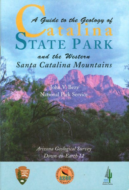
and <strong>the</strong> Western<br />
Santa <strong>Catalina</strong> Mountains<br />
John V. Bezy<br />
National Park Service<br />
This project was done cooperatively by <strong>the</strong> National Park Service,<br />
Arizona <strong>State</strong> Parks, and <strong>the</strong> Arizona Geological Survey.<br />
Pho<strong>to</strong>graphs by<br />
Larry D. Fellows<br />
Direc<strong>to</strong>r and <strong>State</strong> Geologist<br />
Arizona Geological Survey<br />
Arizona Geological Survey<br />
Down-<strong>to</strong>-Earth 12
Copyright © 2002, Arizona Geological Survey<br />
All rights reserved<br />
Book design: John A. Birmingham<br />
Pho<strong>to</strong>s: Larry D. Fellows<br />
unless o<strong>the</strong>rwise noted<br />
Printed in <strong>the</strong> United <strong>State</strong>s <strong>of</strong> America<br />
Permission is granted for individuals <strong>to</strong> make single copies for <strong>the</strong>ir personal use in research,<br />
study or teaching, and <strong>to</strong> use short quotes, figures, or tables, from this publication for publication<br />
in scientific books and journals, provided that <strong>the</strong> source <strong>of</strong> <strong>the</strong> information is appropriately<br />
cited. This consent does not extend <strong>to</strong> o<strong>the</strong>r kinds <strong>of</strong> copying for general distribution, for<br />
advertising or promotional purposes, for creating new or collective works, or for resale. The<br />
reproduction <strong>of</strong> multiple copies and <strong>the</strong> use <strong>of</strong> articles or extracts for commercial purposes<br />
require specific permission from <strong>the</strong> Arizona Geological Survey.<br />
Published by<br />
<strong>the</strong> Arizona Geological Survey<br />
416 W. Congress, #100, Tucson, AZ 85701<br />
(520) 770-3500<br />
www.azgs.az.gov<br />
Published as an E-book in June 2011<br />
in cooperation with<br />
Arizona <strong>State</strong> Parks<br />
1300 W. Washing<strong>to</strong>n<br />
Phoenix, AZ 85007<br />
Tel & TTY (602) 542.4174<br />
(800) 285.3703 from (520) or (928)<br />
www.pr.state.az.us<br />
ISBN 1-892001-15-2
Acknowledgments<br />
The author expresses sincere gratitude <strong>to</strong> Drs. Lester McFadden (University <strong>of</strong><br />
New Mexico), Larry Fellows, Philip Pearthree and Jon Spencer (Arizona<br />
Geological Survey), and Mr. Robert Scarborough (Arizona-Sonora Desert<br />
Museum) for technical review <strong>of</strong> this publication. Special thanks are due <strong>to</strong> Dr. Fellows<br />
for his contribution <strong>to</strong> <strong>the</strong> organization <strong>of</strong> this publication and <strong>the</strong> many pho<strong>to</strong>graphs<br />
that grace its pages. I also thank Drs. Arthur Trevena (Unocal Corporation), Richard<br />
Reeves and Vic<strong>to</strong>r Baker (University <strong>of</strong> Arizona) and Chiaki Oguchi (University <strong>of</strong><br />
Tsukuba, Japan) for <strong>the</strong>ir insightful discussions in <strong>the</strong> field. Dr. Oguchi also provided<br />
valuable labora<strong>to</strong>ry analysis <strong>of</strong> wea<strong>the</strong>red granites. Appreciation is extended <strong>to</strong> Mr.<br />
William Andrew Amann, Jr., and Mr. William Roe for field assistance, <strong>to</strong> Mr. Craig<br />
Spillman for assistance with aerial pho<strong>to</strong>graphy, Ms. Rose Ellen McDonnell (Arizona<br />
Geological Survey) and Ms. Sarah Davis and Ms. Heidi Schewel (Coronado National<br />
Forest) for edi<strong>to</strong>rial review.<br />
Mr. John Birmingham (Arizona Geological Survey) deserves a special thanks for<br />
<strong>the</strong> many hours he devoted <strong>to</strong> designing this publication.<br />
Dr. John Dohrenwend graciously granted permission <strong>to</strong> use his satellite image in<br />
this publication. Poster-sized satellite image maps (1:100,000 scale) <strong>of</strong> <strong>the</strong> Tucson basin<br />
area can be ordered from John Dohrenwend, P.O. Box 141, Teasdale, UT 84773; Phone<br />
(435)425-3118; E-mail: Dohrenwend@rkymtnhi.com.<br />
This publication would not have been possible without <strong>the</strong> pr<strong>of</strong>essional support <strong>of</strong><br />
Dr. Larry Fellows, Direc<strong>to</strong>r <strong>of</strong> <strong>the</strong> Arizona Geological Survey, Mr. Neil Donkersley,<br />
Manager <strong>of</strong> <strong>Catalina</strong> <strong>State</strong> Park, and Ms. Julie Allbrooks, Merchandise Coordina<strong>to</strong>r,<br />
Arizona <strong>State</strong> Parks.<br />
I am particularly grateful <strong>to</strong> Ms. Gretchen Graham (Pima Community College)<br />
for edi<strong>to</strong>rial assistance, field support and encouragement through <strong>the</strong> completion <strong>of</strong><br />
this project.
Contents<br />
page<br />
Introduction ...................................................... 9<br />
General <strong>Geology</strong> ................................................... 10<br />
Geologic features in <strong>the</strong> <strong>Catalina</strong> <strong>State</strong> Park area .......................... 13<br />
Geologic features along <strong>the</strong> Alamo Canyon Trail ....................... 13<br />
Feature 1. Granite Pinnacles. ................................... 15<br />
Feature 2. Magnetite Sand ..................................... 16<br />
Feature 3. Debris-flow-rafted Boulders ........................... 17<br />
Feature 4. Rock Varnish ....................................... 18<br />
Feature 5. Case Hardening ..................................... 19<br />
Feature 6. Triangular Faceted Spurs .............................. 20<br />
Feature 7. Fold ............................................... 22<br />
Geologic features along <strong>the</strong> Romero Canyon Trail ...................... 24<br />
Feature 8. Stream Terraces ..................................... 25<br />
Feature 9. Tinajas ............................................ 27<br />
Geologic features along <strong>the</strong> Canyon Loop Trail . . . . . . . . . . . . . . . . . . . . . . . . 28<br />
Feature 10. Fault. ............................................. 29<br />
Geologic features in <strong>the</strong> Charouleau Gap Road area. ...................... 30<br />
Feature 11. Stream Terraces ..................................... 32<br />
Feature 12. Pediments. ......................................... 34<br />
Feature 13. Domed Inselbergs ................................... 35<br />
Feature 14. Grus .............................................. 38<br />
Feature 15. Joints .............................................. 39<br />
Feature 16. Solution Pans ....................................... 41<br />
Feature 17. Features in <strong>the</strong> Granite ............................... 42<br />
Feature 18. Spheroidal Boulders. ................................. 44<br />
Feature 19. Gutters. ........................................... 46
page<br />
Geologic features near Biosphere 2 .................................... 47<br />
Feature 20. Bajada ................................................ 49<br />
Feature 21. Stream Piracy .......................................... 50<br />
Geologic features near <strong>the</strong> Town <strong>of</strong> Oracle. .......................... 51<br />
Feature 22. Boulder Inselbergs . . . . . . . . . . . . . . . . . . . . . . . . . . . . . . . . . . . 53<br />
Suggested Readings. ............................................ 55<br />
List <strong>of</strong> Figures<br />
1.1 Granite pinnacles ........................................... 15<br />
2.1 Magnetite sand ............................................. 16<br />
3.1 Flow-rafted boulders ........................................ 17<br />
4.1 Rock-varnished boulder ...................................... 18<br />
5.1 Case-hardened surface ....................................... 19<br />
6.1 Triangular faceted spurs ...................................... 20<br />
6.2 Block diagram illustrating development <strong>of</strong> triangular faceted spurs .... 21<br />
7.1 Fold in <strong>the</strong> Wilderness Suite Granite ........................... 22<br />
7.2 Block diagram illustrating development <strong>of</strong> an anticline ............. 23<br />
8.1 Stream terrace along Su<strong>the</strong>rland Wash .......................... 25<br />
8.2 Block diagram illustrating development <strong>of</strong> stream terraces<br />
along Su<strong>the</strong>rland Wash ...................................... 26<br />
9.1 Tinajas ................................................... 27<br />
10.1 Fault breccia ............................................... 29<br />
11.1 Stream terraces along <strong>the</strong> Cañada del Oro ........................ 32<br />
11.2 Cross-section <strong>of</strong> stream terraces along <strong>the</strong> Cañada del Oro ........... 33<br />
12.1 Pediment .................................................. 34<br />
13.1 Domed inselbergs ........................................... 35<br />
13.2 Aerial pho<strong>to</strong> <strong>of</strong> a domed inselberg and bounding vertical joint ........ 36<br />
13.3 Curved joints ............................................... 37<br />
13.4 Block diagram illustrating development <strong>of</strong> a domed inselberg ......... 37<br />
14.1 Grus ..................................................... 38<br />
15.1 Joints ..................................................... 39<br />
15.2 Aerial pho<strong>to</strong> <strong>of</strong> master joints in <strong>Catalina</strong> granite ................... 40<br />
16.1 Solution pan ............................................... 41<br />
17.1 Xenolith .................................................. 42<br />
17.2 Aplite dikes in <strong>Catalina</strong> granite ................................ 43<br />
17.3 Aerial pho<strong>to</strong> <strong>of</strong> radial pattern <strong>of</strong> joints and mineral banding<br />
in <strong>Catalina</strong> granite ......................................... 43<br />
18.1 Spheroidal boulders .......................................... 44<br />
18.2 Remnant <strong>of</strong> curved sheet <strong>of</strong> granite on domed inselberg slope ......... 45<br />
18.3 Boulder spalling in<strong>to</strong> concentric layers ........................... 45
List <strong>of</strong> Figures-continued page<br />
19.1 Gutters ................................................... 46<br />
20.1 Bajada. ................................................... 49<br />
21.1 Stream piracy along <strong>the</strong> Cañada del Oro. ........................ 50<br />
22.1 Boulder inselberg ........................................... 53<br />
List <strong>of</strong> Maps<br />
A. Index map and location <strong>of</strong> geologic features ...................... 8<br />
B. <strong>Geology</strong> <strong>of</strong> <strong>the</strong> western Santa <strong>Catalina</strong> Mountains ................. 11<br />
C. Geologic features in <strong>the</strong> <strong>Catalina</strong> <strong>State</strong> Park area .................. 14<br />
D. Geologic features in <strong>the</strong> Charouleau Gap Road area. ............... 31<br />
E. Geologic features in <strong>the</strong> Biosphere 2 area ........................ 48<br />
F. Boulder inselbergs near <strong>the</strong> <strong>to</strong>wn <strong>of</strong> Oracle. ...................... 52
MAP A<br />
Index map and location <strong>of</strong> geologic features (circled numbers)
Introduction<br />
The northwestern margin <strong>of</strong> <strong>the</strong> Santa <strong>Catalina</strong> Mountains, located within<br />
<strong>Catalina</strong> <strong>State</strong> Park and <strong>the</strong> adjacent Coronado National Forest, contains a variety<br />
<strong>of</strong> spectacular geologic features (Map A). Because <strong>of</strong> <strong>the</strong> relatively sparse<br />
desert vegetation, all <strong>of</strong> <strong>the</strong>m are easy <strong>to</strong> recognize and pho<strong>to</strong>graph.<br />
Some <strong>of</strong> <strong>the</strong>se features occur throughout much <strong>of</strong> <strong>the</strong> western United <strong>State</strong>s.<br />
O<strong>the</strong>rs are unique <strong>to</strong> landscapes produced by <strong>the</strong> wea<strong>the</strong>ring and erosion <strong>of</strong> granite.<br />
This booklet is your field guide <strong>to</strong> <strong>the</strong> geology <strong>of</strong> this splendid desert landscape. It<br />
is a hiker’s guide; excursions on foot <strong>to</strong> <strong>the</strong> geologic features described in <strong>the</strong> text are<br />
encouraged. This book is written for <strong>the</strong> visi<strong>to</strong>r who has an interest in geology, but may<br />
not have had formal training in <strong>the</strong> subject. It may also help ensure that <strong>the</strong> visiting<br />
geologist does not overlook some <strong>of</strong> <strong>the</strong> features described.<br />
To set <strong>the</strong> stage, I have briefly described <strong>the</strong> area’s geologic setting and geologic<br />
his<strong>to</strong>ry. In <strong>the</strong> following pages, emphasis is given <strong>to</strong> descriptions <strong>of</strong> geologic features<br />
that are common in this landscape. Precise locations are provided for those features that<br />
have more limited distribution.<br />
The locations <strong>of</strong> <strong>the</strong> geologic features and <strong>the</strong> access roads and trails that should be<br />
used are shown on Map A. Most <strong>of</strong> <strong>the</strong> roads can be driven with any vehicle <strong>of</strong> moderate<br />
clearance. The Charouleau Gap Road is rough, rocky, and requires a 4-wheel-drive<br />
vehicle. One may prefer <strong>to</strong> hike along it. All dirt roads are slick when wet and should<br />
be driven with care. The Cañada del Oro is subject <strong>to</strong> flash flooding during periods <strong>of</strong><br />
heavy rainfall and should be crossed with caution. Restaurants, gasoline, and emergency<br />
services are available in <strong>the</strong> <strong>to</strong>wns <strong>of</strong> <strong>Catalina</strong>, Oracle, and Oro Valley, in addition <strong>to</strong> <strong>the</strong><br />
City <strong>of</strong> Tucson. Emergency first aid is available at <strong>Catalina</strong> and Oracle <strong>State</strong> Parks.<br />
The purpose <strong>of</strong> <strong>the</strong> field guide is <strong>to</strong> provide <strong>the</strong> reader with an understanding <strong>of</strong><br />
<strong>the</strong> dynamic processes that have shaped this exceptional landscape. Many <strong>of</strong> <strong>the</strong> features<br />
discussed in <strong>the</strong> text will be encountered again and again as you continue <strong>to</strong> explore <strong>the</strong><br />
Southwest. We hope that your experience at <strong>Catalina</strong> <strong>State</strong> Park and <strong>the</strong> Coronado<br />
National Forest will enhance <strong>the</strong> pleasure <strong>of</strong> those explorations.
10 <strong>Catalina</strong> <strong>State</strong> Park<br />
General <strong>Geology</strong><br />
The Santa <strong>Catalina</strong> Mountains and <strong>the</strong> adjacent Oro Valley, Tucson, and San Pedro<br />
basins are typical <strong>of</strong> <strong>the</strong> <strong>to</strong>pography that dominates much <strong>of</strong> western North America<br />
from central Mexico <strong>to</strong> Oregon. East-west stretching <strong>of</strong> this part <strong>of</strong> <strong>the</strong> continent<br />
between 25 and 5 million years ago caused <strong>the</strong> Earth’s crust <strong>to</strong> thin and break along<br />
faults (cracks) in<strong>to</strong> long, north-and northwest-trending blocks. Some <strong>of</strong> <strong>the</strong>se blocks<br />
were uplifted <strong>to</strong> form mountain ranges, such as <strong>the</strong> Santa <strong>Catalina</strong>s; o<strong>the</strong>r blocks were<br />
down-dropped <strong>to</strong> produce <strong>the</strong> adjacent basins. Geologists, <strong>the</strong>refore, refer <strong>to</strong> this vast<br />
region as <strong>the</strong> Basin and Range geologic province.<br />
The Santa <strong>Catalina</strong> Range is bordered by normal faults—deep, steeply sloping<br />
(30-70 degrees from <strong>the</strong> horizontal) cracks in <strong>the</strong> Earth’s crust along which movement,<br />
primarily vertical, has occurred. This western side <strong>of</strong> <strong>the</strong> range is bounded by <strong>the</strong> Pirate<br />
Fault (Map B), which lies at <strong>the</strong> base <strong>of</strong> <strong>the</strong> mountain front and is inclined 50 <strong>to</strong> 55<br />
degrees from <strong>the</strong> horizontal. Rocks west <strong>of</strong> this fault dropped an estimated 10,000 <strong>to</strong><br />
13,000 feet (about 3,000 <strong>to</strong> 4,000 meters) relative <strong>to</strong> those in <strong>the</strong> Santa <strong>Catalina</strong>s east<br />
<strong>of</strong> <strong>the</strong> fault. Geologic evidence indicates <strong>the</strong>re has been no movement along <strong>the</strong> Pirate<br />
Fault in <strong>the</strong> last 5 million years.<br />
The bedrock <strong>of</strong> this part <strong>of</strong> <strong>the</strong> Santa <strong>Catalina</strong> Mountains is mainly <strong>the</strong> Oracle,<br />
<strong>Catalina</strong>, and Wilderness Suite granites. These granites were injected deep within <strong>the</strong><br />
Earth’s crust as great molten masses. They were emplaced at different times: <strong>the</strong> Oracle<br />
Granite 1.45 billion years ago, and <strong>the</strong> Wilderness Suite Granite 45-50 million years<br />
ago, and <strong>the</strong> <strong>Catalina</strong> Granite 26 million years ago. The molten rock, which cooled and<br />
solidified over millions <strong>of</strong> years and miles below <strong>the</strong> Earth’s surface, has since been<br />
exposed by erosion.<br />
These three granites have wea<strong>the</strong>red and eroded in<strong>to</strong> very different landscapes.<br />
Each landscape is a unique combination <strong>of</strong> landforms, which have developed in many<br />
cases because <strong>of</strong> differences in <strong>the</strong> hardness and fracture (joint) patterns <strong>of</strong> <strong>the</strong> bedrock.<br />
Many <strong>of</strong> <strong>the</strong> geologic features described in this guide are granitic landforms, some massive<br />
and o<strong>the</strong>rs small-scale, that <strong>to</strong>ge<strong>the</strong>r make up <strong>the</strong>se distinctive landscapes.<br />
Erosion was wearing back <strong>the</strong> western face <strong>of</strong> <strong>the</strong> Santa <strong>Catalina</strong> Mountains even as<br />
<strong>the</strong> range was being uplifted. Between two and six million years ago <strong>the</strong> headwaters <strong>of</strong><br />
streams carved embayments (drainage basins) in<strong>to</strong> <strong>the</strong> mountain front and planed <strong>of</strong>f bedrock<br />
platforms, called pediments (see Feature 12; Figure 12.1), that slope <strong>to</strong>ward <strong>the</strong><br />
Cañada del Oro. Later, <strong>the</strong>se pediments were buried by alluvial fans—great, fan-shaped<br />
aprons <strong>of</strong> rock debris that were deposited by streams draining <strong>the</strong> retreating mountain front.<br />
By one million years ago <strong>the</strong>se fans had merged with fans that built out from <strong>the</strong> eastern<br />
slopes <strong>of</strong> <strong>the</strong> Tor<strong>to</strong>lita Mountains and filled <strong>the</strong> Cañada del Oro Basin with sediment.<br />
About one million years ago <strong>to</strong>day’s landscape began <strong>to</strong> take its present form.<br />
Throughout much <strong>of</strong> sou<strong>the</strong>rn Arizona rivers were extending <strong>the</strong>ir headwaters in<strong>to</strong> higher<br />
basins that previously had no outlets <strong>to</strong> <strong>the</strong> sea. These expanding streams removed much<br />
<strong>of</strong> <strong>the</strong> sedimentary fill and altered and integrated <strong>the</strong> drainage <strong>of</strong> <strong>the</strong> basins <strong>the</strong>y invaded.<br />
These processes produced particularly dramatic results in <strong>the</strong> Cañada del Oro<br />
Basin. Prior <strong>to</strong> this time <strong>the</strong> Cañada del Oro exited <strong>the</strong> heart <strong>of</strong> <strong>the</strong> Santa <strong>Catalina</strong>
MAP B<br />
<strong>Geology</strong> <strong>of</strong> <strong>the</strong> western Santa <strong>Catalina</strong> Mountains<br />
11
12<br />
<strong>Catalina</strong> <strong>State</strong> Park<br />
Mountains near <strong>the</strong> present <strong>to</strong>wn <strong>of</strong> Oracle and drained <strong>to</strong> <strong>the</strong> northwest. A more<br />
rapidly expanding stream, eroding along <strong>the</strong> shattered rock zone <strong>of</strong> <strong>the</strong> Pirate Fault,<br />
began <strong>to</strong> extend its headwaters northward from <strong>the</strong> Tucson Basin. This new stream cut<br />
its valley through <strong>the</strong> alluvial fan sediment that filled this part <strong>of</strong> <strong>the</strong> basin and reexposed<br />
<strong>the</strong> older pediments along <strong>the</strong> western margin <strong>of</strong> <strong>the</strong> Santa <strong>Catalina</strong><br />
Mountains. In time, this stream intercepted <strong>the</strong> ancestral Cañada del Oro and caused<br />
it <strong>to</strong> flow south.<br />
The newly formed Cañada del Oro underwent at least four major episodes <strong>of</strong><br />
down-cutting and left remnants <strong>of</strong> its former floodplains as part <strong>of</strong> <strong>to</strong>day’s landscape.<br />
Called stream terraces, <strong>the</strong>se stepped surfaces range in age from 500,000-4,000 years.<br />
The present landscape is a mosaic <strong>of</strong> exhumed pediments, stream terraces, remnants<br />
<strong>of</strong> alluvial fans, and <strong>the</strong> embayed front <strong>of</strong> <strong>the</strong> range—all produced over a span <strong>of</strong><br />
at least five million years. These are typical features <strong>of</strong> <strong>the</strong> Tucson Basin and <strong>the</strong> much<br />
larger Basin and Range province <strong>of</strong> <strong>the</strong> western United <strong>State</strong>s. Adding <strong>to</strong> <strong>the</strong> complexity<br />
<strong>of</strong> this landscape is <strong>the</strong> array <strong>of</strong> smaller, less widespread landforms developed on <strong>the</strong><br />
surfaces <strong>of</strong> pediments cut in<strong>to</strong> <strong>the</strong> Wilderness Suite, Oracle, and <strong>Catalina</strong> granites.
Geologic Features in <strong>the</strong><br />
<strong>Catalina</strong> <strong>State</strong> Park Area<br />
Follow Oracle Road (Highway 77) north about 5 miles (8 kilometers) from <strong>the</strong><br />
intersection with Magee Road <strong>to</strong> <strong>Catalina</strong> <strong>State</strong> Park. Pay entrance fee at <strong>the</strong> Ranger<br />
Station and drive straight ahead <strong>to</strong> <strong>the</strong> parking lot at <strong>the</strong> end <strong>of</strong> <strong>the</strong> road (Map C).<br />
Features along <strong>the</strong><br />
Alamo Canyon Trail<br />
The Alamo Canyon Trail is not a signed park trail. To reach <strong>the</strong><br />
Alamo Canyon Trail follow <strong>the</strong> Birding Trail for about 250 yards<br />
(250 meters) where <strong>the</strong> trail forks. Follow <strong>the</strong> left fork for about 450<br />
yards (450 meters) <strong>to</strong> a bench at <strong>the</strong> <strong>to</strong>p <strong>of</strong> a ridge. The Alamo<br />
Canyon Trail begins behind <strong>the</strong> bench and continues <strong>to</strong> <strong>the</strong> south for<br />
about 2 miles (3.2 kilometers).
14<br />
<strong>Catalina</strong> <strong>State</strong> Park<br />
MAP C<br />
Geologic features (circled numbers) in <strong>the</strong> <strong>Catalina</strong> <strong>State</strong> Park area
-1-<br />
Feature Feature<br />
1.1<br />
Granite Pinnacles<br />
Location: These features are best viewed along <strong>the</strong><br />
Alamo Canyon Trail at <strong>Catalina</strong> <strong>State</strong> Park (Map C).<br />
<strong>Catalina</strong> <strong>State</strong> Park is best known for <strong>the</strong> dramatic granite pinnacles (Figure 1.1)<br />
that have developed in <strong>the</strong> upper, cliff-forming unit <strong>of</strong> <strong>the</strong> Wilderness Suite<br />
granite in this part <strong>of</strong> <strong>the</strong> Santa <strong>Catalina</strong> Mountains. These <strong>to</strong>wering spires are<br />
<strong>the</strong> products <strong>of</strong> surface wea<strong>the</strong>ring and erosion by running water guided by deep joints<br />
(cracks, see Feature 15) in <strong>the</strong> rock.<br />
The Wilderness Suite granite differs from <strong>the</strong> Oracle and <strong>Catalina</strong> granites that<br />
make up <strong>the</strong> western face <strong>of</strong> <strong>the</strong> range in that it is dominated by widely spaced, vertical<br />
joints. These fractures serve as avenues along which chemical and physical wea<strong>the</strong>ring<br />
and erosion penetrate <strong>the</strong> granite. Rock shattering, caused by ice expansion, wedging by<br />
plant roots, and chemical decomposition, enlarges <strong>the</strong> joints. Water from rain and<br />
snowmelt is channeled in<strong>to</strong> <strong>the</strong> joints, cutting <strong>the</strong>m in<strong>to</strong> ravines and canyons. Joints<br />
actually control <strong>the</strong> location <strong>of</strong> most streams crossing bedrock. This concentrated action<br />
<strong>of</strong> wea<strong>the</strong>ring and erosion eventually widens and deepens <strong>the</strong> ravines and canyons, leaving<br />
<strong>the</strong> massive granite in between standing as <strong>to</strong>wering pinnacles.<br />
The pinnacles at <strong>Catalina</strong> <strong>State</strong> Park are impressive testimony <strong>to</strong> <strong>the</strong> important role<br />
that rock structure—in this case joints—plays in <strong>the</strong> development <strong>of</strong> <strong>the</strong> landscape.<br />
15
16<br />
<strong>Catalina</strong> <strong>State</strong> Park<br />
-2-<br />
Feature Feature<br />
Magnetite Sand<br />
Location: Sandy streambeds throughout <strong>Catalina</strong><br />
<strong>State</strong> Park.<br />
The streaks <strong>of</strong> black sand<br />
2.1<br />
(Figure 2.1) in <strong>the</strong>se<br />
streambeds and dry<br />
washes are composed <strong>of</strong> heavy<br />
minerals that were eroded<br />
from <strong>the</strong> granite and gneiss<br />
bedrock in <strong>the</strong> <strong>Catalina</strong><br />
Mountains. About 40 percent<br />
<strong>of</strong> <strong>the</strong> dark-colored mineral<br />
grains in this area are magnetite,<br />
a common ferrous and<br />
ferric iron oxide. Ilmenite, an<br />
iron titanium oxide, and garnet,<br />
a silicate mineral, are o<strong>the</strong>r<br />
common heavy minerals in<br />
this area. Magnetite, which is<br />
magnetic, can be separated<br />
from <strong>the</strong> o<strong>the</strong>r heavy minerals<br />
by a magnet.<br />
These dark minerals accumulate<br />
in streaks due <strong>to</strong> sorting<br />
by running water. As physical<br />
and chemical wea<strong>the</strong>ring<br />
processes cause <strong>the</strong> granite and<br />
gneiss <strong>to</strong> disintegrate, <strong>the</strong><br />
major rock-forming minerals<br />
(feldspar, quartz, and biotite),<br />
<strong>to</strong>ge<strong>the</strong>r with smaller quantities<br />
<strong>of</strong> magnetite, ilmenite, and<br />
garnet, are flushed in<strong>to</strong> drainages.<br />
Flowing water separates<br />
<strong>the</strong>se minerals by weight and<br />
concentrates <strong>the</strong> heavier, darkcolored<br />
sand-sized particles in long streaks. This process is called hydraulic sorting.<br />
Flakes and nuggets <strong>of</strong> placer gold are deposited in stream gravel by <strong>the</strong> same process.
3.1<br />
-3-<br />
Feature Feature<br />
Debris-flow-rafted Boulders<br />
Location: These boulders are best viewed by hiking <strong>the</strong><br />
Alamo Canyon trail <strong>to</strong> <strong>the</strong> <strong>to</strong>ps <strong>of</strong> <strong>the</strong> alluvial fan remnants<br />
that <strong>to</strong>wer above Alamo Canyon (Map C).<br />
Large boulders (Figure 3.1, arrow), 6 <strong>to</strong> 30 feet (2 <strong>to</strong> 9 meters) in size and weighing<br />
50 <strong>to</strong> 1000 <strong>to</strong>ns, make up <strong>the</strong> surface <strong>of</strong> <strong>the</strong>se old alluvial fan remnants. The<br />
boulders are blocks <strong>of</strong> granite and gneiss derived from <strong>the</strong> west face <strong>of</strong> Pusch<br />
Ridge, one-half mile (about 800 meters) <strong>to</strong> <strong>the</strong> east.<br />
The alluvial fan surface on which you are standing once extended <strong>to</strong> <strong>the</strong> base <strong>of</strong><br />
Pusch Ridge. These huge boulders fell from <strong>the</strong> cliff face (perhaps during earthquakes),<br />
accumulated in drainages at <strong>the</strong> heads <strong>of</strong> <strong>the</strong> old alluvial fans, and were rafted <strong>to</strong> <strong>the</strong>ir<br />
present location along <strong>the</strong> lower fan slopes by debris flows. Subsequent erosion by running<br />
water has washed away most <strong>of</strong> <strong>the</strong> old alluvial fan material, separating <strong>the</strong>se<br />
remnants from <strong>the</strong> cliff face that was <strong>the</strong> source <strong>of</strong> <strong>the</strong> boulders.<br />
17
18<br />
<strong>Catalina</strong> <strong>State</strong> Park<br />
-4-<br />
Feature Feature<br />
Rock Varnish<br />
Location: This feature is best viewed on boulders on <strong>the</strong><br />
alluvial fan remnants that <strong>to</strong>wer above Alamo Canyon<br />
(Map C).<br />
The dark brown blotches (Figure 4.1) on <strong>the</strong><br />
4.1<br />
nearby granite boulders are rock varnish.<br />
This mineral patina gives <strong>the</strong> landscape a tan<br />
<strong>to</strong> dark-brown cast. Rock varnish develops best on<br />
wea<strong>the</strong>ring-and erosion-resistant rocks that have<br />
moderately rough surfaces. Sands<strong>to</strong>ne, basalt, and<br />
many metamorphic rocks are commonly well varnished,<br />
whereas silts<strong>to</strong>ne and shale disintegrate <strong>to</strong>o<br />
rapidly <strong>to</strong> retain such a coating.<br />
Rock varnish is a thin coating (typically less<br />
than one hundredth <strong>of</strong> an inch) <strong>of</strong> clay minerals<br />
(illite, montmorillonite, and kaolinite) stained by<br />
high concentrations <strong>of</strong> iron and manganese oxides.<br />
The clay minerals settle as dust from <strong>the</strong> atmosphere.<br />
Manganese, also derived from windborne<br />
dust and rain, produces a black <strong>to</strong> dark-brown coloration<br />
on surfaces exposed <strong>to</strong> air.<br />
Micro-colonies <strong>of</strong> lichens and bacteria inhabit<br />
<strong>the</strong> varnish and gain energy by oxidizing <strong>the</strong> manganese. They anchor <strong>the</strong>mselves <strong>to</strong> rock<br />
surfaces with <strong>the</strong> clay particles, which provide protection against extremes in temperature<br />
and humidity. In <strong>the</strong> process, <strong>the</strong> manganese becomes attached firmly <strong>to</strong> and darkens <strong>the</strong><br />
clay. Each time <strong>the</strong> rock surface is wetted by rain, more manganese and clay are added <strong>to</strong><br />
sustain <strong>the</strong> slowly growing colony. Such colonies thrive where <strong>the</strong> rock acidity is neutral and<br />
<strong>the</strong> surface is so nutrient poor that competing colonies <strong>of</strong> lichens and mosses cannot survive.<br />
Scientists are unable <strong>to</strong> use desert varnish as a dating <strong>to</strong>ol, even though older surfaces<br />
tend <strong>to</strong> be more heavily varnished and darker than younger surfaces. The rate at which<br />
desert varnish forms is not constant because it is affected by many variables, such as climatic<br />
change, wind abrasion, biological competition, and abundance <strong>of</strong> manganese. Some<br />
researchers believe that <strong>the</strong> clay and manganese content <strong>of</strong> rock varnish reflects past climatic<br />
conditions. Because some varnished surfaces may be one million years old, <strong>the</strong>y could<br />
reveal information about climatic change that <strong>to</strong>ok place repeatedly during <strong>the</strong> Ice Age and<br />
in <strong>the</strong> past 10,000 years.<br />
Well varnished surfaces have a dull luster that causes entire hillsides <strong>to</strong> glisten in<br />
intense desert sunlight. This mineral coating gives <strong>the</strong> landscape its warm <strong>to</strong>nes <strong>of</strong> brown<br />
and ebony, commonly masking colorful bedrock below. All <strong>of</strong> <strong>the</strong> Earth’s deserts have<br />
varnished rocks, but in <strong>the</strong> Southwest <strong>the</strong>se surfaces provoke even greater interest because<br />
<strong>of</strong> <strong>the</strong>ir archaeological importance. In innumerable locations prehis<strong>to</strong>ric Indians pecked<br />
petroglyphs (rock drawings) through <strong>the</strong> mineral skin <strong>to</strong> <strong>the</strong> fresh rock below. Today <strong>the</strong>se<br />
symbols are being revarnished as <strong>the</strong> process continues.
5.1<br />
-5-<br />
Feature Feature<br />
Case Hardening<br />
Location: This feature is best viewed on boulders on <strong>the</strong><br />
surfaces <strong>of</strong> <strong>the</strong> alluvial fan remnants that <strong>to</strong>wer above<br />
Alamo Canyon (Map C).<br />
The surfaces <strong>of</strong> most <strong>of</strong> <strong>the</strong> granite and gneiss boulders in this area have developed<br />
a protective mineral rind (Figure 5.1), from a process called case hardening. This<br />
rind consists <strong>of</strong> a durable film <strong>of</strong> amorphous (lacking an orderly crystal form)<br />
silica that has been drawn from <strong>the</strong> interior <strong>of</strong> <strong>the</strong> rock and reprecipitated on its surface.<br />
Although silica is not very soluble in water, small quantities are leached from <strong>the</strong> rock<br />
each time <strong>the</strong> rock is wetted by rain and dew. When <strong>the</strong> moisture evaporates, <strong>the</strong> silica<br />
is deposited on <strong>the</strong> surface <strong>of</strong> <strong>the</strong> rock. While <strong>the</strong> surface <strong>of</strong> <strong>the</strong> rock is hardened by <strong>the</strong><br />
buildup <strong>of</strong> silica, <strong>the</strong> interior is progressively weakened by <strong>the</strong> removal <strong>of</strong> that mineral.<br />
Case hardening protects rock surfaces from chemical wea<strong>the</strong>ring and low energy<br />
erosion. Once this protective rind is broken, however, <strong>the</strong> s<strong>of</strong>ter, wea<strong>the</strong>red zone is<br />
exposed <strong>to</strong> <strong>the</strong> elements and disintegrates quickly.<br />
19
20<br />
<strong>Catalina</strong> <strong>State</strong> Park<br />
-6-<br />
Feature Feature<br />
Triangular Faceted Spurs<br />
Location: These short, truncated ridges are best viewed<br />
from <strong>the</strong> Alamo Canyon Trail (Map C).<br />
Ridges between<br />
6.1<br />
canyons cut<br />
in<strong>to</strong> <strong>the</strong> margins<br />
<strong>of</strong> high mountains<br />
normally slope gradually<br />
from <strong>the</strong> crest <strong>of</strong> <strong>the</strong><br />
range <strong>to</strong>ward adjacent<br />
valleys. The ridges that<br />
extend westward from<br />
Pusch Ridge, however,<br />
terminate in triangular<br />
cliff faces called facets<br />
(Figure 6.1). Such ridges,<br />
called triangular<br />
faceted spurs, are common<br />
indica<strong>to</strong>rs that<br />
<strong>the</strong> mountain range<br />
has been uplifted along a fault.<br />
The triangular faceted spurs shown in Figure 6.1 are <strong>the</strong> result <strong>of</strong> uplift <strong>of</strong> <strong>the</strong><br />
<strong>Catalina</strong> Mountains along <strong>the</strong> Pirate Fault and <strong>the</strong> simultaneous downcutting <strong>of</strong> canyons<br />
by streams that drain <strong>the</strong> western flank <strong>of</strong> this range. Over millions <strong>of</strong> years <strong>the</strong><br />
granite and gneiss east <strong>of</strong> <strong>the</strong> Pirate Fault rose about 10,000 <strong>to</strong> 13,000 feet (3000 <strong>to</strong><br />
4000 meters) relative <strong>to</strong> <strong>the</strong> same rocks beneath <strong>the</strong> Oro Valley basin west <strong>of</strong> <strong>the</strong> fault<br />
(Figure 6.2). This movement created a high escarpment along <strong>the</strong> western face <strong>of</strong> <strong>the</strong><br />
range. Concurrent downcutting by streams during uplift along <strong>the</strong> Pirate Fault carved<br />
deep canyons in<strong>to</strong> <strong>the</strong> rising mountains east <strong>of</strong> <strong>the</strong> fault and segmented <strong>the</strong> escarpment<br />
in<strong>to</strong> a series <strong>of</strong> aligned, triangular-shaped slopes. Continued wea<strong>the</strong>ring and erosion<br />
caused <strong>the</strong>se escarpment remnants <strong>to</strong> retreat several hundred yards (meters) eastward<br />
from <strong>the</strong> fault along which <strong>the</strong>y initially formed.<br />
Triangular faceted spurs occur along <strong>the</strong> margins <strong>of</strong> many <strong>of</strong> <strong>the</strong> faulted mountain<br />
ranges in <strong>the</strong> Basin and Range Province in <strong>the</strong> western United <strong>State</strong>s and northwestern<br />
Mexico. In rugged, rapidly rising ranges such as <strong>the</strong> Chugach Mountains in Alaska,<br />
relatively unwea<strong>the</strong>red triangular faces <strong>to</strong>wer a thousand feet (300 meters) or more<br />
above <strong>the</strong> adjacent lowlands. Triangular faceted spurs provide bold evidence that faulting<br />
has played an active role in shaping <strong>the</strong> landscape.
(A)<br />
(B)<br />
Figure 6.2 Uplift <strong>of</strong> <strong>the</strong> <strong>Catalina</strong> Mountains along <strong>the</strong> Pirate Fault created a high escarpment<br />
along <strong>the</strong> western face <strong>of</strong> <strong>the</strong> range (A). Downcutting by streams segmented <strong>the</strong> escarpment<br />
in<strong>to</strong> a series <strong>of</strong> aligned, triangular-shaped spurs (B).<br />
21
22<br />
<strong>Catalina</strong> <strong>State</strong> Park<br />
-7-<br />
Feature Feature<br />
7.1<br />
F<br />
Fold<br />
Location: This feature is exposed in <strong>the</strong> north wall <strong>of</strong> Alamo<br />
Canyon. Although it is visible from <strong>the</strong> Ranger Station, <strong>the</strong><br />
best view <strong>of</strong> it is from <strong>the</strong> Alamo Canyon trail. Hike <strong>the</strong> trail<br />
for 2 miles (about 3.2 kilometers) from <strong>the</strong> trailhead just south<br />
<strong>of</strong> <strong>the</strong> parking area. (Map C).<br />
The layers in <strong>the</strong> gneiss bedrock in <strong>the</strong> north wall <strong>of</strong> Alamo Canyon (Figure<br />
7.1, F) have been deformed in<strong>to</strong> an arch-shaped fold. This fold, which<br />
extends for approximately 4 miles (6-7 kilometers) in a nor<strong>the</strong>ast-southwest<br />
direction (Figure 7.2), has influenced <strong>the</strong> <strong>to</strong>pography <strong>of</strong> this Pusch Ridge section <strong>of</strong><br />
<strong>the</strong> mountain range.<br />
The fold has been cut <strong>of</strong>f by <strong>the</strong> Pirate Fault (see Feature 10). The western portion<br />
<strong>of</strong> <strong>the</strong> fold south <strong>of</strong> Alamo Canyon has dropped down several thousand feet and is<br />
buried by sand, gravel, and boulders eroded from <strong>the</strong> retreating mountain front. The<br />
crest <strong>of</strong> <strong>the</strong> fold has been eroded away. The rocks <strong>of</strong> <strong>the</strong> eastern portion <strong>of</strong> <strong>the</strong> fold form<br />
<strong>the</strong> <strong>to</strong>wering cliffs <strong>of</strong> Pusch Ridge. The nor<strong>the</strong>astern end <strong>of</strong> <strong>the</strong> fold plunges and disappears<br />
in <strong>the</strong> gneiss bedrock <strong>of</strong> <strong>the</strong> range; <strong>the</strong> southwestern end <strong>of</strong> <strong>the</strong> structure is buried<br />
in <strong>the</strong> sedimentary fill <strong>of</strong> <strong>the</strong> Tucson and Oro Valley Basins. Folds such as this, thought<br />
<strong>to</strong> be caused by compressional stress in <strong>the</strong> Earth’s crust, occur elsewhere in <strong>the</strong><br />
<strong>Catalina</strong>, Tanque Verde, and Rincon Mountains. The age <strong>of</strong> this structure is unknown.<br />
It is older than <strong>the</strong> Pirate Fault and may have formed 45 <strong>to</strong> 50 million years ago when<br />
<strong>the</strong> Wilderness Suite granite intruded <strong>the</strong> local crust.
Pirate<br />
fault<br />
Figure 7.2 Lateral pressure possibly caused <strong>the</strong> Wilderness Suite Granite <strong>to</strong> be folded (A).<br />
Erosion removed highly fractured rock from <strong>the</strong> crest <strong>of</strong> <strong>the</strong> fold (B). Movement along <strong>the</strong><br />
Pirate Fault down-dropped <strong>the</strong> western part <strong>of</strong> <strong>the</strong> fold, which is buried by thousands <strong>of</strong> feet <strong>of</strong><br />
alluvial basin fill worn from <strong>the</strong> Santa <strong>Catalina</strong> Mountains (C).<br />
.1<br />
.1<br />
.1<br />
23
Geologic Features along <strong>the</strong><br />
Romero Canyon Trail<br />
Drive <strong>to</strong> <strong>the</strong> parking lot at <strong>the</strong> end <strong>of</strong> <strong>the</strong> park road and hike <strong>to</strong> <strong>the</strong><br />
trailhead (Map C).
-8-<br />
Feature Feature<br />
8.1<br />
Stream Terraces<br />
Location: Follow <strong>the</strong> Romero Canyon Trail for about 350<br />
yards (320 meters) <strong>to</strong> a bench on <strong>the</strong> edge <strong>of</strong> a flat, step-like<br />
surface overlooking Su<strong>the</strong>rland Wash Valley.<br />
RF<br />
These flat, step-like surfaces are stream terraces (Figure 8.1, dashed lines). They<br />
consists <strong>of</strong> silt, sand, gravel, cobbles and boulders deposited by running water.<br />
Note that tumbling in a stream during flash floods rounds <strong>the</strong> gravel-, cobble-,<br />
and boulder-sized rock fragments (RF).<br />
Stream sediment was once much thicker in this area. Over <strong>the</strong> last several hundred<br />
thousand years, however, Su<strong>the</strong>rland Wash cut its valley in<strong>to</strong> this sedimentary fill<br />
(Figure 8.2, A). Lateral erosion and deposition by <strong>the</strong> wash built a floodplain in <strong>the</strong><br />
floor <strong>of</strong> <strong>the</strong> valley. Later, <strong>the</strong> wash cut its channel down in<strong>to</strong> <strong>the</strong> floodplain (B), leaving<br />
remnants <strong>of</strong> <strong>the</strong> former valley floor as high standing stream terraces. Repeated episodes<br />
<strong>of</strong> sediment deposition and downcutting have produced a flight <strong>of</strong> terraces along<br />
Su<strong>the</strong>rland Wash (C) that are visible from this vantage point.<br />
Stream terraces stand above <strong>the</strong> flash flood zones <strong>of</strong> valleys and have long been<br />
preferred locations for human settlements, agricultural fields, roads, and railroads.<br />
Romero Ruin, a 12th century Hohokam village, for example, was built on one <strong>of</strong> <strong>the</strong>se<br />
terraces. For more information on <strong>the</strong> development <strong>of</strong> stream terraces see Feature 11.<br />
25
26<br />
<strong>Catalina</strong> <strong>State</strong> Park<br />
Figure 8.2 Su<strong>the</strong>rland Wash cut a floodplain in <strong>the</strong> basin fill west <strong>of</strong> <strong>the</strong> Pirate Fault (A).<br />
Su<strong>the</strong>rland Wash cut its bed in<strong>to</strong> <strong>the</strong> sediment previously deposited along its floodplain (B).<br />
Repeated cycles <strong>of</strong> cutting and filling by Su<strong>the</strong>rland Wash produced step-like terraces along <strong>the</strong><br />
margins <strong>of</strong> <strong>the</strong> valley (C).
9.1<br />
-9-<br />
Feature Feature<br />
Tinajas<br />
Location: The Romero Pools are along <strong>the</strong> Romero Canyon<br />
Trail 2.8 miles (4.5 kilometers) from <strong>the</strong> trailhead.<br />
Rock basins that hold water in <strong>the</strong> Romero Pools (Figure 9.1) are called tinajas,<br />
<strong>the</strong> Spanish word for large ear<strong>the</strong>n water jars fired so that water will seep <strong>to</strong><br />
<strong>the</strong> vessel’s surface and keep its contents cool by evaporation. These tinajas or<br />
rock tanks, as <strong>the</strong>y are called in English, are best formed in <strong>the</strong> bedrock channels <strong>of</strong><br />
steep canyons cut in<strong>to</strong> desert mountain ranges.<br />
Boulders, cobbles, and gravel tumbled along by swiftly flowing water during flash<br />
floods act as cutting <strong>to</strong>ols that gouge out weak zones in <strong>the</strong> underlying bedrock. The<br />
upstream sides <strong>of</strong> <strong>the</strong>se enlarging depressions, which bear <strong>the</strong> full impact <strong>of</strong> <strong>the</strong> moving<br />
rock debris, are consequently deeper than <strong>the</strong> downstream sides, which are<br />
breached by outlet channels. Because <strong>of</strong> this asymmetrical shape, tinajas are flushed<br />
clear <strong>of</strong> organic and rock debris by flash floods and filled with water by <strong>the</strong> slower<br />
flows that follow.<br />
Tinajas are critical sources <strong>of</strong> water for humans and wildlife that inhabit and<br />
travel through deserts. Some are more than 20 feet (6 meters) deep and hold thousands<br />
<strong>of</strong> gallons (liters) <strong>of</strong> water months after <strong>the</strong> last rain. Please do not pollute or camp near<br />
<strong>the</strong>se precious water resources.<br />
27
Geologic Features along<br />
<strong>the</strong> Canyon Loop Trail<br />
The Canyon Loop Trail, which starts at <strong>the</strong> park trailhead, continues<br />
for 2.3 miles (3.6 kilometers).
10.1<br />
-10-<br />
Feature Feature<br />
Fault<br />
Location: This feature is best viewed by hiking <strong>the</strong><br />
Canyon Loop Trail .8 mile (about 1300 meters) <strong>to</strong> Breccia<br />
Hill (Map C).<br />
Faulting, movement along a fracture in <strong>the</strong> brittle rocks <strong>of</strong> <strong>the</strong> Earth’s surface, can<br />
have an enormous impact on a region’s <strong>to</strong>pography. Vertical movement along <strong>the</strong><br />
Pirate Fault, for example, formed <strong>the</strong> steep western face <strong>of</strong> <strong>the</strong> Santa <strong>Catalina</strong><br />
Mountains, <strong>the</strong> sediment-filled Cañada del Oro basin <strong>to</strong> <strong>the</strong> west, and a host <strong>of</strong> minor<br />
features that make up <strong>the</strong> local landscape (Map B). Total vertical movement along this<br />
fault is estimated <strong>to</strong> be 1.8 <strong>to</strong> 2.5 miles (3 <strong>to</strong> 4 kilometers). Bedrock <strong>to</strong> <strong>the</strong> west <strong>of</strong> <strong>the</strong><br />
fault has dropped down <strong>to</strong> form <strong>the</strong> Cañada del Oro basin, which is filled with thousands<br />
<strong>of</strong> feet <strong>of</strong> sediment. Bedrock <strong>to</strong> <strong>the</strong> east <strong>of</strong> <strong>the</strong> fault has been uplifted and forms <strong>the</strong><br />
impressive western side <strong>of</strong> <strong>the</strong> Santa <strong>Catalina</strong> Mountains. Erosion has worn back <strong>the</strong> face<br />
<strong>of</strong> <strong>the</strong> range as much as 2.9 miles (4 kilometers) from <strong>the</strong> fault that produced it. The<br />
course <strong>of</strong> <strong>the</strong> Cañada del Oro is extraordinarily straight along this western margin <strong>of</strong> <strong>the</strong><br />
range because <strong>the</strong> stream is following <strong>the</strong> more easily eroded zone <strong>of</strong> shattered rock along<br />
<strong>the</strong> Pirate fault. The position <strong>of</strong> <strong>the</strong> Cañada del Oro in this part <strong>of</strong> <strong>the</strong> basin is also a result<br />
<strong>of</strong> stream piracy (see Feature 21) controlled by this fault zone.<br />
Tremendous friction is generated as fault surfaces slide <strong>to</strong>ge<strong>the</strong>r. This grinding action<br />
produced a zone <strong>of</strong> powdered rock (fault gouge) and highly broken rock (fault breccia)<br />
that can be observed here at Breccia Hill and at o<strong>the</strong>r locations where <strong>the</strong> Cañada del Oro<br />
has exposed <strong>the</strong> fault surface (Figure 10.1, arrow). Movement on <strong>the</strong> Pirate Fault is<br />
thought <strong>to</strong> have occurred six <strong>to</strong> twelve million years ago. This demonstrates how an<br />
ancient geologic structure, in this case a fault, can control modern landscapes.<br />
29
Features along <strong>the</strong><br />
Charouleau Gap Road<br />
(Four-Wheel Drive)<br />
Follow Oracle Road (Highway 77) for 10.5 miles (16.9 kilometers)<br />
north <strong>of</strong> <strong>the</strong> intersection with Magee Road <strong>to</strong> Golder<br />
Ranch Road, turn right (east) and proceed 1.2 miles (1.9 kilometers)<br />
<strong>to</strong> Lago del Oro Parkway. Turn left (north) and follow Lago<br />
del Oro Parkway for 3 miles (4.8 kilometers) <strong>to</strong> <strong>the</strong> Charouleau<br />
Gap four-wheel-drive road. Follow this road across <strong>the</strong> Cañada<br />
del Oro (Map D).
MAP D<br />
Geologic features (circled numbers) in <strong>the</strong> Charouleau Gap Road area
32<br />
11.1<br />
<strong>Catalina</strong> <strong>State</strong> Park<br />
-11-<br />
Feature Feature<br />
Stream Terraces<br />
Location: The stream terraces are developed best on alluvial<br />
fill on <strong>the</strong> west side <strong>of</strong> <strong>the</strong> Cañada del Oro (Map D).<br />
The step-like surfaces in Figure 11.1 (white lines) are stream terraces.<br />
Standing high above <strong>the</strong> stream that cut <strong>the</strong>m, <strong>the</strong>se benches are remnants<br />
<strong>of</strong> former floodplains.<br />
The geologic his<strong>to</strong>ry <strong>of</strong> <strong>the</strong> Cañada del Oro includes episodes <strong>of</strong> valley filling followed<br />
by episodes <strong>of</strong> down-cutting during which <strong>the</strong> stream removed this fill. Sediment<br />
accumulated in <strong>the</strong> valley <strong>of</strong> <strong>the</strong> Cañada del Oro when great quantities <strong>of</strong> rock debris<br />
were being eroded from <strong>the</strong> slopes <strong>of</strong> <strong>the</strong> Santa <strong>Catalina</strong> Mountains. During periods <strong>of</strong><br />
reduced slope erosion <strong>the</strong> stream cut its channel through this sediment, leaving remnants<br />
<strong>of</strong> <strong>the</strong> former valley floor as high-standing stream terraces. The stream shifted<br />
laterally across its floodplain and progressively widened <strong>the</strong> new valley floor by undercutting<br />
<strong>the</strong> slopes <strong>of</strong> <strong>the</strong> adjacent stream terraces (Figure 11.2).<br />
Stream terraces record changes in <strong>the</strong> geologic his<strong>to</strong>ry <strong>of</strong> a river valley. Here <strong>the</strong>y<br />
represent at least four major periods <strong>of</strong> downcutting and channel backfilling. Alternating<br />
wet and dry climatic conditions caused variations in <strong>the</strong> quantity <strong>of</strong> water and rock<br />
debris that moved down <strong>the</strong> Cañada del Oro during <strong>the</strong> last 500,000 years. These<br />
graceful, stepped landforms resulted.
Figure 11.2 Cross-section <strong>of</strong> stream terraces along <strong>the</strong> Canada del Oro (after McFadden,<br />
1981). The Cordonnes Surface is <strong>the</strong> surface <strong>of</strong> a bajada (Feature 20) that pre-dates development<br />
<strong>of</strong> <strong>the</strong> stream terraces (after McFadden, 1981).<br />
33
34<br />
12.1<br />
<strong>Catalina</strong> <strong>State</strong> Park<br />
-12-<br />
Feature Feature<br />
Pediments<br />
Location: Follow <strong>the</strong> Charouleau Gap 4-wheel-drive road<br />
across <strong>the</strong> Cañada del Oro for about 1.5 miles (2.4 kilometers)<br />
<strong>to</strong> reach this feature (Map D).<br />
The sloping bedrock surfaces that floor <strong>the</strong> embayments cut in<strong>to</strong> this side <strong>of</strong> <strong>the</strong><br />
Santa <strong>Catalina</strong> Mountains are called pediments (Figure 12.1). These surfaces<br />
extend from <strong>the</strong> base <strong>of</strong> <strong>the</strong> mountain <strong>to</strong> <strong>the</strong> Cañada del Oro valley. Small<br />
streams that drained this face <strong>of</strong> <strong>the</strong> range planed <strong>of</strong>f <strong>the</strong> pediments between six and<br />
two million years ago.<br />
The width <strong>of</strong> <strong>the</strong> pediments is <strong>the</strong> distance <strong>the</strong> mountain front has been eroded<br />
back from its original location along <strong>the</strong> Pirate Fault. The hardness and structure <strong>of</strong> <strong>the</strong><br />
bedrock controlled <strong>the</strong> development <strong>of</strong> <strong>the</strong> pediments. Here, in <strong>the</strong> moderately hard<br />
<strong>Catalina</strong> granite, <strong>the</strong> pediment is about 2.9 miles (4 kilometers) wide. To <strong>the</strong> north, in<br />
<strong>the</strong> highly wea<strong>the</strong>red and weaker Oracle granite, pediments average 5 miles (8 kilometers)<br />
in width. Near <strong>Catalina</strong> <strong>State</strong> Park, <strong>the</strong> Wilderness Suite granite is <strong>the</strong> bedrock.<br />
This granite has been altered <strong>to</strong> gneiss, a harder rock, over broad areas. In addition, most<br />
small joints (cracks; see Feature 15) have been filled by injections <strong>of</strong> once-molten rock,<br />
welding <strong>the</strong> bedrock in<strong>to</strong> a highly resistant unit that <strong>of</strong>fers few avenues for penetration<br />
by wea<strong>the</strong>ring and erosion processes. As a result, pediments cut in<strong>to</strong> <strong>the</strong> Wilderness<br />
Suite granite are only 400 <strong>to</strong> 1200 yards (about 350 <strong>to</strong> 1100 meters) wide.<br />
These pediment surfaces were subsequently buried deeply by sediment worn from<br />
<strong>the</strong> Santa <strong>Catalina</strong> Mountains. Since <strong>the</strong>n, <strong>the</strong> Cañada del Oro and its tributaries have<br />
exhumed (exposed) <strong>the</strong>m.<br />
After <strong>the</strong> initial uplift <strong>of</strong> <strong>the</strong> Santa <strong>Catalina</strong> Mountains, movement <strong>of</strong> <strong>the</strong> local<br />
crustal rocks slowed or ceased five million years ago. Since <strong>the</strong>n, desert streams have had<br />
sufficient time <strong>to</strong> bevel <strong>of</strong>f <strong>the</strong>se gently sloping pediments.
13.1<br />
-13-<br />
Feature Feature<br />
Domed Inselbergs<br />
Location: Follow <strong>the</strong> Charouleau Gap four-wheel-drive<br />
road across <strong>the</strong> Cañada del Oro for about 1.5 miles (2.4<br />
kilometers) <strong>to</strong> view this feature (Map D).<br />
The dozens <strong>of</strong> domed-shaped granite hills here are domed inselbergs (also called<br />
exfoliation domes and bornhardts)(Figure 13.1, arrow). Wea<strong>the</strong>ring and erosion,<br />
guided by two major sets <strong>of</strong> natural cracks in <strong>the</strong> bedrock, called joints, have<br />
sculpted <strong>the</strong>se graceful and distinctive landforms from <strong>the</strong> <strong>Catalina</strong> granite.<br />
Sets <strong>of</strong> vertical joints that fracture <strong>the</strong> granite in this area have a rhomboidal (that<br />
<strong>of</strong> a deformed rectangle) pattern that is clearly visible when viewed from above (Figure<br />
13.2, J). Each joint-bounded rhomboid is a resistant block <strong>of</strong> granite that is under<br />
compressional stress. This internal stress, produced as <strong>the</strong> granite cooled miles below<br />
<strong>the</strong> Earth’s surface and perhaps by later movements within <strong>the</strong> Earth’s crust, is gradually<br />
being released as erosion exposes more <strong>of</strong> <strong>the</strong> bedrock.<br />
Sets <strong>of</strong> curvilinear joints (Figure 13.3, A) parallel <strong>to</strong> <strong>the</strong> ground surface are produced<br />
within each rhomboid by this slow release <strong>of</strong> internal stress. These joints terminate<br />
against <strong>the</strong> vertical joints that bound <strong>the</strong> rhomboids. These curved joints divide <strong>the</strong><br />
expanding granite in<strong>to</strong> curved sheets that eventually arch up <strong>to</strong> form <strong>the</strong> curved crests<br />
<strong>of</strong> <strong>the</strong> domed inselbergs. Each rhomboid <strong>of</strong> bedrock is <strong>the</strong>n a domed inselberg in varying<br />
stages <strong>of</strong> development or decay (Figure 13.4).<br />
The relatively fracture-free sheeting <strong>of</strong> <strong>the</strong> domed inselbergs contributes <strong>to</strong> <strong>the</strong>ir<br />
growth and longevity. Rain and snowmelt drain quickly from <strong>the</strong> steepening inselberg<br />
slopes and pool in <strong>the</strong> adjacent vertical joints along <strong>the</strong> rhomboid margins. These<br />
35
36<br />
<strong>Catalina</strong> <strong>State</strong> Park<br />
J<br />
Figure 13.2 Aerial pho<strong>to</strong> <strong>of</strong> domed inselberg and bounding vertical joints ( J).<br />
Pho<strong>to</strong> by John V. Bezy<br />
marginal zones slowly deepen in<strong>to</strong> lowlands by wea<strong>the</strong>ring and erosion. The removal<br />
<strong>of</strong> confining bedrock that accompanies <strong>the</strong> continuing growth <strong>of</strong> <strong>the</strong> lowlands, in<br />
turn, results in expansion and increased slope angle <strong>of</strong> <strong>the</strong> domes. Steeper slopes<br />
result in more rapid drainage <strong>of</strong> moisture and increased resistance <strong>to</strong> erosion. The<br />
high domed inselbergs in this area are very resistant landforms that may be several<br />
million years old.<br />
Domed inselbergs are common elements <strong>of</strong> <strong>the</strong> landscape, particularly in eastern and<br />
sou<strong>the</strong>rn Africa and <strong>the</strong> granite terrain <strong>of</strong> Brazil. Some, such as S<strong>to</strong>ne Mountain in<br />
Georgia, Half Dome at Yosemite National Park in California, and <strong>the</strong> Sugarloaf in <strong>the</strong><br />
harbor <strong>of</strong> Rio de Janeiro, Brazil, are magnificent landforms <strong>of</strong> international renown.<br />
J
CJ<br />
Figure 13.3 (Above) Curved joints<br />
Figure 13.4 (Left) Stages in <strong>the</strong> development<br />
<strong>of</strong> a domed inselberg. Curved joints<br />
(1,CJ) develop by <strong>the</strong> release <strong>of</strong> internal<br />
stress in <strong>the</strong> <strong>Catalina</strong> Granite as <strong>the</strong> domed<br />
inselberg begins <strong>to</strong> form. The inselberg<br />
increases in height as <strong>the</strong> curved sheets<br />
continue <strong>to</strong> arch up and <strong>the</strong> pediment surface<br />
(1, P) is lowered by wea<strong>the</strong>ring and<br />
erosion (2). In time, <strong>the</strong> domed inselberg<br />
wears down (3). A thin mantle <strong>of</strong> grus (G)<br />
(Feature 14) covers portions <strong>of</strong> <strong>the</strong> pediment<br />
surface. Diagrams modified after<br />
Thomas, 1974.<br />
37
38 <strong>Catalina</strong> <strong>State</strong> Park<br />
-14-<br />
Feature Feature<br />
Grus<br />
Location: Follow <strong>the</strong> Charouleau Gap four-wheel-drive<br />
road across <strong>the</strong> Cañada del Oro for about 1.5 miles (2.4<br />
kilometers) <strong>to</strong> reach this feature (Map D).<br />
14.1<br />
The ground surface here<br />
is composed <strong>of</strong> granular<br />
gravel, called grus<br />
(Figure 14.1, G), derived from<br />
<strong>the</strong> disintegration <strong>of</strong> <strong>the</strong> surrounding<br />
<strong>Catalina</strong> granite.<br />
G<br />
Unlike water-deposited gravels,<br />
which tend <strong>to</strong> be rounded by<br />
tumbling in a stream, grus consists<br />
<strong>of</strong> sharp-edged feldspar<br />
and quartz crystals.<br />
In <strong>the</strong> desert, granite breaks<br />
down in<strong>to</strong> its major component<br />
mineral crystals: quartz, feldspar,<br />
and biotite. Freezing <strong>of</strong> moisture<br />
and expansion <strong>of</strong> wetted salt<br />
particles within <strong>the</strong> rock causes<br />
quartz and feldspar grains <strong>to</strong><br />
fracture along <strong>the</strong>ir boundaries<br />
with o<strong>the</strong>r crystals. Also, <strong>the</strong><br />
mineral biotite converts easily <strong>to</strong><br />
clay minerals when wea<strong>the</strong>red,<br />
causing microcracks that fur<strong>the</strong>r<br />
weaken <strong>the</strong> rock. Prolonged<br />
exposure <strong>to</strong> <strong>the</strong> elements causes<br />
<strong>the</strong>se mineral crystals <strong>to</strong> separate<br />
grain by grain until <strong>the</strong> rock<br />
crumbles <strong>to</strong> grus. Feel <strong>the</strong> nearby<br />
granite outcrops—many are<br />
decomposed <strong>to</strong> <strong>the</strong> point that<br />
crystals can easily be rubbed<br />
from <strong>the</strong> surface.<br />
Grus develops best where<br />
granite mountains are wea<strong>the</strong>red<br />
under desert conditions. In more humid climates, feldspar is reduced <strong>to</strong> clay minerals.<br />
Here, where aridity prevails, physical fragmentation is more active than chemical<br />
decomposition. As a result, both feldspar and quartz remain as crystals that contribute<br />
<strong>to</strong> <strong>the</strong> granular nature <strong>of</strong> <strong>the</strong> surrounding ground.
-15-<br />
Feature Feature<br />
Joints<br />
Location: Follow <strong>the</strong> Charouleau Gap four-wheel-drive<br />
road across <strong>the</strong> Cañada del Oro for about 1.5 miles (2.4<br />
kilometers) <strong>to</strong> reach this feature (Map D).<br />
The cracks present throughout<br />
15.1<br />
<strong>the</strong> surrounding <strong>Catalina</strong><br />
granite are joints (Figure<br />
15.1). Some joints formed as <strong>the</strong><br />
once-molten granite cooled and contracted.<br />
O<strong>the</strong>rs are <strong>the</strong> result <strong>of</strong> stress<br />
caused by faulting, folding and o<strong>the</strong>r<br />
movements in <strong>the</strong> Earth’s crust long<br />
after <strong>the</strong> emplacement <strong>of</strong> <strong>the</strong> granite.<br />
Many joints, particularly <strong>the</strong> graceful,<br />
curvilinear joints (Figure 13.3) present<br />
in <strong>the</strong> numerous domed inselbergs<br />
(Feature 13) <strong>of</strong> <strong>the</strong> <strong>Catalina</strong><br />
granite are still widening.<br />
Sets <strong>of</strong> joints intersect o<strong>the</strong>r<br />
joints at various angles and divide <strong>the</strong><br />
bedrock in<strong>to</strong> compartments. Some <strong>of</strong><br />
<strong>the</strong>se joints, called master joints, are<br />
extensive and can be traced for miles<br />
across <strong>the</strong> landscape (Figure 15.2, J).<br />
Spacing between joints varies from a<br />
few inches (several centimeters) <strong>to</strong> 50<br />
yards (about 50 meters).<br />
Joints are pathways along which<br />
destructive chemical and physical<br />
wea<strong>the</strong>ring processes can penetrate<br />
<strong>the</strong> bedrock. Water from rain and snowmelt seeps in<strong>to</strong> joints and freezes during winter<br />
nights. The resulting expansion <strong>of</strong> <strong>the</strong> ice exerts sufficient pressure <strong>to</strong> shatter mineral<br />
grains and widen joint walls. Plant roots also enter and wedge open <strong>the</strong> joints.<br />
Accumulated soil acts as a sponge that keeps slightly acidic groundwater in contact with<br />
joint walls, which enables chemical wea<strong>the</strong>ring <strong>to</strong> decompose <strong>the</strong> rock.<br />
Over hundreds <strong>of</strong> thousands <strong>of</strong> years, wea<strong>the</strong>ring and erosion by running water<br />
have widened and deepened intersecting joint sets <strong>to</strong> form <strong>the</strong> intricate, rectangular<br />
pattern <strong>of</strong> drainage channels that are cut in<strong>to</strong> <strong>the</strong> granites <strong>of</strong> <strong>the</strong> Santa <strong>Catalina</strong><br />
Mountains.<br />
39
40<br />
<strong>Catalina</strong> <strong>State</strong> Park<br />
Figure 15.2 Aerial pho<strong>to</strong> <strong>of</strong> master joints in <strong>Catalina</strong> granite.<br />
Pho<strong>to</strong> by John V. Bezy<br />
J<br />
J
16.1<br />
-16-<br />
Feature Feature<br />
Solution Pans (Gnammas)<br />
Location: Follow <strong>the</strong> Charouleau Gap four-wheel-drive<br />
road across <strong>the</strong> Cañada del Oro for about 1.5 miles (2.4<br />
kilometers) <strong>to</strong> reach this feature (Map D).<br />
SP<br />
Many relatively level granite surfaces in this area contain flat-bot<strong>to</strong>med,<br />
circular depressions that commonly have overhanging sidewalls (Figure<br />
16.1, SP). These solution pans or gnammas, which are up <strong>to</strong> 3 feet (1<br />
meter) across and 4 inches (10 centimeters) deep, can hold water for days after rain<br />
and snowmelt.<br />
Pans form at points <strong>of</strong> rock weakness (joints, areas <strong>of</strong> lichen disintegration, or<br />
flaked surfaces) and expand by chemical and lichen-induced wea<strong>the</strong>ring. Periodic pooling<br />
<strong>of</strong> water results in <strong>the</strong> chemical alteration <strong>of</strong> <strong>the</strong> minerals in <strong>the</strong> nearby rock. Some<br />
minerals dissolve, some oxidize, and o<strong>the</strong>rs are changed <strong>to</strong> clay minerals. Lichens and<br />
algae flourish in <strong>the</strong> more humid environments <strong>of</strong> <strong>the</strong> pans and decompose <strong>the</strong> granite<br />
grain by grain. The rock disintegrates slowly and <strong>the</strong> resulting debris is swept and<br />
flushed from <strong>the</strong> enlarging solution pans by wind and heavy rains.<br />
41
42<br />
<strong>Catalina</strong> <strong>State</strong> Park<br />
-17-<br />
Feature Feature<br />
Features in <strong>the</strong> Granite<br />
Location: Follow <strong>the</strong> Charouleau Gap four-wheel-drive<br />
road across <strong>the</strong> Cañada del Oro for about 1.5 miles (about<br />
2.4 kilometers) <strong>to</strong> reach this feature (Map D).<br />
Some features in <strong>the</strong> <strong>Catalina</strong> gran-<br />
17.1<br />
ite date from about 26 million<br />
years ago when this rock was<br />
magma, a huge mass <strong>of</strong> molten rock within<br />
<strong>the</strong> Earth’s crust. O<strong>the</strong>r features formed<br />
after <strong>the</strong> rock had cooled and solidified<br />
enough <strong>to</strong> develop cracks.<br />
The dark inclusion in <strong>the</strong> granite pictured<br />
in Figure 17.1 (arrow) is a xenolith (pen<br />
for scale). Xenoliths are fragments <strong>of</strong> older<br />
rock, perhaps altered Pinal Schist that became<br />
incorporated in<strong>to</strong> <strong>the</strong> rising magma when it<br />
was hot and plastic. They range in size from<br />
0.5 inch (1.25 centimeters) <strong>to</strong> more than a<br />
dozen square yards (meters). Locally xenoliths<br />
make up 40 percent <strong>of</strong> <strong>the</strong> bedrock surface.<br />
The white veins in <strong>the</strong> granite are dikes<br />
(Figure 17.2). They formed when cracks in<br />
<strong>the</strong> <strong>Catalina</strong> granite were filled with younger<br />
injections <strong>of</strong> molten rock, called aplite.<br />
Aplite is similar <strong>to</strong> <strong>the</strong> older granite host<br />
rock in that it consists mainly <strong>of</strong> <strong>the</strong> minerals<br />
quartz and feldspar. The size <strong>of</strong> <strong>the</strong>se<br />
mineral crystals, however, is much smaller in<br />
<strong>the</strong> aplite than in <strong>the</strong> granite. This indicates that <strong>the</strong> molten rock from which <strong>the</strong> aplite<br />
formed cooled <strong>to</strong>o rapidly for large crystal <strong>to</strong> grow. Magma from which <strong>the</strong> <strong>Catalina</strong><br />
granite formed cooled at a slower rate that permitted large crystals <strong>to</strong> develop. The<br />
aplite dikes range from less than an inch (a few centimeters) <strong>to</strong> more than 20 feet (6<br />
meters) in width, and up <strong>to</strong> 3 miles (5 kilometers) in length.<br />
The granite bedrock between Nicholas and Su<strong>the</strong>rland Washes exhibits a radial<br />
pattern <strong>of</strong> joints ( J) and mineral banding (MB) that is visible on aerial pho<strong>to</strong>graphs<br />
(Figure 17.3). The pattern has <strong>to</strong>pographic expression because major drainages in <strong>the</strong><br />
area are aligned with and have eroded along <strong>the</strong> radial joints. Some <strong>of</strong> <strong>the</strong>se joints are<br />
filled with 20-foot-wide (6-meter) granite dikes (fissure fillings; see <strong>the</strong> preceding<br />
paragraph) that contrast with <strong>the</strong> <strong>Catalina</strong> granite. The band is quartz monzonite, a<br />
granitic-type rock that is rich in biotite mica, which gives it <strong>the</strong> dark color. It is not clear<br />
if this pattern dates from <strong>the</strong> emplacement <strong>of</strong> <strong>the</strong> granite some 26 million years ago or<br />
if it is a younger structure caused by stress. More study is needed.
J<br />
J<br />
MB<br />
43<br />
Figure 17.2 Aplite dikes<br />
in <strong>Catalina</strong> Granite<br />
(Pen for scale)<br />
Figure 17.3 Aerial phote <strong>of</strong> radial pattern <strong>of</strong> joints ( J) and mineral banding (MB).
44<br />
<strong>Catalina</strong> <strong>State</strong> Park<br />
-18-<br />
Feature Feature<br />
Spheroidal Boulders<br />
Location: Follow <strong>the</strong> Charouleau Gap four-wheel-drive<br />
road across <strong>the</strong> Cañada del Oro for about 1.5 miles (2.4<br />
kilometers) <strong>to</strong> reach this feature (Map D).<br />
18.1<br />
The rounded or spheroidal<br />
boulders (Figure<br />
18.1) perched on <strong>the</strong><br />
crests <strong>of</strong> domed inselbergs<br />
(exfoliation domes; see Feature<br />
13) in this area are characteristic<br />
<strong>of</strong> many granite landscapes.<br />
They are <strong>the</strong> remnants <strong>of</strong> curved<br />
sheets <strong>of</strong> granite that once<br />
formed <strong>the</strong> outer layers <strong>of</strong> <strong>the</strong><br />
domes. Wea<strong>the</strong>ring and erosion<br />
reduced <strong>the</strong> sheets <strong>to</strong> individual,<br />
angular slabs <strong>of</strong> rock (Figure<br />
18.2) scattered along <strong>the</strong> sides<br />
and <strong>to</strong>ps <strong>of</strong> <strong>the</strong> domes.<br />
Because <strong>of</strong> <strong>the</strong> mineral<br />
composition <strong>of</strong> granite, <strong>the</strong>se angular slabs become rounded by prolonged exposure <strong>to</strong><br />
<strong>the</strong> atmosphere. The <strong>Catalina</strong> granite is a homogeneous, non-layered rock composed<br />
mainly <strong>of</strong> tightly interlocking crystals <strong>of</strong> quartz, feldspar, and biotite mica. The freezethaw<br />
action <strong>of</strong> moisture and <strong>the</strong> expansion <strong>of</strong> wetted salt particles cause quartz and<br />
feldspar grains <strong>to</strong> fracture along <strong>the</strong>ir boundaries with o<strong>the</strong>r crystals. Rainwater, which<br />
is mildly acidic because <strong>of</strong> <strong>the</strong> carbon dioxide gained from <strong>the</strong> atmosphere, alters <strong>the</strong><br />
biotite <strong>to</strong> crumbly clay minerals. These processes weaken <strong>the</strong> rock, causing it <strong>to</strong> disintegrate<br />
crystal by crystal. Because wea<strong>the</strong>ring processes attack rock corners from three<br />
directions and edges from two directions, <strong>the</strong>se parts <strong>of</strong> <strong>the</strong> slabs experience <strong>the</strong> greatest<br />
disintegration and rounding. In time, <strong>the</strong> slabs are rounded <strong>to</strong> boulders.<br />
Boulders that form on steep slopes eventually succumb <strong>to</strong> <strong>the</strong> pull <strong>of</strong> gravity and roll<br />
<strong>to</strong> <strong>the</strong> base <strong>of</strong> <strong>the</strong> domes. Those that wea<strong>the</strong>r <strong>to</strong> a rounded form on domal crests are more<br />
stable and will endure until atmospheric processes reduce <strong>the</strong>m <strong>to</strong> crystal gravel.<br />
Some boulders become rounded by separating (spalling) in<strong>to</strong> thin layers that are<br />
concentric with <strong>the</strong>ir surfaces—much like those <strong>of</strong> an onion (Figure 18.3). This wea<strong>the</strong>ring<br />
process, called exfoliation, occurs when feldspar in <strong>the</strong> surface rock chemically<br />
combines with water and converts <strong>to</strong> kaolinite clay. The clay is greater in volume but<br />
weaker than <strong>the</strong> original feldspar. As a result, <strong>the</strong> outer layers <strong>of</strong> <strong>the</strong> granite boulders<br />
expand and crumble away.
Figure 18.3 Boulder spalling<br />
in<strong>to</strong> concentric layers.<br />
Pho<strong>to</strong> by John V. Bezy<br />
Figure 18.2 Remnant <strong>of</strong> curved sheet <strong>of</strong><br />
granite on domed inselberg slope.<br />
45
46<br />
19.1<br />
<strong>Catalina</strong> <strong>State</strong> Park<br />
-19-<br />
Feature Feature<br />
Gutters<br />
Location: Follow <strong>the</strong> Charouleau Gap four-wheel-drive<br />
road across <strong>the</strong> Cañada del Oro for about 1.5 miles (2.4<br />
kilometers) <strong>to</strong> reach this feature (Map D).<br />
G<br />
The steep faces <strong>of</strong> many <strong>of</strong> <strong>the</strong> domed inselbergs are scarred by shallow bedrock<br />
drainages called gutters (Figure 19.1, G). These channels appear <strong>to</strong> be <strong>the</strong> result<br />
<strong>of</strong> both subsurface and surface processes. Many can be followed upslope <strong>to</strong><br />
source areas <strong>of</strong> decomposed rock beneath curved granite sheets. Gutters may begin with<br />
<strong>the</strong> subsurface decaying action <strong>of</strong> moisture held in contact with granite surfaces by a<br />
thin veneer <strong>of</strong> rock debris. Later, after erosion has washed away <strong>the</strong> rock debris, <strong>the</strong>se<br />
decayed areas are deepened by <strong>the</strong> flow <strong>of</strong> surface water down <strong>the</strong> face <strong>of</strong> <strong>the</strong> domes.<br />
Gutters are common, small-scale features found wherever exfoliation domes have<br />
developed in granite.<br />
G
Geologic Features near<br />
Biosphere 2<br />
Follow Highway 77 20.3 miles (32.7 kilometers) north from <strong>the</strong><br />
intersection with Magee Road and turn right (sou<strong>the</strong>ast) on <strong>the</strong><br />
Biosphere 2 access road.
48<br />
<strong>Catalina</strong> <strong>State</strong> Park<br />
MAP E<br />
Geologic features (circled numbers) in <strong>the</strong> Biosphere 2 area
-20-<br />
Feature Feature<br />
20.1<br />
Bajada<br />
Location: Follow <strong>the</strong> Biosphere 2 access road for about .5<br />
mile (800 meters) and hike <strong>to</strong> a high point that provides a<br />
view <strong>of</strong> <strong>the</strong> area (Map E).<br />
The gently sloping plain on which you have been driving for <strong>the</strong> last 15-20<br />
minutes is a bajada (Figure 20.1, arrow). It consists <strong>of</strong> gravel, sand, and silt<br />
transported from <strong>the</strong> canyons <strong>of</strong> <strong>the</strong> Santa <strong>Catalina</strong> Mountains by flash floods<br />
during <strong>the</strong> last several million years. Rock debris first accumulated as fan-shaped<br />
deposits, called alluvial fans, at <strong>the</strong> mouth <strong>of</strong> each canyon. These fans enlarged as erosion<br />
continued <strong>to</strong> wear back <strong>the</strong> mountain front. By about 1 million years ago, <strong>the</strong>y<br />
had merged <strong>to</strong> form <strong>the</strong> bajada—that continuous apron <strong>of</strong> alluvial material adjacent<br />
<strong>to</strong> <strong>the</strong> Santa <strong>Catalina</strong> Mountains.<br />
Note <strong>the</strong> reddish-orange color <strong>of</strong> <strong>the</strong> soil on <strong>the</strong> surface (called <strong>the</strong> Cordonnes<br />
Surface by geologists) <strong>of</strong> this bajada. This color indicates that this surface has been<br />
exposed <strong>to</strong> atmospheric wea<strong>the</strong>ring for a long time—in this case over one million years.<br />
During this period <strong>of</strong> extensive wea<strong>the</strong>ring, iron minerals in <strong>the</strong> sediment oxidized or<br />
rusted, giving a reddish hue <strong>to</strong> <strong>the</strong> ground.<br />
Subsequent downcutting and changes in <strong>the</strong> course <strong>of</strong> <strong>the</strong> Cañada del Oro have<br />
separated <strong>the</strong> bajada from <strong>the</strong> mountain front. Wet wea<strong>the</strong>r desert streams are now cutting<br />
in<strong>to</strong> and washing away <strong>the</strong> loose sediment that makes up <strong>the</strong> bajada.<br />
The graceful pr<strong>of</strong>iles <strong>of</strong> bajadas that sweep down from <strong>the</strong> Black and Tor<strong>to</strong>lita<br />
Mountains can be seen on <strong>the</strong> nor<strong>the</strong>rn and northwestern horizons. These distinctive<br />
landforms, produced where erosion is wearing back <strong>the</strong> face <strong>of</strong> desert mountains, are<br />
hallmarks <strong>of</strong> western America’s Basin and Range country.<br />
49
50<br />
<strong>Catalina</strong> <strong>State</strong> Park<br />
-21-<br />
Feature Feature<br />
21.1<br />
Stream Piracy<br />
Location: This feature is best viewed from <strong>the</strong> lawn immediately<br />
south <strong>of</strong> <strong>the</strong> Biosphere 2 restaurant. There is a fee <strong>to</strong><br />
enter Biosphere 2.<br />
The Cañada del Oro originally flowed northwestwardly out <strong>of</strong> <strong>the</strong> Santa <strong>Catalina</strong><br />
Mountains near <strong>the</strong> <strong>to</strong>wn <strong>of</strong> Oracle. (see Figure 21.1 and Map E). About a million<br />
years ago <strong>the</strong> flow <strong>of</strong> this ancestral stream was intercepted by a southward<br />
flowing stream that had established itself along <strong>the</strong> western flank <strong>of</strong> <strong>the</strong> Santa <strong>Catalina</strong><br />
Mountains. This stream, which had a steeper gradient than <strong>the</strong> Cañada del Oro and<br />
followed <strong>the</strong> more easily eroded zone <strong>of</strong> shattered rock along <strong>the</strong> Pirate Fault, extended<br />
its drainage basin northward by headward erosion. In time, its headwaters cut in<strong>to</strong><br />
<strong>the</strong> drainage basin <strong>of</strong> <strong>the</strong> Cañada del Oro, and eventually captured <strong>the</strong> flow <strong>of</strong> <strong>the</strong><br />
Cañada del Oro. The “elbow” or point <strong>of</strong> capture (arrow) occurred a short distance<br />
sou<strong>the</strong>ast <strong>of</strong> Biosphere 2, where <strong>the</strong> Cañada del Oro makes its abrupt turn <strong>to</strong> <strong>the</strong> south.<br />
Stream piracy is common wherever differences in rock hardness or stream gradient<br />
allow one stream <strong>to</strong> erode more rapidly than its neighboring drainages. In some regions,<br />
<strong>the</strong> diversion <strong>of</strong> watercourses by stream piracy has produced valleys and gorges abandoned<br />
by rivers that carved <strong>the</strong>m.
Geologic features near<br />
<strong>the</strong> Town <strong>of</strong> Oracle.<br />
Follow Highway 77 north for 23.9 miles (38.5 kilometers) from<br />
<strong>the</strong> intersection with Magee Road <strong>to</strong> <strong>the</strong> <strong>to</strong>wn <strong>of</strong> Oracle. Continue<br />
on American Avenue for 2.3 miles (3.7 kilometers) and turn right<br />
on <strong>the</strong> Mount Lemmon road. Proceed for .3 mile (about 500<br />
meters) <strong>to</strong> Cody Loop Road; follow this road for 1.6 miles (2.6<br />
kilometers) <strong>to</strong> <strong>the</strong> first boulder inselbergs. More boulder inselbergs<br />
can be seen fur<strong>the</strong>r along this road and along <strong>the</strong> Mt. Lemmon<br />
Road in <strong>the</strong> vicinity <strong>of</strong> American Flag Ranch (Map F).
52<br />
<strong>Catalina</strong> <strong>State</strong> Park<br />
MAP F<br />
Boulder inselbergs (Feature 22) near <strong>the</strong> <strong>to</strong>wn <strong>of</strong> Oracle
-22-<br />
Feature Feature<br />
Boulder Inselbergs<br />
Location: This feature is best viewed along <strong>the</strong> Cody<br />
Loop Road.<br />
The surrounding<br />
22.1<br />
boulder-clad hills<br />
(Figure 22.1) are<br />
called boulder inselbergs.<br />
They are <strong>the</strong> characteristic<br />
landform <strong>of</strong> pediments<br />
(see Feature 12) cut in<strong>to</strong><br />
<strong>the</strong> 1.45 billion-year-old<br />
Oracle granite that forms<br />
this nor<strong>the</strong>rn portion <strong>of</strong><br />
<strong>the</strong> Santa <strong>Catalina</strong><br />
Mountains.<br />
Closer examination <strong>of</strong><br />
<strong>the</strong> bedrock will reveal<br />
that it is fractured by sets<br />
<strong>of</strong> vertical and horizontal cracks, called joints (see Feature 15). Joints divide <strong>the</strong> bedrock<br />
in<strong>to</strong> individual rectangular blocks—joint blocks—with dimensions that range from 3 <strong>to</strong><br />
18 feet (1 <strong>to</strong> 6 meters).<br />
Wea<strong>the</strong>ring has widened <strong>the</strong> joints and rounded <strong>the</strong> corners and edges <strong>of</strong> <strong>the</strong> joint<br />
blocks, producing boulders. The blocks that make up inselbergs near Oracle Ridge have<br />
not shifted from <strong>the</strong>ir original position, so <strong>the</strong> joint pattern <strong>of</strong> <strong>the</strong> bedrock is well displayed.<br />
Even far<strong>the</strong>r <strong>to</strong> <strong>the</strong> north and east, where <strong>the</strong> inselbergs have been reduced by<br />
erosion, <strong>the</strong> structural integrity <strong>of</strong> <strong>the</strong> bedrock is still preserved—clear evidence that<br />
<strong>the</strong>se landforms are <strong>the</strong> products <strong>of</strong> surface wea<strong>the</strong>ring and erosion guided by a dense<br />
pattern <strong>of</strong> vertical and horizontal joints.<br />
Boulder inselbergs have developed on <strong>the</strong> sloping surfaces <strong>of</strong> pediment remnants<br />
along <strong>the</strong> nor<strong>the</strong>rn and nor<strong>the</strong>astern flanks <strong>of</strong> <strong>the</strong> Santa <strong>Catalina</strong> Mountains.<br />
Consequently, <strong>the</strong> inselbergs become progressively older and lower with increasing<br />
distance from <strong>the</strong> mountain front. Nor<strong>the</strong>ast <strong>of</strong> <strong>the</strong> Mount Lemmon Road <strong>the</strong> inselberg<br />
remnants are buried by <strong>the</strong> gravel, sand, and silt <strong>of</strong> <strong>the</strong> modern bajada (see Feature<br />
20).<br />
Boulder inselbergs are common landforms that develop wherever granite bedrock<br />
is divided in<strong>to</strong> blocks by a dense network <strong>of</strong> vertical and horizontal joints.<br />
53
Suggested Readings<br />
Banks, N.G., 1976, Reconnaissance geologic map <strong>of</strong> <strong>the</strong> Mount Lemmon quadrangle,<br />
Arizona: U.S. Geological Survey Miscellaneous Field Studies Map MF 747, scale<br />
1:62,000.<br />
Banerjee, A.K., 1957, Structure and petrology <strong>of</strong> <strong>the</strong> Oracle Granite, Pinal County,<br />
Arizona: Tucson, University <strong>of</strong> Arizona, Ph.D. dissertation, 112 p.<br />
Budden, R.T., 1975, The Tor<strong>to</strong>lita-Santa <strong>Catalina</strong> Mountain Complex: Tucson,<br />
University <strong>of</strong> Arizona, M.S. <strong>the</strong>sis, 133 p., 5 sheets, scale 1:62,500.<br />
Bull, W.B., McCullough, E.F., Jr., Kresan, P.L., Woodward, J.A., and Chase, C.G.,<br />
1990: Quaternary geology and geologic hazards near Canada del Oro, Tucson,<br />
Arizona, in Gehrels, G.E. and Spencer, J.E., eds., Geologic excursions through <strong>the</strong><br />
Sonoran Desert Region, Arizona and Sonora: Arizona Geological Survey Special<br />
Paper 7, p. 1-8.<br />
Childs, Craig, 2000, The Secret Knowledge <strong>of</strong> Water: Seattle, Sasquatch Books, 288 p.<br />
Creasey, S.C., Banks, N.G., Ashley, R.P. and Theodore, T.G. 1977, Middle Tertiary<br />
plu<strong>to</strong>nism in <strong>the</strong> Santa <strong>Catalina</strong> and Tor<strong>to</strong>lita Mountains, Arizona: U.S. Geological<br />
Survey Journal <strong>of</strong> Research, v. 5, no. 6, p. 705-717.<br />
Davis, G.H., Bedford, J.M., Constenius, K.N., Johnson, J.A., Kong, F., Ornelas, R.,<br />
Pecha, M., and Rodriguez, E.P., 1994, Deep cataclastic counterparts <strong>of</strong> neotec<strong>to</strong>nic<br />
fault-rock architecture in <strong>the</strong> granite footwall <strong>of</strong> <strong>the</strong> Basin and Range Pirate<br />
fault, sou<strong>the</strong>rn Arizona: Geological Society <strong>of</strong> America Abstracts with Programs,<br />
v. 26, no. 7, p. A267-A268.<br />
Dickinson, W.R., 1991, Tec<strong>to</strong>nic setting <strong>of</strong> faulted Tertiary strata associated with <strong>the</strong><br />
<strong>Catalina</strong> core complex in sou<strong>the</strong>rn Arizona: Geological Society <strong>of</strong> America Special<br />
Paper 264, 106 p., scale 1:125,000.<br />
_____, 1992, Geologic map <strong>of</strong> <strong>the</strong> <strong>Catalina</strong> Core Complex and San Pedro trough,<br />
Pima, Pinal, Graham, and Cochise Counties, Arizona: Arizona Geological Survey<br />
Contributed Map 92-C, scale 1:125,000 scale.<br />
_____, 1994, Trace <strong>of</strong> main displacement surface (bedrock/basin fill contact) <strong>of</strong> Pirate<br />
fault zone, west flank <strong>of</strong> Santa <strong>Catalina</strong> Mountains, Pima and Pinal Counties,<br />
Arizona: Arizona Geological Survey Contributed Map 94-G, 9 p., scale 1:24,000.<br />
55
56<br />
<strong>Catalina</strong> <strong>State</strong> Park<br />
Hoelle, J.L., 1976, Structural and geochemical analysis <strong>of</strong> <strong>the</strong> <strong>Catalina</strong> granite, Santa<br />
<strong>Catalina</strong> Mountains, Arizona: Tucson, University <strong>of</strong> Arizona, M.S. <strong>the</strong>sis, 79 p.<br />
Keith, S.B., Reynolds, S.J., Damon P.E., Shafiqullah, M., Livings<strong>to</strong>n, D.E. and Pushkar,<br />
P.D., 1980, Evidence for multiple intrusion and deformation within <strong>the</strong> Santa<br />
<strong>Catalina</strong>-Rincon-Tor<strong>to</strong>lita crystalline complex, sou<strong>the</strong>astern Arizona, in Crittenden,<br />
M.D., Jr., Coney, P.J. and Davis, G.H., eds., Cordilleran metamorphic core complexes:<br />
Geological Society <strong>of</strong> America Memoir 153, p. 217-267.<br />
McCullough, E.J., Jr., 1963, A structural study <strong>of</strong> <strong>the</strong> Pusch Ridge-Romero Canyon<br />
area, Santa <strong>Catalina</strong> Mountains, Arizona: Tucson, University <strong>of</strong> Arizona, Ph.D.<br />
dissertation, 67 p.<br />
McFadden, L.D., 1978, Soils <strong>of</strong> <strong>the</strong> nor<strong>the</strong>rn Canada del Oro Valley, sou<strong>the</strong>rn Arizona:<br />
Tucson, University <strong>of</strong> Arizona, M.S. <strong>the</strong>sis, 116 p.<br />
_____, 1981, Quaternary evolution <strong>of</strong> <strong>the</strong> Canada del Oro Valley, sou<strong>the</strong>astern Arizona:<br />
Arizona Geological Society Digest, v. 13, p. 13-19.<br />
Pashley, E.F., Jr., 1963, A reinterpretation <strong>of</strong> <strong>the</strong> anticlinal structure exposed in <strong>the</strong><br />
northwest face <strong>of</strong> Pusch Ridge, Santa <strong>Catalina</strong> Mountains, Arizona: Arizona<br />
Geological Society Digest, v. 6, p. 49-53.<br />
_____, 1966, Structure and stratigraphy <strong>of</strong> <strong>the</strong> central, nor<strong>the</strong>rn, and eastern parts <strong>of</strong> <strong>the</strong><br />
Tucson basin, Arizona: Tucson, University <strong>of</strong> Arizona, Ph.D. dissertation, 273 p., 5<br />
sheets, scales 1:65,000, 1:170,000, 1:250,000.<br />
Skotnicki, S.J., 2000, Geologic map <strong>of</strong> <strong>the</strong> Oracle Junction 7.5' Quadrangle and <strong>the</strong><br />
eastern third <strong>of</strong> <strong>the</strong> Tor<strong>to</strong>lita Mountains 7.5' Quadrangle, Pima and Pinal counties,<br />
Arizona: Arizona Geological Survey Open-File Report 00-04, 19 p., scale<br />
1:24,000.<br />
Spencer, J.E., Richard, S.M., and Ferguson, C.A., 2000, Compilation geologic map <strong>of</strong><br />
<strong>the</strong> Oracle 7.5' Quadrangle, Pinal and Pima counties, Arizona: Arizona Geological<br />
Survey Open-File Report 00-05, 30 p., scale 1:24,000.<br />
Thomas, M.F, 1974, Tropical geomorphology: London, Macmillan, 332p.<br />
Wallace, R.M., 1955, Structures at <strong>the</strong> nor<strong>the</strong>rn end <strong>of</strong> <strong>the</strong> Santa <strong>Catalina</strong> Mountains,<br />
Arizona: Tucson, University <strong>of</strong> Arizona, Ph.D. dissertation, 45 p.<br />
Woodward, J.A., 1990, The role <strong>of</strong> lithology and non-tec<strong>to</strong>nic base-level change on <strong>the</strong><br />
development <strong>of</strong> three pediment levels, southwestern Santa <strong>Catalina</strong> Mountains,<br />
Arizona: Tucson, University <strong>of</strong> Arizona, M.S. prepublication manuscript, 27 p.
Arizona Geological Survey<br />
Arizona’s Earth Science Agency