Hearn Gulch Management Plan - California Coastal Conservancy
Hearn Gulch Management Plan - California Coastal Conservancy
Hearn Gulch Management Plan - California Coastal Conservancy

Create successful ePaper yourself
Turn your PDF publications into a flip-book with our unique Google optimized e-Paper software.
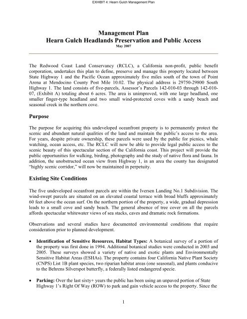
<strong>Management</strong> <strong>Plan</strong><br />
<strong>Hearn</strong> <strong>Gulch</strong> Headlands Preservation and Public Access<br />
May 2007<br />
The Redwood Coast Land <strong>Conservancy</strong> (RCLC), a <strong>California</strong> non-profit, public benefit<br />
corporation, undertakes this plan to define, preserve and manage this property located between<br />
State Highway 1 and the Pacific Ocean approximately five miles south of the town of Point<br />
Arena at Mendocino County Post Mile 10.02. The physical address is 29750-29800 South<br />
Highway 1. The land consists of five-parcels, Assessor’s Parcels 142-010-03 through 142-010-<br />
07, (Exhibit A) totaling about 6 acres. The area is unimproved, with one large headland, one<br />
smaller finger-type headland and two small wind-protected coves with a sandy beach and<br />
seasonal creek in the northern cove.<br />
Purpose<br />
The purpose for acquiring this undeveloped oceanfront property is to permanently protect the<br />
scenic and abundant natural qualities of the land and maintain the public’s access to the area.<br />
For years, despite private ownership, these parcels were used by the public for picnics, whale<br />
watching, ocean access, etc. The RCLC will now be able to provide legal public access to the<br />
scenic beauty of this spectacular section of the <strong>California</strong> coast. This project will provide the<br />
public opportunities for walking, birding, photography and the study of native flora and fauna. In<br />
addition, the unobstructed ocean view from Highway 1, in an area the county has designated<br />
“highly scenic corridor,” will now be maintained in perpetuity.<br />
Existing Site Conditions<br />
EXHIBIT 4: <strong>Hearn</strong> <strong>Gulch</strong> <strong>Management</strong> <strong>Plan</strong><br />
The five undeveloped oceanfront parcels are within the Iversen Landing No.1 Subdivision. The<br />
wind-swept parcels are situated on an elevated coastal terrace with broad bluffs approximately<br />
60 feet above the ocean surf. On the northern portion of the property, a wide, gradual depression<br />
leads to a small cove and sandy beach. The general absence of tree cover on all the parcels<br />
affords spectacular whitewater views of sea stacks, caves and dramatic rock formations.<br />
Observations and several studies have documented environmental conditions that require<br />
consideration prior to planned development.<br />
• Identification of Sensitive Resources, Habitat Types: A botanical survey of a portion of<br />
the property was first done in 1994. Additional botanical studies were conducted in 2003 and<br />
2005. These surveys showed a variety of native and exotic plants and Environmentally<br />
Sensitive Habitat Areas (ESHAs). The property contains four <strong>California</strong> Native <strong>Plan</strong>t Society<br />
(CNPS) List 1B plant species, two riparian habitat areas (one seasonal), and plants conducive<br />
to the Behrens Silverspot butterfly, a federally listed endangered specie.<br />
• Parking: Over the last sixty+ years the public has been using an unpaved portion of State<br />
Highway 1’s Right Of Way (ROW) to park and gain vehicle access to the property. Since the<br />
1
property had never been fenced or “signed”, vehicles have been driven out onto the<br />
headlands and down to a point approximately 75 feet south of the property’s sandy beach.<br />
• Cultural Resources Survey: An archaeological survey and onsite evaluation was conducted<br />
in 2004. No prehistoric or historic-period cultural resources were discovered; therefore, no<br />
recommendations were made.<br />
• Geologic Evaluation: A registered <strong>California</strong> geologist did a geological evaluation of the<br />
property in 2004. From a geologic standpoint, the existing highway access, parking and<br />
public trail areas are situated on land suitable for these uses.<br />
• Existing Trails: Basically three unofficial trails currently exist on the property. One, created<br />
by past vehicle use, leads out from the highway to a midway point on the large headland.<br />
Another leads down the wide northern depression to the <strong>Hearn</strong> <strong>Gulch</strong> Cove, Creek and sandy<br />
beach. The third is a footpath that runs from the beginning of the smaller, most northern<br />
headland out to the edge of that headland’s bluff top. In addition, the steep face of Sea Cave<br />
Cove shows evidence of past occasional foot traffic.<br />
• Vehicular Damage: Extensive past vehicle use not only created unsightly rutted “roads” out<br />
to the headlands and down toward the sandy beach, but also caused eroded areas near the<br />
highway. This vehicle trespass throughout the year, including the wet season, denuded the<br />
native grasses and other plants to bare soil.<br />
• Safety Concerns: The western face of both headlands is extremely steep and subject to<br />
unpredictable erosion. Warning signs will be installed to notify the public of this hazard.<br />
• Invasive <strong>Plan</strong>t Species: Preliminary inspection of the headlands indicates the minor<br />
presence of two species of invasive plants. Prior to the end of the Development Phase, a<br />
botanist will be engaged to survey the entire property for invasive plant species and tag them<br />
for removal.<br />
Development <strong>Plan</strong>s<br />
EXHIBIT 4: <strong>Hearn</strong> <strong>Gulch</strong> <strong>Management</strong> <strong>Plan</strong><br />
All development shall be done in accordance with <strong>California</strong> <strong>Coastal</strong> Commission Permit<br />
A-1-MEN-06-052 in a manner that protects the conservation values of the property “taking<br />
into account the fragility of the natural resources in the area” (<strong>Coastal</strong> Act Sections 30212<br />
and 30214) and the property’s numerous ESHAs. Reference is made here to the project’s Site<br />
<strong>Plan</strong> (March 2007 edition, attached) for an overview of the project’s improvements and their<br />
location.<br />
• Environmentally Sensitive Habitat Area (ESHA): The existing parking area, once suitable<br />
fencing has been added, and the property’s two designated foot trails will minimize any<br />
impact on existing ESHAs. Of particular interest is the abundant presence of Purple-stemmed<br />
Checker Bloom (Sidalcea malvaeflora ssp. malvaeflora), a CNPS List 1B plant, some of<br />
which are located in the Caltrans ROW / parking area. While if necessary, plants can be<br />
transplanted to other appropriate, viable locations on the property, a portion of the proposed<br />
2
EXHIBIT 4: <strong>Hearn</strong> <strong>Gulch</strong> <strong>Management</strong> <strong>Plan</strong><br />
bollard and chain fencing (see Parking below) will be located so as to prevent vehicles from<br />
moving north in the Caltrans ROW to where a significant population of Checker Bloom<br />
exists. The property also contains vegetation conducive to the Behrens Silverspot butterfly.<br />
While there have been no recorded sightings of this specie on the property, recorded<br />
sightings have made in the coastline area about seven miles north of the property (Stornetta).<br />
RCLC is currently conducting an additional botanical survey focused on the property’s Viola<br />
adunca plant locations, a host plant. This survey will also include a more general review of<br />
any other plant / vegetation on the property that may be of benefit to this butterfly.<br />
• Parking: All the property’s natural attributes, to include native plant life, should be<br />
preserved and to that end, pedestrian-access-only will be allowed from the existing small<br />
parking area. A bollard and chain barrier to prohibit vehicular traffic from going beyond this<br />
parking area onto the coastal terrace will be erected in accordance with a Caltrans<br />
Encroachment Permit and in consultation with a CNPS botanist.<br />
(Note: there is an existing paved Caltrans overlook and parking area suitable for all types of<br />
vehicles approximately 0.4 of a mile north of <strong>Hearn</strong> <strong>Gulch</strong>.)<br />
• Trail Improvements: Trail One, an existing trail that takes visitors from the parking area<br />
out onto the large headland, will be armored with a layer of dark/duff colored crushed rock,<br />
approximately three feet wide, out sloped to minimize any concentration of rainfall runoff,<br />
and will extend only as far as deemed prudent and safe given the nature of this headland (see<br />
Site <strong>Plan</strong>). The western terminus of this trail will be emphasized by the placement of two 4 x<br />
4 wooden posts, one on either side of the trail, with a wooden rail connecting the two posts<br />
approximately 2 ½ feet above grade. This will result in a specified pathway focus appropriate<br />
for the dense 3 to 8 inch vegetation cover that exists on this headland.<br />
Trail Two, the trail to <strong>Hearn</strong> <strong>Gulch</strong> beach, is different in that 95% of it travels over a much<br />
less dense vegetation cover, mainly consisting of sparse low profile native grasses, and<br />
therefore has no current need for a crushed rock treatment. However, this trail’s last 25 feet<br />
(+/-) descends a steeply angled dense bushy embankment that terminates at the <strong>Hearn</strong> <strong>Gulch</strong><br />
creek and beach. Historic foot traffic has established a series of firmly embedded rock steps<br />
over this final narrow section of this trail. Where feasible, and by hand, RCLC intends to<br />
widen and deepen certain steps in this last section to include the placement of 4” x 8” x 3’<br />
treated wood ties anchored at each end with 36” rebar (3/4”). In addition, we are exploring<br />
the feasibility of installing 2 ½ inch diameter steel poles 3 feet above grade on one side of<br />
this section through which would be threaded a stainless steel cable or synthetic rope to<br />
provide a degree of hand support. This is a change from RCLC’s previous plan for this<br />
section that called for a series of wooden steps connected together by an anchored steel cable<br />
on each side of a “staircase” supported underneath by an angled mass of placed rocks.<br />
Additional review of this concept indicated that the amount of underlying rock that would be<br />
required for long-term stability of the 45 degree “staircase” would alter the <strong>Hearn</strong> <strong>Gulch</strong><br />
Creek streambed.<br />
• Signage: RCLC is cognizant of, and sensitive about, this property’s very fragile viewshed.<br />
“Sign clutter” is a concern. RCLC has an inventory of nonreflective painted sheet metal signs<br />
that have been professionally produced for this project. One sign at the designated point of<br />
pedestrian entry from the parking area will instruct the public as to the controlled nature of<br />
3
this shoreline access as well as provide sponsorship information. Additional signage will be<br />
appropriately placed regarding eco-sensitivities and hazardous bluffs. Signs will be bolted to<br />
4x4 treated wooden posts sunk in concrete with an overall height above ground level of<br />
approximately 2 ½ feet except for the entry sign which will be 38 inches above grade. The<br />
total number of signs will not exceed thirteen.<br />
• Fencing: To prevent vehicles from going out onto the headlands, approximately 115LF of<br />
bollard and chain fencing will be installed on a portion of the western and northern<br />
boundaries of the existing vehicle pullout area. In addition, two “sheep fences” each<br />
approximately 15 linear feet (LF) in length, will be located along the northern bluff top of<br />
Sea Cave Cove to discourage the use of old trails down this very steep cliff. Consideration is<br />
also being given to installing a short 15 LF sheep fence at the head of an occasional trail that<br />
currently goes out onto the very narrow and hazardous northern headland. In keeping with<br />
the desire for low profile improvements on this property, all sheep fencing will have an<br />
approximate height of 2 ½ feet. Additional native low profile vegetation will be planted<br />
where appropriate and feasible to discourage other past use of volunteer trails down the steep<br />
cliffs of Sea Cave Cove.<br />
• Restoration: In the two year period since RCLC acquired the last two parcels of land for this<br />
project, nature - and a couple of temporary signs - have conspired together to begin the<br />
restoration of previous human-caused erosion due to uncontrolled vehicle trespass. Not only<br />
has native vegetation growth in the previously rutted bare soil areas begun to transform these<br />
previously degraded areas, but CNPS 1B listed plants such as the Purple-stemmed Checker<br />
Bloom have taken advantage of the lack of competition to root in certain degraded locations.<br />
Therefore RCLC will continue to monitor this progressive trend and will not, at this point,<br />
initiate any further vehicle erosion restoration activities.<br />
Maintenance<br />
Volunteer work parties organized by the RCLC will carry out maintenance of the property, to<br />
include parking area, trails and improvements. RCLC volunteers will monitor the site monthly,<br />
gather litter, address any vandalism, and schedule repairs as necessary. As a non-profit public<br />
benefit corporation, the RCLC maintains liability insurance that meets generally accepted<br />
standards. Any safety or erosion problems will be addressed promptly and reported to the State<br />
<strong>Coastal</strong> Commission and/or Mendocino County. Currently litter does not seem to be a problem at<br />
the site, but monitoring of trash will be an essential on-going project. Signage will admonish all<br />
visitors to “pack it in / pack it out.” No garbage cans or toilet facilities will be provided.<br />
Stewardship and Other Funding<br />
EXHIBIT 4: <strong>Hearn</strong> <strong>Gulch</strong> <strong>Management</strong> <strong>Plan</strong><br />
RCLC has a 15 year presence in the southern Mendocino coastal area and the RCLC Board is<br />
confident that adequate funding can be raised from its members, the general community and<br />
local property owners to provide for small maintenance and repair costs. Community, State<br />
<strong>Coastal</strong> <strong>Conservancy</strong> and Caltrans grant funds were procured for the initial purchase of the<br />
property and some of the development costs. Additional grant funding for the proposed<br />
improvements are being pursued from public agencies and private and community foundations.<br />
4
Amendment and Severability<br />
This plan may be amended, as needed, with the concurrence of all appropriate funding and<br />
public agencies. Amendments may be considered for subsequent phases of development or for<br />
any other reason. In the event that the RCLC disbands or otherwise ceases to exist, title to the<br />
property and the public access will revert to the State <strong>Coastal</strong> <strong>Conservancy</strong> or other appropriate<br />
entity considered acceptable to the <strong>Coastal</strong> <strong>Conservancy</strong>.<br />
_______________________________<br />
George Anderson, President<br />
Redwood Coast Land <strong>Conservancy</strong><br />
Date: _________________<br />
_______________________________<br />
County of Mendocino<br />
Date: _________________<br />
_______________________________<br />
<strong>California</strong> <strong>Coastal</strong> Commission<br />
Date: _________________<br />
EXHIBIT 4: <strong>Hearn</strong> <strong>Gulch</strong> <strong>Management</strong> <strong>Plan</strong><br />
5