

Download - Altea Gallery
Download - Altea Gallery
Download - Altea Gallery

You also want an ePaper? Increase the reach of your titles
YUMPU automatically turns print PDFs into web optimized ePapers that Google loves.
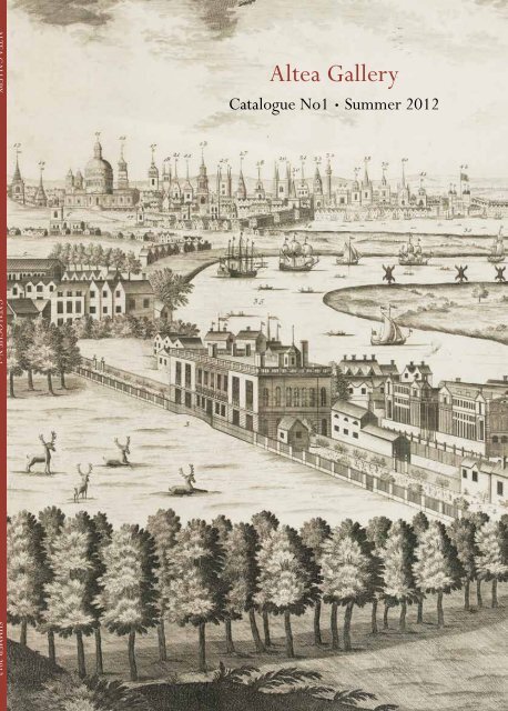
<strong>Altea</strong> <strong>Gallery</strong><br />
Catalogue No1 • Summer 2012
<strong>Altea</strong> <strong>Gallery</strong> Limited<br />
35 Saint George Street<br />
London W1S 2FN<br />
Tel: + 44 (0)20 7491 0010<br />
Fax: +44 (0)20 7491 0015<br />
info@alteagallery.com<br />
www.alteagallery.com<br />
Company Registration No. 7952137<br />
With thanks to Miles Baynton-Williams and<br />
Graham Bush for their help and expertise.<br />
Front cover: item 42. Back cover: item 84<br />
Item 5<br />
Terms and Conditions:<br />
Each item is in good condition unless otherwise noted in the description, allowing for<br />
the usual minor imperfections. Measurements are expressed in millimeters and are<br />
taken to the plate-mark unless stated, height by width. (100 mm = approx. 4 inches)<br />
All items are offered subject to prior sale, orders are dealt with in order of receipt.<br />
Prices are quoted in UK Pound Sterling (£/GBP) except Earth Platinum which is priced<br />
in US Dollars (US $). Sales tax (VAT) is included where applicable.<br />
All goods remain the property of <strong>Altea</strong> <strong>Gallery</strong> Limited until payment has been<br />
received in full.<br />
We accept all major credit cards<br />
Our bank details:<br />
HSBC<br />
133 Regent Street, London W1B 4HX United Kingdom<br />
Account Name: <strong>Altea</strong> <strong>Gallery</strong> Ltd<br />
Bank Sort Code: 40-06-02<br />
Account No: 44232860<br />
IBAN : GB07MIDL40060244232860<br />
SWIFT: MIDLGB22<br />
Catalogue produced by atgmedia
INTRODUCTION<br />
<strong>Altea</strong> <strong>Gallery</strong><br />
Catalogue No1<br />
Summer 2012<br />
Index Page<br />
The Civitates Orbis Terrarum 2<br />
Three Ortelius Atlases 4<br />
De Bry’s American Voyages 6<br />
Early Printed Maps 9<br />
Italian Engraving 12<br />
The de Jode Family 18<br />
Romeyn de Hooghe 20<br />
London 22<br />
Wall Maps 28<br />
Cloth Maps 32<br />
The Other Side of the World 37<br />
Naval Battles 39<br />
Curiosity & Caricature maps 41<br />
Games 45<br />
General Selection 48<br />
This year I will have been dealing in antique maps for twenty years. Having been introduced to the wonders of cartography<br />
by a friend, I have spent the past two decades improving my expertise and knowledge on the subject. It is always a thrill to<br />
find a map of particular importance or interest and I have been lucky enough to have come across several on my journey.<br />
Up until now I have never issued a printed catalogue as my web site is easily accessible, making it convenient to<br />
immediately see what I have in stock.<br />
However, I decided that a catalogue would be a fitting way to celebrate my twenty years in the business, and here it is.<br />
It is not a conventional catalogue, one organised geographically, but a personal selection of items I have in stock that I find<br />
exciting and that remind me why I chose to make antiquarian cartography such an important part of my life.<br />
Hopefully my passions have successfully transferred to the printed page: if it inspires anyone to look deeper into the<br />
subject my full web catalogue can be found at www.alteagallery.com<br />
Massimo De Martini
2 ALTEA GALLERY<br />
1 BRAUN, Georg & HOGENBERG, Frans.<br />
The ‘earliest systematic city atlas’<br />
Civitates Orbis Terrarum.<br />
Cologne: 1572-1618.<br />
Six volumes, folio, contemporary vellum with gilt titles on spine; containing 6 engraved title-pages and 363 double-page plates of maps and views.<br />
£150,000<br />
A fine example of this monumental city atlas, produced as a companion to Ortelius’s ‘Theatrum Orbis Terrarum’ atlas, with text by Georg Braun<br />
and plates engraved by Frans Hogenberg and others. The first volume was originally published in 1572, but these are a later printing, making a<br />
uniform set with the last volume, the sixth, which first appeared in 1617. The 363 plates are an impressive record of the notable towns of the<br />
period, mostly in Europe but also some in Asia and Africa, and even two in the New World, Mexico City and Cusco. The inclusion of dress and<br />
events in the foreground add extra local detail.<br />
KOEMAN: Vol 2, p 10: ‘the earliest systematic city atlas’; TOOLEY: ‘one of the great books of the World... a wonderful compendium of knowledge of life in Europe in<br />
the sixteenth century’.<br />
S/N: 13029<br />
WWW.ALTEAGALLERY.COM
TEL: +44 (0)20 7491 0010<br />
See also items 33 & 94<br />
ALTEA GALLERY 3
4 ALTEA GALLERY<br />
THREE ORTELIUS ATLASES<br />
Abraham Ortelius is one of the best-known names in early map-making, and his world atlas, the ‘Theatrum Orbis<br />
Terrarum’, is a landmark publication, regarded as the first atlas in the modern sense of the word. The style he developed<br />
was the template for atlas production for several centuries.<br />
Here are three atlases in different formats: a ‘Theatrum’, an ‘Additamentum’, a collection of new maps, and a ‘Parergon’,<br />
his atlas of the ancient world.<br />
2 ORTELIUS, Abraham.<br />
Ortelius’s Theatrum in a fine binding<br />
Theatrum Orbis Terrarum... Antwerp: Gillis van den Rade, 1575, Latin text edition. Folio, rebound in contemporary blind-stamped calf gilt; pp. (xix), 70 maps<br />
in fine colour with gold highlights.+ (92) (Synonymia & Index) + (6) (De Mona Druidum Insula...) + (2) (Privilege & Colophon).<br />
£80,000<br />
An early example of the world’s first regularly-produced atlas, with uniform maps and text designed to be bound, published only five years after<br />
the first edition. In that time the number of maps had increased from 53 to 70 and the text had been enlarged with the inclusion of the ‘Synonymia<br />
Locorum’ and ‘De Mona druidum Insula’ (Welshman Humphrey Llwyd’s letter to Ortelius about the druids of Anglesey).<br />
Originally this example must have been a large-paper example, which someone put to use with extensive old ink marginalia (Italian-language<br />
geographical notes) on some maps, particularly the East Indies. When the atlas was rebound in a standard-sized binding great care was taken to<br />
preserve the writing, so the edges of some maps are folded in.<br />
VAN DEN BROECKE: p.25, estimating 100 copies printed; KOEMAN: Ort 13.<br />
S/N: 12866<br />
WWW.ALTEAGALLERY.COM
The rare fourth Additamentum, with the first regular<br />
appearances of the maps of Iceland and the Pacific<br />
3 ORTELIUS, Abraham.<br />
Additamentum IV Theatri Orbis Terrarum.<br />
Antwerp: Officina Plantiana, 1590. Folio, contemporary gilt-tooled calf.<br />
Letterpress title page and 22 maps with text on reverse, without pagination,<br />
as called for.<br />
Two old ink mss. ownership inscription on titlepage.<br />
£32,000<br />
A fine example of the fourth Additamentum atlas by Ortelius,<br />
containing the twenty-two maps engraved since the 1587 edition of<br />
the Theatrum Orbis Terrarum, arranged in alphabetical order. As the<br />
volume was meant to compliment this earlier edition, not many copies<br />
were printed: van den Broecke estimates only 100 were printed, of<br />
which he could trace 50 existing examples.<br />
Of these new maps eight are ‘modern’ and fourteen are maps for the<br />
Parergon, Ortelius’s atlas of the ancient world. The ancient maps<br />
include the ‘Wanderings of Abraham’, surrounded by 22 roundel<br />
scenes; the world as known by the ancients; and a two-sheet map of<br />
ancient Britain with a huge vignette sea-battle. The ‘modern’ maps<br />
include two of the most popular maps by Ortelius, the superb ‘Maris<br />
Pacifici’, the first map of the Pacific Ocean, and ‘Islandia’, showing<br />
Iceland surrounded by sea-monsters.<br />
The front board has the stamped coat-of-arms of David von Spaur,<br />
provost of Bressanone, who also added his signature to the bottom of<br />
the title page.<br />
KOEMAN: Ort 25; VAN DEN BROECKE: p. 25.<br />
S/N: 12947<br />
TEL: +44 (0)20 7491 0010<br />
Ortelius’s atlas of the Ancient World<br />
4 ORTELIUS, Abraham.<br />
Theatri Orbis Terrarum Parergon; sive sive Veteris Geographiæ<br />
Aliquot Tabulæ, Commentarijs Geographicis et Histroricis illustratæ.<br />
Editio Novissima, Tabulis aliquot acuta, et varie emendata atque<br />
innovata, Cura et Studio Balthasaris Moreti. [with] Nomenclator<br />
Ptolemaicus...<br />
Antwerp, Officiana Plantiniana, 1624.<br />
Two books in one. Folio, modern vellum over limp boards; engraved<br />
title, arms of Philip IV of Spain, dedication; pp. (iv) + xlix (sheets)<br />
containing 36 maps on 39 double-page sheets, 3 double-page views,<br />
1 costume plate on two double-pages, as called; pp. 34 (Nomenclator);<br />
woodcut printer’s colophon.<br />
£19,500<br />
The last and largest edition of the Parergon, Ortelius’s personal<br />
project, with new maps of the Eastern and Western parts of the Ancient<br />
World, surrounded by text; and the four-sheet Peutinger Table. These<br />
were added to other maps with both classical and biblical themes,<br />
including the wanderings of Odysseus, Abraham and Paul the Apostle.<br />
Unlike the maps in the ‘Theatrum’, Ortelius drew these himself. The<br />
first to appear were published in an Additamentum to the Theatrum in<br />
1579, but as more were completed the Parergon became an atlas in its<br />
own right.<br />
S/N: 13026<br />
ALTEA GALLERY 5
6 ALTEA GALLERY<br />
DE BRY’S AMERICAN VOYAGES<br />
Theodor De Bry’s collection of Great Travels contains important first-hand accounts of attempts to settle North America,<br />
including the English colony at Roanoke and the French in Florida. Among the illustrations are John Smith’s drawings of<br />
Virginia and Jacques Le Moyne’s of Florida, the first realistic representations of the Americas available to Europeans.<br />
Here we have a volume containing approximately the first half of the Voyages, and two of the most significant maps from<br />
the series.<br />
The Great or American Voyages<br />
5 DE BRY, Theodore et al.<br />
Frankfurt: 1594-1617. Parts I-VI only (of 13) in one volume. Latin text. Folio (335 x 235 mm), 17th century vellum over pasteboard, the flat spine with small panel<br />
outlined in gilt with rolls, titled in gilt within the panel.<br />
Various neat repairs, part VI lacking 2nd section (from page 108 including 2nd frontis. and 28 plates), binding with neat repairs to spine and the<br />
board edges, endpapers replaced.<br />
£120,000<br />
Containing:<br />
I. [Thomas Hariot’s Virginia.] Admiranda narratio fida tamen, de<br />
commodis et incolarum ritibus Virginiae ... Anglico scripta sermone a<br />
Thoma Hariot. Frankfurt: Johann Wechel, “1590” [ but c.1608].<br />
II. [Jacques Le Moyne’s Florida.] Brevis narratio eorum quae in Florida<br />
Americae provi[n]cia Gallis acciderunt ... auctore Iacobo Le Moyne.<br />
Frankfurt: Johann Wechel, “1591” [but 1609].<br />
III. [Hans Stadius’s Brazil.] Americae tertia pars memorabile[m] provinciae<br />
Brasiliae historiam contine[n]s, germanico primum sermone scriptum a Ioane<br />
Stadio. Frankfurt: apud Matthiam Beckerum, 1605.<br />
IV. [Girolamo Benzoni’s History of the New World.] Americae<br />
pars quarta sive, insignis & admiranda historia de reperta primum<br />
Occidentali India a Christophoro Columbo anno MCCCCXCII scripta<br />
ab Hieronymo Be[n]zono. Frankfurt: Ad invistiss. Rudolphus II..., 1594.<br />
V. [Benzoni’s History continued.] Americae pars quinta, nobilis<br />
& admiratione plena Hieronymi Be[n]zoni ... secundae sectionis<br />
Hi[stori]a[e] Hispanorum tum in Nigrittas servos suos, tum in Indos<br />
crudelitatem, Gallorumq[ue] pirataru[m] de Hispanis toties reportata<br />
spolia. Frankfurt: Theodore de Bry, “1595” [but c. 1617].<br />
VI. [Benzoni’s History concluded.] Americae pars sexta, sive historiae<br />
ab Hieronymo Be[n]zono ... scriptae, sectio tertia. Frankfurt: Theodore de<br />
Bry, 1596. First section only (of 2).<br />
WWW.ALTEAGALLERY.COM
TEL: +44 (0)20 7491 0010<br />
ALTEA GALLERY 7<br />
De Bry’s important collection of voyages of exploration to the Americas, containing several landmark maps of the continent.<br />
Included are Hariot’s account of the English colony in Virginia (second edition, second issue, 1606), with the important map of the Roanoke colony<br />
in Virginia and plates after John White; Jacques Le Moyne’s Florida (second edition, 1609), with his map of south east North America and scenes of<br />
Florida and its inhabitants; Hans Stadius’s Brazil (second edition, first issue, 1605) with his map of Peru and Brazil; and Girolamo Benzoni’s History<br />
of the New World (first two parts second editions, 1594 & 1617, the third the first edition of 1596), with maps of the Western Hemisphere, the<br />
West Indies and New Spain, and a view of Cusco.<br />
S/N: 12946<br />
Items 6 & 7 are also present in this volume
8 ALTEA GALLERY<br />
Maps from De Bry’s American Voyages<br />
Influential map of the Eastern Seaboard<br />
6 MOYNE DE MORGUES, Jacques le.<br />
Floridae Americae Provinciae Recens & exactissima descriptio...<br />
Frankfurt, Theodore de Bry, 1591. 370 x 360mm.<br />
Strenghtened with thin tissue on verso of top left corner; an excellent<br />
example with a fine impression.<br />
£14,000<br />
A superb map of the Eastern Seaboard from Cape Lookout to Florida,<br />
with Cuba and the Bahamas, by the official artist of the second French<br />
Huguenot expedition to their colony at Charlefort, 1564. When the<br />
Spanish destroyed the colony of ‘heretics’ Le Moyne fled into the wild,<br />
but eventually joined other Huguenot émigres in London. Working<br />
from memory (having lost most of his possessions in the swamps)<br />
he produced this map and a number of watercolours (only one now<br />
extant). In 1587 de Bry met le Moyne in London and tried to buy his<br />
papers, but as le Moyne was working for Sir Walter Raleigh he refused<br />
to sell. However le Moyne died the following year and de Bry was able<br />
to buy this map and some sketches from his widow.<br />
Of interest is the large expanse of water at the top of the map, either<br />
representing the Great Lakes or Verrazzano’s Sea; the waterfall,<br />
believed to be based on the local Indians’ accounts of Niagara; and Port<br />
Royal named on a map for the first time.<br />
BURDEN: 79; CUMMING: 14; GOSS: Mapping of North America 16, “one of<br />
the most attractive maps of North America”.<br />
S/N: 11877<br />
An early map of South America<br />
7 DE BRY, Theodore.<br />
Americae Pars Magis Cognita.<br />
Frankfurt, 1592. 365 x 445mm.<br />
Narrow margins, some restoration to printed border, backed on<br />
japanese paper.<br />
£3,500<br />
An important map of South America, published in the third part of De<br />
Bry’s ‘Grand Voyages’ to illustrate the voyages of Johann van Staden &<br />
Jean de Lery in the mid-16th century. The mapping of South America<br />
is based on that of Peter Martyr, 1587, and Gastaldi’s map from his<br />
edition of Ptolemy, 1561. The southern part of North America is taken<br />
from Le Moyne’s map of Florida (also published by De Bry), although<br />
Cuba differs substantially.<br />
S/N: 12708<br />
WWW.ALTEAGALLERY.COM
EARLY PRINTED MAPS<br />
9 PTOLEMY, Claudius.<br />
TEL: +44 (0)20 7491 0010<br />
ALTEA GALLERY 9<br />
Incunable maps have always fascinated me. It is amazing that you can acquire maps printed over 500 years ago, in the<br />
age that Columbus discovered America and a century before Shakespeare wrote ‘Hamlet’. The first three maps in this<br />
section are true incunabula (i.e. printed before 1501), two have existed for at least half-a-millennium, and the last is a later<br />
printing from a woodblock cut in 1491.<br />
Poland & the Ukraine from a landmark edition of Ptolemy<br />
8 BERLINGHIERI, Francesco de Nicola.<br />
Tabula Octava d Europa<br />
Florence, 1482. Two sheets joined, as usual, paper size 430 x 560mm.<br />
Trimmed to plate top and bottom.<br />
£6,000<br />
Poland, Lithuania, the Ukraine, etc, from the third edition of Ptolemy’s<br />
Geography to have printed maps, the first to be printed in the<br />
vernacular and the first with ‘modern’ maps’.<br />
Francesco Berlinghieri (1440-1501), an Italian scholar and humanist,<br />
started work on a revision of Ptolemy in 1464, updating the Ptolemiac<br />
maps, supplementing them with modern maps (France, Italy, Spain and<br />
the Holy Land) and writing a commentary in Italian verse. The maps<br />
were engraved by Niccolò Tedesco, a German printer, unusually with<br />
equidistant meridians and parallels, and rectangular borders rather<br />
than trapezoid. The completed work was published as “Septe Giornate<br />
della Geographia di Francesco Berlinghieri” (“The Seven Days of<br />
Geography”).<br />
S/N: 11704<br />
Important incunable map of Arabia<br />
Sexta Asie Tabula.<br />
Ulm, Johan Reger, 1482-86. Woodcut, original hand colour. 300 x 565mm.<br />
Some restoration.<br />
£24,000<br />
The Arabian peninsula from an early German edition of Ptolemy, within a trapezoid border with metal type for the lettering. The title is on the<br />
verso with a Latin-text description, with a coloured capital.<br />
See TIBBETTS: 8.<br />
S/N: 11381
10 ALTEA GALLERY<br />
The first “modern” map of Palestine<br />
10 PTOLEMY, Claudius.<br />
Tabula Moderna Terre Sancte.<br />
Ulm, Johan Reger, 1482-86. Original hand colour with blue finishing on the sea area and rivers. Woodcut, 325 x 560mm.<br />
Very minor restoration at centrefold.<br />
£15,000<br />
Palestine from an early German edition of Ptolemy’s Geography, but one of five ‘modern’ maps added. Despite this it still shows the tribal divisions.<br />
A highly collectible map, here in very fine condition and striking colouring.<br />
See LAOR: 603<br />
S/N: 9266<br />
An early 16th century T-O world map<br />
11 FORESTI, Giacomo.<br />
[Untitled T-O world map.]<br />
Venice: c.1503. Woodcut, 90 x 130mm, set in Italian text.<br />
£1,600<br />
An early diagrammatic world map from Foresti da Bergamo’s<br />
‘Novissime Hystoriæ’, in a decorative border also containing a climate<br />
map. The depiction is ‘Tripartite’ or ‘T-O’, with the world divided<br />
into three by great waterways. Europe is separated from Africa by the<br />
Mediterranean and from Asia by the river Don; and Asia and Africa are<br />
separated by the Nile.<br />
Foresti was a noted historian in his day: his ‘Supplementum<br />
Chronicarum’ (1491), was plagarised by Hartmann Schedel, appearing<br />
word for word in the more famous ‘Nuremberg Chronicle’ (1493).<br />
SHIRLEY: p.xx, plate 2.<br />
S/N: 12005<br />
WWW.ALTEAGALLERY.COM
“one of the first examples of 16th Century two-colour printing”<br />
12 SYLVANUS, Bernard.<br />
Duodecima et Ultima Asiae Tabula.<br />
Venice, 1511. Woodcut on two sheets conjoined, printed surface 395 x 370mm.<br />
Minor staining at top of centrefold.<br />
£1,750<br />
A rare map of the island of Tabrobana, usually associated with Sri Lanka, from Sylvanus’s<br />
edition of Ptolemy’s Geography. Having many names printed in red makes it one of the<br />
first examples of two-colour printing, achieved by printing the sheet twice. It is also<br />
what Shirley calls “an isolated example of Venetian cartographic enterprise”, forty years<br />
before Gastaldi’s version of Ptolemy. It was never reissued. While decoration is kept to a<br />
minimum the title cartouche features a pair of elephant heads. As the maps were printed on<br />
both sides of the sheet, this has half of the map of the Malay Peninsula on the reverse.<br />
S/N: 11501<br />
TEL: +44 (0)20 7491 0010<br />
A medieval woodblock T-O world map<br />
ALTEA GALLERY 11<br />
13 Anonymous.<br />
[Untitled circular world map from a woodblock of 1491.]<br />
Paris, Nicolas Couteau, 1543. Woodblock, two sheets joined. Circular map, diameter 300mm, letterpress in borders. A fine example.<br />
£16,500<br />
A scarce circular woodblock world map, first issued in the 1491 edition of ‘La Mer des Hystoires’, published in Lyon. It is orientated with east at<br />
the top of the map, with Asia filling the top half, Africa bottom right and Europe bottom left, with Jerusalem at the centre. The map shows different<br />
countries and cities as hills or islands, with the Pope shown behind the walls of the Vatican and England and Ireland on the edge just left of the<br />
centre. Other vignettes include the Devil, the Tree of the Sun and the Moon, dragons and a phoenix.<br />
‘La Mer des Hystoires’ was a French translation of the ‘Rudimentum Novitiorum’, 1475, an encyclopaedic world history based on medieval<br />
theology, which contained the first detailed maps ever printed, pre-dating the illustrated editions of Ptolemy.<br />
Although this map is smaller than the 1475 original a number of mistakes were corrected and the text is much clearer than in the previous editions.<br />
Campbell calls it ‘the work of a thinking individual’.<br />
SHIRLEY: Mapping of the World, 17.<br />
S/N: 10204
12 ALTEA GALLERY<br />
ITALIAN ENGRAVING<br />
The Italians were the first to use copper engraving to print maps (the technique evolving from decorative metalwork)<br />
and were responsible for some of the most flamboyant maps. From the early Lafreri-school engravers, through Lucini and<br />
Coronelli to the later work published by Zatta and Cassini, Italy produced maps on which there was as much artistry in<br />
the style of engraving as the content.<br />
Item 14<br />
Item 15<br />
Item 16<br />
14 GASTALDI, Giacomo.<br />
The ‘Upside-Down’ map of Africa<br />
Prima Tavola.<br />
Venice, c.1563. Trapizoid, 275 x (at greatest) 385mm.<br />
Two sheets joined. Fine and crisp impression.<br />
£1,900<br />
The famous ‘upside-down’ map of Africa, engraved with north to the bottom<br />
of the map, decorated with various sea-monsters, galleons and animals. Gastaldi<br />
produced this finely-engraved version after his original woodcut for Ramusio’s<br />
‘Delle navigationi et viaggi’ was destroyed in a fire at the printing house in 1557.<br />
It is likely that the orientation is supposed to represent the view from Europe.<br />
BETZ: 7; NORWICH: 6.<br />
S/N: 12717<br />
The ‘Upside-Down’ map of the Indian Ocean<br />
15 GASTALDI, Giacomo.<br />
Seconda Tavola.<br />
Venice, Giunti, 1606. Trapizoid, 280 x (at greatest) 385mm.<br />
Small repair bottom centrefold.<br />
£1,600<br />
Engraved with north to the bottom of the map, it shows Arabia (with Bahrain)<br />
on the right, India, Ceylon and the Maldives, with the edge of Sumatra top left.<br />
Published in Ramusio’s ‘Delle navigationi et viaggi’.<br />
S/N: 8172<br />
A “Lafreri-School” map of Iberia<br />
16 FORLANI, Paolo.<br />
[Untitled map of Iberia.]<br />
Venice: Ferrando di Bertelli, c.1567. Two sheets joined, total 435 x 545mm.<br />
Evidence of a crack in the printing plate on the lower left edge.<br />
£9,800<br />
An exceptional example of this rare separate-issue map of Iberia, on paper with an<br />
anchor watermark with margins of at least 4cm on all sides.<br />
Forlani was one of the most prominent members of the ‘Lafreri-school’ group of<br />
mapmakers in Italy. Not only did he publish his own maps, his skills as engraver,<br />
particularly for lettering, made other publishers commission him to make maps for<br />
them: maps attributed to him were published by, among others, Camocio, Bertelli<br />
and Zaltieri in Venice, and Duchetti in Rome. This is one of the few to bear his<br />
name: of the 97 maps attributed to him by David Woodward, eighty are unsigned.<br />
WOODWARD: The Maps and Prints of Paolo Forlani; MAPFORUM.COM: Issue 11,<br />
biography, & Forlani’s Works, 68.<br />
S/N: 7437<br />
WWW.ALTEAGALLERY.COM
An early engraved map of southern Africa<br />
17 SANUTO, Livio.<br />
Africae Tabula X.<br />
Venice, Damiano Zenaro, 1588, 400 x 520mm<br />
Lateral margins extended, excellent impression.<br />
£3,250<br />
A very finely engraved map of Southern Africa, showing the course<br />
of the Limpopo River and Great Zimbabwe, the capital of the Shona<br />
empire. Sanuto described the granite walls of the city ‘the work not<br />
of humans but the devil’, as they were better than the Portuguese<br />
fortresses on the coast.<br />
Livio Sanuto (c.1520-1576), a Venetian cosmographer, mathematician<br />
and maker of terrestrial globes, belonged to the prestigious Lafreri<br />
school of engravers, whose output signalled the transition between the<br />
maps of Ptolemy and the maps of Mercator and Ortelius. He and his<br />
brother Giulio planned a massive and comprehensive atlas to include<br />
maps and descriptions of the whole world, which he believed would be<br />
more accurate than any previously published. Unfortunately, he died in<br />
1576 having only completed 12 maps of Africa, which were eventually<br />
published in 1588 under the title “Geografia Di M. Livio Sanuto...”.<br />
For his maps Sanuto relied on Gastaldi’s 1564 map and Portuguese<br />
sea charts for the mapping of the coasts and for the interior used<br />
accounts by Duarte Barbosa and João de Barros. After its publication<br />
in 1588 this work was copied by other leading map makers for nearly<br />
a century afterwards.<br />
NORWICH: 152; see BETZ 22.<br />
S/N: 10944<br />
18 DUDLEY, Robert.<br />
TEL: +44 (0)20 7491 0010<br />
Scarce sea chart of Norway<br />
Carta di Noruegia piu moderna.<br />
Florence: Francesco Onofri, 1646. 495 x 375mm.<br />
£1,250<br />
A rare sea chart of Norway, published in Sir Robert Dudley’s<br />
monumental atlas, ‘Dell’Arcano del Mare’ (Secrets of the Sea). It was<br />
the first English sea-atlas to be printed (albeit engraved and published in<br />
Italy), breaking the Dutch monopoly of such publications. As a friend of<br />
Drake and brother-in-law of Thomas Cavendish he had enviable access<br />
to the latest information. The engraver Antonio Francesco Lucini wrote<br />
in the introduction to the second edition that he worked for 12 years on<br />
the copper plates, which weighed 5000 lbs. His clear style of engraving,<br />
with florid script, make the Dudley charts instantly recognisable.<br />
The son of the Earl of Leicester, favourite of Queen Elizabeth I, Dudley<br />
was born in secret to avoid her jealousy. Well-educated, he joined the<br />
Elizabethan maritime adventurers and led an expedition to the Orinoco<br />
in 1594, raiding Trinidad en route. After failing to prove his legitimacy<br />
in 1605 he left England for Italy, and forfeited all property after illegally<br />
assuming the title of Earl of Warwick. He died in 1649, two years after<br />
the first edition of the ‘Arcano’.<br />
S/N: 12043<br />
Item 17<br />
Item 18<br />
ALTEA GALLERY 13
14 ALTEA GALLERY<br />
19 BLAEU, Willem Janszoon.<br />
Unrecorded carte-à-figures map of the world<br />
Orbis Terrarum Tipus De Integro Multis In Locis Emendatus auct: G. Iansonio.<br />
Bologna, Francesco Sabatini?, dated 1655 but c.1670, 440 x 750mm.<br />
£50,000<br />
A splendid and extremely rare carte-à-figures map of the World, engraved by Pietro Todeschi. The world is drawn in two hemispheres at the centre<br />
surrounded by a wealth of decorative detail. Australia is connected to New Guinea and a great Southern landmass and entitled “Terra Australis<br />
Incognita”, and a northwest passage is shown through the Straits of Anian.<br />
This is a hitherto unrecorded pirate copy of Willem Blaeu’s map of the world, probably taken from the intermediate Italian piracy recorded by<br />
Shirley. It was probably published by Francesco Sabatini, one of the many fringe figures in Italian map-publishing in the late seventeenth century.<br />
Unfortunately characters are so shadowy that we do not have accurate dates for his life and death, and often the only clues to dating his work are<br />
the dedications on the maps. He was apparently active as a printer, publisher and possibly engraver in the 1670s, probably in Bologna. Although this<br />
World map bears a Venetian address (only partially legible) it seems plausible that this is spurious.<br />
cf. SHIRLEY “The mapping of the World” No. 333, Plate 253 for the intermediate piracy.; Klaus Stopp, ‘Drie Karten von Francesco Sabatini’, Mappæ Antiquæ Liber<br />
Amicorum Günter Schilder, p.281-285.<br />
S/N: 10523<br />
WWW.ALTEAGALLERY.COM
20 CORONELLI, Vincenzo Maria.<br />
TEL: +44 (0)20 7491 0010<br />
A two-sheet map of North America<br />
ALTEA GALLERY 15<br />
America Settentrionale Colle Nuoue Scoperte fin all’Anno 1688.<br />
Venice, 1691. Two sheets conjoined, total 605 x 880mm.<br />
£10,000<br />
A large and highly decorative two-sheet map of North America, with two large cartouches and many vignettes from de Bry engraved in the interior<br />
and seas. Despite showing California as an island the map contains the most current information: as map-maker to Louis XIV Coronelli had access<br />
to the most recent reports by French explorers, including Marquette (1673) and La Salle (1682). Cumming notes that ‘his delineation of the Great<br />
Lakes is the best and most accurate on a general map before the eighteenth century’.<br />
CUMMING: Exploration of North America, p.148.<br />
S/N: 12017
16 ALTEA GALLERY<br />
A 17th century Italian atlas in two volumes<br />
21 DE ROSSI, Giovanni Giacomo.<br />
Mercurio Geografico overo Guida Geografica in Tutte le Parti del<br />
Mondo conforme le Tavole Geografiche del Sanson Baudrand e<br />
Cantelli.<br />
Rome, c.1696. Two vols, folio, contemporary vellum; Vol. I: engraved frontis.<br />
and 95 double-page maps; Vol II: engraved frontis. and 40 double-page maps.<br />
All maps numbered in old ink mss. on verso, nearly all with original outline<br />
colour. Old ink mss. index on front endpaper, marginalia on some maps and<br />
index at rear of first volume.<br />
£30,000<br />
A fine example of De Rossi’s atlas, which, like Coronelli’s atlas of the<br />
same period, has no standard collation. The 95 maps of the first volume<br />
are dated between 1667 and 1689 and the forty in the second between<br />
1690 and 1696, they are mainly derived from Sanson and Cantelli da<br />
Vignola. Maps of particular interest are: the celestial hemisphere after<br />
Francesco Brunacci; Cantelli’s four-sheet wall map of the Low Countries;<br />
Ameti’s four-sheet maps of the Patrimonio di S. Pietro and Lazio,<br />
showing the environs of Rome in early Christian and contemporary eras;<br />
and Cantelli’s four-sheet map of Piemonte.<br />
S/N: 12951<br />
WWW.ALTEAGALLERY.COM
One of the most decorative maps of Australia<br />
23 CASSINI, Giovanni Maria.<br />
La Nuova Olanda e la Nuova Guinea.<br />
Rome, 1798. Coloured, 365 x 490mm.<br />
£2,800<br />
A fine map of Australia and New Guinea, published in the ‘Nuovo<br />
Atlante Geografico Universale’. The emphasis of the map is the charting<br />
of Captain Cook down the east coast: most of the marked features<br />
are those named by Cook and his crew between the Torres Strait and<br />
Tasmania, which is shown as part of the mainland. The title is within a<br />
decorative title cartouche with two aboriginies, one of whom strangely<br />
carries a bow.<br />
S/N: 7541<br />
TEL: +44 (0)20 7491 0010<br />
Cook’s charting of New Zealand<br />
22 ZATTA, Antonio.<br />
La Nuova Zelanda trascorsa nel 1769 e 1770 dal Cook comandante<br />
dell’Endeavour vascello di S.M. Britannica.<br />
Venice, 1794. Original outline colour. 455 x 360mm.<br />
£1,800<br />
This is one of the most decorative versions of Cook’s map of New<br />
Zealand, engraved by Zuliani after Pasquali. Cook’s route around the<br />
islands is marked in colour, and the title vignette shows a Maori village.<br />
This is the second state with the new engraved date of 1794, issued<br />
in Zatta’s edition of Cook’s Voyages rather than his atlas; as such it is<br />
scarcer than the original edition.<br />
TOOLEY: Australia 1433.<br />
S/N: 9556<br />
Item 23<br />
Item 22<br />
ALTEA GALLERY 17
18 ALTEA GALLERY<br />
THE DE JODE FAMILY<br />
The Speculum Orbis Terrarum atlas of Gerard De Jode was completely overshadowed by Ortelius’s Theatrum. Despite<br />
the beauty of his maps (helped by the engraving skills of the brothers Lucas & Jan van Doeticum) and the superior<br />
cartographic content, the atlas was not a commercial success. De Jode’s son Cornelis published an enlarged edition, the<br />
Speculum Orbis Terræ in 1593, with a similar lack of sales, and the atlas was never reissued. After the death of Cornelis<br />
De Jode in 1600 the printing plates were bought by Vrients, then the owner of the Ortelius plates, merely to stop them<br />
reappearing. Therefore, despite being published at the same time as the Ortelius maps, the De Jode maps are far more<br />
scarce, especially in original colour.<br />
Item 24<br />
Item 25<br />
Item 26<br />
The first edition of this rare map of the Middle East<br />
24 DE JODE, Gerard.<br />
Secundæ Partis Asiae typus...<br />
Antwerp, 1578, Latin text edition. 325 x 500mm.<br />
£7,000<br />
Egypt & the Nile, Abyssinia, Arabia (with Bahrain marked), southern<br />
Persia, and the west coast of India & Maldives. Based on Gastaldi,<br />
it was engraved c.1566-1570 by Lucas & Jan van Doeticum and<br />
published in De Jode’s ‘Speculum Orbis Terrarum’. KOEMAN: Jod 1;<br />
TIBBETTS: 38.<br />
S/N: 11681<br />
Portugal in fine original colour<br />
25 DE JODE, Gerard.<br />
Portugalliae quæ olim Lusitania Vernando Alvaro Secco Auctore<br />
Recens Descriptio.<br />
Antwerp: Arnold Coninx for the widow and heirs of Gerard de Jode, 1593.<br />
Fine original colour. 320 x 520mm.<br />
£2,500<br />
Portugal, engraved by Johannes & Lucas van Doeticum for De Jode’s<br />
‘Speculum Orbis Terrarum’, based on the map by Secco published<br />
1561. The seas are filled with finely-engraved galleons, galleys and sea<br />
monsters, with the Spanish royal arms.<br />
KOEMAN: Jod 2.<br />
S/N: 12610<br />
The Far East in fine original colour<br />
26 DE JODE, Gerard.<br />
Tertiae partis Asiae quæ modernis Indi orientalis dicitur acurata<br />
delineatio. Autore Iacobo Castaldo Pedmontano. Gerardus de Iode<br />
excudebat.<br />
Antwerp, Arnold Coninx for the widow and heirs of Gerard de Jode, 1593.<br />
Fine contemporary hand colour. 325 x 495mm.<br />
£12,000<br />
The Far East, with India, the Malay Peninsula (with ‘Cingatola’),<br />
the Philippines & Moluccas, engraved c.1566 by Lucas & Jan van<br />
Doeticum. This example comes from the ‘Speculum Orbis Terrae’,<br />
published two years after De Jode’s death.<br />
KOEMAN: Jod 2.<br />
S/N: 11603<br />
WWW.ALTEAGALLERY.COM
The Mediterranean islands in fine original colour<br />
27 DE JODE, Gerard.<br />
Sicilia Insula Maris...; Cyprus Insula Maris...; Corsica Olim Cyrnus<br />
Insula...; Candia Olim Aeria Curetis...; Maiorica et Minorica Sardoi<br />
maris Insulae; Melita Africi... Mitylene Aegei Maris Insula...<br />
Antwerp, Arnold Coninx for the widow and heirs of Gerard de Jode,1593.<br />
Fine contemporary hand colour. 340 by 510mm.<br />
£9,000<br />
Six maps on one sheet: Sicily, Cyprus, Corsica and Sardinia (shown<br />
side by side), Crete, the Balearics, Malta and Mitilene.<br />
ZACHERAKIS 3rd edition: 1761; BANK OF CYPRUS: 29.<br />
S/N: 11602<br />
TEL: +44 (0)20 7491 0010<br />
Asia with superb original colour<br />
28 DE JODE, Cornelis.<br />
Asia, Partium Orbis Maxima.<br />
Antwerp, 1593, Latin text edition. Original colour. 365 x 455mm.<br />
Tiny pin-hole in map area.<br />
£11,000<br />
A fine map of Asia, with the title set in a panel with strapwork designs<br />
and two heads; the seas are decorated with galleys, ships, sea monsters<br />
and fishermen, the land with tents and men with spears and bows.<br />
The Great Wall of China is highlighted in red. It was engraved for<br />
Cornelis de Jode’s enlarged edition of his father’s atlas, the ‘Speculum<br />
Orbis Terrae’.<br />
S/N: 11608<br />
The British Isles in fine contemporary colour<br />
29 DE JODE, Gerard.<br />
Angliae Scotiae et Hibernie Nova Descriptio.<br />
Antwerp, Arnold Coninx for the widow and heirs of Gerard de Jode,1593.<br />
Fine contemporary hand colour. 350 x 495mm.<br />
£7,500<br />
The British Isles, engraved 1570, but this example from the enlarged<br />
edition of the De Jode family atlas, the ‘Speculum Orbis Terrae’<br />
published by his son Cornelis. The outline of the islands is taken from<br />
Mercator’s eight-sheet map, 1564, but the text comes from the George<br />
Lily map of 1546.<br />
SHIRLEY: 85 & 119, second state, with “Cum privilegio” added.<br />
S/N: 11601<br />
Item 27<br />
Item 28<br />
Item 29<br />
ALTEA GALLERY 19
20 ALTEA GALLERY<br />
ROMEYN DE HOOGHE<br />
Romeyn de Hooghe (1645-1708) was not just an etcher of maps: he was also a successful painter of Baroque subjects,<br />
a sculptor and caricaturist. When he turned his hand to map production he produced some of the most sumptuous<br />
work of the period. His Cartes Marines a l’Usage des Armées du Roy de la Grande Bretagne, a suite of nine sea charts,<br />
are described by Koeman as ‘the most spectacular type of maritime cartography ever produced in 17th century<br />
Amsterdam... intended more as a ‘show-piece than something to be used by the pilots as sea’. It was a propaganda piece,<br />
in support of William of Orange, the Dutchman who had become king of England after the Glorious Revolution of 1688,<br />
six years before.<br />
30 HOOGHE, Romeyn de.<br />
A stunning chart of the Mediterranean Sea<br />
Carte Nouvelle de la Mer Mediterranee ou sont Exactement Remarques Tous les Ports, Golfes, Rochers, Bancs de Sable &c.<br />
Amsterdam: Pierre Mortier, 1694. Original colour with additions. Three sheets conjoined, total 585 x 1390mm.<br />
£32,500<br />
A monumental sea chart of the Mediterranean Sea in superb colour, with 38 insets of harbours, also in full colour. Throughout the seas are<br />
numerous galleons and galleys, while allegorical figures and sea monsters adorn the insets.<br />
Of the nine charts in the series the Mediterranean is the largest, being on three sheets rather than two, and is the the largest and most intricately<br />
decorated of the nine.<br />
KOEMAN: M. Mor 5, and vol iv p.424.<br />
S/N: 12094<br />
Item 30<br />
WWW.ALTEAGALLERY.COM
31 HOOGHE, Romeyn de.<br />
Carte Maritime de l’Angleterre depuis les Sorlingues jusques à<br />
Portland...<br />
Amsterdam, Pierre Mortier, 1693. Coloured. Two sheets conjoined, total<br />
600 x 950mm.<br />
Repairs to edges and a split in map area.<br />
£2,800<br />
A superb sea chart of south-west England from the Scilly Isles to<br />
Portland, with an inset detail of the Scillies and prospects of Portland,<br />
Truro and Wolf Rock (half-way between the Scilly Isles and the Lizard,<br />
and a renowned maritime hazard).<br />
KOEMAN: vol 4. p. 423-4, M.Mor 5.<br />
S/N: 12606<br />
TEL: +44 (0)20 7491 0010<br />
South-West England South-East England<br />
32 HOOGHE, Romeyn de.<br />
ALTEA GALLERY 21<br />
Carte Nouvelle des CostesD’Angleterre depuis la Riviere de la Tamise<br />
jusques à Portland..<br />
Amsterdam, Pierre Mortier, 1693. Coloured. Two sheets conjoined, total<br />
600 x 950mm.<br />
Repairs to edges.<br />
£2,800<br />
The most impressive sea-chart of south-east England showing the<br />
Thames to London, and the sea coast round to Portland with the Isle of<br />
Wight and Aldernay, an inset detail of the Strait of Dover and prospects<br />
of Portsmouth and Rochester & Chatham.<br />
S/N: 12607<br />
Item 30 detail
22 ALTEA GALLERY<br />
LONDON<br />
The explosive growth of my adopted city fascinates me, from the walled and moated city depicted in the Braun and<br />
Hogenberg map to the Horwood plan that shows a metropolis with public parks with a larger area than the ‘Square Mile’.<br />
Below are some of the landmark maps and prospects recording this development.<br />
The earliest available printed map of London<br />
33 BRAUN, Georg & HOGENBERG, Frans.<br />
Londinum Feracissimi Angliae Regni Metropolis.<br />
Cologne, c.1574. Original colour with additions. 330 x 490mm.<br />
Centre fold reinforced.<br />
£6,500<br />
The earliest town plan of London to survive, a ‘map-view’ with the major buildings shown in profile, and no consideration for perspective. It was<br />
published in the ‘Civitates Orbis Terrarum’, the first series of printed town plans, inspired by the success of the ‘Theatrum’, the atlas compiled<br />
by Abraham Ortelius. This example is from the second state of the plate, issued two years after the first, with the spelling ‘West Muster’ and the<br />
addition of the Royal Exchange.<br />
It is believed that the plan was engraved by Frans Hogenberg, and copied from a 15-or-20-sheet printed map, probably commissioned by the<br />
merchants of the Hanseatic League, who had significant commercial interests in England. For over two centuries they had enjoyed tax and customs<br />
concessions in the trade of wool and finished cloth, allowing them to control that trade in Colchester and other cloth-making centres. Their base in<br />
the City was the Steelyard (derived from ‘Stalhof’), named ‘Stiliyards’ by the side of the Thames on this map and described in the text panel lower<br />
right. They purchased the building in 1475; part of the deal was their obligation to maintain Bishopsgate, the gate through the city walls that led to<br />
their interests in East Anglia. The rump cities of the Hanseatic League sold the building in 1853 and it is now the site of Cannon Street Station.<br />
The map must have been drawn fifteen years or so before publication: in the centre is the old St. Paul’s Cathedral, with the spire that was hit by<br />
lighting and destroyed in 1561 and not replaced before the Great Fire of London destroyed the building in 1666.<br />
HOWGEGO: 2 (2).<br />
S/N: 13028<br />
WWW.ALTEAGALLERY.COM
A rare broadsheet map of the Great Fire of London<br />
34 DE WIT, Frederick.<br />
Platte Grondt Der Stadt London Met De Aenwysinghe Hoe Die<br />
Afgebrandt Is.<br />
Amsterdam, 1666, original colour, 560 x 530mm.<br />
Laid on contemporary paper as issued.<br />
£3,000<br />
A broadsheet map of London in original colour, produced in the same<br />
year as the Great Fire and showing the extent of the damage caused.<br />
Extending from Bunhill to St. George’s Southwark, and from<br />
St. James’s to Redriff, with a description below of the Great Fire in<br />
Dutch and French and an inset view of London in Flames.<br />
Broadsheets such as these would have been sold by booksellers and<br />
street-vendors as newspapers, and through them the news of the<br />
catastrophe of the Great Fire spread around Europe.<br />
HOWGEGO: 16 State 2.<br />
S/N: 10479<br />
Scarce plan of London at the Dutch Accession<br />
35 DE RAM, Johannes.<br />
Londini Angliæ Regni Metropolis Delineatio Accuratissima Auctore<br />
Ioanne de Ram.<br />
Amsterdam, c.1690. 495 x 590mm.<br />
Top and bottom margins extended, otherwise a very fine example.<br />
£3,800<br />
A fine Dutch plan of London, published to celebrate William III of the<br />
House of Orange-Nassau and his wife Mary becoming joint monarchs of<br />
England after the Glorious Revolution of 1688. Their portraits appear<br />
lower right, within garlands decorated with oranges. Top left putti<br />
place Williams’s crown on top of the English royal arms.<br />
Underneath the map is a detailed prospect of London, centred on<br />
Wren’s St Paul’s Cathedral. At the time of publication the building was<br />
still not complete and so the depiction here bears little resemblence to<br />
the finished building.<br />
HOWGEGO: 40, First State. Later editions were published by de la Feuille,<br />
de Witt & van der Aa.<br />
S/N: 11096<br />
TEL: +44 (0)20 7491 0010<br />
ALTEA GALLERY 23<br />
Item 35 detail
24 ALTEA GALLERY<br />
36 HOMANN HEIRS.<br />
A three-sheet map of Georgian London<br />
Urbium Londini et West-Monasterii nec non Suburbii Southwark accurata Ichnographia... 1736.<br />
Nuremberg, 1736. Original colour. Three sheets conjoined, total 520 x 1720mm.<br />
Tear skilfully repaired.<br />
£3,200<br />
A long town plan of London, showing from Grosvenor Square and Buckingham House in the west to Stepney Church in the east, Clerkenwell in the<br />
north and Southwark in the south. Many of the most important buildings are shown in profile. A large title cartouche with the Royal arms of George<br />
II completes this very striking map. This map often appears just as a two-sheet map. The right sheet here, half of which is taken up with a view of<br />
St James’s Square and elevations of St Paul’s, the Royal Exchange and the Custom House, was only included in a deluxe edition.<br />
HOWGEGO: 81.<br />
S/N: 13019<br />
An unrecorded pre-First State of Rocque’s majestic 16-sheet map of London<br />
37 ROCQUE, John.<br />
An exact Survey of the Cities of London and Westminster, the Borough of<br />
Southwark, with the Country near ten Miles round; Begun in 1741, and<br />
finished in 1745, and publish’d in 1746, according to Act of Parliament,<br />
By John Rocque Land-Surveyor: Engrav’d by Richard Parr, and Printed by<br />
W. Pratt.<br />
London, John Rocque, 1746. Large folio, later half calf gilt, original marbled boards;<br />
title with engraved allegorical vignette, pp. (2) (list of subscribers and index), 16 map<br />
sheets, each c.490 by 670mm.<br />
A few repaired tears.<br />
£12,500<br />
Rocque’s first plan of London, covering from Canonbury to Mile End,<br />
St. George’s Fields and Osterley, on a scale of 5½" to a statute mile<br />
(1:11,500). Joined together the map would measure c.1.9 x 2.7 metres.<br />
Although the title page of this example matches Howgego 94 (2), the<br />
map lacks a number of features listed in the first state description, most<br />
prominently the additional titles in Latin and French at the top of the map and<br />
the table showing the arrangement of map sheets on plate 1.<br />
Superbly decorated, the map has an ornate frame-line border with a large<br />
allegorical vignette including a prospect of London and a large dedication<br />
cartouche (to Lord Burlington). The quality of the engraving is also high, and<br />
the map has hachuring to differentiate between types of agriculture, with a key<br />
on the bottom right plate.<br />
John Rocque, a French Huguenot émigré, arrived in London in the 1730s and<br />
produced an important series of large scale plans of estates and towns before<br />
starting his ambitious project to survey the whole of London.<br />
HOWGEGO: Printed Maps of London, 94.<br />
S/N: 12166<br />
WWW.ALTEAGALLERY.COM
38 HORWOOD, Richard.<br />
TEL: +44 (0)20 7491 0010<br />
An enlarged edition of Horwood’s large-scale survey of London<br />
ALTEA GALLERY 25<br />
Plan of the Cities of London and Westminster, with the Borough of Southwark including the adjacent Suburbs, In which every Dwelling House is<br />
described & numbered. Surveyed and first published by Richard Horwood, MDCCXCIX. Third Edition... This Edition has likewise been augmented<br />
with eight new copper plates, extending the Plan eastward to the River Lea; thereby comprehending those important objects, the London, West<br />
India and East India Docks... Fourth Edition.<br />
London: William Faden, 1819.<br />
Folio, later half-morocco; 40 sheets joined in pairs to make 20 double-page maps, with some original hand colour.<br />
£15,000<br />
An enlarged edition of Horwood’s large-scale map of London. Having ruined himself creating a map of London that Howgego describes as the<br />
‘largest and most important London map of the eighteenth century’, Horwood died in poverty in 1803. William Faden bought the copper plates<br />
and issued a new edition in 1807, extended to cover the new Docks in east London, but also re-surveying the existing areas, updating the plates<br />
accordingly. Additions include Regent’s Park & Canal, Millbank Prison & Vauxhall Bridge, the Grand Surrey Canal, the Tower of London (which<br />
Horwood was refused permission to survey), Waterloo Bridge, Regent Street and Commercial Road.<br />
HOWGEGO: 200 (4), and pp.21-22.<br />
S/N: 12722
26 ALTEA GALLERY<br />
39 CRUCHLEY, G.F.<br />
Cruchley’s New Plan of London Improved to 1843<br />
London, 1843. Original colour. Dissected and laid on linen as issued, total<br />
565 x 1410mm.<br />
£3,500<br />
A decorative map of London, extending west to Hammersmith and<br />
Kensal Green, north to Regents Park, east to Bromley-by-Bow and the<br />
East India Docks, and south to Kensington and Chelsea. Of interest is<br />
the outline of the streets in the new development at Notting Hill.<br />
The decorative border, which contains the title, is on strips of paper<br />
pasted over the edge of the map: thus Cruchley could market the same<br />
map in different formats.<br />
Also of interest are the three printed labels stuck on the linen backing:<br />
two list ‘G.F. Cruchley’s Extensive Catalogue of Maps, Atlases, &c.’;<br />
and the third is an advert for ‘Cheap Maps by the Late Mr Arrowsmith,<br />
hydrographer to his late Majesty’.<br />
HOWGEGO: 304, C state 7.<br />
S/N: 12867<br />
Early Victorian plan of London<br />
Item 39<br />
Panorama of pre-Fire London<br />
Item 40<br />
40 MERIAN, Mattheus.<br />
London.<br />
Frankfurt, c.1650. 220 x 690mm.<br />
£2,600<br />
One of the last pre-Fire prospects of London, with a 43-point key<br />
underneath. The view shows from the King’s Palace at Whitehall to<br />
the Tower of London and St Katherine’s Church in the East. London<br />
Bridge still has buildings across it, and the heads of several criminals<br />
decorate the bridge’s southern gate. The Globe (Shakespeare’s theatre)<br />
and the bull-baiting ring can be seen in Southwark.<br />
HOWGEGO: p.7.<br />
S/N: 8457<br />
WWW.ALTEAGALLERY.COM
TEL: +44 (0)20 7491 0010<br />
Prospect of the Great Fire of London, 1666<br />
Item 41<br />
Item 42<br />
ALTEA GALLERY 27<br />
41 GUALDO PRIORATO, Gabriel.<br />
42 NICHOLLS, Sutton.<br />
Londra. Incendio Della Gran Citta di Londra Metropoli del Regno A Prospect of Greenwich, Deptford and London Taken from<br />
d’Inghilterra succæsso ADI 21 Settembre 1666 dal Quale in 4 Giorni Flamstead Hill In Greenwich Park.<br />
FU Abbrvcciata la piv gran pares con danno inestimabile.<br />
London, Henry Overton, 1723, 560 x 950mm.<br />
Italy, c.1675. Coloured. Two sheets conjoined, total 280 x 880mm.<br />
£5,500<br />
Binding folds flattened, with minor repairs.<br />
A rare view of London taken from the unusual viewpoint of Greenwich,<br />
£3,600<br />
with the Royal Observatory on Flamstead Hill in the foreground and<br />
A prospect of London during the Great Fire of 1666, as seen from Greenwich Hospital on the right, with a 42-point key below. Due to<br />
above Southwark. The extent of the flames can be seen, with the the unusual viewpoint the perspective in the middle ground has had to<br />
burning St. Paul’s Cathedral dominating the centre. In the foreground be compressed, thereby bringing London closer and over-emphasising<br />
of this prospect are the Globe and Swan Theatres, and the bull-baiting the meanders of the Thames.<br />
ring. The heads of traitors adorn the gates of London Bridge.<br />
Gabriel Gualdo Priorato, Conte del Galeazzo, was a soldier, historian,<br />
tactician, diplomatist and military draughtsman.<br />
S/N: 12367<br />
S/N: 9214<br />
A rare prospect of London from Greenwich Park
28 ALTEA GALLERY<br />
WALL MAPS<br />
Antiquarian maps were not just produced for atlases: cartographers recognised the potential for wall display and<br />
produced maps accordingly, printed on several sheets and joined, with the size giving more scope for elaborate borders.<br />
However, lacking the protection of an atlas’s binding, these wall maps frequently got damaged or were thrown away when<br />
they became obsolete, making surviving examples scarce.<br />
43 SCHENK, Pieter.<br />
Rare wall map of Africa in fine original colour<br />
Nova Totius Africæ Tabula.<br />
Amsterdam, c.1710. Original colour. Four sheets conjoined, total 830 x 945mm.<br />
Laid on old canvas probably as issued, minor losses as usual with wall maps.<br />
£25,000<br />
A superb wall map of Africa, drawn up by Philip Tideman, with inset prospects of Minae, Cairo, Tangiers, Algiers and Tunis under the map. The<br />
title is on a banner held aloft by putti with garlands of fruit; a second title is surrounded by allegorical figures representing Africa, the Nile and<br />
Mercury. Hidden among them are the signatures of Philip Tideman as artist, Willem van der Gouwen as engraver and Schenk as publisher.<br />
All wall maps of this period are scarce: the unfaded state of the fine original colour makes this example exceptional.<br />
S/N: 9270<br />
WWW.ALTEAGALLERY.COM
44 FER, Nicolas de.<br />
TEL: +44 (0)20 7491 0010<br />
A monumental wall map of Spain early in the War of the Spanish Succession<br />
ALTEA GALLERY 29<br />
Espagne Triomphante sous le Regne de Philippe V.<br />
Paris: De Fer, 1704. Coloured. Four sheets conjoined, total 1000 x 1280mm.<br />
Some restoration, as usual with these separate-issue maps, backed on canvas.<br />
£12,500<br />
A superb wall map of Iberia, published soon after the accession of Philippe V to the throne of Spain in 1700. This gave the French reason to celebrate<br />
as Philippe was grandson of the French king Louis XIV (the ‘Sun King’), meaning a closer connection between the two thrones. In the huge<br />
ornamental border are medallion portraits of Philippe and his wife, Marie Louise of Savoy, and 81 medallion portraits going back to the Visgoth king<br />
Athaulf (410-5). Bottom left is a plan of Madrid; bottom right is a view of the Escurial Palace.<br />
Not all of Europe was as happy as France to have Bourbon kings on the throne of both Spain and France, and soon the War of the Spanish Succession<br />
(1701-14) broke out, with Charles of Austria the rival claimant. During the war Spain lost both Gibraltar and Minorca to Britain.<br />
S/N: 12932
30 ALTEA GALLERY<br />
45 MOITHEY, Maurille Antoine.<br />
An 18th century wall map of the world<br />
Le Globe Terrestre Divisé en ses deux Hémisphéres Oriental et Occidental...<br />
Paris: Moithey 1788. Original colour. 720 x 1020mm.<br />
Some restoration to bottom edge with manuscript reinstatement.<br />
£12,500<br />
A large scale and impressive double-hemisphere world map, with a dedication cartouche in the upper cusp and allegorical figures of the<br />
four continents in the lower one. The rest of the borders are filled will astronomical diagrams. On the map the voyages of the important<br />
circumnavigators are marked, and an attempt has been made to show the discoveries of Cook’s Third Voyage to the Bering Strait, although<br />
not accurately.<br />
S/N: 11723<br />
WWW.ALTEAGALLERY.COM
An Italian wall map of the<br />
United States of America<br />
46 CASSINI, Giovanni Maria.<br />
Gli Stati Uniti dell’America Delineati sulle ultime<br />
Osservazioni...<br />
Rome, 1797. Outline colour. Six sheets conjoined,<br />
total size 960 x 940mm.<br />
£6,500<br />
Cassini’s uncommon six-sheet map of the United<br />
States from his ‘Nuovo Atlante Geografico<br />
Universale’. Each sheet has a separate illustrated<br />
title cartouche, and in the bottom right corner is<br />
an inset of Newfoundland.<br />
S/N: 7392<br />
Four-sheet map of France<br />
in fine colour<br />
47 INSELIN, Charles.<br />
La France Dressée Suivant les Nouvelles<br />
Observations...<br />
Paris: Bernard Jaillot, 1713. Original colour.<br />
Two sheets conjoined, total 610 x 935mm.<br />
Repairs to original folds.<br />
£2,000<br />
A large and detailed map of France in fine colour,<br />
decorated with a large title cartouche, and two<br />
others around engraved text descriptions of<br />
France and its provinces.<br />
Inselin is better known for his engraving for<br />
Nicolas de Fer’s atlases.<br />
S/N: 11666<br />
TEL: +44 (0)20 7491 0010<br />
ALTEA GALLERY 31
32 ALTEA GALLERY<br />
CLOTH MAPS<br />
Sometimes it was preferable to print maps on cloth, particularly when you wanted a map that could be easily carried.<br />
The two main disadvantages of maps printed on paper were that continually folding and unfolding them weakened them,<br />
and if they got wet great care needed to be taken when drying them. It was far better for a traveller to have a cloth map,<br />
printed either on silk, linen or cotton, which could be thrust into a pocket like a handkerchief. Examples known include<br />
travelling maps and town plans, military campaign maps, racecourses and souvenirs.<br />
48 MORDEN, Robert.<br />
A rare 17th century map of the British Isles on silk<br />
A New Mapp of England Scotland and Ireland Sold By Robert Morden at the Atlas in Cornhill and By Phillip Lea at the Atlas & Hercules in<br />
Cheapside and By John Seller at the West end of St Paul’s at ye sign of the Mapp of the World London.<br />
London: Morden, Lea & Seller, c.1687. Engraving on silk. 515 x 585mm.<br />
Some loss to printed area, laid on restorer’s tissue.<br />
£2,000<br />
A rare map printed on silk, with the imprint of Morden’s separate-issue map of the British Isles, first issued 1678 and described by Shirley as ‘both<br />
striking and important’ in its paper form. It includes updated cartography for Ireland, based on the wall map of 1674 by Morden & Greene, the<br />
roads of England and Wales from Ogilby, and several roads in Scotland. The North Sea is filled with a genealogical table, originally running from<br />
William the Conqueror to Charles II, but this example extended to James II and his daughters, later Queen Mary II and Queen Anne.<br />
This map is from the third state and would have been printed on silk for portability. Shirley only mentions a silk example of the fourth state<br />
(published by Lea alone), but apparently did not see it.<br />
SHIRLEY: Morden 4, state iii of iv.<br />
S/N: 12301<br />
WWW.ALTEAGALLERY.COM
49 BODGER, John.<br />
TEL: +44 (0)20 7491 0010<br />
A rare plan of Newmarket Racecourse, printed on silk<br />
ALTEA GALLERY 33<br />
To his Royal Highness the Price of Wales, The Noblemen & Gentlemen Members of the Jockey Club, This Print of Newmarket Heath, Is by<br />
Permission dedicated by their most obedient humble servant - John Bodger. Published as the Act directs, October 29th, 1787, & Sold by the<br />
Proprietor John Bodger, Land Surveyor, at Stilton, Huntingdonshire. - Mess.rs Boydell, No 90 Cheapside. Mr Weatherby No. 7 Oxendon Street,<br />
Haymarket, London: and at the Coffee Room Newmarket, Where may be had, Charts of Whittlesea Mere, the most Spacious Fishery in England.<br />
Aquatint with line engraving, printed on silk, touches of hand colour. Printed area 450 x 680mm.<br />
Some old folds, one split reinforced with archivist’s tape on verso; however it is in remarkable condition for silk of this age.<br />
£1,800<br />
A very unusual plan of the famous racecourse, on a scale of c.1:9,600, marking the starting and finishing points of 18 different races. The various<br />
texts give a history of the course and a calendar of events. Above the title is a vignette view of a three-horse race approaching the finish line.<br />
Apart from being printed on silk, this map is unusual for its use of aquatint: this etching process leaves areas of tone, here used to represent the<br />
grass of the heath. All the lines, including the lettering, have been added using more traditional etching. As aquatint had only been introduced into<br />
England in the 1770s it represents quite an early use of the technique.<br />
John Bodger was a land surveyor who dabbled in publishing sporting pictures: he and his co-publisher Weatherby published one of the most famous<br />
racing portraits, Wootton’s ‘The Father of the Turf. Tregonwell Frampton Esqre”, 1791. He is known to have published one other map, the chart<br />
of the Whittlesea Mere fishery mentioned in the publication line. The other publishers, John & Josiah Boydell, were significant London printsellers<br />
who made only a few forays into maps. In 1790 the older brother, John, became Lord Mayor of London.<br />
Because silk reacts to sunlight the map has been framed with high-quality UV-sensitive glass.<br />
S/N: 10326
34 ALTEA GALLERY<br />
A scarce handkerchief map<br />
of London<br />
50 Anonymous.<br />
London and its Environs for 1832.<br />
Engraving on cotton. 915 x 890mm.<br />
Faint tape stain.<br />
£2,800<br />
A map of London framed by an acanthus scroll<br />
border with the Union Crest above and dragons<br />
with ‘Domine Dirige’ below, printed in black<br />
on an ivory cotton handkerchief. Thus the plan<br />
could be thrust into a pocket without fear of<br />
damage, unlike one printed on paper, which,<br />
needing the protection of covers and backing,<br />
would have been much heavier.<br />
HOWGEGO: 328a, editions for 1831, 1832 & 1837,<br />
but no attribution.<br />
S/N: 12249<br />
Early 19th century handkerchief map<br />
of London<br />
51 CRUCHLEY, G.F.<br />
Cruchley’s New Plan of London Shewing all the<br />
New and Intended Improvements to the Present<br />
Time... A New Edition Improved to 1st Jan.y<br />
1837.<br />
London, 1837. Original colour. Cotton handkerchief,<br />
525 x 605mm.<br />
Slight spotting.<br />
£800<br />
Detailed map of London laid on linen, showing<br />
New London Bridge (now in Arizona) and the<br />
new railway to Greenwich. The majority of these<br />
maps were issued dissected as pocket maps. This<br />
example was printed on linen for S.W. Silver &<br />
Co., 9 & 10 Cornhill. In this format the map was<br />
less bulky and more resistant to water damage<br />
than those on paper.<br />
HOWGEGO: 307, 9.<br />
S/N: 12293<br />
WWW.ALTEAGALLERY.COM
A rare railway map on cloth<br />
52 BRADSHAW, George?<br />
The Railways in Great Britain also the line of<br />
Navigation from the principal Sea Ports to both<br />
home amd Foreign Stations.<br />
Manchester? c.1850. Printed on cloth in black and red.<br />
580 x 600mm.<br />
Some faint toning.<br />
£1,500<br />
A scarce map on cloth of England, Wales and<br />
Southern Scotland with the railways overprinted<br />
in red. It shows a line to Plymouth, opened in<br />
1848; and the line from London to Norwich is<br />
named the Eastern Counties Railway, before it<br />
became the Great Eastern Railway in 1862. The<br />
title cartouche features a train crossing a viaduct.<br />
Bradshaw published a smaller map on paper with<br />
the same title in 1843.<br />
S/N: 12333<br />
The Baltic Theatre of the Crimean War<br />
printed on silk<br />
53 DOPTER.<br />
Map of the War in the Baltic Sea.<br />
Paris, Dopter, c.1855. Engraved map, printed on silk.<br />
650 x 610mm.<br />
£1,750<br />
A rare handkerchief map of the Baltic Sea during<br />
the Crimean War, when the British and French<br />
sent their fleets to blockade St Petersburg. It<br />
is decorated with vignettes of St Petersberg,<br />
Kronstadt, naval scenes and French and British<br />
coat-of-arms.<br />
S/N: 12272<br />
TEL: +44 (0)20 7491 0010<br />
ALTEA GALLERY 35
36 ALTEA GALLERY<br />
Item 54<br />
Item 55<br />
Plan of Philadelphia printed on cotton<br />
54 Anonymous.<br />
Map of Philadelphia.<br />
Philadelphia, 1877. Lithographic map on cotton, printed in two colours.<br />
670 x 600mm.<br />
£2,800<br />
A town plan of Philadelphia printed as a handkerchief, published for the<br />
1876 ‘Centennial International Exhibition’, the first World’s Fair in the<br />
U.S. Held to commemorate the centenary of signing of the Declaration<br />
of Independence, it received over 10 million visitors. Around the map<br />
are portraits of Penn, Washington, Franklin and Jefferson, and vignette<br />
views of the Main Exhibition Building, the Horticultural Building, the<br />
Art <strong>Gallery</strong>, and Agricultural Building. The border, printed in black<br />
and orange, has an oak garland and an inch measure.<br />
S/N: 12505<br />
Handkerchief published to raise money<br />
for the families of Boer War Soldiers<br />
55 DAILY MAIL PUBLISHING.<br />
The Absent-Minded Beggar.<br />
London, the Daily Mail Publishing Co. Ltd, c.1899. Linen handkerchief printed<br />
in blue, c. 460 x 470mm, stretched over board.<br />
Some staining.<br />
£500<br />
A printed handkerchief published by the Daily Mail to rise funds for the<br />
“Soldiers’ Families Fund” after the outbreak of the Second Boer War<br />
(1899-1902), the first charitable effort for a war.<br />
The map shows the theatre of war, around the South African Republic<br />
(the Transvaal) and the Orange Free State. The poem, “The Absent-<br />
Minded Beggar” by Rudyard Kipling, was specially commissioned for<br />
the Fund, and was given a musical score by Arthur Sullivan (of Gilbert<br />
& Sullivan fame). The two portraits are of Lord Roberts, commander<br />
of the British Troops, and Queen Victoria, the British Monarch for the<br />
first half of the war.<br />
Despite Roberts’ portait being entwined in the title, the absent-minded<br />
beggar of Kipling’s poem is the British ‘Tommy’ (private soldier),<br />
forgetfully leaving their dependents in need while fighting for their<br />
country. The Daily Mail paid Kipling £250 for the poem, which he<br />
donated to the fund, as did Sullivan with his £100 payment. Soon<br />
afterwards Kipling was offered a knighthood, which he declined. It<br />
was not Kipling’s favourite work: in his autobiography he wrote that<br />
it “lacked poetry” and became “wedded... to a tune guaranteed to pull<br />
teeth out of barrel-organs”. This did not stop it being a huge success,<br />
giving the fund the nickname, “the Absent-Minded Beggar Relief<br />
Corps”, and helping it raise £340,000 by the time it was wound up in<br />
1903. Not only was it published worldwide (the New York Journal<br />
paid $25 for the privilege), it was recited by actresses including Lily<br />
Langtree and Lady Maud Beerbohm Tree.<br />
Organising the fund was a coup for the Daily Mail, which had been<br />
founded only in 1896. This campaign capitalised on the jingoistic mood<br />
of the British public and the paper’s circulation soared to over a million<br />
issues a day by 1902, the highest in the world.<br />
The handkerchief was published by The Graphic and is probably the<br />
most famous item of British ephemera produced during the South<br />
African War.<br />
S/N: 11516<br />
WWW.ALTEAGALLERY.COM
THE OTHER SIDE OF THE WORLD<br />
56 ORTELIUS, Abraham.<br />
TEL: +44 (0)20 7491 0010<br />
The first map of the Pacific<br />
Maris Pacifici, (quod vulgo Mar del Zur) cum regionibus<br />
circumiacentibus, insulusque in eodem passim sparsis, novissima<br />
descriptio.<br />
Antwerp, 1592. Original colour with additions. 345 x 495mm.<br />
£7,500<br />
The most sought-after map from Ortelius’s atlas, depicting the<br />
Pacific and most of the Americas. Engraved in 1589, it pre-dates the<br />
concept of California as an island, has a huge island of New Guinea<br />
and an unrecognisable Japan. The south Pacific is filled with a vignette<br />
of the ‘Victoria’, Magellan’s ship: his route through the Magellan<br />
Straits is shown, with Terra del Fuego depicted as part of the huge<br />
‘Terra Australis’.<br />
VAN DEN BROECKE: 12.<br />
S/N: 13017<br />
ALTEA GALLERY 37<br />
Here are four maps of the world’s extremities as viewed from Europe. It amazes me how much had been discovered by<br />
explorers with such small ships, with primitive methods for storing food and water, who made these voyages not knowing<br />
where they were going. Whether they were trying to reach the Indies via the Magellan Strait, searching for the North West<br />
Passage or Terra Australis Incognita, or even fighting sea battles for supremacy in the East Indies, it is surprising any of<br />
them managed to return home to tell the tale.<br />
Scarce first state of Jansson’s chart of the Pacific<br />
57 JANSSON, Jan.<br />
Mar del Zur Hispanis Mare Pacificum.<br />
Amsterdam, c.1650. Original colour. 450 x 545mm.<br />
Centrefold reinforced on verso.<br />
£2,500<br />
Half-a-century after Ortelius Jansson published his chart of the Pacific<br />
in the ‘Waterwereld’, or Volume V of the ‘Atlas Novus’, described by<br />
Koeman as the ‘first sea-atlas (in the real sense of the world) printed in<br />
the Netherlands’. With the ‘islands’ of Korea and California, a ‘Terra<br />
Incognita’ filling the North Pacific, Australia shown only by the west<br />
coast of Carpentaria, and a chain of islands stretching from Cape Horn<br />
half-way across the Pacific, this map demonstrates how little was known<br />
away from the coastlines of America and Asia.<br />
This example is from the first state: a second state has the partial<br />
coastlines of Tasmania and New Zealand added, following the 1642<br />
voyage of Abel Tasman.<br />
McLAUGHLIN: 10.<br />
S/N: 12092
38 ALTEA GALLERY<br />
Item 58<br />
59 HONDIUS, Jodocus.<br />
Poli Arctici, et Circumiacentium Terrarum Descriptio Novissima.<br />
Amsterdam, c.1639, French text edition. Original colour. 435 x 500mm.<br />
£1,500<br />
The Northern Hemisphere, south to 50º, so including the British Isles,<br />
surrounded by four views of the whaling industry, published in the<br />
‘Nouvel Atlas’.<br />
The beginning of the 17th century saw increased exploration of the<br />
waters of the Arctic: firstly because of competition between the English<br />
and Dutch whalers, and secondly the desire to find both a North West<br />
Passage above America and a North East Passage over Russia, enabling<br />
the two nations to reach the East Indies without interference from the<br />
Spanish and Portuguese.<br />
The different spheres of influence can be seen in the place names:<br />
eastern Greenland has “M.Forbishers Streate”, “Q.Elisabeths forland”<br />
and “London coast”; Spitzbergen has “S.Thomas Smyths Land”; but<br />
Labrador is marked with “Orange Bay” and various ‘hoecks’.<br />
BURDEN: 246.<br />
S/N: 7938<br />
The first European map of Singapore<br />
58 DE BRY, Theodore.<br />
Contrafactur des Scharmutz els der Holander.<br />
Frankfurt, 1603. 330 x 255mm.<br />
Centerfold restored, with minor loss. A few spots, otherwise a fine example.<br />
£2,750<br />
A rare map of the Straits of Singapore, with exquisite calligraphy and superb detail, published<br />
in De Bry’s ‘Grand Voyages’. It shows the southern coast of Singapore, with the west coast<br />
marked ‘unknown’, suggesting that Europeans had not circumnavigated the island at this time.<br />
The map records a naval battle between the Dutch and Portuguese, probably in 1603, with<br />
alphabet letters to code the various ships involved. A Portuguese galleon, the Santa Catherine<br />
(possibly ship D and L on the map) was captured by the Dutch and its cargo sold in Amsterdam<br />
for a princely sum of 3.5 million guilders. Depicted are the Dutch ships Zierickzee,<br />
Enkhuysen, Amsterdam and Hollandse Zaan.<br />
Suarez, Early Mapping of Southeast Asia, Fig.100.<br />
S/N: 7844<br />
A decorative map of the Arctic The Antarctic; showing Tasman’s discoveries<br />
in Tasmania and NZ<br />
60 HONDIUS, Henricus.<br />
[Untitled map of the South Pole.]<br />
Amsterdam, Valk & Schenk c. 1700. Fine original colour. 435 x 490mm.<br />
Some reinforcing to centerfold.<br />
£1,750<br />
The third state of an important map of the southern hemisphere to just<br />
north of the Tropic of Capricorn. When it was first issued in 1639 it<br />
was one of the first maps to show the discoveries of Pieter Nuyts on the<br />
southern coast of Australia, 1627. The second state merely had Jansson’s<br />
name as publisher added, and has a blank dedication cartouche removed.<br />
However it was the discoveries of Tasman in 1642 that necessitated the<br />
reworking for the third state: the title cartouche has been removed so<br />
that Tasman’s discovery of New Zealand could be added, and Tasmania<br />
appears well away from mainland Australia. Also, Cape Horn has<br />
been added to the tip of South America.In each of the four corners are<br />
vignettes of different races of the Southern Hemisphere.<br />
This edition is the fourth state with the publishers names added to<br />
the plate.<br />
PERRY: Plate 20; SCHILDER: Map 44, first state illus.<br />
S/N: 7923<br />
WWW.ALTEAGALLERY.COM
NAVAL BATTLES<br />
62 DECKER, Paul.<br />
TEL: +44 (0)20 7491 0010<br />
The British attack on Majorca in 1706<br />
La Sommissione di Maiorca Isola Balearica nel Mare Meditterano...<br />
Augsburg, Jeremias Wolff, c.1720. Etching, 470 x 375mm.<br />
Long tear very skillfully repaired (almost unnoticeable)<br />
£1,200<br />
The attack on Majorca by Admiral John Leake in September 1706, part of the War of the<br />
Spanish Succession (1701-1714), in which England gained both Gibraltar and Minorca. The<br />
central scene is surrounded by a rococo border with an inset map of the island and an Italian<br />
text description printed from a separate plate.<br />
This plate was etched by Johann August Corvinus after a painting by Paul Decker, and was<br />
published by Wolff in “Repraesentatio belli, ob successionem in Regno Hispanico...”,<br />
a history of the War of the Spanish Succession.<br />
S/N: 11246<br />
ALTEA GALLERY 39<br />
Sea battles have always been popular with artists, with ships, flags & glory, and map-makers are no exception. Here the<br />
maps are more like views, with the decoration more important than the detail.<br />
The French siege of Genova in 1684<br />
61 BEAULIEU, Sébastian de Pontault.<br />
Les Attaques de la ville de Gennes, et du Fauxbourg de St Pierre d’ Arene, par l’Armée<br />
Navale du Roy, commandee par le Marquis du Quesne, le 24 May 1684.<br />
C. Berey, Paris, c.1694, 450 x 540mm.<br />
Extra wide margins.<br />
£1,500<br />
A very attractive view of the successful maritime siege of Genova by the French forces<br />
in 1684, showing a wide variety of contemporary ships engaged in combat in front of a<br />
panoramic view of Genova. Published in Beaulieu’s atlas “Les Glorieuses Conquestes<br />
de Louis le Grand”.<br />
S/N: 10054<br />
Rare broadsheet plan of Nelson at the Battle of Copenhagen, 1801<br />
63 FAIRBURN, John.<br />
Fairburn’s Plan of Park and Nelson’s Victory before Copenhagen, April 2.d 1801.<br />
London: Fairburn, April 22nd, 1801. Broadsheet plan. Original colour. Engraving, 340 x 450mm,<br />
set in letterpress, sheet size 565 x 480mm.<br />
A few repairs.<br />
£2,500<br />
A broadsheet published only twenty days after the naval battle regarded as Nelson’s hardestfought<br />
battle. The engraving is divided between a chart of the ‘Passage of the Sound to<br />
Copenhagen & Drago’ and a view of Nelson’s attack on the Danish fleet. The text contains<br />
a key to the view, listing the ships, the despatches from Parker and Nelson (neither<br />
mentioning Nelson disobeying Parker’s order to withdraw) and a list of casualties.<br />
S/N: 12715<br />
Item 61<br />
Item 62<br />
Item 63
40 ALTEA GALLERY<br />
64 [The Spanish Armada entering the English Channel.]<br />
The story of the Spanish Armada from the House of Lords tapestries<br />
PINE, John.<br />
[The Spanish Armada.]<br />
Four plates from ‘The Tapestry Hangings of the House of Lords’, drawn by Clement Lemprière, engraved and published by John Pine.<br />
In 1591 ten tapestries were commissioned from the Dutch marine painter Hendrik Cornelisz Vroom by Lord Howard of Effingham to commemorate<br />
the defeat of the Armada three years earlier. Unfortunately they were all destroyed when the Houses of Parliament burnt down in 1834, leaving<br />
Pine’s book as the only record. It is lucky that Pine worried that “’Time, or Accident, or moths may deface these valuable shadows”.<br />
MCC: 4.<br />
Item 64<br />
Item 66<br />
London, John Pine, 1739. Printed from three plates, outer plate 380 x 610mm.<br />
£1,200<br />
A pair of sea charts of the English Channel, printed in blue, within a<br />
decorative border printed from a third plate. The left plate shows the<br />
Spanish Armada of 1588 entering the Channel, blown by a delicatelyengraved<br />
windhead, watched by two putti and an allegorical figure of<br />
Britannia. The right plate shows the Armada in the famous crescent<br />
formation, with the English fleet behind them, pushing them up the<br />
Channel. In the centre of the decorative border is a portrait of<br />
Elizabeth I.<br />
S/N: 12114<br />
65 [The Spanish Armada entering the English Channel.]<br />
London, John Pine, 1739. Printed from two plates, outer plate 380 x 610mm.<br />
£1,200<br />
A depiction of the Spanish Armada of 1588 entering the English<br />
Channel, printed in blue, within a decorative border printed from<br />
a second plate, containing eight roundel portraits of the English<br />
commanders.<br />
S/N: 12115<br />
Item 65<br />
Item 67<br />
66 [The Spanish Armada off Dover.]<br />
London, John Pine, 1739. Printed from two plates, outer plate 380 x 610mm.<br />
£1,200<br />
The Spanish Armada of 1588 anchored off Dover, with the English<br />
blocking their retreat. The view is printed in blue, within a decorative<br />
border, printed from a second plate, with eight roundel portraits of the<br />
English commanders.<br />
S/N: 12116<br />
67 [The English sending the fire-ships in among the Spanish Fleet.]<br />
London, John Pine, 1739. Printed from three plates, outer plate 380 x 610mm.<br />
£1,200<br />
A pair of sea charts of the English Channel, printed in blue, within<br />
a decorative border drawn printed from a third plate. The left plate<br />
shows the Spanish Armada at anchor off Calais, and the eight fire-ships<br />
bearing down on them, blown by a delicately-engraved windhead. The<br />
right plate shows the Armada, having cut their anchors to escape the<br />
fire-ships, fleeing north in disarray. The decorative border has roundel<br />
portraits of Elizabeth I, Pope Sixtus V, Phillip II of Spain and Alessandro<br />
Farnese, governor of the Spanish Netherlands, and two putti weeping<br />
over the loss of life.<br />
WWW.ALTEAGALLERY.COM
CURIOSITY & CARICATURE MAPS<br />
TEL: +44 (0)20 7491 0010<br />
ALTEA GALLERY 41<br />
Maps do not always have to be serious. Here is a selection of maps that have a more light-hearted view of the world.<br />
Ptolemaic Wind Heads Fantasy map of Asia as Pegasus<br />
68 WÄLDSEEMÜLLER, Martin.<br />
[Wind Heads.]<br />
Strassburg, c.1522. Woodcut, printed area 315 x 270mm.<br />
£850<br />
A text illustration from the Fries reduction of<br />
Wäldseemüller’s edition of Ptolemy, showing an<br />
armillary surrounded by wind heads.<br />
S/N: 11233<br />
Item 68 detail<br />
69 BÜNTING, Heinrich.<br />
Asia Secunda pars Terræ in Forma Pegasir.<br />
Hanover, 1581-, German text edition. Woodcut, printed area 300 x 370mm.<br />
Excellent condition.<br />
£2,500<br />
The famous fantasy map depicting Asia as Pegasus, the winged horse of Perseus. The<br />
head is Turkey and Armenia, the wings Scythia and Tartary, forelegs Arabia, hind legs<br />
India and the Malay Peninsula.<br />
This strange map appears in Bünting’s Itinerarium, in which the author, a theologian,<br />
rewrote the Bible as a travel book, with other fantasy maps including the World as<br />
a cloverleaf and Europe as a queen. Although the title and text under the map are in<br />
Latin, the text on verso is German.<br />
S/N: 12709
42 ALTEA GALLERY<br />
Item 71 detail<br />
A satirical map on the Mississippi Bubble<br />
70 Anonymous.<br />
Afbeeldinge Van’t Zeer Vermaarde Eiland Geks-Kop.<br />
Amsterdam, 1720, 290 x 230mm.<br />
Trimmed close to neatline, bottom right corner repaired.<br />
£980<br />
A map of the island of “Geks-Kop” (fools cap) from “Het Groote<br />
Tafereel Der Dwaasheid” (The Great Mirror Of Folly). The title<br />
translates as “A representation of the very famous island of Mad-head,<br />
lying in the sea of shares, discovered by Mr. Law-rens, and inhabited by<br />
a collection of all kinds of people, to whom are given the general name<br />
shareholders”.<br />
At the center of the image is a map of an island depicted as the head of<br />
a Fool wearing his traditional cap; the place names include Blind Fort,<br />
Bubble River, and Mad House, surrounded by the islets of Poverty,<br />
Sorrow, and Despair. Around the map are scenes including a crowd<br />
stoning the headquarters of the Compagnie and a creditor fleeing his<br />
investors in a land-yacht.<br />
This satirical engraving of the Mississippi Bubble is one of the most<br />
famous cartographic curiosities. It represents the collapse of the French<br />
Compagnie de la Louisiane d’Occident, founded by the Scottish<br />
financier John Law in 1717, which was granted control of Louisiana.<br />
Its plans to exploit the resources of the region (the ‘Mississippi<br />
Scheme’) captured the popular imagination and people rushed to invest:<br />
share prices opened at 500 livres, but rapidly rose to 18,000 livres. At<br />
this point speculators indulged in profit-taking, causing a run on the<br />
shares. Confidence collapsed, causing a run on the company’s capital<br />
and the company went bankrupt, ruining many, not only in France, but<br />
throughout Europe.<br />
As a consequence of this failure, confidence in many colonial schemes<br />
collapsed, forcing many companies into bankruptcy, including<br />
the English South Sea Company and a number in the Netherlands,<br />
prompting this satire.<br />
S/N: 10616<br />
A German ‘Utopia’<br />
71 HOMANN, Johann Baptist.<br />
Accurata Utopiæ Tabula. Das ist Der Neu=entdeckten Schalck=Welt,<br />
oder des so oft benannten und doch nie erkannten Schlaraffenlandes...<br />
durch Authorem Anonymum. Nuremburg, c.1720. Original colour.<br />
500 x 580mm.<br />
£1,200<br />
Despite the name Utopia in the title this map relates to the German<br />
‘Schlaraffenland’, an imaginary land of idleness and luxury, equivalent<br />
to ‘Cockaigne’. Located on the Equator, it is divided into regions,<br />
including ‘Tobacco Island’ and the ‘Great Stomach Empire’, while one<br />
of the neighbouring states is a ‘Terra Sancta’, marked ‘Incognita’.<br />
The title cartouche depicts eating & drinking (and vomiting), smoking<br />
and card-playing.<br />
S/N: 11222<br />
WWW.ALTEAGALLERY.COM
73 ROSE, F.W.<br />
TEL: +44 (0)20 7491 0010<br />
A map of the ‘Isle of Marriage’<br />
72 LE NOBLE, Eustache.<br />
Carta Topografica dell’Isola del Maritaggio di Monsieur Le Noble<br />
per la Prima Volta Tradotta Dal Francese in Italiano. In Cosmopoli,<br />
MDCCLXV.<br />
Italy, 1765. 8vo, contemporary vellum; letterpress title, pp. 40, folding map,<br />
250 x 355mm, with repaired tear.<br />
£1,800<br />
A treatise on the Island of Matrimony, written as a travel book,<br />
describing: how to reach the island, through the ports of ‘Love’,<br />
‘Bad Advice’ or ‘Self-interest’; and where to live, including the<br />
provinces of ‘the Jealous’ and ‘the Cuckolds’, and the ‘Mountains of<br />
in-laws’. Once on the island it is impossible to leave, but it is possible<br />
to go to the peninsulas of ‘Widowhood’ and ‘Divorce’, the ‘Great<br />
Mausoleum’ and, for the truly masochistic, ‘Bigamy Island’. The title<br />
cartouche features a man with the ‘cuckold’s horns’.<br />
S/N: 13030<br />
Caricature map of Europe<br />
ALTEA GALLERY 43<br />
Angling in Troubled Waters. A Serio-Comic Map of Europe by Fred. W. Rose Author of the ‘Octopus’ Map of Europe.<br />
London: G.W.Bacon, 1899. Coloured chromolithograph. Sheet 485 x 690mm.<br />
This example laid on board as originally issued. Tear repaired.<br />
£4,500<br />
A caricature map of Europe with each country depicted as an angler having various levels of success in hooking colonies: John Bull has a huge catchbag<br />
(Ireland), with Egypt as a crocodile on the end of his line; France is a scuffle for control of the Third Republic between the military and civilian,<br />
their rod with an empty hook, with Napoleon’s shade looking on from Corsica; Spain is watching sadly as their former catch (fish marked Cuba,<br />
Porto Rico and Phillippines) is being dragged away on the lines of an unseen U.S.A.; Belgium has the Congo; the Austro-Hungarians are mourning<br />
the assassination of Empress Elisabeth by an anarchist; Turkey has a hook in ‘the Cretan spike fish’, and a stain on his trousers is a skull marked<br />
‘Armenia’; Greece has pricked a finger trying to catch the spike fish by hand; larger than all others is Russia, shown as Nicholas II with an olive<br />
branch in one hand and a line stretching to the Far East in the other.<br />
This kind of ‘curiosity map’ is very much sought after by map collectors.<br />
HILL: Cartographical Curiosities, 57; MCC 1: Geographical Oddities, no 82.<br />
S/N: 12850
44 ALTEA GALLERY<br />
Early 19th century hand-painted tile map of Europe<br />
74 Anonymous.<br />
Europa.<br />
French, early C19th. 30 hand-painted glazed tiles, each 200 x 200 x 20mm, arranged 5 by 6, making a total of 1000 x 1200mm, mounted on hardboard.<br />
Some tiles cracked, others with surface wear.<br />
£12,500<br />
A very unusual set of earthenware tiles with a hand-painted and glazed map of Europe, surrounded by portraits of European rulers. These are<br />
Alexander the Great, Julius Caesar & Charlemagne; English monarchs William the Conqueror, Henry VIII & Elizabeth I; Holy Roman Emperors<br />
Otto I, Maximillian I and Charles VI; Ferdinand III of Castille; Pope Urban II; and French kings Clovis I and Louis IX. The text around the portraits<br />
is in French.<br />
The style of the cartography mimics Gerard Mercator (1512-94) and is decorated with a compass rose, a sea monster, Neptune riding a dolphin and<br />
seven ships.<br />
S/N: 12344<br />
WWW.ALTEAGALLERY.COM
GAMES<br />
TEL: +44 (0)20 7491 0010<br />
18th century playing-card maps<br />
ALTEA GALLERY 45<br />
Maps have always been about knowledge, so it is not surprising that they were adapted for use as educational games.<br />
Because they were designed to be used surviving examples are rare, especially complete, because they were often<br />
disposed of when they were damaged or the players had no more use for them.<br />
RABATTA, Augusto & BAILOU, Jean Baptist de.<br />
Florence: Aniello Lamberti, 1779. Original colour.<br />
A collection of rare miniature maps engraved by Lamberti for the ‘Minchiate’, the Florentine version of the Tarot, with each card marked with an<br />
arcane symbol. The full set was published in Augusto Da Rabatta & Jean Baptiste De Baillou’s pocket atlas ‘Nuovo Atlante Generale’.<br />
75 America.<br />
Sheet size 105 x 64mm.<br />
£600<br />
S/N: 12969<br />
76 Europa.<br />
Sheet size 105 x 64mm.<br />
£450<br />
S/N: 12968<br />
77 Imperio del Giappone.<br />
Governo Monarchico.<br />
Sheet size 116 x 73mm.<br />
£650<br />
WALTER: 84.<br />
S/N: 12958<br />
78 Nuova Zelanda Scoperta<br />
Da Tasman, E Riconosciuta Dal<br />
Cap, Cook Nel 1769.<br />
Sheet size 113 x 73mm.<br />
Wormholes in margins filled<br />
£1,800<br />
Published less than 10 years after<br />
Cook mapped New Zealand.<br />
S/N: 12953<br />
A sample of other cards, which<br />
can be found on our web site by<br />
searching for ‘Rabatta’
46 ALTEA GALLERY<br />
Rare playing card maps of the Continents<br />
HEGRAD, S.L.<br />
Vienna, 1785. Original colour. 115 x 65mm.<br />
Playing cards from Hegrad’s ‘Jeu des cartes géographiques’, with coloured squares instead of suit marks. The number under the title followed by a<br />
square is the area of the continent probably in square German miles. A lettered key gives the placenames in French underneath the map.<br />
KING (Second Edition): p.214.<br />
79 L’Europe.<br />
Slight surface loss in the key.<br />
£750<br />
S/N: 12706<br />
80 L’Amerique.<br />
£750<br />
S/N: 12703<br />
81 L’Afrique.<br />
£750<br />
S/N: 12704<br />
82 L’Asie.<br />
£750<br />
S/N: 12705<br />
An early 19th century board game<br />
of European travel<br />
83 WALLIS, Edward.<br />
The Panorama of Europe. A New Game.<br />
London: J. & E. Wallis, 1815. Original colour.<br />
Dissected and laid on linen, as issued, total<br />
470 x 630mm, with 12pp. rule book, within red<br />
marbled slip-case with publisher’s illustrated label.<br />
Slipcase rubbed.<br />
£2,400<br />
The players use a ‘totum’ and ‘pyramids or<br />
travellers’ to compete: each player in turn<br />
rolls the totum and moves from Oporto to<br />
London, via Malta, Constantinople, Moscow,<br />
etc, with each city described in the rule book.<br />
It is unusual for the rule book to still accompany<br />
these board games.<br />
S/N: 12351<br />
WWW.ALTEAGALLERY.COM
A French 19th century educational geographical game<br />
84 COCQUET.<br />
L’Univers. Jeu Pittoresque.<br />
Paris: Cocquet, c.1870. Illustrated cardboard box, rules on label in lid;<br />
illustrated hollow boxed board with central spinning pointer; 18 lithographed<br />
country cards; 18 bone marker pins in a box; box of red card tokens.<br />
£3,250<br />
A highly decorative French board game with illustrations of the 5<br />
continents on the box lid. National costumes of 18 countries around<br />
the spinning dial. Each country card has a map of the country showing<br />
five cities and their population with armorial at the top and illustration<br />
at the bottom. For example, Great Britain shows a shipyard advertising<br />
its maritime dominance; North America has Niagara Falls; Austria has a<br />
view of Venice, which it controlled at the time.<br />
The object of the game: each country on the board has a hole for each<br />
of the five cities on the card. The cards are assigned to the players; the<br />
pointer is spun and each time it lands on a country a hole is filled. The<br />
winner is the player who holds the completed country card.<br />
Games such as this are rarely found complete.<br />
S/N: 12904<br />
TEL: +44 (0)20 7491 0010<br />
ALTEA GALLERY 47
48 ALTEA GALLERY<br />
GENERAL SELECTION<br />
Here is a selection of maps and atlases that have no grouping other than that they are the ones I first thought of when<br />
I decided to compile this catalogue, firstly atlases & books then maps.<br />
The standard navigation guide for the West Indies in the 16th century<br />
85 MEDINA, Pedro De.<br />
L’Arte del Navegar, in laqual si contengonolere gole, dechiarationi, secreti, & avisi alla bona navegation<br />
necessarii & tradotta de lingua Spagnola in volgar Italiano, à beneficio, & utilità de ciascadun Navigante.<br />
Venice, Giovanni Battista Pedrezano, 1555. First edition in Italian, second issue. Large 8vo, modern vellum; pp.<br />
(xxiv)+(274), each leaf numbered in Roman numerals up to 137; title & 7 sectional titles, all with woodcut<br />
illustrations, other woodcuts throughout, including a full-page map of the North Atlantic.<br />
Old ink mss on title and rear endpaper.<br />
£7,500<br />
An Italian translation of the Spaniard Pedro de Medina’s treatise on navigation, the first practical work<br />
on the subject, instructing how to ascertain location by astronomical observation, and the first reliable<br />
guide to navigating American waters.<br />
Medina’s information was the best available at the time: not only had he travelled with Cortés to the<br />
Americas, but following his return to Spain he was employed debriefing returning expeditions. The<br />
quality of the text ensured his book remained the standard navigation guide for the Atlantic route well<br />
into the seventeenth century, running through many editions.<br />
Among the numerous explanatory diagrams is a very important map of the North Atlantic, depicting<br />
the trade routes between Spain and her American colonies, carefully demarcating the line dividing the<br />
world between Spain and Portugal. It shows the discoveries of Hernando de Soto around the the Yucatán<br />
(although this Italian version has been ‘updated’ to make the peninsula an island), and those of Jacques<br />
Cartier around the St Lawrence river in Canada.<br />
This second issue, the year after the first, was made up with sheets from the first issue; the only<br />
difference is the letterpress date on the title changed from ‘MDLIIII’ to ‘MDLV’.<br />
SABIN: 47346; PALAU: 159679; BORBA DE MONAES: II, 549-50; See BURDEN No. 21 for the map.<br />
S/N: 11049<br />
WWW.ALTEAGALLERY.COM
86 BLAEU, Johannes.<br />
Le Theatre du Monde Ou Nouvel Atlas Contenant Les Chartes et<br />
Descriptions De tous les Païsde la terre Mis en lumiere Par Guillaume<br />
et Jean Blaeu.<br />
Amsterdam, Johannes Blaeu, 1645, French edition.<br />
One volume only, of two. Two parts in one; folio, original vellum gilt;<br />
with two engraved titles and 120 maps, all in original hand colour.<br />
£38,500<br />
A fine example of a volume from a French edition of Blaeu’s ‘Theatrum<br />
Orbis Terrarum’, with superb original hand colour. Among the maps<br />
are the classic maps of the World and Europe surrounded by vignettes,<br />
Iceland, Russia by Gerritz, Frankfurt, and folding maps of the Danube,<br />
Rhine and Lithuania.<br />
KOEMAN: Bl 19B.<br />
S/N: 12756<br />
TEL: +44 (0)20 7491 0010<br />
A complete example of Volume I of Blaeu’s Theatrum<br />
ALTEA GALLERY 49
50 ALTEA GALLERY<br />
The first western atlas of China, in fabulous original colour<br />
87 BLAEU, Johannes.<br />
Seste deel van de Nieuwe Atlas, oft Tooneel des Aerdrijex...<br />
Amsterdam, 1655, Dutch edition.<br />
First edition. Folio; full vellum gilt; pp. (iv) + 212 + (20) (Register)<br />
+ xviii (Cathay) + 40 (Tartary); 2 engraved titles and 17 double-page<br />
maps, all in fine original colour. Bottom corners of titles, first map and<br />
text to page 8 repaired.<br />
£35,000<br />
The First Edition of Blaeu’s Atlas of China, the first Western atlas<br />
devoted to the country. Unusually for Blaeu atlases the maps have no<br />
text on verso. This example was published as the last of the six-volume<br />
atlas with the Latin title ‘Theatrum Orbis Terrarum’. Later the maps<br />
were incorporated into the Asia volume of the ultimate Blaeu atlas,<br />
the ‘Atlas Major’, which was the most expensive publication of the<br />
17th century.<br />
Blaeu used the maps of Father Martino Martini (1614-1661), a Jesuit<br />
missionary who went to China in 1643, remaining there eight years,<br />
travelling extensively and collating knowledge. He left China in<br />
1651 to go to Rome, but, as the best available passage was with a<br />
Dutch privateer, his route included Norway, Amsterdam, Munich &<br />
Vienna. He met with scholars (finally proving that China was indeed<br />
the ‘Cathay’ of Marco Polo) and publishers, who wanted to publish<br />
his writings and his maps, which were far more detailed than anything<br />
previously available.<br />
The Blaeu/Martini atlas was a significant breakthrough concerning<br />
China: even in the early C20th it was called ‘the most complete<br />
geographical description of China that we possess, and through which<br />
Martini has become the father of geographical learning on China.’<br />
(Ferdinand von Richthofen, 1833-1905).<br />
KOEMAN: Bl 52.<br />
S/N: 12129<br />
WWW.ALTEAGALLERY.COM
88 BLOME, Richard.<br />
Britannia: or, a Geographical Description of the Kingdoms of England,<br />
Scotland, and Ireland with the Isles and Territories thereto belonging.<br />
And for the better perfecting the said Work, there is added an<br />
Alphabetical Table of the Names, Titles, and Seats of the Nobility<br />
and Gentry that each County of England and Wales is, or lately was,<br />
enobled with. Illustrated with a Map of each County of England,<br />
besides several General ones. The like never before Published.<br />
London: Thomas Roycroft for Richard Blome, 1673.<br />
Original full red morocco binding, all edges gilt; title, (xii) including<br />
dedication to Charles II, preface & ‘Table of Benefactors’ + 464 + (2)<br />
(new benefactors); 23 engraved plates of benefactor’s armorials and<br />
51 maps, all in original colour, as called for. Ink ownership inscription<br />
of Sir John Shaw (dated Ao Dom. 83) on first endpaper; bookplate of<br />
T.W. Falcon on front pastedown. One armorial excised and reinstated<br />
with mss. facsimile.<br />
£25,000<br />
A superb subscriber’s example of Blome’s “Britannia” atlas in fine<br />
original colour, in a special binding of red morocco. Maps include<br />
folding maps of England & Wales, North & South Wales, Scotland,<br />
Ireland and British islands, double-page maps of the English counties,<br />
and Hollar’s single-page map of London.<br />
The ownership inscription appears to be that of Sir John Shaw, 2nd<br />
Baronet (c. 1660-1721), son of the first baronet, also John, who<br />
is number 257 in the list of ‘Benefactors’ (i.e. subscribers). At the<br />
Restoration Charles II leased the manor of Eltham, including the<br />
derelict Eltham Palace, to the family: the first Sir John built a new<br />
residence, Eltham Lodge, designed by Hugh May. At some stage the<br />
family armorial was carefully excised from one of the Benefactors<br />
plates, perhaps having taken a child’s fancy: this has been skilfully<br />
replaced with a mss copy.<br />
Blome’s “Britannia” was originally conceived as the third volume in an<br />
“English atlas” dealing with the whole world. It was not well-received:<br />
he was accused of merely reproducing work by Camden and Speed,<br />
and the atlas was not a success. However the ‘Britannia’ is a landmark<br />
in British map publishing: Blome was the first to fund an atlas by selling<br />
subscriptions. His 1670 ‘Proposal’ set out the charges:<br />
‘Those that will be pleased for the advancement of the said Work to<br />
subscribe and pay unto the said Richard Blome the summe of 20s. Shall<br />
have one of the said Books presented them, in which they shall have<br />
their Coat of Arms (so as allowd of by the Kings at Arms) affixed to the<br />
Mapp of the county to which they are related unto, and by them made<br />
choice of as Friends to the said Work, to remain to Future Ages: 10s.<br />
To be paid down towards the Charges thereof, and Allowance of the<br />
said Coat of Arms, and the remaining 10s. To be paid upon the delivery<br />
of one of the said Books as aforesaid. But if mentioned in more than<br />
one County, then 5s. More for every other County they are so<br />
mentioned in’.<br />
Thus Sir John Shaw has his name in the ‘Britannia’ three times: in<br />
the Benefactor’s List, under his armorial and in the list of Nobles and<br />
Gentry of Kent.<br />
SKELTON 90; MAPFORUM Issue 9.<br />
S/N: 10883<br />
TEL: +44 (0)20 7491 0010<br />
A ‘Benefactor’s’ example of Blome’s “Britannia” in fine original colour<br />
ALTEA GALLERY 51
52 ALTEA GALLERY<br />
90 BORDONE, Benedetto.<br />
Early 16th century map of Scandinavia<br />
89 WÄLDSEEMÜLLER, Martin.<br />
Tabula Moderna Norbegie Et Gottie.<br />
Strasbourg: Johannes Schott, 1520. Woodcut, printed area 320 x 590mm.<br />
£11,000<br />
This scarce woodcut map of Scandinavia appeared in the supplemental section of modern maps in the “Geographiæ Opus Novissima...”, and is a copy<br />
of the Ulm map of 1482. Cities marked include “Asto” (Oslo), “Begensis” (Bergen), “Nodrosia” (Nidaros) and “Stauargerensis” (Stavanger).<br />
This map was first printed in 1513: this example dates from 1520, with all but one of the lines of letterpress text in the borders removed.<br />
GINSBERG: Printed Maps of Scandinavia & the Arctic, 5.<br />
S/N: 10605<br />
The first printed map of Japan<br />
Ciampagu; Iava Maggiore.<br />
Venice, 1528. Woodcut with original body colour, 85 x 145mm set in text<br />
£3,500<br />
The earliest known printed map of Japan, issued in Bordone’s ‘Isolario’ in 1528, twenty years before the first recorded visit by a European. It is<br />
based on Marco Polo’s description in his book “Il Milione”, in turn based on accounts Polo hear at the court of the Chinese emperor. He named the<br />
island Zipangu, his approximation of the Chinese ‘Jihpenkuo’.<br />
On the verso is a map of Java and two of its surrounding islands, well known as a result of the Portuguese spice trade. It was a ship blown off course<br />
from the Java trade route that brought the first European visitors to Japan.<br />
The Italian text gives particulars about the supposed locations of both islands and the habits of their inhabitants.<br />
WALTER: fig 5 and Pg. 185.<br />
S/N: 10259<br />
WWW.ALTEAGALLERY.COM
Ortelius’s landmark map of China<br />
91 ORTELIUS, Abraham.<br />
Chinae, olim Sinarum regionis, nova descriptio.<br />
auctore Ludovicio Georgio.<br />
Antwerp, 1598, French text edition. Coloured.<br />
370 x 470mm.<br />
£5,000<br />
The most decorative map of China. Oriented<br />
with north to the right, there are cartouches<br />
for the title, scale and privilege; on the map<br />
are elephants, Tartar tents and land-yachts.<br />
Japan has an extra landmass to the east, with its<br />
further reaches hidden by the scale cartouche.<br />
The Philippines appear, but with little accuracy<br />
or detail; they were not even named until the<br />
second state (c.1588).<br />
WALTER: 11f, illus; VAN DEN BROECKE: 164.<br />
S/N: 11643<br />
An extremely influential map of Russia<br />
92 GERRITSZ, Hessel.<br />
Tabular Russiæ ex autographo, quod<br />
delineandum curavit Foedor filius Tzaris<br />
desumta...<br />
Amsterdam, 1614. 425 x 540mm.<br />
Narrow margins.<br />
£7,000<br />
Map of Russia with a townplan of Moscow, a<br />
vignette prospect of Archangel, three figures and<br />
a martial title cartouche.<br />
Engraved in 1613, Gerritsz published this second<br />
state with the date changed to 1614; the third<br />
was issued by Willem Blaeu, with the same date<br />
but Gerritsz’s address removed, published after<br />
Gerritsz’s death in 1632.<br />
Gerritsz (1581-1632) was an engraver,<br />
cartographer, publisher and bookseller of<br />
Amsterdam. Having finished his engraving<br />
apprenticeship to the Blaeu family he set himself<br />
up in business, although he continued to do some<br />
work for the Blaeus. The plan of Moscow top<br />
left was published by Blaeu in an enlarged form<br />
in 1662.<br />
S/N: 11679<br />
TEL: +44 (0)20 7491 0010<br />
ALTEA GALLERY 53
54 ALTEA GALLERY<br />
94 BRAUN, Georg & HOGENBERG, Frans.<br />
Speed’s famous map of the Saxon Heptarchy<br />
Prospect of Krakow from the ‘Civitates Orbis Terrarum’<br />
93 SPEED, John.<br />
Britain As It Was Devided in the tyme of the Englishe Saxons especially<br />
during their Heptarchy.<br />
London, John Sudbury & George Humble, 1614-16. Coloured. 385 x 505mm.<br />
£3,000<br />
An early example of the most decorative map of the British Isles,<br />
engraved by Jodocus Hondius for Speed’s ‘Theatre of the Empire of<br />
Great Britain’. First published in 1611, this comes from the second<br />
English edition, published 1614-16. The first part of the atlas is dated<br />
1614 and the second-to-fourth parts 1616; it is believed that the delay<br />
was caused by the death of the original printer, William Hall, soon after<br />
the printing started.<br />
England is shown divided into the seven Saxon kingdoms, with the<br />
kingdoms of the Scots, Picts and Welsh also marked. Flanking the map<br />
are two columns of vignettes: on the left can be seen the first king of<br />
each Saxon region; on the right the conversions of their successors to<br />
Christianity, persuaded by discussion, preaching, visions and violence.<br />
The English text on verso gives an outline of the history.<br />
Speed’s map was so striking that it was copied by both Blaeu and<br />
Jansson for their atlases of the British Isles.<br />
SHIRLEY: 344; SKELTON: 10.<br />
S/N: 13027<br />
Cracovia Metropolis Regni Poloniae.<br />
Cologne, 1617. Original colour with additions. Two sheets conjoined, total 365 x 1055mm.<br />
Laid on archival paper to reinforce verdigris weaknesses.<br />
£5,500<br />
An early prospect of Krakow, less common than most of the other plans in the ‘Civitates Orbis Terrarum’ because it only appeared in the sixth and<br />
last volume. It shows the city from the west, with the neighbouring towns of Kazimierz & Kleparz. Their names are given on banners in the sky<br />
alongside their armorials. In the foreground is a procession transferring the Polish king from his castle in Krakow, Wawel, to his country residence<br />
at Lobzów. This would date the view to before 1596, when King Sigismund moved the capital to Warsaw, abandoning Wawel.<br />
KOEMAN: B&H 6.<br />
S/N: 12675<br />
WWW.ALTEAGALLERY.COM
95 HONDIUS, Jodocus II.<br />
Germaniae Nova et Accurate Descriptio.<br />
Amsterdam: Frederick de Wit, c.1665. Original outline<br />
colour. 455 x 560mm.<br />
£4,500<br />
Rare panelled map of Germany designed and<br />
published by Jodocus Hondius Jr. in 1625, here<br />
re-issued by de Wit circa 1665.The map has<br />
decorative pictorial panels on all four sides;<br />
the upper panel with equestrian figures of the<br />
Holy Roman Emperor and the seven Electors<br />
of the Empire; the side borders have three<br />
costume figures interspersed with prospects of<br />
German cities, with a further ten prospects with<br />
accompanying armorials in the lower border,<br />
making eighteen in total.<br />
Schilder: Monumenta Cartographica Neerlandica, IV,<br />
Map 37.4, noting two institutional locations and a<br />
single private location, the Stopp Collection.<br />
S/N: 7922<br />
96 GOOS, Pieter.<br />
Pascaerte Van Westindien De Vaste Kusten En<br />
de Eylanden.<br />
Amsterdam, c.1666. Original colour. 459 x 540mm.<br />
Two short tears repaired at left and right sides.<br />
£2,500<br />
Decorative chart of the West Indies, with the<br />
Eastern Seaboard north to Delaware Bay. An<br />
inset shows the coastline of Cuba around Havana.<br />
BURDEN: 389.<br />
S/N: 11906<br />
TEL: +44 (0)20 7491 0010<br />
Carte-à-figures map of Germany<br />
17th century sea-chart of the West Indies<br />
ALTEA GALLERY 55
56 ALTEA GALLERY<br />
Speed’s classic set of the world & four continents<br />
97 SPEED, John.<br />
A New and Accurat Map of the World...; Europ...; America...;<br />
Asia...; Africæ...<br />
London, Bassett & Chiswell, 1676. Coloured. Five plates, ea. c.395 x 515mm.<br />
£30,000<br />
A set of landmark maps from Speed’s ‘Prospect of the Most Famous<br />
Parts of the World’, the first English atlas of the world. The world has<br />
decorative borders illustrated with the Elements, portraits of explorers,<br />
astronomical diagrams and celestial hemispheres in the cusps; each of<br />
the continents has costume vignettes down each side and prospects of<br />
famous cities along the top.<br />
Complete sets of these decorative maps are becoming increasingly<br />
uncommon.<br />
SHIRLEY: World, 317; BURDEN: North America, 217;<br />
BETZ: Africa, 62.<br />
S/N: 9777<br />
WWW.ALTEAGALLERY.COM
98 SPEED, John.<br />
The Kingdome of Scotland.<br />
London, Bassett & Chiswell, 1676. Coloured.<br />
390 x 510mm.<br />
Split in centrefold margin repaired, edge of left<br />
margin reinforced.<br />
£2,400<br />
A rightly famous map of Scotland, with an inset<br />
of the Orkneys. First issued 1611-12, the plate<br />
originally had portraits of James VI of Scotland<br />
and I of England, his wife Anne and their two<br />
sons. However in 1652 the Puritan ascendancy<br />
made it politic to re-engrave the plate: away<br />
went the Royal family, to be replaced by costume<br />
vignettes of a “Scotch” (i.e. lowland) man &<br />
woman and their wilder “Highland” neighbours.<br />
The checked garments worn by the second pair<br />
are considered to be one of the earliest depictions<br />
of tartan.<br />
S/N: 9773<br />
99 PLOT, Robert.<br />
To the Right Reverend Father in God by<br />
divine permission Ld Bishop Oxon The Map of<br />
Oxfordshire being his Lordship’s Diocess, newly<br />
delineated, and after a new manner, with all<br />
imaginable Reverence is humbly dedicated by<br />
R.P. L.L.D.<br />
Oxford, 1677. Coloured. 510 x 490mm.<br />
£2,000<br />
A superbly decorated map of the county,<br />
surrounded by 181 armorials of colleges and<br />
noblemen, with a title cartouche featuring the<br />
escutcheon of the Bishop of Oxford, a pillar for<br />
the key, a scale with putti holding surveying<br />
instruments and a compass rose.<br />
The map was engraved by Michael Burghers for<br />
Plot’s ‘The Natural History of Oxford-shire’, a<br />
study of Oxfordshire encompassing everything<br />
from farming techniques to geology. Plot made<br />
an extensive study of ‘formed stones’ or fossils,<br />
arguing that fossil shellfish were crystallizations<br />
of mineral salts and that large quadruped fossils<br />
were the remains of giants, except for one he<br />
believed to be an elephant. The illustration<br />
of this is considered the first depiction of a<br />
dinosaur fossil.<br />
S/N: 9180<br />
TEL: +44 (0)20 7491 0010<br />
A classic decorative map of Scotland<br />
Oxfordshire, surrounded by armorials<br />
ALTEA GALLERY 57
58 ALTEA GALLERY<br />
The scarce Oxford edition in original colour<br />
100 KEERE, Pieter van den.<br />
Nova Totius Terrarum Orbis Geographica Ac Hydrographica Tabula.<br />
Oxford: Jan Jansson à Waesberg & Sons, Moses Pitt and Stephen Swart, 1680.<br />
Original colour. 450 x 535mm.<br />
Minor verdigris cracking reinforced on verso.<br />
£11,000<br />
The world in planisphere, decorated with allegorical figures of the<br />
seven known planets along the top, the seven wonders of the world<br />
underneath, the Four Elements on the left and Four Seasons on<br />
the right.<br />
Keere, a prolific engraver of maps whose career spanned nearly half a<br />
century, engraved this copy of Blaeu’s world map in 1608. Ownership<br />
of the plate passed to Jan Jansson c.1620, then after his death onto<br />
Jan Jansson à Waesberg. He went into partnership with two English<br />
publishers, Pitt and Swart, to produce a twelve-volume ‘English Atlas’<br />
to compete with Blaeu’s. This plate was updated for that publication,<br />
with a new dedication to the Bishop of Oxford, the re-engraving of<br />
California as an island, the insertion of the partial outline of Australia,<br />
Ezo and Spitzbergen (enough for Shirley to assign a new entry to it).<br />
Between 1680 and 1683 four volumes of the atlas and the text for the<br />
fifth were printed in Oxford, but the mounting costs were too much.<br />
Production ceased, and for a time Pitt was locked up in the Fleet Prison<br />
for debt.<br />
SHIRLEY: 504 (see 264 for the original issue.)<br />
S/N: 7937<br />
With an early view of New York<br />
101 VISSCHER, Nicolas Jansz.<br />
Novi Belgii Novæque Angliæ Nec Non Partis Virginiæ Tabula...<br />
Amsterdam, c.1684, coloured, 470 x 550 mm.<br />
Very fine condition, good margins.<br />
£6,250<br />
State four of this scarce and important map derived from that of<br />
Jansonius. Its importance lies in the inclusion of a prospect of New<br />
Amsterdam, the second published view of the city. There is much<br />
attractive detail in this map, turkeys, beavers and bears amongst other<br />
fauna are shown, as well as a depiction of a Mohican Indian settlement.<br />
Of interest is the fact that the second state of this map was used in one<br />
of the first boundary disputes by William Penn and Lord Baltimore<br />
of Maryland.<br />
BURDEN: 315.<br />
S/N: 9599<br />
WWW.ALTEAGALLERY.COM
TEL: +44 (0)20 7491 0010<br />
A Jacobite map of the British Isles<br />
102 DESGRANGES.<br />
La Carte des Royaumes d’Angleterre d’Ecosse et d’Irlande dediée a<br />
sa Majesté Britannique Par son tres humble et tres obeissant Serviteur<br />
Desgranges Géographe du Roy 1689.<br />
Paris: Desgranges, 1689. Sheet 440 x 555mm.<br />
Trimmed to printed border.<br />
£1,500<br />
A separately issued French map of the British Isles, published in<br />
support of James II, the Catholic king of England deposed in the<br />
Glorious Revolution of 1688. Louis XIV of France had just declared<br />
war on England (The Nine Years’ War) to restore James to his throne<br />
and break the Anglo-Dutch alliance created by William of Orange’s<br />
accession to the British monarchy.<br />
To the right of the title cartouche are portraits of James, his wife Mary<br />
of Modena and infant son James Francis Edward, later called ‘The Old<br />
Pretender’ or (by his supporters) James III. Top right is an inset map<br />
of the Faroes, Orkneys and Shetlands, with a list of British possessions<br />
abroad underneath; top right is a chart of the English Channel.<br />
The map was engraved by Roussel and the elaborate title cartouche<br />
by Dolivart. Little is known about Desgranges: the Dictionary of<br />
Mapmaker lists his surname only, no personal dates, and, despite the<br />
appelation ‘Géographe du Roy’ on this map, only three maps (1688,<br />
1689 & 1702).<br />
SHIRLEY: Desgranges 1, state 1 of 6.<br />
S/N: 12794<br />
Saxton’s map of Cornwall as revised by Philip Lea<br />
103 SAXTON, Christopher.<br />
Cornwall Described by C. Saxton Corrected and many Additions as the<br />
Roads &c. by P. Lea.<br />
London: Lea, c.1694. 380 x 490mm.<br />
£5,000<br />
The first map of the county of Cornwall, here printed one and a half<br />
centuries after its original publication.<br />
Over the years a number of changes had been made to the plate: the<br />
original title was replaced by the view of Launceston in c.1665; the<br />
arms of Elizabeth I were replaced by those of Charles I then Charles II;<br />
the panel of armorials were added c.1665 by an unknown publisher;<br />
and Lea added his name and Ogilby’s roads in 1689 and changed the<br />
title for the second time in 1694.<br />
Still this was not the end of the Saxton plates: they were issued again by<br />
George Willdey, Thomas Jefferys and Cluer Dicey into the 1770s.<br />
Despite the number of editions any example of Saxton’s map of<br />
Cornwall is uncommon.<br />
S/N: 11945<br />
ALTEA GALLERY 59
60 ALTEA GALLERY<br />
104 MORTIER, Pieter.<br />
English colonies in America<br />
Carte Nouvelle de L’Amerique Angloise<br />
Contenant La Virginie, Mary-Land, Caroline,<br />
Pensylvania Nouvelle Jorck, N.Jarsey<br />
N: France , et Les Terres Nouvellement<br />
Descouerte...<br />
Amsterdam, c.1705. Original colour.<br />
605 x 920mm.<br />
£2,600<br />
A large and decorative map of North<br />
America east of the Mississippi. Untranslated<br />
English phrases, like ‘Copper Mine’ and<br />
‘Mines of Iron’, point to the map being<br />
based on the Morden-Brown map of 1695.<br />
Cumming states that it is not usually found in<br />
Sanson/Jaillot atlases, but this example was<br />
bound in a Mortier issue of Jaillot’s ‘Atlas<br />
Nouveau’.<br />
KOEMAN: Mor 1; CUMMING: 129.<br />
S/N: 8703<br />
Fine panorama of Jerusalem<br />
105 PROBST, George Balthasar.<br />
Ierusalem, Hodierna.<br />
Augsburg: Heirs of Jeremiah Wolff, c.1750.<br />
Two sheets conjoined, total 380 x 1110mm.<br />
Wide margins, a very fine example.<br />
£2,800<br />
A prospect of early 18th century Jerusalem,<br />
with an 80-point key in German.<br />
Views by Probst are becoming increasingly<br />
scarce.<br />
S/N: 9358<br />
North & South America<br />
Item 104 Item 106<br />
Item 105<br />
106 DANET, Guillaume.<br />
L’Amerique Meridionale Et Septentrionale...<br />
Paris: L.C. Desnos, 1760. Original colour with<br />
later addition. 480 x 690mm. Centre fold restored,<br />
narrow margins as issued<br />
£2,600<br />
Map of the Americas decorated with a large<br />
baroque title cartouche and a decorative<br />
border containing roundel portraits and the<br />
signs of the zodiac. In the north west is the<br />
fictitious ‘Mer de l’Ouest’ with a presumed<br />
channel leading to Hudson’s Bay. Bottom<br />
right is an inset showing the supposed<br />
Russian discoveries in the North Pacific as<br />
reported by Joseph de l’Isle.<br />
The map was only occasionally published<br />
in composite atlases and is therefore<br />
quite scarce.<br />
S/N: 10430<br />
WWW.ALTEAGALLERY.COM
108 SMYTH, William Henry.<br />
TEL: +44 (0)20 7491 0010<br />
An 18th century plan of Venice<br />
107 UGHI, Ludovico.<br />
Nuova Pianta dell’Inclita Citta di Venezia Regolata l’Anno 1787.<br />
Venice, Ludovico Furlanetto, 1787. 515 x 680mm, with separately printed key<br />
pasted underneath.<br />
Minor repairs to folds.<br />
£2,800<br />
A reduction of Ughi’s 8-sheet map of 1725, this version first published<br />
in 1747. This is an example of the second state, with a title and date<br />
added in the scale cartouche, and a grid engraved over the map,<br />
referred to by the extensive key printed on a separate sheet and<br />
attached under the map.<br />
There are three more states known, the last in 1829.<br />
MORETTI: Venetia, 188, state 2 of 5.<br />
S/N: 11225<br />
19th century chart of Sicily<br />
Sicily, Schmettau’s Map Corrected to the Points and Coast Survey of<br />
Captain W. H. Smyth, R.A, Knight of S. Ferdinand & Merit.<br />
London, Hydrographical Office of the Admiralty, c. 1824. 475 x 630mm.<br />
Narrow bottom margin.<br />
£800<br />
A detailed chart of Sicily. In 1815, at the end of the Napoleonic War,<br />
Lieut. Smyth was posted to Sicily, which he used as a base to survey the<br />
coasts of Italy and Africa, with the islands in between. Thirty-two of<br />
his charts and views were published by the Admiralty, which remained<br />
the core hydrography of the central Mediterranean until the end of the<br />
century. He published his own account, “Memoir descriptive of the<br />
resources, inhabitants, and hydrography of Sicily and its islands...”,<br />
in 1824. His final naval rank was admiral.<br />
S/N: 9181<br />
Superbly detailed plan of Valetta<br />
109 SMYTH, William Henry.<br />
Plan of the Harbours and Fortifications of Valetta In the Island of<br />
Malta...<br />
London, Hydrographical Office of the Admiralty, 1823 [-1852] .<br />
650 x 490mm.<br />
Mint condition, on Whatman Turkey Mill paper watermarked 1852.<br />
£1,100<br />
A detailed plan of the city, with inset views of the city, the Castle of<br />
S.Angelo and the Castle and Lighthouse of S.Elmo.<br />
S/N: 9184<br />
Item 107<br />
Item 108<br />
Item 109<br />
ALTEA GALLERY 61
62 ALTEA GALLERY<br />
Blue-back chart of the Eastern Seaboard<br />
published during the Civil War<br />
110 HOBBS, John Stratton.<br />
Chart of North America from Boston to the Strait of Florida and<br />
Havana. (In Four Sheets.)<br />
London, Charles Wilson, 1863. Four sheets conjoined, backed with blue paper<br />
edged with linen, total. 900 x 2780mm.<br />
Fine condition.<br />
£6,500<br />
A fine ‘blue-back’ sea chart, orientated with north to the right, showing<br />
the Eastern Seaboard from Havana in Cuba to Richmond Island in<br />
Maine, and the Gulf coast to Apalachicola. Ten insets show details of<br />
New York Harbour, Boston, Cape Charles, Harreras Shoals, Ocracoke<br />
Inlet (the entrance to Pamlico Sound), the entrance to the Delaware,<br />
Charleston Harbour. Cape Fear River, Frying Pan Shoal (off Cape<br />
Fear), the Savannah River & St John’s River (near Jacksonville, Florida.<br />
A table shows the designations of the beacons of the Florida reefs.<br />
The chart was published in 1863, half-way through the American Civil<br />
War. Britain was officially neutral, but two Confederate warships<br />
were built by the British shipyard John Laird & Sons; and most of<br />
the ships involved in running the Federal blockade of the South were<br />
British, many specifically built for that purpose. It is likely that this<br />
exceptionally-large chart was published for merchants wishing to profit<br />
from the conflict.<br />
S/N: 11867<br />
WWW.ALTEAGALLERY.COM
An uncommon 19th century Spanish sea chart of Tenerife<br />
111 VIDAL, Alexander.<br />
Oceano Atlantico Septentrional. Carta de la Isla de Tenerife en las<br />
Canarias, levantada por el Capitan A.T.E. Vidal de la M.R. Inglesa en<br />
1838. Corregida en 1868.<br />
Madrid: Direccion de Hidrografia, 1868. Touch of original colour.<br />
485 x 650mm. Blind stamp of the Direccion de Hidrografia.<br />
£2,500<br />
A scarce chart of Tenerife, one of the largest and most detailed map<br />
of the island of the period, showing the relief of the mountains with<br />
hachuring. Lighthouses are marked in colour.<br />
Captain Vidal, a Royal Navy hydrographer, worked his way up through<br />
the ranks to become an admiral, and married the daughter of the British<br />
consul in Maderia.<br />
S/N: 12575<br />
An uncommon Spanish sea chart of Gran Canaria<br />
112 ARLETT, William.<br />
Oceano Atlantico Septentrional. Carta de la Isla de la Gran Canaria,<br />
levantada por el teniente Arlett de la M.R. Inglesa en 1834. Corregida<br />
en 1868.<br />
Madrid: Direccion de Hidrografia, 1868. Touches of original colour.<br />
480 x 630mm. Blind stamp of the Direccion de Hidrografia.<br />
£2,400<br />
A scarce Spanish chart of Gran Canaria, one of the most detailed map<br />
of the island of the period, showing the relief of the mountains with<br />
hachuring. Lighthouses are marked in colour.<br />
S/N: 12572<br />
TEL: +44 (0)20 7491 0010<br />
Sea chart of Singapore<br />
113 RIUDAVETS, José Maria.<br />
Carta Esferica del Estrecho de Singapore segun los datos mas recientes<br />
ingleses y holandeses.<br />
Madrid: Direccion de Hidrografia, 1863. Touches of original colour.<br />
640 x 990mm. Blind stamp of the Direccion de Hidrografia.<br />
£3,500<br />
A scarce Spanish chart of the environs of Singapore, in superb detail,<br />
with numerous depth soundings. The lighthouses are marked in colour.<br />
S/N: 12455<br />
Item 111<br />
Item 112<br />
Item 113<br />
ALTEA GALLERY 63
64 ALTEA GALLERY<br />
114 NEWTON & Son.<br />
A handsome pair of floor-standing library globes<br />
Newton’s New & Improved Terrestrial Globe Embracing every recent Discovery. [&] Newton’s New & Improved Celestial Globe On which all the<br />
Stars, Nebulæ & Clusters contained in the extensive Catalogue of the late F.Wellaston are accurately laid down...<br />
London, Newton & Son, 1842.<br />
£29,000<br />
Pair of 12” (30cm) diameter globes, each standing 90cm high, with a single pedestal stand with three legs, with four quarter circles supporting the<br />
horizon ring. Each globe has 2 sets of twelve copper-engraved half gores, coloured and varnished. The meridian rings are brass, as are the Englishstyle<br />
hour circles between the meridians and the globes. The horizon rings are also copper-engraved and varnished.<br />
S/N: 8521<br />
WWW.ALTEAGALLERY.COM
115 Earth Plantinum<br />
The <strong>Altea</strong> <strong>Gallery</strong> is proud to be able to offer for sale Number 2 of 31 copies of<br />
EARTH PLATINUM: The World’s Largest Atlas<br />
Australia: Millenium House, 2012. Leather binding,<br />
1.8 x 1.4 metres; 128 pages of maps, pictures and text.<br />
Number 2 of a limited edition of 31.<br />
US $100,000 (Publisher’s fixed price)<br />
A monumental publication, the largest atlas ever<br />
created, weighing in at 150 kilograms. After 25 years<br />
in development, at a cost of over US $1 million, Earth<br />
Platinum was published in January 2012 in an edition<br />
strictly limited to 31 copies, of which the example we are<br />
offering is Number Two.<br />
Such is the scale of the mapping that towns, rivers and<br />
islands that normally would not be shown due to size<br />
restrictions are clearly visible.<br />
Professionals from around the globe have contributed<br />
their knowledge and skills, including photographers,<br />
oceanographers, cartographers, computer programmers<br />
and a shipwreck expert who has located the exact position<br />
of wrecks worldwide.<br />
The pictures in the atlas, including the 6 x 9ft view of<br />
Machu Pichu, were created using the Gigapan process,<br />
which compiles one image from thousands of photographs.<br />
The Shanghai skyline is made up of 12,000 individual<br />
images and so is the largest photograph in the world.<br />
EARTH The World’s Largest Atlas
<strong>Altea</strong> <strong>Gallery</strong> Limited<br />
35 Saint George Street<br />
London W1S 2FN<br />
Tel: + 44 (0)20 7491 0010 Fax: +44 (0)20 7491 0015<br />
info@alteagallery.com www.alteagallery.com<br />
ALTEA GALLERY CATALOGUE No1 SUMMER 2012