
Create successful ePaper yourself
Turn your PDF publications into a flip-book with our unique Google optimized e-Paper software.
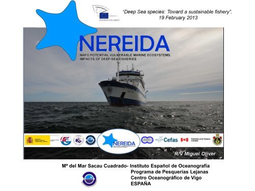
“Deep Sea species: Toward a sustainable fishery”.<br />
19 February 2013<br />
Mª <strong>del</strong> <strong>Mar</strong> <strong>Sacau</strong> <strong>Cuadrado</strong>- Instituto Español de Oceanografía<br />
Programa de Pesquerías Lejanas<br />
Centro Oceanográfico de Vigo<br />
ESPAÑA
Identification of VMEs in the high seas<br />
- Since 2004, discussions on VME have been taking place at the United Nations<br />
General Assembly (UNGA). This process culminated in 2006 with the adoption of<br />
the UNGA Resolution 61/105.<br />
- Spain has undertaken an ambitious and costly program of scientific mapping of<br />
the seabed in different parts of the oceans:<br />
ECOVUL-ARPA Project (2005-2008) 19,000 km 2<br />
ATLANTIS Project (2007-2010) 59,000 km 2<br />
RAP-Sur Project (2008-2010) 15,800 km 2<br />
UNGA resolution 66/68 (2011): Recognized the<br />
utility of the seabed mapping programmes.
CANADA<br />
RUSSIA<br />
UK<br />
SPAIN<br />
NEREIDA project: Institutions<br />
Geological Survey of Canada. Natural resources Canada<br />
Canadian Hydrographic service. Fisheries and Oceans Canada<br />
Centre for Environment Fisheries and Aquaculture Science.<br />
Secretaría General <strong>del</strong> <strong>Mar</strong> (SGM). Ministerio de Medio<br />
Ambiente y Medio Rural <strong>Mar</strong>ino<br />
Instituto Español de Oceanografía
R/V Miguel Oliver<br />
NEREIDA project: Objectives<br />
GENERAL OBJECTIVE<br />
Implementation of the Ecosystem Approach to the Fisheries Management<br />
in order to identify and protect Vulnerable <strong>Mar</strong>ine Ecosystems (VMEs)<br />
paying special attention to the cold water corals and sponges.<br />
MULTIDISCIPLINARY<br />
SURVEYS<br />
2009 & 2010<br />
Cartography<br />
Benthic ecology<br />
Hydrography<br />
R/V Hudson
6 MULTIDISCIPLINARY SURVEYS<br />
368 Box Corer<br />
105 dredges<br />
414 CTD<br />
2 VISUAL SURVEYS<br />
2143 photos<br />
116 hr (video)<br />
NEREIDA: Study area & surveys<br />
RV Miguel Oliver - SGM (Spain)<br />
RV Hudson - DFO (Canada)<br />
NAFO<br />
Regulatory<br />
Area<br />
Total surveyed area: ~69,000 km 2
415 stations<br />
NEREIDA project: Hydrography<br />
CTD
Multibeam echosounder<br />
Parametric sub bottom<br />
profiler (TOPAS)<br />
NEREIDA project: Cartography<br />
Multibeam prospected area: 68,950 km2 TOPAS lines: 28,113 km<br />
R/V Miguel Oliver (SGM)
NEREIDA project: Geology<br />
13 Geological features<br />
Summary of the geological context for the interpretation of the biological samples
Rock dredge<br />
Hard bottoms<br />
NEREIDA project: Benthic studies<br />
Box corer<br />
Soft bottoms<br />
Video and<br />
photographic<br />
transects
NEREIDA project: Rock dredge<br />
105 samples
NEREIDA project: Box Corer<br />
368 samples
NEREIDA project: Video & Photographic Transects<br />
Hudson vessel<br />
CCGS Canada<br />
Sponge Grounds, dominated by large, structureforming<br />
species of Geodia. High structural<br />
complexity & diversity.
NEREIDA project: Photos<br />
2143 photos and 116 hours of video<br />
Hexactinellida<br />
Hippasteria phrygiana<br />
Hudson vessel CCGS Canada
NAFO Management measures<br />
Area Closures & Protection Zones<br />
2007<br />
Four seamounts closed to<br />
bottom fishing<br />
2008<br />
A Coral Protection Zone<br />
declared in Division 3O<br />
2009<br />
Two more seamounts closed<br />
2010<br />
Eleven areas were closed to<br />
bottom fishing to protect<br />
significant concentration of<br />
corals and sponges In total 18 areas in NAFO RA have been<br />
closed to bottom fishing
NEREIDA: Management measures<br />
11 areas identified by groundfish surveys<br />
(UE, Spain and Canada)<br />
Protection of corals and sponges<br />
CURRENT SITUATION<br />
11 closed areas<br />
~ 8,500 km 2<br />
These areas can be<br />
REFINED in light of the<br />
information collected<br />
through NEREIDA.<br />
Review by the<br />
Fisheries Commission<br />
in<br />
2014
Big amount of NEREIDA samples Establish a priority of study on the Closed Areas<br />
Priority<br />
+<br />
-<br />
NEREIDA project: Areas by priority<br />
Table summarizing the amount of samples<br />
Area by Priority using NAFO<br />
CEM numbering and<br />
nomenclature<br />
Box Core Rock<br />
Dredge<br />
Video/<br />
Still<br />
CTD (excl. DFO<br />
data)<br />
Other<br />
6 – Sackville Spur 5 (9) 1 (2) 8 6 (12) MB 100%<br />
2 – Flemish Pass/Eastern<br />
Canyon<br />
21 (33) 14 (8) 3 (4) 28 (35) MB 98%<br />
4 – Eastern Flemish Cap 4 (6) (2) 2 (2) 4 (8) MB 100%<br />
3 – Beothuk Knoll 2 (3) (1) 1 2 (3) MB 100%<br />
5 – Northeast Flemish Cap 3 (7) 4 (3) (1) 7 (8) MB 100%<br />
1 – Tail of the Bank 2 (4) (1) 0 2 (6) MB 100%<br />
8 – Northern Flemish Cap 2 (2) 2 0 2 (2) MB 100%<br />
9 – Northern Flemish Cap 2 (2) 1 (1) 0 3 (3) MB 100%<br />
10 – Northwest Flemish Cap 2 (1) 2 0 3 (1) MB 100%<br />
11 – Northwest Flemish Cap 1 (1) 1 0 2 (1) MB 100%<br />
7 – Northern Flemish Cap 1 0 0 1 MB 25%<br />
3O 0 0 0 0 0
NEREIDA project: Review of the closures<br />
2<br />
6<br />
5<br />
Closed Area 6 at Sackville Spur<br />
Results from analysis were presented<br />
to the NAFO Working Group on the<br />
Ecosystem Approach to Fisheries<br />
Management (WGEAFM). They<br />
supported this closure in its current<br />
form.<br />
Closed Area 5 Flemish Cap<br />
Northeast Prong<br />
Dive results suggested that the lower<br />
bathymetric boundary should be<br />
extended into deeper water to the<br />
2500 m contour.<br />
Closed Area 2 (being studied)
NEREIDA project: Future activities<br />
Review of the current VME closed areas by the<br />
Fisheries Commission in 2014<br />
- New video analysis from the Flemish Cap closures. This analysis will bring<br />
new information related to the assessment of biodiversity with respect to VME<br />
structure forming species.<br />
- Complete analysis of Rock dredge samples against recently produced list of<br />
VME indicator species.<br />
- Complete analysis of Box corer samples. These samples provide a fully<br />
quantitative description of the soft bottom habitat in the NRA. Only 40 (of the<br />
368 samples) have been processed.<br />
All these analysis are critical for the <strong>del</strong>ivery of the review of NAFO fisheries<br />
closures since it is the only source of benthic community data available which<br />
covers all of the closures in the fishing footprint and adjacent areas.<br />
The extent of work on these topics depends on FUNDING
“Deep Sea species:<br />
Toward a sustainable fishery.”<br />
19 February 2013<br />
Thanks for your attention<br />
mar.sacau@vi.ieo.es<br />
Mª <strong>del</strong> <strong>Mar</strong> <strong>Sacau</strong> <strong>Cuadrado</strong><br />
Instituto Español de Oceanografía<br />
Programa de Pesquerías Lejanas<br />
Centro Oceanográfico de Vigo<br />
ESPAÑA