HISTORY OF THE TEXAS HIGHWAY DEPARTMENT ... - CTR Library
HISTORY OF THE TEXAS HIGHWAY DEPARTMENT ... - CTR Library
HISTORY OF THE TEXAS HIGHWAY DEPARTMENT ... - CTR Library

Create successful ePaper yourself
Turn your PDF publications into a flip-book with our unique Google optimized e-Paper software.
<strong>DEPARTMENT</strong>AL<br />
INFORMATION<br />
EXCHANGE<br />
STATE <strong>DEPARTMENT</strong> <strong>OF</strong> <strong>HIGHWAY</strong><br />
AID<br />
P sue TRA SPORTATIOI<br />
PROPERTY <strong>OF</strong><br />
ctltllRRJRTRANSPORTATION RESEA I<br />
R£fERENCE ROOM<br />
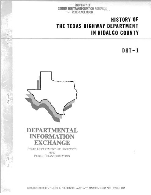
<strong>HISTORY</strong> <strong>OF</strong><br />
<strong>THE</strong> <strong>TEXAS</strong> <strong>HIGHWAY</strong> DEPARTME NT<br />
IN HIDALGO COUNTY<br />
RESEARCH SECTION, FILE DIO-R, P.O . BOX 505 1 AUSTIN, TX 78763-5051, 512-465-7403. STS 241-7403<br />
DHT-l
DISCLAIMER STATEMENT<br />
The contents of this report reflect the views of the authors who are<br />
responsible for the facts and the accuracy of the data presented<br />
herein. The contents do not necessarily reflect the official views or<br />
policies of the State Department of Highways and Public<br />
Transportation. This report does not constitute a standard,<br />
specification, or regulation.
•<br />
•
..<br />
<strong>HISTORY</strong> <strong>OF</strong> <strong>THE</strong><br />
<strong>TEXAS</strong> <strong>HIGHWAY</strong> <strong>DEPARTMENT</strong><br />
IN<br />
HIDALGO COUNTY<br />
1922 to 1968<br />
BY<br />
J. F. SNYDER<br />
DISTRICT ENGINEER, (Retired) 1948-1968
..<br />
A TRIBUTE TO MR. SNYDER<br />
Jimmy Snyder "placed his mark" on expressways and highways in the ten<br />
county area between Brownsville, Texas and the Webb/La Salle county<br />
line. He was a professional engineer with a mind to work, took pride<br />
in a job well done with service to Texas motorists and kept "good<br />
neighbors" along the highway right of way.<br />
Planning, construction and maintenance of highways was Jimmy's job and<br />
as an employee of the Texas Highway Department he made sure of a "good<br />
scald" on that part. During his tenure with the Department Mr. Snyder<br />
watched District 21 grow from 491 miles of unimproved and paved roads<br />
to 2,481 miles of State maintained highways.<br />
The Hidalgo County Historical Committee requested Mr. Snyder to write a<br />
history of the Texas Highway Department's activities in Hidalgo<br />
County. He vigorously searched files in District 21' s headquarter's<br />
office to assure accuracy of this work. His following account of<br />
State highway activities has been used as a reference by District 21<br />
personnel on many occasions. They have found it accurate, informative,<br />
and time saving.<br />
My Snyder died August 21, 1979 in Kearney, Missouri where he lived<br />
close to his daughter, Jil. Interment was at Roselawn Cemetery in<br />
McAllen, Texas. The valley expressway will always be a memorial to<br />
this man of vision and courage.<br />
G.G. Garcia<br />
May 29, 1987
The writer came to Pharr in April 1932 when Highway District 21<br />
was organized, was Assistant District Engineer until 1948 (less<br />
. 3t years in the Corps of Engineers during World War II) when<br />
promoted to District Engineer upon District Engineer J. W.<br />
Puckett's retirement.<br />
The history of the State Highway Department in Hidalgo County<br />
goes beyond this date of 1932, however, and is so closely tied<br />
into the history of the State that it seems necessary to go back<br />
to the beginning of the State and explain the methods of<br />
financing road construction in the State and the counties. Also<br />
because there were roads (trails or routes) before the organization<br />
of the State Highway Department and even before the<br />
organization of Hidalgo County in 1852, that should be mentioned<br />
when talking about roads and highways.<br />
Since Sal del Rey, located in the northeast part of Hidalgo<br />
County, was the chief source of salt for Texas, Louisiana and<br />
northern Mexico, early routes or roads were established in 1749<br />
to Reynosa and Camargo and in 1753 to Meir. One route apparently<br />
was from Sal del Rey through the Laguna Seca area, then to a<br />
crossing of the Rio Grande near the mouth of the Rio San Juan<br />
where there is a sandstone bottom in the river. A second route<br />
was south from Sal del Rey through Llana Grande Grant to Rosario<br />
on the Rio Grande. Rosario Banco, Toluca Banco and the Fernandez<br />
Ranch in the area south of present-day Progreso must have been<br />
the location of Rosario. There was other road work in this area<br />
because the Cameron County Commissioners Court provided funds for<br />
road improvement in 1849. This area was in Cameron County until<br />
Hidalgo County was established in 1852.<br />
The Military Highway is the old road or route best known by<br />
Hidalgo County residents and was located along the southern end<br />
of the county roughly following the Rio Grande. The part of this<br />
old highway most easily seen today is at the Fernandez Ranch near<br />
the north end of the Progreso International Bridge. It is the<br />
first east and west dirt road north of the Progreso Bridge. In<br />
1932 when the writer came to this area, many sections of the old<br />
highway were plainly visible. There was an old iron-pipe pole<br />
telephone line still standing in places. This route was named<br />
the Military Highway because it was used by General Zachary<br />
Taylor during the Mexican War (1846-48) for hauling military<br />
supplies from Brazos Santiago Pass to Fort Brown in Brownsville<br />
and up along the Rio Grande to a military camp at Rio Grande<br />
City. This camp was established as Fort Ringgold in 1848 and<br />
named for the first U.S. officer killed in the Mexican War at<br />
Palo Alto.<br />
There was a trail or route along this area, even before the<br />
Military Highway, used by the Oblate Fathers. St. Joseph Church<br />
at the Toluca Ranch and the Mission La Lomito south of Mission<br />
are on this trail.<br />
1
Texas was admitted to the Union (the second time) in 1870 and<br />
with this secured position was ready to begin real development<br />
and expansion. To meet the need for economic and cultural<br />
growth, it became obvious that good roads were necessary. The<br />
county collected a tax of 25¢ on the $100 valuation until 1883 to<br />
meet the expense of providing better roads.<br />
In 1883, a more definite movement for good roads was started. A<br />
constitutional amendment provided for the County tax rate for<br />
general purposes to be lowered and provisions made for a road tax<br />
of 15¢ on the $100 valuation. The revenue from this tax proved<br />
insufficient so another constitutional amendment was passed in<br />
1890 that provided for an ad valorem road tax not to exceed 15¢<br />
on the $100 valuation.<br />
Continued growth of the State and need for more and better roads<br />
called for more road revenue and in 1903 the Legislature passed a<br />
law authorizing counties to issue bonds for public road improvement.<br />
Later, provisions were made for any county, political<br />
subdivision or a defined road district to vote bonds for public<br />
roads and levy an ad valorem tax for payment of the principal and<br />
interest. Most of the early paved county roads constructed by<br />
Hidalgo County were funded from the sale of road bonds.<br />
Texas was now entering a period of cultural growth that brought<br />
the horse and buggy, the rubber-tired family surrey and finally<br />
the automobile. The increased use of these conveyances demanded<br />
more and better roads, and in 1911 clubs and other organizations<br />
were formed to promote construction of a system of public roads.<br />
A State-wide association began an educational campaign in the<br />
interest of good roads. This resulted in the 1913 passage of a<br />
resolution asking the Legislature to create a state department<br />
that would furnish the counties information, advice and aid on<br />
the construction of highways.<br />
As early as 1903, the Legislature began investigating a Bureau of<br />
Public Highways; the creation of the Office of State Expert<br />
Engineer in 1905; the appointment of a State Highway Engineer in<br />
1907; the Office of a Commissioner of Highways in 1909; and in<br />
1911 and 1913, the establishment of a State Highway Department<br />
with State aid for the construction and maintenance of public<br />
highways and the levying of a license fee on automobiles.<br />
Each successive Legislature measure had failed and very little<br />
was gained in the good roads movement until the approval of the<br />
Federal Road Act on July 11, 1916, which provided for<br />
appropriation of Federal funds to aid the states in construction<br />
of rural post roads. This Act stipulated, however, that such<br />
funds would not be expended until the State had an organized and<br />
established Highway Department because the cooperation with the<br />
State would be through the State Highway Department. The Act<br />
provided that such Federal funds advanced must be matched with<br />
funds raised by the counties.<br />
2
In order to secure the Federal funds appropriated for Texas, the<br />
35th Legislature passed a law agreeing to the provisions of the<br />
Federal Aid Road Act, and on April 4, 1917, made provisions for<br />
the establishment of a State Highway Department. This Act or law<br />
further provided that upon an application from a county for<br />
highway construction, accompanied by appropriate plans and<br />
specifications, the Highway Commission was to grant State aid to<br />
the counties in the order in which the applications were received,<br />
but not to exceed 25 percent of the cost of the work and not<br />
to exceed 10 miles per year. In counties of high valuations<br />
where major highways were warranted, the Highway Department was<br />
authorized to extend aid not to exceed 50 percent and to limit the<br />
aid to 10 miles per year. In the fourth called session of this same<br />
35th Legislature, the amount of aid was changed to a limit of 25<br />
percent and not to exceed 10 miles per year. This Act also provided<br />
that all highways constructed with State aid were to be<br />
maintained by the county in which the improvements were made.<br />
The 36th Legislature provided for acquisition by condemnation of<br />
timber, earth, gravel or other materials needed for highway<br />
construction or maintenance.<br />
The 37th Legislature of 1923 provided for nine District Engineers<br />
to supervise construction.<br />
The 38th Legislature provided for an Occupation Tax of l¢ per<br />
gallon of gasoline with three-quarters of this tax to the State<br />
Highway Fund and one-quarter to the available School Fund. This<br />
Legislature also increased the maximum amount of State aid to the<br />
counties to 50 percent of the cost of the construction. This<br />
Legislature also made provisions that when sufficient funds<br />
accrued to the Highway Fund the Department should assume the<br />
control and maintenance of State Highways.<br />
The Maintenance Division of the Department was then created and<br />
organized and the number of District Engineers raised to 18. The<br />
maintenance of all State highways was taken over January 1, 1924;<br />
however, the Department's funds, personnel and equipment for<br />
maintenance were limited. Since some of the counties already<br />
owned equipment, agreements were made with those counties for<br />
maintenance of State highways under the supervision of the State<br />
Highway Department. Hidalgo County was one of those counties and<br />
such arrangements continued until 1927 when the Maintenance Department<br />
began maintenance with their own forces and equipment.<br />
The Federal Aid Act of November 9, 1921, amended the Act of 1916<br />
so as to provide that Federal funds appropriated for a State<br />
shall be matched by State funds, and that the Highway Department<br />
shall have "direct control" of the funds and maintenance of<br />
Federal Aid highways.<br />
3
This Act required a radical change in highway construction procedures<br />
and in 1925 the 39th Legislature enacted laws that<br />
relieved the counties of construction responsibility and gave the<br />
Highway Department the responsibility of making surveys, plans,<br />
specifications and supervision. The duty of the counties was<br />
reduced to aiding the State in construction of highways by contributions<br />
agreed upon by County Commissioners and the State<br />
Highway Department, with such contributions paid into the State<br />
Treasurer.<br />
The 39th Legislature also provided authority to acquire land<br />
needed for highways by either purchase or condemnation. These<br />
procedures were handled by the counties since right of way for<br />
highways was the responsibility of the counties.<br />
The 40th Legislature raised the gasoline tax from l¢ per gallon<br />
to 3¢ per gallon from March 16, 1927, to September 1, 1928;<br />
after which the tax was to be 2¢ per gallon.<br />
In 1929 the 41st Legislature provided for a reduction and redistribution<br />
of automobile registration fees and increased the<br />
gasoline tax from 2¢ to 4¢ per gallon.<br />
The Legislature in 1932, in special session, diverted the net<br />
proceeds from l¢ of the State gasoline tax from the State Highway<br />
Fund to a special fund for the retirement of outstanding<br />
county and road district bonds, the proceeds of which were spent<br />
in the construction of highways that were then, or at any time,<br />
on the State Highway System. The funds for Hidalgo County by this<br />
action were quite substantial. This diversion left the Highway<br />
Department with proceeds from only 2¢ gasoline tax and approximately<br />
two-thirds of automobile registration fee, one-third<br />
going to counties for lateral road improvements.<br />
District 21 of the Texas Highway Department was created April 1,<br />
1932, from District 16 at Corpus Christi and encompassed the 10<br />
southernmost counties of the State; namely, Brooks, Cameron,<br />
Willacy, Hidalgo, Starr, Duval, Jim Hogg, Zapata, Kenedy and<br />
Webb. Personnel and equipment located in this area were<br />
transferred with the counties.<br />
The Administration of the State Highway Department at this time<br />
was Gibb Gilchrist, State Highway Engineer, W. R. Ely, Cone<br />
Johnson, and D. K. Martin, Highway Commissioners.<br />
Personnel in the area created as District 21 numbered 244, with<br />
approximately 25 in Hidalgo County. Total State highway mileage<br />
in the District was 491 miles, with approximately 90 miles in<br />
Hidalgo County.<br />
The new District was created so as to place additional<br />
engineering personnel in the area where highway expansion was<br />
needed and to get Highway representation closer to the people.<br />
4
State-maintained highways in Hidalgo County at the time District<br />
21 was organized were S.H. 66 (now U.S. 281) from Brooks County line<br />
south to Pharr, and S.H. 4 (now U.S. 83) from Starr County line to<br />
Cameron County line. Also included was a conditioned designation<br />
S.H. 48, from Mission south to Madero and on east to Cameron<br />
County line.<br />
District 21 began operations on April 1. 1932. under the<br />
supervision of J. W. Puckett. District Engineer. The first<br />
District Headquarters Office was located in Pharr upstairs in the<br />
bank building at South Cage and Caffery, now the Hale Hardware<br />
Store. The first District Shop was on North Cage in Pharr in an<br />
old filling station.<br />
The first order of business was to establish a headquarters.<br />
When considering the location and construction of a new District<br />
Headquarters buildings. the surrounding cities. as well as Pharr.<br />
were considered. Pharr offered to pay half the cost of the<br />
property needed, so Pharr was selected as Headquarters.<br />
Plans and specifications were prepared for office and shop<br />
buildings. Contract was let to R. W. Briggs & Company in January<br />
1933 and work was completed in late August 1933. just in time for<br />
the big hurricane on Labor Day 1933.<br />
District Supervisory Personnel in 1933. when the District<br />
Headquarters moved into the new office building on North Cage,<br />
were J. W. Puckett. District Engineer; J. F. Snyder. Assistant<br />
Engineer; L. McKenzie, District Accountant; H. L. Teer,<br />
Warehouseman; C. H. Franks, District Mechanic: S. R. Busby,<br />
Office Engineer. Other supervisory personnel in Hidalgo County<br />
at that time were P. S. Devine. Resident Engineer; E. W. Pile,<br />
Maintenance Foreman.<br />
The next order of business for the new District was to secure<br />
engineering personnel and establish engineering residencies for<br />
making surveys, preparation of plans and specifications for<br />
highway construction. One residency was established for Hidalgo<br />
County and located in Pharr. The existing maintenance headquarters<br />
were retained at their previous locations and the<br />
maintenance headquarters for Hidalgo County was located at<br />
McAllen. Mr. E. W. Pile was Maintenance Foreman.<br />
The first occurrences of importance to the new District in 1932<br />
were two floods in the Rio Grande that put water through the<br />
floodway system for the first time. The first flood was in<br />
September. the second in October. All county roads crossing the<br />
floodway were closed for several days, closing as the flood moved<br />
downstream and opening as the flow subsided. This floodway was<br />
constructed by Hidalgo and Cameron Counties to provide relief<br />
from the Rio Grande flooding from Hidalgo to Brownsville. One<br />
leg of the floodway began at a very low area near the river and<br />
5
southwest of Mission and was called the Mission Floodway. The<br />
other leg began at a low area called Hackney Lake. just upstream<br />
and north of Hidalgo. Levees were built at these low overflow<br />
areas to lead overflow water to the east and northeast to a<br />
junction south of and between McAllen and Pharr, where the system<br />
formed one floodway. This channel or floodway then followed low<br />
ground toward the east. swinging to the southeast to a point 1%<br />
miles from the river south of Donna. then turned northeasterly to<br />
a point south of Weslaco and Mercedes where the floodway split.<br />
One leg following the Arroyo Colorado to Harlingen, Rio Hondo and<br />
east to the Laguna Madre. The other leg turned north along the<br />
west edge of Mercedes. ran north about 12 miles and within a mile<br />
of La Villa. then easterly into Cameron County and across the<br />
northwest corner of the county and crossing into Willacy County<br />
about 7 miles east of Sebastian. The floodway then continued in<br />
a northeasterly direction past Santa Monica to a point<br />
approximately 7% miles east, where water is released into the<br />
flats of Laguna Madre about 3 miles north of the Arroyo Colorado.<br />
The location of this floodway is described rather carefully<br />
because as long as it exists it will affect road building and<br />
travel from west of Mission where it begins to a point within 7%<br />
miles of its end, for a distance of approximately 75 miles, 49 of<br />
which are in Hidalgo County.<br />
The Highway Departmentls only trouble with this 1932 flood was at<br />
Mercedes, the only State highway crossing with the floodway in<br />
Hidalgo County at that time. where it was necessary to work and<br />
guide driftwood and small buildings under the wood trestle to<br />
prevent the collection of drift against the structure. The only<br />
damage was the levee being washed out on S.H. 96 where the north<br />
floodway crosses.<br />
The International Boundary and Water Commission (IB&WC) took over<br />
the responsibilities of the floodway system in the early 1930 1 s.<br />
The principal objective of the new District was to plan and<br />
construct a public road network adequate to serve the needs of<br />
the area. The District Engineer began an immediate review of<br />
existing State highways and their needed improvements, county<br />
paved roads that should be added to the State System and county<br />
dirt roads that should be paved and placed on the State System.<br />
The District Engineer met with county and city officials to<br />
listen to their needs and thoughts concerning new and improved<br />
roads. The District Engineer discussed his ideas and thoughts<br />
relative to new designations with the State Highway Engineer<br />
and, following an agreement as to which roads seemed most important,<br />
presented the recommendations to the Highway Commission tor<br />
consideration.<br />
6
U.S. Highway 83 from Pharr to the Cameron County line was<br />
constructed in 1924, 1925 and 1926 under FAP 301 and FAP 374.<br />
The type of construction from Pharr to Val Verde (FAP 301)<br />
consisted of 15-foot wide flexible base with an 18-inch flat<br />
concrete curb on each side for a total width of 18 feet and<br />
surfaced with limestone rock asphalt. From Val Verde to the<br />
Cameron County line (FAP 374 A, B. BII) the pavement was concrete<br />
base and limestone rock asphalt surfacing, the same as from Mamie<br />
to Pharr. The same type NRWR jobs as between Mission and Pharr<br />
were completed on this section. East of Mercedes a Works Progress<br />
Administration (WPA) Project was approved to lay concrete drainage<br />
pipe where drainage was necessary and then fill the extremely deep<br />
ditches to normal ditch depth. A Highway Department project to<br />
widen the pavement 14 feet on the railroad side was approved and<br />
completed giving a three-lane road from Mission to the Cameron<br />
County line. Another operation that was performed along with the<br />
slope-flattening and ditch-filling jobs was the three-up mile team<br />
and fresno work of leveling out the ridge of soil between the road<br />
and railroad ditches and forming one common ditch. This was done<br />
from Mission to Harlingen in Cameron County.<br />
U.S. Highway 281 from Brooks County line to Pharr (FAP 250 and FAP<br />
301) was constructed in 1922 and 1925. These projects were under<br />
the direct supervision of Hidalgo County personnel. From Brooks<br />
County line south to San Manuel. the pavement was flexible base<br />
(poor-quality caliche) with limestone rock asphalt surface. The<br />
specifications called for "hot mix asphalt." Since it would have<br />
to be hauled 35 miles in wagons, it could not be done. In 1934-35<br />
the base and surface were reconstructed and widened under an NRWR<br />
Project. from seven miles south of Brooks County line to San<br />
Manuel. In 1937, the section from Brooks County line to seven<br />
miles south was reconstructed with concrete pavement. The<br />
section of flexible base and asphalt surface from San Manuel<br />
north to the concrete pavement was under continuous heavy<br />
maintenance and reconstruction of short sections. In 1952-53,<br />
caliche shoulders were added for the entire section from San<br />
Manuel to the Brooks County line.<br />
From Edinburg to San Manuel, the pavement was flexible base<br />
(caliche) with limestone rock asphalt surface. This pavement<br />
was reconstructed in 1934-36 and the base and surface widened to<br />
24 feet and 20 feet respectively. Continual improvement to short<br />
sections and heavy maintenance were the order of the day from 1937<br />
to 1954. There were several rather sharp curves on this section<br />
as a result of the original location dodging waterholes or<br />
adjusting to land lines. To ease those spots, additional right<br />
of way was secured and two additional traffic lanes were<br />
constructed (as well as easing the curvature on the existing<br />
lanes some) to provide a four-lane divided highway. On the longer<br />
curves additional right of way was secured and two additional<br />
traffic lanes were constructed to provide a four-lane divided<br />
8
highway. Finally. in 1963-64. with additional right of way<br />
secured to give 300-foot width. two new traffic lanes were added<br />
to tie into the short four-lane sections and also extended to two<br />
-.iles north of San Manuel. This construction provided a fourlane<br />
divided highway fro. north of San Manuel to Pharr.<br />
U.S. Highway 281 from Edinburg to Pharr was constructed in 1925<br />
under FAP 301. The type of construction on this project<br />
consisted of a 15-foot wide flexible base with an 18-inch flat<br />
concrete curb on each side for a total width of 18 feet.<br />
Surfacing was with li.estone rock asphalt. In 1934 and 1935 the<br />
slopes were flattened and deep ditches eliminated under an NRWR<br />
Project. This project was to provide jobs for the une.ployed and<br />
everything except the hauling of the soil was done by hand. In<br />
1945-46. the pave.ent was widened six feet on the east side and<br />
resurfaced. Heavy .aintenance continued. including another<br />
resurfacing job. up to 1954. In 1954-55 the right of way was<br />
widened to 100 feet and the road reconstructed to a four-lane<br />
divided highway. There were two additional traffic lanes<br />
constructed on each side of the existing pavement and the 15 feet<br />
of flexible base pavement between the two l8-inch curbs were<br />
re.oved. The median area was backfilled with soil for planting<br />
and beautification. Paved shoulders were added in 1956 and the<br />
pave.ents were resurfaced. Palm trees and bougainvillea shrubs<br />
were planted in the median area. Two types of colors of<br />
bougainvilleas were used: the purple Convent and the red Barbra<br />
Karst.<br />
The first designation in Hidalgo County following the organization<br />
of the District was an extension of S.H. 66 (U.S. 281) from Pharr<br />
to the International Bridge at Hidalgo. Highway Department operations<br />
stopped at the river levee on the approach to the bridge.<br />
At that time it was considered inappropriate to expend public<br />
funds to tie into or with private enterprise. This designation<br />
was made in early 1932 and a Highway Commission Minute in July<br />
1932 provided authority and funds for the necessary surveys. and<br />
plans and specifications to pave the remaining section of this<br />
designation. Hidalgo County had paved from Pharr south 3.76<br />
miles in 1928. and also from McAllen south to the International<br />
Bridge in 1927. a portion of which (from one mile east of Hidalgo<br />
to the International Bridge) was on the new designation. Plans<br />
and specifications were prepared. right of way was secured by<br />
Hidalgo County. the necessary funds provided in February 1934 and<br />
the contract for construction was let. R. W. Briggs & Company<br />
was successful bidder. Construction was completed in late 1934<br />
and the designated route placed on the Highway System for<br />
.aintenance.<br />
9
State Highway 107 from Edinburg to the Cameron County line was<br />
conditionally designated in June 1932. As the conditions (which<br />
were mostly right of way) were met, the Highway Department took<br />
the road over for maintenance. The section from La Villa to the<br />
Cameron County line was not open except for the crossing of the<br />
floodway. In December 1935, authority was granted to make<br />
location survey for the new route and to prepare plans and<br />
specifications for grading and small structures. Hidalgo County<br />
secured and fenced the right of way. Grading was done in 1936.<br />
Base and surface construction was done in 1942 and taken on the<br />
State Highway System for maintenance. This section of road was<br />
rebuilt in the middle 1950's.<br />
The IB&WC widened the floodway, raised the levees and dug a pilot<br />
channel through this area in 1939 and constructed a concrete<br />
structure in the pilot channel in 1939-40.<br />
The Edinburg to La Villa section of S.H. 107 was constructed in<br />
1928 by Hidalgo County. Construction was flexible base with<br />
asphalt surfacing on 60-foot right of way. An unusual project<br />
for the Highway Department in 1938 was the sidewalk for school<br />
children from Elsa to the Elsa-Edcouch School and on to Edcouch.<br />
The Highway Department prepared the subgrade for this sidewalk<br />
and a contractor working for the school placed the asphalt. In<br />
1940, the roadbed was widened, slopes were flattened and drainage<br />
improved. In 1941, an asphalt seal coat was applied. In 1949,<br />
1950 and 1951, sections of the road were reconstructed using<br />
flexible base with asphalt concrete surfacing. In 1954, the road<br />
was resurfaced and then again in 1958 a seal coat was applied.<br />
Extra right of way was secured by Hidalgo County and the road<br />
from Edinburg to one mile east of La Villa was made into a fourlane<br />
divided highway in 1965 and 1966.<br />
State Highway 107 from Edinburg to Mission was designated and<br />
taken over for maintenance in 1940. This road was built by<br />
Hidalgo County in 1929 and the asphalt surface was deteriorating<br />
rapidly. The Highway Department placed an asphalt seal coat on<br />
the surface to stop raveling and help preserve the road until<br />
funds became available for reconstruction. Heavy maintenance<br />
continued until the beginning of World War II when most road work<br />
stopped. In 1948 and then again in 1951, sections of the road<br />
were reconstructed, drainage and irrigation structures widened and<br />
asphalt surface applied. In 1965, the section from Edinburg to<br />
S.H. 336 was reconstructed to four lanes.<br />
The next designation in the new district was S.H. 186, December<br />
1932 and January 1933, from S.H. 66 (U.S. 281) east to<br />
Raymondville, 9.2 miles of which was in Hidalgo County. The<br />
location surveys were made and approved and right of way was<br />
secured and fenced by Hidalgo County. In July 1933, the time of<br />
the Great Depression, Federal funds were made available for<br />
highway construction to create jobs for the unemployed. Jobs<br />
using mostly hand labor were preferred. With the right of way<br />
10
secured and fenced. an NRWR Project was programmed in 1935 to<br />
do the clearing and grubbing by hand. When the clearing and grubbing<br />
was completed. a Works Progress Project was program.ed in<br />
'1936 to do the grading and small drainage structures. Grading was<br />
roughed in with machinery and finished by hand labor.<br />
The highway was maintained as a dirt road until 1939 when an<br />
experimental soil-asphalt-stabilized base was constructed. Each<br />
District at that time was required to have at least one<br />
experimental job.<br />
In 1940, short sections of the soil-asphalt base were reconditioned<br />
by adding only select sandy soil and remixing. An asphalt<br />
surface was then applied. In 1955 the road was reconstructed by<br />
adding caliche and widening, then asphalt surfacing. The shoulders<br />
were paved in 1968. There is one place on S.H. 186 from<br />
which Sal del Rey can be seen, 3.8 miles east of U.S. Highway 281.<br />
There is a bronze plaque at this point.<br />
The great hurricane of 1933 blew in on Labor Day. September 4<br />
and 5. High winds and heavy rains had reached the Pharr area<br />
about 4:00 p.m., September 4th and continued until noon the next<br />
day. While everyone was secured at home or in a strong building,<br />
the District Engineer routed the writer out about noon to assess<br />
the damage. It did seem a little soon because sheets of<br />
galvanized iron roofing were flying through the air like razor<br />
blades. Heavy damage to residential areas, business buildings,<br />
industry, vegetable and citrus crops occurred. The heaviest<br />
damage seemed to be in the eastern part of Hidalgo County and the<br />
western part of Cameron County. Damage to the State Highway<br />
System was very light since only U.S. 83 and U.S. 281 were on<br />
the system. Quite a lot of debris was moved from the pavement.<br />
Telephone and power poles were down on roads in several places<br />
but the utility companies removed these as fast as possible.<br />
Trucks and personnel were sent to the District by the Austin<br />
Office. Since they were not needed for highway purposes, they<br />
were used to help the stranded and destitute residents. Total<br />
cost to District 21 was $6,400. The flood that followed on the<br />
Rio Grande caused the same trouble at the timber trestle crossing<br />
floodway at Mercedes as did the 1932 floods. Trash and driftwood<br />
"hung up" on the timber trestle. Newly designated U.S. Highway<br />
281 south of Pharr was closed at the floodway for several days.<br />
In 1933 a Landscape Engineer was hired by the Highway Commission<br />
to counsel and advise the districts on roadway landscaping. This<br />
started the roadway beautification in Hidalgo County. All maintenance<br />
and construction personnel were coached toward this goal.<br />
This was a popular policy and District 21 moved into the program<br />
rapidly since District Engineer J. W. Puckett was already oriented<br />
along this theme. As early as 1928 in west Texas, Puckett would<br />
remind the writer. "don't cut down that tree, we'll leave it for a<br />
11
watermelon tree." A "watermelon tree" was a place where a person<br />
could pull off the road, get in the shade and cut a watermelon.<br />
It is nice to think that those watermelon trees might be the first<br />
roadside parks. A roadside park was constructed on U.S. 281 Spur<br />
at the two canals 1.5 miles east of Hidalgo in the late 1930's.<br />
In 1935, the Highway Commission authorized funds to complete the<br />
NRWR projects that were started for relief to the unemployed<br />
because that labor was no longer available. This must have been<br />
when the "give away" programs started.<br />
In 1935, Project NRS 785 was approved for concrete paving on U.S.<br />
281 from Progreso southeast to a junction with an asphalt-paved<br />
road 4.5 miles south of Mercedes. The project was completed in<br />
1936. The asphalt road mentioned above began at Mercedes and ran<br />
south to the old Military Highway at the end of NRS 785 to the<br />
Cameron County line. This section of road from the end of NRS<br />
785 to the Cameron County line was built by Hidalgo County in<br />
1928 and taken over for maintenance in 1936. There was an<br />
asphalt-paved road or spur off U.S. 281 leading to the<br />
International Bridge to Rio Rico, Mexico. This International<br />
Bridge was washed out during the Rio Grande flood of 1941.<br />
In 1935, additional land was purchased adjacent to and back of the<br />
District Headquarters layout for the Hidalgo County Maintenance<br />
Section. The maintenance section located at McAllen was moved to<br />
Pharr.<br />
About this time the Highway Department developed a nursery at<br />
District Headquarters for propagating their own plants for<br />
highway beautification. Mr. J. E. Pitman was employed as<br />
District Landscape Supervisor.<br />
There was a flood on the Rio Grande in late 1935 that washed out<br />
the earth embankment on the approach to the International Bridge<br />
between the river levee at Hidalgo and the bridge. This approach<br />
had just been taken over for maintenance by the Highway<br />
Department and the washout was repaired by a special maintenance<br />
job by the State. It was taken on the system for maintenance in<br />
early 1936. All county roads crossing the floodway were closed<br />
by the Rio Grande floodwaters from the 1935 flood.<br />
A policy was adopted by the State Highway Department in 1936 to<br />
furnish and maintain a 4" x 4" post for rural mailboxes and to<br />
gravel a turnout from the pavement to the box for the convenience<br />
of the rural mail carrier. This was a very popular procedure.<br />
In connection with the Texas Centennial Exposition, the Highway<br />
Department erected a granite monument for each county in the<br />
State with bronze inscription plates giving a brief history of<br />
the county. The monument for Hidalgo County was placed 1% miles<br />
north of the Courthouse Square on U.S. 281, but later was moved<br />
to the new Courthouse Square.<br />
12
In 1936, the Highway Department entered into an agreement with<br />
W. O. Washington, Civil Engineer at Brownsville, to study and<br />
. prepare a Master Highway Plan for Hidalgo, Cameron, and Willacy<br />
Counties. This was the start of the advance planning for the<br />
Valley Expressway System.<br />
In 1938, the county roads crossing the f100dway were closed by the<br />
September flood, and again by the October flood.<br />
The District Headquarters staff was constantly growing because of<br />
increasing highway activity, so in 1939 the District Office<br />
Building was enlarged by adding new wings on each end that<br />
almost doubled the size.<br />
In 1939, the first major landscape project was initiated. From<br />
Pharr south to Hidalgo on U.S. 281 and U.S. 281 Spur, groups of<br />
palm trees, tiger apples and other shrubs were planted in areas<br />
where interference with maintenance would be at a minimum.<br />
State Highway 336 from S.H. 107 south to U.S. 281 Spur at Hidalgo<br />
was designated and taken over for maintenance in 1940. The<br />
section from McAllen to Hidalgo was constructed by Hidalgo County<br />
in 1927, including the two timber trestles crossing the f100dways<br />
and was nicknamed by local and county citizens as the "Nickel<br />
Plated Road to Hell" partly because it was quite expensive but<br />
mostly because it led to the gambling and drinking at Reynosa.<br />
'From McAllen south to Spur 281, an asphalt seal coat was applied<br />
in 1943. In 1945 base and surface were widened. In 1947 the two<br />
timber trestles across the floodways were rebuilt by placing<br />
concrete decks. In 1950 the highway was again resurfaced and<br />
caliche gravel shoulders were added to the pavement in 1951. In<br />
1965-66 the highway was completely reconstructed.<br />
The north section from S.H. 107 to McAllen was built in 1929 by<br />
Hidalgo County. An asphalt surface treatment was applied to the<br />
pavement in 1943. In 1955 this section was completely rebuilt to<br />
24-foot pavement, with all-weather shoulders. In 1960 the shoulders<br />
were paved with asphalt.<br />
In 1966, McAllen proposed to lengthen the runways at the airport<br />
and requested that S.H. 336 be relocated to the east around the<br />
runway extensions. The Highway Commission agreed subject .. to<br />
McAllen paying for the cost of relocation and construction of a<br />
like facility. McAllen agreed to this plan but before work could<br />
get underway the great flood following the heavy rains of<br />
Hurricane Beulah hit.<br />
Following this flood the IB&WC changed their floodway plan. The<br />
Hackney Lake f100dway was to be enlarged and the Mission floodway<br />
to be abandoned. This eliminated the need for the high water<br />
crossing on the Mission floodway and reduced the cost of<br />
13
elocating S.H. 336 to the City of McAllen but, of course,<br />
created a problem for the Highway Department at the Hackney Lake<br />
floodway. Plans were completed for the relocation of S.H. 336,<br />
contract was let for reconstruction and work was done in 1968-69.<br />
A considerable amount of detail concerning the construction, type<br />
of reconstruction, type of maintenance and dates of such work has<br />
been given for those State Highways that were in existence<br />
before, and those designated since, the organization of this<br />
District to help the reader to better understand the tremendous<br />
problem of maintaining a first-class highway system. In addition<br />
to the major projects listed and discussed for each of the<br />
preceding highways, there were numerous special improvement<br />
projects for each road such as lengthening culverts, lengthening<br />
irrigation siphons, flattening or superelevating curves, raising<br />
grade in low areas subjected to flooding, strengthening base in<br />
distressed areas, sealing sections where surface shows deterioration,<br />
improving edges and, of course, the ever-present daily<br />
maintenance.<br />
With the threat of war in 1939, 1940 and 1941 growing, and with<br />
increased armament and defense building of training camps and<br />
airfields, the road-building program began to slow down and the<br />
last construction project in Hidalgo County before the war was<br />
from Elsa north to S.H. 186 under FAS Ill-A. The project<br />
provided a mid-valley outlet to the north and resulted from<br />
District planning to provide a system of highways to meet the<br />
needs of the people.<br />
With the declaration of war with Japan on December 7, 1941, and<br />
Germany on December 11, 1941 (World War II) engineering personnel<br />
began joining contracting firms and government agencies for<br />
construction of training camps and airfields. Everyone and everything<br />
that was geared for road building, except for defense purposes,<br />
came to a grinding halt and the highways declared<br />
expendable. This left the districts with little to do except<br />
planning and maintenance work on a reduced scale. Only minor construction<br />
work was done and was more heavy maintenance than<br />
construction.<br />
The writer left the Highway Department on May 31, 1942, served<br />
with the Corps of Engineers in New Mexico building airfield<br />
runways, then to the Middle East (believe it or not) building<br />
roads on the Russian supply route, then to Germany and then with<br />
the German surrender on May 7, 1945, returned to the United States.<br />
With the surrender of Japan on August 14, 1945 the writer was discharged<br />
from the Army and returned to the Highway Department in<br />
October 1945.<br />
With the end of the war in August 1945, the Highway Department<br />
geared itself for an expanded highway program and especially the<br />
reconstruction of highways badly deteriorated from the war years.<br />
14
A new concept of highway building was started, the Farm-to-Market<br />
Road System. This system was conceived by the Highway Department<br />
. Administration during the war years and with the war over, began<br />
planning and construction on a three-year Farm-to-Market Program.<br />
The passing of the Colson-Brisco Act in 1949 started the most<br />
dramatic rural road building program in history.<br />
During the planning of the Farm-to-Market System it was realized<br />
that many of the county roads taken into the system would be<br />
burdened with unpaid bond indebtedness. If these bond debts were<br />
assumed by the State, as provided by the 1932 law, it would be<br />
very expensive and interfere with the development of the<br />
Farm-to-Market System. In 1943, Senate Bill 348 of the 48th<br />
Legislative Session was passed prohibiting the assumption of bond<br />
indebtedness on any county road taken into the Farm-to-Market<br />
System.<br />
The first farm-to-market road in Hidalgo County was designated on<br />
May 18, 1943. This road, designated F.M. 88, began at Elsa,<br />
junction with S.H. 107, and extended south through Weslaco to<br />
Progreso and was taken over for maintenance in July 1944.<br />
This road was constructed by Hidalgo County in 1930 and was<br />
concrete pavement. The timber trestle across the Arroyo Colorado<br />
Floodway was in poor condition and deteriorating rapidly, so in<br />
1948 the Highway Department removed this trestle and replaced it<br />
with a low water concrete structure. This proved to be quite<br />
unpopular because the road was closed during flooding in the Rio<br />
Grande. In 1962, the route of F.M. 88 was changed to run straight<br />
south from Weslaco to U.S. Highway 281 and a high water concrete<br />
structure was built across the Arroyo Colorado Floodway.<br />
The section of F.M. 88 between Weslaco and Elsa was reconstructed<br />
to 26-foot pavement with 10-foot paved shoulders in 1957.<br />
In November 1943, the F.M. 88 designation was extended north from<br />
Elsa to S.H. 186 and took in the road paved by the Highway<br />
Department in 1942 under FAS Ill-A.<br />
In 1952, F.M. 88 was extended from U.S. 281 just east of Progreso<br />
to the International Bridge on the Rio Grande.<br />
F.M. 681, the road from Cantu to Moore Airfield, was built in<br />
1942 as a war highway by the Highway Department for the government<br />
and was to be maintained, by agreement, through the war to a time<br />
six months after the war.<br />
The Highway Commission designated this road as F.M. 681 and<br />
assumed maintenance in April 1946. A short section of this<br />
highway from Cantu west two miles was built by Hidalgo County in<br />
1929.<br />
15
In 1936, the Highway Planning Division began accumulating<br />
information on highway traffic and it was around 1940 when<br />
sufficient data was at hand to analyze, with any degree of<br />
accuracy, the traffic needs of the Valley.<br />
It was not until after World War II that planning to any great<br />
degree got underway again. Origin and Destination Surveys to<br />
determine where traffic originated and where it was going were<br />
made, traffic census and traffic volume projections were<br />
continued. The data accumulated by the Planning Division and the<br />
Bureau of Public Roads on traffic and traffic behavior clearly<br />
outlined the need for a multiple-lane divided highway.<br />
Approximately 75 percent of the population and approximately 8<br />
percent of the commercial and industrial activities between<br />
Mission and Harlingen were largely confined to a strip about<br />
three miles in width from about three-quarters of a mile south of<br />
U.S. 83 to about two and one-quarter miles north. Practically all<br />
of the industries--that is, loading platforms for both truck and<br />
railroad shipments, packing plants and canning factories--are<br />
located north of the Missouri Pacific Railroad and, in general,<br />
immediately contiguous thereto. It seemed reasonable to believe<br />
that this strip would continue to maintain and even increase the<br />
high traffic density. The conclusion was reached that the<br />
additional traffic facility would afford the greatest relief to<br />
traffic and be of the most benefit to the entire area served, with<br />
a divided highway, if it was built along the north side of the<br />
Missouri Pacific tracks and as close thereto as practical and<br />
feasible so as to encourage further industrial development along the<br />
railroad.<br />
The Valley Chamber of Commerce and county and city officials<br />
approached the Highway Commission in 1946 asking for a four-lane<br />
highway. The Highway Commission, considering the results of the<br />
highway studies by the Department, counter-offered with an<br />
expressway proposal on wide right of way.<br />
In 1948, the Highway Commission passed a Minute Order designating<br />
an expressway at-grade from Mission to Harlingen.<br />
A committee of civic-minded citizens was organized, with C. H.<br />
Britton of McAllen appointed chairman, to promote and carry the<br />
expressway proposal to a bond election. The cost of the right of<br />
way, based on tax valuations, was estimated at $1,550,000 by<br />
District personnel. The bond election was to authorize the sale<br />
of $1,500,000 in bonds to finance the cost of the right of way,<br />
which was the responsibility of Hidalgo County. The bond election<br />
was held on May 6, 1950, but failed to carry by only a small<br />
margin. Disappointment over the bond election failure resulted in<br />
temporary loss of interest in the expressway.<br />
17
Right in the middle of this expressway proposal, the writer was<br />
promoted to District Engineer on March 1, 1948.<br />
In 1948, a project was approved and financed for grading and paving<br />
with flexible base and asphalt surface on U.S. Highway 281 from a<br />
point seven miles south of Pharr at junction U.S. 281 and U.S. 281<br />
Spur, east to Progreso. The project was completed in 1949. This<br />
project connected with the concrete pavement at Progreso, built in<br />
1935 as an NRS job by the Highway Department.<br />
In 1948, another group of farm-to-market roads was designated as<br />
follows:<br />
1. F.M. 1016 from Mission south to Madero, then southeast<br />
and east to S.H. 336.<br />
2. F.M. 1015 from Edcouch north five miles.<br />
3. F.M. 1017 from San Manuel junction U.S. 281 and S.H. 186,<br />
west three miles.<br />
4. F.M. 681, Moore Airfield north to McCook.<br />
(This job later added to the McCook Road District<br />
Program.)<br />
5. F.M. 495 from east end of F.M. 495, south on the Val<br />
Verde Road to U.S. 83.<br />
Farm-to-market projects were selected by the District Engineer<br />
following studies relative to amount of existing traffic, traffic<br />
expected after completion, territory served (cultivated citrus or<br />
ranch land), farm residences, schools, mail routes, oil fields,<br />
industries, connections with other roads or possible future roads<br />
and cities or towns served. The projects selected were presented<br />
for approval to the County Commissioners, who usually gave their<br />
okay based on the merit of the job. Sometimes a commissioner<br />
would favor some other road (perhaps some political obligation)<br />
but when confronted with the supporting data usually withdrew his<br />
objection. The F.M. Program was then submitted to the State<br />
Highway Engineer for his review and approval and submitted to the<br />
Highway Commission for final approval.<br />
In 1948, there were two floods in the Rio Grande. One in September<br />
and one in October. Both floods put water in the floodways and<br />
closed county roads.<br />
Successful contractors bidding on farm-to-market roads through the<br />
first two programs were South Texas Construction Company, E. B.<br />
Darby & Company, and H. B. Zachry Company.<br />
At the time the writer was made District Engineer, the Highway<br />
Commission members were John S. Redditt, Fred E. Knetch and<br />
Fred A. Wemple. The State Highway Engineer was Dewitt C. Greer.<br />
On the highway approaches to the cities, where traffic was heavy,<br />
it was most difficult to maintain the slopes and ditches because<br />
of the in-and-out traffic from the pavement to business<br />
18
establishments. During wet weather, traffic would rut the ditches<br />
and block drainage, the ditches would collect trash, and in<br />
. general the highway entrances were not too attractive.<br />
In the late 1940's the Highway Department adopted a policy of<br />
joining the cities in cooperative highway improvement projects.<br />
This plan provided that the city adjust the utilities, provide<br />
drainage, right of way if required, construct curbs and gutters,<br />
and maintain the city-constructed responsibilities, all of which<br />
was to be done under the general or direct supervision of the<br />
Highway Department. The Highway Department was to strengthen the<br />
pavement if necessary, and widen to meet the curb and gutter and<br />
maintain. These projects really cleaned up the highway approaches<br />
to the cities and were very popular. Most every city in Hidalgo<br />
County had one or more of these projects. In Hidalgo County the<br />
first curb and gutter street section job was in Elsa on F.M. 88 in<br />
July 1948.<br />
Another Highway Department policy was inaugurated in the late<br />
1940's because of the increased traffic and the increased traffic<br />
accidents at highway intersections. This policy was to provide<br />
traffic signals, flashing signals or fixed-time signals, at<br />
intersections with poor accident records. One of the first<br />
flashing light signals on the State Highway System in Hidalgo<br />
County was on U.S. 83 at Sharyland Road and was installed in July<br />
1948. This program never slowed down and in the 1950's rapidly<br />
increased to the present.<br />
The District Headquarters Building was air-conditioned in June<br />
1949.<br />
In July 1949, a Farm-to-Market Program was formed with projects<br />
approved for Hidalgo County as follows:<br />
1. F.M. 1423 from S.H. 107, 5.8 miles east of Edinburg,<br />
south to F.M. 495.<br />
2. F.M. 1423 from U.S. 83, 0.8 mile west of Donna, south<br />
1.4 miles. This was a "politico" job.<br />
3. F.M. 1425 from U.S. 83, 1.5 miles east of Mercedes,<br />
north 4.5 miles.<br />
4. F.M. 2557 from U.S. 83, 0.2 mile east San Juan,<br />
south to U.S. 281.<br />
5. F.M. 1427 from U.S. 83, 4.0 miles west of Mission,<br />
south through Abrams, then westerly to Penitas.<br />
6. F.M. 676 from S.H. 107, 4.5 miles north of Mission,<br />
west 4 miles.<br />
7. F.M. 491 from U.S. 83 in Mercedes, south to<br />
U. S. 281.<br />
These projects were moved to construction the same as previous<br />
projects and assumed for maintenance upon completion.<br />
19
The National Congress failed to pass a Highway Act in 1949 so the<br />
Highway Commission, in order to keep the Para-to-Market Program<br />
moving, adopted a program of work based on the 75:25 basis and<br />
offered it to the counties for consideration. The program<br />
provided that the county pay 75 percent of the cost of<br />
construction and furnish the right of way on roads acceptable to<br />
the Highway Department for addition to the Parm-to-Market System.<br />
The State was to pay 25 percent of the cost of construction, perform<br />
all the engineering and take the road on the Parm-to-Market<br />
System for maintenance when completed.<br />
The people in the area around McCook and those around Edcouch,<br />
decided they did not want to wait until the State reached their<br />
area with farm roads and were willing to vote themselves into debt<br />
to get the roads without further delay.<br />
Representatives from these areas met with the District Engineer to<br />
discuss the procedures and the roads they wanted to build. The<br />
District was agreeable to the roads requested, the roads were<br />
cleared through the Austin Office and estimates of cost were<br />
furnished to the area representatives.<br />
Road Districts were organized, bonds voted and money made<br />
available to the Highway Department through Hidalgo County. The<br />
persons most active in the McCook Road District were Henry<br />
Goedrich. A. D. Horn and Lucian Pilarczyk. The roads approved<br />
for the McCook Road District were as follows:<br />
1. P.M. 681 from Moore Airfield north to McCook.<br />
2. P.M. 681 continued, from McCook north to near<br />
Puerto Rico.<br />
3. P.M. 1017, from end of F.M. 1017, 3 miles west of San<br />
Manuel, northwesterly to Puerto Rico and on west to<br />
Starr County line.<br />
4. F.M. 2058 from McCook south 1.76 miles.<br />
5. P.M. 490 from McCook west to Starr County line.<br />
6. F.M. 590 from F.M. 681, 2.3 miles east of McCook, east<br />
6.2 miles.<br />
These projects were moved to construction the same as other<br />
Parm-to-Market projects and when completed were taken into the<br />
State Farm-to-Market System for maintenance. These projects were<br />
all completed by 1954.<br />
The persons most active in promoting the Edcouch Road District<br />
were Albert Hughes, Mr. Archer, Leroy Haskell and Emmett Cooper.<br />
The projects approved for the Edcouch Road District were as<br />
follows:<br />
1. P.M. 1015 from five miles north of Edcouch. north<br />
to the Willacy County line.<br />
20
2. F.M. 1422 from junction with F.M. 1015, one mile north<br />
and two miles east of Monte Alto, east three miles<br />
to junction with F.M. 681, one mile west of Stockholm.<br />
These projects were moved to construction the same as regular<br />
Farm-to-Market projects and when completed were taken into the<br />
State F.M. System for maintenance. These projects were completed<br />
in 1951.<br />
In 1949, there was a small flood in the Rio Grande during the last<br />
part of April and water in the floodways closed most of the road<br />
crossings for about three days.<br />
The first speed zoning in Hidalgo County was on U.S. 281 in Pharr<br />
by Highway Commission Minute No. 28949 in August 1950. With the<br />
rural speed limit at 60 mph and the cities with 30 mph, the<br />
city limits became speed traps. Quite often the city limit had<br />
been extended into the rural area and actually there was no need<br />
to reduce speed. The Highway Commission authorized the districts<br />
to work with the cities to provide a stepped-down speed approach<br />
to the cities that, in some cases, lowered the rural speed limit<br />
and raised the city speed limit to the built-up area where speeds<br />
should be lowered. The cities were very cooperative in this pol<br />
icy and the speeds were recommended and set only after an engi<br />
neering and traffic study.<br />
The District Headquarters Building was again enlarged in 1950-51<br />
by adding to the back for the entire length of the building.<br />
The land area occupied by the Hidalgo County Maintenance Forces<br />
adjacent to the back side of District Headquarters property was<br />
needed for District Headquarters expansion, and in January 1951 a<br />
five-acre tract of land was purchased on Polk Avenue in the<br />
northeast edge of Pharr. A new steel frame warehouse building was<br />
erected. Storage and equipment sheds were built and the<br />
Maintenance forces moved in. Shortly after this the District<br />
Nursery was also moved to this location.<br />
Beginning in the middle 1950 l s the Highway Department began forming<br />
yearly State and Farm-to-Market Road Betterment Programs to<br />
perform heavy maintenance. These projects consisted of some<br />
reconstruction but mostly were asphalt seal coats and resurfacing<br />
of existing pavements. As the Farm-to-Market System expanded,<br />
these summer programs increased because the early farm roads were<br />
of lighter construction and heavy-load trucking was beginning to<br />
find cutoff or bypass routes as the system began to connect.<br />
In fact, in 1954, following the heavy rains accompanying Hurricane<br />
Alice, the Highway Department in Hidalgo County load zoned many of<br />
the farm roads. Those partly flooded roads were temporarily load<br />
zoned to an axle load of 12,000 pounds and a maximum 40,000 pounds<br />
gross load to provide some protection to the roads while the<br />
ground was water logged.<br />
21
•<br />
The projects approved on the preceding three programs were moved<br />
to construction in the same manner as the previous projects. As<br />
construction was completed. the roads were taken over for main-<br />
-tenance.<br />
Successful contractors bidding on Farm-to-Market projects through<br />
the 1949, 1951 and 1952 programs were:<br />
1. South Texas Construction Company<br />
2. E. B. Darby & Company<br />
3. E & M Bohuskey Construction Company<br />
4. Ballenger Construction Company<br />
During the time so much emphasis was being directed toward the<br />
Farm-to-Market Program, other important State and State-Federal<br />
highway projects were underway. The reader may recall that the<br />
story on each State and U.S. highway was given from its beginning<br />
through 1968. Reference is made to the projects on pages 7<br />
through 14.<br />
In 1952, land for an additional maintenance section was purchased<br />
in Edcouch. New warehouse and storage sheds were constructed and<br />
Mr. C. W. Tipton was appointed Maintenance Foreman. Farm-to<br />
Market mileage in Hidalgo County increased to a point where one<br />
maintenance section could not handle the work.<br />
In 1953. air-conditioning was installed in the Resident Engineer<br />
offices .<br />
Maintenance appropriations are approved each year for the preservation<br />
of the highways to their original condition. The funds<br />
appropriated will care for the ordinary runs of repairs.<br />
policing, signs. pavement markings. etc., but when the roads grow<br />
older the funds provided will not keep up with needed repairs,<br />
Therefore the Summer Betterment Programs were approved for heavy<br />
maintenance such as asphalt seal coats, resurfacing with premix<br />
materials and some reconstruction. The programs listed are not<br />
entirely for Hidalgo County. The number of miles and costs vary<br />
from one-third to one-half, and in some programs even two-thirds<br />
of the total for Hidalgo County.<br />
The 1953 Betterment Program was for 85 miles at a cost of $86,568<br />
and was constructed by Cage Brothers of San Antonio.<br />
The 1954 Betterment Program was for 85 miles at a cost of<br />
$255,696 and was constructed by E. B. Darby & Company of Pharr,<br />
and Roy Drugger Company of San Antonio.<br />
In 1954. a Farm-to-Market Road Program was approved for Hidalgo<br />
County. Projects approved were as follows:<br />
1. F.M. 1015 from S.H. 107 at Edcouch. south to U.S. 83.<br />
2. F.M. 907 from U.S. 83 at Alamo, north to S.H. 107.<br />
23
3. F.M. 2220 from U.S. 83 at Ware Road. north to S.H. 107.<br />
4. F.M. 494 from end F.M. 494 at north end of concrete<br />
pavement on Sharyland Road, south to U.S. 83.<br />
5. F.M. 1926 from end of F.M. 1926 at junction with U.S. 83<br />
in McAllen. north to F.M. 495.<br />
6. F.M. 2221 from F.M. 492, four miles west of Cantu, west<br />
three miles.<br />
Another Farm-to-Market Road Program was approved in 1955 for<br />
Hidalgo County. Projects approved were as follows:<br />
1. F.M. 1924 from S.H. 107 extend 1924 east to F.M. 494.<br />
2. F.M. 1925 from Intersection U.S. 281 and F.M. 1925<br />
extend west to F.M. 681.<br />
3. F.M. 1925 from intersection of F.M. 88 and existing<br />
F.M. 1925 extend east to F.M. 1015, then from F.M.<br />
1015 east to F.M. 491.<br />
4. Park Road 43 in Bentsen State Park, build park road and<br />
maintain it.<br />
The projects on these two programs. 1954 and 1955. were moved to<br />
construction in the regular pattern and when completed added to<br />
the Farm-to-Market System for maintenance.<br />
The Consolidated Highway Program for 1955-56 provided $3,000.000<br />
for expressway construction in Hidalgo County but because of lack<br />
of right of way. the funds were transferred to other districts.<br />
In 1954-55 the route of U.S. 281 through Edinburg was straightened<br />
to run through the new Courthouse Square.<br />
In 1955, the State gasoline tax was raised from 4¢ to 5¢ per<br />
gallon. This tax was still the lowest in the nation.<br />
In 1955, the Betterment Program for 58 miles was constructed by<br />
E. B. Darby & Company for total cost of $141,852. In 1956. the<br />
Betterment Program for 54 miles was constructed by E. B. Darby &<br />
Company for total cost of $118.445.<br />
In 1958. District 21 received the National Safety Council Award<br />
of Honor for working 2,341,599 manhours from June 20, 1956 to<br />
April 30. 1958. without a lost-time accident.<br />
In 1956. a Farm-to-Market Program was formed for Hidalgo County.<br />
The projects approved were as follows:<br />
1. F.M. 493 from U.S. 83 in east Donna, north to S.H. 107.<br />
2. F.M. 494 from U.S. 83 at Sharyland, south to F.M. 1016.<br />
3. F.M. 1426 from San Juan, north to S.H. 107. This was a<br />
paved road and it was taken on the system for maintenance<br />
in 1956 and rebuilt in 1961.<br />
24
In October 1957, a Farm-to-Market Program was formed for Hidalgo<br />
County. The projects approved were as follows:<br />
1. F.M. 490 from the end of F.M. 2059 (F.M. 490)<br />
8 miles east of McCook, east to U.S. 281.<br />
2. F.M. 2061 from U.S. 83, 1.3 miles west of U.S.<br />
281 in Pharr, south to U.S. 281 Spur.<br />
3. F.M. 2521, from U.S. 83 at La Joya, south 1.1 miles.<br />
4. F.M. 2128. from U.S. 281 at Schunior St. in Edinburg,<br />
east to S.H. 107.<br />
The projects on these two programs, 1956 and 1957, with the<br />
exception of Project No. 3 in the 1956 Program, were moved to<br />
construction in the normal pattern and when completed were added<br />
to the State F.M. System for maintenance.<br />
Successful contractors bidding on Farm-to-Market projects through<br />
the 1954. 1955, 1956 and 1957 programs were:<br />
E & M Bohuskey Construction Company.<br />
Ballenger Construction Company.<br />
E. B. Darby & Company.<br />
South Texas Construction Company.<br />
Border Road Construction Company<br />
& Ross Watkins. Inc.<br />
Dodds & Wedegartner, Inc.<br />
Rio Paving Company.<br />
In 1957, a Betterment Program for six miles was constructed by<br />
E. B. Darby & Company for total cost of $219,834. This program<br />
was mainly pre-mix surfacing and hot and cold mix.<br />
In 1958. a Betterment Program for 130 miles was constructed by<br />
R. B. Bowden, San Marcos, at a cost of $156,172.<br />
In October and November 1958, there were large floods in the Rio<br />
Grande and the Mexican rivers, Alamo and San Juan. These floods,<br />
combined with the steady release of some 30,000 second feet of<br />
water from Falcon Dam, closed all roads crossing the floodway<br />
system for 28 days.<br />
In 1959. a Betterment Program for 84 miles was constructed by<br />
Brannan Brothers Construction Company, Victoria, at a total cost<br />
of $76.623.<br />
The 55th Legislature, by House Bill 620, put the State in the<br />
right-of-way business. The Highway Commission activated this<br />
law on June 1, 1957, by Commission Minute No. 42118, which put<br />
the State Highway Department in the right-of-way business for the<br />
first time. The State joined the counties in the purchasing of<br />
right of way on the 50-50 basis.<br />
District 21 organized a Right of Way Department on August 22,<br />
1957 and appointed S. T. Crosby as Right of Way Engineer.<br />
25
In 1962, the speed limit was raised from 60 mph to 70 mph.<br />
,The Hidalgo County Maintenance Sections (Pharr and Edcouch)<br />
worked the whole year of 1964 without a lost-time accident.<br />
Highway Commission Minute No. 52409 in February 1963 retained the<br />
old route of U.S. 83 as a business loop.<br />
Highway Commission Minute No. 51635, August I, 1962, authorized a<br />
boat ramp at Llano Grande Lake on F.M. 88. The Highway Department<br />
handles the boat registration and any funds in excess of costs of<br />
operation are put back into the recreational area in the form of<br />
boat ramps.<br />
In 1960, a Betterment Program for 101 miles was constructed by<br />
J. H. Strain, Inc., Haskell, at a cost of $97,230.<br />
The Betterment Program for 1961 was for 152 miles and constructed<br />
by Brannan Brothers Construction Company, Victoria, at a cost of<br />
$184,749.<br />
In 1962, two roads were designated as farm-to-market highways for<br />
Hidalgo County:<br />
1. F.M. 2220, from junction S.H. 107 & F.M. 2220, extend<br />
north to F.M. 1925.<br />
2. F.M. 2812 from F.M. 493, five miles south of Hargill, east<br />
to F.M. 88 near Monte Alto.<br />
In 1963, three roads were designated as farm-to-market highways<br />
for Hidalgo County:<br />
1. F.M. 2058 from end F.M. 2058, 1.7 miles south of McCook<br />
south and east to F.M. 681.<br />
2. F.M. 907 from junction S.H. 107 & F.M. 907, north<br />
to F.M. 1925.<br />
3. A road from F.M. 2062 at Bentsen State Park southeast<br />
to Madero. (Never constructed because of right-of-way<br />
problems.)<br />
In 1964, two farm roads were designated as farm-to-market highways<br />
for Hidalgo County. These projects were as follows:<br />
1. F.M. 2894 from F.M. 1924, 2.5 miles west of S.H. 107,<br />
north to F.M. 492.<br />
2. F.M. 1926 from end F.M. 1926 in McAllen, north<br />
to S.H. 107.<br />
Spur 31, a connection between U.S. 83 Expressway and old U.S. 83<br />
just west of the north floodway at Mercedes, was also designated<br />
in 1964.<br />
27
These projects in the 1962, 1963 and 1964 programs were moved to<br />
construction in the usual pattern and added to the State Farm-to<br />
Market System for maintenance when completed.<br />
The Betterment Program for 1962 was for 89 miles constructed by<br />
Dodds & Wedegartner Inc., for $89,935. Another project of 65<br />
miles was constructed by Dodds & Wedegartner for $171,169. There<br />
was still a third project for 28 miles constructed by Heldenfels<br />
Brothers of Corpus Christi at a cost of $328,666.<br />
In 1963, a Betterment Program was approved for 142 miles and was<br />
constructed by Brannan Brothers, Victoria, and Young Brothers,<br />
Inc., Waco, at a cost of $219,361.<br />
The Federal Highway Beautification Act for landscaping the highways<br />
was passed in 1965. Actually, the Highway Department, from<br />
its own beautification programs since 1933, had more shrubs and<br />
trees than really needed, but more were planted because Lady Bird<br />
Johnson wanted to make Texas a model for all states. This problem<br />
did not affect Hidalgo County too much, being off the beaten<br />
track through Texas. The Highway Department in Hidalgo County had<br />
been carrying on a continuous roadway beautification program,<br />
building of roadside parks, planting on curves of four-lane<br />
divided highways to shield against headlight glare, and scattering<br />
of wildflower seeds. The first project under this Act was planting<br />
palm trees along Expressway U.S. 83.<br />
One aspect of this program provided for roadside plantings that<br />
would shield from sight the junkyards and objectional signs, etc.<br />
In Hidalgo County there were two such projects. One was at U.S.<br />
83 Expressway and F.M. 1926 in McAllen, shielding a junkyard, and<br />
the second project, located a little farther west at a big sand<br />
pit on the south side of Expressway U.S. 83. Both spots have been<br />
cleaned up.<br />
A Betterment Program for 1964 was approved for 64 miles and was constructed<br />
by South Texas Construction Company of Corpus Christi at<br />
a cost of $615,857. The program included a considerable mileage<br />
of pre-mix asphalt surfacing. A second project approved for 1964<br />
was for 152 miles of slurry seal and was constructed by Schwope<br />
Inc., San Antonio, at a cost of $153,246.<br />
A Betterment Program for 1965 was approved for 231 miles of slurry<br />
seal and was constructed by Dodds and Wedegartner, Inc., San Benito,<br />
at a cost of $215,775. A second project for 1965 was approved for<br />
32 miles and was constructed at a cost of $435,439 by Heldenfels<br />
Brothers, Corpus Christi, with considerable pre-mix asphalt surfacing.<br />
In 1965, a Farm-to-Market Program was approved for Hidalgo County.<br />
The designated projects were as follows:<br />
1. F.M. 2557 from junction of old U.S. 83 and F.M. 1426,<br />
north to U.S. 83 Expressway.<br />
28
2. F.M. 2061 from junction S.H. 107 and F.M. 2061,<br />
north to F.M. 1925.<br />
3. F.M. 2993 from Cantu junction of S.H. 107 and<br />
F.M. 681, north to F.M. 1925.<br />
In 1966, a Farm-to-Market Program was formed for Hidalgo County.<br />
The projects designated were as follows:<br />
1. F.M. 1921 from F.M. 1015, 1 mile south of Willacy<br />
County line, east to Wi1lacy County line at F.M. 1921.<br />
2. F.M. 2812 from U.S. 281, 1.5 miles south of Faysville,<br />
east to F.M. 493.<br />
3. F.M. 3072 from F.M. 2061, 2 miles north of Spur U.S. 281<br />
east to F.M. 907.<br />
4. F.M. 3071 from S.H. 107, 1 mile east of F.M. 88,<br />
north to F.M. 1925 (between Elsa and Edcouch).<br />
5. F.M. 396, from U.S. 83 Expressway, 1 mile east<br />
of F.M. 1016, north to old U.S. 83 at Bryan Road.<br />
6. Spur 433, from U.S. 83 Expressway in Donna, south<br />
to old U.S. 83.<br />
The 1968 road designations for a Farm-to-Market Program for Hidalgo<br />
County were as follows:<br />
1. F.M. 494 from F.M. 1016, one mile southeast of<br />
Madero, southeast and east via Granjeno and<br />
north to junction F.M. 1016 and F.M. 494.<br />
2. F.M. 1924 from junction F.M. 494 and F.M. 1924,<br />
east to F.M. 1926.<br />
3. F.M. 907 from junction S.H. 107 and F.M. 907,<br />
north to F.M. 1925.<br />
These projects in the 1965, 1966 and 1968 programs were moved to<br />
construction in the same pattern as all the rest and added to the<br />
State F.M. System for maintenance when completed.<br />
The Betterment Program for 1966 was for 57 miles of seal coat<br />
and hot-mix asphalt surfacing, mostly on State and U.S. highways<br />
and was constructed by Heldenfels Brothers, Corpus Christi, at a<br />
cost of $699,442. Two other projects were approved for a combined<br />
mileage of 363. These projects consisted of seal coats and<br />
slurry seals and were constructed by Rio Paving Company, Harlingen,<br />
and Schwope Brothers, Inc., San Antonio, at a total cost of<br />
$458,661.<br />
In 1966, a third maintenance headquarters in Mission was approved<br />
for Hidalgo County. The State purchased 6.5 acres on U.S. 83<br />
Expressway in the southwestern part of Mission. E. E. Krnavek was<br />
appointed Maintenance Foreman on May 1, 1966. Mr. Krnavek and<br />
crews worked out of the old District Headquarters until new office<br />
and warehouse buildings were constructed in 1969.<br />
29
Successful contractors bidding on farm-to-market projects through<br />
1959, 1960, 1962, 1963, 1964, 1965, 1966 and 1968 programs were:<br />
Rio Paving Company, Harlingen.<br />
E & M Bohuskey Construction Company, Harlingen.<br />
Ballenger Construction Company, San Benito.<br />
Heldenfels Brothers, Corpus Christi.<br />
Motheral Contractors, Inc., Weslaco.<br />
The Betterment Program for 1967 was approved for a slurry-seal job<br />
on 99 miles. This work was performed by Schwope, Inc .. San Antonio.<br />
at a cost of $157,068. A second project was approved for 67 miles<br />
of slurry-seal coat. This job was constructed by Heldenfels<br />
Brothers of Corpus Christi, at a cost of $90,623. A third project<br />
was approved for 52 miles of asphalt seal coat and some pre-mix<br />
resurfacing. This job was also constructed by Heldenfels Brothers<br />
at a cost of $709,054.<br />
A Betterment Program for 1968 was approved for 199 miles of seal<br />
coat and the job was constructed by Schwope, Inc., San Antonio,<br />
at a cost of $331,199.<br />
An Urban Transportation Plan for the metropolitan area of Mission,<br />
McAllen, Pharr and San Juan was authorized by Highway Commission<br />
Minute No. 58760 in January 1967. Mr. John C. Herrera, District<br />
Design Engineer, was in charge of this type of planning for the<br />
District.<br />
A key employee during all the years of farm-to-market planning<br />
and construction. and early planning for the expressway. was<br />
Terry A. Baker, with titles of District Office Engineer. Design<br />
Engineer, District Design Engineer, and Administrative Engineer.<br />
Mr. Baker kept the planning and programming of projects in order<br />
and did all the odd jobs the District Engineer or the Assistant<br />
District Engineer did not want to do. He was a very valuable<br />
employee.<br />
30
<strong>THE</strong> VALLEY EXPRESSWAY<br />
The first studies for an overall highway transportation plan were<br />
made, as stated earlier in this history, in 1936 when W. O. Washington,<br />
Civil Engineer at Brownsville and Cameron County Engineer, was<br />
employed to prepare a Master Highway Plan for Hidalgo, Cameron and<br />
Willacy Counties.<br />
Traffic data was accumulated by the District and the Highway Planning<br />
Division in Austin, in the years following the Washington<br />
Report, until sufficient information was available to reach a firm<br />
decision as to the general location for an expressway-type highway.<br />
The expressway activity in Cameron County in 1951-52, the freeway<br />
designation of the ultimate route of U.S. 83, Mission to Brownsville,<br />
by Commission Minute No. 35319, December 1, 1953, the highway<br />
needs and expressway location studies for the Harlingen-San<br />
Benito area (also the Brownsville area), the urging of Highway<br />
Commissioner Bob Potts for the counties to take action on the<br />
expressway problem and the $3,375,000 road bond election on May 26,<br />
1956, in Cameron County for right of way, all had its effect on<br />
Hidalgo County and life was again breathed into the expressway<br />
issue.<br />
In 1954, State Highway Engineer D. C. Greer sent the Expressway<br />
Managers from San Antonio, Houston, Fort Worth and Dallas to the<br />
Valley to consult with the District Engineer and study the location<br />
problem, then submit a report to the State Highway Engineer.<br />
It was the unanimous decision that the route of the expressway<br />
should be north of U.S. 83 and the Missouri Pacific Railroad<br />
tracks. Three of the engineers recommended the location to be<br />
as near to the railroad tracks as practical, while the fourth<br />
engineer recommended a location a mile or two north of the tracks.<br />
In the District Office, W. A. Apperson, retired Resident Engineer<br />
on modified service, made location studies starting with valuation<br />
studies, using the county tax records to determine the most<br />
economical route through the cities and in the rural areas.<br />
With this information, along with information concerning physical<br />
features of the rural land, business districts, residential districts,<br />
industries, schools, churches, existing roads, railroads,<br />
drainage, irrigation facilities, etc., a map was prepared showing<br />
a proposed expressway location with tentative schematics on<br />
300-foot minimum right of way, from west of Mission east to the<br />
Cameron County line.<br />
The bond election held in 1949 was without a map establishing a<br />
location but county and city officials felt positively that a map<br />
with an approximate location shown was necessary to carry a bond<br />
election. The State Highway Engineer and the Highway Commission<br />
reluctantly agreed to this.<br />
31
A county-wide meeting was held in Edinburg in January 1955 and the<br />
proposal made public.<br />
Public meetings were held in every city along the proposed route of<br />
the expressway. There was considerable opposition in all the cities,<br />
but particularly in Mission, McAllen and in Weslaco to some extent.<br />
The vociferous dominated the meetings while the study thinkers were<br />
reluctant to voice contrary opinions and the results showed opposition<br />
to the proposal.<br />
Following the Edinburg meeting, Mr. Shelley Collier and Mayor<br />
O'Shea of Mercedes called on the District Engineer to suggest the<br />
location run through the drain ditch ("Stink Creek," as it was<br />
locally named) in the north part of Mercedes. It was pointed out<br />
that the construction costs would probably run a half a million<br />
dollars more to go through the drain ditch. Mr. Collier countered<br />
with the idea that the cost of land and improvements through<br />
Mercedes would be quite expensive and since the county and the<br />
State were in the right-of-way business together, that right-ofway<br />
costs might be put into construction costs. The idea made<br />
sense and if the county was agreeable, the District Engineer was<br />
highly favorable and would recommend it to the State Highway<br />
Engineer. The proposal was agreed to by the State Highway Engineer<br />
and during construction of the expressway this eyesore and health<br />
hazard was wiped off the map.<br />
Additional studies were made and a new location, moving slightly<br />
to the north, was selected.<br />
In April and May 1956, this new proposal was shown to each city<br />
along the route and all were more satisfied with the route except<br />
Mission and McAllen who still had some opposition. The cities,<br />
including Pharr and on to the east, registered very little real<br />
objection to the new route.<br />
As early as July 1956, the Expressway Committee in McAllen was<br />
advocating a route to the south of McAllen while others in McAllen<br />
favored the route north of the Frontier Motel.<br />
In late 1956 and early 1957, there was a strong movement by a<br />
select few to locate the whole route along the southern edge of<br />
the cities from the McAllen area east to beyond Donna.<br />
In December 1956. a delegation from McAllen called on the District<br />
Engineer advocating a route south of McAllen for the expressway.<br />
It was explained carefully and earnestly how and why the location<br />
north of U.S. 83 was selected.<br />
On February 7, 1957. the McAllen Expressway Committee held a<br />
meeting promoting a location south of town.<br />
32<br />
•
On February 28, 1957, a delegation from Hidalgo County appeared<br />
before the Highway Commission relative to a location south of<br />
. U.S. 83 for the proposed expressway. Representation from Hidalgo<br />
County appeared in opposition to the south route. McAllen representatives<br />
stated they were interested only as McAllen was concerned.<br />
In July, Mr. Greer advised that the Highway Commission had approved<br />
the northern route, and directed that the District hold public<br />
hearings and try to sell the proposed route but to let the public<br />
express their opinions, make tape recordings of the meetings, and<br />
submit the recordings to the Highway Commission.<br />
Meetings were scheduled and held in all the cities along the proposed<br />
expressway route from August 2, 1957, through August 14, 1957.<br />
Beginning with Pharr, all the cities to the east were favorable<br />
to the new northern location. Mission was about evenly split,<br />
some wanting to go to a route south of town. McAllen was well<br />
organized for the meeting with an audience laced with strong<br />
opposition to the northern route. The vociferous as usual<br />
dominated the meeting while the careful and steady supporters<br />
of a proposal withheld their support. The reasons are obvious.<br />
The tape recordings registered strong opposition to the proposal.<br />
Somewhere about this time Mission joined McAllen in the plan to<br />
go south of the two cities.<br />
A meeting was also held in Edinburg, August IS, 1957, for the S.H.<br />
107 cities. Representatives of the cities along the proposed<br />
route were invited to attend. The recordings at this meeting<br />
were favorable to the proposed location.<br />
About this time, rumors, which were apparently well founded, were<br />
floating around that Mercedes and Weslaco would organize a road<br />
district, vote expressway right-of-way bonds and join the Cameron<br />
County expressway for their outlet to the north. The Highway<br />
Department was not approached on this proposition but it did stir<br />
things around a little on the west part of the proposed<br />
expressway.<br />
On October 13, 1957, the Highway Commission and Mr. Greer came<br />
to the Valley to hold their regular executive meeting and to<br />
look over the expressway problem, especially in the McAllen and<br />
Mission areas. The Commission left without making any commitments.<br />
In December 1957, by Highway Commission Minute No. 43150, the<br />
approximate location of the expressway was established: beginning<br />
west of Mission on U.S. 83, going south of Mission and McAllen,<br />
then crossing U.S. 83 and the Missouri Pacific Railroad tracks<br />
between McAllen and Pharr, then curving to the east and proceeding<br />
33
on to the east along the north edge or part of the cities to the<br />
Cameron County line to join with the proposed expressway in<br />
Cameron County with a minimum of 300-foot right of way.<br />
The Hidalgo County Commissioners Court, composed of Judge Milton<br />
D. Richardson and Commissioners Charles Curtis, Thurman Carter,<br />
Charles Green and Herb Pike (who were all strong supporters of the<br />
expressway) appointed a Hidalgo County Right of Way Committee to<br />
promote and make sure all the facts concerning the right-of-way<br />
bond election for the proposed expressway, State and farm-tomarket<br />
roads were made known to every voter. The Committee members<br />
were as follows: Shelley Collier, Mercedes; Ernest Johnson,<br />
Edinburg; Horace Etchison and Bill Whalen, McAllen; Warren Suter,<br />
Mission; Karl Klinger, Pharr; Don Sherer, San Juan; Leonard<br />
Johnson, Alamo; Raymond Mills, Weslaco; Cedric Wood, Donna; Emmett<br />
Cooper, LaVilla-Edcouch; Joe Chapa, San Manuel; Frank Smith, Elsa:<br />
and Al Ady of Mission.<br />
The Highway Department furnished Hidalgo County with an estimate<br />
of the right-of-way costs for the expressway at approximately<br />
$3,800,000; for State and U.S. highways at approximately<br />
$3,116,000; and for the farm-to-market roads approved, plus some<br />
rural roads the county added, at approximately $1,078,000.<br />
Hidalgo County called for a County Rights of Way Bond Election on<br />
May 24, 1958, for $8,000,000. It carried by 3 to 1.<br />
Following approval of the right-of-way bonds, the Highway Department<br />
made accurate alignment surveys, prepared new alignment maps<br />
showing the location and proposed schematics for the expressway.<br />
With the completion of these maps, public hearings were held as<br />
required by law. Meetings in Mission, McAllen and Pharr were<br />
held in September 1958 and recordings made. On the eastern section<br />
the maps were completed in April and public hearings in San<br />
Juan, Alamo, Donna, Weslaco and Mercedes were held in April 1959<br />
and recordings made.<br />
Protective right-of-way purchasing on the west end was authorized<br />
in April 1959 and on the east end in July 1959 and February 1960.<br />
The Right of Way Department expanded rapidly and two engineers were<br />
added to the force: Mr. Sam Cox, Senior Resident Engineer, and<br />
Mr. Werner Larson, a Mechanical Engineer. Adding engineers to the<br />
organization seemed necessary because of the involvement with a<br />
variety of utilities (city, private and public) surface and underground<br />
irrigation facilities, both private and Irrigation<br />
Districts, drain ditches, railroads and county roads. With the<br />
right-of-way maps and field notes completed, appraisals for value<br />
of the property to be taken were made and the county began negotiation<br />
with the property owners. The first parcel of right of way<br />
was purchased April 24, 1959.<br />
34<br />
•
The Design Section at District Headquarters, under the supervision<br />
of Wade Barnes, District Design Engineer, began plans and specifications<br />
for the expressway with the frontage roads to be constructed<br />
first, to give a four-lane highway as soon as possible for traffic<br />
relief on existing U.S. 83. The projects were moved as fast as<br />
plans and specifications could be prepared, right of way cleared<br />
and funds for construction provided.<br />
Mr. Barnes supervised the preparation of plans and specifications<br />
for the entire length of the expressway. He and his supporting<br />
engineers did an outstanding job.<br />
Highway Commission Minute No. 47377, March 1, 1960, designated the<br />
expressway as a Controlled Access Highway.<br />
The first project approved for frontage road construction was from<br />
F.M. 1016 at Mission east to F.M. 1926 in McAllen. The Highway<br />
Engineer in charge of the work for this project was Jean Wagener,<br />
Senior Resident Engineer. Construction began on this project in<br />
June 1960 and was completed February 1961. The contractor was<br />
Border Construction Company and Ross Watkins, Inc., Laredo, Texas.<br />
Construction work on the frontage roads continued as fast as plans<br />
and specifications could be prepared, right of way cleared and<br />
funds provided. The last section of the frontage roads, from the<br />
east levee of the north floodway at Mercedes east to Cameron County<br />
line, went to construction in March 1963 and was completed in<br />
August 1964. The Highway Engineer in charge of this work was Jean<br />
Wagener, Senior Resident Engineer.<br />
The frontage road projects from Inspiration Road west of Mission,<br />
east to the Cameron County line are listed in order with the contractor<br />
doing the construction:<br />
1. West of Inspiration Road west of Mission, southeast<br />
to F.M. 1016 south of Mission.<br />
Contractor: Heldenfels Brothers, Corpus Christi, Texas.<br />
Cost: $353,000<br />
2. F.M. 1016 east to F.M. 1926 (South Depot Rd.).<br />
Contractor: Border Construction Company & Ross<br />
Watkins, Inc., Laredo, Texas.<br />
Cost: $560,354<br />
3.<br />
F.M. 1926 east to U.S. 83.<br />
Contractor: South Texas Construction Company<br />
and Southwestern Materials Company.<br />
Sub-contractor: R. & L. Reising Construction<br />
Company, Corpus Christi and Edinburg, Texas.<br />
Cost: $1,195,767<br />
35
4. From U.S. 83 east to U.S. 281.<br />
Contractor: E. B. Darby Construction Co., Inc., Pharr,<br />
Texas.<br />
Cost: $210,066<br />
5. U.S. 281 in Pharr east to F.M. 1426 in San Juan.<br />
Contractor: Heldenfels Bros., Corpus Christi, Texas.<br />
Cost: $1,193,573<br />
6. F.M. 1426 at San Juan east to F.M. 88 at Weslaco.<br />
Contractor: Heldenfels Bros., Corpus Christi, Texas.<br />
Cost: $920,235<br />
A pumping plant for the disposal of storm waters collected<br />
by the storm sewer system east of Alamo was constructed<br />
by Dodds & Wedegartner, Inc., San Benito, Texas,<br />
at a cost of $251,467.<br />
7. F.M. 88 at Weslaco east to east levee of north flaodway<br />
at Mercedes.<br />
Contractor: Heldenfels Bros., Corpus Christi, Texas<br />
Cost: $1,231,300. This cost includes the low water<br />
bridges in the floodway that were built in the main<br />
lanes position.<br />
8. From east levee of north floodway east to Cameron County<br />
line.<br />
Contractor: Dodds & Wedegartner, Inc., San Benito, Texas.<br />
Cost: $1,531,838<br />
A key District employee during this time of heavy construction<br />
was June T. Martin, District Construction Engineer, who assisted<br />
the Resident Engineers with engineering problems when they arose.<br />
The first project approved for the expressway lanes was from west<br />
of F.M. 2061, east to just past F.M. 1426 at San Juan. The Highway<br />
Engineer in charge of this work was Mr. Duwain Fagala, Senior<br />
Resident Engineer.<br />
Construction began on this project in October 1964 and was completed<br />
November 1966. The contractor was Heldenfels Brothers,<br />
Corpus Christi, Texas.<br />
Construction work on the main expressway lanes proceeded as fast<br />
as plans and specifications could be prepared and funds authorized.<br />
The last section of the expressway lanes in Hidalgo County was from<br />
0.2 mile west of Mile Two East Road to the Cameron County line; the<br />
contract, however, went on to F.M. 506. Highway Engineer in charge<br />
of this work was Duwain E. Fagala, Senior Resident Engineer.<br />
36<br />
•
The total cost of the frontage roads on the expressway was<br />
$7,447,600. The total cost of the main lanes of the expressway<br />
was $15,588,665, for a grand total of $23,036,265. Total mileage<br />
of 32.4 at $710,995 per mile.<br />
Contracts for signing the expressway were let in 1968 to Loyd<br />
Electric Company, Inc., San Antonio, Texas, from west of Mission<br />
to Ware Road, including the signing of u.S. 83 and 77 Expressway and<br />
U.S. 77 Business Route intersection south of San Benito, in the<br />
amount of $93,790, and to the Aztec Manufacturing Company, Fort<br />
Worth, Texas, from Ware Road east to F.M. 88 at Weslaco in the<br />
amount of $75,650.<br />
The construction of the expressway in Hidalgo County was a major<br />
accomplishment and the engineers in charge, Duwain Fagala,<br />
and Jean Wagener, both Senior Resident Engineers, with their<br />
assistants and technicians are to be complimented for a job well<br />
done.<br />
An indispensable employee throughout the 36 years covered by this<br />
history was S. R. Busby. Mr. Busby advanced from Office Engineer<br />
in 1933 to Assistant District Engineer in 1948 to 1968. Through<br />
the maze of planning, location, programming, estimating, preparation<br />
of plans and specifications and construction, he was able to<br />
stay oriented toward the successful operation and completion of<br />
the District's mission of providing an adequate system of State<br />
Highways for District 21. He was a most valuable engineer.<br />
38
EDINBURG U.S. 281 RELOCATION<br />
,Studies and planning for an expressway-type facility on U.S. Highway<br />
281 around Edinburg started in the District Office about the same<br />
time studies started for the second bond election for U.S. 83 and<br />
U.S. 281. These studies, of course, were based on traffic density,<br />
population and land culture. Using U.S. 281 as a base line, the<br />
area to the west for 12 miles outweighed a similar area to the east<br />
by approximately 2 to 1. The studies indicated the relocation of<br />
U.S. 281 to either the west or east would adequately serve Edinburg.<br />
However, after passing Edinburg, the west route was definitely the<br />
most favorable. There was open area to the west just beyond Pan<br />
American University, an open area along the Jackson Road area to a<br />
junction with the proposed location of Expressway U.S. 83, where<br />
the area was wide open for a directional high-speed interchange.<br />
The feeling in Edinburg was about evenly split on the east or west<br />
route at that time. However,the east route was placed on the bond<br />
election map by the Expressway Committee and did not reflect the<br />
District Office ideas. The bond election passed, so the location<br />
area of U.S. 281 was tied down, unless public hearing dictated<br />
otherwise.<br />
In May 1964, Edinburg was pushing for the expressway location. At<br />
that time an Urban Renewal Project in East Edinburg was underway<br />
and it would be advantageous to have the location known. The District<br />
Engineer wanted to delay making a location because U.S. 83<br />
Expressway work was using all the funds available to the District.<br />
If the location was made, the land prices adjacent to the route<br />
would increase immediately and by the time the District could get<br />
to it, the right-of-way costs would be extremely high.<br />
An Edinburg delegation went before the Highway Commission on<br />
July 30, 1964, requesting a location for U.S. 281.<br />
The Highway Commission by Minute Order No. 55201, October 30,<br />
1964, authorized engineering studies for an expressway around the<br />
Edinburg area; limits of the study to be from approximately two<br />
miles north of Edinburg and passing Edinburg on the east edge,<br />
then southwesterly to U.S. Highway 281 at a point one mile south<br />
of Edinburg. This was the location band or area shown on the map<br />
for the bond election.<br />
Maps were prepared showing a proposed location, with schematics,<br />
based on the route shown on the bond election map. The District<br />
Engineer felt certain the route would be objected to, but it was<br />
decided a location following roughly the area shown on the bond<br />
election map must be shown and, if objected to, would free the<br />
Highway Department to select some other route.<br />
39
A public hearing was held in Edinburg January 28, 1965, on the<br />
proposed route. This route was objected to by owners along the southeast<br />
area of the route; also by housing project representatives and<br />
pubiic school representatives in the northeast area of Edinburg.<br />
Taped records show opposition to the location. Meetings were held<br />
with the Housing Authority and public school representatives and<br />
differences were worked out for the most part. The land owners on<br />
the south leg were unyielding.<br />
By June 1965, no action had been taken by the Highway Commission on<br />
the problem. Discussions with Mr. Greer, Design Division, and Highway<br />
Planning Division (all of whom favored west of Edinburg route)<br />
resulted in the idea of offering two four-lane roads; one east of<br />
Edinburg and one west. This would divide the eastbound and the<br />
westbound traffic for u.s. 83 Expressway at a point north of Edinburg.<br />
The Highway Commission agreed with the idea, and by Minute Order<br />
No. 56456, July 30, 1965, offered Edinburg such a solution. The<br />
City Commission of Edinburg rejected the offer.<br />
In April 1966, McAllen joined Edinburg and a resolution was submitted<br />
to the Highway Commission asking for a U.S. 281 location<br />
east of Edinburg then back to u.s. 281, farther south than the<br />
first location, and following U.S. 281 south to Pharr at a junction<br />
with U.S. 83 Expressway. Mr. Greer asked for sketches and<br />
estimates of cost for the requested route. These were furnished<br />
and on May 5, 1966, by Minute Order No. 57478, the route of<br />
U.S. 281 was established to the east of Edinburg along 24-25 streets,<br />
then south and southwesterly to u.s. 281 approximately three miles<br />
south of Edinburg, then following U.S. 281 to Pharr to a junction<br />
with U.S. 83 Expressway. Alignment surveys were made, maps showing<br />
approximate location (with schematics) were prepared and a<br />
public hearing held September 7, 1966. The location of U.S. 281<br />
bypass was approved.<br />
Detailed surveys, land maps and field notes for right of way to be<br />
purchased were prepared. Appraisal of property began and rightof-way<br />
purchase followed. At the time of the writer's retirement<br />
no funds had been authorized for construction.<br />
40
HURRICANE BEULAH<br />
Gale winds with heavy rains preceding Beulah reached the Pharr<br />
area about 3:00 a.m. on Wednesday, September 20, 1961, and continued<br />
to blow all day, but not quite to hurricane force in the<br />
Pharr-McAllen area. At about 3:00 p.m., gusts may have reached<br />
hurricane force of 14 miles per hour. Accompanied by heavy rains<br />
the hurricane passed just east of Brownsville, San Benito<br />
Harlingen, over Raymondville, up U.S. Highway 11 to Sarita then<br />
turned west to the Falfurrias area, where it made a complete<br />
circle, then on to Hebbronville, turned southwest to Randado and<br />
on into Mexico just south of Zapata. It had lost most of its<br />
force by the time it reached the Rio Grande, but continued southeasterly<br />
across Mexico and entered the Gulf about 200 miles south<br />
of Brownsville. By that time Beulah was just a squall but still<br />
with a discernible "eye" and if wind circulation had been right,<br />
could have regenerated and gone right back at Brownsville again.<br />
The damage in Hidalgo County from winds was not too great, but the<br />
flood damage following was extremely costly. Heavy rains continued<br />
through Thursday, and Valley roads were mostly flooded but<br />
still passable except in low areas. Roads into the Valley were<br />
open except U.S. 83 in Starr County, which closed and opened,<br />
closed and opened again as floodwaters proceeded down the Rio<br />
Grande. IB&WC gauges on the river measured 123,000 second feet of<br />
water just below Rio Grande City.<br />
On Friday, September 22, the rain continued on and off, and<br />
impounding of water became serious. Homes and businesses in low<br />
areas were flooded. U.S. Highway 281 was closed in the south part<br />
of Brooks County, but traffic was routed over F.M. 1011 to<br />
Hebbronville and north. U.S. Highway 11 was kept open but was<br />
becoming difficult. U.S. Highway 83 up the river was open. The<br />
expressway, except frontage roads, remained open.<br />
Water began entering the floodway system late Friday and closed<br />
all north and south roads as the water proceeded down the system.<br />
When water enters the floodway, all drainage entrances are closed.<br />
Local drainage is then blocked and water impounds outside the levees<br />
and in all ditches leading to the floodway. Natural drainage<br />
is to the northeast on a slope of about one foot to the mile.<br />
With all the manmade obstacles--roads, railroads, irrigation<br />
canals, etc.--drainage is practically nonexistent. The only highwater<br />
crossings on the floodways were at McAllen, Weslaco and<br />
Mercedes in Hidalgo County, and at Harlingen, Sebastian and Rio<br />
Hondo in Cameron County.<br />
Saturday, September 23rd, the water in the Mission floodway topped<br />
the levees on high ground just west of McAllen and began filling<br />
low areas from F.M. 494 east to S.H. 336 along the expressway and<br />
flooding the McAllen Airfield. U.S. 281 was still flooded at San<br />
Manuel and passable only with high-wheeled trucks. U.S. 11 at<br />
Sarita was open to only high-wheeled trucks. Water was 24 inches<br />
deep.<br />
41
Supervision of the Highway Department's operation through the hurricane<br />
and flood stage, when personnel and equipment were scattered<br />
over a three-county area, could be handled efficiently and effectively<br />
(with the help of radios) by one man only. Mr. Sam Cox,<br />
District Maintenance Engineer, did the job, supported by District<br />
supervisory personnel. Because of the good job he did, he was<br />
awarded the Dewitt C. Greer Award for Outstanding Service in 1968.<br />
Supervisory personnel S. R. Busby (Assistant Engineer), Duwain<br />
Faga1a (Senior Resident Engineer), Wade Barnes (District Design<br />
Engineer) and Jim Todd (Senior Resident Engineer) supported<br />
Mr. Cox in planning protective operations with the IB&WC who had<br />
only a small maintenance force and were unable to handle emergency<br />
operations.<br />
The IB&WC maintains their levees with a three-foot freeboard and<br />
allows the Highway Department to cross the floodway levees at a<br />
grade three feet below levee top. With the amount of water on<br />
hand and in sight upstream, it was evident that all road crossings<br />
must be sandbagged. Maintenance crews began this operation and<br />
worked along with the flood as it moved downstream.<br />
Sunday, September 24th. The water continued to pour into McAllen<br />
and impounded water became deeper. The low water crossing in the<br />
f100dway at Mercedes was closed but traffic was routed over U.S.<br />
83 Business Route on the high bridge.<br />
Monday, September 25th. Water still pouring into McAllen. Highway<br />
Department maintenance crews are helping IB&WC crews strengthen<br />
and raise levees in critical spots. The Arroyo Colorado floodway<br />
at Harlingen was bank full and the crest of the flood not in sight<br />
at McAllen.<br />
Tuesday, September 26th. Water still pouring into McAllen.<br />
Impounded water getting deeper. Highway maintenance crews working<br />
with IB&WC on levee strengthening and raising in critical areas.<br />
Water overflowing Arroyo Colorado banks in Harlingen and flooding<br />
the area west of Harlingen, and along U.S. Highway 83 Business<br />
Route. Fortunately, a large irrigation canal skirts the south<br />
and west sides of Harlingen and streets could be blocked at the<br />
canal if necessary.<br />
Wednesday, September 27th. Water still pouring into McAllen and<br />
getting deeper. Flood water covered the floor in the Fairway<br />
Motel lobby but did not quite reach the Holiday Inn. Harlingen<br />
sandbagging all street crossings with the large canal to block<br />
water out of downtown business district. Floodwaters topped the<br />
frontage road bridges at the Arroyo Colorado. Looked like the<br />
crest of the flood was reached at McAllen.<br />
42<br />
'.
Thursday, September 28th. Highway Department maintenance crews<br />
under the supervision of Sam Cox, District Maintenance Engineer,<br />
continued working with the IB&WC crews; however, Wednesday evening<br />
IB&WC authorities asked State forces to pull off because the<br />
levee between F.M. 506 and F.M. 800 south of the La Feria area<br />
could not be saved. Mr. Cox and the Highway Department forces<br />
refused to believe that. Along with local residents, they continued<br />
to work into the night and saved the levee, which prevented<br />
the flooding of the four- to five-mile area south to the river and<br />
the flooding of u.S. Highway 281.<br />
During the battle on the floodway levees there was not much to be<br />
done on the flooded highways except help traffic. Highways were<br />
barricaded where water was too deep to travel and traffic was<br />
directed to roads that were open. Pavement edges were marked with<br />
laths and the culverts and bridges checked for erosion and washouts.<br />
When the floodwaters in the Arroyo Colorado receded, extensive<br />
damage to the north abutments of the main-lane expressway bridges<br />
was revealed. Later the bridges were lengthened one span with<br />
embankment and rip-rap replaced at a cost of $649,375.<br />
Damage to farm-to-market, State, and u.S. highways, including the<br />
cost of the Arroyo Colorado damage, amounted to $2,234,212.03.<br />
Mrs. Minta Riddle, Secretary to the District Engineer, summed up<br />
the operations of the Highway Department personnel during Beulah<br />
and the flood exceptionally well in her editorial in the "EI Paisano"<br />
(District 21 newsletter). The editorial follows:<br />
"She came in easy and then hit! I need not tell you<br />
how. Each of you had your own personal worries with<br />
her, but the employees of District 21 left their homes,<br />
their personal problems with this contrary lady, and<br />
went to aid the traveling public; to keep the roads<br />
open so vehicles that bring in food and supplies and<br />
everything that makes your and my existence comfortable<br />
could continue to move.<br />
"Around the clock they worked, keeping in touch with<br />
every part of our District. From Laredo to Brownsville<br />
to Raymondville and on up to Freer to find out which<br />
roads were passable, which ones to close, and which<br />
ones to watch. The telephone was manned or womanned,<br />
whichever was handy, 24 hours a day. Mobile radios<br />
went to work. Employees put up barricades, helped<br />
stranded motorists and calmed many fears of people<br />
calling in who needed or wanted to leave the area or<br />
wanted to get in. Communications with every part of<br />
the District that phone lines could reach were put into<br />
operation, and on-the-ground inspection by personnel<br />
saw which routes were beginning to open.<br />
43
"These Department people slept at the office and ate<br />
when they could. Truck drivers had to be ordered to go<br />
home and rest. These people went to work with only one<br />
idea ••• there was a job to do. Supervisors, crews,<br />
engineering and office personnel came out in the rain,<br />
the destruction, and moved in to help people who perhaps<br />
never knew they were being helped.<br />
"Putting it mildly, the traveling public was inconvenienced<br />
by the racy Beulah, but one call to the Highway<br />
Department gave factual information about how to get to<br />
a certain location or whether it could be done.<br />
"The Highway Department's job is to construct and maintain<br />
the highways, and during the crisis they maintained<br />
the roads with an A+ excellent. Suddenly, the<br />
highways, which all of us travel without a thought,<br />
became lifelines, routes to our loved ones, byways for<br />
supplies to come to us.<br />
"Anyone employed by District 21 who experienced Beulah<br />
and her aftermath and saw the workings of the Highway<br />
Department at first hand, will never again be able to<br />
think casually about his job. As they put in their<br />
day's time, they know they are working for an organization<br />
which can be counted on when the chips are down.<br />
They know they are working for an organization which<br />
serves the traveling public.<br />
"During Beulah, it did just that."<br />
The Highway Department was reimbursed by the IB&WC for helping on<br />
the f100dway levees in the amount of $6,970.32, but complained<br />
because a firm agreement for such work was not prepared in<br />
advance. Can you imagine that? The IB&WC asked for help, the<br />
Highway Department responded.<br />
44<br />
..
of a circular metal grate, shaped to about half a circle, about<br />
4 feet long and about 20 inches wide. This grate was secured in<br />
a wooden box or shell about 4 feet square and 20 inches wide to<br />
fit the grate. The grate was placed in the box with about one foot<br />
of its length near the bottom and the remaining three feet curving<br />
up along one side. An axle was placed through the box and placed<br />
so that l4-inch chains suspended from the axle would clear the<br />
grate about one inch when revolving. An opening was provided at<br />
the top for feeding the material to be crushed and an opening was<br />
left in the bottom for discharge.<br />
An old Fordson Tractor with power takeoff was available for power.<br />
The cost of labor was low at this time, so the beater was to be fed<br />
by hand and the crushed material also handled by hand.<br />
The tractor and beater were taken to one of the stockpiles and<br />
hooked up. A plank ramp with a platform was constructed so that<br />
salvaged material could be fed into the beater with wheelbarrows.<br />
The machine was started and operations began. It worked.<br />
The salvaged surface material had considerable caliche base stuck<br />
to it when stockpiled but had dried out during storage and with<br />
hand handling, lost most of it by the time it got to the beater.<br />
The amount remaining was not considered too serious.<br />
Since the cost of rock asphalt material was rather high and labor<br />
was cheap, this reclaiming operation continued until the stockpiles<br />
were used up.<br />
Work orders were made for this operation and the material was<br />
placed in stock at the cost of crushing.<br />
This salvaged material was mixed in asphalt mixers with a small<br />
amount of flux oil or cut-back asphalt added and used for surface<br />
repairs.<br />
No records seem to be available at this time for costs on the<br />
salvaged material. Pictures seem to be nonexistent. The operation<br />
at that time did not seem to be anything unusual and nothing<br />
much was said about it. It was just another job.<br />
A side benefit of the expressway construction of major importance<br />
to Hidalgo County and the cities of McAllen, Pharr, San Juan and<br />
Alamo was the drainage ditches made during the construction work.<br />
These drain ditches served as borrow sources for dirt used in the<br />
construction of the embankments for the overpass structures.<br />
The right of way for the ditches was furnished by Hidalgo County.<br />
These ditches gave the cities a place to get rid of their drainage<br />
water that before only stood and seeped off slowly or evaporated.<br />
The natural slope of the ground from the south edge or part of the<br />
cities mentioned is toward the north and east. To move water in<br />
46<br />
•
a northerly direction only adds to the drainage problem because<br />
there is no place to dispose of it. To construct a storm sewer<br />
system to provide drainage of the northern part of the cities to<br />
the south requires a cut through the high ground on the south<br />
of some 22 feet. An open ditch is objectional (based on many<br />
points) and the cost of an underground system of adequate size<br />
is practically prohibitive for the small cities.<br />
This was a job profitable to everyone.<br />
47
<strong>THE</strong> <strong>TEXAS</strong> <strong>HIGHWAY</strong> <strong>DEPARTMENT</strong><br />
The Texas Highway Commission. appointed by the Governor, establishes<br />
and sets the policies of the Department, authorizes and approves<br />
the expenditure of highway funds and employs the State Highway<br />
Engineer, who acts as Executive Officer for the Commission.<br />
The District Engineer is appointed by the State Highway Engineer<br />
and is charged with the responsibility of carrying out the policies<br />
of the Highway Commission, forming programs of work and moving them<br />
through construction to provide an adequate highway system for the<br />
District, and properly maintaining the system of roads.<br />
The District Headquarters at Pharr is the center of control and<br />
supervision of all operations for the 10 counties of the District.<br />
The basic programming and planning are done at District Headquarters.<br />
while the surveys, plans and specifications. and construction are<br />
supervised by the Resident Engineers. and when construction is<br />
completed the District Maintenance Division takes the road over<br />
for supervision and maintenance.<br />
Within the District Headquarters organization are several divisions.<br />
such as the Accounting Department. which prepares accounting<br />
records of all construction and maintenance operations, prepares<br />
salary payrolls for all personnel, prepares payrolls for payment<br />
of all material and supplies purchased for the District. maintains<br />
records of all supplies in stock and prepares records of all equipment<br />
and its operation.<br />
The District Warehouse is the purchasing and supply department for<br />
the District operations. The warehouse stock is made up of hundreds<br />
of items regularly used by the District.<br />
The District Sign and Carpenter Shop makes and paints all the highway<br />
signs used in the District. It also maintains all office. warehouse<br />
and shop buildings in the District.<br />
The District Right of Way Section handles the acquisition of all<br />
right of way needed for highway purposes. The counties join the<br />
Highway Department on a 50-50 basis in purchasing right of way on<br />
all State and U.S. highways and the counties furnish all right of<br />
way for farm-to-market roads.<br />
The District Shop is responsible for the maintenance and repair<br />
of all District equipment, some 750 major units.<br />
The Permit Office handles all overload and oversize permits for<br />
trucks on the highways. It also handles permits for utility installations<br />
on the right of way in keeping with Commission Policy in<br />
addition to issuing issues entrance permits for residences and<br />
business operations as allowed by Commission Policy.<br />
48<br />
r
..<br />
The Radio and Traffic Signal Shop installs and maintains all radios<br />
and traffic signals in the District.<br />
The District Laboratory tests road construction materials, performs<br />
experimental work with road materials and correlates residency<br />
laboratory tests.<br />
The Traffic Engineering Section is responsible for planning,<br />
design and operation of traffic control systems, safety lighting,<br />
railroad protective devices and inspection of railroad grade<br />
crossings.<br />
The Design Section of District Headquarters reviews all construction<br />
plans and specifications, cost estimates and supporting<br />
papers for submitting to the State Highway Engineer. It also prepares<br />
specialized and technical reports and supervises the preparation<br />
of Metropolitan Transportation Plans.<br />
The information for the discussion of activities in the State by various<br />
clubs, organizations and associations formed to promote better<br />
roads, the action in the Legislature relative to and leading to the<br />
creation of the State Highway Department, and the actions by the<br />
Legislature since the creation of the Department in providing laws to<br />
raise the necessary funds to construct and maintain a system of public<br />
highways was taken from the booklets prepared by the Department<br />
titled "History of the Texas Highway Department" and with the permission<br />
of the Texas Highway Department •<br />
49
J. F. Snyder<br />
S. R. Busby<br />
Terry A. Baker<br />
S. G. Cox, Jr.<br />
Wade D. Barnes<br />
John C. Herrera<br />
S. T. Crosby<br />
Ross L. Fitzpatrick<br />
Sim M. Giles<br />
Van W. Wheat<br />
James E. Greenwalt<br />
V. F. Scribner<br />
George W. Goeser<br />
James E. Carlson<br />
Clyde Salter<br />
John B. Coston<br />
Duwain E. Fagala<br />
Jean S. Wagener<br />
A. C. Wood<br />
C. W. Tipton<br />
E. E. Krnavek<br />
J. H. Kultgen<br />
Herbert Petry<br />
Hal Woodward<br />
Garrett Morris<br />
J. C. Dingwall<br />
D. C. Greer<br />
<strong>HIGHWAY</strong> DISTRICT 21<br />
HEADQUARTERS SUPERVISORY PERSONNEL 1968<br />
AND<br />
HIDALGO COUNTY<br />
SUPERVISORY PERSONNEL 1968<br />
District Engineer<br />
Asst. District Engineer<br />
District Administrative Engineer<br />
District Maintenance Engineer<br />
Supervising Design Engineer<br />
District Design Engineer<br />
District Right of Way Engineer<br />
Senior Traffic Engineer<br />
Laboratory Technician<br />
Chief Accountant<br />
District Shop Foreman<br />
Communication Superintendent<br />
Sign Shop Foreman<br />
Accountant, Warehouse<br />
Maintenance Construction Supervisor<br />
Landscape Architect<br />
Supervising Resident Engineer, Hidalgo County<br />
Supervising Resident Engineer, Hidalgo County<br />
Maintenance Construction Foreman<br />
Maintenance Construction Foreman<br />
Maintenance Construction Foreman<br />
<strong>TEXAS</strong> <strong>HIGHWAY</strong> <strong>DEPARTMENT</strong><br />
ADMINISTRATIVE PERSONNEL<br />
Waco<br />
Carrizo Springs<br />
Coleman (retiring)<br />
Coleman (taking office)<br />
State Highway Engineer<br />
Retired in 1967<br />
50<br />
..
'.<br />
SUMMARY<br />
Highway construction costs in Hidalgo County from 1917 to August<br />
31, 1968, was $55,238,191, with $53,252,550 expended since District<br />
21 was organized.<br />
Highway maintenance costs in Hidalgo County from 1925 to August<br />
31, 1968, was $10,053,866, with $9,746,669 expended since District<br />
21 was organized.<br />
A grand total of $67,584,895 Highway Department funds have been<br />
expended in Hidalgo County since its organization in 1917.<br />
When the writer retired in 1968, District 21 had $25,619,924.28<br />
under contract.<br />
In September 1968, District 21 had 1,368 miles of farm-to-market<br />
highways and with State and U.S. highways, a total of 2,481 miles<br />
were under maintenance. Of this total mileage, 629 miles were in<br />
Hidalgo County of which 406 miles were farm-to-market highways.<br />
The writer is very proud to have been a part of this tremendous<br />
operation, and when considering the many miles of highways constructed,<br />
the many miles of highways reconstructed, and the continuous<br />
never-ending maintenance of these highways, it gives one<br />
pause to stop and think. "It surely do."<br />
51