1.) schw.weiss - StoneWatch
1.) schw.weiss - StoneWatch
1.) schw.weiss - StoneWatch

Create successful ePaper yourself
Turn your PDF publications into a flip-book with our unique Google optimized e-Paper software.
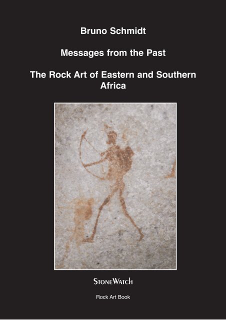
Bruno Schmidt<br />
Messages from the Past<br />
The Rock Art of Eastern and Southern<br />
Africa<br />
<strong>StoneWatch</strong><br />
Rock Art Book
Bruno Schmidt<br />
Messages from the Past<br />
The Rock Art of Eastern and Southern<br />
Africa<br />
<strong>StoneWatch</strong><br />
The World of Petroglyphs<br />
2001
Impressum:<br />
Edition: <strong>StoneWatch</strong><br />
Society for coverage of prehistoric and ancient rockpaintings<br />
Gartenstrasse 2a<br />
D- 55442 Warmsroth<br />
Fax 00 49 6724 - 95621<br />
e-mail stonewatch@t-online.de<br />
www.stonewatch.de<br />
Layout: <strong>StoneWatch</strong> J. Otto<br />
Print: <strong>StoneWatch</strong><br />
ISBN-3-00-007863-0<br />
Copyright by the Author and <strong>StoneWatch</strong><br />
2001
Bruno Schmidt<br />
Messages from the Past<br />
The Rock Art of Eastern and Southern Africa<br />
3
Contents<br />
List of Maps and Annexes 5<br />
Acknowledgements 6<br />
Preface. 7<br />
Part 1 : Travelling along the Sites. 9<br />
Introduction. 9<br />
The Southern African “San” Zone - Zimbabwe, Namibia, Botswana, Lesotho,<br />
Swaziland and South Africa. 12<br />
The Eastern African “Hadza and Sandawe” Zone - Tanzania 59<br />
The Central African “Twa” Zone - Angola, Zambia, Malawi and Mozambique. 66<br />
The Eastern African and Lake Victoria Zone - Kenya, Uganda and Tanzania 88<br />
The Northeastern African Bovidean Zone - Sudan, Eritrea, Ethiopia and Somalia. 101<br />
Part 2 : History and Archaeology of the Sites. 111<br />
Introduction. 111<br />
The first Discoverers of Eastern and Southern African Rock Art 112<br />
The Techniques of Paintings and Engravings 115<br />
The Art Regions, Styles and Sequences 119<br />
The Problem of Dating. 125<br />
The Art Mobilier 130<br />
Part 3 : Broader Ethnic Picture of Eastern and Southern African Rock Art. 132<br />
Introduction. 132<br />
The early Inhabitants and Artists 133<br />
The Migration of the Cushitic- and Nilotic-speaking Pastoralist People 148<br />
The Migration of the Bantu-speaking Agriculturist People. 152<br />
Connections to the Sahara Rock Art 155<br />
Meaning and Interpretation of Rock Art 157<br />
Part 4 : Future of the Eastern and Southern African Rock Art. 167<br />
Introduction 167<br />
Vandalism, the main Danger to the Rock Art 168<br />
National Monuments and Tourism 169<br />
The Activities of UNESCO. 171<br />
The Caretaker - a possible Solution. 174<br />
Summary. 176<br />
Anexes 179<br />
List of Illustrations (Plates) 208<br />
Illustrations. 210<br />
Glossary 255<br />
References 258<br />
Register 267<br />
4
List of Maps and Annexes<br />
Map 01 : Rock Art Areas in Africa, General Map. 10<br />
Map 02 : Rock Art Sites of Zimbabwe. 15<br />
Map 03 : Rock Art Sites of Namibia 25<br />
Map 04 : Rock Art Sites of Botswana 35<br />
Map 05 : Rock Art Sites of Lesotho and Swaziland. 40<br />
Map 06 : Rock Art Sites of South Africa. 55<br />
Map 07 : Rock Art Sites of Tanzania 63<br />
Map 08 : Rock Art Sites of Angola. 68<br />
Map 09 : Rock Art Sites of Zambia. 74<br />
Map 10 : Rock Art Sites of Malawi. 84<br />
Map 11 : Rock Art Sites of Mozambique. 87<br />
Map 12 : Rock Art Sites of Kenya and Uganda. 92<br />
Map 13 : Rock Art Sites of Sudan, Eritrea, Ethiopia and Somalia 103<br />
Map 14 : Khoisan or Bushmanoid Remains. 140<br />
Annex 01 : Countries regarded with some Facts,<br />
still existing Khoisan-Survivors and. the main Occurrence of Rock Art 179<br />
Annex 02 : Rock Art of Zimbabwe 180<br />
Annex 03 : Rock Art of Namibia. 182<br />
Annex 04 : Rock Art of Botswana. 184<br />
Annex 05 : Rock Art of Lesotho 185<br />
Annex 06 : Rock Art of Swaziland 186<br />
Annex 07 : Rock Art of South Africa 187<br />
Annex 08 : Rock Art of Tanzania. 192<br />
Annex 09 : Rock Art of Angola 195<br />
Annex 10 : Rock Art of Zambia 196<br />
Annex 11 : Rock Art of Malawi 198<br />
Annex 12 : Rock Art of Mozambique 200<br />
Annex 13 : Rock Art of Kenya 201<br />
Annex 14 : Rock Art of Uganda 202<br />
Annex 15 : Rock Art of Sudan 203<br />
Annex 16 : Rock Art of Eritrea. 204<br />
Annex 17 : Rock Art of Ethiopia. 205<br />
Annex 18 : Rock Art of Somalia. 206<br />
Annex 19 : Countries with still existing Khoisan-Survivors and<br />
Organisations in Charge of Care including Seat of these Organisations. 207<br />
5
Acknowledgements<br />
I am grateful to the many people who have assisted me with this book, being prepared to discus<br />
my numerous and bothering questions with me, to guide us to the sites or to support me<br />
by books, articles, papers or other informations. That concerns as well people in the countries<br />
we visited as experts of rock art in Europe. I wish to thank all these persons for their assistance<br />
by giving their names, functions and domiciles as follows:<br />
Dr. George H. O. Abungo, Director Regional Museums, Sites & Monuments, Nairobi, Kenya<br />
Mrs. Lorna L. Abungo, Coordinator of the Regional Centre for the Study of Archaeology, Nairobi, Kenya<br />
Mrs. Rosemary Andrade, Curator of the Swaziland National Trust Commission, Lobamba, Swaziland<br />
Mrs. Dr. Erna Beumers, Curator Volkenkunde Museum, Rotterdam, The Netherlands<br />
Mrs. Maud Brown, Kuru Development Trust, D’Kar (Ghanzi), Botswana<br />
Dr. Pavel Červiček, freelanced Archaeologist, Darmstadt, Germany<br />
Mr. Donald D. Chikumbi, Director of the National Heritage Conservation Commission, Livingstone, Zambia<br />
Mrs. Dr. Janette Deacon, Archaeologist, Director National Monuments Council, Cape Town, South Africa<br />
Mrs. Svetlana Durkovic, Archaeologist, Washington DC, USA<br />
Mr. Domingos Fernando, Departemento de Monumentos, Maputo, Mozambique<br />
Mr. Peter Garlake, Archaeologist, Borrowdale Homestead, Harare, Zimbabwe<br />
Mrs. Carina Greven, Librarian, Rijks Museum, Amsterdam, The Netherlands<br />
Mr. Óscar Manuel Fernandes Guimarães, Instituto Nacional do Património Cultural, Luanda, Angola<br />
Dr. Ephrahim R. Kamuhangire, Commissioner for Antiquities and Museums, Kampala, Uganda<br />
Dr. Tilmann Lenssen-Erz, Heinrich-Barth-Institut, Cologne, Germany<br />
Prof. Dr. J. David Lewis-Williams, University of the Witwatersrand, Johannesburg, South Africa<br />
Mr. Willard M. Michala, Director of the Department of Antiquities, Lilongwe, Malawi<br />
Dr. David Morris, Director McGregor Museum, Kimberley, South Africa<br />
Dr. Paul Msemwa, Director of the National Museum of Tanzania, Dar es Salaam, Tanzania<br />
Mrs. Rose Nkaale Mwanja, Senior Conservator of the Uganda Museum, Kampala, Uganda<br />
Mr. Isaya O. Onjala, National Museums of Kenya, Nairobi, Kenya<br />
Mr. Abdul Ghani Osuman, Guide, Abercrombie & Kent, Kampala, Uganda<br />
Mrs. Shirley-Ann Pager, President of SARARA, Okahandja, Namibia<br />
Mrs. Mag. Barbara Plankensteiner, Museum für Völkerkunde, Vienna, Austria<br />
Mr. Tseliso Ramakhula, Director of the Lesotho Tourist Board, Maseru, Lesotho<br />
Mr. Gunter von Schumann, Namibia Wissenschaftliche Gesellschaft, Windhoek, Namibia<br />
Mr. Harrison H. Sinfukwe, Officer of the Department of Antiquities, Lilongwe, Malawi<br />
Dr. Benjamin W. Smith, University of the Witwatersrand, Johannesburg, South Africa<br />
Mrs. Kveta Smoláriková, Institute of Egyptology, University of Prague, Czechia<br />
Dr. Karl-Heinz Striedter, Frobenius-Institut, Frankfurt on the Main, Germany<br />
Mr. Hennie Swart, Director of the !Xû & Khwe Association, Kimberley, South Africa<br />
Mr. Taole Tesele, Archaeologist, Lesotho Highlands Development Authority, Maseru, Lesotho<br />
Mrs. C. Thorp, Director of the National Museum and Monuments Institute, Harare, Zimbabwe<br />
Dr. Hessel Visser, Kuru Development Trust, D’Kar (Ghanzi), Botswana<br />
Mr. Andreas Vogt, Senior Cultural Officer National Monuments Council of Namibia, Windhoek, Namibia<br />
Dr. Simon Waane, Director of Antiquities of the Ministry of Education and Culture, Dar es Salaam, Tanzania<br />
Dr. Nick Walker, Diector National Museum, Monument and Art Gallery, Gaborone, Botswana<br />
Professor Dr. Steffen Wenig, Humboldt-Universität, Berlin, Germany.<br />
Last not least named here, but foremost among those who helped to make this book, is my wife<br />
Wiltrud, partner on all our common journies and strenous excursions including solving the difficulties<br />
to find the sites visited and finally the revising work of the manuscript.<br />
6
Preface<br />
The biggest error of history apparently is the thesis Africa to be an unhistorical continent.<br />
Reasons declaring this traditional (European) misbelief may be seen in the lack of written<br />
documents or in the fact that African societies have rather a cyclic than a chronological understanding<br />
of life. And for a long time Africa was seen as the Dark or Black Continent caused<br />
by the strangeness for the Europeans.<br />
But Africa has a very rich history, possibly the richest history of all continents of the world.<br />
Within the Rift Valley, along the line from Ethiopia via Kenya, Tanzania, Malawi to South<br />
Africa, there was the birthplace of human being, here once stood the cradle of mankind. Besides<br />
the famous rock art decorating wide areas of the now arid Sahara we find in eastern and<br />
southern Africa a much older rock art, thought to be the oldest expression of art made by<br />
humans at all. Messages of humans were here painted on rocks or engraved in rocks a long<br />
time before European hunters and gatherers of the Palaeolithic draw their beautiful pictures at<br />
the walls of the Franco-Cantabrian caves.<br />
Before European explorers roved through the width of the African continent flourishing kingdoms<br />
were existing, founded by people groups today still existing, like the Swahili in<br />
Tanzania, the Baganda in Uganda, the Marawi in Malawi, the Shona, Rovzi and Ndebele in<br />
Zimbabwe, the Tswana in Botswana the Zulu and Xhosa in South Africa etc. etc. The “romantic”<br />
period of exploration then was joined by the “heroic” period of colonisation. Land was<br />
occupied by European countries by purchase for “nearly nothing” or by clever contracts. New<br />
borders were drawn neglecting the old territories, traditions and areas of tribes. A colonial<br />
Africa arose which was then discharged to freedom and independence after World War II. Old<br />
problems were substituted by new ones, Boubou Hama, a former president of Nigeria, characterised<br />
this saying “the colonial time was either to long or to short; we have forgot, what let<br />
us life, and not yet learned, how to life further on”.<br />
The rich history of Africa captivated me, so that I decided to write this book on it, in particular<br />
concerning the interesting and beautiful sub-Saharian rock art of eastern and southern<br />
Africa. Four reasons were thereby the main motivation expressed in the four parts of this book:<br />
Part 1, headed “Travelling to the Sites”, describes this wonderful rock art with the main target<br />
to give a better understanding of this heritage to European readers. I visited together with<br />
my wife eleven countries from the total seventeen dealed with. We tried successfully to find<br />
several sites in these eleven countries and took a lot of photos. Besides this I made from all<br />
eastern and southern African countries a survey of the rock art sites existing and recorded by<br />
an analysis from literature given in the annexes. If laying on our route, we visited early man<br />
fossil sites and relicts of the old African kingdoms too. As far as always possible I had discussions<br />
with experts in the countries visited, with directors of the national monument councils,<br />
of the national museums and of associations working in the field of “transferring” the remaining<br />
hunters and gatherers from the Later Stone Age into our twenties century.<br />
In part 2, headed “History and Archaeology of the Sites”, one finds the history of discovering<br />
sub-Saharian rock art, the technique of painting and engraving, the problem of dating and the<br />
attempt to regard this rock art in a broader geographic picture. The main reason for this comes<br />
from the fact, that most of the literature describes the rock art of one country only, not looking<br />
across the border.<br />
7
Rock art of eastern and southern Africa is normally seen linked to the Bushmen or San as the<br />
remaining hunter-gatherer populations and to the Bantu-speaking people spread out today all<br />
over the countries visited. But the ethnological picture is more complicate; I therefore tried to<br />
develop in part 3, headed “ Broader Ethnic Picture of Eastern and Southern African Rock<br />
Art”, this broader picture by researching other people groups acting as former artist, and to<br />
answer to the question concerning the future of the today living hunters and gatherers as the<br />
Bushmen or San.<br />
The rock art regarded is an important heritage of mankind, possibly even a World Heritage<br />
(according the definition of UNESCO), but a fragile too. The sites are protected in nearly all<br />
countries by national laws. But nevertheless a lot of them have been badly damaged by vandals,<br />
unauthorised collectors and the effects of natural and anthropogenic erosion. And this<br />
danger is going on. Preservation and conservation of this fragile heritage is therefore urgently<br />
on the agenda. In part 4, headed “Future of the Eastern and Southern African Rock Art”, I<br />
made interviews with experts, discussed the role of UNESCO in Africa and tried to develop a<br />
concept to beware this wonderful heritage.<br />
Rock art is a message from the past which we can understand mostly today. We should undertake<br />
all possible activities to keep it alive, for ourselves and for our descendants. Joining the<br />
title of Professor Bernard Grzimek’s (1909 - 1987) famous and well-known book (“The<br />
Serengeti must not die”) I would like to put my book under a similar motto:<br />
The rock art of eastern and southern Africa must not die.<br />
Viersen (Germany) Bruno Schmidt<br />
8
Part 1:<br />
Travelling along the Sites<br />
<strong>1.</strong> Introduction<br />
If a “normal” European - in particular a German - is asked about rock art, he may mention<br />
Altamira in Spain, possibly Lascaux 2 in France or supposedly the rock art of the Central<br />
Sahara 3 within the Tassili, Tibesti or Hoggar Mountains. The rock art of eastern and southern<br />
Africa will be usually unknown to him. This may be demonstrated by the following simple statistic:<br />
I counted the numbers of books and articles dealing with rock art in the public library of<br />
the city I am living in and found a relation of approximately 100 : 10 : 1 for the rock art of<br />
Europe (Spain and France), the Sahara and the eastern and southern parts of Africa.<br />
These different knowledges of rock art sites in Europe and Africa can be shown in another way<br />
too: The caves of Altamira and Lascaux are today closed for normal visitors. The reason was<br />
the danger of damage by the respiration (so-called “green lepra”) caused by the larger number<br />
of visitors. Concerning Altamira only scientists limited to 20 per day get a special permit by<br />
the ministry. Already 23 years after its discovery Lascaux was 1963 totally closed except a<br />
limitation to 5 scientists per day. But between 1973 and 1983 the Administration of Tourism<br />
of the Périgord built as Lascaux II near the original cave a remarkable facsimile now open for<br />
tourists. When we intended to visit Lascaux II in 1997 - we arrived at noon - we got only tikkets<br />
for the following day as there is a limitation to 2000 visitors per day. Compared with our<br />
visits of African rock art sites where we were sometimes the only visitors the day or the week<br />
the figure of a limitation to daily 2000 visitors is nearly unbelievable.<br />
Since a lot of years I am travelling together with my wife around the world interested in old<br />
gone cultures. To find rock art sites is hereat one of my special targets. On the journeys we did<br />
to North, Central and South America we found those in the United States in Colerado, New<br />
Mexico and Arizona, in Mexico, Peru and Chile but on many islands of the Pacific too.<br />
Concerning eastern and southern Africa I must confess frankly that I am not better than the<br />
above mentioned “normal” European. This changed abruptly when we visited first Zimbabwe<br />
in November 1996 (see next chapter). Since this time I am a real “fan” of eastern and southern<br />
African rock art. And I decided to visit the countries concerned: If one ignores that there are a<br />
few rock art sites in western Africa too, the main countries having such archaeological sites<br />
are those 17 shown in Annex <strong>1.</strong> We visited 11 of them, i. e. except Sudan, Eritrea, Ethiopia,<br />
Somalia, Angola and Mozambique where travelling is nearly impossible out of political reasons<br />
and with regard to the poor tourist infrastructure.<br />
Map 1 shows the main countries of the Sahara rock art and then the distribution of the sub-<br />
Saharian rock art which is the subject of this book. As we shall see later on these eastern and<br />
southern areas of Africa are covered by rock art of different groups of people: The San or<br />
Bushmen and the Twa or Batwa, both hunters and gatherers of distinct races, the Bantu speaking<br />
peoples who migrated from west Africa nearly through the whole continent and finally<br />
the Nilotic speaking peoples who came from the northwestern part of Africa. Corresponding<br />
to these different peoples we then find different zones of rock art all over eastern and southern<br />
Africa. A. R. Willcox4 has defined a very complex model of zones. I do not like to follow this.<br />
1 Kühn, H.: Die Felsbilder Europas, Berlin, Köln, Mainz 197<strong>1.</strong><br />
2 Delluc, B. und G.: Die Höhle von Lascaux, Bordeaux 199<strong>1.</strong><br />
3 Hugot, H. J. und Bruggmann, M.: Zehntausend Jahre Sahara; Bericht über ein verlorenes Paradies, München 1989.<br />
4 Willcox, A. R.: The Rock Art of Africa, London & Canberra 1984.<br />
9
I prefer much more the description of B. J. Smith 5 which is somewhat simpler and covers<br />
nevertheless the differences one finds in the sub-Saharian rock art. According to this model I<br />
shall regard eastern and southern African rock art in the following five blocks:<br />
The southern “San” zone - Zimbabwe, Namibia, Botswana, Lesotho, Swaziland and South Africa<br />
The eastern “Hadza and Sandawe” zone - Tanzania<br />
The central African “Twa” zone - Angola, Zambia, Malawi and Mozambique<br />
The eastern African and Lake Victoria zone - Kenya, Uganda and Tanzania<br />
The northeastern African bovidean zone - Sudan, Eritrea, Ethiopia and Somalia.<br />
But there exists another pending problem: The main investigations in rock art were done within<br />
the today political borders. Consequently most of the publications deal only with the rock<br />
art of a single country. The same concerns the assistance from scientists of foreign countries.<br />
For instance Namibia is so fully “under German control” like Malawi is under “Italian control”.<br />
And in fact nobody may assume that the former artists - in particular those some thousands<br />
years ago - could have a presentiment of the borders which arose at the end of last century<br />
during the time of colonisation. To leave this “national isolation” it is necessary to find a<br />
broader picture of the sub-Saharian rock art. A. R. Willcox 6 is one of the few scholars who<br />
covered this target. I shall try with this book to find in a similar way connections of regions<br />
and ethnic groups.<br />
The total number of archaeological rock art sites within the 17 countries regarded in this book<br />
may be assumed between 20.000 and 30.000. Nobody knows the exact number as not all sites<br />
are yet discovered and/or described up to now (see for instance chapter 14 - Uganda). There<br />
are commissions working under the protection of UNESCO to get an overall and unique documentation<br />
of all these sites. But this is a long way and will last a lot of time.<br />
As we shall see the rock art sites of the sub-Saharian areas are partly totally different in their<br />
kind of performance, styles and quality. But nevertheless there are interesting paralysis and<br />
relationships. But there is one main difference which should mentioned already at this place:<br />
We find rock paintings and rock engravings whereby this depends often from the geological<br />
formations within the landscape. The conception “rock paintings” is clear and understandable<br />
from itself. In contrary the conception “rock engravings”: Here one finds mostly the word<br />
“petroglyphs” in the relative literature. I do not follow this as the conception “petroglyphs”<br />
covers - at least in German language - both paintings and engravings. This word is coming<br />
from the Greek and means “writing on a rock” without saying anything with regard to the technique<br />
of this “writing”. I therefore prefer the conception “rock engravings” or simply “engravings”<br />
in this book.<br />
We now come to the topic given in the headline of this chapter: The travelling. If I remember<br />
to our visit of Lascaux II in France, I have before my eyes tarred roads, a parking place near<br />
by the cave and a shop besides one can buy brochures, postcards and something to eat or to<br />
drink. Not so in Africa: The archaeological sites are normally laying far away from the normal<br />
roads. A 4WD care is necessary in most of the situations. Often one has to climb like a<br />
mountaineer and to take water and food with is more than a duty. But nevertheless I remember<br />
with pleasure the tours we did in 11 countries and the adventures we had to encounter. This<br />
book is not only a scientific one. As journalist I intend to give the reader some impressions of<br />
our numerous adventures too.<br />
5 Smith, B. W.: Zambia's Ancient Rock Art, The Paintings of Kasama, Livingstone (Zambia) 1997.<br />
6 Willcox, A. R.: The Rock Art of Africa, London & Canberra 1984.<br />
11
The Southern African “San” Zone<br />
Zimbabwe, Namibia, Botswana, South Africa, Lesotho and Swaziland<br />
2. Zimbabwe<br />
November 1996: I was still writing my book dealing with the first settlements of the Pacific 7<br />
as I had the idea to visit Madagascar. Admittedly - Madagascar does not belong to the Pacific<br />
but undoubtedly to Africa. But the first settlers came from Indonesia across the Indian Ocean<br />
with their fragile outrigger boats and brought with them their customs and languages. I intended<br />
to study on this fourth largest island of the world the funeral customs - in particular the<br />
worship of the ancestors by the famadihana (the returning of the corpses for some days to the<br />
home), the different types of tombs - in particular from the Antanosy and the Mahafaly - and<br />
last not least the language - the Malagasy - belonging to the family of the Austronesian languages<br />
of the Pacific. We had a stay of eight wonderful and interesting days on Madagascar but<br />
without all our luggage which had gone lost in the “Bermuda Triangle” of the Nairobi Airport.<br />
As the flight from Germany to Madagascar is very expensive and lasts nearly a full day I then<br />
combined this journey with a visit of Zimbabwe. I would like to fulfil a twenty years old dream<br />
of mine: An excursion to the old Shona ruins of Great Zimbabwe. After getting back our luggage<br />
in Nairobi (after a “hard struggle” with totally four airlines) we arrived finally in Harare.<br />
The discussions with Mrs. C. Thorp - director of the National Museum and Monuments<br />
Institute - concerned first of all the archaeology of Madagascar and Great Zimbabwe but the<br />
rock art in this country too. Here I got the first local informations. At the preparation of our<br />
journey I had already read something about the African rock art and was curious to look at<br />
some of the sites but without regarding this as a main purpose of our travelling.<br />
So well prepared we started with our rental car to Masvingo. Arrived there we had “the<br />
honour” to be some of the first guests of the just opened Ancient City Lodge fully built according<br />
the style of Great Zimbabwe. Guy Halliday showed us next day the ruins of Great<br />
Zimbabwe. I was enthusiastic to see these monuments built by the Karanga (a tribe of the<br />
Shona) between the 12. and 15. century AD. And I remembered the literature I had studied (for<br />
instance P. Garlake 8, H. Pleticha 9, H. W. A. Sommerlatte 10 and other) and the fact that the<br />
German Karl Mauch who discovered Great Zimbabwe in 1871 believed this ancient city to be<br />
the residence of the biblical Queen of Saba a story which was kept alive up to the first half of<br />
our century.<br />
At the afternoon we visited the first rock art sites: The rock paintings on the Kyle Boat Club<br />
directly at the Lake Kyle or Lake Mutirikwe and the Chamarava Cave 8 km south of the lake.<br />
The paintings on the boat club were nice but not yet convincing. The Chamarava Cave was<br />
disappointing. Whatever the old Bushmen had painted on the rocks it was damaged by vandalism.<br />
The fact that the motor of my car began to stew as I did not have enough cooling water<br />
in it then did not fill up this first “rock art day” with any enthusiasm.<br />
From Masvingo we went to Bulawayo. Here we visited first the famous Natural History<br />
Museum of Zimbabwe and then the Khami Ruins 11 which were from about 1450 AD capital<br />
7 Schmidt, B.: Nomaden des Pazifiks, Archäologie und Geschichte der Besiedlung Ozeaniens, Paderborn 1998.<br />
8 Garlake, P.: Simbabwe, Goldland der Bibel oder Symbol afrikanischer Freiheit, Bergisch Gladbach 1975.<br />
9 Pleticha, H.: Simbabwe, Entdeckungsreisen in die Vergangenheit, Stuttgart 1985.<br />
10 Sommerlatte, H. W. A.: Gold und Ruinen in Zimbabwe: Aus den Tagebüchern und Briefen des Schwaben Karl Mauch (1837 - 1875),<br />
Gütersloh 1987.<br />
11 Hughes, E. G.: A trail Guide to the Khami National Monument, The National Museums and Monuments of Zimbabwe 1989.<br />
12
of the Torwa when Great Zimbabwe began to decline. These former terrace buildings and daga<br />
huts do not have the huge dimensions of Great Zimbabwe. The buildings are of more filigree<br />
and more decorated. In Khami there arose a new style but showing clearly the origin some 250<br />
km to the east.<br />
Our next stop then was the Matobo National Park and the Matobo Hill Lodge laying within a<br />
beautiful concentration of the typical “whale backs”, “balancing rocks” and “castle kopjes” of<br />
eroded granite embossing many parts of Zimbabwe’s landscape. The centre of this park is<br />
named “View of the World” where Cecil Rhodes (1853 - 1902) is buried. As “duty” for tourists<br />
we participated in a game drive offered by the lodge. And here I gained a guide to lead us<br />
to the largest rock painting cave in this area: The Silozwane Cave. Using a land rower we passed<br />
beautifully painted huts of the Karanga people and left the park to the south. We stopped<br />
at a huge granite rock. Our guide explained: “There are two ways upstairs: One for the “elder<br />
people” which lasts about one hour and the other for the “more sportsmanlike people” which<br />
leads directly to the cave”. We decided to take the more difficult but shorter way and reached<br />
the cave in about a quarter of an hour. The cave is relatively large. It shows paintings from the<br />
daily life but animals and symbols too. One attraction is a very big giraffe (plate 1) which gave<br />
this cave the nickname “Cave of the Giraffe”. As animals one finds lions, antelopes, rhinos,<br />
birds and fishes. A large snake with the had of a giraffe and bearing ante-lopes on the back is<br />
running across the whole background of the cave. The daily life is represented by a male porter<br />
(plate 2), a gathering woman (plate 3) and a hunter bearing bow and arrow (plate 4) and<br />
other figures. We were fascinated and I became from “Saulus to Paulus”. The rock art of Africa<br />
had gained a “new fan”.<br />
We then visited without any guidance other rock painting sites within the Matobo National<br />
Park as there are sufficient signposts: The White Rhino Shelter near by the “View of the<br />
World”, the Mjelele Cave near the park entrance and hidden near the lodge the Pomongwe<br />
Cave. All these sites showed similar motives like the Silozwane Cave which was unquestionable<br />
the highlight of our visit of the Matobo National Park.<br />
From here we then went to the Victoria Falls about 450 km to the Northwest as we believed<br />
that it would be a pity to visit Zimbabwe without having seen this spectacle of nature which<br />
was called by the natives “Mosi oa Tunya” (smoke that thunders) and which was discovered<br />
by David Livingstone (1813 - 1873) as the first European in November 1855. At the Victoria<br />
Falls Airport we gave our rental car back and took a flight to Harare. Here in the Mashonaland<br />
around Harare I hoped to find some more rock painting sites. According the recommendation<br />
of Mrs. C. Thorp from the National Museum and Monuments Institute I had bought a tourist<br />
guide 12 concerning rock art sites in this area (as far as I know one of the rare guides of rock<br />
art in eastern and southern Africa). And we found them: The Bridge Paintings and the<br />
Crocodile Men near Glen Norah (about 20 km south of Harare), Somerby (about 25 km south<br />
of Harare) and finally within the Lake Chivero (McIlwaine) National Park the rock paintings<br />
named Game Park Entrance, Rock with Ovoids and Bushman’s Point. Plate 5 - 9 show sections<br />
of these marvellous paintings representing human beings, animals, a group of hunters, a<br />
pretty elephant, animals and men and at least three excellently worked out kudus together with<br />
some ovoids of not known understanding.<br />
Of course it was not possible to visit all rock art sites of the country. But above all there exists<br />
in general a broad domestic literature. It was my intention to visit some sites in Zimbabwe and<br />
12 Adams, L.: A Tourist Guide to Rock Art Sites in Northern Zimbabwe, National Museums and Monuments of Zimbabwe, Harare<br />
(Zimbabwe) 199<strong>1.</strong><br />
13
to get a first survey on the rock art in this country. Besides this I would like to take own photos<br />
for this book. To write about the rock art in Zimbabwe (and the other countries later on) I am<br />
compelled to use the competent literature 13 to this subject. The result of these researches is<br />
given in Annex 2 and Map 2:<br />
Zimbabwe is very rich in rock art sites. C. K. Cooke 14 mentions already 1969 over 1500 sites<br />
which have been located, extensively examined and recorded by tracings or photos or both.<br />
Peter Garlake 15 gives then 1987 a figure of over 2000 officially recorded sites. The granite formations<br />
of Zimbabwe - the already mentioned “whale backs”, “balancing rocks” and “castle<br />
kopjes” - have certainly favoured the former artists. But we find the rock art on sandstone outcrops<br />
and isolated granite boulders too. And most of the rock art concerns rock paintings.<br />
Annex 2 shows only 5 rock engraving sites from totally documented 58 sites in this list. That<br />
are only 8,5%. And these sites are not laying in the central regions of Zimbabwe but at the borders<br />
to Zambia, Mozambique and Transvaal demonstrating to belong to other rock art zones.<br />
As to underline this Peter Garlake 16 does not mention rock engravings in his newest publication<br />
at all. We therefore shall regard these rock engravings of Zimbabwe together with the rock<br />
art of the neighbour countries.<br />
Research in rock paintings of Zimbabwe was only done by a few experts as M. C. Burkitt<br />
(1928), L. Frobenius (1931), H. L. Cripps (1941), E. Goodall (1946), H. Breuil (1948/50), C.<br />
Van Riet Lowe (1948/49) and C. K. Cooke (1959). P. Garlake joined this row with his publications<br />
of 1987 and 1995 this later as the result of 8 years working at the sites. But nevertheless<br />
the rock art of Zimbabwe is today well recorded. Most of the sites are now National<br />
Monuments and protected by law. And there is no doubt that this rock art of Zimbabwe belongs<br />
mostly to the San or Bushmen. A. R. Willcox 17 summarises the results of styles and sequences<br />
given by C. K. Cooke who was for a long time the leading expert of rock art in Zimbabwe:<br />
Style 1: This is reserved for the earliest type which has disappeared or is still to be found. On the assumption<br />
that painting came in with the Wilton this could be older than 10.000 years. Without this assumption it could be<br />
very much younger. In any case it is improbable that any paintings of such an age could remain. Age: ? years<br />
Style 2: The classical period. Silhouettes in all colours (monochromes). Stylised human figures sometimes grouped,<br />
some steatopygous. Age exceeding 2.000 years<br />
Style 3: Outline drawings of humans and animals. The humans more detailed and not always showing<br />
Bushman character. Age: ±2.000 years (short duration)<br />
Style 4: Naturalistic paintings of animals in silhouette, monochromes and polychromes. Large and small<br />
humans grouped to depict an activity. Some probably not showing the Bushman type. The mythological figures,<br />
landscapes, complicated designs, shaded polychromes and other outlines belong to this period.<br />
Age: ±<strong>1.</strong>800 to ±200 years<br />
Style 5: “Stylistic” animals, sun designs and kraal patterns manly in black and white, badly executed.<br />
Age: ±200 years onwards<br />
Style 6: Large figures especially elephants outlined with charcoal and plastered with kaolin clay. The plastering<br />
is apparently still being done during the course of initiation or other tribal ceremonies. Until this was<br />
established these were thought to be the oldest but now known to be the latest.<br />
Age: recent and continuing.<br />
13 See footnotes in Annex 2.<br />
14 Cook, C. K.: Rock Art of Southern Africa, Cape Town 1969.<br />
15 Garlake, P.: The Painted Caves, Harare (Zimbabwe) 1987.<br />
16 Garlake, P.: The Hunter's Vision, London and Harare 1995.<br />
17 Wilcox, A. R.: The Rock Art of Africa, London & Canberra 1984, pages 140 - 14<strong>1.</strong><br />
14
Most of the rock painting sites in Zimbabwe belong to style 1 or 2. The other styles - in particular<br />
4 and 5, which we find in literature also as “Bantu paintings” - are more common in other<br />
countries as we shall see. The fact that most of the paintings in Zimbabwe belong to style 1 or<br />
2 determines the beauty of the rock art in Zimbabwe comparable only with those in Namibia.<br />
Whatever caused me to start with searching old rock art just in Zimbabwe - it was a good luck<br />
as I saw at the beginning of our tours through 11 African countries the finest and most beautiful<br />
first and became so a “real supporter” of African rock art. And these sites are concentrated<br />
in most of the regions we visited, in the areas of Harare (Mashonaland), Mutare (Manykaland),<br />
Masvingo (Province Maswingo) and Bulawayo (Matabeneland) as Map 2 shows. This rock art<br />
of Zimbabwe earns really the name “Bushmen Paintings”. But what is the meaning of the pictures,<br />
what is the message of the Bushmen? Let us have a look to some selected pictures and<br />
start with the animals:<br />
Some tracings from animals, from left to right: A kudu with exaggerated<br />
horns and hairs, a sable bull and a reedbuck, both realistic, and an ostrich, realistic too<br />
(Marondera district and Mazowe and Msasa sites)<br />
In the animal paintings monochromes greatly predominate but there exist bichromes, polychromes<br />
and even shaded too. The animals are mostly painted in a realistic manner with excellent<br />
proportions - standing or in action - except in paintings with a certain religious or mythological<br />
character. In these cases elements which seem to have a transcendent meaning are<br />
exaggerated or deformed. But also the realistic paintings show an exception: The animals are<br />
nearly always shown in profile or as silhouette, except their horns and ears. These are depicted<br />
so that both parts are to be seen (like from the front).<br />
16
Animals were important for the San or Bushmen. They obviously shared a fundamental believe<br />
in the unity of the creation. In their first world animals belonged to the “people” before they<br />
got named (this topic will be discussed in part 3). They were believed to be evolved from<br />
humans and to have features like men. But not all animals were painted with the same frequency.<br />
They were standing in a certain order of hierarchy and had different importance. There<br />
are for instance extremely few paintings from eland, water buck, reedbuck, impala or wildebeest.<br />
On the other hand zebras, elephants, rhinos, buffaloes, sable antelopes, lions etc. we find<br />
often. And the kudu is the absolutely dominant animal in Zimbabwe. The elephant was seen in<br />
relationship with potency in particular in Zimbabwe’s rock art like the lion stood for loyalty,<br />
bravery and vanity. Besides this we find snakes, crocodiles, tortoises and even birds and fishes.<br />
And last not least animals play often the roll of transforming properties of humans or spirits<br />
like we find in “mixed” figures of humans and animals.<br />
Tracings from human beings showing activities of the daily life as gathering done by the<br />
women or hunting done by the men (from Markwe and Makumbe sites)<br />
Human beings are shown in different ways: Sometimes they are depicted in a certain schematic<br />
manner (like we painted when we were children) mostly with some vertical elongation.<br />
Often one finds them doing things of the daily life (working, hunting, gathering) as single persons<br />
or in groups. Besides this one may detect human figures without any sex characteristics<br />
(we shall discuss this later on for Namibia) whereas this then stands for the total equality of all<br />
group members what was a typical criterion of the San culture. On the other hand we can see<br />
pictures of human beings with extremely expressed potency without regarding this as erotic or<br />
even pornographic. In contrary there was no prudery and the male organ is often depicted in a<br />
semi-erected position. One speciality shown in particular in Zimbabwe’s rock paintings is that<br />
what A. R. Willcox 18 defined as PA (penis attachment) and what cannot be explained finally<br />
up to now. Willcox sees in the PA the possibilities of a certain symbolism of prohibition or a<br />
requirement for hunting rituals or only a simple male body decoration.<br />
18 Wilcox, A. R.: The Rock Art of Africa, London & Canberra 1984, pages 260 - 26<strong>1.</strong><br />
17
Tracings of human figures both showing a so-called PA, the left person with<br />
tufts on his hair, the right as “mixed” figure of an antelope and a man (from Harare and Matobo sites)<br />
But most important are the scenes showing San people dancing and trancing. We find larger<br />
scenes with men and women dancing in groups or rows. Here we find often “mixed” figures<br />
of humans and animals too which may be interpreted as the believe of the San in a uniform<br />
world of all creatures of the nature. Peter Garlake 19 explains this as their “vision”, as the view<br />
of their own in itself closed world.<br />
Two rows of human figures, having different things of the daily life in their hands<br />
and probably showing a dancing scene (from Matobo sites)<br />
Two other things may be mentioned additionally: Besides animals and human beings we find<br />
sometimes in the rock paintings plants too, mostly trees. And there are often certain symbols<br />
painted looking like ovals or ovoids (see for instance plate 9). Peter Garlake 20 interprets them<br />
as follows:<br />
I have established that, in the paintings of Zimbabwe, both in number, size, detail and elaboration,<br />
the most important image and key symbol is the oval design. It probably had its formal<br />
origin in attempts to represent the seat of potency, the gebesi. The ovals then represent the<br />
internal organs of the lower abdomen, such as the spleen and liver, which some San believe to<br />
be the particular seat of potency.<br />
19 Garlake, P.: The Hunter's Vision, London and Harare 1995.<br />
20 Ditto, page 154.<br />
18
At our last day in Zimbabwe we had the opportunity to meet Peter Garlake. Guy Halliday, our<br />
guide in Great Zimbabwe, had done the necessary appointment for us. And Halliday had given<br />
a certain “warning” to us: “Peter Garlake is a nice guy but a certain oddity too. Don’t bring<br />
him flowers. He prefers whisky but a good one”. So prepared with a bottle of whisky we arrived<br />
in the evening at his house in Borrowdale Homestead, a suburb of Harare. Five dogs of<br />
“antelope size” received us. My wife took seat in an armchair the five dogs surrounding her<br />
and licking her arms and hands. Peter Garlake said laughing: “Don’t worry my dogs love<br />
women”.<br />
And then it was my turn to get rid of my questions. First of all we discussed the history of<br />
Great Zimbabwe, the deficit of any verbal tradition, the fact that archaeologists did never find<br />
any tomb and the origin of the Karanga as Bantu speaking people who came about 500 AC to<br />
Zimbabwe bringing with them a special iron melting technology with the probably origin<br />
coming from Rwanda. Garlake confirmed that a lot of questions concerning the history of<br />
Great Zimbabwe is still open. And then he talked about the rock paintings and his investigations<br />
done in more than eight years:<br />
“Zimbabwe is a country with wonderful and unique rock paintings. And there is no connection<br />
to the few sites of rock engravings in this country. But the rock art of Zimbabwe shows certain<br />
similarities to that in Namibia and a part of Mozambique, but you may consider it as largely<br />
isolated. The beginning may be assumed from 1<strong>1.</strong>000 BC whereas the Bushmen stopped<br />
painting about 2000 years ago out of unknown reasons”. We then discussed the uniformity of<br />
the paintings normally done by only small groups of Bushmen, the problem of superpositioning<br />
and finally the motivation of the San to paint. Garlake explained:<br />
“At the first view it is incomprehensible that groups of 20 to 30 persons of hunters and gatherers<br />
did produce such a uniform rock art. We asked the people of the !Xû (spoken !Kung), still<br />
remaining Bushmen living in Botswana who do not paint any more. From these people we got<br />
knowledge about certain customs: It’s right that they are living in small groups. But they come<br />
together from time to time to larger groups depending from their living conditions. And then<br />
they have a certain exchange of their customs, in the past rock art concerning too. Even as the<br />
!Xû do not yet paint any more we find their customs in accordance with our archaeological<br />
results. And it may be assumed that the paintings were done by elder children as a kind of initiation<br />
(possibly). The superpositioning then may be understood as a change of meanings”. And<br />
concerning the motivation to paint Garlake closed his speech with an important - as I mean -<br />
sentence: “Man is the only animal who is able to make art”.<br />
3. Namibia<br />
March 1998: After more than twenty hours flight we arrived - coming from Frankfurt via<br />
Johannesburg - at the Windhoek International Airport. We, that means my son-in-law Uwe<br />
Boes, the husband of our eldest daughter, and I myself. It was the first time that my wife could<br />
not join me with regard to family reasons. But as all necessary appointments were already done<br />
I had offered the “free place” for this journey like “hot cakes” to all members of our great family<br />
and finally gained Uwe as travelling partner. At the airport we took over the 4WD rental car<br />
and went the 42 km to our hotel in Windhoek.<br />
At night we then had a dinner meeting with Andreas Vogt, Senior Cultural Officer of the<br />
National Monuments Council of Namibia in Windhoek and a descended German living in the<br />
fourth generation in Namibia. I had prepared a questionnaire. And I got a lot of informations<br />
19
concerning my topic of African rock art, in particular concerning the today investigations in<br />
Namibia done by the Heinrich-Barth-Institute of the Cologne University continuing now the<br />
research of Harald Pager, the SARARA (South African Rock Art Research Association) founded<br />
by Shirley-Ann Pager, the widow of the renowned archaeologist, the Namibia Wissenschaftliche<br />
Gesellschaft as a source of literature from the German colonial time up to 1915 and<br />
last not least the Nyae Nyae Development Foundation of Namibia caring for the development<br />
of the Ju/’hoansi Bushmen in the country. (All these organisations and institutions will be discussed<br />
in this book later on). And finally I had questions concerning the protection and conservation<br />
of the rock art sites. Andreas Vogt became very serious: “Indeed vandalism is an urgent<br />
problem. Our budget of the National Monuments Council comes to 100.000 N$ the year<br />
[about 20.000 US$]. With this amount one cannot do high frisks, particularly it has to cover<br />
all kinds of monuments - not only rock art. And if one makes the sites accessible to tourists to<br />
get money by this way, one has to do “depreciations”. I remember the Philipp’s cave where the<br />
White Elephant got an overpainting by a lipstick. And the hope to the assistance from UNES-<br />
CO is a wasted effort. They reclaim a working infrastructure and a corresponding managing<br />
plan. If we could reach this (without money), we would not need UNESCO”. And he then<br />
added: “Only those rock art sites are well protected which never were discovered”.<br />
Next morning we visited the historical city centre of Windhoek: The “Alte Feste”, a fortress<br />
built between 1890 and 1892 by the German “Schutztruppe” and today Historical Museum, the<br />
Protestant “Christus Kirche” from 1907/10, the memorial standing before the “Feste” and showing<br />
a “Reiter von Südwest”, the “Tintenpalast” built 1912/13 then seat of the former German<br />
Government and today house of both Namibian chambers (National Assembly and National<br />
Council), the railway station built from 1912 etc. etc. Between National Theatre and Public<br />
Library we then found the Owela Museum, the State Museum with an ethnological collection.<br />
And here we detected the exhibition “Return of the Moon” sponsored by the Ethnological Museum<br />
of Rotterdam, the Netherlands, and focussed to the rich rock art of the Bushmen. In cooperation<br />
with this exhibition the Kuru Development Trust (Ghanzi/Botswana) caring for the<br />
improvement of the economic and cultural situation of the today living Bushmen (in particular<br />
in Botswana), who demonstrated here the new and modern art of the Bushmen as colourful<br />
and vital murals.<br />
After two days staying in Windhoek we departed to our rock art tour. We went from Windhoek<br />
via Okahandja to Karibib where we had already booked a hotel. Karibib, a location with about<br />
2000 inhabitants, is situated on the old railway connection from Windhoek to Swakopmund.<br />
The still existing station building dates from 1900. The small station restaurant within this<br />
building holds a modest private museum with exhibits from the German colonial time and the<br />
war between the SWAPO and South African troops. Here we detected a time-table of the still<br />
existing railway connection “valid from 3<strong>1.</strong> August 1914”.<br />
Next morning we left Karibib to Usakos, joined from here the pad D1935 to the north and after<br />
11 km the pad D1937. After totally 30 km from Usakos we reached the Ameib Ranch. From<br />
here we had to go on foot through a wonderful but dry and hot rocky landscape belonging to<br />
the Erongo Mountains. We needed about one hour to reach the Philipp’s Cave named after the<br />
former owner of the Ameib Ranch. A first description of this major cave was given by Abbé<br />
Henry Breuil in 1957 2<strong>1.</strong> He visited this cave on his third expedition in 1950 together with E.<br />
R. Scherz and Mary E. Boyle. The cave is about 50 m broad and about 20 m deep. Most of the<br />
painted figures are on the back wall of the cave, on the left four isolated red hand-prints from<br />
adults, two giraffes and a third on the rock ceiling nearby and a frieze of animals and human<br />
21 Breuil, H.: Philipp Cave, London 1957.<br />
20
figures in red and white. The main and central paintings show two white elephants accompanied<br />
by three smaller elephants. But only one of the larger elephants is well preserved. This<br />
elephant gave the cave the second name “White Elephant”. A red buck is superimposed on the<br />
large white elephant (plate 10). On the ceiling of the cave to the right there are some single<br />
figures painted in dark brown as an ostrich, a man and a wonderful oryx with only one exaggerated<br />
horn (plate 11). Around the Erongo Mountains other caves can be visited as the Etemba<br />
Cave or the Ekuta Cave, both north of these mountains. But with regard to our narrow time<br />
schedule we did not visit these sites.<br />
From Karibib we went via Omaruru to Uis Myn, still a location of a tin mine. The former houses<br />
of the mine engineers are today the Brandberg Rest Camp. Here we stayed over for two<br />
nights. Our target was the Brandberg, a massif with the Königstein as highest top with 2579<br />
m. Next morning at sunrise we went 27 km on the secondary road C35 in the direction to<br />
Khorixas and then 15 km to a parking place on the end of pad D2359. Here begins the way<br />
through the Tsisab Gorge, a dry valley full with huge granite rocks. Climbing was recommended.<br />
No, the Brandberg does not receive the visitors homely. After about one hour we were<br />
standing before the Maack Shelter or the White Lady (plate 12 - 14). This grotto was discovered<br />
1918 by the German surveyor Reinhard Maack. Maack was searching since a long time<br />
rock paintings. He named the central figure spontaneously “White Lady” and made a first tracing.<br />
But it lasted up to 1930 down to the first publication. The branch of archaeologists got<br />
enthusiastic. And it then was Abbé Henry Breuil who rediscovered the paintings in 1950 and<br />
devoted a whole book 22 to this rock art site in 1955.<br />
Breuil took over the name “White Lady” from Reinhard Maack. And concerning the question<br />
“who painted it” he developed an adventurous theory comparable Karl Mauch’s theory about<br />
the foundation of Great Zimbabwe. He wrote in the mentioned publication:<br />
My thanks are due to my assistant, Miss Mary Boyle, for the effort she made to establish the connections between<br />
these frescoes and those of Egypt and Crete, and the results of her research are embodied in the following pages.<br />
Although I share the belief, which is generally expressed at the first sight of these paintings, that there are definite<br />
artistic and ethnological links between them, and possibly a religious affinity also, I am nevertheless unable<br />
to state their exact relationship. Even when there is evidence of such links between several different artistic<br />
documents, it is still impossible to trace the connections of one to the other if ages of the documents to be compared<br />
are not known. It is equally logical to regard one as the parent of another, or to regard all as having independently<br />
inherited similar characteristics from a common ancestor. In the case of the similarities between these<br />
paintings and the frescoes of Egypt and Crete, it is as yet too early to draw conclusions.<br />
But today the story of the navigators from the Mediterranean Sea is out. We have meanwhile<br />
newer and better knowledges. The same concerns the sex of the main figure of the paintings:<br />
It is a man and in his hand he has a Bantu rattle. But the story introduced by Breuil is still alive:<br />
If one looks in Vusamazulu Kredo Mutwa’s “Indaba” 23 (a witch-doctor is telling the history of<br />
his people), one can find the main figure described as the famous king named Karesu, king of<br />
the Ma-Iti. These people shall have been come down to Namibia from the Mediterranean Sea.<br />
In the tradition of the Bantu the cave itself shall be reported as a place of pilgrimage for the<br />
San as well as for the Bantu. Presumed dead stories have quiet certainly a long life.<br />
Let us now return to the realities of the Maack Shelter: The shelter belongs to the smaller ones<br />
in the Tsisab Gorge, but by the famous “White Lady” it became the best known of Africa. The<br />
22 Breuil, H.: The White Lady of the Brandberg, London 1955.<br />
23 Mutwa, V. K.: Indaba, ein Medizinmann der Bantu erzählt die Geschichte seines Volkes, München 1987.<br />
21
shelter is about 4 m broad and 2 m high. It is covered with human figures and animals, in an<br />
entangled manner of different styles and of divers ages. From one side to the other there runs<br />
a frieze of human figures like a procession. The figures are polychrome in white, yellow, red,<br />
brown and black in different gradations. Irresistibly the “White Lady” stands with her (it<br />
would be better to say “his”) height of about 40 cm in the centre having possibly a Bantu rattle<br />
in the right hand and bow and arrows in the left turned backward. The white colour seems<br />
to be a body painting and the head shows a kind of long-haired trimming. Besides this the main<br />
figure wears some body decorations, a knife at the left upper arm under a sling and a certain<br />
kind of foot wear.<br />
Section of the “White Lady” frieze showing the “White Lady”, five of the other main human<br />
figures and some animals (according a copy of Harald Pager 24 )<br />
But the spectator then has real difficulties to decide which of the other 17 main human figures<br />
belong to which group. These figures are painted as male, female or without any sex, partly<br />
with a body painting, partly with different decorations and things in the hands and partly with<br />
masks demonstrating certain fabulous creatures. Above this frieze of human figures there is<br />
another frieze showing six oryx antelopes. Between these main figures one finds a lot of smaller<br />
paintings of both humans and animals, such as oryx, hartebeest, zebra, ostrich and even a<br />
rhino. Lady or not - the attractiveness of the “White Lady” leaded to a rush of tourists and to<br />
unavoidable damages. Today a lattice protects this heritage, but without any inconvenience<br />
concerning regarding the paintings or taking photos of them.<br />
Our next station then was Khorixas (the former Welwitschia), the administration centre of<br />
Damaraland. From here we went in the early morning of the following day to the west. On the<br />
way we visited the Petrified Forest with 300 million old trees and the Burnt Mountain in contrasting<br />
colours of red, violet and black and reached finally after 65 km on the pads C39, D<br />
3254 and D 3214 the now given up farm Twyfelfontein. This place was named by the Damara<br />
who lived here in the past “Uri-l-Aus” meaning “jumping fountain”. Mr. D. Levin who bought<br />
this land in 1947 renamed it Twyfelfontein meaning a “doubtful spring” due to the poor yield<br />
of 1 m3 of water per day. Sometimes it was less than this value and Levin gave up the cattle<br />
farm already in 1964. But another fact concerning Twyfelfontein is “undoubtful”: It is the<br />
24 Kuper, R. (Hrsg.): Weiße Dame - Roter Riese, Felsbilder aus Namibia, Heinrich Barth-Institut, Köln 1996.<br />
22
ichest place in Namibia with regard to rock engravings. Reports were already done in 1921<br />
by Reinhard Maack 25 and 1975 by Ernst R. Scherz 26 who visited this site sometimes. He recorded<br />
212 single rock slabs with more than 2500 engravings. In 1952 the rock art of<br />
Twyfelfontein was proclaimed a national monument.<br />
Twyfelfontein is situated on the edge of the Namib Desert in a valley with very low rainfall<br />
and at about 550 m above sea level. The geological formation consists out of red Etjo sandstone<br />
(so called after the Mount Etjo), interbedded with purple conglomerates. The slopes above<br />
the Twyfelfontein valley were predominantly used by the former artist. On the place of the former<br />
farm there are now some smaller buildings and huts where we had to pay our entrance fee<br />
to the caretaker who then guided us. A signposted circular trail leads to eight main sites along<br />
the gallery at the slopes. We needed about two hours for this way. And these are the main eight<br />
sites:<br />
Site 1: A large rock slab with engravings depicting animals, spoor and geometric shapes, partly superimposed<br />
and as a certain exception among the depicted animals a seal which normally lives more than 100 km away to<br />
the west at the Atlantic Ocean and separated by the waste Namib Desert (plate 15).<br />
Site 2: One of the largest panels with a variety of animals and birds, giraffes, rhinos and zebras dominating.<br />
Site 3: This site is characterised by the so-called “Large Elephant” (plate 16).<br />
Site 4: Similar like site 1, i. e. animals, spoor and geometric shapes, in particular antelopes, zebras and lions.<br />
Site 5: The so-called “Lion Plate”, showing a larger lion (and other animals) with a L-shaped tail and spoors at<br />
the end of the legs in the place of the paws (plate 17).<br />
Site 6: Possibly the place of former herders having their kraal near the spring. One finds the indigenous sanga<br />
cattle besides kudus and giraffes.<br />
Site 7: One of the rare sites in Namibia where rock engravings and rock paintings occur together. There are paintings<br />
from human figures holding bow and arrow and two squatting men called the “Two Tailors”. From the<br />
engravings a nice ostrich may be mentioned (plate 18).<br />
Site 8: This is the so-called “Dancing Kudu” panel together with some geometric dots and circles (plate 19).<br />
So to speak we passed the “doubtful spring” as site no. 9: But there is no water yet coming out<br />
of the slopes. The spring is exhausted, partly with regard to the extremely dry situation which<br />
changed Namibia’s climate. Only by a fuel driven pump water can be hauled out of a depth of<br />
about 30 m, just enough to supply the few houses and huts in the valley. Again at the parking<br />
place we then visited there under a roof the diagrams and tables installed by the National<br />
Monuments Council giving interesting details of the geology of the valley, but from the rock<br />
art sites and their exploration too: Here one finds names as Reinhard Maack, Volkmann, Henry<br />
Breuil, Ernst R. Scherz, A. Viereck and W. E. Wendt, mostly German archaeologists who investigated<br />
this site, and a radiocarbon dating done in the shelter of the “Two Tailors” with<br />
5850±70 BC (details see later on).<br />
From Khorixas we then went to the coast of the Atlantic Ocean. About 450 km on unpaved<br />
roads had to be managed. Uwe and I relieved each other in driving. From Uis Myn to the west<br />
the last bushes and grasses disappeared. Only white sand and blue sky and no living being,<br />
neither an animal nor an human. At noon we reached Hentiesbaai. The temperature compared<br />
with the heat within the passed desert went down and a slight fog laid over the coast caused<br />
25 Scherz, E. R.: Felsbilder in Südwest-Afrika; Teil II, Die Gravierungen im Nordwesten Südwest-Afrikas, Köln und Wien 1975, pages 172<br />
26 Ditto, pages 171 - 174.<br />
23
y the cold Benguela Stream. We turned to the north. Our target was Cape Cross, the place<br />
where the Portuguese navigator Diogo Cão arrived as the first European in 1486 and the seal<br />
colony at the same place. First we could hear these animals, then smell and finally see them.<br />
About 80.000 to 100.000 seals (Arctocephalus pusillus) are living here, concentrated on a relatively<br />
narrow space.<br />
From Cape Cross we went to Swakopmund, a city founded by the Germans in 1892 and still<br />
looking like a German provincial town with today about 23.000 inhabitants. A lot of old buildings<br />
are remembering the time of the turn of the century, and the new private and business<br />
houses are built in a style to continue this impression. From Swakopmund we intended to do<br />
a one day excursion to the Namib Desert and the large dunes before the town. We gained Klaus<br />
Eisenberg a German borne in Namibia as guide. And he had an excellent knowledge of “his”<br />
desert. He showed as the beauty of this landscape, but the miracles too. We saw the totally dry<br />
canyons of the “rivers” Swakop and Khan and must learn to understand the great floodings<br />
which did a lot of damages in 1963. We got an impression of the unbelievable flora existing<br />
within this waste area: The Welwitschia mirabilis (the still living “dino” among the plants), the<br />
different kinds of euphorbias, from which the Bushmen gained the poison for their hunting arrows,<br />
and the Nara plant 27, from which the Bushmen got their “bread of the desert”, a food<br />
looking like leader, tasting like liquorice but durable for months. It was an excellent excursion<br />
and gave a certain support to understand the conditions of vital importance for the San, the<br />
artists of the Namibian rock art.<br />
From Swakopmund we went back to Windhoek where we had another meeting with Andreas<br />
Vogt from the National Monuments Council. At the end of our Namibia journey we had a flight<br />
to the Etoscha Pan to “celebrate” at least one touristic event on our tour. But the main purpose<br />
to come to Namibia was the rock art of this country. We had seen something and gained a<br />
certain impression, unfortunately not more. But Namibia has much more archaeological sites.<br />
Let us therefore return to our topic: This country is as rich in rock art as Zim-babwe 28. A. R.<br />
Willcox 29 reports some figures with regard to the publications of E. R. Scherz 30: 285 sites with<br />
engravings, 682 sites with paintings and 32 sites with both engravings and paintings. That are<br />
round about 1000 sites compared with 1500 to 2000 sites recorded for Zimbabwe (see chapter<br />
2). If one considers that the definition of a “site” varies from country to country, these figures<br />
may taken as the same order of magnitude. But there are differences: We find in Namibia<br />
28,5% sites with engravings compared with only 8,5% in Zimbabwe. And we have another distribution<br />
as shown for the main sites in Annex 3 and in Map 3.<br />
One reason is the physical and geological situation of Namibia: There is a strip of true desert<br />
of about 100 km width bordering the coast and a semi-desert to the east, the Kalahari. The rock<br />
art sites are situated between these two zones. Due to the geological history of the country we<br />
find different kinds of formations, for instance granite and syenite complexes in the Brandberg<br />
and Erongo Mountains forming caves and shelters and on the other hand sandstone interbedded<br />
with rocky conglomerates. This may be the reason that the former artists used different<br />
techniques for their art - engraving and painting. But these techniques had an influence to the<br />
depicted motives. E. R. Scherz reports a statistic showing these differences:<br />
27 Moritz, W.: Die Nara, das Brot der Wüste. Heft 11 aus der Serie "Aus alten Tagen in Südwest", Windhoek (Namibia) 1992.<br />
28 See footnotes in Annex 3.<br />
29 Willcox, A. R.: The Rock Art of Africa, London & Canberra 1984.<br />
30 Scherz, E. R.: Felsbilder in Südwest-Afrika, Teil I - III, Köln und Wien 1970/75/86.<br />
24
The rock art of Namibia is very well researched and recorded. At the beginning there were<br />
amateurs and archaeological interested laymen as the German Hauptmann (captain) Flaskamp<br />
32 or the already mentioned German surveyors Maack and Volkmann. Their successors were<br />
archaeologists specialised in rock art as H. Obermaier and H. Kühn (1930), L. Frobenius<br />
(1931), H. Breuil (1955/57), J. Rudner (1957), A. Viereck (1959), E. R. Scherz (1970/86), W.<br />
E. Wendt (1974), J. D. Lewis-Williams (1981/89), P. Breunig (1989), H. Pager (1989/95), J.<br />
Richter (1991) etc. etc. Two of them I would like to mention in more detail, Erich Wolfgang<br />
Wendt and Harald Pager:<br />
Apollo 11 returned at the 24th of July 1969 from the moon back to the earth. The first man had<br />
entered the moon. The German archaeologist Erich Wolfgang Wendt, then digging in a unnamed<br />
grotto in the Huib Plateau about 100 km south of Bethanien, got knowledge of this important<br />
human event by the broadcasting. Spontaneously he named the place he was doing excavations<br />
Apollo 11 Grotto. Some times later he detected in an 2 m thick and up to 70.000 years<br />
old stratum hand-shaped painted slabs showing a rhino, a zebra (?) and a cat-like animal with<br />
human legs. A radiocarbon dating was found by an age of 26.000 to 28.000 years. 33 These<br />
paintings, found in the deposits of the cave by E. W. Wendt, are the earliest examples of human<br />
art ever found in Africa. And from their age they suit in the early art found in Europe like the<br />
Venus of Willendorf (Austria), the Venus of Lespugue (France) or many others. 34<br />
The Heinrich-Barth-Institute of the Cologne University is working since 1963 in Southern<br />
Africa supported by the Deutsche Forschungsgemeinschaft (DFG). One main point of the activities<br />
is concentrated to the rock art of Namibia and here in particular to the Brandberg. Harald<br />
Pager (1923 - 1985) joined these activities in 1977. Eight years (up to his sudden and unexpected<br />
decease in July 1985) he made documentations of the paintings in the upper Brandberg,<br />
assisted only by the two Namibians Angula Shipahu and Johannes Toivo 35. He did his work<br />
with an incredible enthusiasm documented in tracings of about 900 different sites with 43.000<br />
single figures on more than six km transparency foil. I had the possibility to see this heritage<br />
at the Heinrich-Barth-Institute. And Tilman Lenssen-Erz who is now in charge of the evaluation<br />
and interpretation of Pager’s material told me: “There are no differences in quality between<br />
the earliest and the latest tracings. Pager did his work with an invariable exactitude and<br />
a constant passion”. Lenssen-Erz compiles the results of Pager’s investigations. In total there<br />
are planned seven volumes (each as a text and catalogue). Part I “Amis Gorge” was published<br />
in 1970, part II “Hungorob Gorge” in 1975 and part III “Southern Gorges” in 1995. 36 With<br />
regard to what I have seen in Cologne the Brandberg will finally be the best recorded rock art<br />
area of Africa.<br />
31 Willcox, A. R.: The Rock Art of Africa, London & Canberra 1984.<br />
32 Flaskamp (Hptm.): Zwischen Otawi und Grootfontein, Deutsches Kolonialblatt, 1908, pages 289 - 29<strong>1.</strong><br />
33 Wendt, W. E.: "Art mobilier" aus der Apollo 11-Grotte in Südwest-Afrika, die ältesten datierten Kunstwerke Afrikas, Acta<br />
Praehistorica et Archaeologica 5, 1974, pages 1 - 42.<br />
34 Gutbrod, K.: DuMont's Geschichte der frühen Kulturen der Welt, Köln 1977/88.<br />
35 Kuper, R. (Hrsg.): Weiße Dame - Roter Riese, Felsbilder aus Namibia, Heinrich Barth-Institut, Köln 1996.<br />
36 Pager, H.: The Rock Paintings of the Upper Brandberg; Part I: Amis Gorge, part II.: Hungorob Gorge, part III.: Southern Gorges, Köln<br />
1989/93/95.<br />
26
It is today assumed that both engravings and paintings were done by the San or Bushmen to<br />
whom we must count the Nama or Hottentots and the Damara or Bergdama too, all belonging<br />
to the Khoisan-speaking people in Africa. But what is the meaning of the engravings and paintings,<br />
what is their message? Let us regard these important questions similar like we did for<br />
Zimbabwe, but separated to engravings and paintings:<br />
Some typical tracings from engraved animals, from left to right: A smaller giraffe,<br />
a leopard and outlines from an oryx (from Okonguarri and Kamanjab sites)<br />
Some typical tracings from engraved symbols, from left to right: A footprint, a certain<br />
sun wheel and a so-called “Tannenbaum” (from Twyfelfontein and some southern sites)<br />
We start with the engravings: They are distributed all over the country with certain concentrations<br />
in northwest, east and south. In the northwest we find them (as already mentioned) in<br />
Twyfelfontein, but in Kamanjab (100 km north of Khorikas) and in the Große Dom Schlucht<br />
(Brandberg) too. They are executed by different techniques as we shall see later-on. But there<br />
are some surprising facts: Only 2% of them are showing human beings (compared to 62% in<br />
the paintings). The animals depicted are mostly the larger ones as giraffe (according E. R.<br />
Scherz very numerous), zebra, wildebeest, eland, elephant, ostrich, oryx, springbok, rhino and<br />
kudu. The animal spoors correspond with these animals. They can be explained as a means of<br />
teaching the young hunters. The hand and footprints are somewhat puzzling as some of them<br />
are outlining an actual foot, but others have not the correct number of toes. The last group in<br />
the table of this chapter concerns with about 30% circular designs, concentric circles, spirals,<br />
dotted lines or symbols called “Tannenbaum” by E. R. Scherz. These group has similarities to<br />
the engravings in Angola and eastern Zimbabwe and should be discussed under the central<br />
African “Twa” zone.<br />
27
Tracings from Bushmen hunting a rhino (from Nauzerus, Huib Plateau, southern Namibia)<br />
We now come to the paintings: As already shown human figures outnumber animals. Humans<br />
depicted in groups are common, often engaged in social activities or walking in file. The people<br />
are more often naked or wear a loin cloth. The majority is shown as slender people, the<br />
men often with a semi-erected penis or a PA (penis attachment). But an important number of<br />
human figures is shown without any sex. Tilman Lenssen-Erz has given the interpretation that<br />
the community was more important for the San than the individuals. 37 The hair they often have<br />
in a “pageboy” style or shoulder length, a circumstance which leaded to wild speculations in<br />
the past (Mediterranean or Bantu people). They often carry bows and quivers, long sticks or<br />
spears and skin bags.<br />
Tracings from hunters sitting below<br />
a sheltering roof; above there are<br />
depicted their quivers (from Ameib,<br />
Erongo Mountains)<br />
But Tilman Lenssen-Erz and his wife Marie-Theres Erz, both members of the Heinrich-Barth-<br />
Institute of the Cologne University, are doing more than only compiling and publishing the<br />
results of Harald Pager’s eight years investigations in Namibia. They try to let the old rock art<br />
speak. They developed a computer program by which they are able to describe each picture or<br />
figure and the activities to be seen. For instance: Man, woman or child, standing, walking or<br />
running, something in the hand and what, single person or member of a group, behaviour of<br />
the group members etc. etc. And the couple came already to certain conclusions: Women played<br />
an important roll in the San community. As they are often depicted dancing the couple assumes<br />
them to be the masters of rites and ceremonies. Women were from there the guardians of<br />
the community. They were responsible for the communication within the groups. Moreover the<br />
couple supposes the women to be the painters. Also the fact that walking people are often<br />
depicted got an explanation: Mobility was helping them to avoid conflicts. As paintings from<br />
37 Bissinger, M. und Keller, W. (Hrsg.): Namibia, Merian, 50. Jg., No. 11, November 1997.<br />
28
warriors or war scenes are not existing in the rock art the couple supposes that the people went<br />
their own ways to prevent any conflicts - “walking without any target”. Animals - so the explanation<br />
of the couple - are mostly depicted in a naturalistic manner, whereas the springbok is<br />
the most frequently painted animal (in contrary to E. R. Scherz who saw the giraffe in this<br />
position). 38 Certainly there are not yet all questions answered, but the work done in Cologne<br />
seems to be a promising way to get a better understanding of the paintings and the painters<br />
some hundreds or thousand years ago.<br />
Tracings from a dancing<br />
group (from Ururu Gorge,<br />
South Kaokoveld)<br />
At the end of the chapter concerning Namibia - as already announced - some remarks to<br />
SARARA. This organisation, the South African Rock Art Research Association, was founded<br />
by Mrs. Shirley-Ann Pager, the widow of the renowned archaeologist Harald Pager. Mrs.<br />
Pager is living in Okahandja in Namibia and the actual president of this institution. The aims<br />
and objectives of SARARA are “to provide a medium for the dissemination of rock art research<br />
findings, to promote and encourage research, to coordinate studies concerning the preservation<br />
and conservation of rock art sites in southern Africa and to generally work for the<br />
awareness and appreciation of the prehistoric art in the southern part of the African Continent”.<br />
A second international conference of SARARA took place from 1<strong>1.</strong> to 16. August 1996, as<br />
reported from the Namibia Magazine edited in German language. 39<br />
38 Keller, M.: Bilder vom Alltag, ein Kölner Forscherehepaar enträtselt die Felskunst Namibias, DIE ZEIT, Nr. 34, 13.08.1998.<br />
39 Lenssen-Erz, T.: Felsbilder im Fokus; ein Stimmungsbild von der Zweiten Internationalen SARARA-Konferenz in Swakopmund,<br />
Namibia Magazin 4/96, November 1996.<br />
29
4. Botswana<br />
February 1999: We had been more than twenty hours on the way from Düsseldorf via<br />
Frankfurt and Johannesburg when we arrived at Gaborone International Airport. A shuttle bus<br />
brought us to the city to our prebooked hotel laying directly in the city centre at The Mall, the<br />
pedestrian precinct and shopping area between Queens and Botswana Road. Botswana’s capital<br />
was founded in 1966 and planned like on a drawing-board. About 150.000 people are living<br />
here in the east of Botswana some kilometres away from the border to South Africa. But there<br />
is nothing interesting to be seen in Gaborone, neither any historical (as understandable) nor<br />
any spectacular, except possibly the National Museum Monuments & Art Gallery located at<br />
the Independence Avenue close to The Mall.<br />
In the hotel we found a written message from Dr. Nick Walker, up to January member of the<br />
museum’s staff and now with the University of Botswana, to meet us at the next day which<br />
was a Sunday. We had already exchanged some letters in the past and so I had invited him for<br />
a common dinner to get some questions answered concerning our further tour through Botswana.<br />
That was the reason to leave the hotel in the morning and to visit the National Museum<br />
Monuments & Art Gallery. The museum was established in 1967 by an Act of Parliament and<br />
opened to the public in 1968 as a research and educational institution. The exhibition shows<br />
the different regions of Botswana with their different landscapes, animals and ethnic groups,<br />
even when Botswana is very uniform in the population (about 90% of the people belong to the<br />
Tswana and are speaking Setswana as a common language). The associated Art Gallery was opened<br />
in 1977 with the main objective to collect and to preserve works produced in Botswana.<br />
Within the open-air exhibition ground I found hidden (and possibly forgotten) a green street<br />
sign with white letters “Manyana Rock Paintings”. Some questions and then I hired a taxi to<br />
bring us to the small village Manyana southwest of Gaborone. We passed Kolobeng where<br />
David Livingstone (1813-1873) and his family lived from 1847 to 1852. The ruins of his home<br />
and some graves in the area are today national monument. After about one hour and 50 km driving<br />
we reached Manyana. We found the house of the caretaker and a young boy of 12 to 13<br />
years age was prepared to show us the two separate shelters. The paintings are partly weathered<br />
but without any damages done by vandalism. We found paintings of animals and humans,<br />
but from a heele and a so-called “Tannenbaum” too. As animals there were depicted giraffes<br />
(plate 20) in yellow ochre, zebras, antelopes and even a dog. The explanations given by the<br />
young boy were excellent and I asked him because his knowledge. He smiled and said: “This<br />
all has told me my grandmother who knew all details of these rock paintings by heart”. And as<br />
written on a sign these paintings are believed to be less than 1500 years old. 40<br />
In this article Nick Walker describes other sites in the eastern region too, as for instance the<br />
engravings of Matsieng near Mochudi (about 50 km north of Gaborone) or the paintings of<br />
Kalakamate (about 50 km northwest of Francistown). But we could not visit these sites because<br />
I had only foreseen one day stay in Gaborone. But to get further informations concerning<br />
sites in eastern Botswana was one reason for the meeting with Dr. Nick Walker. And so we<br />
expected him at the evening. But he did not appear. And I did not get any message from the<br />
hotel staff. It then lasted about four weeks to reach him by phone from Germany. He told me<br />
that he was in our hotel in Gaborone at Sunday morning (when we visited the museum). But<br />
the staff of the “three stars hotel” was not able to give any message to us. That is a fate which<br />
sometimes happens when one is travelling. But Nick Walker then answered my questions finally<br />
by fax.<br />
40 Walker, N.: Hunter Art, Botswana Notes and Records, 1992, pages 37 - 39.<br />
30
The next morning we left the hotel and departed to the airport. I had booked a flight with a<br />
small charter company from Gaborone to Ghanzi in the West of Botswana. Departure time<br />
should be 9.30 am. At 10.00 am no plane was there. I ask at the information desk, but nobody<br />
knew the charter company. I phoned to Maun and was “requested” to be patient. And with one<br />
hour delay “our” plan appeared, a small Cesna 206. Clocks run with another speed in Africa<br />
than in Europe, but nevertheless they run.<br />
About 700 km is the distance between Gaborone and Ghanzi. And between there is nothing but<br />
the Kalahari. As we flight in an attitude of less than 3000 m we could observe the landscape<br />
below very well. This country cannot be understood when one comes from the densely crowded<br />
Europe. The average in Botswana is two inhabitants per km 2, but this is only the average.<br />
About 80% of Botswana - mainly the Kalahari and the West - are nearly empty. About 2 1/2<br />
hours lasted this flight. Then there appeared a conglomeration of houses and huts mostly made<br />
of corrugated metal sheet. No, Ghanzi is no town to spent one’s holidays; and Ghanzi is not<br />
mentioned in any tourism directory. Ghanzi has an air-strip, a bus-stop, a post office, some<br />
bars, even a prison and only one hotel, the Kalahari Arms Hotel, we staid. But Ghanzi has<br />
nevertheless a history: This town is an important intersection from Lobatse to Namibia and<br />
from Tsabong to Ngamiland. The first settlers came already in 1874 and Cecil Rhodes (1853 -<br />
1902) settled then in 1898 about 40 farmer families around Ghanzi as buffer against a possible<br />
expansion of the Germans from Namibia.<br />
The reason to come here lays about 35 km north of Ghanzi, the small village D’Kar, location<br />
of the Kuru Development Trust. This project was initiated by the Reformed Churches of<br />
Botswana already in the early sixties and then founded as a private trust in 1986. Target is to<br />
care for the here living Bushmen or San belonging to the Ncoakhoe people (“Red People”)<br />
speaking Naro language. And Kuru is a Naro word which means “to do or to create”, whereas<br />
the staff of the Kuru Development Trust likes to add the phrase “Kuru maa se” (do it yourself).<br />
I had already got a certain knowledge of this organisation by the visit of the exhibition<br />
“Return of the Moon” at the Owela Museum in Windhoek (see chapter 3) and some contacts<br />
by letters to Mrs. Maud Brown responsible for the Kuru Art Project. She had invited us to visit<br />
D’Kar and we had agreed upon a transportation from Ghanzi by a Kuru driver. This driver<br />
appeared next morning for pick-up. It was a Bushman, but in jeans and with a baseball cap and<br />
driving a jeep.<br />
31<br />
Illustrations of modern (naive)<br />
paintings done by the Ncoakhoe<br />
painting workshop of the Kuru<br />
Development Trust in<br />
Ghanzi/D’Kar
Maud Brown received us very kindly. First she explained the organisation: There are living<br />
about 2000 Ncoakhoe around D’Kar who are in care of the Kuru staff. This care concerns in<br />
particular training in form of different workshops as painting, lino cutting, fabric painting, basket<br />
making, ceramic production, leather works, sewing works etc. etc. The products made here<br />
are sold in different San craft centres all over the country and the paintings were already shown<br />
in numerous exhibitions in Botswana, but abroad too, as in South Africa, Namibia, Zimbabwe,<br />
Great Britain, Denmark, Finland, the Netherlands, Poland, Germany and even the United States.<br />
In particular this new kind of “naive” painting is the most important activity of the trust as<br />
it remembers in a certain manner to the gone rock art of the San and as it is world-wide observed<br />
with interest. Besides this there are special training programs, first of all in languages<br />
(English and/or Afrikaans), then in agriculture, children education etc. Main target is the integration<br />
of the San in our today society and to give them an own economic basic, all this by<br />
saving their old traditions.<br />
Concerning this last item we had an interesting discussion. I mentioned: “I think that is the<br />
only way to integrate the San in our society. But then you must change all their traditions, their<br />
language as they must communicate with other society members, possibly their religion, their<br />
kind of decision making as the San are used to come to uniform decisions instead of majority<br />
decisions like we and finally their kind to prevent conflicts by walking away what is now impossible”.<br />
Mrs. Maud answered: “I fully agree, that is the problem. But on the other hand this<br />
problem makes this matter so delightful. We try to solve these particular problems by special<br />
workshops we do together in groups, as singing, dancing and conserving stories from the past.<br />
In our small museum you may see such stories written down by Ncoakhoe men or women and<br />
you will find the person concerned with his name and picture.” Then we visited this small<br />
museum and could see these dokumentations of the past, but other things from the daily life<br />
which were in use in the past as bows, arrows, quivers, ostrich eggs to conserve drinking water,<br />
clothes and body decorations. And then I had the opportunity to work two hours in the library<br />
of the Kuru Development Trust. I found some interesting articles and could take copies. Together<br />
with some Ncoakhoe we then had a common lunch in the “open-air restaurant” connected<br />
with an own kitchen.<br />
In the late afternoon I then had the opportunity to have a discussion with Dr. Hessel Visser, a<br />
linguist working with the trust. From him I got the newest results of the 14 Khoisan language<br />
groups still to be spoken in the southern part of Africa. Moreover the question was up for discussion,<br />
if there is any relationship of click lauds and Y-chromosomes being responsible for<br />
this particular element of the Khoisan languages (more details are given in part 3). The Kuru<br />
driver who had picked up us in the morning brought us then back to the Kalahari Arms Hotel<br />
in Ghanzi. We had spent an interesting day at the Kuru Development Trust and were impressed<br />
by the activities basing on the personal engagement of the staff members of this institution.<br />
The people of the Kuru Development Trust are on the right way.<br />
Next morning the plane appeared in time on the airstrip of Ghanzi. We had to fly another 500<br />
km to the North. Our target was an airstrip near the village Nxameseri within the Okavango<br />
Delta. Below the same impressions like at the flight from Gaborone to Ghanzi, the endless expanse<br />
of the Kalahari. After 1 1/2 hours there suddenly appeared a group of hills at the horizon,<br />
first yet blurred in the dust of the sunny morning, but then getting more and more clear.<br />
These hills were the main purpose of our travelling to Botswana, the three Tsodilo Hills named<br />
Male, Female and Child with a maximum height of 1805 m and laying about 400 m above the<br />
plains of the Kalahari. These so-called Inselberge keep a colourful history both of the Bushmen<br />
32
or San and the later following Bantu-speaking immigrants from the North. And these hills are<br />
a Dorado of rock art, with the highest concentration within Botswana.<br />
The plane went down. We saw - in contrary to the last two hours flying over the Kalahari desert<br />
- a lot of green and water. We had reached the Okavango Delta. But landing was impossible;<br />
there were some donkeys grazing in the middle of the airstrip. A man waving his hands had<br />
first to frighten away these stupid animals. Then we could come down. Guy Lobjoil, the owner<br />
of the Nxamaseri Lodge, was personally come for our reception. We entered a small motorboat<br />
which then followed the narrow turns of a water way through an area full with reed and<br />
papyrus plants. Incredible this total changed landscape plenty full of water and green after the<br />
inhospitable Kalahari. After about half an hour driving through a tangle of channels we reached<br />
the Nxamaseri Lodge, our domicile for the next three days.<br />
This small but luxury safari lodge is situated in the North of the “panhandle” of the Okavango<br />
Delta. It is built on a beautiful island overlooking the Nxamaseri Channel. But even as the<br />
lodge is completely surrounded by water, swimming or bathing is impossibly with regard to<br />
the hippos and crocodiles. But motorboat excursions within the channels and to the Okavango<br />
are possible including fishing the bream or the tiger-fish and watching the exceptional birdlife<br />
in this area. And we used this possibility together with Guy Lobjoil in the afternoon of the<br />
day we arrived. We could observe herons, cormorants, colourful kingfishers atop bare sticks,<br />
darters, lily-trotting jaçanas and even a fish-eagle that came near our boat to take flying a just<br />
catched fish out of Guy’s hand. And the culmination of this boat excursion then was the most<br />
beautiful sunset over the Okavango and the rising of a nearly full moon.<br />
Next morning we departed already very early. Our target were the rock paintings of the Tsodilo<br />
Hills laying “only” 45 km far away from the lodge. But there was no road, neither a paved nor<br />
a unpaved one. The way was “pure” sand and the driving “real” off-road. The trip from the<br />
lodge to the hills lasted somewhat more than two hours. At the entrance to the hill area there<br />
is Mbkukushu Village, some houses belonging to a guest-house for tourists who visit the hills<br />
by aircraft landing on the small airstrip south of the hills. We passed this village and went to<br />
the archaeological camp at the foot of the Female as Dr. Benjamin W. Smith had recommended<br />
to pick up one of the Museums Service officials. But nobody was there. We continued our<br />
way to the foot of the Female and took the Rhino Trail going straight on to the top of the hill.<br />
This trail is one of the officially marked ways to visit the rock art and has 19 numbered stations.<br />
There are other similar trails as for instance the Lion Trail on the Male.<br />
We had to walk (or better to climb) about three hours. But the efforts were rewarded: We found<br />
paintings of humans in red colour, of animals as giraffes, antelopes, zebras, rhinos etc. mostly<br />
in red colour too, single or in groups (plate 21), but also in white colour depicting antelopes or<br />
cattle (plate 22) and finally the two wonderful outlined rhinos in brown (plate 23) which gave<br />
the trail its name. But we found some red to brown geometric paintings too and in one cave on<br />
our way even engravings, depicting circular hollows and curved grooves.<br />
As the Tsodilo Hills are the most important geographical and archaeological site of Botswana,<br />
let us have a more common view to this location: The hills are rocks consisting of schits and<br />
quartzites. They are geographically isolated; the nearest other outcrops are the Aha Hills about<br />
150 km to the Southwest. They have some localised vegetations and some faunal species<br />
which have evolved due to genetic isolation. In former times the hills were inhabited by wild<br />
animals now to be observed in game parks only. Archaeological excavations showed that the<br />
hills have the longest and most continuous record of human occupation for an individual site<br />
33
in Botswana. People came to these hills about 100.000 years ago during the Middle Stone Age.<br />
About 25.000 years ago Late Stone Age hunters and gatherers came here and fished in the<br />
nearby rivers, as found barbed bone harpoons demonstrate. The first iron-working settlers settled<br />
here about 550 AD. They brought with them small herds of sheep and began trading with<br />
the Later Stone Age foragers, the Bushmen or San. About 850 AD another farming group settled<br />
with larger herds of cattle.<br />
They mined the hills for mica and specularite, which were traded for iron and copper items as<br />
this area was part of the East African coastal trade network. With regard to climatic changes<br />
these peoples abandoned the hills about 1200 AD and the regional economy declined. 41<br />
Concerning the rock art one finds two main types of paintings, those in various shades of red<br />
ochre and those done in a white pigment. The red and yellow pictures are mainly of animals,<br />
but there are also humans, handprints and geometrical designs. The red to ochre paintings of<br />
animals are in two main styles, as silhouette or outlined. The white paintings are more recent,<br />
perhaps as late as the 19. century. Even as we did not find any, they include pictures of horsemen<br />
and geometrics, sometimes superimposed over older red paintings. At the Tsodilo Hills in<br />
total about 350 different sites were discovered and recorded. And we have some statistics concerning<br />
the distribution of the depicted motives whereas the giraffe, the eland and the rhino are<br />
the most depicted animals: 42<br />
Concerning engravings about twenty sites were found at the Tsodilo Hills, mostly as carved<br />
circular hollows, curved lines or boat-shaped grooves.<br />
Outlined painting from a zebra with geometric infill<br />
(from Tsodilo Hills sites)<br />
Even as the highest concentration of rock art is to be found at the Tsodilo Hills we should have<br />
a view of Botswana at all: We may assume a total number of sites with about 400 (according<br />
Nick Walker even 600 sites), which are mostly very well recorded. The sites described I found<br />
in literature are shown in Annex 4 and Map 4. Even if there are only four signs for the Tsodilo<br />
Hills in this map, we should keep in mind that more than 90% of the rock art sites are on these<br />
hills. The other sites are located more or less in the East of the country, as the already describes<br />
Manyana Rock Paintings west of Gaborone and the already mentioned sites Matsieng near<br />
41 Campbell, A., Denbow, J. and Wilmsen, E.: In: Dowson, T. A. and Lewis-Williams, J. D. (editors): Contested Images, Diversity in<br />
Southern African Rock Art Research, Johannesburg 1994, pages 131 - 158.<br />
42 Ditto, page 137.<br />
34
Mochudi, depicting numerous peckings of human and lion footprints around a natural hole in<br />
the rock, and Kalakamate 50 km northwest of Francistown, depicting animals with a certain<br />
relationship to the rock paintings we find in the Matobo National Park in Zimbabwe. 43 Other<br />
sites I found in literature 44 are Gubatsaa Hill within the Chobe National Park, Lepokole Hill<br />
about 15 km south of Bobonong, both depicting paintings of humans and animals done by the<br />
Bushmen or San, and Mamuno at the border to Namibia, just south of the 21º S latitude, depicting<br />
engravings.<br />
The first knowledges of the Tsodilo Hills are coming from David Livingstone (1813 - 1873)<br />
who mentioned them as “Sorila” in 1857. The geologist Siegfried Passarge spent some time<br />
there in 1893, found some rock paintings and reported his findings in 1907. 45 Archaeological<br />
researches then were made by Ione Rudner (1965/71), Alec C. Campbell, Mike Brian and Bob<br />
Hitchcock (from 1978), Larry Robbins (1985), Nick Walker (from 1992) and James Denbow<br />
and Edwin Wilmsen (1994), whereas Alec C. Campbell did the most in-depth studies. The<br />
most common animal depicted in Botswana is the giraffe (according Nick Walker the kudu).<br />
One can say that in particular the rock paintings of the Tsodilo Hills are very well recorded and<br />
to be seen as a rock art area between that of Zimbabwe and South Africa whilst the geometric<br />
paintings and engravings are more to be seen in the vicinity to the Central African “Twa” Zone<br />
with an age which is assumed in common to be up to 2000 years. All these rock art sites are<br />
protected by the Monuments & Relic Act from 1970, but up to now they have not yet been proclaimed<br />
as national monument.<br />
After having visited the rock paintings at the Female we went about 5 km to the West to visit<br />
a small Zhu village. About twenty Bushmen or San were living here in primitive huts producing<br />
some crafts to sell them to tourists and getting support as maize meal and well water from<br />
the Government of Botswana. It was all other but a good impression and demonstrated that the<br />
way of integration we had seen in D’Kar is the only possible way to help these people who lost<br />
their land and their traditional living conditions. Our interesting tour through Botswana and<br />
our wonderful stay at the Nxamaseri Lodge then were finished by a one day trip to the so-called<br />
Caprivi-Zipfel in Namibia. We crossed the border between Botswana and Namibia at<br />
Muhembo and visited the Mahango Game Reserve and the Popa Falls at the Namibian side.<br />
Then, at the next day, we had to leave this hostel country. At the Nxamaseri airstrip happened<br />
again that grazing donkeys blocked our plan for landing. After having “solved this problem”<br />
we then flight with our small hired aircraft the more than 1300 km over the huge Okavango<br />
Delta to Maun and from there again over the Kalahari to Gaborone to get here the scheduled<br />
flight to Johannesburg.<br />
5. Lesotho<br />
March 1999: Arrived from Gaborone at the Johannesburg International Airport we took over a<br />
4WD rental car and then we hurled in the jungle of highways surrounding Johannesburg, the<br />
third largest city of Africa. We had to find our hotel in Sandton where we intended to stay one<br />
night before departing to our three countries tour through Africa’s South. And next morning it<br />
then became serious, we had to drive ourselves without any guide or any other support. Our<br />
target was Maseru, the capital of the Kingdom of Lesotho. We left Johannesburg to the South,<br />
passed Soweto at the left hand and then we went via Kroonstad, Winburg and Lady-brand to<br />
Lesotho’s border which we reached after about 450 km driving at the early afternoon.<br />
43 Walker, N.: Hunter Art, Botswana Notes and Records, 1992, pages 37 - 39.<br />
44 Schneider, K.-G. und Wiese, B.: Namibia und Botswana, Kultur und Landschaft im südlichen Afrika, Köln 1989/96.<br />
45 Willcox, A. R.: The Rock Art of Africa, London & Canberra 1984.<br />
36
We had got an uncertain feeling remembering the 22. September 1998, a day we saw in the<br />
television in our hotel in Lilongwe (Malawi) the invasion of the SADC forces into a burning<br />
Maseru. The opposition had demonstrated since a longer time against the result of the election<br />
held in May 1998 as one believed it to be falsified. These demonstrations began peaceful, but<br />
then there arose suddenly power and chaos. South Africa decided to intervene by sending troupes.<br />
And the 22. September became - as a magazine wrote in Maseru - “a day which will go<br />
down in Lesotho’s history as one of unprecedented destruction”. Several buildings in Lesotho’s<br />
capital were burned down. The damages and losses came up to about 96 million Maloti<br />
with regard to premises and 164 million Maloti with regard to stock goods and other values (i.<br />
e. total about 45 million US$).<br />
I had followed up before our journey the warnings given by the German Ministry of Foreign<br />
Affairs in the Internet concerning Lesotho. As these became weaker and weaker from month<br />
to month I decided nevertheless to visit Lesotho. And it was a right decision. When we passed<br />
coming from Maserubridge the Kingsway, the main road of Maseru, we saw a lot of damaged<br />
and burned down buildings, mostly larger store houses, restaurants and even the old post office.<br />
Military jeeps with soldiers from Botswana were controlling the streets in the city. But<br />
Maseru conveyed the impression of normality, shops and banks were open, street traders were<br />
offering their goods on the roadside and the people were busy like in other comparable African<br />
cities. The “revolution” of last September “was over”, but leaving back a part of the city smashed<br />
to pieces - by “our own people” as Tseliso Ramakhula told us some days later.<br />
The same evening we met Tsesilo Ramakhula, director of the Lesotho Tourist Board, and Taole<br />
Tsesele, archaeologist of the Lesotho Highland Development Authority. My wife and I myself<br />
had invited them to a common dinner in our hotel, as we were curious to get some informatins<br />
concerning Lesotho and the rock art of this country. My first questions concerned Ha Baroana,<br />
the most depicted site in all brochures of the Lesotho Tourist Board, and the program of visiting<br />
some sites within the next two days. Taole Tsesele explained: “Indeed, Ha Baroana, or Ha<br />
Khotse with its other name, is the best known rock art site in our country. And one advantage<br />
is the low distance east of Maseru of about 40 km only. But the today Ha Baroana is not the<br />
same which is depicted in literature and brochures. The people living in this area made often<br />
fire under the rock gallery hemming the bank of the Phuthiatsana River. But this site is still an<br />
“absolute must”, if you want to see our rock art. As to see rock painting sites of better quality<br />
I would propose you to visit a rock gallery near Pulane with a larger painting site”. And then<br />
he described how to get there.<br />
We then discussed the problem of vandalism and the possibilities to protect these important<br />
heritages of Lesotho. Taole Tsesele continued: “We are working out a program together with<br />
the Lesotho Highlands Development Authority. We intend to integrate interesting sites in touristic<br />
trails combined with rest houses or guest houses for tourists who like to walk through our<br />
wonderful mountains. We do this as a combination with an each local caretaker and facilities<br />
which may be used by tourists. The main principle of these activities is a kind of benefit sharing.<br />
All people who are involved must see certain advantages. A top-down strategy does not<br />
work in this field. As to show you our intentions I invite you to visit the day over tomorrow<br />
Liphofung in the North. I shall prepare a guidance by our institution, when you come to Butha-<br />
Buthe in the North”. And finally we controlled my prepared map and annex concerning<br />
Lesotho and discussed the rock art of Lesotho at all.<br />
37
Next morning we departed to visit Ha Baroana, what means in local language “place of the little<br />
Bushmen or San”. Tsesilo Ramakhula was so kind to join and to guide us. We went along<br />
the road to Roma, turned then left to Ha Ntsi and followed from here an unpaved road passing<br />
a police station up to the escarpment above the Phuthiatsana River. Two young boys appeared<br />
to accompany us. The steep way down lasted about 20 minutes. Then we had to cross the river<br />
jumping from one stone to the next one to reach the rock gallery. We were standing before the<br />
once famous rock paintings, which now were faded and partly soot-blackened. Humans and<br />
elands as mostly bichrome or polychrome paintings are the dominantly depicted figures at this<br />
site, which is known since 1890 and recorded by a lot of archaeologists as H. Breuil (1954), J.<br />
Walton (1957) and L. Frobenius (1962).<br />
In 1979 this site was a research project of ARAL (Association of the Rock Art in Lesotho) started<br />
at the National University of Lesotho. 46 Lucas G. A. Smits counted 923 paintings of<br />
humans and 109 of elands (plate 24). He made different analysis concerning the kind of paintings<br />
in particular of the humans and the human clusters. He wrote concerning his analysis of<br />
the paintings: 47<br />
This distinction [concerning the eland paintings] between male and female may also be present in the human<br />
clusters, for steatopygia is one of the distinguishing attributes between males and females as well as between<br />
clusters in ... As one of the other clusters-characteristics, “elongation”, has been linked to sensations experienced<br />
during trance 48 , one of the clusters may well depict male trancers. That they have been painted larger and<br />
with more “effort” possibly demonstrates the importance of their role in the rock art and of their place in the<br />
worldview of the San. Following this line of thought, the other clusters should then comprise perhaps not only<br />
but at least many paintings of females as well as people not in trance.<br />
Reaching again the escarpment we found the female caretaker who took some money from us<br />
without any comments. A tip for the two boys who were a real support and then we continued<br />
our way to Pulane. The road was unpaved and became more and more narrow. We had to cross<br />
the Phuthiatsana River sometimes with our car, even once about 80 m in longitudinal direction.<br />
After about one hour driving nothing went on. We had to stop and to park our car. Now<br />
we must cross the river by foot and climb up a hill up to some huts about 200 m above the valley.<br />
We asked for the further way and five girls were prepared to accompany us through a cleft<br />
between two mountains and then hill-up through thorny bushes. After about one hour walking<br />
and climbing we reached a rock gallery fully covered with paintings. The girls told us the local<br />
name of the site, Ha Makhutsetseng, what means “the woman who does not talk”.<br />
On the sheltered rock gallery there were paintings over a length of about 50 to 60 m, mostly<br />
groups of humans and elands. A lot of the mostly bichrome or polychrome paintings were comparable<br />
with those from Ha Baroana, but in a better quality as “promised” by Taole Tsesele. In<br />
particular the eland paintings were wonderful executed (plate 25). And among the groups of<br />
humans there could be found some figures wearing something like capes or cloaks (plate 26).<br />
I did not find such pictures in Zimbabwe, Namibia or Botswana; here the humans were either<br />
naked or clothed with loans only. A possible explanation for what we saw may be the climatic<br />
conditions in Lesotho’s highlands and the deeper temperatures in winter time. I did not find Ha<br />
Makhutsetseng in literature, but it is a site worth to be visited.<br />
46 Smits, L G. A.: Rock Paintings in Lesotho: Form Analysis of Subject Matter in Ha Baroana, Oxbow Monograph 35, 1993, pages 127 - 142<br />
47 Ditto, pages 137 - 139.<br />
48 Lewis-Williams, J. D.: The Rock Art of Southern Africa, London, New York, New Rochelle, Melbourne and Sidney 1983, page 62.<br />
38
The next morning we went from Maseru via Leribe to Butha-Buthe, the largest city of Lesotho<br />
in the northern part of the country. About 15 km behind Butha-Buthe we then reached<br />
Earthplan, the local office of the Lesotho Highlands Development Authority in this region.<br />
Here we met Taole Tsesele who explained us once more the philosophy of LHDA’s work,<br />
namely the protection and conservation program of rock art as part of the highlands’ development<br />
as described already in literature. 49 50 An officer of Earthplan then was prepared to guide<br />
us to the rock art site Liphofung, located at a tributary of the Hololo River.<br />
Liphofung means in local language “place of eland”. This interesting shelter has been formed<br />
by erosion and cut as an elongated horse-shoe shaped gully into the sandstone strata. It has historic<br />
significance too, as King Moshoeshoe I. visited it at least twice in the early nineteenth<br />
century and as Jonathan Kaplan did some excavations in the deposit in front of the painted panels<br />
in the eighties of this century. 51 The main paintings occur against the northern wall of the<br />
shelter over a length of about 20 m. Humans and elands in bichrome or polychrome painting<br />
technique are dominant at this site. One speciality of this site are animals and humans with<br />
crossed legs (plate 27), already mentioned by J. D. Lewis-Williams and T. A. Dowson. 52 But<br />
there are other peculiarities too in Liphofung: One can see human figures as already described<br />
by Lucas G. A. Smits as the result of trancing, typical figures in a sitting position or as transition<br />
from human being to an animal who may be assumed as ghosts or something similar (plate 28).<br />
Important are the activities too done here by the Lesotho Highlands Development Authority.<br />
This institution is normally understood as a “giant” Highland Water Project, exhausting the<br />
only source of Lesotho - the water. These people finished in 1995 an 82 km long tunnel for the<br />
water supply from the Maluti Mountains to South Africa. An amount of 3 billion US$ shall be<br />
spend in this “century project”, which will last up to the ends of the twenties of the next millennium.<br />
But the LHDA is more than “water” only. According Jannie Loubser 53 fourteen<br />
important rock art sites shall be conserved and integrated in a touristic network. Liphofung is<br />
one part of this project. We saw the first works already done, the installation of custodians or<br />
caretakers, the building of bridges and walk-ways over and along the tributary of the Hololo<br />
River and the erecting of two huts thought as reception and information centre for tourists.<br />
We now come to Lesotho in general and should have a look to the rock art of the kingdom.<br />
Annex 5 gives a survey of the main sites I found in literature and Map 5 their distribution.<br />
There are more than 700 sites recorded according Lucas A. G. Smits 54, but with the already<br />
mentioned problem of the definition of a site. Joseph Millard Orpen was one of the first scientist<br />
who studied Lesotho’s rock art in 1873 and made first tracings. Other followed, as already<br />
mentioned the archaeologists as H. Breuil (1954), J. Walton (1957) and L. Frobenius (1962).<br />
But the main investigations were done by Lucas A. G. Smits who founded the ARAL<br />
(Association of the Rock Art in Lesotho) too, an institution that “felt slowly asleep” within the<br />
last years as Taole Tsesele told me. It was Lucas A. G. Smits too, who gave some statistics concerning<br />
the main motives depicted in Lesotho: 55<br />
49 Smits, L. G. A.: Rock Art: Protection and Development. Lesotho Highlands Development Authority, 1972.<br />
50 Loubser, J.: Provisional Report on the Conservation of fourteen Rock Shelters affected by Phase IA of the Lesotho Highlands Water<br />
Project, March 1993.<br />
51 Ditto, page 15.<br />
52 Lewis-Williams, J. D. and Dowson, T. A.: Through the Veil: San Rock Paintings and the Rock Face, the South African Archaeological<br />
Bulletin, 45, 1990, page 13.<br />
53 Loubser, J.: Provisional Report on the Conservation of fourteen Rock Shelters affected by Phase IA of the Lesotho Highlands Water<br />
Project, March 1993.<br />
54 Smits, L. G. A.: Rock Paintings in Lesotho: Form Analysis of Subject Matter in Ha Baroana, Oxbow Monograph 35, 1993, pages 127 - 142.<br />
55 Wilcox, A. R.: The Rock Art of Africa, London & Canberra 1984, page 196.<br />
39
I wrote in the table above “paintings”; but it should be mentioned that there is one site only<br />
known in Lesotho depicting engravings, Matsieng, located in the area of Morija and showing<br />
birds. When we visited Morija I tried to find this site, but there was only one elder man with<br />
the necessary knowledge who was not available at that day.<br />
The main sites with rock paintings are in the North besides the already described site<br />
Liphofung, Manamolela, Hololo River, Khukhune Valley, Nquoa River and Kolojane, all<br />
involved in the conservation project of the LHDA. Further paintings one finds in the western<br />
region in the area of Morija and Thabana Morena and in the southern region as Qomoqomong,<br />
Quacha’s Neck and Moyeni, all these sites recorded by Marion Walsham How already in<br />
1962. 56 Concerning these sites one may find a certain relationship to the rock art of the<br />
Drakensberge as warriors and long dressed humans are depicted., i. e. pictures of more recent<br />
age. J. David Lewis-Williams finally records the sites Hermitage and Sehonghong, depicting<br />
“traditionally” humans and antelopes. 57 Sehonghong thereby is that site, Joseph Millard Orpen<br />
made in 1873 his tracings of medicine men leading a rain-animal, whereas two of them wear<br />
caps with antelope ears; these pictures are painted in red, black and white.<br />
Tracings by Joseph Millard Orpen (1873)<br />
(from Sehonghong site)<br />
Our last day in Lesotho we intended to visit Morija and the Morija Museum & Archives, about<br />
40 km south of Maseru. It was a public holiday, Moshoeshoes Day (1<strong>1.</strong> March), remembering<br />
to the famous Basotho king Moshoeshoe, who gathered in 1824 the Basothos, scattered and<br />
fleeing from the Zulu king Shaka, and brought them to the Maluti Mountains. That was the origin<br />
of the Kingdom of Lesotho.<br />
Even as it was a public holiday, the museum was open. That small museum far away from the<br />
capital is the last museum of Lesotho, after the Lesotho National Museum in Maseru was closed.<br />
In the Morija Museum one finds a lot of folklorist and ethnological artefacts demonstrating<br />
the way of life of the Basothos. Besides this one finds Dinosaur footprints and some informations<br />
with regard to the rich rock art of Lesotho. Interesting for me was that there are more<br />
than 150 tracings of rock paintings in the Musée d’Homme in Paris, mostly gathered from Rev.<br />
V. Ellenberger and Rev. P. Ellenberger between 1930 and 1934.<br />
56 How, M. W.: The Mountain Bushmen of Betsuanaland, Pretoria 1962.<br />
57 Lewis-Williams, J. D.: The Rock Art of Southern Africa, London, New York, New Rochelle, Melbourne and Sidney 1983.<br />
41
A young lady responsible for the museum at this day then opened the archives, which are going<br />
back to the missionary Rev. D. F. Ellenberger (1835 - 1920). I was really surprised: There were<br />
a lot of archaeological and historical publications as for instance from Marion Walsham How<br />
and Dorothea F. Bleek, but even from the Austrian Emil Holub written in German language<br />
(see part 2). It was possible for me to work about two hours in the library and to gain some<br />
additional informations concerning Lesotho’s rock art.<br />
6. Swaziland<br />
March 1999: We intended to do a detour from Lesotho to Swaziland before returning to<br />
Johannesburg. My targets there were a visit of the Swaziland National Museum in Lobamba,<br />
a meeting with Mrs. Rosemary Andrade, the curator of the Swaziland National Trust Commission,<br />
and an excursion to at least one rock art site near Mbabane. I posses a very good map of<br />
South Africa, published in Austria. A table in this map displayed a distance of 633 km from<br />
Maseru to Mbabane. Even regarding that we had to pass two times border controls, I had decided<br />
to do this distance in one day. We therefore left Maseru already very early, lost about one<br />
hour at the border for the necessary formalities and turned then to the North. We went via<br />
Bethlehem, Harrismith, Ladysmith and Volksrust to Ermelo. Looking to the kilometre counter<br />
I said to my wife: “About one hour, then we should be in Mbabane”. She threw a view to the<br />
map and answered: “OK, but then you must drive more than 250 km/h”. I had become the victim<br />
of a misprint: About 850 km instead of 633 km was the real distance between Maseru and<br />
Mbabane. A coffee break in Ermelo - and then the “rest”. It was already dark when we passed<br />
Mbabane and arrived in our hotel in the Elzuwini Valley after about twelve hours.<br />
The next morning - it was a sunny Saturday - we went to Lobamba to visit the Swaziland<br />
National Museum. The exhibition depicts the history of Early Man, findings from the Later<br />
Stone Age which is assumed in Swaziland from about 12.000 BC, the invasion from the Bantuspeaking<br />
people from about 400 AD and the arrival from the Nguni leaded by Ngwane III. in<br />
the 18. century and finally the more recent history of Swaziland including its indepence in<br />
1968. Concerning rock art there were some drawings from Nsangwini Shelter near Piggs Peak,<br />
in particular showing animals, humans and bat-like figures which presumably are drawn from<br />
Bushmen myth and may be interpreted as spirits of deaths.<br />
Tracings of bat-like figures possibly spirits of deaths (from<br />
Nsangwini Shelter)<br />
Lobamba, about 15 km far away from the capital Mbabane and seen as the spiritual home of<br />
the Swazi nation for 150 years, is flanked by rolling green hills in the heart of the Elzuwini<br />
Valley. And there is a lot to be seen in Lobamba and its surrounding area: Adjacent to the<br />
museum complex is an original Swazi homestead and cattle enclosure, the latter an intricately<br />
crafted, laced-wood wall. Directly besides the museum there are located the Parliament building<br />
and the Memorial Park of king Sobhuza II. (reign from 1921 - 1982), who is regarded as<br />
the founder of the Swazi nation. Nearby we then visited the Mlilwane Wildlife Sanctuary,<br />
covering about 180 km 2 of typical rugged bushveld and being a paradise for birds, antelopes,<br />
warthogs, monkeys and even crocodiles and rhinos.<br />
42
Close to the Elzuwini Valley and bordering the Mantenga Nature Reserve with different kinds<br />
of monkeys the Lusushwana River (or Little Usuthu) comes down as a 95 m high waterfall,<br />
the highest of Swaziland. On the road to the waterfall there is the Swazi Cultural Village, a<br />
typical Swazi social unit and homestead. We could visit this area guided by a Swazi in his traditional<br />
outfit - but with a handy at his belt. In the afternoon we then could participate a performance<br />
of the typical Sibnaca dance, a foot stamping dance, vigorous in style and done both<br />
by young men and girls.<br />
The next day, a Sunday, we intended to visit the Malolotja Game Reserve, but it was raining.<br />
Nevertheless we did a walk through the capital Mbabane, a city of about 50. - 60.000 inhabitants.<br />
We then tried to find the Sibebe Rock Paintings in the Pine Valley close to Mbabane, I<br />
had found mentioned in a tourist guide. But we were not successful. We found the Pine Valley<br />
and the Sibebe Rock too. But there was no signpost and people we asked did not have any<br />
knowledge.<br />
The following morning we had our meeting with Mrs. Rosemary Andrade, curator of the<br />
Swaziland National Trust Commission. She had prepared our visit excellently: We got a video<br />
on Swaziland’s rock art, produced in 1996. 58 Concerning the main sites she had written down<br />
some informations how to get there. I may give some examples to show how difficult the sites<br />
are to be reached:<br />
Sandlane: On a tarred but bad road from Mbabane to the border post to South Africa, about 80 km to drive and<br />
then about 400 m a foot.<br />
Siphocosini: About 25 km road to Mhlambanyatsi up to a local homestead and then about two hours to walk along<br />
the Lusushwana River.<br />
Edlangeni: Driving to the Pine Valley up to the Mbuluzi School and then a walk on the traditional, but unmarked<br />
footpath with a length of about 8 km.<br />
Nsangwini Shelter: These certainly most interesting rock paintings are near Piggs Peak, about 65 km to drive and<br />
then to walk of about 1,5 hours.<br />
As this day was our last day in Swaziland we discussed the possibilities of a reasonable tour<br />
program and came to the common decision to visit Sandlane only. Mrs. Andrade requested<br />
Sgeza Sukati, a young officer of the museum, to join and to guide us. The road was better than<br />
expected. After about 1,5 hours driving we reached a homestead of three houses about 500 m far<br />
away from the border post. A short walk and then we had found the shelter. All paintings were<br />
executed in dark red ochre and depicting both humans and animals, antelopes which could not<br />
be identified and zebras (plate 29 - 30). Near by we found a cave. The female caretaker told us<br />
that there were made excavations, whereas tools from the Later Stone Age were found.<br />
We now should come to Swaziland in general: This little country (the second smallest in Africa<br />
besides Ghana) has a very old history of human beings. An attraction of this history are the old<br />
Ngwenya iron-ore mine and the Lion Cavern in the southwestern corner of the reserve. Hematite<br />
and specularite, minerals used for cosmetic and ritual purposes, were mined here about<br />
45.000 years ago, making them the world’s oldest mine. 59 The first inhabitants of Swaziland<br />
were the Bushmen or San, but they were totally assimilated about 200 years ago, when the<br />
Nguni people arrived from the eastern coast of Africa on their way to the South. Today there<br />
are only some offsprings of the Khoisan-speaking people, as Rosemary Andrade told me.<br />
58 Masson, J. A. and Forrester, R.: The Rock Paintings of Swaziland, the Art, the People, the Mystery. Video of the Swaziland National<br />
Commission. Lobamba 1996.<br />
59 Masson, J. A. and Forrester, R.: The Rock Paintings of Swaziland, the Art, the People, the Mystery. Video of the Swaziland National<br />
Commission. Lobamba 1996.<br />
43
Concerning rock art Swaziland has rock paintings only. Twenty sites are known; no engraving<br />
sites are recorded. 60 I found eight of the painting sites in literature shown in Annex 6; their distribution<br />
is depicted in Map 5. These sites are concentrated in western Swaziland, i. e. besides<br />
the already mentioned sites Sibebe Rock, Sandlane, Siphocosini, Edlangeni and Nsangwini<br />
Shelter I may mention the sites Balegane, Nkaba, and Mankayene. The main investigations in<br />
Swaziland’s rock art was done by John A. Masson and the Swaziland Archaeological Research<br />
Association in the early seventies and eighties. Most of them are monochrome showing similarities<br />
to the rock art of Zimbabwe and North-East Transvaal.<br />
Nsangwini Shelter we could not visit apparently is the most important site in Swaziland.<br />
According A. R. Willcox 61 there are outline drawings of elephants and human figures remembering<br />
the style found in the Matobo National Park in Zimbabwe. Besides the already mentioned<br />
and depicted bat-like figures Nsangwini Shelter shows a procession of men carrying what<br />
appears to be plants; these men have PA (penis attachments) as already described in chapter 2).<br />
Willcox mentions further some sites with bichrome paintings and one site (without saying<br />
which) depicting a “sun-burst” design in red colour. Much of the paintings are destroyed by<br />
water and in many paintings the white colour is disappeared by the time.<br />
7. South Africa<br />
Tracings from a procession of men with<br />
plants in their hands and penis attachments<br />
similar to the rock paintings in the Matobo<br />
National Park (Zimbabwe) (from Nsangwini<br />
Shelter)<br />
March 1999: From Swaziland we went back to Johannesburg, out of two reasons: First I was<br />
interested to learn something about the South African prehistory and the early man and second<br />
we had an appointment at the next day with Dr. Benjamin W. Smith from the University of the<br />
Witwatersrand in Johannesburg. So we went from Sandton (Johannesburg) to Pretoria to get<br />
an impression of South Africa’s capital and to visit the Transvaal Museum located in the Paul<br />
Kruger Street. In its department “Genesis of Life II” we found the exhibition paying tribute to<br />
the remarkable fieldwork done by so well known palaeoanthropologists like Raymond Dart,<br />
who discovered in 1924 the “Child of Taung”, Robert Broom, who excavated in 1936 “Mrs.<br />
Ples” in the Sterkfontein Cave, joined then by Phillip V. Tobias (1978), Ron J. Clarke (1997)<br />
and others who continued to complete the results of the first half of our century. 62 In particular<br />
Sterkfontein was thereby a treasure trove of bones, skulls and skeletons of the Homo<br />
Australopithecus, living about 3 million years ago.<br />
60 Wilcox, A. R.: The Rock Art of Africa, London & Canberra 1984, page 148.<br />
61 Ditto.<br />
62 Clarke, R. J.: First ever discovery of a well-preserved skull and associated skeletons of Australopithecus. South African Journal of<br />
Sience, Vol. 94, October 1998, pages 460 - 463.<br />
44
These founds in South Africa were made long before names like Olduvai, Laetoli, Omo, Afar,<br />
Koobi-Fora and Turkana appeared in palaeoanthropological literature. For some decades<br />
scientists assumed South Africa to be the cradle of mankind - up to the findings made in<br />
Ethiopia, Kenya and Tanzania. And I wonder why South Africa then “disappeared” from<br />
modern literature making room for the Rift Valley in East Africa. I believe that the origin of<br />
early man is to be found within the whole African Rift from Ethiopia down to South Africa, in<br />
particular as in 1995/96 the gap within the about 5000 km long homid corridor reaching from<br />
Ethiopia to South Africa could be closed near Mount Malemba at the Lake Malawi (see chapter<br />
11). 63<br />
Nevertheless we were curious to see this famous cave. We therefore went back from Pretoria<br />
via Krugersdorp making a detour to Sterkfontein Cave. Leaving the highway at Krugersdorp<br />
we had to ask for the way. And an elder man, who showed us the direction, smiled and said:<br />
“You certainly want to visit Mrs. Ples. Kind regards to the old lady”. This cave lays about 80<br />
m below the ground level. It is a drip stone cave opened in 1885 to use it as quarry. In the twenties<br />
this work was stopped to give the cave free to scientists for excavations. But it then lasted<br />
up to the 18.04.1936 that Dr. Robert Broom and Dr. J. T. Robinson detected a well preserved<br />
homid skull which was dated to be about 2,6 to 3 million years old. Other findings followed.<br />
The last 1997, a well-preserved skeleton of an Homo Australopithecus getting the “prosaic”<br />
name StW 573, which was found in the oldest deposits of the cave and is believed to be the<br />
oldest relict of an “ape-man” found in this cave. 64<br />
The following morning we departed to our meeting at the University of the Witwatersrand. We<br />
drove through the “Moloch” of Johannesburg, joining the jungle of highways and roads - and<br />
found the Campus of the University without any problems. Dr. Benjamin W. Smith received<br />
us in the Rock Art Research Centre 65 very kindly. I knew him from our correspondence from<br />
Germany and had got already some informations in advance: The centre was founded in 1978<br />
by Professor J. David Lewis-Williams and is today part of the Archaeology Department. In<br />
1986 it received Human Science Research Council Unit status. And now we were standing in<br />
the “Holy of Holies” of rock art, rock art research and rock art preservation as an important<br />
heritage of South Africa.<br />
Benjamin Smith guided us through the treasures of the centre: It has over a hundred original<br />
rock paintings and engravings removed from the sites in the forties and partly exhibited. The<br />
centre has a “giant” collection of colour slides from rock art sites world-wide, in number more<br />
than 60.000. But the real treasure is the archival collection, as the Breuil Collection showing<br />
hand painted water-coloured copies of paintings in South Africa, Lesotho and Namibia, for<br />
instance the famous “White Lady” from the Brandberg (Namibia); these tracings came to Johannesburg<br />
because of the stay of Abbé Henri Breuil during the World War II. But one finds<br />
here the original copy of the “White Lady” too, Reinhardt Maack did in 1918. We then saw a<br />
part of the extensive Harald Pager Rock Art Archive, original hand-coloured photographic copies<br />
(made on photos in black and white and in a scale of 1 : 1) from Ndedema Gorge (Namibia);<br />
these tracings are partly restored and housed within a custom-built archive room. But<br />
there are other archives too, taken over from this centre as the Walter Batiss Collection, the<br />
63 Schrenk, F.: Projekt Malawi: Fahndungssache Mensch, GEO, September 1998, pages 6 - 19.<br />
64 Clarke, R. J.: First ever discovery of a well-preserved skull and associated skeletons of Australopithecus. South African Journal of<br />
Sience, Vol. 94, October 1998, pages 460 - 463.<br />
65 Anonymus: Rock Art Research Centre, University of the Witswatersrand.<br />
45
Revil Mason Collection, the Robbie Steel Collection, the G. W. Stow Collection, the Van Riet<br />
Lowe Collection, the Helen Tongue Collection and a part of the Frobenius Collection.<br />
And what is the field of work of the centre? At first extensive research and investigation, then<br />
the recording of gained results and tracing of rock art sites; we saw members of the staff at<br />
their work of tracing, which now has reached more than 400 traced rock art sites. Besides this<br />
teaching is another target of this institute; the possibilities to get Diploma and Masters Degree<br />
in rock art studies are now offered. Expertises and particular education programs belong further<br />
to the items of the centre as well as public relation work connected with the target of preservation<br />
of this wonderful heritage of the country. I was really impressed, even when I compare<br />
this centre with similar European institutes and quite right compared with other African<br />
facilities I saw.<br />
We then started with our meeting. Professor J. David Lewis-Williams joined our discussion. I<br />
told something concerning my “project”. But nevertheless I had a lot of questions which I<br />
mostly got answered. And we spoke about our further tour through South Africa. Most of the<br />
results of our discussion are assimilated in this book. But two items should be reported here:<br />
The question “why did people paint or engrave pictures or symbols in caves or on rocks” is<br />
discussed since firstly rock art sites were discovered. Meanwhile we may find “a wide spectrum<br />
of explanations from the bizarre to the plausible”. 66 Lewis-Williams tries since more than<br />
ten years to find an answer. And he developed a theory:<br />
Numerous San rock paintings apparently enter or leave the rock face. Neuropsychological and ethnographic evidence<br />
suggests that shamans visited the spirit world via a tunnel that, in some instances, started at the walls of<br />
rock shelters. Shaman-artists depicted some of the visions they brought back from the spirit world as if they were<br />
emerging from the rock face. An implication of this conclusion is that the rock was as meaningful a ritual element<br />
as the paint: anything painted on the walls of rock shelters was thus placed in a shamanistic context. 67<br />
Lewis-Williams explained: “If you look to rock paintings you will find often thin red lines<br />
coming as blood from the mouth or the nose of humans depicted partly combined with white<br />
dots. 68 These lines and dots depict the potency which is activated in the medicine dance. In a<br />
similar way you may find humans with wings depicting spirits. And last not least hybrids of<br />
humans and animals are depicting parts of a spiritual world. I tried to transfer this theory to the<br />
painted caves in Europe together with Jean Clottes. 69 We believe the same principle may be<br />
seen in the painted caves of France and Spain as the way of live of these early hunters and<br />
gatherers was the same like that of the Bushmen or San”.<br />
The second item we discussed was vandalism and protection against. Benjamin Smith pointed<br />
out: “Within the last years we changed totally our mind. You will not find in newer literature<br />
- neither from archaeology nor from rock art - any maps or descriptions how to come there.<br />
The best protection is to keep the sites closed to public. You should know that there are about<br />
15.000 rock art sites registered (two third paintings and one third engravings). It is impossible<br />
to observe all these sites”. Lewis-Williams then continued telling some unbelievable stories<br />
with regard to vandalism. And he added.<br />
66 Lewis-Williams, J. D. and Loubser, J. H. N.: DeceptiveAppearence: A Critique of Southern African Rock Art Studies. Advance in<br />
World Archaeolgy, Vol 5, 1986, pages 253 - 289.<br />
67 Lewis-Williams, J. D. and Dowson, T. A.: Through the Veil: San Rock Paintings and the Rock Face. The South African Archaeological<br />
Bulletin, 45, 1990, pages 5 - 16.<br />
68 Lewis-Williams, J. D.: The Thin Red Line: Southern San Notions and Rock Paintings of Supernaturel Potency. The South African<br />
Archaeological Bulletin, 36, 1981, pages 5 - 13.<br />
69 Clottes, J. und Lewis-Williams, D.: Schamanen, Trance und Magie in der Höhlenkunst der Steinzeit, Sigmaringen 1997.<br />
46
A medicine dance depicting dancers in<br />
trance with blood falling from their<br />
noses (from Halstone, Barkley East)<br />
“We have carefully selected a lot of sites all over the country which are free to public. There<br />
are trustworthy persons as owners of a farm who guarantee that nothing happens. And we have<br />
recorded these selected sites in a guide book which was published last December, 70 including<br />
maps and telephone numbers to make the necessary arrangements. This was done in coordination<br />
with the National Monuments Council in Cape Town. If you come to Cape Town do not<br />
hesitate to visit Mrs. Dr. Janette Deacon. She will certainly give you further informations with<br />
regard to the common project together with ICCROM and the newer activities concerning<br />
UNESCO”.<br />
We spent half a day in the Rock Art Research Centre of the University of the Witwatersrand.<br />
We left Professor Lewis-Williams and Dr. Benjamin Smith supplied with a lot of informations,<br />
articles and books. It was an excellent meeting.<br />
The next morning we left Johannesburg for going to Kimberley. To “test” the just received<br />
guide book I had phoned the evening before with Mrs. Orford from the Bosworth Farm 71, located<br />
about 15 km west of Klerksdorp, laying on our route. We arrived before noon. Two men<br />
were prepared to guide us to an area, not far away from the farm building. This land was fully<br />
covered with open rocks depicting some 600 engraved images or marks. Geometrics were<br />
dominant before animals and then humans. The geometrics included parallel lines, meanders,<br />
U-shapes, zigzags, stars and dots. Among the animals nearly a “complete game park” could be<br />
found, whereas a rhino in outline technique was the most beautiful (plate 31). Humans were<br />
for instance combined with ostriches, i. e. partly human and partly animal and such depicting<br />
a certain transformation, which is a common theme in San shamanic practice.<br />
Kimberley, we reached in the afternoon, was once the centre of diamond mining. But the mine<br />
was already closed in 1914; the area represents today the Kimberley Mine Museum, an attraction<br />
giving a certain impression of the hundred years old “Wild West” of South Africa. But<br />
Kimberley is still today the centre of rock engravings, what A. R. Willcox called the sub-region<br />
5. 72 Gerhard J. and Dora Fock did here their extensive investigations, in the late seventies and<br />
the eighties, published in three volumes. 73 At first I had intended to visit the rock engravings<br />
of the Klipfontein Farm. But with the knowledge I got at the Rock Art Research Centre in<br />
Johannesburg I decided to visit two other sites near Kimberley, mentioned in the received<br />
guide-book.<br />
70 Lewis-Williams, D. and Blundell, G.: Fragile Heritage, a Rock Art Field Guide, Johannesburg 1998.<br />
71 Ditto, pages 114 - 116.<br />
2 Willcox, A. R.: The Rock Art of Africa, London & Canberra 1984, pages 205 - 217.<br />
73 Fock, G. J.: Felsbilder in Südafrika, Teil I, Die Gravierungen auf Klipfontain, Kapprovinz, Wien 1979. Fock, G. J. und D.: Felsbilder<br />
in Südafrika, Teil II, Kinderdam und Kalahari, Wien 1984. Fock, G. J. und D.: Felsbilder in Südafrika, Teil III, die Felsbilder im Vaal-<br />
Oranje-Becken, Wien 1989.<br />
47
The first we visited was Wildebeestkuil 74, located about 15 km west of Kimberley. Nearby the<br />
road there is something like a flat hill fully covered with open rocks and reachable by a short<br />
walk. 178 engravings were found here, all pecked and mostly depicting animals. Eland, rhino,<br />
elephant and hartebeest are dominating, but even a warthog is depicted (plate 32). Geometric<br />
images (like at the Bosworth Farm) are absent. Some of the images are heavily patinated, a<br />
feature that indicates great age. Other appear to be more recent and some graffiti let suppose<br />
a dating to the end of the nineteenth century.<br />
The other site in the Kimberley area we visited was Driekops Eiland 75, about 60 km west of<br />
Kimberley to be reached on a partly unpaved road. This site is very remarkable as the rocks<br />
are a glaciated pavement on the Riet River and the engravings are all geometric pecked motives.<br />
Although some images are isolated, most of them are clustered on four sections.<br />
Depending from the river the engravings may be submerged in the water. The geometrics have<br />
the form of circles with crosses, of spirals and forms with a relation to circles (plate 33). But<br />
rows of dots or rectangular forms composed of dots one may find too. Among the numerous<br />
sites with engravings Driekops Eiland is unique. And the meaning of these images is unknown.<br />
In the guide book one chapter mentions the McGregor Museum 76 in Kimberley, founded in<br />
1907 by Alexander McGregor, a former mayor, and then reopened in 1973 in the historic<br />
Kimberley Sanatorium, built in 1897 by Cecil Rhodes. The guide book informs that in 1999<br />
there should be opened a particular exhibition entitled “Ancestors’ Hall” displaying different<br />
slabs of rock engravings. One of them is depicted in the guide book, a rare example of art<br />
mobilier, showing three human figures very delicately outlined like we normally know from<br />
paintings only. I was very much interested to see this artefact and to take a photo from. In the<br />
early morning of our last day in Kimberley I called Dr. David Morris, the director of the<br />
museum. I told him my request. And he answered: “ If you want to see the exhibition, you must<br />
wait about six months. But if you want to take a photo, come along”. A quarter of an hour later<br />
we were in the museum. And David Morris came with a cardboard box and the three pieces<br />
from this seldom plate which was found at Springbokoog (plate 78, which will be interpreted<br />
in part 2). So I got my photo before the exhibition has been opened.<br />
But concerning Kimberley there was still another visit on the agenda: In the eighties Bushmen<br />
from the tribes of the !Xû and Khwe, coming as refugees from Angola and Namibia, served as<br />
scouts in the SADF, then fighting against the SWAPO in South West Africa, the today<br />
Namibia. When Namibia got its independence in 1990 South Africa felt responsible for these<br />
former San-soldiers and offered them to emigrate with their families to South Africa. A former<br />
military camp in Schmidtsdrift, about 80 km west of Kimberley, was prepared to receive the<br />
370 former scouts, who accepted, and their families, in total more than 4000 people. These<br />
people are living since 1990 in tents under conditions totally contrary to their accustomed way<br />
of live. From 1993 private organisations began to care for these unfortunate people. By the<br />
initiative of Jan H. V. Viljoen, a former mayor of Kimberley, the !Xû & Khwe Association was<br />
founded to give these people a perspective for the future. 77<br />
74 Lewis-Williams, D. and Blundell, G.: Fragile Heritage, a Rock Art Field Guide, Johannesburg 1998, pages 80 - 83.<br />
75 Ditto, pages 76 - 79.<br />
76 Ditto, pages 72 - 75.<br />
77 Gysi, E. und Tsiknis, T.: !Gagu, die Schlange, ADAC-Reisemagazin Nr. 40, Sept./Okt. 1997, pages 128 -134.<br />
48
Jan H. V. Viljoen, I had a telephone call with from Germany, had introduced us to Hennie<br />
Swart, director of the !Xû & Khwe Association. And so we came to Platfontein about 20 km<br />
west of Kimberley, the new “headquarters” of this institution. And Hennie Swart told us something<br />
more concerning the here living Bushmen and their situation: “The tent camp Schmidtsdrift<br />
is still existing and most of the !Xû and Khwe are still living there. But the land possessed<br />
by the Government must be given back to the real owners, a group of Tswana. The South<br />
African Government therefore bought this farm covering about 13.000 ha and transferred it to<br />
the association. We intent to built here a San-township for 1400 to 1600 households which<br />
shall be finished next springtime. Then the unfortunate time of Schmidtsdrift will be over”.<br />
And Swart continued: “We have developed nine different projects whereas the art projects may<br />
be regarded as the most important. These are organised by Riëtte Mierke, whom I introduce<br />
herewith. The art projects concern painting, lino cutting, fabric painting ceramic production,<br />
leather work etc. etc.” “Apparently there are similarities to the work done by the Kuru<br />
Development Trust in D’Kar (Ghanzi), Botswana, we visited two weeks ago”, I mentioned.<br />
Modern (naive) painting done by Fulai Shipipa from the !Xû &<br />
Khwe Association depicting a legendary man-eating tree snake<br />
whose head and legs look like those of a chicken<br />
“Certainly and we have an exchange of experiences. And concerning the paintings there are<br />
some connections to Mrs. Hella Rabbethge-Schiller 78 in Rosenheim (Germany) who did some<br />
exhibitions of the paintings made here and organised some marketing activities. But we (or the<br />
San) must learn to be responsible for the business alone”.<br />
Then I asked Hennie Swart concerning his main problems. He answered: “Unemployment,<br />
alcohol and tourists. The men are mostly working, on farms nearby or abroad, even in<br />
Mozambique on the base of three-months-contracts. But the elder people and in particular the<br />
women are unemployed. In Schmidtsdrift we have a small shop, but alcohol is the main business<br />
of it; first comes the bottle and then the quarrel. We had already some events of assassinations.<br />
And then there are the tourists; they have got some informations by articles in magazines<br />
and expect to see real Bushmen naked or with loincloths when coming here. And then<br />
they see the San with jeans and T-shirts. They are disappointed and sometimes they abuse us<br />
terribly”.<br />
78 Rabbethge-Schiller, H. (Hrsg.): Zeitgenössische Kunst der Buschleute aus Südafrika, Rosenheim.<br />
49
In the afternoon we went to Schmidtsdrift because I intended to get an impression of the situation<br />
there. We found the situation as described: Tents with a certain narrowness remembering<br />
to the daily pictures we see in television from Albania and Macedonia. We saw drunken men<br />
staggering through the streets of the camp. And we then met Salvadore Batista, coming from<br />
Angola, having a Portuguese father and a !Xû-mother. He is the official interpreter of the camp<br />
as the languages of the !Xû and Khwe are totally different, even as the belong to the same<br />
Khoisan language family. He gave us some additional informations: 3225 San belong to the<br />
!Xû, 1025 to the Khwe. 750 men are working at farms, 880 are unemployed. And alcohol is<br />
the main problem as the bottle store is directly within the camp. The activities we saw in<br />
Platfontein/Schmidtsdrift and Ghanzi/D’Kar are comparable, but the !Xû & Khwe Association<br />
has to go the path of more trials and tribulations.<br />
After this eventful day we left Kimberley for the South. Our next stations were Middleburg<br />
and the following day Port Elizabeth. On the way from Kimberley to Middleburg we left the<br />
main road in Britstown and went on an unpaved road about 65 km to Vosberg. Here we turned<br />
to the South and reached after another 6 km Keurfontein Farm 79. Mr. and Mrs. Vos received<br />
us and showed us the short way to two hills laying directly behind the farm buildings. On the<br />
open rocks we found many engravings. And what makes Keurfontein so interesting are the different<br />
engraving techniques one finds here, pecking, incising and scratching. The images<br />
depicted are mostly animals; humans and geometrics are very rare. Eland (plate 34), hartebeest,<br />
rhino, ostrich and elephant are the dominating animals. The scratched images do not<br />
show too much details compared to the pecking or incising technique as shown by the example<br />
of an elephant (plate 35). Three things from Keurfontein should be mentioned in addition:<br />
On the southern part of the hills there is a rock gong, which is seldom but occurring in South<br />
Africa. Below the image of an elephant there is a group of humans, some holding bows and<br />
one having more than five fingers. And a part of the animals depicted have exaggerated features<br />
up to a non-realistic pattern.<br />
From our hotel in Port Elizabeth I had a telephone call with David Hodgson, the owner of the<br />
Game Reserve Mountain Pastures 80 located near Uniondale within the Little Karoo just at the<br />
Kouga Mountains. It was my intention to visit the rock paintings nearby this former farm. He<br />
told me that he would be complete the next day by several groups. As I said that we would be<br />
on the way to Cape Town and there would not be any possibility to spent another day at<br />
Mountain Pastures he said: “Come along. I shall find a way to show you the rock paintings”.<br />
And he did. It was a real warm reception when we arrived at the early morning, David<br />
Hodgson, his father, his brother and his son, about twelve years old. And David had solved the<br />
problem: “You will join a group I guide to the first cave. Then you will see the other sites guided<br />
by an employee and my son. He has found most of the sites in the valley you will see”.<br />
I took our two guides in my car. After about 5 km we had to enter a valley. And now I understood<br />
why David Hodgson had asked me concerning 4WD. We had to cross a nearly dry river,<br />
but by an angle of 45° down and the same up. After about 2 km driving we stopped to wait for<br />
David Hodgson and his group. Then climbing was recommended, about 100 m up to the socalled<br />
Bird Overhang. This site is covered with red, ochre and black paintings, some clear,<br />
some faint. The most interesting feature is a bird diving down to a red buck (plate 36). Birds<br />
are rare in South African rock art and commonly associated with shamanic flights. There are<br />
some images of humans too, having dancing sticks, hunting bags or other subjects of daily live.<br />
79 Lewis-Williams, D. and Blundell, G.: Fragile Heritage, a Rock Art Field Guide, Johannesburg 1998, pages 84 - 87.<br />
80 Ditto, pages 66 - 69.<br />
50
After coming down we had to walk along the valley. At its end on the right (west) side there<br />
is another cave named Pot Cave, as here some potteries have been found. The paintings, an<br />
extremely fine drawn human figure in black, a winged human diving or flying down (plate 37),<br />
some animals and clouds of red and yellow finger dots, all of very small size, I never saw before.<br />
And then further on our way back at the left (east) side in the middle of the valley the<br />
Shaman Cave. The walls are painted over and over with mostly very little images. Where ever<br />
one looks, one detects new ones. In the lower part of the cave we found black depictions of<br />
bags, cross-hatched designs, two black horns and some animal spoors. To get in the upper part<br />
of the cave we had to use ropes. But the effort was worthwhile: There is a zigzag line with<br />
human-like elements and before the image a digging stick complete with a bored stone weight<br />
fastened by a wedge. A black antelope is painted jumping down from the rock joined by painted<br />
hoof prints. And at the highest point of the upper cave we finally found an animal painted<br />
in black which may be interpreted as a mythical creature (plate 38).<br />
Zigzag line with human-like elements and in front a digging stick<br />
complete with a bored stone weight fastened by a wedge (from<br />
Mountain Pastures, Shaman Cave)<br />
After about four hours walking we returned to the farm house. Here we then had a very intensive<br />
discussion with regard to rock art, San rites and traditions and the shamanic theories of<br />
Lewis-Williams. And I was informed that some years ago nothing or a very little only was<br />
known about rock art of this region. Through the hard work of Bob Hodgson and his son David<br />
Hodgson, however, close on fifty sites have been discovered in this area. And now the third<br />
generation is joining this family tradition. David Hodgson told us that his son discovered already<br />
many rock art sites around Mountain Pastures. And indeed, I must realise that the young<br />
twelve years old boy was much better than a lot of guides we met on our journeys.<br />
It was already late when we came back from our fascinating visit at Mountain Pastures and<br />
reached the hotel in Oudtshoorn. Oudtshoorn, laying at the border of the Great Karoo, is yet<br />
the centre of ostrich breeding, even as the ostrich feathers do not be a business any more. From<br />
here we crossed next morning the mountains by the Outieniqua Pass to Gorge and followed<br />
then the Garden Route to Cape Town. We went via Riversdale, Swellendam and Caledon, 520<br />
km to drive. In the afternoon we reached Cape Town and our hotel near the Atlantic Ocean in<br />
Sea Point, one of the suburbs south of the Waterfront.<br />
The next day we had a “full program” in Cape Town, a meeting with a publisher company,<br />
sightseeing of the historical city, a trip by the new cable car to the Table Mountain including a<br />
51
wonderful (and clear) view on Cape Town’s peninsula up to the Cape of Good Hope, a visit of<br />
the South African Museum 81 situated in beautiful garden surroundings off Queen Victoria Street<br />
and finally a meeting with Mrs. Dr. Janette Deacon from the National Monuments Council.<br />
The South African Museum holds some of the finest examples of rock art found in South<br />
Africa, specimens which were removed from sites in Eastern Cape at the beginning of this century,<br />
but a rare example of art mobilier too. Concerning rock paintings I should mention the<br />
Linton panel coming from the Linton Farm and the Zaamenkomst panel coming from the<br />
Zaamenkomst Shelter, both situated in the Maclear District. Both are very well preserved and<br />
executed in shaded polychrome. One part of the Linton Panel depicts a human figure with<br />
antelope hoofs lying on its back and having a flywhisk in its right hand (plate 39). San shamans<br />
used flywhisks only at trance dances in order to fend off the malevolent spirits of the<br />
dead. This figure may therefore be interpreted as a shaman who is partly transformed in an animal.<br />
The elands depicted both at the Linton and Zaamenkomst panels are bleeding from the<br />
nose - the dying posture typical of this art and already explained. The art mobilier exhibited in<br />
the museum is the famous Coldstream Stone, which depicts three human figures and was<br />
excavated in 1911 from a cave at the southern coast of the Western Cape. Moreover there are<br />
slabs depicting engravings too, as an elephant, an eland, a footprint, a lying buck, a rhino and<br />
geometrics. Diagrams concerning the time table of the Middle and Later Stone Age and their<br />
different cultures and tracings done by George Stow in 1860 complete the collection of the<br />
South African Museum.<br />
The Coldstream Stone, art mobilier exhibited in<br />
the South African Museum in Cape Town (from<br />
the Coldstream Cave)<br />
At the late afternoon we met Mrs. Dr. Janette Deacon in her office. I had three main questions<br />
I would like to have discussed with her: First the importance of the SARARA organisation for<br />
the rock art of the southern part of Africa, second the general rock art protection philosophy as<br />
already explained by Professor Lewis-Williams at the Rock Art Research Centre in<br />
Johannesburg and third the question, if there would be any progress in UNESCO WHC work.<br />
Concerning my questions Dr. Deacon explained: “SARARA is a private organisation with<br />
about - as I suggest - one hundred members. There are a lot of praiseworthy activities as reports<br />
[for instance in the magazine of SARARA 82] and meetings from time to time [as described in<br />
chapter 3 83]. But this group does not have any political influence. We have similar organisations<br />
in South Africa, for instance ROCUSTOS, founded by the initiative of the Natural<br />
Cultural History Museum in Pretoria and having partly members who have rock art sites on<br />
their ground, or the South Africa Archaeological Society, having about 1100 members and<br />
publishing the South African Archaeological Bulletin. These Organisations are more extensive<br />
as we have nearly thirty times the inhabitants of Namibia, but the political influence of these<br />
organisations in our country is low too”.<br />
81 Lewis-Williams, D. and Blundell, G.: Fragile Heritage, a Rock Art Field Guide, Johannesburg 1998, pages 34 - 37.<br />
82 Pager, S.-A. (editor) and others: Pictogram, Vol. 10, No. 1, June 1998 and No. 2, January 1999, Okahandja (Namibia).<br />
83 Lenssen-Erz, T.: Felsbilder im Fokus; ein Stimmungsbild von der Zweiten Internationalen SARARA-Konferenz in Swakopmund,<br />
Namibia Magazin 4/96, November 1996.<br />
52
Then we spoke about the problem of vandalism and the protection against. Dr. Janette Deacon<br />
confirmed what I had learned in Johannesburg. She told us that the National Monument Act<br />
(No. 28 of 1969) protects all palaeontological, archaeological and historical sites older than 50<br />
years. Persons convicted of an offence may be punished by an amount up to 10.000 R (about<br />
<strong>1.</strong>750 US$) or up to two years imprisonment or both. But she mentioned too, that in the past<br />
the precolonial period has not been enough in school history curricula. Therefore ignorance<br />
and inexperience are possible items of danger besides real vandalism - and naturally unauthorised<br />
collectors. From all these the today policy was developed like explained in Johannesburg.<br />
And she then handed over to me some papers dealing with this important topic. 84 85<br />
And then I asked concerning UNESCO WHC work: “I got knowledge of the minutes of the<br />
WHC meeting held in October 1996. 16 participating countries and requests for World<br />
Heritages in a broad spectrum from old towns like Mombasa, the Mahafaly tombs in<br />
Madagascar, colonial buildings in several countries up to the rock art. That cannot work as the<br />
interests are totally divergent.” Dr. Deacon answered: “I fully agree, that is the impression. But<br />
we worked out in 1996 some tentative lists as to get a view of these different interests. In June<br />
1998 we started a new approach by a special workshop, on rock art only. The countries participating<br />
in the meeting held in Pietermaritzburg were Angola, Botswana, Malawi,<br />
Mozambique, Namibia, South Africa, Tanzania, Zambia and Zimbabwe (i. e. without Lesotho<br />
and Swaziland). And to support our efforts members of ICCROM, founded in 1956 and located<br />
in Rome, and of the Getty Conservation Institute, represented by a member of the<br />
Australian Heritage Commission, participated in this workshop. By ICCROM there is granted<br />
a certain connection to UNESCO and the WHC. As conclusion of this meeting we developed<br />
a working program which shall be discussed at our next meeting held in June 1999 in<br />
Zimbabwe”. And I asked: “And do you hope to get then any money from UNESCO?”. “I am<br />
not very content with UNESCO’s activities and I have very less hope. We got one times a certain<br />
amount from Paris, which was only 10% of South Africa’s yearly contribution to this organisation.<br />
We pursue therefore a three point strategy: First the common activities together with<br />
the other south African countries. Then we intend to get the Natal Drakensberg National Park<br />
to get in the World Heritage List (both as cultural and natural site). And finally third we continue<br />
our own way of protecting our heritages of rock art”.<br />
Our last complete day of our journey we then used to visit another painted site: We went from<br />
Cape Town about 240 km to the North to Clanwilliam and from there another 35 km on an<br />
unpaved and dirty road to the East into the Cederberg, which belongs to the Table Mountain<br />
Group of the Western Cape running from Cape Town up to Nieuwoudtville. It is an archaeological<br />
very interesting area where people lived already during the Earlier Stone Age about<br />
500.000 years ago. 86 This whole area is covered with a lot of rock art sites as for instance<br />
Papkuilsfontein (Nieuwoudtville), Wiedouw and Gifberg (Vanrhynsdorp), Heerenlodgement<br />
(Klawer), Leipoldt’s Grave (Pakhuis Pass), Ceres Nature Reserve and Kagga Kama (Ceres),<br />
Bushman’s Kloof and Traveller’s Rest (Pakhuis) etc. We decided to visit Traveller’s Rest or -<br />
under its other name - the Sevilla Trail. 87 88<br />
84 Deacon, J.: Archaeology for Planners, Developers and Local Authorities. National Monument Council Publication no. P021E, Cape<br />
Town 1992.<br />
85 Deacon, J.: Promotion of a neglected heritage at Stone Age sites in the Western Cape, South Africa. Conservation and Management of<br />
Archaeological Sites, 1995, Vol. 1, p. 75 - 86.<br />
86 Deacon, J.: Some Views on Rock Paintings in the Cederberg, Cape Town 1994.<br />
87 Slingsby, P.: Rock Art of the Western Cape, Book 1, The Sevilla Trail & Traveller's Rest, Sandvlei (South Africa) 1995.<br />
88 Lewis-Williams, D. and Blundell, G.: Fragile Heritage, a Rock Art Field Guide, Johannesburg 1998, pages 48 - 53.<br />
53
The rock paintings of Traveller’s Rest are on the land of Sevilla Farm. The trail follows an<br />
open-air rock gallery with nine different sites which are very well marked. It offers a 4 km way<br />
through the valley of the (mostly dry) Brandewyn River and the world of the /Xam, a San-tribe<br />
who inhabited this area for thousands of years. Site 1 - about 1 km from the start of the trail -<br />
depicts a black image of a larger group of people superimposed upon older and weathered red<br />
paintings (plate 40). Site 2 then features a remarkable trio of strange “monsters” besides<br />
human figures. Site 5 has some of the best preserved paintings of the trail, in particular a zebra<br />
and an archer (plate 41). Site 6 has many fascinating paintings, including a remarkable group<br />
of dancing women (plate 42). Site 7 depicts mostly faint images as humans and a yellow elephant.<br />
On site 8 one finds many handprints, some possibly from children. At site 9 finally one<br />
may see a large number of zebras and quaggas including two beautifully executed female figures,<br />
who appear to be dancing (plate 43). A split off from the overhang fallen into the shelter<br />
is partly obscuring some of the paintings, in particular of animals.<br />
A painted trio of strange<br />
“monsters” (from<br />
Traveller’s Rest, site 2)<br />
The next day the flight back to Germany “was at the program”, but giving at least at the morning<br />
some time to have a look to the Water Front and the harbour of Cape Town.<br />
It is impossible to visit all rock art sites of South Africa. As Dr. Benjamin Smith told us, there<br />
are about 15.000 sites (two third paintings and one third engravings) registered, but not all of<br />
them recorded. According to the “new philosophy” of the National Monuments Council there<br />
are only 31 sites officially open to the public (24 with paintings and 7 with engravings). 89 But<br />
nevertheless one can visit other sites too, if one applies for a special permit at the National<br />
Monuments Council in Cape Town, the Rock Art Research Centre in Johannesburg or one of<br />
the museums mentioned in the new guide book (as the South African Museum in Cape Town,<br />
the McGregor Museum in Kimberley, the National Museum in Bloemfontein, the Museum<br />
Africa in Johannesburg and the Natal Museum in Pietermaritzburg). But there is another problem<br />
one must realise: South Africa is a very large country having three and a half times the<br />
size of Germany. One has to surmount distances. Leaving the main route and then 60 or 80 km<br />
(one way) on unpaved roads to a site is the normality. And then one must find the sites what<br />
is sometimes more than difficult, even when having a written instruction. Within the three<br />
weeks we spent in Lesotho, Swaziland and South Africa we “made” 6500 km. If one calculates<br />
an average of about 80 km/h it means at least eighty hours uninterrupted driving.<br />
89 Lewis-Williams, D. and Blundell, G.: Fragile Heritage, a Rock Art Field Guide, Johannesburg 1998.<br />
54
Coming back to South Africa: In Annex 7 there are listed the most important or known sites I<br />
found in literature. Map 6 depicts there distribution all over the country. Let us start with regarding<br />
the regional distribution: A. R. Willcox 90 and J. D. Lewis-Williams 91 define so-called<br />
sub-regions with regard to the execution (painting or engraving) and the differences in style as<br />
follows:<br />
Sub-Region I: The northern part of Northern Province showing a certain continuation to Zimbabwe. The rock art<br />
contains mostly paintings, chiefly depictions from animals and human beings in monochrome, bichrome and polychrome,<br />
but trees, grass and fruits are also known. Paintings of humans outnumber those of animals. The animals<br />
painted include kudu, giraffe, sable antelope, elephant, hippo and buffalo, but the eland is numerically predominant.<br />
Sub-Region II: The western part of Northern Cape and Western Cape showing a certain continuation to Namibia.<br />
There seems to be (as already mentioned) a strong link between this sub-region and sub-region I, in particular<br />
between Zimbabwe and Namibia. The rock art of this sub-region contains mostly paintings from simple monochromes<br />
to polychromes which are often painted in considerable detail (I would like to mention here the “White<br />
Lady” of Namibia). A further interesting feature of this sub-region are the handprints, done in a positive form, i.<br />
e. the paint was applied to the hand which then was placed against the rock face.<br />
Sub-Region III: Eastern Cape, KwaZulu-Natal, Mpumalanga and the eastern part of Free State showing a certain<br />
continuation to Lesotho and Swaziland. The rock art of this sub-region contains mostly paintings too, but<br />
more animated and more finely detailed compared with those of the West. Handprints are absent but among the<br />
animals the painters emphasised the eland like in the West. The southern part of this sub-region has many paintings<br />
of cattle and cattle raids, moreover among the southern paintings one finds fights between bushmen and<br />
Bantu-speakers and even between different Bushman groups. Some paintings depict British soldiers or Boers.<br />
Sub-Region IV: The western part of Northern Province, North-West, the eastern part of Northern Cape, most of<br />
the area of Free State and Gauteng. This sub-region is the area of the central plateau where caves and shelters<br />
are absent. Rock engravings are predominant in form of animals and geometric designs (circles, grids, crosses<br />
and dots). Indeed, the engravings are the principal feature of this area, whereas geographical reasons are responsible.<br />
As mentioned above there are about 15.000 sites in South Africa (two third paintings and one<br />
third engravings). A. R. Willcox gave in 1963 a figure of 1592 localities having rock paintings,<br />
340 having rock engravings and 6 with painted engravings. 92 But he added the definition<br />
“localities” as the meaning of farms, Nature Reserves, Forest Reserves or similar areas. We<br />
then find from A. R. Willcox in 1984 already 3489 painting sites and 523 engraving sites and<br />
the sentence “I expect many more to be recorded”. 93 Whatever is the exact figure concerning<br />
South Africa (it depends from the definition of a site), we must ascertain that most of the rock<br />
art sites are laying in South Africa - and that these sites are the best recorded in Africa at all.<br />
Let us now have a short view to these four sub-regions in detail: As already mentioned, subregion<br />
I has certain similarities to Zimbabwe. We find mostly paintings there, but some sites<br />
with engravings too (about 3%), as for instance Balermo Farm or Schroda, both located in the<br />
Limpopo Valley and depicting animals and petroglyphs. Painting sites one can find as an<br />
example at Macheta near Alldays depicting animals filled-in with white finger dots, at Lajuma<br />
near Trichart or Chikupu in Mashonaland depicting a large number of colourful handprints or<br />
at Medike near Trichart showing animals and humans comparable to Zimbabwe, but thick<br />
white finger paintings too. The early investigations of the rock art in this area, after first reports<br />
given by H. A. Spencer (1910) and N. Roberts (1916), were done by Leo Frobenius’ expedition<br />
(1928/29), C. Van Riet Lowe (1948/49), Abbé Henri Breuil (1948/50), Elizabeth<br />
Mansfield, the later Mrs. Goodall (1946/57) and M. Schoonrad (1960).<br />
90 Willcox, A. R.: The Rock Art of South Africa, Johannesburg, London, Melbourne and Toronto 1963.<br />
91 Lewis-Williams, J. D.: The Rock Art of Southern Africa, London, New York, New Rochelle, Melbourne and Sidney 1983.<br />
92 Willcox, A. R.: The Rock Art of South Africa, Johannesburg, London, Melbourne and Toronto 1963, page 5.<br />
93 Willcox, A. R.: The Rock Art of Africa, London & Canberra 1984, page 129.<br />
56
Subregion II has painted sites only (except two engravings found by Abbé Henri Breuil together<br />
with A. J. H. Goodwin in 1929), in the area of Clanwilliam as already described by our<br />
tour to Traveller’s Rest (Sevilla Farm) and in the southern part of Western Cape in a similar<br />
way, but with some surprising motives too. Human figures are greatly predominated over<br />
animals, which are generally not very naturalistic compared with any of the other sub-regions.<br />
But we find “nautical” images too, for instance the famous “mermaid” paintings at Ezeljacht<br />
near Oudtshoorn or the hunting method of driving animals over a cliff to death on the Farm<br />
Nooigedacht near Oudtshoorn too. We then find in this sub-region also more recent paintings<br />
from a sailing ship (galleon) at Citrusdale or a wagon with horses at Ceres. Particularly in this<br />
area the first observations were made in 1752 by Ensign August Frederick Beutler and the first<br />
tracings in 1777/78 by Colonel R. J. Gordon and his draughtsman Johannes Schumacher (plate<br />
76). Other joined, as J. Barrow (1801), J. Alexander (1837), W. H. I. Bleek (1875) and others.<br />
In both quantity and quality the sub-region III must be seen to be the richest in Africa and even<br />
in the whole world of rock art. Paintings - with a high percentage of bichromes and polychromes<br />
(including shaded) - are absolutely dominating. And from motives we find in this area a<br />
main focus of paintings done by shaman-artists, as explained by Professor J. David Lewis-<br />
Williams at our visit in Johannesburg. 94 Here we may detect the mythical and medicine dancers<br />
felt in trance and then seeing a spiritual world, as for instance depicted in Orange Springs,<br />
eastern Free State. Comparable to other areas of the Southern African “San” Zone paintings of<br />
humans are dominating with about 51% over animals (36%) and miscellanous (13%), whereas<br />
67% of the animals are antelopes and 57% of the antelopes finally elands. 95 But A. R.<br />
Willcox gives us some other figures too: 64% of the paintings are monochrome, 21% bichrome,<br />
7% polychrome and 8% polychrome shaded. As shown in Map 6 there is a very high concentration<br />
of rock painting sites around the border to Lesotho, i. e. within the Drakensberg-<br />
Maluti Massif with such famous names as Cathedral Peak, Cathkin Peak, Beersheba Farm,<br />
Kenegha Port, Battle Cave (Giant’s Castle) or Game Pass. 96<br />
Tracing from a trance dance of a communal group (from Orange Springs, Free State)<br />
But there are other interesting motives too within this sub-region, for instance fishermen harpooning<br />
fishes from small boats as depicted at Mpongweni Mountain, Underberg, KwaZulu-<br />
Natal, or fight scenes between Bushman groups as depicted at Battle Cave, Giant’s Nature<br />
Reserve, KwaZulu-Natal.<br />
94 See particular literature mentioned in Annex 7.<br />
95 Willcox, A. R.: The Rock Art of Africa, London & Canberra 1984, page 195.<br />
96 Lewis-Williams, D. and Blundell, G.: Fragile Heritage, a Rock Art Field Guide, Johannesburg 1998.<br />
57
Tracing from fishermen harpooning fishes from small boats (from Mpomgweni Mountains, KwaZulu-Natal)<br />
Tracing from a fight scene between Bushman groups (from Battle Cave, Giant’s Nature Reserve,<br />
Kwa-Zulu-Natal)<br />
Concerning the first observations of the rock art in this sub-region we find names as John<br />
Shepstone (1849), Joseph Millard Orpen (1874) who did the first tracings , E. J. Dunn (1877)<br />
or Mark Hutchinson (1875), a farmer who made copies from the Giant’s Castle paintings. With<br />
regard to quantity and quality of the rock art in this region the Drakensberg became already<br />
very early interesting for scientists as H. Tongue (1909), O. Moszeik (1910), G. W. Stow and<br />
D. Bleek (1930), W. W. Batiss (1939) and E. Rosenthal and A. J. H. Goodwin (1953). More<br />
deeper investigations and records then were done by Harald Pager (1971), Patricia Vinnicombe<br />
(1972) and J. David Lewis-Williams (1972). 97<br />
The last area to be regarded is sub-region IV which extends over a large part of what is called<br />
the “Thristlands” including Great Karoo and Griqualand West where rainfall is very low (less<br />
than 250 mm/year) and the climate has created something like a semi-desert. Rock shelters and<br />
caves are absent. There are mostly open rocks laying on the flat ground or on small hills.<br />
Painting here is nearly impossible; we therefore find in this sub-region engravings only (besides<br />
some exceptions of paintings). In the engravings images of animals are dominating over<br />
such from human beings as demonstrated by the visited sites Bosworth Farm near Klerksdorp,<br />
Wildebeestkuil near Kimberley and Keurfontein Farm near Vosberg. But one finds geometric<br />
designs, so-called petroglyphs, in nearly all these sites, whereas Driekops Eiland near<br />
97 Willcox, A. R.: The Rock Art of Africa, London & Canberra 1984, page 195.<br />
58
Kimberley is the only site having geometric pecked motives alone. The first observations of<br />
these rock engravings were made by the traveller H. H. Methuen (1948) at the Farm<br />
Wonderwerk near Kuruman. Emil Holub (1883/87) made at Gestoptefontein from the there<br />
found engravings a “quarry” (see part 2, chapter 2). The more serious investigations then were<br />
done by M. Wilman (1933), C. Van Riet Lowe (1937/55) and very intensively by the German<br />
couple G. J. and D. Fock (1967/89), in particular in the areas around Klipfontein Farm (North-<br />
West) and Kinderdam (Northern Cape).<br />
And what is the age of South Africa’s rock art? With all the problems concerning dating and<br />
dating methods (see part 2, chapter 8) Gerhard J. Fock gives the following figures concerning<br />
rock engravings: In the deposit of the Wonderwerk Cave there were found animal bones which<br />
were dated to 4260±60 BC and by continuing the excavations finally to 10200±90 BC. He concludes<br />
these to be the oldest dates of rock engravings in South Africa. 98 A. R. Willcox reports<br />
in a similar way several datings from deposits in shelters and caves with rock paintings, where<br />
Wilton industries’ material could be found. The figures given by him cover a range from 9.500<br />
BC for Wilton or Later Stone Age material alone and for findings in deposits of painted shelters<br />
or caves between 6.850 and 4.110 BC (see Annex 7 too). 99<br />
The Eastern African “Hadza and Sandawe” Zone -Tanzania<br />
8. Tanzania (Kondoa and Singida Region only)<br />
October 1997: Coming from Entebbe (Uganda) by a flight over the second largest fresh water<br />
lake of the earth and after a short stop-over in Mwanza we arrived at noon in Dar es Salaam.<br />
Two reasons had motivated us to visit Tanzania: In the first instance we intended to learn something<br />
more about the history of man which began here in the Rift Valley of Africa about 3 to<br />
4 million years ago, and in the second instance we would like to visit the rock paintings in the<br />
area of Kondoa in Central Tanzania. Concerning both we had seen already something in the<br />
National Museums of Kenya in Nairobi at our visits in 1986 and 1996. In particular at our 1996<br />
visit Mr. James N. Maikweki, the chief curator of the museum, tried to arrange a correspondence<br />
contact to Mary Leakey, the “Grande Dame” of east African archaeology. But unfortunately<br />
she died at the 9th of December 1996 aged 83 years 100. Meave Leaky, her daughter-inlaw,<br />
then answered my questions and sent the requested informations to me.<br />
Our first visit at the next day concerned the National Museum of Tanzania in the Shaaban<br />
Robert Street. The archaeological department of the museum holds an interesting collection of<br />
man’s history with skulls from the graceful Homo Australopithecus afarensis (3 - 2 million<br />
years old) and the Homo Australopithecus robustus or boisei (3 - 1,5 million years old, the socalled<br />
“nutcracker man” with regard to his huge lower jaw) both found in the famous Olduvai<br />
Gorge, from the Homo Australopithecus Aethiopicus (2 - 1,5 million years old) the so-called<br />
“Lucy” found in Hadar (Ethiopia), from the Homo habilis (3 to 2 million years old) found in<br />
the Olduvai Gorge and at the Lake Turkana 101 and finally from the first Homo erectus (from<br />
1,5 million years old). Then there was a copy of the famous foot marks of an already upright<br />
going couple and a child found by Mary Leaky in 1976 in Laetoli (near Olduvai Gorge) and<br />
dated to an age of about 3,6 million years. Four copies of rock paintings were remembering<br />
the treasures we hoped to see in the Kondoa area.<br />
98 Fock, G. J. und D.: Felsbilder in Südafrika. Teil II, Kinderdam und Kalahari, Wien 1984, page 12.<br />
99 Willcox, A. R.: The Rock Art of Africa, London & Canberra 1984, page 22.<br />
100 Wilford, J. N.: Mary Leakey, 83, Grande Dame of Archaeology, The New York Times, December 10, 1996.<br />
101 Leakey, R. und Lewin, R.: Der Ursprung des Menschen, Frankfurt am Main 1993.<br />
59
After the visit of the museum there was arranged a conference with Dr. Paul Msemwa, the<br />
director of the museum, and three of his officers. This arrangement was done by Dr. Simon<br />
Waane, Director of Antiquities of the Ministry of Education and Culture. I had contact to him<br />
by phone and fax but unfortunately he was for business in Arusha when we were in Dar es<br />
Salaam. We discussed questions concerning rock art, the Khoisan-speaking Hadza and<br />
Sandawe still living in the Eyasi Basin (Lake Eyasi) and the area of Kondoa, the problem of<br />
dating the rock art etc. I got some domestic publications which are normally not available<br />
abroad and worthy informations with regard to our further tour. Dr. Msemwa: “Try to get Juma<br />
Mpore as guide in Kolo, he is the best one, and greetings to Osias G. Kileo in Olduvai Gorge.<br />
And don’t visit Laetoli. The foot marks were recently refilled to protect them for the future”.<br />
The next day we spent in Dar es Salaam to get an impression of the city: Dar es Salaam means<br />
“house of peace”. This city was founded in 1866 by the Sultan Sayyid Majid of Zanzibar and<br />
became outpost of the Deutsch-Ostafrikanische Gesellschaft in 1884. In 1891 the Germans<br />
here installed the administration centre of their colony Deutsch-Ostafrika. Compared for<br />
example with Windhoek there is not yet much to be seen from this time: The Askari Monument<br />
in memorial of the dead soldiers during the First World War, the Lutheran Church from 1898,<br />
the Catholic St. Joseph’s Cathedral from 1900 and the former German government building<br />
now lodging Tanzanian government departments. Today Dar es Salaam is the second largest<br />
east African metropolis with about 1,4 million inhabitants (and still growing). The harbour<br />
does not have any more the importance of the past. Most of the ships going from here are ferries<br />
to Zanzibar (with tourists). But very interesting was our visit of the Village Museum (Kijiji<br />
cha Makumbusho) 10 km north of the centre showing huts of the different people groups living<br />
in the country.<br />
And then we started to our “Central Tanzania adventure”. Equipped with a 4WD rental car we<br />
took the 470 km long road from Dar es Salaam to Dodoma. The paved road was better than<br />
expected. After about five hours we reached already Dodoma. The former president Julius<br />
Nyerere appointed from 1973 (effectively 1981) Dodoma as capital. But nobody followed. The<br />
government is still working in Dar es Salaam (if they do) and all embassies and other foreign<br />
institutions remained there too. Dodoma has today about 200.000 inhabitants but it is still looking<br />
like a village. Two main roads with banks and shops - that is all. Even the 1940 built<br />
Dodoma Hotel (the former British Railway Hotel) seems to be to large for this city and the<br />
small airport has more a decorative character.<br />
Dodoma was the starting-point of our excursion to Kondoa. On the map I had read a distance<br />
of 230 km on a secondary road. But nobody had told us the definition of an secondary road.<br />
After about one hour on a terrible way my wife gave the definition: “A dry river valley in our<br />
European Alps is a highway compared with this road!”. And we needed about seven hours for<br />
this “stone’s throw”. And the next problem was still waiting: I had tried to find a guest house<br />
or a hotel in Kondoa from at home. No success. So searching after arrival was recommended.<br />
And we made a “found”: The “Splendid Hotel”. A room with clean beds, even protected with<br />
mosquito-nets. But no breakfast, no food at all, no water and electrical power only from time<br />
to time. 2,50 US$ per person and night - to pay in advance. We stayed there two nights. On the<br />
last morning when I was bearing the luggage into our car I was asked by an elder clerk of the<br />
hotel. “Paid?”. I declared that I had already paid in advance two days ago. His reply: “Say it<br />
in Swahili”. My answer (in German language) must not be printed in this book.<br />
60
As to get some meals we searched something like a restaurant and we found it: Restaurant<br />
“Florida”. Two tables and eight chairs, but a menu card deserving an Hilton hotel. But what<br />
ever we selected - the answer was “out”. We then agreed upon to get something to eat and we<br />
got a lot of dishes with different kinds of meat, gravy, vegetables, fruits etc. It tasted excellently.<br />
As I then asked for a coffee. I got the answer: “We have only chai [tea]”. Thinking to<br />
the breakfast next morning I draw a bank-note and requested to send one of the children to the<br />
next super-market. It worked and I got three bags of coffee. But I needed only one of them for<br />
two times dinner and breakfast and left the other back to the keeper. A smiling and then a girl<br />
climbed on a chair and wrote on the price-table over the line above “chai 500 T.sh.” a next line<br />
“coffee 1000 T.sh.”.<br />
On the day we arrived in Kondoa we left the hotel at the early afternoon for Kolo. I was eager<br />
to see the first Tanzanian rock paintings. 23 km distance but three quarters of an hour to drive.<br />
Arrived in Kolo we found immediately the house of the caretaker and guide. And it was Juma<br />
Mpore who received us. In his hand he had a somewhat damaged book well-thumbed by often<br />
use. He opened the book and showed us page 25 saying: “That’s me”. Indeed it was Mary<br />
Leakey’s book “Africa’s Varnishing Art” 102 and the picture depicted Juma Mpore as young<br />
man and assistant of Mary Leakey in her research campaign in 195<strong>1.</strong> And Mpore was an excellent<br />
guide. We could observe that he was living with “his” rock art sites since now more than<br />
40 years. Even though we had a 4WD car we had a lot to walk and to climb. In the scare three<br />
days we visited all together eight sites:<br />
Kolo 2, or with the local name Majilili, showing two reticulated giraffes without heads, another giraffe in white (plate<br />
44), people having loads on their heads, an anthropomorphic figure with spread-eagled arms and legs and something<br />
looking like horns and different human figures with round heads or the typical Kolo-style head-dresses.<br />
Kolo 1, or with the local name Mungomi wa Kolo, showing a group of elephants, three humans with the typical Kolostyle<br />
head-dresses (plate 45), other animals and human figures before something like a sun-symbol and a scene which<br />
was interpreted by Mary Leakey as an abduction.<br />
Kolo 7, showing a buffalo and a group of women working with pestles and producing flour.<br />
From the total recorded 78 Pahi sites we saw first Pahi 41 with a frieze of giraffes painted in red and brown (plate 46).<br />
Pahi 40 showing a stylised zebra in white.<br />
Pahi 19 with giraffes too.<br />
Pahi 39 a rock shelter in which the ceiling and the walls are blackened by smoke; Mary Leakey supposes that this shelter<br />
was used for meat feasts and that the early paintings were destroyed by the smoke. Instead of the old paintings there<br />
now are more recent (Iron time) and more crude paintings of humans and animals (plate 47) and certain stylised symbols<br />
as an eye-motive in white and black (plate 48).<br />
The last site we then visited was Fenga Hill near Bereku, or with the local name Bukulu Isabe, showing three persons<br />
under raining clouds, a kudu, a giraffe and two elephants (plate 49) surrounded by something, which is interpreted by<br />
Willcox 103 as a (possible) trap, whilst Juma Mpore saw a map or (possibly) a lake in this figure.<br />
If one regards the rock art of this region, one will quickly ascertain that there is a big difference<br />
between the rock art of the Kondoa and Singida region including parts of the Iramba<br />
Plateau in the west at the one side and the remaining rock art of Tanzania and of Kenya and<br />
Uganda at the other. That is the reason that I separated this region from the “rest” of East Africa<br />
by a particular chapter. This area regarded has less than 40.000 km 2. That is less than 5% of<br />
the total area of Tanzania. We know today that the origin of man’s history began in the Rift<br />
102 Leakey, M.: Africa's Vanishing Art; the Rock Paintings of Tanzania, New York 1983.<br />
103 Willcox, A. R.: The Rock Art of Africa, London & Canberra 1984, page 124.<br />
61
Valley, and it may be assumed that here was the birthplace of human art too. As we shall see<br />
later on (see part 2, chapter 8) there is a certain probability of an age of 40.000 years represented<br />
by the rock art in this region.<br />
Nevertheless the archaeology of this region is not very well established, even if there is already<br />
a long row of archaeologist who did investigations as the British F. G. Bagshawe (1923) and<br />
T. A. M. Nash (1929), A. T. Culwick (1931), the German L. Kohl-Larsen (1938), F. T. Ma-sao<br />
(1982), M. Leakey (1983) and E. Anati (1997). 104 According E. Anati 105 330 sites with about<br />
550 caves and shelters in the Kondoa and Singida region are recorded, but only 200 of these<br />
sites are fully investigated. Annex 8 and Map 7 show a survey of the results in literature.<br />
All scholars agree upon an origin of the Kondoa-Singida rock paintings from early hunters and<br />
gatherers. By studies of the still living Khoisan remains (some thousand persons) in this area<br />
(the Sandawe in the Kondoa region and the Hadza in the Eyasi Basin) there is an agreement<br />
too concerning their relationship to the San or Bushmen of the southern part of the continent.<br />
But with regard to classification, sequences and number of styles one finds a real “struggle” in<br />
literature: The Leakeys (Louis S. B. and Mary) postulated 1950 a sequence of 13 different styles,<br />
then increased to 17 in 1954. In 1971 K. Odner believed the Leakey’s classification to<br />
complicate and reduced it to only 3 groups. F. T. Masao then proposed in 1976 7 different styles<br />
which he reduced this to only 4 in 1979. I would like to follow Masao’s proposal of chronologies<br />
which may be reported here as follows: 106<br />
(1) Red conventionalised schematic human figures and naturalistic filled-in animals. The pigment varies from<br />
vermilion to scarlet.<br />
(2) Naturalistic animals executed first in open line outline profile and then infilled with various motives. A few<br />
semi-naturalistic human figures sometimes depicted with a loin cloth also occur. Red is the predominant colour<br />
but a few examples of brown and white are also found.<br />
(3) White semi-naturalistic silhouettes: A very prolific art style in which animals and human beings are executed<br />
in various shades of white. Sometimes domestic animals are shown in this style. Overall the finished piece of work<br />
is rather poor. Black pigment may be used, but rarely. This style appears more wide spread in deep caves in<br />
Singida than in Kondoa.<br />
(4) Abstract and geometric styles: Lines, circles, dots, squares, hand and finger prints and enigmatic motifs are<br />
executed predominantly in white and may therefore be contemporary with 3 or later. This style has never been<br />
reported to underlie 2 and is definitely later than 2. Orange, yellow and brown are also used.<br />
Masao’s proposal covers the periods given by E. Anati 107 concerning the early periods: Anati<br />
distinguishes clearly between primitive hunters and higher hunters using already bow and<br />
arrow. And in Masao’s phase (2) we then find the most beautiful paintings from animals and<br />
human beings. As animals the giraffe is mostly depicted, followed by eland, elephant, kudu,<br />
impala and zebra. It seems that the artists painted their preferred hunted animals.<br />
But more interesting are the figures of human beings, even when paintings from animals are<br />
much more numerous than those from humans. Comparable to Namibia most of the human figures<br />
do not have any sex. The PA (penis attachment) was not found in Tanzania. But like in<br />
Namibia the human figures show different forms of heads and/or head-dresses. Most of the figures<br />
have a larger round head. Some of them are wearing the typical Kolo-style head-dresses.<br />
104 See footnotes in Annex 8.<br />
105 Anati, E.: Höhlenmalerei, die Bilderwelt der prähistorischen Felskunst, Zürich und Düsseldorf 1997.<br />
106 Masao, F. T.: The Rock Art of Kondoa and Singida, National Museum of Tanzania, Dar es Salamm 1982.<br />
107 Anati, E.: Höhlenmalerei, die Bilderwelt der prähistorischen Felskunst, Zürich und Düsseldorf 1997.<br />
62
Dancing and trancing seem to be a motive in the Tanzanian rock art too, comparable to southern<br />
Africa. The human figures in Tanzania show often a kind of masks and allow to suppose<br />
particular and mythological rites. We may use this as a further argument concerning the relationship<br />
between the southern African “San” zone and the eastern African “Hadza and<br />
Sandawe” zone. And besides this we should keep in our mind the paintings from sun-like symbols<br />
as an additional relationship to other zones of African rock art.<br />
Tracings from humans with the typical Kolo-style head-dresses and with<br />
additional skirts and knee decorations (from Pahi 27, Kondoa region)<br />
64<br />
Tracing from an elephant and<br />
a large circular object before<br />
it (from Pahi 55, Kondoa<br />
region)<br />
Tracings from a dancing or bathing group from persons with round<br />
heads (from Kolo 1, Kondoa region)
Tracings from sun-like symbols (from different sites in the Kondoa and Singida region)<br />
Masao’s phases (3) and (4) finally concern later people we commonly find named as Bantuspeakers<br />
in literature. These peoples were herders or agriculturists or both, living already at a<br />
higher mode of life. Their crude paintings in white and sometimes in black or other colours<br />
may be understood as rain making ceremonies, as initiation rites or to be seen in connection<br />
with secret societies as we know them from Zambia and Malawi. Domesticated animals now<br />
have partly replaced the wild animals from the hunter and gatherer periods.<br />
I notified at the beginning of this chapter that the Tanzanian rock paintings of the Kondoa and<br />
Singida region are very interesting and worth seeing but only to reach with enormous difficulties.<br />
If some tourists visiting east Africa nevertheless are interested to have at least “a look”<br />
to these rock paintings, there is a possibility to see them in the National Museums of Kenya in<br />
Nairobi. When one enters the museum one will find right hand at the first floor in the last room<br />
replicas formed and painted by Mary Leakey. I saw them first in 1986 and found them very<br />
impressive. The replicas are showing a whole wall covered with rock paintings from Cheke<br />
Rock Shelter, a spiral from Kisese Rock Shelter, human figures together with a snake from<br />
Kinyasi Rock Shelter, humans wearing masks from Kolo Cave and extremely elongated<br />
humans from Pahi Rock Shelter. And an information chart tells something concerning the age,<br />
namely 34.000 years, a figure which will be discussed later on in part 2.<br />
The last part of our Tanzania tour, after spending scare three interesting days with Juma Mpore<br />
and the Kondoa rock art, then concerned again the early history of man. More than 300 km on<br />
a unpaved and “rocky” road brought us to the Ngorongoro Conservation Area in the north of<br />
the country. About ten hours concentrated driving. It was already evening when we arrived at<br />
the lodge on the top of the crater rim. A leopard crossing the way 2 km before the lodge and a<br />
beautiful sunset with a view over the whole crater with about 20 km in diameter were somewhat<br />
like a compensation for the toils of the day. We remained here for two days using them for<br />
visits of this National Park and World Heritage. We saw a lot of wild animals, but we had to<br />
learn something too: Giraffes are not able to pass the crater rim, only male elephants are<br />
coming from time to time in the crater and in this park only lions are climbing on trees. We<br />
spent two wonderful days, even with a certain recreation.<br />
Then we went to the west, passing the area of the here still living Maasai. About noon we reached<br />
Olduvai Gorge and met here Osias G. Kileo who showed us the small but interesting field<br />
museum and answered to our questions. Olduvai Gorge - the name comes from the Maasai and<br />
means Oldupai or wild Sisal (Sansevieria) - is something like the birthplace of man. But besides<br />
that this location has a “funny” history: In 1911 the German entomologist Kattwinkel<br />
entered as first European this gorge. He noticed many fossils and took some back to Berlin<br />
65
where they were identified as an extinct three-toed horse. The next expedition to Olduvai, done<br />
by the German Hans Reck, was personally backed by Wilhelm II., the last German Kaiser.<br />
Reck found a human skeleton and brought it back to Berlin too. Louis S. B. Leakey (a Kenyaborne<br />
archaeologist) saw these bones in Berlin and organised in 1931 together with Reck and<br />
his wife Mary Leakey an expedition to the gorge. The gorge became something like “a home”<br />
of the Leakeys for a time of 28 years. And the Leakeys made remarkable findings, so the first<br />
skull of the Homo Australopithecus robustus or boisei with an age of 1,75 million years in<br />
1959. Important was the proof that the graceful Homo habilis lived parallel to the so-called<br />
“nutcracker man” and the first Homo erectus appeared in the gorge from 1,5 million years<br />
before today too. Mary Leakey then detected in 1976 nearby in Laetoli the already mentioned<br />
tracks of 3,6 million old homids already going in a upright position. 108<br />
Our last nights we then spent in the Ndutu Lodge and in Arusha before finishing our very interesting<br />
and successful excursion tour to Tanzania (in combination with Kenya and Uganda).<br />
The Central African “Twa” Zone Angola, Zambia, Malawi and Mozambique<br />
9. Angola<br />
Angola did not lay on our routes. And there were two main reasons to avoid this country: On<br />
the one hand Angola has a very poor infrastructure. With the exception of Luanda reasonable<br />
hotels are not available. The roads are in bad conditions. Angola is all other but a “touristic<br />
pleasure”. On the other hand it is dangerous to travel in Angola. The German Ministry of<br />
Foreign Affairs gives still warnings in the Internet. The civil war between the governing<br />
MPLA and the opposing UNITA which lasted more than twenty years seemed indeed to be<br />
finished in 1996, but the process of making peace between the two parties moved only slowly.<br />
President José Eduardo dos Santos postponed in 1996 the agreed democratic elections arbitrarily<br />
for another two to four years into the future. The GURN as common government of<br />
MPLA and UNITA was certainly working since 1997. But end of 1998 there arose new problems:<br />
The UNITA was still working in the underground - armed to the teeth and with about<br />
30.000 armed rebels. As the government lost the patience and began to attack the UNITA the<br />
former status of a civil war was reopened once more; nothing had changed within more than<br />
twenty years. And besides this crime and violence are still on the agenda. And in particular<br />
foreigners are concerned. I therefore decided to avoid this country and to study the rock art of<br />
Angola from literature only.<br />
That is a pity as Angola has indeed an interesting history, a lot of historical sites and a remarkable<br />
rock art. Annex 9 shows the sites recorded in literature 109 and Map 8 their distribution<br />
all over the country. I found in literature about 31 main sites (they sometimes content more<br />
than one cave, shelter or plain rock, i. e. this figure of 31 is not fully comparable with those of<br />
other countries). 39% of the sites are showing engravings and 61% paintings. The rock engravings<br />
are well separated in two larger parts laying in the extreme East at the border to Zambia<br />
and in the extreme Southwest near the Atlantic Ocean. The paintings are covering a stripe of<br />
about 200 km width parallel to the coast.<br />
108 Hanby, J. and Bygott, D.: Ngorongoro Conservation Area, Guide Book, Karatu (Tanzania) 1996.<br />
109 See footnotes in Annex 9.<br />
66
The first discovery of rock art in Angola - and I believe on of the first in the whole part of<br />
Africa regarded in this book - was done by captain J. C. Tuckey in 1816 on an expedition to<br />
the Congo River. He detected Pedra do Feitiço and published his discovery two years later. 110<br />
A human footprint at Pungo Andonga then was shown in 1854 to D. Livingstone. He did not<br />
mistake it for a fossil footprint, but described it as carved on the rock and said by the local people<br />
to be the footprint of a famous queen of the Jinga who had lived in the seventeenth century.<br />
111 In the second half of our century then followed archaeologists specialised to rock art as<br />
J. Janmart (1947), J. Redinha (1948), G. M. Childs (1949), H. Baumann (1954), J. V. Martins<br />
(1959), C. França (1953), H. Breuil (1964), M. Ramos (1972), V. Jorge (1973/74), J. R. Santos<br />
Júnior (1974), J. Rudner (1976) and finally C. Ervedosa (1980). I think that Ervedosa’s publication<br />
112 is the most comprehensive on the rock art of Angola and I shall therefore follow his<br />
descriptions as far as possible.<br />
We start with the engravings in the east within the square reaching into Zambia. Known as Alto<br />
Zambeze there are three sites, Bambala, Capelo and Calola. The first records were done by J.<br />
Redinha (1948). He made the first tracings and published illustrations of them. Even as they<br />
have different frequencies (Bambala 4 engravings, Capelo 9 and Calola more than 40), they<br />
are similar in style and comparable to the engravings at Munwa Stream in western Zambia.<br />
There are circles, partly squared and partly connected with lines and complicate geometrical<br />
figures remembering to basket-works. But there are apparently no spirals. Redinha finds the<br />
engravings too much patinated to be very recent. He therefore supposes - so C. Ervedosa and<br />
A. R. Willcox - that they are the work of pre-Bantu people, possibly from Twa-Negroes or<br />
Bushmen or a Khoisan-Negro mixture and he interprets them as sun-like symbols.<br />
Tracings from engravings in geometrical style (from Capelo and Calola, Alto Zambeze)<br />
Tracings from engravings in geometrical style (from Tchitundo-Hulo)<br />
110 Ervedosa, C.: Arquelogica Angolana, Lisboa (Portugal) 1980.<br />
111 Willcox, A. R.: The Rock Art of Africa, London & Canberra 1984.<br />
112 Ervedosa, C.: Arquelogica Angolana, Lisboa (Portugal) 1980.<br />
67
Tchitundo-Hulo in the extreme Southwest is one of the most important sites of Angola. There<br />
are several single sites belonging to Tchitundo-Hulo, showing as well engravings as paintings.<br />
The motives are mostly geometric, but besides circle-forms now ladders, tree-like figures and<br />
sun-symbols appear too. A. R. Willcox reports (from M. A. Teixeira, 1952) that Tchitundo-<br />
Hulo is called by the inhabitants of the area “sacred hill of the Mucuisses”, whereas Mucuisses<br />
means Cuissi or Kwisi. These people are Negroid people, apparently successors of Negroid tribes<br />
living here as hunters and gatherers and called Twa-Matari. The Cuissi call themselves Twa<br />
and seem therefore to be relatives to the Twa or Batwa in Zambia.<br />
The paintings of Tchitundo-Hulo show certain similarities to the engravings, i. e. mostly geometric<br />
motives. But there are other rock painting sites in Angola showing besides geometrics<br />
and amorphous highly schematised human figures and animals. For instance Pedra Caninguiri<br />
shows a profusion of paintings mostly in white, but in black, red and orange too. But the<br />
humans are looking in a total other kind as we are accustomed from the southern part of the<br />
continent. They are not “elongated” like the San figures, but more thick-set. They have yet bow<br />
and arrow like hunters, but they hold something in their hands looking like a barber-knife or<br />
an hatchet. This probably means Iron time.<br />
Tracings from paintings<br />
showing human figures<br />
(from Pedra Caninguiri)<br />
In the same manner the paintings of animals do not have the naturalistic style of southern<br />
Africa. They are normally painted in a more crude manner. The preferred colours are white and<br />
sometimes black or red. We find them for instance in the paintings of the sites Pedra do Feitiço,<br />
Pedra Quisanje, Pedra Quinhengo, Cumbia and Caiombo (both Ebo), Galanga, Cambambi and<br />
Macahama.<br />
Tracings from paintings showing<br />
animals (from Macahama)<br />
It must be stated that we now by Angola have entered a zone, of which the rock art has certain<br />
characteristics in common. This rock art differs markedly from the rock art we learned in the<br />
“San” and the “Hadza and Sandawe” zones.<br />
69
10. Zambia<br />
September 1998: It was already late morning when we arrived in our hotel in Lusaka. We came<br />
from London via Harare and our target was this time the rock art of the two neighboured countries<br />
which formed in the past together with Zimbabwe the “empire” of Cecil Rhodes (1853 -<br />
1902), the former Rhodesia & Nyasaland. Lusaka is a young city. In 1905 Great Britain founded<br />
here a railway station, one of the mathematically all twenty miles (32 km) along the<br />
TAZARA dispersed stations. The name Lusaka is coming from the Lenje chief Lusaakas,<br />
living here in a drowsy village and been said to be a famous elephant hunter. With regard to<br />
the broad roads and the numerous green areas within the city Queen Elizabeth appointed<br />
Lusaka “The Garden City” at her visit in 1960.<br />
But the other side of the medal shows Lusaka as a typical African city: A coloured mixture of<br />
skyscrapers, huts and booths, a terrible traffic accompanied by an extreme air pollution and a<br />
permanently growing population. Lusaka became township in 1929, at this time inhabited by<br />
282 Europeans and 1596 Africans. In 1935 Lusaka was appointed as capital, up to this time<br />
hold by Livingstone. But in 1950 Lusaka had only 26.000 inhabitants. It needed another 20<br />
years to reach 260.000. And from the independence (24. October 1964, today National<br />
Holiday) under Kenneth Kaunda Lusaka became a real building-site: The University of<br />
Zambia in the Great East Road, the International Airport, larger and more comfortable hotels,<br />
the Findeco House, the National Assembly, the Mulungushi Conference Centre and beyond<br />
this a lot of new industries. Today about 980.000 people (more than 10% of Zambia’s population)<br />
are living on an area of 93 km 2. Including all suburbs and surrounding villages the area<br />
of Lusaka comes to 360 km 2 with about 1,6 million people. Indeed, Lusaka is said to be the<br />
most rapidly growing city in Africa.<br />
Our first target in Zambia after Lusaka was Livingstone, the still “secret and cultural capital”<br />
of the country. We had 475 km to drive on a good and paved road. The traffic out of Lusaka<br />
was very low. But the road held some surprises in readiness: From time to time there were potholes,<br />
smaller and larger and partly not visible. At the first 100 km we had already lost three<br />
times hub-caps and to search them in the bushes, so that I dismantled all of them for the time<br />
of our journey. But nevertheless it was a wonderful tour: We passed the Chafe River, then<br />
Mazabuka, the “home of Zambia’s sugar”, Choma and the land of the Tonga, typical herders<br />
and probably the first Bantu-speaking immigrants to Zambia. We had different aims in<br />
Livingstone, the Victoria Falls we knew already from the Zimbabwe side, the Livingstone<br />
Museum, the Songwe Gorge, the Mosi oa Tunya National Park and a meeting with Donald D.<br />
Chikumbi, director of the National Heritage Conservation Commission.<br />
Our first visit concerned the Victoria Falls which had relatively less water in this September.<br />
The Main Falls and the Rainbow Falls are laying on the Zimbabwe side. Only the Eastern<br />
Cataracts belong to Zambia at our visit showing themselves as bare and dry rock walls. But<br />
one has a nice view into the canyon, the bridge crossing the Zambezi and to the “smoke that<br />
thunders” on the other side. At the afternoon we visited the Livingstone Museum, a collection<br />
of early man’s history and of modern ethnology. A skull of the so-called Broken Hill Man 113<br />
found near Kabwe demonstrates the presence of man in Zambia already 110.000 years ago.<br />
This man belongs to the kind of Homo erectus (Homo Neanderthalensis) and is normally<br />
known as Homo Rhodensiensis. The second interesting part of the prehistoric collection con-<br />
113 Leakey, R. und Lewin, R.: Der Ursprung des Menschen, Frankfurt am Main 1993.<br />
114 Phillipson, D. W.: National Monuments of Zambia, Livingstone (Zambia) 1972/92.<br />
70
cerned the Nachikufu Cave 114 near Mpika which was partially excavated in 1936 and then systematically<br />
in 1948 under supervision of J. D. Clark. 115 The radiocarbon datings are given in<br />
the following figures:<br />
Nachikufian I 16.700 - 10.820 BC<br />
Nachikufian II 9.720 - 4.830 BC<br />
Nachikufian III 3.500 - 200 BC<br />
At the evening we had a dinner meeting with Donald C. Chikumbi and his wife. Of course, I<br />
had a lot of questions well prepared by an questionnaire concerning local literature, locations<br />
of the rock art sites, their protection and the early painters. Chikumbi informed that Zambia<br />
has about 70 - 80% rock paintings and 30 - 20% rock engravings. About 50% of both are showing<br />
animals and human figures, the other 50% more or less geometric designs, symbols etc.,<br />
whereas circles, circles with radiating lines, parallel vertical lines and ladders are dominant.<br />
Then we discussed the certainly serious problem of vandalism and protection against. Chikumbi<br />
explained: “All archaeological sites in Zambia are national monument by law. That concerns<br />
rock art too. But nobody cares for this and controlling is nearly impossible. The sites normally<br />
are located far away from roads and villages. And where is no accuser there is no judge.<br />
The only possibility to protect these heritages of our country is a permanent explanation to the<br />
people (for instance in schools) and a so-called caretaker”. With regard to the UNESCO I had<br />
the same questions as already asked in Namibia. And Chikumbi answered: “We get from time<br />
to time questionnaires with always new questions. And then follows the proposal to handle this<br />
topic together with Malawi. But then we can as much form a union with our neighbours”.<br />
And who were the early artists? Chikumbi talked about the black coloured pygmies immigrated<br />
as hunters and gatherers from the Congo. They are named Twa or Batwa 116. But they are<br />
gone, became extinct, even if there are sometimes reports about relicts of these people. And<br />
Chikumbi added: “You should try to get contact to Professor Mwelwa Musambachine at the<br />
University of Zambia in Lusaka. He is an expert in ethnology and has published something<br />
about the Batwa or Ubutwa in the Journal of African Historical Studies”.<br />
We remained another day in Livingstone to visit the Songwe Gorge, one of the sites artefacts<br />
of the Stone Age Man were found. 117 But the Masui Falls at the Zimbabwe side of this gorge<br />
were totally dry. A game drive in the small but interesting Mosi oa Tunya National Park along<br />
the Zambezi River and a visit in the Maramba Cultural Village with traditional dancing ceremonies<br />
(visited more by Zambian people than by tourists) then finished our stay in Livingstone.<br />
From Livingstone we went back to Lusaka. And at least one of the archaeological sites<br />
we intended to visit in the surroundings of the capital: Makombwe River.<br />
It was a recommendation of Donald D. Chikumbi and he had told as how to find this site:<br />
About 20 km (exactly 50 km) on the main road in direction to Mumbwa and then opposite a<br />
satellite station passing a school about 5 km (exactly 11 km) to the south. There should be<br />
signposts to find the site. We did not find any signposts but a young man who was prepared to<br />
join us. We followed some terrible unpaved ways and passed some smaller villages and finally<br />
found the site. The first view was disappointing: An accumulation of larger rocks in the dry<br />
valley of a river which leads normally water only in the rain time. And these rocks were cove-<br />
115 Willcox, A. R.: The Rock Art of Africa, London & Canberra 1984.<br />
116 Katanekwa, N. M.: Bantu Bo 73, Origins of Zambian Tribes. Zambia Heritage News, July - December 1994, pages 16 - 17.<br />
117 Vogel, J. O.: The Iron Age Archaeology. Mosi-oa-Tunya, a Handbook to the Victoria Falls Region, pages 51 - 61, Zimbabwe<br />
1975/90.<br />
71
ed with engravings of domestic and foreign names and recent dates. Between these modern<br />
engraved “graffitis” we then found engraved animals, human figures and hand and foot prints<br />
(plate 50). As to demonstrate our discussion on vandalism in Livingstone some of the recent<br />
engravings showed dates from 1998.<br />
We stayed another night in Lusaka and went then to the North following the Great North Road<br />
parallel to the railway TAZARA. I had prebooked from at home a stay in a farmhouse, the<br />
Sweetwater Guesthouse 30 km east of Mkushi. From here we intended to visit two other important<br />
rock art sites. Mrs. Michelle Cantlay cares personally for guest house and kitchen. The<br />
meals are taken commonly with the farmer’s family. And Mrs. Cantlay had prepared already<br />
some literature for the “rock art specialists”. According to D. W. Phillipson’s recommendations<br />
118 we went from Sweetwater Guesthouse about 80 km to Serenje and then 70 km to<br />
Konoa. After another 30 km we found the Nakatambo Middle Basic School and there a small<br />
weathered signpost “Nsalu Cave 17 km”. Phillipson’s recommendation then included to ask<br />
for the caretaker Thomas Mambwe and the key for the door of the cave. But as accustomed in<br />
Africa there is a big gap between written things and realities: There was no caretaker. Thomas<br />
Mambwe died last year. The distance from the main road was 21 km instead of the 17 km written<br />
on the signpost. And contrary to the photo published by D. W. Phillipson (still in the newest<br />
edition of 1992) there was no fence to protect the Nsalu Cave against vandalism. It was completely<br />
stolen including all posts and the door. But the cave was still there: It is 20 m broad, 10<br />
m deep and 8 m high. The walls are completely covered with geometric paintings. The elder<br />
at the left site are showing circles, circles with radiating lines, ovals, parallel vertical lines and<br />
ladders mostly in yellow and red-brown or rusty (plate 51). The newer at the right site then are<br />
mostly parallel lines in white and red (plate 52). Most of the geometric paintings seem to be<br />
finger paintings. The lines are relatively thick. It can be stated that all the paintings belong to<br />
different times as overpaintings are to be seen overall on the walls, not only from former historical<br />
or prehistoric times but done by vandalism in recent times too. As already said the<br />
intensive investigations and researches were done by D. J. Clark in 1948 (published in 1950).<br />
His excavations in the ground of the cave gave similar results as in the Nachikufu Cave, i. e.<br />
an eldest date of about 17.000 BC showing that the artists of this cave belonged to the Middle<br />
Stone Age with the so-called Nachikufian industry.<br />
From Nsalu Cave we went back to Sweetwater Guesthouse. The next day we then went once<br />
more to the North following the Great North Road. After 260 km (or 160 km north of Serenje)<br />
we reached the Nachikufu Cave. It is signed and laying directly behind the railway on the left<br />
site, about 60 km south of Mpika. And there was a young caretaker, Musakanya Bernard<br />
Kundah from the Fumbeshi village near by. He opened the fence door and showed us the painted<br />
cave and the painted shelter (a third one over the two others is without any paintings) and<br />
the small field museum within the lowest of the three. Within the cave there are semi-naturalistic<br />
paintings in black, two elephants (plate 53), an antelope and some human beings (possibly<br />
hunting). In the shelter above the cave there one finds schematic paintings in red and vermilion<br />
(which is very seldom), for instance the well known geometric design (plate 54) shown<br />
as tracing below. The earliest dating found in the ground of the caves gives 16.700 BC according<br />
the figures we found already for Nsalu Cave.<br />
118 Phillipson, D. W.: National Monuments of Zambia, Livingstone (Zambia) 1972/92.<br />
72
Tracings from paintings from Nachikufu Cave, left animals and humans in black from the lower cave and right<br />
the famous geometric in vermilion from the upper rock shelter<br />
It was my intention to go from here further to the North as the area of Kasama is rich on painted<br />
rocks, shelters and caves. But as we did not have a 4WD rental car in Zambia and the potholes<br />
on the road to the north were enlarging in number and size I decided to interrupt our<br />
Zambia tour at this place.<br />
Let us now have a look to Zambia in total which has been endowed with a rich rock art heritage.<br />
Both, engravings and paintings are spread out with a relation of 20 - 30% (engravings)<br />
respectively 80 - 70% (paintings) as already mentioned. Annex 10 gives a survey of the main<br />
sites, Map 9 shows their distribution all over the country. The whole number of sites may be<br />
assumed by more than thousand (with all the ambiguity of the definition of a “site” which<br />
varies from country to country), if one respects that D. C. Chikumbi 119 mentions already over<br />
500 and B. W. Smith 120 more than 700 for the Kasama region only. But the research on rock<br />
art is only fifty years old and was done by a few experts as C. Van Riet Lowe (1937), J. D.<br />
Clark (1950/59), J. H. Chaplin (1959), D. W. Phillipson (1972) and B. W. Smith (1995/97).<br />
Let us start with regarding the engravings: Most of them were found in the regions of Solwezi<br />
and Mwense, south of Lusaka and along the border to Zimbabwe. They were done by two different<br />
techniques, by pecking and incision. As by the method of pecking it is easier to depict<br />
figures we find pecked engravings mostly showing animals. The most important site of<br />
Zambia made in this technique is Makombwe River west of Lusaka. Between modern “graffitis”<br />
one finds animals, human figures and hand or foot prints as already described. Even when<br />
showing no figures of animals or humans Munwa Stream near Mwense (Luapula Province)<br />
belongs to this technique too. A. R. Willcox 121 gives a vivid description of this site:<br />
The glyphs at Munwa Stream run to hundreds among which the circle is the dominant motif, most commonly in<br />
concentric sets and in a few cases with “rays” within or outside the circumference. ... a selection of examples<br />
which include also concentric arcs and V designs, meandering lines, sets of dots, “ladders”, possibly one barred<br />
half-circle, and one design [no. 8 in the picture below] which is to be found, as are many of the circle designs,<br />
also among the petroglyphs of Angola.<br />
Further sites belonging to the pecking technique are Ayrshire Farm and Nabulimbwa, both<br />
south of Lusaka showing winged axes and other subjects possibly belonging to the Iron time.<br />
Otherwise the technique of incision is better fitted to depict lines etc. Sites done in this technique<br />
therefore show in common petroglyphs, i. e. geometric signs like scripts we normally do<br />
119 Chikumbi, D. C.: Mwela Rocks. Zambia Heritage News, January - June 1994, page 30.<br />
120 Smith, B. W.: Zambia's Ancient Rock Art, The Paintings of Kasama, Livingstone (Zambia) 1997.<br />
121 Willcox, A. R.: The Rock Art of Africa, London & Canberra 1984.<br />
73
not understand. The most famous site of Zambia is Chifubwa Stream near Solwezi (Northwestern<br />
Province). This site was partially excavated by local people in 1930 and then 1951<br />
under supervision of J. D. Clark. He found in the deposit of the shelter some charcoals which<br />
gave a radiocarbon dating of 4359±250 BC. But this dating should regarded with a certain caution<br />
as it is uncertain that the found charcoals and the stone industry in the deposit and the<br />
engravings belong to the same culture. The most common glyph of this site is an inverted “U”<br />
with a line down the centre. Additionally it may be mentioned that a lot of the engravings in<br />
Zambia had some paint (mostly red) applied to them.<br />
Tracings from pecked petroglyphs (from<br />
Mumwa Stream)<br />
We now come to the paintings which are more important for Zambia’s rock art: There are two<br />
regions in Zambia which are very rich in rock paintings, the area round Kasama in the North<br />
and that of Chipata in the East. Although some of the painting sites are known since 1912 it<br />
was not until 1937 that the first were reported by C. Van Riet Lowe 122. He described the already<br />
mentioned sites Nsalu Cave and Nachikufu Cave. Concerning the Kasama region it was a<br />
teacher, Miss Elizabeth Hopkins and her pupils at Kasama Girls Secondary School, who detected<br />
the richness of this area in the early fifties. From 1992 then B. W. Smith conducted an<br />
archaeological and ethnographic research to understand these rock paintings. He gave a survey<br />
of four tradition periods representing the rock paintings of Zambia: 123<br />
The red animal tradition: This tradition is composed of depictions of animals very occasionally accompanied by<br />
human figures. At many sites these are overlain by multiple rows of dots. ... The normal form of expression for<br />
this tradition is using pictographs [paintings] but a few petroglyph [engraving] sites are known, such as<br />
Makombwe River in the Lusaka Province. In the pictographs the colour used is always red [except Nachikufu<br />
Cave where the colour is black]. The animals may be drawn in outline, completely filled or just partially filled.<br />
... Typical distortions are exaggerations in the size of the stomach and dwarfing of legs, tail and head. Quite often<br />
the head of the animal is not even portrayed; the neck ending in a stump. ... The only known place where sites<br />
belonging to this tradition are densely concentrated is around Kasama.<br />
The red geometric tradition: This is the most commonly found rock art tradition in Zambia, occurring at hundreds<br />
of sites. The shapes used are mostly simple geometric forms. Typical forms include circles, concentric circles,<br />
divided circles, circles with externally radiating lines, ladders, lines and sets of parallel lines. These designs<br />
are common in both pictographic and petroglyphic media. Where they are painted, the primary colour is always<br />
red [or yellow as shown by Nsalu Cave]. In well protected situations one occasionally finds internal decoration<br />
using white. ...<br />
The white spread-eagled tradition: This tradition is made up of pictographs only. By far the most common type<br />
of design is that which is described as “spread-eagled”. These figures appear like stretched animal hides viewed<br />
122 Willcox, A. R.: The Rock Art of Africa, London & Canberra 1984.<br />
123 Smith, B. W.: Zambia's Ancient Rock Art, The Paintings of Kasama, Livingstone (Zambia) 1997.<br />
75
from above. They can vary considerably. Some have wide fat bodies; others thin. ... Accompanying figures include<br />
snake-like designs and circles. The primary colour used is white. This is applied very thickly by daubing which<br />
creates the impression of rather crude forms. At a small number of sites figures have been outlined in red. ... The<br />
distribution of this tradition is restricted to Eastern Province.<br />
The white zoomorph tradition: The white zoomorph figures are restricted to Eastern Province. They include a<br />
range f highly stylised animal-like forms accompanied by stick human figures. They are executed by finger, usually<br />
in white, but occasionally drawn using sticks of charcoal. Similar designs continue to be drawn by modern<br />
graffiti artists. Pictographic examples are relatively rare, no petroglyphic examples are known.<br />
And where are these different traditions located? For the red animal tradition one example was<br />
already described, Nachikufu Cave. Further one finds around Kasama: Lwimbo about 30 km<br />
west of Kasama is another typical example of this tradition. It is showing a line of five men<br />
holding hands facing left towards a rather strange arched figure of an animal. At Mwela Rocks<br />
(the Bemba gave this area its name “Mwela” meaning “for wind”) 10 km east of Kasama one<br />
finds a comparable scene. Here one sees a line of men juxtaposed with a stooping antelope.<br />
And finally nearby at Sumina Lion Rocks the central portion of the scene depicts a man with<br />
a dead buffalo at his feet, appearing to spear a lion.<br />
Tracing from a painting in red animal tradition<br />
(from Sumina Lion Rocks)<br />
The red geometric tradition is the most common in Zambia. It occurs all over the country and<br />
the Nsalu Cave is a typical example of this style, even when the geometric paintings on the left<br />
side of the cave are depicted in yellow and rusty. The paintings on the right side are showing<br />
the already mentioned red lines decorated with white.<br />
The white spread-eagled tradition is not very frequent in Zambia. Good examples one finds in<br />
the Makwe Rock Shelter near Katete, at Manje near Chadiza, at Rukuzye near Chipata and in<br />
the Thandwe Rock Shelter near Chadiza. According to B. W. Smith 124 the white figures of<br />
these sites have been outlined in red. Besides this tradition one finds in the same area, but very<br />
seldom in the same shelters, the white zoomorph tradition which represents a certain similarity<br />
to the rock paintings we see later on as Nyau paintings in Malawi.<br />
124 Smith, B. W.: Zambia's Ancient Rock Art, The Paintings of Kasama, Livingstone (Zambia) 1997.<br />
76
Tracings from a painting<br />
in white zoomorph tradition<br />
done with charcoal,<br />
showing a certain similarity<br />
to the Nyau paintings<br />
in Malawi (from Makwe<br />
Rock Shelter)<br />
From superimpositions one knows that the two red traditions are the older and the two white<br />
the younger ones. But both the red and white traditions do not occur together on the same walls<br />
(with some exceptions). It seems that they belong to different peoples or cultures. The two red<br />
traditions may be attributed to the hunters and gatherers living in Zambia before the immigration<br />
of Bantu-speaking people. These were black coloured pygmies, named Twa or Batwa<br />
(further details are given in part 3). But their rock art differs fundamentally from that we found<br />
in the southern parts of Africa and in the central regions of Tanzania, the rock art from the<br />
Khoisan-speaking Bushmen or San in the southern countries or the Hadza and Sandawe in<br />
Central Tanzania. The animals of the San are highly naturalistic (with the exceptions already<br />
reported). The animals of the Twa in contrary are semi-naturalistic and often impossible to be<br />
determined. Same concerns human figures. The humans of the San depict a lot of details as<br />
weapons, things of the daily life and certain attributes to decorate their bodies. Not so the paintings<br />
of humans of the Twa. They are more simple and depicted like silhouettes. But nevertheless<br />
there are certain fundamental relations between the San and the Twa as we shall see.<br />
The later white traditions belong to Bantu-speaking immigrants, mostly to agriculturist people,<br />
some of them accustomed to paint still up to the present. The features of this rock art have<br />
some specialities: White is the normally used colour. The appliance is done mostly with fingers<br />
in a certain kind of daubing instead of brushes like used by the San. The paintings therefore<br />
are looking rather crude in form and performance. But they represent a certain culture, a<br />
new one brought by immigrants coming from the North or the West, possibly by the ancestors<br />
of the today largest ethnic group in Zambia, the Chewa, with a certain relationship to the<br />
Marawi people in Malawi and the Nyau Secret Society. We shall analyse these phenomenas<br />
later on (see part 3).<br />
1<strong>1.</strong> Malawi<br />
September 1998: About one and a half hour time took the Air Malawi flight for the 750 km<br />
distance from Lusaka to Lilongwe. I had a bad feeling as I had not heard anything more from<br />
Mr. W. M. Michala, Director of the Department of Antiquities in Lilongwe, since our departure<br />
in Germany. To my great surprise Mr. Michala was waiting in the airport reception hall - and<br />
that on a Sunday morning. He told that problems with telephone and fax had made it impossible<br />
to reach us in Zambia. I took over our rental car and then Mr. Michala leaded us to our prebooked<br />
hotel in Lilongwe, about 26 km far away from the Kamuzu International Airport. We<br />
agreed upon a meeting the next morning in his office.<br />
The afternoon then we had time to have a “look” to Malawi’s capital: There are throughout<br />
77
similarities between Lusaka and Lilongwe, founded in 1902 as a small settlement along the<br />
Lilongwe River. In 1947 Lilongwe became township; but up to the independence of Nyasaland<br />
in 1964, now named Malawi, Lilongwe was nothing but a small and nice town with about<br />
20.000 inhabitants. That changed in 1975 when president Dr. Kamuzu Banda appointed<br />
Lilongwe as Malawi’s capital with regard to the central position in the country. Like Lusaka<br />
Lilongwe became a building-site. On the Capital Hill arose the government’s buildings and<br />
south of the hill the new City Centre with modern business buildings, banks, embassies, hotels<br />
etc. The population “exploded” to 400.000 and is still growing. But Lilongwe did not lose its<br />
rural character. Broad roads and interposed recreation zones as the Nature Sanctuary and the<br />
Lingadzi Forest Reserve emboss the picture of this city.<br />
The next morning we had our meeting at the Department of Antiquities near the Old Town.<br />
Participants were besides Mr. W. M. Michala the officer Harrison Sinfukwe and Miss Chrissie<br />
Chimodzi. Sinfukwe was the next to surprise us: He spoke fluently German language, which<br />
he had learned at a study stay in Münster organised by the German Carl Duisberg Gesellschaft.<br />
And then I put my questionnaire on the table. Michala gave a first survey on Malawi’s rock<br />
art: “We have only paintings in Malawi and we distinguish mainly three traditions, the red<br />
paintings from the early hunters and gatherers and the two white ones called by Professor<br />
Emmanuel Anati the Bantu and the Nyau traditions. If you respect that there are among the red<br />
and mostly geometric paintings some depicting animals or human figures you may count four<br />
traditions analogously to Zambia. And the white paintings are concentrated in particular in the<br />
Dedza district”. As I had read something about two engraving sites 125 I asked for these.<br />
Michala smiled: “That’s right. Mistress Metcalf believed to have them found during her four<br />
weeks stay in Malawi. But we did not find them again any more. We therefore believe that she<br />
“detected” natural marks resulting from weathering as you can read in Juwayeyi’s publication<br />
126”.<br />
We then discussed the problem of vandalism and protection against. Michala answered:<br />
“That’s certainly a serious problem. We don’t have all sites appointed as national monument<br />
like in Zambia, only a few. But that’s no real protection. Additionally there are some sites near<br />
the border to Mozambique we do not have seen unfortunately since 1985 with regard to the<br />
civil war situation in this country.” We came then to the same opinion like in Zambia, the direct<br />
and therefore best solution seems to be a caretaker. With regard to the UNESCO I had the same<br />
questions as already asked in Zambia. And I was surprised when Michala answered: “I know<br />
the problems of the other countries. In 1986 we gained Professor Emmanuel Anati from the<br />
Centro Camuno di Studi Preistorici in Capo di Ponte (Brescia/Italy) as consultant and financed<br />
by UNESCO. His recommendation to start a documentation of the most important sites<br />
lasted with regard to money problems. We shall now begin this work within the next weeks.<br />
And we are thinking to put some Malawian sites - for instance Mwana wa Chentcherere - on<br />
the World Heritage list, at least we are optimistic to be successful”.<br />
We then discussed ethnological questions like in Zambia. Mr. Michala explained: “As you<br />
already said, the pygmies named Twa or Batwa were the painters of the hunters and gatherers<br />
tradition. But we have less knowledge concerning these people than from the San or Bushmen<br />
in the southern parts of the continent. And it’s right that there are no relicts of these peoples<br />
living in Malawi. Concerning the Nyau and their Secret Society you found a mistake in the<br />
minutes of the WHC (World Heritage Commission) meeting held in October 1996. I intended<br />
125 Metcalf, M.: Some Rock Paintings in Nyasaland. Nyasaland Journal, Vol. 9, 1956, No. 1, pages 58 - 70.<br />
126 Juwayeyi, Y. M. und Phiri, M. Z.: The State of Rock Art in Malawi. Occasional Paper of the Malawi Department of Antiquities.<br />
Volume I, Limbe (Malawi) 1992.<br />
78
to say that the Nyau are still practising their rites and ceremonies, but they don’t paint any<br />
more. The only Nyau who do something like painting with charcoal within the old places are<br />
younger people “.<br />
The rest of our meeting then concerned our planned visit of different sites. As I was already<br />
informed by Mr. Michala that the Malawian Government had asked for a formal permit and<br />
the attendance by an officer of the Department of Antiquities. Even as I had to pay for his<br />
expenditures I was happy to get an expert as guide. And this guide should be Mr. Harrison<br />
Sinfukwe. We agreed to start with a visit of the Dedza region at the next morning. The following<br />
day Sinfukwe appeared dressed like a mountaineer. Up to this time I was convinced that<br />
the Kilimanjaro is located in Tanzania; but now I got certain doubts. But I said nothing - he<br />
was the guide and I “only” the driver. So we went the Primary Paved Road No. 1 to Dedza.<br />
Near Mphunzi we left this road for another 10 km to an about 200 - 300 m high mountain,<br />
named Nthulu Hill, in the upper third fully covered with rocks. We had to climb upwards. That<br />
was in so far difficult as the ground had got slippery by the ashes from burning down the grass<br />
and the bushes. What we were doing looked like the famous and traditional (from the 8. century)<br />
“jumping procession” of Echternach in Luxembourg (three steps forward, two steps<br />
backward). But finally we reached the summit and the two rock shelters with primarily red<br />
geometric paintings whereas the early painters had tried to implicate the natural formations of<br />
the rocks (here for instance a hole) in their paintings. In Nthulu 2 we then found a wonderful<br />
painted spread-eagled lizard (plate 55) in “dirty” white colour. From Nthulu Hill we went<br />
about 5 km further on the secondary road to the Mphunzi sites 1 - 7, located around a hill and<br />
to be reached by different walks. We first visited the sites 3 and 4, named “Bull Site”, with<br />
white paintings showing zoomorph spread-eagled figures and possibly humans (site 4) and a<br />
snake and a lizard with eggs and a baby lizard between (site 3). The next sites were site 1 with<br />
red schematic paintings (site 1) and the largest red single motif ever recorded in Malawi (site<br />
5), 3,52 m high and looking like a giraffe.<br />
Tracings from paintings from<br />
Mphunzi sites, left a very large<br />
figure, possibly a giraffe, in red<br />
colour (site 5) and right a snake<br />
and a lizard with eggs and a baby<br />
lizard between in white colour<br />
(site 3)<br />
From the sites 1 and 5 we then climbed upward the hill. After about half an hour we reached<br />
site 7, a cave-like mountain shelter. Here we found a lot of spread-eagled figures of animals<br />
(plate 56) painted in white or black or in combination of both. They are interpreted in literature<br />
as lizards, scorpions or even birds.<br />
Concerning Mphunzi I should mention a special observation which happened again at other<br />
sites too: Always when we visited sites near villages or huts we were suddenly surrounded by<br />
79
numerous children. Harrison Sinfukwe gathered the kids around him and spoke to them. He<br />
did that in Chichewa we could not understand. Afterwards he told us that he had described our<br />
visit, that we are coming from Europe to see these paintings as the heritage of their own ancestors.<br />
It therefore would be of great importance for Malawi to conserve the paintings as they<br />
would be from a particular national and international interest. The kids listened with close<br />
attention and I believe Sinfukwe was successful in doing something against vandalism by his<br />
speech. I discussed this observation some days later at a second meeting with Mr. Michala in<br />
Lilongwe and we agreed upon the chance to gain the children (for instance in school) as “possible<br />
protectors” of the Malawian rock art. As it was already late we finished at Mphunzi sites<br />
our first interesting “rock art day” and returned to Lilongwe.<br />
Next morning we departed again for the Dedza region. About 10 km before reaching Dedza<br />
there was a signpost at the left side of the road written: “Mwana wa Chentcherere rock paintings<br />
- national monument - 11,5 km”. We followed a secondary road to a station of the<br />
Ministry of Forest. But Sinfukwe proposed to pass and to visit first another cave located about<br />
10 km away deep in the forest. We had to leave the secondary road and to drive a forest pad.<br />
We met a group of woodcutters and there was the end of the pad. Half an hour a hill up on foot.<br />
And then we stand before a cave, an excellently preserved one; it was Namzeze. We saw red<br />
geometric or schematic paintings (plate 57) in very good condition. Partly superposed on the<br />
red paintings there were series of white paintings mostly showing animals or animal-like figures.<br />
That were paintings Michala had called the Nyau tradition. We saw an open-billed stork<br />
(plate 58), a saddle-billed stork standing upon a square-bodied antelope (plate 59) and a Nyau<br />
antelope without legs, a typical Nyau costume (plate 60) which was used for dancing ceremonies<br />
a man inside of it. We know these masks or costumes from different publications all going<br />
back to Makumbi’s booklet mentioned by M. J. Schoffeleers 127. A white painting of an automobile<br />
on the right side of the cave demonstrated the recent age of some of the paintings. We<br />
shall discuss these Nyau traditions later on (see part 3). Indeed, according my personal opinion<br />
Namzeze is the most interesting and beautiful rock art site we saw in Malawi.<br />
Nyau antelope, a mask or costume of the Nyau<br />
dancers from Makumbi’s booklet according J. M.<br />
Schoffeleers<br />
Then we went back to visit Mwana wa Chentcherere, a concentration of six painted rock shelters.<br />
Certainly Chentcherere is the most famous and best known site of Malawi. 128 Some of<br />
the paintings were even depicted on the Malawi eight tambala postage stamp of 1972. But<br />
Sinfukwe was terrified: “There was a fence at my last visit. Now it is stolen including all<br />
posts”. I was remembered to our visit of the Nsalu Cave in Zambia. And I was disappointed<br />
too. There were a lot of overpaintings on the white spread-eagled figures. We could read two<br />
127 Schoffeleers, J. M.: Nyau Symbols in Rock Paintings. Department of Antiquities, Publication No. 18, Limbe (Malawi) 1978/95.<br />
128 Rock Art. Heritage of Malawi, Department of Antiquities, Lorton Communications. Johannesburg.<br />
80
names and a date from 1998. And even the origin of the two wrongdoers was mentioned: Great<br />
Britain and United States. I wonder what is going on in the heads of such people? First it is<br />
difficult to find the site at all. And secondly one must bring with himself the black colour for<br />
overpainting this heritage. That looks like intention!<br />
But coming back to the paintings: The more than 40 different paintings of this site are both<br />
schematic and naturalistic, or semi-naturalistic styles. The schematic (or geometric) figures are<br />
of finger width depict sun burst, parallel lines, empty ovals, gridirons and a horizontal ladder<br />
design. The naturalistic style depicts a white three-lobed head, numerous spread-eagled zoomorphic<br />
figures, mostly looking like lizards, chameleons or other reptiles, and animal-like<br />
figures connected with the Nyau tradition. The best preserved figures were those on the top<br />
where they could not be reached by damagers (plate 61).<br />
The last site we visited at this day was Nsana wa Ng’ombe (plate 62). We passed Dedza and<br />
went then from the village Milande about 10 km to the East following a stony pad along a hillside.<br />
This site - located on the Rift Valley escarpment with an overlook to the Lake Malawi -<br />
is showing red geometric paintings. The upper right design may represent the sun. The ovals<br />
with suspended lines may represent rain-clouds. The dots underneath the sunburst may be<br />
counting of something (possibly a calendar?) or may be purely decorative. We returned once<br />
more to Lilongwe this evening and arrived after sunset.<br />
The next morning we had another short meeting with Mr. Michala to report our impressions<br />
and to discuss the results of our research. And the Department had prepared some literature for<br />
me which is normally not available in Europe. Then we went via Dedza along the border to<br />
Mozambique, where one can still see the effects and destructions of the civil war in this country,<br />
and further on via Balaka and Liwonde to Mangochi. As the road between Balaka and<br />
Liwonde is not yet finished we needed more than five hours for the distance of about 330 km.<br />
As it was already late afternoon we brought Harrison Sinfukwe to a guest house in Mangochi<br />
and went ourselves to the Club Makokola at the southern lake side where I had prebooked<br />
some days to close our Zambia and Malawi tour with a little bit of relaxation. But the next morning<br />
we were already back in Mangochi to pick up Sinfukwe. It was our intention to visit some<br />
of the total ten sites belonging to Chiusi east of Mangochi. First we visited the site laying<br />
above the Saint Paul the Apostle Seminary S. P. A. S. Then we went north of the hills to find<br />
two other sites and finally another west of the hills. All four sites were showing only geometric<br />
paintings in red colour. The last seen shelter showed only red and white dots (plate 63).<br />
Here we found on the ground of the shelter microliths made from quartzite (probably Later<br />
Stone Age) and undecorated red potsherds (possibly early Iron time). Then we had to say goodbye<br />
to Harrison Sinfukwe; we had known him within four common days as an excellent expert<br />
of rock art, as a kind companion and as a very nice guy.<br />
We now stayed some days at the southern end of the Lake Malawi belonging to the southern<br />
part of the Rift Valley. This lake is about 575 km long, 85 km broad and covers an area of about<br />
24.000 km 2. Its deepness comes to 700 m and the ground of the lake is laying about 200 m<br />
below sea level. Recent excavations 129 done at the northwest side near the Lake Malawi by F.<br />
Schrenk from the Hessischen Landesmuseum in Darmstadt (Germany) together with Y.<br />
Juwayeyi, Commissioner of the National Heritage, demonstrated the intensive connections<br />
between the sites of early man fossils in Ethiopia, Kenya and Tanzania on the one side and<br />
Malawi on the other. These archaeologists found in 1991 near the village Uraha a fossil human<br />
129 Schrenk, F.: Projekt Malawi: Fahndungssache Mensch, GEO, September 1998, pages 6 - 19.<br />
81
lower jaw from a Homo Rudolfensis with the “prosaic” number UR 501 and 1995/96 near the<br />
Mount Malema an upper jaw from a Homo Australopithecus robustus numbered in the same<br />
way as RC 91<strong>1.</strong> These early homides were living about 2,5 - 1,8 million years respectively 2,1<br />
- 1,5 million years ago. By these important discoveries Schrenk and Juwayeyi could close a<br />
gap within the about 5000 km long homid corridor reaching from Ethiopia to South Africa.<br />
From the Club Makokola we did some tours, for instance a boating game drive in the Liwonde<br />
National Park located at both sides of the Shire River and a paradise for rhinos, crocodiles, elephants<br />
and naturally birds. And then I was ambitious to find at least one rock art site without<br />
any assistance. We knew from a map Sinfukwe had shown us that there were two sites north<br />
of Mangochi, Mwamwa within the Nkhudzi Hills and Chungwe near Monkey Bay. We decided<br />
to search Mwamwa not far away from our hotel. But it was not easy: There were no signposts<br />
and the numerous rocks were all looking similar. We therefore had to check one after the<br />
other. And then finally my wife detected this site, a vertical rock covered with red schematic<br />
or geometric paintings (plate 64).<br />
The total number of rock art sites in Malawi seems to be unknown up today. N. E.<br />
Lindgreen 130 recorded in 1985 about 60 rock painting sites located on 38 different hills. E.<br />
Anati 131, who undertook in 1986 as consultant of UNESCO investigations in Malawi, recorded<br />
52 caves or shelters with about 100 sites. But he supposed there to be much more. And in<br />
Y. M. Juwayeyi’s 132 publication from 1992 we find a figure of over 200 sites for the Dedza<br />
region only and an increase of knowledge by the work done by the Department of Antiquities<br />
according Anati’s recommendations of (totally) over 400%. This uncertainty may result from<br />
the late beginning of records in Malawi. The first who published their results of investigations<br />
were M. Metcalf and J. D. Clark, both in 1956 133. Others followed like the above mentioned<br />
experts and in addition to them J. M. Schoffeleers (1978) and B. W. Smith (1997). As already<br />
shown for the other countries the main sites of rock art in Malawi are depicted in Annex 11<br />
and their distribution in Map 10.<br />
That there are no engravings in Malawi was already mentioned. The rock art sites are therefore<br />
all paintings and distributed all over the country. But there are two areas of high concentration,<br />
the already mentioned Dedza-Chongoni Highlands and the Kirk Range Highlands in the<br />
Mwanza-Neno area of southern Malawi. Concerning the tradition periods I would like to follow<br />
Zambia’s pattern:<br />
The red animal tradition: Red mostly schematic or geometric paintings containing semi-naturalistic figures one<br />
may determine as animals.<br />
The red geometric tradition: This style may bee seen in full accordance to Zambia, i. e. circles, concentric circles,<br />
divided circles, circles with externally radiating lines, ladders, lines and sets of parallel lines, U-shaped<br />
figures and rows or accumulations of dots, sometimes decorated or mixed with white dots.<br />
The white spread-eagled tradition or the Bantu tradition: This style shows a certain relationship to Zambia too.<br />
The motifs are often lizards, scorpions, other reptiles, birds or human figures. One finds these paintings frequently<br />
as a mixture of white and black or even totally black.<br />
The white zoomorph tradition or the Nyau tradition: These paintings have been identified as reflecting the concepts,<br />
beliefs and traditions of the Nyau Secret Society of the Chewa speaking people. Besides the already des-<br />
130 Lindgren, N. E.: The Prehistoric Rock Paintings of Malawi. Department of Antiquities, Publication No. 18, Limbe (Malawi) 1978/95.<br />
131 Anati, E.: Höhlenmalerei, die Bilderwelt der prähistorischen Felskunst, Zürich und Düsseldorf 1997.<br />
132 Juwayeyi, Y. M. und Phiri, M. Z.: The State of Rock Art in Malawi. Occasional Paper of the Malawi Department of Antiquities.<br />
Volume I, Limbe (Malawi) 1992.<br />
133 Willcox, A. R.: The Rock Art of Africa, London & Canberra 1984.<br />
82
cribed costumes or masks of the Nyau dancers one finds animals, often square-bodied, semi-naturalistic human<br />
figures and paintings of very recent things like automobiles.<br />
The first tradition showing static animals in red colour is very seldom in Malawi. Known are<br />
such few realistic animals from Kasosole (an antelope), from Mwamwa (a undetermined animal)<br />
and from Mphunzi (site 5, the already mentioned giraffe).<br />
On the contrary the red geometric tradition is very common in Malawi. But besides the red<br />
colour one finds variations as rose and violet too. The motives were already described above.<br />
These paintings were normally done with fingers or sticks, i. e. not so fine like the Bushman<br />
paintings in southern Africa. But there are two remarkable observations which should be mentioned:<br />
The paintings are often done in a height exceeding the size of the artists. N. E.<br />
Lindgren 134 reports paintings found up to 7 m above ground, for instance at Mwana wa<br />
Chentcherere or Mwalawolemba. The other important observation concerns hand imprints<br />
found at the Skull Rock site. They seem to be from a short statured adult with a size less than<br />
1,40 m or from a child. 135<br />
The white spread-eagled tradition is mostly depicting animals as already mentioned. But there<br />
are depicted human figures too. A very good example is shown at Mwana wa Chentcherere, a<br />
row of men interpreted by E. Anati 136 as a group of ghosts or spirits belonging to the Bantu<br />
belief or a procession of men.<br />
Tracings in white spread-eagled tradition representing a group of ghosts or spirits or a procession of men (from<br />
Mwana wa Chentcherere)<br />
The white zoomorph tradition or the Nyau tradition I would like to discus later on (see part 3).<br />
But concerning sequences and dating it should be mentioned already here that archaeologists<br />
did excavations in two Malawian sites and that they found deposits and skeletons to indicate<br />
the physical type of the Nachikufians. 137 At Hora Mountain two skeletons were discovered by<br />
J. D. Clark (1955) and at Fingira too by B. H. Sandelowsky and K. R. Robinson (1968). A<br />
radiocarbon dating from the bottom of the excavation at Fingira brought 3360 BC and another<br />
1480±80 BC. The industries found in both the excavations could be determined as belonging<br />
to Nachikufian I and II.<br />
134 Lindgren, N. E.: The Prehistoric Rock Paintings of Malawi. Department of Antiquities, Publication No. 18, Limbe (Malawi) 1978/95.<br />
135 Willcox, A. R.: The Rock Art of Africa, London & Canberra 1984.<br />
136 Anati, E.: Höhlenmalerei, die Bilderwelt der prähistorischen Felskunst, Zürich und Düsseldorf 1997.<br />
137 Willcox, A. R.: The Rock Art of Africa, London & Canberra 1984.<br />
83
12. Mozambique<br />
As already mentioned Mozambique was not laying on our routes too. The reasons were the<br />
same like for Angola, but with yet more importance: Among 193 states of the world presented<br />
in international statistics 138 Mozambique is the poorest country of all. The GSP per head<br />
comes just to 80 US$ (1997/98), much lower than in Tanzania (120 US$), Malawi (170 US$)<br />
or Uganda (240 US$), seen as the poorer countries in the region regarded in this book. And in<br />
addition to this situation the damages caused by the civil war are assumed by the World Bank<br />
by 15 billion US$. Like Angola Mozambique suffers therefore from a very poor infrastructure,<br />
bad roads and hotels which cannot be recommended under normal conditions. More over it<br />
is very dangerous to travel in this country: Even as the civil war seems to be settled and the<br />
RENAMO was disarmed meanwhile and free elections took place in 1994, the government of<br />
General Joaquím Alberto Chissano (FRELIMO) does not have the country under control.<br />
Highway robbery (so-called car jacking) is on the agenda, and that under the eyes of a powerless<br />
police. The German Ministry of Foreign Affairs is still warning urgently in the Internet,<br />
recommending not to use cars or - if absolutely necessary - to drive in convoys. And this is a<br />
pity, as it is exactly our “hobby”, to travel alone in foreign countries with a rental car.<br />
Mozambique is not so rich in rock art compared to Angola, Zambia and Malawi, the other three<br />
countries of the central African “Twa” zone. That may be a reality or caused by an up to now<br />
insufficient researching and recording as Mr. Domingos Fernando, officer of the Departemento<br />
do Monumentos in Maputo, wrote recently in a letter to me. Annex 12 shows the sites I found<br />
in literature 139 and with the assistance of Domingos Fernando and Map 11 their distribution<br />
mostly in the northern half of the country. But it seems that the rock art of Mozambique was<br />
the first to be reported to Europe: 140<br />
... that the first mention from Africa came in 1721 from another ecclesiastic in the Portuguese colony of<br />
Moçambique who mentioned paintings of animals on rocks in a report to the Royal Academy of History in Lisbon.<br />
... and Willcox then continues at another page: From 1905 reports began to be made to the Geographical Society<br />
in Lisbon of “inscriptions” on the rocks, usually attributed to the Phoenicians.<br />
The total number of rock art sites in Mozambique is unknown. But it is interesting that there<br />
are different styles of paintings “demonstrating” (see introduction) that the former artists did<br />
not have any knowledge of the today borders. The investigations occurred sporadically and<br />
were done by the Germans C. Wiese (1907) and O. Letcher (1910), commonly together by L.<br />
Frobenius and H. Breuil (1931), by J. R. dos Santos Júnior (1938/66), A. P. Carvalho (1947)<br />
and O. R. de Oliviera (1971/76).<br />
As shown in Map 11 there is only one rock engraving site recorded for Mozambique; and this<br />
site named Zembe in the area of Mount Chimbanda is uncertain as we learned already in<br />
Malawi: 141<br />
Only one petroglyph is reported from Moçambique. The site is south of the Zambezi outside the Central African<br />
Art Zone [according Willcox’s definition] at Zembe, Mount Chimbanda. It is interpreted as a bovid but part of the<br />
glyph is admitted by Oliviera to be formed by natural cracks in the granite. Some lines might have been added<br />
but this is somewhat doubtful and no other examples have been found in the locality.<br />
138 Baratta, M. v. (Hrsg.): Der Fischer Weltalmanach 1998, Frankfurt am Main 1997.<br />
139 See footnotes in Annex 12.<br />
140 Willcox, A. R.: The Rock Art of Africa, London & Canberra 1984, pages 1 and 105.<br />
141 Ditto, pages 79 - 80.<br />
85
The study of the rock painting sites is still in infancy. The best known site seems to be<br />
Chicolone in the area of Cabora Bassa, discovered 1907 by C. Wiese and described 1910 by<br />
O. Letcher and later on by others too. The geometric paintings in various shades of red cover<br />
a rock wall of about 10 x 6 m. Excavations done by the Germans Wiese or Spring showed a<br />
few stone artefacts belonging to the late Nachikufian. There are clear similarities to what we<br />
have found in Zambia and Malawi.<br />
Tracings from paintings belonging to the<br />
red geometric tradition (from Chicolone)<br />
Three sites laying immediately to the east of the Lake Malawi are recorded, Lua, Lussembaqué<br />
and Malemué. At Lua there are geometric paintings, at Lussembaqué grey dots considered as<br />
animal tracks and finally at Malemué highly stylised human figures in red and trees among the<br />
usual geometric paintings. Another site near the coast is recorded as Riane, having besides geometric<br />
paintings as concentric circles, dots, parallel lines etc. more than 30 representations of<br />
animals and humans. Molumbo is the most southern site of the rock art group north of the<br />
Zambezi. It was called Muala ulemba by the local people meaning “the written rock”. Willcox<br />
supposes that the former people performed rites at this place or a certain communication with<br />
the spirits of their ancestors.<br />
And who were the artists? There are some theories we shall discuss later on (see part 3). But<br />
we might already assume that they were pygmies like we found already in Zambia and<br />
Malawi, black coloured, short statured and sometimes bearded. According verbal traditions<br />
they were named Kafula or Akafula and certainly relatives of the Twa or Batwa we found in<br />
the neighbour countries. But this concerns the area north of the Zambesi only. South of this<br />
river there was the homestead of the Bushmen or San. That means that the southern part of<br />
Mozambique belongs still to the “San” zone of southern Africa.<br />
But south of the Zambezi there are only two sites recorded, Mount Vumba and Mavita, both<br />
near Chimoio and relatively close to the border to Zimbabwe. The first was investigated and<br />
recorded by A. P. Carvalho in 1947 and later on in 1952 by J. R. dos Santos Júnior, the second<br />
in 1971 by O. R. de Oliviera. And we have tracings from both the sites confirming that they<br />
do not belong to the Central African “Twa” Zone. At Mt. Vumba one finds men with bow and<br />
arrow either in activities as hunting, dancing or going in line and animals as antelopes, giraffes<br />
and elephants. At Mavita there were detected about 40 human figures, the male one with<br />
bow and arrow and the female one with a weight loaded digging stick.<br />
86
These are undoubtedly bushmen paintings. We must therefore accept that the Zambezi was in<br />
former time a natural border between the San in the South and the Twa in the North. In a similar<br />
kind there is a vertically running border at the Zimbabwe site, separating the largely extended<br />
painting areas of Zimbabwe from a few sites with rock engravings. As shown in Annex 2<br />
Melseter and Inyanga Downs (both located in Zimbabwe near the cities with the same names)<br />
contain rock engravings depicting geometric petroglyphs as rosettes formed of small circles or<br />
dots surrounding a larger circle at Melseter and as spirals or squared spirals at Inyange Downs.<br />
In particular Inyangi Downs reminds to the engravings we found in Angola. That are typical<br />
Twa engravings we now find within or close to a predominant bushmen area.<br />
Tracings from Mt. Vumba (left) and Mavita (right) demonstrating their relationship<br />
to the South African “San” Zone<br />
The Eastern African and Lake Victoria Zone Kenya, Uganda and Tanzania<br />
13. Kenya<br />
September 1997: I had planned a journey through the three eastern African countries Kenya,<br />
Uganda and Tanzania. Crucial points of our travelling should be different prehistoric sites in<br />
Kenya, some rock art sites in Uganda and Central Tanzania and last not least discussions with<br />
experts in all these three countries. Starting-point of this three countries tour was Nairobi in<br />
Kenya. We arrived coming from Germany at the late evening on the Jomo Kenyatta Airport.<br />
Here we took over our 4WD rental car and moved off to search our hotel within the city, about<br />
20 km far away from the airport. It was dark and we had to drive with an unfamiliar car on the<br />
“wrong” side within an unknown city. But we were successful and found the hotel near the<br />
Kenyatta Avenue. It was already about midnight.<br />
Next morning - it was a Sunday - we started our Nairobi tour by visiting the famous National<br />
Museums of Kenya somewhat beyond the city within the Westlands Road. It was our third visit<br />
of this museum, but we detected once more some new things. An impression of the museum -<br />
in particular of the early man fossils and the replicas of some rock paintings from the Kondoa<br />
area in Central Tanzania - I recorded already in chapter 8. The afternoon we then spent to visit<br />
the Nairobi National Park laying only 10 km far away from the centre and the nearby Karen<br />
Blixen Museum, which reminds of the Danish author Karen Blixen (1885 - 1962) who lived<br />
here from 1914 to 1931 writing her famous book “Out of Africa”. Indeed this is a very nice<br />
place and many a one who saw the film will be remembered when visiting Karen Blixen’s former<br />
coffee farm.<br />
88
At night of this first day in Kenya we had a dinner meeting with Dr. George H. O. Abungo,<br />
Director Regional Museums, Sites & Monuments, and his wife Lorna L. Abungo, Coordinator<br />
of the Regional Centre for the Study of Archaeology. We discussed the questions I had prepared<br />
concerning the rock art in eastern and southern Africa, the different migrations of Bantuspeaking<br />
and Nilotic-speaking people and the activities of the WHC of UNESCO. I got a lot<br />
of informations and some domestic literature from the couple. And Abungo explained: “Yes,<br />
we have rock art in Kenya too, but not comparable with that in the southern countries or in<br />
Central Tanzania. Our rock art belongs to the Neolithic times or even to recent periods. There<br />
are done some investigations of the sites in Kenya by R. C. Scoper in 1968 and O. Odak in<br />
1977. In 1995 something like a documentation was made by Svetlana Durkovic 142 from the<br />
Longwood College (Virginia, USA) who undertook then a three month attachment with us. But<br />
a more comprehensive documentation is foreseen for the next years. And concerning the WHC<br />
of UNESCO the countries are following different interests. Our targets are laying on the coast<br />
of the Indian Ocean, for instance the Old Town of Mombasa, Fort Jesus 143, built by the<br />
Portuguese from 1593 to 1596, or Lamu as the first Swahili settlement in Kenya from the 9.<br />
century or other like the ruins of Gedi 144 from the 13. century.”<br />
The next day we moved off for our tour through Central Kenya. It was first only a one day tour<br />
from Nairobi into the direction of Magadi passing the Ngong Hills and then down into the Rift<br />
floor. Magadi is said to be the hottest place in Kenya. And indeed the temperature rose from<br />
kilometre to kilometre. After about 80 km from Nairobi to southwest we reached Olorgesailie.<br />
This place was the site of a lake for about one million years. On the shores of this lake, Lower<br />
Palaeolithic hunters (from type of Homo erectus) camped in the grassy landscape. Mary and<br />
Louis S. B. Leakey worked here from 1942 to 1944. And Mary Leakey remembers: 145<br />
Louis and I quite independently but at the same moment each came upon a great spread of typical hand axes and<br />
cleavers. ... Within shouting distance Louis hurried to see my find first ... The site was extraordinary, implements<br />
ran into hundreds in close concentration.<br />
Indeed, I never saw a place with such a concentration of stone tools. The site has a small field<br />
museum built by the US Smithsonian Institution in 1994 and a wooden walkway around the<br />
spread of the stone implements to give a very good impression to the visitors. The hand axes<br />
well preserved in the sediments of the former lake were dated to about 1,2 million years. It<br />
may be mentioned that at the same place animal fossils (in particular elephants, but much larger<br />
than the today living) were found too.<br />
After visiting Olorgesailie we went the “rest” (another 45 km) down to Magadi and the Lake<br />
Magadi. The lake has hot springs and the surface is looking white to rose with regard to the<br />
high concentration of soda. This whole location is practically a factory producing soda as an<br />
important export article of Kenya mixed up with uniform houses for staff and workers. But<br />
there is nothing to “enjoy” tourists, no hotel, no restaurant and even no bar or tea-room.<br />
Magadi appears to be the most cheerless place of Kenya.<br />
At the afternoon we went back to Nairobi for another stay-over. And at the next morning we<br />
then departed to the north along the escarpment of the Rift Valley. Our first target was the Lake<br />
Naivasha where we had stayed already eleven years ago with our eldest son. We then joined<br />
the road along the Rift, passing the Lake Elmenteita and then up-hill near Gigil to Kariandusi.<br />
142 Durkovic, S.: Rock Paintings and Engravings of Kenya, Muita, No. 6, Oct. 1995, pages 8 - 9.<br />
143 Kirkman, J.: Fort Jesus Mombasa. National Museums of Kenya. Nairobi 198<strong>1.</strong><br />
144 Kirkman, J.: Gedi. National Museums of Kenya. Nairobi 1975.<br />
145 From a leaflet "Olorgesailie Site Museum", published by the National Museums of Kenya.<br />
89
This site laying on a hill above the lake was first discovered in 1928. It was Louis S. B. Leakey<br />
who found the first stone tools. Most of them are hand-axes, about 15 - 25 cm long with a point<br />
at one end and a rounded butt at the other. They seem to have had a general purpose for cutting,<br />
chopping and digging. The material is partly the same as in Olorgesailie, but partly the<br />
hard and glass-like obsidian. The dating leads to a considerably long period from 500.000 to<br />
150.000 years which corresponds with the Acheulean in Europe. And the archaeologists found<br />
out some other interesting facts: Fire does not appear to have been used by this early man and<br />
no dwellings are known from this period.<br />
We then continued our journey going to Nakuru, the fourth greatest city of Kenya with about<br />
150.000 inhabitants and laying between the Lake Nakuru and the huge volcanic caldera of the<br />
Menengai. The Lake Nakuru is since 1961 centre of the National Park with the same name.<br />
Here we staid for three days in the same lodge we had already visited in 1986 and where we had<br />
met then the well-known German Professor Bernhard Grzimek (1909 - 1987), author of the<br />
famous and successful book “The Serengeti must not die”. Obviously we enjoyed some game<br />
drives within this park and some visits of the lake with the enthusiastic view of the graceful<br />
flamingos which reach sometimes about one million and give the lake from far a rose colour.<br />
From here we undertook our last excursion to prehistoric times in Kenya, to the Hyrax Hill<br />
Site 146 laying only 2 km southeastern of the city on a hill 50 m above the surrounding grassy<br />
plains. In the Hyrax Hill Monument are preserved three major areas of prehistoric settlement;<br />
the oldest perhaps 3000 years and the youngest probably 200 to 300 years old. These settlements<br />
span the two most recent major phases of Kenya’s prehistory, the Neolithic and the Iron<br />
Age periods. In addition to the settlement areas with stone walled enclosures and hut circles<br />
there are also a number of burial mounds, probably of Neolithic age, and a stone wall hill fort,<br />
likely to be of Iron Age date. Louis S. B. Leakey was the first to discover this archaeological<br />
site in 1926 when he was excavating the Nakuru Burial Site. Mary Leakey then relocated the site<br />
in 1937 and carried out intensive excavations in 1938 which then were continued in 1965 by<br />
R. J. Clarke and in 1973 by J. C. Onyango-Abuje. It may be mentioned too that a number of<br />
rock-cut “boards” for the game of “bau” or “holes in the ground” were found around the hill.<br />
This game, found throughout Africa today and named for instance “omweso” in Uganda, is<br />
played by two or more opponents who drop counters (stones or beans) into opposite sets of<br />
holes. A field museum completes this interesting archaeological site which is a National<br />
Monument since 1943.<br />
Contrary to the Palaeolithic sites Olorgesailie and Kariandusi Hyrax Hill represents the Later<br />
Stone Age which began here in Kenya about 1<strong>1.</strong>000 years ago and lasted until about 2000 BC.<br />
This is the time we have to search “our” artists of the rock art. It was our aim to see some of<br />
the Palaeolithic and Later Stone Age sites in Kenya. Obviously it was impossible to visit all<br />
interesting sites as for instance Kobi Fora (Lake Turkana), Gamble’s Cave (Lake Elmenteita)<br />
or Lukenya Hill (Central Kenya). But we got an impression from the findings in the Rift Valley<br />
which can be called with good reason the cradle of mankind. Rock art sites were not on our<br />
program in Kenya. Here I am forced to report from the informations I got from literature and<br />
from the National Museums of Kenya (as Dr. George H. O. Abungo, Isaya O. Onjala and<br />
Svetlana Durkovic).<br />
Let us begin with Annex 13 showing the main rock art sites in Kenya and Map 12 displaying<br />
their distribution in the country: As to be seen there are certain concentrations in Central<br />
146 Merrick, H. V.: The Hyrax Hill Site, The National Museums of Kenya, Nairobi 1983.<br />
90
Kenya, in Western Kenya including the Lake Victoria region and in Northern Kenya around<br />
the Lake Turkana (the former Lake Rudolf). But this rock art is not very well researched. The<br />
reports of the past concern mostly one (or some) sites but do not give a general view on the<br />
rock art in Kenya, for instance the report of one painted shelter near Mt. Elgon by R. Wright<br />
(1961), a more common review by S. Cole (1964), a record with regard to the Lake Turkana<br />
region by R. C. Soper (1968), a comprehensive report concerning the Lake Victoria region (but<br />
containing only three sites from Kenya) by J. H. Chaplin (1974) and a brief publication on<br />
Kakapeli and some other recently detected rock painting sites by O. Odak (1977). The rock art<br />
of Kenya appears to have been just started becoming a subject of research. 147 148<br />
There are sites depicting paintings (about 75%) as well as engravings (about 25%). The dating<br />
covers a range from the Later Stone Age (assumed for Kenya from 9000 to 2000 BC) to very<br />
recent (about less than one hundred years old). According Svetlana Durkovic Lukenya Hill in<br />
Central Kenya seems to be the only (real) prehistoric site in Kenya. She describes the paintings<br />
(plate .65) as follows: 149<br />
Lukenya Hill represents a very large rock shelter, and the paintings on its surface resemble a herd of antelopes<br />
drinking water while in a kneeling position. Most of these older painted figures are in red and yellow pigment.<br />
More recent figures include engravings of a human and a giraffe, and paintings of an elephant and geometric<br />
designs in thick white paste, probably painted by local Maasai about one hundred years ago.<br />
Besides this prehistoric site of Lukenya Hill there are other called only Lukenya or il-puli by<br />
the Maasai. These sites and Leshuta Hill too in the south were apparently meat-feasting sites.<br />
The paintings found in these rock shelters are not attributed to ancient ceremonial events, but<br />
rather associated with different brands used for marking cattle.<br />
Concerning the Lake Victoria region J. H. Chaplin 150 records three sites, Majenga, Endebess<br />
and Mfangano Island. Majenga depicts geometric engravings, mostly holes or circles with<br />
grooves radiating from them. Twenty-five paintings comprising fifteen white, eight red and<br />
two bichromes, depicting cows, bulls and men were found in the rock shelter Endebess. This<br />
site is remarkable as the cattle have indicated the sex clearly and the men are carrying sticks<br />
as we know from the Maasai or other eastern African pastoralists. Mfangano Island shows geometric<br />
paintings only, concentric circles, spirals and stylised sun-like figures having a flamelike<br />
pattern surrounding the outer circle (plate 66).<br />
The rock shelters and caves of Western Kenya are known for numerous superimposed paintings<br />
of animals and humans, as well as geometric designs, whereas Kakapeli is the best recorded<br />
site (plate 67). The most dominant figure of this site is a large white figure with the right<br />
hand outstretched, besides a second raising one arm and a third piercing a large animal with a<br />
spear (plate 68). But there are crude white paintings of humpless cattle too, one of them with<br />
long horns. A. R. Willcox 151 explains this kind of paintings to be very similar to the rock art<br />
of Ethiopia and possibly done by Stone Age pastoralists coming from the Northeast and introducing<br />
the cattle in Kenya. The site called Mt. Elgon shows similar paintings, whilst the paintings<br />
of Kabaragutwa, Chepkit and Chemsari are very recent and showing mostly cattle brand<br />
marks done by the Maasai or Samburu.<br />
147 Willcox, A. R.: The Rock Art of Africa, London & Canberra 1984.<br />
148 Durkovic, S.: Rock Paintings and Engravings of Kenya, Muita, No. 6, Oct. 1995, pages 8 - 9.<br />
149 Ditto, page 8.<br />
150 Chaplin, J. H.: The Prehistoric Rock Art of the Lake Victoria Region, Azania, Volume IX, 1974, pages 1 - 50.<br />
151 Willcox, A. R.: The Rock Art of Africa, London & Canberra 1984.<br />
91
Tracings from typical paintings in<br />
Kenya from left to right: long-horned<br />
cattle, bovidean symbol and sun-like<br />
symbol<br />
Northern Kenya around the Lake Turkana is rich with different engravings, except Adamson’s<br />
Site showing paintings. Porr Hill engravings, found at the northeastern side of the lake, depict<br />
small circles (about 3 to 6 cm in diameter) and stick-figure engravings. Ng’amoritung’a 1 - 2<br />
and Kangetet were researched in 1975/76 by M. Lynch and M. Robbins. They revealed about<br />
1000 engravings of spiral, circular and rectangular design. But these symbols are very recent<br />
as Lynch and Robbin report that from 160 geometric designs at the site, 154 were recognised<br />
by the Turkana people as brands with individual names. 152<br />
What changed in Kenya compared with the other zones regarded up to now? ... It is the presence<br />
of cattle which we now find in Kenya’s rock art. But cattle is not cattle. Questions concerning<br />
humpless or with hump, form and length of the horns etc., lead automatically to questions<br />
concerning development and introduction of cattle in Africa ... and by whom. It was already<br />
mentioned that there are certain similarities with the rock art in Ethiopia. And we should<br />
consider that we find in Kenya about 65% Bantu-speaking, about 30% Nilotic-speaking people<br />
and 5% belonging to other language groups. That leads automatically to questions of (different)<br />
migrations ... and when. A. R. Willcox 153 mentions Kenya (besides Somalia, Ethiopia<br />
and Sudan) as bovidean outlier showing so the questions to be regarded. We shall handle these<br />
subjects in part 3.<br />
14. Uganda<br />
September 1997: A flight of about one hour brought us across the northern part of the Lake<br />
Victoria from Nairobi to Entebbe. This city directly situated at the lake was from 1893 to 1962<br />
seat of the British Government of Uganda. When Kampala became official capital in 1962,<br />
Entebbe lost the former importance. But nevertheless some ministries remained, and the official<br />
residence of the president of Uganda is still located here. Today Entebbe has but 20.000<br />
inhabitants, a botanical garden, the international airport and private houses of the “upper<br />
10.000”.<br />
As it was impossible to hire a car directly from Germany I had ordered a car with guide/driver<br />
at a well-known tourist company in Kampala. Abdul Ghani Osuman was waiting at the airport<br />
for our pick up and transportation to Kampala, about 35 km far away from Entebbe. He<br />
brought us first to our hotel and then to the Uganda Museum, where Dr. Ephrahim R.<br />
Kamuhangire, Commissioner for Antiquities and Museums, had arranged an expert meeting<br />
for us at the early afternoon. Mrs. Rose Nkaale Mwanja, Senior Conservator of the Uganda<br />
Museum, received us in her office. We discussed my prepared questionnaire concerning rock<br />
152 Durkovic, S.: Rock Paintings and Engravings of Kenya, Muita, No. 6, Oct. 1995, pages 8 - 9.<br />
153 Willcox, A. R.: The Rock Art of Africa, London & Canberra 1984.<br />
93
art in Uganda and ethnological relationships. She told us that the rock art in Uganda is concentrated<br />
to the east and that there could be possibly a connection to the Teso, a Nilotic-speaking<br />
people group living in this area. At least there exist verbal traditions of the Teso telling<br />
from small, pale skin people living among the rocks and speaking a language remembering to<br />
the Khoisan clicks of the Bushmen. Concerning the main Nyero symbol (see later details), concentric<br />
circles with something like legs, Mrs. Mwanja said: “There are certain traditions connected<br />
with rain-making ceremonies, whereas the sun is always present, but the moon walks<br />
with the rain and so must have feet. This symbol therefore is said to be the walking moon”.<br />
We then visited the Uganda Museum which was reopened in 1991 after several plunderings<br />
and wanton damages during the regime of the dictator Idi Amin, lasting from 1971 to 1979.<br />
The museum gives a good and interesting survey of the prehistory up to the present, but of the<br />
different people groups living in Uganda too. Centre of the collection is a ceramic figure found<br />
in Luzira and being unique for Eastern Africa. And finally we could listen to a “concert” played<br />
on traditional musical instruments by some assistants of the museum. We then agreed upon<br />
another meeting next morning to receive some domestic literature on rock art in Uganda.<br />
After this second meeting Abdul then showed us Kampala, a modern city distributed on several<br />
hills and having about 800.000 inhabitants. We got a good impression of Kampala; the people<br />
obviously have forgotten the time of the dictator and are now looking forward to a better<br />
future, or are trying to get back the image Winston Churchill (1874 - 1965) once gave this<br />
country - “Pearl of Africa”. There are a lot of new buildings and the people appear to follow a<br />
line of business. Kampala is a coloured mixture of peoples and religions as we could study<br />
when visiting the St Paul’s Cathedral from 1898, the Kibuli Mosque from 1941 and the Sanatan<br />
Dharma Mandal Hindu Temple from 1955. Even the Makarere University displayed a lot<br />
of activities at this Saturday morning.<br />
But Kampala has a certain African history too: West of the city located on a hill there are the<br />
Kasubi Tombs 154 we visited at the end of our Kampala tour. A huge building, called Great<br />
House or Muzibu-Azaala-Mpanga, is totally made with poles, reeds and grass. The front part<br />
of this palace is open to public, whilst the posterior part is private and still used by members<br />
of the family. Behind the building there are hidden in a park the tombs of the last four (of totally<br />
35) Kabaka (kings) of Buganda, Muteesa I. (reign 1856 - 1884), Mwanga II. (reign 1884 -<br />
1897), Chwa II. (1897 - 1939) and Muteesa II. (reign 1939 - 1966). It may be mentioned that<br />
the last king became by the independence of Uganda in 1962 the first President of the country.<br />
Caused by tensions between him and the Prime Minister, Muteesa II. was forced into exile;<br />
he died in England in 1969.<br />
The same evening we departed to the North. We stayed overnight in Jinja as I intended to have<br />
a look to the sources of the Nile and the famous Bujagali Falls next morning. The sources of<br />
the Nile were a problem troubling mankind about three millenniums 155, until the Englishman<br />
John Hanning Speke (1827-1864) detected in 1862 the sources of the Nile as the outflow of<br />
the Lake Victoria. Now we were standing at the starting-point of this 5900 km long river (or<br />
6670 km, if one adds the river Akagera coming from Burundi and feeding the Lake Victoria).<br />
It was somewhat disappointing as we did not get the impression of a large and powerful river.<br />
That changed when we visited the Bujagali Falls some kilometres further on. The water is moving<br />
over seven steps (therefore the name Seven Falls) showing all the power of this great<br />
river.<br />
154 Mugerwa, K. R.: Kasubi Tombs, R. M. K. Associates, Kampala 199<strong>1.</strong><br />
155 Stanley, H. M.: Im dunkelsten Afrika, Aufsuchung, Rettung und Rückzug Emin Pascha's, Gouverneurs der Aequatorial-provinz,<br />
Leipzig 1908.<br />
94
In the afternoon we went to Mbale, passing a large area of sugar plantations with sugar factories<br />
as the Kaivaki Sugar Works with more than 15.000 employed people. We stayed overnight<br />
in Mbale and departed next morning already very early for Kumi. Now rock art was on the<br />
agenda. In Kumi we first met the cultural officer of the Kumi district to get some informations;<br />
besides this we then made a courtesy visit at the female administrator of the district, who was<br />
very interested in the reasons of our visit. Abdul now had the necessary informations to find<br />
the Nyero Rocks, laying about 10 km west of Kumi and being a typical granite inselberg. As<br />
we arrived there suddenly appeared five younger men and offered their services as guides. One<br />
had a visitor book we had to write our names and address in. So well prepared we could start<br />
with the visit:<br />
Nyero 1 is a small shelter formed by a low overhanging rock, well protected and possibly in<br />
former times a place to live. There were six sets of concentric circles in white paint, two surrounded<br />
by a series of loops. Then there were two figures described by Hamo Sassoon 156 as<br />
“sausage-shaped” paintings, but according my opinion depicting ladders, and one figure interpreted<br />
in literature 157 158 as crocodile, zebra or “acacia pod” design (plate 69).<br />
Tracings from Nyero 1 depicting concentric circles, ladders and a figure interpreted<br />
as crocodile, zebra or “acacia pod” design<br />
Nyero 2 is the main shelter of the whole formation. The vertical rock and the overhang has<br />
been formed by breaking away of an huge boulder with a weight of at least 20.000 t. 159 The<br />
paintings are covering a vertical wall measuring 13,5 m in height and 6 m in breadth. They are<br />
at this site all done in red paint of various shades. Concentric circles are the dominant motives<br />
as well as some canoe-shaped designs, possibly showing people in the boats too (plate 70).<br />
This may be understandable as lakes are in a distance of about 20 km from the site. The paintings<br />
are going up to 9 m above floor. That indicates that the artists must have used something<br />
like a scaffold or ladders. That is a reason too that I understand the “sausage-shaped” figures<br />
of Nyero 1 as ladders.<br />
A path to the right of Nyero 2 leads to Nyero 3 (about 10 minutes to walk). This site is on the<br />
underside of a large boulder perched among the rocks. There are mostly concentric circles in<br />
red and white. The best one is executed in white and showing concentric circles with some<br />
radiations and/or legs. This motive is the so-called “walking moon” which we have to understand<br />
as a connection to rain-making ceremonies (plate 71).<br />
The three sites of Nyero Rock are the best investigated in Uganda. They were described several<br />
times in literature and excavations were done by M. Posnansky and C. M. Nelson who<br />
found a lot of bones, shells, stone tools and potsherds. The smaller stone tools may belong to<br />
156 Sassoon, H.: Nyero Rock Paintings, Department of Antiquities, Kampala 197<strong>1.</strong><br />
157 Ditto, page 2.<br />
158 Posnansky, M. and Nelson, C. M.: Rock Paintings and Excavations at Nyero, Uganda, Azania, Vol. III, 1970, pages 147 - 166.<br />
159 Sassoon, H.: Nyero Rock Paintings, Department of Antiquities, Kampala 197<strong>1.</strong><br />
95
people who lived in these shelters in the Later Stone Age. The potsherds resemble the pottery<br />
used by the today Teso. That is more than a “gap” of years. Posnansky and Nelson tried to do<br />
some comparisons and came finally for the paintings to a dating between 1250 and 1750<br />
AD. 160<br />
Tracings from Nyero 2 depicting concentric circles and canoe-shaped<br />
designs<br />
After this “planned” visit our guide Abdul had an idea (more exactly two): “I was borne in this<br />
area and spent my childhood here. From this time I know that there is a small regional museum<br />
in Soroti about 25 to 30 km far away from here. Possibly we may find there something of interest.<br />
And there is an hotel we could take our lunch. On the way back we then might pass the<br />
Mukongoro village about 10 km far away from Kumi where I lived in my youth. I remember<br />
that there are rock paintings near this village”. I agreed and we first went to Soroti. The<br />
museum is located directly besides the district or town administration building. It was closed.<br />
A lady living nearby should be responsible for the museum. Somebody cared for the problem<br />
and 10 minutes after the lady was there and opened. What we saw was terrible and deplorable:<br />
The museum was founded in the early fifties and remained up to now unchanged. The artefacts<br />
were gifts of the inhabitants of Soroti, but in very bad condition and partly broken. The photos<br />
of the Nyero Rock Paintings for instance were looking like black paper etc. etc. After this<br />
“sad” visit we had a short meeting with Mrs. Amugi from the district or town authority. It was<br />
a very kind reception and I made some proposals to change this situation ... without or with<br />
less money only. I promised to write Dr. Kamuhangire in Kampala hoping that the Soroti<br />
museum will get an input from there. I did not get any feedback ... but I fear the situation will<br />
be remain unchanged.<br />
Then we went back to Kumi. As Abdul did not know where the Mukongoro rock paintings are<br />
exactly located, we picked up the cultural officer Wilfred Akileny who believed “to know<br />
somebody”. When reaching Mukongoro Wilfred brought the policeman James Ojuri who now<br />
believed himself too “to know somebody”. Within the village we then picked up a third man<br />
named Raphael Omacar. With these three “experts” in our car we passed the village and stopped<br />
about 2 km far away from the huts. The “six-headed expedition” marched up-hill. And<br />
160 Posnansky, M. and Nelson, C. M.: Rock Paintings and Excavations at Nyero, Uganda, Azania, Vol. III, 1970, pages 147 - 166.<br />
96
after a quarter of an hour we were indeed standing before a smaller shelter ... Mukongoro Rock<br />
<strong>1.</strong> The paintings were very weathered but still to be seen. They were depicting concentric circles<br />
in red colour and something looking like the contour of an animal skin. And on the ground<br />
of the shelter we found some decorated potsherds. On the other side of the rocky inselberg<br />
there was a second shelter, Mukongoro Rock 2, depicting an accumulation of white dots and<br />
a filled-in painting of an animal in white colour, whereas the kind of the animal was not determinable.<br />
Tracings (from<br />
photos) from the rock<br />
paintings found at<br />
Mukongoro Rock<br />
As I was interested to get more informations of my “discovery” I wrote a letter to Dr.<br />
Kamuhangire and sent him photos from the paintings and the potsherds. And here his answer:<br />
Regarding your questions about the Mukongoro Rock Paintings, these are known locally i. e. in the Kumi District,<br />
but there are no publications about them. As for the dating of the Mukongoro potsherds, they are of Later Iron<br />
Age period i. e. 1000 years back.<br />
As I had to wait for this answer several weeks I tried to remember Dr. Kamuhangire by phone<br />
or by fax. But this was impossible; a voice was always saying “the line is temporarily out of<br />
order”. I then tried to reach Abdul Ghani Osuman via the tourist company in Kampala. Here I<br />
got knowledge that he died suddenly and unexpected after a short illness on Easter Monday<br />
1998. We spent about one adventurous week with Abdul and we remember our excursions with<br />
pleasure. We regret his dead - he was about 45 years old. He was a very nice guy or as we say<br />
in German language a “guter Kumpel”.<br />
Let us now have a look to Uganda in total which has a lot of rock art sites in the eastern part<br />
of the country as well as in the Lake Victoria region, both engravings and paintings spread out<br />
with a relation of 20 - 25% (engravings) respectively 80 - 75% (paintings). Annex 14 gives a<br />
survey of the main sites, Map 12 shows their distribution all over the country. There were done<br />
many investigations in Uganda’s rock art beginning from the fifties up to the regime of the dictator<br />
Idi Amin from 1971 to 1976. By his terror regime all activities were paralysed in Uganda.<br />
But the researches done within the mentioned twenty years before concern mostly single sites<br />
or regions. A whole survey on Uganda’s rock art is missing up to now, but the existing publications<br />
161 are nevertheless giving a broad picture. I would like to mention here names as D. H.<br />
Pearson (1945), J. Hinchcliff (1953), J. C. D. Lawrance (1953/58), E. C. Lanning (1956/60),<br />
M. J. Patz (1967), W. H. Morton (1967), J. G. Wilson (1970), L. Robbins (1970), M. Posnansky<br />
and C. M. Nelson (1970) and J. H. Chaplin (1974).<br />
Let us start with regarding the engravings: There are recorded four sites, Loteleit in the<br />
Karamonja district, depicting engraved spirals comparable to those of Ng’amoritung’a and<br />
Kangetet in Kenya, Moniko near Jinja as well as Kibengo and Hanfuka in western Uganda in<br />
the Mubende district. The engravings of Moniko are mostly rock-cut game boards as we have<br />
found already at Hyrax Hill in Kenya, called “bau” in Kenya and “omweso” (singular, plural<br />
“enyeso”) in Uganda. At Kibengo the engravings depict wrapped spear heads and at Hanfuka<br />
twelve pre-European hoes besides some other unidentified petroglyphs. 162<br />
161 See footnotes in Annex 14.<br />
162 Chaplin, J. H.: The Prehistoric Rock Art of the Lake Victoria Region, Azania, Volume IX, 1974, pages 1 - 50.<br />
97
We now come to the paintings which are more numerous in Uganda: Areas showing paintings<br />
are the Kumi and Soroti districts. J. C. D. Lawrance 163 and H. Sassoon 164 record besides the<br />
already described Nyero Rocks the Obwin Rock near Soroti, Onyeri, Ngora, Asuret and Tira.<br />
All these sites are more or less depicting concentric circles or other geometric designs, whereas<br />
Obwin Rock has the in most of all publications pictured design of concentric circles with<br />
radiating lines and two “legs”, I called the “walking moon”. One can see this design in Map<br />
12 as dominant symbol for Uganda.<br />
Along the border to Kenya there are four sites recorded in the Mt. Elgon or Teso-Bukedi area:<br />
Magosi 1 - 2, with red paintings of concentric circles and other geometric designs,<br />
Lokapeliethe Hill, with the painting of a giraffe in red colour, Napeduh Hill, with paintings of<br />
two giraffes in white colour, and finally Kakoro Hill 1 - 2, depicting red concentric circles and<br />
other geometric designs. 165 The painted giraffes of Lokapeliethe Hill found by J. G. Wilson<br />
(1970) and of Napeduh Hill detected by L. Robbins (1970) are somewhat uncertain as no illustrations<br />
were published. 166<br />
The last site I would like to mention is the Lolui Island in Uganda’s part of the Lake Victoria.<br />
Eight sites are recorded 167 with mostly red, claret or white geometric paintings, but with some<br />
engravings (site 8) too, expressing the same motives like the paintings. Real concentric circles<br />
are abundant; mostly circle-and-dot or dumbbell-like figures are depicted.<br />
Of particular interest is a linear figure interpreted as canoe with sail; A. R. Willcox 168 remarks<br />
that the idea of a sail and the cloth to make it with could not have reached the Lake Victoria<br />
from the coast of the Ocean before about 1600 AD. Lolui Island is not only unusual for having<br />
engravings besides paintings but with regard to rock-gongs too. That are rocks which ring<br />
when struck and show evidence of having be used in this way.<br />
We did not find any cattle in Uganda’s rock art sites. In so far there is a difference between<br />
Kenya and Uganda, even when respecting that there are about 30% Nilotic-speaking people in<br />
Uganda, the same figure like in Kenya. Symbols in Uganda’s rock art which may be interpreted<br />
as rain-making ceremonies, may be seen in connection to agriculturalists instead to pastoralists.<br />
These certainly interesting questions we shall handle in part 3.<br />
Tracings from Lolui Island showing dumbbell-like<br />
figures and a canoe with sail<br />
163 Lawrance, J. C. D.: Rock Paintings in Teso and Bukedi. Uganda Journal, Vol. XXII, 1958, S. 39 - 42.<br />
164 Sassoon, H.: Nyero Rock Paintings, Department of Antiquities, Kampala 197<strong>1.</strong><br />
165 Sassoon, H.: Nyero Rock Paintings, Department of Antiquities, Kampala 197<strong>1.</strong><br />
166 Willcox, A. R.: The Rock Art of Africa, London & Canberra 1984.<br />
167 Chaplin, J. H.: The Prehistoric Rock Art of the Lake Victoria Region, Azania, Volume IX, 1974, pages 1 - 50.<br />
168 Willcox, A. R.: The Rock Art of Africa, London & Canberra 1984, page 93.<br />
98
15. Tanzania (without Kondoa and Singida Region)<br />
As already reported (see chapter 8), we visited Tanzania in October 1997. But concerning rock<br />
art only the Kondoa Region was part of our program. But there is something more in Tanzania<br />
not belonging to the “Hadza and Sandawe” zone which should be mentioned too. As to be seen<br />
in Annex 8 and Maps 7 and 12 there are some more or less isolated sites in Northern Tanzania,<br />
in the Iramba Plateau, at the Lake Rukwa and in both the Dodoma and Lindi Regions and then<br />
two concentrated sites in the Lake Victoria region (in particular near Bukoba) as well as in the<br />
Mwanza Gulf Region. These sites totally differ from those of the “Hadza and Sandawe” zone<br />
concerning style and age and shall be therefore handled as follows in this separate chapter.<br />
In the North of the country one painted site is recorded 169, Seronera. There are paintings of<br />
shields and cattle brands undoubtedly done by the Maasai who are living there in the plains<br />
still today. These paintings are crudely executed, usually in white, but sometimes in red too.<br />
The paint is apparently applied by fingers or with sticks and often superimposed. It may be<br />
assumed to see the paintings in connection with initiation rites done up to the present.<br />
Going down to the south we then find in the Iramba Plateau 100 to 150 km west of Singida<br />
Lululampembele and Makolo. According A. R. Willcox 170 Lululampembele belongs still to the<br />
“Hadza and Sandawe” zone, whilst Makolo depicts geometrical designs in shades of red and<br />
claret with circles as dominant motives. At Lululampembele Wilton material was found and<br />
dated to 5745 to 3830 BC. The paintings of Makolo in contrary are suggested to be at least 300<br />
to 500 years old, but possibly of an age of about 1000 years too or even more.<br />
In the central regions we find Iyeke-Iyeke, Misayu and Bahi near Ukimbu (Dodoma Region),<br />
with representations of wild animals as elephants, zebras and antelopes and humans in a seminaturalistic<br />
or schematised style, except Bahi showing geometrical designs only. 171 Comparable<br />
to the Teso in Uganda the today living people of this area, the Nyamwezi, tell something<br />
about former hunters and gatherers, named Pantama, living once in this region in caves and<br />
under Later Stone Age conditions. Archaeologists found in this area bored stones of spherical<br />
shape comparable to the digging stick weights we know already from the San or the Twa in<br />
the southern parts of the continent. At the Lake Rukwa situated Chauga may be mentioned, a<br />
site depicting animals and humans similar to Iyeke-Iyeke and Misayu. Here we have informations<br />
from the today living people, the Kimbu, that the people were afraid to visit the shelters<br />
because they were the lodge of a secret society and forbidden to anyone, but initiates.<br />
Tracings from Iyeke-Iyeke (left)<br />
and Misayu (right) depicting<br />
semina-turalistic or schematised<br />
animals and humans<br />
In the South near the border to Mozambique we finally have three sites in the Lindi Region,<br />
Masasi, Matekwe and Chitore. Masasi depicts geometrical designs in red colour comparable<br />
to the Central African “Twa” zone including a sun symbol. From Matekwe no tracings are recorded;<br />
according written descriptions there shall be depicted a man with a spear or a bow attacking<br />
two sheep-like animals. The third site, Chitore, has only relicts of paintings in red colour.<br />
172<br />
169 Willcox, A. R.: The Rock Art of Africa, London & Canberra 1984.<br />
170 Ditto, pages 118 and 97.<br />
171 Willcox, A. R.: The Rock Art of Africa, London & Canberra 1984, pages 98 and 99.<br />
172 Willcox, A. R.: The Rock Art of Africa, London & Canberra 1984. page 99.<br />
99
We now come to the Lake Victoria region and the Mwanza Gulf Region which are rich in rock<br />
art and very well recorded by J. H. Chaplin. 173 He in total mentions eighteen different sites, but<br />
records only sixteen of them, all painted except Nsongezi, a rock shelter at the Kagera River<br />
with engravings showing petroglyphs in form of engraved hollows in curved and straight lines.<br />
Including Nsongezi there are recorded nine sites in the Bukoba Region, thereof with paintings<br />
Ihungo, Bwanja, Kyegamo, Kigarama, Katoma, Bugombe, Ruasina and Rukurongo. Besides<br />
geometrical designs all these sites depict more or less symbolic cattle designs. These cattle<br />
paintings occur on diametrically opposite sides of the Lake Victoria, at Endebess in Kenya (see<br />
chapter 13) and the Bukoba Region in Tanzania. Cattle have a certain importance in Africa, but<br />
they exist in different kinds and may be divided according the presence or absence of a hump,<br />
the possession of long or short horns or combinations of these two characteristics arising from<br />
hybridisation. Routes of entry and the identity of the introducers certainly are interesting questions,<br />
but they cannot be yet well answered. There is a certain consensus that the Sanga, a humpless<br />
and long-horned cattle, comes from Ethiopia and survives still in equatorial Africa as the<br />
Ankole cattle is associated with the Hima people. This Nilotic-speaking people group came<br />
from southern Sudan and/or southern Ethiopia. These pastoralists began during the middle of<br />
the 14. century to dominate the Bantu-speaking agriculturalists. 174 A certain cattle cult may therefore<br />
be assumed from the Hima. But the final answer is still open, as J. H. Chaplin<br />
explains: 175<br />
Whether the Bukoba drawings are the work of direct ancestors of the present population (lack of traditions is no<br />
barrier to this; some facets of culture die very easily), or of a cattle-owing people of different stock occupying the<br />
land prior to the coming of the Hima, we have almost no evidence to decide.<br />
Tracings depicting cattle<br />
or cattle symbols (from<br />
Bugombe and Bwanja<br />
sites)<br />
The other sites to be regarded are laying in the Mwanza Gulf Region are all depicting paintings,<br />
Kikongo, Shigara, Nyamasindi, Nyankira, Nyang’oma, Chole and Mwanjo. 176 177 We<br />
here find painted petroglyphs, animals comparable to Iyeke-Iyeke and Misayu as well as rockgongs<br />
described already for Lolui Island (see chapter 14). In particular we should mention<br />
Kikongo showing something which may be interpreted as a kind of map, Nyamasindi depicting<br />
an antbear or a pangolin (Manis temmincki Smuts) which seems to be more probably,<br />
Nyankira showing short necked animals recorded as giraffes (but possibly being okapis) and<br />
Nyang’oma having representations of iron hoes of a type pre-European (similar like Hanfuka,<br />
an engraving site in Uganda). It may be stated that there are no symbolic cattle designs in the<br />
Mwanza Gulf Region. This concentrated area of rock paintings resembles more the southern<br />
part of Tanzania.<br />
173 Chaplin, J. H.: The Prehistoric Rock Art of the Lake Victoria Region, Azania, Volume IX, 1974, pages 1 - 50.<br />
174 Köhler, M.: "Richtig Reisen", Ostafrika, Köln 1988/9<strong>1.</strong><br />
175 Chaplin, J. H.: The Prehistoric Rock Art of the Lake Victoria Region, Azania, Volume IX, 1974, pages 1 - 50, page 38.<br />
176 Chaplin, J. H.: The Prehistoric Rock Art of the Lake Victoria Region, Azania, Volume IX, 1974, pages 1 - 50, page 38.<br />
177 Willcox, A. R.: The Rock Art of Africa, London & Canberra 1984.<br />
100
The Northeastern African Bovidean Zone Sudan, Eritrea, Ethiopia and Somalia<br />
16. Sudan<br />
Sudan is the tenth largest country of the world but has only about 26,7 million inhabitants,<br />
mostly Arabs or other Arabised African ethnic groups. And Sudan has a long history close fitted<br />
with the old Egypt and the pharaoh. That was the reason that Europeans liked to visit this<br />
country laying along the Nile and to search the stone heritages of the past within the deserts of<br />
Sudan. And what is the meaning of the today living people about their history? “Turab al kuffar<br />
- tombs of the infidels”. 178 Indeed, Sudan is since 1986 an Islamic republic and reigned<br />
from 1989 by a military regime, controlled by the president Omar Haasan Ahmad al-Bashir, a<br />
former general. Their are struggles between different tribes in particular in the West and a civil<br />
war in the southern province Bahr al-Jabal , where the SPLA is fighting against the government<br />
and the army. About 4 million people are living as refugees in their own country loosing<br />
their homes by these fights between the rebels and the army. The borders to Egypt (except<br />
Assuan/Wadi Halfa), Ethiopia and Eritrea are closed. Travelling in Sudan is dangerous except<br />
within the capital and to the archaeological sites in the North.<br />
The German Ministry of Foreign Affairs is still warning in the Internet with regard to journeys<br />
within this country. I therefore decided not to visit Sudan (like the following countries Eritrea,<br />
Ethiopia and Somalia too out of the same reasons). Instead of travelling I had some discussions<br />
here in Germany with experts as Prof. Steffen Wenig, Dr. Pavel Červiček and Mrs. Kveta<br />
Smolárikowá to get the necessary informations.<br />
Fritz and Ursula Hintze 179 record that there was a skull of a Bushman-like type of men found<br />
in Singa at the Blue Nile, assumed to be about 17.000 years old and believed to be the oldest<br />
remains of the Homo sapiens sapiens in Sudan. Within this so-called Khartoum Mesolithic<br />
these early people lived as fishermen, hunters and gatherers in the swamps of the Nile with a<br />
some metres higher water level than today. They used simple stone tools and harpoons made<br />
from bones. This culture is dated between 7000 and 4000 BC. Rock art found in the area of<br />
Abka (Nubia, 2. cataract of the Nile) is apparently belonging to that period (plate 72).<br />
The next culture then belongs to the Neolithic, found by A. J. Arkell near Shaheinab. It is<br />
named Shaheinab culture or part of the Negade 180 culture too showing similarities to the<br />
Badari culture in upper Egypt, to the culture of Al-Fayyum (near Cairo in Egypt) and to the<br />
culture of the Tibesti Mountains (Republic of Chad). This culture is assumed between 4000<br />
and 3000 BC. Archaeologists found potteries decorated with so-called dotted or wavy lines<br />
assumed to be the first decorated ceramic in Africa. And we find rock art, in particular the socalled<br />
Negade ships as recorded by Pavel Červiček. 181 Other scholars report similar with<br />
regard to early boats in this part of Sudan as the beginning of Egyptian shipbuilding techniques<br />
using reed bundles as material. 182<br />
The main sites of rock art are located according Annex 15 and Map 13 in the North near Wadi<br />
Halfa (2. cataract of the Nile) as Abka, Tonkala, Kulb, Dakki, Abu Sir and Onib, in the<br />
178 Streck, B.: Sudan. DuMont Buchverlag. Köln 1989.<br />
179 Hintze, F. und U.: Alte Kulturen im Sudan. Verlag D. W. Callway. München 1967.<br />
180 Priese, K. H: Ägyptisches Museum, Staatliche Museen zu Berlin, Stiftung Preußischer Kulturbesitz (Katalog). Verlag Phillip von<br />
Zabern. Mainz 199<strong>1.</strong><br />
181 Červiček, P.: Feldbilder Oberägyptens und Nubiens. SAHARA, Katalog (Hrsg. R. Kuper) der Museen der Stadt Köln. Köln 1978,<br />
pages 279 - 285.<br />
182 Vinson, Steve: Egyptian Boats and Ships. Shire Egyptology. Shire Publications LTD. Buckinhamshire 1994.<br />
101
North-west near Jebel ‘Uweinat (the “Mountain of small wells”) as Karkur Thal and Karkur<br />
Murr, two valleys fully covered with rock images, and in Northern Darfur as Zolat el Hamed<br />
and Qelti umm Tasawir, both near Jebel Tageru and the oasis El Atrun. 183<br />
The investigations at the 2. cataract of the Nile were done by an expedition of the Deutsche<br />
Akademie der Wissenschaften in Berlin from the former DDR (East-Germany) by Fritz Hintze<br />
and Karl-Heinz Otto in 1962/63. 184 They record that the rock art consists of rock engravings<br />
only, mostly pecked in the case of sand stone outcrops or incised in the case of hard granite<br />
rocks. A Scandinavian expedition working from 1961 to 1964 in the same area gives a report<br />
of 294 different stations, all with engravings and none with paintings. 185 But the archaeologists<br />
from Denmark detected some coloured engravings demonstrating a certain knowledge of<br />
the use of colours and of painting. The engravings are depicting wild animals and domesticated<br />
animals, humans and plants, but things of the daily life too as ships or boats, weapons and<br />
symbolic petroglyphs. There are compositions of images too, as scenes of hunting, herding of<br />
animals and war scenes. Cattle are the absolutely dominating motive.<br />
Rock art depicting so-called Negade ships Tracings from rock engravings depicting two boats, some<br />
from Kanais (Egypt, near Edfu) cattle, horses and humans (from Askur site near Jebel Awandi,<br />
(according Pavel Červiček) 40 km south of Abka)<br />
At Karakur Thal there is a real gallery of rock art, both engravings at open rocks and paintings<br />
in caves and shelters. Both are depicting wild animals as sable antelopes, giraffes, ostriches,<br />
mane sheeps and others, but domesticated cattle too, showing different forms of horns. One<br />
finds humans also in different activities as hunting, dancing, herding and fighting. Same compositions<br />
one then finds at Karakur Mur in the neighbourhood of Karakul Thal. Combinations<br />
of engravings and paintings are recorded too. 186<br />
Within the area of the oasis El Atrun there are other rock art sites as Zolat el Hamed and Qelti<br />
umm Tasawir, depicting mostly engravings of wild animals and cattle and combinations of<br />
183 See footnotes in Annex 15.<br />
184 Otto, K.-H. und Buschendorf-Otto, G.: Felsbilder aus dem sudanesischen Nubien, Teil I (Text) und Teil II (Tafeln). Akademie Verlag.<br />
Berlin 1993.<br />
185 Hellström, P. and Langballe, H.: The Rock Drawings, The Scandinavian Joint Expedition to Sudanese Nubia. Scandinavian<br />
University Books. Copenhagen 1970.<br />
186 Streck, B.: Sudan. Köln 1989, pages 96 - 106.<br />
102
103
engravings and colour. Near Jebel Tageru a site was detected depicting three cattle and a man<br />
with shield and spear. But nevertheless cattle are dominating, often depicted with different and<br />
exotic forms of their horns.<br />
Different forms of cattle horns from Sudanese rock art<br />
(according Rhotert, Frobenius’ expedition from 1933)<br />
Who did the first investigations in Sudanese rock art? The first Europeans who came to the<br />
Libyan Desert were the French physician Charles-Jaques Poncet in 1698 and the catholic father<br />
Theodor Krump in 1700. In 1925 the British geologist John Ball visited together with<br />
Prince Kemal el Din Hussein the area of the Jebel ‘Uweinat already using chain driven cars.<br />
Two years before Ahmed H. Hassanein Bey had already detected the first rock pictures and<br />
reported above. Leo Frobenius (1873 - 1938) in 1933 then did the first researches in Sudanese<br />
rock art joined by his assistants Rhotert and Pauli and accompanied by the Hungarian desert<br />
expert L. E. Almásy. From 1961 there were some European expeditions from Italy, Belgian and<br />
the already mentioned from Denmark and the former DDR.<br />
Sudan certainly has a rich rock art, mostly located in the Upper Nubia and in North Darfur.<br />
This rock art having mostly engravings is partly well recorded, but partly not very well researched.<br />
The reason is that Archaeologists are more interested in excavating sites belonging to<br />
the history in parallel to the old Egypt and investigating the mutual influence of these cultures.<br />
Rock art is in so far not on the agenda. 187 And what is our knowledge concerning the<br />
artists? The first artists certainly were hunters (or fishermen) and gatherers like all over Africa.<br />
But we do not have any informations concerning the ethnic affiliation of these people. They<br />
engraved wild animals, whereas the giraffe is the dominating motive. I discussed this with Dr.<br />
Karl Heinz Striedter member of the Frobenius Institute at the University of Frankfurt on the<br />
Main (Germany) and doing excavations in the Republic of Niger (in particular within the<br />
Djado Plateau). And Striedter had a very simple explanation: “About 5000 years ago the Libyan<br />
Desert was a savannah comparable with the landscape of South Africa and filled with<br />
wild animals. When this area became arid the wild animals disappeared, but the giraffe which<br />
needs less water than other animals only disappeared at last. So the higher rate of presence is<br />
the reason of the greater probability that the giraffe was depicted in rock art”.<br />
In the second period of rock art we then find cattle as the main motive. We therefore may assume<br />
first pastoralists as artists, whereas the domestication of cattle is archaeological provable<br />
187 Wildung, D.: Die Pharaonen des Goldlandes; antike Königreiche im Sudan (Ausstellungskatalog). Reiss-Museum. Mannheim 1998.<br />
104
from about the 7. millennium BC in the Near East. Walther F. E. Resch supposes the way of<br />
cattle going from Asia to Africa either via Palestine or via the southern region of the Saudi<br />
Arabian peninsula at a time between 6000 to 5000 BC. 188 That corresponds to the bovidean<br />
pastoral period of the Sahara rock art which is normally assumed from 5550 BC. And therefore<br />
we may suppose an intensive connection between the rock art in Sudan and the Sahara<br />
rock art, explaining also the detection of boat or ship images within the rock art of the Tibesti<br />
Mountains (Republic of Chad). The area of Sudan was the African birthplace of cattle. From<br />
here the cattle was introduced into the Sahara and the southern parts of Africa. That is proved<br />
by the great number of engravings of cattle (plate 73 - 76) showing already very early different<br />
races of cattle existing. The pastoralists may be assumed as Nilotic-speaking negroid people<br />
as they are still living in Sudan (the Sukkot, Mahasi, Dongolawi and others), or went from<br />
there to the South like the today living Maasai in Kenya and Tanzania, the Samburu in Kenya<br />
or the Hima in Tanzania and Uganda.<br />
Concerning the connections between the Sudan Neolithic and the Sahara Neolithic Ulrich W.<br />
Hallier 189 postulates at first two separate and independant cultures, but then with a viciversa<br />
and strong connection. Cattle with disks between their horns found within the Sahara may be<br />
for instance the forerunner of the later Apis culture in old Egypt.<br />
And what is the meaning of this rock art? Pavel Červiček tries to give an answer to this important<br />
question: 190<br />
Rock pictures are monuments from a very long area in which certain rocks, caves, stones, hills, rivers, lakes,<br />
moors, woods, trees and animals were worshipped as seats of numina.This is attested by archaeological finds of<br />
votive objects in certain moors, rivers, caves, on some hill tops and in other holy and offering places. For the<br />
believers of rock art religions it was inconceivable to damage, pollute or destroy the holy rocks or hills they venerated,<br />
brought offerings to, adorned with rock pictures and felt themselves attached to. Apart from the great estetic<br />
value and the inimitable technical perfection of their rock art, it is this profound respect for Nature and their<br />
notion of a numinous principle behind it which is their very important legacy to modern man.<br />
17. Eritrea<br />
Eritrea is one of the smallest countries in Africa and one of the youngest at all. This former<br />
Ethiopian province got the independence in 1993 after a bloody civil war within Ethiopia. But<br />
there is no quiet live in this region: The relationship to Sudan in the North is still strained since<br />
the leader of the Sudanese opposition and former president of Sudan, Sadik al-Mahdi, flew<br />
from Karthoum to Asmara in 1996. And with regard to this trouble still 350.000 refugees from<br />
Eritrea are living in Sudan enlarging the social problems in this country. The newest conflict<br />
now concerns the neighbour Ethiopia: Eritrea and Ethiopia are at loggerheads with regard to a<br />
unimportant and nearly uninhabited strip of land around the villages Badme and Sen’afe in the<br />
South of Eritrea claimed from the Ethiopian province Tigray. Artillery attacks and air-raids are<br />
since 1998 on the agenda. The borders of Eritrea to Sudan, Ethiopia and Djibouti are closed.<br />
Tourists are requested not to visit this country except possibly the regions of Asmara, Keren<br />
and Massawa, whereas travelling even here is full of problems and danger.<br />
But nevertheless Eritrea has an interesting rock art which is only partly researched and recorded.<br />
Annex 16 and Map 13 show the main sites I found in literature. 191 One finds a high concentration<br />
south of the capital Asmara and in the southeastern part of the country near the<br />
188 Resch, W. F. E.: Das Rind in den Felsbilddarstellungen Nordafrikas. Franz Steiner Verlag GMBH. Wiesbaden 1967.<br />
189 Hallier, U. W.: Felsbilder früher Jägervölker der Zentral-Sahara. Franz Steiner Verlag. Stuttgart 1995.<br />
190 Červiček, P.: Rock Pictures of Upper Egypt and Nubia. Supplemento n. 46 agli ANNALI - vol. 46 (1986) fasc.<strong>1.</strong> Herder. Roma 1986.<br />
191 See footnotes in Annex 16.<br />
105
towns Adi Kaie, Senafe and Mai Aini. First records we have from Leo Frobenius (different<br />
publications from 1916). One detects still tracings of his different expeditions within the rock<br />
art collection of the Frobenius Institute of the University of Frankfurt on the Main, mostly<br />
from pecked engravings depicting schematic geometric or bovidean images. 192<br />
Tracing from a schematic bovidean<br />
engraving (from Hamasén region,<br />
Frobenius’ collection)<br />
Further investigations then were made by the Italians A. Vigliari-Michele (1956) in particular<br />
in the northern area of Karora and by P. Graziosi (1964) in Eritrea and Ethiopia. 193 These<br />
archaeologists found mostly paintings in caves or shelters as for instance near Karora human<br />
figures and bovids, the later in varying styles from semi-naturalistic to stylised forms in white,<br />
red or both colours. The bovids are not humped and the long horns, somewhat exaggerated in<br />
size, are shown in twisted perspective as we already know from the rock paintings of the southern<br />
part of Africa. A very important site is Ba’atti Sollum near Senafe with paintings depicting<br />
cattle in naturalistic form, semi-naturalisic (= rectangular bodies) style and really stylised.<br />
In particular the stylised paintings of cattle at Ba’atti Sollum show clear similarities (as I believe)<br />
to the rock art of the Lake Victoria Region as described by J. H. Chaplin (see chapter 15).<br />
194 Besides this P. Graziosi supposes similarities to equivalent images of the Iberian Peninsula<br />
too. Another interesting painted shelter is Zeban Ona Libanos. P. Graziosi reports from this<br />
site that he found scenes of humans representing very clear affinity in style with the rock paintings<br />
of both northern and southern parts of Africa. He speaks from humans in Bushman style<br />
with triangular bodies, slim waists and wide hips. They are armed with great spears and oval<br />
shields. In one scene a man is playing some form of zither. Another is milking a cow demonstrating<br />
that the artists were pastoralists and that the cattle were very important for these people.<br />
Tracings from cattle in different styles (see text) (from Ba’atti Sollum, area of Senafe)<br />
192 Červiček, P.: Catalogue of the Rock Art Collection of the Frobenius Institute. Franz Steiner Verlag GmbH. Wiesbaden 1976.<br />
193 Graziosi, P.: New Discoveries of Rock Paintings in Ethiopia. Antiquity, Volume XXXVIII, 1964, pages 91 - 98 and Volume XXXVI-<br />
II, 1964, pages 187 - 190.<br />
194 Chaplin, J. H.: The Prehistoric Rock Art of the Lake Victoria Region. Zeitschrift Azania, Volume IX, 1974, pages 1 - 50.<br />
106
Tracings from rock paintings depicting Bushman like humans<br />
(from Zeban Ona Libanos near Mai Aini)<br />
And what is the interpretation of this rock art? P. Graziosi says: 195<br />
In most of the caves with paintings which I examined in Akkele Guazi [areas of Adi Kaie, Senafe and Mai Aini],<br />
there are not representations of zebu; these belong to a phase of African history prior to the appearance of humped<br />
cattle. My present view is that the most ancient paintings are the human figures Hispano-African style (as at<br />
Zeban Ona Libanos and Zeban Cabessa), and that the bovids from Ba’atti Sollum. They great mass of rock paintings<br />
of Akkele Guazi appears to belong to a pastoral population: I see nothing to show that this is the art of hunters.<br />
But this is only a provisional account: I am still working on the material, and it is too early to give precise<br />
details of the art phases and styles and to suggest cultural and chronological contexts for them.<br />
But even as there are already some hundred sites of rock art known, a lot are not yet discovered.<br />
Pavel Cervicek who did personally some investigations and excavations in the northeastern<br />
part of Africa got informations from up to 1983 and 1987 respectively unknown rock art<br />
sites at Tewan and Schumagle from a certain Günter Schröder and published his results in<br />
1992. 196 Tewan lays at the Tewan Mountain on the side faced to the Dzara river. The local people<br />
have named this site Emenet Keteh (= quarry). The paintings in red and black colour which<br />
are already very weathered depict geometrical and bovidean motives. Potteries were found at<br />
this site too. At the probably axumitic ruins of Schumagle at the Rora Bagla Plateau north of<br />
Keren Schröder detected pecked engravings of bovids in Y-forms, known as a religious symbol<br />
from the South Arabian Peninsula. Cervicek supposes a dating of the first millennium AC.<br />
Ceramics found at Schumagle apparently confirm this dating.<br />
195 Graziosi, P.: New Discoveries of Rock Paintings in Ethiopia. Antiquity, Volume XXXVIII, 1964, pages 187 - 190.<br />
196 Červiček, P.: Felsbilder von Tewan und Schumagle in Eritrea. In: Orbis Aethiopicus II (Studia in honorem Stanilaus Chojnacki),<br />
Bibliotheca Nubica 3, pages 297 - 307, Albstadt 1992, Karl Schuler Publishing.<br />
107
In the same way Prof. Steffen Wenig from the Humboldt University in Berlin told me, that he<br />
detected coincedentally two caves with red and black paintings when doing archaeological<br />
excavations near Hischmele. And he reported this sites as unpublished up to now. Both examples<br />
are demonstrating that there still waiting interesting aspects of rock art in Eritrea for the<br />
time, when this country will have a stable political situation.<br />
18. Ethiopia<br />
We now “enter” the third country of the northeastern African bovidean zone (without having<br />
visited it), Ethiopia, in former times better known in Europe under the elder name Abyssinia.<br />
Up to 1974 this country was reigned by the famous emperor Haile Selassie I. (1895 - 1975),<br />
the Negus what means Negusä nägäst or the king of the kings. Ethiopia was conquered in 1936<br />
by Italy and became an Italian colony up to 194<strong>1.</strong> Even as that was a short time of foreign<br />
occupation only, there are still living about 10.000 Italians in Ethiopia and the rock art research<br />
we shall regard was mostly done by Italian archaeologists. The reign of Haile Selassis<br />
ended in 1974 by the revolution of the army. Today Ethiopia is a republic with about 40% of<br />
the Ethiopian inhabitants belonging to the Ethiopian Orthodox Christian Church within a surrounding<br />
Islamic world. But Ethiopia is no quiet country. As already reported there are a lot of<br />
conflicts with Eritrea, but with Sudan too. That is the reason that the German Ministry of<br />
Foreign Affairs is still warning in the Internet with regard to journeys within this country, in<br />
particular to the northern region of Tigray, but to areas near the Sudanese border too.<br />
That is a pity as in the northern part of the province Tigray Aksum is located, showing ruins<br />
from the former kingdom of Aksum (from <strong>1.</strong> century AC) and being a real touristic attraction.<br />
Newer excavations were made in this region within the last years showing the interesting prehistory<br />
of Ethiopia. But let us now regard the rock art of Ethiopia as depicted in Annex 17 and<br />
Map 13 with the main sites I found in literature: We may find certain concentrations of rock<br />
art in the area of Dire Dawa and Harar, at the border to Somalia and the area south of the Lake<br />
Chamo within the Abyssinian Rift Valley.<br />
The first sites we should regard are Genda-Biftou, Porc-Epic and Laga Oda, all three located<br />
near Harar south of Dire Dawa. Porc-Epic was first visited by Pierre Teilhard de Chardin<br />
who did some excavations in the deposits of the shelter. J. Desmond Clark declared this findings<br />
as belonging to a kind of Wilton industries. The other sites were discovered and recorded<br />
by Father P. F. Azaïz and then studied by Abbé Henri Breuil in 1934. Three further sites<br />
nearby were discovered and recorded by Count Bjorn von Rosen and later by J. Desmond<br />
Clark, namely Saka Sharifa, Bake Khallo and Errer Kimiet. A further site Laga Gafra then<br />
was discovered by Pavel Červiček and Ulrich Braukämper in 1975. All sites contain rock<br />
paintings, mostly in red, brown and yellow. We find as older paintings stylised humans and<br />
wild animals as elephant, antelope, buffalo, jackal, ostrich and others. Porc-Epic surprises with<br />
a stag (a kind of deer), which normally occurs in the Atlas Mountains of Morocco. Besides this<br />
cattle are always the dominating motive of these paintings, in particular at Genda-Biftou longhorned<br />
and humpless cattle and at Laga Oda in the later series then zebu cattle and fat-tailed<br />
sheep. 197<br />
197 Willcox, A. R.: The Rock Art of Africa, London & Canberra 1984, pages 57 - 6<strong>1.</strong><br />
108
Tracings of zebu cattle and fat-tailed<br />
sheep (from Laga Oda)<br />
Tracings of painted cattle and<br />
herders (from Genda-Biftou)<br />
Whilst the area of Harar depicts paintings only, we then find engravings in the southern part<br />
of Ethiopia, Chabbé east of the Lake Chamo and Bur Dahir and El Goran close to the border<br />
to Somalia. At Chabbé simple reliefs of cattle, long-horned and humpless, occure. The<br />
gypsum shelters of Bur Dahir and El Goran depict wild animals (for instance an elephant at El<br />
Goran) and domesticated animals as long-horned and humpless cattle, sheep and camel. Besides<br />
this one finds geometric designes as circles with crosses and rows of dots. J. Desmond<br />
Clark believed to distinguish up to three series of engravings, the first including wild and<br />
domesticated animals, the second geometric designs but badly executed and finally the third<br />
geometric designs too besides glyphs of hands.<br />
Concerning traditions and artists A. R. Willcox reports J. Desmond Clark’s conclusions as follows:<br />
198<br />
In the “conclusions” of his book Clark (1954) defined early naturalistic and semi-naturalistic series of paintings<br />
followed by “schematic” and “conventionalised” series: the former specialising in pastoral scenes with longhorned<br />
humpless cattle, the later series with zebu and perhaps the camel. Subsequent work within the area of his<br />
explorations, and work in Ethiopia beyond it, only serves to confirm and amplify his generalisations. The evidence<br />
from the superimpositions, the apparent age, and the animals and objects depicted, all hang together well<br />
to support the view that the parietal art comparable to the Neolithic paintings of the Sahara was introduced by<br />
people from the region and gradually degenerated to schematic forms.<br />
With regard to a possible dating I would like to give A.R.Willcox’s conclusions: 199<br />
In the present state of knowledge it is hazardous to attempt to date the phases of rock art in the Ethiopian region<br />
[including Eritrea] but tentatively the following chronology is suggested. Probably about 2000 BC for the beginning<br />
of rock painting of the designated phase A [long-horned humpless cattle], followed about 300 BC by the<br />
phase B in which zebu cattle and sheep first appear and which lasted until the third century AD, followed by<br />
phase C [mostly schematic images] for a few centuries degenerating into phase D in which camels appear and<br />
which has continued mainly as the inscription of tribal marks and graffiti with some use of paint until the present.<br />
I fully agree when Willcox mentions “that more digging and radiocarbon dating will establish<br />
an accurate chronology” and I would like to add to his remark more ethnological investigations<br />
too.<br />
198 Willcox, A. R.: The Rock Art of Africa, London & Canberra 1984, page 70.<br />
199 Ditto.<br />
109
19. Somalia<br />
There is nothing to be called “law and order” in this country since about 199<strong>1.</strong> 26 rival parties<br />
(mostly tribes) are fighting one against the other. Somalia has “civil war pure”. There is no<br />
possibility to send a letter to Somalia, neither by air mail nor on the normal way. I had some<br />
telephone calls with the German Ministry of Foreign Affairs as I tried to get contact to the<br />
National Museum of Mogadishu. “There is no German in Somalia at all. Our embassy is closed.<br />
If you need any contact to Somalia you must try it via Kenya”, was the answer I got. And<br />
concerning the museum the people of the ministry answered: “We saw some weeks ago a video<br />
from Mogadishu. Most of the houses are destroyed, possibly the museum too. There is nothing<br />
going on in Somalia. And to get there, you have to forget as soon as possible”.<br />
I tried to find literature as I knew that there is a certain rock art in Somalia. It was nearly<br />
impossible, except A. R. Willcox book I mentioned already sometimes. 200 The results are<br />
shown in Annex 18 and Map 13. Indeed there are some sites, mostly in the North at the mountain<br />
escarpments faced to the Gulf of Aden and one mentioned from the South. The sites in<br />
Northern Somalia are named Tug Gerbakele, Tug Khabob, Dombosleh, Balleh and Gala-<br />
Ad. These sites were described by M. C. Burkitt and his associate P. E. Glover in 1946 and<br />
then summarised by J. Desmond Clark in 1954. As already mentioned the rock art consists of<br />
paintings, commonly in the colours black, red, white and grey. They depict wild animals and<br />
some few cattle, executed in stylised to schematic manner. The animals are not always easily<br />
to identify but are thought to include elephant, giraffe, lion, kudu, oryx, wild donkey, baboon<br />
and possibly bird and frog. Humans are much schematised and very late geometric designs and<br />
cattle marks may be detected too.<br />
Tug Gerbakele is seen by A. R. Willcox as the most important and archaeologically interesting<br />
site as there occur paintings and engravings together and in superimposition. He mentions the<br />
following sequences: oldest, paintings in black, over which are vertical and horizontal scratches;<br />
then are following pecked images of animals which may be interpreted as cattle or<br />
camels; over these animals one finds geometric motives in red colour. These sites demonstrate<br />
that paintings and engravings were obviously executed at the same time.<br />
Another site near the Horn of Africa at Karin Heganeh was reported by Stephen Stock to J.<br />
Desmond Clark and then published by him. This painted site corresponds more to the sites in<br />
Ethiopia near Harar, as groups of cattle are depicted, the cows hornless but the bulls long-horned<br />
and the herdsmen shown naked. According A. R. Willcox copies or tracings do not exist,<br />
so that comparisons with other regions are impossible. In the same way any industries are not<br />
recorded, i. e. datings are not possible too.<br />
Tracings from extremely schematised cattle (from Bur Eibe)<br />
200 Willcox, A. R.: The Rock Art of Africa, London & Canberra 1984, page 6<strong>1.</strong><br />
110
In Southern Somalia there is another painted site named Bur Eibe near Bulo Berde and reported<br />
by J. Desmond Clark in 1954. The paintings depict mostly geometric designs as groups of<br />
parallel lines. Two of these motives may be interpreted as long-horned cattle, but extremely<br />
schematised.<br />
Besides these paintings one finds Italian names and initials and partly geometric designs. In<br />
general Somalia is not very well researched and recorded. We do not have any datings and still<br />
open questions with regard to the artists. But certainly Somalia belongs to the northeastern<br />
African bovidean zone as cattle or cattle symbols are the most frequently depicted images. And<br />
concerning cattle images we find similarities to the other side of the Gulf of Aden in particular<br />
to the Republic of Yemen (plate 77), demonstrating the origin of cattle.<br />
Part 2:<br />
History and Archaeology of the Sites<br />
<strong>1.</strong> Introduction<br />
Rock art research is a relatively young field of science. Concerning eastern and southern Africa<br />
we may assume a systematic research from the late forties or the early fifties, i. e. after World<br />
War II as shown by the publications mentioned in part <strong>1.</strong> But even in Europe, where the beginning<br />
of rock art research took place about fifty years earlier, it was not easy to convince scholars<br />
by rock paintings discovered in caves in the second half of last century. I would like to<br />
demonstrate this by recording the “story” of detecting Altamira 201 in the province Santander<br />
in northern Spain as an example:<br />
The archaeologist Marcelino S. de Sautuola did investigations in stone tools, bones and antlers<br />
found at the entrance of a cave on his ground in northern Spain, when his five years old daughter<br />
María - who was not very interested in stones and bones - detected polychrome paintings<br />
of bisons (plate 78) and other animals at the walls and the ceiling of the cave. It was the year<br />
1879. Sautuola was astonished, as the paintings showed similarities to the carvings of animals<br />
on bones detected in southern France. In 1880 Sautuola published the results of his investigations.<br />
202 But nobody seemed to be interested.<br />
The same year there was an international congress of anthropologists and archaeologists in<br />
Lisbon. The paintings from Altamira were refused to be regarded as art of the Palaeolithic.<br />
Moreover, an excursion initially planned to Altamira was then cancelled. Mr. Mortillet, president<br />
of the congress, said the paintings “to be a joke, made by some people, to laugh about the<br />
credulous prehistorians”. In 1881 the French scholar Edouard Harlé then visited Altamira. He<br />
appointed the paintings to be a forgery as he did not find any sooty marks within the cave. He<br />
concluded that the paintings must have been made under artificial light conditions.<br />
It then lasted up to 1902 that two scientists remembered to Altamira - Emile Cartailhac (1845<br />
- 1921) and Abbé Henri Breuil (1877 - 1961). One year before engravings were detected in the<br />
French cave Les Combarelles near Les Eyzies (Dordogne) and coloured paintings in the<br />
French cave Font de Gaume near Eyzies too. 203 It was now accepted that men from Palaeolithic<br />
were able to work as artists, to do these wonderful engravings and paintings. And<br />
Altamira now found a clear perception - 23 years after the discovery. Today Altamira is seen<br />
201 Kühn, H.: Die Felsbilder Europas, Berlin, Köln, Mainz 197<strong>1.</strong><br />
202 Sautuola, M. S. de: Breves apuntes sobre algunos objetos prehistóricos de la provincia de Santander. Santander 1880.<br />
203 Aubarbier, J.-L. und Binet, M.: Die Wege der Vorgeschichte im Périgord, Rennes 1997.<br />
111
as belonging to the Magdalénian (15.000 - 9.000 BC). A replica of Altamira may be regarded<br />
in the Deutsches Museum in Munich. 204 And Altamira itself is since 1985 World Heritage of<br />
the UNESCO. 205<br />
2. The first Discoverers of Eastern and Southern African Rock Art<br />
Let us now have a look to the history of discovering rock art in eastern and southern Africa:<br />
At the beginning there were amateurs and archaeological interested laymen as travellers, geologists,<br />
ethnologists, missionaries, surveyors etc. who did the first reports. Following A. R.<br />
Willcox we find the first mention of rock art in 1721 from Mozambique: 206<br />
... that the first mention from Africa came in 1721 from another ecclesiastic in the Portuguese colony of<br />
Moçambique who mentioned paintings of animals on rocks in a report to the Royal Academy of History in Lisbon.<br />
... [and Willcox then continues at another page]: From 1905 reports began to be made to the Geographical<br />
Society in Lisbon of “inscriptions” on the rocks, usually attributed to the Phoenicians.<br />
Here we find once more the “story” of the Phoenicians, accompanying the exploration of the<br />
Black Continent for more than two centuries, like other fantastic stories too as we shall see.<br />
Ignoring of the verbal traditions of the African natives and disrespecting of the black cultures<br />
marked for a long time the era of European colonisation and so the Europeans destroyed the<br />
old African structures and harmed the African peoples.<br />
A next interesting milestone from 1752 we then find once more in A. R. Willcox’s publication:<br />
207<br />
Thirty-one years later a party of explorers led by Ensign August Frederick Beutler, when more than 200 miles out<br />
from their Cape Town base, observed rock paintings in the valley of the Great Fish River which they recognised<br />
as the work of the “Little Chinese”, their name for the Bushmen because of their yellow skins and somewhat<br />
Mongoloid features.<br />
The first copies or tracings of paintings in South Africa known and come down to us were<br />
made by Colonel R. J. Gordon and his draughtsman Johannes Schumacher in 1777 and<br />
1778. 208 Some of Schumacher’s copies, not very convincing tracings of crude work, have been<br />
published later on for instance by A. R. Willcox 209; the tracings are today in the Rijks Museum<br />
in Amsterdam, from where I got a copy (plate 79). It may be mentioned that the tracings depict<br />
one zebra- or horse-like quagga (up to now extinct but meanwhile rebreeded in Namibia). Sir<br />
John Barrow undertook in 1797 and 1798 a journey in the then largely unknown interior of<br />
southern Africa. He detected a rock shelter filled with paintings and wrote in his book “An<br />
Account of Travels into the Interior of Southern Africa in the Year 1797 and 1798” the remark<br />
“... too well executed not to rest attention”. 210<br />
From the 19. century a first discovery of rock art is recorded from Angola. In 1816 captain J.<br />
C. Tuckey detected the rock paintings from Pedra do Feitiço when exploring the Congo River.<br />
He published his discovery two years later. 211 Concerning South Africa first tracings were then<br />
204 Breuil, H.: Die Geburt der Kunst vor 40 000 Jahren; Höhlen- und Felsmalereien, München 1955.<br />
205 Veser, T.: Schätze der Menschheit; Kulturdenkmäler und Naturparadiese unter dem Schutz der UNESCO Welterbekonvention, Stuttgart 1995.<br />
206 Willcox, A. R.: The Rock Art of Africa, London & Canberra 1984, pages 1 and 105.<br />
207 Ditto, page <strong>1.</strong><br />
208 Cullinan, P.: Robert Jacob Gordon, the Man and his Travels at the Cape. Struik. Winchester 1992.<br />
209 Willcox, A. R.: The Rock Art of South Africa, Johannesburg, London, Melbourne and Toronto 1963.<br />
210 Lewis-Williams, D. J.: The Rock Art of Southern Africa, London, New York, New Rochelle, Melbourne and Sidney 1983.<br />
211 Ervedosa, C.: Arquelogica Angolana, Lisboa (Portugal) 1980.<br />
112
published in 1837 by Sir James Alexander in his book “A Narrative of Exploration Among<br />
the Colonies of Western Africa”. Thomas Baines made oil paintings of Bushman rock shelters<br />
on the Baviaans River (Elandsberg in the Eastern Cape) in 1849 and Thomas Bain, the<br />
son of the geologist Andrew Geddes Bain, made tracings in the southern and southwestern<br />
Cape from about 1853. First tracings from rock engravings were then made by the German<br />
Alfred Dolman in 1849 when travelling in the Kalahari but published only posthumously in<br />
1924. And finally a human footprint at Pungo Andonga in Angola was shown in 1854 to David<br />
Livingstone (1813 - 1873). He did not mistake it for a fossil footprint, but described it as carved<br />
on the rock and said by the local people to be the footprint of a famous queen of Jinga who<br />
had lived in the seventeenth century. 212<br />
It may be mentioned that all these discoverings happened in the southern part of Africa before<br />
rock art was found in the Sahara and in Europe. It lasted up to 1849 that Heinrich Barth<br />
(1821 - 1865), whose name is still alive in the already mentioned institute of the Cologne<br />
University, detected the large animal engravings in the Sahara and up to 1850 that he found<br />
engravings in the Fezzan of Libya. Then we find in 1860 the first report of so-called inscriptions<br />
in the Tassili Mountains by the French archaeologist H. Duveryrier, in 1869 from engravings<br />
of cattle in the Tibesti Mountains by the German explorer G. Nachtigal and in 1893 and<br />
1899 from engravings in the Tassili Mountains and the Aïr Massif by the French archaeologist<br />
F. Foureau. 213 The discovering of European rock art of the last Ice Age in caves then lasted<br />
up to 1879 and the final perception up to 1902, as already shown by the “story” of Altamira in<br />
the introduction of this part.<br />
Coming back to eastern and southern Africa we meet A. A. Anderson, who found in 1866<br />
paintings and published two plates of very improbable looking illustrations in his 1887 printed<br />
book “Twenty-Five Years in a Wagon”. In the 1870s Joseph M. Orpen and George<br />
William Stow found paintings of the San rock art in the Drakensberg/Maluti Mountains of<br />
South Africa. As they were as well ethnologists as geologists they were able to clear up questions<br />
with the then still living Bushmen. We may regard these scientists as to have begun real<br />
scientific studies of the rock art in South Africa published in the book “Native Races of South<br />
Africa” in 1905, long after Stow’s dead. 214<br />
Concerning engravings I should mention Emil Holub (1847 - 1902), an Austrian physician<br />
and natural scientist. Holub went 1872 to Kimberley (South Africa) and “jobbed” there some<br />
years as physician. With the so earned money he bought a yoke of oxen and started an expedition<br />
through the southern part of Africa from 1873 to 1887. His adventures were published<br />
in two volumes in 1890. 215 In Gestoptefontein (South Africa) Holub found engravings, mostly<br />
from animals, and brought about 200 engraved slabs to Europe. How he did that, he describes<br />
himself in his second book. 216 But let us read the comment given by A. R. Willcox: 217<br />
Holub, who practised as physician at Kimberley, removed the petroglyphs from several sites near there [Gestoptefontein]<br />
and in the Oranje Free State. There is a horrifying picture in his second book of him quarrying them<br />
out of the rock with hammer and wedges, and crowbars, and by lighting fires under them to heat the rock so that<br />
it would split when water was thrown upon it. An unpredictable process: we shall never know how many glyphs<br />
were destroyed. The surviving petroglyphs were removed to Europe ... All together he got away with about 200<br />
212 Willcox, A. R.: The Rock Art of Africa, London & Canberra 1984, page 84.<br />
213 Ditto, page 2.<br />
214 Ditto, pages 2 and 3.<br />
215 Holub, E.: Von der Capstadt ins Land der Maschukulumbe, Reisen im südlichen Afrika in den Jahren 1883 - 1887, Wien 1890.<br />
216 Ditto, pages 108 - 114.<br />
217 Willcox, A. R.: The Rock Art of Africa, London & Canberra 1984, page 220.<br />
113
engraved slabs, mostly from Gestoptefontein where quarrying was easy. ... The looting and vandalism of Gestoptefontein<br />
continued and when I visited the site in 1961 very few glyphs remained - wild animals and geometrics.<br />
I agree to Willcox’s opinion. But we should remember that this was the archaeological practice<br />
of the last century. The Europeans so gathered the treasures we admire today in our<br />
museums and there are a lot of voices coming from underdeveloped countries requesting back<br />
their (stolen) antiquities. Even in the museums of South Africa (for instance in the Africana<br />
Museum in Johannesburg or the Transvaal Museum in Pretoria) we find artefacts “produced”<br />
by the same manner as Emil Holub did.<br />
Quarrying of engraved slabs using hammers,<br />
wedges, crowbars and fire to heat<br />
up rocks, according a lithography from<br />
Emil Holup<br />
I read Holub’s second book and wondered, if there would be any of the slabs Holub brought<br />
to Europe about 120 years ago: Four telephone calls from Germany to Austria and I had a con-<br />
Quarrying of engraved slabs using hammers, wedges, crowbars and fire to heat up rocks,<br />
according a lithography from Emil Holub nection with Mrs. Mag. Barbara Plankensteiner from<br />
the Museum für Völkerkunde in Vienna, Austria. As I had already promised my wife since<br />
years to visit Vienna I made an appointment with Mrs. Plankensteiner. And in November 1998<br />
we spent four wonderful days in Vienna and visited at this tour the Museum für Völkerkunde.<br />
Three of Holub’s slabs are part of the African exhibition. The “rest” - about 120 as a part of<br />
Holub’s loot was given to other European museums - were in the storeroom of the museum.<br />
Mrs. Plankensteiner opened the “treasure chamber” and I was allowed to take photos (plate<br />
80). We had caught the past of African rock art in Vienna.<br />
From the beginning of the 20. century we then find archaeologists exploring eastern and southern<br />
African rock art under real scientific points of view. But they were still idealists as there<br />
were scarcely organisations supporting them with money. I would like to mention the following<br />
persons from the first half of the century: L. Péringuey, director of the South African<br />
Museum, published illustrated notes on South African rock art in 1906 and 1909; M. Helen<br />
Tongue followed in 1909 with her “Bushman Paintings”, O. Moszeik in 1910 with “die Malereien<br />
der Buschmänner in Südafrika” and F. Christol in 1911 with “L’art dans Afrique Australe”.<br />
Miles C. Burkitt from the Cambridge University (Great Britain) did investigations in<br />
Zimbabwe (1927) and Somalia (1946). The German Leo Frobenius (1873 - 1938), founder of<br />
the already mentioned institute on the University of Frankfurt on the Main, researched rock art<br />
in the northeastern part of Africa and in different countries of the southern part, as in Zimbabwe<br />
(1928), Ethiopia (1931) and Libya (1937), partly together with H. Obermaier and Abbé<br />
Henri Breuil (1877 - 1961).<br />
114
This catholic clergyman and archaeologist may be regarded as the most enigmatic person in<br />
the history of discovering rock art. 218 Fascinated about Altamira in 1902 he gave his undivided<br />
attention to the topic rock art. In 1910 he was appointed as professor at the University of<br />
Paris. And he did all things himself, the investigations, the tracings and the publications.<br />
According his own statement he spent more than 700 days in caves under the earth. And there<br />
is scarcely a country having rock art in Europe and Africa which was not visited by him. If he<br />
would have done any mistake in his life, it may be the “story” of the Phoenicians, he made<br />
“responsible” for the White Lady in Namibia. Nevertheless he was a milestone in the history<br />
of discovering rock art. But I think he saved more rock art sites than souls.<br />
Finally I would like to mention the following pioneers of rock art research too: Astley John<br />
H. Goodwin and C. Van Riet Lowe laid in 1929 the foundation stone for the archaeological<br />
understanding of Africa’s Later Stone Age by their common publication “The Stone Age<br />
Cultures of South Africa” on the Smithfield and Wilton industries. Besides this Goodwin worked<br />
in South Africa and Zimbabwe and van Riet Lowe in South Africa, Zambia and<br />
Zimbabwe. F. G. Bagshawe was the first to research Central Tanzania’s rock art of the Hadza<br />
and Sandawe in 1923, followed then by the German Ludwig Kohl-Larsen in 1934 to 1936.<br />
And as to prevent the reproach of being a misogynist I may mention the following three female<br />
archaeologists: Dorothea Bleek researched rock art in South Africa and published the<br />
results in the paper “A Survey of our Present Knowledge of Rock Paintings in South Africa”.<br />
E. Goodall (the later Mrs. Mansfield) worked from 1946 in Malawi, Zambia and Zimbabwe.<br />
And finally I would like to mention Mary Leakey (1913 - 1996) - even if not belonging to the<br />
first half of our century but beginning her works already in the 30s - who investigated as well<br />
early man fossils as rock art in Central Tanzania published in her book “Africa’s Vanishing<br />
Art”.<br />
The Techniques of Paintings and Engravings<br />
3. The Paintings<br />
When Jan van Riebeeck and his little band of Dutch settlers 219 stepped ashore at the Cape of<br />
Good Hope in 1652, they found the land inhabited by small, yellow-skinned people with a<br />
language characterised by curious clicking sounds. They called them Bosjemans, like they<br />
gave the same people living at the coast the name Strandlopers and the somewhat taller seminomadic<br />
pastoralists the name Hottentots (meaning stutterers). These first Europeans who<br />
came in contact with these small statured hunters and gatherers in southern Africa two to three<br />
centuries ago did not understand them and their way of life. But it was not only a lack of understanding;<br />
the terms Bosjemans, the now English word Bushmen, Strandlopers and Hottentots<br />
express a certain contempt too. The early Europeans did not see the culture of these natives,<br />
their artistic leanings expressed by love of music, dancing, narration, body decoration and last<br />
not least rock art.<br />
This leaning to rock art of lower developed people we find world wide. And there are certain<br />
relations, even from continent to continent. That concerns the techniques too, the kind of executing<br />
rock paintings and rock engravings. One finds different definitions of these kinds of<br />
rock art, in particular painting = addition and engraving = removal of material. And indeed<br />
there are more similarities between paintings and engravings than differences, whereas the<br />
218 Lorblanchet, M.: Höhlenmalerei, Sigmaringen 1997, pages 75 - 77.<br />
219 Tobias, P. V.: The Bushmen, San Hunters and Herders of Southern Africa, Cape Town and Pretoria 1978.<br />
115
main difference is given by the nature of the rocks to be decorated. We therefore find rock<br />
paintings mostly in caves, rock shelters and vertical rock walls, if they are weather protected.<br />
But how were paintings done? What were the colours, the tools and the techniques?<br />
We shall begin with the colours as they hit one right in the face: The colours which normally<br />
occur are - as a certain simplification - white, black, red to brown with their many variations,<br />
orange which includes the yellow-red series and yellow. Blue and green do not occur and vermilion<br />
is very seldom, as shown by the example of Nachikufu Cave in Zambia (see part 1,<br />
chapter 10). For rock painting analysis there exists a colour chart system, described by P.<br />
Vinnicombe 220 and delivered as “Munsell soil colour charts” by Munsell Colour Co, Inc.,<br />
Baltimore, USA. Besides the colour the properties then should be described as stain, film or<br />
powdery and the execution as fine, medium or thick.<br />
The material to start with are pigments gained from natural earth colours, found relatively easy<br />
as ores throughout all countries handled in this book. The main materials are 221:<br />
ochre, a yellow to brown hydrated iron oxide<br />
limonite, a brown to black iron oxide<br />
hematite, a black iron oxide<br />
manganese ore, a black hydrated manganese oxide<br />
kaolin as white pipe clay or riverine clay (comparable whitewash used to paint walls)<br />
zinc white, a white zinc oxide used normally for paints<br />
gypsum, a hydrated calcium sulphate.<br />
These materials were crushed and ground to a fine powder, using pestles and mortars of harder<br />
rocks like granite. In some cases heat were applied before to the ores to achieve changed<br />
colours. Organic materials were not used as colours except charcoal or carbon gained from<br />
burnt bones which were then used for black colours besides manganese. The ground pigments<br />
then must mixed with a binding agent to get a paste or a liquid which then were paintable. This<br />
was done on stone palettes which have been found in excavations. It is not certain exactly what<br />
medium was used to make a paste or a liquid. There are a lot of speculations how the early<br />
artists mixed their colours. Water certainly was inadequate. The long list contents animal fat,<br />
animal blood, egg white, tree sap, latex from acacias, spit and even urine. From experiments<br />
done in this field, it seems that animal fat was probably the most effective medium. 222 E. R.<br />
and A. Scherz 223 record that albumen and active chalk link to amino acid chalk, the obviously<br />
best medium for colours. That is confirmed by A. R. Willcox, who gives a report from Lesotho<br />
where a tribesman who had learned to paint from Bushmen used ox blood to make his<br />
paint. 224<br />
The early artists may have used different implements to apply the paint to the rock. From these<br />
the viscosity of pigment and medium may have had depended. Known are brushes with fine<br />
hairs for instance from the tail of the wildebeest, brushes made out of feathers, flexible spatula<br />
made from wood or out of bones and last not least the fingers. M. Lorblanchet 225 mentions<br />
220 Vinnicombe, P.: Rock-Painting Analysis. South African Archaeological Bulletin, Volume 22, 1962, pages 129 - 14<strong>1.</strong><br />
221 Rudner, I.: Khoisan Pigments and Paints and their Relationship to Rock Paintings. Annals of the South African Museum (Cape<br />
Town), Vol 87, March 1982, pages 281ff.<br />
222 Garlake, P.: The Painted Caves, Harare (Zimbabwe) 1987.<br />
223 Scherz, E. R. und A.: Afrikanische Felskunst, Malereien auf Felsen in Südwest-Afrika, Köln 1974.<br />
224 Willcox, A. R.: The Rock Art of Africa, London & Canberra 1984, page 13.<br />
225 Lorblanchet, M.: Höhlenmalereien, Sigmaringen 1997, page 69.<br />
116
a method still used by the Aborigines in Australia to spray the colour with the mouth, in particular<br />
to get regularly filled-in-paintings in monochrome techniques.<br />
The subjects painted may be separated in three or four principal categories as shown in the<br />
tables Annex 2 - 18, i. e. human figures, animals and miscellaneous, whereby I have often distinguished<br />
miscellaneous in symbols which are understandable and those which are not<br />
understandable (so-called petroglyphs). Concerning the kind of execution we may separate the<br />
paintings in monochromes, bichromes, polychromes and shaded, whereas the monochromes<br />
are dominant. In bichrome and polychrome paintings the different colours often are fenced off<br />
whilst shaded paintings depict fluent transitions. Very fine examples of polychrome and shades<br />
paintings we can find in the Maack Shelter (White Lady) in Namibia (see part 1, chapter<br />
3). Concerning the surface to be painted the artists had the problem that the absorption, and<br />
therefore the intensity of the colour(s), is likely uneven. They therefore used traditionally a<br />
ground or a primer before starting the actual painting. From as well finished as unfinished<br />
works in South Africa we know that they applied first the white as ground or primer.<br />
Many paintings may be seen as a planned composition. In other we find superimpositions or<br />
juxtapositions, i. e. later paintings laying over or besides an earlier one. That has bewildered<br />
many researchers. But P. Garlake gives a plausible explanation: 226<br />
If each painting was felt to be an active, living and continuing potent force, if a painting was never conceived of<br />
as finished and complete and, in consequence, if it was never seen as inert or dead, with at most only a residue<br />
of aesthetic beauty remaining, then it would be legitimate for successive artists to add to earlier paintings, to<br />
superimpose and juxtapose new work with old.<br />
And finally I should mention that height was no problem to trouble the early artists: We find<br />
paintings executed in 5 to 7 m height. We therefore may assume that they used branches of a<br />
tree, lent against the walls, or even ladders or scaffolds. As examples I mentioned already<br />
Mwana wa Chentcherere in Malawi (see part 1, chapter 11) and Nyero Rock 2 in Uganda (see<br />
part 1, chapter 14).<br />
4. The Engravings<br />
In the sub-Saharian rock art engravings have a clear “minority” compared with paintings. If<br />
we assume that the sites which I found in literature and which are given in Annex 2 - 18 represent<br />
an average of the reality, we then get the figures given in the table below. As we may see<br />
paintings are represented by 83% and engravings only by 17%. In Malawi and Swaziland we<br />
do not find any painting. Only Sudan is showing a contrasting situation with 7% paintings and<br />
93% engravings, probably depending from the rock formations in Sudan.<br />
In contrary to the paintings which we normally find in caves, rock shelters and vertical rock<br />
walls, if they are weather protected, engravings are situated on open rocks or rock walls which<br />
are not weather protected. We therefore may regard engravings as a special kind of rock art in<br />
relation to the rock paintings caused by the rock formations. But there was a totally other technique<br />
necessary to execute them. A. R. Willcox express this very clearly: 227<br />
It is I think important to realise that the labour required to produce them - using of course, stone tools - was considerable,<br />
as my own experiments have convinced me. The driving motive therefore was strong, and the glyphs<br />
should not be thought of easy casual doodling, except perhaps on very soft stone. This, however, was very seldom.<br />
226 Garlake, P.: The Painted Caves, Harare (Zimbabwe) 1987, page 14.<br />
227 Willcox, A. R.: The Rock Art of Africa, London & Canberra 1984, page 13.<br />
117
But where and how were engravings done? What were the tools and the techniques?<br />
The preferred rocks were those with a darkly patinated or oxidised surface which after removal<br />
gave a good contrast between the cut and uncut rock. The artists so used the natural conditions<br />
to get a certain effect of colour like with the paintings. We know this effect in much<br />
larger dimensions from the so-called Nasca lines in southern Peru done by Indians between the<br />
3. and 7. century AC. 228 Two different techniques were used to execute the engravings after a<br />
first drawing of the intended picture by charcoal or a coloured mineral on the rock - pecking<br />
and incision. B. W. Smith gives a clear and simple description of these different techniques<br />
which I would like to repeat here: 229<br />
In pecking, many tiny impressions are made on the surface by smashing a pointed piece of hard rock against a<br />
softer rock surface; two stones are normally used in this process, one acting as a pointed chisel and the other as<br />
hammer; a pecked petroglyph will thus be made up of thousands of small impressions each forming a tiny part<br />
of the overall shape; in the technique of incision, lines are made by repeatedly scratching one rock against another;<br />
incisions are more difficult to form into shapes as it is hard repeatedly to scratch any shape other than a<br />
straight or curved line; it is perhaps for this reason that most petroglyph artists chose to execute their designs by<br />
pecking.<br />
The couple G. J. and D. Fock who did intensive researches in South Africa describe a more<br />
complicated model of different techniques as scraping, polishing, incision, pecking and chopping.<br />
230 But I think the main differences are determined by Smith’s model. The technique of<br />
pecking was then normally used to create pictures from animals, the technique of incision to<br />
execute geometric motives. Human figures whose details are possible to be made easily by<br />
painting are only very difficult to make by one of the two engraving techniques. That is the<br />
reason that we find for instance in Namibia only 2% humans in engravings compared to 62%<br />
in paintings (see part 1, chapter 3). On the other hand engraving techniques are excellently suitable<br />
to depict animal spoors which we find according E. R. Scherz (reported by A. R.<br />
Willcox 231) with a percentage of 31 in Namibia (see part 1, chapter 3).<br />
228 Helfritz, H.: Südamerika; Präkolumbianische Hochkulturen, Kunst der Kolonialzeit, Köln 1973/82.<br />
229 Smith, B. W.: Zambia's Ancient Rock Art, The Paintings of Kasama, Livingstone (Zambia) 1997.<br />
230 Fock, G. J. und D.: Felsbilder in Südafrika, Teil I, Die Gravierungen auf Klipfontain, Kapprovinz, Teil II, Kinderdam und Kalahari,<br />
Teil III, Die Felsbilder im Vaal-Oranje-Becken, Wien 1979/1984/1989.<br />
231 Willcox, A. R.: The Rock Art of Africa, London & Canberra 1984, page 16<strong>1.</strong><br />
118
The Art Regions, Styles and Sequences<br />
5. The Later Stone Age<br />
Prehistorians normally order the rock art in sequences and classify them in styles as they are<br />
accustomed to do with the successive layers of their excavations and the found stone tools. The<br />
questions concerning the origin of the artists and the interpretation of rock art we therefore find<br />
in (elder) literature mostly of minor importance. As many rock art sites have superimposed<br />
paintings the question of sequences and styles is obvious and understandable. So the first<br />
sequences were based on the colour alone and the styles then on regarding the rock art as “geometric”,<br />
“schematic”, “semi-schematic or impressionistic” and finally “naturalistic”. The early<br />
investigators believed that the artists started with a more or less schematic art following then<br />
a development to a naturalistic art as children normally do. We today know that the relation is<br />
exactly reverse. W. F. E. Resch gives for this a lot of examples with regard to the rock art of<br />
the Sahara. 232<br />
Depictions of cattle in naturalistic, schematic and geometric manner, whereas the<br />
naturalistic is the oldest and the geometric the youngest (according to W. F. E. Resch)<br />
To understand prehistory we cannot but to speak about the Stone Age. For Europe we are<br />
accustomed to distinguish the Stone Age by the Palaeolithic up to about 10.000 BC, the<br />
Mesolithic from about 10.000 to 8.000 BC and then the Neolithic from 8.000 BC up to the different<br />
Metal Ages beginning from about 4.000 BC. In the time between Mesolithic and<br />
Neolithic we then find the development of human settledness, a development named “Neolithic<br />
Revolution” by the British scholar Gordon Childe. 233 This system does not cover African<br />
prehistory, mainly as the transition from the Pleistocene to the Holocene, in Europe marked by<br />
the end of the Ice Time, was less distinctive in Africa and with less climatic influence. Science<br />
therefore defines for Africa the Later Stone Age beginning from about 20.000 BC and depicting<br />
polished tools and microliths. These microliths were normally used hafted to wood to<br />
make composed tools as saws, points of spears and arrows and later then sicles. It was the<br />
Homo sapiens sapiens who was responsible for this development.<br />
This new type of man we find for instance in the Maghreb as in Mechta el Arbi (Algeria) from<br />
about 1<strong>1.</strong>000 BC and in Gafza (Tunisia, the old Roman town Capsa) from about 8.500 BC. 234<br />
The industries of the last normally is called Capsian and marked by microliths, disposals of<br />
shells (so-called escargotières) and findings below 100 km far away from the coast. The skeletons<br />
found show a mixture of Negroid and Mediterranean types of man. In eastern Africa we<br />
then find relicts from more or less Bushman-like human beings, as from Singa (Sudan), from<br />
232 Resch, W. F. E.: Das Rind in den Felsbilddarstellungen Nordafrikas, Wiesbaden 1967.<br />
233 Childe, G.: Stufen der Kultur, von der Urzeit zur Antike, Stuttgart 1952.<br />
234 Ki-Zerbo, J.: Die Geschichte Schwarz-Afrikas, Frankfurt am Main 1984.<br />
119
Laga Oda (Ethiopia), from the Gamble’s Cave and the Lake Elmentaita (Kenya), from<br />
Lukenya Hill (southern Kenya), from Kisese (Central Tanzania) and from Nasera Rock Shelter<br />
(Tanzania). These microlithic industries are called - in particular in Kenya - the Kenyan<br />
Capsian with regard to the similarities to Tunisia. But the datings are older than the Capsian,<br />
from about 17.000 to 15.000 BC.<br />
But there are relations from here to the southern part of the continent, demonstrating that the<br />
rock art of eastern and southern Africa must be regarded as a certain unity. In southern Africa<br />
we find as the earliest microlithic industry the so-called Robberg industry between 19.000<br />
and 12.000 years ago. 235 But the real early microliths we then find in the different Wilton<br />
industries, named according findings at the Wilton Farm in the Cape Province, dating from<br />
about 9.500 years ago. And as to complete the confusion all other industries found at other sites<br />
in southern Africa were “honoured” by own names as for example the already mentioned<br />
Nachikufian industries in Zambia dating from about 16.000 BC or the Smithfield industry<br />
in the Orange river valley in South Africa dating from about 9.500 years ago and in particular<br />
in South Africa regarded as a part of the Wilton industries. The stone tools of all these cultures<br />
depict similarities and the skeletons found showing them as members or types of the<br />
Bushman family. The Wilton artefacts continued to be made, latterly without any doubt by the<br />
Bushmen too, until the extinction of their makers or until the replacement by newcomers introducing<br />
agriculture.<br />
The man from the Kenyan Capsian and possibly the preneolithic man living in Sudan then<br />
invented the production of ceramic. Certainly this was a big step forward as transporting, storing<br />
and cooking of food now became much easier. And it may be mentioned that more northward<br />
in Israel, where we find the oldest cities of the world (for instance Jericho), potteries were<br />
unknown at the same time. Decorated potteries with wavy or dotted lines we then find the first<br />
time in the area of Khartoum belonging to the Negade-culture and to the so-called Sahara-<br />
Sudan-culture and spread out up to the Tibesti Mountains in the Republic of Chad.<br />
Besides the many skeletons from Bushman-like humans found all over eastern and southern<br />
Africa, a skull falling into the Negro range of variation and found at Kalemba in eastern<br />
Zambia shows with a dating of about 6.000 BC already the presence of another race having<br />
reached the southern part of Africa (for more details see part 3) 236. Apparently man “jumped”<br />
in Africa at a lot of places directly from the Later Stone Age into the Neolithic - much earlier<br />
than in Europe.<br />
6. The Art Regions<br />
There are real problems to define art zones out of the problems already described in the introduction<br />
of part 1: When the early artists painted or engraved their rock pictures Africa was still<br />
an open and free continent without any political borders. These were created by the Europeans<br />
when they established their colonies which then went over into the today independent states<br />
after World War II. The rock art researches then done in our century were made within these<br />
political borders. Consequently most of the publications deal only with the rock art of a single<br />
country, definitions and terms have partly a national character and differ from country to country.<br />
Typical examples for this situation seem to be for instance Mozambique and Zimbabwe:<br />
According Annex 12 we find in Mozambique rock paintings similar to those in Malawi, i. e.<br />
235 Willcox, A. R.: The Rock Art of Africa, London & Canberra 1984, page 22.<br />
236 Ditto, page 23.<br />
120
geometric figures for instance at Lua or Chicolone. On the other hand the paintings of Mount<br />
Vumba or Mavita one “can transfer” to Zimbabwe as they fully cover the Bushman paintings<br />
of this country. In the same manner we find in Zimbabwe according Annex 2 some sites depicting<br />
geometric engravings, I may mention Inyanga Downs or Melseter in the east, which do<br />
absolutely not fit the Bushman rock art of this country, i. e. one “can transfer” them to Mozambique.<br />
As already said P. Garlake solved “this problem” by not mentioning these sites.<br />
A next problem concerns paintings and engravings: According A. R. Willcox 237 and J. D.<br />
Lewis-Williams 238 South Africa is divided in four sub-regions with regard to the techniques<br />
rock art is made (see part 1, chapter 7):<br />
Northern part of Northern Province including Swaziland up to Zimbabwe (mostly paintings)<br />
Western part of Northern Cape and Western Cape up to Namibia (mostly paintings).<br />
Eastern Cape, in particular Drakensberg Mountains including Lesotho, KwaZulu-Natal, Mpumalanga and<br />
eastern part of Free State (mostly paintings)<br />
Western part of Northern Province, North-West, eastern part of Northern Cape, most of the area of Free State and<br />
Gauteng (mostly engravings)<br />
I do not believe that paintings or engravings are criteria to define rock art regions. With regard<br />
to the figures given in the table of chapter 4 (only 17% engravings as average of 17 countries,<br />
but 93% engravings in Sudan) I discussed this question with Dr. Pavel Cervicek. His answer<br />
was simple and obvious: “One should define regions according styles and motives, not according<br />
techniques. These are of second character. Paintings occur normally in caves and shelters<br />
where they are weather protected. And where there are no caves or shelters but open rocks<br />
only, people must engrave their pictures as to protect them against the influence of the weather.<br />
And in Sudan there are only very few caves or shelters.” Nevertheless there are differences<br />
concerning motives between paintings and engravings. This depends - as already said -<br />
from the difficulties to depict humans by engravings what is easier to do by paintings.<br />
I therefore prefer the art regions as already mentioned in part 1, chapter 1:<br />
The southern “San” zone - Zimbabwe, Namibia, Botswana, Lesotho, Swaziland and South Africa<br />
The eastern “Hadza and Sandawe” zone - Tanzania<br />
The central African “Twa” zone - Angola, Zambia, Malawi and Mozambique<br />
The eastern African and Lake Victoria zone - Kenya, Uganda and Tanzania<br />
The northeastern African bovidean zone - Sudan, Eritrea, Ethiopia and Somalia.<br />
Nevertheless - as it might be necessary from found artefacts of the Later Stone Age the southern<br />
“San” zone may be divided in sub-regions following A. R. Willcox and J. D. Lewis-<br />
Williams; their mentioned reasons must then be accepted. Concerning the central African<br />
“Twa” zone I agree with other Publications but excluding the three countries of the Lake<br />
Victoria zone as I see them as an important “turntable” between the north and the south of the<br />
Black Continent, following J. H. Chaplin: 239<br />
The Lake Victoria basin is geographically important for rock art studies because it occupies part of the “no man’s<br />
land” between the two major rock art areas of the Sahara to the north and Southern/Central Africa to the south.<br />
To the west Zaire [today Democratic Republic of Congo] and adjacent regions are at present almost a complete<br />
blank as far as known rock art sites are concerned. This may be due to climatic conditions which have not favoured<br />
the preservation of the art, to a scarcity of suitable rock faces or just to a less complete search for evidence,<br />
but present knowledge does not suggest it was an important area for development or transmission of such art. To<br />
237 Willcox, A. R.: The Rock Art of South Africa, Johannesburg, London, Melbourne and Toronto 1963, page 6.<br />
238 Lewis-Williams, D. J.: The Rock Art of Southern Africa, London, New York, New Rochelle, Melbourne and Sidney 1983.<br />
239 Chaplin, J. H.: The Prehistoric Rock Art of the Lake Victoria Region, Azania, Volume IX, 1974, page 44.<br />
121
the east of our area, Kenya - east of the Rift Valley - has not so far produced much evidence of rock art. It appears<br />
therefore that the area between and including the two great Rift Valleys, of which the Lake Victoria takes up<br />
a large part, is likely to have been the main connecting “link” between the rock art areas to the north and south.<br />
And finally I defined the northeastern African bovidean zone as cattle here are the dominant<br />
motive of rock art besides wild animals and humans. This region belongs partly to the Sahara<br />
rock art area and partly to the rock art area of eastern Africa. Apparently this region may be<br />
regarded as connecting link between the two great rock art blocks of Africa - the Sahara and<br />
eastern and southern Africa as I shall try to show later on in part 3.<br />
7. Styles and Sequences<br />
Due to the country-wise or even regional-wise researches of rock art we find in literature many<br />
conglomeration of styles and sequences which are unsuited to be composed to a broader picture<br />
of eastern and southern African rock art - even if the results of the investigations in the<br />
countries or regions themselves are irrefutable. Mary Leakey for instance defined for the<br />
Kondoa area in Central Tanzania only not less than up to 17 various styles in different publications<br />
(see part 1, chapter 8). This figure does not yet include the Singida area belonging to<br />
the same art zone of Tanzania and not yet all the other sites not belonging to Tanzania’s “Hadza<br />
and Sandawe” zone. Using the results of all the scholars who worked in the different parts of<br />
eastern and southern Africa one cannot get that simple broader picture what describes for<br />
instance the rock art of the Sahara: 240<br />
Hunter period or Bubalus antiquus depicting this extinct buffalo and wild animals, about 7.000 - 5.000 BC<br />
Round heads period depicting mostly wild animals, about 6.000 - 5.000 BC<br />
Bovidean pastoral period depicting mostly cattle, about 5.500 - <strong>1.</strong>500 BC<br />
Horse period depicting horses and chariots, about <strong>1.</strong>500 BC - 100 AD<br />
Camel period depicting domesticated camels, about 100 AD up to present.<br />
It would be desirable to have a similar (simple) table describing eastern and southern African<br />
rock art. But there is nothing one finds in literature. That is nearly impossible out of different<br />
reasons: There is on the one hand the problem of dating (see details described later on). And<br />
nothing assists here like in Europe as extinct animals or a not yet any more existing flora. The<br />
fauna and flora of Africa are still the same like 20.000 years ago - except the already mentioned<br />
quagga which was extinct in the second half of last century. On the other hand there are<br />
published opinions (for instance by A. R. Willcox 241 or B. W. Smith 242) realising that paintings<br />
do not endure a time much longer than about 10.000 years. That is another contrary to Europe,<br />
where most of the caves were fully closed by earth or even by water and so well protected<br />
against aging, as for instance the Grotto Cosquer near Marseilles 243, discovered in 1985 with<br />
the entrance today laying 37 m below sea level.<br />
Assumptions seeing a connection link between the Franco-Cantabrian rock art of the<br />
Palaeolithic via the Sahara to the southern part of Africa one may forget with regard to the<br />
Apollo 11 dates (27.500 - 25.500 BC) and the much younger age of the Sahara rock art. The<br />
same concerns the thought influence of the old Phoenicians or the old Egyptians too. The rock<br />
art of southern Africa belongs definitely to the Bushmen or San. This area covers Zimbabwe,<br />
Namibia, the southern part of Mozambique, Botswana, Lesotho, Swaziland and South Africa.<br />
240 Hallier, U. W.: Felsbilder früher Jägervölker der Zentral-Sahara, Stuttgart 1995.<br />
241 Willcox, A. R.: The Rock Art of Africa, London & Canberra 1984.<br />
242 Smith, B. W.: Zambia's Ancient Rock Art, The Paintings of Kasama, Livingstone (Zambia) 1997.<br />
243 Clottes, J. und Courtin, J.: Grotte Cosquer bei Marseille, eine im Meer versunkene Bilderhöhle, Sigmaringen 1995.<br />
122
If we try to establish sequences we should start with the Middle or Later Stone Age by the<br />
dates found by Eric W. Wendt 244. But the hand-shaped painted slabs found by Wendt do not<br />
allow to determine a style. On the other hand the rock paintings of such an age are normally<br />
only fragmentarily preserved, and when ever then without colours like black and white. If we<br />
join A. R. Willcox 245 or J. D. Lewis-Williams 246, we could establish for southern Africa the<br />
following phases (they cannot be defined as sequences or styles):<br />
Phase 1: Monochrome paintings of animals in red or brown; the use of other colours and the paintings of humans<br />
are uncertain with regard to the preservation.<br />
Phase 2: Mostly monochrome paintings of animals and humans (often in groups) but using of white colour too<br />
for the human face and the under-belly of animals. This phase may be seen as the classical Bushman period and<br />
lasted from about 4000 - 3000 BC up to anno Domini.<br />
Phase 3: Polychrome and shaded paintings of animals and humans (often in groups), animals in surprising<br />
details and humans with facial markings and decorations. Within this phase we may suppose already new people<br />
groups as Hottentots or Herero (the White Lady in Namibia is supposed depicting either a Bushman or an<br />
Herero). The duration can be assumed up to about 1000 AD.<br />
Phase 4: Now the shaded polychrome diminishes, white becomes a predominant colour and the objects painted<br />
are exotic like showing white settlers with riffles, horses and even ships as a four-masted sailing ship at western<br />
Cape. Geometric paintings are found in this phase too which lasted up to present.<br />
It may be mentioned that there are regional differences as already explained, whereas we must<br />
see a certain linking between Zimbabwe and Namibia, in particular concerning the very detailed<br />
execution of the animal paintings. I. e. what Shirley-Ann Pager said to me: “The most<br />
beautiful rock paintings you will find in Zimbabwe and Namibia”.<br />
The area of Kondoa and Singida in Central Tanzania belongs to the Khoisan-speaking people<br />
too, namely to the Hadza and Sandawe, and is therefore comparable to the southern part of<br />
Africa. If one follows Mary Leakey this region may be suggested somewhat elder than the<br />
south with regard to a dating recorded by her and found in Kisese 2 with about 27.000 BC 247.<br />
At least for the early rock art phases we therefore have similarities to the Bushman or San<br />
regions. Concerning the phases I would like to follow F. T. Masao, even if he speaks about styles:<br />
248<br />
Phase 1: Red conventionalised schematic human figures and naturalistic filled-in animals. The pigment varies<br />
from vermilion to scarlet.<br />
Phase 2: Naturalistic animals executed first in open line outline profile and then infilled with various motives. A<br />
few semi-naturalistic human figures sometimes depicted with a loin cloth also occur. Red is the predominant<br />
colour but a few examples of brown and white are found too. According South Africa this phase may have lasted<br />
from about 4000 - 3000 BC up to anno Domini.<br />
Phase 3: White semi-naturalistic silhouettes: A very prolific art style in which animals and human beings are executed<br />
in various shades of white. Sometimes domestic animals are already shown in this style. Overall the finished<br />
piece of work is rather poor. Black pigment may be used, but rarely. This style appears more wide spread in<br />
deep caves in Singida than in Kondoa and may be assumed created from immigrants from the north.<br />
244 Wendt, W. E.: "Art mobilier" aus der Apollo 11-Grotte in Südwest-Afrika, die ältesten datierten Kunstwerke Afrikas. Acta<br />
Praehistorica et Archaeologica 5, 1974, pages 1 - 42.<br />
245 Willcox, A. R.: The Rock Art of Africa, London & Canberra 1984.<br />
246 Lewis-Williams, D. J.: The Rock Art of Southern Africa, London, New York, New Rochelle, Melbourne and Sidney 1983.<br />
247 Leakey, M.: Africa's Vanishing Art; the Rock Paintings of Tanzania, New York 1983.<br />
248 Masao, F. T.: The Rock Art of Kondoa and Singida, National Museum of Tanzania, Occasional Paper No. 5, Dar es Salaam 1982.<br />
123
Phase 4: Abstract and geometric styles: Lines, circles, dots, squares, hand and finger prints and enigmatic motifs<br />
are executed predominantly in white. This phase may be suggested as the youngest lasting up to present.<br />
Let us now look to Central Africa, the area of the Pygmies or Twa. They were hunters and gatherers<br />
like the Bushmen or San, but belonging to a more Negroid race. I would like to use the<br />
term phase (or tradition) here too instead of sequence or style according B. W. Smith 249. These<br />
phases cover the countries Angola, Zambia, Malawi and the northern part of Mozambique:<br />
Phase 1: The red animal tradition which is composed of depictions of animals very occasionally accompanied by<br />
human figures. At many sites these are overlain by multiple rows of dots. The colour used is red and sometimes<br />
black. From the artefacts found in the Nachikufu Cave in Zambia we may assume a beginning already in the Later<br />
Stone Age.<br />
Phase 2: The red (and partly yellow) geometric tradition is the most commonly found rock art tradition with shapes<br />
mostly in simple geometric forms. A duration up to anno Domini may be assumed.<br />
Phase 3: In the white spread-eagled tradition figures appear like stretched animals or humans viewed from<br />
above. The predominant colours is white, but black occurs too. This rock art belongs to historical times and may<br />
be seen together with the arrival of agriculturists coming from the West.<br />
Phase 4: The white zoomorph tradition includes a range of highly stylised animal-like forms accompanied by<br />
stick human figures. They are executed by finger, usually in white, but occasionally drawn using sticks of charcoal.<br />
Similar designs continue to be drawn by modern graffiti artists. This phase may be seen together with recent<br />
secret societies who still painted up to some time in the 1960s.<br />
But it should be mentioned that phase 1 and 2 were partly contemporary and made by the same<br />
people, the Twa. Equally the phases 3 and 4 were both made by Chewa agriculturists with a<br />
certain overlapping in time. Phase 3 may be seen as linked to Chewa girl’s initiation and therefore<br />
may extend back as far as 800 AD. And phase 4 finally we must see in connection with<br />
secret societies like the Nyau who still painted up to the middle of our century.<br />
Our next region concerns the surrounding of the Lake Victoria, the countries Kenya, Uganda<br />
and Tanzania (except the Kondoa and Singida region). It is very difficult to establish phases or<br />
sequences for this region as it became a melting pot by different immigrations of agriculturists<br />
and pastoralists or Bantu- and Nilotic-speaking people groups from about 2000 BC. As already<br />
mentioned we find the Lake Victoria region as a real turn-table influencing Africa down to<br />
the Cape. But here should be mentioned too that not only time but space and culture as well were<br />
separating the traditions, i. e. some rock art was made at the same time but by different people:<br />
Phase 1: Rock art of the early hunters and gatherers, probably Khoisan-speaking people which then disappeared.<br />
Some sites with paintings in red, brown or yellow are remembering to the naturalistic or semi-naturalistic<br />
paintings of southern regions, for instance Lukenya Hill in southern Kenya. This phase lasted up to about 2000<br />
BC, whereas the beginning lays in darkness.<br />
Phase 2: Rock art of immigrated pastoralists coming from Ethiopia or southern Sudan about 2000 BC. The paintings<br />
or engravings depict cattle or cattle-like symbols and are to be found in all three countries.<br />
Phase 3: Rock art of immigrated agriculturalists coming from the west about anno Domini. Their paintings or<br />
engravings depict more or less geometric designs as circles, concentric circles, circles with radiating lines (for<br />
instance the so-called “walking moon” in Uganda) etc.<br />
Phase 4: More or less recent rock art (paintings or engravings) of cattle-like symbols or brand marks of cattles<br />
mostly done by the today living Maasai or Samburu.<br />
249 Smith, B. W.: Zambia's Ancient Rock Art, The Paintings of Kasama, Livingstone (Zambia) 1997.<br />
124
The last region to be regarded concerns the countries Sudan, Eritrea, Ethiopia and Somalia, the<br />
so-called Northeastern African Bovidean Zone. The rock art of this region is much younger<br />
than that from eastern and southern Africa. U. W. Hallier 250 supposes that this region arose<br />
from the Sahara rock art. That means that we can partly transfer the phases of the Sahara rock<br />
art to this region:<br />
Phase 1: Hunter period depicting wild animals mostly naturalistic or semi-naturalistic from about 7000 to 5000<br />
BC.<br />
Phase 2: Bovidean pastoral period depicting cattle and humans caring for cattle, but humans acting with bow<br />
and arrow too, from about 5000 - 4000 BC, whereas this period is very dominant.<br />
Phase 3: The horse and camel period of the Sahara we find only as a certain exception (for instance at Hamasen<br />
in Eritrea or Laga Oda in Ethiopia); this period may be assumed from about anno Domini.<br />
The Problem of Dating<br />
8. Methods of Dating<br />
Archaeologists rely on various techniques to tell them how old a certain find is. The different<br />
dating techniques can be classified into two principle categories, in relative and absolute<br />
methods. Concerning in particular rock art we then must distinguish these two principle<br />
methods in direct and indirect methods, whereas the direct methods are done at the rock art<br />
itself (for instance at the pigments of a rock painting) and the indirect near by the rock art, for<br />
instance within the different layers of the ground of a shelter or cave. While relative methods<br />
of dating techniques provide the archaeologists with “younger than” or “older than” dates only,<br />
absolute dating methods can provide them with real figures.<br />
As absolute dating methods have therefore much more importance for scientists let us have<br />
a look to what is “offered” in this field:<br />
(1) The Potassium-Argon Dating (K-Ar):<br />
This is one of the today used radiometric methods (besides Sr-Rb or U-Th for instance), which<br />
relies on the potassium half-life of 1,31 billion years. That means, that every 1,3 billion years<br />
half of the potassium 40 (an isotope of potassium which normally has the atomic weight of 39)<br />
will decay to argon 40. Potassium-argon dating is done on inorganic rocks and sediments, in<br />
particular in hardened lava and volcanic ash. Once a specimen has been dated all other<br />
remains or findings in the same layer can be assumed of the same age. But the half-life of 1,31<br />
billion years does not allow to use this method for rock art. It is therefore normally used for<br />
geologic purposes or for found bones of very old human beings or animals, for instance for<br />
the already mentioned finds in Olduvai or Laetoli. But one problem should be recorded too: If<br />
there occurs a partial argon loss within the rock or sediment, one gets much younger dates. 251<br />
(2) The Argon-Argon Dating (Ar-Ar):<br />
This method works by measuring the ratio of two isotopes of argon. It is a refinement of the<br />
above explained method. Scientists at the University of California in Berkeley now improved<br />
the potassium-argon technique by flooding the samples with neutrons. This converts the potassium<br />
40 to argon 39, an isotope that does not naturally occur. They then measured the ratio of<br />
argon 40 (as the normal result of the decay of potassium 40) to argon 39 (produced by the neu-<br />
250 Hallier, U. W.: Felsbilder früher Jägervölker der Zentral-Sahara, Stuttgart 1995.<br />
251 Menton, D.: The Dating Game, St. Louis Metro Voice, August 1994, Vol. 4, No. 8.<br />
125
trons flooding). This new technique - so mentioned in literature - makes it possible to date inorganic<br />
samples as young as about 1000 years. 252<br />
(3) The Radiocarbon Dating or C14-Method:<br />
This method is the best known of all used “isotopic clocks”. It is the backbone of archaeology<br />
and was developed from 1946 by a group of scientists around the chemist Willard Libby at<br />
the University Chicago. Libby was honoured in 1960 for his invention with the Nobel prize.<br />
The Principle of the radiocarbon dating method bases on the decay of carbon 14 (an isotope<br />
besides the stable isotope C13 and the “normal” carbon which has the atomic weight 12). C14<br />
arises out of the global reservoir of carbon by a permanently creation in the upper biosphere.<br />
All organisms (plants, animals, humans etc.) are part of this reservoir, which is kept in balance<br />
by nature. When an organism excretes, the content of C14 diminishes permanently by the<br />
decay of it. The ratio of C14 in a died organism to the concentration in its (still living) surrounding<br />
then gives a figure for the age.<br />
The ratio of C13 to C12 is about 1 : 100 and of C14 to C12 under normal conditions 1 : 1012.<br />
But C14 decays, whereas the half-life is about 5.730±40 years. Before 1962 this value was<br />
agreed as 5.568±30 years (a deviation of about 3%). But the C14/C12 ratio was not ever 1 :<br />
1012. There were in the past certain changes caused by another creation rate (for instance<br />
caused by the changes of the earth’s magnetic field), by changes of the global volume of C12,<br />
by reservoir effects, by burning of fossil fuel etc. etc. It is therefore necessary to calibrate the<br />
result which one normally achieves. One method of calibration, which means to fit the C14 age<br />
to the real calendar age, is thereby the dendrochronology, which will be described below.<br />
Additional I would like to give some figures to demonstrate the “natural” limitation of the<br />
radiocarbon dating method: The lowest values of mass required to get a result are 50 - 100 mg<br />
wood, 200 - 500 mg charcoal or 20 - 50 mg textile. The maximum age which may be detected<br />
by this method must be lower than the reading failure, i. e. 50.000 to 60.000 years. 253<br />
(4) The Dendrochronology Dating Method<br />
This method has the following principle: The age of a tree can be determined by counting the<br />
rings. Trees in our temperate zones form year by year a new ring which differs from the previous<br />
by colour, size and form. In climatic unfavourable (for instance dry) years one finds<br />
small rings. The rings of one tree so demonstrate the climate during the life time of this tree.<br />
By measuring the distances of the yearly rings one then gets a curve with typical oscillations.<br />
These oscillating curves are congruent for trees which grew in the same time. By putting<br />
sequences of different trees from different times one after the other one then gets a chronology,<br />
the so-called dendrochronology.<br />
If one now determines the C14 age belonging to each ring, one gets a so-called wiggle-matching,<br />
i. e. the oscillation above and below an average curve. By this the C14 measurements<br />
may be calibrated to the real value then showing a calendar date. It is understandable that the<br />
dendrochronology does not help to date rock art; but this method may support radiocarbon<br />
datings found in the different layers of the ground of shelters or caves. By counting the rings<br />
of subfossil oaks in postglacial river or lake deposits science has now reached a permanent<br />
chronology up to about 10.000 BC. 254<br />
252 Recer, P.: Validating Chemical Dating. The Associated Press, 28. August 1997.<br />
253 Zerbst, U.: Die Datierung archäologischer Proben mittels C14. Studium Integrale Journal, 5. Jg., Heft 1 und 2, 1998.<br />
254 Zerbst, U.: Die Datierung archäologischer Proben mittels C14. Studium Integrale Journal, 5. Jg., Heft 1 und 2, 1998.<br />
126
(5) The Amino Acid Dating Method:<br />
This method was developed in 1970/71 by E. Denninger (South Africa) and published by A. R.<br />
Willcox (1971), E. R. Scherz (1974) and N. E. Lindgren (1978) 255. Condition to get results with<br />
this method is that the paint samples contain albuminous binders as blood, egg white, animal<br />
glue, milk casein etc. The principle involves that all these organic binders contain 20 basic<br />
amino acids in fresh samples. By decomposition these amino acids disappear, the first 10 wit<br />
hin a span of about 10 years and then continuously the other 10 in a time of about 1800 years<br />
as the following table depicts.<br />
Denniger did his investigations on the whitewash of German cathedrals going back to the 10.<br />
century. But there is an uncertainty of the method as the decomposition depends from the<br />
“activity” of bacteria and mould fungi; therefore the ranges given in the table above.<br />
N. E. Lingren reports 256 that there were done some examinations in Malawi, for instance from<br />
the red schematic paintings at Bunda Hill and Namzeze, giving a result of more recent than<br />
200 AD, or from the white smudged paintings at Chigwenembe, giving a result of more recent<br />
than 1500 AD. A test done at the famous painting of a car at Namzeze (see part 1, chapter 11),<br />
which must be from our century, came to a result of more recent than 1700 AD and shows so<br />
the uncertainties of the amino acid dating method.<br />
After this description of direct methods there are apparently not the slightest prospect to get an<br />
overall view of datings in eastern and southern African rock art. That means that archaeologists<br />
must be content themselves with the results of indirect dating methods as in the past, i. e.<br />
the results of excavations in the layers of the ground of shelters or caves - not knowing whether<br />
there is a real relationship to the rock art or not.<br />
But now a ray of hope is coming from Europe: M. Lorblanchet 257 reports that a laboratory of<br />
sparsely radioactivity in Gif-sur-Yvette (France) was successful in taking a sample of about<br />
one mg only directly from a painting in the Cave of Cougnac (France) without any damage of<br />
the paintings and enough to determine the age by the radiocarbon method. Further determinations<br />
followed regarding so famous caves as Altamira (Spain), Pech Merle (France) and other<br />
255 Lindgren, N. E.: The Prehistoric Rock Paintings of Malawi. Department of Antiquities, Publication No. 18, Limbe (Malawi) 1978/95.<br />
256 Lindgren, N. E.: The Prehistoric Rock Paintings of Malawi. Department of Antiquities, Publication No. 18, Limbe (Malawi) 1978/95.<br />
257 Lorblanchet, M.: Höhlenmalerei, Sigmaringen 1997, pages 267ff.<br />
127
showing datings in a range from 12.000 to 33.000 BC. By this it is now possible to check the<br />
age of the rock art in context to the findings within the ground of the cave as well as to interpret<br />
superimpositions which occur in French and Spanish rock art too. It may be mentioned<br />
that with regard to the very small volume of the sample it must be worked very exactly to prevent<br />
the influence of impurities. And I should mention as result of the French investigations in<br />
this field that there does not exist a satisfying method to date engravings - up to now.<br />
9. Results of Dating<br />
As already reported I was lucky to find some artefacts at two sites, at one Chiusi site near<br />
Mangochi in Malawi and at the not yet published site Mukongoro Rock near Kumi in Uganda.<br />
By assistance of the expert Harrison Sinfukwe the artefacts in Malawi were identified as<br />
microliths made from quartzite and possibly belonging to the Later Stone Age and the undecorated<br />
potsherds probably belonging to the Iron time. The potsherds I found at Mokongoro<br />
Rock were classified by the Uganda Museum in Kampala as belonging to the Later Iron Age<br />
within a period about 1000 years ago. But does this say anything about the paintings and their<br />
age? We must answer clearly: No! There were people living in the periods mentioned above,<br />
but this is no answer to the question wether they were the artists. These two simple examples<br />
show the difficulties archaeologists are confronted with when they intend to date rock art.<br />
And I would like to present another example: From Annex 2 - 18 I have listed the each eldest<br />
dates as far as I found them in literature and depicted in the diagram shown below. These dates<br />
were assigned each to a corridor of 5° latitude from 25° north to 35° south which corresponds<br />
a distance of 555 km per 5°. As to be seen we find a range of about 1000 BC to 27.000 BC<br />
(from Kisese in Tanzania and from Apollo 11 in Namibia).<br />
Dating of rock art causes the greatest problem for researchers. A. R. Willcox describes this problem<br />
as follows: 258<br />
What is depicted may throw light on - and indeed in some cases answer - the question of age and authorship, but<br />
more generally the problems have to be attacked by identifying and dating the associated artefacts, and sometimes<br />
human remains, dug up by the archaeologist and subjected to his many searching techniques. Much caution<br />
is necessary, however! Often the material in the accompanying deposit, especially if it is a cave site, indicates<br />
occupation by various people over, thousands of years. And even if only one people and period are represented<br />
this is not in a single case conclusive as the nearby petroglyphs or paintings might have been the work of another,<br />
in rapid transit. But if a particular material culture is found associated with the same kind of rock art in many<br />
cases, it becomes fairly certain that both were the product of the same people.<br />
258 Willcox, A. R.: The Rock Art of Africa, London & Canberra 1984, page 7.<br />
128<br />
The each eldest date according Annex 2 - 18<br />
assigned to a corridor of 5° latitude from north to<br />
south
What intends Willcox to say? The indirect methods are prevailing in eastern and southern<br />
Africa. And this means:<br />
Regarding the different superimpositions and styles of the rock art and comparing them with artefacts found in<br />
the deposits of the caves or shelters which can be identified by the already mentioned dating methods.<br />
Comparison of different rock art sites to find systematic in styles and sequences. and possibly a context with excavations<br />
done nearby the sites.<br />
And finally regarding of all ethnological facts and dates which are available as to get additional informations<br />
from the customs of different people groups.<br />
But the results are often - as shown in the tables Annex 2 - 18 - more or less common informations<br />
concerning dating. We therefore find in much articles statements as “Later Stone Age”<br />
or “Iron time” which say - frankly spoken - nearly nothing. And all these problems are increased<br />
by the facts that researches are mostly done within national borders or even within certain<br />
regions of a country and that the association to ethnological knowledges are meagre as the<br />
knowledges themselves are poor. We shall see this in the next part in particular concerning the<br />
pygmies or Twa.<br />
But there are certain rays of hope depending from the fact that some countries are well researched<br />
and others poor: I would like to mention here the publication done by Jürgen Richter<br />
from the Heinrich-Barth-Institute of the Cologne University concerning the chronology of<br />
Namibia. 259 He gives a full survey on the found stone tools and the artefacts as ornaments from<br />
stone or bones, ceramic, ostrich edges, bone points and mill stones in relation to rock paintings<br />
and rock engravings and dating. I will try to show an extract in the following table:<br />
At the first glance this result may surprise: According these figures rock art is apparently much<br />
younger as normally expected. But we shall not forget that rock art - in particular rock paintings<br />
have a limited life time only. Ten thousands years are already much and cover only the<br />
red colour. What we admire when we visit beautiful rock art sites like the White Lady from the<br />
Brandberg in Namibia is of younger age. The elder paintings or engravings normally are weathered<br />
and not yet any more depicting their full gloss. But we can be quiet, ages back up to<br />
thirty millenniums are to be found in a lot of countries as shown for Tanzania and Namibia,<br />
but that cannot be proved without any caution - except there happens a stroke of luck like 1969<br />
in the Apollo 11 Grotto in southern Namibia. That may change, when in eastern and southern<br />
Africa dating methods become introduced like in France and Spain, i. e. the “micro-radiocarbon<br />
dating method” developed in Gif-sur-Yvette (France) which needs only one mg of colour<br />
directly from a painting. But this needs time and money. Such we have to “live” with figures<br />
full of uncertainty as we do today.<br />
259 Richter, J.: Studien zur Urgeschichte Namibias. Heinrich-Barth-Institut. Köln 199<strong>1.</strong><br />
129
10. The Mobiliary Art<br />
The term “mobiliary art” comes from the French word “art mobilier” and means movable or<br />
transportable works of art found in datable deposit layers of caves or shelters. In many cases<br />
these findings help to establish the age of similar styles (of rock art) on the walls. In Europe a<br />
lot of mobiliary art was found, in particular small statuettes of fat female figures known as socalled<br />
mother goddesses. But there were found pieces of mobiliary art with rock paintings or<br />
rock engravings in Europe too, in particular in the caves of France, Spain and Italy, made on<br />
stones, plates or slabs which were partly transportable and partly to heavy to move them (what<br />
means that the border between mobiliary art and real rock art is fluent). 260 Even in Germany<br />
there was just detected such a hand-size slab painted with two rows of red dots by Nicholas<br />
Conrad and Hans-Peter Uerpmann from the University of Tübingen within the Hohle-Fels-<br />
Höhle near Schelklingen (Schwäbische Alb), representing the first rock art in Germany at all<br />
and being dated to an age of about 13.000 years. 261<br />
The most famous mobiliary art found in Africa are the findings made by Wolfgang Erich<br />
Wendt within the so-called Apollo 11 Grotto at the Huib Plateau about 100 km south of<br />
Bethanien in Namibia (see part 1, chapter 3). He discovered some hand-shaped painted slabs<br />
showing a rhino, a zebra (?) and a cat-like animal with human legs. A radiocarbon dating was<br />
found by an age of 26.000 to 28.000 years. 262 These paintings, found in the deposits of the<br />
cave by E. W. Wendt, are the earliest examples of human art ever found in Africa.<br />
Other examples of mobiliary art were found mostly in South Africa, all of them painted stones<br />
from caves or shelters in Western Cape (along the coastal region east of Cape Town) and interpreted<br />
often as burial stones. The concentration in this area is in so far understandable, as here<br />
most of the excavations in deposits were done. According A. R. Willcox I would like to mention<br />
the following findings: 263<br />
At Matjes River near Plettenberg Bay in 1958 a burial stone was found by J. T. Louw in a<br />
Wilton layer and dated to about 5600 BC. Within the about 10 m thick deposit thousands of<br />
implements of stone, shell and bone and scores of skeletons were discovered, but no rock painting<br />
on the wall. The found burial stone has two partly effaced human figures on it. As charcoal<br />
was adhering to the stone the above mentioned date may be regarded as certain.<br />
From Klasies River Mouth two painted stones were reported by R. Singer and J. Wymer in<br />
1969, one depicting a swimming man with four dolphins and the other (smaller) an oval grid<br />
pattern. The colours are black and white outlines along the underside of the dolphins and dark<br />
red. A radiocarbon dating gave a figure of 2285 BC.<br />
Four painted stones of different age were found in the Boomplaas Cave. The oldest depicts a<br />
red blob with two clear and two faint and thin legs and was dated to about 6400 BC. The other<br />
three younger stones discovered by H. J. Deacon, J. Deacon and M. Brooker in 1976 depict a<br />
monochrome antelope, a bichrome (probably) eland in black and white and an ostrich with outstretched<br />
wings but human-like legs and feet. These three stones were dated to about 2000 BC.<br />
260 Lorblanchet, M.: Höhlenmalerei, Sigmaringen 1997, pages 21 ff.<br />
261 dpa (Deutsche Presse Agentur), Juli 1999.<br />
262 Wendt, W. E.: "Art mobilier" aus der Apollo 11-Grotte in Südwest-Afrika, die ältesten datierten Kunstwerke Afrikas, Acta<br />
Praehistorica et Archaeologica 5, 1974, pages 1 - 42.<br />
263 Willcox, A. R.: The Rock Art of Africa, London & Canberra 1984, pages 231-237.<br />
130
A stone dug up in a shelter at Knysna depicts images of four black humans on a red ground.<br />
A. R. Willcox believes it to be uncertain even as it was found in a context with a Wilton layer.<br />
I could not find any dating of it.<br />
Caves at Robberg near Plettenberg Bay yielded a rich harvest of painted stones which were<br />
described by J. Rudner in 197<strong>1.</strong> But as the excavations were made by amateur archaeologists<br />
the dating is uncertain. Radiocarbon dating taken from shells in this site gave figures of about<br />
1925 BC.<br />
Further I should mention two other examples of mobiliary art already described in this book:<br />
There is first the so-called Coldstream Stone exhibited in the South African Museum in Cape<br />
Town (see part 1, chapter 7). This stone depicts three human figures and was excavated in 1911<br />
from a cave at the southern coast of the Western Cape. As it is common in wall paintings these<br />
figures appear to be executed with a white primer and the colours red and black then applied.<br />
Second there is the transportable stone found in Springbokoog I was able to take a photo from<br />
in the McGregor Museum in Kimberley (plate 81, see part 1, chapter 7). In contrary what was<br />
reported up to here, the figures of this stone have been fully pecked. But there are similarities<br />
to rock paintings, as the calves of the three persons are exaggerated - a common feature of<br />
human figures in rock paintings. The authors of the guide book make the following remark<br />
concerning this stone: 264<br />
The relationship between the rock engravings and rock paintings in South Africa is not very well understood, but<br />
images such as this suggest that the two traditions were closely related and developed out of a common cultural<br />
background.<br />
The last example of mobiliary art I would like to report is a painted piece of bone, the only one<br />
found in South Africa. It is a scapula of a lion painted with figures in black, depicting a bird,<br />
perhaps a seal or a penguin and another which cannot be determined. This piece of bone was<br />
found in a cave at Knysna. After an adventurous travel it came to the British Museum in<br />
London. Even as it is the only example of a painted bone in South Africa, painted and engraved<br />
bones are well known from Palaeolithic as found at Altamira and elsewhere in Europe.<br />
And it may be mentioned, that Bushmen told the Bleeks that they did not throw away shoulder<br />
blades after eating the meat but kept them carefully - but they did not say why. 265<br />
Tracing from the only paintings on bone, scapula<br />
of a lion, found in a cave at Knysna, South Africa<br />
(British Museum, London)<br />
264 Lewis-Williams, D. and Blundell, G.: Fragile Heritage, a Rock Art Field Guide, Johannesburg 1998, page 74.<br />
265 Deacon, J. and Dowson, T. A.: Voices from the Past, /Xam Bushmen and the Bleek and Lloyd Collection, Johannesburg<br />
1996.<br />
131
Part 3:<br />
Broader Ethnic Picture of Eastern and Southern African Rock Art<br />
<strong>1.</strong> Introduction<br />
Kagga Kamma Camp (South Africa): Tourists who are interested to study how the Bushmen<br />
or San lived since primeval times may do this in the Kagga Kamma Camp in South Africa.<br />
This camp can be reached by car via the route R303 from Ceres to the North and then after<br />
about 50 km another 25 km to the East or by a private plan landing on the airstrip of the camp.<br />
Accommodation is possible at the Kagga Kamma Private Game Reserve (Northern Paarl<br />
7623) in chalets of the camp, in the Bushmen Lodge or even in cave dwellings. 266 267<br />
About 30 - 50 Bushmen or San are living on the area of the Kagga Kamma Farm within the<br />
bizarre sandstone formations of the Cerderberg, part of the Grat Karoo, whereas the name<br />
Kagga Kamma means “where much water is flowing”. Tourist may come here in contact with<br />
these Bushmen who are dressed with a leather loincloth only like in the past. The men are still<br />
hunting with bow and arrow and the women are still gathering fruits, roots and other food the<br />
nature offers. There is the possibility to communicate with the San and to buy handicraft articles<br />
remembering to their tradition. But this is expensive: Tourist have to pay about 300 Rand<br />
(about 50 US$) for this pleasure.<br />
I wonder, if these Bushmen are the early artists of rock art we are searching. The answer is clearly:<br />
No! And I would like to explain the reasons:<br />
The Bushmen living at the Kagga Kamma Farm came from the Kalahari in 199<strong>1.</strong> It was the<br />
so-called Kruiper Clan leaded by Regopstaan Kuiper, a former bulldozer driver. He and his<br />
clan had never lived under “San conditions of the past”. But they made an agreement with the<br />
owner of the farm and both had advantages. In 1993 representants of the Commission of<br />
Human Rights of the UN were invited to admire this “ecological-touristic” experiment. All<br />
people involved were content, the owner of the Kagga Kamma Farm, the Bushmen and the<br />
tourists, even when there were already voices in South Africa speaking about a “zoo presenting<br />
human beings”. This changed in 1999: As promised already in 1998 the government gave<br />
these Bushmen a piece of land at the southern border of the Kalahari Gemsbok National Park<br />
- and they accepted.<br />
The exodus of the Bushmen drove the farm to despair after having done all the investments to<br />
exhibit “real savages”. As reaction they engaged coloureds, half-breeds from the Cape, then<br />
acting as Bushmen or San. In the presence of tourists they were naked or dressed with loincloth,<br />
they then exchanged against the more comfortable jeans and T-shirts when the tourists<br />
disappeared. This deception went on for some months. And then the tourists got aware it and<br />
were disappointed and annoyed. The experiment was over or - as Claudia Diers-Lienke wrote<br />
in the Rhein-Neckar-Zeitung (Heidelberg): “Südafrika sind die echten Buschleute ausgegangen<br />
(South Africa runs out the real Bushmen)”. 268<br />
To understand what real Bushmen or San are we should therefore look in the past and the ethnological<br />
history of southern Africa.<br />
266 Loßkarn, E. und D.: Kapstadt & die Kap-Provinz, Köln 1998. pages 183 - 184.<br />
267 Furler, W.: Wie Menschen vor Urzeiten lebten, Rheinische Post, 16.12.1998.<br />
268 Diers-Lienke, C.: Südafrika sind die echten Buschleute ausgegangen, Rhein-Neckar-Zeitung, 06.07.1999.<br />
132
The early Inhabitants and Artists<br />
2. The Bushmen or San<br />
When Jan van Riebeeck and a small group of Dutch settlers 269 landed at the Cape of Good<br />
Hope in 1652, they found the land inhabited by small, yellow-skinned people with a language<br />
characterised by curious clicking sounds. They called them Bosjemans, like they gave the<br />
same people living at the coast the name Strandlopers and the somewhat taller semi-nomadic<br />
pastoralists the name Hottentots (meaning stutterers). These first Europeans and much other<br />
who followed and came in contact with these small statured hunters and gatherers in southern<br />
Africa two to three centuries ago did not understand them and their way of life. But it was not<br />
only a lack of understanding; the terms Bosjemans, the now English word Bushmen, Strandlopers<br />
and Hottentots express a certain contempt too. The early Europeans did not see the culture<br />
of these natives, their artistic leanings expressed by love of music, dancing, narration,<br />
body decoration and last not least rock art.<br />
But it was not only misunderstanding and disregarding. The white settlers coming from Europe<br />
needed land, much land and always more. Same concerned the Bantu-speaking herders who<br />
immigrated from Central Africa in the nineteenth century. The small statured hunters and<br />
gatherers were persecuted and even killed. As to survive they had to escape within the inhospitable<br />
distance of the Kalahari. The countries having colonies in the southern part of Africa<br />
did not care for these people, they were no point of economic interest for them. There were<br />
only some ethnological interested laymen who studied these hunters and gatherers and tried to<br />
do something for their assistance, as for instance the German medical doctor H. Werner 270, the<br />
Austrian ethnologist R. Pöch 271 and others.<br />
But let us have now a look to these people who are called by the white Bushmen, but in their<br />
own language San meaning man or human being: The San are believed to belong to the oldest<br />
still living kind of the Homo sapiens sapiens living since about 10.000 to 15.000 years in the<br />
southern part of Africa. They have a typical and singular appearance, short of size (men for<br />
instance as average about 1,40 to 1,60 m), yellow skin, tufted hair, flat nose, strong cheekbones<br />
and accumulations of fat over the buttocks (steatopygia) and the tights (steatomeria),<br />
whereas these accumulations of fat are a certain reservoir for times of poverty (plate 82). They<br />
are speaking a particular language called Khoisan (see next chapter) characterised by so-called<br />
clicking sounds. And finally they conjured up a vision of a special way of life, combined<br />
with hunting wild animals and gathering of veld foods.<br />
These three features - physical form, language and culture - lead then automatically to the relatives<br />
of the San, for instance the Khoikhoi (Hottentots) who have some taller size and are<br />
living as herders, the Twa (pygmies) who have a black skin and are speaking another language<br />
or to other hunters and gatherers living in eastern Africa as we shall see.<br />
The San normally live in groups of two or three families up to 20 to 100 persons, having their<br />
own territory where they are living like nomads. They respect the territories of other groups,<br />
but they visit each other in rain times when plenty of food is available.<br />
269 Tobias, P. V.: The Bushmen, San Hunters and Herders of Southern Africa, Cape Town and Pretoria 1978.<br />
270 Werner, H.: Antropologische, ethnologische und ethnographische Beobachtungen über die Heikum- und Kungbuschleute. Zeitschrift<br />
für Ethnologie, Jg. 1906, H. 3, S. 241 - 268.<br />
271 Pöch, Rudolf: Reisen im Inneren Südafrikas zum Studium der Buschmänner in den Jahren 1907 - 1909. In: Zeitschrift für<br />
Ethnologie, Bd. 42, 1910, S. 357 - 362.<br />
133
The San are (or shall we better say were) semi-nomadic hunters and gatherers living within the<br />
borders of their territory in temporary huts made out of scaffolding of saplings, completed with<br />
thatch or with mats from dry reeds. This shelter-like technique of building dwellings has certainly<br />
been in use for hundreds of years. A fireplace is regularly opposite the mouth of the hut<br />
and shall help the San to cope with the cold nights and the Kalahari winter. When they move<br />
to another area they leave these huts and built a new one at the next place.<br />
The dressing of the San is very simple, leather loincloths decorated with pearls made out of<br />
small polished pieces of ostrich eggs. Women have in addition to this hand-tanned animal skins<br />
to wear their children on the back as we know from other today living African people.<br />
Necklaces out of ostrich eggs and body paintings are other kinds of body decorations whereas<br />
women are more decorated than men. Going on hikes the men wear their hunting weapons<br />
(spear, bow and arrows in a quiver) and leather bags, the women their digging sticks (including<br />
bored stone weight), leather gather bags and nevertheless the smaller children.<br />
As the name “hunters and gatherers” already explains feeding comes from hunting wild<br />
animals and gathering of veld food. Hunting is man’s business only, gathering woman’s business.<br />
According literature there is a relation of about 40% (hunting) to 60% (gathering) to provide<br />
a group. Hunting concerns larger animals as antelopes, zebras, giraffes etc., but smaller<br />
mammals as earth pigs and springhares and birds too. The San are excellent scouts. They are<br />
able to read the spoors of the animals and to follow them. Hunting by bow and arrow is a particular<br />
art of the San. The points of the arrows wear a certain poison gained either from sap of<br />
plants (for instance Acokanthera venenata, Haemanthus toxicarius or different kinds of<br />
Euphorbias) or from the larvae of beetles (for instance Chrysomelid beetle or Diamphidia symplex)<br />
found under the Poison Grub Tree (Comminphora Africana). To be successful it is necessary<br />
to approach noiselessly and against the wind to a distance of about 25 to 30 m, even when<br />
an arrow reachs a distance up to 100 m. An animal hidden by an arrow dies after about 10 to<br />
12 hours. In this time it must be persecuted and possibly finally killed by a spear. To catch<br />
smaller animals the San have developed particular techniques as digging out an earth pig or<br />
catching a springhare by a special hook as excellently told by Fritz Metzger who lived before<br />
World War II at the Otjosondovombo Farm in Southwest Africa (today Namibia). 272<br />
As already said hunting is man’s business. And this is normally done by all male members of<br />
a group. But they did not be all successful in the same manner. There were somebody better in<br />
a group and other worse. But the mostly best hunter did not have any advantages - in contrary.<br />
Whole the hunting bag was divided in equal parts under the families. And as there was the<br />
principle of uniformity in the group the “star” under the hunters had to make himself smaller;<br />
he got often the smaller pieces. It is always the same principle we find in all hunters and gatherers<br />
populations: “Never expect thanks for anything”.<br />
Gathering concerns roots, fruits, nuts etc. This is woman’s business as already said. The San<br />
have knowledge of about 150 different useful plants, whereas about 100 of them are used as<br />
food. As plants - in particular roots - occur whole the year the San can select their meals. 50%<br />
of the food comes from the nourishing Mongongo nut (Ricinodendion rautaneii), or - if not<br />
available - from the Tsi bean (Bauhinia esculenta). But berries, melons and onions belong to<br />
the menu card too. One speciality in particular in Namibia is the Nara plant, from which the<br />
San gain their “bread of the desert”, a food looking like leader, tasting like liquorice and being<br />
durable for months (see part 1, chapter 3). 273<br />
272 Metzger, F.: Naro und seine Sippe. SWA Wissenschaftliche Gesellschaft. Windhoek (Namibia) 1988/97.<br />
273 Moritz, W.: Die Nara, das Brot der Wüste. Heft 11 aus der Serie "Aus alten Tagen in Südwest", Windhoek (Namibia) 1992.<br />
134
A particular problem concerns drinking water. In the Central Kalahari normally one does not<br />
find any water at 300 days the year. Within these times the San use the Tsama melon as water<br />
supply. But the San do a certain stock business too: They fill within the rain time empty ostrich<br />
eggs with water and dig them at hidden places where they expect to pass within the next<br />
months. And they find them again! Besides this they try to draw up water hidden under the<br />
earth by plant tubes at places they remember. They are real masters in finding of last water<br />
sources within the hostile desert.<br />
The San groups or hordes have “normal” family structures. Often one man is something like a<br />
leader, but not a chief (in common sense). His authority depends from his personal reputation.<br />
Possibly he may be the shaman, but without any particular rights. All works are shared according<br />
sex and age. Men’s business are all jobs concerning production of weapons, tools, leather<br />
articles etc. Children are carefully educated and trained, boys with regard to later hunting and<br />
girls with regard to gathering. Decision making is a common function, and it must be an uniform<br />
decision. Private properties are less, but they are respected. Crime is unusable in San societies,<br />
even adultery. Elder people get a particular respect with regard to their experience and<br />
what they have done for the group in the past. But there are some particularities I should mention:<br />
If a woman gets twin, she lets the weaker back in the bushes to prevent the group before<br />
any problems. Same happens with very old members of the group. If there arise problems to<br />
find water and food on difficult and dangerous hikes, they are left back with a rest of water and<br />
food, being “dammed” to die, but with a common decision of all members of the group. 274<br />
And there is another particular San feature I would like to mention: If there arises a conflict<br />
between members of the group, the others try to settle this by discussions and negotiations. If<br />
this does not lead to a result, a part of the members leave the group. The solution to settle (heavier)<br />
conflicts is “walk away”. This method is the reason that the San are living nearly without<br />
any conflicts. That corresponds with the absence of any leadership - within the group or with<br />
regard to neighboured groups. And this is the reason that San (like other hunters and gatherers<br />
populations in other part of the world) are mostly defeated when they are attacked. So hunters<br />
and gatherers were diminished world-wide since centuries by conflicts with “higher” people<br />
groups.<br />
And what is the belief of the San, what is their religion? To a San the whole world is alive and<br />
part of the same great creation - not only human beings, but also the animals and the birds and<br />
the insects, the plants and the trees, the hills and the sand. They are a part of his life, and he is<br />
part of theirs, and although the San do not have a formal religion as we think of it, they are<br />
essentially religious. In their first world animals belonged to the “people” before they got<br />
named. They are believed to be evolved from humans and to have features like men. That is<br />
the fact we find in rock art, humans, animals and transformations from one to the other. And<br />
we find this in their hunting activities: Animals were not only killed, it was necessary for the<br />
San to hunt animals to survive.<br />
And ghosts are part of this world too. If one dies, he gets a spirit and belongs by this further<br />
on to the great creation. Humans, animals and spirits of the dead are to the San acting in one<br />
world. They do not distinguish between a real and supernatural part of this world. And they<br />
belief in a certain continuity as the dead gets a spirit and remains so part of this world. Besides<br />
this they believe in a certain recreation, symbolised by the recreation of sun and moon as<br />
shown by the following story and prayer:<br />
274 Moritz, W.: Die Nara, das Brot der Wüste. Heft 11 aus der Serie "Aus alten Tagen in Südwest", Windhoek (Namibia) 1992.<br />
135
Each evening the Sun is slaughtered<br />
The Sun, as the old people are telling, is a game. The Sun is running along the sky and mocking the hunters,<br />
because they are unable to hit her. But far away in the West, far behind the Atlantic Ocean, a remarkable people<br />
is living. The men there have one leg and one eye only, but they are excellently strong. When now the Sun, tired<br />
from the long run, arrives in the country of the one-legged people, these come and kill her with their spears, so<br />
that the red blood runs out. That is the reason for the red colour at the sky in the evening. Whole the night they<br />
then eat their bag. Before daylight one of them takes a shoulder blade and sends it flying out to the East. Who<br />
listens at this time, may hear the Sun flying through the air saying “sobobobobobo”. Arrived in the East the Sun<br />
recreates from the shoulder blade and starts once more her way at the sky. 275<br />
Prayer to the New Moon<br />
Moon now risen returning new take my face this life, with you, give me back the young face, yours, the living face<br />
new-made, rising:<br />
O Moon, give me the face with which you having died, return.<br />
Moon, when now you tell us that that which dies returns: your face returning says to me that my face dead, shall<br />
live. 276<br />
But the San have two gods too, the Great God or Great First Spirit and the Lesser God. In general<br />
the Great God is regarded among the San groups as a supreme good being. The !Xû (spoken<br />
!Kung) say he created himself, declaring: “I am chi dole. I am unknown, a stranger. No<br />
one can command me”. He created bush-food and water, the earth and the air. He taught people<br />
the skills they would need to live their lives, and he gave them the medicine dancing so<br />
they could cure themselves. He dwells in the eastern sky surrounded by servants, the spirits of<br />
the dead. This Great God cares for rain and sun, food and children and the poison for the<br />
arrows; he sends good and bad fortune through his servants and through the Lesser God.<br />
This Lesser God, who lives in the western sky, is treacherous and vengeful. He sends his servants<br />
shooting with invisible arrows to the humans, bringing illness and dead. But by the medicine<br />
given by the Great God the San are able to withstand these attacks. And this medicine is<br />
the medicine dance. As to get it effective the dancers must fall in trance. Then the circle of the<br />
world of the living humans and animals and the spirits will be closed and then the San are enabled<br />
to defeat the supernatural forces which are part of their own world.<br />
When ever possible the San dance, sometimes whole the night up to falling in trance. They<br />
then have visions representing their particular world - and that is what we then find in their<br />
rock art. This common adventure of trance and ecstasy gives them a special kind of harmony<br />
and peaceableness - among each other and with their nature. 277 278 279 280 281 282 283<br />
275 Schneider, K.-G. und Wiese, B.: Namibia und Botswana, Kultur und Landschaft im südlichen Afrika, Köln 1989/96, page 65.<br />
276 Return of the Moon, exhibition catalogue, Owela Museum, Windhoek, Namibia, 1997/98.<br />
277 Bannister, A. und Johnson, P.: Buschmänner, eine Kultur stirbt in Afrika, Hannover 1979.<br />
278 Wannenburgh, A.: Eins mit der Natur, sie leben in Harmonie mit sich und ihrer Umwelt. In: Kosmos, Februar 1992, pages 60 - 67.<br />
279 Tobias, P. V.: The Bushmen, San Hunters and Herders of Southern Africa, Cape Town and Pretoria 1978.<br />
280 Deacon, J. and Dowson, T. A.: Voices from the Past, /Xam Bushmen and the Bleek and Lloyd Collection, Johannesburg 1996.<br />
281 Schatz, I.: Unter Buschleuten auf der Farm Otjiguinas in Namibia, Windhoek (Namibia) 1993.<br />
282 Wilmsen, E. N.: First People? Images and Imaginationes in South African Iconography. Critical Arts, Vol. 9, No. 2 (1995), S. 1 - 27.<br />
283 Turnbull, Colin M.: The Peoples of Africa, New York 1962.<br />
136
3. The Khoisan Language<br />
As already mentioned, science supposes today that the cradle of mankind stood in Africa -<br />
along the Rift Valley down from Ethiopia via Kenya, Tanzania, Malawi to South Africa (see<br />
chapter 1). Moreover science is today convinced that mankind may be divided from genetic<br />
point of view in the native people of southern and central Africa and the rest of the world. And<br />
that leads to the clicks in the Khoisan languages and then to the Bushmen or San. Besides the<br />
languages introduced by the Arabs, the Indians and the European colonists the today language<br />
map of Africa may be divided in four main families fully independent from other languages<br />
spoken in the world: Niger-Kordofanic (in particular the Bantu languages), Nilo-Saharanic (in<br />
Particular the Nilotic languages), Afro-Asiatic (in particular the Cushitic languages) and<br />
Khoisan, whereas the languages of the pygmies of central Africa disappeared by assimilation<br />
of Bantu-dialects coming from West Africa. 284<br />
Let us now have a look to the Khoisan languages: These languages are still spoken by the<br />
Bushmen or San in Zambia, Zimbabwe, Botswana, Angola, Namibia and South Africa, by the<br />
Khoikhoi (Hottentots) in the southern part of Africa and by the Hadza and Sandawe in central<br />
Tanzania. Science assumes that the area Khoisan languages were spoken about ten thousands<br />
years ago covered whole the southern part of the continent and reached in the East up to<br />
Ethiopia and Somalia. The particular features of this language family are the click sounds<br />
which do not appear in other languages and which are difficult to be spoken for instance for<br />
Europeans. In literature there are mentioned six distinct clicks with up to 80 variants of these<br />
clicks, but normally five only are found in any one language and marked with a special kind<br />
of writing: 285 286<br />
Symbol /:<br />
This sign marks a dental sound. With it the tip of the tongue lays directly behind the upper incisors. When the tip<br />
springs back a short sound rings out similar to the sound we use having some doubts or expressing a displeasure<br />
at something.<br />
Symbol ≠:<br />
At this click the front of the tongue is pressed to the palate, there where the hard part of the palate goes over to<br />
the softer part. When the tongue is suddenly removed, a sharp and snapping sound arises named a alveolar click.<br />
Symbol !:<br />
This click arises when the tip of the tongue only is pressed between the hard and soft part of the palate and is<br />
then suddenly removed. This palated-retroflex named click sounds loudly and/or like a crack.<br />
Symbol //:<br />
At this click the front of the tongue remains at the hard part of the palate during the air is passing sidewise. This<br />
click is called lateral click and sounds like one uses to spur on a horse.<br />
Symbol :<br />
This bilabial named click arises by bringing the two lips into contact; its effect is very much like this of a kiss.<br />
But this click does not occur in all Khoisan languages but in those of the southern tribes only.<br />
There have been different attempts to establish groups of the Khoisan language family. Here I<br />
had the opportunity to discuss this interesting topic with the linguist Dr. Hessel Visser working<br />
with the Kuru Development Trust in D’Kar (Ghanzi) in Botswana (see part 1, chapter 4). He<br />
distinguishes between Khoisanoid, meaning the total language family including the Khoikhoi<br />
(Hottentots), Hadza and Sandawe, and the real San language family named Khoisan.<br />
284 Comrie, B., Matthews, S. und Polansky, M. (Hrsg.): Bildatlas der Sprachen, Augsburg 1998.<br />
285 Tobias, P. V.: The Bushmen, San Hunters and Herders of Southern Africa, Cape Town and Pretoria 1978.<br />
286 Bannister, A. und Johnson, P.: Buschmänner, eine Kultur stirbt in Afrika, Hannover 1979.<br />
137
Dr. Hessel Visser was so kind to handle out some unpublished drafts of the distribution of<br />
Khoisan languages and dialects in the southern part of Africa. I tried to give a simplified overview<br />
in the following diagram:<br />
Some languages mentioned in literature meanwhile disappeared, as for instance /Nuhki of the<br />
Kalahari Gemsbok Park or //Xegwi spoken in the area of Lothair. Anthony Traill therefore<br />
comes to the following remarkable conclusion: 287<br />
The need for the continued study of these languages is an urgent one. While many of the linguistic communities<br />
are thriving, some consist of fewer than a dozen speakers. Where Nama boasts a Bible and a newspaper and !Xû<br />
a gospel and a few school readers, the remaining languages live only on the lips of their speakers. We know that<br />
287 Traill, A.: In: Tobias, P. V.: The Bushmen, San Hunters and Herders of Southern Africa, Cape Town and Pretoria 1978.<br />
138
the last fifty years at least two whole linguistic communities of Southern Bushmen have disappeared; //Xegwi,<br />
Korana and Griqua will be the next casualties, and prognosis for //Nuhki cannot be good. This is a depressing<br />
state of affairs for a linguistic corner of the globe that is unique, and so important for our understanding of the<br />
varieties of human language.<br />
But their is another particularity of Khoisan languages I would like to mention: Geneticists<br />
from the University of Arizona in Tucson (USA) found out after a lot of years researching sensational<br />
results on X-chromosomes which sons inherit from their fathers. Michael F. Hammer<br />
reported that the click sounds in the Khoisan language go back to an ancient Y-chromosome.<br />
About 20% of all Bushmen or San still have this Y-chromosome. One does not find it in<br />
Europeans at all, but in other African ethnic groups related to the San, for instance the<br />
Khoikhoi or Hottentots, with a smaller percentage of about 2 - 3% only. A parallel made study<br />
of the Stanford University in California (USA) comes to the conclusion that the Bushmen or<br />
San are coming from East Africa, where commonly the cradle of the Homo sapiens sapiens is<br />
assumed. Geneticists and linguists come together to the conclusion that Khoisan languages are<br />
unique and do not have any relationships to other languages spoken in the world. It is therefore<br />
important - and I remember to what Anthony Traill said in his conclusion - to do more<br />
investigations in San languages before they disappear totally. Scientists may find here the one<br />
or other key of human history in the future. 288<br />
4. The Future of the Bushmen or San<br />
Once - some thousands years ago - the Bushmen or San were the only owners of the land between<br />
Ethiopia and the Cape. But our knowledge of the way of life, of the culture and customs<br />
of these people is only hundred to hundred fifty years old. That was handed down by missionaries,<br />
by interested laymen and later on by scientists. Further details we then have by archaeological<br />
excavations, in particular from the Middle and Later Stone Age. The finds of these<br />
activities show us that the Bushmen or San inhabited a much wider space of land as they do<br />
today. A. R. Willcox demonstrates this by a map (see Map 14) depicting the distribution of<br />
Khoisan or Bushmanoid remains. 289 But fortunately we have still their remaining art, the rock<br />
art which is topic of this book.<br />
From the 17. century the Europeans came to Africa and began to colonize the continent. In the<br />
19. century then more and more black pastoralists followed from the western and northern part<br />
of Africa. The Bushmen or San were brutally driven out of their traditional land. The hostile<br />
semi-desert of the Kalahari was their last place of refuge. On the other hand the Bushmen<br />
regarded the herds of cattle, goats and sheep as game and attacked them. Last century the situation<br />
escalated from all the sides. First the Bushman groups of the Cape Colony came under<br />
pressure, and, finally, when the white immigrants advance had be halted on the eastern frontier<br />
by the black farmers, the Bushmen of the southeastern mountains found it increasingly difficult<br />
to maintain the old hunter-gatherer economy. Same happened in the other countries.<br />
Lesotho and Swaziland do not have any more San as I was informed at our visit in 1999. In<br />
Zambia and Zimbabwe there are today very small groups of Bushmen only. And if one looks<br />
in literature of the fifties and the early sixties, one finds figures of about 50. - 60.000 Bushmen<br />
or San still living in the southern part of Africa.<br />
288 Furler, W.: Wie Menschen vor Urzeiten lebten, Rheinische Post, 16.12.1998.<br />
289 Willcox, A. R.: The Rock Art of Africa, London & Canberra 1984, page 19.<br />
139
140
In a guidebook concerning Botswana I found the following interesting figures: 290 Up to 1960<br />
there were still living about 26.000 Bushmen in the central Kalahari. For 1972 there is a figure<br />
of about 5000 San reported, still living in their old hunter-gatherer tradition. This figure then<br />
is reduced to about 1000 for the year 1985. Land needed for cattle and game parks diminished<br />
step by step the habitat of these people. We now find them as helpers on farms or near cities<br />
or towns in slums. In 1992 there was a first “Conference on Development Programs for<br />
Africa’s San Population” held at Windhoek (Namibia). A next followed in 1993 in Gaborone<br />
(Botswana). But there did not happen very much. In general the interests of governments are<br />
more lined up to industries, areas with mining possibilities and tourism than to human beings.<br />
Nevertheless the number of Bushmen or San grew up within the last two to three decades. As<br />
shown in Annex 19 about 150.000 Khoisan-speaking people are now living again in the southern<br />
part of Africa (including Tanzania). The largest population we find today in Botswana<br />
with about 60.000 people. The Government of Botswana created in 1961 the “Central Kalahari<br />
Game Reserve” (CKGR) with about 52.000 km 2 (a little smaller than Belgium and the<br />
Netherlands together) and started then there the “Remote Area Development Programme”<br />
(RADP). This area is essentially foreseen as a reserve for Bushmen or San. But in this vast area<br />
there is no standing water. There are no tracks. Having been set aside as a region where the<br />
San could live their traditional way of life, access was granted on permit issued in Ghanzi, but<br />
the reserve was not generally opened to public.<br />
The right way? Any success? I found in a official Botswana Government brochure:291<br />
Whatever its justification more than 30 years ago, the CKGR, as far as San are concerned, has served a purpose.<br />
But a people cannot be confined to a time capsule, and so, to prevent their being marginalised, they are being<br />
compelled to step out of the CKGR and into the 20th century. Traditionally mobile, without fixed abodes and<br />
moving freely within large territorial units, life in the CKGR has given the San little option but to settle at fixed<br />
water points provided by the Government. There are a number of settlements within the CKGR, of which Xade<br />
and Molapo are two examples.<br />
A vast area, no standing water, no tracks and supply of water and maize by the government:<br />
That is exactly what we had seen when we visited a small Zhu village 5 km west from Tsodilo<br />
Hills (see part 1, chapter 4). Sorry, but that is too less to bring “Stone Age men” into the 20th<br />
century. And admittedly, a government is unable to fulfil that - even in the industrialised countries.<br />
If one wants to prevent the “zoo presenting human beings” (see chapter 1), one needs<br />
another solution, with engaged people, with experts and on private basis. And fortunately there<br />
are such solutions in southern African countries we had the opportunity to visit part of them or<br />
to get in contact with.<br />
I am speaking about the Kuru Development Trust in D’Kar/Ghanzi (Botswana) and the !Xû<br />
& Khwe Association in Platfontein/Kimberley (South Africa), we visited in March 1999, and<br />
the Nyae Nyae Development Foundation in Windhoek (Namibia), I had the possibility to<br />
contact in March 1998. The first two associations I reported in part 1 (see chapter 4 and 7).<br />
Besides this one may find a lot of articles concerning these organisations for instance in wellknown<br />
German magazines. 292 293<br />
290 Iwanowski, M.: Wüsten, Sümpfe und Savannen. Reise-Handbuch Botswana. Hrsg. Johanna Iwanowski. Dormagen 1986/87.<br />
291 Botswana Focus, The Official Botswana Tourism Directory, Gaborone 1998.<br />
292 Gysi, E. und Tsiknis, T.: !Gagu, die Schlange. ADAC-Reisemagazin Nr. 40, Sept./Okt. 1997, pages 128 -134.<br />
293 Handloik, V.: Buschleute, am Abend wird die Sonne geschlachtet. GEO, Nr. 6, 1997, pages 58 - 69.<br />
141
The Nyae Nyae Development Foundation of Namibia is somewhat other organised. It is basing<br />
on the Government’s Conservancy Legislation and leaded by Bushmen themselves belonging<br />
to the Ju/’huã (or Ju/’hoansi as written in Namibia), supported by white experts. These<br />
Bushmen are concentrated in the Nyae Nyae Farmer’s Co-Operative and possessing own land.<br />
They have different projects as technical training in agriculture and handicrafts, but a particular<br />
village school project 294 too. The new villages are located in the northeastern part of<br />
Namibia called Bushmanland close to the border to Botswana. The Annual Report of this association<br />
gives a broad picture of the activities including the fact that there is an exchange of<br />
informations and experiences between the different similar groups in Namibia, Botswana and<br />
South Africa.<br />
Besides education and training technical skills the art projects of these associations are remarkable<br />
and important as they promote the natural gift of the Bushmen. In particular the painting<br />
projects caused a world-wide sensation by publications or exhibitions of this “new native<br />
Bushman art”. For the Kuru Art Project I may mention a coloured publication 295 and different<br />
exhibitions, for instance one held 1997/98 in Windhoek, called “Return of the Moon” and<br />
organised by Mrs. Dr. Erna Beumers, Curator of the Volkenkunde Museum, Rotterdam, the<br />
Netherlands. It was already admiring to see the “new Bushman artists” sitting on the ground<br />
and working (plate 83) and their products (plate 84) when we visited the Kuru Development<br />
Trust in March 1999. The art projects of the !Xû & Khwe Association are particularly sponsored<br />
by the German Mrs. Hella Rabbethge-Schiller living in Rosenheim (Germany). She has<br />
published a book on concerning this “new native Bushman art” 296 and organised different<br />
exhibitions world-wide.<br />
But we must keep in mind that these ambitious and necessary projects of guiding the “last<br />
human beings of the African Stone Age” into the 20th century has certain problems: The responsible<br />
people intend to save the Bushman traditions at least partly - but our civilisation is<br />
opposite to the old San customs:<br />
As to have the chance to get a job in one of the southern countries the San have to learn at least English or<br />
Afrikaans; it may be supposed that the old Khoisan languages then fall into oblivion.<br />
Their religion is still the old believe on nature and their world; but Christian churches and sects are already standing<br />
at “fences of their dwellings”, hoping to get “new souls”.<br />
The decision making processes of the San in general lead to a uniform consensus; in our democratic world we<br />
have to respect majority decisions; the San must be accustomed to this new way.<br />
And last not least the San were accustomed to live in a conflict-free world; if this was not possible, they walked<br />
away; they now have to learn to solve conflicts - if even possible without alcohol, which seems to be the main<br />
problem in all these associations as we could see in D’kar/Ghanzi and in Schmidtsdrift/Kimberley.<br />
But we saw already at our journeys San men driving cars and San women operating a computer.<br />
On the other hand we experienced in the small museum in D’Kar/Ghanzi how the<br />
Bushmen found ways to conserve their heritage. This all gives hope that they may be successful<br />
in “jumping” into the 20th century. It may be a pity that then the last “open air museum of<br />
Stone Age” in Africa must be closed, but humanity has a higher value than tourism.<br />
294 Fischer, J.: Lesley's Challenge (Bushmanland Schools). Flamingo, Inflight Magazine of Air Namibia, Feb. 1992, S. 15 - 19. TA<br />
Publications. Kyalami (Republic of South Africa).<br />
295 Meyer, C., Mason, T. and Brown, P.: Contemporary San Art of Southern Africa, Kuru Art Project, D'Kar, Botswana. Kuru Cultural<br />
Centre & The Artistic Press. Ghanzi (Botswana) 1996.<br />
296 Rabbethge-Schiller, H. (Hrsg.): Zeitgenössische Kunst der Buschleute aus Südafrika. Rapp-Druck, Rosenheim.<br />
142
5. The Pygmies or Twa<br />
Memphis (Lower Egypt), 2219 BC: Letter of the eight years old pharaoh Pepi II. (2220 - 2157<br />
BC) to his army commander and caravan leader Chuefhor, dated second year (of his reign),<br />
third month of the first season, fifteenth day, sealed personally by the king: 297<br />
I [the King] have got knowledge of the matter of your letter, you have sent to the chancellery, that One [I] should<br />
know that you has come back from Jam safe and sound together with the troupes accompanying you. You said in<br />
your letter sent to the King [Me] that you brought all great and beautiful gifts ... Further on you have said in your<br />
letter that you brought with you a dwarf [pygmy] of the dances for the gods from the ghost land similar to the<br />
dwarfs the treasurer of the God [King] Ba-wer-ded brought back from Punt at the time of King Asosi. You informed<br />
Your Majesty: “Never something was brought back by anybody who ever visited Jam”... Do not hesitate to<br />
come northward to the court. Bring with you the dwarf you brought alive, unhurt and healthy from the ghost land,<br />
for dances for the gods, to bring pleasure and to let beat the heart faster of the King of Lower and Upper Egypt,<br />
Neferkarê [Pepi II.], who shall live long. When he [the dwarf] enters the ship with you, order trustworthy men<br />
who shall be with him at each side of the ship and prevent that he falls into the water. When he sleeps the night,<br />
order trustworthy men who share his cabin and control [them] ten times the night. Our Majesty wishes more to<br />
see this dwarf than all the treasures of the Sinai and from Punt. When you will reach the court and the dwarf is<br />
still alive, Our Majesty will do more for you than was done for the treasurer Ba-wer-ded at the time of King Asosi,<br />
according the desire of Our Majesty to see this dwarf. ...<br />
According science that is the first message we find in ancient history about a pygmy. We do<br />
not have any informations, if the dwarf arrived alive in Memphis and what was going on with<br />
his future. But for Chuefhor this matter was so important that he let engrave the text of the letter<br />
at the facade of his tomb in Assuan, right and left from the entrance.<br />
Let us now have a look to the “real” pygmies: According literature 298 there are still living<br />
about 20 - 50.00 pygmies in the Democratic Republic of Congo (the former Zaire), about<br />
10.000 in Gabon and smaller groups (without giving any concrete figures) in the Republic of<br />
Congo and in Cameroon. And what is the definition of “pygmies”? I asked the Macmillan<br />
Encyclopaedia and found:<br />
Pygmies are peoples of the tropical forest region of Africa, who are much smaller in stature than their Bantu<br />
neighbours. The males are less than 1,50 m in height. They are nomadic hunters and gatherers, wandering in<br />
small and basically patrilineal exogamous bands around 30 members. They use either the bow and arrow or,<br />
more usually, nets and spears. There are no chiefs, decisions being made by general consensus. They speak<br />
various Bantu languages.<br />
Something appears well-known from the Bushmen or San, as shown in the chapters before.<br />
But Colin M. Turnbull explains: 299<br />
Some people have maintained that the two peoples are related, but most evidence points towards the other direction.<br />
There are similarities between their cultures, however, which we can see by looking at them and comparing<br />
them. One of the most exciting things about the hunters is that in looking at them as they live today we are looking<br />
back into our own past.<br />
Some of the customs of hunter and gatherer populations appear to be of equal and principle<br />
nature as for instance living in smaller groups without any chief, the kind of decision making<br />
and the sharing of hunting and gathering between male and female members of a group. We<br />
may assume this to be the same at all first peoples - at our ancestors in Europe too. Other features<br />
may be the result of contacts and exchanges, for instance the bored round stone to enlar-<br />
297 Brunner-Traut, E.: Alltag unter Pharaonen. Spektrum - Herder Verlag. Freiburg 1998.<br />
298 Baratta, M. von (Hrsg.): Der Fischer Weltalmanach 1998, Frankfurt am Main 1997.<br />
299 Turnbull, C. M.: The Peoples of Africa, New York 1962.<br />
143
ge the weight of a digging stick. I found an excavated sample in the small field museum within<br />
the Nachikufu Cave in Zambia (see part 1, chapter 10), fully identical to samples found in<br />
South Africa and used by the Bushmen.<br />
We now may suggest that pygmies immigrated from the Democratic Republic of Congo (the<br />
former Zaire) some thousand years ago to the northern part of Angola, to Zambia, to Malawi<br />
and the northern part of Mozambique. They became here the first population before later on<br />
agriculturists and pastoralists arrived. Concerning Mozambique the Zambesi was a certain border<br />
between the pygmies living north and the Bushmen living south of this river, as confirmed<br />
by the different rock art in this country (see part 1, chapter 12). In central Africa these people<br />
were named Twa, whereas this word is coming from a Bemba-related language meaning to be<br />
“sharp” as in the case of a knife, axe or hoe, or to pound something using mortar or pestle. 300<br />
We do not have an own name for these pygmies, but this word Twa, coming from later immigrants<br />
as a Bantu word.<br />
Even if there are similarities between Bushmen and pygmies, the pigmies are physically quiet<br />
different. They are somewhat shorter than the San and they do not have the strange eye-fold<br />
and the high cheekbones of the Bushmen. Even if they are smaller in size, they are looking<br />
more than true Negro, but their blood type seems significantly different from that of a<br />
Negro. 301 There customs are - as already pointed out - similar to the Bushmen. But they are<br />
living in a much kinder world compared to the San. The forest shelters the pygmies from heat<br />
and the sun, it provides them with fresh drinking water wherever they go, and it supplies an<br />
abundance of game and vegetable foods. There is no great problem in securing the food for the<br />
day, so that the whole band may relax when ever they want. During this time they like to make<br />
bows, arrows, spears, hunting nets or clothes or will sing and dance. The pygmies are living in<br />
huts of an igloo-shaped frame covered with leaves.<br />
Like the Bushmen the pygmies have a strong belief in the existence of a benevolent spirit.<br />
They do not know what it is or what it looks like. They therefore refer generally to it simply<br />
as the “forest”, believing it as the source of life and the all-provider. They sometimes call the<br />
forest “Mother” or “Father” and refer themselves as children. In contrary to the San they use<br />
to have one central fire they are sitting the evening around. Then storytelling is on the agenda.<br />
The people sitting around clap their hands and begin to sing a chorus, or they stand up and<br />
dance around the fire. This is more than fun only, it is an expression of the sheer joy they feel<br />
in the completeness of their life or their fear of the darkness. 302<br />
And in the countries regarded (Angola, Zambia, Malawi and Mozambique) the pygmies or<br />
Twa were artists comparable to the Bushmen or San in the southern part of Africa. Benjamin<br />
W. Smith303 who did some investigations on behalf of the Rock Art Research Centre in<br />
Johannesburg in particular in the North of Zambia (Kasama region) records some interesting<br />
details concerning the Twa artists: With regard to the great differences of the four traditions in<br />
central Africa (see part 1, chapter 10) the red animal and the red geometric traditions should<br />
be related to a population who inhabited this region before the coming of the ancestors of the<br />
modern Bantu-speaking people. Given the very wide distribution of the earlier artistic traditions,<br />
this population must have been broadly spread out and culturally fairly homogenous.<br />
300 Musambachime, M. C.: The Ubutwa Society in Eastern Shaba and Northeast Zambia to 1920. The International Journal of African<br />
Studies, Vol. 27, No. 1, 1994, p. 77 - 99.<br />
301 Pöch, R.: Über die Pygmäenfrage. In: Sitzungsberichte der Anthropologischen Gesellschaft in Wien, Jg. 1912/13, S. 25 - 28.<br />
302 Turnbull, C. M.: The Peoples of Africa, New York 1962.<br />
303 Smith, B. W.: Zambia's Ancient Rock Art, The Paintings of Kasama. The National Heritage Conservation Commission of Zambia.<br />
Livingstone (Zambia) 1997.<br />
144
This population were the already mentioned pygmies or Twa. And many oral traditions survived,<br />
so that we may have a certain idea concerning these people.<br />
Smith explaines that handprints found at Muso Hills in Serenje District, while looking like<br />
those of adult, are extremely small in size suggesting that the painters were very small in stature<br />
(as the Twa). The two red traditions are distinguished according the images in subject matter<br />
and symbolism so representing two different art traditions. And Smith suggests, following<br />
earlier researchers as for instance Leo Frobenius:<br />
The “Pygmy” geometric designs are executed exclusively by women. In the rare instances when “Pygmy” men<br />
use designs, they seem to make animal designs similar to those of their eastern and southern counterparts. At<br />
least among the “pygmies” it is clear that women have separated artistic traditions from their male partners, in<br />
this case far more schematised in manner.<br />
That means that men have practised a kind of rock art that was carried out as part of their personal<br />
rituals. Smith here follows the South Africa experience that the images relate to trance<br />
dancing associated with trance experiences, but possibly for use in activities such as hunting<br />
and healing too. In contrary women practised rock art traditions as part of their personal rituals<br />
with the main themes weather and fertility. But Smith adds: “There are many aspects concerning<br />
the rock art that remain unclear and further research will undoubtedly tell us much<br />
more”.<br />
And were are the pygmies or Twa today? In different publications we find names as Kafula<br />
(Fula or Twa) or Batwa and Kwengo and remarks that these people arrived about 10.000 BC<br />
and then disappeared finally last century by being extinct or assimilated by Bantu-speaking tribes.<br />
304 But Mwelwa C. Musambachime 305 gives another interesting comment: He speaks<br />
about the Ubutwa societies in Zambia (and Malawi), a term like Abatwa or simply Batwa,<br />
which was used to identify pygmy groups living in (or coming from) the equatorial forests of<br />
the Republic of Congo, from the Democratic Republic of Congo (the former Zaire) and from<br />
Burundi and Rwanda. These Ubutwa societies were organised in a loose form to execute regular<br />
or annual dances, for instance for the burial of dead members. When Bantu-speaking<br />
groups arrived in this region they befriended the pygmies and were introduced in Ubutwa. And<br />
these new people continued this form of organisation. We find them later for instance as Batwa<br />
and Nyau Secret Societies in Zambia and Malawi continuing the old Twa traditions. But the<br />
Twa themselves disappeared by assimilation and intermarrying.<br />
6. The Hadza and Sandawe<br />
Tanzania has 29 - 30 million inhabitants speaking about 120 different languages. Official language<br />
is Swahili, a lingua franca as a certain Bantu language mixed with Arabic elements, besides<br />
English in particular used by government offices and industrial companies. 90% of the<br />
inhabitants are speaking a Bantu language and about 70% are understanding Swahili. The rest<br />
of the languages concern Nilotic and Cushitic dialects. And there are two people groups speaking<br />
still Khoisan languages with the typical click sounds we know from the southern part of<br />
Africa. Those are the Hadza (known also under the names Kindiga, Hatsa or Hadzabe) and<br />
the Sandawe. I tried to get newer informations (besides literature) and therefore I asked the<br />
Faculty of Arts and Social Science at the University of Dar es Salaam. And I got the following<br />
answers by Dr. Kudax Z. P. Mabulla:<br />
304 Katanekwa, N. M.: Bantu Bo 73, Origins of Zambian Tribes. Zambia Heritage News, July - December 1994, pages 16 - 17.<br />
305 Musambachime, M. C.: The Ubutwa Society in Eastern Shaba and Northeast Zambia to 1920. The International Journal of African<br />
Studies, Vol. 27, No. 1, 1994, p. 77 - 99.<br />
145
Whether present-day foragers (hunter-gatherers) are remains (pristine) of prehistoric foragers is a subject of considerable<br />
debate in Anthropology. These foragers have in recent years undergone some significant sociocultural<br />
and socioeconomic changes. For example, in Tanzania, the Sandawe of Kondoa (central Tanzania) have become<br />
more sedentary farmers. They do still speak the click-language, but also they are speaking other languages.<br />
The Hadza (Hadzabe) live in the Eysasi Basin (east of Lake Eysasi), Karutu district, Arusha Region. Half of the<br />
population continues to be full-time foragers/hunter-gatherers and the remaining practice half-time foraging. In<br />
terms of lifeways (culture, language, economy) they still significantly differ from their neighbours (the Bantu and<br />
Cushitic people). In most cases the Hadza speak the click-language (other linguists think that it is different from<br />
Khoisan) when they are communicating to each other. However, if they are communicating to non-Hadza then<br />
they speak other Bantu or Cushitic languages. Current estimation put the Hadza foragers to be between 800 and<br />
1000 people.<br />
The Government of Tanzania provides the Hadza with free food (when it is necessary), education and health services.<br />
There are two or three Non-Government Organisations that support the Hadza. I don’t know if the Sandawe<br />
gets any support, probably this is because they have become more farmers than foragers.<br />
These answers given by Dr. Mabulla are confirmed by the informations I got from Dr. Hessel<br />
Visser at the Kuru Development Trust in D’Kar/Ghanzi (Botswana): He assumes the Hadza<br />
with a population of about about 1500 persons and the Sandawe with about 30. to 40.000 persons.<br />
Moreover he defines the language of the Hadza as Khoisanoid (meaning not Khoisan,<br />
but similar to it) and of the Sandawe as (real) Khoisan.<br />
What remains, is the first sentence of Dr. Mabulla’s answer, the “anthropological debate”,<br />
whether the Hadza and Sandawe are remains of prehistoric foragers? From point of view of<br />
rock art one must come to the conclusion that they are the descendants of the early artist. I<br />
would therefore like to let A. R. Willcox present his arguments: 306<br />
The Hadza are a tribe of only about 800 persons living near Lake Eyasi. Physically their resemblance to the southern<br />
Khoisan is not close: they are blacker and more sturdily built so whatever they had of Bushman-like physical<br />
make-up is clearly well mixed with Negro elements. They remain fairly short however, the men averaging<br />
1,60 m and the women just under 1,50 m. Culturally the resemblance is close. As noted above they use the bow<br />
and arrow (although a much longer than the Bushman weapon) and they poison the heads. They also dress similarly<br />
in skins, erect similar roughly built small “beehive” huts or camp in rock shelters, use fire-drills and wood<br />
digging sticks (but without stone weights) and make beads out of ostrich eggshells. ... All this was no doubt typical<br />
of any Later Stone Age modus vivendi.<br />
A similar argumentation we find looking to Benjamin W. Smith’s publication: 307<br />
The Sandawe speak a language which belongs to a different family from the Bantu languages spoken by their<br />
neighbours. This language includes click sounds. The only other African languages to use such sounds are the<br />
Bushmen and related languages found in southern Africa.<br />
I would like to follow both the argumentations out of the reasons these authors mention, but<br />
from the point of view of the rock art of the Kondoa and Singida region too. This rock art<br />
depicts clear similarities to the south African Bushman rock art (as not to say that it is<br />
Bushman rock art). And we now find two groups of Bushman-like people in central Tanzania<br />
speaking a Khoisan language and having the same cultural resemblance like the San. Therefore<br />
I do not understand the anthropological debates mentioned above: Why should this rock art has<br />
been made by Bushman-like people who then disappeared and being “replaced” in more recent<br />
times by other people groups speaking Khoisan and having similar cultural resemblance too,<br />
who are not responsible for the Kondoa and Singida rock art. No, I believe that the Hadza and<br />
306 Willcox, A. R.: The Rock Art of Africa, London & Canberra 1984, page 119.<br />
307 Smith, B. W.: Zambia's Ancient Rock Art, The Paintings of Kasama, Livingstone (Zambia) 1997.<br />
146
Sandawe must be regarded as the descendants of the early (Stone Age) artists. Besides this I<br />
should mention that within the Ngorongoro Crater, laying very close to the Lake Eysasi, older<br />
tombs were found and are seen in close connection to earlier forager populations, namely the<br />
Hadza. 308<br />
7. Other Non-Khoisan Forager Populations in Eastern Africa<br />
The Lake Victoria region - the countries Kenya, Uganda and Tanzania - is a melting pot of<br />
peoples and languages and both a turntable of races, caused by migrations of different people<br />
groups from the North and the West during the last millenniums. Let us therefore have a look<br />
to the today situation in these three countries:<br />
Kenya has about 40 ethnic groups, 60 - 65% speaking a Bantu language (mostly Kikuyu, Luhya, Kamba), about<br />
30% speaking a Nilotic (western or eastern Nilotic) or Cushitic language (Luo, Kalenjin, Maasai, Samburu) and<br />
the rest are minorities as Arabs, Indians and Europeans. About 65% of all are using Swahili as second language.<br />
Uganda has about 45 ethnic groups, 50 - 60% speaking a Bantu language (in particular Buganda), about 30%<br />
speaking a Nilotic (western or eastern Nilotic) language and the rest are minorities as Sudanese, Arabs, Indians<br />
and Europeans. About 35% are using Swahili as second language and besides this about 40% Ganda (Luganda)<br />
as second language (lingua franca) too.<br />
Tanzania has - as already mentioned - about 120 ethnic groups, about 75% speaking a Bantu language (mostly<br />
Haya, Makonde, Njamwesi, Sukuma, Tschagga) and the rest are Nilotic-speaking people (Maasai), Suaheli,<br />
Arabs, Indians and Europeans. About 70% are using Swahili as second language.<br />
But none of them are early foragers or hunter-gatherers. That do not be the people we are searching<br />
as early artists, even when early rock art from the Later Stone Age is very rare in these<br />
three countries (see part 1, chapters 13 - 15). But in particular in Kenya we find still smaller<br />
groups of these foragers, speaking today a Nilotic or Cushitic language taken over from immigrants<br />
coming from the North. But a part of these people has still click sounds in their (now<br />
adapted) language demonstrating a former relationship to Khoisan-speaking hunters and<br />
gatherers living in East Africa (as shown in Map 14). A typical example of these foragers are<br />
the about 500 Dahalo (similar like the Boni and Waata) living at the lower Tana River in<br />
eastern Kenya and normally called Wa-Sanye by the Swahili-speaking population. 309<br />
But there are other similar populations as the some hundred Elmolo (or El Molo) 310 living at<br />
the inhospitable shores of Lake Turkana in the far North of Kenya. They were fishermen and<br />
gatherers up to the time a tourist lodge was built near the little village Loyangalani at the lake.<br />
They got first time money in their hands and changed their way of life. Alcoholism and crime<br />
took place among these people. Then the catholic Loyangalani mission cared for the tribe.<br />
They get maize, sugar, fat and tea from the missionaries and most of the younger people are<br />
now baptised. But the origin of the Elmolo is widely unknown. Anthropologists do not think<br />
they are related to any other Kenya tribe, but believe they may be survivals of the primitive<br />
race which peopled East Africa before the arrival of Bantu- or Nilotic-speaking immigrants.<br />
Their original language is extinct. And Professor Simiyu Wandibba from the University of<br />
Nairobi wrote me that their is no relationship to any Khoisan-speaking people of Africa.<br />
308 Nelles, G. (Hrsg.): Tanzania (Nelles-Jumbo-Guide). Nelles Verlag GmbH. München 1992, page 28.<br />
309 Köhler, M. (Hrsg.): "Richtig Reisen", Ostafrika, Köln 1988/91, page 78.<br />
310 Brenzinger, M.: In: Köhler, M. (Hrsg.): "Richtig Reisen", Ostafrika, Köln 1988/91, page 308.<br />
147
Another interesting population living in the mountain forests of western Kenya are the Okiek<br />
a collective term for about 20.000 persons belonging to different, but related tribes. 311 The<br />
Okiek today speak a Kalenjin language and they began to become more sedentary farmers and<br />
herders. One particularity of them is the gathering of honey. They make beehives from hollowed<br />
out trunks which they hang into the trees. Selling honey covers a part of their livelihood.<br />
Other tribes I would like to mention are the Dorobo, the Waliangulu, the El Kony and the<br />
Tende, I got interesting informations from Mr. S. A. Akhaabi from the Kenya National<br />
Archives & Documentation Service in Nairobi. The Term Dorobo (or Wandorobo) comes<br />
from the Maasai word Il Torobo meaning a poor person, who has no cattle and therefore must<br />
eat wild animals. The small statured Doboro are forest-dwellers like the Bushmen, with whom<br />
they are believed to share a common origin. That is fairly provable as their language is extinct<br />
or replaced by the language of their neighbours. The about 100 families living in Kenya are<br />
said to have an intimate knowledge of animal life.<br />
The Waliangulu is a hardy group of elephant hunters inhabiting the arid scrub of the coast<br />
hinterland bordering on the Tsavo National Park. They have a lot in common with the Dorobo<br />
and are expert marksmen with the bow and arrow, using powerful poisons to kill elephants and<br />
other big game.<br />
The El Kony (or Elgon Masai) is an offshoot of the Nandi-Kalenjin group living at what is<br />
probably the highest altitude of any tribe in Africa. Their home today is above the forest line<br />
on the upper slopes of Mount Elgon about more than 3000 m above sea level. Their proper title<br />
is El Kony, although they are commonly, but incorrectly, called Mt. Elgon Maasai. Formerly<br />
they lived in forest caves a few hundred metres lower down the Mount Elgon at the border between<br />
Uganda and Kenya.<br />
The Tende are a fragment of the Kuria tribe of Tanganyika, living in a portion of the South of<br />
Lake Victoria who today have accepted a Bantu language.<br />
But it is very difficult to find links between these people and the older rock art. As Svetlana<br />
Durkovic 312 said Lukenya Hill seems to be the only prehistoric site in Kenya. But what people<br />
are now living in this area and what are their ancestors? On the other hand the Nyamwezi<br />
people record something about former hunters and gatherers, named Pantama, living once in<br />
the region south of Dodoma (Tanzania) in caves under Later Stone Age conditions (see part 1,<br />
chapter 15). But who are their descendants? In contrary to the southern and central part of<br />
Africa it is impossible to find connections between the today living foragers and the rock art<br />
belonging to the Later Stone Age.<br />
The Migration of the Cushitic- and Nilotic-speaking Pastoralist People<br />
8. The Cushitic and Nilotic Languages<br />
Before we may regard the different migrations from the North to the South, it is necessary to<br />
have a short look to the different languages spoken in Africa. As well-known Africa has four<br />
larger language families, Niger-Kodorfanic (in particular the Bantu languages), Nilo-<br />
Saharanic (or named Nilotic too), Afro-Asiatic (the former so-called Hamito-Semitic) and<br />
311 Blackburn, R. H.: The Okiek and Their History. Azania, Volume IX, 1974.<br />
312 Durkovic, S.: Rock Paintings and Engravings of Kenya. Muita, Newsletter of the Regional Centre for Studies of Archaeology in<br />
Eastern and Southern Africa, No. 6, Oct. 1995, pages 8 - 9.<br />
148
the already described Khoisan languages. 313 A fifth group - the languages of the pygmies or<br />
Twa - covering once the whole area of the Congo River is now extinct. Within the time from<br />
about 8000 BC to present the African map of languages changed totally. Today the North of<br />
Africa is covered by the Afro-Asiatic language families and the South by the Niger-Kodorfanic<br />
language families. Only in a small part in the middle of the continent - in particular within the<br />
Republic of Chad and in the Lake Victoria region (Kenya, Uganda and Tanzania) - we find<br />
remains of the Nilo-Saharanic language families. As we shall see, the migrations of different<br />
people were responsible for these extreme changes.<br />
The two language families interesting particularly in this chapter are Afro-Asiatic and Nilo-<br />
Saharanic, which are shown below with their different today existing sub-groups:<br />
Within the Afro-Asiatic group the old Egyptian as an extinct language is not mentioned. The<br />
Cushitic sub-group is (or was) spoken in Sudan, Eritrea, Ethiopia and Somalia and may be<br />
found now in the countries of the Lake Victoria region too. The Schari-Nil sub-group was originally<br />
spoken in Egypt and Sudan and may be found in the Lake Victoria region too.<br />
9. The Different Migrations from the North<br />
The great migrations from the northeastern part of Africa to the South happened when the<br />
Sahara, formerly a Savannah with larger animals as the rock art of the Sahara demonstrates,<br />
began to get arid. This time the Sahara became a desert was about 2500 BC. The first foreigners<br />
who reached East Africa were people who spoke a so-called south-Cushitic language.<br />
They came from Ethiopia and were pastoralists having a certain knowledge of agriculture (cultivation<br />
of cereals) too. They reached the thinly settled area of the Lake Turkana about 2000<br />
BC. Probably they then partly walked further to the South and reached finally the today<br />
Tanzania. Remains of these people can be found in Kenya, the Dahalo north of the mouth of<br />
the Tana River and the Iraqw (or Mbulu) in the Mbulu District between Lake Manyara and<br />
Lake Eysasi, and in Tanzania, the Burunge (or Mbulungi) in the Kondoa District and the<br />
Ma’a (or Mbugu) in the Usambara Mountains.<br />
313 Comrie, B., Matthews, S. und Polansky, M. (Hrsg.): Bildatlas der Sprachen, Augsburg 1998.<br />
149
The next group of immigrants then came about 1000 BC. They were east-Cushitic-speakers<br />
coming from Ethiopia too. As their remains we find today the Yaaku only, living north of the<br />
Meru District in Kenya. A dramatically changing immigration to northern Kenya then happened<br />
in the 16. century AC by the Omoro-speaking people coming from Somalia and being<br />
semi-nomadic herders of cattle and partly camels. In the 19. century then followed also east-<br />
Cushitic-speaking Somali settling along the border to Somalia in eastern Kenya. Today about<br />
200.000 Omoro and 300.000 Somali are still living in the northern and eastern regions of<br />
Kenya. 314<br />
The history of the Nilotic-speaking immigrants begins about anno Domini. There were south-<br />
Nilotic speaking people reaching then the area of the Lake Turkana and meeting there the formerly<br />
immigrated east-Cushitic speakers. The east-Nilotic-speaking people arrived at last in<br />
the 17. century, mostly pastoralists as the Maasai and the Samburu. The Nilotic-speaking<br />
people groups share today a great part of the population of Kenya, Uganda and Tanzania. I may<br />
mention here in particular the Luo (Kenya, west-Nilotic), the Teso (Kenya and Uganda, east-<br />
Nilotic), the Kalenjin as a collection of different groups (Kenya, south-Nilotic), the Samburu<br />
(Kenya, east-Nilotic) and last not least the Maasai (Kenya and Tanzania, east-Nilotic).<br />
Apparently it is important for our further discussions that most of these Nilotic-speaking immigrants<br />
are still herders of cattle, even if some of them do today a modest agriculture in form of<br />
hoe-farming. 315<br />
10. Cattle Images in the Rock Art of North and East Africa<br />
Before regarding cattle images in rock art we should ask archaeologists what they may record<br />
concerning the introduction of cattle and the cattle domestication: Archaeologically the first<br />
cattle were detected in excavations by found bones within the Fertile Half-Moon, the area of<br />
Iran, Iraq, Syria and Palestine. The datings show that cattle were already domesticated in this<br />
area from about 7. millennium BC. From here the cattle was spread out to the islands within<br />
the Mediterranean Sea and to North Africa, implementing there an extensive cattle breeding.<br />
How cattle then came to northeastern Africa - in particular to Egypt - is not yet well researched.<br />
Scientists believe that this happened within the 6. millennium BC, coming from the<br />
Sahara and then covering whole this area. From the 4. and 3. millennium BC we know that<br />
cattle were used in the northern part of Africa comprehensively, i. e. for getting meat, milk,<br />
skins and horns, but using them as draught animal too. 316 In particular dairying, reported by<br />
pictorial and written records from Egypt and Mesopotamia, now was proved by two scientists<br />
from the Bristol University in Great Britain by examining potsherds with a special analytic<br />
method using carbon C18. 317<br />
All these cattle derived from the exterminated aurochs which lived at the end of the Ice Time<br />
still numerously in North Africa, Europe and Asia. How the aurochs looked like we know from<br />
rock paintings from France and Spain. Besides cattle deriving from the aurochs we have some<br />
other kinds, for instance the zebu coming from East Asia and the buffalo having its origin in<br />
Africa.<br />
314 Brenzinger, M.: In: Köhler, M.: "Richtig Reisen", Ostafrika, Köln 1988/91, pages 88 - 89.<br />
315 Ditto.<br />
316 Brunner, H. u. a.: Lexikon Alte Kulturen, Mannheim, Wien, Zürich 1990.<br />
317 Dudd, Stephanie N. and Evershed, Richard P.: Direct Demonstration of Milk as an Element of Archaeological Economies. Science,<br />
Vol. 282, 1998, pages 1478 - 148<strong>1.</strong><br />
150
That cattle breeding was largely extended in whole the Sahara, is confirmed by numerous rock<br />
paintings and rock engravings. Cattle breeding was so important for the Neolithic inhabitants<br />
of the Sahara, which then enjoyed a more favourable climate than it does today, that archaeologists<br />
gave one period of the rock art of the Sahara the name the Bovidean Pastoral Period<br />
which lasted from about 5500 to 1500 BC. Walther F. E. Resch 318 who analysed the importance<br />
of cattle within this rock art, found out three essential groups within the complex of cattle<br />
rock art:<br />
An early set of single figures.<br />
The main group of images made by cattle breeders considered as the “climax area” of the Central Sahara.<br />
The later cattle images in the “marginal area” of the Sahara.<br />
As already reported (see part 2, chapter 5), Resch distinguishes between naturalistic, schematic<br />
and geometric manners to make rock art. He mentions too images of cattle having horns<br />
closely born to a circle and cattle bearing a disk between their horns, like the later Apis culture<br />
in old Egypt.<br />
Depictions of cattle with born horns from the Nubian Desert<br />
and with a disk between the horns from Ténéré<br />
Moreover Resch records from the Horn of Africa (Somalia), which is in general not very well<br />
researched, images of cattle in naturalistic and semi-naturalistic forms, then going over in<br />
more or less schematic or even geometric kinds of images. The same he demonstrates for<br />
Nubia (Sudan) and Ethiopia, whereas here the Cushitic-speaking people were obviously the<br />
responsible artists.<br />
In Sudan, Eritrea, Ethiopia and Somalia we found - as already reported (see part 1, chapter 16<br />
19) - a lot of rock art depicting cattle, herds and herders. This then continues to the South - to<br />
Kenya, Uganda and Tanzania. But here we do not find naturalistic images from cattle, but more<br />
or less schematic or even geometric designs meaning cattle only. That corresponds from dating<br />
with the immigration of Cushidic-speaking (from 2000 BC) and/or Nilotic-speaking (from<br />
anno Domini) people. The last immigrants, the Maasai and Samburu, are still rock artists<br />
depicting geometric cattle signs or cattle brand marks.<br />
Concerning the theme of this book we may come to the following conclusions:<br />
Cattle were introduced to the eastern and southern part of Africa from the northeastern part, from Sudan, Eritrea,<br />
Ethiopia and Somalia.<br />
318 Resch, W. F. E.: Das Rind in den Felsbilddarstellungen Nordafrikas, Wiesbaden 1967.<br />
151
The people who introduced cattle were Cushitic- and Nilotic-speaking people, we find today with a high percentage<br />
within the population of East Africa.<br />
Cattle were so important for these people that they dedicated most of their rock art activities these domesticated<br />
animals.<br />
The Migration of the Bantu-speaking Agriculturist People<br />
1<strong>1.</strong> The Bantu Languages<br />
Before coming to the so-called Bantu migrations it is necessary to add the Niger-Kofordanic<br />
language family, which was already mentioned in chapter 8. Using a similar scheme this family<br />
looks like follows: 319<br />
More than 200 million people are speaking languages from this family, which contains about<br />
900 different single languages. We therefore can mention the most important only, in particular:<br />
The sub-group Benue-Kongo is spoken in western Africa down to South Africa. Kwa and<br />
Atlantic belong to the coast of the Atlantic Ocean south of the Sahara. Going then to the East<br />
we find Mande, Gur and Adamaua south of the Sahara. Kofordanic finally is a language island<br />
west of the Nile located in Sudan. About 50% of the whole family belong to the Bantu subgroup<br />
of the Benue-Kongo block. Central and southern Africa belong to these Bantu languages,<br />
some of which are today even of a certain importance as national languages.<br />
The term “Bantu” means people or nation. The most important languages belonging to the<br />
Bantu languages are (in brackets the number of speakers in million) Kikuyu in Kenya (5,0),<br />
Rwanda in Rwanda (7,6), Rundi in Burundi (5,1), Kikongo in Angola and both Republics of<br />
Congo (5,0), Chiluba in the Democratic Republic of Congo, the former Zaire (6,5), Swahili<br />
mostly in Tanzania, but in Kenya and Uganda too (6,0), Makua in Mozambique (6,0),<br />
Chichewa/Nyanja in Malawi and Zambia (8,2), Shona in Zimbabwe (9,2), Zulu in South<br />
Africa (7,0) and Xhosa in South Africa too (7,0).<br />
12. The different Migrations from the West and to the South<br />
Comparable in dramatic to the later expansion of the Arabic language and the Islam in the northern<br />
part of Africa we may see the migrations of the Bantu-speaking people. The so-called<br />
Proto-Bantu were living in the today Cameroon and Nigeria (area between Benue and Cross<br />
River). These people had a certain agriculture, in particular hoe-farming, and possibly already<br />
domesticated animals, probably goats. The use of cattle is uncertain or unknown.<br />
319 Comrie, B., Matthews, S. und Polansky, M. (Hrsg.): Bildatlas der Sprachen, Augsburg 1998.<br />
152
From this area about 1000 BC the first movement of the so-called Proto-Bantu began as well<br />
to the East as to the South. About 400 and 300 BC first groups reached the lakes in Uganda<br />
and introduced there iron production (places found at the Lake Victoria) and ceramic (so-called<br />
Ureweke potteries). Another group passed successfully the rain forests and reached the<br />
southern province Shaba in the today Democratic Republic of Congo (the former Zaire).<br />
Between 500 and 1000 AC here arose what science calls the “Congo-Nucleus”. From this area<br />
then a third movement of Bantu-speaking people happened to the East and the South. The<br />
eastern group settled along the Lualaba River or went further on to East Africa. The southern<br />
group then reached Zambia.<br />
It would be easy to give the exact dates of all the movements from the time before Europeans<br />
arrived, could we asked the Baobab trees (Adansonia digitata) which have seen all these events<br />
during their long life. But sorry, that is impossible. More detailed knowledge we then have<br />
from the colonial times, even the names of groups and tribes. From oral traditions we know<br />
something concerning the first kingdoms arising in central or southern Africa: I would like to<br />
mention the Luba-Lunda kingdom (17. century AD) from where the Bemba, the largest people<br />
group of Zambia derive, and the Marawi kingdom in Malawi (17. century AD) from<br />
where the Chewa have their origin. 320 But in particular concerning Zambia and Malawi the<br />
first Bantu-speaking people arrived already about 500 to 600 AD settling along the Zambesi<br />
River and his tributaries. 321<br />
In East Africa Bantu-speaking people settled coming from the West (Uganda) or from the<br />
South (via the former Zaire). In Kenya there was in particular the immigration of the Kikuyu<br />
about 1550 AD, today the main group of Kenya’s inhabitants, a source of disturbing the ethnic<br />
and linguistic balance. In Zimbabwe the Shona, who came between 300 and 500 AD from<br />
the former Zaire, founded between the 12. and 15. century AD such important kingdoms like<br />
Great Zimbabwe, Khami, Mutapo and others. 322 323<br />
Botswana, Lesotho, Swaziland and South Africa were settled by Bantu-speaking people from<br />
about 400 AC, coming along the eastern coast of the Indian Ocean. I should mention here the<br />
Nguni/Ndebele, Tswana, Bapedi, Sotho, Tembe, Swazi, Zulu and Xhosa, who settled here<br />
between 400 and 1700 AD. In the same time Namibia was entered by the Ovambo, Herero<br />
and others. 324<br />
Apparently it is important that these movements were stopped in the last century by the<br />
European colonists as they intended to have “peace and quiet” to pursue their political and economic<br />
interests. With regard to the further discussions I should mention that the Bantu-speaking<br />
people came with agriculture, knowledge of iron production, ceramics and partly with<br />
domesticated animals, whereas these did not be of their origin. It may be assumed that they<br />
took over cattle breeding from the Cushitic- and Nilotic-speaking people they met in particular<br />
in East Africa.<br />
320 Hupe, I.: Reisen in Sambia und Malawi, München 1997.<br />
321 Katanekwa, N. M.: Bantu Bo 73, Origins of Zambian Tribes. Zambia Heritage News, July - December 1994, pages 16 - 17.<br />
322 Colberg, P. und Krämer, M.: Afrika, Bd. III., Südliches Afrika. Klett-Handbuch für Reise und Wirtschaft, Stuttgart 1975.<br />
323 Cornaro, A. und M.: Zimbabwe, das afrikanische Hochland zwischen den Flüssen Zambezi und Limpopo, Köln 199<strong>1.</strong><br />
324 Remde, A.: "Richtig Reisen", Afrikas Süden, Namibia, Botswana, Zimbabwe, Südafrika, Köln 1995/96.<br />
153
13. Agriculture, Ceramics and Iron Technology<br />
Agriculture was introduced in Africa by the Bantu-speaking people. But it did not be agriculture<br />
as we normally understand. It was a simple hoe-farming as we can observe in most of the<br />
African countries even today. But before European came there was no great variety. The main<br />
grain was millet, giving cocked with water normally a mush. Bananas were cultivated as fruits<br />
and palms to gain oil or fat. Besides this some vegetables were planted. Indeed, that was no<br />
extensive menu card. This changed when Europeans introduced yams, taro, potato, sweet potato,<br />
maize and raise. But the farm work remained up to present the same, hard hoe-farming.<br />
Domesticated animals as cattle, goats and sheep were apparently taken over from the<br />
Cushitic- and Nilotic-speaking people. That may be seen as a big change, as today prosperity<br />
is measured by the number of cattle a man possesses. As kind of cattle we find today all kinds,<br />
the humpless cattle being apparently the first to be introduced from the Northeast, the zebu<br />
coming from East Asia as cattle with a hump, the buffalo with an African origin and last not<br />
least cattle races introduced by the Europeans. But we find a lot of verbal traditions that the<br />
pastoralists were superior to the agriculturists. Moreover, herding has been regarded the noble<br />
persuit. We know this for instance from the Hima, arriving within the middle of the 14. century<br />
coming from southern Sudan to Uganda, that they dominated the Bantu-speaking farmers<br />
(see part 1, chapter 15). Same is reported by the proud people of the Maasai who were absolutely<br />
superior within the second half of the last century by their excellently trained warriors,<br />
up to 1891 a catastrophic pestilence killed about 90% of their cattle.<br />
Very important is the invention and introduction of ceramics. Potsherds - for instance found<br />
at the Lake Elmentaita in Kenya - are doubtless about 5000 years old. That was a large jump<br />
forward as now the living got less difficult, in particular transporting and storing of goods and<br />
cocking of food. 325<br />
Iron became for the people of this early time an increasingly essential commodity for the efficient<br />
clearance of the land, for reaping the crops and for all other kinds of domestic purposes.<br />
The Iron Age in Africa is indeed about two-thousand years old. The technology was invented<br />
here, but by certain “informations” coming from the Mediterranian Sea. The people learnt to<br />
smelt iron from ore a process with a special furnace independently developed in Africa. They<br />
used chimney furnaces which induce their own draught, one may today yet see in the Village<br />
Museum in Dar es Salaam (see part 1, chapter 8). 326<br />
And these Bantu-speaking people made rock art too. But as they were predominantly agriculturists<br />
they had another view of the life and nevertheless other interests than the already described<br />
pastoralists. Weather was very important for them. And weather means in Africa rainfall<br />
or not. We therefore find a lot of rock paintings and engravings we have to see linked<br />
directly with rain ceremonies. As the family life was yet concentrated to one place, children<br />
were of high value as helpers for the different farming works. It is understandable that the time<br />
they got adult was important. We therefore may interpret some rock art as initiation rites, as<br />
we shall see. Burial ceremonies were important too and find their “mirror” in rock paintings<br />
and engravings too.<br />
325 Ki-Zerbo, J.: Die Geschichte Schwarz-Afrikas, Frankfurt am Main 1984.<br />
326 Sutton, J.: A Thousand Years of East Africa, Nairobi 1990.<br />
154
Concerning the theme of this book we may come to the following conclusions:<br />
Agriculture as hoe-farming was introduced to the eastern and southern part of Africa from the west via the Lake<br />
Victoria region.<br />
In parallel ceramic and iron working were invented in East Africa and then distributed as knowledge up to the<br />
South.<br />
The people who were responsible for these three developments were Bantu-speaking people having their origin<br />
in West Africa (Cameroon and Nigeria).<br />
Even as they took over cattle breeding from the Cushitic- and Nilotic-speaking neighbours, agriculture, rain and<br />
initiation rites were important for these people, so that they dedicated most of their rock art activities to these<br />
topics.<br />
Connections to the Sahara Rock Art<br />
14. The Sahara Rock Art<br />
The rock art of the Sahara is not theme of this book. But as we intent to speak about connections<br />
between this rock art and northeastern Africa, it seems necessary to say at least something<br />
about this particular rock art, which was impossible for me to visit. I remember, about<br />
twenty years ago a guided tour to the rock paintings within the Tassili Mountains was offered<br />
by a German tourist company, but that was at this time too expensive for me. And within the<br />
last ten years the political situation changed dramatically in Algeria, so that a visit today is<br />
nearly impossible.<br />
The rock art of the Sahara covers the countries Morocco with the Atlas Mountains, Algeria<br />
with the Tassili Mountains and the Hoggar Massiv in the South, Libya with the Fezzan in the<br />
Southwest, the Republic of Niger with the Djado Plateau in the North and the Republic of<br />
Chad with the Tibesti Mountains in the South. First investigations were done already last century,<br />
by the German Heinrich Barth (1821 - 1865), whose name is still alive in the already<br />
mentioned institute of the Cologne University and who detected in 1849 large animal engravings<br />
in the Sahara and in 1850 engravings in the Fezzan of Libya, by the French archaeologist<br />
H. Duveryrier, who found in 1860 so-called inscriptions in the Tassili Mountains, by the<br />
German explorer G. Nachtigal, who discovered in 1869 engravings of cattle in the Tibesti<br />
Mountains, and by the French archaeologist F. Foureau, who found in 1893 and 1899 engravings<br />
in the Tassili Mountains and the Aïr Massif. 327 328 329 330<br />
The Sahara rock art may be regarded as very well researched. Nevertheless there are today still<br />
further investigations, for instance done by the already mentioned Frobenius Institute at the<br />
University of Frankfurt on the Main (Germany). I met recently Dr. Karl Heinz Striedter, member<br />
of this institute, who still works in the Tassili National Park of Algeria and in the Djado<br />
Plateau of the Republic of Niger, doing there excavations and investigations in co-operation of<br />
a German-French-Algerian team, concerning rock art (engravings too). 331 One finds within the<br />
Sahara as well paintings as engravings, for instance within the Tassili Mountains the well-<br />
327 Willcox, A. R.: The Rock Art of Africa, London & Canberra 1984, pages 29 - 54.<br />
328 Striedter, K. H.: Feldbilder der Sahara, München 1984.<br />
329 Hallier, U. W.: Felsbilder früher Jägervölker der Zentral-Sahara, Stuttgart 1995.<br />
330 Bode, P M.: Louvre der Steinzeit; Felsmalerei. GEO (Special), Nr. 6, 1992, S. 48 - 56.<br />
331 Ferhat, N. und Striedter, K. H.: Art rupestre et paléoenvironnements. Résultats préliminaires de recherches dans la région de Dao<br />
Timmi (NE du Niger). L'arte e l'ambiente del Sahara preistorico, Volume XXVI - Fascicolo II, S. 209 - 216, Mailand 1993.<br />
155
known and famous paintings of the black cattle herders 332 and at the Djado Plateau more or<br />
less engravings. The relation of paintings to engravings depends - so the opinion of Striedter -<br />
from the geological formations, i. e. one finds in weather protected shelters (Abris) more paintings<br />
and on open rocks more engravings, whereas overlapping occurs. Concerning the “classical”<br />
sequences and periods of the central Sahara rock art nothing changed. According<br />
Striedter the scheme given in part 2, chapter 7 is still valid (and besides this confirmed by<br />
Ulrich W. Hallier too 333):<br />
Hunter period or Bubalus antiquus depicting this extinct buffalo and wild animals, about 7.000 - 5.000 BC<br />
Round heads period depicting mostly wild animals, about 6.000 - 5.000 BC<br />
Bovidean pastoral period depicting mostly cattle, about 5.500 - <strong>1.</strong>500 BC<br />
Horse period depicting horses and chariots, about <strong>1.</strong>500 BC - 100 AD<br />
Camel period depicting domesticated camels, about 100 AD up to present.<br />
15. Links between the Sahara Rock Art and Northeastern Africa<br />
I discussed with Dr. Striedter intensively the question of possible links between the Sahara<br />
rock art and the valley of the Nile, in particular as images of boats, as we find in the Negade<br />
culture, which have been discovered within the Sahara too. His answer was simple and definite:<br />
“The chronology is standing against an influence of the Negade culture, as the rock art<br />
within the Sahara dates from about 10.000 BC, the Negade culture from about 3500 BC. I<br />
believe the opposite direction is quiet right, i. e. a certain influence from the Sahara to the Nile<br />
valley. That is covered by the introduction of cattle in Egypt. Otherwise a certain influence in<br />
later times (from about 2500 BC) from Egypt and Sudan to the Sahara cannot be excluded”.<br />
Paul Huard and Jean Leclant come to similar conclusions; they published different books on<br />
the early hunter-gatherer population of the Sahara. As do not have any knowledge with regard<br />
to these early peoples they try to interpret their rock art. They found a lot of similarities to the<br />
pygmies of central Africa as depicting the large animals, the myths and rites as initiation for<br />
instance and certain transformations from humans to animals and vice versa. Something may<br />
be seen as shaman magic as we know already from the Bushmen or San. But on the other hand<br />
they found differing hunting methods as using harpoons or lassos. And they detected in the<br />
images hunting women - unknown normally in other parts of Africa. And finally Huard and<br />
Leclant came to the conclusion that a lot of the understanding of nature of these early hunters<br />
and gatherers may be seen in old Egyptian mythology, i. e. a clear influence of the Sahara to<br />
the valley of the Nile. 334<br />
If we look to the conclusions Walther F. Resch gives, we find a similar opinion:335<br />
If we start with the idea that an area south of Egypt [in particular the area of Khartoum] was the centre of a cultural<br />
development of early farmer people, then migrating as well to Egypt as to the South, apparently then there<br />
are stylistic similarities between the rock art of the Sahara and the types of human beings to the motives of painted<br />
ceramics and of sculptures of the prehistoric upper Egypt. Without any doubt we find the same basic elements<br />
within the forms of expressions of the Sahara rock art and within the later works of the Egyptian advanced civilisation.<br />
This is proved by the remarkable aperspective way of images in all the north African area. Egypt belongs<br />
yet to Africa, what cannot be underlined often enough, and the relicts of the oldest cultures have their linking to<br />
the areas laying west and south of Egypt.<br />
332 Bode, P. M.: Louvre der Steinzeit; Felsmalerei. GEO (Special), Nr. 6, 1992, S. 48 - 56.<br />
333 Hallier, U. W.: Felsbilder früher Jägervölker der Zentral-Sahara, Stuttgart 1995.<br />
334 Huard, P. et Leclant, J.: La Culture des Chasseurs du Nile et du Sahara, Tome I et II. Memoires du Centre de Recherches<br />
Anthropologiques Prehistoriques et Ethnographiques, XXIX, Société Nationale d'Education et de Diffusion. Alger 1980.<br />
335 Resch, W. F. E.: Das Rind in den Felsbilddarstellungen Nordafrikas, Wiesbaden 1967.<br />
156
Resch speaks about “types of human beings” of the Neolithic Sahara and the valley of the Nile.<br />
As we know from the excavations of skeletons these are showing Negroid types of humans<br />
with a broad nose, receding chin and strong teeth. But more or less Europid (Caucasian) types<br />
were found too, corresponding to the today Berber and being probably descendants of the man<br />
of Cro-Magnon living in France and Spain about 25.000 years ago. Science believes that the<br />
Europid types were herders of goats and sheep and Negroid types cattle herders. But where did<br />
they come from and where did they go when the Sahara became arid about 4500 years ago? 336<br />
At lot of “ink” was already used to answer these questions: There is now doubt that the<br />
Europide type came from Europe as blood tests demonstrate. A part of these people remained<br />
in North Africa and may be found in the today Berber living in Morocco and Algeria. A part<br />
of them may have emigrated to the Canarian Islands representing there the natives who were<br />
met by the Spanish conquerors in the 15. century AD. 337 The Negroid type is believed to have<br />
his origin in the mountains of Ethiopia, then wandering into the steppe of the Sahara and spreading<br />
out from the Sudan to the West. His name is Fulbe or Peuhl, a physical type with less<br />
Negroid resemblance, with an olive coloured skin, long-headed, a certain mixed race, but a<br />
Negro. These people are depicted in the rock paintings of the Fezzan with long fairly straight<br />
hair and the already mentioned olive coloured skin. From language point of view they belong<br />
to the Afro-Asiatic (former Hamito-Semitic) language family. We find them today as merchants<br />
in Sudan, but as farmers and herders and as isolated language groups in West Africa (for<br />
instance Cameroon, Senegal and Togo) too. But these diligent painters of the Sahara do not<br />
paint today any more. 338<br />
Meaning and Interpretation of Rock Art<br />
16. The “Stories” of Magic Hunting Power and Art pour l’Art<br />
A central question of rock art research concerns the meaning and interpretation of the images:<br />
What did human beings motivate some thousands years ago to paint or to engrave, requiring<br />
so much incredible time and energy?<br />
With regard to the many games, hunters and hunting scenes occurring in rock art, one may suppose<br />
a magic or cultural-religious background. This is be supported by earlier reports of scientists,<br />
for instance by a written report of Leo Frobenius (1873 - 1938), one finds in different<br />
publications: 339 Froebenius reported in 1905 that he met three men and a woman (pygmies)<br />
between Kasai and Luebo within the jungle of Congo (the Democratic Republic of Congo, the<br />
former Zaire). Before sunrise one of the men draw a picture of an antelope in the sand. When<br />
the sun arose and the first rays touched the picture, the woman rose her hands and spoke something<br />
like a prayer and one of the men shoot an arrow into the neck of the drawn antelope. After<br />
this the men picked up their weapons and went into the jungle. They were successful and killed<br />
a bush buck by shooting an arrow into its neck. Again arrived at the picture once more a<br />
kind of prayer was spoken and the picture then put out.<br />
Such “stories” of magic hunting power one finds mostly in older literature with regard to all<br />
early hunter and gatherer populations, even for the European Palaeolithic too. One may compare<br />
this with the former interpretation of archaeological finds scientists could not declare but<br />
336 Jäckel, D.: Eine Klimakurve für die Zentralsahara. SAHARA, Katalog (Hrsg. R. Kuper) der Museen der Stadt Köln. Köln 1978, S.<br />
382 - 396.<br />
337 Schmidt, B.: Die Ureinwohner der Kanarischen Inseln, ihre Geschichte, Herkunft und Hinterlassenschaft, Münster 1996.<br />
338 Ki-Zerbo, J.: Die Geschichte Schwarz-Afrikas, Frankfurt am Main 1984.<br />
339 Brentjes, B.: Fels- und Höhlenbilder Afrikas, Leipzig 1965, page 15.<br />
157
as “using for cultural-religious purposes”. But we should keep in mind that this picture was put<br />
out after reaching its purpose, whilst rock images are remaining. This difference may be declared<br />
as “magic” in the case of hunting respectively as “mythic or religious” in the case of rock<br />
art - an important difference as we shall see.<br />
But there is still hauting another interpretation: Art pour l’art. The reason for this theory is<br />
coming from a supposed pleasure of the artist to paint on the one side and to enjoy the beholder<br />
on the other side. This idea is possibly supported by the excellent execution of the images<br />
(in particular in South Africa) and by a certain amassment of specific animals (for instance the<br />
kudu in Zimbabwe or the eland in South Africa). As one cannot question the artists any more,<br />
this theory was pursued for a long time and seen as absolutely certain.<br />
But today both these theories are out, in particular disproved by exact figures. Let us first<br />
demonstrate this for the magic hunting power: Among 3909 paintings found within the Ndema<br />
Gorge, Brandberg (Namibia) there are 29 hunting scenes only. And the number of depicted<br />
animals cannot be declared by magic. Within the area of Barkley East (South Africa) one finds<br />
61% elands among the painted antelopes, but each 2% rebukes and hartebeests only, whereas<br />
all three kinds of animals must be regarded as equal with regard to the feeding. And now<br />
second with regard to art pour l’art: Among 2361 recorded paintings in Barkley East (South<br />
Africa) one finds 54% images of humans, 43% animals and of them 40% depicting antelopes.<br />
The rest of 3% (76 animals) depicts lions, pigs, elephants, hypos, birds, snakes, dogs, cattle,<br />
sheep and horses. This predominance of antelopes cannot be explained by a personal motivation<br />
of the artists and the paintings as art pour l’art. 340<br />
Most of the literature I studied do not persue both therories any more. And I would like to give<br />
here an elder remark of J. David Lewis-Williams who developed a new theory we shall show<br />
in the next chapter: 341<br />
Even this brief account [in his publication similar from content as above said] has made it clear<br />
that detailed quantitative studies are a necessary preliminary to the formulation of any theory<br />
about the meaning of the art. Quantification of the art has shown that neither of the two most<br />
widely proposed explanations can stand up to close scrutiny. At this point the enquiry could<br />
easily end in an impasse. The quantitative studies show that the art was a communication<br />
system and even disclose the “grammar” of that system; but quantification elucidates neither<br />
the meaning of the elements nor the significance of the ways in which they are combined. To<br />
move from structure to meaning we must examine the Bushman ethnography.<br />
17. Bushman Rock Art and the Shaman Theory<br />
The two theories led in particular in South Africa to an extent dispute between scientists within<br />
the last about twenty years. A. R. Willcox, who has given an excellent survey on African<br />
rock art with his book published in 1984 342, seems to be the “defender” of art pour l’art. On<br />
the other side J. David Lewis-Williams apparently is the “agressor”. A paper published by<br />
Lewis-Williams in 1984 expresses the different positions but saying too, what shall be done: 343<br />
Empiricists believe scientific method comprises four stages: (1) theory-free collection of data; (2) classification<br />
and analysis of the data; (3) introduction of explanations from the data; (4) testing the explanations against furt-<br />
340 Förster, T.: Kunst in Afrika, Köln 1988, pages 48 - 49.<br />
341 Lewis-Williams, J. D.: The Rock Art of Southern Africa, New York, New Rochelle, Melbourne and Sidney 1983, page 43.<br />
342 Willcox, A. R.: The Rock Art of Africa, London & Canberra 1984.<br />
343 Lewis-Williams, J. D.: The Empiristic Impasse in Southern African Rock Art Studies. The South African Archaeological Bulletin, 39,<br />
1984, pages 58 - 66.<br />
158
her data. In many cases, however, the empiricists’ confidence in the first three stages is so great that they ignore<br />
the testing.<br />
And Prof. J. David Lewis-Williams did exactly what he had demanded. Out of the data he gained<br />
he developed his “shaman theory”, already described at our visit in the Rock Art Research<br />
Centre of the Witwatersrand University in Johannesburg (see part 1, chapter 7). Rock art in<br />
South Africa is part of a process of changing social relations, as Thomas A. Dowson, a former<br />
member of the already mentioned Rock Art Research Centre, says in the introduction of an<br />
article he published recently: 344<br />
Three decades of increasingly detailed ethnographic interpretation have laid a firm foundation for a change in<br />
the evidential status of southern African rock art. Here it is argued that the images need no longer be seen as simple<br />
pictures from and of the past; more importantly, they are items of evidence in their own right for historical<br />
processes. After many years of comparative invisibility - or, at best, impotence - in southern African history ... the<br />
Bushmen (San) together with their art, can be recognised as significant factors in the transformation of social<br />
relations and ideology.<br />
Lewis-Williams did his analysis of ethnography in particular by studying the results of researching<br />
the /Xam Bushmen by Wilhelm and Dorothea Bleek and Lucy Lloyd who interviewed<br />
a small group of /Xam and !Kung San-speakers in Cape Town between 1870 and 1884. Mrs.<br />
Dr. Janette Deacon from the National Monuments Council and Thomas A. Dowson published<br />
these results, the so-called Bleek and Lloyd Collection, in a modern book in 1996. 345<br />
And what is the opinion of Lewis-Williams? He found out that the San used to dance up to falling<br />
in trance. By this in particular the shamans entered another world, seeing the spirits of this<br />
world via a tunnel. They transformed their spiritual pictures to the rocks. And there we see<br />
today, what they saw long ago: Their social life, human beings together with animals as part<br />
of a common creation, transformations from humans to animals (see for instance plate 39) or<br />
vice versa or humans with wings depicting spirits. So-called red lines 346 looking like blood<br />
coming out of the noses of humans and animals are connecting single figures of the images,<br />
partly combined with red dots, and should depict potency which was activated by the medicine<br />
dance. Rock art gives so a view of San’s social and spiritual world.<br />
Lewis-Williams theory is not yet a singularity. We find this explanation for instance in<br />
Zimbabwe too: Peter Garlake who did investigations a lot of years in Zimbabwe’s rock art<br />
comes to similar conclusions. The title of his last book published in 1995 demonstrates this:<br />
The Hunter’s Vision. 347 And the “Tourist Guide to Rock Art Sites in Northern Zimbabwe”<br />
explains: “A more recent look at Zimbabwean rock art has adapted and developed the idea of<br />
viewing the paintings in the context of San metaphors”. 348 Concerning Namibia Dr. Tilman<br />
Lenssen-Erz and his wife, standing in the tradition of Harald Pager and working at the<br />
Heinrich-Barth-Institute of the Cologne University, join Lewis-Williams theory in common by<br />
interpreting the rock art as part of the daily life of the San, but giving the women in San society<br />
a more dominant role. 349<br />
344 Dowson, T. A.: Reading art, writing history: rock art and social change in southern Africa. World Archaeology, Vol. 25, No. 3, 1994,<br />
pages 332 - 344.<br />
345 Deacon, J. and Dowson, T. A.: Voices from the Past, /Xam Bushmen and the Bleek and Lloyd Collection, Johannesburg 1996.<br />
346 Lewis-Williams, J. D.: The Thin Red Line: Southern San Notions and Rock Paintings of Supernaturel Potency. The South African<br />
Archaeological Bulletin, 36, 1981, pages 5 - 13.<br />
347 Garlake, P.: The Hunter's Vision, London and Harare 1995.<br />
348 Adams,L.: A Tourist Guide to Rock Art Sites in Northern Zimbabwe, National Museums and Monuments of Zimbabwe, Harare<br />
(Zimbabwe) 199<strong>1.</strong><br />
349 Keller, M.: Bilder vom Alltag, ein Kölner Forscherehepaar enträtselt die Felskunst Namibias, DIE ZEIT, Nr. 34, 13.08.1998.<br />
159
But what are shamans? By definition shamans are necromancers - men or women - who have<br />
the particular gift or talent to communicate with the spirits of another world. The term shaman<br />
comes from the Siberian word saman, sama or others. And they gain or enlarge their ability by<br />
ecstasy they receive from dancing or from drugs. Shamans are yet to be found in Siberia,<br />
among the Eskimos in Canada and the Laplanders in northern Scandinavia. Science today<br />
assumes that the today still active shamans of the mentioned people give us a picture from our<br />
Palaeolithic ancestors once living in Europe too. And - what is in particular interesting -<br />
archaeologists found rock art (mostly engravings) in Scandinavia linked with shaman cultures<br />
and showing a spiritual world we may compare with that of the San in southern Africa. 350<br />
Meanwhile the “shaman theory” has reached Europe too - and is there accepted. Till Förster 351<br />
and Denis Viaslou 352 for instance use the same terms like Lewis-Williams and transfer them<br />
in general to early hunter and gatherer populations and their associated art. And J. David<br />
Lewis-Williams visited between 1972 and 1990 the painted caves of the French Palaeolithic.<br />
Here he got contact to Jean Clottes, an expert of the European Palaeolithic art. And from 1995<br />
a co-operation between these experts began. They visited together different painted caves in<br />
the Ariège and Dordogne (France), for instance such famous caves as Niaux, Lascaux, Pech-<br />
Merle, Cougnac and others. They searched together the shamans and their remaining shadows<br />
in these caves and then finally wrote a common publication translated meanwhile from French<br />
to English and German. They came to the common conclusion that there were once shamans<br />
too, who made their “spiritual journeys” in the world of the painted European caves. 353<br />
But there is another remarkable circumstance I would like to mention, real foot tracks of children<br />
and engraved foot tracks of animals. We know from European painted caves, that there<br />
were found foot tracks of children, for instance in Lascaux 354 and recently in the Chauvet grotto<br />
355 in southern France. There are different explanations as children as participants of initiation<br />
rites, children being educated, children as painters or - mere curiosity of them. Concerning<br />
southern Africa I had discussed this in Zimbabwe with Peter Garlake; his opinion is mentioned<br />
in part 1, chapter 2: “And it may be assumed that the paintings were possibly done by elder<br />
children as a kind of initiation.” I think that this question must be unanswered, but nevertheless<br />
there are certain parallism between the meaning in Europe and what Peter Garlake answered.<br />
And the animal foot tracks? They are normally correct. I do not believe them as a shamanic<br />
work. Apparently they were used to educate the children or train the young hunters. We do not<br />
know it exactly, but we know that the education of children had a very high place of value<br />
among the San, even in the present. But one finds other explanations too, bringing these trakks<br />
in connection to the culture and myths of the San. Peter Kolberg and Martin Krämer speak<br />
about oral traditions saying that antelope tracks represent the moon, the right ones showing the<br />
increasing and the left ones the decreasing phases of the moon like the foot tracks of the lion<br />
stand for the sun. 356<br />
350 Tromnau, G. und Löffler, R.: Schamanen, Mittler zwischen Menschen und Geistern. Begleitband zur Ausstellung "Gott - Götter -<br />
Götzen - Gurus" 1991 im Kultur- und Stadthistorischen Museum Duisburg. Stadt Duisburg 199<strong>1.</strong><br />
351 Förster, T.: Kunst in Afrika, Köln 1988.<br />
352 Vialou, D.: Frühzeit des Menschen, München 1992.<br />
353 Clottes, J. und Lewis-Williams, D.: Schamanen, Trance und Magie in der Höhlenkunst der Steinzeit, Sigmaringen 1997.<br />
354 Ruspoli, M.: Die Höhlenmalerei von Lascaux, auf den Spuren der frühen Menschen, Augsburg 1998.<br />
355 Bremer, H.-H.: Barfuß im "Louvre der Steinzeit"; in der Chauvet-Grotte in Südfrankreich entdeckten Forscher die ältesten Fußspuren<br />
Europas. Frankfurter Rundschau, 10.07.1999.<br />
356 Colberg, P. und Krämer, M.: Afrika, Bd. III., Südliches Afrika. Klett-Handbuch für Reise und Wirtschaft, Stuttgart 1975, pages 50 - 5<strong>1.</strong><br />
160
And last not least I should mention that the San stopped making rock art between some hundred<br />
years and about one hundred years ago. With the arrival of the white colonialists the Bushman<br />
art changed. We now find cattle, sheep, horses, horsemen, sailing ships and even battle<br />
scenes, all this expressions of the changed living conditions of the San. The battle scenes are<br />
to be seen as the beginning of the Bushman raids which happened last century. They depict<br />
hunting activities against the Bushmen. They were shot down or enslaved, in particular within<br />
the Cape region where the San disappeared first. There were no chances for the Bushmen to<br />
defence themselves. It was an hopeless situation. Their caves and shelters - up to then holy places<br />
- were no longer secret, they were occupied by white or black foreigners. The Bushmen<br />
were forced to retire in desert areas and finally they gave up their rock art tradition. The open<br />
air museum of the last hunter and gatherer culture of Africa had been closed. 357<br />
18. Interpretation of the Twa Rock Art<br />
One of the first who tried to interpret the Twa rock art was the German Leo Frobenius (1873<br />
- 1938). He clearly saw the difference to the Bushman rock art and spoke about a “Keilstil”,<br />
whereas this German word means something like a wedge-shaped style. He then explained this<br />
rock art as belonging to a certain “old-Eritrean culture”, influenced by the Bushman rock art<br />
on the one side and by Mesopotamia and the old Egypt on the other. 358<br />
This theory we should forget rapidly. But we should keep in mind that the Twa rock art is usually<br />
overlooked. It is totally different from the San rock art, even as there are a lot of similarities<br />
between the San and the Twa concerning their way of life and their cultures. The extensive<br />
use of geometric designs (the so-called red geometric tradition) is unique to the Twa; even<br />
the Twa style of animal depictions (the so-called red animal tradition) shows a marked contrast<br />
to the more south rock art. Benjamin W. Smith who did intensive investigations of the Twa<br />
rock art in the Kasama region of Zambia wrote to the question of interpretation: 359<br />
Up until now the Zambian geometric designs have defied all attempts at interpretation. How<br />
do you go about trying to explain a picture when you don’t even know its subject matter?<br />
Perhaps it was never intended to have a subject. When the Kasama works started , the author<br />
doubted whether any form of interpretation would be possible for the geometrics other than<br />
meaningless speculation. However, after careful study of the rich and varied range of designs,<br />
a number of things are striking which may point the way towards a useful discussion of the<br />
meaning of the pictographs.<br />
Analysing intensively the geometric designs Smith found out that a lot of them may be seen<br />
as links to meteorological phenomena, as circles and concentric circles with all round externally<br />
radiating lines resembling the sun, circles with lines radiating only from the base resembling<br />
rain falling from clouds or concentric half circles resembling rainbows. In this context<br />
he supposed that sets of parallel lines are representing rain (see for instance plate 62). N. E.<br />
Lindgren 360 suggests similar for the red geometric tradition in Malawi. Concerning lines and<br />
dots Lindgren assumes a certain system of counting, possibly with regard to “magic” numbers.<br />
Benjamin W. Smith then supposes that these geometric designs were executed exclusively by<br />
357 Brentjes, B.: Fels- und Höhlenbilder Afrikas, Leipzig 1965, pages 28 - 36.<br />
358 Colberg, P. und Krämer, M.: Afrika, Bd. III., Südliches Afrika. Klett-Handbuch für Reise und Wirtschaft, Stuttgart 1975, pages 52 - 54<br />
359 Smith, B. W.: Zambia's Ancient Rock Art, The Paintings of Kasama. The National Heritage Conservation Commission of Zambia.<br />
Livingstone (Zambia) 1997, page 4<strong>1.</strong><br />
360 Lindgren, N. E.: The Prehistoric Rock Paintings of Malawi. Department of Antiquities, Publication No. 18. Montfort Press, Limbe<br />
(Malawi) 1978/95.<br />
161
women. Then consequently the red animal tradition belongs to the men. He says “that this<br />
would seem considerably more plausible than to suggest two different ethnic groups painting<br />
side by side”. Concerning the weather divination he records too that the Chewa claim many of<br />
their weather divination practices to have borrowed from the Twa, as Mwelwa C.<br />
Musambachime reports that the Bantu-speaking people took over a lot of traditions from the<br />
Twa. 361 There are certain supports of this theory as the society of the Twa was clearly divided<br />
in the world of women and men, apparently more consequent as for the San. And the today<br />
people in Zambia (and Malawi) still believe that women hold a great power in weather divination,<br />
in particular as weather divination is combined with traditions coming from bored<br />
stone, a part of the digging stick as the typical working instrument of the women.<br />
Men’s painting activities - i. e. mostly crudely executed animals - Smith sees in connection<br />
with personal rituals in particular related to trance dance and trance dance experiences.<br />
Probably these experiences should be demonstrated by the animal paintings, perhaps as an effort<br />
to channel the power received during trance for use in an activity such as hunting or healing.<br />
It is interesting that Smith mentions that an intercession with a spirit world and the use of<br />
animal potency are still today activities restricted to men and expressed in dancing masks of<br />
animals particularly used by men. Here we find - even when the painted animals of the Twa<br />
and San are not comparable - a parallelism between their believes: Potency and healing forced<br />
by trance and trance dancing.<br />
It may be mentioned too that a part of the geometric designs may be interpreted as fertility too.<br />
There are symbols looking like pictographs showing male or female sex organs. It is known<br />
for instance that the Bantu-speaking Bemba in northern Zambia draw concentric circles on the<br />
wall of girls’ initiation hut during a ceremony called Chisungu, whilst her future husband has<br />
to shoot an arrow into the centre of the circle. As conclusion we therefore may say (with all<br />
necessary caution) that Twa rock art means weather divination, potency coming from trance<br />
dance for hunting and healing and finally fertility, initiation and marriage rites.<br />
19. Meaning of Australian Rock Art as Comparison<br />
The only hunters and gatherers who are still painting today, are some remaining groups of<br />
Aborigines in central and northern Australia. When the European “discoverers” arrived from<br />
the seventeenths of the 18. century the Aborigines were still living in the Neolithic. But they<br />
had a highly developed culture and a sophisticated faith with a depth of cosmogony - all things<br />
which were not understood by the early Europeans. In particular the understanding of land holding<br />
was fully contrary. Aborigines do not possess land, they rather understand land as the<br />
mythic-religious connection (like we possibly with regard to stars) to the spirits of their ancestors,<br />
like they understand nature as a central creation equal to humans, animals and plants.<br />
They therefore do not understand the “land rights” of Europeans, even today. 362 The remaining<br />
Aborigines are still living as I recorded the San or the Twa did. They are hunters, fishermen<br />
and gatherers whereas the men are hunting or fishing and the women gathering, and they are<br />
nomadic and living in family groups of about 20 to 60 persons. Their believe links them with<br />
the spirits of their ancestors and their nomadic ways are following the so-called dream paths.<br />
Their way of life shows similarities concerning dwelling, clothing, feeding and education of<br />
children to the San or the Twa. Even their love of story telling, singing and dancing is similar.<br />
361 Musambachime, Mwelwa C.: The Ubutwa Society in Eastern Shaba and Northeast Zambia to 1920. The International Journal of<br />
African Studies, Vol. 27, No. 1, 1994, pages 77 - 99.<br />
362 Dusik, Roland: "Richtig Reisen", Australien, Köln 1995, pages 51 - 67.<br />
162
Their dancing festivals, called Corroborees, resemble what we learned from the early African<br />
foragers.<br />
As expected the Aborigines did and are still doing rock art, both paintings and engravings.<br />
From this we may learn something to understand African rock art: The Aborigines have still<br />
spiritual relations to certain places in the wide landscape of the Australian Continent, in particular<br />
to rocks, as the famous Ayers Rock demonstrates. There they painted or engraved images<br />
in living memory. And this art is a kind of relation to their ancestors and their “picturebooks”<br />
a central part of their believe. And what is important, art is according their understanding<br />
not only painting or engraving, but a kind of ritual activity or a religious process.<br />
When began man to paint? What was his motivation? What are the old pictures telling? It is<br />
much easier to get answers to such questions in Australia but anywhere else. Science believes<br />
that the first images in caves or shelters there date from about 60.000 years ago, long before<br />
rock art originated in Africa or Europe. And they are continuing their art, since there arose a<br />
certain interest of missionaries and scientists even on bark of the eucalyptus tree. The motives<br />
of their art has already left the circle of initiated and experts. But the heart of their art is still<br />
the old believe, the centre is the dream time, the legend of creation of their world or the<br />
“Magna Charta” of their order of the world, and answers to the questions: Where do I come<br />
from? What is my land? How can I preserve its fertility? How can I get my feeding without<br />
destroying the nature and its resources?<br />
The images so give a picture of the complexity of the life and the believe of the Aborigines.<br />
The images are telling the legend of the creation as the story of Gorrondol, the rainbow-snakeman,<br />
the legend of the Lightning Brothers Jabirringgi and Yagjagbula or the image of the moon<br />
Gandawag, looking with his great eyes down from a rock. As complicate the image contents<br />
are, the painting itself was the main act as a kind of creative activity. The finished image did<br />
not have a great importance. Often it was already overpainted at the next ceremony. We may<br />
understand that there is nothing in this Australian art like magic hunting power or art pour l’art.<br />
The French archaeologist Michel Lorblanchet, an expert of the painted caves in France, tried<br />
to interpret the Australian rock art before speaking with the Aborigines. After getting the<br />
necessary background informations he had to correct about 90% of his former explanations. 363<br />
20. Interpretation of Pastoralists’ Rock Art<br />
As already reported the African origin of cattle is apparently to be seen within the Sahara. The<br />
images of the early cattle and herders show in the course of this two different types of humans,<br />
Negroid men mostly within the Tassili Mountains and more Caucasian-like people resembling<br />
the today living Berber in the Maghreb. The dating is assumed from about 5500 BC, a time<br />
cattle were still unknown in Egypt and Nubia. 364 From the Sahara a migration took place to<br />
Egypt and Nubia and then from there to the South. And here we should get assistance to interpret<br />
rock art depicting cattle and herders:<br />
As cattle today are very important all over Africa and being a symbol of wealth and richness,<br />
I discussed the question of interpretation with Dr. Pavel Cervicek: “Don’t try to solve this<br />
question from an economic point of view”, he explained. “We know from old Egypt and Nubia<br />
that rock art and Pyramid Texts frequently refer to bovines and barks, thus implying that both<br />
former images and motives were then important for religion. We know images of long-horned<br />
363 Weber, Andreas: Aborigines-Kunst: Fenster in die Vorzeit. GEO, September 1998, pages 128 - 139.<br />
364 Göttler, G.: Die Sahara, Köln 1994, pages 311 - 319.<br />
163
cattle held by human figures at its tail, head or horn. R. O. Faulkner found in 1969 a Pyramid<br />
Text explaining: “Get back, you needy long-horn! Your head is in the hand of Horus, your tail<br />
is in the hand of Isis, and the fingers of Atum are on your horns”. One can thus see that neither<br />
the antropomorph figures represent herdsmen nor has the scene anything to do with cattle<br />
breeding. Similarly, the images of barks do not concern shipping traffic on the Nile but represent<br />
the deceased King rowing in a divine solar bark with gods in the sky. Certainly the people<br />
of the 3. millennium BC used magic power to solve their problems, but the daily life and<br />
its connection to mythology was more important for them”. 365<br />
And Cervicek continued: “If we assume, that archaeologists would excavate our European<br />
cities in the far future, they may find churches and within images of herders and domesticated<br />
animals. What is then their conclusion? The Europeans of the twenties century were pastoralists?<br />
No, they must conclude that herding and breeding then was an important feature of their<br />
Christian religion. I therefore believe that rock art is depicting cattle and cattle herding as part<br />
of their mythology and religion in this former times”.<br />
Certainly the rock art of northeastern Africa demonstrates the daily life, the cattle breeding and<br />
the milieu of the pastoralists too, but this depends from the strong links between life and religion<br />
(or mythology) of these people. Cattle were symbol of wealth and richness and part of<br />
their economy, but with a certain divine character too. We may remember the images found<br />
within the Sahara depicting cattle with a disk between their horns (see chapter 10), forerunners<br />
of the old Egyptian Apis culture. And we may remember the Maasai and Samburu, Nilotic-speaking<br />
pastoralists coming from Ethiopia and now living in East Africa. According their believe<br />
their god Enka gave them the cattle, which he let down at the roots of the wild fig tree. This<br />
tree therefore is a holy one, and each Maasai or Samburu passing such a tree puts a hand of<br />
grass under the tree as a certain kind of mythological rite. 366<br />
Within the Sahara we have found a development of styles depicting cattle from naturalistic via<br />
schematic to geometric manner (see part 2, chapter 5). As the rock art in East Africa is much<br />
younger than in the Sahara we here find mostly the geometric manner (see part 1, chapter 15).<br />
Concerning these images J. H. Chaplin explains that there are younger (not more than 150<br />
years) which he believes to be made “for no deeper purpose than enjoyment”. Possibly they<br />
may be seen as cattle brand maks or territory marks too. But concerning the older ones he has<br />
another interpretation: 367<br />
The word “cult” can be defined as “devotion to a particular thing” but there is not, necessarily, any ritual observance<br />
or outward material design concerned with this devotion. Bearing this in mind it would be useful to try and<br />
decide which of the tribal groups within our area might be said to regard their cattle as no more than a useful<br />
form of wealth, a possession different from others in some respects but not categorised apart by strong emotions;<br />
and which tribal groups might be considered to have created a cult around their cattle. If the question is asked,<br />
“Do any facets of the culture of the people reflect an emotional concern with cattle?” then three districts stand<br />
out in answering this.<br />
Chaplin then mentiones the districts of Karamoja (Uganda), Teso (Uganda) and Ankole<br />
(Uganda) and here in particular the already mentioned Hima, saying:<br />
There is little point in citing other examples of this Hima concern for cattle; it is sufficient to recognise that cattle,<br />
not humans, are likely to be dominant in the thinking of these people now, and probably in the past as well.<br />
365 Cervicek, P.: Rock art and the ancient Egyptian Pyramid texts. Sahara, 10/1998, pages 110 - 11<strong>1.</strong><br />
366 Köhler, M. (Hrsg.): "Richtig Reisen", Ostafrika, Köln 1988/91, pages 237-240.<br />
367 Chaplin, J. H.: The Prehistoric Rock Art of the Lake Victoria Region. Zeitschrift Azania, Volume IX, 1974, pages 1 - 50.<br />
164
As to conclude we can say that cattle are the dominant motives in rock art of northeastern and<br />
eastern Africa and that they may be interpreted as devotion of them. Migrations and introductions<br />
of cattle took place from the Sahara via Egypt and Sudan to East Africa. Here the pastoralists<br />
met the Bantu-speaking agriculturists. These people took over cattle from them in this<br />
area which I called already the “turntable of races and languages”. A rest of this devotion of<br />
cattle and the mythology connected with them we find in the still active pastoralists living in<br />
East Africa, the Maasai, the Samburu and the Hima, who are still predominating the Bantuspeaking<br />
farmers and despising all kinds of field work.<br />
2<strong>1.</strong> Interpretation of Agriculturists’ Rock Art<br />
As already pointed out, the Bantu-speaking people had their origin in West Africa. They were<br />
in particular agriculturists and spread out their knowledge of ceramic and iron production and<br />
nevertheless the language family of many Bantu dialects all over the southern part of the Black<br />
Continent. Kikuyu, Rwanda, Rundi, Kikongo, Chiluba, Swahili, Chewa/Nyanja, Shona, Zulu<br />
and Xhosa are some of the today mainly spoken languages and identical with larger people<br />
groups in African countries too. These people took over from the Cushitic- and Nilotic-speaking<br />
people cattle, goat and sheep breeding. But when arriving on their migrations in eastern<br />
and southern Africa they where primarily agriculturists. And agriculturists have another main<br />
emphasis concerning their way of life compared for instance with pastoralists: Rain is vitally<br />
necessary for them with regard to fertility and harvesting, and family members play an important<br />
role concerning human labour to execute the field work. But besides this they have an<br />
extent mythology and religion, expressed in rituals and ceremonies as dancing festivals, but in<br />
funerals too.All this we should find in the rock art of these people, which is normally called<br />
“Bantu rock art” in literature.<br />
We met already sites of this “Bantu rock art” on our travel through different countries regarded<br />
in this book, for instance in Namibia, Botswana, Tanzania, Angola, Zambia, Malawi,<br />
Uganda and Kenya. This rock art does not always have the “beauty” of the San rock art; it is<br />
normally crudely executed, whereas the colours white and black are dominating. And finger<br />
paintings are often to be found demonstrating another technique of this rock art. But this rock<br />
art is not uniform all over eastern and southern Africa; and that concerns execution, content<br />
and meaning of the images. Let us therefore first have a view to the main areas of agriculturists’<br />
rock art and their traditions: 368<br />
South Africa, Northern Province: There has been little published only but the pictographes are reported to be<br />
white, crudely daubed, and to include many spread-eagled motives.<br />
Central and southern Zimbabwe: A rare art form consisting of crudely daubed patterns, in particular animals<br />
(some domestic) and humans mostly executed in white.<br />
Botswana, Tsodilo Hills: Crude white depictions of animals and people.<br />
Western Angola: The images recorded show an extreme variation in the range of designs used, including many<br />
crude white images of humans, animals and geometric patterns.<br />
Zambia, Eastern Province, central Malawi and Mozambique, Tete Province: Like western Angola.<br />
Central Tanzania, Kondoa and Singida region: In this area there is an extreme variety in the later white paintings,<br />
the motives include hand prints, crude depictions of animals and humans, grids, lattices and zigzag lines.<br />
368 Smith, B. W.: Zambia's Ancient Rock Art, The Paintings of Kasama. The National Heritage Conservation Commission of Zambia.<br />
Livingstone (Zambia) 1997, pages 25 - 26.<br />
165
Kenya, Uganda and Tanzania, Lake Victoria region: Besides the already recorded cattle motives and cattle<br />
brand marks one finds geometric motives mostly in white colour, but more or less animals and humans too.<br />
All these agriculturists’ rock art traditions share certain common features, without belonging<br />
to only one tradition. That concerns - as already said - the colour white (and partly black) and<br />
the method to apply the colour. At the beginning of the Bantu rock art brushes may be used,<br />
but then it became tradition to use the fingers. That is the reason that this rock art looks normally<br />
crudely. Even when there are common shapes and motives, one finds a wide geographic<br />
separation demonstrating on the one side a common cultural and belief system, but on the other<br />
side a belonging to different people groups or tribes.<br />
But what is the meaning of this rock art, what its interpretation? As we did not visit such sites<br />
in all countries regarded in this book, I would like to confine myself to Tanzania (the Kondoa<br />
and Singida region), Malawi and Uganda:<br />
The area of Kondoa and Singida in Central Tanzania belongs mainly to the rock art of the<br />
Hadza and Sandawe, early hunters and gatherers related to the San and speaking Khoisan languages.<br />
But in some caves or shelters one finds mostly crude white paintings depicting animals,<br />
humans and geometric designs as circles, ladders or the so-called eye-motive (plate 47 and 48).<br />
Fidelis T. Masao reports that the Wanyiramba people still venerate rock paintings and sacrifice<br />
occasionally in deeper caves, whereas wooden drums were found at such places. These<br />
drums were used for rainmaking ceremonies. We therefore may assume that the rock art in<br />
these caves or shelters may be seen to have a ritualistic or magical significance in relationship<br />
to rainmaking rites or weather divination which are typical for agriculturists. 369<br />
In Central Malawi we find within the Dedza region two different rock art traditions of Bantuspeaking<br />
people, defined by Benjamin W. Smith as White Spread-eagled and White Zoomorph<br />
Tradition (plate 55 - 56 and plate 58 - 61). 370 The white spread-eagled tradition one finds as<br />
well in Zambia as in Malawi. It belongs to the Chewa women. The pictographs seem to have<br />
played a part in the instructive teachings carried out during the girls’ chinamwali ceremonies<br />
that occur when a girl comes-of-age and when she becomes pregnant for the first time. As<br />
Smith records the painting tradition has now ended, but some of the painted shelters are still<br />
used as tsimba (places to execute the chinamwali ceremonies). The older painting motives are<br />
related to fertility and contain many instructive messages for the young women. The interpretation<br />
of this particular rock art concerns therefore girls’ initiation rites. 371<br />
The white zoomorph tradition in Zambia and Malawi belongs to the Chewa men. The pictographs<br />
depict masked men and animal basket-work figures used by the dancers. These are still<br />
recognisable as characters which appear during the Nyau ceremonies today. Nyau is a closed<br />
association, called Nyau Secret Societies too, organised at village level, which perform at all<br />
important rites of passages, in particular chinamwali and maliro (funeral ceremonies). These<br />
performances - mostly executed as dance festivals by men - are held at a place named dambwe<br />
laying near the huts of a village. The painted shelters belonging to this Nyau cult were not<br />
used as dambwa. It may be assumed that this painted shelters were used for special assembling<br />
activities during the period of political suppression between 1850 and 1964. The Chewa stopped<br />
painting as they were not yet politically suppressed any more. The mentioned painting of<br />
369 Masao, F. T.: The Rock Art of Kondoa and Singida. National Museum of Tanzania, Occasional Paper No. 5. Dar es Salaam 1982.<br />
370 Smith, B. W.: Zambia's Ancient Rock Art, The Paintings of Kasama. The National Heritage Conservation Commission of Zambia.<br />
Livingstone (Zambia) 1997, pages 13-14.<br />
371 Ditto, pages 26 - 27.<br />
166
a car at Namzeze in Malawi (see part 2, chapter 8) may be one of the last paintings which was<br />
executed. During the dance ceremonies the male dancers wear masks of animals, often made<br />
as basket-work, whereas the so-called Nyau antelope apparently is the most famous figure (see<br />
part 1, chapter 11). The identity of the dancers themselves is kept absolutely secret. 372 373<br />
The last country I would like to mention is Uganda, and here the rock art found in the Kumi<br />
and Soroti districts (plate 71). This rock art depicts a lot of concentric circles with radiating<br />
lines coming out of the outer circle. As Mrs. Rose Nkaale Mwanja told us at our visit of the<br />
Uganda Museum in Kampala, these symbols are called by the people the “walking moon”.<br />
Indeed, I found exactely this explanation in Hamo Sassoon’s booklet: 374<br />
The concentric circles represent the sun; the wavy lines represent the moon’s feet, and the patterns between the<br />
wavy lines represent the moon. When asked why the moon should have feet, the people of Niangara reply: “The<br />
moon must have feet because it walks with the rain”, meaning that it usually rains at the time of the new moon.<br />
We here find a typical rainmaking ceremony. That the moon is “responsible” in the eyes of<br />
the people, is in so far understandable as Uganda lies close to the equator, i. e. there is no change<br />
of the sun whole the year, so that they believe the moon to bring the rain. In other areas of<br />
Africa we find mostly concentric circles representing the sun; these rock images must be then<br />
seen linked to rainmaking rites.<br />
In particular in the central part of Africa one often detects images of a certain geometric design<br />
representing sex symbols. These may be seen together with a certain cult of fertility which is<br />
essential for all agriculturists. As to conclude we can say that there is nothing (any more) in<br />
the rock art of the Bantu-speaking people remembering to trance dance or shaman’s visions of<br />
the San or the Twa. These more modern people were thinking within the circle of their daily<br />
life, rain, initiation and fertility. But they did that linked to their mythology and culture. So we<br />
have to understand the last period of rock art in Africa, which lasted partly up to present.<br />
Part 4:<br />
Future of the Eastern and Southern African Rock Art<br />
<strong>1.</strong> Introduction<br />
September 1998: This was our tour through Zambia and Malawi as already described in part<br />
1, chapter 10 and 1<strong>1.</strong> I would like to come back to these excursions to report something with<br />
regard to vandalism, whereas we found that in other countries too; but in particular at this journey<br />
I became conscious of what happens with the rock art of eastern and southern countries in<br />
fact and daily.<br />
At our visit in Livingstone (Zambia) Donald D. Chikumbi had recommended to visit<br />
Makombwe River on our tour back to Lusaka: “This site showing engravings mostly of<br />
animals is one of our most important sites in Zambia. You can reach this place from the Cairo<br />
Road just after having entered our capital. You must follow the Kalundwe Road to Mumbwa”.<br />
And then he gave a description how to get there, but concealing that the about 11 km after leaving<br />
the main road being all other but a picnic. We went along a terrible unpaved way (not<br />
road) without any signposts, passed some smaller villages and huts and found finally, by the<br />
372 Schoffeleers, J. M.: Nyau Symbols in Rock Paintings. Department of Antiquities, Publication No. 18. Montfort Press, Limbe<br />
(Malawi) 1978/95.<br />
373 Musambachime, M. C.: The Ubutwa Society in Eastern Shaba and Northeast Zambia to 1920. The International Journal of African<br />
Studies, Vol. 27, No. 1, 1994, pages 77 - 99.<br />
374 Sassoon, H.: Nyero Rock Paintings. Department of Antiquities (Ministry of Culture and Community Development). Kampala 1971, page 5.<br />
167
assistance of a young man joining us, the dry valley of the Makombwe River. Then we were<br />
standing before an accumulation of larger rocks. But what we saw was disappointing: The<br />
rocks were all over covered with names and recent dates, remembering to the wagons of subways<br />
or public toilets in industrialised countries (plate 85). When then going closer to the<br />
rocks we found the engravings of animals, human figures and hand and foot prints hidden between<br />
the “graffitis” (plate 50). The visit of Makombwe River was like a demonstration of the<br />
discussion concerning vandalism we had with Donald D. Chikumbi in Linvingstone.<br />
At our common tour with Harrison Sinfukwe in Malawi we visited at the second day Mwana<br />
wa Chentcherere laying in the Dedza region. This most famous and best known concentration<br />
of painted rock shelters is a national monument of Malawi. Some of the paintings were<br />
even depicted on the eight tambala postage stamp of 1972. But when we entered the first shelter<br />
Sinfukwe was terrified (as not to say he grow pale under his black skin): “There was a fence<br />
at my last visit. Now it is stolen including all posts” And then we saw the black overpaintings<br />
on nearly all white spread-eagles figures (plate 86). We could read different names with dates<br />
from January 1998 and the countries the wrongdoers were coming from, Great Britain and<br />
United States. I wonder what is going on in the heads of such people? First it is not easy to<br />
find the site at all. And second one must bring the black paint with himself as there is no shop<br />
to serve these culprits.<br />
The third place of crime we found near Mangochi located at the Lake Malawi. There are ten<br />
different sites all named Chiusi. The first site we visited lays directly above the Saint Paul the<br />
Apostle Seminary S. P. A. S. The shelter is fully covered with paintings of the red geometric<br />
tradition. But these ancient paintings were overwritten in very large letters with the name<br />
“Alexander”, using white chalk as normally schools employ (plate 87). One may suggest to<br />
find the wrongdoers in the seminary below the shelter; but where is no accuser there is no<br />
judge.<br />
I could continue in telling similar stories concerning vandalism we found in other countries<br />
too. But it was my intention only to express that vandalism is a real danger to the human heritage<br />
of rock art, done both by local inhabitants and tourists.<br />
2. Vandalism, the main Danger to the Rock Art<br />
There are three main dangers threatening the fragile heritage of rock art; weather, animals and<br />
humans. As eastern and southern African rock art normally is found on rock walls or within<br />
open shelters they are exposed to the weather. That concerns light and heat of the sun as well<br />
as rain. Experts assume that rock art can survive very long periods of time; where the art, in<br />
particular a painting, is somewhat naturally weather protected. Benjamin W. Smith 375 suggests<br />
a lifetime of about 5000 to 7000 years and A. R. Willcox 376 even 10.000 years or something<br />
more. One can see this weathering or ageing effect in particular at polychrome shaded paintings.<br />
The original white primer is then disappeared as the first colour and the figures are looking<br />
like rudiments having no legs or a part of the head only (plate 24). In European painted<br />
caves such events normally do not occur as the caves are excellently weather protected. The<br />
natural and sometimes rapid ageing process but here comes from the visitors who create a<br />
unnatural humid atmosphere by their breath. As example I reported already the closure of<br />
Lascaux 23 years after its discovery (see part 1, chapter 1). Another danger belonging to this<br />
375 Smith, B. W.: Zambia's Ancient Rock Art, The Paintings of Kasama. The National Heritage Conservation Commission of Zambia.<br />
Livingstone (Zambia) 1997.<br />
376 Willcox, A. R.: The Rock Art of Africa, London & Canberra 1984.<br />
168
item is the natural decay of rocks or their eroding; the rock art falls then down together with<br />
parts of the rock forming the underground.<br />
The second danger concerns animals: J. David Lewis-Williams records the story of two<br />
archaeologists of his institute in Johannesburg who were surprised by a thunderstorm within<br />
the Drakensberg. They moved rapidly down to a protecting shelter of a gorge. And there they<br />
were “bitterly disappointed” seeing a magnificent panel with paintings where animals, by rubbing<br />
against the rock walls, had virtually obliterated the paintings. 377 A fence here may help,<br />
a measure that works too against the next danger - as we shall see.<br />
But the most dangerous subject threatening the fragile heritage of rock art is the human. A leaflett<br />
laying in each museum of South Africa cites the National Monuments Act (No. 28 of 1969<br />
as amended by No. 11 of 1986) stating:<br />
No person shall destroy, damage, excavate, alter, remove from its original site or export from the Republic any<br />
drawing or painting on stone or a petroglyph known or commonly believed to have been executed by Bushmen<br />
or any other people who inhabited or visited the Republic before the settlement of the Europeans at the Cape.<br />
From principle clear! But up to now nothing assists against people, who scratch their names<br />
across the art, against visitors who lean up against the paintings, against local inhabitants who<br />
blacken the walls with smoke from a camp fire made under the shelter, or against farmers who<br />
sometimes use painted caves as kraals. Another terrible event is that people try to remove pieces<br />
of the art so that they can keep them as souvenirs. But the wetting to paintings in an attempt<br />
to make them clearer is perhaps the major (long-time) factor contributing to their destruction.<br />
And frankly spoken, rock art researchers themselves have not always been guiltless, despite<br />
their awareness of the disastrous effects of this practice. I could tell stories which are legion.<br />
We saw all kinds of damaging during our journeys undertaken in eleven countries between<br />
1996 and 1999. And I heard nearly in every country we visited the same complaints from the<br />
people in charge of National Heritage Conservation Commissions, National Monument<br />
Councils, Departments of Antiquities, National Museums and even National Tourist Boards.<br />
Agreed, there is nothing that can be done to stop natural weathering. The geomorphic process<br />
that formed the caves and shelters cannot be arrested. Eventually all the paintings will be destroyed<br />
as the caves or shelters erode back into the hillsides. The only possibility is to remove<br />
the slabs, as for instance done with the Linton panel (now in the South African Museum in<br />
Cape Town, see plate 39), but Lewis-Williams says clearly that “at the moment there is neither<br />
the interest nor the money nor the institution to mount such large-scale rescue operations”.<br />
378<br />
Against animals possibly help fences which are already partly existing in the countries we visited.<br />
As urgent problem remains the human being. We know this problem from Germany (and<br />
other European states), even when we do not have any rock art: Public buildings are here already<br />
covered with graffitis before they are really finished. Police and courts of justice are<br />
powerless. The sprayers argue that it is art what they are doing and retire themselves to personal<br />
freedom or self-realisation. Why should that be otherwise in Africa? There the police has<br />
other problems as rock art, in particular the high crime rate in the larger cities. The protection<br />
of citizens against danger to life and limb certainly has a higher place of value than the protection<br />
of rock art sites. And that means that there is the possibility only to teach, educate,<br />
motivate and instruct both local inhabitants and foreign visitors.<br />
377 Lewis-Williams, D. and Blundell, G.: Fragile Heritage, a Rock Art Field Guide. Witwaters University Press. Johannesburg 1998. pages 2 - 3.<br />
378 Lewis-Williams, J. D.:Discovering Southern African Rock Art, Cape Town & Johannesburg 1990.<br />
169
3. National Monuments and Tourism<br />
At our journeys I contacted the authorities responsible for national monuments and their protection<br />
and had discussions in most of the visited countries basing on a particular prepared<br />
questionnaire. Concerning Angola and Mozambique I had a letter contact, whilst Sudan,<br />
Eritrea and Ethiopia did not answer my questionnaire. With regards to Somalia a letter contact<br />
was impossible out of the actual political situation. The following table gives a survey of the<br />
informations I got:<br />
As to be seen from this table rock art sites are more or less national monuments in most of the<br />
countries concerned. In particular Botswana and Lesotho are now beginning to appoint their<br />
sites as national monuments. The sites are normally protected by law in all countries regarded,<br />
whereas “probably” means that I did not get a satisfactory answer.<br />
All institutions are authorities of the government but with different forms of organisation.<br />
Most of them are independent; some are connected with the National Museums (Botswana,<br />
Kenya, Swaziland, Uganda, Tanzania and Zimbabwe) and Lesotho’s authority is particular linked<br />
with a development authority caring for regional infrastructure and tourism. But all of<br />
them have one main problem - vandalism. Wherever I discussed this question, I learned a lot<br />
of details and heard partly terrible stories. These institutions try to attack this problem and it<br />
is interesting how they do it:<br />
A very interesting and new way I found in South Africa: Close agreed with the Rock Art<br />
Research Centre of the Witwatersrand University in Johannesburg the National Monuments<br />
Council in Cape Town developed a management strategy of protecting rock art containing<br />
three major components - education, conservation and site recording. Education concerns<br />
schools, tourists and communities. 379 But at the same time access to the sites was reduced to<br />
now only 31 painted and engraved sites open to public according the new guide published in<br />
1998 by the Rock Art Research Centre. 380 Signposts were removed where sites should be closed<br />
for visitors. It is now possible to visit these sites with a particular permit of authorities only.<br />
Conservation concerns intensive works at the sites themselves as protecting sites against natural<br />
weathering or maintenance or removing of graffitis. 381 The item site recording was alrea-<br />
379 Deacon, J.: Archaeology for Planners, Developers and Local Authorities. National Monument Council Publication no. P021E, Cape<br />
Town 1992.<br />
380 Lewis-Williams, D. and Blundell, G.: Fragile Heritage, a Rock Art Field Guide, Johannesburg 1998.<br />
381 Deacon, J.: Promotion of a neglected heritage at Stone Age sites in the Western Cape, South Africa. Conservation and Management<br />
of Archaeological Sites, 1995, Vol. 1, pages 75 - 86.<br />
170
dy reported (see part 1, chapter 7). Generally spoken South Africa has developed the most<br />
intensive activities with regard to rock art of all countries we visited.<br />
Lesotho as second example is going a total other way: The Lesotho Highlands Development<br />
Authority tries to develop infrastructure and market for promoting rock art sites for tourism.<br />
This is done combined with the great water supply projects I already described from the site<br />
Liphofung near Butha-Buthe (see part 1, chapter 5). The rock art site get parking places for<br />
visitors, buildings as information centres and walkways to make the access to the sites more<br />
comfortable.<br />
And the other countries? Most of them have besides the problem of vandalism the problem of<br />
“money”, too less personal staffs and a too small budget. I may remember here what Andreas<br />
Vogt told me in Windhoek: “The budget of the National Monuments Council comes to 100.000<br />
N$ the year [about 20.000 US$]. With this amount one cannot do high frisks, particularly it<br />
has to cover all kinds of monuments - not only rock art”. (see part 1, chapter 3). Other countries<br />
are still suffering from the political and economic situation, as for instance Angola,<br />
Mozambique or Uganda. Kenya as another example set up to now other main emphasises as<br />
the old cities located at the coast of the Indian Ocean or sites early man fossils were found like<br />
Olorgesailie, Kariandusi or Hyrax Hill.; they now begin with the first recording of rock art<br />
sites in Kenya as Isaya O. Onjala from the National Museums of Kenya told me. And nearly<br />
all countries are “dreaming” from tourism as rescuer of rock art, but having no real concept.<br />
And the Department of Antiquities in Malawi is placing their hope to the UNESCO (see part<br />
1, chapter 11), which should be handled at next before further discussions.<br />
4. The Activities of UNESCO<br />
UNESCO was founded 1945 as a subdivision of the United Nations (UN). Seat of this organisation<br />
is Paris. 156 countries are member of UNESCO. The abbreviation UNESCO stands<br />
for United Nations Educational, Scientific and Cultural Organization and gives already<br />
the main targets, i. e. to promote the international co-operation in the fields of Education,<br />
Science and Culture. One main target of UNESCO is the inscription of cultural and/or natural<br />
monuments in the so-called World Heritage List. The criteria are formulated in the<br />
“Convention Concerning the Protection of the World Cultural and Natural Heritage”. In 1992<br />
the “UNESCO World Heritage Centre” was founded as the focal point and co-ordinator within<br />
UNESCO of all matters related to World Heritage. This Centre prepares the statutory and<br />
other meetings foreseen under the Convention and also supports the efforts of the States Parties<br />
to follow up on the decisions of the World Heritage Committee.<br />
Up to the end of 1998 there were 582 properties (= world heritage properties) inscribed into<br />
the World Heritage List, 445 cultural sites, 117 natural sites and 20 mixed sites in 114 Parties<br />
(= countries). Two questions are interesting concerning this list, the world-wide distribution of<br />
the cultural properties (including the 20 being both cultural and natural sites) and the rock art<br />
sites inscribed in this list.<br />
I would like to start with answering the first question by giving a table showing the concentration<br />
of inscribed sites related to the continents and a comparison with some different demographic<br />
and economic figures: 382 383<br />
382 Baratta, M. von (Hrsg.): Der Fischer Weltalmanach 1998, Frankfurt am Main 1997.<br />
383 Anonymus: Properties included in the World Heritage List, WHC.99/3, January 1999.<br />
171
242 cultural sites (52,1%) are laying in Europe and 48 (10,4%) in Africa only. And most of the<br />
African sites are located in the North, in Algeria (7), Egypt (5), Ethiopia (6), Libyan (5),<br />
Mauritania (1), Morocco (6) and Tunisia (7). 11 sites we find in central and southern Africa<br />
only, in Benin (1), Ghana (2), Mali (3), Mozambique (1), Senegal (1), Tanzania (1) and<br />
Zimbabwe (2). But except Algeria there are no African rock art sites protected by UNESCO.<br />
When we intend to search rock art sites being World Heritage, we find in the World Heritage<br />
List the following properties (in brackets the year of inscription): 384<br />
France, decorated grottoes of the Vézère Valley (1979)<br />
Italy, rock paintings in Valcamonica (1979)<br />
Algeria, rock paintings of Tassili n’Ajjer (1982)<br />
Norway, rock drawings of Alta (1985)<br />
Spain, Altamira cave (1985)<br />
Mexico, rock paintings of the Sierra de San Francisco (1993)<br />
Sweden, rock carvings in Tanum (1995).<br />
As to be seen, there is no balance between Europe and Africa; it looks even like a certain discrimination<br />
of the Black Continent. But where is the reason to be found? If we compare the<br />
figures given in the table above, the reason cannot be the number of states or the number of<br />
inhabitants; these figures are nearly equal. It must be the GSP, both as absolute value and per<br />
head, which are about twenty times higher in Europe than in Africa. And that means an inscription<br />
into the World Heritage List depends from money; rich countries are preferred and poor<br />
countries put at a disadvantage. Indeed, it is a question of money. As to understand this, we<br />
must have a look into the World Heritage Convention:<br />
By joining the Convention, States Parties pledge to protect the entire corpus of their heritage for posterity. It is<br />
the responsibility of the States Parties themselves to nominate the properties situated on their territory for inclusion<br />
in the World Heritage List and ensure their preservation. Without prejudice to national sovereignty, the<br />
States Parties recognise that the sites included in the List are part of a universal patrimony whose protection is<br />
the duty of the international community as a whole.<br />
It is the responsibility of the States Parties to ensure the sites’ preservation! That is the essential<br />
sentence. What did Andreas Vogt say when I meet him in Windhoek: “And the hope to the<br />
assistance from UNESCO is a wasted effort. They reclaim a working infrastructure and a cor-<br />
384 Veser, T.: Schätze der Menschheit; Kulturdenkmäler und Naturparadiese unter dem Schutz der UNESCO Welterbekonvention,<br />
Stuttgart 1995.<br />
172
esponding managing plan. If we could reach this (without any money from abroad), we would<br />
not need UNESCO”. That remembers to an old Chinese proverb: “Pray to God but continue to<br />
skull to the shore”. Here the circle is closed. The countries concerned have to solve the problem<br />
of vandalism themselves, in particular when nominating a cultural site to the World<br />
Heritage List.<br />
The legal facts are clear. Nevertheless I tried an attempt to do something for the endangered<br />
heritage of rock art in eastern and southern Africa: I wrote a letter to Mr. Federicio Mayor<br />
Zaragoza, General Director of UNESCO, pointing out the situation I had observed in different<br />
African countries. In parallel I gave a copy of this letter to the German Committee of UNES-<br />
CO in Bonn. I got a reply from the director of the World Heritage Centre in Paris with the<br />
information that there are working several African countries in a process of applying for<br />
“Preparatory Assistance” under the World Heritage Fund with assistance of ICOMOS and supported<br />
by a contribution of 20.000 US$ to finance the meetings. It may be mentioned that the<br />
German Committee did not answer at all, even after a remembering letter (according a slogan<br />
given by Winston Churchill saying “the most mortal kind to say No is to give no answer”).<br />
Besides this I had some telephone conversations with the Division of Cultural Heritage of the<br />
UNESCO in Paris. I got the information that the total budget concerning rock art world-wide<br />
comes to 100.000 US$ the year. But - so the additional information - this amount is necessary<br />
to finance meetings and conferences; to do any preservation there would not be any title within<br />
the budget. Verbal invitations (I got voluntarily from Paris) to participate in one of the conferences<br />
then felt asleep. My “adventure” concerning UNESCO was finished.<br />
But nevertheless I was curious about getting more informations with regard to the sub-organisations<br />
established under the “wings” of the UNESCO, working in the field of rock art and the<br />
mentioned co-operation of several African countries applying for “Preparatory Assistance”.<br />
The first question could be answered to me by the Internet: 385<br />
° ICCROM: The International Centre for the Study of the Preservation and Restoration of Cultural Property,<br />
founded 1956, located in Rome, an intergovernmental body which provides expert advice on how to conserve<br />
listed sites, as well as training in restoration techniques.<br />
ICOMOS: The International Council on Monuments and Sites, founded 1965, located in Paris, an international,<br />
non-governmental organisation which makes evaluations of cultural and mixed sites proposed for inscription on<br />
the World Heritage List.<br />
ICOM: International Council of Museums, founded 1950, located in London, having today already several subdivisions<br />
as AFRICOM (African museums), AMAZONCOM (American museums), CIDOC (International<br />
Committee for the Documentation of ICOM) etc. etc.<br />
And in particular with regard to rock art I should mention too:<br />
ROCUSTOS: An autonomous Association which works for the appreciation and preservation of rock art, founded<br />
1994, located in Pretoria (National Cultural History Museum).<br />
I believe, if I would do further investigations, I would probably find much more organisations.<br />
It is like I learned during the time I worked in the upper management of industry: If one has a<br />
certain organisation of admistration, this is “multiplying itself by cell division” (the so-called<br />
Peter Principle), so that one has finally more chiefs than indians.<br />
I now come to the second question to which I got certain informations from my African<br />
385 Schmidt, B.: Ost- und Südafrika: Mehr als nur Elefanten und Löwen - Botschaften aus der Vergangenheit. Rheinische Post, 14.07. 1999.<br />
173
friends: First I got in Kenya some knowledge of the World Heritage Commission meetings<br />
held in October 1995 and 1996 by reading the minutes. 16 participating countries proposed a<br />
lot of sites for inscription in the World Heritage List. The proposals were a colourful mixture<br />
of old towns like Mombasa, the Mahafaly tombs in Madagascar, colonial buildings in several<br />
countries and finally rock art. Some tentative lists were prepared and agreed upon. Concerning<br />
rock art an expert group was installed to identify criteria and to draw up concrete proposals.<br />
This meeting then took place in June 1998 in Pietermaritzburg, South Africa. Participating<br />
countries were Angola, Botswana, Malawi, Mozambique, Namibia, South Africa, Tanzania,<br />
Zambia and Zimbabwe, whereas Lesotho and Swaziland did not participate. The meeting was<br />
joined by ICCROM and the Getty Conservation Institute coming from Australia and having a<br />
rich experience in rock art. As conclusion of this meeting I found in the minutes a proposal to<br />
regard the following important rock art sites of southern Africa as possible formal nominations<br />
to inscribe in the World Heritage List:<br />
Angola: Tchitundu-Hule, schematic art of hunter-gatherers<br />
Botswana: Tsodilo Hills, art of hunter-gatherers<br />
Malawi: Dedza-Chongoni region, red schematic art of hunter-gatherers and art of agriculturists<br />
Mozambique: Mount Vumba region, art of hunter-gatherers<br />
Namibia: Brandberg and Twyfelfontein, both art of hunter-gatherers<br />
South Africa: Drakensberg, Northern Cape engravings, Cederberg, Kruger Park, all art of hunter-gatherers<br />
Tanzania: Kondoa region, art of hunter-gatherers<br />
Zambia: Kasama region, art of hunter-gatherers<br />
Zimbabwe: Matopos, art of hunter-gatherers.<br />
The participants of this meeting agreed upon a next workshop to be held in 1999 in Zimbabwe.<br />
I do not know the result of this newer meeting, but I believe that the countries concerned are<br />
on the right way. It is impossible to inscribe countries having rock art as total in the World<br />
Heritage List; one has to do a certain selection as done for instance in Spain by preferring the<br />
Altamira cave instead of the whole northern rock art region of Spain. But it will be need time<br />
to come to a result. We here have to wait at least for the next years. But - and that seems to be<br />
important - the problem of vandalism will not be solved by the thought inscription. The countries<br />
concerned must solve this problem (including the problem of a partly poor infrastructure)<br />
themselves.<br />
5. The Caretaker - a possible Solution<br />
All archaeological and rock art sites in eastern and southern Africa are protected by national<br />
laws, as we have seen. But nevertheless a lot of them have been badly damaged by vandals,<br />
unauthorised collectors and the effects of natural and anthropogenic erosion. Preservation and<br />
conservation of the fragile heritage is therefore urgently on the agenda. A support from the<br />
UNESCO cannot be expected, at least not a financial assistance to solve this problem. Agreed,<br />
the inscription in the World Heritage List is a good thing, a certain advertising support, and<br />
should be undoubtedly pursued, but that does not really help.<br />
The countries concerned are therefore requested to solve this problem alone, going back to<br />
their own possibilities and resources. The policy up to now has been either to restrict (or to<br />
reduce) access (like South Africa) or to keep a low profile (like most of the countries regarded).<br />
But what museum does emphasis citizens or visitors when it is closed or showing damaged<br />
exhibits?<br />
How can this situation be changed? I discussed this essential question with most of the autho-<br />
174
ities of the countries we visited. The results of my discussions I would like to give as summary<br />
and simultaneously as a certain recommendation:<br />
Coupled with the fact that, in the past, the pre colonial period has not been included in school history curricula,<br />
education should be intensified. I remember our common tour in Malawi, when Harrison H. Sinfukwe did his<br />
explanations to children surrounding us at our site visits; the kind the kids listened with close attention promises<br />
a quick success (see part 1, chapter 11).<br />
The worth seeing rock art sites should get in general a caretaker. That cannot be a problem as most of the countries<br />
regarded suffer from a high rate of unemployment. But these caretakers must be excellently supervised as<br />
we found some for instance in Tanzania (Kondoa), Namibia (Twyfelfontein), Zambia (Nachikufu Cave), Malawi<br />
(Mphunzi) or South Africa (Mountain Pastures).<br />
In addition fences should be installed at the important and/or worth seeing sites as we saw for instance in Zambia<br />
(Nachikufu Cave), and, if possible, a smaller field museum too as we met as example in Namibia (Twyfelfontein),<br />
Tanzania (Olduvai Gorge), Zambia (Nachikufu Cave) or Kenya (Olorgesailie, Kariandusi and Hyrax Hill).<br />
The infrastructure should then be improved to have a better access to the sites, that concerns secondary roads<br />
being in bad conditions as for instance in Tanzania (from Dodoma to Kondoa and from Kondoa to the<br />
Ngorongora Conservation Area), which may already made by simple means as levelling the roads by use of a<br />
caterpillar. Some simple guest houses then would support interests to those sites which are laying far away from<br />
larger cities having hotel accommodations.<br />
And last not least booklets or leaflets should be available at the sites sold by the caretaker. It cannot be that such<br />
information material lay in the museums of the capital only as we detected in Botswana concerning Tsodilo Hills<br />
or in Uganda with regard to the Nyero Sites in the Kumi district.<br />
Finally there remains the question how to finance this? The answer is not very difficult:<br />
Tourists. In most of the countries regarded tourism is an important factor of economy. There<br />
are thousands of tourists coming year per year to Africa visiting the excellent national parks.<br />
They are prepared to pay high entrance fees as for instance in Kenya or Tanzania 25 US$ per<br />
person and day. If governments promote archaeological and rock art sites for tourism, there<br />
could be the chance to gain tourists for visiting rock art sites too. There is already a certain<br />
remarkable success when I think to our experiences in Zimbabwe (Great Zimbabwe and the<br />
Khami Ruins), in Tanzania (Olduvai Gorge) or in Kenya (Olorgesailie). And there are possibilities<br />
too, to combine game drives with visits of rock art sites, as for instance in Zimbabwe<br />
(Matobo National Park and Lake Chivero National Park). And the way the Lesotho Highlands<br />
Development Authority is going seems to be encouraging. Concerning tourists I found a figure<br />
reported by Mrs. Dr. Janette Deacon of about 22.000 visitors a year visiting rock art sites in<br />
South Africa. 386 Relevant figures from other countries certainly are clearly lower. That<br />
depends from the fact that within their catalogues European tourist companies do no offer any<br />
tours or excursions to rock art sites. These sites are nearly unknown in Europe. Here promoting<br />
is demanded, as I did myself recently in a German Newspaper entitled “Eastern and southern<br />
Africa: more than elephants and lions only”. 387<br />
And there is another problem to be solved, I told my friends in Africa at each discussion to this<br />
item: The caretaker solution including all other marginal notes demand management and controlling.<br />
And that must happen now - or at least as soon as possible, meaning that the African<br />
countries must say good-bye to the old and well-known slogan “God gave the Europeans the<br />
clock but the African people the time”. If this would be heeded, the success should come.<br />
386 http://www.wits.ac.za/unesco/htm.<br />
387 Schmidt, B.: Ost- und Südafrika: Mehr als nur Elefanten und Löwen - Botschaften aus der Vergangenheit. Rheinische Post,<br />
14.07.1999.<br />
175
Summary<br />
As the Spanish archaeologist Marcelino S. de Sautuola discovered the first European rock<br />
paintings belonging to the Ice Time in the famous Altamira Cave, south African rock paintings<br />
were already known for more than hundred fifty years. In 1777/78 the British Colonel R. J.<br />
Gordon brought the first tracings to Europe; they are today in the Rijks Museum in<br />
Amsterdam. From 1849 the German archaeologist Heinrich Barth (1821 - 1865) detected the<br />
first rock art within the Sahara. The German scientist Leo Frobenius (1873 - 1938) explored<br />
rock art as well in eastern as in southern Africa. This list of names could be continued as one<br />
likes. Science suggests today the number of rock art sites in eastern and southern Africa only<br />
exceeding 20.000 to 30.000, more than within all other places world-wide. But nevertheless<br />
these treasures of the past are nearly unknown in Europe. The “normal” tourist booking a pakkage<br />
tour is mainly interested in elephants and lions; he does not see rock art usually because<br />
it is unknown to him or he does not find it.<br />
Rock paintings in eastern and southern Africa predominate rock engravings by 75%, mostly<br />
located at weather protected shelters or in caves. Wild animals and humans are the motives we<br />
find mostly, but geometric symbols occur too. Animals are normally depicted in a realistic<br />
(often beautiful) manner, whilst humans often are drawn in a doodling kind. But there are transitions<br />
to be found from humans to animals and vice versa, partly with exaggerated parts of<br />
the body like in modern expressionism. And we have today a solid knowledge with regard to<br />
the colours used and the techniques of painting and engraving, whereas engravings were made<br />
with stone tools by either pecking or incision and often depict animals, geometric symbols or<br />
animal tracks.<br />
The rock art of eastern and southern Africa then brings up a long list of questions, asking “who,<br />
why and when”. The early artists were hunters and gatherers like in Europe too, spread out on<br />
the wide landscape of the African continent. In southern Africa we find the Bushmen or San,<br />
having a typical language (Khoisan) characterised by their particular clicks. Within the central<br />
African belt (Angola, Zambia, Malawi and Mozambique) there once lived pygmies or Twa<br />
immigrated from the rain forests in the West. Surprisingly we then find in eastern Africa (in<br />
central Tanzania) again Khoisan-speaking hunters and gatherers called Hadza and Sandawe<br />
besides other hunter-gatherer relicts as the Elmolo, Dorobo, Okiek and others spread out up to<br />
the North of Kenya.<br />
But the rock art done by the early hunters and gatherers then was continued by other Cushitic-<br />
, Nilotic- or Bantu-speaking people groups immigrated from the North or the West of Africa.<br />
Their rock art is more crude in white or black colour, often made by the use of their fingers<br />
only. These people were either pastoralists or agriculturalists; and their rock art was linked to<br />
myths as rainmaking ceremonies and initiation rites.<br />
And what was the motivation of all these artists? What is the meaning of the rock art? The stories<br />
of “magic hunting power” and “art pour l’art” are meanwhile out. We have learned to<br />
understand the messages of the past. Professor J. David Lewis-Williams from the Rock Art<br />
Research Centre in Johannesburg developed the “Shaman Theory” which is meanwhile accepted<br />
in Europe too: The early hunters and gatherers were still living in an integrated whole with<br />
nature, seeing animals and humans as equal beings of creation. Their medicine dance leaded<br />
to trance; then they had visions of their spiritual world which were then transformed into the<br />
rock art. Their visions are their messages of the past, telling us now details from their spiritual<br />
and social world.<br />
176
The dating of rock art is much more difficult than the dating of artefacts found in excavations,<br />
in particular by the radiocarbon dating method. Archaeologists dating rock art must try to find<br />
analogies between the deposit in a shelter or a cave and the age of the rock art, sometimes a<br />
certain lottery. And then the German archaeologist Erich Wolfgang Wendt detected some painted<br />
slabs in the deposit of a cave located within the Huib Plateau of southern Namibia. It was<br />
the 24. of June 1969, the day Apollo 11 returned from its successful excursion to the moon. In<br />
honour of this day Wendt gave the unnamed cave the name Apollo 11 Grotto. The slaps were<br />
dated by the radiocarbon method to an age of 26.000 to 28.000 years. By this the oldest human<br />
art was detected in Africa at all, being throughout competitive with the early art in Europe, for<br />
instance the famous Venus of Willendorf (Austria) or the Venus of Lespugue (France).<br />
After having lost their land by the white and black immigrants, the early hunters and gatherers<br />
stopped their art 100 to 200 years ago. There are still living about 150.000 Bushmen in Angola,<br />
Namibia, Botswana and South Africa, but far away from their former way of life. The pygmies<br />
of central Africa are meanwhile extinct. The last artists of Africa were Bantu-speaking Chewa<br />
belonging to the so-called Nyau secret societies in Zambia and Malawi; but caused by the<br />
change of the spirit of times they do not paint any more. The time of eastern and southern<br />
African rock art is over, finally and for ever.<br />
But there remains another urgent problem: Even as all rock art sites in the countries regarded<br />
are today protected by laws, a lot of them have been badly damaged by vandals, unauthorised<br />
collectors and the effects of natural and anthropogenic erosion. And this destruction of the fragile<br />
heritage is still going on. The countries concerned struggle against this danger, using different<br />
methods but mostly without any general or overall concept. And UNESCO, the World<br />
Heritage Commission and all the other joined commissions, committees and associations are<br />
still far way, very far and without any money to support the African countries. Nevertheless<br />
there are some newer attempts even in Africa, which encourage to the hope to find within the<br />
nearer future even rock art sites of eastern and southern Africa within the World Heritage List<br />
of the UNESCO. But something must happen to protect the fragile heritage and beware it for<br />
the future. Some proposals are made in this book out of the discussions I had in Africa. And to<br />
make this rock art better known to European people and to do at least something for the protection<br />
were two of the main reasons to write this book.<br />
177
178
179
180
181
182
183
184
185
186
187
188
189
190
191
192
193
194
195
196
197
198
199
200
201
202
203
204
205
206
207
List of Illustrations<br />
Plate 01: Giraffe, Silozwane Cave, Matobo National Park, 30 km south of Bulawayo,<br />
Zimbabwe<br />
Plate 02: Male porter, Silozwane Cave, Matobo National Park, 30 km south of Bulawayo,<br />
Zimbabwe<br />
Plate 03: Gathering woman, Silozwane Cave, Matobo National Park, 30 km south of<br />
Bulawayo, Zimbabwe<br />
Plate 04: Hunter bearing bow and arrow, Silozwane Cave, Matobo National Park, 30 km<br />
south of Bulawayo, Zimbabwe<br />
Plate 05: Human beings and animals, Bridge Paintings, Glen Norah, 13 km south of Harare,<br />
Zimbabwe<br />
Plate 06: Group of hunters, Somerby, 24 km south of Harare, Zimbabwe<br />
Plate 07: A pretty elephant, Bushman's Point, Lake Chivero National Park, 30 km south of<br />
Harare, Zimbabwe<br />
Plate 08: Human beings and animals, Lake Chivero National Park, 30 km south of Harare,<br />
Zimbabwe<br />
Plate 09: Kudus, Lake Chivero National Park, 30 km south of Harare, Zimbabwe<br />
Plate 10: The "White Elephant" with a red buck painted in, Philipp's Cave, Ameib Ranch, 30<br />
km north of Usakos, Namibia<br />
Plate 11: Oryx with one exaggerated horn, Philipp's Cave, Ameib Ranch, 30 km north of<br />
Usakos, Namibia<br />
Plate 12: View down to the Maack Shelter protected with a lattice against vandalism,Namibia<br />
Plate 13: The famous "White Lady", Maack Grotto, Brandberg, 42 km northwest of Uis Myn,<br />
Namibia<br />
Plate 14: Fabulous creature, Maack Grotto, Brandberg, 42 km northwest of Uis Myn,<br />
Namibia<br />
Plate 15: Engravings of animals, in particular a seal, Twyfelfontein Site 1, 100 km west of<br />
Khorixas, Namibia<br />
Plate 16: Engraving of the "Large Elephant", Twyfelfontein Site 3, 100 km west of Khorixas,<br />
Namibia<br />
Plate 17: So-called Lion Plate, Twyfelfontein Site 5, 100 km west of Khorixas, Namibia<br />
Plate 18: Engraving of an ostrich, Twyfelfontein Site 7, 100 km west of Khorixas, Namibia<br />
Plate 19: Engraving of the so-called "Dancing Kudu", Twyfelfontein Site 8, 100 km west of<br />
Khorixas, Namibia<br />
Plate 20: Paintings of giraffes in yellow ochre, Manyana, 50 km west of Gaborone, Botswana<br />
Plate 21: Group of antelopes, Tsodilo Hills (Female), Botswana<br />
208<br />
Plate 22: White antelope or cattle, Tsodilo Hills (Female), Botswana<br />
Plate 23: Two outlined rhinos and a more recent cattle, Tsodilo Hills (Female), Botswana<br />
Plate 24: Paintings of elands and a group of men, Ha Baroana, 40 km east of Maseru, Lesotho<br />
Plate 25: Polychrome painting of an eland, Ha Makhutsetseng, area of Pulane, Lesotho<br />
Plate 26: Different groups of humans, Ha Makhutsetseng, area of Pulane, Lesotho<br />
Plate 27: Group of humans in bichrome painting technique, Liphofung, area of Butha-Buthe,<br />
Lesotho<br />
Plate 28: Different humans who may be assumed as ghosts, Liphofung, area of Butha-Buthe,<br />
Lesotho<br />
Plate 29: Monochrome paintings of a zebra and a group of humans, Sandlane, western border<br />
to South Africa, Swaziland<br />
Plate 30: Monochrome paintings of antelopes, Sandlane, western border to South Africa,<br />
Swaziland<br />
Plate 31: Engraving of a rhino in pecked outline technique, Bosworth Farm, near Klerksdorp,<br />
South Africa<br />
Plate 32: Engraving of a warthog in pecked filled-in technique, Wildebeestkuil, near<br />
Kimberley, SouthAfrica<br />
Plate 33: Geometric engravings in oval form with internal lines, Driekops Eiland, about 80<br />
km west of Kimberley, South Africa<br />
Plate 34: Engraving of an elend in pecked technique, Keurfontein Farm, near Vosberg, South<br />
Africa<br />
Plate 35: A more recent engraving of an elephant in scractched technique, Keurfontein Farm,<br />
near Vosberg, South Africa<br />
Plate 36: Painting of a bird diving down, Bird Overhang, Mountain Pastures, near Uniondale,<br />
South Africa<br />
Plate 37: Painting of a winged human flying down (possibly to be interpreted as a ghost), Pot<br />
Cave, Mountain Pastures, near Uniondale, South Africa<br />
Plate 38: Painting of a mythical creature, Shaman Cave, Mountain Pastures, near Uniondale,<br />
South Africa<br />
Plate 39: Part of the Linton panel, man with antelope hoofs, South African Museum, Cape<br />
Town, South Africa<br />
Plate 40: A large group of people superimposed upon older images, Traveller's Rest, Sevilla<br />
Trail Site 1, near Clanwilliam, South Africa<br />
Plate 41: Painting of an archer, Traveller' Rest, Sevilla Trail Site 5, near Clanwilliam, South<br />
Africa<br />
Plate 42: A group of dancing women, Traveller' Rest, Sevilla Trail Site 6, near Clanwilliam,<br />
South Africa
Plate 43: Two women, Traveller' Rest, Sevilla Trail Site 9, near Clanwilliam, South Africa<br />
Plate 44: Painting of a giraffe, Kolo Site 2 (or Majilili), 260 km north of Dodoma, Tanzania<br />
Plate 45: Paintings of three humans with the typical Kolo-style hair-dresses, Kolo Site 1 (or<br />
Mungoni a Kolo), 260 km north of Dodoma, Tanzania<br />
Plate 46: Part of the frieze of giraffes, Pahi Site 41, 270 km north of Dodoma, Tanzania<br />
Plate 47: More recent and crude paintings, Pahi Site 39, 270 km north of Dodoma, Tanzania<br />
Plate 48: More recent and crude painting of an eye-motive, Pahi Site 39, 270 km north of<br />
Dodoma, Tanzania<br />
Plate 49: Two elephants in a trap or a lake, Fenga Hill (or Bukulu Isabe), 290 km north of<br />
Dodoma, Tanzania<br />
Plate 50: Engravings from animals, Makombwe River, 50 km west of Lusaka, Zambia<br />
Plate 51: Geometric paintings in yellow and red, Nsalu Cave, 20 km west of Konoa, Zambia<br />
Plate 52: Geometric paintings in white and red, Nsalu Cave, 20 km west of Konoa, Zambia<br />
Plate 53: Painting of an elephant, Nachikufu Cave, 60 km south of Mpika, Zambia<br />
Plate 54: The famous geometric painting in vermilion, Nachikufu Cave, 60 km south of<br />
Mpika, Zambia<br />
Plate 55: White spread-eagled painting of a lizard, Nthulu Hill Site 2, Dedza region, Malawi<br />
Plate 56: Black and white spread-eagled paintings of lizards, Mphunzi Site 7, Dedza region,<br />
Malawi<br />
Plate 57: Red geometric paintings, Namzeze, Dedza region, Malawi<br />
Plate 58: White so-called Nyau paintings, superimposed on red geometrics, Namzeze, Dedza<br />
region, Malawi<br />
Plate 59: White so-called Nyau paintings, superimposed on red geometrics, Namzeze, Dedza<br />
region, Malawi<br />
Plate 60: Painting of a Nyau antelope, a mask used for dancing ceremonies, Namzeze, Dedza<br />
region, Malawi<br />
Plate 61: White zoomorph and red geometric paintings, Mwana wa Chentcherere, Dedza<br />
region, Malawi<br />
Plate 62: Red geometric paintings of suns and raining clouds, Nsana wa Ng'ombe, Dedza<br />
region, Malawi<br />
Plate 63: White and red dots, Chiusi, Mangochi region, Malawi<br />
Plate 64: Red geometric painting, Mwamwa, Nkhudzi Hills, Mangochi region, Malawi<br />
Plate 65: Herd of antelopes painted in yellow, Lukenya Hill, about 100 km southwest of<br />
Nairobi, Kenya<br />
Plate 66: Painted sun-like symbol with a radiating aura, Mfangano Island, Lake Victoria,<br />
Kenya<br />
Plate 67: Detail from Kakapeli rock paintings depicting animals and geometric motives,<br />
Busia district, Kenya<br />
209<br />
Plate 68: Superimposed rock paintings from Kakapeli depicting a large white figure with the<br />
right hand outstreched, Busia distrit, Kenya<br />
Plate 69: Painting of a figure interpreted as crocodile, zebra or "acacia pod", Nyero Rock Site<br />
1, Kumi district, Uganda<br />
Plate 70: Paintings of concentric circles and a boat, Nyero Rock Site 2, Kumi district,<br />
Uganada<br />
Plate 71: Painting of a figure called "walking moon", Nyero Rock Site 3, Kumi district,<br />
Uganda<br />
Plate 72: Engravings of humans, dogs, ostrichs and other indeterminable animals, Wadi<br />
Fahmi, near Dehmit, Sudan (after Silvio Curtio)<br />
Plate 73: Engravings of long horned cattle, Upper Nubia, Institute of Egyptology, University<br />
of Prague, Czechia<br />
Plate 74: Engravings of humans and cattle, Sarras-Alifanti, Sudan, Humboldt-University,<br />
Berlin, Germany<br />
Plate 75: Engravings of cattle, Gebel Geili, Sudan, Humboldt-University, Berlin, Germany<br />
Plate 76: Engraving of a long horned cattle, Naga Kolofanda (Sudan), Staaliche Sammlung<br />
Ägyptischer Kunst, Munich, Germany<br />
Plate 77: Engraving of an Ibex in sandstone rock, excavation of Sa'da (Yemen), exhibition<br />
"Jemen" of the Kulturhistorischen Museum, Vienna, Austria, 1998<br />
Plate 78 :Polychrome painting of a bison at the ceiling of Altamira cave, province Santander,<br />
Spain<br />
Plate 79: One of the eldest tracings from Sneeubergen (South Africa), done by Robert Jacob<br />
Gordon or Johannes Schumacher in 1777/78, Rijks Museum, Amsterdam,<br />
Netherlands<br />
Plate 80: Engraving of an antelope from Gestoptefontein (South Africa), artefact of the expe<br />
dition of Emil Holub (1883 - 1887), Museum für Völkerkunde, Vienna, Austria<br />
Plate 81: Three engraved figures as an example of Art Mobilier, found at Springbokoog<br />
(South Africa), McGregor Museum, Kimberley, South Africa<br />
Plate 82: Typical Bushman or San, Tsodilo Hills, Botswana<br />
Plate 83: Painting Ncoakhoe woman, Kuru Development Trust, D'Kar/Ghanzi, Botswana<br />
Plate 84: Modern naive Ncoakhoe painting, Kuru Development Trust, D'Kar/Ghanzi,<br />
Botswana<br />
Plate 85: Vandalism on rock art, Makombwe River, 50 km west of Lusaka, Zambia<br />
Plate 86: Vandalism on rock art, Mwana wa Chentcherere, Dedza region, Malawi<br />
Plate 87: Vandalism on rock art, Chiusi, Mangochi region, Malawi
Plate 01: Giraffe, Silozwane Cave, Matobo National Park, 30<br />
km south of Bulawayo, Zimbabwe<br />
210<br />
Plate 02: Male porter, Silozwane Cave, Matobo<br />
National Park, 30 km south of Bulawayo, Zimbabwe
Plate 03: Gathering woman, Silozwane Cave, Matobo National<br />
Park, 30 km south of Bulawayo, Zimbabwe<br />
211<br />
Plate 04: Hunter bearing bow and arrow, Silozwane Cave,<br />
Matobo National Park, 30 km south of Bulawayo, Zimbabwe
Plate 05: Human beings and animals, Bridge Paintings, Glen Norah,<br />
13 km south of Harare, Zimbabwe<br />
212<br />
Plate 06: Group of hunters, Somerby, 24 km south of Harare,<br />
Zimbabwe
Plate 08: Human beings and animals, Lake<br />
Chivero National Park, 30 km south of Harare,<br />
Zimbabwe<br />
Plate 07: A pretty elephant, Bushman’s Point, Lake Chivero National<br />
Park, 30 km south of Harare, Zimbabwe<br />
213
Plate 10: The “White Elephant” with a red buck painted<br />
in, Philipp’s Cave, Ameib Ranch, 30 km north of<br />
Usakos, Namibia<br />
214<br />
Plate 09: Kudus, Lake Chivero National Park, 30 km<br />
south of Harare, Zimbabwe
Plate 12: View down to the Maack Shelter protected with a lattice against<br />
vandalism, Namibia<br />
215<br />
Plate 11: Oryx with one exaggerated horn, Philipp’s Cave, Ameib<br />
Ranch, 30 km north of Usakos, Namibia
Plate 13: The famous “White Lady”, Maack Grotto, Brandberg,<br />
42 km northwest of Uis Myn, Namibia<br />
216<br />
Plate 14: Fabulous creature, Maack Grotto, Brandberg, 42 km<br />
northwest of Uis Myn, Namibia
Plate 16: Engraving of the “Large Elephant”, Twyfelfontein Site 3,<br />
100 km west of Khorixas, Namibia<br />
Plate 15: Engravings of animals, in particular a seal, Twyfelfontein Site<br />
1, 100 km west of Khorixas, Namibia<br />
217
Plate 17: So-called Lion Plate, Twyfelfontein Site 5, 100 km west of Khorixas,<br />
Namibia<br />
218<br />
Plate 18: Engraving of an ostrich, Twyfelfontein<br />
Site 7, 100 km west of Khorixas, Namibia
Plate 19: Engraving of the so-called “Dancing Kudu”, Twyfelfontein Site 8, 100<br />
km west of Khorixas, Namibia.<br />
Plate 20: Paintings of giraffes in yellow ochre,<br />
Manyana, 50 km west of Gaborone, Botswana<br />
219
Plate 22: White antelope or cattle, Tsodilo Hills (Female), Botswana<br />
220<br />
Plate 21: Group of antelopes, Tsodilo Hills (Female),<br />
Botswana
Plate 23: Two outlined rhinos and a more recent<br />
cattle, Tsodilo Hills (Female), Botswana<br />
Plate 24: Paintings of elands and a group of men, Ha Baroana, 40 km east of Maseru,<br />
Lesotho<br />
221
Plate 26: Different groups of humans, Ha Makhutsetseng,<br />
area of Pulane, Lesotho<br />
222<br />
Plate 25: Polychrome painting of an eland,<br />
Ha Makhutsetseng, area of Pulane, Lesotho
Plate 27: Group of humans in bichrome painting<br />
technique, Liphofung, area of Butha-Buthe, Lesotho<br />
Plate 28: Different humans who may be assumed as ghosts, Liphofung, area of Butha-<br />
Buthe, Lesotho<br />
223
Plate 30: Monochrome paintings of antelopes, Sandlane, western<br />
border to South Africa, Swaziland<br />
224<br />
Plate 29: Monochrome paintings of a zebra and a group<br />
of humans, Sandlane, western border to South Africa,<br />
Swaziland
Plate 32: Engraving of a warthog in pecked filled-in technique,<br />
Wildebeestkuil, near Kimberley, SouthAfrica<br />
225<br />
Plate 31: Engraving of a rhino in pecked outline technique,<br />
Bosworth Farm, near Klerksdorp, South Africa
Plate 34: Engraving of an elend in pecked technique, Keurfontein Farm, near<br />
Vosberg, South Africa<br />
226<br />
Plate 33: Geometric engravings in oval form with internal<br />
lines, Driekops Eiland, about 80 km west of<br />
Kimberley, South Africa
Plate 35: A more recent engraving of an elephant in scractched technique,<br />
Keurfontein Farm, near Vosberg, South Africa<br />
Plate 36: Painting of a bird diving down, Bird Overhang, Mountain<br />
Pastures, near Uniondale, South Africa<br />
227
Plate 38: Painting of a mythical creature, Shaman Cave, Mountain Pastures,<br />
near Uniondale, South Africa<br />
Plate 37: Painting of a winged human flying down (possibly to be interpreted as<br />
a ghost), Pot Cave, Mountain Pastures, near Uniondale, South Africa<br />
228
Plate 40: A large group of people superimposed upon older images,<br />
Traveller’s Rest, Sevilla Trail Site 1, near Clanwilliam, South Africa<br />
229<br />
Plate 39: Part of the Linton panel, man with antelope<br />
hoofs, South African Museum, Cape Town, South Africa
Plate 42: A group of dancing women, Traveller’ Rest, Sevilla Trail Site 6,<br />
near Clanwilliam, South Africa<br />
Plate 41: Painting of an archer, Traveller’ Rest, Sevilla Trail Site 5, near<br />
Clanwilliam, South Africa<br />
230
Plate 43: Two women, Traveller’ Rest, Sevilla Trail Site 9,<br />
near Clanwilliam, South Africa<br />
Plate 44: Painting of a giraffe, Kolo Site 2 (or Majilili), 260 km north of<br />
Dodoma, Tanzania<br />
231
Plate 45: Paintings of<br />
three humans with the<br />
typical Kolo-style hairdresses,<br />
Kolo Site 1 (or<br />
Mungoni a Kolo), 260<br />
km north of Dodoma,<br />
Tanzania<br />
Plate 46: Part of the<br />
frieze of giraffes, Pahi<br />
Site 41, 270 km north<br />
of Dodoma, Tanzania<br />
232
Plate 48: More recent and crude painting of an eye-motive, Pahi Site 39,<br />
270 km north of Dodoma, Tanzania<br />
233<br />
Plate 47: More recent and crude paintings, Pahi Site 39, 270 km<br />
north of Dodoma, Tanzania
Plate 50: Engravings from animals, Makombwe River, 50 km west of<br />
Lusaka, Zambia<br />
234<br />
Plate 49: Two elephants in a trap or a lake, Fenga Hill (or Bukulu<br />
Isabe), 290 km north of Dodoma, Tanzania
Plate 51: Geometric paintings in yellow and red, Nsalu Cave, 20 km<br />
west of Konoa, Zambia<br />
Plate 52: Geometric paintings in white and red, Nsalu Cave, 20 km west<br />
of Konoa, Zambia<br />
235
Plate 53: Painting of an elephant, Nachikufu Cave, 60 km south of<br />
Mpika, Zambia<br />
Plate 54: The famous geometric painting in vermilion, Nachikufu Cave,<br />
60 km south of Mpika, Zambia<br />
236
Plate 55: White spread-eagled painting of a lizard, Nthulu Hill<br />
Site 2, Dedza region, Malawi<br />
237<br />
Plate 56: Black and white spread-eagled paintings of lizards,<br />
Mphunzi Site 7, Dedza region, Malawi
238<br />
Plate 58: White so-called Nyau paintings, superimposed on red geometrics,<br />
Namzeze, Dedza region, Malawi<br />
Plate 57: Red geometric paintings, Namzeze, Dedza region, Malawi
Plate 60: Painting of a Nyau antelope, a mask used for dancing ceremonies,<br />
Namzeze, Dedza region, Malawi<br />
Plate 59: White so-called Nyau paintings, superimposed on red geometrics,<br />
Namzeze, Dedza region, Malawi<br />
239
Plate 61: White zoomorph and red geometric paintings, Mwana<br />
wa Chentcherere, Dedza region, Malawi<br />
Plate 62: Red geometric paintings of suns and raining clouds, Nsana<br />
wa Ng’ombe, Dedza region, Malawi<br />
240
Plate 63: White and red dots, Chiusi, Mangochi region, Malawi<br />
241<br />
Plate 64: Red geometric painting, Mwamwa, Nkhudzi<br />
Hills, Mangochi region, Malawi
Plate 66: Painted sun-like symbol with a radiating aura, Mfangano<br />
Island, Lake Victoria, Kenya<br />
242<br />
Plate 65: Herd of antelopes painted in yellow, Lukenya Hill,<br />
about 100 km southwest of Nairobi, Kenya
Plate 68: Superimposed rock paintings from Kakapeli depicting<br />
a large white figure with the right hand outstreched, Busia<br />
district, Kenya<br />
243<br />
Plate 67: Detail from Kakapeli rock paintings depicting<br />
animals and geometric motives, Busia district, Kenya
Plate 70: Paintings of concentric circles and a boat, Nyero Rock Site<br />
2, Kumi district, Uganada<br />
244<br />
Plate 69: Painting of a figure interpreted as crocodile, zebra<br />
or “acacia pod”, Nyero Rock Site 1, Kumi district, Uganda
Plate 72: Engravings of humans, dogs, ostrichs and other indeterminable<br />
animals, Wadi Fahmi, near Dehmit, Sudan (after Silvio Curtio)<br />
Plate 71: Painting of a figure called “walking moon”, Nyero Rock Site 3,<br />
Kumi district, Uganda<br />
245
Plate 74: Engravings of humans and cattle, Sarras-Alifanti,<br />
Sudan, Humboldt-University, Berlin, Germany<br />
246<br />
Plate 73: Engravings of long horned cattle, Upper Nubia,<br />
Institute of Egyptology, University of Prague, Czechia
Plate 76: Engraving of a long horned cattle, Naga Kolofanda (Sudan),<br />
Staaliche Sammlung Ägyptischer Kunst, Munich, Germany<br />
247<br />
Plate 75: Engravings of cattle, Gebel Geili, Sudan,<br />
Humboldt-University, Berlin, Germany
Plate 78: Polychrome painting of a bison at the ceiling of<br />
Altamira cave, province Santander, Spain<br />
Plate 77: Engraving of an Ibex in sandstone rock, excavation of Sa’da<br />
(Yemen), exhibition “Jemen” of the Kulturhistorischen Museum, Vienna,<br />
Austria, 1998<br />
248
Plate 80: Engraving of an antelope from Gestoptefontein (South<br />
Africa), artefact of the expedition of Emil Holub (1883 - 1887),<br />
Museum für Völkerkunde, Vienna, Austria<br />
249<br />
Plate 79: One of the eldest tracings from Sneeubergen<br />
(South Africa), done by Robert Jacob Gordon or Johannes<br />
Schumacher in 1777/78, Rijks Museum, Amsterdam,<br />
Netherlands
Plate 81: Three engraved figures as an example of Art<br />
Mobilier, found at Springbokoog (South Africa), McGregor<br />
Museum, Kimberley, South Africa<br />
250<br />
Plate 82: Typical Bushman or San, Tsodilo Hills, Botswana
Plate 83: Painting Ncoakhoe woman, Kuru Development<br />
Trust, D’Kar/Ghanzi, Botswana<br />
251<br />
Plate 84: Modern naive Ncoakhoe painting, Kuru<br />
Development Trust, D’Kar/Ghanzi, Botswana
Plate 85: Vandalism on rock art, Makombwe River, 50 km west of Lusaka, Zambia<br />
252
Plate 87: Vandalism on rock art,<br />
Chiusi, Mangochi region, Malawi<br />
253<br />
Plate 86: Vandalism on rock art, Mwana<br />
wa Chentcherere, Dedza region, Malawi
254
Glossary<br />
Acheulean Period of the Palaeolithic named according Saint-Acheul in France<br />
Albumen Egg white of the blood<br />
Afro-Asiatic Language families spoken in northern Africa<br />
Apis Egyptian Hapi, the Egyptian bull-god, relict of a prehistoric religion<br />
ARAL Association of Rock Art in Lesotho<br />
Argon (Ar) Chemical element, rare gas<br />
Art Mobilier Stone slabs with paintings or engravings found in the deposit of caves or shelters<br />
Atum Egyptian god of creation<br />
Aurignacian Part of the Palaeolithic named according the cave Aurignac in France, about 30.000 to<br />
15.000 BC<br />
Balancing rocks Large rocks, formed by wind erosion, laying one over the other<br />
Bantu languages Most common language family in Africa with its origin in western Africa<br />
Bemba Largest Bantu-speaking people group in Zambia<br />
Capsian Microlithic industry of the Later Stone Age in Tunisia from 8.500 BC<br />
Carbon (C) Chemical element, basis of all organic compounds<br />
Castle kopjes Rocks eroded by wind with vertical tears looking like a castle<br />
Chewa Largest Bantu-speaking people group in Malawi<br />
Chinamwali Girls’ initiation rites done by Chewa women in Zambia and Malawi<br />
Cromagnon Type of man living in the Aurignacien according five found skeletons in Cro-Magnon, a villa<br />
ge in southern France (Dordogne, Eyzies-de-Tayac)<br />
Chromosome Part of a cell, seat of hereditary factors<br />
Cuissi (or Kwisi) Tribe belonging to the Twa or Butwa living in Angola<br />
Cushitic languages Language family spoken in eastern Africa with its origin in northeastern Africa<br />
Daga Material out of silica and clay to build huts<br />
Daholo (Boni, Waati) Non-Khoisan-speaking foragers living in Kenya<br />
Damara (or Bergdama) Khoisan-speaking people group in Namibia (relatives of the Bushmen or San)<br />
Dambwe Place of Nyau dancing performance in Zambia and Malawi<br />
Diorite Alkaline volcanic rocks (minerals), mostly sodium feldspar<br />
Dorobo (Wandorobo) Non-Khoisan-speaking foragers living in Kenya<br />
El Kony (Elgon Masai) Non-Khoisan-speaking foragers living in Kenya<br />
Elmolo (El Molo) Non-Khoisan-speaking foragers living in Kenya<br />
Filled-in paintings Paintings in which the interior of the figures are entirely filled with colour<br />
Finger marks These seem to have been made by finger tips dipped in paint, normally smears or dots<br />
Foot marks Picture of a foot, naturally impressed, painted or engraved<br />
FRELIMO Frente de Libertação de Moçambique<br />
Fulbe (Peuhl) Prehistoric Negroid people once living in the Sahara and now to be found in Sudan,<br />
Cameroon, Senegal and Togo<br />
Full coloured See filled-in paintings<br />
Granite Acid volcanic rocks (minerals), mostly potassium feldspar with quartz<br />
Green lepra Damage of rock paintings by interaction of warmth, humidity and light (Europe)<br />
GSP Gross Social Product<br />
GURN Governo de Unidade e Reconcilição Nacional (Angola)<br />
Hadza Koisan-speaking people group in Tanzania (relatives of the Bushmen or San)<br />
Hematite A black iron oxide<br />
Hima (or Bahima) Nilotic-speaking people group (herders) in Tanzania and Uganda<br />
Holocene Presence of the fourth age of the earth (= quarternary)<br />
Horus Egyptian sun-god, usually portayed as a falcon<br />
Hottentots (Khoikhoi) Khoisan-speaking people group in Botswana, Namibia and South Africa (relatives of the<br />
Bushmen or San)<br />
ICCROM International Centre for the Study of the Preservation and Restoration of Cultural Property,<br />
located in Rome<br />
ICOM The International Council of Museums, located in London<br />
ICOMOS The International Council on Monuments and Sites, located in Paris,<br />
Isis Egyptian goddess, sister and wife of Osiris and mother of Horus, usually portayed as wearing<br />
on her head the solar disc and a cow’s horns<br />
Isotope Different form of the same element, distinguished by another atomic weight only<br />
255
Ju/’hoã Tribe of the Bushmen or San living in Namibia<br />
Juxtaposition Term used when a figure is painted beside an earlier painting<br />
Kafula (or Akafula) Tribe belonging to the Twa or Butwa living in Mozambique<br />
Karanga Bantu-speaking people group belonging to the Shona in Zimbabwe<br />
Kenyan Capsian Microlithic industry of the Later Stone Age in eastern Africa from 17.000 BC<br />
Khoikhoi See Hottentotts<br />
Khoisan languages Languages of the Bushmen or San with the typical click sounds<br />
Khwe See Kxoe<br />
Kimbu Bantu-speaking people group in Tanzania<br />
!Kung See !Xû<br />
Kuria Non-Khoisan-speaking foragers living in Tanzania<br />
Kxoe Tribe of the Bushmen or San living in Angola, Botswana, Namibia and South Africa<br />
Later Stone Age African periode of Stone Age from about 20.000 BC marked with microlith industries<br />
Limonite A brown to black iron oxide<br />
Maasai Nilotic-speaking people group (herders) in Kenya and Tanzania<br />
Magdalénean Part of the Palaeolithic named according La Madelaine in France, about 15.000 to 9.000 BC<br />
Maliro Funeral ceremony of the Chewa in Zambia and Malawi<br />
Marawi Bantu-speaking people group once founder of an important kingdom in Malawi<br />
Mesolithic Transient part of the Stone Age between Palaeolithic and Neolithic in Europe from about<br />
10.000 to 8.000 BC and the beginning of human settledness<br />
Mica Aluminium, potassium or sodium silicate in flaky forms<br />
Microliths Small stone tools, for instance arrow-heads<br />
MPLA Movimento Popular de Libertação de Angola<br />
Nachikufian industries Microlithic industries of the Later Stone Age found in Zambia from 16.000 BC<br />
Nama Khoikhoi or Hottentots<br />
Ncoakhoe Group of the Bushmen or San living in Botswana<br />
Neolithic Youngest part of the Stone Age<br />
Nilotic languages Language family spoken in eastern Africa with its origin in northeastern Africa<br />
Nyamwezi Bantu-speaking people group in Tanzania<br />
Nyau Secret Society Organisation of dancers without any personal identification in Malawi and<br />
Zambia<br />
Obsidian A black and very hard volcanic glass<br />
Ochre A yellow to brown hydrated iron oxide<br />
Okiek Non-Khoisan-speaking foragers living in Kenya<br />
PA Penis attachment<br />
Palaeolithic Elder part of the Stone Age<br />
Pangolin Scaly ant-eater (Manis temmincki Smuts)<br />
Pantama Small statured former people group living in Tanzania (relatives of the San or Twa)<br />
Petroglyphs Engraved or painted symbols on rocks with unknown meaning<br />
Pleistocene Elder part of the fourth age of the earth (= quarternary)<br />
Potassium (K) Chemical element, alkaline metal<br />
Quartzite Mineral out of waterfree silicon oxide<br />
RENAMO Résistance Nationale du Moçambique<br />
Robberg industry Microlithic industry of the Later Stone Age in southern Africa from 19.000 BC<br />
Rock shelter A natural shelter protected by overhanging rocks<br />
ROCUSTOS An autonomous, independant Association for the appreciation and preservation of rock art,<br />
located in Pretoria<br />
Rubidium (Rb) Chemical element, alkaline metal<br />
SADC Southern African Development Community, founded from 1979<br />
SADF Soth African Defence Forces<br />
Samburu Nilotic-speaking people group (herders) in Kenya<br />
San (or Bushman) Light coloured and short statured race, normally living as hunters and gatherers<br />
Sandawe Koisan-speaking people group in Tanzania (relatives of the Bushmen or San)<br />
Sanga Humpless and long-horned cattle in Tanzania and Uganda (so-called Ankole cattle)<br />
SARARA South African Rock Art Research Association (situated in Namibia)<br />
Schist Rocks or stones consisting out of thin plates<br />
Shaman Medicine man or witchdoctor<br />
Shona Largest Bantu-speaking people group in Zimbabwe<br />
256
Smithfield industries Microlithis industries of the Later Stone Age found in the Orange River Valley as part of the<br />
Wilton industries<br />
Specularite Minerals or ores to make mirrors from<br />
SPLA Sudanese People’s Liberation Army<br />
Strontium (Sr) Chemical element, earth alkaline metal<br />
Suns Concentric circles with sets of radiating lines<br />
Superimposition Term used when a figure is painted over an earlier painting<br />
SWAPO South West African People’s Organization<br />
Syenite Acid volcanic rocks (minerals), mostly potassium feldspar without quartz<br />
TAZARA Tanzania-Zambia Railways Authority<br />
Thorium (Th) Chemical element, rare earth<br />
Torwa Bantu-speaking people group belonging to the Shona in Zimbabwe<br />
Tsimba Place to celebrate girls’ initiation rites in Zambia and Malawi<br />
Twa (or Batwa) Black coloured and short statured pigmies, normally living as hunters and gatherers<br />
UNESCO United Nations Educational, Scientific and Cultural Organisation<br />
UNITA União Nacional para a Indepedencia Total de Angola<br />
Uranium (U) Chemical element, radioactive metal<br />
Waliangulu Non-Khoisan-speaking foragers living in Kenya<br />
Wa-Sanye Non-Khoisan-speaking foragers living in Kenya<br />
Wanyiramba Bantu-speaking people group living in central Tanzania<br />
Whale backs Large single rock looking like the back of a whale<br />
WHC World Heritage Commission (of UNESCO)<br />
Wilton industries Microlithic industries of the Later Stone Age found in Transvaal from 9.500 BC<br />
/Xam Tribe of the Bushmen or San living in South Africa<br />
!Xû (=!Kung) Tribe of the Bushmen or San living in Angola, Namibia and South Africa<br />
Zhu Tribe of the Bushmen or San living in Angola, Botswana and Namibia<br />
257
References<br />
Adams, Lorraine: A Tourist Guide to Rock Art Sites in Northern Zimbabwe. National Museums and Monuments of<br />
Zimbabwe. NatPrint. Harare (Zimbabwe) 199<strong>1.</strong><br />
Anati, Emmanuel: Höhlenmalerei, die Bilderwelt der prähistorischen Felskunst. Benzinger Verlag. Zürich und Düsseldorf<br />
1997.<br />
Anonymus: Return of the Moon, exhibition catalogue, Owela Museum, Windhoek, Namibia, 1997/98.<br />
Anonymus: Rock Art Research Centre, University of the Witswatersrand.<br />
Anonymus: Rock Art. Heritage of Malawi, Department of Antiquities, Lorton Communications. Johannesburg.<br />
Anonymus: Zambia’s Priceless Treasure in Peril. The Farmer, Magazine of Zambian National Farmer Union (ZNFU),<br />
Januar 1998.<br />
Anonymus: Properties included in the World Heritage List, WHC.99/3, January 1999.<br />
Aubarbier, Jean-Luc und Binet, Michel: Die Wege der Vorgeschichte im Périgord. Edilarge S. A. - Editions Ouest-France.<br />
Rennes 1997.<br />
Bandi, Hans-Georg u. a.: Die Steinzeit, vierzigtausend Jahre Felsbilder. Holle Verlag. Baden-Baden 1960.<br />
Bannister, Anthony und Johnson, Peter: Buschmänner, eine Kultur stirbt in Afrika. Landbuch-Verlag GmbH. Hannover<br />
1979.<br />
Baratta, Mario von (Hrsg.): Der Fischer Weltalmanach 1998. Fischer Taschenbuch Verlag. Frankfurt am Main 1997.<br />
Baumann, Hermann: Die Völker Afrikas und ihre traditionellen Kulturen; Teil I, Allgemeiner Teil und südliches Afrika.<br />
Franz Steiner Verlag GmbH. Wiesbaden 1975.<br />
Baumann, Hermann: Die Völker Afrikas und ihre traditionellen Kulturen; Teil II, Ost-, West und Nordafrika. Franz Steiner<br />
Verlag GmbH. Wiesbaden 1979.<br />
Behn, Friedrich: Zur Problematik der Felsbilder. Akademie-Verlag. Berlin (Ost) 1962.<br />
Beuchelt, Eno: Die Afrikaner und ihre Kulturen. Safari bei Ullstein. Berlin, Frankfurt/M, Wien 198<strong>1.</strong><br />
Bissinger, Manfred und Keller, Will (Hrsg.): Namibia. Merian, 50. Jg., No. 11, November 1997.<br />
Blackburn, Roderic H.: The Okiek and Their History. Azania, Volume IX, 1974.<br />
Bleek, Dorothea F., Van der Reit, J. and M.: More Rock Paintings in South Africa. Methuen & Co. Ltd. London 1940.<br />
Bode, Peter M.: Louvre der Steinzeit; Felsmalerei. GEO (Special), Nr. 6, 1992, S. 48 - 56.<br />
Botswana Focus, The Official Botswana Tourism Directory, Gaborone 1998.<br />
Bremer, Hans-Hagen: Barfuß im “Louvre der Steinzeit”; in der Chauvet-Grotte in Südfrankreich entdeckten Forscher die<br />
ältesten Fußspuren Europas. Frankfurter Rundschau, 10.07.1999.<br />
Brentjes, Burchard: Fels- und Höhlenbilder Afrikas. Koehler & Amelang. Leipzig 1965.<br />
Breuil, Abbé Henri: Die Geburt der Kunst vor 40 000 Jahren; Höhlen- und Felsmalereien. Ausstellungskatalog. München<br />
1955.<br />
Breuil, Abbé Henri: The White Lady of the Brandberg. The Trianon Press. London 1955.<br />
258
Breuil, Abbé Henri: Philipp Cave. Abbé Breuil Publications. London 1957.<br />
Brunner, Hellmut u. a.: Lexikon Alte Kulturen. Meyers Lexikonverlag. Mannheim, Wien, Zürich 1990.<br />
Brunner-Traut, Emma: Alltag unter Pharaonen. Spektrum - Herder Verlag. Freiburg 1998.<br />
Calegari, Giulio: Itestimoni impassabili. Archaeologlia Africana, 1996, pages 31 - 46.<br />
Carvalho, A. P. : Rock Paintings at Mount Chinhamapere, Serra Vumba, Macequece. 1st PAC, Oxford, 1947.<br />
Červiček, Pavel: Catalogue of the Rock Art Collection of the Frobenius Institute. Franz Steiner Verlag GmbH. Wiesbaden<br />
1976.<br />
Červiček, Pavel: Feldbilder Oberägyptens und Nubiens. SAHARA, Katalog (Hrsg. R. Kuper) der Museen der Stadt Köln.<br />
Köln 1978, pages 279 - 285.<br />
Červiček, Pavel: Rock Pictures of Upper Egypt and Nubia. Supplemento n. 46 agli ANNALI - vol. 46 (1986) fasc.<strong>1.</strong><br />
Herder. Roma 1986.<br />
Červiček, Pavel: Felsbilder von Tewan und Schumagle in Eritrea. In: Orbis Aethiopicus II (Studia in honorem Stanilaus<br />
Chojnacki), Bibliotheca Nubica 3, pages 297 - 307, Albstadt 1992, Karl Schuler Publishing.<br />
Červiček, Pavel: Rock art and the ancient Egyptian Pyramid texts. Sahara, 10/1998, pages 110 - 11<strong>1.</strong><br />
Chaplin, James Harey: The Prehistoric Rock Art of the Lake Victoria Region. Zeitschrift Azania, Volume IX, 1974, pages 1<br />
- 50.<br />
Chikumbi, Donald C.: Mwela Rocks. Zambia Heritage News, January - June 1994, page 30.<br />
Childe, Gordon: Stufen der Kultur, von der Urzeit zur Antike. Verlag W. Kohlhammer. Stuttgart 1952.<br />
Clark, Desmond J.: The Prehistory of Africa. The Camelot Press Ltd. Southampton 1970.<br />
Clarke, R. J.: First ever discovery of a well-preserved skull and associated skeletons of Australopithecus. South African<br />
Journal of Sience, Vol. 94, October 1998, pages 460 - 463.<br />
Clottes, Jean und Courtin, Jean: Grotte Cosquer bei Marseille, eine im Meer versunkene Bilderhöhle. Jan Thorbecke<br />
Verlag. Sigmaringen 1995.<br />
Clottes, Jean und Lewis-Williams, David: Schamanen, Trance und Magie in der Höhlenkunst der Steinzeit. Jan Thorbecke<br />
Verlag. Sigmaringen 1997.<br />
Comrie, Bernard, Matthews, Stephen und Polansky, Maria (Hrsg.): Bildatlas der Sprachen. Bechtermünz Verlag. Augsburg<br />
1998.<br />
Colberg, Peter und Krämer, Martin: Afrika, Bd. III., Südliches Afrika. Klett-Handbuch für Reise und Wirtschaft. Ernst<br />
Klett Verlag. Stuttgart 1975.<br />
Cooke, C. K.: Rock Art of Southern Africa. Books of Africa. Cape Town 1969.<br />
Cooke, C. K.: A Bibliography of Rhodesian Archaeology from 1874. Arnoldia, Series of Miscellaneos Publications of the<br />
National Museums and Monuments of Rhodesia, Vol. 6, No. 38, 1974.<br />
Cornaro, Astrid und Marcus: Zimbabwe, das afrikanische Hochland zwischen den Flüssen Zambezi und Limpopo. DuMont<br />
Buchverlag. Köln 199<strong>1.</strong><br />
Cullinan, Patric: Robert Jacob Gordon, the Man and his Travels at the Cape. Struik. Winchester 1992.<br />
259
Curto, Silvio: Nubien, Geschichte einer rätselhaften Kultur. Wilhelm Goldmann Verlag. München 1966.<br />
Deacon, Janette: Some Views on Rock Paintings in the Cederberg. National Monuments Council. Cape Town 1994.<br />
Deacon, Janette: Archaeology for Planners, Developers and Local Authorities. National Monument Council Publication no.<br />
P021E, Cape Town 1992.<br />
Deacon, Janette: Promotion of a neglected heritage at Stone Age sites in the Western Cape, South Africa. Conservation and<br />
Management of Archaeological Sites, 1995, Vol. 1, pages 75 - 86.<br />
Deacon, Janette and Dowson, Thomas A.: Voices from the Past, /Xam Bushmen and the Bleek and Lloyd Collection.<br />
Witwatersrand University Press. Johannesburg 1996.<br />
Delluc, Brigitte und Gilles: Die Höhle von Lascaux. Editions Sud Ouest. Bordeaux 199<strong>1.</strong><br />
Diers-Lienke, Claudia: Südafrika sind die echten Buschleute ausgegangen; fauler Zauber um die schönen Wilden im<br />
Tierfell - Touristen wurden mit Schauspielern beschummelt und reagierten mächtig verärgert. Rhein-Neckar-Zeitung<br />
06.07.1999.<br />
Dippelreither, Reinhard und Walcher, Helga: Tansania, Sansibar. Reise Handbuch. Conrad Stein Verlag. Kiel 1993.<br />
Dowson, Thomas A. and Lewis-Williams, J. David (editors): Contested Images, Diversity in Southern African Rock Art<br />
Research. Witwatersrand University Press. Johannesburg 1994.<br />
Dowson, Thomas A.: Reading art, writing history: rock art and social change in southern Africa. World Archaeology, Vol.<br />
25, No. 3, 1994, pages 332 - 344.<br />
Dudd, Stephanie N. and Evershed, Richard P.: Direct Demonstration of Milk as an Element of Archaeological Economies.<br />
Science, Vol. 282, 1998, pages 1478 - 148<strong>1.</strong><br />
Durkovic, Svetlana: Rock Paintings and Engravings of Kenya. Muita, Newsletter of the Regional Centre for Studies of<br />
Archaeology in Eastern and Southern Africa, No. 6, Oct. 1995, pages 8 - 9.<br />
Dusik, Roland: “Richtig Reisen”, Australien. DuMont Buchverlag. Köln 1995.<br />
Ervedosa, Carlos: Arquelogica Angolana. Edições 70. Lisboa (Portugal) 1980.<br />
Ferhat, Nadjib und Striedter, Karl Heinz: Art rupestre et paléoenvironnements. Résultats préliminaires de recherches dans<br />
la région de Dao Timmi (NE du Niger). L’arte e l’ambiente del Sahara preistorico, Volume XXVI - Fascicolo II, S. 209 -<br />
216, Mailand 1993.<br />
Fernando, Domingos: Arte Rupestre em Moçambique - Análise Bibliográfica. Instituto Superior Pedagógico, Departemento<br />
de Antropologia. Maputo 1993.<br />
Fischer, Jean: Lesley’s Challenge (Bushmanland Schools). Flamingo, Inflight Magazine of Air Namibia, Feb. 1992, S. 15 -<br />
19. TA Publications. Kyalami (Republic of South Africa).<br />
Flaskamp (Hptm.): Zwischen Otawi und Grootfontein. Deutsches Kolonialblatt, 1908, pages 289 - 29<strong>1.</strong><br />
Fock, Gerhard J.: Felsbilder in Südafrika. Teil I, Die Gravierungen auf Klipfontain, Kapprovinz. Böhlau Verlag. Wien 1979.<br />
Fock, Gerhard J. und Dora: Felsbilder in Südafrika. Teil II, Kinderdam und Kalahari. Böhlau Verlag. Wien 1984.<br />
Fock, Gerhard J. und Dora: Felsbilder in Südafrika. Teil III, die Felsbilder im Vaal-Oranje-Becken. Böhlau Verlag. Wien<br />
1989.<br />
Förster, Till: Kunst in Afrika. DuMont Buchverlag. Köln 1988.<br />
260
Francke, Klaus D.: Namibia, heißes Land am kalten Meer. GEO, Nr. 11, 1997, pages 22 - 24.<br />
Frobenius, L. and Breuil, H.: Afrique. Paris 193<strong>1.</strong><br />
Furler, Wilhelm: Wie Menschen vor Urzeiten lebten; Buschmänner Südafrikas sind die älteste noch lebende Spezies des<br />
Homo sapiens. Rheinische Post 16.12.1998.<br />
Garlake, Peter S.: Simbabwe, Goldland der Bibel oder Symbol afrikanischer Freiheit. Gustav Lübbe Verlag. Bergisch<br />
Gladbach 1975.<br />
Garlake, Peter: The Painted Caves, an Introduction to the Prehistorc Art of Zimbabwe. Modus Publications (PVT) Ltd.<br />
Harare (Zimbabwe) 1987.<br />
Garlake, Peter: The Hunter’s Vision. The Prehistoric Art of Zimbabwe. British Museum Press and Zimbabwe Publishing<br />
House. London and Harare 1995.<br />
Göttler, Gerhardt: Die Sahara. DuMont Buchverlag. Köln 1994.<br />
Graziosi, Paolo: New Discoveries of Rock Paintings in Ethiopia. Antiquity, Volume XXXVIII, 1964, pages 91 - 98.<br />
Graziosi, Paolo: New Discoveries of Rock Paintings in Ethiopia. Antiquity, Volume XXXVIII, 1964, pages 187 - 190.<br />
Guggisberg, C. A. W. und Rosanne: Ostafrika, Kenia, Tansania, Uganda. Polyglott-Verlag. München 1989/90.<br />
Gutbrod, Karl: DuMont’s Geschichte der frühen Kulturen der Welt. DuMont Buchverlag. Köln 1977/88.<br />
Gysi, Eleni und Tsiknis, Themios: !Gagu, die Schlange. ADAC-Reisemagazin Nr. 40, Sept./Okt. 1997, pages 128 -134.<br />
Hallier, Ulrich W.: Felsbilder früher Jägervölker der Zentral-Sahara. Franz Steiner Verlag. Stuttgart 1995.<br />
Hanby, Jeanette and Bygott, David: Ngorongoro Conservation Area. Guide Book. Kibuyu Partners. Karatu (Tanzania)<br />
1996.<br />
Handloik, Volker: Buschleute, am Abend wird die Sonne geschlachtet. GEO, Nr. 6, 1997, pages 58 - 69.<br />
Hellström, Pontus and Langballe, Hans: The Rock Drawings, The Scandinavian Joint Expedition to Sudanese Nubia.<br />
Scandinavian University Books. Copenhagen 1970.<br />
Hintze, Fritz und Ursula: Alte Kulturen im Sudan. Verlag D. W. Callway. München 1967.<br />
Hintze, Fritz: Vorbericht über Butana-Expedition 1958 des Instituts für Ägyptologie der Humboldt-Universität zu Berlin.<br />
Festschrift Forschen und Wirken, Bd. III, pages 361 - 399. Berlin 1960.<br />
Helfritz, Hans: Äthiopien, Kunst im Verborgenen. DuMont Buchverlag. Köln 1972.<br />
Helfritz, Hans: Südamerika; Präkolumbianische Hochkulturen, Kunst der Kolonialzeit. DuMont Buchverlag. Köln 1973/82.<br />
Holub, Emil: Von der Capstadt ins Land der Maschukulumbe, Reisen im südlichen Afrika in den Jahren 1883 - 1887, <strong>1.</strong><br />
und 2. Band. Alfred Hölder. Wien 1890.<br />
How, Marion Walsham: The Mountain Bushmen of Betsuanaland. J. L. van Schaik Ltd. Pretoria 1962.<br />
Huard, Paul et Leclant, Jean: La Culture des Chasseurs du Nile et du Sahara, Tome I et II. Memoires du Centre de<br />
Recherches Anthropologiques Prehistoriques et Ethnographiques, XXIX, Société Nationale d’Education et de Diffusion.<br />
Alger 1980.<br />
Hughes, E. G.: A trail Guide to the Khami National Monument. The National Museums and Monuments of Zimbabwe<br />
1989.<br />
261
Hugot, Henri J. und Bruggmann, Maximilian: Zehntausend Jahre Sahara; Bericht über ein verlorenes Paradies. Cormoran.<br />
München 1989.<br />
Hupe, Ilona: Reisen in Sambia und Malawi. Ilona Hupe Verlag. München 1997.<br />
Iwanowski, Michael: Wüsten, Pads und Elefanten. Reise-Handbuch Südwestafrika Namibia. Hrsg. Johanna Iwanowski.<br />
Dormagen 1984.<br />
Iwanowski, Michael: Wüsten, Sümpfe und Savannen. Reise-Handbuch Botswana. Hrsg. Johanna Iwanowski. Dormagen<br />
1986/87.<br />
Joussaume, Roger and others: Tiya, L’Éthiopie des Mégalithes; du Biface à l’Art Rupestre dans la Corne de l’Afrique.<br />
UNESCO. Paris 1992.<br />
Jäckel, Dieter: Eine Klimakurve für die Zentralsahara. SAHARA, Katalog (Hrsg. R. Kuper) der Museen der Stadt Köln.<br />
Köln 1978, S. 382 - 396.<br />
Joyce, Peter: Simbabwe. Time-Life Books B. V. Amsterdam 1995.<br />
Juwayeyi, Yusuf M. und Phiri, Mathias Zalinga: The State of Rock Art in Malawi. Occasional Paper of the Malawi<br />
Department of Antiquities. Volume I. Montfort Press. Limbe (Malawi) 1992.<br />
Katanekwa, Nicholas M.: Bantu Bo 73, Origins of Zambian Tribes. Zambia Heritage News, July - December 1994, pages<br />
16 - 17.<br />
Keller, Martina: Bilder vom Alltag, ein Kölner Forscherehepaar enträtselt die Felskunst Namibias. DIE ZEIT, Nr. 34,<br />
13.08.1998.<br />
Ki-Zerbo, Joseph: Die Geschichte Schwarz-Afrikas. Fischer Taschenbuch Verlag GmbH. Frankfurt am Main 1984.<br />
Kirkman, James: Gedi. National Museums of Kenya. Nairobi 1975.<br />
Kirkman, James: Fort Jesus Mombasa. National Museums of Kenya. Nairobi 198<strong>1.</strong><br />
Kohl-Larsen, Ludwig und Margit: Felsmalereien in Innerafrika. Strecker und Schröder Verlag. Stuttgart 1938.<br />
Kohl-Larsen, Ludwig und Margit: Die Bilderstraße Ostafrikas, Felsbilder in Tanganyka. Erich Röth-Verlag. Kassel 1958.<br />
Köhler, Michael (Hrsg.): “Richtig Reisen”, Ostafrika. DuMont Buchverlag. Köln 1988/9<strong>1.</strong><br />
Kühn, Herbert: Die Felsbilder Europas. Verlag W. Kohlhammer. Stuttgart, Berlin, Köln, Mainz 197<strong>1.</strong><br />
Kuper, Rudolf (Hrsg.): Weiße Dame - Roter Riese, Felsbilder aus Namibia. Heinrich Barth-Institut der Universität Köln.<br />
Köln 1996.<br />
Lawrance, J. C. D.: Rock Paintings in Teso and Bukedi. Uganda Journal, Vol. XXII, 1958, pages 39 - 42.<br />
Leakey, Mary: Africa’s Vanishing Art; the Rock Paintings of Tanzania. Doubleday & Company, Inc. Garden City, New<br />
York 1983.<br />
Leakey, Richard und Lewin, Roger: Der Ursprung des Menschen. S. Fischer Verlag GmbH. Frankfurt am Main 1993.<br />
Lenssen-Erz, Tilman: Felsbilder im Fokus; ein Stimmungsbild von der Zweiten Internationalen SARARA-Konferenz in<br />
Swakopmund. Namibia Magazin 4/96, November 1996.<br />
Lenssen-Erz, Tilmann: Gemeinschaft - Gleichheit - Mobilität. Felsbilder im Brandberg, Namibia, und ihre Bedeutung.<br />
Inauguraldissertation, Johann-Wolfgang-Goethe-Universität Frankfurt am Main 1997.<br />
262
Letcher, O.: The Rock Paintings or Inscriptions of Chifumbaze (Portuguese N. Zambezi), Rhodesia Journal 1910.<br />
Lewis-Williams, J. David: The Thin Red Line: Southern San Notions and Rock Paintings of Supernaturel Potency. The<br />
South African Archaeological Bulletin, 36, 1981, pages 5 - 13.<br />
Lewis-Williams, J. David: The Rock Art of Southern Africa. Cambridge University Press. London, New York, New<br />
Rochelle, Melbourne and Sidney 1983.<br />
Lewis-Williams, J. David: The Empiristic Impasse in Southern African Rock Art Studies. The South African<br />
Archaeological Bulletin, 39, 1984, pages 58 - 66.<br />
Lewis-Williams, J. David and Loubser, J. H. N.: Deceptive Appearence: A Critique of Southern African Rock Art Studies.<br />
Advance in World Archaeolgy, Vol 5, 1986, pages 253 - 289.<br />
Lewis-Williams, J. D.:Discovering Southern African Rock Art. David Philip. Cape Town & Johannesburg 1990.<br />
Lewis-Williams, J. David and Dowson, Thomas A.: Through the Veil: San Rock Paintings and the Rock Face. The South<br />
African Archaeological Bulletin, 45, 1990, pages 5 - 16.<br />
Lewis-Williams, J. David et Dowson, Thomas A.: Art Rupestre San et Paleolithique Superieur le Lien Analogique.<br />
L’Anthropologie (Paris), Tome 96 (1992), No. 4, pages 769 - 790.<br />
Lewis-Williams, J. D. and Dowson, T. A.: Rock Paintings of the Natal Drakensberg. Ukhahlamba Series, Number 5.<br />
University of Natal Press. Pietermaritzburg 1992.<br />
Lewis-Williams, J. D.: Seeing and Construing: The Making and “Meaning” of a Southern African Rock Art Motif.<br />
Cambridge Archaeological Journal, Vol. 5, No. 1, April 1995, pages 3 - 23.<br />
Lewis-Williams, David and Blundell, Geoffrey: Fragile Heritage, a Rock Art Field Guide. Witwaters University Press.<br />
Johannesburg 1998.<br />
Lindgren, N. E.: The Prehistoric Rock Paintings of Malawi. Department of Antiquities, Publication No. 18. Montfort Press,<br />
Limbe (Malawi) 1978/95.<br />
Lorblanchet, Michel: Höhlenmalerei. Jan Thorbecke Verlag. Sigmaringen 1997.<br />
Loßkarn, Elke und Dieter: Kapstadt & die Kap-Provinz. DuMont Buchverlag. Köln 1998.<br />
Loubser, Jannie: Provisional Report on the Conservation of fourteen Rock Shelters affected by Phase IA of the Lesotho<br />
Highlands Water Project. Lesotho Highlands Development Authoritiey, March 1993.<br />
Masao, Fidelis T.: The Rock Art of Kondoa and Singida. National Museum of Tanzania, Occasional Paper No. 5. Dar es<br />
Salaam 1982.<br />
Masson, John A. and Forrester, Robert: The Rock Paintings of Swaziland, the Art, the People, the Mystery. Video of the<br />
Swaziland National Commission. Lobamba 1996.<br />
Meyer, C., Mason, T. and Brown, P.: Contemporary San Art of Southern Africa, Kuru Art Project, D’Kar, Botswana. Kuru<br />
Cultural Centre & The Artistic Press. Ghanzi (Botswana) 1996.<br />
Menton, David N.: The Dating Game. St. Louis Metro Voice, August 1994, Vol. 4, No. 8.<br />
Merrick, H. V. The Hyrax Hill Site. The National Museums of Kenya. Nairobi 1983.<br />
Metcalf, M.: Some Rock Paintings in Nyasaland. Nyasaland Journal, Vol. 9, 1956, No. 1, pages 58 - 70.<br />
Metzger, Fritz: Naro und seine Sippe. SWA Wissenschaftliche Gesellschaft. Windhoek (Namibia) 1988/97.<br />
263
Moritz, Walter: Die Nara, das Brot der Wüste. Heft 11 aus der Serie “Aus alten Tagen in Südwest”. John Meinert (Pty) Ltd.<br />
Windhoek (Namibia) 1992.<br />
Mugerwa, Kigongo R.: Kasubi Tombs. R. M. K. Associates. Kampala 199<strong>1.</strong><br />
Musambachime, Mwelwa C.: The Ubutwa Society in Eastern Shaba and Northeast Zambia to 1920. The International<br />
Journal of African Studies, Vol. 27, No. 1, 1994, pages 77 - 99.<br />
Mutwa, Vusamazulu Kredo: Indaba, ein Medizinmann der Bantu erzählt die Geschichte seines Volkes. Goldmann Verlag.<br />
München 1987.<br />
Nelles, Günter (Hrsg.): Tanzania (Nelles-Jumbo-Guide). Nelles Verlag GmbH. München 1992.<br />
Oliviera, O. R. de: A Arte Rupestre em Moçambique, Monumenta, Vol 7, 1971, pages 49 - 77.<br />
Otto, Karl-Heinz und Buschendorf-Otto, Gisela: Felsbilder aus dem sudanesischen Nubien, Teil I (Text) und Teil II<br />
(Tafeln). Akademie Verlag. Berlin 1993.<br />
Pager, Harald: The Rock Paintings of the Upper Brandberg; Part I (Text and Catalogue): Amis Gorge. Heinrich-Barth-<br />
Instut. Köln 1989.<br />
Pager, Harald: The Rock Paintings of the Upper Brandberg; Part II (Text and Catalogue): Hungorob Gorge. Heinrich-Barth-<br />
Instut. Köln 1993.<br />
Pager, Harald: The Rock Paintings of the Upper Brandber; Part III: Southern Gorges. Heinrich-Barth-Instut. Köln 1995.<br />
Pager, Shirley-Ann (editor) and others: Pictogram, Vol. 10, No. 1, June 1998 and No. 2, January 1999, Okahandja<br />
(Namibia).<br />
Phillipson, David W.: National Monuments of Zambia. The National Heritage Conservation Commission of Zambia.<br />
Livingstone (Zambia) 1972/92.<br />
Pleticha, Heinrich: Simbabwe, Entdeckungsreisen in die Vergangenheit. Thienemann, Edition Erdmann. Stuttgart 1985.<br />
Pöch, Rudolf: Reisen im Inneren Südafrikas zum Studium der Buschmänner in den Jahren 1907 - 1909. In: Zeitschrift für<br />
Ethnologie, Bd. 42, 1910, pages 357 - 362.<br />
Pöch, Rudolf: Über die Pygmäenfrage. In: Sitzungsberichte der Anthropologischen Gesellschaft in Wien, Jg. 1912/13,<br />
pages 25 - 28.<br />
Posnansky, Merrick und Nelson, Charles M.: Rock Paintings and Excavations at Nyero, Uganda. Zeitschrift Azania, Vol.<br />
III, 1970, pages 147 - 166.<br />
Priese, K. H: Ägyptisches Museum, Staatliche Museen zu Berlin, Stiftung Preußischer Kulturbesitz (Katalog). Verlag<br />
Phillip von Zabern. Mainz 199<strong>1.</strong><br />
Rabbethge-Schiller, Hella (Hrsg.): Zeitgenössische Kunst der Buschleute aus Südafrika. Rapp-Druck, Rosenheim.<br />
Recer, Paul: Validating Chemical Dating. The Associated Press, 28. August 1997.<br />
Remde, Achim: “Richtig Reisen”, Afrikas Süden, Namibia, Botswana, Zimbabwe, Südafrika. DuMont Buchverlag. Köln<br />
1995/96.<br />
Resch, Walther F. E.: Das Rind in den Felsbilddarstellungen Nordafrikas. Franz Steiner Verlag GMBH. Wiesbaden 1967.<br />
Richter, Jürgen: Studien zur Urgeschichte Namibias. Heinrich-Barth-Institut. Köln 199<strong>1.</strong><br />
264
Rudner, Ione: Khoisan Pigments and Paints and their Relationship to Rock Paintings. Annals of the South African Museum<br />
(Cape Town), Vol 87, March 1982, pages 281ff.<br />
Ruspoli, Mario: Die Höhlenmalerei von Lascaux, auf den Spuren der frühen Menschen. Bechtemünz Verlag. Augsburg<br />
1998.<br />
Santos Júnior, J. R.: Les Peintures Rupestres du Mozambique. Congrès Panafricain de Préhistoire, Aczes de la IIe Session,<br />
Alger 1952, pages 747 - 749.<br />
Sassoon, Hamo: Nyero Rock Paintings. Department of Antiquities (Ministry of Culture and Community Development).<br />
Kampala 197<strong>1.</strong><br />
Sautuola, Marcelino S. de: Breves apuntes sobre algunos objetos prehistóricos de la provincia de Santander. Santander<br />
1880.<br />
Schatz, Ilse: Unter Buschleuten auf der Farm Otjiguinas in Namibia. Multi Services. Windhoek (Namibia) 1993.<br />
Scherz, Ernst R.: Felsbilder in Südwest-Afrika; Teil I, Die Gravierungen in Südwest-Afrika ohne den Nordwesten des<br />
Landes. Böhlau Verlag. Köln und Wien 1970.<br />
Scherz, Ernst, R. und Anneliese: Afrikanische Felskunst, Malereien auf Felsen in Südwest-Afrika. Verlag M. DuMont<br />
Schauberg. Köln 1974.<br />
Scherz, Ernst R.: Felsbilder in Südwest-Afrika; Teil II, Die Gravierungen im Nordwesten Südwest-Afrikas. Böhlau Verlag.<br />
Köln und Wien 1975.<br />
Scherz, Ernst R.: Felsbilder in Südwest-Afrika; Teil III, Die Malereien. Böhlau Verlag. Köln und Wien 1986.<br />
Schmidt, Bruno: Nomaden des Pazifiks, Archäologie und Geschichte der Besiedlung Ozeaniens. Snayder Verlag. Paderborn<br />
1998.<br />
Schmidt, Bruno: Ost- und Südafrika: Mehr als nur Elefanten und Löwen - Botschaften aus der Vergangenheit. Rheinische<br />
Post, 14.07.1999.<br />
Schmidt, Peter R.: Historical Archaeology, a structural Approach in an African Culture. Greenwood Press. Westpoint,<br />
Connecticut and London, England.<br />
Schneider, Karl-Günther und Wiese, Bernd: Namibia und Botswana, Kultur und Landschaft im südlichen Afrika. DuMont<br />
Buchverlag. Köln 1989/96.<br />
Schoffeleers, J. M.: Nyau Symbols in Rock Paintings. Department of Antiquities, Publication No. 18. Montfort Press,<br />
Limbe (Malawi) 1978/95.<br />
Schrenk, Friedemann: Projekt Malawi: Fahndungssache Mensch. GEO, September 1998, pages 6 - 19.<br />
Shaw, Thurstan, Sinclair, Paul, Andah, Bassey, Okpoko, Alex: The Archaeology of Africa, Food, Metals and Towns.<br />
Rotledge. London and New York 1993.<br />
Sheikh-Dilthey, Helmtraut: Kenya, Kunst, Kultur und Geschichte am Eingangstor zu Innerafrika. DuMont Buchverlag.<br />
Köln 1981/85.<br />
Sinclair, Paul J. J.: Archaeology in Eastern Africa: An Overview of Current Chronocal Issues. Journal of African History,<br />
32 (1991), S. 179 - 219.<br />
Slingsby, Peter: Rock Art of the Western Cape, Book 1, The Sevilla Trail & Traveller’s Rest. The Font Makler. Sandvlei<br />
(South Africa) 1995.<br />
265
Smith, Benjamin W.: Zambia’s Ancient Rock Art, The Paintings of Kasama. The National Heritage Conservation<br />
Commission of Zambia. Livingstone (Zambia) 1997.<br />
Smits, Lucas G. A.: Rock Art: Protection and Development. Lesotho Highlands Development Authority, 1972.<br />
Smits, Lucas G. A.: Rock Paintings in Lesotho: Form Analysis of Subject Matter in Ha Baroana. Oxbow Books, Oxbow<br />
Monograph 35, 1993, pages 127 - 142.<br />
Solomon, Anne: Guide to San Rock Art. David Philip Publishers. Cape Town 1998.<br />
Sommerlatte, Herbert W. A.: Gold und Ruinen in Zimbabwe: Aus den Tagebüchern und Briefen des Schwaben Karl Mauch<br />
(1837 - 1875). Bertelsmann Fachzeitschriften GmbH. Gütersloh 1987.<br />
Stanley, Henry M.: Im dunkelsten Afrika, Aufsuchung, Rettung und Rückzug Emin Pascha’s, Gouverneurs der<br />
Aequatorialprovinz. F. A. Brockhaus. Leipzig 1908.<br />
Streck, Bernhard: Sudan. DuMont Buchverlag. Köln 1989.<br />
Striedter, Karl Heinz: Felsbilder Nordafrikas und der Sahara, ein Verfahren zu ihrer systematischen Erfassung und<br />
Auswertung. Franz Steiner Verlag GmbH. Wiesbaden 1983.<br />
Striedter, Karl Heinz: Feldbilder der Sahara. Prestel-Verlag. München 1984.<br />
Sutton, John E. G.: A Thousand Years of Eastern Africa. British Institute in Eastern Africa. Nairobi 1990.<br />
Tembo, Mwizenge: Mythologie der Afrikaner. Athenaion Verlag. Kettwig 1994.<br />
Tobias, Phillip V.: The Bushmen, San Hunters and Herders of Southern Africa. Human & Rousseau. Cape Town and<br />
Pretoria 1978.<br />
Tromnau, Gernot und Löffler, Ruth: Schamanen, Mittler zwischen Menschen und Geistern. Begleitband zur Ausstellung<br />
“Gott - Götter - Götzen - Gurus” 1991 im Kultur- und Stadthistorischen Museum Duisburg. Stadt Duisburg 199<strong>1.</strong><br />
Turnbull, Colin M.: The Peoples of Africa. The World Publishing Company. New York 1962.<br />
Veser, Thomas: Schätze der Menschheit; Kulturdenkmäler und Naturparadiese unter dem Schutz der UNESCO<br />
Welterbekonvention. Frederking & Thaler. Stuttgart 1995.<br />
Vialou, Denis: Frühzeit des Menschen. Verlag C. H. Beck. München 1992.<br />
Vinnicombe, Patricia: Rock-Painting Analysis. South African Archaeological Bulletin, Volume 22, 1962, pages 129 - 14<strong>1.</strong><br />
Vinnicombe, Patricia: Motivation in African Rock Art. Antiquity, Volume XLVI, 1972, pages 124 - 133.<br />
Vinson, Steve: Egyptian Boats and Ships. Shire Egyptology. Shire Publications LTD. Buckinhamshire 1994.<br />
Vogel, Joseph O.: The Iron Age Archaeology. Mosi-oa-Tunya, a Handbook to the Victoria Falls Region, pages 51 - 6<strong>1.</strong><br />
Longman Group Ltd. Zimbabwe 1975/90.<br />
Walker, Nick: Hunter Art. Botswana Notes and Records, 1992, pages 37 - 39.<br />
Wannenburgh, Alf: Eins mit der Natur, sie leben in Harmonie mit sich und ihrer Umwelt. In: Kosmos, Februar 1992,<br />
pages 60 - 67.<br />
Weber, Andreas: Aborigines-Kunst: Fenster in die Vorzeit. GEO, September 1998, pages 128 - 139.<br />
Wendt, Wolfgang Erich: “Art mobilier” aus der Apollo 11-Grotte in Südwest-Afrika, die ältesten datierten Kunstwerke<br />
Afrikas. Acta Praehistorica et Archaeologica 5, 1974, pages 1 - 42.<br />
266
Werner, H.: Antropologische, ethnologische und ethnographische Beobachtungen über die Heikum- und Kungbuschleute.<br />
Zeitschrift für Ethnologie, Jg. 1906, H. 3, pages 241 - 268.<br />
Wildung, Dietrich: Staatliche Sammlung Ägyptischer Kunst (Katalog). München 1976.<br />
Wildung, Dietrich: Die Pharaonen des Goldlandes; antike Königreiche im Sudan (Ausstellungskatalog). Reiss-Museum.<br />
Mannheim 1998.<br />
Wilford, John Noble: Mary Leaky, 83, Grande Dame of Archaeology, The New York Times, December 10, 1996.<br />
Willcox, A. R.: The Rock Art of South Africa. Thomas Nelson and Sons. Johannesburg, London, Melbourne and Toronto<br />
1963.<br />
Willcox, A. R.: The Rock Art of Africa. Croom Helm Australia Pty Ltd. London & Canberra 1984.<br />
Wilmsen, Edwin N.: First People? Images and Imaginationes in South African Iconography. Critical Arts, Vol. 9, No. 2<br />
(1995), pages 1 - 27.<br />
Zerbst, Uwe: Die Datierung archäologischer Proben mittels C14. Studium Integrale Journal, 5. Jg., Heft 1 und 2, 1998.<br />
Ziehr, Wilhelm (Hrsg.): Weltreise Afrika, Band III, Sudan, Äthiopien, Somalia, Mauretanien, Spanisch-Sahara, Senegal,<br />
Gambia, Mali, Obervolta. Novaria Verlag. München 1974.<br />
Register<br />
The countries concerning locations, sites, authorities, museums etc. are marked by the following abbreviations: (AL) =<br />
Algeria, (AN) = Angola, (AU) = Austria, (BO) = Botswana, (CH) = Chad, (CO) = Congo, (EG) = Egypt, (ER) = Eritrea,<br />
(ET) = Ethiopia, (FR) = France, (GE) = Germany, (GB) = Great Britain, (KE) = Kenya, (LE) = Lesotho, (LI) = Libya,<br />
(MA) = Malawi, (MO) = Morocco, (MZ) = Mozambique, (NA) = Namibia, (NI) = Niger, (NL) = The Netherlands, (SA) =<br />
South Africa, (SO) = Somalia, (SP) = Spain, (SW) = Swaziland, (TA) = Tanzania, (TU) = Tunisia, (UG) = Uganda, (US) =<br />
USA; (ZA) = Zambia, (ZI) = Zimbabwe.<br />
267
A<br />
Abatwa, 145<br />
Abka (SU), 101; 102<br />
Aborigines, 117; 162<br />
Abu Sir (SU), 101<br />
Abungo, G. + L, 89<br />
Abyssinia, 108<br />
Adamson’s Site (KE), 93<br />
Adi Kaie (ER), 106, 107<br />
Africana Museum (SA), 114<br />
Afro-Asiatic, 149<br />
Agriculture, 32, 120, 142, 149, 150,<br />
152, 153, 154, 155<br />
Agriculturists’ Rock Art, 165, 166<br />
Aha Hills (BO), 33<br />
Aïr Massif (NI), 113<br />
Akafula, 86<br />
Akhaabi, S. A., 148<br />
Aksum (SU), 108<br />
Al-Fayyum (EG), 101<br />
Alexander, J., 57<br />
Algeria, 119; 155; 157, 172<br />
Almásy L. E., 104<br />
Altamira (SP), 9, 111; 112; 113; 115,<br />
127, 131, 172, 174, 176<br />
Alto Zambeze (AN), 67<br />
Ameib Ranch (NA), 20<br />
Amino Acid Dating, 127<br />
Amis Gorge (NA), 26<br />
Anati, E., 62; 78, 82, 83<br />
Anderson, A: A:, 113<br />
Andrade, R., 43<br />
Angola, 9, 20, 27, 48, 50, 53, 66, 67;<br />
69, 73, 85, 88, 112; 113, 121, 124, 137,<br />
144, 152, 165, 170, 171, 174176, 177<br />
Ankole (UG), 100; 164<br />
Apis culture (EG), 105; 151<br />
Apollo 11 (NA), 26, 122, 128, 129, 130,<br />
177<br />
ARAL (LE), 38; 39<br />
Argon-Argon Dating, 125<br />
Art pour l’Art, 157, 158, 163, 176<br />
Art Regions, 119, 120, 121<br />
Arusha (TA), 60, 66, 146<br />
Askur (SU), 102<br />
Asmara (ER), 105<br />
Asuret (UG), 98<br />
Atlas Mountains (MO), 108<br />
Australian Rock Art, 162, 163<br />
Ayers Rock, Australia, 163<br />
Ayrshire Farm (ZA), 73<br />
Azaïz, P. F., 108<br />
B<br />
Ba’atti Sollum (ER), 106<br />
Badari (EG), 101<br />
Bagshawe, F. G., 62, 115<br />
Bahi (TA), 99<br />
Bain, T., 113<br />
Baines, T., 113<br />
Bake Khallo (ET), 108<br />
Balegane (SW), 44<br />
Balermo Farm (SA), 56<br />
Balleh (SO), 110<br />
Bambala (AN), 67<br />
Bantu, 89, 93, 124, 137, 144, 145, 149,<br />
162, 163, 167<br />
Bantu rock art, 165<br />
Bapedi, 153<br />
Barkley East (SA), 158<br />
Barrow, 57, 113<br />
Barth, H., J., 113, 155<br />
Basothos, 41<br />
Batiss, W. W., 58<br />
Batiss Collection (SA), 45<br />
Battle Cave (SA), 57<br />
Batwa, 69, 71, 77, 145<br />
Bau game, 90<br />
Baumann, H., 67<br />
Beersheba Farm (SA), 57<br />
Bemba, 76, 144, 153, 162<br />
Bergdama, 27<br />
Beumers, E., 142<br />
Beutler, A. F., 57, 112<br />
Bleek, H. J. + D. F., 42, 57, 58, 131, 158<br />
Bloemfontein (SA), 54<br />
Boni, 147<br />
Bosjemans, 115, 133<br />
Bosworth Farm (SA), 47, 58<br />
Botswana, 30, 122, 138, 141, 153,<br />
Bovidean Pastoral Period, 151<br />
Boyle, 20, 21<br />
Brandberg (NA), 21, 45, 158<br />
Braukämper, U., 108<br />
Breuil, H., 20, 21, 23, 24, 45, 67, 85,<br />
108, 111,114<br />
Breuil Collection (SA), 45<br />
Brian, M., 36<br />
Bristol University (GB), 150<br />
British Museum (GB), 131<br />
Broken Hill Man (ZA), 70<br />
Broom, R., 45<br />
Brown, M., 31<br />
Bugombe (TA), 100<br />
Bukoba (TA), 99, 100<br />
Bukulu Isabe (TA), 61<br />
Bulawayo (ZI), 12<br />
Bulo Berde (SO), 111<br />
Bunda Hill (MA), 127<br />
Bur Dahir (ET), 109<br />
Bur Eibe (SO), 111<br />
Burkitt, M. C., 110, 114<br />
Burnt Mountain (NA), 22<br />
Burundi, 152<br />
Burunge, 149<br />
Bushman’s Kloof (SA), 53<br />
Bushmen, see San<br />
Butha-Buthe (LE), 37, 171<br />
Bwanja (TA), 100, 101<br />
268<br />
C<br />
Cabora Bassa (MZ), 86<br />
Caiombo (AN), 69<br />
Calola (AN), 67<br />
Cambambi (AN), 69<br />
Cameroon, 143, 152, 157<br />
Campbell, A., 34, 36<br />
Canada, 160<br />
Cape region (SA), 161<br />
Cape Town (SA), 52<br />
Capelo (AN), 67<br />
Caprivi-Zipfel (NA), 36<br />
Capsian, 119, 120<br />
Caretaker, 174, 175<br />
Cartailhac, E., 111<br />
Carvalho, A. P., 85<br />
Cathedral Peak (SA), 57<br />
Cathkin Peak (SA), 57<br />
Cattle Images, 150<br />
Cave of Cougnac (FR), 127, 160<br />
Cederberg (SA), 53<br />
CentralKalahariGameReserve(BO),<br />
141<br />
Central Sahara, 9<br />
Ceramics, 154<br />
Ceres Nature Reserve (SA), 53<br />
Červiček, P., 102, 105, 106, 107, 121,164<br />
Chabbé (ET), 109<br />
Chad, 102, 105, 155<br />
Chafe River (ZA), 70<br />
Chamarava Cave (ZI), 12<br />
Chaplin, J. H., 73, 91, 98, 100, 121, 164<br />
Chauga (TA), 99<br />
Chauvet grotto (FR), 160<br />
Cheke Rock Shelter (TA), 65<br />
Chemsari (KE), 91<br />
Chepkit (KE), 91<br />
Chewa/Nyanja, 77,123, 52, 165, 166<br />
Chichewa/Nyanja, 152<br />
Chicolone (MZ), 86, 121<br />
Chifubwa Stream (ZA), 75<br />
Chigwenembe (MA), 127<br />
Chikumbi, D. D., 70, 71, 73, 167<br />
Chikupu (SA), 56<br />
Child of Taung (SA), 44<br />
Childe, G., 119<br />
Childs, G. M., 67<br />
Chiluba, 152, 165<br />
Chimoio (MZ), 86<br />
chinamwali (ZA), 166<br />
Chisungu (ZA), 162<br />
Chitore (TA), 99<br />
Chiusi (MA), 81, 128, 168<br />
Chobe National Park (BO),<br />
Chole (TA), 36<br />
Christol, F., 100<br />
Chuefhor (EG), 114<br />
Chungwe (MA), 143<br />
Citrusdale (SA), 82<br />
Clanwilliam (SA), 57<br />
Clark, D. J., 71, 72, 73, 75, 82, 108, 109
Clarke, R. J., 44, 90<br />
Clottes, J., 46, 160<br />
Cole, S., 91<br />
Cologne University (GE), 155, 159<br />
Congo, 71, 143, 145, 153, 154<br />
Congo River (CO), 112<br />
Corroborees, 163<br />
Cuissi, 69<br />
Cult of fertility, 167<br />
Culwick, A. T., 62<br />
Cumbia (AN), 89<br />
Cushitic, 137, 145, 146, 148, 165<br />
D<br />
D’Kar (BO), 31, 137, 141, 144, 146<br />
Dahalo, 147, 149<br />
Dakki (SU), 101<br />
Damara, 27<br />
Damaraland (NA), 22<br />
Danger to the Rock Art, 168<br />
Dar es Salaam (TA), 59, 60<br />
Dating, 125<br />
Deacon, J., 47, 52, 159, 175<br />
Dedza (MA), 79, 81, 166, 168<br />
Dedza-Chongoni (MA), 82<br />
Denbow, J., 34, 36<br />
Dendrochronology Dating, 126<br />
Departemento do Monumentos (MZ), 85<br />
Department of Antiquities(MA),77, 171<br />
Deutsches Museum inMunich(GE), 112<br />
Dinosaur footprints, 41<br />
Dire Dawa (ET), 108<br />
Djado Plateau (NI), 104, 155<br />
Djibouti, 105<br />
Dodoma (TA), 60, 61, 99<br />
Dolman, A., 113<br />
Dombosleh (SO), 110<br />
Dordogne (FR), 111<br />
Dorobo, 148<br />
Dowson, T. A., 159, 160<br />
Drakensberg, 58<br />
Drakensberg-Maluti Massif SA), 57<br />
Driekops Eiland (SA), 48<br />
Dunn, E. J., 58<br />
Durkovic, S., 89, 91, 148<br />
Duveryrier, H., 113, 155<br />
Dzara river (SU), 107<br />
E<br />
Edlangeni (SW), 43<br />
Egypt, 101, 102, 104,105,149, 150, 156,<br />
161, 163<br />
Ekuta Cave (NA), 21<br />
El Atrun (SU), 102, 104<br />
El Goran (ET), 109<br />
El Kony, 148<br />
El Molo, 147<br />
Elgon Masai, 148<br />
Ellenberger, V. + P., 41<br />
Elmolo, 147<br />
Elzuwini Valley (SW), 42, 43<br />
Endebess (KE), 91<br />
Engravings, 115, 117<br />
Entebbe (UG), 59, 93<br />
Eritrea, 101, 105, 106, 125, 149, 150<br />
Erongo Mountains (NA), 20, 28<br />
Errer Kimiet (ET), 108<br />
Ervedosa, C., 67<br />
Eskimos, 160<br />
Etemba Cave (NA), 21<br />
Ethiopia, 100, 101, 105, 106, 108, 114,<br />
120, 125, 149, 150, 151, 164<br />
Eyasi Basin (TA), 60, 62<br />
Ezeljacht (SA), 57<br />
F<br />
Farm Nooigedacht (SA), 57<br />
Farm Wonderwerk (SA), 59<br />
Faulkner, R. O., 164<br />
Fenga Hill (TA), 61<br />
Fernando, D., 25<br />
Fezzan (LI), 113, 155<br />
Fingira (MA), 83<br />
Fock, G. J. + D., 59, 118<br />
Font de Gaume (FR), 111<br />
Foot tracks, 160<br />
Förster, T., 166<br />
Fort Jesus (KE), 89<br />
Foureau, F., 113, 155<br />
França, C., 67<br />
FRELIMO (MZ), 85<br />
Frobenius, L., 38, 39, 56, 85, 104, 106,<br />
114, 157<br />
Frobenius Collection (SA), 45<br />
Frobenius Institute (GE), 104<br />
Fula, 145<br />
G<br />
Gabon, 143<br />
Gaborone (BO), 30<br />
Gafza (TU), 119<br />
Gala-Ad (SO), 110<br />
Galanga (AN), 69<br />
Gamble’s Cave (KE), 120<br />
Game Pass (SA), 57<br />
Garlake, P., 18, 19, 160<br />
Gedi (KE), 89<br />
Genda-Biftou (ET), 108<br />
Gestoptefontein SA), 114<br />
Getty Conservation Institute, Australia,<br />
174<br />
Ghanzi (BO), 30<br />
Giant’s Castle (SA), 58, 59<br />
Gif-sur-Yvette (FR), 127<br />
Gifberg (SA), 53<br />
Goodall, E., 57, 115<br />
Goodwin, A. J. H., 57, 59, 115<br />
Gordon, R. J., 57, 112<br />
Graffitis, 72<br />
Graziosi, P., 106, 107<br />
269<br />
Great North Road (ZA), 72<br />
Great Zimbabwe (ZI), 12, 19, 153<br />
Green lepra, 9<br />
Große Dom Schlucht (NA), 27<br />
Grotto Cosquer (FR), 122<br />
Grzimek, B., 90<br />
Gubatsaa Hill (BO), 36<br />
Gulf of Aden, 111<br />
GURN (AN), 66<br />
Gypsum, 116<br />
H<br />
Ha Baroana (LE), 37<br />
Ha Khotse (LE), 37<br />
Ha Makhutsetseng (LE), 38<br />
Hadza, 60, 62, 115, 122, 123, 137, 145<br />
Hadzabe, 145<br />
Hallier, U. W., 105, 156<br />
Halstone (SA), 47<br />
Hamasén (ER), 106<br />
Hammer, M., 139<br />
Hanfuka (UG), 97<br />
Harar (ET), 103, 109, 11<br />
Harare (ZI), 18<br />
Harlé, E., 111<br />
Hassanein Bey, A. H., 104<br />
Hatsa, 145<br />
Heerenlodgement (SA), 53<br />
Heinrich-Barth-Institute (GE), 28, 159<br />
Hematite, 116<br />
Hentiesbaai (NA), 23<br />
Herero, 153<br />
Hermitage (LE), 41<br />
Hima, 100, 105, 154, 164<br />
Hinchcliff, J., 97<br />
Hintze, F. + U., 102, 103<br />
Hischmele (ER), 108<br />
Hitchcock, B., 36<br />
Hodgson, D., 50<br />
Hoggar Massiv (AL), 155<br />
Hololo River (LE), 41<br />
Holub, E., 42, 59, 113<br />
Homo Australopithecus, 44, 59, 66, 82<br />
Homo erectus, 59, 66, 70, 89<br />
Homo habilis, 59, 66<br />
Homo Rhodensiensis, 70<br />
Homo Rudolfensis, 82<br />
Homo sapiens sapiens, 101<br />
Hora Mountain (MA), 83<br />
Horn of Africa, 110, 151<br />
Hottentots, 27, 115, 133, 137<br />
Huard, P., 156<br />
Huib Plateau (NA), 28<br />
Hungorob Gorge (NA), 26<br />
Hutchinson, M., 58<br />
Hyrax Hill (KE), 90, 171<br />
I<br />
ICCROM, 47, 53, 173, 174<br />
ICOM, 173
ICOMOS, 173<br />
Ihungo (TA), 100<br />
Indaba, 21<br />
Initiation, 160, 161, 166<br />
Inyanga Downs (ZI), 88, 121<br />
Iramba Plateau (TA), 61, 99<br />
Iran, 150<br />
Iraq, 150<br />
Iraqw, 149<br />
Iron Technology, 154<br />
Iyeke-Iyeke (TA), 99<br />
J<br />
Janmart, J., 66<br />
Jebel ‘Uweinat (SU), 102, 104<br />
Jebel Awandi (SU), 102<br />
Jebel Tageru (SU), 102<br />
Johannesburg (SA), 45, 54<br />
Jorge, V., 67<br />
Ju/’huã, 142<br />
Juwayeyi, Y. M., 78, 81<br />
K<br />
Kabaragutwa (KE), 93<br />
Kabwe (ZA), 70<br />
Kafula, 86, 145<br />
Kagera River (TA), 100<br />
Kagga Kamma (SA), 53, 132<br />
Kakapeli (KE), 91<br />
Kakoro Hill (UG), 98<br />
Kalahari (BO), 31, 134, 139, 141<br />
Kalakamate (BO), 30, 36<br />
Kalenjin, 150<br />
Kamanjab (NA), 27<br />
Kampala, 93, 167<br />
Kamuhangire, E. R., 93, 97<br />
Kangetet (KE), 93<br />
Kaolin, 116<br />
Karamoja, 164<br />
Karanga, 12, 19<br />
Kariandusi (KE), 89, 171<br />
Karibib (NA), 20<br />
Karin Heganeh (SO), 110<br />
Karkur Murr (SU), 102<br />
Karkur Thal (SU), 102<br />
Karora (ER), 106<br />
Karthoum (SU), 105<br />
Kasama (ZA), 75, 76, 144, 161<br />
Kasosole, 83<br />
Kasubi Tombs (UG), 94<br />
Katoma (TA), 100<br />
Kattwinkel, 65<br />
Kenegha Port (SA), 57<br />
Kenya, 88, 120, 124, 147, 148, 149,<br />
152, 171<br />
Kenyan Capsian, 120<br />
Keren (ER), 105, 107<br />
Keurfontein Farm (SA), 58, 153<br />
Khami Ruins (ZI), 12<br />
Khartoum Mesolithic, 101<br />
Khoikhoi, 133, 137<br />
Khoisan, 27, 67, 77, 123, 133, 137, 138,<br />
147, 148<br />
Khoisan languages, 72, 137<br />
Khorixas (NA), 22<br />
Khukhune Valley (LE), 41<br />
Khwe, 49<br />
Kibengo (UG), 97<br />
Kigarama (TA), 100<br />
Kikongo (TA), 100, 152, 165<br />
Kikuyu, 152, 165<br />
Kileo, O. G., 60, 65<br />
Kimberley (SA), 48, 54, 113, 141<br />
Kimbu, 99<br />
Kinderdam (SA), 59<br />
Kindiga, 145<br />
Kinyasi Rock Shelter (TA), 65<br />
Kisese Rock Shelter (TA), 65, 120, 123<br />
Klerksdorp (SA), 47<br />
Klipfontein Farm (SA), 59<br />
Knysna (SA), 131<br />
Kohl-Larsen, L. + M., 62, 115<br />
Kolberg, P., 160<br />
Kolo (TA), 60, 61, 65, 66<br />
Kolojane (LE), 41<br />
Kondoa (TA), 59, 61, 62, 64, 122, 123,<br />
146, 149<br />
Krämer, M., 160<br />
Krump, T., 104<br />
Kulb (SU), 101<br />
Kumi (UG), 95, 98, 167<br />
Kung, 159<br />
Kuria, 148<br />
Kuru Art Project (BO), 31<br />
Kuru Development Trust (BO), 20, 31,<br />
137, 141, 146,<br />
Kuruman (SA), 59<br />
Kwengo, 145<br />
Kwisi, 69<br />
Kyegamo (TA), 100<br />
Kyle Boat Club ZI), 12<br />
L<br />
Laetoli (TA), 59, 66<br />
Laga Gafra (ET), 108<br />
Laga Oda (ET), 108, 120<br />
Lajuma (SA), 56<br />
Lake Chamo (ET), 108, 109<br />
Lake Elmentaita (KE), 90, 120<br />
Lake Eyasi (TA), 60, 146, 149<br />
Lake Kyle (ZI), 12<br />
Lake Magadi (KE)., 89<br />
Lake Malawi (MA), 81, 168<br />
Lake Manyara (TA), 149<br />
Lake Nakuru (KE), 85<br />
Lake Rukwa (TA), 90, 91<br />
Lake Turkana (KE), 59, 91, 147<br />
Lake Victoria (KE, TA, UG), 91, 92, 93,<br />
98, 124, 147, 148, 149, 153<br />
Lamu (KE), 89<br />
Lanning, E. C., 97<br />
270<br />
Laplanders, 160<br />
Lascaux (FR), 9, 160<br />
Later Stone Age, 42, 52, 59, 81, 96, 99,<br />
119, 121, 123, 128, 139, 147, 149<br />
Lawrance, J. C. D., 97<br />
Leakey, M. + L., 59, 62, 66, 90, 122, 123<br />
Leclant, J., 156<br />
Leipoldt’s Grave (SA), 53<br />
Lenssen-Erz, T., 28, 159<br />
Lepokole Hill (BO), 36<br />
Les Combarelles (FR), 111<br />
Leshuta Hill (KE), 91<br />
Lesotho, 36, 122, 139, 153, 171<br />
Lesotho Highlands Development<br />
Authority (BO), 37, 39, 171, 175<br />
Lesotho Tourist Board (BO), 40<br />
Letcher,O., 85<br />
Levin, D., 22<br />
Lewis-Williams, J. D., 39, 41, 46, 56,<br />
57, 58, 121, 158, 169<br />
Libya, 113, 114, 155<br />
Lilongwe (MA), 70<br />
Limonite, 116<br />
Lindgren, N. E., 82, 127, 161<br />
Lindi (TA), 99, 100<br />
Lion Cavern (SW), 43<br />
Liphofung (LE), 37, 38, 171<br />
Livingstone, D., 36, 67, 113<br />
Livingstone Museum (ZA), 70<br />
Livingstone (ZA), 70<br />
Liwonde National Park (MA), 82<br />
Lloyd, L., 159<br />
Lobamba (SW), 42<br />
Lokapeliethe (UG), 98<br />
Lolui Island (UG), 98<br />
Lorblanchet, M., 116, 127<br />
Loteleit (UG), 98<br />
Loubser, J., 39<br />
Lua, 86, 121<br />
Luanda (AN), 66<br />
Luba-Lunda kingdom, 153<br />
Lucy, 59<br />
Lukenya Hill (KE), 91, 120, 148<br />
Lululampembele(TA), 99<br />
Luo, 150<br />
Lusaka (ZA), 70, 71<br />
Lussembaqué (MZ), 86<br />
Lusushwana River (SW), 43<br />
Lwimbo (ZA), 76<br />
Lynch, M., 93<br />
M<br />
Ma’a, 140<br />
Maack, R., 21, 45<br />
Maack Shelter (NA), 21, 33, 117<br />
Maasai, 65, 91, 105, 150, 154, 164<br />
Mabulla, 145<br />
Macahama (AN), 69<br />
Macheta (SA), 56<br />
Magdalénian, 112<br />
Maghreb (MO), 119
Magic Hunting Power, 157<br />
Magosi (UG), 98<br />
Mai Aini (ER), 106<br />
Majenga (KE), 91<br />
Majilili (TA), 61<br />
Makokola (MA), 81<br />
Makolo (TA), 99<br />
Makombwe River (ZA), 71, 73, 167<br />
Makua, 152<br />
Makumbe (ZI), 17<br />
Makwe Rock Shelter (ZA), 76<br />
Malawi, 77, 115, 117, 121, 124, 127,<br />
128, 144,153, 161, 166, 168, 171<br />
Malemué (MZ), 86<br />
Maliro, 166<br />
Maluti Mountains (LE), 41<br />
Mamuno (BO), 36<br />
Management and controlling, 175<br />
Manamolela (LE), 41<br />
Mansfield, E., 57, 115<br />
Manganese ore, 116<br />
Mangochi (MA), 81, 128, 168<br />
Manje (ZA), 76<br />
Mankayene (SW), 44<br />
Mantenga Nature Reserve (SW), 43<br />
Manyana (BO), 30, 34<br />
Maputo (MZ), 85<br />
Maramba Cultural Village (ZA), 71<br />
Marawi kingdom (MA), 153<br />
Markwe (ZI), 17<br />
Marondera (ZI), 16<br />
Martins, J. V., 67<br />
Masao, F. T., 62, 64, 123<br />
Masasi (TA), 99<br />
Maseru (LE), 37<br />
Mason Collection (SA), 45<br />
Massawa (ET), 105<br />
Masson, J. A., 44<br />
Masvingo (ZI), 12<br />
Matekwe (TA), 99<br />
Matobo (ZI), 18<br />
Matsieng (BO), 30, 36<br />
Matsieng (LE), 41<br />
Mauch, K., 12, 21<br />
Mavita (MZ), 86, 121<br />
Mazowe (ZI), 16<br />
Mbabane (ZW), 42<br />
Mbale (UG), 95<br />
Mbulu (TA), 149<br />
McGregor Museum (SA), 48<br />
Mechta el Arbi (AL), 119<br />
Medicine dance, 46<br />
Medike (SA), 56<br />
Melseter (ZI), 88, 121<br />
Mesolithic, 111<br />
Mesopotamia, 150, 161<br />
Metcalf, M., 78, 82<br />
Metzger, F., 134<br />
Mfangano Island (KE), 91<br />
Michala, W. M., 77, 78<br />
Middle Stone Age, 72<br />
Migrations, 149, 152, 164<br />
Misayu (TA), 102<br />
Mlilwane Wildlife Sanctuary (SW), 42<br />
Mogadishu (SO), 110<br />
Molumbo (MZ), 86<br />
Mombasa (KE), 89<br />
Moniko (UG), 97<br />
Morija (LE), 41<br />
Morija Museum & Archives LE), 41<br />
Morocco, 155, 157<br />
Morris, D., 48<br />
Mortillet, 111<br />
Morton, W. H., 97<br />
Moshoeshoe, 41<br />
MosioaTunyaNationalPark(ZA),70, 71<br />
Moszeik, O., 58, 114<br />
Mount Chimbanda (MZ), 85<br />
Mount Elgon (KE, UG), 91, 148<br />
Mount Etjo (NA), 23<br />
Mount Malema (MA), 82<br />
Mount Vumba (MZ), 86, 121<br />
Mountain Pastures (SA), 50<br />
Moyeni (LE), 41<br />
Mozambique, 85, 112, 120, 122, 124,<br />
144, 145, 152<br />
Mphunzi (MA), 79, 83<br />
Mpika (ZA), 72<br />
MPLA (AN), 66<br />
Mpongweni Mountain (SA), 57<br />
Mpore, J., 61<br />
Mrs. Ples, 45<br />
Msasa (ZI), 16<br />
Msemwa, P., 60<br />
Mucuisses, 69<br />
Mukongoro Rock (UG), 97<br />
Mungomi wa Kolo (TA), 61<br />
Munwa Stream (ZA), 73<br />
Musambachime, M. C., 144, 162<br />
Museum für Völkerkunde in Vienna<br />
(AU), 114<br />
Muso Hills (ZA), 145<br />
Mutapo (ZI), 153<br />
Mwalawolemba (MA), 83<br />
Mwamwa (MA), 83<br />
Mwana wa Chentcherere (MA), 80, 83,<br />
117, 168<br />
Mwanja, R. N., 93, 167<br />
Mwanjo (TA), 100<br />
Mwanza (TA), 59<br />
Mwela Rocks (ZA), 99<br />
N<br />
Nabulimbwa (ZA), 73<br />
Nachikufian industry, 72, 120<br />
Nachikufu Cave (ZA), 71, 72, 75, 144<br />
Nachtigal, G., 113, 155<br />
Nairobi (KE), 88<br />
Nairobi National Park (KE), 88<br />
Nama, 27<br />
Namib Desert (NA), 23<br />
Namibia, 19, 118, 123, 134, 138, 141,<br />
271<br />
158, 159<br />
Namzeze (MA), 80. 127, 128<br />
Nandi-Kalenjin, 148<br />
Napeduh Hill (UG), 98<br />
Nara plant, 134<br />
Naro, 31<br />
Nasera Rock Shelter (TA), 120<br />
Nash, T. A. M., 62<br />
Natal Drakensberg National Park (SA),<br />
53<br />
National Archives & Documentation<br />
Service (KE), 148<br />
National Heritage Conservation<br />
Commission (ZA), 70<br />
National Monuments Council (NA,<br />
SA), 19, 47, 54, 159, 170<br />
National Museum and Monuments<br />
Institute (ZI), 12<br />
National Museum Monuments & Art<br />
Gallery (BO), 30<br />
National Museum of Tanzania (TA), 59<br />
National Museums of Kenya (KE), 65,<br />
88, 90<br />
Nauzerus (NA), 28<br />
Ncoakhoe, 31<br />
Ndema Gorge (NA), 158<br />
Negade culture (SU), 101, 156<br />
Nelson, C. M., 96, 97<br />
Neolithic, 119<br />
Neolithic Revolution, 119<br />
Ng’amoritung’a (KE), 93<br />
Ngora (UG), 98<br />
Ngorongoro Crater (TA), 65, 147<br />
Nguni/Ndebele, 153<br />
Ngwenya iron-ore mine (SW), 43<br />
Niaux (FR), 160<br />
Niger, 104, 155<br />
Niger-Kofordanic, 152<br />
Nigeria, 153<br />
Nile (EG, SU), 94, 156, 157<br />
Nilo-Saharanic, 148, 149<br />
Nilotic, 89, 93, 94, 98, 100, 105, 124,<br />
137, 145, 148, 149, 164, 165<br />
Nkaba (SW), 44<br />
Nkhudzi Hills (MA), 82<br />
Non-Khoisan forager, 147<br />
Northeastern African Bovidean Zone<br />
(SU, ER, ET, SO), 125<br />
Northern Darfur (SU), 102, 104<br />
Nquoa River (LE), 41<br />
Nsalu Cave (ZA), 72, 75, 76<br />
Nsana wa Ng’ombe (MA), 81<br />
Nsangwini Shelter (SW), 42<br />
Nsongezi (TA), 100<br />
Nthulu Hill (MA), 79<br />
Nubia (SU), 151, 163<br />
Nxamaseri (BO), 33<br />
Nyae Nyae Development Foundation<br />
(NA), 20, 141<br />
Nyamasindi TA), 100<br />
Nyamwezi, 99, 148
Nyang’oma (TA), 100<br />
Nyanja, 152<br />
Nyankira (TA), 100<br />
Nyau, 76, 78, 80, 124<br />
Nyau Secret Society (MA), 77, 166<br />
Nyero Rocks (UG), 95, 117<br />
O<br />
Obermaier, H., 114<br />
Obwin Rock (UG), 98<br />
Ochre, 116<br />
Odak, O., 89<br />
Odner, K., 62<br />
Okahandja (NA), 29<br />
Okavango Delta (BO), 32, 33<br />
Okiek, 148<br />
Okonguarri (NA), 27<br />
Olduvai Gorge (TA), 59, 65<br />
Oliviera, O. R. de, 85, 86<br />
Olorgesailie, 89, 171<br />
Onib (SU), 101<br />
Onjala, I. O., 171<br />
Onyango-Abuje, J. C., 90<br />
Onyeri (UG), 98<br />
Orange Springs (SA), 57<br />
Orpen, J. M., 39, 41, 58, 113<br />
Osuman, A. G., 93 ,96<br />
Otto, K.-H., 102<br />
Ovambo, 153<br />
Ovoids, 18<br />
Owela Museum (NA), 20, 31<br />
P<br />
PA (penis attachment), 17, 28, 44, 62<br />
Pager, H., 20, 28, 45, 58<br />
Pahi (TA), 61, 64, 65<br />
Paintings, 115<br />
Palaeolithic,111,119,122, 131, 157, 160<br />
Palestine, 105, 150<br />
Pantama, 99, 148<br />
Papkuilsfontein (SA), 53<br />
Pastoralists’ Rock Art, 163<br />
Patz, M. J., 97<br />
Pearson, D. H., 97<br />
Pech Merle (FR), 127, 160<br />
Pedra Caninguiri (AN), 69<br />
Pedra do Feitiço (AN), 67, 69, 112<br />
Pedra Quinhengo (AN), 69<br />
Pedra Quisanje (AN), 69<br />
Pepi II. (EG), 144<br />
Périgord (FR), 9<br />
Péringuey, L., 114<br />
Petrified Forest (NA), 22<br />
Petroglyphs, 117<br />
Philipp’s Cave (NA), 20<br />
Phillipson, D. W., 72, 74<br />
Phoenicians, 112, 122<br />
Pietermaritzburg (SA), 53, 54<br />
Piggs Peak (SW), 43<br />
Plankensteiner, B., 114<br />
Platfontein (SA), 49, 141<br />
Poncet, C.-J., 104<br />
Porc-Epic (ET), 108<br />
Porr Hill (KE), 93<br />
Port Elizabeth (SA),50<br />
Posnansky, M., 95, 97<br />
Potassium-Argon dating, 125<br />
Pretoria (SA), 44<br />
Proto-Bantu, 152<br />
Pulane (LE), 37<br />
Pungo Andonga (AN), 67, 114<br />
Pygmies, see Twa, 163<br />
Pyramid Texts (EG), 163<br />
Q<br />
Qelti umm Tasawir (SU), 102<br />
Qomoqomong (LE), 41<br />
Quacha’s Neck (LE), 41<br />
R<br />
Rabbethge-Schiller, H., 49, 142<br />
Radiocarbon dating, 126<br />
Rainmaking ceremony, 166, 167<br />
Ramakhula, T., 37<br />
Ramos, M., 67<br />
Reck, H., 66<br />
Red lines, 46<br />
Redinha, J., 67, 69<br />
Remote Area Development Programme<br />
(BO), 141<br />
RENAMO (MZ), 85<br />
Resch, W. F. E., 105, 119, 151, 156<br />
Rhino Trail (BO), 33<br />
Rhodes, C., 31, 46, 70<br />
Riane (MZ), 86<br />
Riebeeck, J. van, 115, 133<br />
Riet River (SA), 48<br />
Rift Valley (KE, TA), 59, 89, 108<br />
Rijks Museum in Amsterdam (NL), 112<br />
Robberg industry, 120<br />
Robbins, L., 36, 93, 98<br />
Roberts, N., 56<br />
Robinson, J. T., 45, 83<br />
Rock Art Research Centre (SA), 45,<br />
159, 170<br />
ROCUSTOS (SA), 52, 173<br />
Rosenheim (GE), 142<br />
Rosenthal, E., 58<br />
Rotterdam (NL), 142<br />
Ruasina (TA), 100<br />
Rudner, I., 36, 67<br />
Rukurongo (TA), 100<br />
Rukuzye (ZA), 76<br />
Rundi, 152, 165<br />
Rwanda, 152, 165<br />
S<br />
Sahara, 105, 122, 123, 125, 155, 156,<br />
157, 165<br />
Sahara Rock Art, 125, 155, 156<br />
272<br />
Saka Sharifa (ET), 108<br />
Samburu, 91, 105, 151, 165<br />
San, 9, 16, 17, 18, 19, 27, 28, 31, 32,33,<br />
36, 38, 42, 44, 46, 48, 62, 67, 77, 78,88,<br />
99, 106, 118, 121, 122, 131, 132, 133,<br />
137, 139, 144, 158, 160, 161, 167<br />
Sandawe,62,64, 121,128, 129, 144, 153<br />
Sandelowsky, B. H., 83<br />
Sandlane (SW), 43<br />
Sanga (UG), 100<br />
Santos Júnior, J. R., 67, 85, 86<br />
SARARA (NA), 20, 29, 52<br />
Sassoon, H., 95, 98, 167<br />
Saudi Arabian peninsula, 105<br />
Sautuola, S. de, 111<br />
Scandinavia, 160<br />
Scherz, E. R. + A., 20, 23, 27, 28, 116,<br />
118, 127<br />
Schmidtsdrift (SA), 48<br />
Schoonrad, M., 57<br />
Schrenk, F., 81<br />
Schroda (SA), 53<br />
Schröder, G., 107<br />
Schumacher, J., 53, 112<br />
Schumagle (ER), 107<br />
Scoper, R. C., 89<br />
Sehonghong (LE), 41<br />
Senafe (ER), 106<br />
Senegal, 157<br />
Sequences, 122<br />
Serenje (ZA), 145<br />
Seronera (TA), 99<br />
Setswana, 30<br />
Sevilla Trail (SA), 53<br />
Shaheinab (SU), 101<br />
Shaman, 46, 135, 156, 158, 159, 167<br />
Shepstone, J., 58<br />
Shigara (TA), 100<br />
Shona, 12, 153, 165<br />
Sibebe Rock Paintings (SW), 43<br />
Siberia, 160<br />
Sinfukwe,H., 78, 79, 128, 168<br />
Singa (SU), 101<br />
Singida (TA), 59, 62, 65, 122, 123, 146<br />
Siphocosini (SW), 43<br />
Skull Rock (MA), 83<br />
Smith, B. W., 11, 44, 54, 73, 74, 86,<br />
118, 122, 124, 145, 147, 161, 155, 168<br />
Smithfield industry, 120<br />
Smits, L. G. A., 39<br />
Smolárikowá, K., 101<br />
Somali, 150<br />
Somalia, 101, 108, 109, 125, 149, 151<br />
Songwe Gorge (ZA), 70<br />
Soper, R. C., 91<br />
Soroti (UG), 96, 98, 167<br />
Sotho, 153<br />
South Africa, 44, 113, 115, 118, 121,<br />
123, 138, 141, 152, 153, 158, 170, 171<br />
Southern Gorges (NA), 26<br />
Speke, J. H., 94
Spencer, H. A., 56<br />
SPLA (SU), 101<br />
Springbokoog (SA), 48<br />
Stanford University (US), 139<br />
Steel Collection (SA), 45<br />
Sterkfontein Cave (SA), 45<br />
Stow, G. W., 58, 113<br />
Stow Collection (SA), 45<br />
Strandlopers, 115, 133<br />
Striedter, K.-H., 104, 155<br />
Styles, 122<br />
Sudan, 101, 118, 121, 125, 149, 151,<br />
154, 156<br />
Sumina Lion Rocks (ZA), 76<br />
Swahili, 145, 147, 152, 165<br />
SWAPO (NA), 48<br />
Swazi, 42, 153<br />
Swazi Cultural Village (SW), 43<br />
Swaziland, 42, 118, 122, 139, 153<br />
Swaziland National Museum (SW), 42<br />
Swaziland National Trust Commission<br />
(SW), 43<br />
Syria, 150<br />
T<br />
Tanzania, 59, 99, 115, 120, 122, 123,<br />
124, 138, 147, 149, 150, 151, 152, 153,<br />
165, 166<br />
Tassili Mountains (AL), 113, 155<br />
TAZARA (ZA), 70, 72<br />
Tchitundo-Hulo (AN), 69<br />
Teilhard de Chardin, P., 108<br />
Teixeira, M. A., 69<br />
Tembe, 153<br />
Tende, 148<br />
Teso, 94, 99, 150, 164<br />
Tewan (SU), 107<br />
Thabana Morena (LE), 41<br />
Thandwe Rock Shelter (ZA), 76<br />
Thorp, C., 12<br />
Tibesti Mountains (LI), 105, 155<br />
Tigray (ET), 105, 107<br />
Tira (UG), 98<br />
Tobias, P. V., 44<br />
Togo, 157<br />
Tonga, 70<br />
Tongue, H., 58, 114<br />
Tongue Collection (SA), 45<br />
Tonkala (SU), 101<br />
Tourism, 170, 175<br />
Traill, A., 139<br />
Trance dance, 162, 167<br />
Transvaal Museum (SA), 44, 114<br />
Traveller’s Rest (SA), 53, 56<br />
Trichart (SA), 56<br />
Tsavo National Park (KE), 148<br />
Tsesele, T., 37<br />
Tsisab Gorge (NA), 21<br />
Tsodilo Hills (BO), 33, 34<br />
Tswana, 153<br />
Tuckey, J. C., 67, 112<br />
Tug Gerbakele (SO), 110<br />
Tug Khabob (SO), 110<br />
Tunisia, 119, 120<br />
Twa, 67, 71, 77, 88, 99, 121, 124, 143,<br />
144, 161<br />
Twa-Matari, 69<br />
Two Tailors (NA), 23<br />
Twyfelfontein (NA), 22, 27<br />
U<br />
Ubutwa, 145<br />
Uganda, 93, 118, 124, 147, 150, 151,<br />
152, 164, 166, 167<br />
Uganda Museum (UG), 93, 128, 167<br />
Uis Myn (NA), 21<br />
UNESCO, 8, 11, 20, 47, 53, 71, 78, 82,<br />
89, 112, 171<br />
Uniondale (SA), 50<br />
UNITA (AN), 66<br />
University of Arizona (US), 139<br />
University of Dar es Salaam (TA), 145<br />
University of Frankfurt (GE), 155<br />
University of Nairobi (KE), 147<br />
Upper Nubia (SU), 104<br />
Uraha (MA), 821<br />
Ururu Gorge (NA), 29<br />
Usakos (NA), 20<br />
Usambara Mountains (TA), 149<br />
V<br />
Van Riet Lowe, C., 57, 59, 73, 75, 115<br />
Van Riet Lowe Collection (SA), 45<br />
Vandalism, 12, 20, 30, 37, 46, 53, 72,<br />
73, 78, 80, 163, 168<br />
Viaslou, D., 160<br />
Victoria Falls (ZA, ZI), 13, 70<br />
Viereck, A., 23<br />
Vigliari-Michele, A., 106<br />
Viljoen, J. H. V., 49<br />
Vinnicombe, P., 58, 116<br />
Visser, H., 32, 137, 148<br />
Vogt, A., 19, 171<br />
Volkenkunde Museum in Rotterdam<br />
(NL), 142<br />
Volkmann, 23<br />
Vosberg (SA), 50<br />
W<br />
Wa-Sanye, 147<br />
Waane, S., 60<br />
Waata, 147<br />
Wadi Halfa (SU), 101<br />
Waliangulu, 148<br />
Walker, N., 30, 36<br />
Walsham, M., 41<br />
Walton, J., 38, 39<br />
Wandibba, 148<br />
Wandorobo, 148<br />
273<br />
Welwitschia (NA), 22<br />
Wendt, E., 23, 123<br />
Wenig, S., 101, 108<br />
White Elephant (NA), 21<br />
White Lady (NA), 21, 22, 45, 117<br />
Wiedouw (SA), 53<br />
Wiese, C., 85<br />
Wildebeestkuil (SA), 48, 58<br />
Willcox, A.R.,11, 17, 44, 56, 57, 69,73,<br />
86, 91, 98, 99, 109, 110, 112, 113, 117,<br />
119, 122, 123, 124, 127, 128, 139, 146,<br />
158<br />
Wilman, M., 59<br />
Wilmsen, E., 34, 36<br />
Wilson, J. G., 97<br />
Wilton industries, 59, 108, 120<br />
Windhoek (NA), 19, 20, 141, 171<br />
WissenschaftlicheGesellschaft (NA), 20<br />
World Heritage Committee, 171<br />
World Heritage Convention, 171<br />
World Heritage List, 171, 172, 173<br />
Wright, R., 91<br />
X<br />
/Xam, 159<br />
Xhosa, 152, 153, 165<br />
!Xû, 19, 49, 136<br />
!Xû & Khwe Association (SA), 49, 50,<br />
141<br />
Y<br />
Yaaku, 150<br />
Yemen, 111<br />
Z<br />
Zambesi, 144<br />
Zambia, 70, 115, 118, 121, 124, 138,<br />
144, 145, 153, 154<br />
Zaragoza, F. M., 173<br />
Zeban Ona Libanos (ER), 102<br />
Zembe (MZ), 85<br />
Zhu, 36<br />
Zimbabwe, 12, 88, 114, 115, 118, 121,<br />
123, 138, 153, 158, 161<br />
Zinc white, 116<br />
Zolat el Hamed (SU), 102<br />
Zulu, 152, 153, 165