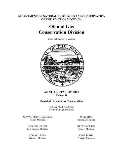
Oil and Gas Conservation Division - Montana Board of Oil and Gas
Oil and Gas Conservation Division - Montana Board of Oil and Gas
Oil and Gas Conservation Division - Montana Board of Oil and Gas

You also want an ePaper? Increase the reach of your titles
YUMPU automatically turns print PDFs into web optimized ePapers that Google loves.
DEPARTMENT OF NATURAL RESOURCES AND CONSERVATION<br />
OF THE STATE OF MONTANA<br />
WAYNE SMITH, Vice-Chair<br />
Valier, <strong>Montana</strong><br />
DON BRADSHAW<br />
Fort Benton, <strong>Montana</strong><br />
RONALD EFTA<br />
Wibaux, <strong>Montana</strong><br />
<strong>Oil</strong> <strong>and</strong> <strong>Gas</strong><br />
<strong>Conservation</strong> <strong>Division</strong><br />
Brian Schweitzer, Governor<br />
ANNUAL REVIEW 2007<br />
Volume 51<br />
<strong>Board</strong> <strong>of</strong> <strong>Oil</strong> <strong>and</strong> <strong>Gas</strong> <strong>Conservation</strong><br />
LINDA NELSON, Chair<br />
Medicine Lake, <strong>Montana</strong><br />
JACK KING<br />
Billings, <strong>Montana</strong><br />
BRET SMELSER<br />
Sidney, <strong>Montana</strong><br />
JOAN STAHL<br />
Forsyth, <strong>Montana</strong>
Administrators for the <strong>Board</strong> <strong>of</strong> <strong>Oil</strong> <strong>and</strong> <strong>Gas</strong><br />
<strong>Conservation</strong> <strong>of</strong> the State <strong>of</strong> <strong>Montana</strong><br />
THOMAS P. RICHMOND<br />
ADMINSTRATOR/PETROLEUM ENGINEER<br />
2535 ST. JOHNS AVENUE<br />
BILLINGS, MONTANA 59102<br />
TERRI H. PERRIGO<br />
EXECUTIVE SECRETARY<br />
1625 ELEVENTH AVENUE<br />
HELENA, MONTANA 59620<br />
OFFICES LOCATED AT:<br />
2535 St. Johns Avenue, Billings, <strong>Montana</strong> 59102<br />
165 Main Street, Shelby, <strong>Montana</strong> 59474<br />
1625 Eleventh Avenue, Helena, <strong>Montana</strong> 59620<br />
Annual Review for the Year 2007<br />
Volume 51<br />
JAMES W. HALVORSON<br />
GEOLOGIST<br />
2535 ST. JOHNS AVENUE<br />
BILLINGS, MONTANA 59102<br />
GEORGE C. HUDAK<br />
UIC COORDINATOR<br />
2535 ST. JOHNS AVENUE<br />
BILLINGS, MONTANA 59102<br />
STEVE SASAKI<br />
FIELD SUPERVISOR<br />
2535 ST. JOHNS AVENUE<br />
BILLINGS, MONTANA 59102<br />
Additional statistical information is available on the <strong>Board</strong>’s website<br />
http://www.bogc.dnrc.mt.gov
TABLE OF CONTENTS<br />
Summary..................................................................................................Section 1<br />
Crude <strong>Oil</strong> Production................................................................................Section 2<br />
Five-Year Production Summary ...............................................................Section 3<br />
Refiners’ Annual Report ...........................................................................Section 4<br />
Five-Year Permit Summary ......................................................................Section 5<br />
Five-Year Completion Summary ..............................................................Section 6<br />
Top 100 <strong>Oil</strong> Producers .............................................................................Section 7<br />
Top <strong>Gas</strong> Producers ..................................................................................Section 8<br />
Top <strong>Oil</strong> <strong>and</strong> <strong>Gas</strong> Producing Fields ...........................................................Section 9<br />
Field Summary, Reported <strong>Oil</strong> Fields.......................................................Section 10<br />
Field Summary, Reported <strong>Gas</strong> Fields ....................................................Section 11<br />
County Drilling And Production Statistics ...............................................Section 12<br />
Well Completion Summary By County ...................................................Section 13<br />
Stripper <strong>Oil</strong> Well Statistics ......................................................................Section 14<br />
Production By Area ................................................................................Section 15<br />
Field Rules And Production Summary By Formation .............................Section 16
(This Page Intentionally Left Blank)
Production<br />
Total Liquids Production<br />
<strong>Oil</strong><br />
Condensate<br />
Total <strong>Gas</strong> Production<br />
Associated <strong>Gas</strong><br />
Natural <strong>Gas</strong><br />
34,857,704<br />
34,853,196<br />
4,508<br />
120,765,222<br />
25,291,643<br />
95,473,579<br />
Barrels<br />
MCF<br />
<strong>Oil</strong> And Condensate Production Allocated To Fields<br />
<strong>Gas</strong> Production Allocated To Fields<br />
Permits<br />
Reported<br />
Volume<br />
Barrels<br />
Barrels<br />
MCF<br />
MCF<br />
Change From<br />
Previous Year<br />
-3.84%<br />
-3.83%<br />
-40.63%<br />
5.86%<br />
22.25%<br />
2.23%<br />
34,857,704 Barrels<br />
120,765,222 MCF<br />
New Wells Permitted 839<br />
Re-issued Permits<br />
503<br />
Vertical Wells<br />
Horizontal Wells<br />
686<br />
153<br />
2007 Summary<br />
Permits for Horizontal Re-entry Of Existing Vertical Wells<br />
<strong>Board</strong> Orders<br />
Total Number Of Orders Issued<br />
366<br />
Orders Included The Following Actions:<br />
Units Or Enhanced Recovery Projects<br />
Exception To Spacing Or Field Rules<br />
Field Delineation, Enlargement, Or Reduction<br />
Certification For Tax Incentive<br />
Temporary Or Permanent Spacing Unit Designation<br />
Class II Injection Permits<br />
Other<br />
1 - 1<br />
9<br />
Number Of<br />
Actions<br />
0<br />
99<br />
27<br />
2<br />
167<br />
22<br />
61
Barrels Of <strong>Oil</strong> Per Year (Milli<br />
50<br />
45<br />
40<br />
35<br />
30<br />
25<br />
20<br />
15<br />
10<br />
5<br />
0<br />
1950<br />
1952<br />
1954<br />
1956<br />
1958<br />
South Central<br />
1960<br />
1962<br />
1964<br />
Northern<br />
1966<br />
1968<br />
1970<br />
Crude <strong>Oil</strong> Production<br />
1972<br />
Southeastern<br />
Northeastern<br />
1974<br />
Central<br />
1976<br />
2 - 1<br />
1978<br />
Year<br />
1980<br />
1982<br />
1984<br />
1986<br />
1988<br />
1990<br />
1992<br />
1994<br />
1996<br />
1998<br />
2000<br />
2002<br />
2004<br />
2006
OIL PRODUCTION IN BARRELS<br />
Northern <strong>Montana</strong><br />
Central<br />
South Central<br />
Northeastern<br />
Southeastern<br />
NUMBER OF PRODUCING OIL WELLS<br />
Northern <strong>Montana</strong><br />
Central<br />
South Central<br />
Northeastern<br />
Southeastern<br />
AVERAGE DAILY OIL PRODUCTION PER WELL<br />
Northern <strong>Montana</strong><br />
Central<br />
South Central<br />
Northeastern<br />
Southeastern<br />
NON-ASSOCIATED GAS PRODUCTION IN MCF<br />
Northern <strong>Montana</strong><br />
Central<br />
South Central<br />
Northeastern<br />
Southeastern<br />
NUMBER OF PRODUCING GAS WELLS<br />
Northern <strong>Montana</strong><br />
Central<br />
South Central<br />
Northeastern<br />
Southeastern<br />
AVERAGE DAILY GAS PRODUCTION PER WELL<br />
Five-Year Production Summary<br />
2003 2004 2005 2006 2007<br />
1,275,084 1,266,790 1,254,747 1,314,007 1,399,836<br />
598,971 565,150 535,904 501,704 468,604<br />
572,145 555,662 534,180 555,731 530,323<br />
16,823,588 22,164,424 30,296,287 33,695,855 32,103,869<br />
141,033 158,632 158,002 175,332 350,564<br />
Total 19,410,821 24,710,658 32,779,120 36,242,629 34,853,196<br />
1,769 1,798 1,827 1,874 1,901<br />
224 221 220 214 215<br />
128 125 131 130 128<br />
1,434 1,546 1,707 1,878 2,004<br />
52 54 67 70 68<br />
Total 3,607 3,744 3,952 4,166 4,316<br />
Northern <strong>Montana</strong><br />
Central<br />
South Central<br />
Northeastern<br />
Southeastern<br />
2.6 2.5 2.4 2.4 2.5<br />
9.5 9.0 8.6 8.2 8.2<br />
14.3 14.0 13.7 12.9 12.8<br />
36.7 45.8 56.8 56.3 49.2<br />
8.4 9.5 9.3 8.4 18.1<br />
State Average 18.1<br />
22.1 27.7 28.4 26.0<br />
55,254,052 55,975,911 56,501,221 56,885,846 58,304,372<br />
201,358 126,541 180,941 254,610 154,523<br />
8,492,510 13,598,459 12,881,341 13,065,601 14,524,994<br />
14,188,647 17,559,564 21,944,174 23,009,195 22,229,806<br />
287,241 256,582 196,211 177,262 259,884<br />
Total 78,423,808 87,517,057 91,703,888 93,392,514 95,473,579<br />
3,939 4,114 4,276 4,426 4,616<br />
6 5 8 8 7<br />
378 486 569 835 930<br />
489 588 704 771 879<br />
7 7 7 22 22<br />
Total 4,819 5,200 5,564 6,062 6,454<br />
41.7 41.1 39.6 38.1 38.2<br />
101.9 76.7 98.0 107.4 63.1<br />
81.4 86.2 71.9 57.1 48.3<br />
89.5 94.1 97.6 89.2 77.7<br />
124.8 105.5 80.7 72.5 46.4<br />
State Average 49.2<br />
51.2 49.9 47.1 45.0<br />
3 - 1
Summary<br />
2007 Refiners' Annual Report<br />
Company Beginning <strong>Montana</strong> Wyoming Canada Refined Ending<br />
Storage <strong>Oil</strong> <strong>Oil</strong> <strong>Oil</strong> Storage<br />
Cenex 178,284 1,149,706 596,486 17,112,058 18,908,762 127,772<br />
Conoco 177,716 96,065 256,045 19,016,364 19,342,992 203,198<br />
Exxon Corp. 196,855 0 6,780,663 10,684,276 17,559,932 101,862<br />
<strong>Montana</strong> Refining 18,921 0 3,466,003 3,461,557 23,367<br />
Total 571,776 1,245,771 7,633,194 50,278,701 59,273,243 456,199<br />
Percentage Of Crude <strong>Oil</strong> Received<br />
Average Barrels Per Day<br />
Year <strong>Montana</strong> Wyoming Canada<br />
2003 2.23 15.96 81.81<br />
2004 1.97 15.00 83.03<br />
2005 2.18 14.80 83.02<br />
2006 1.92 13.50 84.58<br />
2007 2.10 12.90 85.00<br />
Year <strong>Montana</strong> Wyoming Canada Total<br />
2003 3,648 26,163 134,128 163,939<br />
2004 3,447 26,234 145,214 174,895<br />
2005 3,774 25,678 143,959 173,411<br />
2006 3,368 23,634 148,063 175,065<br />
2007 3,413 20,913 137,750 162,076<br />
Refining Five Year Comparison (Barrels)<br />
2003 2004 2005 2006 2007<br />
59,858,255 63,761,829 63,286,985 63,897,105 59,273,243<br />
4-1
Five-Year Permit Summary<br />
2003 <strong>Oil</strong> <strong>Gas</strong> CBM<br />
Injection Disposal Other Total<br />
Quarter 1 27 47 12<br />
0 1 0 87<br />
Quarter 2 68 155 21<br />
0 0 0 244<br />
Quarter 3 54 112 166<br />
0 0 0 332<br />
Quarter 4 65 84 19<br />
0 0 3 171<br />
Total 2003 214 398 218<br />
0<br />
1<br />
3<br />
834<br />
2004 <strong>Oil</strong> <strong>Gas</strong> CBM<br />
Injection Disposal Other Total<br />
Quarter 1 54 89 1<br />
0 0 0 144<br />
Quarter 2 52 152 40<br />
0 0 5 249<br />
Quarter 3 75 140 5<br />
0 0 0 220<br />
Quarter 4 62 144 20<br />
0 1 0 227<br />
Total 2004 243 525 66<br />
0<br />
1<br />
5<br />
840<br />
2005 <strong>Oil</strong> <strong>Gas</strong> CBM<br />
Injection Disposal Other Total<br />
Quarter 1 57 129 43<br />
0 0 0 229<br />
Quarter 2 75 140 99<br />
0 0 1 315<br />
Quarter 3 80 91 304<br />
0 0 0 475<br />
Quarter 4 101 53 131<br />
0 0 0 285<br />
Total 2005 313 413 577<br />
0<br />
0<br />
1<br />
1304<br />
2006 <strong>Oil</strong> <strong>Gas</strong> CBM<br />
Injection Disposal Other Total<br />
Quarter 1 77 102 108<br />
1 1 4 293<br />
Quarter 2 82 184 85<br />
0 0 0 351<br />
Quarter 3 65 117 70<br />
0 0 0 252<br />
Quarter 4 54 92 10<br />
0 0 1 157<br />
Total 2006 278 495 273<br />
1<br />
1<br />
5<br />
1053<br />
2007 <strong>Oil</strong> <strong>Gas</strong> CBM<br />
Injection Disposal Other Total<br />
Quarter 1 60 117 33<br />
0 0 0 210<br />
Quarter 2 77 116 1<br />
0 0 0 194<br />
Quarter 3 53 149 16<br />
0 1 0 219<br />
Quarter 4 58 139 19<br />
0 0 0 216<br />
Total 2007 248 521 69<br />
0<br />
1<br />
0<br />
839<br />
5 - 1
Five-Year Completion Summary<br />
2003 <strong>Oil</strong> <strong>Gas</strong> CBM Dry<br />
Injection Disposal Other Total<br />
Quarter 1 17 22 6 12<br />
1 1 0 59<br />
Quarter 2 27 57 7 13<br />
7 2 0 113<br />
Quarter 3 26 137 59 25<br />
4 1 1 253<br />
Quarter 4 27 90 122 20<br />
2 0 0 261<br />
Total 2003 97 306 194 70<br />
14<br />
4<br />
1<br />
686<br />
2004 <strong>Oil</strong> <strong>Gas</strong> CBM Dry<br />
Injection Disposal Other Total<br />
Quarter 1 22 32 12 11<br />
0 0 0 77<br />
Quarter 2 42 72 7 5<br />
0 0 4 130<br />
Quarter 3 46 148 17 16<br />
1 0 1 229<br />
Quarter 4 38 123 7 22<br />
0 2 0 192<br />
Total 2004 148 375 43 54<br />
1<br />
2<br />
5<br />
628<br />
2005 <strong>Oil</strong> <strong>Gas</strong> CBM Dry<br />
Injection Disposal Other Total<br />
Quarter 1 50 25 54 11<br />
1 1 0 142<br />
Quarter 2 49 76 6 24<br />
0 0 1 156<br />
Quarter 3 63 139 66 28<br />
3 0 0 299<br />
Quarter 4 49 129 36 12<br />
0 0 0 226<br />
Total 2005 211 369 162 75<br />
4<br />
1<br />
1<br />
823<br />
2006 <strong>Oil</strong> <strong>Gas</strong> CBM Dry<br />
Injection Disposal Other Total<br />
Quarter 1 58 47 58 12<br />
0 2 2 179<br />
Quarter 2 57 62 136 22<br />
3 0 1 281<br />
Quarter 3 65 115 81 12<br />
1 3 1 278<br />
Quarter 4 33 123 38 15<br />
1 1 0 211<br />
Total 2006 213 347 313 61<br />
5<br />
6<br />
4<br />
949<br />
2007 <strong>Oil</strong> <strong>Gas</strong> CBM Dry<br />
Injection Disposal Other Total<br />
Quarter 1 42 54 18 9<br />
2 0 1 126<br />
Quarter 2 43 57 15 13<br />
0 1 1 130<br />
Quarter 3 53 134 23 18<br />
0 2 0 230<br />
Quarter 4 19 129 7 16<br />
0 3 1 175<br />
Total 2007 157 374 63 56<br />
2<br />
6<br />
3<br />
661<br />
6 - 1
2007 Top 100 <strong>Oil</strong> Producers<br />
Company Barrels <strong>of</strong> <strong>Oil</strong> Company<br />
Barrels <strong>of</strong> <strong>Oil</strong><br />
1 Encore Operating LP 6,533,325<br />
2 Enerplus Resources USA Corporation 5,027,627<br />
3 Continental Resources Inc 4,484,806<br />
4 Burlington Resources <strong>Oil</strong> & <strong>Gas</strong> Company LP 4,183,351<br />
5 Headington <strong>Oil</strong> Company LLC 3,494,813<br />
6 Nance Petroleum Corporation 2,054,378<br />
7 Slawson Exploration Company Inc 933,942<br />
8 Petro-Hunt, LLC 714,250<br />
9 EOG Resources, Inc. 650,149<br />
10 Newfield Production Company 515,184<br />
11 PrimeWest Petroleum, Inc. 461,892<br />
12 Stone Energy Corporation 461,627<br />
13 Citation <strong>Oil</strong> & <strong>Gas</strong> Corporation 394,411<br />
14 Encore Energy Partners Operating LLC 378,803<br />
15 Whiting <strong>Oil</strong> <strong>and</strong> <strong>Gas</strong> Corporation 278,508<br />
16 MCR, LLC 276,567<br />
17 St. Mary L<strong>and</strong> & Exploration Company 178,334<br />
18 Quicksilver Resources, Inc. 170,141<br />
19 Bill Barrett Corporation 143,166<br />
20 Kodiak <strong>Oil</strong> & <strong>Gas</strong> (USA) Inc. 142,933<br />
21 Luff Exploration Company 139,574<br />
22 Helis <strong>Oil</strong> <strong>and</strong> <strong>Gas</strong> Company, LLC 122,702<br />
23 True <strong>Oil</strong> LLC 122,504<br />
24 Chaparral Energy, LLC 112,321<br />
25 Somont <strong>Oil</strong> Company, Inc. 107,821<br />
26 Samson Resources Company 101,385<br />
27 Forest <strong>Oil</strong> Corporation 97,338<br />
28 Oasis Petroleum North America LLC 94,630<br />
29 Summit Resources, Inc. 93,962<br />
30 Prima Exploration, Inc. 88,817<br />
31 Kerr-McGee <strong>Oil</strong> & <strong>Gas</strong> Onshore LP 87,581<br />
32 Armstrong Operating, Inc. 76,463<br />
33 Chesapeake Operating Inc. 75,716<br />
34 Howell Petroleum Corp. 75,679<br />
35 FX Drilling Company, Inc. 75,645<br />
36 Omimex Canada, Ltd. 69,256<br />
37 Cline Production Company 67,349<br />
38 Flying J <strong>Oil</strong> <strong>and</strong> <strong>Gas</strong>, Inc. 60,622<br />
39 Nautilus Poplar, LLC 57,613<br />
40 Sinclair <strong>Oil</strong> & <strong>Gas</strong> Company 57,218<br />
41 Marathon <strong>Oil</strong> Company 51,683<br />
42 Cardinal <strong>Oil</strong>, LLC 49,545<br />
43 Cowry Enterprises, Ltd. 48,360<br />
44 Williston Industrial Supply Corporation 46,790<br />
45 Balko, Inc. 42,930<br />
46 Mountain View Energy, Inc. 42,636<br />
47 Soap Creek Associates, Inc. 42,485<br />
48 Tomahawk <strong>Oil</strong> Company 40,006<br />
49 Great Plains Operating, LLC 39,323<br />
50 ST <strong>Oil</strong> Company 38,865<br />
7 - 1<br />
51 Thomas Operating Co., Inc. 38,848<br />
52 Ballard Petroleum Holdings LLC 33,482<br />
53 Basic Earth Science Systems, Inc. 33,287<br />
54 Columbus Energy Corp. 32,547<br />
55 H&R Energy, LLC 32,086<br />
56 McRae & Henry Ltd 30,904<br />
57 Columbus Energy, LLC 30,358<br />
58 Beartooth <strong>Oil</strong> & <strong>Gas</strong> Company 29,944<br />
59 Klabzuba <strong>Oil</strong> & <strong>Gas</strong>, Inc. 27,653<br />
60 Cr<strong>of</strong>t Petroleum Company 27,615<br />
61 Bluebonnet Energy Corporation 25,767<br />
62 Wyoming Resources Corporation 25,023<br />
63 Shakespeare <strong>Oil</strong> Co Inc 24,762<br />
64 Wesco Operating, Inc. 22,658<br />
65 Carrell <strong>Oil</strong> Company Dba Coco 21,046<br />
66 Hawley & Desimon 20,800<br />
67 Eagle <strong>Oil</strong> & <strong>Gas</strong> Co. 19,562<br />
68 Berexco, Inc. 19,510<br />
69 Kipling Energy Incorporated 18,947<br />
70 Keesun Corporation 18,773<br />
71 BTA <strong>Oil</strong> Producers 17,152<br />
72 Macum Energy Inc. 16,966<br />
73 Lamamco Drilling Co. 16,917<br />
74 R & A <strong>Oil</strong>, Inc. 16,223<br />
75 Coolidge, G. B., Inc. 15,940<br />
76 Beren Corporation 15,479<br />
77 Sannes, Ronald M. Or Margaret Ann 15,193<br />
78 Orion Energy Partners LP 14,775<br />
79 Nadel <strong>and</strong> Gussman Rockies, LLC 14,734<br />
80 Behm Energy, Inc. 14,684<br />
81 Provident Energy Assoc. Of Mt Llc 14,412<br />
82 Big Snowy Resources LP 13,327<br />
83 Great Plains Resources Inc. 13,035<br />
84 Blackjack <strong>Oil</strong>, Inc. 12,630<br />
85 TOI Operating 12,042<br />
86 Northern <strong>Oil</strong> Production, Inc. 11,901<br />
87 Ritchie Exploration, Inc. 11,651<br />
88 Missouri River Royalty Corporation 11,642<br />
89 H<strong>of</strong>l<strong>and</strong>, James D. 11,505<br />
90 Hawkins, Robert S. 11,267<br />
91 XOIL Inc. 10,742<br />
92 K2 America Corporation 10,676<br />
93 Upton Resources U.S.A., Inc. 10,251<br />
94 Gr<strong>and</strong> Resources, Ltd. 9,956<br />
95 Main Energy, Inc. 9,596<br />
96 Cavalier Petroleum 9,559<br />
97 Ch<strong>and</strong>ler Energy, LLC 9,190<br />
98 Miocene <strong>Oil</strong> Company 8,921<br />
99 King-Sherwood <strong>Oil</strong> 8,615<br />
100 NorthWestern Corporation 7,451
2007 Top <strong>Gas</strong> Producers<br />
(Includes operators with over 10,000 MCF <strong>of</strong> gas produced during the calendar year.)<br />
Company MCF Company<br />
MCF<br />
1 Fidelity Exploration & Production Co. 48,011,039<br />
2 Devon Energy Production Co., LP 16,650,987<br />
3 Klabzuba <strong>Oil</strong> & <strong>Gas</strong>, Inc. 8,240,173<br />
4 Noble Energy, Inc. 6,325,328<br />
5 Omimex Canada, Ltd. 3,256,166<br />
6 Helis <strong>Oil</strong> <strong>and</strong> <strong>Gas</strong> Company, LLC 1,721,050<br />
7 <strong>Montana</strong> L<strong>and</strong> & Exploration, Inc. 1,331,918<br />
8 MCR, LLC 1,012,455<br />
9 Saga Petroleum, LLC 771,528<br />
10 Cr<strong>of</strong>t Petroleum Company 731,119<br />
11 Brown, J. Burns Operating Company 691,461<br />
12 Somont <strong>Oil</strong> Company, Inc. 678,911<br />
13 Pinnacle <strong>Gas</strong> Resources, Inc. 482,423<br />
14 Western Natural <strong>Gas</strong> Company 405,480<br />
15 T.W.O. (Taylor Well Operating) 366,112<br />
16 Westech Energy Corporation 345,949<br />
17 Jurassic Resources Development NA LLC 331,906<br />
18 Keesun Corporation 326,415<br />
19 Branch <strong>Oil</strong> & <strong>Gas</strong> 315,378<br />
20 AltaMont <strong>Oil</strong> & <strong>Gas</strong> Inc. 268,154<br />
21 S<strong>and</strong>s <strong>Oil</strong> Company 193,823<br />
22 Ranck <strong>Oil</strong> Company, Inc. 181,827<br />
23 NorthWestern Corporation 170,468<br />
24 Macum Energy Inc. 147,613<br />
25 McMinn Operating Company 142,148<br />
26 Mountain Pacific General Inc. 127,069<br />
27 Saco, Town Of 118,163<br />
28 Bayswater Exploration & Production, LLC 114,778<br />
29 Whiting <strong>Oil</strong> <strong>and</strong> <strong>Gas</strong> Corporation 109,775<br />
30 G/S Producing, Inc. 105,728<br />
31 Nance Petroleum Corporation 102,419<br />
32 Georesources, Inc. 96,209<br />
33 Balko, Inc. 87,002<br />
34 AP Petroleum Company LLC 80,746<br />
35 Constitution <strong>Gas</strong> Transport Co., Inc. 79,839<br />
36 Unit Petroleum Company 79,801<br />
37 <strong>Montana</strong> Heartl<strong>and</strong> LLC 77,353<br />
38 Coolidge, G. B., Inc. 68,637<br />
39 Topaz <strong>Oil</strong> & <strong>Gas</strong> Inc 66,537<br />
40 Sector Resources (II) Ltd. 61,592<br />
41 Griffon Petroleum, Inc. 61,019<br />
42 Rimrock Colony 58,254<br />
43 Porker <strong>Oil</strong> 55,046<br />
44 Great Northern Drilling Company 50,478<br />
45 Solomon Exploration Inc. 48,997<br />
46 Thomas Operating Co., Inc. 45,275<br />
47 Bowers <strong>Oil</strong> & <strong>Gas</strong>, Inc. 45,052<br />
48 Decker Operating Company, L.L.C. 44,800<br />
49 Herco Exploration LLC 34,974<br />
50 Parsell, R. W. 31,488<br />
8 - 1<br />
51 Robinson <strong>Oil</strong> Company, LLC 30,926<br />
52 Dart <strong>Oil</strong> & <strong>Gas</strong> Corporation 26,283<br />
53 Northl<strong>and</strong> Holdings, Inc. 26,281<br />
54 Tensas Delta Exploration Company, LLC 24,869<br />
55 Reserve Operating Corp. 24,265<br />
56 Artex <strong>Oil</strong> Company 23,791<br />
57 Cut Bank <strong>Gas</strong> Company 23,323<br />
58 Citation <strong>Oil</strong> & <strong>Gas</strong> Corporation 22,857<br />
59 DL Energy, LLC 20,045<br />
60 Potlatch <strong>Oil</strong> & Refining Co 17,724<br />
61 Hardrock <strong>Oil</strong> Company 17,169<br />
62 Cardinal <strong>Oil</strong>, LLC 16,806<br />
63 Simon <strong>and</strong> Associates 16,460<br />
64 Quicksilver Resources, Inc. 16,349<br />
65 Galuska Exploration & Production LLC 15,000<br />
66 Slow Poke Production-George L. Dobson Dba 14,247<br />
67 Mc<strong>Oil</strong> <strong>Montana</strong> One LLC 13,733<br />
68 St. Mary L<strong>and</strong> & Exploration Company 13,565<br />
69 Lease Technicians, James S. Br<strong>and</strong>t Dba 13,420<br />
70 City <strong>of</strong> Baker 13,335<br />
71 Self, E. M. 12,904<br />
72 Canyon Natural <strong>Gas</strong>, LLC 10,924<br />
73 Rincon <strong>Oil</strong> & <strong>Gas</strong> LLC 10,915
1<br />
2<br />
3<br />
4<br />
5<br />
6<br />
7<br />
8<br />
9<br />
10<br />
11<br />
12<br />
13<br />
14<br />
15<br />
16<br />
17<br />
18<br />
19<br />
20<br />
21<br />
22<br />
23<br />
24<br />
25<br />
26<br />
27<br />
28<br />
29<br />
30<br />
31<br />
32<br />
33<br />
34<br />
35<br />
36<br />
37<br />
38<br />
39<br />
40<br />
41<br />
42<br />
43<br />
44<br />
45<br />
46<br />
47<br />
48<br />
49<br />
50<br />
2007 Top <strong>Oil</strong> And <strong>Gas</strong> Producing Fields<br />
<strong>Oil</strong> Fields <strong>Gas</strong> Fields<br />
Field Barrels<br />
Field MCF<br />
Elm Coulee 18,129,476<br />
1 Cedar Creek 21,665,317<br />
Lookout Butte, East, Unit 2,211,707<br />
2 Bowdoin 14,227,132<br />
Pennel 2,193,817<br />
3 CX 12,560,696<br />
Pine 1,076,639<br />
4 Tiger Ridge 10,595,120<br />
Cabin Creek 897,818<br />
5 St. Joe Road 4,007,562<br />
Lookout Butte 818,800<br />
6 Red Rock 2,688,701<br />
Elk Basin 417,918<br />
7 Sherard, Area 2,255,053<br />
Cut Bank 329,061<br />
8 Sawtooth Mountain 2,231,494<br />
Bell Creek 328,251<br />
9 Whitewater 2,137,613<br />
Bainville, North 313,100<br />
10 Battle Creek 2,083,444<br />
<strong>Gas</strong> City 295,173<br />
11 Loring 2,008,606<br />
Flat Lake 287,424<br />
12 Cut Bank 1,773,220<br />
Kevin-Sunburst 234,746<br />
13 Bullwacker 1,681,503<br />
Little Beaver 234,333<br />
14 Ashfield 1,263,968<br />
Monarch 218,032<br />
15 Cherry Patch 930,437<br />
Waterhole Creek 191,789<br />
16 Loring, East 886,594<br />
Brush Lake 181,843<br />
17 Rocky Boy Area 599,582<br />
Pondera 154,510<br />
18 Black Coulee 598,001<br />
Dwyer 150,659<br />
19 Kevin-Sunburst 563,341<br />
Divide 148,807<br />
20 Whitlash 561,178<br />
Windy Ridge 147,220<br />
21 Dry Creek 493,551<br />
Sioux Pass, North 145,032<br />
22 Prairie Dell 472,432<br />
Bainville 143,807<br />
23 Keith, East 435,072<br />
Little Beaver, East 141,916<br />
24 Pine <strong>Gas</strong> 409,259<br />
Mon Dak, West 141,497<br />
25 Old Shelby 376,973<br />
Ridgelawn 132,410<br />
26 Dietz 356,482<br />
Enid, North 131,489<br />
27 Lake Francis 353,097<br />
Sioux Pass 126,663<br />
28 Dean Dome 345,949<br />
Gunsight 126,469<br />
29 Bowes 308,421<br />
Glendive 122,011<br />
30 Fresno 294,830<br />
Lowell 116,942<br />
31 Am<strong>and</strong>a 289,205<br />
Sumatra 112,296<br />
32 Big Coulee 281,298<br />
Lane 112,062<br />
33 Leroy 214,089<br />
Miners Coulee 111,506<br />
34 Brown's Coulee, East 213,772<br />
Katy Lake, North 104,999<br />
35 Swanson Creek 210,991<br />
Nohly 101,705<br />
36 Whitewater, East 208,988<br />
Anvil, North 97,338<br />
37 Big Rock 205,418<br />
Rabbit Hills 93,709<br />
38 Utopia 196,707<br />
Bowes 91,971<br />
39 Miners Coulee 182,592<br />
Lustre 89,575<br />
40 Badl<strong>and</strong>s 180,303<br />
Anvil 85,140<br />
41 Gr<strong>and</strong>view 170,060<br />
Crane 82,712<br />
42 Kevin Southwest 166,058<br />
Outlook 79,560<br />
43 Dry Creek (Shallow <strong>Gas</strong>) 145,094<br />
Palomino 77,596<br />
44 Coal Creek 144,532<br />
Putnam 72,273<br />
45 Willow Ridge, South 132,896<br />
Red Bank 71,859<br />
46 O'Briens Coulee 125,712<br />
Vaux 71,219<br />
47 Arch Apex 109,492<br />
Reagan 69,256<br />
48 Mt. Lilly 107,247<br />
Clear Lake 69,022<br />
49 Hammond 96,209<br />
Goose Lake 68,340<br />
50 Ledger 87,002<br />
9 - 1
Field<br />
2007 Field Summary, Reported <strong>Oil</strong> Fields<br />
Annual <strong>Oil</strong><br />
Barrels<br />
Ace High 3,686<br />
Agawam 79<br />
Alkali Coulee 53,229<br />
Andes 21,175<br />
Antelope 2,137 2,137<br />
Antelope, North 2,484<br />
Anvil 85,140 5,421,875<br />
Anvil, North 97,338 142,803<br />
Ash Creek 868,169<br />
Ator Creek 1,581 42,218<br />
Autumn 35,546<br />
Bainville 143,807 1,538,956<br />
Bainville (Ratcliffe/Mission Canyon) 5,766 84,019<br />
Bainville II 39,348 1,430,054<br />
Bainville, North 313,100 8,046,767<br />
Bainville, West 24,295 449,827<br />
Bannatyne 6,338 481,559<br />
Bascom 27,830<br />
Battle Creek, South, <strong>Oil</strong> 20,033 96,973<br />
Beanblossom 7,337 703,866<br />
Bear's Den 2,687 792,554<br />
Belfry 101,245<br />
Bell Creek 328,251 134,119,303<br />
Benrud 289,695<br />
Benrud, East 5,175 3,008,323<br />
Benrud, Northeast 1,019,598<br />
Berthelote 790 73,703<br />
Big Gully 6,196 148,375<br />
Big Gully, North 29,892<br />
Big Muddy Creek 9,998 1,455,839<br />
Big Rock 12,444<br />
Big Wall 26,591 8,575,832<br />
Big Wall, North 7,218<br />
Black Diamond 5,327 701,091<br />
Blackfoot 5,027 1,827,107<br />
Blackfoot, East 810<br />
Bloomfield 8,984 738,164<br />
Blue Hill 162,251<br />
Blue Mountain 4,500 198,057<br />
Border 1,487 1,508,138<br />
Boulder 156,754<br />
Bowes 91,971 11,444,101<br />
Box Canyon 245,847<br />
Bradley 548 276,724<br />
Brady 2,542 273,589<br />
Bredette 232,121<br />
Bredette, North 488,554<br />
Breed Creek 64,498 3,108,405<br />
Brorson 63,021 5,520,980<br />
Brorson, South 21,469 2,511,971<br />
Brush Lake 181,843 4,749,364<br />
Buffalo Flat 603<br />
Buffalo Lake 936<br />
Burget 31,311 95,889<br />
Cumulative<br />
Barrels Field<br />
10 - 1<br />
Annual <strong>Oil</strong><br />
Barrels<br />
Cumulative<br />
Barrels<br />
Burget, East 15,974 593,284<br />
Burns Creek 546 269,005<br />
Burns Creek, South 575 81,132<br />
Butcher Creek 579<br />
Bynum 5,971<br />
Cabaret Coulee 903 456,320<br />
Cabin Creek 897,818 112,867,920<br />
Cadmus 1,173<br />
Canadian Coulee 1,462 5,111<br />
Canal 27,541 1,539,897<br />
Cannon Ball 74,779<br />
Carlyle 330,289<br />
Cat Creek 27,948 24,231,263<br />
Cattails 44,937 1,258,675<br />
Cattails, South 8,180 362,958<br />
Cedar Hills, West Unit 57,804<br />
Charlie Creek 15,861 1,116,800<br />
Charlie Creek, East 18,860 1,110,980<br />
Charlie Creek, North 43,894<br />
Chelsea Creek 153,831<br />
Clark's Fork 496 100,261<br />
Clark's Fork, North 1,024,608<br />
Clark's Fork, South 43 84,079<br />
Clear Lake 69,022 4,626,843<br />
Clear Lake, South 24,826 379,573<br />
Coalridge 3,247 26,184<br />
Colored Canyon 10,081 1,260,486<br />
Comertown 40,300 3,235,329<br />
Comertown, South 9,190 551,700<br />
Conrad, South 161,773<br />
Corner Pocket 14,483<br />
Cottonwood 31,100 706,649<br />
Cottonwood, East 6,099 157,851<br />
Cow Creek 127,813<br />
Cow Creek, East 13,226 2,794,963<br />
Crane 82,712 3,673,083<br />
Crocker Springs, East 3,476<br />
Crooked Creek 380 28,861<br />
Culbertson 175,652<br />
Cupton 24,572 3,051,863<br />
Curlew 5,468<br />
Cut Bank 329,109 171,192,413<br />
Dagmar 9,878 781,609<br />
Dagmar, North 55,342<br />
Deadman's Coulee 264,528<br />
Dean Dome 92,597<br />
Deer Creek 35,370 3,117,386<br />
Delphia 1,097 371,802<br />
Den 176,125<br />
Devil's Basin 179 138,481<br />
Devil's Pocket 53,796<br />
Diamond Point 14,315 1,229,496<br />
Divide 148,807 3,887,462<br />
Dooley 6,760 404,659
Field<br />
Annual <strong>Oil</strong><br />
Barrels<br />
Dry Creek 312 4,171,363<br />
Dry Creek, Middle 1,205 23,130<br />
Dry Creek, West 186 16,444<br />
Dugout Creek 24,919 672,586<br />
Dunkirk, North 19<br />
Dutch Henry 104,164<br />
Dutch John Coulee 7,937 313,671<br />
Dwyer 150,659 10,238,126<br />
Eagle 17,192 2,389,856<br />
East Glacier 282 28,715<br />
Elk Basin 417,918 91,516,355<br />
Elk Basin, Northwest 36,564 2,755,122<br />
Elm Coulee 18,129,476 64,595,319<br />
Elm Coulee, Northeast 51,683 51,683<br />
Enid, North 131,489 762,515<br />
Epworth 2,433 111,283<br />
Fairview 68,185 10,206,399<br />
Fairview, East 5,041 517,788<br />
Fairview, West 10,589 560,838<br />
Fertile Prairie 807,540<br />
Fiddler Creek 2,574<br />
Fishhook 20,634 1,390,924<br />
Flat Coulee 28,409 5,769,338<br />
Flat Lake 287,424 20,525,266<br />
Flat Lake, East 10,607 248,991<br />
Flat Lake, South 1,942 1,290,847<br />
Flaxville 56,283<br />
Fort Gilbert 15,803 2,663,126<br />
Four Buttes 42,391<br />
Four Mile Creek 4,243 503,346<br />
Four Mile Creek, West 16,468 634,116<br />
Fox Creek 7,625 275,572<br />
Fox Creek, North 75,398<br />
Fox Lake 2,767 35,035<br />
Frannie 773,613<br />
Fred & George Creek 56,922 13,762,430<br />
Frog Coulee 6,897 347,559<br />
Froid, South 5,704 424,647<br />
Gage 253 680,833<br />
Gage, Southwest 16,289<br />
<strong>Gas</strong> City 295,173 12,352,394<br />
Gettysburg 304<br />
Girard 10,905 722,292<br />
Glendive 122,011 14,880,896<br />
Glendive, South 68,936<br />
Golden Dome 386 124,001<br />
Goose Lake 68,340 10,506,070<br />
Goose Lake Red River 63,442<br />
Goose Lake, East 4,522<br />
Goose Lake, Southeast 45,527<br />
Goose Lake, West 9,665 745,485<br />
Gossett 2,206 416,365<br />
Graben Coulee 18,197 2,627,958<br />
Gr<strong>and</strong>view 2,510 28,062<br />
Gr<strong>and</strong>view, East 1,051 69,646<br />
Gray Blanket 16,780 459,332<br />
Cumulative<br />
Barrels Field<br />
10 - 2<br />
Annual <strong>Oil</strong><br />
Barrels<br />
Cumulative<br />
Barrels<br />
Grebe 3,541 62,729<br />
Green Coulee 128,759<br />
Green Coulee, East 3,484 196,287<br />
Gumbo Ridge 2,388 636,299<br />
Gunsight 126,469 802,820<br />
Gypsy Basin 1,115 519,154<br />
Hardpan 2,805<br />
Hardscrabble Creek 170,566<br />
Hawk Creek 13,277<br />
Hawk Haven 1,430 49,988<br />
Hay Creek 16,584 1,790,324<br />
Hell Coulee 67,203<br />
Hiawatha 8,520 1,760,870<br />
Hibbard 226,494<br />
High Five 48,274 3,221,883<br />
Highview 1,786 133,563<br />
Hodges Creek 1,805 12,327<br />
Homestead 303<br />
Honker 117,078<br />
Horse Creek 13,516<br />
Howard Coulee 6,575 254,181<br />
Injun Creek 753 142,528<br />
Intake II 7,468 1,036,758<br />
Ivanhoe 16,869 4,849,018<br />
Jack Creek 1,310<br />
Jim Coulee 1,882 4,532,857<br />
Katy Lake 12,696 324,080<br />
Katy Lake, North 104,999 6,734,118<br />
Keg Coulee 7,538 5,829,701<br />
Keg Coulee, North 451,401<br />
Kelley 2,981 1,055,405<br />
Kevin, East Nisku <strong>Oil</strong> 15,951 907,850<br />
Kevin-Sunburst 235,192 83,149,062<br />
Kicking Horse 1,526<br />
Kincheloe Ranch 6,958 882,614<br />
Kippen Area, East 150<br />
Kippen, East 150<br />
Krug Creek 15,288<br />
Laird Creek 1,217 633,456<br />
Lake Basin 473,639<br />
Lakeside 487<br />
Lambert 53,956 731,229<br />
Lambert, North 36,552<br />
Lambert, South 30,091 723,194<br />
Lamesteer Creek 31,845<br />
L<strong>and</strong>slide Butte 17,303 835,012<br />
Lane 112,062 1,361,522<br />
Lariat 3,599<br />
Laurel 1,017<br />
Leary 1,946 692,190<br />
Ledger 292<br />
Line Coulee 57,789<br />
Lisk Creek 1,963<br />
Lisk Creek, South 9,842 18,646<br />
Little Beaver 234,333 17,019,971<br />
Little Beaver, East 141,916 7,837,783
Field<br />
Annual <strong>Oil</strong><br />
Barrels<br />
Little Phantom 58,500<br />
Little Wall Creek 6,316 3,939,693<br />
Little Wall Creek, South 14,598 1,534,051<br />
Lobo 260,135<br />
Lodge Grass 294 399,880<br />
Lone Butte 7,433 962,943<br />
Lone Rider 5,903<br />
Lonetree Creek 64,495 5,635,016<br />
Lonetree Creek, West 33,029<br />
Long Creek 1,154 101,556<br />
Long Creek, West 13,430 981,887<br />
Lookout Butte 818,800 33,222,514<br />
Lookout Butte, East, Unit 2,211,707 21,633,165<br />
Lost Creek 1,534<br />
Lowell 116,942 625,700<br />
Lowell, South 9,127 265,686<br />
Lustre 89,575 6,766,073<br />
Lustre, North 190,737<br />
Mackay Dome 118,812<br />
Malcolm Creek 11,450<br />
Mason Lake 4,186 1,012,330<br />
Mason Lake North 17,923<br />
McCabe 4,503 313,357<br />
McCabe, East 10,188 179,752<br />
McCabe, South 6,599<br />
McCabe, West 69,988<br />
McCoy Creek 7,396 96,775<br />
McDonald Creek 3,102<br />
Me<strong>and</strong>er 201 8,410<br />
Medicine Lake 38,834 4,244,326<br />
Medicine Lake, South 8,074 219,982<br />
Melstone 4,303 3,384,772<br />
Melstone, North 12,461 784,447<br />
Midby 70,172<br />
Midfork 32,502 976,893<br />
Mineral Bench 186,656<br />
Miners Coulee 111,506 291,518<br />
Missouri Breaks 437,188<br />
Mon Dak, West 141,497 12,926,736<br />
Mona 1,838 166,699<br />
Monarch 218,032 9,306,916<br />
Mosser Dome 13,327 484,213<br />
Musselshell 479 45,024<br />
Mustang 29,990 1,276,340<br />
Neiser Creek 17,141 685,325<br />
Nielsen Coulee 8,921 249,033<br />
Ninemile 80,509<br />
Nohly 101,705 8,416,065<br />
Nohly, South 145,482<br />
North Fork 4,365 648,611<br />
Olje 163,500<br />
Ollie 279,792<br />
Otis Creek 4,100 943,778<br />
Otis Creek, South 7,561 384,197<br />
Otter Creek 28,492<br />
Outlet 6,384<br />
Cumulative<br />
Barrels Field<br />
10 - 3<br />
Annual <strong>Oil</strong><br />
Barrels<br />
Cumulative<br />
Barrels<br />
Outlook 79,560 9,310,430<br />
Outlook, South 693,151<br />
Outlook, Southwest 993 153,084<br />
Outlook, West 24,762 1,187,503<br />
Oxbow 24,953 807,911<br />
Oxbow II 13,787 741,278<br />
Palomino 77,596 3,500,240<br />
Pasture 2,869<br />
Pasture Creek 4,783<br />
Pelican 191,494<br />
Pennel 2,193,817 114,879,206<br />
Pete Creek 23,343<br />
Phantom 43,585<br />
Pine 1,076,639 124,588,158<br />
Pine, East 19,349<br />
Pipeline 16,424<br />
Plentywood 22,830<br />
Pole Creek 169,726<br />
Police Coulee 14<br />
Pondera 154,510 28,922,795<br />
Pondera Coulee 2,225 131,953<br />
Poplar, East 65,202 47,283,746<br />
Poplar, Northwest 64,712 4,902,777<br />
Poplar, Southeast 162,546<br />
Prairie Dell 1,767<br />
Prairie Elk 104,226<br />
Prichard Creek 249 166,917<br />
Pronghorn 490,237<br />
Putnam 72,273 6,378,259<br />
Rabbit Hills 93,709 3,102,185<br />
Rabbit Hills, South 14,957 258,288<br />
Ragged Point 716 3,809,026<br />
Ragged Point, Southwest 6,109 677,833<br />
Rainbow 166,375<br />
Rattler Butte 20,472 1,811,185<br />
Rattler Butte, South 15,403<br />
Rattlesnake Butte 5,769 730,605<br />
Rattlesnake Coulee 91,024<br />
Raymond 21,499 5,698,652<br />
Raymond, North 150,342<br />
Raymond, Northeast 120,687<br />
Reagan 69,685 10,476,666<br />
Red Bank 71,859 2,795,342<br />
Red Bank, South 387,759<br />
Red Creek 43,491 7,111,457<br />
Red Fox 380,137<br />
Red Water 21,172 160,993<br />
Red Water, East 5,658 375,837<br />
Redstone 3,976 480,442<br />
Refuge 312,284<br />
Repeat 14,734 561,798<br />
Reserve 14,980 2,222,453<br />
Reserve II 836 225,658<br />
Reserve, South 107,929<br />
Richey 2,030,121<br />
Richey, East 10,386
Field<br />
Annual <strong>Oil</strong><br />
Barrels<br />
Richey, Southwest 1,903,189<br />
Richey, West 11,062<br />
Ridgelawn 132,410 8,735,089<br />
Ridgelawn, North 12,046 436,651<br />
Rip Rap Coulee 29,331 1,113,990<br />
River Bend 275,733<br />
Rocky Point 6,921 659,432<br />
Roscoe Dome 15,556<br />
Rosebud 4,763 592,840<br />
Rough Creek 3,599<br />
Royals 2,398 398,593<br />
Royals, South 3,082<br />
Rudyard 689 30,175<br />
Runaway 4,532<br />
Rush Mountain 18,502 998,916<br />
Salt Lake 11,398 1,251,125<br />
Salt Lake, West 12,485 339,578<br />
S<strong>and</strong> Creek 1,834 2,408,953<br />
Saturn 209 42,744<br />
Scobey 3,916<br />
Second Creek 1,261 1,459,900<br />
Second Guess 1,135 32,806<br />
Sheepherder 76,942<br />
Short Creek 8,950<br />
Shotgun Creek 56,128 1,119,268<br />
Shotgun Creek, North 3,002 92,675<br />
Sidney 17,078 3,671,983<br />
Sidney, East 3,479 635,208<br />
Singletree 373,992<br />
Sioux Pass 126,663 5,631,785<br />
Sioux Pass, East 89,267<br />
Sioux Pass, Middle 7,929 1,886,052<br />
Sioux Pass, North 145,032 5,973,492<br />
Sioux Pass, South 6,000 363,808<br />
Sioux Pass, West 23,899 437,245<br />
Smoke Creek 100,305<br />
Snake Creek 8,530 114,851<br />
Snoose Coulee 6,861<br />
Snowden 1,938<br />
Snyder 477,620<br />
Soap Creek 39,097 3,250,358<br />
Soap Creek, East 5,388 258,214<br />
South Fork 12,968 1,232,514<br />
Spring Lake 31,194 1,848,059<br />
Spring Lake, South 114,064<br />
Spring Lake, West 1,593 96,775<br />
Stampede 3,469 431,702<br />
Stampede, North 4,566<br />
Stensvad 11,449 10,425,348<br />
Studhorse 5 218,640<br />
Sumatra 112,296 46,747,436<br />
Sundown 40,626<br />
Sunny Hill 273,589<br />
Sunny Hill, West 194,871<br />
Target 45,424 1,555,183<br />
Thirty Mile 89 17,191<br />
Cumulative<br />
Barrels Field<br />
10 - 4<br />
Annual <strong>Oil</strong><br />
Barrels<br />
Cumulative<br />
Barrels<br />
Three Buttes 26,747 769,681<br />
Tinder Box 5,110 119,472<br />
Tippy Buttes 126,246<br />
Tule Creek 8,541 8,525,063<br />
Tule Creek, East 2,056,293<br />
Tule Creek, South 4,439 1,070,967<br />
Two Medicine Creek 10,249<br />
Two Waters 9,726 408,140<br />
Utopia 17,940 965,945<br />
Vaux 71,219 5,896,803<br />
Vida 264,988<br />
Viking 160<br />
Volt 62,846 4,391,451<br />
Wagon Box 32,412<br />
Wagon Trail 43,321<br />
Wakea 25,910 3,205,692<br />
Waterhole Creek 191,789 1,408,538<br />
Weed Creek 2,057 653,526<br />
Weldon 7,050,531<br />
West Butte 718 343,991<br />
West Fork 6,671<br />
Weyg<strong>and</strong> 7,511 251,522<br />
Whitlash 30,289 5,845,366<br />
Whitlash, West 2,684 132,288<br />
Wibaux 23,580<br />
Willow Creek, North 4,396 447,661<br />
Willow Ridge 683 72,185<br />
Willow Ridge, South 154 3,501<br />
Wills Creek, South 29,655 2,074,553<br />
Windmill 31,943<br />
Windy Ridge 147,220 1,127,422<br />
Winnett Junction 5,684 1,155,391<br />
Wolf Creek 1,979<br />
Wolf Springs 5,184 4,925,053<br />
Wolf Springs, South 1,873 926,834<br />
Womans Pocket 3,526<br />
Woodrow 12,942 1,477,394<br />
Wrangler 10,756 854,332<br />
Wrangler, North 35,257 195,803<br />
Wright Creek 5,633 409,874<br />
Yates 70,861<br />
Yellowstone 39,405
Field<br />
2007 Field Summary, Reported <strong>Gas</strong> Fields<br />
Annual <strong>Gas</strong><br />
MCF Field<br />
Alma 13,972<br />
Am<strong>and</strong>a 289,205<br />
Antelope Coulee 810<br />
Arch Apex 109,492<br />
Ashfield 1,263,968<br />
Badl<strong>and</strong>s 180,303<br />
Battle Creek 2,083,444<br />
Bear's Den 2,637<br />
Bell Creek, Southeast 83,836<br />
Big Coulee 281,298<br />
Big Rock 205,418<br />
Bills Coulee 1,507<br />
Black Butte 44,353<br />
Black Coulee 598,001<br />
Black Jack 48,489<br />
Blackfoot 26,039<br />
Bowdoin 14,227,132<br />
Bowes 308,421<br />
Bradley 1,408<br />
Brown's Coulee 58,554<br />
Brown's Coulee, East 213,772<br />
Bullwacker 1,681,503<br />
Camp Creek 4,816<br />
Cedar Creek 21,665,317<br />
Chain Lakes 2,778<br />
Chinook, East 50,890<br />
Chip Creek 3,996<br />
Clark's Fork 21,349<br />
Clark's Fork, South 30<br />
Coal Coulee 20,102<br />
Coal Creek 144,532<br />
Coal Mine Coulee 13,249<br />
Cut Bank 1,815,364<br />
CX 12,560,696<br />
Devon 52,707<br />
Devon, East 39,627<br />
Devon, South 66<br />
Devon, South Unit 26,064<br />
Dry Creek 493,551<br />
Dry Creek (Shallow <strong>Gas</strong>) 145,094<br />
Dry Creek, Middle 22,859<br />
Dry Creek, West 83,356<br />
Dry Fork 12,262<br />
Dunkirk 55,540<br />
Dunkirk, North 80,619<br />
Dutch John Coulee 87,230<br />
Eagle Spring 6,998<br />
Ethridge 49,302<br />
Ethridge, North 4,346<br />
Fitzpatrick Lake 44,067<br />
Flat Coulee 31,860<br />
Fort Conrad 10,050<br />
Four Mile Creek 1,193<br />
Annual <strong>Gas</strong><br />
MCF Field<br />
Fred & George Creek 21,775<br />
Fresno 294,830<br />
Galata 19,634<br />
<strong>Gas</strong> Light 76,580<br />
Golden Dome 49,176<br />
Gr<strong>and</strong>view 170,060<br />
Hammond 96,209<br />
Hardpan 44,675<br />
Havre 577<br />
Haystack Butte 26,711<br />
Haystack Butte, West 22,889<br />
Keith Area 12,563<br />
Keith, East 435,072<br />
Kevin Area 881<br />
Kevin Southwest 166,058<br />
Kevin Sunburst (Dakota) 5,083<br />
Kevin Sunburst-Bow Isl<strong>and</strong> 31,998<br />
Kevin, East Bow Isl<strong>and</strong> <strong>Gas</strong> 15,491<br />
Kevin, East <strong>Gas</strong> 38,676<br />
Kevin, East Nisku <strong>Oil</strong> 59,541<br />
Kevin-Sunburst 584,258<br />
Kevin-Sunburst Nisku <strong>Gas</strong> 56,641<br />
Kicking Horse 79,521<br />
Laird Creek 10,636<br />
Lake Basin 50,979<br />
Lake Francis 353,097<br />
Ledger 87,002<br />
Leroy 214,089<br />
Liscom Creek 79,839<br />
Little Creek 9,708<br />
Little Rock 69,305<br />
Lohman 18,725<br />
Lohman Area 711<br />
Loring 2,008,606<br />
Loring, East 886,594<br />
Loring, West 66,643<br />
Marias River 22,770<br />
Middle Butte 32,135<br />
Milk River 44,342<br />
Miners Coulee 253,020<br />
Mt. Lilly 107,247<br />
O'Briens Coulee 125,712<br />
Old Shelby 376,973<br />
Phantom 9,278<br />
Phantom, West 17,120<br />
Pine <strong>Gas</strong> 409,259<br />
Plevna 23,479<br />
Plevna, South 49,330<br />
Police Coulee 22,241<br />
Prairie Dell 472,432<br />
Prairie Dell, West 20,194<br />
Red Rock 2,688,701<br />
Rocky Boy Area 599,582<br />
11 - 1<br />
Annual <strong>Gas</strong><br />
MCF<br />
Rudyard 53,084<br />
Sage Creek 53,357<br />
Sawtooth Mountain 2,231,494<br />
Sears Coulee 26,283<br />
Shelby Area 7,296<br />
Shelby, East 39,189<br />
Sherard 79,539<br />
Sherard, Area 2,255,053<br />
Sixshooter Dome 69,189<br />
Snoose Coulee 35,444<br />
Spring Coulee 4,637<br />
St. Joe Road 4,007,562<br />
Strawberry Creek Area 14,309<br />
Swanson Creek 210,991<br />
Three Mile 37,846<br />
Tiber 1,967<br />
Tiber, East 43,997<br />
Tiger Ridge 10,595,120<br />
Timber Creek, West 211<br />
Trail Creek 46,572<br />
Utopia 205,791<br />
V<strong>and</strong>alia 53,447<br />
Waddle Creek 396<br />
West Butte 42,705<br />
West Butte Shallow <strong>Gas</strong> 4,471<br />
Whitewater 2,137,613<br />
Whitewater, East 208,988<br />
Whitlash 576,691<br />
Whitlash, West 7,745<br />
Williams 77,985<br />
Willow Ridge 18,948<br />
Willow Ridge, South 132,896<br />
Willow Ridge, West 1,392<br />
Xeno 760
County<br />
2007 County Drilling And Production Statistics<br />
<strong>Oil</strong><br />
Barrels<br />
Production Well Completions<br />
Assoc. <strong>Gas</strong><br />
MCF<br />
<strong>Gas</strong><br />
MCF<br />
<strong>Oil</strong> <strong>Gas</strong> CBM Dry Service<br />
Big Horn 61,559 0 13,062,106 0 0 63 1 6<br />
Blaine 228,270 0 13,035,474 2 39 0 14 0<br />
Carbon 457,110 1,142,511 810,146 0 0 0 1 0<br />
Carter 14,734 0 96,209 1 0 0 0 0<br />
Chouteau 0 0 1,619,986 0 9 0 2 0<br />
Custer 0 0 79,839 0 0 0 0 0<br />
Daniels 10,033 0 0 0 0 0 0 0<br />
Dawson 540,988 210,343 0 0 0 0 0 0<br />
Fallon 7,251,299 4,899,863 21,893,648 2 116 0 0 2<br />
Fergus 0 0 59,850 0 0 0 0 0<br />
Garfield 14,733 2,190 0 0 3 0 0 0<br />
Glacier 454,270 113,720 1,584,277 2 4 0 2 0<br />
Golden Valley 0 0 94,673 0 0 0 0 0<br />
Hill 2,151 0 14,684,022 0 58 0 7 0<br />
Liberty 78,325 27,028 1,921,449 0 4 0 0 1<br />
McCone 13,226 0 0 0 1 0 0 0<br />
Musselshell 144,731 6,601 0 0 0 0 0 0<br />
Park 0 0 0 1 0 0 0 0<br />
Petroleum 26,326 3,936 0 2 0 0 0 0<br />
Phillips 0 0 19,986,323 0 128 0 3 0<br />
Pondera 131,204 0 548,295 0 3 0 1 0<br />
Powder River 335,830 11,657 83,836 0 0 0 0 0<br />
Prairie 93,051 8,039 1,442 0 0 0 0 0<br />
Richl<strong>and</strong> 20,148,381 16,731,033 40 121 0 0 1 1<br />
Roosevelt 1,399,047 761,859 659 9 0 0 1 1<br />
Rosebud 273,700 14,835 0 0 4 0 0 0<br />
Sheridan 1,733,888 876,058 0 12 0 0 4 0<br />
Stillwater 0 0 583,553 1 1 0 0 0<br />
Sweetgrass 0 0 69,189 0 0 0 0 0<br />
Teton 51,535 0 1,507 4 1 0 0 0<br />
Toole 456,536 200,305 3,801,038 13 13 0 14 0<br />
Valley 122,077 10,068 1,122,001 0 1 0 1 0<br />
Wibaux 791,879 271,597 334,017 0 0 0 1 0<br />
Yellowstone 22,821 0 0 1 0 0 6 0<br />
Total:<br />
34,857,704 25,291,643 95,473,579<br />
171 385 63 59 11<br />
The volume <strong>of</strong> oil shown in this report includes condensate or reported natural gas liquids.<br />
Associated gas is gas from a well that produces less than 10,000 st<strong>and</strong>ard cubic feet <strong>of</strong> gas for each barrel <strong>of</strong> oil.<br />
12 - 1
2007 Well Completion Summary By County<br />
COMPLETION<br />
OPERATOR * LOCATION WELL NAME API TYPE ** FIELD INTERVAL DATE DEPTH<br />
003<br />
Big Horn<br />
INITIAL POTENTIAL<br />
OIL GAS<br />
B/D MCF/D<br />
Fidelity Exploration & Production Co. SENE 20-9S-41E Holmes Fed 2091 42C 22023 DH CX<br />
12/12/07 830 0 0<br />
Pinnacle <strong>Gas</strong> Resources, Inc. SWSE 23-8S-41E Lott 23-0841 15SA 22119 SWD Dietz Anderson<br />
08/20/07 375 0 0<br />
Pinnacle <strong>Gas</strong> Resources, Inc. SWNE 23-8S-41E Lott 23-0841 7SA 22123 SWD Dietz Anderson<br />
11/07/07 364 0 0<br />
Pinnacle <strong>Gas</strong> Resources, Inc. NESE 24-8S-41E Rancholme 24-0841 9S 22143 SWD Dietz Anderson<br />
08/20/07 375 0 0<br />
Pinnacle <strong>Gas</strong> Resources, Inc. NESW 34-8S-41E MT Royalty 34-0841 11 22198 MON Dietz Anderson<br />
11/07/07 165 0 0<br />
Pinnacle <strong>Gas</strong> Resources, Inc. NENW 36-8S-41E State 36-0841 3CC 22217 CBM Dietz Cook Coal<br />
01/02/07 952 0 0<br />
Pinnacle <strong>Gas</strong> Resources, Inc. NENW 36-8S-41E State 36-0841 3LCW 22218 CBM Dietz Wall Coal<br />
01/02/07 1305 0 0<br />
Pinnacle <strong>Gas</strong> Resources, Inc. SWNW 36-8S-41E State 36-0841 5CC 22220 CBM Dietz Cook Coal<br />
07/06/07 896 0 0<br />
Pinnacle <strong>Gas</strong> Resources, Inc. SWNW 36-8S-41E State 36-0841 5LCW 22221 CBM Dietz Wall Coal<br />
02/27/07 1412 0 0<br />
Pinnacle <strong>Gas</strong> Resources, Inc. NESE 36-8S-41E State 36-0841 9LCW 22227 CBM Dietz Wall Coal<br />
08/18/07 1400 0 0<br />
Pinnacle <strong>Gas</strong> Resources, Inc. NESW 36-8S-41E State 36-0841 11CC 22229 CBM Dietz Cook Coal<br />
07/06/07 900 0 0<br />
Pinnacle <strong>Gas</strong> Resources, Inc. NESW 36-8S-41E State 36-0841 11LCW 22230 CBM Dietz Canyon, Wall<br />
07/06/07 1258 0 0<br />
Pinnacle <strong>Gas</strong> Resources, Inc. SWSW 36-8S-41E State 36-0841 13CC 22232 CBM Dietz Cook Coal<br />
07/20/07 995 0 0<br />
Pinnacle <strong>Gas</strong> Resources, Inc. SWSE 36-8S-41E State 36-0841 15CC 22235 CBM Dietz Cook Coal<br />
03/02/07 935 0 0<br />
Pinnacle <strong>Gas</strong> Resources, Inc. NESW 29-8S-42E Reavis 29-0842 11CC 22238 CBM Dietz Cook Coal<br />
01/19/07 839 0 0<br />
Pinnacle <strong>Gas</strong> Resources, Inc. NESW 29-8S-42E Reavis 29-0842 11LCW 22239 CBM Dietz Wall Coal<br />
01/19/07 1165 0 0<br />
Pinnacle <strong>Gas</strong> Resources, Inc. SWSW 29-8S-42E Reavis 29-0842 13CC 22241 CBM Dietz Cook Coal<br />
01/12/07 895 0 0<br />
Pinnacle <strong>Gas</strong> Resources, Inc. SWSW 29-8S-42E Reavis 29-0842 13LCW 22242 CBM Dietz Wall Coal<br />
01/12/07 1315 0 0<br />
Pinnacle <strong>Gas</strong> Resources, Inc. SWNW 31-8S-42E Reavis 31-0842 5CC 22244 CBM Dietz Cook Coal<br />
01/12/07 910 0 0<br />
Pinnacle <strong>Gas</strong> Resources, Inc. SWNW 31-8S-42E Reavis 31-0842 5LCW 22245 CBM Dietz Wall Coal<br />
01/12/07 1355 0 0<br />
Pinnacle <strong>Gas</strong> Resources, Inc. SENW 31-8S-42E Reavis 31-0842 6CC 22247 CBM Dietz Cook Coal<br />
01/12/07 971 0 0<br />
Pinnacle <strong>Gas</strong> Resources, Inc. SENW 31-8S-42E Reavis 31-0842 6LCW 22248 CBM Dietz Cook, Wall<br />
01/12/07 1345 0 0<br />
Pinnacle <strong>Gas</strong> Resources, Inc. NESE 31-8S-42E Reavis 31-0842 9CC 22250 CBM Dietz Cook Coal<br />
05/11/07 1006 0 0<br />
Pinnacle <strong>Gas</strong> Resources, Inc. NESE 31-8S-42E Reavis 31-0842 9LCW 22251 CBM Dietz Cook Coal<br />
05/11/07 1350 0 0<br />
Pinnacle <strong>Gas</strong> Resources, Inc. SWSE 31-8S-42E Reavis 31-0842 15CC 22253 CBM Dietz Cook Coal<br />
05/11/07 1018 0 0<br />
Pinnacle <strong>Gas</strong> Resources, Inc. SWSE 31-8S-42E Reavis 31-0842 15LCW 22254 CBM Dietz Wall Coal<br />
05/11/07 1305 0 0<br />
Pinnacle <strong>Gas</strong> Resources, Inc. NENW 6-9S-42E Porter 6-0942 3CC 22256 CBM Dietz Cook Coal<br />
05/03/07 1075 0 0<br />
Pinnacle <strong>Gas</strong> Resources, Inc. NENW 6-9S-42E Porter 6-0942 3LCW 22257 CBM Dietz Wall Coal<br />
05/03/07 1315 0 0<br />
Pinnacle <strong>Gas</strong> Resources, Inc. SWNW 6-9S-42E Porter 6-0942 5CC 22259 CBM Dietz Cook Coal<br />
05/11/07 971 0 0<br />
Pinnacle <strong>Gas</strong> Resources, Inc. SWSE 6-9S-42E Porter 6-0942 15FG 22262 CBM Dietz Wall Coal<br />
05/03/07 2250 0 0<br />
Pinnacle <strong>Gas</strong> Resources, Inc. SWSE 6-9S-42E Porter 6-0942 15CC 22263 CBM Dietz Cook Coal<br />
05/03/07 1028 0 0<br />
Pinnacle <strong>Gas</strong> Resources, Inc. NENW 8-9S-42E Rancholme 8-0942 3CC 22265 CBM Dietz Cook Coal<br />
07/20/07 1045 0 0<br />
Pinnacle <strong>Gas</strong> Resources, Inc. NENW 8-9S-42E Rancholme 8-0942 3LC 22266 CBM Dietz Cook, Wall<br />
07/19/07 1345 0 0<br />
Pinnacle <strong>Gas</strong> Resources, Inc. SWNW 8-9S-42E Rancholme 8-0942 5CC 22268 CBM Dietz Cook Coal<br />
05/11/07 1052 0 0<br />
Pinnacle <strong>Gas</strong> Resources, Inc. SWNW 8-9S-42E Rancholme 8-0942 5LC 22269 CBM Dietz Cook, Wall<br />
05/11/07 1375 0 0<br />
Pinnacle <strong>Gas</strong> Resources, Inc. NESW 8-9S-42E Rancholme 8-0942 11C 22271 CBM Dietz Cook Coal<br />
05/03/07 1095 0 0<br />
Pinnacle <strong>Gas</strong> Resources, Inc. NESW 8-9S-42E Rancholme 8-0942 11L 22272 CBM Dietz Cook, Wall<br />
05/03/07 1425 0 0<br />
Pinnacle <strong>Gas</strong> Resources, Inc. SWSW 8-9S-42E Rancholme 8-0942 13C 22274 CBM Dietz Cook Coal<br />
05/03/07 997 0 0<br />
Pinnacle <strong>Gas</strong> Resources, Inc. SWSW 8-9S-42E Rancholme 8-0942 13F 22275 CBM Dietz Cook, Wall<br />
05/03/07 2285 0 0<br />
Fidelity Exploration & Production Co. SWNE 10-9S-39E Consol 1099 32M 22307 CBM CX Monarch Coal<br />
10/04/07 296 0 0<br />
Fidelity Exploration & Production Co. SWNE 10-9S-39E Consol 1099 32W 22509 CBM CX Wall Coal<br />
10/05/07 590 0 0<br />
Fidelity Exploration & Production Co. NESE 10-9S-39E Consol 1099 43M 22510 CBM CX Monarch Coal<br />
08/15/07 319 0 0<br />
Fidelity Exploration & Production Co. SWSW 11-9S-39E Consol 1199 14C 22512 CBM CX Carney Coal<br />
02/14/07 575 0 0<br />
Nance Petroleum Corporation SESE 16-8S-43E MT State 8-43-16-16K 22646 MON Wildcat Big Horn<br />
03/06/07 1856 0 0<br />
Pinnacle <strong>Gas</strong> Resources, Inc. SESW 17-8S-41E CC 17-0841 14WP 22648 CBM Coal Creek Wall Coal<br />
03/02/07 715 0 0<br />
Pinnacle <strong>Gas</strong> Resources, Inc. SESE 17-8S-41E CC 17-0841 16WP 22650 CBM Coal Creek Wall Coal<br />
02/24/07 786 0 0<br />
Pinnacle <strong>Gas</strong> Resources, Inc. SENE 19-8S-41E CC 19-0841 08WP 22652 CBM Coal Creek Wall Coal<br />
02/24/07 710 0 0<br />
Pinnacle <strong>Gas</strong> Resources, Inc. NWSE 20-8S-41E CC 20-0841 10FG 22653 CBM Coal Creek Flowers-Goodale Coals 07/31/07 1723 0 0<br />
Pinnacle <strong>Gas</strong> Resources, Inc. NWSE 20-8S-41E CC 20-0841 10WP 22654 CBM Coal Creek Wall Coal<br />
02/27/07 815 0 0<br />
Pinnacle <strong>Gas</strong> Resources, Inc. NWSW 20-8S-41E CC 20-0841 12WP 22656 CBM Coal Creek Wall Coal<br />
03/02/07 755 0 0<br />
Pinnacle <strong>Gas</strong> Resources, Inc. SWNE 21-9S-42E DC 21-0942 07WA 22686 CBM Deer Creek Fee POD Anderson<br />
08/17/07 1380 0 0<br />
Pinnacle <strong>Gas</strong> Resources, Inc. NESW 22-8S-41E Visborg 22-0841 11SA 22690 CBM Coal Creek Anderson, Dietz 2 Coal 08/15/07 270 0 0<br />
Fidelity Exploration & Production Co. NWSW 8-9S-41E Decker 0891 13M/C 22699 CBM CX Carney, Monarch<br />
09/24/07 625 0 0<br />
Fidelity Exploration & Production Co. SENW 8-9S-41E MT Royalty 0891 22M/C 22700 CBM CX Carney, Monarch<br />
09/21/07 590 0 0<br />
Fidelity Exploration & Production Co. SESW 8-9S-41E Decker 0891 24M/C 22701 CBM CX Carney, Monarch<br />
09/21/07 625 0 0<br />
Fidelity Exploration & Production Co. NWSE 8-9S-41E Decker 0891 33D3/M/C 22702 CBM CX Dietz 3, Monarch, Carney 09/21/07 627 0 0<br />
Fidelity Exploration & Production Co. SENE 8-9S-41E MT Royalty 0891 42M/C 22703 CBM CX Carney, Monarch<br />
09/24/07 625 0 0<br />
Fidelity Exploration & Production Co. SESE 8-9S-41E Decker 0891 44M/C 22704 CBM CX Carney, Monarch<br />
09/24/07 725 0 0<br />
Fidelity Exploration & Production Co. SESW 13-9S-40E Decker 1390 24M/C 22705 CBM CX Carney, Monarch<br />
10/05/07 600 0 0<br />
Fidelity Exploration & Production Co. NWSE 13-9S-40E Decker 1390 33M/C 22706 CBM CX Carney, Monarch<br />
10/03/07 585 0 0<br />
Fidelity Exploration & Production Co. SESE 13-9S-40E Decker 1390 44M/C 22707 CBM CX Carney, Monarch<br />
09/28/07 645 0 0<br />
Fidelity Exploration & Production Co. NWNE 24-9S-40E Decker 2490 31M/C 22708 CBM CX Carney, Monarch<br />
09/28/07 625 0 0<br />
Fidelity Exploration & Production Co. SWNE 7-9S-41E Decker 0791 32M/C 22709 CBM CX Carney, Monarch<br />
10/03/07 570 0 0<br />
Fidelity Exploration & Production Co. SESE 7-9S-41E Decker 0791 44M/C 22710 CBM CX Carney, Monarch<br />
09/25/07 605 0 0<br />
Fidelity Exploration & Production Co. NWNW 17-9S-41E Decker 1791 11M/C 22711 CBM CX Carney, Monarch<br />
09/25/07 650 0 0<br />
Fidelity Exploration & Production Co. SENW 17-9S-41E Decker 1791 22M/C 22712 CBM CX Carney, Monarch<br />
09/24/07 805 0 0<br />
Fidelity Exploration & Production Co. NWNE 18-9S-41E Decker 1891 31M/C 22713 CBM CX Carney, Monarch<br />
09/27/07 588 0 0<br />
Fidelity Exploration & Production Co. SENE 18-9S-41E Decker 1891 42M/C 22714 CBM CX Carney, Monarch<br />
10/11/07 635 0 0<br />
Pinnacle <strong>Gas</strong> Resources, Inc. SWNW 31-8S-42E DP 31-0842 05SA 22725 SWD Dietz Anderson<br />
11/07/07 603 0 0<br />
St. Mary L<strong>and</strong> & Exploration Company SWNE 5-10S-43E Remington 10-43 05-07 22754 CBM Wildcat Big Horn Anderson, Canyon, Cook 12/18/07 1024 0 26<br />
13 - 1
COMPLETION<br />
OPERATOR * LOCATION WELL NAME API TYPE ** FIELD INTERVAL DATE DEPTH<br />
005<br />
Blaine<br />
INITIAL POTENTIAL<br />
OIL GAS<br />
B/D MCF/D<br />
<strong>Montana</strong> L<strong>and</strong> & Exploration, Inc. NWNW 13-32N-22E Bowes 4-13 23398 GAS Wildcat Blaine Eagle<br />
05/24/07 1470 0 0<br />
Coastal Petroleum Company SWNE 15-35N-18E Listou 15-35-18B 23526 DH Wildcat Blaine<br />
05/04/07 4650 0 0<br />
Devon Energy Production Co., LP SWNW 24-25N-18E US 24-5 23583 GAS Wildcat Blaine Eagle<br />
10/19/07 2182 0 715<br />
Devon Energy Production Co., LP SESW 24-25N-18E US 24-14 23584 DH Wildcat Blaine<br />
10/12/07 2000 0 0<br />
Devon Energy Production Co., LP NENE 22-25N-18E US-DIR 22-1 23588 GAS Wildcat Blaine Eagle<br />
10/22/07 1839 0 450<br />
Behm Energy, Inc. SWNE 26-37N-21E Gordon 1-26-37-21 23599 GAS Wildcat Blaine Eagle<br />
04/17/07 2966 0 5<br />
Devon Energy Production Co., LP SENE 30-31N-19E S-B Ranch 30-8 23625 DH Tiger Ridge<br />
03/21/07 1317 0 0<br />
Devon Energy Production Co., LP NWSW 5-31N-18E Williamson 5-12A 23627 DH Tiger Ridge<br />
03/11/07 1555 0 0<br />
Devon Energy Production Co., LP SENW 19-31N-18E Vercruyssen 19-6 23628 GAS Tiger Ridge Eagle<br />
04/09/07 1660 0 509<br />
Devon Energy Production Co., LP SWSE 6-27N-19E Read-DIR 6-15 23629 DH Sawtooth Mountain<br />
05/02/07 2195 0 0<br />
Devon Energy Production Co., LP NWSW 3-31N-18E Hiller 3-12 23630 GAS Tiger Ridge Eagle<br />
03/13/07 1650 0 24<br />
Devon Energy Production Co., LP NENW 32-32N-18E <strong>Montana</strong> Royalty-DIR 32 23631 DH Tiger Ridge<br />
05/15/07 1587 0 0<br />
Devon Energy Production Co., LP NWSE 1-31N-17E O'Neil-DIR 1-10 23632 GAS Tiger Ridge Eagle<br />
05/17/07 1657 0 38<br />
Devon Energy Production Co., LP NESW 27-27N-17E Henderson 27-11A 23633 GAS Bullwacker Eagle<br />
06/29/07 2575 0 250<br />
Devon Energy Production Co., LP NENW 27-27N-17E Henderson-DIR 27-3 23634 GAS Bullwacker Eagle<br />
07/13/07 2552 0 217<br />
Helis <strong>Oil</strong> <strong>and</strong> <strong>Gas</strong> Company, LLC SWNE 7-35N-20E E. Chouteau 7-7 23636 GAS Battle Creek Eagle, Niobrara<br />
08/08/07 2283 0 43<br />
Helis <strong>Oil</strong> <strong>and</strong> <strong>Gas</strong> Company, LLC NWNE 8-36N-19E Battle 2-8 23637 GAS Battle Creek Eagle, Niobrara<br />
05/25/07 2220 0 159<br />
Helis <strong>Oil</strong> <strong>and</strong> <strong>Gas</strong> Company, LLC NWSE 10-36N-19E Battle 10-10 23638 GAS Battle Creek Eagle<br />
08/08/07 2000 0 63<br />
Helis <strong>Oil</strong> <strong>and</strong> <strong>Gas</strong> Company, LLC SWNW 33-36N-19E Battle 5-33 23639 GAS Battle Creek Eagle, Niobrara<br />
05/25/07 2200 0 186<br />
<strong>Montana</strong> L<strong>and</strong> & Exploration, Inc. NENE 30-33N-21E SW Cherry Patch 1-30 23640 GAS Wildcat Blaine Eagle<br />
04/18/07 1317 0 5<br />
Devon Energy Production Co., LP NENE 25-27N-19E State 25-1 23641 DH Sawtooth Mountain<br />
07/24/07 1850 0 0<br />
Devon Energy Production Co., LP NWSW 11-31N-18E Risley 11-12 23642 GAS Tiger Ridge Eagle<br />
04/16/07 1660 0 507<br />
Devon Energy Production Co., LP SESE 21-27N-19E State 21-16 23643 GAS Sawtooth Mountain Eagle<br />
06/30/07 1715 0 608<br />
<strong>Montana</strong> L<strong>and</strong> & Exploration, Inc. SENE 8-32N-19E Bowes 8-8 23644 DH Wildcat Blaine<br />
04/28/07 945 0 0<br />
Devon Energy Production Co., LP SWNW 1-26N-20E US-DIR 1-4 23645 GAS Sawtooth Mountain Eagle<br />
11/06/07 1908 0 185<br />
Devon Energy Production Co., LP SWNW 1-26N-20E US-DIR 1-5 23646 DH Sawtooth Mountain<br />
11/01/07 1551 0 0<br />
Citation <strong>Oil</strong> & <strong>Gas</strong> Corporation SWSE 6-31N-20E Bowes Sawtooth Unit F6 23649 OIL Bowes Sawtooth<br />
08/31/07 6315 400 0<br />
Citation <strong>Oil</strong> & <strong>Gas</strong> Corporation SENW 7-31N-20E Bowes Sawtooth Unit C 23650 OIL Bowes Sawtooth<br />
09/25/07 5907 94 0<br />
<strong>Montana</strong> L<strong>and</strong> & Exploration, Inc. NWNW 12-32N-21E Bowes 4-12 23653 GAS Wildcat Blaine Eagle<br />
05/20/07 1525 0 0<br />
Behm Energy, Inc. SESW 12-37N-20E Gordon 14-12-37-20 23654 GAS Wildcat Blaine Eagle<br />
09/06/07 2380 0 3<br />
Devon Energy Production Co., LP NESE 4-26N-20E US-DIR 4-9 23655 DH Sawtooth Mountain<br />
08/24/07 2017 0 0<br />
<strong>Montana</strong> L<strong>and</strong> & Exploration, Inc. NENW 31-34N-22E NE Cherry Patch 3-31 23656 GAS Wildcat Blaine Eagle<br />
11/17/07 1707 0 0<br />
Devon Energy Production Co., LP NESE 16-27N-19E State-DIR 16-9 23658 GAS Sawtooth Mountain Eagle<br />
07/20/07 1931 0 461<br />
Devon Energy Production Co., LP NESE 21-27N-19E State 21-9 23659 GAS Sawtooth Mountain Eagle<br />
06/12/07 1714 0 475<br />
Devon Energy Production Co., LP NWNW 27-27N-17E Henderson-DIR 27-4 23660 GAS Bullwacker Eagle<br />
07/16/07 2642 0 350<br />
Devon Energy Production Co., LP SESE 25-27N-19E State-DIR 25-16 23661 GAS Wildcat Blaine Eagle<br />
07/24/07 1681 0 608<br />
Devon Energy Production Co., LP NWSE 35-27N-20E Powell-DIR 35-10 23662 GAS Sawtooth Mountain Eagle<br />
07/25/07 1800 0 507<br />
Devon Energy Production Co., LP SWSE 6-27N-19E US-DIR 7-2 23664 DH Sawtooth Mountain<br />
11/07/07 2905 0 0<br />
Devon Energy Production Co., LP SENE 7-27N-19E US-DIR 7-1 23665 GAS Sawtooth Mountain Eagle<br />
11/06/07 2486 0 84<br />
Devon Energy Production Co., LP SESE 2-30N-18E H<strong>of</strong>eldt 2-16 23669 GAS Tiger Ridge Eagle<br />
08/15/07 1438 0 140<br />
Devon Energy Production Co., LP NENE 3-30N-18E Dehlbom 3-1 23670 GAS Tiger Ridge Eagle<br />
08/29/07 1484 0 150<br />
Devon Energy Production Co., LP SESW 4-30N-18E Dehlbom 4-14 23671 GAS Tiger Ridge Eagle<br />
08/28/07 1680 0 0<br />
Devon Energy Production Co., LP SESE 5-30N-18E Kane-DIR 5-16 23673 GAS Tiger Ridge Eagle<br />
08/17/07 1646 0 180<br />
Devon Energy Production Co., LP NWNW 9-30N-18E Kane-DIR 9-4 23674 GAS Tiger Ridge Eagle<br />
11/26/07 1607 0 150<br />
Devon Energy Production Co., LP SWNE 9-30N-18E H<strong>of</strong>eldt 9-7 23675 GAS Tiger Ridge Eagle<br />
08/16/07 1720 0 306<br />
Devon Energy Production Co., LP NENW 10-30N-18E H<strong>of</strong>eldt-DIR 10-3 23676 GAS Tiger Ridge Eagle<br />
08/21/07 1672 0 140<br />
Devon Energy Production Co., LP NWSE 19-31N-18E Vercruyssen-DIR 19-10 23677 GAS Tiger Ridge Eagle<br />
08/23/07 1600 0 262<br />
Devon Energy Production Co., LP SESW 20-31N-18E Spencer 20-14 23678 DH Tiger Ridge<br />
08/29/07 1455 0 0<br />
Devon Energy Production Co., LP SESW 13-25N-17E Breck-DIR 13-14 23682 DH Wildcat Blaine<br />
11/10/07 1919 0 0<br />
Devon Energy Production Co., LP NESE 25-25N-17E Brewer-DIR 25-9 23683 GAS Wildcat Blaine Eagle<br />
11/19/07 2077 0 0<br />
Devon Energy Production Co., LP SWNW 5-30N-18E Kane 5-5A 23684 GAS Tiger Ridge Eagle<br />
11/13/07 1510 0 400<br />
Devon Energy Production Co., LP NWSE 32-31N-18E Kane 32-10A 23685 GAS Tiger Ridge Eagle<br />
11/16/07 1447 0 200<br />
Devon Energy Production Co., LP SWSW 32-31N-18E Dehlbom 32-13 23686 GAS Tiger Ridge Eagle<br />
11/13/07 1510 0 400<br />
Devon Energy Production Co., LP SENW 25-25N-17E Brewer 25-6 23693 GAS Wildcat Blaine Eagle<br />
12/05/07 1705 0 40<br />
009<br />
Carbon<br />
KGH Operating Co. NWNW 16-7S-22E State 4-16H 21240 DH Golden Dome<br />
08/17/07 6514 4 110<br />
011<br />
Carter<br />
Nadel <strong>and</strong> Gussman Rockies, LLC NE 4-1S-62E Hat Creek Federal 1 21369 OIL Wildcat Carter Red River<br />
08/30/07 8682 260 0<br />
015<br />
Chouteau<br />
Devon Energy Production Co., LP SENW 28-27N-16E Weaver-DIR 28-6 21813 GAS Bullwacker Eagle<br />
06/29/07 2500 0 300<br />
Devon Energy Production Co., LP SWNE 28-27N-16E Weaver 28-7A 21814 GAS Bullwacker Eagle<br />
05/07/07 2286 0 503<br />
Devon Energy Production Co., LP SWSW 33-27N-17E Olson 33-13 21815 GAS Bullwacker Eagle<br />
06/13/07 2222 0 125<br />
Devon Energy Production Co., LP NENW 20-27N-14E State 20-3 21816 GAS Wildcat Chouteau Eagle<br />
07/31/07 1313 0 100<br />
Devon Energy Production Co., LP SWNW 16-27N-17E State 16-5 21817 GAS Wildcat Chouteau Judith River<br />
06/26/07 2500 0 150<br />
Devon Energy Production Co., LP NESW 16-27N-17E State 16-11 21818 GAS Wildcat Chouteau Judith River<br />
06/26/07 2500 0 88<br />
Devon Energy Production Co., LP SESW 16-27N-17E State-DIR 16-14 21819 GAS Wildcat Chouteau Eagle<br />
07/09/07 2518 0 350<br />
Klabzuba <strong>Oil</strong> & <strong>Gas</strong>, Inc. NWSE 13-24N-16E ZY 13-10-24-16 21820 DH Wildcat Chouteau<br />
06/30/07 2192 0 0<br />
Klabzuba <strong>Oil</strong> & <strong>Gas</strong>, Inc. NWSE 22-25N-16E Williams-Federal 22-10- 21821 DH Wildcat Chouteau<br />
07/04/07 2480 0 0<br />
Klabzuba <strong>Oil</strong> & <strong>Gas</strong>, Inc. NESE 30-24N-12E Fairbanks-State 30-9-24 21822 GAS Wildcat Chouteau Second White Specks 10/11/07 1992 0 0<br />
13 - 2
COMPLETION<br />
OPERATOR * LOCATION WELL NAME API TYPE ** FIELD INTERVAL DATE DEPTH<br />
025<br />
Fallon<br />
INITIAL POTENTIAL<br />
OIL GAS<br />
B/D MCF/D<br />
Fidelity Exploration & Production Co. NESW 30-9N-59E Fee 2416 22384 GAS Cedar Creek Eagle<br />
11/12/07 2010 0 57<br />
Fidelity Exploration & Production Co. SWSE 26-8N-59E Fee 2764 22661 GAS Cedar Creek Eagle<br />
11/03/07 1975 0 105<br />
Encore Operating LP SWNE 24-4N-61E Little Beaver Unit 32X-2 22665 EOR Little Beaver Siluro-Ordovician, Siluro-Or 03/22/07 8650 36 18<br />
Encore Operating LP NESE 24-4N-61E Little Beaver Unit 43X-2 22666 EOR Little Beaver Siluro-Ordovician, Siluro-Or 02/28/07 8660 6 2<br />
Fidelity Exploration & Production Co. NWSE 1-5N-60E Fee-BR 2707 22668 GAS Cedar Creek Eagle<br />
09/10/07 1690 0 106<br />
Fidelity Exploration & Production Co. NW 5-5N-61E Fee-BR 2727 22669 GAS Cedar Creek Eagle<br />
09/30/07 1700 0 145<br />
Fidelity Exploration & Production Co. SWNW 7-5N-61E Fee-BR 2702 22670 GAS Cedar Creek Eagle<br />
09/26/07 1580 0 88<br />
Fidelity Exploration & Production Co. SWNW 7-5N-61E Fee-BR 2720 22671 GAS Cedar Creek Eagle<br />
09/05/07 1580 0 100<br />
Fidelity Exploration & Production Co. SESW 7-5N-61E Fee-BR 2721 22672 GAS Cedar Creek Eagle<br />
09/09/07 1500 0 78<br />
Fidelity Exploration & Production Co. NENW 7-5N-61E Fee-BR 2737 22673 GAS Cedar Creek Eagle<br />
09/28/07 1580 0 112<br />
Fidelity Exploration & Production Co. NESW 13-5N-60E Fee-BR 2706 22674 GAS Cedar Creek Eagle<br />
09/10/07 1580 0 77<br />
Fidelity Exploration & Production Co. SESE 14-5N-60E Fee 2705 22675 GAS Cedar Creek Eagle<br />
09/09/07 1580 0 89<br />
Fidelity Exploration & Production Co. SWSW 8-5N-61E Fee 2711 22676 GAS Cedar Creek Eagle<br />
08/21/07 1535 0 96<br />
Fidelity Exploration & Production Co. SESE 13-5N-60E Fee-BR 2716 22677 GAS Cedar Creek Eagle<br />
09/29/07 1580 0 111<br />
Fidelity Exploration & Production Co. SENE 24-5N-60E Fee 2733 22678 GAS Cedar Creek Eagle<br />
09/30/07 1580 0 85<br />
Fidelity Exploration & Production Co. NESE 7-5N-61E Fee-BR 2719 22679 GAS Cedar Creek Eagle<br />
09/07/07 1500 0 108<br />
Fidelity Exploration & Production Co. NWSW 9-5N-61E Fee 2718 22680 GAS Cedar Creek Eagle<br />
08/24/07 1655 0 108<br />
Fidelity Exploration & Production Co. NESW 9-5N-61E Fee 2728 22681 GAS Cedar Creek Eagle<br />
09/03/07 1615 0 113<br />
Fidelity Exploration & Production Co. NESE 16-5N-61E State 2722 22682 GAS Cedar Creek Eagle<br />
08/24/07 1655 0 104<br />
Fidelity Exploration & Production Co. SWNW 17-5N-61E Fee-BR 2712 22683 GAS Cedar Creek Eagle<br />
08/23/07 1580 0 104<br />
Fidelity Exploration & Production Co. SESW 18-5N-61E Fee 2717 22684 GAS Cedar Creek Eagle<br />
09/05/07 1580 0 116<br />
Fidelity Exploration & Production Co. NENE 19-5N-61E Fee-BR 2729 22685 GAS Cedar Creek Eagle<br />
08/24/07 1580 0 107<br />
Fidelity Exploration & Production Co. NESE 19-5N-61E Fee-BR 2730 22686 GAS Cedar Creek Eagle<br />
08/19/07 1580 0 97<br />
Fidelity Exploration & Production Co. SWSW 19-5N-61E Fee-BR 2734 22687 GAS Cedar Creek Eagle<br />
09/13/07 1580 0 120<br />
Fidelity Exploration & Production Co. SWSE 19-5N-61E Fee-BR 2735 22688 GAS Cedar Creek Eagle<br />
08/18/07 1580 0 118<br />
Fidelity Exploration & Production Co. NWNE 31-5N-61E Fee-BR 2732 22690 GAS Cedar Creek Eagle<br />
09/25/07 1580 0 66<br />
Fidelity Exploration & Production Co. NENE 12-5N-60E Federal 2708 22691 GAS Cedar Creek Eagle<br />
09/29/07 1640 0 109<br />
Fidelity Exploration & Production Co. NESW 12-5N-60E Federal 2709 22692 GAS Cedar Creek Eagle<br />
09/28/07 1660 0 78<br />
Fidelity Exploration & Production Co. SESW 12-5N-60E Federal 2710 22693 GAS Cedar Creek Eagle<br />
09/06/07 1580 0 124<br />
Fidelity Exploration & Production Co. NWSE 20-5N-61E Federal 2731 22694 GAS Cedar Creek Eagle<br />
08/19/07 1580 0 102<br />
Fidelity Exploration & Production Co. NWNE 32-5N-61E Federal 2738 22695 GAS Cedar Creek Eagle<br />
08/05/07 1615 0 80<br />
Fidelity Exploration & Production Co. NENW 32-5N-61E Federal 2739 22696 GAS Cedar Creek Eagle<br />
08/06/07 1655 0 94<br />
Fidelity Exploration & Production Co. NWNW 29-4N-62E Fee-BR 2685 22697 GAS Cedar Creek Eagle<br />
07/23/07 1665 0 83<br />
Fidelity Exploration & Production Co. NWNE 12-5N-60E Federal 2703 22698 GAS Cedar Creek Eagle<br />
09/04/07 1660 0 111<br />
Fidelity Exploration & Production Co. SWNW 18-5N-61E Fee 2715 22699 GAS Cedar Creek Eagle<br />
09/08/07 1580 0 105<br />
Fidelity Exploration & Production Co. NENE 14-5N-60E Federal 2704 22700 GAS Cedar Creek Eagle<br />
09/11/07 1580 0 103<br />
Fidelity Exploration & Production Co. NWNE 31-4N-62E Fee-BR 2686 22701 GAS Cedar Creek Eagle<br />
07/19/07 1700 0 88<br />
Fidelity Exploration & Production Co. NENE 13-4N-61E Fee-BR 2683 22702 GAS Cedar Creek Eagle<br />
07/11/07 1660 0 33<br />
Fidelity Exploration & Production Co. SWNE 13-4N-61E Fee-BR 2684 22703 GAS Cedar Creek Eagle<br />
07/12/07 1660 0 73<br />
Fidelity Exploration & Production Co. SWSE 7-4N-62E Fee-BR 2693 22704 GAS Cedar Creek Eagle<br />
07/13/07 1620 0 99<br />
Fidelity Exploration & Production Co. SWSW 5-4N-62E Fee-BR 2687 22705 GAS Cedar Creek Eagle<br />
07/13/07 1660 0 121<br />
Fidelity Exploration & Production Co. SE 32-4N-62E Federal 2697 22707 GAS Cedar Creek Eagle<br />
07/21/07 1700 0 104<br />
Encore Operating LP NESW 20-7N-60E Unit 23X-20BH 22708 OIL Lookout Butte Siluro-Ordovician<br />
09/24/07 11990 0 0<br />
Encore Operating LP SWSE 20-7N-60E Unit 34X-20BH 22709 OIL Lookout Butte Siluro-Ordovician<br />
06/26/07 12014 42 12<br />
Fidelity Exploration & Production Co. SESW 6-4N-62E Federal 2696 22711 GAS Cedar Creek Eagle<br />
07/27/07 1615 0 117<br />
Fidelity Exploration & Production Co. NWNW 7-4N-62E Fee-BR 2690 22712 GAS Cedar Creek Eagle<br />
07/14/07 1700 0 110<br />
Fidelity Exploration & Production Co. SWNE 7-4N-62E Fee-BR 2692 22713 GAS Cedar Creek Eagle<br />
07/12/07 1615 0 107<br />
Fidelity Exploration & Production Co. SWNW 8-4N-62E Federal 2691 22714 GAS Cedar Creek Eagle<br />
07/27/07 1580 0 112<br />
Fidelity Exploration & Production Co. SENW 8-4N-62E Federal 2694 22715 GAS Cedar Creek Eagle<br />
07/27/07 1615 0 101<br />
Fidelity Exploration & Production Co. NWNW 18-4N-62E Federal 2699 22716 GAS Cedar Creek Eagle<br />
07/23/07 1655 0 102<br />
Fidelity Exploration & Production Co. SWSE 36-5N-60E State 2700 22717 GAS Cedar Creek Eagle<br />
09/14/07 1700 0 110<br />
Fidelity Exploration & Production Co. NENE 33-5N-61E Fee-BR 2714 22718 GAS Cedar Creek Eagle<br />
07/13/07 1580 0 116<br />
Fidelity Exploration & Production Co. NESE 5-4N-62E Fee-BR 2689 22719 GAS Cedar Creek Eagle<br />
07/13/07 1735 0 97<br />
Fidelity Exploration & Production Co. NWNW 17-4N-62E Fee-BR 2695 22720 GAS Cedar Creek Eagle<br />
07/26/07 1575 0 92<br />
Fidelity Exploration & Production Co. NWSE 36-5N-60E State 2701 22721 GAS Cedar Creek Eagle<br />
09/28/07 1700 0 106<br />
Fidelity Exploration & Production Co. SWNW 18-4N-62E Federal 2698 22722 GAS Cedar Creek Eagle<br />
07/24/07 1650 0 73<br />
Bowers <strong>Oil</strong> & <strong>Gas</strong>, Inc. NWSW 9-4N-61E BR 1-9 22723 GAS Plevna, South Eagle<br />
01/30/07 1972 0 8<br />
Fidelity Exploration & Production Co. NESE 18-5N-61E Fee 2713 22725 GAS Cedar Creek Eagle<br />
08/24/07 1575 0 116<br />
Fidelity Exploration & Production Co. NESE 27-5N-61E Fee-BR 2723 22726 GAS Cedar Creek Eagle<br />
08/02/07 1655 0 111<br />
Fidelity Exploration & Production Co. SESE 27-5N-61E Fee-BR 2724 22727 GAS Cedar Creek Eagle<br />
08/02/07 1660 0 110<br />
Fidelity Exploration & Production Co. NWNW 25-6N-60E Fee-BR 2744 22728 GAS Cedar Creek Eagle<br />
10/04/07 1855 0 110<br />
Fidelity Exploration & Production Co. SENW 23-6N-60E Fee-BR 2747 22729 GAS Cedar Creek Eagle<br />
10/06/07 1900 0 111<br />
Fidelity Exploration & Production Co. NESE 9-6N-60E Fee-BR 2741 22730 GAS Cedar Creek Eagle<br />
10/07/07 1855 0 120<br />
Fidelity Exploration & Production Co. NWSE 15-6N-60E Fee-BR 2743 22731 GAS Cedar Creek Eagle<br />
10/06/07 1930 0 145<br />
Fidelity Exploration & Production Co. NENW 11-4N-61E Fee-BR 2680 22732 GAS Cedar Creek Eagle<br />
08/25/07 1655 0 68<br />
Fidelity Exploration & Production Co. NESE 34-5N-61E Federal 2725 22733 GAS Cedar Creek Eagle<br />
08/03/07 1700 0 105<br />
Fidelity Exploration & Production Co. SESE 34-5N-61E Federal 2726 22734 GAS Cedar Creek Eagle<br />
08/02/07 1700 0 105<br />
Fidelity Exploration & Production Co. SWNW 3-6N-60E Fee-BR 2746 22735 GAS Cedar Creek Eagle<br />
10/03/07 1775 0 88<br />
Fidelity Exploration & Production Co. SESE 5-6N-60E Fee-BR 2745 22736 GAS Cedar Creek Eagle<br />
10/10/07 1855 0 113<br />
Fidelity Exploration & Production Co. SENE 9-6N-60E Fee-BR 2742 22737 GAS Cedar Creek Eagle<br />
10/07/07 1735 0 125<br />
Fidelity Exploration & Production Co. NESE 18-7N-60E Fee 2754 22738 GAS Cedar Creek Eagle<br />
10/03/07 1975 0 114<br />
Fidelity Exploration & Production Co. SWSE 20-7N-60E Fee 2755 22739 GAS Cedar Creek Eagle<br />
10/05/07 1975 0 110<br />
13 - 3
COMPLETION<br />
OPERATOR * LOCATION WELL NAME API TYPE ** FIELD INTERVAL DATE DEPTH<br />
INITIAL POTENTIAL<br />
OIL GAS<br />
B/D MCF/D<br />
Fidelity Exploration & Production Co. SWNW 33-7N-60E Fee-BR 2752 22740 GAS Cedar Creek Eagle<br />
10/10/07 1895 0 114<br />
Fidelity Exploration & Production Co. NW 1-4N-61E Fee-BR 2788 22741 GAS Cedar Creek Eagle<br />
08/05/07 1775 0 92<br />
Fidelity Exploration & Production Co. NESW 1-4N-61E Fee-BR 2789 22742 GAS Cedar Creek Eagle<br />
08/05/07 1740 0 116<br />
Fidelity Exploration & Production Co. NE 3-4N-61E Fee-BR 2790 22743 GAS Cedar Creek Eagle<br />
08/25/07 1775 0 102<br />
Fidelity Exploration & Production Co. NWSW 7-4N-62E Fee-BR 2791 22744 GAS Cedar Creek Eagle<br />
07/13/07 1700 0 40<br />
Fidelity Exploration & Production Co. SWNW 32-5N-61E Federal 2740 22746 GAS Cedar Creek Eagle<br />
08/06/07 1655 0 80<br />
Fidelity Exploration & Production Co. NWSW 29-7N-60E Fee-BR 2753 22747 GAS Cedar Creek Eagle<br />
10/09/07 2010 0 122<br />
Fidelity Exploration & Production Co. SESE 17-7N-60E Fee-BR 2787 22748 GAS Cedar Creek Eagle<br />
10/11/07 2055 0 71<br />
Fidelity Exploration & Production Co. SWNW 21-7N-60E Fee-BR 2792 22749 GAS Cedar Creek Eagle<br />
10/14/07 1855 0 87<br />
Fidelity Exploration & Production Co. NWSE 21-7N-60E Fee-BR 2794 22750 GAS Cedar Creek Eagle<br />
10/16/07 1900 0 37<br />
Fidelity Exploration & Production Co. NESE 1-7N-59E Fee-BR 2748 22751 GAS Cedar Creek Eagle<br />
10/17/07 1900 0 121<br />
Fidelity Exploration & Production Co. SENW 1-7N-59E Fee-BR 2749 22752 GAS Cedar Creek Eagle<br />
10/24/07 1980 0 87<br />
Fidelity Exploration & Production Co. SWSW 1-7N-59E Fee-BR 2751 22753 GAS Cedar Creek Eagle<br />
10/23/07 1900 0 106<br />
Fidelity Exploration & Production Co. SESE 7-7N-60E Fee-BR 2756 22754 GAS Cedar Creek Eagle<br />
10/14/07 1900 0 112<br />
Fidelity Exploration & Production Co. NE 2-4N-61E Federal 2681 22755 GAS Cedar Creek Eagle<br />
09/22/07 1655 0 57<br />
Fidelity Exploration & Production Co. NW 2-4N-61E Federal 2682 22756 GAS Cedar Creek Eagle<br />
09/14/07 1700 0 111<br />
Fidelity Exploration & Production Co. NWNE 10-4N-61E Federal 2678 22757 GAS Cedar Creek Eagle<br />
09/25/07 1620 0 122<br />
Fidelity Exploration & Production Co. NWNW 12-4N-61E Federal 2679 22758 GAS Cedar Creek Eagle<br />
08/03/07 1655 0 64<br />
Fidelity Exploration & Production Co. NWSW 6-5N-61E Federal 2736 22759 GAS Cedar Creek Eagle<br />
09/30/07 1775 0 140<br />
Fidelity Exploration & Production Co. SENE 1-7N-59E Fee-BR 2750 22760 GAS Cedar Creek Eagle<br />
10/17/07 1975 0 138<br />
Fidelity Exploration & Production Co. NESE 23-8N-59E Federal 2767 22761 GAS Cedar Creek Eagle<br />
10/30/07 1975 0 112<br />
Fidelity Exploration & Production Co. SWSW 24-8N-59E Federal 2762 22762 GAS Cedar Creek Eagle<br />
11/03/07 1975 0 104<br />
Fidelity Exploration & Production Co. NESE 25-8N-59E Federal 2758 22763 GAS Cedar Creek Eagle<br />
10/29/07 2015 0 168<br />
Fidelity Exploration & Production Co. SWNE 25-8N-59E Federal 2793 22764 GAS Cedar Creek Eagle<br />
10/29/07 2010 0 109<br />
Fidelity Exploration & Production Co. NESE 26-8N-59E Federal 2757 22765 GAS Cedar Creek Eagle<br />
10/27/07 1975 0 126<br />
Fidelity Exploration & Production Co. NENW 36-9N-58E State 2774 22767 GAS Cedar Creek Eagle<br />
11/17/07 1930 0 112<br />
Fidelity Exploration & Production Co. SWNW 36-9N-58E State 2775 22768 GAS Cedar Creek Eagle<br />
11/18/07 1855 0 115<br />
Fidelity Exploration & Production Co. NENE 36-9N-58E State 2777 22769 GAS Cedar Creek Eagle<br />
11/12/07 1935 0 109<br />
Fidelity Exploration & Production Co. SWNE 31-9N-59E Fee-BR 2784 22770 GAS Cedar Creek Eagle<br />
11/12/07 2090 0 184<br />
Fidelity Exploration & Production Co. NWNW 34-10N-58E Fee 2785 22771 GAS Cedar Creek Eagle<br />
11/18/07 2015 0 78<br />
Fidelity Exploration & Production Co. NW 4-8N-59E Federal 2778 22772 GAS Cedar Creek Eagle<br />
11/11/07 1855 0 158<br />
Fidelity Exploration & Production Co. SENE 5-8N-59E Federal 2771 22773 GAS Cedar Creek Eagle<br />
11/11/07 1855 0 115<br />
Fidelity Exploration & Production Co. SWSE 9-8N-59E Federal 2768 22774 GAS Cedar Creek Eagle<br />
11/08/07 1935 0 103<br />
Fidelity Exploration & Production Co. SWSE 9-8N-59E Federal 2769 22775 GAS Cedar Creek Eagle<br />
11/08/07 1935 0 97<br />
Fidelity Exploration & Production Co. SESW 10-8N-59E Federal 2770 22776 GAS Cedar Creek Eagle<br />
11/05/07 1935 0 115<br />
Fidelity Exploration & Production Co. NWNW 24-8N-59E Federal 2766 22777 GAS Cedar Creek Eagle<br />
10/24/07 1975 0 107<br />
Fidelity Exploration & Production Co. SESE 14-8N-59E Federal 2763 22778 GAS Cedar Creek Eagle<br />
10/30/07 1975 0 97<br />
Fidelity Exploration & Production Co. NWSE 15-8N-59E Federal 2761 22779 GAS Cedar Creek Eagle<br />
11/05/07 1980 0 135<br />
Fidelity Exploration & Production Co. NWNW 15-8N-59E Federal 2765 22780 GAS Cedar Creek Eagle<br />
11/05/07 1935 0 120<br />
Fidelity Exploration & Production Co. NESE 15-8N-59E Federal 2786 22781 GAS Cedar Creek Eagle<br />
11/05/07 1975 0 111<br />
Fidelity Exploration & Production Co. SWSW 14-9N-58E Federal 2781 22782 GAS Cedar Creek Eagle<br />
11/18/07 1970 0 124<br />
Fidelity Exploration & Production Co. NENE 9-8N-59E Federal 2759 22783 GAS Cedar Creek Eagle<br />
11/10/07 1900 0 114<br />
Fidelity Exploration & Production Co. NESE 11-8N-59E Federal 2772 22784 GAS Cedar Creek Eagle<br />
11/04/07 2015 0 66<br />
Fidelity Exploration & Production Co. SENW 24-9N-58E Federal 2782 22786 GAS Cedar Creek Eagle<br />
11/16/07 1970 0 34<br />
Fidelity Exploration & Production Co. SESW 36-9N-58E State 2779 22787 GAS Cedar Creek Eagle<br />
11/11/07 1850 0 120<br />
Fidelity Exploration & Production Co. NESW 32-7N-60E Fee 2908 22827 GAS Cedar Creek Eagle<br />
10/15/07 1975 0 111<br />
Fidelity Exploration & Production Co. NWSE 32-7N-60E Fee 2909 22828 GAS Cedar Creek Eagle<br />
10/17/07 1975 0 115<br />
Fidelity Exploration & Production Co. SWSW 32-8N-60E Fee 2883 22829 GAS Cedar Creek Eagle<br />
10/17/07 2015 0 98<br />
033<br />
Garfield<br />
Lonewolf Energy, Inc. NESW 33-20N-39E Fogle 33-31 21157 GAS Wildcat Garfield Eagle<br />
03/14/07 2820 0 0<br />
Lonewolf Energy, Inc. SENE 11-21N-34E Coulter Ranch 11-14 21158 GAS Wildcat Garfield Eagle<br />
03/28/07 2785 0 10<br />
Lonewolf Energy, Inc. NENE 25-20N-37E Olson 25-11 21159 GAS Wildcat Garfield Eagle<br />
03/21/07 2915 0 0<br />
035<br />
Glacier<br />
Cr<strong>of</strong>t Petroleum Company SESW 18-35N-5W Conrad 14-18 22074 GAS Cut Bank Bow Isl<strong>and</strong>, Sunburst, Cut B 03/06/07 2870 0 137<br />
Cr<strong>of</strong>t Petroleum Company NWNE 2-36N-6W Augestad 2-2 22076 GAS Cut Bank Blackleaf<br />
03/07/07 3201 0 97<br />
Mountain View Energy, Inc. NWSE 2-37N-5W Red Creek 36 22077 OIL Red Creek Cut Bank<br />
08/03/07 2801 23 0<br />
Mountain View Energy, Inc. NESE 2-37N-5W Red Creek 37 22078 OIL Red Creek Cut Bank, Madison 07/26/07 2755 52 0<br />
Cr<strong>of</strong>t Petroleum Company SWNW 2-36N-6W Manney Anderson 5-2 22080 DH Wildcat Glacier<br />
08/27/07 2028 0 0<br />
041<br />
Hill<br />
Devon Energy Production Co., LP SWNW 36-32N-14E State 36-5 23294 GAS Tiger Ridge Eagle<br />
05/09/07 1300 0 159<br />
Devon Energy Production Co., LP NESW 24-30N-15E Boyce-DIR 24-5 23321 DH Tiger Ridge<br />
09/22/07 3085 0 0<br />
Devon Energy Production Co., LP NESW 24-30N-15E Boyce-DIR 24-13 23324 GAS Tiger Ridge Eagle<br />
10/02/07 3215 0 245<br />
Devon Energy Production Co., LP SWNE 23-30N-15E Rocky Boy-DIR 23-7 23334 GAS Tiger Ridge Eagle<br />
06/22/07 2423 0 454<br />
Devon Energy Production Co., LP SWNE 23-30N-15E Rocky Boy-DIR 23-8 23335 GAS Tiger Ridge Eagle<br />
06/22/07 2380 0 458<br />
Devon Energy Production Co., LP NENE 20-32N-17E Hanson-DIR 16-13 23349 GAS Tiger Ridge Eagle<br />
05/16/07 1657 0 253<br />
Devon Energy Production Co., LP NESE 11-31N-17E Williamson 11-9 23356 DH Tiger Ridge<br />
03/17/07 1660 0 0<br />
Klabzuba <strong>Oil</strong> & <strong>Gas</strong>, Inc. SWNW 5-33N-14E Higgins-Federal 5-5-33- 23357 GAS Wildcat Hill Niobrara<br />
02/06/07 1812 0 75<br />
Devon Energy Production Co., LP SWSE 27-32N-17E Davey 27-15 23358 GAS Tiger Ridge Eagle<br />
03/20/07 1553 0 21<br />
Devon Energy Production Co., LP SWSW 32-32N-17E Davey 32-13 23359 GAS Tiger Ridge Eagle<br />
03/20/07 1548 0 250<br />
Klabzuba <strong>Oil</strong> & <strong>Gas</strong>, Inc. NWNE 13-36N-15E Dusek 13-2-36-15C 23360 GAS St. Joe Road Niobrara<br />
03/15/07 2196 0 140<br />
Klabzuba <strong>Oil</strong> & <strong>Gas</strong>, Inc. SWSW 17-36N-16E Dusek 17-13-36-16B 23361 GAS St. Joe Road Niobrara<br />
04/26/07 2192 0 310<br />
13 - 4
COMPLETION<br />
OPERATOR * LOCATION WELL NAME API TYPE ** FIELD INTERVAL DATE DEPTH<br />
INITIAL POTENTIAL<br />
OIL GAS<br />
B/D MCF/D<br />
Klabzuba <strong>Oil</strong> & <strong>Gas</strong>, Inc. NWNE 2-37N-15E Heavey-Federal 2-2-37- 23362 GAS St. Joe Road Niobrara<br />
03/15/07 2196 0 100<br />
Klabzuba <strong>Oil</strong> & <strong>Gas</strong>, Inc. SWNW 9-37N-15E Heavey-Federal 9-5-37- 23363 GAS St. Joe Road Niobrara<br />
02/08/07 2195 0 180<br />
Klabzuba <strong>Oil</strong> & <strong>Gas</strong>, Inc. SWNE 11-37N-15E Heavey 11-7-37-15B 23364 GAS St. Joe Road Judith River, Niobrara 02/15/07 2195 0 170<br />
Klabzuba <strong>Oil</strong> & <strong>Gas</strong>, Inc. NENE 22-37N-15E White 22-1-37-15D 23365 GAS St. Joe Road Niobrara<br />
03/21/07 2160 0 330<br />
Klabzuba <strong>Oil</strong> & <strong>Gas</strong>, Inc. NENE 34-37N-15E Heavey 34-1-37-15C 23366 GAS St. Joe Road Niobrara<br />
05/10/07 2190 0 350<br />
Klabzuba <strong>Oil</strong> & <strong>Gas</strong>, Inc. SWSW 1-37N-15E Heavey-Federal 1-13-37 23367 GAS St. Joe Road Niobrara<br />
02/28/07 2196 0 100<br />
Klabzuba <strong>Oil</strong> & <strong>Gas</strong>, Inc. SWSE 1-36N-15E Pleskac-Federal 1-15-3 23368 GAS St. Joe Road Niobrara<br />
04/25/07 2254 0 100<br />
Klabzuba <strong>Oil</strong> & <strong>Gas</strong>, Inc. NWSE 16-37N-15E Signal Butte 16-10-37-1 23369 GAS St. Joe Road Niobrara<br />
08/07/07 2160 0 300<br />
Klabzuba <strong>Oil</strong> & <strong>Gas</strong>, Inc. SWNW 26-37N-15E White-Federal 26-5-37- 23370 GAS St. Joe Road Niobrara<br />
07/17/07 2191 0 300<br />
Klabzuba <strong>Oil</strong> & <strong>Gas</strong>, Inc. NWSW 11-34N-16E Thiel 11-12-34-16E 23371 DH Wildcat Hill<br />
04/29/07 4052 0 0<br />
Devon Energy Production Co., LP SENW 22-31N-17E Olson 22-6 23372 GAS Tiger Ridge Eagle<br />
06/04/07 1616 0 0<br />
Devon Energy Production Co., LP NWNW 36-30N-15E State-DIR 36-3 23373 GAS Wildcat Hill Eagle<br />
10/16/07 2394 0 500<br />
Devon Energy Production Co., LP NWNW 36-30N-15E State-DIR 36-4A 23374 GAS Wildcat Hill Eagle<br />
10/17/07 2305 0 303<br />
Devon Energy Production Co., LP NWNW 36-30N-15E State-DIR 36-5 23375 GAS Wildcat Hill Eagle<br />
10/17/07 2318 0 300<br />
Devon Energy Production Co., LP SWSW 29-32N-17E Davey 29-13 23376 GAS Tiger Ridge Eagle<br />
05/27/07 1585 0 500<br />
Devon Energy Production Co., LP SENW 31-32N-17E Dion-DIR 31-6 23377 GAS Tiger Ridge Eagle<br />
05/25/07 1615 0 54<br />
Devon Energy Production Co., LP NWNE 36-30N-15E State-DIR 36-2 23378 GAS Wildcat Hill Eagle<br />
10/31/07 2646 0 182<br />
Devon Energy Production Co., LP NENE 35-30N-15E Nystrom 35-1 23379 GAS Tiger Ridge Eagle<br />
06/06/07 2260 0 300<br />
Klabzuba <strong>Oil</strong> & <strong>Gas</strong>, Inc. NENE 17-37N-15E Signal Butte 17-1-37-15 23380 GAS St. Joe Road Niobrara, Judith River 09/13/07 2177 0 250<br />
Klabzuba <strong>Oil</strong> & <strong>Gas</strong>, Inc. NENE 20-37N-15E Surean-Federal 20-1-37 23381 GAS St. Joe Road Niobrara<br />
08/07/07 2191 0 300<br />
Klabzuba <strong>Oil</strong> & <strong>Gas</strong>, Inc. SENE 5-34N-16E Hilldale 5-8-34-16 23382 GAS Wildcat Hill Niobrara, Judith River 10/08/07 2020 0 118<br />
Klabzuba <strong>Oil</strong> & <strong>Gas</strong>, Inc. NENW 11-34N-16E Thiel 11-3-34-16F 23383 DH Wildcat Hill<br />
10/02/07 2090 0 0<br />
Klabzuba <strong>Oil</strong> & <strong>Gas</strong>, Inc. SWNW 7-36N-16E Tonjum 7-5-36-16B 23384 GAS St. Joe Road Niobrara<br />
08/01/07 2254 0 80<br />
Klabzuba <strong>Oil</strong> & <strong>Gas</strong>, Inc. SESW 35-37N-15E Pleskac 35-14-37-15C 23385 GAS St. Joe Road Niobrara<br />
08/01/07 2191 0 50<br />
Klabzuba <strong>Oil</strong> & <strong>Gas</strong>, Inc. SESE 7-37N-15E Federal 7-16-37-15D 23386 GAS St. Joe Road Niobrara<br />
09/13/07 2148 0 185<br />
Klabzuba <strong>Oil</strong> & <strong>Gas</strong>, Inc. SENW 28-37N-15E Fed.-Verploegen 28-6-3 23387 GAS St. Joe Road Niobrara<br />
09/26/07 2213 0 500<br />
Klabzuba <strong>Oil</strong> & <strong>Gas</strong>, Inc. NWNE 10-37N-15E Pratt-Federal 10-2-37-1 23388 GAS St. Joe Road Niobrara<br />
07/17/07 2160 0 350<br />
Klabzuba <strong>Oil</strong> & <strong>Gas</strong>, Inc. NWSW 23-37N-15E White 23-12-37-15C 23389 GAS St. Joe Road Niobrara<br />
07/23/07 2160 0 250<br />
Klabzuba <strong>Oil</strong> & <strong>Gas</strong>, Inc. SWNE 16-33N-17E State 16-7-33-17B 23390 GAS Wildcat Hill Niobrara<br />
10/09/07 2435 0 45<br />
Klabzuba <strong>Oil</strong> & <strong>Gas</strong>, Inc. SWSW 16-34N-13E State 16-13-34-13 23391 GAS Wildcat Hill Claggett Shale<br />
08/10/07 2482 0 0<br />
Klabzuba <strong>Oil</strong> & <strong>Gas</strong>, Inc. NENW 7-33N-14E Hanson-Federal 7-3-33- 23392 GAS Wildcat Hill Niobrara<br />
08/22/07 1793 0 70<br />
Klabzuba <strong>Oil</strong> & <strong>Gas</strong>, Inc. NESW 8-33N-14E Hanson-Federal 8-11-33 23393 GAS Wildcat Hill Niobrara<br />
08/22/07 1799 0 10<br />
Klabzuba <strong>Oil</strong> & <strong>Gas</strong>, Inc. NENE 28-37N-15E Fed.-Verploegen 28-1-3 23394 GAS St. Joe Road Niobrara<br />
09/18/07 2210 0 500<br />
Klabzuba <strong>Oil</strong> & <strong>Gas</strong>, Inc. SWSE 9-33N-14E McSloy 9-15-33-14B 23395 GAS Wildcat Hill Niobrara<br />
08/24/07 1800 0 150<br />
Klabzuba <strong>Oil</strong> & <strong>Gas</strong>, Inc. SESE 15-37N-15E White 15-16-37-15C 23396 GAS St. Joe Road Niobrara<br />
07/23/07 2158 0 200<br />
Devon Energy Production Co., LP SENW 1-31N-14E Hockett 1-6 23397 GAS Tiger Ridge Eagle<br />
08/08/07 1407 0 501<br />
Devon Energy Production Co., LP NENW 11-31N-14E Hockett 11-3 23398 DH Tiger Ridge<br />
08/06/07 1220 0 0<br />
Devon Energy Production Co., LP NWNW 1-31N-17E O'Neil 1-4 23399 DH Tiger Ridge<br />
08/31/07 2056 0 0<br />
Klabzuba <strong>Oil</strong> & <strong>Gas</strong>, Inc. NESE 21-37N-15E Fed-Signal Butte 21-9-3 23400 GAS St. Joe Road Niobrara<br />
09/18/07 2179 0 300<br />
Brown, J. Burns Operating Company SESW 7-32N-15E Lucke 7-32-15 23403 GAS Wildcat Hill Eagle<br />
10/18/07 1550 0 900<br />
Brown, J. Burns Operating Company SWNW 7-32N-15E Inman 7-32-15B 23404 GAS Tiger Ridge Eagle<br />
10/15/07 1255 0 800<br />
Klabzuba <strong>Oil</strong> & <strong>Gas</strong>, Inc. NESE 6-37N-15E Signal Butte-Fed 6-9-37 23405 GAS St. Joe Road Niobrara<br />
12/11/07 2146 0 100<br />
Klabzuba <strong>Oil</strong> & <strong>Gas</strong>, Inc. SESE 20-35N-17E East End 20-16-35-17B 23406 GAS Wildcat Hill Eagle<br />
12/12/07 2656 0 1000<br />
Klabzuba <strong>Oil</strong> & <strong>Gas</strong>, Inc. NWSE 29-35N-17E East End 29-10-35-17B 23407 GAS Wildcat Hill Niobrara<br />
12/11/07 2110 0 80<br />
Klabzuba <strong>Oil</strong> & <strong>Gas</strong>, Inc. NWSE 3-35N-16E Mud Lake 3-10-35-16 23408 GAS Wildcat Hill Niobrara<br />
12/27/07 2144 0 125<br />
Klabzuba <strong>Oil</strong> & <strong>Gas</strong>, Inc. SENW 12-35N-15E Shrauger 12-6-35-15B 23409 GAS Wildcat Hill Eagle<br />
12/27/07 1508 0 900<br />
Klabzuba <strong>Oil</strong> & <strong>Gas</strong>, Inc. NWSE 23-35N-16E Thiel 23-10-35-16 23410 DH Wildcat Hill<br />
12/10/07 2114 0 0<br />
Klabzuba <strong>Oil</strong> & <strong>Gas</strong>, Inc. NENW 7-35N-17E Bessette 7-3-35-17 23411 GAS Wildcat Hill Niobrara<br />
12/18/07 2114 0 150<br />
051<br />
Liberty<br />
MCR, LLC SWNW 11-37N-4E I. Wallace 12X-11 21242 WS Whitlash Madison<br />
05/12/07 3450 0 0<br />
Klabzuba <strong>Oil</strong> & <strong>Gas</strong>, Inc. NENW 14-37N-6E Lybeck 3-14-37-6B 21810 GAS Sage Creek Second White Specks 12/06/07 2515 0 0<br />
Klabzuba <strong>Oil</strong> & <strong>Gas</strong>, Inc. NWNW 9-37N-6E Federal 4-9-37-6B 21812 GAS Sage Creek Second White Specks 01/13/07 2555 0 0<br />
Klabzuba <strong>Oil</strong> & <strong>Gas</strong>, Inc. SESE 10-36N-6E Gunderson 16-10-36-6B 21813 GAS Wildcat Liberty Second White Specks 01/17/07 2361 0 0<br />
Western Natural <strong>Gas</strong> Company NWSW 27-37N-4E Demarest 12-27 21818 GAS Whitlash Dakota<br />
08/18/07 1744 0 144<br />
055<br />
McCone<br />
Lonewolf Energy, Inc. SWNE 6-20N-44E State 6-13 21206 GAS Wildcat McCone Eagle<br />
03/07/07 3080 0 0<br />
067<br />
Park<br />
Bill Barrett Corporation NWSE 15-4N-8E Draco (Pulis) 10-15 21011 OIL Wildcat Park Cody Shale<br />
11/24/07 12441 0 0<br />
069<br />
Petroleum<br />
Hunter Energy LLC SESE 20-15N-30E Dick Wyman Fed. 44-20 21161 OIL Cat Creek, Mosby Dome Cat Creek 1 & 2<br />
07/20/07 1265 0 0<br />
Hunter Energy LLC SWSW 21-15N-30E Dutton 14-21 21167 OIL Cat Creek Cat Creek, First<br />
11/13/07 938 4 0<br />
071<br />
Phillips<br />
Decker Operating Company, L.L.C. SENW 21-34N-31E MLFU 2141-1 21248 GAS Wildcat Phillips Phillips<br />
02/19/07 1575 0 25<br />
Fidelity Exploration & Production Co. NWNE 32-32N-33E Fee 1058 22524 GAS Bowdoin Niobrara, Bowdoin, Phillips, 02/03/07 1550 0 208<br />
Fidelity Exploration & Production Co. SESE 19-32N-32E Fee 1252 22750 GAS Bowdoin Niobrara, Phillips, Belle Fou 06/24/07 1620 0 155<br />
Athena Energy LLC SWNW 10-35N-32E Federal 2210-52 22825 GAS Loring, East Greenhorn<br />
08/01/07 1984 0 0<br />
Athena Energy LLC NWNW 1-35N-32E Lane 1101-52 22909 GAS Wildcat Phillips Greenhorn<br />
08/01/07 2076 0 0<br />
Noble Energy, Inc. SESE 17-33N-32E Tribal 1732-3 22916 GAS Whitewater Bowdoin, Greenhorn 04/05/07 1235 0 157<br />
Fidelity Exploration & Production Co. SESE 2-32N-33E Federal 1321 22991 GAS Bowdoin Niobrara, Bowdoin, Phillips, 01/10/07 1630 0 134<br />
13 - 5
COMPLETION<br />
OPERATOR * LOCATION WELL NAME API TYPE ** FIELD INTERVAL DATE DEPTH<br />
INITIAL POTENTIAL<br />
OIL GAS<br />
B/D MCF/D<br />
Fidelity Exploration & Production Co. NWNE 20-32N-33E Federal 1333 22998 GAS Bowdoin Niobrara, Bowdoin, Phillips, 02/25/07 1580 0 208<br />
Fidelity Exploration & Production Co. NWNE 34-32N-33E Federal 1339 23000 GAS Bowdoin Niobrara, Bowdoin, Phillips, 02/24/07 1580 0 247<br />
Decker Operating Company, L.L.C. SENW 10-33N-30E MRFU 1030-1 23029 GAS Wildcat Phillips Phillips<br />
11/15/07 2700 0 24<br />
Decker Operating Company, L.L.C. NWSW 34-33N-31E MRFU 3431-1 23030 GAS Wildcat Phillips Phillips<br />
07/14/07 2700 0 25<br />
Omimex Canada, Ltd. NWSE 9-35N-32E Federal 0952-4A 23031 DH Loring, East<br />
11/08/07 2056 0 0<br />
Omimex Canada, Ltd. SENE 22-36N-31E Loring 1194 2261-3 23032 GAS Loring Bowdoin, Greenhorn 04/03/07 1782 0 116<br />
Omimex Canada, Ltd. NESW 22-36N-31E Loring 1194 2261-4 23033 GAS Loring Bowdoin, Greenhorn 04/03/07 1780 0 170<br />
Omimex Canada, Ltd. SENE 23-36N-31E Loring 3077 2361-3 23034 GAS Loring Bowdoin, Greenhorn 04/02/07 1756 0 61<br />
Omimex Canada, Ltd. NESW 23-36N-31E Loring 3077 2361-4 23035 GAS Loring Bowdoin, Greenhorn 04/02/07 1799 0 88<br />
Omimex Canada, Ltd. NENE 25-36N-31E Federal 2561-2 23036 GAS Loring Bowdoin, Greenhorn 04/02/07 1726 0 93<br />
Omimex Canada, Ltd. NWSE 25-36N-31E Federal 2561-3 23037 GAS Loring Bowdoin, Greenhorn 04/03/07 1706 0 62<br />
Omimex Canada, Ltd. SWSE 25-36N-31E Federal 2561-4 23038 GAS Loring Bowdoin, Greenhorn 04/03/07 1706 0 40<br />
Omimex Canada, Ltd. SENE 27-36N-31E Federal 2761-3 23039 GAS Loring Bowdoin, Greenhorn 04/04/07 1720 0 35<br />
Omimex Canada, Ltd. SWSW 27-36N-31E Federal 2761-4 23040 GAS Loring Bowdoin, Greenhorn 04/04/07 1720 0 157<br />
Omimex Canada, Ltd. NWNE 34-36N-31E Loring 1215 3461-2 23041 GAS Loring Bowdoin, Greenhorn 04/03/07 1630 0 78<br />
Omimex Canada, Ltd. NESW 34-36N-31E Loring 1215 3461-4 23042 GAS Loring Bowdoin, Greenhorn 04/02/07 1644 0 38<br />
Omimex Canada, Ltd. NWNE 36-36N-31E State 3661-2 23043 GAS Loring Bowdoin, Greenhorn 04/04/07 1661 0 130<br />
Omimex Canada, Ltd. SESE 36-36N-31E State 3661-3 23044 GAS Loring Phillips, Martin<br />
11/29/07 1666 0 50<br />
Omimex Canada, Ltd. NESW 36-36N-31E State 3661-4 23045 GAS Loring Bowdoin, Greenhorn 04/04/07 1661 0 60<br />
Omimex Canada, Ltd. SENE 33-36N-31E Loring 3361-1A 23047 GAS Loring Bowdoin, Greenhorn 04/02/07 1655 0 52<br />
Omimex Canada, Ltd. NWSE 8-35N-32E Federal 0852-4 23048 DH Loring, East<br />
11/08/07 1835 0 0<br />
Fidelity Exploration & Production Co. NENW 9-31N-32E Fee 1365 23049 GAS Bowdoin Niobrara, Phillips, Belle Fou 02/16/07 1580 0 278<br />
Fidelity Exploration & Production Co. SE 10-32N-32E Fee 1349 23050 GAS Bowdoin Bowdoin, Phillips, Niobrara 06/22/07 1510 0 151<br />
Fidelity Exploration & Production Co. SWNE 31-32N-33E Federal 1356 23051 GAS Bowdoin Niobrara, Bowdoin, Phillips, 02/18/07 1510 0 165<br />
Fidelity Exploration & Production Co. NWNE 17-31N-34E Federal 1369 23052 GAS Bowdoin Bowdoin, Phillips, Belle Fou 10/25/07 1580 0 18<br />
Fidelity Exploration & Production Co. NWNE 18-31N-34E Fee 1383 23053 GAS Bowdoin Niobrara, Bowdoin, Phillips, 02/02/07 1585 0 96<br />
Fidelity Exploration & Production Co. NE 2-32N-32E Fee 1367 23054 GAS Bowdoin Niobrara, Bowdoin, Phillips, 01/10/07 1545 0 146<br />
Fidelity Exploration & Production Co. NESE 13-32N-33E Fee 1382 23055 GAS Bowdoin Niobrara, Bowdoin, Phillips, 06/27/07 1550 0 136<br />
Fidelity Exploration & Production Co. SWSE 24-32N-33E Fee 1368 23056 GAS Bowdoin Niobrara, Bowdoin, Phillips, 01/12/07 1580 0 172<br />
Fidelity Exploration & Production Co. SWNE 24-32N-33E Fee 1384 23057 GAS Bowdoin Niobrara, Bowdoin, Phillips, 01/11/07 1580 0 121<br />
Fidelity Exploration & Production Co. SWSW 10-32N-34E Fee 1376 23058 GAS Bowdoin Niobrara, Bowdoin, Phillips, 03/03/07 1580 0 202<br />
Fidelity Exploration & Production Co. NWSE 15-32N-34E Fee 1342 23059 GAS Bowdoin Niobrara, Bowdoin, Phillips, 03/03/07 1510 0 179<br />
Fidelity Exploration & Production Co. NESW 16-32N-34E State 1387 23060 GAS Bowdoin Niobrara, Bowdoin, Phillips, 03/03/07 1470 0 148<br />
Fidelity Exploration & Production Co. SWNE 21-32N-34E Fee 1344 23061 GAS Bowdoin Niobrara, Bowdoin, Phillips, 01/11/07 1580 0 132<br />
Fidelity Exploration & Production Co. SW 19-32N-33E Federal 1260 23062 GAS Bowdoin Niobrara, Bowdoin, Phillips, 02/19/07 1465 0 211<br />
Fidelity Exploration & Production Co. NWNE 12-31N-32E Federal 1366 23063 GAS Bowdoin Niobrara, Bowdoin, Phillips, 02/06/07 1630 0 236<br />
Fidelity Exploration & Production Co. NWNW 11-32N-32E Federal 1353 23065 GAS Bowdoin Niobrara, Bowdoin, Phillips, 02/27/07 1510 0 186<br />
Fidelity Exploration & Production Co. SWNE 24-32N-32E Federal 1350 23066 GAS Bowdoin Niobrara, Bowdoin, Phillips, 03/14/07 1510 0 233<br />
Fidelity Exploration & Production Co. NENE 23-32N-32E Federal 1348 23067 GAS Bowdoin Niobrara, Bowdoin, Phillips, 02/20/07 1580 0 244<br />
Fidelity Exploration & Production Co. SW 18-32N-34E Federal 1386 23068 GAS Bowdoin Niobrara, Bowdoin, Phillips, 03/02/07 1580 0 215<br />
Fidelity Exploration & Production Co. NW 1-31N-32E Federal 1359 23069 GAS Bowdoin Niobrara, Bowdoin, Phillips, 02/03/07 1580 0 219<br />
Fidelity Exploration & Production Co. NE 5-31N-34E Federal 1377 23070 GAS Bowdoin Niobrara, Bowdoin, Phillips, 03/13/07 1550 0 69<br />
Fidelity Exploration & Production Co. NW 7-31N-34E Federal 1380 23071 GAS Bowdoin Bowdoin, Phillips, Belle Fou 08/12/07 1580 0 135<br />
Fidelity Exploration & Production Co. SENW 10-32N-32E Federal 1364 23072 GAS Bowdoin Niobrara, Phillips, Belle Fou 02/22/07 1465 0 248<br />
Fidelity Exploration & Production Co. NE 14-32N-32E Federal 1351 23073 GAS Bowdoin Niobrara, Bowdoin, Phillips, 02/24/07 1465 0 282<br />
Fidelity Exploration & Production Co. NENE 25-32N-32E Federal 1358 23074 GAS Bowdoin Niobrara, Bowdoin, Phillips, 06/23/07 1465 0 135<br />
Fidelity Exploration & Production Co. NWNE 27-32N-32E Federal 1363 23075 GAS Bowdoin Niobrara, Phillips, Belle Fou 06/26/07 1585 0 308<br />
Fidelity Exploration & Production Co. SWNE 33-32N-32E Federal 1166 23076 GAS Bowdoin Niobrara, Phillips, Belle Fou 06/25/07 1510 0 178<br />
Fidelity Exploration & Production Co. NWNE 35-32N-32E Federal 1362 23078 GAS Bowdoin Niobrara, Bowdoin, Phillips, 06/14/07 1590 0 185<br />
Fidelity Exploration & Production Co. SESW 5-32N-33E Federal 1372 23079 GAS Bowdoin Niobrara, Bowdoin, Phillips, 06/28/07 1465 0 110<br />
Fidelity Exploration & Production Co. NESW 8-32N-33E Federal 1385 23080 GAS Bowdoin Niobrara, Bowdoin, Phillips, 03/01/07 1475 0 161<br />
Fidelity Exploration & Production Co. NENW 17-32N-33E Federal 1378 23081 GAS Bowdoin Niobrara, Bowdoin, Phillips, 03/16/07 1465 0 200<br />
Fidelity Exploration & Production Co. SENW 21-32N-33E Federal 1355 23082 GAS Bowdoin Niobrara, Bowdoin, Phillips, 11/01/07 1510 0 223<br />
Fidelity Exploration & Production Co. SENE 21-32N-33E Federal 1381 23083 GAS Bowdoin Niobrara, Bowdoin, Phillips, 06/25/07 1590 0 135<br />
Fidelity Exploration & Production Co. SENW 28-32N-33E Federal 1373 23084 GAS Bowdoin Niobrara, Bowdoin, Phillips, 06/27/07 1620 0 142<br />
Fidelity Exploration & Production Co. SWNE 28-32N-33E Federal 1374 23085 GAS Bowdoin Niobrara, Bowdoin, Phillips, 08/11/07 1480 0 157<br />
Fidelity Exploration & Production Co. SENE 29-32N-33E Federal 1375 23086 GAS Bowdoin Niobrara, Bowdoin, Phillips, 02/18/07 1510 0 150<br />
Fidelity Exploration & Production Co. NENE 7-32N-33E Federal 1379 23089 GAS Bowdoin Niobrara, Bowdoin, Phillips, 03/02/07 1430 0 192<br />
Lonewolf Energy, Inc. NWNE 36-24N-29E State 36-12 23090 GAS Wildcat Phillips Eagle<br />
02/27/07 2060 0 16<br />
Omimex Canada, Ltd. SWSE 16-33N-31E State 1631-2 23091 GAS Whitewater Bowdoin, Greenhorn, Phillip 07/28/07 1300 0 36<br />
Omimex Canada, Ltd. NESW 16-33N-32E State 1632-1A 23092 GAS Whitewater Bowdoin, Greenhorn, Phillip 11/16/07 1211 0 100<br />
Omimex Canada, Ltd. SESW 16-33N-33E State 1633-1 23093 GAS Whitewater Niobrara, Greenhorn, Phillip 11/16/07 1467 0 13<br />
Omimex Canada, Ltd. NENW 36-37N-29E State 3679-3 23094 DH Loring, West<br />
11/08/07 1790 0 0<br />
Omimex Canada, Ltd. NESE 36-37N-29E State 3679-4 23095 GAS Loring, West Bowdoin<br />
07/10/07 1698 0 175<br />
Omimex Canada, Ltd. SESE 13-33N-33E Fee 1333-2 23096 GAS Whitewater, East Bowdoin, Greenhorn, Phillip 11/16/07 1650 0 15<br />
Omimex Canada, Ltd. NWSE 15-33N-33E Fee 1533-2 23097 GAS Whitewater, East Bowdoin, Martin<br />
11/16/07 1555 0 63<br />
Omimex Canada, Ltd. SESE 29-37N-31E Fee 2971-3 23098 GAS Loring, East Bowdoin, Martin<br />
11/19/07 1910 0 25<br />
Noble Energy, Inc. SENE 3-35N-31E Tribal 0351-4 23099 GAS Loring Niobrara, Greenhorn, Phillip 12/12/07 1785 0 17<br />
Noble Energy, Inc. SENE 10-35N-31E Federal 1051-2 23100 GAS Loring Niobrara, Greenhorn, Phillip 07/21/07 1795 0 27<br />
Noble Energy, Inc. NWNW 10-35N-31E Federal 1051-3 23101 GAS Loring Niobrara, Greenhorn, Phillip 07/21/07 1760 0 64<br />
Noble Energy, Inc. SWSW 10-35N-31E Federal 1051-4 23102 GAS Loring Niobrara, Greenhorn, Phillip 12/05/07 1795 0 48<br />
Noble Energy, Inc. NESE 5-36N-30E Federal 0560-3 23104 GAS Loring Niobrara, Greenhorn, Phillip 12/05/07 1880 0 15<br />
Noble Energy, Inc. SESW 5-36N-30E Federal 0560-4 23105 GAS Loring Bowdoin, Greenhorn, Niobra 07/17/07 1765 0 134<br />
Noble Energy, Inc. NWNE 29-36N-31E Federal 2961-2 23106 GAS Loring Niobrara, Greenhorn, Phillip 07/18/07 1795 0 46<br />
13 - 6
COMPLETION<br />
OPERATOR * LOCATION WELL NAME API TYPE ** FIELD INTERVAL DATE DEPTH<br />
INITIAL POTENTIAL<br />
OIL GAS<br />
B/D MCF/D<br />
Noble Energy, Inc. NWSE 29-36N-31E Federal 2961-3 23107 GAS Loring Niobrara, Greenhorn, Phillip 07/18/07 1795 0 32<br />
Noble Energy, Inc. SESW 29-36N-31E Federal 2961-4 23108 GAS Loring Niobrara, Greenhorn, Phillip 12/11/07 1785 0 20<br />
Saco, Town Of NWSW 8-31N-34E Town <strong>of</strong> Saco 11 23110 GAS Bowdoin Bowdoin, Phillips, Belle Fou 10/12/07 1525 0 17<br />
Noble Energy, Inc. NENW 14-31N-32E Fee 1412-5 23111 GAS Ashfield Bowdoin, Phillips, Niobrara 09/20/07 1525 0 15<br />
Noble Energy, Inc. NESW 14-31N-32E Fee 1412-6 23112 GAS Ashfield Phillips, Niobrara<br />
09/20/07 1540 0 122<br />
Noble Energy, Inc. SWNE 14-31N-32E Fee 1412-7 23113 GAS Ashfield Bowdoin, Phillips, Niobrara 09/20/07 1535 0 22<br />
Noble Energy, Inc. NWSE 22-31N-33E Federal 2213-4 23114 GAS Ashfield Bowdoin, Phillips<br />
12/16/07 1745 0 0<br />
Noble Energy, Inc. NWNE 24-33N-32E Federal 2432-3 23115 GAS Whitewater Niobrara, Greenhorn, Phillip 07/24/07 1680 0 127<br />
Noble Energy, Inc. NWSW 24-33N-32E Federal 2432-4 23116 GAS Whitewater Niobrara, Greenhorn, Phillip 07/25/07 1680 0 200<br />
Noble Energy, Inc. NENW 24-33N-32E Federal 2432-5 23117 GAS Whitewater Niobrara, Greenhorn, Phillip 07/25/07 1680 0 208<br />
Noble Energy, Inc. SENE 24-33N-33E Federal 2433-4 23118 GAS Whitewater, East Phillips, Niobrara<br />
07/23/07 1680 0 149<br />
Noble Energy, Inc. NWSE 19-33N-34E Fee 1934-4 23119 GAS Whitewater, East Phillips, Niobrara<br />
09/25/07 1785 0 72<br />
Noble Energy, Inc. SENE 3-34N-31E Federal 0341-2 23120 GAS Whitewater Niobrara, Greenhorn, Phillip 10/12/07 1754 0 76<br />
Noble Energy, Inc. SESE 3-34N-31E Federal 0341-3 23121 GAS Whitewater Niobrara, Greenhorn, Phillip 10/01/07 1730 1 135<br />
Noble Energy, Inc. NWSW 3-34N-31E Federal 0341-4 23122 GAS Whitewater Niobrara, Greenhorn, Phillip 10/01/07 1760 0 24<br />
Noble Energy, Inc. NESE 3-36N-30E Fee 0360-6 23123 GAS Loring Bowdoin, Greenhorn, Niobra 07/18/07 1795 0 42<br />
Noble Energy, Inc. SENE 14-36N-31E Fee 1461-3 23124 GAS Loring Bowdoin, Greenhorn, Niobra 07/21/07 1800 0 48<br />
Noble Energy, Inc. NWSW 14-36N-31E Fee 1461-4 23125 GAS Loring Bowdoin, Greenhorn, Niobra 07/20/07 1785 0 36<br />
Noble Energy, Inc. SESE 7-37N-31E Fee 0771-5 23127 GAS Loring, East Bowdoin, Greenhorn, Phillip 10/12/07 2070 0 79<br />
Noble Energy, Inc. SESE 8-37N-31E Fee 0871-3 23128 GAS Loring, East Niobrara, Greenhorn, Phillip 10/10/07 2090 0 18<br />
Noble Energy, Inc. SENE 8-37N-31E Fee 0871-4 23129 GAS Loring, East Niobrara, Greenhorn, Phillip 10/10/07 2098 0 104<br />
Noble Energy, Inc. SENE 16-37N-31E State 1671-3 23130 GAS Loring, East Niobrara, Greenhorn, Phillip 10/11/07 1987 0 146<br />
Noble Energy, Inc. SESE 16-37N-31E State 1671-4 23131 GAS Loring, East Niobrara, Greenhorn, Phillip 10/11/07 1985 0 82<br />
Omimex Canada, Ltd. SWNE 3-33N-31E Federal 0331-2 23132 GAS Whitewater Bowdoin<br />
11/16/07 1535 0 10<br />
Omimex Canada, Ltd. NESW 35-33N-33E Federal 3533-2 23133 GAS Whitewater, East Bowdoin, Greenhorn, Phillip 11/18/07 1512 0 35<br />
Omimex Canada, Ltd. NENE 18-34N-32E Federal 1842-3 23134 GAS Whitewater Bowdoin<br />
11/16/07 1474 0 45<br />
Omimex Canada, Ltd. NESW 18-34N-32E Federal 1842-5 23135 GAS Whitewater Bowdoin<br />
11/15/07 1422 0 0<br />
Omimex Canada, Ltd. SESW 18-36N-30E Federal 1860-2 23136 GAS Loring, West Bowdoin, Martin<br />
11/18/07 2042 0 38<br />
Omimex Canada, Ltd. SENE 18-36N-30E Federal 1860-3 23137 GAS Loring, West Bowdoin, Martin<br />
11/18/07 2014 0 45<br />
Noble Energy, Inc. SWSE 14-31N-32E Fee 1412-8 23148 GAS Ashfield Bowdoin, Phillips<br />
09/20/07 1565 0 15<br />
Noble Energy, Inc. SESW 27-32N-31E Federal 2721-4 23149 GAS Ashfield Phillips, Niobrara<br />
09/23/07 1555 0 43<br />
Noble Energy, Inc. NESW 15-32N-31E Fee 1521-4 23172 GAS Ashfield Phillips, Niobrara<br />
09/24/07 1535 0 28<br />
Noble Energy, Inc. SWSE 15-32N-31E Fee 1521-8 23173 GAS Ashfield Phillips, Niobrara<br />
09/25/07 1535 0 31<br />
Noble Energy, Inc. SWNW 8-31N-32E Fee 0812-5 23174 GAS Ashfield Phillips, Niobrara<br />
09/22/07 1530 0 37<br />
Noble Energy, Inc. NWSE 17-31N-32E Fee 1712-5 23175 GAS Ashfield Niobrara, Greenhorn, Phillip 09/22/07 1485 0 30<br />
Noble Energy, Inc. SENW 12-32N-31E Fee 1221-5 23176 GAS Ashfield Phillips, Niobrara<br />
12/17/07 1560 0 76<br />
Noble Energy, Inc. NESE 8-33N-32E Fee 0832-5 23177 GAS Whitewater Niobrara, Greenhorn, Phillip 09/29/07 1480 0 3<br />
Noble Energy, Inc. NWNE 15-32N-31E Fee 1521-5 23180 GAS Ashfield Phillips, Niobrara<br />
10/30/07 1575 0 94<br />
Noble Energy, Inc. NWSW 29-34N-32E Fee 2942-7 23181 GAS Whitewater Niobrara, Greenhorn, Phillip 10/29/07 1645 0 60<br />
Noble Energy, Inc. NWNW 29-34N-32E Fee 2942-6 23184 GAS Whitewater Niobrara, Greenhorn, Phillip 10/29/07 1635 0 54<br />
Noble Energy, Inc. SWSW 15-32N-31E Federal 1521-7 23185 GAS Ashfield Phillips, Niobrara<br />
10/27/07 1535 0 18<br />
Noble Energy, Inc. NESW 23-31N-33E Federal 2313-5 23186 GAS Ashfield Bowdoin, Phillips<br />
12/16/07 1740 0 10<br />
Noble Energy, Inc. SWNE 25-33N-33E Federal 2533-5 23187 GAS Whitewater, East Bowdoin, Phillips, Niobrara 12/17/07 1785 0 0<br />
Noble Energy, Inc. NWNE 22-35N-31E Federal 2251-5 23188 GAS Whitewater Niobrara, Greenhorn, Phillip 10/29/07 1785 0 15<br />
Noble Energy, Inc. SESE 27-37N-30E Fee 2770-5 23189 GAS Loring Niobrara, Greenhorn 10/28/07 1789 0 0<br />
Noble Energy, Inc. NWNW 6-32N-32E Federal 0622-5 23194 GAS Ashfield Phillips, Niobrara<br />
12/15/07 1560 0 75<br />
Noble Energy, Inc. SESW 7-36N-31E Fee 0761-5 23195 GAS Loring Niobrara, Greenhorn, Phillip 12/05/07 1995 0 15<br />
Noble Energy, Inc. NENE 5-37N-30E Fee 0570-3 23196 GAS Loring Bowdoin, Greenhorn, Niobra 12/05/07 2158 0 37<br />
Noble Energy, Inc. NWNW 5-36N-32E Fee 0562-3 23197 GAS Loring, East Niobrara, Greenhorn, Phillip 12/12/07 2127 0 0<br />
Noble Energy, Inc. NWSE 11-32N-34E Federal 1124-3 23198 GAS Bowdoin Bowdoin, Phillips, Niobrara 12/17/07 1785 0 15<br />
073<br />
Pondera<br />
McMinn Operating Company NESE 19-29N-5W JV, Inc. 2 21817 GAS Wildcat Pondera Bow Isl<strong>and</strong><br />
02/15/07 2257 0 650<br />
AltaMont <strong>Oil</strong> & <strong>Gas</strong> Inc. SWSW 25-29N-5W B. Ag 25-1 21819 GAS Lake Francis Bow Isl<strong>and</strong><br />
10/21/07 2030 0 30<br />
AltaMont <strong>Oil</strong> & <strong>Gas</strong> Inc. SENW 19-29N-5W V<strong>and</strong>enbos 19-1 21820 GAS Wildcat Pondera Bow Isl<strong>and</strong><br />
10/25/07 2393 0 750<br />
AltaMont <strong>Oil</strong> & <strong>Gas</strong> Inc. NESW 19-29N-5W V<strong>and</strong>enbos 19-2 21822 DH Wildcat Pondera Bakken<br />
11/02/07 2475 0 0<br />
083<br />
Richl<strong>and</strong><br />
Luff Exploration Company SESW 8-26N-58E Federal 1-8 21118 SWD Sioux Pass, North Dakota<br />
06/08/07 12643 0 0<br />
Burlington Resources <strong>Oil</strong> & <strong>Gas</strong> Company L NENE 9-25N-52E BR 41-9H 52 22105 OIL Wildcat Richl<strong>and</strong> Bakken<br />
01/31/07 14730 90 75<br />
Continental Resources Inc SWSW 7-23N-56E Constance 1-7H 22180 OIL Wildcat Richl<strong>and</strong> Bakken<br />
02/13/07 15412 329 0<br />
Headington <strong>Oil</strong> Company LLC NWNW 18-22N-59E Haffner 11X-18 22424 OIL Wildcat Richl<strong>and</strong> Bakken<br />
02/26/07 20431 515 239<br />
Headington <strong>Oil</strong> Company LLC SESE 17-22N-60E Scheetz 24X-17 22430 OIL Wildcat Richl<strong>and</strong> Bakken<br />
06/13/07 19409 561 404<br />
Enerplus Resources USA Corporation SESE 9-24N-57E Brutus East-Simonsen 9 22447 OIL Wildcat Richl<strong>and</strong> Bakken<br />
06/07/07 16300 7 0<br />
Headington <strong>Oil</strong> Company LLC SWSW 35-26N-52E BR Edeburn 14X-35 22453 OIL Wildcat Richl<strong>and</strong> Bakken<br />
02/26/07 15554 125 103<br />
Continental Resources Inc NENE 8-23N-54E Bettsye 1-8H 22495 OIL Wildcat Richl<strong>and</strong> Bakken<br />
01/05/07 15554 110 0<br />
Headington <strong>Oil</strong> Company LLC SWSW 16-22N-58E Staffanson State 14X-16 22500 OIL Wildcat Richl<strong>and</strong> Bakken<br />
07/01/07 15715 540 297<br />
Enerplus Resources USA Corporation NWNW 3-24N-57E Brutus East-Lewis 3-4-H 22507 OIL Wildcat Richl<strong>and</strong> Bakken<br />
01/30/07 16225 20 0<br />
Marathon <strong>Oil</strong> Company SESW 2-25N-59E Voss 21-11H 22514 OIL Wildcat Richl<strong>and</strong> Bakken<br />
08/02/07 19430 280 100<br />
Headington <strong>Oil</strong> Company LLC NENE 20-22N-59E Darlene 41X-20 22516 OIL Wildcat Richl<strong>and</strong> Bakken<br />
04/16/07 16615 461 188<br />
Enerplus Resources USA Corporation SESW 11-24N-57E Peanut East-Hines 11-1 22527 OIL Wildcat Richl<strong>and</strong> Bakken<br />
05/23/07 16337 60 0<br />
Enerplus Resources USA Corporation NWNE 14-24N-57E Peanut East-Kilen 14-2 22528 OIL Wildcat Richl<strong>and</strong> Bakken<br />
01/16/07 14726 35 0<br />
St. Mary L<strong>and</strong> & Exploration Company NWNE 31-24N-58E Dynneson 2-31H 22536 OIL Wildcat Richl<strong>and</strong> Bakken<br />
05/16/07 14304 332 161<br />
Petro-Hunt, LLC NENE 24-22N-57E Bouchard 24A-1-1H 22538 OIL Wildcat Richl<strong>and</strong> Bakken<br />
03/27/07 14718 320 119<br />
13 - 7
COMPLETION<br />
OPERATOR * LOCATION WELL NAME API TYPE ** FIELD INTERVAL DATE DEPTH<br />
INITIAL POTENTIAL<br />
OIL GAS<br />
B/D MCF/D<br />
Continental Resources Inc NWNE 28-23N-56E Alice 2-28H 22541 OIL Wildcat Richl<strong>and</strong> Bakken<br />
01/14/07 16076 469 152<br />
Continental Resources Inc NENE 6-23N-54E Azalea 1-6H 22542 OIL Wildcat Richl<strong>and</strong> Bakken<br />
01/27/07 14823 57 0<br />
Continental Resources Inc SESE 8-23N-56E Stony Butte Farms 2-8H 22544 OIL Wildcat Richl<strong>and</strong> Bakken<br />
02/12/07 16057 350 0<br />
Burlington Resources <strong>Oil</strong> & <strong>Gas</strong> Company L SWSW 29-24N-53E BR 14-29H 43 22547 OIL Wildcat Richl<strong>and</strong> Bakken<br />
01/19/07 15072 158 0<br />
Slawson Exploration Company Inc NENE 10-23N-53E Sparrow 1-10H 22548 OIL Wildcat Richl<strong>and</strong> Bakken<br />
04/17/07 15445 180 131<br />
Headington <strong>Oil</strong> Company LLC SWSW 28-26N-52E Fisher 14X-28 22551 OIL Wildcat Richl<strong>and</strong> Bakken<br />
01/09/07 15201 253 213<br />
Continental Resources Inc NWNE 4-23N-55E Dorothy 2-4H 22553 OIL Wildcat Richl<strong>and</strong> Bakken<br />
01/27/07 15595 594 274<br />
Headington <strong>Oil</strong> Company LLC NENE 6-25N-52E C<strong>and</strong>ee 41X-6 22555 OIL Wildcat Richl<strong>and</strong> Bakken<br />
05/10/07 19003 223 153<br />
Enerplus Resources USA Corporation SESW 9-24N-57E Brutus East-Izetta 9-14H 22560 OIL Wildcat Richl<strong>and</strong> Bakken<br />
05/10/07 16200 10 0<br />
Enerplus Resources USA Corporation SWSE 14-24N-55E Chainsaw-Vicki 14-15-H 22562 OIL Wildcat Richl<strong>and</strong> Bakken<br />
02/23/07 14278 18 0<br />
Enerplus Resources USA Corporation NENW 11-24N-54E Stockade-Brezzole 11-3 22563 OIL Wildcat Richl<strong>and</strong> Bakken<br />
02/01/07 14258 20 0<br />
Slawson Exploration Company Inc NENE 32-24N-53E Barracuda 1-32H 22566 OIL Wildcat Richl<strong>and</strong> Bakken<br />
01/16/07 14728 611 244<br />
Continental Resources Inc SWSE 35-24N-55E Marla 2-35H 22569 OIL Wildcat Richl<strong>and</strong> Bakken<br />
01/06/07 16795 182 0<br />
Continental Resources Inc SWSE 11-23N-55E Staci 2-11H 22570 OIL Wildcat Richl<strong>and</strong> Bakken<br />
02/21/07 15900 38 14<br />
Enerplus Resources USA Corporation NENW 15-24N-55E Whiplash-Francesca 15- 22572 OIL Wildcat Richl<strong>and</strong> Bakken<br />
02/09/07 14208 153 0<br />
Enerplus Resources USA Corporation NWNW 13-24N-57E Peanut East-Myrl 13-4H 22573 OIL Wildcat Richl<strong>and</strong> Bakken<br />
06/14/07 14852 47 0<br />
Slawson Exploration Company Inc SESE 4-25N-52E Saber 1-4H 22574 OIL Wildcat Richl<strong>and</strong> Bakken<br />
03/04/07 14400 223 90<br />
Headington <strong>Oil</strong> Company LLC SENE 4-22N-58E Bob 42X-4 22575 OIL Wildcat Richl<strong>and</strong> Bakken<br />
03/04/07 16336 420 155<br />
Burlington Resources <strong>Oil</strong> & <strong>Gas</strong> Company L SESE 35-26N-54E BR 44-35H 64 22576 OIL Wildcat Richl<strong>and</strong> Bakken<br />
02/20/07 15327 300 285<br />
Continental Resources Inc SWSE 10-23N-55E Ardelle 2-10H 22577 OIL Wildcat Richl<strong>and</strong> Bakken<br />
02/07/07 15996 528 248<br />
Continental Resources Inc NENW 29-23N-56E Clayton 2-29H 22578 OIL Wildcat Richl<strong>and</strong> Bakken<br />
02/23/07 16197 333 105<br />
Burlington Resources <strong>Oil</strong> & <strong>Gas</strong> Company L NWNW 1-23N-53E BR 11-1H 33 22579 OIL Wildcat Richl<strong>and</strong> Bakken<br />
03/02/07 15400 175 170<br />
Sinclair <strong>Oil</strong> & <strong>Gas</strong> Company SWSW 23-27N-53E Schmitz 1-23H 22580 OIL Wildcat Richl<strong>and</strong> Bakken<br />
06/06/07 13781 322 0<br />
Burlington Resources <strong>Oil</strong> & <strong>Gas</strong> Company L NENE 33-24N-53E BR 41-33H 43 22581 OIL Wildcat Richl<strong>and</strong> Bakken<br />
05/21/07 15154 136 122<br />
Headington <strong>Oil</strong> Company LLC SESE 29-22N-59E Yellowstone 44X-29 22582 OIL Wildcat Richl<strong>and</strong> Bakken<br />
05/21/07 20382 445 239<br />
Continental Resources Inc NWNE 13-23N-55E Linnea 2-13H 22583 OIL Wildcat Richl<strong>and</strong> Bakken<br />
03/25/07 15780 252 0<br />
Enerplus Resources USA Corporation SESW 14-24N-57E Peanut East-Elliott 14-1 22585 OIL Wildcat Richl<strong>and</strong> Bakken<br />
04/17/07 14694 128 0<br />
Continental Resources Inc NWNE 5-23N-54E Butka 2-5H 22586 OIL Wildcat Richl<strong>and</strong> Bakken<br />
04/26/07 16118 158 0<br />
Continental Resources Inc SESW 18-24N-53E C<strong>and</strong>ee 2-18H 22587 OIL Wildcat Richl<strong>and</strong> Bakken<br />
01/31/07 14860 54 41<br />
Burlington Resources <strong>Oil</strong> & <strong>Gas</strong> Company L NWNE 14-25N-54E BR 31-14H 54 22588 OIL Wildcat Richl<strong>and</strong> Bakken<br />
03/23/07 15180 120 140<br />
Continental Resources Inc SWSE 19-23N-56E Rita 2-19H 22590 OIL Wildcat Richl<strong>and</strong> Bakken<br />
04/12/07 15800 218 0<br />
Continental Resources Inc NENW 35-24N-53E Winters 2-35H 22591 OIL Wildcat Richl<strong>and</strong> Bakken<br />
06/01/07 15140 155 0<br />
Continental Resources Inc SWSW 29-25N-55E Fink Farms 2-29H 22592 OIL Wildcat Richl<strong>and</strong> Bakken<br />
03/01/07 15185 370 255<br />
Marathon <strong>Oil</strong> Company NWNE 16-25N-59E State Hardy 31-16H 22593 OIL Wildcat Richl<strong>and</strong> Bakken<br />
04/12/07 19220 80 80<br />
Continental Resources Inc NWNE 3-23N-54E Julie 2-3H 22594 OIL Wildcat Richl<strong>and</strong> Bakken<br />
04/05/07 15610 305 161<br />
Continental Resources Inc NWNE 16-23N-55E Swendseid 2-16H 22595 OIL Wildcat Richl<strong>and</strong> Bakken<br />
08/10/07 16355 207 0<br />
Headington <strong>Oil</strong> Company LLC SWSW 36-26N-54E Stampede State 14X-36 22596 OIL Wildcat Richl<strong>and</strong> Bakken<br />
07/02/07 19915 540 268<br />
Enerplus Resources USA Corporation SESW 2-25N-51E Rainbow-Polly 2-14H 22597 OIL Wildcat Richl<strong>and</strong> Bakken<br />
04/22/07 12625 0 0<br />
Headington <strong>Oil</strong> Company LLC NWNW 16-25N-54E Irigoin State 11X-16 22598 OIL Wildcat Richl<strong>and</strong> Bakken<br />
08/07/07 15416 301 181<br />
Chesapeake Operating Inc. NWSE 18-26N-59E Hardy 1-18 22599 OIL Wildcat Richl<strong>and</strong> Mission Canyon<br />
03/09/07 13100 92 0<br />
Burlington Resources <strong>Oil</strong> & <strong>Gas</strong> Company L NWNW 17-22N-58E BR 11-17H 28 22600 OIL Wildcat Richl<strong>and</strong> Bakken<br />
07/05/07 16107 177 114<br />
Continental Resources Inc NWNE 31-24N-54E Twyla 2-31H 22601 OIL Wildcat Richl<strong>and</strong> Bakken<br />
03/15/07 15109 348 0<br />
Continental Resources Inc SESW 15-24N-54E Margaret 3-15H 22605 OIL Wildcat Richl<strong>and</strong> Bakken<br />
03/21/07 16167 131 93<br />
Marathon <strong>Oil</strong> Company SWSW 29-26N-59E Meldahl 14-29H 22608 OIL Wildcat Richl<strong>and</strong> Bakken<br />
06/13/07 19612 202 59<br />
Enerplus Resources USA Corporation SWSE 13-24N-55E Chainsaw-Frank 13-15- 22610 OIL Wildcat Richl<strong>and</strong> Bakken<br />
04/27/07 14575 0 0<br />
Enerplus Resources USA Corporation SWSE 27-24N-55E Buffalo-Sh<strong>and</strong>a 27-15-H 22611 OIL Wildcat Richl<strong>and</strong> Bakken<br />
05/18/07 16646 203 0<br />
Enerplus Resources USA Corporation SWSE 35-24N-57E Natasha-Dave 35-15-HI 22614 OIL Wildcat Richl<strong>and</strong> Bakken<br />
05/04/07 14700 52 0<br />
Burlington Resources <strong>Oil</strong> & <strong>Gas</strong> Company L NENE 19-22N-58E BR 41-19H 28 22615 OIL Wildcat Richl<strong>and</strong> Bakken<br />
06/15/07 15824 261 137<br />
Continental Resources Inc NWNW 28-23N-55E Patricia 1-28H 22616 OIL Wildcat Richl<strong>and</strong> Bakken<br />
07/10/07 15466 50 28<br />
Burlington Resources <strong>Oil</strong> & <strong>Gas</strong> Company L NWNW 21-23N-55E BR 11-21H 35 22618 OIL Wildcat Richl<strong>and</strong> Bakken<br />
06/20/07 15799 110 0<br />
Burlington Resources <strong>Oil</strong> & <strong>Gas</strong> Company L NWNW 7-23N-54E BR 11-7H 34 22619 OIL Wildcat Richl<strong>and</strong> Bakken<br />
07/07/07 15237 105 95<br />
Continental Resources Inc NENW 28-25N-55E Barbara 2-28H 22620 OIL Wildcat Richl<strong>and</strong> Bakken<br />
05/05/07 15967 549 0<br />
Continental Resources Inc NWNE 19-25N-55E Helen 2-19H 22621 OIL Wildcat Richl<strong>and</strong> Bakken<br />
06/08/07 15473 162 0<br />
Stone Energy Corporation NWNW 12-21N-59E Charles 1-12H 22622 OIL Wildcat Richl<strong>and</strong> Bakken<br />
05/30/07 16022 62 22<br />
Continental Resources Inc NWNW 5-23N-56E Elaine 2-5H 22623 OIL Wildcat Richl<strong>and</strong> Bakken<br />
05/20/07 14805 283 40<br />
Headington <strong>Oil</strong> Company LLC NWNW 23-22N-58E Phillips 11X-23 22624 OIL Wildcat Richl<strong>and</strong> Bakken<br />
08/01/07 17319 360 174<br />
Burlington Resources <strong>Oil</strong> & <strong>Gas</strong> Company L NENE 3-23N-53E BR 41-3H 33 22626 OIL Wildcat Richl<strong>and</strong> Bakken<br />
07/01/07 15350 100 130<br />
Continental Resources Inc NWNE 35-25N-55E Big Sky 2-35H 22627 OIL Wildcat Richl<strong>and</strong> Bakken<br />
07/10/07 15950 111 81<br />
Burlington Resources <strong>Oil</strong> & <strong>Gas</strong> Company L NENE 21-22N-58E BR 41-21H 28 22628 OIL Wildcat Richl<strong>and</strong> Bakken<br />
07/01/07 15039 65 40<br />
Enerplus Resources USA Corporation NENW 21-24N-55E Buffalo-Heather 21-3-HI 22632 OIL Wildcat Richl<strong>and</strong> Bakken<br />
06/01/07 14258 198 0<br />
Enerplus Resources USA Corporation SWSE 32-23N-58E Leghorn-Hazard 32-15- 22633 OIL Wildcat Richl<strong>and</strong> Bakken<br />
07/12/07 14640 48 0<br />
Enerplus Resources USA Corporation NENW 16-24N-54E Porky-<strong>Montana</strong> 16-3-HI 22634 OIL Wildcat Richl<strong>and</strong> Bakken<br />
06/15/07 13965 70 0<br />
Enerplus Resources USA Corporation SWSE 34-24N-57E Bullwinkle-Redtruck 34- 22635 OIL Wildcat Richl<strong>and</strong> Bakken<br />
07/26/07 14764 55 0<br />
Enerplus Resources USA Corporation SWSE 28-25N-54E Cable-Sara 28-15-HID3 22636 OIL Wildcat Richl<strong>and</strong> Bakken<br />
06/22/07 14072 0 0<br />
Petro-Hunt, LLC SWSE 33-24N-54E CP 33D-3-1 22639 OIL Wildcat Richl<strong>and</strong> Red River<br />
06/15/07 11604 335 625<br />
Stone Energy Corporation SWSW 12-23N-57E Charles Nevins 2-12H 22640 OIL Wildcat Richl<strong>and</strong> Bakken<br />
08/17/07 14208 243 50<br />
Orion Energy Partners LP SESW 2-25N-59E Grizzly 2-24H 22641 OIL Wildcat Richl<strong>and</strong> Ratcliffe<br />
07/21/07 12950 0 0<br />
Continental Resources Inc NWNW 10-25N-54E Bidegary 1-10H 22642 OIL Wildcat Richl<strong>and</strong> Bakken<br />
07/12/07 15398 190 0<br />
Burlington Resources <strong>Oil</strong> & <strong>Gas</strong> Company L NENE 31-24N-53E BR 41-31H 43 22643 OIL Wildcat Richl<strong>and</strong> Bakken<br />
09/10/07 14531 170 125<br />
Stone Energy Corporation NENE 5-22N-58E Bonnie 2-5H 22644 OIL Wildcat Richl<strong>and</strong> Bakken<br />
10/04/07 14015 221 5<br />
Continental Resources Inc NENW 9-25N-55E Irigoin 1-9 22645 OIL Wildcat Richl<strong>and</strong> Red River<br />
07/12/07 12000 84 0<br />
Headington <strong>Oil</strong> Company LLC NWNW 2-22N-58E Zadow 11X-2 22646 OIL Wildcat Richl<strong>and</strong> Bakken<br />
08/08/07 19643 284 131<br />
Burlington Resources <strong>Oil</strong> & <strong>Gas</strong> Company L NENE 3-25N-54E BR 41-3H 54 22652 OIL Wildcat Richl<strong>and</strong> Bakken<br />
08/05/07 15930 110 80<br />
Continental Resources Inc NENE 18-23N-54E Hazel 1-18H 22653 OIL Wildcat Richl<strong>and</strong> Bakken<br />
08/23/07 15270 77 0<br />
13 - 8
COMPLETION<br />
OPERATOR * LOCATION WELL NAME API TYPE ** FIELD INTERVAL DATE DEPTH<br />
INITIAL POTENTIAL<br />
OIL GAS<br />
B/D MCF/D<br />
Enerplus Resources USA Corporation NENW 5-23N-57E Frostbite-Harriet 5-3-HI 22655 OIL Wildcat Richl<strong>and</strong> Bakken<br />
08/09/07 14780 297 0<br />
Enerplus Resources USA Corporation SWSE 7-23N-57E Frostbite-Gus 7-15-HID 22656 OIL Wildcat Richl<strong>and</strong> Bakken<br />
08/18/07 14869 137 0<br />
Enerplus Resources USA Corporation NENW 8-24N-55E Snydley-Henry 8-3-HID3 22657 OIL Wildcat Richl<strong>and</strong> Bakken<br />
08/30/07 13904 95 0<br />
Enerplus Resources USA Corporation NENW 29-24N-57E Rocky-Sheree 29-3-HID 22658 OIL Wildcat Richl<strong>and</strong> Bakken<br />
08/02/07 14843 135 0<br />
St. Mary L<strong>and</strong> & Exploration Company SESW 31-24N-58E Johnson 14-31H 22659 OIL Wildcat Richl<strong>and</strong> Bakken<br />
09/24/07 14521 231 142<br />
Enerplus Resources USA Corporation NENW 24-25N-53E Hopper-Herman 24-3-HI 22660 OIL Wildcat Richl<strong>and</strong> Bakken<br />
08/21/07 13827 110 0<br />
Enerplus Resources USA Corporation NENW 31-25N-55E Burning Tree-Jessie 31- 22661 OIL Wildcat Richl<strong>and</strong> Bakken<br />
09/13/07 14213 0 0<br />
Continental Resources Inc SESW 33-24N-55E Dorothy 3-33H 22664 OIL Wildcat Richl<strong>and</strong> Bakken<br />
08/21/07 15592 430 0<br />
Burlington Resources <strong>Oil</strong> & <strong>Gas</strong> Company L NW 1-21N-59E BR 11-1H 19 22666 OIL Wildcat Richl<strong>and</strong> Bakken<br />
11/25/07 15933 70 30<br />
Burlington Resources <strong>Oil</strong> & <strong>Gas</strong> Company L NENE 3-21N-59E BR 41-3H 19 22672 OIL Wildcat Richl<strong>and</strong> Bakken<br />
10/19/07 16335 100 40<br />
Headington <strong>Oil</strong> Company LLC NWNE 19-24N-57E Joe 31X-19 22673 OIL Wildcat Richl<strong>and</strong> Bakken<br />
08/17/07 16795 357 219<br />
Petro-Hunt, LLC SWNW 16-23N-54E State 16B-4-1 22674 OIL Wildcat Richl<strong>and</strong> Stonewall, Red River 08/26/07 11760 10 40<br />
Enerplus Resources USA Corporation SWSE 14-25N-53E Flik-Pluto 14-15HID3 22677 OIL Wildcat Richl<strong>and</strong> Bakken<br />
09/06/07 13743 0 0<br />
Enerplus Resources USA Corporation NENW 3-23N-57E Bullwinkle-Earl 3-3HID3 22679 OIL Wildcat Richl<strong>and</strong> Bakken<br />
09/25/07 14962 105 66<br />
Enerplus Resources USA Corporation SWSE 17-24N-56E Antone-Johnson 17-15H 22682 OIL Wildcat Richl<strong>and</strong> Bakken<br />
10/04/07 14472 227 25<br />
Enerplus Resources USA Corporation NENW 26-24N-56E Peabody-Elsie 26-3HID 22683 OIL Wildcat Richl<strong>and</strong> Bakken<br />
11/08/07 14819 23 0<br />
Newfield Production Company SWSE 25-24N-55E Gladowski 2-25H 22690 OIL Wildcat Richl<strong>and</strong> Bakken<br />
11/19/07 13610 359 164<br />
St. Mary L<strong>and</strong> & Exploration Company NWNW 32-24N-58E Dynneson 4-32H 22692 OIL Wildcat Richl<strong>and</strong> Bakken<br />
10/29/07 14242 149 0<br />
085<br />
Roosevelt<br />
Cardinal <strong>Oil</strong>, LLC SENW 13-30N-57E Jacobsen 2-13 21123 OIL Wildcat Roosevelt Ratcliffe<br />
07/05/07 12353 48 36<br />
Oasis Petroleum North America LLC SESE 30-30N-58E Cyrus 44-30H 21704 SWD Wildcat Roosevelt Dakota<br />
10/11/07 14100 0 0<br />
ST <strong>Oil</strong> Company SESE 10-29N-58E Picard-Devin 2-10 21707 OIL Wildcat Roosevelt Duperow<br />
01/10/07 12941 119 70<br />
Oasis Petroleum North America LLC SESE 27-28N-58E Berwick 44-27H 21708 OIL Wildcat Roosevelt Ratcliffe<br />
10/28/07 12353 49 17<br />
Nance Petroleum Corporation NWNW 9-29N-58E Briske 4-9H 21709 OIL Wildcat Roosevelt Ratcliffe<br />
03/08/07 14898 0 0<br />
Petro-Hunt, LLC NWNW 31-28N-59E Kessler 31B-2-1H 21712 OIL Wildcat Roosevelt Ratcliffe<br />
05/19/07 11916 129 38<br />
Nance Petroleum Corporation NENE 9-28N-58E Baker 1-9 21713 OIL Wildcat Roosevelt Red River, Nisku<br />
07/02/07 12728 0 0<br />
Slawson Exploration Company Inc NWNW 19-30N-58E Marauder 1-19H 21714 OIL Wildcat Roosevelt Ratcliffe<br />
08/16/07 14630 134 0<br />
St. Mary L<strong>and</strong> & Exploration Company NWNW 15-28N-58E Granley 4-15YH 21717 OIL Wildcat Roosevelt Ratcliffe<br />
08/08/07 12514 23 4<br />
Cardinal <strong>Oil</strong>, LLC NWNW 14-30N-57E Jacobsen 1-14H 21718 OIL Wildcat Roosevelt Ratcliffe<br />
10/10/07 12773 52 39<br />
Oasis Petroleum North America LLC NENE 36-30N-57E Jacobsen 14-36H 21719 DH Wildcat Roosevelt<br />
11/22/07 13368 0 0<br />
087<br />
Rosebud<br />
Cardinal <strong>Oil</strong>, LLC SWSW 20-9N-35E Galt 1-20 21703 GAS Wildcat Rosebud, N Eagle<br />
08/13/07 899 0 14<br />
Cardinal <strong>Oil</strong>, LLC NENW 35-11N-33E Howard 1-35 21704 GAS Wildcat Rosebud, N Shannon<br />
04/30/07 1292 0 320<br />
Cardinal <strong>Oil</strong>, LLC SWSE 21-11N-33E Howard 1-21 21705 GAS Wildcat Rosebud, N<br />
08/13/07 2500 0 83<br />
Cardinal <strong>Oil</strong>, LLC SENW 27-11N-33E Howard 1-27 21706 GAS Wildcat Rosebud, N<br />
06/27/07 2500 0 0<br />
091<br />
Sheridan<br />
Forest <strong>Oil</strong> Corporation SENE 34-31N-58E Ostby 1-34 21818 OIL Wildcat Sheridan Mission Canyon<br />
05/07/07 9356 40 0<br />
Forest <strong>Oil</strong> Corporation NESE 34-31N-58E Ostby 2-34 21820 OIL Anvil, North Mission Canyon<br />
04/06/07 8950 37 21<br />
Kodiak <strong>Oil</strong> & <strong>Gas</strong> (USA) Inc. SESW 9-34N-57E Christensen Trust 14-9 21822 DH Wildcat Sheridan<br />
02/01/07 7748 0 0<br />
Flying J <strong>Oil</strong> <strong>and</strong> <strong>Gas</strong>, Inc. NWNW 24-36N-52E Ruegsegger 4-24H 21824 OIL Outlook Winnipegosis<br />
02/08/07 11973 513 51<br />
Kodiak <strong>Oil</strong> & <strong>Gas</strong> (USA) Inc. NWNE 13-34N-56E Larsh 2-13 21825 OIL Wildcat Sheridan Red River<br />
01/06/07 11232 253 0<br />
PrimeWest Petroleum, Inc. NENW 15-37N-57E Jerde 6H 21826 OIL Flat Lake Nisku<br />
04/13/07 10620 100 20<br />
Flying J <strong>Oil</strong> <strong>and</strong> <strong>Gas</strong>, Inc. NWNW 24-36N-52E Ruegsegger 4N-24H 21827 OIL Outlook Nisku<br />
05/10/07 12100 138 145<br />
Chesapeake Operating Inc. SWSW 29-35N-57E Varney 1-29 21828 OIL Wildcat Sheridan Red River<br />
06/13/07 11250 65 0<br />
PrimeWest Petroleum, Inc. NWNE 15-37N-57E Hellegaard 8H 21830 OIL Flat Lake Nisku<br />
06/22/07 11526 25 0<br />
Kodiak <strong>Oil</strong> & <strong>Gas</strong> (USA) Inc. NESE 13-34N-56E Teigen Trust 9-13 21834 DH Wildcat Sheridan<br />
05/11/07 11315 0 0<br />
Kodiak <strong>Oil</strong> & <strong>Gas</strong> (USA) Inc. NESW 7-34N-57E Salvation Army 11-7 21838 OIL Wildcat Sheridan Mission Canyon<br />
09/15/07 11300 187 0<br />
Zavanna LLC NWNW 9-35N-58E Lagerquist 1-9 21840 DH Goose Lake<br />
07/24/07 10975 0 0<br />
St. Mary L<strong>and</strong> & Exploration Company NENE 11-33N-58E Melby 1-11H 21843 OIL Brush Lake Gunton<br />
09/07/07 14518 79 0<br />
Nearburg Producing Company CNE 12-34N-57E Coal Ridge 12 Fee 1 21844 OIL Wildcat Sheridan Red River<br />
10/12/07 11250 15 0<br />
Forest <strong>Oil</strong> Corporation SWNE 35-31N-58E Ostby 6-35 21847 DH Wildcat Sheridan<br />
10/13/07 9615 0 0<br />
Brigham <strong>Oil</strong> & <strong>Gas</strong> LP SWNE 25-34N-55E Richardson 25 1 21852 OIL Wildcat Sheridan Red River<br />
12/19/07 11152 199 92<br />
095<br />
Stillwater<br />
PetroHunter Heavy <strong>Oil</strong>, LTD SWSE 33-5S-17E Beartooth Federal 43-33 21265 OIL Wildcat Stillwater Pryor Conglomerate 11/24/07 2750 4 0<br />
101<br />
Toole<br />
Somont <strong>Oil</strong> Company, Inc. NWSE 18-35N-1W Martin 4 6545 OIL Kevin-Sunburst Madison<br />
12/19/07 1638 1 0<br />
Cr<strong>of</strong>t Petroleum Company SWNW 22-35N-2E Gunderson 5-22 24040 GAS Wildcat Toole Bow Isl<strong>and</strong><br />
03/22/07 2130 0 2000<br />
Keesun Corporation SWNE 35-34N-1W Alme 7-35 24041 GAS Prairie Dell Bow Isl<strong>and</strong>, Sunburst, Swift 04/07/07 1366 0 175<br />
Keesun Corporation NWSW 29-33N-2W Zimmerman Realty 12-2 24043 DH Prairie Dell<br />
03/02/07 1560 0 0<br />
Keesun Corporation NWNW 32-33N-2W Zimmerman Realty 4-32 24044 DH Old Shelby<br />
03/10/07 1459 0 0<br />
MCR, LLC SENE 2-36N-2E J. Fey 8-2 24047 OIL Fred & George Creek Sunburst<br />
05/23/07 2730 100 10<br />
Keesun Corporation NWNW 24-34N-3W Danser 4-24 24049 OIL Kevin-Sunburst Madison<br />
04/15/07 1534 18 0<br />
MCR, LLC SENW 9-36N-2E McCutcheon 6-9 24052 DH Miners Coulee<br />
01/10/07 2484 0 0<br />
MCR, LLC NESW 9-36N-2E McCutcheon 11-9 24053 DH Miners Coulee<br />
01/16/07 15 0 0<br />
MCR, LLC NENW 9-36N-2E McCutcheon 3-9 24054 OIL Miners Coulee Sunburst<br />
03/30/07 2661 300 50<br />
Porker <strong>Oil</strong> NESE 22-34N-1W McNamer 8-22 24056 GAS Kevin-Sunburst Bow Isl<strong>and</strong>, Sunburst 03/30/07 1350 0 3240<br />
Western Natural <strong>Gas</strong> Company NWSW 24-32N-1W State 24-12 24058 GAS Dunkirk Bow Isl<strong>and</strong>, Dakota 03/06/07 951 0 0<br />
MCR, LLC NESW 9-36N-2E McCutcheon 11X-9 24060 OIL Miners Coulee Sunburst<br />
02/01/07 2555 77 20<br />
MCR, LLC SESW 17-36N-2E Berthelote 14-17 24063 DH Wildcat Toole<br />
06/07/07 2580 0 0<br />
13 - 9
COMPLETION<br />
OPERATOR * LOCATION WELL NAME API TYPE ** FIELD INTERVAL DATE DEPTH<br />
INITIAL POTENTIAL<br />
OIL GAS<br />
B/D MCF/D<br />
Cr<strong>of</strong>t Petroleum Company NWNW 29-34N-2W Fifer 4-29 24067 GAS Prairie Dell Bow Isl<strong>and</strong>, Dakota, Kooten 06/12/07 1505 0 285<br />
Cr<strong>of</strong>t Petroleum Company NWSE 30-34N-2W Federal 10-30 24068 DH Kevin-Sunburst<br />
07/02/07 1505 0 0<br />
Cr<strong>of</strong>t Petroleum Company SENE 9-33N-2W Humphrey 8-9 24069 DH Prairie Dell<br />
06/13/07 1506 0 0<br />
Keesun Corporation NENW 24-34N-3W Burrows 3-24 24070 OIL Kevin-Sunburst Madison<br />
07/08/07 1567 20 0<br />
MCR, LLC SENE 9-36N-2E McCutcheon 8-9 24071 DH Miners Coulee<br />
08/17/07 352 0 0<br />
MCR, LLC NENE 9-36N-2E J. Fey 1-9 24073 OIL Miners Coulee Sunburst<br />
08/11/07 2625 263 35<br />
MCR, LLC SWNW 10-36N-2E McCutcheon 5-10 24075 DH Miners Coulee<br />
09/22/07 2540 0 0<br />
MCR, LLC SENW 12-37N-2E A. Fey 6-12 24076 DH Phantom, West<br />
09/10/07 2705 0 0<br />
Cr<strong>of</strong>t Petroleum Company SWSW 15-35N-2E Taplin Rose 13-15 24077 DH Wildcat Toole<br />
08/21/07 1446 0 0<br />
Targe Energy Exploration <strong>and</strong> Production, L NWSW 13-35N-1E Butkay 12-13 24079 GAS Wildcat Toole Kootenai<br />
11/19/07 2194 0 98<br />
Keesun Corporation NWNW 8-35N-1E Wieg<strong>and</strong> 4-8 24080 DH Wildcat Toole<br />
12/27/07 1301 0 0<br />
Porker <strong>Oil</strong> SWSW 30-35N-1W Rice State 16X 24083 OIL Kevin-Sunburst Madison<br />
08/29/07 1500 0 0<br />
Branch <strong>Oil</strong> & <strong>Gas</strong> NESE 10-33N-3W Rittenhouse 9-10 24088 GAS Kevin Southwest Dakota<br />
10/16/07 995 0 24<br />
Branch <strong>Oil</strong> & <strong>Gas</strong> NESE 13-33N-3W Byrne 9-13 24089 GAS Kevin Southwest Dakota<br />
12/22/07 1000 0 50<br />
Western Natural <strong>Gas</strong> Company SWNE 17-37N-1E Mothershead 17-7 24091 OIL Police Coulee Bow Isl<strong>and</strong><br />
10/01/07 1054 0 78<br />
MCR, LLC SENE 9-36N-2E McCutcheon 8X-9 24092 OIL Miners Coulee Sunburst<br />
08/26/07 2578 8 0<br />
Western Natural <strong>Gas</strong> Company NENE 8-37N-1E Simons 8-1 24093 GAS Wildcat Toole Bow Isl<strong>and</strong><br />
10/05/07 1144 0 86<br />
Western Natural <strong>Gas</strong> Company NWNE 10-37N-1E Clark 10-2 24094 GAS Wildcat Toole Bow Isl<strong>and</strong><br />
10/16/07 850 0 58<br />
Keesun Corporation NENW 24-34N-3W Burrows 3B-24 24095 OIL Kevin-Sunburst Madison<br />
10/10/07 1573 20 0<br />
Keesun Corporation NWNW 24-34N-3W Danser 4B-24 24096 OIL Kevin-Sunburst Madison<br />
10/13/07 1545 16 0<br />
MCR, LLC SWSE 32-37N-2E Berthelote 15-32 24097 DH Wildcat Toole<br />
12/11/07 2870 0 0<br />
Targe Energy Exploration <strong>and</strong> Production, L NWSW 13-35N-1E Butkay 12-13A 24098 GAS Wildcat Toole Bow Isl<strong>and</strong><br />
11/01/07 1300 0 39<br />
Targe Energy Exploration <strong>and</strong> Production, L NWSE 18-34N-1E Stewart 10-18 24099 GAS Wildcat Toole Bow Isl<strong>and</strong><br />
10/30/07 652 0 144<br />
Knaup, Harry J. & Lucille SENW 9-35N-2W Swears 3X 24101 DH Kevin-Sunburst<br />
11/16/07 1660 0 0<br />
Knaup, Harry J. & Lucille SENW 9-35N-2W Swears 3C 24106 OIL Kevin-Sunburst Madison<br />
11/29/07 1661 4 0<br />
105<br />
Valley<br />
Noble Energy, Inc. NWNE 26-30N-36E Fee 2606-2 21489 GAS V<strong>and</strong>alia Bowdoin<br />
01/09/07 2015 0 45<br />
Coastal Petroleum Company NENW 18-30N-45E Evaline 1-18A 21492 DH Wildcat Valley, E<br />
07/21/07 6118 0 0<br />
109<br />
Wibaux<br />
Encore Operating LP NESW 20-12N-57E Unit 23-20ULH 5142 DH Pine<br />
04/17/07 2166 0 0<br />
111<br />
Yellowstone<br />
Ptarmigan L<strong>and</strong>s LP NENE 2-1N-25E Dover #2 8-2 21248 DH Wildcat Yellowstone, N<br />
03/25/07 3050 0 0<br />
Ptarmigan L<strong>and</strong>s LP NWNE 21-2N-25E Bar Diamond #1 2-21 21250 DH Wildcat Yellowstone, N<br />
04/06/07 3523 0 0<br />
Big Snowy Resources LP NESE 14-3S-24E Copper Ridge 14-1 21251 DH Wildcat Yellowstone, N<br />
05/18/07 1005 0 0<br />
Big Snowy Resources LP NWSE 14-3S-24E Copper Ridge 14-2 21252 DH Wildcat Yellowstone, N<br />
05/07/07 910 0 0<br />
Big Snowy Resources LP NENW 26-3S-24E Kelly North Mosser 1 21253 OIL Mosser Dome Greybull<br />
07/27/07 1012 1 0<br />
Big Snowy Resources LP NENW 26-3S-24E Kelly North Mosser 4 21254 DH Mosser Dome<br />
08/03/07 993 0 0<br />
Big Snowy Resources LP NWNW 26-3S-24E Kelly North Mosser 6 21255 DH Mosser Dome<br />
07/27/07 1060 0 0<br />
* "Operator" is the well operator at the time the well was completed <strong>and</strong><br />
not necessarily the current operator or operator that permitted the well.<br />
** OIL - <strong>Oil</strong> Well; GAS - <strong>Gas</strong> Well; DH - Dry Hole; GST - <strong>Gas</strong> Storage;<br />
CBM - Coalbed Methane; EOR - Injection, Enhanced Recovery;<br />
SWD - Salt Water Disposal<br />
Data Current Through: 8/1/2008<br />
13 - 10
Barrels <strong>of</strong> <strong>Oil</strong> (Millio<br />
Number <strong>of</strong> We<br />
40<br />
35<br />
30<br />
25<br />
20<br />
15<br />
10<br />
5<br />
0<br />
5000<br />
4000<br />
3000<br />
2000<br />
1000<br />
0<br />
2007 Stripper <strong>Oil</strong> Well Statistics<br />
A Stripper <strong>Oil</strong> Well Produces Less Than 10 Barrels Of <strong>Oil</strong> Per Day<br />
<strong>Oil</strong> Production<br />
2000 2001 2002 2003 2004 2005 2006 2007<br />
Non-Stripper Stripper<br />
Number Of Producing Wells<br />
1993 1994 1995 1996 1997 1998 1999 2000 2001<br />
Non-Stripper Stripper<br />
14 - 1
Northeastern<br />
92.1%<br />
Northern<br />
61.1%<br />
2007 Production By Area<br />
<strong>Oil</strong> Production<br />
<strong>Gas</strong> Production<br />
15 - 1<br />
Northern<br />
4.0%<br />
South Central<br />
1.5%<br />
Southeastern<br />
1.0%<br />
Central<br />
1.3%<br />
South Central<br />
15.2%<br />
Central<br />
0.2%<br />
Northeastern<br />
23.3%<br />
Southeastern<br />
0.3%
2007 Field Rules <strong>and</strong> Production Summary By Formation<br />
Field, Reported Formation # <strong>of</strong> Wells <strong>Oil</strong>, Bbls <strong>Gas</strong>, MCF Cumulative Production And Regulation Summary<br />
Ace High Cumulative <strong>Oil</strong> Production (Bbls):<br />
Statewide.<br />
3,686<br />
Agawam Cumulative <strong>Oil</strong> Production (Bbls):<br />
Statewide.<br />
79<br />
Alkali Coulee Cumulative <strong>Oil</strong> Production (Bbls): 53,229 Post-1986 <strong>Gas</strong> Production (MCF): 31,682<br />
320-acre Red River Fm. spacing units with 660' setback from spacing unit boundaries <strong>and</strong> 1650' between wells<br />
(Order 77-81).<br />
Alma Post-1986 <strong>Gas</strong> Production (MCF): 118,302<br />
Spike Zone, Blackleaf Fm. 1 0 13,972<br />
2007 Production: 0 13,972<br />
Alma, North<br />
640-acre spacing units for gas production from the Sawtooth, Bow Isl<strong>and</strong>, <strong>and</strong> shallower formations; location to be<br />
no closer than 990' to spacing unit boundary (Order 19-77).<br />
Single 640-acre spacing unit for Blackleaf gas production (Order 95-82).<br />
Am<strong>and</strong>a Post-1986 <strong>Gas</strong> Production (MCF): 4,948,981<br />
Bow Isl<strong>and</strong> 8 0 24,896<br />
Dakota 1 0 1,343<br />
Sunburst 4 0 44,891<br />
Swift 4 0 75,706<br />
Bow Isl<strong>and</strong>, Dakota 1 0 9,435<br />
Dakota, Burwash, Swift 1 0 37,865<br />
Swift, Sunburst 8 0 91,978<br />
Burwash, Swift 1 0 3,091<br />
2007 Production: 0 289,205<br />
Andes Cumulative <strong>Oil</strong> Production (Bbls):<br />
Statewide.<br />
21,175<br />
Antelope Cumulative <strong>Oil</strong> Production (Bbls): 2,137<br />
Red River 1 2,137 0<br />
2007 Production: 2,137<br />
0<br />
320-acre spacing units for gas with one well per horizon, base <strong>of</strong> the Swift to the surface; wells to be no closer than<br />
660' to spacing unit boundary; spacing units to consist <strong>of</strong> two contiguous quarter sections lying within one or two<br />
sections (Order 76-79). Field enlargement (Orders 25-83, 1-85, 25-88, 42-88, 2-89 <strong>and</strong> 29-91). Add Sec. 23-36N-<br />
4W for gas production below Bow Isl<strong>and</strong> <strong>and</strong> through the Swift (Order 63-91). Enlarged to include 36N-4W-22 for<br />
all formations below Bow Isl<strong>and</strong> including Swift (Order 123-01). Well Density <strong>and</strong> spacing amendments (Orders 88-<br />
03, 175-04).<br />
Statewide.<br />
Antelope Coulee Post-1986 <strong>Gas</strong> Production (MCF): 43,180<br />
Bow Isl<strong>and</strong> 1 0 810<br />
2007 Production: 0 810<br />
Statewide.<br />
Antelope, North Cumulative <strong>Oil</strong> Production (Bbls):<br />
Statewide.<br />
2,484<br />
Anvil Cumulative <strong>Oil</strong> Production (Bbls): 5,421,875 Post-1986 <strong>Gas</strong> Production (MCF): 2,706,976<br />
Ratcliffe 1 4,738 3,980<br />
Duperow 1 46,927 21,359<br />
Nisku 1 24,127 6,385<br />
Red River 2 9,348 6,583<br />
2007 Production: 85,140 38,307<br />
320-acre spacing units for Red River "B" <strong>and</strong> "C" with one well per zone located no closer than 660' to spacing unit<br />
boundary; commingling approved with one well per spacing unit (Order 75-85).<br />
16 - 1
Field, Reported Formation # <strong>of</strong> Wells <strong>Oil</strong>, Bbls <strong>Gas</strong>, MCF Cumulative Production And Regulation Summary<br />
Anvil, North Cumulative <strong>Oil</strong> Production (Bbls): 142,803 Post-1986 <strong>Gas</strong> Production (MCF): 73,777<br />
Mission Canyon 4 97,338 61,577<br />
2007 Production: 97,338 61,577<br />
Statewide.<br />
Arch Apex Post-1986 <strong>Gas</strong> Production (MCF): 4,886,058<br />
Bow Isl<strong>and</strong> 34 0 105,890<br />
Sunburst 1 0 1,271<br />
Bow Isl<strong>and</strong>, Kootenai, Swift 1 0 2,331<br />
2007 Production: 0 109,492<br />
Delineated for Colorado Blackleaf pool; wells to be 330' from legal subdivision, 2,400' from any other well drilling to<br />
or producing from the same reservoir; 75' topographic tolerance (Orders 5-56, 4-60). Single Bow Isl<strong>and</strong> spacing<br />
unit (Order 3-78).<br />
Ash Creek Cumulative <strong>Oil</strong> Production (Bbls): 868,169<br />
Spacing waived (Shannon Formation) within unitized portion <strong>of</strong> field with wells to be no closer than 660' to unit<br />
boundary (Order 4-65). Waterflood initiated October 1964 (Orders 22-64, 15-66).<br />
Ashfield Post-1986 <strong>Gas</strong> Production (MCF): 24,938,803<br />
Bowdoin 16 0 150,767<br />
Niobrara 2 0 14,606<br />
Phillips 128 0 645,923<br />
Niobrara, Greenhorn, Phillips 1 0 1,277<br />
Bowdoin, Greenhorn, Phillips 1 0 808<br />
Greenhorn-Phillips 5 0 2,530<br />
Bowdoin, Phillips 33 0 392,407<br />
Phillips, Niobrara 12 0 31,609<br />
Bowdoin, Phillips, Niobrara 5 0 24,041<br />
2007 Production: 0 1,263,968<br />
640-acre spacing units for Bowdoin/Greenhorn/Phillips with two wells per formation (Orders 41-82 <strong>and</strong> 16-89).<br />
Amended to allow 4 wells per formation per 640-acre spacing unit located no closer than 660' to the spacing unit<br />
boundary, 1,320' between wells producing from the same formation with 150' geologic or topographic tolerance<br />
(Order 17-89). Allow 8 wells per spacing unit in 4 spacing units <strong>and</strong> reduce between-well distance to 990' with 150'<br />
topographic tolerance (Order 8-92).<br />
Ator Creek Cumulative <strong>Oil</strong> Production (Bbls): 42,218 Post-1986 <strong>Gas</strong> Production (MCF): 6,698<br />
Red River 1 1,581 632<br />
2007 Production: 1,581 632<br />
Autumn Cumulative <strong>Oil</strong> Production (Bbls):<br />
Statewide.<br />
35,546<br />
Single spacing unit comprised <strong>of</strong> W/2 NE/4 <strong>and</strong> E/2 NW/4, Sec. 36, T35N, R55E for production <strong>of</strong> oil from Red<br />
River Formation (Order 73-96).<br />
Badl<strong>and</strong>s Post-1986 <strong>Gas</strong> Production (MCF): 5,504,826<br />
Eagle 14 0 177,706<br />
Niobrara 1 0 2,597<br />
2007 Production: 0 180,303<br />
One Eagle Formation well per governmental section spacing unit located no closer than 990' to a section line (Order<br />
22-78).<br />
Bainville Cumulative <strong>Oil</strong> Production (Bbls): 1,538,956 Post-1986 <strong>Gas</strong> Production (MCF): 654,475<br />
Mission Canyon 1 11,642 3,267<br />
Ratcliffe 6 111,468 55,732<br />
Winnipegosis 1 3,351 2,946<br />
Red River 3 17,346 23,023<br />
2007 Production: 143,807 84,968<br />
320-acre spacing unit for Winnipegosis Formation, 28N-58E-26: E/2 (Order 117-84). Spacing unit for Winnipegosis<br />
28N-58E-20:E/2SE, 21, W/2SW, 28, W/2NW, 29, E/2NE (Order 18-88, Order 53-98). Red River spacing unit, 28N-<br />
58E-28: W2 (Order 53-98). 320-acre Madison spacing unit, 28N-58E-28: E2 (Order 89-00).<br />
Bainville (Ratcliffe/Mission Canyon) Cumulative <strong>Oil</strong> Production (Bbls): 84,019 Post-1986 <strong>Gas</strong> Production (MCF): 39,747<br />
Ratcliffe 1 5,766 3,190<br />
2007 Production: 5,766 3,190<br />
Single spacing unit consisting <strong>of</strong> S/2 NW/4 <strong>and</strong> N/2 SW/4 Sec. 13, T28N, R58E for production from the Mission<br />
Canyon/Ratcliffe (Order 5-94).<br />
16 - 2
Field, Reported Formation # <strong>of</strong> Wells <strong>Oil</strong>, Bbls <strong>Gas</strong>, MCF Cumulative Production And Regulation Summary<br />
Bainville II Cumulative <strong>Oil</strong> Production (Bbls): 1,430,054 Post-1986 <strong>Gas</strong> Production (MCF): 812,069<br />
Ratcliffe 1 2,911 0<br />
Nisku 2 24,778 18,419<br />
Red River 1 11,659 6,390<br />
2007 Production: 39,348 24,809<br />
320-acre Red River spacing units; no well closer than 660' to the unit boundaries (Order 36-82). Field reduction<br />
(Order 16-85). Single Red River spacing unit designated (Order 69-85). Single Madison Group spacing unit, NW/4<br />
27N-59E-6 (Order 122-97). 320-ac. Nisku spacing units, E2 27N-58E-2 (Order 52-02) <strong>and</strong> W2 27N-58E-1 (Order<br />
124-04).<br />
Bainville, North Cumulative <strong>Oil</strong> Production (Bbls): 8,046,767 Post-1986 <strong>Gas</strong> Production (MCF): 5,911,118<br />
Mission Canyon 1 6,656 7,242<br />
Ratcliffe 9 39,883 33,021<br />
Nisku 8 37,018 41,107<br />
Winnipegosis 4 80,357 102,748<br />
Interlake 1 4,090 0<br />
Red River 9 145,096 147,094<br />
2007 Production: 313,100 331,212<br />
320-acre spacing units for Winnipegosis <strong>and</strong> Red River consisting <strong>of</strong> two governmental quarter sections located in<br />
one or two governmental sections; wells no closer than 660' to unit boundary <strong>and</strong> 1,650' to any well producing from<br />
the same formation (Order 84-79). Topographic tolerance <strong>of</strong> 150' (Order 39-80). Spacing units for production from<br />
the Nisku Formation (Orders 61-92, 57-96). Spacing unit for production from the Madison (Order 16-93).<br />
Commingling authorized (Orders 34-97, 35-97, 112-97, 113-97). Nisku spacing unit, 29N-58E-31:N2 (Order 142-00).<br />
Bainville, West Cumulative <strong>Oil</strong> Production (Bbls): 449,827 Post-1986 <strong>Gas</strong> Production (MCF): 177,587<br />
Ratcliffe 2 9,235 6,583<br />
Nisku 1 11,546 7,069<br />
Red River 1 3,514 4,538<br />
2007 Production: 24,295 18,190<br />
Bannatyne Cumulative <strong>Oil</strong> Production (Bbls): 481,559<br />
Swift 16 4,697 0<br />
Madison 7 1,641 0<br />
2007 Production: 6,338<br />
0<br />
Bascom Cumulative <strong>Oil</strong> Production (Bbls):<br />
Field rules vacated.<br />
27,830<br />
320-acre spacing units for Madison Group to consist <strong>of</strong> two governmental quarter sections that may be in either one<br />
or two governmental sections; location no closer than 660' to the unit boundary <strong>and</strong> 1,650' to another producing<br />
well within the field (Orders 19-78, 42-79). 320-acre Red River spacing units aligned in east-west direction with<br />
permitted well to be no closer than 660' to unit boundary (Order 57-80). Nisku spacing unit, E2 28N-57E-34 (Order<br />
50-02).<br />
Delineated for production from the Swift <strong>and</strong> Madison Formations; wells to be located at center <strong>of</strong> 10-acre tracts, 50'<br />
topographic tolerance; commingling permitted (Order 20-58). Pilot waterflood <strong>of</strong> Swift Formation suspended in<br />
1963.<br />
Battle Creek Cumulative <strong>Oil</strong> Production (Bbls): 110 Post-1986 <strong>Gas</strong> Production (MCF): 52,897,264<br />
Eagle 174 0 1,969,623<br />
Judith River 1 0 362<br />
Niobrara 4 0 23,653<br />
Eagle, Claggett 2 0 35,102<br />
Eagle, Niobrara 2 0 54,704<br />
2007 Production: 0 2,083,444<br />
Battle Creek, South, <strong>Oil</strong> Cumulative <strong>Oil</strong> Production (Bbls): 96,973<br />
Sawtooth 2 20,033 0<br />
2007 Production: 20,033<br />
0<br />
Originally delineated for production <strong>of</strong> gas from all formations from surface to top <strong>of</strong> Virgelle with one well per<br />
producing horizon per section located no closer than 990' to section line but allowing additional wells in each section<br />
no closer than 1,320' to wells producing from same horizon (Order 40-86). Include Lower Eagle <strong>and</strong> Upper<br />
Colorado intervals in a portion <strong>of</strong> the field (Order 76-92). Battle Creek, South: Four gas wells per horizon, 990'<br />
setback from spacing unit boundaries (various orders). Field enlargement (Order 103-02).<br />
Statewide plus one designated spacing unit for production <strong>of</strong> oil from the Sawtooth Formation (Order 136-2004).<br />
Beanblossom Cumulative <strong>Oil</strong> Production (Bbls): 703,866 Post-1986 <strong>Gas</strong> Production (MCF): 48,105<br />
Tyler 1 7,337 2,190<br />
2007 Production: 7,337 2,190<br />
Three spacing units consisting <strong>of</strong> individual lots with one well per lot (Order 23-86).<br />
Bear's Den Cumulative <strong>Oil</strong> Production (Bbls): 792,554 Post-1986 <strong>Gas</strong> Production (MCF): 237,021<br />
Bow Isl<strong>and</strong> 1 0 1,587<br />
Swift 8 2,687 1,050<br />
2007 Production: 2,687 2,637<br />
Swift unit delineated <strong>and</strong> spacing waived in unitized portion <strong>of</strong> field (Order 5-89). Statewide spacing for non-unitized<br />
l<strong>and</strong>s <strong>and</strong> formations.<br />
16 - 3
Field, Reported Formation # <strong>of</strong> Wells <strong>Oil</strong>, Bbls <strong>Gas</strong>, MCF Cumulative Production And Regulation Summary<br />
Belfry Cumulative <strong>Oil</strong> Production (Bbls):<br />
Statewide.<br />
101,245 Post-1986 <strong>Gas</strong> Production (MCF): 8,760<br />
Bell Creek Cumulative <strong>Oil</strong> Production (Bbls): 134,119,303 Post-1986 <strong>Gas</strong> Production (MCF): 70,240<br />
Muddy 60 328,251 0<br />
2007 Production: 328,251<br />
0<br />
Originally 40-acre spacing units with location 660' from unit boundary with 150' tolerance for topographic reasons<br />
only (Orders 37-67, 39-67, 50-67, 1-69, 17-70). Tertiary recovery program (Order 25-80). Dissolution <strong>of</strong> existing<br />
enhanced recovery units <strong>and</strong> consolidation as the Bell Creek Consolidated (Muddy) Unit (Order 71-91). South Bell<br />
Creek (Muddy) Unit approved 6-28-90 (Order 24-90). Certification <strong>of</strong> Consolidated Unit (Order 44-96) <strong>and</strong> South<br />
Bell Creek Unit (Order 74-97) as exp<strong>and</strong>ed enhanced recovery projects.<br />
Bell Creek, Southeast Post-1986 <strong>Gas</strong> Production (MCF): 2,931,971<br />
Muddy 2 0 83,836<br />
2007 Production: 0 83,836<br />
160-acre spacing units for Muddy gas production, wells 660' from spacing unit boundary (Order 31-72).<br />
Benrud Cumulative <strong>Oil</strong> Production (Bbls): 289,695 Post-1986 <strong>Gas</strong> Production (MCF): 14,992<br />
160-acre spacing for Devonian with wells no closer than 990' from spacing unit boundaries (Orders 1-62 <strong>and</strong> 44-<br />
62). Field rules amended to allow drilling not closer than 660' to the spacing unit boundaries (Order 6-65). Field<br />
reduction (Order 66-84).<br />
Benrud, East Cumulative <strong>Oil</strong> Production (Bbls): 3,008,323 Post-1986 <strong>Gas</strong> Production (MCF): 123,714<br />
Nisku 1 5,175 0<br />
2007 Production: 5,175<br />
0<br />
160-acre spacing units for Nisku with permitted location within a 1,320' square in center <strong>of</strong> quarter section (Order 6-<br />
65). Single Nisku Formation spacing unit consisting <strong>of</strong> Lots 3 <strong>and</strong> 4, Sec. 6, T30N, R48E (Orders 108-84 <strong>and</strong> 7-85).<br />
Benrud, Northeast Cumulative <strong>Oil</strong> Production (Bbls): 1,019,598 Post-1986 <strong>Gas</strong> Production (MCF): 17,551<br />
Same as East Benrud Field (Order 6-65). Field enlargement (Order 26-66).<br />
Berthelote Cumulative <strong>Oil</strong> Production (Bbls): 73,703<br />
Sunburst 3 790 0 Sunburst wells to be located 330' from lease lines; 660' between wells with no more than one well per governmental<br />
2007 Production: 790<br />
0 quarter-quarter section (Order 18-66).<br />
Big Coulee Post-1986 <strong>Gas</strong> Production (MCF): 4,656,724<br />
Big Elk S<strong>and</strong>stone 1 0 34,974<br />
Lakota 1 0 43,344<br />
Cat Creek, Third 3 0 44,275<br />
Morrison 2 0 8,001<br />
Lakota, Morrison 4 0 150,704<br />
2007 Production: 0 281,298<br />
Big Gully Cumulative <strong>Oil</strong> Production (Bbls): 148,375<br />
Tyler 1 6,196 0<br />
2007 Production: 6,196<br />
0<br />
Statewide except for single spacing unit for production <strong>of</strong> gas from the Morrison Formation consisting <strong>of</strong> Sec. 29,<br />
T4N R20E (Order 25-86).<br />
Statewide.<br />
Big Gully, North Cumulative <strong>Oil</strong> Production (Bbls):<br />
Statewide.<br />
29,892<br />
Big Muddy Creek Cumulative <strong>Oil</strong> Production (Bbls): 1,455,839 Post-1986 <strong>Gas</strong> Production (MCF): 204,862<br />
Duperow 1 9,998 6,474<br />
2007 Production: 9,998 6,474<br />
One well per 320-acre spacing unit for Interlake <strong>and</strong> Red River with wells no closer than 660' from boundary <strong>of</strong> the<br />
four N/2-S/2 spacing units (Order 4-75).<br />
16 - 4
Field, Reported Formation # <strong>of</strong> Wells <strong>Oil</strong>, Bbls <strong>Gas</strong>, MCF Cumulative Production And Regulation Summary<br />
Big Rock Cumulative <strong>Oil</strong> Production (Bbls): 12,444 Post-1986 <strong>Gas</strong> Production (MCF): 7,071,092<br />
Colorado Shale 5 0 39,344<br />
Blackleaf 23 0 119,956<br />
Bow Isl<strong>and</strong> 6 0 46,118<br />
2007 Production: 0 205,418<br />
Big Wall Cumulative <strong>Oil</strong> Production (Bbls): 8,575,832<br />
Amsden 3 9,588 0<br />
Tyler 9 17,003 0<br />
2007 Production: 26,591<br />
0<br />
Big Wall, North Cumulative <strong>Oil</strong> Production (Bbls):<br />
Statewide.<br />
7,218<br />
640-acre spacing units for gas production from Blackleaf "A" Formation; location to be no closer than 990' to any<br />
governmental section line (Order 31-78). Amended to allow 2 wells per section in 5 sections (Order 64-85).<br />
Basal Amsden S<strong>and</strong> <strong>and</strong> Amsden Dolomite spaced by old statewide spacing; 330' from lease or property line, 990'<br />
between wells in same reservoir (Order 12-54). Waterflood <strong>of</strong> Tyler "B" s<strong>and</strong> started August 1966 (Order 22-66). A<br />
second Tyler "B" waterflood authorized by Order 96-83.<br />
Bills Coulee Post-1986 <strong>Gas</strong> Production (MCF): 566,499<br />
Sunburst 1 0 1,507<br />
2007 Production: 0 1,507<br />
Field without restrictions except that no well may be drilled closer than 330' to the exterior field boundary (Order 22-<br />
80).<br />
Black Butte Post-1986 <strong>Gas</strong> Production (MCF): 1,682,670<br />
Eagle 1 0 44,353<br />
2007 Production: 0 44,353<br />
320-acre spacing units for gas production from the Eagle S<strong>and</strong>stone consisting <strong>of</strong> either the N/2 <strong>and</strong> S/2 or E/2 <strong>and</strong><br />
W/2 <strong>of</strong> the section with wells to be no closer than 990' to exterior field boundaries nor closer than 660' to the interior<br />
spacing unit boundaries (Order 134-80).<br />
Black Coulee Post-1986 <strong>Gas</strong> Production (MCF): 5,115,224<br />
Eagle 12 0 598,001<br />
2007 Production: 0 598,001<br />
320-acre Eagle spacing units; well to be located no closer than 990' to unit boundary (Order 6-73). Well location to<br />
be no closer than 660' to eastern boundary <strong>of</strong> Black Coulee Field (Order 37-79). Field enlargement (Order 71-79).<br />
Numerous exception locations.<br />
Black Diamond Cumulative <strong>Oil</strong> Production (Bbls): 701,091 Post-1986 <strong>Gas</strong> Production (MCF): 270,137<br />
Mississippian, Devonian 1 5,327 0<br />
2007 Production: 5,327<br />
0<br />
320-acre spacing units for Duperow, Red River <strong>and</strong> Nisku Formations; well no closer than 660' to unit boundary<br />
(Orders 147-81 <strong>and</strong> 51-86). Field enlarged (Order 15-87). Portion <strong>of</strong> existing field delineated for production from<br />
Ratcliffe Formation, Mission Canyon (Orders 32-89, 154-00).<br />
Black Jack Post-1986 <strong>Gas</strong> Production (MCF): 1,534,200<br />
Second White Specks 1 0 1,572<br />
Blackleaf 1 0 1,417<br />
Sunburst 8 0 39,796<br />
Blackleaf, Swift 1 0 4,087<br />
Swift, Sunburst 1 0 1,617<br />
2007 Production: 0 48,489<br />
Delineated for Sunburst <strong>and</strong> Swift with one gas well per 160 acre spacing unit, with well no closer than 660' to<br />
spacing unit boundaries (Order 3-69). Order 3-69 amended to include Blackleaf Formation in spacing <strong>and</strong> field<br />
rules (Order 4-74).<br />
Blackfoot Cumulative <strong>Oil</strong> Production (Bbls): 1,827,107 Post-1986 <strong>Gas</strong> Production (MCF): 1,324,642<br />
Dakota 6 0 20,795<br />
Bow Isl<strong>and</strong>, Dakota 2 0 4,042<br />
Cut Bank, Madison 5 5,027 0<br />
Sunburst, Dakota 1 0 1,202<br />
2007 Production: 5,027 26,039<br />
Blackfoot, East Cumulative <strong>Oil</strong> Production (Bbls):<br />
Field rules vacated.<br />
810<br />
Delineated for Cut Bank, Madison with one well per 40-acre spacing unit; 300' tolerance from center <strong>of</strong> spacing<br />
unit; dual completion in Cut Bank <strong>and</strong> Madison with administrative approval (Order 3-57). Waterflood started<br />
November 1976 (Order 34-76). Blackfoot Shallow <strong>Gas</strong>: 640-acre spacing units; one well per section per producing<br />
horizon above the Kootenai located no closer than 990' to section boundaries (Order 121-80). Sunburst S<strong>and</strong>stone<br />
spacing unit, 37N-6W-11:W2 SE (Order 1-00).<br />
16 - 5
Field, Reported Formation # <strong>of</strong> Wells <strong>Oil</strong>, Bbls <strong>Gas</strong>, MCF Cumulative Production And Regulation Summary<br />
Blackleaf Canyon Cumulative <strong>Oil</strong> Production (Bbls): 32,922 Post-1986 <strong>Gas</strong> Production (MCF): 1,054,082<br />
Single 160-acre Madison spacing unit (Order 84-81). Knowlton Unit: Well spacing requirements suspended<br />
provided no well drilled to be closer than 990' to unit boundary (Order 47-81). Two 280-acre spacing units for Sun<br />
River (Order 25-85).<br />
Bloomfield Cumulative <strong>Oil</strong> Production (Bbls): 738,164 Post-1986 <strong>Gas</strong> Production (MCF): 329,233<br />
Dawson Bay 1 3,223 206<br />
Interlake 1 5,757 209<br />
Red River 1 4 0<br />
2007 Production: 8,984 415<br />
Blue Hill Cumulative <strong>Oil</strong> Production (Bbls):<br />
Statewide.<br />
162,251<br />
320-acre spacing units for Interlake <strong>and</strong> Red River Formations consisting <strong>of</strong> two contiguous governmental quarter<br />
sections which need not be in the same section; wells located no closer than 660' to spacing unit boundaries (Order<br />
38-83). Dawson Bay Formation added <strong>and</strong> commingling <strong>of</strong> Dawson Bay, Interlake, <strong>and</strong> Red River formations<br />
authorized (Order 16-84). Enlarged (Orders 32-84 <strong>and</strong> 26-89).<br />
Blue Mountain Cumulative <strong>Oil</strong> Production (Bbls): 198,057 Post-1986 <strong>Gas</strong> Production (MCF): 12,274<br />
Red River 3 4,500 1,404<br />
2007 Production: 4,500 1,404<br />
Statewide.<br />
Border Cumulative <strong>Oil</strong> Production (Bbls): 1,508,138 Post-1986 <strong>Gas</strong> Production (MCF): 97,571<br />
Cut Bank 4 1,487 0<br />
Sunburst 1 0 5,146<br />
2007 Production: 1,487 5,146<br />
Boulder Cumulative <strong>Oil</strong> Production (Bbls):<br />
Statewide.<br />
156,754<br />
<strong>Oil</strong>: Unitized into New <strong>and</strong> Old Border fields, 6-1-73 (Orders 8-73, 9-73). <strong>Gas</strong>: Location no closer than 330' to<br />
boundary <strong>of</strong> legal subdivision; 2,400' between wells in same formation on same lease; 75' topographic tolerance<br />
(Order 7-54). Waterflood approved (Orders 8-73, 9-73, 28-73).<br />
Bowdoin Post-1986 <strong>Gas</strong> Production (MCF): 128,850,828<br />
Bowdoin 131 0 1,132,029<br />
Greenhorn 1 0 18,362<br />
Niobrara 1 0 3,986<br />
Phillips 60 0 625,309<br />
Bowdoin, Plps, Mwry, Blfc 2 0 83,418<br />
Bowdoin, Blfc, Plps,Mwry, Nbrr 7 0 291,850<br />
Mowry, Blfc, Plps, Nbrr 2 0 48,698<br />
Niobrara, Belle Fourche 1 0 26,506<br />
Bowdoin, Greenhorn, Phillips, Niobrara 1 0 18,400<br />
Bowdoin, Greenhorn, Phillips 3 0 26,281<br />
Niobrara, Bowdoin, Belle Fourche 5 0 129,142<br />
Bowdoin, Phillips 86 0 679,539<br />
Phillips, Belle Fourche 1 0 19,191<br />
Bowdoin, Phillips, Belle Fourche 19 0 571,137<br />
Niobrara, Phillips, Belle Fourche 17 0 488,877<br />
Phillips, Niobrara 5 0 62,783<br />
Bowdoin, Niobrara 3 0 52,083<br />
Niobrara, Bowdoin, Phillips, B Fourche 156 0 5,906,800<br />
Bowdoin, Phillips, Niobrara 125 0 4,042,741<br />
2007 Production:<br />
0<br />
14,227,132<br />
One well per quarter section not less than 1,000' from lease boundary or less than 2,000' from any gas well in same<br />
horizon (Order 29-55). Unitized 1958. Delineated (Order 3-72). Spacing waived within l<strong>and</strong>s participating in<br />
Bowdoin <strong>and</strong> Hinsdale Units, 660' setback from unit boundaries (Order 135-97, 166-01). Delineation <strong>and</strong> spacing<br />
waiver exp<strong>and</strong>ed to include the Colorado Group <strong>and</strong> specifically the Niobrara <strong>and</strong> Belle Fourche (Order 194-02).<br />
Clarification that orders applicable to non-unit tracts include the Niobrara <strong>and</strong> Belle Fourche fms (Order 266-03).<br />
16 - 6
Field, Reported Formation # <strong>of</strong> Wells <strong>Oil</strong>, Bbls <strong>Gas</strong>, MCF Cumulative Production And Regulation Summary<br />
Bowes Cumulative <strong>Oil</strong> Production (Bbls): 11,444,101 Post-1986 <strong>Gas</strong> Production (MCF): 8,663,305<br />
Eagle 48 0 308,421<br />
Sawtooth 34 91,971 0<br />
2007 Production: 91,971 308,421<br />
Eagle S<strong>and</strong>stone gas wells to be located 660' from boundary <strong>of</strong> legal subdivision <strong>and</strong> 1,320' from other wells in<br />
same formation with 75' topographic tolerance (Order 23-54). 160-acre Eagle spacing units in Sec. 5, 6, 7, 8, 17,<br />
<strong>and</strong> 18, T31N, R19E (Order 44-75). Sawtooth (Piper) oil wells 330' from lease or property line, 990' between wells<br />
in the same formation (Order 13-54). Pilot waterflood initiated in 1961 <strong>and</strong> exp<strong>and</strong>ed to fieldwide waterflood in 1965<br />
utilizing water from Madison (Order 6-61). Vacuum pumps authorized (Order 74-83). Location <strong>and</strong> spacing<br />
requirements waived for l<strong>and</strong>s committed to unit (Order 61-97). Exp<strong>and</strong>ed enhanced recovery unit designation<br />
(Order 85-97).<br />
Box Canyon Cumulative <strong>Oil</strong> Production (Bbls):<br />
Statewide.<br />
245,847 Post-1986 <strong>Gas</strong> Production (MCF): 55,900<br />
Bradley Cumulative <strong>Oil</strong> Production (Bbls): 276,724 Post-1986 <strong>Gas</strong> Production (MCF): 97,551<br />
Bow Isl<strong>and</strong> 1 0 1,408<br />
Sunburst 2 548 0<br />
2007 Production: 548 1,408<br />
Brady Cumulative <strong>Oil</strong> Production (Bbls): 273,589<br />
Burwash 1 64 0<br />
Sunburst 7 2,458 0<br />
Morrison 1 20 0<br />
2007 Production: 2,542<br />
0<br />
Bredette Cumulative <strong>Oil</strong> Production (Bbls):<br />
Field rules vacated.<br />
232,121<br />
Bredette, North Cumulative <strong>Oil</strong> Production (Bbls):<br />
Field rules vacated.<br />
488,554<br />
One well per formation per section for production <strong>of</strong> gas from all horizons above the top <strong>of</strong> the Kootenai Formation<br />
(Order 91-84). Amended to allow two wells per spacing unit (Order 47-95).<br />
Originally delineated for Sunburst S<strong>and</strong>stone; wells to be located at center <strong>of</strong> 10-acre spacing units with 75'<br />
topographic tolerance (Orders 34-62, 55-62). Field enlargement; commingle production from Burwash <strong>and</strong><br />
Sunburst formations in Section 16 (Order 86-81).<br />
Breed Creek Cumulative <strong>Oil</strong> Production (Bbls): 3,108,405 Post-1986 <strong>Gas</strong> Production (MCF): 118,065<br />
Tyler 11 64,498 7,676<br />
2007 Production: 64,498 7,676<br />
Breed Creek Waterflood Unit approved; spacing waived within unitized area; wells to be located no closer than<br />
330' to unit boundaries (Order 12-92). Certified as exp<strong>and</strong>ed enhanced recovery unit effective 9/1/94 (Order 90-94).<br />
Broadview Post-1986 <strong>Gas</strong> Production (MCF):<br />
Single 640-acre Frontier spacing unit comprised <strong>of</strong> Sec. 35, T5N, R22E (Order 8-86).<br />
337,212<br />
Brorson Cumulative <strong>Oil</strong> Production (Bbls): 5,520,980 Post-1986 <strong>Gas</strong> Production (MCF): 1,878,090<br />
Madison 3 11,803 12,582<br />
Mission Canyon 3 10,792 2,168<br />
Ratcliffe 1 932 468<br />
Interlake 2 8,556 4,787<br />
Red River 1 1,135 1,776<br />
Stonewall 3 17,779 14,472<br />
Mission Canyon, Bakken 2 12,024 5,084<br />
2007 Production: 63,021 41,337<br />
One well per 160-acre spacing unit, wells no closer than 660' from spacing unit boundary for Mission Canyon <strong>and</strong><br />
Red River Formations (Order 5-69). Field enlargement (Order 25-82). Spacing units for Stonewall, 23N-58E-5:<br />
NW, SW (Order 26-01). Stonewall spacing unit, SW/4 24N-58E-33 (Order 14-02).<br />
16 - 7
Field, Reported Formation # <strong>of</strong> Wells <strong>Oil</strong>, Bbls <strong>Gas</strong>, MCF Cumulative Production And Regulation Summary<br />
Brorson, South Cumulative <strong>Oil</strong> Production (Bbls): 2,511,971 Post-1986 <strong>Gas</strong> Production (MCF): 748,695<br />
Mission Canyon 2 5,455 2,111<br />
Bakken 1 0 40<br />
Mission Canyon, Bakken 2 12,495 9,280<br />
Ratcliffe, Mission Canyon 1 3,519 584<br />
2007 Production: 21,469 12,015<br />
Delineated for Red River production with one well per 160-acre spacing unit, no closer than 660' from spacing unit<br />
boundary (Order 26-68). Reduced Field Area (Order 26-77).<br />
Brown's Coulee Post-1986 <strong>Gas</strong> Production (MCF): 1,955,446<br />
Eagle 7 0 58,554<br />
2007 Production: 0 58,554<br />
Delineated for Judith River <strong>and</strong> Eagle gas production; one well per 160-acre spacing unit located no closer than<br />
660' to spacing unit boundary; commingling allowed upon administrative approval (Order 7-74). Eagle spacing<br />
units, S/2 SW 23-34N-13E <strong>and</strong> N/2 NW 26-34N-14E (Order 4-99); SW/4 34N-14E-23 (Order 215-03). Numerous<br />
location exceptions.<br />
Brown's Coulee, East Post-1986 <strong>Gas</strong> Production (MCF): 2,648,835<br />
Eagle 12 0 213,772<br />
2007 Production: 0 213,772<br />
Statewide.<br />
Brush Lake Cumulative <strong>Oil</strong> Production (Bbls): 4,749,364 Post-1986 <strong>Gas</strong> Production (MCF): 1,444,377<br />
Gunton 6 121,617 74,561<br />
Red River 5 60,226 54,640<br />
2007 Production: 181,843 129,201<br />
320-acre Red River spacing units with initially nine designated spacing units (Order 15-71). Permanent spacing<br />
unit, Gunton <strong>and</strong> Stonewall, S2 33N-58E-11 (Order 13-02). Permanent spacing, Gunton 33N-58E-13, W2, <strong>and</strong> 14,<br />
E2 (Order 40-04).<br />
Buffalo Flat Cumulative <strong>Oil</strong> Production (Bbls):<br />
Statewide.<br />
603 Post-1986 <strong>Gas</strong> Production (MCF): 53,954<br />
Buffalo Lake Cumulative <strong>Oil</strong> Production (Bbls):<br />
Statewide.<br />
936<br />
Bullwacker Post-1986 <strong>Gas</strong> Production (MCF): 25,816,773<br />
Eagle 79 0 1,448,689<br />
Judith River 4 0 10,628<br />
Judith River, Eagle 6 0 79,332<br />
Eagle, Telegraph Creek 1 0 142,854<br />
2007 Production: 0 1,681,503<br />
Delineated for Judith River <strong>and</strong> Virgelle/Eagle gas production with one well per 320-acre spacing unit no closer than<br />
660' to internal spacing unit boundaries <strong>and</strong> 990' to exterior field boundary (Order 26-74). Field enlarged (Order 63-<br />
85). Numerous exception locations/increased density orders.<br />
Burget Cumulative <strong>Oil</strong> Production (Bbls): 95,889 Post-1986 <strong>Gas</strong> Production (MCF): 48,907<br />
Nisku 1 31,311 18,564<br />
2007 Production: 31,311 18,564<br />
Delineated for production <strong>of</strong> oil from Red River; 320-acre spacing units comprised <strong>of</strong> contiguous quarter sections,<br />
660' setback, 1650' between wells, 150' topographic tolerance (Order 25-81).<br />
Burget, East Cumulative <strong>Oil</strong> Production (Bbls): 593,284 Post-1986 <strong>Gas</strong> Production (MCF): 95,488<br />
Madison 1 2,877 0<br />
Mission Canyon 1 3,380 0<br />
Ratcliffe 1 3,540 0<br />
Nisku 1 6,177 6,682<br />
2007 Production: 15,974 6,682<br />
Statewide.<br />
Burns Creek Cumulative <strong>Oil</strong> Production (Bbls): 269,005<br />
Red River 1 546 0<br />
2007 Production: 546<br />
0<br />
Statewide.<br />
16 - 8
Field, Reported Formation # <strong>of</strong> Wells <strong>Oil</strong>, Bbls <strong>Gas</strong>, MCF Cumulative Production And Regulation Summary<br />
Burns Creek, South Cumulative <strong>Oil</strong> Production (Bbls): 81,132<br />
Red River 1 575 0<br />
2007 Production: 575<br />
0<br />
Statewide.<br />
Butcher Creek Cumulative <strong>Oil</strong> Production (Bbls):<br />
579<br />
320' between producing wells with "heater" wells to be located no closer than 160' to producing wells (Order 17-60).<br />
Amended to authorize Greybull Formation wells no closer than 160' to other wells or 320' to exterior field<br />
boundaries; all wells may be utilized for steam stimulation (Order 100-81).<br />
Bynum Cumulative <strong>Oil</strong> Production (Bbls):<br />
Statewide.<br />
5,971<br />
Cabaret Coulee Cumulative <strong>Oil</strong> Production (Bbls): 456,320 Post-1986 <strong>Gas</strong> Production (MCF): 2,069<br />
McGowan Zone 1 903 0<br />
2007 Production: 903<br />
0<br />
Statewide.<br />
Cabin Creek Cumulative <strong>Oil</strong> Production (Bbls): 112,867,920 Post-1986 <strong>Gas</strong> Production (MCF): 9,384,329<br />
Madison 4 18,511 12,844<br />
Mission Canyon 1 15,338 980<br />
Siluro-Ordovician 105 834,635 279,269<br />
Red River 7 29,334 0<br />
2007 Production: 897,818 293,093<br />
Cadmus Cumulative <strong>Oil</strong> Production (Bbls):<br />
Statewide.<br />
1,173<br />
Spacing waived <strong>and</strong> general rules suspended until present unit agreement becomes inoperative (Order 36-62).<br />
Field boundaries amended <strong>and</strong> some spacing units designated (Order 118-84). Waterflood <strong>of</strong> Siluro-Ordovician<br />
(Orders 5-59, 15-60, <strong>and</strong> 30-63). Exp<strong>and</strong>ed enhanced recovery unit (Order 12-01).<br />
Camp Creek Post-1986 <strong>Gas</strong> Production (MCF): 318,372<br />
Eagle 1 0 4,816<br />
2007 Production: 0 4,816<br />
Statewide.<br />
Canadian Coulee Cumulative <strong>Oil</strong> Production (Bbls): 5,111 Post-1986 <strong>Gas</strong> Production (MCF): 3,524<br />
Sawtooth 1 1,462 0<br />
2007 Production: 1,462<br />
0<br />
320-acre spacing units for Jurassic Sawtooth/Piper with well no closer than 660' to interior spacing unit boundary<br />
<strong>and</strong> 990' to field boundaries (Order 18-76).<br />
Canadian Coulee, North Post-1986 <strong>Gas</strong> Production (MCF): 29,920<br />
640-acre spacing units for Jurassic Sawtooth. Wells to be no closer than 1,650' to section line (Order 15-74).<br />
Canal Cumulative <strong>Oil</strong> Production (Bbls): 1,539,897 Post-1986 <strong>Gas</strong> Production (MCF): 616,350<br />
Madison 1 4,492 2,268<br />
Mission Canyon 1 5,370 9,069<br />
Ratcliffe 1 3,371 0<br />
Red River 2 14,308 30,046<br />
2007 Production: 27,541 41,383<br />
320-acre Red River spacing units consisting <strong>of</strong> E 1/2 <strong>and</strong> W 1/2 <strong>of</strong> governmental section (Order 34-70). 160-acre<br />
Madison spacing units; wells no closer than 660' to unit boundary with 150' topographic tolerance (Order 58-85).<br />
Permanent spacing unit, E/2, 23N-59E-7, for horizontal Ratcliffe well (Order 95-97).<br />
Cannon Ball Cumulative <strong>Oil</strong> Production (Bbls):<br />
Statewide.<br />
74,779 Post-1986 <strong>Gas</strong> Production (MCF): 23,686<br />
Carlyle Cumulative <strong>Oil</strong> Production (Bbls): 330,289<br />
320-acre Red River spacing units, either the N/2 <strong>and</strong> S/2 or E/2 <strong>and</strong> W/2 <strong>of</strong> section or lots corresponding thereto;<br />
wells no closer than 660' to unit boundary or 1,650' to any well drilling to or producing from the same pool (Order 39-<br />
79). E 1/2 <strong>of</strong> 18-11N-61E designated as a spacing unit for Nisku Formation with permission to commingle<br />
production (Order 29-87).<br />
16 - 9
Field, Reported Formation # <strong>of</strong> Wells <strong>Oil</strong>, Bbls <strong>Gas</strong>, MCF Cumulative Production And Regulation Summary<br />
Cat Creek Cumulative <strong>Oil</strong> Production (Bbls): 24,231,263<br />
Cat Creek, Second 2 764 0<br />
Ellis 8 5,530 0<br />
Morrison 3 2,698 0<br />
Amsden 2 3,500 0<br />
Cat Creek 1 & 2 24 15,456 0<br />
2007 Production: 27,948<br />
0<br />
220' from lease or property line, 440' from every other well in same formation (Order 17-55). Three separate<br />
producing areas, East, Mosby, <strong>and</strong> West Domes. Field enlargement; upper <strong>and</strong> lower Brindley wells in Sec. 1,<br />
T15N, R28E are to be no closer than 350' from other Morrison wells in said section (Order 101-82). Three<br />
Kootenai, two Ellis, <strong>and</strong> one Amsden waterflood approved (Orders 17-56, 18-59, 13-62, 8-68, 38-70, 11-7).<br />
Waterflood modified (Order 29-74).<br />
Cattails Cumulative <strong>Oil</strong> Production (Bbls): 1,258,675 Post-1986 <strong>Gas</strong> Production (MCF): 841,918<br />
Ratcliffe 8 44,937 23,638<br />
2007 Production: 44,937 23,638<br />
160-acre spacing units for Ratcliffe zone; wells no closer than 660' to unit boundaries (Order 31-88).<br />
Cattails, South Cumulative <strong>Oil</strong> Production (Bbls): 362,958 Post-1986 <strong>Gas</strong> Production (MCF): 244,374<br />
Madison 2 4,141 0<br />
Ratcliffe 1 4,039 2,208<br />
2007 Production: 8,180 2,208<br />
160-acre spacing units for Ratcliffe zone; wells no closer than 660' to spacing unit boundaries. Horizontal wells<br />
may cross spacing unit boundaries (Order 70-91).<br />
Cedar Creek Post-1986 <strong>Gas</strong> Production (MCF): 139,701,759<br />
Eagle 809 0 21,297,905<br />
Judith River, Eagle 9 0 367,412<br />
2007 Production:<br />
0<br />
21,665,317<br />
320-acre Eagle Formation spacing units for a portion <strong>of</strong> the area, with wells in center <strong>of</strong> NW 1/4 <strong>and</strong> SE 1/4 <strong>of</strong> each<br />
section with 200' topographic tolerance (Order 1-61). Delineation amendments (Order 23-76 <strong>and</strong> 32-86). Order 33-<br />
54 (original delineation) vacated, <strong>and</strong> a portion <strong>of</strong> the l<strong>and</strong>s included in Order 1-61 removed (Order 32-86). Spacing<br />
in Baker North Eagle Unit waived; 660' setback from unit boundaries (Order 93-94). Two Eagle Fm. wells per<br />
spacing unit for a portion <strong>of</strong> field (Order 4-97). 160-acre spacing for Fed. Units 8A & 8B, 660' setback, 460'<br />
topographic tolerance (Order 61-98). Spacing waived, Unit 8A (Order 139-01). Field enlargement (Order 134-03).<br />
Increased density (Order 267-03). Topographic tolerance (Order 268-03). Waive spacing in Unit 8B (Order 95-04).<br />
Numerous spacing/location exceptions.<br />
Chain Lakes Post-1986 <strong>Gas</strong> Production (MCF): 149,125<br />
Eagle 7 0 2,452<br />
Niobrara 2 0 326<br />
2007 Production: 0 2,778<br />
Statewide.<br />
Charlie Creek Cumulative <strong>Oil</strong> Production (Bbls): 1,116,800 Post-1986 <strong>Gas</strong> Production (MCF): 358,643<br />
Bakken 1 3,322 0<br />
Dawson Bay 1 12,539 9,107<br />
2007 Production: 15,861 9,107<br />
Delineated for Red River, Duperow, <strong>and</strong> Nisku with 320-acre spacing units, east-west or north-south at option <strong>of</strong><br />
operator; well no closer than 660' to spacing unit boundary <strong>and</strong> no closer than 1,650' to another producing well;<br />
spacing units may not cross section lines; commingling upon administrative approval (Order 66-76). Single 320<br />
acre spacing unit for Dawson Bay oil production (Order 3-95).<br />
Charlie Creek, East Cumulative <strong>Oil</strong> Production (Bbls): 1,110,980 Post-1986 <strong>Gas</strong> Production (MCF): 590,208<br />
Red River 1 6,406 2,112<br />
Red River, Nisku 1 12,454 9,873<br />
2007 Production: 18,860 11,985<br />
Two 160-acre spacing units for Duperow Formation (Order 47-87). Two 320-acre spacing units for Red River<br />
Formation (Order 38-88). Nisku spacing unit, 25N-55E-9: NE, 10:NW (Order 38-00).<br />
Charlie Creek, North Cumulative <strong>Oil</strong> Production (Bbls):<br />
Single Red River spacing unit (Order 37-82).<br />
43,894 Post-1986 <strong>Gas</strong> Production (MCF): 77,794<br />
Chelsea Creek Cumulative <strong>Oil</strong> Production (Bbls):<br />
Statewide.<br />
153,831 Post-1986 <strong>Gas</strong> Production (MCF): 19,273<br />
Cherry Patch Post-1986 <strong>Gas</strong> Production (MCF): 2,744,296<br />
Eagle 50 0 930,437<br />
2007 Production: 0 930,437<br />
Statewide plus designated spacing units for production from Eagle Fm.<br />
16 - 10
Field, Reported Formation # <strong>of</strong> Wells <strong>Oil</strong>, Bbls <strong>Gas</strong>, MCF Cumulative Production And Regulation Summary<br />
Chinook, East Post-1986 <strong>Gas</strong> Production (MCF): 433,567<br />
Eagle 6 0 50,890<br />
2007 Production: 0 50,890<br />
Statewide.<br />
Chip Creek Post-1986 <strong>Gas</strong> Production (MCF): 51,419<br />
Eagle 3 0 3,996<br />
2007 Production: 0 3,996<br />
160-acre spacing units for Virgelle/Eagle <strong>and</strong> shallower formations; location no closer than 660' to spacing unit<br />
boundary (Order 89-76).<br />
Clark's Fork Cumulative <strong>Oil</strong> Production (Bbls): 100,261 Post-1986 <strong>Gas</strong> Production (MCF): 494,703<br />
Greybull 1 496 21,349<br />
2007 Production: 496 21,349<br />
330' from quarter-quarter section line; 1,320' between wells with 75' topographic tolerance (Order 17-54).<br />
Clark's Fork, North Cumulative <strong>Oil</strong> Production (Bbls): 1,024,608<br />
Delineated for production <strong>of</strong> gas condensate from Lakota Fm.; 160-acre spacing units, 660' setback from spacing<br />
unit boundaries.<br />
Clark's Fork, South Cumulative <strong>Oil</strong> Production (Bbls): 84,079 Post-1986 <strong>Gas</strong> Production (MCF): 30,290<br />
Greybull 1 43 30<br />
2007 Production: 43<br />
30<br />
160-acre spacing for Frontier <strong>and</strong> deeper horizons; location no closer than 330' from quarter section line or 1,320'<br />
from any other well (Order 21-69).<br />
Clear Lake Cumulative <strong>Oil</strong> Production (Bbls): 4,626,843 Post-1986 <strong>Gas</strong> Production (MCF): 1,617,876<br />
Mission Canyon 3 8,307 6,824<br />
Ratcliffe 1 983 777<br />
Duperow 1 2,857 0<br />
Nisku 2 4,552 5,930<br />
Red River 3 52,323 27,004<br />
2007 Production: 69,022 40,535<br />
Statewide, plus single spacing unit for Madison <strong>and</strong> Nisku consisting <strong>of</strong> E/2 NW/4 <strong>and</strong> W/2 NE/4 Sec. 8, T33N,<br />
R58E (Order 21-94).<br />
Clear Lake, South Cumulative <strong>Oil</strong> Production (Bbls): 379,573 Post-1986 <strong>Gas</strong> Production (MCF): 154,730<br />
Red River 2 24,826 18,026<br />
2007 Production: 24,826 18,026<br />
Statewide, plus permanent Red River/Nisku spacing unit, S2 33N-58E-33 (Order 133-03).<br />
Coal Coulee Post-1986 <strong>Gas</strong> Production (MCF): 683,331<br />
Eagle 2 0 255<br />
Judith River 1 0 19,847<br />
2007 Production: 0 20,102<br />
One Eagle well per governmental section, to be located no closer than 990' to section line <strong>and</strong> only one well<br />
permitted per formation (Order 25-78). Amendment provides 320-acre spacing units to be designated by the<br />
operator within certain sections; well to be located no closer than 990' to spacing unit boundary (Order 36-79).<br />
Coal Mine Coulee Post-1986 <strong>Gas</strong> Production (MCF): 492,408<br />
Eagle 4 0 12,863<br />
Judith River 1 0 4<br />
Second White Specks 1 0 382<br />
2007 Production: 0 13,249<br />
Delineated for Judith River <strong>and</strong> Eagle Formations with 4 wells per 640-acre spacing unit per formation, wells no<br />
closer than 990' to the exterior boundaries <strong>of</strong> the field <strong>and</strong> no closer than 660' to spacing unit boundaries with 150'<br />
topographic tolerance (Order 1-90).<br />
Coalridge Cumulative <strong>Oil</strong> Production (Bbls): 26,184 Post-1986 <strong>Gas</strong> Production (MCF):<br />
87<br />
Red River 1 3,247 0<br />
2007 Production: 3,247<br />
0<br />
Statewide.<br />
Colored Canyon Cumulative <strong>Oil</strong> Production (Bbls): 1,260,486 Post-1986 <strong>Gas</strong> Production (MCF): 437,815<br />
Red River 1 10,081 2,828<br />
2007 Production: 10,081 2,828<br />
Two designated Red River spacing units (Orders 28-84,115-97 ). Single 160-acre Nisku spacing unit (Order 86-85).<br />
16 - 11
Field, Reported Formation # <strong>of</strong> Wells <strong>Oil</strong>, Bbls <strong>Gas</strong>, MCF Cumulative Production And Regulation Summary<br />
Comertown Cumulative <strong>Oil</strong> Production (Bbls): 3,235,329 Post-1986 <strong>Gas</strong> Production (MCF): 695,281<br />
Ratcliffe 2 7,970 4,061<br />
Nisku 1 2,797 3,838<br />
Red River 3 29,533 11,504<br />
2007 Production: 40,300 19,403<br />
320-acre Red River spacing units; wells no closer than 660' to spacing unit boundary (Order 35-80). Field<br />
enlargement (Orders 9-81 <strong>and</strong> 150-81).<br />
Comertown, South Cumulative <strong>Oil</strong> Production (Bbls): 551,700 Post-1986 <strong>Gas</strong> Production (MCF): 155,080<br />
Red River 1 9,190 4,178<br />
2007 Production: 9,190 4,178<br />
320-acre designated spacing units, wells no closer than 660' to spacing unit boundaries (Order 96-84). Enlarged<br />
(Order 20-85).<br />
Conrad, South Cumulative <strong>Oil</strong> Production (Bbls): 161,773 Post-1986 <strong>Gas</strong> Production (MCF): 109,966<br />
Delineated for Dakota production with 10-acre spacing units. Wells in center <strong>of</strong> each unit with 75' topographic<br />
tolerance (Orders 34-62, 31-63).<br />
Corner Pocket Cumulative <strong>Oil</strong> Production (Bbls):<br />
Statewide.<br />
14,483<br />
Cottonwood Cumulative <strong>Oil</strong> Production (Bbls): 706,649 Post-1986 <strong>Gas</strong> Production (MCF): 247,474<br />
Mission Canyon 1 4,068 0<br />
Ratcliffe 4 27,032 11,617<br />
2007 Production: 31,100 11,617<br />
Single 320-acre Red River spacing unit (Order 85-84). Amended to include Ratcliffe (Order 54-92).<br />
Cottonwood, East Cumulative <strong>Oil</strong> Production (Bbls): 157,851 Post-1986 <strong>Gas</strong> Production (MCF): 43,414<br />
Ratcliffe 1 6,099 2,170<br />
2007 Production: 6,099 2,170<br />
Statewide.<br />
Cow Creek Cumulative <strong>Oil</strong> Production (Bbls): 127,813<br />
80-acre Charles spacing units, direction at option <strong>of</strong> operator but wells to be in SW 1/4 <strong>and</strong> NE 1/4 <strong>of</strong> each quarter<br />
section (Order 11-69).<br />
Cow Creek, East Cumulative <strong>Oil</strong> Production (Bbls): 2,794,963<br />
Kibbey 5 13,226 0<br />
2007 Production: 13,226<br />
0<br />
40-acre spacing units for Charles <strong>and</strong> Kibbey Formations consisting <strong>of</strong> quarter-quarter section with permitted well to<br />
be at center with 150' topographic tolerance (Order 35-74). Amendment <strong>of</strong> Order 35-74 <strong>and</strong> designation <strong>of</strong> ten 80acre<br />
Charles Fm. spacing units (Order 73-97).<br />
Crane Cumulative <strong>Oil</strong> Production (Bbls): 3,673,083 Post-1986 <strong>Gas</strong> Production (MCF): 2,212,305<br />
Ratcliffe 1 6,262 826<br />
Duperow 1 24,495 8,825<br />
Red River 3 47,365 27,311<br />
Duperow, Mission Canyon 1 4,590 1,200<br />
2007 Production: 82,712 38,162<br />
320-acre spacing units for Red River <strong>and</strong> Duperow Formations consisting <strong>of</strong> one half <strong>of</strong> a section; wells to be no<br />
closer than 660' to spacing unit boundary <strong>and</strong> 1,650' to any well drilling to or producing from the same pool (Order<br />
40-79). Madison/Duperow 320-acre spacing unit, 22N-58E-35:SE, 36:SW (Order 84-00). Drilling/production<br />
exceptions (Orders 27-01, 165-01).<br />
Crocker Springs, East Cumulative <strong>Oil</strong> Production (Bbls): 3,476<br />
Statewide (Order 68-82 which established 80-acre spacing units was vacated by Order 37-87).<br />
Crooked Creek Cumulative <strong>Oil</strong> Production (Bbls): 28,861<br />
Dakota 2 380 0<br />
2007 Production: 380<br />
0<br />
Statewide.<br />
Culbertson Cumulative <strong>Oil</strong> Production (Bbls):<br />
Statewide.<br />
175,652<br />
16 - 12
Field, Reported Formation # <strong>of</strong> Wells <strong>Oil</strong>, Bbls <strong>Gas</strong>, MCF Cumulative Production And Regulation Summary<br />
Cupton Cumulative <strong>Oil</strong> Production (Bbls): 3,051,863 Post-1986 <strong>Gas</strong> Production (MCF): 432,352<br />
Red River 2 24,572 5,495<br />
2007 Production: 24,572 5,495<br />
160-acre quarter section spacing units for Red River Formation. Location no closer than 660' to spacing unit<br />
boundary (Order 4-72).<br />
Cut Bank Cumulative <strong>Oil</strong> Production (Bbls): 171,192,413 Post-1986 <strong>Gas</strong> Production (MCF): 52,849,595<br />
Blackleaf 3 0 10,625<br />
Bow Isl<strong>and</strong> 23 12 126,343<br />
Cut Bank 569 252,337 1,391,867<br />
Dakota 1 0 1,067<br />
Kootenai 3 0 15,961<br />
L<strong>and</strong>er 6 1,761 7,541<br />
Moulton 22 11,902 125,388<br />
Sunburst 15 844 21,083<br />
Madison 39 60,753 0<br />
Bow Isl<strong>and</strong>, Dakota 4 0 50,618<br />
Bow Isl<strong>and</strong>, Blackleaf 1 0 7,117<br />
Cut Bank, Bow Isl<strong>and</strong> 4 0 28,981<br />
Cut Bank, Madison 1 1,422 0<br />
Bow Isl<strong>and</strong>, Sunburst, Cut Bank 2 0 22,813<br />
Bow Isl<strong>and</strong>, Moulton, Sunburst 1 0 5,835<br />
Moulton, Sunburst 2 78 125<br />
2007 Production: 329,109 1,815,364<br />
<strong>Oil</strong>: 330' from legal subdivision line, 650' between wells in same formation 5-spot on 40-acre tract permitted; 75'<br />
topographic tolerance (Order 10-54). <strong>Gas</strong>: 330' from legal subdivision, 2,400' between wells in same formation; 75'<br />
topographic tolerance except for setback from legal subdivision boundary (Order 10-54). Sec. 20, 29, <strong>and</strong> 32 <strong>of</strong><br />
T36N, R4W spaced 320-acres (N 1/2 <strong>and</strong> S 1/2) (Order 26-70). Cut Bank Special Spacing area: E 1/2 <strong>and</strong> W 1/2<br />
spacing units with wells to be located no closer than 330' to legal subdivision line nor less than 2,400' from any well<br />
in the same reservoir (Orders 82-76, 6-77). Field extension (Order 3-79). Delineation to include all formations from<br />
surface to base <strong>of</strong> Madison Formation (Order 45-80). Field enlarged (Orders 68-83, 13-85). Additional wells in<br />
selected spacing units in Special Spacing area (Orders 14-93, 51-93, 2-94). SCCBSU approved (Order 88-85). Cut<br />
Bank-Airport Unit approved (Order 26-92). Airport Unit vacated, Westbank Unit approved (Order 32-97).<br />
Enlargement (Order 48-04).<br />
CX Post-1986 <strong>Gas</strong> Production (MCF): 76,909,985<br />
Carney Coal 132 0 2,429,266<br />
Dietz 1 Coal 67 0 1,271,481<br />
Dietz 2 Coal 60 0 992,705<br />
Dietz 3 Coal 98 0 1,690,121<br />
Monarch Coal 188 0 3,519,967<br />
Wall Coal 4 0 10,886<br />
Carney, Monarch 16 0 82,719<br />
Dietz 1, Dietz 2 Coals 16 0 176,480<br />
Dietz 2, Dietz 3 Coals 33 0 590,543<br />
Dietz 1, 2, 3 54 0 386,499<br />
Carney, Wall, Carlson 1 0 7,631<br />
Dietz 1, 2, 3, Carney, Wall 1 0 39,618<br />
Dietz, Monarch, Carney, Wall 3 0 240,471<br />
Dietz 3, Monarch, Carney 1 0 3,248<br />
Carney, Wall 66 0 1,119,061<br />
2007 Production:<br />
0<br />
12,560,696<br />
Temporary designation, 160-acre spacing units, surface to base Fort Union; four wells per spacing unit, 220'<br />
setback from spacing unit boundaries (Order 108-97). Publication <strong>of</strong> intent to drill waived (Order 35-98).<br />
Permanent spacing (Order 174-00). Field enlargement (Order 100-03, 6-04).<br />
Dagmar Cumulative <strong>Oil</strong> Production (Bbls): 781,609 Post-1986 <strong>Gas</strong> Production (MCF): 275,126<br />
Red River 2 9,878 7,835<br />
2007 Production: 9,878 7,835<br />
Statewide.<br />
16 - 13
Field, Reported Formation # <strong>of</strong> Wells <strong>Oil</strong>, Bbls <strong>Gas</strong>, MCF Cumulative Production And Regulation Summary<br />
Dagmar, North Cumulative <strong>Oil</strong> Production (Bbls): 55,342 Post-1986 <strong>Gas</strong> Production (MCF): 3,808<br />
Delineated for production from the Red River Formation with 320-acre, E/2 <strong>and</strong> W/2 spacing units, 660' setback<br />
from spacing unit boundaries.<br />
Deadman's Coulee Cumulative <strong>Oil</strong> Production (Bbls):<br />
Statewide.<br />
264,528<br />
Dean Dome Cumulative <strong>Oil</strong> Production (Bbls): 92,597 Post-1986 <strong>Gas</strong> Production (MCF): 494,252<br />
Greybull 2 0 345,949<br />
2007 Production: 0 345,949<br />
Statewide.<br />
Deer Creek Cumulative <strong>Oil</strong> Production (Bbls): 3,117,386 Post-1986 <strong>Gas</strong> Production (MCF): 1,190,941<br />
Charles 6 35,370 4,958<br />
2007 Production: 35,370 4,958<br />
Delphia Cumulative <strong>Oil</strong> Production (Bbls): 371,802<br />
Amsden 2 1,097 0<br />
2007 Production: 1,097<br />
0<br />
80-acre spacing units for Interlake <strong>and</strong> Red River consisting <strong>of</strong> any two adjacent quarter-quarter sections. Well<br />
location in NE 1/4 <strong>and</strong> SW 1/4 <strong>of</strong> each quarter section with 75' topographic tolerance (Orders 23-55 <strong>and</strong> 14-59).<br />
Well location amendment. (Order 10-86) Commingling <strong>of</strong> production from the Interlake, Stony Mountain, Red<br />
River, <strong>and</strong> Charles with administrative approval (Order 18-63). 80-acre Charles Fm spacing unit, E/2 NE/4, 17N-<br />
53E-22 (Order 75-97). Regular section spacing units for Charles Fm horizontal wells (Orders 20-97, 90-97, 91-97,<br />
118-97). Tyler spacing unit, E/2 NE 35-17N-53E (Order 51-98).<br />
Statewide.<br />
Den Cumulative <strong>Oil</strong> Production (Bbls): 176,125<br />
Single spacing unit for production <strong>of</strong> oil from Charles <strong>and</strong> Mission Canyon Formations (Order 34-95).<br />
Devil's Basin Cumulative <strong>Oil</strong> Production (Bbls): 138,481<br />
Tyler 1 107 0<br />
Heath 2 72 0<br />
2007 Production: 179<br />
0<br />
10-acre spacing units for Heath Formation; well location to be in the center <strong>of</strong> each spacing unit with a 75' tolerance<br />
for topographic or geologic reasons (Order 114-80). Certain l<strong>and</strong>s removed from field (Orders 103-94, 64-97).<br />
Devil's Pocket Cumulative <strong>Oil</strong> Production (Bbls): 53,796<br />
40-acre spacing units for Heath Formation; wells no closer than 165' to spacing unit boundary (Order 34-85).<br />
Devon Post-1986 <strong>Gas</strong> Production (MCF): 2,681,269<br />
Bow Isl<strong>and</strong> 25 0 52,707<br />
2007 Production: 0 52,707<br />
160-acre spacing units for production <strong>of</strong> gas, all formations from surface to top <strong>of</strong> Kootenai Formation; wells located<br />
no closer than 330' to quarter section lines <strong>and</strong> 660' to exterior boundaries <strong>of</strong> field, existing wells excluded (Order<br />
32-83). Field enlarged, amended to provide 320-acre spacing units for Bow Isl<strong>and</strong> Formation; wells located no<br />
closer than 660' to interior spacing unit line <strong>and</strong> 990' to section lines (Order 50-86). Field enlargement (Order 5-<br />
88). Permanent spacing unit, Bow Isl<strong>and</strong>, S2 32N-2E-23 (Order 186-02).<br />
Devon, East Post-1986 <strong>Gas</strong> Production (MCF): 695,369<br />
Bow Isl<strong>and</strong> 9 0 36,914<br />
Spike Zone, Blackleaf Fm. 1 0 2,713<br />
2007 Production: 0 39,627<br />
320-acre spacing units for Bow Isl<strong>and</strong> gas production consisting <strong>of</strong> any two contiguous quarter sections; wells<br />
located no closer than 660' to spacing unit boundaries (Order 42-86). Field enlarged (Order 26-87, 149-00).<br />
Devon, South Post-1986 <strong>Gas</strong> Production (MCF): 9,137<br />
Bow Isl<strong>and</strong> 1 0 66<br />
2007 Production: 0<br />
66<br />
Delineated for gas production from all horizons above the top <strong>of</strong> the Kootenai with 320-acre spacing units; wells<br />
located no closer than 660' to unit boundaries (Order 24-84). Field enlarged (Order 11-87).<br />
Devon, South Unit Post-1986 <strong>Gas</strong> Production (MCF): 519,984<br />
Bow Isl<strong>and</strong> 7 0 26,064<br />
2007 Production: 0 26,064<br />
South Devon Unit (Bow Isl<strong>and</strong>) drilled on statewide spacing <strong>and</strong> unitized for primary production (Order 28-71).<br />
16 - 14
Field, Reported Formation # <strong>of</strong> Wells <strong>Oil</strong>, Bbls <strong>Gas</strong>, MCF Cumulative Production And Regulation Summary<br />
Diamond Point Cumulative <strong>Oil</strong> Production (Bbls): 1,229,496 Post-1986 <strong>Gas</strong> Production (MCF): 616,201<br />
Interlake 1 8,679 11,050<br />
Red River 1 5,636 3,178<br />
2007 Production: 14,315 14,228<br />
Dietz, South<br />
320-acre spacing unit with two wells to produce from the Red River or from commercial production at any depth<br />
shallower (Order 20-80).<br />
80-acre spacing units for the production <strong>of</strong> gas from coals within the Fort Union Fm.; 220' setback (Order 385-2006).<br />
Divide Cumulative <strong>Oil</strong> Production (Bbls): 3,887,462 Post-1986 <strong>Gas</strong> Production (MCF): 1,223,089<br />
Madison 1 457 378<br />
Mission Canyon 1 16,239 7,415<br />
Ratcliffe 4 30,346 17,723<br />
Red River 6 99,142 49,940<br />
Ratcliffe, Mission Canyon 1 2,623 1,848<br />
2007 Production: 148,807 77,304<br />
Ratcliffe <strong>and</strong> Mission Canyon 160-acre spacing units, no closer than 660' to spacing unit boundaries <strong>and</strong> 1600'<br />
between wells; 150' topographic tolerance excluding boundary setback (Order 7-81).<br />
Dooley Cumulative <strong>Oil</strong> Production (Bbls): 404,659 Post-1986 <strong>Gas</strong> Production (MCF): 148,895<br />
Ratcliffe 3 6,760 2,009<br />
2007 Production: 6,760 2,009<br />
Statewide.<br />
Dry Creek Cumulative <strong>Oil</strong> Production (Bbls): 4,171,363 Post-1986 <strong>Gas</strong> Production (MCF): 12,640,320<br />
Eagle 3 0 73,953<br />
Frontier 15 0 252,320<br />
Judith River 2 0 28,735<br />
Field delineated for Frontier gas production with E 1/2 or W 1/2 <strong>of</strong> sections as spacing units (Order 8-70). West<br />
Dome gas storage project approved (Order 31-66). Enlarged (Order 69-92). Order 8-70 modified to allow N 1/2 or<br />
S 1/2 <strong>of</strong> section as spacing units (Order 31-76).<br />
Greybull 1 312 83,001<br />
Judith River, Eagle 2 0 55,542<br />
2007 Production: 312 493,551<br />
Dry Creek (Shallow <strong>Gas</strong>) Cumulative <strong>Oil</strong> Production (Bbls): 1,180 Post-1986 <strong>Gas</strong> Production (MCF): 1,846,556<br />
Judith River, Claggett, Eagle, Virgelle 1 0 145,094 160-acre spacing units with 1 well per productive horizon above Cody Shale per spacing unit; location no closer<br />
2007 Production: 0 145,094 than 660' to spacing unit boundaries (Order 54-76). Additional wells (Order 13-90).<br />
Dry Creek, Middle Cumulative <strong>Oil</strong> Production (Bbls): 23,130 Post-1986 <strong>Gas</strong> Production (MCF): 664,983<br />
Eagle 1 1,205 8,485 320-acre spacing units for Frontier gas production consisting <strong>of</strong> two adjacent governmental quarter sections lying<br />
Frontier 2 0 14,374 north-south or east-west at operator's option; permitted well no closer than 660' to spacing boundary (Order 25-75).<br />
2007 Production: 1,205 22,859<br />
Dry Creek, West Cumulative <strong>Oil</strong> Production (Bbls): 16,444 Post-1986 <strong>Gas</strong> Production (MCF): 914,548<br />
Frontier 2 186 82,503 Originally 160-acre spacing units for Greybull S<strong>and</strong>stone; well location anywhere in spacing unit but no closer than<br />
Greybull<br />
2007<br />
1<br />
Production:<br />
0<br />
186<br />
853<br />
83,356<br />
660' to unit boundary (Order 43-78); amended to include Frontier Formation (Order 65-82). Field enlargement<br />
(Orders 86-82, 154-04).<br />
Dry Fork Post-1986 <strong>Gas</strong> Production (MCF): 445,119<br />
Bow Isl<strong>and</strong> 4 0 12,262<br />
2007 Production: 0 12,262<br />
One well per section per horizon above top <strong>of</strong> Kootenai; wells no closer than 990' to spacing unit boundaries (Order<br />
32-82). Additional well in Sections 20, 21 (Order 291-04).<br />
Dugout Creek Cumulative <strong>Oil</strong> Production (Bbls): 672,586 Post-1986 <strong>Gas</strong> Production (MCF): 814,206<br />
Red River 1 24,919 27,032<br />
2007 Production: 24,919 27,032<br />
Delineated for production from Red River with 320-acre spacing units, 660' setback from boundaries (Order 22-<br />
82). Field enlargement, S/2 26N-55E-15 (Order 98-98).<br />
16 - 15
Field, Reported Formation # <strong>of</strong> Wells <strong>Oil</strong>, Bbls <strong>Gas</strong>, MCF Cumulative Production And Regulation Summary<br />
Dunkirk Post-1986 <strong>Gas</strong> Production (MCF): 1,845,865<br />
Dakota 13 0 55,540<br />
2007 Production: 0 55,540<br />
One well per section for each producing zone, formation, or horizon above Kootenai Formation, no closer than 990'<br />
to section lines (Order 58-81). Field enlargements (Orders 104-81 <strong>and</strong> 66-82).<br />
Dunkirk, North Cumulative <strong>Oil</strong> Production (Bbls): 19 Post-1986 <strong>Gas</strong> Production (MCF): 4,255,913<br />
Bow Isl<strong>and</strong> 28 0 72,403<br />
Sunburst 1 0 1,254<br />
Swift 2 0 6,962<br />
2007 Production: 0 80,619<br />
One well per governmental section per Bow Isl<strong>and</strong> zone or horizon. Wells to be located no closer than 990' to<br />
section line (Order 25-77). Amended to allow 4 wells per section located no closer than 1,320' to another well<br />
producing from the same horizon (Order 7-89). Field enlargements (Orders 64-78, 157-81 <strong>and</strong> 6-89). Field<br />
reductions (Order 61-91, 6-95). Include Sunburst <strong>and</strong> Swift formations in 3 sections, 4 wells per formation per<br />
section with each Sunburst <strong>and</strong> Swift well located no closer than 660' to spacing unit boundaries <strong>and</strong> 1320' to any<br />
other well producing from same formation, 75' topographic or geologic tolerance (Order 72-91).<br />
Dunkirk, South<br />
Dutch Henry<br />
Wildcat.<br />
Cumulative <strong>Oil</strong> Production (Bbls): 104,164<br />
Statewide plus two designated 160-acre spacing units (Orders 95-94 <strong>and</strong> 96-94).<br />
Dutch John Coulee Cumulative <strong>Oil</strong> Production (Bbls): 313,671 Post-1986 <strong>Gas</strong> Production (MCF): 1,623,956<br />
Bow Isl<strong>and</strong> 1 0 41,868 Sunburst s<strong>and</strong> unitization <strong>and</strong> gas repressuring project approved; operator may drill additional wells anywhere in<br />
Sunburst 4 7,937 45,362 unit but no closer than 330' to unit boundaries (Order 27-88).<br />
2007 Production: 7,937 87,230<br />
Dwyer Cumulative <strong>Oil</strong> Production (Bbls): 10,238,126 Post-1986 <strong>Gas</strong> Production (MCF): 1,067,330<br />
Charles 3 17,951 7,229 160-acre Madison spacing units; well location in center <strong>of</strong> SE 1/4 <strong>of</strong> spacing units with 175' topographic tolerance<br />
Ratcliffe<br />
Duperow<br />
14<br />
1<br />
110,229<br />
131<br />
51,625<br />
156<br />
(Orders 25-60, 29-61). Field reduction (Order 30-85). Single 320-acre Nisku spacing unit (Order 30-87).Waterflood<br />
(Order 20-68). Single Red River spacing unit with 2 wells (Order 97-83). Single 320-acre Winnipegosis spacing<br />
unit (Order 10-91). Exception to produce Ratcliffe (Order 60-96). Duperow spacing unit, NE Sec. 11, NW Sec. 12,<br />
Red River 3 22,348 10,803 T32N, R58E (Order 28-98). Exp<strong>and</strong>ed enhanced recovery project certification (Order 60-03).<br />
2007 Production: 150,659 69,813<br />
Eagle Cumulative <strong>Oil</strong> Production (Bbls): 2,389,856 Post-1986 <strong>Gas</strong> Production (MCF): 900,138<br />
Madison 3 8,763 7,331 Statewide.<br />
Mission Canyon 4 4,469 60<br />
Ratcliffe 3 1,588 0<br />
Ratcliffe, Mission Canyon 1 2,372 0<br />
2007 Production: 17,192 7,391<br />
Eagle Spring Post-1986 <strong>Gas</strong> Production (MCF): 265,220<br />
Bow Isl<strong>and</strong> 5 0 6,027 One well per governmental section per zone, located no closer than 990' to section line for all gas zones above the<br />
Sunburst<br />
2007<br />
1<br />
Production:<br />
0<br />
0<br />
971<br />
6,998<br />
top <strong>of</strong> the Rierdon Formation; commingling <strong>of</strong> Swift <strong>and</strong> Sunburst permissible (Orders 4-78, 19-79). Enlargement<br />
(Order 20-93).<br />
East Glacier Cumulative <strong>Oil</strong> Production (Bbls): 28,715<br />
Greenhorn 1 282 0<br />
2007 Production: 282<br />
0<br />
160-acre spacing units for Greenhorn (Order 41-81). Enlarge field <strong>and</strong> designation <strong>of</strong> 80-acre spacing units;<br />
permitted well to be located no closer than 330' to the exterior boundaries (Order 112-81).<br />
Elk Basin Cumulative <strong>Oil</strong> Production (Bbls): 91,516,355 Post-1986 <strong>Gas</strong> Production (MCF): 9,406,174<br />
Frontier 10 8,462 16,255<br />
Madison 16 133,804 54,242<br />
Embar, Tensleep 26 275,652 1,048,053<br />
2007 Production: 417,918 1,118,550<br />
Spacing waived within unit areas (Order 10-61). Frontier: Water injection (Order 1-72). Embar-Tensleep pressure<br />
maintenance by crestal gas injection. Waterflood approved in 1966 (Order 5-66). Madison: Water injection (Order<br />
17-61). Frontier exception locations (Orders 35-, 36-, 37-01). Frontier spacing unit (Order 1-02).<br />
16 - 16
Field, Reported Formation # <strong>of</strong> Wells <strong>Oil</strong>, Bbls <strong>Gas</strong>, MCF Cumulative Production And Regulation Summary<br />
Elk Basin, Northwest Cumulative <strong>Oil</strong> Production (Bbls): 2,755,122 Post-1986 <strong>Gas</strong> Production (MCF): 777,809<br />
Frontier 4 1,220 3,682<br />
Cloverly 1 309 2,543<br />
Madison 5 33,879 11,504<br />
Embar, Tensleep 1 1,156 963<br />
2007 Production: 36,564 18,692<br />
Spacing waived within unitized portion except that bottom <strong>of</strong> hole be no closer than 330' from unit boundary <strong>and</strong><br />
there be at least 1,320' surface distance between wells in same formation; 75' topographic tolerance (Orders 43-63,<br />
28-64). Embar-Tensleep waterflood (Order 3-67, 6-74).<br />
Elm Coulee Cumulative <strong>Oil</strong> Production (Bbls): 64,595,319 Post-1986 <strong>Gas</strong> Production (MCF): 42,483,770<br />
Madison 1 4,478 2,362<br />
Mission Canyon 2 4,172 1,450<br />
Bakken 585 18,109,024 14,897,226<br />
2007 Production: 18,117,674<br />
14,901,038<br />
Numerous individual orders for Bakken Formation spacing; area generally developed with 640-acre or 1280-acre<br />
spacing units <strong>and</strong> includes l<strong>and</strong>s with existing field names applicable to other formations.<br />
Enid, North Cumulative <strong>Oil</strong> Production (Bbls): 762,515 Post-1986 <strong>Gas</strong> Production (MCF): 481,058<br />
Red River 5 131,489 136,828<br />
2007 Production: 131,489 136,828<br />
Spaced for one-well Red River field, NE 1/4 <strong>of</strong> Section 10 <strong>and</strong> NW 1/4 <strong>of</strong> Section 11, T23N, R54E (Order 45-79).<br />
Epworth Cumulative <strong>Oil</strong> Production (Bbls): 111,283 Post-1986 <strong>Gas</strong> Production (MCF): 49,440<br />
Bakken 1 2,433 4,063<br />
2007 Production: 2,433 4,063<br />
Statewide.<br />
Ethridge Post-1986 <strong>Gas</strong> Production (MCF): 1,978,074<br />
Swift 9 0 49,302<br />
2007 Production: 0 49,302<br />
320-acre spacing units for Swift Formation; well locations no closer than 660' to unit boundaries (Order 4-90). Field<br />
enlarged (Order 4-92).<br />
Ethridge, North Post-1986 <strong>Gas</strong> Production (MCF): 436,024<br />
Bow Isl<strong>and</strong> 4 0 4,346<br />
2007 Production: 0 4,346<br />
320-acre spacing units for horizons above Rierdon; well location to be no closer than 660' to unit boundaries;<br />
Section 2, T33N, R4W to remain a 640-acre spacing unit (Order 98-81). Designation <strong>of</strong> a 640-acre spacing unit for<br />
Third Bow Isl<strong>and</strong> S<strong>and</strong> gas production (Order 66-93).<br />
Fairview Cumulative <strong>Oil</strong> Production (Bbls): 10,206,399 Post-1986 <strong>Gas</strong> Production (MCF): 4,055,910<br />
Mission Canyon 2 3,263 348<br />
Ratcliffe 4 9,768 3,021<br />
Duperow 1 3,237 163<br />
Red River 5 48,687 40,498<br />
Ratcliffe, Mission Canyon 1 3,230 0<br />
2007 Production: 68,185 44,030<br />
160-acre spacing units; wells located no closer than 660' to unit boundary (Orders 48-65, 1-67, 43-67, 44-67, 38-<br />
84). Field reduction (Order 119-84). Enlargement (Order 16-87). Northwest part <strong>of</strong> field unitized for gas injection<br />
(Order 11-70). Spacing exception, 25N-58E-14:SE (Order 143-00).<br />
Fairview, East Cumulative <strong>Oil</strong> Production (Bbls): 517,788 Post-1986 <strong>Gas</strong> Production (MCF): 175,847<br />
Duperow 1 5,041 3,548<br />
2007 Production: 5,041 3,548<br />
320-acre designated Red River spacing units (Order 76-81).<br />
Fairview, West Cumulative <strong>Oil</strong> Production (Bbls): 560,838 Post-1986 <strong>Gas</strong> Production (MCF): 192,881<br />
Madison 1 1,313 2,178<br />
Ratcliffe 2 9,276 8,556<br />
2007 Production: 10,589 10,734<br />
Statewide.<br />
16 - 17
Field, Reported Formation # <strong>of</strong> Wells <strong>Oil</strong>, Bbls <strong>Gas</strong>, MCF Cumulative Production And Regulation Summary<br />
Fertile Prairie Cumulative <strong>Oil</strong> Production (Bbls): 807,540 Post-1986 <strong>Gas</strong> Production (MCF): 75,495<br />
80-acre north-south Red River spacing units; location in NW 1/4 <strong>and</strong> SE 1/4 <strong>of</strong> quarter section with 75' topographic<br />
tolerance (Orders 3-56, 7-62). Amended to provide well locations for each 80-acre spacing unit to be the center <strong>of</strong><br />
the SW or NE quarter quarter section <strong>of</strong> each quarter section with 75' tolerance for surface obstructions (Order 65-<br />
80). Field enlargement (Order 70-94). Field rules vacated for Red River Formation (East Lookout Butte (Red<br />
River) unit, Order 70-95).<br />
Fiddler Creek Cumulative <strong>Oil</strong> Production (Bbls):<br />
Statewide.<br />
2,574<br />
Fishhook Cumulative <strong>Oil</strong> Production (Bbls): 1,390,924 Post-1986 <strong>Gas</strong> Production (MCF): 305,600<br />
Madison 1 717 0<br />
Red River 3 18,026 12,493<br />
Ratcliffe, Mission Canyon 1 1,891 0<br />
2007 Production: 20,634 12,493<br />
Statewide.<br />
Fitzpatrick Lake Cumulative <strong>Oil</strong> Production (Bbls): 257 Post-1986 <strong>Gas</strong> Production (MCF): 1,809,542<br />
Bow Isl<strong>and</strong> 9 0 40,399<br />
Sunburst 1 0 3,668<br />
2007 Production: 0 44,067<br />
One well per governmental section located no closer than 990' to section line for all gas zones above the top <strong>of</strong> the<br />
Kootenai (Order 31-79). Field enlarged (Orders 113-84 <strong>and</strong> 2-92). Authorization to complete two Swift Formation<br />
gas wells in Sec. 10, T36N, R4W (Order 50-93). Sec. 14 & 15, T36N, R4W delineated for formations above Swift<br />
<strong>and</strong> below Bow Isl<strong>and</strong>; 320-acre spacing units consisting <strong>of</strong> two regular quarter sections in one or two sections;<br />
660' setback from spacing unit boundaries (Order 1-94). Field reduction, enlargement, rule amendements (Orders<br />
123-01, 88-03).<br />
Flat Coulee Cumulative <strong>Oil</strong> Production (Bbls): 5,769,338 Post-1986 <strong>Gas</strong> Production (MCF): 1,118,000<br />
Bow Isl<strong>and</strong> 3 0 14,762<br />
Dakota 1 0 3,695<br />
Swift 10 28,409 2,575<br />
Bow Isl<strong>and</strong>, Dakota 3 0 10,828<br />
2007 Production: 28,409 31,860<br />
Bow Isl<strong>and</strong> <strong>Gas</strong>: wells to be 330' from boundary <strong>of</strong> legal subdivision <strong>and</strong> 1,320' from other wells in same reservoir<br />
(Orders 36-54, 16-55). Sawtooth/Swift oil: 40-acre spacing units; well in center <strong>of</strong> spacing unit with 150'<br />
topographic tolerance (Orders 16-62, 19-63). Waterflood unit <strong>and</strong> redelineation approved for Swift s<strong>and</strong>stone<br />
(Orders 13-71, 17-A-71, 22-71).<br />
Flat Coulee, East Post-1986 <strong>Gas</strong> Production (MCF): 1,301<br />
Spike Zone, Blackleaf Fm. 1 0 6<br />
2007 Production: 0<br />
6<br />
Single160-acre spacing unit, 37N-6E-19: NW/4, for gas production from the McQuigg 1-19 well (Order 351-2004).<br />
Flat Lake Cumulative <strong>Oil</strong> Production (Bbls): 20,525,266 Post-1986 <strong>Gas</strong> Production (MCF): 2,943,373<br />
Ratcliffe 29 121,800 57,814<br />
Nisku 17 153,754 59,933<br />
Red River, Nisku 1 11,870 15,548<br />
2007 Production: 287,424 133,295<br />
160-acre Madison spacing units; well location in center <strong>of</strong> NE 1/4 <strong>of</strong> quarter section with 200' topographic tolerance;<br />
wells no closer than 961' to North Dakota state line <strong>and</strong> no closer than 1,600' to Canadian line (Orders 10-65,<br />
amended; 43-65, 23-66, 33-66). Unit operation for eastern part <strong>of</strong> field (Order 7-71). Unit operation for western part<br />
<strong>of</strong> field (Order 32-74). Lower Ratcliffe pemanent spacing unit NE/4 Sec. 13 <strong>and</strong> NW/4 Sec. 18, 37N-57E (Order 22-<br />
97). Nisku unit approved (Orders 112-00, 118-00, 62-03). E. Flat Lake Unit, exp<strong>and</strong>ed unit certified (Order 61-03).<br />
Flat Lake, East Cumulative <strong>Oil</strong> Production (Bbls): 248,991 Post-1986 <strong>Gas</strong> Production (MCF): 29,510<br />
Madison 1 10,607 5,575<br />
2007 Production: 10,607 5,575<br />
Single 160-acre Madison spacing unit (Order 103-84).<br />
Flat Lake, South Cumulative <strong>Oil</strong> Production (Bbls): 1,290,847 Post-1986 <strong>Gas</strong> Production (MCF): 22,374<br />
Ratcliffe 3 1,942 0<br />
2007 Production: 1,942<br />
0<br />
160-acre spacing units for Ratcliffe (Order 2-67); Wells may be located anywhere within the spacing unit but no<br />
closer than 660' to any unit boundary (Order 49-80).<br />
Flaxville Cumulative <strong>Oil</strong> Production (Bbls): 56,283 Post-1986 <strong>Gas</strong> Production (MCF): 1,414<br />
160-acre Madison spacing units; permitted wells to be no closer than 660' to the exterior boundaries <strong>of</strong> the unit<br />
(Order 105-82). 150' tolerance for topographic reasons (Order 124-82).<br />
16 - 18
Field, Reported Formation<br />
Forks Ranch<br />
# <strong>of</strong> Wells <strong>Oil</strong>, Bbls <strong>Gas</strong>, MCF Cumulative Production And Regulation Summary<br />
80-acre spacing units for the production <strong>of</strong> gas from coals within the Fort Union Fm.; 220' setback (Order 383-2006).<br />
Fort Conrad Post-1986 <strong>Gas</strong> Production (MCF): 728,109<br />
Bow Isl<strong>and</strong> 9 0 10,050<br />
2007 Production: 0 10,050<br />
640-acre spacing units for Bow Isl<strong>and</strong> gas production; wells no closer than 990' to the section line (Order 19-81).<br />
Field enlargement (Order 118-82).<br />
Fort Gilbert Cumulative <strong>Oil</strong> Production (Bbls): 2,663,126 Post-1986 <strong>Gas</strong> Production (MCF): 641,556<br />
Madison 3 6,216 0<br />
Mission Canyon 1 2,817 2,349<br />
Red River 1 4,463 2,127<br />
Ratcliffe, Mission Canyon 1 2,307 0<br />
2007 Production: 15,803 4,476<br />
160-acre Ratcliffe/Mission Canyon spacing units; wells no closer than 660' to unit boundary with 150' topographic<br />
tolerance (Order 94-81). Excess produced associated gas reinjected into Duperow Formation (Order 78-81).<br />
Four Buttes Cumulative <strong>Oil</strong> Production (Bbls): 42,391<br />
Single spacing unit for production from McGowan (Order 15-98).<br />
Four Mile Creek Cumulative <strong>Oil</strong> Production (Bbls): 503,346 Post-1986 <strong>Gas</strong> Production (MCF): 81,555<br />
Red River 1 4,243 1,193<br />
2007 Production: 4,243 1,193<br />
320-acre spacing units for Red River (Order 43-75). Field reduction (Order 10-83).<br />
Four Mile Creek, West Cumulative <strong>Oil</strong> Production (Bbls): 634,116 Post-1986 <strong>Gas</strong> Production (MCF): 286,586<br />
Red River 1 16,468 11,981<br />
2007 Production: 16,468 11,981<br />
Fourmile East<br />
Statewide.<br />
80-acre spacing units for production <strong>of</strong> gas from coals within the Fort Union Fm.; 220' setback (Order 398-2006).<br />
Fox Creek Cumulative <strong>Oil</strong> Production (Bbls): 275,572 Post-1986 <strong>Gas</strong> Production (MCF): 109,947<br />
Red River 1 7,625 12,739<br />
2007 Production: 7,625 12,739<br />
Statewide.<br />
Fox Creek, North Cumulative <strong>Oil</strong> Production (Bbls): 75,398 Post-1986 <strong>Gas</strong> Production (MCF): 5,813<br />
160-acre spacing units for Madison Formation; wells no closer than 660' to the unit boundary with 150' topographic<br />
tolerance (Order 13-84).<br />
Fox Lake Cumulative <strong>Oil</strong> Production (Bbls): 35,035 Post-1986 <strong>Gas</strong> Production (MCF): 43,044<br />
Red River 1 2,767 7,665<br />
2007 Production: 2,767 7,665<br />
Single spacing unit, Red River Formation, 22N-55E-28: W/2 <strong>and</strong> 29: E/2 (Order 38-2005).<br />
Frannie Cumulative <strong>Oil</strong> Production (Bbls): 773,613 Post-1986 <strong>Gas</strong> Production (MCF):<br />
107<br />
10-acre spacing units; well location in center <strong>of</strong> each unit with 100' topographic tolerance (Order 35-63). Unitized<br />
for waterflood <strong>of</strong> Phosphoria-Tensleep formations using produced fluids (Order 21-70). EOR approved (Order 62-<br />
85).<br />
Fred & George Creek Cumulative <strong>Oil</strong> Production (Bbls): 13,762,430 Post-1986 <strong>Gas</strong> Production (MCF): 675,297<br />
Bow Isl<strong>and</strong> 3 0 10,009<br />
Sunburst 33 56,615 11,766<br />
Swift, Sunburst 2 307 0<br />
2007 Production: 56,922 21,775<br />
Sunburst <strong>Oil</strong>: 40-acre spacing units; well location in center <strong>of</strong> unit with 250' topographic tolerance (Orders 29-63, 1-<br />
65, amended by Order 27-65). Sunburst <strong>Gas</strong>: same as Arch Apex (Order 4-60). Several Sunburst A <strong>and</strong> B S<strong>and</strong><br />
waterflood units in field <strong>and</strong> area (Orders 13-70, 27-71, 40-80, 43-93, 44-93, 60-93, 64-93).<br />
16 - 19
Field, Reported Formation # <strong>of</strong> Wells <strong>Oil</strong>, Bbls <strong>Gas</strong>, MCF Cumulative Production And Regulation Summary<br />
Fresno Post-1986 <strong>Gas</strong> Production (MCF): 3,255,510<br />
Eagle 7 0 71,268 640-acre spacing units for Eagle (Virgelle) <strong>and</strong> shallower horizons; wells located no closer than 990' to unit<br />
Niobrara<br />
2007<br />
13<br />
Production:<br />
0<br />
0<br />
223,562<br />
294,830<br />
boundary; one well per spacing unit per horizon (Order 14-76). Field enlargement <strong>and</strong> modification <strong>of</strong> field rules<br />
within certain areas (Order 52-80).<br />
Frog Coulee Cumulative <strong>Oil</strong> Production (Bbls): 347,559 Post-1986 <strong>Gas</strong> Production (MCF): 147,944<br />
Red River 1 6,897 42,917 320-acre Red River spacing units; wells no closer than 660' to the unit boundary (Order 55-79).<br />
2007 Production: 6,897 42,917<br />
Froid, South Cumulative <strong>Oil</strong> Production (Bbls): 424,647 Post-1986 <strong>Gas</strong> Production (MCF): 144,549<br />
Red River 2 5,704 0 Statewide.<br />
2007 Production: 5,704<br />
0<br />
Gage Cumulative <strong>Oil</strong> Production (Bbls): 680,833<br />
Amsden 2 253 0 40-acre Amsden spacing units; well to be in center <strong>of</strong> each unit with a tolerance <strong>of</strong> 150' for topographical or<br />
2007 Production: 253<br />
0 geological reasons (Order 120-80). Field enlargement (Order 44-81).<br />
Galata Post-1986 <strong>Gas</strong> Production (MCF): 1,596,456<br />
Bow Isl<strong>and</strong> 4 0 17,437<br />
Spike Zone, Blackleaf Fm. 1 0 598<br />
Second White Specks, Bow Isl<strong>and</strong> 1 0 1,599<br />
2007 Production: 0 19,634<br />
Two wells from same Bow Isl<strong>and</strong> horizon per section no closer than 1,320' to each other <strong>and</strong> 990' to section lines<br />
(Order 28-85). Field enlarged (Orders 21-84, 41-85 <strong>and</strong> 76-85). Four wells per section authorized (Order 18-01).<br />
<strong>Gas</strong> City Cumulative <strong>Oil</strong> Production (Bbls): 12,352,394 Post-1986 <strong>Gas</strong> Production (MCF): 713,834<br />
Siluro-Ordovician 21 277,780 136,070<br />
Red River 2 17,393 16,730<br />
2007 Production: 295,173 152,800<br />
80-acre spacing units consisting <strong>of</strong> E 1/2 <strong>and</strong> W 1/2 <strong>of</strong> quarter sections; well location in NW 1/4 <strong>and</strong> SE 1/4 <strong>of</strong><br />
quarter section; 150' topographic tolerance; spacing waived in unitized portion <strong>of</strong> field (Order 29-62). Waterflood<br />
(Order 16-69). Field reduction (127-03, 150-03).<br />
<strong>Gas</strong> Light Post-1986 <strong>Gas</strong> Production (MCF): 1,097,051<br />
Eagle 8 0 76,580<br />
2007 Production: 0 76,580<br />
Gettysburg Cumulative <strong>Oil</strong> Production (Bbls):<br />
Statewide.<br />
304<br />
Delineated, Eagle Formation, 640-acre spacing units with up to 4 wells per section; 660' setback from spacing unit<br />
boundaries (Order 149-01).<br />
Gildford, North Post-1986 <strong>Gas</strong> Production (MCF): 31,373<br />
320-acre spacing units for Sawtooth production with no well closer than 660' to spacing unit boundary (Orders 9-58,<br />
38-76, 9-79). Eagle Spacing unit S2 33N-11E-6, N2 33N-11E-7 (Order 220-02). Sawtooth spacing unit S2 S2 33N-<br />
11E-6, N2 N2 33N-11E-7 (Order 33-03).<br />
Girard Cumulative <strong>Oil</strong> Production (Bbls): 722,292 Post-1986 <strong>Gas</strong> Production (MCF): 295,905<br />
Bakken 2 3,773 3,338<br />
Red River 1 7,132 8,456<br />
2007 Production: 10,905 11,794<br />
Statewide, plus Bakken spacing unit comprised <strong>of</strong> 24N-55E-11: All, 2 horizontal wells authorized (Order 146-01).<br />
Glendive Cumulative <strong>Oil</strong> Production (Bbls): 14,880,896 Post-1986 <strong>Gas</strong> Production (MCF): 541,543<br />
Siluro-Ordovician 5 39,624 14,808<br />
Red River 9 82,387 25,892<br />
2007 Production: 122,011 40,700<br />
80-acre spacing units consisting <strong>of</strong> any two adjacent quarter-quarter sections; wells located in center <strong>of</strong> NE 1/4 <strong>and</strong><br />
SW 1/4 <strong>of</strong> each quarter section with 75' topographic tolerance (Orders 27-55, 19-62, 58-62, 20-66). Additional 80acre<br />
spacing units; commingling <strong>of</strong> Red River <strong>and</strong> Madison formations (Order 95-84). Additional Red River<br />
Formation wells in specific spacing units (Orders 21-93, 22-93).<br />
16 - 20
Field, Reported Formation # <strong>of</strong> Wells <strong>Oil</strong>, Bbls <strong>Gas</strong>, MCF Cumulative Production And Regulation Summary<br />
Glendive, South Cumulative <strong>Oil</strong> Production (Bbls):<br />
Statewide.<br />
68,936<br />
Gold Butte Post-1986 <strong>Gas</strong> Production (MCF): 18,459<br />
640-acre spacing for Bow Isl<strong>and</strong> <strong>and</strong> Swift, well location in any quarter-quarter section cornering on center <strong>of</strong><br />
section (Order 26-59). Amended field boundary (Order 43-77).<br />
Golden Dome Cumulative <strong>Oil</strong> Production (Bbls): 124,001 Post-1986 <strong>Gas</strong> Production (MCF): 2,209,304<br />
Eagle 1 0 2,748<br />
Frontier 5 350 26,292<br />
Greybull 2 36 20,136<br />
2007 Production: 386 49,176<br />
Originally 160-acre spacing for Judith River, Claggett, <strong>and</strong> Eagle (Virgelle); wells to be 660' from spacing unit<br />
boundary (Order 15-72). Single spacing unit for Greybull Formation (Order 17-82). Field enlargement <strong>and</strong> inclusion<br />
<strong>of</strong> Frontier <strong>and</strong> Greybull formations (Order 135-82).<br />
Goose Lake Cumulative <strong>Oil</strong> Production (Bbls): 10,506,070 Post-1986 <strong>Gas</strong> Production (MCF): 389,142<br />
Ratcliffe 17 52,421 5,796<br />
Red River 1 15,919 9,333<br />
2007 Production: 68,340 15,129<br />
160-acre spacing units for Ratcliffe Formation (Order 42-63). Field enlarged (Orders 40-66, 47-67, 16-68). Refer to<br />
said orders for authorized well locations. Field size reduced (Order 29-77). Single spacing unit for Red River<br />
(Order 1-82). North Goose Lake Unit waterflood (Order 17-72).<br />
Goose Lake Red River Cumulative <strong>Oil</strong> Production (Bbls): 63,442 Post-1986 <strong>Gas</strong> Production (MCF): 2,860<br />
Two 320-acre spacing units for Red River Formation (Orders 1-82, 56-96). Red River 'D' zone excluded from Order<br />
56-96 (Order 41-97).<br />
Goose Lake, East Cumulative <strong>Oil</strong> Production (Bbls): 4,522<br />
320-acre N/2 <strong>and</strong> S/2 spacing units for production from Red River Fm. 660' setback from spacing unit boundaries<br />
(Order 20-81).<br />
Goose Lake, West Cumulative <strong>Oil</strong> Production (Bbls): 745,485 Post-1986 <strong>Gas</strong> Production (MCF): 147,644<br />
Red River 2 6,958 1,147<br />
Red River, Nisku 1 2,707 0<br />
2007 Production: 9,665 1,147<br />
Statewide, plus single Red River spacing unit (Order 100-98).<br />
Gossett Cumulative <strong>Oil</strong> Production (Bbls): 416,365 Post-1986 <strong>Gas</strong> Production (MCF): 86,948<br />
Ratcliffe 1 2,206 0<br />
2007 Production: 2,206<br />
0<br />
Statewide.<br />
Graben Coulee Cumulative <strong>Oil</strong> Production (Bbls): 2,627,958 Post-1986 <strong>Gas</strong> Production (MCF): 37,891<br />
Cut Bank 17 9,873 0<br />
Sunburst 4 2,236 0<br />
Cut Bank, Madison 5 6,088 0<br />
2007 Production: 18,197<br />
0<br />
Sunburst - 40-acre spacing units; well location no closer than 330' to legal subdivision boundary. Cut Bank <strong>and</strong><br />
Madison - <strong>Oil</strong>: 330' from boundary <strong>of</strong> legal subdivision <strong>and</strong> 650' from any other well in same reservoir <strong>and</strong> on same<br />
lease; 75' topographic tolerance; 5-spot location on 40-acre tract (Order 73-62). Waterflood <strong>of</strong> Cut Bank s<strong>and</strong>s<br />
(Order 61-83).<br />
Gr<strong>and</strong>view Cumulative <strong>Oil</strong> Production (Bbls): 28,062 Post-1986 <strong>Gas</strong> Production (MCF): 2,116,538<br />
Bow Isl<strong>and</strong> 9 0 100,406<br />
Sunburst 1 2,510 0<br />
Sawtooth 1 0 50,157<br />
Madison 1 0 19,136<br />
Bow Isl<strong>and</strong>, Sunburst, Swift 1 0 361<br />
2007 Production: 2,510 170,060<br />
320-acre spacing units for all gas producing horizons, aligned in a north-south direction; well location no closer than<br />
660' to a spacing unit boundary (Order 49-67). 160-acre spacing units, NE & SE, 34N-4E-15 (Order 107-02).<br />
Additional wells (Order 38-03). Enlargement (Orders 123-02, 242-03). Permanent spacing unit, 34N-4E-4-W2SW,<br />
5-E2SE, 8-E2NE, 9-W2NW, two wells authorized (Order 111-03). Permanent spacing unit, 34N-4E-8, W2NE <strong>and</strong><br />
SE, two wells + two wells in W2 <strong>of</strong> Sec. 8 (Order 243-03).<br />
16 - 21
Field, Reported Formation # <strong>of</strong> Wells <strong>Oil</strong>, Bbls <strong>Gas</strong>, MCF Cumulative Production And Regulation Summary<br />
Gr<strong>and</strong>view, East Cumulative <strong>Oil</strong> Production (Bbls): 69,646<br />
Swift 2 1,051 0<br />
2007 Production: 1,051<br />
0<br />
Statewide.<br />
Gray Blanket Cumulative <strong>Oil</strong> Production (Bbls): 459,332<br />
Tensleep 2 16,780 0<br />
2007 Production: 16,780<br />
0<br />
40-acre spacing units for Tensleep Formation. Wells located no closer than 330' to spacing unit boundary with 150'<br />
tolerance upon administrative approval (Order 20-92).<br />
Grebe Cumulative <strong>Oil</strong> Production (Bbls): 62,729 Post-1986 <strong>Gas</strong> Production (MCF): 1,376<br />
Tyler 2 3,541 0<br />
2007 Production: 3,541<br />
0<br />
Tyler secondary recovery unit approved (Order 5-75).<br />
Green Coulee Cumulative <strong>Oil</strong> Production (Bbls): 128,759<br />
160-acre spacing units for Ratcliffe Formation; locations no closer than 660' to unit boundaries, 150' tolerance for<br />
topographic or geologic reasons. 320-acre spacing units for the Red River Fm with location to be no closer than<br />
660' to the unit boundary nor closer than 1,650' to any well producing from the Red River (Order 56-81).<br />
Green Coulee, East Cumulative <strong>Oil</strong> Production (Bbls): 196,287 Post-1986 <strong>Gas</strong> Production (MCF): 28,014<br />
Ratcliffe 1 3,484 2,733<br />
2007 Production: 3,484 2,733<br />
Delineated for production from Red River Formation with single 320-acre spacing unit (Order 99-82). Redelineation<br />
(Order 6-95). Reduction (Orders 108-02, 174-02).<br />
Gumbo Ridge Cumulative <strong>Oil</strong> Production (Bbls): 636,299 Post-1986 <strong>Gas</strong> Production (MCF):<br />
503<br />
Tyler 3 2,388 0<br />
2007 Production: 2,388<br />
0<br />
Tyler Formation waterflood unit (Order 54-79). Certified as an exp<strong>and</strong>ed enhanced recovery unit effective 1/1/95<br />
(Order 6-95).<br />
Gunsight Cumulative <strong>Oil</strong> Production (Bbls): 802,820 Post-1986 <strong>Gas</strong> Production (MCF): 177,952<br />
Madison 1 2,683 0<br />
Ratcliffe 9 123,786 42,302<br />
2007 Production: 126,469 42,302<br />
Statewide.<br />
Gypsy Basin Cumulative <strong>Oil</strong> Production (Bbls): 519,154 Post-1986 <strong>Gas</strong> Production (MCF): 83,093<br />
Madison 3 1,115 0<br />
2007 Production: 1,115<br />
0<br />
Sunburst-Swift - 330' from lease lines <strong>and</strong> 660' between wells in same formation; only two wells per quarter-quarter<br />
section (Order 7-66). Sawtooth-Madison oil <strong>and</strong> gas - 40-acre spacing units; wells no closer than 330' from lease<br />
line (Orders 7-66, 12-79).<br />
Hammond Post-1986 <strong>Gas</strong> Production (MCF): 121,680<br />
Muddy 17 0 96,209<br />
2007 Production: 0 96,209<br />
320-acre spacing units for Muddy Formation; each unit shall consist <strong>of</strong> a regular half <strong>of</strong> a governmental section with<br />
well location to be no closer than 660' to a unit boundary nor closer than 990' to the exterior boundaries <strong>of</strong> the field<br />
(Order 97-80).<br />
Hardpan Cumulative <strong>Oil</strong> Production (Bbls): 2,805 Post-1986 <strong>Gas</strong> Production (MCF): 1,573,191<br />
Bow Isl<strong>and</strong> 11 0 44,675<br />
2007 Production: 0 44,675<br />
Spacing one well per section for Kootenai <strong>and</strong> above. Well location no closer than 990' to the section boundary<br />
(Order 145-81). Field enlargement (Order 131-82). Allow 2 wells per spacing unit in Sections 15, 20 <strong>and</strong> 21, T27N,<br />
R3E (Order 72-92). Allow 4 wells per section (Order 16-01). Field enlargement (Order 203-03).<br />
Hardscrabble Creek Cumulative <strong>Oil</strong> Production (Bbls):<br />
Statewide.<br />
170,566 Post-1986 <strong>Gas</strong> Production (MCF): 64,031<br />
Havre Post-1986 <strong>Gas</strong> Production (MCF): 559,210<br />
Eagle 1 0 577<br />
2007 Production: 0 577<br />
Single spacing unit for production <strong>of</strong> gas from Eagle (Order 48-82).<br />
16 - 22
Field, Reported Formation # <strong>of</strong> Wells <strong>Oil</strong>, Bbls <strong>Gas</strong>, MCF Cumulative Production And Regulation Summary<br />
Hawk Creek Cumulative <strong>Oil</strong> Production (Bbls):<br />
Statewide.<br />
13,277<br />
Hawk Haven Cumulative <strong>Oil</strong> Production (Bbls): 49,988 Post-1986 <strong>Gas</strong> Production (MCF): 5,356<br />
Mission Canyon 1 1,430 0<br />
2007 Production: 1,430<br />
0<br />
Single 320-acre Madison spacing unit (Order 101-94).<br />
Hay Creek Cumulative <strong>Oil</strong> Production (Bbls): 1,790,324 Post-1986 <strong>Gas</strong> Production (MCF): 424,398<br />
Duperow 1 3,816 0<br />
Stonewall, Interlake 1 12,768 8,736<br />
2007 Production: 16,584 8,736<br />
320-acre spacing for Red River, consisting <strong>of</strong> any two adjacent quarter sections; location no closer than 660' to unit<br />
boundary (Orders 15-69, 27-73).<br />
Haystack Butte Post-1986 <strong>Gas</strong> Production (MCF): 593,516<br />
Bow Isl<strong>and</strong> 8 0 26,711<br />
2007 Production: 0 26,711<br />
640-acre spacing units; one well per producing horizon above Kootenai Formation no closer than 990' to spacing<br />
unit boundary (Order 85-76). Amended field boundary (Order 37-77). Two gas wells per horizon in each spacing<br />
unit (Order 146-97).<br />
Haystack Butte, West Post-1986 <strong>Gas</strong> Production (MCF): 922,998<br />
Bow Isl<strong>and</strong> 9 0 22,889<br />
2007 Production: 0 22,889<br />
320-acre regular half-section spacing units for all formations above Rierdon; wells no closer than 660' to the unit<br />
boundaries; commingling <strong>of</strong> production authorized as specified (Order 6-88). Field enlarged (Order 46-91).<br />
Hell Coulee Cumulative <strong>Oil</strong> Production (Bbls):<br />
Statewide.<br />
67,203 Post-1986 <strong>Gas</strong> Production (MCF): 14,179<br />
Hellers Peak<br />
80-acre spacing units for the production <strong>of</strong> gas from coals within the Fort Union Formation, 220' setback (Order 381-<br />
2006).<br />
Hiawatha Cumulative <strong>Oil</strong> Production (Bbls): 1,760,870 Post-1986 <strong>Gas</strong> Production (MCF): 15,132<br />
Tyler 2 8,520 0<br />
2007 Production: 8,520<br />
0<br />
Statewide.<br />
Hibbard Cumulative <strong>Oil</strong> Production (Bbls):<br />
Statewide.<br />
226,494<br />
High Five Cumulative <strong>Oil</strong> Production (Bbls): 3,221,883 Post-1986 <strong>Gas</strong> Production (MCF): 153,812<br />
Tyler 5 48,274 4,377<br />
2007 Production: 48,274 4,377<br />
Spacing waived, unitized, <strong>and</strong> polymer-waterflood authorized (Order 110-80).<br />
Highline Post-1986 <strong>Gas</strong> Production (MCF):<br />
Single 640-acre spacing unit for Eagle <strong>and</strong> shallower horizons (Order 35-88).<br />
86,965<br />
Highview Cumulative <strong>Oil</strong> Production (Bbls): 133,563<br />
Sawtooth 1 223 0<br />
Madison 4 1,311 0<br />
Devonian Undifferentiated 1 252 0<br />
2007 Production: 1,786<br />
0<br />
160-acre spacing units, located no closer than 660' from spacing unit boundary; 150' topographic tolerance (Order<br />
84-76). Orders 32-76, 84-76 <strong>and</strong> 63-82 are amended to provide as follows: 1. Permitted wells to the Moulton,<br />
Sunburst, Morrison, <strong>and</strong> Swift formations shall be no closer than 330' from the lease line nor closer than 660' to a<br />
permitted well in the same formation with only two such wells per quarter quarter section with a 150' topographic<br />
tolerance. 2. Madison: (<strong>Gas</strong>) 160-acre spacing units with well location to be no closer than 660' from quarter<br />
section lines. 3. Madison: (<strong>Oil</strong>) 40-acre spacing units with permitted location to be no closer than 330' from the<br />
lease line with a 150' topographic tolerance. 4. Sawtooth: (<strong>Oil</strong> <strong>and</strong> <strong>Gas</strong>) 40-acre spacing units with permitted<br />
location to be no closer than 330' from the lease line with a 150' topographic tolerance (Order 136-82).<br />
16 - 23
Field, Reported Formation # <strong>of</strong> Wells <strong>Oil</strong>, Bbls <strong>Gas</strong>, MCF Cumulative Production And Regulation Summary<br />
Hodges Creek Cumulative <strong>Oil</strong> Production (Bbls): 12,327 Post-1986 <strong>Gas</strong> Production (MCF): 8,791<br />
Red River 1 1,805 1,095<br />
2007 Production: 1,805 1,095<br />
Single 640-acre permanent spacing unit for production from the Red River Fm. (Order 286-2006).<br />
Homestead Cumulative <strong>Oil</strong> Production (Bbls):<br />
Stastewide.<br />
303<br />
Honker Cumulative <strong>Oil</strong> Production (Bbls): 117,078 Post-1986 <strong>Gas</strong> Production (MCF): 17,351<br />
320-acre specified spacing units for Red River Formation; permitted well no closer than 660' to the unit boundary<br />
(Order 105-80). Single 160-acre Winnipegosis spacing unit (Order 82-81).<br />
Horse Creek Cumulative <strong>Oil</strong> Production (Bbls):<br />
Statewide.<br />
13,516<br />
Howard Coulee Cumulative <strong>Oil</strong> Production (Bbls): 254,181<br />
Tyler 1 6,575 0<br />
2007 Production: 6,575<br />
0<br />
Statewide.<br />
Injun Creek Cumulative <strong>Oil</strong> Production (Bbls): 142,528<br />
Tyler 2 753 0<br />
2007 Production: 753<br />
0<br />
Statewide.<br />
Intake II Cumulative <strong>Oil</strong> Production (Bbls): 1,036,758 Post-1986 <strong>Gas</strong> Production (MCF): 350,575<br />
Mission Canyon 2 7,468 3,737<br />
2007 Production: 7,468 3,737<br />
Ivanhoe Cumulative <strong>Oil</strong> Production (Bbls): 4,849,018<br />
Cat Creek, Second 1 599 0<br />
Morrison 2 2,339 0<br />
Tyler 3 13,931 0<br />
2007 Production: 16,869<br />
0<br />
Jack Creek Cumulative <strong>Oil</strong> Production (Bbls):<br />
Statewide.<br />
1,310<br />
320-acre spacing units for Red River Formation; permitted well to be located no closer than 660' from the unit<br />
boundary (Order 99-81).<br />
40-acre spacing unit for production from any one formation; well location in center <strong>of</strong> unit with 200' topographic<br />
tolerance (Order 7-60 <strong>and</strong> 13-56). Field size reduced (Orders 27-89 <strong>and</strong> 29-89).<br />
Jim Coulee Cumulative <strong>Oil</strong> Production (Bbls): 4,532,857 Post-1986 <strong>Gas</strong> Production (MCF): 34,599<br />
Tyler 1 1,882 0<br />
2007 Production: 1,882<br />
0<br />
Unitized, no well to be drilled closer than 330' to unit boundary (Order 18-72).<br />
Katy Lake Cumulative <strong>Oil</strong> Production (Bbls): 324,080 Post-1986 <strong>Gas</strong> Production (MCF): 524,526<br />
Red River 1 12,696 12,911<br />
2007 Production: 12,696 12,911<br />
Statewide.<br />
Katy Lake, North Cumulative <strong>Oil</strong> Production (Bbls): 6,734,118 Post-1986 <strong>Gas</strong> Production (MCF): 2,303,681<br />
Madison 3 24,077 10,360<br />
Mission Canyon 2 24,202 12,231<br />
Ratcliffe 1 5,159 2,023<br />
Red River 5 51,561 40,027<br />
2007 Production: 104,999 64,641<br />
Statewide except for single 320-acre Red River spacing unit (Order 88-84), <strong>and</strong> single 160-acre Mission Canyon<br />
spacing unit (Order 89-84).<br />
16 - 24
Field, Reported Formation # <strong>of</strong> Wells <strong>Oil</strong>, Bbls <strong>Gas</strong>, MCF Cumulative Production And Regulation Summary<br />
Keg Coulee Cumulative <strong>Oil</strong> Production (Bbls): 5,829,701 Post-1986 <strong>Gas</strong> Production (MCF):<br />
361<br />
Tyler 8 7,538 0<br />
2007 Production: 7,538<br />
0<br />
40-acre spacing in southwest portion <strong>of</strong> field; spacing is waived in unitized portion (Orders 3-64, 4-64, 23-64). 80acre<br />
spacing in remainder <strong>of</strong> field with variable pattern (Orders 11-60, 28-62). 40-acre spacing: W 1/2 E 1/2 <strong>and</strong> W<br />
1/2 Sec. 35-11N-30E; NW 1/4 Sec. 35-11N-30E; NW 1/4 Sec. 2-10N-30E (Order 23-72). Topographic tolerance<br />
varies from 100' to 250' (Order 11-60, 4-64, 23-64). Buffer zone waived (Order 16-65). Field reduction (Order 2-<br />
76). Amended (Order 58-76). Three waterflood units (Orders 3-64, 28-66, 14-69). Exp<strong>and</strong>ed enhanced recovery<br />
unit approved effective 11/1/94 (Order 94-94).<br />
Keg Coulee, North Cumulative <strong>Oil</strong> Production (Bbls): 451,401<br />
40-acre Tyler Fm. spacing units with wells to be located at center <strong>of</strong> each spacing unit; 150' topographic tolerance<br />
(Order 46-64). Field reduction (Order 59-76).<br />
Keith Area Post-1986 <strong>Gas</strong> Production (MCF): 468,709<br />
Second White Specks 2 0 5,588<br />
Bow Isl<strong>and</strong> 1 0 1,231<br />
Sawtooth 1 0 5,744<br />
2007 Production: 0 12,563<br />
Statewide.<br />
Keith, East Post-1986 <strong>Gas</strong> Production (MCF): 9,289,106<br />
Niobrara 1 0 11,226<br />
Second White Specks 10 0 47,483<br />
Bow Isl<strong>and</strong> 17 0 226,570<br />
Sawtooth 5 0 146,881<br />
Second White Specks, Spike 1 0 2,912<br />
2007 Production: 0 435,072<br />
Statewide, except unitized portions spaced by Order 22-62. Amended to allow additional wells in Johns <strong>and</strong> Osler<br />
units (Order 52-95). Designation <strong>of</strong> 36N-6E-13 as spacing unit; no more than 4 wells for each Cretaceous Fm <strong>and</strong><br />
no more than 2 wells for each pre-Cretaceous Fm (Order 47-96). Kolhei Unit - no more than 4 wells for each<br />
Cretaceous Fm <strong>and</strong> no more than 2 wells for each pre-Cretaceous Fm (Order 48-96).<br />
Kelley Cumulative <strong>Oil</strong> Production (Bbls): 1,055,405 Post-1986 <strong>Gas</strong> Production (MCF): 3,326<br />
Tyler 1 2,981 0<br />
2007 Production: 2,981<br />
0<br />
40-acre spacing units with well at center <strong>of</strong> spacing unit with a 250' topographic tolerance (Order 15-67).<br />
Waterflood using Third Cat Creek water (Orders 8-69, 51-76). Certified as an exp<strong>and</strong>ed enhanced recovery unit<br />
effective 4/1/95 (Order 19-95).<br />
Kevin Area Cumulative <strong>Oil</strong> Production (Bbls): 548 Post-1986 <strong>Gas</strong> Production (MCF): 35,563<br />
Swift 1 0 881<br />
2007 Production: 0 881<br />
Statewide.<br />
Kevin Southwest Cumulative <strong>Oil</strong> Production (Bbls): 415 Post-1986 <strong>Gas</strong> Production (MCF): 4,872,830<br />
Bow Isl<strong>and</strong> 1 0 1,997<br />
Dakota 6 0 19,697<br />
Sunburst 8 0 32,600<br />
Swift 3 0 19,337<br />
Bow Isl<strong>and</strong>, Dakota, Sunburst 2 0 37,346<br />
Bow Isl<strong>and</strong>, Dakota 3 0 14,068<br />
Bow Isl<strong>and</strong>, Dakota, Sunburst, Swift 1 0 7,629<br />
Bow Isl<strong>and</strong>, Sunburst 3 0 14,045<br />
Sunburst, Dakota 3 0 19,339<br />
2007 Production: 0 166,058<br />
320-acre half section spacing units lying north-south or east-west at operator's option; wells no closer than 660' to<br />
unit boundary for Sunburst-Swift formations <strong>and</strong> all formations above the top <strong>of</strong> the Kootenai (Orders 26-78, 47-78,<br />
48-78). Field enlargement (Orders 82-79, 96-79, 47-80, 163-81 <strong>and</strong> 41-89). 2 wells per horizon per spacing unit<br />
(Order 68-99).<br />
Kevin Sunburst (Dakota) Post-1986 <strong>Gas</strong> Production (MCF): 423,901<br />
Dakota 1 0 5,083<br />
2007 Production: 0 5,083<br />
Single spacing unit for gas production from Dakota (Order 45-90).<br />
16 - 25
Field, Reported Formation # <strong>of</strong> Wells <strong>Oil</strong>, Bbls <strong>Gas</strong>, MCF Cumulative Production And Regulation Summary<br />
Kevin Sunburst-Bow Isl<strong>and</strong> Post-1986 <strong>Gas</strong> Production (MCF): 929,089<br />
Bow Isl<strong>and</strong> 7 0 25,496<br />
Swift 1 0 6,502<br />
2007 Production: 0 31,998<br />
160-acre Bow Isl<strong>and</strong> spacing units; location no closer than 660' to spacing unit boundary (Orders 2-88, 60-88).<br />
Field enlargement (Orders 17-88, 11-91, 123-01).<br />
Kevin, East Bow Isl<strong>and</strong> <strong>Gas</strong> Post-1986 <strong>Gas</strong> Production (MCF): 289,239<br />
Bow Isl<strong>and</strong> 5 0 13,497<br />
Sunburst 1 0 1,994<br />
2007 Production: 0 15,491<br />
160-acre spacing units, one well no closer than 660' to spacing unit boundary per each producing zone, formation,<br />
or horizon from top <strong>of</strong> the Blackleaf to top <strong>of</strong> Dakota (Order 3-92).<br />
Kevin, East <strong>Gas</strong> Cumulative <strong>Oil</strong> Production (Bbls): 130 Post-1986 <strong>Gas</strong> Production (MCF): 1,152,760<br />
Sunburst 2 0 14,488<br />
Bow Isl<strong>and</strong>, Sunburst, Swift 2 0 9,782<br />
Bow Isl<strong>and</strong>, Sunburst 2 0 6,375<br />
Swift, Sunburst 1 0 8,031<br />
2007 Production: 0 38,676<br />
320-acre designated spacing units for gas production from all horizons above the Rierdon Formation; 660' setback<br />
from spacing unit boundaries, 1 well per horizon per spacing unit, commingling authorized (Order 23-85). Field<br />
enlargements (Orders 29-86, 10-87, <strong>and</strong> 8-90).<br />
Kevin, East Nisku <strong>Oil</strong> Cumulative <strong>Oil</strong> Production (Bbls): 907,850 Post-1986 <strong>Gas</strong> Production (MCF): 1,312,541<br />
Swift 1 33 0<br />
Nisku 14 15,918 59,541<br />
2007 Production: 15,951 59,541<br />
80-acre spacing units consisting <strong>of</strong> E 1/2 or W 1/2 <strong>of</strong> quarter section; wells in center <strong>of</strong> SW 1/4 or NE 1/4 <strong>of</strong> each<br />
quarter section with 200' geologic or topographic tolerance (Order 46-84). Field enlarged (Order 9-86). Single<br />
spacing unit authorized to produce gas from the gas cap (Order 24-88). Exceptions to drill horizontal Nisku wells<br />
(Orders 29-97, 11-98). Exception to drill NW/4 SW/4, 35N-1E-31 (Order 70-97).<br />
Kevin-Sunburst Cumulative <strong>Oil</strong> Production (Bbls): 83,149,062 Post-1986 <strong>Gas</strong> Production (MCF): 13,928,854<br />
Bow Isl<strong>and</strong> 35 0 92,297<br />
Burwash 10 894 34<br />
Cut Bank 1 0 1,476<br />
Dakota 2 0 7,677<br />
Sunburst 109 23,239 113,909<br />
Ellis 39 7,244 17,724<br />
Swift 33 39,663 30,249<br />
Sawtooth 1 187 0<br />
Madison 686 163,261 171,480<br />
Nisku 1 0 9,104<br />
Bow Isl<strong>and</strong>, Dakota, Sunburst 2 0 10,750<br />
Bow Isl<strong>and</strong>, Sunburst, Swift 2 0 8,030<br />
Bow Isl<strong>and</strong>, Dakota 2 0 2,436<br />
Bow Isl<strong>and</strong>, Sunburst 13 0 52,483<br />
Bow Isl<strong>and</strong>, Swift 6 0 25,293<br />
Bow Isl<strong>and</strong>, Dakota, Kootenai, Sunburst 3 0 16,077<br />
Ellis, Madison 2 257 0<br />
Madison, Sunburst 1 447 0<br />
Sunburst, Dakota 2 0 3,787<br />
Swift, Sunburst 6 0 21,452<br />
2007 Production: 235,192 584,258<br />
<strong>Oil</strong>: 9 Wells per 40-acre tract; only 3 wells on any side <strong>of</strong> tract with set back at least 220' from line; <strong>Gas</strong>: Well to be<br />
no closer than 330' from the boundaries <strong>of</strong> any legal subdivision line, nor less than 2,400' from every other drilling or<br />
producible well on the same lease or unit (Orders 8-54, 28-55). Single spacing unit (Order 61-85). Field enlarged<br />
(Order 54-87). 160-acre Bow Isl<strong>and</strong> spacing units established (Orders 2-88, 17-88, <strong>and</strong> 60-88). Two 80-acre<br />
spacing units for production <strong>of</strong> gas from all formations from surface to base <strong>of</strong> Sunburst S<strong>and</strong>stone (Order 40-92).<br />
There are three waterfloods in operation using Madison water (Orders 9-64, 17-64, 30-64, 36-65). H2S, CO2 <strong>and</strong><br />
produced water disposed into Madison (EPA-87). SWD approved EPA-84, 85, 86, 87, 88. Enhanced recovery<br />
approved EPA-88, 91, 92. Ferdig Swift Unit approved (Order 52-92).<br />
16 - 26
Field, Reported Formation # <strong>of</strong> Wells <strong>Oil</strong>, Bbls <strong>Gas</strong>, MCF Cumulative Production And Regulation Summary<br />
Kevin-Sunburst Nisku <strong>Gas</strong> Cumulative <strong>Oil</strong> Production (Bbls): 17 Post-1986 <strong>Gas</strong> Production (MCF): 1,548,899<br />
Nisku 2 0 56,641<br />
2007 Production: 0 56,641<br />
Nisku <strong>Gas</strong>: 640-acre spacing units; location no closer than 990' to spacing unit boundary (Order 83-76). Nisku <strong>Oil</strong>:<br />
80-acre spacing units; location no closer than 330' to spacing unit boundary (Order 7-86). <strong>Gas</strong> spacing unit<br />
comprised <strong>of</strong> N/2 <strong>and</strong> N/2 S/2 35N-1W-35 (Order 10-98).<br />
Kicking Horse Cumulative <strong>Oil</strong> Production (Bbls): 1,526 Post-1986 <strong>Gas</strong> Production (MCF): 2,276,703<br />
Bow Isl<strong>and</strong> 13 0 75,762<br />
Sunburst 3 0 3,759<br />
2007 Production: 0 79,521<br />
320-acre spacing units for Madison <strong>and</strong> shallower horizons; location no closer than 660' to unit boundary <strong>and</strong> 990'<br />
to field boundary (Order 17-74). Include additional l<strong>and</strong>s <strong>and</strong> provide that 320-acre spacing units may be either the<br />
N/2 & S/2 or E/2 & W/2 <strong>of</strong> section (Order 53-80). Enlargement (Order 245-04).<br />
Kincheloe Ranch Cumulative <strong>Oil</strong> Production (Bbls): 882,614 Post-1986 <strong>Gas</strong> Production (MCF): 113,024<br />
Tyler 2 6,958 1,935<br />
2007 Production: 6,958 1,935<br />
Statewide, plus two Tyler waterfloods (Orders 47-91 <strong>and</strong> 46-88).<br />
Kinyon Coulee South Post-1986 <strong>Gas</strong> Production (MCF):<br />
Single Bow Isl<strong>and</strong> spacing unit with one well; location no closer than 990' to section line (Order 31-81).<br />
1,121<br />
Kippen Area, East Cumulative <strong>Oil</strong> Production (Bbls):<br />
Statewide.<br />
150 Post-1986 <strong>Gas</strong> Production (MCF): 92,151<br />
Krug Creek Cumulative <strong>Oil</strong> Production (Bbls): 15,288<br />
Delineated for production from Red River Fm; 320-acre spacing units, 660' setback from boundaries (Order 27-81).<br />
Laird Creek Cumulative <strong>Oil</strong> Production (Bbls): 633,456 Post-1986 <strong>Gas</strong> Production (MCF): 77,888<br />
Swift 7 1,217 10,636 Waterflood authorized for Swift Formation (Order 25-74), commenced 2-25-77. Single 320-acre spacing unit for<br />
2007 Production: 1,217 10,636 Swift gas production (Order 37-92).<br />
Lake Basin Cumulative <strong>Oil</strong> Production (Bbls): 473,639 Post-1986 <strong>Gas</strong> Production (MCF): 1,728,579<br />
Eagle 10 0 41,191<br />
Telegraph Creek Formation 2 0 1,895<br />
Claggett, Eagle, Telegraph Creek 1 0 1,423<br />
Eagle, Claggett, Virgelle 2 0 4,158<br />
Eagle, Telegraph Creek 1 0 2,312<br />
2007 Production: 0 50,979<br />
160-acre spacing units to base <strong>of</strong> Virgelle; wells no closer than 660' to unit boundary <strong>and</strong> 990' to field boundary;<br />
commingling with administrative approval (Order 9-74).<br />
Lake Basin, North Post-1986 <strong>Gas</strong> Production (MCF): 42,154<br />
640-acre spacing units for all productive horizons; locations 990' from section line (Orders 6-58, 3-74). 160-acre<br />
spacing units for Claggett <strong>and</strong> Eagle/Virgelle, wells located no closer than 660' to quarter section lines within<br />
restricted sections (Order 63-76). 160-acre spacing units for Frontier gas, 2N-21E, W/2 27 <strong>and</strong> NW/4 34, 660'<br />
external setback (Order 63-99).<br />
Lake Francis Post-1986 <strong>Gas</strong> Production (MCF): 1,100,720<br />
Bow Isl<strong>and</strong> 22 0 353,097<br />
2007 Production: 0 353,097<br />
Lakeside Cumulative <strong>Oil</strong> Production (Bbls):<br />
Statewide.<br />
487<br />
Delineation, surface to top Kootenai, 160-acre spacing units, 660' setbacks, three designated spacing units (Order<br />
342-2003).<br />
Lambert Cumulative <strong>Oil</strong> Production (Bbls): 731,229 Post-1986 <strong>Gas</strong> Production (MCF): 368,644<br />
Red River 1 53,956 33,135<br />
2007 Production: 53,956 33,135<br />
320-acre Red River spacing units comprised <strong>of</strong> the E 1/2 <strong>and</strong> W 1/2 <strong>of</strong> section (Order 3-83).<br />
16 - 27
Field, Reported Formation # <strong>of</strong> Wells <strong>Oil</strong>, Bbls <strong>Gas</strong>, MCF Cumulative Production And Regulation Summary<br />
Lambert, North Cumulative <strong>Oil</strong> Production (Bbls):<br />
Statewide.<br />
36,552<br />
Lambert, South Cumulative <strong>Oil</strong> Production (Bbls): 723,194 Post-1986 <strong>Gas</strong> Production (MCF): 163,832<br />
Red River 3 30,091 12,059<br />
2007 Production: 30,091 12,059<br />
Single Red River Formation Spacing Unit (Order 75-96).<br />
Lamesteer Creek Cumulative <strong>Oil</strong> Production (Bbls): 31,845<br />
Single Red River spacing unit (Order 101-84).<br />
L<strong>and</strong>slide Butte Cumulative <strong>Oil</strong> Production (Bbls): 835,012 Post-1986 <strong>Gas</strong> Production (MCF): 911,564<br />
Madison 10 16,902 9,959<br />
Sun River Dolomite 1 401 0<br />
2007 Production: 17,303 9,959<br />
Statewide.<br />
Lane Cumulative <strong>Oil</strong> Production (Bbls): 1,361,522 Post-1986 <strong>Gas</strong> Production (MCF): 2,144,356<br />
Red River 7 107,397 219,952<br />
Stonewall, Red River 1 4,665 1,331<br />
2007 Production: 112,062 221,283<br />
Laredo<br />
Statewide, plus single Red River spacing unit, 23N-54E-18: E2, with designated well (Order 153-01).<br />
Lariat Cumulative <strong>Oil</strong> Production (Bbls):<br />
Single Red River Fm. Spacing unit.<br />
3,599<br />
320-acre Eagle spacing with unit consisting <strong>of</strong> one-half section lying north-south or east-west; well no closer than<br />
990' to unit boundary (Order 8-74). 32N-14E, Secs. 18, 19, 30 removed from field (Order 133-01).<br />
Laurel Cumulative <strong>Oil</strong> Production (Bbls): 1,017<br />
10-acre spacing units for Dakota Fm.; wells to be located in center <strong>of</strong> spacing unit with 75' topographic tolerance<br />
(Order 15-62).<br />
Leary Cumulative <strong>Oil</strong> Production (Bbls): 692,190 Post-1986 <strong>Gas</strong> Production (MCF): 111,875<br />
Muddy 2 1,946 0 40-acre spacing units for Muddy Fm.; wells located no closer than 330' to spacing unit boundary with 75'<br />
2007 Production: 1,946<br />
0 topographic tolerance (Order 115-84 which amended Orders 12-69, 19-70, <strong>and</strong> 68-76).<br />
Ledger Cumulative <strong>Oil</strong> Production (Bbls): 292 Post-1986 <strong>Gas</strong> Production (MCF): 3,316,365<br />
Bow Isl<strong>and</strong> 37 0 87,002 640-acre Bow Isl<strong>and</strong> spacing; wells located no closer than 990' to section line; commingling upon administrative<br />
2007 Production: 0 87,002 approval (Order 53-77). Field enlargement <strong>and</strong> amendment to allow two wells per s<strong>and</strong> per section (Order 1-87).<br />
Leroy Post-1986 <strong>Gas</strong> Production (MCF): 5,993,519<br />
Eagle 16 0 188,795<br />
Judith River, Eagle 1 0 25,294<br />
2007 Production: 0 214,089<br />
Line Coulee Cumulative <strong>Oil</strong> Production (Bbls):<br />
Statewide.<br />
57,789<br />
320-acre spacing for Judith River <strong>and</strong> Eagle/Virgelle with unit consisting <strong>of</strong> half sections lying north-south or eastwest.<br />
Wells no closer than 660' to unit boundary <strong>and</strong> 990' to field boundary. (Order 19-75) 330' topographic<br />
tolerance (Order 72-80). Field enlargement (Order 31-87).<br />
Liscom Creek Post-1986 <strong>Gas</strong> Production (MCF): 2,765,706<br />
Shannon 3 0 79,839<br />
2007 Production: 0 79,839<br />
Shannon spacing, one well per 640 acres located no closer than 990' to section boundary (Order 20-72).<br />
Lisk Creek Cumulative <strong>Oil</strong> Production (Bbls):<br />
Statewide.<br />
1,963<br />
16 - 28
Field, Reported Formation # <strong>of</strong> Wells <strong>Oil</strong>, Bbls <strong>Gas</strong>, MCF Cumulative Production And Regulation Summary<br />
Little Basin Post-1986 <strong>Gas</strong> Production (MCF): 465,325<br />
640-acre Frontier spacing units; one well per section located no closer than 990' to spacing unit boundary (Order 27-<br />
86).<br />
Little Beaver Cumulative <strong>Oil</strong> Production (Bbls): 17,019,971 Post-1986 <strong>Gas</strong> Production (MCF): 514,418<br />
Siluro-Ordovician 35 234,333 17,053<br />
2007 Production: 234,333 17,053<br />
Spacing waived <strong>and</strong> General Rules suspended until unit agreement becomes inoperative (Order 41-62).<br />
Waterflood <strong>of</strong> the Red River was commenced in August 1967 (Order 3-66). Little Beaver Unit certified as exp<strong>and</strong>ed<br />
enhanced recovery project (Order 10-01).<br />
Little Beaver, East Cumulative <strong>Oil</strong> Production (Bbls): 7,837,783 Post-1986 <strong>Gas</strong> Production (MCF): 893,102<br />
Siluro-Ordovician 18 119,202 196,414 Same as for Little Beaver (Order 42-62). Waterflood <strong>of</strong> the Red River commenced in April 1965 (Order 33-64).<br />
Red River<br />
2007<br />
6<br />
Production:<br />
22,714<br />
141,916<br />
4,753<br />
201,167<br />
Little Beaver East Unit certified as exp<strong>and</strong>ed enhanced recovery project (Order 9-01). Tertiary project (Order 193-<br />
04).<br />
Little Creek Post-1986 <strong>Gas</strong> Production (MCF): 462,770<br />
Eagle 3 0 9,708<br />
2007 Production: 0 9,708<br />
Statewide.<br />
Little Phantom Cumulative <strong>Oil</strong> Production (Bbls): 58,500<br />
10-acre spacing units; well location no closer than 220' to the exterior boundary lines <strong>of</strong> the field nor closer than<br />
440' to any well capable <strong>of</strong> or producing from the Sunburst S<strong>and</strong>s (Order 46-81).<br />
Little Rock Post-1986 <strong>Gas</strong> Production (MCF): 2,170,694<br />
Blackleaf 2 0 6,569<br />
Bow Isl<strong>and</strong> 1 0 5,754<br />
L<strong>and</strong>er 5 0 15,809<br />
Bow Isl<strong>and</strong>, Blackleaf 8 0 41,173<br />
2007 Production: 0 69,305<br />
320-acre N 1/2 <strong>and</strong> S 1/2 spacing units for Blackleaf <strong>and</strong> Bow Isl<strong>and</strong>; well location no closer than 990' to west line<br />
<strong>of</strong> Section 14 <strong>and</strong> 660' to the remaining unit boundary lines (Order 40-78). Field enlargement (Orders 94-79 <strong>and</strong> 34-<br />
80). Allow two wells within each spacing unit no closer than 1,320' to each other <strong>and</strong> no closer than 660' to unit<br />
boundaries (Order 12-90). Two 320-acre spacing units for L<strong>and</strong>er Formation gas, 2 wells per spacing unit no closer<br />
than 1320' to another L<strong>and</strong>er formation well <strong>and</strong> 330' to the spacing unit boundary (Order 56-91). Enlarge for<br />
L<strong>and</strong>er gas production (Order 48-93).<br />
Little Wall Creek Cumulative <strong>Oil</strong> Production (Bbls): 3,939,693 Post-1986 <strong>Gas</strong> Production (MCF): 219,463<br />
Tyler 3 6,316 0<br />
2007 Production: 6,316<br />
0<br />
Little Wall Creek, Tyler S<strong>and</strong> Unit (Order 40-84). Weisner Tyler S<strong>and</strong> Unit approved (Order 65-91).<br />
Little Wall Creek, South Cumulative <strong>Oil</strong> Production (Bbls): 1,534,051 Post-1986 <strong>Gas</strong> Production (MCF): 110,657<br />
Tyler 4 14,598 0<br />
2007 Production: 14,598<br />
0<br />
South Little Wall Creek Unit waterflood (Order 85-83). Gunderson Tyler S<strong>and</strong> Unit (Order 39-87; unit area reduced<br />
by Order 21-92). Hamilton-Gunderson Tyler S<strong>and</strong> Unit (Order 22-92).<br />
Lobo Cumulative <strong>Oil</strong> Production (Bbls):<br />
Statewide.<br />
260,135 Post-1986 <strong>Gas</strong> Production (MCF): 182,091<br />
Lodge Grass Cumulative <strong>Oil</strong> Production (Bbls): 399,880<br />
Tensleep 1 294 0<br />
2007 Production: 294<br />
0<br />
Statewide.<br />
Lohman Post-1986 <strong>Gas</strong> Production (MCF): 2,325,658<br />
Eagle 2 0 18,725<br />
2007 Production: 0 18,725<br />
640-acre Eagle spacing; one well per section located no closer than 990' from section line (Order 23-78). Exception<br />
locations (Orders 109-01, 159-01). Field reduction (Order 173-04).<br />
Lohman Area Post-1986 <strong>Gas</strong> Production (MCF): 1,327,534<br />
Niobrara 1 0 711<br />
2007 Production: 0 711<br />
Statewide.<br />
16 - 29
Field, Reported Formation # <strong>of</strong> Wells <strong>Oil</strong>, Bbls <strong>Gas</strong>, MCF Cumulative Production And Regulation Summary<br />
Lone Butte Cumulative <strong>Oil</strong> Production (Bbls): 962,943 Post-1986 <strong>Gas</strong> Production (MCF): 423,052<br />
Madison 1 2,575 4,537<br />
Red River 1 4,858 8,472<br />
2007 Production: 7,433 13,009<br />
Lone Rider Cumulative <strong>Oil</strong> Production (Bbls):<br />
Statewide.<br />
5,903<br />
Single 320-acre spacing unit for Red River <strong>and</strong> Interlake Formations; 160-acre spacing units for Madison with well<br />
location no closer than 660' to unit boundary; 150' topographic or geologic tolerance (Order 83-85).<br />
Lonetree Creek Cumulative <strong>Oil</strong> Production (Bbls): 5,635,016 Post-1986 <strong>Gas</strong> Production (MCF): 2,026,941<br />
Madison 1 6,645 206<br />
Mission Canyon 1 3,176 206<br />
Interlake 2 19,240 8,075<br />
Red River 2 11,115 3,076<br />
Red River, Interlake 2 24,319 12,002<br />
2007 Production: 64,495 23,565<br />
320-acre Red River spacing, wells 660' from spacing boundary, 2,000' between wells (Order 29-72). Field reduction<br />
(Orders 162-81 <strong>and</strong> 84-85). Ratcliffe <strong>and</strong> Mission Canyon delineation, S/2, Sec. 10, T24N, R57E (Order 45-93).<br />
Interlake spacing unit, N/2, Sec. 10, T24N, R57E (Order 51-95). 320-acre Interlake spacing, 24N-57E-9:E2 & W2<br />
(Order 87-00).<br />
Lonetree Creek, West Cumulative <strong>Oil</strong> Production (Bbls): 33,029<br />
Red River spacing units, S 1/2 <strong>and</strong> N 1/2 <strong>of</strong> Section 12, T24N, R56E. No well closer than 660' to spacing unit<br />
boundary or 1,320' to existing well (Order 73-82).<br />
Long Creek Cumulative <strong>Oil</strong> Production (Bbls): 101,556<br />
Charles 1 1,154 0<br />
2007 Production: 1,154<br />
0<br />
Statewide.<br />
Long Creek, West Cumulative <strong>Oil</strong> Production (Bbls): 981,887 Post-1986 <strong>Gas</strong> Production (MCF): 18,770<br />
Nisku 2 13,430 4,008<br />
2007 Production: 13,430 4,008<br />
80-acre Nisku Fm. spacing units comprised <strong>of</strong> two contiguous quarter quarter sections in either one or two<br />
governmental sections aligned either N-S or E-W; locations no closer than 330' to unit boundary nor 1,000' to any<br />
other producing well (Order 27-77). Field enlarged (Order 71-83).<br />
Lookout Butte Cumulative <strong>Oil</strong> Production (Bbls): 33,222,514 Post-1986 <strong>Gas</strong> Production (MCF): 2,439,492<br />
Lodgepole 2 3,854 2,748<br />
Siluro-Ordovician 50 806,166 235,674<br />
Red River 2 8,780 2,864<br />
2007 Production: 818,800 241,286<br />
160-acre spacing; well location in center <strong>of</strong> SE 1/4 <strong>of</strong> each quarter section with 150' topographic tolerance (Order<br />
21-62). Coral Creek Unit not subject to spacing rules. Redelineated (Orders 7-63, 5-95). Field reductions (Orders<br />
57-85, 6-87, 69-94). Waterflood <strong>of</strong> Silurian-Ordovician (Order 35-66). Coral Creek Deep Unit exp<strong>and</strong>ed to include<br />
all <strong>of</strong> Siluro-Ordovician (Order 155-00). Exp<strong>and</strong>ed enhanced recovery project approved, Coral Creek Deep Unit<br />
(Order 14-01).<br />
Lookout Butte, East, Unit Cumulative <strong>Oil</strong> Production (Bbls): 21,633,165 Post-1986 <strong>Gas</strong> Production (MCF): 5,802,059<br />
Red River 58 2,211,707 486,934<br />
2007 Production: 2,211,707 486,934<br />
22 delineated Red River spacing units with wells located no closer than 660' to the unit boundary with 175'<br />
topographic tolerance (Order 87-85). Field enlargement <strong>and</strong> inclusion <strong>of</strong> Madison Group <strong>and</strong> all Silurian formations<br />
(Order 6-87). Pilot waterflood (Orders 19-88, 21-89, 42-90A, 49-90, 77-92, 35-93, 23-94). Redelineation <strong>of</strong> pilot<br />
area, certification as an exp<strong>and</strong>ed enhanced recovery project (Order 53-94). Red River Formation enhanced<br />
recovery unit (Order 70-95).<br />
16 - 30
Field, Reported Formation # <strong>of</strong> Wells <strong>Oil</strong>, Bbls <strong>Gas</strong>, MCF Cumulative Production And Regulation Summary<br />
Loring Post-1986 <strong>Gas</strong> Production (MCF): 31,876,930<br />
Bowdoin 57 0 257,099<br />
Phillips 21 0 79,375<br />
Bowdoin, Greenhorn, Phillips, Niobrara 11 0 131,653<br />
Bowdoin, Greenhorn, Niobrara 11 0 182,546<br />
Niobrara, Greenhorn, Phillips 10 0 32,804<br />
Bowdoin, Greenhorn 15 0 103,107<br />
Bowdoin, Greenhorn, Phillips 31 0 280,128<br />
Bowdoin, Greenhorn 2 0 5,515<br />
Greenhorn-Phillips 2 0 14,834<br />
Niobrara, Greenhorn 1 0 52,403<br />
Bowdoin, Phillips 148 0 728,450<br />
Phillips, Martin 1 0 188<br />
Bowdoin, Niobrara 3 0 16,451<br />
Bowdoin, Phillips, Niobrara 13 0 124,053<br />
2007 Production: 0 2,008,606<br />
640-acre spacing units with 2 wells per formation (Order 79-82 <strong>and</strong> 12-89). 4 wells per formation per spacing unit,<br />
no closer than 660' to section boundaries, 1,320' between wells producing from same formation, 150' tolerance for<br />
geologic <strong>and</strong> topographic reasons (Order 13-89). Pilot infill drilling program approved for a portion <strong>of</strong> the field, with<br />
up to 8 wells per spacing unit, inter-well distance reduced to 990' (Order 15-91). Commingle Carlile/Bowdoin,<br />
Greenhorn <strong>and</strong> Phillips (Order 26-98).<br />
Loring, East Post-1986 <strong>Gas</strong> Production (MCF): 15,811,684<br />
Bowdoin 14 0 59,862<br />
Greenhorn 2 0 10,379<br />
Judith River 1 0 3,509<br />
Phillips 9 0 25,869<br />
Bowdoin, Greenhorn, Phillips, Niobrara 13 0 101,305<br />
Bowdoin, Greenhorn, Niobrara 4 0 31,627<br />
Niobrara, Greenhorn, Phillips 5 0 38,513<br />
Bowdoin, Greenhorn 2 0 12,692<br />
Bowdoin, Greenhorn, Phillips 39 0 241,092<br />
Eagle, Niobrara, Greenhorn 1 0 4,885<br />
Greenhorn-Phillips 5 0 26,799<br />
Bowdoin, Phillips 49 0 313,112<br />
Bowdoin, Phillips, Niobrara 2 0 16,950<br />
2007 Production: 0 886,594<br />
160-acre spacing units; where discrete gas formations (Bowdoin, Greenhorn <strong>and</strong> Phillips) exist, a well may be<br />
drilled to each formation <strong>and</strong> may be located no closer than 660' from the spacing unit boundaries (Order 60-82).<br />
640-acre spacing for l<strong>and</strong>s under communitization agreements prior to field delineation, 4 wells per spacing unit;<br />
authorization to commingle (Order 39-97). Enlargement (Order 280-04).<br />
Loring, West Post-1986 <strong>Gas</strong> Production (MCF): 1,223,047<br />
Bowdoin 6 0 30,282<br />
Phillips 1 0 3,880<br />
Bowdoin, Martin 2 0 998<br />
Bowdoin, Greenhorn, Phillips 1 0 6,518<br />
Bowdoin, Phillips 5 0 24,965<br />
2007 Production: 0 66,643<br />
Lost Creek Cumulative <strong>Oil</strong> Production (Bbls):<br />
Statewide.<br />
1,534<br />
Spacing units comprised <strong>of</strong> 1 full section with 4 wells permitted to each formation in each spacing unit located no<br />
closer than 660' to the exterior boundary <strong>of</strong> the section <strong>and</strong> no closer than 1,320' to a well in the same formation<br />
(Order 7-87). Field enlargement, commingling (Order 27-98).<br />
16 - 31
Field, Reported Formation # <strong>of</strong> Wells <strong>Oil</strong>, Bbls <strong>Gas</strong>, MCF Cumulative Production And Regulation Summary<br />
Lowell Cumulative <strong>Oil</strong> Production (Bbls): 625,700 Post-1986 <strong>Gas</strong> Production (MCF): 76,789<br />
Mission Canyon 6 112,866 24,267<br />
Red River 1 4,076 0<br />
2007 Production: 116,942 24,267<br />
320-acre Red River spacing units consisting <strong>of</strong> two contiguous governmental quarter sections which may lie in<br />
either one or two governmental sections; wells to be located no closer than 660' to unit boundary or closer than<br />
1,650' to well producing from the same horizon (Order 104-79). Permanent spacing unit, Madison, SW 34N-57E-15<br />
(Order 165-02).<br />
Lowell, South Cumulative <strong>Oil</strong> Production (Bbls): 265,686 Post-1986 <strong>Gas</strong> Production (MCF): 52,459<br />
Red River 1 9,127 2,454<br />
2007 Production: 9,127 2,454<br />
Single Red River Formation spacing unit (Order 29-98).<br />
Lustre Cumulative <strong>Oil</strong> Production (Bbls): 6,766,073 Post-1986 <strong>Gas</strong> Production (MCF): 1,205,975<br />
Charles 23 54,906 0<br />
Madison 2 10,963 0<br />
Mission Canyon 4 6,798 0<br />
Ratcliffe 5 16,908 10,068<br />
2007 Production: 89,575 10,068<br />
80-acre Madison spacing units consisting <strong>of</strong> 1/2 <strong>of</strong> a regular governmental quarter section, either E 1/2 <strong>and</strong> W 1/2<br />
or N 1/2 <strong>and</strong> S 1/2; well to be located in either NE 1/4 or SW 1/4 <strong>of</strong> each quarter section with 200' tolerance (Order<br />
19-83). Field enlargement (Order 43-84). Field Reduction (Order 43-96). Madison spacing unit, horizontal well;<br />
30N-44E-3: N2 (Order 6-01).<br />
Lustre, North Cumulative <strong>Oil</strong> Production (Bbls): 190,737 Post-1986 <strong>Gas</strong> Production (MCF): 16,734<br />
80-acre spacing units for Madison Group Formations consisting <strong>of</strong> E 1/2 or W 1/2 <strong>of</strong> a governmental quarter<br />
section; wells located no closer than 660' to spacing unit boundary with 200' topographic or geologic tolerance<br />
(Order 39-84).<br />
Mackay Dome Cumulative <strong>Oil</strong> Production (Bbls):<br />
Statewide.<br />
118,812<br />
Malcolm Creek Cumulative <strong>Oil</strong> Production (Bbls):<br />
Statewide.<br />
11,450<br />
Marias River Post-1986 <strong>Gas</strong> Production (MCF): 1,794,700<br />
Bow Isl<strong>and</strong> 13 0 22,770<br />
2007 Production: 0 22,770<br />
Mason Lake Cumulative <strong>Oil</strong> Production (Bbls): 1,012,330<br />
Cat Creek, First 2 3,004 0<br />
Amsden 1 1,182 0<br />
2007 Production: 4,186<br />
0<br />
Mason Lake North Cumulative <strong>Oil</strong> Production (Bbls):<br />
Statewide.<br />
17,923<br />
One well per section per horizon above the top <strong>of</strong> the Kootenai (Order 18-78). Field enlargement (Order 12-83). 2<br />
wells per zone in each spacing unit located no closer than 1,320' to each other <strong>and</strong> no closer than 990' to spacing<br />
unit boundaries (Order 26-90).<br />
80-acre First Cat Creek S<strong>and</strong> spacing units consisting <strong>of</strong> one half <strong>of</strong> a quarter section lying in either east-west or<br />
north-south direction; well location in center <strong>of</strong> the NE <strong>and</strong> SW quarter-quarter sections <strong>of</strong> each quarter section with<br />
75' topographic tolerance (Order 35-78). Amend Order 35-78 for certain lots designated as spacing units (Order 66-<br />
78). Field enlargement (Order 16-79). Pilot enhanced recovery approved (Orders 37-88, 67-89 <strong>and</strong> 52-90). Mason<br />
Lake (1st Cat Creek) Unit approved (Order 80-96).<br />
McCabe Cumulative <strong>Oil</strong> Production (Bbls): 313,357 Post-1986 <strong>Gas</strong> Production (MCF): 88,601<br />
Ratcliffe 1 4,503 3,806<br />
2007 Production: 4,503 3,806<br />
160-acre spacing units for Madison group; permitted wells no closer than 660' to spacing unit boundary (Orders 100-<br />
80, 43-79). 150' topographic tolerance (Order 3-81). Amended to eliminate the requirement <strong>of</strong> 1,650' between<br />
wells producing from the Madison group (Order 37-81).<br />
McCabe, East Cumulative <strong>Oil</strong> Production (Bbls): 179,752 Post-1986 <strong>Gas</strong> Production (MCF): 50,042<br />
Red River 1 10,188 1,826<br />
2007 Production: 10,188 1,826<br />
Statewide.<br />
16 - 32
Field, Reported Formation # <strong>of</strong> Wells <strong>Oil</strong>, Bbls <strong>Gas</strong>, MCF Cumulative Production And Regulation Summary<br />
McCabe, South Cumulative <strong>Oil</strong> Production (Bbls): 6,599<br />
Single 320-acre spacing unit for production from Nisku <strong>and</strong> Red River Fms. (Order 81-82).<br />
McCabe, West Cumulative <strong>Oil</strong> Production (Bbls): 69,988 Post-1986 <strong>Gas</strong> Production (MCF): 16,087<br />
Single 320-acre spacing unit for production from Red River Fm. (Order 49-84).<br />
McCoy Creek Cumulative <strong>Oil</strong> Production (Bbls): 96,775 Post-1986 <strong>Gas</strong> Production (MCF): 24,858<br />
Red River 2 7,396 0<br />
2007 Production: 7,396<br />
0<br />
Statewide.<br />
Me<strong>and</strong>er Cumulative <strong>Oil</strong> Production (Bbls): 8,410<br />
Sunburst 2 201 0<br />
2007 Production: 201<br />
0<br />
40-acre spacing units for Sunburst with wells not closer than 330' to spacing unit boundaries (Order 30-82).<br />
Medicine Lake Cumulative <strong>Oil</strong> Production (Bbls): 4,244,326 Post-1986 <strong>Gas</strong> Production (MCF): 1,887,299<br />
Ratcliffe 2 2,869 3,454<br />
Duperow 1 4,660 5,077<br />
Gunton 2 3,563 6,705<br />
Red River 3 27,742 18,803<br />
2007 Production: 38,834 34,039<br />
Delineated for formations from the base <strong>of</strong> the Winnipeg to the base <strong>of</strong> the Last Charles Salt; 320-acre spacing<br />
units comprised <strong>of</strong> any two contiguous governmental quarter sections in either one or two governmental sections;<br />
wells no closer than 660' to unit boundary nor closer than 1,650' to any well producing from the same formation<br />
(Order 50-79). Additional Red River 'C' well, S/2 Sec. 22, T32N, R56E (Order 10-96).<br />
Medicine Lake, South Cumulative <strong>Oil</strong> Production (Bbls): 219,982 Post-1986 <strong>Gas</strong> Production (MCF): 193,251<br />
Red River 1 8,074 4,326<br />
2007 Production: 8,074 4,326<br />
Two designated 320-acre spacing units for Red River Formation production (Orders 101 <strong>and</strong> 102-98).<br />
Melstone Cumulative <strong>Oil</strong> Production (Bbls): 3,384,772<br />
Tyler 2 4,303 0<br />
2007 Production: 4,303<br />
0<br />
Statewide.<br />
Melstone, North Cumulative <strong>Oil</strong> Production (Bbls): 784,447 Post-1986 <strong>Gas</strong> Production (MCF): 285,304<br />
Tyler 5 12,461 6,601<br />
2007 Production: 12,461 6,601<br />
Waterflood unit approved (Order 125-82). Polymer-augmented tertiary recovery project approved (Order 37-84).<br />
Certification as exp<strong>and</strong>ed enhanced recovery unit (Order 89-94).<br />
Midby Cumulative <strong>Oil</strong> Production (Bbls): 70,172<br />
Delineated for production from the Red River Fm. with 160-acre designated spacing units, 660' setback from<br />
spacing unit boundaries (Order 24-81).<br />
Middle Butte Post-1986 <strong>Gas</strong> Production (MCF): 822,578<br />
Second White Specks 1 0 1,289<br />
Blackleaf 1 0 11,024<br />
Bow Isl<strong>and</strong> 3 0 19,822<br />
2007 Production: 0 32,135<br />
Orders 3-60, 21-75 amended to delineate field extension <strong>and</strong> 320-acre spacing units for Bow Isl<strong>and</strong> consisting <strong>of</strong><br />
the E 1/2 <strong>and</strong> W 1/2 <strong>of</strong> each section; well location no closer than 990' to the section line <strong>and</strong> 660' to the interior<br />
boundary (Order 47-77). Enlarge (Order 25-93).<br />
Midfork Cumulative <strong>Oil</strong> Production (Bbls): 976,893 Post-1986 <strong>Gas</strong> Production (MCF): 245,942<br />
Charles 8 22,922 0<br />
Lodgepole 1 -121 0<br />
Nisku 1 4,654 0<br />
Charles, Nisku 1 5,047 0<br />
2007 Production: 32,502<br />
0<br />
Statewide. Also a single 80-acre Charles Formation spacing unit (Order 46-92). Single Nisku spacing unit,<br />
horizontal well; 30N-45E-16: N2 (Order 5-01).<br />
16 - 33
Field, Reported Formation # <strong>of</strong> Wells <strong>Oil</strong>, Bbls <strong>Gas</strong>, MCF Cumulative Production And Regulation Summary<br />
Milk River Post-1986 <strong>Gas</strong> Production (MCF): 182,279<br />
Phillips 10 0 41,536<br />
Bowdoin, Phillips 2 0 2,806<br />
2007 Production: 0 44,342<br />
Single 160-acre spacing unit for Phillips gas production (Order 12-98).<br />
Mineral Bench Cumulative <strong>Oil</strong> Production (Bbls):<br />
Statewide.<br />
186,656<br />
Miners Coulee Cumulative <strong>Oil</strong> Production (Bbls): 291,518 Post-1986 <strong>Gas</strong> Production (MCF): 2,564,365<br />
Blackleaf 1 0 3,095<br />
Bow Isl<strong>and</strong> 12 0 28,084<br />
Sunburst 6 111,506 72,990<br />
Bow Isl<strong>and</strong>, Dakota 1 0 5,688<br />
Sawtooth, Madison 2 0 142,917<br />
Swift, Sunburst 1 0 246<br />
2007 Production: 111,506 253,020<br />
<strong>Oil</strong>: 40-acre units Sunburst/Swift consisting <strong>of</strong> quarter-quarter sections; well location no closer than 330' to lease or<br />
property line <strong>and</strong> 660' to any other well (Order 9-66). Order 9-66 amended to comply with Order 5-74. <strong>Gas</strong>: 160acre<br />
spacing units for horizons above Rierdon; wells to be located 990' from boundary (Orders 5-74, 43-76, 44-77).<br />
Sawtooth gas spacing unit (Order 43-76). Field redelineation/enlargement (Orders 77-76, 44-77, 4-80).<br />
Missouri Breaks Cumulative <strong>Oil</strong> Production (Bbls): 437,188 Post-1986 <strong>Gas</strong> Production (MCF): 103,811<br />
320-acre Red River spacing units as specified by Order 97-82. Creation <strong>of</strong> 320-acre spacing unit for production<br />
from Charles, Mission Canyon, <strong>and</strong> Nisku Formations (Order 8-95).<br />
Mon Dak, West Cumulative <strong>Oil</strong> Production (Bbls): 12,926,736 Post-1986 <strong>Gas</strong> Production (MCF): 5,141,415<br />
Madison 8 35,656 10,383<br />
Mission Canyon 4 13,091 7,737<br />
Duperow 1 14,693 20,569<br />
Red River 1 11,077 7,146<br />
Stony Mountain 1 6,627 6,075<br />
Stonewall 1 10,729 6,910<br />
Madison, Ordovician 1 4,912 2,800<br />
Ratcliffe, Mission Canyon 2 3,544 0<br />
Red River, Stony Mountain 3 41,168 33,080<br />
2007 Production: 141,497 94,700<br />
320-acre spacing units for Silurian <strong>and</strong> Ordovician pools; Spacing units to consist <strong>of</strong> either N 1/2 <strong>and</strong> S 1/2, or E 1/2<br />
<strong>and</strong> W 1/2; wells no closer than 660' to unit boundary or closer than 1,650' to any well drilling to or producing from<br />
same pool (Order 42-77). 320-acre spacing units for interval below Last Charles Salt <strong>and</strong> above the Devonian;<br />
either N 1/2 <strong>and</strong> S 1/2, or E 1/2 <strong>and</strong> W 1/2 <strong>of</strong> the section; well no closer than 660' to spacing unit boundaries or<br />
1,650' to any well drilling to or producing from same pool (Order 23-77). Madison Formation delineation (Order 51-<br />
79, amended, Order 95-83). Field Reduction (Order 42-96). Spacing unit for Bakken, Duperow, Stony Mountain,<br />
22N-59E-1:S2 (Order 144-00). Red River spacing unit, 22N-60E-17, S2, <strong>and</strong> 20, N2 (Order 195-03).<br />
Mona Cumulative <strong>Oil</strong> Production (Bbls): 166,699 Post-1986 <strong>Gas</strong> Production (MCF): 444,268<br />
Red River 1 1,838 10,977<br />
2007 Production: 1,838 10,977<br />
Statewide.<br />
Monarch Cumulative <strong>Oil</strong> Production (Bbls): 9,306,916 Post-1986 <strong>Gas</strong> Production (MCF): 901,758<br />
Siluro-Ordovician 22 162,963 54,900<br />
Red River 7 55,069 4,392<br />
2007 Production: 218,032 59,292<br />
Mosser Dome Cumulative <strong>Oil</strong> Production (Bbls): 484,213<br />
Greybull 3 1,851 0<br />
Mosser S<strong>and</strong> 19 11,476 0<br />
2007 Production: 13,327<br />
0<br />
80-acre Madison spacing units consisting <strong>of</strong> E 1/2 <strong>and</strong> W 1/2 <strong>of</strong> quarter section; well location in SW 1/4 <strong>and</strong> NE 1/4<br />
<strong>of</strong> quarter section; Location within 660' square at center <strong>of</strong> quarter section (Order 18-61). 160-acre Siluro-<br />
Ordovician spacing units consisting <strong>of</strong> a quarter section; well in center <strong>of</strong> SW 1/4 <strong>of</strong> each quarter section with 175'<br />
topographic tolerance (Orders 12-59, 4-63). Spacing waived within Siluro-Ordovician waterflood (Order 23-73).<br />
Spacing units for horizontal wells (Orders 81-94, 2-96, 3-96, 68-96, 103-97, 24-98, 73-99, 32-00, 35-00, 156-00, 204-<br />
02). Exception locations (Orders 102-01, 103-01).<br />
Spacing waived. Future development requires administrative approval (Order 27-62).<br />
16 - 34
Field, Reported Formation # <strong>of</strong> Wells <strong>Oil</strong>, Bbls <strong>Gas</strong>, MCF Cumulative Production And Regulation Summary<br />
Mt. Lilly Post-1986 <strong>Gas</strong> Production (MCF): 829,257<br />
Bow Isl<strong>and</strong> 1 0 3,305<br />
Swift 1 0 68,554<br />
Bow Isl<strong>and</strong>, Dakota 1 0 35,388<br />
2007 Production: 0 107,247<br />
Mud Creek<br />
Musselshell Cumulative <strong>Oil</strong> Production (Bbls): 45,024<br />
Tyler 1 479 0<br />
2007 Production: 479<br />
0<br />
640-acre spacing for Madison; well location in center <strong>of</strong> any <strong>of</strong> the four quarter-quarter sections adjoining center <strong>of</strong><br />
section; 250' topographic tolerance (Order 37-63).<br />
640-acre spacing units; wells located no closer than 1320' to section lines (Order 9-63). Amended to allow<br />
production from two wells in Sec. 12, T6N, R17E (Order 49-92).<br />
Statewide.<br />
Mustang Cumulative <strong>Oil</strong> Production (Bbls): 1,276,340 Post-1986 <strong>Gas</strong> Production (MCF): 823,445<br />
Ratcliffe 2 8,584 4,225<br />
Bakken 3 7,546 9,188<br />
Red River 1 8,301 4,577<br />
Ratcliffe, Mission Canyon 1 5,559 0<br />
2007 Production: 29,990 17,990<br />
NE/4 Sec. 33, T24N, R 57E approved as single-well spacing unit for Bakken oil production (Order 54-94). Bakken<br />
spacing units, 23N-57E-3: All, -34: All, 2 horiz. wells authorized, 660' setback (Orders 145-01, 147-01).<br />
Neiser Creek Cumulative <strong>Oil</strong> Production (Bbls): 685,325 Post-1986 <strong>Gas</strong> Production (MCF): 577,388<br />
Red River 2 17,141 16,481<br />
2007 Production: 17,141 16,481<br />
Single 160-acre Red River spacing unit (Order 78-82). Enlargement (Order 63-96). Include Winnipegosis <strong>and</strong><br />
commingling (Order 98-97).<br />
Nielsen Coulee Cumulative <strong>Oil</strong> Production (Bbls): 249,033 Post-1986 <strong>Gas</strong> Production (MCF): 121,663<br />
Mission Canyon 1 8,921 0<br />
2007 Production: 8,921<br />
0<br />
Statewide. Second well in quarter section authorized (Order 37-93).<br />
Ninemile Cumulative <strong>Oil</strong> Production (Bbls):<br />
Statewide.<br />
80,509 Post-1986 <strong>Gas</strong> Production (MCF): 39,979<br />
Nohly Cumulative <strong>Oil</strong> Production (Bbls): 8,416,065 Post-1986 <strong>Gas</strong> Production (MCF): 4,933,162<br />
Madison 6 45,797 53,770<br />
Mission Canyon 1 2,550 1,427<br />
Ratcliffe 3 8,779 10,403<br />
Bakken 1 1,084 2,363<br />
Nisku 1 5,367 8,731<br />
Red River 2 16,467 8,393<br />
Ratcliffe, Mission Canyon 3 21,661 34,822<br />
2007 Production: 101,705 119,909<br />
Single Red River spacing unit (Order 77-83). Field enlarged, 320-acre designated Red River spacing units (Orders<br />
54-84, 104-98). 160-acre Nisku spacing units, 660' setback from spacing unit boundaries, 150' topographic<br />
tolerance (Order 55-84). Nohly (Ratcliffe/Mission Canyon) field delineation; 160-acre spacing units with wells no<br />
closer than 660' to the spacing unit boundaries (Order 70-92). Ratcliffe/Mission Canyon Field enlargement (Orders<br />
6-94, 105-94).<br />
Nohly, South Cumulative <strong>Oil</strong> Production (Bbls): 145,482 Post-1986 <strong>Gas</strong> Production (MCF): 16,524<br />
Single designated 320-acre spacing unit (Order 35-83).<br />
North Fork Cumulative <strong>Oil</strong> Production (Bbls): 648,611 Post-1986 <strong>Gas</strong> Production (MCF): 198,711<br />
Madison 1 1,289 0<br />
Mission Canyon 1 3,076 4,172<br />
2007 Production: 4,365 4,172<br />
Statewide, plus single Madison spacing unit, N/2 Sec. 23, T24N, R59E, with designated well (Order 104-94).<br />
16 - 35
Field, Reported Formation # <strong>of</strong> Wells <strong>Oil</strong>, Bbls <strong>Gas</strong>, MCF Cumulative Production And Regulation Summary<br />
O'Briens Coulee Post-1986 <strong>Gas</strong> Production (MCF): 3,633,832<br />
Second White Specks 2 0 16,851<br />
Blackleaf 1 0 1,212<br />
Bow Isl<strong>and</strong> 9 0 64,035<br />
Spike Zone, Blackleaf Fm. 1 0 29,165<br />
Bow Isl<strong>and</strong>, Blackleaf 1 0 14,449<br />
2007 Production: 0 125,712<br />
Statewide.<br />
Old Shelby Post-1986 <strong>Gas</strong> Production (MCF): 16,811,341<br />
Bow Isl<strong>and</strong> 9 0 33,255<br />
Sunburst 53 0 129,810<br />
Swift 30 0 122,391<br />
Bow Isl<strong>and</strong>, Sunburst, Swift 2 0 6,191<br />
Bow Isl<strong>and</strong>, Swift 2 0 9,417<br />
Swift, Sunburst 11 0 75,909<br />
2007 Production: 0 376,973<br />
320-acre spacing units to be comprised <strong>of</strong> either E 1/2, W 1/2, N 1/2, or S 1/2 <strong>of</strong> a section for Swift, Kootenai,<br />
Dakota, <strong>and</strong> Sunburst gas; also delineated for Bow Isl<strong>and</strong> excluding T32N, R1W, Section 3 <strong>and</strong> T33N, R1W,<br />
Sections 14, 23, 26, <strong>and</strong> 35; two wells per spacing unit per gas producing horizon with well location to be no closer<br />
than 660' to spacing unit boundaries or 1320' to another well producing from the same horizon in the same spacing<br />
unit; wells drilled prior to April 1, 1953 exempted (Order 17-94 which supercedes all earlier orders). Field<br />
enlargement (Orders 31-95, 95-02).<br />
Olje Cumulative <strong>Oil</strong> Production (Bbls): 163,500 Post-1986 <strong>Gas</strong> Production (MCF): 33,246<br />
Single 160-acre Red River spacing unit (Order 35-85).<br />
Ollie Cumulative <strong>Oil</strong> Production (Bbls): 279,792 Post-1986 <strong>Gas</strong> Production (MCF): 26,750<br />
320-acre specified spacing units for the Red River <strong>and</strong> Duperow formations with the permitted well for each spacing<br />
unit to be located no closer than 660' to the spacing unit boundary (Order 73-80).<br />
Otis Creek Cumulative <strong>Oil</strong> Production (Bbls): 943,778 Post-1986 <strong>Gas</strong> Production (MCF): 102,399<br />
Ratcliffe 1 4,100 1,845<br />
2007 Production: 4,100 1,845<br />
Statewide.<br />
Otis Creek, South Cumulative <strong>Oil</strong> Production (Bbls): 384,197 Post-1986 <strong>Gas</strong> Production (MCF): 140,214<br />
Mission Canyon 1 7,561 2,422<br />
2007 Production: 7,561 2,422<br />
320-acre spacing units for Red River; locations no closer than 660' to unit boundary (Order 39-72). Field<br />
enlargement (Orders 56-76, 67-76). Amended, new spacing units to consist <strong>of</strong> quarter sections; locations no closer<br />
than 660' to spacing unit boundary or 1,650' to producing wells with 150' tolerance (Order 73-81). Single 160-acre<br />
spacing unit for Charles Formation (Order 9-95).<br />
Otter Creek Cumulative <strong>Oil</strong> Production (Bbls): 28,492<br />
Single 160-acre spacing unit for production from Winnipegosis <strong>and</strong> Red River Fms. (Order 51-83).<br />
Outlet Cumulative <strong>Oil</strong> Production (Bbls): 6,384 Post-1986 <strong>Gas</strong> Production (MCF): 3,192<br />
Delineated for production from the Madison Group; 160-acre spacing units with wells to be located no closer than<br />
660' to spacing unit boundaries (Order 11-94).<br />
Outlook Cumulative <strong>Oil</strong> Production (Bbls): 9,310,430 Post-1986 <strong>Gas</strong> Production (MCF): 491,109<br />
Nisku 2 45,737 38,262<br />
Winnipegosis 1 24,273 2,408<br />
Mission Canyon, Bakken 1 591 0<br />
Nisku, Bakken 1 8,959 0<br />
2007 Production: 79,560 40,670<br />
160-acre spacing units for Siluro-Devonian; well location in center <strong>of</strong> either SW 1/4 or NE 1/4 <strong>of</strong> each quarter<br />
section; 175' topographic tolerance (Order 19-59A).<br />
16 - 36
Field, Reported Formation # <strong>of</strong> Wells <strong>Oil</strong>, Bbls <strong>Gas</strong>, MCF Cumulative Production And Regulation Summary<br />
Outlook, South Cumulative <strong>Oil</strong> Production (Bbls): 693,151 Post-1986 <strong>Gas</strong> Production (MCF): 2,495<br />
160-acre spacing for Siluro-Devonian; permitted wells in either SW 1/4 or NE 1/4 <strong>of</strong> quarter section; 175'<br />
topographic tolerance (Order 19-59A). Red River <strong>and</strong> Siluro-Devonian commingling permitted in single spacing unit<br />
(Order 45-64).<br />
Outlook, Southwest Cumulative <strong>Oil</strong> Production (Bbls): 153,084 Post-1986 <strong>Gas</strong> Production (MCF): 9,570<br />
Red River 1 993 0 Single 160-acre spacing unit for production from Red River Formation (Order 64-94) <strong>and</strong> Winnipegosis (Order 92-<br />
2007 Production: 993<br />
0 94).<br />
Outlook, West Cumulative <strong>Oil</strong> Production (Bbls): 1,187,503 Post-1986 <strong>Gas</strong> Production (MCF): 2,040<br />
Winnipegosis 1 24,762 0 160-acre spacing units for Winnipegosis; permitted wells in 840' square in the center <strong>of</strong> spacing unit <strong>and</strong> no closer<br />
2007 Production: 24,762<br />
0 than 900' to quarter section boundaries (Order 7-67, amended, Order 26-67). Field reduction (Order 50-94).<br />
Oxbow Cumulative <strong>Oil</strong> Production (Bbls): 807,911 Post-1986 <strong>Gas</strong> Production (MCF): 647,211<br />
Red River 2 24,953 42,033<br />
2007 Production: 24,953 42,033<br />
320-acre spacing units consisting <strong>of</strong> two contiguous governmental quarter sections which may be in one or two<br />
governmental sections aligned at operator's option; location to be no closer than 660' to the unit boundary or closer<br />
than 1,650' to a well producing from same pool (formations below 11,000) (Order 7-78). Field enlargement (Order<br />
137-80).<br />
Oxbow II Cumulative <strong>Oil</strong> Production (Bbls): 741,278 Post-1986 <strong>Gas</strong> Production (MCF): 552,749<br />
Ratcliffe 1 3,261 3,178<br />
Nisku 1 10,526 9,478<br />
2007 Production: 13,787 12,656<br />
320-acre spacing units for Red River consisting <strong>of</strong> two contiguous quarter sections which may cross section lines;<br />
wells located no closer than 660' to spacing unit boundaries (Order 50-84).<br />
Palomino Cumulative <strong>Oil</strong> Production (Bbls): 3,500,240 Post-1986 <strong>Gas</strong> Production (MCF): 65,356<br />
Nisku 7 77,596 0<br />
2007 Production: 77,596<br />
0<br />
Statewide.<br />
Park City Post-1986 <strong>Gas</strong> Production (MCF): 64,165<br />
Statewide.<br />
Pasture Creek Cumulative <strong>Oil</strong> Production (Bbls):<br />
Statewide.<br />
4,783<br />
Pelican Cumulative <strong>Oil</strong> Production (Bbls):<br />
Field rules vacated (Order 81-97).<br />
191,494 Post-1986 <strong>Gas</strong> Production (MCF): 47,372<br />
Pennel Cumulative <strong>Oil</strong> Production (Bbls): 114,879,206 Post-1986 <strong>Gas</strong> Production (MCF): 14,503,136<br />
Mission Canyon 1 3,424 282<br />
Siluro-Ordovician 170 2,166,429 3,191,733<br />
Red River 1 23,964 1,080<br />
2007 Production: 2,193,817 3,193,095<br />
Pete Creek Cumulative <strong>Oil</strong> Production (Bbls):<br />
Statewide.<br />
23,343<br />
Field originally delineated with 80-acre spacing units consisting <strong>of</strong> E <strong>and</strong> W 1/2 <strong>of</strong> quarter section; wells located in<br />
center <strong>of</strong> SE 1/4 <strong>and</strong> NW 1/4 <strong>of</strong> quarter sections, 150' topographic tolerance (Order 15-61). 80-acre spacing units<br />
on west side <strong>and</strong> 160-acre spacing units on east side <strong>of</strong> pool, wells to be located in SE 1/4 <strong>and</strong> NW 1/4 <strong>of</strong> each<br />
quarter section (80 acre spacing) <strong>and</strong> in SE 1/4 <strong>of</strong> each quarter section (160-acre spacing) (Orders 1-56, 8-56, 15-<br />
61, 20-62, 4-63, 7-63). Spacing waived within unitized area (Order 24-68). Commingling approved (Order 59-62).<br />
Waterflood for Siluro-Ordovician (Order 24-68). Field reduction (Order 2-96). 660' internal setback from unit<br />
boundary (Order 74-99). Pennel Unit certified as exp<strong>and</strong>ed enhanced recovery unit (Order 15-01). New tertiary<br />
project (Order 39-02).<br />
16 - 37
Field, Reported Formation # <strong>of</strong> Wells <strong>Oil</strong>, Bbls <strong>Gas</strong>, MCF Cumulative Production And Regulation Summary<br />
Phantom Cumulative <strong>Oil</strong> Production (Bbls): 43,585 Post-1986 <strong>Gas</strong> Production (MCF): 351,269<br />
Sunburst 2 0 9,278<br />
2007 Production: 0 9,278<br />
<strong>Gas</strong>: Wells anywhere within the unit but no closer than 990' to the unit boundary. <strong>Oil</strong>: Wells with projected depths<br />
greater than 6,000' to be located no closer than 660' to the unit boundary; those with projected depths less than<br />
6,000' to be located no closer than 330' to the unit boundary; formations between surface <strong>and</strong> top Rierdon included<br />
(Order 48-77).<br />
Phantom, West Post-1986 <strong>Gas</strong> Production (MCF): 536,505<br />
Sunburst 2 0 17,120<br />
2007 Production: 0 17,120<br />
Delineated for Sunburst S<strong>and</strong>stone gas production with one well per spacing unit located no closer than 660' to the<br />
exterior boundaries <strong>of</strong> the three designated spacing units (Order 65-78).<br />
Pine Cumulative <strong>Oil</strong> Production (Bbls): 124,588,158 Post-1986 <strong>Gas</strong> Production (MCF): 5,358,035<br />
Madison 1 3,593 354<br />
Siluro-Ordovician 128 1,067,308 350,320<br />
Red River 1 5,738 1,158<br />
2007 Production: 1,076,639 351,832<br />
Statewide spacing rules waived within the Pine Unit. 80-acre spacing units outside <strong>of</strong> unit area; well location in NW<br />
1/4 <strong>and</strong> SE 1/4 <strong>of</strong> quarter section; 150' topographic tolerance (Order 37-62). A waterflood program for the south<br />
area was started in 1959. A waterflood <strong>of</strong> the north area was approved in 1967 (Orders 13-68, 1-60, 8-62, 32-67).<br />
Brine <strong>and</strong> CO2 injection test (Order 70-83). Re-delineation (Order 16-97). 640-acre spacing unit for horizontal wells<br />
(Order 23-98). North Pine <strong>and</strong> South Pine Units certified as exp<strong>and</strong>ed enhanced recovery projects (Orders 11-01,<br />
13-01).<br />
Pine <strong>Gas</strong> Post-1986 <strong>Gas</strong> Production (MCF): 6,613,333<br />
Eagle 37 0 321,360<br />
Judith River 22 0 87,899<br />
2007 Production: 0 409,259<br />
Pine, East Cumulative <strong>Oil</strong> Production (Bbls):<br />
Statewide.<br />
19,349<br />
160-acre spacing units for production <strong>of</strong> gas from top <strong>of</strong> the Judith River to top <strong>of</strong> the Greenhorn, wells no closer<br />
than 660' to spacing unit boundaries with 460' topographic tolerance (Order 60-98). Field enlargements (Orders 64-<br />
98, 47-99, 48-99, 36-00, 37-00, 124-01).<br />
Pipeline Cumulative <strong>Oil</strong> Production (Bbls):<br />
Statewide.<br />
16,424 Post-1986 <strong>Gas</strong> Production (MCF): 2,111<br />
Plentywood Cumulative <strong>Oil</strong> Production (Bbls):<br />
Statewide.<br />
22,830<br />
Plevna Post-1986 <strong>Gas</strong> Production (MCF): 179,022<br />
Eagle 2 0 23,479<br />
2007 Production: 0 23,479<br />
Delineated for Judith River <strong>and</strong> Eagle gas production, 1200' setback from quarter section lines, 2400' between wells<br />
on same lease, 75' topographic tolerance (Order 34-54). Redelineation (Order 4-57).<br />
Plevna, South Post-1986 <strong>Gas</strong> Production (MCF): 580,626<br />
Eagle 8 0 49,330<br />
2007 Production: 0 49,330<br />
Pole Creek Cumulative <strong>Oil</strong> Production (Bbls):<br />
Statewide.<br />
169,726<br />
Delineated for Eagle gas production; 160-acre quarter section spacing units, 660' setback, 150' topographic<br />
tolerance (Order 77-00).<br />
Police Coulee Cumulative <strong>Oil</strong> Production (Bbls): 14 Post-1986 <strong>Gas</strong> Production (MCF): 733,401<br />
Bow Isl<strong>and</strong> 8 0 22,241<br />
2007 Production: 0 22,241<br />
320-acre spacing units for Bow Isl<strong>and</strong> Formation; location no closer than 990' to section line <strong>and</strong> 660' to half section<br />
lines; spacing units to consist <strong>of</strong> N 1/2 or S 1/2, E 1/2 or W 1/2 at discretion <strong>of</strong> operator (Order 53-76). Field<br />
enlargements (Orders 24-77, 20-79, <strong>and</strong> 46-79).<br />
16 - 38
Field, Reported Formation # <strong>of</strong> Wells <strong>Oil</strong>, Bbls <strong>Gas</strong>, MCF Cumulative Production And Regulation Summary<br />
Pondera Cumulative <strong>Oil</strong> Production (Bbls): 28,922,795 Post-1986 <strong>Gas</strong> Production (MCF):<br />
171<br />
Madison 229 149,783 0<br />
Sun River Dolomite 10 4,727 0<br />
2007 Production: 154,510<br />
0<br />
Pondera Coulee Cumulative <strong>Oil</strong> Production (Bbls): 131,953<br />
Madison 1 1,050 0<br />
Sun River Dolomite 5 1,175 0<br />
2007 Production: 2,225<br />
0<br />
Poplar, East Cumulative <strong>Oil</strong> Production (Bbls): 47,283,746<br />
Heath 2 11,416 0<br />
Charles 4 6,958 0<br />
Madison 24 46,828 0<br />
2007 Production: 65,202<br />
0<br />
Delineated for production from Ellis/Madison contact; <strong>Oil</strong>: 220' from legal subdivision, 430' from other wells in same<br />
reservoir on same lease; 75' topographic tolerance (Order 2-54). Porter Bench Extension: 330' from legal<br />
subdivision line; 650' from other wells in same reservoir on same lease or unit; 75' topographic tolerance (Order 9-<br />
54). <strong>Gas</strong>: Wells no closer than 1,320' from any quarter section line, nor 3,700' to other drilling or producible wells<br />
on the same lease or unit (Order 9-54 corrected). Designate six 160-acre spacing units for gas, wells no closer<br />
than 660' from unit boundaries (Order 26-83).<br />
330' from legal subdivision lines or upon a 10-acre spacing pattern; 75' topographic tolerance (Order 5-62).<br />
Field delineation (Order 7-55). Redelineation (Order 25-76). Horizontal well exception <strong>and</strong> removal <strong>of</strong> production<br />
restrictions for horizontal wells (Order 67-93). Unitized (Order 7-55). Removal <strong>of</strong> internal setback requirements<br />
except for non-committed l<strong>and</strong>s (Order 69-96).<br />
Poplar, Northwest Cumulative <strong>Oil</strong> Production (Bbls): 4,902,777 Post-1986 <strong>Gas</strong> Production (MCF): 1,165,708<br />
Charles 18 63,153 10,800<br />
Madison 1 1,559 0<br />
2007 Production: 64,712 10,800<br />
Poplar, Southeast Cumulative <strong>Oil</strong> Production (Bbls):<br />
Statewide.<br />
162,546<br />
Potter<br />
80-acre spacing units, E 1/2 <strong>and</strong> W 1/2 <strong>of</strong> each quarter section; wells in the center <strong>of</strong> NW 1/4 or SE 1/4 <strong>of</strong> each<br />
quarter section with 75' tolerance for surface hazards <strong>and</strong> obstructions (Order 18-55). 80-acre designated spacing<br />
units with well location in the center <strong>of</strong> the NW 1/4 or SE 1/4 <strong>of</strong> each quarter section; 150' topographic or geologic<br />
tolerance (Order 26-76). 80-acre spacing units to be N 1/2 <strong>and</strong> S 1/2 or E 1/2 <strong>and</strong> W 1/2 <strong>of</strong> each quarter section;<br />
wells located in center <strong>of</strong> each NE 1/4 or SW 1/4 <strong>of</strong> each quarter section, 150' topographic or geologic tolerance<br />
(Orders 124-80, 83-83, 97-84 <strong>and</strong> 6-85). 80-acre spacing units for test wells to the Charles formation; spacing units<br />
to be N 1/2 <strong>and</strong> S 1/2 or E 1/2 <strong>and</strong> W 1/2 <strong>of</strong> each quarter section; wells in center <strong>of</strong> NE 1/4 or SW 1/4 <strong>of</strong> each<br />
quarter section, 150' tolerance for archeological reasons only (Order 161-81). Field enlargement with 80-acre<br />
spacing units consisting <strong>of</strong> N 1/2 <strong>and</strong> S 1/2 <strong>of</strong> each quarter section; wells in center <strong>of</strong> the NE or SW quarter <strong>of</strong> each<br />
quarter section with 150' topographic or geologic tolerance (Order 42-83).<br />
Single section delineated for production <strong>of</strong> gas from all formations between the surface <strong>and</strong> the top <strong>of</strong> the Jurassic<br />
Rierdon Formation with one designated well (Order 8-93).<br />
16 - 39
Field, Reported Formation # <strong>of</strong> Wells <strong>Oil</strong>, Bbls <strong>Gas</strong>, MCF Cumulative Production And Regulation Summary<br />
Prairie Dell Cumulative <strong>Oil</strong> Production (Bbls): 1,767 Post-1986 <strong>Gas</strong> Production (MCF): 14,518,687<br />
Blackleaf 1 0 14,753<br />
Bow Isl<strong>and</strong> 6 0 16,186<br />
Dakota 1 0 2,823<br />
Sunburst 8 0 20,855<br />
Swift 10 0 38,751<br />
Bow Isl<strong>and</strong>, Dakota, Sunburst 10 0 26,497<br />
Bow Isl<strong>and</strong>, Sunburst, Swift 11 0 68,616<br />
Bow Isl<strong>and</strong>, Dakota, Swift 7 0 27,948<br />
Bow Isl<strong>and</strong>, Dakota 10 0 19,593<br />
Bow Isl<strong>and</strong>, Dakota, Sunburst, Swift 18 0 46,703<br />
Bow Isl<strong>and</strong>, Sunburst 24 0 95,562<br />
Bow Isl<strong>and</strong>, Swift 11 0 51,249<br />
Bow Isl<strong>and</strong>, Dakota, Kootenai, Sunburst 1 0 22,381<br />
Bow Isl<strong>and</strong>, Dakota, Kootenai, Swift 1 0 2,585<br />
Dakota, Sunburst, Swift 1 0 3,094<br />
Sunburst, Dakota 3 0 5,580<br />
Swift, Sunburst 2 0 9,256<br />
2007 Production: 0 472,432<br />
320-acre spacing units for all horizons above the Rierdon, wells no closer than 660' to spacing unit boundary<br />
(Order 10-76). Field enlargement (Orders 28-78, 24-79, 132-80, 40-81, 54-81, 142-81, 56-83, 9-85, 60-86, 12-87,<br />
21-95, 63-97, 49-98, 50-98). Two wells per spacing unit for a portion <strong>of</strong> the field, well locations no closer than<br />
1,320' to a producing well from the same zone <strong>and</strong> 660' to the spacing unit boundary (Orders 21-88, 3-91, 35-92, 48-<br />
92 <strong>and</strong> 51-92). Two 160-acre spacing units (Order 3-89). Two wells per spacing unit, 34N-1W-26 (Order 141-00).<br />
Prairie Dell, West Post-1986 <strong>Gas</strong> Production (MCF): 901,659<br />
Swift 2 0 3,339<br />
Bow Isl<strong>and</strong>, Dakota, Swift 2 0 5,031<br />
Bow Isl<strong>and</strong>, Dakota 1 0 4,291<br />
Bow Isl<strong>and</strong>, Dakota, Sunburst, Swift 1 0 162<br />
Bow Isl<strong>and</strong>, Sunburst 2 0 1,375<br />
Bow Isl<strong>and</strong>, Swift 2 0 4,851<br />
Bow Isl<strong>and</strong>, Dakota, Kootenai, Sunburst 2 0 1,145<br />
2007 Production: 0 20,194<br />
Prairie Elk Cumulative <strong>Oil</strong> Production (Bbls):<br />
Statewide.<br />
104,226<br />
640-acre spacing unit for Swift Formation with well no closer than 990' to spacing unit boundary (Order 16-78).<br />
Include all horizons above the Rierdon Formation (Order 54-78). Field enlarged (Order 55-78). Field enlarged <strong>and</strong><br />
amended to allow 4 wells per spacing unit no closer than 1,320' to each other <strong>and</strong> no closer than 660' to the unit<br />
boundaries (Order 22-90).<br />
Prichard Creek Cumulative <strong>Oil</strong> Production (Bbls): 166,917 Post-1986 <strong>Gas</strong> Production (MCF):<br />
71<br />
Sunburst 1 249 0 Sunburst/Swift spacing rules waived with locations subject to administrative approval. Unitized for Sunburst<br />
2007 Production: 249<br />
0 waterflood (Order 7-73).<br />
Pronghorn Cumulative <strong>Oil</strong> Production (Bbls): 490,237 Post-1986 <strong>Gas</strong> Production (MCF): 81,819<br />
160-acre spacing units for Red River; wells located no closer than 660' to unit boundary with 150' topographic or<br />
geologic tolerance (Orders 75-84 <strong>and</strong> 110-84).<br />
Pumpkin Creek Post-1986 <strong>Gas</strong> Production (MCF): 6,079<br />
640-acre spacing units for production <strong>of</strong> gas from the Shannon/Eagle interval, 990' setback from spacing unit<br />
boundaries (Order 10-71).<br />
16 - 40
Field, Reported Formation # <strong>of</strong> Wells <strong>Oil</strong>, Bbls <strong>Gas</strong>, MCF Cumulative Production And Regulation Summary<br />
Putnam Cumulative <strong>Oil</strong> Production (Bbls): 6,378,259 Post-1986 <strong>Gas</strong> Production (MCF): 1,490,195<br />
Madison 1 1,872 0<br />
Mission Canyon 6 16,785 12,104<br />
Bakken 1 1,833 3,264<br />
Duperow 1 8,245 206<br />
Red River 2 18,824 6,494<br />
Stonewall 1 20,867 12,118<br />
Mission Canyon, Bakken 1 2,148 1,755<br />
Ratcliffe, Mission Canyon 1 1,699 0<br />
2007 Production: 72,273 35,941<br />
Rabbit Hills Cumulative <strong>Oil</strong> Production (Bbls): 3,102,185<br />
Bowes Member 2 14,889 0<br />
Sawtooth 15 78,820 0<br />
2007 Production: 93,709<br />
0<br />
Rabbit Hills, South Cumulative <strong>Oil</strong> Production (Bbls): 258,288<br />
Bowes Member 2 4,124 0<br />
Sawtooth 2 10,833 0<br />
2007 Production: 14,957<br />
0<br />
Statewide, except for single spacing unit consisting <strong>of</strong> portions <strong>of</strong> Sections 15 <strong>and</strong> 16, T23N, R57E for production<br />
from all formations between 6,000 to 11,000 feet (Orders 2-84, Order 11-85). Single Mission Canyon Formation<br />
spacing unit, E/2 NE/4, Sec. 32 <strong>and</strong> W/2 NW/4, Sec. 33, T23N, R57E (Order 18-93). Single Duperow spacing unit,<br />
23N-57E-28: W2 (Order 23-01).<br />
Southwest Rabbit Hills: 160-acre Sawtooth Fm. spacing unit, NW/4, 34N-19E- 24 with 4 wells, 330' setback from<br />
boundaries; four 40-acre spacing units, NE/4, 34N-19E-23, 330' setback from boundaries (Orders 33-76, 78-92, 3-<br />
93). Northeast Rabbit Hills: Single 160-acre Sawtooth Fm. spacing unit with one well per quarter quarter section,<br />
330' setback from quarter quarter boundaries (Orders 33-76, 98-83). Pilot tertiary recovery project including a<br />
portion <strong>of</strong> Northeast Rabbit Hills Field (Order 78-95). Rabbit Hills Unit approved (Order 202-02).<br />
Statewide.<br />
Ragged Point Cumulative <strong>Oil</strong> Production (Bbls): 3,809,026 Post-1986 <strong>Gas</strong> Production (MCF): 17,488<br />
Tyler 2 716 0<br />
2007 Production: 716<br />
0<br />
Ragged Point, Southwest Cumulative <strong>Oil</strong> Production (Bbls): 677,833<br />
Tyler 6 6,109 0<br />
2007 Production: 6,109<br />
0<br />
40-acre spacing units; 75' topographic tolerance (Order 8-59). Spacing waived for Tyler "A" S<strong>and</strong> Unit except no<br />
well can be closer than 660' to unit boundary, Tyler "A" waterflood (Order 35-65). Certification <strong>of</strong> exp<strong>and</strong>ed<br />
enhanced recovery project effective 4/1/95 (Order 18-95).<br />
Waterflood approval; drill <strong>and</strong> produce Tyler "A" Formation wells anywhere within the unit but not closer than 330'<br />
to the unit boundaries (Order 83-82).<br />
Rainbow Cumulative <strong>Oil</strong> Production (Bbls): 166,375 Post-1986 <strong>Gas</strong> Production (MCF): 101,594<br />
Single 160-acre Red River spacing unit (Order 69-82).<br />
Rapelje Post-1986 <strong>Gas</strong> Production (MCF): 193,405<br />
160-acre spacing for formations from surface to base <strong>of</strong> Telegraph Creek; wells no closer than 990' to unit<br />
boundary; commingling with administrative approval (Order 29-73).<br />
Rattler Butte Cumulative <strong>Oil</strong> Production (Bbls): 1,811,185 Post-1986 <strong>Gas</strong> Production (MCF): 89,023<br />
Tyler 6 20,472 847<br />
2007 Production: 20,472 847<br />
Rattler Butte (Tyler "A") Unit approved (Order 39-92). East Rattler Butte (Tyler "C") Unit (Order 90-98).<br />
Rattler Butte, South Cumulative <strong>Oil</strong> Production (Bbls):<br />
Statewide.<br />
15,403<br />
Rattlesnake Butte Cumulative <strong>Oil</strong> Production (Bbls): 730,605 Post-1986 <strong>Gas</strong> Production (MCF): 96,938<br />
Cat Creek, First 3 4,515 3,936<br />
Cat Creek, Second 2 964 0<br />
Amsden 2 290 0<br />
2007 Production: 5,769 3,936<br />
Statewide.<br />
16 - 41
Field, Reported Formation # <strong>of</strong> Wells <strong>Oil</strong>, Bbls <strong>Gas</strong>, MCF Cumulative Production And Regulation Summary<br />
Rattlesnake Coulee Cumulative <strong>Oil</strong> Production (Bbls):<br />
Statewide.<br />
91,024 Post-1986 <strong>Gas</strong> Production (MCF): 114,666<br />
Raymond Cumulative <strong>Oil</strong> Production (Bbls): 5,698,652 Post-1986 <strong>Gas</strong> Production (MCF): 3,964,230<br />
Duperow 1 101 0<br />
Nisku 3 3,054 167<br />
Winnipegosis 1 12,566 5,445<br />
Red River 1 5,778 6,363<br />
2007 Production: 21,499 11,975<br />
320-acre spacing units for Red River, Winnipegosis, Duperow, <strong>and</strong> Nisku formations. Wells 660' from spacing unit<br />
boundary (Order 38-72). <strong>Gas</strong> Storage (Order 50-78 <strong>and</strong> amended by Order 60-79). Mississippian pool delineation<br />
with 40-acre spacing units, wells no closer than 330' to spacing unit boundary (Order 35-79). Field enlargement for<br />
Mississippian pool (Orders 31-80 <strong>and</strong> 128-80). Field reduction for Nisku pool (Order 135-81). Nisku Formation<br />
rules suspended for unit except for 660' setback distance from external unit boundaries (Order 3-86). Authorization<br />
to inject Duperow gas into the Nisku Formation (Order 135-81).<br />
Raymond, North Cumulative <strong>Oil</strong> Production (Bbls): 150,342 Post-1986 <strong>Gas</strong> Production (MCF): 9,295<br />
Delineated with single Red River spacing unit (Order 94-82). Enlargement, designated spacing unit (Order 31-98).<br />
Raymond, Northeast Cumulative <strong>Oil</strong> Production (Bbls): 120,687<br />
Designated spacing units for production from Red River, Winnipegosis, <strong>and</strong> Nisku (Orders 12-74, 20-74, 1-79).<br />
Reagan Cumulative <strong>Oil</strong> Production (Bbls): 10,476,666 Post-1986 <strong>Gas</strong> Production (MCF): 3,167,310<br />
Blackleaf 1 0 2,427<br />
Madison 53 69,685 92,202<br />
2007 Production: 69,685 94,629<br />
Statewide. (Order 17-54) A pressure maintenance project utilizing gas injection (Order 21-60). Waterflood (Order<br />
27-72).<br />
Red Bank Cumulative <strong>Oil</strong> Production (Bbls): 2,795,342 Post-1986 <strong>Gas</strong> Production (MCF): 426,328<br />
Madison 5 14,982 2,043<br />
Ratcliffe 4 56,877 10,712<br />
2007 Production: 71,859 12,755<br />
Statewide.<br />
Red Bank, South Cumulative <strong>Oil</strong> Production (Bbls): 387,759 Post-1986 <strong>Gas</strong> Production (MCF): 102,959<br />
Statewide; two Ratcliffe/Mission Canyon wells per spacing unit in specific quarter sections (Order 39-00).<br />
Red Creek Cumulative <strong>Oil</strong> Production (Bbls): 7,111,457 Post-1986 <strong>Gas</strong> Production (MCF): 164,409<br />
Cut Bank 6 7,079 0<br />
Sunburst 1 855 0<br />
Madison 7 8,145 0<br />
Cut Bank, Madison 19 27,412 0<br />
2007 Production: 43,491<br />
0<br />
40-acre spacing units; wells in center <strong>of</strong> spacing unit with 75' topographic tolerance; spacing <strong>and</strong> field rules waived<br />
for unitized portion (Orders 16-58, 31-64, 5-70). Field enlarged (Order 9-62), redelineated (Order 73-62).<br />
Red Fox Cumulative <strong>Oil</strong> Production (Bbls): 380,137 Post-1986 <strong>Gas</strong> Production (MCF):<br />
755<br />
Field consists <strong>of</strong> one 160-acre spacing unit for Nisku production (Order 20-67).<br />
Red Rock Post-1986 <strong>Gas</strong> Production (MCF): 41,318,575<br />
Eagle 68 0 2,303,686<br />
Judith River 2 0 118,617<br />
Niobrara 13 0 266,398<br />
2007 Production: 0 2,688,701<br />
Eagle Spacing units consisting <strong>of</strong> the N 1/2 <strong>and</strong> S 1/2 <strong>of</strong> section with permitted well to be no closer than 990' to<br />
exterior section line nor closer than 660' to half section line (Order 89-79).<br />
Red Water Cumulative <strong>Oil</strong> Production (Bbls): 160,993 Post-1986 <strong>Gas</strong> Production (MCF): 45,314<br />
Bakken 1 20,844 12,738<br />
Winnipegosis 1 205 1,352<br />
Red River 1 123 778<br />
2007 Production: 21,172 14,868<br />
Statewide.<br />
16 - 42
Field, Reported Formation # <strong>of</strong> Wells <strong>Oil</strong>, Bbls <strong>Gas</strong>, MCF Cumulative Production And Regulation Summary<br />
Red Water, East Cumulative <strong>Oil</strong> Production (Bbls): 375,837 Post-1986 <strong>Gas</strong> Production (MCF): 148,109<br />
Dawson Bay 1 4,221 2,339 320-acre spacing units for Red River Formation consisting <strong>of</strong> 2 contiguous quarter sections with permitted well no<br />
Red River<br />
2007<br />
1<br />
Production:<br />
1,437<br />
5,658<br />
787<br />
3,126<br />
closer than 660' to exterior boundaries <strong>of</strong> spacing unit (Order 31-83). Commingle Red River, Dawson Bay in<br />
Williams 1-4 well (Order 148-00).<br />
Redstone Cumulative <strong>Oil</strong> Production (Bbls): 480,442 Post-1986 <strong>Gas</strong> Production (MCF):<br />
141<br />
Winnipegosis 1 3,976 0<br />
2007 Production: 3,976<br />
0<br />
160-acre spacing units for production from the Winnipegosis; wells no closer than 660' to spacing unit boundaries<br />
(Order 30-67).<br />
Refuge Cumulative <strong>Oil</strong> Production (Bbls):<br />
Statewide.<br />
312,284 Post-1986 <strong>Gas</strong> Production (MCF): 151,649<br />
Repeat Cumulative <strong>Oil</strong> Production (Bbls): 561,798 Post-1986 <strong>Gas</strong> Production (MCF): 4,000<br />
Red River 1 14,734 0<br />
2007 Production: 14,734<br />
0<br />
Statewide.<br />
Reserve Cumulative <strong>Oil</strong> Production (Bbls): 2,222,453 Post-1986 <strong>Gas</strong> Production (MCF): 502,618<br />
Red River 3 14,980 15,615<br />
2007 Production: 14,980 15,615<br />
Delineated for Red River, Silurian, <strong>and</strong> Winnipegosis production with 160-acre spacing units; permitted well within<br />
1,320' square in center <strong>of</strong> quarter section; commingling <strong>of</strong> Red River <strong>and</strong> Interlake production permitted on<br />
individual well basis (Orders 34-66, 27-67). Field reduction (Order 68-85, 100-94). Redelineation <strong>and</strong> temporary<br />
spacing (Orders 11-96, 12-96, 66-96).<br />
Reserve II Cumulative <strong>Oil</strong> Production (Bbls): 225,658 Post-1986 <strong>Gas</strong> Production (MCF): 116,749<br />
Interlake 1 836 0 Single 160-acre spacing unit for Red River (Order 44-87). Single 160-acre spacing unit for Winnipegosis, Interlake<br />
2007 Production: 836<br />
0 <strong>and</strong> Gunton (Order 55-88).<br />
Reserve, South Cumulative <strong>Oil</strong> Production (Bbls): 107,929 Post-1986 <strong>Gas</strong> Production (MCF): 99,027<br />
Statewide, plus single spacing unit for Red River production (Order 33-86).<br />
Richey Cumulative <strong>Oil</strong> Production (Bbls): 2,030,121<br />
Statewide, original 80-acre spacing revoked (Order 11-73).<br />
Richey, East Cumulative <strong>Oil</strong> Production (Bbls):<br />
Statewide.<br />
10,386<br />
Richey, Southwest Cumulative <strong>Oil</strong> Production (Bbls): 1,903,189 Post-1986 <strong>Gas</strong> Production (MCF): 1,600<br />
160-acre spacing units for production from Devonian, Silurian, <strong>and</strong> Ordovician; wells no closer than 900' to<br />
boundary <strong>of</strong> spacing unit (Order 25-62). Waterflood project in the Interlake <strong>and</strong> Dawson Bay (Order 34-65).<br />
Richey, West Cumulative <strong>Oil</strong> Production (Bbls):<br />
Statewide.<br />
11,062<br />
Ridgelawn Cumulative <strong>Oil</strong> Production (Bbls): 8,735,089 Post-1986 <strong>Gas</strong> Production (MCF): 6,373,919<br />
Madison 1 1,073 0<br />
Mission Canyon 7 21,222 7,935<br />
Ratcliffe 2 5,998 3,984<br />
Duperow 3 10,781 8,419<br />
Red River 6 89,559 288,908<br />
Ratcliffe, Mission Canyon 1 3,777 0<br />
2007 Production: 132,410 309,246<br />
160-acre Duperow spacing units; wells no closer than 660' to spacing unit boundary with 150' topographic tolerance<br />
(Order 18-89). Ridgelawn Duperow Unit approved (Orders 49-89, 55-89 <strong>and</strong> 11-90).Red River spacing unit (Order<br />
233-04).<br />
16 - 43
Field, Reported Formation # <strong>of</strong> Wells <strong>Oil</strong>, Bbls <strong>Gas</strong>, MCF Cumulative Production And Regulation Summary<br />
Ridgelawn, North Cumulative <strong>Oil</strong> Production (Bbls): 436,651 Post-1986 <strong>Gas</strong> Production (MCF): 250,915<br />
Madison 1 6,268 7,864<br />
Mission Canyon 1 5,778 0<br />
2007 Production: 12,046 7,864<br />
Single 640-acre spacing unit (Order 11-92).<br />
Rip Rap Coulee Cumulative <strong>Oil</strong> Production (Bbls): 1,113,990 Post-1986 <strong>Gas</strong> Production (MCF): 425,593<br />
Ratcliffe 5 29,331 13,270<br />
2007 Production: 29,331 13,270<br />
160-acre spacing units for Ratcliffe; wells located no closer than 660' from spacing unit boundary with 150'<br />
topographic <strong>and</strong> geologic tolerance (Order 93-84). Single spacing unit, Ratcliffe 26N-59E-3: NW <strong>and</strong> 4: N/2 (Order<br />
29-01).<br />
River Bend Cumulative <strong>Oil</strong> Production (Bbls):<br />
Statewide.<br />
275,733 Post-1986 <strong>Gas</strong> Production (MCF): 191,311<br />
Rocky Boy Area Post-1986 <strong>Gas</strong> Production (MCF): 4,176,064<br />
Eagle 19 0 599,582<br />
2007 Production: 0 599,582<br />
Statewide.<br />
Rocky Point Cumulative <strong>Oil</strong> Production (Bbls): 659,432 Post-1986 <strong>Gas</strong> Production (MCF): 318,957<br />
Red River 1 6,921 5,086<br />
2007 Production: 6,921 5,086<br />
320-acre Red River spacing unit; wells no closer than 660' to exterior boundary (Order 22-79).<br />
Roscoe Dome Cumulative <strong>Oil</strong> Production (Bbls): 15,556<br />
Statewide. Steam injection into Greybull <strong>and</strong> Lakota formations (Order 40-82).<br />
Rosebud Cumulative <strong>Oil</strong> Production (Bbls): 592,840 Post-1986 <strong>Gas</strong> Production (MCF): 3,975<br />
Tyler 3 4,763 0<br />
2007 Production: 4,763<br />
0<br />
Statewide. Rosebud "Tyler B" waterflood unit approved (Order 30-91).<br />
Rough Creek Cumulative <strong>Oil</strong> Production (Bbls):<br />
aka Duncan Creek<br />
3,599<br />
Rough Ridge<br />
Statewide.<br />
Royals Cumulative <strong>Oil</strong> Production (Bbls): 398,593 Post-1986 <strong>Gas</strong> Production (MCF): 136,671<br />
Dawson Bay 1 2,398 0<br />
2007 Production: 2,398<br />
0<br />
Statewide.<br />
Royals, South Cumulative <strong>Oil</strong> Production (Bbls):<br />
Statewide.<br />
3,082<br />
Rudyard Cumulative <strong>Oil</strong> Production (Bbls): 30,175 Post-1986 <strong>Gas</strong> Production (MCF): 1,156,278<br />
Eagle 7 0 31,848<br />
Sawtooth 4 689 21,236<br />
2007 Production: 689 53,084<br />
Runaway Cumulative <strong>Oil</strong> Production (Bbls):<br />
Statewide.<br />
4,532<br />
640-acre spacing units for Sawtooth gas production; well location in center <strong>of</strong> NW 1/4 <strong>of</strong> section with 75'<br />
topographic tolerance (Order 2-58). Field reduction (Order 39-76). Two wells per 640-acre spacing unit with a 990'<br />
setback from spacing unit boundaries, 1320' between wells in the same spacing unit (Order 15-93). Rudyard<br />
(Eagle) delineation: 640-acre spacing units for Eagle Formation, 2 wells per spacing unit to be located no closer<br />
than 330' to interior spacing unit boundaries, 990' to field boundaries (Order 33-94).<br />
16 - 44
Field, Reported Formation # <strong>of</strong> Wells <strong>Oil</strong>, Bbls <strong>Gas</strong>, MCF Cumulative Production And Regulation Summary<br />
Rush Mountain Cumulative <strong>Oil</strong> Production (Bbls): 998,916 Post-1986 <strong>Gas</strong> Production (MCF): 321,206<br />
Ratcliffe 1 10,251 13,024<br />
Gunton 1 8,251 3,623<br />
2007 Production: 18,502 16,647<br />
Statewide. Commingling, H<strong>of</strong>felt #2 well (Order 17-85).<br />
Sage Creek Post-1986 <strong>Gas</strong> Production (MCF): 1,901,398<br />
Second White Specks 9 0 44,376<br />
Blackleaf 1 0 499<br />
Bow Isl<strong>and</strong> 1 0 8,482<br />
2007 Production: 0 53,357<br />
640-acre spacing for horizons above the Kootenai, one producing well per section per formation to be located no<br />
closer than 990' from section line (Order 38-77). Boundary amendment (Order 86-79). Enlargement (Orders 33-81,<br />
65-83 <strong>and</strong> 36-84).<br />
Salt Lake Cumulative <strong>Oil</strong> Production (Bbls): 1,251,125 Post-1986 <strong>Gas</strong> Production (MCF): 68,568<br />
Nisku 2 3,569 0<br />
Red River 2 7,829 276<br />
2007 Production: 11,398 276<br />
Salt Lake, West Cumulative <strong>Oil</strong> Production (Bbls): 339,578<br />
Ratcliffe 1 12,485 0<br />
2007 Production: 12,485<br />
0<br />
Four 160-acre spacing units for Red River Formation with production allocation by stipulated agreement (Order 48-<br />
89).<br />
Single 160-acre spacing unit for Ratcliffe production (Order 47-92).<br />
S<strong>and</strong> Creek Cumulative <strong>Oil</strong> Production (Bbls): 2,408,953 Post-1986 <strong>Gas</strong> Production (MCF): 10,610<br />
Charles 2 1,834 0<br />
2007 Production: 1,834<br />
0<br />
80-acre spacing units for production from the Silurian <strong>and</strong> Ordovician consisting <strong>of</strong> any two adjacent quarter-quarter<br />
sections; wells to be located in the center <strong>of</strong> NW <strong>and</strong> SE 1/4 <strong>of</strong> each quarter section with 150' topographic<br />
tolerance (Order 16-59). Commingling <strong>of</strong> Interlake <strong>and</strong> Red River production (Order 49-62). Field enlargement<br />
(Order 20-66).<br />
S<strong>and</strong>wich Post-1986 <strong>Gas</strong> Production (MCF): 2,252<br />
320-acre spacing units for production <strong>of</strong> gas from Swift; wells to be located no closer than 990' to spacing unit<br />
boundaries (Order 17-77).<br />
Saturn Cumulative <strong>Oil</strong> Production (Bbls): 42,744 Post-1986 <strong>Gas</strong> Production (MCF): 7,198<br />
McGowan Zone 1 209 0<br />
2007 Production: 209<br />
0<br />
Statewide.<br />
Sawtooth Mountain Post-1986 <strong>Gas</strong> Production (MCF): 24,652,112<br />
Eagle 80 0 2,187,955<br />
Judith River 10 0 40,620<br />
Judith River, Eagle 1 0 2,919<br />
2007 Production: 0 2,231,494<br />
Scobey Cumulative <strong>Oil</strong> Production (Bbls):<br />
Statewide.<br />
3,916<br />
640-acre spacing units for Eagle <strong>and</strong> Judith River formations, one well per section per formation located not less<br />
than 990' from governmental section line (Order 45-76). One well per formation per quarter section in six sections;<br />
wells no closer than 660' to quarter section lines <strong>and</strong> 990' to section lines (Order 65-85). 4 wells per formation per<br />
section for 3 additional sections (Ordered 62-89). Numerous well density, location exceptions.<br />
Sears Coulee Post-1986 <strong>Gas</strong> Production (MCF): 249,454<br />
Dakota 1 0 26,283<br />
2007 Production: 0 26,283<br />
Delineated for gas, surfact to top <strong>of</strong> Kootenai, 160-acre spacing units, NW/4 <strong>and</strong> SW/4 <strong>of</strong> 36N-4E-3 (Order 211-02).<br />
Second Creek Cumulative <strong>Oil</strong> Production (Bbls): 1,459,900 Post-1986 <strong>Gas</strong> Production (MCF): 372,813<br />
Duperow 1 1,261 2,327<br />
2007 Production: 1,261 2,327<br />
303.1-acre Red River spacing unit (Order 34-78). 160-acre Duperow spacing units; well locations for each unit as<br />
specified (Order 119-80). Duperow spacing units combined into single spacing unit (Order 97-98).<br />
16 - 45
Field, Reported Formation # <strong>of</strong> Wells <strong>Oil</strong>, Bbls <strong>Gas</strong>, MCF Cumulative Production And Regulation Summary<br />
Second Guess Cumulative <strong>Oil</strong> Production (Bbls): 32,806<br />
Madison 2 1,135 0 40-acre spacing units for oil production from top 100' <strong>of</strong> Mississippian Madison Formation to the surface; wells to be<br />
2007 Production: 1,135<br />
0 located no closer than 330' to the spacing unit boundaries with 75' for topographic tolerance (Order 57-91).<br />
Sheepherder Cumulative <strong>Oil</strong> Production (Bbls):<br />
Statewide.<br />
76,942<br />
Shelby Area Cumulative <strong>Oil</strong> Production (Bbls): 1,251 Post-1986 <strong>Gas</strong> Production (MCF): 243,210<br />
Sunburst 1 0 7,296 Statewide.<br />
2007 Production: 0 7,296<br />
Shelby, East Post-1986 <strong>Gas</strong> Production (MCF): 755,858<br />
Bow Isl<strong>and</strong> 1 0 3,904 640-acre spacing units for all formations from the surface to the top <strong>of</strong> the Rierdon Formation (Order 8-91).<br />
Burwash<br />
Sunburst<br />
1<br />
3<br />
0<br />
0<br />
555<br />
34,730<br />
Enlarged, amended to allow 2 wells per spacing unit no closer than 990' to the section line <strong>and</strong> no closer than 990'<br />
to another well in the same section producing from the same horizon (Order 45-91). Enlarged for Bow Isl<strong>and</strong><br />
production (Order 61-91).<br />
2007 Production: 0 39,189<br />
Sherard Post-1986 <strong>Gas</strong> Production (MCF): 970,510<br />
Eagle 10 0 79,539<br />
2007 Production: 0 79,539<br />
640-acre Eagle spacing units; 990' setback from section line (Order 1-74). 160-acre Eagle spacing units for Section<br />
8, T25N, R17E; wells located no closer than 990' from section line, 660' from quarter section line (Order 7-77).<br />
Enlarged, well locations no closer than 660' from quarter section line in enlarged area (Order 4-83). 320-acre Eagle<br />
gas spacing units for Sections 19 <strong>and</strong> 30, T26N, R17E; wells no closer than 990' to spacing unit boundaries (Order<br />
24-87).<br />
Sherard, Area Post-1986 <strong>Gas</strong> Production (MCF): 32,293,491<br />
Eagle 86 0 2,064,338<br />
Judith River 11 0 89,662<br />
Judith River, Eagle 6 0 101,053<br />
2007 Production: 0 2,255,053<br />
Statewide, numerous exceptions.<br />
Short Creek Cumulative <strong>Oil</strong> Production (Bbls): 8,950<br />
Single 640-acre Nisku spacing unit with 4 horizontal wells, 330' setback from section lines (Order 40-99).<br />
Shotgun Creek Cumulative <strong>Oil</strong> Production (Bbls): 1,119,268 Post-1986 <strong>Gas</strong> Production (MCF): 217,952<br />
Ratcliffe 9 56,128 26,767 Statewide.<br />
2007 Production: 56,128 26,767<br />
Shotgun Creek, North Cumulative <strong>Oil</strong> Production (Bbls): 92,675 Post-1986 <strong>Gas</strong> Production (MCF): 1,200<br />
Ratcliffe 1 3,002 1,200 320-acre spacing units for Red River <strong>and</strong> Gunton production; wells located no closer than 660' to spacing unit<br />
2007 Production: 3,002 1,200 boundaries <strong>and</strong> 1500' to another well producing from the same formation (Order 49-77).<br />
Sidney Cumulative <strong>Oil</strong> Production (Bbls): 3,671,983 Post-1986 <strong>Gas</strong> Production (MCF): 745,037<br />
Madison 4 8,587 3,662<br />
Ratcliffe 3 8,491 3,682<br />
2007 Production: 17,078 7,344<br />
160-acre spacing units for Madison group with one well per spacing unit to be located no closer than 660' from unit<br />
boundary <strong>and</strong> no closer than 1,650' to well producing from the same formation (Order 5-79). Field enlargement<br />
(Order 99-80).<br />
Sidney, East Cumulative <strong>Oil</strong> Production (Bbls): 635,208 Post-1986 <strong>Gas</strong> Production (MCF): 93,576<br />
Madison 1 1,579 0<br />
Mission Canyon 1 1,900 0<br />
2007 Production: 3,479<br />
0<br />
Statewide.<br />
16 - 46
Field, Reported Formation<br />
Signal Butte<br />
# <strong>of</strong> Wells <strong>Oil</strong>, Bbls <strong>Gas</strong>, MCF Cumulative Production And Regulation Summary<br />
Singletree Cumulative <strong>Oil</strong> Production (Bbls): 373,992 Post-1986 <strong>Gas</strong> Production (MCF): 82,327<br />
Single spacing unit for production from Winnipegosis (Order 78-84).<br />
Sioux Pass Cumulative <strong>Oil</strong> Production (Bbls): 5,631,785 Post-1986 <strong>Gas</strong> Production (MCF): 2,009,814<br />
Interlake 4 27,594 20,271 320-acre spacing units for Interlake <strong>and</strong> Red River consisting <strong>of</strong> two adjacent governmental quarter sections lying<br />
Putnam Member<br />
Red River<br />
1<br />
7<br />
7,430<br />
53,058<br />
8,346<br />
46,333<br />
north-south or east-west at operator's option; permitted well no closer than 660' from unit boundary; 160-acre<br />
spacing units for Mission Canyon with well no closer than 660' from unit boundary; commingling <strong>of</strong> Interlake <strong>and</strong><br />
Red River production authorized (Orders 10-75, 15-77). Amended field boundary (Order 15-77). Field reduction<br />
Stonewall 3 38,581 26,927 (Order 89-81). Additional wells (Orders 82-96, 83-96). Additional Red River-Interlake well, 25N-57E-23:SE (Order<br />
2007 Production: 126,663 101,877 96-01).<br />
Sioux Pass, East Cumulative <strong>Oil</strong> Production (Bbls):<br />
Statewide.<br />
89,267 Post-1986 <strong>Gas</strong> Production (MCF):<br />
895<br />
Sioux Pass, Middle Cumulative <strong>Oil</strong> Production (Bbls): 1,886,052 Post-1986 <strong>Gas</strong> Production (MCF): 820,627<br />
Red River 2 7,929 14,667<br />
2007 Production: 7,929 14,667<br />
320-acre spacing units for Red River Formation to consist <strong>of</strong> two contiguous governmental quarter sections at<br />
operator's option; location to be no closer than 660' from exterior boundary <strong>of</strong> unit <strong>and</strong> no closer than 1,650' from<br />
well producing from same formation; commingling upon administrative approval (Order 55-76). Exception location<br />
(Order 39-81).<br />
Sioux Pass, North Cumulative <strong>Oil</strong> Production (Bbls): 5,973,492 Post-1986 <strong>Gas</strong> Production (MCF): 2,290,967<br />
Madison 1 3,195 1,309<br />
Ratcliffe 3 14,323 4,437<br />
Nisku 4 98,220 54,961<br />
Interlake 2 11,420 5,619<br />
Red River 2 15,424 10,448<br />
Red River, Nisku 1 2,450 2,718<br />
2007 Production: 145,032 79,492<br />
320-acre spacing units for Red River, Interlake, Winnipegosis, Nisku, Madison; well locations at least 660' from unit<br />
boundary (Orders 12-75, 17-76, 8-79). Commingling approved (Order 17-76). 150' topographic tolerance (Order 10-<br />
81). Field extensions (Orders 12-77, 13-79 <strong>and</strong> 48-81). Two 320-acre spacing units for Duperow (Orders 107-80,<br />
74-82). Additional well, E2 26N-58E-7 (Order 30-97). Additional wells (Orders 103-00, 104-00). Spacing unit<br />
redesignation, allowance for horizontal wells (Order 105-00). 160-acre Ratcliffe spacing unit, NW 26N-58E-7 (Order<br />
157-02).<br />
Sioux Pass, South Cumulative <strong>Oil</strong> Production (Bbls): 363,808 Post-1986 <strong>Gas</strong> Production (MCF): 173,101<br />
Red River 2 6,000 1,379<br />
2007 Production: 6,000 1,379<br />
Statewide.<br />
Sioux Pass, West Cumulative <strong>Oil</strong> Production (Bbls): 437,245 Post-1986 <strong>Gas</strong> Production (MCF): 298,741<br />
Red River 3 23,899 15,772<br />
2007 Production: 23,899 15,772<br />
Designated 320-acre spacing units for Red River Formation (Orders 105-98, 106-98).<br />
Sixshooter Dome Post-1986 <strong>Gas</strong> Production (MCF): 2,621,745<br />
Eagle 3 0 5,390<br />
Lakota 3 0 55,586<br />
Big Elk, Lakota 1 0 8,213<br />
2007 Production: 0 69,189<br />
Smoke Creek Cumulative <strong>Oil</strong> Production (Bbls):<br />
Statewide.<br />
100,305<br />
160-acre spacing units for gas production at a depth from 969' to 1500'; wells no closer than 660' to spacing unit<br />
boundary with 75' topographic tolerance (Order 18-92).<br />
16 - 47
Field, Reported Formation # <strong>of</strong> Wells <strong>Oil</strong>, Bbls <strong>Gas</strong>, MCF Cumulative Production And Regulation Summary<br />
Snake Creek Cumulative <strong>Oil</strong> Production (Bbls): 114,851 Post-1986 <strong>Gas</strong> Production (MCF): 119,446<br />
Winnipegosis 1 3,691 3,414<br />
Gunton 1 2,414 3,744<br />
Red River 1 2,425 3,414<br />
2007 Production: 8,530 10,572<br />
Designated 320-acre spacing unit for Gunton, Winnipegosis, Red River (Order 63-98).<br />
Snoose Coulee Cumulative <strong>Oil</strong> Production (Bbls): 6,861 Post-1986 <strong>Gas</strong> Production (MCF): 787,214<br />
Bow Isl<strong>and</strong> 12 0 35,444<br />
2007 Production: 0 35,444<br />
640-acre spacing units for Bow Isl<strong>and</strong> <strong>and</strong> shallower formations; wells no closer than 990' to spacing unit boundary<br />
(Order 18-77). 320-acre Sunburst gas spacing unit approved (Order 58-88). Field enlargement, authorization for<br />
two wells per section for formations above the Kootenai, 660' setback from section lines, commingling (Order 30-<br />
00).<br />
Snow Coulee Post-1986 <strong>Gas</strong> Production (MCF):<br />
Two 320-acre spacing units for Sunburst gas production (Order 78-76).<br />
23,919<br />
Snowden Cumulative <strong>Oil</strong> Production (Bbls):<br />
Statewide.<br />
1,938<br />
Snyder Cumulative <strong>Oil</strong> Production (Bbls): 477,620<br />
10-acre spacing units with center 5-spot permitted; 150' topographic tolerance (Order 45-62).<br />
Soap Creek Cumulative <strong>Oil</strong> Production (Bbls): 3,250,358<br />
Tensleep 9 2,190 0<br />
Amsden 1 700 0<br />
Madison 18 25,681 0<br />
Madison, Amsden 6 9,667 0<br />
Tensleep, Amsden 1 859 0<br />
2007 Production: 39,097<br />
0<br />
Soap Creek, East Cumulative <strong>Oil</strong> Production (Bbls): 258,214<br />
Tensleep 3 5,388 0<br />
2007 Production: 5,388<br />
0<br />
One well per 10-acre spacing unit per producing formation; well location in center <strong>of</strong> spacing unit with 100'<br />
topographic tolerance. Delineation includes Madison, Amsden, <strong>and</strong> Tensleep formations (Order 26-60).<br />
Statewide.<br />
Soberup Coulee Post-1986 <strong>Gas</strong> Production (MCF): 6,809<br />
320-acre 2nd Bow Isl<strong>and</strong> S<strong>and</strong>stone spacing units, consisting <strong>of</strong> E 1/2 <strong>and</strong> W 1/2 <strong>of</strong> delineated section with<br />
locations no closer than 660' to spacing unit boundaries (Order 25-79).<br />
South Fork Cumulative <strong>Oil</strong> Production (Bbls): 1,232,514 Post-1986 <strong>Gas</strong> Production (MCF): 286,779<br />
Mission Canyon 1 3,160 2,381<br />
Red River 1 9,808 4,847<br />
2007 Production: 12,968 7,228<br />
Statewide.<br />
Spring Coulee Post-1986 <strong>Gas</strong> Production (MCF): 334,832<br />
Niobrara 1 0 3,269<br />
Second White Specks 2 0 1,368<br />
2007 Production: 0 4,637<br />
Statewide.<br />
16 - 48
Field, Reported Formation # <strong>of</strong> Wells <strong>Oil</strong>, Bbls <strong>Gas</strong>, MCF Cumulative Production And Regulation Summary<br />
Spring Lake Cumulative <strong>Oil</strong> Production (Bbls): 1,848,059 Post-1986 <strong>Gas</strong> Production (MCF): 523,174<br />
Bakken 2 9,517 4,178<br />
Dawson Bay 1 11,612 1,971<br />
Red River 1 10,065 11,630<br />
2007 Production: 31,194 17,779<br />
Delineated for Red River <strong>and</strong> Nisku formations with one well per 160-acre spacing unit; well location anywhere<br />
within 840' square in center <strong>of</strong> spacing unit (Order 6-63). Field redelineation (Orders 30-76, 49-76). Single 320acre<br />
spacing unit for Bakken Formation production (Order 26-95). Bakken spacing unit, 25N-54E-35: All,<br />
authorization for two horizontal wells (Order 128-00). Remove 25N-54E-36: SW, create temporary spacing unit<br />
(Order 25-01).<br />
Spring Lake, South Cumulative <strong>Oil</strong> Production (Bbls): 114,064 Post-1986 <strong>Gas</strong> Production (MCF): 51,074<br />
Single designated Red River Fm. spacing unit (Order 81-81).<br />
Spring Lake, West Cumulative <strong>Oil</strong> Production (Bbls): 96,775 Post-1986 <strong>Gas</strong> Production (MCF): 73,014<br />
Bakken 1 1,593 1,715<br />
2007 Production: 1,593 1,715<br />
Single 160-acre Duperow spacing unit (Order 42-82).<br />
St. Joe Road Cumulative <strong>Oil</strong> Production (Bbls): 202 Post-1986 <strong>Gas</strong> Production (MCF): 13,373,361<br />
Eagle 7 0 92,250<br />
Judith River 10 0 446,022<br />
Niobrara 81 0 3,457,401<br />
Eagle, Niobrara 3 0 11,889<br />
2007 Production: 0 4,007,562<br />
Stampede Cumulative <strong>Oil</strong> Production (Bbls): 431,702 Post-1986 <strong>Gas</strong> Production (MCF): 324,574<br />
Red River 1 3,469 5,935<br />
2007 Production: 3,469 5,935<br />
Stampede, North Cumulative <strong>Oil</strong> Production (Bbls):<br />
Single Nisku Fm. spacing unit (Order 29-82).<br />
4,566<br />
Stensvad Cumulative <strong>Oil</strong> Production (Bbls): 10,425,348<br />
Tyler 8 11,449 0<br />
2007 Production: 11,449<br />
0<br />
Strater<br />
320-acre specified spacing units for the Red River Formation; 160-acre spacing units for the Duperow Formation<br />
with well location to be no closer than 660' from a spacing unit boundary line (Order 19-82).<br />
40-acre spacing units; well location in center <strong>of</strong> spacing unit with 200' tolerance (Orders 2-59 <strong>and</strong> 7-60). Wells may<br />
be drilled anywhere within waterflood unit boundary, no closer than 660' to unit boundary (Order 5-65, amended).<br />
Field enlarged (Order 22-59). Waterflood area enlarged (Order 9-67).<br />
Delineated for production <strong>of</strong> gas from the Phillips, 160-acre spacing units, 660' setback (Order 103-81).<br />
Strawberry Creek Area Post-1986 <strong>Gas</strong> Production (MCF): 655,007<br />
Bow Isl<strong>and</strong> 1 0 13<br />
Burwash 1 0 14,296<br />
2007 Production: 0 14,309<br />
Statewide.<br />
Studhorse Cumulative <strong>Oil</strong> Production (Bbls): 218,640 Post-1986 <strong>Gas</strong> Production (MCF): 1,789<br />
Tyler 1 5 0<br />
2007 Production: 5<br />
0<br />
Statewide.<br />
Sumatra Cumulative <strong>Oil</strong> Production (Bbls): 46,747,436 Post-1986 <strong>Gas</strong> Production (MCF): 257,155<br />
Amsden 2 1,921 0<br />
Tyler 42 110,342 0<br />
Heath 1 33 0<br />
2007 Production: 112,296<br />
0<br />
40-acre spacing units; well located in center <strong>of</strong> unit with 75' tolerance (Order 14-58). Field redelineated (Orders 14-<br />
75 <strong>and</strong> 16-72). Vacuum pumps permitted on certain wells (Orders 99-79 <strong>and</strong> 32-80). Seven waterflood units<br />
(Orders 48-67, 6-69, 19-69, 23-69, 5-75, 21-78, <strong>and</strong> 43-80). Convert CSTSU, SESTSU <strong>and</strong> Kincheloe Sumatra<br />
Unit to tertiary recovery projects (Orders 99-84, 100-84 <strong>and</strong> 29-85). Certification <strong>of</strong> Kincheloe Sumatra Unit (Order<br />
23-95) <strong>and</strong> West Sumatra Unit (Order 68-95) as exp<strong>and</strong>ed enhanced recovery projects. Grebe-Kincheloe<br />
waterflood unit approved (Order 175-02).<br />
16 - 49
Field, Reported Formation # <strong>of</strong> Wells <strong>Oil</strong>, Bbls <strong>Gas</strong>, MCF Cumulative Production And Regulation Summary<br />
Sundown Cumulative <strong>Oil</strong> Production (Bbls): 40,626<br />
Single Red River Formation spacing unit (Order 11-97).<br />
Sunny Hill Cumulative <strong>Oil</strong> Production (Bbls): 273,589<br />
320-acre Red River & Duperow spacing units; wells no closer than 660' to exterior spacing unit boundaries nor<br />
closer than 1,650' to any well producing from same formation. 160-acre Madison spacing units; location no closer<br />
than 660' to section or quarter section lines (Order 39-78). Field reduction (Order 79-84).<br />
Sunny Hill, West Cumulative <strong>Oil</strong> Production (Bbls): 194,871 Post-1986 <strong>Gas</strong> Production (MCF): 107,778<br />
Single 320-acre spacing unit consisting <strong>of</strong> S/2, Sec. 14, T31N, R57E (Order 55-93).<br />
Swanson Creek Post-1986 <strong>Gas</strong> Production (MCF): 6,918,365<br />
Phillips 68 0 199,350<br />
Greenhorn-Phillips 5 0 7,622<br />
Bowdoin, Phillips 2 0 4,019<br />
2007 Production: 0 210,991<br />
320-acre spacing units (Order 36-75), amended to enlarge field <strong>and</strong> provide that spacing units may run north-south<br />
or east-west with permitted wells to be no closer than 990' to section or quarter section lines (Order 11-78). Field<br />
enlargement (Orders 32-78, 92-79, 66-80 <strong>and</strong> 55-81). Previous orders amended to allow one additional well in each<br />
existing 320-acre spacing unit, no more than one well per quarter section located no closer than 660' to the quarter<br />
section boundaries (Order 28-82).<br />
Sweetgrass Post-1986 <strong>Gas</strong> Production (MCF): 803,262<br />
Single Sunburst gas spacing unit (Order 121-82).<br />
Target Cumulative <strong>Oil</strong> Production (Bbls): 1,555,183 Post-1986 <strong>Gas</strong> Production (MCF): 393,941<br />
Ratcliffe 5 22,686 12,623<br />
Duperow 1 8,541 3,560<br />
Nisku 2 7,067 2,451<br />
Winnipegosis 1 7,130 3,476<br />
2007 Production: 45,424 22,110<br />
Single spacing unit for Mission Canyon/Ratcliffe formations (Order 18-82). Field enlargement <strong>and</strong> establishment <strong>of</strong><br />
160-acre spacing units with permitted well locations to be no closer than 660' to the unit boundaries; 150' tolerance<br />
for topographic reasons (Order 35-82). Field enlargement (Order 23-84). Ratcliffe spacing unit, 29N-58E-3: W2<br />
(Order 83-00). Enlargement <strong>and</strong> spacing (Order 116-01).<br />
Thirty Mile Cumulative <strong>Oil</strong> Production (Bbls): 17,191 Post-1986 <strong>Gas</strong> Production (MCF): 246,990<br />
Eagle 6 0 29,426<br />
Sawtooth 2 89 0<br />
2007 Production: 89 29,426<br />
Statewide.<br />
Three Buttes Cumulative <strong>Oil</strong> Production (Bbls): 769,681 Post-1986 <strong>Gas</strong> Production (MCF): 385,603<br />
Bakken 2 15,958 15,420<br />
Red River 1 10,789 9,182<br />
2007 Production: 26,747 24,602<br />
160-acre spacing units for Madison Group formations, wells no closer than 660' from spacing unit boundaries<br />
(Order 11-81). Red River <strong>and</strong> Bakken Fm. delineation, SW/4 23N-57E-19 (Order 59-97, vacated by Order 125-04).<br />
Three Mile Post-1986 <strong>Gas</strong> Production (MCF): 1,796,822<br />
Eagle 3 0 37,846<br />
2007 Production: 0 37,846<br />
Statewide.<br />
Tiber Post-1986 <strong>Gas</strong> Production (MCF): 43,308<br />
Bow Isl<strong>and</strong> 2 0 1,967<br />
2007 Production: 0 1,967<br />
Two wells per each gas producing horizon from the surface down to <strong>and</strong> including the Kootenai Formation per<br />
section; 990' setbacks <strong>and</strong> 1,320' between wells in each section (Orders 143-81, 21-84 <strong>and</strong> 28-85). Field<br />
enlargement (Orders 116-01, 117-01).<br />
Tiber, East Post-1986 <strong>Gas</strong> Production (MCF): 2,034,873<br />
Bow Isl<strong>and</strong> 12 0 43,997<br />
2007 Production: 0 43,997<br />
Two wells from same Bow Isl<strong>and</strong> horizon per section located no closer than 990' to section lines <strong>and</strong> 1,320' to each<br />
other (Orders 21-84 <strong>and</strong> 28-85). Field enlargement (Order 17-01).<br />
16 - 50
Field, Reported Formation # <strong>of</strong> Wells <strong>Oil</strong>, Bbls <strong>Gas</strong>, MCF Cumulative Production And Regulation Summary<br />
Tiger Ridge Post-1986 <strong>Gas</strong> Production (MCF): 280,390,886<br />
Eagle 592 0 10,499,913<br />
Judith River 14 0 74,173<br />
Niobrara 1 0 7,320<br />
Judith River, Eagle 3 0 13,714<br />
2007 Production:<br />
0<br />
10,595,120<br />
Field delineation <strong>and</strong> redelineations (Orders 17-67, 23-68, 10-70, 13-75, 46-78, 48-79, 26-80, 30-89, 10-90 <strong>and</strong> 66-<br />
91). Statewide spacing for area not unitized. Numerous well density, location exceptions.<br />
Tiger Ridge, North Post-1986 <strong>Gas</strong> Production (MCF): 19,382<br />
160-acre spacing units; one well per horizon per spacing unit from the Virgelle Formation to the surface; well to be<br />
no closer than 990' to the section line nor closer than 660' to the interior quarter section line (Order 80-79).<br />
Timber Creek Post-1986 <strong>Gas</strong> Production (MCF): 7,003<br />
320-acre Sunburst S<strong>and</strong>stone spacing units consisting <strong>of</strong> two contiguous quarter sections oriented either north<br />
south or east west; locations no closer than 660' to internal spacing unit boundaries, or 990' to external boundaries<br />
(Order 24-75).<br />
Timber Creek, West Post-1986 <strong>Gas</strong> Production (MCF): 383,220<br />
Sunburst 1 0 211<br />
2007 Production: 0 211<br />
Single 640-acre spacing unit for Sunburst S<strong>and</strong>stone production, Sec. 6, T35N, R1E (Order 91-76).<br />
Tinder Box Cumulative <strong>Oil</strong> Production (Bbls): 119,472 Post-1986 <strong>Gas</strong> Production (MCF): 1,335<br />
Tyler 3 5,110 0<br />
2007 Production: 5,110<br />
0<br />
Statewide.<br />
Tippy Buttes Cumulative <strong>Oil</strong> Production (Bbls): 126,246 Post-1986 <strong>Gas</strong> Production (MCF): 2,219<br />
Statewide. Water injection into lower Tyler Formation (Order 57-82).<br />
Trail Creek Post-1986 <strong>Gas</strong> Production (MCF): 1,971,302<br />
Bow Isl<strong>and</strong> 5 0 26,221<br />
Sunburst 2 0 8,897<br />
Swift, Sunburst 1 0 11,454<br />
2007 Production: 0 46,572<br />
One well per 320-acres consisting <strong>of</strong> S 1/2 <strong>and</strong> N 1/2 <strong>of</strong> each governmental section but not closer than 990' from<br />
spacing boundary (Orders 33-70, 28-76). Field enlargements (Order 135-80).<br />
Tule Creek Cumulative <strong>Oil</strong> Production (Bbls): 8,525,063 Post-1986 <strong>Gas</strong> Production (MCF): 228,060<br />
Nisku 2 8,541 4,533<br />
2007 Production: 8,541 4,533<br />
160-acre spacing units with permitted well anywhere within 1,320' square in center <strong>of</strong> each unit (Orders 26-62, 6-65,<br />
11-67, 5-77, 52-86).<br />
Tule Creek, East Cumulative <strong>Oil</strong> Production (Bbls): 2,056,293 Post-1986 <strong>Gas</strong> Production (MCF): 66,934<br />
160-acre Nisku spacing units for Devonian Nisku with permitted well anywhere within 1,320' square in center <strong>of</strong><br />
each unit (Orders 40-64, 6-65, 4-86).<br />
Tule Creek, South Cumulative <strong>Oil</strong> Production (Bbls): 1,070,967<br />
Nisku 1 4,439 0<br />
2007 Production: 4,439<br />
0<br />
Two Forks<br />
160-acre Nisku spacing units with permitted well anywhere within a 1,320' square in center <strong>of</strong> each unit (Orders 34-<br />
64, 6-65).<br />
Statewide.<br />
Two Medicine Creek Cumulative <strong>Oil</strong> Production (Bbls):<br />
Statewide.<br />
10,249<br />
16 - 51
Field, Reported Formation # <strong>of</strong> Wells <strong>Oil</strong>, Bbls <strong>Gas</strong>, MCF Cumulative Production And Regulation Summary<br />
Two Waters Cumulative <strong>Oil</strong> Production (Bbls): 408,140 Post-1986 <strong>Gas</strong> Production (MCF): 878,764<br />
Bakken 1 2,408 0<br />
Red River 1 7,318 4,736<br />
2007 Production: 9,726 4,736<br />
Statewide.<br />
Utopia Cumulative <strong>Oil</strong> Production (Bbls): 965,945 Post-1986 <strong>Gas</strong> Production (MCF): 3,523,558<br />
Bow Isl<strong>and</strong> 4 0 35,699<br />
Swift 19 17,940 9,084<br />
Sawtooth 2 0 161,008<br />
2007 Production: 17,940 205,791<br />
640-acre spacing units for formations between top <strong>of</strong> Kootenai <strong>and</strong> top <strong>of</strong> Greenhorn; well location no closer than<br />
990' to any section line (Order 13-80). 40-acre spacing units for Swift Formation; location to be in center <strong>of</strong> quarterquarter<br />
section with 100' topographic tolerance (Order 9-78). Spacing units shall consist <strong>of</strong> 1 well per quarterquarter<br />
section located no closer than 330' to the section boundary (Order 96-81). Utopia Swift Unit (Orders 11-89,<br />
38-89, 33-90). Certification as exp<strong>and</strong>ed enhanced recovery project effective 10/1/94 (Order 88-94).<br />
Valier Post-1986 <strong>Gas</strong> Production (MCF): 22,568<br />
320-acre spacing units for production <strong>of</strong> gas from all formations from the top <strong>of</strong> the Kootenai Formation to the<br />
surface; one well per spacing unit per formation, wells no closer than 660' to spacing unit boundaries <strong>and</strong> 990' to<br />
field boundaries (Order 15-91).<br />
V<strong>and</strong>alia Post-1986 <strong>Gas</strong> Production (MCF): 644,035<br />
Bowdoin 9 0 50,594<br />
Eagle 1 0 2,853<br />
2007 Production: 0 53,447<br />
160-acre spacing units; where discrete gas formations (Bowdoin, Greenhorn, <strong>and</strong> Phillips) exist a well may be<br />
drilled to each formation; wells to be located no closer than 660' to the spacing unit boundaries (Order 61-82).<br />
Vaux Cumulative <strong>Oil</strong> Production (Bbls): 5,896,803 Post-1986 <strong>Gas</strong> Production (MCF): 2,863,656<br />
Madison 4 6,041 1,508<br />
Mission Canyon 3 7,957 2,681<br />
Silurian Undifferentiated 1 2,535 108<br />
Red River 1 13,197 20,598<br />
Stonewall 1 4,033 6,669<br />
Madison, Bakken 1 6,807 5,156<br />
Mission Canyon, Bakken 2 10,861 8,626<br />
Ratcliffe, Mission Canyon 1 4,700 2,790<br />
Stonewall, Red River 1 15,088 7,830<br />
2007 Production: 71,219 55,966<br />
Single spacing unit with commingling approved for Madison group (Order 63-83). Single spacing unit for<br />
Mississippian Bakken Formation (Order 20-86). Single 160-acre spacing unit for Mission Canyon Formation<br />
(Orders 25-87, 10-00).<br />
Vida Cumulative <strong>Oil</strong> Production (Bbls): 264,988<br />
Interlake, 160-acre spacing units with wells located in an 840' square in the center but at least 900' from spacing<br />
unit boundaries (Order 39-63). Field reduction (Order 79-76).<br />
Viking Cumulative <strong>Oil</strong> Production (Bbls):<br />
Field delineation vacated (Order 8-84).<br />
160<br />
Volt Cumulative <strong>Oil</strong> Production (Bbls): 4,391,451<br />
Nisku 4 62,846 0<br />
2007 Production: 62,846<br />
0<br />
160-acre Nisku spacing units with permitted well anywhere within a 1,320' square in center <strong>of</strong> each unit (Orders 27-<br />
64, 6-65, 32-65).<br />
Waddle Creek Post-1986 <strong>Gas</strong> Production (MCF):<br />
396<br />
Anderson, Canyon, Cook 1 0 396<br />
2007 Production: 0 396<br />
80-acre spacing units, 220' setback, for coals within the Fort Union Fm. (Order 379-2006).<br />
Wagon Box Cumulative <strong>Oil</strong> Production (Bbls):<br />
Statewide.<br />
32,412<br />
16 - 52
Field, Reported Formation # <strong>of</strong> Wells <strong>Oil</strong>, Bbls <strong>Gas</strong>, MCF Cumulative Production And Regulation Summary<br />
Wagon Trail Cumulative <strong>Oil</strong> Production (Bbls): 43,321<br />
Single 320-acre designated spacing unit (Order 2-83).<br />
Wakea Cumulative <strong>Oil</strong> Production (Bbls): 3,205,692 Post-1986 <strong>Gas</strong> Production (MCF): 853,244<br />
Nisku 3 4,062 1,915<br />
Red River 2 18,675 4,925<br />
Red River, Winnipegosis 1 3,173 0<br />
2007 Production: 25,910 6,840<br />
Two 320-acre spacing units (Order 84-83). Field enlarged; wells located no closer than 660' to spacing unit<br />
boundaries. Delineation includes Red River, Nisku, Duperow, Winnipegosis, Interlake <strong>and</strong> Gunton Formations<br />
(Order 34-84). Commingling <strong>of</strong> production from Nisku <strong>and</strong> Duperow Formations in one well (Order 59-91).<br />
Waterhole Creek Cumulative <strong>Oil</strong> Production (Bbls): 1,408,538 Post-1986 <strong>Gas</strong> Production (MCF): 607,532<br />
Red River 7 191,789 228,551<br />
2007 Production: 191,789 228,551<br />
Delineation for production <strong>of</strong> oil from horizontal Red River Formation wells; spacing units set by order (Order 120-<br />
97).<br />
Weed Creek Cumulative <strong>Oil</strong> Production (Bbls): 653,526 Post-1986 <strong>Gas</strong> Production (MCF): 9,341<br />
Amsden 1 2,057 0<br />
2007 Production: 2,057<br />
0<br />
Statewide.<br />
Weldon Cumulative <strong>Oil</strong> Production (Bbls): 7,050,531<br />
Delineated for production <strong>of</strong> oil from Kibbey Fm.; 80-acre spacing units, location at approx. center <strong>of</strong> NE <strong>and</strong> SW<br />
quarter quarter with 200' topo. tolerance (Order 9-65). Spacing exceptions (Orders 37-65, 21-66, 43-81, 34-88).<br />
West Butte Cumulative <strong>Oil</strong> Production (Bbls): 343,991 Post-1986 <strong>Gas</strong> Production (MCF): 545,849<br />
Bow Isl<strong>and</strong> 3 0 20,083 Sawtooth-Madison gas commingled, unitized; no well closer than 330' to unit boundary (Order 5-72).<br />
Sunburst 3 718 6,146<br />
Sawtooth, Madison 1 0 16,476<br />
2007 Production: 718 42,705<br />
West Butte Shallow <strong>Gas</strong> Post-1986 <strong>Gas</strong> Production (MCF): 255,517<br />
Bow Isl<strong>and</strong> 2 0 4,471 160-acre spacing units; with one well permitted for each gas producing formation above the top <strong>of</strong> the Kootenai<br />
2007 Production: 0 4,471 within each 160-acre spacing unit; well locations not closer than 990' to spacing unit boundaries (Order 39-77).<br />
West Fork Cumulative <strong>Oil</strong> Production (Bbls):<br />
Statewide.<br />
6,671<br />
Weyg<strong>and</strong> Cumulative <strong>Oil</strong> Production (Bbls): 251,522 Post-1986 <strong>Gas</strong> Production (MCF): 229,612<br />
Eagle 6 0 48,131<br />
Sawtooth 3 7,511 0<br />
2007 Production: 7,511 48,131<br />
Statewide.<br />
16 - 53
Field, Reported Formation # <strong>of</strong> Wells <strong>Oil</strong>, Bbls <strong>Gas</strong>, MCF Cumulative Production And Regulation Summary<br />
Whitewater Post-1986 <strong>Gas</strong> Production (MCF): 43,754,206<br />
Niobrara 9 0 24,039<br />
Phillips 139 0 680,597<br />
Bowdoin, Greenhorn, Phillips, Niobrara 1 0 24,236<br />
Niobrara, Greenhorn, Phillips 13 0 46,325<br />
Bowdoin, Greenhorn 1 0 12,117<br />
Bowdoin, Greenhorn, Phillips 1 0 384<br />
Greenhorn-Phillips 3 0 3,620<br />
Bowdoin, Phillips 5 0 17,725<br />
Phillips, Niobrara 182 0 1,214,562<br />
Bowdoin, Niobrara 1 0 2,846<br />
Bowdoin, Phillips, Niobrara 11 0 111,162<br />
2007 Production: 0 2,137,613<br />
640-acre spacing units with 2 wells per formation (Orders 41-82 <strong>and</strong> 14-89). 4 wells per formation per spacing unit<br />
no closer than 660' to spacing unit boundaries, 1,320' between wells producing from the same formation, 150' <strong>of</strong><br />
tolerance for geologic or topographic reasons (Order 15-89). Pilot infill drilling program approved for a portion <strong>of</strong> the<br />
field with up to 8 wells per spacing unit with between-well distance reduced to 990' (Order 15-91). Exp<strong>and</strong> pilot infill<br />
drilling program (Order 6-92). Niobrara included as delineated formation (Order 146-00). Enlargement (Order 281-<br />
04).<br />
Whitewater, East Post-1986 <strong>Gas</strong> Production (MCF): 6,152,752<br />
Greenhorn 1 0 1,260<br />
Martin S<strong>and</strong>stone 1 0 889<br />
Phillips 36 0 183,061<br />
Bowdoin, Greenhorn, Phillips, Niobrara 1 0 173<br />
Bowdoin, Greenhorn, Phillips 2 0 10,355<br />
Phillips, Niobrara 2 0 2,079<br />
Bowdoin, Phillips, Niobrara 1 0 11,171<br />
2007 Production: 0 208,988<br />
640-acre spacing units with two wells allowed per formation to be located anywhere within the spacing unit but not<br />
closer than 990' to spacing unit boundary (Order 100-83). 4 wells per formation per spacing unit no closer than<br />
1,320' to another well producing from the same formation with 150' tolerance for geologic or topographic reasons<br />
(Order 65-89). Pilot infill drilling program in Section 31, T33N, R34E allowing up to 8 wells with 990' between wells,<br />
150' tolerance <strong>and</strong> 660' setbacks (Order 7-92). Field enlargement, commingling (Order 33-98).<br />
Whitlash Cumulative <strong>Oil</strong> Production (Bbls): 5,845,366 Post-1986 <strong>Gas</strong> Production (MCF): 11,243,455<br />
Bow Isl<strong>and</strong> 32 995 310,963<br />
Dakota 3 0 19,255<br />
Sunburst 4 0 62,897<br />
Spike Zone, Blackleaf Fm. 1 0 14,806<br />
Swift 29 9,327 72,114<br />
Bow Isl<strong>and</strong>, Dakota 2 0 11,191<br />
Bow Isl<strong>and</strong>, Dakota, Kootenai 1 0 10,309<br />
Bow Isl<strong>and</strong>, Blackleaf 1 0 21,933<br />
Bow Isl<strong>and</strong>, Sunburst 1 0 365<br />
Bow Isl<strong>and</strong>, Swift 1 0 32,528<br />
Spike, Bow Isl<strong>and</strong>, Sunburst 1 0 5,884<br />
Swift, Sunburst 24 19,967 14,446<br />
2007 Production: 30,289 576,691<br />
<strong>Gas</strong>: 330' from legal subdivision line <strong>and</strong> 2,400' between wells, 75' topographic tolerance. <strong>Oil</strong>: 330' from legal<br />
subdivision line <strong>and</strong> 650' between wells; 5-spot location at center <strong>of</strong> 40-acre tract; 75' topographic tolerance (Orders<br />
16-54, 27-70). Include S 1/2 <strong>of</strong> Section 30, T37N, R4E. SW 1/4 <strong>of</strong> 30 is 1 spacing unit, SE 1/4 is the other; well<br />
location no closer than 990' from spacing unit boundary (Order 45-81). Whitlash East (Shafer) Swift S<strong>and</strong> Unit<br />
(Order 6-99). Whitlash East (State) Swift S<strong>and</strong> Unit (Order 7-99). Whitlash Northeast Swift S<strong>and</strong> Unit (Order 87-<br />
99).<br />
Whitlash, West Cumulative <strong>Oil</strong> Production (Bbls): 132,288 Post-1986 <strong>Gas</strong> Production (MCF): 326,876<br />
Sunburst 2 0 7,745<br />
Swift, Sunburst 3 2,684 0<br />
2007 Production: 2,684 7,745<br />
Wibaux Cumulative <strong>Oil</strong> Production (Bbls):<br />
Statewide.<br />
23,580<br />
<strong>Gas</strong>: 160-acre spacing units consisting <strong>of</strong> quarter sections; well location anywhere within a 660' square in center <strong>of</strong><br />
spacing unit. <strong>Oil</strong>: 330' from legal subdivision line, 650' between wells in same reservoir on same lease; 5-spot<br />
location permitted (Orders 61-62, 22-65). Amendment (Order 48-77). Field extension (Order 18-79).<br />
16 - 54
Field, Reported Formation # <strong>of</strong> Wells <strong>Oil</strong>, Bbls <strong>Gas</strong>, MCF Cumulative Production And Regulation Summary<br />
Wild Horse Post-1986 <strong>Gas</strong> Production (MCF):<br />
230<br />
Statewide.<br />
Williams Post-1986 <strong>Gas</strong> Production (MCF): 1,869,201<br />
Bow Isl<strong>and</strong> 18 0 77,985<br />
2007 Production: 0 77,985<br />
Willow Creek, North Cumulative <strong>Oil</strong> Production (Bbls): 447,661<br />
Tyler 3 4,396 0<br />
2007 Production: 4,396<br />
0<br />
640-acre spacing unit; well to be located no closer than 990' to exterior boundary for all formations above the<br />
Kootenai (Order 49-79). Enlargement (Order 102-79, 11-83).<br />
Statewide. Pilot waterflood (Order 19-72).<br />
Willow Ridge Cumulative <strong>Oil</strong> Production (Bbls): 72,185 Post-1986 <strong>Gas</strong> Production (MCF): 993,428<br />
Bow Isl<strong>and</strong> 7 0 18,948<br />
Burwash 2 683 0<br />
2007 Production: 683 18,948<br />
640-acre spacing units; location to be no closer than 990' to unit boundary for gas production from all formations<br />
from the surface to the top <strong>of</strong> the Kootenai (Order 29-78). 40-acre spacing units for oil production from the<br />
Burwash; 5 wells permitted in each spacing unit located in the center <strong>of</strong> each 10 acre quarter-quarter-quarter<br />
section <strong>and</strong> one in the center <strong>of</strong> each 40-acre subdivision with a 75' topographic tolerance allowed (Order 30-78).<br />
Willow Ridge (Burwash) Unit (Order 88-97).<br />
Willow Ridge, South Cumulative <strong>Oil</strong> Production (Bbls): 3,501 Post-1986 <strong>Gas</strong> Production (MCF): 5,428,602<br />
Sunburst 2 154 122,638 Statewide.<br />
Bow Isl<strong>and</strong>, Sunburst 1 0 10,258<br />
2007 Production: 154 132,896<br />
Willow Ridge, West Post-1986 <strong>Gas</strong> Production (MCF): 225,278<br />
Bow Isl<strong>and</strong> 2 0 1,392 Delineated for gas production from the 4th Bow Isl<strong>and</strong> s<strong>and</strong>; 640-acre spacing units, wells to be located no closer<br />
2007 Production: 0 1,392 than 990' to spacing unit boundaries (Order 3-88).<br />
Wills Creek, South Cumulative <strong>Oil</strong> Production (Bbls): 2,074,553 Post-1986 <strong>Gas</strong> Production (MCF): 228,889<br />
Siluro-Ordovician 3 29,655 12,000<br />
2007 Production: 29,655 12,000<br />
160-acre spacing units for Siluro-Ordovician; well location in center <strong>of</strong> SE 1/4 <strong>of</strong> each unit with 175' topographic<br />
tolerance (Orders 5-64, 30-66). Waterflood initiated 12-1-73 (Order 23-73). Field enlargement, designation <strong>of</strong><br />
single 640-acre spacing unit for up to 4 horizontal or vertical wells (Order 4-95).<br />
Windmill Cumulative <strong>Oil</strong> Production (Bbls):<br />
Statewide.<br />
31,943 Post-1986 <strong>Gas</strong> Production (MCF): 14,281<br />
Windy Ridge Cumulative <strong>Oil</strong> Production (Bbls): 1,127,422 Post-1986 <strong>Gas</strong> Production (MCF): 443,902<br />
Red River 7 147,220 102,008<br />
2007 Production: 147,220 102,008<br />
Winnett Junction Cumulative <strong>Oil</strong> Production (Bbls): 1,155,391<br />
Tyler 2 5,684 0<br />
2007 Production: 5,684<br />
0<br />
Wolf Creek Cumulative <strong>Oil</strong> Production (Bbls):<br />
Statewide.<br />
1,979<br />
Delineated for production <strong>of</strong> oil from horizontal Red River Formation wells; spacing units set by order. (Order 121-<br />
97). Redelineated (Order 130-00).<br />
20-acre spacing units consisting <strong>of</strong> W 1/2 <strong>and</strong> E 1/2 <strong>of</strong> quarter-quarter section, no closer than 120' to the boundary<br />
<strong>of</strong> a spacing unit (Order 57-76). Certain l<strong>and</strong>s vacated (Order 41-77). A waterflood operation commenced October<br />
1, 1977 into Tyler Formation (Order 41-77).<br />
Wolf Springs Cumulative <strong>Oil</strong> Production (Bbls): 4,925,053 Post-1986 <strong>Gas</strong> Production (MCF): 9,073<br />
Amsden 3 5,184 0<br />
2007 Production: 5,184<br />
0<br />
80-acre Amsden spacing units consisting <strong>of</strong> N 1/2 <strong>and</strong> S 1/2 <strong>of</strong> each quarter section; well location in center <strong>of</strong> NW<br />
1/4 <strong>and</strong> SE 1/4 <strong>of</strong> each quarter section with 75' topographic tolerance (Orders 4-56, 9-59). Boundary changes<br />
(Orders 92-76 <strong>and</strong> 5-90).<br />
16 - 55
Field, Reported Formation # <strong>of</strong> Wells <strong>Oil</strong>, Bbls <strong>Gas</strong>, MCF Cumulative Production And Regulation Summary<br />
Wolf Springs, South Cumulative <strong>Oil</strong> Production (Bbls): 926,834<br />
Amsden 3 1,873 0<br />
2007 Production: 1,873<br />
0<br />
Womans Pocket Cumulative <strong>Oil</strong> Production (Bbls):<br />
Statewide<br />
3,526<br />
80-acre spacing units for Amsden comprised <strong>of</strong> W 1/2 or E 1/2 <strong>of</strong> quarter section; wells located center <strong>of</strong> NW 1/4 or<br />
SE 1/4 <strong>of</strong> quarter section with 150' topographic tolerance (Order 57-84). Field enlargement (Order 8-85). South<br />
Wolf Springs Amsden Unit (Order 23-92). Exp<strong>and</strong>ed enhanced recovery unit effective 6/29/94 (Order 52-94).<br />
Woodrow Cumulative <strong>Oil</strong> Production (Bbls): 1,477,394 Post-1986 <strong>Gas</strong> Production (MCF): 74,565<br />
Charles 1 3,488 291 80-acre spacing units consisting <strong>of</strong> any two adjacent quarter-quarter sections; well locations in center <strong>of</strong> NE 1/4 <strong>and</strong><br />
Silurian Undifferentiated<br />
2007<br />
1<br />
Production:<br />
9,454<br />
12,942<br />
1,515<br />
1,806<br />
SW 1/4 <strong>of</strong> each quarter section with 200' topographic tolerance (Order 47-62). Horizontal well authorizations<br />
(Orders 41-00, 42-00, 43-00).<br />
Wrangler Cumulative <strong>Oil</strong> Production (Bbls): 854,332 Post-1986 <strong>Gas</strong> Production (MCF): 474,281<br />
Red River 1 10,756 7,599 320-acre spacing units for production from Red River Formation consisting <strong>of</strong> W 1/2 <strong>and</strong> E 1/2 <strong>of</strong> Sec. 25 T34N,<br />
2007 Production: 10,756 7,599 R56E (Order 44-85).<br />
Wrangler, North Cumulative <strong>Oil</strong> Production (Bbls): 195,803 Post-1986 <strong>Gas</strong> Production (MCF): 45,935<br />
Red River 1 35,257 13,604<br />
2007 Production: 35,257 13,604<br />
Statewide.<br />
Wright Creek Cumulative <strong>Oil</strong> Production (Bbls): 409,874 Post-1986 <strong>Gas</strong> Production (MCF): 197,807<br />
Muddy 5 5,633 11,657<br />
2007 Production: 5,633 11,657<br />
80-acre spacing units for Muddy S<strong>and</strong>stone production consisting <strong>of</strong> N 1/2 <strong>and</strong> S 1/2 <strong>of</strong> quarter section with<br />
locations in NW 1/4 <strong>and</strong> SE 1/4 <strong>of</strong> each quarter section with 200' tolerance (Order 27-69). Field area reduction<br />
(Order 69-76).<br />
Xeno Post-1986 <strong>Gas</strong> Production (MCF): 9,638<br />
Eagle 1 0 760<br />
2007 Production: 0 760<br />
Statewide; also called Xena or Kremlin field.<br />
Yates Cumulative <strong>Oil</strong> Production (Bbls): 70,861<br />
320-acre spacing units; locations as specified for Duperow <strong>and</strong> Red River; dual completions approved (Order 92-<br />
81). Single 320-acre spacing unit for Ratcliffe/Mission Canyon (Order 22-86).<br />
Yellowstone Cumulative <strong>Oil</strong> Production (Bbls):<br />
Field rules vacated (Order 19-62).<br />
39,405<br />
16 - 56