Desert Magazine Book Shop - Desert Magazine of the Southwest
Desert Magazine Book Shop - Desert Magazine of the Southwest
Desert Magazine Book Shop - Desert Magazine of the Southwest

You also want an ePaper? Increase the reach of your titles
YUMPU automatically turns print PDFs into web optimized ePapers that Google loves.
I<br />
/ • I
HAV<br />
A SPECIAL FREE CHRISTMAS OFFER<br />
Valued from $29.50*lo $39.50*<br />
Make <strong>the</strong> excitement <strong>of</strong> Christmas Eve 1973 last<br />
for years to come. White's and <strong>the</strong>ir participating<br />
dealers from coast to coast would like to help<br />
make this excitement last even longer. The<br />
following <strong>of</strong>fer is being made from October 15,<br />
1973 to December 31, 1973. With <strong>the</strong> purchase <strong>of</strong><br />
a Goldmaster 66TR (4B or 4B Deluxe) or a<br />
Coinmaster 4TR (4B or 4B Deluxe) we are<br />
<strong>of</strong>fering, at no extra charge, a handsome, custom<br />
built carrying case. This rugged case will protect<br />
your instrument during transportation or storage.<br />
Through <strong>the</strong> Factory or Participating Dealers.<br />
You cannot buy a better metal detector than a<br />
White's. Ask <strong>the</strong> man who uses <strong>the</strong>m. White's<br />
manufacture <strong>the</strong> world's largest line <strong>of</strong> mineral/metal<br />
detectors. The Coinmaster 4 and<br />
Goldmaster 66TR have out-sold all o<strong>the</strong>r models.<br />
Their popularity has been proven through <strong>the</strong>ir<br />
performance. The inductance-balance system,<br />
coupled with White's high quality <strong>of</strong> construction,<br />
make <strong>the</strong>m <strong>the</strong> finest choice for <strong>the</strong> family<br />
treasure hunting scene. For more information,<br />
see your local dealer or write:<br />
WHITE'S ELECTRONICS<br />
1011 Pleasant Valley Road<br />
Sweet Home, Oregon 97386<br />
Coinmaster carrying case - $29.50<br />
Suggested Retail Price: Goldmaster carrying case . $39 50
WILLIAM KNYVETT, Publisher-Editor<br />
GEORGE BRACA, Art Director<br />
MARY FRANCES STRONG, Field Trip Editor<br />
JACK PEPPER, Spec/a/ Feature Editor<br />
ENID C. HOWARD, Associate Editor<br />
F. A. BARNES, Utah Associate Editor<br />
GLENN BARNES, Lapidary Editor<br />
K. L. BOYNTON, Naturalist<br />
MARVEL BARRETT, Circulation Manager<br />
DtifTL<br />
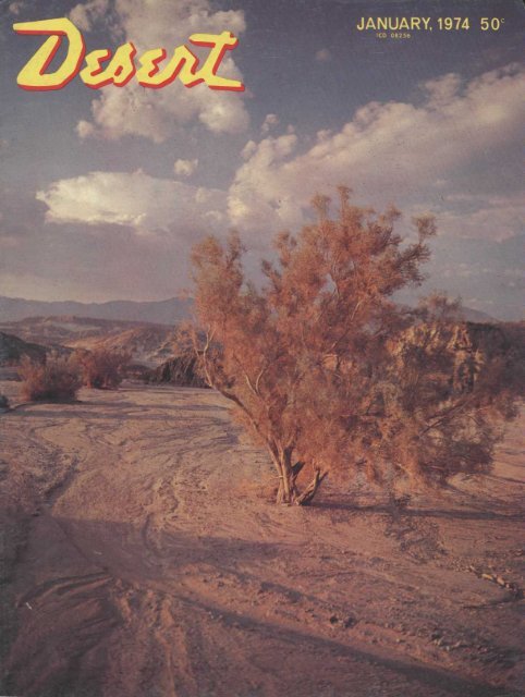
THE COVER:<br />
Scenic smoke tree in a<br />
typical California desert<br />
wash. Photo by George<br />
Service, <strong>of</strong> Palm <strong>Desert</strong>,<br />
California.<br />
Volume 37, Number 1 JANUARY, 1974<br />
CONTENTS<br />
FEATURES<br />
ELEPHANTS OF ANZA-BORREGO 8 Diana Lindsay<br />
DEEP IN THE HEART OF ARIZONA 12 F. A. Barnes<br />
VOLCANOES IN THE DESERT 16 Bruce Vinson<br />
PANNING FOR GOLD IN ARIZONA 20 Dan Overstreet<br />
SAND SAILING 24 Helen Walker<br />
OREGON'S MYSTERIOUS CARVING 28 Don Lien<br />
MALAKOFF DIGGINS 32 Al Waterman<br />
PANAMINT ANNIE 35 Tom Murray<br />
THE BISON ARE BACK 36 Buddy Mays<br />
DEPARTMENTS<br />
BOOKS FOR DESERT READERS 4 <strong>Book</strong> Reviews<br />
PEEK IN THE PUBLISHER'S POKE 7 William Knyvett<br />
DESERT LIFE 23 Hans Baerwald<br />
RAMBLING ON ROCKS 43 Glenn and Martha Vargas<br />
LETTERS TO THE EDITOR 46 Readers' Comments<br />
CALENDAR OF WESTERN EVENTS 46 Club Activities<br />
EDITORIAL, CIRCULATION AND ADVERTISING OFFICES: 74-109 Larrea St., Palm <strong>Desert</strong>, California 92260. Telephone Area Code<br />
714 346-8144. Listed in Standard Rate and Data. SUBSCRIPTION RATES: United States, Canada and Mexico; 1 year, $5.00; 2 years,<br />
$9.50; 3 years $13.00. O<strong>the</strong>r foreign subscribers add $1.00 U.S. currency for each year. See Subscription Order Form in this issue. Allow<br />
five weeks for change <strong>of</strong> address and send both new and old addresses with zip codes. DESERT <strong>Magazine</strong> is published monthly. Second<br />
class postage paid at Palm <strong>Desert</strong>. California and at additional mailing <strong>of</strong>fices under Act <strong>of</strong> March 3, 1879. Contents copyrighted 1973<br />
by DESERT <strong>Magazine</strong> and permission to reproduce any or all contents must be secured in writing. Unsolicited manuscripts and photographs<br />
WILL NOT BE RETURNED unless accompanied by a self-addressed and stamped envelope.<br />
January, 197-1
<strong>Desert</strong><br />
Editor<br />
<strong>the</strong> story <strong>of</strong> Randall Henderson<br />
and Palm <strong>Desert</strong><br />
by f. Wilson McKenney<br />
<strong>Desert</strong> Editor . . . <strong>the</strong> story <strong>of</strong> Randall<br />
Henderson and Palm <strong>Desert</strong> is a<br />
story <strong>of</strong> a man who fulfilled a dream<br />
and who greatly enriched <strong>the</strong> lives <strong>of</strong><br />
<strong>the</strong> people who love <strong>the</strong> West.<br />
Hardcover,<br />
illustrated<br />
with 188 pages.<br />
$795<br />
California residents please add 40 cents<br />
Send check or money order to:<br />
£MHAL- <strong>Magazine</strong> <strong>Book</strong> <strong>Shop</strong><br />
Box 1318, Palm <strong>Desert</strong>, California 92260<br />
<strong>Book</strong>s for<br />
Readers<br />
TRAVEL<br />
GUIDE TO<br />
ARIZONA<br />
By<br />
<strong>the</strong> Editors<br />
<strong>of</strong><br />
Sunset <strong>Book</strong>s<br />
s..<br />
The division between good and happy<br />
traveling and that "not so good" is <strong>the</strong><br />
matter <strong>of</strong> pre-knowledge <strong>of</strong> <strong>the</strong> territory<br />
a person takes with <strong>the</strong>m and instant information<br />
while on <strong>the</strong> spot. With <strong>the</strong><br />
I Indian Jewelry |<br />
FROM<br />
I Wampum Wig warn,/'<br />
Shipley's<br />
Mineral House<br />
A beautiful array <strong>of</strong> Indian<br />
Jewelry is available from our<br />
hugedisplay<strong>of</strong> craftsmanship<br />
by au<strong>the</strong>ntic Indian artisans.<br />
May we send you a select ion?<br />
This enables you to see <strong>the</strong><br />
merchandise before you buy it.<br />
Send today for our convenient<br />
approval form.<br />
Gem village<br />
BayfieldD,<br />
Colorado81122<br />
Phone: 303-884-2632<br />
Sunset Travel Guide to Arizona, one<br />
learns quickly to really see and experience<br />
<strong>the</strong> wonders <strong>of</strong> this area.<br />
Not only cities, but small towns; not<br />
only <strong>the</strong> giant saguaro, but <strong>the</strong> small<br />
desert plants; not only <strong>the</strong> routes to<br />
places, but <strong>the</strong> history <strong>of</strong> <strong>the</strong> towns and<br />
cities <strong>the</strong>mselves—all <strong>the</strong>se are presented<br />
in quick-reading passages. The<br />
photographs give meaning to <strong>the</strong> route<br />
diagrams showing <strong>the</strong> traveler, with no<br />
confusing questions to trouble him, how<br />
to get to <strong>the</strong> beautiful spots and enjoy<br />
<strong>the</strong>m.<br />
Paperback, large format, 128 pages,<br />
illustrated, $2.95.<br />
BACKYARD<br />
TREASURE<br />
HUNTING<br />
By<br />
Lucie Lowery<br />
Lucie Lowery knows what she is talking<br />
about as she examines <strong>the</strong> strange<br />
world <strong>of</strong> auctions, swap-meets, back<br />
yard and garage sales, treasure hunting<br />
and metal locating. She also knows how<br />
to explain <strong>the</strong> endeavors in zestful language.<br />
As she describes that "Want" in customers<br />
to buy "anything" when it is<br />
placed in miscellaneous merchandise,<br />
we begin to understand <strong>the</strong> nature <strong>of</strong><br />
buyers, sellers, collectors, and <strong>the</strong> writer<br />
herself who enjoys people and can make<br />
you see <strong>the</strong> things she points out, and to<br />
feel as <strong>the</strong> people do that she describes.<br />
HANK & HORACE<br />
. . . an enduring episode<br />
in western history . . .<br />
BY RICHARD C. LILLARD<br />
Published at $6.30 by<br />
J. Wilson McKenney<br />
[co-founder <strong>of</strong> <strong>Desert</strong> <strong>Magazine</strong>]<br />
at Wilmac Press,<br />
Box 248, Georgetown,<br />
California 95634<br />
<strong>Desert</strong> <strong>Magazine</strong>
"i bought <strong>the</strong> vase for $8.00. I sold it<br />
<strong>the</strong> next day for $40."<br />
If you want to know how to do that, this<br />
is <strong>the</strong> book for you!<br />
Paperback, cartoon illustrated, 95<br />
pages, $1.95.<br />
THE<br />
CALIFORNIA<br />
MISSIONS<br />
A Pictorial<br />
History<br />
By<br />
<strong>the</strong> Editors<br />
<strong>of</strong> Sunset <strong>Book</strong>s<br />
This pleasantly written history <strong>of</strong> <strong>the</strong><br />
missions <strong>of</strong> California bring both knowledge<br />
and pleasure for a reader as he<br />
follows <strong>the</strong> mission trail and learns from<br />
this one book not only <strong>the</strong> information<br />
ga<strong>the</strong>red in <strong>the</strong> past, but newly<br />
researched material in this colorful part<br />
<strong>of</strong> <strong>the</strong> state's history.<br />
A pr<strong>of</strong>ound respect and awe grows for<br />
<strong>the</strong> founders <strong>of</strong> <strong>the</strong> Spanish missions as<br />
one learns <strong>of</strong> <strong>the</strong>m in this 300 page book<br />
complete with artful sketches and photographs,<br />
and paintings presented in<br />
color.<br />
It is <strong>the</strong> writing skill <strong>of</strong> <strong>the</strong> staff, however,<br />
which makes <strong>the</strong> 21 missions<br />
spaced along <strong>the</strong> California coast come<br />
alive. One can feel, as he reads, <strong>the</strong> ferver<br />
<strong>of</strong> those padres as <strong>the</strong>y ga<strong>the</strong>red materials<br />
to build <strong>the</strong>ir churches, and an insight<br />
into history develops as <strong>the</strong> authors<br />
tell in simple prose what was going on in<br />
<strong>the</strong> world at <strong>the</strong> same time.<br />
Learning is pleasant in The California<br />
Missions.<br />
Hardcover, large format, beautifully<br />
illustrated, 300 pages, $12.75.<br />
January, 1974<br />
BACK ROADS<br />
OF<br />
CALIFORNIA<br />
By<br />
Earl<br />
Thollander<br />
and<br />
<strong>the</strong> Editors <strong>of</strong><br />
Sunset <strong>Book</strong>s<br />
There is a feeling <strong>of</strong> belonging to generations<br />
past, and walking alone and unencumbered<br />
through ano<strong>the</strong>r world<br />
when one seems to travel and sketch <strong>the</strong><br />
California Backroads with <strong>the</strong> author,<br />
Earl Thollander. Scars <strong>of</strong> early stagecoach<br />
routes, venerable missions, remote<br />
canyons, rocks and desert terrain,<br />
old prospector cabins, mines, cemeteries,<br />
schools, views <strong>of</strong> California mountains,<br />
valleys and sky, forests and wildflowers<br />
all become a part <strong>of</strong> <strong>the</strong> readers<br />
experience in this book.<br />
A reader is even told what onlookers<br />
said to <strong>the</strong> artist as he sketched. The<br />
feeling <strong>of</strong> sharing <strong>the</strong> experience <strong>of</strong><br />
backroad travel continues through all <strong>of</strong><br />
<strong>the</strong> 207 pages.<br />
The Sunset Editors, through maps and<br />
notes, invite <strong>the</strong> traveler to get <strong>of</strong>f <strong>the</strong><br />
freeways to see <strong>the</strong> rural and country<br />
lanes throughout <strong>the</strong> state.<br />
Hardcover, large format, unusually<br />
beautiful illustrations, 207 pages, $8.95.<br />
<strong>Book</strong>s reviewed may be ordered from <strong>the</strong><br />
DESERT <strong>Magazine</strong> <strong>Book</strong> Order Department,<br />
Palm <strong>Desert</strong>, California 92260.<br />
Calif, residents please add 5% sales tax.<br />
Lowest Photo Print Prices<br />
Highest Quality<br />
KODACOLOR FILM<br />
DEVELOPED & PRINTED<br />
Standard 12 Jumbo Prints 1.93<br />
Standard 12 Jumbo Prints and<br />
New Roll <strong>of</strong> KODACOLOR 2.84<br />
Kodacolor Neg. Standard reprints 14<br />
SEND FOR PRICE SHEETS<br />
& ENVELOPES. All Photo<br />
Prices are Comparably low.<br />
,y<br />
No gimmicks.<br />
No lies.<br />
' More than 50 years <strong>of</strong> continuous<br />
photo service guarantees<br />
your quality and our<br />
integrity.<br />
MARKET BASKET PHOTO CO.<br />
P. O. Box 370, Yuma, Arizona 85364 or<br />
P. O. Box 2830, San Diego, Calif. 92112<br />
BACK<br />
ISSUE<br />
SPECIAL<br />
Mail all orders to: DEPT. T<br />
DESERT <strong>Magazine</strong><br />
Palm <strong>Desert</strong>, Calif. 92260<br />
Personal check or money order must<br />
accompany your order.<br />
Be sure to include your zip code.
<strong>Desert</strong> <strong>Magazine</strong> <strong>Book</strong> <strong>Shop</strong><br />
WESTERN GEM HUNTERS ATLAS by Cy Johnson<br />
and Son. A helpful book <strong>of</strong> detailed maps showing<br />
gem and mineral locations, from California<br />
to <strong>the</strong> Dakotas and British Columbia to Texas.<br />
Markings note private claims, gem claims (fee<br />
charged) and rock and gem locations. Also<br />
suggested reading for more detail on areas<br />
included and o<strong>the</strong>r rich areas not included in<br />
this publication. Paperback, maps galore, collector's<br />
library, 79 pages, $3.00.<br />
BACKPACK COOKERY by Ruth Dyar Mendenhall.<br />
Full <strong>of</strong> good ideas for making <strong>the</strong> most <strong>of</strong> dedehydrated<br />
foods. Paper. $1.00.<br />
LOST DESERT BONANZAS by Eugene Conrotto.<br />
Brief resumes <strong>of</strong> lost mine articles printed in<br />
back issues <strong>of</strong> DESERT <strong>Magazine</strong>, by a former<br />
editor. Hardcover, 278 pages. $7.00.<br />
THE ROCKS BEGIN TO SPEAK by LaVan Martineau.<br />
The author tells how his interest in rock<br />
writing led to years <strong>of</strong> study and how he has<br />
learned that many—especially <strong>the</strong> complex petroglyphs<br />
— are historical accounts <strong>of</strong> actual<br />
events. Hardcover, weN illustrated, glossary,<br />
bibliography, 210 pages, $8.95.<br />
BEGIN ^OfpfSff<br />
MM<br />
THE BEAUTIFUL SOUTHWEST by <strong>the</strong> Editors <strong>of</strong><br />
Sunset <strong>Book</strong>s. A pictorial with a brief text showing<br />
modern day activities <strong>of</strong> cities such as<br />
Phoenix, El Paso, Taos, and communities below<br />
<strong>the</strong> Mexican border, and covering <strong>the</strong> <strong>Southwest</strong>ern<br />
states, canyons and deserts. 240 photographs<br />
<strong>of</strong> which 47 are four-color, large format,<br />
223 pages, hardcover, $10.95.<br />
TIMBERLINE ANCIENTS with photos by David<br />
Muench and text by Darwin Lambert. Bristleconc<br />
pines are <strong>the</strong> oldest living trees on earth. Photographer<br />
David Muench brings <strong>the</strong>m to life in<br />
all <strong>the</strong>ir fascinating forms, and Lambert's prose<br />
is like poetry. One <strong>of</strong> <strong>the</strong> most beautiful pictorials<br />
ever published. An ideal gift. Large 1 1 x<br />
14 format, hardcover, heavy slick paper, 128<br />
four-color photographs, 125 pages. $22.00.<br />
NORTHWESTERN ARIZONA GHOST TOWNS by<br />
Stanley W. Paher. Directions to and history about<br />
23 <strong>of</strong> Arizona's most famous ghost towns. Historical<br />
photographs and artist sketches enhance<br />
editorial content. Large, 11x14 format, slick<br />
paperback, 48 pages, $2.95.<br />
JOURNEY OF THE FLAME by Walter Nordh<strong>of</strong>f.<br />
The most exciting tale <strong>of</strong> early Baja and Alta<br />
California ever written. Recounts tast treasure<br />
legends and is accurate historical account presented<br />
in fictional style. Hardcover. $4.95.<br />
GHOST TOWNS OF THE NORTHWEST by Norman<br />
D. Weis. The ghost-town country <strong>of</strong> <strong>the</strong> Pacific<br />
Northwest including trips to many little-known<br />
areas, is explored in this first-hand factual and<br />
interesting book. Excellent photography. Best<br />
book to date on ghost towns <strong>of</strong> <strong>the</strong> Northwest.<br />
Maps. Hardcover, heavy slick paper, 319 pages.<br />
$6.95.<br />
DESERT GEM TRAILS by Mary Frances Strong.<br />
DESERT <strong>Magazine</strong>'s Field Trip Editor has revised<br />
and brought up to date her popular field guide<br />
for rockhounds. She has deleted areas which are<br />
now closed to <strong>the</strong> public and added new areas<br />
not covered before. The maps have also been updated.<br />
This is <strong>the</strong> "bible" for both amateur and<br />
veteran rockhounds and back country explorers.<br />
Heavy paperback, 80 pages and still <strong>the</strong> same<br />
price, $2.00.<br />
COMMON EDIBLE & USEFUL PLANTS OF THE<br />
WEST by Muriel Sweet. A description with artist<br />
drawings <strong>of</strong> edible (and those not to touch]<br />
plants along with how Indians and pioneers used<br />
<strong>the</strong>m. Paperback, 64 pages, $1.50.<br />
REDIGGING THE WEST for old time bottles by<br />
Lynn Blumenstein. One <strong>of</strong> <strong>the</strong> better bottle books,<br />
with 700 photographs. Paperback, $4.25<br />
LOST MINES OF DEATH VALLEY by Harold<br />
Weight. This is a new approach to <strong>the</strong> enigma<br />
<strong>of</strong> Death Valley Scotty's life and legends and<br />
gives additional insight into <strong>the</strong> Lost Gunsight<br />
and Breyfogle bonanzas, plus o<strong>the</strong>r Death Valley<br />
mysteries. Paperback, historic photographs, reference<br />
material, 86 pages $2.50.<br />
NEVADA GHOST TOWNS AND MINING CAMPS<br />
by Stanley W. Paher. Covering all <strong>of</strong> Nevada s<br />
17 counties, Paher has documented 575 mining<br />
camps, many <strong>of</strong> which have been erased from<br />
<strong>the</strong> earth. The book contains <strong>the</strong> greatest and<br />
most complete collection <strong>of</strong> historic photographs<br />
<strong>of</strong> Nevada ever published. This, coupled with<br />
his excellent writing and map, creates a book<br />
<strong>of</strong> lasting value. Large 9x1 1 format, 700<br />
photographs, hardcover, 492 pages, $15.00.<br />
SPEAKING OF INDIANS by Bernice Johnston.<br />
An authority on <strong>the</strong> Indians <strong>of</strong> <strong>the</strong> <strong>Southwest</strong>,<br />
<strong>the</strong> author has presented a concise well-written<br />
book on <strong>the</strong> customs, history, crafts, ceremonies<br />
and what <strong>the</strong> American Indian has contributed<br />
to <strong>the</strong> white man's civilization. A MUST for<br />
both students and travelers touring <strong>the</strong> Indian<br />
Country. Heavy paperback, 10x7 format, illustrated,<br />
112 pages, $2.50.<br />
MINES OF DEATH VALLEY by L. Burr Belden.<br />
About fabulous bonanzas, prospectors and lost<br />
mines. Paperback. $1.95.<br />
LOST MINES OF THE GREAT SOUTHWEST by John<br />
D. Mitchell. The first <strong>of</strong> Mitchell's lost mine<br />
books is now available after having been out <strong>of</strong><br />
print for years. Reproduced from <strong>the</strong> original<br />
copy and containing 54 articles based on accounts<br />
from people Mitchell interviewed. He<br />
spent his entire adult life investigating reports<br />
and legends <strong>of</strong> lost mines and treasures <strong>of</strong> <strong>the</strong><br />
<strong>Southwest</strong>. Hardcover, illustrated, 175 pages,<br />
$7.50.<br />
HOW AND HERE TO PAN GOLD by Wayne<br />
Winters. Convenient paperback handbook with<br />
information on staking claims, panning and recovering<br />
placer gold. Maps and drawings.<br />
$2.00.<br />
ON DESERT TRAILS by Randall Henderson, founder<br />
and publisher <strong>of</strong> <strong>Desert</strong> <strong>Magazine</strong> for 23<br />
years. One <strong>of</strong> <strong>the</strong> first good writers to reveal<br />
<strong>the</strong> beauty <strong>of</strong> <strong>the</strong> mysterious desert areas. Henderson's<br />
experiences, combined with his comments<br />
on <strong>the</strong> desert <strong>of</strong> yesterday and today,<br />
make this a MUST for those who really want<br />
to understand <strong>the</strong> desert. 375 pages, illustrated.<br />
Hardcover. $6.95.<br />
30,000 MILES IN MEXICO by Nell Murbarger.<br />
Joyous adventures <strong>of</strong> a trip by pick-up camper<br />
made by two women from Tijuana to.Guatemala.<br />
Folksy and entertaining, as well as instructive<br />
to o<strong>the</strong>rs who might, make <strong>the</strong> trip.<br />
Hardcover, 309 pages, $6.00.<br />
OLD FORTS OF THE NORTHWEST by H. M. Hart.<br />
Over 200 photos and maps. Exciting pictorial<br />
history <strong>of</strong> <strong>the</strong> military posts that opened <strong>the</strong><br />
West. Orig. Pub. at $12.50. New Edition $3.95.<br />
THE NORTH AMERICAN DESERTS by Edmund C.<br />
Jaeger. A long-time authority on all phases <strong>of</strong><br />
desert areas and life. Dr. Jaeger's book on <strong>the</strong><br />
North Ameican <strong>Desert</strong>s should be carried whereever<br />
you travel. It not only describes each <strong>of</strong> <strong>the</strong><br />
individual desert areas, but has illustrated sections<br />
on desert insects, reptiles, birds, mammals<br />
and plants. 315 pages, illustrated photographs,<br />
line drawings and maps. Hardcover. $6.95.<br />
GHOST TOWN ALBUM by L. Florin. Over 200<br />
photos. Fascinating pictorial accounts <strong>of</strong> <strong>the</strong><br />
gold mining towns <strong>of</strong> <strong>the</strong> Old West—and <strong>the</strong><br />
men who worked <strong>the</strong>m. Large format, orig. pub.<br />
at $12.50, new edition $3.95.<br />
TALES THE WESTERN TOMBSTONES TELL by L.<br />
Florin. The famous and infamous come back to<br />
life in this great photo history including missionary,<br />
mule driver, bad guy and blacksmith—what<br />
tales <strong>the</strong>ir tombstones tell Pub. at $12.95, now<br />
$3.95.<br />
<strong>Desert</strong> <strong>Magazine</strong>
THC DESERT is a wonderful place to<br />
relax and forget those 9 to 5 problems.<br />
With more time <strong>of</strong>f through shorter<br />
work weeks and extra vacation time,<br />
<strong>the</strong> desert is attracting many different<br />
types <strong>of</strong> recreationists.<br />
Last month we explored <strong>the</strong> Hugh Osborne<br />
State Park, center <strong>of</strong> dune buggy<br />
activity, and this issue we go sand sailing<br />
on California's El Mirage Dry Lake.<br />
With text by Helen Walker, and photography<br />
by Howard and Edward Neal, a<br />
fa<strong>the</strong>r-son combination, it sails across<br />
our centerfold and tells about a new<br />
breed <strong>of</strong> men.<br />
A Peek<br />
in <strong>the</strong><br />
Publisher's<br />
Poke<br />
Gold lovers will appreciate two articles in this issue. One deals with <strong>the</strong><br />
hydraulic mining days <strong>of</strong> old, while <strong>the</strong> o<strong>the</strong>r describes places <strong>of</strong> placers in Arizona.<br />
If gold doesn't excite you, and buffalos are your bag, well Buddy Mays will keep you<br />
entertained with his The Bisons are Back. Bruce Vinson rounds out <strong>the</strong> issue with a<br />
circle tour <strong>of</strong> volcanoes in <strong>the</strong> desert.<br />
In our October issue, <strong>the</strong> article on <strong>the</strong> Providence Mountain region contained<br />
a map showing how to reach <strong>the</strong> Woods Mountain petroglyphs. Access<br />
to Woods Wash, as shown, is through private property, and permission had to be<br />
granted by <strong>the</strong> owner to those who wished to view <strong>the</strong>se excellent examples <strong>of</strong> rock<br />
art. However, due to abuse, litter, cattle gates being left open, etc., <strong>the</strong> owner is<br />
now turning back all trespassers. There is a 4WD trail entering Woods Wash from<br />
<strong>the</strong> south, though it is not shown on this map. It should appear on all topo maps <strong>of</strong><br />
<strong>the</strong> area. Our apologies to any <strong>of</strong> you who made <strong>the</strong> Woods Wash trip in vain, but it<br />
again points out that a few can spoil it for all.<br />
Ano<strong>the</strong>r item that needs clarifying is a letter from reader, R. C. Luke, appearing<br />
last month, in which he stated that "Tecopa Country" (Nov. 73) would be<br />
closed under <strong>the</strong> BLM <strong>Desert</strong> Use Plan. An editorial reply was inadvertently omitted<br />
assuring Mr. Luke and <strong>the</strong> readership that his interpretation was incorrect and<br />
that <strong>the</strong> closure applies only to Amargosa Canyon, <strong>of</strong> which <strong>the</strong>re is no mention in<br />
<strong>the</strong> article. Everyone should obtain a copy <strong>of</strong> <strong>the</strong> <strong>Desert</strong> Use Plan, which spells out<br />
plainly all three classifications. These are available through <strong>the</strong> Bureau <strong>of</strong> Land<br />
Management, Box 723, Riverside, California 92502.<br />
Relative to <strong>the</strong> many queries received regarding <strong>the</strong> submission <strong>of</strong> manuscripts<br />
and photographs, we are always pleased to review material for possible<br />
publication. Photographs do not necessarily have to accompany manuscripts, but it<br />
is preferred. A self-addressed, stamped envelope, however, must be included if<br />
material is to be returned.<br />
lanuary, 1974<br />
END...<br />
begins with a<br />
TREASURE LOCATOR!<br />
"COMMANDER" 720<br />
This Go Ida k Treasure<br />
Locator is unsurpassed for<br />
locating buried treasure,<br />
coins. Civil War relics and<br />
for beachcombing. Features<br />
"Tell-Tone" Signal. Locates<br />
any metal object under dirt,<br />
sand, mud, rock, etc. No<br />
cumbersome cords—completely<br />
transistorized, battery<br />
powered.<br />
When it comes to finding<br />
your pot <strong>of</strong> gold, go<br />
with <strong>the</strong> leader—go with<br />
Goldak!<br />
Start out right-send $1.00 prepaid<br />
for au<strong>the</strong>ntic gold-plated<br />
replica <strong>of</strong> a Spanish doubloon<br />
found <strong>of</strong>f Cape Kennedy.<br />
EFFECTIVE DEPTH RANGE<br />
(Under Normal Conditions)<br />
THE GOLDAK COMPANY, INC.<br />
1101-AAirWay<br />
Glendale, California 91201<br />
• Please send free literature on GOLDAK treasure<br />
locators.<br />
• I enclose $1.00 prepaid for my gold-plated<br />
doubloon replica with pouch.<br />
Name-<br />
Address-<br />
City<br />
State- -Zip
•M<br />
ELEPHANTS OF<br />
Right: A prime example <strong>of</strong>Anza-<br />
Borrego's elephant trees. Photo by<br />
Louise Lovett. Below: Bursera<br />
Microphylla in bloom. Photo by<br />
Ralph Cornell.<br />
ELEPHANTS HAVE been sighted in <strong>the</strong><br />
California desert. Though not <strong>the</strong><br />
jungle variety, <strong>the</strong> desert version exhibits<br />
characteristics worthy <strong>of</strong> its namesake.<br />
A thick swollen trunk is clearly visible—<br />
it likes to tank up on available water. It<br />
bleeds red when wounded. The elephant<br />
can be found in herds or individually. In<br />
<strong>the</strong> past, <strong>the</strong>re have even been organized<br />
hunting expeditions to find <strong>the</strong>m. Today,<br />
<strong>the</strong> elephant's pasturage in California is<br />
protected, helping to perpetuate <strong>the</strong> species.<br />
But here any similarity to <strong>the</strong> fourlegged<br />
pachyderm ends, for this desert<br />
elephant sports yellow-green paper-like<br />
bark, reddish-brown twigs, dark green<br />
foliage, and blue berries.<br />
The odd looking elephant tree, or Bursera<br />
microphylla, is a rarity to <strong>the</strong> United<br />
States found only along <strong>the</strong> western edge<br />
<strong>of</strong> <strong>the</strong> Colorado <strong>Desert</strong> and in <strong>the</strong> Gila<br />
range <strong>of</strong> Arizona. It is, however, commonly<br />
found fur<strong>the</strong>r south in Baja, California,<br />
and Sonora, Mexico, where it is known<br />
locally as Torote. Scientifically, <strong>the</strong> elephant<br />
tree belongs to <strong>the</strong> Burseraceue or<br />
Torchwood family, named in honor <strong>of</strong><br />
sixteenth century botanist Joachim Burser.<br />
This is <strong>the</strong> only native species representative<br />
<strong>of</strong> this subtropical family in California.<br />
A swollen trunk, tentacled branches,<br />
blood-like sap within <strong>the</strong> bark, and a<br />
unique color combination have all combined<br />
to make this tree a botanical oddity.<br />
The elephant tree is also an able<br />
drought resister capable <strong>of</strong> maintaining<br />
life in a very arid climate. Its thick, pulpy<br />
trunk readily absorbs and stores water,<br />
giving it a swollen appearance suggesting<br />
<strong>the</strong> trunk <strong>of</strong> an elephant. This massive<br />
<strong>Desert</strong> <strong>Magazine</strong>
ANZA-BORREGO<br />
Right: An elephant<br />
tree seems to spring to<br />
life from its rocky<br />
surroundings. Photo<br />
by George Bergstrotn.<br />
January, 1974<br />
by<br />
Diana<br />
Lindsay<br />
trunk also suggests a large tree. However,<br />
<strong>the</strong> tapered branches which somewhat resemble<br />
octopus tentacles reaching for <strong>the</strong><br />
sky, are stunted, <strong>the</strong>reby giving <strong>the</strong> tree<br />
a shrub-like appearance. Generally this<br />
tree never exceeds a height <strong>of</strong> six to<br />
15 feet in <strong>the</strong> United States, but in Mexico<br />
some have occasionally grown to a<br />
height <strong>of</strong> 30 feet. Mexicans have referred<br />
to <strong>the</strong> branches in naming <strong>the</strong> tree ra<strong>the</strong>r<br />
than to <strong>the</strong> appearance <strong>of</strong> <strong>the</strong> trunk.<br />
Torote is Spanish for twisting, which aptly<br />
describes <strong>the</strong> tentacled branches.<br />
Paper-thin, yellow-white sheets makeup<br />
<strong>the</strong> outer bark layer <strong>of</strong> <strong>the</strong> limbs and<br />
trunk. As this parchment layer dries, it<br />
curls, exposing an inner green bark. Below<br />
<strong>the</strong> green layer are reddish layers.<br />
During certain seasons red sap will ooze<br />
from within <strong>the</strong> bark if <strong>the</strong> tree is cut.
Bursera Microphylla. Photo by Ralph Cornell.<br />
The branch tips are darker in color than<br />
<strong>the</strong> limbs and trunk, showing a reddishbrown<br />
hue. At <strong>the</strong> end <strong>of</strong> each branch are<br />
sub-branches from which clusters <strong>of</strong> dark<br />
green fern-like leaves are attached. The<br />
twigs and oily textured leaves have an<br />
aromatic fragrance much like that <strong>of</strong><br />
cedar. The tree usually flowers in summer<br />
and small blue, pea-sized berries ripen in<br />
fall.<br />
Quite confusing is <strong>the</strong> fact that Bursera<br />
microphylla is not <strong>the</strong> only plant referred<br />
to as "elephant tree." Botanist Edmund C.<br />
Jaeger expanded on <strong>the</strong> problem in a<br />
past issue <strong>of</strong> <strong>Desert</strong> <strong>Magazine</strong> (November,<br />
1956):<br />
"On our Colorado <strong>Desert</strong> in California<br />
and adjacent Arizona we call <strong>the</strong> small,<br />
fine-leafed, pungent Bursera microphylla<br />
an elephant tree. Far<strong>the</strong>r south around<br />
San Felipe along <strong>the</strong> Gulf <strong>of</strong> California,<br />
<strong>the</strong> apple tree-like large-leafed copal<br />
(Elaphrium macdougalii) is called an<br />
elephant tree. Far<strong>the</strong>r down <strong>the</strong> peninsula<br />
<strong>the</strong> Pachycormus {discolor) is spoken <strong>of</strong><br />
as an elephant tree. This is most unfortunate<br />
for each plant is so totally different<br />
that even <strong>the</strong> novice in plant lore will at<br />
once realize that <strong>the</strong> plants are probably<br />
distantly related."<br />
10<br />
Dr. Jaeger concluded in his article that<br />
<strong>the</strong> elephant trees <strong>of</strong> <strong>the</strong> Vizcaino <strong>Desert</strong><br />
<strong>of</strong> central Baja (Pachycormus discolor)<br />
should be <strong>the</strong> only ones that deserve <strong>the</strong><br />
epi<strong>the</strong>t <strong>of</strong> "elephant tree." Never<strong>the</strong>less,<br />
Bursera microphylla still retains <strong>the</strong> descriptive<br />
name.<br />
The elephant tree reportedly has many<br />
uses. The aromatic oil has been burned by<br />
Mexicans and Indians as incense during<br />
religious ceremonies and <strong>the</strong> red bark has<br />
been used as a source <strong>of</strong> dye and tannins.<br />
According to one source, <strong>the</strong> tree's sap<br />
has been used to caulk boats, glue furniture,<br />
mend broken dishes, and preserve<br />
wood from attacks <strong>of</strong> worms. Indians in<br />
Sonora reputedly used <strong>the</strong> branches in<br />
basketry. The resin, known commercially<br />
as copal, is employed as a base for varnish.<br />
Healing properties have also been<br />
ascribed to <strong>the</strong> elephant tree. It was once<br />
a popular remedy for venereal disease,<br />
dropsy, dysentery, and yellow fever. The<br />
sap was applied to cure insect bites and<br />
scorpion stings and <strong>the</strong> smoke from a<br />
burning tree was inhaled as a remedy<br />
for headache.<br />
According to Lowell John Bean and<br />
Ka<strong>the</strong>rine Siva Saubel, authors <strong>of</strong> Temalpakh:<br />
Cahuilla Indian Knowledge and<br />
Useage <strong>of</strong> Plants, <strong>the</strong> elephant tree or<br />
kelawat enenka (bitter wood) was associated"<br />
with great power among <strong>the</strong> Cahuilla<br />
Indians <strong>of</strong> California. Consequently,<br />
<strong>the</strong> healing red sap was administered<br />
by shamans or medicine men and always<br />
kept well hidden in households. Cahuillas<br />
also used <strong>the</strong> red sap to obtain "power"<br />
whenever <strong>the</strong>y played <strong>the</strong> popular gambling<br />
game <strong>of</strong> peon.<br />
Most <strong>of</strong> California's elephant trees are<br />
located within <strong>the</strong> protected half-millionacre<br />
Anza-Borrego <strong>Desert</strong> State Park in<br />
San Diego County. Though now a park<br />
attraction, it took many years to establish<br />
<strong>the</strong> fact that <strong>the</strong>se trees actually existed<br />
outside <strong>of</strong> Mexico.<br />
During <strong>the</strong> early 1900s, an old "desert<br />
rat" told Edward H. Davis, <strong>of</strong> Mesa<br />
Grande, that he had seen trees <strong>the</strong> size <strong>of</strong><br />
overgrown bushes looking like elephant<br />
trunks that bled red. In <strong>the</strong> winter <strong>of</strong><br />
1911, Davis and his son found a group <strong>of</strong><br />
<strong>the</strong>se perennials in <strong>the</strong> present Elephant<br />
Tree area <strong>of</strong> <strong>the</strong> park, just north <strong>of</strong> Split<br />
Mountain. Davis' discovery and subsequent<br />
naming <strong>of</strong> <strong>the</strong>se trees went unnoticed.<br />
Again in <strong>the</strong> 1920s, "a grizzled old<br />
man" told tales about seeing some' trees<br />
that looked like "a herd <strong>of</strong> elephants."<br />
In January, 1937, a Palm Springs naturalist,<br />
Don Admiral, and a representative<br />
<strong>of</strong> <strong>the</strong> United States Department <strong>of</strong> Agriculture,<br />
E. M. Harvey, went exploring<br />
for this bleeding tree. Their search ended<br />
when <strong>the</strong>y found one single specimen<br />
(<strong>Desert</strong>, November, 1937). This find<br />
excited botanical museums and universities<br />
who had not known about <strong>the</strong> tree's<br />
existence in <strong>the</strong> United States.<br />
In November, 1937, <strong>the</strong> first organized<br />
elephant tree hunt was scheduled with<br />
<strong>the</strong> hope <strong>of</strong> finding more than <strong>the</strong> one<br />
elusive tree. "Hunters" included: three<br />
members <strong>of</strong> <strong>the</strong> San Diego Natural History<br />
Museum, Clinton G. Abbott, Frank<br />
F. Garder (with son David), and Allan<br />
Stover; Guy Fleming, superintendent <strong>of</strong><br />
state parks in Sou<strong>the</strong>rn California; and<br />
Harold Sverdrup, director <strong>of</strong> Scripps Institute<br />
<strong>of</strong> Oceanography. Their careful<br />
search proved successful when 75 trees<br />
were found on <strong>the</strong> rocky slopes <strong>of</strong> <strong>the</strong><br />
Vallecito Mountains.<br />
Since that time desert travelers have<br />
visited tree sites to ponder about this<br />
strange tree. More <strong>of</strong>ten than not, visitors<br />
would "prove" <strong>the</strong>y had found an ele-<br />
Deserr <strong>Magazine</strong>
phant tree by cutting its bark to see if<br />
it would bleed. Unfortunately, this practice<br />
has caused damage to some <strong>of</strong> <strong>the</strong>se<br />
rare California plants. Visitors are urged<br />
to remember that <strong>the</strong>se and all plants arc<br />
protected within <strong>the</strong> state park.<br />
To view <strong>the</strong>se curious plants, drive to<br />
Ocotillo Wells on state highway 78, adjacent<br />
to <strong>the</strong> eastern edge <strong>of</strong> <strong>the</strong> Anza-<br />
Borrego <strong>Desert</strong> State Park. Go south sixmiles<br />
on Split Mountain Road toward <strong>the</strong><br />
park's Fish Creek Primitive Camp. At<br />
mile three, <strong>the</strong> road will turn east at <strong>the</strong><br />
site <strong>of</strong> <strong>the</strong> now defunct Miracle Hotel<br />
and Little Borrego Townsite. The only<br />
visible sign left today <strong>of</strong> this "boom<br />
town" is a concrete slab which <strong>of</strong>ten attracts<br />
desert campers looking for a level<br />
place to park <strong>the</strong>ir vans and trailers.<br />
The road jogs around a power substation<br />
and <strong>the</strong>n turns south again. A<br />
sign, one mile past <strong>the</strong> substation, marks<br />
a dirt road leading west to <strong>the</strong> Elephant<br />
Tree area. Cars can be driven one mile<br />
r J<br />
ANZA-BORREGO STATE PARK<br />
SHOWING ELEPHANTTREE<br />
AREAS<br />
January. 1974<br />
up this dirt road and parked. A one-anda-half-mile<br />
trail will lead <strong>the</strong> visitor to<br />
a rocky hillside where several stands <strong>of</strong><br />
elephant trees can be seen. Some 500<br />
specimens have been counted in this area<br />
<strong>of</strong> <strong>the</strong> park.<br />
Scattered specimens can also be seen<br />
fur<strong>the</strong>r south in <strong>the</strong> park <strong>of</strong>f highway S-2<br />
in Indian Canyon near Mountain Palm<br />
Springs Primitive Camp and in Bow Willow<br />
Canyon, three miles fur<strong>the</strong>r south.<br />
A ranger station and campground are<br />
maintained at Bow Willow. Visitors to<br />
this area <strong>of</strong> <strong>the</strong> park can obtain specific<br />
information as to good elephant tree sites<br />
from <strong>the</strong> park ranger on duty.<br />
Should you decide to pack your own<br />
kind <strong>of</strong> trunk and take a weekend safari<br />
to <strong>the</strong> Anza-Borrego area, you will be<br />
rewarded, not only by <strong>the</strong>se monstrous<br />
foliaged structures <strong>of</strong> nature, but by <strong>the</strong><br />
many picturesque qualities <strong>of</strong> this desert's<br />
changing scene, and its indigenous plant<br />
and animal life.<br />
For<br />
(he<br />
Birds?<br />
You<br />
know<br />
it is!<br />
Hummingbird<br />
Feeder<br />
• DRIPLESS<br />
• BEE PROOF<br />
• ANT PROOF<br />
• NOTHING TO RUST<br />
ONLY d**** Postpaid<br />
Send check or money order to:<br />
MAGAZINE<br />
Palm <strong>Desert</strong>, California 92260<br />
California residents add 15c tax
Deep TCI<br />
Above left: This is a typical view <strong>of</strong><br />
Oak Creek Canyon about three miles<br />
from Sedona. U.S. 89A travels <strong>the</strong><br />
length <strong>of</strong> <strong>the</strong> canyon, paralleling <strong>the</strong><br />
creek between high, colorftd sandstone<br />
walls. The canyon floor and terraced<br />
walls are heavily forested. Left:<br />
Within three miles <strong>of</strong> Sedona, <strong>the</strong><br />
only trace <strong>of</strong> civilization is an occasional<br />
contrail left by a high flying jet<br />
plane. Right: The trail toward Soldier<br />
Pass is rough and travels through<br />
primitive forestlands. The final miles<br />
<strong>of</strong> this trail are so deteriorated <strong>the</strong>y<br />
must be hiked.<br />
Dcserf <strong>Magazine</strong>
Hear ©<br />
by<br />
F. A. Barnes<br />
Fording Oak Creek<br />
at Red Rock<br />
Crossing can be<br />
tricky in places.<br />
Here, a normally<br />
agile sand buggy<br />
has to slow dotvnfor<br />
some deep,<br />
water-filled<br />
crevices.<br />
E<br />
VERYONE is familiar with <strong>the</strong> song<br />
extolling <strong>the</strong> beauty to be found<br />
"deep in <strong>the</strong> heart <strong>of</strong> Texas," but how<br />
many know that deep in <strong>the</strong> heart <strong>of</strong><br />
Arizona is a land surpassed by none<br />
when it comes to scenic beauty and recreational<br />
potential? This land lies near<br />
<strong>the</strong> heart <strong>of</strong> <strong>the</strong> Coconino National Forest<br />
and is centered around Oak Creek Canyon<br />
and <strong>the</strong> picturesque town <strong>of</strong> Sedona<br />
at <strong>the</strong> mouth <strong>of</strong> that canyon,<br />
The Sedona-Oak Creek Canyon area<br />
has almost everything <strong>of</strong> interest to travelers.<br />
The town, itself, <strong>of</strong>fers commercial<br />
accommodations <strong>of</strong> all sorts, and <strong>the</strong>re<br />
are numerous developed campgrounds in<br />
<strong>the</strong> surrounding National Forest. There<br />
are trails for hiking and <strong>of</strong>f-road vehicles,<br />
lakes and streams for fishing and swimming,<br />
historic and archeological attractions,<br />
and natural wonders such as arches,<br />
bridges and giant sinkholes.<br />
Sedona also <strong>of</strong>fers many displays <strong>of</strong><br />
various local arts and crafts and, toge<strong>the</strong>r<br />
with nearby Flagstaff, can provide all <strong>the</strong><br />
usual amenities for that occasional "night<br />
on <strong>the</strong> town."<br />
For those planning to explore this region,<br />
a detailed recreation map <strong>of</strong> Coconino<br />
National Forest can be obtained from<br />
<strong>the</strong> <strong>of</strong>fices <strong>of</strong> <strong>the</strong> Sedona Ra.nger District,<br />
at Sedona, Arizona. This map contains a<br />
wealth <strong>of</strong> useful information concerning<br />
recreation, wildlife, geology and o<strong>the</strong>r aspects<br />
<strong>of</strong> this fascinating region.<br />
Sedona is very near <strong>the</strong> geographic<br />
center <strong>of</strong> Arizona, but it is also centrally<br />
located to quite a number <strong>of</strong> large cities,<br />
13
Above: The Steamboat Rock trail travels<br />
through picturesque forestlands high<br />
above <strong>the</strong> floor <strong>of</strong> Oak Creek Canyon.<br />
The trail is short but very scenic. Right:<br />
People come from far and wide to enjoy<br />
<strong>the</strong> water and setting at Sliderock on Oak<br />
Creek in <strong>the</strong> heart <strong>of</strong> Arizona.<br />
and <strong>the</strong> routes to Sedona country travel<br />
through or near many o<strong>the</strong>r traveler attractions.<br />
Denver and San Francisco are<br />
each some 800 miles from Sedona. Los<br />
Angeles, Salt Lake City and El Paso are<br />
around 500 miles away, Las Vegas is less<br />
than 300 and Gallup and Tucson are only<br />
a trifle more than 200 miles from Sedona.<br />
Along <strong>the</strong> major routes to Sedona are<br />
Death Valley, Lake Mead, Zion, Bryce,<br />
Lake Powell, Arches, Canyonlands, Canyon<br />
De Chelly, Petrified Forest and many<br />
o<strong>the</strong>r national and state parks, monuments<br />
IA <strong>Desert</strong> <strong>Magazine</strong><br />
- u •.. : •-'<br />
and recreation afeas. Thus a trip to<br />
and Oak Creek Canyon can be combined<br />
with o<strong>the</strong>r highlights to produce a truly<br />
wonderful trip through <strong>the</strong> great southwestern<br />
mountains and desertlands.<br />
But 'despite its reputation for desert,<br />
Arizona contains o<strong>the</strong>r climatic regions,<br />
and <strong>the</strong> Sedona-Oak Creek Canyon area is<br />
one <strong>of</strong> <strong>the</strong>se. There, <strong>the</strong> terrain is a pleasant<br />
blend <strong>of</strong> high, cool forests and high,<br />
semi-arid desert. Vegetation is dense and<br />
includes a wide variety <strong>of</strong> deciduous and<br />
evergreen trees, shrubs, cacti and annual<br />
wildflowers. The soil varies from rich forest<br />
loam to red clay to solid sandstone<br />
slickrock.<br />
There is virtually no limit to <strong>the</strong> recreational<br />
potential <strong>of</strong> <strong>the</strong> Sedona-Oak Creek<br />
Canyon area. For a sample <strong>of</strong> what <strong>the</strong><br />
region has to <strong>of</strong>fer, try some <strong>of</strong> its roads<br />
and trails. Many <strong>of</strong> <strong>the</strong> roads that penetrate<br />
<strong>the</strong> highly scenic backcountry can be<br />
traveled by ordinary passenger car, o<strong>the</strong>rs<br />
require some sort <strong>of</strong> <strong>of</strong>f-road vehicle.<br />
Most, but not all, <strong>of</strong> such roads and trails<br />
appear on <strong>the</strong> Forest Service recreation<br />
map or local maps available from <strong>the</strong> Sedona<br />
Chamber <strong>of</strong> Commerce. The map<br />
accompanying this article shows a few <strong>of</strong><br />
<strong>the</strong> points <strong>of</strong> interest and <strong>the</strong> principal<br />
roads and trails in <strong>the</strong> immediate vicinity<br />
<strong>of</strong> Sedona.<br />
As you sample <strong>the</strong> area by vehicle,<br />
watch for places worth exploring on foot.<br />
There are many developed and primitive<br />
foot trails that lead to scenic highlights,
and hiking up into <strong>the</strong> timtock country<br />
that surrounds Sedona and Oak Creek Canyon<br />
can be a highly rewarding experience,<br />
especially for rockhounds, photographers<br />
and those interested in scenic beauty and<br />
wildlife.<br />
The area is also rich in human history.<br />
Like so many parts <strong>of</strong> Arizona, <strong>the</strong> Sedona<br />
region has a colorful past, and was heavily<br />
inhabited by Indians in still earlier times.<br />
Archeological sites abound, but it is weli<br />
to remember that all such sites and artifacts<br />
are protected by federal law. Significant<br />
finds should be reported to <strong>the</strong> nearest<br />
Forest Service <strong>of</strong>fice.<br />
To sample some <strong>of</strong> <strong>the</strong> scenic roads<br />
and trails near Sedona, try some or all<br />
<strong>of</strong> <strong>the</strong> following:<br />
For highway vehicles, try <strong>the</strong> Red Rock<br />
Loop Road, Rock Creek Road to <strong>the</strong> Sycamore<br />
Canyon Primitive Area, U. S. 89A<br />
up Oak Creek Canyon, Arizona 179 south<br />
to Bell Rock and <strong>the</strong> fascinating Chapel<br />
<strong>of</strong> <strong>the</strong> Holy Cross, and <strong>the</strong> drive up to<br />
<strong>the</strong> Schnebly Hill canyon rim viewpoint.<br />
Those with <strong>of</strong>f-road vehicles should<br />
first try <strong>the</strong> trails to Rustler's Lookout and<br />
Submarine Rock, to Steamboat Rock, and<br />
up toward Soldier Pass.<br />
For hikers, <strong>the</strong> trails to Devil's Bridge<br />
and Vultee Arch will serve to whet <strong>the</strong><br />
appetite for ventures into still more primitive<br />
country.<br />
But whatever your activity or interest,<br />
if <strong>the</strong> season is appropriate take an afternoon<br />
swim at Sliderock. Here, <strong>the</strong> clear<br />
COCONINO NATIONAL FOREST<br />
SEDONA-OAK CREEK CANYON<br />
RECREATION AREA SLIDEROCK O )( T 10 FLAGSTAFF<br />
(Swimming)<br />
_ VERDE VALLEY<br />
-LEGEND- SCHOOL<br />
POINT OF INTEREST<br />
PAVED ROAD<br />
DIRT ROAD<br />
JEEP TRAIL<br />
FOOT TRAIL<br />
APPROXIMATE MILEAGE X.<br />
Map not to scale<br />
waters <strong>of</strong> Oak Creek have cut into <strong>the</strong><br />
solid red-hued sandstone that floors <strong>the</strong><br />
canyon, creating a series <strong>of</strong> elongated<br />
natural pools and slippery water-shutes.<br />
Children and hardier adults enjoy being<br />
carried down <strong>the</strong>se watery slides by <strong>the</strong><br />
rushing stream, while <strong>the</strong> deeper pools<br />
<strong>of</strong>fer everyone respite from <strong>the</strong> warm desert<br />
sun. Indeed, <strong>the</strong> water and setting at<br />
Sliderock are so pleasant that people come<br />
from nearby communities, or even from<br />
<strong>the</strong> big cities to <strong>the</strong> south on weekends,<br />
just to swim and sunba<strong>the</strong> in <strong>the</strong> rocky<br />
grottoes <strong>of</strong> Sliderock.<br />
When is <strong>the</strong> best season for visiting<br />
Sedona and Oak Creek Canyon ? Well, all<br />
seasons are lovely <strong>the</strong>re, but perhaps <strong>the</strong><br />
best seasons are spring and fall. In <strong>the</strong><br />
spring, <strong>the</strong> land is ablaze with wildflowers<br />
and blossoming shrubs and cacti. The<br />
wea<strong>the</strong>r is moderate and <strong>the</strong> summer<br />
thunderstorms have not yet started.<br />
lanuary, 1974<br />
I TO INTERSTATE HWY 17<br />
VANAND PHOENIX<br />
MAP BY F. A. BARNES<br />
6<br />
RUSTLEH'S<br />
LOOKOUT<br />
In <strong>the</strong> autumn, <strong>the</strong> wea<strong>the</strong>r is even<br />
more placid, and o<strong>the</strong>r species <strong>of</strong> flowering<br />
plants are in full array. Then, too,<br />
<strong>the</strong> cooler nights are changing deciduous<br />
foliage from bright green to even brighter<br />
hues <strong>of</strong> red and amber and yellow.<br />
Both spring and fall are delights in<br />
Sedona country, but winter also adds a<br />
special beauty. Then, infrequent storms<br />
throw a mantle <strong>of</strong> white over <strong>the</strong> evergreens<br />
and redrock walls and pinnacles,<br />
and <strong>the</strong> gentle waters <strong>of</strong> Oak Creek freeze<br />
to form crystalline fantasylands <strong>of</strong> cascading<br />
ice.<br />
But whatever season you choose for a<br />
visit to Oak Creek Canyon and Sedona<br />
country, you will find it a place <strong>of</strong> special<br />
beauty, a place where family recreation<br />
has many aspects, and where <strong>the</strong> highly<br />
touted splendors <strong>of</strong> central Texas play<br />
second fiddle to <strong>the</strong> land that lies "deep<br />
in <strong>the</strong> heart <strong>of</strong>—Arizona!"
Above: One<strong>of</strong> <strong>the</strong> two dozen red and black cinder cones sou<strong>the</strong>ast <strong>of</strong> Baker, viewed<br />
through typical Mohave <strong>Desert</strong> vegetation. Right: Layer-cake plateau east <strong>of</strong> Mitchell<br />
Caverns, <strong>the</strong> remains <strong>of</strong> a series <strong>of</strong> vast flows that once covered this entire<br />
area.Below: Amboy Crater, showing where <strong>the</strong> wall <strong>of</strong> <strong>the</strong> cone was breached by <strong>the</strong><br />
final eruption.<br />
16<br />
\blcanoes<br />
in <strong>the</strong><br />
<strong>Desert</strong><br />
by Bruce Vinson<br />
ON A VACATION in <strong>the</strong> desert, <strong>the</strong> last<br />
thing most people expect to see is<br />
<strong>the</strong> inverted black cone <strong>of</strong> a volcano.<br />
Eroded mesas, saline valleys, sandy hills<br />
—<strong>the</strong>se are more typical features <strong>of</strong> <strong>the</strong><br />
desert southwest. Yet <strong>the</strong> Mohave <strong>Desert</strong>—that<br />
wide, barren land stretching<br />
east and south from <strong>the</strong> neighborhood<br />
<strong>of</strong> Mohave to Nevada and Arizona—is<br />
a graveyard <strong>of</strong> old volcanic remnants.<br />
Many <strong>of</strong> <strong>the</strong> Mohave's mountain ranges<br />
are <strong>the</strong> remains <strong>of</strong> huge lava flows so<br />
ancient that <strong>the</strong>ir volcanic form has been<br />
eroded away, and <strong>the</strong>y now look like any<br />
o<strong>the</strong>r mountains. But <strong>the</strong> most recent<br />
eruptions—and <strong>the</strong>re have been many,<br />
even in <strong>the</strong> desert—still show <strong>the</strong>ir volcanic<br />
shape. Dozens <strong>of</strong> smooth-sloping,<br />
jet-black hills <strong>of</strong> cinder dot <strong>the</strong> Mohave<br />
landscape, jutting up from flat white<br />
<strong>Desert</strong> <strong>Magazine</strong>
asins or perched atop <strong>the</strong> barren hills.<br />
Their dark tips form a characteristic skyline<br />
feature <strong>of</strong> <strong>the</strong> Mohave—noticed in<br />
passing as familiar shapes, but rarely<br />
recognized for what <strong>the</strong>y are.<br />
A good way to see volcanoes in <strong>the</strong><br />
desert, while enjoying some remote desert<br />
scenery, is to take a 200-mile circle<br />
tour from Barstow, southwest on U. S. 66<br />
to Amboy, <strong>the</strong>n north along <strong>the</strong> pavedand-dirt<br />
road up through Kelso to Baker,<br />
returning west along Interstate 15 to Barstow.<br />
Some <strong>of</strong> <strong>the</strong> volcanoes, lava beds,<br />
and old igneous mountains are close to<br />
<strong>the</strong> road for easy exploring. O<strong>the</strong>rs are<br />
back in <strong>the</strong> hills or reached by rutted dirt<br />
roads—appealing to <strong>the</strong> more adventurous.<br />
Along <strong>the</strong> Amboy-Baker road are<br />
plenty <strong>of</strong> out-<strong>of</strong>-<strong>the</strong>-way sites for carcamping.<br />
And as you hike over <strong>the</strong> lava<br />
beds and clamber up <strong>the</strong> cinder cones,<br />
you'll see innumerable volcanic roads<br />
weirdly and beautifully shaped by <strong>the</strong><br />
Earth's inner fires, like an outdoor museum<br />
<strong>of</strong> natural art.<br />
The first <strong>of</strong> <strong>the</strong> ancient volcanic mountains<br />
is just 20 miles east <strong>of</strong> Barstow. At<br />
Newberry Springs <strong>the</strong> road passes <strong>the</strong><br />
north flank <strong>of</strong> <strong>the</strong> Newberry Mountains,<br />
a series <strong>of</strong> steep crags built up from ancient<br />
eruptions. The wea<strong>the</strong>rs <strong>of</strong> many<br />
centuries have so eroded <strong>the</strong> hills that<br />
only <strong>the</strong> texture <strong>of</strong> <strong>the</strong> rock shows it to<br />
be volcanic. But high up in <strong>the</strong> hills is<br />
a more recent volcanic cone, with a<br />
stream <strong>of</strong> frozen lava curving down a<br />
narrow valley toward <strong>the</strong> highway. A<br />
side road leads south about half a mile,<br />
so you can drive right up to <strong>the</strong> edge <strong>of</strong><br />
<strong>the</strong> igneous rocks and get out for a short<br />
hike-and-climb among fantastically shaped<br />
volcanic crags dating back to <strong>the</strong> Age <strong>of</strong><br />
Dinosaurs.<br />
You'll reach <strong>the</strong> first big event among<br />
<strong>the</strong> volcanics ano<strong>the</strong>r 15 miles east, where<br />
<strong>the</strong> nor<strong>the</strong>rn tip <strong>of</strong> <strong>the</strong> Black Lava Beds<br />
reaches <strong>the</strong> highway. Ano<strong>the</strong>r mile far<strong>the</strong>r,<br />
and a dirt road leads south, winding<br />
among <strong>the</strong> lava crags <strong>of</strong> Pisgah Crater.<br />
You can park along <strong>the</strong> road for a picnic<br />
in <strong>the</strong> white sand that has flowed between<br />
and over <strong>the</strong> black lava. Some <strong>of</strong> <strong>the</strong> lava<br />
rocks are up to 10 feet high, not solid<br />
but split and craggy, with paths and labyrinths<br />
and little dark hideaways halffilled<br />
with drifted sand. From here, Pisgah<br />
is a dark rounded mass outline against <strong>the</strong><br />
sky. About half a mile iartkef a gi'tc 'b&ts<br />
<strong>the</strong> road to cars, with dire warnings about<br />
<strong>the</strong> dangers <strong>of</strong> hiking up <strong>the</strong> loose cinder<br />
<strong>of</strong> <strong>the</strong> cone.<br />
For Pisgah has been used as a pumice<br />
quarry, and some <strong>of</strong> <strong>the</strong> mining machinery<br />
is still is place. It is private land, belonging<br />
to <strong>the</strong> Atchison, Topeka and<br />
Santa Fe railroad. On <strong>the</strong> south side <strong>of</strong><br />
<strong>the</strong> crater a high tower—<strong>the</strong> end <strong>of</strong> a<br />
a conveyor belt—rises into <strong>the</strong> ragged<br />
gap left in <strong>the</strong> crater's rim by <strong>the</strong> diggers.<br />
Much <strong>of</strong> <strong>the</strong> lava around <strong>the</strong> quarry-yard<br />
has been crushed, but around back toward<br />
<strong>the</strong> east slope <strong>of</strong> <strong>the</strong> crater is a stillintact<br />
lava flow, about <strong>the</strong> size <strong>of</strong> a football<br />
field, <strong>of</strong> a strange appearance. It is a<br />
low flat dome, deeply fissured, and <strong>the</strong><br />
rock is full <strong>of</strong> tiny gas-bubbles like cinder,<br />
but <strong>the</strong> markings show that it was once<br />
part <strong>of</strong> a semi-liquid lava flow. There are<br />
rows <strong>of</strong> small curved ridges where <strong>the</strong><br />
lava hardened as it flowed, freezing <strong>the</strong><br />
wave-forms <strong>of</strong> <strong>the</strong> magma in place. It<br />
looks like a huge petrified cake batter—<br />
black, so it must be licorice cake.<br />
The Pisgah Crater is <strong>the</strong> nor<strong>the</strong>rnmost<br />
in a row <strong>of</strong> cones stretching sou<strong>the</strong>ast for<br />
about five miles to Sunshine Peak. All <strong>of</strong><br />
<strong>the</strong>m erupted on or near a crack in <strong>the</strong><br />
earth—<strong>the</strong> Pisgah Fault—that runs just<br />
east <strong>of</strong> <strong>the</strong> Lava Mountains. O<strong>the</strong>r volcanoes<br />
in this part <strong>of</strong> <strong>the</strong> desert have less<br />
obvious origins. The chief <strong>of</strong> <strong>the</strong>se is<br />
<strong>the</strong> Amboy Crater, 40 miles far<strong>the</strong>r east.<br />
It is on public land. To reach it, curve to<br />
<strong>the</strong> right just beyond Ludlow, along <strong>the</strong>
Author's daughters, Rachel, left, and Naomi, prospecting for lava sculptures.<br />
old route <strong>of</strong> 66. The new route passes<br />
about 10 miles to <strong>the</strong> north, and does not<br />
rejoin <strong>the</strong> old highway for about 60 miles.<br />
You can see <strong>the</strong> Amboy Crater about<br />
a mile <strong>of</strong>f to <strong>the</strong> right just belore reaching<br />
<strong>the</strong> town. The cinder cone, about 200 feet<br />
high, sits at <strong>the</strong> center <strong>of</strong> a black basaltic<br />
lava flow several miles in diameter. In<br />
places <strong>the</strong> surface <strong>of</strong> <strong>the</strong> flow is very<br />
rough, with huge craggy walls <strong>of</strong> lava and<br />
steep, cave-like depressions. This lava flow<br />
is one <strong>of</strong> <strong>the</strong> best places in <strong>the</strong> Mohave<br />
for looking at and taking pictures <strong>of</strong> firesculpted<br />
rock art. No two <strong>of</strong> <strong>the</strong> lava<br />
lumps are alike, and each seems to resemble<br />
somebody or something—a house,<br />
a ship, an angry man, a dented kettle.<br />
Walking among <strong>the</strong>se rocks is like play-<br />
Wall <strong>of</strong> multi-color lava, Amboy crater lava field.<br />
ing <strong>the</strong> game <strong>of</strong> seeing pictures in <strong>the</strong><br />
clouds. Only in this case <strong>the</strong> clouds are<br />
solid and black, and you can hold <strong>the</strong>m<br />
in your hands and climb on <strong>the</strong>m.<br />
But <strong>the</strong>re's also enough smooth surface<br />
for easy walking right up to <strong>the</strong> base <strong>of</strong><br />
<strong>the</strong> crater. Here <strong>the</strong> flat lava pavement<br />
is cracked like an old sidewalk, with <strong>the</strong><br />
criss-cross lines <strong>of</strong> <strong>the</strong> cracks half-filled<br />
with sand. A steep path, visible even from<br />
<strong>the</strong> highway, heads straight up <strong>the</strong> cone<br />
to <strong>the</strong> top. But this is <strong>the</strong> hard way up,<br />
and <strong>the</strong> path must have been cleared by<br />
people who didn't know about <strong>the</strong> o<strong>the</strong>r<br />
approach to <strong>the</strong> crater.<br />
Around <strong>the</strong> cone to <strong>the</strong> right is a wide<br />
opening, where a later eruption breached<br />
<strong>the</strong> crater wall formed during <strong>the</strong> first<br />
outflow <strong>of</strong> cinder and lava, spilling a<br />
smaller flow <strong>of</strong> even more rough-andtumble<br />
rocks over part <strong>of</strong> <strong>the</strong> first layer.<br />
You can walk up through <strong>the</strong> opening to<br />
stand in <strong>the</strong> middle <strong>of</strong> <strong>the</strong> old volcano<br />
and imagine what it must have been like<br />
at this spot one day, a thousand years<br />
ago, when red-hot rocks pushed up like<br />
half-liquid taffy through <strong>the</strong> crater's old<br />
vent, and <strong>the</strong>n poured down in an avalanche<br />
<strong>of</strong> fire in Amboy's final eruption.<br />
About six miles east <strong>of</strong> <strong>the</strong> Amboy<br />
Crater, <strong>the</strong> second leg <strong>of</strong> <strong>the</strong> Mohave's<br />
volcanic triangle begins. Here <strong>the</strong> 70mile<br />
desert road to Baker leaves <strong>the</strong> highway.<br />
The road climbs and winds past old<br />
volcanic mountains, high sand dunes halfcovering<br />
<strong>the</strong> dark lava hills, and a threeby-five-mile<br />
volcano field with more than<br />
two dozen cinder cones, both red and<br />
black. The road is paved for <strong>the</strong> first few<br />
miles, <strong>the</strong>n it passes over a series <strong>of</strong> toppings—gravel,<br />
washboard, packed dirt,<br />
bumpy rocks, paved again—that form a<br />
sampler <strong>of</strong> back-country road styles.<br />
Off to <strong>the</strong> left, about 10 miles north<br />
<strong>of</strong> Amboy, are two old, worn-down volcanic<br />
ranges—<strong>the</strong> Bristol and Old Dad<br />
Mountains. Their non-volcanic foothills<br />
reach almost to <strong>the</strong> road, and side roads<br />
lead up into remote mountain valleys—<br />
snug hideways for overnighting. To <strong>the</strong><br />
east are <strong>the</strong> Marble Mountains, also volcanic,<br />
and hidden beyond <strong>the</strong>m are <strong>the</strong><br />
even older Clipper Mountains. Here, at<br />
<strong>the</strong> heart <strong>of</strong> <strong>the</strong> Mohave, you are surrounded<br />
by a volcanic landscape <strong>of</strong> most<br />
venerable origin.<br />
In ano<strong>the</strong>r 10 miles <strong>the</strong> road rises to<br />
its highest place between Amboy and<br />
<strong>Desert</strong> <strong>Magazine</strong>
Baker, with <strong>the</strong> Granite Mountains lu <strong>the</strong><br />
west and <strong>the</strong> Providence Mountains to<br />
<strong>the</strong> east. Within <strong>the</strong> Providence range are<br />
<strong>the</strong> Mitchell Caverns—best reached by<br />
<strong>the</strong> road that leads north from Essex, 30<br />
miles east <strong>of</strong> Amboy. The limestone caverns<br />
were formed at a time when <strong>the</strong><br />
plains to <strong>the</strong> east were covered to a<br />
depth <strong>of</strong> several hundred feet with thin,<br />
multicolor layers <strong>of</strong> lava from <strong>the</strong> gentle,<br />
widespread flows <strong>of</strong> ancient times. The<br />
caverns were carved by <strong>the</strong> drainage backup<br />
caused by <strong>the</strong> lava dams. Since <strong>the</strong>n<br />
<strong>the</strong> lava plateau has been eroded many<br />
miles eastward, and now, away on <strong>the</strong><br />
horizon, <strong>the</strong> plateau's cliff-like edge shows<br />
like a giant layer cake. The chocolate<br />
is formed by volcanic ash, while <strong>the</strong><br />
more exotically-colored flavors are made<br />
up <strong>of</strong> a variety <strong>of</strong> lava flows: red, cream,<br />
gray. Near <strong>the</strong> foot <strong>of</strong> <strong>the</strong> lava-cliff are<br />
caves and gorges carved by water into<br />
<strong>the</strong> s<strong>of</strong>t red volcanic rock—a New World<br />
labyrinth with rattlers for Minotaurs.<br />
From this high place <strong>the</strong> Amboy-Baker<br />
road heads down a long gentle slope to<br />
<strong>the</strong> Kelso Valley. Beyond <strong>the</strong> town an old<br />
road half-covered with sand leads to <strong>the</strong><br />
Devil's Playground, where ancient hills<br />
<strong>of</strong> lava are intermixed with large sand<br />
dunes. But <strong>the</strong> climax <strong>of</strong> this volcanic<br />
journey is reached a few miles far<strong>the</strong>r on,<br />
about 50 miles out <strong>of</strong> Amboy. Here is <strong>the</strong><br />
15-square-mile field <strong>of</strong> cinder cones and<br />
lava flows, largely on public land. A dirt<br />
January, 1974<br />
Mining<br />
machinery<br />
atPisgah<br />
Crater.<br />
road leads to <strong>the</strong> right, almost up to <strong>the</strong><br />
base <strong>of</strong> <strong>the</strong> nearest cone. And all around<br />
it, to <strong>the</strong> north and east, <strong>the</strong> horizon is<br />
dotted with pointed and rounded mounds<br />
<strong>of</strong> red and black cinder and ash. These<br />
are young volcanoes—formed no more<br />
than 10,000 years ago. The two dozen or<br />
more cinder cones rise from a wide flat<br />
plain half overgrown with cacti and o<strong>the</strong>r<br />
desert plants. Some cones are close by,<br />
o<strong>the</strong>rs are scattered at roughly quartermile<br />
intervals. Viewed through <strong>the</strong> openings<br />
between <strong>the</strong> desert plants, <strong>the</strong> stark<br />
lumps <strong>of</strong> lava rock made a strange contrast<br />
<strong>of</strong> extremes in landscape. Here, <strong>the</strong><br />
volcanic and <strong>the</strong> desert landscapes are<br />
combined into a new entity. It almost<br />
seems like ano<strong>the</strong>r world in ano<strong>the</strong>r place,<br />
a quieter harsher world, yet with its own<br />
unearthly shapes and darkly severe beauty.<br />
Climb up <strong>the</strong> nearest cone at sunrise,<br />
and as <strong>the</strong> low golden light strikes <strong>the</strong><br />
rounded hills, you will see a faint echo <strong>of</strong><br />
what it must have been like once long ago<br />
when <strong>the</strong> valley <strong>of</strong> <strong>the</strong> cinders was erupting.<br />
There may have been six or eight<br />
volcanoes going <strong>of</strong>f at once—spouting red<br />
plumes into <strong>the</strong> sky, pouring hot golden<br />
rock across <strong>the</strong> fields before <strong>the</strong> black<br />
pumice fro<strong>the</strong>d up to build <strong>the</strong> darkling<br />
cones. To <strong>the</strong> animals and natives <strong>of</strong> <strong>the</strong><br />
region, it must have seemed as if <strong>the</strong><br />
earth were beginning to ignite and burn<br />
up from below.<br />
And at <strong>the</strong> end <strong>of</strong> <strong>the</strong> day—for this is<br />
a good camping place—<strong>the</strong> dark red glow<br />
<strong>of</strong> sunset light fades into blackness, and<br />
it is almost as if you are watching <strong>the</strong><br />
volcanoes <strong>the</strong>mselves die into coals and<br />
embers, and slowly cool into solid rock<br />
as <strong>the</strong>ir own long night comes on.<br />
Beyond <strong>the</strong> cinder-cone city, <strong>the</strong> road<br />
passes beside some <strong>of</strong> <strong>the</strong> lava flows<br />
poured out by <strong>the</strong>se recent volcanoes,<br />
finally reaching hardtop just before meeting<br />
Interstate 15 at Baker. About 15 miles<br />
west <strong>of</strong> Baker <strong>the</strong> highway curves through<br />
a narrow gorge between two peaks <strong>of</strong> <strong>the</strong><br />
volcanic Soda Mountains, but from <strong>the</strong>re<br />
on, <strong>the</strong> volcanics are fewer, and far<strong>the</strong>r<br />
from <strong>the</strong> road. The best <strong>of</strong> <strong>the</strong>m are perched<br />
on high hills in <strong>the</strong> Calico Mountains,<br />
nor<strong>the</strong>ast <strong>of</strong> Barstow. O<strong>the</strong>r ancient volcanoes<br />
<strong>of</strong> this region, as far north as <strong>the</strong><br />
Eagle Crags, are ei<strong>the</strong>r on land that is<br />
<strong>of</strong>f-limits to civilians, or accessible only<br />
on foot, on old trails that wind past<br />
abandoned mining claims. And that's ano<strong>the</strong>r<br />
adventure altoge<strong>the</strong>r.<br />
There may be a hundred or more cinder<br />
cones scattered throughout <strong>the</strong> Mohave<br />
<strong>Desert</strong> and Great Basin, in addition to<br />
many ancient volcanic mountains, and<br />
rivers <strong>of</strong> frozen lava both young and old.<br />
And those <strong>of</strong> <strong>the</strong> Mohave's igneous triangle—Barstow<br />
to Amboy to Baker to<br />
Barstow—give an accessible and concentrated<br />
sampling <strong>of</strong> this widespread but<br />
little-known feature <strong>of</strong> <strong>the</strong> American<br />
<strong>Southwest</strong>—volcanoes in <strong>the</strong> desert. [1
ANYONE CAN see he's got gold fever.<br />
Had it for years. He's standing at<br />
<strong>the</strong> fork <strong>of</strong> any two dirt roads in Arizona's<br />
gold country just to make sure no one<br />
jumps his claims. He'll show his gold,<br />
but don't expect him to tell you where it<br />
came from.<br />
He smells like cigars and <strong>the</strong> tip <strong>of</strong> his<br />
nose is stained brown from years <strong>of</strong> smoking<br />
<strong>the</strong>m. He pokes wea<strong>the</strong>r-split fingers<br />
at miniature nuggets in a plastic box.<br />
He's one <strong>of</strong> many prospectors who has<br />
camped by Arizona's gold-bearing stream<br />
beds and gulches for years. He only wanders<br />
into town when his provisions run<br />
out and prays for rain <strong>the</strong> rest <strong>of</strong> <strong>the</strong> time<br />
—rain that starts gold drifting from its<br />
mo<strong>the</strong>r lode.<br />
The gold? It's in <strong>the</strong> gulches all right,<br />
just waiting to be found. The fever spreads<br />
fast and you can catch it easily if you<br />
get a gold panning expedition <strong>of</strong> your own<br />
toge<strong>the</strong>r. Grab <strong>the</strong> garden shovel, a few<br />
empty bottles with lids, a hand lens and<br />
a gold pan. A 16-inch pan is probably<br />
best. Even clumsy panners won't lose<br />
<strong>the</strong> colors (flecks <strong>of</strong> gold) with a large<br />
pan. Take along some drinking water<br />
and sandwiches. Plan on getting carried<br />
away.<br />
According to <strong>the</strong> Arizona Bureau <strong>of</strong><br />
Mines, <strong>the</strong>re are about 60 locations in<br />
<strong>the</strong> state where placer, or loose gold, has<br />
been found; some places in abundance.<br />
Because gold-bearing rocks exist in most<br />
southwestern mountain ranges, placer<br />
areas occur in almost every county. The<br />
twelve best sites for weekend panners are<br />
listed at <strong>the</strong> end <strong>of</strong> this article and indicated<br />
on <strong>the</strong> map.<br />
20<br />
Panning for gold with water is much<br />
easier and more enjoyable than dry methods.<br />
Robert T. O'Haire, mineralogist at<br />
<strong>the</strong> Arizona Bureau <strong>of</strong> Mines, suggests<br />
taking five or ten gallons <strong>of</strong> water and<br />
a washtub along if a dry desert location<br />
is selected for panning efforts.<br />
After a site is chosen, <strong>the</strong> search begins.<br />
Gold really is where you find it, but<br />
some "rules" might help.<br />
Pan along a water course. Streams,<br />
gulches and arroyos are all potential gold<br />
carriers. Because gold is six or seven times<br />
heavier than ordinary rock, it tends to concentrate<br />
along <strong>the</strong> bottom and toward <strong>the</strong><br />
middle <strong>of</strong> <strong>the</strong> bed.<br />
Take a shovel and scoop <strong>of</strong>f at least<br />
a foot or two <strong>of</strong> gravel. Gold is usually<br />
found at <strong>the</strong> bedrock <strong>of</strong> a water course<br />
and two to three feet above. To avoid<br />
shoveling too much earth, follow <strong>the</strong><br />
course toward its source. The bedrock<br />
won't be as far down; nei<strong>the</strong>r is <strong>the</strong> gold.<br />
Natural potholes where drifting gold<br />
could be caught, and areas where water<br />
has slowed down and dropped its gold,<br />
should be carefully inspected. Black sand<br />
is a good guide that gold may be near,<br />
but is not a foolpro<strong>of</strong> indicator. Some<br />
areas with little <strong>of</strong> it have produced much<br />
gold.<br />
After <strong>the</strong> top gravel is removed, place<br />
a shovelful <strong>of</strong> gravel into <strong>the</strong> pan. Grab<br />
<strong>the</strong> pan on ei<strong>the</strong>r side and submerge <strong>the</strong><br />
whole thing in water. Any clumps <strong>of</strong><br />
dirt should be broken up, and <strong>the</strong> larger<br />
stones picked out. Now lift out <strong>the</strong> pan<br />
and swirl <strong>the</strong> contents vigorously, one<br />
way and <strong>the</strong>n <strong>the</strong> o<strong>the</strong>r. Holding <strong>the</strong> pan<br />
level, jiggle it from side to side. By now<br />
all <strong>the</strong> heavy particles have settled to <strong>the</strong><br />
bottom and <strong>the</strong> lighter, worthless material<br />
must be washed away.<br />
Tip <strong>the</strong> pan forward and wash <strong>the</strong><br />
gravel from side to side. Let <strong>the</strong> gravel<br />
slosh out a litle at a time as it is washed.<br />
Now raise and lower <strong>the</strong> lip <strong>of</strong> <strong>the</strong> pan<br />
through <strong>the</strong> surface <strong>of</strong> <strong>the</strong> water. This<br />
fur<strong>the</strong>r reduces all <strong>the</strong> useless gravel between<br />
you and <strong>the</strong> gold. Continue washing<br />
until only black sand, and with luck,<br />
<strong>the</strong> gold remains. Hard work? But don't<br />
get discouraged. With practice a pan <strong>of</strong><br />
gravel can be washed down to black sand<br />
in 10 minutes.<br />
Now inspect <strong>the</strong> black sand for gold<br />
with <strong>the</strong> hand lens. If <strong>the</strong>re is any <strong>the</strong>re<br />
it will be in <strong>the</strong> crease <strong>of</strong> <strong>the</strong> pan. If<br />
anything glitters, SAVE it. That's what<br />
<strong>the</strong> containers are for. Though <strong>the</strong> gold<br />
color may be mica or pyrite, save it just<br />
to make sure. According to Mr. O'Haire,<br />
a good field test is to pick out <strong>the</strong> tiny<br />
gold fleck and pound on it. If it flattens<br />
out it is gold, o<strong>the</strong>rwise it is probably<br />
something else.<br />
If flecks <strong>of</strong> gold are apparent in <strong>the</strong><br />
black sand, <strong>the</strong> whole mixture can be taken<br />
to an assaying <strong>of</strong>fice to separate <strong>the</strong> values<br />
from <strong>the</strong> waste. Even if <strong>the</strong> bright stuff<br />
doesn't pass inspection, just think <strong>of</strong> <strong>the</strong><br />
rich experience.<br />
For do-it-yourselfers, <strong>the</strong>re is an alternative,<br />
but it must be done carefully.<br />
Rustle up some mercury and a piece<br />
<strong>of</strong> canvas. Gold sticks to mercury; sand<br />
doesn't. This is exactly what is needed<br />
when something like a gold streak shows<br />
up in <strong>the</strong> pan. Grind <strong>the</strong> mercury into<br />
Continued<br />
<strong>Desert</strong> <strong>Magazine</strong>
January, 1974<br />
by Dan Overstreet
<strong>the</strong> sand with a pestle or shake <strong>the</strong> whole<br />
mixture up in a bottle. Then put <strong>the</strong><br />
mercury in <strong>the</strong> canvas and squeeze <strong>the</strong><br />
contents through. A residue <strong>of</strong> mercury<br />
mixed with gold will be left behind.<br />
The next problem <strong>of</strong> separating <strong>the</strong><br />
gold from <strong>the</strong> mercury, or restoring,<br />
should be left to <strong>the</strong> assayer. Mercury has<br />
harmful vapors and should always be<br />
used with caution. Because <strong>of</strong> its low melting<br />
point, a hot day or <strong>the</strong> heat from a<br />
hand can bring <strong>the</strong> user into contact with<br />
dangerous vapors.<br />
In <strong>the</strong> old days, prospectors would use<br />
<strong>the</strong> potato method for retorting up to an<br />
ounce <strong>of</strong> gold. A white potato was cut<br />
in half and a hole big enough for <strong>the</strong><br />
residue scooped out. After <strong>the</strong> residue was<br />
put in, <strong>the</strong> potato was wired toge<strong>the</strong>r<br />
and baked in <strong>the</strong> ashes <strong>of</strong> an outdoor<br />
campfire. The potato absorbed <strong>the</strong> mercury<br />
leaving behind a small button <strong>of</strong> pure<br />
gold:<br />
An old prospector wearing suspenders<br />
warned about this practice. "You got to<br />
be real careful when you melt <strong>of</strong>f <strong>the</strong><br />
mercury. When you use <strong>the</strong> potato, first<br />
wrap it in foil. Stick it in <strong>the</strong> campfire<br />
for about three hours and get <strong>the</strong> hell out<br />
<strong>of</strong> <strong>the</strong>re. Those vapors are bad. That's<br />
how I lost most <strong>of</strong> my teeth. Six <strong>of</strong> <strong>the</strong>m<br />
turned black and fell out when I brea<strong>the</strong>d<br />
those mercury fumes."<br />
Just remember that "all that glitters is<br />
not gold," and that "gold is where you<br />
find it." It's <strong>the</strong> challenge that gives most<br />
prospectors gold fever, and meeting that<br />
challenge year after year makes a "loner"<br />
out <strong>of</strong> him. However, if you can corner<br />
that grizzled man at <strong>the</strong> fork <strong>of</strong> <strong>the</strong> road,<br />
his suspenders worn and weak, he just<br />
may come out <strong>of</strong> his shell long enough<br />
to give you a clue leading you to one <strong>of</strong><br />
<strong>the</strong> greatest finds <strong>of</strong> your lifetime! Even<br />
a loner likes to brag a little sometimes.<br />
He already knows his, and your, prospecting<br />
efforts won't be easy . . . you really<br />
have to work at it.<br />
PLACES TO PAN FOR GOLD<br />
IN ARIZONA<br />
GREENLEE COUNTY<br />
Clifton, Ariz.—Best area is on <strong>the</strong><br />
west bank <strong>of</strong> <strong>the</strong> San Francisco River.<br />
Water runs <strong>the</strong>re all year. Clifton is on<br />
U. S. Highway 666.<br />
*U. S. Geological Survey quadrangle<br />
Morenci: Clifton.<br />
MARICOPA COUNTY<br />
Hassayampa Placers—7 miles southwest<br />
<strong>of</strong> Wickenburg just below <strong>the</strong><br />
mouth <strong>of</strong> <strong>the</strong> San Domingo Wash on<br />
<strong>the</strong> Hassayampa River. Water available<br />
much <strong>of</strong> <strong>the</strong> year, but not in <strong>the</strong> dryseason.<br />
U.S.G.S. quad Wickenburg.<br />
Vulture Placers—Near Vulture Mine<br />
14 miles by road southwest <strong>of</strong> Wickenburg,<br />
just south <strong>of</strong> <strong>the</strong> Vulture Mountains.<br />
U.S.G.S. Vulture Mountains.<br />
PIMA COUNTY<br />
Greaterville—At <strong>the</strong> eastern foot <strong>of</strong><br />
<strong>the</strong> Santa Rita Mountains 34 miles<br />
sou<strong>the</strong>ast <strong>of</strong> Tucson or 8l/2 miles northwest<br />
<strong>of</strong> Sonoita. Easiest route from<br />
Tucson is south on Interstate 19, take<br />
<strong>the</strong> Continental turn<strong>of</strong>f through Box<br />
Canyon to Greaterville. Productive<br />
gulches are Boston, Kentucky, Succor,<br />
Hughes, Ophir, Louisianna, and Empire.<br />
U.S.G.S. Sahuarita.<br />
Quijotoa—70 miles west <strong>of</strong> Tucson<br />
in <strong>the</strong> Quijotoa Mountains. The placers<br />
cover about 100 square miles around<br />
<strong>the</strong> little Arizona town. The area is dry<br />
so bring own water. Covered Wells and<br />
Horseshoe Basin are two great places<br />
to start looking. State Highway 86 goes<br />
directly to Quijotoa. U.S.G.S. Quijotoa<br />
Mountains.<br />
*Topographical maps <strong>of</strong> Arizona are<br />
available for 30tf each from <strong>the</strong><br />
Denver Distribution Section, Geological<br />
Survey, Federal Center, Denver, Col.<br />
80225.<br />
PINAL COUNTY<br />
Old Hat—In Canada de Oro near<br />
<strong>the</strong> northwest base <strong>of</strong> <strong>the</strong> Santa Catalina<br />
Mountains from 4 to 10 miles<br />
south <strong>of</strong> <strong>the</strong> post <strong>of</strong>fice in Oracle, Ariz.<br />
The area is also 16-29 miles north <strong>of</strong><br />
Tucson, but easiest access is from Oracle.<br />
Turn <strong>of</strong>f State 89 onto <strong>the</strong> old<br />
Mount Lemmon road. U.S.G.S. Oracle.<br />
<strong>Desert</strong> Maga/ine
YAVAPAI COUNTY<br />
Lynx Creek — Along Lynx Creek<br />
near Walker, Ariz., 7 miles sou<strong>the</strong>ast<br />
<strong>of</strong> Prescott, to its junction with Agua<br />
Fria Creek. (13 miles east <strong>of</strong> Prescott.)<br />
Water runs all year round, especially<br />
in <strong>the</strong> upper wooded region <strong>of</strong> <strong>the</strong><br />
creek. U.S.G.S. Mount Union.<br />
Walnut Grove—Just south <strong>of</strong> Kirkland<br />
Junction which includes <strong>the</strong><br />
gulches <strong>of</strong> Placerita (water runs here<br />
most <strong>of</strong> <strong>the</strong> year), French, Cherry, Blind<br />
Indian and Mill. Take State Highway<br />
96. U.S.G.S. Congress: Kirkland.<br />
Weaver and Rich Hills—A short distance<br />
from Octave and 6 to 8 miles east<br />
<strong>of</strong> Congress just <strong>of</strong>f Route 89. At sou<strong>the</strong>rn<br />
margin <strong>of</strong> Weaver Mountains in<br />
Antelope Canyon and Weaver Creek<br />
which flows all year. U.S.G.S. Congress.<br />
YUMA COUNTY<br />
Laguna Placers — In <strong>the</strong> Laguna<br />
Mountains just north <strong>of</strong> <strong>the</strong> Gila River<br />
and Gila Mountains. The eastern end<br />
<strong>of</strong> <strong>the</strong> Laguna Dam 10 miles nor<strong>the</strong>ast<br />
<strong>of</strong> Yuma where <strong>the</strong> gulches and potholes<br />
are near <strong>the</strong> Colorado River is a<br />
good place to look, and water is available.<br />
U.S.G.S. Laguna Dam.<br />
Quartzsite—There are several rich<br />
placer districts within a few miles <strong>of</strong><br />
this town. Quartzsite is about 20 miles<br />
east <strong>of</strong> Bly<strong>the</strong> on Interstate 10.<br />
La Paz Placers—Along <strong>the</strong> western<br />
foot <strong>of</strong> <strong>the</strong> Dome Rock Mountains 9<br />
miles west <strong>of</strong> Quartzsite and 6 miles east<br />
<strong>of</strong> <strong>the</strong> Colorado River. A dirt road<br />
branches north from <strong>the</strong> Bly<strong>the</strong>-Quartzsite<br />
highway and should be taken for<br />
about 5 miles. Take water unless it<br />
rained <strong>the</strong> day before. U.S.G.S. Dome<br />
Rock Mountains.<br />
Plomosa Placers—The eastern and<br />
western parts <strong>of</strong> La Posa Plain 5 miles<br />
east <strong>of</strong> Quartzsite between <strong>the</strong> Plomosa<br />
Mountains on <strong>the</strong> east and <strong>the</strong> Dome<br />
Rock Mountains on <strong>the</strong> west. Best fields<br />
in <strong>the</strong> area are La Cholla, Ora Fino,<br />
and Middle Field all near <strong>the</strong> Dome<br />
Rock Mountains, and Plomosa near <strong>the</strong><br />
Plomosa Mountains. Take water. U.S.<br />
G.S. Dome Rock Mountains and Bouse.<br />
For fur<strong>the</strong>r information write for "Gold<br />
Placers and Placering in Arizona," Arizona<br />
Bureau <strong>of</strong> Mines, University <strong>of</strong> Arizona,<br />
Tucson, Arizona. 85721. Price <strong>of</strong><br />
<strong>the</strong> book is $1 for non-Arizonans. Q<br />
jjnuary, 1974<br />
Caught among <strong>the</strong> branches <strong>of</strong> a desert<br />
bush, this iguana appears to be acting<br />
out <strong>the</strong> now famous TV commercial,<br />
' 7 can't believe I ate <strong>the</strong> whole thing!''
**#<br />
12<br />
by Helen<br />
CENTURIES AGO,<br />
POWERED BY T<br />
PLORED THE W(<br />
COVERED AMERI<br />
J[slEW BREED OF IV<br />
BY THE WIND-<br />
TTLE3-WHEELE<br />
U*KE AND blSCC<br />
LAXATION!<br />
Photos by<br />
Howard Neal<br />
Color Photos<br />
by<br />
Edward Neal<br />
<strong>Desert</strong> <strong>Magazine</strong><br />
fT-» HE<br />
1 by<br />
surface<br />
from ex<br />
barren <<br />
plant lif<br />
have prc<br />
a playgi<br />
Perha]<br />
<strong>the</strong> Moji<br />
By sundc<br />
sites app<br />
lake. As<br />
by darkr.<br />
line <strong>the</strong> <<br />
<strong>the</strong> late s<br />
Dawn<br />
The peai
MEN IN SHIPS,<br />
HE WIND, EX-<br />
RLD AND DIS-<br />
CA. TODAY, A<br />
AN —POWERED<br />
TAKES THEIR<br />
DCRAFTS OVER<br />
JSE OF A DRY<br />
VERS FUN AND<br />
DESERT is punctuated<br />
ky lake beds. Their well-colored<br />
inds "are wind-swept, cracked<br />
osure, and for <strong>the</strong> most part,<br />
even <strong>the</strong> most hardy desert<br />
But by <strong>the</strong>ir very nature, <strong>the</strong>y<br />
ided <strong>the</strong> sports enthusiast with<br />
pnd to meet his every need.<br />
i <strong>the</strong> most popular dry lake in<br />
e area, is El Mirage Dry Lake.<br />
m on Friday night, small campr<br />
on <strong>the</strong> outer perimeter <strong>of</strong> <strong>the</strong><br />
le last bit <strong>of</strong> light is swallowed<br />
s—a circular <strong>of</strong> campfires out-.<br />
y lake and serve as a beacon for<br />
ivers.<br />
5 <strong>the</strong> signal for activity to begin.<br />
ful silence that reigned during<br />
January, 1974'_
<strong>the</strong> work week, now plays host to <strong>the</strong><br />
desert sportminded families and <strong>the</strong>ir<br />
hobbies and wheels.<br />
During <strong>the</strong> morning hours, <strong>the</strong> center<br />
<strong>of</strong> <strong>the</strong> lake forms a traffic pattern for<br />
cyclists. You will see <strong>the</strong> miniest minibike<br />
lagging behind his more powerful<br />
bro<strong>the</strong>rs—all out to conquer <strong>the</strong> wide open<br />
spaces. In ano<strong>the</strong>r corner <strong>of</strong> <strong>the</strong> lake, you<br />
may spot <strong>the</strong> model airplane builder pre-<br />
cause minor problems. Toge<strong>the</strong>rness under sun and sail.<br />
II<br />
paring his latest model for take-<strong>of</strong>f. If<br />
you are watching, you will discover a<br />
group standing by while a gyro-copter is<br />
assembled and made ready for flight.<br />
By mid-day, unless you are a frequent<br />
visitor to <strong>the</strong> lake, you may think that<br />
your eyes are witnessing a mirage—a<br />
marina on a dry lake bed. Sails, rigid on<br />
<strong>the</strong>ir mast, crews standing by, all waiting<br />
for <strong>the</strong> one ingredient to set sail—wind.<br />
Waiting for<br />
<strong>the</strong> afternoon<br />
breezes allows<br />
plenty <strong>of</strong> time<br />
to make<br />
mechanical<br />
adjustments<br />
orjustplain<br />
relax.<br />
These sails are not on boats, a fact you<br />
will discover on closer inspection, <strong>the</strong>y<br />
are sails attached to wind wagons, with<br />
wheels for travel.<br />
Land sailors have spent <strong>the</strong>ir morning<br />
hours making ready <strong>the</strong>ir rigs, and now,<br />
<strong>the</strong>y patiently stand by for <strong>the</strong> afternoon<br />
breezes to fill <strong>the</strong>ir sails and propel <strong>the</strong>m<br />
over <strong>the</strong> hard-packed sand. The westerly<br />
wind can slip over <strong>the</strong> buttes anytime from<br />
noon until sunset—it is a waiting game.<br />
Each sand sailer is basically <strong>the</strong> same<br />
design. The hull is a frame <strong>of</strong> strong steel<br />
tubing. A nose wheel and two rear wheels<br />
form <strong>the</strong> triangle <strong>of</strong> <strong>the</strong> base. Over <strong>the</strong><br />
rear wheel, a seat has been installed for<br />
<strong>the</strong> passengers. Seat belts are a must. In<br />
case <strong>of</strong> an upset, you do not get dunked<br />
into <strong>the</strong> water—instead, you simply unbuckle<br />
your belt and step down on dry<br />
land.<br />
Guiding a sand sailer is done with<br />
your feet, and a rudder at <strong>the</strong> bow. Your<br />
response to wind changes must be quick<br />
to avoid upset—you learn with practice<br />
and experience.<br />
Speed is <strong>the</strong> thrill <strong>of</strong> sand sailing.<br />
Acceleration is fast, if <strong>the</strong> wind is right<br />
<strong>Desert</strong> <strong>Magazine</strong>
One way to beat <strong>the</strong> energy crisis. Becalmed on El Mirage Dry Lake.<br />
—if not, a push from a friend soon gets<br />
you <strong>of</strong>f to a good start. Top speed <strong>of</strong> <strong>the</strong><br />
sailers has been clocked at 70 miles per<br />
hour—a good rule <strong>of</strong> speed is approximately<br />
two and a half times your available<br />
wind speed.<br />
Owners <strong>of</strong> sand sailers talk with great<br />
interest in <strong>the</strong>ir sport. Many have designed<br />
and built <strong>the</strong>ir own rigs. O<strong>the</strong>rs have<br />
purchased kits and assembled <strong>the</strong>m—perhaps<br />
making minor changes with <strong>the</strong>ir<br />
experienced ideas.<br />
For <strong>the</strong> most, sailing is a family affair.<br />
Those skimming <strong>the</strong> sands are backed up<br />
by anxious riders who await <strong>the</strong>ir turn<br />
back at camp, anxious to sail <strong>the</strong> sands.<br />
Sailing over land on wheels is not a<br />
new sport—in parts <strong>of</strong> Europe <strong>the</strong> sport<br />
has flourished for some four centuries.<br />
The dry lake beds <strong>of</strong> Mojave were first<br />
introduced to sand sailers as early as<br />
1904. So whe<strong>the</strong>r for sport or necessity,<br />
it does prove that not much is really new,<br />
under our desert sun!<br />
From still ano<strong>the</strong>r corner <strong>of</strong> El Mirage,<br />
gliders are lined up awaiting <strong>the</strong>ir turn<br />
at <strong>the</strong> tow plane. Once al<strong>of</strong>t, <strong>the</strong> gliders<br />
drift silently on wind currents high above<br />
January, 1974<br />
<strong>the</strong> desert floor. Circling miles beyond<br />
<strong>the</strong>ir point <strong>of</strong> take <strong>of</strong>f—<strong>the</strong>y remind us<br />
<strong>of</strong> giant birds, searching for solitude<br />
somewhere beyond <strong>the</strong> boundaries <strong>of</strong><br />
earth.<br />
No desert playground would be complete<br />
without its share <strong>of</strong> saucy little<br />
dune buggies cruising <strong>the</strong> area, or perhaps<br />
finding some adventure <strong>of</strong> <strong>the</strong>ir own.<br />
Back at camp, some people have been<br />
Early sand<br />
sailors, circa<br />
1904, opted<br />
for 4 wheels<br />
and 6 deckhands.<br />
Photo<br />
courtesy Title<br />
Insurance Co.<br />
seen just to relax in <strong>the</strong> warm sun, and<br />
watch <strong>the</strong> world pass by.<br />
By late Sunday evening, silence and<br />
loneliness again settles on <strong>the</strong> sands <strong>of</strong><br />
El Mirage Dry Lake. During <strong>the</strong> absence<br />
<strong>of</strong> activity, <strong>the</strong> winds <strong>of</strong> <strong>the</strong> workdayweek<br />
will be erased, and by next Friday<br />
evening, El Mirage Dry Lake will be ready<br />
again to welcome you for a weekend <strong>of</strong><br />
fun and sport.
*#^
% A /HO CAN identify this exquisite<br />
Y Y piece <strong>of</strong> art? Who made it ? When<br />
was it made? Where is it from? It has<br />
been inspected by experts at <strong>the</strong> Oregon<br />
Museum <strong>of</strong> Science and Industry, <strong>the</strong><br />
Portland Art Museum and <strong>the</strong> Arizona<br />
Sonora <strong>Desert</strong> Museum. None <strong>of</strong> those<br />
persons attempting identification can<br />
state conclusively <strong>the</strong>y are certain <strong>of</strong> its<br />
age or origin, although <strong>the</strong>y have <strong>of</strong>fered<br />
<strong>the</strong>ir expert opinions. The general feeling<br />
is that it may be depicting <strong>the</strong> head<br />
<strong>of</strong> Christ.<br />
The mystery objet d'art was found by<br />
<strong>the</strong> two young sons <strong>of</strong> Tom Malloy on<br />
a steep slope in front <strong>of</strong> <strong>the</strong>ir home in<br />
Portland, Oregon. When discovered, it<br />
was imbedded in a ball <strong>of</strong> mud and was<br />
first thought to be <strong>the</strong> head <strong>of</strong> a doll. Not<br />
until it was washed and carefully brushed<br />
did <strong>the</strong> finely executed details <strong>of</strong> this<br />
masterpiece come to light.<br />
The area where this carving was found<br />
is near <strong>the</strong> end <strong>of</strong> a trail leading into old<br />
Portland from <strong>the</strong> fertile Nor<strong>the</strong>rn Willamette<br />
Valley and <strong>the</strong> Tualatin Plains<br />
to <strong>the</strong> west <strong>of</strong> <strong>the</strong> city. Indians, trapper;<br />
and tradesmen used this trail by foot ana<br />
lanusry, 1974<br />
horseback for almost two centuries. The<br />
trail terminated at <strong>the</strong> Willamette River<br />
in Portland where deep draft sailing vessels<br />
from <strong>the</strong> world-over dropped anchor.<br />
Only small traces <strong>of</strong> this centuries-old<br />
pathway still remain visible. Most <strong>of</strong> it<br />
is now obliterated by homes and blacktopped<br />
streets. One 400-foot section is<br />
still identifiable in front <strong>of</strong> <strong>the</strong> Malloy<br />
home, being protected from <strong>the</strong> advances<br />
<strong>of</strong> civilization by a massive rocky ledge. It<br />
was here that <strong>the</strong> mystery carving was<br />
found.<br />
The experts in antiquities who have examined<br />
this carving have generally agreed<br />
that it is <strong>of</strong> Spanish or French origin.<br />
Their opinions are based upon <strong>the</strong> particular<br />
style <strong>of</strong> craftsmanship—quite similar<br />
in detailing and faithfulness <strong>of</strong> capturing<br />
<strong>the</strong> life-like features found in o<strong>the</strong>r pieces<br />
<strong>of</strong> old-world art, and very unlike art forms<br />
common to <strong>the</strong> new world. These experts<br />
also agree that, in <strong>the</strong>ir opinions,<br />
unsubstantiated by facts, <strong>the</strong> mystery carving<br />
was probably created sometime during<br />
<strong>the</strong> 1700's. By what means it arrived<br />
in Portland is completely unknown.<br />
Due to its hardness, weight and color,<br />
by Don Lien<br />
it is thought <strong>the</strong> carving is made <strong>of</strong> elephant<br />
ivory with origins in Africa. None<br />
thought it could possibly be made from<br />
walrus tusks. It measures 1 - 3/16" wide<br />
by 2 - 3/8" long. Three tiny holes are<br />
drilled across <strong>the</strong> top <strong>of</strong> <strong>the</strong> head. It<br />
has been suggested that a separate piece<br />
—now missing—had been attached to <strong>the</strong><br />
head with pegs. This could have been a<br />
crown <strong>of</strong> thorns. Below <strong>the</strong> chin two<br />
more tiny holes appear to have anchored<br />
an extension to <strong>the</strong> beard. This piece is<br />
also missing. At <strong>the</strong> base <strong>of</strong> <strong>the</strong> neck is a<br />
larger hole which obviously served to<br />
connect a body to <strong>the</strong> head. The left ear<br />
is missing. A portion <strong>of</strong> its outline still<br />
remains but it looks as though it had been<br />
removed with a knife ra<strong>the</strong>r than being<br />
worn away by <strong>the</strong> ravages <strong>of</strong> time. Except<br />
for severe cracking is <strong>the</strong>re any o<strong>the</strong>r<br />
damage evident. The creator <strong>of</strong> this mysterious<br />
piece <strong>of</strong> art was a stickler for detail—even<br />
teeth and a tongue can easily<br />
been seen through <strong>the</strong> parted lips. The<br />
nostrils are incised and pupils stare blindly<br />
from wide-open eyes.<br />
The back <strong>of</strong> <strong>the</strong> head is a puzzler. It is<br />
carved almost flat with just a slight curva-<br />
29
ture. For some unknown reason, <strong>the</strong> artist<br />
chose to scribe deep grooves in a crosshatch<br />
pattern over this flat, curved area.<br />
Perhaps it was to facilitate mounting<br />
to ano<strong>the</strong>r surface—like a cross, for instance,<br />
if this is indeed supposed to be<br />
<strong>the</strong> head <strong>of</strong> Christ.<br />
Many questions remain to be answered.<br />
If this mystery work <strong>of</strong> Old-World art is<br />
<strong>of</strong> Spanish or French origin dating back<br />
a couple hundred years or so, how did it<br />
Tom Malloy<br />
and son<br />
Mickey search<br />
with a metal<br />
detector<br />
hoping to find<br />
tangible<br />
evidence <strong>of</strong><br />
centuries old<br />
traffic. This is<br />
where <strong>the</strong><br />
mystery<br />
carving was<br />
discovered.<br />
end up in a muddy hillside in Portland,<br />
Oregon?<br />
It could have been lost by a French<br />
trapper—<strong>the</strong>y were known to have travelled<br />
extensively throughout <strong>the</strong> Northwest<br />
in <strong>the</strong> 17th and 18th centuries—<br />
bringing <strong>the</strong>ir beaver pelts to dockside<br />
or to <strong>the</strong> tannery. He could have used<br />
this trail while on his way to <strong>the</strong> Hudson's<br />
Bay Post at Fort Vancouver about 15 miles<br />
down-river from <strong>the</strong> spot where this carv-<br />
ing was discovered. But this doesn't logically<br />
jibe, as a man <strong>of</strong> this nature would<br />
normally be travelling light, with just <strong>the</strong><br />
barest <strong>of</strong> necessities and wouldn't carry<br />
an unusual piece <strong>of</strong> art like this one.<br />
It could be <strong>of</strong> Spanish origin—or it<br />
could be from Portugal. Their art styles<br />
are quite familiar. The Northwest has been<br />
touched lightly by Spanish explorers in<br />
centuries past. Our recorded history is<br />
sketchy on this point. There have been<br />
round stone houses discovered in Eastern<br />
Oregon that are supposedly made by Spanish<br />
explorers sometime in <strong>the</strong> late 1700's.<br />
The Idaho Historical Society has claimed<br />
possible evidence <strong>of</strong> Spanish exploration<br />
as far back as 200 years. Similar evidence<br />
has been discovered in <strong>the</strong> neighboring<br />
states <strong>of</strong> Montana, Wyoming and Utah.<br />
Oregon also has much more tangible<br />
evidence <strong>of</strong> Spanish exploration as related<br />
in <strong>the</strong> folklore tales <strong>of</strong> <strong>the</strong> wreck <strong>of</strong> an<br />
ancient sailing vessel in <strong>the</strong> vicinity <strong>of</strong><br />
Neahkahnie Mountain on <strong>the</strong> Oregon<br />
Coast. Indian legend tells <strong>of</strong> a crew from<br />
a 'great winged ship" burying treasures<br />
along this section <strong>of</strong> our coastline—just<br />
a hundred miles or so from <strong>the</strong> spot where<br />
<strong>the</strong> carving was found. Chunks <strong>of</strong> beeswax,<br />
identified as having a Spanish origin<br />
by cabalistic markings, have been found<br />
The ancient foot and<br />
horse trail led down<br />
this draw to <strong>the</strong><br />
Willamette River and<br />
old Portland. Trappers<br />
traveled this way in <strong>the</strong><br />
1800s.<br />
<strong>Desert</strong> <strong>Magazine</strong>
Mystery objet d'art discovered on a muddy hillside in Portland, Oregon. Thought<br />
to be <strong>of</strong> Spanish or French origin made in <strong>the</strong> 1700s.<br />
in <strong>the</strong> vicinity <strong>of</strong> this 17th century shipwreck.<br />
Artifacts are occasionally found<br />
in <strong>the</strong> surf that may have come from this<br />
Spanish vessel. Even today <strong>the</strong> search continues<br />
for this buried Spanish treasure—<br />
<strong>the</strong> hillsides are pocked with amateur<br />
diggings.<br />
There is yet ano<strong>the</strong>r possibility that <strong>the</strong><br />
carving is from Portugal. Portuguese traders<br />
and seamen were known to have visited<br />
<strong>the</strong> Portland area in <strong>the</strong> early 1800's. In<br />
1845 a group <strong>of</strong> Portuguese emissaries,<br />
travelling in two ships, visited with Dr.<br />
McLoughlin at <strong>the</strong> Oregon headquarters<br />
<strong>of</strong> <strong>the</strong> Hudson's Bay Company in Fort<br />
Vancouver (now named Vancouver, located<br />
in Washington just across <strong>the</strong> Columbia<br />
River from Portland) . They were seeking<br />
<strong>the</strong> aid and advice <strong>of</strong> Dr. McLoughlin<br />
in <strong>the</strong> establishment <strong>of</strong> colonies in <strong>the</strong><br />
Northwest. One colony was to be located<br />
on <strong>the</strong> Santiam River about 100 miles<br />
down <strong>the</strong> Willamette Valley to <strong>the</strong> south<br />
<strong>of</strong> Portland.<br />
One <strong>of</strong> <strong>the</strong>se two ships, laden with<br />
treasure, gold coins and trade goods, was<br />
wrecked somewhere near <strong>the</strong> mouth <strong>of</strong><br />
<strong>the</strong> Nehalem River southwest <strong>of</strong> Portland<br />
on <strong>the</strong> Oregon Coast. The second ship<br />
met with a similar fate while attempting<br />
a rescue. Survivors <strong>of</strong> this accident told<br />
<strong>of</strong> seeing Indians looting <strong>the</strong> ship and<br />
killing sailors trying to escape. One lone<br />
survivor managed to cross <strong>the</strong> coastal<br />
mountain range enroute to a safe haven<br />
at Fort Vancouver. He told <strong>of</strong> burying<br />
several wooden chests near <strong>the</strong> mouth <strong>of</strong><br />
January, 1974<br />
<strong>the</strong> Nehalem. He attempted to relocate<br />
<strong>the</strong> spot some years later but was unable<br />
to do so due to <strong>the</strong> constant shifting <strong>of</strong><br />
<strong>the</strong> river. Treasure hunters today still<br />
search in vain for this buried treasure<br />
said to be comprised <strong>of</strong> gold coins and<br />
o<strong>the</strong>r national treasures. Maybe this carving<br />
was part <strong>of</strong> that buried treasure. Indians<br />
could have recovered—and removed<br />
and rehidden <strong>the</strong> gold—and retained <strong>the</strong><br />
carving as a curio. Coins meant little to<br />
<strong>the</strong> Indians except as decorations on <strong>the</strong>ir<br />
garments. No trace <strong>of</strong> <strong>the</strong>se coins has ever<br />
been found.<br />
This mystery carving could <strong>the</strong>n have<br />
found its way to its hillside resting place<br />
in Portland by several means. It could<br />
have been found and traded to a trapper,<br />
or it could have been lost by a seafaring<br />
man. It could also have been a family<br />
heirloom handed down for generations<br />
until finally becoming lost. Maybe someone<br />
will recognize <strong>the</strong> head and will know<br />
where <strong>the</strong> rest <strong>of</strong> <strong>the</strong> figure reposes. Attempts<br />
have been made with metal detectors<br />
and shovels to locate o<strong>the</strong>r tangible<br />
evidence <strong>of</strong> travel over this old trail.<br />
Completely unrecognizable bits <strong>of</strong> rusted<br />
iron have been uncovered in <strong>the</strong> area but<br />
<strong>the</strong>y could have belonged to a later era<br />
when Portland was becoming <strong>the</strong> city it is<br />
today.<br />
Tom Malloy would like to know just<br />
what his two sons have found. If someone<br />
could shed light on this mystery, please<br />
write <strong>the</strong> author in care <strong>of</strong> <strong>Desert</strong> <strong>Magazine</strong>.<br />
y <strong>of</strong> back country tours<br />
aBorrego, Death<br />
iey, Colorado and Mojave<br />
-sert wildflowers, ghost<br />
wns, mining camps, Joshua<br />
""j National Monument, <strong>the</strong><br />
llecone pines, and much<br />
campin<br />
Death Van<br />
havecampi<br />
summerfor<br />
rochures describing<br />
MripsfroniPalm<br />
air weekjlong<br />
lso<br />
rig<strong>the</strong>
M<br />
Above and below are two views <strong>of</strong> <strong>the</strong> Malak<strong>of</strong>f Diggins, North Bloomfield, California.<br />
•• - :<br />
AMONG THE many interesting and<br />
Lold mining towns and camps in<br />
<strong>the</strong> nor<strong>the</strong>rn mines area <strong>of</strong> California,<br />
a spectacular scenic standout, interesting<br />
to camera fans and o<strong>the</strong>rs, is <strong>the</strong> aweinspiring<br />
pit <strong>of</strong> <strong>the</strong> great Malak<strong>of</strong>f<br />
hydraulic mine, now <strong>the</strong> Malak<strong>of</strong>f Diggins<br />
Historic Park. It is located at <strong>the</strong> old<br />
townsite <strong>of</strong> North Bloomfield in Nevada<br />
County.<br />
Operator <strong>of</strong> this immense project, over<br />
a period <strong>of</strong> some 20 years, was <strong>the</strong> North<br />
Bloomfield Gravel Mining Company. The<br />
name "Malak<strong>of</strong>f," applied to <strong>the</strong> vast enterprise,<br />
was thought to have originated<br />
with French miners <strong>of</strong> <strong>the</strong> region in honor<br />
<strong>of</strong> <strong>the</strong> capture <strong>of</strong> Fort Malak<strong>of</strong>f in <strong>the</strong><br />
Crimea by French forces in 1855.<br />
From this great basin was washed <strong>the</strong><br />
enormous mass <strong>of</strong> 40,000,000 cubic yards<br />
<strong>of</strong> gold-bearing sand and gravel yielding<br />
close to $4,000,000 in one <strong>of</strong> <strong>the</strong> largest<br />
<strong>Desert</strong> <strong>Magazine</strong>
i • m<br />
*%. j |<br />
i " in<br />
F/ r •<br />
3fc»<br />
<<br />
•A ^<br />
KM<br />
v ^<br />
\<br />
B22"<br />
r"TV<br />
, - '<br />
• -. v --,<br />
^1','•'• ^ z ."• • ' •<br />
Hydraulic mining, North Bloomfield in Nevada County. Ph6to courtesy California State Library.<br />
and richest <strong>of</strong> such operations in <strong>the</strong> state.<br />
Over 500 feet deep in places, <strong>the</strong> basin<br />
extends for a mile and one-eighth in<br />
length.<br />
Once an ugly scar on <strong>the</strong> landscape,<br />
since s<strong>of</strong>tened by wea<strong>the</strong>ring and erosion<br />
over <strong>the</strong> years, it now presents a fantastic<br />
display to <strong>the</strong> viewer. Surrounding <strong>the</strong><br />
great cavity is an awesome group <strong>of</strong> pinnacles<br />
and fluted columns in a pr<strong>of</strong>usion<br />
<strong>of</strong> colors and forms reflected in an accumulation<br />
<strong>of</strong> water at <strong>the</strong> bottom. Tall pines<br />
encircle <strong>the</strong> basin while plant and tree<br />
growth struggle to regain <strong>the</strong>ir dominance<br />
on <strong>the</strong> slopes within.<br />
From historic Nevada City, county seat<br />
on State 49, and comfortable stopover<br />
point with modern accommodations, a<br />
scenic drive <strong>of</strong> about 15 miles over <strong>the</strong><br />
North Bloomfield County Road brings<br />
one to old North Bloomfield and <strong>the</strong> Park<br />
<strong>of</strong>fice. Maps and descriptive pamphlets <strong>of</strong><br />
January. 1974<br />
<strong>the</strong> area, toge<strong>the</strong>r with camping information,<br />
may be obtained <strong>the</strong>re.<br />
Responsible for <strong>the</strong> formation <strong>of</strong> <strong>the</strong><br />
huge Malak<strong>of</strong>f pit was an instrument<br />
known as>a "monitor" or "giant" consisting<br />
<strong>of</strong> a length <strong>of</strong> metal pipe with tapered<br />
nozzle. Water from high in <strong>the</strong> Sierra,<br />
forced through <strong>the</strong> monitor under tremendous<br />
pressure, was hurled at <strong>the</strong> banks<br />
with devastating impact. Entire hills disintegrated<br />
under <strong>the</strong> onslaught <strong>of</strong> <strong>the</strong> jet<br />
streams to be washed down and through<br />
<strong>the</strong> sluices. Water doing most <strong>of</strong> <strong>the</strong> work,<br />
few employees were needed.<br />
A pipeman, standing on a platform,<br />
directed <strong>the</strong> jet stream against <strong>the</strong> bank<br />
by means <strong>of</strong> a control rod attached to a<br />
flexible nozzle tip <strong>of</strong> <strong>the</strong> monitor, altering<br />
direction as desired. O<strong>the</strong>r monitors,<br />
in turn, pushed <strong>the</strong> material down through<br />
a ditch to <strong>the</strong> sluices where <strong>the</strong> heavier<br />
gold settled behind riffles. The residue<br />
by Al Waterman<br />
• - r "j~"~<br />
0" • ,<br />
<strong>of</strong> rubble known as "slickens" was discharged<br />
into a stream bed to be carried<br />
away.<br />
The earliest crude attempt <strong>of</strong> this type<br />
<strong>of</strong> mining occurred at Buckeye Hill in<br />
Nevada County in 1852, when one, Chabot,<br />
used a canvas hose, conducting water<br />
from a slightly higher elevation, to wash<br />
gravel loosened by a pick, down to and<br />
through his sluice, so eliminating shovel<br />
work.<br />
Improving on this idea in 1853, E. E.<br />
Matteson used a stouter hose connected to<br />
a tapered nozzle. Resultant increased pressure<br />
enabled him to wash down portions<br />
<strong>of</strong> <strong>the</strong> bank, eliminating most <strong>of</strong> <strong>the</strong> pick<br />
and shovel work. The method was quickly<br />
followed by o<strong>the</strong>rs with a rapid progression<br />
<strong>of</strong> improvements.<br />
Gold was first discovered in <strong>the</strong> Malak<strong>of</strong>f<br />
region by a group <strong>of</strong> miners working<br />
<strong>the</strong> gravels <strong>of</strong> a creek for little better than<br />
33
INCENSE OF A<br />
CAMPFIRE<br />
• Bring <strong>the</strong><br />
outdoors indoors<br />
with<br />
Gampfire<br />
Memories.<br />
• The fragrance <strong>of</strong><br />
an evergreen campfire.<br />
• Great room refresher and deodorizer.<br />
• Perfect gift.<br />
• Guaranteed to please.<br />
Includes beautiful brown ceramic miniature<br />
frying pan Incense holder.<br />
Send $2.95 plus 50c postage and handling.<br />
CAL-WEST GIFTS California<br />
P. O. Box 2342, Dept. D Residents<br />
La Mesa, California 92041 add 18c<br />
FIND BURIED TREASURE<br />
Locates buried gold, silver, coins,<br />
jewelry, old weapons. Works<br />
through g earth, , vegetation,<br />
d t<br />
•water, wood, etc. WkS^Zfr^<br />
Write for free catalog and fasci- ^%Sw^ 19 95<br />
nating treasure booklet. s^^^^^ tn 10050<br />
Financing available. y ^ W I 30<br />
^^New Relco detec-<br />
5 powerful<br />
send electronic<br />
models<br />
far into earth to<br />
out treasures lost or<br />
hidden throughout <strong>the</strong> centuries.<br />
Signals when object<br />
is detected. Most powerful<br />
made.<br />
RELCO, Dept. D-318 Box 10839, Houston, Tex. 77018<br />
\<br />
\<br />
ZIP CODE YOUR MAIL<br />
\<br />
"Won't BUDGE without<br />
myOASIS Canteen!"<br />
FOR<br />
SPORTSMAN |<br />
CAMPER<br />
FARMER<br />
RANCHER<br />
LOGGER<br />
BURROS<br />
Oasis Canteens come in 5 sizes, 3 styles<br />
and in 2 materials ... 12 models from<br />
which to choose ... a canteen to suit<br />
every need. Priced as low as $2.59.<br />
If not available at your local Sporting<br />
Goods, Hardware or Department Stores<br />
write for FREE Catalog<br />
J'j(/)//J and Mail Order Information.<br />
V/iO/O CANTEENS<br />
M. E. SHAW A SONS<br />
P.O. BOX 31428, LOS ANGELES, CALIF. 90031<br />
bacon and bean money. When food supplies<br />
ran low, one <strong>of</strong> <strong>the</strong> men would ride<br />
to Nevada City to replenish <strong>the</strong> stock.<br />
Like many a prospector's "tall tales, "<br />
<strong>the</strong> Malak<strong>of</strong>f Diggins became <strong>the</strong> brunt <strong>of</strong><br />
questionable talk when a tippler ventured<br />
in to town to replenish food for <strong>the</strong> camp.<br />
However, many <strong>of</strong> <strong>the</strong> local citizens <strong>of</strong><br />
Nevada City concluded that "talk was<br />
cheap," sc<strong>of</strong>fed at <strong>the</strong> story, and gave what<br />
later became North Bloomfield its original<br />
name <strong>of</strong> "Humbug." This did not deter<br />
<strong>the</strong> miners and <strong>the</strong>y proceeded with <strong>the</strong>ir<br />
venture undisturbed.<br />
The Malak<strong>of</strong>Tf region and <strong>the</strong> adjacent<br />
North Columbia workings lie along San<br />
Juan Ridge, composed <strong>of</strong> gravels deposited<br />
by a river <strong>of</strong> an ancient geologic era,<br />
and are located between <strong>the</strong> middle and<br />
south forks <strong>of</strong> <strong>the</strong> Yuba River. Gold was<br />
known to exist in small amounts in <strong>the</strong><br />
low-grade material <strong>of</strong> <strong>the</strong> banks and<br />
slopes, but beyond <strong>the</strong> capabilities <strong>of</strong> small<br />
scale placer mining for pr<strong>of</strong>itable recovery.<br />
With <strong>the</strong> advent <strong>of</strong> <strong>the</strong> low-cost hydraulic<br />
mining process, <strong>the</strong> most efficient<br />
method ever devised for recovering gold<br />
from <strong>the</strong> gravels <strong>of</strong> ancient alluvial deposits,<br />
<strong>the</strong> area was ripe for exploitation.<br />
A yield <strong>of</strong> 10fi a cubic yard was pr<strong>of</strong>itable.<br />
Essential to operation <strong>of</strong> hydraulic mining<br />
was a drain tunnel, below <strong>the</strong> floor<br />
<strong>of</strong> <strong>the</strong> mine, for discharge <strong>of</strong> water and<br />
tailings after sluicing. In a remarkable<br />
achievement <strong>of</strong> <strong>the</strong> times, directed by<br />
engineer Hamilton Smith, <strong>the</strong> North<br />
Bloomfield Drain Tunnel was drilled for<br />
a distance <strong>of</strong> 7,874 feet, lined with a<br />
series <strong>of</strong> sluices for maximum gold recovery.<br />
The North Bloomfield Gravel Mining<br />
Company, a well managed and compact<br />
Gabanas<br />
de Puerto Meiia<br />
16 miles from La Paz by unpaved road, one <strong>of</strong><br />
<strong>the</strong> very few spots <strong>of</strong> desert and sea beauty<br />
where you can forget about time.<br />
In an almost isolated small cove with only five<br />
cabins, completely equipped with all <strong>the</strong> necessary<br />
things for simple living. Lighthousekeeping<br />
basis.<br />
For fur<strong>the</strong>r information and reservations,<br />
contact:<br />
DR.RODOLFOGIBERTR.<br />
Av. 5 DE MAYO #24,<br />
LA PAZ, B.C. MEXICO<br />
organization, owned over 1600 acres <strong>of</strong><br />
gravel deposits, all its water supply lines<br />
and a dam it had built forming Bowman<br />
Lake, high in <strong>the</strong> Sierra. It was dependent<br />
on no outside source for <strong>the</strong> billions <strong>of</strong><br />
gallons used annually in its 24-hour operation<br />
over <strong>the</strong> months when wea<strong>the</strong>r permitted.<br />
Hydraulic mining rapidly increased<br />
throughout California until <strong>the</strong> total number<br />
<strong>of</strong> such operations exceeded 400. Many<br />
<strong>of</strong> <strong>the</strong> largest <strong>of</strong> <strong>the</strong>se discharged hundreds<br />
<strong>of</strong> millions <strong>of</strong> cubic yards <strong>of</strong> mine tailings<br />
that eventually reached westward flowing<br />
rivers, finally emptying into <strong>the</strong> Sacramento<br />
River Valley.<br />
This tremendous mass <strong>of</strong> rubble had<br />
raised river beds such as <strong>the</strong> Yuba, American,<br />
Bear and Fea<strong>the</strong>r rivers, among o<strong>the</strong>rs,<br />
causing <strong>the</strong>m to overflow and alter<br />
<strong>the</strong>ir courses. The result was <strong>the</strong> ruination<br />
<strong>of</strong> thousands <strong>of</strong> acres <strong>of</strong> valuable ranch<br />
and orchard lands <strong>of</strong> <strong>the</strong> lower valleys by<br />
massive and deep deposits <strong>of</strong> sterile mine<br />
tailings.<br />
Huge amounts <strong>of</strong> money were spent<br />
constructing levees for protection <strong>of</strong> homes<br />
and ranches. Towns were threatened. At<br />
Marysville <strong>the</strong> river level was high above<br />
<strong>the</strong> streets. A breach in <strong>the</strong> levee would<br />
mean disaster. Citizens <strong>of</strong> <strong>the</strong> lower valleys<br />
were enraged and sought court action<br />
to end <strong>the</strong> abuse.<br />
Reluctance <strong>of</strong> <strong>the</strong> courts, however, to<br />
interfere with gold mining, <strong>the</strong> most important<br />
influence on <strong>the</strong> burgeoning economy<br />
<strong>of</strong> California, prevented immediate<br />
relief. The industry took precedence over<br />
all o<strong>the</strong>r business activity at that time,<br />
despite <strong>the</strong> long series <strong>of</strong> legal actions<br />
against <strong>the</strong> hydraulic practice.<br />
Ever-increasing ruination <strong>of</strong> vast acreage,<br />
however, and <strong>the</strong> serious blockage <strong>of</strong><br />
navigable rivers, <strong>the</strong> Sacramento included,<br />
finally brought <strong>the</strong> case before a Federal<br />
Court. Judge Sawyer, in his famous decision<br />
<strong>of</strong> January, 1884, decided <strong>the</strong> case<br />
against <strong>the</strong> North Bloomfield Gravel Mining<br />
Company, issuing a perpetual injunction<br />
against discharge <strong>of</strong> mine tailings into<br />
rivers and streams—a ruling that ended<br />
hydraulic mining.<br />
The once huge Malak<strong>of</strong>f project, where<br />
hydraulic mining reached its height <strong>of</strong><br />
development, now silent in picturesque<br />
solitude, remains a monument to top engineering<br />
ability and adds ano<strong>the</strong>r great<br />
chapter to California's gold mining history.<br />
•<br />
<strong>Desert</strong> <strong>Magazine</strong>
A <strong>Desert</strong> Gljaracter<br />
by Tom Murray<br />
r V_> IGAR SMOKING, rough talking<br />
Panamint Annie spends a lot <strong>of</strong> time<br />
prospecting in <strong>the</strong> Death Valley<br />
mountains from which she is named<br />
after. Her legal name is Mary Elizabeth<br />
Madison. Annie, <strong>the</strong> daughter <strong>of</strong> a New<br />
York doctor, said she was only a few<br />
units short <strong>of</strong> graduating from college.<br />
She is married and has four children and<br />
13 grandchildren. Claims she hasn't<br />
seen her husband in a dozen years.<br />
"He's in <strong>the</strong> Merchant Marine. I can't<br />
find him." She quickly adds, "I'm not<br />
looking for him. I'm happy <strong>the</strong> way I<br />
am."<br />
In 1935, Annie quit her job as truck<br />
driver on <strong>the</strong> New York to Chicago run<br />
and headed for Death Valley to die. "I<br />
had TB. I was 24. The sawbones told me<br />
I wouldn't see 25. So, I high-tailed it into<br />
<strong>the</strong> Panamints to see a bit <strong>of</strong> God's<br />
country. Annie fooled <strong>the</strong> doctors and<br />
since <strong>the</strong>n has staked claims all over <strong>the</strong><br />
rugged Panamints that reflect her<br />
character. The tough image is just a<br />
January, 1974<br />
Panamint Annie, a colorful character in <strong>the</strong> Death Valley region for nearly 50 years,<br />
posing at <strong>the</strong> Borax Museum with <strong>the</strong> ancient press used by G. B. Glasscock to print<br />
his famous Death Valley Chuck-walla in Greenwater around <strong>the</strong> turn <strong>of</strong> <strong>the</strong> century.<br />
cover-up for a warm-hearted gal.<br />
You can easily spot her camp in<br />
Beatty, Nevada, for it is piled high with<br />
junk and more junk. There you will find<br />
<strong>the</strong> remains <strong>of</strong> a dozen old cars,<br />
broken-down trailers, washing<br />
machines. You name it, and Annie<br />
probably has it somewhere. "When you<br />
live out here in <strong>the</strong> middle <strong>of</strong> nowhere,<br />
you can't afford to throw anything<br />
away," she said between drags on that<br />
cigar that looks like it might have been<br />
second hand, too.<br />
Get her mind <strong>of</strong>f her junk oile, <strong>the</strong>n<br />
Annie will tell you about her mining<br />
claims. "I ain't gonna tell you where<br />
<strong>the</strong>y are. When I find <strong>the</strong> right sucker, I<br />
got it made.<br />
I asked Panamint Annie how long she<br />
has been missing her teeth. "Hell, I<br />
ain't missed <strong>the</strong>m. I eat everything you<br />
do. I tell all <strong>the</strong> kids that look at me kind<br />
<strong>of</strong> odd, see what happens when you<br />
don't brush your teeth!" •<br />
35
' '<br />
.X1 iJ , • -'v<br />
i
y 1ȣ-:< :r *0>+<br />
Buddy Mays<br />
ON AN AUTUMN afternoon in 1907,<br />
<strong>the</strong> famous Comanche Chief,<br />
Quanah Parker, a small group <strong>of</strong> his Indian<br />
followers, and an even tinier ga<strong>the</strong>ring<br />
<strong>of</strong> white men waited patiently at <strong>the</strong><br />
railroad station at Cache, Oklahoma.<br />
Dressed in <strong>the</strong>ir most brightly colored<br />
costumes, <strong>the</strong> group awaited <strong>the</strong> arrival<br />
<strong>of</strong> 15 buffalo being shipped to an 8000acre<br />
tract <strong>of</strong> fenced land on <strong>the</strong> outskirts<br />
<strong>of</strong> Cache ... a tract that had recently<br />
been designated by <strong>the</strong> government<br />
as <strong>the</strong> very first "Bison Refuge" in <strong>the</strong><br />
United States.<br />
Only 30 years before, <strong>the</strong> plains surrounding<br />
<strong>the</strong> small town had been literally<br />
covered with millions upon millions<br />
<strong>of</strong> buffalo, but in 1907 nothing remained<br />
<strong>of</strong> those huge herds but <strong>the</strong> dried and<br />
suribleached skulls lying amongst <strong>the</strong><br />
tumble weeds. For three decades <strong>the</strong> Indians<br />
in Cache had worshipped <strong>the</strong> memory<br />
<strong>of</strong> <strong>the</strong> bison in hopes that he would<br />
January, 1974<br />
someday return. And as <strong>the</strong> train pulled<br />
into <strong>the</strong> station and <strong>the</strong> 15 animals were<br />
unloaded, <strong>the</strong> Indians roared with unconcealed<br />
joy. The buffalo, as few as <strong>the</strong>y<br />
might be, were back. They had, at long<br />
last, come home.<br />
Weapon experts have long agreed that<br />
<strong>the</strong> Winchester rifle, model 1873, was<br />
<strong>the</strong> "gun" that won <strong>the</strong> West. Likewise,<br />
bison experts who have made involved<br />
studies <strong>of</strong> <strong>the</strong> ecology <strong>of</strong> <strong>the</strong> Great Plains,<br />
agree that <strong>the</strong> buffalo was <strong>the</strong> animal<br />
that won <strong>the</strong> West.<br />
When <strong>the</strong> Lewis and Clark expedition<br />
set sail up <strong>the</strong> Missouri River in 1804,<br />
<strong>the</strong>y couldn't have survived without <strong>the</strong><br />
rich, tasty meat <strong>of</strong> <strong>the</strong> bison. Several<br />
times, when <strong>the</strong> expedition was nearing<br />
starvation, camp hunters were able to<br />
kill <strong>the</strong> pondering beasts when no o<strong>the</strong>r<br />
game could be found. Years later, as<br />
cumbersome Conestoga wagons rolled<br />
westward in search <strong>of</strong> green pastures and<br />
unpopulated farm land, <strong>the</strong> buffalo furnished<br />
<strong>the</strong> wagon trains with everything<br />
from steak to shelter.<br />
The first buffalo, however, migrated<br />
to North America from Asia where he<br />
originated long before <strong>the</strong> white man.<br />
Scientists say <strong>the</strong> first bison remains can<br />
be traced back to <strong>the</strong> twilight <strong>of</strong> <strong>the</strong><br />
"Pliocene Era," that geologic time period<br />
shortly before <strong>the</strong> great ice packs began<br />
to expand over most <strong>of</strong> <strong>the</strong> earth's<br />
land masses. At that time, say biologists,<br />
<strong>the</strong> bison was a small, shaggy beast who<br />
resembled an ox more than he did a<br />
buffalo.<br />
Then, during <strong>the</strong> next million years or<br />
so, as <strong>the</strong> ice packs flowed slowly southward,<br />
<strong>the</strong> bison began to change. His<br />
body grew huge and tough. He developed<br />
defense mechanisms like a nine-foot horn<br />
span so that he could protect himself<br />
against predators.<br />
Near <strong>the</strong> end <strong>of</strong> <strong>the</strong> ice age, <strong>the</strong> bison's<br />
features changed again—this time to his<br />
37
BREAKFAST<br />
ANYTIME!<br />
OPEN 7 DAYS<br />
24 HOURS<br />
A DAY<br />
Notice to All Readers<br />
Shipley's Mineral House and Wampum<br />
Wigwam have been sold as <strong>of</strong> April 1, 1973 to<br />
Mr. & Mrs. GeneJohnson. The Johnsons are<br />
local business people, and I feel <strong>the</strong>y will give<br />
you much better service than I was able to do<br />
<strong>the</strong>se last few years.<br />
Circumstances beyond my control (illness)<br />
have prevented me from getting this<br />
message to you sooner.<br />
I appreciated your business, but I treasure<br />
your friendships much more. When you<br />
are in my part <strong>of</strong> <strong>the</strong> country, stop and stay as<br />
long as you can. I will enjoy visiting with you<br />
and your families. My residence is <strong>the</strong> first<br />
house west <strong>of</strong> Shipley's—in Gem Village—on<br />
Highway 160,1Vfe miles west <strong>of</strong> Bayfield. My<br />
very best wishes to all <strong>of</strong> my friends and customers.<br />
I remain, most sincerely,<br />
38<br />
Lottie M. Shipley<br />
P. O. Box 232<br />
Bayfield, Colorado 81122<br />
Phone: 303-884-9366<br />
STILL<br />
Survival Kit<br />
NEW PROCESS PRODUCES 1 TO 2<br />
QUARTS OF PURE WATER DAILY<br />
IN DRIEST DESERT<br />
LINER<br />
(POLLUTANTS)<br />
WATER<br />
DROPS<br />
A Reusable kit for Survival and a<br />
Fascinating Experiment for <strong>the</strong> Young<br />
Scientist. Easy to install and operate.<br />
Complete Kit $2.49<br />
Send Check or Money Order plus 25c pottage to:<br />
DESERT MAGAZINE<br />
Polm Deiert, California 92260<br />
California residents add 12c sales lax<br />
present form — a shaggy, short-horned<br />
monster weighing between 1400 and 2000<br />
pounds. Often he will measure 11 feet<br />
from <strong>the</strong> tip <strong>of</strong> his fly-swatting tail to<br />
his nose.<br />
Also, during <strong>the</strong> end <strong>of</strong> <strong>the</strong> ice age,<br />
<strong>the</strong> earth's surface began to change. One<br />
<strong>of</strong> those changes was <strong>the</strong> formation <strong>of</strong><br />
<strong>the</strong> Bering Strait Land Bridge, a narrow<br />
strip <strong>of</strong> earth that was wrenched from<br />
<strong>the</strong> sea bottom. Forty thousand years ago<br />
<strong>the</strong> bridge connected <strong>the</strong> shores <strong>of</strong> Asia<br />
and North America before disappearing<br />
back into <strong>the</strong> sea. But while it was <strong>the</strong>re<br />
<strong>the</strong> bison migrated along <strong>the</strong> bridge<br />
and introduced <strong>the</strong>mselves into America.<br />
Scientists believe that before too many<br />
thousand years had passed man, in <strong>the</strong><br />
form <strong>of</strong> a prehistoric Indian, followed <strong>the</strong><br />
animal onto <strong>the</strong> North American continent.<br />
Whe<strong>the</strong>r or not <strong>the</strong> Indian actually<br />
chased <strong>the</strong> buffalo to <strong>the</strong> "New World,"<br />
no one knows, but we do know that he<br />
was fond <strong>of</strong> buffalo steaks.<br />
In 1926, an anthropologist from <strong>the</strong><br />
Colorado Museum <strong>of</strong> Natural History uncovered<br />
a group <strong>of</strong> fossilized buffalo<br />
bones in an arroyo near Folsom, New<br />
Mexico. Imbedded in one <strong>of</strong> <strong>the</strong> bone<br />
fragments was a small, neatly chipped<br />
flint spear point. The anthropologist was<br />
joyous. His discovery was <strong>the</strong> first evidence<br />
showing that early man actually<br />
hunted <strong>the</strong> animal.<br />
The first white man's eyes ever to set<br />
upon a buffalo, at least in recorded history,<br />
belonged to a Spanish conqueror<br />
who, at <strong>the</strong> time, was making war against<br />
<strong>the</strong> Aztec tribe <strong>of</strong> Mexico. In <strong>the</strong> year<br />
1519, Herman Cortes, a Spanish soldier<br />
and captain <strong>of</strong> a small invading army<br />
which had landed on <strong>the</strong> shores <strong>of</strong> Mexico,<br />
was treated to a look at <strong>the</strong> Aztec<br />
zoo. Escorted by Aztec Emperor Montezuma,<br />
Cortes viewed a huge, hairy creature<br />
with a large hump and short, deadly<br />
horns. It was a bison, probably captured<br />
on <strong>the</strong> plains areas north <strong>of</strong> <strong>the</strong> Aztec<br />
capital city, and Cortes was astounded.<br />
His men had to look for <strong>the</strong>mselves before<br />
<strong>the</strong>y would believe <strong>the</strong> animal actually<br />
existed.<br />
In 1533, ano<strong>the</strong>r Spanish explorer,<br />
Cabeza de Vaca, sighted what he described<br />
in his journal as "oxen," roaming <strong>the</strong><br />
plains <strong>of</strong> Texas. De Vaca drew a crude<br />
picture <strong>of</strong> <strong>the</strong> animal he saw and it was<br />
later published and circulated. From <strong>the</strong>n<br />
on <strong>the</strong> bison became a source <strong>of</strong> food,<br />
clothing and shelter for white settlers and<br />
mountainmen, just as he had, for centuries,<br />
fed and clo<strong>the</strong>d <strong>the</strong> Indian. There<br />
was- a great difference, though, in <strong>the</strong><br />
needs <strong>of</strong> <strong>the</strong> Indians and those <strong>of</strong> <strong>the</strong><br />
whites. The Indian killed only what he<br />
could eat—white men, unfortunately did<br />
not.<br />
The buffalo "slaughter" began in earnest<br />
around <strong>the</strong> middle <strong>of</strong> <strong>the</strong> 1800s. Before<br />
<strong>the</strong>n, it was mostly <strong>the</strong> roving tribes<br />
<strong>of</strong> Plains' Indians who chased <strong>the</strong> animal<br />
down. Then, when white men found that<br />
<strong>the</strong>re was pr<strong>of</strong>it in buffalo robes, a new<br />
breed <strong>of</strong> white men began to filter into<br />
<strong>the</strong> bison range. Most <strong>of</strong> <strong>the</strong>se were<br />
strange fellows, living for months at a<br />
time on <strong>the</strong> Plains without visiting a town.<br />
Armed with a large caliber rifle, one "buffalo<br />
hunter," as <strong>the</strong>y were called, could<br />
kill 100 bison a day if he put his mind<br />
to it. Each hunter would hire a group <strong>of</strong><br />
skinners to remove <strong>the</strong> pelt from <strong>the</strong> dead<br />
buffalo. It wasn't long before <strong>the</strong> Great<br />
Plains was nothing more than a desolate<br />
expanse <strong>of</strong> rotting carcasses. Literally millians<br />
<strong>of</strong> tons <strong>of</strong> meat were left for <strong>the</strong><br />
vultures to squabble over.<br />
No one really knew just how many<br />
bison were falling to <strong>the</strong> 50-caliber Sharps<br />
rifles until 1874 when a Santa Fe railroad<br />
<strong>Desert</strong> <strong>Magazine</strong>
survey turned up some astounding facts.<br />
The poll found that during 1872, 1873<br />
and 1874, three mainline railroads, <strong>the</strong><br />
Santa Fe, <strong>the</strong> Union Pacific, and <strong>the</strong> Kansas<br />
Pacific shipped more than three million<br />
buffalo hides to eastern markets.<br />
Added to this startling number were a<br />
million more animals killed by Indians,<br />
and ano<strong>the</strong>r 200 thousand killed and<br />
eaten by white settlers.<br />
In <strong>the</strong> flatlands <strong>of</strong> Kansas, <strong>the</strong> slaughter<br />
reached colossal proportions. Many<br />
<strong>of</strong> <strong>the</strong> last great herds, driven from <strong>the</strong><br />
north by heavy hunting pressure, attempted<br />
to find sanctuary in <strong>the</strong> huge areas <strong>of</strong><br />
open range <strong>the</strong>re. But <strong>the</strong> hunters gave no<br />
mercy. In <strong>the</strong> last three months <strong>of</strong> 1873,<br />
a single three-man team <strong>of</strong> riflemen set<br />
a record <strong>of</strong> buffalo kills. The 90-day period<br />
saw 7000 animals fall to <strong>the</strong> rifle.<br />
Why was <strong>the</strong> slaughter allowed to<br />
continue?<br />
Simply, say historians, because no one<br />
really believed that <strong>the</strong> massive herds <strong>of</strong><br />
bison could ever be destroyed. Even today,<br />
no one is really sure just how many<br />
buffalo roamed North America during<br />
<strong>the</strong> height <strong>of</strong> <strong>the</strong> "buffalo culture." In<br />
1862, Nathaniel Langford, who was to become<br />
<strong>the</strong> first superintendent <strong>of</strong> Yellowstone<br />
National Park, made a trip through<br />
January, 1974<br />
An adult keeps a wary eye<br />
on <strong>the</strong> photographer while<br />
<strong>the</strong> young calves seem to<br />
ignore his presence.<br />
<strong>the</strong> Great Plains. In a letter home to his<br />
family, Langford told <strong>of</strong> passing through<br />
herds <strong>of</strong> bison that were 10 miles wide<br />
and 25 miles long. Wagonmasters related<br />
tales <strong>of</strong> pushing <strong>the</strong>ir wagon trains<br />
through herds for days on end without<br />
ever seeing a spot <strong>of</strong> open prairie. Scientists<br />
believe that at one time <strong>the</strong>re were 30<br />
million bison living free and untamed<br />
on <strong>the</strong> North American continent. But<br />
no one will ever know for sure.<br />
The o<strong>the</strong>r reason that buffalo killing<br />
was not stopped was because <strong>of</strong> <strong>the</strong> great<br />
demand for buffalo hides. Each hide was<br />
bought from <strong>the</strong> hunter for about $1.25,<br />
<strong>the</strong>n made into anything from blankets to<br />
heavy winter coats. Even when buffalo<br />
became hard to find and <strong>the</strong> market value<br />
dropped, men called "bone pickers" ga<strong>the</strong>red<br />
<strong>the</strong> ho<strong>of</strong>s and horns <strong>of</strong> long dead<br />
animals and sold <strong>the</strong>m to curio shops in<br />
<strong>the</strong> form <strong>of</strong> buttons, combs and knife<br />
handles. Buffalo bones were sold for<br />
fertilizer.<br />
By <strong>the</strong> beginning <strong>of</strong> <strong>the</strong> 1880s though,<br />
<strong>the</strong> unmolested killing <strong>of</strong> bison began<br />
to grind slowly to a halt. Hunters said<br />
that <strong>the</strong>re "warn't no buffler left," and<br />
<strong>the</strong>y were very close to <strong>the</strong> truth. On a<br />
warm September morning in 1886, William<br />
Hornaday, chief taxidermist at <strong>the</strong><br />
DON'T MISS IT!<br />
"ROMANCE AND SEX LIFE<br />
OF THE DATE"<br />
FREE Admission<br />
1 08 Comfortable Theatre Seats<br />
Continuous Showing, 8 a.m. to 6 p.m.<br />
Write for brochures<br />
80-225 Highway 111, Indio, Calif 92201<br />
"The Date Garden Highway"<br />
Telephone 714 347-0996<br />
SHIELDS DATE GARDENS<br />
Establish* I 1924<br />
For centuries man has searched in quest <strong>of</strong> gold, now,<br />
<strong>the</strong> NEW GOLD DREDGE MODEL 100 <strong>of</strong>fers you <strong>the</strong> oppor-<br />
tunity to become involved in this fascinating and reward-<br />
ing field <strong>of</strong> gold prospecting <strong>the</strong> easy way, without <strong>the</strong><br />
use <strong>of</strong> cumbersome machinery.<br />
This completely portable unit is <strong>the</strong> LIGHTEST OF ITS<br />
SIZE ON THE MARKET and can be easily transported by<br />
one man. This entire unit is less than 30 pounds.<br />
Yet it is so efficient, it is capable <strong>of</strong> yielding amazing<br />
results in local sites as well as those areas previously<br />
worked by large operations . . .<br />
for FREE INFORMATION write:<br />
GOLD DREDGE MODEL 100<br />
MOHAWK STAR ROUTE 1A<br />
SPRINGFIELD. ORE. 97'177<br />
PHONE (503) 747-6069
EXPLORING<br />
CALIFORNIA BYWAYS I<br />
EXPLORING<br />
CALIFORNIA BYWAYS<br />
VI-<br />
GUIDEBOOK TO THE<br />
SAN BERNARDINO<br />
MOUNTAINS OF<br />
CALIFORNIA<br />
lake A<br />
GUIDEBOOK TO THE<br />
MOJAVE DESERT OF<br />
CALIFORNIA<br />
GUIDEBOOK TO<br />
THE SAN JACINTO<br />
MOUNTAINS<br />
SOUTHERN CALIFORNIA<br />
EXPLORING<br />
CALIFORNIA BYWAYS<br />
EXPLORING<br />
CALIFORNIA BYWAYS<br />
ill '<br />
TRAVEL BOOKS ABOUT THE WEST . . . from<br />
<strong>the</strong> WAR5 Ritchie paess<br />
TRIPS BY THE DAY OR THE WEEK.<br />
EXPLORING<br />
CALIFORNIA BYWAYS<br />
IV-<br />
ALL BOOKS CONTAIN ILLUSTRATIVE PHOTOS AND MAPS.<br />
EACH BOOK ONLY . . . $1.95POSTPAID<br />
ORDER TODAY FROM<br />
<strong>Desert</strong> <strong>Magazine</strong> <strong>Book</strong> <strong>Shop</strong><br />
Box 1318, Palm <strong>Desert</strong>, California 92260<br />
California residents please add 5% state sales tax.<br />
NATURE AND THE<br />
CAMPER I<br />
EXPLORING CALIFORNIA<br />
' • I<br />
^ |1 tust jitllMND<br />
SXPIOB1NG<br />
CALIFORNIA BYWAYS<br />
V . * , •<br />
GUIDEBOOK TO THE<br />
COLORADO DESERT<br />
OF CALIFORNIA<br />
: | River<br />
GUIDEBOOK TO THE<br />
SOUTHERN<br />
SIERRA NEVADA<br />
GUIDEBOOK TO THE<br />
SAN GABRIEL<br />
MOUNTAINS OF<br />
CALIFORNIA<br />
GUIDEBOOK TO THE<br />
FEATHER RIVER<br />
COUNTRY<br />
40 lunuary, 1974<br />
•
United States Museum in Washington,<br />
discovered that <strong>the</strong> museum's collection <strong>of</strong><br />
buffalo hides was in poor shape. Immediately<br />
Hornaday set out to remedy <strong>the</strong> situation.<br />
He organized a group <strong>of</strong> wellknown<br />
hunters, ordering <strong>the</strong>m to "collect"<br />
20 or so animals for <strong>the</strong>ir hides.<br />
The group traveled to <strong>the</strong> midwest at<br />
once, set up a camp, and searched for 17<br />
straight days without seeing a single<br />
buffalo.<br />
Later that same year, a group <strong>of</strong> biologists<br />
from <strong>the</strong> American Museum <strong>of</strong> Natural<br />
History had about <strong>the</strong> same luck.<br />
Only this time, <strong>the</strong> men seached for three<br />
months. Not once in those 90 days did<br />
<strong>the</strong>y catch sight <strong>of</strong> a bison.<br />
Suddenly, <strong>the</strong> country was concerned.<br />
What had become <strong>of</strong> those huge herds<br />
which had swarmed endlessly over <strong>the</strong><br />
Plains ? Public pressure began to prod politicians<br />
into action and in 1894 Congress<br />
passed a bill prohibiting <strong>the</strong> killing <strong>of</strong><br />
any buffalo. It was immediately signed into<br />
law by President Grover Cleveland.<br />
The law was almost too late. A survey<br />
found that <strong>the</strong>re were no more than 85<br />
wild buffalo left in <strong>the</strong> United States.<br />
On December 8, 1905, a group <strong>of</strong> concerned<br />
conservationists, headed by journalist<br />
Ernest Baynes, formed what was probably<br />
<strong>the</strong> first Wildlife Preservation Society<br />
in <strong>the</strong> U. S. They called it <strong>the</strong><br />
American Bison Society, and <strong>the</strong> group<br />
began <strong>the</strong> battle to save <strong>the</strong> few survivors<br />
<strong>of</strong> what had once been one <strong>of</strong> <strong>the</strong> most<br />
numerous species <strong>of</strong> animals in <strong>the</strong> world.<br />
The first order <strong>of</strong> business for <strong>the</strong><br />
A.B.S. was to create public apathy for<br />
<strong>the</strong> bison. <strong>Magazine</strong> and newspaper articles<br />
began to flow from <strong>the</strong> pens <strong>of</strong> <strong>the</strong><br />
Society's talented members. The campaign<br />
was so successful that <strong>the</strong> A.B.S. received<br />
more donations than <strong>the</strong>y had use for.<br />
In 1907, <strong>the</strong> Cache, Oklahoma refuge<br />
was initiated. Several years later, in 1913,<br />
Fort Niobrara Military Reservation in<br />
Nebraska was turned over to <strong>the</strong> Society<br />
by <strong>the</strong> government. The army said that<br />
<strong>the</strong> post was no longer needed to control<br />
Indians and cattle rustlers. A.B.S. quickly<br />
stocked <strong>the</strong> range with six privately owned<br />
buffalo.<br />
From <strong>the</strong>n on, <strong>the</strong> fight to save <strong>the</strong><br />
bison was downhill. The animals increased<br />
so rapidly and steadily that refuges began<br />
to pop up all over <strong>the</strong> United States and<br />
Canada. By 1930, <strong>the</strong> American Bison Society<br />
felt <strong>the</strong>y had been successful in <strong>the</strong>ir<br />
January, 1974<br />
crusade. The society was disbanded, knowing<br />
that it had saved a wild creature from<br />
<strong>the</strong> one-way street to extinction.<br />
Today, <strong>the</strong> buffalo is in no danger, at<br />
least in no danger from man's senseless<br />
killing. Although several states like Colorado<br />
and South Dakota still allow buffalo<br />
to be taken with a rifle, <strong>the</strong>re is a reason.<br />
Bison simply reproduce faster than <strong>the</strong>y<br />
can be transferred, so man must continue<br />
to kill so that <strong>the</strong> animals will stay in<br />
balance with <strong>the</strong>ir range.<br />
The bison name has recently been removed<br />
from <strong>the</strong> list <strong>of</strong> "Rare and Endangered"<br />
animals on <strong>the</strong> North American<br />
Continent. Thirty thousand <strong>of</strong> <strong>the</strong> creatures<br />
roam free on <strong>the</strong> protected grasslands<br />
<strong>of</strong> <strong>the</strong> U.S. and Canada. The largest<br />
herd is in Wood Buffalo National<br />
Park in <strong>the</strong> Northwest Territories. Here,<br />
12 thousand <strong>of</strong> <strong>the</strong> animals still taste some<br />
semblance <strong>of</strong> being wild. But, replacing<br />
<strong>the</strong> bison on that same list, are <strong>the</strong> names<br />
<strong>of</strong> animals which once were almost as<br />
numerous. Animals like <strong>the</strong> mountain lion<br />
and <strong>the</strong> grizzly bear. If <strong>the</strong>y are not saved,<br />
<strong>the</strong>se species will meet <strong>the</strong> same fate that<br />
<strong>the</strong> bison almost met—extinction.<br />
Even though man has been around for<br />
several million years, he has not yet discovered<br />
how to live with his environment,<br />
consequently he kills what he does not<br />
understand. Only in education will <strong>the</strong><br />
human race discover what it means to be<br />
wild and what it means to be free. A few<br />
men, like those original members <strong>of</strong> <strong>the</strong><br />
American Bison Society, were able to<br />
save a species because <strong>of</strong> <strong>the</strong>ir knowledge<br />
and <strong>the</strong>ir dedication. Hopefully, in <strong>the</strong><br />
future, this country and <strong>the</strong> world will<br />
gain <strong>the</strong> knowledge we need to protect<br />
our wildlife—instead <strong>of</strong> destroying it. ["_<br />
FREE 1973<br />
148 PAGE<br />
CATALOG<br />
OF DETECTORS-BOOKS-MAPS<br />
GENERAL ELECTRONIC DETECTION CO.<br />
16238 Lakewood Blvd.<br />
Bellflower, Californie 90706<br />
RIVERSIDE COUNTY'S LARGEST<br />
4-WHEEL-DRIVE HEADQUARTERS<br />
Accessories for All Makes<br />
n Jeep<br />
JOHR T §OX'§<br />
SALES and SERVICE<br />
DEALER<br />
INQUIRIES<br />
INVITED.<br />
1 st and Market, Riverside California<br />
Telephone 714 684-9020<br />
TOP THAT<br />
THIEF WITH<br />
IOCKSTRAP<br />
A revolutionary new design<br />
secures all G.I. cans to your<br />
carrier. Attaches to rear slot.<br />
If for 4" high rear panel<br />
state if 1" slot or I%" slot.<br />
All steel construction, bright<br />
zinc plated. mm e n<br />
Type D Only $7i50<br />
PLUS POSTAGE, 2 LBS.<br />
Send for FREE Brochure Showing<br />
O<strong>the</strong>r Models to Fit Any Vehicle.<br />
l141 Wilfsey Rd. S.E., Salem, OR 97302<br />
GOKDON'S<br />
PROSPECTING<br />
TREASURE HUNTING<br />
SEND FOR FREE<br />
1973 CATALOG<br />
KEENE ENGINEERING<br />
11483 Vanowen St., North Hollywood, CA 91605<br />
(213) 764-6114 — (213) 877-7240<br />
TREASURE<br />
HUNTERS-<br />
PROSPECTORS<br />
fcEE 0IT4L0G!<br />
Metal-Mineral Detectors<br />
Whites—Metrotech—Goldok<br />
Fisher—Compass—Precision<br />
DREDGES<br />
DRY WASHERS<br />
MAPS<br />
SLUICE BOXES<br />
ROCK TUMBLERS<br />
TOOLS<br />
ASSAY KIT<br />
OTHER<br />
RELATED EOUIPMENT<br />
6286 BEACH BLVD.<br />
BUENA PARK, CALIFORNIA 90620<br />
Phone (714) 521-6321<br />
2ND LOCATION<br />
Coe & Coe Prospector Supply<br />
9264 Katella, Anaheim, Calif. 92804<br />
Phone (714) 995-1703<br />
Rambling<br />
Hocks<br />
by Glenn and Martha Vargas<br />
MINERAL NAMES:<br />
Chosen Very Carefully<br />
/Vl ANY PEOPLE feel that mineral<br />
names are a hodge-podge <strong>of</strong> meaningless<br />
jaw-breaking terms. There are<br />
times when we think <strong>the</strong> system could be<br />
improved, but on <strong>the</strong> whole, <strong>the</strong> names<br />
<strong>of</strong> minerals, <strong>the</strong>ir derivations, meanings,<br />
and usages follow a very reasonable pattern.<br />
We must admit, however, that with<br />
all aspects <strong>of</strong> human endeavor, sooner or<br />
later <strong>the</strong> "perfect" idea shows some<br />
flaws; and <strong>the</strong>re are some in <strong>the</strong> scheme<br />
<strong>of</strong> mineral names.<br />
The most striking feature <strong>of</strong> mineral<br />
names is <strong>the</strong> suffix ite. This is derived<br />
from <strong>the</strong> Creek lithos for stone. It became<br />
shortened to Nth, <strong>the</strong>n to lite, and<br />
finally ite.<br />
Ideally, all mineral names should end<br />
in lite or ite. Some o<strong>the</strong>r suffix (such as<br />
ene) should denote a variety or o<strong>the</strong>r<br />
subdivision. Today, very few, if any, new<br />
minerals are accepted if <strong>the</strong>y do not end<br />
in ite. The acceptance is done by an<br />
international commission on mineral<br />
names. This commission meets periodically<br />
to review all newly reported minerals,<br />
and determines if <strong>the</strong> mineral is<br />
new. If so, it usually accepts <strong>the</strong> name<br />
given by <strong>the</strong> person that described it, if<br />
<strong>the</strong> name fits certain requirements.<br />
The process goes something like this:<br />
a miner, student, or someone connected<br />
with minerals finds what he thinks is a<br />
new mineral. We will call him Joe<br />
Doaks. On occasion, <strong>the</strong>re is a temptation<br />
to call <strong>the</strong> new mineral Doaksite, but<br />
this would not likely be accepted by <strong>the</strong><br />
commission. The best thing Joe can do is<br />
to send it to a good pr<strong>of</strong>essor <strong>of</strong> mineral-<br />
Order FREE Catalogue<br />
DESERT MAGAZINE<br />
BOOK STORE<br />
Palm <strong>Desert</strong>, California 92260<br />
ogy. The pr<strong>of</strong>essor may later name it<br />
Doaksite, but this is not usually done<br />
unless Joe Doaks happens to be a very<br />
active or well-known collector that has<br />
contributed much toward mineral knowledge.<br />
The first thing <strong>the</strong> pr<strong>of</strong>essor does is to<br />
study <strong>the</strong> mineral very carefully, and be<br />
certain that it is a new mineral. If <strong>the</strong>re is<br />
any doubt, (and <strong>the</strong>re usually is), he will<br />
submit samples to some <strong>of</strong> his colleagues<br />
for <strong>the</strong>ir opinions. Finally, when <strong>the</strong>y<br />
feel certain that <strong>the</strong>y have a new mineral,<br />
<strong>the</strong> thought <strong>of</strong> naming becomes important.<br />
In most cases, <strong>the</strong> name is taken<br />
from one or more <strong>of</strong> <strong>the</strong> elements that it<br />
contains. Calcite is a good example <strong>of</strong><br />
this type <strong>of</strong> name: it is made <strong>of</strong> calcium,<br />
carbon and oxygen. Taking <strong>the</strong> first four<br />
letters <strong>of</strong> calcium, and attaching <strong>the</strong> suffix<br />
ite, gives us calcite.<br />
In o<strong>the</strong>r cases, <strong>the</strong> pr<strong>of</strong>essor may<br />
choose to honor an individual (such as<br />
Joe Doaks), but usually it is someone<br />
well known in mineralogy. In many<br />
cases, it is <strong>the</strong> early teacher <strong>of</strong> <strong>the</strong> pr<strong>of</strong>essor.<br />
It may be one <strong>of</strong> <strong>the</strong> colleagues<br />
that helped him in <strong>the</strong> study that ended<br />
in identification. It never is his fa<strong>the</strong>r-inlaw<br />
(unless he is a well-known mineralogist),<br />
a good friend, or <strong>the</strong> holder <strong>of</strong> <strong>the</strong><br />
mortgage on his house.<br />
The use <strong>of</strong> people's names is not usually<br />
a good choice, because it can easily<br />
be seen that a large number <strong>of</strong> <strong>the</strong>m<br />
have already been used. The use <strong>of</strong> a<br />
name from <strong>the</strong> constituents or some property<br />
gets <strong>the</strong> most attention.<br />
Constituents have given us many<br />
names for commonly known mineralsborax<br />
and boracite (boron), cuprite (for<br />
cuprum —Latin for copper), alunite<br />
(aluminum), molybdenite (molybdenum),<br />
etc. Also, we have arsenopyrite (a<br />
pyrite-like mineral containing arsenic),<br />
cuprotungstite (copper and tungsten).<br />
Some <strong>of</strong> <strong>the</strong>se names border on <strong>the</strong><br />
ridiculous.<br />
Sometimes <strong>the</strong> name refers to <strong>the</strong> color<br />
<strong>of</strong> <strong>the</strong> mineral: azurite (from azure<br />
blue), hematite (from <strong>the</strong> Greek word for<br />
blood), rhodonite (from <strong>the</strong> Greek word<br />
for pink), purpurite, because it is purple,<br />
etc.<br />
Very <strong>of</strong>ten <strong>the</strong> geographic location <strong>of</strong><br />
<strong>the</strong> first discovery will be used for <strong>the</strong><br />
name. Such places as San Benito County,<br />
California (benitoite), Kern County,<br />
California (kernite), <strong>the</strong> llmen Mountains<br />
in Russia (ilmenite), Franklin Furnace,<br />
New Jersey (franklinite), Danbur-<br />
<strong>Desert</strong> <strong>Magazine</strong>
y, Connecticut (danburite), Andalusia<br />
Province, Spain (andalusite) have contributed<br />
minerals worthy <strong>of</strong> <strong>the</strong>ir names.<br />
We could go on with o<strong>the</strong>r subjects<br />
that have contributed names, such as<br />
crystal shape (axinite), and o<strong>the</strong>rs, but<br />
we would ra<strong>the</strong>r discuss some <strong>of</strong> <strong>the</strong><br />
names given in <strong>the</strong> past that do not end<br />
in ite.<br />
Many <strong>of</strong> <strong>the</strong>se are very well known:<br />
quartz, tourmaline, cinnabar, diamond,<br />
realgar, zircon, topaz and garnet to<br />
name a few. Here is a group <strong>of</strong> minerals<br />
where <strong>the</strong> names carry images <strong>of</strong> <strong>the</strong><br />
past; colloquialisms, a resemblance to<br />
ano<strong>the</strong>r item, references to physical properties,<br />
even wea<strong>the</strong>r conditions, as well<br />
as <strong>the</strong> chemical constituents.<br />
Tourmaline is from an ancient word<br />
meaning a group <strong>of</strong> gems. The first tourmalines<br />
reached Holland in early 1700,<br />
but were unidentified. When someone<br />
asked <strong>the</strong> exporter what <strong>the</strong>y were, <strong>the</strong><br />
word tourmali was given. The exporter<br />
did not know ei<strong>the</strong>r, but <strong>the</strong> name has<br />
survived.<br />
Cinnabar, <strong>the</strong> bright red ore <strong>of</strong> mercury,<br />
is thought to have been named in<br />
India where <strong>the</strong> same term is used for a<br />
red resin (known in English as dragon's<br />
blood). Ano<strong>the</strong>r mineral named for a resemblance<br />
to ano<strong>the</strong>r item is garnet. The<br />
first garnets so resembled <strong>the</strong> seeds <strong>of</strong><br />
<strong>the</strong> pomegranite, that <strong>the</strong> name garnet<br />
evolved.<br />
The garnet story has ano<strong>the</strong>r like<br />
comparison. The common type called<br />
grossular or grossularite is named from<br />
<strong>the</strong> Latin word grossular, for <strong>the</strong> gooseberry.<br />
The first crystals found were<br />
greenish, like gooseberries. Interestingly,<br />
no o<strong>the</strong>r location has produced grossular<br />
in this Color; <strong>the</strong> usual color is<br />
orange or brownish.<br />
The name for <strong>the</strong> all time favorite <strong>of</strong><br />
gems, diamond, is a corruption <strong>of</strong> <strong>the</strong><br />
Creek adamas meaning unconquerable,<br />
no doubt referring to <strong>the</strong> hardness. The<br />
word adamantine, referring to <strong>the</strong> bright<br />
luster <strong>of</strong> diamond (and o<strong>the</strong>r gems), is<br />
from <strong>the</strong> same root.<br />
The red arsenic mineral realgar was<br />
named from <strong>the</strong> Arabic rahj a/ ghar,<br />
meaning <strong>the</strong> powder <strong>of</strong> <strong>the</strong> mine. This<br />
tells us that some mine in Arabia contained<br />
large quantities <strong>of</strong> this mineral<br />
(probably worthless) that easily broke<br />
down into a powder, and dispersed<br />
through <strong>the</strong> mine. This no doubt resulted<br />
in at least mild cases <strong>of</strong> poisoning.<br />
The name topaz evidently has a long<br />
January, 1974<br />
evolution. The name seems to come from<br />
<strong>the</strong> Greek topazos meaning to seek, and<br />
evidently referred to an island that was<br />
usually covered with fog. This island,<br />
now thought to be Zeberget, in <strong>the</strong> Red<br />
Sea, contains a gem, but it is peridot! It<br />
now appears that peridot was once called<br />
topaz, but somehow, probably through<br />
error, <strong>the</strong> name moved to ano<strong>the</strong>r mineral.<br />
The German word spar, denotes a<br />
mineral that will cleave into blocks. The<br />
word for field is feld, thus —feldspar is a<br />
cleavable rock found in <strong>the</strong> fields. This is<br />
perhaps one <strong>of</strong> <strong>the</strong> most simplified <strong>of</strong><br />
derivations for a mineral name.<br />
The mineral zircon has been known for<br />
a long time, but <strong>the</strong> present name is recent.<br />
The name is responsible for <strong>the</strong><br />
name <strong>of</strong> <strong>the</strong> element zirconium, <strong>of</strong> which<br />
it is made. This is a reversal <strong>of</strong> <strong>the</strong> constituent<br />
naming. The Arabic word zargoon<br />
was evidently first used for this<br />
mineral. The same word appears in Persian,<br />
and means gold-colored. O<strong>the</strong>r<br />
names were also used; hyacinth (also jacinth)<br />
refer to a brownish variety. J argon<br />
(probably a corruption <strong>of</strong> zargoon) was<br />
used for nearly colorless pieces. The<br />
word jargon has since come to mean<br />
worthless, as <strong>the</strong> colorless stones were<br />
used to imitate diamond,<br />
used to imitate diamond. Zargoon finally<br />
was reduced to zircon, and when <strong>the</strong><br />
main constituent was isolated, it was<br />
named zirconium.<br />
There are o<strong>the</strong>r minerals whose names<br />
do not end in ite; opal, beryl, hornblende,<br />
gypsum and o<strong>the</strong>rs. Some have<br />
names with obvious roots, while o<strong>the</strong>rs<br />
are very difficult to trace. It is <strong>of</strong> interest<br />
that if <strong>the</strong>se names were proposed today,<br />
<strong>the</strong>y probably would not be acceptable.<br />
Because <strong>the</strong>y were named long before<br />
orderly thinking entered <strong>the</strong> science <strong>of</strong><br />
mineralogy, we have some romantic<br />
links with <strong>the</strong> past. rj<br />
JEWELRY CRAFTS CATALOG<br />
FREE!<br />
Lapidary — rockhounding<br />
~ r — iewelry making... add up to<br />
a fascinating creative art!<br />
SEND FOR FREE CATALOG<br />
BIGGEST I World's largest selection - over 10,000 ill<br />
1 <strong>of</strong>fered.. imports from all parts <strong>of</strong> <strong>the</strong> world.<br />
STONES— JSWEUY MATEIIALS- MOUNTINGS<br />
BOOKS-CIAPT TOOll-MACHINIST— SUPPIIIS<br />
• i GRIEGER'S, INC. DePt. 52<br />
\g00 So. Arroyo Pkwy., Pasadena, CA 91 1<br />
Fun and Pr<strong>of</strong>it<br />
TR» THE REVOLUTIONARY All NEW<br />
COMPASS'YUKON'<br />
METAL-MINERAL DETECTQJ&,<br />
PROFESSIONAL . . . . „<br />
MODEL 7MB >249 50<br />
INDUCTION BALANCE DESIGN<br />
OTHERS FROM $124.50<br />
COMPASS EXCUISWES:<br />
WIDE-SCAN SEMCH LOOP!<br />
GROUND CONDITUffl ADJUSTMENT!<br />
I WITH<br />
ALL NEW<br />
COMPASS<br />
Metal<br />
Detectors<br />
I Rentals<br />
with<br />
Option<br />
to Buy<br />
14-Day<br />
Money-Back<br />
Guarantee<br />
PROSPECTING AND HIKING EQUIPMENT<br />
BOOKS-TOPO MAPS<br />
Write for<br />
FREE CATALOG<br />
DEALER INQUIRIES<br />
INVITED<br />
ACOBSEN<br />
9322 California Ave.,<br />
South Gate, California 90280<br />
Rugged, compacT for pros<br />
and beginners. Mod. 250D<br />
Deluxe Tumbler t^^ Af\<br />
Phone<br />
9-8041<br />
DeLuxe<br />
Gem Tumbler<br />
8" & 10" Koolerant Kot trolled<br />
Trim Saws Heavy duty<br />
throughout. Complete with<br />
Power Feed and Cut-Out<br />
Switch & Motor.
The Trading Fost Classified Ads<br />
BOOKS - MAGAZINES<br />
OUT-OF-PRINT BOOKS at lowest prices! You<br />
name it—we find it! Western Americana, desert<br />
and Indian books a specialty. Send us your wants.<br />
No obligation. International <strong>Book</strong>finders, Box 1,<br />
Pacific Palisades, California 90272.<br />
GUIDE TO MEXICO'S gems and minerals: localities,<br />
mines, maps, directions, contacts. English-<br />
Spanish glossary, too. $2.00 plus 20c postage.<br />
Gemac, Mentone, California 92359.<br />
LOST DESERT GOLD, legendary and geological<br />
history <strong>of</strong> <strong>the</strong> sou<strong>the</strong>rn California desert, with<br />
photos and maps to pinpoint locations. $2.50<br />
postpaid. Gedco Publishing Co., Box 67, Bellflower,<br />
California 90706.<br />
SURVIVAL BOOKS! Guerrilla Warfare, Wilderness<br />
Living, Medical, Guns, Self Defense, Nature.<br />
<strong>Book</strong>s—Vital, Fascinating, Extraordinary;<br />
Catalog free. Adobe Hacienda, Route 3, Box<br />
517A, Glendale, Arizona 85301.<br />
CACTUS COOKBOOK. Now surprise your<br />
friends with au<strong>the</strong>ntic cactus dishes and drinks!<br />
Recipes compiled by Joyce Tate include soups,<br />
salads, entrees and desserts to cocktails. Send<br />
$2.25 postpaid to Joyce L. Tate, Dept D, 7621<br />
Highway 60, Riverside, California 92509.<br />
RIVER OF GOLD, <strong>the</strong> richest treasure <strong>of</strong> <strong>the</strong>m<br />
all. A new book "Treasure Travels" contains all<br />
new photos, maps and o<strong>the</strong>r valuable information<br />
on California's most fabulous treasure. $3 postpaid.<br />
Gedco Publishing Co., Box 67, Bellflower,<br />
California 90706.<br />
"GEMS & MINERALS," <strong>the</strong> monthly guide to<br />
gems, minerals, and rock hobby fun, $4.75 year.<br />
Sample 35c. Gems & Minerals, Mentone, CAIif.,<br />
FREE 128 page catalog on detectors, books and<br />
maps. General Electronic Detection Co., 16238<br />
Lakewood Blvd., Bellflower, Calif. 90706.<br />
DESERT MAGAZINES for sale. Misc. issues<br />
back to 1939. Many years complete. May Sanok,<br />
921 Arlington Ave., #5, Torrance, CA 90501. 213-<br />
328-5_186.<br />
ATTENTION: GOLD and Silver Miners-<strong>Book</strong>let:<br />
Economic Processes for Gold and Silver Recovery.<br />
Covers Tabling, Flotation, Amalgamation,<br />
Mineral Jigs, Cyanide Processes. $3.95 per copy.<br />
Tom Powers, 23799 West Geer, Hilmar, CA<br />
95324^<br />
300 DESERT MAGAZINES from Jan. 1949 to<br />
date. First 10 years complete in binders. Dec.<br />
1960 and Jan. 1963 missing. $100.00. Carl<br />
Madsen, 1350 Nancy, Barstow, CAIif. 92311.<br />
• CACTUS SOCIETY<br />
WELCOME TO THE amazing world <strong>of</strong> cacti and<br />
succulents! Membership in <strong>the</strong> Cactus & Succulent<br />
Society <strong>of</strong> America <strong>of</strong>fers you help in collecting,<br />
identifying and growing <strong>the</strong>se exotic plants.<br />
Members receive society's Journal, notices <strong>of</strong><br />
regional events, club locations. Sead $7.50 today<br />
to Virginia Martin, secretary, 2631 Fairgreen<br />
Avenue, Arcadia, California 91006, Dept. D.<br />
44<br />
EQUIPMENT<br />
GOLD DRYWASHERS for fun and pr<strong>of</strong>it. $39.95<br />
to $229.95. Free information. Wilkins Enterprises,<br />
P.O. Box 1122, Huntington Beach, CA 92647.<br />
PRECISION LAPIDARY Abrasive Compounds<br />
for tumbling, polishing and grinding. Send for<br />
free catalogue and price list. MDC Industries,<br />
400 West Glenwood Avenue, Philadelphia, PA.<br />
19140. Dealer Inquiries invited.<br />
GEMS<br />
SHAMROCK ROCK SHOP, 593 West La Cadena<br />
Drive, Riverside, California 92501. Parallel to<br />
Riverside Freeway. Phone 686-3956. Come in<br />
and browse; jewelry mountings, chains, supplies,<br />
minerals, slabs, rough material, equipment,<br />
black lights, metal detectors, maps, rock<br />
and bottle books.<br />
GEM SHOP WEST. Mineral specimens, custom<br />
jewelry, gem identification, slabbing. 72-042<br />
Highway 111, Rancho Mirage, California 92270.<br />
Phone 346-2812.<br />
INDIAN GOODS<br />
APACHE ARROWHEAD Collections—Perfect,<br />
jasper, agate, flint, 25-$5.00, 100-$15.00. Dealer<br />
inquiries invited. Geronimo, DD1239, Apache<br />
Junction, Arizona 85220.<br />
ARROWHEADS — ARTIFACTS, Birdpoints,<br />
Gamepoints, Darts $1.00 each, 3/$2.00 -<br />
12/$6.00. List available. Arrowhead's West,<br />
P. O. Box 80, Barstow, CAIif. 92311.<br />
FINE RESERVATION-MADE Navajo, Zuni, Hopi<br />
jewelry and Kachina dolls, Navajo rugs, Yei<br />
blankets, Chimayo blankets and vests, pottery.<br />
Nambe cooking and serving ware and unique<br />
gifts. A collector's paradise. Open every day from<br />
10:00 to5:30. Buffalo Trading Post, 20115 Highway<br />
18, Apple Valley, Calif. 92307.<br />
JEWELERY<br />
CUSTOM-MADE JEWELRY at prices you can<br />
afford. Full information sent on request—rings,<br />
pendants, pins, cuff links, etc., mail order only.<br />
Freda M. Francisco, 11335 E. Lambert, El<br />
Monte, California 91732.<br />
• MAPS<br />
REC-MAPS—New series Sou<strong>the</strong>rn California topographic<br />
maps, photoreduced and printed on<br />
8 1 /2" by 11" facing sheets. Updated with new<br />
roads, popular gem and mineral hunting locations<br />
and ghost towns. Write R V Equipment,<br />
P.O. Box 1045D, Monrovia, Calif. 91016. Dealer<br />
inquiries invited.<br />
OLD MAP KIT. Reprints <strong>of</strong> State and Railroad<br />
maps, 70-90 years old. Send self-addressed,<br />
stamped envelope for details. Specify state.<br />
Nor<strong>the</strong>rn Map Co., 2252 N. Kildare Ave., Dept<br />
DM, Chicago, Illinois 60639.<br />
HOW TO PLACE YOUR AD<br />
•fc Mail your copy and first-insertion remittance<br />
to: Trading Post, <strong>Desert</strong> <strong>Magazine</strong>,<br />
Palm <strong>Desert</strong>, California 92260. Classified<br />
rates are 25c per word, $5 minimum<br />
per insertion.<br />
DEADLINE FOR CLASSIFIED ADS IS 1OTH OF<br />
SECOND MONTH PRECEDING COVER DATE.<br />
• MINING<br />
ASSAYS, COMPLETE, accurate, guaranteed.<br />
Highest quality spectrographic. Only $6.00 per<br />
sample. Reed Engineering, Suite C, 1140 N.<br />
Lemon St., Orange, California 92667.<br />
PROVABLE RICH PLATINUM deposits wanted<br />
for purchase or lease. Send verifiable details to<br />
P. O. Box 729, Palm <strong>Desert</strong>, Calif. 92260.<br />
• OLD COINS, STAMPS<br />
SILVER DOLLARS, UNCIRCULATED 1880-81 S,<br />
1883-84-85 O Mint $8.00 ea. Catalog 50c. Shultz,<br />
Box 746, Salt Lake City, Utah 84110.<br />
• REAL ESTATE<br />
GOVERNMENT LANDS! . . . From $7.50 ACRE!<br />
Vacationing, Farming Investment! Exclusive<br />
"Government Land Buyer's Guide" . . . plus<br />
"Land Opportunity Review" listing lands<br />
throughout U.S. Send $1.00. Surplus Lands, Box<br />
6588-RA, Washington, D.C. 20009.<br />
GOVERNMENT LANDS—Low as $1.25 Acre!<br />
Buy, lease or homestead. Free details! Lands Digest,<br />
Box 25561-DM, Seattle, Wash. 98125.<br />
• TRAVEL<br />
4WD-"JEEP" Scenic Adventure Trips, Death<br />
Valley region, all desert areas, Paul H. Thompson<br />
Enterprises, Box 20, Darwin, Calif. 93522.<br />
TREASURE FINDERS<br />
FIND BURIED TREASURE with revolutionary<br />
patented, analytical metal detector. Features<br />
push button and automatic tuning, negligible<br />
ground pickup, greatest range.Free catalogue.<br />
Gardiner Electronics Co., Dept 51, 4729 N. 7th<br />
Ave., Phoenix, Arizona 85013.<br />
FREE VALUABLE TREASURE FINDER catalog<br />
sent by return mail. Find Coins, Rings, Gold, Silver,<br />
Metals, Relics. Write today. Jetco, Dept CD,<br />
Box 26669, El Paso, Texas 79926.<br />
WILL YOU GAMBLE $4.00 to save $200? Build<br />
one <strong>of</strong> several detectors from our 20-page book<br />
"Build Transistor Treasure Detectors." Easily<br />
followed instructions. $4.00. Trionics, Box 164D,<br />
Brewer, Maine 04412.<br />
GOLDAK Treasure Locators—Pleasure and pr<strong>of</strong>it<br />
in a hobby you'll enjoy. Find coins, relics, gold<br />
and silver. Charge on Bankamericard. Goldak,<br />
Dept. DM, 1101-A Airway, Glendale, California<br />
91214.<br />
TREASURE-METAL and mineral locators. Free<br />
24 page booklet. GeoFinder Co., Box 37, Lakewood,<br />
California 90714.<br />
Deserf <strong>Magazine</strong>
TREASURE FINDERS<br />
FREE 128 page catalog on detectors, books and<br />
maps. General Electronic Detection Co., 16823<br />
Lakewood Blvd., Bellflower, Calif. 90706.<br />
POWERFUL METROTECH locators detect gold,<br />
silver, coins, relics. Moneyback guarantee.<br />
Terms, free information. Underground Explorations,<br />
Dept 3A, Box 793, Menlo Park, CA 94025.<br />
• MISCELLANEOUS<br />
PROFESSIONAL ART BY MAIL—The only one<br />
<strong>of</strong> its kind you have been looking for. Courses<br />
approved by California Dept. <strong>of</strong> Education. Send<br />
for Free Brochure. Roy Keister College <strong>of</strong> Fine<br />
Arts, 19 Washington St., Santa Clara, CA 95050.<br />
GUMMED NAME and Address Labels: 1000—<br />
$1, 3000—$2.25. Three-week delivery. C. Friday,<br />
4705 Adam Rd., Simi Valley, Calif. 93063.<br />
ANTIQUE DEALER'S HANDBOOK. List wholesale,<br />
retail prices for thousands <strong>of</strong> antiques. Hundreds<br />
<strong>of</strong> illustrations. 224-page book only $1.95.<br />
Order from Hallcraft, Dept 2, 308 Mulberry,<br />
O'Fallon, Illinois 62269.<br />
YOUR FAVORITE RADIO SHOWS from <strong>the</strong> Forties<br />
and Fifties on Eight Track Tapes. Crosby,<br />
Cantor, Benny, Shadow, Suspence, many more.<br />
Free Catalog. Sample order, six different shows<br />
only$10.00. Overland Enterprises, Box 2236, Los<br />
Angeles, California 90051.<br />
TREASURE HUNTERS. Go after Nevada's Lost<br />
Sagebrush Silver Ledge. Map. Photo <strong>of</strong> area. Reliable<br />
information. $1.95. Trinka Publications,<br />
Box 12926, Las Vegas, Nevada 89112.<br />
500 NEW GOLD Address Labels: Boxed, $2.00.<br />
1000 Gold Stripe Labels: 3000-$2.25. Free Catalog.<br />
Empire, Dept. TPDM-102, 16529 Par<strong>the</strong>nia,<br />
Sepulveda, California 91343.<br />
$40 DAILY POSSIBLE tieing fishing flies at<br />
home. Details25c. Flyco, Box946D, Albany, Oregon<br />
97321.<br />
LIVING COLOR PRINTS for framing. Five desert<br />
cactus blossoms, 8V2X11 inches. $1.00 plus 35c<br />
handling. Available framed, 11"x14". Alanblair,<br />
P. O. Box 565, Lomita, California 90717.<br />
Preserve Your Issues<br />
For Travel Guides and<br />
Reference in a<br />
BINDER<br />
Each library-style brown vinyl<br />
binder holds 12 issues <strong>of</strong> <strong>Desert</strong><br />
<strong>Magazine</strong>. An ideal gift for friends<br />
who constantly refer to <strong>Desert</strong> as<br />
a source <strong>of</strong> information on all <strong>of</strong><br />
<strong>the</strong> West.<br />
Only $3.50<br />
(Includes Tax and Postage)<br />
BE SURE TO STATE WHAT YEAR YOU WANT<br />
PRINTED IN GOLD ON THE BINDER<br />
January, 1974<br />
MAPS! MAPS!<br />
DESERT OVERVIEW MAPS<br />
Using topographic maps as basic underlays,<br />
are two excellently detailed maps for back<br />
country explorers <strong>of</strong> <strong>the</strong> Mojave and Colorado<br />
<strong>Desert</strong>s. Maps show highways, gravel roads,<br />
jeep trails, plus historic routes and sites, old<br />
wells, which are not on modern-day maps,<br />
plus ghost towns, Indian sites, etc. Mojave<br />
<strong>Desert</strong> Overview covers from U.S. 395 at<br />
Little Lake to Boulder City, Nevada, to Parker<br />
Dam to Victorville. Colorado <strong>Desert</strong> Overview<br />
covers from <strong>the</strong> Mexican border to Joshua<br />
Tree National Monument to Banning to <strong>the</strong><br />
Arizona side <strong>of</strong> <strong>the</strong> Colorado River. Be certain<br />
to state which map when ordering.<br />
$3.00 Each<br />
ROADMAP TO CALIFORNIA'S LOST MINES<br />
AND BURIED TREASURES<br />
Compiled by Varna Enterprises. 38"x25" and<br />
scaled. Sou<strong>the</strong>rn California on one side and<br />
Nor<strong>the</strong>rn California on <strong>the</strong> o<strong>the</strong>r. Contains detailed<br />
location <strong>of</strong> place names, many <strong>of</strong> which<br />
are not on regular maps. $4.00<br />
ROADMAP TO CALIFORNIA'S PIONEER<br />
TOWNS, GHOST TOWNS AND MINING CAMPS<br />
Compiled by Varna Enterprises. 38"x25" and<br />
scaled. Sou<strong>the</strong>rn California on one side and<br />
Nor<strong>the</strong>rn California on <strong>the</strong> o<strong>the</strong>r. Contains detailed<br />
location <strong>of</strong> place names, many <strong>of</strong> which<br />
are not on regular maps. $2.95<br />
Order map's today from<br />
<strong>Desert</strong> <strong>Magazine</strong> <strong>Book</strong> <strong>Shop</strong><br />
P.O. Box 1318, Palm <strong>Desert</strong>, California 92260<br />
SHIPPED POSTPAID California residents please add 5 % state sales tax.<br />
• ENTER A NEW SUBSCRIPTION<br />
NAME<br />
SUBSCRIPTION FORM<br />
January, 1974<br />
D RENEW MY PRESENT SUBSCRIPTION<br />
ADDRESS ZIP CODE_<br />
O SEND GIFT SUBSCRIPTION TO:<br />
NAME<br />
ADDRESS.<br />
Sign Gift Card: "From_<br />
NAME,<br />
ADDRESS<br />
Sign Gift Card: "From_<br />
NAME.<br />
ADDRESS<br />
Sign Gift Card: "From_<br />
One Year $5.00 • PAYMENT ENCLOSED<br />
Two Years $9.50<br />
|Or 2 One Years)<br />
• BILL ME LATER Q ALSO SEND DESERTS 12-ISSUE HANDSOME<br />
BROWN VINYL BINDER FOR $3.50<br />
Three Years $13.00 (indudeS taX ° nd P 0 "* 0 *' • Undated<br />
(Or Three One Yearil<br />
Go ahead, cut up your magazine,<br />
Date Binder(j) with Year(s)<br />
just check this box Q and we will replace it immediately!
Letters<br />
to <strong>the</strong><br />
Editor<br />
Letters requesting answers must<br />
include stamped self-addressed envelope<br />
Trading Post Revisited . . .<br />
In <strong>the</strong> J uly, 1966 issue <strong>of</strong> <strong>Desert</strong> <strong>Magazine</strong>,<br />
you ran a story by Cladwell Richardson entitled,<br />
Bonanza in <strong>the</strong> Ghost Post.<br />
On <strong>the</strong> first page <strong>of</strong> <strong>the</strong> story was shown a<br />
picture <strong>of</strong> <strong>the</strong> trading post at Blue Canyon,<br />
Arizona, taken in 1908.<br />
My interest is more than just passing as I<br />
was born in that house in 1910 while my<br />
fa<strong>the</strong>r ran <strong>the</strong> trading post. My older sister,<br />
an inveterate browser, came across <strong>the</strong> issue<br />
and recognized <strong>the</strong> picture instantly from her<br />
recollection.<br />
I thought it may be <strong>of</strong> interest to you and<br />
<strong>the</strong> author to hear from someone with a past<br />
connection with such an unlikely place.<br />
A. RANDALL BIGGS<br />
Los Angeles, California<br />
Location <strong>of</strong> White Plains . . .<br />
Author Mary Frances Strong's uncertainty<br />
as to <strong>the</strong> location <strong>of</strong> White Plains (see December's<br />
<strong>Desert</strong>) can be clarified by newspaper<br />
and map research.<br />
The News, published <strong>the</strong>re in 1888, remarked,<br />
"We confess that <strong>the</strong> village <strong>of</strong><br />
White Plains is, as yet unimportant, but we<br />
have a post <strong>of</strong>fice, telegraph <strong>of</strong>fice, and C. P.<br />
railway."<br />
NAME<br />
My old maps <strong>of</strong> 19th Century Nevada show<br />
that <strong>the</strong> town was on <strong>the</strong> original right-<strong>of</strong>-way<br />
<strong>of</strong> <strong>the</strong> Central Pacific which in that area<br />
roughly parallels to <strong>the</strong> south <strong>of</strong> modern Interstate<br />
80 and not as shown on <strong>the</strong> map accompanying<br />
<strong>the</strong> article. The site on <strong>the</strong> map is<br />
Huxley siding (also known as White Plains)<br />
and it did not come into being until <strong>the</strong> Sou<strong>the</strong>rn<br />
Pacific (<strong>the</strong> old C.P.) had realigned <strong>the</strong><br />
railroad route through <strong>the</strong> area after 1903.<br />
A good article, non<strong>the</strong>less, and it brought<br />
back memories <strong>of</strong> my first search for <strong>the</strong> elusive<br />
White Plains.<br />
STANLEYW. PAHER<br />
Las Vegas, Nevada<br />
More on Mystery Object . . .<br />
I was interested in your letter about <strong>the</strong><br />
cast iron pillar and wheel which appeared in<br />
<strong>the</strong> November issue.<br />
Some years ago, Randall Henderson told<br />
me about this pillar and a similar one far<strong>the</strong>r<br />
south, which has been inundated, I believe,<br />
by one <strong>of</strong> <strong>the</strong> dams. According to Randall,<br />
<strong>the</strong>se pillars were erected by <strong>the</strong> river<br />
steamship owner for <strong>the</strong> dual purpose <strong>of</strong> helping<br />
winch boats over shallows and as a mooring<br />
at which to load fuel. The fuel consisted <strong>of</strong><br />
wood cut in lengths twice that <strong>of</strong> cord<br />
wood—which was called "doughbabies;"<br />
<strong>the</strong>se were in use after Pohlemus and Mellen<br />
succeeded to <strong>the</strong> proprietorship <strong>of</strong> <strong>the</strong> little<br />
sternwheeler.<br />
It is possible that J. Wilson McKenney,<br />
who wrote <strong>the</strong> biography <strong>of</strong> Randall, can add<br />
something, or you might write Jerry McMullen,<br />
<strong>the</strong> director <strong>of</strong> <strong>the</strong> Star <strong>of</strong> India Maritime<br />
Museum in San Diego. I recall that Jerry had<br />
an extensive chapter on <strong>the</strong> Colorado River<br />
steamers in his book, Paddlewheel Days.<br />
L.BURRBELDEN<br />
San Bernardino, Calif.<br />
HANDY BOOK ORDER FORM<br />
ADDRESS _Z!P CODE.<br />
California residents add 5% sales tax<br />
TOTAL<br />
MAGAZINE BOOK SHOP<br />
P.O. Box 1318, Palm <strong>Desert</strong>, California 92260<br />
Calendar<br />
<strong>of</strong><br />
Events<br />
JANUARY 26-27, WESTERN COLLECT-<br />
ABLE SHOW sponsored by <strong>the</strong> California<br />
Barbed Wire Collectors Assoc, Sports Arena,<br />
California City, Calif. Barbed wire, fencing<br />
tools and o<strong>the</strong>r collectables; exhibits <strong>of</strong> over<br />
300 different wires. Contact John Alexander,<br />
21330 Lakeshore Dr., Calif. City 93505.<br />
FEBRUARY 16 & 17, SIXTH ANNUAL SAN<br />
FERNANDO GEM FAIR Devonshire Downs<br />
Fairgrounds, 18000 Devonshire Blvd., Northridge,<br />
Ca. Dealers, working lapidary<br />
demonstrations , gem and mineral displays,<br />
swapping tables. Write George Murray, 8142<br />
Lindley Ave., Reseda, CA 91335.<br />
FEBRUARY 21-23, SCOTTSDALE GEM &<br />
MINERAL CLUB SHOW Fashion Square<br />
<strong>Shop</strong>ping Center, Corner Scottsdale Rd., and<br />
Camelback Rd., Scottsdale, AZ. Dealers.<br />
Show Chairman: Tom Wright, 8208 E. Lincoln<br />
Dr., Scottsdale, AZ 85253.<br />
MARCH 1-3, PHOENIX GEM & MINERAL<br />
SHOW-Silver Jubilee <strong>of</strong> Gems sponsored by<br />
<strong>the</strong> Maricopa Lapidary Society, Inc. Coliseum,<br />
State Fairgrounds, Phoenix, AZ. Camper<br />
parking, Field Trip. Write 3340 N 64th Dr.,<br />
Phoenix, AZ 85033.<br />
MARCH 2&3, VENTURA GEM & MINERAL<br />
SOCIETY'S 12th Annual Show, Ventura<br />
County Fairgrounds, Ventura, Ca. Dealers<br />
full, camping. Show Chairman: Ed Turner,<br />
P.O. Box 405, Santa Paula, CA 93060.<br />
MARCH 1-10, IMPERIAL VALLEY GEM &<br />
MINERAL SOCIETY'S 27th Annual Show,<br />
California Midwinter Fair at Imperial, CA.<br />
Field trip to Cerro Pinto, Mexico on March 9.<br />
Area for trailers and campers (no hook-ups).<br />
Admission charged to Fairgrounds. Contact<br />
Mrs. Ray Smith, 1020 Evan Hewes Hwy, Sp<br />
6, El Centra, CA 92243.<br />
MARCH 30-31, ROSEVILLE ROCK ROLL-<br />
ER'S 3rd Annual Gem & Mineral Show. Main<br />
Hall Placer County Fairgrounds. Contact<br />
Gordon Henry, 6828 Bismarck Dr., Nth<br />
Highlands, CA 95652.<br />
APRIL 6 & 7, STOCKTON LAPIDARY AND<br />
MINERAL CLUB'S 22nd Annual Gem &<br />
mineral Show presents "Earth's Treasures"<br />
at Stockton Ball Room, 9650 Thornton Rd.,<br />
Stockton, CA. Displays, prizes, dealers,<br />
refreshments - No Tailgating.<br />
<strong>Desert</strong> Maga/ine
CLYDE FORSYTHE'S<br />
14"x17" with white margins, on<br />
high quality paper stock. No lettering<br />
or folds. The artist's personal<br />
account <strong>of</strong> how each phase <strong>of</strong> <strong>the</strong><br />
series came to be painted is lithographed<br />
on <strong>the</strong> back <strong>of</strong> each one.<br />
Ready for framing. Great for <strong>the</strong> den<br />
or game room!<br />
MINING CAMP SCENES<br />
IN FULL COLOR<br />
Send your name, address, zip code<br />
and<br />
(POSTAGE AND TAX PAID)<br />
DESERT <strong>Magazine</strong>,<br />
P.O. Box 1318, Palm <strong>Desert</strong>,<br />
California 92260
. ; • • • : •<br />
B<br />
.,< p<br />
4K><br />
Folloui your dream in. a<br />
ILVEP TREAK<br />
From <strong>the</strong> ground up, <strong>the</strong> new Silver Streak is i<br />
dream experience. This year Silver Streak <strong>of</strong>fers<br />
wide-track undercarriage for amazing stability<br />
and roadability. Smoke-tinted safety glass, gold<br />
anodized aluminum front window awning and<br />
matching corner window covers produce a<br />
classic exterior. Six new plush interiors in<br />
Continental, Deluxe, and Sabre models. Center<br />
bath is a new option on 30-ft. models. Dreams<br />
are what you make <strong>the</strong>m. Silver Streak helps<br />
<strong>the</strong>m come true. Write for free color literature<br />
and location <strong>of</strong> your authorized dealer.<br />
Water-Gard purifier is standard<br />
equipment on all models.<br />
ILVEP TREAK Trailer Company Dept. 732<br />
2319 N. Chico Ave., So. El Monte, Calif. 91733<br />
Phone (213) 444-2646 283-6372