Obed Wild and Scenic River - Explore Nature - National Park Service
Obed Wild and Scenic River - Explore Nature - National Park Service
Obed Wild and Scenic River - Explore Nature - National Park Service

You also want an ePaper? Increase the reach of your titles
YUMPU automatically turns print PDFs into web optimized ePapers that Google loves.
Approved by:<br />
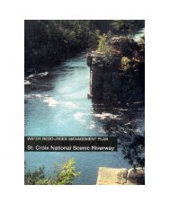
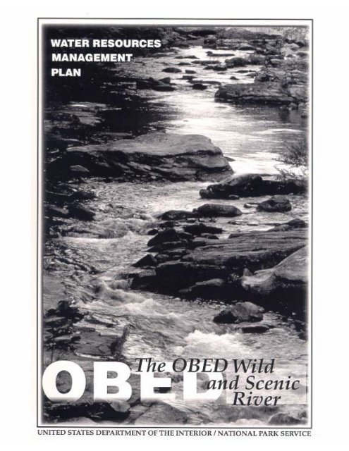
<strong>Obed</strong> <strong>Wild</strong> <strong>and</strong> <strong>Scenic</strong> <strong>River</strong><br />
Water Resources Management Plan<br />
United States Department Of Interior<br />
<strong>National</strong> <strong>Park</strong> <strong>Service</strong><br />
1998<br />
Prepared by<br />
Tennessee Valley Authority<br />
Preparation Team:<br />
Donald Forester, Superintendent (NPS)<br />
Monika Mayr, Former Superintendent (NPS)<br />
Bruce Yeager, Project Manager (TVA)<br />
Kenny Gardner (American Aquatics, Inc.)<br />
<strong>and</strong><br />
Cris Hughes (TVA)<br />
Hank Julian (TVA)<br />
Kim Pilarski (TVA)<br />
Steve Bakaletz (NPS)<br />
Dan McGlothlin (NPS)<br />
Joe Meiman (NPS)<br />
Dave Sharrow (NPS)
Contents<br />
Preface vi<br />
Introduction 1<br />
The abed <strong>Wild</strong> <strong>and</strong> <strong>Scenic</strong> <strong>River</strong> 1<br />
General Management Plan 1<br />
Purpose of the Water Resources Management Plan 3<br />
Water Resources Management Objectives 3<br />
Regulatory Relationships 7<br />
Water Resources Legislative, Regulatory <strong>and</strong> Planning Relationships 7<br />
Water Rights for <strong>Obed</strong> <strong>Wild</strong> <strong>and</strong> <strong>Scenic</strong> <strong>River</strong> 7<br />
Federal Laws, Regulations <strong>and</strong> Executive Orders Pertinent to Management<br />
of NPS Water Resources <strong>and</strong> Watersheds Affecting the <strong>Obed</strong> WSR 8<br />
<strong>National</strong> <strong>Park</strong> <strong>Service</strong> Organic Act of 1916 8<br />
<strong>Wild</strong> <strong>and</strong> <strong>Scenic</strong> <strong>River</strong>s Act of 1968 8<br />
Redwood <strong>National</strong> <strong>Park</strong> Act 9<br />
Federal Water Pollution Control Act (Clean Water Act) of 1972 9<br />
Endangered Species Act of 1973 11<br />
Floodplain Management Executive Order (No. 11988) 11<br />
Protection of Wetl<strong>and</strong>s Executive Order (No. 11990) 11<br />
<strong>National</strong> Environmental Policy Act of 1969 11<br />
Surface Mining Control <strong>and</strong> Reclamation Act (SMCRA) of 1977 12<br />
36 CFR 9 Non-federal Oil <strong>and</strong> Gas Rights 12<br />
Off-Road Vehicle Use Executive Orders (No.’s 11644 <strong>and</strong> 11989) 13<br />
Fish <strong>and</strong> <strong>Wild</strong>life Coordination Act of 1965 13<br />
Energy Policy Act (EPA) of 1992 13<br />
Safe Drinking Water Act of 1986 13<br />
Sales of <strong>Park</strong> Water Under Public Law 91-383 (August 18,1970) 13<br />
State of Tennessee Laws, Programs, <strong>and</strong> Regulations Pertinent to<br />
Management of NPS Water Resources <strong>and</strong> Watersheds Affecting the<br />
<strong>Obed</strong>WSR 13<br />
Water Rights in Tennessee 13<br />
Water Quality Control Act of 1971 14<br />
State Protected Water Uses 15<br />
State Anti-degradation Policy 16<br />
NPDES Permitting System 16<br />
Pretreatment Program 17<br />
Section 404 Certification 17<br />
Aquatic Resource Alteration Permit (ARAP) 17<br />
General Permits for Alteration of Aquatic Resources 17<br />
Safe Dams Act of 1973 18<br />
Mineral Test Hole Regulatory Act of 1982 18<br />
Oil <strong>and</strong> Gas Surface Owners Compensation Act of 1984 18<br />
L<strong>and</strong> Status, L<strong>and</strong> Use Considerations And Planning Relationships 19<br />
Introduction 19<br />
L<strong>and</strong>-ownership 19
Contents (cont.)<br />
Federal L<strong>and</strong>s 19<br />
State L<strong>and</strong>s 19<br />
Private L<strong>and</strong> Holdings 20<br />
Private L<strong>and</strong> Holdings Having Federal Easements 20<br />
Major L<strong>and</strong> Disturbances <strong>and</strong> Uses Within the <strong>Obed</strong> WSR 20<br />
<strong>National</strong> <strong>Park</strong> <strong>Service</strong> Activities 20<br />
Roadways <strong>and</strong> Bridges 21<br />
Coal Mining 21<br />
Oil <strong>and</strong> Gas 21<br />
Agriculture 21<br />
Grazing 21<br />
Silviculture 22<br />
Off-Road Vehicle Usage 22<br />
Extemal L<strong>and</strong> Uses 22<br />
Agriculture 22<br />
Silviculture 22<br />
Coal Mining 25<br />
Oil <strong>and</strong> Gas 25<br />
Quarries/Other Mineral Extraction 25<br />
Residential <strong>and</strong> Commercial Development 25<br />
Industrial Development 26<br />
Planning Considerations 26<br />
<strong>National</strong> <strong>Park</strong> <strong>Service</strong> 26<br />
Interagency Coordination 26<br />
Regulatory Issues 27<br />
The Hydrologic Environment 29<br />
Introduction 29<br />
Description of the Watershed 29<br />
Physiography 29<br />
Soils 33<br />
Geomorphology 33<br />
Climate 37<br />
Surface Water Resources 37<br />
Stream Flows 37<br />
Impoundments 43<br />
Existing Impoundments 45<br />
Proposed Impoundments 45<br />
Floodplain Information 45<br />
Wetl<strong>and</strong>s 45<br />
Water Quality 47<br />
<strong>Obed</strong> <strong>River</strong> 49<br />
Clear Creek 49<br />
Other Tributaries 49<br />
Groundwater Resources 50<br />
<strong>Obed</strong> <strong>River</strong> Watershed 50<br />
Hydrogeology 50<br />
Geology 50<br />
Aquifers 57<br />
Recharge 57
Contents (cont.)<br />
Geographical Distribution of Existing Water Supply Wells 57<br />
Shallow Aquifers within Pennsylvanian S<strong>and</strong>stone <strong>and</strong> Conglomerates 58<br />
Deeper Aquifers within Pennsylvanian S<strong>and</strong>stone <strong>and</strong> Conglomerates 59<br />
Shallow Karstic Aquifers 63<br />
Groundwater Quality 64<br />
Groundwater Supply Potential 64<br />
Aquatic <strong>and</strong> Riparian Resources <strong>and</strong> Habitats 66<br />
Introduction 66<br />
Flora 66<br />
Fauna 67<br />
Rare, Threatened <strong>and</strong> Endangered (RTE) Species 68<br />
Exotics 68<br />
Non-consumptive Water Uses 69<br />
Recreation 69<br />
Whitewater Boating 69<br />
Hiking 69<br />
Camping 69<br />
Rock Climbing 69<br />
Hunting 69<br />
Fishing 70<br />
Water Resources Management Issues 71<br />
Programmatic Issues 71<br />
Baseline Information 72<br />
Interagency Data Coordination 72<br />
Water Quantity: Hydrologic Inventory <strong>and</strong> Monitoring 72<br />
Water Quality: Chemical, Biological, <strong>and</strong> Physical Inventory <strong>and</strong> Monitoring 73<br />
L<strong>and</strong> Use Inventory <strong>and</strong> Monitoring of the Watershed <strong>and</strong> Non-federal L<strong>and</strong>s 74<br />
Coordination/Coalition Building 75<br />
Improved Water Resources Management Plan 75<br />
Education 76<br />
Specific Issues 76<br />
Assessment of Water Rights <strong>and</strong> Instream Flow Needs 76<br />
Special Water Designation <strong>and</strong> St<strong>and</strong>ards 76<br />
Support Information for Water-related Sports 77<br />
Agriculture <strong>and</strong> Timber Industry 77<br />
Continuous Hydrologic Watershed Modeling 77<br />
Ab<strong>and</strong>oned <strong>and</strong> Active Mines 78<br />
Oil <strong>and</strong> Gas Exploration 78<br />
Off-road Vehicles 78<br />
Effects of Publicly Owned Wastewater Treatment Facility 78<br />
Easement Definitions 78<br />
Water Resources Management Program 79<br />
Staff <strong>and</strong> Support Needs 81<br />
Inventory <strong>and</strong> Monitoring 81<br />
Cooperation <strong>and</strong> Coordination 83<br />
Data Management 85
Contents (cont.)<br />
Specific Water Resources Issues 85<br />
Project Statements 89<br />
Project Statements OBRI-N-201 to OBRI-N-222 101<br />
168<br />
Literature Cited 169<br />
Appendices 175<br />
Appendix A.<br />
Federal Laws, Regulations <strong>and</strong> Executive Orders Pertinent to Management of NPS Water<br />
Resources <strong>and</strong> Watershed Affecting the <strong>Obed</strong> WSR <strong>Park</strong> 176<br />
Appendix B.<br />
List of Rare, Threatened <strong>and</strong> Endangered Species Occurring in the <strong>Obed</strong> WSR 184<br />
Appendix C<br />
State of Tennessee Laws, Programs, <strong>and</strong> Regulations Pertinent to Management of NPS<br />
Water Resources <strong>and</strong> Watersheds Affecting the <strong>Obed</strong> WSR 186<br />
Appendix D.<br />
<strong>Obed</strong> WSR Wetl<strong>and</strong>s Inventory 192<br />
Appendix E.<br />
Fish Species Collected from the <strong>Obed</strong>/Emory <strong>River</strong>s by fl/A’s Watts Bar, Fort Loudoun<br />
<strong>and</strong> Melton Hill <strong>River</strong> Action Team in 1996 193<br />
Appendix F.<br />
Results of Benthic EPT Sampling 194<br />
Appendix G.<br />
Contact List in Preparation of this Document 196<br />
Figure Captions:<br />
Figure 1. Location of the <strong>Obed</strong> <strong>Wild</strong> <strong>and</strong> <strong>Scenic</strong> <strong>River</strong> <strong>National</strong> <strong>Park</strong> <strong>Service</strong> Unit<br />
Within the State of Tennessee <strong>and</strong> the Southeastern United States<br />
(Adapted from NPS 1995) 2<br />
Figure 2. The Water Resources Planning Process 4<br />
Figure 3. <strong>Obed</strong> WSR Adjacent L<strong>and</strong> Uses 23<br />
Figure 4. Physiographic Location of the <strong>Obed</strong> <strong>River</strong> Watershed 31<br />
Figure 5. Conceptual Section Through Cumberl<strong>and</strong> Plateau Showing Potential<br />
Avenues of Water Movement 35<br />
Figure 6. Mean Monthly Rainfall 38<br />
Figure 7. Difference in Average Flows for the Emory <strong>River</strong> at Oakdale, 38<br />
Tennessee<br />
Figure 8. Percent of Time Exceeded, Emory <strong>River</strong> at Oakdale 40
Contents (cont.)<br />
Figure 9. Percent of Time Exceeded, <strong>Obed</strong> <strong>River</strong> Near Lancing 41<br />
Figure 10. Flood Peaks on Emory <strong>River</strong> at Oakdale 42<br />
Figure 11. Locations of Past <strong>and</strong> Present Stream Gage Stations 44<br />
Figure 12. The <strong>Obed</strong> WSR Watershed Impoundments from 1943 to 1994 back<br />
cover<br />
Figure 13. Digital Elevation Model of the <strong>Obed</strong> <strong>River</strong> Watershed <strong>and</strong> Vicinity 51<br />
Depicting Major Physiographic L<strong>and</strong>forms<br />
Figure 14. Generalized Geologic Map <strong>and</strong> Cross Section of the <strong>Obed</strong> <strong>River</strong> 53<br />
Watershed <strong>and</strong> Vicinity (Adapted from Gaydos et al. 1982)<br />
Figure 15. Geologic Map of Cumbert<strong>and</strong> County (Adapted from Wilson 1965) 55<br />
Figure 16. Shallow Well (
Preface<br />
The <strong>Obed</strong> <strong>Wild</strong> <strong>and</strong> <strong>Scenic</strong> <strong>River</strong> (WSR) is a 5,057 acre (2,046 hectare) unit of the <strong>National</strong><br />
<strong>Park</strong> <strong>Service</strong> in Morgan <strong>and</strong> Cumbert<strong>and</strong> counties of Tennessee. The <strong>Obed</strong> WSR is a tributary<br />
to the Tennessee <strong>River</strong>. It offers a vast array of both cultural <strong>and</strong> natural resources. A complex<br />
network of streams drain park l<strong>and</strong>s <strong>and</strong> support a diverse flora <strong>and</strong> fauna as well as provide<br />
numerous types of recreational activities.<br />
Units of the <strong>National</strong> <strong>Park</strong> <strong>Service</strong> are not required to develop a Water Resources Management<br />
Plan (WRMP). However, <strong>Obed</strong> WSR water resource issues <strong>and</strong> management constraints are<br />
particularly numerous. This WRMP has been developed as an action plan to support the<br />
management’s decision-making processes related to the protection, conservation, use <strong>and</strong><br />
management of the <strong>Park</strong>’s water resources. It is designed to identify <strong>and</strong> analyze water<br />
resource related issues where the current level of information is minimal or insufficient to meet<br />
the management goals <strong>and</strong> objectives of the <strong>National</strong> <strong>Park</strong>. Project statements were developed<br />
to address issues for future water-related management actions (including inventory, monitoring<br />
<strong>and</strong> resource management activities).<br />
The importance of coordination <strong>and</strong> consultation with l<strong>and</strong>owners, local businesses, developers,<br />
<strong>and</strong> govemment officials regarding their l<strong>and</strong> use practices <strong>and</strong> future expansion plans has been<br />
identified in this Plan. Current federal, state, <strong>and</strong> local environmental legislation <strong>and</strong> regulations<br />
have been summarized.<br />
Implementation of this program will require long-term, continuous commitments of personnel<br />
<strong>and</strong> funding. It is, however, essential in providing a level of data <strong>and</strong> hydrologic information<br />
needed by the <strong>Obed</strong> WSR for effective <strong>and</strong> wise management of its water resources, not only<br />
for its own benefit but also for the benefit of the total ecosystem of which it is a part.
The <strong>Obed</strong> <strong>Wild</strong> <strong>and</strong> <strong>Scenic</strong><br />
<strong>River</strong><br />
The <strong>Wild</strong> <strong>and</strong> <strong>Scenic</strong> <strong>River</strong>s Act of 1968,<br />
Public Law 90-542, declared the following<br />
as the policy of the United States:<br />
“that certain selected rivers of the<br />
Nation which, with their immediate<br />
environments possess outst<strong>and</strong>ingly<br />
remarkable scenic, recreational,<br />
geologic, fish <strong>and</strong> wildlife, historic,<br />
cultural, or other similar values, shall<br />
be preserved in free-flowing condition,<br />
<strong>and</strong> that they <strong>and</strong> their immediate<br />
environments shall be protected for<br />
the benefit <strong>and</strong> enjoyment of future<br />
generations.”<br />
The act also states that these rivers would<br />
be preserved “in their free flowing<br />
condition to protect the water quality <strong>and</strong> to<br />
fulfill other vital national conservation<br />
purposes.”<br />
In 1976, an amendment to the <strong>Wild</strong> <strong>and</strong><br />
<strong>Scenic</strong> <strong>River</strong>s Act established the <strong>Obed</strong><br />
<strong>Wild</strong> <strong>and</strong> <strong>Scenic</strong> <strong>River</strong> (<strong>Obed</strong> WSR), as a<br />
unit of the <strong>National</strong> <strong>Park</strong> <strong>Service</strong> (NPS),<br />
thereby giving NPS primary management<br />
responsibilities. As of 1996, the <strong>Obed</strong> <strong>Wild</strong><br />
<strong>and</strong> <strong>Scenic</strong> <strong>River</strong> is one of 158 wild <strong>and</strong><br />
scenic rivers nationally; it is one of only<br />
nine such river systems authorized in<br />
Southeastern U.S. It is the only national<br />
wild <strong>and</strong> scenic river in the State of<br />
Tennessee. L<strong>and</strong>s are shared by the <strong>Obed</strong><br />
WSR <strong>National</strong> <strong>Park</strong> <strong>Service</strong> Unit <strong>and</strong> the<br />
State of Tennessee’s Catoosa <strong>Wild</strong>life<br />
Management Area (Catoosa WMA), in<br />
Cumberl<strong>and</strong> <strong>and</strong> Morgan Counties. These<br />
l<strong>and</strong>s remain in the ownership <strong>and</strong> care of<br />
the State by the Tennessee <strong>Wild</strong>life<br />
Resources Agency (TWRA) through a<br />
Memor<strong>and</strong>um of Underst<strong>and</strong>ing (MOU)<br />
between the two agencies.<br />
The <strong>Obed</strong> WSR is located on part of<br />
Tennessee’s Cumberl<strong>and</strong> plateau<br />
Introduction<br />
1<br />
Cuberl<strong>and</strong> <strong>and</strong> Morgan Counties (Figure 1).<br />
The Plateau lies to the east of the Highl<strong>and</strong><br />
Rim <strong>and</strong> Nashville Basin Provinces in<br />
Tennessee. Its terrain consists of flat to<br />
rolling upl<strong>and</strong>s, deep river gorges, <strong>and</strong> a<br />
long line of cliffs that separate it from the<br />
lower elevations of the Ridge <strong>and</strong> Valley<br />
Province to the east. These characteristics,<br />
common to the <strong>Obed</strong> WSR, contribute to<br />
the general inaccessibility of the area <strong>and</strong><br />
provide a unique opportunity to experience<br />
a resource relatively unchanged since it<br />
was intermittently occupied by prehistoric<br />
Native Americans.<br />
Water resources <strong>and</strong> riparian<br />
environments are principal resources of<br />
the <strong>Obed</strong> WSR. The water is considered to<br />
be among the highest quality in the State<br />
supporting a rich ecological diversity.<br />
However, activities occurring outside the<br />
<strong>Obed</strong> WSR <strong>Park</strong> System Unit influence the<br />
waters within its boundaries. The activities<br />
include: coal mining, oil <strong>and</strong> gas<br />
exploration, quarrying, sewage discharge,<br />
agriculture <strong>and</strong> forestry practices, some<br />
residential development, garbage disposal<br />
<strong>and</strong> construction of numerous water supply<br />
ponds <strong>and</strong> impoundments on tributaries of<br />
the <strong>Obed</strong> <strong>and</strong> Emory <strong>River</strong>s.<br />
Existing boundaries of the <strong>Obed</strong> WSR<br />
encompass 5,056 acres (2,046 hectares)<br />
<strong>and</strong> include portions of the <strong>Obed</strong> <strong>and</strong><br />
Emory <strong>River</strong>s, <strong>and</strong> Clear <strong>and</strong> Daddys<br />
Creeks (45.2 river miles or 72.7 kilometers<br />
total). Wetl<strong>and</strong>s within the <strong>Obed</strong> WSR<br />
boundaries are located in the river channel<br />
<strong>and</strong> along the stream banks. High stream<br />
gradients, rapid surface runoff <strong>and</strong> little<br />
groundwater storage create a wide range<br />
of flows in watershed streams.<br />
General Management Plan<br />
The <strong>National</strong> <strong>Park</strong>s <strong>and</strong> Recreation Act,<br />
P.L. 95-625 <strong>and</strong> NPS policy require that a<br />
unit of the national park system develop<br />
<strong>and</strong> implement a General Management<br />
Plan (GMP). The GMP provides the NPS<br />
with the overall basis for managing the<br />
unit’s resources, uses, <strong>and</strong> facilities.
Specific provisions for addressing the unit’s<br />
resources, uses, <strong>and</strong> facilities include: l<strong>and</strong><br />
use <strong>and</strong> management, resource<br />
management, visitor use <strong>and</strong> associated<br />
facilities, operations <strong>and</strong> associated<br />
facilities, l<strong>and</strong> protection, plan<br />
implementation <strong>and</strong> costs.<br />
A GMP for the <strong>Obed</strong> WSR was completed<br />
in 1995 (NPS 1995). A portion of Catoosa<br />
WMA l<strong>and</strong>s, owned <strong>and</strong> managed by the<br />
State of Tennessee, falls within the<br />
boundaries of the <strong>Obed</strong> WSR. For this<br />
reason, it was necessary for the <strong>Obed</strong>’s<br />
GMP to be prepared in cooperation with<br />
the TWRA.<br />
The GMP’s primary purpose is to guide<br />
management of the <strong>Obed</strong> WSR for 10 to<br />
15 years, including the overall resource<br />
management <strong>and</strong> use of the area in order<br />
to best serve visitors while preserving the<br />
resource values for which the <strong>Obed</strong> WSR<br />
was established. Significant resource<br />
values identified in the plan include: water<br />
quality, scenic surroundings, ecological<br />
diversity, recreational opportunities,<br />
geologic formations, fish <strong>and</strong> wildlife<br />
populations, <strong>and</strong> culturally significant sites.<br />
In order to preserve these values, the GMP<br />
recommends a strategy of working with<br />
established state <strong>and</strong> local water resource<br />
protection programs to help reduce the<br />
water quantity <strong>and</strong> quality impacts<br />
occurring from development <strong>and</strong> activities<br />
outside <strong>Obed</strong> WSR boundaries. In addition<br />
to a GMP, a Water Resources<br />
Management Plan (WRMP) is desirable in<br />
order to assist in the protection of these<br />
values inside the <strong>Obed</strong> WSR <strong>National</strong> <strong>Park</strong><br />
<strong>Service</strong> Unit.<br />
Purpose of the Water<br />
Resources Management Plan<br />
After 21 years of existence, the <strong>Obed</strong> WSR<br />
requires development of a WRMP to aid<br />
future management of water-related<br />
resources within its boundaries. Where<br />
water resource issues are particularly<br />
numerous or complex, a WRMP (i.e.,<br />
“action” plan) allows water-related issues<br />
to be examined in detail. It is designed to<br />
complement <strong>and</strong> conform to both a GMP<br />
<strong>and</strong> Resources Management Plan (RMP).<br />
The WRMP assists in evaluating<br />
management alternatives by reviewing <strong>and</strong><br />
summarizing information about the <strong>Obed</strong><br />
3<br />
WSR’s hydrologic resources <strong>and</strong> providing<br />
direction for water<br />
resource-related activities including<br />
inventory, monitoring <strong>and</strong> research. Both<br />
RMP <strong>and</strong> WRMP are dynamic documents<br />
that are revised, periodically, as new<br />
issues are recognized, additional<br />
information collected, or additional<br />
management alternatives identified. In<br />
general, the WRMP provides a blueprint for<br />
addressing the <strong>National</strong> <strong>Park</strong> <strong>Service</strong><br />
Unit’s water resources issues for a period<br />
of 10 to 15 years.<br />
Several steps are typically involved in the<br />
development of a WRMP (Figure 2). The<br />
initial step is to chronicle the reasons for<br />
the <strong>National</strong> <strong>Park</strong> <strong>Service</strong> Unit’s<br />
establishment <strong>and</strong> identify the significant<br />
water-related resource values of the unit.<br />
Information on these resource-specific<br />
values is then used to support the NPS’s<br />
decision-making process related to the<br />
protection, conservation, use, <strong>and</strong><br />
management of the unit’s resources.<br />
Available information about the unit’s water<br />
resources <strong>and</strong> water-dependent<br />
environments is also included. In addition,<br />
the WRMP contains descriptions of<br />
significant water resources management<br />
issues <strong>and</strong> the resource <strong>and</strong> legislative<br />
constraints on them. Finally, the WRMP<br />
provides a recommended management<br />
program for water resources, including<br />
recommended actions for inventory <strong>and</strong><br />
monitoring, resources management, <strong>and</strong><br />
research.<br />
Water Resources<br />
Management Objectives<br />
Water is a particularly important <strong>and</strong><br />
sensitive ecosystem component of the<br />
<strong>Obed</strong> WSR. Its physical availability <strong>and</strong><br />
quality are critical determinants not only of<br />
aquatic resources, but also of the overall<br />
condition of natural resources <strong>and</strong> longterm<br />
use sustainability of the <strong>Obed</strong> WSR.<br />
Water resources <strong>and</strong> stream corridors also<br />
provide important linkages within <strong>and</strong><br />
between ecosystems, both inside <strong>and</strong><br />
outside <strong>Obed</strong> WSR boundaries. Unfortunately,<br />
this can also work to a <strong>National</strong> <strong>Park</strong><br />
<strong>Service</strong> Unit’s disadvantage by delivering<br />
pollutants into its boundaries.
A scoping workshop/public meeting was held<br />
at the onset of the WRMP development. Public<br />
awareness of the critical role that the water<br />
component plays in sustaining the <strong>Obed</strong> WSR,<br />
its tributaries, <strong>and</strong> the attributes they support<br />
was made evident. Over 41 percent of the<br />
participants identified water quality/quantity<br />
<strong>and</strong> adjacent l<strong>and</strong> uses as issues of concern<br />
(TVA 1996).<br />
Because of the important role of water in<br />
maintaining resource condition, it is the policy<br />
of the NPS to seek to maintain, rehabilitate,<br />
<strong>and</strong> perpetuate the inherent natural integrity of<br />
water resources <strong>and</strong> water-dependent<br />
environments occurring within units of the<br />
national park system (NPS 1991). Since water<br />
resources are a critical component of a larger<br />
ecosystem that spreads beyond <strong>Obed</strong> WSR<br />
boundaries, the NPS recognizes the need to<br />
cooperate with appropriate local, state, <strong>and</strong><br />
federal regulators, l<strong>and</strong>-use planning agencies,<br />
adjacent l<strong>and</strong>owners, researchers, <strong>and</strong> the<br />
general public in striving to maintain the quality<br />
of the water-related resources throughout the<br />
watersheds encompassing the <strong>Obed</strong> WSR.<br />
WRMP objectives were developed from<br />
objectives identified in the GMP (indicated in<br />
bold) to manage the extensive water-related<br />
resources of the <strong>Obed</strong> WSR <strong>and</strong> to preserve<br />
their highly significant ecosystem function:<br />
1. Maintain the highest water quality possible<br />
<strong>and</strong> a free-flowing condition for all streams<br />
within the <strong>Obed</strong> WSR.<br />
• Seek the highest protection designation<br />
from state water quality st<strong>and</strong>ards,<br />
including investigating the applicability<br />
of non-degradation st<strong>and</strong>ards.<br />
• Participate with local communities <strong>and</strong><br />
regional, state, <strong>and</strong> federal groups in<br />
addressing issues that impact <strong>Obed</strong><br />
WSR water resources.<br />
• Inventory l<strong>and</strong> uses which may<br />
contribute to water quality degradation,<br />
identify <strong>and</strong> take action on real <strong>and</strong><br />
potential pollutants.<br />
• Gather water <strong>and</strong> water-dependent<br />
resources information to support water<br />
quantity <strong>and</strong> quality objectives.<br />
2. Protect the natural systems, cultural<br />
resources, l<strong>and</strong>scape character, <strong>and</strong><br />
5<br />
biodiversity of the <strong>Wild</strong> <strong>and</strong> <strong>Scenic</strong><br />
<strong>River</strong> area.<br />
• Define <strong>and</strong> practice stewardship on<br />
the relationships between water<br />
resources <strong>and</strong> other natural<br />
processes <strong>and</strong> human activities.<br />
• Underst<strong>and</strong> the relationships<br />
between terrestrial, aquatic <strong>and</strong><br />
riparian flora <strong>and</strong> fauna <strong>and</strong> human<br />
activities both within <strong>and</strong> outside<br />
<strong>Obed</strong> WSR boundaries.<br />
3. Provide the opportunity <strong>and</strong> means to<br />
learn about, experience, <strong>and</strong> enjoy the<br />
special values of the <strong>Obed</strong> WSR<br />
(essentially primitive, unpolluted, <strong>and</strong><br />
generally inaccessible) while assuring<br />
the protection of those values.<br />
• Define <strong>and</strong> protect water resources<br />
attributes significant to the visitor’s<br />
experience.<br />
• Promote ecological <strong>and</strong> water<br />
resources stewardship through inhouse<br />
<strong>and</strong> cooperative public<br />
education <strong>and</strong> outreach efforts.
Regulatory Relationships<br />
Water Resource Legislative,<br />
Regulatory <strong>and</strong> Planning<br />
Relationships<br />
Numerous federal <strong>and</strong> state laws, regulations<br />
<strong>and</strong> executive orders m<strong>and</strong>ate specific<br />
regulatory considerations with regard to<br />
protection<br />
<strong>and</strong> management of water-related resources<br />
in <strong>and</strong> adjacent to the <strong>Obed</strong> WSR.<br />
Additionally, policies <strong>and</strong> guidelines of the<br />
NPS broadly require management of natural<br />
resources of the national park system to<br />
maintain, rehabilitate, <strong>and</strong> perpetuate the<br />
inherent integrity of aquatic resources.<br />
The primary federal laws governing aquatic<br />
resources management <strong>and</strong> which apply to<br />
the <strong>Obed</strong> WSR WRMP, include the NPS<br />
Organic Act, the Clean Water Act, the<br />
Endangered Species Act, the <strong>Wild</strong> <strong>and</strong> <strong>Scenic</strong><br />
<strong>River</strong>s Act, the NPS General Authorities Act,<br />
the Redwood <strong>National</strong> <strong>Park</strong> Act, the<br />
Floodplain Management Executive Order (No.<br />
11988), the Protection of Wetl<strong>and</strong>s Executive<br />
Order (No. 11990), the Surface Mining Control<br />
<strong>and</strong> Reclamation Act (SMCRA), <strong>and</strong> 36 CFR<br />
9B Non-Federal Oil <strong>and</strong> Gas Rights.<br />
Management of aquatic resources is further<br />
addressed in various applicable provisions of<br />
the Federal Power Act, the Resource<br />
Conservation <strong>and</strong> Recovery Act, the Safe<br />
Drinking Water Act, <strong>and</strong> the Food Security Act<br />
of 1985. For a more detailed list of applicable<br />
federal laws <strong>and</strong> executive orders, see<br />
Appendix A.<br />
The Clean Water Act delegates most of its<br />
administration <strong>and</strong> enforcement requirements<br />
to the states. Therefore, states have the<br />
responsibility to regulate aquatic resources<br />
resulting in laws <strong>and</strong> regulations pertaining to<br />
aquatic resource management in NPS units.<br />
For example, Tennessee has established<br />
criteria, st<strong>and</strong>ards, guidelines for water quality,<br />
<strong>and</strong> erosion. The State has also established<br />
sediment control <strong>and</strong> has enacted<br />
groundwater management laws. In general, it<br />
is NPS policy to comply with these laws <strong>and</strong><br />
regulations.<br />
Policy regarding aquatic resources<br />
7<br />
management is provided in the NPS<br />
Management Policies (NPS 1988). Specific<br />
management policies provide for protection<br />
of quality <strong>and</strong> quantity of surface water <strong>and</strong><br />
groundwater (4:15-16), preservation of<br />
floodplains <strong>and</strong> wetl<strong>and</strong>s (4:16-17),<br />
maintaining, protecting, <strong>and</strong> securing water<br />
rights (4:17), <strong>and</strong> protection of aquatic<br />
biological resources (4: 5-14). Program<br />
objectives <strong>and</strong> specific guidance regarding<br />
these goals are presented in the Program<br />
Guidance Section of NPS-77 Natural<br />
Resources Management Guidelines (NPS<br />
1991).<br />
Water Rights for <strong>Obed</strong> <strong>Wild</strong><br />
<strong>and</strong> <strong>Scenic</strong> <strong>River</strong><br />
The precise nature <strong>and</strong> extent of the<br />
<strong>National</strong> <strong>Park</strong> <strong>Service</strong>’s water rights for<br />
<strong>Obed</strong> WSR are unclear <strong>and</strong> will remain<br />
uncertain until determination is made by<br />
the courts. In general, it is clear the United<br />
States has riparian water rights within the<br />
<strong>National</strong> <strong>Park</strong> <strong>Service</strong> Unit by virtue of its<br />
status as a riparian l<strong>and</strong>owner, although<br />
these rights are currently undefined. The<br />
present value of these rights is to maintain<br />
stream flows for natural conditions, the<br />
<strong>National</strong> <strong>Park</strong> <strong>Service</strong> Unit does not<br />
withdraw water from streams for<br />
consumptive uses in support of the Unit<br />
administration.<br />
It is unclear to what extent Federal rights<br />
established by the <strong>Wild</strong> <strong>and</strong> <strong>Scenic</strong> <strong>River</strong>s<br />
Act (October 2, 1968, 82 Stat. 906) for<br />
<strong>Obed</strong> WSR may protect Unit resources<br />
from future alterations in flow. Section 13<br />
(c) of the <strong>Wild</strong> <strong>and</strong> <strong>Scenic</strong> <strong>River</strong>s Act states<br />
that rights are established for wild, scenic,<br />
or recreational rivers for the primary<br />
purposes of the act. These primary<br />
purposes include rivers which “possess<br />
outst<strong>and</strong>ingly remarkable scenic,<br />
recreational, geologic, fish <strong>and</strong> wildlife,<br />
historic, cultural or other similar values,”<br />
<strong>and</strong> that they” ... shall be preserved in freeflowing<br />
condition, <strong>and</strong> that they <strong>and</strong> their<br />
immediate environs shall be protected for<br />
the benefit <strong>and</strong>
enjoyment of present <strong>and</strong> future generations.” To<br />
date there has been no court case documented<br />
where the water rights for a <strong>Wild</strong> <strong>and</strong> <strong>Scenic</strong><br />
<strong>River</strong> have been defined in a riparian doctrine<br />
State.<br />
Federal Laws, Regulations <strong>and</strong><br />
Executive Orders Pertinent to<br />
Management of NPS Water<br />
Resources <strong>and</strong> Watersheds<br />
Affecting the <strong>Obed</strong> WSR<br />
<strong>National</strong> <strong>Park</strong> <strong>Service</strong> Organic Act of 1916<br />
Through this act, Congress established the NPS<br />
<strong>and</strong> m<strong>and</strong>ated that it “shall promote <strong>and</strong> regulate<br />
the use of the federal areas known as national<br />
parks, monuments, <strong>and</strong> reservations by such<br />
means <strong>and</strong> measures as conform to the<br />
fundamental purpose of the said parks,<br />
monuments, <strong>and</strong> reservations, which purpose is<br />
to conserve the scenery <strong>and</strong> the natural <strong>and</strong><br />
historic objects <strong>and</strong> the wildlife therein <strong>and</strong> to<br />
provide for the enjoyment of the same in such<br />
manner <strong>and</strong> by such means as will leave them<br />
unimpaired for the enjoyment of future<br />
generations.” This act was reinforced by the<br />
General Authorities Act of 1970 with legislation<br />
stating that all park l<strong>and</strong>s are united by a<br />
common preservation purpose, regardless of title<br />
or designation. Hence, all water resources in the<br />
national park system are protected equally by<br />
federal law, <strong>and</strong> it is the fundamental duty of the<br />
NPS to protect those resources unless otherwise<br />
indicated by Congress.<br />
<strong>Wild</strong> <strong>and</strong> <strong>Scenic</strong> <strong>River</strong>s Act of 1968<br />
In accordance with this act, it is:<br />
the policy of the United States that certain<br />
selected rivers of the Nation which, with their<br />
immediate environments, possess<br />
outst<strong>and</strong>ingly remarkable scenic,<br />
recreational, geologic, fish <strong>and</strong> wildlife,<br />
historic, cultural, or other similar values, shall<br />
be preserved in free-flowing condition <strong>and</strong><br />
that they <strong>and</strong> their immediate environments<br />
shall be protected for the benefit <strong>and</strong><br />
enjoyment of present <strong>and</strong> future generations.<br />
The purpose of this act is to implement this<br />
policy by instituting a national wild <strong>and</strong> scenic<br />
rivers system, by designating the initial<br />
components of that system, <strong>and</strong> by<br />
prescribing the methods by which <strong>and</strong><br />
8<br />
st<strong>and</strong>ards according to which<br />
additional components may be added<br />
to the system from time to time.”<br />
Section 2 of this act states:<br />
“The national wild <strong>and</strong> scenic rivers<br />
system shall comprise rivers (i) that are<br />
authorized for inclusion therein by act<br />
of Congress, or (ii) that are designated<br />
as wild, scenic or recreational rivers by<br />
or pursuant to an act of the legislature<br />
of the state or states through which<br />
they flow, that are to be permanently<br />
administered as wild, scenic or<br />
recreational rivers by an agency or<br />
political subdivision of the state or<br />
states concerned, that are found by the<br />
Secretary of the Interior upon<br />
application of the Governor of the state<br />
or the Governors of the states<br />
concerned, or a person or persons<br />
thereunto duly appointed by him or<br />
them, to meet the criteria established<br />
in this act <strong>and</strong> such criteria<br />
supplementary thereto as he may<br />
prescribe, <strong>and</strong> that are approved by<br />
him for inclusion in the system,<br />
including, upon application of the<br />
Governor of the state concerned.”<br />
In February 1968, the <strong>Obed</strong> <strong>River</strong> <strong>and</strong> its<br />
tributaries were included in a bill which<br />
became the Tennessee <strong>Scenic</strong> <strong>River</strong>s Act.<br />
However, strong organized support<br />
persisted locally for the construction of a<br />
high dam on the <strong>Obed</strong> <strong>River</strong> (NPS 1993).<br />
Since the 1968 restudy of the feasibility for<br />
the dam project was then underway, the<br />
<strong>Obed</strong> <strong>River</strong> <strong>and</strong> its tributaries were deleted<br />
from the bill prior to its enactment.<br />
However, other citizens groups including<br />
the Tennessee <strong>Scenic</strong> <strong>River</strong>s Association<br />
<strong>and</strong> the Tennessee Citizens for <strong>Wild</strong>erness<br />
Planning favored preserving the river.<br />
Largely through the efforts of these two<br />
organizations, the <strong>Obed</strong> <strong>River</strong>, Clear<br />
Creek, <strong>and</strong> Daddys Creek were included in<br />
Section 5 (a) of the <strong>Wild</strong> <strong>and</strong> <strong>Scenic</strong> <strong>River</strong>s<br />
Act in October 1968 which placed them in<br />
a study category for future inclusion (NPS<br />
1993).<br />
In 1976, Public Law 94-486 amended the<br />
original act to establish the <strong>Obed</strong> <strong>Wild</strong> <strong>and</strong><br />
<strong>Scenic</strong> <strong>River</strong> (<strong>Obed</strong> WSR) encompassing<br />
45.2
iver miles on portions of the <strong>Obed</strong> <strong>and</strong><br />
Emory <strong>River</strong>s, <strong>and</strong> Clear <strong>and</strong> Daddys<br />
Creeks in Morgan <strong>and</strong> Cumberl<strong>and</strong><br />
Counties, Tennessee. The NPS has<br />
primary management responsibilities for<br />
the <strong>Obed</strong> WSR. L<strong>and</strong>s currently within<br />
<strong>Obed</strong> WSR boundaries that are part of the<br />
Catoosa <strong>Wild</strong>life Management Area<br />
(Catoosa WMA) will continue to be owned<br />
<strong>and</strong> managed by the TWRA in such a way<br />
as:<br />
“to protect the wildlife resources <strong>and</strong><br />
the primitive character of the area <strong>and</strong><br />
without further development of roads,<br />
campsites or associated recreational<br />
facilities unless deemed necessary by<br />
that agency for wildlife management<br />
purposes.”<br />
The legislation required that a<br />
development plan be prepared <strong>and</strong> include<br />
a cooperative agreement between the two<br />
agencies due to their joint management<br />
responsibilities.<br />
Although the <strong>Obed</strong> is only one unit in the<br />
national wild <strong>and</strong> scenic rivers system (a<br />
system containing some 158 rivers<br />
nationally), it is one of only nine such units<br />
that has been authorized in the<br />
Southeastern U.S. It is the only <strong>National</strong><br />
<strong>Wild</strong> <strong>and</strong> <strong>Scenic</strong> <strong>River</strong> in the State of<br />
Tennessee <strong>and</strong> the only <strong>Wild</strong> <strong>and</strong> <strong>Scenic</strong><br />
<strong>River</strong> managed by the Southeast Region<br />
of the NPS.<br />
Redwood <strong>National</strong> <strong>Park</strong> Act<br />
In 1978, an act exp<strong>and</strong>ing Redwood<br />
<strong>National</strong> <strong>Park</strong> (i.e., Redwood <strong>National</strong> <strong>Park</strong><br />
Act), NPS general authorities were further<br />
amended to specifically m<strong>and</strong>ate that all<br />
park system units be managed <strong>and</strong><br />
protected “in light of the high public value<br />
<strong>and</strong> integrity of the national park system”<br />
<strong>and</strong> that no activities should be undertaken<br />
“in derogation of the values <strong>and</strong> purposes<br />
for which these various areas have been<br />
established,” except where specifically<br />
authorized by law. Thus, by amending the<br />
General Authorities Act of 1970, the act<br />
reasserted system-wide the high st<strong>and</strong>ard<br />
of protection prescribed by Congress in the<br />
original Organic Act.<br />
The Redwood Act qualifies the provision<br />
that park protection <strong>and</strong> management<br />
“shall not be exercised in derogation of the<br />
values <strong>and</strong><br />
9<br />
purposes for which these various areas<br />
have been established, “by adding” except<br />
as may have been or shall be directly <strong>and</strong><br />
specifically provided for by Congress.”<br />
Thus, specific provisions in a park’s<br />
enabling legislation allow park managers<br />
to permit activities such as hunting <strong>and</strong><br />
grazing.<br />
Federal Water Pollution Control Act<br />
(Clean Water Act) of 1972<br />
The Federal Water Pollution Control Act,<br />
more commonly known as the Clean Water<br />
Act, was first promulgated in 1972 <strong>and</strong><br />
amended in 1977, 1987, <strong>and</strong> 1990. This<br />
law is designed to restore <strong>and</strong> maintain the<br />
integrity of the nation’s water, including the<br />
waters of the national park system. Goals<br />
set by the act were swimmable <strong>and</strong><br />
fishable waters by 1983 <strong>and</strong> no further<br />
discharge of pollutants into the nation’s<br />
waterways by 1985. The two strategies for<br />
achieving these goals were a major grant<br />
program to assist in the construction of<br />
municipal sewage treatment facilities, <strong>and</strong><br />
program of “effluent limitations” designed to<br />
limit the amount of pollutants that could be<br />
discharged. Effluent limitations are the<br />
basis for permits issued for all point source<br />
discharges, known as the <strong>National</strong><br />
Pollutant Discharge Elimination System<br />
(NPDES). The Environmental Protection<br />
Agency (EPA) has set limits for pollutants<br />
that may be released based on available<br />
technology <strong>and</strong> cost of treatment for<br />
various industrial categories.<br />
As part of the act, Congress recognized the<br />
primary role of the states in managing <strong>and</strong><br />
regulating the nation’s water quality within<br />
the general framework developed by<br />
Congress. Part of that framework, namely<br />
Section 313, requires that all federal<br />
agencies, including the NPS, comply with the<br />
requirements of state law for water quality<br />
management, regardless of other<br />
jurisdictional status or l<strong>and</strong>-ownership. States<br />
implement the protection of water quality<br />
under the authority granted by the Clean<br />
Water Act through BMPs <strong>and</strong> through water<br />
quality st<strong>and</strong>ards. St<strong>and</strong>ards are based on<br />
the designated uses made of a water body or<br />
segment, the water quality criteria necessary<br />
to protect that use or uses, <strong>and</strong> an antidegradation<br />
provision to protect the existing<br />
water quality. Criteria are descriptions of<br />
maximum or minimum physical, chemical,<br />
<strong>and</strong>/or biological characteristics of water that
eflect tolerances <strong>and</strong> requirements for human<br />
health, aquatic biota, <strong>and</strong> aesthetics which will<br />
protect the designated uses. Designated uses<br />
for the waters of Tennessee (including the <strong>Obed</strong><br />
WSR) include: sources of water supply for<br />
domestic <strong>and</strong> industrial purposes, propagation<br />
<strong>and</strong> maintenance of fish <strong>and</strong> other aquatic life;<br />
recreation in <strong>and</strong> on the water including the safe<br />
consumption of fish <strong>and</strong> shell fish; livestock<br />
watering <strong>and</strong> irrigation; navigation; generation of<br />
power; propagation <strong>and</strong> maintenance of wildlife;<br />
<strong>and</strong> the enjoyment of scenic <strong>and</strong> aesthetic<br />
qualities of waters. The st<strong>and</strong>ards also serve as<br />
the basis for water quality-based treatment <strong>and</strong><br />
establish the water quality goals for the specific<br />
stream segment or water body. A triennial review<br />
of a state’s water quality regulatory program is<br />
conducted by a state’s water quality agency to<br />
determine if the st<strong>and</strong>ards are adequate. These<br />
st<strong>and</strong>ards are then forwarded to the EPA for<br />
approval.<br />
The EPA promotes the concept that a state’s<br />
anti-degradation policy (adopted as part of the<br />
States’ Water Quality St<strong>and</strong>ards) which<br />
represents a three-tiered approach to<br />
maintaining <strong>and</strong> protecting various levels of<br />
water quality <strong>and</strong> uses. At its base, the existing<br />
uses of a water segment <strong>and</strong> the quality level<br />
necessary to protect the designated uses are<br />
maintained (i.e., water quality can be degraded<br />
as long as the designated uses are protected).<br />
This establishes the absolute foundation for<br />
water quality. The second level provides<br />
protection of existing water quality in segments<br />
where quality exceeds levels necessary to<br />
support propagation of fish, shellfish, <strong>and</strong> wildlife<br />
<strong>and</strong> recreation in <strong>and</strong> on the water (i.e., those<br />
segments meeting the “fishable/swimmable”<br />
goals of the Clean Water Act). In such<br />
segments, only limited water quality degradation<br />
can be allowed after it has been shown through<br />
a demonstration process, which includes public<br />
participation, that the quality will continue to<br />
support the “fishable/swimmable” uses. The third<br />
tier provides special protection for waters for<br />
which ordinary use classification may not suffice<br />
<strong>and</strong> which are classified as “Outst<strong>and</strong>ing<br />
<strong>National</strong> Resource Water” (ONRW) - a<br />
designation used by the State of Tennessee.<br />
The purpose of this special designation is to<br />
safeguard a state’s highest<br />
quality waters <strong>and</strong> also to maintain the quality of<br />
10<br />
waters that have ecological importance.<br />
Section 401 of the Clean Water Act requires<br />
that any applicant for a federal license or permit<br />
to conduct an activity which will result in a<br />
discharge into waters of the U.S., shall provide<br />
the federal agency from which a permit is<br />
sought a certificate from the state water<br />
pollution control agency that any such discharge<br />
will comply with applicable water quality<br />
st<strong>and</strong>ards. Federal permits which require Water<br />
Quality Certification from the Tennessee<br />
Division of Water Pollution Control include 404<br />
permits from the U.S. Army Corps of Engineers<br />
(USACE) for the discharge of dredged or filled<br />
material, 26(a) permits from the Tennessee<br />
Valley Authority (TVA) to insure that no adverse<br />
effects to TVA reservoirs will result from a<br />
proposed action, <strong>and</strong> permits for hydroelectric<br />
projects from the Federal Energy Regulatory<br />
Commission (see full discussion in planning<br />
section).<br />
Section 402 of the act requires that a <strong>National</strong><br />
Pollutant Discharge Elimination System<br />
(NPDES) permit be obtained for the discharge<br />
of pollutants from any point source into the<br />
waters of the U.S.. Point source, waters of the<br />
U.S., <strong>and</strong> pollutants are all broadly defined<br />
under the act. However, generally all discharges<br />
<strong>and</strong> storm water runoff from municipalities,<br />
major industrial <strong>and</strong> transportation activities,<br />
<strong>and</strong> certain construction activities must be<br />
permitted by the NPDES program. The State of<br />
Tennessee has been delegated NPDES<br />
permitting authority by the EPA. The State,<br />
through the permitting process, establishes the<br />
effluent limitations <strong>and</strong> monitoring requirements<br />
for the types <strong>and</strong> quantities of pollutants that<br />
may be discharged into its waters. Under the<br />
anti-degradation policy, the State must also<br />
insure that the approval of any NPDES permit<br />
will not eliminate or otherwise impair or degrade<br />
any designated uses of the receiving waters.<br />
Section 404 of the Clean Water Act further<br />
requires that a permit be issued for discharge of<br />
dredged or fill materials in waters of the United<br />
States including wetl<strong>and</strong>s. The USACE<br />
administers the Section 404 permit program<br />
with oversight <strong>and</strong> veto powers held by the<br />
EPA.
Endangered Species Act of 1973<br />
The Endangered Species Act requires the<br />
NPS to identify <strong>and</strong> promote the conservation<br />
of all federally listed endangered, threatened<br />
or c<strong>and</strong>idate species within park or preserve<br />
boundaries. While not required by legislation,<br />
according to NPS Management Policies (NPS<br />
1988), it is NPS’s policy to also identify state<br />
<strong>and</strong> locally listed species of concern <strong>and</strong><br />
support the preservation <strong>and</strong> restoration of<br />
those species <strong>and</strong> their habitats. As of 1996,<br />
the USFWS lists five threatened <strong>and</strong><br />
endangered species <strong>and</strong> one critical habitat<br />
within the boundaries of the <strong>Obed</strong> WSR<br />
(Appendix B).<br />
This act requires all entities using federal<br />
funding to consult with the Secretary of the<br />
Interior on activities that potentially impact<br />
endangered flora <strong>and</strong> fauna. It requires<br />
agencies to protect endangered <strong>and</strong><br />
threatened species as well as designated<br />
critical habitats.<br />
Floodplain Management Executive<br />
Order (No. 11988)<br />
The objective of Executive Order (EO) 11988<br />
(Floodplain Management) is “... to avoid to the<br />
extent possible the long- <strong>and</strong> short-term<br />
adverse impacts associated with the<br />
occupancy <strong>and</strong> modification of floodplains <strong>and</strong><br />
to avoid direct <strong>and</strong> indirect support of<br />
floodplain development wherever there is a<br />
practicable alternative” (WRC 43 FR 6030).<br />
For non-repetitive actions, EO 11988 states<br />
that all proposed facilities must be located<br />
outside the limits of the 100-year floodplain<br />
unless alternatives are evaluated which would<br />
either identify a better option or support <strong>and</strong><br />
document a determination of “no practicable<br />
alternative” to siting within the floodplain. If<br />
this determination can be made, adverse<br />
floodplain impacts would be minimized during<br />
design of the project. West (1990) suggested<br />
that park service managers should ensure<br />
that where park resources fall within flood<br />
hazard areas, these areas are properly<br />
marked to increase public awareness of<br />
potential flood dangers at the site. To the<br />
extent possible, park facilities such as<br />
campgrounds <strong>and</strong> rest areas should be<br />
located outside these areas. NPS guidance<br />
pertaining to Executive Order 11988 can be<br />
found in Floodplain<br />
11<br />
Management Guidelines (NPS 1993a). Ins NPS<br />
policy to recognize <strong>and</strong> manage for the<br />
preservation of floodplain values, to minimize<br />
potentially hazardous conditions associated with<br />
flooding, <strong>and</strong> to adhere to all Federally<br />
M<strong>and</strong>ated laws <strong>and</strong> regulations related to the<br />
management of activities in flood-prone areas.<br />
Particularly, it is the policy of the NPS to:<br />
• restore <strong>and</strong> preserve natural floodplain<br />
values<br />
• avoid to the extent possible, the long <strong>and</strong><br />
short-term environmental impacts<br />
associated with the occupancy <strong>and</strong><br />
modification of floodplain, <strong>and</strong> avoid direct<br />
<strong>and</strong> indirect support of floodplain<br />
development wherever there is a<br />
practicable alternative<br />
• minimize risk to life <strong>and</strong> property by design<br />
or modification of actions in floodplain,<br />
utilizing non-structural methods when<br />
possible, where it is not otherwise practical<br />
to place structures <strong>and</strong> human activities<br />
outside of the floodplain<br />
• require structures <strong>and</strong> facilities which must<br />
be in floodplain to be designed so as to be<br />
consistent with the intent of the St<strong>and</strong>ards<br />
<strong>and</strong> Criteria of the <strong>National</strong> Flood<br />
Insurance Program (44 CFR 60)<br />
Protection of Wetl<strong>and</strong>s Executive<br />
Order (No. 11990)<br />
Executive Order 11990, entitled “Protection of<br />
Wetl<strong>and</strong>s”, requires all federal agencies to<br />
“minimize the destruction, loss or degradation of<br />
wetl<strong>and</strong>s, <strong>and</strong> preserve <strong>and</strong> enhance the natural<br />
<strong>and</strong> beneficial values of wetl<strong>and</strong>s” (Goldfarb<br />
1988). Unless no practical alternatives exist,<br />
federal agencies must avoid activities in<br />
wetl<strong>and</strong>s which have the potential for adversely<br />
affecting the integrity of the ecosystem. NPS<br />
guidance for compliance with Executive Order<br />
11990 can be found in “Floodplain Management<br />
<strong>and</strong> Wetl<strong>and</strong> Protection Guidelines”, published<br />
in the Federal Register (45 FR 35916, Section<br />
9).<br />
<strong>National</strong> Environmental Policy Act of<br />
1969<br />
Congress passed the <strong>National</strong> Environmental<br />
Policy Act (NEPA) in 1969. Environmental
compliance in the NPS encompasses the<br />
m<strong>and</strong>ates of NEPA <strong>and</strong> all other federal<br />
environmental laws that require evaluation,<br />
documentation <strong>and</strong> disclosure, <strong>and</strong> public<br />
involvement, including the Endangered Species<br />
Act, Clean Water Act, Executive Orders on<br />
Floodplains <strong>and</strong> Wetl<strong>and</strong>s, <strong>and</strong> others (NPS<br />
1991).<br />
All natural resource management <strong>and</strong> scientific<br />
activities are subject to environmental analysis<br />
under NEPA. <strong>Park</strong>s are encouraged to participate<br />
as cooperating agencies (40 CFR 1501.6) in the<br />
environmental compliance process to the fullest<br />
extent possible when the NPS resources may be<br />
affected, <strong>and</strong> as set forth in Council on<br />
Environmental Quality (CEQ) regulations (NPS<br />
1991). Participation by the NPS in the<br />
environmental compliance processes of other<br />
agencies <strong>and</strong> jurisdictions is an important<br />
managerial tool. It can provide the NPS with<br />
information that will allow the <strong>Service</strong> to respond<br />
to possible external threats to a park well before<br />
they occur.<br />
Section 102 of NEPA sets forth a procedural<br />
means for compliance. The CEQ regulations<br />
further define the requirements for compliance<br />
with NEPA. Detailed NEPA guidance is contained<br />
in NPS-12.<br />
Surface Mining Control <strong>and</strong><br />
Reclamation Act (SMCRA) of 1977<br />
The purpose of this act is to establish a<br />
nationwide program to protect the environment<br />
from adverse effects of surface coal mining<br />
operations, to establish minimum national<br />
st<strong>and</strong>ards for regulating surface coal mining, to<br />
assist states in developing <strong>and</strong> implementing<br />
regulatory programs, <strong>and</strong> to promote reclamation<br />
of previously mined areas left without adequate<br />
reclamation. The act contains several provisions<br />
that are important to park protection at <strong>Obed</strong><br />
WSR. While no active coal mines exist in <strong>Obed</strong><br />
WSR, two active coal mines operate near the<br />
park. Also, to date, two ab<strong>and</strong>oned coal mines<br />
have been identified in the park <strong>and</strong> have<br />
undergone some degree of safety hazard<br />
mitigation. Finally, an ab<strong>and</strong>oned mine exists in<br />
proximity to the park’s boundary.<br />
Under §522(e), the Act prohibits surface coal<br />
mining in units of the <strong>National</strong> <strong>Park</strong> System<br />
12<br />
subject to “valid existing rights.” This same<br />
section also prohibits surface coal mining<br />
that will adversely affect any publicly owned<br />
park or place on the <strong>National</strong> Register of<br />
Historic Places unless the mining proponent<br />
has” valid existing rights” to mine or if the<br />
agency with jurisdiction over the park or<br />
place gives its approval. Because of <strong>Obed</strong><br />
WSR’s location within a known coal area,<br />
both of these provisions provide an added<br />
level of protection to the park’s resources<br />
<strong>and</strong> visitor values. In Tennessee, because<br />
the state does not have a state approved<br />
regulatory program, the implementation of<br />
the above provisions <strong>and</strong> the actual<br />
permitting of surface coal mines in the state<br />
rests with the USOSM.<br />
Via §401 of the Act, Congress established<br />
the Ab<strong>and</strong>oned Mine Reclamation Fund<br />
which receives funds from currently mined<br />
coal on a per ton basis. The Fund serves as<br />
a source of moneys for reclaiming l<strong>and</strong> <strong>and</strong><br />
water adversely affected by coal mining. To<br />
be eligible for funding, the l<strong>and</strong>s <strong>and</strong> water<br />
had to have been mined or adversely<br />
affected by coal mining prior to enactment of<br />
the Act. Funds may be expended on both<br />
public <strong>and</strong> private l<strong>and</strong>.<br />
36 CFR 9B Non-federal Oil <strong>and</strong> Gas<br />
Rights<br />
Pursuant to the Mining in <strong>Park</strong>s Act of 1978,<br />
the NPS developed regulations found at 36<br />
CFR Part 96 to provide protection to park<br />
resources that could be affected by the<br />
exercises of rights to non-federal oil <strong>and</strong> gas<br />
which is only accessible by way of federally<br />
owned or controlled l<strong>and</strong>s or waters.<br />
According to the Non-Federal Oil <strong>and</strong> Gas<br />
Regulations 71-87 edition, Section 9.30,<br />
such regulations “control all activities within<br />
any unit of the national park system in the<br />
exercise of rights to oil <strong>and</strong> gas not owned by<br />
the U.S., where access is on, across, or<br />
through federally owned or controlled l<strong>and</strong>s<br />
or waters” (Section 9.30). The regulation<br />
sections specific to water include regulated<br />
use of water, required description of natural<br />
resources (including water impacted by<br />
operations), <strong>and</strong> measures to protect surface<br />
<strong>and</strong> subsurface water. All operation plans<br />
must be reviewed <strong>and</strong> approved by the
Director of the Southeast Region (in the<br />
case of the <strong>Obed</strong> WSR).<br />
Off-road Vehicle Use Executive Orders<br />
(No.’s 11644 <strong>and</strong> 11989)<br />
When the enabling legislation allows the<br />
use of off-road vehicles, the NPS is<br />
required to manage off-road vehicle use<br />
under a policy that park system unit<br />
l<strong>and</strong>s will be closed to such use except<br />
for areas or trails specifically<br />
designated as open. If it is determined<br />
that such use is adverse to resources, the<br />
NPS is to immediately close such areas or<br />
trails until the effects have been corrected.<br />
Fish <strong>and</strong> <strong>Wild</strong>life Coordination Act of<br />
1965<br />
This act requires federal agencies to<br />
consult with the USFWS, or <strong>National</strong><br />
Marine Fisheries <strong>Service</strong>, <strong>and</strong> with parallel<br />
state agencies, whenever water resource<br />
development plans result in alteration of a<br />
body of water. The Secretary of the<br />
Interior is authorized to assist <strong>and</strong><br />
cooperate with federal agencies to<br />
“provide that wildlife conservation shall<br />
receive equal consideration <strong>and</strong> be<br />
coordinated with other features of waterresource<br />
development programs.”<br />
Energy Policy Act (EPA) of 1992<br />
One major provision of EPA (1992) was<br />
a broadening of the existing ban on<br />
development of hydroelectric projects<br />
within national parks. New language<br />
bans new hydroelectric development<br />
within any unit of the national park<br />
system, including recreational areas,<br />
historical sites, <strong>and</strong> other units of the<br />
NPS. Previously, the ban affected only<br />
national parks <strong>and</strong> not other NPS units.<br />
Safe Drinking Water Act of 1986<br />
This act directs EPA to publish <strong>and</strong><br />
enforce regulations on maximum<br />
allowable contaminant levels in drinking<br />
water. The act requires EPA to issue<br />
regulations establishing national primary<br />
drinking water st<strong>and</strong>ards; primary<br />
enforcement responsibilities lie with the<br />
states. The act also protects underground<br />
sources of drinking water; primary<br />
enforcement responsibilities again lie with<br />
the states. Federal agencies having<br />
13<br />
jurisdiction over public water systems must<br />
comply with all requirements to the same<br />
extent as any non-governmental entity.<br />
Sales of <strong>Park</strong> Water Under Public Law<br />
91 -383 (August 18, 1970)<br />
Request for the NPS to provide water<br />
from park springs to a community<br />
adjacent to Gr<strong>and</strong> Canyon <strong>National</strong><br />
<strong>Park</strong> resulted in the Passing of Public<br />
Law 91 -383 in 1970 <strong>and</strong> its<br />
amendment in 1976 (P.L. 94-458). This<br />
law provides for the NPS to enter into<br />
contracts to sell or lease water to<br />
nearby communities, while recognizing<br />
that water is necessary for the protection of<br />
scenic, natural, cultural <strong>and</strong> scientific<br />
resources. The law establishes several<br />
tests that must be met before park waters<br />
can be sold or leased. Among the tests<br />
are: (1) that no reasonable alternative<br />
source of water exists, (2) that the services<br />
supported by the water sale are for the<br />
direct or indirect benefit of the park or park<br />
visitors, (3) that it is demonstrated that the<br />
sale is not detrimental to the park, its<br />
resources <strong>and</strong> visitors, (4) that the sale<br />
is consistent with federal water rights, <strong>and</strong><br />
(5) that any agreement is short term <strong>and</strong><br />
revocable at any time. Any agreement to<br />
sell or lease water must also be<br />
reviewed by the appropriate<br />
congressional committees.<br />
State of Tennessee Laws,<br />
Programs, <strong>and</strong> Regulations<br />
Pertinent to Management of<br />
NPS Water Resources <strong>and</strong><br />
Watersheds Affecting the<br />
<strong>Obed</strong>WSR<br />
Water Rights in Tennessee<br />
The riparian water rights doctrine governs<br />
the use of surface water in Tennessee.<br />
Riparian rights are related to, <strong>and</strong> arise<br />
from, ownership of l<strong>and</strong> abutting a body<br />
of water. The NPS is considered a<br />
riparian l<strong>and</strong>owner since it owns l<strong>and</strong><br />
abutting the streams comprising <strong>Obed</strong><br />
WSR. The rights of those who own the l<strong>and</strong><br />
include consumptive <strong>and</strong> non-consumptive<br />
uses (Dellapenna 1991).
Although it is not specifically stated, the<br />
State of Tennessee is considered to<br />
adhere to the theory of reasonable use for<br />
purposes of allocating both surface <strong>and</strong><br />
groundwater. Reasonable use is defined<br />
as “each owner of riparian l<strong>and</strong> is<br />
permitted to use the water in a waterbody,<br />
regardless of the effect the use has on the<br />
natural flow, so long as each user does not<br />
transgress the equal right of other riparians<br />
to use the water” (Dellapenna 1991).<br />
Reasonableness under the riparian<br />
doctrine is not subject to simple definition<br />
<strong>and</strong> is decided by the courts after<br />
examining many factors such as purpose<br />
of use, suitability to watercourse, economic<br />
or social value, harm caused by the use,<br />
practicality of avoiding harm by adjusting<br />
use of one or both of the parties, <strong>and</strong> the<br />
protection of existing values. Typically,<br />
riparian rights are asserted for water<br />
diverted out of the stream. Riparian rights<br />
could be asserted downstream from<br />
existing diversions to maintain flow levels<br />
(assuming flow levels could be reasonably<br />
maintained, given hydrologic conditions of<br />
the stream) for beneficial <strong>and</strong> reasonable<br />
uses of water.<br />
Under the Riparian Doctrine, no formal<br />
The Policy <strong>and</strong> Purpose of the<br />
Tennessee Water Quality Control Act<br />
(1971)<br />
priority exists for water uses. However,<br />
Tennessee<br />
appears to recognize two preferred uses<br />
of water: withdrawal of water for domestic<br />
use, <strong>and</strong> instream use for navigation<br />
(Thompson 1991). It is unclear if domestic<br />
use includes municipal uses. It appears<br />
the courts have recognized at least five<br />
instream uses of water: navigation,<br />
recreation, hydroelectric power<br />
generation, fish <strong>and</strong> wildlife<br />
preservation, <strong>and</strong> aesthetic enhancement<br />
(Thompson 1991). Though not a water<br />
right requirement per se, a permit must be<br />
obtained from the Tennessee Division of<br />
Water Resources for all water uses<br />
(except public water systems) greater than<br />
50,000 gallons per day.<br />
A list of Tennessee laws, programs, <strong>and</strong><br />
regulations considered by the NPS to be<br />
the most pertinent to the <strong>Obed</strong> WSR’s<br />
water resources follows. For a more<br />
thorough list, see Appendix C.<br />
Water Quality Control Act of 1971<br />
The Water Quality Control Act of the State<br />
of Tennessee aims to protect water quality<br />
• Recognizing that the waters of Tennessee are property of the State <strong>and</strong> are<br />
held in public trust for the use of the people of the State, it is declared to be<br />
the public policy of Tennessee that the people of Tennessee, as beneficiaries<br />
of this trust, have a right to unpolluted waters. In the exercise of its public trust<br />
over the waters of the State, the government of Tennessee has an obligation<br />
to take all prudent steps to secure, protect, <strong>and</strong> preserve this right.<br />
• It is further declared that the purpose of this part is to abate existing pollution<br />
of the waters of Tennessee, to reclaim polluted waters, to prevent the future<br />
pollution of the waters, <strong>and</strong> to plan for the future use of the waters so that the<br />
water resources of Tennessee might be used <strong>and</strong> enjoyed to the fullest extent<br />
consistent with the maintenance of unpolluted waters.<br />
• Moreover, an additional purpose of this part is to enable the State to qualify<br />
for full participation in the national pollutant discharge elimination system<br />
established under Section 402 of the Federal Water Pollution Control Act,<br />
Public Law 92-500.<br />
• Additionally, it is intended that all procedures in this part shall be in conformity<br />
with the Uniform Administrative Procedures Act, compiled in title 4, chapter 5.<br />
cts 1971, ch. 164, Sec. 2; 1977, ch. 366, Sec. 1; T.C.A. , Sec. 70-325; Acts 1992,<br />
ch. 684, Sec. 1.]
through the regulation of pollution sources,<br />
the monitoring of streams <strong>and</strong> lakes, <strong>and</strong><br />
through public education. The State Water<br />
Quality Control Board is identified in the<br />
act, as having the duty to investigate all<br />
problems associated with the pollution of<br />
Waters of the State. The Board has the<br />
authority to grant permission or abate any<br />
activities that may result in pollution of the<br />
Waters of the State. It has the authority to<br />
establish such st<strong>and</strong>ards of quality for any<br />
Waters of the State in relation to their<br />
reasonable <strong>and</strong> necessary use as the<br />
Board deems to be in the public interest.<br />
The Board can also establish general<br />
policies relating to pollution as it deems<br />
necessary to accomplish the purposes of<br />
the act.<br />
State Protected Water Uses. The State of<br />
Tennessee Water Quality St<strong>and</strong>ards, part<br />
of the Water Quality Control Act, describe<br />
the reasonable <strong>and</strong> necessary uses of<br />
water within the State that are deemed to<br />
be in the public interest. Such uses<br />
include: sources of water supply for<br />
domestic <strong>and</strong> industrial purposes,<br />
propagation <strong>and</strong> maintenance of fish <strong>and</strong><br />
other aquatic life; recreation in <strong>and</strong> on the<br />
waters including the safe consumption of<br />
fish <strong>and</strong> shell fish; livestock watering <strong>and</strong><br />
irrigation; navigation; generation of power;<br />
propagation <strong>and</strong> maintenance of wildlife;<br />
<strong>and</strong> the enjoyment of scenic <strong>and</strong> aesthetic<br />
qualities of waters. State Protected Water<br />
Uses designated for the <strong>Obed</strong>/Emory <strong>River</strong><br />
watershed are found in Table I (TDEC<br />
1995).<br />
Some of the criteria described within State<br />
Protected Water Uses include, but are not<br />
limited to, dissolved oxygen (DO), pH,<br />
hardness or mineral compounds, total<br />
dissolved solids, solids, floating materials<br />
<strong>and</strong> deposits, turbidity or color,<br />
temperature, coliform, taste or odor, toxic<br />
substances, <strong>and</strong> one criteria that deals with<br />
other pollutants.<br />
State Water Quality St<strong>and</strong>ards insure that<br />
the Waters of the State shall not contain<br />
other pollutants in quantities that may be<br />
detrimental to public health or impair the<br />
usefulness of the water as a source of<br />
domestic water supply.<br />
State Water Quality St<strong>and</strong>ards also define<br />
what is considered to be unacceptable<br />
discharges into Waters of the State. To<br />
quote this section of the St<strong>and</strong>ards,<br />
15<br />
“Sewage, industrial wastes, or other<br />
wastes, as defined in the Water Quality<br />
Control Act. Sec. 69-3-101, et. seq.,<br />
shall not be discharged into or adjacent<br />
to streams or other surface waters in<br />
such quantity <strong>and</strong> of such character or<br />
under such conditions of discharge in<br />
relation to the receiving waters as will<br />
result in visual or olfactory nuisances,<br />
undue interference to other reasonable<br />
<strong>and</strong> necessary uses of the water or<br />
appreciable damage to the natural<br />
processes of self-purification. In relation<br />
to the various qualities <strong>and</strong> the specific<br />
uses of the receiving water, no sewage,<br />
industrial wastes, or other wastes<br />
discharged shall be responsible for<br />
conditions that fail to meet the water<br />
quality st<strong>and</strong>ards. Bypassing is<br />
prohibited except where necessary to<br />
prevent loss of life or severe property<br />
damage, or where excessive storm<br />
drainage or runoff would damage<br />
treatment facilities.”<br />
As outlined in the Water Quality Control<br />
Act:<br />
“All discharges of municipal sewage,<br />
industrial waste, or other wastes shall<br />
receive the greatest degree of effluent<br />
reduction which the Commissioner of<br />
the Tennessee Department of<br />
Environment <strong>and</strong> Conservation<br />
determines to be achievable through<br />
application of stringent<br />
Table 1. State Protected Water Uses for the <strong>Obed</strong>/Emory Watershed.<br />
Stream Description Domestic<br />
Water<br />
Supply<br />
Industrial<br />
Water<br />
Supply<br />
Fish &<br />
Aquatic<br />
Life<br />
Recreation Irrigation Livestock<br />
Watering &<br />
<strong>Wild</strong>life<br />
Emory <strong>River</strong> Mile 0 to Origin X X X X X X<br />
<strong>Obed</strong> <strong>River</strong> Mile 0 to Origin X X X X<br />
Daddys<br />
Creek<br />
Mile 0 to Origin X X x x<br />
Basses<br />
Creek<br />
Mile 0 to Origin X X X X
effluent limitations <strong>and</strong> schedules of<br />
compliance either promulgated by the Water<br />
Quality Control Board, required to<br />
implement any applicable water quality<br />
st<strong>and</strong>ards, including where practicable, a<br />
st<strong>and</strong>ard permitting no discharge of<br />
pollutants, necessary to comply with a State<br />
Water Quality Plan, or necessary to comply<br />
with other state or federal laws or<br />
regulations.”<br />
State Anti-degradation Policy. An anti-<br />
degradation policy, which applies to the <strong>Obed</strong><br />
WSR, is found within the State Water Quality<br />
St<strong>and</strong>ards. The Tennessee Anti-degradation<br />
Statement is as follows:<br />
“It is the purpose of Tennessee’s st<strong>and</strong>ards to<br />
fully protect existing uses of all surface waters<br />
as established under the act ... The Tennessee<br />
Water Quality St<strong>and</strong>ards shall not be<br />
construed as permitting the permanent<br />
degradation of high quality surface waters.<br />
Characteristics of high quality waters include:<br />
(a) Waters designated by the Water Quality<br />
Control Board as Outst<strong>and</strong>ing <strong>National</strong><br />
Resource Waters (ONRW5) in accordance<br />
with Section 1200-4-3-.06(3); (b) Waters that<br />
provide habitat for ecologically significant<br />
populations of aquatic or semi-aquatic plants<br />
or animals, including those identified on State<br />
of Tennessee or U.S. Fish & <strong>Wild</strong>life <strong>Service</strong><br />
(USFWS) lists of rare, threatened, or<br />
endangered species; (C) Waters that provide<br />
specialized recreational opportunities related<br />
to existing water quality; (d) Waters that<br />
possess outst<strong>and</strong>ing scenic or geologic<br />
values; (e) Water where existing conditions<br />
are better than water quality st<strong>and</strong>ards.<br />
Waters of the State receiving the ONRWs<br />
designation by the Water Quality Control<br />
Board are considered to be high quality<br />
waters which constitute an outst<strong>and</strong>ing<br />
national resource, such as waters of national<br />
<strong>and</strong> state parks <strong>and</strong> wildlife refuges <strong>and</strong><br />
waters of exceptional recreational or<br />
ecological significance. Existing water quality<br />
will be the criteria in these waters. Existing<br />
discharges, including existing upstream<br />
discharges will be allowed at present levels.<br />
No new<br />
discharges, expansions of existing<br />
discharges, or mixing zones will be permitted<br />
16<br />
in waters with this designation unless such<br />
activity can consistently meet or exceed<br />
the water quality conditions of the ONRW<br />
or unless such activity will not result in<br />
permanent degradation of the water<br />
quality. Physical alterations that cause<br />
permanent degradation to the ONRW will<br />
not be allowed.<br />
After full satisfaction of the intergovernmental<br />
coordination <strong>and</strong> public participation<br />
provisions of the State’s continuing planning<br />
process, no permanent degradation is allowed<br />
by the State of Tennessee unless <strong>and</strong> until it<br />
is affirmatively demonstrated to the Water<br />
Quality Control Board that a change is<br />
justifiable as a result of necessary economic<br />
or social development. Also, it must not<br />
interfere with or become injurious to any<br />
classified uses, existing in such waters, <strong>and</strong><br />
deemed to be in the public interest (see State<br />
Protected Water Uses section for a listing of<br />
uses). Existing discharges, including existing<br />
upstream discharges, will be allowed at<br />
present levels. Regulated non-point sources<br />
will be controlled to the extent possible under<br />
the Water Quality Control Act <strong>and</strong> st<strong>and</strong>ards.<br />
Non-point sources exempted from permit<br />
requirements under the Water Quality Control<br />
Act should utilize all cost-effective <strong>and</strong><br />
reasonable BMPs.<br />
TDEC’s Division of Water Pollution Control<br />
issues several types of permits. Activities<br />
requiring permits include the discharge of a<br />
pollutant to public waters, the alteration of<br />
aquatic resource, <strong>and</strong> gravel dredging from a<br />
watercourse. The Division also issues permits<br />
for mineral mining <strong>and</strong> reviews or certifies<br />
permits issued <strong>and</strong> administered by federal<br />
agencies. Additionally, construction or<br />
modification of wastewater treatment facilities<br />
must be carried out in accordance with plans<br />
approved by the Division.<br />
NPDES Permitting System. There are three<br />
sections within the Division with <strong>National</strong><br />
Pollutant Discharge Elimination System<br />
(NPDES) responsibilities. The Mining Section<br />
issues NPDES Permits for all mining activities<br />
in Tennessee. Surface Mining as well as<br />
NPDES Permits are issued under T.C.A. 59-8-<br />
204 for the “other minerals” or non-coal<br />
operations subject to regulation under this act.
The USOSM issues mining permits for coal.<br />
The Municipal Facilities Sections issue<br />
municipal, small domestic, <strong>and</strong> industrial<br />
permits.<br />
Waste-load allocations are computer<br />
simulations of discharges into a receiving<br />
stream. The model calculates the levels of<br />
pollutants in the stream <strong>and</strong> estimates decay<br />
rates. Permit limits are adjusted according to<br />
the results of the model. A Total Maximum<br />
Daily Load (TMDL) also uses computer<br />
models to estimate pollutant loading into a<br />
stream. However, a TMDL estimates<br />
loading from both point <strong>and</strong> non-point<br />
sources of pollution. Because they are<br />
very labor <strong>and</strong> time intensive, TMDLs are<br />
typically only performed on streams that<br />
have water quality problems that wasteload<br />
allocations <strong>and</strong> new permit limits<br />
have not solved.<br />
Pretreatment Program. The federal<br />
pretreatment regulations require all state<br />
agencies administering the NPDES permit<br />
program to develop <strong>and</strong> administer a state<br />
pretreatment program. The pretreatment<br />
program is designed to reduce the loading<br />
of pollutants into municipal facilities as a way<br />
to improve compliance rates. The<br />
program is also responsible for sludge<br />
disposal, protecting the receiving stream, <strong>and</strong><br />
enforcing pretreatment st<strong>and</strong>ards.<br />
The Division is requiring a significant number<br />
of wastewater plants to develop a<br />
pretreatment program as the primary vehicle<br />
for administering, applying, <strong>and</strong> enforcing<br />
<strong>National</strong> Pretreatment St<strong>and</strong>ards (40<br />
CFR Part 403.S <strong>and</strong> 403.6) for industrial<br />
users. This strategy requires wastewater<br />
plants to have complete local programs<br />
whereby notification of industrial users<br />
concerning pretreatment st<strong>and</strong>ards will be the<br />
responsibility of the municipality. The Division<br />
will then have an oversight role in which a<br />
minimal amount of resources will be<br />
committed to applying <strong>and</strong> enforcing<br />
<strong>National</strong> Pretreatment St<strong>and</strong>ards against<br />
indirect discharges.<br />
Section 404 Certification. Section 404 of<br />
the federal Clean Water Act regulates the<br />
disposal (discharge) of dredged or fill material<br />
into the waters of the Untied States, including<br />
wetl<strong>and</strong>s. This program is administered by<br />
the USACE <strong>and</strong> the U.S. Environmental<br />
Protection Agency (USEPA). The USACE<br />
has primary responsibility for the permit<br />
17<br />
program.<br />
Section 401 of the Clean Water Act<br />
requires that before a 404 Permit may be<br />
issued, the state must first certify that the<br />
proposed activity will not violate local<br />
water quality regulations <strong>and</strong> st<strong>and</strong>ards.<br />
The Division’s Natural Resources Section<br />
reviews USACE 404 Permit applications<br />
for compliance with the state’s regulations<br />
<strong>and</strong> issues certificates as prescribed by<br />
Section 401 of the Clean Water Act.<br />
Without state certification or waiver of<br />
certification, the 404 Permit cannot be<br />
granted. The Nashville District of the<br />
USACE reviews permits in the <strong>Obed</strong> <strong>River</strong><br />
watershed.<br />
The TDEC’s Division of Water Pollution<br />
Control issues Aquatic Resource<br />
Alteration Permits <strong>and</strong> General Permits for<br />
Alteration of Aquatic Resources, both<br />
permits pertaining to water quality, under<br />
the authority of the Tennessee Water<br />
Quality Control Act of 1977 (T.C.A. 69-3-<br />
101). This act authorizes water quality<br />
permits primarily for work resulting in<br />
modification of the physical or biological<br />
properties of the waters of the State (TDEC<br />
1994).<br />
Aquatic Resource Alteration Permit<br />
(ARAP). Aquatic Resource Alteration<br />
permits are required for any alteration of<br />
waters of the State including wetl<strong>and</strong>s<br />
whether or not a Federal 404 permit,<br />
under the Clean Water Act, is required.<br />
Examples of stream alteration activities<br />
requiring permits include:<br />
• dredging, widening, straightening,<br />
bank stabilization<br />
• levee construction<br />
• channel relocation<br />
• water diversions or dams<br />
• water withdrawals<br />
• flooding, excavating, or draining a<br />
wetl<strong>and</strong><br />
General Permits for Alteration of Aquatic<br />
Resources. General permits are available<br />
for certain activities that involve alterations<br />
of waters of the State. General permits<br />
provide authorization for activities that<br />
cause minimal individual or cumulative<br />
impacts to water quality. The regulations<br />
establish specific, enforceable st<strong>and</strong>ards of<br />
pollution control for
work authorized by them. General permits are<br />
available for the following activities:<br />
• s<strong>and</strong> <strong>and</strong> gravel dredging, within the<br />
stream corridor<br />
• construction of launching ramps<br />
• alteration of wet weather conveyances<br />
• minor road stream crossings<br />
• utility line stream crossings<br />
• bank stabilization (of streams)<br />
• debris removal<br />
The Safe Dams Act of 1973<br />
The Safe Dams Act provides that on or after<br />
July 1, 1973, no person shall construct,<br />
enlarge, repair, alter, remove, maintain, or<br />
operate a non-federal dam in the State of<br />
Tennessee without first obtaining a certificate.<br />
The act further requires every owner of a dam<br />
file with the Commissioner of Health <strong>and</strong><br />
Environment to obtain an application for a<br />
certificate.<br />
Under the act, certain provisions <strong>and</strong><br />
conditions are established for the issuance<br />
<strong>and</strong> continuance of certificates, <strong>and</strong> authority is<br />
granted to the commissioner for the adoption of<br />
general rules <strong>and</strong> regulations that he deems<br />
necessary to accomplish the purpose of the<br />
act. To safeguard the public by reducing the<br />
risk of failure of such dams, certain rules <strong>and</strong><br />
regulations are made to: (1) effect the orderly<br />
inventory <strong>and</strong> inspection of existing dams in<br />
Tennessee, (2) provide for pre-construction<br />
review <strong>and</strong> approval of all future dam construction<br />
<strong>and</strong> alteration of dams, <strong>and</strong> (3) allow for a<br />
program of regular inspection of dams within<br />
the State.<br />
Mineral Test Hole Regulatory Act of 1982<br />
This act regulates the drilling of mineral test<br />
holes in order to prevent the pollution of<br />
potable water resources, both surface <strong>and</strong><br />
subsurface, as the result of the introduction of<br />
undesirable substances, including natural<br />
brines, oil, gas, or mineralized waters through<br />
the process of the drilling of mineral test<br />
holes. It also provides basic geologic data to<br />
18<br />
the State related to oil, gas, <strong>and</strong> water<br />
occurrences.<br />
Oil <strong>and</strong> Gas Surface Owners<br />
Compensation Act of 1984<br />
The general assembly of the State of<br />
Tennessee finds that the exploration<br />
for <strong>and</strong> development of oil <strong>and</strong> gas<br />
reserves must coexist with the equal<br />
right to the use, agricultural or<br />
otherwise, of the surface of l<strong>and</strong> within<br />
the State. Therefore, it is the purpose<br />
of this act is to provide constitutionally<br />
permissible protection <strong>and</strong><br />
compensation to surface owners of l<strong>and</strong><br />
on which oil <strong>and</strong> gas wells are drilled for<br />
the burden resulting from such drilling<br />
operations.
Introduction<br />
This chapter describes l<strong>and</strong>-ownership,<br />
l<strong>and</strong> uses, <strong>and</strong> planning issues that affect<br />
water resource planning in the WSR. The<br />
diversity of l<strong>and</strong> uses in the study area<br />
dictates that water resource planning take<br />
into account l<strong>and</strong> uses within the WSR<br />
boundaries as well as l<strong>and</strong> uses external to<br />
the WSR within the <strong>Obed</strong>/Emory <strong>River</strong><br />
watershed.<br />
L<strong>and</strong>-ownership<br />
L<strong>and</strong> Status, L<strong>and</strong> Use Considerations<br />
<strong>and</strong> Planning Relationships<br />
L<strong>and</strong>-ownership patterns in the WSR are<br />
of four types: (1) federal l<strong>and</strong>s owned in<br />
fee, (2) state owned l<strong>and</strong>s, including<br />
Catoosa <strong>Wild</strong>life Management Area, the<br />
streambeds within the WSR, <strong>and</strong> bridge<br />
crossings, (3) privately-owned l<strong>and</strong>s yet to<br />
be acquired, <strong>and</strong> (4) private l<strong>and</strong>s having<br />
federal easements subject to l<strong>and</strong> use<br />
restrictions. These are summarized in<br />
Table 2.<br />
Federal L<strong>and</strong>s. The total area of the <strong>Obed</strong><br />
WSR is approximately 5,056 acres (2046.2<br />
hectares), 2,050 acres (829.63 hectares)<br />
of which is owned by the NPS in fee. The<br />
actual l<strong>and</strong>s Congress legislated for the<br />
<strong>Obed</strong> WSR consist of:<br />
• approximately 24 miles (38.6<br />
kilometers) of <strong>Obed</strong> <strong>River</strong> <strong>and</strong><br />
adjacent l<strong>and</strong>s from the Western<br />
edge of the Catoosa WMA<br />
boundary to its confluence with the<br />
Emory <strong>River</strong><br />
• approximately 17 miles (27.3<br />
kilometers) of Clear Creek <strong>and</strong><br />
19<br />
adjacent l<strong>and</strong>s from the Morgan<br />
County Line to its confluence with the<br />
<strong>Obed</strong> <strong>River</strong><br />
• approximately 2.5 miles (10.05<br />
kilometers) of Daddys Creek <strong>and</strong><br />
adjacent l<strong>and</strong>s from the Morgan<br />
County Line to its confluence with the<br />
<strong>Obed</strong> <strong>River</strong>, <strong>and</strong> approximately 1<br />
mile (1.6 kilometers) of the Emory<br />
<strong>River</strong> <strong>and</strong> adjacent l<strong>and</strong>s from its<br />
confluence with the <strong>Obed</strong> <strong>River</strong> to the<br />
Nemo Bridge<br />
TVA owns seven river/creek access sites<br />
within the <strong>Obed</strong> <strong>River</strong> system, each being<br />
approximately 1.5 acres (0.6 hectares) in<br />
size (Table 3). However, no TVA access<br />
sites occur within the <strong>Obed</strong> WSR<br />
boundaries.<br />
State L<strong>and</strong>s. <strong>Wild</strong> <strong>and</strong> <strong>Scenic</strong> <strong>River</strong> l<strong>and</strong>s<br />
within the Catoosa WMA, as determined by<br />
Congress when the WSR was designated,<br />
will continue to be owned <strong>and</strong> managed by<br />
TWRA, in a manner compatible with the<br />
purposes outlined in the <strong>Wild</strong> <strong>and</strong> <strong>Scenic</strong><br />
<strong>River</strong>s Act. The State of Tennessee retains<br />
fee ownership of 57.4 acres (23.2<br />
hectares) above the ordinary high water<br />
line. These l<strong>and</strong>s are managed as part of<br />
the WSR by Memor<strong>and</strong>um of<br />
Underst<strong>and</strong>ing between the TWRA <strong>and</strong> the<br />
NPS. It is understood (by the NPS) that the<br />
State of Tennessee is also the fee owner<br />
of<br />
Table 2. Summary of NPS Managed L<strong>and</strong>s in <strong>Obed</strong> <strong>Wild</strong> <strong>and</strong> <strong>Scenic</strong> <strong>River</strong>, 1995 data.<br />
Owned in Fee by NPS 2,050.0 acres 829.6 hectares<br />
Easements Purchased by NPS 1,066.0 acres 431.4 hectares<br />
Owned by the State of Tennessee<br />
above high water line 57.4 acres 23.2 hectares<br />
riverbed 269.0 acres 108.9 hectares<br />
Remaining to be purchased 1,613.6 acres 653.0 hectares<br />
TOTAL ACRES 5,056 acres2,046.2 hectares
Table 3. TVA Owned <strong>River</strong>/Creek Access Sites Within The <strong>Obed</strong> <strong>River</strong> System.<br />
Creek Access Site County <strong>River</strong>/Creek Mile<br />
Crab Orchard Creek White Rock Ford Morgan 10.6<br />
Daddys Creek Centers Bridge Cumberl<strong>and</strong> 17.5<br />
Daddys Creek U.S. 70 Bridge Cumberl<strong>and</strong> 21.5<br />
Daddys Creek Meridian Bridge Cumberl<strong>and</strong> 27.0<br />
<strong>Obed</strong> <strong>River</strong> Adams Bridge Morgan 25.1<br />
Whites Creek Old Lavender Bridge Morgan 4.0<br />
Whites Creek Twin Bridges Morgan 6.9<br />
269 acres (108.9 hectares) of l<strong>and</strong> which lie<br />
below the ordinary high water line. These l<strong>and</strong>s<br />
are described as riverbed <strong>and</strong> include l<strong>and</strong>s<br />
adjacent to:<br />
• <strong>Obed</strong> <strong>River</strong>, south side, from western<br />
edge of Catoosa WMA to Alley Ford,<br />
approximately 23 miles (24.4 kilometers)<br />
• <strong>Obed</strong> <strong>River</strong>, north side, from western edge<br />
of Catoosa WMA to river mile 15,<br />
approximately 9 miles (9.5 kilometers)<br />
• Clear Creek, south side, from Morgan<br />
County line to river mile 13.5,<br />
approximately 4.5 miles (4.8 kilometers)<br />
• Daddys Creek, both sides, entire length<br />
within the WSR<br />
Other adjacent l<strong>and</strong>s of the <strong>Obed</strong> WSR corridor<br />
occurring within the 79,740 acre (32,215<br />
hectares) Catoosa <strong>Wild</strong>life Management Area<br />
are owned <strong>and</strong> managed by TWRA <strong>and</strong> are<br />
managed in a manner compatible with the<br />
purposes outlined in the <strong>Wild</strong> <strong>and</strong> <strong>Scenic</strong> <strong>River</strong>s<br />
Act, as amended.<br />
Private L<strong>and</strong> Holdings<br />
• Private individuals <strong>and</strong>/or corporations<br />
own approximately 1,613.6 acres (653.0<br />
hectares) within the WSR boundary.<br />
Twenty-nine tracts have river frontage <strong>and</strong><br />
30 tracts have either trail or vehicular<br />
access on or across the property. The<br />
<strong>Obed</strong> WSR L<strong>and</strong> Protection Plan, 1992,<br />
describes the strategy for purchasing nonfederal<br />
l<strong>and</strong>s, which lie within the official<br />
boundary, under the management<br />
authority of the NPS.<br />
Private L<strong>and</strong> Holdings Having Federal<br />
Easements. An additional 1,066 acres (431.4<br />
20<br />
hectares) is privately owned, but subject to<br />
easements restricting l<strong>and</strong> uses which might<br />
impact the <strong>Obed</strong> WSR. The rights purchased by<br />
the NPS vary slightly from tract to tract<br />
depending on location <strong>and</strong> topography. These<br />
easements are tailored to specific property, but<br />
generally:<br />
• provide protection for the existing<br />
l<strong>and</strong>scape character<br />
• restrict advertising, dumping trash, <strong>and</strong><br />
developing l<strong>and</strong>s <strong>and</strong> new structures<br />
• provide for public use along the river <strong>and</strong><br />
floodplain<br />
• prohibit road construction<br />
• permit limited agriculture <strong>and</strong> timber<br />
practices on the rim while prohibiting these<br />
activities in the gorge<br />
• prohibit animal operations with large<br />
populations<br />
Major L<strong>and</strong> Disturbances <strong>and</strong><br />
Uses Within the <strong>Obed</strong> WSR<br />
<strong>National</strong> <strong>Park</strong> <strong>Service</strong> Activities<br />
The NPS operates the park headquarters <strong>and</strong><br />
visitors center in Wartburg. The main<br />
components of the NPS activities are internal<br />
maintenance <strong>and</strong> administration, resource<br />
management, interpretive programs, <strong>and</strong> visitor<br />
orientation <strong>and</strong> assistance. Construction <strong>and</strong><br />
development of future facilities, include trail<br />
development <strong>and</strong> additional buildings.<br />
Recreational areas may have limited impacts on<br />
water quality due to sedimentation <strong>and</strong> l<strong>and</strong><br />
disturbance.
The NPS maintains picnic <strong>and</strong> restroom<br />
facilities in the floodplain areas at Nemo<br />
Bridge <strong>and</strong> Jell Bridge, <strong>and</strong> additional<br />
restroom facilities are planned for Barnett<br />
Bridge. Primitive camping is allowed at<br />
Nemo Bridge, <strong>and</strong> unrestricted camping<br />
occurs in other areas of the WSR. Human<br />
waste disposal <strong>and</strong> litter is a concern in<br />
these areas. During flood events,<br />
restroom facilities located in the floodplain<br />
at the above locations may overturn, <strong>and</strong><br />
there is the potential for bacterial<br />
contamination of the adjacent stream.<br />
Roadways <strong>and</strong> Bridges<br />
The topography of the <strong>Obed</strong>/Emory <strong>River</strong><br />
watershed has been a determining factor<br />
in roadway development. Because of the<br />
steep topography in much of the area<br />
within the <strong>Obed</strong> WSR, roads are often<br />
built paralleling the drainage patterns of<br />
the l<strong>and</strong>scape. Access to the <strong>Obed</strong> WSR<br />
is limited. Highway 298, an east-west<br />
road, parallels the <strong>Obed</strong> <strong>River</strong> <strong>and</strong> Clear<br />
Creek <strong>and</strong> crosses the <strong>Obed</strong> WSR at<br />
Clear Creek <strong>and</strong> Jell Bridge. Other<br />
roadways which cross the <strong>Obed</strong> WSR<br />
include:<br />
Catoosa Road at Nemo Bridge, Ridge<br />
Road crossing Clear Creek at Lilly Bridge,<br />
Firetower Road crossing Daddys Creek at<br />
the <strong>Obed</strong> WSR boundary with Catoosa<br />
<strong>Wild</strong>life Management Area, Barnett Bridge<br />
Road crossing Clear Creek at Barnett<br />
Bridge <strong>and</strong> a bridge crossing the <strong>Obed</strong><br />
<strong>River</strong> at Potters Ford. TOOT is scheduled<br />
to begin replacement of the existing Nemo<br />
Bridge in May of 1998. Construction<br />
activities <strong>and</strong> associated sedimentation<br />
due to bridge replacement may have an<br />
impact on water quality, if TOOT does not<br />
use proper BMPs during construction such<br />
as silt fences, check dams, <strong>and</strong> hay bales.<br />
Erosion from unimproved access roads<br />
<strong>and</strong> trails within the <strong>Obed</strong> WSR<br />
boundaries contributes to some<br />
sedimentation of its waterways.<br />
Coal Mining<br />
Although extensive coal mining exists in<br />
the <strong>Obed</strong>/Emory <strong>River</strong> watershed, there is<br />
no<br />
active coal mine operations in the <strong>Obed</strong><br />
WSR. An ab<strong>and</strong>oned deep mine is located<br />
on the eastern side of the Emory <strong>River</strong><br />
approximately 0.5 mile (0.9 kilometer)<br />
upstream of Nemo Bridge <strong>and</strong> less than<br />
1000 feet (305 meters) upslope from the<br />
river. There is a strip mine on the south<br />
side of the <strong>Obed</strong> <strong>River</strong> near <strong>Obed</strong> <strong>River</strong><br />
mile 1, which has re-vegetated with scrub<br />
vegetation. A second ab<strong>and</strong>oned strip mine<br />
is located on the north side of the <strong>Obed</strong><br />
<strong>River</strong>, across from the strip mine site<br />
described above. It is located on property<br />
in the <strong>Obed</strong> WSR’s proposed boundary<br />
area.<br />
21<br />
Oil <strong>and</strong> Gas<br />
Tennessee’s Division of Geology<br />
records the location of oil <strong>and</strong> gas<br />
operations on USGS<br />
7.5 quadrangle topographic maps. These<br />
maps indicate there are seven oil <strong>and</strong> gas<br />
operations within the WSR boundaries.<br />
Four of these sites are active; three are<br />
indicated as ab<strong>and</strong>oned. Two of the<br />
inactive operations are on federal l<strong>and</strong>—<br />
one on the south side of Clear Creek, east<br />
of White Creek, <strong>and</strong> another northwest of<br />
Lilly Bridge. The other operations are<br />
located on l<strong>and</strong>s not yet acquired but within<br />
the current boundary. Chemical <strong>and</strong><br />
petroleum by-products of the production<br />
process from active operations <strong>and</strong><br />
leakage from ab<strong>and</strong>oned wells could<br />
impact water quality. Additional map <strong>and</strong><br />
field analysis are needed to determine the<br />
exact location of the WSR boundaries with<br />
relation to the oil <strong>and</strong> gas operations.<br />
Agriculture<br />
Small-scale agriculture takes place on<br />
private l<strong>and</strong>s back from the rim of the<br />
gorge where mixed hardwood-pine forests<br />
have been cleared for cropl<strong>and</strong>. Illegal<br />
cultivation of marijuana does occur within<br />
the <strong>Obed</strong> WSR boundaries.<br />
Grazing<br />
Small-scale livestock operations occur on<br />
some privately held l<strong>and</strong>s in the WSR<br />
where forested areas back from the rim of<br />
the gorge are cleared for grazing.<br />
Easements on some private l<strong>and</strong>s prohibit<br />
livestock operations with large populations<br />
of animals.
Silviculture<br />
A large portion of the l<strong>and</strong>s included in the<br />
<strong>Obed</strong> WSR has been logged at some time in<br />
the past. Silvicultural activities do occur on<br />
privately owned l<strong>and</strong>s, <strong>and</strong> TWRA may cut<br />
timber within the gorge only when necessary<br />
<strong>and</strong> after prior consultation with the NPS.<br />
Logging on private l<strong>and</strong> may result in siltation of<br />
adjacent water bodies if stream-side buffer<br />
zones <strong>and</strong> logging haul roads are not properly<br />
maintained.<br />
Off-road Vehicle Usage<br />
NPS management policies <strong>and</strong> Title 36 Code<br />
of Federal Regulations, Section 4.10(b) prohibit<br />
ORV usage. Primitive roads <strong>and</strong> trails cross the<br />
WSR corridor in several places. ORV<br />
recreational users often use these primitive<br />
trails in violation of regulations. Negative<br />
impacts to water resources occur in the form of<br />
siltation from erosion caused by vehicular<br />
impacts on soil <strong>and</strong> vegetation, by grease <strong>and</strong><br />
oil residues left by vehicles as they pass<br />
through or break down, <strong>and</strong> by litter or garbage<br />
left behind by the operators <strong>and</strong> passengers of<br />
ORVs.<br />
External L<strong>and</strong> Uses<br />
Agriculture<br />
Topography <strong>and</strong> poor soils generally restrict<br />
agricultural l<strong>and</strong> uses to the relatively level l<strong>and</strong><br />
of the Cumberl<strong>and</strong> Plateau <strong>and</strong> western<br />
portions of Cumberl<strong>and</strong> <strong>and</strong> Morgan counties.<br />
As shown in Figure 3, approximately 3 percent<br />
of the l<strong>and</strong> area in the <strong>Obed</strong>/Emory <strong>River</strong><br />
watershed is in agricultural production, primarily<br />
livestock production, corn, snap beans, <strong>and</strong><br />
tobacco. L<strong>and</strong> use data compiled by L<strong>and</strong>sat<br />
Satellite Imagery in 1993 indicates at a coarse<br />
resolution, pasture areas comprise 25 percent<br />
of the l<strong>and</strong> use in the <strong>Obed</strong> <strong>River</strong> <strong>and</strong> upper<br />
Emory <strong>River</strong> watershed. Runoff impacts from<br />
agriculture <strong>and</strong> livestock operations result in<br />
high levels of bacteria <strong>and</strong> elevated conductivity<br />
that threaten water quality conditions in the<br />
<strong>Obed</strong> WSR (Dixon, Natural Resources<br />
Conservation <strong>Service</strong>, personal<br />
communication). Agricultural BMPs to minimize<br />
impacts to water quality, such as fencing cattle<br />
out of streams <strong>and</strong> maintaining<br />
riparian buffer zones, are not widely used by<br />
l<strong>and</strong>owners (Dixon, Natural Resources<br />
22<br />
Conservation <strong>Service</strong>, personal<br />
communication).<br />
Silviculture<br />
Forested l<strong>and</strong>s cover over 72 percent of<br />
the 0 bed/Emory <strong>River</strong> watershed.<br />
Silvicultural activities are primarily smallscale<br />
forestry operations managed by<br />
independent contractors, <strong>and</strong> average 50<br />
acres (23.23 hectares) or less (Bible,<br />
Tennessee Department of Agriculture,<br />
Division of Forestry, personal<br />
communication). The primary harvesting<br />
method is selective cutting/selective<br />
regeneration (Arnold, Tennessee<br />
Department of Agriculture, Division of<br />
Forestry, personal communication). Largescale<br />
industrial-type forestry operations<br />
(greater than 100 acres or 40.46 hectares),<br />
operated by forestry industries such as<br />
Bowater <strong>and</strong> Champion International exist<br />
in Morgan <strong>and</strong> Scott counties, but are not<br />
in the <strong>Obed</strong>/Emory <strong>River</strong> watershed (Bible,<br />
Tennessee Department of Agriculture,<br />
Division of Forestry, personal<br />
communication). No permits specific to<br />
silviculture are required by the State of<br />
Tennessee to harvest timber, but all<br />
forestry operations must adhere to TDEC<br />
water quality regulations. BMPs are utilized<br />
to limit water quality impacts such as<br />
stream-side buffer zones, <strong>and</strong> are<br />
voluntary. The State of Tennessee’s<br />
Division of Forestry conducted a BMP<br />
implementation survey to assess how well<br />
BMPs are applied in various forestry<br />
operations. The findings of this survey have<br />
been published in a report entitled BMP<br />
Implementation Survey Report (TDEC<br />
1996).<br />
Some 150-200 acres of trees per year are<br />
harvested from Catoosa <strong>Wild</strong>life<br />
Management Area. The majority of l<strong>and</strong>s in<br />
Catoosa are clear-cut. Estimates by<br />
TVVRA indicate approximately 80 percent<br />
of the l<strong>and</strong>s are left to naturally regenerate<br />
back to hardwood forests, while another 20<br />
percent is converted to pine forests.<br />
Logging contractors working in TWRA’s<br />
Catoosa <strong>Wild</strong>life Management Area are<br />
required to be certified by Tennessee’s<br />
Master Logger Program <strong>and</strong> use<br />
silvicultural BMPs set by the State of<br />
Tennessee to limit impacts to water quality.<br />
Despite the use of silvicultural best
management practices, studies have found<br />
that high levels of suspended solids enter<br />
streams from unpaved logging/haul roads in<br />
the abed/Emory <strong>River</strong> watershed (Abbott<br />
1982a), <strong>and</strong> it is expected that such impacts<br />
will continue.<br />
Coal Mining<br />
The SMCRA provides for the mining of coal<br />
in an environmentally sound manner,<br />
including the reclamation of mined l<strong>and</strong>s. It<br />
was passed in 1977 <strong>and</strong> went into effect on<br />
May 3, 1978. Coal mining in the<br />
<strong>Obed</strong>/Emory <strong>River</strong> watershed has declined<br />
in the years following SMRCA (Waddle,<br />
USOSM, personal communication). The<br />
USOSM data indicate 18 coal mines are<br />
located in the <strong>Obed</strong> <strong>River</strong> watershed. Of<br />
those 18, two are listed as active. Disturbed<br />
areas range from 1-39 acres (0.4 - 15.8<br />
hectares). The USOSM lists 21 mines in the<br />
upper Emory <strong>River</strong> watershed, ranging in<br />
size from I - 65 acres (0.4 - 26.3 hectares).<br />
However, data does not indicate which of<br />
these mines are active or ab<strong>and</strong>oned. A<br />
coal mine currently being permitted in the<br />
Isl<strong>and</strong> Creek watershed (Permit No. 2981)<br />
poses a potential threat to Emory <strong>River</strong><br />
water quality. USOSM personnel indicate<br />
that this mine is permitted to operate<br />
through September 10, 2002 (Walker,<br />
USOSM, personal communication).<br />
Personnel from TDEC’s Mining Section <strong>and</strong><br />
the USFWS plan to conduct semiannual<br />
surveys to assess water quality impacts as<br />
a result of this mine (Turner, TDEC,<br />
personal communication).<br />
Both state <strong>and</strong> federal regulations attempt<br />
to minimize impacts to water quality<br />
associated with any coal mining activities.<br />
Mine operators must adhere to<br />
Tennessee’s Water Quality Control Act <strong>and</strong><br />
the Federal Water Quality Act, which<br />
require NPDES permits to manage storm<br />
water, as well as minimization of any water<br />
quality impacts due to toxic leacheates/acid<br />
mine drainage. Despite such regulations,<br />
studies have shown high levels of<br />
suspended solids from unpaved haul roads<br />
<strong>and</strong> toxic leacheates due to acid mine<br />
drainage have impacted the lower <strong>Obed</strong><br />
<strong>River</strong>, Isl<strong>and</strong> Creek, <strong>and</strong> Rock Creek<br />
(Abbott 1979; Abbott 1982a; Spradlin<br />
1993).<br />
25<br />
Oil <strong>and</strong> Gas<br />
Information provided by the State of<br />
Tennessee’s Division of Geology indicates<br />
there are 944 oil <strong>and</strong> gas wells in the entire<br />
Emory <strong>River</strong> basin. This includes both active<br />
<strong>and</strong> ab<strong>and</strong>oned wells. Due to economic<br />
reasons, oil <strong>and</strong> gas operations are not as<br />
active in the abed/Emory <strong>River</strong> watershed<br />
area as in the past, but an increase in oil <strong>and</strong><br />
gas prices could accelerate additional<br />
exploration (Hoyal, TDEC, personal<br />
communication). Oil <strong>and</strong> gas operations use<br />
brine solutions, oil, acids, sudsing agents, <strong>and</strong><br />
other chemicals during the drill <strong>and</strong> production<br />
processes. These chemicals can impact water<br />
quality through spills, releases, <strong>and</strong> overflows;<br />
such incidents are difficult to locate <strong>and</strong><br />
document as they are sporadic <strong>and</strong> isolated<br />
incidents. The erosion <strong>and</strong> subsequent<br />
sedimentation from the l<strong>and</strong> clearing <strong>and</strong> road<br />
construction association with mining activities<br />
also impact water quality (Rikard 1985).<br />
Quarries/Other Mineral Extraction<br />
Quarry areas in the abed/Emory <strong>River</strong><br />
watershed primarily mine fieldstone <strong>and</strong> Crab<br />
Orchard stone. These operations are typically<br />
small (less that 10 acres or 4.0 hectares) <strong>and</strong><br />
are a minimal problem with regards to water<br />
quality (Turner, TDEC, personal<br />
communication). S<strong>and</strong> mining also occurs in<br />
limited areas of the watershed; two mines are<br />
located on a tributary to Isl<strong>and</strong> Creek. Some<br />
limited impacts due to sedimentation occur<br />
due to these mines (Turner, TDEC, personal<br />
communication).<br />
Residential <strong>and</strong> Commercial<br />
Development<br />
Increased residential <strong>and</strong> commercial<br />
development in the <strong>Obed</strong>/Emory <strong>River</strong><br />
watershed presents an external threat to the<br />
water quality <strong>and</strong> quantity in the <strong>Obed</strong> WSR.<br />
Population in Cumberl<strong>and</strong> County has grown<br />
by 13 percent from 1990-1 995, <strong>and</strong> growth is<br />
expected to continue based on current trends.<br />
Two significant residential developments are<br />
Fairfield Glade, located along Otter Creek (a<br />
tributary to the <strong>Obed</strong>), <strong>and</strong> the Lake Tansi<br />
development along Byrd <strong>and</strong> Basses Creeks<br />
in the Daddys Creek watershed. These creeks<br />
have been impacted by siltation from
construction activities due to residential<br />
development. Commercial <strong>and</strong> residential<br />
development in Fentress <strong>and</strong> Morgan<br />
Counties lags behind that of Cumberl<strong>and</strong><br />
County, though there is some scattered<br />
residential development in Fentress County<br />
along Clarkrange Highway. There are no local<br />
zoning or engineering regulations dictating<br />
storm water management with regard to<br />
residential <strong>and</strong> subdivision development in<br />
Fentress, Morgan, or Cumberl<strong>and</strong> counties. In<br />
all areas of the <strong>Obed</strong> <strong>River</strong> <strong>and</strong> upper Emory<br />
<strong>River</strong> watersheds, increased residential<br />
development <strong>and</strong> associated water quality<br />
impacts from septic tanks <strong>and</strong> drain fields will<br />
increase.<br />
Industrial Development<br />
Two industrial parks in the Crossville area<br />
are being developed. The Davis Road <strong>Park</strong><br />
consists of 189 acres (76.5 hectares), <strong>and</strong><br />
will include a mixed use of both recreational<br />
sites for picnicking <strong>and</strong> hiking, as well as<br />
industrial sites. A 70 acre (28.3 hectares)<br />
park is located on Genesis Road in<br />
Crossville near Interstate 40. Construction<br />
activities related to industrial park<br />
development may have localized impacts on<br />
water quality, if construction BMPs are not<br />
used. Industrial development in Fentress<br />
<strong>and</strong> Morgan Counties lags behind that of<br />
Cumberl<strong>and</strong> County due to lack of interstate<br />
highway access.<br />
Increased commercial <strong>and</strong> industrial<br />
development results in replacing or<br />
modifying existing l<strong>and</strong> surface cover (e.g.,<br />
vegetation) with roads, roofs, driveways, <strong>and</strong><br />
other impervious material. The increase in<br />
impervious surface cover increases the<br />
amount, speed, <strong>and</strong> frequency of runoff from<br />
storms, as infiltration is decreased. The<br />
changes in l<strong>and</strong> use also result in runoff<br />
carrying greater pollutant loadings of urban<br />
non-point source pollution into receiving<br />
streams in the watershed.<br />
Planning Considerations<br />
Administrative actions of the NPS <strong>and</strong> other<br />
agencies that address the issues raised in<br />
the WRMP are required for implementation<br />
of the WRMP objectives. Planning<br />
considerations regarding NPS activities <strong>and</strong><br />
funding, interagency coordination, <strong>and</strong><br />
26<br />
regulatory issues<br />
relate to water resource planning for the <strong>Obed</strong><br />
WSR.<br />
<strong>National</strong> <strong>Park</strong> <strong>Service</strong><br />
Public attitudes in support of the actions of<br />
<strong>Obed</strong> WSR are vital to ensure protection of<br />
water resources. Though there is local support<br />
for NPS l<strong>and</strong> acquisition <strong>and</strong> easements,<br />
l<strong>and</strong>owners do not often agree with NPS l<strong>and</strong><br />
acquisition purchase prices. V<strong>and</strong>alism of NPS<br />
facilities <strong>and</strong> signs is a sporadic problem.<br />
Additional planning issues are related to limited<br />
<strong>Obed</strong> WSR staff <strong>and</strong> funding. Presently the<br />
WSR has limited staff <strong>and</strong> funding to administer<br />
NPS activities <strong>and</strong> protect the resources of the<br />
WSR. The WSR is staffed by four full-time<br />
employees that includes: a Superintendent,<br />
Administrative Officer, Maintenance staff<br />
person, <strong>and</strong> one Protection Ranger. Three parttime<br />
positions, including two interpreters <strong>and</strong><br />
one protection ranger are hired seasonally to<br />
provide additional support. Annual funding is<br />
$250,000—one of the lowest for any NPS unit.<br />
Inter-agency Coordination<br />
Other state <strong>and</strong> federal agencies address water<br />
quality <strong>and</strong> water resource issues in the<br />
<strong>Obed</strong>/Emory <strong>River</strong> watershed. The TOEC’s<br />
Water Pollution Control Division is in the initial<br />
stages of implementing a watershed approach<br />
to water quality monitoring, NPDES permitting,<br />
<strong>and</strong> municipal <strong>and</strong> industrial discharge<br />
permitting. The Emory <strong>River</strong> watershed will be<br />
one of the first watersheds in the state to be<br />
regulated <strong>and</strong> monitored in this way. NPS<br />
coordination with TDEC to obtain monitoring<br />
data, information regarding permitting activities<br />
in the watershed, <strong>and</strong> other water resource<br />
protection efforts is an important step to<br />
implementing objectives of the WRMP.<br />
TVA’s Clean Water Initiative has established a<br />
<strong>River</strong> Action Team (RAT) in the Ft.<br />
Loudoun/Melton Hill/Watts Bar watershed, of<br />
which the WSR is a part. The RAT conducts<br />
water quality <strong>and</strong> biological monitoring of water<br />
resources in the abed/Emory <strong>River</strong> watershed,<br />
implements water resource improvement<br />
projects, <strong>and</strong> works to build inter-agency <strong>and</strong><br />
community support for water quality<br />
improvement activities <strong>and</strong> resource
protection. Working actively with the RAT<br />
may allow the NPS to gain additional<br />
information about resource conditions <strong>and</strong><br />
aquatic communities <strong>and</strong> diversity, as well<br />
as increase public education <strong>and</strong> support<br />
of the<br />
WSR.<br />
Other agencies conduct water resourcerelated<br />
activities in the abed/Emory <strong>River</strong><br />
watershed. NRCS staff are actively<br />
involved in agricultural l<strong>and</strong> use<br />
assessment, monitoring, <strong>and</strong><br />
management. A working relationship<br />
between the NPS <strong>and</strong> NRCS is important,<br />
especially with regards to promoting<br />
agricultural best-management practices to<br />
reduce the impact of livestock <strong>and</strong> farming<br />
activities on water quality. The USGS<br />
<strong>National</strong> Water Quality Assessment<br />
(NAWQA) Program has chosen the <strong>Obed</strong><br />
<strong>River</strong> as one of its 59 national study units,<br />
<strong>and</strong> will be collecting detailed stream flow<br />
<strong>and</strong> water quality data. TDEC’s Division of<br />
Surface Mining (in cooperation with the<br />
USFWS) is coordinating an ecological<br />
assessment program of streams located in<br />
mined areas in the <strong>Obed</strong> <strong>River</strong> watershed.<br />
The program is expected to provide<br />
valuable ecological data that can be used<br />
by the NPS in making water resource<br />
planning decisions <strong>and</strong> assessing potential<br />
impacts of mining activities on the<br />
ecological health of the overall watershed.<br />
Regulatory Issues<br />
27<br />
Various regulatory issues need to be<br />
considered when addressing long-term<br />
protection of the water resources of the<br />
WSR. L<strong>and</strong> use planning, zoning<br />
regulations, storm water management<br />
guidelines, definition of water rights, <strong>and</strong><br />
stream-side buffer zone protection all<br />
have the potential to protect, preserve,<br />
<strong>and</strong> in some cases improve water<br />
resource conditions in the abed/Emory<br />
<strong>River</strong> watershed. State <strong>and</strong> local<br />
governments, county planning<br />
commissions, industrial boards,<br />
economic development agencies, <strong>and</strong><br />
various other entities deal with these<br />
issues. There is a need to communicate<br />
to these agencies the economic<br />
importance of preserving the integrity of<br />
the WSR, <strong>and</strong> to implement voluntary<br />
incentives to reduce the impact of nonpoint<br />
source pollution from increased<br />
l<strong>and</strong> use conversion <strong>and</strong> resource<br />
extraction activities. It is unlikely, given<br />
economic <strong>and</strong> political considerations,<br />
that<br />
additional regulations will be enacted.<br />
Voluntary incentives <strong>and</strong> public<br />
education, however, are likely over time<br />
to make an impact on reducing the<br />
impact of non-point source pollution, if a<br />
coordinated effort is made to emphasize<br />
the importance of the <strong>Obed</strong> WSR to the<br />
regional economy <strong>and</strong> its uniqueness as<br />
a natural resource.
Introduction<br />
This section reviews the hydrologic setting of<br />
the <strong>Obed</strong> WSR. Water is the principal<br />
resource of the <strong>Obed</strong> WSR. Without it <strong>and</strong><br />
ensuing processes, the resources for which<br />
the <strong>Obed</strong> <strong>Wild</strong> <strong>and</strong> <strong>Scenic</strong> <strong>River</strong> System is<br />
valued would not exist. L<strong>and</strong>s drained by the<br />
<strong>Obed</strong> <strong>River</strong>, Daddys Creek, Clear Creek,<br />
<strong>and</strong> the upper Emory <strong>River</strong> form the<br />
watershed for the <strong>Obed</strong> WSR. It is important<br />
to examine the entire watershed since most<br />
factors affecting the <strong>Obed</strong> WSR’s water<br />
resources occur outside of its boundaries. A<br />
description of the area follows which includes<br />
physiography, soil, geology, climate, <strong>and</strong><br />
other factors affecting surface <strong>and</strong><br />
groundwater flows <strong>and</strong> water quality.<br />
Description of the Watershed<br />
Physiography<br />
The Hydrologic environment<br />
Cumberl<strong>and</strong>, Morgan, <strong>and</strong> Fentress counties<br />
which encompass the <strong>Obed</strong> WSR <strong>National</strong><br />
<strong>Park</strong> <strong>Service</strong> Unit lie in the Cumberl<strong>and</strong><br />
Plateau physiographic province of<br />
Tennessee (Figure 4). The terrain on the<br />
plateau is distinguished by flat to rolling<br />
upl<strong>and</strong> areas (less than 10 percent slope),<br />
deeply incised river gorges, <strong>and</strong> a long line<br />
of cliffs that separate it from the lower<br />
elevations of the Ridge <strong>and</strong> Valley Province.<br />
In the northeastern portion of the upper<br />
Emory <strong>River</strong> (which makes up the northeast<br />
portion of the <strong>Obed</strong> WSR watershed), the<br />
terrain is more mountainous. The area is<br />
drained by a dendritic (fan-shaped) system<br />
of streams that flow through the narrow<br />
valleys.<br />
Elevations in the watershed range from over<br />
3000 feet (915 meters) above mean sea<br />
level (MSL) in the mountainous upper Emory<br />
<strong>River</strong> watershed to approximately 850 feet<br />
(259 meters) MSL at Nemo Bridge, the<br />
downstream end of the <strong>Obed</strong> WSR. Most of<br />
the <strong>Obed</strong> WSR is influenced by the rolling<br />
upl<strong>and</strong>s on the plateau that exhibits a gentle<br />
29<br />
regional slope, varying from about 2000 feet<br />
(610<br />
meters) MSL near Crossville to 1300 feet<br />
(396 meters) MSL at Wartburg. Elevations<br />
along the l<strong>and</strong>s bordering the streams within<br />
the <strong>Obed</strong> WSR vary from 900 to 1500 feet<br />
(274 to 457 meters) MSL. Some gorge<br />
sections are quite narrow, only 800 feet (242<br />
meters) across, <strong>and</strong> have near vertical sides,<br />
up to 400 feet (121 meters) high.<br />
The four principal streams of the watershed,<br />
the <strong>Obed</strong> <strong>River</strong>, Clear Creek, Daddys Creek,<br />
<strong>and</strong> the upper Emory <strong>River</strong>, drain<br />
approximately 615 square miles (1,593<br />
square kilometers) in Cumberl<strong>and</strong>, Morgan,<br />
<strong>and</strong> Fentress Counties. These high gradient<br />
streams are similar to most other streams on<br />
the Cumberl<strong>and</strong> Plateau. Stream gradients,<br />
with drops averaging 19 feet (5.7 meters) to<br />
34 feet (10.4 meters) per mile, are steepest in<br />
downstream sections. They have a distinct<br />
me<strong>and</strong>er pattern, developed on a higher<br />
surface when the streams had reached a<br />
temporary base level (perhaps on the<br />
resistant Rockcastle Conglomerate). Table 4<br />
lists the major streams <strong>and</strong> their drainage<br />
areas at selected locations.<br />
Table 4. Drainage Area at Selected<br />
Locations.<br />
Emory <strong>River</strong><br />
Mile 27.7, Near Nemo<br />
Mile 28.4, Above <strong>Obed</strong> <strong>River</strong><br />
<strong>Obed</strong> <strong>River</strong><br />
Mile 0.0, Mouth<br />
Mile 1.4, Former Stream Gage near<br />
Lancing<br />
Mile 4.4, Above clear Creek<br />
Mile 9.1, Above Daddy Creek<br />
Clear Creek<br />
Mile 0.0, Mouth<br />
Mile 4.1, Jett Bridge<br />
Daddy Creek<br />
Mile 0.0, Mouth<br />
Mile 9.1, Former Stream Gage near<br />
Hebbertsburg<br />
Square<br />
Mile<br />
612<br />
91<br />
520<br />
518<br />
339<br />
156<br />
173<br />
153<br />
175<br />
139<br />
Only a short reach of the Emory <strong>River</strong> is<br />
located within the <strong>Obed</strong> WSR boundaries.<br />
That reach extends from the Emory <strong>River</strong>’s<br />
confluence with the <strong>Obed</strong> <strong>River</strong>, mile 28.4, to
Nemo Bridge, mile 27.7. Above mile 28.4<br />
the Emory <strong>River</strong> drains an area of 91<br />
square miles (3235.7 square kilometers).<br />
Its headwaters are located in northeastern<br />
Morgan County that exhibits some of the<br />
most rugged terrain found in this region.<br />
The <strong>Obed</strong> <strong>River</strong> is the largest tributary of<br />
the Emory <strong>River</strong> <strong>and</strong> has a total drainage<br />
area of 520 square miles (1,295 square<br />
kilometers). Its headwaters are located a<br />
few miles northwest of Crossville <strong>and</strong> the<br />
stream flows easterly through a narrow<br />
valley toward its junction with the Emory<br />
<strong>River</strong>. The two principal tributaries, Clear<br />
Creek <strong>and</strong> Daddys Creek, join the <strong>Obed</strong> a<br />
few miles above its mouth. Little damage is<br />
suffered from floods on the <strong>Obed</strong> <strong>River</strong><br />
because of the nature of the terrain <strong>and</strong><br />
the fact that there is little development or<br />
farming near the stream. Damage to<br />
highways <strong>and</strong> bridges constitute the chief<br />
item of damage.<br />
In the northwest portion of the watershed<br />
lies the 173 square mile (448.1 square<br />
kilometers) area drained by Clear Creek.<br />
The stream flows north easterly from its<br />
source near Campbell Junction to a point<br />
near the Fentress-Cumberl<strong>and</strong>-Morgan<br />
county line, then southeasterly to its<br />
junction with the <strong>Obed</strong> <strong>River</strong> about four<br />
miles above the junction of the <strong>Obed</strong> <strong>and</strong><br />
Emory <strong>River</strong>s.<br />
Daddys Creek, the largest tributary of<br />
<strong>Obed</strong> <strong>River</strong>, drains an area of 175 square<br />
miles (453.3 square kilometers). Its<br />
headwaters are located south of the<br />
Cumberl<strong>and</strong> Homesteads, near Crossville.<br />
From there the creek flows northeasterly to<br />
its junction with the <strong>Obed</strong> <strong>River</strong> about nine<br />
miles above the mouth.<br />
The average stream slope of the Emory<br />
<strong>River</strong> in the reach within the <strong>Obed</strong> WSR is<br />
approximately 13 feet per mile. On Clear<br />
Creek, the average slope in the 15-mile<br />
reach investigated, Mile 0.00 to Mile 14.68,<br />
is approximately 22 feet per mile with the<br />
slope varying from 6 to 52 feet per mile.<br />
The slope of the stream on Daddys Creek<br />
in the 9-mile reach investigated, Mile 0.00<br />
to Mile 9.10, averages approximately 39<br />
feet per mile <strong>and</strong> varies from 17 to 70 feet<br />
per mile.<br />
33<br />
Soils<br />
Soils of the Cumbert<strong>and</strong> Plateau are<br />
primarily derived from s<strong>and</strong>stone, shale,<br />
<strong>and</strong> siltstone. These are predominantly<br />
loamy soils with moderate infiltration rates.<br />
Soil depths of less than I to 5 feet (0.3 to<br />
1.5 meters) occur over most of the plateau<br />
such that overburden soil rarely serves as<br />
a source of groundwater in upl<strong>and</strong> areas.<br />
Along the steep slopes of the mountains<br />
<strong>and</strong> escarpment, soil depths might range<br />
from 1 to 2 feet (0.3 to 0.6 meters) near<br />
the top to 7 feet (2.1 meters) on the<br />
slopes. The erosion potential on the slopes<br />
is great <strong>and</strong> can be severe if vegetation is<br />
removed.<br />
Deposits at the foot of the Cumberl<strong>and</strong><br />
Plateau escarpment consist of a mixture of<br />
coarse, weathered rock <strong>and</strong> soil derived<br />
primarily from upl<strong>and</strong> Pennsylvanian<br />
caprocks <strong>and</strong> Mississippian limestones.<br />
These deposits are a mixture of materials<br />
ranging from boulder-size s<strong>and</strong>stone<br />
blocks to colluvium <strong>and</strong> alluvium.<br />
Extensive areas of Quatemary alluvium<br />
<strong>and</strong> colluvium from the caprock cover<br />
flatter areas near the escarpment base.<br />
Geomorphology<br />
All of middle Tennessee was at one time<br />
capped by a thick sequence of<br />
Pennsylvanian s<strong>and</strong>stones,<br />
conglomerates, <strong>and</strong> shales. Today, only in<br />
the Cumberl<strong>and</strong> Plateau area does the<br />
caprock continue to protect the underlying<br />
Mississippian limestones from relatively<br />
rapid dissolution. The present topography<br />
has been formed by continuous lowering<br />
of the surface by erosion, a process that<br />
involves slope retreat on beds of different<br />
resistance (Figure 5).<br />
Pennsylvanian s<strong>and</strong>stones were removed<br />
by erosion from the Central Part of the<br />
Nashville Dome (structural high along the<br />
Cincinnati Arch) during the Mesozoic Era<br />
<strong>and</strong> the underlying Mississippian<br />
limestones were exposed. Slope retreat by<br />
limestone dissolution then began forming<br />
an escarpment <strong>and</strong> initiated its subsequent<br />
retreat in all directions away from the<br />
dome (Crawford 1982). Erosion continued<br />
both downward <strong>and</strong> outward <strong>and</strong> a plainlike<br />
surface developed
upon the more cherty <strong>and</strong> erosion resistant<br />
lower Mississippian rocks during the late<br />
Cretaceous period (Miller 1974).<br />
The resistant Mississippian Fort Payne<br />
formation was breached by erosion during<br />
the Tertiary <strong>and</strong> Quaternary Periods,<br />
exposing the underlying Ordovician<br />
limestones. This resulted in the Highl<strong>and</strong><br />
Rim escarpment that is presently retreating<br />
as the Central Basin exp<strong>and</strong>s. Dissolution<br />
of the underlying limestones is primarily<br />
responsible for the steep slope angles<br />
along the Highl<strong>and</strong> Rim <strong>and</strong> Cumberl<strong>and</strong><br />
Plateau escarpments. Apparently, stream<br />
erosion is occurring at about the same rate<br />
along the Cumberl<strong>and</strong> Plateau (Crawford<br />
1982). Abundant caves <strong>and</strong> other karst<br />
features associated with both escarpments<br />
appear to have formed under very similar<br />
conditions.<br />
Along the escarpments of the Cumberl<strong>and</strong><br />
Plateau are rather narrow but important<br />
areas of karst. Caves <strong>and</strong> karst features<br />
are abundant in this region, with most of<br />
the larger caves occurring in the Monteagle<br />
limestone near the base of the<br />
escarpment. The base of the escarpment<br />
usually corresponds to an area of cherty<br />
St. Louis limestone <strong>and</strong> Warsaw formation<br />
(Figure 5). Maps of reported cave locations<br />
in Middle Tennessee show highest<br />
concentrations of caves along two<br />
somewhat parallel lines that trend<br />
northeast-southwest. The easternmost line<br />
corresponds with the western escarpment<br />
of the Cumberl<strong>and</strong> Plateau while the other<br />
corresponds with the escarpment of the<br />
Highl<strong>and</strong> Rim. In both locations, one finds<br />
a similar relationship between erosion<br />
resistant caprock <strong>and</strong> underlying weak<br />
limestones.<br />
often be accelerated by subterranean<br />
stream invasion occurring several miles<br />
behind the retreating escarpment.<br />
Climate<br />
The climate in the region is humid with<br />
moderate temperatures. A frost-free<br />
season lasts about 180 days from late April<br />
to late October. Temperatures reach or<br />
exceed 90° F (32° C) about 75 days per<br />
year <strong>and</strong> winter temperatures seldom drop<br />
below -5° F (-21° C) (NPS 1995). Yearly,<br />
the Cumberl<strong>and</strong> Plateau receives about 52<br />
inches (132 centimeters) of precipitation<br />
(NPS 1995).<br />
Precipitation is distributed throughout the<br />
year with the highest amounts occurring in<br />
the winter <strong>and</strong> early spring. Figure 6<br />
displays the average mean monthly rainfall<br />
recorded at five rain gages in or near the<br />
WSR. Rainfall associated with severe<br />
summer thunderstorms can be heavy <strong>and</strong><br />
tornadoes occasionally occur on the<br />
plateau. Short summer droughts occur but<br />
severe droughts are rare. The driest<br />
periods occur in the autumn from<br />
September through November.<br />
Evaporation <strong>and</strong> water loss from biological<br />
activities <strong>and</strong> processes on the plateau is<br />
less than in adjacent watersheds. Short<br />
summer droughts occur but severe<br />
droughts are rare. Normally, the driest<br />
periods occur in the autumn from<br />
September through November.<br />
Surface Water Resources<br />
The strata along the retreating Cumberl<strong>and</strong><br />
escarpment are rarely horizontal. There is<br />
Stream Flows<br />
also a strong correlation between caprock<br />
removal by slope retreat <strong>and</strong> conduit cave<br />
systems. Conduit caves along the<br />
escarpment result primarily from<br />
subterranean invasion of surface streams<br />
flowing off of the plateau (Figure 5). This<br />
invasion usually occurs near the contact<br />
between the overlying Pennington<br />
formation <strong>and</strong> underlying Bangor<br />
Limestone. Water usually resurfaces on<br />
top of the resistant Hartselle formation<br />
halfway down the escarpment <strong>and</strong> reenters<br />
the underlying Monteagle limestone.<br />
Where the local dip is toward the<br />
escarpment, caprock removal may<br />
37<br />
Stream flows are determined by rainfall<br />
<strong>and</strong> runoff patterns, groundwater recharge,<br />
<strong>and</strong> flow alterations occurring in the<br />
watershed. Like other streams on the<br />
plateau, the <strong>Obed</strong> <strong>River</strong> <strong>and</strong> its tributaries<br />
have their highest flows during the winter<br />
<strong>and</strong> spring. Low flow periods normally<br />
occur in summer <strong>and</strong> early autumn, when<br />
upper reaches of the river system<br />
resemble intermittent streams in which<br />
pools form with little or no flow between<br />
them. Figure 7 shows the difference in<br />
average flows throughout the year based<br />
on long-term recorded stream flow for the<br />
Emory <strong>River</strong> at Oakdale, Tennessee.
The existing potential for high flows during<br />
storm events <strong>and</strong> extremely low flows<br />
during dry seasons create a wide range of<br />
flows in the <strong>Obed</strong> WSR streams. Stream<br />
flows on the Emory <strong>River</strong> at Oakdale,<br />
Tennessee, have been measured from<br />
nearly 0 cubic feet/second (cfs) to more<br />
than 190,000 cfs, as recorded in March of<br />
1929. Figure 8 shows the percent of time<br />
that a given discharge is equaled or<br />
exceeded on the Emory <strong>River</strong> at Oakdale<br />
(Plotted from data compiled in “Flow<br />
Duration <strong>and</strong> Low Flows of Tennessee<br />
Streams Through 1992, U.S. Geological<br />
Survey 1996”). Figure 9 illustrates the<br />
percent of time that a given mean daily<br />
discharge is equaled or exceeded on the<br />
<strong>Obed</strong> <strong>River</strong> at the former stream gage<br />
location near Lancing (Plotted from Data<br />
compiled in “Flow Duration <strong>and</strong> Low Flows<br />
of Tennessee Streams<br />
Through 1992 U.S. Geological Survey<br />
1996”). Both Figures 8 <strong>and</strong> 9 illustrate the<br />
wide variation in flows that occur in the<br />
abed/Emory system. One example for<br />
Figure 8 is that 10 percent of the time, flow<br />
in the <strong>Obed</strong> <strong>River</strong> at Lancing is greater<br />
than 2500 cfs, <strong>and</strong> 10 percent of the time,<br />
flow is less that 20 cfs.<br />
Flooding typically occurs within the<br />
watershed due to long, wet periods in<br />
winter <strong>and</strong> spring that saturate the soil,<br />
increasing runoff <strong>and</strong> ca using high water<br />
levels in the streams. Intense summer<br />
downpours can also occur which result in<br />
flash floods during this low flow period.<br />
Figure 10 is a graph showing flood peaks<br />
that have occurred on the Emory <strong>River</strong> at<br />
Oakdale from 1928 through 1994. All flows<br />
greater than 20,000 cfs that had occurred<br />
39
41<br />
—
42<br />
—
since 1928 are shown. As the graph shows,<br />
sixteen floods with peak flows over 70,000<br />
cfs were recorded at the Oakdale gaging<br />
station between 1928 <strong>and</strong> 1994. Eighty<br />
percent of these floods have occurred<br />
between December <strong>and</strong> April.<br />
Although stream flow data recorded at the<br />
<strong>Obed</strong> <strong>River</strong> at Lancing <strong>and</strong> the Emory <strong>River</strong><br />
at Oakdale gages is the most widely used,<br />
several other gages have been in place or<br />
are currently in existence on streams in the<br />
<strong>Obed</strong> WSR. Table 5 lists these stream<br />
gages; Figure 11 depicts the location of<br />
stream gages.<br />
Table 5. Stream Gage<br />
lnf<br />
43<br />
Impoundments<br />
Since the designation of the <strong>Obed</strong> WSR,<br />
NPS staff have been concerned that the<br />
construction of water supply <strong>and</strong><br />
recreational use reservoirs on the <strong>Obed</strong><br />
<strong>River</strong> <strong>and</strong> its principal tributaries may<br />
significantly lower summer stream flows<br />
in the <strong>Obed</strong> WSR <strong>and</strong> impair waterrelated<br />
resource attributes. This concern<br />
arises from not only the consequences of<br />
altered stream flow to the <strong>Obed</strong> WSR but<br />
the NPS m<strong>and</strong>ate to preserve the freeflowing<br />
condition <strong>and</strong> outst<strong>and</strong>ingly<br />
remarkable values of the <strong>Obed</strong> WSR as<br />
provided in the <strong>Wild</strong> <strong>and</strong> <strong>Scenic</strong> <strong>River</strong>s<br />
Act (16 U.S.C. 1271-1287) as well.<br />
Gage Name I Location<br />
ormation.<br />
USGS Stream Period of Record<br />
Gage Numbers on Base<br />
Map<br />
Gage Type Located<br />
Emory <strong>River</strong> near Wartburg03538500 1934-1957 Recorder X<br />
Emory <strong>River</strong> at Dearmont 03540000<br />
Estimate<br />
1958-1 967Crest Gage<br />
1966-1968 Recorder<br />
1969-1 982Crest Gage<br />
1920-1 927 Recorder 1929<br />
Emory <strong>River</strong> at Oakdale 03540500 1927-present Recorder X<br />
<strong>Obed</strong> <strong>River</strong> at Crossville 03538600 1955-1 985 Crest Gage<br />
1991-1995 Recorder<br />
<strong>Obed</strong> <strong>River</strong> near Lancing 03539800 1956-1 968 Recorder X<br />
1973-1988 Recorder<br />
<strong>Obed</strong> <strong>River</strong> Trib. near<br />
Crossville<br />
03538800 1955-1 970 Crest Gage<br />
Little <strong>Obed</strong> <strong>River</strong> near 03538700 1955-1 967 Crest Gage<br />
Crossville 1970 Crest Gage<br />
Byrd Creek near Crossville 03539100 1968-1 975 Crest Gage<br />
Daddys Creek near Grassy 03539000 1925-1 927 Tape Gage<br />
Cove 1927-1 930 Staff Gage<br />
Daddys Creek near Crab 03539500 1930-1 934 Staff Gage<br />
Orchard 1934-1958 Recorder<br />
Daddys Creek near<br />
Hebbertsburg<br />
03539600 1957-1 968 Recorder X<br />
Rock Creek near Sunbright 03538300 1955-1 971 Crest Gage<br />
Self Creek near Big Lick 03538900 1968-1 985 Crest Gage<br />
Lick Creek at Big Lick 03538950 1968-1 973 Crest Gage<br />
Bitter Creek near Wartburg03541000 1967-1969 Crest Gage<br />
Bitter Creek near Camp<br />
Austin<br />
03541100 1967-1 985 Crest Gage<br />
Bitter Creek near Oakdale 03541300 1967-1 975 Recorder<br />
Forked Creek near Oakdale 03541200 19671975 Crest Gage<br />
—
44<br />
—
It is a generally accepted fact that stream<br />
regulation reduces natural physical <strong>and</strong><br />
biological variability <strong>and</strong> promotes<br />
conditions of constancy within a stream<br />
system. Within the <strong>Obed</strong> <strong>River</strong> watershed,<br />
numerous ponds <strong>and</strong> water supply<br />
impoundments exist on several tributaries<br />
upstream of the <strong>Obed</strong> WSR. It is possible<br />
that natural flows within the <strong>Obed</strong> WSR<br />
have been altered due to the individual<br />
<strong>and</strong>/or cumulative effects of stream flow<br />
impoundment in the watershed. The lack<br />
of comprehensive planning <strong>and</strong><br />
management has allowed for the<br />
development of impoundments in the<br />
<strong>Obed</strong> <strong>River</strong> watershed <strong>and</strong> demonstrates<br />
the need for basin wide/regional<br />
comprehensive water resource planning.<br />
The number of impoundments in the <strong>Obed</strong><br />
<strong>River</strong> watershed has increased rapidly<br />
since 1943. As shown in Figure 12<br />
(located in back cover pocket), in the<br />
period between 1943 <strong>and</strong> 1946, 388<br />
impoundments were added to the<br />
watershed for a total surface area 522<br />
acres (211 hectares). From 1976to 1987,<br />
748 impoundments were added. During<br />
the period from 1988 to 1994, 1767<br />
impoundments were constructed in the<br />
<strong>Obed</strong> <strong>River</strong> watershed. The total number<br />
of impoundments constructed from 1943 to<br />
1994 is 2903, for a total surface area of<br />
3818 acres (1542 hectares). Of these, 42<br />
reservoirs larger than 2 acres (0.8<br />
hectares) in surface area have been<br />
identified. According to the NPS’s 1993<br />
Dams Inventory Report, 14 of these<br />
impoundments are more than 50 acre feet<br />
in size. Some of the biggest lakes in the<br />
watershed are: Lake Tansi, Brown Creek<br />
Lake, Fox Creek Lake, Dartmoore Lake<br />
<strong>and</strong> Lake Holiday.<br />
The USACE <strong>and</strong>/or WA have prepared six<br />
studies examining the possibility of<br />
damming streams in the watershed since<br />
1932. None were constructed because<br />
they were cost prohibitive, offered poor<br />
recreational opportunities, provided only<br />
minimal flood storage, or would destroy<br />
aesthetic resources. At this time, there are<br />
no known plans to proceed with any of<br />
these projects.<br />
Existing Impoundments. From Lake<br />
Holiday, the city of Crossville operates a 3<br />
million gallon per day (MGD) intake for its<br />
water treatment plant. This water source<br />
currently meets the city’s domestic needs.<br />
However, a 1973 engineering report indicated<br />
that at the current growth levels of that time,<br />
the withdrawals would drain the city’s water<br />
supplies by 2020.<br />
When water is withdrawn from Lake Holiday,<br />
the amount of water flowing out of the<br />
reservoir during late spring, summer, <strong>and</strong><br />
early fall greatly decreases. During these<br />
periods, the only flows into the <strong>Obed</strong> <strong>River</strong><br />
come from the water plant filter’s backwash,<br />
groundwater supplies, limited flows from small<br />
tributary streams, <strong>and</strong> sewage treatment plant<br />
discharges.<br />
Proposed Impoundments. A 100-acre (40.4<br />
hectare) lake <strong>and</strong> 1.5 MGD water treatment<br />
plant have recently been proposed for<br />
construction on Clear Creek by the Catoosa<br />
Utility District <strong>and</strong> Farmers Home<br />
Administration. The site is at river mile (RM)<br />
44, approximately 26 miles (41.8 kilometers)<br />
upstream of the <strong>Obed</strong> WSR, <strong>and</strong> will have a<br />
5.89 square mile (1,525.5 hectares)<br />
watershed. Other similar projects may be<br />
proposed in the future as development<br />
pressures around the Crossville area<br />
increase.<br />
Floodplain Information<br />
Although general direction for the<br />
management <strong>and</strong> protection of floodplains can<br />
be found in Floodplain Management<br />
Guidelines (NPS 1993a), detailed floodplain<br />
information has not been developed for the<br />
major streams within the <strong>Obed</strong> WSR. This<br />
information would consist of computed flood<br />
flows <strong>and</strong> flood elevations <strong>and</strong> detailed<br />
floodplain mapping. Generally speaking, the<br />
floodplains of the major streams within the<br />
<strong>Obed</strong> WSR are largely undeveloped. Because<br />
of the steep stream slopes <strong>and</strong> narrow river<br />
valleys on these streams, the floodplains are<br />
relatively narrow. Flood damage would be<br />
primarily limited to county roads <strong>and</strong> bridges.<br />
45<br />
Wetl<strong>and</strong>s<br />
The NPS has a legislative m<strong>and</strong>ate to<br />
preserve the resources of the <strong>National</strong> <strong>Park</strong><br />
System, to facilitate public enjoyment of these<br />
resources, <strong>and</strong> to do both in ways that ensure<br />
their unimpaired integrity for use <strong>and</strong><br />
enjoyment by future generations (NPS 1998).<br />
Executive Order 11990 directs the NPS to
avoid adverse impacts associated with the<br />
destruction or modification of wetl<strong>and</strong>s <strong>and</strong><br />
to avoid support of new construction in<br />
wetl<strong>and</strong>s wherever there is a practicable<br />
alternative (NPS 1998). NPS actions that<br />
adversely impact wetl<strong>and</strong>s require<br />
compliance with the USACE 404 permit<br />
procedures for activities that discharge<br />
dredged or fill material into waters of the<br />
U.S., including wetl<strong>and</strong>s <strong>and</strong> Section 404 of<br />
the Federal Clean Water Act (NPS 1998).<br />
Wetl<strong>and</strong>s serve many functions in the <strong>Obed</strong><br />
WSR. They include sediment retention,<br />
wildlife habitat, habitat <strong>and</strong> l<strong>and</strong>scape<br />
diversity, <strong>and</strong> some amount of nutrient<br />
cycling <strong>and</strong> production export. Because of<br />
the small total number <strong>and</strong> overall acreage of<br />
wetl<strong>and</strong>s in the <strong>Obed</strong> WSR <strong>and</strong> surrounding<br />
Cumberl<strong>and</strong> mountain region, all of the<br />
wetl<strong>and</strong>s in the <strong>Obed</strong> WSR boundaries<br />
should be considered to be functionally <strong>and</strong><br />
ecologically important.<br />
WA retained Barbara Rosensteel, JAYCOR,<br />
Inc. Environmental Wetl<strong>and</strong>s Specialist, in<br />
August of 1996 to analyze <strong>National</strong> Wetl<strong>and</strong><br />
Inventory (NWI) maps <strong>and</strong> determine the<br />
presence <strong>and</strong> location of wetl<strong>and</strong>s within the<br />
<strong>Obed</strong> WSR. Her findings are presented in<br />
Appendix D. The jurisdictional status of the<br />
mapped wetl<strong>and</strong>s, the potential for the<br />
occurrence of additional wetl<strong>and</strong>s, <strong>and</strong> a<br />
brief functional determination was included in<br />
the analysis. Wetl<strong>and</strong> identification was<br />
based on vegetation, visible hydrology, <strong>and</strong><br />
geography. Potential wetl<strong>and</strong> areas were<br />
determined from topographic evidence <strong>and</strong><br />
professional knowledge of upper perennial<br />
river systems.<br />
The wetl<strong>and</strong>s were classified according to<br />
the Cowardin system for the classification of<br />
deepwater habitats <strong>and</strong> wetl<strong>and</strong>s (Cowardin<br />
et al. 1979). The wetl<strong>and</strong>s mapped by the<br />
NWI in the <strong>Obed</strong> WSR include the following<br />
Cowardin system classifications:<br />
• <strong>River</strong>ine Upper Perennial Rock,<br />
Rubble, Permanently Flooded<br />
• <strong>River</strong>ine Upper Perennial Rock Shore,<br />
Rubble, Seasonally Flooded<br />
• Palustrine Scrub-Shrub Broad-leaved<br />
Deciduous, Temporarily Flooded<br />
• Palustrine Forested Broad-leaved<br />
Deciduous, Temporarily Flooded<br />
The Upper Perennial subsystem of the<br />
46<br />
<strong>River</strong>ine System is characterized by Highgradient,<br />
high-velocity water flow. The<br />
substrate consists of rock, cobbles, or<br />
gravel with occasional patches of s<strong>and</strong>. The<br />
Rock Bottom class, Rubble subclass, <strong>and</strong><br />
Rocky Shore class are all characterized by<br />
bottom areas with 75 percent or greater<br />
cover of stones, boulders, <strong>and</strong> bedrock; <strong>and</strong><br />
vegetative cover of less than 30 percent.<br />
The vegetative cover consists of lichens,<br />
blue-green algae, mosses, <strong>and</strong> liverworts.<br />
The two Rivenne system wetl<strong>and</strong>s would<br />
not be considered to be jurisdictional<br />
wetl<strong>and</strong>s because of the absence of<br />
emergent vegetation.<br />
The Palustrine System includes all non-tidal<br />
wetl<strong>and</strong>s dominated by trees, shrubs,<br />
persistent emergents, <strong>and</strong> emergent<br />
mosses or lichens. The Palustrine Scrub-<br />
Shrub <strong>and</strong> Forested wetl<strong>and</strong>s are<br />
dominated by woody vegetation less then<br />
one <strong>and</strong> greater then six meters tall,<br />
respectively. Dominant woody species in<br />
wetl<strong>and</strong>s in this area are buttonbush,<br />
smooth alder, silky dogwood, red maple,<br />
green ash, <strong>and</strong> sycamore.<br />
The <strong>Obed</strong> <strong>River</strong>, Clear Creek, <strong>and</strong> Daddys<br />
Creek in their entirety within the <strong>Obed</strong> WSR<br />
are classified as <strong>River</strong>ine Upper Perennial<br />
Rock, Rubble, <strong>and</strong> Permanently Flooded<br />
wetl<strong>and</strong>s. They are not considered to be<br />
jurisdictional wetl<strong>and</strong>s because of the<br />
absence of vegetation. Four wetl<strong>and</strong>s were<br />
located on the <strong>Obed</strong> <strong>River</strong> <strong>and</strong> 28 potential<br />
wetl<strong>and</strong> areas may exist within the banks of<br />
the <strong>Obed</strong> <strong>River</strong>, Clear Creek, <strong>and</strong> Daddys<br />
Creek <strong>and</strong> at tributary confluences<br />
(Appendix D).<br />
Certain types of Rivenne system wetl<strong>and</strong>s<br />
may exist within the banks of the <strong>Obed</strong><br />
<strong>River</strong>, Clear Creek, <strong>and</strong> Daddys Creek <strong>and</strong><br />
at tributary confluences. These include:<br />
• <strong>River</strong>ine Upper Perennial Rocky<br />
Shore Bedrock<br />
• <strong>River</strong>ine Upper Perennial Rock Shore<br />
Bedrock<br />
• <strong>River</strong>ine Unconsolidated Shore<br />
Cobble -Gravel<br />
• <strong>River</strong>ine Unconsolidated Shore S<strong>and</strong><br />
• <strong>River</strong>ine Unconsolidated Shore<br />
Vegetated<br />
• <strong>River</strong>ine Upper Perennial Streambed<br />
Bedrock<br />
—
• <strong>River</strong>ine Upper Perennial Streambed<br />
Rubble<br />
• <strong>River</strong>ine Upper Perennial Streambed<br />
Cobble-Gravel<br />
• <strong>River</strong>ine Upper Perennial Streambed<br />
S<strong>and</strong><br />
• <strong>River</strong>ine Upper Perennial Streambed<br />
Vegetated<br />
In a region with a limited wetl<strong>and</strong> resource,<br />
the scattered incremental loss of wetl<strong>and</strong>s<br />
could rapidly escalate to a significant<br />
cumulative impact to wetl<strong>and</strong> functions <strong>and</strong><br />
dependent aquatic systems. Therefore, field<br />
investigations at the appropriate time of year<br />
are necessary to find wetl<strong>and</strong>s that may have<br />
been missed in the NWI mapping <strong>and</strong> to<br />
verify the presence <strong>and</strong> extent of NWImapped<br />
wetl<strong>and</strong>s. In this way, the impact of<br />
future development in the <strong>Obed</strong> <strong>River</strong><br />
watershed on wetl<strong>and</strong>s within the <strong>Obed</strong> WSR<br />
could more easily be identified <strong>and</strong><br />
necessary actions taken to protect them.<br />
Water Quality<br />
Due to impacts such as organic enrichment,<br />
low DO, nutrients, siltation, <strong>and</strong> flow<br />
alterations resulting from municipal point<br />
sources, l<strong>and</strong> development, <strong>and</strong> dam<br />
construction, the portion of the <strong>Obed</strong> <strong>River</strong><br />
that flows through Crossville, Tennessee is<br />
designated as “partially supporting” of its<br />
designated uses (TDEC 1994). As the river<br />
course approaches the boundaries of the<br />
<strong>Obed</strong> WSR, the effects of dilution from<br />
tributaries improve the water quality of the<br />
<strong>Obed</strong> <strong>River</strong> to the extent that it is considered<br />
to be “fully supporting” by the time it reaches<br />
the <strong>National</strong> <strong>Park</strong> <strong>Service</strong> Unit’s boundaries.<br />
Impacts upon the <strong>Obed</strong> WSR water quality<br />
come primarily from areas in the watershed<br />
that lie outside of <strong>Obed</strong> WSR boundaries<br />
(Rikard 1985). Therefore, water quality<br />
studies <strong>and</strong> monitoring should include areas<br />
in the watershed beyond the <strong>Obed</strong> <strong>River</strong>,<br />
Clear Creek, <strong>and</strong> Daddys Creek (Spradlin<br />
1993).<br />
The USGS NAWQA Unit began monitoring<br />
water quality, on a monthly basis, at Lilly<br />
Bridge on Clear Creek during the summer of<br />
1996. Water quality parameters used by<br />
USGS include: temperature, pH, conductivity,<br />
<strong>and</strong> DO are determined in the field, iron,<br />
47<br />
sulfate, manganese, turbidity, chloride,<br />
hardness, acidity, alkalinity, total <strong>and</strong> fecal<br />
coliform <strong>and</strong> fecal strep.<br />
The <strong>Obed</strong> WSR <strong>National</strong> <strong>Park</strong> <strong>Service</strong> Unit<br />
has monitored water quality at ten stations<br />
within its boundaries since 1982 (Table 6).<br />
Fifteen parameters were selected to identify<br />
the water quality concerns relative to coal<br />
mining, oil <strong>and</strong> gas exploration, sewage<br />
discharge, garbage disposal, agriculture <strong>and</strong><br />
forestry practices. Temperature, pH,<br />
conductivity, <strong>and</strong> dissolved oxygen are<br />
determined in the field. Iron, sulfate,<br />
manganese, turbidity, chloride, hardness,<br />
acidity, <strong>and</strong> alkalinity levels are determined<br />
at the Big South Fork <strong>National</strong> <strong>River</strong> <strong>and</strong><br />
Recreation Area (Big South Fork NRRA) inhouse<br />
laboratory. Total <strong>and</strong> fecal coliform<br />
<strong>and</strong> fecal strep are also determined. This<br />
work is conducted by ancillary staff support<br />
from Big South Fork NRRA. Additionally,<br />
TDEC began monitoring water quality at<br />
three stations within the <strong>Obed</strong>/Emory <strong>River</strong><br />
watershed, (but outside the <strong>Obed</strong> WSR) in<br />
January of 1997 (Table 6) as part of a new<br />
program for watershed, water quality<br />
monitoring.<br />
In January of 1997, the TDEC began<br />
conducting water quality sampling on the<br />
<strong>Obed</strong>/Emory watershed. This sampling will<br />
continue for a period of two years as part of<br />
a statewide, two year rotational, watershed<br />
sampling program (Stodola, TDEC, personal<br />
communication). The TDEC has selected<br />
three water quality, sampling stations for the<br />
<strong>Obed</strong>/Emory watershed (Cartwright, TDEC,<br />
personal communication). One of the<br />
stations is located at Potter Ford on the<br />
<strong>Obed</strong> <strong>River</strong> <strong>and</strong> is sampled bimonthly.<br />
Another station is located on the Emory<br />
<strong>River</strong> at Oakdale <strong>and</strong> is sampled bimonthly.<br />
The last station is an “ecoregion” station (i.e.,<br />
considered to be typical for the ecoreg ion in<br />
terms of physiography, gradient, etc.) <strong>and</strong> is<br />
located on Clear Creek at Jett Bridge (State<br />
Highway 298). This station is sampled<br />
quarterly. TDEC has no plans for additional<br />
water quality monitoring stations (Stodola,<br />
TDEC, personal communication).<br />
Seven NPDES permits designed to limit the<br />
amount <strong>and</strong> type of effluents discharged into<br />
<strong>Obed</strong> <strong>River</strong> watershed have been issued by<br />
the TDEC (Table 7). These permits are all<br />
—
Table 6. Water Quality Monitoring Stations<br />
Location of Water Quality Station<br />
NPS Stations<br />
<strong>River</strong>/Creek Mile Sampling Schedule<br />
• Clear Creek at Lilly Bridge 1.5 Monthly<br />
• Clear Creek at Barnett Bridge 8.7 Monthly<br />
• Daddys Creek at Devil’s Breakfast Table 2.4 Monthly<br />
• Emory <strong>River</strong> at Nemo Bridge 27.7 Monthly<br />
• Emory <strong>River</strong> above mouth of <strong>Obed</strong> <strong>River</strong> 29.0 Monthly<br />
• Otter Creek at bridge crossing off of —3.2 Monthly<br />
Catoosa Road<br />
• <strong>Obed</strong> <strong>River</strong> at Potter Bridge (bacteria<br />
only)<br />
13.0 Monthly<br />
• <strong>Obed</strong> <strong>River</strong> just below Adam’s Bridge 24.8 Monthly<br />
• Mouth of Rock Creek above Nemo<br />
0.0 Monthly<br />
Bridge<br />
• Mouth of White Creek above Barnett 0.0 Monthly<br />
Bridge<br />
TDEC Stations<br />
• Potter Ford on the <strong>Obed</strong> <strong>River</strong> 20.8 Bimonthly<br />
• Emory <strong>River</strong> at Oakdale 18.3 Bimonthly<br />
• Clear Creek at Jett Bridge (Highway 298) —6.5 Quarterly<br />
(Genesis Road)<br />
Table 7. NPDES permits issued in the <strong>Obed</strong> <strong>River</strong> Watershed.<br />
Permit Number Permit Issued To: County <strong>River</strong> / Creek<br />
TN0060941 City of Crossville, Tennessee Water Cumberl<strong>and</strong> <strong>Obed</strong> <strong>River</strong><br />
Treatment Plant<br />
-<br />
. TN0067822 Flowers Thrift Store Cumberl<strong>and</strong> <strong>Obed</strong> <strong>River</strong><br />
TN0067831 Crab Orchard Utility District Water<br />
Treatment Plant<br />
Cumberl<strong>and</strong> Otter Creek<br />
TN0024996 Crossville, Tennessee Sewage<br />
Treatment Plant<br />
Cumberl<strong>and</strong> <strong>Obed</strong> <strong>River</strong><br />
TN0025615 Fairfield Glade Sewage Treatment Cumberl<strong>and</strong> Daddys Creek<br />
Plant<br />
TN0027634 Tennessee Department of<br />
Transportation, 1-40 R.A.<br />
Cumberl<strong>and</strong><br />
48<br />
Cumberl<strong>and</strong> Daddys Creek<br />
TN0073750 Plateau Ready Mix Cumberl<strong>and</strong> Unnamed<br />
Branch to <strong>Obed</strong><br />
<strong>River</strong><br />
related to municipal <strong>and</strong> industrial effluents<br />
(Smith, TDEC, personal communication).<br />
The City of Crossville has two designated<br />
water quality monitoring stations <strong>and</strong> has<br />
no plans for any additional sites (Annis,<br />
Crossville Wastewater Treatment Facility,<br />
personal communication). The designated<br />
stations are<br />
located one <strong>and</strong> two miles below the city’s<br />
sewage treatment plant (STP). With<br />
recent improvements in the aquatic<br />
communities (as documented by Wendel<br />
Pennington Associates, Inc.) <strong>and</strong><br />
enlargement of plant facilities, the Plant’s<br />
NPDES permit no longer requires<br />
instream biological <strong>and</strong> chemical testing<br />
at these stations unless an impact is
suspected (Annis, Crossville Wastewater<br />
Treatment Facility, personal communication;<br />
Stodola, TDEC, personal communication).<br />
However, the STP’s NPDES permit does<br />
require water chemistry monitoring directly<br />
below the plant’s discharge on a daily basis.<br />
Historical water quality data for the <strong>Obed</strong> <strong>River</strong><br />
watershed has shown that the primary impacts<br />
upon the <strong>Obed</strong> <strong>Wild</strong> <strong>and</strong> <strong>Scenic</strong> <strong>River</strong> <strong>and</strong> its<br />
tributaries have been from agricultural <strong>and</strong>/or<br />
forestry practices (i.e., plantations) in the area<br />
(Rikard 1985). A second, but possibly more<br />
severe impact, can be produced by acid mine<br />
drainage from coal mining in the watershed<br />
(Rikard 1985). Current data has shown that<br />
although the most significant impacts are still<br />
from agricultural <strong>and</strong>/or forestry practices, there<br />
is increasing influence from urban development<br />
in the upper reaches of the <strong>Obed</strong> <strong>River</strong> in <strong>and</strong><br />
around the city of Crossville, TN (Wojtowicz <strong>and</strong><br />
Clark 1989; TDEC 1994). It would appear<br />
prudent to continue monitoring agricultural <strong>and</strong><br />
commercial forestry practices in the watershed<br />
due to the occurrence of Atrazine, a commercial<br />
pesticide, in trace amounts throughout the<br />
watershed (Treece, USGS, personal<br />
communication).<br />
<strong>Obed</strong> <strong>River</strong>. On the <strong>Obed</strong> <strong>River</strong> proper, the<br />
primary impacts are from the city of Crossville,<br />
Tennessee <strong>and</strong> the surrounding area. Most of<br />
these impacts can be related to the increased<br />
levels of urban development taking place in this<br />
region. The source of particular interest in the<br />
past has been the Crossville STP. As<br />
mentioned, effluent from this plant is regularly<br />
tested for toxicity directly below the discharge<br />
point using st<strong>and</strong>ard methods (Eckenfelder<br />
1991a, 1991b, 1991c). Results from these<br />
tests showed some mortality of Ceriodaphnia<br />
dubia <strong>and</strong> some effects on the growth of<br />
fathead minnows. Earlier studies of the reach<br />
below the STP indicated that the river’s<br />
condition was in an unhealthy state, but was<br />
comparable to the reach above the STP<br />
(Melgaard <strong>and</strong> McKinney 1979; Sulkin 1988).<br />
These studies indicated that although the STP<br />
was having a negative influence on the river the<br />
most significant impact was occurring upstream<br />
of the plant. Sources of impact responsible were<br />
considered to be urban runoff/erosion, the water<br />
plant backwash water, <strong>and</strong> low flow effects from<br />
Lake Holiday<br />
49<br />
(Sulkin 1988). Results from later studies have<br />
indicated similar conditions still exist <strong>and</strong> are<br />
increasing due to more urban development<br />
(Wojtowicz <strong>and</strong> Clark 1989; Pennington <strong>and</strong><br />
Assoc. 1994). Current state classifications show<br />
that the portion of the <strong>Obed</strong> <strong>River</strong> that flows<br />
through Crossville is designated as “partially<br />
supporting” of its designated uses due to<br />
organic enrichment, low DO, nutrients, siltation,<br />
<strong>and</strong> flow alteration, resulting from municipal<br />
point sources, l<strong>and</strong> development, <strong>and</strong> dam<br />
construction (TDEC 1994). At the point where<br />
the <strong>Obed</strong> <strong>River</strong> flows into the <strong>National</strong> <strong>Park</strong><br />
<strong>Service</strong> Unit boundaries, the effects of dilution<br />
from tributaries have improved the water quality<br />
to the point where the river is designated “fully<br />
supporting”.<br />
Clear Creek. Clear Creek has shown little<br />
evidence of impacts. Slightly elevated levels of<br />
conductivity, fecal coliform, <strong>and</strong> fecal<br />
streptococcus indicate some impacts from<br />
agricultural practices <strong>and</strong> potentially human<br />
waste disposal systems (septic systems, STP)<br />
(Rikard 1985; Spradlin 1993). Recent detection<br />
of the pesticide Atrazine, in trace amounts,<br />
indicates impacts from agriculture as well<br />
(Treece, USGS, personal communication).<br />
Trace levels of sulfates were also detected,<br />
which may indicate some minor runoff from coal<br />
mining activities (Rikard 1985). However,<br />
sulfates can also be produced by mere<br />
disturbance of certain minerals in the watershed<br />
(Julian, TVA, personal communication).<br />
Other Tributaries. Of the many tributaries into<br />
the <strong>Obed</strong> <strong>Wild</strong> <strong>and</strong> <strong>Scenic</strong> <strong>River</strong>, four have been<br />
the subject of past <strong>and</strong> present monitoring.<br />
These are: White Creek (flows into Clear<br />
Creek), Daddys Creek <strong>and</strong> Otter Creek, (flow<br />
directly into the <strong>Obed</strong> <strong>River</strong>), the Emory <strong>River</strong><br />
(the <strong>Obed</strong> <strong>River</strong> flows into it at the lower end of<br />
the <strong>Obed</strong> WSR boundaries), <strong>and</strong> Rock Creek<br />
which flows into the Emory <strong>River</strong> before it enters<br />
the <strong>Obed</strong> WSR boundaries (Rikard 1985;<br />
Spradlin 1993).<br />
Both White Creek <strong>and</strong> Daddys Creek have<br />
experienced slightly elevated levels of<br />
conductivity <strong>and</strong> hardness, indicating some<br />
impacts from agricultural <strong>and</strong>/or forestry<br />
practices (Rikard 1985). More current data has<br />
shown that these conditions persist but have not<br />
worsened (Spradlin 1993). Otter Creek has<br />
experienced some degradation due
to the exposure of coal seams <strong>and</strong> the location,<br />
construction, <strong>and</strong> operation of Dartmoore Lake<br />
(Bakaletz, NPS, personal communication).<br />
The Emory <strong>River</strong> has been designated as only<br />
“partially supporting” of the use classifications<br />
designated by TDEC through much of its course<br />
due to siltation resulting from surface mining <strong>and</strong><br />
highway maintenance <strong>and</strong> runoff (TDEC 1996).<br />
These impacts are greatly reduced due to the<br />
effects of dilution downstream of the <strong>Obed</strong> <strong>River</strong><br />
confluence.<br />
One of the most heavily degraded tributaries in<br />
the system is Rock Creek. The effects of acid<br />
mine drainage have made this stream almost<br />
unsuitable for aquatic life (Rikard 1985). Recent<br />
data suggest that conditions have changed little<br />
(Spradlin 1993).<br />
Groundwater Resources <strong>Obed</strong><br />
<strong>River</strong> Watershed<br />
The <strong>Obed</strong> <strong>River</strong> watershed is located in the<br />
Cumberl<strong>and</strong> Plateau physiographic province of<br />
Tennessee’s Cumberl<strong>and</strong> Plateau (note: for a<br />
detailed description of the area’s physiography<br />
see the Physiography section). The watershed is<br />
drained by the <strong>Obed</strong> <strong>River</strong> <strong>and</strong> its tributaries (as<br />
shown in Figure 13). Areas southeast of the<br />
watershed boundary are drained by Piney Creek<br />
<strong>and</strong> the Sequatchie <strong>River</strong> which originates from<br />
the subsurface drainage of Grassy Cove (Figure<br />
13). Fentress County, north of the watershed, is<br />
drained by the <strong>Obed</strong> <strong>and</strong> Wolf <strong>River</strong>s. The<br />
eastern portion of Fentress County is drained by<br />
tributaries to the New <strong>River</strong> which subsequently<br />
flows into the Cumberl<strong>and</strong> <strong>River</strong>.<br />
Hydrogeology<br />
Geology. The <strong>Obed</strong> <strong>River</strong> watershed is<br />
immediately underlain by gently dipping<br />
Pennsylvanian s<strong>and</strong>stones, siltstones, shales,<br />
some conglomerates, <strong>and</strong> coals (Figure 14).<br />
These rocks have a thickness of about 1,500 feet<br />
(457.2 meters). The Pennington Formation of<br />
Mississippian age is a transition from the basal<br />
Pennsylvanian s<strong>and</strong>stone <strong>and</strong> shale to<br />
underlying Mississippian carbonate rocks that are<br />
50<br />
less resistant to weathering. These carbonate<br />
rocks are predominately<br />
limestones, calcareous shales, <strong>and</strong> siltstones, with<br />
a maximum thickness of about 1,000 feet. The<br />
Devonian Chattanooga shale <strong>and</strong> Rockwood<br />
Formation of Silurian age underlie the<br />
Mississippian rocks.<br />
Uppermost rock units of the <strong>Obed</strong> <strong>River</strong> watershed<br />
are depicted in Figure 15. The Rockcastle<br />
conglomerate dominates as the uppermost rock in<br />
the watershed although younger formations<br />
occupy isolated higher elevations on the plateau<br />
<strong>and</strong> along the southeastern border. As shown in<br />
Figure 15, the <strong>Obed</strong> <strong>River</strong> <strong>and</strong> major tributaries<br />
have incised through the Rockcastle conglomerate<br />
<strong>and</strong> underlying V<strong>and</strong>ever, Newton, <strong>and</strong> Whitwell<br />
Formations to the Pennington Formation.<br />
Mississippian limestones outcrop
along the Sequatchie Valley escarpment, Grassy<br />
Cove, <strong>and</strong> smaller cove areas south-southeast of<br />
the watershed boundary.<br />
The same mountain-building forces that resulted<br />
in the Southern Appalachian Mountains <strong>and</strong><br />
deformed the rocks of the Valley <strong>and</strong> Ridge<br />
formed the structures of the Cumberl<strong>and</strong><br />
Plateau. Rocks along the eastern escarpment of<br />
the plateau <strong>and</strong> many miles westward along<br />
some zones were extensively faulted <strong>and</strong> folded<br />
(Figures 13 <strong>and</strong> 14). The structural trend is SW-<br />
NE like the Southern Appalachians. The<br />
Sequatchie Valley, one of the largest <strong>and</strong> most<br />
spectacular anticlinal valleys in the world, owes<br />
(in part) its origin to these forces. At the<br />
northeastern end of the anticline, massive<br />
s<strong>and</strong>stone forms the Crab Orchard Mountains.<br />
The anticline diminishes to the northeast <strong>and</strong><br />
disappears at the Emory <strong>River</strong> Fault zone. This<br />
fault zone is part of a long belt of structural<br />
deformation northwest of the Crab Orchard<br />
Mountains. The belt is largely a series of thrust<br />
faults that are connected by cross faulting <strong>and</strong><br />
anticlines (Swingle 1961).<br />
Aquifers<br />
The soil over most of the plateau is too thin to be<br />
of any regional significance as an aquifer,<br />
although soil thickness <strong>and</strong> permeability at<br />
specific locations can produce ample<br />
groundwater supplies for domestic purposes.<br />
Within the <strong>Obed</strong> WSR watershed, the primary<br />
aquifer system resides within shallow<br />
Pennsylvanian s<strong>and</strong>stones <strong>and</strong> conglomerates.<br />
However, certain Pennsylvanian rock formations<br />
are better aquifers than others due to their<br />
hydraulic characteristics <strong>and</strong> recharge attributes.<br />
Deeper aquifers also occur within the <strong>Obed</strong> WSR<br />
watershed in Pennsylvanian rocks <strong>and</strong><br />
Mississippian limestones. However, their<br />
exploitation is limited by depth <strong>and</strong> hydraulic<br />
characteristics. Shallow aquifers that border the<br />
<strong>Obed</strong> WSR watershed or occur in isolated areas<br />
include karstic zones <strong>and</strong> colluvial/alluvial<br />
deposits at the base of the escarpment. These<br />
aquifers are not considered regionally extensive<br />
since they occur in isolated areas or along<br />
narrow horizons. However, they are important<br />
recharge considerations in an evaluation of water<br />
resources for the <strong>Obed</strong> WSR. In a<br />
generalized form, aquifers within the watershed<br />
57<br />
area include:<br />
• Shallow aquifers (< 200 feet) within<br />
Pennsylvanian s<strong>and</strong>stone <strong>and</strong><br />
conglomerates<br />
• Deeper aquifers (> 200 feet) within<br />
Pennsylvanian s<strong>and</strong>stone <strong>and</strong><br />
conglomerates (<strong>and</strong> Mississippian rocks)<br />
• Shallow karstic aquifers in cove areas<br />
along the Cumberl<strong>and</strong> Plateau<br />
• Shallow colluvium/alluvium <strong>and</strong> underlying<br />
karst aquifers at the base of the<br />
Cumberl<strong>and</strong> Plateau escarpment<br />
Recharge. Recharge is an important<br />
consideration in the potential development of<br />
groundwater supplies in the watershed area. In<br />
general, groundwater levels (storage) tend to<br />
follow a seasonal cycle (related to precipitation<br />
<strong>and</strong> evapotranspiration) with highest levels<br />
occurring in the spring <strong>and</strong> lowest levels in the<br />
late fall (Gaydos et al. 1982a, 1982b). Upl<strong>and</strong><br />
aquifers in the study area are recharged by<br />
precipitation <strong>and</strong> local inflow from losing streams.<br />
According to Hoos (1990), the recharge rate for<br />
the shallow <strong>and</strong> deeper s<strong>and</strong>stone/conglomerate<br />
aquifer of the Cumberl<strong>and</strong> Plateau ranges from 4<br />
to 9 in./yr. <strong>and</strong> averages 6.5 in./yr. Based upon<br />
hydrograph <strong>and</strong> regression analyses of stream<br />
flow data by Hoos (1990), the net annual<br />
recharge estimates for the Emory <strong>River</strong> (near<br />
Oakdale, Tennessee), the <strong>Obed</strong> <strong>River</strong> (near<br />
Lancing, Tennessee) <strong>and</strong> Daddys Creek (near<br />
Hebbertsburg, Tennessee) are as shown in<br />
Table 8.<br />
Recharge to bordering karstic aquifers is highly<br />
variable due to direct recharge from upl<strong>and</strong><br />
streams <strong>and</strong> changes in groundwater flow paths<br />
(<strong>and</strong> subsequent storage) under different<br />
recharge rates.<br />
Geographical Distribution of Existing Water<br />
Supply Wells. Julian (1996) evaluated the extent<br />
of shallow aquifer use using water supply well<br />
records of Cumberl<strong>and</strong> <strong>and</strong> Fentress County<br />
obtained from the TDEC. Although this is the<br />
most comprehensive database known to exist for<br />
the area, it should be noted that it is not a<br />
complete record of all domestic <strong>and</strong> industrial<br />
wells in the study area. The database included<br />
1,536 supply wells in Cumberl<strong>and</strong> County <strong>and</strong><br />
664 wells in Fentress
Table 8. Net Annual Recharge Estimates<br />
for Cu Streamfiow<br />
Hydrograph <strong>and</strong> Regr<br />
Station Date<br />
Emory <strong>River</strong> 1973<br />
Emory <strong>River</strong> 1970<br />
Emory <strong>River</strong> 1969<br />
<strong>Obed</strong> <strong>River</strong> 1975<br />
<strong>Obed</strong> <strong>River</strong> 1983<br />
<strong>Obed</strong> <strong>River</strong> 1981<br />
Daddys Creek 1962<br />
Daddys Creek 1968<br />
Daddys Creek 1966<br />
County. The reported wells are dispersed<br />
primarily within the flatter areas of the study<br />
area along highways <strong>and</strong> secondary roads. The<br />
mountainous area in southeastern Cumberl<strong>and</strong><br />
County <strong>and</strong> the dissected NW corner of<br />
Fentress County exhibit significantly fewer wells<br />
due to natural geographic boundaries <strong>and</strong> lower<br />
population densities.<br />
Shallow Aquifers within Pennsylvanian<br />
S<strong>and</strong>stone <strong>and</strong> Conglomerates. For the<br />
purposes of this report, shallow wells are those<br />
limited to depths of 200 feet (61 meters). On the<br />
Cumberl<strong>and</strong> Plateau, beds of s<strong>and</strong>stone <strong>and</strong><br />
conglomerate are the main sources of water<br />
supplied to shallow wells. The soil over most of<br />
the plateau is too thin to be of any significance<br />
for groundwater supplies. Shale <strong>and</strong> coal beds<br />
act as confining layers. Because these rocks<br />
contain little primary porosity (intergranular<br />
voids), groundwater occurs mostly in secondary<br />
openings such as fractures <strong>and</strong> joints. Locally,<br />
groundwater exists under artesian pressure <strong>and</strong><br />
perched aquifers are also common. Springs<br />
occur at natural discharge points from fractures,<br />
joints, <strong>and</strong> bedding planes in horizons underlain<br />
by low permeability rocks (Julian 1996).<br />
Where present, the uppermost rock formation in<br />
Cumberl<strong>and</strong> County, the Coalfield S<strong>and</strong>stone,<br />
might provide minor groundwater storage <strong>and</strong><br />
low yields to wells. The Crossville s<strong>and</strong>stone,<br />
where present, is probably the most shallow<br />
aquifer in the area although the formation is well<br />
indurated <strong>and</strong> not conducive<br />
to the abundant occurrence of groundwater<br />
except in vicinities of surface streams. The<br />
58<br />
mberl<strong>and</strong><br />
Plateau ession<br />
Analyses (<br />
Flow Condition<br />
High<br />
Average<br />
Low<br />
Aquifers Based Upon<br />
Hoos 1990)<br />
Av<br />
Av<br />
Recharcie<br />
(in./yr.)<br />
10.2<br />
8.9<br />
3.7<br />
chemical quality of water from the Newton<br />
s<strong>and</strong>stone is characterized by moderate<br />
hardness, the presence of silica, low<br />
manganese, <strong>and</strong> significant iron<br />
concentrations. Yields of 5 to 10 gallons<br />
per minute (gpm) from this formation are<br />
not uncommon. In a study by Wilson<br />
(1965) on 153 shallow water supply wells<br />
in Cumberl<strong>and</strong> County, 70 percent of the<br />
wells are completed in the Rockcastle<br />
conglomerate that underlies the Newton<br />
s<strong>and</strong>stone <strong>and</strong> Dorton shale. The water<br />
occurs in fracture systems of the massive<br />
crossbedded s<strong>and</strong>stone, which is the<br />
principal component of the formation, <strong>and</strong><br />
along bedding planes separated by thin<br />
shale stringers. Water from the<br />
Rockcastle is characterized by a<br />
moderately low hardness, high iron <strong>and</strong><br />
manganese concentrations, the presence<br />
of silica, <strong>and</strong> low pH. Virtually all water in<br />
the Rockcastle is under artesian pressure.<br />
Table 9 provides statistical information for<br />
shallow wells in the study area for which<br />
information was available from TDEC. As<br />
shown in Table 8, there are little<br />
differences between well depth<br />
parameters; however, the average yield<br />
for Cumberl<strong>and</strong> County wells appears<br />
slightly higher. This might simply be the<br />
result of the well population available for<br />
each county. Only 20 (1.3 percent) of the<br />
reported shallow wells in Cumberl<strong>and</strong><br />
County exceed yields of gpm <strong>and</strong> only 2<br />
of the reported shallow wells in Fentress<br />
County
Table 9. Statistical Information for Shallow Wells in Fentress <strong>and</strong> Cumberl<strong>and</strong><br />
Counties.<br />
Cumberl<strong>and</strong> County<br />
Fentress County<br />
(1251 wells)<br />
(611 wells)<br />
Average Total Yield Producing Static Water Total Yield Producing Static<br />
Minimum Depth Zone Depth Level<br />
Maximu Depth(feet) (gpm) (feet) (feet)140 WaterDepth Zone<br />
m 11 88 463 1 1 Depth Level Depth(feet)<br />
Median 0200 300 193 150111 7 (gpm) (feet) (feet)120<br />
75 35<br />
6 82 5039 1<br />
5 3200 130<br />
180 140100 4.5<br />
70 78<br />
exceed yields of 100 gpm. Based on the<br />
TDEC data, the most active water<br />
producing (high yield) zones average<br />
greater than 80 feet (24.4 meters) below<br />
ground surface <strong>and</strong> the vast majority of<br />
shallow wells are developed in the<br />
Rockcastle conglomerate. Figure 16 shows<br />
the shallow well yield distribution for<br />
Cumberl<strong>and</strong> <strong>and</strong> Fentress Counties based<br />
upon the TDEC data. Wells with yields in<br />
excess of 50 gpm were not used to<br />
produce Figure 16. There were relatively<br />
few, <strong>and</strong> inclusion of the wells in the<br />
interpolated data set would have resulted<br />
in unrealistic results. The figure is merely<br />
an attempt to illustrate yields based on a<br />
limited database that suggests controls by<br />
geography <strong>and</strong> infrastructure.<br />
Within a multi-county area in Kentucky <strong>and</strong><br />
Tennessee that includes Cumberl<strong>and</strong> <strong>and</strong><br />
Fentress Counties (Gaydos et al., 1982a, 1<br />
982b) the middle 75 percent of wells, when<br />
sorted by value of specific capacity,<br />
produce 2 to 44 gpm, assuming 50 feet<br />
(15.2 meters) of available drawdown.<br />
These records are part of a database of<br />
more than 900 wells in the area. Most of<br />
these wells were drilled to supply domestic<br />
or farm needs <strong>and</strong> typically produce water<br />
from depths of less than 150 feet (45.7<br />
meters) below ground surface.<br />
Shallow groundwater supplies from wells<br />
near perennial streams generally produce<br />
higher yields than distal wells. However,<br />
these wells are more likely to be influenced<br />
by surface water-borne contaminants since<br />
the adjacent streams might be providing<br />
immediate recharge to the aquifer.<br />
Groundwater supplies<br />
that exceed 100 gpm have been developed<br />
for municipal water systems from wells<br />
drilled within a few hundred feet of<br />
perennial streams.<br />
In 1952, Plateau Utility District (Wartburg,<br />
Morgan County) pumped two wells<br />
adjacent to a tributary of Crooked Fork<br />
Creek at 136 gpm each for 24 hr with less<br />
than 22 feet (6.7 meters) of drawdown<br />
(Hollyday et al. 1985). In 1994, Oneida<br />
Water <strong>and</strong> Wastewater Department (Scott<br />
County) reported withdrawals of 450 gpm<br />
from a well about 800 feet NW of Pine<br />
Creek (Mattraw 1996).<br />
Compared to wells located in broad areas<br />
of low relief, wells adjacent to relatively<br />
higher terrain might produce higher yields if<br />
they intersect adequate producing zones. A<br />
supply well for the Westel Community in<br />
extreme SE Cumberl<strong>and</strong> County has<br />
exhibited yields in excess of 100 gpm with<br />
drawdown of less than 0.1 feet (Wilson<br />
1962). The well is completed to a depth of<br />
99 feet in s<strong>and</strong> of the Rockcastle<br />
conglomerate. Depending on location,<br />
similar well yields can be obtained within<br />
the <strong>Obed</strong> WSR watershed.<br />
Deeper Aquifers within Pennsylvanian<br />
S<strong>and</strong>stone <strong>and</strong> Conglomerates. According<br />
to Wilson (1965), no local wells were<br />
reported to have been completed in the<br />
V<strong>and</strong>ever, Newton, <strong>and</strong> Whitwell<br />
Formations which underlie the Rockcastle<br />
conglomerate. This is primarily due to low<br />
permeability <strong>and</strong> poor water quality<br />
associated with coal seams <strong>and</strong> pyritic<br />
shales that reside within the formations.<br />
The Sewanee conglomerate underlying<br />
these formations, like the Rockcastle, is<br />
59
characterized by its massive structure <strong>and</strong> the<br />
occurrence of groundwater in fracture systems<br />
<strong>and</strong> along lenticular partings. Water from the<br />
Sewanee conglomerate is moderately hard. Its<br />
iron content is comparatively low, silica content is<br />
moderate, <strong>and</strong> pH may range from 5.5 to 9 in<br />
contrast to relatively acidic water from other<br />
formations. The Sewanee <strong>and</strong> Rockcastle<br />
conglomerates are the most common aquifer<br />
sources for reported wells in the study area<br />
deeper than 200 feet (61 meters). Reported<br />
yields from the Sewanee range from seeps to><br />
30 gpm, <strong>and</strong> the average is 5.5 gpm according to<br />
Wilson (1965). Artesian conditions are generally<br />
encountered for wells developed in the Sewanee<br />
conglomerate.<br />
Table 10 provides statistical information for<br />
deeper wells in the study area for which<br />
information was available from TDEC. As shown<br />
in Table 9, there are little differences between<br />
well depth parameters (as is the case for shallow<br />
wells); however, the average yield for<br />
Cumberl<strong>and</strong> County wells appears much higher.<br />
This might be the result of a relatively small,<br />
recorded population (67 total) of deep wells in<br />
Fentress County. The water producing zones<br />
average greater than 160 feet (48.8 meters)<br />
below ground surface.<br />
Very deep wells, those extending into the basal<br />
Pennsylvanian <strong>and</strong> Mississippian formations, can<br />
produce significant amounts of groundwater in<br />
some circumstances. Unfortunately, drilling at<br />
greater depths in the study area is not generally<br />
associated with water supplies, but with coal, oil,<br />
<strong>and</strong> gas exploration. Therefore, the data<br />
associated with aquifer yield <strong>and</strong> quality is poor<br />
for these wells. However, Mattraw (1996)<br />
63<br />
provides examples of oil <strong>and</strong> gas exploration<br />
wells for which groundwater data was collected:<br />
• In 1984, the Hickman-Schirmer#1 <strong>Wild</strong>cat<br />
oil <strong>and</strong> gas exploration well 4.3 miles west<br />
of Lancing, Morgan County produced 500<br />
gpm from a fracture in s<strong>and</strong>stone at a<br />
depth of 515 feet (157 meters).<br />
• The Clyde Friels well located along Black<br />
Wolfe Creek, north of Glen mary, Scott<br />
County, was reported to produce such<br />
large quantities of water from depths of<br />
400, 450, <strong>and</strong> 800 feet (121 .9,137.2, <strong>and</strong><br />
243.8 meters) that two combined drill rigs<br />
were required to advance the hole.<br />
• In 1978, a diamond drill hole CC-20 north<br />
of Rockwood, Roane County, was<br />
reported by GRC Exploration to have an<br />
initial flow from 235 feet (71.6 meters)<br />
from the Rockcastle conglomerate of 570<br />
gpm, eventually declining to 230 gpm.<br />
These types of well yields are a hindrance to<br />
coal, oil, <strong>and</strong> gas operators. The high yields are<br />
also unusual, sporadic, <strong>and</strong> unpredictable<br />
without well records or exploratory drilling.<br />
Shallow Karstic Aquifers. Several important<br />
karstic cove areas reside on the southeast<br />
border of the watershed boundary. Although<br />
their hydrogeologic significance is not directly<br />
related to water resource evaluations of the<br />
<strong>Obed</strong> <strong>River</strong> watershed, recharge of these<br />
subsurface systems should be an integral<br />
portion of watershed assessments. Crawford<br />
(1987 <strong>and</strong> 1989) among others, has conducted<br />
numerous field investigations within these<br />
Table 10. Statistical Information for Deeper Wells in Fentress <strong>and</strong> Cumberl<strong>and</strong><br />
Counties.<br />
Cumberl<strong>and</strong> County<br />
Fentress County<br />
(279 wells)<br />
(67 wells)<br />
Average Total Yield Producing Static Total Yield Producing Static<br />
Minimum Water Depth Zone Water Depth Zone<br />
Maximu Depth Level Depth (feet) Depth Level Depth (feet)<br />
m (gpm) (feet) (feet) 284 17 (gpm) (feet) (feet) 273 2<br />
Median 164 81 202 1 15 182 131 205 1<br />
7 577 395 450 258 3520 500 25 320<br />
260 5 166 65 240 250 2<br />
150<br />
195
areas to identify major subsurface drainage<br />
routes <strong>and</strong> to determine relationships between<br />
stream invasion <strong>and</strong> geomorphologic evolution.<br />
Noteworthy areas include: Grassy Cove, Crab<br />
Orchard Cove, Swaggerty Cove, Little Cove, <strong>and</strong><br />
Bat Town Cove.<br />
The USGS postulates that conditions along the<br />
base of eastern <strong>and</strong> western Cumberl<strong>and</strong><br />
Plateau escarpments might provide groundwater<br />
availability in shallow colluvium/alluvium <strong>and</strong><br />
underlying karst aquifers (Mattraw 1996). This is<br />
based primarily on an investigation of the<br />
groundwater resources of the Valley <strong>and</strong> Ridge<br />
province from New York State to Central<br />
Alabama, called the Appalachian Valleys -<br />
Piedmont Regional Aquifer System Analysis<br />
(AP/RASA) project.<br />
Groundwater Quality. The quality of groundwater<br />
in the watershed depends on several variables<br />
such as, composition of the aquifer, distance<br />
from recharge areas, length of time that water<br />
has been in contact with the aquifer, <strong>and</strong> the<br />
pattern of groundwater circulation. The quality of<br />
groundwater from the Pennsylvanian rock<br />
aquifers is quite variable, but is generally<br />
satisfactory for most purposes or can be made<br />
so with minor treatment. Typically the water is<br />
moderately mineralized, slightly acidic, <strong>and</strong> soft<br />
to moderately hard. Most wells <strong>and</strong> springs in<br />
this area exhibit iron concentrations in excess of<br />
the recommended limit.<br />
The quality of groundwater from the<br />
Mississippian rock aquifers is generally good.<br />
Characteristically, the water is a calcium<br />
bicarbonate type <strong>and</strong> slightly alkaline. In some<br />
areas, hardness may be a problem <strong>and</strong> iron <strong>and</strong><br />
chloride concentrations may exceed the<br />
recommended limits. There are reports of<br />
hydrogen sulfide gas in the water from some<br />
wells in the area.<br />
Iron <strong>and</strong> chloride are the two most objectionable<br />
constituents in the watershed area. High iron<br />
concentrations are most likely to occur where<br />
water drains through beds of shale or coal.<br />
Chloride concentrations generally increase with<br />
depth where groundwater circulation <strong>and</strong><br />
discharge are minimized; however, high chloride<br />
concentrations are known to occur at depths of<br />
less than 300 feet (91.4 meters) in some<br />
64<br />
areas. Water from wells drilled into the water<br />
table is usually softer <strong>and</strong> less mineralized than<br />
water from greater depths in the bedrock<br />
aquifer.<br />
The watershed resides in areas 17 <strong>and</strong> 19 of<br />
the Eastern Coal province <strong>and</strong> mining can<br />
adversely affect groundwater quality. Stripmining<br />
is a common method for accessing coal<br />
in this area. These effects are most apparent at<br />
or near the mine site <strong>and</strong> problems generally<br />
diminish downgradientldownstream due to<br />
natural processes such as dilution. Additional<br />
mining activity downgradient/downstream can<br />
have a cumulative impact. Oil <strong>and</strong> gas fields<br />
<strong>and</strong> associated production wells can also impact<br />
groundwater in the study area. The influences of<br />
mining in the watershed are discussed in the<br />
Coal Mining section of the L<strong>and</strong> Status chapter.<br />
Groundwater Supply Potential. Relatively<br />
abundant information exists in USGS <strong>and</strong> State<br />
files regarding the location, yield, <strong>and</strong><br />
construction of domestic wells that are<br />
completed in the s<strong>and</strong>stone <strong>and</strong> conglomerates<br />
of the Cumberl<strong>and</strong> Plateau. Data on yields of<br />
groundwater from wells situated near perennial<br />
streams in the Cumberl<strong>and</strong> Plateau is restricted<br />
to a few documented cases, one of which is<br />
supported by water quality data. A base-flow<br />
reconnaissance of the streams in the area is<br />
likely to reveal the interconnection between the<br />
streams <strong>and</strong> the aquifers. Data from Wartburg<br />
<strong>and</strong> six other sites in Middle Tennessee support<br />
this later conclusion (Mattraw 1996). A large<br />
amount of data for deeper wells on the<br />
Cumberl<strong>and</strong> Plateau exists in the oil <strong>and</strong> gas<br />
files of the Tennessee Division of Geology.<br />
However, these records were not collected with<br />
the intent of producing potable water <strong>and</strong> are<br />
difficult to interpret in this regard. Few records<br />
exist for wells <strong>and</strong> springs that serve as water<br />
supplies in karstic coves <strong>and</strong> along the<br />
Cumberl<strong>and</strong> escarpment. Data is non-existent<br />
for wells drilled to withdraw water from the<br />
shallow colluvium/alluvium <strong>and</strong> underlying karst<br />
rocks at the base of the Cumberl<strong>and</strong> Plateau<br />
escarpment.<br />
Shallow Aquifers Within Pennsylvanian<br />
S<strong>and</strong>stone And Conglomerates - Shallow well<br />
installation as an alternative water supply
supplement offers the advantage of geographic<br />
convenience but limited yield. It is likely that<br />
numerous wells (a well field) would be required<br />
<strong>and</strong> a well head protection area established in<br />
the watershed of choice. Depending on the<br />
volume of water required to complement the<br />
existing dem<strong>and</strong>, the well field might extend over<br />
a large area. Assuming an aquifer recharge rate<br />
of 10 percent, the long-term sustainable yield for<br />
a shallow well field is estimated to be<br />
approximately 0.12 MGD/mi 2 . Table 11 provides<br />
an approximated comparison of well field size<br />
<strong>and</strong> quantity of wells to satisfy various dem<strong>and</strong>s<br />
base upon the estimated average shallow aquifer<br />
conditions from Table<br />
9.<br />
Table 11. Shallow Well Field Requirements<br />
Versus Dem<strong>and</strong>.<br />
Dema Area mber Of Shallow<br />
nd Required Nu Wells<br />
(MGD (mi<br />
)<br />
2 )<br />
0.1 0.8 6<br />
0.5 4.2 32<br />
1.0 8.3 63<br />
2.0 16.7 127<br />
3.0 25.0 190<br />
4.0 33.3 253<br />
5.0 41.7 316<br />
As was previously mentioned, a well or wells<br />
adjacent to a perennial stream could provide<br />
substantially larger quantities of water depending<br />
on the low flow of the stream. This quantity could<br />
approach the mean annual low flow of the stream<br />
provided there is sufficient storage in the aquifer<br />
to supply the well(s) during low stream flow<br />
periods. Base-flow stream surveys <strong>and</strong><br />
correlation of flow characteristics with gaged<br />
sites would be necessary to locate a suitable site<br />
for wells to satisfy water dem<strong>and</strong>s. Withdrawing<br />
a large percentage of the flow of the stream over<br />
the long term could be expected to have a<br />
significant impact on stream ecology.<br />
Additionally, wells located beside perennial<br />
streams are more likely to be influenced by<br />
surface water-borne contaminants <strong>and</strong> coal<br />
mining activities in certain areas. Hence,<br />
monitoring <strong>and</strong> treatment costs should be<br />
considered in evaluation of this alternative.<br />
Deeper Aquifers (>200 feet or 61 meters) Within<br />
Pennsylvanian And Mississippian<br />
Rocks—As shown in Table 9, wells drilled to<br />
65<br />
depth of greater than 200 feet (61 meters) do<br />
not supply significantly greater yields. The<br />
average yield in Cumberl<strong>and</strong> County<br />
increases from only 11 to 17 gpm. In terms of<br />
feasibility, no significant improvement might<br />
be obtained for well fields installed to depths<br />
exceeding 200 feet except in very specific<br />
locations. However, high yields (> 0.5 MGD)<br />
have been observed at select well locations.<br />
Singular or groups of carefully located wells<br />
might be considered a viable water supply<br />
alternative. It is likely that these wells would<br />
be located near streams, in low areas with<br />
adjacent high topography, <strong>and</strong>/or in areas<br />
subject to much structural jointing/faulting.<br />
Unfortunately, few such wells have been<br />
documented on the flatter areas of the<br />
Cumberl<strong>and</strong> Plateau.<br />
Shallow Karstic Aquifers In Cove Areas Along<br />
The Cumberl<strong>and</strong> Plateau—While abundant<br />
shallow groundwater supplies might exist in<br />
karstic cove areas, there are several important<br />
considerations in assessing this alternative.<br />
Although large quantities of groundwater might<br />
be obtained from a few selected well locations,<br />
the subsurface flow routes in this domain are<br />
along privileged routes <strong>and</strong> some amount of<br />
geophysical prospecting might be required for<br />
well drilling. Recharge to this system is direct<br />
<strong>and</strong> storage in the aquifer is transient; therefore,<br />
periods of low production might be anticipated.<br />
Since groundwater velocities are generally rapid<br />
<strong>and</strong> many surface openings provide recharge or<br />
allow potential contaminants to enter the<br />
groundwater system, continuous monitoring <strong>and</strong><br />
potential treatment should be considered.<br />
Finally, depletion of groundwater from the<br />
karstic aquifer system may adversely affect<br />
biota habitats of caves <strong>and</strong> karst features of the<br />
area.<br />
Shallow Colluvium/Alluvium And Underlying<br />
Karst Aquifers—According to Mattraw (1996), a<br />
group of carefully located <strong>and</strong> properly<br />
constructed wells at the base of Cumberl<strong>and</strong><br />
Plateau escarpment is considered a viable<br />
alternative for supply groundwater to the study<br />
area. It is likely that such a well field would be<br />
located adjacent to a stream. The saturated<br />
colluvium, alluvium, residuum, <strong>and</strong> karstic<br />
bedrock could provide the storage needed to<br />
satisfy withdrawals at the well field during<br />
periods of low or no stream flow. For such a
system, transient recharge effects might be<br />
diminished <strong>and</strong> some amount of protection from<br />
contamination might be afforded by the<br />
overburden. However, the costs of pumping <strong>and</strong><br />
transmission remain an issue for feasibility<br />
analysis since these groundwater sources reside<br />
at the base of escarpment.<br />
Aquatic <strong>and</strong> Riparian<br />
Resources <strong>and</strong> Habitats<br />
Introduction<br />
Water is the principal resource of the <strong>Obed</strong> WSR<br />
(NPS 1995). The quantity <strong>and</strong> quality of water<br />
supports one of the best assemblages of aquatic<br />
<strong>and</strong> nparian resources in the state. These<br />
resources include a wide variety of flora <strong>and</strong><br />
fauna, as well as habitats necessary to maintain<br />
them. These resources are not limited to the<br />
<strong>Obed</strong> WSR <strong>National</strong> <strong>Park</strong> <strong>Service</strong> Unit. <strong>Obed</strong><br />
WSR l<strong>and</strong>s provide important habitat areas within<br />
the larger geographic area.<br />
These assemblages are unique within the larger<br />
geographic area, one area has been identified by<br />
the USFWS as a critical habitat. The <strong>Obed</strong> also<br />
contains several state <strong>and</strong> federally listed<br />
endangered, threatened, <strong>and</strong> rare species<br />
(Appendix B). Protection of these ecosystems is<br />
important not only for their preservation but also<br />
as unique opportunities for research <strong>and</strong> public<br />
benefits such as observation, education, <strong>and</strong><br />
recreation.<br />
Flora<br />
The <strong>Obed</strong> WSR has a substantial diversity of<br />
vegetation due primarily to the variety of habitats<br />
within the gorges. They range from the extremely<br />
dry conditions of rock outcrops to moist areas<br />
prone to frequent flooding along river gravel bars.<br />
Human activities on the plateau have also altered<br />
the composition of many plant communities.<br />
Surveys conducted by the TDEC <strong>and</strong> University<br />
of Tennessee (UT) have identified at least 734<br />
taxa (NPS 1995). The TDEC <strong>and</strong> UT surveys<br />
have also identified seven plant communities.<br />
These communities include: Aquatic, Riparian,<br />
Floodplain Forest, Other Forests, Boulder Fields,<br />
Outcroppings, <strong>and</strong> Rock Cliffs. Schmalzer <strong>and</strong><br />
DeSelm (1982) identified, what<br />
they believed to be, eight critical plant habitats<br />
66<br />
within the <strong>Wild</strong> <strong>and</strong> <strong>Scenic</strong> <strong>River</strong> corridor.<br />
Two of these habitats are associated with the<br />
nparian zone occurring on gravel bars: the<br />
lower <strong>Obed</strong> <strong>River</strong> gravel bar habitat <strong>and</strong> the<br />
Clear Creek-Lilly Bridge area gravel bar<br />
habitat. The <strong>Obed</strong> <strong>River</strong> gravel bar habitat is<br />
located on the <strong>Obed</strong> <strong>River</strong> between the<br />
junction of Daddys Creek <strong>and</strong> the <strong>Obed</strong> <strong>River</strong><br />
<strong>and</strong> the Emory <strong>River</strong>. With the exception of<br />
sneeze-weed (Helenium brevifolium), all rare<br />
plants occurring in this habitat (i.e., roughleaf<br />
serviceberry (Amelanchier sanguinea),<br />
s<strong>and</strong>reed grass (Calamovilfa arcuata),<br />
Cumberl<strong>and</strong> rosemary (Conradina verticillata),<br />
fetterbush (Leucothoe racemosa), Barbara<br />
buttons (Marshallia gr<strong>and</strong>iflora), jointweed<br />
(Polyponella americana), <strong>and</strong> drop-seed<br />
(Spporobolus lunceus) are found in this stretch<br />
of gravel bar-s<strong>and</strong> bar habitat (Schmalzer<br />
1982). Roughleaf serviceberry <strong>and</strong> drop-seed<br />
are known only from within this area in the<br />
<strong>Obed</strong> <strong>River</strong> system. Schmalzer (1982)<br />
indicated that because of this area’s “high<br />
biological value,” it should be recognized in<br />
planning <strong>and</strong> development. Schmalzer (1982)<br />
also indicated that fine examples of this habitat<br />
include: generally, the area from the junction of<br />
Little Clear Creek <strong>and</strong> Clear Creek to the<br />
junction of Clear Creek <strong>and</strong> the <strong>Obed</strong> <strong>River</strong>,<br />
<strong>and</strong> the gravel bars in the Lilly Bridge area.<br />
Many of the rare plants associated with this<br />
habitat, including Cumberl<strong>and</strong> rosemary<br />
fetterbush <strong>and</strong> Barbara buttons, occur in this<br />
stretch of gravel bar habitat. Sneeze-weed is<br />
known only from this site within the <strong>Obed</strong> WSR<br />
(Schmalzer 1982).<br />
No <strong>Obed</strong> WSR Tennessee have been<br />
federally listed as “Critical Habitat” for plant<br />
species (Collins, TVA, personal<br />
communication). The federal government<br />
considers “Critical Habitat” to contain<br />
significant populations of a rare species or<br />
provide habitat critical for their survival.<br />
Twenty-four plant species, with either federal<br />
or state status, have been identified within the<br />
<strong>Obed</strong> WSR according to TVA’s Heritage<br />
Program database (Appendix<br />
B). Typical flora, as well as some usually<br />
restricted to other geographical locations, can<br />
be found in the <strong>Obed</strong> WSR. According to the<br />
GMP (1995), several species of azalea,<br />
rhododendron, <strong>and</strong> mountain laurel thrive in<br />
the watershed; blueberries grow in the open<br />
fields; <strong>and</strong> royal ferns line the banks of
streams. Sweetshrub is abundant, as well as<br />
partridge berry, ferns <strong>and</strong> an array of wild<br />
flowers. Stream-bank corridors are 90 percent<br />
forested with upl<strong>and</strong> hardwood st<strong>and</strong>s<br />
intermixed with pine <strong>and</strong> hemlock species<br />
(NPS 1993b).<br />
According to Braun (1950), the area lies in the<br />
Deciduous Forest Formation <strong>and</strong> the Mixed<br />
Mesophytic Forest Region. It is characterized by<br />
mixed oak, oak-hickory <strong>and</strong> oak-pine<br />
communities. Schmalzer (1982) also recognized<br />
three major forest types in the area. A dry oak<br />
forest covers the upper slopes while the lower<br />
slopes are predominately a mesic mixed oak<br />
forest. A river birch community is located in the<br />
floodplains <strong>and</strong> represents the third forest type.<br />
Because the ravines have been relatively<br />
inaccessible to logging, isolated pockets of relic<br />
virgin forest can be found scattered among<br />
st<strong>and</strong>s of second growth trees. Evergreen<br />
species occurring in the <strong>Obed</strong> <strong>River</strong> watershed<br />
include hemlocks <strong>and</strong> white pines. Among the<br />
deciduous trees are many species of oaks,<br />
beeches, gums, maples, <strong>and</strong> magnolias.<br />
Submerged <strong>and</strong> emergent aquatic vegetation<br />
can be found in pools <strong>and</strong> riffle of the <strong>Obed</strong><br />
<strong>River</strong> <strong>and</strong> its tributaries. However, most of the<br />
rocky, river channel is not occupied by vascular<br />
plants (Schmalzer 1982). Yellow pond lily<br />
(Nuphar luteum spp.rnacrophvllum) occurs in<br />
pools <strong>and</strong> slow-flowing stretches of the river<br />
rooted in s<strong>and</strong>y substrate; it usually occurs in<br />
patches of several plants. Water willow (Justicia<br />
americana) roots in the gravely substrate in<br />
shallow riffles <strong>and</strong> near the edge of the stream.<br />
Its stems are emergent <strong>and</strong> it occurs in patches<br />
or colonies of several to many plants. Golden<br />
club (Orontium aciuaticum) occurs along the<br />
stream banks or in shallow riffles along or with<br />
water willow. Common river weed (Podostemum<br />
ceratophyllum), a submerged aquatic, occurs on<br />
rocks in rapidly flowing sections of stream.<br />
Riparian shrub/herb communities inhabit gravel<br />
<strong>and</strong> s<strong>and</strong> bars adjacent to the streams.<br />
Schmalzer (1982) found riparian shrub/herb<br />
communities along the lower sections of Clear<br />
Creek, Daddys Creek, <strong>and</strong> the <strong>Obed</strong> <strong>River</strong> on<br />
gravel bars, s<strong>and</strong> bars, <strong>and</strong> boulder-stream<br />
areas within the annual flooding regime of the<br />
river. Seven species of shrubs <strong>and</strong> herbs are<br />
listed by the State of Tennessee as Threatened<br />
or Endangered (Appendix B). These shrub-<br />
67<br />
thickets <strong>and</strong> perennial grasses depend upon<br />
periodic flooding. Most gravel bar habitats<br />
are in good condition, remaining relatively<br />
unimpacted from human activity.<br />
Fauna<br />
As with vegetation, the <strong>Obed</strong> WSR supports<br />
a diverse body of wildlife species. In 1982,<br />
Dr. Tom M. Abbott with Tennessee<br />
Technological University conducted a<br />
biological inventory <strong>and</strong> assessment of<br />
benthic macroinvertebrates, fish, <strong>and</strong><br />
amphibian communities in an attempt to<br />
identify the effects of coal <strong>and</strong> oil mining<br />
activities <strong>and</strong> sewage effluents on the<br />
aquatic fauna. Results of this study indicated<br />
that Clear Creek had the most diverse<br />
biological communities with fourteen species<br />
of fish while the Daddys Creek had the most<br />
diverse benthic macroinvertebrate<br />
community (45 taxa identified to the genus<br />
level) (Abbott 1982b).<br />
The most recent fish <strong>and</strong> benthic<br />
macroinvertebrate data for the <strong>Obed</strong> WSR<br />
was collected by TVA’s Watts Bar, Fort<br />
Loudoun, Melton Hill <strong>River</strong> Action Team in<br />
cooperation with the USGS. The agencies’<br />
1996 collections included 28 species of<br />
native fish (Appendix E). Some of the<br />
common species found to occur in a majority<br />
of the streams include: central stonerollers<br />
(CamDostoma anomalum), shiners,<br />
redbreast sunfish (Lepomis auritus),<br />
smallmouth (Micropterus dolomieu) <strong>and</strong> rock<br />
bass(Ambloplite rupestris), longear sunfish,<br />
(Lepomis megalotis) <strong>and</strong> river chub<br />
(Nocomis micropocion). The <strong>Obed</strong> <strong>River</strong> <strong>and</strong><br />
Daddys Creek are also habitat for the one of<br />
the southern most populations of<br />
muskellunge or “Musky” (Esox maspuinongy)<br />
in the U.S. (Mayr, TWRA, personal<br />
communication). Qualitative benthic samples<br />
were collected by the team in 1996 at four<br />
stations: Norris Ford (Clear Creek Mile 14.8),<br />
Waltham Ford (Clear Creek Mile 8.7), Devil’s<br />
Breakfast Table (Daddys Creek Mile 2.4),<br />
<strong>and</strong> Potter Ford (<strong>Obed</strong> RM 20.8). Benthic<br />
taxa were identified to the genus level. Taxa<br />
numbers ranged from 41 genera at Waltham<br />
Ford on Clear Creek (CCM 8.7) to 26 at<br />
Norris Ford (Appendix F).
Many species of wildlife are known to occur within<br />
the boundaries of the <strong>Obed</strong> WSR. However,<br />
relatively few vertebrate studies have been<br />
undertaken in the <strong>Obed</strong> WSR gorges. A terrestrial<br />
vertebrate inventory, conducted by Taylor et al.,<br />
1981, identified 31 mammal species, 75 reptiles<br />
<strong>and</strong> amphibians, 81 species of birds. The number<br />
of bird species was considered to be low at the<br />
time, when compared to other regions of East<br />
Tennessee. This was attributed to the fact that the<br />
habitat of the river gorge is restricted primarily to<br />
mixed deciduous forest, oak forest, <strong>and</strong> oak-pine<br />
forest. Only a few birds of open <strong>and</strong> brushy<br />
habitats were encountered. No st<strong>and</strong>ing bodies of<br />
water such as ponds <strong>and</strong> lakes exist in the gorge.<br />
Therefore, wood ducks (Aix sponsa), which utilize<br />
woodl<strong>and</strong> streams, were the only waterfowl<br />
represented. These numbers were recently<br />
updated in the GMP for the <strong>Obed</strong> WSR (1995).<br />
According to the GMP (1995), 41 mammal <strong>and</strong><br />
138 bird species have been documented.<br />
Common game species include white-tailed deer<br />
(Odocoileus virainianus), both gray (Urocyon<br />
cinereoarqenteu!) <strong>and</strong> red fox (Vulpes fulva), gray<br />
squirrel (Sciurus caroliniensis), raccoon (Procyon<br />
lotor) cottontail rabbit (citrus unshiu), wood duck,<br />
mallard (Anas platyrhynchos) <strong>and</strong> turkey<br />
(Meleagris aalloøavo). Non-game species<br />
frequently seen are skunks, numerous songbirds,<br />
<strong>and</strong> raptors (NPS 1995).<br />
Rare, Threatened <strong>and</strong> Endangered<br />
(RTE) Species<br />
The NPS is especially concerned with protecting<br />
any rare, threatened or endangered species. For<br />
this reason, a number of biological surveys have<br />
been conducted within the boundaries of the <strong>Obed</strong><br />
WSR since its establishment in 1976. A variety of<br />
rare flora <strong>and</strong> fauna were identified during these<br />
surveys.<br />
Four federally-listed Endangered or Threatened<br />
plant species may occur in the <strong>Obed</strong> WSR:<br />
Cumberl<strong>and</strong> s<strong>and</strong>wort (Arenaria<br />
cumberl<strong>and</strong>ensis), Cumberl<strong>and</strong> rosemary,<br />
American chaffseed (Schwalbea americana), <strong>and</strong><br />
Virginia spiraea (Spiraea virginiana).<br />
Twenty-one plant species are state listed as either<br />
Endangered or Threatened, <strong>and</strong> three have<br />
68<br />
“Special Concern” status (Appendix B).<br />
Invertebrates in the <strong>Obed</strong> WSR with either<br />
federal or state status include the Alabama<br />
pearly mussel. It is the only species having<br />
federal endangered status. The Purple bean<br />
pearly mussel (Villosa perpurpurea) is listed as<br />
“Endangered” by both the federal government<br />
<strong>and</strong> the State of Tennessee (Appendix B). This<br />
mussel was collected by Steven A. Ahlstedt, a<br />
biologist with the U.S. Geological Survey<br />
(USGS) in July 1996. Three live <strong>and</strong> two “fresh<br />
dead” specimens were found at Potters Ford<br />
(<strong>Obed</strong> <strong>River</strong> Mile 20.8).<br />
Vertebrates with federal or state status include:<br />
Helibender (Crvptobranchus alleganiensis),<br />
Ashy darter (Etheostoma cinereum), Spotfin<br />
chub (Cvønnella monacha), Tangerine darter<br />
(Percina aurantiaca), Longhead darter (Percina<br />
macrocephala), Red-cockaded woodpecker<br />
(Picoides borealis), <strong>and</strong> Eastern woodra Eastern<br />
big-eared bat (Corynorhinus rafinespuil), Black<br />
Mountain salam<strong>and</strong>er (Desmoanathus welteri),<br />
<strong>River</strong> otter (Lutra canadensis), Allegheny<br />
woodrat (Neotoma magister), Eastern slender<br />
glass lizard (Ophisaurus attenuatus), <strong>and</strong><br />
Smokey shrew (Sorex fumeus) (Appendix B). All<br />
portions of the Emory <strong>and</strong> <strong>Obed</strong> <strong>River</strong>s <strong>and</strong><br />
Clear <strong>and</strong> Daddys Creeks within the <strong>Obed</strong> WSR<br />
are designated by the USFWS as “Critical<br />
Habitat” for the Spotfin chub (Peiren, USFWS,<br />
personal communication).<br />
Exotics<br />
The wild hog (sus sp.) was stocked on the<br />
Catoosa <strong>Wild</strong>life Management Area in the past.<br />
A self-sustaining population of wild hogs is<br />
hunted on an annual basis in TWRA’s Catoosa<br />
<strong>Wild</strong>life Management Area. Feral hogs (Sus<br />
scrofa) are also known to occur in the area.<br />
Both wild <strong>and</strong> feral hogs cause erosion <strong>and</strong> can<br />
damage endangered plants <strong>and</strong> their habitats.<br />
Rainbow trout (Oncorhvnchus mykiss) <strong>and</strong><br />
redeye bass (Micropterus coosae) have been<br />
introduced to the <strong>Obed</strong> WSR watershed but are<br />
no longer stocked by TWRA. Any brown or<br />
rainbow trout collected have most likely been<br />
introduced by fishermen (Herd, TWRA, personal<br />
communication). Rainbow trout are
known to compete with native fish species for<br />
food.<br />
Non-consumptive Water Uses<br />
Recreation<br />
According to NPS’s most recent Internet<br />
information on visitation, recreational visits to the<br />
<strong>Obed</strong> WSR far out number those non-recreational<br />
visits. In 1993, 226,100 visits to the <strong>Obed</strong> WSR<br />
were oriented toward recreation, whereas only<br />
10,800 were non-recreational. This pattern was<br />
also evident when recreational hours (948,900<br />
hours) were compared to non-recreational hours<br />
(900 hours), <strong>and</strong> recreational days (79,100) were<br />
compared to non-recreational days (100).<br />
An array of recreational opportunities is available<br />
within the boundaries of the <strong>Obed</strong> WSR. Being<br />
relatively uninhabited, with limited road access,<br />
the <strong>Obed</strong> WSR provides an excellent small-scale<br />
wilderness opportunity. The variable terrain <strong>and</strong><br />
abundant relatively unpolluted water supply of this<br />
primitive area create beautiful vistas for<br />
sightseeing as well as opportunities for<br />
whitewater boating, hiking, camping, rock<br />
climbing, hunting, fishing, picnicking, <strong>and</strong><br />
swimming.<br />
Whitewater Boating. Whitewater paddling is one<br />
of the more popular recreational sports in the<br />
<strong>Obed</strong> WSR. Canoeing <strong>and</strong> kayaking bring many<br />
people to the <strong>Obed</strong> WSR that offers one of the<br />
best <strong>and</strong> most difficult whitewater regions in the<br />
eastern U.S.. The <strong>Obed</strong>/Emory watershed offers<br />
142 miles (228.5 kilometers) of canoeable<br />
whitewater streams, ranging in difficulty from<br />
Class I to the highly technical Class V (Smith<br />
1980). The headwaters of the abed/Emory<br />
watershed are atop the Cumberl<strong>and</strong> Plateau in<br />
Tennessee, between Knoxville <strong>and</strong> Nashville.<br />
This factor accounts for the remarkable<br />
whitewater characteristics <strong>and</strong> other scenic<br />
attributes of the <strong>Obed</strong> <strong>River</strong> watershed.<br />
The cold rainy season between December <strong>and</strong><br />
April is typically the time the rivers are full enough<br />
for float trips. At that time, the streams can have<br />
nearly continuous rapids <strong>and</strong> dangerous currents<br />
<strong>and</strong> can technically be considered whitewater.<br />
69<br />
Some of the popular<br />
whitewater areas include: Daddys Creek<br />
Canyon, <strong>Obed</strong> <strong>River</strong> from Devil’s Breakfast<br />
Table to Nemo, Clear Creek from Jett Bridge to<br />
Nemo Bridge, <strong>Obed</strong> <strong>River</strong> at Gould’s bend,<br />
<strong>Obed</strong> <strong>River</strong> from Adams Bridge to <strong>Obed</strong><br />
Junction, Clear Creek from US 127 to Waltman<br />
Ford Bridge, Daddys Creek from the center to<br />
Antioch, (Upper) Daddys Creek from Sutton<br />
Dam to Highway 68, Clear Creek from<br />
Waltman to Jell, <strong>and</strong> Daddys Creek from US<br />
70 to Center Bridge (Smith 1980).<br />
Hiking. Hiking trails are being planned, but it<br />
may be some time before they are available for<br />
use. The proposed system of linear <strong>and</strong> looped<br />
trails would provide approximately 30 miles<br />
(48.3 kilometers) of hiking opportunities (NPS<br />
1995). A number of logging roads in the<br />
Catoosa <strong>Wild</strong>life Management Area are no<br />
longer open to traffic <strong>and</strong> can now be used for<br />
hiking.<br />
Camping. Rock Creek campground (a primitive<br />
campground) is located at Norris Bottoms. Six<br />
campsites are currently available on a first<br />
come basis. ATV’s <strong>and</strong> horses are allowed in<br />
the campground. However, ATV’s must remain<br />
on graveled areas <strong>and</strong> horses must be kept at<br />
campsites with hitching posts. Another<br />
primitive campground <strong>and</strong> picnic area is<br />
located at Nemo Bridge.<br />
Rock Climbing. Rock climbing in the <strong>Obed</strong><br />
<strong>River</strong> area is an exceptional experience due to<br />
the superb quality of the s<strong>and</strong>stone cliffs in a<br />
remote wilderness setting. Access to all of the<br />
major areas is easy with the longest approach<br />
being two miles. There are three primary<br />
climbing areas: the <strong>Obed</strong>, North Clear Creek,<br />
<strong>and</strong> South Clear Creek. There is a mixture of<br />
both traditional <strong>and</strong> sport routes, ranging in<br />
grade from 5.7 to 5.13. There is only one small<br />
area that lends itself to top-roping. The majority<br />
of the routes will have to be initially lead. Most<br />
of the routes are one pitch or less in length.<br />
The main areas are located near Lilly Bridge, a<br />
20 minute drive from the <strong>Obed</strong> WSR office in<br />
Wartburg. Climbing is possible all year with<br />
spring <strong>and</strong> fall being the best times.<br />
Hunting. Catoosa WMA portion of the <strong>Obed</strong><br />
WSR is open to big game hunts in the fall <strong>and</strong><br />
spring of the year. Deer, boar, ruffed grouse,
turkey, <strong>and</strong> raccoon may be hunted in season<br />
with a permit from TWRA. Small game such as<br />
squirrel <strong>and</strong> rabbit may be hunted in season as<br />
well.<br />
Fishing. The <strong>Obed</strong> offers a variety of sport<br />
fishing opportunities to the public. Most of the<br />
rivers have good access but there are spots<br />
away from the beaten path where you can find<br />
solitude. The four major creeks <strong>and</strong> rivers that<br />
make up the bulk of the fishing areas are Clear<br />
Creek, Daddys Creek, <strong>Obed</strong> <strong>River</strong>, <strong>and</strong> the<br />
Emory <strong>River</strong>. These larger Creeks <strong>and</strong> <strong>River</strong>s<br />
provide approximately 40 miles of fishable<br />
water in the <strong>Obed</strong> WSR.<br />
There is a potential to catch as many as fifteen<br />
different fish species while fishing within the<br />
<strong>Obed</strong> WSR boundaries. The four species of<br />
Black bass present include largemouth,<br />
redeye, smalimouth, <strong>and</strong> the spotted bass<br />
(Micropterus puntulatus). Of the bass, the<br />
smailmouth is the most abundant <strong>and</strong> probably<br />
70<br />
the species most sought after by fishermen<br />
while the redeye bass has been introduced<br />
<strong>and</strong> occurs in relatively small numbers.<br />
Because of their size <strong>and</strong> allusiveness, the<br />
“Musky”, a native fish whose population has<br />
been supported by the state, provides a<br />
unique trophy fishery for the <strong>Obed</strong> WSR.<br />
Sampled species found include: rock bass,<br />
bluegill (Leøomis macrochirus), redbreast<br />
sunfish, green sunfish (Lepomis cyanellus),<br />
warmouth (Lepomis gulosus), longear<br />
sunfish, <strong>and</strong> redear sunfish (Leøomis<br />
microlophus). Non-game fish taken for food<br />
include: channel catfish (lctalurus<br />
punctatus), flathead catfish (Pylodictis<br />
olivaris), yellow bullhead (Ameiurus natais),<br />
<strong>and</strong> freshwater drum (Aplodinotus<br />
arunniens).
Water Resource Management Issues<br />
Created in 1976 as part of the federal <strong>Wild</strong> <strong>and</strong><br />
<strong>Scenic</strong> <strong>River</strong>s Act of 1968, the <strong>Obed</strong> WSR<br />
primary purpose is protection <strong>and</strong> perpetuation<br />
of the river system in an essentially primitive<br />
condition for public enjoyment. Over the years,<br />
while some concerns about the WSR’s water<br />
resources have diminished, others have<br />
increased, <strong>and</strong> new ones have arisen. Activities<br />
both inside <strong>and</strong> outside of the park unit<br />
boundaries raise many issues of concern<br />
regarding their impacts on water resources in the<br />
<strong>Obed</strong> WSR <strong>and</strong> on successful NPS<br />
management of those resources for the public.<br />
Issues of concern have been developed from a<br />
set of issues identified at a public workshop held<br />
in December of 1995, as well as discussions<br />
with NPS staff <strong>and</strong> with other agencies. Citizens<br />
generated a total of 145 comments dealing with<br />
issues <strong>and</strong> objectives they consider important to<br />
a WRMP. This exceptional level of participation<br />
has yielded invaluable information necessary for<br />
making sound decisions about WRMP options.<br />
Significant categories identified at the public<br />
scoping meeting that are related to the water<br />
resources of the <strong>Obed</strong> WSR include:<br />
• Water Issues<br />
Water Quantity (flow) - water rights<br />
Water Quality (chemical, biological,<br />
<strong>and</strong> physical)<br />
Adjacent L<strong>and</strong> Uses On The<br />
Watershed<br />
Private Property Rights<br />
Water Resources Information<br />
Government Regulations<br />
Coalition And Coordination Building<br />
• Education/Communication/Interpretation<br />
Status Of Water Resources<br />
Information<br />
Government Regulations And Policies<br />
71<br />
(Water Rights, etc.)<br />
Federal<br />
State<br />
• Recreation Within The <strong>Obed</strong> WSR -NPS<br />
Unit<br />
• Preservation Of Cultural And Natural<br />
Resources<br />
• Outst<strong>and</strong>ing <strong>National</strong> Resource Waters<br />
Designation<br />
• <strong>Obed</strong> WSR Boundaries And Easements<br />
These have been revised <strong>and</strong> exp<strong>and</strong>ed to aid<br />
in forming the basis of this WRMP <strong>and</strong> can be<br />
categorized into two general groups:<br />
Programmatic <strong>and</strong> Specific.<br />
Programmatic issues are concerned with the<br />
underst<strong>and</strong>ing <strong>and</strong> management of the water<br />
resources of the <strong>Obed</strong> WSR. These issues<br />
require: long-term monitoring of the water<br />
resources, biological resources, <strong>and</strong> l<strong>and</strong> use;<br />
<strong>and</strong> baseline assessment of instream flow<br />
needs. Baseline information relating to these<br />
areas is fragmented among many different<br />
agencies. This data can be consolidated to<br />
support more effective decision-making<br />
regarding the <strong>Obed</strong> WSR’s water resources.<br />
Since the <strong>Obed</strong> WSR is actually a small portion<br />
of the <strong>Obed</strong> <strong>River</strong> watershed, water resources<br />
within the <strong>Obed</strong> WSR are primarily impacted by<br />
activities outside its boundaries. This results in<br />
a need to proactively coordinate <strong>and</strong> build<br />
coalitions, between the <strong>Obed</strong> WSR <strong>National</strong><br />
<strong>Park</strong> <strong>Service</strong> Unit <strong>and</strong> other stakeholders in the<br />
watershed as a basic component of the WRMP.<br />
Specific issues relate to existing activities <strong>and</strong><br />
problems. Specific issues are generated by<br />
events or actions, <strong>and</strong> vary widely in scope <strong>and</strong><br />
impact. They are both internal <strong>and</strong> external in<br />
nature, <strong>and</strong> require direct responses for<br />
alleviation or mitigation. The highest priority<br />
project addressing a specific issue is definition<br />
of instream flow needs <strong>and</strong> water rights for the<br />
<strong>Obed</strong> WSR under eastern riparian water law.<br />
Programmatic Issues<br />
The following programmatic issues are<br />
considered essential core features of a Water<br />
Resources Management Program for the<br />
<strong>Obed</strong> WSR:
Baseline Information<br />
Baseline information regarding water quantity,<br />
quality, <strong>and</strong> l<strong>and</strong> use of the <strong>Obed</strong> WSR<br />
<strong>National</strong> <strong>Park</strong> <strong>Service</strong> Unit, <strong>and</strong> <strong>Obed</strong> <strong>River</strong><br />
watershed is fragmented among various<br />
agencies involved with natural resource<br />
management in Tennessee. This data is<br />
valuable, <strong>and</strong> in many cases, necessary for<br />
management of <strong>Obed</strong> WSR water resources.<br />
These data could be readily accessible in a<br />
single database. The first step in achieving<br />
inter-agency data coordination will be to<br />
identify what detailed water resources related<br />
data the NPS <strong>and</strong> other agencies have <strong>and</strong><br />
determine what is lacking. Thorough<br />
development will include establishing a<br />
Geographic Information System (GIS)<br />
database which will aid in developing models<br />
used to assess effects of activities in the<br />
<strong>Obed</strong>/Emory watershed on water resources<br />
within the <strong>Obed</strong> WSR boundaries. This<br />
database will also aid in: identifying <strong>and</strong><br />
defining park attributes sensitive to<br />
perturbations (e.g., instream flow); <strong>and</strong><br />
residential <strong>and</strong> commercial developments of<br />
potential concern to water management of the<br />
<strong>Obed</strong> WSR.<br />
Inter-agency Data Coordination<br />
The <strong>Obed</strong> WSR constitutes about 1.5 percent<br />
of the watershed. The <strong>National</strong> <strong>Park</strong> <strong>Service</strong><br />
Unit is situated approximately in the lower half<br />
of the <strong>Obed</strong> on the middle third of the Emory<br />
<strong>River</strong> drainages. The high degree of hydrologic<br />
interdependence of the <strong>Obed</strong> WSR <strong>and</strong> other<br />
portions of the watershed, makes coordination<br />
with other stakeholders critical for effective<br />
water resource management.<br />
It is in the best interest of the <strong>Obed</strong> WSR, as a<br />
major stakeholder in the watershed, to<br />
cooperate in the gathering <strong>and</strong> coordination of<br />
water resources data. The hydrologic <strong>and</strong><br />
ecological databases need to become<br />
compatible in format <strong>and</strong> accessible to all<br />
agencies. For example, effective participation<br />
in the state’s permitting process is important to<br />
the protection of <strong>Obed</strong> WSR water resources.<br />
The participation may include providing<br />
quantitative, fact-based comments, permit<br />
approval or denial or requested monitoring,<br />
<strong>and</strong> mitigation activities.<br />
Several agencies other than the NPS also<br />
72<br />
address water quality <strong>and</strong> water resource<br />
issues in the <strong>Obed</strong>/Emory watershed. Six<br />
agencies (TVA, USGS, USFWS, NRCS,<br />
TDEC, <strong>and</strong> TWRA) are currently conducting<br />
various types of data collection (hydrological,<br />
biological, water chemistry, etc.).<br />
Opportunities for enhanced coordination of<br />
data from current inter-agency activities are<br />
numerous. The USGS NAWQA Program has<br />
chosen the <strong>Obed</strong> <strong>River</strong> as one of it’s 59<br />
national study units, <strong>and</strong> will be collecting<br />
detailed stream flow <strong>and</strong> water quality data.<br />
The agency could additionally coordinate with<br />
TVA’s Ft. Loudon/Melton Hill/Watts Bar <strong>River</strong><br />
Action Team (RAT). The RAT conducts water<br />
quality <strong>and</strong> biological monitoring of water<br />
resources in the <strong>Obed</strong>/Emory <strong>River</strong><br />
watershed. The Team also implements water<br />
resource improvement projects, <strong>and</strong> works to<br />
build inter-agency <strong>and</strong> community support for<br />
water quality improvement activities <strong>and</strong><br />
resource protection. NPS could also<br />
coordinate with TDEC to obtain monitoring<br />
data, information regarding permitting<br />
activities in the watershed, <strong>and</strong> other water<br />
resource protection efforts is an important<br />
step to implementing objectives of the WRMP.<br />
Other agencies, such as the NRCS, conduct<br />
water resource-related activities in the<br />
abed/Emory watershed. A stronger working<br />
relationship between the NPS <strong>and</strong> NRCS is<br />
important, especially with regards to<br />
promoting agricultural BMPs to reduce the<br />
impact of livestock <strong>and</strong> farming activities on<br />
water quality.<br />
Water Quantity: Hydrologic<br />
Inventory <strong>and</strong> Monitoring<br />
Water is the dominant feature of the <strong>Obed</strong><br />
WSR. The characteristic natural patterns <strong>and</strong><br />
variability of flow <strong>and</strong> water quality have<br />
maintained the integrity of stream<br />
geomorphology <strong>and</strong> ecological communities<br />
for millennia. As for many rivers, human<br />
activities in the watershed are now altering<br />
these natural conditions. What <strong>and</strong> where do<br />
alterations manifest? How severe are they?<br />
Do they significantly affect the water<br />
resources the NPS is m<strong>and</strong>ated to protect<br />
<strong>and</strong> preserve in the <strong>Obed</strong> WSR? How does<br />
the NPS best avoid or mitigate impacts,<br />
provide alternatives or influence decisions<br />
that affect ecological
<strong>and</strong> recreational water resources of the<br />
<strong>National</strong> <strong>Park</strong> <strong>Service</strong> Unit? Which ones are<br />
most important? What are the instream flow<br />
needs <strong>and</strong> water rights of the NPS under<br />
eastern riparian water law? These questions<br />
inherently require knowledge of the resource<br />
as well as the human activities affecting the<br />
resources.<br />
To successfully manage water resources of<br />
the <strong>Obed</strong> WSR, long-term monitoring of<br />
stream hydrology is a critical component for<br />
obtaining this knowledge. Exp<strong>and</strong>ing dem<strong>and</strong><br />
for water for regional or municipal water<br />
supplies <strong>and</strong> agricultural uses on the<br />
Cumberl<strong>and</strong> Plateau could potentially reduce<br />
or substantially alter flow patterns in the 0<br />
bed/Emory <strong>River</strong> system. These alterations in<br />
turn affect the ecological integrity <strong>and</strong><br />
recreational value of the river. The<br />
approximately 2,903 (as of 1994) small<br />
impoundments already in the drainage could<br />
already be altering low flows <strong>and</strong> duration of<br />
flows.<br />
Depending upon the construction <strong>and</strong> site<br />
characteristics, residential <strong>and</strong> commercial<br />
development or mining activities, such as<br />
those occurring in the <strong>Obed</strong>/Emory watershed<br />
can also increase or decrease base flows <strong>and</strong><br />
ranges of storm water runoff. As private <strong>and</strong><br />
public development progresses in the<br />
watershed, knowledge of hydrology <strong>and</strong><br />
monitoring of hydrological effects will become<br />
of greater importance.<br />
The USGS flow gage located on the Emory<br />
<strong>River</strong> at Oakdale, Tennessee is the only<br />
currently operating, long-term (1927-1997)<br />
flow gage that exists for the entire<br />
<strong>Obed</strong>/Emory drainage, <strong>and</strong> it is outside the<br />
<strong>National</strong> <strong>Park</strong> <strong>Service</strong> Unit boundaries. These<br />
data are currently available on a real-time<br />
basis to recreationists through TVA’s<br />
automated call-in system <strong>and</strong> the USGS realtime<br />
data Worldwide Web page. A second<br />
gage, within the boundaries of the <strong>Obed</strong> WSR<br />
was installed as part of the USGS - NAWQA<br />
program in 1997. Current hydrological gaging<br />
is insufficient to even establish baseline<br />
hydrology for various reaches of the <strong>Obed</strong><br />
<strong>River</strong> drainage within the <strong>Obed</strong> WSR with<br />
certainty. To obtain adequate baseline<br />
hydrology for <strong>Obed</strong> WSR management<br />
needs, <strong>and</strong> to assess effects of developments<br />
in the watershed, the current monitoring effort<br />
would need exp<strong>and</strong>ed to include an additional<br />
73<br />
three stream gages.<br />
Water Quality: Chemical, Biological,<br />
<strong>and</strong> Physical Inventory <strong>and</strong><br />
Monitoring<br />
Maintaining a water quality monitoring<br />
program adequate to fulfill future NPS needs<br />
<strong>and</strong> to influence activities outside the <strong>National</strong><br />
<strong>Park</strong> <strong>Service</strong> Unit boundaries, will require<br />
expansion of the current efforts, periodic<br />
evaluation, <strong>and</strong> coordination with other<br />
federal, state, <strong>and</strong> local agencies with water<br />
management responsibilities. Evaluation of<br />
the water quality program will include<br />
assessment of the adequacy of the existing<br />
sampling network <strong>and</strong> water quality<br />
parameters to capture events <strong>and</strong> trends<br />
important to protection <strong>and</strong> maintenance of<br />
the integrity of water resources managed by<br />
the <strong>National</strong> <strong>Park</strong> <strong>Service</strong> Unit.<br />
The existing water quality monitoring network<br />
in the <strong>Obed</strong> WSR currently meets minimal<br />
requirements. With ongoing perturbations<br />
(sedimentation, nutrient enrichment, low<br />
flows, etc.) in the <strong>Obed</strong>/Emory watershed,<br />
long-term chemical, biological, <strong>and</strong> physical<br />
monitoring is important not only to current<br />
management needs for <strong>Obed</strong> WSR<br />
resources, but to improve the water quality<br />
<strong>and</strong> biological communities found in the<br />
system. The <strong>Obed</strong> WSR <strong>National</strong> <strong>Park</strong><br />
<strong>Service</strong> Unit has monitored water quality at<br />
ten stations within its boundaries since 1982.<br />
The rationale that many state <strong>and</strong> federal<br />
agencies use for emphasizing chemical<br />
monitoring is that chemical criteria, developed<br />
through toxicological studies of st<strong>and</strong>ard<br />
aquatic organisms, serves as surrogate<br />
measures for monitoring biological integrity<br />
(Miller et al. 1988). However, this chemical<br />
monitoring alone does not take into account<br />
the naturally occurring geographic variation of<br />
contaminants, does not consider the<br />
synergistic effects of numerous contaminants,<br />
nor does it consider the sublethal effects<br />
(e.g., reproduction, growth) of most<br />
contaminants (Karr 1981). Therefore, this<br />
approach does not directly measure the<br />
biological integrity of surface waters. As a<br />
consequence, changes in other factors such<br />
as physical habitat are often limiting <strong>and</strong> can<br />
lead to the decline of biological communities<br />
(Karr <strong>and</strong> Dudley
1981). In such cases, biological integnty is<br />
unlikely to be improved by controlling chemical<br />
pollution alone (Miller et al. 1988).<br />
The direct monitoring of the “healthy” biological<br />
communities is sensitive to changes across a<br />
wide array of environmental factors because it<br />
has the ability to integrate the effects of many<br />
man-induced perturbations such as flow<br />
alterations <strong>and</strong> stream habitat <strong>and</strong> watershed<br />
degradation (Karr 1981; Karr et al. 1986).<br />
Biological communities (particularly benthic<br />
macroinvertebrates) are also sensitive to lowlevel<br />
disturbances that chemical monitoring<br />
may not detect (Ch<strong>and</strong>ler 1970). According to<br />
the Ohio Environmental Protection Agency<br />
(1988), which has adopted bioassessment as<br />
part of its water quality monitoring program,<br />
numerous attributes of biological communities<br />
make them particularly well-suited to define<br />
environmental degradation. The structural <strong>and</strong><br />
physical characteristics of fish <strong>and</strong> benthic<br />
macroinvertebrate communities are considered<br />
to be relative to physical <strong>and</strong> chemical aquatic<br />
environmental conditions. They can often be<br />
utilized to identify likely causes of any<br />
recognizable perturbation of the aquatic<br />
biological communities.<br />
Assessment of physical habitat must also play a<br />
supporting role with chemical <strong>and</strong> biological<br />
inventory <strong>and</strong> monitoring. It is used to identify<br />
obvious constraints on the potential of the site,<br />
help in the selection of appropriate sampling<br />
stations, <strong>and</strong> provide basic information for<br />
interpreting biological inventory results. Both<br />
the quality <strong>and</strong> quantity of available physical<br />
habitat affect the structure <strong>and</strong> composition of<br />
resident biological communities <strong>and</strong> their<br />
potential as well (Plafkin et al. 1989). The<br />
importance of holistic habitat assessment to<br />
enhance the interpretation of biological data<br />
cannot be overemphasized (Plafkin et al. 1989).<br />
Where physical habitat quality is similar,<br />
detected impacts can be attributed to particular<br />
water quality characteristics related to specific<br />
human activities in the watershed.<br />
The TVA <strong>and</strong> USGS have entered into a<br />
cooperative arrangement to develop a longterm<br />
biological monitoring program for the<br />
abed/Emory watershed (typically in the lower<br />
stream reaches). TVA identified four fixed sites<br />
within the <strong>Obed</strong> WSR boundaries (Figure 11<br />
<strong>and</strong> Table 12) <strong>and</strong> began sampling them in<br />
1996. Selection of sampling sites was based on<br />
two criteria: ratio of discernible habitat types<br />
74<br />
(riffle, run, <strong>and</strong> pool) present <strong>and</strong> suitability<br />
for assessment of the cumulative effects of<br />
pollutants entering the watershed. Sites<br />
were selected that included an acceptable<br />
ratio of habitat types characteristic of the<br />
subject stream. Fish surveys in the <strong>Obed</strong><br />
<strong>River</strong> <strong>and</strong> its tributaries consist of qualitative<br />
<strong>and</strong>/or quantitative collections analyzed<br />
using the index of biotic integrity (lBl) (Karr<br />
et al. 1986). The lBl is an assessment of<br />
environmental quality at a<br />
Table 12. Stream <strong>and</strong> Location.<br />
Stream Location<br />
Clear Creek (mile 14.8) Norris Ford<br />
Clear Creek (mile 8.7) Waltham Ford<br />
Daddys Creek (mile 2.4) Devils Breakfast<br />
Table<br />
<strong>Obed</strong> <strong>River</strong> (mile 20.8) Potter Ford<br />
stream site through application of<br />
ecologically-based metrics to fish<br />
community data. Streams also receive an<br />
ecological classification based on diversity<br />
of intolerant families (mayflies, stoneflies,<br />
<strong>and</strong> caddisflies -EPT) <strong>and</strong> abundance of<br />
tolerant organisms. In 1997, the USGS<br />
added an additional site at Alley Ford. This<br />
station will be monitored on an annual basis<br />
for three years intensively. At the end of<br />
three years, it will continue to be monitored<br />
at a lower level of intensity (with some field<br />
parameters being discontinued).<br />
L<strong>and</strong> Use Inventory <strong>and</strong> Monitoring<br />
of the Watershed <strong>and</strong> Non-federal<br />
L<strong>and</strong>s<br />
Impacts to water resources in the <strong>Obed</strong><br />
WSR are the result of l<strong>and</strong> use activities<br />
both within <strong>and</strong> outside its boundaries.<br />
Private l<strong>and</strong>s within the <strong>Obed</strong> drainage are<br />
used for agriculture, timber harvesting, oil<br />
<strong>and</strong> gas exploration, mining, <strong>and</strong> residential<br />
development. Early detection of l<strong>and</strong> use<br />
changes through monitoring can provide<br />
leading edge” warnings of impacts on water<br />
resources <strong>and</strong> provide time needed to<br />
address those issues before serious<br />
negative impacts occur. The impact of l<strong>and</strong><br />
use activities, including increased residential<br />
<strong>and</strong> commercial development in the upper<br />
<strong>Obed</strong>
<strong>and</strong> the associated impacts to water quality<br />
<strong>and</strong> quantity in the lower <strong>Obed</strong> cannot be<br />
adequately determined at this time.<br />
Detailed information about l<strong>and</strong> use on nonfederal<br />
l<strong>and</strong>s that have not been acquired by<br />
the NPS <strong>and</strong> those immediately adjacent to<br />
the <strong>Obed</strong> WSR boundaries is also needed.<br />
There are currently about 3,292.7 acres<br />
(1,332.5 hectares) of non-federal l<strong>and</strong>s in<br />
the <strong>Obed</strong> WSR project boundaries.<br />
Agriculture, mining, logging, <strong>and</strong> residential<br />
development all occur on areas<br />
congressionally authorized for inclusion<br />
within the <strong>Obed</strong> WSR boundaries, the<br />
TWRA’s Catoosa <strong>Wild</strong>life Management Area<br />
<strong>and</strong> its associated l<strong>and</strong> uses are also a<br />
potential concern to water resources in the<br />
<strong>Obed</strong> WSR. The l<strong>and</strong> uses <strong>and</strong> activities on<br />
these l<strong>and</strong>s should be continually monitored<br />
for their effects on NPS managed water<br />
resources.<br />
Coordination/Coalition Building<br />
The authorized l<strong>and</strong> of the <strong>Obed</strong> WSR<br />
makes up a small, mid-basin portion of the<br />
<strong>Obed</strong> <strong>River</strong> watershed. The <strong>Obed</strong> WSR’s<br />
well-being is closely intertwined with that of<br />
its neighbors. A wide array of l<strong>and</strong><br />
management on public <strong>and</strong> private l<strong>and</strong>s<br />
upstream of the <strong>Obed</strong> WSR practices occur<br />
upstream of the <strong>Obed</strong> WSR <strong>National</strong> <strong>Park</strong><br />
<strong>Service</strong> Unit. Large subdivisions are being<br />
developed within the <strong>Obed</strong> <strong>River</strong> watershed,<br />
<strong>and</strong> the population in the area is expected to<br />
increase. L<strong>and</strong>s within <strong>and</strong> adjacent to the<br />
boundaries have been leased for the<br />
extraction of coal, oil <strong>and</strong> gas. Clearing l<strong>and</strong>s<br />
for development, oil <strong>and</strong> gas drilling, <strong>and</strong><br />
agricultural <strong>and</strong> residential l<strong>and</strong> activities can<br />
impact water quality by causing soil erosion,<br />
ground <strong>and</strong> surface water pollution, <strong>and</strong><br />
drainage alteration.<br />
A broader focus on watershed-based<br />
management of water resources inherently<br />
requires ongoing coordination <strong>and</strong><br />
cooperation with other agencies <strong>and</strong><br />
stakeholders in the watershed. Partnerships<br />
are a key to effective watershed<br />
management. This approach has been<br />
demonstrated in the <strong>Obed</strong> <strong>River</strong> watershed<br />
by the successful joint management of the<br />
Catoosa <strong>Wild</strong>life Management Area between<br />
the NPS <strong>and</strong> the TWRA. At the public<br />
workshop, l<strong>and</strong>owners, recreationists <strong>and</strong><br />
agency representatives all commented<br />
that more sharing of information was needed.<br />
Coordination <strong>and</strong> cooperation with<br />
l<strong>and</strong>owners, local businesses, special interest<br />
groups, developers, <strong>and</strong> government officials<br />
involved in the water resources is essential to<br />
keep the <strong>Obed</strong> WSR <strong>National</strong> <strong>Park</strong> <strong>Service</strong><br />
Unit fully aware of watershed activities.<br />
Coordination <strong>and</strong> cooperation is also important<br />
serving as a mechanism for representing<br />
interests of the <strong>Obed</strong> WSR in the complex<br />
<strong>and</strong>, at times, overlapping <strong>and</strong> seemingly<br />
contradictory efforts at water management.<br />
Improved Water Resources<br />
Management Plan<br />
The effective management <strong>and</strong> ultimate<br />
“health” of the <strong>Obed</strong> WSR water resources is<br />
intimately linked to influencing l<strong>and</strong> use<br />
patterns <strong>and</strong> practices in the <strong>Obed</strong> WSR<br />
watershed. This potentially difficult task is<br />
complicated by the fact that much of the<br />
adjacent watershed acreage is not managed<br />
by the NPS. Instead, numerous stakeholders<br />
ranging from other federal, state, <strong>and</strong> local<br />
agencies, to commercial <strong>and</strong> other private<br />
interests contribute to a conglomerate of<br />
diverse management goals <strong>and</strong> objectives.<br />
In recognition of the necessity to involve non-<br />
NPS stakeholders in the protection of <strong>Obed</strong><br />
WSR resources, the <strong>National</strong> <strong>Park</strong> <strong>Service</strong><br />
Unit management has investigated whether<br />
mechanisms exist to begin a coordinated<br />
approach for watershed-based water<br />
resources management protection. Initial<br />
contacts with TVA <strong>and</strong> EPA (area pioneers<br />
with the watershed-based approach) indicate<br />
that they <strong>and</strong> other stakeholders are<br />
interested, but resources <strong>and</strong> staff time to<br />
develop an overall strategy are scarce.<br />
Currently, coordination <strong>and</strong> cooperation is<br />
occurring at the <strong>Obed</strong> WSR <strong>National</strong> <strong>Park</strong><br />
<strong>Service</strong> Unit among such agencies as WA,<br />
TWRA, <strong>and</strong> TDEC. However, the discrete<br />
offerings of each agency are in need of a<br />
central coordination effort to help fully realize<br />
cooperative potential. Similar situations are<br />
being experienced at other NPS river units<br />
such as St. Croix <strong>National</strong> <strong>Scenic</strong> <strong>River</strong>way,<br />
Buffalo <strong>National</strong> <strong>River</strong>, <strong>and</strong> Delaware Water<br />
Gap <strong>National</strong> Recreation Area.<br />
Despite budget <strong>and</strong> personnel limitations<br />
prohibiting other agencies from taking a lead<br />
75
coordination role at this time, the NPS still<br />
retains a formidable impetus to move toward<br />
a coordinated, watershed-based approach.<br />
The <strong>Obed</strong> WSR GMP is strongly aligned with<br />
exploring this type of approach. In addition,<br />
the NPS Water Resources Division is<br />
supporting the investigation of existing water<br />
rights <strong>and</strong> means to protect these rights from<br />
injury.<br />
A key realization is that development of a<br />
watershed-based water resources protection<br />
strategy is not identical to the traditional<br />
water resources planning tool - the WRMP. It<br />
is an outgrowth of recognizing: 1) the highest<br />
degree of interdependence of the well-being<br />
of the <strong>Obed</strong> WSR on activities of other<br />
stakeholders in the drainage, <strong>and</strong> 2) that a<br />
proactive, stakeholder-encompassing, mutual<br />
gains approach is the most effective, longterm<br />
method for protection of water resource<br />
in the <strong>Obed</strong> WSR.<br />
Education<br />
An important element to the success of the<br />
<strong>Obed</strong> WSR <strong>National</strong> <strong>Park</strong> <strong>Service</strong> Unit<br />
resource management activities is the<br />
development of well thought-out, <strong>and</strong> publicly<br />
reviewed action plans, such as this WRMP.<br />
The NPS has always recognized the critical<br />
importance of environmental education.<br />
Informing the general public, as well as<br />
adjacent l<strong>and</strong>owners via educational /<br />
interpretive programs, will gain needed<br />
support for the <strong>National</strong> <strong>Park</strong> <strong>Service</strong> Unit’s<br />
programs. In addition, it will provide an<br />
informed public with the opportunity to<br />
participate in protecting the natural resources<br />
of the <strong>Obed</strong> WSR. The educational /<br />
interpretive programs developed by the NPS,<br />
in conjunction with WA, should address the<br />
water resource management problems<br />
associated with water resource issues in the<br />
<strong>Obed</strong>/Emory watershed such as<br />
development, agricultural practices, <strong>and</strong> oil<br />
<strong>and</strong> gas exploration.<br />
76<br />
Specific Issues<br />
Assessment of Water Rights <strong>and</strong><br />
Instream Flow Needs<br />
Under eastern riparian water law, the precise<br />
nature of the NPS’s water rights for the <strong>Obed</strong><br />
WSR are unclear. It is clear that the United<br />
States has riparian water rights within the<br />
NPS Unit by virtue of its status as a riparian<br />
l<strong>and</strong>owner. The present value of these rights<br />
to maintain stream flows <strong>and</strong> the<br />
characteristics of those stream flows<br />
maintaining natural conditions need<br />
definition.<br />
Special Water Designation <strong>and</strong><br />
St<strong>and</strong>ards<br />
According to the State of Tennessee’s Water<br />
Quality Control Act of 1977, it is the State’s<br />
public policy that the people of Tennessee<br />
have a right to unpolluted waters. In the<br />
exercise of its public trust over the waters of<br />
the state, the government of Tennessee is<br />
obligated to take all prudent steps to secure,<br />
protect, <strong>and</strong> preserve this right. One of the<br />
means by which the State accomplishes this<br />
task is through a special water designation.<br />
This designation is entitled Outst<strong>and</strong>ing<br />
<strong>National</strong> Resource Waters or ONRW (as<br />
indicated previously), <strong>and</strong> it provides the<br />
highest level of protection available under the<br />
Clean Water Act (40 CFR 131.12). Upon<br />
recommendation of both public comments<br />
<strong>and</strong> NPS staff ONRW, status will be sought<br />
for the waters of the <strong>Obed</strong> WSR to support<br />
efforts to protect resources in the <strong>National</strong><br />
<strong>Park</strong> <strong>Service</strong> Unit.<br />
This designation is designed to protect <strong>and</strong><br />
maintain existing high water quality while all<br />
other water quality st<strong>and</strong>ards are based on<br />
state designated water uses. These uses<br />
allow discharges that degrade water quality<br />
so long as the quality remains sufficient to not<br />
preclude the designated uses. In accordance,<br />
with State Policy, the TDEC recommends to<br />
the Water Quality Control Board that certain<br />
waterbodies be designated ONRW5. This<br />
designation is only given to those<br />
waterbodies that are considered to have high<br />
quality waters which constitute an<br />
outst<strong>and</strong>ing national resource - such as<br />
waters of national <strong>and</strong> state parks <strong>and</strong> wildlife<br />
refuges <strong>and</strong> water of
exceptional recreational or ecological<br />
significance. The Water Quality Control Board<br />
must make the designation of ONRW in the<br />
State of Tennessee.<br />
Support Information for Waterrelated<br />
Sports<br />
The abundance of water within the <strong>Obed</strong> WSR<br />
boundaries creates ample opportunity for<br />
water related activities. The sports of kayaking<br />
<strong>and</strong> canoeing are particularly dependent upon<br />
water flows for an enjoyable recreational<br />
experience. The USGS currently operates two<br />
stream gages, one on the Emory <strong>River</strong> near<br />
Oakdale <strong>and</strong> the other on Clear Creek near<br />
Lilly Bridge (installed in March of 1997), that<br />
are sources of information for recreational<br />
boaters.<br />
The topography of the <strong>Obed</strong> WSR also creates<br />
an unusually excessive runoff that can create<br />
dangerous rapids during heavy rain events.<br />
Due to the terrain <strong>and</strong> stream morphologies of<br />
the area, canoeing opportunities are available<br />
only during periods of sustained rainfall<br />
(creating high flows) or heavy rain events. In<br />
the State of Tennessee this sustained rainfall<br />
generally occurs between the months of<br />
November <strong>and</strong> May.<br />
At the lower ranges of flow (below 500 cfs)<br />
canoeing must be confined to the lower<br />
sections of the <strong>Obed</strong> <strong>and</strong> the Emory. Flow<br />
rates in the 500 to 1000 range open up more<br />
exciting (<strong>and</strong> at this flow rate very technical)<br />
middle sections of the <strong>Obed</strong>. Flow rates above<br />
1000 are required, however, for most of the<br />
gorge runs.<br />
Whitewater boating in Daddys Creek ranges<br />
from Class II to Class IV rapids. Depending<br />
upon precipitation, Class Ill <strong>and</strong> Class IV<br />
rapids can be encountered downstream of the<br />
Daddys Creek, <strong>Obed</strong> <strong>River</strong> confluence. After<br />
Clear Creek joins the <strong>Obed</strong>, the volume is<br />
boosted substantially as well. The only gages<br />
presently in place on Clear <strong>and</strong> Daddys<br />
Creeks are recording gages put in place<br />
temporarily by WA <strong>and</strong> Rural Electric <strong>Service</strong><br />
as part of a joint venture to study the impact an<br />
impoundment would potentially have on CJear<br />
Creek. These gages are not telemetry gages.<br />
Therefore, no “real time” flow<br />
information is available to recreational boaters<br />
77<br />
on these waterways.<br />
Agriculture <strong>and</strong> Timber Industry<br />
Agriculture in the <strong>Obed</strong>/Emory watershed<br />
represents a potential concern to water<br />
quality in the <strong>Obed</strong> WSR. Though limited in<br />
its extent in the entire watershed, some<br />
agricultural activities have a significant impact<br />
on water resources. Specifically, the growing<br />
of snap beans in Cumberl<strong>and</strong> County is an<br />
issue. According to Natural Resources<br />
Conservation <strong>Service</strong> personnel, snap<br />
bean fields are a significant source of<br />
sediment; the fields are cultivated to a fine<br />
consistency, making them especially prone to<br />
erosion. L<strong>and</strong> used for snap bean fields are<br />
only used for several years, at which point<br />
the growers will rotate to other fields in the<br />
county. This practice makes it difficult to<br />
pinpoint farm areas <strong>and</strong> to predict <strong>and</strong><br />
manage water resource impacts through the<br />
use of agricultural BMPs.<br />
L<strong>and</strong>sat imagery provided by WA indicates a<br />
significant portion (25 percent) of the<br />
<strong>Obed</strong>/Emory <strong>River</strong> watershed is devoted to<br />
pasture. The potential impact to water<br />
resources in the form of increased<br />
sedimentation <strong>and</strong> higher bacterial levels<br />
from pastures is a concern.<br />
Logging activities continue to be a scattered,<br />
though significant concern to water quality in<br />
the <strong>Obed</strong> WSR. Tennessee Department of<br />
Forestry is conducting a survey of logging<br />
operations; mapping of logging activities<br />
will be completed in 1997. These data would<br />
be useful in water resource planning for<br />
the <strong>Obed</strong> WSR, <strong>and</strong> should be included in<br />
any baseline data compilation of l<strong>and</strong> uses.<br />
Continuous Hydrologic Watershed<br />
Modeling<br />
Presently the effects of any proposed l<strong>and</strong><br />
use alterations on both water quality <strong>and</strong><br />
quantity to streams within the <strong>Obed</strong> WSR are<br />
unpredictable. Development of a watershed<br />
model <strong>and</strong> assessing watershed changes as<br />
needed will aid in making informed<br />
decisions prior to implementing actions that<br />
could have watershed impacts.
Ab<strong>and</strong>oned <strong>and</strong> Active Mines<br />
Ab<strong>and</strong>oned coal mines in the <strong>Obed</strong>/Emory<br />
<strong>River</strong> watershed impact water resources within<br />
the <strong>Obed</strong> WSR boundaries. Data regarding<br />
the location of these mines is fragmented<br />
between state <strong>and</strong> federal agencies. USOSM<br />
data indicate a total of 40 mines are located in<br />
the two watersheds, <strong>and</strong> state agencies have<br />
data regarding mines permitted before<br />
SMCRA legislation was enacted (prior to<br />
1984). Impacts on the water quality of the<br />
<strong>Obed</strong> WSR from active <strong>and</strong> ab<strong>and</strong>oned mines<br />
include increased sedimentation <strong>and</strong> turbidity,<br />
<strong>and</strong> acid mine drainage. Although coal mining<br />
has slowed in the watershed, an acceleration<br />
of any mining activity could significantly impact<br />
water quality in the <strong>Obed</strong> WSR.<br />
Oil <strong>and</strong> Gas Exploration<br />
Although oil <strong>and</strong> gas exploration in the<br />
watershed has declined, some impacts to<br />
water resOurces may still continue. At present<br />
no monitoring program for oil <strong>and</strong> gas<br />
operations is in place after the initial<br />
installation inspection occurs. Active <strong>and</strong><br />
ab<strong>and</strong>oned oil <strong>and</strong> gas operations should be<br />
included in baseline l<strong>and</strong> use assessment <strong>and</strong><br />
mapping projects, to assess impacts to the<br />
<strong>Obed</strong> WSR.<br />
Off-road Vehicles<br />
Increased local use of off-road vehicles is<br />
intensifying disturbances to soils <strong>and</strong><br />
vegetation in the <strong>Obed</strong> WSR. Detailed surveys<br />
of ORV trails, mapping of trails, <strong>and</strong> studies of<br />
the impacts of sediment yields from ORV trails<br />
are needed to quantify impacts to<br />
Water resources.<br />
Effects of Publicly Owned<br />
Wastewater Treatment Facility<br />
Effluent from the City of Crossville, Tennessee<br />
wastewater treatment facility into the <strong>Obed</strong><br />
<strong>River</strong> is a concern for water quality flowing into<br />
the <strong>Obed</strong> WSR <strong>National</strong> <strong>Park</strong> <strong>Service</strong> Unit.<br />
Though studies have indicated the effect of<br />
dilution diminishes impacts at the point where<br />
78<br />
the <strong>Obed</strong> <strong>River</strong> flows into the <strong>National</strong> <strong>Park</strong><br />
<strong>Service</strong> Unit boundaries, as population <strong>and</strong><br />
residential development increases in the<br />
upper<br />
reaches of the <strong>Obed</strong> <strong>River</strong> watershed,<br />
additional impacts may appear.<br />
Easement Definitions<br />
The <strong>Wild</strong> <strong>and</strong> <strong>Scenic</strong> <strong>River</strong>s Act designates<br />
rivers <strong>and</strong> their immediate environments to be<br />
preserved <strong>and</strong> protected by securing public<br />
ownership in fee or securing easements<br />
which limit certain activities <strong>and</strong> uses <strong>and</strong>/or<br />
which permit public access. Within the <strong>Obed</strong><br />
WSR, 1,066 acres (431.4 hectares) of the<br />
total 5,056 acres (2,046.2 hectares), or 21<br />
percent, are secured through various<br />
easements. Generally, the easements:<br />
• provide protection for the existing<br />
l<strong>and</strong>scape character;<br />
• restrict advertising, dumping trash, <strong>and</strong><br />
developing l<strong>and</strong>s <strong>and</strong> new structures;<br />
• provide for public use along the river<br />
<strong>and</strong> floodplain;<br />
• prohibit new road construction, but<br />
permit maintenance of existing roads;<br />
• permit limited agriculture <strong>and</strong> timber<br />
practices on the rim while prohibiting<br />
these activities in the gorge; <strong>and</strong><br />
• prohibit animal operations with large<br />
populations<br />
Contained within the easements is language<br />
subject to interpretation: “gorge,”<br />
“maintenance,” “floodplain,” some of which<br />
has undergone legal review, some of which<br />
has not. It is not known whether l<strong>and</strong>owners<br />
subject to easements, <strong>Obed</strong> WSR <strong>National</strong><br />
<strong>Park</strong> <strong>Service</strong> Unit management, <strong>and</strong> the legal<br />
system interpret the restrictions <strong>and</strong><br />
allowances equally. There is need to educate<br />
new l<strong>and</strong>owners when l<strong>and</strong> is exchanged <strong>and</strong><br />
to verify that easement restrictions are not<br />
being violated. It has not been determined<br />
whether easement language is sufficient to<br />
preserve <strong>and</strong> protect <strong>Obed</strong> WSR values.<br />
Monitoring impacts of allowable uses needs<br />
to occur.
The importance of growing outside influences<br />
on the water resources found within the<br />
boundaries of the <strong>Obed</strong> WSR creates the<br />
necessity for the development of a water<br />
resources management program that<br />
improves on knowledge of existing conditions<br />
within <strong>and</strong> around the <strong>Obed</strong> WSR. These<br />
influences also necessitate monitoring existing<br />
conditions <strong>and</strong> promote an active effort to<br />
educate <strong>and</strong> partner with other watershed<br />
users to protect the principal resource of the<br />
<strong>Obed</strong> WSR for future generations.<br />
The nature of the water resources within the<br />
<strong>Obed</strong> WSR are such that none of them can be<br />
managed solely by consideration of features<br />
or actions within the WSR boundaries. With<br />
the boundaries of the <strong>Obed</strong> WSR following<br />
stream corridors, all l<strong>and</strong>s encompassed by its<br />
boundaries are part of hydrologic systems<br />
which extend beyond the <strong>National</strong> <strong>Park</strong><br />
<strong>Service</strong> Unit. For this reason, the <strong>Obed</strong><br />
WSR’s management efforts must be focused<br />
to: first, develop a comprehensive<br />
underst<strong>and</strong>ing of the structure, function, <strong>and</strong><br />
condition of its hydrologic systems; define<br />
park water rights; <strong>and</strong> thirdly, effectively<br />
coordinate with <strong>and</strong> influence programs<br />
managing activities outside of the <strong>Obed</strong> WSR<br />
which affect <strong>Obed</strong> WSR resources.<br />
To address water resource issues basic to<br />
managing, protecting, <strong>and</strong> preserving <strong>Obed</strong><br />
WSR resources, this Water Resources<br />
Management Plan has been designed using<br />
five identifiable components. These<br />
components are considered the nucleus of the<br />
<strong>Obed</strong> WSR’s hydrology program:<br />
• Staff <strong>and</strong> Support Needs<br />
• Inventory <strong>and</strong> Monitoring<br />
• Cooperation <strong>and</strong> Coordination<br />
• Data Management<br />
• Specific Water Resource Issues<br />
The following discussion will focus primarily<br />
on high priority concerns. The first component<br />
defines the adequate staffing needs <strong>and</strong><br />
expertise necessary to support the other four<br />
Water Resource<br />
Management Program<br />
79<br />
components of the program. The next three<br />
components focus primarily on aspects of the<br />
hydrology program. They are critical to<br />
underst<strong>and</strong>ing the hydrological system of the<br />
<strong>Obed</strong> WSR <strong>and</strong> surrounding l<strong>and</strong>s. The final<br />
component deals with specific water resource<br />
issues. With this underst<strong>and</strong>ing, it will be possible<br />
to address the broader range of specific water<br />
resource issues in the fifth component.<br />
Staff <strong>and</strong> Support Needs<br />
The purpose of this component of the water<br />
resources management program is to:<br />
identify the adequate number <strong>and</strong> expertise of<br />
water resources staff necessary to implement<br />
the program proposed in this plan.<br />
The current staffing level of the <strong>Obed</strong> WSR is not<br />
sufficient to implement the proposed Water<br />
Resources Management Program. The limited<br />
staff of the <strong>Obed</strong> WSR h<strong>and</strong>icaps the <strong>National</strong><br />
<strong>Park</strong> <strong>Service</strong> Unit both in terms of available<br />
personnel <strong>and</strong> expertise required to implement the<br />
additional objectives <strong>and</strong> requirements identified in<br />
this program. The <strong>Obed</strong> WSR <strong>Park</strong> <strong>Service</strong> Unit is<br />
staffed by four full-time employees. These<br />
employees include a Superintendent,<br />
Administrative Officer, Maintenance staff person,<br />
<strong>and</strong> one Protection Ranger. Four seasonal<br />
positions (including two interpreters, one<br />
protection ranger, <strong>and</strong> one maintenance worker)<br />
are hired to provide additional support as funding<br />
permits. Current <strong>Obed</strong> WSR staff positions <strong>and</strong><br />
staff positions filled on an assistance-upon-request<br />
basis from the Big South Fork NRRA are shown in<br />
Figure 17.<br />
Many water resources activities must be<br />
conducted over sustained periods <strong>and</strong> require a<br />
continuity of knowledge, working relationships,<br />
<strong>and</strong> techniques that can only be accomplished<br />
effectively with permanent staff knowledgeable<br />
about water resources. Because it is a <strong>National</strong><br />
<strong>Park</strong> <strong>Service</strong> Unit with a small l<strong>and</strong> base, the<br />
<strong>Obed</strong> WSR does not
envision a large permanent staff, but rather, the<br />
development of cooperative <strong>and</strong> interagency<br />
agreements to meet many of its research,<br />
inventory <strong>and</strong> monitoring needs. This will allow<br />
the <strong>Obed</strong> WSR to take advantage of the many<br />
initiatives that are currently ongoing or under<br />
development by other agencies, without<br />
requiring a substantial increase in funding.<br />
Implementation of this program will require a<br />
combination of an additional full-time position, a<br />
seasonal or temporary technician, funds, <strong>and</strong><br />
support for contracted work. The additional fulltime<br />
position would be for a Resource<br />
Management Specialist. This individual’s<br />
responsibilities would be to oversee water<br />
resource related, cooperative programs with<br />
other agencies related to <strong>Obed</strong> WSR water<br />
resources <strong>and</strong> to initiate dialog with other<br />
stakeholders in the <strong>Obed</strong> WSR watershed in<br />
order to better carry out the internal m<strong>and</strong>ates<br />
for the <strong>Obed</strong> WSR. This would include, but not<br />
be limited to, monitoring of activities (such as<br />
wastewater treatment plants, etc.) on the<br />
watershed, participating in local <strong>and</strong> regional<br />
planning,<br />
• <strong>and</strong> negotiating cooperative agreements, all to<br />
make sure that <strong>Obed</strong> WSR concerns are<br />
considered in each of these activities. This will<br />
be accomplished through making personnel<br />
contacts, formal <strong>and</strong> informal participation in<br />
planning efforts, <strong>and</strong> preparation of an annual<br />
report. The resource manager will also be<br />
involved with some data collection in the field<br />
<strong>and</strong> data analysis <strong>and</strong> the establishment of a<br />
resource inventory for the <strong>Park</strong> Unit that would<br />
include citations of actual problems <strong>and</strong><br />
impacts, <strong>and</strong> specific descriptions of the number<br />
<strong>and</strong> location of resources.<br />
A full-time Resource Management Specialist in<br />
a base-funded position to coordinate the<br />
watershed-based water resources protection<br />
strategy <strong>and</strong> overall field related activities<br />
dealing with research, inventory, <strong>and</strong> monitoring<br />
is proposed. This would involve coordinating all<br />
efforts by other agencies within the boundaries<br />
of the <strong>Obed</strong> WSR <strong>and</strong> stay abreast of activities<br />
in the <strong>Obed</strong>/Emory <strong>River</strong> watershed. In addition<br />
to the Resource Management Specialist, it is<br />
recommended that the NPS provide funding for<br />
a seasonal technician with the primary<br />
responsibility to provide field support both for<br />
water quality <strong>and</strong> quantity data collection as well<br />
as any other<br />
assistance the Resource Management<br />
81<br />
Specialist may require.<br />
There are several avenues for seeking project<br />
funds. The project statements presented in<br />
each of the other program components are<br />
developed specifically for this purpose.<br />
Inventory <strong>and</strong> Monitoring<br />
The primary purpose for inventory <strong>and</strong><br />
monitoring is to preserve:<br />
“one of the last, free-flowing, wild river<br />
systems in the Eastern United States with<br />
rugged, generally inaccessible terrain <strong>and</strong><br />
pristine waters representing a trace of<br />
primitive America for the benefit <strong>and</strong><br />
enjoyment of present <strong>and</strong> future<br />
generations.”<br />
In order to achieve its primary purpose, <strong>Obed</strong><br />
WSR needs to know considerably more than<br />
is currently available about the structure <strong>and</strong><br />
function of its hydrologic systems <strong>and</strong> water<br />
dependent environments. Current NPS water<br />
quality monitoring stations are located only<br />
within the <strong>Obed</strong> WSR boundaries. Flow, water<br />
quality, <strong>and</strong> biological data are being collected<br />
from inside <strong>and</strong> near the <strong>Obed</strong> WSR by other<br />
agencies, but has not yet been linked to the<br />
existing hydrologic data. Incorporating these<br />
data is a cost-effective way of enhancing the<br />
<strong>Obed</strong> WSR’s monitoring program.<br />
The development of an enhanced program of<br />
inventory, monitoring <strong>and</strong> supportive<br />
research, may be used to develop status <strong>and</strong><br />
trends information <strong>and</strong> causes. The<br />
accumulated data should be stored in an<br />
accessible database—preferably a GIS. Using<br />
this information, <strong>Obed</strong> WSR management<br />
must then work closely <strong>and</strong> proactively with<br />
local, state, <strong>and</strong> federal planning <strong>and</strong><br />
regulatory agencies to insure that actions<br />
within the <strong>Obed</strong> WSR, <strong>and</strong> its watersheds, are<br />
compatible with <strong>Obed</strong> WSR goals, objectives,<br />
<strong>and</strong> rights.<br />
Table 13 (see Project Statements section)<br />
summarizes suggested water resource<br />
management project statements developed<br />
as part of this planning process. These project<br />
statements are designed to address the<br />
issues identified in the body of this WRMP.
An enhanced <strong>and</strong> sustained hydrologic<br />
monitoring program is essential to the <strong>Park</strong><br />
<strong>Service</strong> Unit’s operations. Because of the<br />
topography of the region, with deeply incised<br />
river gorges, water levels can fluctuate<br />
rapidly. The existing potential for high flows<br />
during storm events <strong>and</strong> extremely low flows<br />
during dry seasons create a wide range of<br />
flows in <strong>Obed</strong> WSR streams. Flooding<br />
typically occurs within the watershed due to<br />
long, wet periods in winter <strong>and</strong> spring that<br />
saturate the soil, increasing runoff <strong>and</strong><br />
causing high water levels in the streams.<br />
Intense summer storms can also occur which<br />
result in flash floods during this period of<br />
typically low flow.<br />
Two flow gages presently measure flow in the<br />
abed/Emory <strong>River</strong> watershed (only one of<br />
which is currently within the <strong>Obed</strong> WSR<br />
boundaries). It’s questionable whether these<br />
sites represent all sub-watersheds in the<br />
network <strong>and</strong> capture impacts from local<br />
activities. Establishment of three additional<br />
sites will provide needed information to<br />
measure changes in flow patterns resulting<br />
from l<strong>and</strong> use modifications in the watershed.<br />
A long-term water quality inventory <strong>and</strong><br />
monitoring program using biological, physical,<br />
<strong>and</strong> chemical parameters to supplement <strong>and</strong><br />
support the hydrologic inventory <strong>and</strong><br />
monitoring program should be instigated.<br />
Water sample locations should ensure the<br />
main contributors to the <strong>Obed</strong> WSR water<br />
quality, the <strong>Obed</strong> <strong>River</strong>, Clear Creek, <strong>and</strong><br />
Daddys Creek watersheds, can be monitored<br />
for each of these parameters. Coordination<br />
with other agencies of a long-term water<br />
quality inventory <strong>and</strong> monitoring program is<br />
essential. Cooperators should include WA’s<br />
RAT, USGS, TWRA <strong>and</strong> TDEC. The ongoing<br />
efforts of these agencies to inventory <strong>and</strong><br />
monitor biological, physical, <strong>and</strong> chemical<br />
parameters of water quality will complement<br />
the NPS program.<br />
Groundwater monitoring is becoming<br />
imperative due to the increasing population in<br />
the <strong>Obed</strong>/Emory <strong>River</strong> watershed. The<br />
population of Cumberl<strong>and</strong> County alone grew<br />
by 13 percent between 1990 <strong>and</strong> 1995. An<br />
increase in residential development will<br />
undoubtedly lead to exp<strong>and</strong>ed groundwater<br />
pumping. This raises concern that water<br />
quantity in the <strong>Obed</strong> WSR could soon be<br />
impacted. Although the watershed<br />
82<br />
hydrological monitoring network includes<br />
stream gaging stations for water levels <strong>and</strong><br />
flows, groundwater level measurements are<br />
essentially non-existent.<br />
Recharge is an important consideration in the<br />
potential development of groundwater<br />
supplies in the abed/Emory <strong>River</strong> watershed.<br />
Seasonal variations in precipitation affect<br />
groundwater storage. Low flows typically<br />
occur in the fall. These low flows could be<br />
compounded by increasing domestic dem<strong>and</strong><br />
for groundwater <strong>and</strong> could result in long-term,<br />
lower than normal flows. This could be<br />
detrimental to aquatic life.<br />
For these reasons, groundwater monitoring<br />
should be incorporated into the existing<br />
hydrologic monitoring network. The most cost<br />
effective means by which to accomplish this<br />
would be through a cooperative approach<br />
with the TDEC <strong>and</strong> USGS. The NPS could<br />
provide field assistance to these agencies for<br />
the installation of groundwater monitoring<br />
gages <strong>and</strong> possibly even funding.<br />
Long-term l<strong>and</strong> use monitoring is also<br />
necessary to manage the <strong>Obed</strong> WSR. The<br />
diversity of l<strong>and</strong> uses in the vicinity of the<br />
<strong>Obed</strong> WSR <strong>National</strong> <strong>Park</strong> <strong>Service</strong> Unit<br />
dictates that water resource planning take<br />
into account l<strong>and</strong> uses within the abed/Emory<br />
<strong>River</strong> watershed in addition to within WSR<br />
boundaries. Presently, no system is in place<br />
to inventory <strong>and</strong> monitor l<strong>and</strong> uses. L<strong>and</strong><br />
uses both internal <strong>and</strong> external to the <strong>Obed</strong><br />
WSR include: agriculture; forestry; coal<br />
mining; oil <strong>and</strong> gas exploration; quarries; <strong>and</strong><br />
residential, commercial, <strong>and</strong> industrial<br />
development. Each of these uses impacts the<br />
<strong>Obed</strong> WSR water quality <strong>and</strong> quantity.<br />
Therefore, l<strong>and</strong> use data should be complied<br />
from all available sources <strong>and</strong> requests<br />
should be made to the appropriate agencies,<br />
planning commissions, <strong>and</strong> zoning boards to<br />
receive information on any new requests for<br />
permits or proposed development in the<br />
abed/Emory <strong>River</strong> watershed.<br />
The purchase of (or access to) a GIS<br />
workstation for storage <strong>and</strong> retrieval of all<br />
data gathered is also important to the<br />
inventory <strong>and</strong> monitoring component of the<br />
Program. All cooperative projects <strong>and</strong><br />
programs need to insure that appropriate GIS<br />
related databases are developed so that the<br />
information can be
effectively managed <strong>and</strong> used. A complete<br />
picture of the various inventory <strong>and</strong> monitoring<br />
programs could be organized into one,<br />
centralized database by GIS. With the ability<br />
to overlay different data sets, GIS could be<br />
used to combine l<strong>and</strong> use, l<strong>and</strong>-ownership,<br />
biological <strong>and</strong> cultural resources, water<br />
resource monitoring, wetl<strong>and</strong> data, <strong>and</strong><br />
impoundments information. GIS analysis will<br />
give the NPS the ability to model impacts of<br />
major projects or l<strong>and</strong> use changes in the<br />
<strong>Obed</strong>/Emory <strong>River</strong> watershed to the <strong>Obed</strong><br />
WSR.<br />
Determining if any trends exist that identify<br />
changes in the number of boatable days per<br />
year could be elevated to a higher priority by<br />
the <strong>Obed</strong> WSR <strong>National</strong> <strong>Park</strong> <strong>Service</strong> Unit.<br />
Providing water-based recreation<br />
opportunities <strong>and</strong> their protection should be a<br />
major purpose of the <strong>Park</strong> Unit. Since<br />
sufficient flow data exists in TVA’s database,<br />
the <strong>Obed</strong> WSR should work towards obtaining<br />
this data via Project Statement OBRI-N-<br />
206.000.<br />
The following projects address the monitoring<br />
component of the <strong>Obed</strong> WSR’s water<br />
resources program:<br />
• Assess <strong>and</strong> Establish Long-term<br />
Hydrologic Inventory <strong>and</strong> Monitoring<br />
Network<br />
• Initiate A Groundwater Monitoring<br />
Program<br />
• Establish Long-term Water Quality<br />
Inventory <strong>and</strong> Monitoring Program<br />
Using<br />
Chemical, Biological, And Physical<br />
Parameters<br />
• Develop Long-term External L<strong>and</strong> Use<br />
Monitoring Program<br />
• Acquire Access To Geographic<br />
Information System (GIS)<br />
• Develop a Continuous Hydrologic<br />
Watershed Model<br />
• Determine Trends In The Number Of<br />
Boatable Days<br />
Although all of the previously mentioned<br />
inventory <strong>and</strong> monitoring projects are<br />
considered to have high priority in the<br />
implementation of this WRMP, it is unrealistic<br />
to assume that they could all be implemented<br />
at the same time. For this reason, it is<br />
suggested that they be implemented in the<br />
following sequence as funds allow:<br />
83<br />
1) L<strong>and</strong> Use Monitoring<br />
2) Water Quality Monitoring<br />
3) Exp<strong>and</strong>ed Flow Monitoring<br />
4) Access to a GIS Workstation<br />
In addition, with the <strong>Obed</strong> WSR’s limited staff<br />
it will be difficult to implement these<br />
programs (even with a Resource<br />
Management Specialist). It is therefore<br />
recommended that the <strong>Obed</strong> WSR <strong>National</strong><br />
<strong>Park</strong> <strong>Service</strong> Unit develop cooperative<br />
inventory <strong>and</strong> monitoring programs with the<br />
Big South Fork NRRA. With the additional<br />
equipment, staff <strong>and</strong> expertise the Big South<br />
Fork NRRA Unit can provide, these programs<br />
can be more efficiently managed.<br />
Cooperation <strong>and</strong> Coordination<br />
The purpose of this component of the water<br />
resources management program is to:<br />
establish a proactive role for <strong>Obed</strong> WSR<br />
<strong>National</strong> <strong>Park</strong> <strong>Service</strong> Unit in regional<br />
water management, in which it can<br />
become fully aware of all activities <strong>and</strong><br />
actions in the watershed that may affect<br />
the <strong>Obed</strong> WSR, <strong>and</strong> both contribute<br />
meaningfully to regional efforts as well as<br />
benefit from the results of these efforts.<br />
The <strong>Obed</strong> WSR <strong>National</strong> <strong>Park</strong> <strong>Service</strong> Unit<br />
should support other efforts ongoing in the<br />
region which directly or indirectly<br />
complement the NPS program. Examples of<br />
mutually beneficial cooperation are the<br />
current efforts of the USGS NAWQA Unit (as<br />
mentioned), TVA’s Ft. Loudoun/Melton<br />
Hill/Watts Bar watershed RAT, TDEC, <strong>and</strong><br />
NRCS. Support for these programs by the<br />
NPS should include assistance with logistics,<br />
research <strong>and</strong> collection permits, compliance,<br />
data sharing, <strong>and</strong> collection.<br />
Actions in support of current cooperative<br />
efforts with other agencies (particularly<br />
USGS’s NAWQA Unit) should be another<br />
high priority. They represent activities that<br />
have developed from proactive policy in the<br />
<strong>Obed</strong> WSR that has responded to issues of<br />
concern both within the <strong>Obed</strong> WSR <strong>and</strong> of<br />
regional significance.<br />
A USGS NAWQA Program site has been<br />
located in the <strong>Obed</strong> WSR, partially because<br />
of
the strong relationship between the <strong>Obed</strong><br />
WSR <strong>National</strong> <strong>Park</strong> <strong>Service</strong> Unit, USGS, WA,<br />
TDEC, <strong>and</strong> TWRA. It is one of 59 national<br />
study units where detailed stream flow <strong>and</strong><br />
water quality data are collected. Objectives of<br />
this “pilot” NPS-NAWQA collaborative<br />
program are to: 1) establish a cooperative<br />
partnership with a national, institutional water<br />
quality program, 2) influence monitoring<br />
decisions that result in products that address<br />
<strong>Obed</strong> WSR specific water quality issues, <strong>and</strong><br />
3) demonstrate the efficiency <strong>and</strong><br />
effectiveness of NPS-NAWQA collaborations<br />
to support future budget initiatives that would<br />
permit implementation of this cooperative<br />
agreement on a national basis to meet highpriority<br />
water quality monitoring needs in<br />
parks.<br />
WA’s RAT conducts water quality <strong>and</strong><br />
biological monitoring of water resources in the<br />
<strong>Obed</strong>/Emory <strong>River</strong> watershed (data is<br />
available upon request), implements water<br />
resource improvement projects, <strong>and</strong> works to<br />
build inter-agency <strong>and</strong> community support for<br />
water quality improvement activities <strong>and</strong><br />
resource protection. Working actively with the<br />
RAT will allow the NPS to gain additional<br />
information about the status of resource<br />
conditions <strong>and</strong> resident aquatic communities,<br />
as well as increase public education <strong>and</strong><br />
support of the WSR.<br />
TDEC’s Division of Surface Mining is<br />
coordinating an ecological assessment<br />
program of streams in mined areas in the<br />
<strong>Obed</strong> <strong>River</strong> watershed with the USFWS.<br />
Valuable ecological data generated by this<br />
program will provide additional information to<br />
assist NPS in making water resource planning<br />
decisions <strong>and</strong> assessing potential impacts of<br />
mining activities on the ecological health of<br />
the overall watershed.<br />
NRCS staff is actively involved in agricultural<br />
l<strong>and</strong> use assessment, monitoring, <strong>and</strong><br />
management. A working relationship between<br />
the NPS <strong>and</strong> NRCS is important, especially<br />
with regards to promoting agricultural bestmanagement<br />
practices to reduce the impact of<br />
forestry, livestock <strong>and</strong> farming activities on<br />
water quality.<br />
Long-term coordination/coalition building<br />
should be an essential component of the<br />
water resources management program in<br />
84<br />
order to<br />
build upon these coalitions <strong>and</strong> to ensure<br />
long-term commitments. In that manner,<br />
resources of the <strong>Obed</strong> WSR will be fully<br />
considered in future regional decisions, which<br />
directly affect those resources.<br />
The establishment of an <strong>Obed</strong>/Emory <strong>River</strong><br />
Basin team is very important to the success of<br />
the coordination/coalition building component.<br />
This team’s first task should be to develop a<br />
well-thought out watershed-based, water<br />
resources protection strategy to be used as a<br />
“blueprint” to coordinate the activities of all<br />
stakeholders toward the best possible<br />
resource protection scheme. Such an action<br />
would foster a cooperative approach through<br />
involvement of non-NPS stakeholders in the<br />
protection of <strong>Obed</strong> WSR water resources.<br />
Coordination by the team will require action at<br />
both management levels (to continually<br />
identify <strong>and</strong> articulate the <strong>Obed</strong> WSR’s role<br />
<strong>and</strong> responsibility in water management) <strong>and</strong><br />
at the technical level (to supply data needed<br />
for management decisions, <strong>and</strong> to respond to<br />
<strong>and</strong> support such decisions).<br />
Interpretation/educational programs should be<br />
developed. Informing the visiting <strong>and</strong> general<br />
public will not only gain needed support for<br />
<strong>Obed</strong> WSR programs, but provide an<br />
informed public the opportunity to participate<br />
in protecting the natural resources of the<br />
<strong>Obed</strong> WSR. Interpretive programs designed<br />
to address issues identified at a public<br />
scoping meeting held in December of 1995,<br />
will assist in gaining support for <strong>Obed</strong> WSR<br />
programs, <strong>and</strong> hopefully provide an informed<br />
public the opportunity to participate in<br />
protecting the natural resources of the <strong>Obed</strong><br />
WSR.<br />
The following projects are key areas where<br />
coordination with the appropriate agencies<br />
can result in mutual benefits:<br />
• Support USGS, NAWQA, WA, NRCS,<br />
TWRA <strong>and</strong> TDEC Monitoring Programs<br />
<strong>and</strong> Activities<br />
• Develop Long-term Coordination/<br />
Coalition Building<br />
• Establish An <strong>Obed</strong>/Emory <strong>River</strong> Basin<br />
Team<br />
• Develop Educational! Interpretive<br />
Programs<br />
• Internet Homepage for <strong>Obed</strong> WSR
Data Management<br />
The purpose of this component of the water<br />
resources management program is to:<br />
establish data management systems for<br />
the acquisition, storage, <strong>and</strong> retrieval of<br />
data <strong>and</strong> information in a timely <strong>and</strong><br />
readily-accessible format for internal use<br />
<strong>and</strong> for acquisition by other users.<br />
In the past, water quality data was stored in<br />
DBASE format. Big South Fork NRRA water<br />
quality staff is currently transferring this data<br />
into ACCESS <strong>and</strong> EXCEL formats. When<br />
completed, the data will be sent to USEPA to<br />
be included in the agency’s water quality data<br />
STOrage RETrieval system (STORED. In this<br />
way, the data will be easily accessible by<br />
other agencies.<br />
A necessary precursor to an ONRW<br />
designation by the State of Tennessee is the<br />
development of a numeric baseline of water<br />
quality conditions. Big South Fork NRRA<br />
water quality staff are currently reviewing<br />
existing water quality database <strong>and</strong> identifying<br />
gaps in information <strong>and</strong> incorrect entries.<br />
The adequacy of existing water quality data<br />
should be assessed <strong>and</strong> incoming data<br />
managed. Substantial inter-agency<br />
coordination will be required to make data<br />
sets compatible with NPS needs <strong>and</strong> those of<br />
other agencies collecting hydrological or<br />
water quality data in the <strong>Obed</strong>/Emory waters.<br />
With the number of agencies involved in<br />
various aspects of water quality sampling in<br />
the <strong>Obed</strong>/Emory <strong>River</strong> watershed (as<br />
identified in the Inventory <strong>and</strong> Monitoring<br />
section), a wealth of information is becoming<br />
available. These data sets need to be<br />
assembled into one database in format easily<br />
accessible by all external sources. This<br />
database should be located in a central area<br />
like the Big South Fork NRRA which currently<br />
maintains other databases for the <strong>Obed</strong><br />
WSR. The Big South Fork NRRA currently<br />
has the staff <strong>and</strong> equipment necessary to<br />
manage such a database.<br />
The following projects address the issues<br />
related to the management of hydrologic <strong>and</strong><br />
associated data for the <strong>Obed</strong> WSR:<br />
• Assess Adequacy of Existing Water<br />
Quality Data <strong>and</strong> Manage <strong>and</strong> Update<br />
85<br />
Incoming Data<br />
• Develop Inter-agency Data Coordination<br />
Specific Water Resources<br />
Issues<br />
In contrast to the generally programmatic<br />
approach to the previous three components,<br />
this component is issue specific. The purpose<br />
is to:<br />
recognize <strong>and</strong> address the ever-changing<br />
specific issues that have altered, or<br />
threaten to alter, the natural water<br />
resources regime.<br />
This plan proposes projects, presented in<br />
project statements in the next chapter, to<br />
address specific issues at appropriate levels.<br />
These issues <strong>and</strong> corresponding projects are<br />
not intended as all-inclusive. New issues will<br />
arise in the future, <strong>and</strong> some others that exist<br />
today simply lack the urgency to warrant<br />
inclusion at this time. Additionally, issue<br />
priorities are likely to change over time.<br />
Eleven projects, listed below, identify actions<br />
required with specific water-related issues.<br />
Relative priority is based on the known or<br />
potential impacts to resources, the current<br />
status of knowledge, <strong>and</strong> manageability of the<br />
problem. The highest priority project is the<br />
assessment of instream flow needs <strong>and</strong> water<br />
rights for the <strong>Obed</strong> WSR. The ORNW<br />
designation is considered the second highest<br />
priority project. The State’s Water Quality<br />
Control Board grants this designation. The<br />
ORNW designation would afford the <strong>Obed</strong><br />
WSR the opportunity to have the highest<br />
degree of water quality protection possible in<br />
the State of Tennessee. The designation is<br />
designed to maintain existing high water quality<br />
while all other state water quality st<strong>and</strong>ards are<br />
based on state designated water uses. Other<br />
projects address identifying, assessing <strong>and</strong>/or<br />
monitoring impacts in the <strong>Obed</strong> WSR such as<br />
ab<strong>and</strong>oned mine l<strong>and</strong>s, silviculture, oil <strong>and</strong> gas<br />
operations, unimproved roads, wastewater<br />
treatment facilities, coal seams, <strong>and</strong> pyritic<br />
shales. Two projects (Aquifer<br />
Recharge/Discharge Rates <strong>and</strong> Influence of<br />
Groundwater Supply Wells to Stream<br />
Recharge, <strong>and</strong> Develop Emergency Flood<br />
Response Plan) do not fall into either of the<br />
above categories.
The following additional projects address the<br />
specific water resource issues component of the<br />
<strong>Obed</strong> WSR’s water resources program:<br />
• Assessment of Water Rights <strong>and</strong> Instream<br />
Flow Needs. Flows within the <strong>Obed</strong> <strong>River</strong><br />
basin historically maintained natural<br />
conditions for millennia. The relatively recent<br />
establishment of many small impoundments<br />
<strong>and</strong> proposals for larger impoundments for<br />
consumptive water uses in the watershed,<br />
have the potential to affect water resources<br />
the NPS is m<strong>and</strong>ated to preserve. Flow<br />
characteristics within the <strong>Obed</strong> WSR which<br />
maintain long-term conditions for<br />
preservation <strong>and</strong> management of park<br />
resources need better definition. Additionally,<br />
the precise nature of NPS water rights for the<br />
<strong>Obed</strong> WSR is unclear under eastern nparian<br />
water law in the State of Tennessee. The<br />
present value of these rights to maintain<br />
stream flows needs to be defined. This<br />
project will: 1). obtain legal review <strong>and</strong><br />
opinion from the NPS’s Office of the Solicitor<br />
<strong>and</strong> Water Rights Branch concerning the<br />
nature <strong>and</strong> extent of water rights for the<br />
<strong>Obed</strong> WSR <strong>and</strong>, 2). conduct studies<br />
designed to obtain information on instream<br />
flow needs of the <strong>Obed</strong> WSR; characterize<br />
water-dependent natural resources <strong>and</strong> the<br />
potential effects of developments in the<br />
watershed.<br />
• Outst<strong>and</strong>ing <strong>National</strong> Resource Waters<br />
Designation. The uses for the <strong>Obed</strong> <strong>River</strong>, as<br />
currently designated by the State of<br />
Tennessee, afford the water of the <strong>Obed</strong><br />
WSR only limited protection. As a result,<br />
activities outside the boundaries of the <strong>Obed</strong><br />
WSR allow for a certain degree of<br />
degradation to continue. It is therefore<br />
recommended that the ONRW designation<br />
be pursued by the <strong>Obed</strong> WSR <strong>Park</strong> Unit<br />
through the State of Tennessee’s regulatory<br />
Process.<br />
• Initiate a Groundwater Monitoring Program.<br />
The population in Cumberl<strong>and</strong> County has<br />
grown by 13 percent from 1990-1 995, <strong>and</strong><br />
growth is expected to continue based on<br />
current trends. Exp<strong>and</strong>ing groundwater<br />
pumping due to increasing development in<br />
the <strong>Obed</strong>/Emory <strong>River</strong> watershed raises<br />
concern that water quantity in the <strong>Obed</strong> WSR<br />
86<br />
could soon be impacted. This project will require<br />
incorporation of a groundwater<br />
monitoring component into the existing hydrologic<br />
monitoring network.<br />
• Study the Influence of Groundwater <strong>and</strong><br />
Groundwater Recharge. Quantitative information<br />
concerning aquifer recharge <strong>and</strong> hydraulic<br />
characteristics is necessary to manage the<br />
development of groundwater resources. The<br />
increased installation of groundwater supply wells<br />
adjacent to streams both inside <strong>and</strong> outside of park<br />
boundaries could result in reduced groundwater<br />
recharge <strong>and</strong> alteration of natural stream flows.<br />
This project will require an estimation of aquifer<br />
recharge/discharge rates near streams within the<br />
<strong>Obed</strong> WSR watershed. Existing groundwater<br />
withdrawals within the watershed will have to be<br />
quantified. Additionally, protocols for evaluating<br />
future groundwater supplies within the watershed<br />
will have to be developed.<br />
• Develop a Continuous Hydrologic Watershed<br />
Model. Presently the effects of any proposed<br />
adjacent l<strong>and</strong> use <strong>and</strong> monitoring alteration on<br />
both water quantity <strong>and</strong> quality on basin streams<br />
within the <strong>Obed</strong> WSR are unpredictable. The<br />
objective of this model is to predict how l<strong>and</strong> use<br />
changes in the watershed (due to development,<br />
agriculture, etc.) will impact flow prior to a change<br />
actually being implemented.<br />
• Assess <strong>and</strong> Mitigate Silvicultural Impacts.<br />
Silviculture practices outside of the <strong>Obed</strong> WSR<br />
boundaries have, through increased<br />
sedimentation, the potential to affect the quality of<br />
waters entering the <strong>Obed</strong> WSR. The <strong>Obed</strong> WSR<br />
<strong>Park</strong> Unit should coordinate with TDEC<br />
Department of Forestry in order to develop a<br />
detailed inventory of external silviculture practices<br />
<strong>and</strong> to identify those that pose potential threats to<br />
water resources of the <strong>Obed</strong><br />
WSR.<br />
• Monitor <strong>and</strong> Mitigate Impacts of Oil <strong>and</strong> Gas<br />
Operations. Active oil <strong>and</strong> gas operations both<br />
inside <strong>and</strong> outside <strong>Obed</strong> WSR boundaries pose a<br />
threat to it water resources. This program will<br />
require the <strong>Obed</strong> WSR to work closely with the oil<br />
<strong>and</strong> gas operators during all exploration, drilling<br />
<strong>and</strong> production operations. The object is to provide<br />
<strong>and</strong> early warning monitoring network of the local<br />
water resources.
• Assess the Impacts from both Surfaced <strong>and</strong><br />
Unsurfaced Roads. There are approximately twelve<br />
miles of unimproved roads located within the <strong>Obed</strong><br />
WSR boundaries. The total mileage of unimproved<br />
roads within the <strong>Obed</strong>/Emory <strong>River</strong> watershed is<br />
unknown but believed to be quite large. This project<br />
will include the inventory of unimproved roads within<br />
the <strong>Obed</strong>/Emory <strong>River</strong> watershed, along with<br />
monitoring the associated impacts. The objective of<br />
this program is to identify sites that are significantly<br />
degrading the water resources.<br />
• Assess the Impacts of Coal Seams <strong>and</strong> Pyritic<br />
Shales on Water Quality. The <strong>Obed</strong> WSR watershed<br />
is underlain by coal seams <strong>and</strong> pyritic shales (e.g.,<br />
Whitwell Shale) that, when disturbed or exposed,<br />
can seriously degrade surface <strong>and</strong> groundwater<br />
quality. This project will include quantifying discrete<br />
<strong>and</strong> cumulative water resource problems as they<br />
relate to existing mining <strong>and</strong> construction activities.<br />
In addition, it will require classification <strong>and</strong> location<br />
of problematic coal seams <strong>and</strong> pyntic shales in three<br />
dimensions to permit identification of potential<br />
problems due to formation exposure/disturbance.<br />
• Internet Homepage for <strong>Obed</strong> WSR.<br />
Canoeing <strong>and</strong> kayaking constitute the major use of<br />
the <strong>Obed</strong> WSR. Only limited <strong>and</strong> not easily<br />
accessible information on flow gaging <strong>and</strong> water<br />
quality is presently available to recreational users of<br />
the <strong>Obed</strong> WSR water resources. This project will<br />
involve the development of an Internet home page in<br />
order to relay <strong>Obed</strong> WSR flow gaging <strong>and</strong> water<br />
quality information to recreational users.<br />
• Determine Trends in the Number of Boatable<br />
Days Approximately 5,000 float visits per year at the<br />
<strong>Obed</strong> WSR constitute one of the major <strong>Park</strong> Unit<br />
uses. This project is designed to determine whether<br />
or not impoundments have an impact on the number<br />
of boatable days by analyzing existing data against<br />
rainfall <strong>and</strong> impoundment data do determine trends.<br />
87
Project Statements<br />
89
Project Statements<br />
The 22 programmatic <strong>and</strong> specific projects cited in the Water Resources Management Plan are listed<br />
below in order of current priority <strong>and</strong> are summarized in the following table (see Table 13). These<br />
priorities, however, are likely to change as tasks are completed, more is learned about the hydrology of<br />
the system, <strong>and</strong> decisions are made internally <strong>and</strong> externally affecting the relative urgency of various<br />
issues.<br />
The projects are also listed in greater detail in the Project Statements chapter. In the st<strong>and</strong>ard format of<br />
the <strong>National</strong> <strong>Park</strong> <strong>Service</strong> programming documents. These documents used within the <strong>National</strong> <strong>Park</strong><br />
<strong>Service</strong> to compete with other park projects for funds <strong>and</strong> staff.<br />
OBRI-N-201 Determine Water Rights <strong>and</strong> Instream Flow Requirements<br />
OBRI-N-202 Support USGS NAWQA Monitoring Program <strong>and</strong> Activities<br />
OBRI-N-203 Assess Adequacy of Existing Water Quality Data <strong>and</strong> Manage <strong>and</strong> Update<br />
Incoming Data<br />
OBRI-N-204 Establish Long-term Water Quality Inventory <strong>and</strong> Monitoring Program Using<br />
Chemical, Biological, <strong>and</strong> Physical Parameters<br />
OBRI-N-205 Outst<strong>and</strong>ing <strong>National</strong> Resource Waters Designation<br />
OBRI-N-206 Develop Inter-agency Data Coordination<br />
OBRI-N-207 Develop Education <strong>and</strong> Interpretative Programs for Water Resources<br />
OBRI-N-208 Develop Long-term Coordination/Coalition Building<br />
OBRI-N-209 Establish an <strong>Obed</strong>/Emory <strong>River</strong> Basin Team<br />
OBRI-N-210 Assess <strong>and</strong> Establish Long-term Hydrologic Inventory <strong>and</strong> Monitoring Network<br />
OBRI-N-21 I Initiate a Groundwater Monitoring Program<br />
OBRI-N-212 Study the Influence of Groundwater <strong>and</strong> Groundwater Recharge<br />
OBRI-N-213 Acquire Access to Geographic Information System (GIS)<br />
OBRI-N-214 Develop a Continuous Hydrologic Watershed Model<br />
OBRI-N-215 Develop Long-term External L<strong>and</strong> Use Monitoring<br />
OBRI-N-216 Assess <strong>and</strong> Mitigate Silvicultural Impacts<br />
OBRI-N-217 Monitor <strong>and</strong> Mitigate Impacts of Oil <strong>and</strong> Gas Operations<br />
OBRI-N-218 Assess the Impacts from Both Surfaced <strong>and</strong> Unsurfaced Roads<br />
OBRI-N-219 Assess the Impacts of Coal Seams <strong>and</strong> Pyritic Shales on Water Quality<br />
OBRI-N-220 Inventory Active <strong>and</strong> Ab<strong>and</strong>oned Mine L<strong>and</strong>s Impacting <strong>Obed</strong> WSR Water<br />
Quality <strong>and</strong> Assess Extent of Impact<br />
OBRI-N-221 Internet Homepage for <strong>Obed</strong> WSR<br />
OBRI-N-222 Determine Trends in the Number of Boatable Days<br />
90
100
OBRI-N-201 .000<br />
Priority: 1<br />
Title: Determine Water Rights <strong>and</strong> Instream Flow Requirements<br />
Funding Status: Funded: 0.0 Unfunded: 0.0<br />
<strong>Service</strong>wide Issues: N12 (WATER FLOW)<br />
N13 (WATER RIGHTS)<br />
Cultural Resources Type: C70<br />
RMAP Program Codes: QOl, QO2<br />
Problem Statement<br />
It is possible that existing <strong>and</strong> potential upstream impoundments of surface water in the <strong>Obed</strong> <strong>River</strong><br />
watershed threaten the free-flowing condition of the <strong>Wild</strong> <strong>and</strong> <strong>Scenic</strong> <strong>River</strong> the <strong>National</strong> <strong>Park</strong> <strong>Service</strong> is<br />
m<strong>and</strong>ated to protect. According to the Tennessee Valley Authority, unpublished GIS data, 2515 water<br />
impoundments have been constructed in the <strong>Obed</strong> <strong>River</strong> watershed between 1976 (the creation of abed<br />
WSR) <strong>and</strong> 1994, with 14 over 50 acre-feet in capacity. Also, several projects for municipal water supply<br />
systems have been proposed for future development. These existing <strong>and</strong> proposed impoundments may<br />
alter: the timing of surface runoff, peak flood flows, sediment transport regime, base flows, <strong>and</strong> the<br />
temperature regime of the Streams. There is currently little information available to <strong>Obed</strong> WSR<br />
management that documents the effects of the impoundments on the hydrology of <strong>Obed</strong> WSR’s Streams<br />
<strong>and</strong> rivers.<br />
After the effects of the impoundments on the hydrology is known, a need exists to determine the impacts<br />
of any hydrologic alterations to the water-related natural resources <strong>and</strong> recreational activities that occur<br />
within <strong>Obed</strong> WSR. Since it is presently uncertain what effects, if any, these existing <strong>and</strong> proposed water<br />
development projects have on the hydrologic variables listed above, consequently, there is little<br />
information to describe any changes to the natural resources <strong>and</strong> recreational activities which are<br />
dependent on these hydrologic variables. It is possible that the purposes for which <strong>Obed</strong> WSR was<br />
included in the <strong>Wild</strong> <strong>and</strong> <strong>Scenic</strong> <strong>River</strong> system, as well as m<strong>and</strong>ates for all <strong>National</strong> <strong>Park</strong> <strong>Service</strong> units,<br />
may be compromised by these impoundments.<br />
The results of studies mentioned above can be related to water rights for <strong>Obed</strong> WSR. However, at this<br />
time, it is unclear as to the nature <strong>and</strong> extent of water rights to which <strong>Obed</strong> WSR is entitled. The <strong>Wild</strong> <strong>and</strong><br />
<strong>Scenic</strong> <strong>River</strong>s Act of 1968 reserves enough unappropriated water necessary to fulfill the purposes<br />
designated in the act. There is a question of whether the reserved water rights doctrine applies to an area<br />
where there are no l<strong>and</strong>s reserved from the public domain. <strong>Obed</strong> WSR has no reserved l<strong>and</strong>s. It is also<br />
unclear how an instream flow right would be protected by the State of Tennessee, which administers<br />
water rights by the riparian water rights doctrine.<br />
Description of Recommended Project or Activity<br />
With the assistance of the <strong>National</strong> <strong>Park</strong> <strong>Service</strong>, Water Resources Division, Water Rights Branch, <strong>and</strong><br />
the Office of the Solicitor (The Office of the Solicitor will be consulted to provide guidance), undertake<br />
activities that will: a) determine the extent of <strong>Obed</strong> WSR water rights in the Federal <strong>and</strong> State settings,<br />
<strong>and</strong> b) determine flow needs of water-related natural resources <strong>and</strong> recreational activities necessary to<br />
<strong>Obed</strong> WSR. Conduct analysis to assess whether the existing impoundments have altered the free-flowing<br />
conditions as defined by legislation. The results of these efforts will lead to a better underst<strong>and</strong>ing of the<br />
flows necessary to fulfill the purposes of the <strong>Wild</strong> <strong>and</strong> <strong>Scenic</strong> <strong>River</strong>.<br />
101
OBRI-N-201 .000<br />
Priority: I<br />
The project will include these elements:<br />
1. Obtain legal review <strong>and</strong> opinion from the Office of the Solicitor concerning the nature <strong>and</strong><br />
extent of the NPS’s rights for <strong>Obed</strong> WSR.<br />
2. Studies designed to obtain information that will assist the NPS in:<br />
a.) determining, the effects of existing <strong>and</strong> future impoundments on the flow of the <strong>Obed</strong><br />
<strong>River</strong> <strong>and</strong> its tributaries<br />
b.) characterizing water-dependent natural resources found in <strong>Obed</strong> WSR<br />
c.) estimating the effects of the impoundments on the water-related natural resources or<br />
recreational activities.<br />
102
OBRI-N-201 .000<br />
Priority: I<br />
BUDGET AND FTEs<br />
— —FUNDED<br />
Source Activity Budget ($1 000’s) FTEs<br />
1999: See Note<br />
2000:<br />
2001:<br />
2002:<br />
2003:<br />
Total:<br />
—----UNFUNDED —<br />
Source Activity Budget (1 000’s) FTEs<br />
1999: WATER-RES See Note<br />
2000:<br />
2001:<br />
2002:<br />
2003:<br />
Total<br />
Compliance codes:<br />
Explanation:<br />
End of data<br />
Note: Funding <strong>and</strong> FTEs for this project will be provided from the water-rights funds of the NPS <strong>and</strong> will<br />
vary depending on the scope of information gathering activities, the priority of this project as compared to<br />
other NPS projects dealing with water rights, <strong>and</strong> the availability of funds. Therefore, a budget <strong>and</strong><br />
estimate of FTE’s are not available at this time.<br />
Alternative Actions/Solutions <strong>and</strong> Impacts<br />
No Action: Existing <strong>and</strong> future water development projects may affect the ability of NPS to accomplish<br />
its mission if it cannot determine flow requirements. The NPS would not have adequate information on<br />
which to support water rights for <strong>Obed</strong> WSR. Without adequate information, NPS would be unable to<br />
prove injury or loss of park resources <strong>and</strong> rights before actions could be taken to protect them.<br />
OBRI-N-202.000<br />
103
Priority: 2<br />
Title: Support USGS NAWQA Monitoring Program <strong>and</strong> Activities<br />
Funding Status: Funded: 0.0 Unfunded: 77.5<br />
<strong>Service</strong>wide Issues: N20 (BASELINE DATA)<br />
Cultural Resource Type: C70<br />
RMAP Program Codes: QOI<br />
Problem Statement<br />
Stream flows are determined by rainfall <strong>and</strong> runoff patterns, groundwater recharge, <strong>and</strong> flow alterations<br />
occurring in the watershed. Like other streams on the plateau, the <strong>Obed</strong> <strong>River</strong> <strong>and</strong> its tributaries have their<br />
highest flows during the winter <strong>and</strong> spring. Low flow periods normally occur in summer <strong>and</strong> early<br />
autumn, when upper reaches of the river system resemble intermittent streams in which pools form with<br />
little or no flow between them. Topography of the region, with its deep gorges, facilitates wide ranges <strong>and</strong><br />
rapid changes in flow. Presently, only one gaging station, installed in March of 1997 on Clear Creek at<br />
Lilly Bridge, is located within the <strong>National</strong> <strong>Park</strong> <strong>Service</strong> Unit to monitor water quantity. Ten water<br />
quality, monitoring sites within the <strong>Obed</strong> WSR boundaries have been established by the NPS. These sites<br />
are designed to monitor various water quality parameters, including: pH, conductivity, acidity, alkalinity,<br />
dissolved oxygen, manganese, sulfates, iron, temperature, hardness, <strong>and</strong> bacteria.<br />
An opportunity to significantly enhance the available water resources information base has occurred. The<br />
NPS is engaged in efforts to coordinate with the USGS <strong>National</strong> Water Quality Assessment (NAWQA)<br />
Program to address NPS water issues. The USGS has chosen the <strong>Obed</strong> <strong>River</strong> as one of 59 national study<br />
units partially because of the strong relationship between the <strong>Obed</strong> WSR <strong>National</strong> <strong>Park</strong> <strong>Service</strong> Unit,<br />
USGS, TVA, TDEC, <strong>and</strong> TWRA. The USGS NAWQA Unit began monitoring water quality, on a<br />
monthly basis, at Lilly Bridge on Clear Creek during the summer of 1996. Some of the water quality<br />
parameters used by USGS include: temperature, pH, conductivity, <strong>and</strong> dissolved oxygen are determined<br />
in the field. Iron, sulfate, manganese, turbidity, chloride, hardness, acidity, alkalinity, total <strong>and</strong> fecal<br />
coliform <strong>and</strong> fecal strep. In March of 1997 the Unit installed a flow gage on Clear Creek at Lilly Bridge<br />
<strong>and</strong> will operate it for a minimum of two years. The Unit samples a total of 95 different parameters in the<br />
<strong>Obed</strong> <strong>River</strong> Watershed thereby producing one of the most thorough water resource databases available to<br />
the <strong>National</strong> <strong>Park</strong> <strong>Service</strong> Unit management to date.<br />
The objectives of the “pilot” NPS-NAWQA collaborative program are to (1) establish a strong<br />
cooperative partnership with a national, institutional water quality program (2) influence monitoring<br />
decisions that result in products that address park specific water quality issues; <strong>and</strong> (3) demonstrate the<br />
efficiency <strong>and</strong> effectiveness of NPS-NAWQA collaborations to support future budget initiatives that<br />
would permit full implementation of this agreement to meet highpriority water quality monitoring needs<br />
in parks. In addition, the program represents a partnership at the Department level which can provide<br />
support to the NPS inventory <strong>and</strong> monitoring program.<br />
Description of Recommended Project or Activity<br />
The main objective of this project is to support the USGS NAWQA Unit monitoring efforts in the region<br />
which directly or indirectly complement the NPS program. Other objectives include<br />
104
OBRI-N-202.000<br />
Priority: 2<br />
establishing cooperative partnerships with a national, institutional water quality program, influencing<br />
monitoring decisions that result in products that address <strong>Obed</strong> WSR specific water quality issues, <strong>and</strong><br />
demonstrating the efficiency <strong>and</strong> effectiveness of NPS-NAWQA collaborations to support future budget<br />
initiative that would permit implementation of the cooperative agreement on a national basis to meet<br />
high-priority water quality needs in parks.<br />
The project will include these elements:<br />
1. Provide data <strong>and</strong> staff support, as needed, to USGS NAWQA Program.<br />
2. Participate in inter-agency coordination meetings to share data <strong>and</strong> findings from study sites.<br />
3. Obtain data gathered from study <strong>and</strong> input into baseline database (GIS)<br />
4. Utilize NAWQA data to assess potential water resource problems.<br />
105
OBRI-N-202.000<br />
Priority: 2<br />
BUDGET AND FTEs<br />
—-------FUNDED--~----—-- —<br />
Source Activity Budget ($1 000’s) FTEs<br />
1999:<br />
2000:<br />
2001:<br />
2002:<br />
2003:<br />
Total:<br />
———-UNFUNDED<br />
Source Activity Budget (1000’s) FTE5<br />
1999: 15.5 0.03<br />
2000: 15.5 0.03<br />
2001: 15.5 0.03<br />
2002: 15.5 0.03<br />
2003: 15.5 0.03<br />
Total 77.5 0.15<br />
Compliance codes:<br />
Explanation:<br />
End of data<br />
106
OBRI-N-203.000<br />
Priority: 3<br />
Title: Assess Adequacy of Existing Water Quality Data <strong>and</strong> Manage <strong>and</strong> Update Incoming Data<br />
Funding Status: Funded: 42.0 Unfunded: 101.0<br />
<strong>Service</strong>wide Issues: Ni 1 (WATER QUAL-EXT)<br />
N20 (BASELINE DATA)<br />
Cultural Resource Type: C70<br />
RMAP Program Codes: QOl, C03<br />
Problem Statement<br />
The development of a numeric baseline of water quality conditions is a necessary precursor to<br />
an Outst<strong>and</strong>ing <strong>National</strong> Resource Waters designation by the State <strong>and</strong> to enable the <strong>Obed</strong><br />
WSR to meet its m<strong>and</strong>ate of preserving its resources. Tasks 1, 1 a, I b, <strong>and</strong> I c (as outlined in the<br />
Description of Recommended Project or Activity section) specifically provide data to support<br />
ONRW st<strong>and</strong>ards.<br />
Historic through present day external source, water quality data for the <strong>Obed</strong>/Emory watershed has not<br />
been consolidated into one database. However, efforts are currently underway by the NPS to assemble<br />
existing data into a STORET-compatible format. Without this information complied into a single<br />
database, it may be difficult to identify current <strong>and</strong> future trends in the <strong>Obed</strong> WSR water resources <strong>and</strong><br />
demonstrate a need for the ONRW designation.<br />
Historical water quality data for the <strong>Obed</strong> <strong>River</strong> watershed has shown that the primary impacts upon the<br />
<strong>Obed</strong> <strong>Wild</strong> <strong>and</strong> <strong>Scenic</strong> <strong>River</strong> <strong>and</strong> its tributaries have been from agricultural <strong>and</strong>/or forestry practices (i.e.,<br />
plantations) from areas outside the <strong>Obed</strong> WSR boundaries (Rikard 1985). Therefore, comprehensive<br />
water quality studies <strong>and</strong> monitoring should include areas in the watershed beyond the <strong>Obed</strong> <strong>River</strong>, Clear<br />
Creek, <strong>and</strong> Daddys Creek (Spradlin 1993). Another, <strong>and</strong> possibly more severe impact, can be produced by<br />
acid mine drainage from coal mining in the watershed (Rikard 1985). Current data has also shown an<br />
increasing influence from urban development in the upper reaches of the <strong>Obed</strong> <strong>River</strong> in <strong>and</strong> around the<br />
city of Crossville, TN (Wojtowicz <strong>and</strong> Clark 1989; TDEC 1994). Water quality monitoring allows for a<br />
thorough assessment of the level of effects from these impacts <strong>and</strong> adequate management <strong>and</strong> protection<br />
of <strong>Obed</strong> WSR resources.<br />
Ten water quality monitoring sites within the <strong>Obed</strong> WSR boundaries have been established by the NPS<br />
<strong>and</strong> currently monitor pH, conductivity, acidity, alkalinity, dissolved oxygen, manganese, sulfates, iron,<br />
temperature, hardness, <strong>and</strong> bacteria. One permanent gaging station (located on Clear Creek at Lilly<br />
Bridge) is located in the <strong>National</strong> <strong>Park</strong> <strong>Service</strong> Unit. As development <strong>and</strong> l<strong>and</strong> use increases around the<br />
boundary, cumulative impacts will occur without<br />
recognition or proper mitigation, because these water quality parameters suffice as indicators of certain<br />
impacts, themselves fail to identify all activities in the watershed impacting water quality in the <strong>Obed</strong><br />
WSR. For example, impacts from agricultural practices in the <strong>Obed</strong>/Emory watershed are not fully<br />
identified by these parameters. Row crop farming has lead to the introduction of chemical pollution from<br />
pesticides <strong>and</strong> herbicides, <strong>and</strong> nutrient enrichment has resulted from cattle grazing.<br />
<strong>Obed</strong> <strong>River</strong>. On the <strong>Obed</strong> <strong>River</strong> proper, the primary impacts are from the city of Crossville, Tennessee<br />
<strong>and</strong> the surrounding area. Most of these impacts can be related to the increased levels of urban<br />
development taking place in this region. The source of particular interest in the<br />
107
OBRI-N-203.000<br />
Priority: 3<br />
past has been the Crossville STP. As mentioned, effluent from this plant is regularly tested for toxicity<br />
directly below the discharge using st<strong>and</strong>ard methods (Eckenfelder 1991 a, 1991 b, 1991 c). Results from<br />
these tests showed some mortality of Ceriodaphnia dubia <strong>and</strong> some effects on the growth of fathead<br />
minnows. Earlier studies of the reach below the STP indicated that the rivers condition was in an<br />
unhealthy state, but was comparable to the reach above the SIP (Melgaard <strong>and</strong> McKinney 1979; Sulkin<br />
1988). These studies indicated that although the SIP was having a negative influence on the river the most<br />
significant impact was occurring upstream of the plant. Sources of impact responsible were considered to<br />
be urban runoff/erosion, the water plant backwash water, <strong>and</strong> low flow effects from Lake Holiday (Sulkin<br />
1988). Results from later studies have indicated similar conditions still exist above the SIP <strong>and</strong> are<br />
increasing due to more urban development (Wojtowicz <strong>and</strong> Clark 1989; Pennington <strong>and</strong> Associates<br />
1994). Current state classifications show that the portion of the <strong>Obed</strong> <strong>River</strong> that flows through Crossville<br />
is designated as “partially supporting” of its designated uses due to organic enrichment, low dissolved<br />
oxygen, nutrients, siltation, <strong>and</strong> flow alteration, resulting from municipal point sources, l<strong>and</strong><br />
development, <strong>and</strong> dam construction (TDEC 1994). At the point where the <strong>Obed</strong> <strong>River</strong> flows into the<br />
<strong>National</strong> <strong>Park</strong> <strong>Service</strong> Unit boundaries, the effects of dilution from tributaries have improved the water<br />
quality to the point where the river is designated “fully supporting.”<br />
Clear Creek. Clear Creek has shown little evidence of impacts. Slightly elevated levels of conductivity,<br />
fecal coliform, <strong>and</strong> fecal streptococcus indicate some impacts from agricultural practices <strong>and</strong> potentially<br />
human disposal systems (septic systems, SIP) (Rikard 1985; Spradlin 1993). Recent detection of the<br />
pesticide Atrazine, in trace amounts, indicates impacts from agriculture as well (Treece, USGS, personal<br />
communication). Trace levels of sulfates were also detected, which may indicate some minor runoff from<br />
coal mining activities (Rikard 1985). However, sulfates can also be produced by mere disturbance of<br />
certain minerals in the watershed (Julian, WA, personal communication).<br />
Other Tributaries. Of the many tributaries into the <strong>Obed</strong> <strong>Wild</strong> <strong>and</strong> <strong>Scenic</strong> <strong>River</strong>, four have been the<br />
subject of past or present monitoring. These are: White Creek (flows into Clear Creek), Daddys Creek <strong>and</strong><br />
Otter Creek, (flow directly into the <strong>Obed</strong> <strong>River</strong>), the Emory <strong>River</strong> (the <strong>Obed</strong> <strong>River</strong> flows into it at the<br />
lower end of the <strong>Obed</strong> WSR boundaries), <strong>and</strong> Rock Creek which flows into the Emory <strong>River</strong> before it<br />
enters the <strong>Obed</strong> WSR boundaries (Rikard 1988; Spradlin<br />
1993).<br />
Both White Creek <strong>and</strong> Daddys Creek have experienced slightly elevated levels of conductivity <strong>and</strong><br />
hardness, indicating some impacts from agricultural <strong>and</strong>/or forestry practices (Rikard 1988). More current<br />
data has shown that these conditions persist but have not worsened (Spradlin 1993). Otter Creek has<br />
experienced some degradation due to the exposure of coal seams <strong>and</strong> the location, construction, <strong>and</strong><br />
operation of Dartmoore Lake (Bakaletz, NPS, personal communication).<br />
One of the most heavily degraded tributaries in the system is Rock Creek. The effects of acid mine<br />
drainage have made this stream almost unsuitable for aquatic life (Rikard 1988). Recent data suggest that<br />
conditions have changed little (Spradlin 1993).<br />
Beginning in January of 1997, the IDEC began conducting water quality sampling on the <strong>Obed</strong>/Emory<br />
watershed for a period of two years as part of a statewide, two year rotational, watershed sampling<br />
program (Stodola, IDEC, personal communication). The IDEC has selected three water quality, sampling<br />
stations for the <strong>Obed</strong>/Emory watershed (Cartwright, TDEC, personal communication). One of the stations<br />
is located at Potter Ford on the <strong>Obed</strong> <strong>River</strong> <strong>and</strong> is sampled bimonthly. Another station is located on the<br />
Emory <strong>River</strong> at Oakdale <strong>and</strong> is sampled bimonthly. The last station is an “ecoregion” station (i.e.,<br />
considered to be typical for<br />
108
OBRI-N-203.000<br />
Priority: 3<br />
the ecoregion in terms of physiography, gradient, etc.) <strong>and</strong> is located on Clear Creek at Jett Bridge<br />
(Highway 298). This station is sampled quarterly. IDEC has no plans for future water quality monitoring<br />
stations (Stodola, IDEC, personal communication).<br />
Seven NPDES permits designed to limit the amount <strong>and</strong> type of effluents discharged into <strong>Obed</strong> <strong>River</strong><br />
watershed have been issued by the TDEC (Table 7). These permits are all related to municipal <strong>and</strong><br />
industrial effluents (Smith, IDEC, personal communication).<br />
The City of Crossville has two designated water quality monitoring stations <strong>and</strong> has no plans for any<br />
future sites (Annis, Crossville Wastewater Treatment Facility, personal communication). The designated<br />
stations are located one <strong>and</strong> two miles below the city’s sewage treatment plant (SIP). With recent<br />
improvements in the aquatic communities (as documented by Wendel Pennington Associates, Inc.) <strong>and</strong><br />
enlargement of plant facilities, the Plant’s NPDES permit no longer requires instream biological <strong>and</strong><br />
chemical testing at these stations unless an impact is suspected (Annis, Crossville Wastewater Treatment<br />
Facility, personal communication; Stodola, IDEC, personal communication). However, the SIP’s NPDES<br />
permit does require water chemistry monitoring directly below the plant’s discharge on a daily basis.<br />
Description of Recommended Prolect or Activity<br />
The objectives of this project are to consolidate multi-agency water quality databases, manage <strong>and</strong> update<br />
incoming water quality data, <strong>and</strong> store consolidated water quality database in a format easily accessible<br />
by other agencies. Tasks 2, 3 <strong>and</strong> 5 support ongoing efforts to assemble existing data for parks across the<br />
nation. Task I, I a, I b, <strong>and</strong> 1 c support Project Statement OBRI-N-205 efforts to attain ONRW<br />
designation.<br />
The project will include these elements:<br />
1. Develop numeric baseline of water quality conditions in support of ONRW designation.<br />
Necessary research to support ONRW st<strong>and</strong>ards includes:<br />
a) Conduct preliminary analyses on the <strong>Obed</strong> WSR’s historical water quality data to<br />
determine if it is sufficient to characterize the ambient water quality conditions, during<br />
the designated baseline period, for specific areas of the <strong>Obed</strong> WSR. This must include<br />
key parameters, <strong>and</strong> represent natural spatial <strong>and</strong> seasonal variability.<br />
b) Where the database is inadequate for the baseline year, identify an alternative period that,<br />
based on continuity of l<strong>and</strong> <strong>and</strong> water use patterns <strong>and</strong> the available data record, is<br />
representative of ambient water quality during the baseline period.<br />
c) Employ appropriate statistical techniques to derive confidence interval estimates for the<br />
data. A confidence level of 0.95 or greater should be used, if possible.<br />
2. Assemble data available from the <strong>Obed</strong> WSR <strong>and</strong> from external sources.<br />
3. <strong>Obed</strong> WSR staff should work to insure that the task of entering <strong>Obed</strong> data into a SIORETcompatible<br />
format is completed by the NPS as expeditiously as possible.<br />
4. Develop long-term monitoring strategy <strong>and</strong> protocols for data management <strong>and</strong> for water<br />
quality/quantity information collected from all sources.<br />
5. Incorporate water quality data collected from external sources into the <strong>Obed</strong> WSR’s water<br />
stage database/GIS.<br />
6. Develop <strong>and</strong> implement procedures for the exchange of water quality data from the various<br />
external sources on a scheduled frequency.<br />
7. Use the results of the assessment to supplement the data collected from Long-term<br />
Hydrologic Inventory <strong>and</strong> Monitoring.<br />
109
OBRI-N-203.000<br />
Priority: 3<br />
Literature Cited<br />
Annis, Clark. 1997. Superintendent, Crossville, Tennessee Wastewater Treatment Facility. Personal<br />
Communication.<br />
Bakaletz, Steve. 1997. <strong>National</strong> <strong>Park</strong> <strong>Service</strong>, Big South Fork <strong>National</strong> <strong>River</strong> <strong>and</strong> Recreation Area.<br />
Personal Communication.<br />
Cartwright, Lina. 1997. Tennessee Department of Environment <strong>and</strong> Conservation. Personal<br />
Communication.<br />
Eckenfelder Inc. I99Ia. Report of Toxicity Screening lest Results. Prepared for Crossville Wastewater<br />
Treatment Facility, Crossville, Tennessee.<br />
_____ 1991 b. Report of Toxicity Screening lest Results. Prepared for: Crossville Wastewater<br />
Treatment Facility, Crossville, Tennessee.<br />
_____ 1991 c. Report of Toxicity Screening Test Results. Prepared for Crossville Wastewater<br />
Treatment Facility, Crossville, Tennessee.<br />
Julian, Hank E. 1996. “Groundwater Availability in Cumberl<strong>and</strong> <strong>and</strong> Fentress Counties, Tennessee,”<br />
WA Engineering Laboratory Report.<br />
Melgaard, David <strong>and</strong> David McKinney. 1979. Biological Inventory <strong>and</strong> Assessment, <strong>Obed</strong> <strong>River</strong>, Mile<br />
20.8 to 38.6, Cumberl<strong>and</strong> County. Tennessee Department of Public Health, Division of Water<br />
Quality Control, Nashville, Tennessee.<br />
Pennington <strong>and</strong> Associates, Inc. 1991. Biological Survey <strong>Obed</strong> <strong>River</strong>. Prepared for City of Crossville,<br />
Tennessee.<br />
Rikard, Michael. 1985. <strong>Obed</strong> <strong>Wild</strong> <strong>and</strong> <strong>Scenic</strong> <strong>River</strong> Water Quality Report. U.S. Department of<br />
Interior, <strong>National</strong> <strong>Park</strong> <strong>Service</strong>, <strong>Obed</strong> <strong>Wild</strong> <strong>and</strong> <strong>Scenic</strong> <strong>River</strong>, Wartburg, Tennessee.<br />
Smith, Woody. 1997. NPDES Permits. Tennessee Department Of Environment <strong>and</strong> Conservation,<br />
Knoxville. Personal Communication.<br />
Spradlin, Etta. 1993. Memor<strong>and</strong>um: <strong>Obed</strong> Water Quality Summary. U.S. Department of Interior,<br />
<strong>National</strong> <strong>Park</strong> <strong>Service</strong>, <strong>Obed</strong> <strong>Wild</strong> <strong>and</strong> <strong>Scenic</strong> <strong>River</strong>, Wartburg, Tennessee.<br />
Stodola, Paul. 1997. Tennessee Department of Environment <strong>and</strong> Conversation, Water Pollution<br />
Control Division. Personal Communication.<br />
Sulkin, Barry W. 1988. Assimilative Capacity Study of the <strong>Obed</strong> <strong>River</strong> at Crossville, Tennessee.<br />
Tennessee Department of Health <strong>and</strong> Environment, Division of Water Pollution Control,<br />
Nashville, Tennessee.<br />
Tennessee Department of Environment <strong>and</strong> Conservation. 1994. The Status of Water Quality in<br />
Tennessee 1994 305(b) Report. Tennessee Department of Environment <strong>and</strong> Conservation,<br />
Division of Water Pollution Control, Nashville, Tennessee.<br />
Ireece, Rick. 1996. Water Quality Specialist, U.S. Geological Survey. Personal Communication.<br />
110
OBRI-N-203.000<br />
Priority: 3<br />
Wojtowicz, John <strong>and</strong> Byron F. Clark. 1989. An Intensive Survey of the <strong>Obed</strong> <strong>River</strong>, Cumberl<strong>and</strong><br />
County, Tennessee 1988. Tennessee Department of Health <strong>and</strong> Environment, Division of Water<br />
Pollution Control, Nashville, Tennessee.<br />
111
OBRI-N-203.000<br />
Priority: 3<br />
BUDGET AND FTEs<br />
——-FUNDED<br />
Source Activity Budget ($1 000’s) FIEs<br />
1999: 12.0 0.2<br />
2000: 12.0 0.2<br />
2001: 6.0 0.1<br />
2002: 6.0 0.1<br />
2003: 6.0 0.1<br />
Total: 42.0 0.7<br />
UNFUNDED —Source Activity Budget (1000’s) FIEs<br />
1999: 18.0 0.3<br />
2000: 38.0 0.2<br />
2001: 33.0 0.2<br />
2002: 6.0 0.1<br />
2003: 6.0 0.1 Total 101.0 0.9<br />
Compliance codes:<br />
Explanation:<br />
End of data<br />
112
OBRI-N-204.000<br />
Priority: 4<br />
Title: Establish Long-term Water Quality Inventory <strong>and</strong> Monitoring Program Using Chemical,<br />
Biological, <strong>and</strong> Physical Parameters.<br />
Funding Status: Funded: 30.0 Unfunded: 14.0<br />
<strong>Service</strong>wide Issues: Ni i (WATER QUAL-EXT)<br />
N20 (BASELINE DATA)<br />
Cultural Resource Type: C70<br />
RMAP Program Codes: QOi, C03<br />
Problem Statement<br />
Due to impacts associated with increasing development, small scale forestry operations, as well as<br />
agriculture, oil <strong>and</strong> gas exploration, etc., <strong>and</strong> the effect they can have on water quality <strong>and</strong> the associated<br />
dangers posed recreationalists, water quality monitoring is essential to the <strong>Obed</strong> WSR. Maintaining a<br />
water quality monitoring program adequate to protect <strong>Obed</strong> WSR resources, will require expansion of the<br />
current efforts, periodic evaluation, <strong>and</strong> coordination with other federal, state, <strong>and</strong> local agencies with<br />
water management responsibilities. Evaluation of the water quality program will include assessment of<br />
the adequacy of the existing sampling network <strong>and</strong> water quality parameters to capture events <strong>and</strong> trends<br />
important to protection <strong>and</strong> maintenance of the integrity of water resources managed by the <strong>National</strong> <strong>Park</strong><br />
<strong>Service</strong> Unit.<br />
With ongoing perturbations in the <strong>Obed</strong>/Emory watershed (e.g., sedimentation, nutrient enrichment, low<br />
flows, etc.), long-term chemical, biological <strong>and</strong> physical (i.e., vital signs) monitoring is of paramount<br />
importance in order to monitor the impact to water quality, fisheries <strong>and</strong> aquatic biological resources due<br />
to both natural <strong>and</strong> human-induced activities occurring inside the <strong>Obed</strong> WSR boundaries <strong>and</strong> from<br />
sources upstream. And in a related matter, it is an excellent means by which the NPS can monitor how<br />
well the <strong>Obed</strong> WSR meets <strong>and</strong> maintains the water quality requirements for ONRW designation.<br />
The <strong>Obed</strong> WSR <strong>National</strong> <strong>Park</strong> <strong>Service</strong> Unit has monitored water quality at ten stations within its<br />
boundaries since 1982. The rationale that many state <strong>and</strong> federal agencies use for emphasizing chemical<br />
monitoring is that chemical criteria, developed through toxicological studies of st<strong>and</strong>ard aquatic<br />
organisms, serves as surrogate measures for monitoring biological integrity (Miller et al. 1988). However,<br />
this chemical monitoring alone was not intended to take into account the naturally occurring geographic<br />
variation of contaminants, consider the synergistic effects of numerous contaminants, nor consider the<br />
sublethal effects (e.g., reproduction, growth) of most contaminants (Karr 1981). Therefore, this approach<br />
does not directly measure the ecological integrity of surface waters. As a consequence, changes in other<br />
factors such as physical habitat are often limiting <strong>and</strong> can lead to the decline of biological communities<br />
(Karr <strong>and</strong> Dudley 1981). In such cases, ecological integrity is unlikely to be improved by controlling<br />
chemical pollution (Miller et al. 1988) alone.<br />
The direct monitoring of the “healthy” biological communities is sensitive to changes across a wide array<br />
of environmental factors because it has the ability to integrate the effects of many man-induced<br />
perturbations such as flow alterations <strong>and</strong> stream habitat <strong>and</strong> watershed degradation (Karr 1981; Karr et<br />
al. 1986). Biological communities (particularly benthic macroinvertebrates) are also sensitive to low-level<br />
disturbances that chemical monitoring may not detect (Ch<strong>and</strong>ler 1970). According to the Ohio<br />
Environmental Protection Agency (1988), which has adopted bioassessment as part of its water quality<br />
monitoring program, numerous attributes of biological communities make them particularly well-suited to define<br />
environmental degradation. The structural <strong>and</strong> physical characteristics of fish <strong>and</strong> benthic macroinvertebrate<br />
113
OBRI-N-204.000<br />
Priority: 4<br />
communities are considered to be relative to physical <strong>and</strong> chemical aquatic environmental conditions.<br />
They can be utilized to identify likely causes of any recognizable perturbation of the aquatic biological<br />
communities.<br />
Assessment of physical habitat (i.e., instream habitat capable of supporting aquatic life, root wads, etc.)<br />
must also play a supporting role with chemical <strong>and</strong> biological inventory <strong>and</strong> monitoring. It is used to<br />
identify obvious constraints on the attainable potential of the site, help in the selection of appropriate<br />
sampling stations, <strong>and</strong> provide basic information for interpreting biological inventory results. Both the<br />
quality <strong>and</strong> quantity of available physical habitat affect the structure <strong>and</strong> composition of resident<br />
biological communities <strong>and</strong> their potential as well (Plafkin et at. 1989). The importance of holistic habitat<br />
assessment to enhance the interpretation of biological data can be very important (Ptafkin et at. 1989).<br />
Where physical habitat quality is similar, detected impacts can be attributed to particular water quality<br />
characteristics related to specific human activities in the watershed.<br />
The WA <strong>and</strong> USGS have entered into a cooperative arrangement to develop a long-term biological<br />
monitoring program for the <strong>Obed</strong>/Emory watershed (typically in the lower stream reaches). WA identified<br />
four fixed sites within the <strong>Obed</strong> WSR boundaries <strong>and</strong> began sampling them in 1996. Selection of<br />
sampling sites was based on two criteria: ratio of discernible habitat types (riffle, run, <strong>and</strong> pool) present<br />
<strong>and</strong> suitability for assessment of the cumulative effects of pollutants entering the watershed. Sites were<br />
selected that included an acceptable ratio of habitat types characteristic of the subject stream. Fish surveys<br />
in the creeks <strong>and</strong> the <strong>Obed</strong> <strong>River</strong> consist of qualitative <strong>and</strong>/or quantitative collections analyzed using the<br />
index of biotic integrity (lBl) (Kan- et at. 1986). The IBI is an assessment of environmental quality at a<br />
stream site through application of ecologically-based metrics to fish community data. Streams also<br />
receive an ecological classification based on diversity of intolerant families (mayflies, stoneflies, <strong>and</strong><br />
caddisflies - EPI) <strong>and</strong> abundance of tolerant organisms. In 1997, the USGS added an additional site at<br />
Alley Ford. This station wilt be monitored on an annual basis for three years intensively. At this time, the<br />
USGS is uncertain whether or not the station will continue to be sampled after the three year period<br />
(Ahlstedt, USGS, personal communication).<br />
The existing water quality monitoring network in the <strong>Obed</strong> WSR currently meets minimal requirements.<br />
With ongoing perturbations (sedimentation, nutrient enrichment, low flows, etc.) in the <strong>Obed</strong>/Emory<br />
watershed, long-term chemical, biological, <strong>and</strong> physical monitoring is important not only to current<br />
management needs for <strong>Obed</strong> WSR resources, but to protect the water quality <strong>and</strong> biological communities<br />
found in the system.<br />
Description of Recommended Proiect or Activity<br />
The objective of this project is to use water quality inventory <strong>and</strong> monitoring (using chemical, biological,<br />
<strong>and</strong> physical parameters) to aide in the improvement of water quality <strong>and</strong> biological communities found<br />
in the system.<br />
The project will include these elements:<br />
1. Implement strategy developed in Project Statement OBRI-N-203.<br />
2. Inventory fish <strong>and</strong> benthic macroinvertebrate communities in order to detect <strong>and</strong> monitor of<br />
changes in biological diversity, species composition, <strong>and</strong> relative abundance of aquatic<br />
organisms in response to natural causes (e.g., floods, droughts, etc.) <strong>and</strong> human-induced<br />
events (e.g., previous grazing, prescribed natural fires, <strong>and</strong> other l<strong>and</strong>-use activities).<br />
Monitoring would continue as a cooperative effort of NPS, USGS, WA, <strong>and</strong> IDEC for a<br />
period of three to five years at which time it could be reduced to semi-annually.<br />
114
OBRI-N-204.000<br />
Priority: 4<br />
3. Coordinate inventory <strong>and</strong> monitoring of chemical, biological, <strong>and</strong> physical parameters, within the<br />
<strong>Obed</strong> WSR <strong>Park</strong> <strong>Service</strong> Unit, with federal, state, <strong>and</strong> local agencies.<br />
4. Establish a database over a period of three to five years.<br />
5. Analyze <strong>and</strong> attempt to determine the cause of impacts.<br />
115
OBRI-N-204.000<br />
Priority: 4<br />
—<br />
BUDGET AND FTE5<br />
FUNDED<br />
Source Activity Budget ($1 000’s) FTE5<br />
1999: 6.0 0.1*<br />
2000: 6.0 0.1*<br />
2001: 6.0 0.1*<br />
2002: 6.0 0.1*<br />
2003: 6.0 0.1*<br />
Total: 30.0 0.5*<br />
* Currently provided through biotech.Support from Big South Fork NRRA<br />
———UNFUNDED<br />
Source Activity Budget (1000’s) FTEs<br />
1999: 6.0 0.1<br />
2000: 2.0 0.03<br />
2001: 2.0 0.03<br />
2002: 2.0 0.03<br />
2003: 2.0 0.03<br />
Total 14.0 0.22<br />
Compliance codes:<br />
Explanation:<br />
End of data<br />
116
OBRI-N-205.000<br />
Priority: 5<br />
Title: Outst<strong>and</strong>ing <strong>National</strong> Resource Waters Designation<br />
Funding Status: Funded: 0.0 Unfunded: 65.0<br />
<strong>Service</strong>wide Issues: NI I (WATER QUAL-EXT)<br />
N13 (WATER RIGHTS)<br />
Cultural Resource Type: C70<br />
RMAP Program Codes: QOI, Q02, C03<br />
Problem Statement<br />
Water resources <strong>and</strong> ripanan environments are principal resources of the <strong>Obed</strong> WSR. The<br />
water is considered to be among the highest quality in the State of Tennessee - supporting a rich<br />
ecological diversity. However, activities occurring outside the <strong>Obed</strong> WSR <strong>Park</strong> <strong>Service</strong> Unit<br />
influence the waters within its boundaries. These activities include: coal mining, oil <strong>and</strong> gas<br />
exploration, quarrying, sewage discharge, agriculture <strong>and</strong> forestry practices, some residential<br />
development, garbage disposal <strong>and</strong> construction of numerous water supply ponds <strong>and</strong><br />
impoundments on tributaries of the <strong>Obed</strong> <strong>and</strong> Emory rivers.<br />
The State of Tennessee Water Quality St<strong>and</strong>ards, part of the Water Quality Control Act,<br />
describe the reasonable <strong>and</strong> necessary uses of water within the State that are deemed to be in<br />
the public interest. Designated uses for the <strong>Obed</strong>/Emory watershed include: sources of water<br />
supply for domestic <strong>and</strong> industrial purposes, propagation <strong>and</strong> maintenance of fish <strong>and</strong> other<br />
aquatic life; recreation in <strong>and</strong> on the waters including the safe consumption of fish <strong>and</strong> shell fish;<br />
livestock watering <strong>and</strong> irrigation; propagation <strong>and</strong> maintenance of wildlife. However, these<br />
designated uses afford the waters of the <strong>Obed</strong> WSR only limited protection. As a result,<br />
activities outside the boundaries of the <strong>Obed</strong> WSR allow for a certain degree of degradation to<br />
continue.<br />
Historical water quality data for the <strong>Obed</strong> <strong>River</strong> watershed has shown that the <strong>Obed</strong> <strong>Wild</strong> <strong>and</strong><br />
<strong>Scenic</strong> <strong>River</strong> <strong>and</strong> its tributaries have been primarily impacted from agricultural <strong>and</strong>/or forestry<br />
practices (i.e., plantations) in the area (Rikard 1985). A second, but possibly more severe<br />
impact, can be produced by acid mine drainage from coal mining in the watershed (Rikard<br />
1985). Current data has shown that although the most significant impacts are still from<br />
agricultural <strong>and</strong>/or forestry practices, there is increasing influence from urban development in<br />
the upper reaches of the <strong>Obed</strong> <strong>River</strong> in <strong>and</strong> around the city of Crossville, TN (Wojtowicz <strong>and</strong><br />
Clark 1989;<br />
TDEC 1994).<br />
Seven NPDES permits designed to limit the amount <strong>and</strong> type of effluents discharged into <strong>Obed</strong><br />
<strong>River</strong> watershed have been issued by the TDEC (Table 7). These permits are all related to<br />
municipal <strong>and</strong> industrial effluents <strong>and</strong> limit the amount of waste-load discharges based on<br />
computer simulation models (Smith, TDEC, personal communication).<br />
The <strong>Wild</strong> <strong>and</strong> <strong>Scenic</strong> <strong>River</strong>s Act offers a certain degree of protection to the <strong>Obed</strong> WSR in terms<br />
of preserving its free-flowing condition <strong>and</strong> protecting the immediate environment for the benefit<br />
<strong>and</strong> enjoyment of future generations. State Protected Water Uses allow discharges that degrade<br />
water quality so long as the quality remains sufficient to support the designated uses. However,<br />
designation of a stream as an Outst<strong>and</strong>ing <strong>National</strong> Resource Waters Designation is designed<br />
to protect <strong>and</strong> maintain existing high water quality by prohibiting discharges <strong>and</strong> alteration that<br />
degrade water quality from that which currently exists.<br />
117
OBRI-N-205.000<br />
Priority: 5<br />
Tennessee’s Water Quality St<strong>and</strong>ards are designed to fully protect existing uses of high quality surface<br />
waters as established under the Water Quality Control Act. Characteristics of high quality waters include:<br />
(a) waters designated by the Water Quality Control Board as Outst<strong>and</strong>ing <strong>National</strong> Resource Waters<br />
(ONRWs) in accordance with Section i200-4-3-.06(3); (b) Waters that provide habitat for ecologically<br />
significant populations of aquatic or semi-aquatic plants or animals, including those identified on State of<br />
Tennessee or U.S. Fish & <strong>Wild</strong>life <strong>Service</strong> lists of rare, threatened, or endangered species; (c) Waters that<br />
provide specialized recreational opportunities related to existing water quality; (d) Waters that possess<br />
outst<strong>and</strong>ing scenic or geologic values; (e) waters where existing conditions are better than water quality<br />
st<strong>and</strong>ards.<br />
Waters of the State receiving the ONRW5 designation by the Water Quality Control Board are considered<br />
to be high quality waters which constitute an outst<strong>and</strong>ing national resource, such as waters of national <strong>and</strong><br />
state parks <strong>and</strong> wildlife refuges, <strong>and</strong> waters of exceptional recreational or ecological significance. The<br />
designation of the <strong>Obed</strong> WSR as a ONRW would afford it the most stringent designation available under<br />
the Clean Water Act.<br />
Description of Recommended Proiect or Activity<br />
The objective of this project is to pursue the ONRW designation through the State of Tennessee’s<br />
regulatory process. Implementation of tasks 2, 3, <strong>and</strong> 4 as well as Project Statements OBRI-N-203 <strong>and</strong><br />
OBRI-N-206 will be necessary to provide a quantitative baseline of water quality conditions as required<br />
by statute for the implementation <strong>and</strong> monitoring for the non-degradation st<strong>and</strong>ards. Designation of<br />
ONRWs in the State of Tennessee must be made by the Water Quality Control Board <strong>and</strong> is accomplished<br />
in accordance with Section 69-3-105(a) (1) of the Tennessee Water Quality Control Act <strong>and</strong> through the<br />
appropriate rule-making process. Existing water quality is the criteria in these waters. Existing discharges,<br />
including existing upstream discharges are allowed at present levels.<br />
The project will include these elements:<br />
1. Work to ensure that the <strong>Obed</strong> WSR <strong>National</strong> <strong>Park</strong> <strong>Service</strong> Unit is on the state’s mailing list<br />
for notification of dates <strong>and</strong> locations for its triennial review for special water designations.<br />
2. Preparation of a formal request for redesig nation, <strong>and</strong> submission to the TDEC.<br />
3. Participate in the state’s triennial review process for special water designations.<br />
4. Provide support to the state in their analysis of benefits <strong>and</strong> costs of an ONRW designation.<br />
5. Coordinate with, <strong>and</strong> where necessary provide testimony to, the state Water Quality Control<br />
Board.<br />
118
OBRI-N-205.000<br />
Priority: 5<br />
BUDGET AND FTEs<br />
——— —--FUNDED—---—----———-<br />
Source Activity Budget ($1 000’s) FTEs<br />
1999:<br />
2000:<br />
2001:<br />
2002:<br />
2003:<br />
Total:<br />
—————-UNFUNDED<br />
Source Activity Budget (1000’s) FTEs<br />
1999: 32.5 0.5<br />
2000: 32.5 0.5<br />
2001:<br />
2002:<br />
2003:<br />
Total 65.0 1.0<br />
Compliance codes:<br />
Explanation:<br />
End of data<br />
119
OBRI-N-206.000<br />
Priority: 6<br />
Title: Develop Inter-agency Data Coordination<br />
Funding Status: Funded: 0.0 Unfunded: 55.0<br />
<strong>Service</strong>wide Issues: N 20 (BASELINE DATA)<br />
Cultural Resource Type: N/A<br />
RMAP Program Codes: QOl, CO3<br />
Problem Statement<br />
The <strong>Obed</strong> WSR constitutes about 1.5 percent of the watershed. The <strong>National</strong> <strong>Park</strong> <strong>Service</strong> Unit is situated<br />
approximately in the lower half of the <strong>Obed</strong> on the middle third of the Emory <strong>River</strong> drainage. The high<br />
degree of hydrologic interdependence of the <strong>Obed</strong> WSR <strong>and</strong> other portions of the watershed, makes data<br />
coordination with other stakeholders critical for effective<br />
management of water resources. -<br />
As a major stakeholder in the watershed, it is in the best interest of the <strong>Obed</strong> WSR to cooperate in the<br />
gathering <strong>and</strong> coordination of water resources data. Several agencies, businesses <strong>and</strong> utilities, other than<br />
the NPS address water quality <strong>and</strong> water resource issues in the <strong>Obed</strong>/Emory watershed. Six agencies<br />
(IVA, USGS, USFWS, NRCS, IDEC, <strong>and</strong> TWRA) are currently conducting various types of data<br />
collection (hydrological, biological, water chemistry, etc.). However, the hydrologic <strong>and</strong> ecological<br />
databases are not in a compatible format between some of the cooperating agencies <strong>and</strong> are not accessible<br />
to all agencies. For example, effective participation in the state’s permitting process is important to<br />
protection of <strong>Obed</strong> WSR water resources. The participation may include providing quantitative, factbased<br />
comments, permit approval or denial or requested monitoring recommendations, <strong>and</strong> mitigation<br />
activities.<br />
Opportunities for data coordination are numerous. For example, the USGS <strong>National</strong> Water Quality<br />
Assessment (NAWQA) Program has chosen the <strong>Obed</strong> <strong>River</strong> as one of it’s 59 national study units, <strong>and</strong><br />
will be collecting detailed streamfiow <strong>and</strong> water quality data. WA’s Ft. Loudon/Melton Hill/Watts Bar<br />
<strong>River</strong> Action Team (RAT) conducts water quality <strong>and</strong> biological monitoring of water resources in the<br />
<strong>Obed</strong>/Emory watershed, implements water resource improvement projects, <strong>and</strong> works to build interagency<br />
<strong>and</strong> community support for water quality improvement activities <strong>and</strong> enhance resource protection.<br />
NPS coordination with TDEC to obtain monitoring data, information regarding permitting activities in the<br />
watershed, <strong>and</strong> other water resource protection efforts is an important step to implementing objectives of<br />
the WRMP. Other agencies, such as the NRCS, also conduct water resource-related activities in the<br />
<strong>Obed</strong>/Emory watershed. A stronger working relationship between the NPS <strong>and</strong> NRCS is important,<br />
especially with regards to promoting agricultural BMP5 to reduce the impact of livestock <strong>and</strong> farming<br />
activities on water quality.<br />
With federal, state, <strong>and</strong> local agencies involved in research <strong>and</strong> monitoring programs within the<br />
<strong>Obed</strong>/Emory watershed, coordinating the collection of data as well as managing historical data will<br />
promote a more thorough knowledge of the watershed, prevent redundancy in sampling, <strong>and</strong> produce a<br />
more thorough database which wilt assist in acquiring the ORNW designation by the state. Substantial<br />
inter-agency coordination wilt also be required to make data sets compatible with NPS needs <strong>and</strong> those of<br />
other agencies collecting hydrological or water quality data in the <strong>Obed</strong>/Emory waters. With the number<br />
of agencies involved in various aspects of water quality sampling in the <strong>Obed</strong>/Emory Watershed, a wealth<br />
of information is becoming available. These data sets need to be assembled into one database in format<br />
easily accessible by all external sources.<br />
120
OBRI-N-206.000<br />
Priority: 6<br />
Description of Recommended Protect or Activity<br />
The objective of this project is to improve upon data management systems for the acquisition, storage,<br />
<strong>and</strong> retrieval of data <strong>and</strong> information in a timely <strong>and</strong> readily-accessible format for internal use <strong>and</strong> for<br />
acquisition by other users (including the public) <strong>and</strong> use this data when making an application to the State<br />
of Tennessee’s Water Quality Control Board for the ONRW designation.<br />
The project wilt include these elements:<br />
I. NPS should participate in the coordination of data collection <strong>and</strong> management between WA,<br />
USGS, NRCS, USFWS, TWRA, IDEC, <strong>and</strong> local utilities to maximize efficiency.<br />
2. <strong>Obed</strong> WSR staff enter NPS water quality data into the EPA’s STORET database so it can be<br />
summarized in their Baseline Water Quality Data Inventory <strong>and</strong> Analysis Reports <strong>and</strong><br />
permanently archived for use by states <strong>and</strong> other parties interested in <strong>Obed</strong> WSR water<br />
quality.<br />
3. Develop protocols for data collection <strong>and</strong> analysis so data sharing can take place. Produce a<br />
semi-annual report in order to encourage timely gathering <strong>and</strong> analysis of NPS data, <strong>and</strong> also<br />
put it in a form that is useful for the superintendent <strong>and</strong> other agencies.<br />
121
OBRI-N-206.000<br />
Priority: 6<br />
BUDGET AND FIEs<br />
—-—--— FUNDED-—————<br />
Source Activity Budget ($1 000’s) FTE5<br />
1999:<br />
2000:<br />
2001:<br />
2002:<br />
2003:<br />
Total:<br />
—UNFUNDED———<br />
Source Activity Budget (100(Ys) FTE5<br />
1999: 11.0 0.1<br />
2000: 11.0 0.1<br />
2001: 11.0 0.1<br />
2002: 11.0 0.1<br />
2003: 11.0 0.1<br />
Total 55.0 0.5<br />
Compliance codes:<br />
Explanation:<br />
End of data<br />
122
OBRI-N-207.000<br />
Priority: 7<br />
Title: Develop Education <strong>and</strong> Interpretative Programs for Water Resources<br />
Funding Status: Funded: 0.0 Unfunded: 78.0<br />
<strong>Service</strong>wide Issues: 100 (INTERPRETATION OF NATURAL RESOURCE ISSUES)<br />
Cultural Resource Type: N/A<br />
RMAP Program Codes: QOl<br />
Problem Statement<br />
Educating In preparation for the <strong>Obed</strong> WSR WRMP, a public scoping meeting was neic on December 12,<br />
1995. Education <strong>and</strong> communication was a preeminent need identified by the public meeting participants.<br />
The need for additional information on topics such as water quality, water quantity, adjacent l<strong>and</strong> uses,<br />
private property rights, coalitions, recreation, preservation of cultural resources, government regulations,<br />
NPS policies, water rights, <strong>and</strong> <strong>Obed</strong> WSR boundaries <strong>and</strong> easements was identified in the meeting.<br />
Presently, there are no educational/interpretive programs designed to address these information needs.<br />
An important element to the success of the <strong>Obed</strong> WSR <strong>National</strong> <strong>Park</strong> <strong>Service</strong> Unit resource management<br />
activities is the development of well-thought out, <strong>and</strong> publicly reviewed action plans, such as this WRMP.<br />
The educational/interpretive programs developed by the NPS <strong>and</strong>, in conjunction with WA <strong>and</strong> others,<br />
should be tied to meeting information needs of park visitors (including recreationalists), adjacent<br />
l<strong>and</strong>owners (especially those upstream of the <strong>Obed</strong> WSR), <strong>and</strong> school <strong>and</strong> concerned citizen groups.<br />
These information needs include water resource management problems in the <strong>Obed</strong>/Ernory watershed<br />
such as private property rights, how resource issues are prioritized, <strong>and</strong> impacts to the <strong>Obed</strong> WSR as a<br />
result of development, agricultural practices, <strong>and</strong> oil <strong>and</strong> gas exploration in the watershed. However<br />
controversial resource management decisions to deal with these problems may seem, the NPS needs to<br />
demonstrate through educational/interpretive programs that they are based on sound research <strong>and</strong><br />
designed to protect resources now <strong>and</strong> into the future. These programs should be an integral part of the<br />
resource management function of the abed WSR <strong>National</strong> <strong>Park</strong> <strong>Service</strong> Unit.<br />
High priority should be given to the development of educational/interpretive programs dealing with the<br />
value of a preserved river system <strong>and</strong> the cooperative work between the NPS (on the part of the <strong>Obed</strong><br />
WSR <strong>National</strong> <strong>Park</strong> <strong>Service</strong> Unit) <strong>and</strong> other agencies to support monitoring efforts ongoing in the region<br />
which directly or indirectly complement the NPS program to insure that the <strong>Obed</strong> WSR is preserved.<br />
Examples of mutually-beneficial cooperation are the current efforts of the USGS NAWQA Unit (as<br />
mentioned), WA’s Ft. Loudoun/Melton Hill/Watts Bar watershed RAT, TDEC, <strong>and</strong> NRCS. Additional,<br />
enhanced participation in commenting <strong>and</strong> requesting avoidance alterations or mitigation from statepermitted<br />
activities should follow from greater awareness of existing resources <strong>and</strong> activities.<br />
Meeting the information needs of adjacent local governments, industries, citizen groups <strong>and</strong> adjacent<br />
l<strong>and</strong>owners will serve to gain support for <strong>Obed</strong> WSR programs. Because of degradation of both water<br />
quantity <strong>and</strong> quality in the <strong>Obed</strong> WSR from activities outside the <strong>National</strong> <strong>Park</strong> Syervice Unit, the <strong>Park</strong><br />
<strong>Service</strong>’s mission can only be successful with informed public <strong>and</strong> stakeholder watershed support.<br />
Informing these groups <strong>and</strong> organizations via educational/interpretive programs will not only gain needed<br />
support for the <strong>National</strong> <strong>Park</strong> <strong>Service</strong> Unit’s programs, but hopefully, provide informed participants the<br />
opportunity to work with the NPS in protecting the natural resources of the abed WSR <strong>and</strong> insuring.<br />
123
OBRI-N-207.000<br />
Priority: 7<br />
Description of Recomrnended Project or Activity<br />
The main objective of this project is to gain support for <strong>Obed</strong> WSR programs. Other objectives include<br />
providing an informed public the opportunity to participate in protecting the natural resources of the <strong>Obed</strong><br />
WSR, insuring that educational/interpretive programs are a component of all abed WSR resource projects<br />
<strong>and</strong> programs (including participation in general management <strong>and</strong> resource management planning, <strong>and</strong> in<br />
preparation of statements for management), encourage coalitions through educational/interpretive<br />
programs, <strong>and</strong> research the availability of grants from the state, the <strong>National</strong> <strong>Park</strong> Foundation, EPA, etc.<br />
to assist with funds in these endeavors.<br />
The project will include these elements:<br />
1. Develop programs <strong>and</strong> displays designed to disseminate information on NPS policies <strong>and</strong><br />
programs.<br />
2. Programs tied to the water resource management problems associated with water resource<br />
issues in the abed/Emory watershed such as development, agricultural practices, <strong>and</strong> oil <strong>and</strong><br />
gas exploration.<br />
3. Coordination at both management <strong>and</strong> technical levels with state, local <strong>and</strong> federal agencies<br />
<strong>and</strong> watershed user groups.<br />
124
OBRI-N-207.000<br />
Priority: 7<br />
BUDGET AND FTE5<br />
—-------— FUNDED———-———<br />
Source Activity Budget ($1 000’s) FTE5<br />
1999:<br />
2000:<br />
2001:<br />
2002:<br />
2003:<br />
Total:<br />
—--UNFUNDED——--—<br />
Source Activity Budget (1000’s) FTEs<br />
1999: 18.0 0.3<br />
2000: 26.0 0.3<br />
2001: 34.0 0.3<br />
2002:<br />
2003:<br />
Total 78.0 0.9<br />
Compliance codes:<br />
Explanation:<br />
End of data<br />
125
OBRI-N-208.000<br />
Priority: 8<br />
Title: Develop Long-term Coordination/Coalition Building<br />
Funding Status: Funded: 0.0 Unfunded: 30.0<br />
<strong>Service</strong>wide Issues: N10 (MINRL/GEOTHERM) N12 (WATER FLOW) NI I (WATER QUAL-EXT)<br />
NI6 (NEAR-PARK DEV)<br />
Cultural Resource Type: C70, C73<br />
RMAP Program Codes: QOI<br />
Problem Statement<br />
The local community surrounding the abed WSR is rapidly growing. Large subdivisions are being<br />
developed within the abed <strong>River</strong> watershed, <strong>and</strong> the population in the area is expected to increase. The<br />
population in Cumberl<strong>and</strong> County alone has grown by 13 percent from 1990-I 995, <strong>and</strong> growth is<br />
expected to continue based on current trends. The population growth will undoubtedly spur the<br />
development of business enterprises such as shopping malls <strong>and</strong> fast-food restaurants in the abed<br />
watershed. The <strong>Obed</strong> WSR’s well-being is closely intertwined with that of its neighbors since the<br />
authorized l<strong>and</strong> of the <strong>Obed</strong> WSR makes up only a small, mid-basin portion of the <strong>Obed</strong> <strong>River</strong> watershed.<br />
To provide protection it is necessary for managers to have information on the potential effects of<br />
development to the abed WSR’s water resources <strong>and</strong> to disseminate this information to concerned parties<br />
(i.e., adjacent l<strong>and</strong>owners, park visitors, etc.).<br />
In addition to population growth <strong>and</strong> the resulting residential construction, a wide array of l<strong>and</strong><br />
management practices on public <strong>and</strong> private l<strong>and</strong>s occur upstream of the <strong>Obed</strong> WSR. L<strong>and</strong>s within <strong>and</strong><br />
adjacent to the boundaries have been leased for the extraction of coal, oil <strong>and</strong> gas. Clearing l<strong>and</strong>s for<br />
development, oil <strong>and</strong> gas drilling, <strong>and</strong> agricultural <strong>and</strong> residential l<strong>and</strong> activities can irnpact water quality<br />
by causing soil erosion, ground <strong>and</strong> surface water pollution, <strong>and</strong> drainage alteration.<br />
Various regulatory issues need to be considered when addressing long-term protection of water resources<br />
of the abed WSR. L<strong>and</strong> use planning, zoning regulations, stormwater management guidelines, erosion<br />
control for development <strong>and</strong> roads, <strong>and</strong> stream-side buffer zone protection all have the potential to<br />
protect, preserve, <strong>and</strong> in some cases improve water resource conditions in the <strong>Obed</strong>/Ernory watershed.<br />
State <strong>and</strong> local governrnents, county planning commissions, industrial boards, economic development<br />
agencies, <strong>and</strong> various other entities deal with these issues. There is a need to cornrnunicate to these<br />
agencies the importance of preserving the integrity of the <strong>Obed</strong> WSR, <strong>and</strong> to implement voluntary<br />
incentives to reduce the irnpact of non-point source pollution from increased l<strong>and</strong> use conversion <strong>and</strong><br />
resource extraction activities. It is unlikely, given econornic <strong>and</strong> political considerations, that additional<br />
regulations will be enacted. Voluntary incentives <strong>and</strong> public education, however, are likely overtime to<br />
rnake an impact on reducing the impact of non-point source pollution, if a coordinated effort is made to<br />
emphasize the importance of the abed WSR as a unique natural resource.<br />
A broader focus on watershed-based management of water resources inherently requires ongoing<br />
coordination <strong>and</strong> cooperation with other agencies. Partnerships are a key to effective watershed<br />
management. In the abed watershed, this approach has been demonstrated by the successful joint<br />
management of the Catoosa <strong>Wild</strong>life Management Area by the NPS <strong>and</strong> the<br />
TWRA.<br />
At the public workshop to gather comments aiding in developrnent of this document, l<strong>and</strong>owners,<br />
recreationalists <strong>and</strong> agency representatives commented that rnore inforrnation sharing was needed. In<br />
addition to coordination <strong>and</strong> cooperation with other agencies, coordination <strong>and</strong><br />
126
OBRI-N-208.000<br />
Priority: 8<br />
cooperation is also important with upstream/watershed stakeholders, adjacent l<strong>and</strong>owners, local<br />
communities, special interest groups, developers, <strong>and</strong> government officials involved in the water<br />
resources is essential to keep the <strong>Obed</strong> WSR <strong>National</strong> <strong>Park</strong> <strong>Service</strong> Unit fully aware of watershed<br />
activities, as well as serving as a mechanism for representing interests of the <strong>Obed</strong> WSR in the complex<br />
<strong>and</strong>, at tirnes, overlapping <strong>and</strong> seemingly contradictory efforts at water management.<br />
Description of Recommended Proiect or Activity<br />
The main objective of this project is to build partnerships for effective watershed management. Additional<br />
objectives are to keep the abed WSR <strong>National</strong> <strong>Park</strong> <strong>Service</strong> Unit abreast of watershed activities that may<br />
affect it, <strong>and</strong> serve as a mechanism for representing interests of the abed WSR in the complex <strong>and</strong>, at<br />
times, overlapping <strong>and</strong> seemingly contradictory efforts at water management.<br />
The project will include these elements:<br />
1. Initiate a central coordination effort to help fully realize cooperative potential between<br />
agencies.<br />
2. Pursue coalitions between the abed WSR <strong>National</strong> <strong>Park</strong> <strong>Service</strong> Unit <strong>and</strong> adjacent private<br />
property owners to gain access to federal l<strong>and</strong>s.<br />
3. Develop programs designed to encourage BMP use on private l<strong>and</strong>s.<br />
4. Stay abreast of l<strong>and</strong>s uses <strong>and</strong> activities on TWRA’s Catoosa <strong>Wild</strong>life Management Area for<br />
control <strong>and</strong> rnanagernent.<br />
5. Encourage regular information sharing with regulatory agencies.<br />
6. Develop a cooperative relationship with the Southern Appalachian Man And The Biosphere<br />
(SAMAB) foundation. SAMAB focuses on the Southern Appalachian Biosphere Reserve.<br />
The program its involved with encourages the utilization of ecosystem <strong>and</strong> adaptive<br />
management principles. The vision of the program is to:<br />
promote the achievement of a sustainable balance between the conservation of biological<br />
diversity, cornpatible economic uses <strong>and</strong> cultural values across the Southern Appalachians.<br />
This balance will be achieved by collaborating with stakeholders through information<br />
gathering <strong>and</strong> sharing, integrated assessments, <strong>and</strong> demonstration projects directed toward<br />
the solution of critical regional issues. The SAMAB Foundation will help raise funds, but to<br />
date it has not been successful in raising enough funds to significantly support regional<br />
projects, needed staff, <strong>and</strong> administrative expenses. The Foundation is working to attract<br />
more private sector partners <strong>and</strong> to involve local people more directly in SAMAB activities.<br />
7. Support the establishment of a pilot Inter-agency Cooperative Ecosystern Study Unit (CESU)<br />
at the University of Tennessee/Knoxville. CESU is an inter-agency program that utilizes the<br />
services of one scientist from each agency involved in their support. These Units are<br />
dedicated to mission-oriented research.<br />
8. Accomplishing Project Statements: OBRI-N-202, N-203, N-204, N-205, N-206, N207, N-<br />
209, N-210, N-211, N-212, N-215, N-216, N-218, N-219, N-220, N-221, N-<br />
222<br />
9. Develop brochures dealing with the potential effects of development (i.e., residential<br />
construction, etc.) to the abed WSR’s water resources.<br />
10. Develop exhibits dealing with the potential effects of development (i.e., residential<br />
construction, etc.) to the <strong>Obed</strong> WSR’s water resources.<br />
11. Develop water use interpretive programs designed to make the general public aware of the<br />
importance of protecting the integrity of the <strong>Obed</strong> WSR’s water resources for wildlife, waterrelated<br />
recreational activities, etc..<br />
127
OBRI-N-208.000<br />
Priority: 8<br />
BUDGET AND FTE5<br />
— ——--FUNDED - -<br />
Source Activity Budget ($1 000’s) FTE5<br />
1999:<br />
2000:<br />
2001:<br />
2002:<br />
2003:<br />
Total:<br />
UNFUNDED —<br />
Source Activity Budget (1 000’s) FTEs<br />
1999: 6.0 0.1<br />
2000: 6.0 0.1<br />
2001: 6.0 0.1<br />
2002: 6.0 0.1<br />
2003: 6.0 0.1<br />
Compliance codes:<br />
Explanation:<br />
End of data<br />
Total 30.0 0.5<br />
128
OBRI-N-209.000<br />
Priority: 9<br />
Title: Establish an abed/Emory <strong>River</strong> Basin Team<br />
Funding Status: Funded: 0.0 Unfunded: 36.0<br />
<strong>Service</strong>wide Issues: N10 (MINRL/GEOTHERM) N12 (WATER FLOW) NIl (WATER QUAL-EXT)<br />
N16 (NEAR-PARK DEV)<br />
Cultural Resource Type: C70, C73<br />
RMAP Program Codes: QOl, E00<br />
Problem Statement<br />
The primary purpose for the existence of the abed WSR is the protection <strong>and</strong> perpetuation of the so<br />
designated river reach in an essentially primitive condition, with unpolluted waters, for public enjoyment.<br />
A corn prehensive plan is needed to facilitate management of water resources within the <strong>National</strong> <strong>Park</strong><br />
<strong>Service</strong> Unit. The effective management <strong>and</strong> ultimate “health” of the <strong>Obed</strong> WSR water resources is<br />
intimately linked to influencing l<strong>and</strong> use patterns <strong>and</strong> practices in the abed WSR watershed. This<br />
potentially difficult task is complicated by the fact that much of the adjacent watershed acreage is not<br />
managed by the NPS. Instead, numerous stakeholders ranging from other federal, state, <strong>and</strong> local<br />
agencies, to commercial <strong>and</strong> other private interests contribute to a conglomerate of diverse rnanagernent<br />
goals <strong>and</strong> objectives.<br />
In recognition of the necessity to involve non-NPS stakeholders in the protection of abed WSR resources,<br />
the <strong>National</strong> <strong>Park</strong> <strong>Service</strong> Unit management has investigated whether mechanisms exist to begin a<br />
coordinated approach for watershed-based water resources management protection. Initial contacts with<br />
WA <strong>and</strong> EPA (area pioneers with the watershed-based approach) indicate that they <strong>and</strong> other stakeholders<br />
are interested, but resources <strong>and</strong> staff time to develop an overall strategy are scarce. Currently,<br />
coordination <strong>and</strong> cooperation is occurring at the abed WSR <strong>National</strong> <strong>Park</strong> <strong>Service</strong> Unit among such<br />
agencies as WA, TWRA, <strong>and</strong> TDEC. However, the discrete offerings of each agency are in need of a<br />
central coordination effort to help fully realize cooperative potential.<br />
Despite budget <strong>and</strong> personnel limitations prohibiting other agencies from taking a lead coordination role<br />
at this tirne, the NPS still retains a formidable impetus to move toward a coordinated, watershed-based<br />
approach. The <strong>Obed</strong> WSR GMP is strongly aligned with exploring this type of approach. In addition, the<br />
NPS Water Resources Division is supporting the investigation of existing water rights <strong>and</strong> means to<br />
protect these rights from injury.<br />
A key realization is that development of a watershed-based water resources protection strategy is not<br />
identical to the traditional water resources planning tool - the WRMP. It is an outgrowth of recognizing:<br />
1) the highest degree of interdependence of the well-being of the abed WSR on activities of other<br />
stakeholders in the drainage; <strong>and</strong> 2) that a proactive, stakeholderencorn passing, mutual gains approach is<br />
the most effective, long-term method for protection of water resource in the abed WSR. The difference<br />
from a traditional WRMP, sterns frorn cooperative <strong>and</strong> partnership approaches as the strategy’s<br />
foundation as opposed to a WRMP where cooperation is often a critical element but not the central tenet.<br />
129
OBRI-N-209.000<br />
Priority: 9<br />
Description of Recommended Proiect or Activity<br />
The purpose of this project is to establish an abed/Emory <strong>River</strong> Basin Team for coordinating the activities<br />
of all stakeholders toward the best possible resource protection scherne. abjectives include: 1) develop a<br />
resources protection strategy, 2) develop a central coordination effort to help fully realize cooperative<br />
potential of this strategy, 3) cooperative irnplernentation of the strategy.<br />
The project will include these elements:<br />
1. Establish a watershed planning team including major stakeholders <strong>and</strong> users of water<br />
resources in the <strong>Obed</strong>/Ernory watershed.<br />
2. The first task of the team would be to develop a watershed-based, water resources protection<br />
strategy to be used as a “blueprint” for coordinating the activities of all stakeholders. The<br />
blueprint may serve as a valuable example of innovative management to other NPS entities<br />
which are now grappling with the developrnent of new management tools for changing times<br />
<strong>and</strong> changing paradigms. The actual implementation of this project will consist of choosing a<br />
NPS staff rnernber (preferably the proposed <strong>Obed</strong> WSR, Resource Management Specialist -<br />
see Staff And Support Needs) who is capable of identifying an exhaustive list of<br />
stakeholders; developing a logical strategy for stakeholder involvement through which the<br />
water resources threats <strong>and</strong> the means to protect abed WSR water resources are identified <strong>and</strong><br />
prioritized; motivating a cornrnitrnent on the part of stakeholders who may serve as the most<br />
appropriate lead on a particular issue; developing a framework for strategy implementation<br />
<strong>and</strong> operations; <strong>and</strong> devising a rnechanisrn(s) which is (are) capable of keeping all<br />
stakeholders informed <strong>and</strong> insuring that all stakeholder input is heard.<br />
3. Cooperative irnplernentation of the strategy.<br />
130
OBRI-N-209.000<br />
Priority: 9<br />
BUDGET AND FTEs<br />
—C- -FUNDED<br />
Source Activity Budget ($1 000’s) FTEs<br />
1999:<br />
2000:<br />
2001:<br />
2002:<br />
2003:<br />
Total:<br />
- ———UNFUNDED—<br />
Source Activity Budget (1000’s) FTE5<br />
1999: 14.0 0.2<br />
2000: 14.0 0.2<br />
2001: 8.0 0.1<br />
2002:<br />
2003:<br />
Total 36.0 0.5<br />
Compliance codes:<br />
Explanation:<br />
End of data<br />
131
OBRI-N-21 0.000<br />
Priority: 10<br />
Title: Assess <strong>and</strong> Establish Long-term Hydrologic Inventory <strong>and</strong> Monitoring Network<br />
Funding Status: Funded: 0.0 Unfunded: 98.0<br />
<strong>Service</strong>wide Issues: Ni 1 (WATER QUAL-EXT)<br />
N20 (BASELINE DATA)<br />
Cultural Resource Type: C70<br />
RMAP Program Codes: QOl<br />
Problem Statement<br />
Water is the dominant feature of the abed WSR. “The quantity <strong>and</strong> quality of waters in the abed WSR<br />
sustain <strong>and</strong> nourish a rich variety of outst<strong>and</strong>ingly remarkable values. The abed WSR contains an<br />
outst<strong>and</strong>ing example of deep s<strong>and</strong>stone gorge with high stream gradients which together direct<br />
whitewater flows down boulder-strewn courses intermingled with quiet, smooth flowing stretches. The<br />
water is clear <strong>and</strong> is considered to be among the highest quality in the State” (NPS 1995). The<br />
characteristic, widely fluctuating but natural, flow patterns of the rivers flowing into <strong>and</strong> part of the abed<br />
WSR have maintained the river course <strong>and</strong> it’s aquatic communities for rnillenia. The abed WSR is<br />
situated mid-drainage in the abed/Emory watershed. With the level of regional developrnent now<br />
occurring, water supply within the abed/Emory watershed is becoming a growing concern. From 1988 to<br />
1994 alone, 1,767 impoundments were constructed in the abed watershed for a total of 2,903<br />
impoundments since 1943 (Bowling, WA, personal communication). The 2,903 impoundments include<br />
42 reservoirs that are larger than 2 acres (0.8 hectares) in size (Bowling, WA, personal communication).<br />
An additional water supply irnpoundrnent is proposed on Clear Creek, upstream of the abed WSR<br />
boundary. This exp<strong>and</strong>ing dem<strong>and</strong> for agricultural use <strong>and</strong> regional or rnunicipal water supplies in the<br />
watershed are likely altering natural flow patterns of the abed/Emory <strong>River</strong>.<br />
Depending upon construction <strong>and</strong> site characteristics, residential <strong>and</strong> commercial development <strong>and</strong><br />
mining activities, such as are occurring in the <strong>Obed</strong>/Ernory watershed, can also alter base flows <strong>and</strong> the<br />
amount of stormwater runoff to the river. This progression of private <strong>and</strong> public development in the<br />
watershed, again highlights the ever increasing importance knowledge of existing hydrology <strong>and</strong><br />
monitoring of hydrological effects.<br />
The lack of flow monitoring capability within the <strong>National</strong> <strong>Park</strong> <strong>Service</strong> Unit precludes documentation of<br />
existing conditions <strong>and</strong> assessment of potential future effects on the water resources of the abed WSR.<br />
The growing influence of external water issues on the <strong>National</strong> <strong>Park</strong> <strong>Service</strong> Unit warrants correction of<br />
the Unit’s current lack of hydrologic monitoring effort <strong>and</strong> of the ability to manage ecological resources<br />
(including federally-listed, threatened or endangered aquatic species) <strong>and</strong> provide for recreational uses<br />
(such as canoeing or kayaking) without a single flow monitoring station within the Unit until 1997.<br />
Presently two stream gages measure flow in the entire <strong>Obed</strong>/Ernory watershed. The USGS aakdale gage<br />
on the lower Emory <strong>River</strong>, well downstream <strong>and</strong> outside the <strong>National</strong> <strong>Park</strong> <strong>Service</strong> Unit, has an excellent<br />
long-term period of record frorn 1927 to present. The stream gage at Lilly Bridge on Clear Creek began<br />
operation in 1997 as part of the cooperative efforts establishing the abed WSR as a new USGS NAWQA<br />
study stream reach. This gage will operate for at least the first two years of intensive sarnpling done at<br />
NAWQA stations. These two gage sites do not allow adequate flow representation of all major<br />
watersheds undergoing reservoir development, <strong>and</strong> flowing into the <strong>Obed</strong> WSR. The abed WSR needs to<br />
know substantially more about the structure <strong>and</strong> function of it hydrologic systems <strong>and</strong> water-dependent<br />
environments.<br />
132
OBRI-N-21 0.000<br />
Priority: 10<br />
The current monitoring effort would need exp<strong>and</strong>ing to include an aaaitionai tnree screarn gages.<br />
Establishment of three additional gaging sites would provide definitive information to define baseline<br />
hydrological relationships <strong>and</strong> conditions among the tributaries in the <strong>Obed</strong> WSR. Long-term sites would<br />
also provide a tool for assessing development-related alterations to flow patterns in specific reaches of the<br />
watershed. In addition, biological <strong>and</strong> water quality data being gathered by other agencies <strong>and</strong> the <strong>Park</strong><br />
<strong>Service</strong> frorn inside <strong>and</strong> near the abed WSR could be linked to the existing hydrologic data as a costeffective<br />
way of enhancing abed WSR efforts to protect the overall integrity of the river system.<br />
Description of Recommended Proiect or Activity<br />
To adequately monitor how watershed modifications are effecting stream flow in the abed WSR <strong>National</strong><br />
<strong>Park</strong> <strong>Service</strong> Unit, three additional stream flow gages should be installed within the Unit (Daddys Creek<br />
at Antioch Bridge, abed <strong>River</strong> at Alley Ford, <strong>and</strong> the abed <strong>River</strong> at Adams Bridge). The NPS should<br />
coordinate with USGS in the placement <strong>and</strong> monitoring of these gages. In order to develop a thorough<br />
database, incorporating historical through present-day data, currently available water stage data should be<br />
collected frorn WA, USGS, <strong>and</strong> TDEC. This data should then be used to develop a hydrologic network<br />
model.<br />
The objective of this project is to develop an enhanced program of hydrologic inventory <strong>and</strong> monitoring<br />
to identify impacts to stream flow due to activities in the watershed as well as develop status <strong>and</strong> trends<br />
information <strong>and</strong> allow the projection of irnpacts due to these activities.<br />
The project will include these elements:<br />
1. Assess the adequacy of existing stream gaging in the <strong>Obed</strong> WSR <strong>and</strong> the abed/Emory<br />
watershed.<br />
2. Likely install three stream gaging stations (Daddys Creek ~ Antioch Bridge, abed <strong>River</strong> at<br />
Alley Ford, abed <strong>River</strong> at Adams Bridge) for a period of three to five years to collect baseline<br />
strearn flow data for use in quantifying the effects of watershed modification.<br />
3. Acquire existing water stage data from external sources (i.e., TVA, USGS, <strong>and</strong> TDEC).<br />
4. Identify appropriate water stage data for <strong>Obed</strong> WSR’s water stage database.<br />
5. Coordinate with USGS in the placement <strong>and</strong> monitoring of gages.<br />
6. Model hydrologic network (which will allow the fine-tuning of future rnonitoring efforts).<br />
133
OBRI-N-210.000<br />
Priority: 10<br />
BUDGET AND FTEs<br />
----—-—------—----—--——---FUNDED -<br />
Source Activity Budget ($1 000’s) FTEs<br />
1999:<br />
2000:<br />
2001:<br />
2002:<br />
2003:<br />
Total:<br />
—-—--—UNFUNDED———-—<br />
Source Activity Budget (1000’s) FTEs<br />
1999: 24.0 0.3<br />
2000: 74.0 0.5<br />
2001: 11 0* 0.1*<br />
2002: 11.0* 0.1*<br />
2003: 11.0* 0.1*<br />
Total 98.0 0.8<br />
Cornpliance codes:<br />
Explanation:<br />
End of data<br />
* Long-term base budget<br />
134
OBRI-N-21 1.000<br />
Priority: 11<br />
Title: Initiate a Groundwater Monitoring Program<br />
Funding Status: Funded: 0.0 Unfunded: 54.0<br />
<strong>Service</strong>wide Issue: NI I (WATER QUAL-EXT) NI 3 (WATER RIGHTS) Nl2 (WATER FLOW) N20<br />
(BASELINE DATA)<br />
Cultural Resource Type: C70, C73<br />
RMAP Program Codes: QOl, C03<br />
Problem Statement<br />
Water resources <strong>and</strong> riparian environrnents are principal resources of the <strong>Obed</strong> WSR. The water is<br />
considered to be among the highest quality in the State of Tennessee - supporting a rich ecological<br />
diversity. However, activities occurring outside the <strong>Obed</strong> WSR <strong>Park</strong> <strong>Service</strong> Unit influence the waters<br />
within its boundaries. The population in Cumberl<strong>and</strong> County has grown by 13 percent from 1990-I 995,<br />
<strong>and</strong> growth is expected to continue based on current trends. Exp<strong>and</strong>ing groundwater pumping due to ever<br />
increasing development in the <strong>Obed</strong>/Ernory watershed raises concern that water quantity in the <strong>Obed</strong><br />
WSR could soon be impacted. Although the watershed hydrological rnonitoring network includes stations<br />
for gaging stream levels <strong>and</strong> flows, integral groundwater level measurements are essentially non-existent<br />
(with the possible exception of low flow data). A groundwater monitoring program represents the best<br />
possible cost/benefit solution to this problem.<br />
Recharge is an important consideration in the potential development of groundwater supplies in the<br />
watershed area. Under natural conditions, seasonal variations in precipitation affect groundwater storage<br />
in the abed/Emory watershed, with the lowest levels occurring in the fall when flows are at their lowest<br />
creating a critical time for most aquatic species. If this natural sequence of events is compounded by<br />
increasing domestic dem<strong>and</strong> for groundwater, long-term lower than normal flows could result.<br />
Description of Recornrnended Project Activity<br />
This project will require incorporation of a groundwater monitoring component into the existing<br />
hydrologic monitoring network. This could best be accomplished by providing field assistance to the<br />
TDEC <strong>and</strong> USGS for installation of groundwater monitoring sites within the abed WSR watersheds. This<br />
could then be followed by the incorporation of groundwater monitoring data into the <strong>Obed</strong> WSR’s<br />
hydrology database.<br />
The project will include these elements:<br />
1. Coordinate with TDEC, TWRA, <strong>and</strong> USGS in order to obtain the following information on the<br />
watershed: the number of wells, trends in numbers of wells, location of wells, amount of<br />
pumping, <strong>and</strong> water tables.<br />
2. Determine the hydrologic regime before the study <strong>and</strong> coordinate the installation of groundwater<br />
monitoring wells <strong>and</strong> staff plates with TDEC <strong>and</strong> USGS.<br />
3. Identify appropriate locations <strong>and</strong> rnethods for groundwater monitoring in conjunction with the<br />
existing monitoring network.<br />
4. Establish protocols for obtaining groundwater monitoring data from TDEC <strong>and</strong> USGS.<br />
5. Analyze results of groundwater <strong>and</strong> surface water monitoring for use in Project Statement aBRl-N-2I9.<br />
6. Incorporate the results in NPS-useful format <strong>and</strong> identify criteria designating “problem areas.”<br />
135
OBRI-N-21 1.000<br />
Priority: 11<br />
BUDGET AND FTEs<br />
——-FUNDED----— —<br />
Source Activity Budget ($1 000’s) FTE5<br />
1999:<br />
2000:<br />
2001:<br />
2002:<br />
2003:<br />
Total:<br />
—-———UNFUNDED-——-— —<br />
Source Activity Budget (1000’s) FTEs<br />
1999: 27.0 0.03<br />
2000: 27.0 0.03<br />
2001:<br />
2002:<br />
2003:<br />
Total 54.0 0.06<br />
Compliance codes:<br />
Explanation:<br />
End of data<br />
136
OBRI-N-2l 2.000<br />
Priority: 12<br />
Title: Study the Influence of Groundwater <strong>and</strong> Groundwater Recharge<br />
Funding Status: Funded: 0.0 Unfunded: 94.0<br />
<strong>Service</strong>wide Issues: Nl I (WATER QUAL-EXT) NI 3 (WATER RIGHTS) N12 (WATER FLOW) N20<br />
(BASELINE DATA)<br />
Cultural Resource Type: C70, C73<br />
RMAP Program Codes: QOl, C03<br />
Problern Statement<br />
Water resources <strong>and</strong> riparian environrnents are principal resources of the <strong>Obed</strong> WSR. The water is<br />
considered to be among the highest quality in the State of Tennessee - supporting a rich ecological<br />
diversity. However, activities occurring outside the abed WSR <strong>Park</strong> <strong>Service</strong> Unit influence the waters<br />
within its boundaries. Quantitative information concerning aquifer recharge <strong>and</strong> hydraulic characteristics<br />
is necessary to manage the development of groundwater resources. These characteristics are poorly<br />
defined for the aquifers of the abed WSR watershed. The increased installation of groundwater supply<br />
wells adjacent to streams both inside <strong>and</strong> outside of park boundaries could result in reduced groundwater<br />
recharge <strong>and</strong> alteration of natural stream flows. Considering that present cumulative irnpacts of<br />
groundwater withdrawals is unknown, <strong>and</strong> future groundwater supply wells for industry <strong>and</strong><br />
municipalities might be targeted toward higher yield locations (i.e. near streams), an assessment of<br />
potential impacts is warranted.<br />
Surface-subsurface water relationships within the abed WSR watershed are complex due to spatial <strong>and</strong><br />
temporal variabilities in hydrogeology <strong>and</strong> meteorology. Additionally, anthropogenic influences (e.g.,<br />
groundwater withdrawals, impoundment construction, mining, quarry operations, forestry practices) on<br />
groundwater resources of the watershed due to present <strong>and</strong> ensuing development have not been<br />
quantified. Therefore, it is important to acquire a more complete underst<strong>and</strong>ing of the existing surfacesubsurface<br />
interactions <strong>and</strong> potential modifications by mankind.<br />
Description of Recornrnended Project or Activity<br />
This project will require an estimation of aquifer recharge/discharge rates near strearns within the abed<br />
WSR watershed with particular ernphasis to wells developed in the fiuvial <strong>and</strong> colluvial deposits adjacent<br />
to streams. Existing groundwater withdrawals within the watershed will have to be quantified.<br />
Additionally, protocols for evaluating future groundwater supplies within the watershed will have to be<br />
developed.<br />
The project will include these elements:<br />
I. Due to the lack of information, seek technical assistance to locate any bits of real data or expert<br />
opinions that might be available.<br />
2. Seek technical assistance from NPS Water Resources Division to develop protocols for evaluating future<br />
groundwater supplies based upon aquifer characteristics, stream recharge, <strong>and</strong> stream sensitivity.<br />
3. Analyze results of groundwater (Project Staternent OBRI-N-21 1) <strong>and</strong> surface water monitoring<br />
to estimate aquifer recharge/discharge rates near streams <strong>and</strong> identify base flow component for<br />
water balance.<br />
137
OBRI-N-21 2.000<br />
Priority: 12<br />
4. Obtain groundwater supply data from the TDEC to quantify existing groundwater withdrawals within<br />
the watershed.<br />
5. <strong>Explore</strong> the legal aspects of the problem to determine if any laws <strong>and</strong> regulations for managing<br />
groundwater offer any remedies for problems that are discovered in this study.<br />
138
OBRI-N-21 2.000<br />
Priority: 12<br />
BUDGET AND FTEs<br />
— —---FUNDED—-—----——-——<br />
Source Activity Budget ($1 000’s) FTEs<br />
1999:<br />
2000:<br />
2001:<br />
2002:<br />
2003:<br />
Total:<br />
— UNFUNDED——————<br />
Source Activity Budget (1000’s) FTEs<br />
1999: 44.0 0.03<br />
2000: 50.0 0.03<br />
2001:<br />
2002:<br />
2003:<br />
Total 94.0<br />
Compliance codes:<br />
Explanation:<br />
End of data<br />
139
OBRI-N-21 3.000<br />
Priority: 13<br />
Title: Acquire Access to Geographic Information System (GIS)<br />
Funding Status: Funded: 0.0 Unfunded: 55.0<br />
<strong>Service</strong>wide Issues: N16 (NEAR-PARK DEV)<br />
N20 (BASELINE DATA)<br />
Cultural Resource Type: C70, C73<br />
RMAP Program Codes: QOl, C03<br />
Problem Statement<br />
Present knowledge of the spatial interrelationships of various resources within the abed WSR <strong>National</strong><br />
<strong>Park</strong> <strong>Service</strong> Unit is inadequate for proper resource management. The abed WSR has no automated,<br />
centralized database in which to maintain inforrnation about l<strong>and</strong> use, l<strong>and</strong> ownership, biological <strong>and</strong><br />
cultural resources, water resource rnonitoring, wetl<strong>and</strong> data, <strong>and</strong> impoundments, nor does it have the<br />
means by which to create, manage, analyze, <strong>and</strong> display mapped information about these resources.<br />
The abed WSR <strong>National</strong> <strong>Park</strong> <strong>Service</strong> Unit does not have a GIS work station, a recognized GIS position,<br />
or funds available for either nor may this be practical. Although the Big South <strong>National</strong> <strong>River</strong> <strong>and</strong><br />
Recreation Area has a GIS work station, it’s current support of the abed WSR is inadequate for water<br />
resource managernent purposes. In addition, resource data collected over the years is scattered between<br />
state <strong>and</strong> federal agencies <strong>and</strong> in some cases, such as the USFWS wetl<strong>and</strong>s data, it disappeared.<br />
Institutionalization of resource data collection into one centralized database for storage, retrieval, <strong>and</strong><br />
problem solving is required. Data becomes more underst<strong>and</strong>able <strong>and</strong> useful for managers <strong>and</strong> scientists<br />
when entered into a GIS system for subsequent study <strong>and</strong> analyzation.<br />
With access to a GIS workstation, the NPS could store <strong>and</strong> retrieve all data gathered. Access to a GIS<br />
workstation <strong>and</strong> platform appropriate for the needs of the abed WSR is an essential tool for management<br />
<strong>and</strong> practical h<strong>and</strong> on activities.<br />
A significant challenge is faced for resource management when traditional methods are utilized to<br />
integrate thematic data composites derived from natural <strong>and</strong> cultural resource information. Resource<br />
management plans are, by their nature, limited in illustrating long-term, inconspicuous <strong>and</strong> subtle changes<br />
in the health of natural resources. External threat pressures frorn conflicting l<strong>and</strong> use practices<br />
(agriculture, oil <strong>and</strong> gas exploration, etc.) <strong>and</strong> demographic changes are increasing at an alarming rate.<br />
A GIS system would be instrumental in recording new information, detecting changes, analyzing trends,<br />
<strong>and</strong> projecting possible future conditions resulting from these external resource pressures. A complete<br />
picture of the various inventory <strong>and</strong> monitoring prograrns could be organized into one, centralized<br />
database by GIS. With the ability to overlay different data sets, GIS could be used to combine l<strong>and</strong> use,<br />
l<strong>and</strong> ownership, biological <strong>and</strong> cultural resources, water resource monitoring, wetl<strong>and</strong> data, <strong>and</strong><br />
impoundments information. In order to insure the most thorough database possible, all cooperative<br />
projects <strong>and</strong> programs need to insure that appropriate GIS related databases are developed so that the<br />
information can be effectively managed <strong>and</strong> used. GIS analysis will give the NPS the ability to model<br />
impacts of rnajor projects or l<strong>and</strong> use changes in the abed/Emory watersheds to the abed WSR. The abed<br />
WSR needs to have a readily available <strong>and</strong> cost effective system.<br />
140
OBRI-N-21 3.000<br />
Priority: 13<br />
Description of Recorn mended Proiect or Activity<br />
The objectives of this project are to consolidate various types of inventory <strong>and</strong> monitoring data into a<br />
single format <strong>and</strong> to utilize a GIS system to keep detailed records, map abed WSR boundaries <strong>and</strong><br />
ownership patterns, <strong>and</strong> to model impacts of l<strong>and</strong> use changes in the l<strong>and</strong>s external to the abed WSR.<br />
The project will include these elements:<br />
I. Key resource rnanagernent personnel attend a G1S orientation program<br />
2. Acquire access to a GIS workstation <strong>and</strong> platform appropriate for the needs of the <strong>Obed</strong><br />
WSR <strong>and</strong> obtain staff time to enter <strong>and</strong> analyze data.<br />
3. Determine data needs for GIS coverage (e.g., slope, topography, soils, abed WSR<br />
boundaries; watershed boundaries; l<strong>and</strong> ownership within the abed WSR; l<strong>and</strong> uses within<br />
the abed WSR <strong>and</strong> in the overall watershed; road network; locations of<br />
mines/quarries/ab<strong>and</strong>oned <strong>and</strong> active oil <strong>and</strong> gas wells; impoundments; water quality<br />
monitoring sites <strong>and</strong> data; biological rnonitoring sites <strong>and</strong> data).<br />
4. Coordinate with state <strong>and</strong> federal agencies to acquire <strong>and</strong> share existing data or GIS<br />
resources.<br />
5. Input data into GIS.<br />
6. Utilize data in ongoing abed WSR <strong>National</strong> <strong>Park</strong> <strong>Service</strong> Unit’s decision-rnaking <strong>and</strong> to<br />
determine areas where the potential for impacts to the abed WSR’s water resources exist.<br />
141
OBRI-N-21 3.000<br />
Priority: 13<br />
BUDGET AND FTEs<br />
—-———---— FUNDED<br />
Source Activity Budget ($1 000’s) FTE5<br />
1999:<br />
2000:<br />
2001:<br />
2002:<br />
2003:<br />
Total:<br />
UNFUNDED —<br />
Source Activity Budget (1000’s) FTEs<br />
1999: 2.0 0.03<br />
2000: 37.0 0.03<br />
2001: 12.0 0.03<br />
2002: 2.0 0.03<br />
2003: 2.0 0.03<br />
Total 55.0 0.15<br />
Compliance codes:<br />
Explanation:<br />
End of data<br />
142
OBRI-N-21 4.000<br />
Priority: 14<br />
Title: Develop a Continuous Hydrologic Watershed Model<br />
Funding Status: Funded: 0.0 Unfunded: 162.0<br />
<strong>Service</strong>wide Issues: NI 2 (WATER FLOW) N20 (BASELINE DATA)<br />
N16 (NEAR-PARK DEV)<br />
Cultural Resource Type: C70, C73<br />
RMAP Program Codes: QOl, C03<br />
Problem Statement<br />
Water resources <strong>and</strong> riparian environments are principal resources of the <strong>Obed</strong> WSR. The water is<br />
considered to be among the highest quality in the State of Tennessee - supporting a rich ecological<br />
diversity. However, activities occurring outside the <strong>Obed</strong> WSR <strong>Park</strong> <strong>Service</strong> Unit influence the waters<br />
within its boundaries. These activities include: coal mining, oil <strong>and</strong> gas exploration, quarrying, sewage<br />
discharge, agriculture <strong>and</strong> forestry practices, some residential development, garbage disposal <strong>and</strong><br />
construction of numerous water supply ponds <strong>and</strong> impoundments on tributaries of the abed <strong>and</strong> Emory<br />
rivers.<br />
Presently the effects of any proposed adjacent l<strong>and</strong> use <strong>and</strong> monitoring alteration on both water quantity<br />
<strong>and</strong> quality on basin streams within the <strong>Obed</strong> WSR are unpredictable. A continuous hydrologic watershed<br />
model would allow <strong>Obed</strong> WSR officials to model <strong>and</strong> predict hydrologic effects of major l<strong>and</strong> use<br />
changes prior to a change actually being implemented.<br />
Description of Recommended Proiect or Activity<br />
The objective of this model is to predict how l<strong>and</strong> use changes in the watershed (due to development,<br />
agriculture, etc.) will impact flow prior to a change actually being implemented. Although, we realize that<br />
it would not be practical to attempt to construct such a model with our current knowledge of the<br />
hydrologic properties <strong>and</strong> attributes of the watershed.<br />
L<strong>and</strong> use (on or off federal property) in the <strong>Obed</strong>/Emory watersheds can be regulated to a certain extent<br />
by TDEC through the agency’s permitting process for activities such as sewage <strong>and</strong> wastewater collection<br />
systems, septic tanks, l<strong>and</strong>fills, industrial effluent, storm water discharge, etc.. The NPS can participate in<br />
the regulating process by monitoring l<strong>and</strong> use in the watershed (see Project Statement OBRI-N-215) <strong>and</strong><br />
reporting any possible violations to TDEC.<br />
The project will include these elements:<br />
1. Develop hydrologic watershed model (based on WA, USGS, <strong>and</strong> TWRA data) in order to<br />
model both water quantity <strong>and</strong> water quality <strong>and</strong> continuously update the hydrologic model<br />
using l<strong>and</strong> monitoring data, etc.. A description of the <strong>Park</strong> Unit, rivers <strong>and</strong> watershed will be<br />
necessary in order to construct this model.<br />
2. Input l<strong>and</strong> monitoring data into the model to quantify the effects of proposed l<strong>and</strong> use<br />
changes on basin streams.<br />
3. Use the outputs of the watershed model to predict the potential affect from watershed l<strong>and</strong><br />
use changes.<br />
143
OBRI-N-21 4.000<br />
Priority: 14<br />
BUDGET AND FTEs<br />
—----FUNDED<br />
Source Activity Budget ($1 000’s) FTE5<br />
1999:<br />
2000:<br />
2001:<br />
2002:<br />
2003:<br />
Total:<br />
— —--UNFUNDED<br />
Source Activity Budget (1000’s) FTE5<br />
1999: 81.0 0.1<br />
2000: 81.0 0.1<br />
2001:<br />
2002:<br />
2003:<br />
Total 162.0 0.2<br />
Compliance codes:<br />
Explanation:<br />
End of data<br />
144
OBRI-N-21 5.000<br />
Priority: 15<br />
Title: Develop Long-term External L<strong>and</strong> Use Monitoring<br />
Funding Status: Funded: 0.0 Unfunded: 53.0<br />
<strong>Service</strong>wide Issues: Ni 1 (WATER QUAL-EXT)<br />
N20 (BASELINE DATA)<br />
Cultural Resource Type: C70, C73<br />
RMAP Program Codes: QOi, C03<br />
Problem Statement<br />
Current impacts to water resources in the Obea WSR are the result of l<strong>and</strong> use activities both within <strong>and</strong><br />
outside its boundaries. Private l<strong>and</strong>s within the <strong>Obed</strong> WSR drainage are used for agriculture, timber<br />
harvesting, oil <strong>and</strong> gas exploration, mining, <strong>and</strong> residential development. Eariy detection of l<strong>and</strong> use<br />
changes through monitoring can provide “leading edge” wamings of impacts on water resources <strong>and</strong><br />
provide time needed to address those issues before serious negative impacts occur. The impact of l<strong>and</strong> use<br />
activities, as well as the impact of increased residential <strong>and</strong> commercial development in the upper abed<br />
<strong>and</strong> the associated impacts to water quality <strong>and</strong> quantity in the lower abed cannot be adequately<br />
determined at this time. No system is in place for NPS monitoring of l<strong>and</strong> use or for inter-agency<br />
coordination of activities in the watershed.<br />
Other agencies conduct water resource-related activities in the abed/Emory watershed. NRCS staff are<br />
actively involved in agricultural l<strong>and</strong> use assessment, monitoring, <strong>and</strong> management. A working<br />
relationship between the NPS <strong>and</strong> NRCS is important, especially with regards to promoting agricultural<br />
best-management practices to reduce the impact of livestock <strong>and</strong> farming activities on water quality.<br />
TDEC’s Water Pollution Control Division is in the initial stages of implementing a watershed approach to<br />
water quality monitoring, NPDES permitting, <strong>and</strong> municipal <strong>and</strong> industrial discharge permitting. The<br />
Emory <strong>River</strong> watershed will be one of the first watersheds in the state to be regulated <strong>and</strong> monitored in<br />
this way. NPS coordination with TDEC to obtain monitoring data, information regarding permitting<br />
activities in the watershed, <strong>and</strong> other water resource protection efforts is an important step to<br />
implementing objectives of the WRMP.<br />
Detailed information about l<strong>and</strong> use on non-federal l<strong>and</strong>s that have not been acquired by the NPS <strong>and</strong><br />
those immediately adjacent to the abed WSR boundaries is also needed. There are currently about 3,292.7<br />
acres (1,332.5 hectares) of non-federal l<strong>and</strong>s in the abed WSR project boundaries. Agriculture, mining,<br />
logging, <strong>and</strong> residential development all occur on areas Congressionally authorized for inclusion within<br />
the abed WSR boundaries, the TWRA’s Catoosa <strong>Wild</strong>life Management Area <strong>and</strong> its associated l<strong>and</strong> uses<br />
are also a potential concem to water resources in the abed WSR. The l<strong>and</strong> uses <strong>and</strong> activities on these<br />
l<strong>and</strong>s should be continually monitored for their effects on NPS managed water resources.<br />
(See Project Statement N-208 for Coordination/Coalition Building). Description of Recommended Proiect<br />
or Activity<br />
The main objective of this project is to control <strong>and</strong> manage impacts to water resources in the abed WSR<br />
as a result of l<strong>and</strong> use activities both within <strong>and</strong> outside its boundaries. An additional objective, is to<br />
acquire detailed information about l<strong>and</strong> use on non-federal l<strong>and</strong>s that have not been acquired by the NPS<br />
<strong>and</strong> those immediately adjacent to the abed WSR boundaries.<br />
145
OBRl-N-2i 5.000<br />
Priority: 15<br />
The project will include these elements:<br />
I. Historic <strong>and</strong> current l<strong>and</strong> use data including aerial <strong>and</strong> Lansat imagery is not maintained by<br />
the abed WSR. Compile this data for inclusion in GIS/baseline assessment.<br />
2. The abed WSR <strong>Park</strong> <strong>Service</strong> Unit should take a proactive approach on l<strong>and</strong> use decisions.<br />
This would include actively searching public notices, participating in planning committees<br />
<strong>and</strong> zoning meetings, getting on mailing lists for notification of planning efforts, <strong>and</strong><br />
reviewing state NPDES discharge permit applications. This task will require a commitment<br />
of time from the superintendent <strong>and</strong> resource manager, <strong>and</strong> some travel funds.<br />
3. NPS contacts should be placed on notification lists for mining permits, TDEC Water<br />
Pollution Control public notice list, U.S. Army Corps of Engineers public notice boards who<br />
are responsible for review <strong>and</strong> approval of development.<br />
4. Update l<strong>and</strong> use information into the GIS database as it becomes available.<br />
146
OBRl-N-21 5.000<br />
Priority: 15<br />
BUDGET AND FTE5<br />
—-FUNDED<br />
Source Activity Budget ($1 000’s) FTEs<br />
1999:<br />
2000:<br />
2001:<br />
2002:<br />
2003:<br />
Total:<br />
UNFUNDED———————<br />
Source Activity Budget (1000’s) FTEs<br />
1999: 33.0 0.1<br />
2000: 5.0 0.05<br />
2001: 5.0 0.05<br />
2002: 5.0 0.05<br />
2003: 5.0 0.05<br />
Total 53.0 0.3<br />
Compliance codes:<br />
Explanation:<br />
End of data<br />
147
OBRI-N-2i 6.000<br />
Priority: 16<br />
Title: Assess <strong>and</strong> Mitigate Silvicultural Impacts<br />
Funding Status: Funded: 0.0 Unfunded: 73.0<br />
<strong>Service</strong>wide Issues: Ni I (WATER QUAL-EXT)<br />
N20 (BASELINE DATA)<br />
Cultural Resource Type: C70, C73<br />
RMAP Program Codes: QOi, CO3<br />
Problem Statement<br />
Water resources <strong>and</strong> riparian environments are principal resources of the abed WSR. The water is<br />
considered to be among the highest quality in the State of Tennessee - supporting a rich ecological<br />
diversity. However, activities occurring outside the abed WSR <strong>Park</strong> <strong>Service</strong> Unit influence the waters<br />
within its boundaries. These activities include: coal mining, oil <strong>and</strong> gas exploration, quarrying, sewage<br />
discharge, agriculture <strong>and</strong> forestry practices, some residential development, garbage disposal <strong>and</strong><br />
construction of numerous water supply ponds <strong>and</strong> impoundments on tributaries of the abed <strong>and</strong> Emory<br />
rivers.<br />
Historical water quality data have shown that agricultural <strong>and</strong>/or forestry practices are the primary<br />
impacts to the abed WSR <strong>and</strong> its tributaries (Rikard 1985). Silvicultural activities in the abed/Emory<br />
watershed are primarily small-scale forestry operations managed by independent contractors, <strong>and</strong> average<br />
50 acres (23.23 hectares) or less (Bible, Tennessee Department of Forestry, personal communication).<br />
Some 150 to 200 acres of trees per year are harvested from the Catoosa <strong>Wild</strong>life Management Area. The<br />
primary harvesting method is selective cutting/selective regeneration (Amold, Tennessee Department of<br />
Forestry, personal communication). Large-scale industrial-type forestry operations (greater than 100 acres<br />
or 40.46 hectares), operated by forestry industries such as Bowater <strong>and</strong> Champion International exist in<br />
Morgan <strong>and</strong> Scott counties, but are not in the abed/Emory Watershed (Bible, Tennessee Department of<br />
Forestry, personal communication). Silviculture practices outside of the abed WSR have, through<br />
increased sedimentation due to poor road construction, the potential to affect the quality of waters<br />
entering the abed WSR through increased sediment load.<br />
The abed WSR does not have an inventory of private <strong>and</strong> commercial silviculture operations upstream of<br />
its boundaries. However, it is known that a new hardwood chipmill sited nearby the abed WSR is within<br />
the 50 mile radius sourcing area from which timber is supplied. This type of operation could potentially<br />
impact abed WSR water resources as described above. The TDEC’s Department of Forestry does not<br />
closely monitor total acreage devoted to silviculture. Therefore, this department cannot currently provide<br />
specific information regarding increases <strong>and</strong> decreases in silviculture practices.<br />
An inventory of extemal silviculture practices will provide a baseline for monitoring trends, making it<br />
possible to identify new sources of impacts to water quality, <strong>and</strong> allow the abed WSR to become a more<br />
effective participant in regional planning.<br />
Description of Recommended Proiect or Activity<br />
This project will require coordination with TDEC Department of Forestry in order to develop a detailed<br />
inventory of extemal silviculture practices <strong>and</strong> to identify those that pose potential threats to water<br />
resources of the abed WSR. The primary objective of the project is to provide a more comprehensive<br />
inventory database of silviculture operations that will allow the abed WSR to identify potential impacts<br />
before resource damage occurs, provide a baseline from which to<br />
148
OBRI-N-21 6.000<br />
Priority: 16<br />
monitor silviculture trends <strong>and</strong> to effectively use regional planning <strong>and</strong> mitigation to protect the resources<br />
of the abed WSR.<br />
The project will include these elements:<br />
1. Coordinate with TDEC’s Department of Forestry to inventory the total private <strong>and</strong><br />
commercial acreage devoted to silviculture operations upstream of the abed WSR.<br />
2. Working with TDEC’s Department of Forestry, identify locations of silvicuture operations<br />
that may be impacting the WSR’s water resources.<br />
3. Develop a cooperative relationship with TDEC’s Department of Forestry so as to allow for<br />
better information exchange conceming silvicultural practices in the watershed.<br />
4. Assess usage of silvicultural BMPs within the abed/Emory watershed.<br />
5. A GIS layer of silvicultural practices (both current forest cover with annually or biannually<br />
updated scenes) needs to be developed or procured <strong>and</strong> incorporated into the <strong>Park</strong> Unit’s GlS<br />
in order to track l<strong>and</strong>-use change <strong>and</strong> water quality relative to sivilcultural activities.<br />
Information on this GlS map should include the location of the chip mill, the watershed <strong>and</strong><br />
sub-watersheds, roads, rivers, WSR boundary, <strong>and</strong> areas of existing <strong>and</strong> potential timber<br />
harvesting. Other aspects of the setting to include are the amount of timbering currently<br />
occurring <strong>and</strong> observed impacts. This element is predicated on the abed WSR having access<br />
to a GIS. See Project Statement aBRl-N-21 3.<br />
6. Assess impacts of current <strong>and</strong> future cultivation <strong>and</strong> harvest of timber <strong>and</strong> develop a program<br />
to effectively interact with silvicultural industry in the watershed to maximize use of BMPs.<br />
149
OBRI-N-2i 6.000<br />
Priority: 16<br />
BUDGET AND FTEs<br />
—-----——-- FUNDED—-----—-——<br />
Source Activity Budget ($1 000’s) FTEs<br />
1999:<br />
2000:<br />
2001:<br />
2002:<br />
2003:<br />
Total:<br />
—-— UNFUNDED<br />
Source Activity Budget (1000’s) FTE5<br />
1999: 22.0 0.2<br />
2000: 22.0 0.2<br />
2001: 29.0 0.2<br />
2002:<br />
2003:<br />
Total 73.0 0.6<br />
Compliance codes:<br />
Explanation:<br />
End of data<br />
150
OBRI-N-21 7.000<br />
Priority: 17<br />
Title: Monitor <strong>and</strong> Mitigate Impacts of Oil <strong>and</strong> Gas Operations<br />
Funding Status: Funded: 0.0 Unfunded: 65.0<br />
<strong>Service</strong>wide Issues: NI 0 (MINRL/GEOTHERM)<br />
N20 (BASELINE DATA)<br />
Cultural Resource Type: C70, C73<br />
RMAP Program Codes: QOl, CO3<br />
Problem Statement<br />
Water resources <strong>and</strong> riparian environments are principal resources of the abed WSR. The water is<br />
considered to be among the highest quality in the State of Tennessee supporting a rich ecological<br />
diversity. However, active oil <strong>and</strong> gas operations both inside <strong>and</strong> outside abed WSR boundaries pose a<br />
potential pollution threat to its water resources. Seven oil <strong>and</strong> gas operations occur within the abed WSR<br />
boundaries. Four of these sites are active; three are ab<strong>and</strong>oned. Two of the inactive operations are on<br />
federal l<strong>and</strong> one on the south side of Clear Creek, east of White Creek, <strong>and</strong> another northwest of Lilly<br />
Bridge. The remaining five operations are private in-holdings but occur within the current boundary.<br />
Currently, road construction is the worst impact from oil <strong>and</strong> gas operations in the abed WSR watershed,<br />
brine disposal in the watershed is the second worst impact. Chemical <strong>and</strong> petroleum by-products of the<br />
production process from active operations <strong>and</strong> leakage from ab<strong>and</strong>oned wells could impact water quality.<br />
In addition, privately owned oil <strong>and</strong> gas leases in the vicinity of the abed WSR boundaries pose a<br />
continual threat to water quality. Therefore, activity in these areas should to be assessed <strong>and</strong> a system<br />
developed to monitor future activities.<br />
Description of Recommended Proiect or Activity<br />
This program will require the abed WSR to work closely with the oil <strong>and</strong> gas operators <strong>and</strong> state<br />
inspectors during all exploration, drilling, <strong>and</strong> production operations. The objective of the program is to<br />
provide an early warning monitoring network of the local water resources for active <strong>and</strong> ab<strong>and</strong>oned oil<br />
<strong>and</strong> gas operations <strong>and</strong> to reclaim the two inactive sites located within the boundaries.<br />
The project will include these elements:<br />
1. With input from TDEC’s Department of Geology, identify the locations of active <strong>and</strong><br />
ab<strong>and</strong>oned oil <strong>and</strong> gas operations in the abed watershed, for inclusion in baseline l<strong>and</strong> use<br />
assessment <strong>and</strong> mapping projects.<br />
2. Since the locations of oil <strong>and</strong> gas operations are not accurately known by the NPS, when<br />
determined, include the exact location of the operations relative to the abed WSR boundaries<br />
on a GIS map to assist in determining their potential for impact to water quality.<br />
3. Document <strong>and</strong> describe any observed spills, road erosion or other impacts <strong>and</strong> immediately<br />
report them to the TDEC. This can best be accomplished by field reconnaissance, contacts<br />
with operators, annual site visits, <strong>and</strong> technical assistance from the NPS Geologic Resources<br />
Division.<br />
4. Develop <strong>and</strong> implement plans to identify <strong>and</strong> assess impacts of oil <strong>and</strong> gas operations inside<br />
abed WSR boundaries.<br />
5. Verify <strong>and</strong> monitor proper road construction <strong>and</strong> disposal of waste material.<br />
6. Develop <strong>and</strong> implement mitigation projects addressing identified impacts.<br />
151
OBRl-N-21 7.000<br />
Priority: 17<br />
7. Design <strong>and</strong> implement a system to readily reclaim inactive sites located within the abed WSR<br />
boundaries.<br />
152
OBRl-N-21 7.000<br />
Priority: 17<br />
BUDGET AND FTEs<br />
— —FUNDED-———-——<br />
Source Activity Budget ($1 000’s) FTEs<br />
1999:<br />
2000:<br />
2001:<br />
2002:<br />
2003:<br />
Total:<br />
UNFUNDED<br />
Source Activity Budget (1 000’s) FTE5<br />
1999: 2.0 0.03<br />
2000: 11.0 0.1<br />
2001: 26.0 0.1<br />
2002:<br />
2003:<br />
26.0 0.1<br />
Compliance codes:<br />
Explanation:<br />
End of data<br />
Total 65.0 0.33<br />
153
OBRI-N-218.000<br />
Priority: 18<br />
Title: Identify <strong>and</strong> Monitor lmpaéts from both Surfaced <strong>and</strong> Unsurfaced Roads<br />
Funding Status: Funded: 0.0 Unfunded: 26.0<br />
<strong>Service</strong>wide Issues: N06 (LAND USE PRAC) N18 (VIS USE-BCTRY) Nil (WATER QUAL-EXT)<br />
N20 (BASELINE DATA)<br />
N16 (NEAR-PARK DEV)<br />
Cultural Resource Type: C70, C73<br />
RMAP Program Codes: QOl, Ca3, oaa<br />
Problem Statement<br />
From examining maps, it is believed that there are approximately twelve miles of surfaced <strong>and</strong> unsurfaced<br />
roads located within the abed WSR boundaries. The total mileage of surfaced <strong>and</strong> unsurfaced roads within<br />
the abed/Emory watershed is unknown but believed to by quite large. Since this is a rural area, unsurfaced<br />
roads are typical ways to access scattered residences, woodlots, farms <strong>and</strong> recreation sites.<br />
Water resources <strong>and</strong> riparian environments are principal resources of the abed WSR. The water is<br />
considered to be among the highest quality in the State of Tennessee - supporting a rich ecological<br />
diversity. Sedimentation from these surfaced <strong>and</strong> unsurfaced roads poses a threat to the abed WSR water<br />
quality. However, it is difficult to determine <strong>and</strong> to separate the impacts of the roads from all the other<br />
sources of similar sediment within the basin. Therefore, monitoring should take place on <strong>and</strong> immediately<br />
adjacent to the rpads to determine erosion of the road material <strong>and</strong> delivery into the adjacent seasonal<br />
streams <strong>and</strong> ditches.<br />
Description of Recommended Proiect or Activity<br />
This project will include the inventory of surfaced <strong>and</strong> unsurfaced roads within the abed/Emory<br />
watershed, along with monitoring the associated impacts. The objective of the program is to monitor<br />
surfaced <strong>and</strong> unsurfaced road impacts on the water resources <strong>and</strong> identify sites which are significantly<br />
degrading the water resources. These efforts will emphasize the identification of existing <strong>and</strong> potential<br />
sediment problems at the source, where they can be addressed with assistance from the TDEC before<br />
becoming water quality problems.<br />
A cooperative approach between the NPS <strong>and</strong> TDEC is recommended for this project. TDEC<br />
regulates/enforces mud or sediment discharge coming off of unstabilized road surfaces (both private <strong>and</strong><br />
public). Typical remedies requested by TDEC include: installation of a durable road surface (either<br />
pavement or rock), adequate number of culverts to get flow off of road, stabilization of the “cut” into the<br />
hillside, <strong>and</strong> placement of fill material on the down-slope of the road.<br />
The project will include these elements:<br />
1. Use aerial photographs to determine the location <strong>and</strong> total mileage of surfaced <strong>and</strong><br />
unsurfaced roads within the abed/Emory watershed <strong>and</strong> classify them based on width <strong>and</strong><br />
surface condition.<br />
2. Use GIS techniques to identify areas of concern based on soil types, slope, hydrology, <strong>and</strong><br />
occurrences of roads.<br />
3. Develop impact criteria <strong>and</strong> monitoring strategy to assess effects of surfaced <strong>and</strong> unsurfaced<br />
roads receiving high priority status inside abed WSR boundaries.<br />
154
OBRI-N-21 8.000<br />
Priority: 18<br />
4. Identify, prioritize, <strong>and</strong> monitor impacts of surfaced <strong>and</strong> unsurfaced roads inside abed WSR<br />
boundaries for inclusion in baseline l<strong>and</strong>s use assessment <strong>and</strong> mapping project.<br />
5. Work with counties, communities <strong>and</strong> l<strong>and</strong> owners to develop mitigation plans as needed.<br />
6. Report observed violations (i.e., collapsed silt fences, etc.) outside the <strong>Park</strong> Unit boundaries<br />
to TDEC.<br />
155
OBRI-N-2l 8.000<br />
Priority: 18<br />
BUDGET AND FTEs<br />
— FUNDED —<br />
Source Activity Budget ($1 000’s) FTEs<br />
1999:<br />
2000:<br />
2001:<br />
2002:<br />
2003:<br />
Total:<br />
UNFUNDED —-<br />
Source Activity Budget (1000’s) FTEs<br />
1999: 18.0 0.1<br />
2000: 2.0 0.03<br />
2001: 2.0 0.03<br />
2002: 2.0 0.03<br />
2003: 2.0 0.03 Total 26.0 0.22<br />
Compliance codes:<br />
Explanation:<br />
End of data<br />
156
OBRI-N-2i 9.000<br />
Priority: 19<br />
Title: Assess the Impacts of Coal Seams <strong>and</strong> Pyritic Shales on Water Quality<br />
Funding Status: Funded: 0.0 Unfunded: 150.0<br />
<strong>Service</strong>wide Issues: NIO (MINRLJGEOTHERM) N16 (NEAR-PARK DEV) NI I (WATER QUAL-<br />
EXT) N20 (BASELINE DATA)<br />
Cultural Resource Type: C70, C73<br />
RMAP Program Codes: QOl, Ca3, DOO<br />
Problem Statement<br />
Water resources <strong>and</strong> riparian environments are principal resources of the abed WSR. The water is<br />
considered to be among the highest quality in the State of Tennessee - supporting a rich ecological<br />
diversity. However, mining activities currently occurring <strong>and</strong> that have occurred outside the abed WSR<br />
<strong>Park</strong> <strong>Service</strong> Unit influence the waters within its boundaries. The abed WSR watershed is underlain by<br />
coal seams <strong>and</strong> pyritic shales (e.g., Whitwell Shale) that, when disturbed or exposed, can seriously<br />
degrade surface <strong>and</strong> groundwater quality. Disturbance of these geologic formations results from mining<br />
activities (e.g., coal, gravel, <strong>and</strong> s<strong>and</strong>) <strong>and</strong> general construction activities such as road building. The<br />
primary problem associated with mining <strong>and</strong> disturbance of these formations is the production of acidic<br />
leachate <strong>and</strong> runoff due to the oxidation of pyritic materials. High acidity also poses the potential of<br />
leaching heavy metals from the rocks. Many discrete <strong>and</strong> cumulative impacts of formation disturbance to<br />
surface <strong>and</strong> groundwater are unknown. This is primarily due to staff limitations of monitoring agencies,<br />
inadequate monitoring protocols <strong>and</strong> sampling networks, indifference to regulations, poor reclamation<br />
practices, <strong>and</strong>/or lack of underst<strong>and</strong>ing by mine operators. Therefore, it is important to identify the<br />
locations of problematic formations in three dimensions, <strong>and</strong> quantify existing water resource problems as<br />
they relate to mining <strong>and</strong> construction activities.<br />
Coal mining activities within the watershed are regulated by the affice of Surface Mining (USOSM) <strong>and</strong><br />
some amount of surface water quality monitoring is usually required at mining sites. Strip-mining is a<br />
common method for accessing coal seams in this area. Other mining activities (e.g., s<strong>and</strong> <strong>and</strong> gravel) that<br />
occur in the watershed are monitored by the Tennessee Department of Environment <strong>and</strong> Conservation<br />
(TDEC) <strong>and</strong> water quality monitoring of runoff is sometimes required. In areas where coal seams <strong>and</strong>/or<br />
pyritic shales reside at relatively shallow depths, common development <strong>and</strong> construction activities (e.g.,<br />
roadway construction) can result in formation disturbance <strong>and</strong> subsequent impacts to surface <strong>and</strong><br />
groundwater. These effects are most apparent at or near the site of disturbance <strong>and</strong> generally diminish<br />
downgradient/downstream due to natural processes such as dilution <strong>and</strong> buffering.<br />
Potential pollutants from coal mines <strong>and</strong> pyritic shales can be organic <strong>and</strong> inorganic in nature. Inorganic<br />
materials (minerals) are always present. Inherent elements are primarily iron, phosphorous, sulfur,<br />
calcium, potassium, copper, lead, <strong>and</strong> magnesium. Extraneous matter is dependent on coal/pyritic shale<br />
composition <strong>and</strong> might include carbonates, silicates, alumina, pyrite <strong>and</strong> marcasite (sulfide), ferrous<br />
oxide, ferrous sulfate, ferrous carbonate, organic iron, calcium sulfate, <strong>and</strong> phosphates. These elements<br />
are primarily rock constituents; therefore, the geographical source of will affect the solute concentrations<br />
of leachate <strong>and</strong> runoff. Potential trace inorganic (e.g., arsenic, selenium, cadmium, boron, chromium) <strong>and</strong><br />
organic pollutants are also associated with coal/pyritic shale. However, the geographical source will<br />
ultimately affect the solute concentrations of leachate <strong>and</strong> runoff.<br />
157
OBRI-N-21 9.000<br />
Priority: 19<br />
Leachate production <strong>and</strong> runoff is a product of climatic <strong>and</strong> physiographic factors. The many factors<br />
influence the relationship between runoff <strong>and</strong> precipitation. Factors such as storm frequency, initial soil<br />
<strong>and</strong> coal/shale moisture conditions, storm duration, <strong>and</strong> temperature are important. The initial oxidation of<br />
freshly exposed coal/shale falls off rapidly with time <strong>and</strong> is proportional to the total surface area of the<br />
material (particle size <strong>and</strong> gradation). Freshly fractured particles are more susceptible to oxidation. Fresh<br />
surfaces are also created by precipitation as it removes pyritic oxidation products. The fresh surfaces<br />
permit regeneration of oxidation products until the next precipitation event, at which time they are washed<br />
out again. Leachate production <strong>and</strong> runoff solute concentrations are generally highest in the first<br />
precipitation episode after dry periods. Solute concentrations will also be higher as fresh material is<br />
exposed.<br />
The most widely recognized problem associated with coal mining <strong>and</strong> disturbance of pyritic shale is the<br />
production of acidic leachate <strong>and</strong> runoff due to the oxidation of pyritic materials within the rocks. High<br />
acidity also poses the potential of leaching heavy metals from the rocks. This can happen through<br />
secondary reactions of sulfuric acid with minerals <strong>and</strong> organic compounds in the exposed coal/pyritic<br />
shale <strong>and</strong> along the runoff route.<br />
Description of Recommended Proiect or Activity<br />
This project will include quantifying discrete <strong>and</strong> cumulative water resource problems as they relate to<br />
existing mining <strong>and</strong> construction activities. In addition, it will require classification <strong>and</strong> location of<br />
problematic coal seams <strong>and</strong> pyritic shales in three dimensions to permit identification of potential<br />
problems due to formation exposure/disturbance<br />
The project will include these elements:<br />
1. Classification of coal seams <strong>and</strong> pyritic shales based upon geological data <strong>and</strong> historical<br />
evidence of surface <strong>and</strong> groundwater quality impacts.<br />
2. Literature review <strong>and</strong> examination of federal <strong>and</strong> state records to catalog existing mine <strong>and</strong><br />
construction sites that intersect coal seams <strong>and</strong> pyritic shales.<br />
3. Compile <strong>and</strong> review water quality monitoring data from catalogued sites.<br />
4. Geologic mapping of problematic coal seams <strong>and</strong> pyritic shales using available digital<br />
elevation model (DEM) data <strong>and</strong> boring data.<br />
5. Numerical modeling to predict potential impacts (discrete <strong>and</strong> cumulative) to water resources<br />
of the watershed based upon contaminant loading to surface <strong>and</strong> groundwater.<br />
6. Identify <strong>and</strong> document those seams <strong>and</strong> shales, that if disturbed, have significant potential to<br />
cause impacts to water quality of the abed WSR. This information will be used to comment<br />
on regulatory permits for proposed mining, development <strong>and</strong> construction in the watershed.<br />
158
OBRI-N-21 9.000<br />
Priority: 19<br />
BUDGET AND FTEs<br />
—--—-FUNDED<br />
Source Activity Budget ($1 000’s) FTEs<br />
1999:<br />
2000:<br />
2001:<br />
2002:<br />
2003:<br />
Total:<br />
•————UNFUNDED<br />
Source Activity Budget (1000’s)FTEs<br />
1999: 21.0 0.1<br />
2000: 36.0 0.1<br />
2001: 66.0 0.1<br />
2002: 21.0 0.1<br />
2003: 6.0 0.1<br />
Compliance codes:<br />
Explanation:<br />
End of data<br />
Total 150.0 0.5<br />
159
OBRl-N-220.000<br />
Priority: 20<br />
Title: Inventory Active <strong>and</strong> Ab<strong>and</strong>oned Mine L<strong>and</strong>s Impacting abed WSR Water Quality <strong>and</strong> Assess<br />
Extent of Impact<br />
Funding Status: Funded: 0.0 Unfunded: 25.0<br />
<strong>Service</strong>wide Issues: Nl0 (MINRLJGEOTHERM) N16 (NEAR-PARK DEV) Nil (WATER QUAL-EXT)<br />
N20 (BASELNE DATA)<br />
Cultural Resource Type: C70, C73<br />
RMAP Program Codes: QOI, Ca3, ~aa<br />
Problem Statement<br />
Water resources <strong>and</strong> riparian environments are principal resources of the abed WSR. The water is<br />
considered to be among the highest quality in the State of Tennessee - supporting a rich ecological<br />
diversity. However, active <strong>and</strong> ab<strong>and</strong>oned mines occurring outside the abed WSR <strong>Park</strong> <strong>Service</strong> Unit<br />
influence the waters within its boundaries. abed WSR waters are subjected to increased acidity <strong>and</strong><br />
erosion as a result of active <strong>and</strong> ab<strong>and</strong>oned mine l<strong>and</strong>s from outside its boundaries. However, the specific<br />
locations of the mines causing these impacts have not been identified. Until an inventory <strong>and</strong> assessment<br />
of the impacts are completed, mitigation <strong>and</strong> reclamation cannot begin.<br />
Description of Recommended Proiect or Activity<br />
This project will require a cooperative effort between the NPS, USaSM, <strong>and</strong> TDEC in the assessment of<br />
active <strong>and</strong> ab<strong>and</strong>oned mine l<strong>and</strong> impacts <strong>and</strong> the development of mitigation plans in order to rectify this<br />
situation. ance the mitigation plans are in place, reclamation can begin.<br />
The project will include these elements:<br />
1. Identify locations of active <strong>and</strong> ab<strong>and</strong>oned mine l<strong>and</strong>s in the abed watershed.<br />
2. Coordinate with USOSM <strong>and</strong> TDEC’s Mining <strong>and</strong> Geology sections to identify impacts.<br />
3. Input this data into baseline l<strong>and</strong>s use assessment <strong>and</strong> mapping project.<br />
4. Prioritize the need for reclamation on active <strong>and</strong> ab<strong>and</strong>oned mine locations based on likely<br />
impact to abed WSR waters.<br />
5. Coordinate with USOSM <strong>and</strong> TDEC’s Mining <strong>and</strong> Geology sections to recommend<br />
reclamation <strong>and</strong> mitigation procedures.<br />
160
OBRl-N-22o.000<br />
Priority: 20<br />
BUDGET AND FTEs<br />
——FUNDED —--—<br />
Source Activity Budget ($1 000’s) FTEs<br />
1999:<br />
2000:<br />
2001:<br />
2002:<br />
2003:<br />
Total:<br />
—-————UNFUNDED-<br />
Source Activity Budget (1000’s) FTEs<br />
1999: 11.0 0.1<br />
2000: 14.0 0.1<br />
2001:<br />
2002:<br />
2003:<br />
Total 25.0 0.2<br />
Compliance codes:<br />
Explanation:<br />
End of data<br />
161
OBRl-N-22o.000<br />
Priority: 20<br />
Title: Inventory Active <strong>and</strong> Ab<strong>and</strong>oned Mine L<strong>and</strong>s Impacting abed WSR Water Quality <strong>and</strong> Assess<br />
Extent of Impact<br />
Funding Status: Funded: 0.0 Unfunded: 25.0<br />
<strong>Service</strong>wide Issues: Nl0 (MINRL/GEOTHERM)N16 (NEAR-PARK DEV) NI I (WATER QUAL-EXT)<br />
N20 (BASELNE DATA)<br />
Cultural Resource Type: C70, C73<br />
RMAP Program Codes: QOl, Ca3, DOO<br />
Problem Statement<br />
Water resources <strong>and</strong> riparian environments are principal resources of the abed WSR. The water is<br />
considered to be among the highest quality in the State of Tennessee - supporting a rich ecological<br />
diversity. However, active <strong>and</strong> ab<strong>and</strong>oned mines occurring outside the abed WSR <strong>Park</strong> <strong>Service</strong> Unit<br />
influence the waters within its boundaries. abed WSR waters are subjected to increased acidity <strong>and</strong><br />
erosion as a result of active <strong>and</strong> ab<strong>and</strong>oned mine l<strong>and</strong>s from outside its boundaries. However, the specific<br />
locations of the mines causing these impacts have not been identified. Until an inventory <strong>and</strong> assessment<br />
of the impacts are completed, mitigation <strong>and</strong> reclamation cannot begin.<br />
Description of Recommended Proiect or Activity<br />
This project will require a cooperative effort between the NPS, USaSM, <strong>and</strong> TDEC in the assessment of<br />
active <strong>and</strong> ab<strong>and</strong>oned mine l<strong>and</strong> impacts <strong>and</strong> the development of mitigation plans in order to rectify this<br />
situation. ance the mitigation plans are in place, reclamation can begin.<br />
The project will include these elements:<br />
1. Identify locations of active <strong>and</strong> ab<strong>and</strong>oned mine l<strong>and</strong>s in the abed watershed.<br />
2. Coordinate with USOSM <strong>and</strong> TDEC’s Mining <strong>and</strong> Geology sections to identify impacts.<br />
3. Input this data into baseline l<strong>and</strong>s use assessment <strong>and</strong> mapping project.<br />
4. Prioritize the need for reclamation on active <strong>and</strong> ab<strong>and</strong>oned mine locations based on likely<br />
impact to abed WSR waters.<br />
5. Coordinate with USOSM <strong>and</strong> TDEC’s Mining <strong>and</strong> Geology sections to recommend<br />
reclamation <strong>and</strong> mitigation procedures.<br />
162
OBRI-N-220.000<br />
Priority: 20<br />
BUDGET AND FTEs<br />
—-—-—— —FUNDED—--——---——<br />
Source Activity Budget ($1000s) t-Tts<br />
1999:<br />
2000:<br />
2001:<br />
2002:<br />
2003:<br />
Total:<br />
— UNFUNDED<br />
Source Activity Budget (1000’s) FTE5<br />
1999: 11.0 0.1<br />
2000: 14.0 0.1<br />
2001:<br />
2002:<br />
2003:<br />
Total 25.0 0.2<br />
Compliance codes:<br />
Explanation:<br />
End of data<br />
163
OBRI-N-221 .000<br />
Priority: 21<br />
Title: Internet Homepage for <strong>Obed</strong> WSR<br />
Funding Status: Funded: 0.0 Unfunded: 23.0<br />
<strong>Service</strong>wide Issues: 100 (INTERPRETATION OF NATURAL RESOURCE ISSUES)<br />
Cultural Resource Type: N/A<br />
RMAP Program Codes: QO1<br />
Problem Statement<br />
According to NPS’s most recent Internet information on national park visitation, recreational visits to the<br />
abed WSR far out number those non-recreational visits. In 1993, 226,100 visits to the <strong>Obed</strong> WSR were<br />
oriented toward recreation, whereas only 10,800 were non-recreational. This pattem was also evident<br />
when recreational hours (948,900 hours) were compared to non-recreational hours (900 hours), <strong>and</strong><br />
recreational days (79,100) were compared to non-recreational days (100). Canoeing <strong>and</strong> kayaking<br />
constitute one of the major uses of the <strong>Obed</strong> WSR. Approximately 5,000 float visits per year occur in the<br />
<strong>Obed</strong> WSR <strong>National</strong> <strong>Park</strong> <strong>Service</strong> Unit annually. Only limited <strong>and</strong> not easily accessible information on<br />
flow gaging <strong>and</strong> water quality is presently available to recreational users of the abed WSR water<br />
resources.<br />
Description of Recommended Proiect or Activity<br />
This project will involve the development of an Internet home page in order to relay abed WSR flow<br />
gaging <strong>and</strong> water quality information to recreational users.<br />
The project will include these elements:<br />
1. Work with NPS communication specialists or outside contracts in the development of an<br />
Intemet home page for the <strong>Obed</strong> WSR. It should be designed to provide current flow data <strong>and</strong><br />
information exchange.<br />
2. Develop programs <strong>and</strong> displays designed to disseminate information on water quality<br />
information related to the abed WSR.<br />
164
OBRI-N-221 .000 Pnonty: 21<br />
BUDGET AND FTEs<br />
— —------<br />
FUNDED<br />
Source<br />
1999:<br />
2000:<br />
2001:<br />
2002:<br />
1999:<br />
2000:<br />
2001:<br />
2002:<br />
2003:<br />
Compliance<br />
codes:<br />
Explanation:<br />
End of data<br />
UNFUNDED.<br />
Source<br />
2003:<br />
Activity Budget ($1 000’s) FTEs<br />
Total:<br />
Activity Budget (1000’s) FTEs<br />
21.0 0.1<br />
1.0<br />
1.0<br />
Total 23.0 0.1<br />
165
OBRI-N-222.000<br />
Priority: 22<br />
Title: Determine Trends in the Number of Boatable Days<br />
Funding Status: Funded: 0.0 Unfunded: 64.0<br />
<strong>Service</strong>wide Issues: N12 (WATER FLOW)<br />
N20 (BASELINE DATA)<br />
Cultural Resource Type: C70<br />
RMAP Program Codes: QOl, C03<br />
Problem Statement<br />
According to NPS’s most recent Internet information on national park visitation,<br />
recreational visits to the <strong>Obed</strong> WSR far out number those non-recreational visits.<br />
In 1993, 226100 visits to the <strong>Obed</strong> WSR were oriented toward recreation,<br />
whereas only 10,800 were non-recreational.<br />
The <strong>Obed</strong>/Emory Watershed offers 142 miles (228.5) kilometers of canoeable<br />
whitewater streams, ranging in difficulty from Class I to the highly technical Class<br />
V. These streams are some of the best <strong>and</strong> most difficult whitewater regions in the<br />
eastern United States (Smith 1980). And as a result, whitewater paddling is one of<br />
the more popular recreational sports in the <strong>Obed</strong> WSR. In fact, approximately<br />
5,000 float visits to the <strong>Obed</strong> WSR constituted one of the major park uses in 1996.<br />
Due to this public dem<strong>and</strong> for whitewater recreation, the number of boatable days<br />
per year is important in that it supports a highly dem<strong>and</strong>ed recreational activity<br />
within the <strong>Park</strong> Unit boundaries. However, no information exists that would<br />
indicate what affects proposed public <strong>and</strong> private watershed impoundments have<br />
on hydrology <strong>and</strong> the number of boatable days in the <strong>Obed</strong> <strong>River</strong>.<br />
Boatable days are determined by flow rates which are measured in cubic feet per<br />
second (cfs). USGS stream gages on the <strong>Obed</strong> <strong>River</strong> near Lancing <strong>and</strong> on the<br />
Emory <strong>River</strong> at Oakdale have periods of records of 27 years <strong>and</strong> 69 years<br />
respectively. According to NPS <strong>and</strong> TWRA recreation brochures, boatable days in<br />
the <strong>Obed</strong> WSR <strong>National</strong> <strong>Park</strong> <strong>Service</strong> Unit depend on location, but in general<br />
range from a low of 500 cfs to approximately 5,000 cfs with 3,000 cfs being<br />
optimum. Development projects within the river basin have a potential to affect the<br />
number of boatable days both due to decreased minimum flows or increased high<br />
flows<br />
Description of Recommended Project or Activity<br />
The objective of this project is to determine whether or not impoundments have an<br />
impact on the number of boatable days. The existing data should be analyzed<br />
against rainfall <strong>and</strong> impoundment data to determine if any trends in the number of<br />
boatable days per year exist.<br />
The project will include these elements:<br />
1. Establish criteria for “boatable” days in various portions of the <strong>Obed</strong><br />
WSR. Particular attention will be given to criteria for gaging stations<br />
<strong>and</strong> trouble spots along the river.<br />
2. Analyze existing stream flow data, against rainfall <strong>and</strong> impoundment<br />
data to determine what factors can be correlated with the number of<br />
boatable days.<br />
3. Check annual precipitation to identify long-term hydrologic trends (i.e.,<br />
stability, increases, <strong>and</strong> decreases of flows).<br />
166
OBRI-N-222.000<br />
Priority: 22<br />
4. Using instream flow model, assess effects of currently proposed<br />
impoundments <strong>and</strong> other developments on number of boatable days.<br />
Translate into use impacts <strong>and</strong> economic effects on resource use.<br />
5. Accept natural flows for what they are. Do not create an argument for<br />
controlled releases from impoundments.<br />
167
OBRI-N-222.000<br />
Priority: 22<br />
BUDGET AND FTEs<br />
—---------- —-<br />
FUNDED<br />
1999:<br />
2000:<br />
2001:<br />
1999:<br />
2000:<br />
2001:<br />
2002:<br />
2003:<br />
Compliance<br />
codes:<br />
Explanation:<br />
End of data<br />
------UNFUNDED<br />
Source<br />
Source<br />
2002:<br />
2003:<br />
Activity Budget ($1 000’s) FTEs<br />
Total:<br />
Activity Budget (1000’s) FTEs<br />
10.0 0.1<br />
32.0 0.2<br />
22.0 0.2<br />
Total 64.0 0.5<br />
168
Abbott, T. M. 1979. A water Quality<br />
Assessment of Coal Mining Effects<br />
on the <strong>Obed</strong> <strong>Wild</strong> <strong>and</strong> <strong>Scenic</strong> <strong>River</strong>.<br />
Tennessee Technological University,<br />
Cookeville, Tennessee.<br />
_____ I 982a. Effects of Coal <strong>and</strong> Oil Mining<br />
Activities <strong>and</strong> Sewage Effluents on<br />
the<br />
Aquatic Fauna: Water Quality Survey<br />
of the <strong>Obed</strong> <strong>Wild</strong> <strong>and</strong> <strong>Scenic</strong> <strong>River</strong>,<br />
Tennessee. U.S. Department of<br />
Interior, Atlanta, Georgia.<br />
_____ 1982b. Chemical <strong>and</strong> Bacteriological<br />
evaluation: Water Quality Survey of<br />
the <strong>Obed</strong> <strong>Wild</strong> <strong>and</strong> <strong>Scenic</strong> <strong>River</strong>,<br />
Tennessee. Final Report U.S.<br />
Department of Interior <strong>National</strong> <strong>Park</strong><br />
<strong>Service</strong>, Atlanta Georgia. 67 pp.<br />
Ahlstedt, Steve. 1997. U.S. Geological<br />
Survey. Personal Communication.<br />
Annis, Clark. 1997. Superintendent,<br />
Crossville, Tennessee Wastewater<br />
Treatment Facility. Personal<br />
Communication.<br />
Arnold, David. 1997. Tennessee Department<br />
of Agriculture, Division of Forestry.<br />
Personal Communication.<br />
Bakaletz, Steve. 1997. <strong>National</strong> <strong>Park</strong><br />
<strong>Service</strong>, Big South Fork <strong>National</strong><br />
<strong>River</strong> <strong>and</strong> Recreation Area. Personal<br />
Communication.<br />
Bible, Robin. 1997. Tennessee Department<br />
of Agriculture, Division of Forestry.<br />
Personal Communication.<br />
Bowling, David. 1997. Tennessee Valley<br />
Authority, Reservoir Operations.<br />
Personal Communication.<br />
Literature Cited<br />
169<br />
Braun, E. L. 1950. Deciduous Forest of<br />
Easter North America. Hafner<br />
Publishing Co., New York. 596 pp.<br />
Cartwnght, Linda. 1997. Tennessee<br />
Department of Environment <strong>and</strong><br />
Conservation, Division of Water<br />
Supply. Personal Communication.<br />
Ch<strong>and</strong>ler, J. R. 1970. A biological approach<br />
to water quality management. Water<br />
Pollution Control 4:415 - 422.<br />
Code of Federal Regulations, Title 36,<br />
Section 4.10, Travel on <strong>Park</strong> Roads<br />
<strong>and</strong> Designated Routes.<br />
Collins, Leo. 1997. Tennessee Valley<br />
Authority Natural Heritage Program.<br />
Personal Communication.<br />
Cowardin, L. M., V. Carter, F. C. Golet, <strong>and</strong><br />
E.<br />
T. LaRoe. 1979. Classification of<br />
Wetl<strong>and</strong>s <strong>and</strong> Deepwater Habitats of<br />
the United States. FWS/OBS-79/31.<br />
U.S. Fish <strong>and</strong> <strong>Wild</strong>life <strong>Service</strong>,<br />
Washington, D.C.<br />
Crawford, N. C., “Karst Hydrogeology of<br />
Tennessee, “Guidebook Prepared for<br />
Karst Hydrogeology Workshop,<br />
Nashville, Tennessee, August 31 -<br />
September 3, 1982.<br />
____ 1987. “The Karst Hydrogeologyofthe<br />
Cumberl<strong>and</strong> Plateau Escarpment of<br />
Tennessee,” Report of Investigations<br />
No. 44, Part 1, Tennessee<br />
Department<br />
of Conservation, Division of Geology,<br />
Nashville, Tennessee.<br />
____ 1989. “The KarstHydrogeologyofthe<br />
Cumberl<strong>and</strong> Plateau Escarpment of<br />
Tennessee,” Report of Investigations<br />
No. 44, Part 2, Tennessee<br />
Department<br />
of Conservation, Division of Geology,<br />
Nashville, Tennessee.
Dellapenna. 1991. The Right to Consume<br />
Water Under “Pure” Ripanan<br />
Rights. jjj Waters <strong>and</strong> Water Rights,<br />
Robert E. Beck, Editor in Chief,<br />
Volume 1:<br />
Introduction - Ripananism. The<br />
Miche Company, Charlottesville,<br />
VA. 768 pp.<br />
Dixon, D. 1996. District Conservationist,<br />
Natural Resources Conservation<br />
<strong>Service</strong>, Fentress County,<br />
Tennessee.<br />
Personal Communication.<br />
Eckenfelder Inc. 1991 a. Report of Toxicity<br />
Screening Test Results. Prepared<br />
for:<br />
Crossville Wastewater Treatment<br />
Facility, Crossville, Tennessee.<br />
_____ 1991 b. Report of Toxicity Screening<br />
Test Results. Prepared for:<br />
Crossville Wastewater Treatment<br />
Facility, Crossville, Tennessee.<br />
_____ 1991 c. Report of Toxicity Screening<br />
Test Results. Prepared for:<br />
Crossville Wastewater Treatment<br />
Facility, Crossville, Tennessee.<br />
Gaydos, M. W., <strong>and</strong> Others. 1982a.<br />
“Hydrology of Area 19, Eastern<br />
Coal<br />
Province, Tennessee,” Open-File<br />
Report 81-909, U.S. Geological<br />
Survey, Nashville, Tennessee.<br />
Goldfarb, W. 1988. Water Law, Second<br />
Edition. Lewis Publishers, Inc.,<br />
Chelsea, Ml, 284 pp.<br />
Herd, Dick. Tennessee <strong>Wild</strong>life Resources<br />
Agency, Region Ill - Crossville,<br />
Tennessee. Personal<br />
Communication.<br />
Hollyday, E. F., R. D. Evaldi, <strong>and</strong> M. W.<br />
Bradley. 1985. “Hydrogeologic<br />
Data<br />
for The Wartburg Area, Morgan<br />
County, Tennessee,” Unpublished<br />
Open File Report 85, United States<br />
Geological Survey, Nashville,<br />
Tennessee.<br />
Hoos, Anne B. 1990. “Recharge Rates <strong>and</strong><br />
170<br />
Aquifer Hydraulic Characteristics<br />
for<br />
Selected drainage Basins in Middle<br />
<strong>and</strong> East Tennessee,” Water-<br />
Resources Investigations Report<br />
90-<br />
4015, U.S.Geological Survey,<br />
Nashville, Tennessee.<br />
Hoyal, M. 1997. Assistant State Geologist,<br />
Division of Geology, Tennessee<br />
Department of Environment <strong>and</strong><br />
Conservation. Personal<br />
Communication.<br />
Julian, Hank E. 1996. “Groundwater<br />
Availability in Cumberl<strong>and</strong> <strong>and</strong><br />
Fentress Counties, Tennessee,”<br />
TVA<br />
Engineering Laboratory Report.<br />
_____ 1997. Tennessee Valley Authority.<br />
Personal Communication.<br />
Karr, J. R. 1981. Assessment of biotic<br />
integrity using fish communities.<br />
Fisheries 6(6):21-27.<br />
Karr, J. R. <strong>and</strong> D. R. 1981. Ecological<br />
perspective on water quality goals.<br />
Environmental Management 5:55 -<br />
68.<br />
Karr, J. R., K. D. Fausch, P. L.<br />
Angerrneier, P.<br />
R. Yant, <strong>and</strong> I. J. Schlosser. 1986.<br />
Assessing Biological Integrity in<br />
Running Waters: A Method <strong>and</strong> Its<br />
Rationale. Ill. Nat. Hist. Surv. Spec.<br />
PubI. 5, Urbana.<br />
Leiserson, Alan, 1996. Personal<br />
Communications, Tennessee<br />
Department of Environment <strong>and</strong><br />
Conservation, Office of General<br />
Council, Nashville, Tennessee.<br />
Mattraw, H. C., Jr., “Letter from Harold C.<br />
Mattraw USGS to Dodd Galbreath<br />
Tennessee Environmental Policy<br />
Office,” February 29, 1996.<br />
Mayr, John. 1997. Tennessee <strong>Wild</strong>life<br />
Resources Agency, Region Ill -<br />
Crossville, Tennessee. Personal<br />
Communication.
Melgaard, David <strong>and</strong> David McKinney. 1979.<br />
Biological Inventory <strong>and</strong> Assessment,<br />
<strong>Obed</strong> <strong>River</strong>, Mile 20.8 to 38.6,<br />
Cumberl<strong>and</strong> County. Tennessee<br />
Department of Public Health, Division<br />
of Water Quality Control, Nashville,<br />
Tennessee.<br />
Miller, R. A. 1974. TM The Geologic History of<br />
Tennessee,~ Bulletin 74, Tennessee<br />
Division of Geology.<br />
Miller, D. L., P. M. Leonard, R. M. Hughes, J.<br />
R. Karr, P. B. Moyle, L. H. Schrader,<br />
B. A. Thompson, R. A. Daniels, K. D.<br />
Fausch, G. A. Fizhugh, J. R.<br />
Gammon, D. B. Halliwell, P. L.<br />
Angermeier, <strong>and</strong> D. J. Orth. 1988.<br />
Regional applications of an index of<br />
biotic integrity for use in water<br />
resource management. Fisheries<br />
1 3(5):12-20.<br />
Mirenda, Richard J. 1991a. Report of Toxicity<br />
Screening Test Results (For<br />
Crossville<br />
Wastewater Treatment Facility).<br />
Eckenfelder Inc., Nashville,<br />
Tennessee.<br />
_____ 1991 b. Report of Toxicity Screening<br />
Test Results (For Crossville<br />
Wastewater Treatment Facility).<br />
Eckenfelder Inc., Nashville,<br />
Tennessee.<br />
_____ 1991 C. Report of Toxicity Screening<br />
Test Results (For Crossville<br />
Wastewater Treatment Facility).<br />
Eckenfelder Inc., Nashville,<br />
Tennessee.<br />
<strong>National</strong> <strong>Park</strong> <strong>Service</strong>. 1976. Final<br />
Environmental Impact Statement,<br />
Proposed <strong>Obed</strong> <strong>National</strong> <strong>Wild</strong> <strong>and</strong><br />
<strong>Scenic</strong> <strong>River</strong> - Tennessee. U.S.<br />
Department of The Interior, Bureau of<br />
Outdoor Recreation.<br />
_____ 1982a. NPS-2, Planning Process<br />
Guideline. U.S. Department of<br />
Interior, <strong>National</strong> <strong>Park</strong> <strong>Service</strong>,<br />
Washington, D.C.<br />
_____• 1982b. NPS-12, <strong>National</strong><br />
171<br />
Environmental Policy Act Guideline.<br />
U.S. Department of Interior, <strong>National</strong><br />
<strong>Park</strong> <strong>Service</strong>, Washington, D.C.<br />
_____ 1988. <strong>National</strong> <strong>Park</strong> <strong>Service</strong><br />
Management Polices. U.S.<br />
Department of Interior, <strong>National</strong> <strong>Park</strong><br />
<strong>Service</strong>, Washington, D.C.<br />
_____ 1991. NPS-77: Natural resources<br />
management guideline. U.S.<br />
Department of Interior, <strong>National</strong> <strong>Park</strong><br />
<strong>Service</strong>, Washington, D.C.<br />
_____ 1992. NPS-75, Natural Resources<br />
Inventory <strong>and</strong> Monitoring Guideline.<br />
U.S. Department of Interior, <strong>National</strong><br />
<strong>Park</strong> <strong>Service</strong>, Washington, D.C.<br />
—. 1993a. <strong>National</strong> <strong>Park</strong> <strong>Service</strong><br />
Floodplain Management Guidelines.<br />
U.S. Department of Interior, <strong>National</strong><br />
<strong>Park</strong> <strong>Service</strong>, Washington, D.C.<br />
_____ 1993b. Resource Management Plan.<br />
Southeast Region - <strong>Obed</strong> <strong>Wild</strong> <strong>and</strong><br />
<strong>Scenic</strong> <strong>River</strong>. U.S. Department of<br />
Interior, <strong>National</strong> <strong>Park</strong> <strong>Service</strong>.<br />
_____ 1995. General Management<br />
Plan/Development Concept<br />
Plan/Environmental Impact<br />
Statement. U.S. Department of the<br />
Interior <strong>National</strong> <strong>Park</strong> <strong>Service</strong>.<br />
_____ 1998. NPS Wetl<strong>and</strong>s Protection<br />
Procedural Manual 77.1: Final Draft.<br />
U.S. Department of Interior, <strong>National</strong><br />
<strong>Park</strong> <strong>Service</strong>, Washington, D.C.<br />
Ohio Environmental Protection Agency.<br />
1988. Biological criteria for the<br />
protection of aquatic life. Volumes I -<br />
III. St<strong>and</strong>ardized biological field<br />
sampling <strong>and</strong> laboratory methods for<br />
assessing fish <strong>and</strong><br />
macroinvertebrate communities.<br />
Division of Water Quality Monitoring<br />
<strong>and</strong> Assessment, Columbus, Ohio.<br />
Pelren, David. 1997. U.S. Fish <strong>and</strong> <strong>Wild</strong>life<br />
<strong>Service</strong> - Cookeville, Tennessee<br />
Office. Personal Communication.
Pennington <strong>and</strong> Associates, Inc. 1991.<br />
Biological Survey <strong>Obed</strong> <strong>River</strong>.<br />
Prepared for: City of Crossville,<br />
Tennessee.<br />
Plafkin, J. L., M. T. Barbour, K. D. Porter,<br />
S. K. Gross, <strong>and</strong> R. M. Hughes.<br />
1989. Rapid bioassessment<br />
protocols for use in streams <strong>and</strong><br />
rivers: benthic macroinvertebrates.<br />
U.S. Environmental Protection<br />
Agency Monitoring <strong>and</strong> Data<br />
Support Division, Washington D.C.<br />
Rikard, Michael. 1985. <strong>Obed</strong> <strong>Wild</strong> <strong>and</strong><br />
<strong>Scenic</strong> <strong>River</strong> Water Quality Report.<br />
U.S. Department of Interior, <strong>National</strong><br />
<strong>Park</strong> <strong>Service</strong>, <strong>Obed</strong> <strong>Wild</strong> <strong>and</strong> <strong>Scenic</strong><br />
<strong>River</strong>, Wartburg, Tennessee.<br />
Rosensteel, B. A. 1996. Review <strong>and</strong><br />
Analysis of Wetl<strong>and</strong>s in the <strong>Obed</strong><br />
<strong>Wild</strong> <strong>and</strong> <strong>Scenic</strong> <strong>River</strong> <strong>Park</strong> Unit.<br />
JAYCOR Environmental, Oak<br />
Ridge, Tennessee.<br />
Schmalzer, P. A. 1982. Vegetation of the<br />
<strong>Obed</strong> <strong>Wild</strong> <strong>and</strong> <strong>Scenic</strong> <strong>River</strong>,<br />
Tennessee <strong>and</strong> a Comparison of<br />
Reciprocal Averaging Ordination <strong>and</strong><br />
Bianry Discriminate Analysis. Ph.D.<br />
Dissertation. University of Tennessee,<br />
Knoxville.<br />
Schmalzer, P. A. <strong>and</strong> DeSeIm. 1982.<br />
“Final<br />
Report - Vegetation, Endangered, <strong>and</strong><br />
Threatened Plants, Critical Plant<br />
Habitats <strong>and</strong> Vascular Flora of the<br />
<strong>Obed</strong> <strong>Wild</strong> <strong>and</strong> <strong>Scenic</strong> <strong>River</strong>.”<br />
Prepared for the <strong>National</strong> <strong>Park</strong><br />
<strong>Service</strong>. On file at Big South Fork<br />
<strong>National</strong> <strong>River</strong> <strong>and</strong> Recreation Area,<br />
Oneida, TN.<br />
Smith, Monte D. 1980. The <strong>Obed</strong>/Emory<br />
<strong>River</strong> Watershed/A Detailed Guide to<br />
18 Whitewater Canoe Trips. Rocker<br />
Associates <strong>and</strong> Monte Smith.<br />
Smith, Woody. 1997. NPDES Permits.<br />
Tennessee Department of<br />
Environment <strong>and</strong> Conservation,<br />
Knoxville. Personal<br />
Communication.<br />
172<br />
Spradlin, Etta. 1993. Memor<strong>and</strong>um: <strong>Obed</strong><br />
Water Quality Summary. U.S.<br />
Department of Interior, <strong>National</strong> <strong>Park</strong><br />
<strong>Service</strong>, <strong>Obed</strong> <strong>Wild</strong> <strong>and</strong> <strong>Scenic</strong> <strong>River</strong>,<br />
Wartburg, Tennessee.<br />
Stodola, Paul. 1997. Tennessee<br />
Department of Environment <strong>and</strong><br />
Conversation, Water Pollution<br />
Control Division. Personal<br />
Communication.<br />
Sulkin, Barry W. 1988. Assimilative<br />
Capacity Study of the <strong>Obed</strong> <strong>River</strong><br />
at Crossville, Tennessee.<br />
Tennessee Department of Health<br />
<strong>and</strong> Environment, Division of<br />
Water Pollution Control, Nashville,<br />
Swingle, G. 0. 1961. “Structural Geology<br />
Along the Eastern Cumberl<strong>and</strong><br />
Escarpment, Tennessee,” Report of<br />
Investigations No. 13, Division of<br />
Geology, Tennessee Department of<br />
Conservation <strong>and</strong> Commerce,<br />
Nashville, Tennessee.<br />
Taylor, Cathy A., Ronald S. McKitnck, <strong>and</strong><br />
Michael R. Pelton. 1981.<br />
Terrestrial Vertebrate Inventory of<br />
Tennessee Department<br />
the <strong>Obed</strong><br />
of Environment<br />
<strong>Wild</strong><br />
<strong>and</strong><br />
Conservation. 1994. The Status of<br />
Water Quality in Tennessee 1994<br />
305(b) Report. Tennessee<br />
Department of Environment <strong>and</strong><br />
Conservation, Division of Water<br />
Pollution Control, Nashville,<br />
Tennessee.<br />
—. 1995. State of Tennessee Water<br />
Quality St<strong>and</strong>ards: Rules of the<br />
Department of Environment <strong>and</strong><br />
Conservation, Bureau of Environment,<br />
Division of Water Pollution Control,<br />
Nashville, Tennessee.<br />
_____ 1996. Draft 303(d) List. Tennessee<br />
Department of Environment <strong>and</strong><br />
Conservation, Division of Water<br />
Pollution Control, Nashville,<br />
Tennessee.
Tennessee Valley Authority. 1958. Floods<br />
on the Emory <strong>River</strong> in Vicinity of<br />
Harriman, Tennessee. WA -<br />
Division of Water Control<br />
Planning. Report Number 0-5816<br />
_____ 1960. Supplemental Flood History for<br />
Emory & <strong>Obed</strong> <strong>River</strong>s <strong>and</strong> Clear &<br />
Daddys Creeks. TVA Division of<br />
Water Control Planning. Report<br />
Number 0-6082.<br />
____ 1996. <strong>Obed</strong> <strong>Wild</strong> <strong>and</strong> <strong>Scenic</strong> <strong>River</strong><br />
Water Resources Management<br />
Plan:<br />
Draft Summary Report of Public<br />
Comments. Prepared by: Water<br />
Management, Tennessee Valley<br />
Authority, Knoxville, Tennessee.<br />
Thompson. 1991. Tennessee. j~Waters<br />
<strong>and</strong> Water Rights, Robert E. Beck,<br />
Editor in Chief, Volume 6: State<br />
Surveys -Glossary. The Miche<br />
Company, Charlottesville, VA. 654<br />
pp.<br />
Treece, Rick. 1996. Water Quality<br />
Specialist, U.S. Geological<br />
Survey. Personal Communication.<br />
____ 1997. Water Quality Specialist, U.S.<br />
Geological Survey. Personal<br />
Communication.<br />
Turner, D. 1996. Environmental<br />
Specialist,<br />
Division of Water Pollution<br />
Control,<br />
Mining Section, Tennessee<br />
Department of Environment <strong>and</strong><br />
Conservation. Personal<br />
Communication.<br />
U.S. Geological Survey. 1996. Flow<br />
173<br />
Durations <strong>and</strong> Low Flows of<br />
Tennessee Streams Through<br />
1992. Water Resource<br />
Investigations Report<br />
95-4293. Prepared by USGS,<br />
Nashville, Tennessee in<br />
cooperation with Tennessee<br />
Department of Environment <strong>and</strong><br />
Conservation <strong>and</strong> the Tennessee<br />
Valley Authority.<br />
Waddle, G. 1996. Physical Scientist,<br />
Office of Surface Mining, Knoxville,<br />
Tennessee. Personal<br />
Communication.<br />
Walker, C.A. 1997. Reclamation<br />
Specialist, Office of Surface<br />
Mining, Knoxville, Tennessee.<br />
Personal Communication.<br />
West, B.J. 1990. The Clean Water Act<br />
<strong>and</strong><br />
Other Tolls for Managing Water<br />
Resources j~ Managing <strong>National</strong><br />
<strong>Park</strong><br />
System Resources, M. Mantell<br />
(ed),<br />
The Conservation Foundation,<br />
Washington, D.C. pp. 67-84.<br />
Wilson, J. M. 1965. “Groundwater <strong>and</strong><br />
Geology of Cumberl<strong>and</strong> County,<br />
Tennessee,” Tennessee<br />
Department of Conservation,<br />
Division of Water Resources.<br />
Wojtowicz, John <strong>and</strong> Byron F. Clark.<br />
1989.<br />
An Intensive Survey of the <strong>Obed</strong><br />
<strong>River</strong>, Cumberl<strong>and</strong> County,<br />
Tennessee 1988. Tennessee<br />
Department of Health <strong>and</strong><br />
Environment, Division of Water<br />
Pollution Control, Nashville,<br />
Tennessee.
174
Appendices<br />
175
Appendix A:<br />
Federal Laws, Regulations <strong>and</strong> Executive Orders Pertinent to Management of NPS<br />
Water Resources <strong>and</strong> Watersheds Affecting the <strong>Obed</strong> WSR <strong>Park</strong><br />
<strong>National</strong> <strong>Park</strong> <strong>Service</strong> Organic Act of 1916<br />
Through this act Congress established the<br />
NPS <strong>and</strong> m<strong>and</strong>ated that it “shall promote<br />
<strong>and</strong> regulate the use of the federal areas<br />
known as national parks, monuments, <strong>and</strong><br />
reservations.., by such means <strong>and</strong> measures<br />
as conform to the fundamental purpose of<br />
the said parks, monuments, <strong>and</strong><br />
reservations, which purpose is to conserve<br />
the scenery <strong>and</strong> the natural <strong>and</strong> historic<br />
objects <strong>and</strong> the wild life therein <strong>and</strong> to<br />
provide for the enjoyment of the same in<br />
such manner <strong>and</strong> by such means as will<br />
leave them unimpaired for the enjoyment of<br />
future generations.” This act was reinforced<br />
by Congress in 1970 with legislation stating<br />
that all park l<strong>and</strong>s are united by a common<br />
preservation purpose, regardless of title or<br />
designation. Hence, all water resources in<br />
the national park system are protected<br />
equally by federal law, <strong>and</strong> it is the<br />
fundamental duty of the NPS to protect<br />
those resources unless otherwise indicated<br />
by Congress.<br />
<strong>Wild</strong> <strong>and</strong> <strong>Scenic</strong> <strong>River</strong>s Act of 1968<br />
In accordance with this act, it is “the policy of<br />
the United States that certain selected rivers<br />
of the Nation which, with their immediate<br />
environments, possess outst<strong>and</strong>ingly<br />
remarkable scenic, recreational, geologic,<br />
fish <strong>and</strong> wildlife, historic, cultural, or other<br />
similar values, shall be preserved in freeflowing<br />
condition <strong>and</strong> that they <strong>and</strong> their<br />
immediate environments shall be protected<br />
for the benefit <strong>and</strong> enjoyment of present <strong>and</strong><br />
future generations. The purpose of this act is<br />
to implement this policy by instituting a<br />
national wild <strong>and</strong> scenic rivers system, by<br />
designating the initial components of that<br />
system <strong>and</strong> by prescribing the methods by<br />
which <strong>and</strong> st<strong>and</strong>ards according to which<br />
additional components may be added to the<br />
system from<br />
time to time.” Section 2 of this act states<br />
176<br />
that:<br />
“The national wild <strong>and</strong> scenic rivers system<br />
shall comprise rivers (i) that are authorized<br />
for inclusion therein by act of Congress, or<br />
(ii) that are designated as wild, scenic or<br />
recreational rivers by or pursuant to an act of<br />
the legislature of the state or states through<br />
which they flow, that are to be permanently<br />
administered as wild, scenic or recreational<br />
rivers by an agency or political subdivision of<br />
the state or states concerned, that are found<br />
by the Secretary of the Interior upon<br />
application of the Governor of the state or<br />
the Governors of the states concerned, or a<br />
person or persons thereunto duly appointed<br />
by him or them, to meet the criteria<br />
established in this act <strong>and</strong> such criteria<br />
supplementary thereto as he may prescribe,<br />
<strong>and</strong> that are approved by him for inclusion in<br />
the system, including, upon application of<br />
the Governor of the state concerned.”<br />
In 1976, Public Law 94-486 amended the<br />
original act to establish the <strong>Obed</strong> <strong>Wild</strong> <strong>and</strong><br />
<strong>Scenic</strong> <strong>River</strong> (<strong>Obed</strong> WSR) encompassing<br />
45.2 river miles on portions of the <strong>Obed</strong> <strong>and</strong><br />
Emory <strong>River</strong>s, <strong>and</strong> Clear <strong>and</strong> Daddys Creeks<br />
in Morgan <strong>and</strong> Cumberl<strong>and</strong> Counties,<br />
Tennessee. The NPS has primary<br />
management responsibilities for the <strong>Obed</strong><br />
WSR. L<strong>and</strong>s currently within <strong>Obed</strong> WSR<br />
boundaries that are part of the Catoosa<br />
<strong>Wild</strong>life Management Area (Catoosa WMA)<br />
will continue to be owned <strong>and</strong> managed by<br />
the State of Tennessee, TWRA in such a<br />
way as:<br />
“to protect the wildlife resources <strong>and</strong> the<br />
primitive character of the area <strong>and</strong><br />
without further development of roads,<br />
campsites or associated recreational<br />
facilities unless deemed necessary by<br />
that agency for wildlife management<br />
purposes.”<br />
The legislation required that a development<br />
plan be prepared <strong>and</strong> include a cooperative
agreement between the two agencies due to<br />
their joint management responsibilities.<br />
Although the <strong>Obed</strong> is only one unit in the<br />
national wild <strong>and</strong> scenic rivers system—a<br />
system containing some 158 rivers<br />
nationally (as of I 996)—it is one of only nine<br />
such units that have been authorized in the<br />
Southeastern U.S.. It is the only <strong>National</strong><br />
<strong>Wild</strong> <strong>and</strong> <strong>Scenic</strong> <strong>River</strong> in the State of<br />
Tennessee <strong>and</strong> the only <strong>Wild</strong> <strong>and</strong> <strong>Scenic</strong><br />
<strong>River</strong> managed by the Southeast Region of<br />
the NPS.<br />
<strong>National</strong> <strong>Park</strong> <strong>Service</strong><br />
General Authorities Act of 1970<br />
The General Authorities Act of 1970<br />
amended the NPS Organic Act of 1916. It<br />
defined the national park system as<br />
including all the areas administered by the<br />
NPS “...for park, monument, historic,<br />
parkway, recreational, or other purposes,”<br />
<strong>and</strong> declared that all units in the System will<br />
be managed in accordance with their<br />
respective individual statutory directives, in<br />
addition to the Congressional direction found<br />
in the Organic Act <strong>and</strong> other relevant<br />
legislation, providing the general legislation<br />
does not conflict with specific provisions.<br />
Redwood <strong>National</strong> <strong>Park</strong> Act<br />
In 1978, in an act exp<strong>and</strong>ing Redwood<br />
<strong>National</strong> <strong>Park</strong> (i.e., Redwood <strong>National</strong> <strong>Park</strong><br />
Act), NPS general authorities were further<br />
amended to specifically m<strong>and</strong>ate that all<br />
park system units be managed <strong>and</strong><br />
protected “in light of the high public value<br />
<strong>and</strong> integrity of the national park system”<br />
<strong>and</strong> that no activities should be undertaken<br />
“in derogation of the values <strong>and</strong> purposes<br />
for which these various areas have been<br />
established,” except where specifically<br />
authorized by law. Thus, by amending the<br />
General Authorities Act of 1970, the act<br />
reasserted System-wide the high st<strong>and</strong>ard of<br />
protection prescribed by Congress in the<br />
original Organic Act.<br />
The Redwood Act qualifies the provision that<br />
park protection <strong>and</strong> management “shall not<br />
be exercised in derogation of the values <strong>and</strong><br />
purposes for which these various areas have<br />
been established, “by adding” except as may<br />
have been or shall be directly <strong>and</strong><br />
specifically provided for by Congress.” Thus,<br />
177<br />
specific provisions in a park’s enabling<br />
legislation allow park managers to permit<br />
activities such as hunting <strong>and</strong> grazing. While<br />
the qualification can clearly be interpreted<br />
narrowly (i.e., in those situations <strong>and</strong> within<br />
those parks where Congress explicitly<br />
authorizes an activity that threatens park<br />
resources), because the direction is to the<br />
Secretary, it arguably could be interpreted<br />
more broadly to include, for example, the<br />
multiple-use management on adjacent<br />
federal l<strong>and</strong>s that can affect park resources.<br />
Federal Water Pollution Control Act (Clean<br />
Water Act) of 1972<br />
The Federal Water Pollution Control Act,<br />
more commonly known as the Clean Water<br />
Act, was first promulgated in 1972 <strong>and</strong><br />
amended in 1977, 1987, <strong>and</strong> 1990. This law<br />
is designed to restore <strong>and</strong> maintain the<br />
integrity of the nation’s water, including the<br />
waters of the national park system. Goals set<br />
by the act were swimmable <strong>and</strong> fishable<br />
waters by 1983 <strong>and</strong> no further discharge of<br />
pollutants into the nation’s waterways by<br />
1985. The two strategies for achieving these<br />
goals were a major grant program to assist in<br />
the construction of municipal sewage<br />
treatment facilities, <strong>and</strong> program of “effluent<br />
limitations” designed to limit the amount of<br />
pollutants that could be discharged. Effluent<br />
limitations are the basis for permits issued for<br />
all point source discharges, known as the<br />
<strong>National</strong> Pollutant Discharge Elimination<br />
System (NPDES). The Environmental<br />
Protection Agency (EPA) has set limits for<br />
pollutants that may be released based on<br />
available technology <strong>and</strong> cost of treatment for<br />
various industrial categories.<br />
As part of the act, Congress recognized the<br />
primary role of the states in managing <strong>and</strong><br />
regulating the nation’s water quality within the<br />
general framework developed by Congress.<br />
Part of that framework, namely Section 313,<br />
requires that all federal agencies, including<br />
the NPS, comply with the requirements of<br />
state law for water quality management,<br />
regardless of other jurisdictional status or<br />
l<strong>and</strong>-ownership. States implement the<br />
protection of water quality under the authority<br />
granted by the Clean Water Act through<br />
BMPs <strong>and</strong> through water quality st<strong>and</strong>ards.<br />
St<strong>and</strong>ards are based on the designated uses<br />
made of a water body or segment, the water<br />
quality criteria
necessary to protect that use or uses, <strong>and</strong><br />
an anti-degradation provision to protect the<br />
existing water quality. Criteria are<br />
descriptions of maximum or minimum<br />
physical, chemical, <strong>and</strong>/or biological<br />
characteristics of water that reflect<br />
tolerances <strong>and</strong> requirements for human<br />
health, aquatic biota, <strong>and</strong> aesthetics which<br />
will protect the designated uses. Designated<br />
uses for the waters of Tennessee (including<br />
the <strong>Obed</strong> WSR) include: sources of water<br />
supply for domestic <strong>and</strong> industrial purposes,<br />
propagation <strong>and</strong> maintenance of fish <strong>and</strong><br />
other aquatic life; recreation in <strong>and</strong> on the<br />
water including the safe consumption of fish<br />
<strong>and</strong> shell fish; livestock watering <strong>and</strong><br />
irrigation; navigation; generation of power;<br />
propagation <strong>and</strong> maintenance of wildlife; <strong>and</strong><br />
the enjoyment of scenic <strong>and</strong> aesthetic<br />
qualities of waters. The st<strong>and</strong>ards also serve<br />
as the basis for water quality-based<br />
treatment <strong>and</strong> establish the water quality<br />
goals for the specific stream segment or<br />
water body. A triennial review of a state’s<br />
water quality regulatory program is<br />
conducted by a state’s water quality agency<br />
to determine if the st<strong>and</strong>ards are adequate.<br />
These st<strong>and</strong>ards are then forwarded to the<br />
EPA for approval.<br />
The EPA promotes the concept that a state’s<br />
anti-degradation policy (adopted as part of<br />
the States’ Water Quality St<strong>and</strong>ards) which<br />
represents a three-tiered approach to<br />
maintaining <strong>and</strong> protecting various levels of<br />
water quality <strong>and</strong> uses. At its base, the<br />
existing uses of a water segment <strong>and</strong> the<br />
quality level necessary to protect the<br />
designated uses are maintained (i.e., water<br />
quality can be degraded as long as the<br />
designated uses are protected). This<br />
establishes the absolute foundation for water<br />
quality. The second level provides protection<br />
of existing water quality in segments where<br />
quality exceeds levels necessary to support<br />
propagation of fish, shellfish, <strong>and</strong> wildlife <strong>and</strong><br />
recreation in <strong>and</strong> on the water (i.e., those<br />
segments meeting the “fishable/swimmable”<br />
goals of the Clean Water Act). In such<br />
segments, only limited water quality<br />
degradation can be allowed after it has been<br />
shown through a demonstration process,<br />
which includes public participation, that the<br />
quality will continue to support the<br />
“fishable/swimmable” uses. The third tier<br />
provides special protection for waters for<br />
which ordinary use classification may not<br />
suffice <strong>and</strong> which are classified as<br />
178<br />
“Outst<strong>and</strong>ing <strong>National</strong> Resource Water”—a<br />
designation used by the State of Tennessee.<br />
The purpose of this special designation is to<br />
safeguard a state’s highest quality waters<br />
<strong>and</strong> also to maintain the quality of waters that<br />
have ecological importance.<br />
Section 401 of the Clean Water Act requires<br />
that any applicant for a federal license or<br />
permit to conduct an activity which will result<br />
in a discharge into waters of the U.S., shall<br />
provide the federal agency from which a<br />
permit is sought a certificate from the state<br />
water pollution control agency that any such<br />
discharge will comply with applicable water<br />
quality st<strong>and</strong>ards. Federal permits which<br />
require Water Quality Certification from the<br />
Tennessee Division of Water Pollution<br />
Control include 404 permits from the USACE<br />
for the discharge of dredged or filled material,<br />
26(a) permits from the WA to insure that no<br />
adverse effects to WA reservoirs will result<br />
from a proposed action, <strong>and</strong> permits for<br />
hydroelectric projects from the Federal<br />
Energy Regulatory Commission (see full<br />
discussion in planning section).<br />
Section 402 of the act requires that a<br />
<strong>National</strong> Pollutant Discharge Elimination<br />
System (NPDES) permit be obtained for the<br />
discharge of pollutants from any point source<br />
into the waters of the United States. Point<br />
source, waters of the United States, <strong>and</strong><br />
pollutants are all broadly defined under the<br />
act. However, generally all discharges <strong>and</strong><br />
storm water runoff from municipalities, major<br />
industrial <strong>and</strong> transportation activities, <strong>and</strong><br />
certain construction activities must be<br />
permitted by the NPDES program. The State<br />
of Tennessee has been delegated NPDES<br />
permitting authority by the EPA. The State,<br />
through the permitting process, establishes<br />
the effluent limitations <strong>and</strong> monitoring<br />
requirements for the types <strong>and</strong> quantities of<br />
pollutants that may be discharged into its<br />
waters. Under the anti-degradation policy,<br />
the State must also insure that the approval<br />
of any NPDES permit will not eliminate or<br />
otherwise impair or degrade any designated<br />
uses of the receiving waters.<br />
Section 404 of the Clean Water Act further<br />
requires that a permit be issued for discharge<br />
of dredged or fill materials in waters of the<br />
United States including wetl<strong>and</strong>s. The<br />
USACE administers the Section 404 permit<br />
program
with oversight <strong>and</strong> veto powers held by the<br />
EPA.<br />
<strong>River</strong>s <strong>and</strong> Harbors Appropriation Act of<br />
1899<br />
This act established the USACE regulatory<br />
authority over United States navigable<br />
waters. The act established permit<br />
requirements for construction of bridges,<br />
causeways, dams, or dikes within or over<br />
navigable waters of the United States.<br />
Bridges <strong>and</strong> causeway construction is<br />
regulated by the Transportation Secretary,<br />
while dam <strong>and</strong> dike permits are reviewed by<br />
the USACE. Section 10 of the act requires a<br />
Corps permit for construction of any<br />
“obstruction of navigable waters” of the U.S.,<br />
<strong>and</strong> for any excavation, fill, or other<br />
modification to various types of navigable<br />
waters. Section 13 requires a Corps permit<br />
for discharge of refuse of any kind (except<br />
liquid from sewers or urban runoff) from l<strong>and</strong><br />
or vessel, into the navigable waters of the<br />
United States or into their tributaries.<br />
Similarly, discharge of refuse is prohibited<br />
upon the banks of navigable waters or their<br />
tributaries where the refuse could be washed<br />
into the water.<br />
Endangered Species Act of 1973<br />
The Endangered Species Act requires the<br />
NPS to identify <strong>and</strong> promote the<br />
conservation of all federally listed<br />
endangered, threatened or c<strong>and</strong>idate<br />
species within park or preserve boundaries.<br />
While not required by legislation, according<br />
to NPS ManaQement Policies (NPS 1988), it<br />
is NPS’s policy to also identify state <strong>and</strong><br />
locally listed species of concern, <strong>and</strong> support<br />
the preservation <strong>and</strong> restoration of those<br />
species <strong>and</strong> their habitats. As of 1996, the<br />
USFWS lists five threatened <strong>and</strong> endangered<br />
species <strong>and</strong> one critical habitat within the<br />
boundaries of the <strong>Obed</strong> WSR.<br />
This act requires all entities using federal<br />
funding to consult with the Secretary of the<br />
Interior on activities that potentially impact<br />
endangered flora <strong>and</strong> fauna. It requires<br />
agencies to protect endangered <strong>and</strong><br />
threatened species as well as designated<br />
critical habitats.<br />
Fish <strong>and</strong> <strong>Wild</strong>life Coordination Act of 1965<br />
179<br />
This act requires federal agencies to consult<br />
with the USFWS, or <strong>National</strong> Marine<br />
Fisheries <strong>Service</strong>, <strong>and</strong> with parallel state<br />
agencies, whenever water resource<br />
development plans result in alteration of a<br />
body of water. The Secretary of the Interior is<br />
authorized to assist <strong>and</strong> cooperate with<br />
federal agencies to “provide that wildlife<br />
conservation shall receive equal<br />
consideration <strong>and</strong> be coordinated with other<br />
features of water-resource development<br />
programs.”<br />
Energy Policy Act (EPA) of 1992<br />
One major provision of EPA (1992) was a<br />
broadening of the existing ban on<br />
development of hydroelectric projects within<br />
national parks. New language bans new<br />
hydroelectric development within any unit of<br />
the national park system, including<br />
recreational areas, historical sites, <strong>and</strong> other<br />
units of the NPS. Previously, the ban affected<br />
only national parks <strong>and</strong> not other NPS units.<br />
Safe Drinking Water Act of 1986<br />
This act directs EPA to publish <strong>and</strong> enforce<br />
regulations on maximum allowable<br />
contaminant levels in drinking water. The act<br />
requires EPA to issue regulations<br />
establishing national primary drinking water<br />
st<strong>and</strong>ards; primary enforcement<br />
responsibilities lie with the states. The act<br />
also protects underground sources of<br />
drinking water; primary enforcement<br />
responsibilities again lie with the states.<br />
Federal agencies having jurisdiction over<br />
public water systems must comply with all<br />
requirements to the same extent as any nongovernmental<br />
entity.<br />
Sales of <strong>Park</strong> Water Under Public Law 91 -<br />
383 (August 18, 1970)<br />
Request for the NPS to provide water from<br />
park springs to a community adjacent to<br />
Gr<strong>and</strong> Canyon <strong>National</strong> <strong>Park</strong> resulted in the<br />
Passing of Public Law 91 -383 in 1970 <strong>and</strong><br />
its amendment in 1976 (P.L. 94-458). This<br />
law provides for the NPS to enter into<br />
contracts to sell or lease water to nearby<br />
communities, while recognizing that water is<br />
necessary for
the protection of scenic, natural, cultural <strong>and</strong><br />
scientific resources. The law establishes<br />
several tests that must be met before park<br />
waters can be sold or leased. Among the<br />
tests are: (1) that no reasonable alternative<br />
source of water exists, (2) that the services<br />
supported by the water sale are for the direct<br />
or indirect benefit of the park or park visitors,<br />
(3) that it is demonstrated that the sale is not<br />
detrimental to the park, its resources <strong>and</strong><br />
visitors, (4) that the sale is consistent with<br />
federal water rights, <strong>and</strong> (5) that any<br />
agreement is short term <strong>and</strong> revocable at<br />
any time. Any agreement to sell or lease<br />
water must also be reviewed by the<br />
appropriate congressional committees.<br />
Floodplain Management Executive<br />
Order (No. 11988)<br />
The objective of Executive Order (EO) 11988<br />
(Floodplain Management) is “... to avoid to<br />
the extent possible the long- <strong>and</strong> short-term<br />
adverse impacts associated with the<br />
occupancy <strong>and</strong> modification of floodplains<br />
<strong>and</strong> to avoid direct <strong>and</strong> indirect support of<br />
floodplain development wherever there is a<br />
practicable alternative” (VVRC 43 FR 6030).<br />
For non-repetitive actions, EO 11988 states<br />
that all proposed facilities must be located<br />
outside the limits of the 100-year floodplain<br />
unless alternatives are evaluated which<br />
would either identify a better option or<br />
support <strong>and</strong> document a determination of “no<br />
practicable alternative” to siting within the<br />
floodplain. If this determination can be made,<br />
adverse floodplain impacts would be<br />
minimized during design of the project. West<br />
(1990) suggested that park service<br />
managers should ensure that where park<br />
resources fall within flood hazard areas,<br />
these areas are properly marked to increase<br />
public awareness of potential flood dangers<br />
at the site. To the extent possible, park<br />
facilities such as campgrounds <strong>and</strong> rest<br />
areas should be located outside these areas.<br />
NPS guidance pertaining to Executive Order<br />
11988 can be found in Floodplain<br />
Management Guidelines (NPS 1993a). It is<br />
NPS policy to recognize <strong>and</strong> manage for the<br />
preservation of floodplain values, to minimize<br />
potentially hazardous conditions associated<br />
with flooding, <strong>and</strong> to adhere to all Federally<br />
M<strong>and</strong>ated laws <strong>and</strong> regulations related to the<br />
management of activities in flood-prone<br />
areas. Specially, it is the policy of the NPS<br />
180<br />
to:<br />
• Restore <strong>and</strong> preserve natural<br />
floodplain values;<br />
• Avoid to the extent possible, the long<br />
<strong>and</strong> short-term environmental impacts<br />
associated with the occupancy <strong>and</strong><br />
modification of floodplain, <strong>and</strong> avoid<br />
direct <strong>and</strong> indirect support of floodplain<br />
development wherever there is a<br />
practical alternative;<br />
• Minimize risk to life <strong>and</strong> property by<br />
design or modification of actions in<br />
floodplain, utilizing non-structural<br />
methods when possible, where it is not<br />
otherwise practical to place structures<br />
<strong>and</strong> human activities outside of the<br />
floodplain; <strong>and</strong><br />
• Require structures <strong>and</strong> facilities which<br />
must be in floodplain to be designed so<br />
as to be consistent with the intent of<br />
the St<strong>and</strong>ards <strong>and</strong> Criteria of the<br />
<strong>National</strong> Flood Insurance Program (44<br />
CFR 60).<br />
Protection of Wetl<strong>and</strong>s Executive<br />
Order (No. 11990)<br />
Executive Order 11990, entitled “Protection<br />
of Wetl<strong>and</strong>s”, requires all federal agencies to<br />
“minimize the destruction, loss or<br />
degradation of wetl<strong>and</strong>s, <strong>and</strong> preserve <strong>and</strong><br />
enhance the natural <strong>and</strong> beneficial values of<br />
wetl<strong>and</strong>s” (Goldfarb 1988). Unless no<br />
practical alternatives exists, federal agencies<br />
must avoid activities in wetl<strong>and</strong>s which have<br />
the potential for adversely affecting the<br />
integrity of the ecosystem. NPS guidance for<br />
compliance with Executive Order 11990 can<br />
be found in Floodplain Management <strong>and</strong><br />
Wetl<strong>and</strong> Protection Guidelines, published in<br />
the Federal Register (45 FR 35916, Section<br />
9). The Wetl<strong>and</strong> Regulatory Compliance: A<br />
Guidance Manual for the <strong>National</strong> <strong>Park</strong><br />
<strong>Service</strong> Mid-Atlantic Region (NPS 1989)<br />
should also be consulted for issues<br />
pertaining to wetl<strong>and</strong>s.<br />
Pollution Control St<strong>and</strong>ards<br />
Executive Order (No. 12088)<br />
Executive Order 12088, entitled “Federal<br />
Compliance with Pollution Control<br />
St<strong>and</strong>ards”, requires adequate sewage<br />
treatment <strong>and</strong> disposal be provided for all<br />
public use <strong>and</strong> administrative facilities within<br />
the national park system
Section 26(a) of the TVA Act<br />
The unified development <strong>and</strong> regulation of<br />
the Tennessee <strong>River</strong> system requires that no<br />
dam, appurtenant works, or other<br />
obstruction, affecting navigation, flood<br />
control, or public l<strong>and</strong>s or reservations shall<br />
be constructed, <strong>and</strong> thereafter operated or<br />
maintained across, along, or in the said river<br />
or any of its tributaries until plans for such<br />
construction, operation, <strong>and</strong> maintenance<br />
shall have been submitted to <strong>and</strong> approved<br />
by the board; <strong>and</strong> the construction,<br />
operation, or maintenance of such structures<br />
without such approval is hereby prohibited.<br />
When such plans shall have been approved,<br />
deviation therefore either before or after<br />
completion of such structures is prohibited<br />
unless the modification of such plans has<br />
previously been submitted to <strong>and</strong> approved<br />
by the board.<br />
Federal Power Act (FPA) of 1920<br />
<strong>and</strong> Electric Consumers Protection<br />
Act (ECPA) of 1986<br />
The Federal Energy Regulatory Commission<br />
(FERC), under the FPA, is authorized to<br />
issue licenses for the construction,<br />
operation, <strong>and</strong> maintenance of dams, water<br />
conduits, reservoirs, power houses,<br />
transmission lines, <strong>and</strong> other physical<br />
structures of hydro-power projects. If such<br />
structures will affect the navigable capacity<br />
of any navigable waters of the U.S., the<br />
plans must be approved by the Chief of<br />
Engineers <strong>and</strong> the Secretary of the Army.<br />
ECPA significantly strengthened the role of<br />
fish <strong>and</strong> wildlife agencies <strong>and</strong> reinforced the<br />
“equal consideration” st<strong>and</strong>ard for evaluating<br />
non-power values in hydroelectric<br />
development.<br />
Resource Conservation <strong>and</strong> Recovery Act<br />
(RCRA)<br />
This act governs the generation,<br />
transportation, treatment, storage, <strong>and</strong><br />
disposal of current <strong>and</strong> future actively<br />
produced hazardous waste, solid waste, <strong>and</strong><br />
underground storage tanks. Federal<br />
agencies are subject to federal, state, <strong>and</strong><br />
local requirements. The act authorizes a<br />
181<br />
comprehensive program that regulates<br />
hazardous waste from generation to ultimate<br />
disposal (“cradle to grave”). Subtitle D of<br />
RCRA (Solid Waste) is regulated through<br />
state programs. Regulations for hazardous<br />
waste management are in the Federal<br />
Register starting at 40 CFR 260. They are<br />
immediately preceded by certain solid waste<br />
regulations.<br />
Food Security Act of 1985<br />
Commonly known as the “Swam pbuster<br />
Act,” this legislation restricts a number of<br />
federal benefits to farmers who, after<br />
December 23, 1985, produce agricultural<br />
commodities on certain “converted<br />
wetl<strong>and</strong>s.” Knowledge of the provisions of<br />
this law is useful for management of<br />
agricultural special use permits <strong>and</strong> in<br />
protecting park resources from impacts<br />
associated with agriculture on inholdings <strong>and</strong><br />
adjacent l<strong>and</strong>s.<br />
Water Resources Planning Act <strong>and</strong><br />
Water Resource Council’s<br />
Principles <strong>and</strong> St<strong>and</strong>ards Act of<br />
1965<br />
This act states a national policy exists “to<br />
encourage the conservation, development,<br />
<strong>and</strong> utilization of water <strong>and</strong> related l<strong>and</strong><br />
resources on a comprehensive <strong>and</strong><br />
coordinated basis by the federal government,<br />
states, localities, <strong>and</strong> private enterprises...”<br />
Water Resources Council (WRC) principles<br />
<strong>and</strong> st<strong>and</strong>ards for planning water <strong>and</strong> related<br />
l<strong>and</strong> resource uses are revised to achieve<br />
national economic development <strong>and</strong><br />
environmental quality objectives.<br />
Federal Water Project Recreation Act of<br />
1965<br />
In this act, congress established the policy<br />
that in the construction of water resource<br />
projects, full consideration is to be given to<br />
recreation <strong>and</strong> fish <strong>and</strong> wildlife<br />
enhancement. The act authorizes the federal<br />
government to pay up to one half of the costs<br />
of projects which have non-federal public<br />
involvement, if the nonfederal entity(-ies)<br />
agree(s) to administer the project l<strong>and</strong> <strong>and</strong><br />
water areas for fish <strong>and</strong> wildlife <strong>and</strong><br />
recreation enhancement, or both.
Watershed Protection <strong>and</strong> Flood<br />
Prevention Act of 1968<br />
This act authorizes the Secretary of the<br />
Interior to cooperate with state <strong>and</strong> local<br />
governments, including soil <strong>and</strong> water<br />
conservation districts <strong>and</strong> flood control<br />
districts, in planning <strong>and</strong> analyzing trends in<br />
flood protection <strong>and</strong> watershed conservation<br />
activities <strong>and</strong> facilities. The Secretary is to be<br />
consulted about such proposed “works of<br />
improvement,” with regard to activities or<br />
facilities that may affect Department of the<br />
Interior (DOl) l<strong>and</strong>s.<br />
Antiquities Act of 1906<br />
This act authorizes the President to declare<br />
national monuments to protect sites <strong>and</strong><br />
objects; authorizes federal departments to<br />
grant permits for survey <strong>and</strong> excavation <strong>and</strong><br />
for gathering of “objects of antiquity” <strong>and</strong> to<br />
enforce protection of archeological sites <strong>and</strong><br />
objects under their junsdiction; <strong>and</strong> requires<br />
that materials excavated be permanently<br />
preserved in public museums.<br />
Archaeological Resources Protection Act<br />
of 1979<br />
This was enacted to prevent the illegal<br />
excavations <strong>and</strong> possession of<br />
archaeological resources located on federal,<br />
other public, <strong>and</strong> Indian l<strong>and</strong>s. In passing this<br />
act the Congress recognized that the only<br />
comparable statutory law, the 1906<br />
Antiquities Act, was inadequate in terms of<br />
defining archeological resources <strong>and</strong><br />
establishing appropriate penalty provisions.<br />
The act called for regulations to be<br />
promulgated jointly by the Secretaries of<br />
Interior, Agriculture, Defense, <strong>and</strong> the<br />
Chairman of the Board of the TVA.<br />
Preservation of Historic <strong>and</strong><br />
Archaeological Data Act of 1974<br />
This act amended the Reservoir Salvage Act<br />
of 1960, <strong>and</strong> provides for preservation of<br />
significant scientific, prehistoric, historic, or<br />
archaeological data (including relics <strong>and</strong><br />
specimens) that might be lost or destroyed<br />
as a result of: 1) the construction of dams,<br />
reservoirs, <strong>and</strong> attendant facilities, or 2) any<br />
alteration of the terrain caused as a result of<br />
182<br />
any federal construction project or federally<br />
licensed project, activity, or program.<br />
Surface Mining Control <strong>and</strong> Reclamation<br />
Act (SMCRA) of 1977<br />
The purpose of this act is to establish a<br />
nationwide program to protect the<br />
environment from adverse effects of surface<br />
coal mining operations, to establish minimum<br />
national st<strong>and</strong>ards for regulating surface coal<br />
mining, to assist states in developing <strong>and</strong><br />
implementing regulatory programs, <strong>and</strong> to<br />
promote reclamation of previously mined<br />
areas left without adequate reclamation. The<br />
act contains several provisions that are<br />
important to park protection at <strong>Obed</strong> WSR.<br />
While no active coal mines exist in <strong>Obed</strong><br />
WSR, two active coal mines operate near the<br />
park. Also, to date, two ab<strong>and</strong>oned coal<br />
mines have been identified in the park <strong>and</strong><br />
have undergone some degree of safety<br />
hazard mitigation. Finally, an ab<strong>and</strong>oned<br />
mine exists in proximity to the park’s<br />
boundary.<br />
Under §522(e), the Act prohibits surface coal<br />
mining in units of the <strong>National</strong> <strong>Park</strong> System<br />
subject to “valid existing rights.” This same<br />
section also prohibits surface coal mining<br />
that will adversely affect any publicly owned<br />
park or place on the <strong>National</strong> Register of<br />
Historic Places unless the mining proponent<br />
has” valid existing rights” to mine or if the<br />
agency with jurisdiction over the park or<br />
place gives its approval. Because of <strong>Obed</strong><br />
WSR’s location within a known coal area,<br />
both of these provisions provide an added<br />
level of protection to the park’s resources<br />
<strong>and</strong> visitor values. In Tennessee, because<br />
the state does not have a state approved<br />
regulatory program, the implementation of<br />
the above provisions <strong>and</strong> the actual<br />
permitting of surface coal mines in the state<br />
rests with the USOSM.<br />
Via §401 of the Act, Congress established<br />
the Ab<strong>and</strong>oned Mine Reclamation Fund<br />
which receives funds from currently mined<br />
coal on a per ton basis. The Fund serves as<br />
a source of moneys for reclaiming l<strong>and</strong> <strong>and</strong><br />
water adversely affected by coal mining. To<br />
be eligible for funding, the l<strong>and</strong>s <strong>and</strong> water<br />
had to have been mined or adversely<br />
affected by coal mining prior to enactment of<br />
the Act. Funds may be expended on both<br />
public <strong>and</strong> private l<strong>and</strong>.
36 CFR Non-federal<br />
Gas Rights<br />
Pursuant to the Mining in <strong>Park</strong>s Act of<br />
1978, the NPS developed regulations<br />
found at 36 CFR Part 96, to provide<br />
protection of park resources that could be<br />
affected by the exercises of these<br />
re9ulations apply to all activities within any<br />
unit of the national park system in the<br />
exercise of rights to oil <strong>and</strong> gas not owned<br />
by the U.S., where access is on, across, or<br />
through federally owned or controlled l<strong>and</strong>s<br />
or waters” (Section 9.30). The regulation<br />
sections specific to water include regulated<br />
use of water; required description of<br />
natural resources, including water,<br />
impacted by operations; <strong>and</strong> measures to<br />
protect surface <strong>and</strong> subsurface water. All<br />
operation plans must be reviewed <strong>and</strong><br />
approved by (in the case of the <strong>Obed</strong><br />
WSR) the Director of the Southeast Field<br />
Area.<br />
Clean Air Act of 1990<br />
The main purpose of the Clean Air Act is to<br />
protect <strong>and</strong> enhance the nation’s air quality<br />
to promote the public health <strong>and</strong> welfare.<br />
The act establishes specific programs that<br />
provide special protection for air resources<br />
<strong>and</strong> air quality related values associated<br />
with NPS units. The <strong>Obed</strong> WSR is<br />
designated as a Class II Clean Air area<br />
under the Clean Air Act, as amended (42<br />
USC 7401 et seq.). Section 118 of the<br />
Clean Air Act requires all federal facilities<br />
to comply with state laws. The Tennessee<br />
Department of Environment <strong>and</strong><br />
Conservation (TDEC), Office of Pollution<br />
Control, is responsible for ensuring that all<br />
activities within the <strong>Obed</strong> WSR comply with<br />
existing federal, state, <strong>and</strong> local air<br />
pollution control laws <strong>and</strong> regulations.<br />
Federal Compliance with<br />
183<br />
Pollution<br />
Introduction of Exotic Species<br />
Executive Order (No. 11987)<br />
The objective of Executive Order (E.O.)<br />
11987 is to “...restrict the introduction of<br />
exotic species into the natural<br />
ecosystems on l<strong>and</strong>s <strong>and</strong> waters which<br />
they (federal agencies) own, lease, or<br />
hold for purposes of administration; <strong>and</strong>,<br />
shall encourage the states, local<br />
governments <strong>and</strong> private citizens to<br />
prevent the introduction of exotic species<br />
into natural ecosystems of the U.S..”<br />
Control St<strong>and</strong>ards Executive<br />
Order (No. 12088)<br />
E.O. 12088 requires that federal<br />
agencies, including the NPS, cooperate<br />
with state, intrastate, <strong>and</strong> local agencies<br />
in the prevention, control, <strong>and</strong> abatement<br />
of environmental pollution.<br />
Off-road Vehicle Use Executive<br />
Orders (No.’s 11644 <strong>and</strong> 11989)<br />
When the enabling legislation allows the<br />
use of off-road vehicles, the NPS is<br />
required to manage off-road vehicle use<br />
under a policy that park unit l<strong>and</strong>s will be<br />
closed to such use except for areas or<br />
trails specifically designated as open. If it<br />
is determined that such use is adverse to<br />
resources, the NPS is to immediately<br />
close such areas or trails until the effects<br />
have been corrected.<br />
Farml<strong>and</strong> Protection Policy<br />
(45 F 59189)<br />
Federal agencies are required to analyze<br />
the impacts of federal actions on<br />
prime <strong>and</strong> unique agricultural l<strong>and</strong>s.
184
185
Appendix C:<br />
State of Tennessee Laws, Programs, <strong>and</strong> Regulations Pertinent<br />
to Management of NPS Water Resources <strong>and</strong> Watersheds<br />
Affecting the <strong>Obed</strong> WSR<br />
Water Rights in Tennessee<br />
The riparian water rights doctrine governs<br />
the use of surface water in Tennessee.<br />
Riparian rights are related to, <strong>and</strong> arise from,<br />
ownership of l<strong>and</strong> abutting a body of water.<br />
The NPS is considered a riparian l<strong>and</strong>owner<br />
since it owns l<strong>and</strong> abutting the streams<br />
comprising <strong>Obed</strong> WSR. The rights of those<br />
who own the l<strong>and</strong> include consumptive <strong>and</strong><br />
non-consumptive uses (Dellapenna 1991).<br />
Although it is not specifically stated, the<br />
State of Tennessee is considered to adhere<br />
to the theory of reasonable use for purposes<br />
of allocating both surface <strong>and</strong> groundwater.<br />
Reasonable use is defined as “each owner<br />
of riparian l<strong>and</strong> is permitted to use the water<br />
in a waterbody, regardless of the effect the<br />
use has on the natural flow, so long as each<br />
user does not transgress the equal right of<br />
other ripanans to use the water” (Dellapenna<br />
1991). Reasonableness under the riparian<br />
doctrine is not subject to simple definition<br />
<strong>and</strong> is decided by the courts after examining<br />
many factors such as purpose of use,<br />
suitability to watercourse, economic or social<br />
value, harm caused by the use, practicality<br />
of avoiding harm by adjusting use of one or<br />
both of the parties, <strong>and</strong> the protection of<br />
existing values. Typically, riparian rights are<br />
asserted for water diverted out of the stream.<br />
Ripanan rights could be asserted<br />
downstream from existing diversions to<br />
maintain flow levels (assuming flow levels<br />
could be reasonably maintained, given<br />
hydrologic conditions of the stream) for<br />
beneficial <strong>and</strong> reasonable uses of water.<br />
Under the Riparian Doctrine, no formal<br />
priority exists for water uses. However,<br />
Tennessee appears to recognize two<br />
preferred uses of water: withdrawal of water<br />
for domestic use, <strong>and</strong> instream use for<br />
navigation (Thompson 1991). It is unclear if<br />
domestic use includes municipal uses. It<br />
appears the courts have recognized at least<br />
five instream uses of water: navigation,<br />
recreation, hydroelectric<br />
186<br />
power generation, fish <strong>and</strong> wildlife<br />
preservation, <strong>and</strong> aesthetic enhancement<br />
(Thompson 1991). Though not a water right<br />
requirement per Se, a permit must be<br />
obtained from the Tennessee Division of<br />
Water Resources for all water uses (except<br />
public water systems) greater than 50,000<br />
gallons per day.<br />
A list of Tennessee laws, programs, <strong>and</strong><br />
regulations considered by the NPS to be the<br />
most pertinent to the <strong>Obed</strong> WSR’s water<br />
resources follows. For a more thorough list,<br />
see Appendix C.<br />
Water Quality Control Act of 1971<br />
The Water Quality Control Act of the State of<br />
Tennessee aims to protect water quality<br />
through regulation of pollution sources,<br />
monitoring of streams <strong>and</strong> lakes <strong>and</strong> public<br />
education. The State Water Quality Control<br />
Board is identified, in the act, as having the<br />
duty to investigate all problems associated<br />
with the pollution of Waters of the State. The<br />
Board has the authority to grant permission<br />
or abate any activities that may result in<br />
pollution of the Waters of the State. It has the<br />
authority to establish such st<strong>and</strong>ards of<br />
quality for any Waters of the State in relation<br />
to their reasonable <strong>and</strong> necessary use as the<br />
Board deems to be in the public interest. The<br />
Board can also establish general policies<br />
relating to pollution, as it deems necessary to<br />
accomplish the purposes of the act.<br />
State Protected Water Uses. The State of<br />
Tennessee Water Quality St<strong>and</strong>ards, part of<br />
the Water Quality Control Act, describe the<br />
reasonable <strong>and</strong> necessary uses of water<br />
within the State that are deemed to be in the<br />
public interest. Such uses include: sources of<br />
water supply for domestic <strong>and</strong> industrial<br />
purposes, propagation <strong>and</strong> maintenance of<br />
fish <strong>and</strong> other aquatic life; recreation in <strong>and</strong><br />
on the waters including the safe consumption<br />
of fish <strong>and</strong> shell fish; livestock watering <strong>and</strong><br />
irrigation;
navigation; generation of power; propagation<br />
<strong>and</strong> maintenance of wildlife; <strong>and</strong> the<br />
enjoyment of scenic <strong>and</strong> aesthetic qualities<br />
of waters, <strong>and</strong> all apply to the <strong>Obed</strong> <strong>and</strong><br />
Emory <strong>River</strong>s. State Protected Water Uses<br />
designated for the abed/Emory <strong>River</strong><br />
watershed are found in Table 1.<br />
Some of the criteria described within State<br />
Protected Water Uses include, but are not<br />
limited to dissolved oxygen, pH, hardness or<br />
mineral compounds, total dissolved solids,<br />
solids, floating materials <strong>and</strong> deposits,<br />
turbidity or color, temperature, coliform, taste<br />
or odor, toxic substances, <strong>and</strong> one criteria<br />
that deals with other pollutants. State Water<br />
Quality St<strong>and</strong>ards insure that the Waters of<br />
the State shall not contain other pollutants in<br />
quantities that may be detrimental to public<br />
health or impair the usefulness of the water<br />
as a source of domestic water supply.<br />
State Water Quality St<strong>and</strong>ards also define<br />
what is considered to be unacceptable<br />
discharges into Waters of the State. To quote<br />
this section of the St<strong>and</strong>ards, “Sewage,<br />
industrial wastes, or other wastes, as defined<br />
in the Water Quality Control Act. Sec. 69-3-<br />
101, et. seq., shall not be discharged into or<br />
adjacent to streams or other surface waters<br />
in such quantity <strong>and</strong> of such character or<br />
under such conditions of discharge in relation<br />
to the receiving waters as will result in visual<br />
or olfactory nuisances, undue interference to<br />
other reasonable <strong>and</strong> necessary uses of the<br />
water or appreciable damage to the natural<br />
processes of self-purification. In relation to<br />
the various qualities <strong>and</strong> the specific uses of<br />
the receiving water, no sewage, industrial<br />
wastes, or other wastes discharged shall be<br />
responsible for conditions that fail to meet<br />
the water quality st<strong>and</strong>ards. Bypassing is<br />
prohibited except where necessary to<br />
prevent loss of life or severe property<br />
damage, or where excessive storm drainage<br />
or runoff would damage treatment facilities.”<br />
As outlined in the Water Quality Control Act:<br />
“All discharges of municipal sewage,<br />
industrial waste, or other wastes shall<br />
receive the greatest degree of effluent<br />
reduction which the Commissioner of the<br />
Tennessee Department of Environment <strong>and</strong><br />
Conservation determines to be achievable<br />
through application of stringent effluent<br />
limitations <strong>and</strong> schedules of compliance<br />
either promulgated by the Water<br />
187<br />
Quality Control Board, required to implement<br />
any applicable water quality st<strong>and</strong>ards,<br />
including where practicable, a st<strong>and</strong>ard<br />
permitting no discharge of pollutants,<br />
necessary to comply with a State Water<br />
Quality Plan, or necessary to comply with<br />
other state or federal laws or regulations.”<br />
State Anti-degradation Policy. An antidegradation<br />
policy, which applies to the<br />
<strong>Obed</strong> WSR, is found within the State Water<br />
Quality St<strong>and</strong>ards. The Tennessee Antidegradation<br />
Statement is as follows: “It is the<br />
purpose of Tennessee’s st<strong>and</strong>ards to fully<br />
protect existing uses of all surface waters as<br />
established under the act.... The Tennessee<br />
Water Quality St<strong>and</strong>ards shall not be<br />
construed as permitting the permanent<br />
degradation of high quality surface waters.<br />
Characteristics of high quality waters include:<br />
(a) Waters designated by the Water Quality<br />
Control Board as ONRWs in accordance with<br />
Section 1200-4-3-.06 (3), (b) Waters that<br />
provide habitat for ecologically significant<br />
populations of aquatic or semiaquatic plants<br />
or animals, including those identified on State<br />
of Tennessee or USFWS lists of rare,<br />
threatened, or endangered species, (C)<br />
Waters that provide specialized recreational<br />
opportunities related to existing water quality,<br />
(d) Waters that possess outst<strong>and</strong>ing scenic<br />
or geologic values, (e) Water where existing<br />
conditions are better than water quality<br />
st<strong>and</strong>ards.”<br />
Waters of the State receiving the ONRWs<br />
designation by the Water Quality Control<br />
Board are considered to be high quality<br />
waters which constitute an outst<strong>and</strong>ing<br />
national resource, such as waters of national<br />
<strong>and</strong> state parks <strong>and</strong> wildlife refuges <strong>and</strong><br />
waters of exceptional recreational or<br />
ecological significance. Existing water quality<br />
will be the criteria in these waters. Existing<br />
discharges, including existing upstream<br />
discharges will be allowed at present levels.<br />
No new discharges, expansions of existing<br />
discharges, or mixing zones will be permitted<br />
in waters with this designation unless such<br />
activity can consistently meet or exceed the<br />
water quality conditions of the ONRW or<br />
unless such activity will not result in<br />
permanent degradation of the water quality.<br />
Physical alterations that cause permanent<br />
degradation to the ONRW will not be<br />
allowed.”
No permanent degradation is allowed by the<br />
State of Tennessee unless <strong>and</strong> until it is<br />
affirmatively demonstrated to the Water<br />
Quality Control Board, after full satisfaction of<br />
the intergovernmental coordination <strong>and</strong><br />
public participation provisions of the State’s<br />
continuing planning process, that a change is<br />
justifiable as a result of necessary economic<br />
or social development <strong>and</strong> will not interfere<br />
with or become injurious to any classified<br />
uses, deemed to be in the public interest,<br />
existing in such waters (see State Protected<br />
Water Uses section for a listing of uses).<br />
Existing discharges, including existing<br />
upstream discharges, will be allowed at<br />
present levels. Regulated non-point sources<br />
will be controlled to the extent possible under<br />
the Water Quality Control Act <strong>and</strong> st<strong>and</strong>ards.<br />
Non-point sources exempted from permit<br />
requirements under the Water Quality<br />
Control Act should utilize all cost-effective<br />
<strong>and</strong> reasonable BMP5.<br />
However, a TMDL estimates loading from<br />
both point <strong>and</strong> non-point sources of pollution.<br />
Because they are very labor <strong>and</strong> time<br />
intensive, TMDLS are typically only<br />
performed on streams that have water quality<br />
problems that waste-load allocations <strong>and</strong><br />
new permit limits have not solved.<br />
Pretreatment Program. The federal<br />
pretreatment regulations require all state<br />
agencies administering the NPDES permit<br />
Program to develop <strong>and</strong> administer a state<br />
pretreatment program. The pretreatment<br />
program is designed to reduce the loading of<br />
pollutants into municipal facilities as a way to<br />
improve compliance rates. The program is<br />
also responsible for sludge disposal,<br />
protecting the receiving stream, <strong>and</strong><br />
enforcing pretreatment st<strong>and</strong>ards.<br />
TDEC’s Division of Water Pollution Control<br />
The Division is requiring a significant number<br />
of wastewater plants to develop a<br />
pretreatment program as the primary vehicle<br />
for administering, applying, <strong>and</strong> enforcing<br />
issues several types of permits. Activities <strong>National</strong> Pretreatment St<strong>and</strong>ards (40 CFR<br />
requiring permits include the discharge of a Part 403.S <strong>and</strong> 403.6) for industrial users.<br />
pollutant to public waters, the alteration of This strategy requires wastewater plants to<br />
aquatic resource, <strong>and</strong> gravel dredging from a have complete local programs whereby<br />
watercourse. The Division also issues notification of industrial users concerning<br />
permits for mineral mining <strong>and</strong> reviews or pretreatment st<strong>and</strong>ards will be the<br />
certifies permits issued <strong>and</strong> administered by responsibility of the municipality. The<br />
federal agencies. Additionally, construction Division will then have an oversight role in<br />
or modification of wastewater treatment which a minimal amount of resources will be<br />
facilities must be carried out in accordance committed to applying <strong>and</strong> enforcing <strong>National</strong><br />
with plans approved by the Division.<br />
NPDES Permitting System. There are three<br />
Pretreatment St<strong>and</strong>ards against indirect<br />
discharges.<br />
sections within the Water Pollution Control Section 404 Certification. Section 404 of the<br />
Division which have <strong>National</strong> Pollutant federal Clean Water Act regulates the<br />
Discharge Elimination System (NPDES) disposal (discharge) of dredged or fill<br />
responsibilities. The Mining Section issues material into the waters of the Untied States,<br />
NPDES Permits for all mining in Tennessee. including wetl<strong>and</strong>s. The USACE <strong>and</strong> the<br />
Surface Mining as well as NPDES Permits USEPA administers this program. The<br />
are issued under T.C.A. 59-8-204 for the USACE has primary responsibility for the<br />
“other minerals” or non-coal operations<br />
subject to regulation under this act. The<br />
permit program.<br />
USOSM issues Mining Permits for coal. The Section 401 of the Clean Water Act requires<br />
Municipal Facilities Sections issue municipal, that before a 404 Permit may be issued, the<br />
small domestic, <strong>and</strong> industrial permits. state must first certify that the proposed<br />
Wastel<strong>and</strong> allocations are computer<br />
activity will not violate local water quality<br />
simulations of discharges into a receiving regulations <strong>and</strong> st<strong>and</strong>ards. The Division’s<br />
stream. The model calculates the levels of Natural Resources Section reviews USACE<br />
pollutants in the stream <strong>and</strong> estimates decay 404 Permit applications for compliance with<br />
rates. Permit limits are adjusted according to the state’s regulations <strong>and</strong> issues certificates<br />
the results of the model. A Total Maximum as prescribed by Section 401 of the Clean<br />
Daily Load (TMDL) also uses computer Water Act. Without state certification or<br />
models to estimate pollutant loading into a waiver of certification, the 404 Permit cannot<br />
stream.<br />
be granted. The Nashville District of the<br />
188
USACE reviews permits in the <strong>Obed</strong> <strong>River</strong><br />
watershed.<br />
The TDEC’s Division of Water Pollution<br />
Control issues Aquatic Resource Alteration<br />
Permits <strong>and</strong> General Permits for Alteration of<br />
Aquatic Resources, both permits pertaining<br />
to water quality, under the authority of the<br />
Tennessee Water Quality Control Act of<br />
1977 (T.C.A. 69-3-101). This act authorizes<br />
water quality permits primarily for work<br />
resulting in modification of the physical or<br />
biological properties of the waters of the<br />
State (TDEC<br />
1994).<br />
Aquatic Resource Alteration Permit<br />
(ARAP). Aquatic Resource Alteration<br />
permits are required for any alteration of<br />
waters of the State including wetl<strong>and</strong>s if<br />
a Federal 404 permit, under the Clean<br />
Water Act, is not required. Examples of<br />
stream alteration activities requiring<br />
permits include:<br />
• dredging, widening, straightening,<br />
bank stabilization<br />
• levee construction<br />
• channel relocation<br />
• water diversions or dams<br />
• water withdrawals<br />
• flooding, excavating, or draining a<br />
wetl<strong>and</strong><br />
General Permits for Alteration of Aquatic<br />
Resources. General permits are<br />
available for certain activities that involve<br />
alterations of waters of the State.<br />
General permits provide authorization for<br />
activities that cause minimal individual or<br />
cumulative impacts to water quality. The<br />
regulations establish specific,<br />
enforceable st<strong>and</strong>ards of pollution<br />
control for work authorized by them.<br />
General permits are available for the<br />
following activities:<br />
• construction of launching ramps,<br />
• alteration of wet weather<br />
conveyances,<br />
• minor road stream crossings<br />
• utility line stream crossings<br />
• bank stabilization (of streams)<br />
• s<strong>and</strong> <strong>and</strong> gravel dredging, within the<br />
stream corridor<br />
• debris removal<br />
Safe Drinking Water Act of 1983<br />
189<br />
Recognizing that the waters of the State are<br />
the property of the State <strong>and</strong> are held in<br />
public trust for the benefit of its citizens, the<br />
act declares that the people of the State are<br />
beneficiaries of this trust <strong>and</strong> have a right to<br />
both an adequate quantity <strong>and</strong> quality of<br />
drinking water.<br />
The Water Environmental Health Act of<br />
1984<br />
Recognizing that correct operation of water<br />
<strong>and</strong> wastewater systems is necessary for the<br />
protection of the public health <strong>and</strong> the quality<br />
of the environment, the Act’s declared<br />
purpose is to prevent inadequate operation of<br />
all such systems through a system of<br />
certification of operators <strong>and</strong> penalties for<br />
non-compliance.<br />
The Safe Dams Act of 1973<br />
The Safe Dams Act provides that on or after<br />
July 1, 1973, no person shall construct,<br />
enlarge, repair, alter, remove, maintain, or<br />
operate a non-federal dam in the State of<br />
Tennessee without first obtaining a<br />
certificate. The act further requires every<br />
owner of a dam file with the Commissioner of<br />
Health <strong>and</strong> Environment an application for a<br />
certificate.<br />
Under the act, certain provisions <strong>and</strong><br />
conditions are established for the issuance<br />
<strong>and</strong> continuance of certificates, <strong>and</strong> authority<br />
is granted the Commissioner for the adoption<br />
of general rules <strong>and</strong> regulations he deems<br />
necessary to accomplish the purpose of the<br />
act. To safeguard the public by reducing the<br />
risk of failure of such dams, the certain rules<br />
<strong>and</strong> regulations are made to: 1) effect the<br />
orderly inventory <strong>and</strong> inspection of existing<br />
dams in Tennessee; 2) provide for preconstruction<br />
review <strong>and</strong> approval of all future<br />
dam construction <strong>and</strong> alteration of dams; <strong>and</strong><br />
3) allow for a program of regular inspection of<br />
dams within the State.<br />
Mineral Test Hole Regulatory Act of<br />
1982<br />
This act regulates the drilling of mineral test<br />
holes in order to prevent the pollution of<br />
potable water resources, both surface <strong>and</strong>
subsurface, as the result of the introduction<br />
of undesirable substances, including natural<br />
bnnes, oil, gas, or mineralized waters<br />
through the process of the drilling of mineral<br />
test holes; <strong>and</strong> provide basic geologic data<br />
to the State relating to oil, gas <strong>and</strong> water<br />
occurrences.<br />
Oil <strong>and</strong> Gas Surface Owners<br />
Compensation Act of 1984<br />
The general assembly of the State of<br />
Tennessee finds that the exploration for <strong>and</strong><br />
development of oil <strong>and</strong> gas reserves must<br />
coexist with the equal right to the use,<br />
agricultural or otherwise, of the surface of<br />
l<strong>and</strong> within the State. Therefore, it is the<br />
purpose of this act is to provide<br />
constitutionally permissible protection <strong>and</strong><br />
compensation to surface owners of l<strong>and</strong> on<br />
which oil <strong>and</strong> gas wells are drilled for the<br />
burden resulting from such drilling<br />
operations.<br />
Applicable Rules of the<br />
Tennessee State Oil <strong>and</strong> Gas<br />
Board<br />
The Oil <strong>and</strong> Gas Board of the State of<br />
Tennessee was created in order to conserve<br />
the natural resources of the State <strong>and</strong> to<br />
prevent waste oil <strong>and</strong> gas. In the State, the<br />
Oil <strong>and</strong> Gas Board has jurisdiction <strong>and</strong><br />
authority over oil <strong>and</strong> gas exploration <strong>and</strong><br />
exploitation. This authority extends to the<br />
ability to establish rules, regulations<br />
(pursuant to power delegated by Title 60,<br />
Tennessee Code Annotated, entitled Oil <strong>and</strong><br />
Gas <strong>and</strong> Other Acts of the Legislature of the<br />
State of Tennessee), <strong>and</strong> orders <strong>and</strong> to<br />
investigate <strong>and</strong> inspect equipment, records,<br />
properties, <strong>and</strong> leases.<br />
Rule number 1040-2-6-04 of the Rules of the<br />
Tennessee State Oil <strong>and</strong> Gas Board deals<br />
with environmental protection as well <strong>and</strong><br />
supports Section 60-1-701 of the State<br />
codes. It states that: “All oil <strong>and</strong> gas<br />
operations shall be conducted in manner<br />
that will prevent or mitigate adverse<br />
environmental impacts such as soil erosion<br />
<strong>and</strong> water pollution. All areas disturbed by<br />
the operations, including access roads, shall<br />
be reclaimed as prescribed in rule<br />
1040-2-9-05. Access roads shall be<br />
constructed in such a manner as to reduce<br />
erosion to a practical minimum. Sediment<br />
190<br />
ponds, berms, diversion ditches, hay bales,<br />
<strong>and</strong> other measures designed to prevent<br />
erosion <strong>and</strong> discharge from well sites shall<br />
be taken to prevent or minimize soil erosion<br />
<strong>and</strong> pollution or surface waters.”<br />
Rule number 1040-2-7-04 of the Board Rules<br />
deals with the isolation of oil, gas <strong>and</strong> freshwater<br />
bearing strata, <strong>and</strong> potential minable<br />
coal <strong>and</strong> other mineral deposits. It states<br />
that:<br />
“... all potential minable coal <strong>and</strong> other<br />
minerals must be isolated from any possible<br />
communication through the annulus with oil,<br />
gas or water-bearing strata or deposits of<br />
other potential minable coal or other minable<br />
minerals....”<br />
Tennessee Mineral Surface Mining Law of<br />
1992<br />
The general assembly of the State of<br />
Tennessee finds that: unregulated surface<br />
mining of minerals can cause soil erosion<br />
<strong>and</strong> l<strong>and</strong>slides, stream pollution, <strong>and</strong><br />
accumulation <strong>and</strong> seepage of contaminated<br />
water; contributes to floods; impairs the<br />
value of l<strong>and</strong> for agricultural or other<br />
purposes; affects fish <strong>and</strong> wildlife <strong>and</strong> their<br />
habitats; counteracts efforts for the<br />
conservation of soil, water <strong>and</strong> other natural<br />
resources; impairs the owners’ rights in<br />
neighboring property; creates fire hazards;<br />
<strong>and</strong> in general creates conditions inimical to<br />
life, property <strong>and</strong> the public welfare.<br />
Therefore, it is the purpose of the Tennessee<br />
Mineral Surface Mining Law of 1972 to<br />
provide the necessary regulation <strong>and</strong> control<br />
of surface mining so as to minimize its<br />
injurious effects.<br />
Ab<strong>and</strong>oned Mine L<strong>and</strong>s<br />
Reclamation Program<br />
This regulation governs the procedures for<br />
reclaiming l<strong>and</strong>s <strong>and</strong> waters affected by past<br />
mining practices using the Federal<br />
Ab<strong>and</strong>oned Mine Reclamation Fund.<br />
Objectives of this plan are as follows:<br />
1. The primary objective of the Program<br />
is the protection of public health,<br />
safety, general welfare <strong>and</strong> property<br />
from the adverse effects of past<br />
mining practices.<br />
2. Socio-economic Objectives include:
• the utilization, whenever possible,<br />
of the services of local<br />
contractors for reclamation work.<br />
• the improvement of the local<br />
forest <strong>and</strong> agricultural economy<br />
by putting ab<strong>and</strong>oned mine l<strong>and</strong><br />
back into production.<br />
• the preservation of historical,<br />
cultural, <strong>and</strong> archaeological<br />
resources that have been<br />
affected or threatened by past<br />
mining practices by applying<br />
reclamation treatment that is<br />
compatible with these resources.<br />
3. Recreation Objectives include:<br />
• the restoration of recreational<br />
areas adversely affected by past<br />
mining to as near their<br />
undisturbed<br />
condition as possible.<br />
• the coordination of reclamation<br />
activities <strong>and</strong> project areas with<br />
those of other state <strong>and</strong> federal<br />
agencies concerned with<br />
recreational areas affected by<br />
ab<strong>and</strong>oned mine l<strong>and</strong>s.<br />
4. Flora <strong>and</strong> Fauna Objectives include:<br />
• the restoration or enhancement<br />
of<br />
the adversely affected habitats of<br />
plants <strong>and</strong> animals to a condition<br />
equal to or greater than their pre<br />
mining condition, with particular<br />
attention to the habitats of<br />
endangered or threatened<br />
species<br />
of plants <strong>and</strong> animals.<br />
• the coordination of ab<strong>and</strong>oned<br />
mine l<strong>and</strong> reclamation activities<br />
with the TWRA.<br />
• the avoidance to the fullest extent<br />
practicable of any significant<br />
adverse impacts to fish or wildlife<br />
species or their habitats as a<br />
result of reclamation activities.<br />
Regulations for Public Water Systems<br />
<strong>and</strong> Drinking Water Quality<br />
The purpose of these Rules <strong>and</strong> Regulations<br />
is to provide guidelines for the interpretation<br />
of Section 68-221-701 et seq. of the<br />
191<br />
Tennessee Code Annotated <strong>and</strong> to set out<br />
the procedures to be followed by the<br />
Department in carrying out the State’s<br />
primary enforcement responsibility under the<br />
Federal Safe Drinking Water Act. These<br />
Rules <strong>and</strong> Regulations are promulgated by<br />
the board in accordance with<br />
the State’s Safe Drinking Water Act which<br />
specify contaminants which may have an<br />
adverse effect on the health of persons <strong>and</strong><br />
specify a maximum contaminant level for<br />
each such contaminant <strong>and</strong> monitoring,<br />
reporting <strong>and</strong> record-keeping requirements<br />
as determined by the board. These Rules<br />
<strong>and</strong> Regulations also set out the<br />
requirements which agents, employees or<br />
representatives of public water systems must<br />
meet in the following areas: in the<br />
preparation <strong>and</strong> submission of plan<br />
documents for public water systems; in the<br />
supervision of all phases of construction; in<br />
supplying safe drinking water meeting all<br />
applicable maximum contaminant levels or<br />
treatment technique requirements; in<br />
providing adequate operation <strong>and</strong><br />
maintenance of the system; <strong>and</strong> in complying<br />
with procedural requirements for appealing<br />
orders issued by the Commissioner of the<br />
TDEC against a public water system.<br />
Underground Injection Control<br />
The purpose of these regulations is to protect<br />
groundwater resources of the State. The<br />
authority of this rule is included in that<br />
authority given the Board to protect waters of<br />
the State pursuant to T.C.A. Sec. 69-3-1 03<br />
(29), “Water means any <strong>and</strong> all water, public<br />
or private, on or beneath the surface of the<br />
ground, which are contained within, flow<br />
through, or border up on Tennessee or any<br />
portion thereof except those bodies of water<br />
confined to <strong>and</strong> retained within the limits of<br />
private property in single ownership which do<br />
not combine or effect a junction with natural<br />
surface or underground waters. Regulations<br />
have also been established by the State to<br />
Govern Subsurface Sewage Disposal<br />
Systems <strong>and</strong> Solid Waste Management<br />
Systems to protect groundwater resources.
192
193
194
195
Appendix G:<br />
Contact List in Preparation of this Document<br />
Crossville, Tennessee Wastewater<br />
Treatment Facility<br />
Clark Annis, Superintendent<br />
(615) 484-6257<br />
Natural Resources Conservation<br />
<strong>Service</strong><br />
Cumberl<strong>and</strong> County, TN:<br />
Wilma Tabor<br />
(423) 484-5442<br />
Fentress County. TN:<br />
Dwight Dixson<br />
(615) 879-8212<br />
Tennessee Technological University<br />
Morgan County. TN:<br />
(423) 346-3849<br />
Upper Cumberl<strong>and</strong> Development District<br />
Henry Bowman<br />
(615) 432-4111<br />
Rural Economic <strong>and</strong> Community<br />
Development<br />
Dwight Stamps<br />
(615) 528-6539<br />
Fentress County Executive<br />
Stoney Duncan<br />
(615) 879-7713<br />
Tennessee Department of Economic <strong>and</strong><br />
Community Development<br />
James Mills, Cumberl<strong>and</strong> County<br />
Planner<br />
(615) 528-8331<br />
David Starnes, Fentress <strong>and</strong><br />
Jamestown<br />
Planner<br />
(615) 528-8331<br />
Tennessee State Planning Office<br />
Upper Cumberl<strong>and</strong> Regional Office:<br />
George James<br />
(615) 528-1577<br />
Middle Tennessee State University<br />
(MTSU)<br />
Dr. Thomas Hem merly, Professor of<br />
Botany<br />
Dr. Hunter, retired Professor of Botany<br />
(615) 372-3134<br />
Tennessee Department of Environment<br />
<strong>and</strong><br />
Conservation<br />
2700 Middlebrook Pike, Suite 220<br />
Knoxville, TN 37921<br />
Division of Water Pollution Control:<br />
Jonathan Burr<br />
(423) 594-6035<br />
Paul Stodola<br />
(423) 594-5584<br />
(615) 898-2847<br />
Division of Ab<strong>and</strong>oned L<strong>and</strong> Reclamation:<br />
(423) 594-6203<br />
Division of Groundwater Protection:<br />
(423) 594-6035<br />
Division of Solid Waste Management:<br />
(423) 594-6035<br />
Division of Surface Mining:<br />
Tim Eagle<br />
(423) 594-6035<br />
Dave Turner<br />
(423) 594-6035<br />
Division of UnderQround Storage Tanks:<br />
Glen Banks<br />
(423) 594-5457<br />
Division of Water Supply:<br />
(423) 594-6035<br />
NPDES Permits:<br />
Woody Smith<br />
(423) 594-5521<br />
Tennessee Department of Environment<br />
<strong>and</strong><br />
Conservation<br />
401 Church Street, L&C Annex, 6th Floor<br />
Nashville, TN 37243-1 534<br />
Oil <strong>and</strong> Gas Program:<br />
Mike Hoyal<br />
(615) 532-1504<br />
196
Division of Water Pollution Control:<br />
Greg Denton<br />
(615) 532-0699<br />
Barbara S. Hamilton<br />
(615) 532-0998<br />
Division of Archaeology:<br />
Don Merritt<br />
(615) 741-1588<br />
Division of Ecological <strong>Service</strong>s:<br />
Reggy Reeves<br />
(615) 532-0431<br />
Division of Water Supply:<br />
Linda Cartwright<br />
(615) 532-0191 or 0192<br />
Robert Foster<br />
(615) 532-0191 or 0192<br />
Watershed Division:<br />
Carol Freeman<br />
(615) 532-0696<br />
Sherry Wang<br />
(615) 532-0656<br />
State Aquatic Resource Alteration<br />
Permits<br />
(ARAP):<br />
Robby Baker<br />
(615) 532-0710<br />
Division of Underground Storage<br />
Tanks:<br />
(615) 532-0945<br />
Division of Geology:<br />
Ron Zurawski, State Geologist<br />
(615) 532-1504<br />
Mike Hoyal, Assistant State<br />
Geologist<br />
(615) 532-1504<br />
Tennessee Department of<br />
Agriculture<br />
Division of Forestry:<br />
David Arnold, Marketing Forester<br />
(615) 360-0732<br />
Robin Bible, Water Quality<br />
197<br />
(615) 360-0737<br />
Tennessee <strong>Wild</strong>life Resources Agency,<br />
Region Ill<br />
Divsion of Forestry:<br />
Carl Kilmer, District Forester<br />
(615) 484-3084<br />
John Gregory, Forester<br />
(615) 781-6612<br />
Ed Smith, Forester - Rockwood, TN<br />
(423) 354-0258<br />
Real Estate/Forestry:<br />
Brant Miller, Chief Forester<br />
(615) 781-6550<br />
<strong>Wild</strong>life Management:<br />
Dick Herd<br />
(615) 484-9571<br />
<strong>National</strong> <strong>Park</strong> <strong>Service</strong><br />
<strong>Obed</strong> <strong>Wild</strong> <strong>and</strong> <strong>Scenic</strong> <strong>River</strong> <strong>Park</strong> Unit:<br />
Don Forester, Superintendent, <strong>Obed</strong><br />
WSR<br />
(423) 346-6295<br />
Monika Mayr, Former Superintendent,<br />
<strong>Obed</strong> WSR<br />
(305) 230-1144, ext. 3004<br />
Big South Fork <strong>National</strong> <strong>River</strong> Recreation<br />
Area:<br />
Ron Cornelius, NPS GIS Coordinator<br />
(423) 569-9778<br />
<strong>National</strong> <strong>Park</strong> <strong>Service</strong>, Fort Collins, CO<br />
Water Resources Division:<br />
Dan McGlothlin<br />
(970) 225-3536<br />
<strong>National</strong> <strong>Park</strong> <strong>Service</strong>, Denver, CO<br />
Water Resources Division:<br />
Mark Flora<br />
(303) 969-2956<br />
<strong>National</strong> <strong>Park</strong> <strong>Service</strong>, Great Smoky<br />
Mountains <strong>National</strong> <strong>Park</strong> Headquarters,<br />
Gatlinburg, TN<br />
Fisheries Division:<br />
Steve Moore, Fisheries Biologist<br />
(423) 436-1250
<strong>Park</strong> Ranger Division:<br />
Bob Whiteman, Head<br />
(423) 436 1261<br />
Maintenance Division:<br />
Sue McGill, Head<br />
(423) 436-1235<br />
Management Division:<br />
Wayne Williams, Head of Resources<br />
(423) 436-1520<br />
<strong>National</strong> <strong>Park</strong> <strong>Service</strong>, Arlington, VA<br />
Water Resources Division:<br />
Frank Panek<br />
(703) 358-1856<br />
<strong>National</strong> <strong>Park</strong> <strong>Service</strong>, Southeast Region<br />
100 Alabama Street SW<br />
Atlanta Federal Center<br />
1924 Building,<br />
Atlanta, GA 30303<br />
L<strong>and</strong>s Division:<br />
Wally Brittain<br />
(404) 562-3175<br />
John Fisher<br />
(404) 562-3124<br />
Suzette Kimball<br />
(404) 562-3100<br />
Karol Neville<br />
(404) 331-5897<br />
Natural Resources Division:<br />
David Spencer, NPS Technical<br />
Assistant, Natural Resource<br />
Management Team<br />
(404) 562-3113<br />
<strong>National</strong> <strong>Park</strong>s <strong>and</strong> Conservation<br />
Association<br />
Don Barger, Southeast Regional<br />
Director<br />
(423) 494-7008<br />
United States Fish <strong>and</strong> <strong>Wild</strong>life <strong>Service</strong><br />
Cookeville, Tennessee<br />
Brad Bingham (615) 528-6481 David<br />
Pelren (615) 528-6481<br />
United State Geological Survey<br />
Knoxville, Tennessee<br />
Steve Alhstedt, Aquatic Biologist<br />
(423) 545-4140<br />
Jeff Powell, Hydrologic Technician<br />
198<br />
(423) 545-4140<br />
Rick Treece, Water Quality<br />
Specialist<br />
(423) 545-4140<br />
United States Department of<br />
Agriculture<br />
Rural Development Office:<br />
Keith Head, Water 2000 Study (615)<br />
783-1345<br />
Department of the Interior, Office of<br />
Surface Mining, Reclamation <strong>and</strong><br />
Enforcement<br />
Knoxville Field Office:<br />
Gerald Waddle, Physical Scientist<br />
(423) 545-4103<br />
Tennessee Valley Authority<br />
Water Manaaement Division:<br />
Dan Fisher, TVA Permits<br />
(423) 632-1559<br />
John Jenkinson, Threatened <strong>and</strong><br />
Endangered Species Specialist<br />
(423) 751-6903<br />
George Peck, Aquatic Biologist<br />
(423) 632-1787<br />
Charlie Saylor, Aquatic Biologist<br />
(423) 632-1779<br />
Recreation:<br />
George Humphrey<br />
(423) 632-1606<br />
Abraham H. Loudermilk, Jr.<br />
(423) 632-6656<br />
Corporate Library:<br />
Ed Best<br />
(423) 632-7859<br />
Law Library:<br />
Debra Cherry<br />
(423) 632-6613<br />
Office of General Council/Legal<br />
<strong>Service</strong>s:<br />
Clay Davis<br />
(423) 632-7774<br />
Teresa C. Scarlett<br />
(423) 632-6605<br />
Archaeologoical Resources:<br />
Bennett Graham<br />
(423) 632-1583
Danny Olinger (423) 632-1569<br />
Heritage Program:<br />
Leo Collins, Terrestrial Flora,<br />
(423) 632-1594<br />
Hill Henry, Terrestrial Zoology,<br />
(423) 632-1570<br />
Peggy Shute, Aquatic Fauna,<br />
(423) 632-1661<br />
Reservoir Operations:<br />
David Bowling<br />
(423) 632-6964<br />
Cris Hughes<br />
(423) 632-6196<br />
Wetl<strong>and</strong>s:<br />
Wes K. James<br />
(423) 988-2433<br />
Water Withdrawals <strong>and</strong> Effluents:<br />
Phil Mummert<br />
(423) 632-8975<br />
Groundwater Resources:<br />
Jack Milligan<br />
(423) 751-7360<br />
199