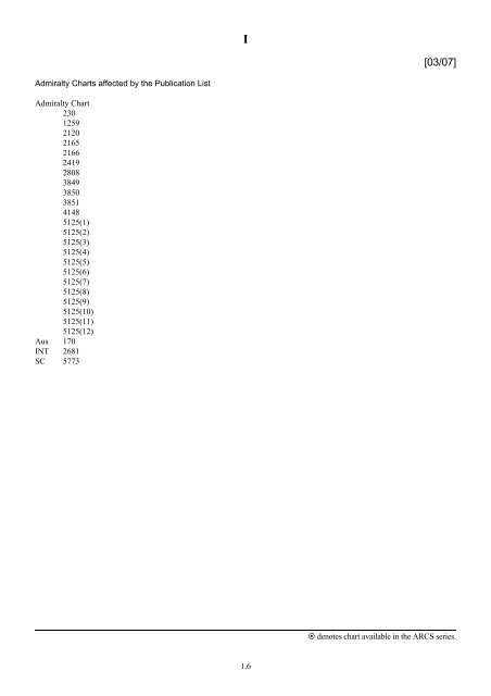
Admiralty Charts affected by the Publication List Admiralty Chart 230 ...
Admiralty Charts affected by the Publication List Admiralty Chart 230 ...
Admiralty Charts affected by the Publication List Admiralty Chart 230 ...

Create successful ePaper yourself
Turn your PDF publications into a flip-book with our unique Google optimized e-Paper software.
<strong>Admiralty</strong> <strong><strong>Chart</strong>s</strong> <strong>affected</strong> <strong>by</strong> <strong>the</strong> <strong>Publication</strong> <strong>List</strong><br />
<strong>Admiralty</strong> <strong>Chart</strong><br />
<strong>230</strong><br />
1259<br />
2120<br />
2165<br />
2166<br />
2419<br />
2808<br />
3849<br />
3850<br />
3851<br />
4148<br />
5125(1)<br />
5125(2)<br />
5125(3)<br />
5125(4)<br />
5125(5)<br />
5125(6)<br />
5125(7)<br />
5125(8)<br />
5125(9)<br />
5125(10)<br />
5125(11)<br />
5125(12)<br />
Aus 170<br />
INT 2681<br />
SC 5773<br />
I<br />
1.6<br />
[03/07]<br />
denotes chart available in <strong>the</strong> ARCS series.
I<br />
ADMIRALTY CHARTS AND PUBLICATIONS NOW PUBLISHED AND AVAILABLE<br />
<strong>Admiralty</strong> <strong><strong>Chart</strong>s</strong> published 18 January 2007<br />
NEW ADMIRALTY CHARTS AND PUBLICATIONS<br />
<strong>Chart</strong> Title, limits and o<strong>the</strong>r remarks Scale Folio Catalogue page<br />
2120 France – South Coast, Toulon to Cavalaire-sur-Mer including Iles<br />
d’HyËres.<br />
42°52′⋅13N. — 43°12′⋅44N., 5°51′⋅43E. —6°32′⋅44E.<br />
A replacement for chart 2165 providing larger scale coverage of <strong>the</strong><br />
South Coast of France between Toulon and Cavalaire-sur-Mer.<br />
(A modified reproduction of French <strong>Chart</strong> 7407). The chart is<br />
referred to WGS84 Datum.<br />
Note: <strong>Chart</strong> 2165 is to be deleted from Notice 5884(P)/05.<br />
<strong>Admiralty</strong> Leisure Folios published 18 January 2007<br />
<strong>Chart</strong><br />
SC5773<br />
1 st Edition<br />
Title, limits and o<strong>the</strong>r remarks<br />
Mediterranean – South East Aegean Sea.<br />
1:50,200 25 54<br />
Scale<br />
5773.1 Nísos Ikaría to Nísos Levítha. 1:150,000<br />
5773.2 Harbours in <strong>the</strong> Nor<strong>the</strong>rn Dodekánisos.<br />
A Approaches to Skála. 1:30,000<br />
B Skála. 1:7,500<br />
C Approaches to Lipsoí. 1:30,000<br />
D Lipsoí. 1:5,000<br />
E Órmos Lakkí. 1:10,000<br />
5773.3 Nísos Levítha to Nísos Astipálaia. 1:150,000<br />
5773.4 Dilek Boğazi / Stenó Sámou and Harbours on <strong>the</strong> Islands of<br />
Sámos, Ikaría, and Foúrnoi.<br />
A Liménas Karlóvasi. 1:7,500<br />
B Évdhilos. 1:7,500<br />
C Sámos. 1:10,000<br />
D Áyios Kírikos. 1:7,500<br />
E Pithagoríon. 1:7,500<br />
F Póros Foúrnon and Órmos Korseón. 1:25,000<br />
G Dilek Boğazi / Stenó Sámou. 1:50,000<br />
5773.5 Nísos Sámos to Nísos Léros. 1:150,000<br />
5773.6 A Güllük Körfezi. 1:150,000<br />
B Güllük and Asin 1:25,000<br />
C Yalikavak Marina. -<br />
1.7<br />
denotes chart available in <strong>the</strong> ARCS series.
I<br />
ADMIRALTY CHARTS AND PUBLICATIONS NOW PUBLISHED AND AVAILABLE<br />
<strong>Admiralty</strong> Leisure Folios published 18 January 2007 (continued)<br />
<strong>Chart</strong><br />
NEW ADMIRALTY CHARTS AND PUBLICATIONS<br />
Title, limits and o<strong>the</strong>r remarks<br />
Scale<br />
5773.7 Harbours in <strong>the</strong> Central Dodekánisos.<br />
A Órmos Análipsis. 1:15,000<br />
B Órmos Kalímnou. 1:7,500<br />
C Ormískos Skála. 1:7,500<br />
D Órmos Yialí. 1:50,000<br />
E Órmos Ko. 1:10,000<br />
5773.8 Nísos Kálimnos to Nísos Tílos. 1:150,000<br />
57773.9 A Approaches to Meyísti and Kaş. -<br />
B Kaş. 1:15,000<br />
C Órmos Kastellorízou. 1:15,000<br />
D Göçek. 1:15,000<br />
E Órmos Líndou. 1:10,000<br />
F Fethiye. 1:25,000<br />
5773.10 Deveboynu Br. To Ródos. 1:150,000<br />
5773.11 Nísos Ródos and Nísos Kárpathos. 1:300,000<br />
5773.12 A Marmaris to Kaş, including Nísos Ródos. 1:300,000<br />
B Datça. 1:25,000<br />
5773.13 A Bodrum. 1:10,000<br />
B Marmaris. 1:25,000<br />
5773.14 Marmaris to Fethiye. 1:150,000<br />
5773.15 A Gökova Körfezi. 1:150,000<br />
B Continuation of Gökova Körfezi. 1:150,000<br />
5773.16 Harbours in <strong>the</strong> Sou<strong>the</strong>rn Dodekánisos.<br />
A Panormítis. 1:5,000<br />
B Órmos Livádia. 1:10,000<br />
C Ródos. 1:7,500<br />
D Sými. 1:10,000<br />
5773.17 Plans in <strong>the</strong> Dodekánisos.<br />
A Limín Foúrnoi. -<br />
B Limín Kokkári. -<br />
C Órmos Avgóusta. -<br />
D Ay. Marina. -<br />
E Órmos Vathís. -<br />
F Órmos Lévitha. -<br />
G Limenískos Melitsákhas. -<br />
H Órmos Áy. Yeoryíou. -<br />
I Nisídha Farmakonísion. -<br />
J Kardámaina. -<br />
K Limín Khálki. -<br />
1.8<br />
denotes chart available in <strong>the</strong> ARCS series.
I<br />
ADMIRALTY CHARTS AND PUBLICATIONS NOW PUBLISHED AND AVAILABLE<br />
<strong>Admiralty</strong> Leisure Folios published 18 January 2007 (continued)<br />
<strong>Chart</strong><br />
NEW ADMIRALTY CHARTS AND PUBLICATIONS<br />
Title, limits and o<strong>the</strong>r remarks<br />
Scale<br />
5773.18 Harbours in Nísos Sámos, Nísos Kásos, Nísos Astipálaia and<br />
Nísos Kárpathos.<br />
A Marathokámbos. 1:5,000<br />
B Órmos Pigádia, Órmos Frý and Liménas Emporeío. 1:15,000<br />
C Órmos Vathí. 1:15,000<br />
D Órmos Pigádia. 1:10,000<br />
5773.19 Sou<strong>the</strong>rn Aegean Sea. 1:1,100,000<br />
A new leisure folio providing coverage of <strong>the</strong> South East<br />
Aegean Sea. The folio is referred to WGS84 Datum.<br />
Reproductions of Australian Government <strong><strong>Chart</strong>s</strong><br />
(<strong>Publication</strong> dates of <strong>the</strong>se charts reflect <strong>the</strong> dates shown on <strong>the</strong> Australian Government <strong><strong>Chart</strong>s</strong>)<br />
<strong>Chart</strong> Published Title and o<strong>the</strong>r remarks Scale Folio Catalogue page<br />
Aus170 13/10/06 Australia – Tasmania, Mercury Passage.<br />
42°25′⋅05S. — 42°47′⋅70S., 147°52′⋅43E. — 148°10′⋅40E.<br />
Spring Bay Wharf.<br />
42°31′⋅96S. — 42°33′⋅24S., 147°54′⋅60E. — 147°56′⋅24E.<br />
Provides improved larger scale coverage of Spring Bay<br />
Wharf and approaches. The chart is now referred to WGS84<br />
Datum.<br />
Note: On publication of this New <strong>Chart</strong> former Notice<br />
353(T)/06 is cancelled.<br />
1.9<br />
1:37,500<br />
1:10,000<br />
65 104<br />
denotes chart available in <strong>the</strong> ARCS series.
I<br />
ADMIRALTY CHARTS AND PUBLICATIONS NOW PUBLISHED AND AVAILABLE<br />
<strong>Admiralty</strong> <strong><strong>Chart</strong>s</strong> published 18 January 2007<br />
NEW EDITIONS OF ADMIRALTY CHARTS AND PUBLICATIONS<br />
<strong>Chart</strong> Title and o<strong>the</strong>r remarks Scale Folio Catalogue page<br />
<strong>230</strong> Venezuela, Canal de Margarita to BahÛa de Pozuelos.<br />
BahÛa de Guamache.<br />
This partial new edition includes significant safety-related<br />
information as follows: revised depths, anchorages and regulated<br />
areas in BahÛa’s Barcelona and Pozuelo, buoyage in BahÛa de<br />
Guamache and cables in Canal de Margarita.<br />
1259 Korea – South Coast, Pusan and Masan.<br />
A Masan.<br />
B Pusan.<br />
Includes changes to depths, coastline, lights, buoyage and port<br />
developments.<br />
Note: On publication of this New Edition former Notice 4743(P)/06<br />
is cancelled.<br />
2419 China – Dong Hai, Outer Approaches to Songxia Gang and<br />
Minjiang Kou.<br />
Includes extensive changes to depths, coastline, lights, buoyage and<br />
restricted areas.<br />
Note: On publication of this New Edition former Notices<br />
1691(P)/06 and 1693(P)/06 are cancelled. This chart is to be deleted<br />
from <strong>the</strong> list of charts <strong>affected</strong> <strong>by</strong> Notice 2057(P)/06.<br />
3849 United States – Gulf of Mexico, Texas, Brazos Santiago to<br />
Galveston Bay.<br />
Includes changes to depths, production platforms and associated<br />
wells and pipelines throughout.<br />
3850 United States, Gulf of Mexico, Galveston Bay to Ship Shoal.<br />
Includes changes to depths, production platforms and associated<br />
wells and pipelines throughout.<br />
3851 United States, Gulf of Mexico, Ship Shoal to Pensacola Bay.<br />
Includes changes to depths, production platforms and associated<br />
wells and pipelines throughout.<br />
1.10<br />
1:150,000<br />
1:40,000<br />
1:20,000<br />
1:20,000<br />
87 136<br />
52 98<br />
1:75,000 50 92<br />
1:500,000 83 134<br />
1:500,000 83 134<br />
1:500,000 83 134<br />
denotes chart available in <strong>the</strong> ARCS series.
I<br />
ADMIRALTY CHARTS AND PUBLICATIONS NOW PUBLISHED AND AVAILABLE<br />
NEW EDITIONS OF ADMIRALTY CHARTS AND PUBLICATIONS<br />
<strong>Admiralty</strong> <strong><strong>Chart</strong>s</strong> published 18 January 2007 (continued)<br />
<strong>Chart</strong> Title and o<strong>the</strong>r remarks Scale Folio Catalogue page<br />
4148<br />
INT2681<br />
<strong>Admiralty</strong> <strong>Publication</strong>s<br />
International <strong>Chart</strong> Series, Republic of South Africa, West Coast,<br />
Approaches to Table Bay.<br />
Murray’s Bay Harbour.<br />
Includes changes to depths in <strong>the</strong> approaches to Table Bay.<br />
(A modified reproduction of INT2681, published <strong>by</strong> <strong>the</strong> Republic of<br />
South Africa. This chart is included in <strong>the</strong> International <strong>Chart</strong><br />
Series). The chart is now referred to WGS84 Datum.<br />
Note: This chart is to be deleted from <strong>the</strong> list of charts <strong>affected</strong> <strong>by</strong><br />
Notice 4370(P)/06.<br />
1:36,000<br />
1:6,000<br />
35 66<br />
NP No. Title and o<strong>the</strong>r remarks Date Remarks<br />
NP7<br />
NP283 (1)<br />
NP283 (2)<br />
South America Pilot Volume III (Ninth Edition 2006). 14/09/06<br />
<strong>Admiralty</strong> <strong>List</strong> of Radio Signals.<br />
Maritime Safety Information Services.<br />
Part 1: Europe, Africa and Asia (excluding <strong>the</strong> Far East).<br />
Part 2: The Americas, Far East and Oceania.<br />
Editions 2007/08.<br />
1.11<br />
This edition supersedes <strong>the</strong> South<br />
America Pilot Volume III (Eighth<br />
Edition 2003) which is <strong>the</strong>re<strong>by</strong><br />
cancelled.<br />
18/01/07 Corrections accrued whilst <strong>the</strong><br />
publication was in <strong>the</strong> press, from<br />
Week 45/06 to Week 03/07 are<br />
issued in Section VI of <strong>the</strong><br />
Weekly Editions of <strong>Admiralty</strong><br />
Notice to Mariners commencing<br />
with this weeks edition.<br />
The 2006/07 editions of NP 283<br />
are <strong>the</strong>re<strong>by</strong> cancelled and replaced<br />
<strong>by</strong> <strong>the</strong> 2007/08 editions.<br />
denotes chart available in <strong>the</strong> ARCS series.
New <strong>Admiralty</strong> <strong><strong>Chart</strong>s</strong><br />
<strong>Chart</strong><br />
I<br />
ADMIRALTY CHARTS AND PUBLICATIONS TO BE PUBLISHED<br />
ADMIRALTY CHARTS TO BE PUBLISHED 15 FEBUARY 2007<br />
Title, limits and o<strong>the</strong>r remarks<br />
2808 United States – East Coast, Florida, St Johns River, Mayport to<br />
Jacksonville. Panel B.<br />
Panel A.<br />
5125(1)<br />
5125(2)<br />
5125(3)<br />
5125(4)<br />
5125(5)<br />
5125(6)<br />
5125(7)<br />
5125(8)<br />
5125(9)<br />
5125(10)<br />
5125(11)<br />
5125(12)<br />
Includes changes to depths and port infrastructure throughout.<br />
Routeing <strong>Chart</strong> South Atlantic Ocean (January).<br />
Routeing <strong>Chart</strong> South Atlantic Ocean (February).<br />
Routeing <strong>Chart</strong> South Atlantic Ocean (March).<br />
Routeing <strong>Chart</strong> South Atlantic Ocean (April).<br />
Routeing <strong>Chart</strong> South Atlantic Ocean (May).<br />
Routeing <strong>Chart</strong> South Atlantic Ocean (June).<br />
Routeing <strong>Chart</strong> South Atlantic Ocean (July).<br />
Routeing <strong>Chart</strong> South Atlantic Ocean (August).<br />
Routeing <strong>Chart</strong> South Atlantic Ocean (September).<br />
Routeing <strong>Chart</strong> South Atlantic Ocean (October).<br />
Routeing <strong>Chart</strong> South Atlantic Ocean (November).<br />
Routeing <strong>Chart</strong> South Atlantic Ocean (December).<br />
Scale<br />
1:20,000<br />
1:20,000<br />
1:20,000,000<br />
1:20,000,000<br />
1:20,000,000<br />
1:20,000,000<br />
1:20,000,000<br />
1:20,000,000<br />
1:20,000,000<br />
1:20,000,000<br />
1:20,000,000<br />
1:20,000,000<br />
1:20,000,000<br />
1:20,000,000<br />
A reduced size wind rose symbol has been used on <strong>the</strong>se new routeing charts to improve<br />
clarity, all meteorological data has been updated and <strong>the</strong> latest ice limits information is<br />
shown. Principal ports, shipping routes, ocean current flow and load line zones are also<br />
shown on <strong>the</strong> charts to facilitate trans-oceanic passage planning. All twelve monthly versions<br />
of <strong>the</strong> chart are being published simultaneously so mariners can order a complete set.<br />
1.12<br />
<strong><strong>Chart</strong>s</strong> to be<br />
WITHDRAWN<br />
2808<br />
5125(1)<br />
5125(2)<br />
5125(3)<br />
5125(4)<br />
5125(5)<br />
5125(6)<br />
5125(7)<br />
5125(8)<br />
5125(9)<br />
5125(10)<br />
5125(11)<br />
5125(12)<br />
denotes chart available in <strong>the</strong> ARCS series.
<strong>Admiralty</strong> <strong><strong>Chart</strong>s</strong><br />
<strong>Chart</strong> to be<br />
WITHDRAWN<br />
I<br />
ADMIRALTY CHARTS AND PUBLICATIONS PERMANENTLY WITHDRAWN<br />
Main Title<br />
<strong>230</strong> Venezuela, Canal de Margarita to BahÛa de Pozuelos. <strong>230</strong><br />
1259 Korea – South Coast, Pusan and Masan. 1259<br />
2165 France – South Coast, Cap SiciÐ to Cap Camarat. 2120<br />
2419 China – Dong Hai, Outer Approaches to Songxia Gang and<br />
Minjiang Kou.<br />
3849 United States – Gulf of Mexico, Texas, Brazos Santiago to<br />
Galveston Bay.<br />
On publication of<br />
New <strong>Chart</strong>/New Edition<br />
2419<br />
3849<br />
3850 United States, Gulf of Mexico, Galveston Bay to Ship Shoal. 3850<br />
3851 United States, Gulf of Mexico, Ship Shoal to Pensacola Bay. 3851<br />
4148 Republic of South Africa, West Coast, Approaches to Table<br />
Bay.<br />
4148<br />
Aus170 Australia – Tasmania, Maria Island to Cape Sonnerat. Aus170<br />
CHART 2166 TO BE RETAINED<br />
The intention to withdraw chart 2166 was previously announced in Weekly Notice to Mariner 50/06. Following feedback from <strong>the</strong> customer<br />
it has been decided to no longer withdraw this chart.<br />
1.13<br />
denotes chart available in <strong>the</strong> ARCS series.
I<br />
ADMIRALTY DISTRIBUTOR INFORMATION<br />
Catalogue of <strong>Admiralty</strong> <strong><strong>Chart</strong>s</strong> (NP 131), 2007 Edition, Part 1 refers.<br />
The following <strong>Admiralty</strong> <strong>Chart</strong> Agent appointments have been terminated:<br />
GREECE PIRAEUS ZERVOUDAKIS MARINE SUPPLIES Ltd.<br />
The following amendments to <strong>Admiralty</strong> <strong>Chart</strong> Agents appointments have been made:<br />
(a) Company change of Name and Address<br />
SPAIN CADIZ Representaciones & <strong><strong>Chart</strong>s</strong>, S.L.<br />
Avda. Blas Infante, Blas Infante, Local 1<br />
11201 Algeciras<br />
Cadiz<br />
Spain<br />
1.14<br />
Tel: +34 902 220 007<br />
Fax: +34 902 220 008<br />
Email:<br />
admiraltycharts@representacionesand<br />
charts.com<br />
ADMIRALTY RASTER CHART SERIES – LATEST ISSUE DATES OF REGIONAL DISCS<br />
RC<br />
RC1<br />
RC2<br />
RC3<br />
RC4<br />
RC5<br />
RC6<br />
RC7<br />
RC8<br />
RC9<br />
RC10<br />
RC11<br />
Last issue date<br />
26 th October 2006<br />
9 th March 2006<br />
28 th September 2006<br />
23 rd March 2006<br />
28 th April 2005<br />
14 th September 2006<br />
27 th October 2005<br />
29 th June 2006<br />
20 th July 2006<br />
23 rd June 2005<br />
30 th October 2003<br />
Reissue Date<br />
denotes chart available in <strong>the</strong> ARCS series.