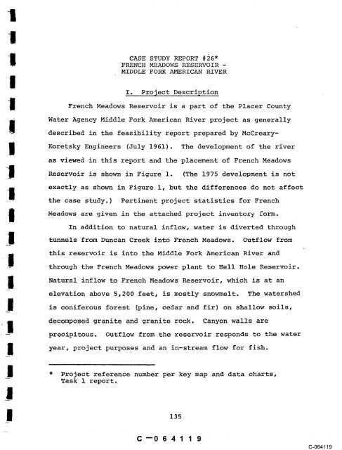
CASE STUDY REPORT #~6" FRENCH ... - State of California
CASE STUDY REPORT #~6" FRENCH ... - State of California
CASE STUDY REPORT #~6" FRENCH ... - State of California

You also want an ePaper? Increase the reach of your titles
YUMPU automatically turns print PDFs into web optimized ePapers that Google loves.
<strong>CASE</strong> <strong>STUDY</strong> <strong>REPORT</strong> #~6"<br />
<strong>FRENCH</strong> MEADOWS RESERVOIR -<br />
MIDDLE FORK AMERICAN RIVER<br />
I. Project Description<br />
French Meadows Reservoir is a part <strong>of</strong> the Placer County<br />
Water Agency Middle Fork American River project as generally<br />
described in the feasibility report prepared by McCreary-<br />
Koretsky Engineers (July 1961). The development <strong>of</strong> the river<br />
as viewed in this report and the placement <strong>of</strong> French Meadows<br />
Reservoir is shown in Figure I. (The 1975 development is not<br />
exactly as shown in Figure i, but the differences do not affect<br />
the case study.) Pertinent project statistics for French<br />
Meadows are given in the attached project inventory<br />
In addition to natural inflow, water is diverted through<br />
tunnels from Duncan Creek into French Meadows. Outflow from<br />
this reservoir is into the Middle Fork American River and<br />
through the French Meadows<br />
.<br />
power plant to Hell Hole Reservoir.<br />
Natural inflow to French Meadows Reservoir, which is at an<br />
elevation above 5,200 feet, is mostly snowmelt. The watershed<br />
is coniferous forest (pine, cedar and fir) on shallow soils,<br />
decomposed granite and granite rock. Canyon walls are<br />
precipitous. Outflow from the reservoir responds to the water<br />
year, project purposes and an in-stream flow for fish.<br />
* Project reference number per key map and data charts,<br />
Task 1 report.<br />
135<br />
C--O 6 41 1 9<br />
C-064119
<strong>FRENCH</strong><br />
MEADOWS<br />
RESERVOIR<br />
AUBURN I 0 I 2 3 4 5 ,~<br />
¯ SCALE IN MILES<br />
Figure 1<br />
LOCATI01~ MAP<br />
Source: McCreary Kore~ky Engineers, 1961.
II.. P.re-Prqject Conditions<br />
During the years preceding 1965, estimates were made <strong>of</strong><br />
stream flow through the French Meadows site. Natural river<br />
flow conditions for the period 1925-1958 were initially com-<br />
piled by the Placer County Water Agency. Subsequently, the<br />
Department <strong>of</strong> Fish and Game used 1951-1960 as base water years,<br />
probably computations. Pre-project mean monthly<br />
to shorten<br />
and the minimum recorded monthly discharges ~(1951-1960) are<br />
shown in Figure 2. The mean discharge pattern illustrates a<br />
response to early winter rainfall and snowmelt, snowmelt and<br />
freezing conditions between January and March, and peak snowmelt<br />
run<strong>of</strong>f from April to June. Summer and early autumn stream<br />
flows result mainly from subsurface accretions to stream flow.<br />
Great variation occurs depending on the water year, the rapidity<br />
<strong>of</strong> snowmelt and intensity <strong>of</strong> rainfall.<br />
Peak flows in spring and low flows in autumn are assumed<br />
to have determined the nature <strong>of</strong> the physical habitat and<br />
thereby dominated community structure and fish productivity.<br />
Stream bottoms were scoured annually to the detriment <strong>of</strong><br />
riparian and in-stream habitat. Since high flows occurred<br />
during the rainbow trout reproduction and nursery period, these<br />
activities were probably impaired and limiting to the fish<br />
population. The relative annual success in use <strong>of</strong> spawning and<br />
nursery habitat was probably inverse to stream flows in the spring.<br />
C--0641 21<br />
C-064121
Low late summer flow, sometimes less than 1 cfs, certainly<br />
restricted habitat in terms <strong>of</strong> space and food supply. Records<br />
<strong>of</strong> pre-project fish population sizes were not discovered. The<br />
available information indicates that 4-8 inch rainbow trout<br />
were numerous, but there were probably few larger fish. The<br />
Department <strong>of</strong> Fish and Game (DFG) periodically stocked the<br />
Middle Fork <strong>of</strong> the American River with trout. The river at the<br />
reservoir site was accessible for camping and fishing.<br />
III. Project Dey.~lopment<br />
The earliest recorded concern about in-stream flow in the<br />
French Meadows reach <strong>of</strong> the river appeared in DWR Bulletin No. 21<br />
where the department requested a minimum <strong>of</strong> 5 cfs year-round.<br />
No explanation is <strong>of</strong>fered about why 5 c~s was chosen. Subsequent<br />
to this time there were unrecorded meetings between the DFG and<br />
the consulting engineers representing Placer County Water Agency.<br />
Apparently these meetings concerned both normal and dry year<br />
water releases. In October 1958 DFG wrote the engineers concerning<br />
their desire not to have dry year flow reductions. In October<br />
1958 DFG asked for i0 cfs from May 1 to October 31 and 5 cfs from<br />
November 1 to April 30. No explanation for these choices was<br />
discovered.<br />
Beginning in the summer <strong>of</strong> 1961, DFG began field investi-<br />
gations to more accurately assess in-stream flow needs at French<br />
Meadows. During June, July and August temperatures were measured<br />
and found to range from 53 to 70°F. Eight years <strong>of</strong> stream flow<br />
C--0641 22<br />
(3-064122
data (1951-1960) were compiled and tabulated for mean and<br />
minimum monthly flow in cfs (see Figure 2). Sometimes late<br />
summer-early autumn flows were less than 1 cfs.<br />
To assess relationships between flow and fisheries<br />
habitat, one reach <strong>of</strong> stream was studied using nine transects<br />
spaced about i0 feet apart at four flows (3, 9, 17 and 28 cfs).<br />
This was done during June, July and August 1961. Water depths<br />
and habitat characteristics were recorded along each transect<br />
and transferred to sketch maps. Stream depths at the four<br />
flows ranged as shown:<br />
3 cfs 0.1-1.45 feet<br />
9 cfs Not tabulated<br />
17 cfs 0.4-1.8 feet<br />
28 cfs 0.6-1.9 feet<br />
Habitats related to depth and physical appearance were<br />
cover, spawning and food. The wetted area was also noted.<br />
The results <strong>of</strong> these analyses are shown in Figure 3. From<br />
these results and their general knowledge about the stream, DFG<br />
concluded:<br />
Conclusions<br />
"I. The test section shows little or no spawning area<br />
below 17 cfs -- 15 cfs would appear to be the<br />
minimum flow that would provide any spawning.<br />
"II. Above 17 cfs there is a reduced rate <strong>of</strong> food-area<br />
increase, therefore 17 cfs appears to be close to<br />
the optimum flow for providing adequate food<br />
production area.<br />
"III. Above 9 cfs there is a reduced rate <strong>of</strong> increase in<br />
cover, therefore about 9 cfs appears to be a critical<br />
change in cover. One might conclude 9 cfs would be<br />
approaching optimal conditions.<br />
139<br />
C--0641 23
700"<br />
soo-<br />
¯ FISH FLDW<br />
500" 80 -<br />
MF-~ MONTHLY FLO~<br />
MIN:MUM MONTHLY FLOW<br />
/ t<br />
~ NORMAL YEAR" XX<br />
70-<br />
’* RSH FLOW RELrA.SES<br />
\ M~ MONTHLY<br />
~T N~ DEC JAN FEB MAR APR MAY JUN JUL ~6 SE~ MINIMUMMONTHLY F~W<br />
PRE’PROJECT: OCTOBER IS1--SEPTEMBER 1960<br />
SOU~E~ PLACER COUNTY WATER AGENCY<br />
FIGURE 2<br />
STREAMFLOW CONDITIONS, MIDDLE FORK AMERICAN<br />
RIVER BEFORE AND AFTER CONSTRUCTION OF<br />
<strong>FRENCH</strong> M~DOWS RESERVOIR<br />
< 40-<br />
20-<br />
SOURCE; USGS SURFACE WATER RECORDS VOL.<br />
GAUGE STATION NO.’ 114Z7500<br />
POST-PROJECT: OCTOBER 1965-SEPTEMBER
Figure 3<br />
RESULTS OF STREAM TRANSECT <strong>STUDY</strong><br />
/~lapted from: <strong>California</strong> Depar~nent <strong>of</strong> Fish and Game "Strem’a Files"<br />
.o Middle Fork American River,. 1976.<br />
o<br />
4~
"IV. If we knew which was most critical (food or shelter),<br />
we could pick either <strong>of</strong> the optimal flows.<br />
"VI. If we do not know, perhaps the average <strong>of</strong> 9 and 17<br />
or ÷ 13 cfs might provide little less food-area than<br />
optimum, but a little more than optimum in amounts<br />
<strong>of</strong> shelter.<br />
"In summary, the data seems to indicate that 17 cfs<br />
for spawning and 13 cfs for food and shelter are required."<br />
Based on these studies, DFG informed the water agency that<br />
maintenance <strong>of</strong> the fishery required 20 cfs or the natural flow,<br />
whichever is less.<br />
The water agency performed a reservoir operational study to<br />
assess their ability to provide releases for fish. The results<br />
<strong>of</strong> various flows under consideration at that time (September<br />
1961) were prepared in graphical form by the water agency in com-<br />
parison to a 25-year historical ~low (Figure 4). The 5 cfs noted<br />
in Bulletin 21 is the original DFG request. The McCreary ¯<br />
Koretsky ¯ Engineers feasibility report flow is the result <strong>of</strong> the<br />
water agency’s operational study and the most recent DFG request.<br />
Subsequently DFG was asked to alter their 20 cfs request<br />
and come up with a release schedule relative to the availability<br />
<strong>of</strong> water as promulgated by the water agency. Based on undated<br />
notes, the department arrived at the following release schedule:<br />
~0~Years (less than 1.5x<br />
Normal& acre-feet at Fair Oaks<br />
Wet Years Ga~@e)<br />
Jan. 1 - Apr. 1 i0 cfs 5 cfs<br />
Apr. 15- Apr. 20 15 7<br />
Apr. 20 - June 25 20 I0<br />
June 25 - July 1 15 7<br />
July 1 - Jan. 1 10 5<br />
C--0641 26<br />
142 I~<br />
(3-064126
Source: McCreary-Koretsky Engineers, 1961.
Apparently after further negotiations, DFG and the Placer<br />
County Water Agency entered into an agreement before the <strong>State</strong><br />
Water Rights Board (July 30, 1962) which in part agreed to the<br />
following minimum in-stream flows:<br />
i. Normal or wet years: 8 cfs at all times.<br />
2. Dry years (less than 1 x 10⁶ acre-feet at Folsom) :<br />
4 cfs at all times.<br />
3. The department and the agency agree that in the event<br />
changes in the above releases are deemed desirable to<br />
improve fishery and recreational volumes, the flow<br />
schedules may be changed, provided both parties agree<br />
to<br />
the change and the total amount <strong>of</strong> water released<br />
does not exceed_.5,800 ac~e-fget in a wet year and 2,900<br />
acre-feet in a dry year.<br />
IV. Post-Project<br />
Ins<strong>of</strong>ar as is known, the agreement has not been changed.<br />
Figure 2 shows mean, maximum and minimum monthly flows 0.6 mile<br />
below French Meadows Reservoir during the 1963-73 period. During<br />
the minimum flow year 1972-73, summer flows were less than the<br />
agreed to 8 cfs. It is unrecorded whether or not this was a dry<br />
year.<br />
The first year after the dam was operational, Eric Gerstung,<br />
a DFG biologist, surveyed (August 25, 1965) the river below the<br />
reservoir and found the river to still be under the influence <strong>of</strong><br />
the construction period. Over three sample sections,, he collected<br />
C--0641 28<br />
144 i.<br />
(3-064128
three rainbow trout fry and one 9.6-inch brown trout. Environ-<br />
mental conditions for trout appeared favorable and the collection<br />
<strong>of</strong> the rainbow trout fry indicated that reproduction was<br />
successful.<br />
Angling surveys made by the Department <strong>of</strong> Fis~ and Game<br />
personnel between 1965 and 1970 downstream from French Meadows<br />
indicate that the river supports a fair to good small rainbow<br />
trout up to about 9 inches long and brown trout up to about<br />
12 inches long with abundance progressively increasing down-<br />
stream. Iron ochre deposition within the first half mile <strong>of</strong><br />
stream below the dam has inhibited fish production in this<br />
area.<br />
v, C~n~1 usa.on<br />
The operation <strong>of</strong> French Meadows Dam has altered the<br />
natural streamflows <strong>of</strong> the Middle Fork <strong>of</strong> the American River.<br />
Historically, mean monthly flows ranged to 800 cfs. After<br />
French Meadows Dam was constructed, mean monthly flows rarely<br />
exceeded I00 cfs (see Figure 2). Although operation <strong>of</strong> French<br />
Meadows Dam has greatly reduced peak instream flows, historic<br />
minimum flows <strong>of</strong> less than 1 cfs have remained above 4 cfs in<br />
dry years and in normal water years above i0 cfs.<br />
The historic wide range in flow (800 cfs to 1 cfs) has<br />
been changed by the project. Mean monthly flows released<br />
from French Meadows in a normal year generally range from<br />
I00 cfs to I0 cfs. This change in instream flow is assumed<br />
C--0641 29<br />
145<br />
C-064129
to have altered the physical habitat. Post-project instream<br />
flow releases have been maintained well above the minimum<br />
instream flow reservoir.<br />
Beginning in 1961, the Department <strong>of</strong> Fish and Game began<br />
field investigations to assess instream flow needs at French<br />
Meadows. During June, July and August, temperatures were<br />
measured. Eight years <strong>of</strong> hydrologic instream flow data were<br />
compiled and tabulated for mean and minimum monthly flows in<br />
cfs. To assess relationships between flow and fisheries<br />
habitat, one reach <strong>of</strong> stream was studied using nine transects<br />
spaced about i0 feet apart at four flows (3, 9, 17 and 28 cfs).<br />
Water depths and habitat characteristics were recorded along<br />
each transect and transferred to sketch maps. Wetted areas<br />
and habitats relating to food, cover and spawning areas were<br />
noted. From these results and their general knowledge about<br />
the stream, the Department <strong>of</strong> Fish and Game recommended a<br />
fishery maintenance flow <strong>of</strong> 20 cfs or the natural flow which-<br />
ever is less. The agreed to releases for fish are thought to<br />
be a compromise that slightly improved the late summer flows<br />
over historical conditions.<br />
Although no evidence was found, it is speculated that<br />
fish and wildlife habitat below French Meadows Reservoir may<br />
have improved because <strong>of</strong> the project, if one considers stability<br />
and diversity as improvement. Late summer flows have been<br />
improved over the h~storical condition and although the stream<br />
channel is not fully wetted, conditions for fish, cover and<br />
C--0641 30<br />
C-064130
food are improved. Flows during the spring spawning period<br />
are less than what the Department <strong>of</strong> Fish and Game judged ade-<br />
quate for rainbow trout, but are more than adequate for the fall<br />
spawning <strong>of</strong> brown trout.<br />
The available data and information indicate that DFG<br />
requests for in-stream flow were generally based on their<br />
judgment relating mostly to historical low summer flow, the<br />
availability <strong>of</strong> water from the project as determined by the<br />
water agency and the habitat possibilities for trout. Although<br />
stream transect studies were done, the results mostly intensified<br />
DFG judgments about habitat possibilities and lent some<br />
credence to their requests in negotiations with the water<br />
company.<br />
Angling surveys made by DFG personne! between 1965 and<br />
1970 downstream from French Meadows indicate that the river<br />
supports a fair to good fishery for small rainbow trout up<br />
to 9 inches long and brown trout up to 12 inches with abun-<br />
dance progressively increasing downstream. Exposure <strong>of</strong><br />
iron ochre deposition within the first half mile <strong>of</strong> stream<br />
below the dam has inhibited fish production in this area.<br />
This situation was unforeseen in evaluation <strong>of</strong> the instream<br />
flow needs below French Meadows Dam.<br />
C--0641 31<br />
147<br />
C-064131
Case Study #26<br />
Personal Communications<br />
BIBLIOGRAPHY<br />
Gerstung, Eric. 1975. Associate Fishery Biologist, <strong>California</strong><br />
Department ~<strong>of</strong> Fish and Game.<br />
Lundl<strong>of</strong>, Ray. 1975. <strong>State</strong> <strong>of</strong> <strong>California</strong> Water Rights Board.<br />
Meyer, Fred. 1976. Associated Fishery Biologist, <strong>California</strong><br />
Department <strong>of</strong> Fish and Game.<br />
Wooster, Theodore. 1975. Environmental Services Supervisor,<br />
<strong>California</strong> Department <strong>of</strong> Fish and Game.<br />
References<br />
<strong>California</strong>. Department <strong>of</strong> Fish and Game. 1956. Report on<br />
water rights application affecting fisheries, wildlife<br />
and recreational resources <strong>of</strong> the American River basin.<br />
41 pp.<br />
Gerstung, Eric. 1970. Fish population and yield estimates<br />
from selected <strong>California</strong> trout streams. 44 pp.<br />
McCreary, Koretsky Engineers. 1961. Feasibility report<br />
Placer County Water Agency Middle Fork American River<br />
project. 70 pp.<br />
C--0641 32<br />
(3-064132<br />
!