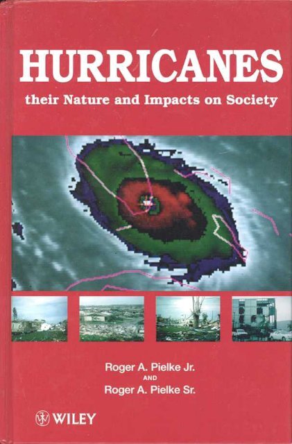
Hurricanes: Their Nature and Impacts on Society - Climate Science ...
Hurricanes: Their Nature and Impacts on Society - Climate Science ...
Hurricanes: Their Nature and Impacts on Society - Climate Science ...

You also want an ePaper? Increase the reach of your titles
YUMPU automatically turns print PDFs into web optimized ePapers that Google loves.
<str<strong>on</strong>g>Hurricanes</str<strong>on</strong>g>
Roger A. Pielke, Jr<br />
Nati<strong>on</strong>al Center for Atmospheric Research<br />
<str<strong>on</strong>g>and</str<strong>on</strong>g><br />
Roger A. Pielke, Sr<br />
Colorado State University<br />
JOHN WILEY & SONS<br />
Chichester. New York. Weinheim .Brisbane. Singapore. Tor<strong>on</strong>to
Copyright @ 1997 by John Wiley & S<strong>on</strong>s Ltd,<br />
Daffins Lane, Chichester,<br />
West Sussex PO19 IUD, Engl<str<strong>on</strong>g>and</str<strong>on</strong>g><br />
Nati<strong>on</strong>al 01243 779777<br />
Internati<strong>on</strong>al (+44) 1243 779777<br />
e-mail (for orders <str<strong>on</strong>g>and</str<strong>on</strong>g> customer service enquiries): cs-books@wi1ey.co.uk.<br />
Visit our Home Page <strong>on</strong> http://www.wiley.co.uk<br />
or http://www.wi1ey.com<br />
All rights reserved. No part of this publicati<strong>on</strong> may be reproduced, stored in a retrieval system, or<br />
transmitted, in any form or by any means, electr<strong>on</strong>ic, mechanical, photocopying, recording,<br />
scanning or otherwise, except under the terms of the Copyright, Designs <str<strong>on</strong>g>and</str<strong>on</strong>g> Patents Act 1988 or<br />
under the terms of a licence issued by the Copyright Licensing Agency, 90 Tottenham Court<br />
Road, L<strong>on</strong>d<strong>on</strong> UK WlP 9HE, without the permissi<strong>on</strong> in writing of the publisher.<br />
Other Wiley Editorial Offices<br />
John Wiley & S<strong>on</strong>s, Inc., 605 Third Avenue,<br />
New York, NY 10158~012, USA<br />
WILEY-VCH Verlag GmbH, VCH Verlagsgesellschaft mbH,<br />
Pappela1lee 3, D-69469 Weinheim, Germany<br />
Jacar<str<strong>on</strong>g>and</str<strong>on</strong>g>a Wiley Ltd, 33 Park Road, Milt<strong>on</strong>,<br />
Queensl<str<strong>on</strong>g>and</str<strong>on</strong>g> 4064, Australia<br />
John Wiley & S<strong>on</strong>s (Canada) Ltd, 22 Worcester Road,<br />
Rexdale, Ontario M9W ILl, Canada<br />
John Wiley & S<strong>on</strong>s (Asia) Pte Ltd, 2 Clementi Loop #02~l,<br />
Jin Xing Distripark, Singapore 129809<br />
Library of C<strong>on</strong>gress Cataloging-in-Pub/icati<strong>on</strong> Data<br />
Pielke, Roger A., 1968-<br />
<str<strong>on</strong>g>Hurricanes</str<strong>on</strong>g>: their nature <str<strong>on</strong>g>and</str<strong>on</strong>g> impacts <strong>on</strong> society I Roger A.<br />
Pielke, Jr. <str<strong>on</strong>g>and</str<strong>on</strong>g> Roger A. Pielke, Sr.<br />
p. cm.<br />
Includes bibliographical references <str<strong>on</strong>g>and</str<strong>on</strong>g> index.<br />
ISBN 0-471-97354-8<br />
1. <str<strong>on</strong>g>Hurricanes</str<strong>on</strong>g>-Government policy-United States. 2. <str<strong>on</strong>g>Hurricanes</str<strong>on</strong>g>--<br />
Social aspects--United States. I. Pielke, Roger A. ll. Title.<br />
QC945.P64 1997<br />
363.34'922'O973-dc21 97-14116<br />
CIP<br />
British LibrllrY Cataloguing in Publicati<strong>on</strong> Data<br />
A catalogue record for this book is available from the British Library<br />
ISBN 0-471-97354-8<br />
Typeset in 10/12pt Times from authors' disks by Mayhew Typesetting, Rhayader, Powys<br />
Printed <str<strong>on</strong>g>and</str<strong>on</strong>g> bound in Great Britain by Biddies Ltd, Guildford <str<strong>on</strong>g>and</str<strong>on</strong>g> King's Lynn<br />
This book is printed <strong>on</strong> acid-free paper resp<strong>on</strong>sibly manufactured from sustainable forestati<strong>on</strong>,<br />
for which at least two trees are planted for each <strong>on</strong>e used for paper producti<strong>on</strong>.
Dedicati<strong>on</strong><br />
We dedicate this book to the planners, engineers, builders, forecasters,<br />
emergency managers, relief workers, <str<strong>on</strong>g>and</str<strong>on</strong>g> other public <str<strong>on</strong>g>and</str<strong>on</strong>g> private officials <str<strong>on</strong>g>and</str<strong>on</strong>g><br />
volunteers who have committed their lives to preparing for <str<strong>on</strong>g>and</str<strong>on</strong>g> resp<strong>on</strong>ding to<br />
hurricane impacts <strong>on</strong> society.
Dedicati<strong>on</strong><br />
Foreword.<br />
Preface.<br />
C<strong>on</strong>tents<br />
CHAPTER 1 Introducti<strong>on</strong>: <strong>Science</strong>, Policy, <str<strong>on</strong>g>and</str<strong>on</strong>g> <str<strong>on</strong>g>Hurricanes</str<strong>on</strong>g><br />
1.1 The Hurricane: "A Melancholy Event"<br />
1.2 "We Need Help": Hurricane Andrew in South Florida,<br />
August 1992 .<br />
1.2.1 Forecast.<br />
1.2.2 Impact<br />
1.2.3 Resp<strong>on</strong>se.<br />
1.3 Defining the Problem.<br />
1.3.1 The hurricane as an extreme meteorological event<br />
1.3.2 <str<strong>on</strong>g>Hurricanes</str<strong>on</strong>g> in North American history.<br />
1.3.3 Ten notable hurricanes of the past century.<br />
1.3.4 Extreme weather events<br />
1.3.5 <strong>Science</strong> in service to society<br />
1.3.6 The challenge: toward a more usable science<br />
CHAPTER 2 The US Hurricane Problem<br />
2.1 RefraIning the US Hurricane Problem.<br />
2.1.1 The challenge of problem definiti<strong>on</strong>.<br />
2.1.2 The c<strong>on</strong>venti<strong>on</strong>al framing of the US hurricane<br />
problem<br />
2.1.3 Societal vulnerability as an alternative framing of<br />
the hurricane problem.<br />
2.2 Vulnerability to hurricanes .<br />
2.2.1 Hu"icane incidence<br />
2.2.2 Hurricane incidence <str<strong>on</strong>g>and</str<strong>on</strong>g> climate change.<br />
2.2.3 Exposure to hurricanes.<br />
Ix<br />
Xl<br />
XV<br />
1<br />
1<br />
2<br />
3<br />
7<br />
10<br />
14<br />
15<br />
16<br />
19<br />
25<br />
26<br />
30<br />
31.<br />
31.<br />
31.<br />
35<br />
37<br />
38<br />
39<br />
47<br />
49
VI<br />
CONTENfS<br />
2.3 Assessment of Vulnerability to <str<strong>on</strong>g>Hurricanes</str<strong>on</strong>g>.<br />
59<br />
2.3.1 Tropical cycl<strong>on</strong>e risk assessment<br />
59<br />
2.3.2 Societal vulnerability to tropical cycl<strong>on</strong>es: a<br />
framework for assessment.<br />
64<br />
2.3.3 Incidence assessment ..<br />
65<br />
2.3.4 Exposure assessment .I .<br />
65<br />
CHAPTER 3 Tropical Cycl<strong>on</strong>es <strong>on</strong> Planet Earth ..<br />
3.1 Life of a Hurricane.<br />
3.1.1 Birth ~d growth .I .<br />
3.1.3 3.1.2 Decay. Maturity.<br />
3.1.4 Criteria for development <str<strong>on</strong>g>and</str<strong>on</strong>g> intensificati<strong>on</strong> of a<br />
tropical cycl<strong>on</strong>e<br />
3.2 Special Cases of Development <str<strong>on</strong>g>and</str<strong>on</strong>g> Intensificati<strong>on</strong>.<br />
3.3 Geographic <str<strong>on</strong>g>and</str<strong>on</strong>g> Seas<strong>on</strong>al Distributi<strong>on</strong>.<br />
3.3.1 Origin .<br />
3.3.2 Movement.<br />
3.3.3 Tropical cycl<strong>on</strong>es in the Atlantic Ocean Basin<br />
CHAPTER 4 Hurricane Forecasts .I .<br />
4.1 Tropical Cycl<strong>on</strong>e Movement. ..<br />
4.2 External Flow: The Steering Current.<br />
4.3 Interacti<strong>on</strong> of the Steering Current <str<strong>on</strong>g>and</str<strong>on</strong>g> the<br />
Hurricane<br />
4.4 Internal Flow.<br />
4.5 Tropical Cycl<strong>on</strong>e Track, Intensity, <str<strong>on</strong>g>and</str<strong>on</strong>g> Seas<strong>on</strong>al<br />
Forecasting.<br />
4.5.1 Tropical cycl<strong>on</strong>e track predicti<strong>on</strong>s .<br />
4.5.2 Tropical cycl<strong>on</strong>e intensity change predicti<strong>on</strong>s<br />
4.5.3 Seas<strong>on</strong>al predicti<strong>on</strong>s of tropical cycl<strong>on</strong>e activity<br />
4.5.4 Attempts at tropical cycl<strong>on</strong>e modificati<strong>on</strong><br />
4.5.5 Value to society of forecasts<br />
CHAPTER 5 Hurricane <str<strong>on</strong>g>Impacts</str<strong>on</strong>g>. ...<br />
5.1 Ocean <str<strong>on</strong>g>Impacts</str<strong>on</strong>g><br />
5.2 L<str<strong>on</strong>g>and</str<strong>on</strong>g> <str<strong>on</strong>g>Impacts</str<strong>on</strong>g> at the Coast <str<strong>on</strong>g>and</str<strong>on</strong>g> a Short Distance<br />
Inl<str<strong>on</strong>g>and</str<strong>on</strong>g><br />
5.2.1 Storm surge ...<br />
Storm surge analysis<br />
5.2.2 .<br />
68<br />
68<br />
68<br />
72<br />
79<br />
82<br />
83<br />
85<br />
85<br />
85<br />
87<br />
92<br />
92<br />
92<br />
99<br />
102<br />
102<br />
102<br />
106<br />
109<br />
111<br />
113<br />
118<br />
118<br />
119<br />
120<br />
121
CONTENTS<br />
5.3<br />
5.2.3 WindY. .<br />
5.2.4 Rainfall. .<br />
5.2.5 Tornadoes.<br />
5.2.6 Inl<str<strong>on</strong>g>and</str<strong>on</strong>g> impacts.<br />
Societal <str<strong>on</strong>g>Impacts</str<strong>on</strong>g>.<br />
5.3.1 Hurricane impacts <strong>on</strong> society.<br />
5.3.2 The challenge of estimating damages<br />
5.3.3 Summary.<br />
CHAPTER 6 Societal Resp<strong>on</strong>ses.<br />
6.1 Underst<str<strong>on</strong>g>and</str<strong>on</strong>g>ing Societal Resp<strong>on</strong>ses to Weather Events<br />
6.2 L<strong>on</strong>g-Term Social <str<strong>on</strong>g>and</str<strong>on</strong>g> Decisi<strong>on</strong> Processes.<br />
6.2.1 Preparing for evacuati<strong>on</strong> .<br />
6.2.2 Preparing for impacts.<br />
6.2.3 Preparing for recovery.<br />
6.3 Short-Term Decisi<strong>on</strong> Processes<br />
6.3.1 Forecast: the art <str<strong>on</strong>g>and</str<strong>on</strong>g> science of hurricane track<br />
predicti<strong>on</strong>.<br />
6.3.2 Impact: surviving the storm<br />
6.3.3 Resp<strong>on</strong>se: recovery <str<strong>on</strong>g>and</str<strong>on</strong>g> restorati<strong>on</strong>. .<br />
6.4 C<strong>on</strong>clusi<strong>on</strong>: Preparedness Assessment. ..<br />
CHAPTER 7 Hurricane Andrew: Forecast, Impact, Resp<strong>on</strong>se<br />
7.1 Introducti<strong>on</strong>.<br />
7.2 Forecast. ...<br />
7.2.1 Hu"icane track <str<strong>on</strong>g>and</str<strong>on</strong>g> intensity.<br />
7.2.2 Evacuati<strong>on</strong><br />
7.3 Impact<br />
7.3.1 Direct damages from Hurricane Andrew<br />
7.3.2 Building codes: c<strong>on</strong>structi<strong>on</strong>, implementati<strong>on</strong>,<br />
enforcement, <str<strong>on</strong>g>and</str<strong>on</strong>g> compliance<br />
7.3.3 Insurance.<br />
7.4 Resp<strong>on</strong>se.<br />
7.4.1 Recovery.<br />
.<br />
7.4.2 Restorati<strong>on</strong> .<br />
CHAPTER 8 Tropical Cycl<strong>on</strong>e Fundamentals<br />
8.1 From Knowledge to Acti<strong>on</strong>.<br />
8.2 Ten Important Less<strong>on</strong>s of <str<strong>on</strong>g>Hurricanes</str<strong>on</strong>g>.<br />
8.3 Last Words.<br />
VlI<br />
.122<br />
.125<br />
.125<br />
.127<br />
.131<br />
.131<br />
.134<br />
.137<br />
.139<br />
.139<br />
.141<br />
.141<br />
.142<br />
.144<br />
.148<br />
.148<br />
.152<br />
.153<br />
.154<br />
.156<br />
.156<br />
.156<br />
.156<br />
.158<br />
.163<br />
.163<br />
170<br />
176<br />
177<br />
177<br />
179<br />
.181<br />
.181<br />
.182<br />
.191
viii<br />
APPENDIX A Additi<strong>on</strong>al Reading.<br />
APPENDIX B Ec<strong>on</strong>omic <str<strong>on</strong>g>and</str<strong>on</strong>g> Casualty Data for die United<br />
States<br />
APPENDIX C Selected Data <strong>on</strong> Tropical St<strong>on</strong>n <str<strong>on</strong>g>and</str<strong>on</strong>g> Hurricane<br />
Incidence in die Atlantic Ocean Basin.<br />
APPENDIX D Selected Data <str<strong>on</strong>g>and</str<strong>on</strong>g> Names of Tropical Cycl<strong>on</strong>es<br />
in Ocean Basins Around die World<br />
APPENDIX E Guide for Local Hurricane Decisi<strong>on</strong>-Makers .<br />
APPENDIX F Units<br />
References<br />
Index<br />
CONTENTS<br />
194<br />
198<br />
204<br />
210<br />
232<br />
256<br />
258<br />
276
Foreword<br />
Before the mid-l 960s, studies of the societal impact of hurricanes in the<br />
United States were founded mainly <strong>on</strong> the statistics of mortality <str<strong>on</strong>g>and</str<strong>on</strong>g> ec<strong>on</strong>omic<br />
losses. These statistics, showing a significant steady reducti<strong>on</strong> in the ratio of<br />
lives lost to property damage, were widely (<str<strong>on</strong>g>and</str<strong>on</strong>g> properly) used as evidence of<br />
increasing effectiveness of hurricane warning services. Some researchers,<br />
however, found these figures more troublesome than encouraging, in view of<br />
the rapidly increasing amount of property at risk al<strong>on</strong>g southern US coastal<br />
areas followed inevitably by expansi<strong>on</strong> in numbers of lives in harm's way.<br />
During the 1940s <str<strong>on</strong>g>and</str<strong>on</strong>g> 1950s, c<strong>on</strong>cern grew in C<strong>on</strong>gress over the progressive<br />
increases in the number of hurricanes affecting the United States each year.<br />
This c<strong>on</strong>cern reached boiling point in 1954 when three major hurricanes,<br />
Carol, Edna, <str<strong>on</strong>g>and</str<strong>on</strong>g> Hazel, ravaged coastal areas from the Carolinas to Maine.<br />
The resp<strong>on</strong>se was a recurring appropriati<strong>on</strong>, beginning in 1955, of c<strong>on</strong>siderable<br />
funds for hurricane research <str<strong>on</strong>g>and</str<strong>on</strong>g> new technologies to deal with ti)i<br />
percepti<strong>on</strong> of an increasing annual threat from hurricanes. This infusi<strong>on</strong> of<br />
new funds for programs to minimize losses of life <str<strong>on</strong>g>and</str<strong>on</strong>g> property, led social <str<strong>on</strong>g>and</str<strong>on</strong>g><br />
physical scientists <str<strong>on</strong>g>and</str<strong>on</strong>g> engineers individually to accelerate their efforts in<br />
search of more effective means <str<strong>on</strong>g>and</str<strong>on</strong>g> opti<strong>on</strong>s for disaster mitigati<strong>on</strong>. It was a<br />
single catastrophic event, however -Hurricane Camille of 1969 -which<br />
brought these separate efforts <str<strong>on</strong>g>and</str<strong>on</strong>g> disciplines together in recogniti<strong>on</strong> of the<br />
multi-faceted nature of the problem.<br />
Hurricane Camille, which ravaged the coastlines of Louisiana, Mississippi,<br />
<str<strong>on</strong>g>and</str<strong>on</strong>g> Alabama early <strong>on</strong> the morning of 18 August 1969, brought a new<br />
dimensi<strong>on</strong> for c<strong>on</strong>sidering the destructive potential of a major hurricane, <str<strong>on</strong>g>and</str<strong>on</strong>g><br />
the variety of societal resp<strong>on</strong>ses involved. Camille brought a storm surge of<br />
nearly 25 feet, the highest ever recorded in the Western Hemisphere, the<br />
sec<strong>on</strong>d lowest pressure <strong>on</strong> record in the Western Hemisphere at that time,<br />
maximum winds of record hurricane strength, record property losses of $1.4<br />
billi<strong>on</strong>, <str<strong>on</strong>g>and</str<strong>on</strong>g> the loss of 256 lives. Finally, after moving inl<str<strong>on</strong>g>and</str<strong>on</strong>g> more than a<br />
thous<str<strong>on</strong>g>and</str<strong>on</strong>g> miles, it deposited maximum point rainfall amounts -in excess of<br />
27 inches in Virginia -before moving out into the open Atlantic <str<strong>on</strong>g>and</str<strong>on</strong>g><br />
regaining hurricane wind strength. As a c<strong>on</strong>sequence of warnings, more than<br />
75000 were evacuated inl<str<strong>on</strong>g>and</str<strong>on</strong>g> from exposed coastal locati<strong>on</strong>s.
Preface<br />
The hurricane is <strong>on</strong>e of nature's most intense phenomena <str<strong>on</strong>g>and</str<strong>on</strong>g> <strong>on</strong>e of the<br />
coastal resident's greatest fears. Through coastal development <str<strong>on</strong>g>and</str<strong>on</strong>g> growth, the<br />
United States has become more vulnerable to the impacts of hurricanes than<br />
at any time in the recent past. This claim is supported by damages averaging<br />
more than $6 billi<strong>on</strong> annually over the period 1989-1995 (adjusted to c<strong>on</strong>stant<br />
1995 dollars), as compared to $1.6 billi<strong>on</strong> annually for the period 1950-1989.<br />
In spite of the remarkable scientific <str<strong>on</strong>g>and</str<strong>on</strong>g> technical advances made this century,<br />
it is due in significant part to luck that there has not been a large loss of life in<br />
the United States due to a hurricane's l<str<strong>on</strong>g>and</str<strong>on</strong>g>fall -hurricanes have not recently<br />
struck our most vulnerable places. As society's vulnerability c<strong>on</strong>tinues to<br />
grow, hurricane impacts will become a more important policy problem.<br />
One of our main purposes in writing this book is to explore <str<strong>on</strong>g>and</str<strong>on</strong>g> define the<br />
problem posed to society by hurricanes in the hope that with a better<br />
underst<str<strong>on</strong>g>and</str<strong>on</strong>g>ing of the problem, decisi<strong>on</strong>-makers will be in a better positi<strong>on</strong> to<br />
formulate <str<strong>on</strong>g>and</str<strong>on</strong>g> implement effective policies. Our main goal is to provide a<br />
foundati<strong>on</strong>al portrait of the interrelated envir<strong>on</strong>mental <str<strong>on</strong>g>and</str<strong>on</strong>g> societal aspects of<br />
the hurricane problem, hoping that others with authority <str<strong>on</strong>g>and</str<strong>on</strong>g> resp<strong>on</strong>sibility<br />
for decisi<strong>on</strong> might better underst<str<strong>on</strong>g>and</str<strong>on</strong>g> the nature <str<strong>on</strong>g>and</str<strong>on</strong>g> impacts of hurricanes. We<br />
will c<strong>on</strong>sider the book a success if it stimulates debate, discussi<strong>on</strong>, <str<strong>on</strong>g>and</str<strong>on</strong>g> further<br />
reflecti<strong>on</strong> <strong>on</strong> the hurricane as a societal problem <str<strong>on</strong>g>and</str<strong>on</strong>g> if this dialogue has a<br />
positive influence in the policy process.<br />
Throughout the book, we use the c<strong>on</strong>cept of "vulnerability" to integrate the<br />
envir<strong>on</strong>mental <str<strong>on</strong>g>and</str<strong>on</strong>g> societal aspects of the hurricane problem. In using the term<br />
vulnerability, we mean to define explicitly the hurricane problem as a joint<br />
functi<strong>on</strong> of extreme envir<strong>on</strong>mental phenomena (i.e. natural hazards such as<br />
wind, flooding, etc.) <str<strong>on</strong>g>and</str<strong>on</strong>g> of human exposure to those phenomena. In the past,<br />
much of society's underst<str<strong>on</strong>g>and</str<strong>on</strong>g>ing of the relati<strong>on</strong> of envir<strong>on</strong>mental extremes <str<strong>on</strong>g>and</str<strong>on</strong>g><br />
human impacts was grounded in a framework of "nature-causing-disaster".<br />
Today, there is a much greater appreciati<strong>on</strong> throughout the community of<br />
natural hazards scholars <str<strong>on</strong>g>and</str<strong>on</strong>g> practiti<strong>on</strong>ers that, in additi<strong>on</strong> to nature, people<br />
are in large part resp<strong>on</strong>sible for disasters through choices that they make (or<br />
do not make) <str<strong>on</strong>g>and</str<strong>on</strong>g> decisi<strong>on</strong>s that others make for them. We seek to bring this<br />
integrated perspective to the case of hurricanes.
X11<br />
FOREWORD<br />
The less<strong>on</strong>s of Camille supplied a bridge of underst<str<strong>on</strong>g>and</str<strong>on</strong>g>ing between the<br />
physical <str<strong>on</strong>g>and</str<strong>on</strong>g> social sciences <str<strong>on</strong>g>and</str<strong>on</strong>g> engineering. It was a c<strong>on</strong>vincing example of<br />
the need to view the tasks of mitigati<strong>on</strong> in holistic perspective as a multidisciplinary<br />
problem of optimizing not <strong>on</strong>ly science <str<strong>on</strong>g>and</str<strong>on</strong>g> technology to produce<br />
warnings <str<strong>on</strong>g>and</str<strong>on</strong>g> preparedness methods, but also c<strong>on</strong>comitantly the analysis <str<strong>on</strong>g>and</str<strong>on</strong>g><br />
societal resp<strong>on</strong>ses in the face of a hurricane threat.<br />
Perhaps the most important catalyst in the <strong>on</strong>going efforts to forge public<br />
policies, methods, <str<strong>on</strong>g>and</str<strong>on</strong>g> practices to minimize potential losses in disasters was<br />
the establishment at the University of Colorado in Boulder of a Natural<br />
Hazards Center, under the leadership of Gilbert F. White. That institute not<br />
<strong>on</strong>ly c<strong>on</strong>ducted its own programs of research <strong>on</strong> this subject, but sp<strong>on</strong>sored<br />
annual c<strong>on</strong>ferences of leading researchers in the fields of physical <str<strong>on</strong>g>and</str<strong>on</strong>g> social<br />
science, <str<strong>on</strong>g>and</str<strong>on</strong>g> policy-level officials of state <str<strong>on</strong>g>and</str<strong>on</strong>g> federal government to review the<br />
progress of research <str<strong>on</strong>g>and</str<strong>on</strong>g> probe the more difficult problems encountered in<br />
each area, including policy planning. This book, primarily devoted to the<br />
definiti<strong>on</strong> <str<strong>on</strong>g>and</str<strong>on</strong>g> analysis of the problems to be faced in pursuing realistic goals<br />
for reducing potential losses from hurricanes, is rooted in the knowledge<br />
gained from, or stimulated across the nati<strong>on</strong> by, this Center.<br />
This book, which begins with a riveting descripti<strong>on</strong> of the hurricane disaster<br />
scene from eyewitness <str<strong>on</strong>g>and</str<strong>on</strong>g> authoritative accounts, addresses the questi<strong>on</strong>:<br />
"What is the social importance of funds poured into hurricane research <str<strong>on</strong>g>and</str<strong>on</strong>g><br />
supporting technology?" Today, C<strong>on</strong>gress <str<strong>on</strong>g>and</str<strong>on</strong>g> funding agencies are dem<str<strong>on</strong>g>and</str<strong>on</strong>g>ing<br />
clearer evidence of benefits to be expected from the investment of further<br />
funds <strong>on</strong> hurricane mitigati<strong>on</strong> research. It is argued that, even though annual<br />
losses of life have diminished dramatically, ec<strong>on</strong>omic losses have nevertheless<br />
skyrocketed. Moreover, from overall societal c<strong>on</strong>siderati<strong>on</strong>s, we are more<br />
vulnerable than ever before -more people are at risk <str<strong>on</strong>g>and</str<strong>on</strong>g> incredibly more<br />
property is in harm's way. The c<strong>on</strong>clusi<strong>on</strong> is drawn that the present hurricane<br />
policy of "minimizing loss of lives <str<strong>on</strong>g>and</str<strong>on</strong>g> property" is not a particularly useful<br />
way of framing the goal of a US hurricane policy. It is suggested that a better<br />
approach would be to define the goals as a functi<strong>on</strong> of societal vulnerability.<br />
From this baseline, the authors supply an extensive descripti<strong>on</strong> of the physical<br />
nature of the hurricane <str<strong>on</strong>g>and</str<strong>on</strong>g> of its predicti<strong>on</strong>, followed by an analysis of the<br />
societal problems of resp<strong>on</strong>se to warnings <str<strong>on</strong>g>and</str<strong>on</strong>g> to the administrati<strong>on</strong> of mitigati<strong>on</strong><br />
measures -preparedness, relocati<strong>on</strong>, <str<strong>on</strong>g>and</str<strong>on</strong>g> recovery. The challenge<br />
posed is to redefine the policy goals of the US hurricane program in terms of<br />
minimizing the potential societal vulnerability c<strong>on</strong>sidering the realistic limitati<strong>on</strong>s<br />
of warning skills <str<strong>on</strong>g>and</str<strong>on</strong>g> of societal resp<strong>on</strong>ses. While this treatise does not<br />
purport to supply explicit answers, it does provide a framework for planning<br />
<str<strong>on</strong>g>and</str<strong>on</strong>g> seeking answers to the questi<strong>on</strong>s that are addressed.<br />
This book is the unique product of a father-s<strong>on</strong> effort, both well equipped<br />
by training <str<strong>on</strong>g>and</str<strong>on</strong>g> experience. Roger Pielke Sr spent his maturing years as a<br />
research meteorologist <str<strong>on</strong>g>and</str<strong>on</strong>g> theoretician in the milieu of NOAA's Nati<strong>on</strong>al<br />
Hurricane Center. Always the kind of theoretician eager to underst<str<strong>on</strong>g>and</str<strong>on</strong>g> <str<strong>on</strong>g>and</str<strong>on</strong>g>
FOREWORD xiii<br />
become involved in the applicati<strong>on</strong> of his science, he was usually to be found<br />
"deep in the fr<strong>on</strong>t line trenches" during the battle of wits with hurricanes at<br />
that center. From his auspicious start at Miami <str<strong>on</strong>g>and</str<strong>on</strong>g> later at the University of<br />
Virginia <str<strong>on</strong>g>and</str<strong>on</strong>g> Colorado State University, he went <strong>on</strong> to become a leading<br />
authority in modeling smaller-scale weather circulati<strong>on</strong>s <str<strong>on</strong>g>and</str<strong>on</strong>g> disturbances, <str<strong>on</strong>g>and</str<strong>on</strong>g><br />
author of several textbooks, including <strong>on</strong>e <strong>on</strong> hurricanes. Roger Pielke Jr,<br />
raised in the envir<strong>on</strong>ment of hurricane c<strong>on</strong>cern at Miami, channeled his<br />
interests into social <str<strong>on</strong>g>and</str<strong>on</strong>g> policy aspects of the science/society relati<strong>on</strong>. Today,<br />
he c<strong>on</strong>tinues his research <strong>on</strong> public policy in regard to weather <str<strong>on</strong>g>and</str<strong>on</strong>g> climate at<br />
the Envir<strong>on</strong>mental <str<strong>on</strong>g>and</str<strong>on</strong>g> Societal <str<strong>on</strong>g>Impacts</str<strong>on</strong>g> Group at the Nati<strong>on</strong>al Center for<br />
Atmospheric Research. This father-s<strong>on</strong> effort has profited from their respective<br />
complementary c<strong>on</strong>cerns, backgrounds, <str<strong>on</strong>g>and</str<strong>on</strong>g> experiences in addressing a<br />
complex problem of importance to us all. <str<strong>on</strong>g>Their</str<strong>on</strong>g> book should provide an<br />
excellent starting point <str<strong>on</strong>g>and</str<strong>on</strong>g> guide in the development of public policies <str<strong>on</strong>g>and</str<strong>on</strong>g> in<br />
planning the support <str<strong>on</strong>g>and</str<strong>on</strong>g> funding of public programs for disaster mitigati<strong>on</strong>,<br />
including preparedness <str<strong>on</strong>g>and</str<strong>on</strong>g> recovery.<br />
R.H. Simps<strong>on</strong>
XVI PREFACE<br />
One of the fundamental assumpti<strong>on</strong>s that we bring to this book is that<br />
improving policies in resp<strong>on</strong>se to the hurricane problem first requires that the<br />
problem be well understood <str<strong>on</strong>g>and</str<strong>on</strong>g> defined. Our sense, as discussed in the book, is<br />
that in many respects the problem posed by hurricanes to society is not well<br />
defined. In assuming that developing more effective soluti<strong>on</strong>s depends up<strong>on</strong> first<br />
underst<str<strong>on</strong>g>and</str<strong>on</strong>g>ing the problem being faced, we do not seek to imply that we can<br />
either fully underst<str<strong>on</strong>g>and</str<strong>on</strong>g> the problem or can develop soluti<strong>on</strong>s without the hardearned<br />
knowledge gained from practical experience. In fact, we do not believe<br />
that there is a soluti<strong>on</strong> to the hurricane problem. Rather, there will be many<br />
soluti<strong>on</strong>s in many different places. What works for Miami will not necessarily<br />
work for New Orleans, or for Kingst<strong>on</strong>, Jamaica for that matter. Most<br />
"soluti<strong>on</strong>s" will have to be field tested <str<strong>on</strong>g>and</str<strong>on</strong>g> evaluated, with successful policies<br />
kept, refined, <str<strong>on</strong>g>and</str<strong>on</strong>g> extended, <str<strong>on</strong>g>and</str<strong>on</strong>g> failed policies documented <str<strong>on</strong>g>and</str<strong>on</strong>g> terminated. We<br />
intend this book as a starting point -a large-scale map of the policy problem<br />
that leaves the inventi<strong>on</strong>, selecti<strong>on</strong>, <str<strong>on</strong>g>and</str<strong>on</strong>g> implementati<strong>on</strong> of specific policy<br />
alternatives to those more capable to the task. We hope that with the rough map<br />
that we provide, the individual, community, or nati<strong>on</strong>al decisi<strong>on</strong>-maker will be<br />
more prepared to fill in details based <strong>on</strong> the particular c<strong>on</strong>text that they face.<br />
A sec<strong>on</strong>d, broader theme of this book is the relati<strong>on</strong>ship between science <str<strong>on</strong>g>and</str<strong>on</strong>g><br />
society. In recent years, United States science policy has witnessed important<br />
changes, am<strong>on</strong>g them calls by policy-makers <str<strong>on</strong>g>and</str<strong>on</strong>g> the public that federally<br />
funded research show more direct usefulness <str<strong>on</strong>g>and</str<strong>on</strong>g> value with respect to society's<br />
needs (of course, dem<str<strong>on</strong>g>and</str<strong>on</strong>g>s for increased accountability of government go well<br />
bey<strong>on</strong>d science). We feel str<strong>on</strong>gly that accountability of science is healthy for<br />
both the sp<strong>on</strong>sors <str<strong>on</strong>g>and</str<strong>on</strong>g> c<strong>on</strong>ductors of research. Yet <strong>on</strong>e characteristic of the<br />
changing envir<strong>on</strong>ment of science policy is that the scientific community lacks<br />
effective methods <str<strong>on</strong>g>and</str<strong>on</strong>g> experience to dem<strong>on</strong>strate its value to society.<br />
We feel that the atmospheric sciences, <str<strong>on</strong>g>and</str<strong>on</strong>g> the area of hurricane research<br />
specifically, is particularly well suited to dem<strong>on</strong>strate the value of its research to<br />
society. Of course, research is of little use or value unless its results can be<br />
incorporated into actual decisi<strong>on</strong>s. (We also recognize the intrinsic value of<br />
knowledge.) To be made useful, scientific research must be integrated with the<br />
needs of people seeking to address problems or opportunities that they face.<br />
C<strong>on</strong>sequently, we believe that a problem-oriented approach will set the stage for<br />
identificati<strong>on</strong> of those aspects of decisi<strong>on</strong>s that might be improved with the<br />
results of research, those decisi<strong>on</strong> processes that might be altered to take advantage<br />
of informati<strong>on</strong> produced through research, <str<strong>on</strong>g>and</str<strong>on</strong>g> importantly -to identify<br />
those aspects of the hurricane problem that are largely independent of scientific<br />
research. We believe that by beginning with the problems posed to society by<br />
hurricanes, it will be relatively straightforward to identify where current <str<strong>on</strong>g>and</str<strong>on</strong>g><br />
future research will likely have the greatest payoffs. Many of these payoffs will<br />
likely come in decisi<strong>on</strong> c<strong>on</strong>texts <str<strong>on</strong>g>and</str<strong>on</strong>g> situati<strong>on</strong>s different than expected.<br />
In order to assist the reader who requires more informati<strong>on</strong>, detail, or a<br />
more sophisticated discussi<strong>on</strong> of the various topics that we cover, we have
PREFACE XVII<br />
provided a list of additi<strong>on</strong>al readings in Appendix A. This compilati<strong>on</strong> of<br />
articles, books, <str<strong>on</strong>g>and</str<strong>on</strong>g> WWW sites provides substantial insight into the nature<br />
<str<strong>on</strong>g>and</str<strong>on</strong>g> impacts of hurricanes that goes well bey<strong>on</strong>d what is found here.<br />
Our approach is grounded in the different perspectives that we bring to this<br />
issue. Roger Sr was trained as a meteorologist at Penn State University <str<strong>on</strong>g>and</str<strong>on</strong>g> had<br />
the fortunate opportunity to work from 1971 to 1974 for Joanne Simps<strong>on</strong> at the<br />
US Nati<strong>on</strong>al Oceanic <str<strong>on</strong>g>and</str<strong>on</strong>g> Atmospheric Administrati<strong>on</strong>'s Experimental<br />
Meteorology Lab (EML) in Miami, which was co-located with the Nati<strong>on</strong>al<br />
Hurricane Center, then with Robert H. Simps<strong>on</strong> as Director. While at EML,<br />
Roger Sr had the opportunity to know <str<strong>on</strong>g>and</str<strong>on</strong>g> learn from a number of hurricane<br />
forecasters <str<strong>on</strong>g>and</str<strong>on</strong>g> tropical meteorology experts including Rick Anthes, Pete Black,<br />
Bob Burpee, Gil Clark, Marina Estoque, Cecil Gentry, Cecilia Griffith, Neil<br />
Frank, Harry Hawkins, Paul Herbert, R<strong>on</strong> Holle, Brian Jarvinen, Bob J<strong>on</strong>es,<br />
Miles Lawrence, Banner Miller, Charlie Newmann, Jose Fern<str<strong>on</strong>g>and</str<strong>on</strong>g>ez-Partagas,<br />
Joe Pelisser, Stan Rosenthal, Bob Sheets, Arnold Sugg, Jim Trout, Victor<br />
Wiggert, <str<strong>on</strong>g>and</str<strong>on</strong>g> Bill Woodley. In 1974, Roger Sr, al<strong>on</strong>g with Bob <str<strong>on</strong>g>and</str<strong>on</strong>g> Joanne<br />
Simps<strong>on</strong>, began teaching at the University of Virginia where he was fortunate<br />
to interact in tropical meteorology with Dave Emmitt, Bruce Hayden, Mike<br />
Garstang, <str<strong>on</strong>g>and</str<strong>on</strong>g> Pat Michaels. In 1981, Roger Sr joined the faculty at Colorado<br />
State University (CSU) where he has profited from the knowledge <str<strong>on</strong>g>and</str<strong>on</strong>g> expertise<br />
in this subject area of Bill Cott<strong>on</strong>, Steve Cox, Bill Gray, Dick Johns<strong>on</strong>, John<br />
Knaff, Chris L<str<strong>on</strong>g>and</str<strong>on</strong>g>sea, Mike M<strong>on</strong>tgomery, John Scheaffer, Wayne Schubert,<br />
Tom V<strong>on</strong>der Haar, <str<strong>on</strong>g>and</str<strong>on</strong>g> Ray Zehr.<br />
Roger Jr was trained as a political scientist at the University of Colorado<br />
where he focused <strong>on</strong> science policy under the guidance of R<strong>on</strong> Brunner, Susan<br />
Clarke, <str<strong>on</strong>g>and</str<strong>on</strong>g> Sam Fitch. At Colorado, Roger Jr was trained in the traditi<strong>on</strong> of<br />
the policy sciences, a distinctive traditi<strong>on</strong> in the policy movement, characterized<br />
by an approach to the study of policy that is c<strong>on</strong>textual, problemoriented,<br />
<str<strong>on</strong>g>and</str<strong>on</strong>g> multi-method. In 1991, Roger Jr had an opportunity to work for<br />
the House <strong>Science</strong> Committee in Washingt<strong>on</strong>, DC, then under the leadership<br />
of Representative George Brown. The Chief of Staff of that Committee, Rad<br />
Byerly, has taught Roger Jr much about the relati<strong>on</strong> of science <str<strong>on</strong>g>and</str<strong>on</strong>g> policymaking,<br />
both at the Committee <str<strong>on</strong>g>and</str<strong>on</strong>g> since. In 1994, Roger Jr joined the staff<br />
of the Envir<strong>on</strong>mental <str<strong>on</strong>g>and</str<strong>on</strong>g> Societal <str<strong>on</strong>g>Impacts</str<strong>on</strong>g> Group (ESIG) at the Nati<strong>on</strong>al<br />
Center for Atmospheric Research (NCAR) where he has benefited from a<br />
close working relati<strong>on</strong> with Mickey Glantz, a world leader in the study of the<br />
relati<strong>on</strong> of climate <str<strong>on</strong>g>and</str<strong>on</strong>g> society.<br />
The idea for this book has its origin in a post-doc positi<strong>on</strong> funded by the<br />
Nati<strong>on</strong>al <strong>Science</strong> Foundati<strong>on</strong> that Roger Jr spent at ESIG studying societal<br />
resp<strong>on</strong>ses to extreme weather events. A Nati<strong>on</strong>al Oceanographic <str<strong>on</strong>g>and</str<strong>on</strong>g> Atmospheric<br />
Administrati<strong>on</strong> (NOAA) c<strong>on</strong>ference <strong>on</strong> hurricanes organized by Henry<br />
Diaz <str<strong>on</strong>g>and</str<strong>on</strong>g> Roger Pulwarty provided the first opportunity for us to collaborate<br />
<strong>on</strong> the subject of hurricanes, bringing together some of Roger Sr's earlier work<br />
with Roger Jr's post-doc research. With so much discussi<strong>on</strong> in recent years
XVlll<br />
PREFACE<br />
about the need for social scientists to work more closely with physical<br />
scientists, we figured that our collaborati<strong>on</strong> ought to be a best-case scenario<br />
<str<strong>on</strong>g>and</str<strong>on</strong>g> that we should be able to overcome the traditi<strong>on</strong>al obstacles to<br />
multidisciplinary collaborati<strong>on</strong>. (We also figured that if a father-s<strong>on</strong> team<br />
could not overcome those obstacles, then the goal of increased social/physical<br />
science interacti<strong>on</strong> ought to be rethought!)<br />
Over the past three years, we received guidance <str<strong>on</strong>g>and</str<strong>on</strong>g> help, both small <str<strong>on</strong>g>and</str<strong>on</strong>g><br />
large, from many people with expertise in hurricanes, weather, <str<strong>on</strong>g>and</str<strong>on</strong>g> natural<br />
hazards. These people kindly provided much research assistance <str<strong>on</strong>g>and</str<strong>on</strong>g> many<br />
valuable suggesti<strong>on</strong>s, comments, <str<strong>on</strong>g>and</str<strong>on</strong>g> answers to our questi<strong>on</strong>s. These include<br />
Emery Boose, Bob Burpee, Jack Cermak, Leight<strong>on</strong> Cochran, Bill Cott<strong>on</strong>,<br />
Mark DeMaria, Steve Doig, Neil Dorst, Gervaise Dupree, Steve Dicks<strong>on</strong>, Joe<br />
Eastman, Leslie Foreh<str<strong>on</strong>g>and</str<strong>on</strong>g>, Joe Elms, Stan Goldenberg, Greg Holl<str<strong>on</strong>g>and</str<strong>on</strong>g>, Susan<br />
Howard, Karen Gahagan, Mickey Glantz, Bill Gray, Chip Guard, Bill<br />
Hooke, Jerry Jarrell, Brian Jarvinen, John Knaff, Jim Kossin, Steve Lord,<br />
Walt Ly<strong>on</strong>s, Brian Maher, Kishor Mehta, Bob Mer<strong>on</strong>i, Dennis Mileti, Dave<br />
Mort<strong>on</strong>, Mary Fran Myers, Steve Nels<strong>on</strong>, Charlie Neumann, Mel Nicholls,<br />
Fid Nort<strong>on</strong>, Gary Padgett, John Peabody, J<strong>on</strong> Peterka, Bob Plott, Mark<br />
Powell, Jim Purdom, Jessica Rapp, Lory Reyes, Fred S<str<strong>on</strong>g>and</str<strong>on</strong>g>ers, Robert Sheets,<br />
Joanne Simps<strong>on</strong>, Harold Vanesee, John Weaver, Gilbert White, <str<strong>on</strong>g>and</str<strong>on</strong>g> Ray<br />
Zehr. We would also like to acknowledge the assistance of many individuals<br />
unknown by name to us at the other end of the ph<strong>on</strong>e line in various federal,<br />
state, <str<strong>on</strong>g>and</str<strong>on</strong>g> local agencies, particularly in south Florida. We would like to<br />
especially thank Rad Byerly, Kerry Emanuel, Chris L<str<strong>on</strong>g>and</str<strong>on</strong>g>sea, <str<strong>on</strong>g>and</str<strong>on</strong>g> Bob<br />
Simps<strong>on</strong> for assistance above <str<strong>on</strong>g>and</str<strong>on</strong>g> bey<strong>on</strong>d the call of duty in reading <str<strong>on</strong>g>and</str<strong>on</strong>g><br />
commenting <strong>on</strong> earlier versi<strong>on</strong>s of the manuscript. Chris L<str<strong>on</strong>g>and</str<strong>on</strong>g>sea also<br />
provided the spectacular color photos of Andrew's destructi<strong>on</strong> that appear in<br />
the book <str<strong>on</strong>g>and</str<strong>on</strong>g> <strong>on</strong> the cover. Mary Downt<strong>on</strong>, Justin Kitsutaka, Joe Eastman,<br />
<str<strong>on</strong>g>and</str<strong>on</strong>g> Judy Sorbie-Dunn expertly assisted with the figures. Jan Hopper, D. Jan<br />
Stewart, <str<strong>on</strong>g>and</str<strong>on</strong>g> Maria Krenz assisted at NCAR <str<strong>on</strong>g>and</str<strong>on</strong>g> the text was expertly<br />
produced at CSU by Dallas McD<strong>on</strong>ald <str<strong>on</strong>g>and</str<strong>on</strong>g> Tara Pielke. Abi Hudlass, Clare<br />
Christian, <str<strong>on</strong>g>and</str<strong>on</strong>g> M<str<strong>on</strong>g>and</str<strong>on</strong>g>y Collis<strong>on</strong> at John Wiley steered the book to publicati<strong>on</strong><br />
<str<strong>on</strong>g>and</str<strong>on</strong>g> we thank them for their help, guidance, <str<strong>on</strong>g>and</str<strong>on</strong>g> patience. We apologize to<br />
those people that we have inadvertently, but inevitably, forgotten to thank.<br />
Each of these people has helped to make this book better than it otherwise<br />
would have been <str<strong>on</strong>g>and</str<strong>on</strong>g> we are very grateful for their help. Of course, all errors<br />
that remain in the text are the full resp<strong>on</strong>sibility of the authors.<br />
ROGER A. PlliLKE, Jr<br />
Boulder, CO<br />
ROGER A. PlliLKE, Sr<br />
Fort Collins, CO<br />
18 February 1997
CHAPTER!<br />
1.1 THE HURRICANE: "A MELANCHOLY EVENT"<br />
On 10 August 1856 residents of New Orleans, Louisiana experienced a<br />
moderate tropical storm accompanied by heavy rain <str<strong>on</strong>g>and</str<strong>on</strong>g> gusting winds.<br />
Damage was minimal <str<strong>on</strong>g>and</str<strong>on</strong>g> people paid little attenti<strong>on</strong> to the event. In the days<br />
following the storm, New Orleans residents learned that they had narrowly<br />
missed the impacts of a severe hurricane. The residents of Last Isl<str<strong>on</strong>g>and</str<strong>on</strong>g>,<br />
Louisiana, a barrier isl<str<strong>on</strong>g>and</str<strong>on</strong>g> community 25 miles southwest of New Orleans,<br />
were not as fortunate. A letter from a survivor of the Last Isl<str<strong>on</strong>g>and</str<strong>on</strong>g> Hurricane to<br />
the Daily Picayune, a New Orleans newspaper, relates the horror of the<br />
disaster (as quoted in Ludlam 1963, pp. 166-167).<br />
As <strong>on</strong>e of the sufferers it becomes my duty to chr<strong>on</strong>icle <strong>on</strong>e of the most<br />
melancholy events which has ever occurred. On Saturday night [August 9] a<br />
heavy northeast wind prevailed, which excited the fears of a storm in the minds<br />
of many; the wind increased gradually until about ten o'clock Sunday morning,<br />
when there existed no l<strong>on</strong>ger any doubt that we were threatened with imminent<br />
danger. From that time the wind blew a perfect hurricane; every house <strong>on</strong> the<br />
isl<str<strong>on</strong>g>and</str<strong>on</strong>g> giving way, <strong>on</strong>e after another, until nothing remained.<br />
The survivor recounts how the extreme meteorological event quickly turned<br />
to human tragedy.<br />
At this moment every <strong>on</strong>e sought the most elevated point <strong>on</strong> the isl<str<strong>on</strong>g>and</str<strong>on</strong>g> [about 6<br />
feet above sea level], exerting themselves at the same time to avoid fragments of<br />
buildings, which were scattered in every directi<strong>on</strong> by the wind. Many pers<strong>on</strong>s<br />
were wounded; some mortally. The water at this time (about 2 o'clock PM)<br />
commenced rising so rapidly from the bay side, that there could no l<strong>on</strong>ger be<br />
any doubt that the isl<str<strong>on</strong>g>and</str<strong>on</strong>g> would be submerged. The scene at this moment forbids<br />
descripti<strong>on</strong>. Men, women, <str<strong>on</strong>g>and</str<strong>on</strong>g> children were seen running in every directi<strong>on</strong>, in<br />
search of some means of salvati<strong>on</strong>. The violence of the wind, together with the<br />
rain, which fell like hail, <str<strong>on</strong>g>and</str<strong>on</strong>g> the s<str<strong>on</strong>g>and</str<strong>on</strong>g> blinded their eyes, prevented many from<br />
reaching the objects they had aimed at.<br />
The survivor next relates how the hurricane storm surge -a dome of water<br />
that accompanies the low pressure <str<strong>on</strong>g>and</str<strong>on</strong>g> high winds near the center of a
2 HURRICANES: THEIR NATURE AND IMPACT ON SOCIETY<br />
hurricane -completely engulfed the low-lying barrier isl<str<strong>on</strong>g>and</str<strong>on</strong>g>, taking into the<br />
sea all of the isl<str<strong>on</strong>g>and</str<strong>on</strong>g>'s structures <str<strong>on</strong>g>and</str<strong>on</strong>g> residents.<br />
Many were drowned from being stunned by scattered fragments of the buildings,<br />
which had been blown asunder by the storm; many others were crushed by<br />
floating timbers <str<strong>on</strong>g>and</str<strong>on</strong>g> logs, which were removed from the beach, <str<strong>on</strong>g>and</str<strong>on</strong>g> met them <strong>on</strong><br />
their journey. To attempt a descripti<strong>on</strong> of this event would be useless.<br />
The human suffering related to the storm did not end with the hurricane's<br />
departure, as opportunists pillaged the bodies of the hundreds of dead washed<br />
up <strong>on</strong> the beaches. In subsequent years the horror <str<strong>on</strong>g>and</str<strong>on</strong>g> lasting effects of the<br />
Last Isl<str<strong>on</strong>g>and</str<strong>on</strong>g>, or Isle Demiere, storm became part of the lore of Louisiana<br />
bayou country.<br />
1.2 "WE NEED HELP": HURRICANE ANDREW IN sourn<br />
FLORIDA, AUGUST 1992<br />
...FOR INTERGOVERNMENTAL USE ONLY. ..<br />
TROPICAL DEPRESSION THREE DISCUSSION NUMBER 1 NAllONAL<br />
WEATHER SERVICE MIAMI FL 11 PM AST SUN AUG 161992<br />
SATELLITE ANALYSTS AT BOTH SAB AND NHC HAVE BEEN<br />
CLASSIFYING THE TROPICAL WAVE OVER THE MID ATLANTIC<br />
FOR THE PAST COUPLE OF DAYS. THE DVORAK CI NUMBER HAS<br />
BEEN 2.0 FOR THE PAST 12 HOURS. METEOSAT IMAGES CONnNUE<br />
TO SHOW A BANDING TYPE PATTERN AND DEEP CONVECTION<br />
HAS INCREASED CLOSE TO THE CLOUD SYSTEM CENTER...<br />
ENOUGH TO WARRANT ISSUING DEPRESSION ADVISORIES.<br />
NMC AVIATION MODEL INDICATES THAT THE SYSTEM SHOULD<br />
REMAIN EMBEDDED WITHIN THE DEEP EASTERLIES. ..AND ALL<br />
TRACK MODELS ARE IN GENERAL AGREEMENT. INITIAL MOTION<br />
IS 280/18 AND THIS SAME GENERAL MOllON SHOULD CONTINUE<br />
THROUGHOUT THIS FORECAST PERIOD.<br />
THE AVIAllON MODEL ALSO INDICATES STRONG 200 MB WINDS<br />
FROM THE EAST OVER THE SYSTEM. ..WHICH SHOULD ALLOW<br />
ONLY SLOW STRENGTHENING. IF THE SHEAR IS LIGHTER THAN<br />
FORECAST. ..MORE STRENGTHENING COULD OCCUR.<br />
Tropical Cycl<strong>on</strong>e Discussi<strong>on</strong>s such as this are prepared by the US Nati<strong>on</strong>al<br />
Hurricane Center (NHC) every six hours in order to provide decisi<strong>on</strong>-makers<br />
with up-to-date informati<strong>on</strong> <strong>on</strong> a storm's development <str<strong>on</strong>g>and</str<strong>on</strong>g> its track forecast (see<br />
Secti<strong>on</strong> 6.3.1 for further discussi<strong>on</strong>). With this announcement, at 11:00 pm<br />
Sunday, 16 August 1992, the US Nati<strong>on</strong>al Hurricane Center alerted decisi<strong>on</strong>makers<br />
in the US government that a typical tropical depressi<strong>on</strong> had formed<br />
from <strong>on</strong>e of the about 60 tropical waves that originate off the West Mrican coast<br />
(Avila <str<strong>on</strong>g>and</str<strong>on</strong>g> Pasch 1995). (See Secti<strong>on</strong> 1.3.1 for discussi<strong>on</strong> of the categorizati<strong>on</strong> of
INTRODUCfION: SCIENCE, POLICY, AND HURRICANES<br />
tropical cycl<strong>on</strong>es by intensity.) At this time there was little need for any public or<br />
private acti<strong>on</strong>, <str<strong>on</strong>g>and</str<strong>on</strong>g> perhaps not even awareness, as most tropical depressi<strong>on</strong>s fail<br />
to develop into hurricanes, <str<strong>on</strong>g>and</str<strong>on</strong>g>, of the hurricanes that do form, few threaten the<br />
United States. Yet "tropical depressi<strong>on</strong> three" was <strong>on</strong>e which did fully develop<br />
into a hurricane <str<strong>on</strong>g>and</str<strong>on</strong>g> then strike the US coast. Less than eight days after the first<br />
discussi<strong>on</strong> of "tropical depressi<strong>on</strong> three", south Florida was in the final hours of<br />
the l<str<strong>on</strong>g>and</str<strong>on</strong>g>fall of Hurricane Andrew, the most powerful storm to strike the US<br />
since Camille in 1969. Tropical depressi<strong>on</strong> three survived the difficult process of<br />
hurricane growth to evolve from a loosely organized tropical system to become<br />
the most devastating storm in US history. The following secti<strong>on</strong>s tell the story of<br />
Hurricane Andrew in south Florida: not dealing comprehensively with the<br />
event, but rather giving the reader a sense of c<strong>on</strong>text for the event <str<strong>on</strong>g>and</str<strong>on</strong>g> a<br />
sampling of what happened in the communities of south Florida as Andrew<br />
approached, made l<str<strong>on</strong>g>and</str<strong>on</strong>g>fall, <str<strong>on</strong>g>and</str<strong>on</strong>g> left.!<br />
1.2.1 Forecast<br />
On M<strong>on</strong>day, 17 August 1992, tropical depressi<strong>on</strong> number three was upgraded<br />
to tropical st<strong>on</strong>n Andrew, the first named st<strong>on</strong>n of the year. At this time,<br />
forecasters anticipated "<strong>on</strong>ly gradual strengthening" (Discussi<strong>on</strong> Number 3).<br />
During the day <strong>on</strong> Tuesday, satellite imagery suggested that Andrew was<br />
weakening due to upper-level winds that were shearing the st<strong>on</strong>n. On<br />
Wednesday, 19 August, the first rec<strong>on</strong>naissance flights flew into the st<strong>on</strong>n to<br />
gather meteorological data. By late Wednesday afterno<strong>on</strong>, forecasters<br />
cauti<strong>on</strong>ed decisi<strong>on</strong>-makers that "it is much too early to speculate whether<br />
Andrew will make l<str<strong>on</strong>g>and</str<strong>on</strong>g>fall" (Discussi<strong>on</strong> Number 12). Forecasters c<strong>on</strong>cluded<br />
that the "system still has to go through <strong>on</strong>e more night of somewhat hostile<br />
winds aloft. If Andrew is not too damaged after that. ..there is a potential for<br />
strengthening for the remainder of the forecast period" (Discussi<strong>on</strong> Number<br />
12). Meanwhile, coastal residents went about their n<strong>on</strong>nal routines: to those<br />
outside the forecast community, Andrew was not yet a tangible threat.<br />
On Thursday morning, 20 August, rec<strong>on</strong>naissance flights indicated that the<br />
st<strong>on</strong>n had fared poorly during the night. Forecasters noted that "the struggle<br />
may be ending so<strong>on</strong>," but warned that "satellite pictures are still impressive for<br />
a system that has g<strong>on</strong>e through such a struggle" (Discussi<strong>on</strong> Number 15). Later<br />
that afterno<strong>on</strong> it had become apparent that the st<strong>on</strong>n had survived the period<br />
1 The following secti<strong>on</strong>s rely primarily <strong>on</strong> the extensive coverage of the storm provided by The<br />
Miami Herald. The newspaper dedicated a number of special editi<strong>on</strong>s to the storm <str<strong>on</strong>g>and</str<strong>on</strong>g> in the<br />
weeks <str<strong>on</strong>g>and</str<strong>on</strong>g> m<strong>on</strong>ths following the event published thous<str<strong>on</strong>g>and</str<strong>on</strong>g>s of articles <strong>on</strong> Andrew's impact <str<strong>on</strong>g>and</str<strong>on</strong>g> the<br />
public's resp<strong>on</strong>se. A search of the Miami Herald for the period 16 August to 31 December 1992<br />
c<strong>on</strong>ducted resulted in a tabulati<strong>on</strong> of close to a thous<str<strong>on</strong>g>and</str<strong>on</strong>g> articles <strong>on</strong> the storm <str<strong>on</strong>g>and</str<strong>on</strong>g> its impacts.<br />
The Herald's excellent coverage is a valuable resource for additi<strong>on</strong>al research into the storm's<br />
societal impacts. Of course, any narrative of the event cannot hope to c<strong>on</strong>vey the magnitude <str<strong>on</strong>g>and</str<strong>on</strong>g><br />
severity of the disaster felt by the residents of Dade County, south of Miami.<br />
3
4 HURRICANES: THEIR NATURE AND IMPACT ON SOCIETY<br />
of greatest upper-level wind shearing <str<strong>on</strong>g>and</str<strong>on</strong>g> forecasters anticipated that "the<br />
envir<strong>on</strong>ment is expected to be favorable for strengthening in the next 24 to 48<br />
hours" (Discussi<strong>on</strong> Number 16). At this point Florida's State Emergency<br />
Operati<strong>on</strong>s Center (SEOC) was in a readiness mode. By Friday morning, 21<br />
August, Andrew showed additi<strong>on</strong>al signs of strengthening, <str<strong>on</strong>g>and</str<strong>on</strong>g> forecasters<br />
expected the storm to reach hurricane strength within 24 hours. Figure 1.1<br />
shows Andrew's storm track as the storm approached <str<strong>on</strong>g>and</str<strong>on</strong>g> crossed the south<br />
Florida coast.<br />
At this point, there was little cause for alarm as NHC officials advised State<br />
Emergency officials that the storm would not likely threaten Florida until<br />
early in the next week (Koutnik 1993). At 11 :00 pm Friday night forecasters<br />
made first reference to the potential l<str<strong>on</strong>g>and</str<strong>on</strong>g>fall of Andrew: "It should be noted<br />
that if the storm were to move a little faster than forecast. ..it could affect the<br />
northern Bahamas in 48 hours <str<strong>on</strong>g>and</str<strong>on</strong>g> somewhere al<strong>on</strong>g the US. Coast in 72 hours<br />
were it to c<strong>on</strong>tinue <strong>on</strong> its present course." (Discussi<strong>on</strong> Number 21). At 5:00 am<br />
Saturday morning, 22 August, Andrew was classified as a Category 1 hurricane<br />
with 75 mile per hour (mph) winds. At 2:00 pm that afterno<strong>on</strong> rec<strong>on</strong>naissance<br />
planes left from Miami <str<strong>on</strong>g>and</str<strong>on</strong>g> San Juan, Puerto Rico to gather data<br />
<strong>on</strong> the storm.<br />
As the weekend began, public decisi<strong>on</strong>-makers began taking acti<strong>on</strong> as<br />
Hurricane Andrew approached the Florida coast. For instance, that Saturday<br />
afterno<strong>on</strong> access to the Florida Keys, a part of M<strong>on</strong>roe County, was limited<br />
<str<strong>on</strong>g>and</str<strong>on</strong>g> tourists were dissuaded from attempting to visit. Bill Wagner, M<strong>on</strong>roe<br />
County's Director of Emergency Management, advised that<br />
We want no visitors in the Keys right now. Those that are in the Keys should<br />
head back. Those that are planning <strong>on</strong> coming to the Keys should cancel their<br />
plans immediately. There is a good chance that the southbound traffic <strong>on</strong> U.S. 1<br />
[the <strong>on</strong>ly access to the Keys] will be blockaded <strong>on</strong> Sunday. (Quoted in Hancock<br />
<str<strong>on</strong>g>and</str<strong>on</strong>g> Faiola 1992)<br />
Later that Saturday afterno<strong>on</strong>, forecasters prepared Florida decisi<strong>on</strong>-makers<br />
for the issuance of hurricane watches <str<strong>on</strong>g>and</str<strong>on</strong>g> warnings, noting that if the storm's<br />
increased forward speed c<strong>on</strong>tinues then "a hurricane watch will likely be issued<br />
for porti<strong>on</strong>s of the Florida Coast late t<strong>on</strong>ite [sic] or early Sunday morning"<br />
(Discussi<strong>on</strong> Number 23). "At 2:30 pm Dr. [Robert] Sheets, Director ofNHC,<br />
calls the SEOC <str<strong>on</strong>g>and</str<strong>on</strong>g> requests a NA WAS (Nati<strong>on</strong>al Warning System) c<strong>on</strong>ference<br />
call with all counties" (Koutnik 1993). At 5:00 pm Saturday a hurricane<br />
watch was issued for the Florida coast. Forecasters cauti<strong>on</strong>ed that:<br />
All interests should be aware that l<str<strong>on</strong>g>and</str<strong>on</strong>g>fall predicti<strong>on</strong>s are still nearly 48 hours<br />
away <str<strong>on</strong>g>and</str<strong>on</strong>g> precise points <str<strong>on</strong>g>and</str<strong>on</strong>g> times of l<str<strong>on</strong>g>and</str<strong>on</strong>g>fall have c<strong>on</strong>siderable uncertainty. That<br />
Figure 1.1 Hurricane Andrew's storm track through the Atlantic <str<strong>on</strong>g>and</str<strong>on</strong>g> the Gulf of<br />
Mexico, 22-26 August 1992
6 HURRICANES: THEIR NATURE AND IMPACT ON SOCIETY<br />
is ...a slight change of 3 to 5 degrees in directi<strong>on</strong> can mean the difference<br />
between the southern part of the watch area <str<strong>on</strong>g>and</str<strong>on</strong>g> the northern part of the watch<br />
area. ..Do not focus <strong>on</strong> the exact track. (Discussi<strong>on</strong> Number 24)<br />
Decisi<strong>on</strong>-makers al<strong>on</strong>g the entire Florida coast were advised to focus <strong>on</strong><br />
Andrew's steady approach.<br />
At 11 :00 pm Saturday night Andrew was a Category 3 storm 520 miles east<br />
of Miami, <str<strong>on</strong>g>and</str<strong>on</strong>g> moving almost due west at 14 miles per hour. If Andrew<br />
c<strong>on</strong>tinued west at that rate, it would make l<str<strong>on</strong>g>and</str<strong>on</strong>g>fall somewhere in south<br />
Florida in a little over 37 hours, or at about no<strong>on</strong> <strong>on</strong> M<strong>on</strong>day. Dade County<br />
officials scheduled a 6:00 am meeting for Sunday morning to discuss evacuati<strong>on</strong><br />
plans. Kate Hale, Dade County's Emergency Management Director,<br />
advised that "Every<strong>on</strong>e from Washingt<strong>on</strong> <strong>on</strong> down is watching this very<br />
closely. It's a matter of get ready, set, <str<strong>on</strong>g>and</str<strong>on</strong>g> in the morning, if we have to, GO!"<br />
(Hancock <str<strong>on</strong>g>and</str<strong>on</strong>g> Faiola 1992). Officials in Broward County, immediately to the<br />
north of Dade County, scheduled a similar meeting for 7:00 am. At the<br />
meetings evacuati<strong>on</strong> orders were issued based up<strong>on</strong> the NHC's issuance of<br />
hurricane warnings for all of south Florida. Later Sunday afterno<strong>on</strong> hurricane<br />
warnings were issued for porti<strong>on</strong>s of Florida's west coast as well as Lake<br />
Okeechobee resulting in evacuati<strong>on</strong> orders (Discussi<strong>on</strong> Number 29).<br />
In total, about 700 000 people of the <strong>on</strong>e milli<strong>on</strong> who were ordered to<br />
evacuate from Andrew's path did so. That left 300 000 people who were<br />
ordered to evacuate, but did not.<br />
People chose to stay in the evacuati<strong>on</strong> z<strong>on</strong>es for various reas<strong>on</strong>s. For<br />
instance, at 10:00 pm Sunday night, 23 August, 300 American <str<strong>on</strong>g>and</str<strong>on</strong>g> European<br />
tourists were having a hurricane party in several beachfr<strong>on</strong>t Fort Lauderdale<br />
hotels (Haner <str<strong>on</strong>g>and</str<strong>on</strong>g> Rafinski 1992). Fort Lauderdale City Manager George<br />
Hanbury called the hotels <str<strong>on</strong>g>and</str<strong>on</strong>g> dem<str<strong>on</strong>g>and</str<strong>on</strong>g>ed to know why they had not yet<br />
evacuated. With the majority of the evacuati<strong>on</strong> completed by that time<br />
through the use of private transportati<strong>on</strong> c<strong>on</strong>tractors, city officials had to<br />
recruit volunteers to drive school buses to evacuate the partiers. The next day,<br />
Broward County Administrator Jack Osterholt blamed the tourists for poor<br />
judgment: "There's no accounting for stupidity. That kind of behavior is<br />
reprehensible. They obviously thought all of this was amusing -<str<strong>on</strong>g>and</str<strong>on</strong>g> they<br />
risked the lives of some very brave people as a result" (quoted in Haner <str<strong>on</strong>g>and</str<strong>on</strong>g><br />
Rafinski 1992). A representative of the hotel chain observed that "It's hard to<br />
force people out" who do not want to leave.<br />
When asked before the storm why they refused to evacuate, many individuals<br />
expressed disdain for the storm, their machismo <str<strong>on</strong>g>and</str<strong>on</strong>g> stubbornness,<br />
their ignorance of a hurricane's impacts, or c<strong>on</strong>cern about weathering the<br />
storm in an unfamiliar locati<strong>on</strong> (Getter 1 992a). One 81-year-old man refused<br />
to leave his home near the beach: "This is the safest building <strong>on</strong> the Beach.<br />
I've been here 24 years <str<strong>on</strong>g>and</str<strong>on</strong>g> been through 3 or 4 big <strong>on</strong>es. I'm staying right<br />
here. I've got a wife that's str<strong>on</strong>g <str<strong>on</strong>g>and</str<strong>on</strong>g> I'm str<strong>on</strong>g" -an ir<strong>on</strong>y being that the
INTRODUCfION: SCffiNCE, POLICY, AND HURRICANES<br />
last "big <strong>on</strong>e" to hit south Florida was Hurricane Betsy, 27 years earlier, <str<strong>on</strong>g>and</str<strong>on</strong>g><br />
the last direct hit to metropolitan Miami occurred in 1950 (L<str<strong>on</strong>g>and</str<strong>on</strong>g>sea et al.<br />
1996). Another pers<strong>on</strong> justified his decisi<strong>on</strong> not to evacuate in terms of his<br />
refusal to fear the storm: "I'm a native. I d<strong>on</strong>'t really worry about hurricanes.<br />
I'm going to stay indoors. It's just a panic from people who are new. I'm a<br />
Key Wester. I d<strong>on</strong>'t panic" (both quotes from Getter 1 992a). In <strong>on</strong>e mobile<br />
home park, in the hours before the storm, police asked those who refused to<br />
evacuate for the names of their next of kin "to be notified when we find your<br />
body in the rubble" after the storm (quoted in Van Natta 1992).<br />
On Sunday, the SEOC was fully activated <str<strong>on</strong>g>and</str<strong>on</strong>g> FEMA activated its<br />
Regi<strong>on</strong>al Operati<strong>on</strong>s Center in Atlanta. FEMA also activated its Federal<br />
Resp<strong>on</strong>se Plan <str<strong>on</strong>g>and</str<strong>on</strong>g> its Advance Emergency Resp<strong>on</strong>se Team. At 8:00 pm<br />
Sunday night, the State of Florida submitted a request for a Presidential<br />
Disaster Declarati<strong>on</strong> based <strong>on</strong> an expectati<strong>on</strong> of disaster (Koutnik 1993).<br />
1.2.2 Impact<br />
At 4:35 am M<strong>on</strong>day, 24 August, Hurricane Andrew, the third most intense<br />
storm to strike the United States this century, made l<str<strong>on</strong>g>and</str<strong>on</strong>g>fall over the Turkey<br />
Point area south of Miami. Figure 1.2 shows the path that Andrew took as it<br />
made l<str<strong>on</strong>g>and</str<strong>on</strong>g>fall south of Miami (see also Figure 7.2).<br />
Forecasters at the Nati<strong>on</strong>al Hurricane Center c<strong>on</strong>tinued to issue forecasts as<br />
the storm battered their offices <strong>on</strong> the sixth floor of an eight-story office<br />
building across South Dixie Highway from the University of Miami. "The<br />
center of Andrew is coming ashore in southern Dade County. Wind gusts to 138<br />
mph have occurred at the Nati<strong>on</strong>al Hurricane Center" (Discussi<strong>on</strong> Number 32).<br />
As the storm's intensity increased, the NHC lost its radar. It was blown off<br />
the roof of the building <str<strong>on</strong>g>and</str<strong>on</strong>g> fell eight stories <strong>on</strong>to the property of a neighboring<br />
Holiday Inn. (Interestingly, the technology behind the NHC radar that<br />
was lost during Andrew was developed in the late 1950s, partly as a c<strong>on</strong>sequence<br />
of the severe hurricanes of the 1950s. With new "doppler" radar<br />
technologies in place, the old NHC radar was not replaced.)<br />
As a result of Dade County's evacuati<strong>on</strong> order, <strong>on</strong> Sunday evening 3500<br />
people sought refuge at the North Miami Beach High School shelter, although<br />
the shelter was intended for <strong>on</strong>ly 2000 (Barry 1992). Almost half of the people<br />
at the shelter were elderly. Families, tourists, <str<strong>on</strong>g>and</str<strong>on</strong>g> people with nowhere else to<br />
go made up the rest. The crowded shelter tested people's interpers<strong>on</strong>al relati<strong>on</strong>ship<br />
skills. There were minor c<strong>on</strong>flicts over cots <str<strong>on</strong>g>and</str<strong>on</strong>g> blankets reserved for<br />
the elderly as well as between n<strong>on</strong>smokers <str<strong>on</strong>g>and</str<strong>on</strong>g> smokers. The refugees had<br />
exhausted the shelter's food supply during the evening meal, meaning that<br />
there would be no food available in the morning following the storm's<br />
passage. As the full fury of Andrew rapidly approached, several shelter<br />
officials made a daring run across town to replenish supplies. As the storm hit,<br />
7
8 HURRICANES: THEIR NATURE AND IMPACT ON SOCIETY<br />
Figure 1.2 The path of Hurricane Andrew's l<str<strong>on</strong>g>and</str<strong>on</strong>g>fall south of Miami, 24 August 1992<br />
some refugees slept soundly, some worried whether they were going to make<br />
it, <str<strong>on</strong>g>and</str<strong>on</strong>g> others tried to slip outside for a quick cigarette (Barry 1992).<br />
Although the North Miami Beach High School shelter was crowded bey<strong>on</strong>d<br />
capacity, many fewer people sought refuge in the shelters than had been<br />
expected. According to <strong>on</strong>e report, 43 000 people weathered the storm in<br />
47 public shelters. Red Cross officials said that they would have been
INTRODUcnON: SCIENCE, POLICY, AND HURRICANES 9<br />
overwhelmed had the shelters been refuge for the full 75 000 Dade County<br />
residents that were originally expected (USACE/FEMA 1993). In Broward<br />
County, about 26 000 people sought refuge in the public shelters, out of the<br />
70000 that were expected (Markowitz 1992).<br />
One hero of the event was a televisi<strong>on</strong> weatherman (Bodeker 1992). Brian<br />
Norcross of Miami's Channel 4 was <strong>on</strong> the air for about 22 hours straight,<br />
with <strong>on</strong>ly a few breaks. The safety of many people is attributed to the<br />
directi<strong>on</strong>s that he broadcast from a storage closet at Channel 4 (George 1992).<br />
According to Le<strong>on</strong>ard Pitts, Jr, a staff writer for The Miami Herald:<br />
TV weatherman Bryan Norcross, broadcasting <strong>on</strong> radio stati<strong>on</strong> Y-I00 probably<br />
saved our lives. .."If you feel threatened," [Norcross] said, "d<strong>on</strong>'t be afraid to<br />
hunker down in an interior closet <str<strong>on</strong>g>and</str<strong>on</strong>g> shield yourself with mattresses." It<br />
sounded like such a foolish thing to do. The house shuddered. Water came<br />
through the fr<strong>on</strong>t door <str<strong>on</strong>g>and</str<strong>on</strong>g> hit the back of my neck. "H<strong>on</strong>ey," I said, "this may<br />
sound like a foolish thing to do, but. .." Moments later, we had gathered food<br />
<str<strong>on</strong>g>and</str<strong>on</strong>g> water <str<strong>on</strong>g>and</str<strong>on</strong>g> heavy pillows from the couch, emptied a bedroom closet of<br />
clothes <str<strong>on</strong>g>and</str<strong>on</strong>g> shoes <str<strong>on</strong>g>and</str<strong>on</strong>g> taken refuge inside. We spent the remainder of the night<br />
there, sometimes listening by flashlight to updates from Norcross <str<strong>on</strong>g>and</str<strong>on</strong>g> his<br />
colleagues. (Pitts 1992)<br />
In additi<strong>on</strong> to where to seek refuge before the storm, Norcross informed<br />
people as to what supplies to stock, what to do with cars <str<strong>on</strong>g>and</str<strong>on</strong>g> pets, <str<strong>on</strong>g>and</str<strong>on</strong>g> the<br />
best routes to evacuate. Mter the storm Norcross was widely praised in south<br />
Florida <str<strong>on</strong>g>and</str<strong>on</strong>g> bey<strong>on</strong>d.<br />
Not all were fortunate enough to fInd safe haven from the storm. Lorenzo<br />
<str<strong>on</strong>g>and</str<strong>on</strong>g> Josefa Sopedra, both Cuban immigrants, took refuge in their poorly built<br />
farmhouse in south Dade County with their five children <str<strong>on</strong>g>and</str<strong>on</strong>g> five other<br />
people. At about 4:00 am their roof blew off, <str<strong>on</strong>g>and</str<strong>on</strong>g> all 12 of them rushed<br />
through the rain of debris <str<strong>on</strong>g>and</str<strong>on</strong>g> wind-driven missiles to a small storage trailer<br />
near the house. Within minutes the wind had begun to roll the trailer across a<br />
field. One after another each of them fell from the trailer as it split open. It<br />
fInally disintegrated completely, exposing them to the raw power of the storm.<br />
Vidal Perez, who lived <str<strong>on</strong>g>and</str<strong>on</strong>g> worked <strong>on</strong> the farm, died of the wounds he<br />
sustained when he fell from the trailer; Sopedra's brother died as well (Garcia,<br />
Neal <str<strong>on</strong>g>and</str<strong>on</strong>g> Tanfani 1992). The two victims from the Sopedra farmhouse were<br />
am<strong>on</strong>g 14 people who lost their lives during the hours of Andrew's l<str<strong>on</strong>g>and</str<strong>on</strong>g>fall in<br />
south Florida (DOC 1993).<br />
As Andrew's winds diminished, residents of south Florida emerged from<br />
their homes <str<strong>on</strong>g>and</str<strong>on</strong>g> shelters to scenes of devastati<strong>on</strong>. However, for forecasters at<br />
the NHC, Andrew's impacts were still of primary c<strong>on</strong>cern as they turned their<br />
attenti<strong>on</strong> to where Andrew would go next. At 9:00 am a hurricane watch was<br />
posted from Mobile, Alabama, to Sabine Pass, Texas, as the Gulf Coast<br />
braced for Andrew's sec<strong>on</strong>d l<str<strong>on</strong>g>and</str<strong>on</strong>g>fall.<br />
The full fury of Andrew's impact in south Florida lasted less than five<br />
hours. In this short period lives were changed forever. A police officer from
10<br />
HURRICANES: THEIR NATURE AND IMPACT ON SOCIETY<br />
Homestead, Ken Moore, was <strong>on</strong> duty during those five hours. He said that he<br />
would not do so again: "Next time, I'm evacuating" (Miami Herald 1992b).<br />
Another Homestead resident also refused to stay through the next <strong>on</strong>e: "It<br />
was terrible. I've never been through a hurricane before <str<strong>on</strong>g>and</str<strong>on</strong>g> I'll never go<br />
through <strong>on</strong>e again. I'm out of here. I'll board up <str<strong>on</strong>g>and</str<strong>on</strong>g> I'm g<strong>on</strong>e" (quoted in<br />
Alvarez 1992a). Although Andrew will not be remembered for the number of<br />
lives that it took, it will be l<strong>on</strong>g remembered as a very close call by those<br />
hundreds of thous<str<strong>on</strong>g>and</str<strong>on</strong>g>s of people who lived through it.<br />
1.2.3 Resp<strong>on</strong>se<br />
Immediately following Andrew's rapid pass over south Florida, inf<strong>on</strong>nati<strong>on</strong><br />
of damage <str<strong>on</strong>g>and</str<strong>on</strong>g> casualties was difficult to come by. Some in the nati<strong>on</strong>al media<br />
commented that at first the impacts did not appear as bad as expected, as first<br />
reports indicated that Miami Beach <str<strong>on</strong>g>and</str<strong>on</strong>g> downtown Miami were relatively<br />
intact. "We may have lucked out," said Miami Police Chief Philip Huber<br />
following a tour of Miami Beach immediately after the st<strong>on</strong>n's exodus (Dewar<br />
1992). Others were less sanguine. An anchor of the NBC Today Show, who<br />
was a f<strong>on</strong>ner Miami resident <str<strong>on</strong>g>and</str<strong>on</strong>g> thus familiar with the area, cauti<strong>on</strong>ed the<br />
nati<strong>on</strong> that there had been no reports from the communities south of Miami.<br />
Florida Governor Lawt<strong>on</strong> Chiles announced that "We keep getting reports<br />
that Homestead is hit very, very hard. A certain percentage of it is no more.<br />
We think we're hit awfully hard in South Dade" (quoted in Markowitz 1992).<br />
As inf<strong>on</strong>nati<strong>on</strong> began to filter to the outside world from the center of<br />
Andrew's destructive path, the full magnitude of the st<strong>on</strong>n's impact became<br />
apparent. In the first hours of the st<strong>on</strong>n's aftennath, a Nati<strong>on</strong>al Guardsman<br />
described south Dade County in apocalyptic tenns: "This place looks like<br />
ground zero after a nuclear blast -minus the radiati<strong>on</strong>" (Elgist<strong>on</strong> 1992). A<br />
resident of south Dade County observed that "All it needs are fires <str<strong>on</strong>g>and</str<strong>on</strong>g> this<br />
would be a war z<strong>on</strong>e" (Garcia, Neal <str<strong>on</strong>g>and</str<strong>on</strong>g> Tanfani 1992). Anny Captain<br />
Johnny Dunlap agreed: "It looks like a war z<strong>on</strong>e. It looks like this whole<br />
place has been under fire" (Slevin <str<strong>on</strong>g>and</str<strong>on</strong>g> Greene 1992). Andrew devastated the<br />
south Florida communities of Homestead, Leisure City, Goulds, Princet<strong>on</strong>,<br />
Naranja, <str<strong>on</strong>g>and</str<strong>on</strong>g> Florida City. For some, the reality of the destructi<strong>on</strong> was<br />
difficult to comprehend. A resident of West Kendall, Miami noted that the<br />
scene through his shattered living room window "looks like what you see <strong>on</strong><br />
CNN during a hurricane" (Dewar 1992). Nine hours after l<str<strong>on</strong>g>and</str<strong>on</strong>g>fall, at 2:00 pm<br />
M<strong>on</strong>day, August 24, President George Bush declared a major disaster in<br />
Florida (FEMA 1993).<br />
In the days following the st<strong>on</strong>n, Dade County residents flooded neighboring<br />
counties looking for food, water, ice, disposable diapers, film (for insurance<br />
purposes), <str<strong>on</strong>g>and</str<strong>on</strong>g> cash (penn <str<strong>on</strong>g>and</str<strong>on</strong>g> Evans 1992). According to a representative of<br />
Walgreen's drugstore, mobilizati<strong>on</strong> of supplies for after the event was extremely<br />
difficult compared to previous experience with Hurricane Hugo in South~
INTRODUCTION: SCIENCE, POLICY, AND HURRICANES 11<br />
Carolina in 1989, because two days after its Florida l<str<strong>on</strong>g>and</str<strong>on</strong>g>fall Andrew was still a<br />
dangerous storm in the Gulf of Mexico. It was feared that the storm could<br />
perhaps bring destructi<strong>on</strong> to New Orleans, Louisiana, or the Texas coast,<br />
making the distributi<strong>on</strong> of supplies a difficult <str<strong>on</strong>g>and</str<strong>on</strong>g> uncertain challenge.<br />
We were prepared before this hit. The <strong>on</strong>ly problem this time is, with New<br />
Orleans <str<strong>on</strong>g>and</str<strong>on</strong>g> Texas threatened, three of our largest markets are hurt or about to<br />
be. Deciding where you need to ship, what you need to ship <str<strong>on</strong>g>and</str<strong>on</strong>g> getting it there<br />
is difficult. (Quoted in Penn <str<strong>on</strong>g>and</str<strong>on</strong>g> Evans 1992)<br />
By Wednesday, August 26, Florida Power <str<strong>on</strong>g>and</str<strong>on</strong>g> Light (FPL) had restored<br />
power to about 43% of the 1 379 500 homes <str<strong>on</strong>g>and</str<strong>on</strong>g> businesses that had lost<br />
power in the storm (Dubocq 1992). Yet for many of those left without power,<br />
the restorati<strong>on</strong> of service was as far off as five or six weeks, according to the<br />
best estimates of FPL officials. Power was the least of some people's problems.<br />
The pages of The Miami Herald served as a message board for friends<br />
<str<strong>on</strong>g>and</str<strong>on</strong>g> relatives trying to find <strong>on</strong>e another. Al<strong>on</strong>g with names <str<strong>on</strong>g>and</str<strong>on</strong>g> ph<strong>on</strong>e<br />
numbers, the following message was typical: "Any<strong>on</strong>e who has seen my s<strong>on</strong> or<br />
his girlfriend, please call me collect" (Miami Herald Staff I 992a). Others<br />
simply asked for help: "Need shoes <str<strong>on</strong>g>and</str<strong>on</strong>g> transportati<strong>on</strong>, <str<strong>on</strong>g>and</str<strong>on</strong>g> so<strong>on</strong> a place to<br />
stay. Need carpentry job, my tools survived." Meanwhile, as residents of<br />
south Florida were about to begin a third day of coping with Andrew's<br />
impact, the storm was making l<str<strong>on</strong>g>and</str<strong>on</strong>g>fall in rural Louisiana. Early Wednesday<br />
morning Andrew struck the Louisiana coast as a Category 3 storm.<br />
The next day, Thursday, August 27, Kate Hale, Director of Dade County<br />
Emergency Operati<strong>on</strong>s, criticized the Federal resp<strong>on</strong>se to the disaster <str<strong>on</strong>g>and</str<strong>on</strong>g><br />
angrily asked: "Where the hell is the cavalry <strong>on</strong> this <strong>on</strong>e? We need food, we<br />
need water, we need people" (Ly<strong>on</strong>s <str<strong>on</strong>g>and</str<strong>on</strong>g> Merzer 1992). On Friday The Miami<br />
Herald announced to the world through an enormous fr<strong>on</strong>t-page headline:<br />
"WE NEED HELP" (Figure 1.3). The Federal government resp<strong>on</strong>ded quickly<br />
to the cry for help. President George Bush, in the final m<strong>on</strong>ths of the<br />
presidential race, was sensitive to the feelings of residents of Florida, <str<strong>on</strong>g>and</str<strong>on</strong>g> the<br />
large number of electoral votes that the state carried. Tent cities for thous<str<strong>on</strong>g>and</str<strong>on</strong>g>s,<br />
battlefield kitchens for 72000 people daily, 600000 meals-ready-to-eat from<br />
the Persian Gulf War, a field hospital, water, <str<strong>on</strong>g>and</str<strong>on</strong>g> blankets were the first<br />
resources to arrive. Hale was pleased at the resp<strong>on</strong>se: "We are now seeing the<br />
federal resp<strong>on</strong>se that we called for. We are starting to get the resources <str<strong>on</strong>g>and</str<strong>on</strong>g><br />
pers<strong>on</strong>nel in" (Ly<strong>on</strong>s <str<strong>on</strong>g>and</str<strong>on</strong>g> Merzer 1992). Federal government officials promised<br />
that military planes would arrive with supplies every 15 minutes for 36 hours.<br />
The magnitude of the disaster, however, belied easy recovery. A week after<br />
the storm, Dade County was still in the throes of disaster, <str<strong>on</strong>g>and</str<strong>on</strong>g> the magnitude<br />
of resp<strong>on</strong>se efforts created new problems. Roads, teleph<strong>on</strong>e lines, electricity<br />
<str<strong>on</strong>g>and</str<strong>on</strong>g> other infrastructure were in many cases jammed <str<strong>on</strong>g>and</str<strong>on</strong>g> inoperable. In Dade<br />
County, 70% of the 2400 stoplights were not working, compounding the
12 HURRICANES: THEIR NATURE AND IMPACT ON SOCIETY<br />
Figure 1.3 The fr<strong>on</strong>t page of the Miami Herald, Friday, 28 August 1992. Reprinted<br />
with permissi<strong>on</strong> of The Miami Herald<br />
traffic snarls caused by residents <str<strong>on</strong>g>and</str<strong>on</strong>g> sightseers (Slevin <str<strong>on</strong>g>and</str<strong>on</strong>g> Greene 1992). The<br />
c<strong>on</strong>fusi<strong>on</strong> was felt by the various groups trying to facilitate recovery. In <strong>on</strong>e<br />
instance, miscommunicati<strong>on</strong> between the Nati<strong>on</strong>al Guard <str<strong>on</strong>g>and</str<strong>on</strong>g> a volunteer<br />
project resulted in state workers being restricted from gathering in state parks<br />
to organize themselves <str<strong>on</strong>g>and</str<strong>on</strong>g> their volunteers. According to Nati<strong>on</strong>al Guard<br />
Major Gregory Moore, the c<strong>on</strong>fusi<strong>on</strong> stemmed from the difficulties of such a<br />
large-scale resp<strong>on</strong>se: "The c<strong>on</strong>fusi<strong>on</strong> you see is not because people are going<br />
out screwing up. It's because we are overwhelmed with the amount of<br />
missi<strong>on</strong>s that we've been given" (Slevin <str<strong>on</strong>g>and</str<strong>on</strong>g> Greene 1992).<br />
Meanwhile the storm's impact created dem<str<strong>on</strong>g>and</str<strong>on</strong>g> for rec<strong>on</strong>structi<strong>on</strong> <str<strong>on</strong>g>and</str<strong>on</strong>g><br />
repair. "People are coming from all over the place," said a c<strong>on</strong>structi<strong>on</strong><br />
equipment operator who came from Tennessee looking for work following the
INTRODUcrION: SCIENCE, POLICY, AND HURRICANES 13<br />
st<strong>on</strong>n. "There's a lot of m<strong>on</strong>ey to be made here. I'll stay here even if I have to<br />
buy a tent to live in. They need my help here" (Alvarez 1992b). Another jobhunter<br />
from Georgia brought his family <str<strong>on</strong>g>and</str<strong>on</strong>g> said that "We'll stay a couple of<br />
years. There will be a lot of work here for a l<strong>on</strong>g time" (Alvarez 1992b).<br />
Opportunists sought to capitalize quickly <strong>on</strong> the dem<str<strong>on</strong>g>and</str<strong>on</strong>g> for supplies essential<br />
to people's well-being. In the days following the st<strong>on</strong>n, ice sold for $5 per bag,<br />
a can of tuna was $8, <str<strong>on</strong>g>and</str<strong>on</strong>g> bottles of water sold for $15 (Trausch 1992). Many<br />
individuals made a quick buck <strong>on</strong> the misfortune of others.<br />
Several weeks into the recovery, people began asking about the next<br />
hurricane -a marked change from the years of complacency (D<strong>on</strong>nelly 1992).<br />
Andrew started with an "A", meaning that it was the first tropical st<strong>on</strong>n of<br />
the year. It was c<strong>on</strong>ceivable that another hurricane or tropical st<strong>on</strong>n could<br />
threaten the vulnerable south Florida area sometime later in the 1992<br />
hurricane seas<strong>on</strong>. Kate Hale, Dade County's Emergency Director, expressed<br />
c<strong>on</strong>cern: "We have a plan for [another hurricane], but that plan is not going<br />
to work too well right now. Things aren't the way they used to be. We need to<br />
get ready. I'm very worried about it. I'm worried about a tropical st<strong>on</strong>n<br />
coming" (quoted in D<strong>on</strong>nelly 1992). Of course, the odds of a sec<strong>on</strong>d st<strong>on</strong>n<br />
striking the south Florida coast were the same as they were before Andrew -<br />
it was public anticipati<strong>on</strong> <str<strong>on</strong>g>and</str<strong>on</strong>g> expectati<strong>on</strong>s that had changed.<br />
The influx of billi<strong>on</strong>s of dollars in federal aid in the days <str<strong>on</strong>g>and</str<strong>on</strong>g> weeks after<br />
the st<strong>on</strong>n created a special set of problems. Government officials were criticized<br />
for allowing a private c<strong>on</strong>tractor to give out large b<strong>on</strong>uses -at the<br />
government's expense -for excepti<strong>on</strong>al service during the recovery. Reports<br />
of kickbacks, bribery, <str<strong>on</strong>g>and</str<strong>on</strong>g> unauthorized overtime pay were comm<strong>on</strong>place.<br />
FEMA officials noted that such mish<str<strong>on</strong>g>and</str<strong>on</strong>g>ling of the public's m<strong>on</strong>ey was a<br />
comm<strong>on</strong> occurrence in the aftennath of disasters <str<strong>on</strong>g>and</str<strong>on</strong>g> was the c<strong>on</strong>sequence of<br />
both innocent mistakes <str<strong>on</strong>g>and</str<strong>on</strong>g> crass exploitati<strong>on</strong> (Higham 1992a). To help<br />
facilitate the distributi<strong>on</strong> of the billi<strong>on</strong>s of dollars in federal aid, the Florida<br />
State Community Affairs Office established a full-time "disaster office" at<br />
Miami Internati<strong>on</strong>al Airport. Private c<strong>on</strong>sultants were also hired to help. Yet,<br />
for the most part, difficulties in coordinating the large-scale recovery effort<br />
meant that sincere mistakes were difficult to avoid <str<strong>on</strong>g>and</str<strong>on</strong>g> opportunists had<br />
ample chances to exploit the disaster-aid system. As <strong>on</strong>e participant noted:<br />
"We're all new at this, we're all learning <str<strong>on</strong>g>and</str<strong>on</strong>g> we're all working very hard"<br />
(Higham 1992a).<br />
As time passed, Dade County slowly recovered <str<strong>on</strong>g>and</str<strong>on</strong>g> moved towards<br />
restorati<strong>on</strong>. In mid-October 1992, the last of the 23000 members of the US<br />
military left the south Florida area, ending the largest relief effort ever seen in<br />
the United States (Higham 1992b). Less than a week later, the last of the four<br />
tent cities that had housed Andrew's homeless closed down. It was two<br />
m<strong>on</strong>ths after the st<strong>on</strong>n's l<str<strong>on</strong>g>and</str<strong>on</strong>g>fall (Hartman 1992). Residents of the tent cities<br />
moved to public shelters, rebuilt homes, or simply moved away. In November<br />
1992, the night-time curfew which had restricted South Dade County residents
14<br />
HURRICANES: THEIR NATURE AND IMPACf ON SOCIETY<br />
to their homes, was lifted as a c<strong>on</strong>sequence of a lawsuit filed by a number of<br />
frustrated residents (Ly<strong>on</strong>s 1992). South Dade County had spent almost three<br />
m<strong>on</strong>ths in a state of pseudo-martial law.<br />
1.3 DEFINING THE PROBLEM<br />
An analysis of societal vulnerability to hurricanes in the United States helps to<br />
illuminate at least three interrelated problems. First, hurricanes threaten<br />
people <str<strong>on</strong>g>and</str<strong>on</strong>g> property al<strong>on</strong>g the US Atlantic <str<strong>on</strong>g>and</str<strong>on</strong>g> Gulf coasts. A better underst<str<strong>on</strong>g>and</str<strong>on</strong>g>ing<br />
of hurricanes <str<strong>on</strong>g>and</str<strong>on</strong>g> their societal impacts has the potential to<br />
c<strong>on</strong>tribute to efforts to reduce society's vulnerability to hurricane-related<br />
impacts. Sec<strong>on</strong>d, hurricanes are a subset of a broader class of extreme weather<br />
events that threaten society. Less<strong>on</strong>s drawn from successes (<str<strong>on</strong>g>and</str<strong>on</strong>g> failures) in<br />
reducing vulnerability to hurricanes have the potential to c<strong>on</strong>tribute to efforts<br />
to reduce societal vulnerability to extreme weather events more generally. And<br />
third, underst<str<strong>on</strong>g>and</str<strong>on</strong>g>ing how society resp<strong>on</strong>ds to the hurricane threat has the<br />
potential to c<strong>on</strong>tribute to the <strong>on</strong>going debate over US science policy regarding<br />
the efficacy of research supported with federal funds.<br />
The differences between the impacts of the Last Isl<str<strong>on</strong>g>and</str<strong>on</strong>g> storm, almost 150<br />
years ago, <str<strong>on</strong>g>and</str<strong>on</strong>g> Hurricane Andrew illustrate how much society has changed.<br />
Coastal populati<strong>on</strong> <str<strong>on</strong>g>and</str<strong>on</strong>g> property have exp<str<strong>on</strong>g>and</str<strong>on</strong>g>ed tremendously <str<strong>on</strong>g>and</str<strong>on</strong>g> so have<br />
efforts to prepare better for the extreme impacts of a hurricane. Yet some<br />
aspects of society's vulnerability to hurricanes remain much the same, if not<br />
worse. In 1980, Dr Neil Frank, Director of the Nati<strong>on</strong>al Hurricane Center,<br />
observed that since the turn of the century:<br />
...the United States has put men <strong>on</strong> the mo<strong>on</strong>, orbited satellites to forecast the<br />
weather, <str<strong>on</strong>g>and</str<strong>on</strong>g> invented that miracle of modem civilizati<strong>on</strong>, the pop-top can. One<br />
might assume that our technological ingenuity has reduced or eliminated the risk<br />
of losing substantial numbers of lives in a hurricane. That is, however, not true.<br />
In fact, the hurricane peril has significantly increased. (Quoted in Baker 1980)<br />
In 1986, the American Meteorological <strong>Society</strong> (AMS) issued a "Statement<br />
of C<strong>on</strong>cern" entitled "Is the United States Headed for Hurricane Disaster?"<br />
<str<strong>on</strong>g>Their</str<strong>on</strong>g> answer to that questi<strong>on</strong> was an emphatic "Yes".<br />
We are more vulnerable to hurricanes in the United States now than we have<br />
ever been in our history. ...This statement is a plea for the protecti<strong>on</strong> of the<br />
lives <str<strong>on</strong>g>and</str<strong>on</strong>g> property of United States citizens. If we do not move forward quickly<br />
in seeking soluti<strong>on</strong>s to the hurricane problem, we will pay a severe price. The<br />
price may be thous<str<strong>on</strong>g>and</str<strong>on</strong>g>s of lives. (AMS 1986)<br />
Recent experiences with <str<strong>on</strong>g>Hurricanes</str<strong>on</strong>g> Hugo (1989) in South Carolina, Andrew<br />
(1992) in Florida <str<strong>on</strong>g>and</str<strong>on</strong>g> Louisiana, Opal (1995) in Florida <str<strong>on</strong>g>and</str<strong>on</strong>g> Alabama, <str<strong>on</strong>g>and</str<strong>on</strong>g>
INTRODUcrION: SCIENCE, POLICY, AND HURRICANES<br />
Fran (1996) in North Carolina seem to support the AMS warning. Although<br />
casualties associated with these storms were relatively low, they provide<br />
visceral evidence that the hurricane remains a "melancholy event".<br />
1.3.1 The hurricane as an extreme meteorological event<br />
The hurricane, <strong>on</strong>e of the most powerful natural phenomena <strong>on</strong> the face of<br />
the Earth, is a member of a broader class of phenomena called cycl<strong>on</strong>es (see<br />
Anthes (1982), Dunn <str<strong>on</strong>g>and</str<strong>on</strong>g> Miller (1964), Elsberry et al. (1987), <str<strong>on</strong>g>and</str<strong>on</strong>g> Simps<strong>on</strong><br />
<str<strong>on</strong>g>and</str<strong>on</strong>g> Riehl (1981)). The term "cycl<strong>on</strong>e" refers to any weather system that<br />
circulates in a counterclockwise directi<strong>on</strong> in the Northern Hemisphere <str<strong>on</strong>g>and</str<strong>on</strong>g> in<br />
a clockwise directi<strong>on</strong> in the Southern Hemisphere. "Tropical cycl<strong>on</strong>es" form<br />
over ocean waters of the tropics (the area <strong>on</strong> the Earth's surface between the<br />
Tropic of Capricorn <str<strong>on</strong>g>and</str<strong>on</strong>g> the Tropic of Cancer, 23 degrees 27 minutes south<br />
<str<strong>on</strong>g>and</str<strong>on</strong>g> north of the Equator, respectively) <str<strong>on</strong>g>and</str<strong>on</strong>g> subtropical waters, <strong>on</strong> occasi<strong>on</strong>.<br />
Extratropical cycl<strong>on</strong>es, for comparis<strong>on</strong>, form as a result of the temperature<br />
c<strong>on</strong>trast between the colder air at higher latitudes <str<strong>on</strong>g>and</str<strong>on</strong>g> warmer air closer to the<br />
Equator. Extratropical storms form over both the ocean <str<strong>on</strong>g>and</str<strong>on</strong>g> l<str<strong>on</strong>g>and</str<strong>on</strong>g>.<br />
The meteorological community uses a number of terms to classify the<br />
various stages in the life cycle of tropical cycl<strong>on</strong>es (adapted from Neumann<br />
1993; Neumann, Jarvinen <str<strong>on</strong>g>and</str<strong>on</strong>g> Pike 1987). In this book, we adopt the definiti<strong>on</strong>s<br />
of tropical cycl<strong>on</strong>es as used in the Atlantic Ocean basin.<br />
Tropical low A surface low-pressure system in the tropical latitudes.<br />
Tropical disturbance A tropical low <str<strong>on</strong>g>and</str<strong>on</strong>g> an associated cluster of thunderstorms<br />
which has, at most, <strong>on</strong>ly a weak surface wind<br />
circulati<strong>on</strong>.<br />
Tropical depressi<strong>on</strong> A tropical low with a wind circulati<strong>on</strong> of sustained 1minute<br />
surface winds of less than 34 knots (kt) (39 miles<br />
per hour (mph), 18 meters per sec<strong>on</strong>d (m/s) circulating<br />
around the center of the low). (Most countries use a 10minute<br />
average to define sustained winds. A knot (i.e. a<br />
nautical mile per hour) equals about 1.15 miles per<br />
hour. A nautical mile is the length of <strong>on</strong>e minute of arc<br />
of latitude.)<br />
Tropical stoOD A tropical cycl<strong>on</strong>e with maximum sustained surface<br />
winds of 34 to less than 64 kt (39 to 74 mph, 18 to 33 m/s).<br />
Hurricane A tropical cycl<strong>on</strong>e with sustained surface winds 64 kt<br />
(74 mph, 33 m/s) or greater. (In the Pacific Ocean west<br />
of the Internati<strong>on</strong>al Date Line, hurricanes are called<br />
typho<strong>on</strong>s. They are the same phenomen<strong>on</strong>.)<br />
<str<strong>on</strong>g>Hurricanes</str<strong>on</strong>g> are classified by their damage potential according to a scale<br />
developed in the 1970s by Robert Simps<strong>on</strong>, a meteorologist <str<strong>on</strong>g>and</str<strong>on</strong>g> director of
16<br />
HURRICANES: THEIR NATURE AND IMPACT ON SOCIETY<br />
the Nati<strong>on</strong>al Hurricane Center, <str<strong>on</strong>g>and</str<strong>on</strong>g> Herbert Saffir, a c<strong>on</strong>sulting engineer in<br />
Dade County Florida (Simps<strong>on</strong> <str<strong>on</strong>g>and</str<strong>on</strong>g> Riehl 1981). The Saffir/Simps<strong>on</strong> scale was<br />
developed by the Nati<strong>on</strong>al Weather Service to give public officials informati<strong>on</strong><br />
<strong>on</strong> the magnitude of a storm in progress <str<strong>on</strong>g>and</str<strong>on</strong>g> is now in wide use by producers<br />
<str<strong>on</strong>g>and</str<strong>on</strong>g> users of hurricane forecasts. The scale has five categories, with Category 1<br />
the least intense hurricane <str<strong>on</strong>g>and</str<strong>on</strong>g> Category 5 the most intense. Table 1.1 shows<br />
the Saffir/Simps<strong>on</strong> scale <str<strong>on</strong>g>and</str<strong>on</strong>g> the corresp<strong>on</strong>ding criteria for classificati<strong>on</strong>.
I I I I A<br />
-Nr"1v<br />
~ r/)<br />
,:,.,"<br />
0-<br />
0-~<br />
"V<br />
~<br />
]<br />
=<br />
~.u<br />
('10\000\0\<br />
-.t-.t"'\O\O<br />
I I I I A<br />
MMOO\<br />
M-.t"""<br />
~"<br />
u<br />
~<br />
:z=<br />
u<br />
"-' ca<br />
u<br />
s<br />
'"<br />
.:;<br />
~<br />
~s0+"<br />
oO\vvo<br />
oot--\DvC'l<br />
0\0\0\0\0\<br />
/\1 I I I V<br />
0<br />
\DVC'l<br />
0\0\0\<br />
~r/)<br />
u<br />
~<br />
'§<br />
:z=<br />
~<br />
0<br />
~<br />
,§<br />
r/)<br />
~ r/)<br />
~- u<br />
:c<br />
~<br />
~<br />
§0<br />
~<br />
*
18 HURRICANES: THEIR NATURE AND IMPACT ON SOCIETY<br />
Table 1.2 The repeating six-year list of names of Atlantic tropical cycl<strong>on</strong>es, given<br />
when a cycl<strong>on</strong>e reaches tropical storm strength. The letters Q, U, X, Y, <str<strong>on</strong>g>and</str<strong>on</strong>g> Z are not<br />
used. 2003 will use the names of 1997 (except those that are retired), 2004 will use those<br />
from 1998, <str<strong>on</strong>g>and</str<strong>on</strong>g> so <strong>on</strong><br />
1997 1998<br />
Ana<br />
Bill<br />
Claudette<br />
Danny<br />
Erika<br />
Fabian<br />
Grace<br />
Henri<br />
Isabel<br />
Juan<br />
Kate<br />
Larry<br />
Mindy<br />
Nicholas<br />
Odette<br />
Peter<br />
Rose<br />
Sam<br />
Teresa<br />
Victor<br />
W<str<strong>on</strong>g>and</str<strong>on</strong>g>a<br />
Alex<br />
B<strong>on</strong>nie<br />
Charley<br />
Danielle<br />
Earl<br />
Frances<br />
Georges<br />
Hermine<br />
Ivan<br />
Jeanne<br />
Karl<br />
Lisa<br />
Mitch<br />
Nicole<br />
OUo<br />
Paula<br />
Richard<br />
Shary<br />
Tomas<br />
Virginie<br />
Walter<br />
1999 2000 2001 2002<br />
Arlene<br />
Bret<br />
Cindy<br />
Dennis<br />
Emily<br />
Floyd<br />
Gert<br />
Harvey<br />
Irene<br />
Jose<br />
Katrina<br />
Lenny<br />
Maria<br />
Nate<br />
Ophelia<br />
Philippe<br />
Rita<br />
Stan<br />
Tammy<br />
Vince<br />
Wilma<br />
Alberto<br />
Beryl<br />
Chris<br />
Debby<br />
Emesto<br />
Florence<br />
Gord<strong>on</strong><br />
Helene<br />
Isaac<br />
Joyce<br />
Keith<br />
Leslie<br />
Michael<br />
Nadine<br />
Oscar<br />
Patty<br />
Rafael<br />
S<str<strong>on</strong>g>and</str<strong>on</strong>g>y<br />
T<strong>on</strong>y<br />
Valerie<br />
William<br />
Allis<strong>on</strong><br />
Barry<br />
Chantal<br />
Dean<br />
Erin<br />
Felix<br />
Gabrielle<br />
Humberto<br />
Iris<br />
Jerry<br />
Karen<br />
Lorenzo<br />
Michelle<br />
Noel<br />
Olga<br />
Pablo<br />
Rebekah<br />
Sebastien<br />
Tanya<br />
Van<br />
Wendy<br />
Arthur<br />
Bertha<br />
Cesar<br />
Dolly<br />
Edouard<br />
Fran<br />
Gustav<br />
Hortense<br />
Isidore<br />
Josephine<br />
Kyle<br />
Lili<br />
Marco<br />
Nana<br />
Omar<br />
Paloma<br />
Rene<br />
Sally<br />
Teddy<br />
Vicky<br />
Wilfred<br />
send him to the mainl<str<strong>on</strong>g>and</str<strong>on</strong>g> col<strong>on</strong>ies to further his educati<strong>on</strong>, thus setting the<br />
stage for his political career.<br />
Tropical storms were <strong>on</strong>ce named after the particular "saint's day" that fell<br />
nearest the hurricane event (Tannehill 1952). For instance, "Hurricane Santa<br />
Ana" hit Puerto Rico <strong>on</strong> 26 July 1825 (see Rodriguez 1995). Today, tropical<br />
cycl<strong>on</strong>es are "named" when they reach tropical storm strength. According to<br />
<strong>on</strong>e explanati<strong>on</strong>, this practice dates to the 1950s, following the publicati<strong>on</strong> of<br />
George R. Stewart's Storm, a book that featured a forecaster who named<br />
storms (Williams 1992). Another explanati<strong>on</strong> is that the hurricane-naming<br />
c<strong>on</strong>venti<strong>on</strong> began with a military radio operator who during World War n<br />
ended each hurricane warning singing "Every little breeze seems to whisper<br />
Louise," prompting the naming of a particular hurricane Louise (Henry,<br />
Portier <str<strong>on</strong>g>and</str<strong>on</strong>g> Coyne 1994). Whatever the origin, the practice caught <strong>on</strong> because<br />
it proved useful in identifying different storms that existed simultaneously.<br />
The pers<strong>on</strong>ificati<strong>on</strong> of the extreme event was also found to be a valuable<br />
practice by the various user communities. Until 1979, tropical storms were<br />
given <strong>on</strong>ly women's names in English. In 1979 forecasters began to use men's,<br />
French, <str<strong>on</strong>g>and</str<strong>on</strong>g> Spanish names as well. Table 1.2 shows the repeating six-year list
INTRODUCfION: SCIENCE, POLICY, AND HURRICANES<br />
of names assigned to tropical cycl<strong>on</strong>es in the Atlantic put together by the<br />
World Meteorological Organizati<strong>on</strong> <str<strong>on</strong>g>and</str<strong>on</strong>g> also found at the Nati<strong>on</strong>al Hurricane<br />
Center's website at www.nhc.noaa.gov/names.html (see Appendix D for a list<br />
of names used around the world). <str<strong>on</strong>g>Hurricanes</str<strong>on</strong>g> which cause significant damage<br />
or are particularly memorable, such as Andrew (1992), Camille (1969), or<br />
Gilbert (1988), are retired <str<strong>on</strong>g>and</str<strong>on</strong>g> those names are not used again. Table 1.3 lists<br />
the retired hurricanes up to 1995 <str<strong>on</strong>g>and</str<strong>on</strong>g> notes the death <str<strong>on</strong>g>and</str<strong>on</strong>g> damages associated<br />
with each. The deadliest <str<strong>on</strong>g>and</str<strong>on</strong>g> costliest hurricanes to impact the United States<br />
are listed in Appendix B.<br />
1.3.3 Ten notable hurricanes of the past century<br />
Each of the hurricanes that have had their names retired since 1954 are<br />
notable for the extreme impacts <strong>on</strong> the affected communities or regi<strong>on</strong>s.<br />
Indeed, many hurricanes that occurred prior to 1950 are also notable for their<br />
societal impacts. Rappaport <str<strong>on</strong>g>and</str<strong>on</strong>g> Fern<str<strong>on</strong>g>and</str<strong>on</strong>g>ez-Partagas (1995), Ludlam (1963),<br />
<str<strong>on</strong>g>and</str<strong>on</strong>g> Tannehill (1952) describe significant historical storms of the period 1900-<br />
1950. However, a number of the hurricanes of the past century deserve special<br />
menti<strong>on</strong> due to the significance of their impacts <strong>on</strong> the United States.<br />
Galvest<strong>on</strong> 1900<br />
On 8 September 1900, tremendous waves began breaking <strong>on</strong> the beaches of<br />
Galvest<strong>on</strong>, Texas, drawing curious spectators to the beach from the town<br />
(Dunn <str<strong>on</strong>g>and</str<strong>on</strong>g> Miller 1964). As the barometer of Dr I.M. Cline, a meteorologist,<br />
dropped rapidly, eventually reading 931 mb, he began to warn many residents<br />
of an approaching storm. Though many heeded his warning, others went to<br />
the beach to witness the high surf. It is comm<strong>on</strong>ly believed that 6000 people<br />
died, but recent research suggests that as many as 12 000 people, including Dr<br />
Cline's wife, lost their lives due to the high winds <str<strong>on</strong>g>and</str<strong>on</strong>g> 20 foot storm surge that<br />
devastated the city (Rappaport <str<strong>on</strong>g>and</str<strong>on</strong>g> Fem<str<strong>on</strong>g>and</str<strong>on</strong>g>ez-Partagas 1995). The storm was<br />
the most deadly natural disaster in United States history (<str<strong>on</strong>g>and</str<strong>on</strong>g> remained so up<br />
to at least 1996).<br />
Miami 1926<br />
A powerful hurricane made l<str<strong>on</strong>g>and</str<strong>on</strong>g>fall over Miami Beach at midnight,<br />
18 September 1926 (Rosenfeld 1996). A Weather Bureau meteorologist recorded<br />
a low pressure reading of27.61 inches of mercury, a Category 4 storm. The storm<br />
surge was about 8 feet at the Miami waterfr<strong>on</strong>t, <str<strong>on</strong>g>and</str<strong>on</strong>g> about 9 feet <strong>on</strong> Miami<br />
Beach. The largely unexpected storm left over 200 fatalities in its wake <str<strong>on</strong>g>and</str<strong>on</strong>g><br />
hundreds of milli<strong>on</strong>s of dollars of damage (Dunn <str<strong>on</strong>g>and</str<strong>on</strong>g> Miller 1964). In another<br />
south Florida storm two years later, more than 1800 people drowned when Lake<br />
Okeechobee overflowed due to str<strong>on</strong>g hurricane winds. A result of the 1928<br />
19
20<br />
HURRICANES: THEIR NATURE AND IMPACT ON SOCIETY<br />
Table 1.3 Thirty-nine "retired" Atlantic hurricane names through 1995. Damage cost<br />
figures are in 1990 dollars. Sources: NOAA Fact Sheet; Hebert, Jarrell <str<strong>on</strong>g>and</str<strong>on</strong>g> Mayfield<br />
(1993); Rappaport <str<strong>on</strong>g>and</str<strong>on</strong>g> Fem<str<strong>on</strong>g>and</str<strong>on</strong>g>ez-Partagas (1995); C. L<str<strong>on</strong>g>and</str<strong>on</strong>g>sea, pers<strong>on</strong>al communicati<strong>on</strong>,<br />
1997; R.H. Simps<strong>on</strong>, pers<strong>on</strong>al communicati<strong>on</strong><br />
Year Name Locati<strong>on</strong><br />
1954<br />
Carol<br />
1954 Hazel<br />
1955<br />
1955<br />
1955<br />
1955<br />
1957<br />
1960<br />
1961<br />
1963<br />
1964<br />
1964<br />
1964<br />
1965<br />
C<strong>on</strong>nie<br />
Diane<br />
l<strong>on</strong>e<br />
Janet<br />
Audrey<br />
D<strong>on</strong>na<br />
Carla<br />
Flora<br />
Cleo<br />
Dora<br />
Hilda<br />
Betsy<br />
1966 Inez<br />
1967 Beulah<br />
1969<br />
1970<br />
1972<br />
1974<br />
1975<br />
1977<br />
1979<br />
1979<br />
1980<br />
1983<br />
1985<br />
Camille<br />
Celia<br />
Agnes<br />
Cannen<br />
Eloise<br />
Anita<br />
David<br />
Frederic<br />
Allen<br />
Alicia<br />
Elena<br />
Notes (US costs (1990 $) <str<strong>on</strong>g>and</str<strong>on</strong>g><br />
total casualties, etc.)<br />
Coastal areas north of the $2.37 billi<strong>on</strong>, 60 deaths<br />
Carolinas to L<strong>on</strong>g Isl<str<strong>on</strong>g>and</str<strong>on</strong>g>,<br />
inl<str<strong>on</strong>g>and</str<strong>on</strong>g> al<strong>on</strong>g its track north<br />
into Canada, mid-Atlantic<br />
states<br />
Antilles, North <str<strong>on</strong>g>and</str<strong>on</strong>g> South $1.44 billi<strong>on</strong>, 1000 deaths<br />
Carolina<br />
North Carolina 25 deaths<br />
Northeast US $4.20 billi<strong>on</strong>, 184 deaths<br />
North Carolina $444 milli<strong>on</strong><br />
Lesser Antilles, Belize, <str<strong>on</strong>g>and</str<strong>on</strong>g> 538 deaths<br />
Mexico<br />
Louisiana <str<strong>on</strong>g>and</str<strong>on</strong>g> North Texas $696 milli<strong>on</strong>, 550 deaths<br />
Bahamas, Florida, <str<strong>on</strong>g>and</str<strong>on</strong>g> Eastern $1.82 billi<strong>on</strong>, 364 deaths<br />
US<br />
Texas $1.93 billi<strong>on</strong>, 46 deaths<br />
Haiti <str<strong>on</strong>g>and</str<strong>on</strong>g> Cuba 8000 deaths<br />
Lesser Antilles, Haiti, Cuba, $595 milli<strong>on</strong>, 213 deaths<br />
Southeast Florida<br />
Northeast Florida $1.16 billi<strong>on</strong><br />
Louisiana $579 milli<strong>on</strong>, 304 deaths<br />
Bahamas, Southeast Florida, $6.46 billi<strong>on</strong>, 75 deaths<br />
Southeast Louisiana<br />
Lesser Antilles, Hispaniola, 1000 deaths<br />
Cuba, Florida Keys, Mexico<br />
Antilles, Mexico, South Texas $844 milli<strong>on</strong>; the largest<br />
number of tornadoes (115) ever<br />
Louisiana, Mississippi, <str<strong>on</strong>g>and</str<strong>on</strong>g><br />
Alabama<br />
South Texas<br />
Florida, Northeast US<br />
Mexico, Central Louisiana<br />
Antilles, Northwest Florida,<br />
<str<strong>on</strong>g>and</str<strong>on</strong>g> Alabama<br />
Mexico<br />
Lesser Antilles, Hispaniola,<br />
Florida, <str<strong>on</strong>g>and</str<strong>on</strong>g> Eastern US<br />
Alabama <str<strong>on</strong>g>and</str<strong>on</strong>g> Mississippi<br />
Antilles, Mexico, <str<strong>on</strong>g>and</str<strong>on</strong>g> South<br />
Texas<br />
North Texas<br />
Mississippi, Alabama, <str<strong>on</strong>g>and</str<strong>on</strong>g><br />
Western Florida<br />
associated with a hurricane<br />
$5.24 billi<strong>on</strong>, 256 deaths<br />
$1.56 billi<strong>on</strong><br />
$5.24 billi<strong>on</strong>, 122 deaths<br />
$380 milli<strong>on</strong><br />
$1.08 billi<strong>on</strong><br />
$487 milli<strong>on</strong>, 2000 deaths<br />
$3.50 billi<strong>on</strong><br />
$411 milli<strong>on</strong>, 249 deaths<br />
$2.39 billi<strong>on</strong>, 21 deaths<br />
$1.39 billi<strong>on</strong>, 4 deaths
21<br />
INTRODUCTION: SCIENCE, POLICY, AND HURRICANES<br />
Table 1.3 c<strong>on</strong>tinued<br />
Year Name Locati<strong>on</strong><br />
Notes (US costs (1990 $) <str<strong>on</strong>g>and</str<strong>on</strong>g><br />
total casualties, etc.)<br />
1985 Gloria<br />
Gilbert<br />
North Carolina <str<strong>on</strong>g>and</str<strong>on</strong>g> Northeast $1.00 billi<strong>on</strong><br />
US<br />
Lesser Antilles, Jamaica, 327 deaths; lowest central<br />
Yucatan Peninsula, <str<strong>on</strong>g>and</str<strong>on</strong>g><br />
Mexico<br />
pressure (888 mb) ever<br />
recorded<br />
Joan Curacao, Venezuela,<br />
Colombia, <str<strong>on</strong>g>and</str<strong>on</strong>g> Nicaragua<br />
216 deaths; crossed into Pacific<br />
<str<strong>on</strong>g>and</str<strong>on</strong>g> was renamed Miriam<br />
1989<br />
1990<br />
1990<br />
1991<br />
Hugo<br />
Diana<br />
Klaus<br />
Bob<br />
Antilles <str<strong>on</strong>g>and</str<strong>on</strong>g> South Carolina $7.16 billi<strong>on</strong>, 56 deaths<br />
Mexico<br />
96 deaths<br />
Martinique<br />
North Carolina <str<strong>on</strong>g>and</str<strong>on</strong>g> Northeast $1.5 billi<strong>on</strong><br />
US<br />
1992 Andrew Bahamas, South Florida, <str<strong>on</strong>g>and</str<strong>on</strong>g><br />
Louisiana<br />
>$25 billi<strong>on</strong><br />
1995<br />
1995<br />
1995<br />
1995<br />
Luis<br />
Marilyn<br />
Opal<br />
Roxanne<br />
Leeward Isl<str<strong>on</strong>g>and</str<strong>on</strong>g>s<br />
Virgin Isl<str<strong>on</strong>g>and</str<strong>on</strong>g>s<br />
Mexico, Florida<br />
Mexico<br />
$2.5 billi<strong>on</strong>, 16 deaths<br />
$1.5 billi<strong>on</strong>, 8 deaths<br />
$3 billi<strong>on</strong>, 51~<br />
deaths<br />
$1.5 billi<strong>on</strong>.<br />
14 deaths<br />
storm was the c<strong>on</strong>structi<strong>on</strong> of a levee around Lake Okeechobee to protect<br />
residents from future events. The levee still st<str<strong>on</strong>g>and</str<strong>on</strong>g>s today.<br />
Chesapeake-Potomac 1933<br />
On 23 August 1933 a Category 3 storm made l<str<strong>on</strong>g>and</str<strong>on</strong>g>fall near Nags Head, <strong>on</strong><br />
North Carolina's Outer Banks (Cobb 1991). The storm's center moved<br />
northwest <strong>on</strong> a track that took it west of Norfolk, Virginia, Washingt<strong>on</strong>, DC,<br />
Baltimore, Maryl<str<strong>on</strong>g>and</str<strong>on</strong>g>, <str<strong>on</strong>g>and</str<strong>on</strong>g> Atlantic City, New Jersey. The 1933 storm is<br />
significant as it was the <strong>on</strong>ly hurricane in this century directly to strike the<br />
Chesapeake-Potomac area. The storm caused extensive property damages<br />
al<strong>on</strong>g the Mid-Atlantic coast, deep in the throes of the Depressi<strong>on</strong>, <str<strong>on</strong>g>and</str<strong>on</strong>g> 47<br />
people lost their lives. The hurricane provided an unexpected benefit to<br />
residents of Ocean City, Maryl<str<strong>on</strong>g>and</str<strong>on</strong>g>, by cutting an inlet between Sinepatuexent<br />
Bay <str<strong>on</strong>g>and</str<strong>on</strong>g> the Atlantic Ocean (Corddry 1991). Residents had been lobbying<br />
C<strong>on</strong>gress for several years for funds to create the harbor. The hurricane<br />
created the channel in <strong>on</strong>e day.<br />
A c<strong>on</strong>sequence of the numerous hurriC',anes from the mid-1920s through the<br />
mid-1930s was C<strong>on</strong>gressi<strong>on</strong>al <str<strong>on</strong>g>and</str<strong>on</strong>g> Presidential acti<strong>on</strong> to restructure the<br />
hurricane warning service (NOAA 1993). Such acti<strong>on</strong> in the aftermath of<br />
catastrophe has been typical of the process of development of hurricane<br />
policies throughout the past <strong>on</strong>e hundred years.
22 HURRICANES: THEIR NATURE AND IMPACT ON SOCIETY<br />
New Engl<str<strong>on</strong>g>and</str<strong>on</strong>g> 1938<br />
A rapidly moving storm tore across New Engl<str<strong>on</strong>g>and</str<strong>on</strong>g> <strong>on</strong> 21 September 1938 (Pierce<br />
1939). The storm, called by some "The L<strong>on</strong>g Isl<str<strong>on</strong>g>and</str<strong>on</strong>g> Express" due to its forward<br />
speed of 60-70 mph, made l<str<strong>on</strong>g>and</str<strong>on</strong>g>fall over L<strong>on</strong>g Isl<str<strong>on</strong>g>and</str<strong>on</strong>g>, C<strong>on</strong>necticut,<br />
Massachusetts, <str<strong>on</strong>g>and</str<strong>on</strong>g> Rhode Isl<str<strong>on</strong>g>and</str<strong>on</strong>g> (Coch <str<strong>on</strong>g>and</str<strong>on</strong>g> Wolff 1990; Pierce 1939). The<br />
storm was the most severe to strike the area in at least 100 years, although major<br />
hurricanes had made l<str<strong>on</strong>g>and</str<strong>on</strong>g>fall in New Engl<str<strong>on</strong>g>and</str<strong>on</strong>g> in 1635, 1788, 1815, <str<strong>on</strong>g>and</str<strong>on</strong>g> 1869<br />
(Foster <str<strong>on</strong>g>and</str<strong>on</strong>g> Boose 1992; 1995). Debate exists over whether it was a Category 2<br />
or 3 storm. One wind gust was reported at Blue Hill, Massachusetts (outside<br />
Bost<strong>on</strong>) at 186 mph (K. Emanuel 1997, pers<strong>on</strong>al communicati<strong>on</strong>). More than<br />
600 people were killed <str<strong>on</strong>g>and</str<strong>on</strong>g> thous<str<strong>on</strong>g>and</str<strong>on</strong>g>s were injured. Extensive forest damage<br />
occurred as far north as northern New Hampshire <str<strong>on</strong>g>and</str<strong>on</strong>g> Verm<strong>on</strong>t (Foster 1988).<br />
At the time the storm "held the all-time record for storm property damage in the<br />
United States, <str<strong>on</strong>g>and</str<strong>on</strong>g> probably the world as well" (Dunn <str<strong>on</strong>g>and</str<strong>on</strong>g> Miller 1964). The<br />
storm's size was also large, with its radius of sustained hurricane-force winds<br />
over the ocean at l<str<strong>on</strong>g>and</str<strong>on</strong>g>fall as great as 106 miles <strong>on</strong> its eastern side (170<br />
kilometers; Boose, Foster <str<strong>on</strong>g>and</str<strong>on</strong>g> Fluet 1994). Results from that paper also estimate<br />
that hurricane winds in gusts extended towards to the right of the track of the<br />
storm to 144 miles (230 kilometers) over both the l<str<strong>on</strong>g>and</str<strong>on</strong>g> <str<strong>on</strong>g>and</str<strong>on</strong>g> water. A 1990 study<br />
argued that "a recurrence of a Category 2 storm such as this 1938 hurricane, <strong>on</strong><br />
the now highly urbanized L<strong>on</strong>g Isl<str<strong>on</strong>g>and</str<strong>on</strong>g> shoreline would lead to greater property<br />
damage than Hugo caused in South Carolina [>$7 billi<strong>on</strong>]". Furthermore, a<br />
Category 3 or 4 hurricane "will result in far greater damage than has ever been<br />
experienced <strong>on</strong> L<strong>on</strong>g Isl<str<strong>on</strong>g>and</str<strong>on</strong>g>" (Coch <str<strong>on</strong>g>and</str<strong>on</strong>g> Wolff 1990).<br />
Hazel 1954<br />
Hazel moved inl<str<strong>on</strong>g>and</str<strong>on</strong>g> over North Carolina <str<strong>on</strong>g>and</str<strong>on</strong>g> South Carolina <strong>on</strong> 15 October<br />
1954 as a Category 4 hurricane after taking an erratic path through the<br />
Caribbean <str<strong>on</strong>g>and</str<strong>on</strong>g> al<strong>on</strong>g the southeast US Atlantic coast. "Normally hurricanes<br />
dissipate or at least lose c<strong>on</strong>siderable intensity when they move inl<str<strong>on</strong>g>and</str<strong>on</strong>g>.<br />
Hurricane Hazel did neither" (Dunn <str<strong>on</strong>g>and</str<strong>on</strong>g> Miller 1964). Hazel joined with<br />
another storm system to devastate inl<str<strong>on</strong>g>and</str<strong>on</strong>g> communities from Virginia to<br />
Ontario, Canada. Washingt<strong>on</strong>, DC experienced its str<strong>on</strong>gest winds ever<br />
recorded. In total, Hazel resulted in more than 90 deaths in the US <str<strong>on</strong>g>and</str<strong>on</strong>g> damage<br />
amounting to hundreds of milli<strong>on</strong>s of dollars.<br />
One interesting c<strong>on</strong>sequence of Hazel's impact was to provide impetus for<br />
increased federal support of hurricane research. According to Robert Simps<strong>on</strong>,<br />
director of the Nati<strong>on</strong>al Hurricane Research Laboratory from 1956 to 1958,<br />
Hazel <str<strong>on</strong>g>and</str<strong>on</strong>g> a number of other severe US East Coast hurricanes (Carol, Hazel,<br />
Edna, Diane, <str<strong>on</strong>g>and</str<strong>on</strong>g> l<strong>on</strong>e, which resulted in damages of close to $10 billi<strong>on</strong> (1990<br />
$) (Hebert, Jarrell <str<strong>on</strong>g>and</str<strong>on</strong>g> Mayfield 1993) in 1954 <str<strong>on</strong>g>and</str<strong>on</strong>g> 1955, motivated C<strong>on</strong>gress to<br />
increase funding for hurricane research.
INTRODUCfION: SCffiNCE, POLICY, AND HURRICANES 23<br />
The Weather Bureau's efforts to obtain budgetary support to exp<str<strong>on</strong>g>and</str<strong>on</strong>g> investigati<strong>on</strong>s<br />
of [hurricanes] fell <strong>on</strong> deaf ears in C<strong>on</strong>gress until the siege of [hurricanes]<br />
Carol, Edna, <str<strong>on</strong>g>and</str<strong>on</strong>g> Hazel in 1954 supplied the imperative for support of a more<br />
comprehensive research effort than had ever before been seriously c<strong>on</strong>sidered.<br />
(Simps<strong>on</strong> 1980)<br />
Weather Bureau funding for research quintupled in three years. Again,<br />
there is a c<strong>on</strong>necti<strong>on</strong> between a catastrophe <str<strong>on</strong>g>and</str<strong>on</strong>g> a series of policy resp<strong>on</strong>ses.<br />
Camille 1969<br />
On 17 August 1969 Hurricane Camille made l<str<strong>on</strong>g>and</str<strong>on</strong>g>fall over Mississippi,<br />
Alabama, <str<strong>on</strong>g>and</str<strong>on</strong>g> southeastern Louisiana (Simps<strong>on</strong> et al. 1970). With wind gusts<br />
of up to 200 mph <str<strong>on</strong>g>and</str<strong>on</strong>g> a storm surge of 25 feet, Camille, a Category 5 storm,<br />
was the most powerful hurricane to directly strike the US coastline in the 20th<br />
century.l One woman, attending a "hurricane party" in a hotel near the coast,<br />
was swept more than 12 miles inl<str<strong>on</strong>g>and</str<strong>on</strong>g> by the storm surge. She was the <strong>on</strong>ly<br />
survivor of 23 fellow party-goers at the hotel, which was completely destroyed<br />
(NOY A 1993). Camille c<strong>on</strong>tinued north al<strong>on</strong>g the Appalachian Mountains <str<strong>on</strong>g>and</str<strong>on</strong>g><br />
caused massive flooding in central Yirginia. All told, Camille left in its wake<br />
256 people dead <str<strong>on</strong>g>and</str<strong>on</strong>g> more than $5.6 billi<strong>on</strong> in damages (1994 $).<br />
Frederic 1979<br />
Between Agnes (1972) <str<strong>on</strong>g>and</str<strong>on</strong>g> Hugo (1989), the most costly hurricane to strike<br />
the US coast was Frederic, a Category 3 storm that hit Alabama <str<strong>on</strong>g>and</str<strong>on</strong>g><br />
Mississippi in 1979. The storm destroyed much of the isl<str<strong>on</strong>g>and</str<strong>on</strong>g> of Gulf Shores,<br />
Alabama, <str<strong>on</strong>g>and</str<strong>on</strong>g> resulted in over $3.9 billi<strong>on</strong> (1994 $) in damages. In testim<strong>on</strong>y<br />
before C<strong>on</strong>gress in 1992, Robert Sheets, director of the Nati<strong>on</strong>al Hurricane<br />
Center, used the Frederic experience to illustrate the irrati<strong>on</strong>ality of coastal<br />
development (SCBHUA 1992).<br />
Prior to Hurricane Frederic, there was <strong>on</strong>e c<strong>on</strong>dominium complex <strong>on</strong> Gulf<br />
Shores, Alabama. Most of the homes were single, individual homes built behind<br />
the s<str<strong>on</strong>g>and</str<strong>on</strong>g> dunes. ...Today, where there used to be <strong>on</strong>e c<strong>on</strong>dominium, there are<br />
now 104 complexes -not units, complexes -<strong>on</strong> Gulf Shores, Alabama. ...<br />
Have we learned?<br />
1 The 1935 f1orida Keys hurricane had a lower minimum central pressure than Camille (892<br />
mb versus 909 mb). The two hurricanes are the <strong>on</strong>ly Category 5 storms to make l<str<strong>on</strong>g>and</str<strong>on</strong>g>fall in the<br />
United States in the 20th century. Hurricane Gilbert (1988) holds the record for lowest minimum<br />
central pressure, 888 mb, over the waters of the Gulf of Mexico. On 11 October 1846 a hurricane<br />
crossed the Florida Keys with a minimum pressure estimated as 908 mb (Schwerdt, Ho <str<strong>on</strong>g>and</str<strong>on</strong>g><br />
Watkins 1979).
24 HURRICANES: THEIR NATURE AND IMPACT ON SOCIETY<br />
Alicia 1983<br />
Alicia in August 1983 was the first hurricane to make l<str<strong>on</strong>g>and</str<strong>on</strong>g>fall in the US since<br />
1980. Alicia made l<str<strong>on</strong>g>and</str<strong>on</strong>g>fall as a Category 3 storm over Galvest<strong>on</strong> Isl<str<strong>on</strong>g>and</str<strong>on</strong>g>,<br />
Texas. The storm carried with it a 15 foot storm surge <str<strong>on</strong>g>and</str<strong>on</strong>g> spawned several<br />
dozen tornadoes during l<str<strong>on</strong>g>and</str<strong>on</strong>g>fall. L<str<strong>on</strong>g>and</str<strong>on</strong>g>fall at Galvest<strong>on</strong> came as somewhat of<br />
a surprise as the storm was poorly forecasted. Residents were fortunate to<br />
have in place the sea wall built following the 1900 disaster.<br />
Hurricane Alicia in 1983 had the potential to produce a catastrophe. It formed<br />
as a weak storm in the Gulf of Mexico in an envir<strong>on</strong>ment that did not appear<br />
favorable for strengthening. Local officials in Galvest<strong>on</strong> decided against<br />
complete evacuati<strong>on</strong> of coastal areas. When Alicia strengthened significantly in<br />
the 18 hours before l<str<strong>on</strong>g>and</str<strong>on</strong>g>fall, it was too late to totally evacuate the threatened<br />
area. Large loss of life was averted by the presence of a 15-foot sea wall that was<br />
built to protect the city following the record disaster of 1900. ...Few coastal<br />
locati<strong>on</strong>s have such massive seawalls. If a similar situati<strong>on</strong> occurred in an<br />
unprotected area, resulting casualties could number in the hundreds or<br />
thous<str<strong>on</strong>g>and</str<strong>on</strong>g>s. (AMS 1986)<br />
Subsequently, Alicia moved inl<str<strong>on</strong>g>and</str<strong>on</strong>g>, passing directly over the Houst<strong>on</strong>, Texas,<br />
area causing extensive damage. The storm resulted in 21 deaths <str<strong>on</strong>g>and</str<strong>on</strong>g> $2.8<br />
billi<strong>on</strong> (1994 $) in hurricane-related damages, at the time making it the<br />
costliest disaster in Texas history (Eagleman 1990).<br />
Hugo 1989<br />
When Hurricane Hugo made l<str<strong>on</strong>g>and</str<strong>on</strong>g>fall just north of Charlest<strong>on</strong>, South<br />
Carolina, <strong>on</strong> 22 September 1989, it was the first Category 4 (or higher) storm<br />
to strike the US coast since Camille (1969) 20 years earlier. Prior to its<br />
l<str<strong>on</strong>g>and</str<strong>on</strong>g>fall <strong>on</strong> the US Atlantic coast, the storm had directly hit the US Virgin<br />
Isl<str<strong>on</strong>g>and</str<strong>on</strong>g>s <str<strong>on</strong>g>and</str<strong>on</strong>g> Puerto Rico. The storm cost 49 people their lives, <str<strong>on</strong>g>and</str<strong>on</strong>g> resulted in<br />
more than $9 billi<strong>on</strong> in total damages, with more than $7 billi<strong>on</strong> due to<br />
damage <strong>on</strong> the US mainl<str<strong>on</strong>g>and</str<strong>on</strong>g> (DOC 1990). Although Charlest<strong>on</strong>, South<br />
Carolina, escaped the full fury of the storm, the city suffered extensive<br />
damage. Loss of life <str<strong>on</strong>g>and</str<strong>on</strong>g> property could have been much worse had Hugo<br />
made l<str<strong>on</strong>g>and</str<strong>on</strong>g>fall just a little south of where it did.<br />
Andrew 1992<br />
After passing over the isl<str<strong>on</strong>g>and</str<strong>on</strong>g> of Eleuthra, in the Bahamas, Hurricane Andrew<br />
made l<str<strong>on</strong>g>and</str<strong>on</strong>g>fall over Dade County, Florida, <strong>on</strong> 24 August 1992 <str<strong>on</strong>g>and</str<strong>on</strong>g> then<br />
moved into the Gulf of Mexico before making a sec<strong>on</strong>d l<str<strong>on</strong>g>and</str<strong>on</strong>g>fall three days<br />
later over rural Louisiana. The storm was <strong>on</strong>e of the most costly natural
INTRODUCTION: SCIENCE, POLICY, AND HURRICANES<br />
disasters in US history, the <strong>on</strong>ly comparable disaster events in damages being<br />
the Midwest Floods of 1993 <str<strong>on</strong>g>and</str<strong>on</strong>g> the Northridge Earthquake in Los Angeles in<br />
January 1994. The Category 4 storm, with a minimum pressure of 922 mb,<br />
resulted in an estimated $25-40 billi<strong>on</strong> in damages, most of which occurred in<br />
Dade County, south of Miami (Sheets 1994). As with Hurricane Hugo, the<br />
worst magnitude disaster did not occur. Studies c<strong>on</strong>ducted by the insurance<br />
industry <str<strong>on</strong>g>and</str<strong>on</strong>g> The Miami Herald suggest that had Andrew made l<str<strong>on</strong>g>and</str<strong>on</strong>g>fall <strong>on</strong>ly<br />
20 miles farther north, damages could have been more than twice as costly<br />
(DOC 1993; see also Figure 7.2). Hurricane Andrew precipitated a rec<strong>on</strong>siderati<strong>on</strong><br />
of a number of hurricane-related policies, including those of the<br />
hurricane insurance industry as well as building code practices in south<br />
Florida <str<strong>on</strong>g>and</str<strong>on</strong>g> elsewhere.<br />
1.3.4 Extreme weather events<br />
The hurricane is part of a broader class of extreme weather phenomena that<br />
threaten the United States. Other phenomena include winter storms (e.g.<br />
snow, sleet, freezing rain, <str<strong>on</strong>g>and</str<strong>on</strong>g> freezes), thunderstorms (e.g. tornadoes, heavy<br />
rains, lightning, wind, <str<strong>on</strong>g>and</str<strong>on</strong>g> hail), extreme precipitati<strong>on</strong> (e.g. flood <str<strong>on</strong>g>and</str<strong>on</strong>g> flash<br />
floods), <str<strong>on</strong>g>and</str<strong>on</strong>g> windstorms. According to <strong>on</strong>e study, insurance claims due to<br />
extreme weather events for the period 1950 to 1989 account for $66.2 billi<strong>on</strong><br />
(1991 $) in insured losses during the 50-year period, with about half due to<br />
hurricanes (Changn<strong>on</strong> <str<strong>on</strong>g>and</str<strong>on</strong>g> Changn<strong>on</strong> 1992). (It is important to point out that<br />
insurance losses represent <strong>on</strong>ly a fracti<strong>on</strong> of the total m<strong>on</strong>etary <str<strong>on</strong>g>and</str<strong>on</strong>g> societal<br />
impact of extreme weather events.) For comparis<strong>on</strong>, over the same period, <strong>on</strong>e<br />
study (L<str<strong>on</strong>g>and</str<strong>on</strong>g>sea 1991) estimated total m<strong>on</strong>etary losses due to hurricanes to be<br />
about twice the insured losses due to hurricanes. Figure 1.4 shows, for the<br />
period 1984-1993, insurance payouts for various disasters (BTFFDR 1995).<br />
<str<strong>on</strong>g>Hurricanes</str<strong>on</strong>g> are the most significant. Floods are not included in this pie chart<br />
because they are typically not insured by the private sector, but instead<br />
through the Nati<strong>on</strong>al Flood Insurance Program.<br />
Tables 1.4, 1.5 <str<strong>on</strong>g>and</str<strong>on</strong>g> 1.6 show data kept by the Nati<strong>on</strong>al Weather Service <strong>on</strong><br />
the ec<strong>on</strong>omic damages <str<strong>on</strong>g>and</str<strong>on</strong>g> casualties associated with weather in the United<br />
States for 1992-1994. (The data presented here may not agree with other<br />
sources because of different methodologies used to compute damages <str<strong>on</strong>g>and</str<strong>on</strong>g><br />
estimate deaths; see Chapter 5 for discussi<strong>on</strong>.) In 1992 the total losses were<br />
more than $38 billi<strong>on</strong> <str<strong>on</strong>g>and</str<strong>on</strong>g> in 1993, the losses were more than $28 billi<strong>on</strong>, both<br />
of which were c<strong>on</strong>siderably more than 1994 with $4.4 billi<strong>on</strong> (all current year<br />
dollars). However, 1994 saw more deaths <str<strong>on</strong>g>and</str<strong>on</strong>g> c<strong>on</strong>siderably more injuries than<br />
the previous two years. A growing body of evidence suggests that the US is<br />
more vulnerable to weather damages <str<strong>on</strong>g>and</str<strong>on</strong>g> casualties; c<strong>on</strong>sequently the losses of<br />
1992 <str<strong>on</strong>g>and</str<strong>on</strong>g> 1993 <str<strong>on</strong>g>and</str<strong>on</strong>g> casualties of 1994 may be more typical in the near future<br />
(see, e.g., Pielke et al. 1997).<br />
25
26 HURRICANES: THEIR NATURE AND IMPACf ON SOCIETY<br />
I <str<strong>on</strong>g>Hurricanes</str<strong>on</strong>g> 39.g%<br />
Tornadoes 29.7%<br />
c=J Winter storms 9.6%<br />
~ Earthquakes 9.1%<br />
;;;;;;;; Fire 4.7%<br />
~ Windstorms 4.1%<br />
~ Other 2.8%<br />
Figure 1.4 Insurance payouts for various disasters for 1984-1993. Source: BTFFDR<br />
(1995)<br />
While the hurricane threat to the US East <str<strong>on</strong>g>and</str<strong>on</strong>g> Gulf coasts remains<br />
significant, past successes in reducing societal vulnerability to hurricanes<br />
(particularly the threat to human life) provide a significant base of experience<br />
that may serve as a case study of how scientific informati<strong>on</strong> can playa more<br />
useful role in preparati<strong>on</strong>, mitigati<strong>on</strong>, <str<strong>on</strong>g>and</str<strong>on</strong>g> resp<strong>on</strong>se efforts to extreme weather<br />
events. In this regard, experience with hurricanes can provide important less<strong>on</strong>s<br />
for efforts to reduce society's vulnerability to weather. Looking to the future,<br />
communities that resp<strong>on</strong>d successfully to the hurricane threat can provide<br />
opportunities to dem<strong>on</strong>strate how current <str<strong>on</strong>g>and</str<strong>on</strong>g> future weather research might be<br />
leveraged to reduce societal vulnerability to a broader range of extreme weather<br />
events.<br />
1.3.5 <strong>Science</strong> in service to society<br />
In recent years, in the US as well as in other countries, the c<strong>on</strong>tributi<strong>on</strong>s of<br />
scientific research to the ameliorizati<strong>on</strong> of societal problems have faced close<br />
scrutiny. For instance, some members of C<strong>on</strong>gress, both Republicans <str<strong>on</strong>g>and</str<strong>on</strong>g><br />
Democrats, have called up<strong>on</strong> science to dem<strong>on</strong>strate the societal benefits that<br />
are often promised in efforts to secure federal funding (Byerly 1995). In light of<br />
changes in the envir<strong>on</strong>ment of US science policy, it is likely that sustained<br />
federal support of scientific research, including weather research, will be a<br />
functi<strong>on</strong> of a particular program's performance measured against the claims<br />
made to C<strong>on</strong>gress by its supporters (pielke <str<strong>on</strong>g>and</str<strong>on</strong>g> Glantz 1995). It seems clear that<br />
US science policy is well into a period of change, with public accountability of<br />
science <str<strong>on</strong>g>and</str<strong>on</strong>g> research efficacy with respect to societal problems comprising the
INTRODUCTION: SCIENCE, POLICY, AND HURRICANES<br />
Table 1.4 A summary of 1992 weather events, deaths, injuries, <str<strong>on</strong>g>and</str<strong>on</strong>g> damage<br />
costs (Nati<strong>on</strong>al Weather Service, unpublished data)<br />
Deaths<br />
Weather event Injuries<br />
C<strong>on</strong>vecti<strong>on</strong><br />
Lightning<br />
Tornado<br />
Thunderstorm winds<br />
Hail<br />
Extreme temperatures<br />
Cold<br />
Heat<br />
Flood<br />
Flash flood<br />
River flood<br />
Marine<br />
Coastal storm<br />
Tsunami<br />
Tropical cycl<strong>on</strong>e<br />
TS/H urricanes<br />
Winter<br />
Snow/blizzard<br />
Ice storm<br />
Avalanche<br />
Other<br />
Drought<br />
Dust storm<br />
Rain<br />
Fog<br />
High winds<br />
Water spout<br />
Fire weather<br />
Mud slide<br />
Other<br />
Totals<br />
41<br />
39<br />
13<br />
0<br />
14 8<br />
55 7<br />
0<br />
0<br />
27<br />
43<br />
16<br />
5<br />
0<br />
3<br />
2<br />
14<br />
15<br />
0<br />
0<br />
2<br />
4<br />
308<br />
266<br />
1300<br />
282<br />
71<br />
2<br />
77<br />
41<br />
207<br />
5<br />
0<br />
Amount of damage<br />
($ milli<strong>on</strong>s)<br />
16.0<br />
764.7<br />
266.2<br />
532.9<br />
458.3<br />
21.2<br />
428.3<br />
262.6<br />
31.1<br />
0.0<br />
298 33 611.3<br />
125<br />
252 2<br />
0<br />
10<br />
0<br />
173<br />
44<br />
0<br />
7<br />
0<br />
77<br />
3239<br />
18.1<br />
9.9<br />
0.0<br />
1 780.4<br />
0.2<br />
0.5<br />
1.6<br />
44.4<br />
0.0<br />
106.2<br />
0.2<br />
0.2<br />
38 395.4<br />
principal dimensi<strong>on</strong>s of the transformati<strong>on</strong> (cf. Brunner <str<strong>on</strong>g>and</str<strong>on</strong>g> Ascher 1992;<br />
Byerly 1995; Byerly <str<strong>on</strong>g>and</str<strong>on</strong>g> Pie1ke 1995).<br />
Many in the science community recognize that change is unavoidable. The<br />
Nati<strong>on</strong>al Academy of <strong>Science</strong>s has proposed "a renewed <str<strong>on</strong>g>and</str<strong>on</strong>g> strengthened<br />
covenant between science, technology, <str<strong>on</strong>g>and</str<strong>on</strong>g> society" (NAS 1993). Neal Lane,<br />
Director of the Nati<strong>on</strong>al <strong>Science</strong> Foundati<strong>on</strong>, testified before C<strong>on</strong>gress in 1995<br />
that <strong>on</strong>e of the goals of "NSF in a Changing World" was the "discovery,<br />
integrati<strong>on</strong>, disseminati<strong>on</strong>, <str<strong>on</strong>g>and</str<strong>on</strong>g> employment of new knowledge in service to<br />
society" (Lane 1995). However, change is not without enemies. For example,<br />
<strong>on</strong>e scientist resp<strong>on</strong>ded to "science bashers" <strong>on</strong> the "anti-science warpath",<br />
arguing that rec<strong>on</strong>siderati<strong>on</strong> of the "rules of research" runs the risk of<br />
27
28 HURRICANES: THEIR NATURE AND IMPACf ON SOCIETY<br />
Table 1.5 A summary of 1993 weather events, deaths, injuries, <str<strong>on</strong>g>and</str<strong>on</strong>g> damage<br />
costs (Nati<strong>on</strong>al Weather Service, unpublished data)<br />
Weather event<br />
C<strong>on</strong>vecti<strong>on</strong><br />
Lightning<br />
Tornado<br />
Thunderst<strong>on</strong>n winds<br />
Hail<br />
Extreme temperatures<br />
Cold<br />
Heat<br />
Flood<br />
Flash flood<br />
River flood<br />
Marine<br />
Coastal st<strong>on</strong>n<br />
Tsunami<br />
Tropical cycl<strong>on</strong>e<br />
TS/H urricanes<br />
Winter<br />
Snow/blizzard<br />
Ice st<strong>on</strong>n<br />
Avalanche<br />
Other<br />
Drought<br />
Dust st<strong>on</strong>n<br />
Rain<br />
Fog<br />
High winds<br />
Water spout<br />
Fire weather<br />
Mud slide<br />
Other<br />
Totals<br />
Deaths Injuries<br />
43<br />
33<br />
23 0<br />
18<br />
20<br />
51<br />
52<br />
0<br />
0<br />
286<br />
974<br />
458<br />
20<br />
1<br />
66<br />
48<br />
45<br />
0<br />
0<br />
Amount of damage<br />
($ milli<strong>on</strong>s)<br />
32.5<br />
368.4<br />
348.7<br />
336.9<br />
341.2<br />
75.4<br />
408.7<br />
20 880.7<br />
0.7<br />
0.0<br />
2 15.0<br />
58<br />
8<br />
1<br />
1<br />
0<br />
0 5<br />
40<br />
1<br />
3 2<br />
11<br />
372<br />
501<br />
92 0<br />
14<br />
9<br />
129<br />
0<br />
239 0<br />
1<br />
2885<br />
584.2<br />
18.4<br />
0.0<br />
0 514.0<br />
0.0<br />
3 299.8<br />
0.2<br />
231.1<br />
0.4<br />
950.0<br />
28431.3<br />
"ruining a priceless instituti<strong>on</strong>" (Kleppner 1993). Change has stimulated much<br />
debate in the US science policy community.<br />
The hurricane threat to the US Gulf <str<strong>on</strong>g>and</str<strong>on</strong>g> Atlantic coasts provides the<br />
scientific community with an opportunity to dem<strong>on</strong>strate tangible societal<br />
benefits that are directly related to scientific research. Yet dem<strong>on</strong>strati<strong>on</strong> of<br />
benefits is often a difficult analytical challenge in practice, because "the path<br />
from scientific research to societal benefits is neither certain, nor straight"<br />
(Brown 1992). As <strong>on</strong>e expert has noted, "adverse weather events by themselves<br />
can be devastating for society, but their effects are often exacerbated by<br />
ec<strong>on</strong>omic, political, <str<strong>on</strong>g>and</str<strong>on</strong>g> social decisi<strong>on</strong>s made, in many instances, l<strong>on</strong>g before<br />
0.0<br />
25.0
INTRODUCfION: SCIENCE, POLICY, AND HURRICANES<br />
Table 1.6 A summary of 1994 weather events, deaths, injuries, <str<strong>on</strong>g>and</str<strong>on</strong>g> damage<br />
costs (Nati<strong>on</strong>al Weather Service, unpublished data)<br />
Weather event<br />
C<strong>on</strong>vecti<strong>on</strong><br />
Lightning<br />
Tornado<br />
Thunderstorm winds<br />
Hail<br />
Extreme temperatures<br />
Cold<br />
Heat<br />
Flood<br />
Flash flood<br />
River flood<br />
Marine<br />
Coastal storm<br />
Tsunami<br />
Tropical cycl<strong>on</strong>e<br />
TSfuurricanes<br />
Winter<br />
Snow/blizzard<br />
Ice storm<br />
Avalanche<br />
Other<br />
Drought<br />
Dust storm<br />
Rain<br />
Fog<br />
High winds<br />
Water spout<br />
Fire weather<br />
Mud slide<br />
Other<br />
Totals<br />
Deaths Injuries<br />
69<br />
69<br />
17<br />
0<br />
52<br />
29<br />
59<br />
32<br />
1 0<br />
23 62<br />
484<br />
1067<br />
315<br />
37<br />
182<br />
116<br />
33<br />
14<br />
0<br />
0<br />
9 45<br />
0<br />
1<br />
4<br />
3<br />
12<br />
0<br />
0<br />
0<br />
0<br />
388<br />
488<br />
2189<br />
13<br />
0<br />
19<br />
99<br />
61<br />
0<br />
2<br />
0<br />
0<br />
5165<br />
Amount of damage<br />
($ milli<strong>on</strong>s)<br />
47.8<br />
518.8<br />
270.2<br />
165.4<br />
50.7<br />
1.0<br />
533.7<br />
386.7<br />
2.9<br />
0.0<br />
426.4<br />
240.1<br />
903.1<br />
0.0<br />
225.0<br />
0.0<br />
281.8<br />
0.2<br />
42.0<br />
0.2<br />
342.4<br />
2.6<br />
0.0<br />
4441.0<br />
those events take place" (Glantz 1978). Thus, while research holds much<br />
potential to c<strong>on</strong>tribute to reducing societal vulnerabilities to hurricanes, if that<br />
potential is to be realized in practice, care must be taken to underst<str<strong>on</strong>g>and</str<strong>on</strong>g> such<br />
research in its broader political <str<strong>on</strong>g>and</str<strong>on</strong>g> social c<strong>on</strong>texts.<br />
In the broader c<strong>on</strong>text of US science policy, dem<strong>on</strong>strati<strong>on</strong>s <str<strong>on</strong>g>and</str<strong>on</strong>g> analyses of<br />
the use <str<strong>on</strong>g>and</str<strong>on</strong>g> value of hurricane research in reducing societal vulnerability have<br />
not found a broad audience (nor, for that matter, very many "players"). The<br />
observati<strong>on</strong> of <strong>on</strong>e hurricane expert in c<strong>on</strong>necti<strong>on</strong> with aircraft rec<strong>on</strong>naissance<br />
<str<strong>on</strong>g>and</str<strong>on</strong>g> tropical cycl<strong>on</strong>e forecasting has general relevance for underst<str<strong>on</strong>g>and</str<strong>on</strong>g>ing the<br />
lack of assessments of the use <str<strong>on</strong>g>and</str<strong>on</strong>g> benefits of hurricane research.<br />
29
30 HURRICANES: THEIR NATURE AND IMPACT ON SOCIETY<br />
While relying <strong>on</strong> rec<strong>on</strong>naissance for more than 40 years, most American [tropical<br />
cycl<strong>on</strong>e] forecasters <str<strong>on</strong>g>and</str<strong>on</strong>g> researchers have not felt the need to make quantitative<br />
studies of just how beneficial aircraft rec<strong>on</strong>naissance has been in order to justify<br />
its c<strong>on</strong>tinuati<strong>on</strong>. Research is now belatedly beginning to focus <strong>on</strong> this subject.<br />
(Gray, Neumann <str<strong>on</strong>g>and</str<strong>on</strong>g> Tsui 1991, p. 1981)<br />
There are at least three reas<strong>on</strong>s why the successes of hurricane research<br />
have not reached the broader science policy community. First, because for<br />
many years research funding flowed relatively freely, hurricane researchers<br />
have had little incentive to c<strong>on</strong>duct assessments of the use <str<strong>on</strong>g>and</str<strong>on</strong>g> value of their<br />
research. Sec<strong>on</strong>d, members of the hurricane research community are poorly<br />
placed to argue for the worth of their research, as some policymakers may<br />
view such arguments as self-serving, no matter how meritorious. Finally, the<br />
questi<strong>on</strong> of the use <str<strong>on</strong>g>and</str<strong>on</strong>g> value of hurricane research is a difficult analytical<br />
questi<strong>on</strong> that involves the assessment of the process of decisi<strong>on</strong>-making well<br />
bey<strong>on</strong>d the c<strong>on</strong>tributi<strong>on</strong> of scientific research, to include scientists, social<br />
scientists, <str<strong>on</strong>g>and</str<strong>on</strong>g> the user communities. For these reas<strong>on</strong>s, there exists an opportunity<br />
for a thorough assessment of the role of federally funded hurricane<br />
research in reducing societal vulnerability to hurricanes. The findings of such<br />
an assessment could c<strong>on</strong>tribute significantly to recent debates <strong>on</strong> the efficacy<br />
of federally funded research.<br />
1.3.6 The challenge: toward a more usable science<br />
Recent calls that scientific research show a closer c<strong>on</strong>necti<strong>on</strong> to related societal<br />
benefits come at the same time as budget deficits limit the amount of federal<br />
resources designated for scientific research. These twin pressures <strong>on</strong> the<br />
research community increase dem<str<strong>on</strong>g>and</str<strong>on</strong>g>s up<strong>on</strong> science to dem<strong>on</strong>strate its use <str<strong>on</strong>g>and</str<strong>on</strong>g><br />
value in addressing societal needs. In spite of policymakers' wishes, dem<strong>on</strong>strati<strong>on</strong><br />
of the "use" of scientific inf<strong>on</strong>nati<strong>on</strong> is in many instances neither<br />
straightforward nor simple. Traditi<strong>on</strong>ally, the scientific community has produced<br />
informati<strong>on</strong> with little, if any, serious or systematic c<strong>on</strong>siderati<strong>on</strong> of its<br />
use or its users. The guiding principle for users, including sp<strong>on</strong>sors of research,<br />
has generally been caveat emptor -let the buyer beware.<br />
The general challenge facing US science policy is to better c<strong>on</strong>nect scientific<br />
research with societal benefits. In the c<strong>on</strong>text of the hurricane threat facing the<br />
US Gulf <str<strong>on</strong>g>and</str<strong>on</strong>g> Atlantic coasts, the challenge is to improve public <str<strong>on</strong>g>and</str<strong>on</strong>g> private<br />
decisi<strong>on</strong>-making with the aid of scientific research. With the modernizati<strong>on</strong> of<br />
the Nati<strong>on</strong>al Weather Service, a multi-billi<strong>on</strong> dollar US Global Change<br />
Research Program, <str<strong>on</strong>g>and</str<strong>on</strong>g> a US Weather Research Program, weather <str<strong>on</strong>g>and</str<strong>on</strong>g> climate<br />
forecasts <strong>on</strong> various time-scales appear to be a growth industry. Yet, as Glantz<br />
(1986) has cauti<strong>on</strong>ed, "forecasts are the answer, but what was the questi<strong>on</strong>?"
CHAPTER 2<br />
The US Hurricane Problem<br />
2.1 REFRAMING THE US HURRICANE PROBLEM<br />
In recent decades, damages from hurricanes have been rising rapidly in the<br />
United States (Figure 2.1). Recent examples include Hugo (1989, >$9 billi<strong>on</strong>),<br />
Andrew (1992, >$30 billi<strong>on</strong>), Opal (1995, >$3 billi<strong>on</strong>), <str<strong>on</strong>g>and</str<strong>on</strong>g> Fran (1996,<br />
>$5 billi<strong>on</strong>) (data, in current dollars, from the Nati<strong>on</strong>al Climatic Data Center<br />
<str<strong>on</strong>g>and</str<strong>on</strong>g> the Nati<strong>on</strong>al Hurricane Center). The rapid rise in hurricane-related damages<br />
has led many mistakenly to c<strong>on</strong>clude that severe hurricanes have become more<br />
frequent in recent decades. For instance, a 1995 Senate report <strong>on</strong> federal disaster<br />
assistance asserted incorrectly that hurricanes "have become increasingly<br />
frequent <str<strong>on</strong>g>and</str<strong>on</strong>g> severe over the last four decades as climatic c<strong>on</strong>diti<strong>on</strong>s have<br />
changed in the tropics" (BTFFDR 1995). In fact, the past several decades have<br />
seen a decrease in the frequency of severe storms <str<strong>on</strong>g>and</str<strong>on</strong>g> the period 1991-1994 was<br />
the quietest in at least 50 years (L<str<strong>on</strong>g>and</str<strong>on</strong>g>sea et al. 1996). Others have interpreted the<br />
trend of decreasing hurricane-related casualties to mean that hurricanes are no<br />
l<strong>on</strong>ger a serious threat. C<strong>on</strong>sider the following lead to a Reuter's news article.<br />
Great killer hurricanes, like those seen in decades past, appear to be g<strong>on</strong>e forever<br />
from the shores of the United States because of early warning systems. (Reuter's<br />
News Service 1996)<br />
In c<strong>on</strong>trast, in 1995 the director of the Nati<strong>on</strong>al Hurricane Center wrote that<br />
a "large loss of life is possible unless significant mitigati<strong>on</strong> activities are<br />
undertaken" (Sheets 1995).<br />
Taken together, the decrease in intense hurricanes coupled with the rapid<br />
rise in damages leads to a troubling c<strong>on</strong>clusi<strong>on</strong>: The United States is today<br />
more vulnerable to hurricane impacts than it has ever been -particularly if<br />
hurricanes again become more frequent (cf. AMS 1986).<br />
2.1.1 The challenge of problem definiti<strong>on</strong><br />
<strong>Society</strong>'s efforts to resp<strong>on</strong>d to hurricanes will be enhanced with a systematic<br />
underst<str<strong>on</strong>g>and</str<strong>on</strong>g>ing of the issues associated with hurricane impacts. Often, people<br />
neglect to identify the problem that they face, leading to misdirected soluti<strong>on</strong>s
32<br />
HURRICANES: THEIR NATURE AND IMPACT ON SOCIETY<br />
mill<strong>on</strong>s 1993 $<br />
Figure 2.1 Annual hurricane damages, 1900-1995. Source: Hebert, Jarrell <str<strong>on</strong>g>and</str<strong>on</strong>g><br />
Mayfield (1996)<br />
with unintended c<strong>on</strong>sequences. If the hurricane problem faced by the United<br />
States is to be dealt with effectively, then an important first step is to<br />
underst<str<strong>on</strong>g>and</str<strong>on</strong>g> the nature of that problem, <str<strong>on</strong>g>and</str<strong>on</strong>g> the implicati<strong>on</strong>s of various<br />
alternative definiti<strong>on</strong>s of it.<br />
Problems originate from the universe of "issues", which have been defined<br />
as "patterns of events with significance for human values" (Rein <str<strong>on</strong>g>and</str<strong>on</strong>g> White<br />
1977). For instance, global climate change went from an esoteric scientific<br />
issue to an internati<strong>on</strong>al problem when temperature trend data were associated<br />
with societal impacts of climate. Global climate change did not emerge as<br />
a policy problem overnight -observers will point out that climate change has<br />
been a topic of discussi<strong>on</strong> in scientific circles for close to a century. Why did<br />
global climate change, or any other problem for that matter, emerge from the<br />
"policy primeval soup" to occupy a place <strong>on</strong> the public agenda (Kingd<strong>on</strong><br />
1984)? Why do problems emerge when they do? What role ought the social<br />
<str<strong>on</strong>g>and</str<strong>on</strong>g> physical science community play in shaping <str<strong>on</strong>g>and</str<strong>on</strong>g> resp<strong>on</strong>ding to policy<br />
problems? Answers to questi<strong>on</strong>s like these lie in a deeper underst<str<strong>on</strong>g>and</str<strong>on</strong>g>ing of the<br />
role of problems <str<strong>on</strong>g>and</str<strong>on</strong>g> problem definiti<strong>on</strong>s in the policy process.<br />
From issues to problems: getting <strong>on</strong> the agenda<br />
The first step <strong>on</strong> the path from issue to problem is a sense of diss<strong>on</strong>ance. John<br />
Dewey, the American philosopher, observed early this century that c<strong>on</strong>scious
THE US HURRICANE PROBLEM<br />
human acti<strong>on</strong> is motivated by a "felt difficulty", that is, "a situati<strong>on</strong> that is<br />
ambiguous, that presents a dilemma, that proposes alternatives. As l<strong>on</strong>g as<br />
our activity glides smoothly al<strong>on</strong>g from <strong>on</strong>e thing to another. ..there is no<br />
need for reflecti<strong>on</strong>" (Dewey 1933). The step from issue to difficulty is an<br />
interpretive <strong>on</strong>e -it is the percepti<strong>on</strong>s of people that define which issues are<br />
c<strong>on</strong>sidered important <str<strong>on</strong>g>and</str<strong>on</strong>g> which are not (Kingd<strong>on</strong> 1984). A perceived difficulty<br />
is not necessarily a problem, "a difficulty is <strong>on</strong>ly a problem if something<br />
can be d<strong>on</strong>e about it" (Wildavsky 1979). To underst<str<strong>on</strong>g>and</str<strong>on</strong>g> or assess whether a<br />
particular difficulty is amenable to soluti<strong>on</strong> requires reflecti<strong>on</strong>, otherwise<br />
known as thinking, research, or inquiry. Through c<strong>on</strong>scious thought, a pers<strong>on</strong><br />
or a group is able to choose a course of acti<strong>on</strong> that they expect will improve<br />
their c<strong>on</strong>diti<strong>on</strong> (this is called "rati<strong>on</strong>al" behavior) (Forester (1984) provides a<br />
useful review). But before an acti<strong>on</strong> can be chosen, alternatives must be<br />
available. In most cases the development of alternative courses of acti<strong>on</strong><br />
depends up<strong>on</strong> how a problem is framed or defined.<br />
People view the world through simplified "maps" or "models" that we<br />
create in our minds. Walter Lippmann (1961) referred to this as "the world<br />
outside <str<strong>on</strong>g>and</str<strong>on</strong>g> the pictures in our heads", <str<strong>on</strong>g>and</str<strong>on</strong>g> cognitive psychologists have<br />
explored the phenomen<strong>on</strong> in great detail. Definiti<strong>on</strong>s of problems are<br />
examples of such "maps" of the world. Such problem definiti<strong>on</strong>s allow for<br />
c<strong>on</strong>scious reflecti<strong>on</strong> <strong>on</strong> ends to be sought (i.e. goals) <str<strong>on</strong>g>and</str<strong>on</strong>g> the means to achieve<br />
the desired ends. By definiti<strong>on</strong>, a problem is a "perceived discrepancy between<br />
goals <str<strong>on</strong>g>and</str<strong>on</strong>g> an actual or anticipated state of affairs" (Lasswell 1971). In other<br />
words, a problem is a difference between the way things seem to be <str<strong>on</strong>g>and</str<strong>on</strong>g> the<br />
way that we would like them to be (Glantz 1977). Thus, a problem definiti<strong>on</strong><br />
c<strong>on</strong>tains (explicitly or implicitly) some sense of goals or objectives <str<strong>on</strong>g>and</str<strong>on</strong>g> some<br />
measure of (n<strong>on</strong>)attainment with respect to those goals.<br />
We use problem definiti<strong>on</strong>s to frame our social c<strong>on</strong>diti<strong>on</strong>s. As a c<strong>on</strong>sequence,<br />
policy acti<strong>on</strong>s are directly tied to how social problems are framed. For<br />
example, if the problem of crime is defined as a c<strong>on</strong>sequence of the number of<br />
firearms available to criminals (a c<strong>on</strong>diti<strong>on</strong>), then policy resp<strong>on</strong>ses would<br />
likely focus <strong>on</strong> limiting or restricting firearm availability. Similarly, if the<br />
crime problem is defined as a c<strong>on</strong>sequence of a lack of educati<strong>on</strong>, then policy<br />
resp<strong>on</strong>ses would likely emphasize a need for educati<strong>on</strong>. Because policy acti<strong>on</strong>s<br />
are so closely tied to problem definiti<strong>on</strong>s, it is important to pay close attenti<strong>on</strong><br />
to how we define problems <str<strong>on</strong>g>and</str<strong>on</strong>g> not to allow problems to remain undefined or<br />
assumed.<br />
Problem definiti<strong>on</strong>s can also blind us to aspects of the world that may be<br />
important to the inventi<strong>on</strong>, selecti<strong>on</strong>, <str<strong>on</strong>g>and</str<strong>on</strong>g> evaluati<strong>on</strong> of alternative courses of<br />
acti<strong>on</strong>. C<strong>on</strong>sider an example of a water resource c<strong>on</strong>troversy in Colorado<br />
(Bardwell 1991). Some people defined the problem as "we d<strong>on</strong>'t have enough<br />
water" leading to c<strong>on</strong>siderati<strong>on</strong> of a range of alternative acti<strong>on</strong>s focused <strong>on</strong><br />
"getting more water". However, others defined the problem as "we are using<br />
too much water" leading to c<strong>on</strong>siderati<strong>on</strong> of a range of alternative acti<strong>on</strong>s<br />
33
34 HURRICANES: THEIR NATURE AND IMPACT ON SOCIETY<br />
centered <strong>on</strong> c<strong>on</strong>servati<strong>on</strong> <str<strong>on</strong>g>and</str<strong>on</strong>g> efficiency. The first definiti<strong>on</strong> of the problem<br />
blinded participants to a number of alternative resp<strong>on</strong>se strategies to meet<br />
their water needs. How we define our problems often guides acti<strong>on</strong>s taken in<br />
resp<strong>on</strong>se. A poorly defined or misdefined problem can lead to analytical<br />
"blind spots" (Stem 1986). Recall the story of the drunk who looked for his<br />
keys not where he dropped them, but under the streetlamp, because that was<br />
where the light was.<br />
Because policy acti<strong>on</strong>s are highly dependent up<strong>on</strong> how societal problems<br />
are framed, a purpose of problem-oriented inquiry is to make explicit goals<br />
<str<strong>on</strong>g>and</str<strong>on</strong>g> measures of progress with respect to goals. Goal clarificati<strong>on</strong> -where we<br />
would like to be -is an often neglected but central task in the development of<br />
alternative acti<strong>on</strong>s to address problems. Goal clarificati<strong>on</strong> is itself an <strong>on</strong>going<br />
process that is intimately related to unfolding experiences. As political scientist<br />
E. S. Quade has noted:<br />
...although there is widespread belief that goals should <str<strong>on</strong>g>and</str<strong>on</strong>g> can be set<br />
independently of the plans to attain them, there is overwhelming evidence that<br />
the more immediate objectives are -possibly more often than not -the result of<br />
opportunities that newly discovered or perceived alternatives offer rather than a<br />
source of such alternatives. (Quoted in Kaplan 1986)<br />
Scientific research often provides insight into new opportunities <str<strong>on</strong>g>and</str<strong>on</strong>g> alternatives<br />
for acti<strong>on</strong>s to address problems (Mesthene 1967). For instance, with the<br />
development of the weather satellite, identificati<strong>on</strong> <str<strong>on</strong>g>and</str<strong>on</strong>g> locati<strong>on</strong> of hurricanes<br />
allowed for more effective warning <str<strong>on</strong>g>and</str<strong>on</strong>g> evacuati<strong>on</strong>, thus changing the nature<br />
of the hurricane problem.<br />
Of course, different people <str<strong>on</strong>g>and</str<strong>on</strong>g> groups define problems in different ways.<br />
The existence of different, often c<strong>on</strong>flicting, problem definiti<strong>on</strong>s has political<br />
c<strong>on</strong>sequences. Even with the same informati<strong>on</strong>, value differences between<br />
individuals or groups often result in different c<strong>on</strong>cepti<strong>on</strong>s of the existence,<br />
severity, or type of problem (Rein <str<strong>on</strong>g>and</str<strong>on</strong>g> White 1977). For instance, in the<br />
previously described water resources example, if <strong>on</strong> the <strong>on</strong>e h<str<strong>on</strong>g>and</str<strong>on</strong>g>, the problem<br />
is a matter of water supply, then it emphasizes political power associated with<br />
c<strong>on</strong>trol of water resources (Bardwell 1991). On the other h<str<strong>on</strong>g>and</str<strong>on</strong>g>, if the problem<br />
is a matter of c<strong>on</strong>servati<strong>on</strong>, the balance of political power shifts towards those<br />
with technology available to increase efficiency. Thus, different individuals<br />
often have different vested interests in particular problem definiti<strong>on</strong>s. In the<br />
public arena in the US, such differences are worked out through a process of<br />
bargaining, negotiati<strong>on</strong>, <str<strong>on</strong>g>and</str<strong>on</strong>g> compromise under the provisi<strong>on</strong>s of the US<br />
C<strong>on</strong>stituti<strong>on</strong>.<br />
Problem definiti<strong>on</strong> is further complicated by the existence of uncertain,<br />
imperfect, or partial scientific informati<strong>on</strong> (Etzi<strong>on</strong>i 1985). Hence, various<br />
participants in a decisi<strong>on</strong>-making process will appeal to (<str<strong>on</strong>g>and</str<strong>on</strong>g> often selectively<br />
ignore) different scientific data for a host of reas<strong>on</strong>s, e.g. to justify the primacy
THE US HURRICANE PROBLEM<br />
of their problem definiti<strong>on</strong> over others. Therefore, agreement <strong>on</strong> a problem<br />
definiti<strong>on</strong> by a broad range of participating individuals <str<strong>on</strong>g>and</str<strong>on</strong>g> groups facilitates<br />
efforts to act. Any analysis that recommends alternative acti<strong>on</strong>s to ameliorate<br />
a problem -' such as less<strong>on</strong>s from a hurricane -will benefit from explicit<br />
definiti<strong>on</strong> of the problem to be addressed, including objectives to be achieved<br />
<str<strong>on</strong>g>and</str<strong>on</strong>g> how we might measure progress or lack thereof.<br />
2.1.2 The c<strong>on</strong>venti<strong>on</strong>al framing of the US hurricane problem<br />
C<strong>on</strong>venti<strong>on</strong>al definiti<strong>on</strong>s of the hurricane problem facing the United States<br />
tend to focus <strong>on</strong> human casualties <str<strong>on</strong>g>and</str<strong>on</strong>g> property damage related to hurricane<br />
impacts. For example, the American Meteorological <strong>Society</strong> has stated that<br />
"the primary goal of both research <str<strong>on</strong>g>and</str<strong>on</strong>g> operati<strong>on</strong>al groups is to minimize loss<br />
of life from hurricanes" (AMS 1993). The Director of the Nati<strong>on</strong>al Hurricane<br />
Center testified before C<strong>on</strong>gress: "we need acti<strong>on</strong> now to prepare for a return<br />
to more frequent major hurricane events in order to minimize life <str<strong>on</strong>g>and</str<strong>on</strong>g> property<br />
loss" (Sheets, 1994, emphasis added; cf. Sheets 1995; Simps<strong>on</strong> <str<strong>on</strong>g>and</str<strong>on</strong>g> Riehl 1981;<br />
Brinkmann 1975). The general goals of US hurricane policy that derive from<br />
the c<strong>on</strong>venti<strong>on</strong>al definiti<strong>on</strong> of the hurricane problem are thus to minimize<br />
casualties <str<strong>on</strong>g>and</str<strong>on</strong>g> costs associated with hurricanes.<br />
As a policy objective, "minimizing loss of life <str<strong>on</strong>g>and</str<strong>on</strong>g> property" is not a very<br />
useful way of framing the goal of US hurricane policy for the following two<br />
reas<strong>on</strong>s (cf. Shabman 1994). First, the c<strong>on</strong>cept of "minimizing" sets no<br />
casualties <str<strong>on</strong>g>and</str<strong>on</strong>g> no property losses as the ultimate policy success. However, a full<br />
accounting of the costs <str<strong>on</strong>g>and</str<strong>on</strong>g> benefits of hurricane preparedness may find that<br />
eliminati<strong>on</strong> of all casualties <str<strong>on</strong>g>and</str<strong>on</strong>g> damages is too costly to achieve. In many<br />
cases calls for the minimizati<strong>on</strong> of loss of life <str<strong>on</strong>g>and</str<strong>on</strong>g> property damage often<br />
c<strong>on</strong>tain an implicit qualificati<strong>on</strong> "subject to the c<strong>on</strong>straints of available funds,<br />
other resources, <str<strong>on</strong>g>and</str<strong>on</strong>g> technical <str<strong>on</strong>g>and</str<strong>on</strong>g> physical possibilities". These are important<br />
c<strong>on</strong>siderati<strong>on</strong>s that improve up<strong>on</strong> this particular problem definiti<strong>on</strong>, but<br />
because of the tendency to focus <strong>on</strong> the objectives of minimizati<strong>on</strong> of ec<strong>on</strong>omic<br />
<str<strong>on</strong>g>and</str<strong>on</strong>g> human losses the qualificati<strong>on</strong>s are not always explicitly c<strong>on</strong>sidered<br />
in practice.<br />
A sec<strong>on</strong>d reas<strong>on</strong> why "minimizing loss of life <str<strong>on</strong>g>and</str<strong>on</strong>g> property" is not a<br />
particularly useful manner in which to frame the goal of US hurricane policy<br />
is that it is not clear what "minimizati<strong>on</strong>" means in practice: in the language<br />
of ec<strong>on</strong>omics it is an "optimizing problem" that involves "multi-objective<br />
planning" <str<strong>on</strong>g>and</str<strong>on</strong>g> is "the way the objective functi<strong>on</strong> of the hurricane problem<br />
must be framed" (see Pielke (1997». However, framing the goal of US<br />
hurricane policy in this manner reduces it to a largely academic exercise <str<strong>on</strong>g>and</str<strong>on</strong>g><br />
places c<strong>on</strong>ceptual obstacles between the definiti<strong>on</strong> of the problem <str<strong>on</strong>g>and</str<strong>on</strong>g> the<br />
c<strong>on</strong>diti<strong>on</strong>s which it represents, especially for the vast majority of people who<br />
deal with the hurricane-related issues <strong>on</strong> a day-to-day basis. These people<br />
often do not have expertise in "optimizing problems" or "objective functi<strong>on</strong>s".<br />
35
36 HURRICANES: THEIR NATURE AND IMPACT ON SOCIETY<br />
OOOOOOOOOIl)<br />
O.-NC')~Il)
THE US HURRICANE PROBLEM 37<br />
2.1.3 Societal vulnerability as an alternative framing of the hurricane problem<br />
Once it was thought that a society's vulnerability to extreme events was simply<br />
a functi<strong>on</strong> of an event's characteristics <str<strong>on</strong>g>and</str<strong>on</strong>g> incidence in places where people<br />
were at risk. This led to c<strong>on</strong>clusi<strong>on</strong>s that a predicti<strong>on</strong> of an extreme event,<br />
coupled with a technological or engineering soluti<strong>on</strong> (e.g. a levee system to<br />
prevent floods or an accurate forecast of a pending severe storm), would be<br />
sufficient to reduce vulnerability (Anders<strong>on</strong> 1995).1 However, as scientific <str<strong>on</strong>g>and</str<strong>on</strong>g><br />
technical tools <str<strong>on</strong>g>and</str<strong>on</strong>g> techniques have advanced, so too have losses of human<br />
lives <str<strong>on</strong>g>and</str<strong>on</strong>g> property because of the impacts of extreme events (White 1994). The<br />
implicati<strong>on</strong> of the twin trends of increasing technical sophisticati<strong>on</strong> <str<strong>on</strong>g>and</str<strong>on</strong>g><br />
increasing losses signaled that vulnerability had more to it than the "naturalhazard-causing-societal-losses"<br />
perspective implied. There were obviously<br />
other factors at work.<br />
A more accurate c<strong>on</strong>cepti<strong>on</strong> of societal vulnerability emphasizes the role<br />
that people play in creating their own vulnerabilities, as well as the role of<br />
others. A number of factors are resp<strong>on</strong>sible for human-caused vulnerability:<br />
Whereas previous assessments focused <strong>on</strong> acts of nature that come from outside<br />
human agency, later assessments acknowledged that it is largely human acti<strong>on</strong>s,<br />
decisi<strong>on</strong>s, <str<strong>on</strong>g>and</str<strong>on</strong>g> choices that result in people's vulnerability to natural events.<br />
Choices about where to live (or, in some cases, the lack of choice due to political,<br />
ec<strong>on</strong>omic, or social positi<strong>on</strong>), decisi<strong>on</strong>s about where to locate a chemical plant,<br />
<str<strong>on</strong>g>and</str<strong>on</strong>g> acts of cutting forests, farming marginal l<str<strong>on</strong>g>and</str<strong>on</strong>g>s, or evading building codes are<br />
examples of how humans cause a "natural" hazard to become a disaster. Humans<br />
make themselves -or, quite often others -vulnerable. (Anders<strong>on</strong> 1995)<br />
Vulnerability is a c<strong>on</strong>cept from the literature <strong>on</strong> epidemiology, ec<strong>on</strong>omics, <str<strong>on</strong>g>and</str<strong>on</strong>g><br />
risk (Downing 1992) that has been used to define climate-change-related<br />
problems associated with hunger (e.g. Downing 1991), agriculture (e.g.<br />
Yarnall 1994), <str<strong>on</strong>g>and</str<strong>on</strong>g> sea-level rise (e.g. UNEP 1989). Vulnerability as a tool for<br />
climate-change-related problem definiti<strong>on</strong> has been advanced as an alternative<br />
to global circulati<strong>on</strong> <str<strong>on</strong>g>and</str<strong>on</strong>g> ec<strong>on</strong>omic model-driven scenarios of future socioec<strong>on</strong>omic<br />
<str<strong>on</strong>g>and</str<strong>on</strong>g> climatic c<strong>on</strong>diti<strong>on</strong>s.<br />
This shift of analytic perspective emphasizes the importance of vulnerability as a<br />
factor that amplifies or mitigates the impacts of climate change <str<strong>on</strong>g>and</str<strong>on</strong>g> channels<br />
them towards certain groups, certain instituti<strong>on</strong>s <str<strong>on</strong>g>and</str<strong>on</strong>g> certain places. It also<br />
emphasizes the degree to which the risks of climate catastrophe can be cushi<strong>on</strong>ed<br />
or ameliorated by adaptive acti<strong>on</strong>s that are -or can be brought -within the<br />
reach of populati<strong>on</strong>s at risk. (Downing 1991)<br />
I An early work <strong>on</strong> vulnerability in the c<strong>on</strong>text of clintate is Ti=ertnan (1981). In the area of<br />
natural hazards more broadly see Hewitt (1983), Palm (1990), Alex<str<strong>on</strong>g>and</str<strong>on</strong>g>er (1991), Winchester<br />
(1992), Kates et at. (1993), <str<strong>on</strong>g>and</str<strong>on</strong>g> Blaikie et at. (1994).
38 HURRICANES: THEIR NATURE AND IMPACT ON SOCIETY<br />
Vulnerability analysis allows for expansi<strong>on</strong> of the degrees of acti<strong>on</strong> by<br />
allowing for the "possibility that human acti<strong>on</strong>s are independent variables, not<br />
just resp<strong>on</strong>ses to climate change" (Downing 1991). In other words, definiti<strong>on</strong><br />
of the climate change problem in terms of vulnerability to climate impacts<br />
may shed light <strong>on</strong> aspects of the issue that are neglected by c<strong>on</strong>venti<strong>on</strong>al<br />
problem definiti<strong>on</strong>s (cf. Brunner 1991; Glantz 1988).<br />
In the c<strong>on</strong>cept of "vulnerability" the analyst seeks to capture an "aggregate<br />
measure of human welfare that integrates envir<strong>on</strong>mental, social, ec<strong>on</strong>omic,<br />
<str<strong>on</strong>g>and</str<strong>on</strong>g> political exposure to a range of potential harmful perturbati<strong>on</strong>s" (Bohle,<br />
Downing <str<strong>on</strong>g>and</str<strong>on</strong>g> Watts 1994). Chambers (1989) further refines the c<strong>on</strong>cept to<br />
"two sides". There is an "external side of risks, shocks <str<strong>on</strong>g>and</str<strong>on</strong>g> stress. ..<str<strong>on</strong>g>and</str<strong>on</strong>g> an<br />
internal side which is defenselessness, meaning a lack of means to cope<br />
without damaging loss". Vulnerability to a climate- or weather-related event is<br />
a functi<strong>on</strong> of society's exposure <str<strong>on</strong>g>and</str<strong>on</strong>g> of event incidence. Kates (1980) put it<br />
more eloquently: "the impacts of natural events are joint outcomes of the state<br />
of nature <str<strong>on</strong>g>and</str<strong>on</strong>g> the nature of society".<br />
In defining a problem in terms of vulnerability, the general goal becomes<br />
the reducti<strong>on</strong> of vulnerability. Of course, specific acti<strong>on</strong>s taken to reduce<br />
vulnerability in a particular c<strong>on</strong>text will be dependent up<strong>on</strong> how vulnerability<br />
is defined <str<strong>on</strong>g>and</str<strong>on</strong>g> the realism, cost, <str<strong>on</strong>g>and</str<strong>on</strong>g> practicality of alternative resp<strong>on</strong>se<br />
strategies. The goal of "reducing vulnerability" is useful if it is general enough<br />
to gamer sufficient c<strong>on</strong>sensus of opini<strong>on</strong> to allow for legitimate debate over<br />
various means to achieve the goal.<br />
The c<strong>on</strong>cept of vulnerability can be used to reframe the hurricane problem<br />
facing the United States. C<strong>on</strong>venti<strong>on</strong>al definiti<strong>on</strong>s of the hurricane problem<br />
tend to rely solely <strong>on</strong> its physical aspects, often expressed in terms of a "risk",<br />
or focus exclusively <strong>on</strong> the ec<strong>on</strong>omic or human losses related to hurricane<br />
impacts. Both types of definiti<strong>on</strong> neglect important aspects of the hurricane<br />
problem, <str<strong>on</strong>g>and</str<strong>on</strong>g> thus could lead to "blind spots" in efforts to develop resp<strong>on</strong>se<br />
strategies, potentially resulting in opportunities missed or perils unseen.<br />
2.2 VULNERABILITY TO HURRICANES<br />
The vulnerability of society to hurricanes is a functi<strong>on</strong> of event incidence <str<strong>on</strong>g>and</str<strong>on</strong>g><br />
societal exposure. Clearly, if people were not exposed to hurricanes or if<br />
hurricanes did not occur (i.e. no incidence), then society would be invulnerable<br />
to hurricanes. Incidence refers to the climatology of hurricanes -how many,<br />
how str<strong>on</strong>g, <str<strong>on</strong>g>and</str<strong>on</strong>g> where. Exposure refers to the number of people <str<strong>on</strong>g>and</str<strong>on</strong>g> amount<br />
of property threatened by hurricanes. The number of exposed people <str<strong>on</strong>g>and</str<strong>on</strong>g><br />
amount of threatened property can be reduced through preparedness efforts<br />
such as insurance, evacuati<strong>on</strong>, <str<strong>on</strong>g>and</str<strong>on</strong>g> building fortificati<strong>on</strong>, where the term<br />
preparedness refers in a broad manner to all mitigati<strong>on</strong>, resp<strong>on</strong>se, <str<strong>on</strong>g>and</str<strong>on</strong>g> recovery
THE US HURRICANE PROBLEM 39<br />
activities. Societal vulnerability, then, is determined through the societal <str<strong>on</strong>g>and</str<strong>on</strong>g><br />
climatic aspects of the hurricane phenomen<strong>on</strong>.<br />
2.2.1 Hurricane incidence<br />
Incidence is a functi<strong>on</strong> of climatic variability, including intensity, occurrence,<br />
<str<strong>on</strong>g>and</str<strong>on</strong>g> l<str<strong>on</strong>g>and</str<strong>on</strong>g>fall frequency. The focus of the following discussi<strong>on</strong> is <strong>on</strong> intense<br />
(also called "major", Category 3, 4, 5) hurricanes.<br />
Intensity<br />
Under the atmospheric c<strong>on</strong>diti<strong>on</strong>s favorable for hurricane intensificati<strong>on</strong> (see<br />
Secti<strong>on</strong> 3.1.2), there are generally two types of intense hurricanes that threaten<br />
the US Gulf <str<strong>on</strong>g>and</str<strong>on</strong>g> Atlantic coasts. The first type are slow-moving storms such<br />
as usually occur in the Gulf of Mexico <str<strong>on</strong>g>and</str<strong>on</strong>g> over Florida <str<strong>on</strong>g>and</str<strong>on</strong>g> the southeast<br />
coasts. The slow movement of these storms over warm ocean waters means<br />
that winds in the same directi<strong>on</strong> as the storm's movement will increase <strong>on</strong> the<br />
order of about <strong>on</strong>ly 10%. The sec<strong>on</strong>d type of intense storm is <strong>on</strong>e that has<br />
intensified over a warm sea surface <str<strong>on</strong>g>and</str<strong>on</strong>g> then is rapidly ejected to higher<br />
latitudes. In this scenario the rapid transit over cooler ocean waters does not<br />
permit much weakening of the storm prior to l<str<strong>on</strong>g>and</str<strong>on</strong>g>fall. These storms threaten<br />
the Northeast Atlantic coast with high winds as a c<strong>on</strong>sequence of the storm's<br />
rapid forward moti<strong>on</strong>. In the sec<strong>on</strong>d type of storm, the area of maximum<br />
winds remains offshore in storms that move parallel to the Atlantic coast<br />
(with the eye remaining offshore).<br />
The intensity of an Atlantic or Gulf of Mexico hurricane at l<str<strong>on</strong>g>and</str<strong>on</strong>g>fall is<br />
directly related to its central pressure (Anthes 1982; Simps<strong>on</strong> <str<strong>on</strong>g>and</str<strong>on</strong>g> Riehl 1981)<br />
<str<strong>on</strong>g>and</str<strong>on</strong>g> to its speed. The potential minimum central pressure is limited by sea<br />
surface temperature (Merrill 1985; 1987): the higher the sea surface temperature,<br />
the lower the potential minimum central pressure <str<strong>on</strong>g>and</str<strong>on</strong>g> the str<strong>on</strong>ger the<br />
storm. For example, the minimal Category 3 storm (which corresp<strong>on</strong>ds to a<br />
potential minimum central pressure of 964 mb) requires a sea surface<br />
temperature of at least 26.4°C (Merrill 1985). Hurricane Gilbert (1988), a<br />
Category 5 hurricane, is the most intense Atlantic hurricane <strong>on</strong> record, with a<br />
central pressure of 888 mb (Willoughby et al. 1989). Since 1899, <strong>on</strong>ly two<br />
Category 5 hurricanes have made l<str<strong>on</strong>g>and</str<strong>on</strong>g>fall <strong>on</strong> the US coast, Camille in 1969<br />
<str<strong>on</strong>g>and</str<strong>on</strong>g> an unnamed Labor Day storm that struck the Florida Keys in 1935<br />
(Hebert, Jarrell <str<strong>on</strong>g>and</str<strong>on</strong>g> Mayfield 1993). Hurricane Opal (1995) was at Category 5<br />
strength immediately prior to its l<str<strong>on</strong>g>and</str<strong>on</strong>g>fall as a Category 3 storm.<br />
Damage potential due to str<strong>on</strong>g winds is directly related to a storm's central<br />
pressure <str<strong>on</strong>g>and</str<strong>on</strong>g> speed of forward movement. The speed of a storm is added<br />
(approximately) <strong>on</strong>to the wind speeds determined by the central pressure. For
40<br />
HURRICANES: THEIR NATURE AND IMPACT ON SOCIETY<br />
instance, the New Engl<str<strong>on</strong>g>and</str<strong>on</strong>g> Hurricane of 1938 was traveling at over 70 knots<br />
at l<str<strong>on</strong>g>and</str<strong>on</strong>g>fall (Coch 1994). Thus, winds parallel <str<strong>on</strong>g>and</str<strong>on</strong>g> in the directi<strong>on</strong> of the 1938<br />
storm's directi<strong>on</strong> of moti<strong>on</strong> were increased substantially. The 1938 storm is an<br />
example of a hurricane that has intensified over a warm sea <str<strong>on</strong>g>and</str<strong>on</strong>g> then ejected<br />
to a higher latitude.<br />
Occurrence<br />
Intense hurricanes are irregular events that occur with greater <str<strong>on</strong>g>and</str<strong>on</strong>g> lesser<br />
annual frequencies over decadal <str<strong>on</strong>g>and</str<strong>on</strong>g> l<strong>on</strong>ger time-scales, at particular locati<strong>on</strong>s<br />
<strong>on</strong> the coast. For example, from 1930 to 1959,25 intense hurricanes struck the<br />
US; from 1960 to 1989 <strong>on</strong>ly 15 made l<str<strong>on</strong>g>and</str<strong>on</strong>g>fall. Figure 2.3 shows intense<br />
hurricane tracks for the periods 1947-1969 <str<strong>on</strong>g>and</str<strong>on</strong>g> 1970-1987. In the case of<br />
Florida, decadal variability in hurricane incidence is striking. Figure 2.4 shows<br />
hurricane <str<strong>on</strong>g>and</str<strong>on</strong>g> tropical storm l<str<strong>on</strong>g>and</str<strong>on</strong>g>fall for Florida for the periods 1941-1950<br />
<str<strong>on</strong>g>and</str<strong>on</strong>g> 1971-1980. In the earlier decade 20 storms made l<str<strong>on</strong>g>and</str<strong>on</strong>g>fall (six intense); in<br />
the later decade there were <strong>on</strong>ly four (<strong>on</strong>e intense). When intense hurricanes<br />
do occur, they are intensively studied (e.g. Hurricane Frederic, Powell 1982;<br />
Hurricane Hugo, Golden 1990; Hurricane Andrew, Wakimoto <str<strong>on</strong>g>and</str<strong>on</strong>g> Black<br />
1994). Although the hurricane seas<strong>on</strong> lasts from June to November, 95% of<br />
Category 3, 4, <str<strong>on</strong>g>and</str<strong>on</strong>g> 5 hurricanes in the Atlantic Basin occur from August to<br />
October (L<str<strong>on</strong>g>and</str<strong>on</strong>g>sea 1993).<br />
Since 1984, William Gray of Colorado State University <str<strong>on</strong>g>and</str<strong>on</strong>g> a team of<br />
researchers have predicted the following seas<strong>on</strong>'s hurricane activity based <strong>on</strong> a<br />
number of documented statistical relati<strong>on</strong>ships (see Secti<strong>on</strong> 4.5.3). His Atlantic<br />
Seas<strong>on</strong>al Hurricane Variability technique is based <strong>on</strong> several climatic indices<br />
(Gray 1994). Am<strong>on</strong>g the statistical forecasts made using this method are<br />
Hurricane Destructi<strong>on</strong> Potential, Intense <str<strong>on</strong>g>Hurricanes</str<strong>on</strong>g> (reaching at least level 3<br />
at some time in a storm's evoluti<strong>on</strong>), <str<strong>on</strong>g>and</str<strong>on</strong>g> Intense Hurricane Days. Gray's<br />
forecasts have received wide attenti<strong>on</strong> in the media <str<strong>on</strong>g>and</str<strong>on</strong>g> by user communities<br />
(e.g. Morgenthaler 1994).<br />
It has been suggested by some scientists that the hurricane seas<strong>on</strong> may be<br />
forecast with l<strong>on</strong>ger than a year lead time with some level of forecast skill<br />
(L<str<strong>on</strong>g>and</str<strong>on</strong>g>sea et al. 1994), including speculati<strong>on</strong> regarding a c<strong>on</strong>necti<strong>on</strong> between<br />
decadal variati<strong>on</strong>s in the "ocean c<strong>on</strong>veyor belt" <str<strong>on</strong>g>and</str<strong>on</strong>g> sea surface temperatures,<br />
Sahel rainfall, El Nino-Southern Oscillati<strong>on</strong> (ENSO) cycle, <str<strong>on</strong>g>and</str<strong>on</strong>g> Atlantic<br />
hurricanes. Gray (1992) stated that:<br />
...of those 24 hurricane seas<strong>on</strong>s of this century in which major hurricane<br />
l<str<strong>on</strong>g>and</str<strong>on</strong>g>fall occurred [al<strong>on</strong>g the US East Coast] in <strong>on</strong>ly <strong>on</strong>e seas<strong>on</strong> (1992) did<br />
distinctly dry Western Sahel rainfall c<strong>on</strong>diti<strong>on</strong>s exist in the same year with<br />
distinctly warm EI Nino sea surface c<strong>on</strong>diti<strong>on</strong>s. And, that year <str<strong>on</strong>g>and</str<strong>on</strong>g> storm was<br />
1992 <str<strong>on</strong>g>and</str<strong>on</strong>g> Andrew.
THE US HURRICANE PROBLEM<br />
Figure 2.3 Comparis<strong>on</strong> of intense (Saffir/Simps<strong>on</strong> Categories 3, 4, <str<strong>on</strong>g>and</str<strong>on</strong>g> 5) hurricane<br />
tracks for (a) 1947-1969, <str<strong>on</strong>g>and</str<strong>on</strong>g> (b) 1970-1987. Since 1989 there have been five<br />
l<str<strong>on</strong>g>and</str<strong>on</strong>g>falling intense hurricanes, Hugo (1989) Andrew (1992), Emily (1993), Opal (1995),<br />
<str<strong>on</strong>g>and</str<strong>on</strong>g> Fran (1996). Graph provided by W. Gray<br />
The occurrence of Category 3, 4, <str<strong>on</strong>g>and</str<strong>on</strong>g> 5 hurricanes al<strong>on</strong>g the US East Coast<br />
has a str<strong>on</strong>g correlati<strong>on</strong> with Sahel rainfall (Gray 1990; Gray <str<strong>on</strong>g>and</str<strong>on</strong>g> L<str<strong>on</strong>g>and</str<strong>on</strong>g>sea<br />
1992; Goldenberg <str<strong>on</strong>g>and</str<strong>on</strong>g> Shapiro 1996). With a reliable predicti<strong>on</strong> of the ENSO<br />
cycle or western Sahel rainfall more than <strong>on</strong>e year ahead, it may be possible<br />
also to forecast reliably interannual hurricane occurrence. At present, however,<br />
such skills are in their infancy.<br />
Based <strong>on</strong> the work of Gray <str<strong>on</strong>g>and</str<strong>on</strong>g> others, there appears to be some statistical<br />
skill in predicting the level of hurricane activity in the Atlantic ocean, at least<br />
41
42 HURRICANES: THEIR NATURE AND IMPACT ON SOCIETY
THE US HURRICANE PROBLEM<br />
<strong>on</strong> an intra-annual basis, <str<strong>on</strong>g>and</str<strong>on</strong>g> with some suggesti<strong>on</strong> that l<strong>on</strong>ger period skill<br />
may be achievable (see Secti<strong>on</strong> 4.5.3 for discussi<strong>on</strong>). However, n<strong>on</strong>e of these<br />
techniques offers a tool for predicting with skill specific l<str<strong>on</strong>g>and</str<strong>on</strong>g>fall locati<strong>on</strong>s at<br />
annual or l<strong>on</strong>ger time-scales (Hess <str<strong>on</strong>g>and</str<strong>on</strong>g> Elsner 1994). Thus, the historical<br />
climatological record remains the best tool available to estimate coastal<br />
vulnerability to hurricane occurrence for specific locati<strong>on</strong>s. In other words, to<br />
assess hurricane occurrence for a particular locati<strong>on</strong> it is better to look back<br />
than to look ahead.<br />
L<str<strong>on</strong>g>and</str<strong>on</strong>g>fall frequency<br />
Over the past several decades there has been a decrease in major l<str<strong>on</strong>g>and</str<strong>on</strong>g>falling<br />
hurricanes (L<str<strong>on</strong>g>and</str<strong>on</strong>g>sea et al. 1996). <str<strong>on</strong>g>Hurricanes</str<strong>on</strong>g> Hugo, Andrew, <str<strong>on</strong>g>and</str<strong>on</strong>g> the active<br />
1995 <str<strong>on</strong>g>and</str<strong>on</strong>g> 1996 hurricane seas<strong>on</strong>s have led many to suggest that annual<br />
hurricane activity is increasing. Over the past century, a Category 4 storm<br />
strikes the US, <strong>on</strong> average, every six years (Hebert, Jarrell <str<strong>on</strong>g>and</str<strong>on</strong>g> Mayfield<br />
1996). <str<strong>on</strong>g>Hurricanes</str<strong>on</strong>g> Andrew <str<strong>on</strong>g>and</str<strong>on</strong>g> Hugo are the <strong>on</strong>ly Category 4 storms to make<br />
l<str<strong>on</strong>g>and</str<strong>on</strong>g>fall <strong>on</strong> the US coast since 1969, <str<strong>on</strong>g>and</str<strong>on</strong>g> Andrew in 1992 was the first intense<br />
hurricane to make l<str<strong>on</strong>g>and</str<strong>on</strong>g>fall in South Florida since Betsy in 1965.<br />
On average, two hurricanes strike the US coast each year, with two intense<br />
hurricanes striking the US coast every three years (Hebert, Jarrell <str<strong>on</strong>g>and</str<strong>on</strong>g> Mayfield<br />
1996). Therefore, if future rates recur at their historical average, the average<br />
damage due to an intense hurricane would <strong>on</strong>ly need to be $4.5 billi<strong>on</strong> for<br />
annual US exposure to be at least $3 billi<strong>on</strong>. <str<strong>on</strong>g>Hurricanes</str<strong>on</strong>g> Hugo, Andrew, Opal,<br />
<str<strong>on</strong>g>and</str<strong>on</strong>g> Fran suggest that this estimate may be low. If the average damage due to<br />
an intense hurricane is $7.5 billi<strong>on</strong>, for example, then annual exposure would<br />
be at least $5 billi<strong>on</strong>. Such estimates exclude the costs of l<str<strong>on</strong>g>and</str<strong>on</strong>g>falling tropical<br />
storms <str<strong>on</strong>g>and</str<strong>on</strong>g> Category 1 <str<strong>on</strong>g>and</str<strong>on</strong>g> 2 hurricanes, which are capable of extensive<br />
ec<strong>on</strong>omic damage (cf. L<str<strong>on</strong>g>and</str<strong>on</strong>g>sea 1991). For example, tropical storm Gord<strong>on</strong><br />
(1994) resulted in more than $200 milli<strong>on</strong> in agriculture-related damage in<br />
Florida (NYT 1994).<br />
Other statistical informati<strong>on</strong> related to l<str<strong>on</strong>g>and</str<strong>on</strong>g>fall frequency includes: (a) more<br />
than a third of all US l<str<strong>on</strong>g>and</str<strong>on</strong>g>falling hurricanes hit Florida; (b) more than 70% of<br />
US l<str<strong>on</strong>g>and</str<strong>on</strong>g>falling hurricanes of Category 4 or 5 hit Florida <str<strong>on</strong>g>and</str<strong>on</strong>g> Texas; <str<strong>on</strong>g>and</str<strong>on</strong>g> (c)<br />
al<strong>on</strong>g the middle Gulf Coast, southern Florida, <str<strong>on</strong>g>and</str<strong>on</strong>g> southern New Engl<str<strong>on</strong>g>and</str<strong>on</strong>g><br />
half of all l<str<strong>on</strong>g>and</str<strong>on</strong>g>falling hurricanes are Category 3 <str<strong>on</strong>g>and</str<strong>on</strong>g> higher.<br />
Figure 2.5 shows the probability of a direct hit by an intense hurricane,<br />
based <strong>on</strong> historical data, expressed as an annual percentage for each of<br />
the 168 coastal counties from Texas to Maine (see also Secti<strong>on</strong> 2.2.3 <str<strong>on</strong>g>and</str<strong>on</strong>g><br />
Figure 2.4 Hurricane <str<strong>on</strong>g>and</str<strong>on</strong>g> tropical storm tracks for storms which made l<str<strong>on</strong>g>and</str<strong>on</strong>g>fall over<br />
Florida for (a) 1941-1950, <str<strong>on</strong>g>and</str<strong>on</strong>g> (b) 1971-1980. Source: Doehring, Duedall <str<strong>on</strong>g>and</str<strong>on</strong>g><br />
Williams (1994)<br />
43
Figure 2.7).1 The highest probability is for M<strong>on</strong>roe County, Florida (0.095),<br />
immediately to the south of Dade County where Hurricane Andrew (1992)<br />
made l<str<strong>on</strong>g>and</str<strong>on</strong>g>fall. The Gulf Coast <str<strong>on</strong>g>and</str<strong>on</strong>g> the Atlantic Coast of Florida are<br />
particularly at risk to hurricane l<str<strong>on</strong>g>and</str<strong>on</strong>g>fall. In c<strong>on</strong>trast, several counties al<strong>on</strong>g<br />
the Gulf Coast <str<strong>on</strong>g>and</str<strong>on</strong>g> many al<strong>on</strong>g the Atlantic Coast have never experienced a<br />
direct hit from an intense hurricane during the 20th century. Most of New<br />
Engl<str<strong>on</strong>g>and</str<strong>on</strong>g> sees few direct hits from hurricanes because, in general, storms<br />
accelerate northward or northeast <strong>on</strong> a track that typically places the storm<br />
center either inl<str<strong>on</strong>g>and</str<strong>on</strong>g> or parallel to the coast but offshore. The absence of direct<br />
hits to the northern Florida <str<strong>on</strong>g>and</str<strong>on</strong>g> Georgia coasts is partly a c<strong>on</strong>sequence of<br />
their orientati<strong>on</strong> with respect to the more typical hurricane track as the storms<br />
begin to recurve around the subtropical Bermuda high-pressure ridge that has<br />
a clockwise wind circulati<strong>on</strong>, centered over the mid-Atlantic Ocean.<br />
Undoubtedly, the absence of direct hits is also partly due to good fortune<br />
(cf. Kocin <str<strong>on</strong>g>and</str<strong>on</strong>g> Keller 1991). A l<str<strong>on</strong>g>and</str<strong>on</strong>g>fall of Hurricane Hugo (1989) just slightly<br />
further south would have altered these statistics. Indeed, a number of<br />
hurricanes struck the coast of northern Florida <str<strong>on</strong>g>and</str<strong>on</strong>g> Georgia in the 18th <str<strong>on</strong>g>and</str<strong>on</strong>g><br />
19th centuries. For instance, the Atlantic Coast between St Augustine,<br />
Florida, <str<strong>on</strong>g>and</str<strong>on</strong>g> Savannah, Georgia, was hit by very str<strong>on</strong>g storms in 1824 <str<strong>on</strong>g>and</str<strong>on</strong>g><br />
1837 (Ludlam 1963).<br />
I Jarrell, Hebert <str<strong>on</strong>g>and</str<strong>on</strong>g> Mayfield (1992) compile hurricane l<str<strong>on</strong>g>and</str<strong>on</strong>g>falls in coastal counties since 1900<br />
<str<strong>on</strong>g>and</str<strong>on</strong>g> provide the data necessary to compute l<str<strong>on</strong>g>and</str<strong>on</strong>g>fall probabilities. One storm which could arguably<br />
be added to their compilati<strong>on</strong> is the 17-26 August 1933 storm that made l<str<strong>on</strong>g>and</str<strong>on</strong>g>fall at the North<br />
Carolina Outer Banks with a central pressure of 960 mb <str<strong>on</strong>g>and</str<strong>on</strong>g> moved north al<strong>on</strong>g the western side<br />
of the Chesapeake Bay (Cobb 1991).
THE US HURRICANE PROBLEM<br />
Table 2.1 shows annual l<str<strong>on</strong>g>and</str<strong>on</strong>g>fall probabilities (as percentages) for intense<br />
hurricanes, <str<strong>on</strong>g>and</str<strong>on</strong>g> year of last direct hit by an intense hurricane for selected<br />
coastal counties <str<strong>on</strong>g>and</str<strong>on</strong>g> major metropolitan areas for each state from Texas to<br />
Maine, <str<strong>on</strong>g>and</str<strong>on</strong>g> also displays for each coastal county insured property values <str<strong>on</strong>g>and</str<strong>on</strong>g><br />
estimated 1993 populati<strong>on</strong>. An observed annual l<str<strong>on</strong>g>and</str<strong>on</strong>g>fall probability of 0.053<br />
for Miami, Mobile, <str<strong>on</strong>g>and</str<strong>on</strong>g> Galvest<strong>on</strong> corresp<strong>on</strong>ds to a greater than 50% chance<br />
of at least <strong>on</strong>e intense hurricane within the next 13 years. The calculati<strong>on</strong><br />
which gives the period N, where N equals the number of years from now<br />
within which there exists a greater then 50% chance of at least <strong>on</strong>e intense<br />
hurricane, is (1-p)N?:0.050, where P is the annual l<str<strong>on</strong>g>and</str<strong>on</strong>g>fall probability based<br />
<strong>on</strong> the historical record, is assumed to be c<strong>on</strong>stant <str<strong>on</strong>g>and</str<strong>on</strong>g> events are independent<br />
from year to year. Similarly, an observed annual l<str<strong>on</strong>g>and</str<strong>on</strong>g>fall probability<br />
of 0.021, such as observed in Charlest<strong>on</strong>, South Carolina, Wilmingt<strong>on</strong>,<br />
Delaware, <str<strong>on</strong>g>and</str<strong>on</strong>g> Providence, Rhode Isl<str<strong>on</strong>g>and</str<strong>on</strong>g>, corresp<strong>on</strong>ds to a greater than 50%<br />
chance of at least <strong>on</strong>e intense hurricane within the next 33 years. For<br />
M<strong>on</strong>roe County, Florida, immediately to the south of Dade County (Miami),<br />
there is a greater than 50% chance of at least <strong>on</strong>e intense hurricane in the<br />
next seven years.<br />
The historical record represents a baseline against which efforts to improve<br />
l<strong>on</strong>g-term forecasts ought to be measured. Skillful forecasts that improve up<strong>on</strong><br />
the l<str<strong>on</strong>g>and</str<strong>on</strong>g>fall probabilities generated from the historical record may have value<br />
to those decisi<strong>on</strong>-makers who can alter their behavior accordingly.<br />
The probabilities shown in Figure 2.5 for intense hurricanes are similar to<br />
the findings of Ho et al. (1987) for all types of l<str<strong>on</strong>g>and</str<strong>on</strong>g>falling hurricanes. They<br />
find that:<br />
Highest frequency of l<str<strong>on</strong>g>and</str<strong>on</strong>g>falling tropical cycl<strong>on</strong>es <strong>on</strong> the east coast is in southern<br />
Florida, <str<strong>on</strong>g>and</str<strong>on</strong>g> a comparatively high frequency appears to the south of Cape<br />
Hatteras, North Carolina. The frequency of entries drops off rapidly from<br />
Miami to Dayt<strong>on</strong>a Beach, Florida <str<strong>on</strong>g>and</str<strong>on</strong>g> from Cape Hatteras northward to Maine,<br />
except around L<strong>on</strong>g Isl<str<strong>on</strong>g>and</str<strong>on</strong>g>.<br />
Figure 2.6 shows analyses of l<str<strong>on</strong>g>and</str<strong>on</strong>g>fall probabilities from two studies for<br />
purposes of comparis<strong>on</strong> (Figure 2.6a: Simps<strong>on</strong> <str<strong>on</strong>g>and</str<strong>on</strong>g> Lawrence 1971; Figure<br />
2.6b: Ho et al. 1987). Simps<strong>on</strong> <str<strong>on</strong>g>and</str<strong>on</strong>g> Lawrence (1971) report observed l<str<strong>on</strong>g>and</str<strong>on</strong>g>fall<br />
probability for 50-mile segments of coast. Differences between Simps<strong>on</strong> <str<strong>on</strong>g>and</str<strong>on</strong>g><br />
Lawrence (1971), Ho et al. (1987) <str<strong>on</strong>g>and</str<strong>on</strong>g> the analysis of l<str<strong>on</strong>g>and</str<strong>on</strong>g>fall probability in<br />
this chapter are primarily due to different levels of analysis -that is, l<str<strong>on</strong>g>and</str<strong>on</strong>g>fall<br />
probability percentages are given in this chapter for each coastal county,<br />
whereas Simps<strong>on</strong> <str<strong>on</strong>g>and</str<strong>on</strong>g> Lawrence (1971) <str<strong>on</strong>g>and</str<strong>on</strong>g> Ho et al. (1987) give l<str<strong>on</strong>g>and</str<strong>on</strong>g>fall<br />
probabilities for equal segments of coastline. Each method has its strengths:<br />
equal segments of coastline allow for ready comparis<strong>on</strong> between segments,<br />
whereas data by county may be more meaningful to decisi<strong>on</strong>-makers at state<br />
<str<strong>on</strong>g>and</str<strong>on</strong>g> local levels.<br />
45
~~~N~~~~OONNOOOOOO~N~OOO<br />
8-00:<br />
$~e~ O.S P.e..-<br />
~O\O\<br />
~O\- 0-'-'<br />
rno1j,o<br />
-u"8<br />
i:f~C,)<br />
0 tV<br />
'"""'<br />
~<br />
]<br />
~<br />
,S<br />
.n<br />
.£~.s<br />
.go1jS<br />
~~.g<br />
"'~o<br />
","+"'<br />
~O~~O~~~N~---~N~M~~O~~_~<br />
~~~~OO~~O~N~~OO~~~N~~~~~OO~<br />
N~OO~~M~~~~~N~~~~~N~N~O-<br />
-MM~~~N~~M-~~N-~O~-M~NOM<br />
--~-N~~~~NN-- -~~N~~N~NN<br />
---<br />
-0£ GJ ~+- ~ 0<br />
~ ~f'\""<br />
"'o~s<br />
.E ~- 8<br />
~~]<br />
~ O~tIO:§<br />
t:'<br />
~*<br />
o,+::,<br />
.~ ~<br />
~'-'<br />
~M~<br />
O~-~V~~~~~V~-~OOO~~M~~~M~<br />
~-~~OOv~~OO-ON~MM~NOOO~OOvvV<br />
NNv-MOOOO~~NM-N vvNNOO~-~NN<br />
4)<br />
~<br />
.9<br />
'g<br />
~<br />
'V<br />
.n<br />
...<br />
.s<br />
rJ<br />
~:I:8<br />
...8 ..<br />
,s8N'<br />
,,""" +"'00\<br />
.., Bo- 0\ '-'<br />
:s-] ~ "<br />
8'~ §<br />
~"'f--<br />
:s~ >'c ~ o1j .<br />
--N<br />
-0\0<br />
00\0 ~-'-'<br />
..<br />
~ ~ 0 = ! ~<br />
= = =0 0 ":0';:20;9 ~ 8~ ~<br />
o~~oo~~ =0 = 0 ~~]~~o<br />
= ~=,D<br />
U~o ~o~~=~<br />
~0=~~,D~ ~0;9~~08S ~~~~~""'~,D<br />
§.r;~.~~S].g ~~j ~'eZog~ Z~.g.S Z~.~ ~~ g ~<br />
u~o~~~~oouuZ ~~ ~~ ~~~~U<br />
.;;3<br />
.n<br />
.;;3 '"<br />
.n<br />
4)<br />
~ u<br />
...tV~<br />
..,s §<br />
~ 0<br />
u<br />
.§<br />
~<br />
0<br />
~~~8<br />
oOCo1j~~<br />
~~<br />
:d"t:a~ tV 0\ =""<br />
~I~-S<br />
~g"S2<br />
=-p'" ",0\'"<br />
'"<br />
c "~ ..,<br />
0"<br />
]<br />
~ ~ v = =~u=<br />
~ = ~ ]? = 0 .~ V 0 ~ ~ v 8 ~ ~<br />
.~ .9 "i: t ~ ~ ~ ~ b'I>--" u '0 b'I>~~ ~ 5 Uo 6 ]<br />
~ '" 0 0 ~ ~ ,g.8 0 § v.m ~ a s.§ ~., ~ = S t,j<br />
8~ ~';§:g i~.~~ ~]~~ 8~~~ ~ ~.~ ~~ ~~<br />
~~z~~~~~~~u~zo~?u<br />
~<br />
N<br />
4)<br />
~ E--<br />
8 "E .§'Q<br />
rno~.s o-.,~ ,,-<br />
..to.. o1j- .<br />
~~§~<br />
o.~].~<br />
rn"tV3*~.o.Q<br />
c':§~~~~ ~z~t)~~ 2~<br />
TIm us HURRICANE PROBLEM ~ I<br />
(a)<br />
-.-<br />
,<br />
'-<br />
Figure 2.6 Analyses of l<str<strong>on</strong>g>and</str<strong>on</strong>g>fall probabilities from (a) Simps<strong>on</strong> <str<strong>on</strong>g>and</str<strong>on</strong>g> Lawrence (1971)<br />
<str<strong>on</strong>g>and</str<strong>on</strong>g> (b) Ho et al. (1987) for purposes of comparis<strong>on</strong><br />
2.2.2 Hurricane incidence <str<strong>on</strong>g>and</str<strong>on</strong>g> climate change<br />
It has been suggested that hurricane intensity, occurrence, <str<strong>on</strong>g>and</str<strong>on</strong>g> l<str<strong>on</strong>g>and</str<strong>on</strong>g>fall<br />
frequency may be affected by human-caused global warming. One hypothesis<br />
is that the oceans would warm, thereby creating the potential for more intense<br />
hurricanes (Emanuel 1987) (although Gray (1990) argues that variability in<br />
hurricane incidence <str<strong>on</strong>g>and</str<strong>on</strong>g> intensity is a functi<strong>on</strong> of natural climatic variability).<br />
Based <strong>on</strong> such scientific hypotheses, a number of groups have argued that the<br />
recent impacts of <str<strong>on</strong>g>Hurricanes</str<strong>on</strong>g> Andrew <str<strong>on</strong>g>and</str<strong>on</strong>g> Hugo are evidence for global<br />
warming (e.g. Leggett 1994).
48 HURRICANES: THEIR NATURE AND IMPACT ON SOCIETY<br />
(b)<br />
-~<br />
.-<br />
00<br />
000 ~ () 3.2<br />
.-u.<br />
I!:<br />
zO<br />
2.8<br />
W.E 2.41<br />
'0 0 2.0<br />
..-<br />
I!: C/5 1 .6<br />
WI!: ,..<br />
rn ~ 1.~<br />
2W<br />
:J >- 0.8<br />
'fl'ffl'ff'lf'lflfltl'f't'I'f'-114I<br />
~ &'~ ~1 fa ~ ~ ~ (1!<br />
Q ~<br />
~ <br />
.,<<br />
0<br />
~<br />
Z<br />
-<<br />
"T1<br />
r<br />
Z<br />
()<br />
t!P<br />
m<br />
0 I!)In<br />
In<br />
0 -C<br />
OJ 0<br />
~<br />
~ -<br />
> ~ m<br />
Z8 0.41<br />
..-0 I I I I I I I I I I I I I I I I I I I I I I I I I I I I I I<br />
0 2 4 6 8 10 12 14 1618 20222426 28 30<br />
Figure 2.6 (c<strong>on</strong>tinued)<br />
DISTANCE (nmi x 102)<br />
According to a group of scientists c<strong>on</strong>vened to report <strong>on</strong> the possibility of<br />
climate change, the historical record offers no c<strong>on</strong>firmati<strong>on</strong> of either claim.<br />
Overall there is no evidence that extreme weather events, or climate variability,<br />
has increased, in a global sense, through the 20th Century, although data <str<strong>on</strong>g>and</str<strong>on</strong>g><br />
analyses are poor <str<strong>on</strong>g>and</str<strong>on</strong>g> not comprehensive. On regi<strong>on</strong>al scales there is clear<br />
evidence of changes in some extremes <str<strong>on</strong>g>and</str<strong>on</strong>g> climate variability indicator. Some of<br />
these changes have been toward greater variability, some toward lower variability.<br />
..it is not possible to say whether the frequency, area of occurrence,<br />
time of occurrence, mean intensity or maximum intensity of tropical cycl<strong>on</strong>es<br />
will change. (IPCC 1996a)<br />
For instance, intense hurricanes have been decreasing in the Atlantic over<br />
the past 50 years (L<str<strong>on</strong>g>and</str<strong>on</strong>g>sea et al. 1996), <str<strong>on</strong>g>and</str<strong>on</strong>g> typho<strong>on</strong>s have first decreased,<br />
then increased in the western North Pacific (Chan <str<strong>on</strong>g>and</str<strong>on</strong>g> Shi 1996). In short,<br />
while science today provides little guidance as to exact future hurricane incidences,<br />
the historical record does provide a sense of what might be expected.<br />
The global warming debate will likely c<strong>on</strong>tinue for some time, including<br />
arguments over future hurricane incidences. However, with certainty it can be<br />
said that in additi<strong>on</strong> to faulty logic (i.e. the c<strong>on</strong>verse of a true propositi<strong>on</strong> is<br />
not necessarily true) such arguments, no matter how well intenti<strong>on</strong>ed, serve to<br />
direct attenti<strong>on</strong> away from the documented hurricane threat. These arguments<br />
focus attenti<strong>on</strong> <strong>on</strong> resp<strong>on</strong>ses to global warming (e.g. reducing carb<strong>on</strong>
THE US HURRICANE PROBLEM<br />
emissi<strong>on</strong>s) as a means to address society's hurricane problems, rather than <strong>on</strong><br />
the need for increased hurricane preparedness in individual communities to<br />
reduce vulnerability.<br />
Even with the uncertainty expressed by the scientific community, a prevailing<br />
view is that increased hurricane impacts can be prevented through policies<br />
in resp<strong>on</strong>se to global warming. For instance, the cover of the 16 January 1996<br />
Newsweek had the following statement: THE HOT ZONE: HURRICANES,<br />
FLOODS, AND BLIZZARDS, BLAME GLOBAL WARMING. The implicati<strong>on</strong><br />
of the statement is based <strong>on</strong> the following logic. If global warming can<br />
be prevented then increased impacts associated with hurricanes can also be<br />
prevented. However, the logic is incomplete, <str<strong>on</strong>g>and</str<strong>on</strong>g> thus misleading, in that it<br />
neglects an important less<strong>on</strong> of experience. First, in the United States at least,<br />
hurricane losses have increased dramatically during a period of decreasing<br />
intense hurricane incidence. Given that the trend in impacts is almost entirely<br />
due to changes in society, it is reas<strong>on</strong>able to expect that impacts will c<strong>on</strong>tinue<br />
to increase dramatically, unless acti<strong>on</strong>s are taken to reduce vulnerability, <str<strong>on</strong>g>and</str<strong>on</strong>g><br />
this need is largely independent of the number of future storms (pielke <str<strong>on</strong>g>and</str<strong>on</strong>g><br />
L<str<strong>on</strong>g>and</str<strong>on</strong>g>sea 1997). In the c<strong>on</strong>text of hurricanes, measures to reduce vulnerability<br />
make sense under any scenario of change in climate, i.e. increasing, or c<strong>on</strong>stant<br />
levels of hurricane incidence.<br />
Thus, the issue of global warming is largely irrelevant to the need for<br />
acti<strong>on</strong>s to reduce our vulnerability to hurricanes: history al<strong>on</strong>e dictates that<br />
such acti<strong>on</strong>s are sorely needed.<br />
2.2.3 Exposure to hurricanes<br />
Exposure to hurricanes is a functi<strong>on</strong> of (a) populati<strong>on</strong> at risk, (b) property at<br />
risk (cf. Brinkmann 1975), <str<strong>on</strong>g>and</str<strong>on</strong>g> (c) preparedness. This secti<strong>on</strong> presents data <strong>on</strong><br />
hurricane exposure at the coastal county level for 168 coastal counties that lie<br />
adjacent to the Gulf of Mexico <str<strong>on</strong>g>and</str<strong>on</strong>g> the Atlantic Ocean from the Mexico-<br />
Texas border to the Maine-Canada border. Figure 2.7 shows the coastal<br />
counties. Of course, societal vulnerability to hurricanes extends well inl<str<strong>on</strong>g>and</str<strong>on</strong>g>,<br />
bey<strong>on</strong>d the coastal counties. For instance, following Hurricane Andrew's<br />
l<str<strong>on</strong>g>and</str<strong>on</strong>g>fall in Louisiana, 29 inl<str<strong>on</strong>g>and</str<strong>on</strong>g> parishes were declared disaster areas in<br />
additi<strong>on</strong> to all 11 of Louisiana's coastal parishes (DOC 1993). The remnants<br />
of Hurricane Camille (1969) killed more than 100 people in central Virginia as<br />
a result of up to 30 inches (0.75 m) of rain from floods within six hours.<br />
Coastal counties, however, are a primary comp<strong>on</strong>ent of societal vulnerability<br />
to hurricanes.<br />
Populati<strong>on</strong> at risk<br />
Figures 2.8a-d show US coastal county populati<strong>on</strong> by state for each of the<br />
168 coastal counties from Texas to Maine for the years 1930, 1950, 1970, <str<strong>on</strong>g>and</str<strong>on</strong>g><br />
49
1990 (US Census). For purposes of comparis<strong>on</strong>, Figure 2.9 shows the four<br />
graphs <strong>on</strong> <strong>on</strong>e page. Figure 2.10 shows projected coastal county populati<strong>on</strong>s<br />
for the year 2000 based <strong>on</strong> US Bureau of the Census state level projecti<strong>on</strong>s<br />
(Campbell 1994).<br />
The most readily apparent trend is the growth in populati<strong>on</strong> al<strong>on</strong>g the Gulf<br />
<str<strong>on</strong>g>and</str<strong>on</strong>g> Atlantic counties from Texas through North Carolina. For instance, in<br />
1990 the combined populati<strong>on</strong> of Dade County, Florida, <str<strong>on</strong>g>and</str<strong>on</strong>g> its two<br />
neighbors to the north, Broward <str<strong>on</strong>g>and</str<strong>on</strong>g> Palm Beach Counties, more than four<br />
milli<strong>on</strong> people, was greater than that of 29 states. About the same number of<br />
people lived in Dade <str<strong>on</strong>g>and</str<strong>on</strong>g> Broward counties in 1995 -3.2 milli<strong>on</strong> -as lived in<br />
all of the 109 coastal counties from Texas through Virginia in 1930. A sec<strong>on</strong>d<br />
trend is the very low level of growth in the coastal counties of the northeast<br />
US. Some counties north of New York City have actually experienced populati<strong>on</strong><br />
decreases in recent decades. However, the populati<strong>on</strong> of the Atlantic<br />
Coast from Baltimore to Bost<strong>on</strong> remains very large.<br />
Rising populati<strong>on</strong> has not <strong>on</strong>ly created record densities for areas such as<br />
south Florida, but also "filled in" formerly low-populati<strong>on</strong> areas. In the 95<br />
Figure 2.7 The 168 coastal counties from Texas to Maine used in this study<br />
50 HURRICANES: THEIR NATURE AND IMPACT ON SOCIETY
THE US HURRICANE PROBLEM 51<br />
Figure 2.8 US coastal county populati<strong>on</strong> by county <str<strong>on</strong>g>and</str<strong>on</strong>g> state for (a) 1930; (b) 1950;<br />
(c) 1970; (d) 1990. The vertical lines in these figures represent state boundaries with<br />
states listed al<strong>on</strong>g the horiz<strong>on</strong>tal axis. Source: US Census Bureau<br />
coastal counties from Texas through North Carolina the number of counties<br />
with populati<strong>on</strong>s of more than 250 000 tripled from 1950 to 1970, from three<br />
to nine, <str<strong>on</strong>g>and</str<strong>on</strong>g> doubled again from nine to 18 by 1990. A quarter of a milli<strong>on</strong><br />
residents is about the populati<strong>on</strong> of Charlest<strong>on</strong> County, South Carolina,<br />
where Hurricane Hugo made l<str<strong>on</strong>g>and</str<strong>on</strong>g>fall in 1989 <str<strong>on</strong>g>and</str<strong>on</strong>g> caused $8.2 billi<strong>on</strong> (1993 $)<br />
in damage (Hebert, Jarrell <str<strong>on</strong>g>and</str<strong>on</strong>g> Mayfield 1993). Hurricane Hugo, however,<br />
made l<str<strong>on</strong>g>and</str<strong>on</strong>g>fall in a relatively unpopulated stretch of South Carolina coast<br />
(Baker 1994). Had Hugo directly hit a more populated secti<strong>on</strong>, casualties <str<strong>on</strong>g>and</str<strong>on</strong>g>
52<br />
Figure 2.8 (c<strong>on</strong>tinued)<br />
HURRICANES: THEIR NATURE AND IMPACT ON SOCIETY<br />
damage would likely have been significantly higher. The number of counties<br />
with more than 100000 residents went from 15 in 1950 to 21 in 1970, <str<strong>on</strong>g>and</str<strong>on</strong>g> to<br />
36 in 1990. Hurricane Frederic made l<str<strong>on</strong>g>and</str<strong>on</strong>g>fall in a county of about 100000<br />
near Gulf Shores, Alabama, in 1979 <str<strong>on</strong>g>and</str<strong>on</strong>g> caused $3.8 billi<strong>on</strong> (1993 $) in<br />
damage (Hebert, Jarrell <str<strong>on</strong>g>and</str<strong>on</strong>g> Mayfield 1993). Another way to look at populati<strong>on</strong><br />
growth is in terms of the dwindling number of counties with very few<br />
residents. From Texas through North Carolina, the number of counties with<br />
fewer than 50000 residents decreased from 75 in 1950 to 54 in 1970, <str<strong>on</strong>g>and</str<strong>on</strong>g> to<br />
38 by 1990. Hurricane Andrew made l<str<strong>on</strong>g>and</str<strong>on</strong>g>fall across two such relatively lowpopulati<strong>on</strong><br />
counties in Louisiana in 1992 <str<strong>on</strong>g>and</str<strong>on</strong>g> caused about $1 billi<strong>on</strong> (1993 $)
THE US HURRICANE PROBLEM<br />
(ODDs) 1930<br />
3,000 I<br />
2,500<br />
2,000<br />
1,500<br />
1'000'<br />
500 , I-LJLI "L~,.alJl- I<br />
0<br />
3,000 I<br />
2,500<br />
2,000<br />
1,500<br />
1950<br />
1'000<br />
50n " j'L~I.L.l.IIL1__,.IlJi_,<br />
0<br />
Texas Maine<br />
(OOOs) 1970<br />
3.000<br />
2.500<br />
2.000<br />
1.500<br />
1.000<br />
500<br />
0<br />
1990<br />
Figure 2.9 Comparis<strong>on</strong> of coastal county populati<strong>on</strong>s by county <str<strong>on</strong>g>and</str<strong>on</strong>g> state for 1930,<br />
1950, 1970, <str<strong>on</strong>g>and</str<strong>on</strong>g> 1990<br />
Figure 2.10 Projected US coastal county populati<strong>on</strong> by county <str<strong>on</strong>g>and</str<strong>on</strong>g> state for 2000.<br />
Source: US Census Bureau<br />
53
54 HURRICANES: THEIR NATURE AND IMPACT ON SOCIETY<br />
in damage (Cochran <str<strong>on</strong>g>and</str<strong>on</strong>g> Levitan 1994). As Figure 2.10 shows, populati<strong>on</strong><br />
growth is expected to c<strong>on</strong>tinue in most coastal counties.<br />
In aggregate, in 1990 the coastal counties were home to more than<br />
40 milli<strong>on</strong> people, or about 16% of the total US populati<strong>on</strong>. Although the<br />
numbers are large, census populati<strong>on</strong>s may actually underestimate the number<br />
of people al<strong>on</strong>g the coast during hurricane seas<strong>on</strong>. Because the hurricane<br />
seas<strong>on</strong> overlaps with the tourist seas<strong>on</strong> in many of these coastal counties,<br />
many more people in additi<strong>on</strong> to permanent residents may actually be in the<br />
path of an approaching hurricane (cf. Sheets 1993).<br />
Property at risk<br />
Figure 2.11 shows insured property values in each of the 168 coastal counties<br />
from Texas to Maine for the years 1988 <str<strong>on</strong>g>and</str<strong>on</strong>g> 1993, based up<strong>on</strong> a study by the<br />
Applied Insurance Research in collaborati<strong>on</strong> with the Insurance Institute for<br />
Property Loss Reducti<strong>on</strong>. Figure 2.12 shows the increase from 1988 to 1993 as<br />
a percentage of the 1988 total. An increase of 100% represents a doubling in<br />
value, 200% a tripling, etc. Inflati<strong>on</strong> accounts for 19.5% of the aggregate<br />
growth during that five-year period (Council of Ec<strong>on</strong>omic Advisors 1994).<br />
The remainder of the growth can be attributed to exp<str<strong>on</strong>g>and</str<strong>on</strong>g>ed insurance coverage<br />
<str<strong>on</strong>g>and</str<strong>on</strong>g> real increases in property values.<br />
The total amounts of insured property are staggering. Over $3.1 trilli<strong>on</strong><br />
worth of property was insured in 1993, an increase of 69% (50% excluding<br />
inflati<strong>on</strong>) over the 1988 total of about $1.9 trilli<strong>on</strong>. The 1988 total represented<br />
an increase of 64% (35% after inflati<strong>on</strong>) over the 1980 total of about $1.1<br />
trilli<strong>on</strong> (Sheets 1993). For comparis<strong>on</strong>, the coastal counties represented about<br />
15% of the total insured property in the United States in 1993, which was<br />
about $21.4 trilli<strong>on</strong>; for 1988 the figures are approximately 14% <str<strong>on</strong>g>and</str<strong>on</strong>g> $13<br />
trilli<strong>on</strong>, respectively.<br />
As compared to the rapid coastal populati<strong>on</strong> growth in recent years, the<br />
growth in insured property in the five years from 1988 to 1993 is even more<br />
startling. After adjusting for the effects of inflati<strong>on</strong>, the aggregate growth for<br />
all coastal counties is 46%, more than twice the inflati<strong>on</strong> of the period. Table<br />
2.2 shows a summary by state of insured property for the coastal counties.<br />
Except for Louisiana, Florida had the slowest rate of growth in coastal<br />
insured property. Despite its lower rate of growth, the total insured coastal<br />
property in Florida exceeds the combined coastal insured property from Texas<br />
to Delaware (excluding Florida). Within states, local variati<strong>on</strong>s are large.<br />
Only <strong>on</strong>e county, Laforche Parish, Louisiana, had property values decrease<br />
over the period (compensating for inflati<strong>on</strong>). Over the five-year period,<br />
24 counties experienced more than a doubling in insured property. Although<br />
the amount of insured property is large, insured property represents <strong>on</strong>ly a<br />
porti<strong>on</strong> of the total potential losses due to hurricanes. Uninsured property <str<strong>on</strong>g>and</str<strong>on</strong>g><br />
public infrastructure make up a substantial porti<strong>on</strong> of potential damage due to~
THE US HURRICANE PROBLEM 55<br />
Figure 2.11 Insured US coastal county property values by county <str<strong>on</strong>g>and</str<strong>on</strong>g> state for 1988<br />
<str<strong>on</strong>g>and</str<strong>on</strong>g> 1993. Data provided courtesy of Insurance Institute for Property Loss Reducti<strong>on</strong><br />
Figure 2.12 Increase in insured US coastal county property values by county <str<strong>on</strong>g>and</str<strong>on</strong>g> state<br />
from 1988 to 1993 as a percentage of the 1988 total. Inflati<strong>on</strong> accounts for about 19.5%<br />
of the change over the period. Data provided courtesy of Insurance Institute for<br />
Property Loss Reducti<strong>on</strong>
56<br />
State<br />
Texas<br />
Louisiana<br />
Mississippi<br />
Alabama<br />
Florida<br />
Georgia<br />
South Carolina<br />
North Carolina<br />
Virginia<br />
Maryl<str<strong>on</strong>g>and</str<strong>on</strong>g><br />
Delaware<br />
New Jersey<br />
New York<br />
C<strong>on</strong>necticut<br />
Rhode Isl<str<strong>on</strong>g>and</str<strong>on</strong>g><br />
Massachusetts<br />
New Hampshire<br />
Maine<br />
Coastal total<br />
US total<br />
HURRICANES: THEIR NATURE AND IMPACT ON SOCIETY<br />
Table 2.2 Summary of coastal county insured property by state<br />
Total coastal insured property<br />
values (current $ billi<strong>on</strong>s)<br />
1988<br />
70.1<br />
87.5<br />
14.1<br />
22.8<br />
565.8<br />
16.5<br />
31.2<br />
22.7<br />
42.5<br />
129.2<br />
38.7<br />
88.5<br />
301.7<br />
143.3<br />
52.9<br />
179.8<br />
18.5<br />
32.3<br />
1 858.1<br />
12967.1<br />
1993<br />
128.6<br />
123.5<br />
25.5<br />
36.9<br />
871.7<br />
32.5<br />
54.7<br />
45.0<br />
67.8<br />
202.6<br />
67.7<br />
152.8<br />
595.6<br />
248.1<br />
83.1<br />
321.6<br />
34.9<br />
54.5<br />
3147.0<br />
21422.0<br />
Source: Insurance Institute for Property Loss Reducti<strong>on</strong>.<br />
1988-1993 increase<br />
as a percentage<br />
of 1988 value<br />
83<br />
41<br />
80<br />
61<br />
54<br />
96<br />
75<br />
97<br />
59<br />
56<br />
74<br />
72<br />
97<br />
73<br />
57<br />
78<br />
88<br />
68<br />
69<br />
65<br />
hurricanes. It is also important to recognize that the "costs" of hurricane<br />
impacts go well bey<strong>on</strong>d those which can be expressed in dollars (e.g. Mauro<br />
1992).<br />
Preparedness<br />
Throughout this discussi<strong>on</strong>, the term "preparedness" is used in a general sense<br />
to refer to the full range of anticipatory <str<strong>on</strong>g>and</str<strong>on</strong>g> emergency management activities<br />
(e.g. mitigati<strong>on</strong>, preparedness, resp<strong>on</strong>se, restorati<strong>on</strong>). Preparedness refers to all<br />
of the efforts at various levels of public <str<strong>on</strong>g>and</str<strong>on</strong>g> private decisi<strong>on</strong>-making to reduce<br />
hurricane-related casualties <str<strong>on</strong>g>and</str<strong>on</strong>g> damage (BTFFDR 1995; Wolensky <str<strong>on</strong>g>and</str<strong>on</strong>g><br />
Wolensky 1990). One study argues that preparedness planning "makes excellent<br />
sense to do now those things which can reduce or minimize the risks <str<strong>on</strong>g>and</str<strong>on</strong>g><br />
costs of future hurricanes, <str<strong>on</strong>g>and</str<strong>on</strong>g> hasten sensible recovery practices after the<br />
storm (Salm<strong>on</strong> <str<strong>on</strong>g>and</str<strong>on</strong>g> Hennings<strong>on</strong> 1987). Preparedness has technical, practical,<br />
<str<strong>on</strong>g>and</str<strong>on</strong>g> political aspects which, in large part, are often determined by the idiosyncrasies<br />
of <str<strong>on</strong>g>and</str<strong>on</strong>g> resources available to each community. Therefore, levels of
THE US HURRICANE PROBLEM<br />
preparedness (<str<strong>on</strong>g>and</str<strong>on</strong>g> c<strong>on</strong>sequently, societal vulnerability) vary a great deal<br />
between communities al<strong>on</strong>g the US Gulf <str<strong>on</strong>g>and</str<strong>on</strong>g> Atlantic coasts.<br />
In general, preparedness activities have short- <str<strong>on</strong>g>and</str<strong>on</strong>g> l<strong>on</strong>g-term comp<strong>on</strong>ents<br />
(Salm<strong>on</strong> <str<strong>on</strong>g>and</str<strong>on</strong>g> Hennings<strong>on</strong> 1987). Short-term resp<strong>on</strong>ses focus <strong>on</strong> a particular<br />
approaching storm. L<strong>on</strong>g-term resp<strong>on</strong>ses focus <strong>on</strong> the hurricane threat more<br />
generally. Many short-term resp<strong>on</strong>ses related to protecti<strong>on</strong> of the exposed<br />
populati<strong>on</strong> are based up<strong>on</strong> l<strong>on</strong>g-term studies of expected storm surges due to<br />
l<str<strong>on</strong>g>and</str<strong>on</strong>g>falling hurricanes (Sheets 1990). For example, expected coastal flooding is<br />
calculated using the SLOSH (Sea, Lake, <str<strong>on</strong>g>and</str<strong>on</strong>g> Overl<str<strong>on</strong>g>and</str<strong>on</strong>g> Surges from <str<strong>on</strong>g>Hurricanes</str<strong>on</strong>g>)<br />
storm-surge model, which is discussed further in Secti<strong>on</strong> 5.2.2. The<br />
SLOSH model was c<strong>on</strong>ceived, developed, <str<strong>on</strong>g>and</str<strong>on</strong>g> first applied by Chester<br />
Jelesnianski. The SLOSH model is run for 31 "SLOSH basins" al<strong>on</strong>g the US<br />
coast from Texas to Maine (Jarvinen <str<strong>on</strong>g>and</str<strong>on</strong>g> Lawrence 1985). Errors in the<br />
forecasts of specific l<str<strong>on</strong>g>and</str<strong>on</strong>g>falling storms are compensated for because each map<br />
represents a composite of maximum storm surges for a range of l<str<strong>on</strong>g>and</str<strong>on</strong>g>fall<br />
points, storm movement, <str<strong>on</strong>g>and</str<strong>on</strong>g> intensity. Evacuati<strong>on</strong> studies are then based<br />
up<strong>on</strong> the areas identified to be at risk from the output of the SLOSH<br />
modeling process. Such studies include a behavioral comp<strong>on</strong>ent that seeks to<br />
identify "realistic assumpti<strong>on</strong>s of how the public will behave when advised or<br />
ordered to evacuate" <str<strong>on</strong>g>and</str<strong>on</strong>g> a transportati<strong>on</strong> analysis which seeks to identify the<br />
capacity of routes of escape, points of c<strong>on</strong>gesti<strong>on</strong> (Baker 1993b; Carter 1993),<br />
<str<strong>on</strong>g>and</str<strong>on</strong>g> places of "last resort refuge" (Sheets 1992). Short-term resp<strong>on</strong>se is focused<br />
<strong>on</strong> the hurricane forecast. The Nati<strong>on</strong>al Weather Service, Nati<strong>on</strong>al Hurricane<br />
Center, local <str<strong>on</strong>g>and</str<strong>on</strong>g> state officials, <str<strong>on</strong>g>and</str<strong>on</strong>g> the media coordinate hurricane watches<br />
<str<strong>on</strong>g>and</str<strong>on</strong>g> warnings based up<strong>on</strong> the forecast tracks of specific approaching hurricanes<br />
(Sheets 1990).<br />
The following isolated incident, which occurred in South Carolina during<br />
Hurricane Hugo (1989), illustrates the stakes involved with l<strong>on</strong>g-term<br />
planning for short-term resp<strong>on</strong>se.<br />
In the village of McClellanville, the Lincoln High School was used as an<br />
evacuati<strong>on</strong> shelter. The evacuati<strong>on</strong> plan listed the base elevati<strong>on</strong> of the school as<br />
20.53 feet Nati<strong>on</strong>al Geodetic Vertical Datum (NGVD). Many of the residents<br />
took shelter in this school. During the height of the storm, water rose outside the<br />
school <str<strong>on</strong>g>and</str<strong>on</strong>g> eventually broke through <strong>on</strong>e of the doors. Water rushed in <str<strong>on</strong>g>and</str<strong>on</strong>g><br />
c<strong>on</strong>tinued to rise inside the school reaching a depth of 6 feet within the building.<br />
A resident with a videocassette recorder documented people climbing <strong>on</strong> tables<br />
<str<strong>on</strong>g>and</str<strong>on</strong>g> bleachers to escape the rising water. As the water reached its maximum<br />
height, children were lifted <strong>on</strong>to the school's rafters. Fortunately, every<strong>on</strong>e<br />
survived the event although not without c<strong>on</strong>siderable anxiety.<br />
Later examinati<strong>on</strong> revealed that the base elevati<strong>on</strong> of the school was 10 feet,<br />
not the 20.53 feet listed <strong>on</strong> the evacuati<strong>on</strong> plan. This school should not have been<br />
used as a shelter for any storm greater than a Category 1 hurricane. (DOC 1990)<br />
Warning <str<strong>on</strong>g>and</str<strong>on</strong>g> resp<strong>on</strong>se to Hurricane Hugo based up<strong>on</strong> the SLOSH model<br />
process have been generally judged successful (e.g. DOC 1990; Baker 1994;<br />
57
58 HURRICANES: THEIR NATURE AND IMPACT ON SOCIETY<br />
Coch 1994), yet had the evacuees at Lincoln High been less fortunate such<br />
judgments would likely have been very different. The incident dem<strong>on</strong>strates<br />
the fine line between success <str<strong>on</strong>g>and</str<strong>on</strong>g> failure in l<strong>on</strong>g-term planning for short-term<br />
resp<strong>on</strong>se in order to reduce vulnerability to hurricanes.<br />
Another example is from Louisiana during Hurricane Andrew, when a<br />
number of emergency management officials had difficulty interpreting updated<br />
storm surge maps, <str<strong>on</strong>g>and</str<strong>on</strong>g> c<strong>on</strong>sequently relied <strong>on</strong> older, potentially dated informati<strong>on</strong><br />
(USACE/FEMA 1993). Other officials in Louisiana did not have<br />
relevant software available to aid in the evacuati<strong>on</strong> decisi<strong>on</strong> process (USACE/<br />
FEMA 1993).<br />
The protecti<strong>on</strong> of property at risk also has short-term <str<strong>on</strong>g>and</str<strong>on</strong>g> l<strong>on</strong>g-term comp<strong>on</strong>ents.<br />
Designing structures to withst<str<strong>on</strong>g>and</str<strong>on</strong>g> hurricane-force winds is an<br />
important factor in reducing property damage (e.g. Mehta, Cheshir <str<strong>on</strong>g>and</str<strong>on</strong>g><br />
McD<strong>on</strong>ald 1992). An essential aspect in the reducti<strong>on</strong> of property damage is<br />
the establishment <str<strong>on</strong>g>and</str<strong>on</strong>g> enforcement of building codes commensurate with<br />
expected hurricane incidence. A 1989 study found that building code enforcement<br />
was a primary factor in reducing structural damage to buildings<br />
(Mulady 1994). One insurance official claimed that poor compliance with<br />
building codes accounted for about 25%, or about $4 billi<strong>on</strong>, of the insured<br />
losses in south Florida due to Hurricane Andrew (No<strong>on</strong>an 1993). Other<br />
estimates range upwards to 40%, or close to $6.5 billi<strong>on</strong>.<br />
Complacency is the enemy of preparedness. The New York Times reported<br />
in 1993 that "of 34 coastal areas identified as needing evacuati<strong>on</strong> studies, less<br />
than half have been completed, <str<strong>on</strong>g>and</str<strong>on</strong>g> <strong>on</strong>ly $900,000 a year is available for<br />
commissi<strong>on</strong>ing new <strong>on</strong>es" (Applebome 1993). A FEMA official complained<br />
that the lack of "funding is inhibiting an aggressive <str<strong>on</strong>g>and</str<strong>on</strong>g> comprehensive<br />
approach to hurricane preparedness programming" (Applebome 1993).<br />
According to data provided by the Army Corps of Engineers in 1996, the<br />
situati<strong>on</strong> remains much the same, with many incomplete <str<strong>on</strong>g>and</str<strong>on</strong>g> dated studies (R.<br />
Plott 1996, pers<strong>on</strong>al communicati<strong>on</strong>).<br />
Complacency led to Dade County's lack of preparedness for Hurricane<br />
Andrew (Leen et al. 1992). For instance, in 1988 Dade county employed 16<br />
building inspectors to serve a populati<strong>on</strong> of well over <strong>on</strong>e milli<strong>on</strong>. On many<br />
occasi<strong>on</strong>s in the years preceding Andrew, inspectors reported c<strong>on</strong>ducting more<br />
than 70 inspecti<strong>on</strong>s per day, a rate of <strong>on</strong>e every six minutes, not counting<br />
driving time (Getter 1993). Such anecdotes highlight the need for systematic<br />
assessments of hurricane preparedness in the broader c<strong>on</strong>text of hurricane<br />
vulnerability before a hurricane strikes. There is sufficient evidence of complacency<br />
al<strong>on</strong>g the US Atlantic <str<strong>on</strong>g>and</str<strong>on</strong>g> Gulf coasts that future hurricane disasters<br />
should not come as surprises when they occur (cf. Sheets 1992; 1993; 1994;<br />
1995).<br />
With populati<strong>on</strong>-at-risk <str<strong>on</strong>g>and</str<strong>on</strong>g> property-at-risk in coastal areas rising rapidly,<br />
<str<strong>on</strong>g>and</str<strong>on</strong>g> the rate of growth increasing as well, the key to reduced hurricane<br />
exposure lies in improved preparedness. While past resp<strong>on</strong>ses to reduce the
THE US HURRICANE PROBLEM 59<br />
threat to human life have been extremely successful, demographic changes<br />
mean that the nature of the hurricane threat is ever changing. The recent<br />
experience of Hurricane Andrew in Dade County, believed to be am<strong>on</strong>g the<br />
best prepared locales, suggests that many coastal areas may not be as<br />
prepared for hurricane impact as was <strong>on</strong>ce thought. Unless acti<strong>on</strong>s are taken<br />
to reduce vulnerability, the worst disasters lie ahead.<br />
2.3 ASSESSMENT OF VULNERABILITY TO HURRICANES<br />
Assessment of a community's societal vulnerability to hurricanes requires<br />
attenti<strong>on</strong> to a number of c<strong>on</strong>textual factors. A short list includes demographic,<br />
political, policy, climatological, <str<strong>on</strong>g>and</str<strong>on</strong>g> behavioral factors. Vulnerability assessment<br />
is difficult because a community's vulnerability to hurricanes is c<strong>on</strong>stantly<br />
changing due to demographic <str<strong>on</strong>g>and</str<strong>on</strong>g> political shifts, as well as climatic variability.<br />
Furthermore, societal vulnerability is a difficult c<strong>on</strong>cept to measure (fimmerman<br />
1981). However, through assessment of vulnerability it is possible to<br />
identify weaknesses, strengths <str<strong>on</strong>g>and</str<strong>on</strong>g> opportunities to improve the processes of<br />
decisi<strong>on</strong>-making.<br />
While populati<strong>on</strong> <str<strong>on</strong>g>and</str<strong>on</strong>g> property at risk are easily estimated, a community's<br />
level of preparedness is more difficult to assess. However, efforts to reduce<br />
vulnerability are enhanced by the wealth of experience that society has with<br />
hurricane impacts. The structure of preparedness has largely been put in place<br />
in successive aftermaths of past events. Therefore, at a general level, preparedness<br />
is largely understood. One could easily argue that reducti<strong>on</strong> of societal<br />
vulnerability to hurricanes is largely a matter of the applicati<strong>on</strong> of existing<br />
knowledge, rather than of the need for fundamentally new knowledge.<br />
2.3.1 Tropical cycl<strong>on</strong>e risk assessment<br />
An important aspect of the c<strong>on</strong>venti<strong>on</strong>al definiti<strong>on</strong> of the hurricane problem is<br />
"risk" One way to assess risk is to anticipate the future. In order to plan for<br />
future hurricane impacts decisi<strong>on</strong>-makers use a variety of tools to obtain a<br />
sense of the potential scale of those future impacts. There are at least five<br />
different methods that decisi<strong>on</strong>-makers use to assess the risk of tropical<br />
cycl<strong>on</strong>e impacts <strong>on</strong> people <str<strong>on</strong>g>and</str<strong>on</strong>g> property (Dlugolecki et al. 1996). The first<br />
three are based up<strong>on</strong> the documented historical record of tropical cycl<strong>on</strong>e<br />
impacts.<br />
Loss record<br />
This bases loss estimates <strong>on</strong> experience, but its weakness is that "experience"<br />
is a relatively short record <str<strong>on</strong>g>and</str<strong>on</strong>g> may not be representative (cf.<br />
Wamsted 1993). It may not even be representative of climatological trends.
.<br />
60 HURRICANES: THEIR NATURE AND IMPACT ON SOCIETY<br />
20,000<br />
15,000<br />
10,000<br />
5,000<br />
milli<strong>on</strong>s 1993 US$<br />
0 1 II_I_~. ,.1,_,... ,_, II-" "-I-"--"-_,..~<br />
ONvWOOONVWOOONVWOOONVWOOONv<br />
~~~~~WWWWW~~~~~oooooooooommm<br />
mmmmmmmmmmmmmmmmmmmmmmm<br />
~~~~~~~~~~~~~~~~~~~~~~~<br />
YEAR<br />
Figure 2.13 Insured losses related to tropical cycl<strong>on</strong>es in the United States, 1950-<br />
1995. Data provided courtesy of Property Claims Services, Inc.<br />
Figure 2.13 shows data kept by Property Claims Services, Inc. of insured<br />
losses related to tropical cycl<strong>on</strong>es in the US.<br />
Event Models<br />
The people or property subject to risk is inventoried based <strong>on</strong> a number of<br />
key dimensi<strong>on</strong>s (e.g. number, type, <str<strong>on</strong>g>and</str<strong>on</strong>g> locati<strong>on</strong> of structures) <str<strong>on</strong>g>and</str<strong>on</strong>g> then,<br />
based <strong>on</strong> the inventory, a computer model is created to estimate losses from<br />
a particular event's impact. A number of companies (such as Property<br />
Claims Services) run these models (Banham 1993). See Table 2.3 for an<br />
example.<br />
Hypothetical Event Models<br />
Modeling is used here as well, but the focus is not <strong>on</strong> a particular event<br />
but instead <strong>on</strong> a family of events <str<strong>on</strong>g>and</str<strong>on</strong>g> the corresp<strong>on</strong>ding frequency <str<strong>on</strong>g>and</str<strong>on</strong>g><br />
magnitude distributi<strong>on</strong> of impacts. Companies such as Applied Insurance<br />
Research <str<strong>on</strong>g>and</str<strong>on</strong>g> EQE Internati<strong>on</strong>al run these sorts of models (Banham<br />
1993). See Table 2.4 for an example.<br />
As is the case with all models, they are <strong>on</strong>ly as good as the assumpti<strong>on</strong>s<br />
which underlie them. For instance, prior to hurricane Andrew, models such as<br />
these led hurricane loss experts to c<strong>on</strong>clude that the worst-case scenario for a
nIB US HURRICANE PROBLEM<br />
Table 2.3 Example of a specific event modeling approach<br />
1992 Losses for past storms.<br />
Name<br />
Cat. 4<br />
Andrew<br />
Betsy<br />
D<strong>on</strong>na<br />
Cat. 4<br />
Cat. 3<br />
Cat. 4<br />
Oeo<br />
Cat. 3<br />
Inez<br />
Locati<strong>on</strong> Date 1992 damages<br />
(US$ billi<strong>on</strong>s)<br />
Miami<br />
S. Florida<br />
S. Florida<br />
Sombrero Key<br />
Pompano Beach<br />
Homestead<br />
Palm Beach<br />
Miami<br />
Palm Beach<br />
S. Florida<br />
Data from: Englehardt <str<strong>on</strong>g>and</str<strong>on</strong>g> Peng (1996).<br />
1926<br />
1992<br />
1965<br />
1960<br />
1947<br />
1941<br />
1928<br />
1964<br />
1949<br />
1966<br />
39<br />
24<br />
15<br />
10<br />
9<br />
5<br />
3.5<br />
2.7<br />
2.6<br />
2.2<br />
.Damages are adjusted to 1992 estimates based <strong>on</strong> inflati<strong>on</strong> <str<strong>on</strong>g>and</str<strong>on</strong>g> increased<br />
housing density.<br />
Table 2.4 Example of a hypothetical event modeling approach<br />
Hurricane loss projecti<strong>on</strong>s for Category 4 or 5 hurricanes at key<br />
points al<strong>on</strong>g the coastline<br />
Category<br />
Locati<strong>on</strong><br />
5 Miami, FL<br />
Fort Lauderdale, FL<br />
Galvest<strong>on</strong>, TX<br />
Hampt<strong>on</strong>, VA<br />
New Orleans, LA<br />
4<br />
Asbury Park, NJ<br />
4<br />
New York City, NY<br />
4<br />
L<strong>on</strong>g Isl<str<strong>on</strong>g>and</str<strong>on</strong>g>, NY<br />
4<br />
Ocean City, MD<br />
Total insured loss<br />
(USS billi<strong>on</strong>s 1993)<br />
52<br />
51<br />
42<br />
33<br />
25<br />
52<br />
45<br />
40<br />
20<br />
Source: Applied Insurance Research in IIPLR/lRC (1995).<br />
hurricane impact al<strong>on</strong>g the US coast would be no more than $10 billi<strong>on</strong> (e.g.<br />
Sheets 1992). Even in the immediate aftermath of Andrew, many estimates of<br />
damages were off by significant amounts (No<strong>on</strong>an 1993). The primary reas<strong>on</strong><br />
for this was a number of important factors not included in the models that<br />
<strong>on</strong>ly became apparent in the wake of the disaster. Of course, for the insurance<br />
companies that sp<strong>on</strong>sor such models, overall accuracy with respect to loss<br />
totals may not be the most important factor -relative impacts <strong>on</strong> their<br />
portfolios may be more important.<br />
.5<br />
.9<br />
.5<br />
.5<br />
.6<br />
.3<br />
.0<br />
.8.1<br />
61
.<br />
62<br />
HURRICANES: THEIR NATURE AND IMPACT ON SOCIETY<br />
Of course, while different decisi<strong>on</strong>-makers have different needs for impact<br />
informati<strong>on</strong> (i.e. timeliness, accuracy, etc.), large errors in impact estimates<br />
can have significant negative influences <strong>on</strong> specific decisi<strong>on</strong>s. C<strong>on</strong>versely,<br />
certain decisi<strong>on</strong>s can be improved with accurate impact informati<strong>on</strong>. Two<br />
scholars have asked "how do we determine whether a model has 'correctly'<br />
simulated an impact?" (West <str<strong>on</strong>g>and</str<strong>on</strong>g> Lenze 1994). They find that "at present,<br />
most evaluati<strong>on</strong> in regi<strong>on</strong>al impact analysis is c<strong>on</strong>fined to the fairly simple <str<strong>on</strong>g>and</str<strong>on</strong>g><br />
n<strong>on</strong>-rigorous step of asking whether the results look 'reas<strong>on</strong>able'" <str<strong>on</strong>g>and</str<strong>on</strong>g> they<br />
recommend further research in the area of model evaluati<strong>on</strong>.<br />
Add in climate variability, change, <str<strong>on</strong>g>and</str<strong>on</strong>g> forecasts<br />
The three risk assessment methods reviewed above will work best if the<br />
documented past is a reliable guide to the near future. But what if the past is<br />
not a reliable guide to the future? It has recently been appreciated that the<br />
climatological dimensi<strong>on</strong>s of tropical cycl<strong>on</strong>e impacts may undergo significant<br />
variability <strong>on</strong> annual <str<strong>on</strong>g>and</str<strong>on</strong>g> decadal time-scales (<str<strong>on</strong>g>and</str<strong>on</strong>g> perhaps even l<strong>on</strong>ger scales<br />
related to climate changes; Diaz <str<strong>on</strong>g>and</str<strong>on</strong>g> Pulwarty 1997). Further, in recent years,<br />
scientists have begun to dem<strong>on</strong>strate some skill in interannual climate forecasts<br />
(e.g. L<str<strong>on</strong>g>and</str<strong>on</strong>g>sea et al. 1994; O'Brien, Richards <str<strong>on</strong>g>and</str<strong>on</strong>g> Davis 1996; Glantz<br />
1996).<br />
Improved underst<str<strong>on</strong>g>and</str<strong>on</strong>g>ing of climate variability <str<strong>on</strong>g>and</str<strong>on</strong>g> ability to anticipate<br />
changes in event frequency, magnitude, <str<strong>on</strong>g>and</str<strong>on</strong>g> locati<strong>on</strong> have two important<br />
implicati<strong>on</strong>s for efforts to better underst<str<strong>on</strong>g>and</str<strong>on</strong>g> tropical cycl<strong>on</strong>e impacts. First,<br />
variability <strong>on</strong> annual <str<strong>on</strong>g>and</str<strong>on</strong>g> decadal time-scales means that the 120 or so years<br />
of reas<strong>on</strong>ably good data <strong>on</strong> the climatology of hurricanes may not be a<br />
reliable guide to the immediate future. Sec<strong>on</strong>d, the presence of forecasts of<br />
tropical cycl<strong>on</strong>e activity provides risks <str<strong>on</strong>g>and</str<strong>on</strong>g> opportunities for decisi<strong>on</strong>-makers.<br />
They present opportunities for decisi<strong>on</strong>-makers to alter their decisi<strong>on</strong> routines<br />
in such a fashi<strong>on</strong> as to incorporate new informati<strong>on</strong> into their plans <str<strong>on</strong>g>and</str<strong>on</strong>g><br />
policies. The forecasts also present risks because they are largely untested <str<strong>on</strong>g>and</str<strong>on</strong>g><br />
the costs of an improperly used predicti<strong>on</strong> can be very large.<br />
There are two additi<strong>on</strong>al methods of risk assessment that seek to utilize<br />
informati<strong>on</strong> bey<strong>on</strong>d that available in the historical record (Dlugolecki et al.<br />
1996).<br />
Event predicti<strong>on</strong><br />
With reliable informati<strong>on</strong> of future events, decisi<strong>on</strong>-makers can implement<br />
policies to take advantage of that knowledge. There is a large literature <strong>on</strong><br />
the use of climatological informati<strong>on</strong> by decisi<strong>on</strong>-makers in, for example,<br />
agriculture <str<strong>on</strong>g>and</str<strong>on</strong>g> utility industries (cf. Changn<strong>on</strong>, Changn<strong>on</strong> <str<strong>on</strong>g>and</str<strong>on</strong>g> Changn<strong>on</strong><br />
1995), but very little (if any) in the area of tropical cycl<strong>on</strong>es. The use of<br />
climate forecasts of tropical cycl<strong>on</strong>es by decisi<strong>on</strong>-makers requires research<br />
attenti<strong>on</strong>.
THE US HURRICANE PROBLEM 63<br />
Parallelisms<br />
In cases where data <strong>on</strong> or experience with extreme events are lacking in a<br />
particular regi<strong>on</strong>, knowledge of a similar place or time might substitute.<br />
As Glantz (1988) has suggested: "in order to know how well society might<br />
prepare itself for a future change in climate (the characteristics of which<br />
we do not yet know), we must identify how well society today can cope<br />
with climate variability <str<strong>on</strong>g>and</str<strong>on</strong>g> envir<strong>on</strong>mental impacts". This approach is also<br />
called "forecasting by analogy". An example is Coch <str<strong>on</strong>g>and</str<strong>on</strong>g> Wolff (1990),<br />
who explore the "probable effects of a storm like Hurricane Hugo <strong>on</strong><br />
L<strong>on</strong>g Isl<str<strong>on</strong>g>and</str<strong>on</strong>g>, New York".<br />
Recent experience with tropical cycl<strong>on</strong>es illustrates the co-dependency of<br />
physical <str<strong>on</strong>g>and</str<strong>on</strong>g> societal dimensi<strong>on</strong>s of tropical cycl<strong>on</strong>e impacts. Over the past<br />
several decades of relatively depressed hurricane activity, property losses have<br />
risen exp<strong>on</strong>entially with the period 1990-1995 seeing more damages (inflati<strong>on</strong><br />
adjusted) than the 1970s <str<strong>on</strong>g>and</str<strong>on</strong>g> 1980s combined. The increase in property losses<br />
has been driven by increased development in exposed coastal locati<strong>on</strong>s.<br />
However, as noted in the introducti<strong>on</strong> to this chapter, some decisi<strong>on</strong>-makers<br />
have incorrectly interpreted the trend of increased damages to indicate more<br />
storms. Others have interpreted a trend of fewer casualties related to<br />
hurricanes as an indicati<strong>on</strong> that hurricanes no l<strong>on</strong>ger pose a serious threat to<br />
life.<br />
The main less<strong>on</strong> of these errors of interpretati<strong>on</strong> is that decisi<strong>on</strong>-makers need<br />
to pay explicit attenti<strong>on</strong> to the interrelati<strong>on</strong> of physical <str<strong>on</strong>g>and</str<strong>on</strong>g> societal aspects<br />
of hurricanes. It is important to be able to look at the "big picture" of tropical<br />
cycl<strong>on</strong>e impacts in order to avoid analytical blind spots <str<strong>on</strong>g>and</str<strong>on</strong>g> misinterpretati<strong>on</strong>s<br />
of selected trend records.<br />
C<strong>on</strong>venti<strong>on</strong>al risk assessment methodologies have important intrinsic limitati<strong>on</strong>s<br />
<str<strong>on</strong>g>and</str<strong>on</strong>g> impact models have potential for significant blind spots. Further,<br />
West <str<strong>on</strong>g>and</str<strong>on</strong>g> Lenze (1994) argue that:<br />
...such research must also include n<strong>on</strong>-modeling impact methodologies.<br />
Indeed, the uncertainties <str<strong>on</strong>g>and</str<strong>on</strong>g> complexities of the issue may ultimately yield the<br />
outcome that impact techniques derived from adapting historical experience with<br />
other natural disasters or using quasi-experimental c<strong>on</strong>trol group methods yield<br />
better projected impacts.<br />
To underst<str<strong>on</strong>g>and</str<strong>on</strong>g> the "big picture" of impacts, decisi<strong>on</strong>-makers need a framework<br />
within which they can balance <str<strong>on</strong>g>and</str<strong>on</strong>g> assess the relative physical <str<strong>on</strong>g>and</str<strong>on</strong>g><br />
societal aspects of tropical cycl<strong>on</strong>es. With a broad c<strong>on</strong>text in view the<br />
decisi<strong>on</strong>-maker will be less likely to succumb to analytical blind spots. In the<br />
past, for the most part, the broad c<strong>on</strong>text of tropical cycl<strong>on</strong>e impacts has been<br />
defined by trend data <strong>on</strong> hurricane events, property losses, <str<strong>on</strong>g>and</str<strong>on</strong>g> casualties.
64 HURRICANES: THEIR NATURE AND IMPACT ON SOCIETY<br />
Obviously, such trend data are not a reliable indicator of the causes of<br />
impacts. What is needed is a c<strong>on</strong>ceptual framework within which tropical<br />
cycl<strong>on</strong>e impacts <str<strong>on</strong>g>and</str<strong>on</strong>g> the various methodologies used to interpret them can be<br />
broadly understood. The c<strong>on</strong>cept of vulnerability provides such a framework.<br />
2.3.2 Societal vulnerability to tropical cycl<strong>on</strong>es: a framework for assessment<br />
Clearly, there are a wide range of factors important to underst<str<strong>on</strong>g>and</str<strong>on</strong>g>ing tropical<br />
cycl<strong>on</strong>e impacts. Further, different decisi<strong>on</strong>-makers will need to underst<str<strong>on</strong>g>and</str<strong>on</strong>g><br />
impacts in different ways, depending up<strong>on</strong> the particular policy decisi<strong>on</strong>s that<br />
they face. This secti<strong>on</strong> uses the c<strong>on</strong>cept of "vulnerability", as described in<br />
Secti<strong>on</strong> 2.2, as an integrative framework within which <strong>on</strong>e can more reliably<br />
assess preparedness for tropical cycl<strong>on</strong>e impacts in broad c<strong>on</strong>text.<br />
The impacts of tropical cycl<strong>on</strong>es <strong>on</strong> society are a result of both physical <str<strong>on</strong>g>and</str<strong>on</strong>g><br />
societal factors. If the term event incidence is used to refer to the physical<br />
aspects of tropical cycl<strong>on</strong>es <str<strong>on</strong>g>and</str<strong>on</strong>g> societal exposure is used to refer to social<br />
c<strong>on</strong>diti<strong>on</strong>s, then vulnerability to tropical cycl<strong>on</strong>es can be defined as a functi<strong>on</strong><br />
of incidence <str<strong>on</strong>g>and</str<strong>on</strong>g> exposure. Thus, vulnerability of society to hurricanes can be<br />
defined as follows:<br />
vulnerability = f(incidence, exposure)<br />
<strong>Society</strong> mitigates its exposure, <str<strong>on</strong>g>and</str<strong>on</strong>g> c<strong>on</strong>sequently impacts, through c<strong>on</strong>scious<br />
acti<strong>on</strong> which we call "preparedness". Preparedness reduces exposure, <str<strong>on</strong>g>and</str<strong>on</strong>g><br />
c<strong>on</strong>sequently vulnerability. The c<strong>on</strong>cept of vulnerability provides a framework<br />
for an assessment of tropical cycl<strong>on</strong>es <str<strong>on</strong>g>and</str<strong>on</strong>g> can suggest causes of impacts,<br />
c<strong>on</strong>sequences, <str<strong>on</strong>g>and</str<strong>on</strong>g> alternative acti<strong>on</strong>s for improving preparedness.<br />
Vulnerability assessment requires knowledge of incidence, exposure, <str<strong>on</strong>g>and</str<strong>on</strong>g><br />
preparedness. Incidence is determined through climatology <str<strong>on</strong>g>and</str<strong>on</strong>g> meteorology.<br />
Factors that are important in assessing incidence include frequency, magnitude,<br />
locati<strong>on</strong>, intensity, etc. Exposure is determined through assessment of<br />
people <str<strong>on</strong>g>and</str<strong>on</strong>g> property at risk to the event. Assessment of both tropical cycl<strong>on</strong>e<br />
incidence <str<strong>on</strong>g>and</str<strong>on</strong>g> exposure to tropical cycl<strong>on</strong>e impacts can be both backwardlooking<br />
(e.g. the climate record, demographic trends) <str<strong>on</strong>g>and</str<strong>on</strong>g> forward-looking<br />
(i.e. forecasts, projecti<strong>on</strong>s). Preparedness assessment is more difficult to perform<br />
<str<strong>on</strong>g>and</str<strong>on</strong>g> is c<strong>on</strong>sequently least often undertaken. It involves asking questi<strong>on</strong>s<br />
such as "How prepared are we?" <str<strong>on</strong>g>and</str<strong>on</strong>g> "What steps can be taken now to reduce<br />
the impacts of future events?" The answers to these questi<strong>on</strong>s are of course<br />
intimately related to knowledge of incidence <str<strong>on</strong>g>and</str<strong>on</strong>g> exposure.<br />
Vulnerability is a useful c<strong>on</strong>cept because it helps the analyst to recognize<br />
explicitly that there are both physical <str<strong>on</strong>g>and</str<strong>on</strong>g> social causes of impacts. It is more<br />
difficult to discern the balance of physical <str<strong>on</strong>g>and</str<strong>on</strong>g> social factors driving impacts<br />
from simple trend data <strong>on</strong> losses or casualties. For instance, some, like the US
THE US HURRICANE PROBLEM<br />
C<strong>on</strong>gress, have c<strong>on</strong>cluded that the reas<strong>on</strong> for the observed rise in damages<br />
must be more frequent <str<strong>on</strong>g>and</str<strong>on</strong>g> powerful storms. Yet what has changed over the<br />
past several decades is the amount of people <str<strong>on</strong>g>and</str<strong>on</strong>g> property at risk to hurricane<br />
impacts in coastal locati<strong>on</strong>s. It is also arguable that during this period<br />
resources devoted by society to hurricane mitigati<strong>on</strong> efforts have not kept pace<br />
with development.<br />
Vulnerability assessment is by definiti<strong>on</strong> a multidisciplinary process. A<br />
reliable assessment of a society's vulnerability to hurricanes would necessarily<br />
include the following disciplines or representatives of areas of knowledge:<br />
climatology, meteorology, wind engineering, psychology, sociology, political<br />
science, emergency management, insurance, elected <str<strong>on</strong>g>and</str<strong>on</strong>g> appointed officials,<br />
the general public, transportati<strong>on</strong>, resp<strong>on</strong>sibilities <str<strong>on</strong>g>and</str<strong>on</strong>g> capabilities of various<br />
federal, state, <str<strong>on</strong>g>and</str<strong>on</strong>g> local government agencies as well as private organizati<strong>on</strong>s,<br />
etc. More could surely be added to this list. Vulnerability assessment is also an<br />
integrative process -it brings together disparate knowledge in a manner that<br />
allows for identificati<strong>on</strong> of problems <str<strong>on</strong>g>and</str<strong>on</strong>g> insights as to their resoluti<strong>on</strong>. With<br />
the inherent difficulties involved with multidisciplinary, integrative efforts, it<br />
should not be a surprise that this sort of assessment has rarely been completed<br />
in the past.<br />
2.3.3 Incidence --<br />
In terms of incidence, climate history provides a first approximati<strong>on</strong> to hurricane<br />
occurrence, intensity, <str<strong>on</strong>g>and</str<strong>on</strong>g> l<str<strong>on</strong>g>and</str<strong>on</strong>g>fall frequency (probability) for a particular<br />
community. On a year-by-year basis, work <strong>on</strong> seas<strong>on</strong>al variability has the<br />
potential to improve up<strong>on</strong> data gleaned from the historical record. For<br />
decisi<strong>on</strong>s that cover more than <strong>on</strong>e hurricane seas<strong>on</strong>, e.g. building a house, the<br />
historical record remains the best source of inforDlati<strong>on</strong> <strong>on</strong> hurricane incidence.<br />
<strong>Climate</strong> statistics <str<strong>on</strong>g>and</str<strong>on</strong>g> experience provide decisi<strong>on</strong>-makers with a range<br />
of informati<strong>on</strong> (e.g. annual probabilities of l<str<strong>on</strong>g>and</str<strong>on</strong>g>fall) that can be used to<br />
structure acti<strong>on</strong> alternatives (e.g. building codes). Knowledge of hurricane<br />
incidence is a central factor in the determinati<strong>on</strong> of vulnerability of people <str<strong>on</strong>g>and</str<strong>on</strong>g><br />
property to hurricanes.<br />
2.3.4 Exposure assessment<br />
Determining populati<strong>on</strong> <str<strong>on</strong>g>and</str<strong>on</strong>g> property at risk<br />
With knowledge of hurricane incidence, it is possible to determine people <str<strong>on</strong>g>and</str<strong>on</strong>g><br />
property at risk to hurricanes (as described in Secti<strong>on</strong> 2.2.3). In defining "risk"<br />
it is important to recognize that the "choice of definiti<strong>on</strong> is a political <strong>on</strong>e,<br />
expressing some<strong>on</strong>e's views regarding the importance of different adverse<br />
effects in a particular situati<strong>on</strong>" (Fischhoff, West<strong>on</strong> <str<strong>on</strong>g>and</str<strong>on</strong>g> Hope 1984). Populati<strong>on</strong><br />
<str<strong>on</strong>g>and</str<strong>on</strong>g> property at risk can be defined in a number of ways. For instance,<br />
65
66 HURRICANES: THEIR NATURE AND IMPACf ON SOCIETY<br />
<strong>on</strong>e measure of risk is l<str<strong>on</strong>g>and</str<strong>on</strong>g>fall frequency based up<strong>on</strong> the climatological record.<br />
Risk can also be defined analytically, e.g. through scenarios that move storms<br />
to different times <str<strong>on</strong>g>and</str<strong>on</strong>g> locati<strong>on</strong>s. For instance, what would the effects of the<br />
1938 New Engl<str<strong>on</strong>g>and</str<strong>on</strong>g> hurricane be in 19981 Risks can also be evaluated in a<br />
more subjective manner, such as occurs when an individual decides whether or<br />
not to evacuate.<br />
In practice, determinati<strong>on</strong> of populati<strong>on</strong> <str<strong>on</strong>g>and</str<strong>on</strong>g> property at risk at particular<br />
locales involves the assessment of coastal inundati<strong>on</strong> due to storm surge based<br />
up<strong>on</strong> computer models of l<str<strong>on</strong>g>and</str<strong>on</strong>g>falling storms. People vulnerable to storm surge<br />
are generally c<strong>on</strong>sidered to be most at risk due to a hurricane l<str<strong>on</strong>g>and</str<strong>on</strong>g>fall.<br />
Hurricane winds <str<strong>on</strong>g>and</str<strong>on</strong>g> flooding also threaten people <str<strong>on</strong>g>and</str<strong>on</strong>g> property. Based up<strong>on</strong><br />
determinati<strong>on</strong> of people <str<strong>on</strong>g>and</str<strong>on</strong>g> property at risk (however defined) acti<strong>on</strong>s are<br />
taken to reduce the risk. For example, building codes are designed based up<strong>on</strong><br />
a community's expectati<strong>on</strong> of hurricane incidence, <str<strong>on</strong>g>and</str<strong>on</strong>g> evacuati<strong>on</strong> plans are<br />
also designed based up<strong>on</strong> climatological factors. Under the c<strong>on</strong>venti<strong>on</strong>al<br />
definiti<strong>on</strong> of the hurricane problem, hurricane policy is centered <strong>on</strong> reducing<br />
"risk" associated with the storm's impact. In general, however, such policies<br />
lack a means to fully integrate existing preparedness efforts in the definiti<strong>on</strong> of<br />
hurricane risk. One example of an effort to include preparedness in definiti<strong>on</strong><br />
of risk is the Building Code Effectiveness Grading Schedule (BCEGS) created<br />
by the Insurance Institute for Property Loss Reducti<strong>on</strong> (BTFFDR 1995). The<br />
BCEGS is a ranking of community implementati<strong>on</strong> of building code enforcement<br />
based <strong>on</strong> their budget allocated for that purpose <str<strong>on</strong>g>and</str<strong>on</strong>g> the qualificati<strong>on</strong> of<br />
their inspectors.<br />
Preparedness assessment<br />
In order to assess a community's preparedness, it is necessary to assess the<br />
"health" of the various decisi<strong>on</strong> processes in place to reduce vulnerability. A<br />
healthy decisi<strong>on</strong> process will meet criteria of c<strong>on</strong>tent <str<strong>on</strong>g>and</str<strong>on</strong>g> procedure (see<br />
Lasswell (1971) for a working list of such criteria). Assessment of c<strong>on</strong>tent is<br />
relatively straightforward: Is there an up-to-date SLOSH model analysis? Is<br />
there an evacuati<strong>on</strong> plan? Are there shelters? Do building codes accurately<br />
c<strong>on</strong>sider climatology? Assessment of the procedural aspects of decisi<strong>on</strong><br />
processes is a more daunting task, requiring close attenti<strong>on</strong> to the who, what,<br />
where, when, <str<strong>on</strong>g>and</str<strong>on</strong>g> why of particular decisi<strong>on</strong>s.<br />
In order to assess the "health" of a particular decisi<strong>on</strong> process, <strong>on</strong>e must<br />
first have a "map" of the process with respect to important decisi<strong>on</strong>s relevant<br />
to reducing vulnerability. In the c<strong>on</strong>text of an approaching hurricane,<br />
important decisi<strong>on</strong>s might include whether or not to order an evacuati<strong>on</strong> (<str<strong>on</strong>g>and</str<strong>on</strong>g><br />
who to evacuate, when), how to enforce building codes, or the amount of<br />
resourc~s to put into educati<strong>on</strong> of the public about the hurricane threat. In<br />
1992, Lee County Florida prepared a decisi<strong>on</strong> process map which can be used<br />
as a starting point in efforts to determine the health of preparedness (see
THE US HURRICANE PROBLEM 67<br />
Appendix E). Such a map, customized for the decisi<strong>on</strong> routines of a particular<br />
user, provides a useful starting point for the analyst seeking to answer the<br />
questi<strong>on</strong> "How prepared are we?" Of course, assessment of an entire community's<br />
preparedness is a significant task that would require attenti<strong>on</strong> <str<strong>on</strong>g>and</str<strong>on</strong>g><br />
resources.
CHAPTER 3<br />
3.1 LIFE OF A HURRICANE<br />
Tropical cycl<strong>on</strong>es are relatively rare weather events, with <strong>on</strong>ly about 84 per<br />
year over the entire Earth. During the period 1968-1989, the Atlantic Ocean<br />
basin averaged 9.7 tropical cycl<strong>on</strong>es annually, of which an average of 5.4<br />
became hurricanes (Neumann 1993).<br />
3.1.1 Birth <str<strong>on</strong>g>and</str<strong>on</strong>g> growth<br />
<str<strong>on</strong>g>Hurricanes</str<strong>on</strong>g> typically form over warm oceans from pre-existing regi<strong>on</strong>s of<br />
relatively low surface pressures with an associated cluster of thunderstorms<br />
(Riehl 1954). Regi<strong>on</strong>s of relatively low <str<strong>on</strong>g>and</str<strong>on</strong>g> high pressure exist in the tropics<br />
due to differences in the weight of the atmosphere over these different<br />
~ocati<strong>on</strong>s. Such pressure systems are analogous to those shown as "L" <str<strong>on</strong>g>and</str<strong>on</strong>g><br />
"H" <strong>on</strong> televisi<strong>on</strong> weather reports. These regi<strong>on</strong>s are formed by mechanisms<br />
I<br />
that include differences in the heating of the atmosphere over the l<str<strong>on</strong>g>and</str<strong>on</strong>g> <str<strong>on</strong>g>and</str<strong>on</strong>g><br />
locean surface, <str<strong>on</strong>g>and</str<strong>on</strong>g> the flow of air over surface features such as mountains.<br />
IAnother, more complicated factor in the development of areas of relatively<br />
lhigh <str<strong>on</strong>g>and</str<strong>on</strong>g> low pressure is associated with propagating atmospheric waves that<br />
I develop due to differences in the temperature of the atmosphere <str<strong>on</strong>g>and</str<strong>on</strong>g>/or wind<br />
across a regi<strong>on</strong>.<br />
Air tends to move towards the center of the low pressure regi<strong>on</strong> (<str<strong>on</strong>g>and</str<strong>on</strong>g> away<br />
from high pressure). However, in the Northern Hemisphere, the rotati<strong>on</strong> of<br />
the Earth deflects the air such that it tends to move in a counterclockwise<br />
directi<strong>on</strong> around a low pressure system (<str<strong>on</strong>g>and</str<strong>on</strong>g> clockwise around a high pressure<br />
system; Figure 3.1) as it spirals toward the center of the system. This wind<br />
deflecti<strong>on</strong> results from the Coriolis effect, as schematically shown in Figure<br />
3.2. As air spirals over the warm oceans toward the center of the low pressure,<br />
the ocean provides water vapor (through evaporati<strong>on</strong>) <str<strong>on</strong>g>and</str<strong>on</strong>g> the warm water<br />
surface adds heat to the lower atmosphere (Ooyama 1969; Malkus <str<strong>on</strong>g>and</str<strong>on</strong>g> Riehl<br />
1960). This movement of water vapor into the thunderstorms within the low<br />
pressure area from the outside envir<strong>on</strong>ment is essential to tropical cycl<strong>on</strong>e
TRC!>PICAL CYCLONES ON PLANET EARTH<br />
Figure 3.1 Deflecti<strong>on</strong> of wind by the Coriolis effect. Wind flows toward a low<br />
pressure, <str<strong>on</strong>g>and</str<strong>on</strong>g> outward from high pressure <str<strong>on</strong>g>and</str<strong>on</strong>g> is deflected to the right by the Coriolis<br />
effect. This is why air tends to circulate clockwise around high pressure systems, <str<strong>on</strong>g>and</str<strong>on</strong>g><br />
counterclockwise around low pressure systems in the Northern Hemisphere<br />
formati<strong>on</strong>, as precipitati<strong>on</strong> substantially exceeds local evaporati<strong>on</strong> from the<br />
ocean (Liu, Curry <str<strong>on</strong>g>and</str<strong>on</strong>g> Clays<strong>on</strong> 1995).This evaporati<strong>on</strong> <str<strong>on</strong>g>and</str<strong>on</strong>g> heating provides<br />
energy for thunderstorms.<br />
As air spirals inward, it is forced upwards since the air cannot go down into<br />
the ocean, nor compress significantly. This process is called low-level wind<br />
c<strong>on</strong>vergence, <str<strong>on</strong>g>and</str<strong>on</strong>g> it results in a more favorable heat <str<strong>on</strong>g>and</str<strong>on</strong>g> moisture envir<strong>on</strong>ment<br />
for thunderstorms. A visible result is the further development of cumulus<br />
clouds. If the middle <str<strong>on</strong>g>and</str<strong>on</strong>g> upper troposphere are sufficiently moist, these<br />
cumulus clouds can grow to the top of the troposphere (Figure 3.3). These<br />
thunderstorms effectively move heat <str<strong>on</strong>g>and</str<strong>on</strong>g> moisture to the upper levels of the<br />
troposphere, which allows for further development.<br />
Since the layer of atmosphere above the troposphere, i.e. the stratosphere,<br />
acts as a barrier to the heat <str<strong>on</strong>g>and</str<strong>on</strong>g> moisture that is moving upwards through the<br />
atmosphere, the air that is transported upwards spreads out horiz<strong>on</strong>tally<br />
(called upper-level wind divergence), which serves to lower pressures further<br />
near the surface. Decreased pressure near the surface results in additi<strong>on</strong>al lowlevel<br />
wind c<strong>on</strong>vergence, thereby enhancing c<strong>on</strong>diti<strong>on</strong>s for additi<strong>on</strong>al thunderstot!m<br />
development. This additi<strong>on</strong>al pressure drop occurs due to less air<br />
c<strong>on</strong>verging into the center near the surface relative to the divergence of air in<br />
the upper troposphere. Low vertical wind shear permits the thunderstorms to<br />
69
..divergence<br />
70 HURRICANES: THEIR NATURE AND IMPACT ON SOCIETY<br />
NORTH POLE<br />
SOUTH POLE<br />
Distance ta the Earth's<br />
surface fram its<br />
axis of rotati<strong>on</strong><br />
Figure 3.2 lllustrati<strong>on</strong> of the axis of the Earth's rotati<strong>on</strong> <str<strong>on</strong>g>and</str<strong>on</strong>g> distance to the Earth's<br />
surface. Note that the change of distance between the Earth's axis of rotati<strong>on</strong> <str<strong>on</strong>g>and</str<strong>on</strong>g> the<br />
surface for a fixed change of latitude increases as you move poleward. This is why the<br />
C<strong>on</strong>olis effect becomes larger towards the poles<br />
..~ r""---"'--";-'-"'-~~--"""~-~-""---""') c ,..;<br />
t<br />
(b)<br />
...t c<strong>on</strong>vergence<br />
~' "' '-'<br />
ocean<br />
t<br />
-IOmile<br />
Figure 3.3 A simplified illustrati<strong>on</strong> of the development of organized thunderstorm<br />
activity <str<strong>on</strong>g>and</str<strong>on</strong>g> associated lower tropospheric wind c<strong>on</strong>vergence, <str<strong>on</strong>g>and</str<strong>on</strong>g> upper tropospheric<br />
wind divergence. When more air is removed aloft than is replaced at low levels, the<br />
surface pressure falls at the center of the developing tropical cycl<strong>on</strong>e
71<br />
TROPICAL CYCLONES ON PLANET EARTH<br />
remain c<strong>on</strong>centrated. When large vertical wind shear is present, the thunderstorms<br />
associated with the surface circulati<strong>on</strong> are blown downstream, leaving<br />
the low-level center isolated from the thunderstorms (Abers<strong>on</strong> <str<strong>on</strong>g>and</str<strong>on</strong>g> DeMaria<br />
1994). Figure 3.12 illustrates how vertical shear influences the development of<br />
thunderstorms associated with a tropical low pressure system.<br />
This process of low-level wind c<strong>on</strong>vergence <str<strong>on</strong>g>and</str<strong>on</strong>g> thunderstorm development<br />
in the middle <str<strong>on</strong>g>and</str<strong>on</strong>g> upper troposphere, plus upper-level wind divergence, has<br />
been described as a "thermal heat engine". A pi<strong>on</strong>eering study of this coupling<br />
between the lower <str<strong>on</strong>g>and</str<strong>on</strong>g> upper troposphere is given in Riehl (1948). A thermal<br />
heat engine can be described as a fire in a fireplace, in which the warm air<br />
from the burning wood rises up a chimney, with low-level fresh air feeding the<br />
fire. In a developing tropical system, thunderstorm formati<strong>on</strong> is analogous to<br />
the wood in the fire. The thunderstorm produces heat in the process of<br />
c<strong>on</strong>verting water vapor to liquid water <str<strong>on</strong>g>and</str<strong>on</strong>g> ice as the air rises. Technically the<br />
c<strong>on</strong>versi<strong>on</strong>s (<str<strong>on</strong>g>and</str<strong>on</strong>g> release of heat) from these processes are called c<strong>on</strong>densati<strong>on</strong><br />
(for water vapor to liquid) <str<strong>on</strong>g>and</str<strong>on</strong>g> depositi<strong>on</strong> (for water vapor to ice). The heat<br />
from this phase change is referred to as latent heating. Pressure will c<strong>on</strong>tinue<br />
to fall at the surface in the center as l<strong>on</strong>g as the divergence aloft is greater<br />
than the c<strong>on</strong>vergence at low levels. Generally, the air which diverges aloft<br />
sinks at the periphery of the cluster of thunderstorms, with some of the air<br />
recycled back into the storm. If a significant quantity of the air is recycled,<br />
then the pressure cannot drop very far (Merrill 1985; Petrosyants <str<strong>on</strong>g>and</str<strong>on</strong>g><br />
Semenov 1995). In additi<strong>on</strong>, the subsiding air warms <str<strong>on</strong>g>and</str<strong>on</strong>g> dries the regi<strong>on</strong><br />
surrounding the cloud system, providing an atmosphere which is less c<strong>on</strong>ducive<br />
to thunderstorms. This is why developing tropical systems are usually<br />
surrounded by a clear, cloudless area.<br />
At this point the developing system appears as an unorganized cluster of<br />
thunderstorms with <strong>on</strong>ly a weak surface wind circulati<strong>on</strong>. It is called a tropical<br />
disturbance. If c<strong>on</strong>diti<strong>on</strong>s for development remain favorable, including low<br />
vertical wind shear, warm ocean surface, <str<strong>on</strong>g>and</str<strong>on</strong>g> sufficient moisture throughout<br />
the troposphere, they may further develop into a tropical depressi<strong>on</strong> when<br />
the sustained surface winds, circulating around the center, strengthen up to<br />
no more than 39 miles per hour (18 meters per sec<strong>on</strong>d) (see Emanuel (1988)<br />
for an overview of this process of development). At this point, hurricane<br />
forecasters number the depressi<strong>on</strong> in order to identify it for further<br />
observati<strong>on</strong>. The winds in a tropical system result from air seeking to flow<br />
from regi<strong>on</strong>s of relatively high pressure to regi<strong>on</strong>s of relatively low pressure.<br />
Because of the circulati<strong>on</strong> of the system, due to the rotati<strong>on</strong> of the Earth, the<br />
winds spiral in, giving the developing storm its characteristic spiral<br />
appearance.<br />
Meanwhile, as the storm is developing, it c<strong>on</strong>tinues to move over the open<br />
ocean. In the Atlantic Ocean Basin, a typical track for the developing storm is<br />
east to west from off the coast of Mrica toward the West Indies <str<strong>on</strong>g>and</str<strong>on</strong>g> North<br />
American c<strong>on</strong>tinent.
72 HURRICANES: THEIR NATURE AND IMPACT ON SOCIETY<br />
Further development, such that sustained winds reach at least 39 miles per<br />
hour (18 meters per sec<strong>on</strong>d), <str<strong>on</strong>g>and</str<strong>on</strong>g> no more than 74 miles per hour (33 meters<br />
per sec<strong>on</strong>d), results in the system being classified as a tropical storm. At this<br />
point, forecasters name the tropical storm. At tropical storm strength, winds<br />
become a substantial threat to coastal locati<strong>on</strong>s; however, winds <str<strong>on</strong>g>and</str<strong>on</strong>g> precipitati<strong>on</strong><br />
in tropical depressi<strong>on</strong>s can also threaten marine interests, <str<strong>on</strong>g>and</str<strong>on</strong>g> inl<str<strong>on</strong>g>and</str<strong>on</strong>g><br />
<str<strong>on</strong>g>and</str<strong>on</strong>g> coastal communities.<br />
In the Atlantic, <strong>on</strong> average, <strong>on</strong>ly about five of around 20 tropical depressi<strong>on</strong>s<br />
reach hurricane strength (less than half of tropical depressi<strong>on</strong>s reach tropical<br />
storm strength).<br />
3.1.2 Maturity<br />
As the low-level flow becomes str<strong>on</strong>ger <str<strong>on</strong>g>and</str<strong>on</strong>g> a tropical storm strengthens, it<br />
becomes increasingly difficult for air to reach all of the way into the center.<br />
This limitati<strong>on</strong> occurs because the winds become str<strong>on</strong>ger as they spiral into<br />
the center, resulting in a countervailing tendency for the air to be spun out of<br />
the inward spiral. This is called centrifugal force.<br />
The spiraling in of airflow at low levels results in the formati<strong>on</strong> of the<br />
tropical cycl<strong>on</strong>e's characteristic thunderstorm "spiral b<str<strong>on</strong>g>and</str<strong>on</strong>g>s". The inflow<br />
becomes enhanced in several spiral b<str<strong>on</strong>g>and</str<strong>on</strong>g>s because thunderstorms, as they are<br />
generated, tend to enhance c<strong>on</strong>vergence in their vicinity, resulting in a more<br />
favorable envir<strong>on</strong>ment of moisture <str<strong>on</strong>g>and</str<strong>on</strong>g> temperature for subsequent thunderstorm<br />
development than that found in the inflow regi<strong>on</strong> without clouds. This<br />
positive feedback between enhanced local c<strong>on</strong>vergence <str<strong>on</strong>g>and</str<strong>on</strong>g> thunderstorms acts<br />
to perpetuate the spiral b<str<strong>on</strong>g>and</str<strong>on</strong>g>s. The spiral b<str<strong>on</strong>g>and</str<strong>on</strong>g>s tend to rotate slowly<br />
counterclockwise (Northern Hemisphere), at less than the speed of the wind,<br />
around the center of the storm. These spiral b<str<strong>on</strong>g>and</str<strong>on</strong>g>s are also called "feeder<br />
b<str<strong>on</strong>g>and</str<strong>on</strong>g>s" because of their c<strong>on</strong>tributi<strong>on</strong> of heat <str<strong>on</strong>g>and</str<strong>on</strong>g> moisture to the center of the<br />
storm. Figure 3.4 illustrates from satellite imagery the form of these spiral<br />
b<str<strong>on</strong>g>and</str<strong>on</strong>g>s as seen from space.<br />
When minimal hurricane force winds are achieved, air can no l<strong>on</strong>ger reach<br />
the center of the low pressure, resulting in a more or less calm area called the<br />
eye (Malkus 1958). The presence of an eye may be <strong>on</strong>e reas<strong>on</strong> for the<br />
definiti<strong>on</strong> of a hurricane as having winds 74 miles per hour (33 meters per<br />
sec<strong>on</strong>d) or greater. A tropical storm has winds less than 74 miles per hour <str<strong>on</strong>g>and</str<strong>on</strong>g><br />
typically does not have an eye. The regi<strong>on</strong> called the eye wall surrounding the<br />
eye corresp<strong>on</strong>ds to the maximum inward penetrati<strong>on</strong> of the inward spiraling<br />
air <str<strong>on</strong>g>and</str<strong>on</strong>g> is the regi<strong>on</strong> of str<strong>on</strong>gest winds. The development of an eye is<br />
schematically illustrated in Figure 3.5. Figure 3.6 illustrates the appearance of<br />
an eye as viewed from a geostati<strong>on</strong>ary satellite. Note the well-defined hole in<br />
the center of the cloud mass which is associated with the hurricane. A<br />
computer simulati<strong>on</strong> of flow into, upward, <str<strong>on</strong>g>and</str<strong>on</strong>g> out from the eye wall is shown<br />
in Figure 3.7.
TROPICAL CYCLONES ON PLANET EARTH<br />
Figure 3.4 An infrared image taken by a geostati<strong>on</strong>ary satellite of Hurricane Edouard<br />
<strong>on</strong> 26 August 1996. Photo courtesy of Ray Zehr, NOAA<br />
Inside the eye, air sinks in a manner analogous to the subsidence that leads<br />
to the cloud-free area around the storm, although here it is c<strong>on</strong>centrated in a<br />
small area. This sinking warms <str<strong>on</strong>g>and</str<strong>on</strong>g> dries the air. Since warmer air can c<strong>on</strong>tain<br />
larger amounts of water vapor before c<strong>on</strong>densati<strong>on</strong> must occur, clouds tend to<br />
dissipate in the eye. A result is the characteristic cloud-free eye. In intense <str<strong>on</strong>g>and</str<strong>on</strong>g><br />
intensifying hurricanes, the eye regi<strong>on</strong> can be completely cloud-free.<br />
In very intense hurricanes such as Gilbert (1988), double, c<strong>on</strong>centric eye<br />
walls can form when an inner eye wall weakens as the inflow to the storm,<br />
unable to penetrate as close to the center because of the str<strong>on</strong>g winds, begins<br />
to be c<strong>on</strong>centrated in an outer eye wall. The str<strong>on</strong>gest winds in the hurricane<br />
decrease as a result, because the difference in pressure between the eye <str<strong>on</strong>g>and</str<strong>on</strong>g> the<br />
outer eye wall is less. If the outer eye wall subsequently c<strong>on</strong>tracts in radius,<br />
the hurricane winds can again intensify until the inflow can no l<strong>on</strong>ger reach<br />
the tightly wound eye wall, <str<strong>on</strong>g>and</str<strong>on</strong>g> a new outer eye wall develops. This cycle of<br />
creati<strong>on</strong> <str<strong>on</strong>g>and</str<strong>on</strong>g> weakening of eye walls results in fluctuati<strong>on</strong>s in the maximum<br />
winds in the storm. Willoughby, Clos <str<strong>on</strong>g>and</str<strong>on</strong>g> Shoreibah (1982) <str<strong>on</strong>g>and</str<strong>on</strong>g> Willoughby<br />
(1990) provide more details <strong>on</strong> c<strong>on</strong>centric eye wall cycles.<br />
Individuals who experience the passage of the eye are often surprised by the<br />
appearance of blue, sunny skies (or stars at night) al<strong>on</strong>g with a dramatic<br />
cessati<strong>on</strong> of the wind within the eye. Unfortunately, this interlude is usually
74 HURRICANES: THEIR NATURE AND IMPACT ON SOClliTY<br />
Figure 3.5 Schematic of the formati<strong>on</strong> of an eye, as the winds become too str<strong>on</strong>g to<br />
permit the air to spiral all the way into the center of the tropical cycl<strong>on</strong>e<br />
followed by a rapid increase of the wind from the directi<strong>on</strong> opposite to that<br />
observed before the passage of the eye.<br />
Figure 3.8 illustrates the change of wind speed, temperature, <str<strong>on</strong>g>and</str<strong>on</strong>g> pressure<br />
from the periphery of a hurricane into its center (at a height of about 3 kIn<br />
above the ocean). This cross-secti<strong>on</strong>, obtained by averaging 16 aircraft<br />
penetrati<strong>on</strong>s into Hurricane Anita in the Gulf of Mexico <strong>on</strong> 2 September<br />
1977, is typical of a str<strong>on</strong>g, mature hurricane. Note that the radius of<br />
maximum winds of about 144 miles per hour, which occurred about 13 miles<br />
(20 kIn) out from the center, corresp<strong>on</strong>ds to the outer limit of the warming of<br />
up to 9°F (5°C) caused by the sinking of air in the eye. The average upward<br />
moti<strong>on</strong> of air in the eye wall is also largest at the radius of maximum winds.
TROPICAL CYCLONES ON PLANET EARTH<br />
Figure 3.6 Visible satellite image of the hurricane eye in Hurricane Edouard <strong>on</strong> 26<br />
August 1996 (see Figure 3.4). At this time, sustained surface winds were about 140 mph<br />
(224 kph). Photo courtesy of Ray Zehr, NOAA<br />
Figure 3.9 illustrates a computer model simulati<strong>on</strong> of a vertical crosssecti<strong>on</strong><br />
through a hurricane. Shown in this figure, <str<strong>on</strong>g>and</str<strong>on</strong>g> observed in real storms,<br />
is the typical increase in diameter of the eye with height due to the tilt of<br />
thunderstorms in the upper troposphere outward from the center of<br />
circulati<strong>on</strong>. One reas<strong>on</strong> that this tilt occurs is the str<strong>on</strong>g outflow from the<br />
top of the storm. Figure 3.10 presents a horiz<strong>on</strong>tal cross-secti<strong>on</strong> of the simulated<br />
hurricane with the eye wall <str<strong>on</strong>g>and</str<strong>on</strong>g> spiral b<str<strong>on</strong>g>and</str<strong>on</strong>g>s more clearly defined.<br />
The view from within the eye can be spectacular in str<strong>on</strong>g hurricanes. The<br />
deep thunderstorm clouds of the eye wall have been characterized as<br />
appearing like a gigantic rotating coliseum. Birds have been reported as<br />
finding sanctuary within the storms, often being transported hundreds or even<br />
thous<str<strong>on</strong>g>and</str<strong>on</strong>g>s of miles from their native regi<strong>on</strong>s. Ships within the eye often report<br />
numerous birds perching <strong>on</strong> their vessels in order to rest.<br />
Robert H. Simps<strong>on</strong> graphically describes the appearance of the eye as seen<br />
from an aircraft penetrating into Typho<strong>on</strong> Marge:<br />
So<strong>on</strong> the edge of the rainless eye became visible <strong>on</strong> the (radar) screen. The plane<br />
flew through bursts of torrential rain <str<strong>on</strong>g>and</str<strong>on</strong>g> several turbulent bumps. Then<br />
suddenly we were in dazzling sunlight <str<strong>on</strong>g>and</str<strong>on</strong>g> bright blue sky.<br />
75
I l<br />
76 HURRICANES: THEIR NATURE AND IMPACT ON SOCIETY<br />
Figure 3.7 A model simulati<strong>on</strong> of the behavior of winds in a hurricane. Note the lowlevel<br />
c<strong>on</strong>vergence <str<strong>on</strong>g>and</str<strong>on</strong>g> upper-level divergence. The numbers 960, 640, <str<strong>on</strong>g>and</str<strong>on</strong>g> 130 <strong>on</strong> the<br />
figure refer to the atmospheric pressure in millibars at the different levels in the storm.<br />
Source: Anthes <str<strong>on</strong>g>and</str<strong>on</strong>g> Trout (1971). Reprinted with permissi<strong>on</strong> from Weatherwise<br />
Around us was an awesome display. Marge's eye was a clear space 40 miles in<br />
diameter surrounded by a coliseum of clouds whose walls <strong>on</strong> <strong>on</strong>e side rose<br />
vertically <str<strong>on</strong>g>and</str<strong>on</strong>g> <strong>on</strong> the other were banked like galleries in a great opera house. The<br />
upper rim, about 35,000 feet high, was rounded off smoothly against a background<br />
of blue sky. Below us was a floor of smooth clouds rising to a dome 8000<br />
feet above sea level in the center. There were breaks in it which gave us glimpses<br />
of the surface of the ocean. In the vortex around the eye the sea was a scene of<br />
unimaginably violent, churning water. (Simps<strong>on</strong> 1954)<br />
Figure 3.11 illustrates an average relati<strong>on</strong> between wind speed in an<br />
Atlantic hurricane <str<strong>on</strong>g>and</str<strong>on</strong>g> its central pressure. Atmospheric pressure is typically<br />
measured in units of millibars; where a thous<str<strong>on</strong>g>and</str<strong>on</strong>g> millibars corresp<strong>on</strong>ds to<br />
about the average pressure at sea level. A very intense hurricane will have a<br />
central pressure of about 900 millibars, or about 10% less than a typical sea<br />
level pressure (see Table 1.1). Individual hurricanes, however, will deviate
TROPICAL CYCLONES ON PLANET EARTH<br />
(miles)<br />
0 10 20 30 40 50 60 70 80<br />
~ 10'-20 35'- 40'50 eb' 10 ~O 90' 100 II~ 120 'I~<br />
Radius from center ( km)<br />
of hurricane<br />
Figure 3.8 The structure as a functi<strong>on</strong> of distance from the storm center as approximated<br />
by averaging 16 profiles for Hurricane Anita <strong>on</strong> 2 September 1977. The<br />
temperature line illustrates the warm core of the hurricane. The eye wall is the z<strong>on</strong>e<br />
with the greatest sustained wind speeds <str<strong>on</strong>g>and</str<strong>on</strong>g> the str<strong>on</strong>gest averaged upward moti<strong>on</strong>.<br />
Source: Willoughby (1979)<br />
from the relati<strong>on</strong>ship illustrated in Figure 3.11. For instance, in two storms<br />
with identical central pressure, a larger storm will tend to have weaker winds<br />
than a small storm because the horiz<strong>on</strong>tal difference in pressure (which drives<br />
the winds) in the larger storm is generally spread over a greater distance.<br />
The deepest pressure, <str<strong>on</strong>g>and</str<strong>on</strong>g> hence maximum wind, that is possible in a<br />
hurricane is well correlated with ocean surface temperature (Miller 1958).<br />
Using the analogy of a heat engine, wind circulati<strong>on</strong> would be expected to be<br />
str<strong>on</strong>ger when the heating from the ocean is greater. A hurricane, for example,<br />
would not, in general, be expected where the ocean surface temperature was<br />
less than 79°F (26°C) (K. Emanuel of the Massachusetts Institute of Technology<br />
produces graphs of maximum expected hurricane intensity based <strong>on</strong> sea<br />
surface temperature, which are available <strong>on</strong> the www at http://grads.iges.org/<br />
pix/hurrpot.html). One of the lowest pressures ever observed in an Atlantic<br />
hurricane (892 mb) was in the Labor Day, Florida Keys Storm of 1935 in<br />
which 408 deaths occurred. If Hurricane Andrew (1992) had more time to<br />
intensify, then it could have had a significantly lower central pressure at<br />
77
78<br />
HURRICANES: THEIR NATURE AND IMPACT ON SOCffiTY<br />
Figure 3.9 A model simulati<strong>on</strong> of the eye <str<strong>on</strong>g>and</str<strong>on</strong>g> eye wall regi<strong>on</strong> of a mature hurricane.<br />
The c<strong>on</strong>tours show wind speed in miles per hour. The solid c<strong>on</strong>tours represent winds<br />
moving into the page <str<strong>on</strong>g>and</str<strong>on</strong>g> dashed c<strong>on</strong>tours represent winds moving out of the page. The<br />
shaded regi<strong>on</strong> illustrates the locati<strong>on</strong>s of cloud. Figure provided by Dr Mel Nicholls,<br />
Colorado State University; this work is also reported in Nicholls <str<strong>on</strong>g>and</str<strong>on</strong>g> Pielke (1995)<br />
l<str<strong>on</strong>g>and</str<strong>on</strong>g>fall because of the wann water of the Gulf Stream (Willoughby <str<strong>on</strong>g>and</str<strong>on</strong>g> Black<br />
1996).*<br />
Fortunately, few hurricanes attain their theoretical maximum potential<br />
intensity. The presence of significant vertical wind shear is likely the major<br />
reas<strong>on</strong> that hurricanes do not attain this level of intensity.<br />
* There are several theories <strong>on</strong> the maximum potential intensity of tropical cycl<strong>on</strong>es (Gray<br />
1997). The heat engine analog of these storms has been used to estimate maximum possible<br />
strength based <strong>on</strong> inflow <str<strong>on</strong>g>and</str<strong>on</strong>g> outflow temperature differences (Emanuel 1986; 1987). Emanuel et<br />
al. (1995) use this c<strong>on</strong>cept to propose that extremely str<strong>on</strong>g hurricanes could develop, which they<br />
call "hypercanes". A different mechanism has also been proposed where hurricane intensity is<br />
limited by c<strong>on</strong>trols <strong>on</strong> deep cumulus cloud buoyancy in the eye wall (Holl<str<strong>on</strong>g>and</str<strong>on</strong>g> 1997). William<br />
Gray of Colorado State University, however, maintains that upper-level momentum export from<br />
the storm, al<strong>on</strong>g with surface fricti<strong>on</strong>al dissipati<strong>on</strong> must be c<strong>on</strong>sidered together with the thermodynamic<br />
c<strong>on</strong>trols proposed by Emanuel <str<strong>on</strong>g>and</str<strong>on</strong>g> by Holl<str<strong>on</strong>g>and</str<strong>on</strong>g> (Gray 1997).
TROPICAL CYCLONES ON PLANET EARTH<br />
Figure 3.10 Horiz<strong>on</strong>tal cross-secti<strong>on</strong> through a simulated hurricane at a height of ,3<br />
miles (5 km). The c<strong>on</strong>tours clearly outline the eye wall with the most intense ascending<br />
air <strong>on</strong> its south side, as well as in the spiral b<str<strong>on</strong>g>and</str<strong>on</strong>g>s feeding into the storm. Figure<br />
provided by Dr Mel Nicholls, Colorado State University; this work is also reported in<br />
Nicholls <str<strong>on</strong>g>and</str<strong>on</strong>g> Pielke (1995)<br />
3.1.3 Decay<br />
A mature hurricane can cover thous<str<strong>on</strong>g>and</str<strong>on</strong>g>s of square miles <str<strong>on</strong>g>and</str<strong>on</strong>g> is a striking<br />
atmospheric feature as viewed from space. On the Earth's surface, the mature<br />
hurricane can lead to great property damage <str<strong>on</strong>g>and</str<strong>on</strong>g> loss of life. Fortunately,<br />
mature hurricanes last for <strong>on</strong>ly a limited time as decay is inevitable. Decay<br />
can occur either over the ocean or over the l<str<strong>on</strong>g>and</str<strong>on</strong>g>.<br />
Over warm ocean waters, an increase in the vertical wind shear because of the<br />
movement of the storm into a high shear envir<strong>on</strong>ment can disrupt the hurricane<br />
by reducing the effectiveness of the linkage performed by thunderstorms<br />
between the lower <str<strong>on</strong>g>and</str<strong>on</strong>g> upper troposphere (see Figure 3.12). In some cases,<br />
str<strong>on</strong>g wind shear can even rip a hurricane apart. This is a primary reas<strong>on</strong> for<br />
hurricane decay over a warm ocean. Three other factors can c<strong>on</strong>tribute to<br />
decay. The first is the movement of dry air into the center of the storm,<br />
therefore inhibiting thunderstorm development. This could occur due to the<br />
movement of a dry air mass off a c<strong>on</strong>tinent into the spiral inflow of the<br />
hurricane. A sec<strong>on</strong>d reas<strong>on</strong> is the passage of the hurricane over a mountainous<br />
isl<str<strong>on</strong>g>and</str<strong>on</strong>g> such as Cuba or Hispafiola, which can disrupt the inflow into the center<br />
79
80 HURRICANES: THEIR NATURE AND IMPACT ON SOCIETY<br />
9201<br />
:E<br />
.§:<br />
f 940<br />
~<br />
..<br />
..<br />
..<br />
a:<br />
E 960<br />
c: .. u<br />
980<br />
45<br />
(miles per hour)<br />
90<br />
135<br />
1000 I I I , I<br />
20 30 40 50 60 70<br />
Wind Speed (meters per sec<strong>on</strong>d)<br />
Figure 3.11 The average relati<strong>on</strong> between wind speed <str<strong>on</strong>g>and</str<strong>on</strong>g> central pressure in an<br />
Atlantic hurricane. Source: Simps<strong>on</strong> <str<strong>on</strong>g>and</str<strong>on</strong>g> Riehl (1981). Reproduced by permissi<strong>on</strong> of the<br />
Louisiana State Press<br />
Effects of Vertical Wind Shear <strong>on</strong> Tropical Cycl<strong>on</strong>es<br />
,.~. '-"-"-"-" -"-"-A.-A-'-~-~-~~~-'--,,--,,-,<br />
WEAK SHEAR = FAVORABLE<br />
c-:::.~<br />
.<br />
"" upper level winds<br />
1\ +-<br />
LJ, lower level winds<br />
~~-~ ~~~- -~ ,-,<br />
STRONG SHEAR= UNFAVORABLE<br />
low<br />
clouds<br />
high clouds<br />
Figure 3.12 A schematic illustrating the effect of vertical shear of the horiz<strong>on</strong>tal wind<br />
<strong>on</strong> tropical cycl<strong>on</strong>e development. Figure provided by Stanley Goldenberg <str<strong>on</strong>g>and</str<strong>on</strong>g> Neal<br />
Dorst of the Hurricane Research Divisi<strong>on</strong> AOMUNOAA
TROPICAL CYCLONES ON PLANET EARTH<br />
of the storm. A disrupti<strong>on</strong> in the outflow from the hurricane, due to the upperlevel<br />
divergence being replaced by upper-level c<strong>on</strong>vergence, as might occur due<br />
to large-scale atmospheric circulati<strong>on</strong> changes, can also weaken <str<strong>on</strong>g>and</str<strong>on</strong>g> even<br />
dissipate a storm.<br />
<str<strong>on</strong>g>Hurricanes</str<strong>on</strong>g> also weaken rapidly when they traverse over cool water or inl<str<strong>on</strong>g>and</str<strong>on</strong>g><br />
after they make l<str<strong>on</strong>g>and</str<strong>on</strong>g>fall (Kaplan <str<strong>on</strong>g>and</str<strong>on</strong>g> DeMaria 1995). There are two major<br />
reas<strong>on</strong>s for the decay of hurricanes over a cool ocean or after l<str<strong>on</strong>g>and</str<strong>on</strong>g>fall. First, a<br />
hurricane requires that the warmest temperatures which are associated with the<br />
storm be in its center in order for the heat engine to work. However, as air spirals<br />
into a hurricane, it exp<str<strong>on</strong>g>and</str<strong>on</strong>g>s as a result of the lower pressures closer to the eye.<br />
Unless heat is added, this expansi<strong>on</strong> results in cooling. (The same process occurs<br />
when air is let out of a tire. The exp<str<strong>on</strong>g>and</str<strong>on</strong>g>ing air at the nozzle from the pressurized<br />
tire is substantially colder than the surrounding air.) The cooling works against<br />
maintaining the heat engine.. This cooler air is not a favorable envir<strong>on</strong>ment for<br />
c<strong>on</strong>tinued thunderstorm development. Over l<str<strong>on</strong>g>and</str<strong>on</strong>g> <str<strong>on</strong>g>and</str<strong>on</strong>g> cool ocean surface waters,<br />
there is no heat source to counteract this cooling. The direct result is that<br />
thunderstorms weaken within the eye wall. The low central pressure of the<br />
tropical cycl<strong>on</strong>e corresp<strong>on</strong>dingly rises as the coupling between the lower <str<strong>on</strong>g>and</str<strong>on</strong>g><br />
upper troposphere is reduced <str<strong>on</strong>g>and</str<strong>on</strong>g>, as a result, the divergent winds in the upper<br />
levels of the tropical cycl<strong>on</strong>e are diminished in strength. Thus, the eye wall tends<br />
to be destroyed as the hurricane weakens to tropical storm strength. The sec<strong>on</strong>d<br />
reas<strong>on</strong> that hurricanes decay over l<str<strong>on</strong>g>and</str<strong>on</strong>g> <str<strong>on</strong>g>and</str<strong>on</strong>g> cold oceans is that they lose the<br />
unlimited source of water vapor from the warm ocean water which is essential<br />
for maintaining the str<strong>on</strong>g thunderstorms in the eye wall regi<strong>on</strong>...<br />
Wind speeds also decrease near the ground after l<str<strong>on</strong>g>and</str<strong>on</strong>g>fall. While not directly<br />
related to a hurricane's decay, this decrease in wind speed near the ground is<br />
due to the aerodynamic roughness of the l<str<strong>on</strong>g>and</str<strong>on</strong>g>. Trees, buildings, <str<strong>on</strong>g>and</str<strong>on</strong>g> even<br />
grassl<str<strong>on</strong>g>and</str<strong>on</strong>g>s tend to be rough surfaces compared to the ocean, with the result<br />
that wind is decelerated. One major result of this difference in roughness is that,<br />
even if the wind well above the surface remained c<strong>on</strong>stant at l<str<strong>on</strong>g>and</str<strong>on</strong>g>fall, the<br />
greater retardati<strong>on</strong> of the flow by the rougher surface over l<str<strong>on</strong>g>and</str<strong>on</strong>g> would result in<br />
slower wind speeds at the surface.<br />
The cooler air over l<str<strong>on</strong>g>and</str<strong>on</strong>g> magnifies this reducti<strong>on</strong> in wind speed near the<br />
surface even further. Therefore, while the winds well above the ground may<br />
even accelerate, as those levels tend to become decoupled from fricti<strong>on</strong>al<br />
retardati<strong>on</strong> by the surface, the winds near the surface can become quite weak.<br />
While this decoupling of near surface flow from the winds aloft does not<br />
.For example, air which originates at a pressure of 1000 mb <str<strong>on</strong>g>and</str<strong>on</strong>g> 80°F (27°C) in the regi<strong>on</strong><br />
surrounding the storm would cool to 64°F (18°C) at a pressure near the center of a storm of 900<br />
mb, unless heat were added.<br />
..A surface of water evaporates at a rate which is directly related to its surface temperature.<br />
For the same amount of moisture just above the surface, <str<strong>on</strong>g>and</str<strong>on</strong>g> a surface pressure of 1000 mb, an<br />
ocean area with a temperature of 80°F (27°C), for example, will evaporate at a rate about 64%<br />
greater than when the surface is at 64°F (18°C).<br />
81
.. .<br />
82 HURRICANES: THEIR NATURE AND IMPACf ON SOCIETY<br />
directly reduce the overall intensity of a hurricane, its destructive potential<br />
near the ground is reduced.<br />
3.1.4 Criteria for development <str<strong>on</strong>g>and</str<strong>on</strong>g> intensificati<strong>on</strong> of a tropical cycl<strong>on</strong>e<br />
There are several major criteria for the development of tropical storms <str<strong>on</strong>g>and</str<strong>on</strong>g><br />
hurricanes:<br />
1. The presence of a pre-existing low surface pressure.<br />
2. A warm, moist tropical atmosphere that is c<strong>on</strong>ducive for thunderstorm<br />
development.<br />
3. Ocean surface temperatures greater than about 79°P (26°C) so that<br />
sufficient moisture <str<strong>on</strong>g>and</str<strong>on</strong>g> heat can be supplied into the low pressure area in<br />
order to sustain the thunderstorm development (palmen 1948).<br />
4. Weak vertical wind shear (less than about 17 miles (27 kilometers) per<br />
hour) between the upper <str<strong>on</strong>g>and</str<strong>on</strong>g> lower troposphere such that the developing<br />
thunderstorms remain over the regi<strong>on</strong> of lowest pressure.<br />
5. A distance sufficiently removed from the Equator (generally by more than<br />
4°-5° of latitude) so that air will tend to spiral inward at low levels<br />
towards the lower pressure, <str<strong>on</strong>g>and</str<strong>on</strong>g> outward at upper levels away from high<br />
pressure. Near the Equator, there is little rotati<strong>on</strong> associated with low <str<strong>on</strong>g>and</str<strong>on</strong>g><br />
high pressure systems. At <str<strong>on</strong>g>and</str<strong>on</strong>g> near the Equator, areas of thunderstorms<br />
occur without substantial pressure falls <str<strong>on</strong>g>and</str<strong>on</strong>g> without str<strong>on</strong>g, sustained,<br />
low-level c<strong>on</strong>vergent winds. In this regi<strong>on</strong>, the c<strong>on</strong>verging winds are able<br />
to eliminate the low pressure system after a short period of time through<br />
the movement of air into the low pressure center. Such transient thunderstorms<br />
occur frequently within about 4° or 5° of the Equator.<br />
6. The development or superpositi<strong>on</strong> of high pressure in the upper troposphere<br />
over the surface low so as to evacuate air far from the regi<strong>on</strong> of the<br />
cycl<strong>on</strong>e, thereby permitting surface pressures to c<strong>on</strong>tinue to fall. This<br />
criteri<strong>on</strong> is particularly important in the transiti<strong>on</strong> of a tropical storm to a<br />
hurricane, <str<strong>on</strong>g>and</str<strong>on</strong>g> to further intensificati<strong>on</strong>.<br />
Once a tropical cycl<strong>on</strong>e reaches the intensity of a hurricane, it will not weaken<br />
unless:<br />
The vertical wind shear becomes too large<br />
Its source of heat <str<strong>on</strong>g>and</str<strong>on</strong>g> moisture is reduced as a result of passage over l<str<strong>on</strong>g>and</str<strong>on</strong>g><br />
or relatively cold water<br />
Dry, cool air, which does not favor the development of thunderstorms, is<br />
transported into the system<br />
The high pressure aloft is replaced by a cycl<strong>on</strong>ic circulati<strong>on</strong> which adds air<br />
to, rather than evacuates air from, the hurricane heat engine. Since thunderstorms<br />
tend to perpetuate high pressure aloft, larger-scale atmospheric<br />
circulati<strong>on</strong> changes are required to remove such an outflow regi<strong>on</strong>.
TROPICAL CYCLONES ON PLANET EARTH<br />
Note that the requirements for the c<strong>on</strong>tinuance of a hurricane are less<br />
restrictive than those for its development. Therefore, while <strong>on</strong>ly occasi<strong>on</strong>ally<br />
are atmospheric c<strong>on</strong>diti<strong>on</strong>s ripe for the genesis <str<strong>on</strong>g>and</str<strong>on</strong>g> development of a hurricane,<br />
<strong>on</strong>ce established it tends to be a persistent weather feature.<br />
In c<strong>on</strong>trast to the locati<strong>on</strong>s for tropical cycl<strong>on</strong>e development, the ability of<br />
a hurricane to persist <strong>on</strong>ce developed, as l<strong>on</strong>g as the criteria listed above do<br />
not occur, accounts for the spread of storm tracks well bey<strong>on</strong>d their source<br />
regi<strong>on</strong>, as evident in Figure 3.13.<br />
3.2 SPECIAL CASES OF DEVELOPMENT AND<br />
INTENSIFICATION<br />
Tropical cycl<strong>on</strong>es can also develop from mid-latitude, low pressure systems<br />
outside the tropics. These include low pressure centers that become completely<br />
cut off from the belt of upper tropospheric winds that are referred to as the jet<br />
stream (Sadler 1976; Pfeffer <str<strong>on</strong>g>and</str<strong>on</strong>g> Challa 1992; Ramage 1959; M<strong>on</strong>tgomery <str<strong>on</strong>g>and</str<strong>on</strong>g><br />
Farrell 1993). In c<strong>on</strong>trast to tropical low pressure systems, these mid-latitude<br />
cut-off lows initially have colder air near their center. For this reas<strong>on</strong>, these<br />
lows are referred to as being "cold-core lows". These atmospheric regi<strong>on</strong>s of<br />
disturbed weather, referred to as "subtropical cycl<strong>on</strong>es", can transiti<strong>on</strong> into a<br />
tropical cycl<strong>on</strong>e as a result of thunderstorms in their center.. In a tropical<br />
cycl<strong>on</strong>e, the warmest air is near the center. This structure of a warm core,<br />
coincident with the low pressure center, permits the weather system to work as<br />
a direct thermal heat engine. If the thunderstorms persist l<strong>on</strong>g enough over the<br />
center of lowest surface pressure, a tropical cycl<strong>on</strong>e can develop from the<br />
cold-core low.<br />
Occasi<strong>on</strong>ally, as with <str<strong>on</strong>g>Hurricanes</str<strong>on</strong>g> Ivan <str<strong>on</strong>g>and</str<strong>on</strong>g> Karl in 1980, the tropical<br />
cycl<strong>on</strong>es can develop even over water of less than 79°F (26°C; Lawrence <str<strong>on</strong>g>and</str<strong>on</strong>g><br />
Pelissier 1981). One explanati<strong>on</strong> is that at higher latitudes <str<strong>on</strong>g>and</str<strong>on</strong>g> with larger <str<strong>on</strong>g>and</str<strong>on</strong>g><br />
more intense cycl<strong>on</strong>es, the vertical shear of the horiz<strong>on</strong>tal wind has less of an<br />
effect <strong>on</strong> intensity change than at lower latitudes <str<strong>on</strong>g>and</str<strong>on</strong>g> for small weak storms<br />
(DeMaria 1996). Therefore, even at temperatures colder than 79°F (26°C) at<br />
higher latitudes, large initial circulati<strong>on</strong>s with relatively weak clusters of<br />
thunderstorms can still spin up into a tropical cycl<strong>on</strong>e.<br />
As an alternative explanati<strong>on</strong>, tropical cycl<strong>on</strong>e genesis <str<strong>on</strong>g>and</str<strong>on</strong>g> intensificati<strong>on</strong><br />
can occur irrespective of the ocean surface temperature whenever the atmosphere<br />
is c<strong>on</strong>ducive to thunderstorms, <str<strong>on</strong>g>and</str<strong>on</strong>g> the vertical wind shear is small.<br />
Generally, over oceans colder than 79°F (26°C), these two c<strong>on</strong>diti<strong>on</strong>s are not<br />
simultaneously met (C. L<str<strong>on</strong>g>and</str<strong>on</strong>g>sea, pers<strong>on</strong>al communicati<strong>on</strong>).<br />
.Since 1968 the tracks of subtropical cycl<strong>on</strong>es were included in the annual summary of tropical<br />
cycl<strong>on</strong>e activity. These are referred to as subtropical depressi<strong>on</strong>s (winds less than 34 knots) <str<strong>on</strong>g>and</str<strong>on</strong>g><br />
subtropical storms (winds 34 knots <str<strong>on</strong>g>and</str<strong>on</strong>g> greater) (Neumann 1993).<br />
83
84<br />
z zzzzzzzzzzz"'""""'"'"'"'"'"'"'"'"'<br />
6'" ~,. '" "' 0 "' 0 "' 0 '" 0 "' 0 '" ",0-- 0 ",0'" 0 "' 0 '" '" 0 ~ "' 0 "'<br />
-~<br />
S S<br />
0 0<br />
N N<br />
S S<br />
0 0<br />
'" '"<br />
S S<br />
0 0<br />
~ ~<br />
S S<br />
0 0<br />
'" '"<br />
~ S ,-..<br />
0 f'\<br />
...0\<br />
0\ s -<br />
0 '-'<br />
: ~<br />
: ~<br />
g U<br />
-Z<br />
z<br />
= 8<br />
~ ~<br />
N 0<br />
-C/]<br />
Z<br />
~ '""<br />
-00<br />
S 00<br />
0 0\<br />
~ -<br />
-I<br />
z 0\<br />
0 t--<br />
-<br />
~ 0\<br />
z<br />
0<br />
OD<br />
'-'<br />
rn<br />
-~<br />
~<br />
~<br />
!1.<br />
0<br />
~<br />
"'<br />
~<br />
u<br />
~<br />
0<br />
'U<br />
~<br />
~<br />
"'<br />
0 '"<br />
-;<br />
CJ<br />
.s.<br />
0 ...<br />
~<br />
:<br />
"'<br />
~<br />
-;<br />
,0<br />
.9<br />
~<br />
~ ~ f'\<br />
---<br />
"' "' ...;<br />
0 0<br />
--U<br />
--~<br />
"' "'<br />
g g<br />
"' "'<br />
~ ~<br />
; ; ~<br />
0 0<br />
~ ~<br />
"' "'<br />
0<br />
OD<br />
0<br />
OD<br />
"' 0 '"<br />
"' 0 ..<br />
"'<br />
~<br />
"'<br />
~<br />
~ Z '" '" ~<br />
0 "'0"'0"'0 o~~"'a"'o"'o"'o",O"'O'" 0
TROPICAL CYCLONES ON PLANET EARTH<br />
In the polar regi<strong>on</strong>s, there have even been low pressure systems documented<br />
that have many of the characteristics of tropical lows (Forsythe <str<strong>on</strong>g>and</str<strong>on</strong>g> Y<strong>on</strong>der<br />
Haar 1996; Rasmussen 1985). Called "polar lows", these features have been<br />
found to have warm cores <str<strong>on</strong>g>and</str<strong>on</strong>g> thunderstorms despite being over ocean waters<br />
that are well less than 79°P (26°C). The deep cumulus clouds are able to form<br />
even in this cold envir<strong>on</strong>ment because of the presence of very cold air above the<br />
ocean surface. The large difference in temperature between the ocean <str<strong>on</strong>g>and</str<strong>on</strong>g> the<br />
air provides the evaporati<strong>on</strong> <str<strong>on</strong>g>and</str<strong>on</strong>g> heat needed to a sustain the thunderstorms.<br />
3.3 GEOGRAPillC AND SEASONAL DISTRIBUTION<br />
3.3.1 Origin<br />
Tropical cycl<strong>on</strong>es have been given different names depending <strong>on</strong> their regi<strong>on</strong><br />
of origin. In the western north Pacific, they are called typho<strong>on</strong>s, while in the<br />
Bay of Bengal (east of India), they are referred to as severe cycl<strong>on</strong>ic storms of<br />
hurricane intensity. In the Atlantic, Gulf of Mexico <str<strong>on</strong>g>and</str<strong>on</strong>g> Caribbean, they are<br />
hurricanes. Evidence of tropical cycl<strong>on</strong>es have been documented in a variety<br />
of other geographic locati<strong>on</strong>s including Europe <str<strong>on</strong>g>and</str<strong>on</strong>g> north Mrica at earlier<br />
geologic times (Ager 1993).<br />
Typically, in the Atlantic Ocean Basin, tropical storms <str<strong>on</strong>g>and</str<strong>on</strong>g> hurricanes<br />
develop over warm water between around lOON <str<strong>on</strong>g>and</str<strong>on</strong>g> 35°N, generally during the<br />
summer <str<strong>on</strong>g>and</str<strong>on</strong>g> fall (Figure 3.l4a <str<strong>on</strong>g>and</str<strong>on</strong>g> b). During an average year about 16 tropical<br />
cycl<strong>on</strong>es develop in the eastern Pacific <str<strong>on</strong>g>and</str<strong>on</strong>g> approximately 10 in the Atlantic<br />
including the Gulf of Mexico <str<strong>on</strong>g>and</str<strong>on</strong>g> Caribbean Sea (Neumann 1993). During the<br />
period of record, tropical cycl<strong>on</strong>es have never developed south of the Equator<br />
in the western hemisphere east of l30OW because of <strong>on</strong>e or more of the<br />
following factors: the relatively cold ocean temperature, typically str<strong>on</strong>g winds<br />
in the upper troposphere, or the absence of an initiati<strong>on</strong> area for tropical low<br />
pressure systems with an associated cluster of thunderstorms (Gray 1968).<br />
(McAdie <str<strong>on</strong>g>and</str<strong>on</strong>g> Rappaport (1991), however, discussed the formati<strong>on</strong> of a weak<br />
tropical cycl<strong>on</strong>e in the south Atlantic west of tropical Mrica in 1991.) Elsewhere<br />
these storms develop in the Indian Ocean, western Pacific, <str<strong>on</strong>g>and</str<strong>on</strong>g> eastern Pacific<br />
north of the Equator (see Figure 3.13 <str<strong>on</strong>g>and</str<strong>on</strong>g> Appendix D). The western north<br />
Pacific is the most active area, with an annual average of more than 26 tropical<br />
cycl<strong>on</strong>es. Chan <str<strong>on</strong>g>and</str<strong>on</strong>g> Shi (1996) have found that these storms have occurred more<br />
frequently since the late 1980s. Globally, there are about 84 tropical cycl<strong>on</strong>es<br />
with an annual average of 45 that reach hurricane strength (Neumann 1993).<br />
3.3.2 Movement<br />
For human societies, a tropical cycl<strong>on</strong>e's track, or moti<strong>on</strong>, is more important<br />
than the locati<strong>on</strong> of origin. Figure 3.13 illustrates the path of all tropical<br />
85
86 HURRICANES: THEIR NATURE AND IMPACf ON SOCIETY<br />
'. .'<br />
(8) ". ,,/<br />
:::X::::::..:::::::<br />
~; ..:<br />
/ "'"<br />
.I '.. '<br />
1,."<br />
I "..,<br />
/ ,::1.<br />
"', I'<br />
/ ::;;-:<br />
)i~ ,I<br />
1 101.<br />
30 0<br />
20 0<br />
10 0<br />
0<br />
MAY JU<br />
Figure 3.14 (a) Locati<strong>on</strong>s in the Atlantic Ocean Basin where tropical storm<br />
intensity was attained in observed storms for the period 1886-1995 (prepared by J.<br />
Eastman), (b) Seas<strong>on</strong>al distributi<strong>on</strong> of tropical storms <str<strong>on</strong>g>and</str<strong>on</strong>g> hurricanes in the<br />
Atlantic Ocean Basin (World Meteorological Organizati<strong>on</strong>s 1993) :<br />
cycl<strong>on</strong>es globally for the period 1979-1988. While it is difficult to track<br />
individual storms from this figure, regi<strong>on</strong>s of high frequency of occurrences of<br />
storm passage are easily viewed by their large c<strong>on</strong>centrati<strong>on</strong>s of tracks.<br />
Corresp<strong>on</strong>dingly, areas of infrequent but occasi<strong>on</strong>al storm passage are clearly<br />
shown.<br />
The area of damaging winds extends well bey<strong>on</strong>d the point locati<strong>on</strong> of<br />
hurricane positi<strong>on</strong> that is displayed in track maps such as shown in Figure<br />
--<br />
0<br />
0<br />
0<br />
0<br />
0<br />
0<br />
I
TROPICAL CYCLONES ON PLANET EARTH<br />
3.13, although the regi<strong>on</strong> of most destructi<strong>on</strong> potential is c<strong>on</strong>centrated close to<br />
the center of the storm in the regi<strong>on</strong> of the eye wall.<br />
The largest radius of tropical storm winds (greater than 39 mph) was 680<br />
miles (1100 kilometers) in Typho<strong>on</strong> Tip in the western Pacific in October 1979<br />
(Holl<str<strong>on</strong>g>and</str<strong>on</strong>g> 1993a). The smallest was Tropical Cycl<strong>on</strong>e Tracy which made<br />
l<str<strong>on</strong>g>and</str<strong>on</strong>g>fall in Darwin, Australia in December 1974 with a radius of tropical<br />
storm winds of 31 miles (50 kilometers). The relative sizes of these storms,<br />
al<strong>on</strong>g with the 1995 Labor Day Hurricane which crossed the Florida Keys,<br />
the New Engl<str<strong>on</strong>g>and</str<strong>on</strong>g> Hurricane of 1938, Camille (1969), Gilbert (1988) which<br />
made l<str<strong>on</strong>g>and</str<strong>on</strong>g>fall in Mexico, <str<strong>on</strong>g>and</str<strong>on</strong>g> Andrew (1992) are shown in Figure 3.15. The<br />
most intense tropical cycl<strong>on</strong>e <strong>on</strong> record, as measured by its central pressure,<br />
was also Typho<strong>on</strong> Tip (870 mb). In the Atlantic Basin, it was Gilbert in 1988<br />
with 888 mb (Lawrence <str<strong>on</strong>g>and</str<strong>on</strong>g> Gross, 1989; Willoughby, Masters <str<strong>on</strong>g>and</str<strong>on</strong>g> L<str<strong>on</strong>g>and</str<strong>on</strong>g>sea<br />
1989). The l<strong>on</strong>gest lived tropical cycl<strong>on</strong>e <strong>on</strong> record was John, which lasted for<br />
31 days (August-September 1994) in the Pa~c Ocean. In the Atlantic Ocean<br />
Basin, it was was Hurricane Ginger in 197.1. which lasted for 30 days.<br />
3.3.3 Tropical cycl<strong>on</strong>es in the Atlantic Ocean Basin<br />
At latitudes around 30oN in the Atlantic Ocean, two large relatively stati<strong>on</strong>ary<br />
high pressure systems, which extend upward throughout the lower atmosphere<br />
(i.e. the troposphere) comm<strong>on</strong>ly exist throughout the year. High pressure<br />
systems exhibit a clockwise wind flow around their center. These pressure<br />
systems are popularly known as the Azores High <str<strong>on</strong>g>and</str<strong>on</strong>g> the Bermuda High since<br />
their centers of highest pressure are often located near those isl<str<strong>on</strong>g>and</str<strong>on</strong>g>s. In the<br />
Northern Hemisphere, south of these high pressure regi<strong>on</strong>s, trade winds blow<br />
from east to west. These are called trade winds because they were used by<br />
sailing vessels to travel between Europe <str<strong>on</strong>g>and</str<strong>on</strong>g> the New World prior to the<br />
1800s.<br />
The latitude of the highest pressure of the Azores <str<strong>on</strong>g>and</str<strong>on</strong>g> Bermuda Highs moves<br />
north <str<strong>on</strong>g>and</str<strong>on</strong>g> south with the seas<strong>on</strong>s, with its northernmost locati<strong>on</strong> ocCurring<br />
around August. A lag of about two m<strong>on</strong>ths with respect to the June solstice<br />
(which is when solar radiati<strong>on</strong> is greatest in the Northern Hemisphere) is<br />
associated with the time of maximum ocean surface temperatures. This lag<br />
occurs because the ocean <str<strong>on</strong>g>and</str<strong>on</strong>g> the atmosphere take time to warm, analogous to<br />
the observati<strong>on</strong> that our warmest temperatures during the day occur after no<strong>on</strong><br />
(<str<strong>on</strong>g>and</str<strong>on</strong>g> similarly the warmest temperatures at most locati<strong>on</strong>s in the Northern<br />
Hemisphere occur in July <str<strong>on</strong>g>and</str<strong>on</strong>g> August). Thus in the western Atlantic, the ocean<br />
is warmest in August <str<strong>on</strong>g>and</str<strong>on</strong>g> early September.<br />
Tropical storms <str<strong>on</strong>g>and</str<strong>on</strong>g> hurricanes frequently develop from surface low<br />
pressure systems that move westward off the west Mrican coast, called<br />
tropical waves (e.g. see Pasch <str<strong>on</strong>g>and</str<strong>on</strong>g> Avila 1994; Avila <str<strong>on</strong>g>and</str<strong>on</strong>g> Pasch 1995). The<br />
systems move west in the trade wind regi<strong>on</strong>. Often such low pressure systems<br />
87
88 HURRICANES: THEIR NATURE AND IMPACf ON SOCIETY<br />
Midgets<br />
Ci) ~<br />
W<br />
(1935)<br />
LABOR DAY HURRICANE<br />
Normal to Large <str<strong>on</strong>g>Hurricanes</str<strong>on</strong>g><br />
tccc<br />
ANDREW (1992)<br />
Giant<br />
c<br />
~!~!)<br />
:::7<br />
NEW ENGLAND (1938)<br />
I I<br />
500km<br />
@)<br />
TRACY (1974)<br />
CAMILLE (1969)<br />
TIP (1979)<br />
GILBERT (1988)<br />
DIRECTION OF<br />
MOTION<br />
Figure 3.15 Relative size comparis<strong>on</strong> of the Labor Day Hurricane of 1935, the New<br />
Engl<str<strong>on</strong>g>and</str<strong>on</strong>g> Hurricane of 1938, Hurricane Camille (1969), Typho<strong>on</strong> Tracy (1974), Typho<strong>on</strong><br />
Tip (1979), Hurricane Gilbert, <str<strong>on</strong>g>and</str<strong>on</strong>g> Hurricane Andrew (1992). The approximate area<br />
with tropical storm shading is shown in light gray; the hurricane wind regi<strong>on</strong> is in black.<br />
The eye is shown by the white dot (adapted from Chip Guard (1997, pers<strong>on</strong>al<br />
communicati<strong>on</strong>) <str<strong>on</strong>g>and</str<strong>on</strong>g> McAdie <str<strong>on</strong>g>and</str<strong>on</strong>g> Rappaport (1991)). The storms are classified in this<br />
figure as midgets, normal to large, <str<strong>on</strong>g>and</str<strong>on</strong>g> giant. The informati<strong>on</strong> for the 1938 New<br />
Engl<str<strong>on</strong>g>and</str<strong>on</strong>g> hurricane was provided by E. Boose, 1997 (pers<strong>on</strong>al communicati<strong>on</strong>) using<br />
data from Boose, Foster <str<strong>on</strong>g>and</str<strong>on</strong>g> Fluet (1994). For the New Engl<str<strong>on</strong>g>and</str<strong>on</strong>g> Hurricane of 1938, the<br />
dashed line <strong>on</strong> the right side indicates that sustained tropical storm strength winds<br />
extended bey<strong>on</strong>d this distance. The informati<strong>on</strong> used to define the wind field for<br />
Hurricane Andrew in 1992 was obtained from Powell <str<strong>on</strong>g>and</str<strong>on</strong>g> Houst<strong>on</strong> (1996). Note that in<br />
the larger storms the area of hurricane winds is more uncertain, <str<strong>on</strong>g>and</str<strong>on</strong>g> thus is c<strong>on</strong>servatively<br />
underestimated in this figure
35 ,~ 20 1201 55<br />
TROPICAL CYCLONES ON PLANET EARTH 89<br />
150<br />
40<br />
351<br />
105<br />
30~ +<br />
~ y~ "" ./(~r ~ j5~1<br />
+*~<br />
100 95 90 85 80 75 70 65,- ,- ~U 45<br />
+<br />
-- _I<br />
+ + t/(<br />
+<br />
=<br />
J~ ~<br />
~O."<br />
451<br />
j~ 1",<br />
\r~<br />
~<br />
~~<br />
~<br />
'tt: --::J<br />
15<br />
~ ~ ~~~ -~--<br />
--::= _or<br />
~--= ...1 10<br />
~ .' ;-~--~\~<br />
+) ~7OLR I:TERVAL : 2 STOIOIS+<br />
105 100 95 90 85 80 75 70<br />
,<br />
65<br />
~<br />
,<br />
60<br />
Figure 3.16 This figure shows the number of hurricanes per 100 years passing within<br />
about 85 miles (137 kin) of any point. Analysis is based <strong>on</strong> the period of record 1886-<br />
1995. Note that in earlier years, st<strong>on</strong>ns farther from the coasts were sometimes not<br />
detected. Thus the figure is more reliable closer to l<str<strong>on</strong>g>and</str<strong>on</strong>g>. Source: C.J. Neumann, 1997,<br />
pers<strong>on</strong>al communicati<strong>on</strong>. Reproduced by permissi<strong>on</strong> of Charles Neumann<br />
recurve northwest <str<strong>on</strong>g>and</str<strong>on</strong>g> then northeast around the high pressure systems, where<br />
they are eventually absorbed into mid-latitude weather systems.<br />
Figure 3.16 shows the probability of a tropical cycl<strong>on</strong>e passing through<br />
regi<strong>on</strong>s of equal size in the western Atlantic, Gulf of Mexico <str<strong>on</strong>g>and</str<strong>on</strong>g> Caribbean<br />
(Neumann 1996). The highest probabilities are in the lesser Antilles, through<br />
the Yucatan straits between the Gulf of Mexico <str<strong>on</strong>g>and</str<strong>on</strong>g> the Caribbean, <str<strong>on</strong>g>and</str<strong>on</strong>g> north<br />
of the Bahamas east of the southeastern coast of the United States. Since<br />
1961, seven tropical storms or hurricanes in the Atlantic Ocean Basin have<br />
been m<strong>on</strong>itored as crossing over into the Pacific Ocean west of Mexico <str<strong>on</strong>g>and</str<strong>on</strong>g><br />
were tropical storms or hurricanes in that ocean basin. In that time period,<br />
<strong>on</strong>e Pacific hurricane crossed over to the Atlantic Ocean basin <str<strong>on</strong>g>and</str<strong>on</strong>g> became a<br />
tropical storm. Tropical weather systems which do not become tropical<br />
cycl<strong>on</strong>es in the Atlantic Ocean Basin are the origin of almost all eastern<br />
Pacific tropical cycl<strong>on</strong>es (pasch <str<strong>on</strong>g>and</str<strong>on</strong>g> Avila 1994; Avila <str<strong>on</strong>g>and</str<strong>on</strong>g> Pasch 1995).<br />
~
90 HURRICANES: THEIR NATURE AND IMPACT ON SOCIETY<br />
0 the eye<br />
::::::::\ Tropical Storm<br />
:::. Winds<br />
Soffir/ Simps<strong>on</strong> Level I<br />
Soffir/Simps<strong>on</strong> Level 2<br />
Figure 3.17 Use of the Saffir/Simps<strong>on</strong> scale to delineate changes in storm intensity<br />
over time<br />
Tropical cycl<strong>on</strong>es, of course, are not points or line segments but have areas<br />
of influence. A more informative method of presenting movement over time is<br />
to display the areas of wind speeds, <str<strong>on</strong>g>and</str<strong>on</strong>g> the regi<strong>on</strong> of different intensities of<br />
hurricane force winds, using the Saffir/Simps<strong>on</strong> scale. Figure 3.17 schematically<br />
shows how such a presentati<strong>on</strong> would appear for a storm that evolves<br />
from a tropical storm (at time 0) to a hurricane level 2 (at time 36 hours). The<br />
Nati<strong>on</strong>al Hurricane Center routinely produces such maps, delineating tropical<br />
storms, hurricane, <str<strong>on</strong>g>and</str<strong>on</strong>g> intense hurricane strengths. Figure 3.18 shows such a<br />
map for Hurricane Fran in 1996.
TROPICAL CYCLONES ON PLANET EARTH 91<br />
FigUre 3.18 Nati<strong>on</strong>al Hurricane Center map for Hurricane Fran in 1996 demarking<br />
trowcal storm, hurricane, <str<strong>on</strong>g>and</str<strong>on</strong>g> intense hurricane strength over time. Such maps can<br />
be Ibcated for all hurricanes at the NHC WWW site at http://www.nhc.noaa.gov<br />
The impacts of tropical cycl<strong>on</strong>es are felt to some extent <strong>on</strong> every c<strong>on</strong>tinent<br />
<strong>on</strong> the planet. <strong>Society</strong> is particularly c<strong>on</strong>cerned regarding the impacts of<br />
intense hurricanes in regi<strong>on</strong>s of heavy populati<strong>on</strong> density. However, weak<br />
hurricanes, tropical storms, <str<strong>on</strong>g>and</str<strong>on</strong>g> tropical depressi<strong>on</strong>s also pose si~cant<br />
threats to society through heavy rain <str<strong>on</strong>g>and</str<strong>on</strong>g> winds. To resp<strong>on</strong>d to these threats,<br />
scientists have devoted c<strong>on</strong>siderable attenti<strong>on</strong>, <str<strong>on</strong>g>and</str<strong>on</strong>g> policy-makers c<strong>on</strong>siderable<br />
resources, to underst<str<strong>on</strong>g>and</str<strong>on</strong>g>ing <str<strong>on</strong>g>and</str<strong>on</strong>g> predicting the movement <str<strong>on</strong>g>and</str<strong>on</strong>g> intensity of<br />
tropical cycl<strong>on</strong>es. It is to that subject that we now turn.
CHAPTER 4<br />
Hurricane Forecasts<br />
4.1 TROPICAL CYCLONE MOVEMENT<br />
Tropical cycl<strong>on</strong>es move because the storm is embedded in a larger-scale regi<strong>on</strong><br />
of moving air, referred .to as the steering current, which tends to move the<br />
10w-1eve110w pressure center, upper-level high pressure <str<strong>on</strong>g>and</str<strong>on</strong>g> associated cluster<br />
of thunderstorms in the directi<strong>on</strong> of that flow (e.g. see Riehl <str<strong>on</strong>g>and</str<strong>on</strong>g> Burgner<br />
1950; Riehl <str<strong>on</strong>g>and</str<strong>on</strong>g> Shafer 1946; Simps<strong>on</strong> 1946). Tropical cycl<strong>on</strong>es of different<br />
intensity are steered by winds at different levels in the troposphere (Figure<br />
4.1).1 The cycl<strong>on</strong>e itself, of course, is part of the large-scale flow, <str<strong>on</strong>g>and</str<strong>on</strong>g> its<br />
moti<strong>on</strong> is also influenced by its own internal circulati<strong>on</strong>. This sets up a<br />
complex process of interacti<strong>on</strong> that is a challenge to predict. Yet accurate<br />
predicti<strong>on</strong> of a hurricane's movement is central to short-term decisi<strong>on</strong>s to<br />
protect life <str<strong>on</strong>g>and</str<strong>on</strong>g> property.<br />
4.2 EXTERNAL FLOW: THE STEERING CURRENT<br />
If the steering flow were fixed in time, hurricane track forecasting would be<br />
comparatively simple. Unfortunately, this is not the case, as the orientati<strong>on</strong><br />
<str<strong>on</strong>g>and</str<strong>on</strong>g> strength of the steering current changes in resp<strong>on</strong>se to the positi<strong>on</strong> of<br />
large-scale pressure features. C<strong>on</strong>trary to popular c<strong>on</strong>cepti<strong>on</strong>, however, in the<br />
Atlantic most tropical cycl<strong>on</strong>es have fairly regular, well-defined tracks because<br />
the locati<strong>on</strong> <str<strong>on</strong>g>and</str<strong>on</strong>g> orientati<strong>on</strong> of the Bermuda <str<strong>on</strong>g>and</str<strong>on</strong>g> Azores high pressure<br />
systems, which determine the track of most Atlantic tropical cycl<strong>on</strong>es, usually<br />
change <strong>on</strong>ly slowly during the hurricane seas<strong>on</strong>. However, the difficulty in<br />
predicting a storm track occurs either when the typical climatological steering<br />
1 G.J. Holl<str<strong>on</strong>g>and</str<strong>on</strong>g> of the Bureau of Meteorology in Melbourne, Australia suggests<br />
using the winds<br />
averaged within a c<strong>on</strong>centric b<str<strong>on</strong>g>and</str<strong>on</strong>g> of 125-250 miles (200-400 kIn) from the storm center. In<br />
another study, tropical cycl<strong>on</strong>es were found to move about 2-4 miles per hour (1-2 meters per<br />
sec<strong>on</strong>d) faster <str<strong>on</strong>g>and</str<strong>on</strong>g> 10 to 20 degrees to the left of the mean wind flow between about 5000 feet<br />
(~1.5 kIn) <str<strong>on</strong>g>and</str<strong>on</strong>g> 30 000 feet (~9 kIn) averaged over an area within a 5 to 7 degree of latitude radius<br />
centered <strong>on</strong> the storm (McElroy 1996).
HURRICANE FORECASTS<br />
Figure 4.1 The layer of the atmosphere which steers storms of various intensities.<br />
Note that weaker storms are steered by a shallow layer of winds lower in the<br />
atmosphere <str<strong>on</strong>g>and</str<strong>on</strong>g> str<strong>on</strong>ger storms are steered by a deeper layer of the atmosphere<br />
(adapted from Holl<str<strong>on</strong>g>and</str<strong>on</strong>g> 1993b)<br />
wind flow is replaced by a less comm<strong>on</strong>, large-scale flow or, even more<br />
importantly, when rapid changes in time occur in the strength <str<strong>on</strong>g>and</str<strong>on</strong>g> orientati<strong>on</strong><br />
of the steering current.<br />
For example, <strong>on</strong> 4 September 1965, Hurricane Betsy was moving northwest<br />
around the southern rim of the large Bermuda High in the central Atlantic. The<br />
track of the storm is shown in Figure 4.2. As the storm was moving northward<br />
off the east coast of the United States in a climatologically expected directi<strong>on</strong><br />
<str<strong>on</strong>g>and</str<strong>on</strong>g> speed, a re-adjustment occurred in the steering current because of a low<br />
pressure system associated with a cold fr<strong>on</strong>t over the central United States.<br />
This change resulted in the movement of the Bermuda High towards the west<br />
until it was centered north of the storm system. As a result, Hurricane Betsy<br />
was blocked from c<strong>on</strong>tinuing its expected northward movement <str<strong>on</strong>g>and</str<strong>on</strong>g> became<br />
stati<strong>on</strong>ary. The Bermuda High center c<strong>on</strong>tinued to build westward so that,<br />
after about a day, the steering currents became northerly <str<strong>on</strong>g>and</str<strong>on</strong>g> the storm began<br />
to move south towards the northern Bahamas. With the re-establishment of the<br />
93
Figure 4.2 Track of Hurricane Betsy from 27 August to 10 September, 1965. Source:<br />
DOC (Department of Commerce) 1965<br />
High center to the west, the subsequent track of Betsy traveled around the new<br />
positi<strong>on</strong> of the Bermuda High, eventually slamming into New Orleans when it<br />
finally began <strong>on</strong>ce more moving northward around the western flank of the<br />
Bermuda High. A major forecast problem associated with this storm was when<br />
it would begin its turn towards the west around the southern periphery of the<br />
High. An earlier turn would have brought Betsy <strong>on</strong>shore near Miami, with<br />
possible major devastati<strong>on</strong> to that urbanized area. A later turn would have<br />
permitted the storm to pass through the Florida Straits. As it happened, the<br />
storm crossed over the Florida Keys.<br />
The steering current associated with Hurricane Andrew is shown in Figure<br />
4.3. Displayed in these figures are the wind speeds <str<strong>on</strong>g>and</str<strong>on</strong>g> directi<strong>on</strong>s averaged<br />
across the troposphere from a height of about 1 mile (850 mb) to about 7.5<br />
miles (200 mb). The positi<strong>on</strong> of Andrew's center at each of the times is<br />
superimposed <strong>on</strong> the figures. The movement of Andrew by this steering<br />
current is evident in Figure 4.3 as it traveled westward across South Florida<br />
<str<strong>on</strong>g>and</str<strong>on</strong>g> then northwest into Louisiana.<br />
Figure 4.3 (a-h) Steering current (defined as the average wind~speed <str<strong>on</strong>g>and</str<strong>on</strong>g> directi<strong>on</strong><br />
between 850 millibars <str<strong>on</strong>g>and</str<strong>on</strong>g> 200 millibars) for Hurricane Andrew at 12-hour<br />
intervals starting at 7 am Eastern St<str<strong>on</strong>g>and</str<strong>on</strong>g>ard Time <strong>on</strong> 22 August 1992. In the figure,<br />
the length of the arrows represents the speed of the steering current where a unit<br />
arrow of 5.6 miles per hour (~2.5 meters per sec<strong>on</strong>d) is displayed. The positi<strong>on</strong> of<br />
Andrew's center is shown by the hurricane symbol. (Figure prepared by Joe<br />
Eastman, Colorado State University).
* t "<br />
, " ' "<br />
i<br />
:<br />
, ,<br />
j !' \<br />
HURRICANE FORECASTS<br />
95<br />
(a)<br />
..""..<br />
i<br />
" "I<br />
.,<br />
"<br />
..~ ~<br />
.~"i"""~~~~"'&&~"~~""<br />
AUGUST 22 I. 99 2<br />
-,. -,. ~--.,..~~-.-:;..~tJ..l~---~--~--~-+~-'::;;::;<br />
~.,.t""~~~-o..~~-~<br />
-+~~~~-;..~--;,.~<br />
,? ~ '" ~i~~~~~~~-"~<br />
~ ~ -..~ ~ ~ \.. "", ~<br />
i ! \<br />
..i..., ~ .."<br />
,1 ., ..y ~ "' ~ y ...~<br />
:1 ~ ~_..~ ~ ~ ~ ~--~--~ ¥ ~ ,,---,;-<br />
, 1'- II- L < ~ & , ., f : jE- '" '"' " ~ ~ ~ "\ \ i<br />
L,L~)""""t~~~~~"\""L<br />
,. :,6<br />
i..~-~ ;,...~~~_i..,-~<br />
i ~ \ i \<br />
'- i'- '- ..'t: " ."'\., " ..~ \.. L ~<br />
,) -: ," ' ;!.. "I., " " ~ i'- L ~<br />
(b) AUGUST 22,1992<br />
: :T: ~ :<br />
:f 4 " i.. ~ ct" 7!" " ": !' "'...~ <
96 HURRICANES: THEIR NATURE AND IMPACT ON SOCffiTY<br />
(c) 7 AM<br />
AUGUST 23.1992<br />
t '¥ ~ ~ ~~-~~t<br />
~...~--~-:::4-~~:::';.~<br />
---~._~ \I ~ ~~~--<br />
~~~-,.~~-~~<br />
~~~."..".~~~"'"<br />
~ ..~ ~~.,..,.".\ ~\4~"'~~~~~<br />
HURRICANE FORECASTS<br />
(e) 7AM<br />
~<br />
..i~~~"I?~f~~~".._\ ~<br />
AUGUST 24. 1992<br />
~..~~¥~~Jt~<br />
.i~ ...,I. y " / ,,--_!: ./ / ~ ,v jI I -' ~_.': ..<br />
-.:; ,,--ji," ,j," J;" J I ~ .I j/' ;. .,<br />
..:~ ~ ~ t I J. " ~ ,. ~<br />
,-.!~tllll'\~.. , / / / \ .~<br />
.'/ ..;. l~ It ~ ~ / ~ ~ i.. ,.. ~ ~<br />
f ;.~~.j~~t~~<br />
: I / I ~ ~ 11<br />
~I?\t~~y,-1-,,~<br />
, ' ' ~ ~ ~<br />
"~ " , ~ : ~ -, ~<br />
;:-:-'".I"~*¥'t~".. \<br />
,,' ,,( , -, .-, ~ ~<br />
i" !..£-~~I?I"*"""'~_\<br />
~" ' :~ ~ ~<br />
i.. "" \~ k " .I ".. \<br />
\: "7 :., ., ..<br />
",>£" " ~ \<br />
i /'--i 1.,tt.,1<br />
: ~--_:! : ~.-t~<br />
, r.--: ' :.<br />
~ "I""<br />
,<br />
.."j"<br />
'"<br />
'"<br />
'"<br />
'"<br />
"'\.. <<br />
j<br />
~ ~ C ~<br />
,. 1 "<br />
,. .."<br />
" ~ "<br />
~ '<br />
't: 4 "<br />
"<br />
"<br />
(1) 7 AUGUST 24, 1992<br />
...+ ~ ~ ¥ ~ ~ ..~ .J<br />
~-.-:! -i:'!: ~ ~--j~ ~ ~ ~--_Jf lf *--"1i---;--'-~<br />
.'f !~ ~ ~ , II it; ¥ ., ..~<br />
~ \~ ~ ~ .I ~ ~ .,. '" " to<br />
~ ~ !~ ~ , Ii ~ ""\ ~ " " ..<br />
,,~i~'I'sI : / I / \- :~ "<br />
" ~ It ! v- v; I v- ~ vI \~ ~<br />
~ ~<br />
~ 'I<br />
~.~";.,,,,~\t.j~I'k\<br />
i i J J J \" ~ 0\' t --<br />
j", : ~ : : ~ "': i" ~ 'ft<br />
~",j... "i"",.,.",~~f~.j,~~-", \<br />
! ()' i -"\;f;f~<br />
","'i"'. ~,.,."""...~i-'!;~ \<br />
: ~: ~( : ~-":;1f1/11<br />
""" Ii.~,,~ i...K.k""'~+""~- \<br />
i ~ ~ i -~ i" ~ ~<br />
;'" : i...\;."~';"'~.- \;' " :~ \ --.<br />
: 4").-"oi~ > \<br />
Figure 4.3 (c<strong>on</strong>tinued)<br />
.-~t~~ ~ ~ ~ ~ :, 7 :-.-:---t ~ ~ i<br />
~ 4"'; .." ., i i<br />
: ., ., .." "<br />
c:> :<br />
I<br />
4. L! < " of of of .~ A "<br />
i<br />
""""'~~«:"AA.."t.!,~.~,.;<br />
, ""<br />
fr\".','ii.'!' I<br />
.",., 'C'.'<br />
97
98<br />
HURRICANES: THEIR NATURE AND IMPACT ON SOCIETY<br />
(9) AUGUST 25. 1992<br />
~4"1""4~<br />
~ !: ': ~ t---"' L.-:;-- ?<br />
It ¥k""--),-+..~<br />
pr:Jt"""k'~~",~~<br />
It"""'~k'~""~~t<br />
v!"""~k'~\",,~~~<br />
.I / ~- ""\, ~ ~ II;:<br />
II ~ 4i- \ \<br />
~ / ~ / It ~---* ~ A; ~ f-1- '" _--1 '" .. ~<br />
t t<br />
\<br />
.,. 1\<br />
~ ~ l' t\<br />
I ..,.<br />
t t<br />
It ~~"'-"J't\t 1 t<br />
;. ~ .~'\O~~J'l'\1'1'1'<br />
~ i ~"; \ ~ ~~~"" 1'1t;'i l'<br />
, " ~ ~\ ~ ,. ---~ ~ ft ~ l' ~<br />
"""--t oj' ~ ~"#,, ~ ~ ~<br />
-~ ~j---~ ~ ~ ;r: * ~ ~ ;--<br />
.."'\<br />
1<br />
7?<br />
c:><br />
~ ~ ~ l<br />
l'<br />
A- .. 1<br />
..>i 7 " ., .~ " ~ ." ,<br />
.~ .~<br />
-i<br />
, ~ ,,\., ~ ~<br />
V'<br />
.'\<br />
i<br />
to ..<br />
(h) 7 AUGU,ST 25. 1992<br />
L \<br />
< " > ~ ><br />
-:,: ~-i: ;-: ~ ~--~ '-~~---~ :---<br />
.-+-<br />
~ i i~ ¥ ¥<br />
.<br />
~ '\ :<br />
" ~ ~ : ," i'/ 6' ,/ ~ +-- -E- ~ ~\ "\ : II:<br />
.~~,jii/./ ~~\~~~.<br />
..l" ~ -E- .<br />
~ ~ ~ ~ , V I ~ ~ '\\\ '" ~ ..<br />
.< ..t ~ oJ. J .J i ~ .J I- ~ ~ ~ \\ ~ ~ ~<br />
t jft. r, '" ~_. It; , ., t ~ ~ Ie ! ~...;J;.-1 t J i ;J; t._-~ ~ .j. " ~ fr.._~ ~ ~ ~._t...~ , ;,. l' . ~<br />
..\ \ .I .co ~ I. I<br />
1I!,ftA-~~ «!"It~y,~t~,. .;"~ \,ft1~<br />
,I \
HURRICANE Fa RECASTS<br />
While the news media often attribute hurricanes "with a life of their own",<br />
they are, of course, generally well-behaved natural phenomena <str<strong>on</strong>g>and</str<strong>on</strong>g>, to a large<br />
extent, their movement can be explained by the steering currents al<strong>on</strong>e, as<br />
shown in the two examples discussed in the last two paragraphs. The difficulty<br />
in forecasting their moti<strong>on</strong> occurs when the steering currents are weak <str<strong>on</strong>g>and</str<strong>on</strong>g> illdefined<br />
<str<strong>on</strong>g>and</str<strong>on</strong>g>/or when the future state of the steering currents is uncertain. In<br />
additi<strong>on</strong>, the need to forecast fairly precise points of l<str<strong>on</strong>g>and</str<strong>on</strong>g>fall to aid emergency<br />
planning also c<strong>on</strong>tributes to the difficult task of hurricane forecasting.<br />
Tropical cycl<strong>on</strong>es occasi<strong>on</strong>ally undergo rapid accelerati<strong>on</strong> in forward<br />
moti<strong>on</strong>. This happens when the storm becomes linked to a str<strong>on</strong>g mid-latitude<br />
weather system. In additi<strong>on</strong>, tropical cycl<strong>on</strong>es can become absorbed into<br />
developing mid-latitude storms thereby infusing added moisture <str<strong>on</strong>g>and</str<strong>on</strong>g> wind<br />
energy from the tropical cycl<strong>on</strong>e <str<strong>on</strong>g>and</str<strong>on</strong>g> resulting in a more intense mid-latitude<br />
storm than otherwise would occur.<br />
An example of a storm that accelerated rapidly out of the tropics was the<br />
New Engl<str<strong>on</strong>g>and</str<strong>on</strong>g> hurricane of 1938. The development of str<strong>on</strong>g, southwesterly<br />
winds to the west of this hurricane, associated with a developing mid-latitude<br />
storm, resulted in its rapid accelerati<strong>on</strong> to the north at a forward speed of<br />
more than 60 mph (27 meters per sec<strong>on</strong>d). The storm crossed L<strong>on</strong>g Isl<str<strong>on</strong>g>and</str<strong>on</strong>g>,<br />
New York with little warning, resulting in more than 600 deaths in New<br />
Engl<str<strong>on</strong>g>and</str<strong>on</strong>g> (see Chapter 2).<br />
In 1954, Hurricane Hazel also underwent a similar rapid accelerati<strong>on</strong> to a<br />
speed of 60 mph (27 meters per sec<strong>on</strong>d), as str<strong>on</strong>g south to southwesterly<br />
winds developed to the west of the storm. Hazel crossed the North Carolina<br />
coastline at 9:25 am <strong>on</strong> 15 October, <str<strong>on</strong>g>and</str<strong>on</strong>g> reached Tor<strong>on</strong>to, Canada <strong>on</strong>ly 14<br />
hours later where it resulted in 80 deaths (Joe et al. 1995). At that time, it was<br />
the most destructive hurricane to reach the North Carolina coast. Every<br />
fishing pier was destroyed over a distance of 170 miles (270 km) from Myrtle<br />
Beach, South Carolina to Cedar Isl<str<strong>on</strong>g>and</str<strong>on</strong>g>, North Carolina. All traces of civilizati<strong>on</strong><br />
were practically annihilated at the immediate waterfr<strong>on</strong>t between Cape<br />
Fear <str<strong>on</strong>g>and</str<strong>on</strong>g> the South Carolina state line. In 1989, Hurricane Hugo accelerated<br />
<strong>on</strong>to the South Carolina coast at Charlest<strong>on</strong> in associati<strong>on</strong> with southeasterly<br />
winds caused by a low pressure area in the northeastern Gulf of Mexico, in<br />
combinati<strong>on</strong> with the Bermuda High to the northeast.<br />
4.3 INTERACnON OF nm STEERING CURRENT<br />
AND nm HURRICANE<br />
If the steering current in the immediate vicinity of the st<strong>on</strong>n was c<strong>on</strong>stant, its<br />
influence <strong>on</strong> st<strong>on</strong>n moti<strong>on</strong> would be relatively straightforward. Unfortunately,<br />
this is generally not the case. The steering current speed <str<strong>on</strong>g>and</str<strong>on</strong>g> directi<strong>on</strong> are<br />
never c<strong>on</strong>stant <str<strong>on</strong>g>and</str<strong>on</strong>g> change both in locati<strong>on</strong> <str<strong>on</strong>g>and</str<strong>on</strong>g> time. If the steering current,<br />
99
100<br />
HURRICANES: THEIR NATURE AND IMPACT ON SOCIETY<br />
for example, becomes str<strong>on</strong>ger towards the right of a hurricane, with respect<br />
to its moti<strong>on</strong>, the tendency is for the storm to move towards the right <str<strong>on</strong>g>and</str<strong>on</strong>g> to<br />
slow down. If, however, the steering current becomes weaker towards the right<br />
of a moving hurricane, the tendency is for the storm to turn to the left. In<br />
additi<strong>on</strong>, a downstream speed-up of the steering current would accelerate a<br />
storm, while a downstream decelerati<strong>on</strong> would slow it down (Holl<str<strong>on</strong>g>and</str<strong>on</strong>g> 1983).<br />
The spatial structure of the steering flow directly influences storm moti<strong>on</strong><br />
because the hurricane <str<strong>on</strong>g>and</str<strong>on</strong>g> steering current are not separate, distinct features<br />
but are intertwined with <strong>on</strong>e another. The hurricane is not like a spinning cork<br />
flowing down a stream but is more analogous to an eddy within a stream or<br />
cream poured into coffee. Just as with a hurricane, an eddy that is rotating<br />
counterclockwise tends to move toward a regi<strong>on</strong> in which the flow structure<br />
enhances the counterclockwise rotati<strong>on</strong>.<br />
The Earth's rotati<strong>on</strong> (as represented by the Coriolis effect; see Figure 3.2)<br />
will also influence storm moti<strong>on</strong>. Since the Coriolis effect is greater at higher<br />
latitudes, it c<strong>on</strong>tributes to the counterclockwise circulati<strong>on</strong> <strong>on</strong> the west side of<br />
a storm (in the northern hemisphere) where northerly winds occur. The net<br />
result is a tendency for a poleward <str<strong>on</strong>g>and</str<strong>on</strong>g> slightly westerly drift with respect to<br />
the steering current.<br />
The thunderstorms associated with the hurricane also modify the steering<br />
current (Wang <str<strong>on</strong>g>and</str<strong>on</strong>g> Holl<str<strong>on</strong>g>and</str<strong>on</strong>g> 1996). The air in the upper tropospheric outflow<br />
(divergence) descends at some distance from the storm. If this outflow of air<br />
were uniform around the storm, there would be no direct effect <strong>on</strong> the steering<br />
current. Observati<strong>on</strong>al analysis, however, shows that this outflow is often<br />
c<strong>on</strong>centrated in narrow regi<strong>on</strong>s in what are called "outflow jets", which can be<br />
observed from satellites. If, for instance, this accumulati<strong>on</strong> of air occurred in<br />
the fr<strong>on</strong>t right quadrant with respect to a storm's movement around the<br />
southwest side of the Bermuda High, the c<strong>on</strong>sequence would be a strengthening<br />
of the Bermuda High from what would occur in the absence of the storm<br />
(due to the introducti<strong>on</strong> of air to the high pressure system which increases its<br />
pressure further). The net result is a movement of the storm to the left of the<br />
track that it would have in the absence of this effect. The neglect of this effect<br />
in the forecasting of the l<str<strong>on</strong>g>and</str<strong>on</strong>g>fall locati<strong>on</strong> of Hurricane Gilbert in 1988 resulted<br />
in an err<strong>on</strong>eous storm track predicti<strong>on</strong> by an independent forecast group of a<br />
l<str<strong>on</strong>g>and</str<strong>on</strong>g>fall <strong>on</strong> the Texas coast. Hurricane Gilbert made final l<str<strong>on</strong>g>and</str<strong>on</strong>g>fall <strong>on</strong> the<br />
northeast coast of Mexico (Sheets 1990). Corresp<strong>on</strong>dingly, an outflow jet<br />
which results in an accumulati<strong>on</strong> of air in the right rear quadrant of a<br />
westward-moving hurricane would tend to accelerate the storm northward in<br />
the northern hemisphere.<br />
The importance of outflow jets <strong>on</strong> storm moti<strong>on</strong> becomes more significant<br />
for larger <str<strong>on</strong>g>and</str<strong>on</strong>g> more intense storms for which the quantity of air in the outflow<br />
is greater. It also becomes a more important comp<strong>on</strong>ent in determining the<br />
track of a hurricane or tropical storm when the steering currents are weak <str<strong>on</strong>g>and</str<strong>on</strong>g><br />
ill-defined. Otherwise, when the steering current is str<strong>on</strong>g, outflow jets from
~-~<br />
"'"00<br />
;-:'O-=<br />
-=-~"'" a",.-<br />
.-> 00>(.)"'- -"'"<br />
-0>0> "' '""' 0<br />
'" 0> '" Z<br />
°o.~'"<br />
0>0.C:~<br />
oo=,oQ<br />
"'o>~N<br />
>,~ 0> >,<br />
.c-~'"<br />
-=E-~ ~O> 0'S"'" ~ o<br />
~<br />
-~t:~<br />
§o°o><br />
~-o>=' ...I;:-=t:<br />
'" -=='~o 0- (.)<br />
(.)00°0><br />
o -= '"<br />
='u~E<br />
X '" ",- "'" ., -.<br />
o c: ~ .g<br />
0> .-.c -=<br />
00(.) '"<br />
.8 =' ...00<br />
"'0>0>0;:<br />
E£~~ .->, ...'" 0> 0><br />
oB~~<br />
., '""' .0> ~ '" '" ><br />
o~E--::<br />
00='000<br />
o>:==' o ~<br />
~o>-'"<br />
~oo(.)o><br />
-=",0>00<br />
-E";: -=<br />
.-~ '"<br />
""o>~~<br />
..f~>,'"<br />
0>E--0.~<br />
...'oci'~<br />
;~ 6'lJ0\~~ 0\ '" 0><br />
--",Z
101<br />
HURRICANE FORECASTS<br />
Figure 4.5 Model simulati<strong>on</strong> of the influence of the isl<str<strong>on</strong>g>and</str<strong>on</strong>g> of Taiwan <strong>on</strong> a hurricane<br />
track (solid line). (North is to the top of the figure.) Without the presence of the isl<str<strong>on</strong>g>and</str<strong>on</strong>g><br />
or the storm, the wind would be easterly at all locati<strong>on</strong>s. The isl<str<strong>on</strong>g>and</str<strong>on</strong>g> modifies the<br />
steering flow such that a southerly steering flow develops just to its east. Source:<br />
Bender, Tuleya <str<strong>on</strong>g>and</str<strong>on</strong>g> Kurihara (1987). Reproduced with permissi<strong>on</strong> of the American<br />
Meteorological <strong>Society</strong><br />
the tropical cycl<strong>on</strong>e are <strong>on</strong>ly of sec<strong>on</strong>dary<br />
importance in terms of determining<br />
storm moti<strong>on</strong>.<br />
Figure 4.4 (see color plate) presents a satellite picture to illustrate an<br />
outflow jet (Hurricane Fran, 1996). The large avenue of bright clouds<br />
stretching to the north <str<strong>on</strong>g>and</str<strong>on</strong>g> northeast of the storm are cirrus clouds which were<br />
transported to that quadrant of the system by the outflow jet. These cirrus<br />
clouds are evidence of this air movement to the periphery of the storm<br />
through upper-level divergence as thunderstorms reach the upper troposphere.<br />
These cirrus clouds will c<strong>on</strong>tinuously dissipate <strong>on</strong> their downward edge as the<br />
air sinks in this regi<strong>on</strong>. The outflow from a tropical cycl<strong>on</strong>e can also<br />
counteract the destructive effect <strong>on</strong> the storm of a vertical shear of the largerscale<br />
wind field, by deflecting those winds around this outflow (Elsberry <str<strong>on</strong>g>and</str<strong>on</strong>g><br />
Jeffries 1996).<br />
Mountainous isl<str<strong>on</strong>g>and</str<strong>on</strong>g>s also influence the movement of a hurricane through<br />
the alterati<strong>on</strong> of the steering current. Figure 4.5 illustrates a numerical model<br />
simulati<strong>on</strong> of the influence of a large mountainous isl<str<strong>on</strong>g>and</str<strong>on</strong>g> <strong>on</strong> the track of a
102 HURRICANES: THEIR NATURE AND IMPACT ON SOCIETY<br />
storm. The winds representing the steering current are easterly in the absence<br />
of the isl<str<strong>on</strong>g>and</str<strong>on</strong>g>. With the isl<str<strong>on</strong>g>and</str<strong>on</strong>g> present to block the flow (even without a<br />
hurricane present) the winds would turn southerly to the east of the isl<str<strong>on</strong>g>and</str<strong>on</strong>g>.<br />
With the hurricane present as shown, the circulati<strong>on</strong> around the storm,<br />
interacting with the simulated terrain, resulted in the path plotted in the figure,<br />
which is to the right of the steering current in the absence of the storm. In the<br />
absence of the isl<str<strong>on</strong>g>and</str<strong>on</strong>g>, the hurricane would have moved <strong>on</strong> a general westward<br />
track. In the Atlantic regi<strong>on</strong>, terrain effects of this type occur associated with<br />
the larger isl<str<strong>on</strong>g>and</str<strong>on</strong>g>s of the Caribbean (Cuba, Hispafiola). Flatter l<str<strong>on</strong>g>and</str<strong>on</strong>g>scape, such<br />
as the Yucatan Peninsula <str<strong>on</strong>g>and</str<strong>on</strong>g> Florida, <str<strong>on</strong>g>and</str<strong>on</strong>g> the smaller isl<str<strong>on</strong>g>and</str<strong>on</strong>g>s of the<br />
Caribbean <str<strong>on</strong>g>and</str<strong>on</strong>g> Atlantic have much less of an effect <strong>on</strong> cycl<strong>on</strong>e tracks.<br />
4.4 INTERNAL F1..0W<br />
Even when the steering current is relatively uniform <str<strong>on</strong>g>and</str<strong>on</strong>g> steady, however,<br />
hurricane moti<strong>on</strong> is often somewhat irregular. For example, Figure 4.6 illustrates<br />
the oscillati<strong>on</strong> of the movement of the eye of Hurricane Dora (1964) as<br />
it progressed <strong>on</strong> a general track westward towards the upper east coast of<br />
Florida. This oscillati<strong>on</strong> is primarily due to forces within the hurricane. In<br />
Hurricane Anita (1977), the eye <str<strong>on</strong>g>and</str<strong>on</strong>g> eye wall were observed by aircraft to<br />
have an oscillati<strong>on</strong> around the mean track with an amplitude of 3 miles (5<br />
km) <str<strong>on</strong>g>and</str<strong>on</strong>g> a period of 6 hours (Willoughby 1979). This small-scale irregular<br />
behavior of the center of the storm has been attributed to the thunderstorms<br />
<str<strong>on</strong>g>and</str<strong>on</strong>g> str<strong>on</strong>g winds in the eye wall regi<strong>on</strong>, which causes the center to deviate<br />
short distances to the left or right of its track, similar to the moti<strong>on</strong> of a<br />
spinning top. The larger circulati<strong>on</strong> envelope of the hurricane, with its much<br />
greater inertia, more closely follows the steering current <str<strong>on</strong>g>and</str<strong>on</strong>g> tends to force the<br />
eye wall back towards the center of the larger circulati<strong>on</strong>.<br />
4.5 TROPICAL CYCLONE TRACK, INTENSITY, AND<br />
SEASONAL FORECASTING<br />
Hurricane predicti<strong>on</strong>s in the United States are prepared at the Nati<strong>on</strong>al<br />
Hurricane Center in Miami, Florida for tropical cycl<strong>on</strong>es in the Gulf of<br />
Mexico, the Caribbean <str<strong>on</strong>g>and</str<strong>on</strong>g> the Atlantic Ocean <str<strong>on</strong>g>and</str<strong>on</strong>g> the eastern Pacific (Figure<br />
4.7). Other regi<strong>on</strong>s of resp<strong>on</strong>sibility are shown in Appendix D.<br />
4.5.1 Tropical cycl<strong>on</strong>e track predicti<strong>on</strong>s<br />
The Nati<strong>on</strong>al Hurricane Center utilizes a suite of models to forecast tropical<br />
cycl<strong>on</strong>e tracks (DeMaria 1995; Abers<strong>on</strong> <str<strong>on</strong>g>and</str<strong>on</strong>g> DeMaria 1994). They include<br />
<strong>on</strong>e based <strong>on</strong> climatology <str<strong>on</strong>g>and</str<strong>on</strong>g> persistence (CLIPER), a statistical model which
103
~<br />
0,<br />
2<br />
~<br />
2<br />
...<br />
~<br />
0<br />
~<br />
~<br />
0<br />
':!<br />
Is<br />
I~<br />
s<br />
0<br />
'!!<br />
Sl<br />
0<br />
ID<br />
... I<br />
I<br />
SI<br />
0<br />
~<br />
~<br />
~<br />
:E<br />
~<br />
x<br />
~<br />
x<br />
0."<br />
I.<br />
oS<br />
2<br />
a<br />
d)<br />
~<br />
o§<br />
~<br />
1 °p~<br />
z d)<br />
oS<br />
"0<br />
~<br />
~<br />
't;o<br />
;;3<br />
.c o~<br />
§<br />
~<br />
~<br />
~<br />
o§<br />
~ r-..<br />
.oj<br />
~<br />
~
HURRICANE FORECASTS 105<br />
uses informati<strong>on</strong> from the Nati<strong>on</strong>al Weather Service (NWS) global predicti<strong>on</strong><br />
model (NBC 90; McAdie 1991), <str<strong>on</strong>g>and</str<strong>on</strong>g> several which solve mathematical<br />
equati<strong>on</strong>s for atmospheric flow including VICBAR (Abers<strong>on</strong> <str<strong>on</strong>g>and</str<strong>on</strong>g> DeMaria<br />
1994), BAM (Marks 1992), the Geophysical Fluid Dynamics Lab (GFDL)<br />
model (Bender et al. 1993), <str<strong>on</strong>g>and</str<strong>on</strong>g> the Nati<strong>on</strong>al Meteorological Center (NMC)<br />
Aviati<strong>on</strong> Medium Range Forecast (MRF) global forecast models (Lord 1993).<br />
During the 1992 <str<strong>on</strong>g>and</str<strong>on</strong>g> 1993 seas<strong>on</strong>s, the GFDL model track forecasts were<br />
superior to the other track models (Abers<strong>on</strong> <str<strong>on</strong>g>and</str<strong>on</strong>g> DeMaria 1994); the<br />
improved forecasts of hurricane track using this model are also summarized<br />
by Sawyer (1995).<br />
Track forecasts are very sensitive to how the actual hurricane is initially<br />
defined in the model (Leslie <str<strong>on</strong>g>and</str<strong>on</strong>g> Holl<str<strong>on</strong>g>and</str<strong>on</strong>g> 1995). For instance, track predicti<strong>on</strong>s<br />
depend <strong>on</strong> the choice of hurricane radius <str<strong>on</strong>g>and</str<strong>on</strong>g> strength, <str<strong>on</strong>g>and</str<strong>on</strong>g> its initial<br />
locati<strong>on</strong>. Improved measurements of temperature, wind, <str<strong>on</strong>g>and</str<strong>on</strong>g> humidity in <str<strong>on</strong>g>and</str<strong>on</strong>g><br />
around tropical cycl<strong>on</strong>es have c<strong>on</strong>tributed to improved operati<strong>on</strong>al track<br />
forecasts (Burpee et al. 1996). An example of a 72-hour track forecast for<br />
Hurricane Hugo for different models is given in Figure 4.8. This figure<br />
illustrates that despite significant progress in hurricane forecasting, exact track<br />
predicti<strong>on</strong> remains fraught with difficulties. Hugo actually made l<str<strong>on</strong>g>and</str<strong>on</strong>g>fall near<br />
Charlest<strong>on</strong>, South Carolina. Hurricane track models are also summarized in<br />
Puri <str<strong>on</strong>g>and</str<strong>on</strong>g> Holl<str<strong>on</strong>g>and</str<strong>on</strong>g> (1993).*<br />
Figure 4.9 illustrates the trend <str<strong>on</strong>g>and</str<strong>on</strong>g> accuracy of 24-hour, 48-hour, <str<strong>on</strong>g>and</str<strong>on</strong>g><br />
72-hour forecasts of storm positi<strong>on</strong> between 1970 <str<strong>on</strong>g>and</str<strong>on</strong>g> 1992. As of 1997,<br />
average forecast errors are <strong>on</strong> the order of 115 miles (185 kIn) for 24-hour<br />
forecasts, 230 miles (368 kIn) for 48-hour forecasts, <str<strong>on</strong>g>and</str<strong>on</strong>g> 345 miles (552 kIn)<br />
for 72-hour forecasts (C. L<str<strong>on</strong>g>and</str<strong>on</strong>g>sea, 1997, pers<strong>on</strong>al communicati<strong>on</strong>). Note that<br />
an improvement of <strong>on</strong>ly about 20 miles (42 kIn) has been achieved in 24-hour<br />
positi<strong>on</strong> forecasts over 23 years, despite the great advances both in m<strong>on</strong>itoring<br />
these storms (e.g. radar, satellite, rec<strong>on</strong>naissance aircraft) <str<strong>on</strong>g>and</str<strong>on</strong>g> in computer<br />
power to process <str<strong>on</strong>g>and</str<strong>on</strong>g> analyze the data.<br />
.Four criteria have been proposed for accurate track forecasts using models such as VICBAR,<br />
BAM, the GFDL model, <str<strong>on</strong>g>and</str<strong>on</strong>g> the Aviati<strong>on</strong> global model (Elsberry 1995). These are: adequate<br />
initial specificati<strong>on</strong>s of the envir<strong>on</strong>mental wind field, the symmetric <str<strong>on</strong>g>and</str<strong>on</strong>g> asymmetric cycl<strong>on</strong>e vortex<br />
structure, <str<strong>on</strong>g>and</str<strong>on</strong>g> the adequacy of the predicti<strong>on</strong> models to forecast the time evoluti<strong>on</strong> of the vertical<br />
<str<strong>on</strong>g>and</str<strong>on</strong>g> horiz<strong>on</strong>tal wind field. An accurate representati<strong>on</strong> of the diabatic heating of the atmosphere by<br />
the hurricane, <str<strong>on</strong>g>and</str<strong>on</strong>g> the predicti<strong>on</strong> of winds <str<strong>on</strong>g>and</str<strong>on</strong>g> temperature in the upper troposphere are also<br />
essential to accurately characterize hurricane-envir<strong>on</strong>mental interacti<strong>on</strong>s (WU <str<strong>on</strong>g>and</str<strong>on</strong>g> Kurihara<br />
1996). When the large-scale weather pattern is changing with time, these reqnirements are difficult<br />
to achieve with sufficient accuracy.<br />
The MRF model is used for general weather forecasting in additi<strong>on</strong> to its 'applicati<strong>on</strong> for<br />
tropical cycl<strong>on</strong>e track predicti<strong>on</strong>. VICBAR, BAM, NHC90 <str<strong>on</strong>g>and</str<strong>on</strong>g> the GFDL model use forecast<br />
fields from the MRF model for input. One versi<strong>on</strong> of NHC90 (referred to as UK90) uses output<br />
from the United Kingdom Meteorological Office global forecast model.<br />
The GFDL model includes the most physical realism in its formulati<strong>on</strong>, including moving<br />
nested grids which translate with the cycl<strong>on</strong>e <str<strong>on</strong>g>and</str<strong>on</strong>g> a sophisticated vortex initializati<strong>on</strong> scheme with<br />
the finest horiz<strong>on</strong>tal grid interval of 20 km (DeMaria 1995; Bender et aI. 1993).
106 HURRICANES: THEIR NATURE AND IMPACT ON SOCffiTY<br />
Figure 4.8 Nati<strong>on</strong>al Hurricane Center 72-hour forecast tracks for Hurricane Hugo<br />
1989, starting from its positi<strong>on</strong> at 0 GMT <strong>on</strong> 21 September 1989. The forecast 12-hour<br />
positi<strong>on</strong>s for each of six forecast techniques are shown as black dots<br />
Since 1983, probabilities of a tropical cycl<strong>on</strong>e passing within 75 miles<br />
(121 kIn) of specific geographic locati<strong>on</strong>s have also been publicly distributed.<br />
An example of the format used in these probability forecasts is shown in<br />
Figure 4.10, in this case for Hurricane Erin in 1995.<br />
4.5.2 Tropical cycl<strong>on</strong>e intensity change predicti<strong>on</strong>s<br />
Forecasting of changes in tropical cycl<strong>on</strong>e intensity is a much more difficult<br />
task than forecasting tropical cycl<strong>on</strong>e tracks. Several methods are used to<br />
predict changes in intensity. The simple climatology <str<strong>on</strong>g>and</str<strong>on</strong>g> persistence intensity<br />
technique (SHIFOR) <str<strong>on</strong>g>and</str<strong>on</strong>g> the statistical hurricane intensity predicti<strong>on</strong> scheme
--<br />
HURRICANE FORECASTS 107<br />
-<br />
-<br />
24 hour forecast<br />
rr-<br />
-;-<br />
--<br />
VI 100 f- .--<br />
Il><br />
E<br />
0 ~ ~ Q 113 ~<br />
~ Q! ~ ~ ~<br />
-<br />
300 -<br />
48 hour forecast<br />
--~<br />
VI --;--<br />
~ 200 -~<br />
E .<br />
100<br />
600<br />
00 It) 0 It)<br />
f". ~ CD CD ~<br />
~ ~ ~ ~ ~<br />
72 hour forecast<br />
500 -.r-<br />
.--f-<br />
400<br />
VI<br />
Il><br />
= 300<br />
E<br />
f-<br />
r-- ~<br />
-'-f-<br />
--<br />
f-<br />
200<br />
100<br />
00 It) 0 It) 0<br />
~ ~ C%J CD ~<br />
~ ~ ~ ~ ~<br />
Figure 4.9 Annual average NHC official forecast errors for 24 hours, 48 hours, <str<strong>on</strong>g>and</str<strong>on</strong>g> 72<br />
hours (1970-1992). The diag<strong>on</strong>al line shows the trend. Source: McAdie <str<strong>on</strong>g>and</str<strong>on</strong>g> Lawrence<br />
(1993)
108 HURRICANES: THEIR NATURE AND IMPACT ON SOCIETY<br />
Figure 4.10 Forecast probability that the center of Erin will pass within 75 miles during<br />
the 72 hours starting at II am Eastern Daylight Time <strong>on</strong> I August 1995 (redrawn from<br />
the Nati<strong>on</strong>al Hurricane Center WWW page at http://www.nhc.noaa.gov)<br />
(SHIPS) are used for tropical cycl<strong>on</strong>e intensity forecasts. SHIFOR, analogous<br />
to the CLIPER track model, uses <strong>on</strong>ly climatology, persistence, <str<strong>on</strong>g>and</str<strong>on</strong>g> current<br />
storm characteristics to calculate statistically the most expected intensity<br />
change. SHIPS, in c<strong>on</strong>trast, utilizes selected current meteorological <str<strong>on</strong>g>and</str<strong>on</strong>g> ocean<br />
data, including the difference between the current tropical cycl<strong>on</strong>e intensity<br />
<str<strong>on</strong>g>and</str<strong>on</strong>g> its potential maximum based <strong>on</strong> sea surface temperature (DeMaria <str<strong>on</strong>g>and</str<strong>on</strong>g><br />
Kaplan 1994). SHIPS has average intensity errors that are 10-15% smaller<br />
than those for SHIFOR. The GFDL model, briefly described in Secti<strong>on</strong> 4.3.1,<br />
also predicts intensity change. However, its horiz<strong>on</strong>tal resoluti<strong>on</strong> is insufficient<br />
to resolve the eye wall regi<strong>on</strong>, which is critically involved with the intensificati<strong>on</strong><br />
process. Preliminary research modeling with finer spatial resoluti<strong>on</strong><br />
for Hurricane Andrew suggests that the more detailed representati<strong>on</strong> of the<br />
thunderstorms in the eye wall regi<strong>on</strong> <str<strong>on</strong>g>and</str<strong>on</strong>g> in the inflow to the hurricane can<br />
lead to improved intensity change forecasts (Eastman 1995, Uu et al. 1997).<br />
Operati<strong>on</strong>al techniques have so far shown little skill in intensity change<br />
predicti<strong>on</strong>; thus forecasters primarily rely <strong>on</strong> empirical techniques.<br />
Satellite imagery is often used to estimate the intensity of clusters of oceanic<br />
tropical thunderstorms, including tropical cycl<strong>on</strong>es <str<strong>on</strong>g>and</str<strong>on</strong>g> hurricanes. This
HURRICANE FORECASTS<br />
109<br />
approach is particularly useful when rec<strong>on</strong>naissance aircraft are unavailable to<br />
m<strong>on</strong>itor the strength of such a thunderstorm cluster. The use of satellite<br />
images for this purpose is based <strong>on</strong> a pattern recogniti<strong>on</strong> decisi<strong>on</strong> tree<br />
(Dvorak 1975; 1984). The difference in the temperature of the eye of the<br />
hurricane, <str<strong>on</strong>g>and</str<strong>on</strong>g> the cloud top temperatures of the surrounding eye wall, based<br />
<strong>on</strong> infrared satellite images, is <strong>on</strong>e example of the use of this technique.<br />
When tropical systems move close enough to l<str<strong>on</strong>g>and</str<strong>on</strong>g>, aircraft rec<strong>on</strong>naissance is<br />
also used to m<strong>on</strong>itor their intensities (Neal Dorst in L<str<strong>on</strong>g>and</str<strong>on</strong>g>sea 1997). These<br />
flights are c<strong>on</strong>ducted by the US Air Force Reserve 53rd Weather Rec<strong>on</strong>naissance<br />
Squadr<strong>on</strong> <str<strong>on</strong>g>and</str<strong>on</strong>g> the Nati<strong>on</strong>al Oceanographic <str<strong>on</strong>g>and</str<strong>on</strong>g> Atmospheric<br />
Administrati<strong>on</strong> (NOAA) Aircraft Operati<strong>on</strong>s Center. The 10 WC-130 Air<br />
Force planes of the squadr<strong>on</strong> are based at Keesler Air Force Base in<br />
Mississippi, but, as needed, are positi<strong>on</strong>ed elsewhere, including isl<str<strong>on</strong>g>and</str<strong>on</strong>g>s in the<br />
the eastern Caribbean Sea. Measurements include wind, temperature <str<strong>on</strong>g>and</str<strong>on</strong>g><br />
humidity at flight level, as well as data collected by dropping instruments<br />
al<strong>on</strong>g the flight path. The three NOAA aircraft (two P-3 Ori<strong>on</strong>s <str<strong>on</strong>g>and</str<strong>on</strong>g> a<br />
Gulfstream IV), based at MacDill Air Force Base in Florida have more<br />
sophisticated instrumentati<strong>on</strong>, including <strong>on</strong>-board weather radar. These three<br />
aircraft are generally used <strong>on</strong>ly for hurricanes that are threatening l<str<strong>on</strong>g>and</str<strong>on</strong>g>fall, or<br />
otherwise have specific scientific interest.<br />
4.5.3 Seas<strong>on</strong>al predicti<strong>on</strong>s of tropical cycl<strong>on</strong>e activity<br />
Researchers also prepare forecasts for entire seas<strong>on</strong>s. Professor William Gray<br />
of Colorado State University leads a team that forecasts tropical cycl<strong>on</strong>e<br />
activity for upcoming seas<strong>on</strong>s in the Atlantic, Gulf of Mexico <str<strong>on</strong>g>and</str<strong>on</strong>g> Caribbean<br />
(Gray et al. 1995). Table 4.1 summarizes Gray's forecasts from 1984 to mid-<br />
1997.<br />
<str<strong>on</strong>g>Their</str<strong>on</strong>g> forecasts, also made in early August for the remainder of the tropical<br />
cycl<strong>on</strong>e seas<strong>on</strong>, are based <strong>on</strong> a number of factors including (Gray 1995;<br />
L<str<strong>on</strong>g>and</str<strong>on</strong>g>sea et al. 1994):<br />
1<br />
The winds at a height of about 15 miles (about 24 kilometers) <str<strong>on</strong>g>and</str<strong>on</strong>g> about 13<br />
miles (about 21 kilometers). There is increased hurricane activity wh~n the<br />
winds are more westerly than average <str<strong>on</strong>g>and</str<strong>on</strong>g> where there are smaller differences<br />
in wind between the two levels. These winds fluctuate between east<br />
<str<strong>on</strong>g>and</str<strong>on</strong>g> west in a cycle that is slightly l<strong>on</strong>ger than two years <str<strong>on</strong>g>and</str<strong>on</strong>g> is called the<br />
"stratospheric quasibiennial oscillati<strong>on</strong>". Thus this factor al<strong>on</strong>e would tend<br />
to make seas<strong>on</strong>s vary between active <str<strong>on</strong>g>and</str<strong>on</strong>g> quiet from <strong>on</strong>e year to the next<br />
(Shapiro 1989).<br />
The state of the EI Nino-Southern Oscillati<strong>on</strong> (ENSO) cycle. A warm<br />
event in the equatorial East Pacific is associated with reduced hurricane<br />
activity, while a cold event is associated with enhanced activity (<strong>on</strong> ENSO<br />
see Glantz 1996).
~ .I;~<br />
a ;;'0 . ~ ! ~ "<br />
0 'I' -§. "<br />
g OJ; ~ ~<br />
". So'"<br />
"t -:a t-<br />
.c o~ ~<br />
~ .D 0 ~.s M = d<br />
~ -3fi d<br />
o~ .~os.] ~<br />
.l;g-8 ~<br />
~ ;;"'d 18<br />
~ l.:a.g ~<br />
e .0 g "oS<br />
~j:g;<br />
"~~~~-N<br />
""0000""""',,<br />
~<br />
"""<br />
~<br />
..~~~~-..<br />
"'0000..""'-';<br />
...r-~~~OO<br />
~ 00'"""00""'"<br />
00~::"i8:;;'" ..~~~<br />
~<br />
:[ a~:a<br />
.,"""'"<br />
~<br />
0<br />
~<br />
~<br />
Sm .<br />
=~ '"<br />
'O=~~~N"<br />
r-=~~~...<br />
"':::~~~<br />
..o.~~~<br />
":::~:g~<br />
.r-~~~<br />
0.<br />
~<br />
2:<br />
~g 0<br />
~.E<br />
~=<br />
"'~~~;o<br />
r-=~~~<br />
..""""" ..,<br />
"'~~~;o<br />
r-=~~~<br />
.."""" ..,<br />
WI.~~<br />
...",O",<br />
..~~<br />
" '"<br />
~<br />
0'0<br />
~ V.<br />
.g<br />
1;'~<br />
]:9<br />
...<br />
~<br />
~ ~oi~:1<br />
"I::~~<br />
""'C~.., .,'"<br />
u 0<br />
;j U<br />
'0";<br />
0 0<br />
~.§<br />
>-m<br />
~<br />
-s"B<br />
.a~I]<br />
~<br />
-0<br />
~<br />
~ -~o"O ]j]-8 ~<br />
..r-~~<br />
...o~<br />
~ "<br />
o=.~<br />
~<br />
~<br />
06-<br />
,,- b<br />
"'.,.,., .,"""<br />
r-~~~<br />
.=~~<br />
'"<br />
~<br />
\2, .= o.g 0<br />
1 g~].<br />
""'00'"<br />
.~~ ":: ~g.<br />
V ~~<br />
u~<br />
.§ .z<br />
g ~:[l -; 0 M ~<br />
'"<br />
r-2~~<br />
~<br />
e "9 b'" ..<br />
~ ou g; B .§<br />
~ ~ .~ 05 ~<br />
e "S .g ~ .c ~<br />
oS SiO~"i~ "i<br />
~ ~ 0 °i"O ~ j<br />
~] "O"8~ -b<br />
~~-:.:I"c:a ~<br />
o~g,< 0<br />
~~o a~~oi~oo .8] ~ ...<br />
d"OU~-b§~.g<br />
"""<br />
";";;:I~~N'"<br />
r N<strong>on</strong><br />
";";::I~~N'"<br />
""<strong>on</strong><br />
.,;";~~~ ;<br />
~ ~<br />
~):<br />
~<br />
~~<br />
U<br />
":: V<br />
~~<br />
~ra<br />
~<br />
~ ~<br />
~ g<br />
II ~ I ~ II<br />
"; '0 wS";w<br />
~ ." ~ ~ 0 ] '" ." ~ '"<br />
~ w .§'~~; .§.~~ e w .§.~~<br />
~ ~ 8.~ ~ I ! ~~ ~ J w ~ ~~ a<br />
~ ~!§.g.t..~ ..~!§.g.t..~ ~ ~~§.g.t..~<br />
~!4'" ~ ~<br />
~ ~<br />
0<br />
.E~<br />
-a .<br />
.\! oS ~ ~ I'- g"~ OJ;<br />
" 5 b 0 ~o., S<br />
oS o~ < ~ .g g o~ .c<br />
oS e ~ 'fi ~ :g '0 i<br />
~]:B~g8.~a<br />
1:= 8<br />
0 1:=<br />
'" V<br />
m'O<br />
v.'"<br />
VJ .S<br />
~.o s '8'"<br />
~~~a~~~.d l~~a~~~~ ]~~a~~~~<br />
.!.~"B.~"B.gfl ",.~"§.~"B.g~.t. :;.~1'~"§~f~<br />
!.d~.d~8~~ ~.d2.d~8a~ ".d~.d2c~~<br />
~~~~~B~ ~~~~B~ ~~~~~ ~<br />
~~~~~'I;~'fs ooooao_.. !~~~~'I;~'fs ooooao.. ~~~~~.~~~<br />
ooooao~<br />
7.<br />
HURRICANE FORECASTS<br />
3.<br />
4.<br />
5.<br />
6.<br />
111<br />
Prior rainfall in the western Sahel regi<strong>on</strong> of Mrica. Wetter c<strong>on</strong>diti<strong>on</strong>s are<br />
related to increased hurricane activity.<br />
Spatial differences of surface pressure <str<strong>on</strong>g>and</str<strong>on</strong>g> surface temperature over western<br />
Mrica during the previous February through May. Large differences<br />
corresp<strong>on</strong>d with more hurricane activity.<br />
Average sea level pressure in the Caribbean in the previous spring <str<strong>on</strong>g>and</str<strong>on</strong>g> early<br />
summer. If the pressures are low, hurricane activity is generally enhanced.<br />
Winds at a height of about 7.5 miles (about 12 kIn) for five low latitude<br />
sites in the Caribbean. Hurricane activity is increased if the easterly winds<br />
are str<strong>on</strong>ger than average.<br />
Warmer sea surface temperatures in the North Atlantic help create more<br />
Atlantic hurricanes. This factor has been used in the seas<strong>on</strong>al hurricane<br />
forecasts since August 1996 (C. L<str<strong>on</strong>g>and</str<strong>on</strong>g>sea, 1997, pers<strong>on</strong>al communicati<strong>on</strong>).<br />
The seas<strong>on</strong>al forecast is for named tropical cycl<strong>on</strong>es, hurricanes, intense<br />
hurricanes (Category 3 or str<strong>on</strong>ger storms); the number of days with tropical<br />
cycl<strong>on</strong>es, hurricanes, <str<strong>on</strong>g>and</str<strong>on</strong>g> intense hurricanes; hurricane destructi<strong>on</strong> potential;<br />
<str<strong>on</strong>g>and</str<strong>on</strong>g> net tropical cycl<strong>on</strong>e activity. Over a 45-year period (1950-1994), there<br />
were annual averages of 2.1 intense hurricanes <str<strong>on</strong>g>and</str<strong>on</strong>g> 4.5 intense hurricane days.<br />
During this period the maximum number of intense hurricanes was seven in<br />
1950, while the largest number of intense hurricane days was 21 in 1961.<br />
The seas<strong>on</strong>al forecasts indicate that above-average hurricane seas<strong>on</strong>s occur<br />
when the Sahel regi<strong>on</strong> is wetter. In this situati<strong>on</strong>, areas of thunderstorms that<br />
propagate across this area of Africa (<str<strong>on</strong>g>and</str<strong>on</strong>g> are a major source for tropical<br />
cycl<strong>on</strong>es in the Atlantic, Gulf of Mexico, <str<strong>on</strong>g>and</str<strong>on</strong>g> Caribbean; Pasch <str<strong>on</strong>g>and</str<strong>on</strong>g> Avila<br />
1994) are in a more favorable envir<strong>on</strong>ment since transpiring vegetati<strong>on</strong>, which<br />
has grown in resp<strong>on</strong>se to the rains earlier in the year, provides a water vapor<br />
source to the clouds. Thus these systems are more likely to persist when they<br />
move westward off the African west coast. The rainfall in west Africa also<br />
directly relates to the vertical wind shear in the Atlantic Ocean tropical<br />
cycl<strong>on</strong>e development regi<strong>on</strong>, with wetter years having lower shear (Goldenberg<br />
<str<strong>on</strong>g>and</str<strong>on</strong>g> Shapiro 1996).<br />
Several of the other predictors relate to a reducti<strong>on</strong> in the vertical shear of<br />
the wind as being associated with enhanced hurricane activity. As discussed in<br />
Chapter 3, weak shear is a favorable c<strong>on</strong>diti<strong>on</strong> for tropical cycl<strong>on</strong>e development.<br />
Lower surface pressures in the Caribbean, also an envir<strong>on</strong>mental c<strong>on</strong>diti<strong>on</strong><br />
that favors development, is associated with c<strong>on</strong>vergence of water vapor<br />
<str<strong>on</strong>g>and</str<strong>on</strong>g> heat into propagating thunderstorm cloud clusters, as well as tropical<br />
cycl<strong>on</strong>es after they develop.<br />
4.5.4 Attempts at tropical cycl<strong>on</strong>e modificati<strong>on</strong><br />
There have been attempts by scientists to modify the intensity of tropical<br />
cycl<strong>on</strong>es. The main hypothesis is that by seeding cumulus clouds with silver
112<br />
HURRICANES: THEIR NATURE AND IMPACT ON SOCIETY<br />
BEFORE<br />
Figure 4.11 Hypothesized vertical cross-secti<strong>on</strong>s through a hurricane eye wall <str<strong>on</strong>g>and</str<strong>on</strong>g> rain<br />
b<str<strong>on</strong>g>and</str<strong>on</strong>g>s before <str<strong>on</strong>g>and</str<strong>on</strong>g> after seeding. Dynamic growth of seeded clouds in the inner rain<br />
b<str<strong>on</strong>g>and</str<strong>on</strong>g>s provides new c<strong>on</strong>duits for c<strong>on</strong>ducting mass to the outflow layer <str<strong>on</strong>g>and</str<strong>on</strong>g> causes decay<br />
of the old eye wall. Source: Simps<strong>on</strong> et al. (1978)<br />
iodide outside the eye wall, clouds with liquid water colder than O°C (referred<br />
to as "supercooled water") could be c<strong>on</strong>verted to ice crystals. This change of<br />
phase of water would release the heat of fusi<strong>on</strong>, thereby enhancing the growth<br />
of the cumulus clouds <str<strong>on</strong>g>and</str<strong>on</strong>g> establishing the eye wall at a greater radius from<br />
the center of the storm circulati<strong>on</strong>. Without the silver iodide, it is hypothesized<br />
that the cloud droplets would remain liquid. Just as ice skaters slow their<br />
rotati<strong>on</strong> when their arms are spread out, the hypothesis is that a larger radius<br />
of the eye wall will cause a reducti<strong>on</strong> in wind strength. The hypothesis is<br />
sketched schematically in Figure 4.11.<br />
This program of tropical storm modificati<strong>on</strong> was called Project Stormfury.<br />
Robert <str<strong>on</strong>g>and</str<strong>on</strong>g> Joanne Simps<strong>on</strong> were the original source of the Stormfury<br />
hypothesis in 1960. <str<strong>on</strong>g>Their</str<strong>on</strong>g> insight was inspired by an observati<strong>on</strong> of Hurricane<br />
D<strong>on</strong>na (1960) by Professor Herbert Riehl, who noted that nearly all of the<br />
outflow cloudiness stemmed from an aggregati<strong>on</strong> of thunderstorms in the<br />
fr<strong>on</strong>t right quadrant of the eye wall. <str<strong>on</strong>g>Hurricanes</str<strong>on</strong>g> Esther (1961), Beulah (1963),<br />
<str<strong>on</strong>g>and</str<strong>on</strong>g> Debbie (1969) were seeded as part of this project, although <strong>on</strong>ly the<br />
Debbie experiments closely followed the most recent Stormfury hypotheses.
HURRICANE FORECASTS 113<br />
In an earlier experiment, a hurricane was seeded <strong>on</strong> 13 October 1947 off the<br />
southeast United States coast. Because it subsequently moved westward into<br />
the Georgia coast, questi<strong>on</strong>s were raised am<strong>on</strong>g critics of weather modificati<strong>on</strong><br />
as to whether the seeding caused the abrupt change in storm track.<br />
More recent analysis str<strong>on</strong>gly suggests that the alterati<strong>on</strong> in directi<strong>on</strong> would<br />
have occurred in any case. Hurricane Ginger was also seeded in 1971. However,<br />
it was an anomalous storm with an eye wall usually below 20 000 feet<br />
(6100 meters) <str<strong>on</strong>g>and</str<strong>on</strong>g> no significant quantities of supercooled water were found.<br />
Hurricane modificati<strong>on</strong> ended because of equivocal research findings<br />
including evidence that hurricanes may <strong>on</strong>ly infrequently be amenable to<br />
modificati<strong>on</strong> because of their very large variability, questi<strong>on</strong>s of nati<strong>on</strong>al <str<strong>on</strong>g>and</str<strong>on</strong>g><br />
internati<strong>on</strong>al legal issues, <str<strong>on</strong>g>and</str<strong>on</strong>g> a general loss of support for weather modificati<strong>on</strong><br />
efforts (Cott<strong>on</strong> <str<strong>on</strong>g>and</str<strong>on</strong>g> Pielke 1995; Pielke <str<strong>on</strong>g>and</str<strong>on</strong>g> Glantz 1995). Currently,<br />
further seeding experiments are not being performed. Project Stormfury was<br />
terminated in 1983 (Willoughby et al. 1985). A policy c<strong>on</strong>sequence of the<br />
inability to c<strong>on</strong>trol hurricanes is that impacts must be mitigated by reducing<br />
societal exposure <str<strong>on</strong>g>and</str<strong>on</strong>g> not by modifying event incidence.<br />
4.5.5 VaIoe to society of forecasts<br />
The producti<strong>on</strong> of a hurricane forecast is <strong>on</strong>ly the first step in the process of<br />
its effective use by decisi<strong>on</strong>-makers. A hurricane forecast must also be<br />
communicated through a process of -hear, underst<str<strong>on</strong>g>and</str<strong>on</strong>g>, believe, pers<strong>on</strong>alize,<br />
resp<strong>on</strong>d, <str<strong>on</strong>g>and</str<strong>on</strong>g> c<strong>on</strong>firm (as described by Sorensen <str<strong>on</strong>g>and</str<strong>on</strong>g> Mileti 1988). A decisi<strong>on</strong><br />
by an individual to act in resp<strong>on</strong>se to the informati<strong>on</strong> about an approaching<br />
storm, or any other extreme event for that matter, is c<strong>on</strong>diti<strong>on</strong>ed by a wide<br />
range of factors such as perceived risk, educati<strong>on</strong>, time to impact, <str<strong>on</strong>g>and</str<strong>on</strong>g> many<br />
more (Sorensen 1993). Social scientists have a well developed underst<str<strong>on</strong>g>and</str<strong>on</strong>g>ing of<br />
the process of natural hazards warnings <str<strong>on</strong>g>and</str<strong>on</strong>g> human resp<strong>on</strong>se (see, e.g.,<br />
Drabek 1986). The use of a forecast must be understood in the broad c<strong>on</strong>text<br />
of a process from producti<strong>on</strong> through communicati<strong>on</strong> through resp<strong>on</strong>se.<br />
The US Nati<strong>on</strong>al Weather Service (NWS) produces <str<strong>on</strong>g>and</str<strong>on</strong>g> issues a number of<br />
products related to hurricanes: hurricane watches <str<strong>on</strong>g>and</str<strong>on</strong>g> warnings, flash flood<br />
watches, flash flood warnings, flash flood statements, tornado watches <str<strong>on</strong>g>and</str<strong>on</strong>g><br />
warnings, severe thunderstorm watches <str<strong>on</strong>g>and</str<strong>on</strong>g> warnings, severe weather statements,<br />
<str<strong>on</strong>g>and</str<strong>on</strong>g> special weather statements (NOAA 1994). Once a forecast or<br />
warning is produced it is typically distributed to a range of Federal, state, <str<strong>on</strong>g>and</str<strong>on</strong>g><br />
local agencies, including FEMA, the Corps of Engineers, <str<strong>on</strong>g>and</str<strong>on</strong>g> state <str<strong>on</strong>g>and</str<strong>on</strong>g> local<br />
emergency management agencies. Similarly, the media -including print,<br />
televisi<strong>on</strong>, <str<strong>on</strong>g>and</str<strong>on</strong>g> radio -also receive NHC weather products <str<strong>on</strong>g>and</str<strong>on</strong>g> are often a<br />
critical link in the communicati<strong>on</strong> process. Recently, the World Wide Web has<br />
provided a wide range of informati<strong>on</strong> resources in both text <str<strong>on</strong>g>and</str<strong>on</strong>g> graphic<br />
formats (http://www.nws.noaa.gov/).
114<br />
HURRICANES: THEIR NATURE AND IMPACT ON SOCffiTY<br />
A forecast is <strong>on</strong>ly useful if it can be incorporated into the decisi<strong>on</strong> process of<br />
a particular user. For this to happen, "it is vital that [official] pers<strong>on</strong>nel share<br />
knowledge of disseminati<strong>on</strong> systems, procedures, capabilities, <str<strong>on</strong>g>and</str<strong>on</strong>g> resp<strong>on</strong>se<br />
requirements with the media; Federal, state, <str<strong>on</strong>g>and</str<strong>on</strong>g> local agencies; <str<strong>on</strong>g>and</str<strong>on</strong>g> the general<br />
public involved in the total warning process" (NOAA 1994). Similarly, officials<br />
must also be aware of the informati<strong>on</strong> needs of <str<strong>on</strong>g>and</str<strong>on</strong>g> decisi<strong>on</strong>-making c<strong>on</strong>straints<br />
<strong>on</strong> users of their informati<strong>on</strong>. Effective use of a forecast is not achieved<br />
simply by sending informati<strong>on</strong> from <strong>on</strong>e party to another; it is the result of<br />
two-way interacti<strong>on</strong> between the sender <str<strong>on</strong>g>and</str<strong>on</strong>g> receiver.<br />
A focus <strong>on</strong> the process of decisi<strong>on</strong>-making is central to realistic determinati<strong>on</strong><br />
of the opportunities for <str<strong>on</strong>g>and</str<strong>on</strong>g> limitati<strong>on</strong>s <strong>on</strong> use of forecasts to reduce<br />
societal vulnerabilities to hurricanes (Pielke 1994). To focus <strong>on</strong> process is to<br />
focus <strong>on</strong> the formulati<strong>on</strong>, promulgati<strong>on</strong>, <str<strong>on</strong>g>and</str<strong>on</strong>g> executi<strong>on</strong> of particular decisi<strong>on</strong>s<br />
(Lasswell 1971). Often, both scientists <str<strong>on</strong>g>and</str<strong>on</strong>g> policy-makers alike behave as if the<br />
development of scientific informati<strong>on</strong> (such as a forecast) is sufficient to lead<br />
to better decisi<strong>on</strong>s. From a decisi<strong>on</strong>-maker's perspective, a call for better<br />
informati<strong>on</strong> from scientists can forestall the need to make difficult decisi<strong>on</strong>s<br />
while placing the burden of problem-solving up<strong>on</strong> the scientists (Clark <str<strong>on</strong>g>and</str<strong>on</strong>g><br />
Maj<strong>on</strong>e 1985). From a scientist's perspective, a focus <strong>on</strong> informati<strong>on</strong> allows<br />
for relative aut<strong>on</strong>omy from the "politics" of decisi<strong>on</strong>-making <str<strong>on</strong>g>and</str<strong>on</strong>g> a<br />
justificati<strong>on</strong> for c<strong>on</strong>tinued funding. However, it is often the case that scientific<br />
informati<strong>on</strong> is misused or not used at all because of rigidities in <str<strong>on</strong>g>and</str<strong>on</strong>g><br />
practicalities of decisi<strong>on</strong>-making processes (e.g. Feldman <str<strong>on</strong>g>and</str<strong>on</strong>g> March 1981).<br />
Specific decisi<strong>on</strong>s are made in the c<strong>on</strong>text of a set of alternative courses of<br />
acti<strong>on</strong>. For example, in order to better prepare for the hurricane threat,<br />
citizens of New Orleans might desire a range of alternative resp<strong>on</strong>ses to the<br />
following questi<strong>on</strong>s: How strictly shall we enforce our buildings codes? At<br />
what point in time before an approaching hurricane shall evacuati<strong>on</strong> become<br />
m<str<strong>on</strong>g>and</str<strong>on</strong>g>atory? How much, if any, increase in insurance should citizens be<br />
required to carry in the face of a l<strong>on</strong>g-term forecast of increased hurricane<br />
incidence? Alternative acti<strong>on</strong>s in resp<strong>on</strong>se to each questi<strong>on</strong> are embedded in a<br />
broader c<strong>on</strong>text of values, feasibility, <str<strong>on</strong>g>and</str<strong>on</strong>g> efficacy. For instance, building code<br />
enforcement cannot be separated from issues such as the costs (to the resident)<br />
of building a reinforced structure <str<strong>on</strong>g>and</str<strong>on</strong>g> the tax revenues necessary to hire a<br />
sufficient number of building inspectors. In many respects, decisi<strong>on</strong>s to which<br />
forecasts may be relevant are decisi<strong>on</strong>s about how a community wishes to<br />
move into the future.<br />
Policy-makers require some sense of the usefulness of short- <str<strong>on</strong>g>and</str<strong>on</strong>g> l<strong>on</strong>g-term<br />
forecasts with respect to the hurricane problem in order to determine the<br />
amount of resources to be placed into their development versus alternative<br />
resp<strong>on</strong>ses. However, dem<strong>on</strong>strati<strong>on</strong> of use or value of hurricane forecasts is a<br />
challenging analytical task. Glantz (1986) notes that "<strong>on</strong>e could effectively<br />
argue that the value of climate-related forecasts will in most instances be at<br />
least as much a functi<strong>on</strong> of the political, ec<strong>on</strong>omic, <str<strong>on</strong>g>and</str<strong>on</strong>g> social settings in
HURRICANE FORECASTS<br />
115<br />
which they are issued than of the soundness of informati<strong>on</strong> in the forecast<br />
itself". Put another way, the soluti<strong>on</strong> to the hurricane problem is potentially<br />
very different in Dade County, Florida, from that in Worcester County,<br />
Maryl<str<strong>on</strong>g>and</str<strong>on</strong>g>, <str<strong>on</strong>g>and</str<strong>on</strong>g> both of those may be significantly different from the soluti<strong>on</strong><br />
in Nueces County, Texas as a result of ec<strong>on</strong>omic, political, <str<strong>on</strong>g>and</str<strong>on</strong>g> civic<br />
differences between the various communities. Further, what works in the<br />
mainl<str<strong>on</strong>g>and</str<strong>on</strong>g> United States may not work as effectively <strong>on</strong> isl<str<strong>on</strong>g>and</str<strong>on</strong>g>s or in other<br />
countries.<br />
Apart from dem<strong>on</strong>strating the value of improved forecasts, accurate assessment<br />
of societal vulnerabilities to hurricanes is a very challenging task. An<br />
example of the difficulties in defining the extent <str<strong>on</strong>g>and</str<strong>on</strong>g> magnitude of the hurricane<br />
threat is provided by the resp<strong>on</strong>se of the insurance industry to Hurricane<br />
Andrew. The 1992 event served as a "wake-up call" to the insurance industry.<br />
Prior to Andrew the insurance industry largely ignored hurricane climatology<br />
<str<strong>on</strong>g>and</str<strong>on</strong>g> instead kept records of hurricane-related deaths <str<strong>on</strong>g>and</str<strong>on</strong>g> ec<strong>on</strong>omic damage,<br />
according to Russell Mulder, director of risk engineering at the Zurich-<br />
American Insurance group (Wamsted 1993). The insurance industry's records<br />
were accurate measures of their losses, but not of hurricanes: they neglected<br />
storms that did not make l<str<strong>on</strong>g>and</str<strong>on</strong>g>fall <str<strong>on</strong>g>and</str<strong>on</strong>g> underestimated the potential impact of<br />
storms that made l<str<strong>on</strong>g>and</str<strong>on</strong>g>fall in relatively unpopulated areas. Since Hurricane<br />
Andrew, the insurance industry has paid closer attenti<strong>on</strong> to the hurricane<br />
threat (e.g. Banham 1993; No<strong>on</strong>an 1993; Wils<strong>on</strong> 1994). One would expect the<br />
insurance industry to be am<strong>on</strong>g the most sensitive to societal vulnerability to<br />
hurricanes; however, Hurricane Andrew dem<strong>on</strong>strated that even when c<strong>on</strong>cern<br />
exists, accurate definiti<strong>on</strong> of the hurricane problem is difficult.<br />
One expert in the value of forecasts states that "forecasts possess no<br />
intrinsic value. They acquire value through their ability to influence the<br />
decisi<strong>on</strong>s made by the users of the forecasts" (Murphy 1993). Yet, because<br />
numerous factors c<strong>on</strong>tribute to any particular decisi<strong>on</strong> "assessing the ec<strong>on</strong>omic<br />
value of forecasts is not a straightforward task" (Murphy 1994). That is,<br />
a forecast is, at best, <strong>on</strong>ly <strong>on</strong>e of a multitude of factors which influence a<br />
particular (potential) user. It is often difficult to identify the signal of the<br />
forecast in the noise of the decisi<strong>on</strong>-making process. Factors external to the<br />
forecast may hinder its use.<br />
Two complementary approaches to assessment of forecast value can be<br />
summarized as use-in-theory <str<strong>on</strong>g>and</str<strong>on</strong>g> use-in-practice Murphy (1994) calls these<br />
prescriptive <str<strong>on</strong>g>and</str<strong>on</strong>g> descriptive assessments of forecast value, while Glantz (1977)<br />
uses the terminology of "what ought to be" <str<strong>on</strong>g>and</str<strong>on</strong>g> "what is". Use-in-theory<br />
refers to efforts to estimate the "value of forecasts under the assumpti<strong>on</strong> that<br />
the decisi<strong>on</strong> maker follows an optimal strategy" (Stewart 1997). Generally,<br />
ec<strong>on</strong>omists, statisticians, <str<strong>on</strong>g>and</str<strong>on</strong>g> decisi<strong>on</strong> theorists share expertise in assessment of<br />
use-in-theory (e.g. Winkler <str<strong>on</strong>g>and</str<strong>on</strong>g> Murphy 1985). Use-in-practice refers to<br />
efforts, including case studies, to underst<str<strong>on</strong>g>and</str<strong>on</strong>g> how decisi<strong>on</strong>s are actually made<br />
in the real world <str<strong>on</strong>g>and</str<strong>on</strong>g> the value of forecast informati<strong>on</strong> therein (e.g. McNew
116 HURRICANES: THEIR NATURE AND IMPACf ON SOCffiTY<br />
et al. 1991). Political scientists, sociologists, <str<strong>on</strong>g>and</str<strong>on</strong>g> psychologists are examples of<br />
those with expertise in assessment of use-in-practice.<br />
It is likely that, as forecasts of hurricane incidence dem<strong>on</strong>strate increased<br />
skill, the value of such forecasts will not be self-evident to most users. Hence,<br />
it may be worthwhile for producers of both short- <str<strong>on</strong>g>and</str<strong>on</strong>g> l<strong>on</strong>g-term forecasts to<br />
c<strong>on</strong>duct an <strong>on</strong>going parallel research effort targeted at actual <str<strong>on</strong>g>and</str<strong>on</strong>g> potential<br />
users. Such a parallel program could focus <strong>on</strong> assessments of use-in-theory<br />
<str<strong>on</strong>g>and</str<strong>on</strong>g> use-in-practice in order to identify opportunities for <str<strong>on</strong>g>and</str<strong>on</strong>g> c<strong>on</strong>straints <strong>on</strong><br />
improved <str<strong>on</strong>g>and</str<strong>on</strong>g> proper use of hurricane forecasts. Counties, states, <str<strong>on</strong>g>and</str<strong>on</strong>g> SLOSH<br />
basins would be appropriate levels of analysis for an assessment. Particular<br />
decisi<strong>on</strong>s could be identified from a decisi<strong>on</strong> process map, such as that created<br />
by Lee County Florida <str<strong>on</strong>g>and</str<strong>on</strong>g> reproduced as Appendix E. Such assessments may<br />
find that in some cases a particular decisi<strong>on</strong> process may c<strong>on</strong>strain effective<br />
use of a forecast. Other assessments may find clear opportunities to leverage<br />
forecast informati<strong>on</strong> for reduced vulnerability. If public funding dedicated to<br />
the development of improved forecasts of hurricane activity are justified in<br />
terms of their value added to social processes, then the sustainability of<br />
support for such research may depend in large part up<strong>on</strong> dem<strong>on</strong>strati<strong>on</strong> of<br />
actual use or value.<br />
Where society ought to spend its limited resources to best address the<br />
hurricane problem is not clear. The less<strong>on</strong>s of the weather modificati<strong>on</strong><br />
experience provide a warning to the scientific community. Modificati<strong>on</strong> of<br />
hurricane incidence will remain impractical for the foreseeable future, in spite<br />
of the mid-century optimism following an intensive series of efforts to "tame"<br />
hurricanes in the 1950s <str<strong>on</strong>g>and</str<strong>on</strong>g> 1960s (Gentry 1974). Experience with hurricane<br />
modificati<strong>on</strong> does provide <strong>on</strong>e very important less<strong>on</strong>: Care must be taken not<br />
to "over-promise" expected benefits deriving from research (e.g. Tennekes<br />
1990; Namias 1980).<br />
C<strong>on</strong>sider the following statement made in the late 1940s in a talk given by<br />
Nobel Laureate Irving Langmuir at the dawn of optimism about hurricane<br />
modificati<strong>on</strong>: "The stakes are large <str<strong>on</strong>g>and</str<strong>on</strong>g> with increased knowledge, I think that<br />
we should be able to abolish the evil effects of these hurricanes" (quoted in<br />
Byers 1974, emphasis added). On <strong>on</strong>e level such claims reflect the eternal<br />
optimism of science <str<strong>on</strong>g>and</str<strong>on</strong>g> technology. But at another level, such claims are<br />
publicly irresp<strong>on</strong>sible <str<strong>on</strong>g>and</str<strong>on</strong>g> potentially damaging to the instituti<strong>on</strong> of science<br />
(Changn<strong>on</strong> 1975). One can easily imagine a policy maker, excited by the<br />
possibilities of Langmuir's claim, making an argument that "preparedness<br />
plans for hurricanes would no l<strong>on</strong>ger be necessary because in weather<br />
modificati<strong>on</strong> scientists had discovered a magic bullet". Of course, taking the<br />
thought a step further, had a hurricane then hit a poorly prepared community,<br />
it is reas<strong>on</strong>able to expect that blame would have been laid at the feet of the<br />
scientist, <str<strong>on</strong>g>and</str<strong>on</strong>g> not the policy maker. In the c<strong>on</strong>text of forecasts of hurricane<br />
activity, credibility with the public will be difficult to gain, <str<strong>on</strong>g>and</str<strong>on</strong>g> easy to lose<br />
(Slovic 1993).
HURRICANE FORECASTS<br />
117<br />
Weather modificati<strong>on</strong> is perhaps an extreme example of the risks involved<br />
with overselling science. However, in an era when science is increasingly called<br />
up<strong>on</strong> to c<strong>on</strong>tribute to the resoluti<strong>on</strong> of many difficult societal problems,<br />
dem<strong>on</strong>strati<strong>on</strong> of benefits may become central to sustained federal support of<br />
research to develop improved forecasting capabilities.
CHAPTERS<br />
When a hurricane forms, it poses a significant danger to society. The importance<br />
<str<strong>on</strong>g>and</str<strong>on</strong>g> danger of tropical cycl<strong>on</strong>es differ between l<str<strong>on</strong>g>and</str<strong>on</strong>g> <str<strong>on</strong>g>and</str<strong>on</strong>g> water. Over the<br />
oceans, the human activities <str<strong>on</strong>g>and</str<strong>on</strong>g> assets at risk are primarily oil rigs, shipping,<br />
<str<strong>on</strong>g>and</str<strong>on</strong>g> air traffic. On l<str<strong>on</strong>g>and</str<strong>on</strong>g>, particularly al<strong>on</strong>g the coast, cities, towns, <str<strong>on</strong>g>and</str<strong>on</strong>g> industrial<br />
activities become threatened. <str<strong>on</strong>g>Hurricanes</str<strong>on</strong>g> also have ecological impacts<br />
(e.g. Lodge 1994). This chapter overviews the physical impacts of a hurricane<br />
over the ocean, at l<str<strong>on</strong>g>and</str<strong>on</strong>g>fall, <str<strong>on</strong>g>and</str<strong>on</strong>g> inl<str<strong>on</strong>g>and</str<strong>on</strong>g>. It also discusses societal impacts <str<strong>on</strong>g>and</str<strong>on</strong>g><br />
how they are measured <str<strong>on</strong>g>and</str<strong>on</strong>g> understood.<br />
5.1 OCEAN IMPACTS<br />
Winds of hurricane speed over the ocean are characterized by blowing spray<br />
over a white, foaming sea state of large waves. M<strong>on</strong>strous waves can develop<br />
in this envir<strong>on</strong>ment. For example, in 1995, the cruise ship Queen Elizabeth II<br />
was rocked by a 70 foot (21 meter) wave caused by distant Hurricane Luis.<br />
The sea near a hurricane is chaotic, <str<strong>on</strong>g>and</str<strong>on</strong>g> an extreme hazard to shipping can<br />
occur in resp<strong>on</strong>se to wave moti<strong>on</strong> moving in many directi<strong>on</strong>s. The heights of<br />
the maximum ocean waves that were associated with Hurricane Kate in the<br />
eastern Gulf of Mexico in November 1985 are illustrated in Figure 5.1, al<strong>on</strong>g<br />
with other observed meteorological characteristics. These measurements were<br />
made from an unmanned ocean buoy. Wave height was determined by<br />
m<strong>on</strong>itoring the movement of the buoy by the waves. In this storm, wave<br />
heights of greater than 38 feet (12 meters) were observed preceding the<br />
passage of the eye <strong>on</strong> 20 November.<br />
For comparis<strong>on</strong>, str<strong>on</strong>g winds, of course, also occur in winter storms over the<br />
open ocean. The risk to shipping <str<strong>on</strong>g>and</str<strong>on</strong>g> other activities from wave acti<strong>on</strong>,<br />
however, is generally less serious in such storms for two reas<strong>on</strong>s. First, the wind<br />
blows primarily in <strong>on</strong>e directi<strong>on</strong> in a given sector of a winter storm. Hence the<br />
waves move in c<strong>on</strong>cert with the wind. A ship can thus orient itself to minimize<br />
the effect of the waves. In a hurricane, winds change directi<strong>on</strong> rapidly around<br />
the eye. The result is a chaotic sea with swells <str<strong>on</strong>g>and</str<strong>on</strong>g> waves propagating in a<br />
myriad of directi<strong>on</strong>s. A ship cannot simply steer into the running sea in order to
HURRICANE IMPACTS 119<br />
miles per<br />
hour mb<br />
1016<br />
140-1012<br />
1008<br />
1004<br />
1000<br />
996<br />
992<br />
988<br />
984<br />
70- 980<br />
0<br />
976<br />
972<br />
968<br />
964<br />
960 1<br />
9~6<br />
952<br />
3 6 9 12 15<br />
Time (hours)<br />
18 21 24<br />
'34I<br />
32<br />
30<br />
28<br />
26 ~- 24<br />
.C-<br />
??<br />
O'<br />
20 °G;<br />
r<br />
18<br />
10 ~ 0<br />
14 :3<br />
Figure 5.1 Observati<strong>on</strong>s of wind speed, wave height, <str<strong>on</strong>g>and</str<strong>on</strong>g> surface pressure of the<br />
passage of Hurricane Kate over 24 hours beginning <strong>on</strong> 20 November 1985, as<br />
m<strong>on</strong>itored by a floating oceanic buoy at 26°N <str<strong>on</strong>g>and</str<strong>on</strong>g> 86°W. Original figure provided by<br />
R.H. Johns<strong>on</strong><br />
reduce its risk since there is no <strong>on</strong>e directi<strong>on</strong> from which the waves come. Large<br />
waves also superimpose <strong>on</strong> top of each other, producing enormous swells.<br />
A sec<strong>on</strong>d important difference between str<strong>on</strong>g winter storms <str<strong>on</strong>g>and</str<strong>on</strong>g> hurricanes<br />
is that the winter storms seldom have winds which exceed the minimal<br />
hurricane strength. In c<strong>on</strong>trast, sustained wind speeds up to 200 mph (90<br />
meters per sec<strong>on</strong>d) are occasi<strong>on</strong>ally observed in hurricanes. In 1944, in the<br />
western North Pacific during World War II, when an American naval c<strong>on</strong>voy<br />
was struck without warning by a Pacific typho<strong>on</strong>, three destroyers capsized<br />
<str<strong>on</strong>g>and</str<strong>on</strong>g> sank, nine other ships sustained serious damage, <str<strong>on</strong>g>and</str<strong>on</strong>g> 19 other vessels<br />
received lesser damage (Kotsch 1977).<br />
5.2 LAND IMPACTS AT THE COAST AND A SHORT<br />
DISTANCE INLAND<br />
At the coast, the major impacts of either a l<str<strong>on</strong>g>and</str<strong>on</strong>g>falling hurricane or <strong>on</strong>e<br />
paralleling the coast are:<br />
.Storm surge<br />
.Winds<br />
I?
120 HURRICANES: THEIR NATURE AND IMPACT ON SOCIETY<br />
.Rainfall<br />
.Tornadoes.<br />
Of these weather features, the st<strong>on</strong>n surge has accounted for over 900/0 of the<br />
deaths in a hurricane. In recent years, <str<strong>on</strong>g>and</str<strong>on</strong>g> particularly in the aftennath of<br />
Hurricane Andrew, more attenti<strong>on</strong> has been paid to the effects of hurricane<br />
winds.<br />
5.2.1 St<strong>on</strong>n surge<br />
"Storm surge" refers to a rapid rise of sea level that occurs as a storm<br />
approaches a coastline. This is in additi<strong>on</strong> to changes in variati<strong>on</strong>s in sea level<br />
due to tides. Thus, a storm surge causes greatest inundati<strong>on</strong> at high tide. A<br />
very str<strong>on</strong>g hurricane may produce a storm surge of 20 feet (6 m) of which<br />
about 3 feet (1 m) is due to the lower atmospheric pressure at the center of a<br />
hurricane. The remaining storm surge is due to the following two factors: (i)<br />
the piling up of water at the coast, generated by the str<strong>on</strong>g <strong>on</strong>shore winds; <str<strong>on</strong>g>and</str<strong>on</strong>g><br />
(ii) a decreased ocean depth near the coast, which steepens the surge. A<br />
comm<strong>on</strong> misc<strong>on</strong>cepti<strong>on</strong> is that the lower pressure at the center of a storm is<br />
the primary cause of the storm surge.<br />
At l<str<strong>on</strong>g>and</str<strong>on</strong>g>fall, storm surge is highest in the fr<strong>on</strong>t right quadrant (with respect<br />
to the storm's moti<strong>on</strong>) of a Northern Hemisphere tropical cycl<strong>on</strong>e, where the<br />
<strong>on</strong>shore winds are the str<strong>on</strong>gest. It is also large where ocean bottom bathymetry<br />
focuses the wave energy (e.g. as in a narrowing embayment). Peak<br />
storm surge from a l<str<strong>on</strong>g>and</str<strong>on</strong>g>falling cycl<strong>on</strong>e increases with greater wind speeds <str<strong>on</strong>g>and</str<strong>on</strong>g><br />
the areal extent of the storm's maximum winds, out to about 30 miles (48<br />
kilometers).<br />
Storm surge also occurs when a storm parallels the coast without making<br />
l<str<strong>on</strong>g>and</str<strong>on</strong>g>fall (Xie <str<strong>on</strong>g>and</str<strong>on</strong>g> Pietrafesa 1995). The storm surge will precede the passage of<br />
the storm's center when winds blow <strong>on</strong>shore preceding passage of the eye.<br />
Similarly, the surge will lag the storm's center when the hurricane is moving<br />
such that <strong>on</strong>shore winds follow passage of the eye. Offshore winds which are<br />
associated with a storm can produce a negative surge as the sea level is<br />
lowered by the str<strong>on</strong>g winds blowing out from the coast.<br />
Storm surge is generally estimated to diminish in depth by 1-2 feet (0.3-0.6<br />
meters) for every mile (1.6 kilometers) that it moves inl<str<strong>on</strong>g>and</str<strong>on</strong>g>. Even if the inl<str<strong>on</strong>g>and</str<strong>on</strong>g><br />
elevati<strong>on</strong> were <strong>on</strong>ly 4-6 feet (1.2-1.8 meters) above mean sea level, a storm<br />
surge of 20 feet (6 meters) might typically reach no more than 7-10 miles (11-<br />
16 kilometers) inl<str<strong>on</strong>g>and</str<strong>on</strong>g>. Thus, the most destructive effect of the storm surge<br />
hazard is <strong>on</strong> beaches <str<strong>on</strong>g>and</str<strong>on</strong>g> offshore isl<str<strong>on</strong>g>and</str<strong>on</strong>g>s. St<strong>on</strong>e et al. (1996) provide a recent<br />
evaluati<strong>on</strong> of extensive beach profile changes near Pensacola, Florida as a result<br />
of the storm surge associated with the l<str<strong>on</strong>g>and</str<strong>on</strong>g>fall of Hurricane Opal in 1995.
HURRICANE IMPACTS<br />
5.2.2 Storm surge analysis<br />
121<br />
A storm surge can be deadly. In 1900, up to 12000 deaths occurred in<br />
Galvest<strong>on</strong>, Texas, primarily as a result of the storm surge that was associated<br />
with a Gulf of Mexico hurricane (Chapter 1). In 1957, a storm surge, which<br />
was associated with Hurricane Audrey <str<strong>on</strong>g>and</str<strong>on</strong>g> which was over 12 feet (3.5<br />
meters) <str<strong>on</strong>g>and</str<strong>on</strong>g> extended as far inl<str<strong>on</strong>g>and</str<strong>on</strong>g> as 25 miles (40 kilometers) in this<br />
particularly low-lying regi<strong>on</strong>, was the major cause of the death of 390 people<br />
in Louisiana. In September 1928, the waters of Lake Okeechobee, driven by<br />
hurricane winds, overflowed the banks of the lake <str<strong>on</strong>g>and</str<strong>on</strong>g> were the main cause of<br />
more than 1800 deaths (Chapter 1).<br />
Areas to be evacuated due to storm surge in the case of hurricane l<str<strong>on</strong>g>and</str<strong>on</strong>g>fall<br />
are determined through a model developed by the Nati<strong>on</strong>al Weather Service<br />
(NWS) called SLOSH (Sea, Lake, <str<strong>on</strong>g>and</str<strong>on</strong>g> Overl<str<strong>on</strong>g>and</str<strong>on</strong>g> Surges from <str<strong>on</strong>g>Hurricanes</str<strong>on</strong>g>;<br />
Jarvinen <str<strong>on</strong>g>and</str<strong>on</strong>g> Lawrence 1985). The SLOSH model is used to define floodpr<strong>on</strong>e<br />
areas in 31 "SLOSH basins" al<strong>on</strong>g the US Gulf of Mexico <str<strong>on</strong>g>and</str<strong>on</strong>g> Atlantic<br />
coasts (Figure 5.2). Figure 5.3a shows Charlest<strong>on</strong>, South Carolina, as a closeup<br />
example of a SLOSH basin. Determinati<strong>on</strong> of storm surge vulnerabilities is<br />
the result of an interagency <str<strong>on</strong>g>and</str<strong>on</strong>g> intergovernmental process funded by NOAA,<br />
FEMA, Army Corps of Engineers, <str<strong>on</strong>g>and</str<strong>on</strong>g> various state <str<strong>on</strong>g>and</str<strong>on</strong>g> local governments<br />
(BTFFDR 1995). From development through applicati<strong>on</strong> the SLOSH process<br />
takes about two years. Because coastlines are c<strong>on</strong>stantly changing due to<br />
human <str<strong>on</strong>g>and</str<strong>on</strong>g> natural forces, the SLOSH process is never completed.<br />
A SLOSH model is developed through a number of steps for each basin.<br />
First, the Techniques Development Laboratory (TI])L) of the US Nati<strong>on</strong>al<br />
Weather Service (NWS) obtains water depth <str<strong>on</strong>g>and</str<strong>on</strong>g> I l<str<strong>on</strong>g>and</str<strong>on</strong>g> height data for a<br />
particular basin to input to the model. Sec<strong>on</strong>d, the model is tested against<br />
historical analogues in the basin, with model runs compared against empirical<br />
data from past storms. Third, TDL, the Nati<strong>on</strong>al Hurricane Center (NHC),<br />
<str<strong>on</strong>g>and</str<strong>on</strong>g> local officials refine the water depth <str<strong>on</strong>g>and</str<strong>on</strong>g> l<str<strong>on</strong>g>and</str<strong>on</strong>g> height data through<br />
rec<strong>on</strong>naissance of the basin. They check for barriers such as highways in order<br />
to improve the accuracy of the input data. Mter final testing for accuracy,<br />
each SLOSH model is declared "operati<strong>on</strong>al" <str<strong>on</strong>g>and</str<strong>on</strong>g> is turned over to the NHC<br />
for applicati<strong>on</strong>s. I<br />
Evacuati<strong>on</strong> strategies based <strong>on</strong> the SLOSH model output are generally<br />
developed in three phases. First, the NHC simulates between 250 <str<strong>on</strong>g>and</str<strong>on</strong>g> 500<br />
hypothetical storms in each basin to develop a composite map of potential<br />
storm surge inundati<strong>on</strong> for various families of storms (based <strong>on</strong> strength,<br />
movement, <str<strong>on</strong>g>and</str<strong>on</strong>g> point of l<str<strong>on</strong>g>and</str<strong>on</strong>g>fall). A composite map (called a Maximum<br />
Envelope Of Water, or MEOW) is developed to compensate for errors <str<strong>on</strong>g>and</str<strong>on</strong>g><br />
uncertainties in the forecast track. Because the MEOW represents maximum<br />
storm surge from several hundred storms, it compensates for any small<br />
forecast error in the track of a particular approaching storm. In the sec<strong>on</strong>d<br />
phase. local NWS, state <str<strong>on</strong>g>and</str<strong>on</strong>g> local government, FEMA, <str<strong>on</strong>g>and</str<strong>on</strong>g> Army Corps of
122 HURRICANES: THEIR NATURE AND IMPACT ON SOCIETY<br />
1 .Bost<strong>on</strong> Harbor<br />
2. NarragansetV<br />
Buzzards Bay<br />
3. New York/<br />
L<strong>on</strong>g Isl<str<strong>on</strong>g>and</str<strong>on</strong>g> Sound<br />
4. Delaware Bay<br />
5. Atlantic City<br />
6. Ocean City<br />
7. Chesapeake Bay<br />
8. Norfolk<br />
9. Pamlico Sound<br />
10. Wilmingt<strong>on</strong>, N.C.!<br />
Myrtle Beach<br />
11. Charlest<strong>on</strong> Harbor<br />
12. Savannah/Hilt<strong>on</strong> Head<br />
13. Brunswick/Jacks<strong>on</strong>ville<br />
14. Lake Okeechobee<br />
15. Cape Canaveral<br />
16. Palm Beach<br />
~ --'<br />
17. BiscayneBay<br />
18. Florida Bay<br />
19. Charlotte Harbor<br />
20. Tampa Bay<br />
21. Cedar Keys<br />
22. Apalachicola Bay<br />
23. Pensacola Bay<br />
24. Mobile Bay<br />
25. Lake P<strong>on</strong>tchartrainl<br />
New Oleans<br />
26. Vermilli<strong>on</strong> Bay<br />
27. Sabine Lake<br />
28. Galvest<strong>on</strong> Bay<br />
29. Matagorda Bay<br />
30. Corpus Christi Bay<br />
31. Laguna Madre<br />
~3J 0<br />
10J<br />
7/'<br />
~ '\1<br />
'iL4,?Is<br />
Figure 5.2 The 31 SLOSH basins al<strong>on</strong>g the US Gulf <str<strong>on</strong>g>and</str<strong>on</strong>g> Atlantic coasts<br />
Engineers officials attend a workshop held by the NHC <strong>on</strong> the use of the<br />
SLOSH model. The workshop covers development <str<strong>on</strong>g>and</str<strong>on</strong>g> applicati<strong>on</strong> of the<br />
model. Finally, the US Army Corps of Engineers <str<strong>on</strong>g>and</str<strong>on</strong>g> various state <str<strong>on</strong>g>and</str<strong>on</strong>g> local<br />
officials complete evacuati<strong>on</strong> studies based up<strong>on</strong> the SLOSH model estimates<br />
of inundated areas. The result of the applicati<strong>on</strong> of the SLOSH model is a<br />
definiti<strong>on</strong> of the hurricane evacuati<strong>on</strong> problem facing the particular SLOSH<br />
basin. Figure 5.3b illustrates the computed storm surge <str<strong>on</strong>g>and</str<strong>on</strong>g> observati<strong>on</strong>s<br />
associated with the l<str<strong>on</strong>g>and</str<strong>on</strong>g>fall of Hurricane Hugo in 1989.<br />
5.2.3 Winds<br />
The str<strong>on</strong>g winds of a hurricane can produce c<strong>on</strong>siderable structural damage<br />
<str<strong>on</strong>g>and</str<strong>on</strong>g> risk to life from flying debris, even inl<str<strong>on</strong>g>and</str<strong>on</strong>g> from the coast. The damage
I (b)<br />
330<br />
~<br />
\.1<br />
/ /I9-'~ 8<br />
,..' 7<br />
~ ( 6<br />
.,,;!;<br />
,/<br />
~I<br />
A 'I L<br />
Figure 5.3 (a) Charlest<strong>on</strong>, South Carolina as a close-up example of a SLOSH basin.<br />
(b) Computed storm surge (feet) of Hurricane Hugo (1989). Numbers in circles indicate<br />
observati<strong>on</strong>s or estimates of actual surge height. Note that the largest surge occurs to<br />
the right of the passage of the eye. Source: Jelesnianski (1993)<br />
5<br />
~
124 HURRICANES: THEIR NATURE AND IMPACT ON SOCffiTY<br />
...<br />
1;;<br />
OJ<br />
"C<br />
OJ<br />
:E<br />
.
HURRICANE IMPACTS<br />
125<br />
to 135 mph over the ocean <str<strong>on</strong>g>and</str<strong>on</strong>g> 165 mph over a forest. A wind of 100 mph<br />
over a forest at 36 feet, however, is harder to sustain than over the ocean at<br />
the same height, as a direct result of the greater gustiness over the forest. This<br />
larger turbulence acts to decelerate the wind as wind energy' is transferred to<br />
the forest..<br />
5.2.4 Rainfall<br />
Rainfall is often excessive at <str<strong>on</strong>g>and</str<strong>on</strong>g> after a tropical cycl<strong>on</strong>e makes l<str<strong>on</strong>g>and</str<strong>on</strong>g>fall,<br />
particularly if the very moist air of the storm is forced up <str<strong>on</strong>g>and</str<strong>on</strong>g> over mountains.<br />
These storms are particularly efficient rain producers when compared with<br />
other tropical <str<strong>on</strong>g>and</str<strong>on</strong>g> summer precipitati<strong>on</strong> systems (Lawrence <str<strong>on</strong>g>and</str<strong>on</strong>g> Gedzelroan<br />
1996).<br />
Rainfall from hurricanes is beneficial to agriculture, such as the rains from<br />
Hurricane Dolly (1995) in southern Texas <str<strong>on</strong>g>and</str<strong>on</strong>g> northeastern Mexico which<br />
relieved a drought (Rippey 1997, cf. Sugg 1967). Figure 5.5 illustrates observed<br />
rainfall associated with an August Atlantic tropical cycl<strong>on</strong>e of 1928 as it moved<br />
up the Atlantic coast east of the Appalachians. Even relatively weak tropicallike<br />
disturbances can result in extreme rainfall, as seen, for example, over coastal<br />
Texas in September 1979 in which upwards of 19 inches (483 millimeters) of rain<br />
inundated the area over a period of several days (Bosart 1984). Occasi<strong>on</strong>ally, for<br />
reas<strong>on</strong>s not completely understood, rainfall is light in the vicinity of hurricanes.<br />
Hurricane Inez in 1966, for instance, resulted in <strong>on</strong>ly a few drops of rain in<br />
Miami for several hours when the center was south <str<strong>on</strong>g>and</str<strong>on</strong>g> south-southwest of<br />
Miami <str<strong>on</strong>g>and</str<strong>on</strong>g> at its closest point to the city. At the time, Miami was under the wall<br />
cloud <str<strong>on</strong>g>and</str<strong>on</strong>g>, normally, torrential rains would have been expected. As a result of<br />
the absence of rain, the str<strong>on</strong>g winds blew salt spray many miles inl<str<strong>on</strong>g>and</str<strong>on</strong>g>, causing<br />
severe damage to vegetati<strong>on</strong> from salt accumulati<strong>on</strong>. Homestead Air Force<br />
Base, south of Miami <str<strong>on</strong>g>and</str<strong>on</strong>g> closer to the hurricane center, received <strong>on</strong>ly 0.62<br />
inches (15.7 millimeters) of rain during the entire storm.<br />
5.2.5 Tornadoes<br />
Tornadoes are also a threat from tropical cycl<strong>on</strong>es. Much of the damage of<br />
Andrew was associated with tornadic vortices whose wind speeds were added<br />
<strong>on</strong>to the large-scale hurricane winds (Black <str<strong>on</strong>g>and</str<strong>on</strong>g> Wakimoto 1994). These<br />
rapidly rotating small-scale vortices are spawned in squalls, usually in the fr<strong>on</strong>t<br />
right quadrant of the storm with respect to the storm's track. While these<br />
tornadoes are not often as severe as the major tornadoes that are associated<br />
with springtime Great Plains thunderstorms, loss of life <str<strong>on</strong>g>and</str<strong>on</strong>g> property damage<br />
* Powell, Houst<strong>on</strong> <str<strong>on</strong>g>and</str<strong>on</strong>g> Reinhold (1996; Figure 4 of their paper) provide a framework to obtain<br />
st<str<strong>on</strong>g>and</str<strong>on</strong>g>ardized hurricane wind observati<strong>on</strong>s over l<str<strong>on</strong>g>and</str<strong>on</strong>g> <str<strong>on</strong>g>and</str<strong>on</strong>g> over the ocean.
I ~..;.<br />
126 HURRICANES: THEm NATURE AND IMPACf ON SOCIETY<br />
."<br />
I~-'<br />
l r'<br />
r (.<br />
\ I<br />
I<br />
I<br />
,<br />
...<br />
\<br />
, "<br />
" ~.,'..<br />
,~<br />
, ,- -- -- ,-<br />
-"<br />
~_'<br />
,.'<br />
(<br />
~5-<br />
"-'<br />
\ ,<br />
"-<br />
I<br />
~. '1-3<br />
\ .<br />
i-.:./"'" 1.'.-" :I
~ ~y," :8r<br />
/.<br />
HURRICANE IMPACTS<br />
~r<br />
#/<br />
~<br />
x<br />
"..-<br />
-180<br />
-><<br />
DIRECTIDN DF<br />
STDRM MOVEMENT<br />
t<br />
D<br />
:::::-c;'XJ!'<br />
}"<br />
,'..~~.<br />
127<br />
Figure 5.6 Observed locati<strong>on</strong>s of tornadoes with respect to l<str<strong>on</strong>g>and</str<strong>on</strong>g>faI1ing storms. Source:<br />
Novlan <str<strong>on</strong>g>and</str<strong>on</strong>g> Gray (1974). Reproduced by permissi<strong>on</strong> of American Meteorological<br />
<strong>Society</strong><br />
does occur. Figure 5.6 shows observed locati<strong>on</strong>s of tornadoes with respect to<br />
the orientati<strong>on</strong> of l<str<strong>on</strong>g>and</str<strong>on</strong>g>falling storms. Occasi<strong>on</strong>ally, l<str<strong>on</strong>g>and</str<strong>on</strong>g>falling storms produce<br />
tornado swarms, such as the tornadoes that were observed to be associated<br />
with the l<str<strong>on</strong>g>and</str<strong>on</strong>g>fall of Hurricane Beulah (1969) <strong>on</strong> the Texas coast, as illustrated<br />
in Figure 5.7. <str<strong>on</strong>g>Hurricanes</str<strong>on</strong>g> Carla (1961) <str<strong>on</strong>g>and</str<strong>on</strong>g> Celia (1970), in c<strong>on</strong>trast, produced<br />
no observed tornadoes.<br />
5.2.6 Inl<str<strong>on</strong>g>and</str<strong>on</strong>g> impacts<br />
Inl<str<strong>on</strong>g>and</str<strong>on</strong>g>, away from the coast, the largest threat to life <str<strong>on</strong>g>and</str<strong>on</strong>g> property occurs as a<br />
result of flash flooding <str<strong>on</strong>g>and</str<strong>on</strong>g> large-scale riverine flooding from excessive rainfall.<br />
~- ~ -<br />
Figure 5.5 Observed rainfall in inches al<strong>on</strong>g the Atlantic coast of the United States<br />
from a northeastward moving tropical cycl<strong>on</strong>e east of the Appalachian Mountains<br />
between 7 <str<strong>on</strong>g>and</str<strong>on</strong>g> 12 August 1928. Source: Dunn <str<strong>on</strong>g>and</str<strong>on</strong>g> Miller (1964). Reproduced by<br />
permissi<strong>on</strong> of Louisiana State Press
~'\ '"<br />
128<br />
\ '--<br />
HURRICANES: THEIR NATURE AND IMPACT ON SOCIETY<br />
.& Beaum<strong>on</strong>t<br />
UUD 00<br />
0 ~ u<br />
0 ..ou<br />
'f 000 uu 0<br />
0 20 40 60 '-'--"-'<br />
\.<br />
x BEULAH (1969<br />
125<br />
jlle<br />
.<br />
Beaum<strong>on</strong>t<br />
Hau~<strong>on</strong>~ ~<br />
~Ivestanl<br />
CELIA (1970)<br />
Figure 5.7 Tornado swarms associated with the l<str<strong>on</strong>g>and</str<strong>on</strong>g>fall of Hurricane Beulah in 1969.<br />
Source: Texas Coastal <str<strong>on</strong>g>and</str<strong>on</strong>g> Marine Council (1974)<br />
Particularly dangerous are tropical cycl<strong>on</strong>es whose rainfall is initially light <str<strong>on</strong>g>and</str<strong>on</strong>g><br />
benign after l<str<strong>on</strong>g>and</str<strong>on</strong>g>fall <strong>on</strong>ly to erupt a couple of days later into torrential<br />
downpours when the envir<strong>on</strong>ment becomes favorable for the c<strong>on</strong>densati<strong>on</strong><br />
<str<strong>on</strong>g>and</str<strong>on</strong>g> precipitati<strong>on</strong> of the large quantities of tropical moisture which have<br />
moved inl<str<strong>on</strong>g>and</str<strong>on</strong>g> with the storm.<br />
A particularly extreme example of such a system is Hurricane Camille of<br />
1969. After killing 139 people al<strong>on</strong>g the Gulf coast <strong>on</strong> 17 August, the storm<br />
rapidly weakened after moving inl<str<strong>on</strong>g>and</str<strong>on</strong>g> across Mississippi, into Tennessee <str<strong>on</strong>g>and</str<strong>on</strong>g><br />
Kentucky. There was relatively little c<strong>on</strong>cern by the Nati<strong>on</strong>al Weather Service<br />
<str<strong>on</strong>g>and</str<strong>on</strong>g> certainly no hint of the tragedy that was to happen <strong>on</strong> the night of 19<br />
August 1969 in central Virginia. The 24-hour <str<strong>on</strong>g>and</str<strong>on</strong>g> 12-hour precipitati<strong>on</strong> forecasts<br />
for the area, for example, which are shown in Figure 5.8, indicate that<br />
<strong>on</strong>ly slightly more than 2 inches (50 millimeters) were expected. Figure 5.9<br />
shows the actual observed deluge that occurred in <strong>on</strong>e part of Virginia as the<br />
remnants of Camille began to rejuvenate through interacti<strong>on</strong> with a cold fr<strong>on</strong>t<br />
<str<strong>on</strong>g>and</str<strong>on</strong>g> when the moist tropical air was lifted by the mountains. The rainfall of
HURRICANE IMPAcrS<br />
129<br />
Figure 5.8 Forecast precipitati<strong>on</strong> in inches ending 7 am EST 20 August 1969 for (a)<br />
24 hours <str<strong>on</strong>g>and</str<strong>on</strong>g> (b) 12 hours. The locati<strong>on</strong> of the observed rainfall displayed in Figure 5.9<br />
is indicated by the arrows
130 HURRICANES: THEIR NATURE AND IMPACf ON SOCIETY<br />
Figure 5.9 Observed rainfall in inches associated with the remnants of Hurricane<br />
Camille in central Virginia, 19-20 August 1969. The James River basin is outlined in<br />
the figure<br />
almost 30 inches (760 millimeters) in six hours liquefied soils <strong>on</strong> the mountainous<br />
slopes <str<strong>on</strong>g>and</str<strong>on</strong>g> flooded drainage basins, burying <str<strong>on</strong>g>and</str<strong>on</strong>g> drowning 109<br />
individuals. As a result of this tragedy, a radar site was installed in southern<br />
Virginia. One of the justificati<strong>on</strong>s of the new Nati<strong>on</strong>al Weather Service US<br />
doppler radar network (the WSR-D-88 system) is to detect such heavy rainfall<br />
events.<br />
Such excessive rains well inl<str<strong>on</strong>g>and</str<strong>on</strong>g> from l<str<strong>on</strong>g>and</str<strong>on</strong>g>falling tropical cycl<strong>on</strong>es should be<br />
expected occasi<strong>on</strong>ally, as occurred in 1994 over Georgia associated with<br />
tropical storm Alberto. The envir<strong>on</strong>ment of a storm is a localized regi<strong>on</strong> of the<br />
atmosphere which is enriched with water vapor, well in excess of even the<br />
average tropical envir<strong>on</strong>ment. This occurs because the organized low-level<br />
c<strong>on</strong>vergence of moist lower tropospheric air into the hurricane over the ocean<br />
is transported upward, resulting in a deep layer of comparatively warm, near<br />
saturated air. After l<str<strong>on</strong>g>and</str<strong>on</strong>g>fall, this rich reservoir of moisture moves inl<str<strong>on</strong>g>and</str<strong>on</strong>g>. * This<br />
.For example, as reported by Joe et aI. (1995) from radios<strong>on</strong>de soundings in the vicinity of<br />
Buffalo <str<strong>on</strong>g>and</str<strong>on</strong>g> Pittsburgh about <strong>on</strong>e day after l<str<strong>on</strong>g>and</str<strong>on</strong>g>fall of Hurricane Hugo in 1989, the moisture <str<strong>on</strong>g>and</str<strong>on</strong>g><br />
temperature profile in the vicinity of the cycl<strong>on</strong>e center retained its enriched tropical characteristics.
HURRICANE IMPACfS<br />
131<br />
moisture can be copiously precipitated when it is lifted through a mechanism<br />
such as a mountain barrier <str<strong>on</strong>g>and</str<strong>on</strong>g>/or ascent over a weather fr<strong>on</strong>t. Hurricane<br />
Agnes of 1972, for instance, produced enormous rainfalls over large areas of<br />
the middle Atlantic States because of str<strong>on</strong>g large-scale atmospheric lifting <str<strong>on</strong>g>and</str<strong>on</strong>g><br />
the movement of the moist air up <str<strong>on</strong>g>and</str<strong>on</strong>g> over the Appalachian mountains. The<br />
large-scale ascent, which was associated with a vigorous jet stream, would have<br />
produced an extratropical cycl<strong>on</strong>e (but with more moderate rainfall) even in<br />
the absence of Agnes. The availability of the rich tropical moisture in combinati<strong>on</strong><br />
with the lifting, produced disaster. The rainfall from this event is<br />
illustrated in Figure 5.10.<br />
Even snowfall has been reported to be associated with the inl<str<strong>on</strong>g>and</str<strong>on</strong>g> porti<strong>on</strong> of<br />
a hurricane circulati<strong>on</strong>. In 1963, Hurricane Ginny left more than 14 inches (36<br />
centimeters) of snow in northern Maine as the hurricane moved into Nova<br />
Scotia with winds of around 100 mph (45 meters per sec<strong>on</strong>d).<br />
Wind damage <str<strong>on</strong>g>and</str<strong>on</strong>g> tornadoes also can occur well inl<str<strong>on</strong>g>and</str<strong>on</strong>g> associated with<br />
tropical cycl<strong>on</strong>es. In 1959, Hurricane Gracie caused 12 deaths in central<br />
Virginia 24 hours after l<str<strong>on</strong>g>and</str<strong>on</strong>g>fall <strong>on</strong> the South Carolina coast. Hurricane Hugo<br />
in 1989 caused significant damage in Charlotte, North Carolina after l<str<strong>on</strong>g>and</str<strong>on</strong>g>fall.<br />
From radar measurements, <strong>on</strong>e study reported hurricane force winds around<br />
3600 feet (1.1 kilometers) above the surface near Tor<strong>on</strong>to associated with<br />
Hugo (although much weaker winds were felt near the surface) (Joe et al.<br />
1995). Such str<strong>on</strong>g winds aloft explain the substantial forest damage in the<br />
higher elevati<strong>on</strong>s in Shen<str<strong>on</strong>g>and</str<strong>on</strong>g>oah Nati<strong>on</strong>al Park in 1979 associated with the<br />
transit of the remnants of Hurricane David across the area, while no damage<br />
was reported in the lowl<str<strong>on</strong>g>and</str<strong>on</strong>g>s.<br />
5.3.1 Hurricane impacts <strong>on</strong> society<br />
5.3 SOCIETAL IMPACTS<br />
When they strike the US coast, hurricanes cost lives <str<strong>on</strong>g>and</str<strong>on</strong>g> dollars, <str<strong>on</strong>g>and</str<strong>on</strong>g> disrupt<br />
communities. Category 3, 4, <str<strong>on</strong>g>and</str<strong>on</strong>g> 5 storms -intense hurricanes -are resp<strong>on</strong>sible<br />
for a majority of hurricane-related damages. Appendix C shows intense<br />
hurricane tracks for l<str<strong>on</strong>g>and</str<strong>on</strong>g>falling storms over the US Atlantic <str<strong>on</strong>g>and</str<strong>on</strong>g> Gulf coasts<br />
for each decade this century. Loss of life, however, occurs from storms of<br />
various intensities. Owing largely to better warning systems, hurricane-related<br />
loss of life has decreased dramatically in the twentieth century (NRC 1989).<br />
Yet, in spite of reduced hurricane-related casualties ". ..large death toll in a<br />
US hurricane is still possible. The decreased death totals in recent years may<br />
be as much a result of lack of major hurricanes striking the most vulnerable
~<br />
I<br />
00-<br />
.".<br />
~<br />
-0(<br />
v<br />
1a<br />
u<br />
.§<br />
~<br />
...g<br />
.~ 'N'<br />
"E~<br />
~~<br />
'" ""00<br />
:~<br />
.2'0<br />
g 1a<br />
.(3 V<br />
Obi)<br />
'"<br />
~~<br />
.~ V<br />
1~0 V ..<br />
> 8<br />
.~ ~<br />
~ 0<br />
1~ u8B<br />
~<br />
0'"<br />
-v<br />
ori...g<br />
UbI)<br />
.~.§<br />
~'O<br />
(.UI) UO!lelldl:>sJd pSlelnwn:>:>~<br />
132
HURRICANE IMPACfS 133<br />
areas as they are of any fail-proof forecasting, warning, <str<strong>on</strong>g>and</str<strong>on</strong>g> observing systems"<br />
(Hebert, Jarrell <str<strong>on</strong>g>and</str<strong>on</strong>g> Mayfield 1993).<br />
While loss of life has decreased, the ec<strong>on</strong>omic <str<strong>on</strong>g>and</str<strong>on</strong>g> social costs of hurricanes<br />
are large <str<strong>on</strong>g>and</str<strong>on</strong>g> rising. A rough calculati<strong>on</strong> shows that annual losses to hurricanes<br />
have been in the billi<strong>on</strong>s of dollars (cf. Sugg 1967; see Appendix B). In the<br />
United States al<strong>on</strong>e, after adjusting for inflati<strong>on</strong>, tropical cycl<strong>on</strong>es were<br />
resp<strong>on</strong>sible for an annual average of$I.6 billi<strong>on</strong> for the period 1950-1989, $2.2<br />
billi<strong>on</strong> over 1950-1995, <str<strong>on</strong>g>and</str<strong>on</strong>g> $6.2 billi<strong>on</strong> over 1989-1995 (Hebert, Jarrell <str<strong>on</strong>g>and</str<strong>on</strong>g><br />
Mayfield 1996). A recent study sought to "normalize" the damages associated<br />
with past storms to 1995 values; that is, to assess damages from past storms had<br />
they occurred in 1995 (pielke <str<strong>on</strong>g>and</str<strong>on</strong>g> L<str<strong>on</strong>g>and</str<strong>on</strong>g>sea 1997). The study found $366 billi<strong>on</strong><br />
over 1925-1995, or about $5 billi<strong>on</strong> annually (see Appendix B). For comparis<strong>on</strong>,<br />
China suffered an average $1.3 billi<strong>on</strong> (unadjusted) in damages related<br />
to typho<strong>on</strong>s over the period 1986-1994 (World Meteorological Organizati<strong>on</strong>,<br />
various years). Significant tropical cycl<strong>on</strong>e damages are also experienced by<br />
other countries including those in southeast Asia (including Japan, China, <str<strong>on</strong>g>and</str<strong>on</strong>g><br />
Korea), al<strong>on</strong>g the Indian Ocean (including Australia, Madagascar, <str<strong>on</strong>g>and</str<strong>on</strong>g> the<br />
southeast Mrican coast), isl<str<strong>on</strong>g>and</str<strong>on</strong>g>s of the Caribbean, <str<strong>on</strong>g>and</str<strong>on</strong>g> in Central America<br />
(including Mexico). While a full accounting of global damages has yet to be<br />
documented <str<strong>on</strong>g>and</str<strong>on</strong>g> made accessible, it is surely in the tens of billi<strong>on</strong>s of dollars<br />
annually (e.g. Southern 1992).<br />
Experts have estimated that worldwide, tropical cycl<strong>on</strong>es result in approxi- "1J<br />
mately 12000 to 23 000 deaths (Southern 1992; Smith 1992, Bryant 1991). ,<br />
Tropical cycl<strong>on</strong>es have been resp<strong>on</strong>sible for a number of the largest losses of<br />
life due to a natural disaster. For instance, in April 1991, a cycl<strong>on</strong>e made<br />
l<str<strong>on</strong>g>and</str<strong>on</strong>g>fall in Bangladesh resulting in the loss of more than 140000 lives <str<strong>on</strong>g>and</str<strong>on</strong>g><br />
disrupting more than 10 milli<strong>on</strong> people (<str<strong>on</strong>g>and</str<strong>on</strong>g> leading to $2 billi<strong>on</strong> in damages;<br />
Southern 1992). A similar storm resulted in the loss of more than 250000<br />
lives in November 1970. China, India, Thail<str<strong>on</strong>g>and</str<strong>on</strong>g>, <str<strong>on</strong>g>and</str<strong>on</strong>g> the Philippines have also<br />
seen loss of life in the thous<str<strong>on</strong>g>and</str<strong>on</strong>g>s in recent years.<br />
While the hurricane threat to the US Atlantic <str<strong>on</strong>g>and</str<strong>on</strong>g> Gulf coasts has been<br />
widely recognized, it has <strong>on</strong>ly been in recent years, following Hurricane<br />
Andrew, that many public <str<strong>on</strong>g>and</str<strong>on</strong>g> private decisi<strong>on</strong>-makers have sought to better<br />
underst<str<strong>on</strong>g>and</str<strong>on</strong>g> the ec<strong>on</strong>omic <str<strong>on</strong>g>and</str<strong>on</strong>g> social magnitude of the threat. Of notable<br />
c<strong>on</strong>cern is the vulnerability of industries with large producti<strong>on</strong> plants <str<strong>on</strong>g>and</str<strong>on</strong>g><br />
facilities. For instance, according to R.H. Simps<strong>on</strong>, some years ago Dow<br />
Chemical shut down a plant as a hurricane approached, costing $10 milli<strong>on</strong><br />
plus another $1.5 milli<strong>on</strong> for each day of lost producti<strong>on</strong> (R. Simps<strong>on</strong> 1997,<br />
pers<strong>on</strong>al communicati<strong>on</strong>). Also of c<strong>on</strong>cern is the storage of vast supplies of<br />
petrochemicals in vulnerable coastal locati<strong>on</strong>s <strong>on</strong> l<str<strong>on</strong>g>and</str<strong>on</strong>g> very near sea level (R.<br />
Simps<strong>on</strong> 1997, pers<strong>on</strong>al communicati<strong>on</strong>). And finally, the insurance industry<br />
is also particularly vulnerable to hurricane impacts. (Appendix B provides<br />
data <strong>on</strong> hurricane damages <str<strong>on</strong>g>and</str<strong>on</strong>g> loss of life in the United States for the period<br />
1900-1995.)
134 HURRICANES: THEIR NATURE AND IMPACT ON SOCffiTY<br />
5.3.2 The challenge of estimating damages<br />
In the aftennath of any extreme event there is a dem<str<strong>on</strong>g>and</str<strong>on</strong>g> for a bottomline<br />
measure of damages in dollars. Yet there are many valid ways to measure the<br />
costs of a hurricane. Any assessment resulting in an estimate of total damages<br />
associated with a hurricane must be explicit as to the assumpti<strong>on</strong>s guiding the<br />
analysis of damages in order to facilitate interpretati<strong>on</strong> of the estimate. The<br />
analyst needs to pay attenti<strong>on</strong> to at least five methodological factors, explained<br />
below, that can undermine attempts to c<strong>on</strong>struct a bottom-line assessment of<br />
damages: c<strong>on</strong>tingency, attributi<strong>on</strong>, quantificati<strong>on</strong>, aggregati<strong>on</strong>, <str<strong>on</strong>g>and</str<strong>on</strong>g> compar-<br />
Is<strong>on</strong>.<br />
C<strong>on</strong>tingency: The problem of multiple-order impacts<br />
A hurricane leaves in its path clear physical impacts <strong>on</strong> a community. (This<br />
secti<strong>on</strong> has benefited from the discussi<strong>on</strong> by Changn<strong>on</strong> (1994).) As a result of<br />
storm surge, high winds, <str<strong>on</strong>g>and</str<strong>on</strong>g> rainfall, homes <str<strong>on</strong>g>and</str<strong>on</strong>g> businesses may be destroyed<br />
or damaged, public infrastructure may also be compromised, <str<strong>on</strong>g>and</str<strong>on</strong>g> people may<br />
suffer injuries or loss of life. Such obvious storm-related impacts can be called<br />
"direct impacts" because of the close c<strong>on</strong>necti<strong>on</strong> between the observable<br />
damage <str<strong>on</strong>g>and</str<strong>on</strong>g> event. The costs associated with direct impacts are generally<br />
easiest to assess because they come in discrete quantities. Insurance payouts<br />
are <strong>on</strong>e measure of direct storm impacts, as are federal aid, public infrastructure<br />
rec<strong>on</strong>structi<strong>on</strong>, <str<strong>on</strong>g>and</str<strong>on</strong>g> debris removal (e.g. see Table 7.3).<br />
Sec<strong>on</strong>dary impacts are those that are related to the direct impacts of a<br />
hurricane. Usually, sec<strong>on</strong>dary impacts occur in the days <str<strong>on</strong>g>and</str<strong>on</strong>g> weeks following<br />
a storm. For example, a hurricane may destroy a state pris<strong>on</strong>. The direct<br />
impact is the cost of materials <str<strong>on</strong>g>and</str<strong>on</strong>g> labor associated with rebuilding the pris<strong>on</strong>;<br />
sec<strong>on</strong>dary impacts might include the costs associated with housing pris<strong>on</strong>ers<br />
elsewhere during rebuilding or delays in the legal system due to reduced pris<strong>on</strong><br />
space. Increases in insurance rates are another example of a sec<strong>on</strong>dary impact.<br />
In general, such sec<strong>on</strong>dary impacts are more difficult to assess because they<br />
require estimati<strong>on</strong> based <strong>on</strong> assumpti<strong>on</strong>s <str<strong>on</strong>g>and</str<strong>on</strong>g> are also part of an existing social<br />
process; e.g. estimating the costs of delays in a legal process requires some<br />
sense of what would have occurred without the hurricane's impact.<br />
<str<strong>on</strong>g>Impacts</str<strong>on</strong>g> <strong>on</strong> time-scales of m<strong>on</strong>ths <str<strong>on</strong>g>and</str<strong>on</strong>g> years also occur. For example, a<br />
storm may destroy a number of homes in a community resulting in a decrease<br />
in property values, which in turn leads to a shortfall in property tax collecti<strong>on</strong>.<br />
As a result, community services that had been funded from property tax<br />
revenues may suffer, leading to further social disrupti<strong>on</strong> <str<strong>on</strong>g>and</str<strong>on</strong>g> thus additi<strong>on</strong>al<br />
costs (e.g. debris may not be collected for an extended period, <str<strong>on</strong>g>and</str<strong>on</strong>g> property<br />
values may thus decrease due to the appearance of the neighborhood).<br />
Estimati<strong>on</strong> of the costs associated with such impacts is difficult to accomplish<br />
with much certainty because of numerous c<strong>on</strong>founding factors.
HURRICANE IMPACI'S<br />
135<br />
In short, a hurricane is a shock to a community that leaves various impacts<br />
which reverberate through the social system for short <str<strong>on</strong>g>and</str<strong>on</strong>g> l<strong>on</strong>g periods. As the<br />
impact becomes further removed in time <str<strong>on</strong>g>and</str<strong>on</strong>g> in causati<strong>on</strong> from the hurricane's<br />
direct impacts, pulling the signal of the reverberati<strong>on</strong>s from the noise of<br />
<strong>on</strong>going social processes becomes increasingly difficult.<br />
Attributi<strong>on</strong>: the problem of causati<strong>on</strong><br />
Related to c<strong>on</strong>tingency is attributi<strong>on</strong>. In the aftennath of a natural disaster<br />
people are quick to place blame <strong>on</strong> nature: "The hurricane caused billi<strong>on</strong>s<br />
of dollars in damages". However, it is often the case that the impacts of<br />
"natural" disasters are a c<strong>on</strong>sequence of human failures. For instance, damage<br />
is often a result of poor oversight of building practices <str<strong>on</strong>g>and</str<strong>on</strong>g> inadequate<br />
c<strong>on</strong>structi<strong>on</strong> rather than simply the overwhelming forces of nature. Often, a<br />
disaster occurs at the intersecti<strong>on</strong> of extreme events <str<strong>on</strong>g>and</str<strong>on</strong>g> inadequate preparati<strong>on</strong>.<br />
An important aspect of learning from the impacts of a hurricane is to<br />
underst<str<strong>on</strong>g>and</str<strong>on</strong>g> what damages <str<strong>on</strong>g>and</str<strong>on</strong>g> casualties might have been preventable <str<strong>on</strong>g>and</str<strong>on</strong>g><br />
which were not. Gross tabulati<strong>on</strong>s of damages neglect the questi<strong>on</strong> of why<br />
damage occurred, <str<strong>on</strong>g>and</str<strong>on</strong>g> often implicitly place blame <strong>on</strong> nature rather than<br />
ourselves, creating an obstacle to the drawing of accurate <str<strong>on</strong>g>and</str<strong>on</strong>g> useful less<strong>on</strong>s.<br />
An underst<str<strong>on</strong>g>and</str<strong>on</strong>g>ing of why damages occur is central to the drawing of useful<br />
less<strong>on</strong>s in the aftennath of a disaster.<br />
Quantificati<strong>on</strong>: the problem of measurement<br />
A hurricane impacts many aspects of society that are not explicitly or easily<br />
associated with an ec<strong>on</strong>omic measure (e.g. psychological well-being). As a<br />
c<strong>on</strong>sequence, any comprehensive measurement of a hurricane's impact will<br />
necessarily include the quantificati<strong>on</strong> of costs associated witt! subjective losses.<br />
Therefore, the assumpti<strong>on</strong>s that <strong>on</strong>e brings to an assessment of value can affect<br />
the bottom line. Care must be taken to make such assumpti<strong>on</strong>s explicit in the<br />
analysis. For instance, how much is a life worth? Or put in practical terms,<br />
how much public m<strong>on</strong>ey are people willing to pay to save <strong>on</strong>e more life in the<br />
face of an envir<strong>on</strong>mental hazard? According to a review by Fischer, Chestnut<br />
<str<strong>on</strong>g>and</str<strong>on</strong>g> Violette (1989), the public assigns between $2.0 milli<strong>on</strong> <str<strong>on</strong>g>and</str<strong>on</strong>g> $10.9 milli<strong>on</strong><br />
as the amount of public funds it will devote to saving an additi<strong>on</strong>al human life<br />
(figures adjusted to 1993 dollars). The difficulties associated with assigning an<br />
ec<strong>on</strong>omic value to a human life are representative of the more general problem<br />
of assessing many of the costs associated with a hurricane's impact that are not<br />
directly ec<strong>on</strong>omic in nature. Similar questi<strong>on</strong>s might include: What is the value<br />
of a lost beach, park, or unrecoverable time in school, etc.? What are the costs<br />
associated with psychological trauma? If <strong>on</strong>e seeks to quantify such costs (a<br />
difficult questi<strong>on</strong> in <str<strong>on</strong>g>and</str<strong>on</strong>g> of itself), then answers to issues like these require close<br />
attenti<strong>on</strong> to assumpti<strong>on</strong>s <str<strong>on</strong>g>and</str<strong>on</strong>g> methods underlying the analysis.
136 HURRICANES: THEIR NATURE AND IMPACT ON SOCIETY<br />
Table 5.1 Comparis<strong>on</strong> of 1994 <str<strong>on</strong>g>and</str<strong>on</strong>g> 1995 hurricane seas<strong>on</strong>s<br />
Named storms<br />
<str<strong>on</strong>g>Hurricanes</str<strong>on</strong>g><br />
Intense hurricanes<br />
Societal impacts<br />
Damage (billi<strong>on</strong> US $)<br />
Deaths<br />
1994 1995<br />
7<br />
3 0<br />
>1.0<br />
1175<br />
19<br />
11 5<br />
8-10<br />
118<br />
A comparis<strong>on</strong> of the 1994 <str<strong>on</strong>g>and</str<strong>on</strong>g> 1995 hurricane seas<strong>on</strong>s illustrates the problem<br />
of quantificati<strong>on</strong>. In terms of physical characteristics, the two years were<br />
very different: 1994 was <strong>on</strong>e of the quietest years <strong>on</strong> record, while 1995 was<br />
am<strong>on</strong>g the most active. In terms of impacts, both saw extreme effects <strong>on</strong><br />
society, yet in very different ways. In 1995, in the Atlantic Ocean basin, there<br />
were as much as $10 billi<strong>on</strong> in ec<strong>on</strong>omic damages due mainly to storms Luis,<br />
Marilyn, <str<strong>on</strong>g>and</str<strong>on</strong>g> Opal, while 1994 saw <strong>on</strong>ly $1 billi<strong>on</strong> in losses. In 1994, however,<br />
1175 people died, mainly in Haiti due to extreme flooding, while in 1995 118<br />
died (see Table 5.1). The two seas<strong>on</strong>s illustrate the different impacts that can<br />
be associated with different years: a quiet seas<strong>on</strong> does not necessarily mean<br />
less impact: c<strong>on</strong>sider that Andrew made l<str<strong>on</strong>g>and</str<strong>on</strong>g>fall during the quietest four-year<br />
period in at least 50 years (L<str<strong>on</strong>g>and</str<strong>on</strong>g>sea et al. 1996).<br />
Aggregati<strong>on</strong>: the problem of benefits<br />
Estimates of hurricane impacts usually c<strong>on</strong>centrate <strong>on</strong> the costs <str<strong>on</strong>g>and</str<strong>on</strong>g> rarely<br />
c<strong>on</strong>sider the benefits associated with a storm (Chang 1984). C<strong>on</strong>sider the<br />
following examples: the c<strong>on</strong>structi<strong>on</strong> c<strong>on</strong>tractor called up<strong>on</strong> to repair <str<strong>on</strong>g>and</str<strong>on</strong>g><br />
rebuild in the aftermath of a hurricane; an insurance company that is able to<br />
push through higher rates in the aftermath of a storm; a community able to<br />
restore itself to a level of productivity greater than it enjoyed prior to the<br />
storm with the assistance of federal disaster relief. Arguably, each realizes<br />
tangible benefits in some way from the storm. Should such benefits be subtracted<br />
from a storm's total cost? Another example is the sea wall that the city<br />
of Galvest<strong>on</strong> built in the aftermath of the 1900 hurricane. In 1983 that sea<br />
wall saved lives <str<strong>on</strong>g>and</str<strong>on</strong>g> property from Alicia's unexpected fury (Chapter 1).<br />
Should the losses avoided in Galvest<strong>on</strong> in 1983 as a direct result of the less<strong>on</strong>s<br />
learned <str<strong>on</strong>g>and</str<strong>on</strong>g> policies implemented in the aftermath of the 1900 disaster be<br />
attributed as a benefit of the 1900 storm? Such questi<strong>on</strong>s of benefits c<strong>on</strong>found<br />
accurate determinati<strong>on</strong> of a bottom-line cost associated with a hurricane's<br />
impact. Assessments of damages are improved by specifying who suffers costs<br />
associated with a storm's impact. The net damage associated with a hurricane<br />
may be less important than the suffering of particular individuals <str<strong>on</strong>g>and</str<strong>on</strong>g> groups.<br />
Bottom-line assessments generally fail to c<strong>on</strong>sider who wins <str<strong>on</strong>g>and</str<strong>on</strong>g> who loses.
HURRICANE IMPACfS<br />
137<br />
Comparis<strong>on</strong>: the problem of demographic change<br />
Communities that are vulnerable to hurricanes are undergoing c<strong>on</strong>stant<br />
change. People move. Homes <str<strong>on</strong>g>and</str<strong>on</strong>g> businesses are built. The storm that hit<br />
Miami in 1926 struck a very different place than the storm that hit Miami in<br />
1992 (Andrew), even though, geographically, it is the same place. Thus,<br />
comparing hurricane impacts across time <str<strong>on</strong>g>and</str<strong>on</strong>g> space is problematic. Storms<br />
that make l<str<strong>on</strong>g>and</str<strong>on</strong>g>fall in relatively sparsely populated areas would have certainly<br />
left a greater legacy of damages had they made l<str<strong>on</strong>g>and</str<strong>on</strong>g>fall over a major metropolitan<br />
area. Yet, damage statistics often go into the historical record noting<br />
<strong>on</strong>ly storm name <str<strong>on</strong>g>and</str<strong>on</strong>g> ec<strong>on</strong>omic damage (usually adjusted <strong>on</strong>ly for inflati<strong>on</strong>).<br />
Such statistics can lead to mistaken c<strong>on</strong>clusi<strong>on</strong>s about the significance of<br />
trends in hurricane damage. Because populati<strong>on</strong> <str<strong>on</strong>g>and</str<strong>on</strong>g> property at risk to<br />
hurricanes have increased dramatically this century, the statistics generally<br />
employed may grossly underestimate our vulnerability to hurricanes. Therefore,<br />
care must be taken in the use of bottom-line damage estimates as guides<br />
to policy c<strong>on</strong>clusi<strong>on</strong>s based <strong>on</strong> a descripti<strong>on</strong> of apparent trends. One method<br />
of "normalizing" past storm damages for today's c<strong>on</strong>diti<strong>on</strong>s is given by Pielke<br />
<str<strong>on</strong>g>and</str<strong>on</strong>g> L<str<strong>on</strong>g>and</str<strong>on</strong>g>sea (1997).<br />
The bottom line: apples with apples, oranges with oranges<br />
There are many ways to measure the costs associated with a hurricane. There<br />
is no <strong>on</strong>e "right" way. The method chosen for measurement of the cost of<br />
damages depends up<strong>on</strong> the purposes for which the measurement is made, <str<strong>on</strong>g>and</str<strong>on</strong>g><br />
therefore must be determined <strong>on</strong> a case-by-case basis. No matter what method<br />
is employed when assessing the cost of damages associated with a hurricane,<br />
the analyst needs to ensure at least two things. First, the analyst needs to<br />
make explicit the assumpti<strong>on</strong>s which guide the assessment: what is being<br />
measured, how, <str<strong>on</strong>g>and</str<strong>on</strong>g> why. Sec<strong>on</strong>d, compare "apples with apples <str<strong>on</strong>g>and</str<strong>on</strong>g> oranges<br />
with oranges." If the purpose is to compare the impacts of Camille with<br />
Andrew or even Hugo with Andrew, the analyst has to make certain that the<br />
methods employed result in c<strong>on</strong>clusi<strong>on</strong>s which are meaningful in a comparative<br />
setting. The same cauti<strong>on</strong> ought to be observed when comparing<br />
Andrew with, say, the Midwest floods of 1993 or the 1994 Northridge<br />
earthquake.<br />
5.3.3 Summary<br />
To summarize, tropical cycl<strong>on</strong>es impact ocean <str<strong>on</strong>g>and</str<strong>on</strong>g> l<str<strong>on</strong>g>and</str<strong>on</strong>g> envir<strong>on</strong>ments. In some<br />
cases, these impacts can be quite extreme in the form of wind <str<strong>on</strong>g>and</str<strong>on</strong>g> precipitati<strong>on</strong>.<br />
<strong>Society</strong>'s c<strong>on</strong>cerns about hurricane impacts result from ec<strong>on</strong>omic<br />
damages, casualties, <str<strong>on</strong>g>and</str<strong>on</strong>g> other effects of storms. While intense hurricanes<br />
are historically resp<strong>on</strong>sible for most of the ec<strong>on</strong>omic damages, large loss of
138<br />
HURRICANES: THEIR NATURE AND IMPACT ON SOCIETY<br />
life occurs due to weak hurricanes <str<strong>on</strong>g>and</str<strong>on</strong>g> even tropical storms <str<strong>on</strong>g>and</str<strong>on</strong>g> unnamed<br />
depressi<strong>on</strong>s. Assessment of hurricane impacts is important because it allows<br />
decisi<strong>on</strong>-makers to determine the relative significance of hurricanes in relati<strong>on</strong><br />
to the many other issues that vie for scarce resources. Assessment of actual <str<strong>on</strong>g>and</str<strong>on</strong>g><br />
potential impacts sets the stage for society's resp<strong>on</strong>se to tropical cycl<strong>on</strong>es.
CHAPTER 6<br />
6.1 UNDERSTANDING SOCIETAL RESPONSES<br />
TO WEA TIlER EVENTS<br />
In the 1970s, because of numerous weather-related impacts around the world,<br />
climate became of increasing interest to many decisi<strong>on</strong>-makers. Events that<br />
helped to stimulate this interest included the failed Peruvian anchovy harvest<br />
in 1971 <str<strong>on</strong>g>and</str<strong>on</strong>g> 1973, <str<strong>on</strong>g>and</str<strong>on</strong>g> the 1972-1974 drought in the African Sahel, a severe<br />
1972 winter freeze in the Soviet Uni<strong>on</strong>, <str<strong>on</strong>g>and</str<strong>on</strong>g> in 1974 floods, drought, <str<strong>on</strong>g>and</str<strong>on</strong>g> early<br />
frost in the US midwest. In 1977, winter in the eastern US was the coldest<br />
ever recorded <str<strong>on</strong>g>and</str<strong>on</strong>g> summer was <strong>on</strong>e of the three hottest in a century. As a<br />
c<strong>on</strong>sequence of these extreme events <str<strong>on</strong>g>and</str<strong>on</strong>g> their impacts, decisi<strong>on</strong>-makers began<br />
paying significant attenti<strong>on</strong> to the relati<strong>on</strong> of weather, climate, <str<strong>on</strong>g>and</str<strong>on</strong>g> human<br />
affairs. Interestingly, Atlantic hurricanes were not <strong>on</strong>e of the reas<strong>on</strong>s for this<br />
increased interest, although the Indian Ocean basin did see extreme impacts<br />
during this period.<br />
Underst<str<strong>on</strong>g>and</str<strong>on</strong>g>ing societal resp<strong>on</strong>ses to weather <str<strong>on</strong>g>and</str<strong>on</strong>g> climate requires an<br />
underst<str<strong>on</strong>g>and</str<strong>on</strong>g>ing of the terms "weather" <str<strong>on</strong>g>and</str<strong>on</strong>g> "climate". The 1979 World <strong>Climate</strong><br />
C<strong>on</strong>ference adopted the following definiti<strong>on</strong>s of weather <str<strong>on</strong>g>and</str<strong>on</strong>g> climate:<br />
Weather is associated with the complete state of the atmosphere at a particular<br />
instant in time, <str<strong>on</strong>g>and</str<strong>on</strong>g> with the evoluti<strong>on</strong> of this state through the generati<strong>on</strong>,<br />
growth <str<strong>on</strong>g>and</str<strong>on</strong>g> decay of individual disturbances.<br />
<strong>Climate</strong> is the synthesis of weather events over the whole of a period statistically<br />
l<strong>on</strong>g enough to establish its statistic ensemble properties (mean value,<br />
variances, probabilities of extreme events, etc.) <str<strong>on</strong>g>and</str<strong>on</strong>g> is largely independent of any<br />
instantaneous state.<br />
<strong>Climate</strong> refers to more than "average weather" (Gibbs 1987). <strong>Climate</strong> is, in<br />
statistical terminology, the distributi<strong>on</strong> of weather events <str<strong>on</strong>g>and</str<strong>on</strong>g> their comp<strong>on</strong>ent<br />
properties (e.g. rainfall) over some period of time, typically a few m<strong>on</strong>ths to<br />
thous<str<strong>on</strong>g>and</str<strong>on</strong>g>s of years. In general, climate statistics are determined based <strong>on</strong><br />
actual (e.g. weather stati<strong>on</strong>) or proxy (e.g. ice cores) records of weather<br />
observati<strong>on</strong>s. Such a record of weather events can be used to create a frequency<br />
distributi<strong>on</strong> that will have a central tendency, which can be expressed
140 HURRICANES: THEIR NATURE AND IMPACT ON SOCIETY<br />
as an average, but it will also have a variance (i.e. spread around an average).<br />
Often, variability is just as or more important to decisi<strong>on</strong>-makers than the<br />
average (Katz <str<strong>on</strong>g>and</str<strong>on</strong>g> Brown 1992)!<br />
What, then, is a "normal" (i.e. typical) weather event? There are different<br />
ways to define normal weather. In some cases, "normal" is implicitly defined<br />
as the climate over a recent 30-year period, e.g. as has been d<strong>on</strong>e with respect<br />
to floods (FIFMTF 1992). Of course, it is possible to argue that <strong>on</strong> planet<br />
Earth all weather events are in some sense normal; however, such a definiti<strong>on</strong><br />
has little practical utility for decisi<strong>on</strong>-makers. One way to refine the c<strong>on</strong>cept is<br />
to define normal weather events as those events that occur within a certain<br />
range within a distributi<strong>on</strong>, such as, for instance, all events that fall within <strong>on</strong>e<br />
st<str<strong>on</strong>g>and</str<strong>on</strong>g>ard deviati<strong>on</strong> of the mean (Pielke <str<strong>on</strong>g>and</str<strong>on</strong>g> Waage 1987). In practice, historical<br />
records of various lengths <str<strong>on</strong>g>and</str<strong>on</strong>g> reliabilities have been kept around the<br />
world for temperature, precipitati<strong>on</strong>, storm events, etc. When data are available,<br />
such a statistical definiti<strong>on</strong> lends itself to equating normal weather with<br />
"expected" weather, where expectati<strong>on</strong>s are set according to the amount of<br />
the distributi<strong>on</strong> defined as "normal". For example, about 68% of all events<br />
fall within <strong>on</strong>e st<str<strong>on</strong>g>and</str<strong>on</strong>g>ard deviati<strong>on</strong> of the mean of a bell-shaped distributi<strong>on</strong>.<br />
A change in the statistical distributi<strong>on</strong> of a weather variable -such as that<br />
associated with a change in climate -is troubling because decisi<strong>on</strong>-makers<br />
may no l<strong>on</strong>ger expect that the future will resemble the past. For the insurance<br />
industry, as well as other decisi<strong>on</strong>-makers who rely <strong>on</strong> actuarial informati<strong>on</strong>,<br />
such a possibility of a changing climate is particularly troubling. A climate<br />
change is thus a variati<strong>on</strong> or change in the shape or locati<strong>on</strong> (e.g. mean) of a<br />
distributi<strong>on</strong> of discrete events (Katz 1993).<br />
"Extreme" weather events can simply be defined as those "not normal",<br />
depending <strong>on</strong> how normal is chosen to be defined. For instance, if normal<br />
weather events are those which occur within two st<str<strong>on</strong>g>and</str<strong>on</strong>g>ard deviati<strong>on</strong>s of the<br />
mean, then about 5% of all events will be classified as extreme. While it is<br />
possible to define hurricanes as "normal" <str<strong>on</strong>g>and</str<strong>on</strong>g> "extreme", the simple fact is<br />
that for most communities any l<str<strong>on</strong>g>and</str<strong>on</strong>g>falling hurricane would qualify as an<br />
extreme event, because of their rarity at particular locati<strong>on</strong>s al<strong>on</strong>g the coast.<br />
From the st<str<strong>on</strong>g>and</str<strong>on</strong>g>point of those human activities sensitive to atmospheric<br />
processes, it is often the case that decisi<strong>on</strong>s are made <str<strong>on</strong>g>and</str<strong>on</strong>g> decisi<strong>on</strong> processes<br />
established based <strong>on</strong> some set of expectati<strong>on</strong>s about what future weather or<br />
climate will be like. Building codes, l<str<strong>on</strong>g>and</str<strong>on</strong>g> use regulati<strong>on</strong>s, insurance rates,<br />
disaster c<strong>on</strong>tingency funds are each examples of decisi<strong>on</strong>s that are dependent<br />
up<strong>on</strong> an expectati<strong>on</strong> of the frequency <str<strong>on</strong>g>and</str<strong>on</strong>g> magnitude of future normal <str<strong>on</strong>g>and</str<strong>on</strong>g><br />
extreme events. Decisi<strong>on</strong>-making will take a different form in a situati<strong>on</strong><br />
where expectati<strong>on</strong>s are reliable <str<strong>on</strong>g>and</str<strong>on</strong>g> thought to be well understood than in a<br />
situati<strong>on</strong> of relative ignorance (Camerer <str<strong>on</strong>g>and</str<strong>on</strong>g> Kunreuther 1989).<br />
In short, many of society's decisi<strong>on</strong> processes are established based up<strong>on</strong> an<br />
expectati<strong>on</strong> of "normal" weather. Yet for most coastal communities "normal<br />
weather" has historically (or at least over the time of a human memory) meant
SOCffiTAL RESPONSES<br />
141<br />
no hurricanes! C<strong>on</strong>sequently, people are often surprised when a hurricane does<br />
strike <str<strong>on</strong>g>and</str<strong>on</strong>g> then overwhelms resp<strong>on</strong>se capabilities. Because c<strong>on</strong>siderati<strong>on</strong>s of<br />
"extreme" weather are not always incorporated into regular processes of<br />
decisi<strong>on</strong>, when such events occur, they often reveal society's vulnerabilities <str<strong>on</strong>g>and</str<strong>on</strong>g><br />
sometimes lead to human disasters. A fundamental challenge facing society is<br />
to incorporate weather <str<strong>on</strong>g>and</str<strong>on</strong>g> climate informati<strong>on</strong> into decisi<strong>on</strong>-making in order<br />
to take advantage of "normal" weather <str<strong>on</strong>g>and</str<strong>on</strong>g> to prepare for the "extreme". The<br />
degree to which society exploits normal weather <str<strong>on</strong>g>and</str<strong>on</strong>g> reduces its vulnerabilities<br />
to extreme weather is a functi<strong>on</strong> of how society organizes itself <str<strong>on</strong>g>and</str<strong>on</strong>g> its decisi<strong>on</strong><br />
processes in the face of what is known about various typical <str<strong>on</strong>g>and</str<strong>on</strong>g> extreme<br />
weather events. The challenge is made more difficult by variability at all<br />
measurable time-scales in the underlying climate, <str<strong>on</strong>g>and</str<strong>on</strong>g> hence in the frequency,<br />
magnitude, <str<strong>on</strong>g>and</str<strong>on</strong>g> locati<strong>on</strong> of various weather events. And, of course, decisi<strong>on</strong>s<br />
that have a weather or climate comp<strong>on</strong>ent are also faced with all the political,<br />
practical, <str<strong>on</strong>g>and</str<strong>on</strong>g> social factors that influence policy.<br />
6.2 LONG-TERM SOCIAL AND DECISION PROCESSES<br />
In the c<strong>on</strong>stant battle between human acti<strong>on</strong> <str<strong>on</strong>g>and</str<strong>on</strong>g> nature's fury, society has<br />
developed a l<strong>on</strong>g track record of experience in mitigating <str<strong>on</strong>g>and</str<strong>on</strong>g> adapting to the<br />
impacts of extreme weather events.l Public <str<strong>on</strong>g>and</str<strong>on</strong>g> private hurricane policies in<br />
the United States have typically been successfully enacted in the aftermath of<br />
an extreme event that reveals societal vulnerabilities previously unseen or seen<br />
but not addressed. L<strong>on</strong>g-term preparati<strong>on</strong> involves acti<strong>on</strong>s in the face of the<br />
general hurricane threat facing a particular community, as opposed to preparati<strong>on</strong>s<br />
for a specific approaching storm. Generally, l<strong>on</strong>g-term preparedness<br />
involves (a) evacuati<strong>on</strong> planning, (b) impact planning, <str<strong>on</strong>g>and</str<strong>on</strong>g> (c) recovery<br />
planning. In this discussi<strong>on</strong> the term "decisi<strong>on</strong>-maker" refers to any<strong>on</strong>e faced<br />
with a decisi<strong>on</strong> in such processes. The term "policy-maker" is reserved for<br />
elected officials <str<strong>on</strong>g>and</str<strong>on</strong>g> administrators at various levels of government or<br />
business. Throughout, the term "policy" is used in a broad sense to refer to a<br />
"commitment to a course of acti<strong>on</strong>".<br />
6.2.1 Preparing for evacuati<strong>on</strong><br />
Evacuati<strong>on</strong> involves moving people most at risk from a hurricane's impact out<br />
of the path of the storm. Successful evacuati<strong>on</strong> depends up<strong>on</strong> plans put into<br />
place well before a particular storm threatens. Typically, the l<strong>on</strong>g-term comp<strong>on</strong>ent<br />
of evacuati<strong>on</strong> planning has two parts: (1) a storm surge risk map, <str<strong>on</strong>g>and</str<strong>on</strong>g><br />
1 The brief discussi<strong>on</strong> of the various processes of hurricane preparedness in this chapter has<br />
benefited from the materials used in the hurricane preparedness course for local decisi<strong>on</strong>-makers<br />
organized by the FEMA Emergency Management Institute <str<strong>on</strong>g>and</str<strong>on</strong>g> the Nati<strong>on</strong>al Hurricane Center.<br />
The reader interested in learning more is encouraged to c<strong>on</strong>sult the sources in Appendix A.
142<br />
HURRICANES: THEIR NATURE AND IMPACT ON SOCffiTY<br />
(2) a technical data report. Educating the public about hurricane impacts <str<strong>on</strong>g>and</str<strong>on</strong>g><br />
the evacuati<strong>on</strong> process is also an important aspect of evacuati<strong>on</strong> planning.<br />
Technical data: behavioral, shelter, <str<strong>on</strong>g>and</str<strong>on</strong>g> transportati<strong>on</strong> analyses<br />
In additi<strong>on</strong> to the storm surge maps, evacuati<strong>on</strong> studies also include technical<br />
data reports <strong>on</strong> several factors relating to evacuati<strong>on</strong>. The report generally<br />
includes a behavioral analysis, shelter analysis, <str<strong>on</strong>g>and</str<strong>on</strong>g> transportati<strong>on</strong> analysis.<br />
The report indicates who is likely to evacuate, where they will go, <str<strong>on</strong>g>and</str<strong>on</strong>g> how<br />
they will get there.<br />
The behavioral analysis is c<strong>on</strong>ducted using social science survey methods in<br />
order to assess the likely public resp<strong>on</strong>se to various approaching storms. It<br />
provides informati<strong>on</strong> that is useful in estimating when people will evacuate,<br />
in what manner, where they would go, <str<strong>on</strong>g>and</str<strong>on</strong>g> what factors people c<strong>on</strong>sider<br />
important in deciding to evacuate.<br />
The shelter analysis is c<strong>on</strong>ducted to ensure that there is sufficient capacity to<br />
house the porti<strong>on</strong> of the evacuating populati<strong>on</strong> expected to seek refuge in a<br />
public facility. The shelter analysis tabulates existing public shelters, capacities,<br />
staffing requirements, public dem<str<strong>on</strong>g>and</str<strong>on</strong>g>, <str<strong>on</strong>g>and</str<strong>on</strong>g> vulnerability to storm surge.<br />
The transportati<strong>on</strong> analysis is c<strong>on</strong>ducted to assess the amount of time<br />
necessary to evacuate people to safe locati<strong>on</strong>s in the event of an approaching<br />
storm. Planners develop evacuati<strong>on</strong> z<strong>on</strong>es or sectors for purposes of evacuati<strong>on</strong><br />
in order to determine <str<strong>on</strong>g>and</str<strong>on</strong>g> communicate the vulnerabilities to storm<br />
surge of particular residents <str<strong>on</strong>g>and</str<strong>on</strong>g> facilities, evacuati<strong>on</strong> routes, <str<strong>on</strong>g>and</str<strong>on</strong>g> the locati<strong>on</strong><br />
of shelters. The z<strong>on</strong>es are devised based <strong>on</strong> the natural, demographic, <str<strong>on</strong>g>and</str<strong>on</strong>g><br />
political features of a particular community <str<strong>on</strong>g>and</str<strong>on</strong>g> are made readily accessible to<br />
the public. Evacuati<strong>on</strong> z<strong>on</strong>es for Dade County, Florida, for example, are<br />
reprinted in the fr<strong>on</strong>t pages of every ph<strong>on</strong>e book. It is necessary to develop<br />
z<strong>on</strong>es that can be effectively communicated to the public in event of an<br />
evacuati<strong>on</strong>. Major l<str<strong>on</strong>g>and</str<strong>on</strong>g>marks, roads, <str<strong>on</strong>g>and</str<strong>on</strong>g> easily identifiable natural features<br />
are often used to identify z<strong>on</strong>e boundaries for the public, as z<strong>on</strong>es are of little<br />
use if people do not easily know in which z<strong>on</strong>e they reside.<br />
The transportati<strong>on</strong> analysis identifies the number of people <str<strong>on</strong>g>and</str<strong>on</strong>g> vehicles<br />
expected to evacuate from various z<strong>on</strong>es under several scenarios, their likely<br />
routes, <str<strong>on</strong>g>and</str<strong>on</strong>g> roadway capacities <str<strong>on</strong>g>and</str<strong>on</strong>g> potential bottlenecks. The analysis also<br />
assesses anticipated time for evacuati<strong>on</strong> prior to the arrival of tropical storm<br />
strength winds (>39 mph) <str<strong>on</strong>g>and</str<strong>on</strong>g> the likelihood of the inundati<strong>on</strong> of roadways<br />
due to storm surge. It also explores the use of ferries, rail, air, <str<strong>on</strong>g>and</str<strong>on</strong>g> public<br />
transportati<strong>on</strong> for purposes of evacuati<strong>on</strong>.<br />
6.2.2 Preparing for impacts<br />
Coastal communities are at risk to hurricane-related effects of st<strong>on</strong>n surge,<br />
wind, <str<strong>on</strong>g>and</str<strong>on</strong>g> rain. For example, communities generally develop building codes
SOCIETAL RESPONSES 143<br />
<str<strong>on</strong>g>and</str<strong>on</strong>g> l<str<strong>on</strong>g>and</str<strong>on</strong>g> use regulati<strong>on</strong>s in preparati<strong>on</strong> for these impacts of a hurricane. Of<br />
course, hurricanes also have envir<strong>on</strong>mental as well as societal impacts. For<br />
example, scholars have studied the geologic effects of hurricanes <str<strong>on</strong>g>and</str<strong>on</strong>g> the<br />
impacts of Atlantic hurricanes <strong>on</strong> south Florida mangrove communities (e.g.<br />
Coch 1994; Doyle <str<strong>on</strong>g>and</str<strong>on</strong>g> Girod 1997).<br />
Building codes<br />
Building codes are an important comp<strong>on</strong>ent in enabling structures to<br />
withst<str<strong>on</strong>g>and</str<strong>on</strong>g> certain forces of nature to which they are expected to be subjected<br />
to over their lifetime (or some defined period). Building codes, however, do<br />
not prepare for unexpected events or the most extreme. They provide a<br />
minimum level of protecti<strong>on</strong>, not a maximum level. In south Florida, Dade<br />
County developed the South Florida Building Code in 1957 to "address the<br />
need for hurricane-resistant c<strong>on</strong>structi<strong>on</strong>" (FEMA/FIA 1993). Other structural<br />
factors are also addressed by the code, which has been l<strong>on</strong>g regarded as <strong>on</strong>e of<br />
the toughest in the nati<strong>on</strong>. It requires that structures withst<str<strong>on</strong>g>and</str<strong>on</strong>g> wind velocities<br />
of "not less than 120 mph at a height of 30 feet above the ground." Thus,<br />
winds in excess of 120 mph do not fall under the code's provisi<strong>on</strong>s. Figure 6.1<br />
shows design wind speed for buildings <str<strong>on</strong>g>and</str<strong>on</strong>g> other structures al<strong>on</strong>g the US<br />
Atlantic <str<strong>on</strong>g>and</str<strong>on</strong>g> Gulf coasts.<br />
Building codes can make a difference. According to John Mulady, an<br />
insurance industry official: "In the mid-1980s, two hurricanes of roughly equal<br />
size <str<strong>on</strong>g>and</str<strong>on</strong>g> intensity struck the coasts of Texas <str<strong>on</strong>g>and</str<strong>on</strong>g> North Carolina. A 1989<br />
study of the damage d<strong>on</strong>e by hurricanes Alicia <str<strong>on</strong>g>and</str<strong>on</strong>g> Diana found nearly 70%<br />
of damage d<strong>on</strong>e to homes was the result of poor building code enforcement.<br />
However, in North Carolina, where codes were effectively enforced, <strong>on</strong>ly 3%<br />
of the homes suffered major structural damage" (Mulady 1994). As this study<br />
indicates, the mere existence of building codes is not sufficient for reduced<br />
vulnerability. Building code implementati<strong>on</strong>, enforcement through inspecti<strong>on</strong>,<br />
<str<strong>on</strong>g>and</str<strong>on</strong>g> compliance are each essential factors to reduced vulnerability. It is<br />
important to note that the building code process occurs in a broader political<br />
envir<strong>on</strong>ment of community policymaking <str<strong>on</strong>g>and</str<strong>on</strong>g> politics <str<strong>on</strong>g>and</str<strong>on</strong>g> that the code<br />
incorporates years of research experience in meteorology, engineering, etc.<br />
L<str<strong>on</strong>g>and</str<strong>on</strong>g> use<br />
It is widely accepted that "to mitigate many kinds of hurricane impacts<br />
government must be able to c<strong>on</strong>trol certain uses of the l<str<strong>on</strong>g>and</str<strong>on</strong>g>" (Salm<strong>on</strong> <str<strong>on</strong>g>and</str<strong>on</strong>g><br />
Hennings<strong>on</strong> 1987). Z<strong>on</strong>ing, regulating, <str<strong>on</strong>g>and</str<strong>on</strong>g> taxing are comm<strong>on</strong> means of<br />
managing l<str<strong>on</strong>g>and</str<strong>on</strong>g> use in areas vulnerable to hurricanes (Burby <str<strong>on</strong>g>and</str<strong>on</strong>g> Dalt<strong>on</strong> 1994).<br />
Other methods include the creati<strong>on</strong> of special property districts, in which, for<br />
example, a local government might exercise eminent domain, <str<strong>on</strong>g>and</str<strong>on</strong>g> public
144 HURRICANES: THEIR NATURE AND IMPACf ON SOCIETY<br />
Figure 6.1 Design wind speed in mph (with m/s in parentheses) for the design loads<br />
for buildings <str<strong>on</strong>g>and</str<strong>on</strong>g> other structures al<strong>on</strong>g the Atlantic <str<strong>on</strong>g>and</str<strong>on</strong>g> Gulf of Mexico coasts<br />
(informati<strong>on</strong> provided by the American <strong>Society</strong> of Civil Engineers; figure provided by<br />
Leight<strong>on</strong> Cochran)<br />
acquisiti<strong>on</strong> of l<str<strong>on</strong>g>and</str<strong>on</strong>g> at risk. Interestingly, the l<str<strong>on</strong>g>and</str<strong>on</strong>g> most at risk to hurricanes -<br />
that closest to the ocean -is also generally the most valuable from a st<str<strong>on</strong>g>and</str<strong>on</strong>g>point<br />
of social desirability. C<strong>on</strong>sequently, community efforts to buy l<str<strong>on</strong>g>and</str<strong>on</strong>g> at<br />
risk can be thwarted by the high cost of beachfr<strong>on</strong>t property in dem<str<strong>on</strong>g>and</str<strong>on</strong>g> by<br />
resorts <str<strong>on</strong>g>and</str<strong>on</strong>g> affiuent individuals. Strategies of managing public <str<strong>on</strong>g>and</str<strong>on</strong>g> private<br />
l<str<strong>on</strong>g>and</str<strong>on</strong>g> use are an important part of l<strong>on</strong>g-term efforts to reduce a community's<br />
vulnerability to hurricane impacts. The topic of l<str<strong>on</strong>g>and</str<strong>on</strong>g> use is vast <str<strong>on</strong>g>and</str<strong>on</strong>g> much<br />
more complex than this simplificati<strong>on</strong> can present. For further reading, see<br />
Diam<strong>on</strong>d <str<strong>on</strong>g>and</str<strong>on</strong>g> No<strong>on</strong>an (1996) <str<strong>on</strong>g>and</str<strong>on</strong>g> the sources cited in Achter <str<strong>on</strong>g>and</str<strong>on</strong>g> McGowan<br />
(1984).<br />
6.2.3 Preparing for recovery<br />
Preparing for recovery involves a wide range of activities in anticipati<strong>on</strong> of<br />
hurricane impacts. Two important comp<strong>on</strong>ents of recovery preparati<strong>on</strong> over<br />
the l<strong>on</strong>g term are community planning <str<strong>on</strong>g>and</str<strong>on</strong>g> insurance.
SOCIETAL RESPONSES 145<br />
Community planning<br />
One study of hurricane recovery finds that "if a community 'returns to<br />
n<strong>on</strong>nal' without a [recovery] plan it is likely that many of the problems of the<br />
predisaster period will be recreated" (Salm<strong>on</strong> <str<strong>on</strong>g>and</str<strong>on</strong>g> Hennings<strong>on</strong> 1987). A short<br />
list of activities that require planning over the l<strong>on</strong>g-tenn includes: building<br />
codes, flood c<strong>on</strong>trol, beach c<strong>on</strong>servati<strong>on</strong>, <str<strong>on</strong>g>and</str<strong>on</strong>g> protecti<strong>on</strong> of teleph<strong>on</strong>e lines <str<strong>on</strong>g>and</str<strong>on</strong>g><br />
water sources. Each of these aspects of a community's preparati<strong>on</strong> for a<br />
hurricane's impacts can reduce its vulnerability <str<strong>on</strong>g>and</str<strong>on</strong>g> thus facilitate recovery<br />
efforts.<br />
The study argues the case for "prior planning for post-hurricane rec<strong>on</strong>structi<strong>on</strong>"<br />
(Salm<strong>on</strong> <str<strong>on</strong>g>and</str<strong>on</strong>g> Hennings<strong>on</strong> 1987). In other words, communities threatened<br />
by hurricanes should assume that a hurricane will strike, <str<strong>on</strong>g>and</str<strong>on</strong>g> plan their<br />
recovery <str<strong>on</strong>g>and</str<strong>on</strong>g> restorati<strong>on</strong> accordingly. They argue that "it is important that an<br />
outline listing the possible damage to the community <str<strong>on</strong>g>and</str<strong>on</strong>g> short-tenn,<br />
intennediate-tenn <str<strong>on</strong>g>and</str<strong>on</strong>g> l<strong>on</strong>g-tenn acti<strong>on</strong>s the government might c<strong>on</strong>sider be<br />
developed for review <str<strong>on</strong>g>and</str<strong>on</strong>g> c<strong>on</strong>siderati<strong>on</strong>". It is important to note that "prior<br />
planning" for hurricane recovery <str<strong>on</strong>g>and</str<strong>on</strong>g> restorati<strong>on</strong> generally occurs in an<br />
envir<strong>on</strong>ment of "politics-as-usual" involving competing interests engaged in a<br />
political process of bargaining, negotiati<strong>on</strong>, <str<strong>on</strong>g>and</str<strong>on</strong>g> compromise.<br />
Insurance<br />
Insurance is <strong>on</strong>e technique that society uses to mitigate the ec<strong>on</strong>omic losses<br />
associated with hurricanes (Roth 1996; Dlugolecki et al. 1996; BTFFDR<br />
1995). Insurance works because each property owner who buys insurance pays<br />
a premium that in effect c<strong>on</strong>tributes to a collective fund that is available when<br />
a low-probability, high-impact event occurs. Because such extreme events<br />
impact <strong>on</strong>ly a very small proporti<strong>on</strong> of insurance owners at any given time,<br />
sufficient funds are available to cover the losses. Based <strong>on</strong> their estimates of<br />
the probability of experiencing various losses, insurance companies set aside<br />
some porti<strong>on</strong> of their funds to cover such losses. The remainder of the funds<br />
are used by the insurance company to pay for the costs of running its business<br />
<str<strong>on</strong>g>and</str<strong>on</strong>g> also to make m<strong>on</strong>ey for its shareholders (RPI 1997). However, there may<br />
be instances when a catastrophic event like a hurricane results in more losses to<br />
a company than they have available to pay. Therefore, just as private property<br />
owners pay premiums to an insurance company to reduce their individual risk<br />
of catastrophic loss, insurance companies pay premiums to other companies to<br />
reduce their individual risk. This process is called reinsurance (Thome 1984).<br />
In effect, reinsurance companies sell insurance to insurance companies; this<br />
process is repeated at different levels of risk in the global reinsurance industry.<br />
In this manner, risk of catastrophic loss is balanced across the world. "Thus,<br />
the total price of insurance should include the expected loss costs, the cost of<br />
doing business, the return <strong>on</strong> capital, <str<strong>on</strong>g>and</str<strong>on</strong>g> some profit" (RPI 1997).
146<br />
HURRICANES: THEIR NATURE AND IMPACT ON SOCIETY<br />
A central element in determining the expected cost of losses to hurricanes<br />
or any other peril is an insurance company's determinati<strong>on</strong> of risk (see<br />
Secti<strong>on</strong> 2.3.1 <strong>on</strong> risk assessment methodologies). Risk expresses an estimati<strong>on</strong><br />
of the probability of various levels of loss, <str<strong>on</strong>g>and</str<strong>on</strong>g> includes the uncertainty<br />
present in that estimate (Benkt<str<strong>on</strong>g>and</str<strong>on</strong>g>er <str<strong>on</strong>g>and</str<strong>on</strong>g> Berliner 1977). For example, as<br />
documented in Chapter 2, based <strong>on</strong> the historical record 1900-1994, in a<br />
given year, Dade County Florida has about 1 in 20 chance of experiencing a<br />
direct hit from an intense hurricane. That measure of 1 in 20 is of course not<br />
exact, so uncertainty must also be represented, perhaps by using a probability<br />
distributi<strong>on</strong>. Of course, for actual rate setting, looking backwards to determine<br />
future hurricane incidence is fraught with methodological difficulties<br />
because of climate changes: hence, the insurance industry pays close attenti<strong>on</strong><br />
to, <str<strong>on</strong>g>and</str<strong>on</strong>g> sometimes funds, the efforts of climate scientists in hope of better<br />
estimating the future. With an estimate of the future likelihood of a<br />
hurricane's impact, an insurance company would associate this probability<br />
with some estimate of expected dollar loss to their portfolio of insured<br />
properties. This process is typically based <strong>on</strong> a catastrophe model. Such<br />
models are often quite detailed in tenDS of climatology, engineering, <str<strong>on</strong>g>and</str<strong>on</strong>g><br />
societal factors.<br />
Risk, however, is not determined <strong>on</strong>ly in tenDs of the peril. In the United<br />
States, each state regulates the insurance industry in order to preserve<br />
company solvency <str<strong>on</strong>g>and</str<strong>on</strong>g> to ensure insurance availability <str<strong>on</strong>g>and</str<strong>on</strong>g> affordability (Roth<br />
1996). Because of regulati<strong>on</strong>, there is at times a political factor in rate setting<br />
which limits what insurance companies can charge <str<strong>on</strong>g>and</str<strong>on</strong>g> whom they can cover.<br />
For instance, a regulator's determinati<strong>on</strong> of a reas<strong>on</strong>able rate may be<br />
insufficient to cover the insurer's estimated losses. The goals of solvency <str<strong>on</strong>g>and</str<strong>on</strong>g><br />
"availability <str<strong>on</strong>g>and</str<strong>on</strong>g> affordabi1ity" are thus at times at odds. This is <strong>on</strong>e of the<br />
reas<strong>on</strong>s why some companies have decided to restrict the sales of policies in<br />
coastal areas (e.g. Scism 1996). The reinsurance industry faces less regulati<strong>on</strong><br />
because it is typically located outside the United States.<br />
The insurance industry's assessment of the risks that it faces due to tropical<br />
cycl<strong>on</strong>es has changed dramatically in recent years. As recently as 1986 the<br />
insurance industry sp<strong>on</strong>sored a study titled "Catastrophic Losses -How<br />
the Insurance System would H<str<strong>on</strong>g>and</str<strong>on</strong>g>le Two $7 Billi<strong>on</strong> <str<strong>on</strong>g>Hurricanes</str<strong>on</strong>g>" which was<br />
presented as a "worst-case scenario" (Roth 1996). The study found that two<br />
such st<strong>on</strong>ns would have a serious impact <strong>on</strong> the industry. Only six years later<br />
Andrew struck south Florida resulting in about $16 billi<strong>on</strong> in insured losses,<br />
with experts noting that much larger losses were narrowly avoided (Chapter<br />
7). Primarily as a c<strong>on</strong>sequence of Andrew, the insurance industry began to<br />
reevaluate its exposure to hurricanes. Today, estimates of insured losses<br />
upwards of $50 billi<strong>on</strong> are not uncomm<strong>on</strong> (Chapter 2).<br />
In the United States, property owners are insured by both the private<br />
insurance industry <str<strong>on</strong>g>and</str<strong>on</strong>g> the federal government. The private insurance industry<br />
is a for-profit enterprise, <str<strong>on</strong>g>and</str<strong>on</strong>g> focuses <strong>on</strong> insuring property owners against the
SOCIETAL RESPONSES 147<br />
effects of hurricane winds. The private insurance industry has traditi<strong>on</strong>ally not<br />
provided insurance for floods, including the effects of hurricane stOml surge.<br />
Flood insurance has been the domain of the federal government through its<br />
Nati<strong>on</strong>al Flood Insurance Program (NFIP).<br />
After major flooding in 1951, C<strong>on</strong>gress first became actively interested in<br />
the establishment of a Federal flood insurance program. After several years of<br />
false starts, major flooding in 1955 motivated passage of the Flood Insurance<br />
Act of 1956 (p.L. 84-1016). However, in part due to the oppositi<strong>on</strong> of the<br />
insurance industry, who felt that flood insurance, as a matter of principle, was<br />
impractical <str<strong>on</strong>g>and</str<strong>on</strong>g> actuarially unsound, the Act failed to win C<strong>on</strong>gressi<strong>on</strong>al<br />
appropriati<strong>on</strong>s, <str<strong>on</strong>g>and</str<strong>on</strong>g> thus was never implemented (Mrazik <str<strong>on</strong>g>and</str<strong>on</strong>g> Appel Kinberg<br />
1991). C<strong>on</strong>gress did act following major flooding <str<strong>on</strong>g>and</str<strong>on</strong>g> flood losses associated<br />
with Hurricane Betsy in 1965. In 1966, the Task Force <strong>on</strong> Federal Flood<br />
C<strong>on</strong>trol Policy again recommended a Federal flood insurance program, but<br />
warned that "a flood insurance program is a tool that should be used expertly<br />
or not at all. Correctly applied, it could promote wise use of flood plains.<br />
Incorrectly applied, it could exacerbate the whole problem of flood losses"<br />
(TFFFCP 1966). Legislati<strong>on</strong> was passed in 1968.<br />
The Nati<strong>on</strong>al Flood Insurance Act of 1968 (p.L. 90-448) created the NFIP,<br />
which today is overseen by the Federal Emergency Management Agency<br />
(FEMA) through the Federal Insurance Administrati<strong>on</strong>. C<strong>on</strong>gress m<str<strong>on</strong>g>and</str<strong>on</strong>g>ated<br />
that the NFIP fulfil six primary objectives: (1) to make nati<strong>on</strong>wide flood<br />
insurance available to all communities subject to periodic flooding; (2) to<br />
guide future development, where practical, away from flood-pr<strong>on</strong>e locati<strong>on</strong>s;<br />
(3) to encourage state <str<strong>on</strong>g>and</str<strong>on</strong>g> local governments to make appropriate l<str<strong>on</strong>g>and</str<strong>on</strong>g>-use<br />
adjustments to restrict the development of l<str<strong>on</strong>g>and</str<strong>on</strong>g> that is subject to flood<br />
damage; (4) to establish a cooperative program involving both the Federal<br />
Government <str<strong>on</strong>g>and</str<strong>on</strong>g> the private insurance industry; (5) to encourage lending<br />
instituti<strong>on</strong>s, as a matter of nati<strong>on</strong>al policy, to assist in furthering the objectives<br />
of the program, <str<strong>on</strong>g>and</str<strong>on</strong>g> (6) to authorize c<strong>on</strong>tinuing studies of flood hazards. By<br />
the end of the early 1990s, more than 2 milli<strong>on</strong> insurance policies were held in<br />
the approximately 180 000 communities that participated in the NFIP.<br />
Nevada is the <strong>on</strong>ly state with no communities in this program.<br />
In theory, flood insurance is m<str<strong>on</strong>g>and</str<strong>on</strong>g>atory for property owners in flood-pr<strong>on</strong>e<br />
areas (Mrazik <str<strong>on</strong>g>and</str<strong>on</strong>g> Appel Kinberg 1991). However, as of 1993, in practice "just<br />
<strong>on</strong>e in five mortgage holders in potential flood areas has federal flood<br />
insurance" (Benens<strong>on</strong> 1993). One reas<strong>on</strong> for this was that almost half of<br />
the mortgages in the US were held by companies that were exempt from<br />
dem<str<strong>on</strong>g>and</str<strong>on</strong>g>ing flood insurance coverage <strong>on</strong> the mortgage. This loophole has been a<br />
source of criticism of the program. In additi<strong>on</strong>, according to a 1995 AmlY<br />
Corps of Engineers' study, "while estimates vary it appears that 2 percent of<br />
[NFIP] policies have historically accounted for 25 to 50 percent of the dollars<br />
paid out from the Nati<strong>on</strong>al Flood Insurance Fund " (FPMA 1995, cf. BTFFDR<br />
1995). Of course, while flooding associated with hurricane stOml surge is <strong>on</strong>ly
148 HURRICANES: THEIR NATURE AND IMPACT ON SOCIETY<br />
<strong>on</strong>e of a number of types of floods that fall under the coverage of the NFIP, it<br />
does account for large losses.<br />
6.3 SHORT-TERM DECISION PROCESSES<br />
As a hurricane moves over the open ocean, scientists, elected <str<strong>on</strong>g>and</str<strong>on</strong>g> appointed<br />
public officials, news media, business owners, tourists, <str<strong>on</strong>g>and</str<strong>on</strong>g> coastal residents<br />
each begin processes of decisi<strong>on</strong>-making related to the approaching storm.<br />
Decisi<strong>on</strong>s that must be made include forecasts of a storm's likely future<br />
movement, where <str<strong>on</strong>g>and</str<strong>on</strong>g> when to post hurricane watches <str<strong>on</strong>g>and</str<strong>on</strong>g> warnings, whether<br />
to order evacuati<strong>on</strong>, whether to resp<strong>on</strong>d to an evacuati<strong>on</strong> order, etc. Ideally,<br />
the structure of short-term decisi<strong>on</strong>-making has been established through<br />
acti<strong>on</strong>s <str<strong>on</strong>g>and</str<strong>on</strong>g> preparati<strong>on</strong>s taken with a l<strong>on</strong>g-term view. Shortfalls in l<strong>on</strong>g-term<br />
preparedness efforts will become readily apparent in the face of an approaching<br />
storm as decisi<strong>on</strong>-makers face a shortage of time <str<strong>on</strong>g>and</str<strong>on</strong>g> other resources. Shortterm<br />
decisi<strong>on</strong> processes are central to successful reducti<strong>on</strong> of a community's<br />
vulnerability to hurricanes.<br />
6.3.1 Forecast: the art <str<strong>on</strong>g>and</str<strong>on</strong>g> science of hurricane track predicti<strong>on</strong><br />
A forecast of a hurricane's movement <str<strong>on</strong>g>and</str<strong>on</strong>g> future locati<strong>on</strong> is an essential<br />
comp<strong>on</strong>ent in the process of posting hurricane watches <str<strong>on</strong>g>and</str<strong>on</strong>g> warnings as well<br />
as in identifying locati<strong>on</strong>s to evacuate. The hurricane forecast is based up<strong>on</strong><br />
the output of computer models <str<strong>on</strong>g>and</str<strong>on</strong>g> the subjective analyses of the forecasters<br />
(see Secti<strong>on</strong> 4.5). Robert Simps<strong>on</strong>, while director of the Nati<strong>on</strong>al Hurricane<br />
Center, observed in 1971 that:<br />
For decades hurricane forecasting has remained a product of subjective<br />
reas<strong>on</strong>ing which varies with each forecaster's pers<strong>on</strong>al exposure to the hurricane<br />
problem, the "rules of thumb" he has developed, <str<strong>on</strong>g>and</str<strong>on</strong>g> the intuitive <str<strong>on</strong>g>and</str<strong>on</strong>g> analogue<br />
skills he has acquired.<br />
Following Hurricane Andrew, the Nati<strong>on</strong>al Oceanic <str<strong>on</strong>g>and</str<strong>on</strong>g> Atmospheric Administrati<strong>on</strong><br />
reminded forecast users that the forecaster's subjective judgment<br />
plays a determining role in the forecast process, in spite of the numerous<br />
technical <str<strong>on</strong>g>and</str<strong>on</strong>g> scientific advances of the past several decades. "Although NHC<br />
(Nati<strong>on</strong>al Hurricane Center) depends heavily <strong>on</strong> the use of [computer] model<br />
outputs, it is always the forecaster's judgment <str<strong>on</strong>g>and</str<strong>on</strong>g> experience that ultimately<br />
determines NHC's official track forecast" (DOC 1993). The forecast process<br />
remains, <str<strong>on</strong>g>and</str<strong>on</strong>g> wil1likely always be, both art <str<strong>on</strong>g>and</str<strong>on</strong>g> science (cf. Simps<strong>on</strong> 1978).<br />
The NHC (<strong>on</strong>e of three branches of the Tropical Predicti<strong>on</strong> Center (TPC),<br />
which also includes the Tropical Analysis <str<strong>on</strong>g>and</str<strong>on</strong>g> Forecast Branch <str<strong>on</strong>g>and</str<strong>on</strong>g> the<br />
Technical Support Branch) routinely utilizes forecast models in the process of<br />
developing an official forecast track of an Atlantic hurricane for the public<br />
(DeMaria 1995: Sheets 1990: discussed in Secti<strong>on</strong> 4.5). The process ofhurrlcane
SOCIETAL RESPONSES<br />
149<br />
warning changes every year due to advances <str<strong>on</strong>g>and</str<strong>on</strong>g> refinements in the process.<br />
Thus the following discussi<strong>on</strong> overviews the producti<strong>on</strong> <str<strong>on</strong>g>and</str<strong>on</strong>g> disseminati<strong>on</strong> of<br />
forecast products as it existed in the early 1990s in order to provide a general<br />
sense of short-term hurricane resp<strong>on</strong>se.<br />
A number of models are used to forecast hurricane tracks because experience<br />
has shown that each has particular strengths <str<strong>on</strong>g>and</str<strong>on</strong>g> weaknesses that have been<br />
systematically documented <str<strong>on</strong>g>and</str<strong>on</strong>g> can be compensated for in the development of<br />
an official forecast. The forecaster's subjective judgment is necessary because<br />
"these models often provide c<strong>on</strong>flicting informati<strong>on</strong>" (DeMaria, Lawrence <str<strong>on</strong>g>and</str<strong>on</strong>g><br />
Kroll 1990). The result of the marriage of forecaster judgment <str<strong>on</strong>g>and</str<strong>on</strong>g> the various<br />
models' output is an "Official Forecast" for public disseminati<strong>on</strong>.<br />
As an example, Table 7.1 shows for Hurricane Andrew (1992) average<br />
forecast track errors for a number of models <str<strong>on</strong>g>and</str<strong>on</strong>g> the official forecast for<br />
various time horiz<strong>on</strong>s. Post-forecast assessments have judged the forecasts of<br />
Andrew's movement to be very accurate. For instance, the 24-hour average<br />
forecast error of 65 nautical miles was c<strong>on</strong>siderably less than the (1979-1988)<br />
c<strong>on</strong>temporary 10-year average of 109 nm, <str<strong>on</strong>g>and</str<strong>on</strong>g> the 72-hour average error of 243<br />
nm is significantly less than the 10-year average of 342 nm (DOC 1990). Note<br />
that in some instances individual models performed better that the official<br />
forecast, but that in general the official forecast out-performed the models.<br />
The NHC forecasts hurricane intensity in additi<strong>on</strong> to storm movement.<br />
Scientists analyze each storm in great detail as it approaches the US coast.<br />
They use data from satellites, rec<strong>on</strong>naissance aircraft, buoys, ship observati<strong>on</strong>s,<br />
radar, etc. to determine trends in storm moti<strong>on</strong>, winds, <str<strong>on</strong>g>and</str<strong>on</strong>g> pressures.<br />
However, data such as surface wind observati<strong>on</strong>s are obtained infrequently<br />
because of the sparse informati<strong>on</strong>-gathering infrastructure in the vast Atlantic<br />
Ocean <str<strong>on</strong>g>and</str<strong>on</strong>g> Gulf of Mexico (Burpee et al. 1994). Data are gathered if a storm's<br />
path happens to pass over a Nati<strong>on</strong>al Data Buoy Center's moored buoy<br />
stati<strong>on</strong>, a Coastal-Marine Automated Network stati<strong>on</strong>, or a c<strong>on</strong>veniently<br />
located ship (c<strong>on</strong>venient for the forecaster, not the ship!). In past years, oil<br />
platforms in the Gulf have also hosted meteorological instruments (DOC<br />
1993). The informati<strong>on</strong> gathered from such instruments is used in the<br />
producti<strong>on</strong> of forecasts of the storm intensificati<strong>on</strong> (Gray, Neumann <str<strong>on</strong>g>and</str<strong>on</strong>g> Tsui<br />
1991; DeMaria <str<strong>on</strong>g>and</str<strong>on</strong>g> Kaplan 1994; DeMaria 1995).<br />
To arrive at an official forecast of a hurricane's track <str<strong>on</strong>g>and</str<strong>on</strong>g> intensity, a<br />
number of officials participate in a c<strong>on</strong>ference call <strong>on</strong> the Nati<strong>on</strong>al Weather<br />
Service (NWS) Hurricane Hotline to arrive at the official forecast. Participating<br />
officials include: a Nati<strong>on</strong>al Meteorological Center (NMC) forecaster<br />
(expert <strong>on</strong> large models), forecasters at relevant NWS field offices (experts <strong>on</strong><br />
local c<strong>on</strong>diti<strong>on</strong>s), <str<strong>on</strong>g>and</str<strong>on</strong>g> the NHC hurricane specialist (expert <strong>on</strong> hurricanes). In<br />
additi<strong>on</strong>, forecasters from the NMC Heavy Precipitati<strong>on</strong> Branch <str<strong>on</strong>g>and</str<strong>on</strong>g> Nati<strong>on</strong>al<br />
Severe Storms Forecast Center (tornado expertise), officials from NWS<br />
Nati<strong>on</strong>al, Southern, <str<strong>on</strong>g>and</str<strong>on</strong>g>/or Eastern headquarters, <str<strong>on</strong>g>and</str<strong>on</strong>g> US Navy pers<strong>on</strong>nel<br />
may participate or listen in as appropriate. The tropical cycl<strong>on</strong>e track <str<strong>on</strong>g>and</str<strong>on</strong>g>
150<br />
HURRICANES: THEIR NATURE AND IMPACT ON SOCIETY<br />
intensity forecasts from the different models are available for discussi<strong>on</strong>. The<br />
final decisi<strong>on</strong> <strong>on</strong> the forecast results from discussi<strong>on</strong> am<strong>on</strong>g these officials,<br />
although the NHC has final authority for the official forecast decisi<strong>on</strong>.<br />
With the forecast in h<str<strong>on</strong>g>and</str<strong>on</strong>g>, discussi<strong>on</strong> focuses <strong>on</strong> the potential impacts,<br />
timing, <str<strong>on</strong>g>and</str<strong>on</strong>g> locati<strong>on</strong>s of hurricane l<str<strong>on</strong>g>and</str<strong>on</strong>g>fall. At this point, officials identify<br />
areas to post hurricane watches <str<strong>on</strong>g>and</str<strong>on</strong>g> warnings, which are issued by the NHC.<br />
Using the forecast: hurricane watches <str<strong>on</strong>g>and</str<strong>on</strong>g> warnings<br />
Hurricane watches <str<strong>on</strong>g>and</str<strong>on</strong>g> warnings are based <strong>on</strong> the official hurricane forecasts.<br />
A hurricane watch is an announcement for a specific coastal area that hurricane<br />
c<strong>on</strong>diti<strong>on</strong>s pose a possible threat within 36 hours (Sheets 1990). A<br />
hurricane warning is an announcement that sustained winds of more than 74<br />
mph associated with hurricane c<strong>on</strong>diti<strong>on</strong>s are expected to affect a specific<br />
coastal area within 24 hours (Sheets 1990). A hurricane warning may remain<br />
in effect even if winds are less than 74 mph but a threat still exists due to high<br />
water or waves.<br />
Up<strong>on</strong> l<str<strong>on</strong>g>and</str<strong>on</strong>g>fall, hurricane force winds typically impact about a 50-mile wide<br />
swath of l<str<strong>on</strong>g>and</str<strong>on</strong>g>. However, because of uncertainties in forecasts, hurricane<br />
warnings are generally posted for l25-mile segments of the coast: in a storm<br />
moving from east to west, the warning area would thus include about 50 miles<br />
south <str<strong>on</strong>g>and</str<strong>on</strong>g> 75 miles north of the expected point of l<str<strong>on</strong>g>and</str<strong>on</strong>g>fall. The additi<strong>on</strong>al 25<br />
miles to the north of the expected point of l<str<strong>on</strong>g>and</str<strong>on</strong>g>fall are necessary because a<br />
storm is typically more intense to the right of center, with respect to its<br />
forward moti<strong>on</strong>. A c<strong>on</strong>sequence of the need to post warnings for an area<br />
greater than the size of the storm is that people al<strong>on</strong>g about 75 miles of the<br />
coastline (or about 60%, <strong>on</strong> average) are warned of a hurricane but do not<br />
suffer the storm's greatest effects (i.e. 125 miles of warning area minus 50<br />
miles of actual impact). This is called "overwarning" <str<strong>on</strong>g>and</str<strong>on</strong>g> is of c<strong>on</strong>cern<br />
because of the potential loss of public faith in forecasts <str<strong>on</strong>g>and</str<strong>on</strong>g> warnings <str<strong>on</strong>g>and</str<strong>on</strong>g> the<br />
practical problems of preparing a large community for the impacts of a<br />
hurricane.<br />
The hurricane watch <str<strong>on</strong>g>and</str<strong>on</strong>g> warning process typically involves three groups:<br />
(1) NWS meteorologists, who bear statutory resp<strong>on</strong>sibility for watches <str<strong>on</strong>g>and</str<strong>on</strong>g><br />
warnings; (2) relevant local <str<strong>on</strong>g>and</str<strong>on</strong>g> state officials who determine what resp<strong>on</strong>se is<br />
needed; <str<strong>on</strong>g>and</str<strong>on</strong>g> (3) the media who are resp<strong>on</strong>sible for communicating watches<br />
<str<strong>on</strong>g>and</str<strong>on</strong>g> warnings to the public. Working together, the three groups try to satisfy<br />
three interrelated criteria. First, sufficient lead time must be provided for the<br />
community to protect life <str<strong>on</strong>g>and</str<strong>on</strong>g> property effectively. Sec<strong>on</strong>d, care must be taken<br />
not to warn communities unnecessarily, which can potentially threaten the<br />
credibility of hurricane warnings -in other words, d<strong>on</strong>'t "cry wolf". Third,<br />
care must be taken to optimize resp<strong>on</strong>se to the warning; that is, the warning<br />
should be timed <str<strong>on</strong>g>and</str<strong>on</strong>g> spatially distributed in such a manner as to evoke desired<br />
social acti<strong>on</strong>s <str<strong>on</strong>g>and</str<strong>on</strong>g> resp<strong>on</strong>ses.
151<br />
SOCIETAL RESPONSES<br />
Watch <str<strong>on</strong>g>and</str<strong>on</strong>g> warning disseminati<strong>on</strong><br />
Within an hour after decisi<strong>on</strong>s are made <strong>on</strong> actual hurricane warnings <str<strong>on</strong>g>and</str<strong>on</strong>g><br />
watches, the NHC forecaster communicates this informati<strong>on</strong> to local <str<strong>on</strong>g>and</str<strong>on</strong>g> state<br />
officials <str<strong>on</strong>g>and</str<strong>on</strong>g> NWS officials via the Nati<strong>on</strong>al Warning System (NA WAS)<br />
hotline. State <str<strong>on</strong>g>and</str<strong>on</strong>g> local officials communicate back to the NHC any special<br />
informati<strong>on</strong> about their community that might affect the warning areas or<br />
timing. The final step is disseminati<strong>on</strong> of the warning informati<strong>on</strong> to the<br />
public. The NHC disseminates three "products" which discuss the locati<strong>on</strong>,<br />
intensity, trends, <str<strong>on</strong>g>and</str<strong>on</strong>g> forecasts of tropical weather systems at various levels of<br />
technical detail (DOC 1993).<br />
Tropical Cycl<strong>on</strong>e Public Advisory (TCP)<br />
The TCP is the least technical <str<strong>on</strong>g>and</str<strong>on</strong>g> most lengthy advisory. It is designed<br />
for use by the general public. It provides l<str<strong>on</strong>g>and</str<strong>on</strong>g>fall probability forecasts for<br />
specific coastal locati<strong>on</strong>s.<br />
Tropical Cycl<strong>on</strong>e Marine Advisory (TMP)<br />
The TMP is designed to provided technical <str<strong>on</strong>g>and</str<strong>on</strong>g> n<strong>on</strong>-technical informati<strong>on</strong><br />
to users in the marine <str<strong>on</strong>g>and</str<strong>on</strong>g> emergency management communities. It<br />
c<strong>on</strong>tains informati<strong>on</strong> <strong>on</strong> past <str<strong>on</strong>g>and</str<strong>on</strong>g> forecasted storm positi<strong>on</strong>s, predicti<strong>on</strong>s of<br />
wind strength, storm size, <str<strong>on</strong>g>and</str<strong>on</strong>g> current c<strong>on</strong>diti<strong>on</strong>s.<br />
Tropical Cycl<strong>on</strong>e Discussi<strong>on</strong> (TCD)<br />
The TCD is designed to provide technical informati<strong>on</strong> to users such as<br />
the NWS, private c<strong>on</strong>sultants, the emergency management community,<br />
interests outside the US, etc.<br />
The three types of advisories are disseminated every six hours, with TCP issued<br />
every two to three hours when l<str<strong>on</strong>g>and</str<strong>on</strong>g>fall is imminent. A Tropical Cycl<strong>on</strong>e<br />
Update (fCU) is issued periodically to disseminate inf<strong>on</strong>nati<strong>on</strong> about changes<br />
in the st<strong>on</strong>n system as c<strong>on</strong>diti<strong>on</strong>s warrant. The NHC also issues special<br />
hurricane advisories <str<strong>on</strong>g>and</str<strong>on</strong>g> local NWS offices issue local advisories for particular<br />
counties. With rapid technological change, such as the development of the<br />
Internet, NHC products are likely to undergo significant changes in coming<br />
years. The Hurricane Center's web site (at http://www.nhc.noaa.gov) holds upto-date<br />
inf<strong>on</strong>nati<strong>on</strong> <strong>on</strong> these changes.<br />
The chief c<strong>on</strong>duit in the process of disseminating advisories to the general<br />
public is the media, <str<strong>on</strong>g>and</str<strong>on</strong>g> particularly televisi<strong>on</strong> <str<strong>on</strong>g>and</str<strong>on</strong>g> radio. The local media is<br />
expected to play the role of a participant in the warning process, rather than<br />
that of an observer.<br />
The actual evacuati<strong>on</strong><br />
C<strong>on</strong>vincing or coercing people to evacuate is often a difficult challenge that<br />
belies c<strong>on</strong>venti<strong>on</strong>al wisdom. As <strong>on</strong>e study has found: "it is clear that neither<br />
awareness of the existence of the hurricane hazard, nor indeed past experience
152 HURRICANES: THEIR NATURE AND IMPACT ON SOCIETY<br />
with it, are sufficient to produce effective precauti<strong>on</strong>ary acti<strong>on</strong>s" (Baumann<br />
<str<strong>on</strong>g>and</str<strong>on</strong>g> Sims 1974). Furthermore, hurricane experience am<strong>on</strong>g coastal residents is<br />
rare. It was estimated in 1992 that approximately 85% of Gulf <str<strong>on</strong>g>and</str<strong>on</strong>g> Atlantic<br />
coastal residents have no experience with a direct hit from an intense hurricane<br />
(Jarrell, Hebert <str<strong>on</strong>g>and</str<strong>on</strong>g> Mayfield 1992). With c<strong>on</strong>tinued coastal populati<strong>on</strong><br />
growth, this proporti<strong>on</strong> is likely to grow. It is probable that simple educati<strong>on</strong> of<br />
coastal residents regarding the serious effects of hurricane impacts will not be<br />
sufficient to ensure the evacuati<strong>on</strong> of most people to safety. Moreover, laws<br />
c<strong>on</strong>cerning evacuati<strong>on</strong>s vary from state to state; uniform practices are thus<br />
probably undesirable <str<strong>on</strong>g>and</str<strong>on</strong>g> unattainable.<br />
6.3.2 Impact: surviving the storm<br />
In the final hours before a hurricane l<str<strong>on</strong>g>and</str<strong>on</strong>g>fall, there is little that can be d<strong>on</strong>e to<br />
mitigate the storm's fury. Poorly built structures <str<strong>on</strong>g>and</str<strong>on</strong>g> people who do not<br />
evacuate will be severely tested by the storm's impact. NOAA (1993) offers<br />
"hurricane safety advice" for a hurricane impact.<br />
.Store water:<br />
-Fill sterilized jugs <str<strong>on</strong>g>and</str<strong>on</strong>g> bottles with water for a two-week supply of<br />
drinking water.<br />
-Fill bathtub <str<strong>on</strong>g>and</str<strong>on</strong>g> large c<strong>on</strong>tainers with water for sanitary purposes.<br />
.Turn refrigerator to maximum cold <str<strong>on</strong>g>and</str<strong>on</strong>g> open <strong>on</strong>ly when necessary.<br />
.Turn off utilities if told to do so by authorities.<br />
.Turn off propane tanks.<br />
.Unplug small appliances.<br />
The guide advises people to "stay inside a well c<strong>on</strong>structed building" <str<strong>on</strong>g>and</str<strong>on</strong>g><br />
warns that "str<strong>on</strong>g winds can produce deadly missiles <str<strong>on</strong>g>and</str<strong>on</strong>g> structural failure".<br />
If winds do become str<strong>on</strong>g the guide advises:<br />
.Stay away from windows <str<strong>on</strong>g>and</str<strong>on</strong>g> doors even if they are covered. Take refuge<br />
in a small interior room, closet, or hallway. Take a battery-powered radio,<br />
a NOAA Weather Radio, <str<strong>on</strong>g>and</str<strong>on</strong>g> a flashlight with you to your place of<br />
refuge.<br />
.Close all interior doors. Secure <str<strong>on</strong>g>and</str<strong>on</strong>g> brace external door, particularly<br />
inward-opening double doors <str<strong>on</strong>g>and</str<strong>on</strong>g> garage doors.<br />
.If you are in a two-story house, go to an interior first-floor room or<br />
basement, such as a bathroom, closet, or under the stairs.<br />
.If you are in a multiple-story building <str<strong>on</strong>g>and</str<strong>on</strong>g> away from the water, go to the<br />
first or sec<strong>on</strong>d floors <str<strong>on</strong>g>and</str<strong>on</strong>g> take refuge in the halls or other interior rooms<br />
away from windows. Interior stairwells <str<strong>on</strong>g>and</str<strong>on</strong>g> the areas around elevator<br />
shafts are generally the str<strong>on</strong>gest part of a building.<br />
.Lie <strong>on</strong> the floor under tables or other sturdy objects.
SOCIETAL RESPONSES 153<br />
The guide warns that if the eye of the hurricane passes over, a calm period<br />
will ensue. However, the st<strong>on</strong>n's fury will return in a matter of minutes with<br />
str<strong>on</strong>g winds <str<strong>on</strong>g>and</str<strong>on</strong>g> heavy rain. When the eye passes over, people must realize<br />
that the st<strong>on</strong>n's impact is <strong>on</strong>ly half over, <str<strong>on</strong>g>and</str<strong>on</strong>g> thus avoid being caught out in<br />
the open when the sec<strong>on</strong>d half of the st<strong>on</strong>n arrives.<br />
6.3.3 Resp<strong>on</strong>se: recovery <str<strong>on</strong>g>and</str<strong>on</strong>g> restorati<strong>on</strong><br />
Community recovery <str<strong>on</strong>g>and</str<strong>on</strong>g> restorati<strong>on</strong> in the aftennath of an extreme event<br />
with catastrophic social c<strong>on</strong>sequences have been studied extensively by<br />
scholars in the natural hazards research community (e.g., Haas, Kates <str<strong>on</strong>g>and</str<strong>on</strong>g><br />
Bowden 1977). For a much richer <str<strong>on</strong>g>and</str<strong>on</strong>g> more c<strong>on</strong>textual discussi<strong>on</strong> of recovery<br />
<str<strong>on</strong>g>and</str<strong>on</strong>g> restorati<strong>on</strong> following a disaster than can be given here, the reader is<br />
encouraged to c<strong>on</strong>sult the extensive literature from sociology, geography, <str<strong>on</strong>g>and</str<strong>on</strong>g><br />
natural hazards <strong>on</strong> the topic (see, e.g. Drabek: 1986 <str<strong>on</strong>g>and</str<strong>on</strong>g> May 1985).<br />
Recovery<br />
Community recovery from a hurricane event (as well as from disasters more<br />
generally) has two distinct phases. The first phase is the emergency resp<strong>on</strong>se<br />
period in the immediate aftermath of a hurricane impact. During this period,<br />
which can last for a few days to a number of weeks, the "focus of acti<strong>on</strong> is <strong>on</strong><br />
relieving immediate life-threatening c<strong>on</strong>diti<strong>on</strong>s <str<strong>on</strong>g>and</str<strong>on</strong>g> restoring basic services"<br />
(Salm<strong>on</strong> <str<strong>on</strong>g>and</str<strong>on</strong>g> Hennings<strong>on</strong> 1987). Successful emergency resp<strong>on</strong>se depends up<strong>on</strong><br />
the existence of a plan (developed well before the event) in order to avoid "ad<br />
hoc decisi<strong>on</strong>-making which could lead to unfortunate outcomes" (Salm<strong>on</strong> <str<strong>on</strong>g>and</str<strong>on</strong>g><br />
Hennings<strong>on</strong> 1987). In the aftermath of an extreme event such as an intense<br />
hurricane, the federal government may be called up<strong>on</strong> to assist in the recovery<br />
effort when local <str<strong>on</strong>g>and</str<strong>on</strong>g> state capabilities are exceeded.<br />
From the federal government's perspective, key decisi<strong>on</strong>s that are made in<br />
the emergency resp<strong>on</strong>se period following a disaster are focused around an<br />
assessment of needs <str<strong>on</strong>g>and</str<strong>on</strong>g> the provisi<strong>on</strong> of essential services. A determinati<strong>on</strong> of<br />
a community's needs, based <strong>on</strong> the extent of damage <str<strong>on</strong>g>and</str<strong>on</strong>g> the c<strong>on</strong>diti<strong>on</strong> of<br />
disaster victims, is required to properly scale a resp<strong>on</strong>se. The output from the<br />
assessment of needs is central in determining the ability of state, local, <str<strong>on</strong>g>and</str<strong>on</strong>g><br />
volunteer organizati<strong>on</strong>s to resp<strong>on</strong>d. Victims' needs might include provisi<strong>on</strong> of<br />
food, water, shelter, medical attenti<strong>on</strong>, etc.!<br />
The federal government's role in resp<strong>on</strong>ding to a catastrophic natural<br />
disaster is triggered by a "Presidential Disaster Declarati<strong>on</strong>", following a state<br />
I Federal Emergency Management is the topic of a special issue of Public Administrati<strong>on</strong><br />
Review (January 1985). More than 20 articles by leading experts in the field provide an accessible<br />
<str<strong>on</strong>g>and</str<strong>on</strong>g> valuable resource <strong>on</strong> the topic. More recently see BTFFDR (1995).
154 HURRICANES: THEIR NATURE AND IMPACT ON SOCIETY<br />
governor's request (Sylves 1996). The governor's request is based <strong>on</strong> a<br />
determinati<strong>on</strong> that adequate resp<strong>on</strong>se to the disaster event is bey<strong>on</strong>d the<br />
ability of the state. Following a disaster declarati<strong>on</strong>, the Federal Emergency<br />
Management Agency (FEMA) is resp<strong>on</strong>sible for coordinating the activities of<br />
26 federal agencies <str<strong>on</strong>g>and</str<strong>on</strong>g> the American Red Cross in resp<strong>on</strong>se to the event. The<br />
American Red Cross, a private n<strong>on</strong>-profit organizati<strong>on</strong>, acts as a pseudogovernment<br />
agency in the c<strong>on</strong>text of disaster resp<strong>on</strong>se. The role of FEMA <str<strong>on</strong>g>and</str<strong>on</strong>g><br />
the other agencies is spelled out in a cooperative agreement between the<br />
agencies, called the "Federal Resp<strong>on</strong>se Plan" (GAO 1993c). The Plan was<br />
extensively reworked following dissatisfacti<strong>on</strong> with the federal resp<strong>on</strong>se to<br />
Hurricane Hugo (1989). The modified versi<strong>on</strong> of the Resp<strong>on</strong>se Plan was<br />
completed in April 1992. (See Secti<strong>on</strong> 7.4.1).<br />
Restorati<strong>on</strong><br />
A sec<strong>on</strong>d phase in recovery from a disaster event is restorati<strong>on</strong>, which can last<br />
from several weeks to a period of years. In the restorati<strong>on</strong> phase a community<br />
has an opportunity to correct past mistakes that became evident during the<br />
disaster <str<strong>on</strong>g>and</str<strong>on</strong>g> to even take steps to improve the community bey<strong>on</strong>d where it<br />
was prior to the disaster. During the restorati<strong>on</strong> phase the c<strong>on</strong>text of decisi<strong>on</strong>making<br />
changes: many more decisi<strong>on</strong>s must be made than under normal<br />
circumstances, putting time <str<strong>on</strong>g>and</str<strong>on</strong>g> other resource pressures <strong>on</strong> decisi<strong>on</strong>-makers.<br />
A decisi<strong>on</strong> whether to use "normal or extraordinary [community decisi<strong>on</strong>]<br />
procedures is itself a fundamental decisi<strong>on</strong> likely to create disruptive c<strong>on</strong>troversy"<br />
(Salm<strong>on</strong> <str<strong>on</strong>g>and</str<strong>on</strong>g> Hennings<strong>on</strong> 1987). In additi<strong>on</strong>, "groups or interests<br />
previously n<strong>on</strong>existent (e.g., those with heavily-damaged property located in<br />
flood areas) may reshape community influence patterns" (Salm<strong>on</strong> <str<strong>on</strong>g>and</str<strong>on</strong>g><br />
Hennings<strong>on</strong> 1987). Thus, the restorati<strong>on</strong> phase is <strong>on</strong>e of opportunity <str<strong>on</strong>g>and</str<strong>on</strong>g><br />
c<strong>on</strong>cern. It is a period of opportunity to correct past mistakes, but also a time<br />
of c<strong>on</strong>cern that past mistakes will be repeated or new <strong>on</strong>es made.<br />
6.4 CONCLUSION: PREPAREDNESS ASSESSMENT<br />
Short-term acti<strong>on</strong>s in the face of an approaching storm take place through<br />
processes of decisi<strong>on</strong> established <str<strong>on</strong>g>and</str<strong>on</strong>g> refined over the l<strong>on</strong>g term. Appendix E<br />
reprints a guide for local hurricane decisi<strong>on</strong>-makers prepared in 1992 by the<br />
Department of Emergency Management in Lee County, Florida. The guide<br />
lists 176 different acti<strong>on</strong>s related to hurricane forecast, impact, <str<strong>on</strong>g>and</str<strong>on</strong>g> resp<strong>on</strong>se.<br />
The different acti<strong>on</strong>s -ranging from the straightforward to the complex -<br />
provide a useful starting point for assessment of a particular community's<br />
preparedness. Such an assessment might begin by simply asking whether the<br />
community is prepared to take each <strong>on</strong>e of the 176 acti<strong>on</strong>s in the face of an<br />
approaching storm. If not, then l<strong>on</strong>g-term preparedness efforts might need
SOCIETAL RESPONSES 155<br />
improving. If a community is judged to have the capabilities to take each<br />
acti<strong>on</strong>, a next phase in the assessment might be to ask "How prepared are<br />
they?" In other words, the sec<strong>on</strong>d <str<strong>on</strong>g>and</str<strong>on</strong>g> more difficult part of the assessment<br />
challenge would be to evaluate the health of the 176 different decisi<strong>on</strong> processes.<br />
Such an assessment has great potential to reveal unseen vulnerabilities<br />
to hurricanes, <str<strong>on</strong>g>and</str<strong>on</strong>g> engender communicati<strong>on</strong> <str<strong>on</strong>g>and</str<strong>on</strong>g> collaborati<strong>on</strong> am<strong>on</strong>g groups<br />
that are generally isolated from <strong>on</strong>e another.
CHAPTER?<br />
7.1 INTRODUCflON<br />
As recounted in Chapter 1, Hurricane Andrew's impact in south Florida in<br />
August 1992 was by far the most costly hurricane in US history. Yet the worst<br />
case was avoided as Andrew made l<str<strong>on</strong>g>and</str<strong>on</strong>g>fall in Dade County south of the area<br />
of greatest populati<strong>on</strong> <str<strong>on</strong>g>and</str<strong>on</strong>g> property. A review of south Florida's experience<br />
with Andrew provides useful guidance for improving preparedness in Dade<br />
County <str<strong>on</strong>g>and</str<strong>on</strong>g> other communities yet to feel the effects of an intense hurricane.<br />
7.2.1 Hurricane track <str<strong>on</strong>g>and</str<strong>on</strong>g> intensity<br />
7.2 FORECAST<br />
Hurricane forecasters successfully predicted Andrew's track (fable 7.1).<br />
However, the storm's rapid speed <str<strong>on</strong>g>and</str<strong>on</strong>g> intensificati<strong>on</strong> were not anticipated.<br />
According to a report by the Nati<strong>on</strong>al Hurricane Center:<br />
...<strong>on</strong> average, the NHC [official track forecast] errors were about 30% smaller<br />
than the current 10-year average. ...However, the rate of Andrew's westward<br />
accelerati<strong>on</strong> over the southwestern Atlantic was greater than initially forecast. In<br />
additi<strong>on</strong>, the NHC forecast a rate of strengthening that was less than what<br />
occurred during Andrew's period of rapid deepening. (Rappaport 1993)<br />
The storm's rapid westward movement complicated preparati<strong>on</strong> efforts by<br />
local emergency management officials. At 11 :00 am, Saturday 22 August, the<br />
NHC forecast that tropical storm strength winds would arrive in Miami in 58<br />
hours, or 9:00 pm M<strong>on</strong>day evening (DOC 1993). In the next NHC advisory,<br />
issued six hours later (at 5:00 pm Saturday), forecasters warned that tropical<br />
storm-strength winds would arrive in Miami in <strong>on</strong>ly 36 hours, or 5:00 am,<br />
M<strong>on</strong>day morning. Thus, in a six-hour time period emergency managers lost<br />
22 hours of expected preparati<strong>on</strong> time due to Andrew's unexpected rate of
HURRICA]~ ANDREW: FORECAST, IMPACT, RESPONSE<br />
Table 7.1 Hurricane Andrew average track forecast errors<br />
(miles) (after DOC 1993)<br />
Model Forecast period<br />
(hours)<br />
12 24 36 48 72<br />
Official<br />
AVNO<br />
BAMD<br />
BAMM<br />
BAMS<br />
VBAR<br />
CLIPER<br />
NHC90<br />
QLM<br />
GFDL<br />
33<br />
60<br />
45<br />
40<br />
39<br />
32<br />
35<br />
35<br />
39<br />
36<br />
65<br />
75<br />
93<br />
81<br />
77<br />
60<br />
81<br />
77<br />
64<br />
71<br />
106<br />
89<br />
141<br />
121<br />
114<br />
93<br />
148<br />
135<br />
93<br />
93<br />
141<br />
97<br />
182<br />
151<br />
135<br />
138<br />
233<br />
197<br />
130<br />
117<br />
243<br />
132<br />
268<br />
229<br />
197<br />
287<br />
437<br />
330<br />
192<br />
209<br />
157<br />
forward speed. Because evacuati<strong>on</strong> out of the regi<strong>on</strong> required 25 hours for a<br />
Category 2 or 3 st<strong>on</strong>n <str<strong>on</strong>g>and</str<strong>on</strong>g> 37 hours for a Category 4 or 5 st<strong>on</strong>n, the lost time<br />
made a dec;isi<strong>on</strong> to order evacuati<strong>on</strong> imminent. The l<strong>on</strong>ger time is needed to<br />
evacuate for a more severe st<strong>on</strong>n because more people are in the expected<br />
st<strong>on</strong>n surgl~ area.<br />
Although hurricane forecasters expected a Category 3 st<strong>on</strong>n at l<str<strong>on</strong>g>and</str<strong>on</strong>g>fall, to<br />
be safe the;{ cauti<strong>on</strong>ed emergency management officials to plan for a Category<br />
4 l<str<strong>on</strong>g>and</str<strong>on</strong>g>fall (DOC 1993). The margin of safety gained by preparing for <strong>on</strong>e<br />
Saffir/Simps<strong>on</strong> category higher than is forecast is a general principle of hurricane<br />
preparedness. This margin of safety proved to be valuable as Andrew<br />
intensified more rapidly than was expected, <str<strong>on</strong>g>and</str<strong>on</strong>g> was, in fact, a str<strong>on</strong>g<br />
Category 4 st<strong>on</strong>n at l<str<strong>on</strong>g>and</str<strong>on</strong>g>fall.<br />
NHC foJ:ecasters were criticized by emergency management officials for the<br />
following Ilnnouncement made <strong>on</strong> Friday 21 August at 5:00 pm: "Have a<br />
good weekend. ..tune back in <strong>on</strong> Sunday or M<strong>on</strong>day" (DOC 1993). That<br />
Friday aftl~mo<strong>on</strong> the NHC hurricane track models suggested that then-<br />
Tropical St<strong>on</strong>n Andrew was slowing <str<strong>on</strong>g>and</str<strong>on</strong>g> indicated <strong>on</strong>ly a 7% chance of<br />
l<str<strong>on</strong>g>and</str<strong>on</strong>g>fall in Miami by 2:00 pm M<strong>on</strong>day 24 August. As a c<strong>on</strong>sequence of the<br />
announcement, several emergency managers released staff for the weekend,<br />
staff that vvere later needed to implement evacuati<strong>on</strong> orders that were issued<br />
Sunday morning.<br />
The announcement <str<strong>on</strong>g>and</str<strong>on</strong>g> its unintended c<strong>on</strong>sequences are important for at<br />
least two r'eas<strong>on</strong>s. First, the wording of the announcement <str<strong>on</strong>g>and</str<strong>on</strong>g> its interpretati<strong>on</strong><br />
by sorl1e as minimizing the threat from the st<strong>on</strong>n highlight the difficulties<br />
of establishing effective communicati<strong>on</strong> between producers <str<strong>on</strong>g>and</str<strong>on</strong>g> users of<br />
forecast products. While producers of forecasts make every effort to present<br />
the inf<strong>on</strong>n:iti<strong>on</strong> that decisi<strong>on</strong>-makers need for purposes of acti<strong>on</strong>, unintended
158 HURRICANES: THEIR NATURE AND IMPACf ON SOCIETY<br />
messages are sometimes delivered. A sec<strong>on</strong>d less<strong>on</strong> is a reminder to users of<br />
forecasts that hurricane forecasting is both art <str<strong>on</strong>g>and</str<strong>on</strong>g> science. Hurricane<br />
forecasters have powerful <str<strong>on</strong>g>and</str<strong>on</strong>g> valuable tools <str<strong>on</strong>g>and</str<strong>on</strong>g> techniques at their disposal,<br />
yet knowledge of the future will always remain, to some degree, uncertain.<br />
7.2.2 Evacuati<strong>on</strong><br />
A FEMA assessment found that evacuati<strong>on</strong> for Hurricane Andrew was<br />
successful, as judged by the relatively low loss of life due to the extreme event.<br />
The generally successful evacuati<strong>on</strong> <str<strong>on</strong>g>and</str<strong>on</strong>g> short-term sheltering of south Florida<br />
residents during Hurricane Andrew can be attributed in part to pre-event<br />
planning <str<strong>on</strong>g>and</str<strong>on</strong>g> preparedness activities of the involved agencies. The Metro Dade<br />
County Emergency Operati<strong>on</strong>s Plan <str<strong>on</strong>g>and</str<strong>on</strong>g> the plans developed by local<br />
jurisdicti<strong>on</strong>s helped ensure their ability to resp<strong>on</strong>d in a timely manner. C<strong>on</strong>siderable<br />
pre-event coordinati<strong>on</strong> <str<strong>on</strong>g>and</str<strong>on</strong>g> planning between the State, county, Army<br />
Corps of Engineers, the Nati<strong>on</strong>al Hurricane Center, <str<strong>on</strong>g>and</str<strong>on</strong>g> FEMA c<strong>on</strong>tributed to<br />
an underst<str<strong>on</strong>g>and</str<strong>on</strong>g>ing of the warning process, storm modeling, <str<strong>on</strong>g>and</str<strong>on</strong>g> requisite resp<strong>on</strong>se<br />
acti<strong>on</strong>s. (FEMA 1993)<br />
Although the evacuati<strong>on</strong> for Hurricane Andrew was largely judged successful,<br />
there are a number of less<strong>on</strong>s to be learned from a number of less than<br />
optimal aspects of the evacuati<strong>on</strong> process (USACE/FEMA 1993).<br />
Evacuati<strong>on</strong> orders were based <strong>on</strong> the hurricane warning that was issued at<br />
8:00 am, Sunday 23 August, for porti<strong>on</strong>s of Florida's east coast. Dade County<br />
was ordered evacuated for a Category 3 storm at 8:15 am, about 19.5 hours<br />
prior to the passage of the eye of the storm over south Florida's Atlantic coast<br />
(DOC 1993). One hour later the evacuati<strong>on</strong> order was upgraded to prepare for<br />
a Category 4 hurricane. The evacuati<strong>on</strong> order was disseminated to the public<br />
by police driving through neighborhoods in the evacuati<strong>on</strong> z<strong>on</strong>e using loudspeakers<br />
as well as through the media. In additi<strong>on</strong> to Dade County, St Lucie,<br />
Martin, Palm Beach, Broward, M<strong>on</strong>roe, Collier, Lee, <str<strong>on</strong>g>and</str<strong>on</strong>g> Charlotte counties<br />
issued evacuati<strong>on</strong> warnings <str<strong>on</strong>g>and</str<strong>on</strong>g> approximately 750 000 people evacuated from<br />
south Florida (FEMA 1993).<br />
Only M<strong>on</strong>roe County, immediately to the south of Dade County including<br />
the Florida Keys, issued evacuati<strong>on</strong> orders prior to the NHC hurricane<br />
warning. Following the event, some emergency management officials in Dade<br />
County <str<strong>on</strong>g>and</str<strong>on</strong>g> in the Florida Department of Emergency Management criticized<br />
the NHC for waiting until 8:00 am to issue a hurricane warning rather than in<br />
its 5:00 am advisory (DOC 1993). "However, Dade County Emergency<br />
Management Director, Kate Hale, stated that her acti<strong>on</strong>s would have been no<br />
different had the warning been issued at 5 am or, for that matter, at 2 am"<br />
(DOC 1993). Thus, at least in Dade County, an additi<strong>on</strong>al three or six hours<br />
of warning time would have made no difference in the order to evacuate for
HURRICANE ANDREW: FORECAST, IMPACT, RESPONSE<br />
159<br />
Andrew, largely because of the reluctance of emergency officials to order<br />
nighttime evacuati<strong>on</strong>s. It is important to remember that Andrew did not<br />
acquire hurricane-force strength until 48 hours before l<str<strong>on</strong>g>and</str<strong>on</strong>g>fall in south<br />
Florida.<br />
The officials who complained about the timing of the warning may have<br />
been c<strong>on</strong>cerned about their resp<strong>on</strong>sibility for a false alarm, had Andrew<br />
suddenly changed course, <str<strong>on</strong>g>and</str<strong>on</strong>g> wanted to base their decisi<strong>on</strong> <strong>on</strong> NHC informati<strong>on</strong>.<br />
In fact, in 1996, such a situati<strong>on</strong> did occur with Hurricane Bertha. A<br />
hurricane warning was posted <str<strong>on</strong>g>and</str<strong>on</strong>g> the storm turned away from the coast.<br />
While Bertha was relatively well forecasted, the event illustrates the difficult<br />
trade-offs hurricane officials face. It is also possible that emergency officials<br />
may have had past experiences in mind. Hurricane Alicia (1983) strengthened<br />
unanticipatedly prior to l<str<strong>on</strong>g>and</str<strong>on</strong>g>fall <str<strong>on</strong>g>and</str<strong>on</strong>g> an unprepared Galvest<strong>on</strong> was saved from<br />
catastrophe <strong>on</strong>ly by its sea wall (Chapter 1). In September 1988, Hurricane<br />
Gilbert, the str<strong>on</strong>gest hurricane of this century, was moving westward across<br />
the Gulf of Mexico. Emergency management officials in Galvest<strong>on</strong>, Texas,<br />
ordered an evacuati<strong>on</strong> based <strong>on</strong> a forecast issued by a private meteorological<br />
firm, even though the NHC official forecast had the hurricane passing well<br />
south of the Galvest<strong>on</strong> area (Sheets 1990). The firm's forecast c<strong>on</strong>tained a<br />
significant error in its projected l<str<strong>on</strong>g>and</str<strong>on</strong>g>fall point, placing the storm's track well<br />
north of where the models indicated it would track. By ordering a comprehensive<br />
evacuati<strong>on</strong>, Galvest<strong>on</strong> acted independently of its neighboring coastal<br />
<str<strong>on</strong>g>and</str<strong>on</strong>g> inl<str<strong>on</strong>g>and</str<strong>on</strong>g> counties. The result was c<strong>on</strong>fusi<strong>on</strong> <str<strong>on</strong>g>and</str<strong>on</strong>g> costs to the Texas coastal<br />
community. Dade County officials may have had the Galvest<strong>on</strong> experiences in<br />
mind as they waited for the "official" hurricane warning before issuing<br />
evacuati<strong>on</strong> orders.<br />
In spite of these issues, according to the Natural Disaster Survey Report of<br />
Hurricane Andrew, produced by the US Department of Commerce, the NHC<br />
"watch <str<strong>on</strong>g>and</str<strong>on</strong>g> warning lead times during Hurricane Andrew were l<strong>on</strong>ger than<br />
average for l<str<strong>on</strong>g>and</str<strong>on</strong>g>falling hurricanes. That extra margin of safety was at least<br />
partially resp<strong>on</strong>sible for allowing hundreds of thous<str<strong>on</strong>g>and</str<strong>on</strong>g>s of people to evacuate<br />
safely from south Florida" (DOC 1993). According to a study by E.l. Baker<br />
of Florida State University, 71% of residents in Dade County evacuated from<br />
high-risk areas. However, 28% of residents reported that they "didn't hear<br />
from officials that they were supposed to leave" (Baker 1993a). Official<br />
requests to evacuate, <str<strong>on</strong>g>and</str<strong>on</strong>g> the public's comprehensi<strong>on</strong> of that message, made a<br />
difference in decisi<strong>on</strong>s to evacuate. "Of those who indicated that officials told<br />
them to evacuate, 80% did, compared to <strong>on</strong>ly 52% of those who said they<br />
weren't told to leave" (Baker 1993a). Table 7.2 summarizes forecast <str<strong>on</strong>g>and</str<strong>on</strong>g><br />
evacuati<strong>on</strong> data from Hurricane Andrew (cf. USACE/FEMA 1993).<br />
In additi<strong>on</strong> to sufficient lead-time available for evacuati<strong>on</strong>, the spatial<br />
distributi<strong>on</strong> of the evacuati<strong>on</strong> was also resp<strong>on</strong>sible for the relatively low<br />
casualty rate. However, evacuati<strong>on</strong> of people out of the areas of greatest wind<br />
damage was largely a matter of good fortune rather than foresight.
160 HURRICANES: THEIR NATURE AND IMPACT ON SOCIETY<br />
Table 7.2 Summary of evacuati<strong>on</strong> statistics for Dade County, Florida in Hurricane<br />
Andrew. Sources: Baker (1993a), DOC (1993)<br />
Evacuating populati<strong>on</strong><br />
Evacuati<strong>on</strong> rate (% of total populati<strong>on</strong>)<br />
Clearance time (hours)<br />
Within regi<strong>on</strong><br />
Out of regi<strong>on</strong><br />
Ideal watch time before l<str<strong>on</strong>g>and</str<strong>on</strong>g>fall (hours)<br />
Andrew watch<br />
Ideal warning time before l<str<strong>on</strong>g>and</str<strong>on</strong>g>fall (hours)<br />
Andrew warning<br />
Dade County Evacuati<strong>on</strong> Z<strong>on</strong>es<br />
12<br />
15.5<br />
NA<br />
NA<br />
NA<br />
NA<br />
408740<br />
0.63<br />
12<br />
25<br />
NA<br />
NA<br />
NA<br />
NA<br />
589000<br />
0.33<br />
12<br />
37<br />
36<br />
36<br />
24<br />
21<br />
Ir<strong>on</strong>ically, the areas that were evacuated in Dade County for expected Category<br />
4 flooding, were devastated by the winds of Andrew -if the evacuati<strong>on</strong> had not<br />
been carried out in those areas, the loss of life would have been much greater.<br />
(USACE/FEMA 1993, emphasis in original.) NA = Not Applicable<br />
A c<strong>on</strong>sequence of Andrew's extensive wind damage was a finding that, due to<br />
the extensive impacts, Category 4 <str<strong>on</strong>g>and</str<strong>on</strong>g> 5 st<strong>on</strong>ns require a reassessment of<br />
vulnerability to high winds (USACE/FEMA 1993).<br />
The SLOSH model process was judged successful, although human-made<br />
barriers not included in the model process changed the pattern of inundati<strong>on</strong><br />
from that which was predicted. Figure 7.1, reproduced courtesy of the Miami<br />
Herald, shows the st<strong>on</strong>n surge associated with Hurricane Andrew in south<br />
:;:;- '~<br />
::::. 1:> I<br />
.E 1°1<br />
01<br />
"Q5 "<br />
:I: 64<br />
" 0<br />
2<br />
.--South 1. Homestead One-mile Bayfr<strong>on</strong>t increments Park 6.7 It al<strong>on</strong>g Dade 6 Mathes<strong>on</strong> County Hammock coast 10.0 It North<br />
2. Ranger Stati<strong>on</strong> 6.9 It 7. Dinner Key 9.8 It<br />
3. Black Point Marina 12.5 It 8. Vizcaya 9.1 It<br />
4. Burger King 16.9 It 9. SW 8 ST. 7.1 It<br />
5. Charles Deering Estate 16.6 It 10. NE 74 ST. 5.7 It<br />
Figure 7.1 Storm surge associated with Hurricane Andrew in south Florida. Source:<br />
redrawn from Doig (1992a). Reproduced with permissi<strong>on</strong> of The Miami Herald
HURRICANE ANDREW: FORECAST, IMPACT, RESPONSE 161<br />
Figure 7.1 (c<strong>on</strong>tinued)<br />
Biscayne Bay<br />
Biscayne Bay<br />
0 2<br />
.I<br />
Miles<br />
Path of<br />
Andrew's<br />
+-- northern<br />
eye wall<br />
2S.6°N<br />
2SSoN<br />
,
162 HURRICANES: THEIR NATURE AND IMPACT ON SOCIETY<br />
Florida. A survey c<strong>on</strong>ducted following Andrew of the behavior of Dade<br />
County residents led to two c<strong>on</strong>clusi<strong>on</strong>s about the accuracy of the behavioral<br />
analysis comp<strong>on</strong>ent of the Evacuati<strong>on</strong> Technical Data Report.<br />
Hypothetical resp<strong>on</strong>se data al<strong>on</strong>e should not be used for driving evacuati<strong>on</strong><br />
behavioral assumpti<strong>on</strong>s; what people say they are going to do in a<br />
hypothetical scenario often diverges from their actual behavior, <str<strong>on</strong>g>and</str<strong>on</strong>g><br />
A variety of assumpti<strong>on</strong>s should be provided for a variety of threat <str<strong>on</strong>g>and</str<strong>on</strong>g><br />
evacuati<strong>on</strong> scenarios, because public resp<strong>on</strong>se will vary not <strong>on</strong>ly from <strong>on</strong>e<br />
place to another in the same storm but from storm to storm in the same<br />
place. (USACFJFEMA 1993, emphasis in original)<br />
The findings underscore "the fact that there is still much to learn about public<br />
resp<strong>on</strong>se in hurricanes in general <str<strong>on</strong>g>and</str<strong>on</strong>g> the applicati<strong>on</strong> of generalizati<strong>on</strong>s to<br />
specific locati<strong>on</strong>s" (USACE/FEMA 1993).<br />
The shelter analyses led to the allocati<strong>on</strong> of sufficient space for those<br />
seeking refuge in public shelters. In fact, throughout the warning area, many<br />
fewer people went to the shelters than was anticipated. With few minor<br />
excepti<strong>on</strong>s, the shelter aspect of the technical data analysis was evaluated as<br />
successful (USACE/FEMA 1993). The transportati<strong>on</strong> analysis also proved<br />
generally successful (USACE/FEMA 1993).<br />
Evacuati<strong>on</strong> decisi<strong>on</strong>-making prior to Andrew's impact was facilitated by the<br />
locati<strong>on</strong> of the NHC in Dade County. In the days preceding l<str<strong>on</strong>g>and</str<strong>on</strong>g>fall, the<br />
Emergency Management Directors from both M<strong>on</strong>roe <str<strong>on</strong>g>and</str<strong>on</strong>g> Dade Counties<br />
(Billy Wagner <str<strong>on</strong>g>and</str<strong>on</strong>g> Kate Hale, respectively) interacted directly with NHC<br />
forecasters. In additi<strong>on</strong>, the State of Florida Emergency Operati<strong>on</strong>s Center<br />
has a direct teleph<strong>on</strong>e link to the NHC. Outside of south Florida, NHC <str<strong>on</strong>g>and</str<strong>on</strong>g><br />
emergency managers do not have the c<strong>on</strong>venience of co-locati<strong>on</strong>, <str<strong>on</strong>g>and</str<strong>on</strong>g> communicati<strong>on</strong><br />
may be more difficult.<br />
One finding of the assessment c<strong>on</strong>ducted by the Department of Commerce<br />
was that:<br />
Many coastal emergency managers do not underst<str<strong>on</strong>g>and</str<strong>on</strong>g> the scientific reas<strong>on</strong>ing<br />
involved in designating hurricane watch <str<strong>on</strong>g>and</str<strong>on</strong>g> warning areas. They want to<br />
evacuate either all or n<strong>on</strong>e of their coastal surge vulnerable area rather than<br />
parts of counties. (DOC 1993)<br />
With such a large coastal populati<strong>on</strong> in south Florida, it is important to<br />
evacuate <strong>on</strong>ly those in designated areas. In many of south Florida's coastal<br />
counties, residents in different locati<strong>on</strong>s face different levels of vulnerability.<br />
Therefore, for some evacuati<strong>on</strong> may be unnecessary, <str<strong>on</strong>g>and</str<strong>on</strong>g> should they<br />
evacuate, they might actually increase the challenge (e.g. due to gridlock <strong>on</strong><br />
highways) of evacuating those facing a greater risk from the storm. As a<br />
result, the assessment recommended that the NHC work more closely with
HURRICANE ANDREW: FORECAST, IMPACT, RESPONSE 163<br />
emergency managers so that they underst<str<strong>on</strong>g>and</str<strong>on</strong>g> better the watch <str<strong>on</strong>g>and</str<strong>on</strong>g> warning<br />
process.<br />
One effect of the experience with Hurricane Andrew may be to exacerbate<br />
the evacuati<strong>on</strong> problem facing south Florida. The assessment reported that<br />
As a result of increased anxiety caused by Hurricane Andrew, many south<br />
Florida residents indicated they would evacuate for future major hurricanes.<br />
Indeed, if this was the case, evacuati<strong>on</strong> times for a Category 4 or 5 hurricane<br />
striking the Florida Keys would increase from the pre-Andrew level of 37 hours<br />
to 70-80 hours, depending <strong>on</strong> the percentage of residents evacuating. (DOC<br />
1993)<br />
This presents a problem because the NHC does not have the capability to<br />
reliably forecast l<str<strong>on</strong>g>and</str<strong>on</strong>g>fall with a 70-80 hours lead time. In Table 7.1 the<br />
column of the 72-hour forecasts illustrates the large uncertainty in predicti<strong>on</strong>s<br />
of hurricane movement that far in advance. As residents become more<br />
knowledgeable about hurricanes, either through experience or educati<strong>on</strong>, the<br />
task of evacuati<strong>on</strong> may become a more difficult policy challenge facing local<br />
communities, because too many people may try to evacuate, creating a<br />
gridlock situati<strong>on</strong> where "Not every<strong>on</strong>e is going to get out in time. ...Then<br />
we would see a real tragedy with many, many deaths. Not because people<br />
stayed in their homes when they should have evacuated. But because people<br />
left, when they should have stayed" (E.J. Baker, quoted in Van Natta 1992).<br />
The task of educating the public about evacuati<strong>on</strong> procedures is also made<br />
difficult by the public's relative lack of experience with hurricanes <str<strong>on</strong>g>and</str<strong>on</strong>g> the<br />
commensurate difficulty in estimating how people unfamiliar with hurricanes<br />
will resp<strong>on</strong>d to an evacuati<strong>on</strong> order. Since hurricane activity has been lower<br />
than the historical average in the past several decades, if hurricane incidence<br />
increases evacuati<strong>on</strong> rates may be difficult to estimate in future years (Baker<br />
1993b). It is worth noting that any improved forecast capabilities will have<br />
little benefit if evacuati<strong>on</strong> plans are not in place to capitalize <strong>on</strong> them. Studies<br />
of the evacuati<strong>on</strong> problem are in need of c<strong>on</strong>stant update, as demographics,<br />
l<str<strong>on</strong>g>and</str<strong>on</strong>g> use, <str<strong>on</strong>g>and</str<strong>on</strong>g> public percepti<strong>on</strong>s undergo c<strong>on</strong>stant changes.<br />
7.3 IMPACT<br />
7.3.1 Direct damages from Hurricane Andrew<br />
Estimates of direct damages related to Hurricane Andrew range from about<br />
$25 billi<strong>on</strong> (e.g. Jarrell, Hebert <str<strong>on</strong>g>and</str<strong>on</strong>g> Mayfield 1992) to more than $40 billi<strong>on</strong><br />
(e.g. DOC 1993; Sheets 1994). Table 7.3 provides estimates of the various<br />
direct costs associated with Hurricane Andrew's impact in south Florida. The<br />
total damages directly associated with Andrew's impact in south Florida
164 HURRICANES: THEIR NATURE AND IMPACT ON SOCIETY<br />
Table 7.3 Breakdown of current dollar estimates of $30 billi<strong>on</strong> in damages directly<br />
related to Hurricane Andrew in south Florida. Based <strong>on</strong> Rappaport (1993), updated<br />
<str<strong>on</strong>g>and</str<strong>on</strong>g> extended where possible<br />
Type of loss Amount Source(s)/Notes<br />
($ billi<strong>on</strong>s)<br />
Comm<strong>on</strong> insured private property<br />
16.5<br />
Uninsured homes 0.35<br />
Federal Disaster Package 6.5<br />
Public infrastructure<br />
State<br />
County<br />
City<br />
Schools<br />
Agriculture<br />
Damages<br />
Lost Sales<br />
Envir<strong>on</strong>ment<br />
Aircraft<br />
Flood claims<br />
Red Cross<br />
Defense Department<br />
0.050<br />
0.287<br />
0.060<br />
1.0<br />
1.04<br />
0.48<br />
2.124<br />
0.02<br />
0.096<br />
0.070<br />
1.412<br />
Sheets (1994), includes homes, mobile<br />
homes, commercial <str<strong>on</strong>g>and</str<strong>on</strong>g> industrial<br />
properties <str<strong>on</strong>g>and</str<strong>on</strong>g> their c<strong>on</strong>tents, boats,<br />
autos, farm equipment <str<strong>on</strong>g>and</str<strong>on</strong>g> structures,<br />
etc.<br />
The Miami Herald, 16 February 1993,<br />
reported in Rappaport (1993).<br />
Anders<strong>on</strong>, Lim <str<strong>on</strong>g>and</str<strong>on</strong>g> Merzer (1992);<br />
represents 90% of $7.2 billi<strong>on</strong> package<br />
(the rest went to Louisiana).<br />
Filkins (1994), tax revenue shortfall.<br />
Rappaport (1993).<br />
Tanfani (1992), Miami <strong>on</strong>ly.<br />
Rappaport (1993).<br />
McNair (1992a,b)<br />
Fatsis (1992).<br />
Rappaport (1993); includes state<br />
request for clean-up <str<strong>on</strong>g>and</str<strong>on</strong>g> repair of<br />
parks, marinas, beaches, <str<strong>on</strong>g>and</str<strong>on</strong>g> reefs.<br />
Rappaport (1993)<br />
FEMA Flood Insurance Administrati<strong>on</strong>,<br />
reported in Rappaport (1993).<br />
Swens<strong>on</strong> (1993).<br />
GAO (1993c) for DOD <str<strong>on</strong>g>and</str<strong>on</strong>g> US Army<br />
Corps of Engineers expenses during<br />
recover.<br />
amount to about $30 billi<strong>on</strong>. Although the tabulati<strong>on</strong> is not comprehensive<br />
(e.g. city costs other than Miami's are not included), it is likely to be accurate<br />
to within 5%. Additi<strong>on</strong>al direct costs can certainly be identified <str<strong>on</strong>g>and</str<strong>on</strong>g> will<br />
increase this total, but it is the authors' judgment that such additi<strong>on</strong>al costs are<br />
likely to be less than $1.5 billi<strong>on</strong>. If <strong>on</strong>e were to add sec<strong>on</strong>d-order <str<strong>on</strong>g>and</str<strong>on</strong>g> further<br />
costs, it is likely that total damages could approach $40 billi<strong>on</strong> or even more,<br />
depending up<strong>on</strong> assumpti<strong>on</strong>s. As noted above, any tabulati<strong>on</strong> of damages<br />
ought to note explicitly the assumpti<strong>on</strong>s guiding determinati<strong>on</strong> of further order<br />
impacts as well as how benefits are c<strong>on</strong>sidered. Table 7.3 c<strong>on</strong>siders <strong>on</strong>ly direct<br />
costs associated with Andrew <str<strong>on</strong>g>and</str<strong>on</strong>g> ignores any benefits that might be related to<br />
the storm. Estimates of damages related to Andrew's impact in Louisiana are<br />
<strong>on</strong> the order of$I.0-1.5 billi<strong>on</strong>. Andrew's impact <strong>on</strong> the nati<strong>on</strong>al ec<strong>on</strong>omy was<br />
the subject of some debate (see, e.g., Fields 1992).
HURRICANE ANDREW: FORECAST, IMPACT, RESPONSE 165<br />
With more than $16.5 billi<strong>on</strong> in reported claims, insured losses represent the<br />
largest porti<strong>on</strong> of the total. A number of property owners were uninsured (e.g.<br />
SWarDS 1992). The estimated $1.04 billi<strong>on</strong> in Andrew-related damage to the<br />
agricultural industry represents structural damage, lost crops <str<strong>on</strong>g>and</str<strong>on</strong>g> dead<br />
animals, <str<strong>on</strong>g>and</str<strong>on</strong>g> loss of the 1993 harvest (McNair 1992a). About 80% of Dade<br />
County's 3655 farms were damaged by Andrew (Anders<strong>on</strong>, Lim <str<strong>on</strong>g>and</str<strong>on</strong>g> Merzer<br />
1992). At the time, <strong>on</strong>ly the 1988 drought in the Midwest had resulted in<br />
greater losses to agriculture ($3.4 billi<strong>on</strong>). The storm "virtually wiped out"<br />
Florida's lime, avocado, tropical fruit, <str<strong>on</strong>g>and</str<strong>on</strong>g> nursery industries (Fatsis 1992). As<br />
bad as it was for farmers, it could have been much worse had Andrew struck<br />
later in the year, as farmers in Dade County had not yet begun planting the<br />
winter crop of tomatoes, squash, peppers, <str<strong>on</strong>g>and</str<strong>on</strong>g> beans (McNair 1 992a).<br />
Andrew completely destroyed about 63 000 of approximately 528 000<br />
residences in Dade County (Finefrock 1992), <str<strong>on</strong>g>and</str<strong>on</strong>g> about 110000 homes<br />
suffered some sort of damage (Anders<strong>on</strong>, Lim <str<strong>on</strong>g>and</str<strong>on</strong>g> Merzer 1992). Dade<br />
County property values decreased by approximately $3.0 billi<strong>on</strong> in 1993, thus<br />
reducing property tax collecti<strong>on</strong>s in 1993 by $50 milli<strong>on</strong>, which were made up<br />
for by the state (Filkins 1994). In 1994, however, Dade County property<br />
values increased by $2.9 billi<strong>on</strong>, with "some properties coming back str<strong>on</strong>ger<br />
than before," according to Dade County Manager Joaquin Avino (Filkins<br />
1994). Within two years, Dade County property values had essentially<br />
returned to pre-Andrew levels. The <strong>on</strong>e-year drop in property tax collecti<strong>on</strong><br />
was more than made up for by an estimated $200 milli<strong>on</strong> in additi<strong>on</strong>al state<br />
sales tax revenue generated as a result of the large volume of building material<br />
sales during rec<strong>on</strong>structi<strong>on</strong> (Silva <str<strong>on</strong>g>and</str<strong>on</strong>g> Nickens 1992).<br />
Public <str<strong>on</strong>g>and</str<strong>on</strong>g> private infrastructure were severely damaged as well. Nine public<br />
schools were completely destroyed <str<strong>on</strong>g>and</str<strong>on</strong>g> 23 others were heavily damaged.<br />
University of Miami, Florida Internati<strong>on</strong>al University, <str<strong>on</strong>g>and</str<strong>on</strong>g> Miami-Dade<br />
Community College suffered about $60 milli<strong>on</strong> in storm-related damages<br />
(Anders<strong>on</strong>, Lim <str<strong>on</strong>g>and</str<strong>on</strong>g> Merzer 1992). According to <strong>on</strong>e estimate, 1250 Dade<br />
County businesses suffered some type of damage, with small businesses of less<br />
than 10 employees in the majority (McNair 1992b). About 840 private tree<br />
nurseries also suffered heavy losses related to Andrew. Within two weeks of<br />
the storm 109 of 115 major hotels <str<strong>on</strong>g>and</str<strong>on</strong>g> resorts had returned to full operati<strong>on</strong><br />
(Fatsis 1992). Tourism emerged from the storm "relatively unscathed" with the<br />
Port of Miami, the airport, <str<strong>on</strong>g>and</str<strong>on</strong>g> destinati<strong>on</strong> resorts quickly reaching pre-storm<br />
operati<strong>on</strong> levels (Fatsis 1992). In additi<strong>on</strong>, Andrew caused envir<strong>on</strong>mental<br />
damage (USDI/NPS 1994).<br />
According to Gary Kerney, Director of Property Claims Services, an<br />
insurance industry research group, the costs of Hurricane Andrew were<br />
exacerbated by the impact of Hurricane Hugo in South Carolina three years<br />
earlier (No<strong>on</strong>an 1993). Hugo destroyed about 50% of South Carolina's pine<br />
lumber stock. This supply shortage, coupled with a depressed c<strong>on</strong>structi<strong>on</strong><br />
industry in Florida in the m<strong>on</strong>ths preceding Andrew, set the stage for a shortage
166 HURRICANES: THEIR NATURE AND IMPACT ON SOCIETY<br />
Scenes of damage in Dade County in the aftermath of Hurricane Andrew. (photos<br />
provided courtesy of C. L<str<strong>on</strong>g>and</str<strong>on</strong>g>sea)
HURRICANE ANDREW: FORECAST, IMPACT, RESPONSE<br />
167
168 HURRICANES: THEIR NATURE AND IMPACf ON SOCIETY<br />
of building supplies following Andrew. With higher dem<str<strong>on</strong>g>and</str<strong>on</strong>g> for building<br />
materials, prices went up <str<strong>on</strong>g>and</str<strong>on</strong>g> rebuilding slowed. As a result of homes left in a<br />
damaged state during the rains <str<strong>on</strong>g>and</str<strong>on</strong>g> resultant water damage to structures that<br />
followed Andrew, "partial losses went from bad to worse, <str<strong>on</strong>g>and</str<strong>on</strong>g> many became<br />
total losses", further increasing the costs of Hurricane Andrew to the insurance<br />
industry (No<strong>on</strong>an 1993). An interesting questi<strong>on</strong> is whether these costs ought to<br />
be attributed to Hugo or Andrew.<br />
Hurricane Andrew provided some with ec<strong>on</strong>omic benefits. Two weeks after<br />
the storm The Miami Herald announced that "The gold rush is <strong>on</strong>" as job<br />
seekers flooded south Florida (Alvarez 1 992b). To some in the c<strong>on</strong>structi<strong>on</strong><br />
industry the storm came to be known as 'CSt Andrew" due to the dem<str<strong>on</strong>g>and</str<strong>on</strong>g> for<br />
c<strong>on</strong>structi<strong>on</strong> that it left in its wake (No<strong>on</strong>an 1993). The Miami city government<br />
expected a net financial gain due to the storm's sec<strong>on</strong>d- <str<strong>on</strong>g>and</str<strong>on</strong>g> third-order<br />
impacts (fanfani 1992). Clearly a number of public <str<strong>on</strong>g>and</str<strong>on</strong>g> private groups <str<strong>on</strong>g>and</str<strong>on</strong>g><br />
organizati<strong>on</strong>s profited significantly from the storm's passage.<br />
Although Andrew devastated South Dade County, "the hurricane's impact<br />
<strong>on</strong> Dade's ec<strong>on</strong>omy could have been much worse," according to a report by<br />
the county's planning office (Filkins 1992). Andrew's path of most severe<br />
damage took it well south of the area that generates the most ec<strong>on</strong>omic<br />
activity. Figure 7.2 shows how close Andrew came to being a much worse<br />
impact. The bulk of Dade County's businesses were not dramatically affected,<br />
which facilitated recovery. However, while the county planners expected a<br />
healthy recovery for Dade County in terms of aggregate ec<strong>on</strong>omic indicators,<br />
they were much less sanguine about the future of southern Dade County,<br />
where Andrew had hit the hardest. They feared that communities such as<br />
Homestead would never fully recover.<br />
Casualties<br />
Difficulties in determinati<strong>on</strong> of a hurricane's ec<strong>on</strong>omic impact are also present<br />
in attributi<strong>on</strong> of casualties to a hurricane (cf. Garcia, Neal <str<strong>on</strong>g>and</str<strong>on</strong>g> Tanfani 1992).<br />
There are casualties directly associated with a hurricane, such as drowning due<br />
to a storm surge. There are also casualties that are indirectly related to a<br />
hurricane, such as a heart attack during the storm or being struck by lightning<br />
while sorting through damages in the days following the event.<br />
The DOC Disaster Assessment attributed 14 deaths directly to Andrew's<br />
l<str<strong>on</strong>g>and</str<strong>on</strong>g>fall in south Florida (DOC 1993). A FEMA assessment attributed 40<br />
direct <str<strong>on</strong>g>and</str<strong>on</strong>g> indirect deaths to the storm (FEMA 1993). Hundreds of people<br />
were injured (DOC 1993). That there were not more casualties is partly due to<br />
good fortune, but also largely a result of l<strong>on</strong>g- <str<strong>on</strong>g>and</str<strong>on</strong>g> short-term preparedness<br />
efforts. The relatively low loss of life in Florida should not be interpreted to<br />
mean that future hurricanes do not have potential to take a large number of<br />
lives. As experts note, large loss of life is a c<strong>on</strong>stant threat from l<str<strong>on</strong>g>and</str<strong>on</strong>g>falling
I..<br />
HURRICANE ANDREW: FORECAST, IMPACT, RESPONSE<br />
Legend:<br />
[ill Strips less affected by Andrew<br />
.Strips more affected by Andrew<br />
Worst Case Scenario:<br />
Property damage: $62 billi<strong>on</strong><br />
Actual: $20 billi<strong>on</strong><br />
People homeless: 1,6 milli<strong>on</strong><br />
Actual: 350,000<br />
$4.9<br />
billi<strong>on</strong><br />
\<br />
" ~""'~(:::. Y;:::;,<br />
~;1:~<br />
milli<strong>on</strong> ::<br />
.."<br />
( $6.6 (centered billi<strong>on</strong> <strong>on</strong> Flagler St.)<br />
..6<br />
1.6<br />
$2.3<br />
billi<strong>on</strong><br />
/146,108 people<br />
(centered <strong>on</strong> Flagler St.)<br />
()ifJ<br />
,~'<br />
00"<br />
,otI><br />
,000<br />
people<br />
Beach<br />
4/lantic<br />
Ocean<br />
169<br />
Figure 7.2 Property values <str<strong>on</strong>g>and</str<strong>on</strong>g> populati<strong>on</strong> in <strong>on</strong>e-mile strips overlaid with the swath<br />
of south Florida most affected by Andrew. Source: Doig (I 992b). Reprinted with<br />
permissi<strong>on</strong> of The Miami Herald<br />
hurricanes, <str<strong>on</strong>g>and</str<strong>on</strong>g> coastal communities cannot let down their guard (AMS 1986;<br />
Hebert, Jarrell <str<strong>on</strong>g>and</str<strong>on</strong>g> Mayfield 1993).<br />
In additi<strong>on</strong> to physical injuries, victims also experienced psychological<br />
trauma (Naunt<strong>on</strong> 1992). According to Dr Charles Gibbs, a clinical psychologist<br />
<str<strong>on</strong>g>and</str<strong>on</strong>g> chainnan of the Dade County Crisis Resp<strong>on</strong>se Task Force,<br />
"The survivors are suffering a myriad of problems". For instance, he noted<br />
that:<br />
There's a lot of anxiety, restlessness, <str<strong>on</strong>g>and</str<strong>on</strong>g> an increase in anger <str<strong>on</strong>g>and</str<strong>on</strong>g> irritability -<br />
all of which is a perfectly normal resp<strong>on</strong>se to a disaster of this magnitude. Many<br />
of the children are suffering night terrors. They see "Andrew" as a real pers<strong>on</strong><br />
<str<strong>on</strong>g>and</str<strong>on</strong>g> they're afraid he's coming back, that he's going to kill them. People feel like<br />
they're in a war z<strong>on</strong>e down here -there are 18 000 troops, <str<strong>on</strong>g>and</str<strong>on</strong>g> the air is filled<br />
with helicopters. (Quoted in Mauro 1992)
170 HURRICANES: THEIR NATURE AND IMPACT ON SOCIETY<br />
While the psychological effects of Hurricane Andrew were especially hard <strong>on</strong><br />
children, adults also experienced depressi<strong>on</strong> <str<strong>on</strong>g>and</str<strong>on</strong>g> Post-Traumatic Stress Syndrome,<br />
which can lead to sleep disorders, intense guilt, <str<strong>on</strong>g>and</str<strong>on</strong>g> phobic reacti<strong>on</strong>s<br />
(Mauro 1992).<br />
7.3.2 Building codes: c<strong>on</strong>structi<strong>on</strong>, implementati<strong>on</strong>, enforcement, <str<strong>on</strong>g>and</str<strong>on</strong>g><br />
compliance<br />
Because Dade County's building codes have l<strong>on</strong>g been c<strong>on</strong>sidered by many to<br />
be am<strong>on</strong>g the strictest in the nati<strong>on</strong>, much of the widespread damage following<br />
Andrew was unexpected. Investigati<strong>on</strong>s into the causes of the damage revealed<br />
that not <strong>on</strong>ly was it unexpected, but unnecessary as well.<br />
Unexpected patterns of damage<br />
The unexpected extent of wind damage led to some of the most important<br />
less<strong>on</strong>s of Hurricane Andrew in south Florida. According to <strong>on</strong>e assessment:<br />
The South Florida Building Code is <strong>on</strong>e of the toughest in the country, <str<strong>on</strong>g>and</str<strong>on</strong>g> all<br />
observers agree that if Hurricane Andrew had hit almost any other locati<strong>on</strong> <strong>on</strong><br />
the U.S. coastline, deaths <str<strong>on</strong>g>and</str<strong>on</strong>g> damage would have been much higher due to a<br />
greater number of building structure failures. (Levy <str<strong>on</strong>g>and</str<strong>on</strong>g> Toulman 1993)<br />
Yet, even though south Florida does have a str<strong>on</strong>g building code, Andrew<br />
revealed extensive flaws in the code implementati<strong>on</strong> <str<strong>on</strong>g>and</str<strong>on</strong>g> enforcement process,<br />
as well as in the code itself. According to insurance industry estimates, poor<br />
compliance with the south Florida building codes accounted for 25% to 40%,<br />
or about $4 billi<strong>on</strong> to $6.5 billi<strong>on</strong>, of the insured losses in south Florida due to<br />
Hurricane Andrew (No<strong>on</strong>an 1993).<br />
That Dade County has l<strong>on</strong>g been c<strong>on</strong>sidered to have am<strong>on</strong>g the most<br />
rigorous <str<strong>on</strong>g>and</str<strong>on</strong>g> well-enforced hurricane-related building codes should give pause<br />
to the other 167 coastal counties from Texas to Maine. If Dade County is<br />
indeed the best prepared, <str<strong>on</strong>g>and</str<strong>on</strong>g> it suffered at least $4 billi<strong>on</strong> in preventable<br />
damages, then there are almost certainly great opportunities to reduce the<br />
potential for property damage elsewhere al<strong>on</strong>g the Atlantic <str<strong>on</strong>g>and</str<strong>on</strong>g> Gulf coasts.<br />
However, even with strict enforcement of the South Florida Building Code,<br />
Andrew would still have been the costliest hurricane in history. Thus, it is<br />
indeed frightening to c<strong>on</strong>sider the potential impacts of an Andrew-like storm<br />
<strong>on</strong> other populous coastal communities al<strong>on</strong>g the US Gulf <str<strong>on</strong>g>and</str<strong>on</strong>g> Atlantic<br />
coasts.<br />
According to a joint Federal Emergency Management Agency/Federal<br />
Insurance Administrati<strong>on</strong> assessment of building performance in Hurricane<br />
Andrew, excessive damage occurred due to a number of factors.
.<br />
HURRICANE ANDREW: FORECAST, IMPACT, RESPONSE 171<br />
The breaching of the building envelope by failure of openings (e.g., doors,<br />
windows) due to debris impact was a significant factor in the damage to many<br />
buildings. This allowed an unc<strong>on</strong>trolled buildup of internal air pressure that<br />
resulted in further deteriorati<strong>on</strong> of the building's integrity. Failure of manufactured<br />
homes <str<strong>on</strong>g>and</str<strong>on</strong>g> other metal-clad buildings generated significant debris.<br />
Numerous accessory structures, such as light metal porch <str<strong>on</strong>g>and</str<strong>on</strong>g> pool enclosures,<br />
carports, <str<strong>on</strong>g>and</str<strong>on</strong>g> sheds, were destroyed by the wind <str<strong>on</strong>g>and</str<strong>on</strong>g> further added to the debris.<br />
(FEMAIFIA 1992)<br />
In additi<strong>on</strong> to structural factors in residential building, the assessment placed<br />
resp<strong>on</strong>sibility for the building failures <strong>on</strong> breakdowns in the broader processes<br />
of residential c<strong>on</strong>structi<strong>on</strong> <str<strong>on</strong>g>and</str<strong>on</strong>g> building code compliance <str<strong>on</strong>g>and</str<strong>on</strong>g> enforcement.<br />
Much of the damage to residential structures resulted from inadequate design,<br />
subst<str<strong>on</strong>g>and</str<strong>on</strong>g>ard workmanship, <str<strong>on</strong>g>and</str<strong>on</strong>g>/or misapplicati<strong>on</strong> of various building materials.<br />
...Where high quality workmanship was observed, the performance of<br />
buildings was significantly improved. Inadequate county review of c<strong>on</strong>structi<strong>on</strong><br />
permit documents, county organizati<strong>on</strong>al deficiencies such as a shortage of<br />
inspectors <str<strong>on</strong>g>and</str<strong>on</strong>g> inspecti<strong>on</strong> supervisors, <str<strong>on</strong>g>and</str<strong>on</strong>g> the inadequate training of inspectors<br />
<str<strong>on</strong>g>and</str<strong>on</strong>g> supervisors are factors that may have c<strong>on</strong>tributed to the poor-quality<br />
c<strong>on</strong>structi<strong>on</strong> observed. (FEMNFIA 1992)<br />
In short, the excessive damage seen in south Florida resulted from a broad<br />
breakdown in the process of code enforcement <str<strong>on</strong>g>and</str<strong>on</strong>g> compliance.<br />
An investigati<strong>on</strong> by The Miami Herald revealed in detail the breadth <str<strong>on</strong>g>and</str<strong>on</strong>g><br />
depth of the failures in the building code decisi<strong>on</strong> process. The Herald<br />
c<strong>on</strong>ducted a three-m<strong>on</strong>th investigati<strong>on</strong> during which they analyzed 60 000<br />
damage inspecti<strong>on</strong> reports for 420 south Florida neighborhoods. When they<br />
superimposed their neighborhood damage map over a wind speed map, "like a<br />
latent fingerprint found at a crime scene, a clear pattern has appeared in the<br />
vast sprawl of destructi<strong>on</strong> left by Hurricane Andrew" (Leen et al. 1992).<br />
Figure 7.3 shows a much simplified map of destructi<strong>on</strong> superimposed <strong>on</strong> a<br />
simplified wind speed map. The Herald investigators found that<br />
Many of the worst hit neighborhoods were far from the area of maximum<br />
winds.<br />
Some nearly destroyed neighborhoods were adjacent to neighborhoods<br />
with relatively light damage.<br />
Newer homes, built since 1980, suffered damage at a greater rate than did<br />
older homes.<br />
The Herald investigati<strong>on</strong> blamed the pattern of unexpected destructi<strong>on</strong> <strong>on</strong> a<br />
broad "breakdown" in the building code enforcement process (Getter 1992b).<br />
The failure manifested itself in poor c<strong>on</strong>structi<strong>on</strong>, that is, the c<strong>on</strong>structi<strong>on</strong> of<br />
buildings that did not meet the intent of the South Florida Building Code. As
172<br />
HURRICANES: THEIR NATURE AND IMPACT ON SOCffiTY<br />
Figure 7.3 Map of destructi<strong>on</strong> superimposed <strong>on</strong> a wind speed map. Source: Miami<br />
Herald Staff (1992b). Reprinted with pennissi<strong>on</strong> of The Miami Herald<br />
a c<strong>on</strong>sequence, Andrew's damage in Dade County was worse than it might<br />
have been had the provisi<strong>on</strong>s of the code been met. The Herald investigati<strong>on</strong><br />
attributed the poor c<strong>on</strong>structi<strong>on</strong> to a period of 15-20 years during which<br />
complacency about hurricanes led to less rigorous enforcement of the building<br />
code, as well as an actual weakening in the code (Leen et al. 1992).<br />
The Herald's investigati<strong>on</strong> placed the resp<strong>on</strong>sibility for the "failure of<br />
design <str<strong>on</strong>g>and</str<strong>on</strong>g> discipline" in part <strong>on</strong> the political process that allowed builders in<br />
Dade County to have "a c<strong>on</strong>siderable influence in the department that
HURRICANE ANDREW: FORECAST, IMPACT, RESPONSE<br />
POLITICS OF THE BUILDING CODE<br />
173<br />
Figure 7.4 Relati<strong>on</strong>ships between various participants in the South Florida Building<br />
Code Decisi<strong>on</strong> process. A Miami Herald analysis found a c<strong>on</strong>flict of interest. Based <strong>on</strong><br />
Getter (1992b)<br />
inspected them" (Figure 7.4). At the height of the building boom, the building<br />
industry c<strong>on</strong>tributed "<strong>on</strong>e of every three dollars" to campaigns for the Metro<br />
Commissi<strong>on</strong> that oversees <str<strong>on</strong>g>and</str<strong>on</strong>g> interprets the South Florida Building Code<br />
(Leen et al. 1992). The Metro Commissi<strong>on</strong> appoints the members of the Board<br />
of Rules <str<strong>on</strong>g>and</str<strong>on</strong>g> Appeals, which has resp<strong>on</strong>sibility for determining the suitability<br />
of new c<strong>on</strong>structi<strong>on</strong> materials. In the years leading to Andrew, most of the<br />
Board's members came from the building industry (Getter 1 992c).<br />
The findings of the Herald's investigati<strong>on</strong> can be summarized in terms of<br />
complacency, accountability, <str<strong>on</strong>g>and</str<strong>on</strong>g> communicati<strong>on</strong>.<br />
Complacency Complacency is reflected in the lack of attenti<strong>on</strong> paid by<br />
building inspectors <str<strong>on</strong>g>and</str<strong>on</strong>g> government officials to actual inspecti<strong>on</strong>s. For<br />
instance, in 1988 Dade County employed 16 building inspectors to serve a<br />
populati<strong>on</strong> of well over <strong>on</strong>e milli<strong>on</strong>. On many occasi<strong>on</strong>s in the years preceding<br />
Andrew, inspectors reported c<strong>on</strong>ducting more than 70 inspecti<strong>on</strong>s per day, a<br />
rate of <strong>on</strong>e every six minutes, not counting driving time (Getter 1993). Some<br />
did not even leave their cars to c<strong>on</strong>duct inspecti<strong>on</strong>s. One hurricane expert,<br />
Peter Black, aptly summed up the results of poor c<strong>on</strong>structi<strong>on</strong> that went<br />
undetected: "The damage is directly proporti<strong>on</strong>al to the kind of c<strong>on</strong>structi<strong>on</strong><br />
used" (quoted in Leen et al. 1992). It is likely that complacency was a<br />
c<strong>on</strong>sequence of several decades of low hurricane incidence in south Florida.<br />
As <strong>on</strong>e veteran engineer commented, part of the problem was that "people
174 HURRICANES: THEIR NATURE AND IMPACT ON SOCffiTY<br />
were just oblivious to things, as if they thought we never were going to have a<br />
hurricane in this area" (quoted in Leen et a1. 1992).<br />
Complacency was pervasive, <str<strong>on</strong>g>and</str<strong>on</strong>g> included home buyers as well as home<br />
builders. As an engineering professor at the University of Miami noted:<br />
"inspecti<strong>on</strong> is the sec<strong>on</strong>d line of defense in this industry, you may want to<br />
blame it all you want, but it's supposed to be built right in the first place"<br />
(quoted in Leen et at. 1992). The failure in the Dade County building code<br />
process is attributable to complacency throughout the system -including the<br />
public, their elected representatives, appointed officials, <str<strong>on</strong>g>and</str<strong>on</strong>g> private industry.<br />
Accountability Complacency persisted due to a lack of accountability. In<br />
additi<strong>on</strong> to building inspectors, the builders, government officials, <str<strong>on</strong>g>and</str<strong>on</strong>g> home<br />
buyers also share resp<strong>on</strong>sibility for failing to ensure that building codes were<br />
properly implemented. The magnitude of Andrew's destructi<strong>on</strong> should not<br />
come as a surprise to any<strong>on</strong>e in the south Florida community. Gr<str<strong>on</strong>g>and</str<strong>on</strong>g> jury<br />
investigati<strong>on</strong>s called in 1976, 1986, <str<strong>on</strong>g>and</str<strong>on</strong>g> 1990 to assess the state of building<br />
code implementati<strong>on</strong>, revealed many flaws in the process. The 1976 gr<str<strong>on</strong>g>and</str<strong>on</strong>g> jury<br />
suggested that "inspecti<strong>on</strong> practices of the last several years have resulted in<br />
c<strong>on</strong>structi<strong>on</strong> of buildings which could be blown away in another '1926<br />
Hurricane.' ...We are c<strong>on</strong>cerned about such a situati<strong>on</strong>" (Miami Herald<br />
Staff 1992a). A 1990 gr<str<strong>on</strong>g>and</str<strong>on</strong>g> jury found that "our investigati<strong>on</strong> into<br />
c<strong>on</strong>structi<strong>on</strong> problems <str<strong>on</strong>g>and</str<strong>on</strong>g> building inspecti<strong>on</strong>s indicates that stricter c<strong>on</strong>trols<br />
are needed to assure the c<strong>on</strong>tinued integrity of c<strong>on</strong>structi<strong>on</strong>" (Miami Herald<br />
Staff 1992a). In additi<strong>on</strong>, the following c<strong>on</strong>clusi<strong>on</strong>s were drawn in the<br />
aftermath of the 1926 Miami hurricane:<br />
Well-built structures weathered the hurricane except for minor damage such as<br />
broken windows <str<strong>on</strong>g>and</str<strong>on</strong>g> displaced roofing <str<strong>on</strong>g>and</str<strong>on</strong>g> shingles, while those of subst<str<strong>on</strong>g>and</str<strong>on</strong>g>ard<br />
c<strong>on</strong>structi<strong>on</strong> were generally wrecked. ...The older frame houses generally<br />
withstood the storm, but many of the small frame buildings, erected during the<br />
boom period, with little regard for proper bracing, were blown to bits early in<br />
the storm. (Quoted in Cochran <str<strong>on</strong>g>and</str<strong>on</strong>g> Levitan 1994)<br />
Communicati<strong>on</strong> One important part of the challenge of securing accountability<br />
<str<strong>on</strong>g>and</str<strong>on</strong>g> thus effectively implementing building codes arises from a lack of<br />
communicati<strong>on</strong> between different groups in the decisi<strong>on</strong> process. For instance,<br />
in 1992 the federal building code for mobile homes, which prohibits state or<br />
local officials from establishing their own st<str<strong>on</strong>g>and</str<strong>on</strong>g>ards, did not menti<strong>on</strong> wind<br />
speeds, <str<strong>on</strong>g>and</str<strong>on</strong>g> instead set its st<str<strong>on</strong>g>and</str<strong>on</strong>g>ards <strong>on</strong> a structure's ability to withst<str<strong>on</strong>g>and</str<strong>on</strong>g><br />
pressure. As a c<strong>on</strong>sequence of a lack of agreement <strong>on</strong> how to measure a<br />
structure's ability to withst<str<strong>on</strong>g>and</str<strong>on</strong>g> pressure, "the mobile home industry <str<strong>on</strong>g>and</str<strong>on</strong>g> critics<br />
differ <strong>on</strong> how to translate pressure into wind speeds" (Whoriskey 1992).<br />
Federal, state, <str<strong>on</strong>g>and</str<strong>on</strong>g> industry officials had l<strong>on</strong>g argued that the federal code<br />
translated to protecti<strong>on</strong> against 110 mph winds. A 1989 Texas Tech study<br />
found the code <strong>on</strong>ly protects to 80 mph. A NIST study of the damage related<br />
to Hurricane Andrew supported the findings of the 1989 study (Whoriskey
HURRICANE ANDREW: FORECAST, IMPACT, RESPONSE<br />
175<br />
1992). Since Andrew, the code has been changed. Another example is provided<br />
by the differences in units of wind speed measurement used for building<br />
code <str<strong>on</strong>g>and</str<strong>on</strong>g> meteorological purposes. The NWS uses the terms "sustained wind "<br />
<str<strong>on</strong>g>and</str<strong>on</strong>g> "highest gust" while building codes often use the term "fastest mile". A<br />
sustained wind is the average over a specified time period. The NWS uses a<br />
<strong>on</strong>e-minute average. Recently, the three-sec<strong>on</strong>d gust speed has been adopted<br />
for building design. While c<strong>on</strong>versi<strong>on</strong> between the two units is possible, "the<br />
issue is c<strong>on</strong>fusing to the general public" (FEMA/FIA 1992). A central part of<br />
improving implementati<strong>on</strong> of building codes is to ensure that effective<br />
communicati<strong>on</strong> exists between all parties that interact in the building code<br />
process. If communicati<strong>on</strong> is successful, then failures can be better traced to<br />
purposeful evasi<strong>on</strong> of the law.<br />
Builders: "It was <str<strong>on</strong>g>Nature</str<strong>on</strong>g>'s Fault" In general, builders denied culpability<br />
following the storm, <str<strong>on</strong>g>and</str<strong>on</strong>g> placed blame <strong>on</strong> "a hurricane that exceeded the<br />
code" (Leen et al. 1992). The South Florida Building Code m<str<strong>on</strong>g>and</str<strong>on</strong>g>ates that<br />
buildings resist sustained 120 mph winds. Thus, extensive damage that<br />
occurred in areas of greater than 120 mph winds would not be due to<br />
problems with the building code process. One building c<strong>on</strong>tractor noted that:<br />
"When you're hit with winds of up to 160 miles per hour, something's got to<br />
give". The Mayor of Miami upped the ante: "There's nothing we could build<br />
today with home c<strong>on</strong>structi<strong>on</strong> that would st<str<strong>on</strong>g>and</str<strong>on</strong>g>. I suspect that the wind was<br />
over 200 miles per hour" (Leen et al. 1992). Comments like these spurred a<br />
debate over how fast Andrew's winds actually were. Determinati<strong>on</strong> of wind<br />
speed would provide clear evidence as to whether the excessive damage related<br />
to Andrew was due to human failures or nature's fury.<br />
Determinati<strong>on</strong> of wind speed, however, was made difficult because of the<br />
lack of available data. The NBC lost its radar <str<strong>on</strong>g>and</str<strong>on</strong>g> many instruments failed<br />
during the storm. However, subsequent analyses pieced together individual<br />
anemometer readings, available radar imagery, <str<strong>on</strong>g>and</str<strong>on</strong>g> damage patterns to<br />
determine wind speeds (e.g. Powell, Houst<strong>on</strong> <str<strong>on</strong>g>and</str<strong>on</strong>g> Rheinhold 1996; Powell <str<strong>on</strong>g>and</str<strong>on</strong>g><br />
Houst<strong>on</strong> 1996; Wakimoto <str<strong>on</strong>g>and</str<strong>on</strong>g> Black 1994; Rappaport 1993; Fujita 1992).<br />
Scientists determined that a small regi<strong>on</strong> near the center of the storm experienced<br />
sustained winds (averaged over <strong>on</strong>e minute) of 145 mph, with gusts (over<br />
two sec<strong>on</strong>ds) to 175 mph, corresp<strong>on</strong>ding to a Category 4 hurricane. Bey<strong>on</strong>d the<br />
relatively small area of greater than 120 mph winds, most of Dade County<br />
experienced sustained wind speeds of less than 120 mph. Thus, Andrew was not<br />
a force of nature bey<strong>on</strong>d experience. For the most part, the storm's wind<br />
impacts were within the limits prescribed by the South Florida Building Code.<br />
Excessive damage was in many cases the result of human failures.<br />
Preventable suffering In short, a significant degree of property damage<br />
related to Hurricane Andrew was the result of a breakdown in the process of<br />
building code implementati<strong>on</strong> <str<strong>on</strong>g>and</str<strong>on</strong>g> enforcement. A Dade County gr<str<strong>on</strong>g>and</str<strong>on</strong>g> jury,<br />
c<strong>on</strong>vened in 1992 to explain the unexpected damages related to Andrew,<br />
c<strong>on</strong>cluded that:
176 HURRICANES: THEIR NATURE AND IMPACf ON SOCIETY<br />
While we, as a community, have suffered greatly as an unavoidable result of<br />
Hurricane Andrew, this suffering was aggravated by the systematic failure of our<br />
c<strong>on</strong>structi<strong>on</strong> industry <str<strong>on</strong>g>and</str<strong>on</strong>g> building regulati<strong>on</strong> process. Had the failures not<br />
existed much of the suffering would have been prevented. (Quoted in Leen et al.<br />
1992)<br />
In his testim<strong>on</strong>y before C<strong>on</strong>gress <strong>on</strong> 2 February, 1994, Robert Sheets, director<br />
of the Nati<strong>on</strong>al Hurricane Center, summarized the less<strong>on</strong>s of Hurricane<br />
Andrew for building practices in coastal communities bey<strong>on</strong>d Dade County.<br />
People thought that the South East Florida Code was adequate. However, some<br />
small changes in the code <str<strong>on</strong>g>and</str<strong>on</strong>g> interpretati<strong>on</strong> of the code had crept in which<br />
caused massive losses <str<strong>on</strong>g>and</str<strong>on</strong>g> some loss of life. Even with these deficiencies, that<br />
code <str<strong>on</strong>g>and</str<strong>on</strong>g> building practices in Dade County were far superior to most other<br />
hurricane pr<strong>on</strong>e areas. It often is a problem of educati<strong>on</strong> rather than the small<br />
increase in cost required to have a good code in place. ...It seems that an<br />
adequate experience level exists today, at least from a technical st<str<strong>on</strong>g>and</str<strong>on</strong>g>point,<br />
where an effective, relatively low cost, uniform code, could be adopted <str<strong>on</strong>g>and</str<strong>on</strong>g><br />
applied for each type of structure al<strong>on</strong>g the coast. ...However, such codes <str<strong>on</strong>g>and</str<strong>on</strong>g><br />
enforcement practices are rare in most coastal areas. (Sheets 1994)<br />
7.3.3 Insurance<br />
Hurricane Andrew served as a "wake-up" call to the insurance industry. Of<br />
the 371 insurers who reported Andrew-related losses, nine declared insolvency<br />
(Changn<strong>on</strong> et al. 1996). However, in spite of Andrew's record impact <strong>on</strong><br />
insured property, in aggregate, the worldwide industry remained profitable in<br />
1992 (BTFFDR 1995). This is the same year as Hurricane Iniki in Hawaii<br />
($1.6 billi<strong>on</strong> in insured damages), tornadoes <str<strong>on</strong>g>and</str<strong>on</strong>g> hail storms ($3 billi<strong>on</strong>), ice<br />
storms ($1 billi<strong>on</strong>), the Los Angeles riots ($775 milli<strong>on</strong>), <str<strong>on</strong>g>and</str<strong>on</strong>g> a Chicago flood<br />
($300 milli<strong>on</strong>). Andrew~ impact <strong>on</strong> the insurance industry was to call<br />
attenti<strong>on</strong> to what easily could have happened had it hit an area of greater<br />
c<strong>on</strong>centrati<strong>on</strong> of insured property.<br />
As a c<strong>on</strong>sequence of Andrew, insurers immediately attempted to limit<br />
coverage in areas subject to hurricane impacts <str<strong>on</strong>g>and</str<strong>on</strong>g> raise rates where coverage<br />
was provided (Roth 1996). A number of insurers completely stopped granting<br />
insurance coverage in Florida. In resp<strong>on</strong>se, the Florida State Legislature took<br />
steps to limit restricti<strong>on</strong>s <strong>on</strong> the granting of insurance (BTFFDR 1995). The<br />
State has also established an insurance fund to insure those who would<br />
otherwise go without (ATFHCI 1995).<br />
The difficulties that the insurance industry faces in raising its rates to better<br />
match its exposure to hurricanes are illustrative of the challenge of changing<br />
business-as-usual, even in the aftermath of an extreme event like Andrew. The<br />
executive vice-president of a large business-insurance company wrote a memo<br />
<strong>on</strong> the day of Andrew's impact in south Florida that identified the event with<br />
an opportunity to raise insurance rates based <strong>on</strong> his assessment that "The
HURRICANE ANDREW: FORECAST, IMPACT, RESPONSE<br />
177<br />
industry cannot absorb the [Andrew] loss <str<strong>on</strong>g>and</str<strong>on</strong>g> the cash hit without increasing<br />
rates" (quoted in Garcia <str<strong>on</strong>g>and</str<strong>on</strong>g> Satterfield 1992). The public <str<strong>on</strong>g>and</str<strong>on</strong>g> media<br />
resp<strong>on</strong>ded to the leaked memo angrily. Reacti<strong>on</strong> to the memo reflects<br />
fundamental difficulties in insuring property in areas subject to risk: Am<strong>on</strong>g<br />
whom should the risk be spread? For instance, should people in Kansas pay<br />
insurance premiums that reflect the costs of rebuilding oceanfr<strong>on</strong>t homes?<br />
Should insurance rates for coastal residents be scaled to the expected annual<br />
losses due to hurricanes? If so, rates would likely be higher then they have<br />
been in the past. Should people be allowed to live in vulnerable areas without<br />
insurance? These are difficult questi<strong>on</strong>s that have no simple answers, but<br />
require attenti<strong>on</strong> in the process of improving society's hurricane preparedness.<br />
7.4.1 Recovery<br />
7.4 RESPONSE<br />
A test of federal, state, <str<strong>on</strong>g>and</str<strong>on</strong>g> local emergency management<br />
Hurricane Andrew was the fust time that the federal government's "Federal<br />
Resp<strong>on</strong>se Plan" had been used since it had been extensively modified<br />
following Hurricane Hugo (1989). Beginning with Dade County Emergency<br />
Manager Kate Hale's cry for help, broadcast in giant type <strong>on</strong> the fr<strong>on</strong>t page<br />
of The Miami Herald several days after impact (Chapter 1), the federal<br />
government's initial resp<strong>on</strong>se to Andrew was widely criticized. A General<br />
Accounting Office evaluati<strong>on</strong> of the implementati<strong>on</strong> of the Federal Resp<strong>on</strong>se<br />
Plan following Hurricane Andrew's impact found a number of flaws.<br />
The plan lacks, am<strong>on</strong>g other things, provisi<strong>on</strong>s for a comprehensive assessment<br />
of damages <str<strong>on</strong>g>and</str<strong>on</strong>g> the corresp<strong>on</strong>ding needs of disaster victims. In additi<strong>on</strong>, the<br />
resp<strong>on</strong>se in South Florida suffered from miscommunicati<strong>on</strong> <str<strong>on</strong>g>and</str<strong>on</strong>g> c<strong>on</strong>fusi<strong>on</strong> of<br />
roles <str<strong>on</strong>g>and</str<strong>on</strong>g> resp<strong>on</strong>sibilities at all levels of government -which slowed the delivery<br />
of services to disaster victims. (GAD 1993a)<br />
The official assessments of the federal resp<strong>on</strong>se were aptly summarized by a<br />
frustrated Dade County official who characterized the federal resp<strong>on</strong>se as "a<br />
whole lot of resources but no coordinati<strong>on</strong>" (Viglucci 1992).<br />
One less<strong>on</strong> in the aftermath of Andrew was a need for better communicati<strong>on</strong><br />
<str<strong>on</strong>g>and</str<strong>on</strong>g> coordinati<strong>on</strong> between meteorologists <str<strong>on</strong>g>and</str<strong>on</strong>g> agencies resp<strong>on</strong>sible for<br />
federal disaster resp<strong>on</strong>se, particularly FEMA. Thirty hours elapsed between<br />
the issuance of a hurricane warning for south Florida <str<strong>on</strong>g>and</str<strong>on</strong>g> the declarati<strong>on</strong> by<br />
President Bush of a major disaster, nine hours after Andrew made l<str<strong>on</strong>g>and</str<strong>on</strong>g>fall<br />
(FEMA 1993). While resp<strong>on</strong>se activities did begin before the formal disaster<br />
declarati<strong>on</strong>, better communicati<strong>on</strong> <str<strong>on</strong>g>and</str<strong>on</strong>g> coordinati<strong>on</strong> between the forecasters<br />
<str<strong>on</strong>g>and</str<strong>on</strong>g> emergency management officials may have facilitated recovery efforts in<br />
the immediate aftermath of the event. A number of assessments of the Andrew
178 HURRICANES: THEIR NATURE AND IMPACT ON SOCIETY<br />
experience recommended ways to prepare for some type of declarati<strong>on</strong> of<br />
disasters in advance in order to better mobilize federal support (e.g. FEMA<br />
1993; DOC 1993; Levy <str<strong>on</strong>g>and</str<strong>on</strong>g> Toulman 1993). The Chief of Planning for the<br />
Florida Department of Community Affairs stated in C<strong>on</strong>gressi<strong>on</strong>al testim<strong>on</strong>y<br />
that "we need a greater ability <str<strong>on</strong>g>and</str<strong>on</strong>g> flexibility to not <strong>on</strong>ly identify Federal<br />
assets, but mobilize these assets prior to a hurricane making l<str<strong>on</strong>g>and</str<strong>on</strong>g>fall"<br />
(Koutnik 1993). Hours before Andrew struck, informati<strong>on</strong> was available that<br />
indicated that a disaster was imminent. However, because of uncertainty as to<br />
whether state <str<strong>on</strong>g>and</str<strong>on</strong>g> local expenditures to prepare for a pending disaster will be<br />
reimbursed by FEMA, obstacles exist to some state preparedness acti<strong>on</strong>s prior<br />
to an event (GAO 1993a).<br />
Shortfalls in the Federal resp<strong>on</strong>se were exacerbated by shortfalls in the state<br />
<str<strong>on</strong>g>and</str<strong>on</strong>g> local resp<strong>on</strong>ses. As <strong>on</strong>e analyst noted:<br />
Weaknesses in Florida's state <str<strong>on</strong>g>and</str<strong>on</strong>g> local emergency training became clear. ...<br />
Most Florida officials acknowledge that more than FEMA was to blame for the<br />
slow resp<strong>on</strong>se to Andrew. State <str<strong>on</strong>g>and</str<strong>on</strong>g> local officials were hampered by a poor<br />
disaster plan, lack of training <str<strong>on</strong>g>and</str<strong>on</strong>g> poor state-local relati<strong>on</strong>s. (Quoted in STFDR<br />
1995)<br />
In a Miami Herald opini<strong>on</strong> piece, Florida Senator Bob Graham (D) criticized<br />
the crass political aspects of federal disaster relief (Graham 1992). He argued<br />
that C<strong>on</strong>gress <str<strong>on</strong>g>and</str<strong>on</strong>g> the President c<strong>on</strong>sistently "underfund" FEMA to hold<br />
down spending in the short run, but also so that politicians "who fight for<br />
more m<strong>on</strong>ey are seen as heroes". Graham argued that if we have a sense of<br />
our vulnerability to hurricanes then FEMA could be treated more like an<br />
"insurance fund" rather than an "unfunded sham that invites political<br />
gimmickry" (cf. GAO 1993b).<br />
In short, the federal government did much to aid victims of Andrew, but at<br />
the same time Andrew revealed extensive opportunities to improve the process<br />
of federal disaster assistance. The policy challenge that results is to apply the<br />
less<strong>on</strong>s learned in Andrew's aftermath (or any disaster) before the next<br />
hurricane strikes.<br />
A test of local government <str<strong>on</strong>g>and</str<strong>on</strong>g> citizenry<br />
An editorial in The Miami Herald noted that the hurricane served as an<br />
extreme test of government performance.<br />
Hurricane Andrew provides a sobering reminder that whom we pick does matter.<br />
Before we punch a ballot we should ask ourselves of the c<str<strong>on</strong>g>and</str<strong>on</strong>g>idates: Can I turn<br />
to them in the face of disaster <str<strong>on</strong>g>and</str<strong>on</strong>g> expect them to be there?<br />
There is a sec<strong>on</strong>d opportunity here amid the devastati<strong>on</strong>. We in Dade County<br />
also have had the rare chance to see the wheels of government turn -or fail to<br />
turn -in resp<strong>on</strong>se to this most severe of tests.
HURRICANE ANDREW: FORECAST, IMPACT, RESPONSE<br />
During the critical first 72 hours, efforts to coordinate the relief programs<br />
seemed unavailing. Nobody seemed to be in charge; nobody seemed capable of<br />
making decisi<strong>on</strong>s that would break up logjams <str<strong>on</strong>g>and</str<strong>on</strong>g> cause aid to flow. (Fielder<br />
1992)<br />
179<br />
Breakdowns in the l<strong>on</strong>g-term building code process <str<strong>on</strong>g>and</str<strong>on</strong>g> difficulty in coordinating<br />
the relief efforts are examples of interacti<strong>on</strong> between l<strong>on</strong>g- <str<strong>on</strong>g>and</str<strong>on</strong>g> shortterm<br />
processes that require leadership to be successful. A less<strong>on</strong> of Hurricane<br />
Andrew is that the people that we elect to public office do affect our lives in<br />
tangible ways.<br />
Andrew revealed what is best about society, <str<strong>on</strong>g>and</str<strong>on</strong>g>, sadly, also what is worst.<br />
Many people gave generously of their time <str<strong>on</strong>g>and</str<strong>on</strong>g> energy to help others prepare<br />
for <str<strong>on</strong>g>and</str<strong>on</strong>g> recover from Andrew. As the hurricane closed in <strong>on</strong> south Florida,<br />
The Miami Herald gave thanks to all those who were working furiously to<br />
increase public safety during the storm, both during Andrew <str<strong>on</strong>g>and</str<strong>on</strong>g> over the<br />
l<strong>on</strong>ger term.<br />
Thoughts of thanks go not <strong>on</strong>ly to planners <str<strong>on</strong>g>and</str<strong>on</strong>g> building-code enforcers who<br />
prepared the way for whatever safety has sheltered South Floridians in this<br />
emergency. The debt is owed as well to police, fire, <str<strong>on</strong>g>and</str<strong>on</strong>g> transportati<strong>on</strong> departments,<br />
rumor-c<strong>on</strong>trol units, medical workers <str<strong>on</strong>g>and</str<strong>on</strong>g> emergency rescue teams, <str<strong>on</strong>g>and</str<strong>on</strong>g><br />
the vast army of preparedness, mobilized in a heartbeat even as their own hearts<br />
were beating faster for homes <str<strong>on</strong>g>and</str<strong>on</strong>g> families <str<strong>on</strong>g>and</str<strong>on</strong>g> loved <strong>on</strong>es.<br />
Yet looters, opportunists, <str<strong>on</strong>g>and</str<strong>on</strong>g> criminals showed that not all people are c<strong>on</strong>cerned<br />
about the welfare of others. Those who sold ice, generators, <str<strong>on</strong>g>and</str<strong>on</strong>g> food<br />
at outrageous prices to those in need remind us again that some people seek to<br />
exploit the misfortunes of others for a small, short-term m<strong>on</strong>etary gain.<br />
Successful preparedness acti<strong>on</strong>s can help limit the opportunities for ill-gotten<br />
gains by providing needed materials in the aftermath of a disaster. In additi<strong>on</strong>,<br />
preparedness efforts can also limit opportunities for looting <str<strong>on</strong>g>and</str<strong>on</strong>g> criminal<br />
activity following a storm.<br />
7.4.2 C<strong>on</strong>clusi<strong>on</strong>: restorati<strong>on</strong><br />
The clean-up from Andrew took m<strong>on</strong>ths, <str<strong>on</strong>g>and</str<strong>on</strong>g> was not completed in some<br />
areas as late as 1995. Andrew left in its wake an enormous amount of rubble<br />
<str<strong>on</strong>g>and</str<strong>on</strong>g> trash: "Enough debris was hauled away to erect a pile three feet tall <str<strong>on</strong>g>and</str<strong>on</strong>g><br />
three feet wide -<str<strong>on</strong>g>and</str<strong>on</strong>g> extend it for 188 miles or from Miami clear across the<br />
Everglades to Naples" (Anders<strong>on</strong>, Lim <str<strong>on</strong>g>and</str<strong>on</strong>g> Merzer 1992). Yet, for the most<br />
part, by the end of 1995 many areas in Dade County were close to fully<br />
restored. The following excerpt from a Miami Herald analysis of the health of<br />
the south Florida ec<strong>on</strong>omy was published in January 1994, 17 m<strong>on</strong>ths after<br />
Andrew.
180 HURRICANES: THEIR NATURE AND IMPACT ON SOCffiTY<br />
Relative to the rest of the country, much of which is still waiting for significant<br />
improvement, Florida's ec<strong>on</strong>omy shined last year [1993]. It led the country in the<br />
net number of new jobs created, adding workers at the pace of 16,000 a m<strong>on</strong>th.<br />
...It's a sharp c<strong>on</strong>trast to the perpetual cycle of bad news that Florida,<br />
particularly South Florida, faced just a couple of years ago. Layoffs, dropping<br />
property values <str<strong>on</strong>g>and</str<strong>on</strong>g> a sharp drop in new arrivals fed <strong>on</strong> <strong>on</strong>e another.<br />
Unemployment soared into the double digits in Dade <str<strong>on</strong>g>and</str<strong>on</strong>g> Palm Beach Counties.<br />
(Fields 1994, cf. Strouse 1992)<br />
The analysis argued that Andrew helped to turn around south Florida's<br />
stagnant ec<strong>on</strong>omy. "Slowed populati<strong>on</strong> growth caused a veritable depressi<strong>on</strong><br />
in c<strong>on</strong>structi<strong>on</strong>. But Hurricane Andrew generated opportunities" (Fields<br />
1994). In January 1994, according to Florida's Lieutenant Governor Buddy<br />
MacKay, the South Florida "community is str<strong>on</strong>ger than it was in 1991"<br />
(Fields 1994).
CHAYrER8<br />
8.1 FROM KNOWLEDGE TO ACnON<br />
One of the most important c<strong>on</strong>sequences of extreme hurricanes like Andrew<br />
will likely be the less<strong>on</strong>s learned regarding the strengths <str<strong>on</strong>g>and</str<strong>on</strong>g> weaknesses of<br />
existing societal resp<strong>on</strong>ses to hurricanes. In general, however, the identificati<strong>on</strong><br />
of less<strong>on</strong>s <str<strong>on</strong>g>and</str<strong>on</strong>g> their applicati<strong>on</strong> are difficult challenges. That difficulty was<br />
exposed following a workshop held in the aftermath of Andrew to develop<br />
recommendati<strong>on</strong>s for Dade County building codes <str<strong>on</strong>g>and</str<strong>on</strong>g> building code enforcement<br />
(FDCA 1992). Securing recommended changes has proven difficult.<br />
You might think local governments would see this risk <str<strong>on</strong>g>and</str<strong>on</strong>g> hurry to mend their<br />
ways to better protect their citizens. But you would be wr<strong>on</strong>g. In April 1993 -<br />
more than seven m<strong>on</strong>ths after Hurricane Andrew -the Dade County (Florida)<br />
Metro Commissi<strong>on</strong> voted to postp<strong>on</strong>e making the recommended improvements<br />
in its code <str<strong>on</strong>g>and</str<strong>on</strong>g> enforcement techniques. And almost 10 years after Hurricane<br />
Alicia, we are still trying to persuade Texas legislators to adopt the latest<br />
building code, never mind enforce it. (Mulady 1994)<br />
The less<strong>on</strong> drawn here is that following Andrew, even with numerous clear<br />
<str<strong>on</strong>g>and</str<strong>on</strong>g> specific less<strong>on</strong>s, drawn <str<strong>on</strong>g>and</str<strong>on</strong>g> publicized in numerous reports <str<strong>on</strong>g>and</str<strong>on</strong>g> assessments,<br />
effective policy change is difficult to achieve. The challenge is to use<br />
the less<strong>on</strong>s from Andrew <str<strong>on</strong>g>and</str<strong>on</strong>g> other disasters to improve preparedness in Dade<br />
County <str<strong>on</strong>g>and</str<strong>on</strong>g> elsewhere, before similar tragedies occur. Future Andrews will<br />
certainly strike, the central policy questi<strong>on</strong> that must be addressed is: How can<br />
we reduce our vulnerability through becoming better prepared?<br />
One way to improve preparedness would be for agents of change to put<br />
forth a well thought out plan in the immediate aftermath of a disaster. As we<br />
have seen, a disaster or extreme event opens a "window of opportunity" for<br />
change (Ungar 1995). The window does not stay open for very l<strong>on</strong>g -so<strong>on</strong><br />
follows "a prol<strong>on</strong>ged limbo -a twilight realm of lesser attenti<strong>on</strong> or spasmodic<br />
recurrences of interest" (Downs 1972). C<strong>on</strong>sequently, those with an interest in<br />
improving policy outcomes with respect to hurricanes ought to have a plan of<br />
acti<strong>on</strong> ready for when c<strong>on</strong>diti<strong>on</strong>s do become favorable for policy change. This<br />
means that efforts of hurricane policy advocates will be enhanced with an
182 HURRICANES: THEIR NATURE AND IMPACT ON SOCIETY<br />
ability to recognize <str<strong>on</strong>g>and</str<strong>on</strong>g> capitalize <strong>on</strong> a window of opportunity. Accurate <str<strong>on</strong>g>and</str<strong>on</strong>g><br />
useful knowledge of hurricanes <str<strong>on</strong>g>and</str<strong>on</strong>g> society is a necessary element of a rati<strong>on</strong>al<br />
plan put forward at the right time, to those with authority <str<strong>on</strong>g>and</str<strong>on</strong>g> interest to act.<br />
In the c<strong>on</strong>text of the hurricane problem facing the United States, such<br />
knowledge includes the collective wisdom from the past which allows for the<br />
development <str<strong>on</strong>g>and</str<strong>on</strong>g> applicati<strong>on</strong> of alternative acti<strong>on</strong>s in the future. Yet the<br />
following pattern seems to repeat all too often in the aftermath of every<br />
hurricane's impact: general less<strong>on</strong>s for coping with hurricanes are drawn, but<br />
are so<strong>on</strong> forgotten, <strong>on</strong>ly to have to be relearned by another community (<str<strong>on</strong>g>and</str<strong>on</strong>g><br />
sometimes the same community) in the aftermath of the next hurricane. The<br />
difficulty in learning less<strong>on</strong>s was vividly underscored in the aftermath of<br />
Hurricane Hugo (1989) when l<str<strong>on</strong>g>and</str<strong>on</strong>g> developers <str<strong>on</strong>g>and</str<strong>on</strong>g> home owners rebuilt in<br />
VUlnerable locati<strong>on</strong>s (Seabrook 1990). Leadership is also an important factor<br />
in the process of moving from knowledge to acti<strong>on</strong>.<br />
With these ideas in mind we have distilled a list of "ten important less<strong>on</strong>s of<br />
hurricanes." We do not expect that every hurricane expert will agree with our<br />
list; indeed, it would be healthy for the policy process for such a list to be<br />
debated <str<strong>on</strong>g>and</str<strong>on</strong>g> refined. What the list provides is a summary of important aspects<br />
of the hurricane problem that are either generally unknown or underappreciated<br />
outside the small community of scholars <str<strong>on</strong>g>and</str<strong>on</strong>g> decisi<strong>on</strong>-makers who focus<br />
their efforts <strong>on</strong> reducing society's vulnerability to hurricanes. Based <strong>on</strong><br />
society's extensive experience with hurricanes, these fundamentals ought to be<br />
widely understood <str<strong>on</strong>g>and</str<strong>on</strong>g> should be reflected in any plan put forth to reduce<br />
society's vulnerability to hurricanes. However, it seems that at times they are<br />
variously forgotten, ignored, or belittled. Our purpose in raising these 10<br />
fundamentals is to encourage their adopti<strong>on</strong> in any plan put forward to<br />
improve hurricane preparedness.<br />
8.2 TEN IMPORTANT LESSONS OF HURRICANES<br />
1. Tropical cycl<strong>on</strong>es are the most costly natural disaster in the United States<br />
(<str<strong>on</strong>g>and</str<strong>on</strong>g> worldwide)<br />
Available evidence leads to the c<strong>on</strong>clusi<strong>on</strong> that, <strong>on</strong> a worldwide basis, tropical<br />
cycl<strong>on</strong>es are the most costly natural disaster in terms of both ec<strong>on</strong>omics <str<strong>on</strong>g>and</str<strong>on</strong>g><br />
casualties. As documented in Chapter 5 <str<strong>on</strong>g>and</str<strong>on</strong>g> repeated here, in the United States<br />
al<strong>on</strong>e, after adjusting for inflati<strong>on</strong> to 1995 dollars, tropical cycl<strong>on</strong>es were<br />
resp<strong>on</strong>sible for an annual average of $1.6 billi<strong>on</strong> for the period 1950-1989,<br />
$2.2 billi<strong>on</strong> over 1950-1995, <str<strong>on</strong>g>and</str<strong>on</strong>g> $6.2 billi<strong>on</strong> over 1989-1995. China suffered<br />
an average of $1.3 billi<strong>on</strong> (unadjusted) in damages related to typho<strong>on</strong>s over the<br />
period 1986-1994. Significant tropical cycl<strong>on</strong>e damages are also experienced<br />
by other countries including those in southeast Asia (including Japan, China,<br />
<str<strong>on</strong>g>and</str<strong>on</strong>g> Korea), al<strong>on</strong>g the Indian ocean (including Australia, Madagascar, <str<strong>on</strong>g>and</str<strong>on</strong>g> the
2.<br />
TROPICAL CYCLONE FUNDAMENTALS 183<br />
southeast African coast), isl<str<strong>on</strong>g>and</str<strong>on</strong>g>s of the Caribbean <str<strong>on</strong>g>and</str<strong>on</strong>g> Pacific, <str<strong>on</strong>g>and</str<strong>on</strong>g> in Central<br />
America (including Mexico). While a full accounting of these damages has yet<br />
to be documented <str<strong>on</strong>g>and</str<strong>on</strong>g> made accessible, it is surely in the billi<strong>on</strong>s of dollars,<br />
with a reas<strong>on</strong>able estimate of about $10 billi<strong>on</strong> annually (1995 $). Other<br />
estimates range to $15 billi<strong>on</strong> annually (Southern 1992). Experts have estimated<br />
that, worldwide, tropical cycl<strong>on</strong>es result in approximately 12 000 to<br />
23 000 deaths. Tropical cycl<strong>on</strong>es have been resp<strong>on</strong>sible for a number of the<br />
largest losses of life due to a natural disaster. For instance, in April 1991, a<br />
cycl<strong>on</strong>e made l<str<strong>on</strong>g>and</str<strong>on</strong>g>fall in Bangladesh resulting in the loss of more than 140 000<br />
lives <str<strong>on</strong>g>and</str<strong>on</strong>g> disrupting more than 10 milli<strong>on</strong> people (<str<strong>on</strong>g>and</str<strong>on</strong>g> leading to $2 billi<strong>on</strong> in<br />
damages). A similar storm resulted in the loss of more than 250 000 lives in<br />
November 1970. China, India, Thail<str<strong>on</strong>g>and</str<strong>on</strong>g>, <str<strong>on</strong>g>and</str<strong>on</strong>g> the Philippines have also seen<br />
loss of life in the thous<str<strong>on</strong>g>and</str<strong>on</strong>g>s in recent years.<br />
Hurricane damages in the United States have risen dramatically during an<br />
extended period of hurricane quiescence<br />
In recent decades hurricane damages have increased rapidly in the United<br />
States. This increase has almost entirely taken place during an extended period<br />
of decreasing frequencies of intense hurricanes (L<str<strong>on</strong>g>and</str<strong>on</strong>g>sea et al. 1996). This<br />
means that fewer storms are resp<strong>on</strong>sible for the increased damages, <str<strong>on</strong>g>and</str<strong>on</strong>g> these<br />
storms are, <strong>on</strong> average, no str<strong>on</strong>ger than those of past years. Rather than the<br />
number of <str<strong>on</strong>g>and</str<strong>on</strong>g> strength of storms being the primary factor resp<strong>on</strong>sible for the<br />
increase in damages, it is the rapid populati<strong>on</strong> growth <str<strong>on</strong>g>and</str<strong>on</strong>g> development in<br />
vulnerable coastal locati<strong>on</strong>s (Pielke <str<strong>on</strong>g>and</str<strong>on</strong>g> L<str<strong>on</strong>g>and</str<strong>on</strong>g>sea 1997). <strong>Society</strong> has become<br />
more vulnerable to hurricane impacts.<br />
The trend of increasing losses during a relatively quiet period of hurricane<br />
frequencies should be taken as an important warning. When hurricane frequencies<br />
<str<strong>on</strong>g>and</str<strong>on</strong>g> intensities return to levels observed earlier this century, then<br />
losses are sure to increase to record levels unless acti<strong>on</strong>s are taken to reduce<br />
vulnerability.<br />
3. A large loss of life is still possible in the United States<br />
Inhabitants al<strong>on</strong>g the US Atlantic <str<strong>on</strong>g>and</str<strong>on</strong>g> Gulf Coasts are fortunate in that<br />
hurricane watches <str<strong>on</strong>g>and</str<strong>on</strong>g> warnings are readily available, as are shelters <str<strong>on</strong>g>and</str<strong>on</strong>g> wellc<strong>on</strong>ceived<br />
evacuati<strong>on</strong> routes. However, this should not give reas<strong>on</strong> for complacency<br />
-the hurricane problem cannot be said to be solved. Disaster<br />
planners have developed a number of scenarios that result in a large loss of<br />
life here in the United States. For instance, imagine a situati<strong>on</strong> of gridlock as<br />
evacuees seek to flee the Florida Keys <strong>on</strong> the <strong>on</strong>ly available road. Or imagine<br />
New Orleans, with much of the city below sea level, suffering the brunt of a<br />
powerful storm, resulting in tremendous flooding to that low-lying city.<br />
Scenarios such as these require c<strong>on</strong>stant attenti<strong>on</strong> to saving lives. Because the
184 HURRICANES: THEIR NATURE AND IMPACT ON SOCIETY<br />
nature of the hurricane problem is c<strong>on</strong>stantly changing as society changes, the<br />
hurricane problem can never be said to be solved.<br />
4. Tropical cycl<strong>on</strong>e forecasts (seas<strong>on</strong>al, intensity, <str<strong>on</strong>g>and</str<strong>on</strong>g> track) can c<strong>on</strong>tinue to<br />
improve; however, societal benefits associated with them depend up<strong>on</strong> using them<br />
effectively<br />
Improved forecasts of tropical cycl<strong>on</strong>e tracks <str<strong>on</strong>g>and</str<strong>on</strong>g> intensities may, with other<br />
acti<strong>on</strong>s, c<strong>on</strong>tribute to reduced vulnerability by decreasing "overwarning" <str<strong>on</strong>g>and</str<strong>on</strong>g><br />
allowing for improved decisi<strong>on</strong>-making. As scientists note, "to achieve [the<br />
benefits of improved forecasts], a program for public awareness <str<strong>on</strong>g>and</str<strong>on</strong>g> preparedness<br />
must be combined with earlier warnings" (HRD 1994). Achieving<br />
benefits from improved forecasts is often a challenging task: ''as we improve<br />
existing forecasts, especially of extreme meteorological events, it is not enough<br />
to produce <str<strong>on</strong>g>and</str<strong>on</strong>g> disseminate a forecast of a specific weather event, but there is<br />
a need to improve society's underst<str<strong>on</strong>g>and</str<strong>on</strong>g>ing <str<strong>on</strong>g>and</str<strong>on</strong>g> use of that forecast" (USWRP<br />
1994). Because numerous factors c<strong>on</strong>tribute to any particular decisi<strong>on</strong> related<br />
to societal vulnerability to hurricanes "assessing the ec<strong>on</strong>omic value of forecasts<br />
is not a straightforward task" (Murphy 1994). A forecast is <strong>on</strong>e of<br />
several factors which influence a particular (potential) user (cf. Torgers<strong>on</strong><br />
1985); factors external to a forecast could enhance or c<strong>on</strong>strain its use. As<br />
forecasts improve, attenti<strong>on</strong> needs to be paid to improving their use by<br />
decisi<strong>on</strong>-makers.<br />
Hence, it may be worthwhile for producers of forecasts to ensure that an<br />
<strong>on</strong>going parallel research effort is undertaken, targeted at actual <str<strong>on</strong>g>and</str<strong>on</strong>g> potential<br />
users. For instance, if a locale does not have an effective evacuati<strong>on</strong> plan, then<br />
an improved forecast would likely make little difference. A parallel program<br />
could focus <strong>on</strong> various decisi<strong>on</strong> processes (Chapter 2) to identify opportunities<br />
for <str<strong>on</strong>g>and</str<strong>on</strong>g> c<strong>on</strong>straints <strong>on</strong> proper <str<strong>on</strong>g>and</str<strong>on</strong>g> improved use of hurricane forecasts.<br />
Counties, states, or SLOSH basins would be appropriate levels of analysis for<br />
such a program.<br />
Similarly, as scientists seek to develop <str<strong>on</strong>g>and</str<strong>on</strong>g> refine reliable seas<strong>on</strong>al <str<strong>on</strong>g>and</str<strong>on</strong>g><br />
l<strong>on</strong>ger-term forecasts, attenti<strong>on</strong> must also be paid to the use/value of these<br />
capabilities. The forecasts issued by William Gray are widely disseminated <str<strong>on</strong>g>and</str<strong>on</strong>g><br />
receive significant attenti<strong>on</strong>, yet little, if anything, is known about their<br />
usefulness to decisi<strong>on</strong>-makers. To determine the usefulness or value to society<br />
of such forecasts a series of assessments might be structured using the<br />
methodology applied by Glantz (1977, 1979). One such study sought to<br />
determine what agricultural decisi<strong>on</strong>-makers in Canada would do with a<br />
perfect climate forecast <strong>on</strong>e year in advance. Although such a forecast will<br />
never be available, an assessment of the impact of a perfect forecast can be<br />
useful in determining the value of a less than perfect, but feasible, l<strong>on</strong>g-range<br />
forecast for the Prairie Provinces. It will also enable us to examine opti<strong>on</strong>s that<br />
various types of decisi<strong>on</strong>-makers, from Provincial <str<strong>on</strong>g>and</str<strong>on</strong>g> Federal government
TROPICAL CYCLONE FUNDAMENTALS<br />
officials to individual fanners, might have to minimize the impact of weather<br />
anomalies <strong>on</strong> agricultural output (Glantz 1977). Glantz (1982) c<strong>on</strong>sidered the<br />
problem in another way <str<strong>on</strong>g>and</str<strong>on</strong>g> assessed the social costs of an inaccurate forecast.<br />
Glantz (1986) c<strong>on</strong>cluded from these studies that "the formulati<strong>on</strong>, promulgati<strong>on</strong>,<br />
<str<strong>on</strong>g>and</str<strong>on</strong>g> implementati<strong>on</strong> of a forecast must be carefully assessed, almost <strong>on</strong><br />
a case by case basis, in order to determine its true value to society". Such<br />
assessments of use, misuse, <str<strong>on</strong>g>and</str<strong>on</strong>g> n<strong>on</strong>-use of forecasts could illuminate the<br />
sensitivity of various decisi<strong>on</strong>-making processes to improved meteorological<br />
products, <str<strong>on</strong>g>and</str<strong>on</strong>g> to define the upper <str<strong>on</strong>g>and</str<strong>on</strong>g> lower limits <strong>on</strong> the value of improved<br />
l<strong>on</strong>g-term forecasts.<br />
To our knowledge, no such assessment of the value of a l<strong>on</strong>g-term hurricane<br />
forecast has been c<strong>on</strong>ducted. Assessments of the potential <str<strong>on</strong>g>and</str<strong>on</strong>g> actual use<br />
<str<strong>on</strong>g>and</str<strong>on</strong>g> value of l<strong>on</strong>g-term forecasts of hurricane activity would be a valuable<br />
c<strong>on</strong>tributi<strong>on</strong> to underst<str<strong>on</strong>g>and</str<strong>on</strong>g>ing the opportunities for <str<strong>on</strong>g>and</str<strong>on</strong>g> limitati<strong>on</strong>s <strong>on</strong> acti<strong>on</strong>s<br />
focused <strong>on</strong> reducing societal vulnerability to hurricanes. Furthermore, in an<br />
era where science is increasingly called up<strong>on</strong> to dem<strong>on</strong>strate societal benefits,<br />
such assessments have potential to explore how to best leverage investments in<br />
research for practical ends.<br />
5. The climate varies <strong>on</strong> all mea.W.lrable time scales<br />
To better underst<str<strong>on</strong>g>and</str<strong>on</strong>g> the c<strong>on</strong>cepts of climate <str<strong>on</strong>g>and</str<strong>on</strong>g> weather, imagine yourself<br />
sitting at a blackjack table. The range of all possible h<str<strong>on</strong>g>and</str<strong>on</strong>g>s that you might be<br />
dealt is analogous to climate; while you do not know what you will get, you<br />
do know what to expect. Weather, by c<strong>on</strong>trast, is the h<str<strong>on</strong>g>and</str<strong>on</strong>g> you are dealt; it is<br />
what you get. With a st<str<strong>on</strong>g>and</str<strong>on</strong>g>ard deck of 52 cards <str<strong>on</strong>g>and</str<strong>on</strong>g> repeated experience at the<br />
game you might actually be able to play well. With statistical analysis (like<br />
card counting) you could perhaps play very well. If climate were c<strong>on</strong>stant,<br />
analogous to a 52-card deck, then decisi<strong>on</strong>-makers in society could also get<br />
pretty good. In fact, many decisi<strong>on</strong>-makers start off with an assumpti<strong>on</strong> that<br />
the frequency, intensity, <str<strong>on</strong>g>and</str<strong>on</strong>g> distributi<strong>on</strong> of climate phenomena are in fact<br />
c<strong>on</strong>stant. Unfortunately for the needs of policymaking, that simply is not the<br />
case.<br />
Imagine that some<strong>on</strong>e is changing the compositi<strong>on</strong> of the deck <str<strong>on</strong>g>and</str<strong>on</strong>g> you do<br />
not know exactly how it is changing. They could be adding or removing a few<br />
cards, or even replacing cards. As you are dealt individual h<str<strong>on</strong>g>and</str<strong>on</strong>g>s it will be<br />
difficult to detect what changes have been made, or in many cases even that<br />
changes have been made. What has changed is the frequency with which<br />
certain h<str<strong>on</strong>g>and</str<strong>on</strong>g>s will appear as well as the relative weight of certain h<str<strong>on</strong>g>and</str<strong>on</strong>g>s.<br />
Changes in climate are analogous. For instance, the climate may enter a state<br />
in which the formati<strong>on</strong> of hurricanes is more probable than it was in a<br />
previous state. Or for particular locati<strong>on</strong>s, precipitati<strong>on</strong> might increase or<br />
decrease, or thunderstorms might form more often. Such variati<strong>on</strong>s in weather<br />
statistics have been observed all over the world. <strong>Climate</strong> does change.
186 HURRICANES: THEIR NATURE AND IMPACT ON SOCIETY<br />
<strong>Climate</strong> researchers seek to underst<str<strong>on</strong>g>and</str<strong>on</strong>g> why climate changes. In terms of the<br />
blackjack analogy, they are trying to underst<str<strong>on</strong>g>and</str<strong>on</strong>g> changes to the deck in order<br />
to better anticipate certain outcomes. Because the climate system is large <str<strong>on</strong>g>and</str<strong>on</strong>g><br />
complex, it is difficult to discern the sources of change. N<strong>on</strong>etheless, the<br />
scientific community has made notable progress <strong>on</strong> a number of fr<strong>on</strong>ts. For<br />
instance, scientists have discovered that increases in sea surface temperature in<br />
the eastern <str<strong>on</strong>g>and</str<strong>on</strong>g> central equatorial Pacific, called El Nino (EN), <str<strong>on</strong>g>and</str<strong>on</strong>g> differences<br />
in atmospheric pressure between the western <str<strong>on</strong>g>and</str<strong>on</strong>g> eastern Pacific (usually<br />
measured between Darwin, Australia <str<strong>on</strong>g>and</str<strong>on</strong>g> Tahiti), called the Southern Oscillati<strong>on</strong><br />
(SO), are related to various climate phenomena around the world,<br />
especially in the tropics. Hurricane frequency in the Atlantic is <strong>on</strong>e phenomen<strong>on</strong><br />
associated with ENSO events. An underst<str<strong>on</strong>g>and</str<strong>on</strong>g>ing of climate variability is<br />
essential to effective preparati<strong>on</strong> for future climate impacts, the timing <str<strong>on</strong>g>and</str<strong>on</strong>g><br />
impacts of which will, to some degree, always be somewhat uncertain.<br />
Improved underst<str<strong>on</strong>g>and</str<strong>on</strong>g>ing of climate can help to reduce that uncertainty.<br />
6. Recent trends in hurricane frequencies <str<strong>on</strong>g>and</str<strong>on</strong>g> intensities are not evidence of<br />
global warming, <str<strong>on</strong>g>and</str<strong>on</strong>g> there is c<strong>on</strong>siderable reas<strong>on</strong> to prepare better for hurricanes<br />
independent of c<strong>on</strong>cern about global warming<br />
The phrase "global warming" refers to the possibility that the Earth's climate<br />
may change because human activities are altering the compositi<strong>on</strong> of the<br />
atmosphere. Scientists first raised this possibility more than a century ago, <str<strong>on</strong>g>and</str<strong>on</strong>g><br />
in recent decades policymakers have begun to express c<strong>on</strong>cern about the<br />
possibility of climate change. Possible changes that have been discussed in the<br />
c<strong>on</strong>text of global warming include increasing or decreasing tropical cycl<strong>on</strong>e<br />
activity, increased spread of infectious diseases, change in mean global<br />
temperature <str<strong>on</strong>g>and</str<strong>on</strong>g> regi<strong>on</strong>al <str<strong>on</strong>g>and</str<strong>on</strong>g> local temperature variability, <str<strong>on</strong>g>and</str<strong>on</strong>g> a more active<br />
hydrological cycle, including the possibility of more floods (see IPCC 1996a<br />
<str<strong>on</strong>g>and</str<strong>on</strong>g> 1996b for discussi<strong>on</strong> of the science <str<strong>on</strong>g>and</str<strong>on</strong>g> impacts associated with climate<br />
change).<br />
One result of scientific <str<strong>on</strong>g>and</str<strong>on</strong>g> political c<strong>on</strong>cern about the possibility of global<br />
warming is a frequent associati<strong>on</strong> by the media <str<strong>on</strong>g>and</str<strong>on</strong>g> the public between it <str<strong>on</strong>g>and</str<strong>on</strong>g><br />
every extreme weather event. For instance, the cover of Newsweek from 22<br />
January 1996 carried the following title: "THE HOT ZONE: Blizzards,<br />
Floods, <str<strong>on</strong>g>and</str<strong>on</strong>g> <str<strong>on</strong>g>Hurricanes</str<strong>on</strong>g>: Blame Global Warming". This article, <str<strong>on</strong>g>and</str<strong>on</strong>g> others<br />
like it, carries the implicati<strong>on</strong> that global warming is resp<strong>on</strong>sible for recent<br />
climatic extremes. The reality is that it is essentially impossible to attribute<br />
any particular weather event to global warming. At the regi<strong>on</strong>al level scientists<br />
have documented various increasing <str<strong>on</strong>g>and</str<strong>on</strong>g> decreasing trends in the frequency or<br />
magnitude of extreme events, but are not able to associate those changes to<br />
global warming. Globally it is difficult for scientists to discern any trends in<br />
recent patterns of extreme events (see Chapter 2). Does the lack of a linkage<br />
between global warming <str<strong>on</strong>g>and</str<strong>on</strong>g> extreme weather events mean that the public <str<strong>on</strong>g>and</str<strong>on</strong>g>
TROPICAL CYCLONE FUNDAMENTALS 187<br />
policymakers need not c<strong>on</strong>cern themselves with climate change? On the<br />
c<strong>on</strong>trary, there are many reas<strong>on</strong>s for the public <str<strong>on</strong>g>and</str<strong>on</strong>g> policymakers to have an<br />
increasing c<strong>on</strong>cern about the impacts of extreme events, <str<strong>on</strong>g>and</str<strong>on</strong>g> this c<strong>on</strong>cern is<br />
independent of the global warming hypothesis.<br />
Given the extensive social <str<strong>on</strong>g>and</str<strong>on</strong>g> demographic changes since the period of<br />
relatively high hurricane incidence earlier this century, it is not <strong>on</strong>ly important<br />
but imperative to ask whether our current hurricane preparati<strong>on</strong> <str<strong>on</strong>g>and</str<strong>on</strong>g> resp<strong>on</strong>se<br />
strategies are adequate should the high incidence of l<str<strong>on</strong>g>and</str<strong>on</strong>g>fall al<strong>on</strong>g the Atlantic<br />
<str<strong>on</strong>g>and</str<strong>on</strong>g> Gulf coasts return. Simply based <strong>on</strong> the fact that during various periods<br />
in the historical record, hurricane numbers, intensities, <str<strong>on</strong>g>and</str<strong>on</strong>g> l<str<strong>on</strong>g>and</str<strong>on</strong>g>fall frequencies<br />
have been both depressed as well as elevated from the l<strong>on</strong>g-term<br />
average in the historical record, <strong>on</strong>e can assume that they will eventually rise<br />
again. It is therefore prudent to c<strong>on</strong>sider current hurricane-related policies<br />
under the c<strong>on</strong>diti<strong>on</strong>s of past climates <str<strong>on</strong>g>and</str<strong>on</strong>g> present demographics. This<br />
approach is generally called the "forecasting by analogy" method of analysis.<br />
The results are frightening.<br />
Research suggests tens of billi<strong>on</strong>s of dollars in costs if a major hurricane<br />
were to strike a major US metropolitan area: $26 billi<strong>on</strong> for New Orleans,<br />
Louisiana; $43 billi<strong>on</strong> for Galvest<strong>on</strong>-Houst<strong>on</strong>, Texas (Chapter 2). Estimates<br />
of $50 billi<strong>on</strong> or more in damages resulting from a single storm are becoming<br />
comm<strong>on</strong>place. The fact is that either Hugo <str<strong>on</strong>g>and</str<strong>on</strong>g> Andrew, as bad as they were,<br />
could have been very much worse had they not made l<str<strong>on</strong>g>and</str<strong>on</strong>g>fall over areas that<br />
were lowly populated compared to nearby locales. There is reas<strong>on</strong> to believe<br />
that Andrew was <strong>on</strong>ly 10 miles away from being a $50 billi<strong>on</strong> storm (Chapter<br />
7). Before asking if we are prepared for the future, we ought to ask if we are<br />
prepared even for past known events <str<strong>on</strong>g>and</str<strong>on</strong>g> climate fluctuati<strong>on</strong>s. The future is<br />
uncertain -the recent past, however, is certain. Once we c<strong>on</strong>sider ourselves<br />
"prepared for the past", so to speak, we can seek additi<strong>on</strong>al proactive<br />
improvements for the future. It would be tragic to ignore the qualitative as<br />
well as quantitative base of experience that is readily available. Besides, for<br />
many public <str<strong>on</strong>g>and</str<strong>on</strong>g> private decisi<strong>on</strong>-makers the cause of increased hurricane<br />
incidence is of less importance than whether the incidence of such extreme<br />
meteorological events will increase. While analysis based <strong>on</strong> global warming<br />
remains inc<strong>on</strong>clusive, history tells us with some degree of certainty that the<br />
incidence of hurricanes will eventually increase. What will we do if the next<br />
several decades were to witness the hurricane activity of the 1940s <str<strong>on</strong>g>and</str<strong>on</strong>g> 1950s?<br />
The historical record shows that, in the twentieth century, an average of<br />
two major hurricanes have struck the US coast every three years. Based <strong>on</strong> the<br />
historical record, if the average damage due to each major hurricane were $4.5<br />
billi<strong>on</strong>, then the US would suffer $3.0 billi<strong>on</strong> in hurricane-related losses per<br />
year. <str<strong>on</strong>g>Hurricanes</str<strong>on</strong>g> Hugo <str<strong>on</strong>g>and</str<strong>on</strong>g> Andrew suggest that an estimate of $4.5 billi<strong>on</strong><br />
per major storm may be too low. If the average damage due to a major<br />
hurricane is instead $7.5 billi<strong>on</strong>, for example, then the annual damages
188 HURRICANES: THEIR NATURE AND IMPACT ON SOCIETY<br />
suffered by the US would be at least $5.0 billi<strong>on</strong> even neglecting minor<br />
hurricanes <str<strong>on</strong>g>and</str<strong>on</strong>g> the case of a higher-than-average incidence of l<str<strong>on</strong>g>and</str<strong>on</strong>g>falling<br />
hurricanes. Are we even prepared for the historical average, much less the<br />
worst case scenario?<br />
Is there risk in "preparing for the past"? The worst case scenario may be<br />
that we overprepare for hurricanes. But, due to the increased exposure of US<br />
coastal locati<strong>on</strong>s due to demographic shifts, many acti<strong>on</strong>s to prepare better for<br />
hurricanes could be taken before we become overprepared. The alternative is<br />
that we ignore the past <str<strong>on</strong>g>and</str<strong>on</strong>g> focus <strong>on</strong> knowing the future, <str<strong>on</strong>g>and</str<strong>on</strong>g> in the process<br />
miss the most important <str<strong>on</strong>g>and</str<strong>on</strong>g> reliable informati<strong>on</strong> available to improve our<br />
hurricane preparedness <str<strong>on</strong>g>and</str<strong>on</strong>g> resp<strong>on</strong>se strategies.<br />
7. Tropical cycl<strong>on</strong>e l<str<strong>on</strong>g>and</str<strong>on</strong>g>falls highlight the existing level of societal preparedness<br />
In 1992, Hurricane Andrew served as a dramatic assessment of Dade County's<br />
level of exposure to hurricane winds. Figure 7.3, based <strong>on</strong> an analysis<br />
c<strong>on</strong>ducted by The Miami Herald, shows winds speeds of Hurricane Andrew as<br />
well as levels of damage due to the storm in Dade County neighborhoods.<br />
The figure is not very precise in its depicti<strong>on</strong> of either wind speed or damage<br />
(see Wakimoto <str<strong>on</strong>g>and</str<strong>on</strong>g> Black 1994 for greater detail <strong>on</strong> destructive winds <str<strong>on</strong>g>and</str<strong>on</strong>g> The<br />
Miami Herald 20 December 1992 for greater detail <strong>on</strong> damages). Nevertheless,<br />
the central message that it depicts is valid: while extreme damage occurred, as<br />
might be expected, in the areas of greatest wind speeds, extreme damage also<br />
occurred outside the area of greatest wind speeds, which was not expected.<br />
With building codes widely regarded as am<strong>on</strong>g the toughest in the nati<strong>on</strong>,<br />
why did Dade County see such extreme damage in unexpected areas? A<br />
number of studies c<strong>on</strong>ducted in the aftermath of Andrew found that, in spite<br />
of the tough codes <strong>on</strong> the books, implementati<strong>on</strong> <str<strong>on</strong>g>and</str<strong>on</strong>g> enforcement of the<br />
codes were often not adequate. Hence, Dade County was more exposed to<br />
hurricanes than it might have been (Chapter 7). In <strong>on</strong>e sense, Andrew served<br />
as a ruthless assessor of the level of exposure of Dade County to an intense<br />
hurricane. In its aftermath, vulnerable areas were visibly <str<strong>on</strong>g>and</str<strong>on</strong>g> viscerally<br />
apparent.<br />
If we are to identify those acti<strong>on</strong>s needed to improve a community's<br />
preparati<strong>on</strong> for a hurricane's impacts, then we must foCus attenti<strong>on</strong> <strong>on</strong> ways<br />
to ascertain a community's exposure before a hurricane strikes. This means<br />
that we must support efforts to grapple with the messy <str<strong>on</strong>g>and</str<strong>on</strong>g> challenging task of<br />
assessment of hurricane preparedness.<br />
A recent example of an effort to improve assessments of preparedness is<br />
provided by the insurance industry. Following Hurricane Andrew the insurance<br />
industry learned that a successful building code to reduce storm damages<br />
was as much a matter of effective implementati<strong>on</strong> (compliance <str<strong>on</strong>g>and</str<strong>on</strong>g> enforcement)<br />
as it was having a str<strong>on</strong>g code <strong>on</strong> the books. Thus, <strong>on</strong>e insurance group<br />
has begun to evaluate building codes according to the level of implementati<strong>on</strong>
TROPICAL CYCLONE FUNDAMENTALS 189<br />
(e.g. through enforcement budget, frequency <str<strong>on</strong>g>and</str<strong>on</strong>g> quality of inspecti<strong>on</strong>s) rather<br />
than simply through the words of the code (BTFFDR 1995). In this manner a<br />
more accurate assessment is possible of the health of this particular<br />
preparedness process.<br />
8. Short-term decisi<strong>on</strong>s are based up<strong>on</strong> decisi<strong>on</strong> processes developed over the<br />
l<strong>on</strong>g term<br />
When a hurricane approaches a particular stretch of coastline, effective<br />
decisi<strong>on</strong>-making depends up<strong>on</strong> the existence of plans, procedure, <str<strong>on</strong>g>and</str<strong>on</strong>g> prior<br />
preparati<strong>on</strong> for the event. In the few hours before a storm strikes, <strong>on</strong>ly so<br />
much can be d<strong>on</strong>e; thus time <str<strong>on</strong>g>and</str<strong>on</strong>g> efficiency are critical. Lacking effective l<strong>on</strong>gterm<br />
preparati<strong>on</strong>, a community may well be more vulnerable to a storm's<br />
impact. C<strong>on</strong>sider that up to $6 billi<strong>on</strong> of Andrew's total damages were<br />
attributed to failure to comply with existing building codes (No<strong>on</strong>an 1993). In<br />
additi<strong>on</strong>, the successful evacuati<strong>on</strong> of 750 000 residents out of the path of<br />
Andrew is largely attributable to the existence of an updated evacuati<strong>on</strong> plan.<br />
As obvious as these points seem with hindsight, it is often the case that prior<br />
planning for extreme events is overlooked or forgotten as it is not part of<br />
"normal" decisi<strong>on</strong> routines. Most locati<strong>on</strong>s al<strong>on</strong>g the US Atlantic <str<strong>on</strong>g>and</str<strong>on</strong>g> Gulf<br />
coasts have not experienced a direct strike from a hurricane in recent memory.<br />
Appendix E reprints a guide, put together by officials in Lee County, Florida,<br />
to 176 short-term decisi<strong>on</strong>s that must be made by a county emergency<br />
management office. The guide is instructive because each of the 176 decisi<strong>on</strong>s<br />
is in some way related to a decisi<strong>on</strong> process developed over the l<strong>on</strong>g term.<br />
Such a "map" of decisi<strong>on</strong> for any particular decisi<strong>on</strong>-maker is a critical<br />
element in evaluating preparedness.<br />
9. Better knowledge of hurricanes, by itselj; is generally not sufficient for<br />
behavior change<br />
Those who study public resp<strong>on</strong>se to natural disasters are well versed in the<br />
persistence of the fallacy that better informati<strong>on</strong> is sufficient to lead to<br />
improved decisi<strong>on</strong>s. As Sims <str<strong>on</strong>g>and</str<strong>on</strong>g> Baumann (1983) note in the c<strong>on</strong>text of<br />
public resp<strong>on</strong>se to natural disaster: "it doesn't necessarily follow that because<br />
informati<strong>on</strong> is given it is received or because educati<strong>on</strong> is provided there is<br />
learning". Knowledge does not always lead to acti<strong>on</strong>, but <strong>on</strong>ly "under highly<br />
specified c<strong>on</strong>diti<strong>on</strong>s, <str<strong>on</strong>g>and</str<strong>on</strong>g> if properly executed, with certain target publics,<br />
informati<strong>on</strong> may lead to awareness <str<strong>on</strong>g>and</str<strong>on</strong>g> awareness may lead to behavior"<br />
(ibid, emphasis in original). The same phenomen<strong>on</strong> of knowledge not leading<br />
to acti<strong>on</strong> seems to occur not <strong>on</strong>ly with regard to public resp<strong>on</strong>se to natural<br />
disasters but with policymakers as well. .<br />
Social scientists have explored many of the reas<strong>on</strong>s why "policy happens"<br />
<str<strong>on</strong>g>and</str<strong>on</strong>g> have developed a robust literature (e.g. Ols<strong>on</strong> <str<strong>on</strong>g>and</str<strong>on</strong>g> Nils<strong>on</strong> 1982). From
190 HURRICANES: THEIR NATURE AND IMPACT ON SOCIETY<br />
this body of theory <str<strong>on</strong>g>and</str<strong>on</strong>g> practice <strong>on</strong>e point st<str<strong>on</strong>g>and</str<strong>on</strong>g>s clear: knowledge of a<br />
problem (or a risk, threat, or danger) does not inevitably lead to effective<br />
policy acti<strong>on</strong>. History, however, shows that a disaster is <strong>on</strong>e factor which can<br />
lead to policy acti<strong>on</strong>.<br />
According to Hilgartner <str<strong>on</strong>g>and</str<strong>on</strong>g> Bosk (1988) drama, novelty <str<strong>on</strong>g>and</str<strong>on</strong>g> saturati<strong>on</strong>,<br />
<str<strong>on</strong>g>and</str<strong>on</strong>g> culture <str<strong>on</strong>g>and</str<strong>on</strong>g> politics also influence what becomes defined as an important<br />
social problem <str<strong>on</strong>g>and</str<strong>on</strong>g> what does not. In the absence of an extreme event that<br />
mobilizes political acti<strong>on</strong>, policy for reducing a community's vulnerability to<br />
hurricanes must meet several criteria in a business-as-usual envir<strong>on</strong>ment<br />
(Nils<strong>on</strong> 1985). First, the threat must be dem<strong>on</strong>strated. Sec<strong>on</strong>d, potential<br />
resp<strong>on</strong>ses must be shown to have a significant likelihood of being effective.<br />
Third, policy opti<strong>on</strong>s must not be viewed as imposing excessive costs or<br />
changes <strong>on</strong> the community.<br />
10. <strong>Society</strong> knows, in large part, how to resp<strong>on</strong>d to hurricanes<br />
One of the most frustrating aspects of society's resp<strong>on</strong>se to hurricanes (<str<strong>on</strong>g>and</str<strong>on</strong>g><br />
natural hazards more generally) is the realizati<strong>on</strong> that in many cases society<br />
currently knows enough to take effective acti<strong>on</strong>s to reduce its vulnerabilities.<br />
For instance, more than 17 years before Andrew made l<str<strong>on</strong>g>and</str<strong>on</strong>g>fall south of<br />
Miami, White <str<strong>on</strong>g>and</str<strong>on</strong>g> Haas (1975) presciently described the event as a "future<br />
disaster", that is "human suffering <str<strong>on</strong>g>and</str<strong>on</strong>g> ec<strong>on</strong>omic disrupti<strong>on</strong> which will result<br />
from events whose coming is certain but whose timing is completely uncertain"<br />
(p. 29). While no <strong>on</strong>e could have predicted exactly when a hurricane<br />
would strike a particular secti<strong>on</strong> of the coast, for the most part these<br />
researchers accurately anticipated the event, its impacts, <str<strong>on</strong>g>and</str<strong>on</strong>g> the shortfalls in<br />
societal resp<strong>on</strong>se that would be identified in the storm's aftermath.<br />
Just as White <str<strong>on</strong>g>and</str<strong>on</strong>g> Haas identified Miami, Florida as the site of a future<br />
hurricane disaster, it is certain that countless other coastal communities, large<br />
<str<strong>on</strong>g>and</str<strong>on</strong>g> small, will suffer the impact of hurricanes in coming years. The next<br />
major hurricane like Andrew might be an Alex, Charley, or Ivan in 1998, or<br />
Debby, Isaac, or Keith in 2000. It may not occur for years, but it will happen.<br />
As the number of people <str<strong>on</strong>g>and</str<strong>on</strong>g> property at risk to hurricanes c<strong>on</strong>tinues to rise,<br />
the potential for extreme impacts grows. The Natural Disaster Survey Report<br />
c<strong>on</strong>ducted in Andrew's aftermath c<strong>on</strong>cluded: "That another' Andrew' will<br />
occur is not c<strong>on</strong>jecture, it is a certainty. Our ability to resp<strong>on</strong>d to that reality<br />
hinges <strong>on</strong> how we answer the call to mitigate" (DOC 1993).<br />
North America has over 500 years of recorded history of hurricane impacts.<br />
<strong>Society</strong> has over the centuries developed a large body of experience about how<br />
to reduce its vulnerability to hurricanes. We have come a l<strong>on</strong>g way since up to<br />
12000 people died in the Galvest<strong>on</strong> storm of 1900. Today, we know what<br />
hurricane preparedness entails. A primary challenge is the applicati<strong>on</strong> of that<br />
knowledge in specific present day settings as well as refinement of existing<br />
resp<strong>on</strong>se strategies (e.g. through the use of improved hurricane forecasts).
TROPICAL CYCLONE FUNDAMENTALS 191<br />
Although the processes of preparedness for hurricanes are generally well<br />
understood, how to actually translate that knowledge into lowered<br />
vulnerability is still neither well understood nor well implemented.<br />
8.3 LAST WORDS<br />
In c<strong>on</strong>clusi<strong>on</strong>, we offer three recommendati<strong>on</strong>s to help move hurricane policy<br />
from knowledge to acti<strong>on</strong>. While we focus these recommendati<strong>on</strong>s <strong>on</strong> the<br />
United States, we believe that they have broad relevance for other countries<br />
that suffer the impacts of tropical cycl<strong>on</strong>es.<br />
1. Form a hurricane policy team to provide leadership<br />
In the United States, hurricanes present a policy problem for more than just<br />
the directly impacted communities of a particular storm. <str<strong>on</strong>g>Hurricanes</str<strong>on</strong>g> have<br />
local, regi<strong>on</strong>al, <str<strong>on</strong>g>and</str<strong>on</strong>g> at times nati<strong>on</strong>al impacts (e.g. <strong>on</strong> insurance). In additi<strong>on</strong>,<br />
the less<strong>on</strong>s learned in <strong>on</strong>e community following a storm's impact might be<br />
relevant to improving hurricane preparedness of another community in a<br />
different state or regi<strong>on</strong>. With vulnerability to hurricanes rising in the United<br />
States, impacts will likely increase <str<strong>on</strong>g>and</str<strong>on</strong>g> the less<strong>on</strong>s of experience will likely<br />
become commensurately more important.<br />
For these reas<strong>on</strong>s, we recommend the formati<strong>on</strong> of a hurricane policy team<br />
to provide leadership <str<strong>on</strong>g>and</str<strong>on</strong>g> guidance to federal, state <str<strong>on</strong>g>and</str<strong>on</strong>g> local, public <str<strong>on</strong>g>and</str<strong>on</strong>g><br />
private decisi<strong>on</strong>-makers. The team's compositi<strong>on</strong> should be geographically<br />
diverse. In additi<strong>on</strong>, to be most effective, this team should include people with<br />
expertise in as many of the facets of the hurricane problem as is practical. For<br />
instance, engineering, emergency management, evacuati<strong>on</strong>, l<str<strong>on</strong>g>and</str<strong>on</strong>g> use,<br />
insurance, forecasting, elected officials, <str<strong>on</strong>g>and</str<strong>on</strong>g> the general public should all be<br />
represented <strong>on</strong> the team. The team could be initiated by the Federal government,<br />
in a fashi<strong>on</strong> similar to earthquake <str<strong>on</strong>g>and</str<strong>on</strong>g> flood policy teams now in<br />
existence, but could also be initiated by a regi<strong>on</strong>al associati<strong>on</strong> of governors,<br />
emergency managers, or others. The missi<strong>on</strong> of the team would include the<br />
provisi<strong>on</strong> of evaluati<strong>on</strong>s <strong>on</strong> the relative nati<strong>on</strong>al, regi<strong>on</strong>al, <str<strong>on</strong>g>and</str<strong>on</strong>g> local vulnerability<br />
<str<strong>on</strong>g>and</str<strong>on</strong>g> to provide guidance <str<strong>on</strong>g>and</str<strong>on</strong>g> leadership in the aftermath of a storm's<br />
impact, both to the directly affected community <str<strong>on</strong>g>and</str<strong>on</strong>g> those far removed.<br />
2. Assess community vulnerability<br />
One task that a hurricane policy team could embark up<strong>on</strong> immediately would<br />
be to assess in a systematic <str<strong>on</strong>g>and</str<strong>on</strong>g> authoritative manner the nati<strong>on</strong>'s vulnerability<br />
to hurricane impacts. We have argued the need for such assessments<br />
throughout this book <str<strong>on</strong>g>and</str<strong>on</strong>g> have offered some suggesti<strong>on</strong>s as to important<br />
factors that might be included in such assessments.
192 HURRICANES: THEIR NATURE AND IMPACT ON SOCffiTY<br />
A vulnerability assessment would provide local, state, <str<strong>on</strong>g>and</str<strong>on</strong>g> nati<strong>on</strong>al decisi<strong>on</strong>makers<br />
with important informati<strong>on</strong> <strong>on</strong> both a community's relative state of<br />
preparedness, as compared with other communities, as well as a sense of the<br />
nati<strong>on</strong>'s total vulnerability to hurricanes. Such an assessment is important<br />
from the st<str<strong>on</strong>g>and</str<strong>on</strong>g>point of providing relevant informati<strong>on</strong> to the process of<br />
reducing a particular community's vulnerability. Typically, a community's<br />
vulnerability is revealed <strong>on</strong>ly by a hurricane's impact, which for them is too<br />
late. Vulnerability assessment is also essential to the process of effective<br />
allocati<strong>on</strong> of scarce resources in this area. It would help decisi<strong>on</strong>-makers to<br />
allocate resources between enforcement of building codes versus, for instance,<br />
evacuati<strong>on</strong> planning. Also decisi<strong>on</strong>-makers currently have little systematic<br />
knowledge as to whether Wilmingt<strong>on</strong>, North Carolina is more vulnerable to<br />
hurricane impacts than Atlantic City, New Jersey. Additi<strong>on</strong>ally, little systematic<br />
informati<strong>on</strong> is available as to the relative importance of vulnerability to<br />
hurricanes versus vulnerability to other disasters such as floods or earthquakes.<br />
3. Keep ready an updated plan of acti<strong>on</strong> for when a window of opportunity for<br />
change arises<br />
A hurricane policy team could also provide leadership <str<strong>on</strong>g>and</str<strong>on</strong>g> sensible guidance<br />
when a window of opportunity for policy acti<strong>on</strong> arises in the aftermath of a<br />
disaster. The team could bring to local, regi<strong>on</strong>al, <str<strong>on</strong>g>and</str<strong>on</strong>g> nati<strong>on</strong>al decisi<strong>on</strong> fora<br />
we11-thought-out <str<strong>on</strong>g>and</str<strong>on</strong>g> politically tested policy alternatives to reduce vulnerability<br />
to hurricanes. These recommendati<strong>on</strong>s would of course have to be<br />
tailored to the particular c<strong>on</strong>text of each decisi<strong>on</strong> as there will not be <strong>on</strong>e<br />
soluti<strong>on</strong> that works equally well everywhere. However, a leadership team can<br />
work to ensure that less<strong>on</strong>s of the past are not forgotten in the pressures of the<br />
moment <str<strong>on</strong>g>and</str<strong>on</strong>g> that an authoritative, independent voice is available to help a<br />
community (or more broadly the nati<strong>on</strong>) to avoid recreating those c<strong>on</strong>diti<strong>on</strong>s<br />
which led to the disaster. The hurricane policy team could also be resp<strong>on</strong>sible<br />
for evaluating a community's resp<strong>on</strong>se to <str<strong>on</strong>g>and</str<strong>on</strong>g> recovery from a hurricane, in<br />
the process providing additi<strong>on</strong>al knowledge <str<strong>on</strong>g>and</str<strong>on</strong>g> less<strong>on</strong>s to the body of<br />
experience with hurricanes.<br />
Tropical cycl<strong>on</strong>es <strong>on</strong> planet Earth are a c<strong>on</strong>stant reminder of the power of<br />
nature. In a few hours, a powerful st<strong>on</strong>n can devastate <strong>on</strong>e of our most<br />
advanced cities. As a c<strong>on</strong>sequence of populati<strong>on</strong> growth <str<strong>on</strong>g>and</str<strong>on</strong>g> related development<br />
in exposed coastal locati<strong>on</strong>s, we have arguably become more vulnerable<br />
to hurricanes than at any time in the recent past. For some time, scientific <str<strong>on</strong>g>and</str<strong>on</strong>g><br />
technological developments such as the weather satellite have provided an<br />
illusi<strong>on</strong> that the hurricane problem was slowly, but systematically, becoming<br />
less <str<strong>on</strong>g>and</str<strong>on</strong>g> less important. Today we have a richer underst<str<strong>on</strong>g>and</str<strong>on</strong>g>ing of the
TROPICAL CYCLONE FUNDAMENTALS 193<br />
hurricane problem. <strong>Science</strong> <str<strong>on</strong>g>and</str<strong>on</strong>g> technology have indeed provided society with<br />
great benefits with respect to the hurricane problem, but by no means is the<br />
problem going away. <strong>Society</strong> c<strong>on</strong>tinues to increase its exposure at a rapid rate.<br />
In the Atlantic Basin, measures of increased property losses are <strong>on</strong>e indicati<strong>on</strong><br />
of increased exposure, but miss the fact that hurricane incidence has been<br />
depressed in recent decades. It is likely that the trend of c<strong>on</strong>stantly decreasing<br />
deaths each decade associated with hurricanes in the US will not c<strong>on</strong>tinue.<br />
Hurricane impacts, in the Atlantic basin <str<strong>on</strong>g>and</str<strong>on</strong>g> bey<strong>on</strong>d, are certain to become a<br />
more important policy issue in the near future than they have been in the<br />
recent past. As l<strong>on</strong>g as societal vulnerability to hurricanes c<strong>on</strong>tinues to<br />
increase, we will c<strong>on</strong>tinue to see damages <str<strong>on</strong>g>and</str<strong>on</strong>g> casualties increase, making<br />
reducti<strong>on</strong> of vulnerability all the more important.
APPENDIX A<br />
CHAPTER!<br />
Byerly, R., 1995: U.S. science in a changing c<strong>on</strong>text: A perspective. In US. Nati<strong>on</strong>al<br />
Report to the Internati<strong>on</strong>al Uni<strong>on</strong> of Geodesy <str<strong>on</strong>g>and</str<strong>on</strong>g> Geophysics 1991-1994, R.A.<br />
Pielke, Ed., American Geophysical Uni<strong>on</strong>, Washingt<strong>on</strong>, DC, AI-AI6.<br />
Douglas, M.S., 1947: The Everglades: River of Grass, Banyan Books, Miami, FL, 447 pp.<br />
Dunn, G.E. <str<strong>on</strong>g>and</str<strong>on</strong>g> B.I. Miller, 1964: Atlantic <str<strong>on</strong>g>Hurricanes</str<strong>on</strong>g>, Louisiana State UniversitY<br />
Press, Bat<strong>on</strong> Rouge, LA, 377 pp.<br />
Fem<str<strong>on</strong>g>and</str<strong>on</strong>g>ez-Partagas, J., 1995: The deadliest Atlantic tropical cycl<strong>on</strong>es, 1492-1994.<br />
NOAA Technical Memor<str<strong>on</strong>g>and</str<strong>on</strong>g>um, NWS-47, 41 pp.<br />
Fisher, D.E., 1994: The Scariest Place <strong>on</strong> Earth: Eye to Eye with <str<strong>on</strong>g>Hurricanes</str<strong>on</strong>g>, R<str<strong>on</strong>g>and</str<strong>on</strong>g>om<br />
House, New York; 250 pp.<br />
Hurst<strong>on</strong>, Z.N., 1969: <str<strong>on</strong>g>Their</str<strong>on</strong>g> Eyes were Watching God, Negro Universities Press, New<br />
York, 286 pp.<br />
Lodge, T.E., 1994: The Everglades H<str<strong>on</strong>g>and</str<strong>on</strong>g>book: Underst<str<strong>on</strong>g>and</str<strong>on</strong>g>ing the Ecosystem, St Lucie<br />
Press, 228 pp.<br />
Ludlam, D.M., 1963: Early American <str<strong>on</strong>g>Hurricanes</str<strong>on</strong>g>: 1492-1870, American Meteorological<br />
<strong>Society</strong>, Bost<strong>on</strong>, MA, 198 pp.<br />
Machalek, J., 1992: A Bibliography of Weather <str<strong>on</strong>g>and</str<strong>on</strong>g> <strong>Climate</strong> Hazards, 2nd Editi<strong>on</strong>.<br />
Topical bibliography No. 16. Natural Hazards Research <str<strong>on</strong>g>and</str<strong>on</strong>g> Applicati<strong>on</strong>s<br />
Informati<strong>on</strong> Center, UniversitY of Colorado, Boulder, CO, 331 pp.<br />
Pielke, Jr., R.A. <str<strong>on</strong>g>and</str<strong>on</strong>g> M.H. Glantz, 1995: Serving science <str<strong>on</strong>g>and</str<strong>on</strong>g> societY: Less<strong>on</strong>s from<br />
large-scale atmospheric science programs. Bull. Am. Meteor. Soc., 76, 2445-2458.<br />
Rappaport, E.N., P.J. Hebert, J.D. Jarrell, <str<strong>on</strong>g>and</str<strong>on</strong>g> M. Mayfield, 1996: The deadliest,<br />
costliest, <str<strong>on</strong>g>and</str<strong>on</strong>g> most intense United States hurricanes of this century (<str<strong>on</strong>g>and</str<strong>on</strong>g> other<br />
frequently requested hurricane facts). NOAA Technical Memor<str<strong>on</strong>g>and</str<strong>on</strong>g>um NWS TPC-I,<br />
February 1996, Nati<strong>on</strong>al Hurricane Center, Miami, FL.<br />
Sarewitz, D., 1996: Fr<strong>on</strong>tiers of Illusi<strong>on</strong>: <strong>Science</strong>, Technology <str<strong>on</strong>g>and</str<strong>on</strong>g> the Politics of<br />
Progress, Temple UniversitY Press, Philadelphia, PA.<br />
Simps<strong>on</strong>, R.H. <str<strong>on</strong>g>and</str<strong>on</strong>g> H. Riehl, 1981: The Hurricane <str<strong>on</strong>g>and</str<strong>on</strong>g> its Impact, Louisiana State<br />
UniversitY Press, Bat<strong>on</strong> Rouge, LA, 398 pp.<br />
Tannehill, I.R., 1952: <str<strong>on</strong>g>Hurricanes</str<strong>on</strong>g>: <str<strong>on</strong>g>Their</str<strong>on</strong>g> <str<strong>on</strong>g>Nature</str<strong>on</strong>g> <str<strong>on</strong>g>and</str<strong>on</strong>g> History, 8th editi<strong>on</strong>, Princet<strong>on</strong><br />
UniversitY Press, Princet<strong>on</strong>, NJ.<br />
CHAPTER 2<br />
Alex<str<strong>on</strong>g>and</str<strong>on</strong>g>er, D., 1993: Natural Disasters. Chapman <str<strong>on</strong>g>and</str<strong>on</strong>g> Hall, New York.<br />
Bardwell, L.V., 1991: Problem-framing: A perspective <strong>on</strong> envir<strong>on</strong>mental problem<br />
solving. Envir. Manage., 15, 603-612.
APPENDIX A<br />
195<br />
Burt<strong>on</strong>, I., R.W. Kates, <str<strong>on</strong>g>and</str<strong>on</strong>g> G.F. White, 1993: The Envir<strong>on</strong>ment as Hazard, 2nd<br />
editi<strong>on</strong>, Guilford Press, New York, 290 pp.<br />
Cuny, F.C., 1983: Disasters <str<strong>on</strong>g>and</str<strong>on</strong>g> Development, Oxford University Press, New York, 278<br />
pp.<br />
Dewey, J., 1933: John Dewey: The Later Works, 1925-1953'. Carb<strong>on</strong>dale <str<strong>on</strong>g>and</str<strong>on</strong>g><br />
Edwardsville, Southern Illinois University Press, 113-139.<br />
Forester, J., 1984: Bounded rati<strong>on</strong>ality <str<strong>on</strong>g>and</str<strong>on</strong>g> the politics of muddling through. Public<br />
Admin. Rev., 44, 23-31.<br />
Hewitt, K., 1983: Interpretati<strong>on</strong>s of Calamity from the Viewpoint of Human Ecology,<br />
Allen <str<strong>on</strong>g>and</str<strong>on</strong>g> Unwin, Bost<strong>on</strong>, MA, 304 pp.<br />
Wildavsky, A., 1979: Speaking Truth to Power: The Art <str<strong>on</strong>g>and</str<strong>on</strong>g> Craft of Policy Analysis,<br />
Little, Brown <str<strong>on</strong>g>and</str<strong>on</strong>g> Co, Bost<strong>on</strong>, MA.<br />
Winchester, P, Power, Choice, <str<strong>on</strong>g>and</str<strong>on</strong>g> Vulnerability: A Case Study in Disaster<br />
Mismanagement in South India. 1977-1988, James <str<strong>on</strong>g>and</str<strong>on</strong>g> James, JL<strong>on</strong>d<strong>on</strong>, 225 pp.<br />
CHAPTER 3<br />
Anthes, R.A., 1982: Tropical Cycl<strong>on</strong>es: <str<strong>on</strong>g>Their</str<strong>on</strong>g> Evoluti<strong>on</strong>, Stnlcture <str<strong>on</strong>g>and</str<strong>on</strong>g> Effects,<br />
American Meteorological <strong>Society</strong>, Bost<strong>on</strong>, MA, 208 pp.<br />
Dunn, G.E. <str<strong>on</strong>g>and</str<strong>on</strong>g> B.I. Miller, 1964: Atlantic <str<strong>on</strong>g>Hurricanes</str<strong>on</strong>g>, Louisiana State University<br />
Press, Bat<strong>on</strong> Rouge, LA, 377 pp.<br />
Elsberry, R.L., W.M. Frank, G.J. Holl<str<strong>on</strong>g>and</str<strong>on</strong>g>, J.D. Jarrell, <str<strong>on</strong>g>and</str<strong>on</strong>g> R.L.. Southern, 1987: A<br />
global view of tropical cycl<strong>on</strong>es. Publicati<strong>on</strong> financed by a grant from the Office of<br />
Naval Research, Marine Meteorology Program, Robert F. Abbey, Director, 185 pp.<br />
Emanuel, K.E., 1996: Maximum hurricane intensity estimati<strong>on</strong>. On the World Wide<br />
Web: http://cirrus.mit.edu/,,,emanuel/pcmin/pclatlpclat.html<br />
Gray, W.M., 1981: Recent advances in tropical cycl<strong>on</strong>e research from rawins<strong>on</strong>de<br />
composite analysis. World Meteorological Organizati<strong>on</strong>, 407 pp.<br />
Gray, W.M., 1997: Tropical cycl<strong>on</strong>es. World Meteorological Organizati<strong>on</strong>, 194 pp. (in<br />
draft).<br />
Kotsch, W.J., 1977: Weather for the Mariner, Naval Institute Press, Annapolis, MD,<br />
272 pp.<br />
L<str<strong>on</strong>g>and</str<strong>on</strong>g>sea, C., 1996: Frequently asked questi<strong>on</strong>s. Found at<br />
http://tropical.atmos.colostate.edu/textltcfaq l.html<br />
Merrill, R. T., 1984: A comparis<strong>on</strong> of large <str<strong>on</strong>g>and</str<strong>on</strong>g> small tropical cycl<strong>on</strong>es. M<strong>on</strong>thly<br />
Weather Review, 112, 1408-1414.<br />
M<strong>on</strong>tgomery, M.T. <str<strong>on</strong>g>and</str<strong>on</strong>g> B.F. Furrell, 1993: Tropical cycl<strong>on</strong>e formati<strong>on</strong>. J. Atmospheric<br />
<strong>Science</strong>, SO, 285-310.<br />
Neumann, C.J., B.R. Jarvinen, C.J. McAdie, <str<strong>on</strong>g>and</str<strong>on</strong>g> J.D. Elms, 1993: Tropical cycl<strong>on</strong>es<br />
of the North Atlantic Ocean, 1871-1992. Nati<strong>on</strong>al Envir<strong>on</strong>mental Satellite, Data,<br />
<str<strong>on</strong>g>and</str<strong>on</strong>g> Informati<strong>on</strong> Service, Nati<strong>on</strong>al Climatic Data Center, Asheville, N.C. 28801, 193<br />
pp.<br />
NOAA, 1993: "Hurricane!" A Familiarizati<strong>on</strong> Booklet, US Depar1ment of Commerce,<br />
NOAA PA 91001, 36 pp.<br />
CHAPTER 4<br />
DeMaria, M., 1996: The effect of vertical shear <strong>on</strong> tropical cycl<strong>on</strong>c: intensity change. J.<br />
Atmos. Sci., 53, 2076-2087.
196 HURRICANES: THEIR NATURE AND IMPACf ON SOCIETY<br />
Kurikara, Y. <str<strong>on</strong>g>and</str<strong>on</strong>g> R.E. Tuleya, 1974: Structure of a tropical cycl<strong>on</strong>e developed in a<br />
three-dimensi<strong>on</strong>al simulati<strong>on</strong> model. J. Atmospheric <strong>Science</strong>, 31, 893-919.<br />
Nati<strong>on</strong>al Hurricane Center Website at http://www.nhc.noaa.gov<br />
Ooxana, K., 1969: Numerical simulati<strong>on</strong> of the life cycle of tropical cycl<strong>on</strong>es. J.<br />
Atmospheric <strong>Science</strong>, 26, 3-40.<br />
World Meteorological Organizati<strong>on</strong>, 1993: Global Guide to Tropical Cycl<strong>on</strong>e<br />
Forecasting. WMOrm -NO. 560, Report No. TCP-31, G. Holl<str<strong>on</strong>g>and</str<strong>on</strong>g>, Ed.<br />
CHAPTERS<br />
Barnes, J., 1995: North Carolina's Hurricane History. The University of North<br />
Carolina Press, 211 pp.<br />
Bush, D.M., C.A. Webb, R.S. Young, B.D. Johns<strong>on</strong>, <str<strong>on</strong>g>and</str<strong>on</strong>g> G.M. Bates, 1996: Impact of<br />
Hurricane Opal <strong>on</strong> the Florida/Alabama coast. Quick resp<strong>on</strong>se report #84. Found<br />
at: http://adder.colorado.edu:80/''"'hazctr/Home.html<br />
Changn<strong>on</strong>, S.A., D. Changn<strong>on</strong>, E.R. Fosse, D.C. Hogans<strong>on</strong>, R.J. Roth, Sr., <str<strong>on</strong>g>and</str<strong>on</strong>g> T.<br />
Totsch, 1996: <str<strong>on</strong>g>Impacts</str<strong>on</strong>g> <str<strong>on</strong>g>and</str<strong>on</strong>g> resp<strong>on</strong>ses of the weather insurance industry to recent<br />
weather extremes. Final Report to the University Corporati<strong>on</strong> for Atmospheric<br />
Research, CRR-41, May 1996.<br />
Hebert, P.J., J.D. Jarrell, <str<strong>on</strong>g>and</str<strong>on</strong>g> M. Mayfield, 1996: The deadliest, costliest, <str<strong>on</strong>g>and</str<strong>on</strong>g> most<br />
intense United States hurricanes of this century (<str<strong>on</strong>g>and</str<strong>on</strong>g> other frequently requested<br />
hurricane facts). NOAA Technical Memor<str<strong>on</strong>g>and</str<strong>on</strong>g>um NWS TPC-1, February 1996,<br />
Nati<strong>on</strong>al Hurricane Center, Miami, FL.<br />
Simps<strong>on</strong>, R.H. <str<strong>on</strong>g>and</str<strong>on</strong>g> H. Riehl, 1981: The Hu"icane <str<strong>on</strong>g>and</str<strong>on</strong>g> its Impact, Louisiana State<br />
University Press, Bat<strong>on</strong> Rouge, LA, 398 pp.<br />
St<strong>on</strong>e, G.W., J.M. Grymes ill, C.K. Armbruster, J.P. Xu, <str<strong>on</strong>g>and</str<strong>on</strong>g> O.K. Huh, 1996:<br />
Researchers study impact of Hurricane Opal <strong>on</strong> Florida coast.. Eos, 77, 181 <str<strong>on</strong>g>and</str<strong>on</strong>g> 184.<br />
CHAPTER 6<br />
Ayscue, J.K., 1996: Hurricane damage to residential structures: Risk <str<strong>on</strong>g>and</str<strong>on</strong>g> mitigati<strong>on</strong>.<br />
Nati<strong>on</strong>al Hazards Research Working Paper #94. Found at: http://adder.colorado.edu/<br />
'" hazctr/wp/wp94/wp94. h tml<br />
Baker, E.J., 1991: Hurricane evacuati<strong>on</strong> behavior. Int. J. Mass Emergencies <str<strong>on</strong>g>and</str<strong>on</strong>g><br />
Disasters, 9, 287-310.<br />
Hearn Morrow, B. <str<strong>on</strong>g>and</str<strong>on</strong>g> A. Ragsdale, 1996: Early resp<strong>on</strong>se to Hurricane Marilyn in the<br />
U.S. Virgin Isl<str<strong>on</strong>g>and</str<strong>on</strong>g>s. Quick Resp<strong>on</strong>se Report #82. Found at: http://adder.colorado.edu:<br />
80/", hazctr/Home.html<br />
GENERAL<br />
Approximately <strong>on</strong>ce a year, the publicati<strong>on</strong> M<strong>on</strong>thly Weather Review has a summary<br />
of the previous year's hurricane activity. The references for these reports since 1980 are<br />
listed below.<br />
Lawrence, M.B., 1981: Atlantic hurricane seas<strong>on</strong> of 1980. M<strong>on</strong>. Wea. Rev., 109, 1567-<br />
1582.
APPENDIX A 197<br />
Lawrence, M.B, 1982: Atlantic hurricane seas<strong>on</strong> of 1981. M<strong>on</strong>. Urea. Rev., 110, 852-<br />
866.<br />
Clark, G.B, 1983: Atlantic hurricane seas<strong>on</strong> of 1982. M<strong>on</strong>. Wea. Rev., 111, 1071-1079.<br />
Case. R.A. <str<strong>on</strong>g>and</str<strong>on</strong>g> H.P. Gerrish, 1984: Atlantic hurricane seas<strong>on</strong> of 1983. M<strong>on</strong>. Wea.<br />
Rev., 112, 1083-1092.<br />
Lawrence, M.B. <str<strong>on</strong>g>and</str<strong>on</strong>g> G.B. Clark, 1985: Atlantic hurricane seas<strong>on</strong> of 1984. M<strong>on</strong>. Wea.<br />
Rev., 113, 1228-1237.<br />
Case, R.A., 1986: Atlantic hurricane seas<strong>on</strong> of 1985: M<strong>on</strong>. Wea. Rev., 114, 1390-1405.<br />
Lawrence, M.B., 1988: Atlantic hurricane seas<strong>on</strong> of 1986: M<strong>on</strong>. Wea. Rev., 116, 2155-<br />
2160.<br />
Case, R.A. <str<strong>on</strong>g>and</str<strong>on</strong>g> H.P. Gerrish, 1989: Atlantic hurricane seas<strong>on</strong> of 1987. M<strong>on</strong>. Wea.<br />
Rev., 116, 939-949.<br />
Lawrence, M.B. <str<strong>on</strong>g>and</str<strong>on</strong>g> I.M. Gross, 1989: Atlantic hurricane seas<strong>on</strong> of 1988. M<strong>on</strong>. Wea.<br />
Rev., 117, 2248-2259.<br />
Case, B. <str<strong>on</strong>g>and</str<strong>on</strong>g> M. Mayfield, 1990: Atlantic hurricane seas<strong>on</strong> of 1989. M<strong>on</strong>. Wea. Rev.,<br />
118, 1165-1177.<br />
Mayfield, M. <str<strong>on</strong>g>and</str<strong>on</strong>g> M.B. Lawrence, 1991: Atlantic hurricane seas<strong>on</strong> of 1990. M<strong>on</strong>. Wea.<br />
Rev., 119, 2014-2026.<br />
Pasch, R.I. <str<strong>on</strong>g>and</str<strong>on</strong>g> L.A. Avila, 1992: Atlantic hurricane seas<strong>on</strong> of 1991. M<strong>on</strong>. Wea. Rev.,<br />
120,2671-2687.<br />
Mayfield, M., L.A. Avila, <str<strong>on</strong>g>and</str<strong>on</strong>g> E.N. Rappaport, 1994: Atlantic hurricane seas<strong>on</strong> of<br />
1992. M<strong>on</strong>. Wea. Rev., 122, 517-538.<br />
Pasch, R.I. <str<strong>on</strong>g>and</str<strong>on</strong>g> E.N. Rappaport, 1995: Atlantic hurricane seas<strong>on</strong> of 1993. M<strong>on</strong>. Wea.<br />
Rev., 123, 871-886.<br />
Avila, L.A. <str<strong>on</strong>g>and</str<strong>on</strong>g> E.N. Rappaport, 1996: Atlantic hurricane seas<strong>on</strong> of 1994. M<strong>on</strong>. Wea.<br />
Rev.. 124. 1558-1578.
40 000<br />
30 000<br />
20'000<br />
10 000<br />
APPENDIX B<br />
Ec<strong>on</strong>omic <str<strong>on</strong>g>and</str<strong>on</strong>g> Casualty Da1ta for<br />
the United States<br />
milli<strong>on</strong>s 1995$<br />
/1926 $$74.4 billi<strong>on</strong><br />
0 ~OO~~~OMmmN~OO~~~OMmmN~OO~~<br />
NNMMM~~~~~~~mmm~~~~oooooomm<br />
m m m m m m m m m m m m m m m m m cJ) m m m m m m<br />
~ ~ ~ ~ ~ ~ ~ ~ ~ ~ ~ ~ ~ ~ ~ ~ ~ "- ~ ~ ~ ~ ~ ~<br />
Year<br />
Figure B.l Annual hurricane damage in the United States 1929-1995, normalized to<br />
1995 values using changes in inflati<strong>on</strong>, wealth, <str<strong>on</strong>g>and</str<strong>on</strong>g> coastal county populati<strong>on</strong>s. The<br />
methodology seeks to estimate the damages associated with eacl1 hurricane seas<strong>on</strong> had<br />
it occurred in 1995. See Pielke <str<strong>on</strong>g>and</str<strong>on</strong>g> L<str<strong>on</strong>g>and</str<strong>on</strong>g>sea 1997; see also Table B.4.
APPENDIX B<br />
199<br />
Table Bol The 30 deadliest mainl<str<strong>on</strong>g>and</str<strong>on</strong>g> United States hurricanes 1900-1995 (Hebert,<br />
Jarrell <str<strong>on</strong>g>and</str<strong>on</strong>g> Mayfield 1996) <str<strong>on</strong>g>and</str<strong>on</strong>g> eight other deadly hurricanes<br />
1<br />
2<br />
3 4<br />
5<br />
6 7<br />
8<br />
9<br />
10<br />
11<br />
12<br />
13<br />
14<br />
15<br />
16<br />
17<br />
18<br />
19<br />
20<br />
21<br />
22<br />
23<br />
24<br />
25<br />
26<br />
27<br />
28<br />
29<br />
30<br />
TX (Galvest<strong>on</strong>)<br />
FL (SE/Lake Okeechobee)<br />
FL (Keys)/S. TX<br />
New Engl<str<strong>on</strong>g>and</str<strong>on</strong>g><br />
FL (Keys)<br />
Audrey (SW LAIN TX)<br />
NEUS<br />
LA (Gr<str<strong>on</strong>g>and</str<strong>on</strong>g> Isle)<br />
LA (New Orleans)<br />
TX (Galvest<strong>on</strong>)<br />
Camille (MS/SE LANA)<br />
FL (Miami)/MS/ AUPensacola<br />
Diane (NE US)<br />
SE FL<br />
MS/ AUPensacola<br />
Agnes (FL/NE US)<br />
Hazel (SC/NC)<br />
Betsy (SE FUSE LA)<br />
Carol (NE US)<br />
SE FUSE LA/MS<br />
D<strong>on</strong>na (FUEastern US)<br />
GNSC/NC<br />
Carla (N & Central TX)<br />
TX (Velasco)<br />
TX (Freeport)<br />
STX<br />
Hilda (Central LA)<br />
SWLA<br />
SWFL<br />
Alberto (NW FL, GA, AL)<br />
Pre-1900 or not Atlantic/Gulf Coast<br />
2 LA<br />
2-3 SC/GA<br />
3 GA/SC<br />
9 Puerto Rico<br />
13 USVI, Puerto Rico<br />
17 D<strong>on</strong>na (St Thomas, VI)<br />
24 Southern CA<br />
24 Eloise (Puerto Rico)<br />
1900<br />
1928<br />
1919<br />
1938<br />
1935<br />
1957<br />
1944<br />
1909<br />
1915<br />
1915<br />
1969<br />
1926<br />
1955<br />
1906<br />
1906<br />
1972<br />
1954<br />
1965<br />
1954<br />
1947<br />
1960<br />
1940<br />
1961<br />
1909<br />
1932<br />
1933<br />
1964<br />
1918<br />
1910<br />
1994<br />
1893<br />
1893<br />
1881<br />
1928<br />
1932<br />
1960<br />
1939<br />
1975<br />
.Moving at more than 30 miles per hour.<br />
t May actually have been as high as 10000 to 12000.<br />
* Over 500 lost <strong>on</strong> ships at sea; 600-900 estimated deaths.<br />
~ Some 344 of these lost <strong>on</strong> ships at sea.<br />
TS, Only of Tropical Storm intensity.<br />
Unk, Intensity not sufficiently known to establish category.<br />
Unk<br />
Unk<br />
Unk<br />
4<br />
2<br />
4<br />
TS<br />
TS<br />
2000<br />
1000-2000<br />
700<br />
312<br />
225<br />
107<br />
45<br />
44
200 HURRICANES: THEIR NATURE AND IMPACf ON SOCIETY<br />
Table B.2 The 30 costliest mainl<str<strong>on</strong>g>and</str<strong>on</strong>g> United States hurricaru:s, 1900-1995 (Hebert,<br />
Jarrell <str<strong>on</strong>g>and</str<strong>on</strong>g> Mayfield 1996) <str<strong>on</strong>g>and</str<strong>on</strong>g> seven other costly hurricanes<br />
1<br />
2<br />
3 4<br />
5<br />
6<br />
7<br />
7<br />
9<br />
10<br />
11<br />
12<br />
13<br />
14<br />
14<br />
16<br />
17<br />
18<br />
19<br />
20<br />
20<br />
22<br />
23<br />
24<br />
25<br />
25<br />
27<br />
28<br />
29<br />
30<br />
Andrew (SE FUSE LA)<br />
Hugo (SC)<br />
Opal (NW FUAL)<br />
Frederic (AUMS)<br />
Agnes (FUNE US)<br />
Alicia (N TX)<br />
Bob (Nc, NE US)<br />
Juan (LA)<br />
Camille (MS/SE LANA)<br />
Betsy (SE FUSE LA)<br />
Elena (MS/AUNW FL)<br />
Gloria (Eastern US)<br />
Diane (NE US)<br />
Allis<strong>on</strong> (N TX)<br />
Alberto (NW FUGNAL)<br />
Eloise (NW FL)<br />
Carol (NE US)<br />
Celia (S TX)<br />
Carla (N & Central TX)<br />
Claudette (N TX)<br />
Gord<strong>on</strong> (S & Central FUNq<br />
D<strong>on</strong>na (FUEastem US)<br />
David (FUEastern US)<br />
New Engl<str<strong>on</strong>g>and</str<strong>on</strong>g><br />
Kate (FL Keys/NW FL)<br />
Allen (S TX)<br />
Hazel (SC/NC)<br />
Dora (NE FL)<br />
Beulah (S TX)<br />
Audrey (SW LAIN TX)<br />
Not Atlantic/Gulf Coast<br />
6 Iniki (Kauai, HI)<br />
7 Marilyn (USVI, PR)<br />
12 Hugo (USVI, PR)<br />
22 Olivia (CA)<br />
23 Iwa (Kauai, HI)<br />
24 Norman (CA)<br />
29 Kathleen (CA & AZ)<br />
1992<br />
1989<br />
1995<br />
1979<br />
1972<br />
1983<br />
1991<br />
1985<br />
1969<br />
1965<br />
1985<br />
1985<br />
1955<br />
1989<br />
1994<br />
1975<br />
1954<br />
1970<br />
1961<br />
1979<br />
1994<br />
1960<br />
1979<br />
1938<br />
1985<br />
1980<br />
1954<br />
1964<br />
1967<br />
1957<br />
1992<br />
1995<br />
1989<br />
1982<br />
1982<br />
1978<br />
1976<br />
.Moving at more than 30 miles per hour.<br />
t Current estimate subject to change.<br />
TS, Only of Tropical Storm intensity.<br />
TD, Only a Tropical Depressi<strong>on</strong>.<br />
Unk, Intensity not sufficiently known to establish category.<br />
3<br />
2<br />
5<br />
3<br />
3<br />
3*<br />
TS<br />
TS3<br />
3*<br />
3 4<br />
TS<br />
TS<br />
4<br />
2<br />
3*<br />
2<br />
3<br />
4*<br />
2<br />
3 4<br />
Unk.<br />
2<br />
4<br />
TD<br />
Unk<br />
TD<br />
TD<br />
000 000<br />
000 000<br />
000ooot<br />
000 000<br />
000 000<br />
000 000<br />
000 000<br />
000 000<br />
700000<br />
500000<br />
000 000<br />
900 000 000<br />
831 700000<br />
500 000 000<br />
500 000 000<br />
490 000 000<br />
461 000 000<br />
453 000 000<br />
408 000 000<br />
400 000 000<br />
400 000 000<br />
387000000<br />
320000000<br />
306000000<br />
300000000<br />
300000000<br />
281 000 000<br />
250000000<br />
200 000 000<br />
150000000<br />
26 500<br />
7000<br />
3000<br />
2300<br />
2100<br />
2000<br />
1500<br />
1500<br />
1420<br />
1420<br />
1250<br />
1800 000 000<br />
1500 000 000<br />
1000 000 000<br />
325000000<br />
312 000 000<br />
300000000<br />
160 000 000
APPENDIX B 201<br />
Table B.3 The 30 costliest mainl<str<strong>on</strong>g>and</str<strong>on</strong>g> United States hurricanes 1900-1995 adjusted for<br />
inflati<strong>on</strong> (Hebert, Jarrell <str<strong>on</strong>g>and</str<strong>on</strong>g> Mayfield 1996) <str<strong>on</strong>g>and</str<strong>on</strong>g> four other costly hurricanes<br />
Rank Hurricane Year Category Damage (US $)t<br />
1<br />
2<br />
~<br />
7<br />
8<br />
9<br />
10<br />
11<br />
12<br />
13<br />
14<br />
15<br />
16<br />
17<br />
18<br />
19<br />
20<br />
21<br />
22<br />
23<br />
24<br />
25<br />
26<br />
27<br />
28<br />
29<br />
30<br />
Andrew (SE FUSE LA)<br />
Hugo (SC)<br />
Agnes (FL/NE US)<br />
Betsy (SE FUSE LA)<br />
Camille (MS/SE LANA)<br />
Diane (NE US)<br />
Frederic (AUMS)<br />
New Engl<str<strong>on</strong>g>and</str<strong>on</strong>g><br />
Opal (NW FU AL)<br />
Alicia (N TX)<br />
Carol (NE US)<br />
Carla (N & Central TX)<br />
D<strong>on</strong>na (FUEastern US)<br />
Juan (LA)<br />
Celia (S TX)<br />
Bob (NC/NE US)<br />
Elena (MS/AUNW FL)<br />
Hazel (SC/NC) 0<br />
FL (Mianli)/MSI AL/Pensacola<br />
N TX (Galvest<strong>on</strong>)<br />
Dora (NE FL)<br />
Eloise (NW FL)<br />
Gloria (Eastern US)<br />
NEUS<br />
Beulah (S TX)<br />
N TX (Galvest<strong>on</strong>)<br />
SE FUSE LA/MS<br />
Audrey (SW LAIN TX)<br />
Claudette (N/TX)<br />
Cleo (SE FL)<br />
Not AtlantidGuIf Coast<br />
15 lniki (Kauai, HI)<br />
19 Marilyn (USVI, E PR)<br />
24 Hugo (USVI, PR)<br />
24 San Felipe (PR)<br />
1992<br />
1989<br />
1972<br />
1965<br />
1969<br />
1955<br />
1979<br />
1938<br />
1995<br />
1983<br />
1954<br />
1961<br />
1960<br />
1985<br />
1970<br />
1991<br />
1985<br />
1954<br />
1926<br />
1915<br />
1964<br />
1975<br />
1985<br />
1944<br />
1967<br />
1900<br />
1947<br />
1957<br />
1979<br />
1964<br />
1992<br />
1995<br />
1989<br />
1928<br />
4<br />
4<br />
3<br />
5<br />
3.<br />
3<br />
3.<br />
4<br />
4<br />
I 1<br />
3<br />
I ~<br />
4.<br />
4<br />
4<br />
I ~<br />
3.<br />
3<br />
4<br />
4<br />
4<br />
18<br />
2<br />
Upk 2<br />
4<br />
4<br />
28 620 000 000<br />
7 910 000 000<br />
6 930 000 000<br />
6 875 220 000<br />
5 640 179 000<br />
4516131000<br />
3 933 000 000<br />
3 864 780 000<br />
2 880 000 ooot<br />
2 760 000 000<br />
2 549 330 000<br />
2 072 640 000<br />
1 962 090 000<br />
1 950 000 000<br />
1 694 220 000<br />
1 635 000 000<br />
1 625 000 000<br />
1553930000<br />
1 414 560 000<br />
1 264 800 00000<br />
1 245 000 000<br />
1190700000<br />
1170000000<br />
994 000 000<br />
900 000 000<br />
759 909 000"<br />
756 800 000<br />
748 500 000<br />
684 000 000<br />
639 930 000<br />
1944000000<br />
1440000000<br />
1130 000 000<br />
1071 000 000<br />
.Moving at more than 30 miles per hour.<br />
t Adjusted to 1994 dollars <strong>on</strong> basis of US DOC Implicit Price Deflator for C<strong>on</strong>structi<strong>on</strong>; 1995<br />
damages adjusted downward.<br />
~ Current estimate subject to change.<br />
(X) Damage estimate was c<strong>on</strong>sidered too high in 1915 adjustment.<br />
..Using 1915 cost adjustment base -n<strong>on</strong>e available prior to 1915.<br />
TS, Only of Tropical Storm intensity, included because of high damage.<br />
Unk, Intensity not sufficiently known to establish category.
202 HURRICANES: THEIR NATURE AND IMPACT ON SOCIETY<br />
Table B.4 Top 30 Damaging <str<strong>on</strong>g>Hurricanes</str<strong>on</strong>g> 1925-1995 -Normalized to 1995 dollars by<br />
inflati<strong>on</strong>, pers<strong>on</strong>al property increases, <str<strong>on</strong>g>and</str<strong>on</strong>g> coastal county populati<strong>on</strong> changes (1900-<br />
1995). (Asterisks indicate hurricanes included from years 1900--1924 using simplifying<br />
assumpti<strong>on</strong>s to extend the normalizati<strong>on</strong> methodology to 1900.) Source: Pielke <str<strong>on</strong>g>and</str<strong>on</strong>g><br />
L<str<strong>on</strong>g>and</str<strong>on</strong>g>sea (1997). See Figure B.l<br />
Rank Hurricane Year Category<br />
1<br />
2<br />
3<br />
4<br />
5<br />
6 7<br />
8<br />
9<br />
10<br />
11<br />
12<br />
13<br />
14<br />
15<br />
16<br />
17<br />
18<br />
19<br />
20<br />
21<br />
22<br />
23<br />
24<br />
25<br />
26<br />
27<br />
28<br />
29<br />
30<br />
SE Florida/Alabama<br />
ANDREW (SE FillA)<br />
*N Texas (Galvest<strong>on</strong>)<br />
*N Texas (Galvest<strong>on</strong>)<br />
SW Florida<br />
New Engl<str<strong>on</strong>g>and</str<strong>on</strong>g><br />
SE Florida/Lake Okeechobee<br />
BETSY (SE FillA)<br />
DONNA (FUEastem US)<br />
CAMILLE (MS/LAN A)<br />
AGNES (NW FL, NE US)<br />
DIANE (NE US)<br />
HUGO (SC)<br />
CAROL (NE US)<br />
SE Florida/Louisiana/ Alabama<br />
CARLA (N & Central TX)<br />
HAZEL (SC/NC)<br />
NEUS<br />
SE Florida<br />
FREDERIC (AUMS)<br />
SE Florida<br />
*S Texas<br />
ALICIA (N TX)<br />
CELIA (S TX)<br />
DORA (NE FL)<br />
OPAL (NW FUAL)<br />
CLEO (SE FL)<br />
JUAN (LA)<br />
AUDREY (LAIN TX)<br />
KING (SE FL)<br />
1926<br />
1992<br />
1900<br />
1915<br />
1944<br />
1938<br />
1928<br />
1965<br />
1960<br />
1969<br />
1972<br />
1955<br />
1989<br />
1954<br />
1947<br />
1961<br />
1954<br />
1944<br />
1945<br />
1979<br />
1949<br />
1919<br />
1983<br />
1970<br />
1964<br />
1995<br />
1964<br />
1985<br />
1957<br />
1950<br />
Damage<br />
(USS billi<strong>on</strong>s)<br />
72.303<br />
33.094<br />
26.619<br />
22.602<br />
16.864<br />
16.629<br />
13.795<br />
12.434<br />
12.048<br />
10.965<br />
10.705<br />
10.232<br />
9.380<br />
9.066<br />
8.308<br />
7.069<br />
7.039<br />
6.536<br />
6.313<br />
6.293<br />
5.838<br />
5.368<br />
4.056<br />
3.338<br />
3.108<br />
3.000<br />
2.435<br />
2.399<br />
2.396<br />
2.266
APPENDIX B<br />
203<br />
Table B.5 Estimated annual deaths <str<strong>on</strong>g>and</str<strong>on</strong>g> damages (unadjusted <str<strong>on</strong>g>and</str<strong>on</strong>g> inflati<strong>on</strong> adjusted to<br />
c<strong>on</strong>stant 1994 dollars) in the mainl<str<strong>on</strong>g>and</str<strong>on</strong>g> United States from l<str<strong>on</strong>g>and</str<strong>on</strong>g>falling Atlantic or Gulf<br />
tropical cycl<strong>on</strong>es 1900-1995 (Hebert, Jarrell <str<strong>on</strong>g>and</str<strong>on</strong>g> Mayfield 1996)<br />
Damage ($ milli<strong>on</strong>s) Damage ($ milli<strong>on</strong>s)<br />
Minor<br />
2<br />
Minor<br />
3<br />
0<br />
0<br />
8<br />
1 1<br />
Minor<br />
3<br />
0<br />
63<br />
33<br />
Minor 5<br />
22<br />
3<br />
3<br />
0<br />
Minor<br />
Minor<br />
Minor<br />
112<br />
0<br />
25<br />
1<br />
Minor 0<br />
0<br />
47<br />
5<br />
12<br />
2<br />
Minor<br />
306<br />
Minor<br />
5<br />
8<br />
27<br />
17<br />
165<br />
80 5<br />
136<br />
30 790<br />
26<br />
Minor<br />
26<br />
53<br />
Minor<br />
79<br />
0<br />
0<br />
211<br />
26<br />
26<br />
Minor<br />
79<br />
0<br />
1660<br />
723<br />
Minor<br />
71<br />
278<br />
30<br />
38<br />
0<br />
Minor<br />
Minor<br />
Minor<br />
1415 0<br />
315<br />
12<br />
Minor 00<br />
701<br />
68<br />
163<br />
28<br />
Minor<br />
3864<br />
Minor<br />
66<br />
98<br />
286<br />
169<br />
1 641<br />
773<br />
41<br />
935<br />
18<br />
59<br />
36<br />
2 36<br />
756<br />
985<br />
27<br />
152<br />
11<br />
23<br />
396<br />
414<br />
2<br />
12<br />
515<br />
1445<br />
15<br />
:~OO<br />
10<br />
1 '.21<br />
'.54<br />
:~13<br />
2 :100<br />
3<br />
:150<br />
'.90<br />
:100<br />
10<br />
20<br />
3045<br />
:JOO<br />
25<br />
Minor<br />
2000<br />
66<br />
4000 17<br />
8<br />
9<br />
7670<br />
57<br />
1500<br />
26500<br />
57<br />
973<br />
3723<br />
113<br />
370<br />
222<br />
11<br />
16<br />
33<br />
4180<br />
5348<br />
139<br />
758<br />
55<br />
116<br />
2006<br />
2101<br />
10<br />
59<br />
2564<br />
6996<br />
70<br />
900<br />
43<br />
5647<br />
1699<br />
747<br />
6924<br />
9<br />
396<br />
1191<br />
233<br />
22<br />
38<br />
5210<br />
463<br />
36<br />
Minor<br />
2751<br />
88<br />
5197<br />
21<br />
10<br />
11<br />
8640<br />
63<br />
1637<br />
28 687<br />
59<br />
973<br />
3582<br />
.Adjusted to 1994 dollars based <strong>on</strong> US Department of Commerce implicit Price Deflator for<br />
C<strong>on</strong>structi<strong>on</strong>; 1995 damages adjusted downward.
APPENDIX C<br />
Selected Data <strong>on</strong> Tropical Storm <str<strong>on</strong>g>and</str<strong>on</strong>g><br />
Hurricane Incidence in the Atlantic Ocean<br />
Basin<br />
This appendix presents various trend data <strong>on</strong> the climatology of tropical<br />
cycl<strong>on</strong>es in the Atlantic Basin.<br />
U)<br />
OJ<br />
U<br />
21 I<br />
I 18<br />
~ 15 15<br />
'-<br />
'-<br />
S 12 12<br />
0<br />
'0<br />
'-<br />
OJ<br />
.D<br />
E<br />
::I<br />
Z<br />
9<br />
6<br />
9<br />
6<br />
3 3<br />
0 0<br />
If) 0 L() 0 If) If) 0 If)<br />
If) If) (.() ~ ~ ~ a> a> (1) (1)<br />
~ ~ ~ ~ ~ ~ ~ ~ ~ ~<br />
Figure C.l Number of tropical st<strong>on</strong>ns (shaded) <str<strong>on</strong>g>and</str<strong>on</strong>g> hurricanes (unshaded) in the<br />
Atlantic for 1950-1996. Data provided by W. Gray. Graph based <strong>on</strong> Neumann et al.<br />
(1993). Note that data <strong>on</strong> tropical cycl<strong>on</strong>e occurrences prior to 1950 are c<strong>on</strong>sidered to<br />
be unreliable because some storms escaped detecti<strong>on</strong> (C. L<str<strong>on</strong>g>and</str<strong>on</strong>g>sea, 1997, pers<strong>on</strong>al<br />
communicati<strong>on</strong>)
-_::§~~O£61<br />
:~~~~I~Z61<br />
tI1<br />
:::><br />
,5 P-<br />
I"=<br />
00 ~ ,.-,<br />
>- ..,<br />
_0\<br />
vO\<br />
~ '<br />
]~<br />
s ... S 4)<br />
"- ~<br />
00 ~ j V 0<br />
C/O £'<br />
~ S<br />
p.V<br />
z 0<br />
] ~~<br />
C/O ct..<br />
e ~;<br />
(.)2<br />
v ~<br />
~'&<br />
~ ~<br />
~~<br />
l;a'o<br />
vtl1<br />
00 .<br />
~'g C/O '-=<br />
!& C/O C/O<br />
v ":=<br />
~':j<br />
"§ ~ ,.. V<br />
;..<br />
0<br />
~v<br />
00-<br />
~~<br />
~;:= ,I;)<br />
00 ..<br />
~oo<br />
~~<br />
C/O 00<br />
'-'"-<br />
C/O C/O<br />
~ §<br />
t= (,)<br />
0<br />
C/O ~<br />
-;<br />
"~ 5<br />
p.~<br />
o"'='<br />
jg<br />
0 Eo"<br />
"<br />
~~<br />
~~<br />
zd- 0\<br />
00<br />
N-<br />
"00<br />
u~<br />
v 1:\1<br />
"~] ~ :8<br />
205
206 HURRICANES: THEIR NATURE AND IMPACT ON SOCIETY<br />
(a) (b)<br />
20 Tropical Storms <str<strong>on</strong>g>and</str<strong>on</strong>g> <str<strong>on</strong>g>Hurricanes</str<strong>on</strong>g> (9.4) 2 <str<strong>on</strong>g>Hurricanes</str<strong>on</strong>g><br />
--<br />
Only (5.1)<br />
(1950-1996) (1950-1996)<br />
15 I<br />
0 0<br />
~ ~<br />
~ 10 .. .0<br />
~ "<br />
.''"<br />
"<br />
~ 10<br />
.. .0<br />
~<br />
z z<br />
0 0<br />
0 5 10 15 0 5 10<br />
Number ~ Tropical Storms <str<strong>on</strong>g>and</str<strong>on</strong>g> <str<strong>on</strong>g>Hurricanes</str<strong>on</strong>g> Number of <str<strong>on</strong>g>Hurricanes</str<strong>on</strong>g><br />
(c) 2 Major <str<strong>on</strong>g>Hurricanes</str<strong>on</strong>g> (2.2)<br />
I<br />
..<br />
0<br />
~<br />
"0 I<br />
~ .0<br />
E<br />
:)<br />
z<br />
5<br />
(1950-1996)<br />
0 5 10<br />
Number of <str<strong>on</strong>g>Hurricanes</str<strong>on</strong>g><br />
Figure C.3 (a) The frequency of tropical storms <str<strong>on</strong>g>and</str<strong>on</strong>g> hurricanes in the Atlantic basin<br />
for the period 1950-1996. The most active seas<strong>on</strong> during this period was 1995 with 19<br />
named storms. The least active seas<strong>on</strong>s were 1972 <str<strong>on</strong>g>and</str<strong>on</strong>g> 1983 with <strong>on</strong>ly four named<br />
storms. In each of those years, however, a hurricane made l<str<strong>on</strong>g>and</str<strong>on</strong>g>fall in the US resulting<br />
in multi-billi<strong>on</strong> dollar damages: Agnes (1972) <str<strong>on</strong>g>and</str<strong>on</strong>g> Alicia (1983). While the average<br />
annual frequency over this period is 9.4, note that in very few years was the frequency<br />
actually 9 or 10. Over this period the basin has been either relatively quiet or somewhat<br />
active; there does not appear to be a single "typical" seas<strong>on</strong>, but rather two types of<br />
"typical" seas<strong>on</strong>s. (b) The frequency of hurricanes <strong>on</strong>ly over the period 1950-1996. The<br />
most hurricanes was 12 in 1969 <str<strong>on</strong>g>and</str<strong>on</strong>g> the fewest was 3 in 1962. The annual average is 5.1.<br />
(c) The frequency of intense hurricanes over the same period with a maximum of 7 in<br />
1950 <str<strong>on</strong>g>and</str<strong>on</strong>g> n<strong>on</strong>e in a number of years. The annual average is 2.2<br />
5
Figure C.4 Tracks of intense hurricanes for (a) 1940 -1949; (b) 1950 -1959. The black<br />
porti<strong>on</strong> of the storm track indicates that the intensity was less than Category 3 at that<br />
point. Red indicates equal or greater than Category 3 strength. Source: Nati<strong>on</strong>al<br />
Hurricane Center. Figures prepared by Joe Eastman
Figure C.4 C<strong>on</strong>t: Tracks of intense hurricanes for (c) 1960 -1969; (d) 1970 -1979
Figure C.4 C<strong>on</strong>t: Tracks of intense hurricanes for (e) 1980 -1989; (f) 1990 -1996
'-'2<br />
..~<br />
,-..~ \OQ. ~~ -I" -(') 3. .-<br />
0\=<br />
-n1 '"<br />
c:::; Q- '-' ~. '-'- 01" --, \0<br />
-n<br />
~C?<br />
-..InIS'<br />
\0<br />
\0 00,-.. -~ '-' ".C, -m, 0- \0 I, G) --, """ """"" ""', 'r--.<br />
m<br />
, " '~---<br />
,'-,<br />
~ (X)<br />
0 Q<br />
:<br />
'.,<br />
, -'..'~ " ,<br />
~<br />
CD<br />
~o -I'-)<br />
rc<br />
0\,-.. -< ~<br />
-I 0(0)".<br />
, ~'"~Q)<br />
,<br />
co<br />
"<br />
~<br />
',;--- .,<br />
I, , :T<br />
-"" ,<br />
, \" ,"<br />
.., ,<br />
~ , '. ". '~--- ,<br />
co<br />
I\)<br />
co IS<br />
DO<br />
:§:<br />
~ --, -= -0 -to 0 Z r 0 '", .1 , '" .-.,- 1 , " , " ,<br />
I"UJ -~. 1-0 -0;':4 \0 1 ~ --, 00 ~ , '-", (,) to ,<br />
',' ,<br />
, " , ~ , . , "<br />
\0.. 0 : : :<br />
\01" '<br />
~~Q. -<br />
tOtO ,<br />
::><br />
CJ) CJ) t:<br />
Q) Q) ,"<br />
C C \oJ<br />
as~ as~ Z<br />
.2"'0 .2"'0 0<br />
~ ~!;; ~ ~~ 0 -.J<br />
:f g,~ :f g,~ 0)<br />
0 Q) , .Q) ,<br />
(l)1O~ (l)1O~<br />
::iu~ ::iU!;;<br />
~/\I~ ~/\I~<br />
o~ o~<br />
om 'm<br />
~ ~<br />
0<br />
0<br />
"(i)'<br />
Q)<br />
Q)<br />
0,<br />
Q)<br />
e.<br />
w<br />
0<br />
::><br />
Ia<br />
z<br />
CJ) CJ) -.J<br />
Q) Q)<br />
c c<br />
as~ as~<br />
.2"'0 .2"'0<br />
~~~ ~~~<br />
:f ° g,~ Q) , :f ° g,~ Q) ,<br />
(l)1O~ cn1O~<br />
0<br />
::iu~ ::iU~<br />
~/\I~<br />
o~ 0-<br />
~/\I~<br />
om om<br />
~ ~ ~<br />
~<br />
~ ~<br />
oot '" oot '" .~<br />
~<br />
(saaJ6aa) 3anl.Il.V1 (saaJ6aa) 3anl.Il.Vl ,,§,<br />
V"I<br />
cJ<br />
~<br />
'1
APPENDIX C 209<br />
'";ij' 40<br />
Q)<br />
~<br />
C)<br />
Q)<br />
e.<br />
w<br />
0<br />
:)<br />
I-<br />
-30<br />
~<br />
'";ij' 40<br />
Q)<br />
Q)<br />
OJ<br />
Q)<br />
e.<br />
w<br />
0<br />
:)<br />
I-<br />
-30<br />
I;t.<br />
-I<br />
Figure C.5 (c<strong>on</strong>tinued)<br />
Major U.S. <str<strong>on</strong>g>Hurricanes</str<strong>on</strong>g><br />
(2: Category 3)<br />
1981-1990<br />
Major U.S. <str<strong>on</strong>g>Hurricanes</str<strong>on</strong>g><br />
(2: Category 3)<br />
1991 -1996<br />
100 90 80 70<br />
LONGITUDE (Degrees)
APPENDIX D<br />
Selected Data <str<strong>on</strong>g>and</str<strong>on</strong>g> Names of Tropical<br />
Cycl<strong>on</strong>es in Ocean Basins Around the World<br />
This informati<strong>on</strong> was taken from the Nati<strong>on</strong>al Hurricane Center's website at:<br />
www.nhc.noaa.gov/names.html <str<strong>on</strong>g>and</str<strong>on</strong>g> from World Meteorological Organizati<strong>on</strong>,<br />
1993: Will There Be a Tropical Cycl<strong>on</strong>e with Your Name? Fact Sheet No. II,<br />
May 1993.<br />
Table D. Atlantic names -these lists are recycled every six years<br />
1997 1998 1999 2000 2001 2002<br />
Ana<br />
Bill<br />
Claudette<br />
Danny<br />
Erika<br />
Fabian<br />
Grace<br />
Henri<br />
Isabel<br />
Juan<br />
Kate<br />
Larry<br />
Mindy<br />
Nicholas<br />
Odette<br />
Peter<br />
Rose<br />
Sam<br />
Teresa<br />
Victor<br />
W<str<strong>on</strong>g>and</str<strong>on</strong>g>a<br />
Alex<br />
B<strong>on</strong>nie<br />
Charley<br />
Danielle<br />
Earl<br />
Frances<br />
Georges<br />
Hennine<br />
Ivan<br />
Jeanne<br />
Karl<br />
Lisa<br />
Mitch<br />
Nicole<br />
Otto<br />
Paula<br />
Richard<br />
Shary<br />
Tomas<br />
Virginie<br />
Walter<br />
Arlene<br />
Bret<br />
Cindy<br />
Dennis<br />
Emily<br />
Floyd<br />
Gert<br />
Harvey<br />
Irene<br />
Jose<br />
Katrina<br />
Lenny<br />
Maria<br />
Nate<br />
Ophelia<br />
Philippe<br />
Rita<br />
Stan<br />
Tammy<br />
Vince<br />
Wilma<br />
Alberto<br />
Beryl<br />
Chris<br />
Debby<br />
Emesto<br />
Florence<br />
Gord<strong>on</strong><br />
Helene<br />
Isaac<br />
Joyce<br />
Keith<br />
Leslie<br />
Michael<br />
Nadine<br />
Oscar<br />
Patty<br />
Rafael<br />
S<str<strong>on</strong>g>and</str<strong>on</strong>g>y<br />
T<strong>on</strong>y<br />
Valerie<br />
William<br />
Allis<strong>on</strong><br />
Barry<br />
Chantal<br />
Dean<br />
Erin<br />
Felix<br />
Gabrielle<br />
Humberto<br />
Iris<br />
Jerry<br />
Karen<br />
Lorenzo<br />
Michelle<br />
Noel<br />
Olga<br />
Pablo<br />
Rebekah<br />
Sebastien<br />
Tanya<br />
Van<br />
Wendy<br />
Arthur<br />
Bertha<br />
Cesar<br />
Dolly<br />
Edouard<br />
Fran<br />
Gustav<br />
Hortense<br />
Isidore<br />
Josephine<br />
Kyle<br />
Lili<br />
Marco<br />
Nana<br />
Omar<br />
Paloma<br />
Rene<br />
Sally<br />
Teddy<br />
Vicky<br />
Wilfred
211<br />
APPENDIX D<br />
Table D.2 Eastern North Pacific -these lists are recycled every six years<br />
1997 1998 1999 2000 2001 2002<br />
Andres<br />
Blanca<br />
Carlos<br />
Dolores<br />
Enrique<br />
Felicia<br />
Guillermo<br />
Hilda<br />
Ignacio<br />
Jimena<br />
Kevin<br />
Linda<br />
Marty<br />
Nora<br />
Olaf<br />
Pauline<br />
Rick<br />
S<str<strong>on</strong>g>and</str<strong>on</strong>g>ra<br />
Terry<br />
Vivian<br />
Waldo<br />
Xina<br />
York<br />
Zelda<br />
Agatha<br />
BIas<br />
Celia<br />
Darby<br />
Estelle<br />
Frank<br />
Georgette<br />
Howard<br />
Isis<br />
Javier<br />
Kay<br />
Lester<br />
Madeline<br />
Newt<strong>on</strong><br />
Orlene<br />
Paine<br />
Roslyn<br />
Seymour<br />
Tina<br />
Virgil<br />
Winifred<br />
Xavier<br />
Yol<str<strong>on</strong>g>and</str<strong>on</strong>g>a<br />
Zeke<br />
Adrian<br />
Beatriz<br />
Calvin<br />
Dora<br />
Eugene<br />
Fern<str<strong>on</strong>g>and</str<strong>on</strong>g>a<br />
Greg<br />
Hilary<br />
Irwin<br />
Jova<br />
Kenneth<br />
Lidia<br />
Max<br />
Norma<br />
Otis<br />
Pilar<br />
Ram<strong>on</strong><br />
Selma<br />
Todd<br />
Vernoica<br />
Wiley<br />
Xina<br />
York<br />
Zelda<br />
Aletta<br />
Bud<br />
Carlotta<br />
Daniel<br />
Emilia<br />
Fabio<br />
Gilma<br />
Hector<br />
Deana<br />
John<br />
Kristy<br />
Lane<br />
Miriam<br />
Norman<br />
Olivia<br />
Paul<br />
Rosa<br />
Sergio<br />
Tara<br />
Vincente<br />
Willa<br />
Xavier<br />
Yol<str<strong>on</strong>g>and</str<strong>on</strong>g>a<br />
Zeke<br />
Adolph<br />
Barbara<br />
Cosme<br />
Dalila<br />
Erick<br />
Flossie<br />
Gil<br />
Henriette<br />
Israel<br />
Juliette<br />
Kiko<br />
Lorena<br />
Manuel<br />
Narda<br />
Octave<br />
Priscilla<br />
Raym<strong>on</strong>d<br />
S<strong>on</strong>ia<br />
Tico<br />
Velma<br />
Wallis<br />
Xina<br />
York<br />
Zelda<br />
Table D.3 Arafura Sea <str<strong>on</strong>g>and</str<strong>on</strong>g> Gulf of Carpentaria<br />
Amelia<br />
Bruno<br />
Coral<br />
Dominic<br />
Esther<br />
Ferdin<str<strong>on</strong>g>and</str<strong>on</strong>g><br />
Gretel<br />
Hector<br />
Irma<br />
Jas<strong>on</strong><br />
Kay<br />
Laurence<br />
Marian<br />
Neville<br />
Olivia<br />
Phil<br />
Rachel<br />
Sid<br />
Thelma<br />
Vance<br />
Winsome<br />
Alistair<br />
B<strong>on</strong>nie<br />
Craig<br />
Debbie<br />
Evan<br />
Fay<br />
George<br />
Helen<br />
Ira<br />
Jasmine<br />
Kim<br />
Laura<br />
Matt<br />
Nicola<br />
Oswald<br />
Penny<br />
Russell<br />
S<str<strong>on</strong>g>and</str<strong>on</strong>g>ra<br />
Trevor<br />
Valerie<br />
Warwick<br />
Alma<br />
Boris<br />
Cristina<br />
Douglas<br />
Elida<br />
Fausto<br />
Genevieve<br />
Hennan<br />
Iselle<br />
Julio<br />
Kenna<br />
Lowell<br />
Marie<br />
Norbert<br />
Odile<br />
Polo<br />
Rachel<br />
Sim<strong>on</strong><br />
Trudy<br />
Vance<br />
Winnie<br />
Xavier<br />
Yol<str<strong>on</strong>g>and</str<strong>on</strong>g>a<br />
Zeke
212 HURRICANES: THEIR NATURE AND IMPACT ON SOCIETY<br />
Table D.4 Solom<strong>on</strong> Sea <str<strong>on</strong>g>and</str<strong>on</strong>g> Gulf of Papua<br />
Adel<br />
Epi<br />
Guba<br />
lla<br />
Kama<br />
Tako<br />
Upi<br />
Table D.5 Northern Australian Regi<strong>on</strong>. Each<br />
regi<strong>on</strong> starts the year with whatever name is next<br />
<strong>on</strong> the list after the last cycl<strong>on</strong>e of the previous<br />
year. When the end of a column is reached, the<br />
next name is the top name of the other column<br />
Gretel<br />
Hector<br />
Irma<br />
Jas<strong>on</strong><br />
Kay<br />
Laurence<br />
Marian<br />
Neville<br />
Olivia<br />
Phil<br />
Rachel<br />
Sid<br />
Thelma<br />
Vance<br />
Winsome<br />
Alistair<br />
B<strong>on</strong>nie<br />
Craig<br />
Debbie<br />
Evan<br />
Fay<br />
George<br />
Helen<br />
Ira<br />
Jasmine<br />
Kim<br />
Laura<br />
Matt<br />
Nicola<br />
Oswald<br />
Penny<br />
Russell<br />
S<str<strong>on</strong>g>and</str<strong>on</strong>g>ra<br />
Trevor<br />
Valerie<br />
Warwick<br />
Amelia<br />
Bruno<br />
Coral<br />
Dominic<br />
Esther<br />
Ferdin<str<strong>on</strong>g>and</str<strong>on</strong>g>
APPENDIX D<br />
Table D.6 Western Australian Regi<strong>on</strong>. Each<br />
regi<strong>on</strong> starts the year with whatever name is next<br />
<strong>on</strong> the list after the last cycl<strong>on</strong>e of the previous<br />
year. When the end of a column is reached, the<br />
next name is the top name of the other column<br />
Emma<br />
Frank<br />
Gertie<br />
Hubert<br />
Isobel<br />
Jacob<br />
Kirsty<br />
Lindsay<br />
Melanie<br />
Nicholas<br />
Ophelia<br />
Pancho<br />
Rh<strong>on</strong>da<br />
Selwyn<br />
Tiffany<br />
Victor<br />
Alis<strong>on</strong><br />
Billy<br />
C<strong>on</strong>nie<br />
D~en<br />
Elsie<br />
Frederic<br />
Gwenda<br />
Herbie<br />
D<strong>on</strong>a<br />
John<br />
Kirrily<br />
Le<strong>on</strong><br />
Marcia<br />
Ned<br />
Olga<br />
Pedro<br />
Rosita<br />
Sam<br />
Tina<br />
Vincent<br />
Walter<br />
Alex<br />
Bessi<br />
Chris<br />
Daphne<br />
Errol<br />
Fifi<br />
Graham<br />
Harriet<br />
Ian<br />
Jane<br />
Ken<br />
Lena<br />
M<strong>on</strong>ty<br />
Naomi<br />
Oscar<br />
Pearl<br />
Wuent<strong>on</strong><br />
Shar<strong>on</strong><br />
Tim<br />
Vivienne<br />
Willy<br />
Annette<br />
Bobby<br />
Chloe<br />
Daryl<br />
213
214<br />
HURRICANES: THEIR NATURE AND IMPACT ON SOCIETY<br />
Table D.7 Eastern Australian Regi<strong>on</strong>. Each<br />
regi<strong>on</strong> starts the year with whatever name is next<br />
<strong>on</strong> the list after the last cycl<strong>on</strong>e of the previous<br />
year. When the end of a column is reached, the<br />
next name is the top name of the other column<br />
M<strong>on</strong>ica<br />
Nigel<br />
Odette<br />
Pierre<br />
Rebecca<br />
S<str<strong>on</strong>g>and</str<strong>on</strong>g>y<br />
Tania<br />
Vern<strong>on</strong><br />
Wendy<br />
Alfred<br />
Blanch<br />
Charlie<br />
Denise<br />
Ernie<br />
Felicity<br />
Greg<br />
Hilda<br />
Ivor<br />
Joy<br />
Kelvin<br />
Lisa<br />
Mark<br />
Nina<br />
Oliver<br />
Polly<br />
Roger<br />
Sadie<br />
Theodore<br />
Violet<br />
Warren<br />
Agnes<br />
Barry<br />
Celeste<br />
Dennis<br />
Ethel<br />
Fergus<br />
Gillian<br />
Harold<br />
Justin<br />
Katrina<br />
Les<br />
May<br />
Nathan<br />
Olinda<br />
Pete<br />
R<strong>on</strong>a<br />
Steve<br />
Tessi<br />
Vaughan<br />
Abigail<br />
Bernie<br />
Claudia<br />
Des<br />
Elinor<br />
Fritz<br />
Grace<br />
Harvey<br />
Ingrid<br />
Jim<br />
Kathy<br />
Lance
APPENDIX D<br />
Table D.8 Fiji Regi<strong>on</strong> Names -Lists A, B, C, <str<strong>on</strong>g>and</str<strong>on</strong>g> D are used<br />
sequentially <strong>on</strong>e after the other. The first name in any given year is<br />
the <strong>on</strong>e immediately following the last name from the previous year.<br />
List E is a list of replacement names if they become necessary<br />
List A List B<br />
Ami<br />
Beni<br />
CilIa<br />
Dovi<br />
Eseta<br />
FiJi<br />
Gina<br />
Heta<br />
Ivy<br />
Judy<br />
Kerry<br />
Lola<br />
Meena<br />
Nancy<br />
Olaf<br />
Percy<br />
Rae<br />
Sina<br />
Tam<br />
Vaianu<br />
Wati<br />
Zita<br />
Arthur<br />
Becky<br />
ClifT<br />
Daman<br />
Elisa<br />
Funa<br />
Gene<br />
Hettie<br />
Innis<br />
Jom<br />
Kina<br />
Lin<br />
Mick<br />
Nisha<br />
Oli<br />
Prema<br />
Rewa<br />
Sarah<br />
Tomas<br />
Usha<br />
Vania<br />
William<br />
Yasi<br />
Zaka<br />
List C List D<br />
Atu<br />
Beti<br />
Cyril<br />
Drena<br />
Evan<br />
Freda<br />
Gavin<br />
Hina<br />
Ian<br />
June<br />
Keli<br />
Lusi<br />
Martin<br />
Nute<br />
Osea<br />
Pam<br />
R<strong>on</strong><br />
Susan<br />
Tusi<br />
Ursula<br />
Yeli<br />
Wini<br />
Yali<br />
Zuman<br />
Alan<br />
Bart<br />
Cora<br />
Dani<br />
Ella<br />
Frank<br />
Gita<br />
Hali<br />
Iris<br />
Jo<br />
Kim<br />
Leo<br />
M<strong>on</strong>a<br />
Neil<br />
Oma<br />
Paula<br />
Rita<br />
Sam<br />
Trina<br />
Uka<br />
Vicky<br />
Walter<br />
Yol<str<strong>on</strong>g>and</str<strong>on</strong>g>e<br />
Zoe<br />
List E<br />
,!\mos<br />
Bobby<br />
Chris<br />
Daphne<br />
Eva<br />
Fanny<br />
Garry<br />
Helene<br />
Irene<br />
Julie<br />
:Ken<br />
Louise<br />
Mike<br />
Nat<br />
Odile<br />
Pat<br />
Rene<br />
Sheila<br />
'Tui<br />
illa<br />
Victor<br />
Wilma<br />
Yalo<br />
Zena<br />
215
4) 4) ='~<br />
.~ = ~ = = -9"Q §:E 4) ~ 8 ~ .§ ~<br />
~!S~~~~~jj~!~~~~~~~~~~<br />
~ ~<br />
-~-o ,~ ~ ~ ~ -0 ~ ~ 0 ~ ~ ~ ..a I:j~- 'd~J~~j~~it~~!~~~J!!~~'!<br />
(")<br />
0<br />
0<br />
C'I<br />
I<br />
C'I<br />
:5<br />
C'I<br />
e<br />
~<br />
>.<br />
u<br />
oS<br />
]<br />
~<br />
:;<br />
.~<br />
! u'"<br />
v<br />
= v v<br />
N<br />
co<br />
~ I<br />
0<br />
CO<br />
N<br />
-0 Ri<br />
I<br />
8<br />
0N<br />
1 e~'"~:=<br />
!~~]!~~!]1!3~1~]J~!~~~<br />
'" """"""v =~ :: v'" """>--0<br />
u ~<br />
d ~ ~ ~ ~ UU .§<br />
U ~ U d -9 d .s U '... ~ 8 ~ u ~ U<br />
-] ] .~ 'm ] ] '§.g ~ § ~ ~,~ ~ ~ ~ .8 :a ~ '.§ ~ ~<br />
~~<br />
0<br />
0<br />
0<br />
N<br />
I<br />
aaa-<br />
~ u<br />
oS:{l'" 1:=<br />
~s<br />
8~<br />
~ S<br />
u<br />
u '" =", u &=u<br />
'" ;g ~ =.8 ",'~ oS ~ = .= .~ ;.., .-0 'S ~<br />
~ ~ (.) u .~.- = (.) u u'<br />
~ 0\-<br />
I<br />
00 ~-<br />
;a.s<br />
.s~<br />
~~<br />
~~~~~£~~]~~~~ZO~~~~~~~<br />
"'5 .>.~ .~"'~"""~o§.c~".:"'e~E<br />
~ ~ >-~ ~ ~ ri1.s ~ .[.Yo ~ oU ~ ~.oU g.U ~<br />
u u u oU>-<br />
S ~ oU >- ~ u u ~ .=<br />
~~~8~£o~]]~!~~~~~~~~~~<br />
00<br />
0-<br />
0--I<br />
t-<br />
O- 0-<br />
~]<br />
~()<br />
O'~<br />
~~<br />
~~<br />
~.s<br />
~e ~~
APPENDIX D<br />
Table 0.10 Southeast Indian Ocean<br />
Alex<br />
Bessi<br />
Chris<br />
Daphne<br />
Errol<br />
Fifi<br />
Graham<br />
Harriet<br />
Ian<br />
Jane<br />
Ken<br />
Lena<br />
M<strong>on</strong>ty<br />
Naomi<br />
Oscar<br />
Pearl<br />
Quent<strong>on</strong><br />
Shar<strong>on</strong><br />
Tim<br />
Vivienne<br />
Willy<br />
Annette<br />
Bobby<br />
Chloe<br />
Daryl<br />
Emma<br />
Frank<br />
Gertie<br />
Hubert<br />
Isobel<br />
Jacob<br />
Kirsty<br />
Lindsay<br />
Margot<br />
Nicholas<br />
Ophelia<br />
Pancho<br />
Rh<strong>on</strong>da<br />
Selwyn<br />
Tiffany<br />
Victor<br />
Alis<strong>on</strong><br />
Billy<br />
C<strong>on</strong>nie<br />
Damien<br />
Elsie<br />
Frederic<br />
Gwenda<br />
Herbie<br />
D<strong>on</strong>a<br />
John<br />
Kirrily<br />
Le<strong>on</strong><br />
Marcia<br />
Ned<br />
Olga<br />
Pedro<br />
Rosita<br />
Sam<br />
Tina<br />
Vincent<br />
Walter<br />
Table D.ll Western North Pacific Ocean -these names are<br />
used sequentially. This is a new name list used by the Joint<br />
Typho<strong>on</strong> Warning center, effective at the start of 1996<br />
Ann<br />
Bart<br />
CaIn<br />
Dan<br />
Eve<br />
Frankie<br />
Gloria<br />
Herb<br />
Ian<br />
Joy<br />
Kirk<br />
Lisa<br />
Marty<br />
Niki<br />
Ors<strong>on</strong><br />
Piper<br />
Rick<br />
Sally<br />
Tom<br />
Violet<br />
Willie<br />
Yates<br />
Zane<br />
Abel<br />
Beth<br />
Carlo<br />
Dale<br />
Ernie<br />
Fern<br />
Greg<br />
Hannah<br />
Isa<br />
Jimmy<br />
Kelly<br />
Levi<br />
Marie<br />
Nestor<br />
Opal<br />
Peter<br />
Rosie<br />
Scott<br />
Tina<br />
Victor<br />
Winnie<br />
Yule<br />
Zita<br />
Amber<br />
Bing<br />
Cass<br />
David<br />
Ella<br />
Fritz<br />
Ginger<br />
Hank<br />
Ivan<br />
Joan<br />
Keith<br />
Linda<br />
Mort<br />
Nichole<br />
Otto<br />
Penny<br />
Rex<br />
Stella<br />
Todd<br />
Vicki<br />
Waldo<br />
Yanni<br />
Zeb<br />
Alex<br />
Dabs<br />
Chip<br />
Dawn<br />
Elvis<br />
Faith<br />
Gil<br />
Hilda<br />
Iris<br />
Jacob<br />
Kate<br />
Leo<br />
Maggie<br />
Neil<br />
Olga<br />
Paul<br />
Rachc~l<br />
Sam<br />
Tanya<br />
Virgil<br />
Wendy<br />
York<br />
Zia<br />
217
..". ~<br />
-(,)<br />
-;'s:.~a<br />
0 ~<br />
...~<br />
...'s:.J:j~v<br />
0 s Z<br />
-J:j 'Q<br />
x ~(dU<br />
~ o~s>x<br />
~~.c<br />
.~ :i,~v~<br />
a(,)~~<br />
x ~ ~ ,.,.<br />
..~ = v ;><br />
0 0<br />
OD ~ O~B~~ v<br />
-~:a~~<br />
~ ~... 00<br />
:: ...~ >.-<br />
~(,)v~<br />
~ B;s:a'<br />
-g ~ ~'~<br />
~ -, u'6t1i'.c = s<br />
~ ~ oS'~ ~<br />
~ ~~~8<br />
'" (,) S 0<br />
"" t- '" """'~ ~ f-' - ~ t1I<br />
E- = ,- v =<br />
~l ~ ~ ~ >-.0<br />
..f ..0 0 0 ~<br />
t- 0 o,v<br />
"'§ '" ~ ~ ,~<br />
~r ~ = ~ § 0 ~<br />
,- ~ v ,- bO<br />
",' 0" .r '" 0 co v<br />
"t " V d 8 ~ V 0<br />
:- ~ N<br />
"" '" ~O"":=-;<br />
~, ~ :;:; v ~ (,)<br />
'- ~ > ~'6b<br />
~l ~ ~ 0\ '6b 0 0<br />
"'~ "' 0 C"\ ~ "'0<br />
",t :- '" v :=:,v"' "bb~ 0<br />
~r ~ ~ '6 ~ ~ ~<br />
",t '" .-~,~ ~ ~<br />
~ ~ ~~+J""~<br />
0 0<br />
~ ~
: 8. ~A<br />
". ~ 00 tU<br />
: V ~<br />
~ ~ V<br />
z 8,Z '"<br />
~ .<br />
z tU ><br />
~ 0 >.<br />
-.c<br />
". 00<br />
.z V<br />
:)'/ '. ~ ~-g<br />
1/// z t:E<br />
'.11////"' ~ >~<br />
11111 -tU~<br />
~.".\<br />
-"<br />
../~/I.{<br />
,#11111 -.-V<br />
~ §<br />
.' ..IIIIHIII ...<br />
a I a 0 ~<br />
= ..,.", .I;t.¥~/ = s-<br />
.'" "~~ ~////#. IA .V ~<br />
~ .' '""""'~~\...<br />
~ .: "~ ~~ :\\"<br />
..<br />
~/.;I<br />
I ." ...~,f/I//~..1;::\-..<br />
#,.,.//.¥/.- \;J..<br />
.~<br />
~<br />
=<br />
°-d<br />
.."" ~ ",-, .".. .//#~/. w"U V<br />
.""~ """~"~ ~~~. '.~,,~... ~ 't;']<br />
"""""'~"II~~, .:' .""",--. 0; "U<br />
..~,,"""~,~'~I .",'~"'","\"~/j %llir "~!t... ...p.. ~ D .w ~.- ~ g.o u . 8<br />
, """""~/~l~ ,,'"<br />
.~~ ~'--III~~ ...'J7r. ~ b =<br />
~~ .. ...~~ 'I1'f~. ~. I.<br />
~:~~~ I~<br />
l .~~'f.. ". !:~l 'h~\ ~ 0~~<br />
~~..I. 1i"' !,:\\\"'~. ...~ ..g~<br />
-r i"/f'I:/'t .".\\,~ ~=<br />
~!-~ /~ rt8l"..I. ..~~ ~ ~~~<br />
~."'I .~,'.'... = 0\<br />
Wl ~ tU ~g!<br />
, a V ~ '-'<br />
~~..,'.~~. SO=<br />
~~ ~~/. .~~ ~ .~~.g<br />
r ;'~,,~ ."",~,, Coo; tU<br />
~!- /,1. .\""", ~ ~.~.~<br />
.L-.. ' ..~~\;.., "'Co~<br />
~r ~~ ~~ -,11 .,~~\',.~.~...~. ,~,\,~ ~... ~ 0~8~<br />
r ..,. .~',/~'. .,~\~. ..t::<br />
0<br />
~E- . .~ ~ ...:l/r.. ...".. .\\\, .'\\~ / ~..~ .V
~<br />
\\<br />
." ..,.<br />
'- "" ~'"<br />
." ,.<br />
219
220 HURRICANES: THEIR NATURE AND IMPACf ON SOCffiTY<br />
Figure D.3 (a-c) Regi<strong>on</strong>al Associati<strong>on</strong> I, high seas tropical cycl<strong>on</strong>e warning<br />
resp<strong>on</strong>sibility areas for the southwest Indian Ocean. (a) Area for Madagascar<br />
(Antananarivo) <str<strong>on</strong>g>and</str<strong>on</strong>g> for Mauritius (Vacoas). (b) Area for Reuni<strong>on</strong> (Sainte Clotilde).<br />
(c) Area for Mozambique (Maputo) <str<strong>on</strong>g>and</str<strong>on</strong>g> for Kenya (Nairobi)
I :-155<br />
APPENDIX D 221<br />
JOE 35E 40E 4~E 50E SSE 6QE 65E<br />
liON- ...<br />
AFRICA<br />
-iON<br />
...<br />
5N 5N<br />
~<br />
/<br />
EG +<br />
EQ<br />
I<br />
-NAIROBI<br />
I<br />
5S 5S<br />
fllS-<br />
'155-<br />
rl.\<br />
,~()S I<br />
Ii.I<br />
HauritJUS<br />
205- .0 .<br />
-205<br />
~<br />
Reuni<strong>on</strong><br />
d 255. -255<br />
Figure D.3 (c) (c<strong>on</strong>tinued)<br />
35E 40E 45E 50E SSE 60E'<br />
(c)
<strong>on</strong> "'-va<br />
, £.c 0<br />
I::.cp.<br />
V'O cn<br />
,', vU,-<br />
I:: .0<br />
(,j.~ ~<br />
'~ ~ ~<br />
~~.s<br />
"a ~ ,~<br />
u~~<br />
I:: 0 ~<br />
~ ,g Z ~<br />
C1 ~ 0<br />
Zv.Q<br />
x cn-:S~<br />
'I:.'" 0 v" cn<br />
, , 00 +"'-~<br />
-~ +"' '-'~ :=<br />
, r.fJ:l '~ ~<br />
(.J, ~ ~ ~ ~ ~<br />
, ro -v...o..- -+"'"O~""<br />
, , 'a I:: -.<br />
Q. x ~ "., v ;3<br />
,. ~ . ~cn -g ]<br />
~ -+"' 0<br />
, =, ".c:' ~ .60 I::<br />
x x 1::>.1::0<br />
..' t ' ,"'" , ~ 0 .~ ..sa ~<br />
-'p := '- +"'<br />
"t., ~.c 0 ~<br />
() ~ .8 .~ ~ ~<br />
::I ~ ~ ~8.v~<br />
l ' 's' 0<br />
:r -"" z V<br />
v ~<br />
x \ .~ :E ~ I::<br />
00 v, 00 '-' 0 e '§ o<br />
r- " r- -v<br />
_.ro -r'"I~~<br />
~, ,.;o~..x<br />
I l1J :E """a~""<br />
g s- ., g V~ 0 -:S<br />
-~ .-.~<br />
v ~o<br />
p. '0<br />
z (3 .,., 0 N' ~<br />
<strong>on</strong>", ~~'-'~
~ \ , ..t!) ' D ..a ...<br />
~ ' ",t..,., "~<br />
, , " ~ 0<br />
, , ~ UJ ~ ...0]<br />
c:: ...~<br />
" " fu' , '0' ~ ~<br />
~ ' " "', "" ,II}, ~ ""-<br />
...CIJ ...~<br />
, " ~ ' '.£7," "u 'S ,.<br />
UJ 0 UJ r~ri5<br />
~, ~ ,~":::"". , , ~ ~ ::><br />
~ "" ~ ~G)<br />
~ ~ "'0<br />
..' co' ".. ' ..~ to:;<br />
" --:;-:5<br />
G)<br />
, ..-~ '"<br />
~<br />
':-. ""- c'.. ' , 'c' "" UbO<br />
0 ., ., , bO,<br />
UJ lJ colJ:. UJ<br />
g '.,'c """ " g oS<br />
-"-., co~:. ..e<br />
OOlJ UI~~"" oil ~<br />
, , , , , , , , 'Q.O' , ~<br />
~., "-coc p-G)<br />
CIJ c ..<br />
,"-4:j",o, o c , '~'lJ'~' ~ C) -.0 ",-'...,co..-, ,0 , -9~<br />
0 ' ,""c;I::t:, ".c:, c:: ,"" ,""4:j,O.., , 0 I:-.()<br />
UJ O""C:' 00"0 UJ ~<br />
0 ,o ,co , , ,C::",..., ,0. ,.,.:t:, , 0 ~ 0<br />
01 " 1.1:' ro r. .,~o 01 O ~<br />
UJ UI:'O ~ oJ "'1.I4:j UJ~-a<br />
CD L UI 0 UI'" co CD [""" 0-<br />
COQ.I.I -~ ro ro COUlC:t: ...1:1.<br />
"'~~i3' "O"""CIJ' "'~'~ " ,SO<br />
UJ co ~ lJ1 "t3 c:: t. co Q."" .. UJ 0 ~<br />
0 "'UI'COU' ., 1.1,.. , ' ' ro "...,'.,.,' "UlUlCO 0 ~ bO<br />
r- ~...Q~ ~..:-'Q ,.. "',a<br />
' . ' . ~~ ...'"<br />
UJ \'21 UJ r/) 0 -<br />
10 0 ' , , .10 0 ~0!:1<br />
-1 Cl ' '" " ,~:;o~<br />
UJ (\"r'J.~ UJ .-."c <<br />
~ \~' 'c :, ' , ~ °a c..-<br />
, ", X --'~ ' 0 .::<br />
~ ~I:I.",<br />
~ 0 ()<br />
~ ~-=~\~~ UJ ~ oil<br />
, , , , , , , 0 "" 0<br />
.-, '" 'Q) ~ Oo~... G)U~<br />
UJ<br />
0 ---""<br />
~ ~'-<br />
"' "<br />
~ UJ<br />
0 ~~ G)<br />
..,z z z Z Z II) II) II) II) II) II) II) II) UJro1 , G)<br />
0 In 0 In 0 In 0 In 0 ~ ~ m 0 In 0 In 0 In 0 In 0 r~-d<br />
In ~ ~..,"'NN"- --NN"""~ ~ In ..."'""
.<br />
OK OK U<br />
~ ,. , , ..' ..~ '"' Z<br />
!<br />
~ ~<br />
--~~ .'0<br />
iZ ",.. ., iZ ~~!<br />
-c:' -"'~:a<br />
OK 0 '" :. ., ,. 0 OK ;E:=c ~"'~<br />
In " In ~<br />
Q 0 -:~<br />
OK OK ~~<br />
In In ',,'" ,. In tU f/J '"<br />
--U 0<br />
.~ :;"'00;;<br />
OK" -OK ,9 ~<br />
~ '~'" ..~ ~ O\f/JU<br />
-" .ID -OOtU~<br />
-ID O\U"t;<br />
OK ~ OJ OK -~<br />
"t;---<br />
:2 "'- ' ..N:2 O' ~<br />
-In -C'<br />
OK C"C ~ C ~ x OK ~'-'A .",<br />
R ' ", ,~., " -R 8 ~<br />
-In -.n.<br />
Q. J H U ""ou~<br />
'" ~ "'-u'"<br />
~ OK "':-;: ...tn " " a: ~ OK ~ 0 ~'-'<br />
-LL Z .-.~ ~.~<br />
-",u",<br />
OK U OK ...u Yo~ U<br />
:6 "'~, ,. :6 0 0<br />
-UQ t- -~~'O<br />
226<br />
-<br />
z z z z z<br />
0<br />
...'"<br />
<strong>on</strong><br />
-.<br />
-.<br />
<strong>on</strong><br />
N<br />
0<br />
N<br />
<strong>on</strong><br />
--<strong>on</strong><br />
0<br />
Z<br />
~<br />
"'U<br />
It<br />
...<br />
~ +<br />
-<br />
...<br />
<strong>on</strong> +<br />
~<br />
...<br />
~ + +<br />
+<br />
+ .<br />
-. ~<br />
0<br />
,,0;<br />
+ + w.~<br />
m<br />
+ +<br />
...<br />
+ + <strong>on</strong><br />
...<br />
c ...<br />
+ e + 0 ...<br />
~ e<br />
.,..<br />
e",<br />
...'- ...<br />
<strong>on</strong> +. <strong>on</strong><br />
II) "' II)<br />
...<br />
<strong>on</strong><br />
<strong>on</strong><br />
Z Z Z Z Z Z a<br />
0 <strong>on</strong> 0 <strong>on</strong> 0 <strong>on</strong> ...<br />
'" N N --<br />
...<br />
0<br />
II)
UJ ~ UJ P-'-'" s~~ 0<br />
In + In O-o>,VU<br />
DI DI 0.02---<br />
-_. c: -~-<br />
~ ~ ~ ..s<br />
UJ 11] UJ 0<br />
a + , " a ~""'.g 1<br />
DI l.I 'I) DI ~>'..s° 1<br />
~ bO~ 0 U<br />
~ l.I :E '"" =.1:<br />
UJ IX: ~ UJ ..e-90~<br />
In !"-. + + , , '-' In ,,"",mvo-<br />
«I :t: «I \O= ~~<br />
ijj ~8.~~(U<br />
UJ Q c: UJ -~..s~, =<br />
a ~ + , , , 11] a<br />
«I !u «I 0 ";00 bO'~ 0<br />
~ ..., ~ 0 = m bO<br />
.V"" ~<br />
UJ ~ "tJ UJ ~~~~<br />
In ~ + + ': + " In ~ g~<br />
...c: ~ c: ...m O~O<br />
~ 8; 8"'" ~..s<br />
co "'~ 0 , ~ ~ -J~ 'v ~<br />
UJ a ~ + + +~ ~<br />
+ UJ"" a ~ ~~ ...<br />
0<br />
...~ ~ ...U .""6~<br />
UJ J:: UJ "; u.~ 't;o.9.n ~ m ~, o.c .<br />
In +" , In '6..~.= P-..s<br />
U] :J U] o",po~<br />
0 ~~~2cv..""<br />
UJ ,~ UJ = ~.o m<br />
a , , ,~. a 0 ..s~<br />
U] U] ..s~v~<br />
]~~i-~<br />
UJ UJ 0.. (U = , t)~ bO<br />
In , , , " + , In ~(U<br />
In 0 In ~ U~.o= ~..s<br />
=-
228<br />
z z Z % % % % % % a<br />
",<strong>on</strong> o~ 0 ~ P1 <strong>on</strong> P1 0 <strong>on</strong> 0 <strong>on</strong> --(5 0 <strong>on</strong><br />
-'" ~ +-~_. ~' 0-- .I~<br />
~-\ ~ ...~ ~ U_'" 0<br />
'" ¥. ",'"<br />
~ -. "') . l .n" ~ '-"-<br />
"" ..'<br />
I }<br />
'" ~ ~~ .-t. :.-.:: \ .0<br />
~ - .\ ~':J' \o~ ~ ..". "" '.<br />
~QJh ) "<br />
~<br />
~U1~ Q. ";<br />
~ !?: ~ ~<br />
-~ ~<br />
"<br />
.<br />
". .'.'<br />
0'<br />
" I oJ<br />
1f<br />
-~<br />
...<br />
~<br />
-<br />
...<br />
~ -<br />
'!J<br />
~<br />
~.<br />
go<br />
~<br />
.In. .<br />
-~<br />
...,,",!'1 0<br />
;?;<br />
~.<br />
'"'<br />
Iu .~.<br />
~<br />
Q. ~ C "- -<br />
.<br />
...C<strong>on</strong> Q.. '"'. .<br />
~ -Iu<br />
-Q. Q:<br />
~<br />
...~<br />
0<br />
0%<br />
-<strong>on</strong>~<br />
z Z % % Z Z Z % a<br />
"'~ 0 In 0 In 0 In ---<br />
0 In<br />
In In<br />
P1 P1<br />
--<br />
, ". .0' ..<br />
..0,<br />
'"<br />
.~~~.. ..<br />
~,.<br />
~Q" ...,~..,.. ...". to"-..,<br />
'~::'o ..<br />
"<br />
'. ,.~<br />
",<br />
..",-<br />
...e ~~~ ...<br />
In In<br />
0 0<br />
-z % % ~ Z ~ 0 % a-<br />
~ ~ ~ N g --In ...<br />
--
~ =.d.- ~<br />
0 ..., E-' g S u<br />
'U~ =.g'"<br />
't)'1'oE9:,~-<br />
Am () Z .'" 0<br />
0 ~.- ~ ~<br />
.b .~ :!t;.~ 5 ~<br />
~~.g>~=<br />
~Bu~]~<br />
~='E.o'Uco<br />
.~ = 8 u S =<br />
"';a o~. 0<br />
t;5U()==:I:<br />
oo'o.2~.c~<br />
~(), ~~~<br />
o~~ C'o .8 :
u<br />
~<br />
c:<br />
I, a ..a "l ~ :, R<br />
to ... '"<br />
h::,.,a.c:aac:-<br />
~ ~<br />
..Q<br />
~ tI<br />
~<br />
I<br />
I<br />
I<br />
I<br />
I<br />
I<br />
I<br />
I<br />
" ~ ~ " '" ~ '"<br />
" ~ .. '-<br />
o!: '!.<br />
In..!<br />
~~<br />
~~<br />
U~<br />
~~<br />
~ "c:<br />
~~<br />
...~ ..,~<br />
-<br />
." ...c:,,"'" c: ..." c:<br />
.,"..."""'" I l.",C: I .<br />
...Q<br />
" co<br />
~"..<br />
~~..<br />
g~~<br />
.!:~e<br />
G~~<br />
co<br />
~ .,<br />
., co<br />
Q. ..<br />
Q '-<br />
~ 2co.<br />
~~ 'LJ<br />
~c<br />
><br />
11<br />
q'" ~l.C: l. ..~" l. ...<br />
""'~l."" " "q-;:; " .,<br />
l.G l.1.:~ I .~"", I l.<br />
'"" ~ ~'~'"' 5 :r-<br />
"".c<br />
LJ<br />
LLZ<br />
.co<br />
a.Z<br />
..,<br />
I<br />
I<br />
I...<br />
co<br />
Q<br />
u<br />
~<br />
L1J<br />
ZL1J<br />
81::<br />
:J:1-t<br />
~~ U<br />
I ~ e<br />
~ Q. ..<br />
I--:::.-o.c:oo~<br />
"o.~<br />
"'~ "0",<br />
..~~<br />
""..<br />
"~o<br />
I ~..<br />
I "l.<br />
~o<br />
10",<br />
I ~<br />
I,<br />
Q lt!:<br />
Q.<br />
~<br />
ffi~<br />
1-0-<br />
In<br />
UJ~<br />
ZI-<br />
~<br />
0<br />
~<br />
Ii!<br />
~~ td<br />
..<br />
t. c: ." "<br />
..Q " C c:<br />
" ...c:<br />
""~~Q~"<br />
.-0,<br />
lJ :I'<br />
~~"'~85<br />
~"""'t.t.~<br />
0<br />
u<br />
~<br />
z<br />
-«<br />
~~<br />
~g<br />
~<br />
.. OJ<br />
~, .,c:<br />
co .., ..<br />
..~ co<br />
co .., .., Q<br />
...~ ...<br />
'" '- '"' '- G<br />
~<br />
co " co<br />
Q<br />
., ~ ..<br />
...q ...<br />
~ c:<br />
~ ...Q...<br />
Cl ...<br />
~ G<br />
'"'<br />
." ~.,Q ., ..<br />
"<br />
~Q<br />
Q~~<br />
"..",<br />
..~<br />
~~<br />
~<br />
~ I OQ..<br />
I ~~<br />
I ~~<br />
I ~c:<br />
I Q<br />
I ..;;;<br />
I ..co<br />
" ..<br />
~<br />
co Q "<br />
c:<br />
.., Q<br />
~ ~<br />
~ ..<br />
Q. ..<br />
Q ..<br />
~ Q.<br />
...l;, t;<br />
~<br />
t-~<br />
fiJu<br />
~~<br />
cni<br />
I ~ ~<br />
I ~~<br />
!~C:I<br />
00000000000000<br />
"'NI')'otInIDr--mmo"'(\jI')'ot<br />
(S 1 a N~) 0 N I M H n H I X V H<br />
~
.s~~<br />
~...:s ~.9: .-<br />
..<br />
..c<br />
..co<br />
" , tJ<br />
VI .."- '"<br />
.., .,<br />
... c: e<br />
Q ..<br />
lJ ...<br />
:... '"<br />
0<br />
;;;<br />
II) .. l.<br />
~ r-.<br />
~<br />
0<br />
-,<br />
z<br />
-<<br />
-J<br />
o~rn .D ~<br />
.a ~o<br />
~.- p.<br />
Q) ~ ~<br />
OB'" .s ~<br />
t.J<br />
1-4<br />
CI:<br />
cn<br />
~~g "00'"<br />
.8~..2<br />
...c: ...<br />
..:..<br />
t.C:t. ~ ~ ,<br />
..0 0 c:<br />
""""'°t." ~ t.'"<br />
t/) :..~' :I c:<br />
""'.. ""'111<br />
"'e I I..I::~ ...<br />
1:: 0 1.. ..00<br />
0 ~""'..<br />
c'<br />
~III III,~<br />
§<br />
;;;<br />
II) .. '-<br />
~Q<br />
""' ~ ...<br />
IQ.<br />
c:<br />
Q<br />
0; '" .. l.<br />
0-<br />
'"<br />
,Q<br />
z<br />
-<<br />
l-<br />
t/)<br />
I-t<br />
~<br />
-<<br />
[l,<br />
-;;:so ~ 9 ~<br />
.6b<br />
o-Q)<br />
~ ~<br />
~.suG'<br />
>,rn~~<br />
.c~~-<br />
~ .6b~ 0"<br />
~Q)i~<br />
"U~ ~<br />
I~I<br />
u ..<br />
'- c ~ ca"-CQ<br />
ca '"<br />
"Q'-~ u~<br />
..u ,. Q ...'- '- ... C<br />
VI ...v, ~ ,,! '- ~<br />
tJ ~ ~<br />
...<br />
.~ ...""'e ~ ~ § ";<br />
QQ """... ""... ,.<br />
"'11) :., (Jj ,. :.,v,<br />
l\<br />
§<br />
c: ;;;<br />
Q II)<br />
~ ..<br />
I/) '-<br />
II) 0.<br />
~<br />
0<br />
eO<br />
~ Q<br />
~ ~ ~<br />
<<br />
1-1<br />
(:)<br />
Z<br />
1-1<br />
"t;'~ ~<br />
Q)-~<br />
.-~? ~<br />
p.O ...~<br />
g ~'O 8<br />
:a-50<br />
0.90<br />
~ ~<br />
.~ ..2 .:s::a<br />
~.~ ~.9<br />
5~~~<br />
.,<br />
..., e<br />
'- c:: '-<br />
..Q Q<br />
~<br />
"<br />
..~ c: "a<br />
a ..,<br />
"<br />
...<br />
\11<br />
:..<br />
co "<br />
I~ ;;;<br />
..., 11)<br />
11) l""<br />
t,<br />
" ill<br />
--J ... Q<br />
~<br />
-<<br />
%<br />
a:<br />
::)<br />
[!1<br />
- ~U)<br />
~~~~ ] .8 .5 Zo<br />
" c: .."" ...<br />
0""" ...I<br />
c<br />
0<br />
c ~<br />
~... ..." ~ Ce ..~ t.Ce<br />
Urn~ Q) Q) ...<br />
31 ~u ~<br />
..~~ ta~<br />
t. c: t. "II]<br />
..Q Q ...~ c:<br />
,. .., ...Q t. ..<br />
II}<br />
..",-<br />
"" -, ~<br />
~...<br />
c:<br />
tJ. ~<br />
Q. CI :... '" "':... '"<br />
"Q.~ ~<br />
CI ..<br />
...t. Ot. "Ot.<br />
..Q...,O t. g, ...'" ~..,O '"<br />
~ .."' ,c ..<br />
UJ<br />
0<br />
-<<br />
-J<br />
CoD<br />
Z<br />
-<<br />
CD.<br />
-.t~ rn<br />
.Q) 8<br />
0 ."'; ~<br />
Q)'t;8.c<br />
~§,9;.8<br />
~ 8 ~:8<br />
00000000000000<br />
"'NIYI"flntCI'-CDOIO"'NIYI"f<br />
(S 1 0 N~) a N I M wnw I X V W<br />
--.<br />
.0<br />
,
APPENDIX E
APPENDIX E 233
234<br />
HURRICANES: THEIR NATURE AND IMPACT ON SOCffiTY<br />
TrHE DELINEATING SCHEDULE (TDS)<br />
An Overview<br />
Government plays a major role in protecting life <str<strong>on</strong>g>and</str<strong>on</strong>g> property from<br />
both natural <str<strong>on</strong>g>and</str<strong>on</strong>g> technological hazards by developing emergency<br />
operat~<strong>on</strong> plans to gu~de a commun~ty's resp<strong>on</strong>se to <str<strong>on</strong>g>and</str<strong>on</strong>g> recovery from<br />
disasters or emergencies. But just as a comprehens~ve plan requ~res<br />
a z<strong>on</strong>ing ordinance <str<strong>on</strong>g>and</str<strong>on</strong>g>/or a development st<str<strong>on</strong>g>and</str<strong>on</strong>g>ards ord~nance to<br />
implement pol~c~es govern~ng a community's growth <str<strong>on</strong>g>and</str<strong>on</strong>g> development, so<br />
too does an emergency plan requ~re a tool to steer the compl~cated<br />
dec~s~<strong>on</strong>-mak~ng process through a cr~sis. Such a tool must not <strong>on</strong>ly<br />
clar~fy what acti<strong>on</strong>s should be taken <str<strong>on</strong>g>and</str<strong>on</strong>g> when they should be taken,<br />
but also account for the uncertainty present under any emergency<br />
which is caused by the particular characteristics of the threateninghazards.<br />
The tool which enables decisi<strong>on</strong> makers to implement the emergency<br />
plann~ng effort in Lee County is called the Time Delineating Schedule<br />
or TDS. Developed by Lee County, TDS prov~des a step-by-step process<br />
to tr~gger acti<strong>on</strong>s by decisi<strong>on</strong>-makers in preparat~<strong>on</strong> for, resp<strong>on</strong>se<br />
to, <str<strong>on</strong>g>and</str<strong>on</strong>g> if required, recovery from an emergency or disaster. It<br />
accomplishes this by defining ten distinct time periods that describe<br />
key phrases or objectives of the emergency. These phases, which are<br />
presented in the flow chart <str<strong>on</strong>g>and</str<strong>on</strong>g> an explanat~<strong>on</strong> <strong>on</strong> the preceding<br />
pages, descr~be a logical sequence to follow for implement~ng acti<strong>on</strong>s<br />
according to prescribed needs <str<strong>on</strong>g>and</str<strong>on</strong>g> priorities.<br />
Specific acti<strong>on</strong>s are ass~gned to each phase that are designed not<br />
<strong>on</strong>ly to meet the intended objectives for that phase, but also to lay<br />
the foundati<strong>on</strong> for the next set of act~<strong>on</strong>s requ~red to meet the<br />
objectives of<br />
<str<strong>on</strong>g>and</str<strong>on</strong>g> implement<br />
the<br />
those<br />
following<br />
acti<strong>on</strong>s<br />
phase. Dec~si<strong>on</strong>-makers<br />
that must, or can be<br />
review, analyze<br />
taken based <strong>on</strong> the<br />
threatening hazard's extent <str<strong>on</strong>g>and</str<strong>on</strong>g> magnitude, <str<strong>on</strong>g>and</str<strong>on</strong>g> <strong>on</strong> such c<strong>on</strong>straints as<br />
the hazard's speed of <strong>on</strong>set. Because each phase <str<strong>on</strong>g>and</str<strong>on</strong>g> its acti<strong>on</strong>s<br />
serve as a bu~lding block for succeeding phases, TDS provides the<br />
decisi<strong>on</strong>-maker with a timetable for completing acti<strong>on</strong>s, while<br />
reducing the possib~lity of not implementing an acti<strong>on</strong> that may delay<br />
or h~nder another act~<strong>on</strong> from taking place later <strong>on</strong> in the emergency.<br />
The TDS c<strong>on</strong>cept c<strong>on</strong>sists of a manual describing the time delineating<br />
process, recommended acti<strong>on</strong>s for each phase, <str<strong>on</strong>g>and</str<strong>on</strong>g> a status of acti<strong>on</strong><br />
checklist. Although originally designed for the hurricane threat,<br />
TDS can be used in other emergency situati<strong>on</strong>s by modifying the time<br />
frame for each phase according to the hazard's characteristics <str<strong>on</strong>g>and</str<strong>on</strong>g><br />
length of the warn~ng period.<br />
A-1
APPENDIX E<br />
In sum, TDS provides an umbrella for defini~g, guiding <str<strong>on</strong>g>and</str<strong>on</strong>g><br />
documenting decisi<strong>on</strong>-makers acti<strong>on</strong>s through the varJ.ou!; phases of an<br />
emergency. Its primary aim is to ensure that people <str<strong>on</strong>g>and</str<strong>on</strong>g> property are<br />
properly protected in time <str<strong>on</strong>g>and</str<strong>on</strong>g> that the necessary human <str<strong>on</strong>g>and</str<strong>on</strong>g> physical<br />
resources are in place to support such protective acti<strong>on</strong>s. It can be<br />
modified to account for the c<strong>on</strong>straint of the hazard itself, the<br />
resp<strong>on</strong>se time available, <str<strong>on</strong>g>and</str<strong>on</strong>g> other c<strong>on</strong>diti<strong>on</strong>s which define the<br />
uncertainty of the decisi<strong>on</strong>-making envir<strong>on</strong>ment. FinalJ.y, it is used<br />
to inform the public <strong>on</strong> acti<strong>on</strong>s the County has taken to reduce the<br />
exposure risk to hazardous effects.<br />
I IMME~IATE I<br />
I EMERGENCY I<br />
~<br />
~<br />
~<br />
~<br />
A-2<br />
I RECONST'RUCTION I<br />
235
236 HURRICANES: THEIR NATURE AND IMPACf ON SOCIETY<br />
PHASE<br />
DESCRIPTION<br />
D AWARENESS A period of time, usually c<strong>on</strong>sisting of<br />
twelve (12) hours commencing at seventy-two<br />
(72) hours to approxLmately sixty (60) hours<br />
before extrapolated l<str<strong>on</strong>g>and</str<strong>on</strong>g>fall. This is the<br />
notificati<strong>on</strong> period, during which<br />
appropr~ate agencies <str<strong>on</strong>g>and</str<strong>on</strong>g> organ~zati<strong>on</strong>s<br />
(public, quasi-public, <str<strong>on</strong>g>and</str<strong>on</strong>g> private) should<br />
be made aware of the situati<strong>on</strong>.<br />
D STAND-BY A period of time, usually c<strong>on</strong>sisting of ten<br />
(10) hours commencing at sixty (60) hours to<br />
approximately forty-eight (48) hours before<br />
extrapolated l<str<strong>on</strong>g>and</str<strong>on</strong>g>fall. 'This is the alert<br />
period for the accelerati<strong>on</strong> of preparedness<br />
acti<strong>on</strong>s for emergency <str<strong>on</strong>g>and</str<strong>on</strong>g> vital services<br />
affected by the situati<strong>on</strong>.<br />
0 DECISION A period of time, usually c<strong>on</strong>sisting of<br />
three (3) hours commencing at forty-eight<br />
(48) hours to approximately thirty-six (36)<br />
hours before extrapolated l<str<strong>on</strong>g>and</str<strong>on</strong>g>fall. During<br />
thi8 period, the decisi<strong>on</strong> to evacuate must<br />
be reached <str<strong>on</strong>g>and</str<strong>on</strong>g> the poss~bility of the<br />
evacuat~<strong>on</strong> order be made public. This is<br />
the period. during which the populace should<br />
take precaut~<strong>on</strong>ary acti<strong>on</strong>s in order to cope<br />
with the threatening situati<strong>on</strong>.<br />
D PREPARATION A period of time, usually c<strong>on</strong>sisting of nine<br />
(9) hours commencing at, forty-five (45)<br />
hours to approximately thirty-three (33)<br />
hours before extrapolated l<str<strong>on</strong>g>and</str<strong>on</strong>g>fall. This is<br />
the re-analysis period, <str<strong>on</strong>g>and</str<strong>on</strong>g> the preparati<strong>on</strong><br />
time needed to place emergency pers<strong>on</strong>nel <str<strong>on</strong>g>and</str<strong>on</strong>g><br />
resources into positi<strong>on</strong> for operati<strong>on</strong>s.<br />
A-3
APPENDIX<br />
0 ~ION<br />
E<br />
237<br />
A period of time commencing clt that point<br />
(36 to 24 hours before extrapolated<br />
l<str<strong>on</strong>g>and</str<strong>on</strong>g>fall) when Lee Count:y officials<br />
deterMine <str<strong>on</strong>g>and</str<strong>on</strong>g> announce t;he official<br />
evacuati<strong>on</strong> order, c<strong>on</strong>tinuin~r until that<br />
point either prior to the estimated time of<br />
sustained tropical stOrM fo%'ce winds (39<br />
miles per hour), or prior to the estimated<br />
time of inundati<strong>on</strong> (<strong>on</strong>e-foot) of evacuati<strong>on</strong><br />
routes caused by either the storm surge or<br />
fresh water flooding. 'I'his is the<br />
commencement through completi<strong>on</strong> of the<br />
relocati<strong>on</strong> period; all evacuti<strong>on</strong> activities<br />
must be completed.<br />
D STORK EVEN'r A period of time, couunencing with the<br />
arrival of sustained tropical storm force<br />
winds (39 miles per hour), or the inundati<strong>on</strong><br />
of primary evacuati<strong>on</strong> routes, c<strong>on</strong>tinuing<br />
until that point when the local government<br />
determines <str<strong>on</strong>g>and</str<strong>on</strong>g> issues the "ALL CLEAR"<br />
announcement. This is the in-place shelter<br />
period for the threatened populace, either<br />
sheltered in private homes or designated<br />
public buildings throughout the County.<br />
0 EVALUATION A period of time, c<strong>on</strong>sisting of several days<br />
to a couple of weeks commencing at that<br />
point when sustained winds decrease to forty<br />
miles per hour (40 mph) or below. This is<br />
the evaluati<strong>on</strong> <str<strong>on</strong>g>and</str<strong>on</strong>g> assessment period, where<br />
Lee County officials intitiallyassess <str<strong>on</strong>g>and</str<strong>on</strong>g><br />
prioritize the emergency situati<strong>on</strong> <str<strong>on</strong>g>and</str<strong>on</strong>g>/or<br />
generate requirements.<br />
0 IDEDIATE<br />
EMERGENCY<br />
A period of time, lasting from a couple<br />
of weeks up to several m<strong>on</strong>ths after the<br />
storm event. This is the first phase of the<br />
recovery period where Lee County public<br />
safety agencies <str<strong>on</strong>g>and</str<strong>on</strong>g> n<strong>on</strong>-governmental<br />
organizati<strong>on</strong>s resp<strong>on</strong>d <str<strong>on</strong>g>and</str<strong>on</strong>g> provide ~ediate<br />
emergency assistance to prioritized<br />
requirements.<br />
A-4
238 HURRICANES: THEIR NATURE AND IMPACT ON SOCIETY<br />
0 RES'l'ORATION<br />
A period of time, c<strong>on</strong>sisting of several<br />
m<strong>on</strong>ths to a couple of years after the storm<br />
event. This is the sec<strong>on</strong>d phase of the<br />
recovery period where Lee County officials<br />
coordinate the repair of the public<br />
infrastructure <str<strong>on</strong>g>and</str<strong>on</strong>g> primarily focus <strong>on</strong> social<br />
<str<strong>on</strong>g>and</str<strong>on</strong>g> ec<strong>on</strong>omic activities that will return the<br />
community to pre-storm levels.<br />
D RECONSTRUCTION A period of time, c<strong>on</strong>sist~ng of a couple of<br />
years to several years after the storm<br />
event. This is the last <str<strong>on</strong>g>and</str<strong>on</strong>g> l<strong>on</strong>gest phase<br />
of the recovery period where Lee County<br />
officials will focus <strong>on</strong> activities ~hat will<br />
mitigate future storm dam~ges.<br />
NUMBER OF<br />
RESPONSE RESPONSE<br />
PHASE ACTIONS ACTIONS<br />
Awareness 1-32 32<br />
St<str<strong>on</strong>g>and</str<strong>on</strong>g>-By 33-69 37<br />
Decisi<strong>on</strong> 70-92 23<br />
Preparati<strong>on</strong> 93-106 14<br />
Evacuati<strong>on</strong> 107-112 8<br />
Storm Event 115-117 3<br />
Evaluati<strong>on</strong> 118-127 10<br />
Lmmediate Emergency 128-145 18<br />
Restorati<strong>on</strong> 146-171 26<br />
Rec<strong>on</strong>structi<strong>on</strong> 172-176 5<br />
A-5
APPENDIX E<br />
IF SITUATION<br />
W~S<br />
P (alp) 0<br />
p (a/p)<br />
p<br />
p<br />
T<br />
(a/5)<br />
(a/s)<br />
(alp)<br />
0<br />
0<br />
0<br />
0<br />
0<br />
AWARENESS<br />
P (a/o) 0<br />
p (alp)<br />
(a/5)<br />
p (P)<br />
p (P)<br />
(5)<br />
D<br />
D<br />
0<br />
0<br />
0<br />
TIME DELINEATING SCHEDULE fTDS\<br />
..* * * .* * 6 RESPONSE ACTIONS. * * ..* * * * *<br />
1. M<strong>on</strong>itor hazardous weather c<strong>on</strong>diti<strong>on</strong>s in the<br />
Atlantic Ocean, ~aribbean Sea, <str<strong>on</strong>g>and</str<strong>on</strong>g> Gulf of<br />
Mexico.2.<br />
Coordinate with the Nati<strong>on</strong>al Weather Service<br />
(NWS) c<strong>on</strong>cerning meterological informati<strong>on</strong><br />
availability.<br />
3. Coordinate with the County's c<strong>on</strong>sultant for<br />
meterological services.<br />
4. Coordinate with officials from the State Divisi<strong>on</strong><br />
of Emergency Management, local municipalities,<br />
surrounding counties, <str<strong>on</strong>g>and</str<strong>on</strong>g> other emergency-related<br />
officials.5.<br />
Compile <str<strong>on</strong>g>and</str<strong>on</strong>g> transmit the GDS report (storm<br />
forecast) to appropriate agencies, organizati<strong>on</strong>s<br />
<str<strong>on</strong>g>and</str<strong>on</strong>g> groups via facsim£le machine.<br />
6. Disseminate hurricane preparedness informati<strong>on</strong><br />
via the broadcast <str<strong>on</strong>g>and</str<strong>on</strong>g> print media outlets.<br />
* * * * * * * * 26 RESPONSE ACTIONS * * * * * * * * *7.<br />
Activate the Lee County Emergency Operati<strong>on</strong>s<br />
Center (EOC) with essential pers<strong>on</strong>nel. Review<br />
assignments with County DEM staff.<br />
B. Activate storm tracking <str<strong>on</strong>g>and</str<strong>on</strong>g> assessment system.9.<br />
Establish liais<strong>on</strong> with appropriate governmental<br />
<str<strong>on</strong>g>and</str<strong>on</strong>g> n<strong>on</strong>-governmental emergency-related officials,<br />
agencies <str<strong>on</strong>g>and</str<strong>on</strong>g> organizati<strong>on</strong>s.<br />
10. Coordinate <str<strong>on</strong>g>and</str<strong>on</strong>g> disseminate all Countv Dublic<br />
informati<strong>on</strong> activities.<br />
11. Perform a hurricane vulnerability analysis of the<br />
threatening storm emergency <str<strong>on</strong>g>and</str<strong>on</strong>g> revise as<br />
situati<strong>on</strong> warrants.<br />
12. Establish <str<strong>on</strong>g>and</str<strong>on</strong>g> maintain a log of events <str<strong>on</strong>g>and</str<strong>on</strong>g>/or<br />
acti<strong>on</strong>s.<br />
EM ASSIGNMENT: (a) = Administrati<strong>on</strong> (PI = Planning (0) = Operati<strong>on</strong>s<br />
(r) = Resource Management (s) = Staff<br />
LEVEL OF PRIORITY: P= PrimarY S = Sec<strong>on</strong>darY T = Tertiarv<br />
A-6<br />
239
240 HURRICANES: THEIR NATURE AND IMPACT ON SOCIETY<br />
5<br />
(a/s)<br />
(oj<br />
p (0)<br />
p (0)<br />
p (P)<br />
p (P)<br />
p (P)<br />
5 (alp)<br />
5 (o/p)<br />
a/s)<br />
(a)<br />
(0)<br />
0<br />
0<br />
0<br />
0<br />
0<br />
0<br />
0<br />
0<br />
0<br />
D<br />
0<br />
0<br />
0<br />
0<br />
0<br />
13. Alert <str<strong>on</strong>g>and</str<strong>on</strong>g> brief County Commissi<strong>on</strong>ers, appropriate<br />
administrative staff members <str<strong>on</strong>g>and</str<strong>on</strong>g> local municipalities<br />
<strong>on</strong> the threatening storm emergency.<br />
14. Prepare .Lee County EOC according to floor plan<br />
under emergency c<strong>on</strong>diti<strong>on</strong>s.<br />
15. Acquire extra teleph<strong>on</strong>es <str<strong>on</strong>g>and</str<strong>on</strong>g> facsimile machines.<br />
Test all EOC teleph<strong>on</strong>e equipment.<br />
16. Activate storm messages <strong>on</strong> hold butt<strong>on</strong> of EOC<br />
teleph<strong>on</strong>e system.<br />
17. Coordinate the proper<br />
signage, as applicable<br />
placement of evacuati<strong>on</strong><br />
18. Activate<br />
applicable.<br />
the Ph<strong>on</strong>e NotificatL<strong>on</strong> System (PNS), as<br />
19. Issue storm<br />
machine.<br />
informati<strong>on</strong> reports via the fax<br />
20. Activate the Emergency HotlLne capability of the<br />
informati<strong>on</strong> network.<br />
21. Begin exchanging meterological Lnformati<strong>on</strong> with<br />
the SWFR Airport OperatL<strong>on</strong>s staff.<br />
22. Prepare for the utilizati<strong>on</strong> of prLmary evacuati<strong>on</strong><br />
routes -make temporary repaLrs to existing road<br />
c<strong>on</strong>structi<strong>on</strong> projects or prepare to delay start<br />
of any new projects.<br />
23. Request all County Department Directors to<br />
desicmate their ners<strong>on</strong>nel as essential <str<strong>on</strong>g>and</str<strong>on</strong>g> n<strong>on</strong>essential<br />
accordina to their storm emeraencvrelated<br />
~eso<strong>on</strong>sibilities or assianment:s.<br />
24. Request all Department DLrectors to review <str<strong>on</strong>g>and</str<strong>on</strong>g>/or<br />
implement emeraencv clans for the orotecti<strong>on</strong> of<br />
County facilities <str<strong>on</strong>g>and</str<strong>on</strong>g> eauioment.<br />
25. Request Department Directors to cancel all leaves<br />
for Coun1:v oers<strong>on</strong>nel.26.<br />
Test EOC communicati<strong>on</strong>s equipment.27.<br />
Top off fuel tanks of emergency genera1:ors at EOC<br />
<str<strong>on</strong>g>and</str<strong>on</strong>g> m<strong>on</strong>itor.<br />
EM ASSIGNMENT: (a) = Administrati<strong>on</strong> (p) = Planning (0) = Operati<strong>on</strong>s<br />
(r) = Resource Management (S) = Staff<br />
LEVEL OF PRIORITY: P = PrimarY S = Sec<strong>on</strong>derv T = Tertiarv<br />
A-7
29.<br />
APPENDIX E<br />
p (0)<br />
5 (a/p)<br />
T (alp)<br />
T (0)<br />
5 (p)<br />
0<br />
0<br />
0<br />
0<br />
0<br />
STAND-BY<br />
S (alp) 0<br />
p (r)<br />
p (0)<br />
(o/p)<br />
p)<br />
(0)<br />
(alp)<br />
(0)<br />
0<br />
0<br />
0<br />
0<br />
0<br />
0<br />
0<br />
0<br />
Test EOC emergency utility system (j..e., electricity,<br />
water, -<str<strong>on</strong>g>and</str<strong>on</strong>g> sewer). Arrange for additi<strong>on</strong>al<br />
toilet provisi<strong>on</strong>s.<br />
30. Issue public informati<strong>on</strong> sta,tements, as<br />
applicable.<br />
31. Report actual tide <str<strong>on</strong>g>and</str<strong>on</strong>g> wind meaSUI:ements to the<br />
Nati<strong>on</strong>al Weather Service (NWS).<br />
31. Check the operability of the NOAA Weather Alert<br />
Radio transmitter <str<strong>on</strong>g>and</str<strong>on</strong>g> m<strong>on</strong>itor.<br />
32. Establish initial coordinati<strong>on</strong> with the assigned<br />
manager <str<strong>on</strong>g>and</str<strong>on</strong>g> coordinator's of Lee C:ounty's Storm<br />
Informati<strong>on</strong> Hotline (SIm.) CenteI: <str<strong>on</strong>g>and</str<strong>on</strong>g> brief<br />
staff.<br />
* * * * * * * * 37 RESPONSE ACTIONS * * ..* * * * * *<br />
33. Activate the County public inforD~ti<strong>on</strong> officer<br />
(PIO) .<br />
34. Fuel all County vehicles <str<strong>on</strong>g>and</str<strong>on</strong>g> essent;ial equipment<br />
to capacity.<br />
35. Issue access clearance badges to EOC officials.<br />
36. Establish emergency informati<strong>on</strong> ph<strong>on</strong>es in EOC <str<strong>on</strong>g>and</str<strong>on</strong>g><br />
brief staff.<br />
37. Notify E-9ll answering points that the SIm. has<br />
been activated.<br />
38. Notify EOC radio repair company of threatening<br />
storm emergency <str<strong>on</strong>g>and</str<strong>on</strong>g> potential service requirements.<br />
39. Issue public informati<strong>on</strong> statements, as<br />
applicable.<br />
40. Correct any deficiencies found in County facilities,<br />
vehicles <str<strong>on</strong>g>and</str<strong>on</strong>g> equipment utilized for<br />
emergency activities.<br />
41. Secure a Lee County crane (or aerial ladder) to<br />
be <strong>on</strong> st<str<strong>on</strong>g>and</str<strong>on</strong>g>by outside the EOC for c:ommunicati<strong>on</strong>s<br />
tower emergency needs.<br />
EM ASSIGNMENT: (a) -=-Administrati<strong>on</strong> (p) = Planning (0) ,= operatl.<strong>on</strong>s<br />
(r) = Resource Management (s) = Staff<br />
LEVEL OF PRIORITY: P =Primarv S = Sec<strong>on</strong>darY T = Tertiarv<br />
A-B<br />
241
242 HURRICANES: THEIR NATURE AND IMPACT ON SOCIETY<br />
s (0)<br />
p (r)<br />
5 (a)<br />
p (0)<br />
p (alp)<br />
? (air)<br />
T (alp)<br />
0 42. Arrange for parking, feeding <str<strong>on</strong>g>and</str<strong>on</strong>g> sleeping<br />
arrangements (including transportati<strong>on</strong>) for EOC<br />
occupants.<br />
0<br />
0<br />
0<br />
0<br />
0<br />
0<br />
p (a/p/~) 0<br />
5 (r)<br />
(6)<br />
0<br />
0<br />
0<br />
0<br />
0<br />
0<br />
43. Make arrangements with Lee County Fleet<br />
Management to have garage <str<strong>on</strong>g>and</str<strong>on</strong>g> depots operate <strong>on</strong> a<br />
24 hour basis when the preparati<strong>on</strong> phase begins.<br />
44. Request that all County Department Directors<br />
brief employees of emergency resp<strong>on</strong>sibilities for<br />
both pre-storm <str<strong>on</strong>g>and</str<strong>on</strong>g> post-storm operati<strong>on</strong>s.<br />
45. Implement interior <str<strong>on</strong>g>and</str<strong>on</strong>g> exterior security systems<br />
<str<strong>on</strong>g>and</str<strong>on</strong>g> plans for EOC.<br />
46. Commence coordinati<strong>on</strong> of the traffic movement<br />
plan (i.e., c<strong>on</strong>trol points, devices).<br />
47. Make arrangements with companies to have port-ajohns<br />
delivered to shelter locati<strong>on</strong>s. Coordinate<br />
with Public Health, School Board <str<strong>on</strong>g>and</str<strong>on</strong>g> American Red<br />
Cross officials.<br />
48. Report actual tide <str<strong>on</strong>g>and</str<strong>on</strong>g> wind measurements to the<br />
Nati<strong>on</strong>al Weather Service.<br />
49. Commence coordinati<strong>on</strong> of the emergency public<br />
sheltering plan (i.e., designati<strong>on</strong>, staffing <str<strong>on</strong>g>and</str<strong>on</strong>g><br />
supplies). Activate Lee County School D~strict,<br />
American Red Cross <str<strong>on</strong>g>and</str<strong>on</strong>g> State HRS officials.<br />
50. Not~fy the Lee County Health Department to<br />
commence acqu~s~ti<strong>on</strong> of nurses, doctors, portable<br />
toilets, <str<strong>on</strong>g>and</str<strong>on</strong>g> other supplies to support shelter<br />
operati<strong>on</strong>s.<br />
51. Secure space (42 cub~c feet) in the EOC for<br />
refr~gerator <str<strong>on</strong>g>and</str<strong>on</strong>g> freezer storage to accommodate<br />
Lee County Public Health vaccines.<br />
52. Notiiy the Lee County Humane <strong>Society</strong> to ~nitiate<br />
emergency procedures for the support of the<br />
pet/anLmal shelter.53.<br />
M<strong>on</strong>~tor ~raific c<strong>on</strong>diti<strong>on</strong>s.54.<br />
Acquire a backup dupl~ca~ing machine for ~he EOC.<br />
55. Ac~iva~e ~he Emergency Broadcast Sys~em (EBS).<br />
=---<br />
EM ASSIGNMENT: (a) = Administrati<strong>on</strong> (p) = Planning (0) = Operati<strong>on</strong>s<br />
(r) = Resource Management (s) = Staff<br />
LEVEL OF PRIORITY: P = Primarv S = Sec<strong>on</strong>darv T = Tertiarv<br />
A-9
APPENDIX E<br />
p (0)<br />
p<br />
p<br />
S<br />
T<br />
(a/o)<br />
(a/p)<br />
(alp)<br />
(alp)<br />
5 (alp)<br />
s<br />
5<br />
(a/p)<br />
(alp)<br />
0<br />
0<br />
0<br />
0<br />
0<br />
0<br />
0<br />
0<br />
P (a/r/p) 0<br />
T (alp)<br />
s (alp)<br />
0<br />
0<br />
P (a/a/p) 0<br />
p (r)<br />
p (r)<br />
0<br />
0<br />
56. Notify<br />
emergency.<br />
the RACES group of the t~reatening storro<br />
57. Restrict the general public from entrance into<br />
the EOC.<br />
58. Restrict recreati<strong>on</strong>al vehicles, 1:railered boats<br />
or campers to Sanibel <str<strong>on</strong>g>and</str<strong>on</strong>g> Captiva :tsl<str<strong>on</strong>g>and</str<strong>on</strong>g>s.<br />
59. Restrict visitors to Sanibel <str<strong>on</strong>g>and</str<strong>on</strong>g> Captiva Isl<str<strong>on</strong>g>and</str<strong>on</strong>g>s.<br />
60. Advise the movement of all slow ~~oving vehicles<br />
(less than 25 mph) from barrier isl<str<strong>on</strong>g>and</str<strong>on</strong>g>s <str<strong>on</strong>g>and</str<strong>on</strong>g> lowlying<br />
areas.<br />
243<br />
61. Advise boat owners to secure .<str<strong>on</strong>g>and</str<strong>on</strong>g> prepare their<br />
property for severe weather c<strong>on</strong>ditj.<strong>on</strong>s <str<strong>on</strong>g>and</str<strong>on</strong>g> for a<br />
possible marine evacuati<strong>on</strong> of the c:oastal waters.<br />
62. Adv~se ~sl<str<strong>on</strong>g>and</str<strong>on</strong>g> residents to secure their property<br />
for severe weather c<strong>on</strong>diti<strong>on</strong>s <str<strong>on</strong>g>and</str<strong>on</strong>g> for a possible<br />
boat evacuati<strong>on</strong> off coastal isl<str<strong>on</strong>g>and</str<strong>on</strong>g>f;.<br />
63. Advise c<strong>on</strong>struct~<strong>on</strong> companies to f;ecure all c<strong>on</strong>structi<strong>on</strong><br />
sites of materials or eq,;lipment aga~nst<br />
displacement by wind forces.<br />
64. Request c<strong>on</strong>structi<strong>on</strong> companies to remove port-ajohns<br />
from job sites or delive,r to specific<br />
locati<strong>on</strong> to assist shelter operatic'ns.<br />
65. Adv~se area businesses to secure thei.r property<br />
against displacement by wind forces.<br />
66. Advise beach motel/hotel businesses of the<br />
potent~al<br />
required.<br />
storm emergency -evacuat~<strong>on</strong> may be<br />
67. Adv~se <str<strong>on</strong>g>and</str<strong>on</strong>g> coordinate operati<strong>on</strong>s of drawbridges<br />
throughout the County.<br />
68. Top off 2l1 County fuel dispensing tanks <str<strong>on</strong>g>and</str<strong>on</strong>g><br />
positi<strong>on</strong> emergency power generators at locati<strong>on</strong>s.<br />
69. Coordinate the establishment of an emergency<br />
worker shelter (i.e., des~gnat~<strong>on</strong>, s~aff~ng, <str<strong>on</strong>g>and</str<strong>on</strong>g><br />
supplies).<br />
EM ASSIGNMENT: (a) = Administrati<strong>on</strong> (p) = Planning (0) = Operati<strong>on</strong>s<br />
(r) = Resource Management (s) = Staff<br />
LEVEL OF PRIORITY: P = Primarv 5 = Sec<strong>on</strong>darv T = Tertiarv<br />
A-10
244 HURRICANES: THEIR NATURE AND IMPACT ON SOCIETY<br />
DECISION<br />
P (alp)<br />
p (a)<br />
P (a)<br />
(a)<br />
(a)<br />
5 (alp)<br />
0<br />
0<br />
0<br />
0<br />
0<br />
0<br />
0<br />
s (a/p/o) 0<br />
s (alp)<br />
0<br />
P (a/pit> 0<br />
(a/o)<br />
s (r)<br />
5<br />
5<br />
(a)<br />
(alp)<br />
T (o/p)1<br />
a/pl,<br />
0<br />
r.:J<br />
0<br />
0<br />
0<br />
0<br />
23 ACTIONS<br />
70. Advise EBS primary c<strong>on</strong>trol stati<strong>on</strong> to relocate<br />
<str<strong>on</strong>g>and</str<strong>on</strong>g> operate out of EOC.<br />
71. Coordinate with County c<strong>on</strong>stituti<strong>on</strong>al officers <strong>on</strong><br />
either closing or limiting County business <str<strong>on</strong>g>and</str<strong>on</strong>g>/or<br />
services.<br />
72. Recommend or advise the Lee County School Board<br />
to close schools.<br />
73. Recommend or advise private schools to close.<br />
74. Transfer the SIHL to another designated Lee<br />
County office <str<strong>on</strong>g>and</str<strong>on</strong>g> brief staff.<br />
75. Brief County Commissi<strong>on</strong>ers <strong>on</strong> the threatening<br />
stODII emergency.<br />
76. Advise early recommended evacuati<strong>on</strong> of the barrier<br />
isl<str<strong>on</strong>g>and</str<strong>on</strong>g>s <str<strong>on</strong>g>and</str<strong>on</strong>g> low-lying areas -no emergency<br />
public shelters will be open.<br />
77. Advise <str<strong>on</strong>g>and</str<strong>on</strong>g> coordinate a marine evacuati<strong>on</strong> of the<br />
coastal waters.<br />
78. Advise <str<strong>on</strong>g>and</str<strong>on</strong>g> coordinate evacuati<strong>on</strong> of off-shore<br />
isl<str<strong>on</strong>g>and</str<strong>on</strong>g>s utilizing boats.<br />
79. Activate shelter managers <str<strong>on</strong>g>and</str<strong>on</strong>g> officials to predetermined<br />
locati<strong>on</strong>s.<br />
80. Activate RACES members to pre-determined<br />
locati<strong>on</strong>s.<br />
81. Notify the Humane <strong>Society</strong> (Animal C<strong>on</strong>trol) to be<br />
prepared ~o pick-up animals at emergency public<br />
shelters, as necessary.<br />
82. Advise cancellati<strong>on</strong> of public social events.83.<br />
Issue public informati<strong>on</strong> statements, as<br />
necessary.84.<br />
Report ac~ual ~ide <str<strong>on</strong>g>and</str<strong>on</strong>g> wind measurements to the<br />
Nati<strong>on</strong>al Weather Service.85.<br />
Evaluate observed ~raffic situati<strong>on</strong>s <str<strong>on</strong>g>and</str<strong>on</strong>g> correct<br />
deficiencies.<br />
EM ASSIGNMENT: (a) = Administ:rat:i<strong>on</strong> (p) = Planning (0) = Operati<strong>on</strong>s<br />
(r) = Resource Management (5) = Staff<br />
LEVEL OF PRIORITY: P = PrimarY S = Sec<strong>on</strong>darv T = Tert:iarv<br />
A-11
APPENDIX E<br />
p<br />
p<br />
5<br />
p<br />
(alp)<br />
(r)<br />
S (r)<br />
p<br />
5<br />
(alp)<br />
(air)<br />
P (a)<br />
P (a/s)<br />
p<br />
p<br />
p<br />
P<br />
5<br />
5<br />
5<br />
T<br />
T<br />
0<br />
0<br />
0<br />
0<br />
0<br />
0<br />
0<br />
86. Activate the traffic c<strong>on</strong>trol plan:<br />
[] Traffic C<strong>on</strong>trol Points<br />
[] Traffic C<strong>on</strong>trol Devices<br />
87. Coordinate emergency transportaticm requirements<br />
(i.e., vehicles, drivers, verificat;i<strong>on</strong> of people<br />
with special needs, <str<strong>on</strong>g>and</str<strong>on</strong>g> the designati<strong>on</strong> of pickup<br />
points).<br />
88. Advise against visiting the isl<str<strong>on</strong>g>and</str<strong>on</strong>g>s.<br />
89. Relocate essential emergency e,quipment <str<strong>on</strong>g>and</str<strong>on</strong>g><br />
vehicles to pre-determined locatioI1.s.<br />
90. Notify tow-truck businesses of the potential<br />
storm emergency <str<strong>on</strong>g>and</str<strong>on</strong>g> pre-dete~~ne wrecker<br />
locati<strong>on</strong>s al<strong>on</strong>g critical evacuatioI1. routes.91.<br />
Advise the Chairpers<strong>on</strong> of the Bo,ard of County<br />
Commissi<strong>on</strong>ers to declare a state of local emergency<br />
for Lee County.92.<br />
Coordinate <str<strong>on</strong>g>and</str<strong>on</strong>g> advise state of local emergency<br />
with the following:<br />
[] State Divisi<strong>on</strong> of Emergency Management (DEM)<br />
[] Nati<strong>on</strong>al Hurricane Center (NHC)<br />
[J City of Cape Coral<br />
[J City of Fort Myers<br />
[J City of Sanibel<br />
[J Charlotte County<br />
[J Collier County<br />
[] Hendry County<br />
[] Glades County<br />
[] Sarasota County<br />
EM ASSIGNMENT: (a) = Administrati<strong>on</strong> (PI = Planning (0) = Operati<strong>on</strong>s<br />
(r) = Resource Management (5) = Staff<br />
LEVEL OF PRIORITY: P = Primarv 5 = Sec<strong>on</strong>darv T = Tertiarv<br />
A-12<br />
245
246 HURRICANES: THEIR NATURE AND IMPACT ON SOCIETY<br />
PREPAJ!ATION<br />
P (0) 0<br />
T<br />
(alp)<br />
(alp)<br />
laiD!<br />
(p/o)<br />
0<br />
0<br />
0<br />
0<br />
0<br />
S (a/p/o) 0<br />
14 RESPONSE ACTIONS. * * * .* * *<br />
93. Establish <str<strong>on</strong>g>and</str<strong>on</strong>g> affirm communicati<strong>on</strong>s with shelter<br />
<str<strong>on</strong>g>and</str<strong>on</strong>g>/or deployed emergency pers<strong>on</strong>nel.<br />
94. Report tide <str<strong>on</strong>g>and</str<strong>on</strong>g> wind measurements<br />
Weather Service.<br />
to the Nati<strong>on</strong>al<br />
95. Issue public informati<strong>on</strong> statements.<br />
96. Disseminate<br />
bulletins<br />
emergency informati<strong>on</strong>,<br />
via the facsimile<br />
advisories<br />
machine<br />
<str<strong>on</strong>g>and</str<strong>on</strong>g><br />
to<br />
surrounding counties, State DEM <str<strong>on</strong>g>and</str<strong>on</strong>g><br />
emergency-related agencies or organizati<strong>on</strong>s.<br />
other<br />
97. Implement 24-hour<br />
garage <str<strong>on</strong>g>and</str<strong>on</strong>g> fueling<br />
operati<strong>on</strong><br />
depots.<br />
of Fleet Management<br />
98. Evaluate<br />
ciencies.<br />
traffic situati<strong>on</strong>s <str<strong>on</strong>g>and</str<strong>on</strong>g> correct defi-<br />
99. If determined applicable, restrict all traffic<br />
seeking access to Sanibel <str<strong>on</strong>g>and</str<strong>on</strong>g> Captiva Isl<str<strong>on</strong>g>and</str<strong>on</strong>g>s at<br />
intermittent periods to allow two <str<strong>on</strong>g>and</str<strong>on</strong>g> possibly<br />
three lanes to exit the Isl<str<strong>on</strong>g>and</str<strong>on</strong>g>.<br />
S (a/p/o) [J 100. If determined applicable, restrict all traffic<br />
seeking access to Pine Isl<str<strong>on</strong>g>and</str<strong>on</strong>g>/Matlacha at intermittent<br />
periods to allow two lanes to exit the<br />
Isl<str<strong>on</strong>g>and</str<strong>on</strong>g>.<br />
s (a/p/~) 0<br />
P (a/p/t?J D<br />
5<br />
p<br />
101. If determined applicable, recommend Charlotte<br />
County to restrict all traffic seeking access to<br />
Gasparilla Isl<str<strong>on</strong>g>and</str<strong>on</strong>g> at intermittent periods to<br />
allow two lanes to exit the Isl<str<strong>on</strong>g>and</str<strong>on</strong>g>.<br />
102. Coordinate with the State Divisi<strong>on</strong> of Emergency<br />
Management (DEM) c<strong>on</strong>cerning the following items:<br />
[] When the evacuati<strong>on</strong> order will be issued by<br />
the State <str<strong>on</strong>g>and</str<strong>on</strong>g> the County.<br />
[] Estimati<strong>on</strong> of populati<strong>on</strong>-at-risk.<br />
[] Number of shelters required inl<str<strong>on</strong>g>and</str<strong>on</strong>g>.<br />
[] State assistance needs:<br />
[] Law enforcement pers<strong>on</strong>nel<br />
P [] Traffic c<strong>on</strong>trol<br />
EM ASSIGNMENT: (a) = Administrai£On (p) = Planning (0) = Operati<strong>on</strong>s<br />
(r) = Resource Management (s) = Staff<br />
LEVEL OF PRIORITY: P = PrimarY S = Sec<strong>on</strong>darY T = Tertiarv<br />
A-13
APPENDIX E 247<br />
P (al<br />
p<br />
p<br />
P (alp)<br />
p<br />
0<br />
P<br />
p<br />
p<br />
p<br />
p<br />
s<br />
s<br />
s<br />
s<br />
s<br />
(a) 0<br />
p (a)<br />
pIa]<br />
p<br />
5<br />
P<br />
0<br />
0<br />
p<br />
0 Security<br />
[J Shelter pers<strong>on</strong>nel<br />
0 Accessibility of evacuati<strong>on</strong> routes.<br />
0 Need for Governor to issue an executive<br />
order to support County operat:i.<strong>on</strong>s.<br />
103. Info= the State Di.visi<strong>on</strong> of EmergEmcy Management<br />
CDEK) of the following protecti.<strong>on</strong> cLcti.<strong>on</strong>s:<br />
0 Evacuati.<strong>on</strong><br />
0 Public Sheltering<br />
0 Road/Bridge Closures<br />
104. Advi.se<br />
dents:<br />
recommended evacuati.<strong>on</strong> of following resi-<br />
0 People wi.th Special Needs<br />
0 People without Transportati.<strong>on</strong><br />
0 Isl<str<strong>on</strong>g>and</str<strong>on</strong>g>s<br />
[J Low-Lying Areas<br />
0 Touri.sts<br />
0 Mobi.le Homes<br />
0 Manufactured Housi.ng<br />
0 Recreati.<strong>on</strong>al Vehi.cles CRY's)<br />
0 Campers<br />
105. Advi.se <str<strong>on</strong>g>and</str<strong>on</strong>g> coordi.nate a recommended evacuati.<strong>on</strong><br />
wi.th surroundi.ng counties.<br />
106. Activate emergency transportati<strong>on</strong> resources.<br />
EM ASSIGNMENT: (a) = Administrati<strong>on</strong> (p) = Planning (0) = Operat~<strong>on</strong>s<br />
(r) = Resource Management (5) = Staff<br />
LEVEL OF PRIORITY: P = PrimarY S = Sec<strong>on</strong>darY T = Tertiarv<br />
A-14
248 HURRICANES: THEIR NATURE AND IMPACf ON SOCIETY<br />
~ATION<br />
PlaID<br />
p (p/r)<br />
P (0)<br />
P (a/s)<br />
p<br />
s<br />
p<br />
(0)<br />
(a/o)<br />
(pIc)<br />
P (a/s)<br />
s<br />
p<br />
s<br />
s<br />
p<br />
s<br />
s<br />
s<br />
p<br />
s<br />
s<br />
0<br />
0<br />
0<br />
0<br />
0<br />
0<br />
D<br />
* * * * * * ..* 8 RESPONSE ACTIONS. * ..* * * * .<br />
107. Advise the Chairpers<strong>on</strong> of the Board of County<br />
Commissi<strong>on</strong>ers to issue an evacuati<strong>on</strong> order for<br />
areas vulnerable to life-threatening c<strong>on</strong>diti<strong>on</strong>s.<br />
108. C<strong>on</strong>tinue<br />
openings<br />
phasing- of<br />
<str<strong>on</strong>g>and</str<strong>on</strong>g> placement<br />
emergency<br />
of shelter<br />
public<br />
signs.<br />
shelter<br />
109. Maintain emergency public shelter communicati<strong>on</strong>s.<br />
110. M<strong>on</strong>itor<br />
correct<br />
emergency public<br />
deficiencies.111.<br />
shelter c<strong>on</strong>diti<strong>on</strong>s <str<strong>on</strong>g>and</str<strong>on</strong>g><br />
Activate EOC emergency utility systems.112.<br />
Advise <str<strong>on</strong>g>and</str<strong>on</strong>g> coordinate the shut-down of public <str<strong>on</strong>g>and</str<strong>on</strong>g><br />
private utility systems.113.<br />
Observe traffic<br />
ciencies.114.<br />
situati<strong>on</strong>s <str<strong>on</strong>g>and</str<strong>on</strong>g> correct defi-<br />
Commence coordinati<strong>on</strong> of post-storm resp<strong>on</strong>se<br />
planning activities:<br />
0 Search & Rescue<br />
0 Emergency Medical Care<br />
0 Care of Dead<br />
0 Security Check Points<br />
0 Return of Evacuees<br />
0 Emergency Regulati<strong>on</strong>s<br />
0 Preliminary Damage Assessment<br />
0 Portage Areas<br />
0 Procurement of Supplies<br />
0 Public Health M<strong>on</strong>itoring<br />
0 Assessment of Community Needs<br />
0 Emergency Relief Assistance<br />
0 Restorati<strong>on</strong> of Critical Lifelines<br />
EM ASSIGNMENT: (a) = Administrati<strong>on</strong> (p) = Planning (0) = Operati<strong>on</strong>s<br />
(r) = Resource Management (s) = Staff<br />
LEVEL OF PRIORITY: P = PrimarY S = Sec<strong>on</strong>darY T = Tertiarv<br />
A-15
D<br />
APPENDIX E<br />
s<br />
s<br />
s<br />
s<br />
s<br />
s<br />
S<br />
T<br />
T<br />
T<br />
T<br />
T<br />
T<br />
STORM EVENT<br />
P (a/p)<br />
P (o/P)<br />
P (a/s)<br />
~UATION<br />
P (alp)<br />
p (alp)<br />
5<br />
(alp)<br />
p (a/s)<br />
0<br />
0<br />
0<br />
0<br />
0<br />
0<br />
0 Removal of Debris<br />
0 Emergency Worker Stati<strong>on</strong>s<br />
0 Recovery Centers<br />
0 Building Moratoriums<br />
0 Recovery Task Force<br />
0 Staging Areas<br />
0 Emergency Distributi<strong>on</strong> Centers<br />
0 Federal Public Assistance<br />
0 Disaster Field Offices (DFOS)<br />
0 Disaster Applicati<strong>on</strong> Centers (DACs)<br />
0 presidential Declarati<strong>on</strong><br />
0 Temporary Housing<br />
0 EOC De-Briefing<br />
* * * * * * * * * 3 RESPONSE ACTIONS * * * * * * * * *<br />
115. M<strong>on</strong>itor storm characteristics.<br />
116. C<strong>on</strong>tinue emergency public shelter communicati<strong>on</strong>s.<br />
117. C<strong>on</strong>tinue post-storm resp<strong>on</strong>se planning activities.<br />
.* * * .* * * * 10 RESPONSE ACTIONS * * * * * * * *<br />
118. Determine if the primary threat still exists from<br />
appropriate agencies.119.<br />
C<strong>on</strong>duct <str<strong>on</strong>g>and</str<strong>on</strong>g> coordinate the initial emergency<br />
assessment of situati<strong>on</strong>.120.<br />
Determine <str<strong>on</strong>g>and</str<strong>on</strong>g> prioritize emergency-generated<br />
requirements.121.<br />
Re-establish<br />
following:<br />
<str<strong>on</strong>g>and</str<strong>on</strong>g> affirm communicati<strong>on</strong>s with the<br />
EM ASSIGNMENT: (a) = Administrati<strong>on</strong> (p) = Planning (0) = Operati<strong>on</strong>s<br />
(r) = Resource Management (S) = Staff<br />
LEVEL OF PRIORITY: P = PrimarY S = Sec<strong>on</strong>darY T = Tertiarv<br />
A-16<br />
249
[]<br />
250<br />
p<br />
p<br />
p<br />
p<br />
p<br />
p<br />
s<br />
S<br />
T<br />
p (a/s)<br />
5 (a)<br />
a/G)<br />
5 (ats)<br />
0<br />
0<br />
0<br />
0<br />
0<br />
s (a/p/o) 0<br />
HURRICANES: THEIR NATURE AND IMPACT ON SOCIETY<br />
Emergency Public Shelters[]<br />
Deployed Emergency Pers<strong>on</strong>nel<br />
[] State Divisi<strong>on</strong> of Emergency Management (DEM[]<br />
City of Cape Coral<br />
0 City of Fort Myers<br />
[] City of Sanibel[]<br />
Charlotte County<br />
0 Collier County<br />
0 Hendry County<br />
0 Glades County<br />
122. Re-mobilize emergency operati<strong>on</strong>al agencies,<br />
organizati<strong>on</strong>s <str<strong>on</strong>g>and</str<strong>on</strong>g> private resources.123.<br />
Enact emergency resoluti<strong>on</strong>s, ordinances, suspensi<strong>on</strong>s<br />
of administrative rules <str<strong>on</strong>g>and</str<strong>on</strong>g>/or procedures.124.<br />
Activate the Lee County Disaster Purchase<br />
Order System if the county's automated purchasing<br />
<str<strong>on</strong>g>and</str<strong>on</strong>g> procurement program is rendered inoperative.125.<br />
Complete <str<strong>on</strong>g>and</str<strong>on</strong>g> t=ansmit a Emergency Incident Report<br />
to the State<br />
(DEM) .126.<br />
Divisi<strong>on</strong> of Emergency Management<br />
Commence clearance of the runways of the SW<br />
Florida Regi<strong>on</strong>al <str<strong>on</strong>g>and</str<strong>on</strong>g> Lee County Airports.<br />
127. If State damaae assessment assistance is<br />
required: -<br />
[] Appoint County/City pers<strong>on</strong>nel as guides.<br />
[] Arrange for t=ansportati<strong>on</strong>.<br />
[] Obtain maps of areas to be surveyed.<br />
EM ASSIGNMENT: (a) = Administ:rati<strong>on</strong> (p) = Planning (0) = Operati<strong>on</strong>s<br />
(r) = Resource Management (s) = Staff<br />
LEVEL OF PRIORITY: P = P~imarv S = Sec<strong>on</strong>darY T = Tertiarv<br />
A-17
APPENDIX E 251<br />
IMMEDIATE<br />
EMERGENCY<br />
P (a/s) 0<br />
P (a/s)<br />
P<br />
P<br />
5<br />
p (alp)<br />
P (alp)<br />
p<br />
0<br />
s<br />
P<br />
T<br />
P<br />
T<br />
T<br />
p<br />
P<br />
5<br />
p<br />
0<br />
0<br />
18 RESPONSE ACTIONS<br />
128. Commence local emergency resp<strong>on</strong>se to prioritize<br />
generated requirements.<br />
129. Activate appropriate resp<strong>on</strong>se plans:<br />
[] Care of the Injured <str<strong>on</strong>g>and</str<strong>on</strong>g>/or Dead<br />
[] Security Check Points<br />
[] Request Relief Assistance<br />
[] Food<br />
0 Water/Ice<br />
0 Clothing<br />
0 Shelter<br />
0 Crisis Counseling<br />
[] Emergency Loans/Grants<br />
[] Restorati<strong>on</strong> of Critical Lifelines:<br />
[] Electricity<br />
0 Water<br />
[] Transportati<strong>on</strong>:<br />
S [] Air<br />
S [] L<str<strong>on</strong>g>and</str<strong>on</strong>g><br />
T [] Water<br />
0 Communicati<strong>on</strong>s<br />
130. Issue the "ALL CLEAR" announcement for designated<br />
areas.<br />
131. Activate <str<strong>on</strong>g>and</str<strong>on</strong>g> mobilize the recovery task force <str<strong>on</strong>g>and</str<strong>on</strong>g><br />
perform the following:<br />
[] Review damage reports <str<strong>on</strong>g>and</str<strong>on</strong>g> identify<br />
mitigati<strong>on</strong> opportunities.<br />
EM ASSIGNMENT: (a) = Administrati<strong>on</strong> (P) = Planning (0) = Operati<strong>on</strong>s<br />
(r) = Resource Management (s) = Staff<br />
LEVEL OF PRIORITY: P = PrimarY S = Sec<strong>on</strong>darY T = Ter~iarv<br />
A-18
252 HURRICANES: THEIR NATURE AND IMPACf ON SOCIETY<br />
p<br />
s<br />
p<br />
p<br />
p<br />
T<br />
(alp)<br />
0<br />
P (p) 0<br />
P (a/p/o) 0<br />
(a)<br />
p (a/o)<br />
0<br />
0<br />
0 Recommend emergency<br />
ordinances pertaining<br />
activities.<br />
0 Recommend changes to l<str<strong>on</strong>g>and</str<strong>on</strong>g> development<br />
regulati<strong>on</strong>s.<br />
0 Formulate recommendati<strong>on</strong>s to guide community<br />
recovery.<br />
0 Formulate special committees <str<strong>on</strong>g>and</str<strong>on</strong>g> subcommittees<br />
to complete specific tasks.<br />
0 Initiate hazard mitigati<strong>on</strong> projects <str<strong>on</strong>g>and</str<strong>on</strong>g><br />
programs for state or federal funding.<br />
0 participate in state <str<strong>on</strong>g>and</str<strong>on</strong>g> federal hazard<br />
mitigati<strong>on</strong> efforts.<br />
0 Review emergency acti<strong>on</strong>s <str<strong>on</strong>g>and</str<strong>on</strong>g> recommend<br />
amendments to emergency plans <str<strong>on</strong>g>and</str<strong>on</strong>g><br />
procedures.<br />
0 Appoint or acquire disaster recovery<br />
coordinator.<br />
0 Appoint or acquire ec<strong>on</strong>omic recovery<br />
coordinator.<br />
0 Appoint or acquire hazard mitigati<strong>on</strong><br />
coprdinator.<br />
132. Issue public informati<strong>on</strong> announcements, as<br />
necessary.<br />
133. Activate the Recovery Informati<strong>on</strong> Hotline.<br />
post-hurricane<br />
134. Determine if a curfew will be necessary for<br />
damaged areas.<br />
135. Discuss with law enforcement <str<strong>on</strong>g>and</str<strong>on</strong>g> judicial<br />
officials how curfew violators will be h<str<strong>on</strong>g>and</str<strong>on</strong>g>led<br />
(e.g., is there sufficient space in the jailor<br />
stockade to house them or will violators be given<br />
a fine <str<strong>on</strong>g>and</str<strong>on</strong>g> assigned to work cleanup crews).136.<br />
Discuss with law enforcement <str<strong>on</strong>g>and</str<strong>on</strong>g> judicial<br />
officials of court trials (both civil <str<strong>on</strong>g>and</str<strong>on</strong>g><br />
criminal) should be temporarily disc<strong>on</strong>tinued <str<strong>on</strong>g>and</str<strong>on</strong>g><br />
if so, for how l<strong>on</strong>g).<br />
EM ASSIGNMENT: (a) = Administrati<strong>on</strong> (p) = Planning (0) = Operati<strong>on</strong>s<br />
(r) = Resource Management (s) = Staff<br />
LEVEL OF PRIORITY: P = Primarv S = Sec<strong>on</strong>darv T = Tertiarv<br />
to-,Q<br />
<str<strong>on</strong>g>and</str<strong>on</strong>g>to
APPENDIX E 253<br />
p<br />
p<br />
T<br />
(alp)<br />
(a/o)<br />
(0)<br />
(a/o)<br />
P (a/o)<br />
P (a/s)<br />
P (a)<br />
(r)<br />
P (a/s)<br />
RES'l'ORATrON<br />
0<br />
0<br />
0<br />
0<br />
0<br />
0<br />
0<br />
0<br />
0<br />
P (a/s) 0<br />
P (air) 0<br />
P (a/p/r) 0<br />
p<br />
p<br />
(p/r)<br />
(p/r)<br />
P (p/r)<br />
s (a)<br />
p (a)<br />
0<br />
0<br />
0<br />
0<br />
0<br />
137. Determine method of assessing damages.<br />
138. Activate damage assessment teams.<br />
139. C<strong>on</strong>duct <str<strong>on</strong>g>and</str<strong>on</strong>g> coordinate debris clearance.<br />
140. Acquire appropriate permits<br />
debris removal <str<strong>on</strong>g>and</str<strong>on</strong>g> disposal.<br />
or i;>e=issi<strong>on</strong> for<br />
141. C<strong>on</strong>duct <str<strong>on</strong>g>and</str<strong>on</strong>g> coordinate damage assei5sments.<br />
142. Establish portage areas.<br />
143. Acquire funds to purchase needed emergency<br />
resources.144.<br />
M<strong>on</strong>itor public<br />
deficiencies.<br />
health c<strong>on</strong>ditl<strong>on</strong>s <str<strong>on</strong>g>and</str<strong>on</strong>g> correct<br />
145. Evaluate the l<strong>on</strong>g-te= commitment needed for<br />
capital facilities planning.<br />
* * * * * * * * * 26 RESPONSE ACTIONS * * * * * * * *<br />
146. PerfoI:m assessment of community nee,ds.<br />
147. Coordinate emergency relief assista.nce.<br />
148. Establish emergency worker stati<strong>on</strong>s <str<strong>on</strong>g>and</str<strong>on</strong>g><br />
coordinate support activities.<br />
149. Establish staging areas.<br />
150. Establish<br />
activities.<br />
recovery centers <str<strong>on</strong>g>and</str<strong>on</strong>g> coordinate support<br />
151. Establish emergency distributi<strong>on</strong> centers <str<strong>on</strong>g>and</str<strong>on</strong>g><br />
coordinate support activities.<br />
152. Establish <str<strong>on</strong>g>and</str<strong>on</strong>g> maintain a designated Federal<br />
Public Assistance<br />
ties.153.<br />
Office <str<strong>on</strong>g>and</str<strong>on</strong>g> coordinate activi-<br />
Attend the public officials' briefing-Federal<br />
Public Assistance.<br />
EM ASSIGNMENT: (a) = Administrati<strong>on</strong> (p) = Planning (0) = Operati<strong>on</strong>s<br />
(r) = Resource Management (s) = Staff<br />
LEVEL OF PRIORITY: P = Primarv S = Sec<strong>on</strong>darv T = Tertiarv<br />
A-20
154.<br />
254<br />
p (r)<br />
P (a/s)<br />
P (a)<br />
P (a/o)<br />
T (p)<br />
s (p)<br />
5<br />
5<br />
5<br />
P (pIc)<br />
5 (air)<br />
T (air)<br />
T (a/s)<br />
T<br />
T<br />
0<br />
0<br />
0<br />
0<br />
0<br />
0<br />
0<br />
0<br />
0<br />
0<br />
0<br />
0<br />
HURRICANES: THEIR NATURE AND IMPACf ON SOCIETY<br />
Provide all law enforcement agencies with price<br />
lists of needed<br />
saws, ice, etc.)<br />
items (e.g.,<br />
from reputable<br />
generators,<br />
vendors<br />
chain<br />
so that<br />
these agencies can enforce county price gouging<br />
ordinance.155.<br />
Complete the Federal Public Assistance-Notice of<br />
Interest Form.156.<br />
Enact a Resoluti<strong>on</strong> designating the Applicant's<br />
Agent for Federal/State Assistance.157.<br />
Activate the appropriate members of the Damage<br />
Survey Team.158.<br />
Collect <str<strong>on</strong>g>and</str<strong>on</strong>g> complete appropriate reports <str<strong>on</strong>g>and</str<strong>on</strong>g><br />
submit s=ary to State DEM.159.<br />
Collect <str<strong>on</strong>g>and</str<strong>on</strong>g> compile the following reports:<br />
0 Daily Activity<br />
0 Acti<strong>on</strong>/Event Logs<br />
0 Data <strong>on</strong> damage eligible<br />
reimbursement.160.<br />
for Federal<br />
Provide assistance in the establishment <str<strong>on</strong>g>and</str<strong>on</strong>g><br />
coordinati<strong>on</strong><br />
Reports.161.<br />
of the Federal Damage Survey<br />
Provide assistance in the establLshment,<br />
<str<strong>on</strong>g>and</str<strong>on</strong>g> operati<strong>on</strong>s of Disaster Field Offices<br />
staffing<br />
(DFOs).<br />
162. Provide assistance in the establishment, staffing<br />
<str<strong>on</strong>g>and</str<strong>on</strong>g> operati<strong>on</strong>s of Disaster Applicati<strong>on</strong> Centers<br />
(DACs) .163.<br />
Provide assistance in the establishment of<br />
temporary housing sites.164.<br />
Complete Federal Project Applicati<strong>on</strong>s.<br />
165. Complete the following:<br />
0 After Evacuati<strong>on</strong> Report<br />
0 County Incident Profile Report<br />
EM ASSIGNMENT: (a) = Administrati<strong>on</strong> (p) = Planning (0) = Operati<strong>on</strong>s<br />
(r) = Resource Management (s) = Staff<br />
LEVEL OF PRIORITY: P = PrimarY S = Sec<strong>on</strong>darY ~ = Tertiarv<br />
A-21
APPENDIX E<br />
P (a/s)<br />
P falsI<br />
5 (alp)<br />
s (alp)<br />
0<br />
0<br />
0<br />
0<br />
0<br />
0<br />
166. Critique the management of the stOJ:m emergency.<br />
167. With assistance from State <str<strong>on</strong>g>and</str<strong>on</strong>g> Federal agencies,<br />
assess the County <str<strong>on</strong>g>and</str<strong>on</strong>g> its municipalities<br />
emergency management programs.<br />
168. Prov~de assistance in the estab1ist~ent <str<strong>on</strong>g>and</str<strong>on</strong>g> coordinati<strong>on</strong><br />
of State/Federal hazard mitigati<strong>on</strong><br />
efforts.<br />
169. Review <str<strong>on</strong>g>and</str<strong>on</strong>g> examine existing c<strong>on</strong>f;tructi<strong>on</strong> practices,<br />
practices.<br />
future groWth policies <str<strong>on</strong>g>and</str<strong>on</strong>g> development<br />
170. Review <str<strong>on</strong>g>and</str<strong>on</strong>g>/or develop hazard miti~rati<strong>on</strong> policies<br />
<str<strong>on</strong>g>and</str<strong>on</strong>g>/or st<str<strong>on</strong>g>and</str<strong>on</strong>g>ards.171.<br />
Propose local laws to m.itigate hl:lrricane hazard<br />
damages.<br />
RECONSTRUCTION * * * * * * * * * 5 RESPONSE ACTIONS<br />
p (alp)<br />
p (alp)<br />
p<br />
(alp)<br />
p (alp)<br />
.. alp)<br />
0<br />
0<br />
0<br />
0<br />
0<br />
172. Perfo= l<strong>on</strong>g-te=<br />
<strong>on</strong> improving or<br />
ec<strong>on</strong>omy.<br />
activities or<br />
strengthening<br />
projects focused<br />
the community's<br />
173. Perfo= hazard mitigati<strong>on</strong><br />
reduce the community's<br />
<str<strong>on</strong>g>and</str<strong>on</strong>g> vulnerability.<br />
projects<br />
hurricane<br />
or programs<br />
susceptibility<br />
to<br />
174. Repair, =eplace, modify or relocate public<br />
facilities in hazard-pr<strong>on</strong>e areas.175.<br />
Develop <str<strong>on</strong>g>and</str<strong>on</strong>g> implement a redevelopment plan for<br />
hazard-pr<strong>on</strong>e areas that would minLmize repeated<br />
exposure to life-threatening situati<strong>on</strong>s.<br />
176. Implement a acquisiti<strong>on</strong> program to acquire stormdamage<br />
property in hazard-pr<strong>on</strong>e areas.<br />
= .<br />
EM ASSIGNMENT: (a) = Adminis~ra~i<strong>on</strong> (p) = Planning (0) = Opera~~<strong>on</strong>s<br />
(r) = Resource Managemen~ (s) = Staff<br />
LEVEL OF PRIORITY: P = PrimarY S = Sec<strong>on</strong>darY T = Ter:tiarv<br />
A-22<br />
255
APPENDIX F<br />
Units<br />
Unfortunately, the units used to measure wind speed, temperature, pressure<br />
<str<strong>on</strong>g>and</str<strong>on</strong>g> so forth are not st<str<strong>on</strong>g>and</str<strong>on</strong>g>ard within the United States or between the United<br />
States <str<strong>on</strong>g>and</str<strong>on</strong>g> the rest of the world. Even scientists switch back <str<strong>on</strong>g>and</str<strong>on</strong>g> forth between<br />
units. Wind speed, for example, is expressed in meters per sec<strong>on</strong>d, kilometers<br />
per hour, statute miles per hour, <str<strong>on</strong>g>and</str<strong>on</strong>g> nautical miles per hour (knots).<br />
To assist the reader, we provide the c<strong>on</strong>versi<strong>on</strong> list below. In the text, we<br />
have sought to use English units with a metric equivalent in parentheses.<br />
While there are excepti<strong>on</strong>s to this order in the text (<str<strong>on</strong>g>and</str<strong>on</strong>g> in the Figures), we<br />
have adopted English units as the primary set of units because most of the<br />
readers are expected to be most familiar with them. Also to st<str<strong>on</strong>g>and</str<strong>on</strong>g>ardize the<br />
text as much as possible, we have tried to avoid knots <str<strong>on</strong>g>and</str<strong>on</strong>g> use statute miles<br />
per hour (when we use "miles per hour" this means statute miles per hour).<br />
The c<strong>on</strong>versi<strong>on</strong>s are as follows.<br />
WIND SPEED<br />
1 nautical mile per hour (1 knot) = 1.15 statute miles per hour = 0.515 meters<br />
per sec<strong>on</strong>d<br />
1 statute mile per hour = 0.447 meters per sec<strong>on</strong>d<br />
1 meter per sec<strong>on</strong>d = 2.233 miles per hour<br />
1 meter = 3.281 feet<br />
1 foot = 0.3048 meters<br />
1.609 kilometers = 1 mile<br />
2.54 centimeters = 1 inch<br />
DISTANCE
~<br />
APPENDIX F 257<br />
lOP = 5/9°C<br />
1°C = 9/5°P<br />
O°C = 32°P<br />
TEMPERATURE<br />
A NOTE ON DOLLARS<br />
When discussing dollars, we have identified when we are using c<strong>on</strong>stant versus<br />
current year dollars. When using co~tant year dollars, we have identified the<br />
base year. )
References<br />
Abers<strong>on</strong>, S.D. <str<strong>on</strong>g>and</str<strong>on</strong>g> M. DeMaria, 1994: Verificati<strong>on</strong> of a nested barotropic hurricane<br />
track forecast model (VICBAR). M<strong>on</strong>. Wea. Rev., 75, 2804-2815.<br />
Achter, S.M. <str<strong>on</strong>g>and</str<strong>on</strong>g> A. W. McGowan, 1984: L<str<strong>on</strong>g>and</str<strong>on</strong>g> Use Planning for Natural Hazards: An<br />
Annotated Bibliography, CPL Bibliographies, Chicago, IL, 32 pp.<br />
Ager, D., 1993: The New Catastrophism, Cambridge University Press, Cambridge, UK,<br />
231 pp.<br />
Alex<str<strong>on</strong>g>and</str<strong>on</strong>g>er, D., 1993: Natural Disasters, Chapman <str<strong>on</strong>g>and</str<strong>on</strong>g> Hall, New York.<br />
Alvarez, L., 1992a: Storm at most savage in 2 South Dade cities. The Miami Herald,<br />
August 25, p. lA.<br />
Alvarez, L., 1992b: Job-seekers flood S. Dade, seek gold amid ruins. The Miami<br />
Herald, September 10, p. lB.<br />
AMS (American Meteorological <strong>Society</strong>), 1986: Is the United States headed for<br />
hurricane disaster? A statement of c<strong>on</strong>cern. Bull. Am. Meteor. Soc., 67, 537-538.<br />
AMS (American Meteorological <strong>Society</strong>), 1993: Hurricane detecti<strong>on</strong>, tracking <str<strong>on</strong>g>and</str<strong>on</strong>g><br />
forecasting. Bull. Am. Meteor. Soc., 74, 1377-1380.<br />
Anders<strong>on</strong>, M.B., 1995: Vulnerability to disaster <str<strong>on</strong>g>and</str<strong>on</strong>g> sustainable development: A<br />
general framework for assessing vulnerability. In: Disaster Preventi<strong>on</strong> for Sustainable<br />
Development: Ec<strong>on</strong>omic <str<strong>on</strong>g>and</str<strong>on</strong>g> Policy Issues, M. Munasinghe <str<strong>on</strong>g>and</str<strong>on</strong>g> C. Clarke, Eds.,<br />
IDNDR <str<strong>on</strong>g>and</str<strong>on</strong>g> The World Bank, Washingt<strong>on</strong>, DC.<br />
Anders<strong>on</strong>, P., G. Lim <str<strong>on</strong>g>and</str<strong>on</strong>g> M. Merzer, 1992: Chiles seeks $9 billi<strong>on</strong> in aid, Bush will<br />
urge $7.2 billi<strong>on</strong> package. The Miami Herald, September 9, p. lA.<br />
Anthes, R., 1982. Tropical Cycl<strong>on</strong>es: <str<strong>on</strong>g>Their</str<strong>on</strong>g> Evoluti<strong>on</strong>, Structure <str<strong>on</strong>g>and</str<strong>on</strong>g> Effects,<br />
Meteorological M<strong>on</strong>ographs, Volume 19, American Meteorological <strong>Society</strong>,<br />
Bost<strong>on</strong>, MA, 208 pp.<br />
Anthes, R.A., <str<strong>on</strong>g>and</str<strong>on</strong>g> J.W. Trout, 1971: Three-dimensi<strong>on</strong>al particle trajectories in a model<br />
hurricane. Weatherwise,24, 174-178.<br />
Applebome, P., 1993: In the Hurricane belt, a new, wary respect. New York Times,<br />
August 18, p. A12.<br />
ATFHCI (Academic Task Force <strong>on</strong> Hurricane Catastrophe Insurance), 1995:<br />
Restoring Florida's paradise. State of Florida, 30 September 1995.<br />
Avila, L.A. <str<strong>on</strong>g>and</str<strong>on</strong>g> R.J. Pasch, 1995: Atlantic tropical systems of 1993. M<strong>on</strong>. Wea. Rev.,<br />
123, 887-896.<br />
Baker, E.J. (Ed.), 1980: Humcanes <str<strong>on</strong>g>and</str<strong>on</strong>g> coastal storms. Report Number 33. Florida Sea<br />
Grant College Program, University of Florida, Gainesville, FL.<br />
Baker, E.J., 1993a: Emergency preparedness <str<strong>on</strong>g>and</str<strong>on</strong>g> public resp<strong>on</strong>se in Southeast Florida<br />
in Andrew. In: Less<strong>on</strong>s of Hu"icane Andrew, L.S. Tait, Ed., Excerpts from the 15th<br />
Annual Nati<strong>on</strong>al Hurricane C<strong>on</strong>ference, 13-16 April, FEMA, Washingt<strong>on</strong>, DC.<br />
Baker, E.J., 1993b: Empirical studies of public resp<strong>on</strong>se to tornado <str<strong>on</strong>g>and</str<strong>on</strong>g> hurricane<br />
warnings in the United States. In: Predicti<strong>on</strong> <str<strong>on</strong>g>and</str<strong>on</strong>g> Percepti<strong>on</strong> of Natural Hazards, J.
REFERENCES<br />
259<br />
Nemec, J.M. Nigg <str<strong>on</strong>g>and</str<strong>on</strong>g> F. Siccardi, Eds., Kluwer Academic Publishers, Dordrecht,<br />
The Netherl<str<strong>on</strong>g>and</str<strong>on</strong>g>s, 65-73.<br />
Baker, E.J., 1994: Warning <str<strong>on</strong>g>and</str<strong>on</strong>g> resp<strong>on</strong>se. In: Hurricane Hugo: Puerto Rico, The Virgin<br />
Isl<str<strong>on</strong>g>and</str<strong>on</strong>g>s, <str<strong>on</strong>g>and</str<strong>on</strong>g> Charlest<strong>on</strong>, South Carolina, September 17-22, 1989, Natural Disaster<br />
Studies Volume 6, Nati<strong>on</strong>al Academy of <strong>Science</strong>s, Washingt<strong>on</strong>, DC, 202-210.<br />
Banham, R., 1993: Reinsurers seek relief in computer predicti<strong>on</strong>s. Risk Mgt., August,<br />
14-19.<br />
Bardwell, L.V., 1991: Problem-framing: A perspective <strong>on</strong> envir<strong>on</strong>mental problemsolving.<br />
Envir<strong>on</strong>. Mgt., 15, 603-612.<br />
Barry, J., 1992: The shelter experience. The Miami Herald, August 25, p. lB.<br />
Baumann, D.D. <str<strong>on</strong>g>and</str<strong>on</strong>g> J.H. Sims, 1974: Human resp<strong>on</strong>se to the hurricane. In: Natural<br />
Hazards: Local, Nati<strong>on</strong>al, Global, G. F. White, Ed., Oxford University Press,<br />
L<strong>on</strong>d<strong>on</strong>, Chapter 3, 25-30.<br />
Bender, M.A., R.E. Tuleya, <str<strong>on</strong>g>and</str<strong>on</strong>g> Y. Kurihara, 1987: A numerical stlldy of the effect of<br />
isl<str<strong>on</strong>g>and</str<strong>on</strong>g> terrain <strong>on</strong> tropical cycl<strong>on</strong>es. M<strong>on</strong>. Wea. Rev., 115, 130-155.<br />
Bender, M.A., R.J. Ross, R.E. Tuleya, <str<strong>on</strong>g>and</str<strong>on</strong>g> Y. Kurihara, 1993: Improvements in<br />
tropical cycl<strong>on</strong>e track <str<strong>on</strong>g>and</str<strong>on</strong>g> intensity forecasts using the GFDL initializati<strong>on</strong> system.<br />
M<strong>on</strong>. Wea. Rev., 121, 2046-2061.<br />
Benens<strong>on</strong>, B., 1993: Members seeking budget cuts bottle up flood relief. C<strong>on</strong>gressi<strong>on</strong>al<br />
Quarterly, 51, 1941-1943.<br />
Benkt<str<strong>on</strong>g>and</str<strong>on</strong>g>er, G. <str<strong>on</strong>g>and</str<strong>on</strong>g> B. Berliner, 1977: Risk <str<strong>on</strong>g>and</str<strong>on</strong>g> return in insurance <str<strong>on</strong>g>and</str<strong>on</strong>g> reinsurance. J.<br />
Risk Insurance, 44, 299-304.<br />
Black, P.G. <str<strong>on</strong>g>and</str<strong>on</strong>g> R.M. Wakimoto, 1994: Damage survey of Hurricane Andrew <str<strong>on</strong>g>and</str<strong>on</strong>g> its<br />
relati<strong>on</strong>ship to the eyewall. Bull. Am. Meteor. Soc., 75, 189-200.<br />
Blaikie, P.M., T. Cann<strong>on</strong>, I. Davis, <str<strong>on</strong>g>and</str<strong>on</strong>g> B. Wisner, 1994: At Risk: Natural Hazards,<br />
People's Vulnerability <str<strong>on</strong>g>and</str<strong>on</strong>g> Disasters, Routledge, L<strong>on</strong>d<strong>on</strong>, 284 pp.<br />
Bodeker, H., 1992: Channel 4, Norcross excel. The Miami Herald, August 25, p. 12 in<br />
"Living Today".<br />
BoWe, H.G., T.E. Downing <str<strong>on</strong>g>and</str<strong>on</strong>g> M.J. Watts, 1994: <strong>Climate</strong> change <str<strong>on</strong>g>and</str<strong>on</strong>g> social<br />
vulnerability. Global Envir<strong>on</strong>. Change, 4, 37-48.<br />
Boose, E.R., D.R. Foster, <str<strong>on</strong>g>and</str<strong>on</strong>g> M. Fluet, 1994: Hurricane impacts to tropical <str<strong>on</strong>g>and</str<strong>on</strong>g><br />
temperate forest l<str<strong>on</strong>g>and</str<strong>on</strong>g>scapes. Ecol. M<strong>on</strong>ogr., 64, 369-400.<br />
Bosart, L.F., 1984: The Texas coastal rainstorm of 17-21 September 1979: An example<br />
of synoptic-mesoscale interacti<strong>on</strong>. M<strong>on</strong>. Wea. Rev., 112, 1108-1133.<br />
Brinkmann, W.A.R., 1975: Hurricane hazard in the United States: A research<br />
assessment. M<strong>on</strong>ograph #NSF-RA-E-75-007, Program <strong>on</strong> Technology, Envir<strong>on</strong>ment<br />
<str<strong>on</strong>g>and</str<strong>on</strong>g> Man, Institute of Behavioral <strong>Science</strong>s, University of Colorado, Boulder,<br />
CO.<br />
Brown, G., 1992: The objectivity crisis. Am. J. Phys., 60, 779-781.<br />
Brunner, R.D., 1991: Global climate change: Defining the policy pro'blems. Policy Sci.,<br />
24,291-311.<br />
Brunner, R.D. <str<strong>on</strong>g>and</str<strong>on</strong>g> W. Ascher, 1992: <strong>Science</strong> <str<strong>on</strong>g>and</str<strong>on</strong>g> social accountability. Policy Sci., 25,<br />
295-331.<br />
Bryant, E.A., 1991: Natural Hazards, Cambridge University Press, Cambridge.<br />
BTFFDR (Bipartisan Task Force <strong>on</strong> Funding Disaster Relief), 1995: Federal Disaster<br />
Assistance: Report of the Senate Task Force <strong>on</strong> Funding Disaster Relief, 104-4.<br />
GPO, Washingt<strong>on</strong>, DC.<br />
Burby, R.J. <str<strong>on</strong>g>and</str<strong>on</strong>g> L.C. Dalt<strong>on</strong>, 1994: Plans can matter! The role of l<str<strong>on</strong>g>and</str<strong>on</strong>g> use plans <str<strong>on</strong>g>and</str<strong>on</strong>g><br />
state planning m<str<strong>on</strong>g>and</str<strong>on</strong>g>ates in limiting the development of hazardous areas. Public<br />
Admin. Rev., 54, 229-237.<br />
Burpee, R.W., S.D. Abers<strong>on</strong>, P.G. Black, M. DeMaria, J.L. Franklin, J.S. Griffin,<br />
S.H. Houst<strong>on</strong>, J. Kaplan, S.J. Lord, F.D. Marks, Jr, M.D. Powell <str<strong>on</strong>g>and</str<strong>on</strong>g> H.E.
260 HURRICANES: THEIR NATURE AND IMPACT ON SOCffiTY<br />
Willoughby, 1994: Real-time guidance provided by NOAA's Hurricane Research<br />
Divisi<strong>on</strong> to forecasters during Emily of 1993. Bull. Am. Meteor. Soc., 75, 1765-<br />
1783.<br />
Burpee, R.W., J.L. Franklin, S.J. Lord, R.E. Tuleya <str<strong>on</strong>g>and</str<strong>on</strong>g> S.D. Abers<strong>on</strong>, 1996: The<br />
impact of Omega dropwinds<strong>on</strong>des <strong>on</strong> operati<strong>on</strong>al hurricane track forecast models.<br />
Bull. Am. Meteor. Soc., 77, 925-934.<br />
Burt<strong>on</strong>, I., R.W. Kates <str<strong>on</strong>g>and</str<strong>on</strong>g> G.F. White, 1993: The Envir<strong>on</strong>ment as Hazard, 2nd<br />
editi<strong>on</strong>, Guilford Press, New York.<br />
Byerly, R., 1995: U.S. science in a changing c<strong>on</strong>text: A perspective. In US Nati<strong>on</strong>al<br />
Report to the Internati<strong>on</strong>al Uni<strong>on</strong> of Geodesy <str<strong>on</strong>g>and</str<strong>on</strong>g> Geophysics 1991-1994, R.A.<br />
Pielke, Ed., American Geophysical Uni<strong>on</strong>, Washingt<strong>on</strong>, DC, A1-A16.<br />
Byerly, R., Jr <str<strong>on</strong>g>and</str<strong>on</strong>g> R.A. Pielke, Jr, 1995: The changing ecology of United States<br />
science. <strong>Science</strong>, 269, 1531-1532.<br />
Byers, H.R., 1974: History of weather modificati<strong>on</strong>. In: Weather <str<strong>on</strong>g>and</str<strong>on</strong>g> <strong>Climate</strong><br />
Modificati<strong>on</strong>, W.N. Hess, Ed., John Wiley <str<strong>on</strong>g>and</str<strong>on</strong>g> S<strong>on</strong>s, New York, 3-44.<br />
Camerer, C.F. <str<strong>on</strong>g>and</str<strong>on</strong>g> H. Kunreuther, 1989: Decisi<strong>on</strong> process for low probability events:<br />
Policy implicati<strong>on</strong>s. J. Policy Anal. Manage., 8, 565-592.<br />
Campbell, P.R., 1994: Populati<strong>on</strong> projecti<strong>on</strong>s for states, by age, sex, race, <str<strong>on</strong>g>and</str<strong>on</strong>g> Hispanic<br />
origin: 1993 to 2020. Current Populati<strong>on</strong> Reports, P25-1111. US GPO, Washingt<strong>on</strong>,<br />
DC.<br />
Carter, T.M., 1993: The role of technical hazard <str<strong>on</strong>g>and</str<strong>on</strong>g> forecast informati<strong>on</strong> in<br />
preparedness for <str<strong>on</strong>g>and</str<strong>on</strong>g> resp<strong>on</strong>se to the hurricane hazard in the United States. In: I.<br />
Nemec, J.M. Nigg <str<strong>on</strong>g>and</str<strong>on</strong>g> F. Siccardi, Eds., Predicti<strong>on</strong> <str<strong>on</strong>g>and</str<strong>on</strong>g> Percepti<strong>on</strong> of Natural<br />
Hazards, Kluwer Academic Publishers, Dordrecht, The Netherl<str<strong>on</strong>g>and</str<strong>on</strong>g>s, 75-81.<br />
Chambers, R., 1989: Vulnerability, coping <str<strong>on</strong>g>and</str<strong>on</strong>g> policy. IDS Bull., 20, 1-7.<br />
Chan, I.C.L. <str<strong>on</strong>g>and</str<strong>on</strong>g> W.M. Gray, 1982: Tropical cycl<strong>on</strong>e movement <str<strong>on</strong>g>and</str<strong>on</strong>g> surrounding flow<br />
relati<strong>on</strong>ships. M<strong>on</strong>. Wea. Rev., 110, 1354-1374.<br />
Chan, I.C.L. <str<strong>on</strong>g>and</str<strong>on</strong>g> I.-E. Shi, 1996: L<strong>on</strong>g-term trends <str<strong>on</strong>g>and</str<strong>on</strong>g> interannual variability in<br />
tropical cycl<strong>on</strong>e activity over the western North Pacific. .T: Geophys. Res. Lett., 23,<br />
2765-2767.<br />
Chang, S., 1984: Do disaster areas benefit from disasters? Growth Change, 15(4), 24-<br />
31.<br />
Changn<strong>on</strong>, S.A., 1975: The paradox of planned weather modificati<strong>on</strong>. Bull. Am.<br />
Meteor. Soc., 56, 27-37.<br />
Changn<strong>on</strong>, S., 1994: <str<strong>on</strong>g>Impacts</str<strong>on</strong>g>: Overview. In: N.G. Bhowmik et al., Eds., The 1993<br />
Flood <strong>on</strong> the Mississippi River in Illinois, lliinois Water Survey, Miscellaneous<br />
Publicati<strong>on</strong> 151. Champaign, IL, 86-87.<br />
Changn<strong>on</strong>, S.A. <str<strong>on</strong>g>and</str<strong>on</strong>g> I.M. Changn<strong>on</strong>, 1992: Temporal fluctuati<strong>on</strong>s in weather disasters:<br />
1950-1989. Climatic Change, 22, 191-208.<br />
Changn<strong>on</strong>, S.A., I.M. Changn<strong>on</strong> <str<strong>on</strong>g>and</str<strong>on</strong>g> D. Changn<strong>on</strong>, 1995: Uses <str<strong>on</strong>g>and</str<strong>on</strong>g> applicati<strong>on</strong>s of<br />
climate forecasts for power utilities. Bull. Am. Meteor. Soc., 76, 711-720.<br />
Changn<strong>on</strong>, S.A., D. Changn<strong>on</strong>, E.R. Fosse, D.C. Hogans<strong>on</strong>, R.I. Roth, Sr, <str<strong>on</strong>g>and</str<strong>on</strong>g> T.<br />
Totsch, 1996: <str<strong>on</strong>g>Impacts</str<strong>on</strong>g> <str<strong>on</strong>g>and</str<strong>on</strong>g> resp<strong>on</strong>ses of the weather insurance industry to recent<br />
weather extremes. Final Report to the University Corporati<strong>on</strong> for Atmospheric<br />
Research, CRR-41, May 1996.<br />
Clark, W.C. <str<strong>on</strong>g>and</str<strong>on</strong>g> G. Maj<strong>on</strong>e, 1985: The critical appraisal of scientific inquiries with<br />
political implicati<strong>on</strong>s. Sci. Technol., Hum. Values, 10(3), 6-19.<br />
Cobb, H.D., ill, 1991: The Chesapeake-Potomac hurricane of 1933. Weatherwise, 44,<br />
24-29.<br />
Coch, N.K., 1994: Geologic effects of hurricanes. Geomorphology, 10, 37-63.<br />
Coch, N.K. <str<strong>on</strong>g>and</str<strong>on</strong>g> M.P. Wolff, 1990: Probable effects of a storm like Hurricane Hugo <strong>on</strong><br />
L<strong>on</strong>g Isl<str<strong>on</strong>g>and</str<strong>on</strong>g>, New York. Northeastern Envir<strong>on</strong>. Sci., 9, 33-47.
REFERENCES 261<br />
Cochran, L. <str<strong>on</strong>g>and</str<strong>on</strong>g> M. Levitan, 1994: Less<strong>on</strong>s from Hurricane Andrew. Architect Sci.<br />
Rev., 37, 115-121.<br />
Corddry, M., 1991: City <strong>on</strong> the S<str<strong>on</strong>g>and</str<strong>on</strong>g>. Ocean City, Maryl<str<strong>on</strong>g>and</str<strong>on</strong>g>, <str<strong>on</strong>g>and</str<strong>on</strong>g> the People who Built<br />
it, Tidewater Publishers, Centreville, MD.<br />
Cott<strong>on</strong>, W.R. <str<strong>on</strong>g>and</str<strong>on</strong>g> R.A. Pielke, 1995: Human <str<strong>on</strong>g>Impacts</str<strong>on</strong>g> <strong>on</strong> WeGrther <str<strong>on</strong>g>and</str<strong>on</strong>g> <strong>Climate</strong>,<br />
Cambridge University Press, New York, 288 pp.<br />
Council of Ec<strong>on</strong>omic Advisors, 1994: Ec<strong>on</strong>omic Report of the President. US GPO,<br />
Washingt<strong>on</strong>, DC, (February).<br />
Davis, W.P., K.W. Thornt<strong>on</strong> <str<strong>on</strong>g>and</str<strong>on</strong>g> B. Levins<strong>on</strong>, 1994: Framework for assessing effects<br />
of global climate change <strong>on</strong> mangrove ecosystems. Bull. Marine S'ci., 54, 1045-1058.<br />
DeAngelis, R.M. <str<strong>on</strong>g>and</str<strong>on</strong>g> W.T. Hodge, 1972: Preliminary climatic data report Hurricane<br />
Agnes June 14-23, 1972. NOAA Technical Memor<str<strong>on</strong>g>and</str<strong>on</strong>g>um EDS NCC-I, August,<br />
Nati<strong>on</strong>al Climatic Center, Asheville, NC.<br />
DeMaria, M., 1995: A history of hurricane forecasting for the Atlantic Basin, 1920-<br />
1995. In: Meteorology since 1919: Essays Commemorating the 75th Anniversary of<br />
the American Meteorological <strong>Society</strong>. American Meteorological <strong>Society</strong>, Bost<strong>on</strong>,<br />
MA.<br />
DeMaria, M., 1996: The effect of vertical shear <strong>on</strong> tropical cycl<strong>on</strong>e intensity change. J:<br />
Atmos. Sci., 53, 2076-2087.<br />
DeMaria, M. <str<strong>on</strong>g>and</str<strong>on</strong>g> J. Kaplan, 1994: A statistical hurricane intensity predicti<strong>on</strong> scheme<br />
(SHIPS) for the Atlantic Basin. Wea. Forecasting, 9, 209-220.<br />
DeMaria, M., M.B. Lawrence <str<strong>on</strong>g>and</str<strong>on</strong>g> J.T. Kroll, 1990: An error analysis of Atlantic<br />
tropical cycl<strong>on</strong>e track guidance models. Wea. Forecasting, 5(3), 47-61.<br />
Dewar, H., 1992: Devastati<strong>on</strong> hits home in S. Fla. The Miami Herald, August 24,<br />
Special Hurricane Editi<strong>on</strong>, p. 4.<br />
Dewey, J., 1933: John Dewey: The later works, 1925-1953. Southern lllinois<br />
University Press, Carb<strong>on</strong>dale <str<strong>on</strong>g>and</str<strong>on</strong>g> Edwardsville, 113-139.<br />
Diam<strong>on</strong>d, H.L. <str<strong>on</strong>g>and</str<strong>on</strong>g> P.F. No<strong>on</strong>an, Eds. 1996: L<str<strong>on</strong>g>and</str<strong>on</strong>g> use in AmelP"ica, Isl<str<strong>on</strong>g>and</str<strong>on</strong>g> Press,<br />
Washingt<strong>on</strong>, DC, 351 pp.<br />
Diaz, H. <str<strong>on</strong>g>and</str<strong>on</strong>g> R. Pulwarty, 1997: Hu"icanes: <strong>Climate</strong>, Social, <str<strong>on</strong>g>and</str<strong>on</strong>g> ,/i:c<strong>on</strong>omic <str<strong>on</strong>g>Impacts</str<strong>on</strong>g>,<br />
Springer-Verlag, New York.<br />
Dlugolecki, A.F., K.M. Clark, D. McCauley, J.P. Palutikof <str<strong>on</strong>g>and</str<strong>on</strong>g> W. Yambi, 1994:<br />
IPCC -Sec<strong>on</strong>d Assessment Report, Working Group ll: <str<strong>on</strong>g>Impacts</str<strong>on</strong>g> of <strong>Climate</strong> Change,<br />
Chapter B9, Financial Services (First Draft). IPCC, Geneva, Switzerl<str<strong>on</strong>g>and</str<strong>on</strong>g>.<br />
Dlugolecki, A.F., K.M. Clark, F. Knecht, D. MacCauley, J.P. Palutikof <str<strong>on</strong>g>and</str<strong>on</strong>g> W.<br />
Yambi, 1996: Financial services. In: <strong>Climate</strong> Change 1995: <str<strong>on</strong>g>Impacts</str<strong>on</strong>g>, Adaptati<strong>on</strong>s <str<strong>on</strong>g>and</str<strong>on</strong>g><br />
Mitigati<strong>on</strong> of <strong>Climate</strong> Change: Scientific-Technical Analyses. C<strong>on</strong>tributi<strong>on</strong> of<br />
Working Group II to the Sec<strong>on</strong>d Assessment Report of the Intergovernmental Panel<br />
<strong>on</strong> <strong>Climate</strong> Change. Cambridge University Press, L<strong>on</strong>d<strong>on</strong>, chaptc:r 17.<br />
DOC (Department of Commerce) 1964: Hu"icane Dora, August 28-September 16,<br />
1964, Preliminary Report with Advisories <str<strong>on</strong>g>and</str<strong>on</strong>g> Bulletins Issued, Vvashingt<strong>on</strong>, DC.<br />
DOC (Department of Commerce), 1990: Hurricane Hugo September 10-22, 1989.<br />
Natural Disaster Survey Report. Nati<strong>on</strong>al Weather Service, Silver Spring, MD<br />
(May).<br />
DOC (Department of Commerce), 1993: Natural Disaster Survey Iteport, Hurricane<br />
Andrew: South Florida <str<strong>on</strong>g>and</str<strong>on</strong>g> Louisiana, August 23-26, 1992. l~ati<strong>on</strong>al Weather<br />
Service, Silver Spring, MD, (November).<br />
Doehring, F., I.W. Duedall <str<strong>on</strong>g>and</str<strong>on</strong>g> J.M. Williams, 1994: Florida hurri(:anes <str<strong>on</strong>g>and</str<strong>on</strong>g> tropical<br />
storms. 1871-1993: An historical survey. Florida Sea Grant College Program TP-71.<br />
University of Florida, Gainesville, FL.<br />
Doig, S.K., I 992a: The ocean's fury. 1he Miami Herald, October I, p. ID.
262 HURRICANES: THEIR NATURE AND IMPACT ON SOCIETY<br />
Doig, S.K., 1992b: Storm: A wobble away from great disaster. The Miami Herald,<br />
September 6, p. 23A.<br />
D<strong>on</strong>nelly, J., 1992: Andrew left our defenses down. The Miami Herald, September 4, p.<br />
22A.<br />
Downing.<br />
365-380.<br />
T.E., 1991: Vulnerability to hunger in Africa. Global Envir<strong>on</strong>. Change, 1,<br />
Downing, T.E., 1992: <strong>Climate</strong> change <str<strong>on</strong>g>and</str<strong>on</strong>g> vulnerable places: Global food security <str<strong>on</strong>g>and</str<strong>on</strong>g><br />
country studies in Zimbabwe, Kenya, Senegal <str<strong>on</strong>g>and</str<strong>on</strong>g> Chile. Research Report 1.<br />
Envir<strong>on</strong>mental Change Unit, University of Oxford, UK.<br />
Downs, A., 1972: Up <str<strong>on</strong>g>and</str<strong>on</strong>g> down with ecology -the<br />
Interest, 28, 38-50.<br />
"issue-attenti<strong>on</strong> cycle." The Public<br />
Doyle, T.W. <str<strong>on</strong>g>and</str<strong>on</strong>g> G.F. Girod, 1997: The frequency <str<strong>on</strong>g>and</str<strong>on</strong>g> intensity of Atlantic hurricanes<br />
<str<strong>on</strong>g>and</str<strong>on</strong>g> their influence <strong>on</strong> the structure of south Florida mangrove communities, pp.<br />
109-120. In H.D. Diaz <str<strong>on</strong>g>and</str<strong>on</strong>g> R Pulwarty Eds, <str<strong>on</strong>g>Hurricanes</str<strong>on</strong>g>: <strong>Climate</strong> <str<strong>on</strong>g>and</str<strong>on</strong>g> Socioec<strong>on</strong>omic<br />
<str<strong>on</strong>g>Impacts</str<strong>on</strong>g>, Springer, Heidelburg, Germany.<br />
Drabek, T., 1986: Human System Resp<strong>on</strong>ses to Disaster. Springer-Verlag, New York.<br />
Dubocq, T., 1992: Power FPL uncertain about when all service will be restored. The<br />
Miami Herald, August 26, p. lA.<br />
Dunn, G.E. <str<strong>on</strong>g>and</str<strong>on</strong>g> B.I. Miller, 1964: Atlantic Hu"icanes, Louisiana State University<br />
Press, Bat<strong>on</strong> Rouge, LA, 377 pp.<br />
Dvorak, V.F., 1975: Tropical cycl<strong>on</strong>e intensity analysis <str<strong>on</strong>g>and</str<strong>on</strong>g> forecasting from satellite<br />
imagery. M<strong>on</strong>. Wea. Rev., 103, 420-430.<br />
Dvorak, V.F., 1984: Tropical cycl<strong>on</strong>e intensity analysis using satellite data. NOAA<br />
Technical Report NESDIS 11, 47 pp.<br />
Eagleman, J.R., 1990: Severe <str<strong>on</strong>g>and</str<strong>on</strong>g> Unusual Weather, 2nd editi<strong>on</strong>, Trimedia Publishing,<br />
Lenexa, KS.<br />
Eastman, J.L., 1995: Numerical simulati<strong>on</strong> of Hurricane Andrew -Rapid<br />
intensificati<strong>on</strong>. 21st C<strong>on</strong>ference <strong>on</strong> H~icanes <str<strong>on</strong>g>and</str<strong>on</strong>g> Tropical Meteorology, AMS,<br />
Bost<strong>on</strong>, 24-28 April, Miami, FL, 111-113.<br />
Elgist<strong>on</strong>, H., 1992: Homestead: Ground zero. In J. Macchio Ed., Hurricane Andrew:<br />
Path of Destructi<strong>on</strong>, August 1992, BD Publishing, Charlest<strong>on</strong>, SC.<br />
Elsberry, R.L., 1995: Recent advancements in dynamical tropical cycl<strong>on</strong>e track<br />
predicti<strong>on</strong>s. Meteor. Atmos. Phys., 56, 81-99.<br />
Elsberry, R.L. <str<strong>on</strong>g>and</str<strong>on</strong>g> R.A. Jeffries, 1996: Vertical wind shear influences <strong>on</strong> tropical<br />
cycl<strong>on</strong>e formati<strong>on</strong> <str<strong>on</strong>g>and</str<strong>on</strong>g> intensificati<strong>on</strong> during TCM-92 <str<strong>on</strong>g>and</str<strong>on</strong>g> TCM-93. M<strong>on</strong>. Wea.<br />
Rev., 124, 1374-1387.<br />
Elsberry, R.L., W.M. Frank, G.J. Holl<str<strong>on</strong>g>and</str<strong>on</strong>g>, J.D. Jarrell <str<strong>on</strong>g>and</str<strong>on</strong>g> R.L. Southern, 1987: A<br />
global view of tropical cycl<strong>on</strong>es. Based largely <strong>on</strong> materials prepared for the<br />
Internati<strong>on</strong>al Workshop <strong>on</strong> Tropical Cycl<strong>on</strong>es, Bangkok, Thail<str<strong>on</strong>g>and</str<strong>on</strong>g>, 25 November-5<br />
December 1985. Office of Naval Research, Marine Meteorology Program, 185 pp.<br />
Emanuel, K.A., 1986: An air-sea interacti<strong>on</strong> theory for tropical cycl<strong>on</strong>es. Part I. J<br />
Atmos. Sci., 42, 586-604.<br />
Emanuel, K.A.,<br />
483-485.<br />
1987: The dependence of hurricane intensity <strong>on</strong> climate. <str<strong>on</strong>g>Nature</str<strong>on</strong>g>, 326,<br />
Emanuel, K.A., 1988: Toward a general theory of hurricanes. Am. Sci., 76, 371-379.<br />
Emanuel, K.A., 1996: Maximum hurricane intensity estimati<strong>on</strong>. Available at http://<br />
cirrus. mi t. ed u/ ~eman uel/pcmin/pcla tIpcla t.html<br />
Emanuel, K.A., K. Speer, R. Rotunno, R. Srivastava <str<strong>on</strong>g>and</str<strong>on</strong>g> M. Molina, 1995:<br />
Hypercanes: a possible link in global extincti<strong>on</strong> scenarios. J Geophys. Res., 100,<br />
13755-13765.<br />
Englehardt, J. <str<strong>on</strong>g>and</str<strong>on</strong>g> C. Peng, 1996: A Bayesian benefit-risk<br />
Florida building code. Risk Anal., 16(1), 81-91.<br />
model applied to the south
REFERENCES 263<br />
Etzi<strong>on</strong>i, A., 1985: Making policy for complex systems: A medical model for ec<strong>on</strong>omics.<br />
./: Policy Anal. Manage., 4, 383-395.<br />
Fatsis, S., 1992: Andrew reshapes S. Florida ec<strong>on</strong>omy. The Miami Herald, September<br />
8, Special Secti<strong>on</strong>, p. 10.<br />
FDCA (Florida Department of Community Affairs), 1992: Hurricane Andrew:<br />
Recommendati<strong>on</strong>s for building codes <str<strong>on</strong>g>and</str<strong>on</strong>g> building code enforcement. Final Report<br />
prepared by R<strong>on</strong>ald A. Cook, University of Florida, DCA C<strong>on</strong>tract No. 93RD-66-<br />
13-00-22-001.<br />
Feldman, M.S. <str<strong>on</strong>g>and</str<strong>on</strong>g> J.G. March, 1981: Informati<strong>on</strong> in organizati<strong>on</strong>s ;OlS signal <str<strong>on</strong>g>and</str<strong>on</strong>g> sign.<br />
Admin. Sci. Quart., 26, 171-186.<br />
FEMA (Federal Emergency Management Agency), 1993: FEMA's Disaster Management<br />
Program: A performance audit after Hurricane Andrew, H-01-93, January.<br />
FEMA, Washingt<strong>on</strong>, DC.<br />
FEMAIFIA (Federal Emergency Management Agency/Federal Insurance Administrati<strong>on</strong>),<br />
1992: Building performance: Hurricane Andrew in Florida, l"IA-22, December<br />
21. FEMA, Washingt<strong>on</strong>, DC.<br />
FEMAIFIA (Federal Emergency Management Agency/Federal Insurance Administrati<strong>on</strong>),<br />
1993: Building performance: Hurricane Andrew in Florida, FEMA,<br />
Washingt<strong>on</strong>, DC,<br />
Fielder, T" 1992: Messages of hope storm drives home the need for leadership. The<br />
Miami Herald, August 30, p. 1L.<br />
Fields, G., 1992: Andrew pulls dollars from wallets. The Miami Herald, September 26,<br />
p.1C.<br />
Fields, G., 1994: Cover story: Florida's ec<strong>on</strong>omy '94 outlook. TJi!e Miami Herald,<br />
January 17, p. 17BM.<br />
FIFMTF (Federal Interagency Floodplain Management Task Force), 1992: Floodplain<br />
management in the United States: An assessment report, Volume 2: Full Report,<br />
L,R. Johnst<strong>on</strong> Associates.<br />
Filkins, D., 1992: Planners forecast 2 futures for Dade, The Miami Herald, October 19,<br />
p. lA,<br />
Filkins, D., 1994: Plan would raise most Dade tax bills, budget also proposes increased<br />
water fees. The Miami Herald, July 16, p, lA,<br />
Finefrock, D., 1992: Legislature could ease property tax burden. TJze Miami Herald,<br />
September 6, p. lOG.<br />
Fischer, A., L.G. Chestnut <str<strong>on</strong>g>and</str<strong>on</strong>g> D.M. Violette, 1989: The value of reducing risks of<br />
death: A note <strong>on</strong> new evidence. ./: Policy Anal. Manage., 8, 88-100,<br />
Fischhoff, B., S.R. Wats<strong>on</strong> <str<strong>on</strong>g>and</str<strong>on</strong>g> C. Hope, 1984: Defining risk, Policy ,S'ci., 17, 123-139.<br />
FPMA (Floodplain Management Assessment), 1995: A floodplain management<br />
assessment of the upper Mississippi River <str<strong>on</strong>g>and</str<strong>on</strong>g> lower Missouri rivers <str<strong>on</strong>g>and</str<strong>on</strong>g> tributaries.<br />
U.S. Army Corps of Engineers, St Louis, Missouri.<br />
Forester, J" 1984: Bounded rati<strong>on</strong>ality <str<strong>on</strong>g>and</str<strong>on</strong>g> the politics of muddling through. Public<br />
Admin. Rev., 44, 23-31.<br />
Forsythe, J.M. <str<strong>on</strong>g>and</str<strong>on</strong>g> T.H. V<strong>on</strong>der Haar, 1996: A warm core in a polar low observed<br />
with a satellite microwave sounding unit. Tellus, 48A, 193-208.<br />
Foster, D.R., 1988: Species <str<strong>on</strong>g>and</str<strong>on</strong>g> st<str<strong>on</strong>g>and</str<strong>on</strong>g> resp<strong>on</strong>se to catastrophic win,d in central New<br />
Engl<str<strong>on</strong>g>and</str<strong>on</strong>g>, U,S.A. J. Ecol., 76, 135-151.<br />
Foster, D.R" <str<strong>on</strong>g>and</str<strong>on</strong>g> E.R. Boose, 1992: Patterns of forest damage resulting from<br />
catastrophic wind in central New Engl<str<strong>on</strong>g>and</str<strong>on</strong>g>. USA./: Ecol., 80, 79-98.<br />
Foster, D.R. <str<strong>on</strong>g>and</str<strong>on</strong>g> E,R. Boose, 1995: Hurricane disturbance regimes in temperature <str<strong>on</strong>g>and</str<strong>on</strong>g><br />
tropical forest ecosystems. In: Wind <str<strong>on</strong>g>and</str<strong>on</strong>g> Trees, M.P. Coutts <str<strong>on</strong>g>and</str<strong>on</strong>g> J. Grace, Eds,<br />
Cambridge University Press, L<strong>on</strong>d<strong>on</strong>, 305-339.
264 HURRICANES: THEIR NATURE AND IMPACT ON SOCIETY<br />
Fujita, T., 1992: Damage survey of Hurricane Andrew in south Florida. Storm Data,<br />
34(8), 24-29.<br />
GAO (General Accounting Office), 1993a: Disaster relief fund: Acti<strong>on</strong>s still needed to<br />
prevent recurrence of funding shortfall. GAO/RCED-93-60. General Accounting<br />
Office, Washingt<strong>on</strong>, DC.<br />
GAO (General Accounting Office), 1993b: Disaster management: Improving the<br />
nati<strong>on</strong>'s resp<strong>on</strong>se to catastrophic disasters. GAO/RCED-93-186. General Accounting<br />
Office, Washingt<strong>on</strong>, DC.<br />
GAO (General Accounting Office), 1993c: Disaster Assistance: DOD's Support for<br />
<str<strong>on</strong>g>Hurricanes</str<strong>on</strong>g> Andrew <str<strong>on</strong>g>and</str<strong>on</strong>g> Iniki <str<strong>on</strong>g>and</str<strong>on</strong>g> Typho<strong>on</strong> Omar. GAO/NSIAD-93-180 (June), lOll.<br />
General Accounting Office, Washingt<strong>on</strong>, DC.<br />
Garcia, B. <str<strong>on</strong>g>and</str<strong>on</strong>g> D. Satterfield, 1992: Insurer called storm "opportunity" to raise its<br />
rates. The Miami Herald, September 5, IA.<br />
Garcia, M., D. Neal <str<strong>on</strong>g>and</str<strong>on</strong>g> J. Tanfani, 1992: Andrew's death list spanned Dade County.<br />
The Miami Herald, August 26, 23A.<br />
Gentry, R.C., 1974: Hurricane modificati<strong>on</strong>. In: Weather <str<strong>on</strong>g>and</str<strong>on</strong>g> <strong>Climate</strong> Modificati<strong>on</strong>,<br />
W.N. Hess, Ed., John Wiley <str<strong>on</strong>g>and</str<strong>on</strong>g> S<strong>on</strong>s, New York, 497-521.<br />
George, P.S., 1992: Bryan Norcross: A hero in the wake of Hurricane Andrew. In:<br />
Hurricane Andrew: Path of Destructi<strong>on</strong>, J. Macchio, Ed., BD Publishing, Charlest<strong>on</strong>,<br />
SC.<br />
Getter, L., 1992a: Why d<strong>on</strong>'t people evacuate? Denial, turf worries. The Miami Herald,<br />
August 25, 12.<br />
Getter, L., 1992b: Inspecti<strong>on</strong>s: a breakdown in the system. The Miami Herald,<br />
December 20, 65R.<br />
Getter, L., I 992c: Do builders' bucks buy political power? The Miami Herald,<br />
December 20, 75R.<br />
Getter, L., 1993: Inspecti<strong>on</strong>s: A breakdown in the system. In: Less<strong>on</strong>s of Hurricane<br />
Andrew, Tait, L.S. Ed., Excerpts from the 15th Annual Nati<strong>on</strong>al Hurricane<br />
C<strong>on</strong>ference. FEMA (April), Washingt<strong>on</strong>, DC, 33-36.<br />
Gibbs, W.J., 1987: Defining climate. WMO Bull., 36, 290-296.<br />
Glantz, M.H., 1977: The value of a l<strong>on</strong>g-range weather forecast for the West Mrican<br />
Sahel. Bull. Am. Meteor. Soc., 38, 150-158.<br />
Glantz, M.H., 1978: Render unto weather. ..-an editorial. Climatic Change, 1, 305-<br />
306.<br />
Glantz, M.H., 1979: Saskatchewan Spring Wheat Producti<strong>on</strong> 1974: A Preliminary<br />
Assessment of a Reliable L<strong>on</strong>g-Range Forecast, Climatological Studies No. 33,<br />
Canadian Government Publishing Centre, Hull, Quebec, Chapter 8.<br />
Glantz, M.H., 1982: C<strong>on</strong>sequences <str<strong>on</strong>g>and</str<strong>on</strong>g> resp<strong>on</strong>sibilities in drought forecasting: The case<br />
of Yakima, 1977. Water Resources Res., 18, 3-13.<br />
Glantz, M.H., 1986: Politics, forecasts, <str<strong>on</strong>g>and</str<strong>on</strong>g> forecasting: Forecasts are the answer, but<br />
what was the questi<strong>on</strong>? In: Policy Aspects of <strong>Climate</strong> Forecasting, R. Krasnow, Ed.,<br />
Resources for the Future, Washingt<strong>on</strong>, DC.<br />
Glantz, M.H., 1988: Societal Resp<strong>on</strong>ses to Regi<strong>on</strong>al Climatic Change: Forecasting by<br />
Analogy. Westview Press, Boulder, CO.<br />
Glantz, M.H., 1996: Currents of Change: EI Nino's Impact <strong>on</strong> <strong>Climate</strong> <str<strong>on</strong>g>and</str<strong>on</strong>g> <strong>Society</strong>.<br />
Cambridge University Press, Cambridge, UK.<br />
Golden, J.H., 1990: Meteorological data from Hurricane Hugo. Proc. 22nd Joint<br />
UJNR Panel Meetings -Winds <str<strong>on</strong>g>and</str<strong>on</strong>g> Seismic Effects (May 14-18). Nati<strong>on</strong>al Institute<br />
of St<str<strong>on</strong>g>and</str<strong>on</strong>g>ards <str<strong>on</strong>g>and</str<strong>on</strong>g> Technology, Gaithersburg, MD.<br />
Goldenberg, S.B. <str<strong>on</strong>g>and</str<strong>on</strong>g> L.J. Shapiro, 1996: Physical mechanisms for the associati<strong>on</strong> of<br />
EI Nmo <str<strong>on</strong>g>and</str<strong>on</strong>g> West African rainfall with Atlantic major hurricane activity. J.<br />
<strong>Climate</strong>, 9, 1169-1187.
REFERENCES 265<br />
Graham, B., 1992: Andrew's less<strong>on</strong>, a redefined role for the military. The Miami<br />
Herald, September 6, 4M.<br />
Gray, W.M., 1968: A global view of the origin of tropical disturbance <str<strong>on</strong>g>and</str<strong>on</strong>g> storms.<br />
M<strong>on</strong>. Wea. Rev., 96, 669-700.<br />
Gray, W.M., 1990: Str<strong>on</strong>g associati<strong>on</strong> between West Mrican rainfalJl <str<strong>on</strong>g>and</str<strong>on</strong>g> U.S. l<str<strong>on</strong>g>and</str<strong>on</strong>g>fall<br />
of intense hurricanes. <strong>Science</strong>, 249, 1251-1256.<br />
Gray, W.M., 1992: Summary of 1992 Atlantic tropical cycl<strong>on</strong>e activity <str<strong>on</strong>g>and</str<strong>on</strong>g> verificati<strong>on</strong><br />
of author's forecast. Report of 24 November 1992, Department of Atmospheric<br />
<strong>Science</strong>, Colorado State University, Fort Collins, CO.<br />
Gray, W.M., 1994: Extended range forecast of Atlantic seas<strong>on</strong>al hwTicane activity for<br />
1995. Department of Atmospheric <strong>Science</strong>, Colorado State Univelrsity, Fort Collins,<br />
CO.<br />
Gray, W.M., 1995: Early April assessment of the forecast of Atlantic Basin seas<strong>on</strong>al<br />
hurricane activity for 1995. Department of Atmospheric Scieno~, Colorado State<br />
University, Fort Collins, CO.<br />
Gray, W.M., 1997: Tropical cycl<strong>on</strong>es. Report prepared for the World Meteorological<br />
Organizati<strong>on</strong>, Geneva, Switzerl<str<strong>on</strong>g>and</str<strong>on</strong>g>, 164 pp., in press.<br />
Gray, W.M. <str<strong>on</strong>g>and</str<strong>on</strong>g> C.W. L<str<strong>on</strong>g>and</str<strong>on</strong>g>sea, 1992: Mrican rainfall as a precursor of hurricanerelated<br />
destructi<strong>on</strong> <strong>on</strong> the U.S. East Coast. Bull. Am. Meteor. So,::., 73, 1352-1364.<br />
Gray, W.M., C. Neumann <str<strong>on</strong>g>and</str<strong>on</strong>g> T.L. Tsui, 1991: Assessment of the role of aircraft<br />
rec<strong>on</strong>naissance <strong>on</strong> tropical cycl<strong>on</strong>e analysis <str<strong>on</strong>g>and</str<strong>on</strong>g> forecasting. Bull. ..4m. Meteor. Soc.,<br />
72,1867-1883.<br />
Gray, W.M., C.W. L<str<strong>on</strong>g>and</str<strong>on</strong>g>sea, P.W. Mielke, Jr <str<strong>on</strong>g>and</str<strong>on</strong>g> K.J. Berry, 1995: Early August<br />
updated forecast of Atlantic seas<strong>on</strong>al hurricane activity for 1995. Colorado State<br />
University, Fort Collins, CO, 26 pp.<br />
Haas, J.E., R.W. Kates, <str<strong>on</strong>g>and</str<strong>on</strong>g> M.J. Bowden, Eds., 1977: Rec<strong>on</strong>structi<strong>on</strong> Following<br />
Disaster. MIT Press, Cambridge, MA.<br />
Hancock, D. <str<strong>on</strong>g>and</str<strong>on</strong>g> A. Faiola, 1992: Bigger, str<strong>on</strong>ger, closer. The Mimni Herald, August<br />
23,lA.<br />
Haner, J. <str<strong>on</strong>g>and</str<strong>on</strong>g> K. Rafinski, 1992: Broward's emergency plan praised despite glitches.<br />
The Miami Herald, August 26, 1BR.<br />
Hartman, T., 1992: S. Dade's last tent city folds up. The Miami HI?rald, October 24,<br />
1A.<br />
Hebert, P.J., J.D. Jarrell <str<strong>on</strong>g>and</str<strong>on</strong>g> M. Mayfield, 1993: The deadliest, costliest, <str<strong>on</strong>g>and</str<strong>on</strong>g> most<br />
intense United States hurricanes of this cen~ (<str<strong>on</strong>g>and</str<strong>on</strong>g> other frequently requested<br />
hurricane facts). NOAA Technical Memor<str<strong>on</strong>g>and</str<strong>on</strong>g>um NWS NHC-3l, February 1993,<br />
Nati<strong>on</strong>al Hurricane Center, Coral Gables, FL.<br />
Hebert, P.J., J.D. Jarrell, <str<strong>on</strong>g>and</str<strong>on</strong>g> M. Mayfield, 1996: The deadliest, costliest, <str<strong>on</strong>g>and</str<strong>on</strong>g> most<br />
intense United States hurricanes of this cen~ (<str<strong>on</strong>g>and</str<strong>on</strong>g> other frel:Juently requested<br />
hurricane facts). NOAA Technical Memor<str<strong>on</strong>g>and</str<strong>on</strong>g>um NWS TPC-1, February 1996,<br />
Nati<strong>on</strong>al Hurricane Center, Miami, FL.<br />
Henry, J.A., K.M. Portier <str<strong>on</strong>g>and</str<strong>on</strong>g> J. Coyne, 1994: The <strong>Climate</strong> <str<strong>on</strong>g>and</str<strong>on</strong>g> Weather of Florida,<br />
Pineapple Press, Sarasota, FL.<br />
Hess, J.C. <str<strong>on</strong>g>and</str<strong>on</strong>g> J.B. Elsner, 1994: Historical developments leading to current forecast<br />
models of annual Atlantic hurricane activity. Bull. Am. Meteor. So.~., 75,1611-1621.<br />
Hewitt, K., 1983: Interpretati<strong>on</strong>s of Calamity from the Viewpoint of Human Ecology,<br />
Allen & Unwin, Bost<strong>on</strong>, MA.<br />
Higham, S., 1992a: Dash for FEMA cash yields dubious claims. TJte Miami Herald,<br />
October 26, p. 1A.<br />
Higham, S., 1992b: Last of U.S. military pulls out of storm area. The Miami Herald,<br />
October 16, p. lB.
266 HURRICANES: THEIR NATURE AND IMPACT ON SOCIETY<br />
Hilgartner, S. <str<strong>on</strong>g>and</str<strong>on</strong>g> C. Bosk, 1988: The rise <str<strong>on</strong>g>and</str<strong>on</strong>g> fall of social problems: A public arenas<br />
model. Am. J. Sociol., 94, 53-78.<br />
Ho, F.P., J.C. Su, K.L. Hanevich, R.J. Smith <str<strong>on</strong>g>and</str<strong>on</strong>g> F.P. Richards, 1987: Hurricane<br />
climatology for the Atlantic <str<strong>on</strong>g>and</str<strong>on</strong>g> Gulf Coasts of the United States. NOAA Technical<br />
Memor<str<strong>on</strong>g>and</str<strong>on</strong>g>um NWS-38 (April). NWS, Silver Springs, MD.<br />
Holl<str<strong>on</strong>g>and</str<strong>on</strong>g>, G.J., 1983: Tropical cycl<strong>on</strong>e moti<strong>on</strong>: Envir<strong>on</strong>mental interacti<strong>on</strong> plus a beta<br />
effect. J. Atmos. Sci., 40, 328-342.<br />
Holl<str<strong>on</strong>g>and</str<strong>on</strong>g>, G.J., 1993a: Ready reck<strong>on</strong>er. In: Global Guide to Tropical Cycl<strong>on</strong>e<br />
Forecasting. World Meteorological Organizati<strong>on</strong> Technical Document, WMOfTD<br />
No. 560, Tropical Cycl<strong>on</strong>e Programme, Report No. TCP-3l, Geneva, Switzerl<str<strong>on</strong>g>and</str<strong>on</strong>g>,<br />
Chapter 9.<br />
Holl<str<strong>on</strong>g>and</str<strong>on</strong>g>, G.J., 1993b: Tropical cycl<strong>on</strong>e moti<strong>on</strong>. In: Global Guide to Tropical Cycl<strong>on</strong>e<br />
Forecasting. World Meteorological Organizati<strong>on</strong> Technical Document, WMOrm<br />
No. 560, Tropical Cycl<strong>on</strong>e Programme, Report No. TCP-3l, Geneva, Switzerl<str<strong>on</strong>g>and</str<strong>on</strong>g>,<br />
Chapter 3.<br />
Holl<str<strong>on</strong>g>and</str<strong>on</strong>g>, G.J., 1997: The maximum potential intensity of tropical cycl<strong>on</strong>es. J. Atmos.<br />
Sci., in press.<br />
HRD (Hurricane Research Divisi<strong>on</strong>), 1994: Fiscal year 1994 programs -Fiscal year<br />
1995 plans. NOAA Atlantic Oceanographic <str<strong>on</strong>g>and</str<strong>on</strong>g> Meteorological Laboratory, Miami,<br />
FL.<br />
IIPLR (IRC) (Insurance Institute for Property Loss Reducti<strong>on</strong> <str<strong>on</strong>g>and</str<strong>on</strong>g> Insurance<br />
Resources Council), 1995: Coastal Exposure <str<strong>on</strong>g>and</str<strong>on</strong>g> Community Protecti<strong>on</strong>: Hurricane<br />
Andrew's Legacy, Bost<strong>on</strong>, MA.<br />
IPCC (Intergovernmental Panel <strong>on</strong> <strong>Climate</strong> Change), 1 996a: <strong>Climate</strong> Change 1995: The<br />
<strong>Science</strong> of <strong>Climate</strong> Change. C<strong>on</strong>tributi<strong>on</strong> of Working Group I to the Sec<strong>on</strong>d<br />
Assessment Report of the IPCC, Cambridge University Press, L<strong>on</strong>d<strong>on</strong>, Engl<str<strong>on</strong>g>and</str<strong>on</strong>g>.<br />
IPCC (Intergovernmental Panel <strong>on</strong> aimate Change), 1996b: <strong>Climate</strong> Change 1995:<br />
The <strong>Science</strong> of <strong>Climate</strong> Change. C<strong>on</strong>tributi<strong>on</strong> of Working Group I to the Sec<strong>on</strong>d<br />
Assessment Report of the IPCC, Cambridge University Press, L<strong>on</strong>d<strong>on</strong>.<br />
IPCC (Intergovernmental Panel <strong>on</strong> <strong>Climate</strong> Change), 1 996c: <strong>Climate</strong> Change 1995:<br />
<str<strong>on</strong>g>Impacts</str<strong>on</strong>g>, Adaptati<strong>on</strong>s, <str<strong>on</strong>g>and</str<strong>on</strong>g> Mitigati<strong>on</strong> of <strong>Climate</strong> Change, Scientific-Technical<br />
Analyses. C<strong>on</strong>tributi<strong>on</strong> of Working Group II to the Sec<strong>on</strong>d Assessment Report of<br />
the IPCC, Cambridge University Press, L<strong>on</strong>d<strong>on</strong>.<br />
Jarrell, J.D., P.J. Hebert <str<strong>on</strong>g>and</str<strong>on</strong>g> M. Mayfield, 1992: Hurricane experience levels of coastal<br />
county populati<strong>on</strong>s from Texas to Maine. NOAA Technical Memor<str<strong>on</strong>g>and</str<strong>on</strong>g>um NWS<br />
NHC-46 (August). NHC, Coral Gables, FL.<br />
Jarvinen, B.R. <str<strong>on</strong>g>and</str<strong>on</strong>g> M.B. Lawrence, 1985: An evaluati<strong>on</strong> of the SLOSH storm-surge<br />
model. Bull. Am. Meteor. Soc., 66, 1408-1411.<br />
Jelesnianski, C.P., 1993: The habitati<strong>on</strong> layer. In: Global Guide to Tropical Cycl<strong>on</strong>e<br />
Forecasting, G. Holl<str<strong>on</strong>g>and</str<strong>on</strong>g>, Ed., WMOrm -NO. 560, Report No. TCP-3l, World<br />
Meteorological <strong>Society</strong>, Geneva.<br />
Joe, P., C. Crozier, N. D<strong>on</strong>alds<strong>on</strong>, D. Etkin, E. Brun, S. Clodman, J. Abraham, S.<br />
Siok, H.-P. Bir<strong>on</strong>, M. Leduc, P. Chadwick, S. Knott, J. Archibald, G. Vickers, S.<br />
Blackwell, R. Drouillard, A. Whitman, H. Brooks, N. Kouwen, R. Verret, G.<br />
Fournier <str<strong>on</strong>g>and</str<strong>on</strong>g> B. Kochtubajda, 1995: Recent progress in the operati<strong>on</strong>al forecasting<br />
of summer severe weather. Atmos.-Ocean, 33, 249-302.<br />
Kaplan, T.J., 1986: The narrative structure of policy analysis. J. Policy Anal. Manage.,<br />
5,761-778.<br />
Kaplan, J. <str<strong>on</strong>g>and</str<strong>on</strong>g> M. DeMaria, 1995: A simple empirical model for predicting the decay<br />
of tropical cycl<strong>on</strong>e winds after l<str<strong>on</strong>g>and</str<strong>on</strong>g>fall. J. Appl. Meteor., 34, 2499-2512.<br />
Kates, R.W., 1980. <strong>Climate</strong> <str<strong>on</strong>g>and</str<strong>on</strong>g> society: Less<strong>on</strong>s from recent events. Weather, 35,17-<br />
25.
REFERENCES 267<br />
Katz, R.W., 1993: Towards a statistical paradigm for climate change. <strong>Climate</strong> Res., 2,<br />
167-175.<br />
Katz, R. W. <str<strong>on</strong>g>and</str<strong>on</strong>g> B.G. Brown, 1992: Extreme events in a changing (:limate: Variability<br />
is more important than averages. Climatic Change, 21, 289-302.<br />
Katz, R.W., 1993: Towards a statistical paradigm for climate chan~;e. <strong>Climate</strong> Res., 2,<br />
167-175.<br />
Kingd<strong>on</strong>, J., 1984: Agendas, Alternatives, <str<strong>on</strong>g>and</str<strong>on</strong>g> Public Policies, Harper Collins<br />
Publishers, New York.<br />
Kleppner, D., 1993: Thoughts <strong>on</strong> being bad. Physics Today, 48(10), 9-10.<br />
Kocin, P.J. <str<strong>on</strong>g>and</str<strong>on</strong>g> J.H. Keller, 1991: A 100-year climatology of tropical cycl<strong>on</strong>es for the<br />
northeast United States. Paper prepared for the 19th C<strong>on</strong>ference I<strong>on</strong> <str<strong>on</strong>g>Hurricanes</str<strong>on</strong>g> <str<strong>on</strong>g>and</str<strong>on</strong>g><br />
Tropical Meteorology. American Meteorological <strong>Society</strong>, Miami, FL, 6-10 May.<br />
Kotsch, W.J., 1977: Weather for the Mariner, 2nd ed., Naval Institute Press,<br />
Annapolis, MD.<br />
Koutnik, F.J., 1993: Testim<strong>on</strong>y before the Senate Envir<strong>on</strong>ment <str<strong>on</strong>g>and</str<strong>on</strong>g> Public Works<br />
Committee. Hearing <strong>on</strong> Less<strong>on</strong>s Learned from Hurricane Andre'w, S.Hrg. 103-86,<br />
April 1, 79-83. GPO, Washingt<strong>on</strong>, DC.<br />
L<str<strong>on</strong>g>and</str<strong>on</strong>g>sea, C.W., 1991: West Mrican m<strong>on</strong>so<strong>on</strong>al rainfall <str<strong>on</strong>g>and</str<strong>on</strong>g> intenS(: hurricane associati<strong>on</strong>.<br />
Department of Atmospheric <strong>Science</strong>, Paper No. 484 (7 Olctober), Colorado<br />
State University, Fort Collins, CO.<br />
L<str<strong>on</strong>g>and</str<strong>on</strong>g>sea, C.W., 1993: A climatology of intense (or major) Atlantic hurricanes. M<strong>on</strong>.<br />
Wea. Rev., 121, 1703-1713.<br />
L<str<strong>on</strong>g>and</str<strong>on</strong>g>sea, C.W., 1996: Frequently asked questi<strong>on</strong>s report. Available at http://<br />
tropical. a tmos. co1 osta te. ed u.<br />
L<str<strong>on</strong>g>and</str<strong>on</strong>g>sea, C.W., W.M. Gray, P.W. Mielke, Jr <str<strong>on</strong>g>and</str<strong>on</strong>g> K.J. Berry, 19~)4: Seas<strong>on</strong>al forecasting<br />
of Atlantic hurricane activity. Weather, 49, 273-284.<br />
L<str<strong>on</strong>g>and</str<strong>on</strong>g>sea, C.W., N. Nicholls, W.M. Gray <str<strong>on</strong>g>and</str<strong>on</strong>g> L.A. Avila, 1996: Quiet early 1990s<br />
c<strong>on</strong>tinues trend of fewer intense Atlantic hurricanes. Geophys. Re.\'. Lett., 23, 1697-<br />
1700.<br />
Lane, N., 1995: Statement before the House Committee <strong>on</strong> Scieno~, Hearing <strong>on</strong> "Is<br />
Today's <strong>Science</strong> Policy Preparing Us for the Future?" January 6.<br />
Lasswell, H.D., 1971: A Pre-View of Policy <strong>Science</strong>s. American E1sl~vier, New York.<br />
Lawrence, B.M. <str<strong>on</strong>g>and</str<strong>on</strong>g> J.M. Gross, 1989: Atlantic hurricane seas<strong>on</strong> of 1988. M<strong>on</strong>. Wea.<br />
Rev., 117, 2248-2259.<br />
Lawrence, J.R. <str<strong>on</strong>g>and</str<strong>on</strong>g> S.D. Gedzelman, 1996: Low stable isotope ratios of tropical<br />
cycl<strong>on</strong>e rains. Geophys. Res. Lett., 23, 527-530.<br />
Lawrence, M.B. <str<strong>on</strong>g>and</str<strong>on</strong>g> J.M. Pelissier, 1981: Atlantic hurricane seas<strong>on</strong> of 1980. M<strong>on</strong>.<br />
Wea. Rev., 109, 1567-1582.<br />
Leen, J., S.K. Doig, L. Getter, L.F. Soto <str<strong>on</strong>g>and</str<strong>on</strong>g> D. Finefrock, 1992: Failure of design<br />
<str<strong>on</strong>g>and</str<strong>on</strong>g> discipline. In: Less<strong>on</strong>s of Hurricane Andrew, L.S. Tait, Ed., Excerpts from the<br />
15th Annual Nati<strong>on</strong>al Hurricane C<strong>on</strong>ference. FEMA (April), Washingt<strong>on</strong>, DC, 39-<br />
44.<br />
Leggett, J., Ed., 1994: The <strong>Climate</strong> Time Bomb, Greenpeace Internati<strong>on</strong>al, Amsterdam.<br />
Leslie, L.M. <str<strong>on</strong>g>and</str<strong>on</strong>g> G.J. Holl<str<strong>on</strong>g>and</str<strong>on</strong>g>, 1995: On the bogussing of tropical cycl<strong>on</strong>es in<br />
numerical models: A comparis<strong>on</strong> of vortex profiles. Meteor. AtmO.f. Phys., 56, 101-<br />
110.<br />
Levy, L.J. <str<strong>on</strong>g>and</str<strong>on</strong>g> L.M. Toulman, 1993: Improving disaster planning <str<strong>on</strong>g>and</str<strong>on</strong>g> resp<strong>on</strong>se efforts:<br />
Less<strong>on</strong>s from <str<strong>on</strong>g>Hurricanes</str<strong>on</strong>g> Andrew <str<strong>on</strong>g>and</str<strong>on</strong>g> Iniki. Prepared by Booz Allen & Hamilt<strong>on</strong>,<br />
Inc., McLean, VA.<br />
Lippmann, W., 1961: Public Opini<strong>on</strong>, Macmillan, New York, 427 pp.<br />
Liu, G., J.A. Curry <str<strong>on</strong>g>and</str<strong>on</strong>g> C.A. Clays<strong>on</strong>, 1995: Study of tropical (;yclogenesis using<br />
satellite data. Meteor. Atmos. Phys., 56, 111-123.
268 HURRICANES: THEIR NATURE AND IMPACT ON SOCIETY<br />
Liu, Y., D.L. Zhang <str<strong>on</strong>g>and</str<strong>on</strong>g> M.K. Yau, 1997: A multiscale numerical study of Hurricane<br />
Andrew (1992), Part I: Explicit simulati<strong>on</strong> <str<strong>on</strong>g>and</str<strong>on</strong>g> verificati<strong>on</strong>. M<strong>on</strong>. Wea. Rev. (in<br />
press).<br />
Lodge, T.E., 1994: The Everglades H<str<strong>on</strong>g>and</str<strong>on</strong>g>book: Underst<str<strong>on</strong>g>and</str<strong>on</strong>g>ing the Ecosystem, St Lucie<br />
Press, St Lucie, FL.<br />
Lord, S.J., 1993: Recent developments in tropical cycl<strong>on</strong>e track forecasting with the<br />
NMC global analysis <str<strong>on</strong>g>and</str<strong>on</strong>g> forecast system. Preprints. 20th C<strong>on</strong>ference <strong>on</strong> <str<strong>on</strong>g>Hurricanes</str<strong>on</strong>g><br />
<str<strong>on</strong>g>and</str<strong>on</strong>g> Tropical Meteorology, AMS, San Ant<strong>on</strong>io, TX, 290-291.<br />
Ludlam, D.M., 1963: Early American <str<strong>on</strong>g>Hurricanes</str<strong>on</strong>g>: 1492-1870, American Meteorological<br />
<strong>Society</strong>, Bost<strong>on</strong>, MA, 198 pp.<br />
Ly<strong>on</strong>s, D., 1992: S. Dade curfew to end M<strong>on</strong>day. 11Je Miami Herald, November 11,<br />
1A.<br />
Ly<strong>on</strong>s, D. <str<strong>on</strong>g>and</str<strong>on</strong>g> M. Merzer, 1992: Answering an urgent cry: soldiers shocked by<br />
panorama of ruin. The Miami Herald, August 29, 1A.<br />
Malkus, J.S., 1958: On the structure <str<strong>on</strong>g>and</str<strong>on</strong>g> maintenance of the mature hurricane eye. J.<br />
Meteor., 15, 337-349.<br />
Malkus, J.S. <str<strong>on</strong>g>and</str<strong>on</strong>g> H. Riehl, 1960: On the dynamics <str<strong>on</strong>g>and</str<strong>on</strong>g> energy transformati<strong>on</strong>s in<br />
steady-state hurricanes. Tellus, 12, 1-20.<br />
Markowitz, A., 1992: An awful howl Andrew hits hardest in South Dade. The Miami<br />
Herald, August 24, Special hurricane Editi<strong>on</strong>, 1.<br />
Marks, D.G., 1992: The beta <str<strong>on</strong>g>and</str<strong>on</strong>g> advecti<strong>on</strong> model for hurricane track forecasting.<br />
NOAA Technical Memo. NWS NMC 70, Nati<strong>on</strong>al Meteorological Center, Camp<br />
Springs, MD, 89 pp.<br />
Mauro, J., 1992: Hurricane Andrew's other legacy. Psychol. Today, 25, 42-45, 93.<br />
May, P., 1985: Recovering from Catastrophes: Federal Disaster Relief Policy <str<strong>on</strong>g>and</str<strong>on</strong>g><br />
Politics, Greenwood Press, Westport, CT.<br />
McAdie, C.J., 1991: A comparis<strong>on</strong> of tropical cycl<strong>on</strong>e track forecasts produced by<br />
NHC90 <str<strong>on</strong>g>and</str<strong>on</strong>g> an alternate versi<strong>on</strong> (NHC90A) during the 1990 hurricane seas<strong>on</strong>.<br />
Preprints of the 19th C<strong>on</strong>ference <strong>on</strong> <str<strong>on</strong>g>Hurricanes</str<strong>on</strong>g> <str<strong>on</strong>g>and</str<strong>on</strong>g> Tropical Meteorology, Miami,<br />
AMS, Bost<strong>on</strong>, MA, 290-294.<br />
McAdie, C.J. <str<strong>on</strong>g>and</str<strong>on</strong>g> M.B. Lawrence, 1993: L<strong>on</strong>g-term trends in Nati<strong>on</strong>al Hurricane<br />
Center Track Forecast errors in the Atlantic Basin. Pre prints. 20th C<strong>on</strong>ference <strong>on</strong><br />
<str<strong>on</strong>g>Hurricanes</str<strong>on</strong>g> <str<strong>on</strong>g>and</str<strong>on</strong>g> Tropical Meteorology, AMS, San Ant<strong>on</strong>io, TX, 281-284.<br />
McAdie, C.J. <str<strong>on</strong>g>and</str<strong>on</strong>g> E.N. Rappaport, 1991: Diagnostic report of the Nati<strong>on</strong>al Hurricane<br />
Center, 4, No.1, NOAA, Nati<strong>on</strong>al Hurricane Center, Coral Gables, FL, 45 pp.<br />
McElroy, C., 1996: On the causes of tropical cycl<strong>on</strong>e moti<strong>on</strong> <str<strong>on</strong>g>and</str<strong>on</strong>g> propagati<strong>on</strong>.<br />
Department of Atmosperhic <strong>Science</strong>, MS Thesis, Colorado State University, Fort<br />
Collins, CO, 80523, 124 pp.<br />
McNair, J., 1992a: Andrew's awesome impact. The Miami Herald, September 10, 4B.<br />
McNair, J., 1992b: Study details hurricane's toll <strong>on</strong> local business. The Miami Herald,<br />
September 18, 1C.<br />
McNew, K.P., H.P. Mapp, C.E. Duch<strong>on</strong> <str<strong>on</strong>g>and</str<strong>on</strong>g> E.S. Merritt, 1991: Sources <str<strong>on</strong>g>and</str<strong>on</strong>g> uses of<br />
weather informati<strong>on</strong> for agricultural decisi<strong>on</strong> makers. Bull. Am. Meteor. Soc., 72,<br />
491-498.<br />
Mehta, K.C., R.H. Cheshir <str<strong>on</strong>g>and</str<strong>on</strong>g> J.R. McD<strong>on</strong>ald, 1992: Wind resistance categorizati<strong>on</strong><br />
of buildings for insurance. J. Wind Eng. Indust. Aerodyn., 43, 2617-2628.<br />
Merrill, R.T., 1985: Envir<strong>on</strong>mental influences <strong>on</strong> hurricane intensificati<strong>on</strong>. Department<br />
of Atmospheric <strong>Science</strong>, Paper No. 394, Colorado State University, Fort Collins,<br />
CO.<br />
Merrill, R. T., 1987: An experiment in statistical predicti<strong>on</strong> of tropical cycl<strong>on</strong>e intensity<br />
change. NOAA Technical Memor<str<strong>on</strong>g>and</str<strong>on</strong>g>um NWS NHC-34, Nati<strong>on</strong>al Hurricane<br />
Center. Coral Gables. FL.
REFERENCES 269<br />
Mesthene, E.G., 1967: The impacts of science <strong>on</strong> public policy. Public Admin. Rev., 27,<br />
97-105.<br />
Miami Herald Staff, 1992a: What the gr<str<strong>on</strong>g>and</str<strong>on</strong>g> juries said. The Miami Herald, September<br />
13, 26A.<br />
Miami Herald Staff, 1992b: Patchwork of destructi<strong>on</strong>. The Miami Herald, December<br />
20.<br />
Miller, B.I., 1958: On the maximum intensity of hurricanes. J. Meteor., 15, 184-195.<br />
M<strong>on</strong>tgomery, M.T. <str<strong>on</strong>g>and</str<strong>on</strong>g> B.F. Farrell, 1993: Tropical cycl<strong>on</strong>e formati<strong>on</strong>. J. Atmas. Sci.,<br />
50,285-310.<br />
Morgenthaler, E., 1994: He's no blowhard: Dr. Gray can predict Atlantic hurricanes.<br />
The Wall Street Journal, August 8, AI.<br />
Mrazik, B.R. <str<strong>on</strong>g>and</str<strong>on</strong>g> H. Appel Kinberg, 1991: Nati<strong>on</strong>al flood ins\JLrance program -<br />
Twenty years of progress toward decreasing nati<strong>on</strong>wide flood losses. In: Nati<strong>on</strong>al<br />
Water Summary 1988-89 -Hydrological Events <str<strong>on</strong>g>and</str<strong>on</strong>g> Floods an"r Droughts, USGS<br />
Water Supply Paper 2375, 133-142.<br />
Mulady, J.J., 1994: Building codes: They're not just hot air. Natural Hazards Observer,<br />
18(3), 4-5.<br />
Murphy, A.H., 1993: What is a good forecast? An essay <strong>on</strong> the nature of goodness in<br />
weather forecasting. Wea. Forecasting, 8, 281-293.<br />
Murphy, A.H., 1994: Assessing the ec<strong>on</strong>omic value of weather forecasts: An overview<br />
of methods, results, <str<strong>on</strong>g>and</str<strong>on</strong>g> issues. Meteorological Appl., 1, 69-73.<br />
Namias, J., 1980: The art <str<strong>on</strong>g>and</str<strong>on</strong>g> science of l<strong>on</strong>g-range forecasting. EG's, 61, 449-450.<br />
NAS (Nati<strong>on</strong>al Academy of <strong>Science</strong>s), 1980: Technological <str<strong>on</strong>g>and</str<strong>on</strong>g> scientific opportunities<br />
for improved weather <str<strong>on</strong>g>and</str<strong>on</strong>g> hydrological services in the coming decade. Nati<strong>on</strong>al<br />
Academy Press, Washingt<strong>on</strong>, DC.<br />
NAS (Nati<strong>on</strong>al Academy of <strong>Science</strong>s), 1993: <strong>Science</strong>, technology, <str<strong>on</strong>g>and</str<strong>on</strong>g> the Federal<br />
Government: Nati<strong>on</strong>al goals for a new era. Committee <strong>on</strong> <strong>Science</strong>, Engineering, <str<strong>on</strong>g>and</str<strong>on</strong>g><br />
Public Policy. Nati<strong>on</strong>al Academy Press, Washingt<strong>on</strong>, DC.<br />
Naunt<strong>on</strong>, E., 1992: Warning: Andrew's bruises will linger. The Miami Herald,<br />
September 6, 2J.<br />
Neumann, C.J., 1993: Global overview. In: Global Guide to Tropical Cycl<strong>on</strong>e Forecasting.<br />
World Meteorological Organizati<strong>on</strong> Technical Document, WMOrrD No.<br />
560, Tropical Cycl<strong>on</strong>e Programme, Report No. TCP-31, Geneva, Switzerl<str<strong>on</strong>g>and</str<strong>on</strong>g>,<br />
Chapter I.<br />
Neumann, C.J., 1996: Comments <strong>on</strong> "Determining cycl<strong>on</strong>e frequellcies using equalarea<br />
circles". M<strong>on</strong>. Wea. Rev., 124, 1044-1045.<br />
Neumann, C.J., B.R. Jarvinen, C.J. McAdie <str<strong>on</strong>g>and</str<strong>on</strong>g> J.D. Elms, 1993: Tropical cycl<strong>on</strong>es of<br />
the North Atlantic Ocean, 1871-1992. Fourth Revisi<strong>on</strong>, NOAA Historical<br />
Oimatology Series 6-2, Prepared by the Nati<strong>on</strong>al Climatic Data Center, Asheville,<br />
NC in cooperati<strong>on</strong> with the Nati<strong>on</strong>al Hurricane Center, Coral Gables, FL, 193 pp.<br />
Nicholls, M.E. <str<strong>on</strong>g>and</str<strong>on</strong>g> R.A. Pielke, 1995: A numerical investigati<strong>on</strong> of the effect of<br />
vertical wind shear <strong>on</strong> tropical cycl<strong>on</strong>e intensificati<strong>on</strong>. 21st C<strong>on</strong>ferl~nce <strong>on</strong> <str<strong>on</strong>g>Hurricanes</str<strong>on</strong>g><br />
<str<strong>on</strong>g>and</str<strong>on</strong>g> Tropical Meteorology, AMS, Bost<strong>on</strong>, 24-28 April, Miami, FL, 339-341.<br />
Nils<strong>on</strong>, D., 1985: C<strong>on</strong>clusi<strong>on</strong>: Natural hazard political c<strong>on</strong>texts <str<strong>on</strong>g>and</str<strong>on</strong>g> adopti<strong>on</strong><br />
strategies. Policy Studies Rev., 4, 734-738.<br />
NOAA (Nati<strong>on</strong>al Oceanic <str<strong>on</strong>g>and</str<strong>on</strong>g> Atmospheric Administrati<strong>on</strong>), 199~1: "Hurricane!" A<br />
Familiarizati<strong>on</strong> Booklet. #NOAA PA 91001. NWS, Silver Sprinl~S, MD, 36 pp.<br />
NOAA (Nati<strong>on</strong>al Oceanic <str<strong>on</strong>g>and</str<strong>on</strong>g> Atmospheric Administrati<strong>on</strong>), 1994: The great flood of<br />
1993. Natural Disaster Survey Report, February, US Department of Commerce.<br />
No<strong>on</strong>an, B., 1993: Catastrophes: The new math. Best's Review, August, 41-44, 83.<br />
NOVA, 1993: "Hurricane." Televisi<strong>on</strong> program produced by the Pllblic Broadcasting<br />
System.
270 HURRICANES: THEIR NATURE AND IMPACT ON SOCIETY<br />
Novlan, D.J. <str<strong>on</strong>g>and</str<strong>on</strong>g> W.M. Gray, 1974: Hurricane-spawned tornadoes. M<strong>on</strong>. Wea. Rev.,<br />
102, 476-488.<br />
NRC (Nati<strong>on</strong>al Research Council), 1989: Opportunities to improve marine forecasting.<br />
Nati<strong>on</strong>al Academy Press, Washingt<strong>on</strong>, DC.<br />
NYT (New York Times), 1994: In Florida storm hits crops hard. 11Je New York Times,<br />
November 20, AI0.<br />
O'Brien, J.J., T.S. Richards <str<strong>on</strong>g>and</str<strong>on</strong>g> A.C. Davis, 1996: The effects of El Nino <strong>on</strong> U.S.<br />
l<str<strong>on</strong>g>and</str<strong>on</strong>g>falling hurricanes. Bull. Am Meteor. Soc., 77, 773-774.<br />
Ols<strong>on</strong>, R.S. <str<strong>on</strong>g>and</str<strong>on</strong>g> D.C. Nils<strong>on</strong>, 1982: Public policy analysis <str<strong>on</strong>g>and</str<strong>on</strong>g> hazards research:<br />
Natural complements. Soc. Sci. J., 19, 89-103.<br />
Ooyama, K., 1969: Numerical simulati<strong>on</strong> of the life-cycle of tropical cycl<strong>on</strong>es. J.<br />
Armas. Sci., 26, 3-40.<br />
Palm, R., 1990: Natural Hazards: An Integrative Framework for Research <str<strong>on</strong>g>and</str<strong>on</strong>g> Planning,<br />
Johns Hopkins University Press, Baltimore, MD.<br />
Palmen, E.H., 1948: On the formati<strong>on</strong> <str<strong>on</strong>g>and</str<strong>on</strong>g> structure of tropical cycl<strong>on</strong>es. Geophysica,<br />
3, 26-38.<br />
Pasch, R.J. <str<strong>on</strong>g>and</str<strong>on</strong>g> L.A. Avila, 1994: Atlantic tropical systems of 1992. Man. Wea. Rev.,<br />
122, 539-548.<br />
Penn, I. <str<strong>on</strong>g>and</str<strong>on</strong>g> C. Evans, 1992: Dade residents swamp Broward, seeking supplies. The<br />
Miami Herald, August 26, lA.<br />
Petrosyants, M.A. <str<strong>on</strong>g>and</str<strong>on</strong>g> E.K. Semenov, 1995: Individual potential of tropical cycl<strong>on</strong>e<br />
genesis. Armas. Oceanic Phys., 31, 327-335.<br />
Pfeffer, R.L. <str<strong>on</strong>g>and</str<strong>on</strong>g> M. Challa, 1992: The role of envir<strong>on</strong>mental asymmetries in Atlantic<br />
hurricane formati<strong>on</strong>. J: Armas. Sci., 49, 1051-1059.<br />
Pielke, Jr, R.A., 1994: Scientific informati<strong>on</strong> <str<strong>on</strong>g>and</str<strong>on</strong>g> global change policymaking. <strong>Climate</strong><br />
Change, 28, 315-319.<br />
Pielke, Jr., R.A., 1997: Reframing the U.S. hurricane problem. Soc. Natural Resources,<br />
10(5), 485-499.<br />
Pielke, Sr, R.A., 1990: 11Je Hu"icane, Routledge Press, L<strong>on</strong>d<strong>on</strong>, 228 pp.<br />
Pielke, Jr, R.A. <str<strong>on</strong>g>and</str<strong>on</strong>g> M.H. Glantz, 1995: Serving science <str<strong>on</strong>g>and</str<strong>on</strong>g> society: Less<strong>on</strong>s from<br />
large-scale atmospheric science programs. Bull. Am. Meteor. Soc., 76, 2445-2458.<br />
Pielke, Jr, R.A. <str<strong>on</strong>g>and</str<strong>on</strong>g> C. L<str<strong>on</strong>g>and</str<strong>on</strong>g>sea, 1997: Trends in U.S. hurricane losses, 1925-1995.<br />
22nd C<strong>on</strong>ference <strong>on</strong> <str<strong>on</strong>g>Hurricanes</str<strong>on</strong>g> <str<strong>on</strong>g>and</str<strong>on</strong>g> Tropical Meteorology, 19-23 May, 1997, Fort<br />
Collins, CO.<br />
Pielke, Jr, R.A., J. Kimpel, C. Adams, J. Baker, S. Changn<strong>on</strong>, K. Heideman, P.<br />
Leavitt, R.N. Keener, J. McCarthy, K. Miller, A. Murphy, R.S. Pulwarty, R. Roth,<br />
E.M. Stanley Sr, T. Stewart, <str<strong>on</strong>g>and</str<strong>on</strong>g> T. Zacharias, 1997: Societal aspects of weather:<br />
Report of the Sixth Prospectus Development Team of the U.S. Weather Research<br />
Program to NOAA <str<strong>on</strong>g>and</str<strong>on</strong>g> NSF. Bull. Am Meteor. Soc., 78(5), 000-000.<br />
Pielke, Sr, R.A.<str<strong>on</strong>g>and</str<strong>on</strong>g> N. Waage, 1987: Note <strong>on</strong> a definiti<strong>on</strong> of normal weather. Nati<strong>on</strong>al<br />
Weather Digest, 12, 20-22.<br />
Pierce, C.H., 1939: The meteorological history of the New Engl<str<strong>on</strong>g>and</str<strong>on</strong>g> hurricane of Sept.<br />
21, 1938. Man. Wea. Rev., 67, 237-285.<br />
Pitts, L. 1992: After Andrew -scared, scarred, ...<str<strong>on</strong>g>and</str<strong>on</strong>g> blessed. Miami Herald, August<br />
26th, 18a.<br />
Powell, M.D., 1982: The transiti<strong>on</strong> of the Hurricane Frederic boundary-layer wind<br />
field from the open Gulf of Mexico to l<str<strong>on</strong>g>and</str<strong>on</strong>g>fall. Man. Wea. Rev., 110, 1912-1932.<br />
Powell, M.D. <str<strong>on</strong>g>and</str<strong>on</strong>g> S.H. Houst<strong>on</strong>, 1996: Hurricane Andrew's l<str<strong>on</strong>g>and</str<strong>on</strong>g>fall in south Florida.<br />
Part II: Surface wind fields <str<strong>on</strong>g>and</str<strong>on</strong>g> potential real-time applicati<strong>on</strong>s. Wea. Forecasting,<br />
11, 329-349.<br />
Powell, M.D., S.H.. Houst<strong>on</strong> <str<strong>on</strong>g>and</str<strong>on</strong>g> T.A. Reinhold, 1996: Hurricane Andrew's l<str<strong>on</strong>g>and</str<strong>on</strong>g>fall in
REFERENCES<br />
271<br />
south Florida. Part I: St<str<strong>on</strong>g>and</str<strong>on</strong>g>ardizing measurements for docunlentati<strong>on</strong> of surface<br />
wind fields. Wea. Forecasting, 11, 304-328.<br />
Public Administrati<strong>on</strong> Review, 1985: Emergency management: A ,challenge for public<br />
administrati<strong>on</strong>. Public Administrati<strong>on</strong> Review, Special issue, Vol 45, January.<br />
Puri, K. <str<strong>on</strong>g>and</str<strong>on</strong>g> G.J. Holl<str<strong>on</strong>g>and</str<strong>on</strong>g>, 1993: Numerical track predicti<strong>on</strong> models. In: World<br />
Meteorological Organizati<strong>on</strong> Technical Document, WMOrrD- :r~o. 560, Report No.<br />
TCP-31, Global Guide to Tropical Cycl<strong>on</strong>e Forecasting, Chapter 8.<br />
Ramage, C.S., 1959: Hurricane development. J. Meteor., 16, 227--237.<br />
Rappaport, E., 1993: Preliminary report (updated 2 March 1993) Hurricane Andrew<br />
16-28 August 1992. Nati<strong>on</strong>al Hurricane Center, Miami, FL.<br />
Rappaport, E.N. <str<strong>on</strong>g>and</str<strong>on</strong>g> J. Fem<str<strong>on</strong>g>and</str<strong>on</strong>g>ez-Partagas, 1995: The deadliest Atlantic tropical<br />
cycl<strong>on</strong>es, 1492-1994. NOAA/NWS Technical Memor<str<strong>on</strong>g>and</str<strong>on</strong>g>1Jm NWS NHC-47<br />
(January). Coral Gables, FL, 41 pp.<br />
Rasmussen, E., 1985: A polar low development over the Barents Se:a. Tellus, 37A, 407-<br />
418.<br />
Rein, M. <str<strong>on</strong>g>and</str<strong>on</strong>g> S.H. White, 1977: Policy research: Belief <str<strong>on</strong>g>and</str<strong>on</strong>g> doubt. Policy Anal., 3,<br />
239-271.<br />
Rensberger, B., 1995: The cost of curiosity. The Washingt<strong>on</strong> Post Weekly Editi<strong>on</strong>,<br />
January 16-22, 11-12.<br />
Reuter's News Service, 1996: Modem warnings system cuts hurricane deaths in U.S.<br />
Reuter's News Service, 18 January.<br />
Riehl, H., 1948: On the formati<strong>on</strong> of tyPho<strong>on</strong>s. .T: Meteor., 5, 247-264.<br />
Riehl, H., 1954: Tropical Meteorology, McGraw Hill Book Company, New York, 392<br />
pp.867-876.<br />
Riehl, H. <str<strong>on</strong>g>and</str<strong>on</strong>g> N.M. Burgner, 1950: Further studies of the movemc:nt <str<strong>on</strong>g>and</str<strong>on</strong>g> formati<strong>on</strong> of<br />
hurricanes <str<strong>on</strong>g>and</str<strong>on</strong>g> their forecasting. Bull. Am. Meteor. Soc., 1, 244-253.<br />
Riehl, H. <str<strong>on</strong>g>and</str<strong>on</strong>g> R.J. Shafer, 1946: The recurvature of tropical stomls J. Meteor., 1,42-<br />
54.<br />
Rippey, B., 1997: Weatherwatch -August 1996. Weatherwise, 4~1, 51-53.<br />
Rodriguez, H., 1997: A socioec<strong>on</strong>omic analysis of hurricanes in Puerto Rico: An<br />
overview of disaster mitigati<strong>on</strong> <str<strong>on</strong>g>and</str<strong>on</strong>g> preparedness, pp. 121-146. In H.F. Diaz <str<strong>on</strong>g>and</str<strong>on</strong>g> R.<br />
Pulwarty, Eds, <str<strong>on</strong>g>Hurricanes</str<strong>on</strong>g>: <strong>Climate</strong> <str<strong>on</strong>g>and</str<strong>on</strong>g> Socioec<strong>on</strong>omic <str<strong>on</strong>g>Impacts</str<strong>on</strong>g>, Springer,<br />
Heide1burg, Germany.<br />
Rosenfeld, J., 1996: Cities built <strong>on</strong> s<str<strong>on</strong>g>and</str<strong>on</strong>g>. Weatherwise, 49, 20-27.<br />
Roth, R.R., Sr, 1996: The property casualty insurance industry <str<strong>on</strong>g>and</str<strong>on</strong>g> the weather of<br />
1991-1994. In: <str<strong>on</strong>g>Impacts</str<strong>on</strong>g> <str<strong>on</strong>g>and</str<strong>on</strong>g> Resp<strong>on</strong>ses of the Weather Insuran(:e Industry to Recent<br />
Weather Extremes, Final Report to the University Corporatil<strong>on</strong> for Atmospheric<br />
Research, Changn<strong>on</strong> Climatologist, Mahomet, IL, 101-132.<br />
RPI, 1997: Tropical cycl<strong>on</strong>es <str<strong>on</strong>g>and</str<strong>on</strong>g> climate variability: A research agenda for the next<br />
century. Recommendati<strong>on</strong>s from the RPI Workshop <strong>on</strong> Tropic!u Cycl<strong>on</strong>e Predicti<strong>on</strong><br />
<str<strong>on</strong>g>and</str<strong>on</strong>g> <strong>Climate</strong> Variability, 12-14 June, 1996.<br />
Sadler, J.C., 1976: A role of the tropical upper tropospheric trough in early seas<strong>on</strong><br />
typho<strong>on</strong> development. M<strong>on</strong>. Wea. Rev., 104, 1266-1278.<br />
Salm<strong>on</strong>, J. <str<strong>on</strong>g>and</str<strong>on</strong>g> D. Hennings<strong>on</strong>, 1987: Prior planning for post-hurricane Rec<strong>on</strong>structi<strong>on</strong>.<br />
Report Number 88 (January), Florida Sea Grant College Program, University<br />
of Florida, Gainesville, FL.<br />
Sawyer, K., 1995: Predicting a hurricane's twists <str<strong>on</strong>g>and</str<strong>on</strong>g> turns: B,~tter computers help<br />
forecasters make more accurate calls. Washingt<strong>on</strong> Post Nati<strong>on</strong>al Weekly Editi<strong>on</strong>,<br />
August 7-13, 34.<br />
SCBHUA (Senate Committee <strong>on</strong> Banking, Housing, <str<strong>on</strong>g>and</str<strong>on</strong>g> Urban Affairs), 1992:<br />
Hearing <strong>on</strong> The Nati<strong>on</strong>al Flood Insurance Reform Act of 1992, Statement of Dr.
272 HURRICANES: THEIR NATURE AND IMPACT ON SOCIETY<br />
Robert Sheets before the Subcommittee <strong>on</strong> Housing <str<strong>on</strong>g>and</str<strong>on</strong>g> Urban Affairs, 27 July,<br />
102-913.<br />
Schware, F.K., 1970: The unprecedented rain associated with the remnants of<br />
Hurricane Camille. M<strong>on</strong>. Wea. Rev., 98, 851-859.<br />
Schwerdt, R.W., F.P. Ho <str<strong>on</strong>g>and</str<strong>on</strong>g> R.R. Watkins, 1979: Meteorological criteria for<br />
st<str<strong>on</strong>g>and</str<strong>on</strong>g>ard project hurricane <str<strong>on</strong>g>and</str<strong>on</strong>g> probable maximum hurricane windfie1ds, Gulf <str<strong>on</strong>g>and</str<strong>on</strong>g><br />
East Coasts of the United States. NOAA Technical Report NWS 23, U.S.<br />
Department of Commerce, Nati<strong>on</strong>al Oceanic <str<strong>on</strong>g>and</str<strong>on</strong>g> Atmospheric AdIninistrati<strong>on</strong>,<br />
Nati<strong>on</strong>al Weather Service, Washingt<strong>on</strong>, DC, September 1979.<br />
Scism, L., 1996: Nati<strong>on</strong>wide to unveil rules to cut risks after hurricanes. Wall Street<br />
Journal, October 10, 1996.<br />
Seabrook, C., 1990: Hugo's less<strong>on</strong>s: G<strong>on</strong>e with the wind. Atlanta C<strong>on</strong>stituti<strong>on</strong>, April<br />
17, B6.<br />
Shabman, L.S., 1994: Resp<strong>on</strong>ding to the 1993 flood: The restorati<strong>on</strong> opti<strong>on</strong>. Water<br />
Resources Update, 95, 26-30.<br />
Shapiro, L.J., 1989: The relati<strong>on</strong>ship of the quasi-biennial oscillati<strong>on</strong> to Atlantic<br />
tropical storm activity. M<strong>on</strong>. Wea. Rev., 117, 1545-1552.<br />
Sheets, R.C., 1990: The Nati<strong>on</strong>al Hurricane Center -past, present, <str<strong>on</strong>g>and</str<strong>on</strong>g> future. Wea.<br />
Forecasting,S, 185-232.<br />
Sheets, R., 1992: Statement before Hearing of the Senate Committee <strong>on</strong> Banking,<br />
Housing, <str<strong>on</strong>g>and</str<strong>on</strong>g> Urban Affairs, 1992. "The Nati<strong>on</strong>al Flood Insurance Reform Act of<br />
1992," before the Subcommittee <strong>on</strong> Housing <str<strong>on</strong>g>and</str<strong>on</strong>g> Urban Affairs, 27 July, 102-913.<br />
Sheets, R., 1993: Statement before Hearing of the House Committee <strong>on</strong> <strong>Science</strong>, Space,<br />
<str<strong>on</strong>g>and</str<strong>on</strong>g> Technology, 1993. "NOAA's Resp<strong>on</strong>se to Weather Hazards -Has <str<strong>on</strong>g>Nature</str<strong>on</strong>g><br />
G<strong>on</strong>e Mad?" Hearing before the Subcommittee <strong>on</strong> Space, 14 September, 103-55.<br />
Sheets, R., 1994: Statement before Hearing of the House Committee <strong>on</strong> Public Works<br />
<str<strong>on</strong>g>and</str<strong>on</strong>g> Transportati<strong>on</strong>, "H.R. 2873, The Natural Disaster Preventi<strong>on</strong> Act of 1993,"<br />
Subcommittee <strong>on</strong> Water Resources <str<strong>on</strong>g>and</str<strong>on</strong>g> Envir<strong>on</strong>ment, February 2, 13 pp.<br />
Sheets, R.C., 1995: Stormy weather. F<strong>on</strong>lmfor Applied Research <str<strong>on</strong>g>and</str<strong>on</strong>g> Public Policy, 10,<br />
5-15.<br />
Silva, M. <str<strong>on</strong>g>and</str<strong>on</strong>g> T. Nickens, 1992: Dade seeks to keep tax windfall. The Miami Herald,<br />
October 29, 1A.<br />
Simps<strong>on</strong>, R.H., 1946: On the movement of tropical cycl<strong>on</strong>es. Trans. Am. Geophys.<br />
Uni<strong>on</strong>, 27, 641-655.<br />
Simps<strong>on</strong>, R.H., 1954: <str<strong>on</strong>g>Hurricanes</str<strong>on</strong>g>. Scientific American, June.<br />
Simps<strong>on</strong>, R.H., 1978: Hurricane predicti<strong>on</strong>. In: Nati<strong>on</strong>al Academy of <strong>Science</strong>s,<br />
Geophysical Predicti<strong>on</strong>s. Nati<strong>on</strong>al Academy Press, Washingt<strong>on</strong>, DC.<br />
Simps<strong>on</strong>, R.H., 1980: Implementati<strong>on</strong> of the Nati<strong>on</strong>al Hurricane Research Project<br />
1955-1956. Paper prepared for the 13th Technical C<strong>on</strong>ference <strong>on</strong> <str<strong>on</strong>g>Hurricanes</str<strong>on</strong>g> <str<strong>on</strong>g>and</str<strong>on</strong>g><br />
Tropical Meteorology, December 1-5, Miami Beach, FL.<br />
Simps<strong>on</strong>, R.H. <str<strong>on</strong>g>and</str<strong>on</strong>g> M.B. Lawrence, 1971: Atlantic hurricane frequencies al<strong>on</strong>g the<br />
U.S. coastline. NOAA Technical Memor<str<strong>on</strong>g>and</str<strong>on</strong>g>um NWS SR-58. NWS, Silver Springs,<br />
MD.<br />
Simps<strong>on</strong>, R.H. <str<strong>on</strong>g>and</str<strong>on</strong>g> H. Riehl, 1981: The Hurricane <str<strong>on</strong>g>and</str<strong>on</strong>g> its Impact, Louisiana State<br />
University Press, Bat<strong>on</strong> Rouge, 398 pp.<br />
Simps<strong>on</strong>, R.H. et al., 1978: TYMOD: Typho<strong>on</strong> Moderati<strong>on</strong>, Final Report prepared for<br />
the Government of the Philippines, Virginia Technology, Arlingt<strong>on</strong>.<br />
Sims, J.H. <str<strong>on</strong>g>and</str<strong>on</strong>g> D.D. Baumann, 1983: Educati<strong>on</strong>al programs <str<strong>on</strong>g>and</str<strong>on</strong>g> human resp<strong>on</strong>se to<br />
natural hazards. Envir<strong>on</strong>. Behav., 15, 165-189.<br />
Slevin, P. <str<strong>on</strong>g>and</str<strong>on</strong>g> R. Greene, 1992: A deepening crisis downpour adds to misery of<br />
Andrew's victims. The Miami Herald, August 30, 1A.<br />
Slovic, P., 1993: Perceived risk, trust, <str<strong>on</strong>g>and</str<strong>on</strong>g> democracy. Risk Anal., 13, 675-682.
REFERENCES<br />
273<br />
Smith, K., 1992: Envir<strong>on</strong>mental Hazards: Assessing Risks <str<strong>on</strong>g>and</str<strong>on</strong>g> Reducing Disaster,<br />
Routledge, L<strong>on</strong>d<strong>on</strong>.<br />
Sorensen, J.H., 1993: Warning systems <str<strong>on</strong>g>and</str<strong>on</strong>g> the public warning resp<strong>on</strong>se. Workshop <strong>on</strong><br />
Socioec<strong>on</strong>omic Aspects of Disaster in Central America, San Jose, Costa Rica, 21-23<br />
January.<br />
Sorensen, J.H. <str<strong>on</strong>g>and</str<strong>on</strong>g> D.S. Mileti, 1988: Warning <str<strong>on</strong>g>and</str<strong>on</strong>g> evacuati<strong>on</strong>: AJ1Swering some basic<br />
questi<strong>on</strong>s. Indus. Case Quart., 5, 33-61.<br />
Southern, R.L., 1992: Savage impact of recent catastrophic: tropical cycl<strong>on</strong>es<br />
emphasizes urgent need to enhance warning/resp<strong>on</strong>se <str<strong>on</strong>g>and</str<strong>on</strong>g> miitigati<strong>on</strong> systems in<br />
the Asia/Pacific regi<strong>on</strong> (unpublished).<br />
Stem, P.C., 1986: Blind spots in policy analysis: What ec<strong>on</strong>omics doesn't say about<br />
energy use. J: Policy Anal. Manage., 5, 200-227.<br />
Stewart, T.R., 1997: Forecast value: Descriptive studies. In: Value of Weather <str<strong>on</strong>g>and</str<strong>on</strong>g><br />
<strong>Climate</strong> Forecasts, R.W. Katz <str<strong>on</strong>g>and</str<strong>on</strong>g> A.H. Murphy, Eds, Cambrid,ge University Press,<br />
Cambridge, UK.<br />
STFDR (Senate Task Force <strong>on</strong> Disaster Relief), 1995: Document 104-4, March 15.<br />
GPO, Washingt<strong>on</strong>, DC.<br />
St<strong>on</strong>e, G.W., J.M. Grymes ill, C.K. Armbruster, J.P. Xu <str<strong>on</strong>g>and</str<strong>on</strong>g> O.K. Huh, 1996:<br />
Researchers study impact of Hurricane Opal <strong>on</strong> Florida coast. Eos, 77, 181, 184.<br />
Strouse, C., 1992: Tiny rise in assessments = lean budgets. The Murmi Herald, June 18,<br />
lB.<br />
Sugg, A.L., 1967: Ec<strong>on</strong>omic aspects of hurricanes. M<strong>on</strong>. Wea. Re'v., 95, 143-146.<br />
Swarns, R.L., 1992: Uninsured left with less than nothing: Devastated homes,<br />
m<strong>on</strong>umental debts. The Miami Herald, November 2, 1A.<br />
Swens<strong>on</strong>, E.L., 1993: Testim<strong>on</strong>y for the U.S. House of Representatives, Committee <strong>on</strong><br />
Veterans Affairs, 103-4. GPO, Washingt<strong>on</strong>, DC.<br />
Sylves, R., 1996: The political process of presidential disaster declarati<strong>on</strong>s. Quick<br />
Resp<strong>on</strong>se Report #86, University of Colorado, Natural Ha2:ards Research <str<strong>on</strong>g>and</str<strong>on</strong>g><br />
Applicati<strong>on</strong>s Informati<strong>on</strong> Center, http://adder.colorado.edu/hazc:tr/qr/qr86.html<br />
Tanfani, J., 1992: Miami tallies storm cost, may end up with nl~t gain. The Miami<br />
Herald, September 11, 6B.<br />
Tannehill, I.R., 1952: <str<strong>on</strong>g>Hurricanes</str<strong>on</strong>g>: <str<strong>on</strong>g>Their</str<strong>on</strong>g> <str<strong>on</strong>g>Nature</str<strong>on</strong>g> <str<strong>on</strong>g>and</str<strong>on</strong>g> History, 8tll editi<strong>on</strong>, Princet<strong>on</strong><br />
University Press, Princet<strong>on</strong>, NJ.<br />
Tennekes, H., 1990: A sideways look at climate research. Weather, 45, 67-68.<br />
Texas Coastal <str<strong>on</strong>g>and</str<strong>on</strong>g> Marine Council, 1974: Hurricane Awarene'ss Briefings, Texas<br />
Coastal <str<strong>on</strong>g>and</str<strong>on</strong>g> Marine Council, Austin, TX.<br />
TFFFCP ([ask Force <strong>on</strong> Federal Flood C<strong>on</strong>trol Policy), 1966: A Unified Nati<strong>on</strong>al<br />
Program for Managing Flood Losses, Report No. 67-663, United States<br />
Government Printing Office, Washingt<strong>on</strong>, DC.<br />
Thome, N.J., 1984: Reinsurance <str<strong>on</strong>g>and</str<strong>on</strong>g> natural disasters. The Geneva Papers <strong>on</strong> Risk <str<strong>on</strong>g>and</str<strong>on</strong>g><br />
Insurance, 9, 167-174.<br />
Timmerman, P., 1981: Vulnerability, resilience <str<strong>on</strong>g>and</str<strong>on</strong>g> the collapse of society: A review of<br />
models <str<strong>on</strong>g>and</str<strong>on</strong>g> possible climatic applicati<strong>on</strong>s. Envir<strong>on</strong>mental M<strong>on</strong>ograph 1, Institute<br />
for Envir<strong>on</strong>mental Studies, University of Tor<strong>on</strong>to, Tor<strong>on</strong>to, C~Lnada.<br />
Torgers<strong>on</strong>, D., 1985: C<strong>on</strong>textual orientati<strong>on</strong> in policy analysis: The c<strong>on</strong>tributi<strong>on</strong> of<br />
Harold D. Lasswell. Policy Sci., 18, 241-261.<br />
Trausch, S., 1992: Hurricane profiteers have we got a great deal for you! The Miami<br />
Herald, September 8, 21A.<br />
UNEP, 1989: Criteria for assessing vulnerability to sea-level rise: A global inventory to<br />
high risk areas. UNEP, Nairobi.<br />
Ungar, S., 1995: Social scares <str<strong>on</strong>g>and</str<strong>on</strong>g> global warming: Bey<strong>on</strong>d the F:.io c<strong>on</strong>venti<strong>on</strong>. Soc.<br />
Nat. Resources, 8, 443-456.
274 HURRICANES: THEIR NATURE AND IMPACT ON SOCIETY<br />
USACE/FEMA, 1993: Hurricane Andrew assessment: Review of hurricane evacuati<strong>on</strong><br />
studies utilizati<strong>on</strong> <str<strong>on</strong>g>and</str<strong>on</strong>g> informati<strong>on</strong> disseminati<strong>on</strong>, Florida Versi<strong>on</strong>. Prepared by Post,<br />
Buckley, Schuhe, Jernigan, Inc., Tallahassee, FL.<br />
USDI/NPS (US Department of the Interior, Nati<strong>on</strong>al Park Service), 1994. Hurricane<br />
Andrew, 1992: The Nati<strong>on</strong>al Park Service resp<strong>on</strong>se in South Florida (August).<br />
Washingt<strong>on</strong>, DC: Department of the Interior.<br />
USWRP, 1994: United States Weather Research Program: Implementati<strong>on</strong> Plan.<br />
C<strong>on</strong>gressi<strong>on</strong>al Submissi<strong>on</strong>, Committee <strong>on</strong> Earth <str<strong>on</strong>g>and</str<strong>on</strong>g> Envir<strong>on</strong>mental <strong>Science</strong>s,<br />
January 15.<br />
Van Natta, D. 1992: Precauti<strong>on</strong>s, warnings cut storm death toll but luck also played a<br />
big role. The Miami Herald, September 14, 13A.<br />
Viglucci, A., 1992: Victims to FEMA: We've been ignored. The Miami Herald,<br />
September 8, lB.<br />
Wakimoto, R.M. <str<strong>on</strong>g>and</str<strong>on</strong>g> P.G. Black, 1994: Damage survey of Hurricane Andrew <str<strong>on</strong>g>and</str<strong>on</strong>g> its<br />
relati<strong>on</strong>ship to the eyewall. Bull. Am. Meteor. Soc., 75, 189-202.<br />
Wamsted, D., 1993: Insurance industry wakes up to threat of global climate change.<br />
Envir<strong>on</strong>. Week, 6, October 7.<br />
Wang, Y. <str<strong>on</strong>g>and</str<strong>on</strong>g> G.J. Holl<str<strong>on</strong>g>and</str<strong>on</strong>g>, 1996: The beta drift of baroclinic vortices. Part ll:<br />
Diabatic vortices. J. Atmos. Sci., 53, 3737-3756.<br />
West, C. <str<strong>on</strong>g>and</str<strong>on</strong>g> D. Lenze, 1994: Modeling the regi<strong>on</strong>al impact of natural disaster <str<strong>on</strong>g>and</str<strong>on</strong>g><br />
recover: A general framework <str<strong>on</strong>g>and</str<strong>on</strong>g> an applicati<strong>on</strong> of Hurricane Andrew. Int.<br />
Regi<strong>on</strong>al Sci. Rev., 17, 121-150.<br />
White, G.F., 1994: A perspective <strong>on</strong> reducing losses from natural hazards. Bull. Am.<br />
Meteor. Soc., 75, 1237-1240.<br />
White, G.F. <str<strong>on</strong>g>and</str<strong>on</strong>g> J.E. Haas, 1975: Assessment of Research <strong>on</strong> Natural Hazards, The<br />
Mrr Press, Cambridge, MA, 487 pp.<br />
Whoriskey, P., 1992: U.S. experts fault code <strong>on</strong> mobile home safety. 11ze Miami<br />
Herald, September 10, 1A.<br />
Wildavsky, A., 1979: Speaking Truth to Power: The Art <str<strong>on</strong>g>and</str<strong>on</strong>g> Craft of Policy Analysis,<br />
Little, Brown, Bost<strong>on</strong>, MA.<br />
Williams, J., 1992: 11ze Weather Book. New York: Vintage Books.<br />
Willoughby, H.E., 1979: Some Aspects of the Dynamics in Hu"icane Anita of 1977,<br />
Coral Gables, FL, NOAA Technical Memor<str<strong>on</strong>g>and</str<strong>on</strong>g>um, ERL NHEML-5.<br />
Willoughby, H.E., 1990: Temporal changes in the primary circulati<strong>on</strong> in tropical<br />
cycl<strong>on</strong>es. J. Atmos. Sci., 47, 242-264.<br />
Willoughby, H.E. <str<strong>on</strong>g>and</str<strong>on</strong>g> P.G. Black, 1996: Hurricane Andrew in Florida: Dynamics of a<br />
disaster. Bull. Am. Meteor. Soc., 77, 543-549.<br />
Willoughby, H.E., J.A. C1os <str<strong>on</strong>g>and</str<strong>on</strong>g> M.G. Shoreibah, 1982: C<strong>on</strong>centric eye walls,<br />
sec<strong>on</strong>dary wind maxima, <str<strong>on</strong>g>and</str<strong>on</strong>g> the evoluti<strong>on</strong> of the hurricane vortex. J. Atmos. Sci.,<br />
41,1169-1186.<br />
Willoughby, H.E., J.M. Masters <str<strong>on</strong>g>and</str<strong>on</strong>g> C.W. L<str<strong>on</strong>g>and</str<strong>on</strong>g>sea, 1989: A record minimum sea level<br />
pressure observed in Hurricane Gilbert. M<strong>on</strong>. Wea. Rev., 117, 2824-2828.<br />
Willoughby, H.E., D.P. Jorgensen, R.A. Black <str<strong>on</strong>g>and</str<strong>on</strong>g> S.L. Rosenthal, 1985: Project<br />
STORMFURY: A scientific chr<strong>on</strong>icle 1962-1983. Bull. Am. Meteor. Soc., 66, 505-<br />
514.<br />
Wils<strong>on</strong>, N.C., 1994: Surge of hurricanes <str<strong>on</strong>g>and</str<strong>on</strong>g> floods perturbs insurance industry. J.<br />
Meteor., 19, 3-7.<br />
Winchester, P., 1991: Power, Choice <str<strong>on</strong>g>and</str<strong>on</strong>g> Vulnerability: A Case Study in Disaster<br />
Mismanagement in South India, 1977-78, James & James.<br />
Winkler, R.L. <str<strong>on</strong>g>and</str<strong>on</strong>g> A.H. Murphy, 1985: Decisi<strong>on</strong> analysis. In: Probability, Statistics,<br />
<str<strong>on</strong>g>and</str<strong>on</strong>g> Decisi<strong>on</strong>making in the Atmospheric <strong>Science</strong>s, A.H. Murphy <str<strong>on</strong>g>and</str<strong>on</strong>g> R. W. Katz, Eds,<br />
Westview Press, Boulder, CO, 493-524.
REFERENCES<br />
275<br />
Wolensky, R.P. <str<strong>on</strong>g>and</str<strong>on</strong>g> K.C. Wolensky, 1990: Local government's problem with disaster<br />
management: A literature review <str<strong>on</strong>g>and</str<strong>on</strong>g> structural analysis. Policy Studies Rev., 9,<br />
703-725.<br />
World Meteorological Organizati<strong>on</strong>, 1993: Global guide to tropical cycl<strong>on</strong>e forecasting.<br />
WMOffO -NO. 560, Report No. TCP-31, G. Holl<str<strong>on</strong>g>and</str<strong>on</strong>g>, Ed.<br />
Wu, C.-C. <str<strong>on</strong>g>and</str<strong>on</strong>g> Y. Kurihara, 1996: A numerical study of the feedback mechanisms of<br />
hurricane-envir<strong>on</strong>ment interacti<strong>on</strong> <strong>on</strong> hurricane movement from the potential<br />
vorticity perspective. J. Atmos. Sci., 53, 2264-2282.<br />
Xie, L. <str<strong>on</strong>g>and</str<strong>on</strong>g> L.J. Pietrafesa, 1995: Modeling the flooding around the Pamlico-Albemarle<br />
sounds caused by hurricanes, Part ll: Predicting the flooding caused by Emily.<br />
Pre prints, 21st C<strong>on</strong>ference <strong>on</strong> <str<strong>on</strong>g>Hurricanes</str<strong>on</strong>g> <str<strong>on</strong>g>and</str<strong>on</strong>g> Tropical Meteorology, Miami, FL,<br />
American Meteorological <strong>Society</strong>, 445-447.<br />
Yarnall, B., 1994: Agricultural decollectivizati<strong>on</strong> <str<strong>on</strong>g>and</str<strong>on</strong>g> vulnerability to envir<strong>on</strong>mental<br />
change. Global Envir<strong>on</strong>. Change, 4, 229-243.
additi<strong>on</strong>al readings 194-7<br />
aerodynamic roughness 81<br />
Alicia 20, 24<br />
Andrew<br />
damages <str<strong>on</strong>g>and</str<strong>on</strong>g> casualties 163-70<br />
forecast 3-6, 156<br />
evacuati<strong>on</strong> 158-62<br />
track <str<strong>on</strong>g>and</str<strong>on</strong>g> intensity 156- 7<br />
impact 7-9, 163<br />
building codes 170-6<br />
direct damages 163-9<br />
insurance 176-7<br />
relati<strong>on</strong> between central pressure <str<strong>on</strong>g>and</str<strong>on</strong>g><br />
wind speed 80<br />
resp<strong>on</strong>se 10-13, 177<br />
recovery 177-8<br />
restorati<strong>on</strong> 179-80<br />
assessment of vulnerability 59<br />
incidence assessment 65<br />
societal vulnerability to tropical<br />
cycl<strong>on</strong>es 64-5<br />
defined 64<br />
tropical cycl<strong>on</strong>e risk assessment<br />
59-64<br />
atmospheric pressure 76<br />
defined 68<br />
building codes 143, 170-6<br />
Camille 3, 19-20, 23-4, 39, 49<br />
catastrophe models 59-62<br />
centrifugal force<br />
defined 72<br />
climate<br />
defined 139-41, 185-6<br />
climate change 47-8, 185-6<br />
community planning 145<br />
c<strong>on</strong>densati<strong>on</strong> 71<br />
Index<br />
c<strong>on</strong>vergence<br />
defined 69<br />
illustrated 70<br />
coriolis effect<br />
defined 68, 100<br />
illustrated 69-70<br />
criteria for development <str<strong>on</strong>g>and</str<strong>on</strong>g><br />
intensificati<strong>on</strong> 87-90<br />
damage estimati<strong>on</strong> 134-6<br />
damages in US (normalized, 1925-1995)<br />
198<br />
deaths <str<strong>on</strong>g>and</str<strong>on</strong>g> damages, US (1900-1995)<br />
202<br />
30 deadliest, US (1900-1995) 199<br />
30 costliest, US (1900-1995)<br />
200-1<br />
decay 79-81<br />
decisi<strong>on</strong>-maker<br />
defined 141<br />
descriptive assessments 115-17<br />
divergence<br />
defined 69<br />
illustrated 70<br />
depositi<strong>on</strong> 71<br />
El Nmo-Southem Oscillati<strong>on</strong> (ENSO)<br />
109<br />
evacuati<strong>on</strong> 141, 158-62<br />
evaporati<strong>on</strong> of water 81<br />
exposure assessment 65<br />
extratropical cycl<strong>on</strong>e<br />
defined 15<br />
extreme weather events 25-6, 140-1<br />
eye definiti<strong>on</strong> 72<br />
illustrati<strong>on</strong> of 74, 78<br />
satellite images of 75<br />
size 88
INDEX 277<br />
eye wall<br />
c<strong>on</strong>centric eye wall cycles 73<br />
defined 72<br />
double eye wall 73<br />
illustrati<strong>on</strong> 78<br />
radius of maximum winds 74<br />
feeder b<str<strong>on</strong>g>and</str<strong>on</strong>g>s<br />
defined 72<br />
FEMA 58, 113, 162, 168, 171<br />
forecasts 92<br />
average error 107<br />
example of Hurricane Hugo 106<br />
interacti<strong>on</strong> of steering current <str<strong>on</strong>g>and</str<strong>on</strong>g><br />
hurricane 99-101<br />
internal flow 102<br />
movement 92<br />
steering current 92-8<br />
defined 93<br />
illustrated 93<br />
track, intensity, <str<strong>on</strong>g>and</str<strong>on</strong>g> seas<strong>on</strong>al<br />
forecasting 84, 94-8, 101-3,<br />
219<br />
attempts at modificati<strong>on</strong> 111-12<br />
intensity change predicti<strong>on</strong>s 106-8<br />
seas<strong>on</strong>al predicti<strong>on</strong>s 109-11<br />
track predicti<strong>on</strong>s 102-5<br />
value to society 113-17<br />
forecast value 113-17<br />
Frederic 20, 23-4<br />
frequency<br />
Atlantic Basin (1950-1996) 86, 89<br />
world-wide 218<br />
fundamentals 181<br />
knowledge to acti<strong>on</strong> 181<br />
ten important less<strong>on</strong>s 182-90<br />
Galvest<strong>on</strong> (1900) 19<br />
geographic <str<strong>on</strong>g>and</str<strong>on</strong>g> seas<strong>on</strong>al distributi<strong>on</strong> 68,<br />
85<br />
global illustrati<strong>on</strong> 84<br />
in the Atlantic Ocean Basin 87-90<br />
movement 85-6<br />
origin 85<br />
giant hurricanes 88<br />
global tropical cycl<strong>on</strong>es tracks<br />
illustrati<strong>on</strong> of 84<br />
Gray, William 40-1, 109-11, 184<br />
guide for local hurricane decisi<strong>on</strong> makers<br />
233-55<br />
Gulfstream IV 109<br />
Hazel 20, 22-3<br />
high shear envir<strong>on</strong>ment 79<br />
illustrated 80<br />
Hugo 21, 24<br />
hurricane<br />
defined 15<br />
in the past century 19-24<br />
North American history 16-18<br />
hypercanes<br />
defined 78<br />
impacts 118<br />
ocean 118<br />
l<str<strong>on</strong>g>and</str<strong>on</strong>g> impacts at the Coast <str<strong>on</strong>g>and</str<strong>on</strong>g> a Short<br />
Distance Inl<str<strong>on</strong>g>and</str<strong>on</strong>g> 119<br />
inl<str<strong>on</strong>g>and</str<strong>on</strong>g> impacts 127-30<br />
rainfall<br />
forecast 129<br />
observed 120, 125-6, 130, 132<br />
storm surge 119-20<br />
storm surge analysis 121<br />
tornadoes 120, 1~~5-6<br />
observed 127-8<br />
winds 119, 122-4<br />
societal impacts 131.-3<br />
estimating damages 134-6<br />
aggregati<strong>on</strong>: the problem of<br />
benefits 136<br />
attributi<strong>on</strong>: the problem of<br />
causati<strong>on</strong> 135<br />
comparis<strong>on</strong>: the problem of<br />
demographic change 137<br />
c<strong>on</strong>tingency 134-5<br />
quantificati<strong>on</strong>: the problem with<br />
measurement, 135-6<br />
insurance 145-7, 176-7<br />
intensificati<strong>on</strong> 80, 87-90<br />
intensity<br />
defined 39-40<br />
predicting 39-40<br />
June solstice<br />
defined 87<br />
Labor Day, Florida Keys Storm of 1935<br />
77<br />
l<str<strong>on</strong>g>and</str<strong>on</strong>g>fall<br />
frequency 43-6<br />
impacts 43-6, 118-38<br />
l<str<strong>on</strong>g>and</str<strong>on</strong>g> use 143-4<br />
largest radius of tropical storm winds 87<br />
latent heating 71
278 INDEX<br />
life of a tropical cycl<strong>on</strong>e 68<br />
birth <str<strong>on</strong>g>and</str<strong>on</strong>g> growth 68<br />
criteria for development <str<strong>on</strong>g>and</str<strong>on</strong>g><br />
intensificati<strong>on</strong> 87-90<br />
cycl<strong>on</strong>ic circulati<strong>on</strong> 82<br />
high pressure 82<br />
decay 79-81<br />
maturity 68-71<br />
major hurricane l<str<strong>on</strong>g>and</str<strong>on</strong>g>falls <strong>on</strong> US mainl<str<strong>on</strong>g>and</str<strong>on</strong>g><br />
coast (1901-1996) 206-8<br />
maximum gusts 124<br />
maximum potential intensity 78<br />
mean directi<strong>on</strong> of moti<strong>on</strong> of tropical<br />
cycl<strong>on</strong>es world-wide 84, 219<br />
MEOW 121<br />
midget hurricanes 88<br />
models<br />
BAM 105<br />
CLIPER 102<br />
GFDL 105<br />
MRF 105<br />
NHC 90 102<br />
UK 90 105<br />
VICBAR 105<br />
model simulati<strong>on</strong>s<br />
eye <str<strong>on</strong>g>and</str<strong>on</strong>g> eye wall 78<br />
horiz<strong>on</strong>tal cross secti<strong>on</strong> 79<br />
hurricane wind circulati<strong>on</strong> 76<br />
storm surge 123<br />
track 101<br />
modificati<strong>on</strong> 111-13<br />
movement 85-6, 92<br />
names<br />
Arafura Sea <str<strong>on</strong>g>and</str<strong>on</strong>g> Gulf of Carpentaria<br />
211<br />
Atlantic 18, 209<br />
Eastern Australia Regi<strong>on</strong> 214<br />
Eastern North Pacific 210<br />
Fiji Regi<strong>on</strong> 215<br />
Northern Australia Regi<strong>on</strong> 212<br />
Solom<strong>on</strong> Sea <str<strong>on</strong>g>and</str<strong>on</strong>g> Gulf of Papua 211<br />
Southeast Indian Ocean 217<br />
Southwest Indian Ocean 216<br />
Western Australia Regi<strong>on</strong> 213<br />
Western North Pacific Ocean 217<br />
Nati<strong>on</strong>al Hurricane Center 102<br />
Nati<strong>on</strong>al Oceanographic <str<strong>on</strong>g>and</str<strong>on</strong>g><br />
Atmospheric Administrati<strong>on</strong><br />
(NOAA) 109<br />
New Engl<str<strong>on</strong>g>and</str<strong>on</strong>g> (1938) 22<br />
normal to large hurricanes 88<br />
normal weather event 140-1<br />
number of tropical cycl<strong>on</strong>es <str<strong>on</strong>g>and</str<strong>on</strong>g><br />
hurricanes (1950-1996) 203<br />
observati<strong>on</strong>s of<br />
hurricane structure 77<br />
surface features 119<br />
oscillati<strong>on</strong> in movement 102<br />
outflow jets<br />
defined 100<br />
P-3 Ori<strong>on</strong>s 109<br />
polar lows<br />
defined 85<br />
policymaker<br />
defined 141<br />
populati<strong>on</strong> at risk 49-54<br />
preparedness 56-9<br />
prescriptive assessments 115-17<br />
pressure systems<br />
Azores High 87<br />
Bermuda High 87<br />
defined 68<br />
Project Stormfury 112-13<br />
property at risk 54-6<br />
rainfall<br />
forecast 129<br />
observed 120, 125-6, 130, 132<br />
rapid accelerati<strong>on</strong> 99<br />
relati<strong>on</strong> between wind speed <str<strong>on</strong>g>and</str<strong>on</strong>g><br />
destructive force 124<br />
retired names 20-1<br />
Saffir-Simps<strong>on</strong> Damage-Potential scale<br />
defined 16-17<br />
illustrated 90<br />
satellite images<br />
infrared 73<br />
visible 75<br />
science <str<strong>on</strong>g>and</str<strong>on</strong>g> policy problems<br />
as an extreme meteorological event 15<br />
extreme weather events 25<br />
science in service to society 26-9<br />
science policy 14, 26-30<br />
seas<strong>on</strong>al predicti<strong>on</strong>s 109-11<br />
severe cycl<strong>on</strong>ic storms 85<br />
SHIFOR<br />
defined 108<br />
SHIPS<br />
defined 108
INDEX<br />
silver iodide 112<br />
Simps<strong>on</strong>, Robert 15-16, 22-3, 148<br />
sizes of tropical cycl<strong>on</strong>es 87-8<br />
SLOSH basins 116, 121<br />
Charlest<strong>on</strong>, South Carolina 123<br />
US Gulf <str<strong>on</strong>g>and</str<strong>on</strong>g> Atlantic coasts 122<br />
SLOSH modeling 57-8, 121-2<br />
smallest radius of tropical storm winds<br />
87<br />
societal resp<strong>on</strong>ses 139-40<br />
l<strong>on</strong>g-term social <str<strong>on</strong>g>and</str<strong>on</strong>g> decisi<strong>on</strong><br />
processes 141<br />
preparing for evacuati<strong>on</strong> 141<br />
preparing for impacts 142-3<br />
preparing for recovery 144-7<br />
short-term decisi<strong>on</strong> processes 148<br />
hurricane track predicti<strong>on</strong><br />
148-51<br />
recovery <str<strong>on</strong>g>and</str<strong>on</strong>g> restorati<strong>on</strong> 154-5<br />
surviving the storm 152<br />
special cases 83-4<br />
cold-core lows 83<br />
subtropical cycl<strong>on</strong>es 83<br />
tropical cycl<strong>on</strong>e genesis 83<br />
tropical low pressure systems 83<br />
spiral b<str<strong>on</strong>g>and</str<strong>on</strong>g>s 72<br />
steering current 92-101<br />
defined 93<br />
illustrated 93<br />
storm surge 119-20<br />
analysis 121<br />
during Andrew 160-2<br />
modeling 123<br />
stratosphere<br />
defined 69<br />
stratospheric quasibiennial oscillati<strong>on</strong><br />
defined 109<br />
supercooled water<br />
defined 112<br />
TDL 121<br />
thermal heat engine 71<br />
tornado 125-7<br />
tornado swarms 128<br />
track models 101<br />
trade winds<br />
defined 87<br />
tropical cycl<strong>on</strong>e<br />
defined IS<br />
tropical depressi<strong>on</strong><br />
defined IS, 71<br />
tropical disturbance<br />
defined IS, 71<br />
tropical low<br />
defined IS<br />
tropical storm 72<br />
defined IS<br />
tropical waves<br />
defined 87<br />
troposphere<br />
defined 87<br />
typho<strong>on</strong><br />
defined IS, 85<br />
279<br />
units of wind speed, distance, <str<strong>on</strong>g>and</str<strong>on</strong>g><br />
temperature 256-~'<br />
US hurricane problem 31<br />
c<strong>on</strong>venti<strong>on</strong>al framing of problem<br />
35-6<br />
definiti<strong>on</strong> 31<br />
societal vulnerability as an alternative<br />
framing; 37<br />
vulnerability 38<br />
assessment 59-64, 191-2<br />
climate change 47-8<br />
exposure 49-58<br />
framework of xv-xvi, 64-7<br />
hurricane incidence :39-46<br />
warning resp<strong>on</strong>sibility areas for tropical<br />
cycl<strong>on</strong>es<br />
Atlantic <str<strong>on</strong>g>and</str<strong>on</strong>g> Eastern North Pacific<br />
104<br />
world-wide 220-9<br />
watch <str<strong>on</strong>g>and</str<strong>on</strong>g> warning disseminati<strong>on</strong><br />
151<br />
weather<br />
defined 139-41<br />
winds 119, 122-4<br />
wind shear 71<br />
effect <strong>on</strong> intensificati<strong>on</strong> 80<br />
winter storms 119<br />
WSR-D-88 system 130