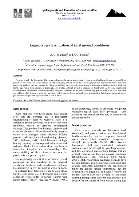
Engineering classification of karst ground conditions - Speleogenesis
Engineering classification of karst ground conditions - Speleogenesis
Engineering classification of karst ground conditions - Speleogenesis

Create successful ePaper yourself
Turn your PDF publications into a flip-book with our unique Google optimized e-Paper software.
<strong>Speleogenesis</strong> and Evolution <strong>of</strong> Karst Aquifers<br />
The Virtual Scientific Journal<br />
ISSN 1814-294X<br />
www.speleogenesis.info<br />
<strong>Engineering</strong> <strong>classification</strong> <strong>of</strong> <strong>karst</strong> <strong>ground</strong> <strong>conditions</strong><br />
A. C. Waltham 1 and P. G. Fookes 2<br />
1 Karst geologist, 11 Selby Road, Nottingham NG2 7BP, UK;E-mail: tony@geophotos.co.uk<br />
2<br />
Consultant engineering geologist, Lafonia, 11a Edgar Road, Winchester SO23 9SJ, UK<br />
Re-published from: Quarterly Journal <strong>of</strong> <strong>Engineering</strong> Geology and Hydrogeology, 2003, vol. 36, pp. 101-118.<br />
Abstract<br />
On a world scale, the dissolution <strong>of</strong> limestone and gypsum by natural waters creates extensive <strong>karst</strong> landforms that can be very difficult<br />
<strong>ground</strong> for civil engineers. Caves threaten foundation integrity, notably where their width is greater than their ro<strong>of</strong> thickness. Sinkholes<br />
pose many problems, and are classified into six types, including subsidence sinkholes formed in soil cover within <strong>karst</strong> terrains. Rockhead<br />
morphology varies from uniform to pinnacled, also creating difficult <strong>ground</strong> to excavate or found upon. A proposed engineering<br />
<strong>classification</strong> <strong>of</strong> <strong>karst</strong> defines various complexities <strong>of</strong> <strong>ground</strong> <strong>conditions</strong> by the geohazards that they provide, mainly the caves, sinkholes<br />
and rockhead relief. Ground investigation techniques and foundation design philosophies are considered so that they are appropriate to the<br />
<strong>ground</strong> <strong>conditions</strong> provided by the different classes <strong>of</strong> <strong>karst</strong>.<br />
Keywords: <strong>karst</strong>, <strong>classification</strong>, geohazards, limestone, gypsum, subsidence<br />
Introduction<br />
Karst problems worldwide create huge annual<br />
costs that are increased due to insufficient<br />
understanding <strong>of</strong> <strong>karst</strong> by engineers. Karst is a<br />
distinctive terrain developed on soluble rock with<br />
landforms related to efficient under<strong>ground</strong><br />
drainage. Disrupted surface drainage, sinkholes and<br />
caves are diagnostic. Three-dimensionally complex<br />
natural cave passages create uniquely difficult<br />
<strong>ground</strong> <strong>conditions</strong> for civil engineering (Sowers,<br />
1975; Waltham, 1989). Solid limestone <strong>of</strong> high<br />
bearing capacity is interspersed with open and<br />
sediment-filled voids at shallow depth that threaten<br />
foundation integrity and excavatability. The<br />
unpredictability <strong>of</strong> these features increases the<br />
problem for the <strong>ground</strong> engineer.<br />
An engineering <strong>classification</strong> <strong>of</strong> <strong>karst</strong>ic <strong>ground</strong><br />
<strong>conditions</strong> provides guidelines to the potential<br />
variation in landforms and <strong>ground</strong> cavities that may<br />
be encountered in civil engineering works on <strong>karst</strong>.<br />
The different <strong>karst</strong> landforms relate to each other,<br />
but the local geological, hydrological and climatic<br />
<strong>conditions</strong> create suites <strong>of</strong> <strong>karst</strong>ic features with<br />
almost infinite variety (Ford and Williams, 1989).<br />
In our experience, there is no substitute for a proper<br />
understanding <strong>of</strong> local <strong>karst</strong> processes - and<br />
accepting that <strong>ground</strong> cavities may be encountered<br />
almost anywhere.<br />
Karst processes<br />
Karst occurs primarily on limestones (and<br />
dolomites), and <strong>ground</strong> cavities and dissolutional<br />
landforms develop best on competent, fractured<br />
rocks whose intact unconfined compressive<br />
strength is generally 30-100 MPa. Weaker<br />
limestones, chalk and unlithified carbonate<br />
sediments lack the strength to span large cavities,<br />
and develop limited suites <strong>of</strong> <strong>karst</strong> features that are<br />
generally smaller than those on stronger limestones<br />
(Higginbottom, 1966; Jennings, 1968; White,<br />
2000). Offshore carbonate sediments normally have<br />
no <strong>karst</strong> features, as most seawater is saturated with<br />
calcium carbonate. Dissolution and redeposition<br />
typify the coastal sabkha environment, but are<br />
components <strong>of</strong> diagenesis, and <strong>karst</strong>ic features are<br />
modest. Subsea <strong>karst</strong> may develop in limestones<br />
carrying drainage from adjacent land and may also<br />
include features inherited from erosion during past
A.C.Waltham and P.G.Fookes / <strong>Speleogenesis</strong> and Evolution <strong>of</strong> Karst Aquifers, 2005, 3 (1), p.2<br />
times <strong>of</strong> lower sea levels. Gypsum <strong>karst</strong> has many<br />
features comparable with those on limestone, but is<br />
distinguished by wider development <strong>of</strong> interstratal<br />
<strong>karst</strong> and greater numbers <strong>of</strong> breccia pipes<br />
(Klimchouk et al, 1996), and it does not mature<br />
through to cone <strong>karst</strong> or tower <strong>karst</strong>; the following<br />
notes are generally applicable to gypsum <strong>karst</strong><br />
except where identified separately. Rock salt is so<br />
rapidly dissolved that it has its own suite <strong>of</strong><br />
landforms and <strong>ground</strong> <strong>conditions</strong> (Waltham, 1989);<br />
this <strong>classification</strong> is not applicable to salt <strong>karst</strong>.<br />
Dissolution <strong>of</strong> calcium carbonate in water is<br />
primarily dependant on the availability <strong>of</strong> biogenic<br />
carbon dioxide, which occurs at the highest<br />
concentrations in deep soils and in tropical areas<br />
where decomposition <strong>of</strong> organic matter is rapid.<br />
Regional climate has a strong influence on <strong>karst</strong>ic<br />
landforms by its control <strong>of</strong> recharge to water flow<br />
regimes. Thus the most mature <strong>karst</strong> occurs in wet<br />
tropical environments. Limestone dissolution is<br />
reduced in temperate regions, and is minimal in<br />
arid, periglacial and glacial regimes (Smith and<br />
Atkinson, 1976). However, while an expectation <strong>of</strong><br />
<strong>ground</strong> <strong>conditions</strong> in civil engineering sites on <strong>karst</strong><br />
is broadly related to climate, past climates are also<br />
significant. Features may survive from previous<br />
environments that were wetter and/or warmer, and<br />
many <strong>of</strong> these may be buried as paleo<strong>karst</strong>.<br />
Limestone dissolution is slow. Surface lowering<br />
and wall retreat within fissures and caves are no<br />
more than a few millimetres per 100 years, though<br />
may be faster in fissures under very high flow<br />
<strong>conditions</strong> created by dam leakage (Dreybrodt et al,<br />
2002). The major engineering hazard is the<br />
downward washing <strong>of</strong> soil into old and stable rock<br />
voids to create failures. A lesser hazard is failure <strong>of</strong><br />
limestone over voids that are marginally unstable<br />
after dissolution lasting a million years. Gypsum<br />
dissolution is much faster, and creation <strong>of</strong> a cavity<br />
potentially 1 metre across within 100 years is an<br />
extra geohazard in gypsum <strong>karst</strong>.<br />
Karst morphology<br />
Karst has an infinitely variable and complex<br />
three-dimensional suite <strong>of</strong> fissures and voids cut<br />
into the surface and rock mass <strong>of</strong> the limestone<br />
(Fig. 1). Dissolution <strong>of</strong> rock occurs on exposed<br />
outcrops, at the rockhead beneath soil, and along<br />
under<strong>ground</strong> fractures. Surface, rockhead and<br />
under<strong>ground</strong> landforms are integrated within <strong>karst</strong><br />
systems, but fall into five broad groups <strong>of</strong> features<br />
(Lowe and Waltham, 2002):<br />
Surface micro-features - karren runnels, mostly<br />
A.C.Waltham and P.G.Fookes / <strong>Speleogenesis</strong> and Evolution <strong>of</strong> Karst Aquifers, 2005, 3 (1), p.3<br />
Sinkholes - various surface depressions, 1 - 1000<br />
m across, that are related to underlying rock<br />
cavities (Waltham et al, 2005);<br />
Caves - cavities typically metres or tens <strong>of</strong><br />
metres across formed within the rock by its<br />
dissolution, and left empty or filled with sediment<br />
(Ford and Williams, 1989).<br />
Karst types<br />
Surface macro-features combine to make the<br />
distinctive landscapes <strong>of</strong> <strong>karst</strong>. Assemblages <strong>of</strong><br />
<strong>karst</strong> landforms create the main types <strong>of</strong> limestone<br />
<strong>karst</strong>, each <strong>of</strong> which has its own characteristics, and<br />
is developed largely in a specific climatic regime<br />
(Ford and Williams, 1989; Waltham, 2005).<br />
Glacio<strong>karst</strong> has extensive bare rock surfaces<br />
with limestone pavements, rock scars and deeply<br />
entrenched gorges; it occurs at higher altitudes and<br />
latitudes, where it was scoured by the ice and<br />
meltwater <strong>of</strong> Pleistocene glaciers and has minimal<br />
development <strong>of</strong> postglacial soils; e.g. the Yorkshire<br />
Dales region <strong>of</strong> England.<br />
Fluvio<strong>karst</strong> has extensive dendritic systems <strong>of</strong><br />
dry valleys, cut by rivers before they were captured<br />
by under<strong>ground</strong> drainage into caves; most occurs in<br />
regions that were periglacial during the cold stages<br />
<strong>of</strong> the Pleistocene; e.g. the Derbyshire Peak District<br />
<strong>of</strong> England.<br />
Doline <strong>karst</strong> has a polygonal network <strong>of</strong><br />
interfluves separating closed depressions (dolines),<br />
each 100-1000 m across, that have replaced valleys<br />
as the dominant landform because all drainage is<br />
under<strong>ground</strong>; it is a mature landscape, developed in<br />
temperate regions with Mediterranean climates; e.g.<br />
the classical <strong>karst</strong> <strong>of</strong> Slovenia and the low-lying<br />
<strong>karst</strong> <strong>of</strong> Florida.<br />
Cone <strong>karst</strong> (fengcong <strong>karst</strong>) is dominated by<br />
repetitive conical or hemispherical limestone hills,<br />
30-100 m high, between which the smaller closed<br />
depressions are stellate dolines and the larger are<br />
alluviated poljes; it is a very mature landscape,<br />
largely restricted to inter-tropical regions; e.g. the<br />
Cockpit Country <strong>of</strong> Jamaica, and the fengcong<br />
areas <strong>of</strong> Guizhou (China).<br />
Tower <strong>karst</strong> (fenglin <strong>karst</strong>) forms the most<br />
dramatic <strong>karst</strong> landscapes with isolated, steep-sided<br />
towers rising 50-100 m above alluviated <strong>karst</strong><br />
plains; it is the extreme <strong>karst</strong> type, restricted to wet<br />
tropical regions with critical tectonic uplift histories<br />
that have allowed long, uninterrupted development<br />
(Zhang, 1980); e.g. the Guilin/Yangshuo region <strong>of</strong><br />
Guangxi (China).<br />
There are recognisable subdivisions <strong>of</strong> these<br />
main <strong>karst</strong> types, and there are also additional<br />
landscape styles, e.g. formed in arid regions where<br />
<strong>karst</strong> development is minimal. Construction<br />
practice is inevitably related to these<br />
geomorphological types, but an engineering<br />
<strong>classification</strong> <strong>of</strong> <strong>karst</strong> is more usefully based on the<br />
specific features that have the major influence on<br />
<strong>ground</strong> <strong>conditions</strong>, namely the caves, the sinkholes<br />
and the rockhead morphology.<br />
Caves in <strong>karst</strong><br />
Caves form in any soluble rock where there is an<br />
adequate through flow <strong>of</strong> water. Flow rates and the<br />
water's aggressiveness (degree <strong>of</strong> chemical<br />
undersaturation) mainly determine rates <strong>of</strong> cave<br />
enlargement, which originates on bedding planes<br />
and tectonic fractures (Lowe, 2000). These enlarge<br />
to networks <strong>of</strong> open fissures, and favourable<br />
flowpaths are enlarged selectively into caves<br />
(Palmer, 1991; Klimchouk et al, 2000). Caves may<br />
be abandoned when their water is captured by<br />
preferred routes, they may be wholly or partially<br />
filled with clastic sediment or calcite stalagmite, or<br />
they may degrade and collapse when their<br />
dimensions create unstable ro<strong>of</strong> spans (Fig. 2).<br />
Filled caves may appear as sand or clay pipes<br />
within the solid rock. Progressive ro<strong>of</strong> collapse, and<br />
cavity stoping that propagates upwards may create<br />
a pile <strong>of</strong> fallen rock in a breccia pipe within the<br />
solid limestone.<br />
Fig. 2. Progressive bed failure <strong>of</strong> a passage ro<strong>of</strong> in the<br />
Agen Allwedd Cave in South Wales. The breakdown<br />
process causes upward migration <strong>of</strong> the void over an<br />
increasing pile <strong>of</strong> rock debris; in this case, the original<br />
dissolution cave was 12 m below the present ro<strong>of</strong>, but<br />
this migration has probably taken over 100,000 years.
A.C.Waltham and P.G.Fookes / <strong>Speleogenesis</strong> and Evolution <strong>of</strong> Karst Aquifers, 2005, 3 (1), p.4<br />
Cave dimensions vary greatly. In temperate<br />
regions cave passages are generally less than 10 m<br />
in diameter; caves 30 m in diameter are common in<br />
the wet tropics. The largest single cave chamber is<br />
over 300 m wide and 700 m long, in a cave in the<br />
Mulu <strong>karst</strong> <strong>of</strong> Sarawak, Malaysia. All voids in a<br />
block <strong>of</strong> <strong>karst</strong>ic limestone are interconnected<br />
because they were formed by through drainage;<br />
narrow fissures, wide river passages and large<br />
chambers are merely elements <strong>of</strong> a cave system.<br />
Though cave morphology may be understood in<br />
terms <strong>of</strong> limestone geology and geomorphic<br />
history, the distribution <strong>of</strong> cave openings in an<br />
unexplored limestone mass cannot be predicted<br />
(Culshaw and Waltham, 1987). Unknown cave<br />
locations remain a major problem in civil<br />
engineering.<br />
Most natural caves in strong limestone are stable<br />
in comparison to artificially excavated <strong>ground</strong><br />
caverns (Fig. 3). Most caves lie at depths within the<br />
limestone where stable compression arches can<br />
develop within the ro<strong>of</strong> rock so that they constitute<br />
no hazard to normal surface civil engineering<br />
works. The potential hazard lies in the large cave at<br />
shallow depth, where it may threaten foundation<br />
integrity. An informal guideline to the stability <strong>of</strong><br />
the natural rock ro<strong>of</strong> over a cave is that the <strong>ground</strong><br />
is stable if the thickness <strong>of</strong> rock is equal to or<br />
greater than its span; this excludes any thickness <strong>of</strong><br />
soil cover or heavily fissured limestone at<br />
rockhead. This guideline is conservative. In typical<br />
limestone <strong>karst</strong> the rock mass is <strong>of</strong> fair quality<br />
(Class III), with Q = 4-10 on the <strong>classification</strong><br />
scheme <strong>of</strong> Barton et al (1974), and RMR = 40-60<br />
on the rock mass rating <strong>of</strong> Bieniawski (1973). In<br />
such material, a cover thickness <strong>of</strong> intact rock that<br />
is 70% <strong>of</strong> the cave width ensures integrity (Fig. 4)<br />
under foundation loads that do not exceed 2 MPa -<br />
which is half the Safe Bearing Pressure appropriate<br />
for sound limestone.<br />
Simple beam failures provide a "worst-case"<br />
scenario, as caves naturally evolve towards arched<br />
ro<strong>of</strong> pr<strong>of</strong>iles with partial support from cantilevered<br />
rock at the margins. This concept <strong>of</strong> required ro<strong>of</strong><br />
thickness is therefore conservative. It covers<br />
limestone with a normal density <strong>of</strong> fractures and<br />
bedding planes; local zones <strong>of</strong> heavy fissuring may<br />
reduce cave ro<strong>of</strong> integrity. Gypsum is weaker. A<br />
greater cover thickness is therefore required over a<br />
gypsum cave, even for low foundation loads, and<br />
this must also account for further enlargement <strong>of</strong><br />
the cave within the lifetime <strong>of</strong> an engineered<br />
structure.<br />
Fig. 3. Cave stability related to cave width and rock mass quality (Q value after Barton et al, 1974). The envelope <strong>of</strong><br />
the limestone caves field is derived from observations <strong>of</strong> caves around the world. The labelled fields <strong>of</strong> stable, support<br />
and unstable are those applied in guidelines for the Norwegian Tunnelling Method; they refer to engineered structures<br />
with public access, and are therefore conservative when related to natural caves. The top apex <strong>of</strong> the envelope is defined<br />
by the parameters for Sarawak Chamber; the ro<strong>of</strong> span <strong>of</strong> this chamber is stable on engineering timescales, but isolated<br />
blockfall from the ceiling would render it unsatisfactory were it to be used as a public space.
A.C.Waltham and P.G.Fookes / <strong>Speleogenesis</strong> and Evolution <strong>of</strong> Karst Aquifers, 2005, 3 (1), p.5<br />
Fig. 4. The stability <strong>of</strong> cave ro<strong>of</strong>s in limestone under engineering imposed load, related to the thickness and structural<br />
morphology <strong>of</strong> the ro<strong>of</strong> rock. Data points are derived from destructive tests <strong>of</strong> laboratory scale models <strong>of</strong> caves all 4 m<br />
wide in limestone with UCS <strong>of</strong> about 80 MPa, centrally loaded by foundation pads <strong>of</strong> 1 m 2 . Scale factors were<br />
calibrated by numerical modelling to a full-scale test, and the required loading capabilities are for Safe Bearing<br />
Pressures <strong>of</strong> 2 MPa and 4 MPa multiplied by a Factor <strong>of</strong> Safety <strong>of</strong> 3.<br />
Sinkholes in <strong>karst</strong><br />
The diagnostic landform <strong>of</strong> <strong>karst</strong> is the closed<br />
depression formed where the <strong>ground</strong> surface has<br />
been eroded around an internal drainage point into<br />
the underlying limestone. These depressions are<br />
labelled dolines by geomorphologists, but are<br />
generally known as sinkholes by engineers<br />
(regardless <strong>of</strong> whether streams sink within them).<br />
Sinkhole diameters vary from 1 m to 1 km and<br />
depths may be up to 500 m. They are classified into<br />
six types (Fig. 5), each with its own discrete<br />
mechanism <strong>of</strong> formation (Lowe and Waltham,<br />
2002); examples <strong>of</strong> all types are described by<br />
Waltham et al (2005). Dissolution, collapse and<br />
caprock sinkholes occur in rock, and are essentially<br />
stable features <strong>of</strong> a <strong>karst</strong> terrain except that open<br />
fissures or caves must exist beneath them. Natural<br />
events <strong>of</strong> rock collapse are rare, so constitute a<br />
minimal engineering hazard. The greater hazard in<br />
<strong>karst</strong> terrains is created by sinkholes formed in soil<br />
covers.<br />
• Dissolution sinkholes are formed by slow<br />
dissolutional lowering <strong>of</strong> the limestone outcrop or<br />
rockhead, aided by undermining and small scale<br />
collapse. They are normal features <strong>of</strong> a <strong>karst</strong> terrain<br />
that have evolved over geological timescales, and<br />
the larger features are major landforms. An old<br />
feature, maybe 1000 m across and 10 m deep, must<br />
still have fissured and potentially unstable rock<br />
mass somewhere beneath its lowest point.<br />
Comparable dissolution features are potholes and<br />
shafts, but these are formed at discrete stream sinks<br />
and swallow holes, whereas the conical sinkholes<br />
are formed largely by disseminated percolation<br />
water.<br />
• Collapse sinkholes are formed by instant or<br />
progressive failure and collapse <strong>of</strong> the limestone<br />
ro<strong>of</strong> over a large cavern or over a group <strong>of</strong> smaller<br />
caves. Intact limestone is strong, and large-scale<br />
cavern collapse is rare (most limestone gorges are<br />
not collapsed caves). Though large collapse<br />
sinkholes are not common, small-scale collapse<br />
contributes to surface and rockhead degradation in<br />
<strong>karst</strong>, and there is a continuum <strong>of</strong> morphologies<br />
between the collapse and dissolution sinkhole<br />
types.<br />
• Caprock sinkholes are comparable to<br />
collapse sinkholes, except that there is undermining<br />
and collapse <strong>of</strong> an insoluble caprock over a <strong>karst</strong>ic<br />
cavity in underlying limestone. They occur only in<br />
terrains <strong>of</strong> palaeo<strong>karst</strong> or interstratal <strong>karst</strong> with<br />
major caves in a buried limestone, and may<br />
therefore be features <strong>of</strong> an insoluble rock outcrop<br />
(Thomas, 1974).
A.C.Waltham and P.G.Fookes / <strong>Speleogenesis</strong> and Evolution <strong>of</strong> Karst Aquifers, 2005, 3 (1), p.6<br />
Fig. 5. A <strong>classification</strong> <strong>of</strong> sinkholes, with respect to the mechanisms <strong>of</strong> the <strong>ground</strong> failure and the nature <strong>of</strong> the material<br />
which fails and subsides; these features are also known as dolines (in the same six classes). The two types on the right<br />
may be known collectively as subsidence sinkholes. The structures, cave patterns and sinkhole pr<strong>of</strong>iles tend to be more<br />
complex in dipping limestone, but the concepts remain the same as those shown by these examples in horizontal<br />
limestone; except that the caprock sinkhole cannot exist in conformable vertical beds.<br />
• Dropout sinkholes are formed in cohesive<br />
soil cover, where percolating rainwater has washed<br />
the soil into stable fissures and caves in the<br />
underlying limestone (Fig. 6). Rapid failure <strong>of</strong> the<br />
<strong>ground</strong> surface occurs when the soil collapses into a<br />
void that has been slowly enlarging and stoping<br />
upwards while soil was washed into the limestone<br />
fissures beneath (Drumm et al, 1990; Tharp, 1999).<br />
They are also known as cover collapse sinkholes.<br />
• Suffosion sinkholes are formed in noncohesive<br />
soil cover, where percolating rainwater<br />
has washed the soil into stable fissures and caves in<br />
the underlying limestone. Slow subsidence <strong>of</strong> the<br />
<strong>ground</strong> surface occurs as the soil slumps and settles<br />
in its upper layers while it is removed from below<br />
by washing into the underlying limestone - the<br />
process <strong>of</strong> suffosion; a sinkhole may take years to<br />
evolve in granular sand. They are also known as<br />
cover subsidence sinkholes. A continuum <strong>of</strong><br />
processes and morphologies exists between the<br />
dropout and suffosion sinkholes, which form at<br />
varying rates in soils ranging from cohesive clays<br />
to non-cohesive sands. Both processes may occur<br />
sequentially at the same site in changing rainfall<br />
and flow <strong>conditions</strong>, and the dropout process may<br />
be regarded as very rapid suffosion. Dropout and<br />
suffosion sinkholes are commonly and sensibly<br />
described collectively as subsidence sinkholes and<br />
form the main sinkhole hazard in civil engineering<br />
(Waltham, 1989; Beck and Sinclair, 1986; Newton,<br />
1987). Subsidence sinkholes are also known as<br />
cover sinkholes, alluvial sinkholes, ravelling<br />
sinkholes or shakeholes.<br />
• Buried sinkholes occur where ancient<br />
dissolution or collapse sinkholes are filled with soil,<br />
debris or sediment due to a change <strong>of</strong> environment.<br />
Surface subsidence may then occur due to<br />
compaction <strong>of</strong> the soil fill, and may be aggravated<br />
where some <strong>of</strong> the soil is washed out at depth<br />
(Bezuidenhout and Enslin, 1970; Brink, 1984).<br />
Buried sinkholes constitute an extreme form <strong>of</strong><br />
rockhead relief, and may deprive foundations <strong>of</strong><br />
stable footings; they may be isolated features or<br />
components <strong>of</strong> a pinnacled rockhead. They include<br />
filled sinkholes, soil-filled pipes and small breccia<br />
pipes that have no surface expression. Large<br />
breccia pipes formed over deeply buried evaporites<br />
(Ford and Williams, 1989; Lu and Cooper, 1997)<br />
are beyond the scope <strong>of</strong> this paper. Slow settlement<br />
<strong>of</strong> the fill within buried sinkholes, perhaps induced<br />
by water table decline, creates shallow surface<br />
depressions known in South Africa as compaction<br />
sinkholes (Jennings, 1966).
A.C.Waltham and P.G.Fookes / <strong>Speleogenesis</strong> and Evolution <strong>of</strong> Karst Aquifers, 2005, 3 (1), p.7<br />
The sinkhole hazard in engineering<br />
The major sinkhole hazards to civil engineering<br />
works are created by the rapid failures <strong>of</strong> soil to<br />
form dropout or suffosion sinkholes. Instantaneous<br />
dropouts are the only <strong>karst</strong> hazard that regularly<br />
causes loss <strong>of</strong> life, and most soils have enough<br />
cohesion that arches may develop over growing<br />
voids until they collapse catastrophically. Sinkhole<br />
failures are smaller and more numerous in thinner<br />
soil pr<strong>of</strong>iles, and most foundation problems occur<br />
where soils 2 - 10 m thick overlie a fissured<br />
rockhead. There is no recognisable upper bound <strong>of</strong><br />
soil thickness beyond which sinkholes cannot<br />
occur; occasional large failures are known in soils<br />
30 - 50 m thick (Jammal, 1986; Abdullah and<br />
Mollah, 1999).<br />
Subsidence sinkholes (both dropout and<br />
suffosion) are created by downward percolation <strong>of</strong><br />
water, therefore many occur during heavy rainfall<br />
events (Hyatt and Jacobs, 1996). Many other<br />
failures occur when the natural drainage is<br />
disturbed by civil engineering activity Waltham,<br />
1989; Newton, 1987). Sinkholes are induced by<br />
civil engineering works that create local increases<br />
<strong>of</strong> water input to the soil (Knight, 1971; Williams<br />
and Vineyard, 1976), and failures are commonly<br />
triggered by inadequate drainage lines along<br />
highways (Moore, 1988; Hubbard, 1999).<br />
Numerous sinkholes develop where <strong>karst</strong>ic<br />
limestone is dewatered beneath a soil cover, by<br />
either <strong>ground</strong>water abstraction (Jammal, 1986;<br />
Sinclair, 1982; Waltham and Smart, 1988) or mine<br />
and quarry dewatering (Foose, 1969; LaMoreaux<br />
and Newton, 1986; Li and Zhou, 1999). New<br />
Fig. 6. A deep dropout sinkhole in<br />
glacial till, over a fissure 20 m deep<br />
in the underlying limestone. This is<br />
the new entrance to Marble Pot, in<br />
the Yorkshire Dales <strong>karst</strong> (class kIII)<br />
in England; the passages below are<br />
now choked with the collapsed till,<br />
though sinking water still drains<br />
through the debris.<br />
subsidence sinkholes are most likely to develop<br />
when the water table declines past the rockhead,<br />
thereby inducing downward vadose drainage and<br />
sediment transport into the limestone voids. Of<br />
sinkhole failures that impact upon civil engineering<br />
sites, those induced by human activities far<br />
outnumber those created by totally natural<br />
processes. Drainage control is essential in areas <strong>of</strong><br />
soil cover on <strong>karst</strong>ic limestones; by appropriate<br />
reaction to proper investigation, the hazard <strong>of</strong><br />
collapsing sinkholes is largely avoidable.<br />
Rockhead in <strong>karst</strong><br />
Subsoil dissolution at the soil/rock interface (and<br />
subaerial dissolution at the outcrop prior to burial)<br />
creates a clean rockhead without the gradual<br />
transition through a weathering sequence in<br />
insoluble rocks. However, rockhead pr<strong>of</strong>iles may<br />
be extremely irregular on <strong>karst</strong>ic bedrock. Inclined<br />
or vertical joints and dipping bedding planes, that<br />
intersect the exposed or buried surfaces, provide<br />
pathways into the rock mass for rainwater and soilwater,<br />
so that they are preferentially enlarged into<br />
fissures. This is most rapid at and close to the rock<br />
surface, where corrosive soil-water first meets the<br />
limestone. With time, the upper part <strong>of</strong> the rock<br />
mass becomes more fissured, while intervening<br />
blocks <strong>of</strong> limestone are reduced in size and<br />
progressively isolated from their neighbours. The<br />
end product is a pinnacled rockhead that provides<br />
very difficult engineering <strong>ground</strong> <strong>conditions</strong>,<br />
notably where isolated and undercut pinnacles are<br />
supported only by the surrounding soil. Between<br />
the remnant pinnacles <strong>of</strong> limestone, fissures may
A.C.Waltham and P.G.Fookes / <strong>Speleogenesis</strong> and Evolution <strong>of</strong> Karst Aquifers, 2005, 3 (1), p.8<br />
enlarge downward into caves that are either soilfilled<br />
or open. Narrow, vertical, soil-filled pipes are<br />
particularly common in the more porous<br />
limestones, including both the younger reef<br />
limestones and the chalks (Rhodes and<br />
Marychurch, 1998).<br />
Karstic rockhead topography is notably<br />
unpredictable, with variations in the depth and<br />
frequency <strong>of</strong> fissuring, the height and stability <strong>of</strong><br />
buried pinnacles, the extent <strong>of</strong> loose blocks <strong>of</strong> rock<br />
and the frequency <strong>of</strong> buried sinkholes. Fig. 7<br />
depicts <strong>ground</strong> pr<strong>of</strong>iles that vary from a modestly<br />
fissured rockhead to <strong>conditions</strong> <strong>of</strong> great complexity<br />
that provide major difficulties in excavation and<br />
establishment <strong>of</strong> structural foundations (Tan, 1987;<br />
Bennett, 1997).<br />
Broadly, the degree <strong>of</strong> rockhead chaos is a<br />
function <strong>of</strong> climate and geological history. Largescale<br />
pinnacled rockheads are almost limited to the<br />
wet tropics (Fig. 8), where they have had the time<br />
and environment to mature fully. Most limestone<br />
that was covered by Pleistocene ice was at that time<br />
stripped down to a strong surface, and post-glacial<br />
dissolution has created only minimal fissuring up to<br />
the present time. Site <strong>conditions</strong> are also relevant,<br />
and a <strong>karst</strong> rockhead beneath a valley floor or<br />
adjacent to a shale outcrop is likely to be more<br />
complex where it has been corroded by acidic,<br />
shale-derived run-<strong>of</strong>f or soil-water draining towards<br />
it. Rockhead relief may vary across an engineering<br />
site, but it generally lacks the extreme<br />
unpredictability <strong>of</strong> isolated caves or sinkholes that<br />
can threaten integrity <strong>of</strong> a single structure.<br />
Fig. 7. Rockhead pr<strong>of</strong>iles at<br />
various <strong>karst</strong> sites, drawn from<br />
exposures and borehole pr<strong>of</strong>iles;<br />
scale and ornament are the same in<br />
each drawing. The notations kII etc<br />
refer to the <strong>karst</strong> classes to which<br />
their morphologies belong (see Fig.<br />
9); some are atypical <strong>of</strong> their region<br />
in that the local rockhead pr<strong>of</strong>ile<br />
represent a <strong>karst</strong> class that is<br />
different from the class <strong>of</strong> the<br />
regional landscape. Most <strong>of</strong> the<br />
isolated limestone blocks in the<br />
Malaya pr<strong>of</strong>ile are connected to<br />
bedrock in the third dimension,<br />
unseen in the drawing, though<br />
some may be “floaters” left as<br />
dissolutional remnants within the<br />
soil.
A.C.Waltham and P.G.Fookes / <strong>Speleogenesis</strong> and Evolution <strong>of</strong> Karst Aquifers, 2005, 3 (1), p.9<br />
An engineering <strong>classification</strong> <strong>of</strong> <strong>karst</strong><br />
A <strong>classification</strong> <strong>of</strong> <strong>ground</strong> <strong>conditions</strong> that is<br />
usable and useful for the civil engineer identifies<br />
the degree to which any parameter or group <strong>of</strong><br />
parameters is present. It should broadly quantify<br />
rockhead variability, the spatial frequency <strong>of</strong><br />
sinkholes and the sizes <strong>of</strong> under<strong>ground</strong> cavities.<br />
Other <strong>karst</strong> features are generally less significant.<br />
Intact rock strength is not a part <strong>of</strong> the<br />
<strong>classification</strong>, though the classes may relate back to<br />
broader definitions <strong>of</strong> rock mass strength. The<br />
following <strong>classification</strong> <strong>of</strong> <strong>karst</strong> <strong>ground</strong> <strong>conditions</strong><br />
is based on features that occur in the stronger<br />
limestones; suites <strong>of</strong> features on gypsum and other<br />
carbonates, notably the weaker chalks, may be<br />
regarded as variants.<br />
Karst <strong>ground</strong> <strong>conditions</strong> are divided into a<br />
progressive series <strong>of</strong> five classes, which are<br />
represented in Fig. 9 by typical morphological<br />
assemblages, and are identified in Table 1 by<br />
available parameters. The five classes provide the<br />
basis <strong>of</strong> an engineering <strong>classification</strong> that<br />
characterises <strong>karst</strong> in terms <strong>of</strong> the complexity and<br />
difficulty to be encountered by the foundation<br />
engineer. The concept diagrams in Figure 9 show<br />
horizontal limestone; folded limestones may have<br />
more complex dissolutional features, but this<br />
should affect the <strong>karst</strong> <strong>classification</strong> only<br />
marginally. Most features <strong>of</strong> the lower classes also<br />
appear within the more mature <strong>karst</strong>s. Parameters<br />
listed in Table 1 are not exclusive; a desert <strong>karst</strong><br />
may have almost no current dissolutional<br />
development, and therefore appear to be <strong>of</strong> class kI,<br />
while it may contain large unseen caves remaining<br />
from phases with wetter palaeo-climates. In any<br />
<strong>karst</strong>, dissolutional activity is greatest near the<br />
surface where aggressive water is introduced to<br />
contact with the soluble rock. This creates a<br />
Fig. 8. Pinnacled rockhead partially exposed<br />
on a construction site in class kV <strong>ground</strong> at<br />
Lunan, in Yunnan, China. The original <strong>ground</strong><br />
surface had only a few protruding pinnacle<br />
tips. Excavation to a lower level achieves a<br />
greater proportion <strong>of</strong> rock to soil for bearing<br />
purposes, but requires removal <strong>of</strong> the taller<br />
pinnacles.<br />
shallow zone <strong>of</strong> epi<strong>karst</strong> (Klimchouk, 2000), and<br />
within any class <strong>of</strong> <strong>karst</strong> there is therefore a vertical<br />
contrast between it and the less fissured rock at<br />
depth.<br />
The extreme local variability <strong>of</strong> <strong>karst</strong> <strong>ground</strong><br />
means that there are limits to how successfully<br />
<strong>karst</strong> can be classified. Whereas rockhead relief<br />
may be quantified, the distribution <strong>of</strong> sinkholes and<br />
caves is so diverse, chaotic and unpredictable that a<br />
<strong>classification</strong> provides only broad concepts <strong>of</strong> their<br />
likely abundances. The <strong>karst</strong> is generally more<br />
mature and cavernous along the outcrop boundaries<br />
with insoluble rocks that provide inputs <strong>of</strong> allogenic<br />
drainage. Karst beneath a soil cover inevitably<br />
provides greater geohazards than a bare <strong>karst</strong><br />
because dissolutional features are obscured.<br />
However, such a covered <strong>karst</strong> will have a greater<br />
frequency <strong>of</strong> new subsidence sinkhole events,<br />
which will indicate a higher <strong>karst</strong> class. New<br />
sinkholes in a soil cover are also related to shortterm<br />
water movement at rockhead, and frequencies<br />
therefore vary across a site <strong>of</strong> uniform morphology<br />
(and <strong>karst</strong> class) in response to drainage patterns<br />
and/or abstraction.<br />
The class parameters (Table 1) cannot be more<br />
than guidelines to the typical state. A further<br />
problem is caused by the lack <strong>of</strong> interdependence<br />
between the components <strong>of</strong> the <strong>karst</strong>. Within a<br />
region whose overall topography is best classified<br />
as a mature <strong>karst</strong> <strong>of</strong> class kIII, a single small<br />
construction site may reveal a minimally fissured<br />
rockhead that is best ascribed to class kII, and an<br />
isolated large cave chamber at shallow depth that is<br />
more typical <strong>of</strong> class kIV. The original<br />
<strong>classification</strong> <strong>of</strong> the <strong>karst</strong> region into class kIII<br />
remains valid, whereas the local variations that<br />
typify <strong>karst</strong> mean that any small site sample may<br />
fall into a higher or lower class.
A.C.Waltham and P.G.Fookes / <strong>Speleogenesis</strong> and Evolution <strong>of</strong> Karst Aquifers, 2005, 3 (1), p.10<br />
TABLE<br />
An engineering <strong>classification</strong> <strong>of</strong> <strong>karst</strong>. This table provides outline descriptions <strong>of</strong> selected parameters; these<br />
are not mutually exclusive and give only broad indications <strong>of</strong> likely <strong>ground</strong> <strong>conditions</strong> that can show<br />
enormous variation in local detail. It should be viewed in conjunction with Figure 9, which shows some <strong>of</strong><br />
the typical morphological features. The comments on <strong>ground</strong> investigation and foundations are only broad<br />
guidelines to good practice in the various classes <strong>of</strong> <strong>karst</strong>. NSH = rate <strong>of</strong> formation <strong>of</strong> new sinkholes per km 2<br />
per year.<br />
Karst<br />
class<br />
kI<br />
Juvenile<br />
kII<br />
Youthful<br />
kIII<br />
Mature<br />
kIV<br />
Complex<br />
kV<br />
Extreme<br />
Locations Sinkholes Rockhead Fissuring Caves Ground<br />
investigation<br />
Only in deserts<br />
and periglacial<br />
zones,<br />
or on impure<br />
carbonates<br />
The minimum<br />
in temperate<br />
regions<br />
Common in<br />
temperate<br />
regions;<br />
the minimum in<br />
the wet tropics<br />
Localised in<br />
temperate<br />
regions;<br />
normal in<br />
tropical regions<br />
Only in wet<br />
tropics<br />
Rare<br />
NSH >1<br />
Almost<br />
uniform;<br />
minor<br />
fissures<br />
Many small<br />
fissures<br />
Extensive<br />
fissuring;<br />
relief <strong>of</strong><br />
20m;<br />
loose pillars<br />
undercut<br />
between<br />
deep soil<br />
fissures<br />
Minimal;<br />
low secondary<br />
permeability<br />
Widespread in<br />
the few metres<br />
nearest surface<br />
Extensive<br />
secondary<br />
opening <strong>of</strong><br />
most fissures<br />
Extensive large<br />
dissolutional<br />
openings,<br />
on and away<br />
from major<br />
fissures<br />
Abundant and<br />
very complex<br />
dissolution<br />
cavities<br />
Rare and<br />
small;<br />
some isolated<br />
relict features<br />
Many small<br />
caves; most<br />
15m across<br />
Foundations<br />
Conventional Conventional<br />
Mainly<br />
conventional,<br />
probe rock to 3 m,<br />
check fissures in<br />
rockhead<br />
Probe to rockhead,<br />
probe rock<br />
to 4m,<br />
microgravity<br />
survey<br />
Probe to rockhead,<br />
Prove rock<br />
to 5m<br />
with splayed<br />
probes,<br />
microgravity<br />
survey<br />
Make individual<br />
<strong>ground</strong><br />
investigation<br />
for every<br />
pile site<br />
Grout open<br />
fissures;<br />
control drainage<br />
Rafts or <strong>ground</strong><br />
beams,<br />
consider<br />
geogrids,<br />
driven piles<br />
to rockhead;<br />
control drainage<br />
Bored piles to<br />
rockhead,<br />
or cap grouting<br />
at rockhead;<br />
control drainage<br />
and abstraction<br />
Bear in soils<br />
with geogrid,<br />
load on proven<br />
pinnacles,<br />
or on deep<br />
bored piles;<br />
control all<br />
drainage<br />
and control<br />
abstraction
A.C.Waltham and P.G.Fookes / <strong>Speleogenesis</strong> and Evolution <strong>of</strong> Karst Aquifers, 2005, 3 (1), p.11<br />
Fig. 9. Typical morphological features <strong>of</strong> <strong>karst</strong>ic <strong>ground</strong> <strong>conditions</strong> within the five classes <strong>of</strong> the engineering<br />
<strong>classification</strong> <strong>of</strong> <strong>karst</strong>. These examples show horizontal bedding <strong>of</strong> the limestone; dipping bedding planes and inclined<br />
fractures add complexity to most <strong>of</strong> the features, and also create planar failures behind steep cliff faces. The dotted<br />
ornament represents any type <strong>of</strong> clastic soil or surface sediment.
A.C.Waltham and P.G.Fookes / <strong>Speleogenesis</strong> and Evolution <strong>of</strong> Karst Aquifers, 2005, 3 (1), p.12<br />
Previous <strong>classification</strong>s <strong>of</strong> <strong>karst</strong><br />
Geomorphological literature classifies <strong>karst</strong><br />
features and types with reference to processes that<br />
are related largely to climatic environments. The<br />
types therefore reflect <strong>karst</strong>ic maturity, greater in<br />
the wet tropics than in colder or drier regions, and<br />
form the back<strong>ground</strong> to this <strong>classification</strong> that is<br />
concerned with the degrees <strong>of</strong> <strong>karst</strong>ification. The<br />
first engineering <strong>classification</strong> <strong>of</strong> <strong>karst</strong> (Fookes and<br />
Hawkins, 1988) was later modified (Fookes, 1997)<br />
and is replaced by this <strong>classification</strong>. It was based<br />
largely on doline <strong>karst</strong>, with little reference to<br />
pinnacled rockheads, and was not comprehensive as<br />
mature forms <strong>of</strong> tropical <strong>karst</strong> were omitted; its five<br />
classes all fall within the first four classes <strong>of</strong> the<br />
<strong>classification</strong> in Fig. 9 and Table 1.<br />
A <strong>classification</strong> <strong>of</strong> <strong>karst</strong>ic dangers to Russian<br />
railways uses the frequency <strong>of</strong> recorded collapses to<br />
guide engineering maintenance measures and<br />
hazard warning systems (Tolmachev et al, 1999). A<br />
significant engineering hazard is recognised where<br />
the new sinkhole failure rate exceeds 0.1 per km 2<br />
per year, and this is incorporated into unpublished<br />
<strong>classification</strong>s used in Florida, USA. However,<br />
sinkhole collapse frequency cannot be a sole guide<br />
to <strong>karst</strong> <strong>classification</strong> as it increases in areas <strong>of</strong> thin<br />
soil cover and water table drawdown. Ground<br />
<strong>conditions</strong> over the pinnacled dolomites <strong>of</strong> South<br />
Africa are ascribed to one <strong>of</strong> three classes based<br />
only on the thickness <strong>of</strong> soil cover between the<br />
pinnacle tops and the <strong>ground</strong> surface (Wagener,<br />
1985). The <strong>classification</strong> <strong>of</strong> weathered rocks<br />
excludes <strong>karst</strong> as a special case, and current<br />
engineering <strong>classification</strong>s <strong>of</strong> rock masses do not<br />
refer to <strong>karst</strong> (Bieniawski, 1973; Barton et al, 1974;<br />
Anon, 1995).<br />
The new full engineering description <strong>of</strong> <strong>karst</strong><br />
A description <strong>of</strong> the <strong>karst</strong> <strong>ground</strong> <strong>conditions</strong> by a<br />
single class label may be helpful in creating<br />
concepts <strong>of</strong> the scale <strong>of</strong> anticipated foundation<br />
difficulties, but the variations that are typical <strong>of</strong><br />
<strong>karst</strong> demand a more specific and more detailed<br />
definition. A full description <strong>of</strong> <strong>karst</strong> <strong>ground</strong><br />
<strong>conditions</strong> should therefore state whether it is on<br />
limestone or gypsum, and then embrace four terms,<br />
so that it becomes "Karst class + sinkhole density +<br />
cave size + rockhead relief".<br />
• Karst class is an overview figure in the<br />
range I to V, as defined in the <strong>classification</strong> within<br />
this paper (Fig. 9 and Table 1).<br />
• Mean sinkhole density may be a simple<br />
number per unit area, based on field mapping,<br />
available maps or air photographs. It should be<br />
noted if densities are low because the sinkholes are<br />
large. Ideally, this descriptor is a rate at which new<br />
sinkholes occur (NSH), expressed in events per km 2<br />
per year. In practice, the data can only be derived<br />
from local records, which are rarely adequate for<br />
anything better than a broad generalisation.<br />
Inevitably the NSH is higher in <strong>karst</strong> areas with thin<br />
soil cover in which subsidence sinkholes are most<br />
easily formed. It should also be noted if the NSH<br />
rate is temporarily enhanced by engineering<br />
activities.<br />
• Typical cave size is a dimension in metres,<br />
based on available local data, to represent the<br />
largest cave width that is likely to be encountered.<br />
This is larger than the mean cave width, but may<br />
reasonably exclude dimensions <strong>of</strong> the largest cave<br />
chambers that are statistically very rare (though<br />
these should be noted, where appropriate).<br />
• Rockhead relief is a measure in metres <strong>of</strong><br />
the mean local relief in the <strong>karst</strong> rockhead,<br />
including depths encountered within buried<br />
sinkholes. Where possible, a note should<br />
distinguish between pinnacled rockheads and more<br />
tabular, fissured surfaces that are buried pavements.<br />
Though this four-element description may appear<br />
cumbersome, any lesser qualification is incapable <strong>of</strong><br />
reasonable representation <strong>of</strong> the vagaries <strong>of</strong> <strong>karst</strong>ic <strong>ground</strong><br />
<strong>conditions</strong>.<br />
Where it is helpful to design concepts, the<br />
engineering <strong>classification</strong> <strong>of</strong> <strong>ground</strong> <strong>conditions</strong> may<br />
be applied to small units <strong>of</strong> <strong>ground</strong>, though rarely<br />
down to the scale <strong>of</strong> applying rock mass<br />
<strong>classification</strong> metre by metre within a tunnel<br />
heading. A single residual pinnacle <strong>of</strong> massive<br />
limestone may <strong>of</strong>fer <strong>conditions</strong> <strong>of</strong> class kI to found<br />
a single column base within a region <strong>of</strong> pinnacled<br />
<strong>karst</strong> <strong>of</strong> class kV [i.e. kI (in kV)]. Conversely, a<br />
deeply fissured zone <strong>of</strong> fractured limestone with a<br />
large underlying cave in the same fracture line may<br />
represent immediate, shallow <strong>ground</strong> <strong>conditions</strong> <strong>of</strong><br />
class kV within a glacio<strong>karst</strong> terrain that is<br />
regionally <strong>of</strong> class kI [i.e. kV (in kI)].<br />
Engineers and <strong>ground</strong> investigators must<br />
recognise that <strong>karst</strong> <strong>ground</strong> <strong>conditions</strong> are<br />
immensely variable, and always demand thorough<br />
investigation and site-specific comprehension. A<br />
face cut with a wire-saw on a building site (Fig. 10)<br />
within a <strong>karst</strong> (class kIV; few sinkholes; caves 5m<br />
across; rockhead relief 10m) in Sicily revealed<br />
many small cavities and one larger buried sinkhole<br />
adjacent to areas <strong>of</strong> sound rock. It is near to<br />
Palermo airport, where a cavern up to 20 m wide<br />
was found under a runway extension. Every site on<br />
<strong>karst</strong> should be regarded as unique. Classification<br />
provides a broad indication <strong>of</strong> the engineering<br />
difficulties <strong>of</strong> a <strong>karst</strong> site, and <strong>of</strong>fers guidance on
A.C.Waltham and P.G.Fookes / <strong>Speleogenesis</strong> and Evolution <strong>of</strong> Karst Aquifers, 2005, 3 (1), p.13<br />
approaches to overcoming the <strong>ground</strong> difficulties,<br />
but it can apply only an approximate label to a<br />
medium as variable as <strong>karst</strong>.<br />
The processes and landforms <strong>of</strong> gypsum <strong>karst</strong><br />
(Klimchouk et al, 1996) are broadly comparable to<br />
those on limestone, except that gypsum is dissolved<br />
more rapidly in natural waters and is mechanically<br />
weaker than most limestones. The engineering<br />
<strong>classification</strong> <strong>of</strong> <strong>karst</strong> is applicable to gypsum<br />
terrains, though extreme <strong>karst</strong> <strong>of</strong> class kV does not<br />
develop. Caves in gypsum collapse before they<br />
reach very large dimensions, surface crags are<br />
degraded, and denudation totally removes gypsum<br />
before it can mature into the extreme <strong>karst</strong><br />
landforms. Rapid dissolution and low strength<br />
favour development <strong>of</strong> large collapse sinkholes, and<br />
some gypsum <strong>karst</strong>s <strong>of</strong> classes kIII and kIV are<br />
distinguished by a scatter <strong>of</strong> large, isolated<br />
collapses (Waltham, 2002).<br />
Fig. 10. A sawn face 10 m high on a construction site<br />
sections limestone just below rockhead in a <strong>karst</strong> <strong>of</strong> class<br />
kIV in northwestern Sicily. Small caves and<br />
dissolutional-opened fissures are mainly aligned on<br />
dipping fractures, and a buried sinkhole is exposed on<br />
the left after its fill has been removed. Note person at<br />
lower left for scale.<br />
Ground investigation on <strong>karst</strong><br />
Some <strong>of</strong> the most difficult <strong>ground</strong> <strong>conditions</strong> that<br />
have to be investigated in civil engineering are<br />
found in <strong>karst</strong>. Conventional practices are generally<br />
adequate to investigate sites in <strong>karst</strong> <strong>of</strong> classes kI<br />
and kII, but sites in more mature <strong>karst</strong> (classes kIII<br />
- kV) demand more rigorous <strong>ground</strong> investigations<br />
managed by a team that fully appreciates the<br />
complex characteristics <strong>of</strong> <strong>karst</strong>. Adaptation and reassessment<br />
are critical on <strong>karst</strong>, where many<br />
<strong>ground</strong> <strong>conditions</strong> cannot be foreseen from any<br />
reasonable programme <strong>of</strong> investigation.<br />
A major difficulty in <strong>karst</strong> investigations is<br />
finding under<strong>ground</strong> cavities. There may be little<br />
alternative to closely spaced probes, but a density<br />
<strong>of</strong> 2500 per hectare is needed to have a 90% chance<br />
<strong>of</strong> finding one cavity 2.5 m in diameter. Probes<br />
beneath every pile foot and column base are a better<br />
option, and are essential at many sites on mature,<br />
cavernous <strong>karst</strong>. Exploration <strong>of</strong> pinnacled rockhead<br />
in a <strong>karst</strong> <strong>of</strong> class kIV or kV may demand extensive<br />
probing, but there is no answer to the question <strong>of</strong><br />
how many probes are needed. Construction <strong>of</strong> a<br />
viaduct on class kIII <strong>karst</strong> in Belgium initially had<br />
31 boreholes for five pier sites; these missed two<br />
caves revealed only during excavation for<br />
foundations. A second phase <strong>of</strong> investigation<br />
checked the <strong>ground</strong> with another 308 probes, but<br />
found no more caves (Waltham et al, 1986).<br />
Investigation by 31 boreholes was inadequate;<br />
drilling 339 holes was over-cautious. At many<br />
<strong>karst</strong>ic sites, the true <strong>ground</strong> <strong>conditions</strong> are<br />
discovered only when foundations are excavated.<br />
The depth probed should be a function <strong>of</strong> likely<br />
cavity size. In <strong>karst</strong> <strong>of</strong> classes kI - kIII, caves more<br />
than 5 m wide are unusual, and probing 3.5 m<br />
should therefore confirm rock integrity.<br />
<strong>Engineering</strong> practice varies considerably, by<br />
proving 5 m <strong>of</strong> rock beneath pile tips in cavernous<br />
Florida <strong>karst</strong> (Garlanger, 1991), 4 m under<br />
foundations in South Africa (Wagener and Day,<br />
1986), 2.5 m under caissons in Pennsylvania (Foose<br />
and Humphreville, 1979), and only 1.5 m under<br />
lightly loaded bridge caissons in North Carolina<br />
(Erwin and Brown, 1988). The limestone in Florida<br />
is weaker than at the other sites, but there is no<br />
consistency in empirical data from engineering<br />
practice on <strong>karst</strong>.<br />
Geophysics on <strong>karst</strong><br />
Geophysical identification <strong>of</strong> <strong>ground</strong> voids has<br />
not produced consistently reliable interpretations,<br />
but technology is advancing, and there are<br />
techniques that can produce useful results in certain<br />
situations (Cooper and Ballard, 1988). All<br />
geophysical anomalies require verification by<br />
drilling, but a geophysical survey can reduce costs<br />
by identifying drilling targets.<br />
Microgravity surveys identify missing mass<br />
within the <strong>ground</strong> and produce good data that<br />
improve in value with increasing sophistication <strong>of</strong><br />
their analysis. Individual caves create negative<br />
anomalies, whose amplitude relates to cave size and<br />
whose wavelength is a function <strong>of</strong> cave depth.<br />
Fourier analysis <strong>of</strong> data from a grid with spacing <strong>of</strong><br />
2 m can identify caves only 1 m across at specific<br />
depths (Butler, 1984; Crawford et al, 1999;
A.C.Waltham and P.G.Fookes / <strong>Speleogenesis</strong> and Evolution <strong>of</strong> Karst Aquifers, 2005, 3 (1), p.14<br />
McDonald et al, 1999; Styles and Thomas, 2001).<br />
Wider grids cover larger areas to identify lowdensity<br />
fills in buried sinkholes (Kleywegt and<br />
Enslin, 1973). In the future, when data from more<br />
sites have been accumulated, gravity values and<br />
anomaly pr<strong>of</strong>iles could be applied to the<br />
<strong>classification</strong> <strong>of</strong> <strong>karst</strong>.<br />
Seismic velocities decrease in more fissured and<br />
more cavernous <strong>ground</strong>; they correlate with<br />
engineering <strong>classification</strong>s <strong>of</strong> rock mass, and could<br />
perhaps be used to characterise <strong>karst</strong> classes. Threedimensional<br />
cross-hole seismic tomography (3dT)<br />
can identify caves (Simpson, 2001), but requires<br />
deep boreholes for data collection so that it is rarely<br />
applicable to surface investigations <strong>of</strong> greenfield<br />
sites.<br />
Resistivity surveys are used for rockhead<br />
pr<strong>of</strong>iling (Dunscomb and Reywoldt, 1999), but<br />
deeply pinnacled rockheads in <strong>karst</strong> <strong>of</strong> classes kIV<br />
and kV are too complex to be resolved by surface<br />
geophysics. Resistivity tomography is expensive,<br />
but can combine with microgravity to identify<br />
rockhead and distinguish buried sinkholes from<br />
caves (which have similar gravity signatures).<br />
Ground-probing radar is limited to shallow depths,<br />
but has been applied to incipient sinkhole detection<br />
(Wilson and Beck, 1988). In similar situations, lowdensity<br />
granular soils have been identified by SPT<br />
values below 5, but these are not always indicative<br />
<strong>of</strong> active suffosion and potential sinkhole failure<br />
(Kannan, 1999).<br />
Ground engineering on <strong>karst</strong><br />
Limestone presents the foundation engineer with<br />
a range <strong>of</strong> difficulties that increase in scale and<br />
complexity with increased maturity <strong>of</strong> the <strong>karst</strong><br />
morphology.<br />
Foundations over <strong>karst</strong>ic rockhead<br />
Karst <strong>of</strong> class kI provides rockhead that is sound<br />
except for unpredictable isolated fissures or shallow<br />
caves that may require response during<br />
construction. Rockhead <strong>of</strong> class kII <strong>karst</strong> (Fig. 11)<br />
generally creates only minor problems. Installation<br />
<strong>of</strong> piles may require longer elements for some parts<br />
<strong>of</strong> a site (Statham and Baker, 1986), and reinforced<br />
<strong>ground</strong> beams can be designed to span small new<br />
<strong>ground</strong> failures (Mishu et al, 1997).<br />
In class kIII <strong>karst</strong>, rafts or <strong>ground</strong>beams may<br />
bridge cavities (Sowers, 1986; Clark et al, 1981;<br />
Green et al, 1995). In Florida, either rafts or<br />
preparatory grouting are preferred where new<br />
sinkholes are recorded locally at rates above<br />
0.05/km 2 /year (Kannan, 1999). Heavy geogrid<br />
stabilises soil pr<strong>of</strong>iles, and can be designed to span<br />
potential voids to reduce the impact <strong>of</strong> any<br />
subsequent catastrophic collapses (Kempton et al,<br />
1998). Grouting <strong>of</strong> soils over highly fissured<br />
rockhead, before founding spread footings within<br />
the soil pr<strong>of</strong>ile, may be more economical than<br />
piling to rockhead. A site <strong>of</strong> 10,000 m 2 on class kIII<br />
<strong>karst</strong> in Pennsylvania took 1200 m 3 <strong>of</strong> compaction<br />
grout through 560 boreholes to rockhead around 9<br />
m deep (Reith et al, 1999).<br />
Pinnacled rockheads <strong>of</strong> <strong>karst</strong> classes kIV and kV<br />
generally require that structures are founded on<br />
sound limestone by piling to rockhead or spanning<br />
between sound pinnacle tops (Brink, 1979). Driven<br />
piles may be bent, deflected or poorly founded on<br />
unsound pinnacles (Sowers, 1986, 1996); bored<br />
piles are preferred. Each pile tip is probed to ensure<br />
lack <strong>of</strong> voids beneath, and narrow unstable<br />
pinnacles may require assessment by probes<br />
splayed 15° from the vertical. As a guide for<br />
planning, adding 30% to the mean rockhead depth<br />
indicates the mean final length <strong>of</strong> end-bearing piles<br />
(Foose and Humphreville, 1979). The lower<br />
strength <strong>of</strong> gypsum means that it can support<br />
neither high loads on rockhead pinnacles nor<br />
heavily loaded end-bearing piles.<br />
Fig. 11. A road cutting 4 m high<br />
in class kII <strong>karst</strong> in Korea,<br />
exposing two clay-filled<br />
sinkholes cut below a rockhead<br />
with minimal fissuring.
A.C.Waltham and P.G.Fookes / <strong>Speleogenesis</strong> and Evolution <strong>of</strong> Karst Aquifers, 2005, 3 (1), p.15<br />
A road or light structure can bear safely on the<br />
soil over a deeply pinnacled rockhead <strong>of</strong> <strong>karst</strong> class<br />
kV, where drainage is not disturbed, though geogrid<br />
reinforcement may be appropriate. Rockhead<br />
pinnacles 50 m high in some tropical <strong>karst</strong>s, <strong>of</strong>fer<br />
dreadful <strong>ground</strong> <strong>conditions</strong> for heavy structures that<br />
demand founding on bedrock (Bennett, 1997). Each<br />
pile location requires its own <strong>ground</strong> investigation,<br />
and designs must adapt to unique <strong>ground</strong> <strong>conditions</strong><br />
as they are revealed by excavation.<br />
Foundations over caves<br />
Caves are unpredictable. Every site in <strong>karst</strong> has<br />
to be assessed individually in the context <strong>of</strong> its<br />
geomorphology, and engineering works must<br />
respond to the local <strong>conditions</strong>. Local records and<br />
observations may indicate typical and maximum<br />
cave sizes, and these define the minimum <strong>of</strong> sound<br />
rock to be proven by drilling beneath structural<br />
footings (see above). Major variations occur within<br />
a mature cavernous <strong>karst</strong>; in Slovenia, cave<br />
discoveries and collapses are common during road<br />
construction, but subsequent collapses under<br />
operational roads have not occurred (Sebela et al,<br />
1999).<br />
Caves typically reach widths <strong>of</strong> 10 m in <strong>karst</strong> <strong>of</strong><br />
class kIV, so probing to 7 m is appropriate in<br />
limestone. Larger caves are common in class kV<br />
<strong>karst</strong>, and can occur in less mature <strong>karst</strong>. Many<br />
large caves at shallow depths have open entrances,<br />
and are best assessed by direct exploration.<br />
Dynamic compaction or monitored surcharge may<br />
collapse small shallow cavities in weak limestone<br />
<strong>of</strong> <strong>karst</strong> classes kIII or kIV.<br />
Caves at critical locations under planned<br />
foundations, are normally filled with mass concrete,<br />
or may be bridged. In Ireland, a cave 6 m wide<br />
beneath just 2.5 m <strong>of</strong> limestone, supported a<br />
railway for many years, but a concrete slab was<br />
installed to lessen the risk when a main road<br />
replaced the railway. Grout injection through<br />
boreholes may incur considerable losses by flowage<br />
into <strong>karst</strong>ic cavities that extend <strong>of</strong>f site, and<br />
perimeter grout curtains may reduce total costs.<br />
Access to a cave allows installation <strong>of</strong> shuttering<br />
and removal <strong>of</strong> floor sediment before filling.<br />
Relocation <strong>of</strong> footings may prove essential over<br />
complex caves (Waltham et al, 1986). Piles that are<br />
preformed or cast in geotextile sleeves can transfer<br />
load to a solid cave floor, but costs may approach<br />
those <strong>of</strong> simpler total cave filling (Heath, 1995).<br />
Grout filling <strong>of</strong> caves in gypsum is <strong>of</strong>ten<br />
inappropriate because the greater dissolution rates<br />
can allow significant amounts <strong>of</strong> intact gypsum to<br />
be removed within engineering timescales. An<br />
under<strong>ground</strong> stream re-routed round a concrete<br />
plug can excavate a new adjacent cave, with<br />
implications for subsequent collapse, within the<br />
lifetime <strong>of</strong> an overlying engineered structure.<br />
Remediation and prevention <strong>of</strong> sinkhole failure<br />
The key to minimising sinkhole failures in <strong>karst</strong><br />
is proper control <strong>of</strong> water flows. Design<br />
specifications for a <strong>karst</strong> site (except some <strong>of</strong> class<br />
kI) should include a ban on soakaway drains, use <strong>of</strong><br />
flexible infrastructure lines and diversion <strong>of</strong><br />
inbound surface flows. Dry wells are acceptable<br />
where they are sealed onto open fissures and cased<br />
below rockhead (Crawford, 1986; Vandevelde and<br />
Schmidt, 1988). To found a road in Puerto Rico,<br />
natural soils in class kIV cone <strong>karst</strong> were replaced<br />
with granular, permeable engineered soils with<br />
diversionary clay caps and drainage wells (Vasquez<br />
Castillo and Rodriguez Molina, 1999). Control <strong>of</strong><br />
water abstraction is also critical, especially where<br />
the water table is close above rockhead. Florida's<br />
Disney World stands on 20-30 m <strong>of</strong> soils over<br />
limestone <strong>of</strong> class kIII, and its wells are monitored<br />
so that pumping is switched where a local water<br />
table decline is detected; sinkholes have not yet<br />
occurred on the site (Handfelt and Attwooll, 1988).<br />
Dewatering by quarrying has been stopped at some<br />
sites by legal action to prevent further <strong>ground</strong><br />
failures (Quinlan, 1986; Kath et al, 1995; Gary,<br />
1999).<br />
Grout sealing <strong>of</strong> rockhead fissures is<br />
problematical, but may be appropriate on any <strong>karst</strong><br />
except that <strong>of</strong> class kI; pinnacled rockheads <strong>of</strong><br />
classes kIV and kV require elaborate 'cap grouting'<br />
with cement slurries after plugging open fissures with<br />
viscous grouts (Kannan and Nettles, 1999; Siegel et<br />
al, 1999). Compaction grouting (with slump
A.C.Waltham and P.G.Fookes / <strong>Speleogenesis</strong> and Evolution <strong>of</strong> Karst Aquifers, 2005, 3 (1), p.16<br />
understood. Such action may be preventative before<br />
site development or remedial after failure. It is<br />
further complicated in gypsum <strong>karst</strong> where rapid<br />
development <strong>of</strong> new voids in adjacent <strong>ground</strong> must<br />
not be instigated by blocking a natural drainage<br />
conduit.<br />
Conclusion<br />
Karst frequently presents "difficult <strong>ground</strong><br />
<strong>conditions</strong>" to engineers, and is <strong>of</strong>ten inadequately<br />
understood by those only familiar with insoluble<br />
rock. An improved <strong>classification</strong> is presented to<br />
provide starting points in recognising the scale <strong>of</strong><br />
<strong>karst</strong> geohazards in widely varying terrains. It<br />
relates to the engineering techniques appropriate to<br />
different classes <strong>of</strong> cavernous <strong>ground</strong> and <strong>of</strong>fers<br />
guidelines towards more efficient <strong>ground</strong><br />
investigation.<br />
A proper understanding <strong>of</strong> <strong>karst</strong> is essential to<br />
good practice in <strong>ground</strong> engineering.<br />
Acknowledgements<br />
This paper originated from work for the<br />
International Society <strong>of</strong> Soil Mechanics and<br />
Ground <strong>Engineering</strong> sub-committee TC-26 on<br />
carbonate <strong>ground</strong> <strong>conditions</strong>. We thank Dr Fred<br />
Baynes, <strong>of</strong> Perth, Australia, and other members for<br />
constructive discussions, and also Pr<strong>of</strong>. Peter Smart<br />
<strong>of</strong> Bristol University for his very helpful referee's<br />
comments.<br />
References<br />
Abdullah W.A. and Mollah M.A. 1999. Detection<br />
and treatment <strong>of</strong> <strong>karst</strong> cavities in Kuwait. In:<br />
Beck B.F., Pettit A.J. and Herring J.G. (Eds.)<br />
Hydrology and <strong>Engineering</strong> Geology <strong>of</strong><br />
Sinkholes and Karst, Balkema: Rotterdam, 123-<br />
127.<br />
Anon. 1995. The description and <strong>classification</strong> <strong>of</strong><br />
weathered rocks for engineering purposes:<br />
Geological Society <strong>Engineering</strong> Group Working<br />
Party Report. Quarterly Journal <strong>of</strong> <strong>Engineering</strong><br />
Geology 28, 207-242.<br />
Barton N., Lien R. and Lunde J. 1974. <strong>Engineering</strong><br />
<strong>classification</strong> <strong>of</strong> rock masses for tunnel design.<br />
Rock Mechanics 6, 189-236.<br />
Beck B.F. and Sinclair W.C. 1986. Sinkholes in<br />
Florida: an introduction. Florida Sinkhole<br />
Research Institute Report 85-86-4, 16pp.<br />
Bennett D. 1997. Finding a foothold. New Civil<br />
Engineer (4 December), 24-25.<br />
Bezuidenhout C.A. and Enslin J.F. 1970. Surface<br />
subsidence and sinkholes in the dolomite areas<br />
<strong>of</strong> the Far West Rand, Transvaal, Republic <strong>of</strong><br />
South Africa. International Association <strong>of</strong><br />
Hydrological Sciences, Publication No 89, 482-<br />
495.<br />
Bieniawski Z.T. 1973. <strong>Engineering</strong> <strong>classification</strong> <strong>of</strong><br />
jointed rock masses. Transactions <strong>of</strong> the South<br />
African Institute <strong>of</strong> Civil Engineers 15, 335-343.<br />
Bögli A. 1960. Kalklosung und Karrenbildung.<br />
Zeitschrift fur Geomorphologie Suppl bd 2: 4-<br />
21.<br />
Bonaparte R. and Berg R.R. 1987. The use <strong>of</strong><br />
geosynthetics to support roadways over sinkhole<br />
prone areas. In: In: Beck B.F. and Wilson W.L.<br />
(Eds.) Karst Hydrogeology: <strong>Engineering</strong> and<br />
Environmental Applications, Balkema:<br />
Rotterdam, 437-445.<br />
Brink A.B.A. 1979. <strong>Engineering</strong> Geology <strong>of</strong> South<br />
Africa: Volume 1, Building Publications:<br />
Pretoria, 319pp.<br />
Brink A.B.A. 1984. A brief review <strong>of</strong> the South<br />
Africa sinkhole problem. In: Beck B.F. (Ed.)<br />
Sinkholes: their geology, engineering and<br />
environmental impact, Balkema: Rotterdam,<br />
123-127.<br />
Butler D.K. 1984. Microgravimetric and gravity<br />
gradient techniques for detection <strong>of</strong> subsurface<br />
cavities. Geophysics 41, 1016-1130.<br />
Clark R.G., Gutmanis J.C., Furley A.E. and Jordan<br />
P.G. 1981. <strong>Engineering</strong> geology for a major<br />
industrial complex at Aughinish Island, Co<br />
Limerick, Ireland. Quarterly Journal <strong>of</strong><br />
<strong>Engineering</strong> Geology 14, 231-239.<br />
Cooper S.S. and Ballard R.F. 1988. Geophysical<br />
exploration for cavity detection in <strong>karst</strong> terrain.<br />
American Society <strong>of</strong> Civil Engineers<br />
Geotechnical Special Publication 14, 25-39.<br />
Crawford N.C. 1986. Karst hydrological problems<br />
associated with urban development:<br />
<strong>ground</strong>water contamination, hazardous fumes,<br />
sinkhole flooding and sinkhole collapse in the<br />
Bowling Green area, Kentucky. Field trip<br />
guidebook. Centre for Cave and Karst Studies,<br />
Western Kentucky University, 86pp.<br />
Crawford N.C., Lewis M.A., Winter S.A. and<br />
Webster, J.A. 1999. Microgravity techniques for<br />
subsurface investigations <strong>of</strong> sinkhole collapses<br />
and for detection <strong>of</strong> <strong>ground</strong>water flow paths<br />
through <strong>karst</strong> aquifers. In: In: Beck B.F. Pettit
A.C.Waltham and P.G.Fookes / <strong>Speleogenesis</strong> and Evolution <strong>of</strong> Karst Aquifers, 2005, 3 (1), p.17<br />
A.J. and Herring J.G. (Eds.) Hydrology and<br />
<strong>Engineering</strong> Geology <strong>of</strong> Sinkholes and Karst,<br />
Balkema: Rotterdam, 203-218.<br />
Culshaw M.G. and Waltham A.C. 1987. Natural<br />
and artificial cavities as <strong>ground</strong> engineering<br />
hazards. Quarterly Journal <strong>of</strong> <strong>Engineering</strong><br />
Geology 20, 139-150.<br />
Dougherty P.H. and Perlow M. 1987. The<br />
Macungie sinkhole, Leigh Valley, Pennsylvania:<br />
cause and repair. In: Beck, B.F. and Wilson,<br />
W.L. (Eds.) Karst Hydrogeology: <strong>Engineering</strong><br />
and Environmental Applications, Balkema:<br />
Rotterdam, 425-435.<br />
Dreybrodt W., Romanov D. and Gabrovsek F.<br />
2002. Karstification below dam sites: a model <strong>of</strong><br />
increasing leakage from reservoirs.<br />
Environmental Geology 42, 518-524.<br />
Drumm E.C., Kane W.F. and Yoon C.J. 1990.<br />
Application <strong>of</strong> limit plasticity to the stability <strong>of</strong><br />
sinkholes. <strong>Engineering</strong> Geology 29, 213-225.<br />
Dunscomb M.H. and Rehwoldt E. 1999. Twodimensional<br />
resistivity pr<strong>of</strong>iling; geophysical<br />
weapon <strong>of</strong> choice in <strong>karst</strong> terrain for engineering<br />
applications. In: Beck B.F., Pettit A.J. and<br />
Herring J.G. (Eds.) Hydrology and <strong>Engineering</strong><br />
Geology <strong>of</strong> Sinkholes and Karst, Balkema:<br />
Rotterdam, 219-224.<br />
Erwin J.W. and Brown R.A. 1988. Karstic<br />
foundation problems Sunny Point Railroad.<br />
American Society <strong>of</strong> Civil Engineers<br />
Geotechnical Special Publication 14, 74-85.<br />
Fookes P.G. 1997. Geology for engineers: the<br />
geological model, prediction and performance.<br />
Quarterly Journal <strong>of</strong> <strong>Engineering</strong> Geology 30,<br />
293-424.<br />
Fookes P.G. and Hawkins A.B. 1988. Limestone<br />
weathering: its engineering significance and a<br />
proposed <strong>classification</strong> scheme. Quarterly<br />
Journal <strong>of</strong> <strong>Engineering</strong> Geology 21, 7-31.<br />
Foose R.M. 1969. Mine dewatering and recharge in<br />
carbonate rocks near Hershey, Pennsylvania.<br />
Geological Society <strong>of</strong> America <strong>Engineering</strong><br />
Geology Case Histories 7, 45-60.<br />
Foose R.M. and Humphreville J.A. 1979.<br />
<strong>Engineering</strong> geological approaches to<br />
foundations in the <strong>karst</strong> terrain <strong>of</strong> the Hershey<br />
Valley. Bulletin <strong>of</strong> the Association <strong>of</strong><br />
<strong>Engineering</strong> Geologists 16, 355-381.<br />
Ford D.C. and Williams P.F. 1989. Karst<br />
Geomorphology and Hydrology. Unwin Hyman:<br />
London, 601pp.<br />
Garlanger J.E. 1991. Foundation design in Florida<br />
<strong>karst</strong>. Concrete International 13(4), 56-62.<br />
Gary M.K. 1999. Maryland's zone <strong>of</strong> dewatering<br />
influence law for limestone quarries. In: Beck<br />
B.F., Pettit A.J. and Herring J.G. (Eds.)<br />
Hydrology and <strong>Engineering</strong> Geology <strong>of</strong><br />
Sinkholes and Karst, Balkema: Rotterdam, 273-<br />
277.<br />
Green M.R., Forth R.A. and Beaumont D. 1995.<br />
Land subsidence on Magnesian Limestone<br />
terrain in County Durham, England.<br />
International Association <strong>of</strong> Hydrological<br />
Sciences Publication 234, 423-431.<br />
Handfelt L.D. and Attwooll W.J. 1988. Exploration<br />
<strong>of</strong> <strong>karst</strong> <strong>conditions</strong> in central Florida. American<br />
Society <strong>of</strong> Civil Engineers Geotechnical Special<br />
Publication 14, 40-52.<br />
Heath W.E. 1995. Drilled pile foundations in<br />
porous pinnacled carbonate rock. In: Beck, B.F.<br />
(Ed.) KarstGeoHazards, Balkema: Rotterdam,<br />
371-374.<br />
Henry J.F. 1987. The application <strong>of</strong> compaction<br />
grouting to <strong>karst</strong>ic foundation problems. In:<br />
Beck B.F. and Wilson W.L. (Eds.) Karst<br />
Hydrogeology: <strong>Engineering</strong> and Environmental<br />
Applications, Balkema: Rotterdam, 447-450.<br />
Higginbottom, I.E. 1966. The engineering geology<br />
<strong>of</strong> chalk. Proceedings <strong>of</strong> Symposium on Chalk in<br />
Earthworks and Foundations. Institution <strong>of</strong><br />
Civil Engineers: London, 1-13.<br />
Hubbard D.A. 1999. Remediation <strong>of</strong> sinkholes<br />
along Virginia's highways. In: Beck B.F., Pettit<br />
A.J. and Herring J.G. (Eds.) Hydrology and<br />
<strong>Engineering</strong> Geology <strong>of</strong> Sinkholes and Karst,<br />
Balkema: Rotterdam, 413-417.<br />
Hyatt J.A. and Jacobs P.M. 1996. Distribution and<br />
morphology <strong>of</strong> sinkholes triggered by flooding<br />
following Tropical Storm Alberto at Albany,<br />
Georgia, USA. Geomorphology, 17, 305-316.<br />
Jammal S.E. 1986. The Winter Park sinkhole and<br />
Central Florida sinkhole type subsidence.<br />
International Association <strong>of</strong> Hydrological<br />
Sciences Publication 151, 585-594.<br />
Jennings J.E. 1966. Building on dolomites in the<br />
Transvaal. The Civil Engineer in South Africa 8,<br />
41-62.<br />
Jennings J.N. 1968. Syngenetic <strong>karst</strong> in Australia.<br />
Australia National University Department <strong>of</strong><br />
Geography Publication G/5, 41-110.<br />
Kannan R.C. 1999. Designing foundations around<br />
sinkholes. <strong>Engineering</strong> Geology 52, 75-82.
A.C.Waltham and P.G.Fookes / <strong>Speleogenesis</strong> and Evolution <strong>of</strong> Karst Aquifers, 2005, 3 (1), p.18<br />
Kannan R.C. and Nettles N.S. 1999. Remedial<br />
measures for residential structures damaged by<br />
sinkhole activity. In: Beck B.F., Pettit A.J. and<br />
Herring J.G. (Eds.) Hydrology and <strong>Engineering</strong><br />
Geology <strong>of</strong> Sinkholes and Karst, Balkema:<br />
Rotterdam, 135-139.<br />
Kath R.L., McLean A.T., Sullivan, W.R. and<br />
Humphries, R.W. 1995. <strong>Engineering</strong> aspects <strong>of</strong><br />
<strong>karst</strong>: three engineering case studies in<br />
Cambrian and Ordovician carbonates <strong>of</strong> the<br />
Valley and Ridge Province. In: Beck B.F. (Ed.)<br />
Karst GeoHazards, Balkema: Rotterdam, 469-<br />
474.<br />
Kempton G.T., Lawson C.R., Jones C.J.F.P. and<br />
Demerdash, M. 1998. The use <strong>of</strong> geosynthetics<br />
to prevent the structural collapse <strong>of</strong> fills over<br />
areas prone to subsidence. In: Groot M.B. de,<br />
Hoedt G. den and Termaat R.J. (Eds.)<br />
Geosynthetics: Applications, Design and<br />
Construction, Balkema: Rotterdam, 317-324.<br />
Kleywegt R.J. and Enslin J.F. 1973. The<br />
application <strong>of</strong> the gravity method to the problem<br />
<strong>of</strong> <strong>ground</strong> settlement and sinkhole formation in<br />
dolomite on the Far West Rand, South Africa. In<br />
Proceedings <strong>of</strong> Symposium on Sinkholes and<br />
Subsidence, International Association <strong>of</strong><br />
<strong>Engineering</strong> Geologists: Hannover, 301-315.<br />
Klimchouk A.B. 2000. The formation <strong>of</strong> epi<strong>karst</strong><br />
and its role in vadose speleogenesis. In:<br />
Klimchouk A.B., Ford D.C., Palmer A.N. and<br />
Dreybrodt W. (Eds.) <strong>Speleogenesis</strong>: Evolution <strong>of</strong><br />
Karst Aquifers, National Speleological Society:<br />
Huntsville, 91-99.<br />
Klimchouk A.B., Ford D.C., Palmer A.N. and<br />
Dreybrodt W. (Eds.). 2000. <strong>Speleogenesis</strong>:<br />
Evolution <strong>of</strong> Karst Aquifers. National<br />
Speleological Society: Huntsville, 527pp.<br />
Klimchouk A., Lowe D., Cooper A. and Sauro U.<br />
(Eds.). 1996. Gypsum <strong>karst</strong> <strong>of</strong> the world.<br />
International Journal <strong>of</strong> Speleology 25 (3-4), 1-<br />
307.<br />
Knight F.J. 1971. Geologic problems <strong>of</strong> urban<br />
growth in limestone terrains <strong>of</strong> Pennsylvania.<br />
Bulletin <strong>of</strong> the Association <strong>of</strong> <strong>Engineering</strong><br />
Geologists 8, 91-101.<br />
LaMoreaux,P.E. and Newton J.G. 1986.<br />
Catastrophic subsidence: an environmental<br />
hazard, Shelby County, Alabama.<br />
Environmental Geology and Water Science 8,<br />
25-40.<br />
Li G. and Zhou W. 1999. Sinkholes in <strong>karst</strong> mining<br />
areas in China and some methods <strong>of</strong> prevention.<br />
<strong>Engineering</strong> Geology 52, 45-50.<br />
Lowe, D.J. 2000. Role <strong>of</strong> stratigraphic elements in<br />
speleogenesis: the speleoinception concept. In:<br />
Klimchouk A.B., Ford D.C., Palmer A.N. and<br />
Dreybrodt W. (Eds.), National Speleological<br />
Society: Huntsville, 65-76.<br />
Lowe D. and Waltham T. 2002. Dictionary <strong>of</strong> <strong>karst</strong><br />
and caves. British Cave Research Association<br />
Cave Studies, 10, 1-40.<br />
Lu Y. and Cooper A.H. 1997. Gypsum <strong>karst</strong><br />
geohazards in China. In: Beck B.F. and<br />
Stephenson, J.B. (Eds.) The <strong>Engineering</strong><br />
Geology and Hydrogeology <strong>of</strong> Karst Terranes,<br />
Balkema: Rotterdam, 117-126.<br />
McDonald R., Russill N. and Davies R. 1999.<br />
Integrated geophysical surveys applied to <strong>karst</strong>ic<br />
studies. In: Beck B.F., Pettit A.J. and Herring<br />
J.G. (Eds.) Hydrology and <strong>Engineering</strong> Geology<br />
<strong>of</strong> Sinkholes and Karst, Balkema: Rotterdam,<br />
243-246.<br />
Mishu L.P., Godfrey J.D. and Mishu J.R. 1997.<br />
Foundation remedies for residential construction<br />
over <strong>karst</strong> limestone in Nashville, Tennessee. In:<br />
Beck B.F. and Stephenson, J.B. (Eds.) The<br />
<strong>Engineering</strong> Geology and Hydrogeology <strong>of</strong><br />
Karst Terranes, Balkema: Rotterdam, 319-321.<br />
Moore H.L. 1988. Treatment <strong>of</strong> <strong>karst</strong> along<br />
Tennessee highways. American Society <strong>of</strong> Civil<br />
Engineers Geotechnical Special Publication 14,<br />
133-148.<br />
Newton J.G. 1987. Development <strong>of</strong> sinkholes<br />
resulting from man's activities in the eastern<br />
United States. US Geological Survey Circular<br />
968, 1-54.<br />
Palmer A.N. 1991. Origin and morphology <strong>of</strong><br />
limestone caves. Geological Society <strong>of</strong> America<br />
Bulletin 103: 1-21.<br />
Quinlan J.F. 1986. Legal aspects <strong>of</strong> sinkhole<br />
development and flooding in <strong>karst</strong> terranes.<br />
Environmental Geology and Water Science 8,<br />
41-61.<br />
Reith C.M., Cadden A.W. and Naples C.J. 1999.<br />
Engineers challenged by Mother Nature's twist<br />
<strong>of</strong> geology. In: Beck B.F., Pettit A.J. and<br />
Herring J.G. (Eds.) Hydrology and <strong>Engineering</strong><br />
Geology <strong>of</strong> Sinkholes and Karst, Balkema:<br />
Rotterdam, 149-155.<br />
Rhodes S.J. and Marychurch I.M. 1998. Chalk<br />
solution features at three sites in southeast<br />
England: their formation and treatment.<br />
Geological Society London <strong>Engineering</strong><br />
Geology Special Publication 15, 277-289.
A.C.Waltham and P.G.Fookes / <strong>Speleogenesis</strong> and Evolution <strong>of</strong> Karst Aquifers, 2005, 3 (1), p.19<br />
Sebela S., Mihevc A. and Slabe T. 1999. The<br />
vulnerability map <strong>of</strong> <strong>karst</strong> along highways in<br />
Slovenia. In: Beck B.F., Pettit A.J. and Herring<br />
J.G. (Eds.) Hydrology and <strong>Engineering</strong> Geology<br />
<strong>of</strong> Sinkholes and Karst, Balkema: Rotterdam,<br />
419-422.<br />
Siegel T.C., Belgeri J.J. and Terry M.W. 1999.<br />
Compaction grouting versus cap grouting for<br />
sinkhole remediation in east Tennessee. In: Beck<br />
B.F., Pettit A.J. and Herring J.G. (Eds.)<br />
Hydrology and <strong>Engineering</strong> Geology <strong>of</strong><br />
Sinkholes and Karst, Balkema: Rotterdam, 157-<br />
163.<br />
Simpson D. 2001. It's a vision thing. Ground<br />
<strong>Engineering</strong> 34 (December), 22-23.<br />
Sinclair W.C. 1982. Sinkhole development<br />
resulting from <strong>ground</strong>water withdrawal in the<br />
Tampa area, Florida. US Geological Survey<br />
Water Resources Investigation 81-50, 1-19.<br />
Smith D.I. and Atkinson T.C. 1976. Process,<br />
landforms and climate in limestone regions. In<br />
Geomorphology and Climate (ed Derbyshire,<br />
E.), Wiley: London, 367-409.<br />
Sowers G.F. 1975. Failures in limestones in humid<br />
subtropics. Journal <strong>of</strong> the Geotechnical<br />
<strong>Engineering</strong> Division ASCE 101 (GT8), 771-<br />
787.<br />
Sowers G.F. 1986. Correction and protection in<br />
limestone terrane. Environmental Geology and<br />
Water Science 8, 77-82.<br />
Sowers G.F. 1996. Building on Sinkholes. ASCE<br />
Press: New York, 202pp.<br />
Statham I. and Baker M. 1986. Foundation<br />
problems on limestone: a case history from the<br />
Carboniferous Limestone at Chepstow, Gwent.<br />
Quarterly Journal <strong>of</strong> <strong>Engineering</strong> Geology 19,<br />
191-201.<br />
Styles P. and Thomas E. 2001. The use <strong>of</strong><br />
microgravity for the characterisation <strong>of</strong> <strong>karst</strong>ic<br />
cavities on Grand Bahama, Bahamas. In: Beck<br />
B.F. and Herring J.G. (Eds.) Geotechnical and<br />
Environmental Applications <strong>of</strong> Karst Geology<br />
and Hydrology, Balkema: Rotterdam, 389-394.<br />
Tan B.K. 1987. Some geotechnical aspects <strong>of</strong> urban<br />
development over limestone terrain in Malaysia.<br />
Bulletin <strong>of</strong> the International Association <strong>of</strong><br />
<strong>Engineering</strong> Geologists 35, 57-63.<br />
Tharp T.M. 1999. Mechanics <strong>of</strong> upward<br />
propogation <strong>of</strong> cover-collapse sinkholes.<br />
<strong>Engineering</strong> Geology 52, 23-33.<br />
Thomas T.M. 1974. The South Wales interstratal<br />
<strong>karst</strong>. Transactions <strong>of</strong> the British Cave Research<br />
Association, 1, 131-152.<br />
Tolmachev V.V., Pidyashenko S.E. and Balashova<br />
T.A. 1999. The system <strong>of</strong> anti<strong>karst</strong> protection on<br />
railways in Russia. In: Beck B.F., Pettit A.J. and<br />
Herring J.G. (Eds.) Hydrology and <strong>Engineering</strong><br />
Geology <strong>of</strong> Sinkholes and Karst, Balkema:<br />
Rotterdam, 423-429.<br />
Vandevelde G.T. and Schmidt N.G. 1988.<br />
Geotechnical exploration and site preparation<br />
techniques for large mall in <strong>karst</strong> terrain.<br />
American Society <strong>of</strong> Civil Engineers<br />
Geotechnical Special Publication 14, 86-96.<br />
Vazquez Castillo L. and Rodriguez Molina C.<br />
1999. Geotechnical engineering for a highway<br />
through cone <strong>karst</strong> in Puerto Rico. In: Beck<br />
B.F., Pettit A.J. and Herring J.G. (Eds.)<br />
Hydrology and <strong>Engineering</strong> Geology <strong>of</strong><br />
Sinkholes and Karst, Balkema: Rotterdam, 431-<br />
445.<br />
Villard P., Gourc J.P. and Giraud H. 2000. A<br />
geosynthetic reinforcement solution to prevent<br />
the formation <strong>of</strong> localized sinkholes. Canadian<br />
Geotechnical Journal, 37, 987-999.<br />
Wagener F.v.M. 1985. Problems <strong>of</strong> soils in South<br />
Africa: dolomites. The Civil Engineer in South<br />
Africa 27, 395-407.<br />
Wagener, F.v.M. and Day, P.W. 1986. Construction<br />
on dolomite in South Africa. Environmental<br />
Geology and Water Science 8, 83-89.<br />
Waltham A.C. 1989. Ground Subsidence. Blackie:<br />
Glasgow, 202pp.<br />
Waltham A.C. 1995. The pinnacle <strong>karst</strong> <strong>of</strong> Gunung<br />
Api, Mulu, Sarawak. Cave and Karst Science<br />
22, 123-126.<br />
Waltham A.C. and Smart P.L. 1988. Civil<br />
engineering difficulties in the <strong>karst</strong> <strong>of</strong> China.<br />
Quarterly Journal <strong>of</strong> <strong>Engineering</strong> Geology 21,<br />
2-6.<br />
Waltham A.C., Vandenven G and Ek C.M. 1986.<br />
Site investigations on cavernous limestone for<br />
the Remouchamps Viaduct, Belgium. Ground<br />
<strong>Engineering</strong> 19(8), 16-18.<br />
Waltham T. 2002. Gypsum <strong>karst</strong> near Sivas,<br />
Turkey. Cave and Karst Science, 29, 39-44.<br />
Waltham T., Bell F., and Culshaw M. 2005.<br />
Sinkholes and Subsidence: <strong>karst</strong> and cavernous<br />
rocks in engineering and construction. Springer:<br />
Berlin, 382pp.<br />
Waltham T. 2005. Karst terrains. In: Fookes P.G.,<br />
Lee M. and Milligan G. (Eds.), Geomorphology
A.C.Waltham and P.G.Fookes / <strong>Speleogenesis</strong> and Evolution <strong>of</strong> Karst Aquifers, 2005, 3 (1), p.20<br />
for Engineers. Whittles Publishing: Caithness,<br />
662-687.<br />
Welsh J.P. 1988. Sinkhole rectification by<br />
compaction grouting. American Society <strong>of</strong> Civil<br />
Engineers Geotechnical Special Publication 14,<br />
115-132.<br />
White S. 2000. Syngenetic <strong>karst</strong> in coastal dune<br />
limestone: a review. In: Klimchouk, A.B., Ford,<br />
D.C., Palmer, A.N. and Dreybrodt, W. (Eds.)<br />
<strong>Speleogenesis</strong>: Evolution <strong>of</strong> Karst Aquifers.<br />
National Speleological Society: Huntsville, 234-<br />
237.<br />
Williams J.H. and Vineyard J.D. 1976. Geological<br />
indicators <strong>of</strong> catastrophic collapse in <strong>karst</strong><br />
terrane in Missouri. Transportation Research<br />
Record 612, 31-37.<br />
Wilson W.L. and Beck B.F. 1988. Evaluating<br />
sinkhole hazard in mantled <strong>karst</strong> terrane.<br />
American Society <strong>of</strong> Civil Engineers<br />
Geotechnical Special Publication 14, 1-24.<br />
Zhang Z. 1980. Karst types in China. GeoJournal<br />
4: 541-570.