Hyperspectral imaging ISRO plans - HyspIRI Mission Study Website
Hyperspectral imaging ISRO plans - HyspIRI Mission Study Website
Hyperspectral imaging ISRO plans - HyspIRI Mission Study Website
You also want an ePaper? Increase the reach of your titles
YUMPU automatically turns print PDFs into web optimized ePapers that Google loves.
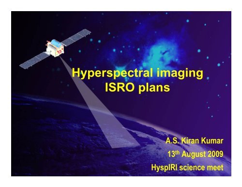
<strong>Hyperspectral</strong> <strong>imaging</strong><br />
<strong>ISRO</strong> <strong>plans</strong><br />
A.S. Kiran Kumar<br />
13 th August 2009<br />
<strong>HyspIRI</strong> science meet
Hyperion<br />
AIMS<br />
224 bands<br />
400-2500 nm range<br />
Spectral Resol. 10/11 nm<br />
Spatial Resol. 30 m<br />
Swath 7.5 km<br />
HySi/IMS-1<br />
Data Sources<br />
Field Spectroradiometer<br />
350-1075 (2500) nm range<br />
Resol. 3nm (350-1000nm)<br />
10 nm (100-2500 nm)<br />
CHRIS/PROBA<br />
Various data set:<br />
Land set has<br />
18 bands<br />
438-1035 nm range<br />
6-10 nm bandwidth<br />
Spatial Resol. 17m<br />
Swath 14 km<br />
Multi-angular (5<br />
angles)
Reflectance<br />
0.700<br />
0.600<br />
0.500<br />
0.400<br />
0.300<br />
0.200<br />
0.100<br />
0.000<br />
Towards Building a Spectral Library<br />
Spectral Profile of Vraious Kharif Season Crops<br />
300 600 900 1200 1500 1800 2100 2400<br />
Wavelength (nm)<br />
Paddy<br />
Sorghum<br />
Maize<br />
Finger millet<br />
Cluster bean<br />
Lady finger<br />
Green gram<br />
Horse gram<br />
Cowpea<br />
Dhaincha<br />
Sugarcane<br />
Cotton<br />
Pigeon pea<br />
Groundnut<br />
Soybean<br />
Sesamum<br />
Sunflower<br />
Castor<br />
Other Spectral Observations include: Tree Species in Palampur &<br />
Vadodara, Flowering Plants, Pulse crops at Lalitpur
Reflectance<br />
Crop Stress Detection (Nitrogen)<br />
0.8<br />
0.7<br />
0.6<br />
0.5<br />
0.4<br />
0.3<br />
0.2<br />
0.1<br />
0<br />
N0 N50 N100 N150 N200 N250 N300<br />
300 400 500 600 700<br />
Wavelength (nm)<br />
800 900 1000 1100<br />
• 7 levels of nitrogen applied to potato crop<br />
• Lower level of nitrogen had low NIR reflectance and high red reflectance
Forest Species Classification<br />
<strong>Study</strong> Area: Shoolpaneswar Forest<br />
Data Used: Hyperion Data of October<br />
Approach: Band Selection using PLSR technique, SAM Classification<br />
Spectral Angle Mapper 9 band
Geological <strong>Study</strong> using Hyperion data<br />
End Member Spectra derived using ASD Spectrometer and SAM classified mineral map<br />
Parts of Dongargarh area (Chattisgarh)<br />
showing weathered/altered minerals
Ocean Optical Properties<br />
Free-fall (profiling) Mode<br />
Buoy Mode<br />
• Bio-optical characterization of Arabian Sea water in open ocean and coastal<br />
waters using hyperspectral under water radiometer<br />
• Cruise started from Kochi and went up to off Veraval; Encountered<br />
Trichodesmium blooms<br />
Trichodesmium Bloom<br />
• <strong>Hyperspectral</strong> under water radiometer with 3.0 nm spectral resolution in 300 – 900<br />
nm spectral range both Free-fall (profiling) mode and Buoy mode
AirBorne Imaging Spectrometer AIMS<br />
Altitude: 6 km<br />
GSD : 4 m<br />
Swath : ~1.6 km<br />
Spectral Range: 456-889 nm<br />
Number of Bands: 143<br />
Band Width: 3.3-4.1 nm<br />
Grating<br />
• Airborne <strong>Hyperspectral</strong> Imager (AHySI)<br />
• Spectral Range: 420-950 nm;<br />
• Spectral sampling interval: 1.2 nm;<br />
• Number of Bands:512<br />
• Bandwidth:12-15nms<br />
• Wedge filter<br />
• 5 meter GSD
<strong>Hyperspectral</strong> imager on<br />
IMS-1<br />
Size (mm) : 155 (R) x 194 (P) x 211 (Y)<br />
Mass (kg) : 2.9<br />
Power (W): 0.88 (Regulated), 2.5 (Raw )<br />
64 bands<br />
400-950 nm range<br />
Spectral interval 8 nm<br />
GSD 500 m<br />
Swath 129.5 km<br />
Quantisation 10 bits
HySI Rad Image<br />
Atm,. Corr. by FLAASH<br />
Reflectance<br />
NDVI Threshoding<br />
& Masking<br />
MNF Bands<br />
PPI<br />
SAM<br />
Classification<br />
Crop Classification using HySI Data<br />
HySI FCC<br />
Part of Punjab, India<br />
22-Dec, 2008<br />
First 3 MNF Bands<br />
Non Agriculture Mask<br />
NDVI<br />
Classified Image<br />
Wheat<br />
Early Wheat<br />
Potato/Veg.<br />
Forest<br />
Other Non Agr
2.5 m Pan<br />
25 m HySpectral<br />
Swath 25 km<br />
Six bands<br />
Launch 2013
Technique<br />
Spectral Coverage<br />
(nm)<br />
Spectral Resolution<br />
(nm)<br />
Spatial Resolution<br />
Swath<br />
Optics<br />
SNR<br />
Digitization (bits)<br />
Spectral Dispersion<br />
Data rate<br />
Spaceborne HSI - LEO, 630 km<br />
Pushbroom<br />
VNIR : 400 ∼ 900<br />
SWIR: 850 ∼ 2400<br />
VNIR Better than 3 nm<br />
SWIR : 6 - 7 nm<br />
25 m<br />
25 Km<br />
All reflective<br />
VNIR : > 500 @ 495 nm<br />
SWIR : > 350 @ 2200 nm<br />
> 14<br />
Grating<br />
VNR: 2.3 Gbits/sec (for 166 Bands)<br />
SWIR : 2.3 Gbits/sec (for 256 Bands)
GEO Based High Resolution Imaging mission<br />
Imaging in visible and IR bands<br />
Multi spectral VNIR 50 m<br />
Hyper spectral VNIR 250m<br />
Hyper spectral SWIR 500m<br />
Multi spectral TIR 1500m<br />
Imager<br />
Vis - Mx<br />
VNIR Hysp<br />
SWIR Hysp<br />
TIR - Mx<br />
Vis<br />
Area Covered<br />
500km x 7800km<br />
250km x 7800km<br />
250km x 7800km<br />
250km x 7800 km<br />
4500km x 7800 km<br />
Time for<br />
Scanning<br />
10 min<br />
10 min<br />
10 min<br />
10 min<br />
90 min
Current New<br />
Vis 1000 m GSD ~50 m GSD<br />
bands 3 4<br />
~250m <strong>Hyperspectral</strong><br />
SWIR ~500 m <strong>Hyperspectral</strong><br />
TIR 8000 m single Band ~1500 m Multi band
GISAT Payload consists of<br />
700mm RC telescope<br />
Array detectors in VNIR, SWIR and TIR bands<br />
Camera electronics and data handling system<br />
Electronically steerable transmit antenna system<br />
High agility platform to enable large payload<br />
steering requirements
Data rate for various bands<br />
Imager<br />
HRMXVNIR ( 4 bands, 50m<br />
resolution, 500Km swath)<br />
HYSI(VNIR) (60 bands, 250m<br />
resolution, 250Km swath)<br />
HYSI(SWIR) (150 bands, 250m<br />
resolution, 250Km swath)<br />
HRMXTIR (3 bands, 1.5Km<br />
resolution, 250Km swath)<br />
Net overall Data Transmission Rate<br />
Slow scan<br />
(0.005°/s)<br />
34 Mbps<br />
3 Mbps<br />
25 Mbps<br />
0.02 Mbps<br />
≈ 64 Mbps<br />
Fast scan<br />
(0.02°/s)<br />
134Mbps<br />
12Mbps<br />
98Mbps<br />
0.08Mbps<br />
≈ 200 Mbps
Spacecraft designed for direct injection into geo-stationary orbit by<br />
GSLV.<br />
GISAT orbital slot is around 83deg E.<br />
Scanning modes :<br />
Earth disc scanning (18x18 deg) – 5 hrs<br />
Sub continent scanning (10x12 deg) – 1.5 hrs<br />
Launch 2012
Summary<br />
Airborne: Currently Airborne <strong>Hyperspectral</strong><br />
imagers operate in VNIR<br />
Extension: SWIR (upto 2.5 microns ) and<br />
TIR (7 to14 microns)<br />
Spaceborne <strong>Hyperspectral</strong> imagers<br />
<strong>Hyperspectral</strong> imager in VNIR region flown on IMS<br />
Resourcesat 3 will carry <strong>Hyperspectral</strong> sampler<br />
Geoplatform based <strong>Hyperspectral</strong> imager is being<br />
developed
Thank you


