Transportation Plan - City of Williston
Transportation Plan - City of Williston
Transportation Plan - City of Williston

You also want an ePaper? Increase the reach of your titles
YUMPU automatically turns print PDFs into web optimized ePapers that Google loves.
<strong>City</strong> <strong>of</strong> <strong>Williston</strong><br />
<strong>Transportation</strong> <strong>Plan</strong><br />
August 24, 2010<br />
Prepared by:<br />
SRF Consulting Group, Inc.<br />
SRF No. 6505
Acknowledgments<br />
The following individuals played an important role in updating the <strong>Williston</strong> Comprehensive<br />
Land Use and <strong>Transportation</strong> <strong>Plan</strong>.<br />
<strong>Plan</strong>ning Advisory Committee<br />
• Glenn Boyeff, <strong>City</strong> <strong>Plan</strong>ning and Zoning Commission<br />
• Janice Arnson, <strong>City</strong> <strong>Plan</strong>ning and Zoning Commission<br />
• Brent Bogar, <strong>Williston</strong> <strong>City</strong> Commission and Williams County <strong>Plan</strong>ning and Zoning<br />
• David Hermanson, Williams County <strong>Plan</strong>ning and Zoning Commission<br />
• Marlyce Wilder, Williams County Board <strong>of</strong> Commissioners<br />
• Chris Kittleson, <strong>Williston</strong> Public Schools<br />
• Frank Keogh, Economic Development<br />
• Jeff Zarling, Chamber <strong>of</strong> Commerce<br />
• Larry Grondahl, Park District<br />
• Deeann Long, North Dakota Community Action Partnership Region 1<br />
• Roger Cymbaluk, Real Estate<br />
• Fred Douglas, <strong>Williston</strong> Township<br />
• Melanie Stillwell, Community Representative<br />
<strong>Williston</strong> <strong>City</strong> Commission<br />
• E. Ward Koeser<br />
• H. James Lawson<br />
• Brad Bekkedahl<br />
• Brent Bogar<br />
• Howard Klug<br />
• Tate Cymbaluk<br />
<strong>Williston</strong> <strong>Plan</strong>ning and Zoning Commission<br />
• Glenn Boyeff<br />
• Janice Arnson<br />
• Chris J. Brostuen<br />
• Paul Arnson<br />
• Jerry Fleck<br />
• Cynthia Aafedt<br />
• Tim Kleven<br />
• Deeann Long<br />
• Jon Maristuen<br />
The <strong>Williston</strong> Comprehensive <strong>Plan</strong> addresses areas outside city limits, both in the extraterritorial<br />
area and beyond the extraterritorial area; therefore the Williams County <strong>Plan</strong>ning Commission<br />
and Board <strong>of</strong> Commissioners has been involved in the review and adoption <strong>of</strong> the plan.<br />
Williams County Board <strong>of</strong> Commissioners<br />
• Martin Hanson-Zahl - District #1<br />
• Dan Kalil, Chairman - District #2<br />
<strong>Williston</strong> <strong>Transportation</strong> <strong>Plan</strong> i<br />
August 2010
• Don Arnson, Vice Chairman - District #3<br />
• David Montgomery - District #4<br />
• Raymond Schmidt - District #5<br />
• Barry Ramberg - District #5<br />
Williams County <strong>Plan</strong>ning and Zoning Commission<br />
• Ted Haugen, District #1<br />
• David Hermanson, District #2<br />
• Glendon Olson, District #3<br />
• George Pederson, District #4<br />
• Noelyn Meckle, District #5<br />
• Jamie Eraas, Member-at-large<br />
• Jim Lawson, Chairman, <strong>City</strong> Representative<br />
• Brent Bogar, <strong>City</strong> Representative<br />
• Dan Kalil, Vice Chair, County Representative<br />
• Tate Cymbaluk, <strong>City</strong> Representative<br />
Local Government and Agency Staff<br />
• Kent Jarcik, <strong>City</strong> <strong>Plan</strong>ner<br />
• Elaine Sinness, Assistant <strong>City</strong> <strong>Plan</strong>ner<br />
• Monte Meiers, <strong>City</strong> Engineer<br />
• John Kautzman, <strong>City</strong> Auditor<br />
• Pete Furuseth, <strong>City</strong> Attorney<br />
• Monte Meiers, <strong>City</strong> Engineer<br />
• James Lokken, Police Chief<br />
• Doug Lalim, Building Official<br />
• Rick Marburger, Airport Manager<br />
• Alan Hanson, Fire Chief<br />
• Tom Rolfstad, Economic Development Director<br />
• Darin Krueger, Parks Director<br />
• Walt Peterson, District Engineer<br />
• Paul Benning, Local Government<br />
• Stewart Milakovic<br />
• Shawna Gooch-Egge, Director <strong>of</strong> Tax Equalization<br />
• Jenelle Loomer, Williams County <strong>Plan</strong>ner<br />
<strong>Williston</strong> <strong>Transportation</strong> <strong>Plan</strong> ii<br />
August 2010
TABLE OF CONTENTS PAGE<br />
INTRODUCTION ......................................................................................................................................................... 1<br />
STUDY AREA ............................................................................................................................................................. 1<br />
STUDY PURPOSE ........................................................................................................................................................ 1<br />
HIGHWAY 2 (WEST DAKOTA PARKWAY) CORRIDOR STUDY ..................................................................................... 1<br />
CHAPTER 1: EXISTING CONDITIONS .................................................................................................................... 4<br />
1.1 ROADWAY SYSTEMS PLAN .......................................................................................................................... 4<br />
Jurisdictional Classification ................................................................................................................................. 4<br />
Functional Classification ...................................................................................................................................... 6<br />
Existing Roadway and Traffic Capacity ............................................................................................................ 10<br />
Existing Traffic Volumes ................................................................................................................................... 11<br />
Existing Traffic Operations ................................................................................................................................ 11<br />
Continuity and Connectivity .............................................................................................................................. 16<br />
Safety ................................................................................................................................................................. 16<br />
1.2 TRANSIT SERVICES .................................................................................................................................... 20<br />
Transit Service Providers ................................................................................................................................... 20<br />
1.3 PASSENGER RAIL SERVICE ........................................................................................................................ 21<br />
1.4 FREIGHT SYSTEM ...................................................................................................................................... 23<br />
Existing Truck Routes ........................................................................................................................................ 23<br />
Railroad Service ................................................................................................................................................. 23<br />
1.5 BICYCLE AND PEDESTRIAN SYSTEM .......................................................................................................... 23<br />
1.6 SLOULIN FIELD INTERNATIONAL AIRPORT ................................................................................................ 27<br />
CHAPTER 2: PUBLIC INVOLVEMENT .................................................................................................................. 28<br />
2.1 METHODS OF PUBLIC INVOLVEMENT ........................................................................................................ 28<br />
<strong>Plan</strong>ning Advisory Committee ........................................................................................................................... 28<br />
Public Meetings.................................................................................................................................................. 28<br />
Focus Group Meetings ....................................................................................................................................... 28<br />
Project Website .................................................................................................................................................. 29<br />
Community Survey ............................................................................................................................................ 29<br />
Governing Body Meeting Presentations and Hearings ...................................................................................... 29<br />
2.2 KEY TRANSPORTATION ISSUES IDENTIFIED THROUGH PUBLIC INVOLVEMENT PROCESS ........................... 29<br />
CHAPTER 3: TRANSPORATION SYSTEM GOALS AND OBJECTIVES ............................................................ 32<br />
3.1 GOAL 1: SAFETY ....................................................................................................................................... 32<br />
3.2 GOAL 2: EFFICIENT MOVEMENT ............................................................................................................... 32<br />
3.3 GOAL 3: MULTIMODAL ............................................................................................................................. 32<br />
3.4 GOAL 4: LAND USE/DEVELOPMENT ......................................................................................................... 33<br />
3.5 GOAL 5: COORDINATION BETWEEN JURISDICTIONS .................................................................................. 33<br />
3.6 GOAL 6: ECONOMIC DEVELOPMENT ......................................................................................................... 33<br />
3.7 GOAL 7: INVESTMENTS AND USE OF FUNDING ......................................................................................... 33<br />
CHAPTER 4: FUTURE TRAFFIC PROJECTIONS .................................................................................................. 34<br />
4.1 METHODOLOGY......................................................................................................................................... 34<br />
4.2 PROJECTING FUTURE TRAFFIC VOLUMES .................................................................................................. 34<br />
4.3 SYSTEM ALTERNATIVES ............................................................................................................................ 34<br />
4.4 2020 BASE SCENARIO ............................................................................................................................... 35<br />
Roadway Network Improvements ...................................................................................................................... 35<br />
Traffic Volumes ................................................................................................................................................. 39<br />
System Deficiencies ........................................................................................................................................... 39<br />
4.5 2035 BASE SCENARIO ............................................................................................................................... 39<br />
Roadway Network Improvements ...................................................................................................................... 39<br />
Traffic Volumes ................................................................................................................................................. 40<br />
System Deficiencies ........................................................................................................................................... 40<br />
4.6 2035 ALTERNATIVE 1 ................................................................................................................................ 44<br />
Roadway Network Improvements ...................................................................................................................... 44<br />
Traffic Volumes ................................................................................................................................................. 45<br />
<strong>Williston</strong> <strong>Transportation</strong> <strong>Plan</strong> iii<br />
August 2010
System Deficiencies ........................................................................................................................................... 45<br />
4.7 YEAR 2035 ALTERNATIVE 2 ...................................................................................................................... 48<br />
Roadway Network Improvements ...................................................................................................................... 48<br />
Traffic Volumes ................................................................................................................................................. 49<br />
System Deficiencies ........................................................................................................................................... 49<br />
CHAPTER 5: FUTURE TRANSPORTATION SYSTEM RECCOMENDATIONS ................................................. 53<br />
5.1 FUTURE ROADWAY SYSTEM IMPROVEMENTS ........................................................................................... 53<br />
5.2 FUTURE FUNCTIONAL CLASSIFICATION..................................................................................................... 58<br />
5.3 JURISDICTIONAL TRANSFERS ..................................................................................................................... 58<br />
Right <strong>of</strong> Way Preservation ................................................................................................................................. 60<br />
Access Management .......................................................................................................................................... 61<br />
5.4 FREIGHT SYSTEM IMPROVEMENTS ............................................................................................................ 65<br />
Truck Facilities .................................................................................................................................................. 65<br />
Railroad Facilities .............................................................................................................................................. 65<br />
5.5 BICYCLE AND PEDESTRIAN SYSTEM IMPROVEMENTS ................................................................................ 65<br />
Improvements to Existing System...................................................................................................................... 66<br />
New and Extended Trail Alignments ................................................................................................................. 66<br />
Sidewalk Construction and Maintenance ........................................................................................................... 66<br />
5.6 TRANSIT SERVICE IMPROVEMENTS ........................................................................................................... 66<br />
CHAPTER 6: IMPLEMENTATION PLAN ............................................................................................................... 67<br />
6.1 RECOMMENDED SHORT-RANGE IMPROVEMENTS ...................................................................................... 67<br />
Estimated Costs .................................................................................................................................................. 67<br />
6.2 RECOMMENDED LONG-RANGE IMPROVEMENTS........................................................................................ 69<br />
Estimated Costs .................................................................................................................................................. 69<br />
6.3 FUNDING STRATEGIES ............................................................................................................................... 70<br />
LIST OF FIGURES PAGE<br />
FIGURE 1: STUDY AREA........................................................................................................................................... 3<br />
FIGURE 2: EXISTING ROADWAY JURISDICTIONAL CLASSIFICATION ......................................................... 5<br />
FIGURE 3: ACCESS/MOBILITY RELATIONSHIP ................................................................................................... 6<br />
FIGURE 4: EXISTING ROADWAY FUNCTIONAL CLASSIFICATION ................................................................ 9<br />
FIGURE 5: ROADWAY TRAFFIC CAPACITY AND TRAFFIC SIGNALS .......................................................... 12<br />
FIGURE 6: 2005 AADT TRAFFIC VOLUMES – NORTH ...................................................................................... 13<br />
FIGURE 7: 2005 AADT TRAFFIC VOLUMES – SOUTH ....................................................................................... 14<br />
FIGURE 8: EXISTING TRAFFIC OPERATIONS .................................................................................................... 15<br />
FIGURE 9: FACTORS LIMITING CONTINUITY AND CONNECTIVITY ........................................................... 18<br />
FIGURE 10: HIGH CRASH LOCATIONS ................................................................................................................ 19<br />
FIGURE 11: EXISTING TRUCK ROUTES .............................................................................................................. 25<br />
FIGURE 12: EXISTING AND PLANNED PARKS AND TRAILS .......................................................................... 26<br />
FIGURE 13: MODELED ROADWAYS .................................................................................................................... 36<br />
FIGURE 14: FUTURE ADT: BASE SCENARIO ...................................................................................................... 37<br />
FIGURE 15: VOLUME/CAPACITY RATIO: BASE SCENARIO ........................................................................... 38<br />
FIGURE 16: 2035 FUTURE ADT: BASE SCENARIO ............................................................................................. 42<br />
FIGURE 17: 2035 VOLUME/CAPACITY RATIO: BASE SCENARIO ................................................................... 43<br />
FIGURE 18: 2035 FUTURE ADT: ALTERNATIVE 1 ............................................................................................. 46<br />
FIGURE 19: 2035 VOLUME/CAPACITY RATIO: ALTERNATIVE 1 ................................................................... 47<br />
FIGURE 20: 2035 FUTURE ADT: ALTERNATIVE 2 ............................................................................................. 51<br />
FIGURE 21: 2035 VOLUME/CAPACITY RATIO: ALTERNATIVE 2 ................................................................... 52<br />
FIGURE 22: FUTURE ROADWAY IMPROVEMENTS .......................................................................................... 54<br />
FIGURE 23: FUTURE ROADWAY FUNCTIONAL CLASSIFICATION ............................................................... 59<br />
FIGURE 24: ACCESS/CRASH RELATIONSHIP ..................................................................................................... 63<br />
LIST OF TABLES PAGE<br />
TABLE 1: PLANNING-LEVEL ROADWAY CAPACITIES BY FACILITY TYPE ............................................... 10<br />
TABLE 2: TOP 24 CRASH LOCATIONS IN WILLISTON 2005-2008 (BY FREQUENCY OF CRASHES) ........ 20<br />
<strong>Williston</strong> <strong>Transportation</strong> <strong>Plan</strong> iv<br />
August 2010
TABLE 3: PARATRANSIT AND TRANSPORTATION SERVICE PROVIDERS ................................................. 22<br />
TABLE 4: 2020 SHORT-RANGE TRANSPORTATION IMPROVEMENTS ......................................................... 55<br />
TABLE 5: 2035 LONG-RANGE TRANSPORTATION IMPROVEMENTS ........................................................... 57<br />
TABLE 6: CITY OF WILLISTON RIGHT-OF-WAY GUIDELINES ...................................................................... 60<br />
TABLE 7: ACCESS MANAGEMENT GUIDELINES FOR THE CITY OF WILLISTON, NORTH DAKOTA .... 62<br />
TABLE 8: ESTIMATED COST FOR SHORT-TERM IMPROVEMENTS .............................................................. 68<br />
TABLE 9: ESTIMATED COSTS FOR LONG-RANGE IMPROVEMENTS ........................................................... 69<br />
LIST OF APPENDICIES<br />
APPENDIX A: PUBLIC PARTICIPATION<br />
APPENDIX B: TRAFFIC MODEL TECHNICAL MEMO<br />
<strong>Williston</strong> <strong>Transportation</strong> <strong>Plan</strong> v<br />
August 2010
INTRODUCTION<br />
The <strong>City</strong> <strong>of</strong> <strong>Williston</strong> is experiencing a period <strong>of</strong> significant growth, in part due to the renewed<br />
expansion <strong>of</strong> energy related industries in western North Dakota. This growth has resulted in a<br />
need to update the city’s Comprehensive <strong>Plan</strong> and <strong>Transportation</strong> <strong>Plan</strong>. The Comprehensive <strong>Plan</strong><br />
established goals, objective and policies that guide the city’s future growth. Future growth can’t<br />
occur without expansion <strong>of</strong> the city’s transportation system. The <strong>Transportation</strong> <strong>Plan</strong> which was<br />
developed in conjunction with the Comprehensive <strong>Plan</strong> addresses future truck routes, and<br />
encourages access management and safety improvements. The plan also addresses future<br />
improvements to non-motorized forms <strong>of</strong> transportation.<br />
The <strong>Transportation</strong> <strong>Plan</strong> identifies a series <strong>of</strong> roadway improvement needs based on projected<br />
growth in the short range (year 2020) and for the long range (year 2035). The implementation <strong>of</strong><br />
these improvements will be based on development needs and financial constraints. The plan is a<br />
guide that, when used in conjunction with the Comprehensive <strong>Plan</strong>, insures that the future<br />
transportation system will provide for the safe and efficient movement <strong>of</strong> people and goods in<br />
the <strong>City</strong> <strong>of</strong> <strong>Williston</strong> and surrounding region.<br />
Study Area<br />
The <strong>City</strong> <strong>of</strong> <strong>Williston</strong> is located in the northwestern corner <strong>of</strong> the state <strong>of</strong> North Dakota in<br />
Williams County. The city is bordered by <strong>Williston</strong> Township to the south and west, Missouri<br />
Ridge Township to the northwest, Pherrin Township to the northeast, and Stony Creek Township<br />
to the East. The east side <strong>of</strong> the city is bordered by the Little Muddy River (with the exception <strong>of</strong><br />
a small annexed area east <strong>of</strong> the river), while the south side is bordered by the Missouri River.<br />
The city’s extraterritorial area (ETA) includes the areas in the surrounding townships, within<br />
one-mile <strong>of</strong> the city boundary. Figure 1 shows the study area for this transportation plan, which<br />
includes the <strong>City</strong> <strong>of</strong> <strong>Williston</strong> and the surrounding Townships.<br />
Study Purpose<br />
The purpose <strong>of</strong> the <strong>Transportation</strong> <strong>Plan</strong> is to provide the policy and program guidance needed to<br />
make appropriate transportation related decisions as development occurs and elements <strong>of</strong> the<br />
transportation system need to be upgraded. The <strong>Transportation</strong> <strong>Plan</strong> demonstrates how the <strong>City</strong><br />
<strong>of</strong> <strong>Williston</strong> will provide for an integrated transportation system that will serve the future needs<br />
<strong>of</strong> its residents and businesses, support the city’s development plans, and accommodate the<br />
increases in heavy truck traffic through the city, resulting from new industrial development.<br />
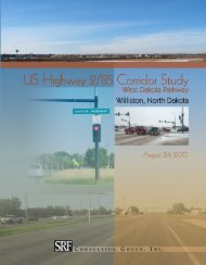
Highway 2 (West Dakota Parkway) Corridor Study<br />
The city is bisected by US Highway 2/85, which traverses the city in a southwest to northeast<br />
direction. The four-lane highway originally served as a bypass route for through traffic; however,<br />
as growth within the city has occurred, the areas surrounding the highway (north and west) have<br />
developed and traffic volumes have increased. This has raised concerns over impact <strong>of</strong> the<br />
highway on the local system. In order to address these concerns, the US Highway 2/85 (West<br />
Dakota Parkway) Corridor Study was undertaken. The purpose <strong>of</strong> this study was to determine<br />
how to address traffic operations and safety concerns on the highway as the city continues to<br />
grow and traffic volumes continue to increase.<br />
The corridor study was prepared as a separate document, but is tied to the <strong>Transportation</strong> <strong>Plan</strong> as<br />
the same growth assumptions and traffic projection methodology were used for both. As part <strong>of</strong><br />
<strong>Williston</strong> <strong>Transportation</strong> <strong>Plan</strong> 1<br />
August 2010
the study, an analysis <strong>of</strong> the existing and future operations at eight key intersections was<br />
conducted and recommendations to improve traffic operations and increase safety along the<br />
corridor were prepared. The general recommendations <strong>of</strong> the corridor study are included in this<br />
Report (Chapter 5: Recommendations for Future <strong>Transportation</strong> System). The full US Highway<br />
2/85 (Dakota Parkway) Corridor Study Report, including the alternatives considered and detailed<br />
conclusions and recommendations, is available from the <strong>City</strong> <strong>of</strong> <strong>Williston</strong> and the North Dakota<br />
Department <strong>of</strong> <strong>Transportation</strong>.<br />
<strong>Williston</strong> <strong>Transportation</strong> <strong>Plan</strong> 2<br />
August 2010
J:\Maps\6505\mxd\figure1_projectlocation.mxd<br />
<strong>Williston</strong><br />
Township<br />
General Legend<br />
Missouri Ridge<br />
Township<br />
1 Mile<br />
)g<br />
)q<br />
Extraterritorial Area (ETA)<br />
<strong>Williston</strong> <strong>City</strong> Limits<br />
Township Boundaries<br />
0 1 2<br />
Study Area<br />
Miles°<br />
<strong>Williston</strong> <strong>Transportation</strong> <strong>Plan</strong><br />
<strong>Williston</strong>, North Dakota<br />
W I L L I A M S C O U N T Y<br />
)g<br />
)q<br />
Sloulin Field<br />
International Airport<br />
W i l l i s t o n<br />
Little<br />
Muddy<br />
River<br />
M i s s o u r i R i v e r<br />
Pì<br />
Burlington Northern Railroad<br />
Pherrin Township<br />
Stony Creek<br />
Township<br />
Figure 1
CHAPTER 1: EXISTING CONDITIONS<br />
1.1 Roadway Systems <strong>Plan</strong><br />
The roadway network in the <strong>City</strong> <strong>of</strong> <strong>Williston</strong> is comprised <strong>of</strong> two major regional highways,<br />
several county and township roads, and a system <strong>of</strong> local roadways interconnecting the overall<br />
network. The <strong>City</strong>'s existing roadway network is shown in Figure 2. In order to accommodate<br />
anticipated growth and respond to congestion, connectivity, and safety issues, the transportation<br />
system in <strong>Williston</strong> is expected to expand. This section <strong>of</strong> the <strong>Transportation</strong> <strong>Plan</strong> will address<br />
existing roadway jurisdiction, functional classification, traffic capacity and volumes, traffic<br />
operations, continuity and connectivity, and roadway safety.<br />
Jurisdictional Classification<br />
Roadways in the <strong>City</strong> <strong>of</strong> <strong>Williston</strong> are administered by different agencies, depending upon their<br />
jurisdictional classification. The North Dakota Department <strong>of</strong> <strong>Transportation</strong> (NDDOT)<br />
maintains state highways, Williams County maintains county roads, and the remaining roads<br />
inside city limits are maintained by the <strong>City</strong> <strong>of</strong> <strong>Williston</strong>. Outside city limits, including the<br />
extraterritorial area (ETA), local roads are the responsibility <strong>of</strong> the townships (Missouri Ridge,<br />
<strong>Williston</strong>, Pherin, and Stony Creek). The city, county and state work together in the planning and<br />
improvement <strong>of</strong> the roadway system in the city. The existing roadway jurisdiction is shown on<br />
the map included in Figure 2.<br />
The jurisdictional classification system is intended to maintain a balance <strong>of</strong> responsibility among<br />
the various transportation agencies and is organized around the principle that the highest volume<br />
limited access roadways that carry regional trips (US and state highways) are primarily<br />
maintained by NDDOT. The intermediate volume roadways, which carry medium length trips<br />
and the local street system, are maintained by the county and city. There is currently one US<br />
highway (US Highway 2/85), one state highway (ND State Highway 1804), several county and<br />
township roads, and a system <strong>of</strong> local roadways interconnecting the overall network within the<br />
<strong>City</strong> <strong>of</strong> <strong>Williston</strong>. The county roads are mainly located in the city’s extraterritorial area (ETA).<br />
Once annexation has occurred, the jurisdictional responsibility for county roads has shifted to the<br />
<strong>City</strong>.<br />
Occasionally, as a result <strong>of</strong> development, changes in traffic patterns or the construction <strong>of</strong> new<br />
facilities, the jurisdictional classification needs to be adjusted to reflect changes in the way<br />
certain roadways are used. No recent jurisdictional transfers within the <strong>City</strong> <strong>of</strong> <strong>Williston</strong> have<br />
occurred. However, it will be necessary to determine which jurisdictional classification is<br />
appropriate for any newly constructed roadways within the city and the surrounding area.<br />
<strong>Williston</strong> <strong>Transportation</strong> <strong>Plan</strong> 4<br />
August 2010
J:\Maps\6505\mxd\figure_roadwayjurisdiction.mxd<br />
EVERSON DR<br />
139TH AVE NW<br />
53RD ST NW<br />
52ND ST NW<br />
51ST ST NW<br />
<strong>Williston</strong><br />
Township<br />
Missouri Ridge<br />
Township<br />
55TH ST NW<br />
W FRONT ST<br />
General Legend<br />
138TH AVE NW<br />
)g<br />
Extraterritorial Area (ETA)<br />
<strong>Williston</strong> <strong>City</strong> Limits<br />
Township Boundaries<br />
0 0.5 1<br />
)q<br />
Miles °<br />
32ND ST W<br />
29TH ST W<br />
28TH ST W<br />
20TH AVE W<br />
19TH AVE W<br />
16TH AVE W<br />
42ND ST W<br />
Sloulin Field<br />
International Airport<br />
26TH ST W<br />
)g<br />
)q<br />
W i l l i s t o n<br />
11TH ST W<br />
58TH ST W<br />
DAVIDSON DR<br />
DAKOTA PKWY W<br />
70TH ST E<br />
65TH ST E<br />
34TH ST E<br />
10TH ST W<br />
9TH ST W<br />
8TH ST W<br />
7TH ST<br />
5TH ST W<br />
4TH ST W<br />
W<br />
9TH ST E<br />
RIVERSIDE DR W<br />
6TH AVE W<br />
6TH ST W<br />
BROADWAY W<br />
2ND ST W<br />
FRONTAGE ROAD<br />
1ST AVE E<br />
66TH ST<br />
53RD ST E<br />
3RD AVE E<br />
1 Mile<br />
42ND ST E<br />
18TH ST E<br />
HILLCT E<br />
ROSE LN<br />
11TH St E<br />
4TH AVE E<br />
8TH ST E<br />
26TH ST E<br />
2ND ST E<br />
1ST ST E<br />
4TH ST E<br />
56TH ST NW<br />
rr<br />
RR ii vv ee oo uu rr i i MM ii ss ss E<br />
6TH AVE E<br />
8TH AVE E<br />
RIVERSIDE DR E<br />
Existing Roadway Jurisdictional Classification<br />
<strong>Williston</strong> <strong>Transportation</strong> <strong>Plan</strong><br />
<strong>Williston</strong>, North Dakota<br />
9TH AVE W<br />
2ND AVE W<br />
1ST AVE W<br />
2ND AVE E<br />
MAIN ST<br />
11TH AVE E<br />
E DAKOTA PKWY<br />
135TH AVE NW<br />
13TH AVE E<br />
12TH AVE E<br />
54TH ST NW<br />
Little<br />
Muddy<br />
River<br />
BROADWAY E<br />
134TH AVE NW<br />
Pherrin Township<br />
Stony Creek<br />
Township<br />
Burlington Northern Railroad<br />
133RD DR NW<br />
Pì<br />
133RD AVE NW<br />
Roadway Jurisdiction<br />
US Highway<br />
State Highway<br />
County Road<br />
Township Road<br />
Municipal Road<br />
53RD LN NW<br />
[PRAIRIE TRL]<br />
49TH ST NW<br />
132ND DR NW<br />
Figure 2
Functional Classification<br />
Roadway functional classification categories are defined by the role <strong>of</strong> streets and highways in<br />
the overall roadway system. The intent <strong>of</strong> the functional classification system is to create a<br />
hierarchy <strong>of</strong> roads that collect and distribute traffic from neighborhoods to the highway system.<br />
Roadways with a higher functional classification (arterials) generally provide for longer trips,<br />
have more mobility, have limited access and connect larger centers. Roadways with a lower<br />
functional classification (collectors and local streets) generally provide for shorter trips, have<br />
lower mobility, have more access and connect to higher functioning roadways. A balance <strong>of</strong> all<br />
functions <strong>of</strong> roadways is important to any transportation network. Figure 3 depicts the<br />
relationship <strong>of</strong> the various functional classifications to access and mobility.<br />
Figure 3: Access/Mobility Relationship<br />
The <strong>City</strong> <strong>of</strong> <strong>Williston</strong> has a functionally classified roadway system consisting <strong>of</strong> principal<br />
arterials, minor arterials, major collectors, minor collectors and local roads. The following is a<br />
description <strong>of</strong> the existing functional classification system within the city, which is also shown in<br />
Figure 4.<br />
Principal Arterials<br />
Principal arterials are intended to provide a high level <strong>of</strong> mobility with very limited access,<br />
connecting major activity centers. The principal arterial system in <strong>Williston</strong> connects the city to<br />
nearby industry, the interstate system, and other regional activity centers. Principal arterials<br />
serving the <strong>City</strong> <strong>of</strong> <strong>Williston</strong> include US Highway 2/85 (2nd Avenue West/Dakota Parkway<br />
West), 2nd Avenue West, and ND State Highway 1804 (Broadway East, 1st Street East, and<br />
2nd Street West). The following is a description <strong>of</strong> each:<br />
<strong>Williston</strong> <strong>Transportation</strong> <strong>Plan</strong> 6<br />
August 2010
• US Highway 2 and US Highway 85 run on a shared route through the <strong>City</strong> <strong>of</strong> <strong>Williston</strong>.<br />
Within the city, US Highway 2/85 is a four lane, principal arterial roadway which runs<br />
north/south along 2nd Avenue West and northeast/southwest along West Dakota<br />
Parkway.<br />
The principal arterial designation continues north/south along 2nd Avenue West as<br />
Business 2/85, past the intersection <strong>of</strong> West Dakota Parkway and US Highway 2/85. The<br />
route jogs east at11th Street and continues north/south on Main Street, terminating at the<br />
intersection with 1st Street East.<br />
Outside <strong>of</strong> <strong>Williston</strong>, US Highway 2 is a major roadway, connecting to the Cities <strong>of</strong><br />
Minot and Grand Forks in North Dakota, as well as other cities in Montana. US Highway<br />
85 also plays a vital role in meeting <strong>Williston</strong>’s transportation needs as it is one <strong>of</strong> the<br />
few roadways in northwestern North Dakota that cross Lake Sakakawea and the Missouri<br />
River. In addition, US Highway 85 provides vital north/south connections to Canada and<br />
I-94 and I-90 to the south. Both US Highways 2 and 85 are utilized extensively by local<br />
industries to move equipment and other shipments throughout the region and beyond.<br />
• ND State Highway 1804 is an east/west roadway which crosses the south side <strong>of</strong> the city,<br />
intersecting US Highway 2/85 at the west end <strong>of</strong> the city and continuing past the east city<br />
boundary. On the west side <strong>of</strong> the city, ND State Highway 1804 follows 2nd Street West,<br />
before jogging one block south along 2nd Avenue West and then east along 1st Street<br />
East, to bypass the downtown area. It then jogs north on 7th Avenue East before turning<br />
east on Broadway East.<br />
ND State Highway 1804 is an important roadway for the area as it provides the only<br />
crossing <strong>of</strong> the Little Muddy River within the city. The route is also used heavily by<br />
trucks servicing the many industrial uses along the southern portion <strong>of</strong> the city. To the<br />
east <strong>of</strong> the city, the roadway connects <strong>Williston</strong> to recreation areas on Lake Sakakawea as<br />
well as the Fort Berthold Indian Reservation. To the west <strong>of</strong> <strong>Williston</strong>, ND State<br />
Highway 1804 provides a vital connection to some <strong>of</strong> the area’s largest cultural resources<br />
and tourist attractions, namely Fort Union Trading Post National Historic Site, Ford<br />
Buford State Historic Site, and the Missouri-Yellowstone Confluence Interpretive Center.<br />
Minor Arterials<br />
Minor arterials also emphasize mobility over land access, serving to connect adjacent<br />
neighborhoods and the highway system. Major business concentrations and other important<br />
traffic generators are usually located along minor arterial roadways. In urbanized areas, one to<br />
two mile spacing <strong>of</strong> minor arterials is considered appropriate. A well-planned and adequately<br />
designed system <strong>of</strong> principal and minor arterials will allow the city’s overall street system to<br />
function the way it is intended and will discourage through traffic from using residential streets.<br />
Volumes on principal and minor arterial roadways are expected to be higher than those on<br />
collector or local roadways. Providing the capacity for these higher volumes will keep volumes<br />
on other city streets lower. There are several minor arterial routes within the city. Examples <strong>of</strong><br />
roadway segments designated as minor arterials in the <strong>City</strong> <strong>of</strong> <strong>Williston</strong> include the following<br />
(this list is not all inclusive):<br />
<strong>Williston</strong> <strong>Transportation</strong> <strong>Plan</strong> 7<br />
August 2010
• East Dakota Parkway (Broadway to 26th Street East)<br />
• 42nd Street (16th Avenue West to 13th Avenue East)<br />
• 26th Street (16th Avenue West to 13th Avenue East)<br />
• 18th Street (16 th Avenue West to East Dakota Parkway)<br />
• 11th Street (Dakota Parkway West to East Dakota Parkway except 2 nd Avenue West to<br />
Main Street)<br />
• Broadway East (2nd Avenue West to 7th Avenue East)<br />
• 16th Avenue Northwest (58th Street West to 42nd Street West and 26 th Street West to<br />
11 th Street West, including frontage road)<br />
• 9th Avenue West (Dakota Parkway West to 2nd Street West)<br />
• 2nd Avenue West (11th Street West to 2nd Street)<br />
• University Avenue (42nd Street East to Broadway East)<br />
Collectors<br />
Collectors are designed to serve shorter trips, providing access from neighborhoods to other<br />
collector roadways and the arterial system. They are expected to carry less traffic than arterial<br />
roads and to provide access to some properties. Collectors are typically categorized as major and<br />
minor collectors. Major collectors can link both local streets and minor collectors to minor<br />
arterials, while minor collectors typically connect local streets to other collectors. The functional<br />
classification map shown in Figure 4 combines the city’s system with the county’s system in the<br />
surrounding area. The city’s collector streets are simply designated as collectors, and the<br />
county’s system uses the designation <strong>of</strong> major collector. There are several collector routes within<br />
the city and the surrounding area. Examples <strong>of</strong> roadway segments designated as major collectors<br />
in the <strong>City</strong> <strong>of</strong> <strong>Williston</strong> and the ETA include the following (this list is not all inclusive):<br />
• 56th Street Northwest (US Highway 2/133rd Avenue Northwest)<br />
• County Road 9 - 134th Avenue Northwest (57th Street Northwest) to 53rd Street<br />
Northwest<br />
• 11th Avenue East (54th Street Northwest to 42nd Street East)<br />
Examples <strong>of</strong> collectors include the following (this list is not all inclusive):<br />
• 34th St East (2nd Avenue West to University Avenue)<br />
• 52nd Street Northwest/26th Street West (western city limit to 16th Avenue West)<br />
• 14th Street West (9th Avenue West to University Avenue)<br />
• 6th Street West (14th Avenue West to University Avenue)<br />
• 19th Avenue Northwest/Pheasant Run Parkway (32nd Street West to 11th Street West)<br />
• 14th Avenue West (11th Street West to 2nd Street West)<br />
• 6th Avenue West (18th Street East to 2nd Street West)<br />
• 8th Avenue East (11th Street East to Broadway East)<br />
<strong>Williston</strong> <strong>Transportation</strong> <strong>Plan</strong> 8<br />
August 2010
J:\Maps\6505\mxd\figure_functionalclass.mxd<br />
13926-51ST<br />
EVERSON DR<br />
ST NW<br />
139TH AVE NW<br />
53RD ST NW<br />
52ND ST NW<br />
51ST ST NW<br />
Existing Principal Arterial<br />
Existing Minor Arterial<br />
Existing Major Collector<br />
Existing Collector<br />
Local<br />
Railroad<br />
55TH ST NW<br />
1 Mile<br />
<strong>Williston</strong><br />
Township<br />
W FRONT ST<br />
)g<br />
General Legend<br />
138TH AVE NW<br />
)q<br />
Extraterritorial Area (ETA)<br />
<strong>Williston</strong> <strong>City</strong> Limits<br />
Township Boundaries<br />
0 0.5 1<br />
Miles °<br />
38TH ST W<br />
32nd St W<br />
30TH ST W<br />
29TH ST W<br />
28TH ST W<br />
22ND ST W<br />
22ND AVE W<br />
21ST AVE W<br />
20TH AVE W<br />
19TH AVE W<br />
137TH AVE NW<br />
Missouri Ridge<br />
Township<br />
16TH AVE W<br />
42ND ST W<br />
Sloulin Field<br />
International Airport<br />
)g<br />
)q<br />
W i l l i s t o n<br />
11TH ST W<br />
58TH ST W<br />
CREST ST<br />
DAVIDSON DR<br />
DAKOTA PKWY W<br />
11TH AVE W<br />
2nd St W<br />
70TH ST E<br />
65TH ST E<br />
40TH ST E<br />
38TH ST E<br />
34TH ST E<br />
32nd St W<br />
20TH ST E<br />
10TH ST W<br />
9TH ST W<br />
8TH ST W<br />
7TH ST<br />
5TH ST W<br />
W<br />
4TH ST W<br />
9TH ST E<br />
10TH AVE W<br />
RIVERSIDE DR W<br />
6TH AVE W<br />
6TH ST W<br />
FRONTAGE ROAD<br />
1ST AVE E<br />
66TH ST E<br />
53RD ST E<br />
3RD AVE E<br />
42ND ST E<br />
ROSE LN<br />
11TH St E<br />
4TH AVE E<br />
2ND ST E<br />
33RD ST E<br />
26TH ST E<br />
18TH ST E<br />
HILLCT E<br />
8TH ST E<br />
1ST ST E<br />
35TH ST E<br />
56TH ST NW<br />
rr<br />
RR ii vv ee oo uu rr i i MM ii ss ss Existing Roadway Functional Classification<br />
<strong>Williston</strong> <strong>Transportation</strong> <strong>Plan</strong><br />
<strong>Williston</strong>, North Dakota<br />
9TH AVE W<br />
4TH AVE W<br />
2ND AVE W<br />
1ST AVE W<br />
MAIN ST<br />
2ND AVE E<br />
6TH AVE E<br />
S AVE<br />
11TH AVE E<br />
8TH AVE E<br />
RIVERSIDE DR E<br />
E DAKOTA PKWY<br />
135TH AVE NW<br />
13TH AVE E<br />
12TH AVE E<br />
54TH ST NW<br />
Little<br />
Muddy<br />
River<br />
20TH AVE E<br />
BROADWAY E<br />
134TH AVE NW<br />
50TH RD NW<br />
Pherrin Township<br />
Stony Creek<br />
Township<br />
Burlington Northern Railroad<br />
133RD DR NW<br />
Pì<br />
133RD AVE NW<br />
53RD LN NW<br />
132ND LN NW<br />
[PRAIRIE TRL]<br />
49TH ST NW<br />
132ND DR NW<br />
Figure 4
Local Streets<br />
Local streets provide access to adjacent properties and neighborhoods. Local streets are generally<br />
low speed, and designed to discourage through traffic. All <strong>of</strong> the remaining roadways in the city<br />
that were not listed under the previous functional classifications above fall under the local road<br />
designation.<br />
Existing Roadway and Traffic Capacity<br />
<strong>Plan</strong>ning level capacity thresholds provide a means to evaluate roadway capacity by facility type.<br />
Typical roadway facility types within the <strong>City</strong> <strong>of</strong> <strong>Williston</strong> include four-lane divided rural,<br />
five-lane urban (four-lane divided with turn lanes), four-lane undivided urban, three-lane urban<br />
(two-lane divided with turn lanes), and two-lane undivided urban. The terms urban and rural<br />
describe typical section design (e.g., curb and gutter for urban and ditch drainage for rural), and<br />
do not imply geographic areas.<br />
Table 1 lists the typical planning-level average daily traffic (ADT) capacity ranges and<br />
maximum ADT volume, for each type <strong>of</strong> roadway facility. These volume ranges are based upon<br />
guidance from the Highway Capacity Manual and pr<strong>of</strong>essional engineering judgment. A range is<br />
used since the maximum capacity <strong>of</strong> any roadway design is a theoretical measure that can be<br />
affected by its functional classification, peak traffic flows, access spacing, speed, and other<br />
roadway characteristics. For this analysis, the lower threshold <strong>of</strong> the capacity ranges was used as<br />
the <strong>City</strong> <strong>of</strong> <strong>Williston</strong>’s maximum daily capacity for each facility type. This provides a base-line<br />
measure to evaluate capacity improvements that can be achieved by roadway performance<br />
enhancements.<br />
Table 1: <strong>Plan</strong>ning-Level Roadway Capacities by Facility Type<br />
Facility Type*<br />
<strong>Plan</strong>ning Level<br />
Daily Capacity<br />
Ranges (ADT)<br />
<strong>Williston</strong> Daily<br />
Capacity (ADT)<br />
Two-lane undivided urban 8,000-10,000 8,000 6,800<br />
Two-lane undivided rural 14,000-15,000 14,000 11,900<br />
Three-lane urban<br />
(Two-lane divided with turn lanes)<br />
14,000-17,000 14,000** 11,900<br />
Four-lane undivided urban 18,000-22,000 18,000 15,300<br />
Five-lane urban<br />
(Four-lane divided with turn lanes)<br />
28,000-32,000 28,000 23,800<br />
<strong>Williston</strong><br />
Approaching<br />
Capacity (85% ADT)<br />
Four-lane divided rural 35,000-38,000 35,000 29,750<br />
* The terms urban and rural describe typical section design (e.g., curb and gutter for urban and ditch drainage for<br />
rural) and do not imply geographic areas.<br />
** If access is limited/controlled along this facility, it is able to adequately carry up to 20,000 ADT.<br />
The following is an overview <strong>of</strong> the four-lane divided rural, five-lane urban, four-lane undivided<br />
urban and three-lane urban roadway facilities within the <strong>City</strong> <strong>of</strong> <strong>Williston</strong>, by roadway segment.<br />
All <strong>of</strong> the remaining roadways in the city that are not listed below are two-lane undivided<br />
facilities. The existing roadway traffic capacity, as well as the existing traffic signals within the<br />
city, are illustrated in Figure 5.<br />
<strong>Williston</strong> <strong>Transportation</strong> <strong>Plan</strong> 10<br />
August 2010
• Four-lane divided rural: US Highway 2/85<br />
• Five-lane urban facilities: 2nd Avenue West (26th Street to 11th Street) and 11th Street<br />
East (2nd Avenue West to Main Street)<br />
• Four-lane undivided urban: Main Street (from 11th Street East to Broadway East) and<br />
Broadway East (2nd Avenue West through the eastern city limit)<br />
• Three-lane urban: 26th Street East (2nd Avenue West to University Avenue) and 2nd<br />
Street West (Dakota Parkway West to 2nd Avenue West)<br />
Existing Traffic Volumes<br />
In order to evaluate traffic operations, it is important to understand the existing traffic volumes<br />
and patterns on the major roadways within the city. Figure 6 and Figure 7 show the 2005 average<br />
annual daily traffic volumes (AADT) for the major roadways within the <strong>City</strong> <strong>of</strong> <strong>Williston</strong>. The<br />
highest traffic volumes are found on US Highway 2/85, and 2nd Avenue West. This is consistent<br />
with the city’s functional classification system as these roadways are considered principal<br />
arterials and intended to carry the highest traffic volumes. It should be noted that due to recent<br />
growth and development within the city, traffic volumes have increased since 2005. The city<br />
should continue to monitor the volumes on its higher traffic roadways to ensure compliance with<br />
the functional classification system.<br />
Existing Traffic Operations<br />
Volume to Capacity Ratio Analysis<br />
Congestion on the roadway system is judged to exist when the ratio <strong>of</strong> traffic volume to roadway<br />
capacity (v/c ratio) approaches or exceeds 1.0. The v/c ratio provides a measure <strong>of</strong> congestion<br />
along a given roadway segment and can help determine where roadway improvements, access<br />
management, transit services, or demand management strategies need to be implemented. It does<br />
not, however, provide a basis for determining the need for specific intersection improvements.<br />
As noted in Table 1, a range <strong>of</strong> planning level capacity thresholds can be used to evaluate<br />
roadway capacity. For this analysis, the lower threshold <strong>of</strong> the capacity ranges was used as the<br />
<strong>City</strong> <strong>of</strong> <strong>Williston</strong>’s maximum daily capacity for each facility type. This provides a measure to<br />
evaluate capacity improvements that can be achieved by roadway performance enhancements.<br />
Another useful capacity analysis index is the “approaching capacity” threshold. A segment <strong>of</strong><br />
road is noted as “approaching capacity” when the observed daily volume equals or exceeds<br />
85 percent <strong>of</strong> daily capacity (v/c > 0.85). This measure can be used to identify roadways that<br />
may not currently be capacity deficient, but may seem congested to users. As previously<br />
described, the planning level daily capacity ranges, maximum daily capacity, and approaching<br />
capacity volumes for the different facility types within the city are shown in Table 1.<br />
Analysis <strong>of</strong> the existing roadways system and corresponding daily traffic levels indicate that<br />
11th Street West, between 2nd Avenue Northwest and 9th Avenue Northwest is the only<br />
roadway with a v/c ratio greater than 0.85. This indicates that at this location, 11th Street West is<br />
approaching its current capacity. As this roadway is a critical component <strong>of</strong> the local<br />
transportation system, the city should consider the feasibility <strong>of</strong> expanding the roadway from its<br />
current two-lane configuration, and compare existing volumes with future traffic volume<br />
projections, as addressed in Chapter 4. The existing capacity deficiencies and other areas <strong>of</strong><br />
concern for the <strong>City</strong> <strong>of</strong> <strong>Williston</strong> are shown in Figure 8.<br />
<strong>Williston</strong> <strong>Transportation</strong> <strong>Plan</strong> 11<br />
August 2010
J:\Maps\6505\mxd\figure_funcl_rail_utility.mxd<br />
13926-51ST<br />
EVERSON DR<br />
ST NW<br />
139TH AVE NW<br />
53RD ST NW<br />
52ND ST NW<br />
51ST ST NW<br />
<strong>Williston</strong><br />
Township<br />
Missouri Ridge<br />
Township<br />
55TH ST NW<br />
1 Mile<br />
W FRONT ST<br />
)g<br />
General Legend<br />
138TH AVE NW<br />
)q<br />
Extraterritorial Area (ETA)<br />
<strong>Williston</strong> <strong>City</strong> Limits<br />
Township Boundaries<br />
0 0.5 1<br />
Miles °<br />
30TH ST W<br />
21ST AVE W<br />
29TH ST W<br />
28TH ST W<br />
22ND ST W<br />
22ND AVE W<br />
20TH AVE W<br />
19TH AVE W<br />
137TH AVE NW<br />
16TH AVE W<br />
Sloulin Field<br />
International Airport<br />
26TH ST W<br />
!(<br />
!(<br />
42ND ST W<br />
)g<br />
)q<br />
!(<br />
!(<br />
W i l l i s t o n<br />
11TH ST W<br />
58TH ST W<br />
DAVIDSON DR<br />
11TH AVE W<br />
4TH AVE W<br />
!(<br />
!(<br />
!( !(<br />
!( !(<br />
!(<br />
!(!(!(<br />
!(<br />
70TH ST E<br />
65TH ST E<br />
40TH ST E<br />
38TH ST E<br />
34TH ST E<br />
20TH ST E<br />
10TH ST W<br />
9TH ST W<br />
8TH ST W<br />
7TH ST<br />
5TH ST W<br />
W<br />
4TH ST W<br />
9TH ST E<br />
10TH AVE W<br />
RIVERSIDE DR W<br />
6TH AVE W<br />
6TH ST W<br />
FRONTAGE ROAD<br />
MAIN ST<br />
1ST AVE E<br />
66TH ST E<br />
53RD ST E<br />
3RD AVE E<br />
42ND ST E<br />
ROSE LN<br />
11TH St E<br />
4TH AVE E<br />
2ND ST E<br />
33RD ST E<br />
26TH ST E<br />
18TH ST E<br />
HILLCT E<br />
8TH ST E<br />
1ST ST E<br />
35TH ST E<br />
56TH ST NW<br />
rr<br />
RR ii vv ee oo uu rr i i MM ii ss ss 6TH AVE E<br />
S AVE<br />
8TH AVE E<br />
RIVERSIDE DR E<br />
Roadway Traffic Capacity and Traffic Signals<br />
<strong>Williston</strong> <strong>Transportation</strong> <strong>Plan</strong><br />
<strong>Williston</strong>, North Dakota<br />
9TH AVE W<br />
2ND AVE W<br />
1ST AVE W<br />
2ND AVE E<br />
11TH AVE E<br />
E DAKOTA PKWY<br />
Roadway Traffic Capacity<br />
135TH AVE NW<br />
13TH AVE E<br />
12TH AVE E<br />
54TH ST NW<br />
20TH AVE E<br />
BROADWAY E<br />
134TH AVE NW<br />
50TH RD NW<br />
Pherrin Township<br />
Stony Creek<br />
Township<br />
Burlington Northern Railroad<br />
133RD DR NW<br />
Pì<br />
133RD AVE NW<br />
ADT = 8,000 (2-Lane Undivided Urban)<br />
ADT = 14,000 (3-Lane Urban)<br />
ADT= 18,000 (4-Lane Undivided Urban)<br />
ADT = 28,000 (5-Lane Urban)<br />
ADT = 35,000 (4-Lane Divided Rural)<br />
!( Traffic Signal<br />
Little<br />
Muddy<br />
River<br />
53RD LN NW<br />
132ND LN NW<br />
[PRAIRIE TRL]<br />
49TH ST NW<br />
132ND DR NW<br />
Figure 5
J:\Maps\6505\mxd\figure_volumes_north.mxd<br />
53RD ST NW<br />
WILLISTON<br />
TOWNSHIP<br />
138TH AVE NW<br />
[#####] 2005 AADT<br />
52ND ST NW<br />
<strong>Williston</strong> <strong>City</strong> Limits<br />
Township Boundaries<br />
Extraterritorial Area (ETA)<br />
138TH AVE NW<br />
138TH AVE NW<br />
42ND ST W<br />
55TH ST NW<br />
24TH AVE W<br />
30TH ST W<br />
2005 AADT Traffic Volumes - North<br />
<strong>Williston</strong> <strong>Transportation</strong> <strong>Plan</strong><br />
<strong>Williston</strong>, North Dakota<br />
22ND AVE W<br />
21ST AVE W<br />
32ND ST W<br />
29TH ST W<br />
28TH ST W<br />
19TH AVE W<br />
22ND ST W<br />
44TH ST W<br />
37TH ST W<br />
35TH ST W<br />
34TH ST W<br />
[150]<br />
[575]<br />
[600]<br />
17TH AVE W<br />
137TH AVE NW<br />
16TH AVE W<br />
[2,900]<br />
[1,175]<br />
23RD ST W<br />
50TH ST W<br />
49TH ST W<br />
48TH ST W<br />
47TH ST W<br />
46TH ST W<br />
45TH ST W<br />
MISSOURI RIDGE<br />
TOWNSHIP<br />
14TH AVE W<br />
42ND ST W<br />
<strong>Williston</strong><br />
Sloulin Field<br />
International Airport<br />
15TH AVE W<br />
14TH AVE W<br />
13TH AVE W<br />
58TH ST W<br />
[8,500]<br />
7TH AVE W<br />
6TH AVE W<br />
[5,500]<br />
4TH ST W<br />
35TH ST W<br />
54TH ST NW<br />
[6,300]<br />
)g<br />
)q<br />
[370]<br />
51ST ST W<br />
[8,000]<br />
[900] [875]<br />
FRONTAGE ROAD<br />
AIRPORT RD<br />
30TH ST W<br />
[10,000]<br />
1ST AVE W<br />
1ST AVE W<br />
1ST AVE E<br />
1ST AVE E<br />
1ST AVE E<br />
70TH ST E<br />
CIR E<br />
2ND<br />
65TH ST E<br />
40TH ST E<br />
2ND AVE E<br />
66TH ST E<br />
34TH ST E<br />
53RD ST E<br />
42ND ST E<br />
[750]<br />
33RD ST E<br />
[1,400]<br />
[300]<br />
35TH ST E<br />
[380]<br />
[3,900]<br />
[3,900] [9,400] [5,900] [2,550]<br />
[1,975] [800]<br />
[2,500]<br />
[12,200]<br />
[1,425]<br />
[9,100]<br />
[10,500]<br />
[3,550] [1,825]<br />
3RD AVE E<br />
4TH AVE E<br />
36TH ST E<br />
7TH AVE E<br />
9TH AVE E<br />
11TH AVE E<br />
11TH AVE E<br />
[440]<br />
13TH AVE E<br />
Little<br />
Muddy River<br />
54TH ST NW<br />
PHERRIN<br />
TOWNSHIP<br />
GRANDVIEW<br />
DR<br />
53RD ST NW<br />
55TH ST NW<br />
134TH AVE NW 134TH AVE NW<br />
[450]<br />
STONY CREEK<br />
TOWNSHIP<br />
53RD LN NW<br />
Source: NDDOT 2005 AADT Volumes<br />
0 1,000 2,000<br />
Feet<br />
°<br />
Figure 6<br />
Stony C<br />
Towns
J:\Maps\6505\mxd\figure_volumes_south.mxd<br />
<strong>Williston</strong><br />
Township<br />
52ND ST NW<br />
51ST ST NW<br />
WILLISTON<br />
TOWNSHIP<br />
[10,100]<br />
[#####] 2005 AADT<br />
32ND AVE W<br />
[8,800]<br />
W FRONT ST<br />
)g<br />
)q<br />
Extraterritorial Area (ETA)<br />
<strong>Williston</strong> <strong>City</strong> Limits<br />
Township Boundaries<br />
DAKOTA PKWY W<br />
2005 AADT Traffic Volumes - South<br />
<strong>Williston</strong> <strong>Transportation</strong> <strong>Plan</strong><br />
<strong>Williston</strong>, North Dakota<br />
24TH AVE W<br />
22ND AVE W<br />
21ST AVE W<br />
28TH ST W<br />
22ND ST W<br />
16TH ST W<br />
[6,900]<br />
[2,650]<br />
19TH AVE W<br />
29TH ST W<br />
17TH CT W<br />
DAKOTA PKWY<br />
17TH AVE W<br />
17TH AVE W<br />
16TH AVE W<br />
[2,600] [4,000]<br />
[8,800]<br />
[4,650]<br />
[2,900]<br />
[1,175]<br />
15TH AVE W<br />
<strong>Williston</strong><br />
15TH AVE W<br />
14TH AVE W<br />
14TH AVE W<br />
6TH ST W<br />
4TH ST W<br />
13TH AVE W<br />
13TH AVE W<br />
12TH AVE W<br />
RIVERSIDE DR W<br />
KNOLL ST<br />
[1,175]<br />
[3,050]<br />
[3,300]<br />
[8,800]<br />
[2,800]<br />
[1,600]<br />
[7,000]<br />
DAVIDSON DR<br />
11TH AVE W<br />
28TH ST W<br />
CREST ST<br />
10TH AVE W<br />
SIOUX ST<br />
9TH AVE W<br />
[2,150]<br />
DR<br />
8TH AVE W<br />
7TH AVE W<br />
PARKWAY<br />
8TH AVE W<br />
17TH ST W<br />
7TH AVE W<br />
6TH AVE W<br />
12TH ST W<br />
9TH ST W<br />
4TH ST W<br />
BROADWAY W<br />
2nd St W<br />
4TH AVE W<br />
14TH ST W<br />
6TH ST W<br />
30TH ST W<br />
FRONTAGE ROAD<br />
HIGHLAND DR W<br />
8TH ST W<br />
7TH ST W<br />
1ST AVE W<br />
[2,500]<br />
[3,900]<br />
[12,200] [9,100] [9,400]<br />
[3,900]<br />
[10,500]<br />
[12,500]<br />
[3,850] [4,000] [3,650]<br />
[13,400]<br />
MAIN ST<br />
1ST AVE E<br />
M i s s o u r i R i v e r<br />
1ST AVE W<br />
25TH ST E<br />
[2,000]<br />
[5,100] [5,600] [7,000] [7,100] [7,500]<br />
[3,500]<br />
[1,750]<br />
[8,500]<br />
[5,800] [5,800]<br />
[4,350]<br />
[8,500]<br />
[1,325]<br />
[1,000]<br />
[600]<br />
[5,100] [5,300]<br />
[10,000]<br />
[13,500]<br />
[12,600]<br />
1ST AVE E<br />
[5,500]<br />
1ST AVE E<br />
2ND AVE E<br />
14TH ST E<br />
2ND AVE E<br />
4TH AVE E<br />
HILL CT<br />
9TH ST E<br />
7TH ST E<br />
4TH AVE E<br />
HILLCT E<br />
2ND ST E<br />
R AVE<br />
24TH ST E<br />
6TH AVE E<br />
HIGHLAND DR E<br />
6TH AVE E<br />
[5,300]<br />
[5,300] [4,950]<br />
[2,800]<br />
[5,100]<br />
[4,600]<br />
[2,300]<br />
[3,700]<br />
[4,100] [2,650] [3,350]<br />
[3,950]<br />
[2,425]<br />
[2,550]<br />
[3,100]<br />
[2,850] [3,900]<br />
[2,800] [2,550]<br />
[5,400] [1,075] [1,050] [750]<br />
[1,475] [1,450] [1,300]<br />
[1,050]<br />
[1,425]<br />
[5,900] [2,550] [1,975] [800]<br />
[3,550]<br />
[1,825]<br />
[4,100]<br />
S AVE<br />
7TH AVE E<br />
RECLAMATION DR<br />
T AVE<br />
RIVERSIDE DR E<br />
8TH AVE E<br />
9TH AVE E<br />
[2,650] [2,450]<br />
[1,900] [750]<br />
[5,200]<br />
[4,400]<br />
[2,900] [1,900]<br />
[3,700]<br />
8TH ST E<br />
8TH AVE E<br />
5TH ST E<br />
4TH ST E<br />
14TH ST E<br />
[2,275]<br />
[1,025]<br />
[2,850]<br />
13TH AVE E<br />
[2,400]<br />
[2,650] [3,000]<br />
12TH AVE E<br />
Little<br />
Muddy River<br />
20TH AVE E<br />
134TH DR NW<br />
22ND AVE NW<br />
[750]<br />
[2,350]<br />
GRANDVIEW<br />
24TH AVE NE<br />
DR<br />
22ND AVE E<br />
[650]<br />
26TH AVE NE<br />
[675]<br />
HALLIBURTON DR<br />
[1,675]<br />
50TH RD NW<br />
STONY CREEK<br />
TOWNSHIP<br />
Burli ng ton N ort h er n R ail ro ad<br />
[1,675]<br />
133RD DR NW<br />
Source: NDDOT 2005 AADT Volumes<br />
0 1,000 2,000<br />
Feet<br />
Pì<br />
49TH ST NW<br />
°<br />
Figure 7<br />
Stony Cree<br />
Township
J:\Maps\6505\mxd\figure_2005vc.mxd<br />
13926-51ST<br />
EVERSON DR<br />
ST NW<br />
139TH AVE NW<br />
53RD ST NW<br />
52ND ST NW<br />
51ST ST NW<br />
1 Mile<br />
<strong>Williston</strong><br />
Township<br />
Missouri Ridge<br />
Township<br />
55TH ST NW<br />
W FRONT ST<br />
)g<br />
General Legend<br />
138TH AVE NW<br />
)q<br />
Extraterritorial Area (ETA)<br />
<strong>Williston</strong> <strong>City</strong> Limits<br />
Township Boundaries<br />
0 0.5 1<br />
Miles °<br />
30TH ST W<br />
21ST AVE W<br />
29TH ST W<br />
11TH ST W<br />
28TH ST W<br />
22ND ST W<br />
22ND AVE W<br />
20TH AVE W<br />
19TH AVE W<br />
DAKOTA PKWY W<br />
16TH AVE W<br />
42ND ST W<br />
Sloulin Field<br />
International Airport<br />
26TH ST W<br />
58TH ST W<br />
)g<br />
)q<br />
W i l l i s t o n<br />
70TH ST E<br />
65TH ST E<br />
34TH ST E<br />
20TH ST E<br />
10TH ST W<br />
9TH ST W<br />
8TH ST W<br />
7TH ST<br />
5TH ST W<br />
W<br />
4TH ST W<br />
9TH ST E<br />
RIVERSIDE DR W<br />
Existing Traffic Operations<br />
<strong>Williston</strong> <strong>Transportation</strong> <strong>Plan</strong><br />
<strong>Williston</strong>, North Dakota<br />
137TH AVE NW<br />
9TH AVE W<br />
6TH AVE W<br />
4TH AVE W<br />
6TH ST W<br />
BROADWAY W<br />
2ND ST W<br />
FRONTAGE ROAD<br />
2ND AVE W<br />
1ST AVE W<br />
1ST AVE E<br />
66TH ST E<br />
53RD ST E<br />
40TH ST E<br />
38TH ST E<br />
25TH ST E<br />
MAIN ST<br />
3RD AVE E<br />
42ND ST E<br />
ROSE LN<br />
11TH St E<br />
4TH AVE E<br />
2ND ST E<br />
33RD ST E<br />
26TH ST E<br />
18TH ST E<br />
HILLCT E<br />
8TH ST E<br />
2ND AVE E<br />
1ST ST E<br />
35TH ST E<br />
56TH ST NW<br />
rr<br />
RR ii vv ee oo uu rr i i MM ii ss ss 6TH AVE E<br />
S AVE<br />
11TH AVE E<br />
8TH AVE E<br />
RIVERSIDE DR E<br />
E DAKOTA PKWY<br />
135TH AVE NW<br />
13TH AVE E<br />
12TH AVE E<br />
54TH ST NW<br />
20TH AVE E<br />
BROADWAY E<br />
Pherrin Township<br />
134TH AVE NW<br />
50TH RD NW<br />
Stony Creek<br />
Township<br />
Burlington Northern Railroad<br />
133RD DR NW<br />
Pì<br />
133RD AVE NW<br />
2005 Volume/Capacity Ratio<br />
Little<br />
Muddy<br />
River<br />
Below 0.85 Uncongested<br />
0.85 - 1.0 Approaching Capacity<br />
+1.0 Over Capacity<br />
Areas <strong>of</strong> Concern<br />
53RD LN NW<br />
132ND LN NW<br />
[PRAIRIE TRL]<br />
49TH ST NW<br />
132ND DR NW<br />
Figure 8
It should be noted that growth and development has occurred since the AADT data was collected<br />
in 2005. Even more significant than city growth, the oil industry has experienced a resurgence in<br />
western North Dakota since 2005, which has dramatically increased area-wide traffic volumes<br />
related to drilling, transporting <strong>of</strong> crude oil, influx <strong>of</strong> related businesses, and the personnel<br />
needed to carry out this economic and business activity. As traffic volumes increase, additional<br />
roadways are likely to approach their capacity thresholds and experience congestion.<br />
Continuity and Connectivity<br />
Continuity <strong>of</strong> routes within the city is an issue, due to the presence <strong>of</strong> several large natural and<br />
man-made features which serve as barriers to cross-city travel. The <strong>City</strong> <strong>of</strong> <strong>Williston</strong> is bordered<br />
by the Little Muddy River to the east and the Missouri River to the south. The topography <strong>of</strong> the<br />
area further limits the street system as the city is bordered by large hills with prohibitive slopes<br />
to the east and west. In addition, several man-made barriers limit the transportation system.<br />
These include the Sloulin Field International Airport on the north side <strong>of</strong> the city, US Highway<br />
2/85, which bisects the city, and the BNSF Railway tracks at the south end <strong>of</strong> the city. Sensitivity<br />
to these features is important and has played a large role in the development <strong>of</strong> the street system.<br />
Figure 9 illustrates some <strong>of</strong> the factors limiting the continuity and connectivity <strong>of</strong> the roadway<br />
network within the <strong>City</strong> <strong>of</strong> <strong>Williston</strong>.<br />
In the core area <strong>of</strong> the city, bounded by 26th Street East, the Little Muddy River, the railroad<br />
tracks, and West Dakota Parkway, continuity is excellent, consisting primarily <strong>of</strong> a traditional<br />
grid pattern <strong>of</strong> streets and blocks. There are few connectivity issues in this portion <strong>of</strong> the city.<br />
Beyond these boundaries, traffic flow is hampered by a lack <strong>of</strong> continuity in some areas. There<br />
are few convenient east/west routes crossing US Highway 2/85, and as development continues to<br />
the west there is an increasing need for crossings <strong>of</strong> US Highway 2/85. In addition, there is little<br />
connectivity to the east <strong>of</strong> the city as there is only one easily accessed roadway which crosses the<br />
Little Muddy River (ND State Highway 1804). One other corridor, 54th Street NW, crosses the<br />
river north <strong>of</strong> city limits, but the current roadway network does not facilitate access to this river<br />
crossing, and the city’s development pattern makes it inconvenient for most residents and<br />
businesses. Finally, US Highway 85 provides the only Missouri River crossing in the area.<br />
Connectivity and continuity <strong>of</strong> roadways within the city is an issue that will persist as the city<br />
continues to grow into areas where topography, rivers, the airport, and US Highway 2/85 are<br />
barriers to connectivity. Features such as steep topography and natural drainage corridors, such<br />
as the Sand Creek, are not only ecologically and geologically sensitive features through which to<br />
construct roads; they also make road construction more costly. Despite these features, it is<br />
important to provide accessibility, mobility, and efficiency within <strong>Williston</strong>’s transportation<br />
system.<br />
Safety<br />
Roadway safety is a central concern <strong>of</strong> transportation pr<strong>of</strong>essionals and the public, and a key<br />
issue in this <strong>Transportation</strong> <strong>Plan</strong>. NDDOT maintains a database which includes crash records<br />
from roadways across the state <strong>of</strong> North Dakota. These records identify the location and<br />
circumstances associated with each crash. This dataset was reviewed to identify the location <strong>of</strong><br />
crashes in the <strong>City</strong> <strong>of</strong> <strong>Williston</strong> for the time period from July 1, 2005 to June 30, 2008. In total,<br />
there were 773 crashes, <strong>of</strong> which zero involved fatalities, 133 involved personal injury and 640<br />
involved property damage only. In general these crashes were widely distributed throughout the<br />
<strong>Williston</strong> <strong>Transportation</strong> <strong>Plan</strong> 16<br />
August 2010
city, with most locations accounting for only one or two crashes. This suggests that many crashes<br />
were random occurrences. However, there were higher concentrations <strong>of</strong> crashes at select<br />
locations. These high crash locations are listed in Table 2 and illustrated in Figure 10.<br />
It should be noted that there is a correlation between the frequency <strong>of</strong> crashes and traffic<br />
volumes. Roadways with higher traffic volumes are expected to have more total crashes than<br />
lower volume roadways.<br />
The highest concentration <strong>of</strong> crashes within the city occurred along the 2nd Avenue West<br />
corridor, especially from 26th Street to 11th Street. The locations along this corridor with the<br />
highest frequency <strong>of</strong> crashes include the intersections with 26th Street, 18th Street, 14th Street,<br />
and 11th Street, all <strong>of</strong> which had more than 20 crashes in the three-year study period. Based on<br />
this safety analysis, further investigation is warranted in order to identify potential safety<br />
improvements along the 2nd Avenue West corridor.<br />
In addition, a high concentration <strong>of</strong> crashes occurred at the intersections along the Dakota<br />
Parkway West (US Highway 2/85) corridor. A detailed safety analysis, as well as<br />
recommendations to improve safety, were prepared as part <strong>of</strong> the Highway 2 (Dakota Parkway)<br />
Corridor Study available for review from the <strong>City</strong> <strong>of</strong> <strong>Williston</strong> or NDDOT.<br />
<strong>Williston</strong> <strong>Transportation</strong> <strong>Plan</strong> 17<br />
August 2010
J:\Maps\6505\mxd\figure_continuitylimits.mxd<br />
´<br />
[#####]<br />
Factors Limiting Continuity and Connectivity<br />
<strong>Williston</strong> <strong>Transportation</strong> <strong>Plan</strong><br />
<strong>Williston</strong>, North Dakota<br />
WILLISTON<br />
TOWNSHIP<br />
)g<br />
M i s s o u r i R i v e r<br />
MISSOURI RIDGE<br />
TOWNSHIP<br />
)q<br />
Sloulin Field<br />
International Airport<br />
)g<br />
)q<br />
<strong>Williston</strong><br />
Little<br />
Muddy<br />
River<br />
M i s s o u r i<br />
R i v e r<br />
Pherrin Township<br />
PHERRIN<br />
TOWNSHIP<br />
STONY CREEK<br />
TOWNSHIP<br />
STONY CREEK<br />
TOWNSHIP<br />
Burli n g ton N orthern Ra i lr o a d<br />
Pì<br />
Factors Limiting<br />
Continuity and Connectivity<br />
Railroad<br />
HWY 2/85<br />
Airport<br />
Water<br />
Slope Greater Than 10%<br />
<strong>Williston</strong> <strong>City</strong> Limits<br />
Township Boundaries<br />
0 0.5 1<br />
Miles<br />
°<br />
Figure 9
42ND ST W<br />
J:\Maps\6505\mxd\figure_crash_frequency.mxd<br />
26TH ST W<br />
BISON DR<br />
38TH ST W<br />
24TH AVE W<br />
11TH ST W<br />
22ND AVE W<br />
21ST AVE W<br />
22ND ST W<br />
SAND CREEK DR<br />
22ND AVE W<br />
2ND ST W<br />
21ST AVE W<br />
20TH AVE W<br />
W FRONT ST<br />
34TH ST W<br />
32ND ST W<br />
19TH AVE W<br />
37TH ST W<br />
35TH ST W<br />
30TH ST W<br />
29TH ST W<br />
28TH ST W<br />
25TH ST W<br />
23RD ST W<br />
17TH CT W<br />
DAKOTA PKWY W<br />
!<br />
DAKOTA PKWY<br />
Sloulin Field<br />
International Airport<br />
17TH AVE W<br />
Crash Frequency<br />
! 5-10 Crashes<br />
! 11-15 Crashes<br />
! 16-30<br />
Crashes<br />
16TH AVE W<br />
GATE ST<br />
17TH AVE W<br />
0 500 1,000<br />
Feet °<br />
15TH AVE W<br />
18TH ST W<br />
!<br />
2ND ST W<br />
!<br />
!<br />
9TH AVE NW<br />
13TH AVE W<br />
13TH AVE W<br />
12TH AVE W<br />
DAVIDSON DR<br />
11TH AVE W<br />
RIVERSIDE DR W<br />
42ND ST W<br />
28TH ST W<br />
CREST ST<br />
SIOUX ST<br />
10TH ST W<br />
Source: NDOT Crash Database for Williams County from 7-01-05 to 06-30-08<br />
15TH AVE W<br />
14TH AVE W<br />
14TH AVE W<br />
High Crash Locations<br />
<strong>Williston</strong> <strong>Transportation</strong> <strong>Plan</strong><br />
<strong>Williston</strong>, North Dakota<br />
!<br />
7TH AVE W<br />
PARKWAY<br />
DR<br />
!<br />
WILLISTON<br />
10TH AVE W<br />
9TH AVE W<br />
9TH AVE W<br />
14TH ST W<br />
8TH AVE W<br />
18TH ST W<br />
7TH AVE W<br />
BROADWAY W<br />
6TH AVE W<br />
12TH ST W<br />
4TH ST W<br />
6TH AVE W<br />
8TH AVE W<br />
!<br />
9TH ST W<br />
8TH ST W<br />
6TH AVE W<br />
38TH ST W<br />
35TH ST W<br />
AIRPORT RD<br />
4TH AVE W<br />
4TH AVE W<br />
!<br />
7TH ST W<br />
6TH ST W<br />
3RD AVE W<br />
!<br />
FRONTAGE ROAD<br />
!<br />
!<br />
!<br />
!<br />
!<br />
!<br />
!<br />
!<br />
!<br />
!<br />
2ND AVE W<br />
1ST AVE W<br />
1ST AVE W<br />
MAIN ST<br />
!<br />
!<br />
1ST ST W<br />
1ST AVE E<br />
1ST AVE E<br />
25TH ST E<br />
MAIN ST<br />
1ST AVE E<br />
1ST AVE E<br />
! !<br />
2ND AVE E<br />
2ND AVE E<br />
ROSE LN<br />
3RD AVE E<br />
14TH ST E<br />
2ND AVE E<br />
36TH ST E<br />
34TH ST E<br />
22ND ST E<br />
20TH ST E<br />
HILL CT<br />
7TH ST E<br />
6TH ST E<br />
4TH AVE E<br />
HILLCT E<br />
9TH ST E<br />
UNIVERSITY AVE<br />
5TH ST E<br />
R AVE<br />
42ND ST E<br />
33RD ST E<br />
6TH AVE E<br />
2ND ST E<br />
1ST ST E<br />
18TH ST E<br />
HIGHLAND DR E<br />
6TH AVE E<br />
S AVE<br />
35TH ST E<br />
7TH AVE E<br />
RECLAMATION DR<br />
26TH ST E<br />
24TH ST E<br />
8TH AVE E<br />
9TH AVE E<br />
11TH St E<br />
8TH AVE E<br />
BROADWAY E<br />
T AVE<br />
RIVERSIDE DR E<br />
9TH AVE E<br />
11TH AVE E<br />
11TH AVE E<br />
E DAKOTA PKWY<br />
8TH ST E<br />
6TH ST E<br />
4TH ST E<br />
Figure 10<br />
14TH ST E<br />
!<br />
12TH AVE E
Table 2: Top 24 Crash Locations in <strong>Williston</strong> 2005-2008 (by frequency <strong>of</strong> crashes)<br />
Crash Location<br />
1 2nd Avenue West and 18th Street 25<br />
2 2nd Avenue West and 11th Street 25<br />
3 2nd Avenue West and 26th Street 24<br />
4 2nd Avenue West and 14th Street 23<br />
5 Main Street and 4th Street 16<br />
6 2nd Avenue West and West Highland Drive 15<br />
7 Main Street and Broadway 12<br />
8 Dakota Parkway (US Highway 2/85) and 9th Avenue NW 11<br />
9 Dakota Parkway (US Highway 2/85) and 18th Street 11<br />
10<br />
Northbound Dakota Parkway (US Highway 2/85) and 11th<br />
Street<br />
11<br />
11 Main Street and 6th Street 10<br />
12 4th Avenue West and 11th Street 8<br />
13 2nd Avenue West and 9th Street West 7<br />
14 2nd Avenue West and 42nd Street West 7<br />
15 Dakota Parkway (US Highway 2/85) and 6th Avenue West 7<br />
16 2nd Avenue West and 20th Street West 6<br />
17 2nd Avenue West and 22nd Street West 6<br />
18 Main Street and 11th Street 6<br />
19 2nd Avenue West and Broadway 5<br />
20 2nd Avenue West and 6th Street West 5<br />
21 11th Street and 9th Avenue West 5<br />
22 11th Street and 6th Avenue West 5<br />
23<br />
East Broadway and East Dakota Parkway (ND State<br />
Highway 1804)<br />
5<br />
24 6th Street and 14th Avenue West 5<br />
Number <strong>of</strong><br />
Crashes<br />
1.2 Transit Services<br />
Transit is an important element in the overall transportation network because it <strong>of</strong>fers an option<br />
for those who are unable to drive including the elderly, low-income individuals, students and<br />
youth, individuals with disabilities, and others who may not have access to a personal vehicle.<br />
Transit also provides an alternative to personal automobile travel. In addition, a transit system<br />
has the potential to remove a portion <strong>of</strong> existing or future automobile traffic from the roadway<br />
system, thus reducing travel time and congestion on certain roadways.<br />
Transit Service Providers<br />
The <strong>City</strong> <strong>of</strong> <strong>Williston</strong> does not currently provide fixed-route transit service for its residents;<br />
however, several entities do provide alternate transportation options within the area, including<br />
<strong>Williston</strong> <strong>Transportation</strong> <strong>Plan</strong> 20<br />
August 2010
paratransit programs such as dial-a-ride service. A complete listing <strong>of</strong> available paratransit<br />
resources available within the <strong>City</strong> <strong>of</strong> <strong>Williston</strong> are displayed in Table 3.<br />
While the city does not provide fixed-route transit service, two paratransit programs do <strong>of</strong>fer<br />
transportation options to residents who are unable to drive or choose to use transit. While a host<br />
<strong>of</strong> other entities provide paratransit options, Northwest Public Transit and the Mercy Rider<br />
Program are two services which receive government assistance and are frequently used by<br />
residents.<br />
Northwest Dakota Public Transit<br />
Northwest Dakota Public Transit, which is partially funded by the Federal Government, is a diala-ride<br />
service that runs from 7:00 AM to 6:00 PM Monday through Friday and 9:00 AM to 3:00<br />
PM on Saturdays. Service is not <strong>of</strong>fered on Sundays. The fee for service is $2.00 per ride. Riders<br />
under eight years <strong>of</strong> age must be accompanied by an adult. Users are encouraged to provide at<br />
least 24 hours notice for their requested trip; however, trips can be scheduled with shorter notice.<br />
In addition, riders who are using the service for medical reasons are given priority. Service to<br />
cities such as Minot and Tioga are <strong>of</strong>fered for an additional fee.<br />
Mercy Rider Program<br />
The Mercy Rider Program, which is partially funded by a North Dakota Department <strong>of</strong><br />
<strong>Transportation</strong> Grant, is a dial-a-ride service <strong>of</strong>fered through <strong>Williston</strong>’s Mercy Hospital. This<br />
paratransit service was initiated as a way to transport the elderly for essential trips, in addition to<br />
those trips that were medical-related. Eligible riders can purchase 10 tickets per month, which<br />
are good for a one-way ride, at a cost <strong>of</strong> $2.00 per ticket. Once 10 tickets are used, the cost per<br />
additional ride is $5.00.<br />
1.3 Passenger Rail Service<br />
Amtrak’s Empire Builder also provides daily service to <strong>Williston</strong> via the BNSF Railway line, on<br />
a state, regional, and national level. Amtrak destinations include six additional stops across North<br />
Dakota (Stanley, Minot, Rugby, Devils Lake, Grand Forks, and Fargo), as well as stops in other<br />
major cities across the upper Midwest and the West Coast. In 2009, the <strong>Williston</strong> station served<br />
over 21,000 passengers.<br />
<strong>Williston</strong> <strong>Transportation</strong> <strong>Plan</strong> 21<br />
August 2010
Table 3: Paratransit and <strong>Transportation</strong> Service Providers<br />
Type <strong>of</strong><br />
Service<br />
Provider<br />
Taxi Basin Cab 24/7<br />
Mercy<br />
Rider<br />
Program<br />
Job<br />
Coaches<br />
Staff<br />
Rides<br />
Bus/Van<br />
Van<br />
TANF<br />
$’s<br />
Mercy Hospital<br />
Basin Cab<br />
531 Grant<br />
Vocational<br />
Rehabilitation<br />
Northwest Human<br />
Service Center<br />
Region I Senior<br />
Services<br />
Opportunity<br />
Foundation<br />
Bethel Lutheran<br />
Home<br />
County Social<br />
Services<br />
Schedule <strong>of</strong> Operation<br />
(M-F) Fixed or Call In<br />
24/7<br />
Type <strong>of</strong><br />
Accessibility<br />
2 Minivans<br />
1 Lift<br />
2 Minivans<br />
1 Lift<br />
Cost For<br />
Service<br />
$15.00 round<br />
trip, dependent<br />
upon miles<br />
$1 - $2 per<br />
ticket<br />
<strong>Williston</strong> <strong>Transportation</strong> <strong>Plan</strong> 22<br />
August 2010<br />
Other Information<br />
$3,500 to $4,000 paid to Basin Cab<br />
each month to subsidize rides<br />
Varies N/A No Charge Job coaches provide rides to clients<br />
M-F 8 AM – 5 PM None No Charge<br />
M-F 8 AM – 3:30 PM<br />
24-hour for group homes<br />
Varies<br />
Ramp<br />
Lift<br />
Van<br />
3 accessible vans<br />
21 vehicles (staff)<br />
Ramp<br />
Lift<br />
$1.50 < 60 yrs<br />
$1.00 > 60 yrs<br />
Varies<br />
VAN NDAD As needed Van .17 per mile<br />
Divide County SS Medical appointments<br />
Wildrose Senior<br />
<strong>Transportation</strong><br />
VA Bus Lift<br />
Source: North Dakota Community Action Partnership Region 1<br />
Case managers provide rides to<br />
clients for appointments and basic<br />
needs<br />
Dial-a-Ride<br />
<strong>Transportation</strong> provided for group<br />
homes<br />
Nursing home residents use service<br />
for appointments<br />
$125 paid to eligible TANF clients<br />
Van with Lift No Charge Route varies to Crosby/<strong>Williston</strong><br />
No Charge to<br />
Veterans<br />
Rides given to clients in Miles <strong>City</strong>,<br />
Bismarck, and Glendive
1.4 Freight System<br />
Existing Truck Routes<br />
US Highway 2/85 and ND State Highway 1804 are state designated truck routes which traverse<br />
the city <strong>of</strong> <strong>Williston</strong>. US Highway 2/85 is a four-lane roadway which runs north/south along<br />
2nd Avenue West and northeast/southwest along West Dakota Parkway. US Highway 2 is the<br />
northern-most east/west highway in the US, spanning over 2,700 miles. US Highway 85 is also<br />
known as the Theodore Roosevelt Expressway (TRE). It is part <strong>of</strong> the northern third <strong>of</strong> the Ports<br />
to Plains Alliance, which is a proposed four-lane divided highway system that will promote<br />
national and international trade and transportation through the Great Plains from Mexico to<br />
Canada. ND State Highway 1804 is a two-lane facility which runs east/west along 2nd Street<br />
West, before jogging one block south to 1st Street East, and then two blocks north to Broadway<br />
East through the downtown area. Both routes (US Highways 2/85 and ND State Highway 1804)<br />
are utilized extensively by local industries to move equipment and other shipments throughout<br />
the region and beyond.<br />
In addition to the state designated truck routes, the <strong>City</strong> <strong>of</strong> <strong>Williston</strong> has a locally designated<br />
truck route which runs east/west on 26th Street East between US Highway 2/85 and East Dakota<br />
Parkway and north/south on East Dakota Parkway, providing an easterly connection between US<br />
Highway 2/85 and ND State Highway 1804. The existing truck routes within the <strong>City</strong> <strong>of</strong><br />
<strong>Williston</strong> are shown in Figure 11.<br />
Railroad Service<br />
A Burlington Northern Santa Fe (BNSF) Railway mainline track runs east/west along <strong>Williston</strong>’s<br />
southern boundary. This line caries approximately 40 trains per day and serves a major regional<br />
grain elevator in <strong>Williston</strong>. There is also a spur line which services <strong>Williston</strong>’s industrial area,<br />
east <strong>of</strong> the Little Muddy River. The existence <strong>of</strong> the BNSF line is important to the economic<br />
development and prosperity <strong>of</strong> the area. Much <strong>of</strong> the city’s industry is located on or near the<br />
tracks, allowing for movement <strong>of</strong> equipment, goods, and products by train and truck.<br />
1.5 Bicycle and Pedestrian System<br />
Bicycle and pedestrian systems play a critical role in any transportation network by providing<br />
opportunities for alternative modes <strong>of</strong> travel such as bicycling and walking. They also provide a<br />
primary source <strong>of</strong> transportation to recreational areas for leisure uses. The following is an outline<br />
<strong>of</strong> the existing bicycle and pedestrian system within <strong>Williston</strong>. Based on the existing conditions<br />
and identified gaps in the system, future bicycle and pedestrian system improvements have been<br />
identified and are described in Chapter 5.<br />
Sidewalks provide a safe way for pedestrians and bicyclists to navigate the city. Many <strong>of</strong> the<br />
roadways in <strong>Williston</strong>, especially in the older, well-established areas <strong>of</strong> the city, have sidewalks<br />
on both sides <strong>of</strong> the street. Other roadways have sidewalks on one side only or no sidewalks.<br />
Where present, the condition <strong>of</strong> the sidewalks varies across the city.<br />
Two thirds <strong>of</strong> the intersections with existing sidewalks have pedestrian ramps, but many do not<br />
meet the current ADA standards. The city has completed an interim Sidewalk/ADA plan, and<br />
will pursue federal aid funds for implementation. The city has a policy in place to pay for ADA<br />
ramps if the adjacent property owner pays for sidewalk replacement. In addition, there are crossslope<br />
issues that need to be resolved in some locations as some sidewalks are directly adjacent to<br />
<strong>Williston</strong> <strong>Transportation</strong> <strong>Plan</strong> 23<br />
August 2010
streets. The <strong>City</strong> has an on-going long term implementation plan to meet current ADA<br />
requirements.<br />
There are a number <strong>of</strong> different types <strong>of</strong> trails in <strong>Williston</strong> (Figure 12). The following is a brief<br />
description <strong>of</strong> the existing trail facilities:<br />
• Gravel trail: This trail stretches from the water treatment plant heading east along<br />
<strong>Williston</strong>’s southern boundary, and then north along the west bank <strong>of</strong> the Little Muddy<br />
River to 26th Street East. Near <strong>Williston</strong> State College, a leg <strong>of</strong> the trail jogs west to East<br />
Dakota Parkway where it connects to an existing 10-foot paved trail. Trail expansion is<br />
planned from 26th Street East to the north, where it will connect to Spring Lake Park.<br />
• 10-foot paved trail: This trail extends from Broadway East (State Highway 1804) north<br />
to 54th Street East running along East Dakota Parkway, 11 th Avenue East and 13 th<br />
Avenue East. The trail then runs west along 54 th Street Northwest and enters Spring Lake<br />
Park. The north/south trail connects with a 10-foot paved east/west trail along 26th Street<br />
East between East Dakota Parkway and University 1st Avenue West. On-road trail with<br />
sidewalks: This trail travels on 11th Street West from the US Highway 2/85 to<br />
University Avenue, 18th Street West from US Highway 2/85 to East Dakota P arkway, and<br />
University Avenue from East Broadway to 26th Street East .<br />
• On-road trail: Sixteenth Avenue West, from the baseball complex along the west side <strong>of</strong><br />
US Highway 2/85 to 26th Street West, is designated as a Class III on-road bicycle route.<br />
The designation then runs east along the airport’s southern boundary on 26th Street West<br />
to the west frontage road along US Highway 2/85. A connection is made to the west<br />
termini <strong>of</strong> the 10-foot wide concrete trail (approximately 1st Avenue West) and then it<br />
runs north on US Highway 2/85 until meeting up with the trails at Spring Lake Park.<br />
• Lewis and Clark Bicycle Trail: This designated trail follows ND State Highway 1804 in<br />
the <strong>Williston</strong> area. The route parallels the Lewis and Clark National Historic Trail, which<br />
retraces the 1804-1806 expedition. The American Cycling Association mapped the<br />
nationwide trail that stretches from Hartford, Illinois, to Astoria, Oregon.<br />
In addition to bicycle and pedestrian system, use <strong>of</strong> recreational vehicles such as ATVs and<br />
snowmobiles along public roadways is common. Use <strong>of</strong> ATVs in the ditches along US Highway<br />
2/85 (West Dakota Parkway) has been identified as a safety concern for drivers and ATV users,<br />
especially in the areas where ATVs leave the ditches at the cross streets.<br />
<strong>Williston</strong> <strong>Transportation</strong> <strong>Plan</strong> 24<br />
August 2010
J:\Maps\6505\mxd\figure11_truckroutes.mxd<br />
13926-51ST<br />
EVERSON DR<br />
ST NW<br />
139TH AVE NW<br />
53RD ST NW<br />
52ND ST NW<br />
51ST ST NW<br />
1 Mile<br />
<strong>Williston</strong><br />
Township<br />
Missouri Ridge<br />
Township<br />
55TH ST NW<br />
W FRONT ST<br />
)g<br />
General Legend<br />
138TH AVE NW<br />
)q<br />
Extraterritorial Area (ETA)<br />
<strong>Williston</strong> <strong>City</strong> Limits<br />
Township Boundaries<br />
0 0.5 1<br />
Miles °<br />
30TH ST W<br />
21ST AVE W<br />
29TH ST W<br />
28TH ST W<br />
22ND ST W<br />
22ND AVE W<br />
20TH AVE W<br />
19TH AVE W<br />
Existing Truck Routes<br />
42ND ST W<br />
Sloulin Field<br />
International Airport<br />
26TH ST W<br />
<strong>Williston</strong> <strong>Transportation</strong> <strong>Plan</strong><br />
<strong>Williston</strong>, North Dakota<br />
137TH AVE NW<br />
16TH AVE W<br />
)g<br />
)q<br />
W i l l i s t o n<br />
11TH ST W<br />
58TH ST W<br />
DAVIDSON DR<br />
DAKOTA PKWY W<br />
11TH AVE W<br />
4TH AVE W<br />
70TH ST E<br />
65TH ST E<br />
40TH ST E<br />
38TH ST E<br />
34TH ST E<br />
20TH ST E<br />
10TH ST W<br />
9TH ST W<br />
8TH ST W<br />
7TH ST<br />
5TH ST W<br />
W<br />
4TH ST W<br />
9TH ST E<br />
10TH AVE W<br />
9TH AVE W<br />
RIVERSIDE DR W<br />
6TH AVE W<br />
6TH ST W<br />
FRONTAGE ROAD<br />
2ND AVE W<br />
1ST AVE W<br />
1ST AVE E<br />
MAIN ST<br />
66TH ST E<br />
53RD ST E<br />
3RD AVE E<br />
42ND ST E<br />
ROSE LN<br />
11TH St E<br />
4TH AVE E<br />
2ND ST E<br />
33RD ST E<br />
26TH ST E<br />
18TH ST E<br />
HILLCT E<br />
8TH ST E<br />
2ND AVE E<br />
1ST ST E<br />
35TH ST E<br />
56TH ST NW<br />
rr<br />
RR ii vv ee oo uu rr i i MM ii ss ss 6TH AVE E<br />
S AVE<br />
11TH AVE E<br />
8TH AVE E<br />
RIVERSIDE DR E<br />
E DAKOTA PKWY<br />
135TH AVE NW<br />
13TH AVE E<br />
12TH AVE E<br />
54TH ST NW<br />
Little<br />
Muddy<br />
River<br />
20TH AVE E<br />
BROADWAY E<br />
134TH AVE NW<br />
50TH RD NW<br />
Pherrin Township<br />
Stony Creek<br />
Township<br />
Burlington Northern Railroad<br />
133RD DR NW<br />
Pì<br />
133RD AVE NW<br />
State Truck Route<br />
Local Truck Route<br />
53RD LN NW<br />
132ND LN NW<br />
[PRAIRIE TRL]<br />
49TH ST NW<br />
132ND DR NW<br />
Figure 11
140TH AVE NW<br />
J:\Maps\6505\mxd\figure_parks_trails.mxd<br />
LAKE VIEW LP<br />
WESTERN WAY<br />
EVERSON DR<br />
ST NW<br />
13926-51ST<br />
56TH ST NW<br />
Gravel Trail<br />
10' Concrete Trail<br />
10' Paved Trail<br />
On-Road Trail<br />
On-Road Trail with Sidewalks<br />
Lewis and Clark Bicycle Trail<br />
51ST ST NW<br />
55TH ST NW<br />
Future Ped./Bicycle Trail<br />
Park<br />
139TH AVE NW<br />
53RD ST NW<br />
General Legend<br />
<strong>Williston</strong><br />
Township<br />
<strong>Williston</strong><br />
Municipal<br />
Golf Course<br />
)g<br />
)q<br />
24TH AVE W<br />
22ND AVE W<br />
21ST AVE W<br />
30TH ST W<br />
Pheasant Run<br />
Park<br />
West<br />
Dakota<br />
Parkway<br />
Park<br />
26TH ST W<br />
22ND ST W<br />
20TH AVE W<br />
Western<br />
Star<br />
Park<br />
16TH AVE W<br />
4TH ST W<br />
Missouri Ridge<br />
Township<br />
Sloulin Field<br />
International Airport<br />
18TH ST W<br />
42ND ST W<br />
)g<br />
)q<br />
W i l l i s t o n<br />
Davidson<br />
Park<br />
11TH AVE W<br />
58TH ST W<br />
SIOUX ST<br />
10TH AVE W<br />
Westlawn<br />
Park<br />
Recreation<br />
Park<br />
Harmon<br />
Park<br />
70TH ST E<br />
65TH ST E<br />
34TH ST E<br />
20TH ST E<br />
3RD AVE E<br />
Railroad<br />
Park<br />
53RD ST E<br />
22ND ST E<br />
UNIVERSITY AVE<br />
2ND ST E<br />
Spring<br />
Lake<br />
Park<br />
42ND ST E<br />
35TH ST E<br />
33RD ST E<br />
52ND ST NW 26TH ST E<br />
<strong>Williston</strong> <strong>City</strong> Limits<br />
W FRONT ST<br />
Township Boundaries<br />
0 0.25 0.5<br />
Miles °<br />
Sand C reek<br />
138TH AVE NW<br />
44TH ST W<br />
DAKOTA PKWY<br />
137TH AVE NW<br />
GATE ST<br />
15TH AVE W<br />
14TH AVE W<br />
Existing and <strong>Plan</strong>ned Parks and Trails<br />
<strong>Williston</strong> <strong>Transportation</strong> <strong>Plan</strong><br />
<strong>Williston</strong>, North Dakota<br />
17TH AVE W<br />
13TH AVE W<br />
RIVERSIDE DR W<br />
10TH ST W<br />
9TH ST W<br />
8TH ST<br />
7TH ST<br />
W<br />
W<br />
7TH AVE W<br />
6TH AVE W<br />
4TH AVE W<br />
FRONTAGE ROAD<br />
2ND AVE W<br />
74TH ST E<br />
1ST AVE E<br />
75TH ST E<br />
72ND ST E<br />
1ST AVE W<br />
25TH ST E<br />
MAIN ST<br />
66TH ST E<br />
4TH AVE E<br />
9TH ST E<br />
8TH ST E<br />
2ND AVE E<br />
Moose<br />
Park<br />
18TH ST E<br />
<strong>Williston</strong><br />
State<br />
College<br />
8TH AVE E<br />
Eastlawn<br />
Park<br />
R AVE<br />
S AVE<br />
T AVE<br />
RIVERSIDE DR E<br />
11TH AVE E<br />
14TH ST E<br />
4TH ST E<br />
135TH AVE NW<br />
13TH AVE E<br />
12TH AVE E<br />
54TH ST NW<br />
Little<br />
Muddy<br />
River<br />
GRANDVIEW DR<br />
20TH AVE E<br />
134TH DR NW<br />
BROADWAY E<br />
Pherrin Township<br />
Pherrin<br />
Township<br />
134TH AVE NW<br />
Stony Creek<br />
Township<br />
Burlington No rth ern Railroad<br />
50TH RD NW<br />
M i s s o u r i R i v e r<br />
Figure 12
1.6 Sloulin Field International Airport<br />
Sloulin Field International Airport is an over 600-acre facility located in the northwest corner <strong>of</strong><br />
<strong>Williston</strong>. The airport is important to the city’s economy and quality <strong>of</strong> life, since the next closest<br />
airport with commercial airline service is a two-hour drive from <strong>Williston</strong> in Minot, ND. The<br />
airport <strong>of</strong>fers access to commercial air travel for residents <strong>of</strong> western North Dakota and Eastern<br />
Montana. Daily commercial flights are <strong>of</strong>fered by Great Lakes Airlines, <strong>of</strong>fering connecting<br />
flights with Frontier Airlines and United Airlines. Great Lakes Airlines departs <strong>Williston</strong> for five<br />
locations including:<br />
• Chadron, Nebraska<br />
• Denver, Colorado (via Chadron for three flights per day and via Dickinson for one flight<br />
per day)<br />
• Dickinson, North Dakota<br />
• Gillette, Wyoming<br />
• Sheridan, Wyoming<br />
Sloulin Field International Airport does not have international commercial flights, but can accept<br />
private flights from Canada. Servair West, Inc.’s also <strong>of</strong>fers charter service out <strong>of</strong> the Airport. In<br />
2009, Sloulin Field had over 10,000 passenger boardings, the fifth most <strong>of</strong> all airports in North<br />
Dakota behind Fargo, Grand Forks, Bismarck, and Minot. A new terminal was opened in 2005<br />
where passengers can access many amenities including rental car services. Starting in early<br />
summer <strong>of</strong> 2010, an air ambulance service will be based at Sloulin Field.<br />
Unlike many other regional airports, Sloulin Field is situated within the fabric <strong>of</strong> the city. The<br />
<strong>Williston</strong> Municipal Golf Course is located adjacent to the northwest corner <strong>of</strong> the Airport. In<br />
addition, there is substantial residential, commercial, and industrial development around the<br />
Airport’s perimeter. The close proximity <strong>of</strong> the Airport to the areas <strong>of</strong> development on the west<br />
side <strong>of</strong> the city emphasizes the connectivity problems for the city as individuals are forced to<br />
drive around the Airport’s boundary as shown in Figure 9. US Highway 2/85 runs parallel to the<br />
eastern border <strong>of</strong> the Airport, providing the primary access via Airport Road/34th Street.<br />
Recent issues have arisen with the take-<strong>of</strong>fs and landings <strong>of</strong> commercial flights at the airport.<br />
The presence <strong>of</strong> a power transmission line and support structures in the hills surrounding the<br />
northwest side <strong>of</strong> the city has resulted is concerns over full-capacity flights. Passengers have<br />
unexpectedly been bumped <strong>of</strong>f flights as a result. The city is currently working with airport<br />
management, Montana Dakota Utilities (MDU) and the airlines to resolve this issue. Demand for<br />
air travel into the city is at its highest in years due to the oil industry and the airport provides an<br />
important component <strong>of</strong> the city’s regional transportation system.<br />
The <strong>Williston</strong> <strong>City</strong> Commission recently authorized funding for an engineering study to identify<br />
issues, process, and funding needs relative to relocating the airport to a more remote location.<br />
The presence <strong>of</strong> the airport is a very limiting factor to further city development, roadway<br />
continuity, and land use decisions. On the other hand, its current location is very convenient for<br />
many travelers to and from the community. This issue is also addressed in the Comprehensive<br />
<strong>Plan</strong>, where a future land use example is provided if relocation <strong>of</strong> the airport were to come to<br />
fruition.<br />
<strong>Williston</strong> <strong>Transportation</strong> <strong>Plan</strong> 27<br />
August 2010
CHAPTER 2: PUBLIC INVOLVEMENT<br />
2.1 Methods <strong>of</strong> Public Involvement<br />
As part <strong>of</strong> the planning process, the study team sought to promote effective decision-making by<br />
fostering a cooperative spirit and building trusting relationships among local, state, and regional<br />
partners, as well as the general public. Throughout the study process, various study partners<br />
worked together to develop a transportation plan that will provide an integrated transportation<br />
system to serve the future needs <strong>of</strong> residents and businesses, support the city’s development<br />
plans, and accommodate the increases in heavy truck traffic through the city. The following is<br />
an overview <strong>of</strong> the key stakeholder groups and public involvement activities undertaken as part<br />
<strong>of</strong> the planning process.<br />
<strong>Plan</strong>ning Advisory Committee<br />
The <strong>Plan</strong>ning Advisory Committee was composed <strong>of</strong> public <strong>of</strong>ficials, elected <strong>of</strong>ficials, planning<br />
commissioners, agency representatives, business representatives, and SRF Consulting Group,<br />
Inc. The committee participated in technical analysis, guided the overall study process,<br />
considered input from public involvement activities, evaluated alternatives, and approved the<br />
study products and recommendations.<br />
Public Meetings<br />
Several public meetings were held at critical milestones during the study. These meetings<br />
provided opportunities for the general public to participate in the planning process. Public input<br />
was recorded and used in the development and evaluation <strong>of</strong> study recommendations. The<br />
following is an overview <strong>of</strong> each <strong>of</strong> these meetings.<br />
• Early Public Input Meeting – September, 2008: This meeting gave stakeholders the<br />
opportunity to provide input on study issues and opportunities early in the study process.<br />
The meeting included an electronic facilitation questionnaire and visual preference<br />
survey, followed by general discussion <strong>of</strong> the study process and issues.<br />
• Public Forum – Spring, 2009: This meeting allowed stakeholders to provide input on<br />
the preliminary study plans and alternatives. The meeting included a presentation and<br />
discussion <strong>of</strong> the draft land use plan and roadway extension alternatives.<br />
• Public Forum – September, 2009: The purpose <strong>of</strong> this meeting was to seek stakeholder<br />
input on technical analysis, and key study findings and recommendations. Material<br />
presented included results <strong>of</strong> the roadway capacity analysis and traffic projections, as<br />
well as the recommended system-wide roadway improvements and alternatives for the<br />
US Highway 2/85 West Dakota Parkway corridor.<br />
Focus Group Meetings<br />
Individual meetings were held with several important public and private stakeholders, including<br />
the business and industrial community (freight haulers), county and city public works and<br />
engineering <strong>of</strong>ficials, human services agencies, and township <strong>of</strong>ficials. These meetings directly<br />
engaged key stakeholder groups early in the study process and solicited input on transportation<br />
issues and opportunities.<br />
<strong>Williston</strong> <strong>Transportation</strong> <strong>Plan</strong> 28<br />
August 2010
Project Website<br />
A project website, www.willistonplan.com, was developed and updated periodically throughout<br />
the planning process. The website served as a resource to inform the public on the plan status and<br />
upcoming public meetings, and provided draft plan materials, summaries <strong>of</strong> previous public<br />
meetings, and access to the community survey.<br />
Community Survey<br />
A community survey was mailed to all addresses in the city and was made available via the<br />
project website. The survey covered a wide range <strong>of</strong> topics designed to collect input for both the<br />
2010 Comprehensive <strong>Plan</strong> and 2010 <strong>Transportation</strong> <strong>Plan</strong>.<br />
The survey results, including extensive written responses, were compiled in a summary<br />
document and made available to the public via the project website. Copies <strong>of</strong> the survey results<br />
were also provided to public and elected <strong>of</strong>ficials.<br />
Governing Body Meeting Presentations and Hearings<br />
Meetings and/or hearings with the <strong>City</strong> and County <strong>Plan</strong>ning Commissions, as well as the <strong>City</strong><br />
Council and County Board <strong>of</strong> Commissions were held prior to adoption <strong>of</strong> the plan. These<br />
meetings briefed <strong>of</strong>ficials on key study findings and recommendations, and allowed the study<br />
team to seek comments and input on policy, final decisions, and approval <strong>of</strong> the 2010<br />
<strong>Transportation</strong> <strong>Plan</strong>.<br />
2.2 Key <strong>Transportation</strong> Issues Identified through Public Involvement Process<br />
As described above, there were several opportunities for public involvement throughout the<br />
course <strong>of</strong> the study. The following is an overview <strong>of</strong> the key transportation issues, comments,<br />
and concerns identified through the public involvement process.<br />
• 11th Street West: Crossing 11th Street West, between 4th Avenue West and 6th Avenue<br />
West leading north to the high school, is a concern because no traffic signals exist in this<br />
area. Traffic generated by the high school, before and after school and for large events,<br />
contributes to increasing congestion. In addition, high traffic generators along 11th Street<br />
West lead to increased traffic volumes. Further, the designated north-south US Highway<br />
2/85 Business Route, through the <strong>City</strong> <strong>of</strong> <strong>Williston</strong>, runs three blocks east at 11th Street,<br />
from 2nd Avenue West to Main Street and creates difficult turning movements for trucks<br />
and other vehicles.<br />
A divided roadway with a large median is located west <strong>of</strong> 11th Street West at its<br />
intersection with US Highway 2/85, near Mercy Medical Center. As a result <strong>of</strong> this<br />
configuration, two separate segments <strong>of</strong> this intersection are within close proximity to<br />
each other on 11th Street West, thus creating operational issues. In addition, crossing and<br />
turning movements, as well as pedestrian crossing safety, are a major concern at many<br />
intersections along this segment.<br />
• East Dakota Parkway: Trucks heavily use this corridor between Broadway and 26th<br />
Street East, and are en route to or from the industrial area east <strong>of</strong> the Little Muddy River.<br />
The volume <strong>of</strong> trucks has become a source <strong>of</strong> complaints from residential property<br />
owners along the northern end <strong>of</strong> this corridor.<br />
<strong>Williston</strong> <strong>Transportation</strong> <strong>Plan</strong> 29<br />
August 2010
• US Highway 2/85 (West Dakota Parkway): Although the highway is not approaching<br />
its capacity limits, operations on the segment <strong>of</strong> US Highway 2/85 along West Dakota<br />
Parkway are a concern. The primary issue exists with the barrier presented by West<br />
Dakota Parkway to local traffic that crosses the highway. Crossing US Highway 2/85 at<br />
9th Avenue West, 18th Street West, 11th Avenue West, or 6th Avenue West can be<br />
problematic for drivers and pedestrians. Crossing US Highway 2/85 is necessary to<br />
access Stony Creek Elementary School, recreation fields, commercial businesses, and<br />
residential areas adjacent to the roadway.<br />
• Intersection <strong>of</strong> US Highway 2/85 (West Dakota Parkway), 2nd Avenue West & 26th<br />
Street West: Traffic on southbound US Highway 2/85 must make a right-turn<br />
movement at this intersection to continue on West Dakota Parkway, which was once<br />
considered a bypass <strong>of</strong> <strong>Williston</strong>’s urban core. A free right-turn lane is provided to<br />
accommodate the turn-movement. Traffic merging from the southbound free right-turn<br />
lane with westbound through traffic is very abrupt, and frequently interrupts the flow <strong>of</strong><br />
westbound traffic. During peak hours, the westbound through traffic needs to remain in<br />
the outside lane to make a right turn onto 6th Avenue West en route to 26th Street West.<br />
The turn-movement increases the traffic operational issues because <strong>of</strong> the lack <strong>of</strong> a<br />
gradual transition for traffic making the southbound right-turn movement.<br />
The radius <strong>of</strong> the southbound right-turn lane contributes to trucks tracking over the curb.<br />
The result is a disruption to the city’s irrigation system in the grass island, and causes<br />
damage to curbs and adjacent turf.<br />
Movements related to the transportation <strong>of</strong> wind turbines are another issue identified with<br />
this intersection. Wind turbine blades can be as long as 48.8 meters (160 feet) and trucks<br />
hauling wind turbine blades periodically make eastbound-to-northbound left turns from<br />
West Dakota Parkway to US Highway 2/85. Due to the length <strong>of</strong> the blades, trucks<br />
cannot complete the turn from the left-turn lanes. The large turning radius for these trucks<br />
requires that they turn from the through lanes. This causes traffic flow interruptions at the<br />
entire intersection. In addition, public safety and traffic control personnel are <strong>of</strong>ten<br />
needed to stop traffic flow to allow the trucks to complete the turn-movement. Blades<br />
manufactured in North Dakota are likely to increase in length to 55 meters within the<br />
next three to eight years, further compounding the problem. Given that West Dakota<br />
Parkway is currently part <strong>of</strong> the US Highway 2/85 system, traffic flow interruption is<br />
likely to continue unless an alternate route is provided around the city.<br />
• US Highway 2/85 and East Frontage Road and 42nd Street West Intersections: A<br />
raised median on 42nd Street West, across the highway from Wal-Mart encourages<br />
frontage road traffic to “cut through” the parking lot <strong>of</strong> a local business in the northeast<br />
corner <strong>of</strong> the intersection. This movement creates operational and safety concerns for<br />
drivers and pedestrians at this location. Drivers make this “cut through” movement in<br />
order to continue north-south on the frontage road. Drivers also use the parking lot to<br />
make turn-movements onto or <strong>of</strong>f US Highway 2/85 or 42nd Street West, which are<br />
currently not possible due to the raised median. The traffic signal at the intersection <strong>of</strong><br />
US Highway 2/85 and 42nd Street West will be re-evaluated by NDDOT to determine if<br />
<strong>Williston</strong> <strong>Transportation</strong> <strong>Plan</strong> 30<br />
August 2010
signalization is warranted. Retiming the signal may also present an opportunity to make<br />
changes to the eastern frontage road.<br />
• Broadway Street East/2nd Street West: The designated east-west US Highway 2/85<br />
Business Route (ND State Highway 1804), through the <strong>City</strong> <strong>of</strong> <strong>Williston</strong>, runs south at<br />
University Avenue, from Broadway East to 2nd Street East. This is the only street south<br />
<strong>of</strong> 11th Avenue West that extends west and intersects US Highway 2/85. The roadway<br />
configuration at this location creates operational issues for large trucks, and traffic signals<br />
along the route create delay issues, thus increasing the reliance <strong>of</strong> using East Dakota<br />
Parkway and 26th Street as a connection to US Highway 2/85.<br />
• Recreational Vehicles: Use <strong>of</strong> ATVs in the ditches along US Highway 2/85 (West<br />
Dakota Parkway) is a safety concern for drivers and ATV users, especially in the areas<br />
where ATVs leave the ditches at the cross streets. This issue has been discussed by the<br />
city and DOT. The <strong>City</strong> <strong>of</strong> <strong>Williston</strong> recently passed an ordinance requiring ATVs<br />
operated within city limits to be “road ready”. This has helped to prevent the use <strong>of</strong><br />
ATVs in the ditches.<br />
• Sidewalk/ADA Compliance: Two thirds <strong>of</strong> the intersections with existing sidewalks<br />
have pedestrian ramps, but many do not meet the current ADA standards. The city has<br />
completed an interim Sidewalk/ADA plan, and will pursue federal aid funds for<br />
implementation. The city has a policy in place to pay for ramps if the adjacent property<br />
owner pays for sidewalk replacement. In addition, there are cross-slope issues as some<br />
sidewalks are directly adjacent to streets. The city’s long term implementation plan to<br />
meet current ADA standards is being carried out on an on-going basis.<br />
<strong>Williston</strong> <strong>Transportation</strong> <strong>Plan</strong> 31<br />
August 2010
CHAPTER 3: TRANSPORATION SYSTEM GOALS AND OBJECTIVES<br />
The purpose <strong>of</strong> the <strong>Transportation</strong> <strong>Plan</strong> is to provide the policy and program guidance needed to<br />
make appropriate transportation related decisions. As such, goals and objectives, which guide the<br />
direction for the <strong>Transportation</strong> <strong>Plan</strong>, were developed and adopted by the <strong>Plan</strong>ning Advisory<br />
Committee. Input from the public played a substantial role in the development <strong>of</strong> the goals and<br />
objectives.<br />
Seven goals have been identified for the <strong>City</strong> <strong>of</strong> <strong>Williston</strong> to attain improved transportation<br />
throughout the city and surrounding area. Objectives are outlined below and are used to achieve<br />
the goals identified in the plan.<br />
The goals and objectives will need to be revisited and revised in future updates <strong>of</strong> the<br />
<strong>Transportation</strong> <strong>Plan</strong>. This will ensure the plan supports the <strong>City</strong> <strong>of</strong> <strong>Williston</strong>'s overall goals as it<br />
grows and develops in the future, as well as supports the directives outlined in the city's<br />
comprehensive plan.<br />
3.1 Goal 1: Safety<br />
Develop and maintain a transportation network that promotes safety for its users.<br />
• Review existing roadway geometrics, existing and future roadway capacities, and<br />
existing and future traffic control needs.<br />
• Identify all high crash locations at the major intersections within the city.<br />
• Review existing truck routes and developing alternatives where they may pose a safety<br />
concern through residential neighborhoods.<br />
• Create a pedestrian and bicycle plan that includes safe crossings <strong>of</strong> major roadways.<br />
• Enforce traffic violation laws and ensure trucks utilize designated truck routes.<br />
3.2 Goal 2: Efficient Movement<br />
Strive to ensure that the transportation network promotes the efficient movement <strong>of</strong><br />
people and goods.<br />
• Maintain existing roadway infrastructure.<br />
• Identify new roads or roadway extensions to serve new development areas.<br />
• Analyze the effectiveness <strong>of</strong> a new US Highway 2 bypass around the city to remove pass<br />
through traffic from the populated and developed portions <strong>of</strong> the city.<br />
• Review existing truck routes and development alternatives that may make the truck trips<br />
more fluent through or around the city.<br />
• Review the existing functional classification system and propose any future year changes.<br />
• Ensure that new structures and new areas <strong>of</strong> development are compatible with the Sloulin<br />
Field International Airport Master <strong>Plan</strong>.<br />
• Complete a study that may identify the best location and steps to be taken to create a<br />
successful inter-modal facility in or near the city.<br />
3.3 Goal 3: Multimodal<br />
Promote transportation mode choice as part <strong>of</strong> the <strong>Williston</strong> transportation system.<br />
• Create a pedestrian and bicycle plan that incorporates new or improved sidewalks and/or<br />
trails into the appropriate roadway upgrades and plans for new roadways.<br />
• Identify safe routes to school that would utilize sidewalk and trail systems and safe<br />
crossing locations between neighborhoods and schools.<br />
<strong>Williston</strong> <strong>Transportation</strong> <strong>Plan</strong> 32<br />
August 2010
• Establish a transit system that serves as many residents <strong>of</strong> <strong>Williston</strong> as possible, given<br />
financial constraints.<br />
• Identify and promote the existing bus, airline, taxi, and train services that are available to<br />
the citizens <strong>of</strong> <strong>Williston</strong> and surrounding areas.<br />
3.4 Goal 4: Land Use/Development<br />
Recognize the correlation between the <strong>City</strong> <strong>of</strong> <strong>Williston</strong>’s potential growth and its<br />
transportation system to ensure that decisions regarding transportation are fully<br />
integrated with land use planning and development efforts.<br />
• Identify and preserve potential transportation corridors by utilizing such tools as <strong>of</strong>ficial<br />
mapping, foot-printing, and new subdivision right-<strong>of</strong>-way requirements.<br />
• Develop right-<strong>of</strong>-way guidelines that correlate to the classification <strong>of</strong> the roadway, which<br />
would specify the amount <strong>of</strong> right-<strong>of</strong>-way to be platted and set aside.<br />
• Create and enforce access management guidelines. The spacing for the guidelines would<br />
vary depending on the classification <strong>of</strong> the roadway; no current access management<br />
guidelines exist at the city, county, or state level.<br />
• Identify potential growth areas for the city and evaluate the impacts <strong>of</strong> the proposed land<br />
uses on the transportation system.<br />
3.5 Goal 5: Coordination between Jurisdictions<br />
Build cooperation and coordination among state and local jurisdictions.<br />
• Review and propose logical jurisdictional modifications for discussion among affected<br />
governments.<br />
• Promote cooperative intergovernmental maintenance activities to increase the efficiency<br />
and effectiveness <strong>of</strong> service.<br />
• Seek funding sources from the state to address road maintenance issues brought about by<br />
the high truck traffic levels resulting from the energy industry.<br />
3.6 Goal 6: Economic Development<br />
Recognize economic development issues when managing the transportation system’s<br />
resources.<br />
• Prepare a plan that ensures improvements to existing and newly designated truck routes<br />
meet or exceed the minimum design standards.<br />
• Ensure efficient and timely maintenance <strong>of</strong> roadways within the city.<br />
• Ensure the transportation system serves major economic development generators.<br />
• Coordinate economic development efforts with the city engineer, city planner, and<br />
NDDOT to make sure the necessary roadway improvements needed for such<br />
development are fiscally feasible and can be provided in a timely manner.<br />
3.7 Goal 7: Investments and Use <strong>of</strong> Funding<br />
Investigate opportunities to secure new funding for transportation needs and<br />
maximize the efficiency <strong>of</strong> current resources.<br />
• Preserve, maintain, and manage the existing roadway system.<br />
• Encourage joint agency and/or public-private partnerships and cost sharing strategies.<br />
• Create a project priority list to follow as funding for transportation improvements<br />
becomes available.<br />
<strong>Williston</strong> <strong>Transportation</strong> <strong>Plan</strong> 33<br />
August 2010
CHAPTER 4: FUTURE TRAFFIC PROJECTIONS<br />
4.1 Methodology<br />
Traffic projections are developed by analyzing future population, household, and job forecasts as<br />
well as looking at future land-use plans for an area. The estimates for future job and household<br />
growth are tied to specific Traffic Analysis Zones (TAZs), which include socioeconomic data to<br />
help produce traffic projections. The estimations for population, household, and job growth, and<br />
changes in land use and development for the <strong>Williston</strong> area are explained in further detail in the<br />
<strong>Williston</strong> Comprehensive <strong>Plan</strong>.<br />
This <strong>Transportation</strong> <strong>Plan</strong> uses projected traffic volumes that reflect a city-wide analysis, which<br />
incorporates roadways outside the <strong>City</strong> <strong>of</strong> <strong>Williston</strong>, including those in <strong>Williston</strong> Township. This<br />
information was prepared to identify future capacity or system deficiencies and to provide traffic<br />
information for city <strong>of</strong>ficials. Traffic volumes on roadways with specific development areas may<br />
change, depending on the development densities and actual land use changes. For this reason,<br />
specific study area forecasts should be completed when developing individual improvement<br />
projects. In addition, the city should periodically review land use and growth trends, and adjust<br />
projections accordingly.<br />
A planning level analysis was also performed to identify locations where capacity problems are<br />
expected to occur, for the years 2020 and 2035. This information is used to plan capacity<br />
improvements and to effectively manage corridors through access controls, right-<strong>of</strong>-way<br />
preservation, setback requirements, and land use and development controls. In addition, the<br />
capacity analysis is a planning-level tool that can identify potential problems based on the<br />
facility type and future traffic projections. While planning-level capacity analysis identifies<br />
potential problem areas, additional traffic information should be reviewed to confirm operational<br />
problems when specific improvements or operational changes are considered. This includes<br />
evaluating peak hour volumes, directional splits, and reviewing actual development and growth<br />
patterns.<br />
4.2 Projecting Future Traffic Volumes<br />
In order to develop future year 2020 and 2035 traffic forecasts, a base travel-demand model was<br />
developed using the CUBE transportation modeling s<strong>of</strong>tware. The model was developed based<br />
on year 2005 NDDOT traffic counts and existing traffic conditions on the city’s major roadways.<br />
NDDOT traffic volumes for 2005 are shown in Figures 4 and 5. The city and surrounding areas<br />
were then divided into TAZs. The TAZs were developed so that each zone would include similar<br />
land uses or specific characteristics that would generate similar traffic patterns. Travel behavior<br />
data was applied to the TAZ’s using the generalized method <strong>of</strong> the National Cooperative<br />
Highway Research Report (NCHRP). A license plate survey was conducted to estimate the<br />
amount <strong>of</strong> pass through trips on the major roadways for the <strong>City</strong> <strong>of</strong> <strong>Williston</strong>. The model was<br />
then calibrated using the “Matrix Estimator” process to improve its representation <strong>of</strong> existing<br />
traffic. The methodology used to model the projections is discussed in a technical memorandum,<br />
which can be found in Appendix B.<br />
4.3 System Alternatives<br />
Different scenarios were modeled to calculate traffic projections for the years 2020 and 2035.<br />
Figure 13 displays the roadways that were modeled for future traffic projections. The traffic<br />
<strong>Williston</strong> <strong>Transportation</strong> <strong>Plan</strong> 34<br />
August 2010
projection were used to identify future capacity deficiencies within the existing roadway system<br />
and future roadway improvements required to address system connectivity, continuity,<br />
congestion and/or safety issues. The system alternatives were developed using the future traffic<br />
forecasts, capacity analysis and planned changes in land use. For the purpose <strong>of</strong> this analysis,<br />
four future traffic projection scenarios were developed, including two future baseline scenarios<br />
and two different roadway system improvement alternatives for the year 2035. These scenarios<br />
are identified below, and explained in further detail on the following pages:<br />
1. 2020 Base Scenario<br />
2. 2035 Base Scenario<br />
3. 2035 Alternative 1<br />
4. 2035 Alternative 2<br />
4.4 2020 Base Scenario<br />
The 2020 Base Scenario includes improvements to the roadway system on the fringe areas<br />
surrounding the city; no changes were made to the existing system. However, some roadway<br />
improvements are needed in order to serve the future growth <strong>of</strong> the city and the planned beltway.<br />
Roadway Network Improvements<br />
The road network and traffic projections included in the 2020 Base Scenario are shown in Figure<br />
14. Specific improvements to the city's roadway system are described below.<br />
Roadways to be extended or improved:<br />
• Extend 54th Street NW from 17th Avenue E to US Highway 2/85<br />
• Extend 25th Street W southwest to follow pipeline alignment<br />
• Extend 18th Street W west from existing terminus to 26th Street W<br />
• Improve and pave University Drive between 54th Street NW and 26th Street E (this is<br />
currently a gravel street between 26th and 42nd Streets)<br />
• Extend 139th Avenue NW from 53th Street W to 26th Street W<br />
• Extend 11th Street W from 138th Avenue W to 141st Street Avenue W<br />
Roadways to be realigned:<br />
• Realign 51st Street NW; reduce curve and slope <strong>of</strong> roadway, and construct necessary<br />
improvements to upgrade this facility to be a future truck route<br />
Roadways to be built in the future:<br />
• Construct and improve 58th Street W (aligns with 54th Street) from US Highway 2/85 to<br />
west <strong>of</strong> existing terminus<br />
• Construct 9th Avenue W from 58th Street W to 42nd Street W<br />
• Construct and improve 45th Street W from US Highway 2/85 to 16th Avenue W<br />
• Construct collector streets as needed to serve development north <strong>of</strong> 26th Street W and<br />
west <strong>of</strong> Hagen Elementary School<br />
• Construct collector streets as needed to serve development north <strong>of</strong> US Highway 2/85<br />
<strong>Williston</strong> <strong>Transportation</strong> <strong>Plan</strong> 35<br />
August 2010
J:\Maps\6505\mxd\figure_modeled_11x17.mxd<br />
Modeled Roadways<br />
<strong>Williston</strong> <strong>Transportation</strong> <strong>Plan</strong><br />
<strong>Williston</strong>, North Dakota<br />
48TH ST NW<br />
141st Ave NW<br />
141ST AVE NW<br />
49TH LN NW<br />
49TH RD NW<br />
SOUTHVIEW DR<br />
SOUTHVIEW<br />
LN<br />
<strong>Williston</strong><br />
Township<br />
49TH ST NW<br />
HORIZON DR<br />
BROKEN HORN TR<br />
140TH AVE NW<br />
COUNTRY LN<br />
LAKE VIEW LP<br />
52ND ST NW<br />
53RD ST NW<br />
51ST ST NW<br />
EVERSON DR<br />
13926-51ST ST NW<br />
139TH AVE NW<br />
W FRONT ST<br />
138TH AVE NW<br />
)g<br />
)q<br />
32ND AVE W<br />
24TH AVE W<br />
22ND AVE W<br />
21ST AVE W<br />
32ND ST W<br />
Township<br />
29TH ST W<br />
28TH ST W<br />
20TH AVE W<br />
44TH ST W<br />
22ND ST W<br />
BISON DR<br />
Sloulin Field<br />
International Airport<br />
37TH ST W<br />
26TH ST W<br />
25TH ST W<br />
17TH CT W<br />
11TH ST W<br />
DAKOTA PKWY W<br />
16TH AVE W<br />
23RD ST W<br />
DAKOTA PKWY<br />
17TH AVE W<br />
50TH ST W<br />
49TH ST W<br />
48TH ST W<br />
47TH ST W<br />
46TH ST W<br />
45TH ST W<br />
WILLISTON<br />
15TH AVE W<br />
14TH AVE W<br />
13TH AVE W<br />
9TH AVE NW<br />
12TH AVE W<br />
RIVERSIDE DR W<br />
42ND ST W<br />
CREST ST<br />
)g<br />
)q<br />
14TH ST E<br />
11TH St E<br />
M i s s o u r i R i v e r<br />
10TH AVE W<br />
DR<br />
SIOU X ST<br />
PARK<br />
PARKWAY<br />
58TH ST W<br />
11TH AVE W DAVIDSON DR<br />
PL<br />
8TH AVE W<br />
7TH AVE W<br />
18TH ST W<br />
6TH AVE W<br />
12TH ST W<br />
10TH ST W<br />
9TH ST W<br />
9TH AVE W<br />
4TH ST W<br />
BROADWAY W<br />
2ND ST W<br />
35TH ST W<br />
HIGHLAND DR W<br />
4TH AVE W<br />
6TH ST W<br />
3RD AVE W<br />
FRONTAGE ROAD<br />
2ND AVE W<br />
1ST AVE W<br />
MAIN ST<br />
1ST ST W<br />
70TH ST E<br />
1ST AVE E<br />
2ND CIR E<br />
66TH ST E<br />
65TH ST E<br />
40TH ST E<br />
34TH ST E<br />
20TH ST E<br />
ROSE LN<br />
3RD AVE E<br />
9TH ST E<br />
4TH AVE E<br />
7TH ST E<br />
2ND AVE E<br />
2ND ST E<br />
1ST ST E<br />
53RD ST E<br />
36TH ST E<br />
HILLCT E<br />
42ND ST E<br />
35TH ST E<br />
26TH ST E<br />
24TH ST E<br />
6TH AVE E<br />
7TH AVE E<br />
18TH ST E<br />
R AVE<br />
S AVE<br />
T AVE<br />
9TH AVE E<br />
RIVERSIDE DR E<br />
8TH ST E<br />
8TH AVE E<br />
11TH AVE E<br />
E DAKOTA PKWY<br />
5TH ST E<br />
4TH ST E<br />
13TH AVE E<br />
12TH AVE E<br />
54TH ST NW<br />
Little<br />
Muddy<br />
River<br />
20TH AVE E<br />
134TH DR NW<br />
24TH AVE NE<br />
BROADWAY E<br />
22ND AVE E<br />
134TH AVE NW<br />
50TH RD NW<br />
55TH ST NW<br />
Stony Creek<br />
Township<br />
Burlington Northern Railroad<br />
133RD DR NW<br />
Pì<br />
133RD AVE NW<br />
53RD LN NW<br />
132ND TRL NW<br />
132ND LN NW<br />
132ND DR NW<br />
[PRAIRIE TRL]<br />
Modeled Roadways<br />
49TH ST NW<br />
132ND AVE NW<br />
50TH LN NW<br />
132ND RD NW<br />
Existing Principal Arterial<br />
Existing Minor Arterial<br />
Existing Major Collector<br />
Existing Collector<br />
Rural Modeled Roadways<br />
<strong>Williston</strong> <strong>City</strong> Limits<br />
0 0.5 1<br />
Miles<br />
°<br />
Figure 13
J:\Maps\6505\mxd\figure_2020adt_11x17.mxd<br />
48TH ST NW<br />
141st Ave NW<br />
1,000<br />
141ST AVE NW<br />
6,400<br />
49TH LN NW<br />
49TH RD NW<br />
SOUTHVIEW DR<br />
SOUTHVIEW<br />
2020 Future ADT: Base Scenario<br />
<strong>Williston</strong> <strong>Transportation</strong> <strong>Plan</strong><br />
<strong>Williston</strong>, North Dakota<br />
LN<br />
7,400<br />
500<br />
<strong>Williston</strong><br />
Township<br />
49TH ST NW<br />
HORIZON DR<br />
BROKEN HORN TR<br />
3,200<br />
400<br />
6,500<br />
COUNTRY LN<br />
52ND ST NW<br />
LAKE VIEW LP<br />
400<br />
21,000<br />
53RD ST NW<br />
2,000<br />
1,000<br />
51ST ST NW<br />
700<br />
13926-51ST ST NW<br />
300<br />
4,500<br />
139TH AVE NW<br />
W FRONT ST<br />
800<br />
1,900<br />
1,600<br />
500<br />
25,000<br />
1,200<br />
3,000<br />
138TH AVE NW<br />
)g<br />
1,400<br />
)q<br />
32ND AVE W<br />
900<br />
7,800<br />
700<br />
2,900<br />
26TH ST W<br />
23,000<br />
24TH AVE W<br />
8,700<br />
2,300<br />
7,600<br />
19,000<br />
DAKOTA PKW Y W<br />
22ND AVE W<br />
21ST AVE W<br />
925<br />
3,600<br />
5,800<br />
Township<br />
3,800<br />
44TH ST W<br />
32ND ST W<br />
29TH ST W<br />
260<br />
11TH ST W<br />
23,000<br />
7,200<br />
3,600<br />
7,100<br />
4,100<br />
14,500<br />
5,000<br />
7,700<br />
700<br />
200<br />
7,100<br />
6,000<br />
900<br />
16,600<br />
3,600<br />
850<br />
1,000<br />
3,800<br />
6,900<br />
2,600<br />
Sloulin Field<br />
International Airport<br />
37TH ST W<br />
BISON DR<br />
16TH AVE W<br />
23RD ST W<br />
DAKOTA PKWY<br />
17TH AVE W<br />
50TH ST W<br />
49TH ST W<br />
48TH ST W<br />
47TH ST W<br />
46TH ST W<br />
45TH ST W<br />
15TH AVE W<br />
4,400<br />
20,000<br />
5,900<br />
2,000<br />
1,500<br />
700<br />
7,000<br />
3,800<br />
24,000<br />
11,200<br />
1,200<br />
7,000<br />
2,400<br />
3,100<br />
2,800<br />
3,200<br />
WILLISTON<br />
4TH ST W<br />
13TH AVE W<br />
3,400<br />
10TH ST W<br />
12TH AVE W<br />
RIVERSIDE DR W<br />
42ND ST W<br />
CREST ST<br />
1,100<br />
1,100<br />
8,300<br />
SIOU X ST<br />
1,300<br />
1,600<br />
1,100<br />
3,400<br />
9,700<br />
4,100<br />
20,000<br />
4,800<br />
1,400<br />
7,700<br />
3,400<br />
20,000<br />
6,400<br />
14,000 7,200<br />
1,400 4,400<br />
5TH ST W<br />
)g<br />
14,300<br />
5,800<br />
6,000<br />
6,000<br />
700<br />
)q<br />
1,100<br />
1,500<br />
4,900<br />
4,200<br />
2,500<br />
1,100<br />
3,400<br />
5,600<br />
4,400<br />
1,700<br />
1,200<br />
70TH ST E<br />
4,000<br />
4,200<br />
1,300<br />
1,500<br />
65TH ST E<br />
3,000<br />
300<br />
14TH ST E<br />
4,400<br />
2,400<br />
34TH ST E<br />
20TH ST E<br />
3,200<br />
6,700 3,300<br />
4,000<br />
1,000<br />
2,800<br />
4,200<br />
2,000<br />
2,000<br />
2,500<br />
2,500<br />
HILLCT<br />
UNIVERSITY AVE<br />
E<br />
3,200<br />
2,600<br />
1,200 750<br />
M i s s o u r i R i v e r<br />
PARK<br />
PL<br />
6TH AVE W<br />
8TH AVE W<br />
4TH AVE W<br />
9TH ST W<br />
8TH ST W<br />
FRONTAGE ROAD<br />
2ND AVE W<br />
MAIN ST<br />
1ST AVE E<br />
40TH ST E<br />
26TH ST E<br />
ROSE LN<br />
2ND AVE E<br />
2ND CIR E<br />
66TH ST E<br />
3RD AVE E<br />
5TH ST E<br />
53RD ST E<br />
4TH AVE E<br />
36TH ST E<br />
5,900<br />
35TH ST E<br />
24TH ST E<br />
1,100<br />
2,200<br />
2,300<br />
9TH ST E<br />
1ST ST E<br />
9TH AVE E<br />
500<br />
400<br />
RIVERSIDE DR E<br />
600<br />
1,200<br />
900<br />
8TH ST E<br />
8TH AVE E<br />
11TH AVE E<br />
2,300<br />
600<br />
400<br />
E DAKOTA PKWY<br />
2,800<br />
3,500<br />
600<br />
4,100<br />
3,500<br />
13TH AVE E<br />
12TH AVE E<br />
Little<br />
Muddy<br />
River<br />
4,600<br />
54TH ST NW<br />
20TH AVE E<br />
900<br />
4,800<br />
1,200<br />
24TH AVE NE<br />
22ND AVE E<br />
3,800<br />
134TH AVE NW<br />
900<br />
1,200<br />
50TH RD NW<br />
55TH ST NW<br />
Stony Creek<br />
Township<br />
Burlington Northern Railroad<br />
133RD DR NW<br />
Pì<br />
133RD AVE NW<br />
53RD LN NW<br />
132ND TRL NW<br />
132ND LN NW<br />
132ND DR NW<br />
[PRAIRIE TRL]<br />
49TH ST NW<br />
132ND AVE NW<br />
50TH LN NW<br />
132ND RD NW<br />
Future or Realigned Roadway<br />
Existing Principal Arterial<br />
Existing Minor Arterial<br />
Existing Major Collector<br />
Existing Collector<br />
<strong>Williston</strong> <strong>City</strong> Limits<br />
0 0.5 1<br />
Miles<br />
°<br />
Figure 14
J:\Maps\6505\mxd\figure_2020vc_11x17.mxd<br />
48TH ST NW<br />
141st Ave NW<br />
141ST AVE NW<br />
49TH LN NW<br />
49TH RD NW<br />
SOUTHVIEW DR<br />
SOUTHVIEW<br />
LN<br />
49TH ST NW<br />
HORIZON DR<br />
2020 Volume/Capacity Ratio: Base Scenario<br />
<strong>Williston</strong> <strong>Transportation</strong> <strong>Plan</strong><br />
<strong>Williston</strong>, North Dakota<br />
<strong>Williston</strong><br />
Township<br />
BROKEN HORN TR<br />
140TH AVE NW<br />
COUNTRY LN<br />
LAKE VIEW LP<br />
52ND ST NW<br />
53RD ST NW<br />
51ST ST NW<br />
EVERSON DR<br />
13926-51ST ST NW<br />
139TH AVE NW<br />
W FRONT ST<br />
138TH AVE NW<br />
)g<br />
)q<br />
24TH AVE W<br />
22ND AVE W<br />
21ST AVE W<br />
Township<br />
32ND ST W<br />
29TH ST W<br />
28TH ST W<br />
20TH AVE W<br />
44TH ST W<br />
19TH AVE W<br />
Sloulin Field<br />
International Airport<br />
37TH ST W<br />
26TH ST W<br />
25TH ST W<br />
17TH CT W<br />
11TH ST W<br />
DAKOTA PKWY W<br />
16TH AVE W<br />
23RD ST W<br />
DAKOTA PKWY<br />
17TH AVE W<br />
50TH ST W<br />
49TH ST W<br />
48TH ST W<br />
47TH ST W<br />
46TH ST W<br />
45TH ST W<br />
12TH AVE W<br />
42ND ST W<br />
WILLISTON<br />
15TH AVE W<br />
14TH AVE W<br />
13TH AVE W<br />
RIVERSIDE DR W<br />
SIOUX ST<br />
CREST ST<br />
10TH AVE W<br />
PARK<br />
DR<br />
PARKWAY<br />
58TH ST W<br />
11TH AVE W DAVIDSON DR<br />
PL<br />
8TH AVE W<br />
7TH AVE W<br />
4TH AVE W<br />
18TH ST W<br />
6TH AVE W<br />
12TH ST W<br />
4TH ST W<br />
BROADWAY W<br />
2ND ST W<br />
)g<br />
)q<br />
HIGHLAND DR W<br />
10TH ST W<br />
9TH ST W<br />
8TH ST W<br />
7TH ST W<br />
9TH AVE W<br />
6TH ST W<br />
FRONTAGE ROAD<br />
2ND AVE W<br />
1ST ST W<br />
70TH ST E<br />
34TH ST E<br />
14TH ST E<br />
1ST ST E<br />
11TH St E<br />
2ND ST E<br />
6TH ST E<br />
5TH ST E<br />
4TH ST E<br />
M i s s o u r i R i v e r<br />
1ST AVE W<br />
MAIN ST<br />
1ST AVE E<br />
2ND CIR E<br />
66TH ST E<br />
65TH ST E<br />
40TH ST E<br />
20TH ST E<br />
ROSE LN<br />
3RD AVE E<br />
9TH ST E<br />
53RD ST E<br />
36TH ST E<br />
HILLCT E<br />
4TH AVE E<br />
7TH ST E<br />
2ND AVE E<br />
42ND ST E<br />
35TH ST E<br />
26TH ST E<br />
24TH ST E<br />
6TH AVE E<br />
7TH AVE E<br />
18TH ST E<br />
R AVE<br />
S AVE<br />
T AVE<br />
8TH AVE E<br />
9TH AVE E<br />
RIVERSIDE DR E<br />
11TH AVE E<br />
8TH ST E<br />
E DAKOTA PKWY<br />
13TH AVE E<br />
12TH AVE E<br />
54TH ST NW<br />
Little<br />
Muddy<br />
River<br />
20TH AVE E<br />
134TH DR NW<br />
24TH AVE NE<br />
BROADWAY E<br />
134TH AVE NW<br />
50TH RD NW<br />
55TH ST NW<br />
Burlington Northern Railroad<br />
133RD DR NW<br />
Pì<br />
133RD AVE NW<br />
53RD LN NW<br />
Stony Creek<br />
Township<br />
132ND TRL NW<br />
132ND LN NW<br />
132ND DR NW<br />
[PRAIRIE TRL]<br />
2020 Volume/Capacity Ratio<br />
Below 0.85 Uncongested<br />
4 9TH ST NW<br />
132ND AVE NW<br />
50TH LN NW<br />
132ND RD NW<br />
0.85 - 1.0 Approaching Capacity<br />
+1.0 Over Capacity<br />
CountyGrowthRoads<br />
Future or Realigned Roadway<br />
<strong>Williston</strong> <strong>City</strong> Limits<br />
0 0.5 1<br />
Miles<br />
°<br />
Figure 15
Traffic Volumes<br />
Traffic volumes for the year 2020 Base Scenario are shown in Figure 14. Changes in<br />
socioeconomic and employment (SEE) data and changes in land use were used to prepare the<br />
year 2020 traffic forecasts. A detailed table <strong>of</strong> SEE data can be found in a technical<br />
memorandum in Appendix B. <strong>Plan</strong>ned changes in land use and development patterns are<br />
discussed further in the <strong>Williston</strong> Comprehensive <strong>Plan</strong>.<br />
System Deficiencies<br />
The system capacity deficiencies were developed based upon the existing roadway system along<br />
with the programmed and planned roadway improvements described above. The volume-tocapacity<br />
analysis includes changes in future land use, and socioeconomic and employment data.<br />
Figure 15 display the roadway segments that will be approaching capacity, or will be at or above<br />
capacity by 2020.<br />
Roadways Approaching Capacity<br />
The following roadways will be between 85 – 100 percent <strong>of</strong> capacity:<br />
• 26th Street W from US Highway 2/85 to 19th Avenue W/21st Avenue W<br />
• 18th Street W from US Highway 2/85 to current street terminus<br />
Roadways At or Above Capacity<br />
The following roadways will be at or above 100 percent <strong>of</strong> capacity:<br />
• 26th Street W from 19th Avenue W/21st Avenue W to 138 Avenue NW<br />
• 11th Street W from 2nd Avenue W to 9th Avenue W<br />
4.5 2035 Base Scenario<br />
The 2035 Base Scenario includes improvements to the roadway system that will provide several<br />
key connections and extensions <strong>of</strong> existing roadways. The system improvements will provide a<br />
comprehensive and enhanced transportation network, especially north and west <strong>of</strong> the airport<br />
where development is likely to occur.<br />
Roadway Network Improvements<br />
The road network and traffic projections included in the 2035 Base Scenario are shown in Figure<br />
16. Specific improvements to the city's roadway system are described below.<br />
Roadways to be extended or improved:<br />
• Extend 54th Street NW from 17th Avenue E to US Highway 2/85<br />
• Improve and pave University Drive between 54th Street NW and 26th Street E (this is<br />
currently a gravel street between 26th and 42nd Streets)<br />
• Extend 42nd Street W west (parallel to the runway); becomes 25th Avenue W in the<br />
north-south direction and intersects 58th Street W<br />
• Extend 25th Street W southwest to follow pipeline alignment<br />
• Extend 18th Street W west from existing terminus to 26th Street W<br />
• Pave 26th Street W west <strong>of</strong> 24th Avenue W to 140th Avenue W<br />
<strong>Williston</strong> <strong>Transportation</strong> <strong>Plan</strong> 39<br />
August 2010
Roadways to be realigned:<br />
• Realign 51st Street NW; reduce curve and slope <strong>of</strong> roadway, and construct necessary<br />
improvements to upgrade this facility to be a future truck route.<br />
• Realign 141st Ave NW to make 90 degree intersection with south end <strong>of</strong> beltway.<br />
Roadways to be built in the future:<br />
• Construct and improve 58th Street W (aligns with 54th Street) from US Highway 2/85 to<br />
west <strong>of</strong> existing terminus<br />
• Construct 9th Avenue W from 58th Street W to 42nd Street W<br />
• Construct and improve 45th Street W from US Highway 2/85 to 16th Avenue W<br />
• Construct 42nd Street W between 25th Avenue W and 139th Avenue W<br />
• Construct and improve 139th Avenue NW from 53rd Street W to 26th Street W<br />
• Construct and improve 53rd Street W from airport to 139th Avenue W<br />
• Construct collector streets as needed to serve development north <strong>of</strong> 26th Street W and<br />
west <strong>of</strong> Hagen Elementary School<br />
• Construct and improve 11th Street W from 138th Avenue W to 141st Street Avenue W<br />
• Construct south end <strong>of</strong> beltway as a northern extension <strong>of</strong> Highway 85 north <strong>of</strong> US<br />
Highway 2/85, and curve one-half mile west to connect at 141st Avenue W<br />
• Construct collector streets needed to serve development north <strong>of</strong> US Highway 2/85<br />
Traffic Volumes<br />
Traffic volumes for the year 2035 Base Scenario are shown in Figure 16. Changes in<br />
socioeconomic and employment (SEE) data and changes in land use were used to prepare the<br />
year 2030 traffic forecasts. A detailed table <strong>of</strong> SEE data can be found in a technical<br />
memorandum in Appendix B. <strong>Plan</strong>ned changes in land use and development patterns are<br />
discussed further in the <strong>Williston</strong> Comprehensive <strong>Plan</strong>.<br />
System Deficiencies<br />
The system capacity deficiencies were developed based upon the existing roadway system along<br />
with the programmed and planned roadway improvements described above. The volume-tocapacity<br />
analysis includes changes in future land use, and socioeconomic and employment data.<br />
Figure 17 display the roadway segments that will be approaching capacity, or will be at or above<br />
capacity by 2035.<br />
Roadways Approaching Capacity<br />
The following roadways will be between 85 – 100 percent <strong>of</strong> capacity:<br />
• US Highway 2/85 from 2nd Avenue W to Box Elder Street<br />
• US Highway 2/85 from 11th Street W to 140th Avenue NW<br />
• 18th Street W from US Highway 2/85 to 16th Avenue W<br />
• 11th Street W from 9th Avenue W to Davidson Drive<br />
• 2nd Street W from Main Street to 2nd Avenue W<br />
• 2nd Avenue West from 9th Street E to 5th Street W<br />
• University Avenue from 18th Street E to 11th Street E<br />
<strong>Williston</strong> <strong>Transportation</strong> <strong>Plan</strong> 40<br />
August 2010
Roadways At or Above Capacity<br />
The following roadways will be at or above 100 percent <strong>of</strong> capacity:<br />
• 26th Street W from 6th Avenue W to 138 Avenue NW<br />
• 26th Street E from 1st Avenue E to 2nd Avenue W<br />
• 18th Street W from 16th Avenue W to east <strong>of</strong> Pheasant Run (25 th Street West)<br />
• 11th Street W from 2nd Avenue to 9th Avenue W<br />
• 2nd Avenue W from 11th Street W to 9th Street E<br />
• 42nd Street W from 6th Avenue W to 16th Avenue W<br />
<strong>Williston</strong> <strong>Transportation</strong> <strong>Plan</strong> 41<br />
August 2010
J:\Maps\6505\mxd\figure_2035adt_11x17.mxd<br />
48TH ST NW<br />
141st Ave NW<br />
5,500<br />
141ST AVE NW<br />
200<br />
7,400<br />
49TH LN NW<br />
49TH RD NW<br />
SOUTHVIEW DR<br />
SOUTHVIEW<br />
2035 Future ADT: Base Scenario<br />
<strong>Williston</strong> <strong>Transportation</strong> <strong>Plan</strong><br />
<strong>Williston</strong>, North Dakota<br />
LN<br />
11,500<br />
800<br />
7,000<br />
<strong>Williston</strong><br />
Township<br />
49TH ST NW<br />
HORIZON DR<br />
BROKEN HORN TR<br />
3,500<br />
1,100<br />
9,000<br />
COUNTRY LN<br />
52ND ST NW<br />
LAKE VIEW LP<br />
700<br />
31,000<br />
53RD ST NW<br />
6,700<br />
5,500<br />
51ST ST NW<br />
1,300<br />
13926-51ST ST NW<br />
700<br />
10,000<br />
139TH AVE NW<br />
W FRONT ST<br />
4,700<br />
3,100<br />
4,200<br />
1,600<br />
500<br />
1,500<br />
4,700<br />
35,000<br />
2,500<br />
6,700<br />
4,100<br />
)g<br />
138TH AVE NW<br />
1,500<br />
)q<br />
1,000<br />
8,400<br />
800<br />
3,100<br />
26TH ST W<br />
34,000<br />
24TH AVE W<br />
8,700<br />
2,500<br />
8,200<br />
30,000<br />
DAKOTA PKW Y W<br />
22ND AVE W<br />
21ST AVE W<br />
3,800<br />
3,300<br />
9,000<br />
6,700<br />
4,900<br />
1,000<br />
32ND ST W<br />
11TH ST W<br />
Township<br />
10,100<br />
1,800<br />
9,200<br />
3,400<br />
21,000<br />
7,300<br />
5000<br />
10,000<br />
5,700 17,900<br />
8,300 7,700<br />
31,000<br />
5,800<br />
11,200<br />
800<br />
900<br />
1,000<br />
23,000<br />
3,900<br />
10,200<br />
4,000<br />
Sloulin Field<br />
International Airport<br />
37TH ST W<br />
BISON DR<br />
16TH AVE W<br />
23RD ST W<br />
DAKOTA PKWY<br />
17TH AVE W<br />
50TH ST W<br />
49TH ST W<br />
48TH ST W<br />
47TH ST W<br />
46TH ST W<br />
45TH ST W<br />
15TH AVE W<br />
4,400<br />
27,000<br />
7,400<br />
2,300<br />
1,800<br />
800<br />
11,400<br />
11,700<br />
1,400<br />
11,100<br />
9,600<br />
32,000<br />
2,800<br />
3,800<br />
8,600<br />
3,400<br />
WILLISTON<br />
4TH ST W<br />
13TH AVE W<br />
6TH ST W<br />
42ND ST W<br />
DAVIDSON DR<br />
10TH ST W<br />
RIVERSIDE DR W<br />
CREST ST<br />
2,900<br />
SIOU X ST<br />
9TH AVE W<br />
PARK<br />
PL<br />
1,900<br />
16,500<br />
5,100<br />
9,900 10,300<br />
1,500<br />
6TH AVE W<br />
8TH AVE W<br />
14TH ST W<br />
5TH ST W<br />
4TH AVE W<br />
9,200<br />
30000<br />
5,300<br />
9TH ST W<br />
8TH ST W<br />
4,100<br />
26,000<br />
7,300<br />
20,000 8,700<br />
)g<br />
)q<br />
FRONTAGE ROAD<br />
16,700<br />
12,000<br />
6,700<br />
15,500<br />
2ND AVE W<br />
1,400<br />
1,600<br />
16,500<br />
4,800<br />
2,900<br />
7,100<br />
7,300<br />
1,300<br />
2,000<br />
4,600<br />
70TH ST E<br />
6,500<br />
1,600<br />
5,200<br />
9,7007100<br />
4,900<br />
65TH ST E<br />
1,700<br />
400<br />
22ND ST E<br />
14TH ST E<br />
2,900<br />
40TH ST E<br />
34TH ST E<br />
20TH ST E<br />
4,000<br />
7,800 3,400<br />
4,700<br />
1,100<br />
3,200<br />
1,200<br />
4,000<br />
3,500<br />
2,200<br />
3,300<br />
3,700<br />
3,000<br />
6,900<br />
2,500<br />
3,900<br />
4,400<br />
1ST ST E<br />
600<br />
500<br />
700<br />
2,600<br />
2,400<br />
500<br />
500<br />
2,700<br />
4TH ST E<br />
M i s s o u r i R i v e r<br />
1ST AVE E<br />
2ND AVE E<br />
2ND CIR E<br />
66TH ST E<br />
ROSE LN<br />
3RD AVE E<br />
5TH ST E<br />
53RD ST E<br />
4TH AVE E<br />
36TH ST E<br />
HILLCT E<br />
42ND ST E<br />
R AVE<br />
35TH ST E<br />
24TH ST E<br />
6TH AVE E<br />
9TH ST E<br />
9TH AVE E<br />
RIVERSIDE DR E<br />
8TH ST E<br />
8TH AVE E<br />
11TH AVE E<br />
E DAKOTA PKWY<br />
600<br />
4,300<br />
13TH AVE E<br />
12TH AVE E<br />
Little<br />
Muddy<br />
River<br />
5,800<br />
54TH ST NW<br />
20TH AVE E<br />
1,000<br />
24TH AVE NE<br />
6,900<br />
22ND AVE E<br />
5,600<br />
134TH AVE NW<br />
1,600<br />
1800<br />
50TH RD NW<br />
55TH ST NW<br />
Stony Creek<br />
Township<br />
Burlington Northern Railroad<br />
133RD DR NW<br />
Pì<br />
133RD AVE NW<br />
53RD LN NW<br />
132ND TRL NW<br />
132ND LN NW<br />
132ND DR NW<br />
[PRAIRIE TRL]<br />
49TH ST NW<br />
132ND AVE NW<br />
50TH LN NW<br />
Future or Realigned Roadway<br />
Existing Principal Arterial<br />
Existing Minor Arterial<br />
Existing Major Collector<br />
Existing Collector<br />
<strong>Williston</strong> <strong>City</strong> Limits<br />
<strong>Williston</strong> <strong>City</strong> Limits<br />
0 0.5 1<br />
Miles<br />
132ND RD NW<br />
°<br />
Figure 16
J:\Maps\6505\mxd\figure_2035vc_11x17.mxd<br />
48TH ST NW<br />
141st Ave NW<br />
49TH LN NW<br />
49TH RD NW<br />
SOUTHVIEW D R<br />
SOUTHVIEW<br />
LN<br />
49TH ST NW<br />
HORIZON DR<br />
2035 Volume/Capacity Ratio: Base Scenario<br />
<strong>Williston</strong> <strong>Transportation</strong> <strong>Plan</strong><br />
<strong>Williston</strong>, North Dakota<br />
<strong>Williston</strong><br />
Township<br />
BROKEN HORN TR<br />
140TH AVE NW<br />
COUNTRY LN<br />
LAKE VIEW LP<br />
52ND ST NW<br />
53RD ST NW<br />
51ST ST NW<br />
EVERSON DR<br />
13926-51ST ST NW<br />
139TH AVE NW<br />
W FRONT ST<br />
138TH AVE NW<br />
)g<br />
)q<br />
24TH AVE W<br />
22ND AVE W<br />
21ST AVE W<br />
32ND ST W<br />
Township<br />
29TH ST W<br />
28TH ST W<br />
20TH AVE W<br />
44TH ST W<br />
19TH AVE W<br />
Sloulin Field<br />
International Airport<br />
37TH ST W<br />
26TH ST W<br />
25TH ST W<br />
DAKOTA PKWY W<br />
16TH AVE W<br />
23RD ST W<br />
DAKOTA PKWY<br />
17TH AVE W<br />
50TH ST W<br />
48TH ST W<br />
47TH ST W<br />
46TH ST W<br />
45TH ST W<br />
18TH ST W<br />
6TH ST W<br />
12TH AVE W<br />
42ND ST W<br />
WILLISTON<br />
15TH AVE W<br />
14TH AVE W<br />
13TH AVE W<br />
CREST ST<br />
11TH ST W<br />
RIVERSIDE DR W<br />
SIOUX ST<br />
10TH AVE W<br />
PARK<br />
58TH ST W<br />
11TH AVE W DAVIDSON DR<br />
PL<br />
8TH AVE W<br />
7TH AVE W<br />
17TH ST W<br />
4TH ST W<br />
14TH ST W<br />
10TH ST W<br />
9TH ST W<br />
8TH ST W<br />
7TH ST W<br />
9TH AVE W<br />
4TH AVE W<br />
BROADWAY W<br />
2ND ST W<br />
)g<br />
)q<br />
FRONTAGE ROAD<br />
2ND AVE W<br />
70TH ST E<br />
34TH ST E<br />
14TH ST E<br />
1ST ST E<br />
11TH St E<br />
2ND ST E<br />
4TH ST E<br />
M i s s o u r i R i v e r<br />
1ST AVE W<br />
MAIN ST<br />
1ST AVE E<br />
1ST ST W<br />
2ND CIR E<br />
66TH ST E<br />
65TH ST E<br />
40TH ST E<br />
38TH ST E<br />
20TH ST E<br />
ROSE LN<br />
3RD AVE E<br />
53RD ST E<br />
36TH ST E<br />
HILLCT E<br />
9TH ST E<br />
8TH ST E<br />
2ND AVE E<br />
4TH AVE E<br />
42ND ST E<br />
35TH ST E<br />
26TH ST E<br />
24TH ST E<br />
6TH AVE E<br />
7TH AVE E<br />
18TH ST E<br />
R AVE<br />
S AVE<br />
T AVE<br />
RIVERSIDE DR E<br />
9TH AVE E<br />
8TH AVE E<br />
11TH AVE E<br />
E DAKOTA PKWY<br />
13TH AVE E<br />
12TH AVE E<br />
54TH ST NW<br />
Little<br />
Muddy<br />
River<br />
20TH AVE E<br />
134TH DR NW<br />
BROADWAY E<br />
134TH AVE NW<br />
50TH RD NW<br />
55TH ST NW<br />
Burlington Northern Railroad<br />
133RD DR NW<br />
Pì<br />
133RD AVE NW<br />
53RD LN NW<br />
Stony Creek<br />
Township<br />
[UNKNOWN]<br />
132ND LN NW<br />
132ND DR NW<br />
[PRAIRIE TRL]<br />
2035 Volume/Capacity Ratio<br />
Below 0.85 Uncongested<br />
49TH ST NW<br />
132ND AVE NW<br />
50TH LN NW<br />
132ND RD NW<br />
0.85 - 1.0 Approaching Capacity<br />
+1.0 Over Capcity<br />
<strong>Williston</strong> <strong>City</strong> Limits<br />
Future or Realigned Roadway<br />
0 0.5 1<br />
Miles<br />
°<br />
Figure 17
4.6 2035 Alternative 1<br />
The 2035 Alternative 1 includes improvements to the roadway system that will provide several<br />
key connections and extensions <strong>of</strong> existing roadways. The system improvements will provide a<br />
comprehensive and enhanced transportation network, especially north and west <strong>of</strong> the airport<br />
where development is likely to occur. This alternative does not include the bypass that would be<br />
built northwest <strong>of</strong> the city. However, Alternative 1 does include improvements that would allow<br />
a future bypass to be constructed if growth or congestion warranted its development.<br />
Roadway Network Improvements<br />
The road network and traffic projections included in the 2035 Alternative 1 are shown in Figure<br />
18. Specific improvements to the city's roadway system are described below.<br />
Roadways to be extended or improved:<br />
• Extend 54th Street NW from 17th Avenue E to US Highway 2/85<br />
• Improve and pave University Drive between 54th Street NW and 26th Street E (this is<br />
currently a gravel street between 26th and 42nd Streets)<br />
• Extend 42nd Street W west (parallel to the runway); becomes 25th Avenue W in the<br />
north-south direction and intersects 58th Street W<br />
• Extend 25th Street W southwest to follow pipeline alignment<br />
• Extend 18th Street W west from existing terminus to 26th Street W<br />
• Pave 26th Street W west <strong>of</strong> 24th Avenue W to 140th Avenue W<br />
Roadways to be realigned:<br />
• Realign County Road 4 (51st Street NW); reduce curve and slope <strong>of</strong> roadway, and<br />
construct necessary improvements to upgrade this facility to be a future truck route.<br />
• Realign 141st Ave NW to make 90 degree intersection with south end <strong>of</strong> beltway.<br />
Roadways to be built in the future:<br />
• Construct 58th Street W (aligns with 54th Street) from US Highway 2/85 to 139th<br />
Avenue NW<br />
• Construct 9th Avenue W from 58th Street W to 42nd Street W<br />
• Construct and improve 45th Street W from US Highway 2/85 to 16th Avenue W<br />
• Construct 42nd Street W between 25th Avenue W and 139th Avenue W<br />
• Construct and improve 139th Avenue NW from 53rd Street W to 26th Street W<br />
• Construct and improve 53rd Street W from airport to 139th Avenue W<br />
• Construct collector streets as needed to serve development north <strong>of</strong> 26th Street W and<br />
west <strong>of</strong> Hagen Elementary School<br />
• Construct 138th Avenue W from 26th Street W to US Highway 2/85<br />
• Construct and improve 11th Street W from 138th Avenue W to either 19th Avenue W or<br />
the US Highway 2/85/11th Street W intersection<br />
• Construct a portion <strong>of</strong> 140th Avenue W from 52nd Street NW to north <strong>of</strong> 51st Street NW<br />
• Construct and improve 11th Street W from 138th Avenue W to 141st Avenue W<br />
• Construct south end <strong>of</strong> beltway as a northern extension <strong>of</strong> Highway 85 north <strong>of</strong> US<br />
Highway 2/85, and curve one-half mile west to connect at 141st Avenue W<br />
• Construct other collector streets needed to serve development north <strong>of</strong> US Highway 2/85<br />
<strong>Williston</strong> <strong>Transportation</strong> <strong>Plan</strong> 44<br />
August 2010
Traffic Volumes<br />
Traffic volumes for the year 2035 Alternative 1 are shown in Figure 18. Changes in<br />
socioeconomic and employment (SEE) data and changes in land use were used to prepare the<br />
year 2030 traffic forecasts. A detailed table <strong>of</strong> SEE data can be found in a technical<br />
memorandum in Appendix B. <strong>Plan</strong>ned changes in land use and development patterns are<br />
discussed further in the <strong>Williston</strong> Comprehensive <strong>Plan</strong>.<br />
System Deficiencies<br />
The system capacity deficiencies were developed based upon the existing roadway system along<br />
with the programmed and planned roadway improvements described above. The volume-tocapacity<br />
analysis includes changes in future land use, and socioeconomic and employment data.<br />
Figure 19 display the roadway segments that will be approaching capacity, or will be at or above<br />
capacity by 2035.<br />
Roadways Approaching Capacity<br />
The following roadways will be between 85 – 100 percent <strong>of</strong> capacity:<br />
• US Highway 2/85 from 2nd Avenue W to Box Elder Street<br />
• US Highway 2/85 from east <strong>of</strong> 138th Avenue NW to 139th Avenue NW<br />
• 26th Street W from 19th Avenue W/21st Avenue W to 138th Avenue NW<br />
• 18th Street W from 17th Court W to 19th Avenue W<br />
• 11th Street W from 9th Avenue W to Davidson Drive<br />
• 2nd Street W from Main Street to 2nd Avenue W<br />
• 2nd Avenue West from 9th Street E to 5th Street W<br />
• University Avenue from 18th Street E to 11th Street E<br />
Roadways At or Above Capacity<br />
The following roadways will be at or above 100 percent <strong>of</strong> capacity:<br />
• 26th Street W from 6th Avenue W to 19th Avenue W/21st Avenue W<br />
• 26th Street E from 1st Avenue E to 2nd Avenue W<br />
• 18th Street W from 16th Avenue W to 17th Court W<br />
• 11th Street W from 2nd Avenue W to 9th Avenue W<br />
• 2nd Avenue W from 11th Street W to 9th Street E<br />
• 42nd Street W from 6th Avenue W to 16th Avenue W<br />
<strong>Williston</strong> <strong>Transportation</strong> <strong>Plan</strong> 45<br />
August 2010
J:\Maps\6505\mxd\figure17_2035adt_alt1_11x17.mxd<br />
48TH ST NW<br />
141st Ave NW<br />
2,200<br />
141ST AVE NW<br />
1,700<br />
7,400<br />
49TH LN NW<br />
49TH RD NW<br />
SOUTHVIEW DR<br />
SOUTHVIEW<br />
2035 Future ADT: Alternative 1<br />
<strong>Williston</strong> <strong>Transportation</strong> <strong>Plan</strong><br />
<strong>Williston</strong>, North Dakota<br />
LN<br />
11,500<br />
800<br />
5,000<br />
800<br />
49TH ST NW<br />
HORIZON DR<br />
BROKEN HORN TR<br />
<strong>Williston</strong><br />
Township<br />
3,000<br />
140TH AVE NW<br />
1,100<br />
3,000<br />
7,000<br />
COUNTRY LN<br />
LAKE VIEW LP<br />
52ND ST NW<br />
2,700<br />
29,000<br />
53RD ST NW<br />
6,200<br />
5,000<br />
51ST ST NW<br />
1,300<br />
13926-51ST ST NW<br />
4,500<br />
7,000<br />
139TH AVE NW<br />
W FRONT ST<br />
5,700<br />
3,900<br />
3,200<br />
3,800<br />
2,600<br />
5,500<br />
1,800<br />
4,700<br />
30,500<br />
2,500<br />
6,200<br />
4,200<br />
)g<br />
138TH AVE NW<br />
7,500<br />
9,000<br />
2,000<br />
7,400<br />
)q<br />
32ND AVE W<br />
1,000<br />
28,000<br />
1,300<br />
2,100<br />
26TH ST W<br />
6,500<br />
24TH AVE W<br />
7,700<br />
2,500<br />
7,200<br />
22,000<br />
DAKOTA PKWY W<br />
22ND AVE W<br />
21ST AVE W<br />
7,000<br />
2,800<br />
8,000<br />
4,500<br />
3,600<br />
800<br />
32ND ST W<br />
11TH ST W<br />
Township<br />
8,600<br />
1,300<br />
8,200<br />
2,400<br />
20,000<br />
6,300<br />
5,000<br />
8,500<br />
5,700 17,400<br />
7,300 7,700<br />
23,000<br />
5,800<br />
10,100<br />
600<br />
1,700<br />
1,000<br />
22,000<br />
3,900<br />
9,300<br />
4,000<br />
Sloulin Field<br />
International Airport<br />
37TH ST W<br />
BISON DR<br />
16TH AVE W<br />
23RD ST W<br />
17TH AVE W<br />
50TH ST W<br />
49TH ST W<br />
48TH ST W<br />
47TH ST W<br />
46TH ST W<br />
45TH ST W<br />
15TH AVE W<br />
4TH ST W<br />
13TH AVE W<br />
6TH ST W<br />
12TH AVE W<br />
4,200<br />
42ND ST W<br />
DAVIDSON DR<br />
26,000<br />
10TH ST W<br />
RIVERSIDE DR W<br />
CREST ST<br />
SIOUX ST<br />
7,400<br />
2,300<br />
1,800<br />
800<br />
10,700<br />
2,900<br />
18TH ST W<br />
PARK<br />
PL<br />
11,700<br />
1,400<br />
11,600<br />
8,100<br />
31,000<br />
2,800<br />
3,800<br />
8,600<br />
3,400<br />
1,900<br />
15,700<br />
5,100<br />
9,900 10,300<br />
1,500<br />
6TH AVE W<br />
WILLISTON<br />
8TH AVE W<br />
14TH ST W<br />
5TH ST W<br />
8,600<br />
4TH AVE W<br />
30,000<br />
5,300<br />
9TH ST W<br />
8TH ST W<br />
4,100<br />
24,000<br />
7,300<br />
19,000 8,700<br />
)g<br />
)q<br />
FRONTAGE ROAD<br />
16,400<br />
12,000<br />
6,700<br />
14,500<br />
2ND AVE W<br />
1,400<br />
1,600<br />
16,000<br />
4,800<br />
2,900<br />
1ST AVE W<br />
7,100<br />
7,300<br />
1,300<br />
2,000<br />
4,600<br />
70TH ST E<br />
6,500<br />
1,600<br />
5,200<br />
9,7006,000<br />
4,900<br />
65TH ST E<br />
1,700<br />
400<br />
22ND ST E<br />
14TH ST E<br />
2,900<br />
40TH ST E<br />
34TH ST E<br />
20TH ST E<br />
4,000<br />
7,800 3,400<br />
4,700<br />
1,100<br />
3,200<br />
1,200<br />
4,000<br />
3,500<br />
2,200<br />
3,300<br />
3,700<br />
3,000<br />
6,900<br />
2,500<br />
3,900<br />
4,400<br />
600<br />
500<br />
700<br />
2,600<br />
2,400<br />
500<br />
500<br />
6TH ST E<br />
2,700<br />
M i s s o u r i R i v e r<br />
1ST AVE E<br />
2ND CIR E<br />
2ND AVE E<br />
66TH ST E<br />
ROSE LN<br />
9TH ST E<br />
3RD AVE E<br />
53RD ST E<br />
4TH AVE E<br />
36TH ST E<br />
HILLCT E<br />
42ND ST E<br />
R AVE<br />
35TH ST E<br />
24TH ST E<br />
6TH AVE E<br />
S AVE<br />
T AVE<br />
9TH AVE E<br />
RIVERSIDE DR E<br />
11TH AVE E<br />
8TH ST E<br />
E DAKOTA PKWY<br />
600<br />
4,300<br />
5TH ST E<br />
4TH ST E<br />
13TH AVE E<br />
12TH AVE E<br />
Little<br />
Muddy<br />
River<br />
5,800<br />
54TH ST NW<br />
20TH AVE E<br />
1,000<br />
24TH AVE NE<br />
6,900<br />
5,600<br />
134TH AVE NW<br />
1,600<br />
1800<br />
50TH RD NW<br />
55TH ST NW<br />
Stony Creek<br />
Township<br />
Burlington Northern Railroad<br />
133RD DR NW<br />
Pì<br />
133RD AVE NW<br />
53RD LN NW<br />
132ND TRL NW<br />
132ND LN NW<br />
132ND DR NW<br />
[PRAIRIE TRL]<br />
4 9TH ST NW<br />
132ND AVE NW<br />
50TH LN NW<br />
Future or Realigned Roadway<br />
Existing Principal Arterial<br />
Existing Minor Arterial<br />
Existing Major Collector<br />
Existing Collector<br />
<strong>Williston</strong> <strong>City</strong> Limits<br />
0 0.5 1<br />
Miles<br />
132ND RD NW<br />
°<br />
Figure 18
J:\Maps\6505\mxd\figure_2035adt_alt1vc_11x17.mxd<br />
48TH ST NW<br />
141st Ave NW<br />
141ST AVE NW<br />
49TH LN NW<br />
49TH RD NW<br />
SOUTHVIEW DR<br />
SOUTHVIEW<br />
LN<br />
49TH ST NW<br />
HORIZON DR<br />
2035 Volume/Capacity Ratio: Alternative 1<br />
<strong>Williston</strong> <strong>Transportation</strong> <strong>Plan</strong><br />
<strong>Williston</strong>, North Dakota<br />
BROKEN HORN TR<br />
<strong>Williston</strong><br />
Township<br />
140TH AVE NW<br />
COUNTRY LN<br />
LAKE VIEW LP<br />
52ND ST NW<br />
53RD ST NW<br />
51ST ST NW<br />
EVERSON DR<br />
13926-51ST ST NW<br />
139TH AVE NW<br />
W FRONT ST<br />
)g<br />
138TH AVE NW<br />
)q<br />
32ND AVE W<br />
24TH AVE W<br />
22ND AVE W<br />
21ST AVE W<br />
Township<br />
32ND ST W<br />
29TH ST W<br />
28TH ST W<br />
20TH AVE W<br />
44TH ST W<br />
22ND ST W<br />
BISON DR<br />
Sloulin Field<br />
International Airport<br />
37TH ST W<br />
26TH ST W<br />
25TH ST W<br />
17TH CT W<br />
11TH ST W<br />
DAKOTA PKWY W<br />
16TH AVE W<br />
23RD ST W<br />
DAKOTA PKWY<br />
17TH AVE W<br />
50TH ST W<br />
49TH ST W<br />
48TH ST W<br />
47TH ST W<br />
46TH ST W<br />
45TH ST W<br />
15TH AVE W<br />
14TH AVE W<br />
9TH AVE NW<br />
12TH AVE W<br />
42ND ST W<br />
WILLISTON<br />
13TH AVE W<br />
RIVERSIDE DR W<br />
CREST ST<br />
10TH AVE W<br />
DR<br />
SIOU X ST<br />
PARK<br />
PARKWAY<br />
58TH ST W<br />
11TH AVE W DAVIDSON DR<br />
PL<br />
8TH AVE W<br />
7TH AVE W<br />
18TH ST W<br />
6TH AVE W<br />
12TH ST W<br />
10TH ST W<br />
9TH ST W<br />
9TH AVE W<br />
4TH ST W<br />
BROADWAY W<br />
2ND ST W<br />
35TH ST W<br />
)g<br />
)q<br />
HIGHLAND DR W<br />
4TH AVE W<br />
6TH ST W<br />
3RD AVE W<br />
FRONTAGE ROAD<br />
2ND AVE W<br />
1ST ST W<br />
70TH ST E<br />
34TH ST E<br />
14TH ST E<br />
1ST ST E<br />
11TH St E<br />
2ND ST E<br />
5TH ST E<br />
4TH ST E<br />
M i s s o u r i R i v e r<br />
1ST AVE W<br />
MAIN ST<br />
1ST AVE E<br />
2ND CIR E<br />
66TH ST E<br />
65TH ST E<br />
40TH ST E<br />
20TH ST E<br />
ROSE LN<br />
3RD AVE E<br />
9TH ST E<br />
53RD ST E<br />
36TH ST E<br />
HILLCT E<br />
4TH AVE E<br />
7TH ST E<br />
2ND AVE E<br />
42ND ST E<br />
35TH ST E<br />
26TH ST E<br />
24TH ST E<br />
6TH AVE E<br />
7TH AVE E<br />
18TH ST E<br />
R AVE<br />
S AVE<br />
T AVE<br />
9TH AVE E<br />
RIVERSIDE DR E<br />
8TH ST E<br />
8TH AVE E<br />
11TH AVE E<br />
E DAKOTA PKWY<br />
13TH AVE E<br />
12TH AVE E<br />
Little<br />
Muddy<br />
River<br />
54TH ST NW<br />
20TH AVE E<br />
134TH DR NW<br />
24TH AVE NE<br />
BROADWAY E<br />
1800<br />
22ND AVE E<br />
134TH AVE NW<br />
50TH RD NW<br />
55TH ST NW<br />
Stony Creek<br />
Township<br />
Burlington Northern Railroad<br />
133RD DR NW<br />
Pì<br />
133RD AVE NW<br />
53RD LN NW<br />
132ND TRL NW<br />
132ND LN NW<br />
2035 Alt 1: V/C Ratio<br />
132ND DR NW<br />
[PRAIRIE TRL]<br />
Below 0.85 Uncongested<br />
49TH ST NW<br />
132ND AVE NW<br />
50TH LN NW<br />
132ND RD NW<br />
0.85 - 1.0 Approaching Capacity<br />
+1.0 Over Capacity<br />
Future or Realigned Roadway<br />
<strong>Williston</strong> <strong>City</strong> Limits<br />
0 0.5 1<br />
Miles<br />
°<br />
Figure 19
4.7 Year 2035 Alternative 2<br />
The 2035 Alternative 2 includes improvements to the roadway system, including constructing a<br />
beltway that will serve as a truck route to bypass the downtown area. Alternative 2 was<br />
developed to help relieve traffic congestion caused from truck traffic along US Highway 2/85,<br />
which bisects the city. The alternative also provides several key connections and extensions <strong>of</strong><br />
existing roadways to provide a comprehensive and improved transportation network, especially<br />
north and west <strong>of</strong> the airport where development is likely to occur. In addition the improvements<br />
to the US Highway 2/85 Corridor recommended as part <strong>of</strong> the US Highway 2/85 Corridor Study<br />
have been included in this alternative.<br />
Roadway Network Improvements<br />
The road network and traffic projections included in the 2035 Alternative 2 are shown in Figure<br />
20. Specific improvements to the city's roadway system are described below.<br />
Roadways to be extended or improved:<br />
• Extend 54th Street NW from 17th Avenue E to US Highway 2/85<br />
• Improve and pave University Drive between 54th Street NW and 26th Street E (this is<br />
currently a gravel street between 26th and 42nd Streets)<br />
• Extend 42nd Street W west (parallel to the runway); becomes 25th Avenue W in the<br />
north-south direction and intersects 58th Street W<br />
• Extend 25th Street W southwest to follow pipeline alignment<br />
• Extend 18th Street W west from existing terminus to 26th Street W<br />
• Pave the existing 26th Street W from west <strong>of</strong> 24th Avenue W to 141st Avenue NW<br />
(Beltway)<br />
Roadways to be realigned:<br />
• Realign 51st Street NW; reduce curve and slope <strong>of</strong> roadway, and construct necessary<br />
improvements to upgrade this facility to be a future truck route.<br />
• Realign 141st Ave NW to make 90 degree intersection with south end <strong>of</strong> beltway.<br />
Roadways to be built in the future:<br />
• Construct 58th Street W (aligns with 54th Street) from US Highway 2/85 to 141st<br />
Avenue NW (Beltway); curves south to become the west side <strong>of</strong> the beltway<br />
• Construct and improve 141st Avenue NW from 58th Street W to 26th Street W<br />
• Construct 9th Avenue W from 58th Street W to 42nd Street W<br />
• Construct and improve 45th Street W from US Highway 2/85 to 16th Avenue W<br />
• Construct 42nd Street W between 25th Avenue W and 139th Avenue W<br />
• Construct and improve 53rd Street W from airport to 139th Avenue W<br />
• Construct collector streets as needed to serve development north <strong>of</strong> 26th Street W and<br />
west <strong>of</strong> Hagen Elementary School<br />
• Construct a portion <strong>of</strong> 140th Avenue W from 52nd Street NW to north <strong>of</strong> 51st Street NW<br />
Construct and improve 11th Street W (51 st Street W) from west <strong>of</strong> Sand Creek to 141st<br />
Avenue W<br />
• Construct south end <strong>of</strong> beltway as a northern extension <strong>of</strong> Highway 85 north <strong>of</strong> US<br />
Highway 2/85, and curve one-half mile west to connect at 141st Avenue W<br />
• Construct other collector streets needed to serve development north <strong>of</strong> US Highway 2/85<br />
<strong>Williston</strong> <strong>Transportation</strong> <strong>Plan</strong> 48<br />
August 2010
US Highway 2/85 Proposed Improvements:<br />
The following are a general list <strong>of</strong> improvements to US Highway 2/85 as recommended by US<br />
Highway 2/85 corridor study. A specific list with detailed information about improvements can<br />
found in the study.<br />
• Realign southbound Hwy 2 free right turn lane on the bypass to increase the radius, and<br />
continue the lane to the SW in the form <strong>of</strong> a third through lane, which becomes a right<br />
turn lane at 9 th Ave.<br />
• Remove frontage road from approximately 4 th Avenue W to Airport Road.<br />
• Remove 4 th Avenue W connection to Hwy 2.<br />
• Remove 6 th Avenue W connection to Hwy 2.<br />
• Change NDDOT full access to a ¾ access, prohibiting left turns out <strong>of</strong> the site.<br />
• Realign 26 th Street W to the SE starting at approximately 9 th Avenue W, creating new<br />
signalized intersection <strong>of</strong> 26 th Street W along Hwy 2.<br />
• Construct streets for which right-<strong>of</strong>-way has already been dedicated through platting<br />
(Box Elder Street north <strong>of</strong> Hwy 2 and 24 th Street West west <strong>of</strong> 9 th Avenue W).<br />
• At 18 th St W and Hwy 2, remove frontage road connection north <strong>of</strong> 18 th St W and<br />
eliminate frontage road between 18 th St W and 9 th Avenue NW<br />
• Remove 18 th St W from Crest St to Hwy 2 and construct cul de sac at south end <strong>of</strong> Crest<br />
St (north <strong>of</strong> 18 th St W)<br />
• Construct roadway connection between 18 th St W and Bison Drive W and a grade<br />
separation between this connection and Hwy 2, with Hwy 2 going over the 18 th St W and<br />
Bison Drive W connection. Provide a northbound <strong>of</strong>f-ramp from Hwy 2 to 18 th Street W<br />
if feasible.<br />
• Starting at 16 th Avenue W, move northbound Hwy 2 travel lanes to the west, for closer<br />
spacing to southbound lanes to create a single intersection at US Hwy 2 and 11 th Avenue<br />
W. Alternate: Realign southbound Hwy 2 lanes, starting at 16 th Avenue W, moving them<br />
to the east to create a single intersection with 11 th Avenue W, then returning to the<br />
existing bridge over the Sand Creek.<br />
• Extend 16 th Ave to Hwy 2 and create a free right turn lane onto southbound Hwy 2.<br />
• Reconfigure 11th Street intersection and frontage roads and add signal.<br />
• Realign 2 nd St W at Hwy 2, creating a single signalized intersection, and eliminate all<br />
ramps, except NB to EB, connecting 2 nd St W with Hwy 2 in both directions.<br />
Traffic Volumes<br />
Traffic volumes for the year 2035 Alternative 2 are shown in Figure 20. Changes in<br />
socioeconomic and employment (SEE) data and changes in land use were used to prepare the<br />
year 2035 traffic forecasts. A detailed table <strong>of</strong> SEE data can be found in a technical<br />
memorandum in Appendix B. <strong>Plan</strong>ned changes in land use and development patterns are<br />
discussed further in the <strong>Williston</strong> Comprehensive <strong>Plan</strong>.<br />
System Deficiencies<br />
The system capacity deficiencies were developed based upon the existing roadway system along<br />
with the programmed and planned roadway improvements described above. The volume-tocapacity<br />
analysis includes changes in future land use, and socioeconomic and employment data.<br />
<strong>Williston</strong> <strong>Transportation</strong> <strong>Plan</strong> 49<br />
August 2010
Figure 21 display the roadway segments that will be approaching capacity, or will be at or above<br />
capacity by 2035.<br />
Roadways Approaching Capacity<br />
The following roadways will be between 85 – 100 percent <strong>of</strong> capacity:<br />
• US Highway 2/85 from 138th Avenue NW to 139th Avenue NW<br />
• 26th Street W from 138th Avenue NW to west <strong>of</strong> 139th Avenue NW<br />
• 18th Street W from 17th Court W to 19th Avenue W<br />
• 11th Street W from 14th Avenue W to US Highway 2/85<br />
• 19th Avenue W from US Highway 2/85 to 18 th Street W<br />
• University Avenue from 18th Street E to 11th Street E<br />
• 42 nd Street from 6 th Avenue W to 16 th Avenue W<br />
Roadways At or Above Capacity<br />
The following roadways will be at or above 100 percent <strong>of</strong> capacity:<br />
• 26th Street W from 9th Avenue W to 138th Avenue W<br />
• 26th Street E from 1st Avenue E to 2nd Avenue W<br />
• 18th Street W from 16th Avenue W to 17th Court W<br />
• 18th Street W from 19th Avenue W to 25 th Street W<br />
• 11th Street W from 2nd Avenue W to 9th Avenue W<br />
• 58th Street W from 2nd Avenue W to 16th Avenue W/137 Avenue W<br />
• 2nd Avenue W from 11th Street W to 6th Street W<br />
• 139th Avenue W from 51st Street NW to US Highway 2/85<br />
• 141st Avenue W from 52nd Street NW to 51st Street NW<br />
<strong>Williston</strong> <strong>Transportation</strong> <strong>Plan</strong> 50<br />
August 2010
J:\Maps\6505\mxd\figure19_2035adt_alt2_11x17.mxd<br />
48TH ST NW<br />
4,300<br />
141st Ave NW<br />
10,200<br />
141ST AVE NW<br />
1,500<br />
7,400<br />
49TH LN NW<br />
49TH RD NW<br />
SOUTHVIEW DR<br />
SOUTHVIEW<br />
2035 Future ADT: Alternative 2<br />
<strong>Williston</strong> <strong>Transportation</strong> <strong>Plan</strong><br />
<strong>Williston</strong>, North Dakota<br />
LN<br />
11,500<br />
1,800<br />
4,600<br />
1,200<br />
49TH ST NW<br />
HORIZON DR<br />
BROKEN HORN TR<br />
2,600<br />
1,100<br />
6,300<br />
4,300<br />
<strong>Williston</strong><br />
Township<br />
140TH AVE NW<br />
500<br />
COUNTRY LN<br />
52ND ST NW<br />
LAKE VIEW LP<br />
2,700<br />
26,000<br />
53RD ST NW<br />
6,700<br />
5,800<br />
51ST ST NW<br />
1,300<br />
13926-51ST ST NW<br />
3,000<br />
8,500<br />
139TH AVE NW<br />
W FRONT ST<br />
4,200<br />
3,900<br />
3,200<br />
6,600<br />
2,600<br />
1,800<br />
4,700<br />
30,500<br />
2,500<br />
7,800<br />
2,600<br />
138TH AVE NW<br />
)g<br />
1,500<br />
1,000<br />
8,700<br />
)q<br />
28,000<br />
1,300<br />
2,100<br />
26TH ST W<br />
24TH AVE W<br />
9,400<br />
2,500<br />
10,000<br />
23,000<br />
DAKOTA PKW Y W<br />
22ND AVE W<br />
21ST AVE W<br />
9,200<br />
3,900<br />
8,800<br />
8,000<br />
7,800<br />
1,300<br />
32ND ST W<br />
11TH ST W<br />
9,600<br />
1,700<br />
9,000<br />
4,400<br />
4,200<br />
8,800 7,700<br />
25,000<br />
7,500<br />
7,800<br />
600<br />
20,000<br />
2,900<br />
1,000<br />
7,000<br />
6,500<br />
2,300<br />
9,000<br />
6,900 19,600<br />
24,000<br />
4,700<br />
4,000<br />
Sloulin Field<br />
International Airport<br />
37TH ST W<br />
BISON DR<br />
16TH AVE W<br />
23RD ST W<br />
DAKOTA PKWY<br />
17TH AVE W<br />
50TH ST W<br />
49TH ST W<br />
48TH ST W<br />
47TH ST W<br />
46TH ST W<br />
45TH ST W<br />
15TH AVE W<br />
5,200<br />
4TH ST W<br />
13TH AVE W<br />
6TH ST W<br />
12TH AVE W<br />
3,700<br />
42ND ST W<br />
DAVIDSON DR<br />
24,000<br />
CREST ST<br />
10TH ST W<br />
RIVERSIDE DR W<br />
1,800<br />
800<br />
10,700<br />
3,700<br />
SIOU X ST<br />
9TH AVE W<br />
PARK<br />
PL<br />
10,900<br />
1,400<br />
9,600<br />
23,000<br />
2,800<br />
3,800<br />
9,100<br />
3,400<br />
1,900<br />
16,700<br />
5,100<br />
9,100 9,500<br />
1,500<br />
6TH AVE W<br />
14TH ST W<br />
5TH ST W<br />
4TH AVE W<br />
WILLISTON<br />
8TH AVE W<br />
)g<br />
)q<br />
7,600<br />
23,000<br />
6,800<br />
9TH ST W<br />
8TH ST W<br />
4,100<br />
22,000<br />
7,300<br />
18,000 8,200<br />
FRONTAGE ROAD<br />
17,900<br />
12,000<br />
6,700<br />
2ND AVE W<br />
15,600<br />
1,400<br />
1,600<br />
16,000<br />
4,800<br />
2,900<br />
6,300<br />
7,300<br />
1,300<br />
1,500<br />
4,800<br />
70TH ST E<br />
6,500<br />
1,600<br />
5,200<br />
8,1005,200<br />
4,900<br />
65TH ST E<br />
1,700<br />
400<br />
22ND ST E<br />
14TH ST E<br />
3,200<br />
40TH ST E<br />
34TH ST E<br />
20TH ST E<br />
4,000<br />
7,800 3,400<br />
4,700<br />
1,100<br />
3,200<br />
1,200<br />
4,000<br />
3,300<br />
2,200<br />
3,300<br />
3,200<br />
3,000<br />
6,900<br />
2,500<br />
3,900<br />
4,400<br />
1ST ST E<br />
600<br />
500<br />
700<br />
2,600<br />
2,400<br />
500<br />
500<br />
2,700<br />
4TH ST E<br />
M i s s o u r i R i v e r<br />
1ST AVE W<br />
1ST AVE E<br />
2ND AVE E<br />
2ND CIR E<br />
66TH ST E<br />
ROSE LN<br />
3RD AVE E<br />
5TH ST E<br />
53RD ST E<br />
4TH AVE E<br />
36TH ST E<br />
HILLCT E<br />
42ND ST E<br />
R AVE<br />
35TH ST E<br />
24TH ST E<br />
6TH AVE E<br />
9TH ST E<br />
9TH AVE E<br />
RIVERSIDE DR E<br />
8TH ST E<br />
8TH AVE E<br />
11TH AVE E<br />
E DAKOTA PKWY<br />
600<br />
4,300<br />
13TH AVE E<br />
12TH AVE E<br />
Little<br />
Muddy<br />
River<br />
5,500<br />
54TH ST NW<br />
20TH AVE E<br />
700<br />
24TH AVE NE<br />
6,900<br />
22ND AVE E<br />
5,600<br />
134TH AVE NW<br />
1,300<br />
1,500<br />
50TH RD NW<br />
55TH ST NW<br />
Stony Creek<br />
Township<br />
Burlington Northern Railroad<br />
133RD DR NW<br />
Pì<br />
133RD AVE NW<br />
53RD LN NW<br />
132ND TRL NW<br />
132ND LN NW<br />
132ND DR NW<br />
[PRAIRIE TRL]<br />
Future or Realigned Roadway<br />
Existing Principal Arterial<br />
Existing Minor Arterial<br />
Existing Major Collector<br />
Existing Collector<br />
<strong>Williston</strong> <strong>City</strong> Limits<br />
49TH ST NW<br />
132ND AVE NW<br />
50TH LN NW<br />
132ND RD NW<br />
Alignment Study Area for Beltway Road<br />
0 0.5 1<br />
Miles<br />
°<br />
Figure 20
J:\Maps\6505\mxd\figure_2035adt_alt2vc_11x17.mxd<br />
48TH ST NW<br />
141st Ave NW<br />
141ST AVE NW<br />
49TH LN NW<br />
49TH RD NW<br />
SOUTHVIEW DR<br />
SOUTHVIEW<br />
LN<br />
49TH ST NW<br />
HORIZON DR<br />
2035 Volume/Capacity Ratio: Alternative 2<br />
<strong>Williston</strong> <strong>Transportation</strong> <strong>Plan</strong><br />
<strong>Williston</strong>, North Dakota<br />
BROKEN HORN TR<br />
<strong>Williston</strong><br />
Township<br />
140TH AVE NW<br />
COUNTRY LN<br />
LAKE VIEW LP<br />
52ND ST NW<br />
53RD ST NW<br />
51ST ST NW<br />
EVERSON DR<br />
13926-51ST ST NW<br />
139TH AVE NW<br />
W FRONT ST<br />
)g<br />
138TH AVE NW<br />
)q<br />
32ND AVE W<br />
24TH AVE W<br />
22ND AVE W<br />
21ST AVE W<br />
Township<br />
32ND ST W<br />
29TH ST W<br />
28TH ST W<br />
20TH AVE W<br />
44TH ST W<br />
22ND ST W<br />
BISON DR<br />
Sloulin Field<br />
International Airport<br />
37TH ST W<br />
26TH ST W<br />
25TH ST W<br />
17TH CT W<br />
11TH ST W<br />
DAKOTA PKWY W<br />
16TH AVE W<br />
23RD ST W<br />
DAKOTA PKWY<br />
17TH AVE W<br />
50TH ST W<br />
49TH ST W<br />
48TH ST W<br />
47TH ST W<br />
46TH ST W<br />
45TH ST W<br />
15TH AVE W<br />
14TH AVE W<br />
9TH AVE NW<br />
12TH AVE W<br />
42ND ST W<br />
WILLISTON<br />
13TH AVE W<br />
RIVERSIDE DR W<br />
CREST ST<br />
10TH AVE W<br />
DR<br />
SIOU X ST<br />
PARK<br />
PARKWAY<br />
58TH ST W<br />
11TH AVE W DAVIDSON DR<br />
PL<br />
8TH AVE W<br />
7TH AVE W<br />
18TH ST W<br />
6TH AVE W<br />
12TH ST W<br />
10TH ST W<br />
9TH ST W<br />
9TH AVE W<br />
4TH ST W<br />
BROADWAY W<br />
2ND ST W<br />
35TH ST W<br />
)g<br />
)q<br />
HIGHLAND DR W<br />
4TH AVE W<br />
6TH ST W<br />
3RD AVE W<br />
FRONTAGE ROAD<br />
2ND AVE W<br />
1ST ST W<br />
70TH ST E<br />
34TH ST E<br />
14TH ST E<br />
1ST ST E<br />
11TH St E<br />
2ND ST E<br />
5TH ST E<br />
4TH ST E<br />
M i s s o u r i R i v e r<br />
1ST AVE W<br />
MAIN ST<br />
1ST AVE E<br />
2ND CIR E<br />
66TH ST E<br />
65TH ST E<br />
40TH ST E<br />
20TH ST E<br />
ROSE LN<br />
3RD AVE E<br />
9TH ST E<br />
53RD ST E<br />
36TH ST E<br />
HILLCT E<br />
4TH AVE E<br />
7TH ST E<br />
2ND AVE E<br />
42ND ST E<br />
35TH ST E<br />
26TH ST E<br />
24TH ST E<br />
6TH AVE E<br />
7TH AVE E<br />
18TH ST E<br />
R AVE<br />
S AVE<br />
T AVE<br />
9TH AVE E<br />
RIVERSIDE DR E<br />
8TH ST E<br />
8TH AVE E<br />
11TH AVE E<br />
E DAKOTA PKWY<br />
13TH AVE E<br />
12TH AVE E<br />
Little<br />
Muddy<br />
River<br />
54TH ST NW<br />
20TH AVE E<br />
134TH DR NW<br />
24TH AVE NE<br />
BROADWAY E<br />
1800<br />
22ND AVE E<br />
134TH AVE NW<br />
50TH RD NW<br />
55TH ST NW<br />
Stony Creek<br />
Township<br />
Burlington Northern Railroad<br />
133RD DR NW<br />
Pì<br />
133RD AVE NW<br />
53RD LN NW<br />
132ND TRL NW<br />
132ND LN NW<br />
2035 Alt 2: V/C Ratio<br />
132ND DR NW<br />
[PRAIRIE TRL]<br />
Below 0.85 Uncongested<br />
49TH ST NW<br />
132ND AVE NW<br />
50TH LN NW<br />
132ND RD NW<br />
0.85 - 1.00 Approaching Capacity<br />
+1 Over Capacity<br />
Future or Realigned Roadway<br />
<strong>Williston</strong> <strong>City</strong> Limits<br />
0 0.5 1<br />
Miles<br />
°<br />
Figure 21
CHAPTER 5: FUTURE TRANSPORTATION SYSTEM RECCOMENDATIONS<br />
5.1 Future Roadway System Improvements<br />
Future roadway system improvements designed to address system connectivity, continuity,<br />
congestion and/or safety issues have been identified for the roadway system in <strong>Williston</strong>, based<br />
upon the 2020 and 2035 traffic forecasts (refer to Chapter 4). The projects identified are derived<br />
from a combination <strong>of</strong> system needs, the intended function <strong>of</strong> each roadway as it relates to the<br />
adjacent supporting land use, and planned growth areas within the city. It should be noted that<br />
the proposed roadway improvements discussed here are based on planning-level capacity<br />
thresholds and do not account for spot intersection improvements. The final design <strong>of</strong> the<br />
proposed roadway improvements will be determined through future additional study. This will<br />
be particularly important for those roadways with future traffic forecasts close to or exceed the<br />
planning-level capacity thresholds thereby indicating that addition capacity may be needed in the<br />
future (i.e., four-lane versus two-lane facilities).<br />
These improvements are classified as either short-range (year 2020) or long-range (year 2035).<br />
The projected traffic volumes and the estimated timing <strong>of</strong> future development, will determine<br />
how and when to implement the roadway system improvements identified for each time period.<br />
The proper sequencing <strong>of</strong> improvements will be determined through the city’s capital<br />
improvement programming process, which considers the estimated cost <strong>of</strong> each project, available<br />
financing, and coordination with other projects and jurisdictions.<br />
The recommended short-range improvements for the <strong>City</strong> <strong>of</strong> <strong>Williston</strong> are shown in Table 4 and<br />
illustrated in Figure 22. The short-range transportation plan includes a total <strong>of</strong> 32 projects to be<br />
considered for implementation by the year 2020. The short-range improvement plan covers a<br />
range <strong>of</strong> projects spread throughout the city, including pavement rehabilitation, right-<strong>of</strong>-way<br />
(ROW) acquisition/preservation, capacity improvements, and more.<br />
The recommended long-range improvements for the <strong>City</strong> <strong>of</strong> <strong>Williston</strong> are shown in Table 5 and<br />
illustrated in Figure 22. The long-range improvement plan includes a total <strong>of</strong> 12 projects to be<br />
considered for implementation by the year 2035. The majority <strong>of</strong> the projects are geared toward<br />
preserving ROW for future roads including the beltway on the northwest side <strong>of</strong> the city.<br />
Additional improvements include constructing new roadways to accommodate future<br />
development and identifying traffic system management and travel demand management<br />
measures to address future traffic operations.<br />
The improvements proposed below will alleviate most <strong>of</strong> the anticipated congestion in the <strong>City</strong><br />
in 2035. However, as the city moves beyond the 2035 planning horizon, segments <strong>of</strong> some<br />
roadways, such as 26th Street West, 11th Street West, and 2nd Avenue West may not be able to<br />
accommodate future traffic demand (i.e., anticipated traffic volumes exceed roadway’s capacity<br />
threshold). The solution to this potential congestion issue is not additional increases in roadway<br />
capacity, but rather the implementation <strong>of</strong> Traffic System Management (TSM) (i.e. high impact,<br />
low cost improvements) and Travel Demand Management (TDM) to manage traffic flows during<br />
the peak hours (see long range project no. 2).<br />
<strong>Williston</strong> <strong>Transportation</strong> <strong>Plan</strong> 53<br />
August 2010
J:\Maps\6505\mxd\figure22_2035_2020improvements_11x17.mxd<br />
141st Ave NW CR4<br />
141ST AVE NW<br />
8A<br />
8B<br />
49TH RD NW<br />
49TH ST NW<br />
20<br />
140TH AVE NW<br />
32<br />
31<br />
<strong>Williston</strong><br />
Township<br />
11<br />
21<br />
22<br />
COUNTRY LN<br />
Future Roadway Improvements<br />
<strong>Williston</strong> <strong>Transportation</strong> <strong>Plan</strong><br />
<strong>Williston</strong>, North Dakota<br />
LAKE VIEW LP<br />
52ND ST NW<br />
Alternate beltway alignment two miles to the north on CR 6. See Figure 23.<br />
53RD ST NW<br />
51ST ST NW<br />
WESTERN WAY<br />
EVERSON DR<br />
ST NW<br />
13926-51ST<br />
139TH AVE NW<br />
12<br />
W FRONT ST<br />
17<br />
9<br />
10<br />
138TH AVE NW<br />
14<br />
16<br />
4<br />
7<br />
42ND ST W<br />
)g<br />
18<br />
8<br />
15<br />
)q<br />
24TH AVE W<br />
5<br />
6<br />
29TH ST W<br />
44TH ST W<br />
22ND AVE W<br />
21ST AVE W<br />
Sloulin Field<br />
International Airport<br />
5<br />
1<br />
11<br />
3<br />
1 30<br />
26<br />
19 2 25<br />
26TH ST W<br />
20TH AVE W<br />
19TH AVE W<br />
DAKOTA PKWY<br />
16TH AVE W<br />
17TH AVE W<br />
DAKOTA PKWY W<br />
15TH AVE W<br />
14TH AVE W<br />
CREST ST<br />
11TH AVE W<br />
58TH ST W<br />
12<br />
13<br />
WILLISTON<br />
13TH AVE W<br />
DAVIDSON DR<br />
10TH AVE W<br />
RIVERSIDE DR W<br />
10TH ST W<br />
24<br />
4<br />
CR7C<br />
5TH ST W<br />
4TH ST W<br />
28<br />
23<br />
3<br />
BROADWAY W<br />
)g<br />
)q<br />
6A<br />
6B<br />
29<br />
2<br />
M i s s o u r i R i v e r<br />
9TH AVE W<br />
4TH AVE W<br />
6TH ST W<br />
FRONTAGE ROAD<br />
7TH ST W<br />
2ND AVE W<br />
1ST AVE W<br />
1ST AVE E<br />
66TH ST E<br />
65TH ST E<br />
53RD ST E<br />
34TH ST E<br />
22ND ST E<br />
20TH ST E<br />
3RD AVE E<br />
ROSE LN<br />
1ST ST E<br />
11<br />
10<br />
42ND ST E<br />
4TH AVE E<br />
9<br />
27<br />
2<br />
11TH St E<br />
2ND ST E<br />
18TH ST E<br />
HILLCT E<br />
9TH ST E<br />
8TH ST E<br />
2ND AVE E<br />
35TH ST E<br />
26TH ST E<br />
24TH ST E<br />
RIVERSIDE DR E<br />
11TH AVE E<br />
8TH AVE E<br />
E DAKOTA PKWY<br />
4TH ST E<br />
13TH AVE E<br />
12TH AVE E<br />
54TH ST NW<br />
Little<br />
Muddy<br />
River<br />
134TH DR NW<br />
BROADWAY E<br />
134TH AVE NW<br />
CR9<br />
7<br />
50TH RD NW<br />
Stony Creek<br />
Township<br />
Burlington Northern Railroad<br />
133RD DR NW<br />
Pì<br />
49TH ST NW<br />
133RD AVE NW<br />
53RD LN NW<br />
132ND LN NW<br />
Existing Functional Class<br />
Existing Principal Arterial<br />
Existing Minor Arterial<br />
Existing Major Collector<br />
Existing Collector<br />
2020<br />
2035<br />
[PRAIRIE TRL]<br />
Alignment Study Area for Beltway Road<br />
0 0.5 1<br />
Miles<br />
°<br />
Figure 22
Table 4: 2020 Short-Range <strong>Transportation</strong> Improvements<br />
Project No: Facility Name: From: To: Project Consists <strong>of</strong>:<br />
1 26 th Street W 6 th Ave W 138 th Ave NW Capacity Improvements (3 lane or 5 lane facility with right turn lanes)<br />
2 Bison Drive Hwy 2 Bypass 24th Ave W Capacity Improvements in the form <strong>of</strong> left and right turn lanes (3 lane facility with<br />
right turn lanes)<br />
3 11 th Street W 9 th Ave W 2 nd Ave W Capacity Improvements (3 lane or 5 lane facility with right turn lanes)<br />
4 11 th Street W at 6 th Ave W N/A N/A Consider signalization if/when warrants are met to facilitate access onto 11 th Street<br />
W and to/from school.<br />
5 Highway 2 West Bypass 2 nd Ave W Box Elder Implement Phase 1 and Phase 2 recommended improvements from the US<br />
Highway 2/85 Corridor Study<br />
6A 2 nd Avenue W 26 th St W 2 nd St W Corridor Study to identify access management and safety improvements to address<br />
high crash numbers<br />
6B 2 nd Avenue W 26 th St W 2 nd St W Implement recommendations <strong>of</strong> 2 nd Avenue W Corridor Study.<br />
7 Williams CR 9 (East<br />
Beltway)<br />
8A 141st Street Realignment<br />
(Bypass) to Hwy 2/85<br />
intersection<br />
8B 141st Street Realignment<br />
(Bypass) to Hwy 2/85<br />
intersection<br />
North Beltway Hwy 1804<br />
(Broadway)<br />
Truck Route Designation – Study realignment <strong>of</strong> roadway in vicinity <strong>of</strong> industrial<br />
park to reduce grade. Construct improvements to pavement thickness, shoulder<br />
widths, etc. on corridor to facilitate designation as truck route. Intended to reduce<br />
truck traffic on East Dakota Parkway.<br />
51 st St NW Hwy 2/85 Acquire ROW for roadway realignment, allowing the CR to intersect Hwy 2 ½<br />
mile to the east at Hwy 85.<br />
51 st St NW Hwy 2/ 85 Construct realigned roadway as two lane paved rural section. Realign existing<br />
county road to intersect with newly aligned roadway.<br />
9 University Avenue 26 th St E 42 nd St E Pave as two-lane street with urban section<br />
10 University Avenue 42 nd St E 58 th St E Acquire ROW as needed and construct two-lane street with urban section<br />
11<br />
½ mile west <strong>of</strong><br />
North Beltway (location to Little Muddy 16<br />
be determined, along CR River<br />
7C to CR 6 or between<br />
these two corridors)<br />
th Complete alignment study to determine most appropriate alignment for north<br />
Ave W beltway. Acquire ROW as needed and construct roadway as two-lane street with<br />
urban section. If CR 7C alignment is used, realign intersection <strong>of</strong> 11 th Ave E and<br />
58 th Ave E. Arrange for County Fairgrounds to acquire additional property to west<br />
<strong>of</strong> existing site to replace property along north side <strong>of</strong> site.<br />
12 9 th Ave W 42 nd St W 58 th St W Preserve ROW through subdivision dedication and construct two-lane collector<br />
street as needed to serve further development <strong>of</strong> area.<br />
13 47 th St W Hwy 2 west 16<br />
frontage road<br />
th Ave W Preserve ROW through subdivision dedication and construct two-lane collector<br />
street as needed to serve further development <strong>of</strong> area.<br />
14 28 th Ave W 26 th St W 53 rd St NW Preserve ROW through subdivision dedication and construct two-lane collector<br />
street as needed to serve further development <strong>of</strong> area.<br />
15 32 nd St W 24 th Ave W 28 th Ave W Preserve ROW through subdivision dedication and construct two-lane collector<br />
street as needed to serve further development <strong>of</strong> area.<br />
<strong>Williston</strong> <strong>Transportation</strong> <strong>Plan</strong> 55<br />
August 2010
Table 4: 2020 Short-Range <strong>Transportation</strong> Improvements<br />
Project No: Facility Name: From: To: Project Consists <strong>of</strong>:<br />
16 29 th St W 138 th Ave NW 28 th Ave W (or<br />
to existing<br />
terminus north<br />
<strong>of</strong> school)<br />
Preserve ROW through subdivision dedication and construct two-lane collector<br />
street as needed to serve further development <strong>of</strong> area (currently not designated as<br />
collector).<br />
17 139 th Ave NW 26 th St W ½ mile north Preserve ROW for a realignment <strong>of</strong> 139 th Ave NW to eliminate “Y” intersection<br />
and construct two-lane arterial street as needed to serve further development <strong>of</strong><br />
area.<br />
18 Bison Drive 24 th Ave W 26 th St W at<br />
138 th Preserve ROW through subdivision dedication and construct two-lane collector<br />
Ave W street as needed to serve further development <strong>of</strong> area.<br />
19 25 th St W 19 th Ave W 18 th St W Construct two-lane collector street as needed to serve further development <strong>of</strong> area.<br />
20 51 st St NW 141st Ave NW ½ mile east <strong>of</strong><br />
(Bypass) 140 th Preserve ROW through subdivision dedication and construct two-lane collector<br />
Ave NW street as needed to serve further development <strong>of</strong> area.<br />
21 140 th St NW 51 st St NW ½ mile south <strong>of</strong><br />
51 st Preserve ROW through subdivision dedication and construct two-lane collector<br />
St NW street as needed to serve further development <strong>of</strong> area.<br />
22 4 th St W West <strong>of</strong> 140 th<br />
East <strong>of</strong> 139<br />
Ave NW<br />
th<br />
Preserve ROW through subdivision dedication and construct two-lane collector<br />
Ave NW street as needed to serve further development <strong>of</strong> area.<br />
23 14 th St W 2 nd Ave W 9 th Ave W Pavement rehabilitation (scheduled for 2010)<br />
24 9 th Ave W 9 th Ave NW 18 th St W Pavement rehabilitation (scheduled for 2010)<br />
25 18 th St W Hwy 2/85 16 th Ave W Pavement rehabilitation (scheduled for 2011)<br />
26 13 th Ave W 18 th St W 26 th St W Pavement rehabilitation (scheduled for 2011)<br />
27 22 nd St E 2 nd Ave W E Dakota Pkwy Pavement rehabilitation (scheduled for 2012)<br />
28 West Frontage Road <strong>of</strong> 2 nd<br />
Ave W<br />
Pavement rehabilitation (scheduled for 2012)<br />
29 East Frontage Road <strong>of</strong> 2 nd<br />
Ave W<br />
Pavement rehabilitation (scheduled for 2012)<br />
30 26 th St W 6 th Ave W 27 th Ave W Pavement rehabilitation (scheduled for 2013)<br />
31 Beltway ROW Preservation Hwy 2/85 North<br />
<strong>of</strong> <strong>City</strong><br />
32 Beltway Hwy 2/85 North<br />
<strong>of</strong> <strong>City</strong><br />
Hwy 2/85 West<br />
<strong>of</strong> <strong>City</strong><br />
Hwy 2/85 West<br />
<strong>of</strong> <strong>City</strong><br />
Maintain existing ROW and seek out opportunities to acquire additional ROW for<br />
total <strong>of</strong> 150-200 feet <strong>of</strong> ROW along beltway. Examine zoning ordinance to ensure<br />
adequate setbacks for future roadway expansion.<br />
Construct additional segments as need and opportunities arise (e.g. north segment<br />
between 24 th Ave W and 139 th Ave NW, pave segment between 51 st St NW and<br />
52 nd St NW, and so forth, until beltway is complete as a paved two-lane roadway,<br />
with appropriate segments constructed to urban section, and others left as rural<br />
section).<br />
<strong>Williston</strong> <strong>Transportation</strong> <strong>Plan</strong> 56<br />
August 2010
Table 5: 2035 Long-Range <strong>Transportation</strong> Improvements<br />
Project<br />
No:<br />
Facility Name: From: To: Project Consists <strong>of</strong>:<br />
1 Hwy 2 West Bypass 2 nd Ave W 2 nd St W Implement recommendations <strong>of</strong> Hwy 2 Corridor Study (may require phasing)<br />
2 Downtown and Core <strong>City</strong><br />
Identify Traffic System Management (TSM) and Travel Demand Management (TDM)<br />
Areas (University Ave,<br />
measures that will address traffic operations issues on these core area roadways (turn<br />
2nd Ave, 2nd St)<br />
lanes, traffic control options, road diets, vehicular use limitations, etc.)<br />
3 42 nd Street W Hwy 2 16 th Ave W Capacity Improvements (3 lane or 5 lane facility with right turn lanes)<br />
4 32 nd Ave W (138th St. 53rd St NW Hwy 2/85 Pave as two-lane arterial with urban section from 53<br />
NW)<br />
rd St NW to 26 th St NW. Preserve<br />
ROW and construct three to five-lane arterial with urban section (includes bridge over<br />
sand creek) as needed to serve further development <strong>of</strong> area.<br />
5 51 st St NW 19 th Ave W 32 nd Ave W Preserve ROW and construct two to three-lane arterial (includes bridge over sand creek)<br />
as needed to serve further development <strong>of</strong> area. Configuration at tie-in to 19 th Ave W or<br />
11 th St W will be according to Hwy 2 Corridor Study recommendations. Further study<br />
may be required due to Sand Creek and grades.<br />
6 24 th Ave W 58 th St W 42 nd St W Preserve ROW and construct two -lane collector as needed to serve further development<br />
<strong>of</strong> area.<br />
7 53 rd St NW 139 th Ave NW 25 th Ave NW Preserve ROW and construct two -lane collector as needed to serve further development<br />
<strong>of</strong> area.<br />
8 38 th St W 25 th St W 28 th St W Preserve ROW through subdivision dedication and construct two-lane collector street as<br />
needed to serve further development <strong>of</strong> area (currently not designated as collector).<br />
9 N/S Collector 26 th St W 53 rd St W Preserve ROW through subdivision dedication and construct two-lane collector street as<br />
needed to serve further development <strong>of</strong> area between 138 th Ave NW and 139 th Ave NW.<br />
10 E/W Collector 138 th Ave NW 139 th Ave NW Preserve ROW through subdivision dedication and construct two-lane collector street as<br />
needed to serve further development <strong>of</strong> area between 26 th St W and 53 rd St NW.<br />
11 140 th Ave NW 26 th St W 51 st St NW Preserve ROW and construct two -lane collector as needed to serve further development<br />
<strong>of</strong> area.<br />
12 26thSt W 138th Ave NW 141st Ave NW Pave as two-lane arterial with urban section from 138th Ave NW to 139 th Ave NW and<br />
with rural section from 139th Ave NW to 141st Ave NW.<br />
<strong>Williston</strong> <strong>Transportation</strong> <strong>Plan</strong> 57<br />
August 2010
5.2 Future Functional Classification<br />
Figure 23 shows the proposed future functional classification system for the <strong>City</strong> <strong>of</strong> <strong>Williston</strong>.<br />
Although some <strong>of</strong> these roadways may not be in place before 2035, roadways that do not<br />
currently exist are illustrated to demonstrate what the system will look like when complete, as<br />
several areas on the outskirts <strong>of</strong> the city are still developing.<br />
There are currently no roadway functional classification changes planned within the city, with<br />
the exception <strong>of</strong> existing roadway segments that are part <strong>of</strong> the future beltway. As described in<br />
the Future Roadway System Improvements section, the short-range transportation systems<br />
improvement plan includes a new beltway that will serve as an alternative route for trucks and<br />
other through traffic. The beltway will bypass the downtown area and help relieve congestion<br />
caused by truck traffic along US Highway 2/85, which bisects the city. Although this<br />
improvement may not be fully in place within the 2020 planning horizon, upon completion, the<br />
entire beltway will be classified as a principal arterial.<br />
5.3 Jurisdictional Transfers<br />
Occasionally, as a result <strong>of</strong> development, changes in traffic patterns, or the construction <strong>of</strong> new<br />
facilities, the jurisdictional classification needs to be adjusted to reflect changes in the way<br />
certain roadways are used. No recent jurisdictional transfers within the <strong>City</strong> <strong>of</strong> <strong>Williston</strong> have<br />
occurred and none are currently planned. However, it will be necessary to determine which<br />
jurisdictional classification is appropriate for any newly constructed roadways within the city and<br />
the surrounding area.<br />
The <strong>City</strong> <strong>of</strong> <strong>Williston</strong> strives to coordinate with the adjacent townships (i.e., <strong>Williston</strong>, Stony<br />
Creek, and Pherrin) as well as Williams County, and NDDOT when planning future<br />
improvements. Coordination among jurisdictions will provide opportunities for collaboration<br />
that could benefit all agencies and the public. This may result in financial and time savings<br />
through economies <strong>of</strong> scale, as well as potentially reducing construction impacts to residents<br />
through the coordination <strong>of</strong> projects.<br />
Any newly constructed roadways in the exterritorial area (ETA) will fall within the jurisdiction<br />
<strong>of</strong> the <strong>City</strong> <strong>of</strong> <strong>Williston</strong>. In addition, as the planned beltway is constructed, the city and county<br />
will need to collaborate with the state to determine the appropriate jurisdiction and source <strong>of</strong><br />
funding for construction, as this roadway is intended to relieve congestion and enhance traffic<br />
operations on US Highway 2/85. Furthermore, as the beltway is completed, existing roadway<br />
segments that are currently part <strong>of</strong> the township or county systems will be become a part <strong>of</strong> the<br />
<strong>Williston</strong> roadway system.<br />
<strong>Williston</strong> <strong>Transportation</strong> <strong>Plan</strong> 58<br />
August 2010
J:\Maps\6505\mxd\figure_futurefuncclass_11x17.mxd<br />
141st Ave NW<br />
49TH LN NW<br />
49TH RD NW<br />
49TH ST NW<br />
56TH ST NW<br />
140TH AVE NW<br />
55TH ST NW<br />
<strong>Williston</strong><br />
Township<br />
COUNTRY LN<br />
52ND ST NW<br />
53RD ST NW<br />
51ST ST NW<br />
Future Roadway Functional Classification<br />
<strong>Williston</strong> <strong>Transportation</strong> <strong>Plan</strong><br />
<strong>Williston</strong>, North Dakota<br />
LAKE VIEW LP<br />
EVERSON DR<br />
13926-51ST ST NW<br />
139TH AVE NW<br />
W FRONT ST<br />
138TH AVE NW<br />
)g<br />
)q<br />
24TH AVE W<br />
22ND AVE W<br />
21ST AVE W<br />
32ND ST W<br />
29TH ST W<br />
28TH ST W<br />
20TH AVE W<br />
44TH ST W<br />
19TH AVE W<br />
Sloulin Field<br />
International Airport<br />
26TH ST W<br />
25TH ST W<br />
DAKOTA PKWY W<br />
16TH AVE W<br />
23RD ST W<br />
18TH ST W<br />
11TH ST W<br />
DAKOTA PKWY<br />
17TH AVE W<br />
50TH ST W<br />
49TH ST W<br />
15TH AVE W<br />
13TH AVE W<br />
6TH ST W<br />
12TH AVE W<br />
RIVERSIDE DR W<br />
42ND ST W<br />
SIOUX ST<br />
CREST ST<br />
10TH AVE W<br />
PARK<br />
58TH ST W<br />
11TH AVE W DAVIDSON DR<br />
PL<br />
17TH ST W<br />
8TH AVE W<br />
7TH AVE W<br />
6TH AVE W<br />
4TH ST W<br />
)g<br />
)q<br />
14TH ST W<br />
BROADWAY W<br />
2ND ST W<br />
HIGHLAND DR W<br />
12TH ST W<br />
10TH ST W<br />
9TH ST W<br />
8TH ST W<br />
7TH ST W<br />
9TH AVE W<br />
35TH ST W<br />
WILLISTON<br />
4TH AVE W<br />
FRONTAGE ROAD<br />
2ND AVE W<br />
1ST AVE W<br />
74TH ST E<br />
72ND ST E<br />
70TH ST E<br />
34TH ST E<br />
UNIVERSITY AVE<br />
6TH AVE E<br />
11TH St E<br />
2ND ST E<br />
4TH ST E<br />
M i s s o u r i R i v e<br />
MAIN ST<br />
1ST AVE E<br />
66TH ST E<br />
65TH ST E<br />
40TH ST E<br />
38TH ST E<br />
20TH ST E<br />
2ND AVE E<br />
2ND CIR E<br />
ROSE LN<br />
53RD ST E<br />
36TH ST E<br />
42ND ST E<br />
HILLCT E<br />
9TH ST E<br />
8TH ST E<br />
7TH ST E<br />
5TH ST E<br />
3RD AVE E<br />
4TH AVE E<br />
35TH ST E<br />
26TH ST E<br />
R AVE<br />
24TH ST E<br />
S AVE<br />
7TH AVE E<br />
RECLAMATION DR<br />
T AVE<br />
9TH AVE E<br />
RIVERSIDE DR E<br />
8TH AVE E<br />
11TH AVE E<br />
E DAKOTA PKWY<br />
135TH AVE NW<br />
13TH AVE E<br />
12TH AVE E<br />
Little<br />
Muddy<br />
River<br />
20TH AVE E<br />
134TH DR NW<br />
BROADWAY E 22ND AVE E<br />
Pherrin Township<br />
134TH AVE NW<br />
50TH RD NW<br />
Burlington Northern Railroad<br />
Pì<br />
133RD AVE NW<br />
Stony Creek<br />
Township<br />
133RD DR NW<br />
53RD LN NW<br />
[UNKNOWN]<br />
132ND LN NW<br />
[PRAIRIE TRL]<br />
50TH LN NW<br />
132ND RD NW<br />
132ND AVE NW<br />
[PRIVATE]<br />
54TH ST NW<br />
131ST AVE NW<br />
56TH ST NW<br />
Future Functional Class<br />
Future Principal Arterial<br />
Future Collector<br />
Future Minor Arterial<br />
Existing Functional Class<br />
Existing Principal Arterial<br />
Existing Minor Arterial<br />
Existing Major Collector<br />
Existing Collector<br />
0 0.5 1<br />
Miles<br />
°<br />
Figure 23
Right <strong>of</strong> Way Preservation<br />
Right-<strong>of</strong>-way (ROW) is a valuable public asset. Therefore, it needs to be protected and managed<br />
in a way that respects its intended function, while serving the greatest public good. When future<br />
expansion or realignment <strong>of</strong> a roadway is proposed, but not immediately programmed, agencies<br />
should consider ROW preservation strategies to reduce costs and maintain the feasibility <strong>of</strong> the<br />
proposed improvement. Several different strategies can be used to preserve ROW for future<br />
construction, including advance purchase, zoning and subdivision techniques and <strong>of</strong>ficial<br />
mapping. Before implementing ROW preservation strategies, local agencies should weigh the<br />
risks <strong>of</strong> proceeding with ROW preservation without environmental documentation. If<br />
environmental documentation has not been completed, agencies risk preserving a corridor or<br />
parcel that has associated environmental issues, and is therefore unusable.<br />
Due to current and anticipated growth, the <strong>City</strong> <strong>of</strong> <strong>Williston</strong> will need to reconstruct, widen and<br />
construct new roadway segments to meet future capacity and connectivity demands. Such<br />
improvements will require adequate ROW to be maintained or secured. To ensure consistency, a<br />
set <strong>of</strong> general ROW guidelines were developed as part <strong>of</strong> this <strong>Transportation</strong> <strong>Plan</strong>. Table 6<br />
presents these ROW guidelines by functional classification. Upon adoption <strong>of</strong> the <strong>Plan</strong>, and by<br />
referencing these guidelines, it is recommended that both public works, and planning and zoning<br />
staff familiarize themselves with these guidelines so that they can be administered in a uniform<br />
manner. Use <strong>of</strong> these guidelines during the ROW acquisition process will, over time, reduce cost<br />
and streamline project development.<br />
Table 6: <strong>City</strong> <strong>of</strong> <strong>Williston</strong> Right-<strong>of</strong>-Way Guidelines<br />
Functional Class ROW Widths *<br />
Principal Arterial 150 – 300 feet<br />
Minor Arterial 120 – 150 feet<br />
Collector 80 – 120 feet<br />
Local Roads 60 – 100 feet<br />
* Due to certain development conditions or physical features <strong>of</strong> the site or highway, the city may require additional<br />
right <strong>of</strong> way width greater than shown in the right <strong>of</strong> way guidelines. ROW needs may be greater at intersections in<br />
order to accommodate additional geometric configurations (i.e., signals, turn lanes, roundabouts, etc.)<br />
The city will coordinate with NDDOT, Williams County, and the surrounding townships for<br />
ROW acquisition along state, county, and township routes. For ROW acquisition, the city may<br />
use a variety <strong>of</strong> tools, including but not limited to the following:<br />
Direct Purchase<br />
One <strong>of</strong> the best ways to preserve ROW is to purchase it. Unfortunately, agencies rarely have the<br />
necessary funds to purchase ROW, and the public benefit <strong>of</strong> purchasing ROW in advance <strong>of</strong> a<br />
project is not realized until a roadway or transportation facility is built. Many agencies use any<br />
advance funding to prepare the environmental documentation needed to proceed with larger<br />
projects.<br />
<strong>Williston</strong> <strong>Transportation</strong> <strong>Plan</strong> 60<br />
August 2010
<strong>Plan</strong>ning, Zoning, and Subdivision Authority<br />
Local agencies have the authority to regulate existing and future land use. Under this authority,<br />
agencies have a number <strong>of</strong> tools for preserving right <strong>of</strong> way for transportation projects. It is<br />
important that local agencies that exercise these authorities collaborate to ensure that the interests<br />
<strong>of</strong> all involved parties are represented. These tools include the following:<br />
• Zoning: If the property is in an area currently zoned agricultural or another low-intensity<br />
zoning designation, local agencies should try to maintain the existing zoning<br />
classification. A low zoning classification limits the risk for significant development, and<br />
can help preserve land for potential ROW when funding becomes available for roadway<br />
construction.<br />
• Platting and Subdivision Regulations: Local platting and subdivision regulations give<br />
agencies authority to consider future roadway alignments during the platting process<br />
because most land must be platted before it is developed. The <strong>Williston</strong> <strong>Plan</strong>ning<br />
Commission makes these types <strong>of</strong> decisions when a new development is laid out. This<br />
authority can be used to regulate land development to influence plat configuration and the<br />
location <strong>of</strong> proposed roadways. In most instances, planning and engineering staff work<br />
with developers to develop a plat that accommodates the landowners/developers, and that<br />
conforms to a long-term community vision and/or plans. Local agencies can require<br />
ROW dedication as part <strong>of</strong> the platting and subdivision process.<br />
• Official Mapping: A final strategy to preserve ROW available to the city is to adopt an<br />
<strong>of</strong>ficial map. An <strong>of</strong>ficial map is developed by the local governmental unit to identify the<br />
centerline and ROW needed for a future roadway.<br />
Access Management<br />
Control <strong>of</strong> access to roadways, both in terms <strong>of</strong> cross-street spacing and driveway placement, is a<br />
critical means <strong>of</strong> preserving or enhancing the efficient operation <strong>of</strong> the roadway system and<br />
improving safety by reducing crash exposure. Access control guidelines are one tool used to<br />
preserve the public investment in the roadway system and to give direction to developers for plan<br />
preparation. The guidelines balance the public interest (mobility) with the interests <strong>of</strong> property<br />
owners (access). Effective control <strong>of</strong> driveway access on the entire street system requires<br />
cooperation <strong>of</strong> municipal, county and state <strong>of</strong>ficials.<br />
<strong>Transportation</strong> agencies regularly receive requests for additional access (i.e. new public streets,<br />
commercial driveways, residential and field access). Because <strong>of</strong> the number <strong>of</strong> individuals and<br />
agencies <strong>of</strong>ten involved in the review <strong>of</strong> such requests, standard access guidelines can be used to<br />
improve communication, enhance safety, and maintain the capacity and mobility <strong>of</strong> important<br />
transportation corridors. Access management guidelines can be used to respond to access<br />
requests and to promote good access practices such as:<br />
• Aligning access with other existing access points<br />
• Providing adequate spacing to separate and reduce conflicts<br />
• Encouraging indirect access rather than direct access on high-speed, high-volume arterial<br />
routes<br />
<strong>Williston</strong> <strong>Transportation</strong> <strong>Plan</strong> 61<br />
August 2010
Whether it is accomplished through grade-separated crossings, frontage roads, right-in/right-out,<br />
or three-quarter limited access, access management reduces the number <strong>of</strong> conflicts and results in<br />
improved safety. Various studies have demonstrated a direct relationship between the number <strong>of</strong><br />
full access points and crash rates, including FHWA’s Access Research Report No. FHWA-RD-<br />
91-044. Figure 24 illustrates this relationship.<br />
Access guidelines do not currently exist at the city, county or state level. As part <strong>of</strong> this plan,<br />
access management guidelines have been developed based on the functional classification <strong>of</strong> the<br />
roadways. In addition, NDDOT has considered developing access management guidelines that<br />
would apply to state highways. If NDDOT develops and adopts state access management<br />
guidelines, they should be applied to all state highways within the city limits. The access<br />
management guidelines that have been developed for the <strong>City</strong> <strong>of</strong> <strong>Williston</strong> as part <strong>of</strong> this plan are<br />
presented in Table 7.<br />
Table 7: Access Management Guidelines for the <strong>City</strong> <strong>of</strong> <strong>Williston</strong>, North Dakota<br />
Functional Class<br />
Full Access Minimum<br />
Spacing<br />
Minimum Signal<br />
Spacing<br />
Notes<br />
Principal Arterial 1,320’ (1/4 Mile) 1,320’ (1/4 Mile) (1), (2), (3), (4)<br />
Minor Arterial 660’ (1/8 Mile) 1,320’ (1/4 Mile) (1), (2), (3), (4)<br />
Collector (< 2,500 vpd)<br />
150’ Between Driveways;<br />
150’ Between Driveways<br />
and Intersections<br />
660’ (1/8 Mile) (2), (3), (4)<br />
150’ Between Driveways;<br />
Collector (> 2,500 vpd) 300’ Between Driveways 660’ (1/8 Mile) (2), (3), (4)<br />
and Intersections<br />
No Minimum Between<br />
Driveways; 50’ Between<br />
Local Roadways<br />
NA (4)<br />
Driveways and<br />
Intersections<br />
(1) Shared driveways required wherever possible.<br />
(2) Minimum spacing may be reduced by half for intersections with limited access such as right-in/right-out only<br />
or 3/4 access (right-in/right-out/left-in only).<br />
(3) Signals should not be installed solely on minimum spacing. Traffic signal warrants and engineering<br />
judgment should be considered prior to signal installation.<br />
(4) The city engineer shall have the authority to review access spacing on a case-by-case basis, taking into<br />
consideration the need for the access, the location <strong>of</strong> near-by accesses, opportunities for shared access,<br />
and opportunities for on-site modification to relocate an access. Based on these considerations the city<br />
engineer shall have the authority to approve access spacing that does not meet the access guidelines as<br />
described above in Table 7.<br />
<strong>Williston</strong> <strong>Transportation</strong> <strong>Plan</strong> 62<br />
August 2010
J:\Maps\6505\mxd\figure_accesscrashrelationhsip.mxd<br />
Access/Crash Relationship<br />
<strong>Williston</strong> <strong>Transportation</strong> <strong>Plan</strong><br />
<strong>Williston</strong>, North Dakota<br />
Figure 24
Access guidelines can be implemented using different methods such as land use regulations,<br />
subdivision regulations, access permit processes, and access/transportation advisory committees.<br />
On existing corridors where significant development has occurred, the number <strong>of</strong> existing access<br />
points usually exceeds access guidelines. Unless these areas are undergoing redevelopment,<br />
access management must be approached differently. The access management strategy for such<br />
areas should entail aggressively minimizing new accesses, while consolidating/reducing existing<br />
access points as corridors are reconstructed or widened, or as redevelopment occurs. The<br />
following are strategies that can be used to minimize access and address access problems when<br />
the guidelines cannot be met:<br />
• Encourage shared driveways and internal circulation plans: If access management<br />
guidelines cannot be achieved during plat reviews, promote indirect access from adjacent<br />
sites or internal site circulation using shared access points.<br />
• Restrict turning movements to reduce conflicts: If access points cannot be eliminated,<br />
consider turning movement restrictions (right-in/right-out only or 3/4 access right-in/rightout/left-in<br />
only) through installation <strong>of</strong> raised medians or other channelization or signing.<br />
Eliminating a single turning or through movement can significantly reduce vehicle<br />
conflicts and crashes.<br />
• Develop good parallel street systems for carrying local traffic: Make sure that<br />
important arterial routes have parallel street systems that provide local access and carry<br />
shorter local trips.<br />
• Develop proper setbacks for future frontage roads: If frontage roads cannot be<br />
immediately justified (benefits do not outweigh costs), make sure that proper building and<br />
parking lot setbacks are established to minimize the impacts <strong>of</strong> future frontage roads. In<br />
the case <strong>of</strong> development along existing frontage roads, seek opportunities to relocate<br />
frontage road intersection farther away from arterial roadways.<br />
• Develop proper secondary street spacing: Ensure that plats and new development<br />
proposals provide proper intersection spacing for future signals. Signalized intersections<br />
should be limited depending upon the type <strong>of</strong> street. Collector streets should provide<br />
continuity and connectivity with other street systems.<br />
• Encourage proper lot layout to minimize access points: Promote direct residential<br />
access points onto local routes, instead <strong>of</strong> onto arterials or major collectors. Direct<br />
residential access onto arterial or collector routes slows traffic flow and can result in<br />
complaints and safety issues when traffic levels increase.<br />
• Encourage connectivity between developments: The street system in new<br />
developments should be aligned to provide access to other existing developments, and<br />
right-<strong>of</strong>-way should be provided for future connections to adjacent developments. This<br />
promotes neighborhood connectivity, and provides quick and efficient routes for local<br />
trips, emergency vehicles, mail, garbage services and street maintenance activities.<br />
• Consider <strong>of</strong>ficial mapping process for important corridors: Important arterial<br />
corridors that are located in development-prone areas, can be protected through an <strong>of</strong>ficial<br />
mapping process. Local agencies should revise zoning ordinances and subdivision<br />
regulations to dedicate <strong>of</strong>ficially mapped corridors at the time <strong>of</strong> platting.<br />
<strong>Williston</strong> <strong>Transportation</strong> <strong>Plan</strong> 64<br />
August 2010
5.4 Freight System Improvements<br />
A significant amount <strong>of</strong> freight traffic currently exists within the <strong>City</strong> <strong>of</strong> <strong>Williston</strong>, and with the<br />
resurgence <strong>of</strong> the oil industry, freight traffic is expected to increase. The following is an<br />
overview <strong>of</strong> proposed freight system improvements, which include new truck routes, new<br />
railroad facilities, and other improvements intended to improve operations and accommodate this<br />
increase in freight traffic.<br />
Truck Facilities<br />
The long-range transportation system improvement plan includes two new truck routes within<br />
the <strong>City</strong> <strong>of</strong> <strong>Williston</strong> (refer to Figure 11 for the existing truck routes). Upgrades are planned for<br />
134th Avenue NW (Williams County Road 9) in the area <strong>of</strong> the industrial park on the east side <strong>of</strong><br />
the Little Muddy River, in order to better accommodate trucks (see the 2020 transportation<br />
improvement projects). Upon construction <strong>of</strong> these improvements, this roadway could be<br />
designated as a truck local route. In addition, the planned beltway (see the 2020 transportation<br />
improvement projects) will serve as a bypass the downtown area for trucks and other traffic.<br />
Upon completion, this route could be designated truck route.<br />
Currently very few full service truck stops exist within the <strong>City</strong> <strong>of</strong> <strong>Williston</strong>. As freight traffic<br />
continues to increase, the demand for this type <strong>of</strong> facility will grow. The planned beltway<br />
presents an opportunity to provide a location for a new truck stop ideally located, with safe and<br />
convenient highway access. The northwest quadrant <strong>of</strong> the intersection <strong>of</strong> Highway 2/85 and the<br />
new beltway alignment (141Avenue NW) is an ideal site with the proper zoning (industrial use)<br />
for this type <strong>of</strong> facility. Further, there is adequate space available for driveway access, which can<br />
be placed at an appropriate distance from the intersection.<br />
Railroad Facilities<br />
As discussed in Chapter 1, a BNSF Railway mainline track runs east/west along <strong>Williston</strong>’s<br />
southern boundary, serving the industry and agriculture within the <strong>Williston</strong> area. In addition, the<br />
city’s industrial park area is served by a spur line allowing for the movement <strong>of</strong> equipment,<br />
goods, and products by train and truck. This existence <strong>of</strong> the BNSF mainline and spur track is<br />
critical to the economic development and prosperity <strong>of</strong> the area.<br />
As freight traffic continues to grow, the city has discussed the possibility <strong>of</strong> building an<br />
additional railroad spur and load/<strong>of</strong>f-load facility, east <strong>of</strong> the Little Muddy River, to serve the<br />
increased demand. Potential locations for this facility are south or east <strong>of</strong> the industrial park;<br />
however, additional study is needed prior to selecting a final location.<br />
5.5 Bicycle and Pedestrian System Improvements<br />
As the city continues to grow and as development occurs, the bicycle and pedestrian system<br />
within the city should be maintained and upgraded. As part <strong>of</strong> this <strong>Transportation</strong> <strong>Plan</strong>, future<br />
bicycle and pedestrian system improvements have been identified. These include improvements<br />
to the existing trail and sidewalk system, as well as new facilities in future growth areas. The<br />
future growth areas for the city are described in the Land Use <strong>Plan</strong>, which was prepared as part<br />
<strong>Williston</strong> 2035 Comprehensive <strong>Plan</strong>. Please refer to Figure 12 (Chapter 1), for an illustration <strong>of</strong><br />
the existing and planned pedestrian and bicycle trails within the <strong>City</strong> <strong>of</strong> <strong>Williston</strong>. The following<br />
is an overview <strong>of</strong> the planned improvements. These improvements will be implemented over<br />
time as development occurs and as funding becomes available.<br />
<strong>Williston</strong> <strong>Transportation</strong> <strong>Plan</strong> 65<br />
August 2010
Improvements to Existing System<br />
• Pave the existing gravel trail on the west side <strong>of</strong> the Little Muddy River, from Broadway<br />
East to 26th Street East.<br />
New and Extended Trail Alignments<br />
• Extend the existing trail on the west side <strong>of</strong> the Little Muddy River, from 26th Street<br />
East, along the Little Muddy River, past Spring Lake Park.<br />
• Extend a trail along 54th Street West, from the new trail segment along the west side <strong>of</strong><br />
the Little Muddy River to connect to the existing trail system in Spring Lake Park.<br />
• Extend a trail along 42nd Street East, from the new trail segment along the west side <strong>of</strong><br />
the Little Muddy River to connect to the existing trail at 2nd Avenue West (Highway<br />
2/85).<br />
• Construct a new trail along the Sand Creek greenway with connections to the existing onroad<br />
trails along 11th Street East and 26th Street East.<br />
• Construct a new trail along 53rd Street NW, from the new Sand Creek greenway trail,<br />
providing a connection to the <strong>Williston</strong> Municipal Golf Course and extending to the<br />
existing trail at 2nd Avenue West (Highway 2/85).<br />
Sidewalk Construction and Maintenance<br />
In the past, city policy has required sidewalks along one side <strong>of</strong> the street only. The city should<br />
update the platting and subdivision regulations to require sidewalks on both sides <strong>of</strong> all new<br />
collector and arterial roadways or an on-road bicycle trail or a sidewalk on one side <strong>of</strong> the road<br />
and a multiuse trail on the other. The city should also plan a more aggressive sidewalk<br />
maintenance program as many <strong>of</strong> the sidewalks within the city are in need <strong>of</strong> repair.<br />
5.6 Transit Service Improvements<br />
No plans currently exist to add fixed-route transit service within the <strong>City</strong> <strong>of</strong> <strong>Williston</strong>; however,<br />
the city recognizes that there is a growing need for public transit services, particularly for the<br />
elderly population. As described in Chapter 1, there are currently several demand responsive<br />
transit services and other health and human services transportation providers within the <strong>Williston</strong><br />
area. The city will continue to monitor population trends to ensure that the existing<br />
transportation needs are being met, and seek funding to expand these services as needed.<br />
<strong>Williston</strong> <strong>Transportation</strong> <strong>Plan</strong> 66<br />
August 2010
CHAPTER 6: IMPLEMENTATION PLAN<br />
A transportation plan must be flexible enough to respond to current needs while providing proper<br />
guidance to address important long-term transportation system issues. This implementation plan<br />
outlines the projects and steps necessary to implement changes in the city's transportation<br />
network that will provide improved roadways. The improvement projects have been identified<br />
based on a planning-level analysis, however, implementing the proposed improvements will<br />
provide the <strong>City</strong> <strong>of</strong> <strong>Williston</strong> with an enhanced future transportation system.<br />
Several short- and long-range transportation improvement projects were identified and selected<br />
to be implemented throughout the city and surrounding townships. The improvements were<br />
separated into projects for the 2020 planning horizon and the 2035 planning horizon. In addition,<br />
revenue sources and funding strategies were also analyzed as a way for the city to pay for the<br />
proposed improvements. The funding strategies are outlined in greater detail, including different<br />
strategies and policies for the city, county, state and federal agencies.<br />
6.1 Recommended Short-Range Improvements<br />
The recommended short-range improvements for the <strong>City</strong> <strong>of</strong> <strong>Williston</strong> are shown in Table 8. The<br />
short-range improvement plan includes a total <strong>of</strong> 32 projects to be implemented by the year<br />
2020. The type <strong>of</strong> projects included covers a range <strong>of</strong> improvements such as pavement<br />
rehabilitation, right-<strong>of</strong>-way (ROW) acquisition, and capacity improvements, and are spread<br />
throughout the city. A detailed list <strong>of</strong> improvements and a map showing the location <strong>of</strong> specific<br />
projects are included in Chapter 5: Recommendations for the Future <strong>Transportation</strong> System.<br />
Estimated Costs<br />
The total estimated cost for the 32 proposed improvement projects is approximately $141<br />
million. Detailed explanations <strong>of</strong> costs are displayed in Table 8.<br />
<strong>Williston</strong> <strong>Transportation</strong> <strong>Plan</strong> 67<br />
August 2010
Table 8: Estimated Cost for Short-Term Improvements<br />
Project Facility Name: From: To: <strong>Plan</strong>ning Level<br />
No:<br />
Cost Estimate<br />
1 26th Street W 6th Ave W 138th Ave NW $18,593,750<br />
2 Bison Dr Hwy 2 Bypass 24th Ave W $5,250,000<br />
3 11th Street W 9th Ave W 2nd Ave W $5,468,750<br />
4 11th Street W at 6th Ave W N/A N/A $200,000<br />
5 Highway 2 West Bypass 2nd Ave W Box Elder $9,000,000<br />
6A 2nd Avenue W 26th St W 2nd St W $100,000<br />
6B 2nd Avenue W 26th St W 2nd St W $7,031,250<br />
7 Williams CR 9 (East Beltway) North Beltway Hwy 1804 (Broadway) $5,625,000<br />
8A 141st Street Realignment<br />
(Bypass) to Hwy 2/85<br />
intersection<br />
51st St NW Hwy 2/85 $130,000<br />
8B 141st Street Realignment<br />
(Bypass) to Hwy 2/85<br />
intersection<br />
51st St NW Hwy 2/ 85 $5,468,750<br />
9 University Avenue 26th St E 42nd St E $4,375,000<br />
10 University Avenue 42nd St E 58th St E $1,875,000<br />
11 North Beltway Little Muddy River ½ mile west <strong>of</strong> 16th Ave<br />
W<br />
$10,937,500<br />
12 9th Ave W 42nd St W 58th St W $2,500,000<br />
13 47th St W Hwy 2 west frontage<br />
road<br />
16th Ave W $2,500,000<br />
14 28th Ave W 26th St W 53rd St NW $2,500,000<br />
15 32nd St W 24th Ave W 28th Ave W $625,000<br />
16 29th St W 138th Ave NW 28th Ave W (or to existing<br />
terminus north <strong>of</strong> school)<br />
$1,250,000<br />
17 139th Ave NW 26th St W ½ mile north $2,625,000<br />
18 Bison Drive 24th Ave W 26th St W at 138th Ave W $3,281,250<br />
19 25th St W 19th Ave W 18th St W $1,312,500<br />
20 51st St NW 141st Ave NW ½ mile east <strong>of</strong> 140th Ave $6,562,500<br />
(Bypass)<br />
NW<br />
21 140th St NW 51st St NW ½ mile south <strong>of</strong> 51st St<br />
NW<br />
$2,187,500<br />
22 4th St W West <strong>of</strong> 140th Ave NW East <strong>of</strong> 139th Ave NW $8,750,000<br />
23 14th St W 2nd Ave W 9th Ave W $1,500,000<br />
24 9th Ave W 9th Ave NW 18th St W $525,000<br />
25 18th St W Hwy 2/85 16th Ave W $360,000<br />
26 13th Ave W 18th St W 26th St W $500,000<br />
27 22nd St E 2nd Ave W E Dakota Pkwy $550,000<br />
28 West Frontage Road <strong>of</strong> 2nd<br />
Ave W<br />
$250,000<br />
29 East Frontage Road <strong>of</strong> 2nd<br />
Ave W<br />
$500,000<br />
30 26th St W 6th Ave W 27th Ave W $1,200,000<br />
31 Beltway ROW Preservation Hwy 2/85 North <strong>of</strong> <strong>City</strong> Hwy 2/85 West <strong>of</strong> <strong>City</strong> $2,850,000<br />
32 Beltway Hwy 2/85 North <strong>of</strong> <strong>City</strong> Hwy 2/85 West <strong>of</strong> <strong>City</strong> $24,375,000<br />
<strong>Williston</strong> <strong>Transportation</strong> <strong>Plan</strong> 68<br />
August 2010
6.2 Recommended Long-Range Improvements<br />
The recommended long-range improvements for the <strong>City</strong> <strong>of</strong> <strong>Williston</strong> are shown in Table 9. The<br />
long-range improvements plan includes a total <strong>of</strong> 12 projects to be implemented by the year<br />
2035. The majority <strong>of</strong> projects include preserving ROW for future roads. Additional<br />
improvements include constructing new roadways to accommodate future development and<br />
identifying traffic system management and travel demand management measures to address<br />
future traffic operations. For a more detailed list <strong>of</strong> improvements and a map showing the<br />
location <strong>of</strong> specific projects, please refer to Chapter 5: Recommendations for the Future<br />
<strong>Transportation</strong> System.<br />
Estimated Costs<br />
The total estimated costs for the 12 proposed improvement projects is approximately $119<br />
million. Detailed explanations <strong>of</strong> costs are displayed in Table 9.<br />
Table 9: Estimated Costs for Long-Range Improvements<br />
Project Facility Name: From: To: <strong>Plan</strong>ning Level<br />
No:<br />
Cost Estimate:<br />
1 Hwy 2 West Bypass 2 nd Ave W 2 nd St W $26,500,000<br />
2 Downtown and Core <strong>City</strong> Areas<br />
(University Ave, 2nd Ave, 2nd St)<br />
$2,000,000<br />
3 42 nd Street W Hwy 2 16 th Ave W $10,937,500<br />
4 32 nd Ave W (138th St. NW) 53rd St NW Hwy 2/85 $30,625,000<br />
5 51 st St NW 19 th Ave W 32 nd Ave W $9,375,000<br />
6 24 th Ave W 58 th St W 42 nd St W $5,468,750<br />
7 53 rd St NW 139 th Ave NW 25 th Ave NW $6,562,500<br />
8 38 th St W 25 th St W 28 th St W $1,093,750<br />
9 N/S Collector 26 th St W 53 rd St W $4,375,000<br />
10 E/W Collector 138 th Ave NW 139 th Ave NW $4,375,000<br />
11 140 th Ave NW 26 th St W 51 st St NW $4,375,000<br />
12 26 th St W 138th Ave NW 141st Ave NW $13,125,000<br />
<strong>Williston</strong> <strong>Transportation</strong> <strong>Plan</strong> 69<br />
August 2010
6.3 Funding Strategies<br />
Implementation strategies should consider present funding constraints; however, the future<br />
funding will likely fluctuate many times through 2035. Therefore, The <strong>City</strong> <strong>of</strong> <strong>Williston</strong> should<br />
continually seek ongoing funding for transportation related projects and develop implementation<br />
strategies aimed at building infrastructure that will support their long-term growth strategies. In<br />
addition, regular revenue streams will not cover the future improvements for US Highway 2/85.<br />
The city should seek specific funding from the state to assist in improving US Highway 2/85 as it<br />
is under the jurisdiction <strong>of</strong> NDDOT.<br />
The <strong>City</strong> <strong>of</strong> <strong>Williston</strong> has transportation needs that substantially exceed current local funding<br />
revenue sources. This suggests that the city will need to be creative and more aggressive in<br />
seeking funds for future transportation projects. The following are strategies that the city could<br />
pursue to obtain funds for developing needed infrastructure.<br />
NDDOT Urban Program, Safety Program, Bridge Program and <strong>Transportation</strong><br />
Enhancement<br />
The Urban Program is based on federal legislation which authorizes NDDOT to spend federal<br />
funds on highway-related improvements on routes within city or urbanized boundaries. The<br />
Safety Program funds rail crossing improvement projects, intersection improvements at high<br />
crash locations, intersection realignment, or other improvements oriented to improve or correct<br />
specific safety issues. Projects are selected using information about high crash locations prepared<br />
each year by the NDDOT <strong>Plan</strong>ning and Programming Division.<br />
Funding for bridge replacement comes from NDDOT’s bridge apportionment. According to<br />
NDDOT’s Local Government Manual, counties receive 50 percent <strong>of</strong> the funds designated for<br />
bridge replacement. The state receives the other half <strong>of</strong> the bridge replacement funds, and from<br />
this amount, cities are provided funds for bridge replacement. Funding for constructing new<br />
bridges or adding lanes or pedestrian facilities to existing bridges must come from other<br />
programs.<br />
<strong>Transportation</strong> Enhancement (TE) funds are applied to projects which, according to the Local<br />
Government Manual, increase the value, beauty, or reputation <strong>of</strong> the transportation network.<br />
They require a 20% local match. Project examples may include pedestrian or bicycle facilities,<br />
scenic beautification, historic preservation, and a variety <strong>of</strong> other transportation related<br />
improvements.<br />
Development/Infrastructure Fees<br />
Public-private partnerships should be considered for every project as a way to fairly distribute<br />
construction or reconstruction costs <strong>of</strong> roadways that can be shown to provide improved<br />
transportation benefits. As growth occurs throughout the city, substantial infrastructure will be<br />
needed. It is a reasonable expectation that the city should capture revenues from these<br />
developments to help fund the infrastructure needs. The <strong>City</strong> <strong>of</strong> <strong>Williston</strong> should negotiate with<br />
developers to ensure that revenues are obtained to fund necessary improvements and/or<br />
developers construct the necessary improvements as part <strong>of</strong> the development. In this time <strong>of</strong><br />
growing financial constraints, the city will no longer be able to completely fund the<br />
infrastructure or needed improvements to address traffic impacts generated by new<br />
developments. As such, development fees may provide the city with a portion <strong>of</strong> the costs for<br />
improving the existing streets or constructing new roadways.<br />
<strong>Williston</strong> <strong>Transportation</strong> <strong>Plan</strong> 70<br />
August 2010
Dedication <strong>of</strong> Right-<strong>of</strong>-Way<br />
The <strong>City</strong> <strong>of</strong> <strong>Williston</strong> should preserve ROW for the key corridors and future improvement<br />
projects, and should pay special attention to intersections <strong>of</strong> major facilities such as the proposed<br />
beltway. The city should first attempt to have ROW designated as part <strong>of</strong> the platting process;<br />
however, the city may also consider <strong>of</strong>ficial mapping, and/or direct purchase to acquire ROW<br />
needed for identified improvements. In addition, the city should work with developers to<br />
negotiate ROW dedication for necessary improvements, caused by development. This would be<br />
similar to the development/infrastructure fee arrangement described above.<br />
Special Assessment<br />
The <strong>City</strong> <strong>of</strong> <strong>Williston</strong> could impose a special assessment for properties that would receive a<br />
benefit from the construction, reconstruction or improvement <strong>of</strong> a roadway. In order to assess a<br />
property owner, it must be demonstrated that the value <strong>of</strong> a property will increase by at least the<br />
amount <strong>of</strong> the assessment. This type <strong>of</strong> financing is typically limited to smaller local projects<br />
where an increase in property value can be documented to justify the use <strong>of</strong> special assessments<br />
as a portion <strong>of</strong> the project’s financing. It is wise for the city to utilize special assessments to have<br />
an established written policy in place to maintain a consistent approach when using this<br />
financing tool.<br />
Special Service Districts (SSD)<br />
A special service district is an area within the city (commonly areas with a concentration <strong>of</strong> retail<br />
stores) where the costs <strong>of</strong> special services are paid using revenues collected from service<br />
charges. SSDs are typically used for sidewalk/trail maintenance, landscaping maintenance,<br />
signage, parking facilities, public art, streetlights, and driveway relocations.<br />
Bonding<br />
Bonding is a potential source <strong>of</strong> revenue for major projects. The city should investigate this<br />
funding strategy to determine the level <strong>of</strong> bonding that could be captured and paid by the<br />
increased property valuations (growth) that is occurring throughout the city. Essentially, the<br />
future growth <strong>of</strong> the city would finance repayment <strong>of</strong> the bonds. As current bonds are paid <strong>of</strong>f,<br />
the city should shift the bond payments to the transportation budget or issue new bonds for<br />
transportation projects, and continue the current bond payments to finance the repayment <strong>of</strong> the<br />
transportation bonds.<br />
Local Property Tax<br />
Local property taxes (city and county) can be used as a revenue source for smaller projects;<br />
however, the magnitude <strong>of</strong> these funds is unlikely to be large enough to fund the major<br />
improvements identified. The key is that the city and county should establish and maintain<br />
stable property tax revenue dedicated to transportation projects.<br />
County/<strong>City</strong> Sales Tax<br />
A political subdivision must get special legislation authorizing the imposition <strong>of</strong> the sales tax.<br />
The statute requires that the governing body <strong>of</strong> the political subdivision pass a resolution<br />
indicating its desire to impose the tax prior to requesting the enabling legislation. The resolution<br />
must include information on the proposed tax rate, the amount <strong>of</strong> revenue to be raised and its<br />
intended use, and the anticipated date when the tax would expire.<br />
<strong>Williston</strong> <strong>Transportation</strong> <strong>Plan</strong> 71<br />
August 2010
Tax Levy<br />
The local tax levy is used for multiple purposes, including street construction and/or<br />
reconstruction. There is much competition among various local needs for local property tax<br />
revenue, so the city should proceed with prudence when assessing whether or not to invoke a tax<br />
levy.<br />
Tax Increment Financing<br />
Tax increment financing, or TIF, is a funding mechanism whereby cities use the new amount <strong>of</strong><br />
property tax revenue (the “increment” over and above what the local taxing entities were<br />
receiving prior to the increase in value) to pay for certain identified improvements such as<br />
demolition <strong>of</strong> existing blighted structures, removal <strong>of</strong> existing infrastructure, or construction <strong>of</strong><br />
new infrastructure needed to make new development possible. State statutes provide direction as<br />
to the stipulations or conditions under which a TIF district can be created, and they lay out<br />
parameters for the allowed use <strong>of</strong> TIF funds. Most cities choose to identify a “sunset” for the<br />
TIF, based on an estimate as to when adequate revenues will have been raised to pay for the<br />
designated improvements. If they reach that point in advance <strong>of</strong> the designated sunset date, they<br />
can end the TIF early.<br />
Cooperative Agreement (<strong>City</strong>/County)<br />
A common cost sharing strategy is an agreement between the city and county covering<br />
street/roadway improvements that are <strong>of</strong> joint concern. As an example, county funds (to be<br />
matched with city funds) could be used to replace curb and gutter, construct storm sewer, or<br />
install traffic signals.<br />
Agency Collaboration<br />
Agencies may need to collaborate, pool resources, and jointly lobby for outside funding<br />
assistance to fund large transportation projects or major highway expansions that could provide<br />
significant long-term benefits to the region. This would include the US Highway 2/85 beltway<br />
and corresponding improvements. In addition, when applying for federal funds, projects that<br />
highlight cooperation between agencies usually tend to receive funding over those that do not, as<br />
they can be shown to provide a greater benefit.<br />
Congressional High Priority Project (HPP) Funding<br />
Congressional funding is sometimes directed at specific projects that will have a significant<br />
impact on a community’s transportation system, are identified as a high priority on a regional or<br />
national basis, or achieve targeted national objectives. Typically, such projects require<br />
congressional authorization and appropriation action, which are most frequently accomplished<br />
every five to six years, during reauthorization <strong>of</strong> the federal transportation program. The new<br />
2010 reauthorization process is underway and it can be expected to include HPP project funding,<br />
as well as many new programs.<br />
Special Congressional Funding (i.e., ARRA, TIGER)<br />
In 2009, Congress appropriated funds through the American Reinvestment and Recovery Act<br />
(ARRA) and the <strong>Transportation</strong> Investment Generating Economic Recovery Grant (TIGER)<br />
program, for transportation projects that would stimulate the economy and create jobs. Future<br />
congressional funding <strong>of</strong> this nature is expected to be budgeted in future transportation, and<br />
could be used for roadway reconstruction projects that are “shovel-ready.”<br />
<strong>Williston</strong> <strong>Transportation</strong> <strong>Plan</strong> 72<br />
August 2010
APPENDIX A<br />
PUBLIC PARTICIPATION<br />
Refer to Appendix 2 <strong>of</strong> Comprehensive <strong>Plan</strong>
APPENDIX B<br />
TRAFFIC MODEL TECHNICAL MEMO
<strong>Williston</strong> Traffic Model<br />
Appendix B<br />
SRF No. 0086505<br />
Travel demand models forecast the amount <strong>of</strong> travel on transportation facilities given<br />
assumptions <strong>of</strong> future development and transportation system improvements. Travel demand<br />
forecasts developed for this planning process were based on the <strong>Williston</strong> area travel demand<br />
model. The base year used to develop the model was 2005 because <strong>of</strong> the availability <strong>of</strong> traffic<br />
and land use data for that time period. The 2005 traffic count data is believed to be a very close<br />
match to the 2000 census data, since a minimal amount <strong>of</strong> new development occurred between<br />
2000 and 2005, and the oil industry had not begun its resurgence, as it had when the 2008 counts<br />
were taken.<br />
Zonal Data Representation<br />
The <strong>Williston</strong> travel demand model uses development activity as expressed by household, retail<br />
employment and non-retail employment to estimate travel. The model is represented by<br />
transportation analysis zones (TAZs) depicted in figure A-6. The <strong>Williston</strong> area is divided into<br />
77 geographical zones that cover the city <strong>of</strong> <strong>Williston</strong> as well as the surrounding townships.<br />
Existing land use and future development data were referenced in allocating the socioeconomic<br />
data to the TAZs.<br />
Roadway Network Representation<br />
The roadway system is represented in the travel demand model as a representation <strong>of</strong> attributes,<br />
such as area type, facility type, length, speed, number <strong>of</strong> lanes and capacity. It includes all<br />
principal arterials, minor arterials and collector roadways in <strong>Williston</strong> and the surrounding area.<br />
Travel Demand Modeling Process<br />
The main components <strong>of</strong> the <strong>Williston</strong> travel forecasting process are illustrated in Figure A-1 and<br />
are described below. The <strong>Williston</strong> travel demand model was built in Citilabs application<br />
manager. This provides a user friendly environment to view, modify and run the model for<br />
future applications. Each <strong>of</strong> the modeled scenarios are provided in the scenario manager<br />
interface within the Citilabs Scenario Manager.<br />
<strong>Williston</strong> Traffic Model Final Report & Documentation October 2009<br />
Page 1
Figure A-1<br />
<strong>Williston</strong> Travel Demand Model<br />
<strong>Williston</strong> Traffic Model Final Report & Documentation October 2009<br />
Page 2
Highway Network: Roadways are described in terms <strong>of</strong> attributes, such as area type, facility<br />
type, length, free-flow speed, number <strong>of</strong> lanes and capacity.<br />
Zonal Data: The TAZ structure <strong>of</strong> the model was established to properly represent the location<br />
<strong>of</strong> local development and appropriately load it to the network.<br />
Trip Generation: Trip generation is the process by which the number <strong>of</strong> trips attributed to a<br />
zone is estimated based on the amount and type <strong>of</strong> socioeconomic activity in that zone (i.e.,<br />
households and employment). The end result <strong>of</strong> trip generation estimation is the total number <strong>of</strong><br />
trips produced by and attracted to each zone.<br />
Trip Distribution: The trip distribution process converts the person-trips estimated in the trip<br />
generation process to movements between pairs <strong>of</strong> zones based on the amount <strong>of</strong> travel activity<br />
in a zone and a generalized travel time between the producing zone and other zones.<br />
Highway Assignment: Daily highway trips are routed from zone-to-zone along the roadway<br />
system using an equilibrium assignment process. This process reflects congested conditions for<br />
any given portion <strong>of</strong> the highway system. The product is daily traffic volumes throughout the<br />
network.<br />
Validation: For the purpose <strong>of</strong> this study, model validation is defined to include the degree to<br />
which the travel demand model replicates known ground counts. A model was run for the 2005<br />
highway network and socioeconomic data in order to compare the modeled daily volumes with<br />
actual ground counts. The areas <strong>of</strong> validation are based on the Federal Highway<br />
Administration’s Model Validation and Reasonableness Checking Manual (1997). These areas<br />
<strong>of</strong> validation include screenline analysis, vehicle miles <strong>of</strong> travel, coefficient <strong>of</strong> determination,<br />
link root mean squared error, and link deviation from count.<br />
Screenline Analysis: Screenlines were used to evaluate overall traffic flow performance in the<br />
validation model. Two east-west screenlines and two north-south screenlines were established<br />
across <strong>Williston</strong> and are shown below in Figure A-2. The results <strong>of</strong> this analysis are given in<br />
Table A-1.<br />
<strong>Williston</strong> Traffic Model Final Report & Documentation October 2009<br />
Page 3
Figure A-2<br />
Screenline Locations<br />
A<br />
Table A-1<br />
Validation Model Screenline Analysis<br />
Screenline<br />
B<br />
2005 AADT<br />
(vpd)<br />
C<br />
2005 Model<br />
(vpd)<br />
Percent<br />
Difference<br />
A 28,435 24,336 -16.8%<br />
B 33,825 37,837 10.6%<br />
C 33,400 31,644 -5.5%<br />
<strong>Williston</strong> Traffic Model Final Report & Documentation October 2009<br />
Page 4
The following figure shows that for the volume ranges in the table above, the maximum<br />
desirable deviation is between 35 and 40 percent. These screenlines meet this threshold.<br />
Figure A-3<br />
Maximum Desirable Deviation in Total Screenline Volume<br />
Vehicle Miles <strong>of</strong> Travel: A 3% deviation between the model and actual VMT was achieved. This<br />
is within the FHWA as well as the EPA guidelines for VMT.<br />
Correlation: A correlation <strong>of</strong> determination value <strong>of</strong> 0.83 was achieved. This is reasonable<br />
given the zone sizes in the model, which are a function <strong>of</strong> the scope <strong>of</strong> the project and the<br />
availability <strong>of</strong> data in the area.<br />
Link Root Mean Squared Error (RMSE): The average error <strong>of</strong> the model can be estimated in two<br />
ways. The first, the average arithmetic error compares the average modeled volume with the<br />
average count volume. For this measure, the <strong>Williston</strong> model has an error <strong>of</strong> -11 percent, which<br />
represents a numeric difference <strong>of</strong> 360 vpd from the average count. This is acceptable due to the<br />
low average count value. However, analysts frequently use a more restrictive measure called<br />
Root Mean Squared Error (RMSE) that does not allow a too-high volume to be averaged and<br />
<strong>of</strong>fset against a too-low volume. Furthermore, error on higher volume facilities is weighed more<br />
heavily. For the <strong>Williston</strong> model an RMSE <strong>of</strong> 42 percent was achieved. This value is reasonable<br />
based on the small average count value and the acceptable threshold displayed in figure A-4.<br />
<strong>Williston</strong> Traffic Model Final Report & Documentation October 2009<br />
Page 5
Figure A-4<br />
Maximum Desirable Error for Link Volumes<br />
Source: Model Validation and Reasonableness Checking Manual (FHWA, 1997).<br />
Link Deviation from Count: Differences between modeled volumes and ground counts are<br />
expected in a model. The significance <strong>of</strong> any difference depends on whether the difference<br />
affects roadway requirements (such as the number <strong>of</strong> lanes) and the variance in traffic counts.<br />
The <strong>Williston</strong> model attained a 57 percent within-describable threshold, which necessitated<br />
applying the adjustment process described in the following section. Numerically, high volume<br />
roadways had the best fit, while more low volume roadways exceeded the desirable deviation as<br />
shown in Figure A-5.<br />
<strong>Williston</strong> Traffic Model Final Report & Documentation October 2009<br />
Page 6
Figure A-5<br />
Maximum Desirable Error for Link Volumes<br />
Model Adjustment: While the <strong>Williston</strong> model is validated to existing year 2005 counts, there<br />
is always a certain base-year discrepancy in each link or residual error in the model. To account<br />
for this discrepancy, forecast year volumes should be adjusted on a link-by-link basis. It is<br />
recommended that this practice be used consistent with the methods described in NCHRP 255<br />
(Highway Traffic Data for Urbanized Area Project <strong>Plan</strong>ning and Design). Three calculations are<br />
used in making adjustments to the link volumes produced by the model. These are the Ratio<br />
Method, the Difference Method, and the Average Method. The calculations for each <strong>of</strong> these are<br />
given below.<br />
Ratio Method:<br />
AdjustedVolume FutureModelVolume<br />
<br />
BaseCount<br />
BaseModelVolume<br />
Difference Method: AdjustedVolume FutureModelVolume<br />
( BaseCount BaseModelVolume)<br />
Average Method: Average <strong>of</strong> Ratio Method and Difference Method<br />
<strong>Williston</strong> Traffic Model Final Report & Documentation October 2009<br />
Page 7
Table 8 shows the conditions under which each <strong>of</strong> these methods is appropriate. In general, the<br />
ratio method provides potentially volatile and unstable adjustments where the travel demand<br />
model is extremely different than the counts, or where growth is proportionately high.<br />
Consequently, it is never used on its own. In most cases, the average method should be<br />
appropriate.<br />
Table A-2<br />
Model Adjustment Process<br />
Condition Implications <strong>of</strong> Condition Method Used<br />
FutureVolume<br />
3<br />
BaseVolume<br />
BaseCount<br />
1.<br />
5<br />
BaseVolume<br />
BaseVolume<br />
BaseCount<br />
1.<br />
5<br />
High model growth may cause the ratio<br />
method to result in unreasonably high adjusted<br />
volumes.<br />
A large underestimation by the model in the<br />
base year may cause the ratio method to result<br />
in unreasonably high adjusted volumes.<br />
A large overestimation by the model in the<br />
base year may cause the ratio method to result<br />
in unreasonably low adjusted volumes.<br />
Difference Method<br />
Difference Method<br />
Difference Method<br />
All Other Cases Average Method<br />
There are cases where none <strong>of</strong> these methods are appropriate, for example on a new facility or on<br />
a facility which is experiencing a major change in capacity in the future. This adjustment<br />
method may be applied across a screenline in those cases. Reasonable engineering/planning<br />
judgment should be used in using any adjustment technique, as well as in using unadjusted future<br />
volumes. The modeling process as developed includes a field to identify locations where<br />
additional manual adjustments were made for base year forecasts.<br />
<strong>Williston</strong> Traffic Model Final Report & Documentation October 2009<br />
Page 8
Table A-3<br />
<strong>Williston</strong> Socio-Economic Data by TAZ<br />
2005 2035<br />
Retail Non-Retail Total<br />
Retail Non-Retail Total<br />
TAZ 2005 2035 Households Employment Employment Employment Households Employment Employment Employment<br />
12 <strong>City</strong> <strong>City</strong> 0 0 0 0 0 0 20 20<br />
13 <strong>City</strong> <strong>City</strong> 0 0 0 0 0 0 4 4<br />
16 <strong>City</strong> <strong>City</strong> 0 0 0 0 0 180 251 431<br />
17 <strong>City</strong> <strong>City</strong> 4 0 242 242 4 155 459 614<br />
25 <strong>City</strong> <strong>City</strong> 0 0 0 0 223 33 47 80<br />
26 <strong>City</strong> <strong>City</strong> 510 4 63 67 906 19 250 269<br />
27 <strong>City</strong> <strong>City</strong> 31 50 213 263 31 50 213 263<br />
28 <strong>City</strong> <strong>City</strong> 0 0 279 279 0 67 290 357<br />
30 <strong>City</strong> <strong>City</strong> 0 60 510 570 244 312 683 995<br />
33 <strong>City</strong> <strong>City</strong> 33 0 0 0 155 0 0 0<br />
42 <strong>City</strong> <strong>City</strong> 81 0 4 4 224 106 151 257<br />
43 <strong>City</strong> <strong>City</strong> 155 0 0 0 155 0 0 0<br />
44 <strong>City</strong> <strong>City</strong> 710 99 492 591 710 122 492 614<br />
45 <strong>City</strong> <strong>City</strong> 37 32 684 716 37 32 684 716<br />
46 <strong>City</strong> <strong>City</strong> 557 109 923 1,032 557 109 923 1,032<br />
47 <strong>City</strong> <strong>City</strong> 155 89 281 370 155 89 281 370<br />
48 <strong>City</strong> <strong>City</strong> 720 129 573 702 720 129 573 702<br />
49 <strong>City</strong> <strong>City</strong> 487 32 400 432 487 32 400 432<br />
50 <strong>City</strong> <strong>City</strong> 4 0 0 0 4 0 0 0<br />
57 <strong>City</strong> <strong>City</strong> 1 0 0 0 1 0 0 0<br />
59 <strong>City</strong> <strong>City</strong> 555 83 338 421 555 83 338 421<br />
60 <strong>City</strong> <strong>City</strong> 0 0 49 49 0 0 49 49<br />
61 <strong>City</strong> <strong>City</strong> 688 84 68 152 688 84 68 152<br />
62 <strong>City</strong> <strong>City</strong> 0 0 176 176 0 0 176 176<br />
63 <strong>City</strong> <strong>City</strong> 440 328 1,366 1,694 440 328 1,366 1,694<br />
64 <strong>City</strong> <strong>City</strong> 0 13 73 86 0 13 73 86<br />
65 <strong>City</strong> <strong>City</strong> 120 0 614 614 120 0 614 614<br />
66 <strong>City</strong> <strong>City</strong> 0 0 306 306 0 0 306 306<br />
67 <strong>City</strong> <strong>City</strong> 0 0 11 11 0 0 11 11<br />
69 <strong>City</strong><br />
2005 <strong>City</strong><br />
<strong>City</strong> 0 0 486 486 0 0 486 486<br />
Total<br />
5,288 1,112 8,151 9,263<br />
11 Twp <strong>City</strong> 23 0 5 5 96 110 531 641<br />
14 Twp <strong>City</strong> 124 0 0 0 180 132 336 468<br />
15 Twp <strong>City</strong> 0 30 65 95 34 396 547 943<br />
18 Twp <strong>City</strong> 0 10 4 14 594 295 386 681<br />
23 Twp <strong>City</strong> 0 0 0 0 1,313 158 493 651<br />
24 Twp <strong>City</strong> 0 0 0 0 205 0 0 0<br />
29 Twp <strong>City</strong> 131 0 17 17 131 0 17 17<br />
31 Twp <strong>City</strong> 0 0 4 4 325 0 4 4<br />
32 Twp <strong>City</strong> 15 0 0 0 15 0 75 75<br />
37 Twp <strong>City</strong> 0 0 0 0 76 0 0 0<br />
38 Twp <strong>City</strong> 0 0 0 0 137 0 0 0<br />
40 Twp <strong>City</strong> 0 0 0 0 396 170 237 407<br />
52 Twp <strong>City</strong> 8 0 0 0 8 0 536 536<br />
76 Twp <strong>City</strong> 0 0 0 0 0 0 163 163<br />
77 Twp<br />
2035 <strong>City</strong><br />
<strong>City</strong> 61 0 0 0 61 0 232 232<br />
Total<br />
9,987 3,204 12,765 15,969<br />
1 Twp Twp 6 0 2 2 6 0 2 2<br />
2 Twp Twp 0 0 8 8 0 0 8 8<br />
3 Twp Twp 0 0 0 0 0 0 0 0<br />
4 Twp Twp 39 0 19 19 39 0 19 19<br />
5 Twp Twp 61 0 13 13 61 0 13 13<br />
6 Twp Twp 0 0 0 0 0 0 0 0<br />
7 Twp Twp 0 0 10 10 0 0 10 10<br />
8 Twp Twp 0 0 65 65 0 0 65 65
Table A-3<br />
<strong>Williston</strong> Socio-Economic Data by TAZ<br />
TAZ 2005 2035<br />
Households<br />
Retail<br />
Employment<br />
2005 2035<br />
Non-Retail<br />
Employment<br />
Total<br />
Employment Households<br />
Retail<br />
Employment<br />
Non-Retail<br />
Employment<br />
Total<br />
Employment<br />
9 Twp Twp 137 0 16 16 137 0 16 16<br />
10 Twp Twp 0 0 0 0 0 0 0 0<br />
19 Twp Twp 0 0 0 0 133 0 0 0<br />
20 Twp Twp 0 0 0 0 285 0 0 0<br />
21 Twp Twp 0 0 0 0 0 0 0 0<br />
22 Twp Twp 8 0 0 0 8 0 0 0<br />
34 Twp Twp 40 0 0 0 40 0 0 0<br />
35 Twp Twp 21 0 0 0 21 0 0 0<br />
36 Twp Twp 0 0 0 0 0 0 0 0<br />
39 Twp Twp 0 0 0 0 0 0 0 0<br />
41 Twp Twp 0 0 0 0 8 0 0 0<br />
51 Twp Twp 0 0 0 0 0 0 0 0<br />
53 Twp Twp 0 0 0 0 0 590 620 1,210<br />
54 Twp Twp 53 0 35 35 983 640 35 675<br />
55 Twp Twp 1 0 42 42 181 220 242 462<br />
56 Twp Twp 11 0 0 0 11 0 0 0<br />
58 Twp Twp 0 0 0 0 0 0 0 0<br />
68 Twp Twp 0 0 0 0 0 0 0 0<br />
70 Twp Twp 139 5 78 83 445 305 165 470<br />
71 Twp Twp 74 12 35 47 161 162 122 284<br />
72 Twp Twp 0 5 0 5 0 5 160 165<br />
73 Twp Twp 0 0 35 35 0 0 35 35<br />
74 Twp Twp 0 0 0 0 0 0 0 0<br />
75 Twp<br />
Township<br />
Twp 0 0 0 0 0 0 0 0<br />
Total<br />
Regional<br />
952 62 453 515 2,519 1,922 1,512 3,434<br />
Total<br />
6,240 1,174 8,604 9,778 12,506 5,126 14,277 19,403
J:\Maps\6505\mxd\figurex_TAZ.mxd<br />
<strong>Williston</strong><br />
Township<br />
10<br />
21 22 23<br />
1<br />
4<br />
35 36 37<br />
53 54 55<br />
70 71<br />
General Legend<br />
TAZ<br />
<strong>Williston</strong> <strong>City</strong> Limits<br />
Township Boundaries<br />
0 1 2<br />
Miles ´<br />
Missouri Ridge<br />
Township<br />
72<br />
38<br />
39<br />
12<br />
13<br />
7 8 9<br />
11<br />
14 15<br />
5<br />
2<br />
18 19<br />
24<br />
29 31<br />
28<br />
27<br />
26<br />
34<br />
25<br />
30 32<br />
33<br />
42<br />
40 44 47 48<br />
50<br />
51<br />
41 43<br />
45<br />
46 49<br />
57<br />
56 59 61 63 65 68<br />
67 69<br />
58<br />
60<br />
66<br />
62 64<br />
73<br />
16 17<br />
74 75<br />
<strong>Transportation</strong> Analysis Zones (TAZ)<br />
<strong>Williston</strong> Comprehensive and <strong>Transportation</strong> <strong>Plan</strong><br />
<strong>Williston</strong>, North Dakota<br />
76<br />
Pì<br />
Pherrin Township<br />
Burlington Northern Railroad<br />
6<br />
3<br />
52<br />
Stony Creek<br />
Township<br />
77<br />
20<br />
Figure A-6