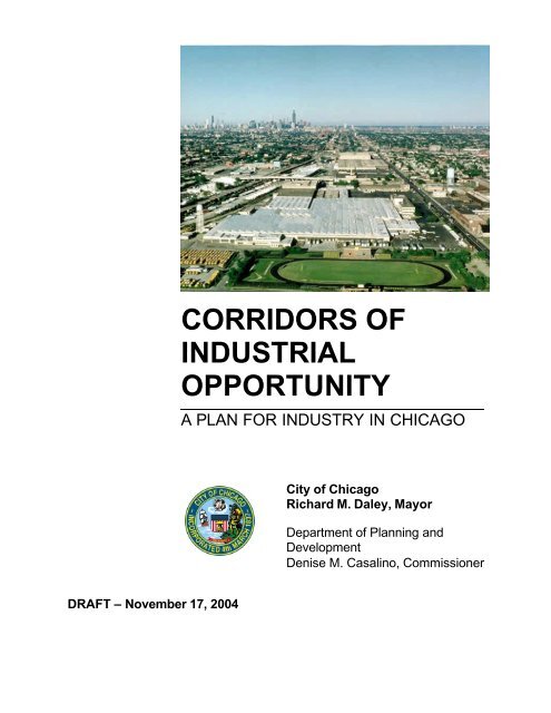
Corridors of Industrial Opportunity: A Plan for Industry in Chicago
Corridors of Industrial Opportunity: A Plan for Industry in Chicago
Corridors of Industrial Opportunity: A Plan for Industry in Chicago

Create successful ePaper yourself
Turn your PDF publications into a flip-book with our unique Google optimized e-Paper software.
DRAFT – November 17, 2004<br />
CORRIDORS OF<br />
INDUSTRIAL<br />
OPPORTUNITY<br />
A PLAN FOR INDUSTRY IN CHICAGO<br />
City <strong>of</strong> <strong>Chicago</strong><br />
Richard M. Daley, Mayor<br />
Department <strong>of</strong> <strong>Plan</strong>n<strong>in</strong>g and<br />
Development<br />
Denise M. Casal<strong>in</strong>o, Commissioner
CORRIDORS OF<br />
INDUSTRIAL<br />
OPPORTUNITY<br />
A PLAN FOR INDUSTRY IN CHICAGO<br />
DRAFT–– November 17, 2004<br />
City <strong>of</strong> <strong>Chicago</strong><br />
Richard M. Daley, Mayor<br />
Department <strong>of</strong> <strong>Plan</strong>n<strong>in</strong>g and Development<br />
Denise M. Casal<strong>in</strong>o, Commissioner<br />
Prepared by URS Corporation
INTRODUCTION<br />
The <strong>Chicago</strong> <strong>Plan</strong> Commission adopted an <strong>in</strong>dustrial land use policy<br />
<strong>in</strong> November 1993. This policy is designed to foster the expansion<br />
and modernization <strong>of</strong> <strong>Chicago</strong>’s <strong>in</strong>dustrial companies by enhanc<strong>in</strong>g<br />
the physical environment <strong>in</strong> which they operate.<br />
The <strong>Chicago</strong> <strong>Plan</strong> Commission subsequently approved a set <strong>of</strong><br />
<strong>in</strong>dustrial corridor plans which provide the physical framework <strong>for</strong> this<br />
policy. Ten west side corridor plans were adopted on March 12, 1992,<br />
seven north side corridors were adopted on November 10, 1993, and<br />
seven south side corridors were adopted on February 25, 1995.<br />
Corridor boundaries took on additional significance with the passage<br />
<strong>of</strong> the <strong>Chicago</strong> Zon<strong>in</strong>g Ord<strong>in</strong>ance <strong>of</strong> 2004. Section 17-13-0400 <strong>of</strong> the<br />
new code require that the <strong>Plan</strong> Commission hold a public hear<strong>in</strong>g on<br />
requests to rezone land to a non-<strong>in</strong>dustrial district with<strong>in</strong> an <strong>in</strong>dustrial<br />
corridor and make a recommendation to the City Council be<strong>for</strong>e the<br />
Council Committee on Zon<strong>in</strong>g’s public hear<strong>in</strong>g. An <strong>in</strong>dustrial corridor<br />
is def<strong>in</strong>ed <strong>in</strong> Section 17-17-0274 as any area that has been<br />
designated as a priority area <strong>for</strong> <strong>in</strong>dustrial development and /or<br />
retention <strong>in</strong> a plan approved by the <strong>Plan</strong> Commission or City Council.<br />
The target area <strong>for</strong> <strong>in</strong>dustrial development has changed s<strong>in</strong>ce the<br />
orig<strong>in</strong>al plans were adopted by the Commission. Co<strong>in</strong>cidentally,<br />
corridor boundaries have become clearer and stronger through a<br />
series market<strong>in</strong>g and development <strong>in</strong>itiatives. This report <strong>in</strong>corporates<br />
these changes and serves as a substitute to the previously adopted<br />
plans. Any <strong>in</strong>dustrial corridor previously adopted by the <strong>Chicago</strong> <strong>Plan</strong><br />
Commission and not referenced <strong>in</strong> this substitute plan is presumed to<br />
be <strong>in</strong> effect under the orig<strong>in</strong>ally adopted boundaries.
TABLE OF CONTENTS<br />
1. INDUSTRIAL CORRIDOR POLICY..................................................... 1<br />
2. ADDISON CORRIDOR .................................................................... 6<br />
3. ARMITAGE CORRIDOR ................................................................... 10<br />
4. BRIGHTON PARK CORRIDOR ......................................................... 14<br />
5. BURNSIDE CORRIDOR ................................................................... 18<br />
6. CALUMET CORRIDOR .................................................................... 22<br />
7. ELSTON/ARMSTRONG CORRIDOR.................................................. 28<br />
8. GREATER SOUTHWEST CORRIDOR................................................ 32<br />
9. HARLEM CORRIDOR ...................................................................... 36<br />
10. KENNEDY CORRIDOR .................................................................... 40<br />
11. KINZIE CORRIDOR......................................................................... 44<br />
12. KNOX CORRIDOR .......................................................................... 48<br />
13. LITTLE VILLAGE............................................................................. 52<br />
14. NORTH BRANCH CORRIDOR.......................................................... 56<br />
15. NORTHWEST CORRIDOR ............................................................... 60<br />
16. PETERSON CORRIDOR .................................................................. 66<br />
17. PILSEN CORRIDOR........................................................................ 70<br />
18. PULASKI CORRIDOR ...................................................................... 74<br />
19. PULLMAN CORRIDOR..................................................................... 78<br />
20. ROOSEVELT/CICERO CORRIDOR ................................................... 82<br />
21. STEVENSON CORRIDOR ................................................................ 96<br />
22. STOCKYARDS CORRIDOR.............................................................. 90<br />
23. WEST PULLMAN CORRIDOR .......................................................... 94<br />
24. WESTERN/OGDEN CORRIDOR....................................................... 98<br />
A PLAN FOR INDUSTRY IN CHICAGO<br />
DRAFT – NOVEMBER 17, 2004
INDUSTRIAL CORRIDOR POLICY<br />
Creat<strong>in</strong>g and preserv<strong>in</strong>g quality jobs <strong>for</strong> <strong>Chicago</strong> residents is the<br />
primary economic development goal <strong>of</strong> the City <strong>of</strong> <strong>Chicago</strong>. To meet<br />
this goal, the City encourages a diversified economy, which provides<br />
an array <strong>of</strong> employment opportunities and can readily adapt to<br />
changes <strong>in</strong> regional and <strong>in</strong>ternational markets.<br />
A strong manufactur<strong>in</strong>g sector is critical to a diversified economy.<br />
Manufactur<strong>in</strong>g <strong>of</strong>ten provides high-pay<strong>in</strong>g jobs and supports important<br />
secondary labor markets. Manufactur<strong>in</strong>g creates wealth <strong>in</strong> the local<br />
economy by add<strong>in</strong>g value to goods, foster<strong>in</strong>g advanced technologies<br />
and spurr<strong>in</strong>g the development <strong>of</strong> new <strong>in</strong>dustries. The cont<strong>in</strong>ued<br />
strength <strong>of</strong> the City’s <strong>in</strong>dustrial base sets <strong>Chicago</strong> apart from other<br />
older <strong>in</strong>dustrial centers and calls <strong>for</strong> unique economic development<br />
strategies. The City’s <strong>in</strong>dustrial land-use policy sets <strong>for</strong>th a strategy<br />
<strong>for</strong> <strong>in</strong>dustrial development that is uniquely urban. It recognizes that<br />
the growth <strong>of</strong> <strong>Chicago</strong>’s economic base will take place <strong>in</strong> built<br />
environments and will be driven largely by the expansion and<br />
modernization <strong>of</strong> exist<strong>in</strong>g companies. As such, this policy is the<br />
physical backbone <strong>of</strong> a broad economic development agenda, which<br />
<strong>in</strong>cludes technology assistance, work<strong>for</strong>ce tra<strong>in</strong><strong>in</strong>g and <strong>in</strong>vestment<br />
<strong>in</strong>centives.<br />
<strong>Chicago</strong>’s <strong>in</strong>dustrial corridors not only constitute the City’s primary<br />
resource <strong>of</strong> space <strong>for</strong> <strong>in</strong>dustrial development; they are already home<br />
to a large portion <strong>of</strong> the City’s <strong>in</strong>dustrial base. The primary goal <strong>of</strong> the<br />
<strong>in</strong>dustrial land-use policy is to foster the expansion and modernization<br />
<strong>of</strong> <strong>Chicago</strong>’s <strong>in</strong>dustrial companies by provid<strong>in</strong>g a place <strong>for</strong> them to<br />
operate and land use stability.<br />
<strong>Chicago</strong> is a city <strong>of</strong> <strong>in</strong>dustrial neighborhoods. Just as residential<br />
communities need appropriate public <strong>in</strong>vestment to make them<br />
pleasant places <strong>in</strong> which to live, <strong>in</strong>dustrial areas require specific types<br />
<strong>of</strong> improvements to meet constantly evolv<strong>in</strong>g needs. Among its many<br />
amenities <strong>for</strong> <strong>in</strong>dustry, <strong>Chicago</strong> must be able to <strong>of</strong>fer safe, functional<br />
and attractive places <strong>in</strong> which to do bus<strong>in</strong>esses.<br />
A PLAN FOR INDUSTRY IN CHICAGO 1<br />
DRAFT – NOVEMBER 17, 2004
<strong>Industrial</strong> corridors must be served by well-ma<strong>in</strong>ta<strong>in</strong>ed <strong>in</strong>frastructure<br />
that accommodates modern production and transportation. <strong>Corridors</strong><br />
must have well-def<strong>in</strong>ed boundaries and separation from <strong>in</strong>compatible<br />
activities so that operations are not <strong>in</strong> conflict with neighbor<strong>in</strong>g uses.<br />
They must be safe places where employees feel secure and<br />
companies do not hesitate to enterta<strong>in</strong> customers. <strong>Industrial</strong> corridors<br />
must be provided with physical amenities, such as attractive<br />
streetscapes, trees, signage and gateways, too <strong>of</strong>ten overlooked <strong>in</strong><br />
economic development strategies.<br />
The City has already implemented a number <strong>of</strong> <strong>in</strong>itiatives to re<strong>in</strong>vent<br />
its <strong>in</strong>dustrial areas. <strong>Industrial</strong> capital improvement dollars are be<strong>in</strong>g<br />
targeted to corridors to ensure that bridges can accommodate<br />
<strong>in</strong>dustrial loads, viaducts have adequate clearances and streets are<br />
rebuilt to <strong>in</strong>dustrial standards. In addition, the <strong>in</strong>dustrial street<br />
vacation program is turn<strong>in</strong>g outdated street patterns <strong>in</strong>to more useful<br />
and attractive spaces <strong>for</strong> companies throughout the city.<br />
The City’s <strong>in</strong>dustrial corridor policy is supported by the follow<strong>in</strong>g<br />
strategies that <strong>in</strong>corporate exist<strong>in</strong>g programs and new <strong>in</strong>itiatives <strong>in</strong> a<br />
corridor-targeted approach:<br />
A. Create Accessible and Attractive Environments<br />
throughout the City’s <strong>Industrial</strong> <strong>Corridors</strong>.<br />
<strong>Corridors</strong> are target areas <strong>for</strong> coord<strong>in</strong>ated private and public<br />
<strong>in</strong>vestments <strong>in</strong> the physical environment. The City has three<br />
goals <strong>in</strong> implement<strong>in</strong>g these <strong>in</strong>vestments.<br />
1. Provide efficient access to major transportation<br />
l<strong>in</strong>ks and smooth <strong>in</strong>ternal traffic circulation.<br />
Most <strong>in</strong>dustrial capital improvement dollars are be<strong>in</strong>g<br />
targeted to corridors to ensure that bridges can<br />
accommodate <strong>in</strong>dustrial loads, viaducts have adequate<br />
clearances and streets are rebuilt to <strong>in</strong>dustrial<br />
standards. These improvements will rema<strong>in</strong> a priority<br />
<strong>of</strong> the City’s Capital Improvement Program. Future<br />
improvements will be coord<strong>in</strong>ated through an<br />
<strong>in</strong>terdepartmental program to identify and regularly<br />
update these <strong>in</strong>dustrial <strong>in</strong>frastructure needs.<br />
A PLAN FOR INDUSTRY IN CHICAGO 2<br />
DRAFT – NOVEMBER 17, 2004
2. Facilitate the development <strong>of</strong> underutilized<br />
<strong>in</strong>dustrial corridor properties.<br />
The City is committed to moderniz<strong>in</strong>g and expand<strong>in</strong>g<br />
<strong>in</strong>dustrial space available <strong>for</strong> development <strong>in</strong> corridors.<br />
Current and future development opportunities will be<br />
highlighted <strong>in</strong> the City’s Site Assistance Program and <strong>in</strong><br />
market<strong>in</strong>g programs to attract, expand and reta<strong>in</strong><br />
<strong>in</strong>dustry. Some <strong>of</strong> these opportunities may be large<br />
enough to serve as <strong>in</strong>dustrial parks with<strong>in</strong> a corridor.<br />
Development costs are be<strong>in</strong>g <strong>of</strong>fset through a variety <strong>of</strong><br />
public sector <strong>in</strong>itiatives, such as TIF and Class 6B tax<br />
<strong>in</strong>centives. Fund<strong>in</strong>g will be cont<strong>in</strong>ued to f<strong>in</strong>ance site<br />
development and assist the private sector <strong>in</strong><br />
develop<strong>in</strong>g these sites. On the legislative side, the City<br />
is pursu<strong>in</strong>g an aggressive Federal agenda to reduce<br />
regulatory and f<strong>in</strong>ancial barriers to the redevelopment<br />
<strong>of</strong> contam<strong>in</strong>ated <strong>in</strong>dustrial sites.<br />
3. Strengthen the physical identity <strong>of</strong> corridors and<br />
provide the range <strong>of</strong> amenities companies expect<br />
to f<strong>in</strong>d <strong>in</strong> a contemporary <strong>in</strong>dustrial park<br />
environment.<br />
The City will collaborate with community-based<br />
agencies funded under the delegate agency program<br />
to prepare and implement specific improvement plans<br />
focus<strong>in</strong>g on the physical environment <strong>of</strong> each corridor.<br />
Such programs/improvements could <strong>in</strong>clude façade<br />
rebates, corridor signage and streetscap<strong>in</strong>g ef<strong>for</strong>ts. It<br />
will also coord<strong>in</strong>ate with CitySpace, an <strong>in</strong>teragency<br />
open space plan <strong>for</strong> the city, to identify amenities <strong>in</strong><br />
<strong>in</strong>dustrial corridors.<br />
B. Assure Stable Land Use with<strong>in</strong> the <strong>Corridors</strong> through<br />
improved Zon<strong>in</strong>g and Land Use Regulation.<br />
The City is committed to assur<strong>in</strong>g that appropriate land use is<br />
ma<strong>in</strong>ta<strong>in</strong>ed <strong>in</strong> <strong>in</strong>dustrial corridors. Three actions will be<br />
proposed to the City Council to achieve this objective.<br />
A PLAN FOR INDUSTRY IN CHICAGO 3<br />
DRAFT – NOVEMBER 17, 2004
1. Require that proposals <strong>for</strong> non-<strong>in</strong>dustrial<br />
development <strong>in</strong> <strong>in</strong>dustrial corridors undergo full<br />
review through the planned development process.<br />
Rezon<strong>in</strong>g land <strong>in</strong> a corridor to a non-<strong>in</strong>dustrial zon<strong>in</strong>g<br />
classification should be avoided. However, <strong>in</strong> some<br />
cases such rezon<strong>in</strong>g may be appropriate. All<br />
proposals <strong>for</strong> rezon<strong>in</strong>g <strong>of</strong> parcels <strong>in</strong> <strong>in</strong>dustrial corridors<br />
from manufactur<strong>in</strong>g to residential, bus<strong>in</strong>ess or<br />
commercial uses will require submission <strong>of</strong> a detailed<br />
development plan and approval by the <strong>Chicago</strong> <strong>Plan</strong><br />
Commission.<br />
Approval will be granted only after a determ<strong>in</strong>ation that<br />
the follow<strong>in</strong>g conditions have been met:<br />
a) the physical characteristics <strong>of</strong> the site<br />
make it <strong>in</strong>tr<strong>in</strong>sically unsuitable <strong>for</strong><br />
<strong>in</strong>dustrial development. Physical<br />
constra<strong>in</strong>ts <strong>in</strong>clude irregular site<br />
configuration, access barriers and other<br />
site-specific issues that, taken together,<br />
limit development;<br />
or<br />
substantial change <strong>in</strong> the character <strong>of</strong><br />
the immediately surround<strong>in</strong>g area<br />
makes <strong>in</strong>dustrial redevelopment <strong>of</strong> the<br />
site impractical. Such change would be<br />
<strong>in</strong>dicated by adopted plans, pattern <strong>of</strong><br />
rezon<strong>in</strong>g or the establishment <strong>of</strong><br />
significant adjo<strong>in</strong><strong>in</strong>g non-<strong>in</strong>dustrial uses;<br />
or<br />
the proposed non-<strong>in</strong>dustrial<br />
development fills an unmet need <strong>for</strong> a<br />
neighborhood service or public facility;<br />
and<br />
b) the proposed non-<strong>in</strong>dustrial<br />
development will not result <strong>in</strong><br />
burdensome zon<strong>in</strong>g or other regulatory<br />
restrictions on neighbor<strong>in</strong>g <strong>in</strong>dustries;<br />
and<br />
A PLAN FOR INDUSTRY IN CHICAGO 4<br />
DRAFT – NOVEMBER 17, 2004
c) traffic to be generated by the<br />
development will not exceed exist<strong>in</strong>g<br />
street capacity (or otherwise be<br />
accommodated through specific<br />
measures to be taken by the applicant).<br />
2. Update the exist<strong>in</strong>g zon<strong>in</strong>g standards <strong>for</strong><br />
manufactur<strong>in</strong>g districts to br<strong>in</strong>g them <strong>in</strong> l<strong>in</strong>e with<br />
the needs <strong>of</strong> modern <strong>in</strong>dustrial development.<br />
The manufactur<strong>in</strong>g classifications <strong>in</strong> the <strong>Chicago</strong><br />
Zon<strong>in</strong>g Ord<strong>in</strong>ance have been modified to reflect uses<br />
and standards that meet the needs <strong>of</strong> modern <strong>in</strong>dustry<br />
and the characteristics <strong>of</strong> these corridors. The revised<br />
classifications will allow non-<strong>in</strong>dustrial uses only to the<br />
extent that they provide services <strong>in</strong> support <strong>of</strong> <strong>in</strong>dustrial<br />
bus<strong>in</strong>esses or otherwise promote the <strong>in</strong>tegrity and<br />
viability <strong>of</strong> <strong>in</strong>dustrial corridors. It may be necessary to<br />
change the zon<strong>in</strong>g with<strong>in</strong> corridors to make it<br />
consistent with the type <strong>of</strong> development projected <strong>in</strong><br />
specific areas. The <strong>Plan</strong>ned Manufactur<strong>in</strong>g District<br />
designation process may be the most appropriate<br />
mechanism <strong>for</strong> achiev<strong>in</strong>g this goal <strong>in</strong> certa<strong>in</strong> <strong>in</strong>dustrial<br />
areas.<br />
A PLAN FOR INDUSTRY IN CHICAGO 5<br />
DRAFT – NOVEMBER 17, 2004
Addison <strong>Industrial</strong> Corridor<br />
A PLAN FOR INDUSTRY IN CHICAGO 6<br />
DRAFT – NOVEMBER 17, 2004
Addison <strong>Industrial</strong> Corridor<br />
LOCATION:<br />
General Location: Located on the north side <strong>of</strong> the City, generally bounded<br />
by Irv<strong>in</strong>g Park Rd on the north, the <strong>Chicago</strong> River and<br />
Whipple St on the west, Campbell and Western Ave on<br />
the east, and George St on the south.<br />
Ward(s): Located with<strong>in</strong> Wards 1, 33, and 47<br />
Community Area (s): Avondale<br />
Accessibility: Interstates. I-90/94<br />
Rail. Not applicable<br />
EXISTING FEATURES:<br />
Size: 240 acres<br />
Number <strong>of</strong> Bus<strong>in</strong>esses: 42<br />
Number <strong>of</strong> Jobs: Approx. 3,500<br />
Major Exist<strong>in</strong>g Industries: ComEd, Hu-Friedy, WGN-TV, Mail-Well Envelope, and<br />
Williams Electronic Games Inc.<br />
TIF District: North TIF, expires June 2020<br />
Infrastructure Improvements<br />
RECENT INVESTMENT and DEVELOPMENT<br />
OPPORTUNITIES:<br />
Not applicable<br />
(s<strong>in</strong>ce 1999):<br />
Infrastructure Investment: Not applicable<br />
<strong>Opportunity</strong> Sites: Four vacant build<strong>in</strong>gs available, total<strong>in</strong>g approximately<br />
132,250 square feet <strong>of</strong> build<strong>in</strong>g space.<br />
A PLAN FOR INDUSTRY IN CHICAGO 7<br />
DRAFT – NOVEMBER 17, 2004
BOUNDARY DESCRIPTION<br />
Addison <strong>Industrial</strong> Corridor<br />
North Elston Avenue; North Whipple Street; north right <strong>of</strong> way l<strong>in</strong>e <strong>of</strong><br />
the <strong>Chicago</strong> & Northwest Railway; West Cornelia Avenue; North<br />
Sacramento Avenue; a l<strong>in</strong>e that is 43 feet north <strong>of</strong> the south l<strong>in</strong>e <strong>of</strong><br />
West Cornelia Avenue; east along the last described l<strong>in</strong>e to a po<strong>in</strong>t<br />
that is 131.5 feet east <strong>of</strong> the east l<strong>in</strong>e <strong>of</strong> North Sacramento Avenue;<br />
from the last described po<strong>in</strong>t, southeast to a po<strong>in</strong>t that is 182.02 feet<br />
east <strong>of</strong> the east l<strong>in</strong>e <strong>of</strong> North Sacramento Avenue and 657.85 feet<br />
north <strong>of</strong> the centerl<strong>in</strong>e <strong>of</strong> West Roscoe Street; from the last described<br />
po<strong>in</strong>t, east to a po<strong>in</strong>t that is 629.09 feet east <strong>of</strong> the east l<strong>in</strong>e <strong>of</strong> North<br />
Sacramento Avenue and 660.94 feet north <strong>of</strong> the centerl<strong>in</strong>e <strong>of</strong> West<br />
Roscoe Street; from the last described po<strong>in</strong>t, north to a po<strong>in</strong>t on the<br />
centerl<strong>in</strong>e <strong>of</strong> West Addison Street that is 627.89 feet east <strong>of</strong> the east<br />
l<strong>in</strong>e <strong>of</strong> North Sacramento Avenue; West Addison Street; the centerl<strong>in</strong>e<br />
<strong>of</strong> the North Branch <strong>of</strong> the <strong>Chicago</strong> River; first alley next west <strong>of</strong> and<br />
parallel to North Maplewood Avenue; the alley next north <strong>of</strong> and<br />
parallel to West Irv<strong>in</strong>g Park Road; North Rockwell Street; West Irv<strong>in</strong>g<br />
Park Road; a l<strong>in</strong>e that is 1278.99 feet west <strong>of</strong> the west l<strong>in</strong>e <strong>of</strong> North<br />
Western Avenue; the centerl<strong>in</strong>e <strong>of</strong> West Byron Street, extended west<br />
where no street exists; North Campbell Avenue; West Grace Street; a<br />
l<strong>in</strong>e 297.23 west <strong>of</strong> Western Avenue; Waveland Avenue; North<br />
Campbell Avenue; West Addison Street; a l<strong>in</strong>e that is 247.77 feet east<br />
<strong>of</strong> the east l<strong>in</strong>e <strong>of</strong> North Rockwell Street; a l<strong>in</strong>e that is 1032.34 feet<br />
south <strong>of</strong> the south l<strong>in</strong>e <strong>of</strong> West Addison Street; North Rockwell Street;<br />
West Melrose Street; North Campbell Avenue; West Belmont Avenue;<br />
North Campbell Avenue; the alley next north <strong>of</strong> and parallel to West<br />
Barry Avenue; the alley next west <strong>of</strong> and parallel to the North Western<br />
Avenue Overpass; West Barry Avenue; North Western Avenue<br />
Overpass; West George Street; North Campbell Avenue; a l<strong>in</strong>e that is<br />
226.55 feet north <strong>of</strong> and parallel to the centerl<strong>in</strong>e <strong>of</strong> West George<br />
Street; the alley next runn<strong>in</strong>g northwest between North Campbell<br />
Avenue and West Well<strong>in</strong>gton Avenue; a l<strong>in</strong>e that is 169.03 feet east <strong>of</strong><br />
and parallel to the east l<strong>in</strong>e <strong>of</strong> North Rockwell Street; West Well<strong>in</strong>gton<br />
Avenue; North Rockwell Street; the alley next runn<strong>in</strong>g northwest<br />
between North Rockwell Street and West Nelson Street; the south l<strong>in</strong>e<br />
<strong>of</strong> West Nelson Street to a po<strong>in</strong>t that is 68.68 feet northeast <strong>of</strong> the<br />
northeasterly l<strong>in</strong>e <strong>of</strong> North Elston Avenue; a l<strong>in</strong>e from the last<br />
described po<strong>in</strong>t to a po<strong>in</strong>t on the north l<strong>in</strong>e <strong>of</strong> West Nelson Street that<br />
is 98.41 feet northeast <strong>of</strong> the northeasterly l<strong>in</strong>e <strong>of</strong> North Elston<br />
A PLAN FOR INDUSTRY IN CHICAGO 8<br />
DRAFT – NOVEMBER 17, 2004
Addison <strong>Industrial</strong> Corridor<br />
Avenue; the alley next runn<strong>in</strong>g north, northwest and north between<br />
West Nelson Street and West Barry Avenue; West Barry Avenue; the<br />
alley next east <strong>of</strong> and parallel to North Washtenaw Avenue; West<br />
Fletcher Street; North Rockwell Street; West Belmont Avenue; the<br />
centerl<strong>in</strong>e <strong>of</strong> the North Branch <strong>of</strong> the <strong>Chicago</strong> River; a l<strong>in</strong>e that is<br />
681.97 feet north <strong>of</strong> the north l<strong>in</strong>e <strong>of</strong> West Belmont Avenue; a l<strong>in</strong>e that<br />
is 268.00 feet east <strong>of</strong> the east l<strong>in</strong>e <strong>of</strong> North Cali<strong>for</strong>nia Avenue; the<br />
alley next north <strong>of</strong> and parallel to West Melrose Street; the alley next<br />
east <strong>of</strong> and parallel to North Cali<strong>for</strong>nia Avenue; West Melrose Street;<br />
North Cali<strong>for</strong>nia Avenue; West Roscoe Street; North Elston Avenue.<br />
A PLAN FOR INDUSTRY IN CHICAGO 9<br />
DRAFT – NOVEMBER 17, 2004
Armitage <strong>Industrial</strong> Corridor<br />
A PLAN FOR INDUSTRY IN CHICAGO 10<br />
DRAFT – NOVEMBER 17, 2004
Armitage <strong>Industrial</strong> Corridor<br />
LOCATION:<br />
General Location: Located on the northwest side <strong>of</strong> the City, generally<br />
bounded by Fullerton Rd and Dickens Ave on the north,<br />
Oak Park Ave on the west, Cortland St and<br />
Bloom<strong>in</strong>gdale Ave on the south, and Cicero Ave on the<br />
east.<br />
Ward(s): Located with<strong>in</strong> Wards 29, 31, 36 and 37<br />
Community Area (s): Aust<strong>in</strong> and Belmont Crag<strong>in</strong><br />
Accessibility: Interstates. Approximately 3 miles north <strong>of</strong> I-290<br />
Rail. Canadian Pacific<br />
Truck Routes. Grand Avenue Class II Truck Route<br />
EXISTING FEATURES:<br />
Size: 407 acres<br />
Number <strong>of</strong> Bus<strong>in</strong>esses: 100<br />
Number <strong>of</strong> Jobs: Approx. 4,000<br />
Major Exist<strong>in</strong>g Industries: M&M Mars, Clover Hill Bakery, and Dehler<br />
Manufactur<strong>in</strong>g<br />
TIF District: Armitage/Galewood TIF and Bloom<strong>in</strong>gdale/Laramie TIF,<br />
expires June 2022<br />
Infrastructure Improvements<br />
RECENT INVESTMENT and DEVELOPMENT<br />
OPPORTUNITIES:<br />
Construction <strong>of</strong> Central Avenue Overpass.<br />
(s<strong>in</strong>ce 1999):<br />
Infrastructure Investment: Approximately $22 million s<strong>in</strong>ce 1999<br />
<strong>Opportunity</strong> Sites: Approximately 60 acres <strong>of</strong> available land/sites<br />
A PLAN FOR INDUSTRY IN CHICAGO 11<br />
DRAFT – NOVEMBER 17, 2004
BOUNDARY DESCRIPTION<br />
Armitage <strong>Industrial</strong> Corridor<br />
North Oak Park Avenue; the north Right-<strong>of</strong>-Way l<strong>in</strong>e <strong>of</strong> the <strong>Chicago</strong>,<br />
Milwaukee, St. Paul and Pacific Railroad; a l<strong>in</strong>e that is 892.80 feet<br />
east <strong>of</strong> the east l<strong>in</strong>e <strong>of</strong> North Oak Park Avenue; a l<strong>in</strong>e that is 1573.65<br />
feet south <strong>of</strong> the south l<strong>in</strong>e <strong>of</strong> West Fullerton Avenue; a l<strong>in</strong>e that is<br />
1372.20 feet east <strong>of</strong> the east l<strong>in</strong>e <strong>of</strong> North Oak Park Avenue; a l<strong>in</strong>e<br />
drawn northwesterly from a po<strong>in</strong>t that is 676.50 feet south <strong>of</strong> the south<br />
l<strong>in</strong>e <strong>of</strong> West Fullerton Avenue and 1372.20 feet east <strong>of</strong> the east l<strong>in</strong>e <strong>of</strong><br />
North Oak Park Avenue to a po<strong>in</strong>t that is 388.06 feet east <strong>of</strong> the east<br />
l<strong>in</strong>e <strong>of</strong> North Normandy Avenue and 556.23 feet south <strong>of</strong> the south<br />
l<strong>in</strong>e <strong>of</strong> West Grand Avenue, measured along the west right-<strong>of</strong>-way l<strong>in</strong>e<br />
<strong>of</strong> the north-south <strong>Chicago</strong>, Milwaukee, St. Paul and Pacific Railroad;<br />
a l<strong>in</strong>e that is 556.23 feet south <strong>of</strong> the south l<strong>in</strong>e <strong>of</strong> West Grand<br />
Avenue, measured along the west right-<strong>of</strong>-way l<strong>in</strong>e <strong>of</strong> the north-south<br />
<strong>Chicago</strong>, Milwaukee, St. Paul and Pacific Railroad; the west right-<strong>of</strong>way<br />
l<strong>in</strong>e <strong>of</strong> the north-south <strong>Chicago</strong>, Milwaukee, St. Paul and Pacific<br />
Railroad; West Fullerton Avenue; North Natchez Avenue; a l<strong>in</strong>e that is<br />
1037.43 feet south <strong>of</strong> the south l<strong>in</strong>e <strong>of</strong> West Grand Avenue measured<br />
along the west l<strong>in</strong>e <strong>of</strong> North Natchez Avenue; a l<strong>in</strong>e that is 141.06 feet<br />
west <strong>of</strong> the west l<strong>in</strong>e <strong>of</strong> North Natchez Avenue; a l<strong>in</strong>e drawn<br />
southeasterly from a po<strong>in</strong>t that is 1609.35 feet south <strong>of</strong> the south l<strong>in</strong>e<br />
<strong>of</strong> West Fullerton Avenue, measured perpendicular to said south l<strong>in</strong>e,<br />
and 141.06 feet west <strong>of</strong> the west l<strong>in</strong>e <strong>of</strong> North Natchez Avenue to a<br />
po<strong>in</strong>t that is on the west l<strong>in</strong>e <strong>of</strong> North Natchez Avenue and 1547.65<br />
feet south <strong>of</strong> the south l<strong>in</strong>e <strong>of</strong> West Grand Avenue, measured along<br />
the west l<strong>in</strong>e <strong>of</strong> North Natchez Avenue; the southeasterly extension <strong>of</strong><br />
the previously described l<strong>in</strong>e to the centerl<strong>in</strong>e <strong>of</strong> North Natchez<br />
Avenue; North Natchez Avenue; West McLean Avenue; North<br />
Narragansett Avenue; West Dickens Avenue; North Mobile Avenue;<br />
West Armitage Avenue; the north right-<strong>of</strong>-way l<strong>in</strong>e <strong>of</strong> the <strong>Chicago</strong>,<br />
Milwaukee, St. Paul and Pacific Railroad; a l<strong>in</strong>e drawn northeast from<br />
a po<strong>in</strong>t on the north right-<strong>of</strong>-way l<strong>in</strong>e <strong>of</strong> the <strong>Chicago</strong>, Milwaukee, St.<br />
Paul and Pacific Railroad that is 276.53 feet east <strong>of</strong> the east l<strong>in</strong>e <strong>of</strong><br />
North Mobile Avenue to a po<strong>in</strong>t that is 590.95 feet east <strong>of</strong> the east l<strong>in</strong>e<br />
<strong>of</strong> North Mobile Avenue and 336.38 feet south <strong>of</strong> the south l<strong>in</strong>e <strong>of</strong><br />
West Dickens Avenue; a l<strong>in</strong>e drawn easterly from the last described<br />
po<strong>in</strong>t to a po<strong>in</strong>t that is 331.35 feet south <strong>of</strong> the south l<strong>in</strong>e <strong>of</strong> West<br />
Dickens Avenue and on the centerl<strong>in</strong>e <strong>of</strong> North Melv<strong>in</strong>a Avenue if said<br />
centerl<strong>in</strong>e were extended south where no street exists; North Melv<strong>in</strong>a<br />
A PLAN FOR INDUSTRY IN CHICAGO 12<br />
DRAFT – NOVEMBER 17, 2004
Armitage <strong>Industrial</strong> Corridor<br />
Avenue if extended were no street exists; West Dickens Avenue; the<br />
alley next west <strong>of</strong> and parallel to North Major Avenue; the alley next<br />
south <strong>of</strong> and parallel to West Grand Avenue; North Parkside Avenue;<br />
West Grand Avenue; West Armitage Avenue; North Lamon Avenue;<br />
the alley next south <strong>of</strong> and parallel to West Armitage Avenue; the alley<br />
next west <strong>of</strong> and parallel to North Lamon Avenue; the alley next south<br />
<strong>of</strong> and parallel to West Armitage Avenue; North Lamon Avenue; West<br />
Grand Avenue; a l<strong>in</strong>e drawn southwesterly from a po<strong>in</strong>t on the south<br />
l<strong>in</strong>e <strong>of</strong> West Grand Avenue that is 145.22 feet west <strong>of</strong> the west l<strong>in</strong>e <strong>of</strong><br />
North Cicero Avenue, measured along the south l<strong>in</strong>e <strong>of</strong> West Grand<br />
Avenue, to a po<strong>in</strong>t that is 134.99 feet west <strong>of</strong> the west l<strong>in</strong>e <strong>of</strong> North<br />
Cicero Avenue and 104.64 feet southwest <strong>of</strong> the south l<strong>in</strong>e <strong>of</strong> West<br />
Grand Avenue, measured perpendicular to said south l<strong>in</strong>e; the alley<br />
next west <strong>of</strong> and parallel to North Cicero Avenue; West Bloom<strong>in</strong>gdale<br />
Avenue; North Leclaire Avenue; a l<strong>in</strong>e that is 101.04 feet north <strong>of</strong><br />
the north l<strong>in</strong>e <strong>of</strong> West Bloom<strong>in</strong>gdale Avenue; the alley next west <strong>of</strong><br />
and parallel to North Leclaire Avenue; the alley next north <strong>of</strong> and<br />
parallel to West Bloom<strong>in</strong>gdale Avenue; North Long Avenue; the alley<br />
next north <strong>of</strong> and parallel to West Cortland Street;<br />
North Central Avenue Overpass; West Bloom<strong>in</strong>gdale Avenue; North<br />
Monitor Avenue; West Cortland Street; North Aust<strong>in</strong> Avenue; West<br />
Cortland Street and the westerly extension where no street exists;<br />
North Nashville Avenue; West Armitage Avenue; North Oak Park<br />
Avenue.<br />
A PLAN FOR INDUSTRY IN CHICAGO 13<br />
DRAFT – NOVEMBER 17, 2004
Brighton Park <strong>Industrial</strong> Corridor<br />
A PLAN FOR INDUSTRY IN CHICAGO 14<br />
DRAFT – NOVEMBER 17, 2004
Brighton Park <strong>Industrial</strong> Corridor<br />
LOCATION:<br />
General Location: Six miles southwest <strong>of</strong> Loop. Generally bounded by 47 th<br />
St. on the north, Lawndale/Central Park Ave. on the<br />
west, 55 th & 51 st St. on the south & Western on the west.<br />
Ward(s): Located with<strong>in</strong> Wards 12 and 14<br />
Community Area (s): Brighton Park and McK<strong>in</strong>ley Park<br />
Accessibility: Interstates. 1 mile south <strong>of</strong> I-55. Arterial Streets 47 th ,<br />
51 st , and 55 th Streets; Western, Cali<strong>for</strong>nia, and Kedzie<br />
Avenues all located <strong>in</strong> or near the corridor.<br />
Rail. Grand Trunk and BNSF rail run through corridor.<br />
Access to nearby <strong>in</strong>termodal facilities operated by<br />
Corwith Yard. CTA’s Orange L<strong>in</strong>e runs east/west<br />
through the corridor, with the Kedzie stop near 49 th St.<br />
EXISTING FEATURES:<br />
Size: 465 acres<br />
Number <strong>of</strong> Bus<strong>in</strong>esses: 55<br />
Number <strong>of</strong> Jobs: Approximately 6,000<br />
Major Exist<strong>in</strong>g Industries: RC Cola, World’s F<strong>in</strong>est Chocolate, and Central Steel<br />
and Wire<br />
TIF District: Homan/Grand Trunk TIF, expires December 2016.<br />
Stevenson/Brighton TIF Study currently underway.<br />
RECENT INVESTMENT and DEVELOPMENT<br />
OPPORTUNITIES:<br />
Infrastructure Improvements Future reconstruction <strong>of</strong> W. 48<br />
(s<strong>in</strong>ce 1999):<br />
th Place and S. Richmond,<br />
Spr<strong>in</strong>g 2005<br />
Infrastructure Investment: Not applicable<br />
<strong>Opportunity</strong> Sites: 20 acres<br />
A PLAN FOR INDUSTRY IN CHICAGO 15<br />
DRAFT – NOVEMBER 17, 2004
BOUNDARY DESCRIPTION<br />
Brighton Park <strong>Industrial</strong> Corridor<br />
South Lawndale Avenue; West 47 th Street; a l<strong>in</strong>e that is 466.12 feet west<br />
<strong>of</strong> the west l<strong>in</strong>e <strong>of</strong> South Kedzie Avenue; West 48 th Street; a l<strong>in</strong>e that is<br />
345.18 feet west <strong>of</strong> the west l<strong>in</strong>e <strong>of</strong> South Kedzie Avenue; the north right<strong>of</strong>-way<br />
l<strong>in</strong>e <strong>of</strong> the CTA Orange L<strong>in</strong>e; the west right-<strong>of</strong>-way l<strong>in</strong>e <strong>of</strong> the<br />
Consolidated Rail Corporation rail l<strong>in</strong>e; a l<strong>in</strong>e that is 349.14 feet north <strong>of</strong><br />
the north l<strong>in</strong>e <strong>of</strong> West 48 th Place; South Kedzie Avenue; a l<strong>in</strong>e that is<br />
376.16 feet south <strong>of</strong> the south l<strong>in</strong>e <strong>of</strong> West 47 th Street; a l<strong>in</strong>e that is<br />
207.09 feet east <strong>of</strong> the east l<strong>in</strong>e <strong>of</strong> South Kedzie Avenue; West 47 th<br />
Street; South Cali<strong>for</strong>nia Avenue; a l<strong>in</strong>e that is 108.07 feet south <strong>of</strong> the<br />
south l<strong>in</strong>e <strong>of</strong> West 47 th Street; South Fairfield Avenue; West 47 th Street; a<br />
l<strong>in</strong>e that is 134.06 feet west <strong>of</strong> the west l<strong>in</strong>e <strong>of</strong> South Washtenaw Avenue;<br />
the alley next south <strong>of</strong> and parallel to West 47 th Street; a l<strong>in</strong>e that is<br />
125.04 feet east <strong>of</strong> the east l<strong>in</strong>e <strong>of</strong> South Washtenaw Avenue; West 47 th<br />
Street; South Talman Avenue; the alley next south <strong>of</strong> and parallel to West<br />
47 th Street; the alley next east <strong>of</strong> and parallel to South Talman Avenue;<br />
West 48 th Street; South Campbell Avenue; the south right-<strong>of</strong>-way l<strong>in</strong>e <strong>of</strong><br />
the Grand Trunk Western Railroad; South Rockwell Street; West 50 th<br />
Street; South Cali<strong>for</strong>nia Avenue; West 51 st Street; South Kedzie Avenue;<br />
along the centerl<strong>in</strong>e <strong>of</strong> South Kedzie Avenue 1204.93 feet to a po<strong>in</strong>t; from<br />
the last described po<strong>in</strong>t, travel<strong>in</strong>g southwest to a po<strong>in</strong>t that is 680.29 feet<br />
west <strong>of</strong> the centerl<strong>in</strong>e <strong>of</strong> South Kedzie Avenue and 1024.25 feet north <strong>of</strong><br />
the centerl<strong>in</strong>e <strong>of</strong> West 51 st Street; a l<strong>in</strong>e that is 680.29 feet west <strong>of</strong> the<br />
centerl<strong>in</strong>e <strong>of</strong> South Kedzie Avenue; a l<strong>in</strong>e that is 671.14 feet north <strong>of</strong> the<br />
centerl<strong>in</strong>e <strong>of</strong> West 51 st Street; South Homan Avenue; West 51 st Street;<br />
South St. Louis Avenue; West 53rd Street and it’s extension where no<br />
street exists; South Millard Avenue; West 51 st Street.<br />
A PLAN FOR INDUSTRY IN CHICAGO 16<br />
DRAFT – NOVEMBER 17, 2004
Burnside <strong>Industrial</strong> Corridor<br />
A PLAN FOR INDUSTRY IN CHICAGO 18<br />
DRAFT – NOVEMBER 17, 2004
Burnside <strong>Industrial</strong> Corridor<br />
LOCATION:<br />
General Location: Located on the south side <strong>of</strong> the City, generally bounded<br />
by 87 th St on the north, the Bishop Ford Expressway on<br />
the south, Stony Island Ave on the west, and Cottage<br />
Grove Ave on the east.<br />
Ward(s): Located with<strong>in</strong> Ward 8<br />
Community Area (s): Burnside<br />
Accessibility: Interstates. Bishop Ford Expressway, access at 95 th<br />
and Stony Island, and 103 rd Street.<br />
Rail. Norfolk Southern, The Belt Railway, and the<br />
<strong>Chicago</strong> Short L<strong>in</strong>e<br />
Public Transit. CTA bus l<strong>in</strong>es serve 87 th St, 95 th St,<br />
Stony Island, and Cottage Grove Blvd<br />
EXISTING FEATURES:<br />
Size: 328 acres<br />
Number <strong>of</strong> Bus<strong>in</strong>esses: 17<br />
Number <strong>of</strong> Jobs: Approx. 1,500<br />
Major Exist<strong>in</strong>g Industries: Jay Foods, Antek-Madison Plastics, Akers Packag<strong>in</strong>g,<br />
and Naylor Pipe Company<br />
TIF District: Stony Island Avenue Commercial/Burnside <strong>Industrial</strong><br />
TIF, exp. 2021; Lake Calumet <strong>Industrial</strong> TIF, exp. 2023<br />
Infrastructure Improvements<br />
RECENT INVESTMENT and DEVELOPMENT<br />
OPPORTUNITIES:<br />
Not applicable<br />
(s<strong>in</strong>ce 1999):<br />
Infrastructure Investment: Not applicable<br />
<strong>Opportunity</strong> Sites: An approximate 9 acre site at 93 rd and Woodlawn<br />
A PLAN FOR INDUSTRY IN CHICAGO 19<br />
DRAFT – NOVEMBER 17, 2004
BOUNDARY DESCRIPTION<br />
Burnside <strong>Industrial</strong> Corridor<br />
East 87 th Street; South Greenwood Avenue; a l<strong>in</strong>e that is 633.79 feet<br />
south <strong>of</strong> East 87 th Street; the northeast right-<strong>of</strong>-way l<strong>in</strong>e <strong>of</strong> the New York<br />
<strong>Chicago</strong> and St. Louis Railroad; the north right-<strong>of</strong>-way l<strong>in</strong>e <strong>of</strong> <strong>Chicago</strong><br />
and Western Indiana Railroad; South Stony Island Avenue; a l<strong>in</strong>e that is<br />
East 99 th Street extended to the east, where no street exists; South<br />
Harper Avenue; East 100 th Street; South Woodlawn Avenue; Bishop Ford<br />
Expressway; South Cottage Grove Avenue; a l<strong>in</strong>e that is 468.21 feet<br />
north <strong>of</strong> the north l<strong>in</strong>e <strong>of</strong> East 97 th Street, as measured along the east l<strong>in</strong>e<br />
<strong>of</strong> South Cottage Grove Avenue; along the last described l<strong>in</strong>e, 287.02<br />
feet from the east l<strong>in</strong>e <strong>of</strong> South Cottage Grove Avenue to a po<strong>in</strong>t; from<br />
the last described po<strong>in</strong>t southwest to a po<strong>in</strong>t that is 297.27 feet east <strong>of</strong><br />
the east l<strong>in</strong>e <strong>of</strong> South Cottage Grove Avenue, measured perpendicular,<br />
and 372.36 feet north <strong>of</strong> the north l<strong>in</strong>e <strong>of</strong> East 97 th Street, measured<br />
perpendicular; from the last described po<strong>in</strong>t northeast to a po<strong>in</strong>t that is<br />
490.44 feet east <strong>of</strong> the east l<strong>in</strong>e <strong>of</strong> South Cottage Grove Avenue,<br />
measured perpendicular, and 393.49 feet north <strong>of</strong> the north l<strong>in</strong>e <strong>of</strong> East<br />
97 th Street, measured perpendicular; from the last described po<strong>in</strong>t<br />
southeast to a po<strong>in</strong>t that is 687.06 feet east <strong>of</strong> the east l<strong>in</strong>e <strong>of</strong> South<br />
Cottage Grove Avenue, measured perpendicular, and 356.44 feet north<br />
<strong>of</strong> the north l<strong>in</strong>e <strong>of</strong> East 97 th Street, measured perpendicular; from the last<br />
described po<strong>in</strong>t northeast to a po<strong>in</strong>t that is 687.06 feet east <strong>of</strong> the east<br />
l<strong>in</strong>e <strong>of</strong> South Cottage Grove Avenue, measured perpendicular, and<br />
599.39 feet north <strong>of</strong> the north l<strong>in</strong>e <strong>of</strong> East 97 th Street, measured<br />
perpendicular; from the last described po<strong>in</strong>t east to the alley next west <strong>of</strong><br />
and parallel to South Dobson Avenue; East 97 th Street; South Ingleside<br />
Avenue; the alley next south <strong>of</strong> East 97 th Street runn<strong>in</strong>g between South<br />
Ingleside Avenue and South Cottage Grove Avenue; South Cottage<br />
Grove Avenue; East 99 th Street; Pullman Railroad Company right-<strong>of</strong>-way;<br />
East 95 th Street; a l<strong>in</strong>e that is 1214.13 feet west <strong>of</strong> the centerl<strong>in</strong>e <strong>of</strong> South<br />
Stony Island Avenue; West l<strong>in</strong>e <strong>of</strong> the New York Central and St. Louis<br />
Railroad right-<strong>of</strong>-way; East 94 th Street; South Kenwood Avenue; East 93 rd<br />
Street; South Kimbark Avenue; East 92 nd Street; South Avalon Avenue;<br />
East 91 st Street; South Woodlawn Avenue; East 89 th Street; South<br />
Greenwood Avenue; a l<strong>in</strong>e that is 799.20 feet south <strong>of</strong> the south l<strong>in</strong>e <strong>of</strong><br />
East 87 th Street; south along a l<strong>in</strong>e that is 206.09 feet west <strong>of</strong> the west<br />
l<strong>in</strong>e <strong>of</strong> South Greenwood Avenue, 488.17 feet to a po<strong>in</strong>t; from the last<br />
described po<strong>in</strong>t southwest 231.59 feet to a po<strong>in</strong>t that is 339.21 feet west<br />
<strong>of</strong> the west l<strong>in</strong>e <strong>of</strong> South Greenwood Avenue; from the last described<br />
A PLAN FOR INDUSTRY IN CHICAGO 20<br />
DRAFT – NOVEMBER 17, 2004
Burnside <strong>Industrial</strong> Corridor<br />
po<strong>in</strong>t southwest 698.63 feet to a po<strong>in</strong>t on the centerl<strong>in</strong>e <strong>of</strong> East 90 th Street<br />
that is 207.20 feet west <strong>of</strong> the west l<strong>in</strong>e <strong>of</strong> South Ellis Avenue; East 90 th<br />
Street; South Drexel Avenue; East 91 st Street; the east right-<strong>of</strong>-way l<strong>in</strong>e<br />
<strong>of</strong> the Ill<strong>in</strong>ois Central Gulf Railroad; East 87 th Street.<br />
A PLAN FOR INDUSTRY IN CHICAGO 21<br />
DRAFT – NOVEMBER 17, 2004
Calumet <strong>Industrial</strong> Corridor<br />
A PLAN FOR INDUSTRY IN CHICAGO 22<br />
DRAFT – NOVEMBER 17, 2004
Calumet <strong>Industrial</strong> Corridor<br />
LOCATION:<br />
General Location: Located on the far southeast side <strong>of</strong> the City.<br />
Ward(s): Located with<strong>in</strong> Ward 10<br />
Community Area (s): South Deer<strong>in</strong>g, East Side and Hegewisch<br />
Accessibility: Interstates. Bishop Ford Expressway, access at 130 th<br />
St. and the <strong>Chicago</strong> Skyway, access at 92 nd & 104 th St.<br />
Rail. Norfolk Southern, the Belt railway, Indiana Harbor<br />
Belt, <strong>Chicago</strong> Rail L<strong>in</strong>k, <strong>Chicago</strong> Short L<strong>in</strong>e, & METRA.<br />
Truck. The Calumet Heavy Truck Route<br />
Water. Calumet River, Lake Calumet, & Lake Michigan<br />
EXISTING FEATURES:<br />
Size: 4,168 acres<br />
Number <strong>of</strong> Bus<strong>in</strong>esses: 58<br />
Number <strong>of</strong> Jobs: Approx. 5,000<br />
Major Exist<strong>in</strong>g Industries: Ford Motor Company, <strong>Chicago</strong> Manufactur<strong>in</strong>g Campus,<br />
LaFarge Midwest, & Arro Corp.<br />
TIF District: Lake Calumet <strong>Industrial</strong> TIF, expires 2023; 126 th &<br />
Torrence TIF, expires 2017<br />
RECENT INVESTMENT and DEVELOPMENT<br />
OPPORTUNITIES:<br />
Infrastructure Improvements Road construction: 126<br />
(s<strong>in</strong>ce 1999):<br />
th Pl between Torrence & Ave O;<br />
87 th St from Ave O to the lakefront; Ave O from 87 th St to<br />
93 rd St; Harbor Ave from 93 rd St to S. <strong>Chicago</strong> Ave;<br />
<strong>Chicago</strong> Skyway ramps <strong>of</strong>f <strong>of</strong> 92 nd St.<br />
Relocation <strong>of</strong> Torrence between 126 th Pl & 130 th St.<br />
Infrastructure Investment: Approximately $200 million<br />
<strong>Opportunity</strong> Sites: Approx. four opportunity sites total<strong>in</strong>g over 400 acres<br />
A PLAN FOR INDUSTRY IN CHICAGO 23<br />
DRAFT – NOVEMBER 17, 2004
BOUNDARY DESCRIPTION<br />
Calumet <strong>Industrial</strong> Corridor<br />
East 91st Street and the centerl<strong>in</strong>e there<strong>of</strong> extended east where no<br />
street exists; the northeasterly l<strong>in</strong>e <strong>of</strong> the E. J. & E. R.R. right-<strong>of</strong>-way;<br />
the southeasterly l<strong>in</strong>e <strong>of</strong> the Calumet River; the shorel<strong>in</strong>e <strong>of</strong> Lake<br />
Michigan; East 95th Street and the centerl<strong>in</strong>e there<strong>of</strong> extended east<br />
where no street exists; South Kreiter Avenue; East 93rd Court; South<br />
Ew<strong>in</strong>g Avenue; a l<strong>in</strong>e 800 feet northwesterly <strong>of</strong> East 95 th Street as<br />
measured along the southwesterly l<strong>in</strong>e <strong>of</strong> South Ew<strong>in</strong>g Avenue and<br />
perpendicular thereto; the alley next southwesterly <strong>of</strong> and parallel to<br />
South Ew<strong>in</strong>g Avenue and the centerl<strong>in</strong>e <strong>of</strong> said alley extended where<br />
no alley exists; the alley next north <strong>of</strong> and parallel to West 95th Street;<br />
a l<strong>in</strong>e 550 feet east <strong>of</strong> and parallel to South Avenue O; East 95th<br />
Street; South Avenue N; East 102nd Street; South Avenue O; East<br />
103rd Street; a l<strong>in</strong>e 121 feet west <strong>of</strong> and parallel to South Green Bay<br />
Road; East 106th Street; the southeasterly l<strong>in</strong>e <strong>of</strong> the C. R. R.R. right<strong>of</strong>-way;<br />
South Burley Avenue; East 114th Street; South Avenue O; the<br />
southeasterly l<strong>in</strong>e <strong>of</strong> the Pennsylvania R.R. right-<strong>of</strong>-way; East 130th<br />
Street; the southwesterly l<strong>in</strong>e <strong>of</strong> the Pennsylvania R.R. right-<strong>of</strong>-way;<br />
South Brandon Avenue; East 129th Street; the west l<strong>in</strong>e <strong>of</strong> the<br />
Pennsylvania R.R. right-<strong>of</strong>-way; East 126 th Street; South Torrence<br />
Avenue; East 130th Street; the east l<strong>in</strong>e <strong>of</strong> the C.&W.I. R.R. right-<strong>of</strong>way;<br />
the northeasterly l<strong>in</strong>e <strong>of</strong> the K.&E. R.R. right-<strong>of</strong>-way; a l<strong>in</strong>e 365.4<br />
feet south <strong>of</strong> East 130th Street as measured along the west l<strong>in</strong>e <strong>of</strong><br />
South Sag<strong>in</strong>aw Avenue and perpendicular thereto; South Bra<strong>in</strong>ard<br />
Avenue; the centerl<strong>in</strong>e <strong>of</strong> East 138th Street extended east where no<br />
street exists (city limits); the centerl<strong>in</strong>e <strong>of</strong> the Grand Calumet River;<br />
South Torrence Avenue; the southwesterly l<strong>in</strong>e <strong>of</strong> the N.Y.C. & St. L.<br />
R.R. right-<strong>of</strong>-way; the south l<strong>in</strong>e <strong>of</strong> the K. & E. R.R. right-<strong>of</strong>-way; the<br />
westerly l<strong>in</strong>e <strong>of</strong> the Calumet River; the southwesterly l<strong>in</strong>e <strong>of</strong> the<br />
Entrance Channel <strong>of</strong> Lake Calumet Harbor; South Stony Island<br />
Avenue; East 130th Street; South Doty Avenue (east); the eastward<br />
extension <strong>of</strong> the centerl<strong>in</strong>e <strong>of</strong> East 117th Street where no street exists;<br />
the southeasterly l<strong>in</strong>e <strong>of</strong> Slip Number 8 <strong>of</strong> the Lake Calumet<br />
Anchorage Bas<strong>in</strong>; a l<strong>in</strong>e beg<strong>in</strong>n<strong>in</strong>g at a po<strong>in</strong>t, 1,340 feet southwesterly<br />
<strong>of</strong> the west l<strong>in</strong>e <strong>of</strong> South Stony Island Avenue as measured along the<br />
southeasterly l<strong>in</strong>e <strong>of</strong> said Slip Number 8 and said l<strong>in</strong>e extended<br />
northeasterly and end<strong>in</strong>g at a po<strong>in</strong>t 720 feet southwesterly <strong>of</strong> the<br />
easterly l<strong>in</strong>e <strong>of</strong> Slip Number 6 <strong>of</strong> the Lake Calumet Anchorage Bas<strong>in</strong><br />
A PLAN FOR INDUSTRY IN CHICAGO 24<br />
DRAFT – NOVEMBER 17, 2004
Calumet <strong>Industrial</strong> Corridor<br />
as measured along the northwesterly l<strong>in</strong>e <strong>of</strong> said Slip Number 6; the<br />
northwesterly l<strong>in</strong>e <strong>of</strong> said Slip Number 6; the easterly l<strong>in</strong>e <strong>of</strong> said Slip<br />
Number 6; the southeasterly l<strong>in</strong>e <strong>of</strong> said Slip Number 6; a l<strong>in</strong>e<br />
beg<strong>in</strong>n<strong>in</strong>g at a po<strong>in</strong>t 913.2 feet southwesterly <strong>of</strong> the easterly l<strong>in</strong>e <strong>of</strong><br />
said Slip Number 6 as measured along the southeasterly l<strong>in</strong>e <strong>of</strong> said<br />
Slip Number 6 and end<strong>in</strong>g at a po<strong>in</strong>t 1,330.7 feet southwesterly <strong>of</strong> the<br />
west l<strong>in</strong>e <strong>of</strong> South Stony Island Avenue as measured along the<br />
northwesterly l<strong>in</strong>e <strong>of</strong> Slip Number 4 <strong>of</strong> the Lake Calumet Anchorage<br />
Bas<strong>in</strong> and said l<strong>in</strong>e extended northeasterly; the northwesterly l<strong>in</strong>e <strong>of</strong><br />
said Slip Number 4 and said l<strong>in</strong>e extended northeasterly; South Stony<br />
Island Avenue; a l<strong>in</strong>e 300 feet southeasterly <strong>of</strong> and parallel to the<br />
southeasterly l<strong>in</strong>e <strong>of</strong> Slip Number 2 <strong>of</strong> the Lake Calumet Anchorage<br />
Bas<strong>in</strong> and said l<strong>in</strong>e extended northeasterly; the easterly l<strong>in</strong>e <strong>of</strong> the<br />
Lake Calumet Anchorage Bas<strong>in</strong>; the northeasterly l<strong>in</strong>e <strong>of</strong> the Entrance<br />
Channel <strong>of</strong> the Lake Calumet Anchorage Bas<strong>in</strong>; the northerly l<strong>in</strong>e <strong>of</strong><br />
Turn<strong>in</strong>g Bas<strong>in</strong> Number 5 <strong>of</strong> the Calumet River; the northwesterly l<strong>in</strong>e<br />
<strong>of</strong> the Calumet River; South Torrence Avenue; East 116th Street; the<br />
west l<strong>in</strong>e <strong>of</strong> the N.Y.C. & St. L. R.R. right-<strong>of</strong>-way; East 110th Street<br />
and the centerl<strong>in</strong>e there<strong>of</strong> extended west where no street exists;<br />
South Torrence Avenue; East 106th Street; the northwesterly l<strong>in</strong>e <strong>of</strong><br />
the Pennsylvania R.R. right-<strong>of</strong>-way; East 95th Street; South <strong>Chicago</strong><br />
Avenue; South Harbor Avenue; and South Avenue O.<br />
Exclud<strong>in</strong>g the area def<strong>in</strong>ed as Manufactur<strong>in</strong>g <strong>Plan</strong>ned Development<br />
Number 804, described as follows:<br />
the Calumet River to a po<strong>in</strong>t 503 feet south <strong>of</strong> East 122nd Street and<br />
780 feet west <strong>of</strong> South Carondolet Avenue; a l<strong>in</strong>e from the last<br />
described po<strong>in</strong>t travel<strong>in</strong>g southeasterly, a distance <strong>of</strong> 655.14 feet to a<br />
po<strong>in</strong>t 1,155 feet south <strong>of</strong> East 122nd Street and 653.57 feet west <strong>of</strong><br />
South Carondolet Avenue; a l<strong>in</strong>e from the last described po<strong>in</strong>t 645<br />
feet south <strong>of</strong> East 122nd Street; a l<strong>in</strong>e 415.86 feet west <strong>of</strong> South<br />
Carondolet Avenue; a l<strong>in</strong>e 1,305.42 feet south <strong>of</strong> East 122nd Street;<br />
South Carondolet Avenue; a l<strong>in</strong>e 855.52 feet north <strong>of</strong> East 126th<br />
Street or the l<strong>in</strong>e there<strong>of</strong> extended where no street exists; a l<strong>in</strong>e<br />
408.65 feet east <strong>of</strong> South Carondolet Avenue; a l<strong>in</strong>e 916.23 feet north<br />
<strong>of</strong> East 126th Street; the west l<strong>in</strong>e <strong>of</strong> the South <strong>Chicago</strong> and Southern<br />
Railroad right-<strong>of</strong>-way; East 126th Street; South Houston Avenue; a<br />
l<strong>in</strong>e 117.90 feet south <strong>of</strong> East 126th Street; the alley next west <strong>of</strong><br />
South Houston Avenue; a l<strong>in</strong>e 157.90 feet south <strong>of</strong> East 126th Street;<br />
South Houston Avenue; a l<strong>in</strong>e 197.90 feet south <strong>of</strong> East 126th Street;<br />
the alley next west <strong>of</strong> South Houston Avenue; a l<strong>in</strong>e 147.02 feet south<br />
<strong>of</strong> East 126th Street; the north l<strong>in</strong>e <strong>of</strong> East 126th Street to a po<strong>in</strong>t<br />
A PLAN FOR INDUSTRY IN CHICAGO 25<br />
DRAFT – NOVEMBER 17, 2004
Calumet <strong>Industrial</strong> Corridor<br />
660.56 feet west <strong>of</strong> South Carondolet Avenue; and a l<strong>in</strong>e from the last<br />
described po<strong>in</strong>t travel<strong>in</strong>g northwesterly a distance <strong>of</strong> 1,985.52 feet to<br />
the po<strong>in</strong>t <strong>of</strong> the beg<strong>in</strong>n<strong>in</strong>g, and a l<strong>in</strong>e 850 feet south <strong>of</strong> East 122nd<br />
Street; a l<strong>in</strong>e 200 feet west <strong>of</strong> South Avenue O, as measured along<br />
the south l<strong>in</strong>e <strong>of</strong> East 122nd Street; a l<strong>in</strong>e 315 feet south <strong>of</strong> East<br />
122nd Street; South Avenue O; the west l<strong>in</strong>e <strong>of</strong> the Pennsylvania<br />
Railroad right-<strong>of</strong>-way to a po<strong>in</strong>t thereon 245.07 feet south <strong>of</strong> the East<br />
126th Street or the l<strong>in</strong>e there<strong>of</strong> extended where no street exists; a l<strong>in</strong>e<br />
from the last described po<strong>in</strong>t travel<strong>in</strong>g northwesterly a distance <strong>of</strong><br />
1,206.18 feet to a po<strong>in</strong>t 242.48 feet south <strong>of</strong> East 126th Street or the<br />
l<strong>in</strong>e there<strong>of</strong> extended where no street exists; South Burley Avenue; a<br />
l<strong>in</strong>e 209.48 feet south <strong>of</strong> East 126th Street on the l<strong>in</strong>e there<strong>of</strong><br />
extended where no street exists; South Brandon Avenue; a l<strong>in</strong>e 33<br />
feet north <strong>of</strong> East 126th Street or the l<strong>in</strong>e there<strong>of</strong> extended where no<br />
street exists; the east l<strong>in</strong>e <strong>of</strong> the South <strong>Chicago</strong> and Southern<br />
Railroad right-<strong>of</strong>-way to the po<strong>in</strong>t <strong>of</strong> the beg<strong>in</strong>n<strong>in</strong>g.<br />
A PLAN FOR INDUSTRY IN CHICAGO 26<br />
DRAFT – NOVEMBER 17, 2004
Elston/Armstrong <strong>Industrial</strong> Corridor<br />
A PLAN FOR INDUSTRY IN CHICAGO 28<br />
DRAFT – NOVEMBER 17, 2004
Elston/Armstrong <strong>Industrial</strong> Corridor<br />
LOCATION:<br />
General Location: Located on the north side <strong>of</strong> the City, generally bounded<br />
by Sem<strong>in</strong>ole Ave. on the north, Elston Ave on the west,<br />
Foster Ave on the south, and the Union Pacific Rail L<strong>in</strong>e<br />
on the east.<br />
Ward(s): Located with<strong>in</strong> Ward 45<br />
Community Area (s): Jefferson Park<br />
Accessibility: Interstates. Approximately 0.5 mile from I-94 and less<br />
than one mile from I-90 via Foster Ave<br />
Rail. Adjacent to Union Pacific Rail L<strong>in</strong>e<br />
EXISTING FEATURES:<br />
Size: 93 acres<br />
Number <strong>of</strong> Bus<strong>in</strong>esses: 39<br />
Number <strong>of</strong> Jobs: Approx. 1,070<br />
Major Exist<strong>in</strong>g Industries: Switchcraft, RS Owens & Company, Advance<br />
Ambulance, and Sports Award Company<br />
TIF District: Not applicable<br />
Infrastructure Improvements<br />
RECENT INVESTMENT and DEVELOPMENT<br />
OPPORTUNITIES:<br />
Not applicable<br />
(s<strong>in</strong>ce 1999):<br />
Infrastructure Investment: Not applicable<br />
<strong>Opportunity</strong> Sites: A total <strong>of</strong> two opportunity development sites, total<strong>in</strong>g<br />
approximately 12 acres.<br />
A PLAN FOR INDUSTRY IN CHICAGO 29<br />
DRAFT – NOVEMBER 17, 2004
BOUNDARY DESCRIPTION<br />
Elston/Armstrong <strong>Industrial</strong> Corridor<br />
North Central Avenue; a l<strong>in</strong>e that is 225.72 feet south <strong>of</strong> and parallel<br />
to the south l<strong>in</strong>e <strong>of</strong> West Ardmore Avenue; the <strong>Chicago</strong>, Milwaukee,<br />
St. Paul and Pacific Railroad; a l<strong>in</strong>e that is 164 feet south <strong>of</strong> the south<br />
l<strong>in</strong>e <strong>of</strong> West Balmoral Avenue; North Forest Glen Avenue; North<br />
Elston Avenue; a l<strong>in</strong>e that perpendicular to North Elston Avenue and<br />
327.30 feet northwest <strong>of</strong> the north l<strong>in</strong>e <strong>of</strong> West Foster Avenue, a<br />
measured along the south l<strong>in</strong>e <strong>of</strong> North Elston Avenue; the alley next<br />
southwest <strong>of</strong> and perpendicular to North Elston Avenue; the alley next<br />
north <strong>of</strong> and parallel to West Foster Avenue; the<br />
<strong>Chicago</strong>, Milwaukee, St. Paul and Pacific Railroad; the alley next<br />
south <strong>of</strong> and parallel to West Foster Avenue; a l<strong>in</strong>e that is 125 feet<br />
east the east l<strong>in</strong>e <strong>of</strong> North Leclaire Avenue; a l<strong>in</strong>e that is 50.4 feet<br />
south <strong>of</strong> the south l<strong>in</strong>e <strong>of</strong> West Foster Avenue; North Leclaire Avenue;<br />
North Elston Avenue; North Central Avenue.<br />
A PLAN FOR INDUSTRY IN CHICAGO 30<br />
DRAFT – NOVEMBER 17, 2004
Greater Southwest <strong>Industrial</strong> Corridor<br />
A PLAN FOR INDUSTRY IN CHICAGO 32<br />
DRAFT – NOVEMBER 17, 2004
Greater Southwest <strong>Industrial</strong> Corridor<br />
LOCATION:<br />
General Location: Located on the far southwest side <strong>of</strong> the City, generally<br />
bounded by Marquette Ave, 73 rd and 74 th Streets on the<br />
north, Cicero Ave on the west, 74 th , 76 th , and 79 th Streets<br />
on the south, and Leavitt on the east.<br />
Ward(s): Located with<strong>in</strong> Wards 13 and 18<br />
Community Area (s): West Lawn, <strong>Chicago</strong> Lawn, West Englewood, Ashburn,<br />
and Auburn Gresham<br />
Accessibility: Interstates. Approximately 5 miles south <strong>of</strong> I-55.<br />
Rail. The Belt Railway<br />
Truck. Major arterials: Cicero Ave and Western Ave<br />
EXISTING FEATURES:<br />
Size: 1,062 acres<br />
Number <strong>of</strong> Bus<strong>in</strong>esses: 35<br />
Number <strong>of</strong> Jobs: Approx. 5,900<br />
Major Exist<strong>in</strong>g Industries: Kraft Foods, Tootsie Roll Industries, C<strong>in</strong>tas Corp.,<br />
Morand Bros Beverage Co, Lapham-Hickey Steel Corp.<br />
TIF District: Greater Southwest (West) TIF, expires 2024; 72 nd &<br />
Cicero TIF, expires 2024; Greater Southwest (East),<br />
expires 2023; and 73 rd & Kedzie, expires 2024<br />
RECENT INVESTMENT and DEVELOPMENT<br />
OPPORTUNITIES:<br />
Infrastructure Improvements Road construction: 76<br />
(s<strong>in</strong>ce 1999):<br />
th St. from Pulaski to Kostner.<br />
<strong>Plan</strong>ter medians: 72 nd St. and Cicero Ave. St.<br />
Infrastructure Investment: Approximately $4.6 million s<strong>in</strong>ce 1999<br />
<strong>Opportunity</strong> Sites: Approximately 600 acres <strong>of</strong> available land/build<strong>in</strong>gs<br />
A PLAN FOR INDUSTRY IN CHICAGO 33<br />
DRAFT – NOVEMBER 17, 2004
BOUNDARY DESCRIPTION<br />
Greater Southwest <strong>Industrial</strong> Corridor<br />
South Cicero Avenue; Belt Railroad <strong>of</strong> <strong>Chicago</strong>; West Marquette<br />
Road; Belt Railroad <strong>of</strong> <strong>Chicago</strong>; West 71 st Street; South Pulaski Road;<br />
Belt Railroad <strong>of</strong> <strong>Chicago</strong>; West 73 rd Street; South Central Park<br />
Avenue; the alley next south <strong>of</strong> and parallel to West 74 th Street;<br />
South Homan Avenue; West 73 rd Street; South Kedzie Avenue; West<br />
74 th Street; a l<strong>in</strong>e that is 529.88 feet west <strong>of</strong> the centerl<strong>in</strong>e <strong>of</strong> South<br />
Cali<strong>for</strong>nia Avenue; a l<strong>in</strong>e that is 190.07 feet south <strong>of</strong> the centerl<strong>in</strong>e <strong>of</strong><br />
West 74 th Street; along the last described l<strong>in</strong>e, 28.81 feet to a po<strong>in</strong>t;<br />
from the last described po<strong>in</strong>t, travel<strong>in</strong>g southeasterly a distance <strong>of</strong><br />
516.56 feet to a po<strong>in</strong>t that is 315.57 feet south <strong>of</strong> the centerl<strong>in</strong>e <strong>of</strong><br />
West 74 th Street; the centerl<strong>in</strong>e <strong>of</strong> South Cali<strong>for</strong>nia Avenue extended<br />
where no street exists, to a po<strong>in</strong>t that is 380.38 feet south <strong>of</strong> the<br />
centerl<strong>in</strong>e <strong>of</strong> West 74 th Street; from the last described po<strong>in</strong>t, travel<strong>in</strong>g<br />
southeasterly a distance <strong>of</strong> 1353.30 feet to the centerl<strong>in</strong>e <strong>of</strong> South<br />
Rockwell Street; South Rockwell Street; <strong>Chicago</strong> & Western Indiana<br />
Belt Railroad; South Western Avenue; West 75 th Street; South Oakley<br />
Avenue; West 74 th Street; Pittsburg C<strong>in</strong>c<strong>in</strong>nati & St. Louis Railroad;<br />
West 79 th Street; South Western Avenue; West 76 th Street; B & O CT<br />
Railroad; South Rockwell Avenue; West 79 th Street; the northwesterly<br />
l<strong>in</strong>e <strong>of</strong> the Wabash Railroad right-<strong>of</strong>-way; a l<strong>in</strong>e 125 feet northeasterly<br />
<strong>of</strong> South Kedzie Avenue as measured along the southeasterly l<strong>in</strong>e <strong>of</strong><br />
South Columbus Avenue and perpendicular thereto; West Columbus<br />
Avenue; South Richmond Street; West 77 th Street; South Homan<br />
Avenue; West 75 th Street; South Central Park Avenue; a l<strong>in</strong>e that is<br />
231 feet north <strong>of</strong> the north l<strong>in</strong>e <strong>of</strong> West 79 th Street; South Lawndale<br />
Avenue; West 75 th Place; a l<strong>in</strong>e that is 250 feet west <strong>of</strong> the east l<strong>in</strong>e <strong>of</strong><br />
South Lawndale Avenue; a l<strong>in</strong>e that is 121 feet north <strong>of</strong> the north l<strong>in</strong>e<br />
<strong>of</strong> West 75 th Place; South Pulaski Road; a l<strong>in</strong>e 382.63 feet north <strong>of</strong> the<br />
north l<strong>in</strong>e <strong>of</strong> the vacated West 75 th Street right-<strong>of</strong>-way; a l<strong>in</strong>e 646.06<br />
feet west <strong>of</strong> the centerl<strong>in</strong>e <strong>of</strong> South Pulaski Road; a l<strong>in</strong>e 619.97 feet<br />
south <strong>of</strong> and parallel to the south l<strong>in</strong>e <strong>of</strong> the vacated West 75 th Street<br />
right-<strong>of</strong>-way; a l<strong>in</strong>e 1,972.77 feet west <strong>of</strong> and parallel to the centerl<strong>in</strong>e<br />
<strong>of</strong> South Pulaski Road; a l<strong>in</strong>e 857.39 feet north <strong>of</strong> and parallel to West<br />
77 th Place; a l<strong>in</strong>e 2,622.61 feet west <strong>of</strong> and parallel to the centerl<strong>in</strong>e <strong>of</strong><br />
South Pulaski Road; a l<strong>in</strong>e 854.55 feet north <strong>of</strong> and parallel to West<br />
77 th Place; South Kostner Avenue and the centerl<strong>in</strong>e there<strong>of</strong> if<br />
extended where no street exists; a l<strong>in</strong>e 2,328.89 feet north <strong>of</strong> West<br />
77 th Place; a l<strong>in</strong>e that is 250.37 feet east <strong>of</strong> the centerl<strong>in</strong>e <strong>of</strong> South<br />
A PLAN FOR INDUSTRY IN CHICAGO 34<br />
DRAFT – NOVEMBER 17, 2004
Greater Southwest <strong>Industrial</strong> Corridor<br />
Cicero Avenue; a l<strong>in</strong>e that is 926.05 feet south <strong>of</strong> West 72 nd Street:<br />
South Cicero Avenue; West 72 nd Street; a l<strong>in</strong>e 1082.67 feet east <strong>of</strong> the<br />
east l<strong>in</strong>e <strong>of</strong> South Cicero Avenue; a l<strong>in</strong>e 79.84 feet north <strong>of</strong> the north<br />
l<strong>in</strong>e <strong>of</strong> West 72 nd Street; a l<strong>in</strong>e 1116.52 feet east <strong>of</strong> the east l<strong>in</strong>e <strong>of</strong><br />
South Cicero Avenue; a l<strong>in</strong>e 150.67 feet north <strong>of</strong> the north l<strong>in</strong>e <strong>of</strong> West<br />
72 nd Street; a l<strong>in</strong>e 1178.07 feet east <strong>of</strong> the east l<strong>in</strong>e <strong>of</strong> South Cicero<br />
Avenue; a l<strong>in</strong>e 257.50 feet north <strong>of</strong> the north l<strong>in</strong>e <strong>of</strong> West 72 nd Street;<br />
a l<strong>in</strong>e 1351.97 feet east <strong>of</strong> the east l<strong>in</strong>e <strong>of</strong> South Cicero Avenue; and<br />
the southwesterly right-<strong>of</strong>-way l<strong>in</strong>e <strong>of</strong> the Belt Railroad <strong>of</strong> <strong>Chicago</strong>.<br />
A PLAN FOR INDUSTRY IN CHICAGO 35<br />
DRAFT – NOVEMBER 17, 2004
Harlem <strong>Industrial</strong> Corridor<br />
A PLAN FOR INDUSTRY IN CHICAGO 36<br />
DRAFT – NOVEMBER 17, 2004
Harlem <strong>Industrial</strong> Corridor<br />
LOCATION:<br />
General Location: Located on the southwest side <strong>of</strong> the City, generally<br />
bounded by Indiana Harbor Belt Railway on the north,<br />
Harlem Ave on the west, 63 rd St on the south, and Oak<br />
Park Ave on the east.<br />
Ward(s): Located with<strong>in</strong> Ward 23<br />
Community Area (s): Clear<strong>in</strong>g<br />
Accessibility: Arterials. Harlem Ave and 63 rd St.<br />
EXISTING FEATURES:<br />
Size: 151 acres<br />
Number <strong>of</strong> Bus<strong>in</strong>esses: 34<br />
Number <strong>of</strong> Jobs: Approx. 1,650<br />
Major Exist<strong>in</strong>g Industries: Suntory Water Group Inc., Daily Southtown, International<br />
Paper, G E Mathis Co, Spr<strong>in</strong>g Air Co.<br />
TIF District: Not applicable<br />
Infrastructure Improvements<br />
RECENT INVESTMENT and DEVELOPMENT<br />
OPPORTUNITIES:<br />
Not applicable<br />
(s<strong>in</strong>ce 1999):<br />
Infrastructure Investment: $750,000<br />
<strong>Opportunity</strong> Sites: Approximately 10 acres <strong>of</strong> available land/build<strong>in</strong>gs.<br />
A PLAN FOR INDUSTRY IN CHICAGO 37<br />
DRAFT – NOVEMBER 17, 2004
BOUNDARY DESCRIPTION<br />
Harlem <strong>Industrial</strong> Corridor<br />
South Harlem Avenue; north right-<strong>of</strong>-way l<strong>in</strong>e <strong>of</strong> the Indiana Harbor<br />
Belt Railroad; the alley next east <strong>of</strong> and parallel to South Oak Park<br />
Avenue and the centerl<strong>in</strong>e there<strong>of</strong> extended north where no alley<br />
exists; a l<strong>in</strong>e 75 feet north <strong>of</strong> and parallel to West 60 th Street; South<br />
Oak Park Avenue; West 60 th Street; the alley next east <strong>of</strong> and parallel<br />
to South Oak Park Avenue; West 61 st Street; South Oak Park Avenue;<br />
a l<strong>in</strong>e 200.62 feet north <strong>of</strong> and parallel to West 62 nd Street; the alley<br />
next east <strong>of</strong> and parallel to South Oak Park Avenue; the alley next<br />
north <strong>of</strong> and parallel to West 63 rd Street; South Oak Park Avenue;<br />
West 63 rd Street; a l<strong>in</strong>e 227 feet west <strong>of</strong> and parallel to South New<br />
England Avenue; a l<strong>in</strong>e 310.55 feet north <strong>of</strong> and parallel to West<br />
63 rd Street; South Sayre Avenue; West 63 rd Street; South Gullikson<br />
Road; a l<strong>in</strong>e 315.83 feet north <strong>of</strong> and parallel to West 63 rd Street as<br />
measured along the northwesterly l<strong>in</strong>e <strong>of</strong> South Gullikson Road; the<br />
southeasterly right-<strong>of</strong>-way l<strong>in</strong>e <strong>of</strong> the Belt Railway Company ; and<br />
West 63 rd Street.<br />
A PLAN FOR INDUSTRY IN CHICAGO 38<br />
DRAFT – NOVEMBER 17, 2004
Kennedy <strong>Industrial</strong> Corridor<br />
A PLAN FOR INDUSTRY IN CHICAGO 40<br />
DRAFT – NOVEMBER 17, 2004
Kennedy <strong>Industrial</strong> Corridor<br />
LOCATION:<br />
General Location: Located on the northwest side <strong>of</strong> the City, generally<br />
bounded by Addison Ave on the north, I-90/94 on the<br />
south and west, and Kedzie Ave on the east.<br />
Ward(s): Located <strong>in</strong> the 35 th Ward<br />
Community Area (s): Irv<strong>in</strong>g Park and Avondale<br />
Accessibility: Interstates. Access to I-90/94 at Addison & Belmont<br />
Rail. METRA and CTA Blue L<strong>in</strong>e<br />
EXISTING FEATURES:<br />
Size: 84 acres<br />
Number <strong>of</strong> Bus<strong>in</strong>esses: 34<br />
Number <strong>of</strong> Jobs: Approximately 1,600<br />
Major Exist<strong>in</strong>g Industries: Federal Mogul Drivel<strong>in</strong>e Products; ITT McDonnell &<br />
Miller; KL Industries; Novak Construction; and Xpedx<br />
TIF District: Not applicable<br />
RECENT INVESTMENT and DEVELOPMENT<br />
OPPORTUNITIES:<br />
Infrastructure Improvements Improved viaduct clearances at Kimball Ave and the<br />
Metra l<strong>in</strong>e; Kedzie Ave at Belmont Ave.<br />
(s<strong>in</strong>ce 1999):<br />
Street repavement on Kedzie Ave and Addision Ave<br />
between Elston and Kimball Ave.<br />
Infrastructure Investment: Approximately $7 million estimated s<strong>in</strong>ce 1999<br />
<strong>Opportunity</strong> Sites: Two development opportunity sites total<strong>in</strong>g 1.5 acres<br />
A PLAN FOR INDUSTRY IN CHICAGO 41<br />
DRAFT – NOVEMBER 17, 2004
BOUNDARY DESCRIPTION<br />
Kennedy <strong>Industrial</strong> Corridor<br />
North Central Park Avenue; <strong>Chicago</strong> and North Western Railroad;<br />
West Eddy Street; a l<strong>in</strong>e that is 426.20 feet east <strong>of</strong> the east l<strong>in</strong>e <strong>of</strong><br />
North Central Park Avenue; from the last described l<strong>in</strong>e, south from<br />
the centerl<strong>in</strong>e <strong>of</strong> West Eddy Street 35.01 feet to a po<strong>in</strong>t; from the last<br />
described po<strong>in</strong>t, southeast 166.40 feet to a po<strong>in</strong>t that is 435.16 feet<br />
south <strong>of</strong> the south l<strong>in</strong>e <strong>of</strong> West Addison Street; from the last described<br />
po<strong>in</strong>t, east 42.11 feet to a po<strong>in</strong>t that is 257.02 feet northeast <strong>of</strong> the<br />
northeast right-<strong>of</strong>-way l<strong>in</strong>e <strong>of</strong> the <strong>Chicago</strong> and North Western<br />
Railroad, measured perpendicular; from the last described po<strong>in</strong>t<br />
southeast 64.90 feet to a po<strong>in</strong>t that is 260.54 feet northeast <strong>of</strong> the<br />
northeast right-<strong>of</strong>-way l<strong>in</strong>e <strong>of</strong> the <strong>Chicago</strong> and North Western<br />
Railroad, measured perpendicular; from the last described po<strong>in</strong>t east<br />
210.06 feet to a po<strong>in</strong>t that is 390.35 feet northeast <strong>of</strong> the northeast<br />
right-<strong>of</strong>-way l<strong>in</strong>e <strong>of</strong> the <strong>Chicago</strong> and North Western Railroad,<br />
measured perpendicular; from the last described po<strong>in</strong>t north 90.05<br />
feet to a po<strong>in</strong>t that is 460.62 feet northeast <strong>of</strong> the northeast right-<strong>of</strong>way<br />
l<strong>in</strong>e <strong>of</strong> the <strong>Chicago</strong> and North Western Railroad, measured<br />
perpendicular; from the last described po<strong>in</strong>t east 62.01 feet to a l<strong>in</strong>e<br />
that is 337.12 feet west <strong>of</strong> the west l<strong>in</strong>e <strong>of</strong> North Kimball Avenue; from<br />
the last described po<strong>in</strong>t along a l<strong>in</strong>e that is 337.12 feet west <strong>of</strong> the<br />
west l<strong>in</strong>e <strong>of</strong> North Kimball Avenue, 381.16 feet to the centerl<strong>in</strong>e <strong>of</strong><br />
West Addison Street; West Addison Street; North Spauld<strong>in</strong>g Avenue;<br />
a l<strong>in</strong>e that is 342.45 feet south <strong>of</strong> the south l<strong>in</strong>e <strong>of</strong> West Addison<br />
Street; a l<strong>in</strong>e that is 140.09 feet east <strong>of</strong> the east l<strong>in</strong>e <strong>of</strong> North<br />
Spauld<strong>in</strong>g Avenue; south along the last described l<strong>in</strong>e 150.00 feet to a<br />
po<strong>in</strong>t that is 347.81 feet west <strong>of</strong> the west l<strong>in</strong>e <strong>of</strong> North Kedzie Avenue,<br />
measured perpendicular; from the last described po<strong>in</strong>t southeast<br />
27.70 feet to a po<strong>in</strong>t that is 327.79 feet west <strong>of</strong> the west l<strong>in</strong>e <strong>of</strong> North<br />
Kedzie Avenue, measured perpendicular; from the last described<br />
po<strong>in</strong>t southwest 63.25 feet to a po<strong>in</strong>t that is 349.46 feet west <strong>of</strong> the<br />
west l<strong>in</strong>e <strong>of</strong> North Kedzie Avenue, measured perpendicular; from the<br />
last described po<strong>in</strong>t southwest 77.08 feet to a po<strong>in</strong>t that is 381.43 feet<br />
west <strong>of</strong> the west l<strong>in</strong>e <strong>of</strong> North Kedzie Avenue, measured<br />
perpendicular; from the last described po<strong>in</strong>t southwest 190.77 feet to<br />
a po<strong>in</strong>t that is 479.60 feet west <strong>of</strong> the west l<strong>in</strong>e <strong>of</strong> North Kedzie<br />
Avenue, measured perpendicular; from the last described po<strong>in</strong>t<br />
northeast 25.61 feet to a po<strong>in</strong>t that is 463.11 feet west <strong>of</strong> the west l<strong>in</strong>e<br />
<strong>of</strong> North Kedzie Avenue, measured perpendicular; from the last<br />
A PLAN FOR INDUSTRY IN CHICAGO 42<br />
DRAFT – NOVEMBER 17, 2004
Kennedy <strong>Industrial</strong> Corridor<br />
described po<strong>in</strong>t northeast 38.21 feet to a po<strong>in</strong>t that is 436.42 feet west<br />
<strong>of</strong> the west l<strong>in</strong>e <strong>of</strong> North Kedzie Avenue, measured perpendicular;<br />
from the last described po<strong>in</strong>t northeast 37.64 feet to a po<strong>in</strong>t that is<br />
406.83 feet west <strong>of</strong> the west l<strong>in</strong>e <strong>of</strong> North Kedzie Avenue, measured<br />
perpendicular; from the last described po<strong>in</strong>t northeast 37.44 feet to a<br />
po<strong>in</strong>t that is 375.32 feet west <strong>of</strong> the west l<strong>in</strong>e <strong>of</strong> North Kedzie Avenue,<br />
measured perpendicular from the last described po<strong>in</strong>t northeast 37.12<br />
feet to a po<strong>in</strong>t that is 341.91 feet west <strong>of</strong> the west l<strong>in</strong>e <strong>of</strong> North Kedzie<br />
Avenue, measured perpendicular; from the last described po<strong>in</strong>t<br />
northeast 37.70 feet to a po<strong>in</strong>t that is 306.58 feet west <strong>of</strong> the west l<strong>in</strong>e<br />
<strong>of</strong> North Kedzie Avenue, measured perpendicular; from the last<br />
described po<strong>in</strong>t northeast 37.36 feet to a po<strong>in</strong>t that is 270.34 feet west<br />
<strong>of</strong> the west l<strong>in</strong>e <strong>of</strong> North Kedzie Avenue, measured perpendicular;<br />
from the last described po<strong>in</strong>t northeast 37.48 feet to a po<strong>in</strong>t that is<br />
233.20 feet west <strong>of</strong> the west l<strong>in</strong>e <strong>of</strong> North Kedzie Avenue, measured<br />
perpendicular; from the last described po<strong>in</strong>t northeast 37.05 feet to a<br />
po<strong>in</strong>t that is 196.16 feet west <strong>of</strong> the west l<strong>in</strong>e <strong>of</strong> North Kedzie Avenue,<br />
measured perpendicular; from the last described po<strong>in</strong>t east 228.27<br />
feet to a po<strong>in</strong>t on the centerl<strong>in</strong>e <strong>of</strong> North Kedzie Avenue that is 663.04<br />
feet south <strong>of</strong> the south l<strong>in</strong>e <strong>of</strong> West Addison Street; the centerl<strong>in</strong>e <strong>of</strong><br />
North Kedzie Avenue; the outbound North Kimball Avenue exit ramp<br />
<strong>of</strong> the Kennedy Expressway; North Kimball Avenue; West Henderson<br />
Street; North Drake Avenue; North Avondale Avenue; North Central<br />
Park Avenue.<br />
A PLAN FOR INDUSTRY IN CHICAGO 43<br />
DRAFT – NOVEMBER 17, 2004
K<strong>in</strong>zie <strong>Industrial</strong> Corridor<br />
A PLAN FOR INDUSTRY IN CHICAGO 44<br />
DRAFT – NOVEMBER 17, 2004
K<strong>in</strong>zie <strong>Industrial</strong> Corridor<br />
LOCATION:<br />
General Location: Located directly west <strong>of</strong> the Loop. Generally bounded by<br />
Grand Ave and Ferd<strong>in</strong>and on the north, Kedzie on the<br />
west, Halsted on the east, and Lake St on the south.<br />
Ward(s): Located with<strong>in</strong> Wards 2, 26, and 27<br />
Community Area (s): East Garfield Park, Humboldt Park, Near West Side, and<br />
West Town<br />
Accessibility: Interstates. I-90/94.<br />
Rail. Union Pacific<br />
Public Transit. CTA Green l<strong>in</strong>e stations along Lake St.<br />
at Ashland, Cali<strong>for</strong>nia, and Kedzie Ave. METRA Station<br />
at Artesian.<br />
EXISTING FEATURES:<br />
Size: 830 acres<br />
Number <strong>of</strong> Bus<strong>in</strong>esses: 500<br />
Number <strong>of</strong> Jobs: Approx. 16,500<br />
Major Exist<strong>in</strong>g Industries: Lakewood Eng<strong>in</strong>eer<strong>in</strong>g, Goose Island Brewery, Fantasy<br />
Diamond, and Intelligentsia C<strong>of</strong>fee<br />
TIF District: K<strong>in</strong>zie <strong>Industrial</strong> Corridor TIF, expires 2021;<br />
Division/Homan TIF, expires 2021<br />
RECENT INVESTMENT and DEVELOPMENT<br />
OPPORTUNITIES:<br />
Infrastructure Improvements Viaduct clearances, traffic light signalization,<br />
(s<strong>in</strong>ce 1999): streetscap<strong>in</strong>g, street resurfac<strong>in</strong>g, and street<br />
reconstruction.<br />
Infrastructure Investment: Approximately $25 million s<strong>in</strong>ce 1999<br />
<strong>Opportunity</strong> Sites: Approximately 50 acres <strong>of</strong> available land/build<strong>in</strong>g sites.<br />
A PLAN FOR INDUSTRY IN CHICAGO 45<br />
DRAFT – NOVEMBER 17, 2004
BOUNDARY DESCRIPTION<br />
K<strong>in</strong>zie <strong>Industrial</strong> Corridor<br />
West Division Street; North Homan Avenue; West Grand Avenue; West<br />
Augusta Boulevard; North Kedzie Avenue; West Grand Avenue; West<br />
<strong>Chicago</strong> Avenue; North Washtenaw Avenue; West Grand Avenue; North<br />
Artesian Avenue; the alley next south <strong>of</strong> West Grand Avenue and parallel<br />
to West Hubbard Street; the alley next west <strong>of</strong> and parallel to North<br />
Artesian Avenue; the alley next north <strong>of</strong> and parallel to West Hubbard<br />
Street; North Artesian Avenue; West Hubbard Street; North Western<br />
Avenue; the alley next south <strong>of</strong> and parallel to West Grand Avenue;<br />
cont<strong>in</strong>u<strong>in</strong>g east, West Ferd<strong>in</strong>and Street; North Armour Street; West<br />
Ferd<strong>in</strong>and Street; North Noble Street; West Hubbard Street; the west<br />
right-<strong>of</strong>-way l<strong>in</strong>e <strong>of</strong> the Kennedy Expressway; North Halsted Street; West<br />
Lake Street; North Campbell Avenue; West Maypole Avenue; North<br />
Talman Street; West Lake Street; a l<strong>in</strong>e that is 173.29 feet west <strong>of</strong> the<br />
west l<strong>in</strong>e <strong>of</strong> North Talman Street; the alley next south <strong>of</strong> and parallel to<br />
West Lake Street; North Cali<strong>for</strong>nia Avenue; the alley next south <strong>of</strong> and<br />
parallel to West Lake Street; North Mozart Street; West Lake Street;<br />
North Sacramento Avenue; the alley next south <strong>of</strong> and parallel to West<br />
Walnut Street; North Francisco Avenue; West Walnut Street; the alley<br />
next east <strong>of</strong> and parallel to North Francisco Avenue; the alley next south<br />
<strong>of</strong> and parallel to West Walnut Street; the alley next west <strong>of</strong> and parallel<br />
to North Cali<strong>for</strong>nia Avenue; a l<strong>in</strong>e that is 185.00 feet west <strong>of</strong> and parallel<br />
to the west l<strong>in</strong>e <strong>of</strong> North Cali<strong>for</strong>nia Avenue; West Lake Street; North<br />
Cali<strong>for</strong>nia Avenue; a l<strong>in</strong>e that is 272.10 feet north <strong>of</strong> the north l<strong>in</strong>e <strong>of</strong> West<br />
Fulton Street; the alley next west <strong>of</strong> and parallel to North Cali<strong>for</strong>nia<br />
Avenue; a l<strong>in</strong>e that is 213.15 feet south <strong>of</strong> the south l<strong>in</strong>e <strong>of</strong> C & NW<br />
Railway; along the last described l<strong>in</strong>e west 10 feet to a po<strong>in</strong>t; from the last<br />
described po<strong>in</strong>t, south 55.04 feet to a po<strong>in</strong>t; from the last described po<strong>in</strong>t,<br />
west 38.01 feet to a po<strong>in</strong>t; from the last described po<strong>in</strong>t, north 19.03 feet<br />
to a po<strong>in</strong>t; from the last described po<strong>in</strong>t, west 6 feet to a po<strong>in</strong>t; from the<br />
last described po<strong>in</strong>t, north 67.07 feet to a po<strong>in</strong>t; from the last described<br />
po<strong>in</strong>t, southwest 73.76 feet to a po<strong>in</strong>t on a l<strong>in</strong>e that is 196.12 feet south <strong>of</strong><br />
the south l<strong>in</strong>e <strong>of</strong> C & NW Railway.; from the last described po<strong>in</strong>t, west<br />
64.07 feet to the east l<strong>in</strong>e <strong>of</strong> North Francisco Avenue; North Francisco<br />
Avenue; the alley next north <strong>of</strong> and parallel to West Fulton Street; a l<strong>in</strong>e<br />
that is 133.37 feet east <strong>of</strong> and parallel to the east l<strong>in</strong>e <strong>of</strong> North Kedzie<br />
Avenue; West Fulton Street; North Kedzie Avenue; a l<strong>in</strong>e that is 100 feet<br />
north <strong>of</strong> the north l<strong>in</strong>e <strong>of</strong> West K<strong>in</strong>zie Street; North Albany Avenue; the<br />
alley next south <strong>of</strong> West Frankl<strong>in</strong> Boulevard; North Whipple Street; the<br />
A PLAN FOR INDUSTRY IN CHICAGO 46<br />
DRAFT – NOVEMBER 17, 2004
K<strong>in</strong>zie <strong>Industrial</strong> Corridor<br />
north l<strong>in</strong>e <strong>of</strong> West Frankl<strong>in</strong> Boulevard; a l<strong>in</strong>e that is 199.10 feet east <strong>of</strong> the<br />
east l<strong>in</strong>e <strong>of</strong> North Albany Avenue; the alley next north <strong>of</strong> and parallel to<br />
West Frankl<strong>in</strong> Boulevard; the alley next east and parallel to North Albany<br />
Avenue; the alley next south <strong>of</strong> and parallel to West Ohio Street; North<br />
Albany Avenue; a l<strong>in</strong>e that is 251.90 feet north <strong>of</strong> the north l<strong>in</strong>e <strong>of</strong> West<br />
Huron Street; the alley next west <strong>of</strong> and southwest <strong>of</strong> and parallel to<br />
North Albany Avenue; the alley next south <strong>of</strong> and parallel to West<br />
<strong>Chicago</strong> Avenue; the alley next east <strong>of</strong> and parallel to North Kedzie<br />
Avenue; a l<strong>in</strong>e that is 341 feet south <strong>of</strong> the south l<strong>in</strong>e <strong>of</strong> West <strong>Chicago</strong><br />
Avenue; North Kedzie Avenue; the south right-<strong>of</strong>-way l<strong>in</strong>e <strong>of</strong> the <strong>Chicago</strong>,<br />
Milwaukee, St. Paul and Pacific Railroad; North Spauld<strong>in</strong>g Avenue; West<br />
<strong>Chicago</strong> Avenue; North Christiana Avenue; a l<strong>in</strong>e that is 703.34 feet north<br />
<strong>of</strong> the north l<strong>in</strong>e <strong>of</strong> West <strong>Chicago</strong> Avenue; the alley next west <strong>of</strong> and<br />
parallel to North Christiana Avenue; the alley next south <strong>of</strong> and parallel to<br />
West Walton Street; the alley next east <strong>of</strong> and parallel to North Homan<br />
Avenue; West Augusta Boulevard; the west right-<strong>of</strong>-way <strong>of</strong> the <strong>Chicago</strong>,<br />
Milwaukee, St. Paul and Pacific Railroad; West Division Street.<br />
A PLAN FOR INDUSTRY IN CHICAGO 47<br />
DRAFT – NOVEMBER 17, 2004
Knox <strong>Industrial</strong> Corridor<br />
A PLAN FOR INDUSTRY IN CHICAGO 48<br />
DRAFT – NOVEMBER 17, 2004
Knox <strong>Industrial</strong> Corridor<br />
LOCATION:<br />
General Location: Located on the northwest side <strong>of</strong> the City, generally<br />
bounded by Lawrence Ave on the north, Belmont Ave on<br />
the south, Lamon Ave, rail l<strong>in</strong>es and Kenton Ave on the<br />
west, and Cicero Ave and the rail l<strong>in</strong>es on the east.<br />
Ward(s): Located with<strong>in</strong> Wards 30, 38 and 45<br />
Community Area (s): Portage Park and Irv<strong>in</strong>g Park<br />
Accessibility: Interstates. Immediate access to I-90/94<br />
Rail. <strong>Chicago</strong> M<strong>in</strong>neapolis St. Paul Rail L<strong>in</strong>e<br />
EXISTING FEATURES:<br />
Size: 150 acres<br />
Number <strong>of</strong> Bus<strong>in</strong>esses: 22<br />
Number <strong>of</strong> Jobs: Approx. 1,990<br />
Major Exist<strong>in</strong>g Industries: Advance Presort Service Inc., Koch Poultry Corp.,<br />
Magenta Corp., Bee Sales Co., and Western Rust Pro<strong>of</strong><br />
Co.<br />
TIF District: Not applicable<br />
Infrastructure Improvements<br />
RECENT INVESTMENT and DEVELOPMENT<br />
OPPORTUNITIES:<br />
Traffic signal at Montrose and Knox Avenue.<br />
(s<strong>in</strong>ce 1999):<br />
Infrastructure Investment: $256,000<br />
<strong>Opportunity</strong> Sites: Three available build<strong>in</strong>g sites, total<strong>in</strong>g approximately<br />
92,000 square feet <strong>of</strong> build<strong>in</strong>g space.<br />
A PLAN FOR INDUSTRY IN CHICAGO 49<br />
DRAFT – NOVEMBER 17, 2004
BOUNDARY DESCRIPTION<br />
Knox <strong>Industrial</strong> Corridor<br />
West Lawrence Avenue; North Cicero Avenue; the <strong>Chicago</strong> and North<br />
Western Railroad; West Montrose Avenue; the <strong>Chicago</strong> and North<br />
Western Railroad; West Irv<strong>in</strong>g Park Road; the <strong>Chicago</strong> and North<br />
Western Railroad; the <strong>Chicago</strong> Milwaukee St. Paul and Pacific<br />
Railroad; North Kilbourn Avenue; North Milwaukee Avenue; the<br />
<strong>Chicago</strong> Milwaukee St. Paul Railroad; West Addison Street; South<br />
Kostner Avenue; West Roscoe Street; the <strong>Chicago</strong> Milwaukee St.<br />
Paul Railroad; West Addison Street; North Kilbourn Avenue; the alley<br />
next south <strong>of</strong> and parallel to West Addison Street; the alley next west<br />
<strong>of</strong> and parallel to North Kolmar Avenue; West Cornelia Avenue; North<br />
Kenton Avenue; West Roscoe Street; North Kolmar Avenue; West<br />
School Street; a l<strong>in</strong>e that is 186.01 feet east <strong>of</strong> the east l<strong>in</strong>e <strong>of</strong> North<br />
Kilpatrick Avenue; North Belmont Avenue; the alley next west <strong>of</strong> and<br />
parallel to North Kilpatrick Avenue; West School Street; a l<strong>in</strong>e that is<br />
109.25 feet west <strong>of</strong> and parallel to the west l<strong>in</strong>e <strong>of</strong> North Knox<br />
Avenue; West Roscoe Street; the alley next east <strong>of</strong> and parallel to<br />
North Kilpatrick Avenue; West Addison Street; North Kenton Avenue;<br />
North Milwaukee Avenue; West Grace Street; the <strong>Chicago</strong> Milwaukee<br />
St. Paul and Pacific Railroad; the alley next south <strong>of</strong> and parallel to<br />
West Berteau Avenue; North Kilpatrick Avenue; the alley next north <strong>of</strong><br />
and parallel to West Hutch<strong>in</strong>son Street; the alley next east <strong>of</strong> and<br />
parallel to North Cicero Avenue; West Montrose Avenue; the <strong>Chicago</strong><br />
Milwaukee St. Paul and Pacific Railroad; West Sunnyside Avenue; the<br />
alley next east <strong>of</strong> and parallel to North Laporte Avenue; the centerl<strong>in</strong>e<br />
<strong>of</strong> West Wilson Avenue; North Lamon Avenue; West Lawrence<br />
Avenue.<br />
A PLAN FOR INDUSTRY IN CHICAGO 50<br />
DRAFT – NOVEMBER 17, 2004
Little Village <strong>Industrial</strong> Corridor<br />
A PLAN FOR INDUSTRY IN CHICAGO 52<br />
DRAFT – NOVEMBER 17, 2004
Little Village <strong>Industrial</strong> Corridor<br />
LOCATION:<br />
General Location: Located approximately three miles southwest <strong>of</strong> the<br />
Loop. Corridor is generally bounded by 26 th and 31 st<br />
Streets on the north, Cicero and Kenton on the west, I-<br />
55 on the south, and Western Ave on the east.<br />
Ward(s): Located with<strong>in</strong> Wards 12, 14, and 22<br />
Community Area (s): South Lawndale and Little Village<br />
Accessibility: Interstate. Immediate access to I-55<br />
Arterials. Western Ave, 31 st St, and Cicero Ave<br />
Water. Sanitary Ship Canal<br />
EXISTING FEATURES:<br />
Size: 1,249 acres<br />
Number <strong>of</strong> Bus<strong>in</strong>esses: 85<br />
Number <strong>of</strong> Jobs: Approx. 2,990<br />
Major Exist<strong>in</strong>g Industries: MRC Polymers, Meyer Steel Drum, Unilever Best Foods,<br />
Midwest Generation, Central Can, Kraft Foods Inc., RTC<br />
Industries, Inc., and Global Materials<br />
TIF District: Sanitary and Ship Canal TIF, expires July 2014<br />
RECENT INVESTMENT and DEVELOPMENT<br />
OPPORTUNITIES:<br />
Infrastructure Improvements Road reconstruction: Lawndale Ave from 33<br />
(s<strong>in</strong>ce 1999):<br />
rd St to 35 th<br />
St; South Kilbourn Ave from 31 st St to 33 rd St.; and West<br />
31 st St. from Kilbourn Ave to Kostner.<br />
Infrastructure Investment: Approximately $1.7 million<br />
<strong>Opportunity</strong> Sites: Three major development opportunity sites, total<strong>in</strong>g<br />
approximately 50 acres.<br />
A PLAN FOR INDUSTRY IN CHICAGO 53<br />
DRAFT – NOVEMBER 17, 2004
BOUNDARY DESCRIPTION<br />
Little Village <strong>Industrial</strong> Corridor<br />
South Kenton Avenue; West 28 th Street, extended west where no<br />
street exists; South Kilbourn Avenue; West 30 th Street; the alley next<br />
west <strong>of</strong> and parallel to South Kilbourn Avenue; the alley next north <strong>of</strong><br />
and parallel to West 31 st Street; South Kilbourn Avenue; West 31 st<br />
Street Overpass; a l<strong>in</strong>e that is 150.03 feet east <strong>of</strong> the east l<strong>in</strong>e <strong>of</strong><br />
South Kol<strong>in</strong> Avenue; a l<strong>in</strong>e that is 141.18 feet south <strong>of</strong> the south l<strong>in</strong>e<br />
<strong>of</strong> West 31 st Street; a l<strong>in</strong>e that is 139.05 feet east <strong>of</strong> the east l<strong>in</strong>e <strong>of</strong><br />
South Kol<strong>in</strong> Avenue; West 33 rd Street; the alley next east <strong>of</strong> and<br />
parallel to South Ridgeway Avenue; a l<strong>in</strong>e that is 419.29 feet south <strong>of</strong><br />
the south l<strong>in</strong>e <strong>of</strong> West 32 nd Street; South Lawndale Avenue; a l<strong>in</strong>e that<br />
is 360.14 feet south <strong>of</strong> the south l<strong>in</strong>e <strong>of</strong> West 32 nd Street; the alley<br />
next east <strong>of</strong> and parallel to South Lawndale Avenue; a l<strong>in</strong>e that is<br />
285.09 feet south <strong>of</strong> the south l<strong>in</strong>e <strong>of</strong> West 32 nd Street; South Millard<br />
Avenue, extended south where no street exists; West 31 st Street;<br />
South Troy Street; a l<strong>in</strong>e that is 75.03 feet north <strong>of</strong> the north l<strong>in</strong>e <strong>of</strong><br />
West 31 st Street; a l<strong>in</strong>e that is 134.06 feet east <strong>of</strong> the east l<strong>in</strong>e <strong>of</strong><br />
South Troy Street; a l<strong>in</strong>e that is 149.05 feet north <strong>of</strong> the north l<strong>in</strong>e <strong>of</strong><br />
West 31 st Street; South Albany Avenue; West 30 th Street; the alley<br />
next east <strong>of</strong> and parallel to South Troy Street; West 28 th Street; the<br />
north right-<strong>of</strong>-way l<strong>in</strong>e <strong>of</strong> the Ill<strong>in</strong>ois and Northern Railroad: West 27 th<br />
Street; South Whipple Street; West 28 th Street; South Sacramento<br />
Avenue; West 31 st Street; South Rockwell Street; West 31 st<br />
Boulevard; South Western Avenue; Inbound I-55; a l<strong>in</strong>e that is 300.35<br />
feet west <strong>of</strong> the west l<strong>in</strong>e <strong>of</strong> South Cicero Avenue; a l<strong>in</strong>e that is the<br />
centerl<strong>in</strong>e <strong>of</strong> West Persh<strong>in</strong>g Road extended east where no road<br />
exists; South Kenton Avenue; West 31 st Street Overpass; South<br />
Kenton Avenue.<br />
A PLAN FOR INDUSTRY IN CHICAGO 54<br />
DRAFT – NOVEMBER 17, 2004
North Branch <strong>Industrial</strong> Corridor<br />
A PLAN FOR INDUSTRY IN CHICAGO 56<br />
DRAFT – NOVEMBER 17, 2004
North Branch <strong>Industrial</strong> Corridor<br />
LOCATION:<br />
General Location: Located on the northeast side <strong>of</strong> the City and is<br />
generally bounded by Fullerton on the north, K<strong>in</strong>gsbury<br />
St and the North Branch <strong>of</strong> the <strong>Chicago</strong> River on the<br />
east, K<strong>in</strong>zie on the south, and I-90/94 on the west.<br />
Ward(s): Located with<strong>in</strong> Wards 27, 32, 42, and 43<br />
Community Area (s): L<strong>in</strong>coln Park, West Town, and Near North Side<br />
Accessibility: Interstate. Immediate access to I-90/94<br />
Rail. Union Pacific and Canadian Pacific Rail L<strong>in</strong>es<br />
Water. North Branch <strong>of</strong> the <strong>Chicago</strong> River<br />
EXISTING FEATURES:<br />
Size: 759 acres<br />
Number <strong>of</strong> Bus<strong>in</strong>esses: 195<br />
Number <strong>of</strong> Jobs: Approx. 15,525<br />
Major Exist<strong>in</strong>g Industries: Republic W<strong>in</strong>dows and Doors, Federal Express, Vienna<br />
Sausage, CH Rob<strong>in</strong>son Worldwide, and A F<strong>in</strong>kl & Sons<br />
TIF District: North Branch North TIF, exp. 2020; North Branch South<br />
TIF; Goose Island TIF, exp. 2019; River West TIF;<br />
Division-Hooker TIF, exp. 2019; Division-North Branch<br />
TIF, exp. 2014; Eastman-North Branch TIF, exp. 2016.<br />
RECENT INVESTMENT and DEVELOPMENT<br />
OPPORTUNITIES:<br />
Infrastructure Improvements Road reconstruction: Clifton Ave, Marcey St, Wiscons<strong>in</strong><br />
(s<strong>in</strong>ce 1999): St, Cherry St, Bliss St, and Blackhawk St.<br />
Four bridge replacements planned.<br />
Infrastructure Investment: Approximately $10.3 million s<strong>in</strong>ce 1999<br />
<strong>Opportunity</strong> Sites: 23 sites, total<strong>in</strong>g 41 acres <strong>of</strong> land (644,300 <strong>of</strong> bldg sq ft)<br />
A PLAN FOR INDUSTRY IN CHICAGO 57<br />
DRAFT – NOVEMBER 17, 2004
BOUNDARY DESCRIPTION<br />
North Branch <strong>Industrial</strong> Corridor<br />
North Damen Avenue; North Branch <strong>of</strong> the <strong>Chicago</strong> River; the<br />
<strong>Chicago</strong> North Western Railroad; West Fullerton Avenue; North<br />
Clybourn Avenue; North Ashland Avenue; West Webster Avenue;<br />
North Dom<strong>in</strong>ick Street; West Dickens Avenue; North Southport<br />
Avenue; a l<strong>in</strong>e that is 250.32 feet south <strong>of</strong> West Webster Avenue; the<br />
alley next northeast <strong>of</strong> and parallel to North Clybourn Avenue; North<br />
Wayne Avenue; North Clybourn Avenue; North Lakewood Avenue;<br />
the alley next northeast <strong>of</strong> and parallel to North Clybourn Avenue;<br />
North Magnolia Avenue; a l<strong>in</strong>e that is 499.00 feet south <strong>of</strong> the south<br />
l<strong>in</strong>e <strong>of</strong> West Dickens Avenue; North Rac<strong>in</strong>e Avenue; North Clybourn<br />
Avenue; a l<strong>in</strong>e that is 478.17 feet southeast <strong>of</strong> the east l<strong>in</strong>e <strong>of</strong> North<br />
Rac<strong>in</strong>e Avenue, as measured along the northeasterly l<strong>in</strong>e <strong>of</strong> North<br />
Clybourn Avenue; the alley next northeast <strong>of</strong> and parallel to North<br />
Clybourn Avenue; a l<strong>in</strong>e that is 600.55 feet southeast <strong>of</strong> the southeast<br />
l<strong>in</strong>e <strong>of</strong> North Kenmore Avenue, as measured along the northeasterly<br />
l<strong>in</strong>e <strong>of</strong> North Clybourn Avenue; North Clybourn Avenue; North<br />
Sheffield Avenue; West Concord Place; North Clybourn Avenue; West<br />
North Avenue; North K<strong>in</strong>gsbury Street; West Division Street; the<br />
centerl<strong>in</strong>e <strong>of</strong> the North Branch Canal; the north Branch <strong>of</strong> the <strong>Chicago</strong><br />
River; West Grand Avenue; North Cl<strong>in</strong>ton Street; West K<strong>in</strong>zie Street;<br />
North Despla<strong>in</strong>es Street; West Ohio Street; <strong>Chicago</strong> and North<br />
Western Railroad; West Huron Street; the alley next ly<strong>in</strong>g east <strong>of</strong> and<br />
parallel to North Green Street; the alley next south <strong>of</strong> and parallel to<br />
West <strong>Chicago</strong> Avenue; North Green Street; West Superior Street;<br />
<strong>Chicago</strong> and North Western Railroad; West <strong>Chicago</strong> Avenue; a l<strong>in</strong>e<br />
that is 101.04 feet west <strong>of</strong> the west l<strong>in</strong>e <strong>of</strong> North Peoria Street; a l<strong>in</strong>e<br />
that is 258.25 feet north <strong>of</strong> the north l<strong>in</strong>e <strong>of</strong> West <strong>Chicago</strong> Avenue;<br />
North Less<strong>in</strong>g Street; West Chestnut Street North Sangamon Street;<br />
<strong>Chicago</strong> and North Western Railroad; North Ashland Avenue; West<br />
Armitage Avenue; <strong>Chicago</strong> and North Western Railroad; a l<strong>in</strong>e that is<br />
perpendicular to North Lister Avenue and is 591.03 feet southeasterly<br />
<strong>of</strong> the east l<strong>in</strong>e North Damen Avenue, as measured along the<br />
southwest l<strong>in</strong>e <strong>of</strong> North Lister Avenue; North Lister Avenue; a l<strong>in</strong>e that<br />
is 276.39 feet southeasterly <strong>of</strong> the southeast l<strong>in</strong>e <strong>of</strong> North W<strong>in</strong>chester<br />
Avenue, as measured along the northeast l<strong>in</strong>e <strong>of</strong> North Lister Avenue;<br />
the alley next southwest <strong>of</strong> and parallel to North Elston Avenue; a l<strong>in</strong>e<br />
that is 25.50 feet southeast <strong>of</strong> the southeast l<strong>in</strong>e <strong>of</strong> North W<strong>in</strong>chester<br />
Avenue; North Elston Avenue; a l<strong>in</strong>e that is feet southeast <strong>of</strong> the<br />
A PLAN FOR INDUSTRY IN CHICAGO 58<br />
DRAFT – NOVEMBER 17, 2004
North Branch <strong>Industrial</strong> Corridor<br />
south l<strong>in</strong>e <strong>of</strong> West Fullerton Avenue, as measured along the<br />
northeasterly l<strong>in</strong>e <strong>of</strong> North Elston Avenue; the alley next northeast <strong>of</strong><br />
and parallel to North Elston Avenue; a l<strong>in</strong>e that is 375.16 feet east <strong>of</strong><br />
the northeast l<strong>in</strong>e <strong>of</strong> North Elston Avenue, as measured along the<br />
south l<strong>in</strong>e <strong>of</strong> West Fullerton Avenue; West Fullerton Avenue; North<br />
Elston Avenue; North Damen Avenue.<br />
A PLAN FOR INDUSTRY IN CHICAGO 59<br />
DRAFT – NOVEMBER 17, 2004
Northwest <strong>Industrial</strong> Corridor<br />
A PLAN FOR INDUSTRY IN CHICAGO 60<br />
DRAFT – NOVEMBER 17, 2004
Northwest <strong>Industrial</strong> Corridor<br />
LOCATION:<br />
General Location: Located on the northwest side <strong>of</strong> the City. Corridor is<br />
generally bounded by Fullerton Ave on the north, Cicero<br />
Ave on the west, Kostner and Pulaski Ave on the east,<br />
and Lake St on the south.<br />
Ward(s): Located with<strong>in</strong> Wards 28, 31, and 37<br />
Community Area (s): Hermosa, Humboldt Park, West Garfield Park, & Aust<strong>in</strong><br />
Accessibility: Interstate. 1.5 miles north <strong>of</strong> I-290<br />
Rail. Union Pacific and Belt L<strong>in</strong>e Railroads<br />
Truck. Cicero Ave and Grand Ave Class II Truck Routes<br />
EXISTING FEATURES:<br />
Size: 785 acres<br />
Number <strong>of</strong> Bus<strong>in</strong>esses: 200<br />
Number <strong>of</strong> Jobs: Approx. 6,700<br />
Major Exist<strong>in</strong>g Industries: Caraustar, Dunbar Amored, Pride Conta<strong>in</strong>er, Freedman<br />
Seat<strong>in</strong>g, Magid Glove<br />
TIF District: Northwest <strong>Industrial</strong> TIF, expires July 2021<br />
RECENT INVESTMENT and DEVELOPMENT<br />
OPPORTUNITIES:<br />
Infrastructure Improvements Various remediation and <strong>in</strong>dustrial street resurfac<strong>in</strong>g<br />
(s<strong>in</strong>ce 1999): projects.<br />
Cicero/Grand viaduct clearance.<br />
K<strong>in</strong>zie Ave street reconstruction.<br />
Infrastructure Investment: Approximately $11 million s<strong>in</strong>ce 1999<br />
<strong>Opportunity</strong> Sites: Approximately 75 acres <strong>of</strong> available vacant land/sites.<br />
A PLAN FOR INDUSTRY IN CHICAGO 61<br />
DRAFT – NOVEMBER 17, 2004
BOUNDARY DESCRIPTION<br />
Northwest <strong>Industrial</strong> Corridor<br />
West Fullerton Avenue; North Kilbourn Avenue; West Belden Avenue;<br />
the east right-<strong>of</strong>-way l<strong>in</strong>e <strong>of</strong> the Union Pacific Railroad; West Lyndale<br />
Street; North Kilbourn Avenue; the public alley next south <strong>of</strong> and<br />
parallel to West Lyndale Street; a l<strong>in</strong>e 155.7 feet west <strong>of</strong> and parallel<br />
to North Kilbourn Avenue; West Palmer Street; the public alley next<br />
west <strong>of</strong> and parallel to North Kilbourn Avenue; the public alley next<br />
north <strong>of</strong> and parallel to West Armitage Avenue; North Kilbourn<br />
Avenue; the public alley next south <strong>of</strong> and parallel to West Armitage<br />
Avenue; a l<strong>in</strong>e 226.33 feet west <strong>of</strong> the west l<strong>in</strong>e <strong>of</strong> North Kilbourn<br />
Avenue; West Homer Street; North Kilbourn Avenue; West Cortland<br />
Street; North Kostner Avenue; the south right-<strong>of</strong>-way l<strong>in</strong>e <strong>of</strong> the<br />
Canadian Pacific Railway -- Bloom<strong>in</strong>gdale L<strong>in</strong>e; North Kilbourn<br />
Avenue; West North Avenue; the east right-<strong>of</strong>--way l<strong>in</strong>e <strong>of</strong> the Union<br />
Pacific Railroad; a l<strong>in</strong>e 1158.41 feet south <strong>of</strong> the south l<strong>in</strong>e <strong>of</strong> West<br />
North Avenue; the south right-<strong>of</strong>--way l<strong>in</strong>e <strong>of</strong> the Union Pacific<br />
Railroad; a l<strong>in</strong>e 607.70 feet west <strong>of</strong> the west l<strong>in</strong>e <strong>of</strong> North Kostner<br />
Avenue; a l<strong>in</strong>e 1,269.4 feet south <strong>of</strong> and parallel to West North<br />
Avenue; North Kostner Avenue; West Haddon Avenue; North Kilbourn<br />
Avenue; the public alley next south <strong>of</strong> and parallel to West Haddon<br />
Avenue; North Kolmar Avenue; the public alley next south <strong>of</strong> and<br />
parallel to West Thomas Street; North Kilbourn Avenue; West Rice<br />
Street; North Kostner Avenue; West <strong>Chicago</strong> Avenue; a l<strong>in</strong>e 690 feet<br />
west <strong>of</strong> and parallel to the west l<strong>in</strong>e <strong>of</strong> North Pulaski Road; a l<strong>in</strong>e<br />
beg<strong>in</strong>n<strong>in</strong>g at a po<strong>in</strong>t 690 feet west <strong>of</strong> the west l<strong>in</strong>e <strong>of</strong> North Pulaski<br />
Road and 638.17 feet south <strong>of</strong> the south l<strong>in</strong>e <strong>of</strong> West <strong>Chicago</strong> Avenue<br />
extend<strong>in</strong>g southeasterly to a po<strong>in</strong>t 350 feet west <strong>of</strong> the west l<strong>in</strong>e <strong>of</strong><br />
North Pulaski Road and 700 feet south <strong>of</strong> the south l<strong>in</strong>e <strong>of</strong> West<br />
<strong>Chicago</strong> Avenue; a l<strong>in</strong>e 700 feet south <strong>of</strong> and parallel to the south l<strong>in</strong>e<br />
<strong>of</strong> West <strong>Chicago</strong> Avenue; North Pulaski Road; the south right-<strong>of</strong>-way<br />
l<strong>in</strong>e <strong>of</strong> the Union Pacific Railroad; North Avers Avenue; a l<strong>in</strong>e 34 feet<br />
south <strong>of</strong> the south right-<strong>of</strong>-way l<strong>in</strong>e <strong>of</strong> the Union Pacific Railroad; the<br />
public alley next south <strong>of</strong> and parallel to the south right-<strong>of</strong>-way l<strong>in</strong>e <strong>of</strong><br />
the Union Pacific Railroad; the public alley next west <strong>of</strong> and parallel to<br />
North Avers Avenue; the public alley next north <strong>of</strong> and parallel to West<br />
Lake Street; North Avers Avenue; West Lake Street; North Pulaski<br />
Road; the public alley next north <strong>of</strong> and parallel to West Carroll<br />
Avenue; North Keeler Avenue; the public alley next north <strong>of</strong> and<br />
parallel to West Carroll Avenue; North Kildare Avenue; the public alley<br />
A PLAN FOR INDUSTRY IN CHICAGO 62<br />
DRAFT – NOVEMBER 17, 2004
Northwest <strong>Industrial</strong> Corridor<br />
next north <strong>of</strong> and parallel to West Lake Street; North Keeler Avenue;<br />
the public alley next north <strong>of</strong> and parallel to West Lake Street; North<br />
Karlov Avenue; the public alley next north <strong>of</strong> and parallel to West Lake<br />
Street; a l<strong>in</strong>e 180.47 feet west <strong>of</strong> North Pulaski Road as measured<br />
along the north l<strong>in</strong>e <strong>of</strong> West Lake Street and perpendicular thereto;<br />
West Lake Street; a l<strong>in</strong>e 100.24 feet west <strong>of</strong> North Pulaski Road as<br />
measured along the south l<strong>in</strong>e <strong>of</strong> West Lake Street and perpendicular<br />
thereto; the public alley next south <strong>of</strong> and parallel to West Lake Street;<br />
North Kostner Avenue; West Fulton Street; the alley next west <strong>of</strong> and<br />
parallel to North Kostner Avenue; the public alley next south <strong>of</strong> and<br />
parallel to West Lake Street; North Kilbourn Avenue; the public alley<br />
next south <strong>of</strong> and parallel to West Lake Street; the west right-<strong>of</strong>-way<br />
l<strong>in</strong>e <strong>of</strong> the Belt Railway; a l<strong>in</strong>e drawn northwesterly 174.75 feet from a<br />
po<strong>in</strong>t on the west right-<strong>of</strong>-way l<strong>in</strong>e <strong>of</strong> the Belt Railway that is 139.06<br />
feet south <strong>of</strong> the south l<strong>in</strong>e <strong>of</strong> West Lake Street, measured along the<br />
west right-<strong>of</strong>-way l<strong>in</strong>e <strong>of</strong> the Belt Railway, to a po<strong>in</strong>t that is 123.62 feet<br />
southwest <strong>of</strong> the south l<strong>in</strong>e <strong>of</strong> West Lake Street, measured<br />
perpendicular to said l<strong>in</strong>e; from the last described po<strong>in</strong>t northwesterly<br />
409.31 feet to a po<strong>in</strong>t on the east l<strong>in</strong>e <strong>of</strong> North Kilpatrick Avenue that<br />
is 139.11 feet south <strong>of</strong> the south l<strong>in</strong>e <strong>of</strong> West Lake Street, measured<br />
along the east l<strong>in</strong>e <strong>of</strong> North Kilpatrick Avenue; North Kilpatrick<br />
Avenue; West Wayman Street; North Cicero Avenue; West Lake<br />
Street; North Lavergne Avenue; a l<strong>in</strong>e that is 238.13 feet south <strong>of</strong> the<br />
south l<strong>in</strong>e <strong>of</strong> West Lake Street, measured along the west l<strong>in</strong>e <strong>of</strong> North<br />
Lavergne Avenue; a l<strong>in</strong>e that is 80.02 feet west <strong>of</strong> the west l<strong>in</strong>e <strong>of</strong><br />
North Lavergne Avenue; the public alley next north <strong>of</strong> and parallel to<br />
West Fulton Street; the public alley next east <strong>of</strong> and parallel to North<br />
Laramie Avenue, extended north where no alley exists; West K<strong>in</strong>zie<br />
Street; North Cicero Avenue; the public alley next south <strong>of</strong> and<br />
parallel to West Race Avenue; North Kilpatrick Avenue; West Ohio<br />
Street; North Kenton Avenue; West <strong>Chicago</strong> Avenue; North Cicero<br />
Avenue; West Iowa Street; a l<strong>in</strong>e that is 125 feet east <strong>of</strong> the east l<strong>in</strong>e<br />
<strong>of</strong> North Cicero Avenue; West Walton Street; North Cicero Avenue;<br />
the public alley next south <strong>of</strong> and parallel to West Le Moyne Street;<br />
North Keat<strong>in</strong>g Avenue; the second public alley south <strong>of</strong> and parallel to<br />
West Le Moyne Street; North Kilpatrick Avenue; the public alley next<br />
south <strong>of</strong> and parallel to West North Avenue; a l<strong>in</strong>e that is 25 feet west<br />
<strong>of</strong> the west l<strong>in</strong>e <strong>of</strong> North Keat<strong>in</strong>g Avenue; West North Avenue; the<br />
west right-<strong>of</strong>-way l<strong>in</strong>e <strong>of</strong> the Belt Railway; West Grand Avenue; North<br />
Cicero Avenue; the northerly right-<strong>of</strong>-way l<strong>in</strong>e <strong>of</strong> the Canadian Pacific<br />
Railway -- Bloom<strong>in</strong>gdale L<strong>in</strong>e; a l<strong>in</strong>e 392.68 feet east <strong>of</strong> and parallel to<br />
North Cicero Avenue; a l<strong>in</strong>e beg<strong>in</strong>n<strong>in</strong>g at a po<strong>in</strong>t 392.68 feet east <strong>of</strong><br />
North Cicero Avenue and 717.36 feet south <strong>of</strong> West Armitage Avenue<br />
A PLAN FOR INDUSTRY IN CHICAGO 63<br />
DRAFT – NOVEMBER 17, 2004
Northwest <strong>Industrial</strong> Corridor<br />
extend<strong>in</strong>g northeasterly to a po<strong>in</strong>t 456.44 feet east <strong>of</strong> North Cicero<br />
Avenue and 678.7 1 feet south <strong>of</strong> West Armitage Avenue; a l<strong>in</strong>e<br />
678.71 feet south <strong>of</strong> and parallel to West Armitage Avenue; North<br />
Kilpatrick Avenue or the west right-<strong>of</strong>-way l<strong>in</strong>e there<strong>of</strong> extended where<br />
no street exists; West Armitage Avenue; the west right-<strong>of</strong>-way l<strong>in</strong>e <strong>of</strong><br />
the Union Pacific Railroad; West Palmer Street; North Knox Avenue;<br />
the public alley next south <strong>of</strong> and parallel to West Fullerton Avenue;<br />
and North Kilpatrick Avenue.<br />
A PLAN FOR INDUSTRY IN CHICAGO 64<br />
DRAFT – NOVEMBER 17, 2004
Peterson <strong>Industrial</strong> Corridor<br />
A PLAN FOR INDUSTRY IN CHICAGO 66<br />
DRAFT – NOVEMBER 17, 2004
Peterson <strong>Industrial</strong> Corridor<br />
LOCATION:<br />
General Location: Located on the far north side <strong>of</strong> the City. Corridor is<br />
generally bounded by Devon Ave on the north, the<br />
<strong>Chicago</strong> & Northwestern Rail L<strong>in</strong>e and I-94 on the west,<br />
Pulaski Ave on the east, and Bryn Mawr on the south.<br />
Ward(s): Located with<strong>in</strong> Ward 39<br />
Community Area (s): Forest Glen and North Park<br />
Accessibility: Interstate. Adjacent to I-94<br />
Rail. <strong>Chicago</strong> & Northwestern Rail L<strong>in</strong>e<br />
Truck. Arterials: Pulaski and Peterson Avenues<br />
EXISTING FEATURES:<br />
Size: 128 acres<br />
Number <strong>of</strong> Bus<strong>in</strong>esses: 25<br />
Number <strong>of</strong> Jobs: Approx. 2,000<br />
Major Exist<strong>in</strong>g Industries: Cozz<strong>in</strong>i, CCH, and Label Master<br />
TIF District: Peterson Pulaski TIF, expires 2023<br />
RECENT INVESTMENT and DEVELOPMENT<br />
OPPORTUNITIES:<br />
Infrastructure Improvements Street resurfac<strong>in</strong>g and curb and gutter replacement:<br />
(s<strong>in</strong>ce 1999): 4200 – 4400 W. Bryn Mawr<br />
Infrastructure Investment: Approximately $275,000 s<strong>in</strong>ce 1999<br />
<strong>Opportunity</strong> Sites: Approximately seven acres <strong>of</strong> available vacant build<strong>in</strong>g<br />
sites.<br />
A PLAN FOR INDUSTRY IN CHICAGO 67<br />
DRAFT – NOVEMBER 17, 2004
BOUNDARY DESCRIPTION<br />
Peterson <strong>Industrial</strong> Corridor<br />
North Rodgers Avenue; West Peterson Avenue; North Kedvale<br />
Avenue; the alley next north <strong>of</strong> and parallel to West Peterson Avenue;<br />
the alley next east <strong>of</strong> and parallel to North Kedvale Avenue; the alley<br />
next south <strong>of</strong> and parallel to West Glenlake Avenue; the northwesterly<br />
right-<strong>of</strong>-way l<strong>in</strong>e <strong>of</strong> the <strong>Chicago</strong> and North Western Railway; North<br />
Pulaski Road; West Rosemont Avenue; the alley next east <strong>of</strong> and<br />
parallel to North Pulaski Road; a l<strong>in</strong>e that is 295.03 feet north <strong>of</strong> and<br />
parallel to the centerl<strong>in</strong>e <strong>of</strong> West Rosemont Avenue; the <strong>Chicago</strong> and<br />
North Western Railway; the alley next east <strong>of</strong> and parallel to North<br />
Pulaski Road; West Devon Avenue; the <strong>Chicago</strong> and North Western<br />
Railway; North Pulaski Road; West Victoria Street; the alley next west<br />
<strong>of</strong> and parallel to North Kedvale Avenue; West Bryn Mawr Avenue; and<br />
the <strong>Chicago</strong> and North Western Railway.<br />
A PLAN FOR INDUSTRY IN CHICAGO 68<br />
DRAFT – NOVEMBER 17, 2004
Pilsen <strong>Industrial</strong> Corridor<br />
A PLAN FOR INDUSTRY IN CHICAGO 70<br />
DRAFT – NOVEMBER 17, 2004
Pilsen <strong>Industrial</strong> Corridor<br />
LOCATION:<br />
General Location: Located approximately 3 miles southwest <strong>of</strong> the Loop.<br />
Corridor is generally bounded by 16 th St on the north,<br />
Stewart Ave and the <strong>Chicago</strong> River on the east, I-55 and<br />
33 rd St on the south, and Western Ave on the west.<br />
Ward(s): Located with<strong>in</strong> Wards 11, 12, and 25<br />
Community Area (s): Lower West Side, McK<strong>in</strong>ley Park and Bridgeport<br />
Accessibility: Interstate. I-55 and I-90/94<br />
Rail. Burl<strong>in</strong>gton Northern, Sante Fe, Ill<strong>in</strong>ois Central,<br />
Union Pacific, and Conrail<br />
Truck. Western Ave, Ashland Ave and Halsted St<br />
Water. South Branch <strong>of</strong> <strong>Chicago</strong> River<br />
CTA. Blue L<strong>in</strong>e @ 18 th & Ashland and Hoyne & Western<br />
Orange L<strong>in</strong>e @ I-55 and Halsted and Ashland & Western<br />
EXISTING FEATURES:<br />
Size: 907 acres<br />
Number <strong>of</strong> Bus<strong>in</strong>esses: 214<br />
Number <strong>of</strong> Jobs: Approx. 10,000<br />
Major Exist<strong>in</strong>g Industries: International Produce Market, Midwest Generation,<br />
American L<strong>in</strong>en, and Dearborn Wholesale<br />
TIF District: Pilsen <strong>Industrial</strong> TIF, expires 2020<br />
RECENT INVESTMENT and DEVELOPMENT<br />
OPPORTUNITIES:<br />
Infrastructure Improvements Street and sidewalk construction, street resurfac<strong>in</strong>g, and<br />
(s<strong>in</strong>ce 1999): streetscap<strong>in</strong>g improvements.<br />
Infrastructure Investment: Approximately $60 million s<strong>in</strong>ce 1999.<br />
<strong>Opportunity</strong> Sites: Approximately 18 sites are available, totally 83 acres.<br />
A PLAN FOR INDUSTRY IN CHICAGO 71<br />
DRAFT – NOVEMBER 17, 2004
BOUNDARY DESCRIPTION<br />
Pilsen <strong>Industrial</strong> Corridor<br />
South Western Avenue; South Blue Island Avenue; West Cermak<br />
Road; South Loomis Street; West 21 st Street; South Rac<strong>in</strong>e Avenue;<br />
West 21 st Street; the alley next west <strong>of</strong> and parallel to South Halsted<br />
Street; West Cermak Road; South Union Avenue; West 21 st Street;<br />
South Ruble Street; a l<strong>in</strong>e that is 162.8 feet north <strong>of</strong> West 21 st Street;<br />
South Despla<strong>in</strong>es Street; a l<strong>in</strong>e that is 1036.79 feet north <strong>of</strong> West<br />
Cermak Road; South Normal Avenue; West 18 th Street; South Cl<strong>in</strong>ton<br />
Street; West 16 th Street; South Branch <strong>of</strong> the <strong>Chicago</strong> River; South<br />
Stewart Avenue; West Cermak Road; South Canal Street; the south<br />
l<strong>in</strong>e <strong>of</strong> the Sante Fe Railroad right-<strong>of</strong>-way; South Archer Avenue;<br />
South Senour Avenue; South Hillock Avenue; West 25 th Street; South<br />
Eleanor Street; South Loomis Street; South Branch <strong>of</strong> the <strong>Chicago</strong><br />
River; the south <strong>for</strong>k <strong>of</strong> the South Branch <strong>of</strong> the <strong>Chicago</strong> River; South<br />
Archer Avenue; South Ashland Avenue; West 31 st Street; South<br />
Damen Avenue; West 32 nd Street; and South Bross Avenue.<br />
A PLAN FOR INDUSTRY IN CHICAGO 72<br />
DRAFT – NOVEMBER 17, 2004
Pulaski <strong>Industrial</strong> Corridor<br />
A PLAN FOR INDUSTRY IN CHICAGO 74<br />
DRAFT – NOVEMBER 17, 2004
Pulaski <strong>Industrial</strong> Corridor<br />
LOCATION:<br />
General Location: Located on the northwest side <strong>of</strong> the City. Generally<br />
bounded by Belmont Ave on the north, Kildare and<br />
Keeler Ave on the west, Pulaski Ave on the east, and<br />
Cortland St on the south.<br />
Ward(s): Located with<strong>in</strong> Wards 26, 30, and 31<br />
Community Area (s): Humboldt park, Hermosa, Logan Square, and Avondale<br />
Accessibility: Interstates. Approximately one mile from I-90/94.<br />
Rail. <strong>Chicago</strong> M<strong>in</strong>neapolis St. Paul Rail L<strong>in</strong>e.<br />
EXISTING FEATURES:<br />
Size: 191 acres<br />
Number <strong>of</strong> Bus<strong>in</strong>esses: 90<br />
Number <strong>of</strong> Jobs: Approximately 4,500<br />
Major Exist<strong>in</strong>g Industries: Marshall Fields, Newlywed Foods, Steel Craft Products,<br />
Injecto Mold, and <strong>Chicago</strong> Dryer<br />
TIF District: Pulaski TIF, expires 2022<br />
RECENT INVESTMENT and DEVELOPMENT<br />
OPPORTUNITIES:<br />
Infrastructure Improvements Viaduct Clearances: Pulaski at Belden and Armitage at<br />
(s<strong>in</strong>ce 1999): Spr<strong>in</strong>gfield<br />
Streetscap<strong>in</strong>g at 3300 W. Newport<br />
Infrastructure Investment: Approximately $1.7 million s<strong>in</strong>ce 1999<br />
<strong>Opportunity</strong> Sites: A total <strong>of</strong> approximately 200,000 square feet <strong>of</strong> build<strong>in</strong>g<br />
space available.<br />
A PLAN FOR INDUSTRY IN CHICAGO 75<br />
DRAFT – NOVEMBER 17, 2004
BOUNDARY DESCRIPTION<br />
Pulaski <strong>Industrial</strong> Corridor<br />
North Lowell Avenue; West Belmont Avenue; North Tripp Avenue;<br />
North Kearsarge Avenue; West George Street; North Pulaski Road;<br />
the alley next south <strong>of</strong> and parallel to West Fullerton Avenue; the alley<br />
next east <strong>of</strong> and parallel to North Pulaski Road; West Belden Avenue;<br />
the alley next east <strong>of</strong> North Pulaski Road; the alley next south <strong>of</strong> and<br />
parallel to West Belden Avenue; the alley next west <strong>of</strong> and parallel to<br />
West Spr<strong>in</strong>gfield Avenue; a l<strong>in</strong>e that is 333.84 feet south <strong>of</strong> the south<br />
l<strong>in</strong>e <strong>of</strong> West Belden Avenue; North Spr<strong>in</strong>gfield Avenue; West Palmer<br />
Street; the easterly right-<strong>of</strong>-way l<strong>in</strong>e <strong>of</strong> the <strong>Chicago</strong>, Milwaukee, St.<br />
Paul and Pacific Railroad; the alley next south <strong>of</strong> and parallel to West<br />
Palmer Street; the alley next west <strong>of</strong> and parallel to North Spr<strong>in</strong>gfield<br />
Avenue; West Shakespeare Avenue; the easterly right-<strong>of</strong>-way l<strong>in</strong>e <strong>of</strong><br />
the <strong>Chicago</strong>, Milwaukee, St. Paul and Pacific Railroad; West Cortland<br />
Street; North Lawndale Avenue; the north right-<strong>of</strong>-way l<strong>in</strong>e <strong>of</strong> the<br />
<strong>Chicago</strong>, Milwaukee, St. Paul and Pacific Railroad; the <strong>Chicago</strong>,<br />
Milwaukee, St. Paul and Pacific Railroad; West Cortland Street; the<br />
alley next west <strong>of</strong> and parallel to North Spr<strong>in</strong>gfield Avenue; the alley<br />
next south <strong>of</strong> and parallel to West Armitage Avenue; North Pulaski<br />
Road; West Dickens Street; a l<strong>in</strong>e that is 300 feet east <strong>of</strong> the east l<strong>in</strong>e<br />
<strong>of</strong> North Pulaski Road; the alley next north <strong>of</strong> and parallel to West<br />
Dickens Street; a l<strong>in</strong>e that is 225 feet east <strong>of</strong> the east l<strong>in</strong>e <strong>of</strong> North<br />
Pulaski Road; West Shakespeare Avenue; North Pulaski Road; West<br />
Palmer Street; the alley next west <strong>of</strong> and parallel to North Pulaski<br />
Road; West Belden Avenue; North Keystone Avenue; West Fullerton<br />
Avenue; North Keeler Avenue; a l<strong>in</strong>e that is 266 feet south <strong>of</strong> the<br />
south l<strong>in</strong>e <strong>of</strong> West Wrightwood Avenue; the alley next west <strong>of</strong> and<br />
parallel to North Keeler Avenue; the alley next south <strong>of</strong> and parallel to<br />
West Wrightwood Avenue; North Tripp Avenue; West Wrightwood<br />
Avenue; a l<strong>in</strong>e that is 231.50 feet east <strong>of</strong> the east l<strong>in</strong>e <strong>of</strong> North Kildare<br />
Avenue; the alley next north <strong>of</strong> and parallel to West Wrightwood<br />
Avenue; North Kildare Avenue; West Diversey Avenue; North Lowell<br />
Avenue; the alley next north <strong>of</strong> and parallel to West Diversey Avenue;<br />
North Tripp Avenue; West George Street; the westerly right-<strong>of</strong>-way<br />
l<strong>in</strong>e <strong>of</strong> the <strong>Chicago</strong>, Milwaukee, St. Paul and Pacific Railroad; West<br />
Barry Avenue.<br />
A PLAN FOR INDUSTRY IN CHICAGO 76<br />
DRAFT – NOVEMBER 17, 2004
Pullman <strong>Industrial</strong> Corridor<br />
A PLAN FOR INDUSTRY IN CHICAGO 78<br />
DRAFT – NOVEMBER 17, 2004
Pullman <strong>Industrial</strong> Corridor<br />
LOCATION:<br />
General Location: Located on the far south side <strong>of</strong> the City. Generally<br />
bounded by Bishop Ford Expressway on the east,<br />
Langley Ave and Cottage Grove Avenues on the west,<br />
103 rd St on the north, and 124 th St on the south.<br />
Ward(s): Located with<strong>in</strong> Ward 9<br />
Community Area (s): Pullman and Riverdale<br />
Accessibility: Interstates. Bishop Ford Expressway access at 103 rd ,<br />
111 th , 115 th , and 130 th Streets<br />
Rail. Norfolk Southern and METRA stations at 103 rd ,<br />
107 th , 111 th , 115 th , and Cottage Grove Ave<br />
Truck Routes. Grand Avenue Class II Truck Route<br />
CTA. Bus l<strong>in</strong>es serve 103 rd , 111 th , and 115 th Streets<br />
EXISTING FEATURES:<br />
Size: 694 acres<br />
Number <strong>of</strong> Bus<strong>in</strong>esses: 30<br />
Number <strong>of</strong> Jobs: Approx. 1,000<br />
Major Exist<strong>in</strong>g Industries: Dutch Farms/Brookfield Farms, Kellogg/Keebler<br />
Company, and Sherw<strong>in</strong>-Williams Company<br />
TIF District: Lake Calumet <strong>Industrial</strong> TIF, expires June 2023<br />
A PLAN FOR INDUSTRY IN CHICAGO 79<br />
DRAFT – NOVEMBER 17, 2004
BOUNDARY DESCRIPTION<br />
Pullman <strong>Industrial</strong> Corridor<br />
South Cottage Grove Avenue; East 108 th Street; South Langley<br />
Avenue; East 106 th Street; the westerly right-<strong>of</strong>-way l<strong>in</strong>e <strong>of</strong> the Rock<br />
Island Railroad; East 104 th Street; a l<strong>in</strong>e that is 1133.51 feet east <strong>of</strong><br />
the east l<strong>in</strong>e <strong>of</strong> South Maryland Avenue; a curved l<strong>in</strong>e, concave to the<br />
southwest, drawn from a po<strong>in</strong>t on the north l<strong>in</strong>e <strong>of</strong> East 104 th Street<br />
that is 1133.51 feet east <strong>of</strong> the east l<strong>in</strong>e <strong>of</strong> South Maryland Avenue, to<br />
a po<strong>in</strong>t that is 293.14 feet north <strong>of</strong> the north l<strong>in</strong>e <strong>of</strong> East 104 th Street<br />
and 1167.28 feet east <strong>of</strong> the east l<strong>in</strong>e <strong>of</strong> South Corliss Avenue; a l<strong>in</strong>e<br />
that is 1167.28 feet east <strong>of</strong> the east l<strong>in</strong>e <strong>of</strong> South Corliss Avenue; a<br />
l<strong>in</strong>e that is 313.13 feet north <strong>of</strong> the north l<strong>in</strong>e <strong>of</strong> East 104 th Street; a<br />
l<strong>in</strong>e that is 729.69 feet east <strong>of</strong> the east l<strong>in</strong>e <strong>of</strong> South Corliss Avenue;<br />
West 103 rd Street; a l<strong>in</strong>e that is 1247.58 feet east <strong>of</strong> the easterly l<strong>in</strong>e<br />
<strong>of</strong> South Cottage Grove Avenue, as measured along the north l<strong>in</strong>e <strong>of</strong><br />
East 103 rd Street; a l<strong>in</strong>e that is 976.49 feet north <strong>of</strong> the north l<strong>in</strong>e <strong>of</strong><br />
East 103 rd Street; east along the previously described l<strong>in</strong>e, 345.18 feet<br />
to a po<strong>in</strong>t; from the last described po<strong>in</strong>t, south 85.02 feet to a po<strong>in</strong>t;<br />
from the last described po<strong>in</strong>t, east 165.08 feet to a po<strong>in</strong>t; from the last<br />
described po<strong>in</strong>t, south 15.03 feet to a po<strong>in</strong>t; from the last described<br />
po<strong>in</strong>t, east 1391.63 feet to a po<strong>in</strong>t that is 864.57 feet north <strong>of</strong> the north<br />
l<strong>in</strong>e <strong>of</strong> East 103 rd Street; from the last described po<strong>in</strong>t, northeast 92.02<br />
feet to the southwesterly right-<strong>of</strong>-way l<strong>in</strong>e <strong>of</strong> and unidentified railroad;<br />
the Calumet Expressway; South Woodlawn Avenue; South Doty<br />
Avenue; a l<strong>in</strong>e that is drawn perpendicular to South Doty Avenue,<br />
from a po<strong>in</strong>t that is 605.19 feet north <strong>of</strong> the north l<strong>in</strong>e <strong>of</strong> East 111 th<br />
Street to a po<strong>in</strong>t that is 962.87 feet north <strong>of</strong> the north l<strong>in</strong>e <strong>of</strong> East 111 th<br />
Street, 924.77 feet to a po<strong>in</strong>t; from the last described po<strong>in</strong>t, southwest<br />
1088.95 feet to a po<strong>in</strong>t that is 808.27 feet east <strong>of</strong> the east l<strong>in</strong>e <strong>of</strong><br />
South Ellis Avenue, said po<strong>in</strong>t be<strong>in</strong>g on the centerl<strong>in</strong>e <strong>of</strong> East 111 th<br />
Street; East 111 th Street; South Corliss Avenue; East 113 th Street;<br />
South Ellis Avenue; East 113 th Street; the east right-<strong>of</strong>-way l<strong>in</strong>e <strong>of</strong> an<br />
unidentified railroad; East 115 th Street; South Doty Avenue; East<br />
121 st Street; South Cottage Grove Avenue; East 124 th Street; the<br />
southwesterly right-<strong>of</strong>-way l<strong>in</strong>e <strong>of</strong> an unidentified railroad; South<br />
Cottage Grove Avenue; East 115 th Street; the westerly right-<strong>of</strong>-way<br />
l<strong>in</strong>e <strong>of</strong> an unidentified railroad; East 111 th Street; South Cottage Grove<br />
Avenue.<br />
A PLAN FOR INDUSTRY IN CHICAGO 80<br />
DRAFT – NOVEMBER 17, 2004
Roosevelt/Cicero <strong>Industrial</strong> Corridor<br />
A PLAN FOR INDUSTRY IN CHICAGO 82<br />
DRAFT – NOVEMBER 17, 2004
Roosevelt/Cicero <strong>Industrial</strong> Corridor<br />
LOCATION:<br />
General Location: Located on the far west side <strong>of</strong> the City approximately 15<br />
m<strong>in</strong>utes from both the Loop and Midway Airport.<br />
Generally bounded by I-290 on the north, Menard and<br />
city limits on the west, Pulaski and Kostner on the east,<br />
and the rail l<strong>in</strong>e on the south near Ogden Ave.<br />
Ward(s): Located with<strong>in</strong> Wards 22, 24, and 29<br />
Community Area (s): Aust<strong>in</strong>, West Garfield Park, and North Lawndale<br />
Accessibility: Interstates. I-290<br />
Rail. CSX and Belt Rail L<strong>in</strong>e<br />
Arterials. Cicero, Central, Laramie, Kostner, 18 th St, and<br />
Roosevelt Rd<br />
EXISTING FEATURES:<br />
Size: 609 acres<br />
Number <strong>of</strong> Bus<strong>in</strong>esses: 96<br />
Number <strong>of</strong> Jobs: Approx. 4,890<br />
Major Exist<strong>in</strong>g Industries: Color Communications Inc., Dudek & Bock Spr<strong>in</strong>g<br />
Manufactur<strong>in</strong>g Co. Inc., Harr<strong>in</strong>gton & K<strong>in</strong>g Per<strong>for</strong>at<strong>in</strong>g<br />
Co Inc., and Assemblers Inc.<br />
TIF District: Roosevelt/Cicero TIF, expires 2021; Midwest TIF,<br />
expires 2021<br />
Infrastructure Improvements<br />
RECENT INVESTMENT and DEVELOPMENT<br />
OPPORTUNITIES:<br />
Not applicable<br />
(s<strong>in</strong>ce 1999):<br />
Infrastructure Investment: Not applicable<br />
<strong>Opportunity</strong> Sites: Approximately 60 acres <strong>of</strong> available vacant land<br />
A PLAN FOR INDUSTRY IN CHICAGO 83<br />
DRAFT – NOVEMBER 17, 2004
BOUNDARY DESCRIPTION<br />
Roosevelt/Cicero <strong>Industrial</strong> Corridor<br />
South Menard Avenue; the south right-<strong>of</strong>-way l<strong>in</strong>e <strong>of</strong> the CSX<br />
Railroad; South Laramie Avenue; West Lex<strong>in</strong>gton Street; South<br />
Lavergne Avenue; West Arth<strong>in</strong>gton Street; South Cicero Avenue;<br />
West Arth<strong>in</strong>gton Street; South Kilpatrick Avenue; West Lex<strong>in</strong>gton<br />
Street; South Kolmar Avenue; West Fifth Avenue; South Tripp<br />
Avenue; West Arth<strong>in</strong>gton Street; the alley next west <strong>of</strong> and parallel to<br />
South Keeler Avenue; the alley next north <strong>of</strong> and parallel to West<br />
Taylor Street, extended where no alley exists; South Pulaski Road;<br />
West Fillmore Street; South Kildare Avenue; West Roosevelt Road;<br />
South Kostner Avenue; West 14 th Street; South Kilbourn Avenue;<br />
West 16 th Street; South Kostner Avenue; the alley next south <strong>of</strong> and<br />
parallel to West Cermak Road; South Kenneth Avenue; West Ogden<br />
Avenue; South Pulaski Road; the north right-<strong>of</strong>-way l<strong>in</strong>e <strong>of</strong> the<br />
Burl<strong>in</strong>gton Northern Railroad; South Kildare Avenue; West 24 th Place;<br />
the north right-<strong>of</strong>-way l<strong>in</strong>e <strong>of</strong> the Burl<strong>in</strong>gton Northern Railroad ; South<br />
Kol<strong>in</strong> Avenue; West 24 th Place; the north right-<strong>of</strong>-way l<strong>in</strong>e <strong>of</strong> the<br />
Burl<strong>in</strong>gton Northern Railroad ; South Kenton Avenue; West Roosevelt<br />
Road; South Central Avenue; and West Fillmore Street.<br />
A PLAN FOR INDUSTRY IN CHICAGO 84<br />
DRAFT – NOVEMBER 17, 2004
Stevenson <strong>Industrial</strong> Corridor<br />
A PLAN FOR INDUSTRY IN CHICAGO 86<br />
DRAFT – NOVEMBER 17, 2004
Stevenson <strong>Industrial</strong> Corridor<br />
LOCATION:<br />
General Location: Located on the southwest side <strong>of</strong> the City <strong>in</strong> close<br />
proximity to Midway Airport just south <strong>of</strong> I-55, generally<br />
between Cicero Avenue and Western Avenue.<br />
Ward(s): Located with<strong>in</strong> Wards 12, 14, and 23<br />
Community Area (s): Stevenson, Brighton Park, West Lawn, and Archer<br />
Heights<br />
Accessibility: Interstates. I-55 access via Cicero, Pulaski, Kedzie, and<br />
Western Avenues<br />
Rail. Adjacent to Corwith Rail Yard<br />
EXISTING FEATURES:<br />
Size: 1,322 acres<br />
Number <strong>of</strong> Bus<strong>in</strong>esses: 105<br />
Number <strong>of</strong> Jobs: Approx. 8,000<br />
Major Exist<strong>in</strong>g Industries: C.J. Vitner, Union Standard Equipment, Rapid Displays,<br />
Ready Metal Mfg, Greater <strong>Chicago</strong> Food Depository,<br />
and He<strong>in</strong>eman’s Bakery<br />
TIF District: Midway <strong>Industrial</strong> TIF, expires 2023; Future Stevenson<br />
TIF District, expected adoption <strong>in</strong> 2005.<br />
RECENT INVESTMENT and DEVELOPMENT<br />
OPPORTUNITIES:<br />
Infrastructure Improvements W. 38<br />
(s<strong>in</strong>ce 1999):<br />
th St (near St. Louis) street reconstruction and<br />
viaduct improvement.<br />
Infrastructure Investment: $1 million<br />
<strong>Opportunity</strong> Sites: Approximately 35 acres <strong>of</strong> available land/build<strong>in</strong>g sites.<br />
A PLAN FOR INDUSTRY IN CHICAGO 87<br />
DRAFT – NOVEMBER 17, 2004
BOUNDARY DESCRIPTION<br />
Stevenson <strong>Industrial</strong> Corridor<br />
South Keat<strong>in</strong>g Avenue and it’s northerly extension where no street<br />
exists; Inbound I-55; South Campbell Street; West 35 th Street; South<br />
Richmond Street; West 36 th Street; South Albany Street; South 36 th<br />
Place; South Rockwell Street; West 37 th Street; South Maplewood<br />
Avenue; West 38 th Street; South Rockwell Street; West 37 th Place;<br />
South Washtenaw Avenue; West 37 th Street; South Cali<strong>for</strong>nia<br />
Avenue; West 38 th Street; the alley next west <strong>of</strong> and parallel to South<br />
Cali<strong>for</strong>nia Avenue; the alley next north <strong>of</strong> and parallel to West 38 th<br />
Street; South Sacramento Avenue; West 37 th Place; a l<strong>in</strong>e that is<br />
298.60 feet west <strong>of</strong> South Kedzie Avenue; West 38 th Street; South<br />
Spauld<strong>in</strong>g Avenue; a l<strong>in</strong>e that is 124.00 feet north <strong>of</strong> the north l<strong>in</strong>e <strong>of</strong><br />
West 37 th Place; South Homan Avenue; a l<strong>in</strong>e that is 119.75 feet north<br />
<strong>of</strong> the north l<strong>in</strong>e <strong>of</strong> West 37 th Place; a l<strong>in</strong>e that is 297.11 feet west <strong>of</strong><br />
the west l<strong>in</strong>e <strong>of</strong> South Homan Avenue; West 38 th Street; South<br />
Central Park Avenue; West Persh<strong>in</strong>g Road; South Kedzie Avenue;<br />
West 43 rd Street; South Drake Avenue; South Archer Avenue; West<br />
47 th Street; South Haml<strong>in</strong> Avenue; West 45 th Street; South Spr<strong>in</strong>gfield<br />
Avenue; West 44 th Street; a l<strong>in</strong>e that is 451.11 feet east <strong>of</strong> the east<br />
l<strong>in</strong>e <strong>of</strong> South Pulaski Road; a l<strong>in</strong>e that is 261.80 feet north <strong>of</strong> the north<br />
l<strong>in</strong>e <strong>of</strong> West 44 th Street; South Pulaski Road; West 43 rd Street; South<br />
Keeler Avenue; West 47 th Street; South Kilbourn Avenue; West 51 st<br />
Street; South Kolmar Avenue; West 53 rd Street; the alley next west <strong>of</strong><br />
and parallel to South Kilbourn Avenue; the alley next south <strong>of</strong> and<br />
parallel to West 53 rd Street; South Kilbourn Avenue; the alley next,<br />
be<strong>in</strong>g the second alley north <strong>of</strong> and parallel to West 55 th Street; the<br />
alley next west <strong>of</strong> and parallel to South Kilbourn Avenue; the alley<br />
next north <strong>of</strong> and parallel to West 55 th Street; the alley next west <strong>of</strong><br />
and parallel to South Kilbourn Avenue; West 55 th Street; South Cicero<br />
Avenue; West 53 rd Street; South Keat<strong>in</strong>g Avenue; the alley next south<br />
<strong>of</strong> and parallel to West 53 rd Street; the alley next east <strong>of</strong> and parallel<br />
to South Kilpatrick Avenue; West 53 rd Street; South Knox Avenue;<br />
West 51 st Street; the west right-<strong>of</strong>-way l<strong>in</strong>e <strong>of</strong> the Belt Railway <strong>of</strong><br />
<strong>Chicago</strong>; West 49 th Street and it’s extension where no street exists;<br />
the alley next east <strong>of</strong> and parallel to South Knox Avenue; a l<strong>in</strong>e that is<br />
359.14 feet north <strong>of</strong> the north l<strong>in</strong>e <strong>of</strong> West 49 th Street; South Knox<br />
Avenue; West 44 th Street; South Kilpatrick Avenue; West 42 nd Street.<br />
A PLAN FOR INDUSTRY IN CHICAGO 88<br />
DRAFT – NOVEMBER 17, 2004
Stockyards <strong>Industrial</strong> Corridor<br />
A PLAN FOR INDUSTRY IN CHICAGO 90<br />
DRAFT – NOVEMBER 17, 2004
Stockyards <strong>Industrial</strong> Corridor<br />
LOCATION:<br />
General Location: Located 4.5 miles southwest <strong>of</strong> the Loop<br />
Ward(s): Located with<strong>in</strong> Wards 3, 11, 12, and 20<br />
Community Area (s): New City, Bridgeport, Canaryville, and McK<strong>in</strong>ley Park<br />
Accessibility: Interstates. Immediate access to the I-90/94 and is also<br />
located with<strong>in</strong> a mile <strong>of</strong> I-55<br />
Rail. The Norfolk Southern Rail L<strong>in</strong>e and Rail Yard<br />
Water. South Branch <strong>of</strong> South Fork <strong>of</strong> <strong>Chicago</strong> River<br />
EXISTING FEATURES:<br />
Size: 1,532 acres<br />
Number <strong>of</strong> Bus<strong>in</strong>esses: 220<br />
Number <strong>of</strong> Jobs: Approx. 17,500<br />
Major Exist<strong>in</strong>g Industries: Wrigley, Pepsi, Wheatland Tube, Rexam, and Aramark<br />
TIF District: Stockyards (SY) Southeast Quadrant TIF, expires 2015;<br />
SY Annex TIF, exp. 2019; SY Northwest Quadrant TIF,<br />
exp. 2012; 35 th & Halsted TIF, exp. 2020; 43 rd & Damen<br />
TIF, exp. 2017; 45 th & Western IPCA TIF, exp. 2025; 47 th<br />
& Ashland TIF; exp. 2025; 47 th & Halsted TIF; exp. 2025<br />
RECENT INVESTMENT and DEVELOPMENT<br />
OPPORTUNITIES:<br />
Infrastructure Improvements Viaduct improvements @ 40<br />
(s<strong>in</strong>ce 1999):<br />
th Street at Union Ave,<br />
Emerald Ave, Halsted St., Wallace Ave., and Normal<br />
Ave. and 43 rd St. at Western Ave.<br />
Reconstruction <strong>of</strong> W. 40 th Place (400-600 W.) and W.<br />
41 st St. (800 – 600 W.).<br />
Infrastructure Investment: Approximately $30 million s<strong>in</strong>ce 1999<br />
<strong>Opportunity</strong> Sites: Approximately 55 acres <strong>of</strong> available sites<br />
A PLAN FOR INDUSTRY IN CHICAGO 91<br />
DRAFT – NOVEMBER 17, 2004
BOUNDARY DESCRIPTION<br />
Stockyards <strong>Industrial</strong> Corridor<br />
West 34th Street; South Iron Street; a l<strong>in</strong>e beg<strong>in</strong>n<strong>in</strong>g at a po<strong>in</strong>t 457<br />
feet north <strong>of</strong> West 35th Street as measured along the east right-<strong>of</strong>way<br />
<strong>of</strong> South Iron Street and extend<strong>in</strong>g northeasterly a distance <strong>of</strong><br />
351 feet to the south <strong>for</strong>k <strong>of</strong> the south branch <strong>of</strong> the <strong>Chicago</strong> River;<br />
the south <strong>for</strong>k <strong>of</strong> the south branch <strong>of</strong> the <strong>Chicago</strong> River; West 35th<br />
Street; South Morgan Street; West 37 th Place; South Sangamon<br />
Street; West 38th Street; South Halsted Street; West Persh<strong>in</strong>g Road;<br />
South Pr<strong>in</strong>ceton Avenue; West 40 th Street; South Wentworth Avenue;<br />
West Root Street; the west right-<strong>of</strong>-way l<strong>in</strong>e <strong>of</strong> the Norfolk Southern<br />
Railroad; West 41st Street; South Normal Avenue; West 40th Place;<br />
South Wallace Street; West Root Street; South Halsted Street; the<br />
south right-<strong>of</strong>-way l<strong>in</strong>e <strong>of</strong> Conrail; South May Street; West 48 th Street;<br />
South Morgan Street; West 47 th Street; South Loomis Street,<br />
extended north where no street exists; West 46 th Street; South Loomis<br />
Street; West 45 th Street; South Ashland Avenue; West 42nd Street;<br />
South Marshfield Avenue; West 43 rd Street; South Wolcott Avenue;<br />
West 46 th Street; South Damen Avenue; a l<strong>in</strong>e 534.23 feet north <strong>of</strong> the<br />
north l<strong>in</strong>e <strong>of</strong> West 46 th Street; a l<strong>in</strong>e that is 349.05 feet west <strong>of</strong> the<br />
west l<strong>in</strong>e <strong>of</strong> South Damen Avenue; south along the previously<br />
described l<strong>in</strong>e to a po<strong>in</strong>t that is 1253.23 feet north <strong>of</strong> the north l<strong>in</strong>e <strong>of</strong><br />
West 47 th Street; the east right-<strong>of</strong>-way l<strong>in</strong>e <strong>of</strong> the <strong>Chicago</strong> River and<br />
Indiana Railroad Company; West 47 th Street; the west right-<strong>of</strong>-way<br />
l<strong>in</strong>e <strong>of</strong> the CSX Railroad; West 45 th Place; South Western Boulevard;<br />
West 43 rd Street; the southwesterly right-<strong>of</strong>-way l<strong>in</strong>e <strong>of</strong> the Norfolk<br />
Southern Railroad; a l<strong>in</strong>e 540 feet south <strong>of</strong> and parallel to West<br />
Persh<strong>in</strong>g Road; South Damen Avenue; West Persh<strong>in</strong>g Road; South<br />
Ashland Avenue; West 35 th Street; and South Just<strong>in</strong>e Street.<br />
A PLAN FOR INDUSTRY IN CHICAGO 92<br />
DRAFT – NOVEMBER 17, 2004
West Pullman <strong>Industrial</strong> Corridor<br />
A PLAN FOR INDUSTRY IN CHICAGO 94<br />
DRAFT – NOVEMBER 17, 2004
West Pullman <strong>Industrial</strong> Corridor<br />
LOCATION:<br />
General Location: Located on the far south side <strong>of</strong> the City. Generally<br />
bounded by 117 th St on the north, 122 nd St on the south,<br />
Loomis St on the west and alley immediately west <strong>of</strong><br />
Halsted St on the east.<br />
Ward(s): Located with<strong>in</strong> Ward 34<br />
Community Area (s): West Pullman<br />
Accessibility: Interstates. I-57 access at 119 th St<br />
Rail. Canadian National/Ill<strong>in</strong>ois Central<br />
Public Transit. CTA bus l<strong>in</strong>es run along Halsted Street<br />
and 119 th Street. Metra operates the Blue Island<br />
commuter rail with two stations that serve the area.<br />
EXISTING FEATURES:<br />
Size: 192 acres<br />
Number <strong>of</strong> Bus<strong>in</strong>esses: 2<br />
Number <strong>of</strong> Jobs: Approx. 190<br />
Major Exist<strong>in</strong>g Industries: United States Gear Corp. and Abbey Metals Corp.<br />
TIF District: West Pullman <strong>Industrial</strong> Park Conservation Area TIF,<br />
exp. 2021<br />
RECENT INVESTMENT and DEVELOPMENT<br />
OPPORTUNITIES:<br />
Infrastructure Improvements Roadway improvements, water and sewer l<strong>in</strong>e upgrades<br />
(s<strong>in</strong>ce 1999): and replacement, sidewalks, streetlights, and trees at<br />
several locations.<br />
Infrastructure Investment: Approximately $6.5 million s<strong>in</strong>ce 1999<br />
<strong>Opportunity</strong> Sites: Seven sites, total<strong>in</strong>g approximately 90 acres <strong>of</strong> Cityowned<br />
land.<br />
A PLAN FOR INDUSTRY IN CHICAGO 95<br />
DRAFT – NOVEMBER 17, 2004
BOUNDARY DESCRIPTION<br />
West Pullman <strong>Industrial</strong> Corridor<br />
West 117th Street; South Carpenter Street; a l<strong>in</strong>e 348.5 feet north <strong>of</strong><br />
and parallel to West 118th Street; the public alley next east <strong>of</strong> and<br />
parallel to South Carpenter Street; West 118th Street; South Morgan<br />
Street; West 119th Street; South Peoria Street; a l<strong>in</strong>e 300 feet south<br />
<strong>of</strong> and parallel to West 119th Street; the public alley next west <strong>of</strong> and<br />
parallel to South Halsted Street; a l<strong>in</strong>e 475 feet south <strong>of</strong> and parallel to<br />
West 120th Street; a l<strong>in</strong>e 282.78 feet west <strong>of</strong> and parallel to South<br />
Halsted Street; South Peoria Street; the south right-<strong>of</strong>-way l<strong>in</strong>e <strong>of</strong> the<br />
Metra Electric Railroad -- Blue Island Branch; the public alley next<br />
west <strong>of</strong> and parallel to South Halsted Street; a l<strong>in</strong>e 275 feet north <strong>of</strong><br />
and parallel to West 122nd Street; South Green Street; West 122nd<br />
Street; South Aberdeen Street; the south right-<strong>of</strong>-way l<strong>in</strong>e <strong>of</strong> the Metra<br />
Electric Railroad -- Blue Island Branch; South Loomis Avenue; West<br />
120th Street; a l<strong>in</strong>e 403.00 feet west <strong>of</strong> and parallel to the east l<strong>in</strong>e <strong>of</strong><br />
vacated South Loomis Street; West 119th Street; South Loomis<br />
Street; West 118th Street; and the public alley next east <strong>of</strong> and<br />
parallel to South Rac<strong>in</strong>e Avenue.<br />
A PLAN FOR INDUSTRY IN CHICAGO 96<br />
DRAFT – NOVEMBER 17, 2004
Western/Ogden <strong>Industrial</strong> Corridor<br />
A PLAN FOR INDUSTRY IN CHICAGO 98<br />
DRAFT – NOVEMBER 17, 2004
Western/Ogden <strong>Industrial</strong> Corridor<br />
LOCATION:<br />
General Location: Located 3.5 miles south and west <strong>of</strong> the Loop<br />
Ward(s): Located with<strong>in</strong> Wards 2, 25, and 28<br />
Community Area (s): North Lawndale<br />
Accessibility: Interstates. The Western/Ogden Corridor has<br />
immediate access to two <strong>in</strong>terstates: The Eisenhower<br />
Expressway (I-290) and the Stevenson Expressway (I-<br />
55), as well as access to the Dan Ryan Expressway (I-<br />
90/94) via I-290.<br />
Rail. The corridor is also home to two rail yards: Union<br />
Pacific and the Burl<strong>in</strong>gton Northern/ Santa Fe Rail<br />
Yards.<br />
EXISTING FEATURES:<br />
Size: 422 acres<br />
Number <strong>of</strong> Bus<strong>in</strong>esses: 64<br />
Number <strong>of</strong> Jobs: Approx. 5,650<br />
Major Exist<strong>in</strong>g Industries: Ryerson-Tull Steel and Global One Union Pacific Ramp<br />
TIF District: Western/Ogden TIF, expires February 2021<br />
RECENT INVESTMENT and DEVELOPMENT<br />
OPPORTUNITIES:<br />
Infrastructure Improvements Vertical clearance @ 2500 West Cermak.<br />
(s<strong>in</strong>ce 1999): Water ma<strong>in</strong> utility relocation @ Arth<strong>in</strong>gton, Washtenaw,<br />
Taylor, and Polk Streets.<br />
Signalization improvements at Taylor St. and Cali<strong>for</strong>nia<br />
Ave.<br />
Infrastructure Investment: Approximately $5.5 million s<strong>in</strong>ce 1999<br />
<strong>Opportunity</strong> Sites: Approximately 50 acres <strong>of</strong> vacant land<br />
A PLAN FOR INDUSTRY IN CHICAGO 99<br />
DRAFT – NOVEMBER 17, 2004
BOUNDARY DESCRIPTION<br />
Western/Ogden <strong>Industrial</strong> Corridor<br />
West Harrison Street; the west right-<strong>of</strong>-way l<strong>in</strong>e <strong>of</strong> the Union Pacific<br />
Railroad; West Polk Street; South Campbell Avenue; West Roosevelt<br />
Road; South Western Avenue; the north right-<strong>of</strong>-way l<strong>in</strong>e <strong>of</strong> the Union<br />
Pacific Railroad and runn<strong>in</strong>g easterly to the po<strong>in</strong>t <strong>of</strong> <strong>in</strong>tersection with<br />
South Damen Avenue; West 14 th Street; South Wood Street; West<br />
15 th Street;South Paul<strong>in</strong>a Street; the north right-<strong>of</strong>-way l<strong>in</strong>e <strong>of</strong> the<br />
Union Pacific Railroad; South Ashland Avenue; West 16 th Street;<br />
South Damen Avenue; the southeasterly right-<strong>of</strong>-way l<strong>in</strong>e <strong>of</strong> the<br />
Burl<strong>in</strong>gton Northern Santa Fe Railroad; South Hoyne Avenue; a l<strong>in</strong>e<br />
300 feet north <strong>of</strong> and parallel to West 18 th Street; the alley next west<br />
<strong>of</strong> and parallel to South Hoyne Avenue; a l<strong>in</strong>e 251.15 feet north <strong>of</strong><br />
West 18 th Street; South Leavitt Street; West 18 th Street; South<br />
Western Avenue; West 19 th Street; the west right-<strong>of</strong>-way l<strong>in</strong>e <strong>of</strong> the.<br />
Burl<strong>in</strong>gton Northern Santa Fe Railroad; a l<strong>in</strong>e that is 123.50 feet north<br />
<strong>of</strong> West 21 st Street; South Rockwell Street; the alley next north <strong>of</strong> and<br />
parallel to West Cullerton Street; South Washtenaw Avenue; West<br />
15 th Place; a l<strong>in</strong>e 372.65 feet east <strong>of</strong> and parallel to South<br />
Washtenaw Avenue; the alley next north <strong>of</strong> and parallel to West 15 th<br />
Place; a l<strong>in</strong>e 333.66 feet east <strong>of</strong> f and parallel to South Washtenaw<br />
Avenue; West 15 th Street; South Rockwell Street; West 13 th Street;<br />
South Talman Avenue; West Roosevelt Road; South Fairfield Avenue;<br />
West Taylor Street ;South Cali<strong>for</strong>nia Avenue; a l<strong>in</strong>e 53.12 feet north <strong>of</strong><br />
West Arth<strong>in</strong>gton Street; the alley next east <strong>of</strong> and parallel to South<br />
Cali<strong>for</strong>nia Avenue; the alley next south <strong>of</strong> and parallel to West Polk<br />
Street; South Washtenaw Avenue.<br />
A PLAN FOR INDUSTRY IN CHICAGO 100<br />
DRAFT – NOVEMBER 17, 2004