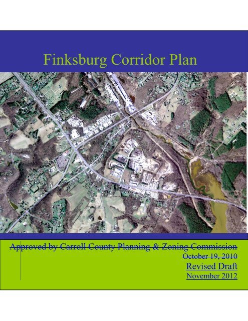
Finksburg Corridor Plan - Carroll County Government
Finksburg Corridor Plan - Carroll County Government
Finksburg Corridor Plan - Carroll County Government

Create successful ePaper yourself
Turn your PDF publications into a flip-book with our unique Google optimized e-Paper software.
<strong>Finksburg</strong> <strong>Corridor</strong> <strong>Plan</strong><br />
<strong>Finksburg</strong> <strong>Corridor</strong> <strong>Plan</strong><br />
Approved by <strong>Carroll</strong> <strong>County</strong> <strong>Plan</strong>ning & Zoning Commission<br />
October 19, 2010<br />
Revised Draft<br />
November 2012
Copies of the adopted <strong>Finksburg</strong> <strong>Corridor</strong> <strong>Plan</strong> are available…….<br />
In hardcopy or on CD at:<br />
<strong>Carroll</strong> <strong>County</strong> Department of <strong>Plan</strong>ningLand Use, <strong>Plan</strong>ning & Development<br />
225 N. Center Street, Suite 204<br />
Westminster, MD 21157<br />
Online (text and maps) at:<br />
http://ccgovernment.carr.org/ccg/compplan/finksburg/default.asp<br />
For additional information, contact the <strong>Carroll</strong> <strong>County</strong> Department of Land Use, <strong>Plan</strong>ning &<br />
Development:<br />
By phone: 410-386-2145<br />
By e-mail: ccplanning@ccg.carr.org<br />
ACCESSIBILITY NOTICE: The Americans With Disabilities Act applies to the <strong>Carroll</strong> <strong>County</strong> <strong>Government</strong> and its programs, services,<br />
activities, and facilities. If you have questions, suggestions, or complaints, please contact Jolene Sullivan, the <strong>Carroll</strong> <strong>County</strong> <strong>Government</strong><br />
Americans With Disabilities Act Coordinator, 410-386-3600 or 1-888-302-8978, or MD Relay at 7-1-1/800-735-2258. The mailing address is:<br />
10 Distillery Drive, First Floor, Suite 101, Westminster, MD 21157.
NOTE TO THE READER<br />
Based upon additional feedback from the <strong>Plan</strong>ning Commission, comments from the Board of<br />
<strong>County</strong> Commissioners and supplemental staff reviews, this iteration of the <strong>Finksburg</strong> <strong>Corridor</strong><br />
<strong>Plan</strong> differs from the <strong>Plan</strong> that was Approved by the <strong>Plan</strong>ning Commission in October of 2010.<br />
These modifications take one of four forms:<br />
(1) Technical/grammatical;<br />
(2) Stylistic re-wording;<br />
(3) The Design Guidelines have been eliminated from the <strong>Plan</strong> and will take the form of a<br />
stand-alone document; and<br />
(4) The Boulevard District Addendum has been removed and, where possible, the<br />
recommendations have been incorporated into the text portion of the <strong>Plan</strong>.
<strong>Finksburg</strong> <strong>Corridor</strong> <strong>Plan</strong><br />
TABLE OF CONTENTS<br />
Chapter 1: Introduction ................................................................................................................... 1<br />
What is the <strong>Finksburg</strong> <strong>Corridor</strong> <strong>Plan</strong>? .............................................................................. 1<br />
Community Input ............................................................................................................. 2<br />
Maryland’s Twelve Visions ............................................................................................. 2<br />
<strong>Finksburg</strong> Community’s Vision ....................................................................................... 4<br />
<strong>Finksburg</strong> Community’s Goals ........................................................................................ 6<br />
Major Concepts & Intended Accomplishments ............................................................... 7<br />
Demographic Characteristics ........................................................................................... 9<br />
Population Trends .............................................................................................................9<br />
Households by Type .........................................................................................................10<br />
Household and Family Income .........................................................................................11<br />
Chapter 2: <strong>Corridor</strong> <strong>Plan</strong> ............................................................................................................... 13<br />
Goals............................................................................................................................... 13<br />
Current Conditions ......................................................................................................... 14<br />
Use of Land by Acreage ..................................................................................................24<br />
Existing Zoning by Acreage ............................................................................................27<br />
Analysis of Community Needs ...................................................................................... 31<br />
Recommended Actions .................................................................................................. 41<br />
Land Use Designation by Acreage ..................................................................................44<br />
Fiscal Implications ......................................................................................................... 58<br />
Maps<br />
Map 1 1981 CPA & 2009 2010 <strong>Corridor</strong> ............................................................................1<br />
Map 2 <strong>Finksburg</strong> <strong>Corridor</strong> Neighborhoods .......................................................... 4 & 32 34<br />
Map 3 Priority Funding Areas & Rural Villages ..............................................................17<br />
Map 4 Agricultural Resource Areas ..................................................................................18<br />
Map 5 Traffic Volume ....................................................................................................2022<br />
Map 6 Roadway Segment Functional Classification .....................................................2123<br />
Map 7Existing Use of Land............................................................................................2325<br />
Map 8 Existing Zoning ...................................................................................................2426<br />
Map 9Environmental Resources ....................................................................................2628<br />
Map 10 Land Use Designations .....................................................................................4245<br />
Map 11 Viewsheds & Land Use Designations ...............................................................4447<br />
Map 12Transportation Improvements ...........................................................................4649<br />
Approved by <strong>Carroll</strong> <strong>County</strong> <strong>Plan</strong>ning & Zoning Commission - October 2010 Revised Draft – November 2012
<strong>Finksburg</strong> <strong>Corridor</strong> <strong>Plan</strong><br />
Chapter 1: Introduction<br />
What is the <strong>Finksburg</strong> <strong>Corridor</strong> <strong>Plan</strong>?<br />
The <strong>Finksburg</strong> <strong>Corridor</strong> <strong>Plan</strong> is a long-range planning document that will guide the<br />
growth and development of the <strong>Finksburg</strong> corridor, roughly defined as the area along the MD<br />
140 corridor from the county<strong>County</strong> line in the east to Kays Mill Road in the west. The effort<br />
began as a comprehensive update to the 1981 <strong>Finksburg</strong> Area and Environs Comprehensive<br />
<strong>Plan</strong>, a plan that covered almost the entire 4 th election district. The area covered by the 1981<br />
plan formed the “study area” for this plan, allowing for a survey and analysis of the area that<br />
would indicate the most appropriate extent for a new corridor. The policies and recommended<br />
actions within the <strong>Finksburg</strong> <strong>Corridor</strong> <strong>Plan</strong> are the culmination of staff research, various<br />
community participation opportunities, and direction from the <strong>Carroll</strong> <strong>County</strong> <strong>Plan</strong>ning and<br />
Zoning Commission and Board of <strong>County</strong> Commissioners. . The shaded area depicted below is<br />
the geographical area to which this <strong>Plan</strong>’s recommendations apply. With its Adoption, this <strong>Plan</strong><br />
will replace the 1981 <strong>Plan</strong>, with the exception of those areas lying outside of the shaded area<br />
which will be covered by the <strong>County</strong> Master <strong>Plan</strong>.<br />
Map 1 Formatted: TOC 3<br />
Approved by <strong>Carroll</strong> <strong>County</strong> <strong>Plan</strong>ning & Zoning Commission - October 2010Revised Draft – November 2012 ♦ 1
<strong>Finksburg</strong> <strong>Corridor</strong> <strong>Plan</strong><br />
Community Input<br />
In preparation for the update of the <strong>Finksburg</strong> Area and Environs Comprehensive <strong>Plan</strong>, several<br />
opportunities were taken to gather input from resident, business owners, and community leaders<br />
on the important issues facing the <strong>Finksburg</strong> area. Interviews were conducted with community<br />
officials and leadersstakeholders to help identify critical planning issues relating to growth<br />
management, transportation, community facilities, economic development, and natural resource<br />
protection, among others. A community survey was mailed to all property owners in the 4 th<br />
(Woolerys) election district to gather additional input on similar topics. The survey received a 32<br />
percent response rate from the 5,300 that were mailed out. Four workshops also were held to<br />
define a vision and goals for the <strong>Finksburg</strong> comprehensive plan, and to provide input on<br />
proposed text and map recommendations. Finally, a follow-up survey was conducted to gauge<br />
support for the text and map recommendations. Of the 5,300 surveys mailed out, approximately<br />
10 percent were returned. The results of the input received from the interviews, surveys, and<br />
community workshops were incorporated into a draft document that was circulated for public<br />
review in May 2009.<br />
During the public review period, several community meetings were held and a public hearing<br />
took place on July 28, 2009. Approximately 100 written and oral comments were received on the<br />
plan. Those comments were incorporated into a revised draft of the plan that was presented to the<br />
<strong>Plan</strong>ning Commission for review in November 2009. Work sessions on the revised draft were<br />
held on January 19, 2010 and June 15, 2010. On July 20, 2010, the <strong>Plan</strong>ning Commission<br />
approved the plan for 60-day review. A public information meeting was held during this review<br />
period on September 16, 2010. A public hearing was held by the <strong>Plan</strong>ning Commission on<br />
October 12, 2010. Approximately eight sets of written and oral comments were received during<br />
the 60-day review period and public hearing. The <strong>Plan</strong>ning Commission discussed the comments<br />
during their October 19, 2010 meeting. Immediately following this discussion, the <strong>Plan</strong>ning<br />
Commission approved the plan and referred it to the Board of <strong>County</strong> Commissioners for<br />
adoption. Initially, the Board rejected the plan over concerns about timing with respect to the<br />
updating of the Master <strong>Plan</strong>. In October 2012, the Board reconsidered this vote and decided to<br />
remand the plan backwith comments to the <strong>Plan</strong>ning Commission for further review.<br />
Maryland’s Twelve Visions<br />
The Maryland Economic Growth, Resource Protection, and <strong>Plan</strong>ning Act of 1992 (the <strong>Plan</strong>ning<br />
Act) was based on eight "Visions," which were revised and expanded in 2009 as part of the<br />
Smart, Green, and Growing legislation. <strong>County</strong> and municipal plans are required to implement<br />
and establish a set of policies based on the Visions.<br />
Making the Visions part of Maryland's planning and zoning enabling legislation gives local<br />
jurisdictions a concise statement of Maryland's priorities for their plans. The twelve visions are<br />
as follows:<br />
Approved by <strong>Carroll</strong> <strong>County</strong> <strong>Plan</strong>ning & Zoning Commission - October 2010Revised Draft – November 2012 ♦ 2<br />
Formatted: Indent: First line: 0"<br />
Formatted: Indent: First line: 0"<br />
Formatted: Indent: First line: 0"<br />
Formatted: Indent: First line: 0"
<strong>Finksburg</strong> <strong>Corridor</strong> <strong>Plan</strong><br />
(1) Quality of life and sustainability: a high quality of life is achieved through universal<br />
stewardship of the land, water, and air resulting in sustainable communities and<br />
protection of the environment;<br />
(2) Public participation: citizens are active partners in the planning and implementation<br />
of community initiatives and are sensitive to their responsibilities in achieving<br />
community goals;<br />
(3) Growth areas: growth is concentrated in existing population and business centers,<br />
growth areas adjacent to these centers, or strategically selected new centers;<br />
(4) Community design: compact, mixed–use, walkable design consistent with existing<br />
community character and located near available or planned transit options is encouraged<br />
to ensure efficient use of land and transportation resources and preservation and<br />
enhancement of natural systems, open spaces, recreational areas, and historical, cultural,<br />
and archeological resources;<br />
(5) Infrastructure: growth areas have the water resources and infrastructure to<br />
accommodate population and business expansion in an orderly, efficient, and<br />
environmentally sustainable manner;<br />
(6) Transportation: a well–maintained, multimodal transportation system facilitates the<br />
safe, convenient, affordable, and efficient movement of people, goods, and services<br />
within and between population and business centers;<br />
(7) Housing: a range of housing densities, types, and sizes provides residential options for<br />
citizens of all ages and incomes;<br />
(8) Economic development: economic development and natural resource–based<br />
businesses that promote employment opportunities for all income levels within the<br />
capacity of the State’sstate’s natural resources, public services, and public facilities are<br />
encouraged;<br />
(9) Environmental protection: land and water resources, including the Chesapeake and<br />
coastal bays, are carefully managed to restore and maintain healthy air and water, natural<br />
systems, and living resources;<br />
(10) Resource conservation: waterways, forests, agricultural areas, open space, natural<br />
systems, and scenic areas are conserved;<br />
(11) Stewardship: government, business entities, and residents are responsible for the<br />
creation of sustainable communities by collaborating to balance efficient growth with<br />
resource protection; and<br />
(12) Implementation: strategies, policies, programs, and funding for growth and<br />
development, resource conservation, infrastructure, and transportation are integrated<br />
across the local, regional, state, and interstate levels to achieve these Visions.<br />
Approved by <strong>Carroll</strong> <strong>County</strong> <strong>Plan</strong>ning & Zoning Commission - October 2010Revised Draft – November 2012 ♦ 3
<strong>Finksburg</strong> <strong>Corridor</strong> <strong>Plan</strong><br />
Map 2 Formatted: TOC 3<br />
<strong>Finksburg</strong> Community’s Vision<br />
The following vision statement represents the preferred future for the community, as<br />
expressed by participants in the various community input opportunities. Future decisions and<br />
activities of the community will be consistent with this vision. Members of the community will<br />
strive to bring about the changes that will make this vision attainable.<br />
The entrance to the <strong>Finksburg</strong> community provides a welcoming gatewayGateway<br />
to <strong>Carroll</strong> <strong>County</strong>. The core of the community is a hub for local commercial and<br />
social activities. Traffic flows through the community safely and efficiently,<br />
integrating the characteristics of the activity center. The Liberty Reservoir<br />
watershed is a recreational and functional asset to the community that provides a<br />
clean water supply to the region. New residential development respects the heritage<br />
of the community and its conservation ideals. The <strong>Finksburg</strong> corridor is<br />
surrounded by open space and agricultural and resource lands. Preservation and<br />
protection of these areas is important for the <strong>Finksburg</strong> corridor and showcases the<br />
finer qualities of the county<strong>County</strong>.<br />
Approved by <strong>Carroll</strong> <strong>County</strong> <strong>Plan</strong>ning & Zoning Commission - October 2010Revised Draft – November 2012 ♦ 4
<strong>Finksburg</strong> <strong>Corridor</strong> <strong>Plan</strong><br />
Additionally, individual vision statements were crafted for each of the three<br />
“neighborhoods” identified within the corridor area. These vision statements reflect the differing<br />
characters of each neighborhood and the unique future each has in the context of this plan.<br />
Arterial Business Neighborhood<br />
The Arterial Business area serves as the backbone of the <strong>Finksburg</strong> <strong>Corridor</strong> and an attractive<br />
gatewayGateway into <strong>Carroll</strong> <strong>County</strong>. It contains a variety of small-scale business, light<br />
industrial, office and retail uses that meet the daily needs of the surrounding community while at<br />
the same time offering travel-related services to highway users. A sophisticated level of<br />
landscaping and site and building design create a welcoming gatewayGateway to the community<br />
and the county<strong>County</strong>. Visual clutter is minimized and site lighting is subdued. The area provides<br />
opportunities for community events and social encounters at established gathering spaces. Many<br />
properties have been redeveloped, utilizing a variety of financial incentives and infrastructure<br />
improvements created to fulfill the vision for the area. Minimal access points along MD 140 and<br />
controlled turning movements allow for safe highway travel. Pedestrian and bicycle activity is<br />
directed away from the highway to the secondary roadways, where lower vehicle speeds and<br />
volumes provide a safe and pleasant environment. Care for the quality of the nearby Liberty<br />
Reservoir and surrounding natural features is reflected in priority being placed on low-impact<br />
site design, effective state-of-the-art stormwater and wastewater management, green building<br />
technologies and a net improvement in the quality of natural features throughout the area.<br />
Secondary Residential Neighborhood<br />
The Secondary Residential areas balance the commercial and industrial components of the<br />
<strong>Finksburg</strong> <strong>Corridor</strong> with convenient, attractive residential neighborhoods. Community heritage<br />
preservation is a common goal. Respect for the historical buildings and community heritage is<br />
demonstrated through well-maintained older buildings, new buildings that respond to<br />
neighborhood patterns and building styles, and renovations or additions that are compatible<br />
with original structures. Community water and wastewater systems address existing or potential<br />
failure of private wells and septic systems. In the part of the neighborhood along Old<br />
Westminster Pike, the community systems support redevelopment efforts through the creation of<br />
a limited number of new residences that are compatible in scale with the surrounding historic<br />
neighborhood. This allows for a transition between the Arterial Business part of the corridor and<br />
the established residences on the old road. Residents are able to safely move through their<br />
neighborhoods on foot and bicycle through a network of sidewalks and paths. The roadways in<br />
the area are an integral part of an interconnected network of streets throughout the corridor.<br />
Concerns about “cut-through” traffic are minimized because visual and functional<br />
improvements to MD 140 and MD 91 have been made to make those roadways the preferred<br />
travel routes for non-local traffic. Water quality and environmental protection are supported<br />
through the retention of existing forest land, reforestation and planting of native species, lowimpact<br />
site design, and green building technologies. A shared ethic of natural resource<br />
protection is found throughout the area.<br />
Approved by <strong>Carroll</strong> <strong>County</strong> <strong>Plan</strong>ning & Zoning Commission - October 2010Revised Draft – November 2012 ♦ 5<br />
Formatted: TOC 3, Tab stops: Not at -1" +<br />
-0.5"<br />
Formatted: Indent: Left: 0", Tab stops: -1",<br />
Left + -0.5", Left<br />
Formatted: Indent: First line: 0"<br />
Formatted: Indent: First line: 0"
<strong>Finksburg</strong> <strong>Corridor</strong> <strong>Plan</strong><br />
Service and Industry Neighborhood<br />
The Service and Industry area provides local and regional employment opportunities and<br />
convenient, yet buffered, locations for heavy service, manufacturing and processing operations.<br />
Commercial and retail establishments exist only to the extent they serve and are subordinate to<br />
the service and industrial uses in the area. This area is set back from the main arterial<br />
roadways. Structures and landscaping along MD 140, MD 91, and the secondary residential<br />
streets screen the Service and Industry area uses from general view and help to mitigate the<br />
impact of noise, fumes, and traffic, thereby supporting the vision for an attractive<br />
gatewayGateway to the county<strong>County</strong>. Traffic generated by services and industries in the area<br />
can move freely and safely to and from their destinations because of circulation improvements<br />
made to MD 140 and MD 91. Similarly, circulation improvements eliminate the potential<br />
conflicts between service and industrial traffic, and traffic generated locally or by through traffic<br />
on the highway. The quality of water in Liberty Reservoir and its tributaries is protected from<br />
contamination through vegetative buffers on properties in the area, state-of-the-art stormwater<br />
and wastewater management systems, low-impact site design, and green building technologies.<br />
<strong>Finksburg</strong> Community’s Goals<br />
In addition to developing a unique distinct set of visions statements within the<br />
community, a set of goals are also developed that are distinct unique to the needs of the<br />
community and that are more specific than the county<strong>County</strong>-wide goals. The participants in<br />
this planning process identified the following priorities for the <strong>Finksburg</strong> community.<br />
Land Use<br />
To encourage redevelopment as a way to promote new small-scale business, office and retail<br />
activity within the corridor<br />
To provide opportunities for residential uses along secondary roadways that are compatible<br />
in design and density with historic structures and the existing community character<br />
To strengthen the boundaries of the corridor by supporting resource protection and land<br />
preservation on lands adjacent to the corridor<br />
Transportation<br />
To move traffic through the MD 140 corridor without disrupting the community's economic<br />
and social activities<br />
To spur transportation and design improvements in the MD 140 corridor to promote the<br />
gatewayGateway concept<br />
To maintain the functionality of MD 140 as a major arterial and MD 91 as a minor arterial<br />
To promote the safe and efficient movement of traffic through the corridor<br />
To create opportunities for non-motorized travel in the community and to provide additional<br />
recreational opportunities for all age levels<br />
Environmental Sensitivity<br />
To recognize and respond to the essential need to protect water quality in Liberty Reservoir<br />
and its tributaries<br />
To create development that provides positive environmental impact<br />
Gateway and Design<br />
Approved by <strong>Carroll</strong> <strong>County</strong> <strong>Plan</strong>ning & Zoning Commission - October 2010Revised Draft – November 2012 ♦ 6
<strong>Finksburg</strong> <strong>Corridor</strong> <strong>Plan</strong><br />
To create opportunities for non-motorized travel in the community and to provide additional<br />
recreational opportunities for all age levels<br />
Environmental Sensitivity<br />
To recognize and respond to the essential need to protect water quality in Liberty Reservoir<br />
and its tributaries<br />
To create development that limits adverse environmental impact<br />
Gateway and Design<br />
To establish a visually appealing gatewayGateway that welcomes residents and visitors to<br />
<strong>Carroll</strong> <strong>County</strong><br />
To provide incentives for redevelopment within the <strong>Finksburg</strong> corridor that createscreate<br />
community assets<br />
To provide flexibility in regulations and design standards to allow for the creation of the<br />
concepts desired in the community’s core<br />
To create usable and friendly public spaces and community gathering spots<br />
To locate the appropriate needed public facilities in the corridor<br />
To enhance the feeling of public and personal safety<br />
Major Concepts & Intended Accomplishments<br />
In examining the study area for this update (the 1981 planning area), a clear contrast was<br />
discerned observed between higher intensity uses focused on the gatewayGateway area and<br />
historic <strong>Finksburg</strong> community, and the lower intensity uses and associated zoning just beyond<br />
this area. Within the gatewayGateway area is found a concentration and intensity of<br />
transportation issues, aesthetic concerns, and environmental concernsconsiderations related to<br />
the reservoir and its headwaters not found elsewhere in the study area. Much of the land covered<br />
by the 1981 plan that lies outside of the gatewayGateway area already has been developed as<br />
low-density residential subdivisions, though some concentrations of agricultural and resource<br />
lands also existremain, particularly around adjacent to the reservoir. Outside the<br />
gatewayGateway, transportation concerns and aesthetic issues related to commercial and<br />
industrial uses are more isolated. Additionally, environmental concerns here are mitigated<br />
somewhat by the much lower intensities of land uses and zoning. Because of the highly<br />
differentiated character of these two areas, the <strong>Finksburg</strong> <strong>Corridor</strong> <strong>Plan</strong> culminates in the<br />
creation of a much smaller plan area that is focused on urban development and redevelopment<br />
issues. Lower density areas of the 1981 planning area are now proposed to be addressed in the<br />
countywide <strong>County</strong>wide master Master plan<strong>Plan</strong>.<br />
The <strong>Finksburg</strong> <strong>Corridor</strong> <strong>Plan</strong> represents changes in the policy of land use development<br />
that have taken place in the <strong>Finksburg</strong> area since the 1970’s. The elimination of the Community<br />
<strong>Plan</strong>ning Area (now referred to as “Designated Growth Area”) designation for the land outside of<br />
the <strong>Corridor</strong> boundaries affirms the concept that this portion of the county<strong>County</strong> is best suited<br />
for lower intensity land use. The <strong>Finksburg</strong> <strong>Corridor</strong> area that remains is a mix of historic<br />
residential areas, contemporary retail uses, light and heavy industrial development, and scattered<br />
community institutions and uses. The urban nature of this corridor area and the need to focus<br />
redevelopment and revitalization efforts within it make the corridor suitable to<br />
remaincharacterization of the corridor appropriate for continued identification as a Designated<br />
Growth Area.<br />
Approved by <strong>Carroll</strong> <strong>County</strong> <strong>Plan</strong>ning & Zoning Commission - October 2010Revised Draft – November 2012 ♦ 7<br />
Formatted: Indent: First line: 0"
<strong>Finksburg</strong> <strong>Corridor</strong> <strong>Plan</strong><br />
This plan focuses on balancing the mix of planned land uses within the corridor to<br />
promote the plan’s vision.<br />
The BoulevardCommercial land use designation promotes retention and creation of<br />
small-scale business, office and retail uses that will serve bothsupport the localservice<br />
and retail needs of the surrounding community and the highway user.provide for the basic<br />
needs of the regional traveler. Limited opportunities for residential development are also<br />
envisioned for the BoulevardCommercial area, particularly on land that lies between MD<br />
140 and Old Westminster Pike. In this vicinity, opportunities are envisioned for<br />
highway-oriented business uses along MD 140 and residential or mixed uses along Old<br />
Westminster Pike, to create a more compatible character of development within the<br />
historic <strong>Finksburg</strong> area. Development of properties within the Commercial area will<br />
strive to incorporate creative design elements, consistent architectural and signage<br />
themes, and improved access to adjacent commercial properties. Realizing this type of<br />
development, however, may require that community water and sewer service be made<br />
available given the relatively small lot sizes.<br />
Existing Industrial areas are retained, with the exception of areas immediately adjacent to<br />
MD 140, where the BoulevardCommercial designation replaces Industrial in recognition<br />
of the plan’s vision for the gatewayGateway and the predominantly commercial nature of<br />
the area alreadycurrently in existence. No expansion to the Industrial areas is<br />
promotedanticipated, in response to the plan’s emphasis on environmentally sensitive<br />
development and the need to protect water quality and improve the appearance of the<br />
gatewayGateway area.<br />
Residential land use designations respond to the historic community of <strong>Finksburg</strong> and the<br />
neighborhoods along Cedarhurst and Club House roads, providing opportunities for<br />
residential uses along secondary roads to blend more seamlessly with the existing<br />
community character.,<br />
The importance of the MD 140 corridor to the vitality of <strong>Carroll</strong> <strong>County</strong> is clearly<br />
recognized within this plan through efforts to improve the functionality and appearance of the<br />
roadway. This can be accomplished best by allowing fewer vehicular access points along the<br />
highway and encouraging development that is in keeping with the nature of high volume traffic<br />
close to the corridor. In cooperation with the State Highway Administration, recommended<br />
improvements to the MD 140 corridor within the gatewayGateway area have been developed as<br />
part of this long-range plan.<br />
In addition to being a main thoroughfare for <strong>Carroll</strong> <strong>County</strong>, the MD 140 corridor within<br />
the gatewayGateway area serves as the focal point for many community activities. Balancing<br />
both the needs of the <strong>Finksburg</strong> community and the region as a whole is vital in developing an<br />
effective plan. As a result, continuing to build upon and improve the character of the <strong>Finksburg</strong><br />
community is a primary goal of this plan. A Boulevard concept was developed to achieve the<br />
variety and intensity of land uses and quality of site design necessary to support the vision. The<br />
Boulevard designation replaces the Commercial designation and also applies in limited instances<br />
to some Industrial Restricted designated land.<br />
Approved by <strong>Carroll</strong> <strong>County</strong> <strong>Plan</strong>ning & Zoning Commission - October 2010Revised Draft – November 2012 ♦ 8
<strong>Finksburg</strong> <strong>Corridor</strong> <strong>Plan</strong><br />
This plan also recognizes the sensitivity of the adjacent Liberty Reservoir and the need to<br />
protect this valuable drinking water resource from the detrimental effects of unmanaged high<br />
impact land uses, poor stormwater management, and outdatedless efficient wastewater disposal<br />
systems, among other things. At the same time, it recognizes that much of the existing<br />
development has occurred without the benefit of today’scurrent technology to controlreduce<br />
pollutants carried in wastewater and stormwater runoff. The only best way to correct this<br />
situation, as well as to address other <strong>Plan</strong> objectives, will be to promote the redevelopment of the<br />
corridor, thus triggering the review of development proposals using utilizing current<br />
environmental regulationswater resource technologies and management practices. One of the<br />
best incentives to redevelop would be the provision of a community wastewater system, which<br />
not only would provide the needed redevelopment incentive but also would address existing and<br />
potential environmental hazards posed by the preponderance of individual septic systems located<br />
in such close proximity to the reservoir.<br />
Demographic Characteristics<br />
1 Woolery’s (4 th ) Election District<br />
The Woolerys election district has experienced steady growth since 1930. The greatest increases<br />
have occurred since 1960, when the study area had a population of 4,368. While <strong>Carroll</strong> <strong>County</strong><br />
as a whole has also been experiencing significant growth since 1960, the election district has<br />
grown faster than the <strong>County</strong> as a whole. Both <strong>Carroll</strong> <strong>County</strong> and the election district have been<br />
growing at a faster rate than the State of Maryland since 1960.<br />
During the decade 1970 - 1980, the Woolerys election district grew by 73 percent from<br />
6,532 people in 1970 to 11,296 people in 1980, as shown in the Population Trends table. The<br />
election district has growngrew at a faster rate than the <strong>County</strong> sincebetween 1930 and 2000. In<br />
2000, the election district contained approximately 10.8 percent of the entire <strong>Carroll</strong> <strong>County</strong><br />
population. October 2009 estimates place By 2010, the population for the Woolerys election<br />
district at 18,403was 17,487 – an increase of 2,0741,158 or 12.7.1 percent since 2000.<br />
Woolerys Election District<br />
Population Trends<br />
1930 – 20002010<br />
<strong>Carroll</strong> <strong>County</strong> Maryland<br />
Year<br />
%<br />
%<br />
%<br />
Population Change Population Change Population Change<br />
1930 2,629 N/A 35,978 N/A 1,631,526 N/A<br />
1940 3,072 17 39,054 9 1,821,244 12<br />
1950 3,757 22 44,907 15 2,343,001 29<br />
1960 4,368 16 52,785 18 3,100,689 32<br />
1970 6,532 50 69,006 31 3,923,897 27<br />
1980 11,296 73 96,356 40 4,216,933 7<br />
1990 13,9<br />
92<br />
24 123,372 28 4,780,753 13<br />
2000 16,329 17 150,897 22 5,296,486 11<br />
2010 17,487 7 167,134 11 5,773,552 9<br />
Source: U. S. Census Summary Tape File 1A<br />
Approved by <strong>Carroll</strong> <strong>County</strong> <strong>Plan</strong>ning & Zoning Commission - October 2010Revised Draft – November 2012 ♦ 9<br />
Formatted: Normal, Tab stops: Not at -1" +<br />
-0.5"<br />
Formatted: Indent: First line: 0"<br />
Formatted Table<br />
Formatted: Not Highlight<br />
Formatted Table
<strong>Finksburg</strong> <strong>Corridor</strong> <strong>Plan</strong><br />
According to the 2000 Census, the Woolerys Election District had 16,329 people residing in<br />
5,654 households. The average number of persons per household was 2.88. October 2009<br />
estimates place the89. By 2010, there were a total of 6,229 households for the Woolerys election<br />
district at 6,376 – an increase of 722575 since 2000.<br />
The next table shows types of households for 19902000 and 20002010 for the Woolerys Election<br />
District, <strong>Carroll</strong> <strong>County</strong>, and Maryland. Family households consist of a householder and one or<br />
more persons living in the same household who are related to the householder by birth, marriage,<br />
or adoption. The number of households in the election district increased by 2110.2 percent from<br />
19902000 to 20002010. The number of persons per household is slightly higher for the election<br />
district than that of the <strong>County</strong> or State.state. Household Type data was not available during the<br />
2010 Census for the Woolerys Election District. Five year data (2006-2010) from the US Census<br />
Bureau’s American Community Survey was used.<br />
Households by Type<br />
19902000 and 20002010<br />
Woolerys Election<br />
District<br />
<strong>Carroll</strong> <strong>County</strong><br />
Maryland<br />
Household Type 19902000 20002010 20001990 20102000 20001990 20102000<br />
Family Households 4,017735 4,7355,01 41,09433, 45,16341, 1,245,814 1,359,318<br />
2 909 094 359,318 447,002<br />
Married-couple families 3,5744,18 4,189374 34,93629, 37,58834, 994,54994 1,026,739<br />
9<br />
476 936 8,563 994,549<br />
Other family,<br />
129190 190237 1,197808 1,8082,47 84,89365, 104,37584<br />
male householder<br />
9 362 ,893<br />
Other family,<br />
314356 356401 4,3503,23 5,1324,35 279,87623 315,88827<br />
female householder<br />
6 0 1,889 9,876<br />
Non-family households 648919 9191,217 11,4098,3 14,62311, 621,54150 709,40962<br />
39 409 3,177 1,541<br />
Total Households 5,6544,66 6,2295,65 52,50342, 59,78652, 1,748,991 1,980,859<br />
5 4 248 503 980,859 2,156,411<br />
Persons per household 3.02.89 2.8981 2.8581 2.8174 2.6761 2.61<br />
Group Quarters Population 08 812 2,9153,58 3,581319 134,05611 138,37513<br />
1<br />
3,856 4,056<br />
Source: U. S. Census Summary Tape File 1A<br />
In 20002010, family households (2 or more related people living in one unit) represented<br />
approximately 84 percent of the total community. Approximately 88 percent of the family<br />
households were married-couple families, which accounted for 74 percent of the Woolerys<br />
Election District’s total households. Non-family households (people unrelated to the<br />
householder, or those living alone) accounted for approximately 16 percent of the households in<br />
the community. The majority (79%) of these people lived alone, with seniors living alone<br />
accounting for 5.1 percent of the total households. In 2000, the majority (75%) of households in<br />
the election district contained 2, 3, or 4 people. Family households followed a similar trend.<br />
Most of the non-family households contained one personThe majority of all non-family<br />
households (86%) were persons who lived alone.<br />
The 2000 CensusThe 2006-2010 American Community Survey shows that the majority of<br />
households had an income ranging between $50,000 and $149,999. As shown in the following<br />
Approved by <strong>Carroll</strong> <strong>County</strong> <strong>Plan</strong>ning & Zoning Commission - October 2010Revised Draft – November 2012 ♦ 10<br />
Formatted: Indent: First line: 0"<br />
Formatted Table<br />
Formatted: Not Highlight<br />
Formatted: Indent: First line: 0"
<strong>Finksburg</strong> <strong>Corridor</strong> <strong>Plan</strong><br />
table, the median familyhousehold income for the election district was slightly higher than the<br />
median household income for the election district. <strong>County</strong>wide,countywide and significantly<br />
higher than the median household income was $60,021, and the median family income was<br />
$66,430 in 2000state as a whole.<br />
Income Range<br />
Household and Family Income<br />
20002010<br />
Woolerys ED<br />
<strong>Carroll</strong> <strong>County</strong><br />
# of HouseholdsElection District # of Households<br />
State of Maryland<br />
# of Households<br />
# of Households # of Families<br />
(5,682 total) (4,768 total)<br />
Less than $10,000 179149 442,109 1,866105,359 137,199<br />
$10,000 - $14,999 112105 73 1,865624 83,32870,756<br />
$15,000 - $24,999 366336 2253,988 4,379145,954 188,104<br />
$25,000 - $34,999 430279 2783,499 4,663164,080 212,135<br />
$35,000 - $49,999 718449 5895,677 7,813249,521 305,987<br />
$50,000 - $74,999 1,510264 1,30810,069 13,603386,304 427,180<br />
$75,000 - $99,999 1,084875 1,0709,406 8,933299,813 268,558<br />
$100,000 - $149,999 9931,344 92213,819 7,259375,928 230,285<br />
$150,000 or more 2901,353 2599,221 2,220323,332 129,019<br />
Median Household<br />
$67,50089,068 $60,02181,621 $52,86870,647<br />
Income<br />
Median Family Income $72,099n/a $66,43095,825 $61,87685,098<br />
Per Capita Income $25,878n/a $23,82933,938 $25,61434,849<br />
Source: U. S. Census Summary Tape File 3A<br />
2 <strong>Finksburg</strong> <strong>Corridor</strong> Area<br />
Within the <strong>Finksburg</strong> <strong>Corridor</strong> area itself, there are approximately 113 residences. Using<br />
the 20002010 Census average household size for the Woolerys election district of 2.8981 people,<br />
it is estimated that 327318 people live within the <strong>Corridor</strong> area. The <strong>County</strong>’s Buildable Land<br />
Inventory, which estimates potential lot yield based on zoning or land use designations and<br />
parcel acreage, indicates that approximately 152 additional residential units could be constructed<br />
in the corridor based on existing land use designations. This would equate to an additional 439<br />
people. However, it should be noted that the densities typically associated with the Suburban<br />
Residential land use designation, which is the one indicated for many properties in the corridor<br />
area, likely could not be realized today without public water and sewer. The Suburban<br />
Residential designation typically is associated with R-10,000 zoning, which allows for<br />
approximately 4 units per acre. The minimum acreage required for a private well and septic<br />
system is at least one acre. (Health Department). As a result, a more realistic number of potential<br />
future residential units in the corridor<strong>Corridor</strong> area probably is around 38, or about 110<br />
additional people, absent an expansion of water and sewerage infrastructure.<br />
Residences within the corridor<strong>Corridor</strong> area have a total assessed value of $24,044,318,<br />
for an average value of $212,782. The 72 properties in the corridor<strong>Corridor</strong> classified as<br />
commercial in use have a total assessed value of $45,420,184. The 24 properties in the<br />
corridor<strong>Corridor</strong> classified as industrial in use have a total assessed value of $28,622,820.<br />
Approved by <strong>Carroll</strong> <strong>County</strong> <strong>Plan</strong>ning & Zoning Commission - October 2010Revised Draft – November 2012 ♦ 11<br />
Formatted Table<br />
Split Cells<br />
Split Cells<br />
Split Cells<br />
Deleted Cells<br />
Formatted Table<br />
Formatted: Indent: Left: 0", Add space<br />
between paragraphs of the same style, Line<br />
spacing: single<br />
Formatted: Font color: Black<br />
Formatted: Indent: Left: 0", Add space<br />
between paragraphs of the same style, Line<br />
spacing: single<br />
Formatted: Font color: Black<br />
Deleted Cells<br />
Formatted: Indent: Left: 0", Add space<br />
between paragraphs of the same style, Line<br />
spacing: single<br />
Formatted: Font color: Black<br />
Deleted Cells<br />
Formatted: Font color: Black<br />
Formatted: Indent: Left: 0", Add space<br />
between paragraphs of the same style, Line<br />
spacing: single<br />
Formatted: Indent: Left: 0", Add space<br />
between paragraphs of the same style, Line<br />
spacing: single<br />
Formatted: Font color: Black<br />
Formatted: Font color: Black<br />
Formatted: Indent: Left: 0", Add space<br />
between paragraphs of the same style, Line<br />
spacing: single<br />
Formatted: Font color: Black<br />
Formatted: Indent: Left: 0", Add space<br />
between paragraphs of the same style, Line<br />
spacing: single<br />
Formatted: Font color: Black<br />
Formatted: Indent: Left: 0", Add space<br />
between paragraphs of the same style, Line<br />
spacing: single<br />
Formatted: Font color: Black<br />
Formatted: Indent: Left: 0", Add space<br />
between paragraphs of the same style, Line<br />
spacing: single<br />
Formatted: Font color: Black<br />
Formatted: Right, Indent: Left: 0", Add space<br />
between paragraphs of the same style<br />
Formatted ...<br />
Formatted ...<br />
Formatted ...
<strong>Finksburg</strong> <strong>Corridor</strong> <strong>Plan</strong><br />
Approved by <strong>Carroll</strong> <strong>County</strong> <strong>Plan</strong>ning & Zoning Commission - October 2010Revised Draft – November 2012 ♦ 12
Goals<br />
<strong>Finksburg</strong> <strong>Corridor</strong> <strong>Plan</strong><br />
Chapter 2: <strong>Corridor</strong> <strong>Plan</strong><br />
Land Use<br />
To encourage redevelopment as a way to promote new small-scale business, office and retail<br />
activity within the corridor<br />
To provide opportunities for residential uses along secondary roadways that are compatible<br />
in design and density with historic structures and the existing community character<br />
To strengthen the boundaries of the corridor by supporting resource protection and land<br />
preservation on lands adjacent to the corridor<br />
Transportation<br />
To move traffic through the MD 140 corridor without disrupting the community's economic<br />
and social activities<br />
To spur transportation and design improvements in the MD 140 corridor to promote the<br />
gatewayGateway concept<br />
To maintain the functionality of MD 140 as a major arterial and MD 91 and a minor arterial<br />
To promote the safe and efficient movement of traffic through the corridor<br />
To create opportunities for non-motorized travel in the community and to provide additional<br />
recreational opportunities for all age levels<br />
Environmental Sensitivity<br />
To recognize and respond to the essential need to protect water quality in Liberty Reservoir<br />
and its tributaries<br />
To create development that provides positive environmental impact<br />
Gateway and Design<br />
To create opportunities for non-motorized travel in the community and to provide additional<br />
recreational opportunities for all age levels<br />
Environmental Sensitivity<br />
To recognize and respond to the essential need to protect water quality in Liberty Reservoir<br />
and its tributaries<br />
To create development that limits adverse environmental impact<br />
To create development that provides positive environmental impact<br />
Gateway and Design<br />
To establish a visually appealing gatewayGateway that welcomes residents and visitors to<br />
<strong>Carroll</strong> <strong>County</strong><br />
To provide incentives for redevelopment within the <strong>Finksburg</strong> core that creates community<br />
assets<br />
To provide flexibility in regulations and design standards to allow for the creation of the<br />
concepts desired in the community’s core<br />
To create usable and friendly public spaces and community gathering spots<br />
Approved by <strong>Carroll</strong> <strong>County</strong> <strong>Plan</strong>ning & Zoning Commission - October 2010Revised Draft – November 2012 ♦ 13<br />
Formatted: Indent: Left: 0.25", No bullets or<br />
numbering, Tab stops: Not at 1"
<strong>Finksburg</strong> <strong>Corridor</strong> <strong>Plan</strong><br />
To locate the appropriate needed public facilities in the corridor<br />
To enhance the feeling of public and personal safety<br />
The <strong>Finksburg</strong> corridor is situated along MD 140 and includes adjacent lands that have the<br />
greatest potential to be affected by any new development and activity related to the corridor.<br />
The Current Conditions and Needs Analysis sections of this chapter provide background<br />
information about the entire study area, as well as more detailed analysis of the <strong>Finksburg</strong><br />
community core. The Recommended Actions and Fiscal Implications sections focus primarily on<br />
the corridor area only, and provide steps that can be taken to achieve the community vision.<br />
The <strong>Carroll</strong> <strong>County</strong> comprehensive plan covers many issues- such as schools, environment,<br />
heritage, community facilities, and employment - that also affect the <strong>Finksburg</strong> corridor. This<br />
chapter explores characteristics that are unique to the corridor and deserve special attention<br />
within this plan.<br />
Current Conditions<br />
1 Historic Development and Cultural Resources<br />
From the beginning of colonization until the county’s founding<strong>Carroll</strong> <strong>County</strong> was created in<br />
January, 1837 out of parts of Baltimore and Frederick counties. Prior to this, the lands in and<br />
around <strong>Finksburg</strong> lay at the western edge of Baltimore <strong>County</strong>. SubstantialWhile substantial<br />
colonial land grants and patents arewere recorded throughout the area, but they were often<br />
speculative holdings that remained undeveloped until well into the 18 th century. At the turn of<br />
the 19 th century, the vast majority of the occupied parcels in the <strong>Finksburg</strong> area ranged between<br />
50 and 200 acres. The relatively small size of the area’s farmsteads reflected the constraints on<br />
available capital and labor typical of the time. It also reflected the preference for cultivating food<br />
crops such as wheat, rye and corn, which required less land and labor than the tobacco crops of<br />
the colonial tidewater estates.<br />
The preference for food crops also reflected the growing existence of water-powered mills that<br />
used the many strong-flowing streams and creeks of the Piedmont to process grains and other<br />
products. It is estimated that by 1794 at least thirty-one mills were operating in what is now<br />
eastern <strong>Carroll</strong> <strong>County</strong>. Thus, the rural landscape around <strong>Finksburg</strong> evolved into a pattern of<br />
relatively small farmsteads and rural communities organized around an expanding network of<br />
water-powered mills and transportation corridors for moving products to market.<br />
In an effort to improve travel conditions and commerce in the Statestate, an 1804 Statestate law<br />
was passed providing for the incorporation of three private entities that would be responsible for<br />
the construction of three turnpikes radiating outwards from Baltimore. One of these was to<br />
follow a route from Baltimore through Reisterstown to the Pennsylvania line towards Hanover,<br />
and through Westminster to the Pennsylvania line towards Petersburgh. The latter of these<br />
routes became the Westminster Turnpike. As the turnpike was established, clustered settlements<br />
grew up along the route at crossroads or other geographically convenient points. These<br />
settlements provided goods or services for travelers and a centralized point for mail service.<br />
Approved by <strong>Carroll</strong> <strong>County</strong> <strong>Plan</strong>ning & Zoning Commission - October 2010Revised Draft – November 2012 ♦ 14<br />
Formatted: Indent: First line: 0"<br />
Formatted: Indent: First line: 0"<br />
Formatted: Indent: First line: 0"<br />
Formatted: Indent: First line: 0"<br />
Formatted: Indent: First line: 0"
<strong>Finksburg</strong> <strong>Corridor</strong> <strong>Plan</strong><br />
They also served as hubs for getting local products to market. The village of <strong>Finksburg</strong> and the<br />
settlements of Sandymount and <strong>Carroll</strong>ton P.O. (Reese) are among such transportation nodes.<br />
<strong>Finksburg</strong> had its origins in the establishment of a tavern by Adam Fink in 1810 on 15 acres of<br />
land located along the turnpike. Development of the village followed soon after and consisted of<br />
residences and shops such as a blacksmith, a wheelwright, and other businesses that supported<br />
the local agricultural economy and the needs of residents in the area., 12 , arguably also serving the<br />
needs as well as those of travelers and commuters. The map of <strong>Finksburg</strong> contained in the 1877<br />
An Illustrated Atlas of <strong>Carroll</strong> <strong>County</strong> Maryland shows a tollhouse at the eastern end of the<br />
village, as well as a hotel, a tavern, a schoolhouse, two Methodist churches, the Mechanics Hall<br />
lodge and store, and aboutapproximately thirteen residences. About a dozen other residences and<br />
a copper and iron mine were located in the balance of the area defined in this plan as the<br />
<strong>Finksburg</strong> corridor. 3<br />
With the introduction of rail to the area in the mid-19 th century, development patterns again<br />
began to shift. The Western Maryland Railroad originated in Owings Mills, reached Westminster<br />
in June, 1861, and later was completed to HagerstownCumberland, Maryland. Its route followed<br />
the course of the North Branch of the Patapsco River, entering <strong>Carroll</strong> <strong>County</strong> from the east at a<br />
point just north of Westminster Pike and the village of <strong>Finksburg</strong>. The line continued to follow<br />
the river to Westminster, where it continued west following tributaries of Double Pipe Creek.<br />
This entirely new transportation corridor prompted additional new settlements along its length.<br />
Among the villages that sprang up along the rail line were Patapsco and other nodes such as<br />
Gorsuch Station, Shamberger’s Mill Station, Tank Station and a station that lay north of the<br />
village of <strong>Finksburg</strong>. The transportation advantages of the railroad encouraged commercial and<br />
industrial growth closer to the rail lines, as canis still be seenevident in the industries located<br />
along the line north of <strong>Finksburg</strong>.<br />
Despite advances in transportation and industry, growth in the area was comparatively slow until<br />
the latter part of the 20 th century. By 1940, just over 3,000 people lived in the Woolery’s (4 th )<br />
election district, an area just slightly larger than this plan’s study area. The population at that<br />
time exceeded the 1870 population for the election district (2,448 people) by only about 500<br />
people. But while the 70 years between 1870 and 1940 yielded only about a 25 percent increase<br />
in population, the 70 years between 1940 and 2010 have yielded a 500 percent increase in<br />
population. Most of this growth occurred after 1960, at which time the election district still had<br />
not yet doubled in population from 1870.<br />
A big contributor to the population growth in the study area after 1940 was another<br />
transportation improvement: the construction of MD 140. MD 140 (Baltimore Boulevard) was<br />
constructed roughly parallel to Westminster Pike, cutting off through movement along various<br />
sections of the road as the new highway intersected the old road’s alignment. The more direct<br />
route of MD 140 and its bypassing of the more congested, urban environments of the Pike’s<br />
1<br />
<strong>Finksburg</strong> Survey District (CARR-987) Maryland Historical Trust State Historic Sites Inventory Form; Joe Getty,<br />
1985.<br />
2<br />
<strong>Finksburg</strong> Survey District (CARR-987) Maryland Historical Trust State Historic Sites Inventory Form; Joe Getty,<br />
1985.<br />
3<br />
An Illustrated Atlas of <strong>Carroll</strong> <strong>County</strong>, Maryland; Historical Society of <strong>Carroll</strong> <strong>County</strong>, 1993 reprint.<br />
Approved by <strong>Carroll</strong> <strong>County</strong> <strong>Plan</strong>ning & Zoning Commission - October 2010Revised Draft – November 2012 ♦ 15<br />
Formatted: Indent: First line: 0"<br />
Formatted: Indent: First line: 0"<br />
Formatted: Indent: First line: 0"<br />
Formatted: Indent: First line: 0"
<strong>Finksburg</strong> <strong>Corridor</strong> <strong>Plan</strong><br />
villages, has redirected the vast majority of traffic to the highway. As a result, many of the<br />
historic villages and settlements have been eclipsed by late 20 th century development patterns<br />
that favor low-density, highway-oriented uses. Likewise, the diminishing use of rail to transport<br />
passengers and freight has left many of the area’s 19 th century rail settlements to stand solely as<br />
reminders of a bygone era.<br />
An influx of new residents have been drawn to the area over the last several decades by the<br />
appeal of the low-density countryside and easy automobile access to metropolitan Baltimore and<br />
its burgeoning northern and western suburbs. The rapidly changing cultural, social, and<br />
economic structure created by this suburbanization has reshaped the landscape of <strong>Finksburg</strong> and<br />
its surrounding area. However, vestiges of the old turnpike and many of the crossroads<br />
communities and rural agricultural patterns can still be found.<br />
Approved by <strong>Carroll</strong> <strong>County</strong> <strong>Plan</strong>ning & Zoning Commission - October 2010Revised Draft – November 2012 ♦ 16<br />
Formatted: Indent: First line: 0"
<strong>Finksburg</strong> <strong>Corridor</strong> <strong>Plan</strong><br />
2 Current Development Patterns<br />
The residential portion of the<br />
<strong>Finksburg</strong> community is<br />
characterized by small lot sizes,<br />
a result of being developed prior<br />
to zoning and under health<br />
regulations that were much less<br />
restrictive than those of today.<br />
These lots may be poorly<br />
equippedless than ideal by<br />
current standards to handle<br />
private septic systems due to<br />
limited land area for<br />
replacement systems. A<br />
significant amount of industry,<br />
as well as retail establishments,<br />
nearly surround this community.<br />
A historic church, sports park,<br />
and community shopping center<br />
provide many services to the<br />
immediate and surrounding<br />
neighborhoods. MD 140, which<br />
is a main traffic artery in the<br />
<strong>County</strong>, has a tremendous<br />
influence on this community.<br />
This neighborhood, as well as<br />
the surrounding business<br />
district, is located entirely<br />
within a Statestate Priority<br />
Funding Area (PFA).<br />
Map 3<br />
Within the election district as a whole, there are several fairly well-defined nodes of commercial<br />
and industrial development at the intersection of MD 140 and other roadways. . Land<br />
surrounding the intersection of MD 140 and MD 91 encompasses the highest concentration of<br />
commercial uses in the <strong>Finksburg</strong> area. In this area, mostMost retail and service-oriented<br />
businesses in the study area serve the local community.<br />
Most lLand that is currently used for industrial purposes within the election district is generally<br />
located near the intersection of MD 140 and MD 91. A portion of this land has railroad access<br />
available. Some light industrial use is also located on Bethel Road, just north of MD 140.<br />
Much of the countryside that surrounds the <strong>Finksburg</strong> corridor is devoted to new, large-lot<br />
residential subdivisions that are an expansion of existing residential districts. At the outer edges<br />
of the Woolerys Election District, several large farms have been protected through land<br />
preservation programs, including the Maryland Agricultural Land Preservation Foundation,<br />
Approved by <strong>Carroll</strong> <strong>County</strong> <strong>Plan</strong>ning & Zoning Commission - October 2010Revised Draft – November 2012 ♦ 17<br />
Formatted: Indent: First line: 0"<br />
Formatted: TOC 3<br />
Formatted: Indent: First line: 0"<br />
Formatted: Indent: First line: 0"<br />
Formatted: Indent: First line: 0"
<strong>Finksburg</strong> <strong>Corridor</strong> <strong>Plan</strong><br />
Rural Legacy, and the <strong>Carroll</strong> <strong>County</strong> Land Trust. The Upper Patapsco Watershed Rural Legacy<br />
Area reachesextends into the northernmost portion of the Woolerys Election District.<br />
Map 4 Formatted: TOC 3, Indent: Left: 0", First line:<br />
0"<br />
Approved by <strong>Carroll</strong> <strong>County</strong> <strong>Plan</strong>ning & Zoning Commission - October 2010Revised Draft – November 2012 ♦ 18
<strong>Finksburg</strong> <strong>Corridor</strong> <strong>Plan</strong><br />
<strong>Corridor</strong> “Neighborhoods”<br />
Three distinct “neighborhoods” have been identified within the <strong>Finksburg</strong> corridor. These<br />
neighborhoods are defined by their location and relationship to MD 140, as well as the dominant<br />
uses within the neighborhood and, as well as the vision for the future of the neighborhood as<br />
expressed in Chapter 1 of this plan. (See Map 2)<br />
The Arterial Business neighborhood is broadly defined as the area within the corridor that<br />
fronts directly onto MD 140 and is dominated by business uses. This area contains a mix<br />
of retail and service-oriented retail uses, including auto-related services such as auto<br />
repair shops and gas stations, two retail centers (Walnut Park and <strong>Finksburg</strong> Plaza), a<br />
post office, and several restaurants, among other uses. Most, but not all, uses have direct<br />
access onto MD 140 and are not accessible safely by any means other than motor<br />
vehicles. The Arterial Business neighborhood is the one most closely associated with the<br />
<strong>Finksburg</strong> gatewayGateway, as it is the area that is most visible from the highway. It is<br />
also the area most often referred to with respect to the need to improve aesthetics and site<br />
design. Very Relatively few undisturbed natural resources are found in this area, as it is<br />
nearly completely developed. All of the uses in this neighborhood rely onupon private<br />
wells and waste disposal systems.<br />
The Secondary Residential neighborhood encompasses three separate areas adjacent to<br />
the Arterial Business neighborhood.<br />
On the south side of the MD 140 corridor, following Old Westminster Pike, lies<br />
the historic <strong>Finksburg</strong> community and its surrounding area. This neighborhood<br />
primarily consists of residential uses, along with community uses that include a<br />
church and park. Structures within this neighborhood generally were built in the<br />
late-19 th century to mid-20 th century. Some properties within this neighborhood<br />
have frontage on both MD 140 and Old Westminster Pike, and may have<br />
commercial uses that lie within the Arterial Business neighborhood. Small areas<br />
of trees and isolated areas of steep slopes are the only natural resources that exist<br />
in this neighborhood, with the exception of a few more heavily forested parcels<br />
that lie close to the reservoir. All of the properties within this neighborhood have<br />
private well and septic systems.<br />
Another community within this neighborhood is situated on the north side of MD<br />
140 along Cedarhurst Road. This community is dominated by residential uses that<br />
generally date to the early- to mid-20 th century. This neighborhood also contains a<br />
cemetery and two business uses with frontage on MD 140. Only the cemetery and<br />
a residence at the MD 140/MD 91 intersection have direct access to MD 140; all<br />
other properties have access from Cedarhurst Road, which connects to MD 140<br />
and MD 91 at uncontrolled intersections. Lots are typically narrow and long,<br />
rangingdeep, varying in size but generally averaging about ½ acre. Several lots<br />
are undeveloped. The properties that lie at the far eastern and western edges of<br />
this neighborhood contain forested areas, streams and steep slopes. All of the<br />
properties within this neighborhood have private well and septic systems.<br />
The third community within this neighborhood lies on the north side of MD 140<br />
along Clubhouse Road. Six homes are situated in this neighborhood, as are the<br />
Approved by <strong>Carroll</strong> <strong>County</strong> <strong>Plan</strong>ning & Zoning Commission - October 2010Revised Draft – November 2012 ♦ 19<br />
Formatted: Font: 12 pt<br />
Formatted: Indent: First line: 0"<br />
Formatted: Indent: First line: 0"<br />
Formatted: Indent: First line: 0"
<strong>Finksburg</strong> <strong>Corridor</strong> <strong>Plan</strong><br />
residentially-zoned portions of two properties occupied by a church and an<br />
industrial use. Access to Clubhouse Road is from Old Westminster Pike, which<br />
has direct access onto MD 140 less than 100 feet to the south. Residential lots in<br />
this neighborhood are long deep and narrow, and are generally between ½ to 1<br />
acre in size. Most of the homes were constructed in the mid-20 th century. A large<br />
forested area exists on the residentially-zoned portions of the church and<br />
industrial properties; otherwise, no significant environmental features exist in this<br />
neighborhood. All of the properties within this neighborhood have private well<br />
and septic systems.<br />
The Service and Industry neighborhood occupies the largest land area within the corridor,<br />
comprising almost its entire northern half. It is characterized by service-related<br />
businesses and processing and manufacturing operations. With the exception of the<br />
Congoleum plant that lies along MD 91 and the West Branch Patapsco River, the uses<br />
within this neighborhood are almost entirely screened from view along the major<br />
arterials. Access to properties is off of Dede Road, Cedarhurst Road, or Industrial Park<br />
Drive, except in the case of the CDJ Distillery property that has direct access onto MD 91<br />
and a few properties in which the frontage lies along MD 140 within the Arterial<br />
Business neighborhood. The Service and Industry neighborhood contains a number of<br />
significant natural resources, including the West Branch Patapsco River and several of its<br />
tributaries, floodplain areas, areas of steep slopes, and wetlands. This neighborhood<br />
borders directly on the reservoir and the buffer lands surrounding it. All of the properties<br />
within this neighborhood have private well and wastewastewater disposal systems.<br />
3 Transportation<br />
The 1981 <strong>Finksburg</strong> Area and Environs Comprehensive <strong>Plan</strong> undertook a reexamination of the<br />
planned major streets that had been proposed in the 1970 Major Street <strong>Plan</strong>. Since 1970, the<br />
Agricultural zoning district had been created and there had been a greater recognition of the need<br />
to reduce densities and minimize non-point source pollution in the vicinity of Liberty Reservoir.<br />
As a result, the 1981 plan reduced the number of planned roads, emphasizing instead a system of<br />
local collector streets to move local traffic around the area and decrease congestion in the<br />
<strong>Finksburg</strong> and Gamber areas, in particular. Within the MD 140 corridor itself, the bulk of the<br />
planned roadways were proposed to facilitate movement to, and around business locations, once<br />
the planned median was constructed and various crossovers were eliminated. The 1981 plan also<br />
predicted the need to widen MD 140 to six lanes after 1999 due to increased traffic.<br />
According to the 2007 State Highway Administration data, the MD 140 corridor handles<br />
approximately 46,700 vehicles per day within the <strong>Finksburg</strong> area. MD 140, from Westminster to<br />
<strong>Finksburg</strong>, is one of the most heavily traveled Statestate roadway segments in the county<strong>County</strong>.<br />
Local countywide paratransit is the only transit system currently being utilized in the area. Rail<br />
and bus transit to downtown Baltimore originate from the Owings Mills and Reisterstown areas,<br />
respectively. A large portion of residents who commute to work in other counties travel by<br />
automobile, resulting in heavy volumes of peak-hour traffic on MD 91 and MD 140. Although a<br />
Approved by <strong>Carroll</strong> <strong>County</strong> <strong>Plan</strong>ning & Zoning Commission - October 2010Revised Draft – November 2012 ♦ 20<br />
Formatted: Indent: First line: 0"<br />
Formatted: Indent: First line: 0"<br />
Formatted: Indent: First line: 0"<br />
Formatted: Indent: First line: 0"
<strong>Finksburg</strong> <strong>Corridor</strong> <strong>Plan</strong><br />
Park and Ride lot is available adjacent to Sandymount Park, it is underutilized during the typical<br />
workday.<br />
Approved by <strong>Carroll</strong> <strong>County</strong> <strong>Plan</strong>ning & Zoning Commission - October 2010Revised Draft – November 2012 ♦ 21
<strong>Finksburg</strong> <strong>Corridor</strong> <strong>Plan</strong><br />
Map 5 Formatted: TOC 3, Indent: First line: 0"<br />
Approved by <strong>Carroll</strong> <strong>County</strong> <strong>Plan</strong>ning & Zoning Commission - October 2010Revised Draft – November 2012 ♦ 22
<strong>Finksburg</strong> <strong>Corridor</strong> <strong>Plan</strong><br />
Map 6 Formatted: TOC 3, Indent: First line: 0"<br />
Approved by <strong>Carroll</strong> <strong>County</strong> <strong>Plan</strong>ning & Zoning Commission - October 2010Revised Draft – November 2012 ♦ 23
<strong>Finksburg</strong> <strong>Corridor</strong> <strong>Plan</strong><br />
4 Inventory of Existing Use of Land<br />
The comprehensive plan designates the land uses intended for properties within the area. These<br />
uses are controlled through the zoning of the property. However, not all uses are consistent with<br />
the zoning or land use designations because some uses were in existence prior to zoning or<br />
changes in zoning. If implemented effectively, the zoning should eventually be consistent with<br />
the land use designations.<br />
During spring 2008, planning staff performed a “windshield” survey of actual land uses<br />
throughout the corridor. Staff viewed buildings, structures, and vegetation on each property to<br />
determine, as much as possible, the existing use of the land at that time. In some cases,<br />
residential subdivision plans and site development plans<br />
were reviewed to verify the approval status of the<br />
development. Property tax map information was also<br />
reviewed to determine the location of recorded (or<br />
platted) subdivision lots.<br />
Existing use of land was inventoried according to the<br />
following categories: Mixed Use, Single-Family<br />
Residential, Multi-Family Residential, Commercial,<br />
Industrial, Agriculture/Resource, Public Use, Publicly<br />
Owned, and Vacant. The following table provides the<br />
total acreage of each category as identified in the<br />
<strong>Finksburg</strong> <strong>Corridor</strong>.<br />
Use of Land by Acreage<br />
April 2010<br />
<strong>Finksburg</strong> Percentage of<br />
Use of Land<br />
<strong>Corridor</strong> <strong>Corridor</strong> (%)<br />
Single-Family Residential 83.05 14.6%<br />
Multi-Family Residential 6.90 1.2%<br />
Commercial 137.19 24.1%<br />
Industrial 244.62 43.0%<br />
Agriculture / Resource 37.83 6.6%<br />
Public Use 45.08 7.9%<br />
Publicly Owned 2.59 0.5%<br />
Rail 0.50 0.1%<br />
Vacant 11.20 2.0%<br />
Total Acres 568.98 100%<br />
Source: <strong>Carroll</strong> <strong>County</strong> Bureau of Comprehensive <strong>Plan</strong>ning Department, 2010<br />
What is included in each<br />
category of existing uses of<br />
land?<br />
Single-Family Residential Land that is<br />
primarily developed with single-family housing,<br />
including designated open space within a<br />
residential subdivision, undeveloped land with<br />
platted lots, and unplatted lots that are part of an<br />
approved subdivision plan.<br />
Multi-Family Residential Any<br />
housing/residential area where there are 2 or more<br />
units attached or within one building, including<br />
duplexes, condos, and apartments.<br />
Commercial Land currently used for<br />
commercial purposes, including undeveloped lots<br />
with an approved site plan.<br />
Industrial Land currently used for industrial<br />
purposes, including undeveloped lots with an<br />
approved site plan.<br />
Agriculture/Resource Land that is currently<br />
farmed in some way (livestock, crops, etc.),<br />
including accompanying farm houses and<br />
associated buildings. This category also includes<br />
large areas of environmental resources or woods.<br />
These are areas that could have potential for a<br />
more intense developed use if the zoning or land<br />
use designations were changed.<br />
Public Use Land that is privately-owned and<br />
is generally open to the public, the public is<br />
invited to use, or is somehow used for recreational<br />
purposes; and that is not developed for residential<br />
uses. This category would include such things as<br />
churches, parks, golf courses, etc.<br />
Publicly Owned All lands publicly-owned<br />
(i.e., town, county<strong>County</strong>, state, federal).<br />
Mixed Use Land that has a mix of both<br />
commercial and residential uses on it.<br />
Vacant Land that is either unimproved/not<br />
developed but which has the potential to be<br />
developed. This includes land that has an<br />
abandoned building. It also includes land for<br />
which the building may be in good shape but is<br />
not being used.<br />
Approved by <strong>Carroll</strong> <strong>County</strong> <strong>Plan</strong>ning & Zoning Commission - October 2010Revised Draft – November 2012 ♦ 24<br />
Formatted: Indent: First line: 0"<br />
Formatted: Indent: First line: 0"<br />
Formatted: Indent: First line: 0"
Map 7<br />
<strong>Finksburg</strong> <strong>Corridor</strong> <strong>Plan</strong><br />
Approved by <strong>Carroll</strong> <strong>County</strong> <strong>Plan</strong>ning & Zoning Commission - October 2010Revised Draft – November 2012 ♦ 25<br />
Formatted<br />
Formatted: TOC 3
<strong>Finksburg</strong> <strong>Corridor</strong> <strong>Plan</strong><br />
5 Existing Zoning<br />
Current use of land and current zoning on a property do not always coincide. A property may be<br />
zoned residential but, if the owner does not choose to develop, it might remain in agricultural use<br />
indefinitely. Similarly, a property may have a use on it that predated the zoning so it is possible<br />
that a commercial use might exist in a residential zone. For this reason, the number of acres<br />
ascribed to particular uses of land in the previous table may vary from the number of acres for a<br />
comparable zoning designation. The following table provides a break downbreakdown of the<br />
<strong>Finksburg</strong> <strong>Corridor</strong> by 2009 zoning; total acreage is given bylisted for each zoning district.<br />
Map 8<br />
Approved by <strong>Carroll</strong> <strong>County</strong> <strong>Plan</strong>ning & Zoning Commission - October 2010Revised Draft – November 2012 ♦ 26<br />
Formatted: Indent: First line: 0"<br />
Formatted: TOC 3
<strong>Finksburg</strong> <strong>Corridor</strong> <strong>Plan</strong><br />
Existing Zoning by Acreage<br />
2010<br />
Land Use Acres<br />
Percentage of<br />
<strong>Corridor</strong> (%)<br />
R-10,000 87.17 15.30%<br />
R-40,000 4.76 0.84%<br />
Neighborhood Retail Business 34.45 6.05%<br />
General Business 35.63 6.25%<br />
Restricted Industrial 170.75 29.98%<br />
General Industrial 164.05 28.80%<br />
Conservation 72.83 12.78%<br />
Total Zoning Acres 569.64 100.00%<br />
Roads 71.46<br />
Total Acres 641.10<br />
Source: <strong>Carroll</strong> <strong>County</strong> Bureau of Comprehensive <strong>Plan</strong>ning Department, 2010<br />
6 Environmental Sensitivity<br />
The most significant physical attribute of the <strong>Finksburg</strong> community that affects the vision and<br />
planning for future growth and development is location and proximity to the Liberty Reservoir.<br />
The North Branch of the Patapsco River that runs through the <strong>Finksburg</strong> community is the<br />
primary tributary for the reservoir. Liberty Reservoir is a 3,100-acre lake, owned by Baltimore<br />
City, which was developed as a public water supply and completed in 1954. The community<br />
water system for the Sykesville-Freedom area of <strong>Carroll</strong> <strong>County</strong> is served from a direct<br />
withdrawal from Liberty Reservoir.<br />
The <strong>Finksburg</strong> corridor is not served by any public water or sewer systems, even though the<br />
commercial and industrial core of <strong>Finksburg</strong> is located directly adjacent to the North Branch of<br />
the Patapsco River as well as Liberty Reservoir itself. All development within the corridor either<br />
has a private well and septic system or is served by a private well and a small community<br />
wastewater treatment system. Congoleum and <strong>Finksburg</strong> Plaza both have their own wastewater<br />
treatment systems. Much of the development within the gatewayGateway area, as well as within<br />
the balance of the corridor, predates the creation of the reservoir. As a result, the lot sizes and<br />
treatment technologies used present a high risk for contamination since there is little land to<br />
replace failing septic systems. The Cedarhurst neighborhood has been identified in the <strong>Carroll</strong><br />
<strong>County</strong> Master <strong>Plan</strong> for Water and Sewerage as a community with septic problems, small lots,<br />
and limited soil capabilities.<br />
The <strong>Carroll</strong> <strong>County</strong> Board of Commissioners has demonstrated a commitment to protecting the<br />
water quality within the Liberty Reservoir Watershed through participation with the Reservoir<br />
Watershed Management Agreement, first executed in 1979 and most recently reaffirmed in<br />
November of 2005. The Agreement establishes a cooperative program that was developed by<br />
local governments and key state agencies to monitor and facilitate improved water quality for<br />
Loch Raven, Prettyboy, and Liberty reservoirs, which are owned and operated by Baltimore<br />
City.<br />
Approved by <strong>Carroll</strong> <strong>County</strong> <strong>Plan</strong>ning & Zoning Commission - October 2010Revised Draft – November 2012 ♦ 27<br />
Formatted: Indent: First line: 0"<br />
Formatted: Indent: First line: 0"<br />
Formatted: Indent: First line: 0"
<strong>Finksburg</strong> <strong>Corridor</strong> <strong>Plan</strong><br />
Map 9 Formatted: TOC 3, Indent: First line: 0"<br />
Approved by <strong>Carroll</strong> <strong>County</strong> <strong>Plan</strong>ning & Zoning Commission - October 2010Revised Draft – November 2012 ♦ 28
<strong>Finksburg</strong> <strong>Corridor</strong> <strong>Plan</strong><br />
The Reservoir Watershed Management Agreement is implemented by the partners through a<br />
series of Action Strategies that specifically outline land use and other measures that will ensure<br />
the continued protection and enhancement of the quality of water entering the reservoir.<br />
Additionally, in order to prevent further degradation of healthy streams, the Statestate has set<br />
limits, called Total Maximum Daily Loads (TMDLs), on the amounts of certain pollutants that<br />
can enter various stream segments. The type of pollutant, amount allowed, and segment of<br />
stream affected by the TMDL varies depending on the specific characteristics of any given water<br />
body. Although it is already on the State’sstate’s list of impaired waters, Liberty Reservoir has<br />
no TMDLs set for it at this time.<br />
7 Gateway<br />
<strong>Finksburg</strong> is best known as the crossroads community surrounding the intersection of MD 140<br />
and MD 91, characterized by a small commercial center. MD 140, which is the<br />
county’s<strong>County</strong>’s most heavily traveled roadway, enters the county<strong>County</strong> just southeast of the<br />
<strong>Finksburg</strong> commercial and industrial core. As a result, the majority of motorists who enter and<br />
exit the county<strong>County</strong> do so by way of this part of <strong>Finksburg</strong>.<br />
When heading west on MD 140 into <strong>Carroll</strong> <strong>County</strong>, just past the Liberty Reservoir, an observer<br />
will immediately notice the vastThe roadway which divides the <strong>Finksburg</strong> commercial and<br />
industrial area. Across-section from just east of the reservoir (in Baltimore <strong>County</strong>) to MD<br />
91includes a continuous left-turn lane is coupled with two travel lanes in each direction that were<br />
designed for high speeds. A speed limit of 50 miles per hour is posted throughout the <strong>Finksburg</strong><br />
core. There are no provisions for pedestrian or bicycle traffic in this commercial node.<br />
One very noticeable characteristic of the <strong>Carroll</strong> <strong>County</strong>, MD 140 gatewayGateway is the<br />
abundance of large-scale advertisements that shape the landscape within the corridor. As of<br />
January 2008, there were 20 large, off-premise signs within the 1.3-mile stretch of the MD 140<br />
roadway between the <strong>Carroll</strong> <strong>County</strong> line and MD 91. These billboards are very prevalent and<br />
play a significant role in the remarkable change of scenery when entering and exiting <strong>Carroll</strong><br />
<strong>County</strong>.<br />
Lighting within the gatewayGateway is managed by individual property owners and is generally<br />
oriented to direct motorists’ attention onto the businesses.<br />
8 Aesthetics and Design<br />
Due to the rolling topography of this region of the county<strong>County</strong>, a number of scenic views are<br />
offered along the corridor. Some land located within a portion of the corridor is used for<br />
agricultural purposes, and a rural landscape is often evident just beyond some of the residential<br />
and commercial uses in this area. Woodlands that can be seen from the corridor are just a<br />
sample of those which contribute significantly to the heritage and aesthetic value of this region.<br />
The scenic quality of the less intensely developed portions of the corridor illustrates much of the<br />
character that is often cited as the most valuable trait of this area.<br />
Approved by <strong>Carroll</strong> <strong>County</strong> <strong>Plan</strong>ning & Zoning Commission - October 2010Revised Draft – November 2012 ♦ 29<br />
Formatted: Indent: First line: 0"<br />
Formatted: Indent: First line: 0"<br />
Formatted: Indent: First line: 0"<br />
Formatted: Indent: First line: 0"<br />
Formatted: Indent: First line: 0"<br />
Formatted: Indent: First line: 0"
<strong>Finksburg</strong> <strong>Corridor</strong> <strong>Plan</strong><br />
The gatewayGateway character described above generally characterizes commercial and<br />
industrial development in the balance of the corridor, though it is less intense in nature.<br />
Businesses are generally small-scale and do not relate to each other. There is no common design<br />
theme, uniform setback or siting, shared parking or access. Institutional uses that include a<br />
church, a cemetery, and a private school also lack cohesive design elements. In many instances,<br />
pockets of residential development are interspersed with commercial uses oriented to the<br />
highway.<br />
Residential development within the MD 140 corridor is principally characterized by post-World<br />
War II design, though the <strong>Finksburg</strong> community itself contains a number of 19 th and early 20 th<br />
century historic buildings that follow a linear pattern of development. Most of the newer<br />
residential subdivisions that are located adjacent to the corridor follow a suburban neighborhood<br />
model, which consists of low-density housing comprised of single-family dwellings, large lawns,<br />
garages, and carports, curving streets, and cul-de-sac street design.<br />
There are no facilities within the study areacorridor that promote pedestrian or bicycle travel.<br />
There is limited opportunity for cycling along state and county<strong>County</strong> roadways within the study<br />
areacorridor. Although MD 91 and MD 140 have ten-foot shoulders, cycling is not practical due<br />
to the volume and speed of vehicular traffic. The use of county roadways with lower functional<br />
classifications, especially those with dedicated bike lanes, for recreational cyclingbicycle travel<br />
is much more practical because of lower speeds and traffic volumes. However, careless driving<br />
can easily lead to dangerous situations because bicycles and motorized vehicles must share the<br />
roadway.Pedestrian and bicycle travel should be directed away from the two principal arterials to<br />
promote safety and preserve the function of the arterials.<br />
Approved by <strong>Carroll</strong> <strong>County</strong> <strong>Plan</strong>ning & Zoning Commission - October 2010Revised Draft – November 2012 ♦ 30<br />
Formatted: Indent: First line: 0"<br />
Formatted: Indent: First line: 0"<br />
Formatted: Indent: First line: 0"
<strong>Finksburg</strong> <strong>Corridor</strong> <strong>Plan</strong><br />
Analysis of Community Needs<br />
Input from the property owner survey, community meetings associated with this plan,<br />
other <strong>Plan</strong>ning staff, and other public agencies was considered in identifying these needs.<br />
1 Land Use<br />
Clearly, tThe maintenance of productive agricultural lands within the areas that surround the<br />
<strong>Finksburg</strong> corridor is a leading concern with many residents and officials. The preservation of<br />
farming land and prevention of residential sprawl were leading concerns in the community input<br />
process for this plan. In the past, residential growth within the election district counteracted this<br />
objective. The amount of large-lot, single-family residential land use in the election district is<br />
second only to agricultural uses, and it is growing much faster than in any other district. Because<br />
of the lack of public water and sewer systems, it is not possible to concentrate residential growth<br />
in existing, established communities. As a result, it is challenging but all the more critical to<br />
preserve the valuable agricultural and resource lands that surround the corridor.<br />
The continued characterization of the land beyond the <strong>Finksburg</strong> <strong>Corridor</strong> as a Designated<br />
Growth Area (DGA) is misleading. Substantial growth was no longer supported there once the<br />
area ceased to be planned for public water and sewer service. Although the DGA boundary is<br />
utilized for the primary purposes of mapping and long-range planning, it also carries the<br />
stigmaconnotation of being characterized as an area in which growth and development is<br />
encouraged. The DGA designation also prevents properties within that area from being<br />
candidates in certain land preservation programs. At the same time, the area within the <strong>Finksburg</strong><br />
<strong>Corridor</strong> boundary does remain the focus of redevelopment and revitalization efforts that are<br />
consistent with the DGA designation.<br />
One of the major objectives of the 1981 <strong>Finksburg</strong> Area and Environs Comprehensive <strong>Plan</strong> was<br />
“to avoid, where possible, strip business development along primary highways in the interest of<br />
traffic safety and efficient use of the roadway”. The plan additionally sought to maintain a<br />
spatial separation between Westminster and <strong>Finksburg</strong>, preventing unattractive, continuous<br />
business development. To accomplish this, portions of undeveloped land that were previously<br />
zoned for business use were designated for other uses when the plan was adopted. As a result,<br />
some nodes of commercial development are located along MD 140 amidst a residential and rural<br />
setting.<br />
The historic village of <strong>Finksburg</strong> was bypassed with the construction of MD 140 in the 1950s,<br />
and while the area to the east, west, and north of the village continued to grow, the historic<br />
village itself has seen relatively few changes since then. A 1985 historic sites inventory<br />
delineated the <strong>Finksburg</strong> Survey District. It contains the entire area shown for <strong>Finksburg</strong> in the<br />
1877 Illustrated Atlas of <strong>Carroll</strong> <strong>County</strong>. At the time, the survey district was deemed potentially<br />
eligible for listing on the National Register of Historic Places. However, with the passage of<br />
time, some buildings such as the toll house have been demolished and others continue to be<br />
modified or threatened by demolition or neglect.<br />
Approved by <strong>Carroll</strong> <strong>County</strong> <strong>Plan</strong>ning & Zoning Commission - October 2010Revised Draft – November 2012 ♦ 31<br />
Formatted: Indent: First line: 0"<br />
Formatted: Indent: First line: 0"<br />
Formatted: Indent: First line: 0"<br />
Formatted: Indent: First line: 0"
<strong>Finksburg</strong> <strong>Corridor</strong> <strong>Plan</strong><br />
With development pressure expected to continue in the <strong>Finksburg</strong> corridor, community members<br />
may wish to explore ways to enhance an understanding of, appreciation for, and stewardship<br />
towards the area’s heritage resources. A critical first step will be gathering information about the<br />
heritage resources that currently remain in the community, including their location, current<br />
condition and relative importance to telling the story of the community’s heritage. Once these<br />
resources are demolished, the opportunity to understand, commemorate and celebrate their role<br />
in the evolution of the community is lost forever.<br />
As <strong>Finksburg</strong> and <strong>Carroll</strong> <strong>County</strong> in general have consistently grown over the past several<br />
decades, demand for housing and business locations has consistently grown as well. This has<br />
been particularly true in <strong>Finksburg</strong> since it is directly connected to the Baltimore metropolitan<br />
region via the Northwest Expressway (I-795) and the Baltimore beltway (I-695). The<br />
opportunities for business development and redevelopment have been few, however. The<br />
absence of public water or sewer service has limited the intensity of commercial, office, and<br />
industrial uses possible. Additionally, the amount of undeveloped land devoted to these types of<br />
uses was comparatively small, even in 1981.<br />
As a result, today there is little land that is available for non-residential development and little<br />
incentive to redevelop without public facilities. Yet, the <strong>Finksburg</strong> corridor is a major<br />
gatewayGateway into the <strong>County</strong> and could act as a significant base for employment,<br />
professional services and retail, particularly given the large proportions of land area designated<br />
as industrial.<br />
<strong>Corridor</strong> “Neighborhood” Analysis<br />
Each of the neighborhoods within the <strong>Finksburg</strong> <strong>Corridor</strong> <strong>Plan</strong> area has its own unique<br />
characteristics. The characteristics that have the greatest impact on the ability to achieve the<br />
vision for each neighborhood are described below.<br />
Arterial Business<br />
o Much of the development opportunity in this neighborhood lies in the<br />
redevelopment of businesses, since very little land is undeveloped;<br />
o This neighborhood is the one most closely associated with the <strong>Finksburg</strong><br />
corridor, since it is the most visible from the highway;<br />
o The Arterial Business neighborhood forms the “gatewayGateway” to <strong>Carroll</strong><br />
<strong>County</strong> at one of the county’s<strong>County</strong>’s most heavily traveled points of entry;<br />
o The area frequently is cited as being unattractive because of sign proliferation,<br />
a lack of landscaping, and little in the way of modern updates to or new<br />
construction of buildings or properties<br />
o Most properties in the neighborhood have direct access onto MD 140 from<br />
individual driveways, though some also use secondary roads such as Old<br />
Westminster Pike or Dede Road as their only or an additional access point;<br />
o The majority of properties within this neighborhood are relatively small in<br />
size (generally under 8 acres; most 5 acres or less);<br />
o Many properties were developed decades ago utilizing what are now outdated<br />
technologies for wastewater treatment and stormwater management;<br />
Approved by <strong>Carroll</strong> <strong>County</strong> <strong>Plan</strong>ning & Zoning Commission - October 2010Revised Draft – November 2012 ♦ 32<br />
Formatted: Indent: First line: 0"<br />
Formatted: Indent: First line: 0"<br />
Formatted: Indent: First line: 0"<br />
Formatted: Font: 12 pt<br />
Formatted: Indent: First line: 0"
<strong>Finksburg</strong> <strong>Corridor</strong> <strong>Plan</strong><br />
o All properties rely on private water and wastewater systems.<br />
Secondary Residential<br />
o One of the subareas in this neighborhood contains the historic core of the<br />
<strong>Finksburg</strong> community, having been developed along what is now the “old”<br />
Westminster Pike. It contains a number of 19 th century commercial and<br />
residential structures that have been determined to be National Register<br />
eligible through a 1985 historic sites survey. A scattering of historic homes<br />
exist in the other two subareas of this neighborhood, though most of the<br />
homes in these areas were built in the mid-20 th century or later;<br />
o The neighborhood holds some residential subdivision and redevelopment<br />
potential, depending on water and wastewater treatment options;<br />
o A large number of residences in this neighborhood are owner-occupied,<br />
however, several properties along Old Westminster Pike and a few on<br />
Cedarhurst Road are rental units;<br />
o Old Westminster Pike (in the historic area of <strong>Finksburg</strong>) and Cedarhurst Road<br />
are used to varying degrees during peak rush hour times by drivers trying to<br />
avoid the MD 140/MD 91 intersection. Residents have complained about the<br />
volume and speed of this “cut-through” traffic on what have become local,<br />
residential roads.<br />
o Many properties were developed decades ago utilizing what are now outdated<br />
technologies for wastewater treatment and stormwater management;<br />
o All properties rely on private water and wastewater systems.<br />
Service and Industry<br />
o Much of the development opportunity in this neighborhood lies in the<br />
redevelopment of businesses, since very little land is undeveloped;<br />
o The industrial character of the neighborhood predates the creation of the<br />
reservoir. However, the proximity of these uses so close to the reservoir and<br />
many other significant natural resources is a concern because of their potential<br />
impact on environmental features;<br />
o This neighborhood is not very visible from the corridor’s main roadways, but<br />
contributes a good deal of traffic, particularly truck traffic, due to the types of<br />
uses found within it;<br />
o Most properties in the neighborhood have access to MD 140 and MD 91 from<br />
secondary roads, including Dede Road and Industrial Park Drive;<br />
o Properties range in size from about an acre up to 20 acres, though most are in<br />
the 2-10 acre range;<br />
o Many properties were developed utilizing what are now outdated technologies<br />
for wastewater treatment and stormwater management;<br />
o All properties rely on private water and wastewater systems.<br />
Approved by <strong>Carroll</strong> <strong>County</strong> <strong>Plan</strong>ning & Zoning Commission - October 2010Revised Draft – November 2012 ♦ 33
Map 2<br />
<strong>Finksburg</strong> <strong>Corridor</strong> <strong>Plan</strong><br />
2 Transportation<br />
Approved by <strong>Carroll</strong> <strong>County</strong> <strong>Plan</strong>ning & Zoning Commission - October 2010Revised Draft – November 2012 ♦ 34
<strong>Finksburg</strong> <strong>Corridor</strong> <strong>Plan</strong><br />
The extension of Arabian Drive to Brown Road, improvements to Brown Road, and the creation<br />
of a “jug handle” service ramp between MD 140 eastbound and MD 91 are among the most<br />
significant portions of the planned major street plan that have been implemented since 1981. The<br />
business service roads proposed in the vicinities of Suffolk Road and Dede Road have not been<br />
constructed, nor has the median that was envisioned along MD 140. As a result, MD 140<br />
continues to have a number of individual business driveways that enter directly onto the roadway<br />
rather than being channeled to a signalized intersection. The highway also retains the multiple<br />
crossovers that are necessitated by the unrestricted access points along the corridor. The State<br />
Highway Administration is in the process of draftinghas drafted an access management study<br />
that will recommend, while not finalized yet, recommends points at which access could be<br />
consolidated and service roads that could be constructed to accommodate local traffic as a result.<br />
As noted earlier, the MD 140 corridor carries approximately 47,000 vehicles per day through the<br />
<strong>Finksburg</strong> area. The number of vehicles traveling on this roadway is expected to increase as<br />
residential growth in the county<strong>County</strong> and neighboring Pennsylvania expand and job centers in<br />
Baltimore City and Baltimore <strong>County</strong> continue to grow. It is also clear from the Community<br />
Survey that residents are greatly concerned about the challenges that increased traffic will bring<br />
to the <strong>Finksburg</strong> community. The <strong>County</strong> hopes to work with the State Highway Administration<br />
to initiate a feasibility study of alternatives for the MD 140/MD 91 intersection. The study would<br />
address circulation, safety and aesthetic improvements through the Gateway area. It also would<br />
incorporate recommendations for any new service roads or road closures that would be<br />
necessitated by the construction of the median along MD 140 from the county<strong>County</strong> line to MD<br />
91.<br />
In July 2006, <strong>Carroll</strong> <strong>County</strong> participated in the Traffic Safety Summit organized by the<br />
Statestate. This summit was aimed at developing priority strategies for improving safety on<br />
public roadways. The priorities were integrated into the Maryland Strategic Highway Safety<br />
<strong>Plan</strong>, a working document for the years 2006-2010 that contains measureable objectives for<br />
improving roadway safety. The plan’s main focus areas are to reduce impaired driving, improve<br />
information and decision support systems, eliminate hazardous locations, increase occupant<br />
protection, improve drivers’ competency, curb aggressive driving, and improve the emergency<br />
response system. <strong>Carroll</strong> <strong>County</strong>’s continued participation with this effort will help to improve<br />
traffic safety locally and statewide.<br />
Regarding the portion of the overall transportation network that serves pedestrians, <strong>Finksburg</strong><br />
has a severely underdeveloped sidewalk and pathway system. There is extremely limited<br />
opportunity for pedestrian and bicycle travel within the commercial center of <strong>Finksburg</strong>.<br />
Furthermore, traffic speeds and volumes along MD 140 make it inhospitable to pedestrians and<br />
an inappropriate place to encourage pedestrian activity through the installation of sidewalks.<br />
Additionally, very few neighborhoods within the study area offer sidewalks or designated<br />
pathways for pedestrian and bicycle travel. According to the Community Survey, participants<br />
felt that a bicycle and pedestrian pathway was by far the most needed recreational facility in the<br />
community. Given the shortfalls in existing sidewalks and trails within the secondary residential<br />
neighborhoods and the inherent conflict presented by increased pedestrian and bicycle<br />
interaction in close proximity to MD 140 and MD 91, planning, design, and construction of<br />
Approved by <strong>Carroll</strong> <strong>County</strong> <strong>Plan</strong>ning & Zoning Commission - October 2010Revised Draft – November 2012 ♦ 35<br />
Formatted: Indent: First line: 0"<br />
Formatted: Indent: First line: 0"<br />
Formatted: Indent: First line: 0"<br />
Formatted: Indent: First line: 0"
<strong>Finksburg</strong> <strong>Corridor</strong> <strong>Plan</strong><br />
sidewalks and trails should be encouraged within the neighborhood areas.<br />
Pedestrian and bicycle travel should be directed away from MD 140 and MD 91 to promote<br />
safety and preserve their function as arterials.<br />
3 Environmental Sensitivity<br />
Environmental sensitivity poses significant challenges to any residential, commercial and<br />
industrial growth and development in this area. <strong>Finksburg</strong>’s appeal for growth and development<br />
has to be balanced with the need for protection of an indispensable public water supply. The<br />
lack of public water and sewer service has required on-site waste management and wells.<br />
Residents have expressed deep concern for water quality and would like to see additional<br />
conservation efforts. This is consistent with the current Action Strategies of the November 2005<br />
Reservoir Watershed Protection Agreement.<br />
Currently, the treatment of sewage and stormwater in the southern end of the <strong>Finksburg</strong> <strong>Corridor</strong><br />
poses a substantial potential hazard to the Liberty Reservoir. In the absence of a community<br />
sewage system that can be properly managed, the potential for ground and surface water<br />
contamination is elevated. There may be opportunities for improvement that include new<br />
technology, enhanced management practices, and reduced nutrient contributions.<br />
Many of the well-established commercial and industrial enterprises within the <strong>Finksburg</strong> core<br />
were not constructed with effective stormwater management and wastewater controlsprior to the<br />
state-of-the-art stormwater management and wastewater control practices available today.<br />
Additionally, current regulations that apply to new development would likely limit the extent and<br />
potential impact of these uses on the environment. Although <strong>County</strong> regulations were updated in<br />
2004 and are considered to be very strong for this region, there may remain additional measures<br />
that can be taken within the corridor to decrease environmental impact with new and/or existing<br />
development and/or redevelopment, most specifically in the areas of stormwater management<br />
and landscaping.<br />
However, the easiest and most effective way to bring about this change is through the<br />
development review process. If a property is redeveloped (or is being developed for the first<br />
time), it will be subject to site plan review and approval. Through this process, the <strong>County</strong> and<br />
Statestate can require that certain improvements be made to the waste disposal and stormwater<br />
management systems, among other things. In this way,encourage state-of-the-art technologies for<br />
reducing or eliminating the migration of pollutants into surface and ground water sources can be<br />
utilized.. In order for this to occur though, there first must be an incentive for property owners to<br />
redevelop, and it is unlikely that this will occur if individual septic systems are the only options<br />
available to property owners for waste disposal. This is due to the soil conditions in the area that<br />
make on-site disposal difficult and land-consumptive. As a result, redevelopment most likely will<br />
depend upon the provision of an alternative to individual onsite systems, such as a community<br />
septic system.<br />
Approved by <strong>Carroll</strong> <strong>County</strong> <strong>Plan</strong>ning & Zoning Commission - October 2010Revised Draft – November 2012 ♦ 36<br />
Formatted: Normal<br />
Formatted: Strikethrough<br />
Formatted: Indent: First line: 0"<br />
Formatted: Indent: First line: 0"<br />
Formatted: Indent: First line: 0"<br />
Formatted: Indent: First line: 0"
<strong>Finksburg</strong> <strong>Corridor</strong> <strong>Plan</strong><br />
At the same time, the Action Strategies that implement the Reservoir Watershed Management<br />
Agreement have significant impacts on how land use and wastewater treatment issues can be<br />
addressed in the corridor. The “2005 Action Strategy for the Reservoir Watersheds” document<br />
contains a number of strategies directly relevant to land use planning in the <strong>Finksburg</strong> corridor.<br />
They include:<br />
Section 2.0 Point Source Management<br />
(2) Policy for new municipal discharges in the watersheds: The Department of the<br />
Environment (MDE), through its NPDES permit program, will discourage new<br />
discharges exceeding 1,000 gpd, except as needed to correct failing septic systems. In<br />
those cases, MDE will encourage land treatment of the plant effluent.<br />
(3) MDE, through its NPDES permit program, will discourage discharges from<br />
package sewage treatment plants intended to serve new residential communities and<br />
proposed to discharge in the reservoir watersheds.<br />
(4) Policy for existing industrial discharges in the watersheds: MDE, through its<br />
NPDES permit program, will set a phosphorus limit of 0.3 mg/l effluent concentration<br />
when each permit comes up for renewal, if phosphorus is present at any significant<br />
level in the waste stream.<br />
(5) Policy for new industrial discharges in the watersheds: MDE, through its NPDES<br />
permit program, will discourage significant phosphorus discharges to the reservoir<br />
watersheds.<br />
(6) When a phosphorus loading goal has been established through the TMDL process<br />
(see item 1.2.1) for each reservoir, MDE, through its NPDES permit program, will<br />
not permit an increase in the total phosphorus load delivered to the reservoirs.<br />
Section 3.6 Land-Use <strong>Plan</strong>ning and Zoning<br />
(3) Baltimore and <strong>Carroll</strong> Counties will maintain the current extent of conservation<br />
and agricultural zoning in the reservoir watersheds, insofar as possible.<br />
(4) Baltimore and <strong>Carroll</strong> Counties will protect the reservoir watersheds by limiting<br />
insofar as possible additional urban development zoning within the reservoir<br />
watersheds.<br />
Although some work has been performed, a continued need exists to assess and monitor the<br />
stream corridors within the community in order to determine potential contamination sources and<br />
consider mitigation strategies. The complexity of the issues surrounding redevelopment, point<br />
source pollution management, and overall land use in the <strong>Finksburg</strong> corridor makes it imperative<br />
that a comprehensive approach to wastewater and stormwater management be taken in this area.<br />
The <strong>Finksburg</strong> <strong>Corridor</strong> <strong>Plan</strong> contains land use designations that maintain conservation and<br />
agricultural areas and limit additional urban development. The focus of the plan is on<br />
redevelopment opportunities on land already developed or planned to be developed. Further, the<br />
plan proposes to encourage redevelopment and eliminate potential septic failures through the<br />
limited use of community wastewater systems or other methods that would be targeted in scope<br />
and would adhere to Section 2.0 of the Action Strategies (see Recommended Actions section<br />
below).<br />
Approved by <strong>Carroll</strong> <strong>County</strong> <strong>Plan</strong>ning & Zoning Commission - October 2010Revised Draft – November 2012 ♦ 37<br />
Formatted: Indent: First line: 0"<br />
Formatted: Indent: First line: 0"<br />
Formatted: Indent: First line: 0"
<strong>Finksburg</strong> <strong>Corridor</strong> <strong>Plan</strong><br />
4 Gateway<br />
The community expressed, through the community meetings, surveys, and interviews, that<br />
<strong>Finksburg</strong> does not present a welcoming and attractive gatewayGateway to the county<strong>County</strong>.<br />
Many feel that motorists gain the initial impression that the county<strong>County</strong> is littered with large<br />
billboards and unattractive businesses. As the primary doorway to the county<strong>County</strong>, <strong>Finksburg</strong><br />
leaves many with a negative impression because of its unattractive landscape. An overwhelming<br />
number of the residents surveyed identified the <strong>Finksburg</strong> community with a rural atmosphere<br />
that is quiet and safe. This strong feeling of community pride is not well represented by the<br />
<strong>Finksburg</strong> gatewayGateway. A thriving, small-town ambiance with the feeling of a close-knit<br />
community built upon an agricultural heritage would more closely represent the nature of <strong>Carroll</strong><br />
<strong>County</strong> and the atmosphere residents desire.<br />
During the development phase of the <strong>Plan</strong>, it was noted that there are significant opportunities to<br />
enhance the visual landscape impressions of motorists and visitors along Route 140 as they<br />
transit the <strong>County</strong>’s point of entry. An attractive welcoming appearance can positively influence<br />
attitudinal reactions, fostering the desired impressions; ie., a balanced community strategically<br />
located at the point of transition from a regional urban-suburban landscape to a more suburbanrural<br />
atmosphere.<br />
For the most part, the MD 140 roadway within the <strong>Finksburg</strong> area adequately serves its primary<br />
function of traffic movement. Movement through the area during rush hours can be difficult,<br />
however, with lengthy waits at signalized intersections. In order to provide for the needs of the<br />
community, and the surrounding region, the capacity and functionality of the corridor as a major<br />
arterial must be maintained and enhanced. This need presents a conflict with residents’ stated<br />
desire for a rural atmosphere.<br />
The MD 140 corridor, specifically the portion that is part of the <strong>Finksburg</strong> core, does not<br />
effectively provide a secondary function of community enrichment. The amount of paved<br />
surfaces and lack of quality landscaping and architecture on any given site detract from the<br />
reinforcement of the historic <strong>Finksburg</strong> community and its expansion and/or the creation of a<br />
contemporary corridor community. The nature of the roadway and the uninviting character of<br />
the gatewayGateway deter potential customers and businesses alike from this strategically<br />
located commercial center.<br />
In 1999, McDearman Associates prepared a <strong>Carroll</strong> <strong>County</strong> Situational Assessment for the<br />
Economic Development Commission. This assessment outlines the strengths and weaknesses of<br />
business attraction and retention. In referring to the marketing aspect of potential firms, the<br />
report indicates that:<br />
Primary gatewaysGateways into <strong>Carroll</strong> <strong>County</strong> do not show well<br />
nor serve to present the impression that the <strong>County</strong> is suitable as a<br />
professional or high-tech business location. A prospect’s first<br />
impression of the county<strong>County</strong> entering via MD 140 is of<br />
billboards and haphazard retail development. While the townships<br />
Approved by <strong>Carroll</strong> <strong>County</strong> <strong>Plan</strong>ning & Zoning Commission - October 2010Revised Draft – November 2012 ♦ 38<br />
Formatted: Strikethrough<br />
Formatted: Indent: First line: 0"<br />
Comment [GA1]: Need to rethink<br />
Formatted: Strikethrough<br />
Formatted: Strikethrough<br />
Formatted: Indent: First line: 0"<br />
Formatted: Indent: First line: 0"<br />
Formatted: Indent: First line: 0"
<strong>Finksburg</strong> <strong>Corridor</strong> <strong>Plan</strong><br />
and rural character outside of these gatewaysGateways are<br />
typically pleasant, the first impression is often most lasting.<br />
The suggestion that the existing character of the <strong>Finksburg</strong> gatewayGateway is not appealing to<br />
the most desirable and appropriate types of non-residential development which would otherwise<br />
be attracted to the many advantages of the area is a viable concern and a potential call to action.<br />
It should be noted that in early 2009, the Board of <strong>County</strong> Commissioners approved the<br />
construction of two gatewayGateway monument signs to be erected in <strong>Finksburg</strong> and the<br />
Freedom area. The <strong>Finksburg</strong> gatewayGateway sign was erected in early fall 2009. The sign<br />
helps to create a more welcoming and attractive entrance to the <strong>County</strong> at one of its most<br />
prominent entry points.<br />
The automobile is the only safe option for movement within this area. As a commercial area that<br />
offers a variety of retail goods and services, there is no opportunity for pedestrian movement.<br />
The area does not offer a shopping district with a variety of pedestrian circulation avenues that<br />
can significantly reduce automobile usage for adjacent parcel access. In order to ensure a viable<br />
retail sector, the opportunities for pedestrian movement must be strongly considered.<br />
There ishas been minimal effort to provide landscaping or lighting control within the <strong>Finksburg</strong><br />
commercial area to enhance the appearance of the MD 140 corridor. In general, businesses<br />
adjacent to MD 140, between the county<strong>County</strong> line and MD 91, do not maintain vegetation that<br />
would provide screening or create some visual variety. During the nighttime hours, the<br />
<strong>Finksburg</strong> commercial area does not feature uniform lighting. features haphazard lighting that<br />
diminishes any aesthetic appeal. Few measures are taken to soften or limit the impact on<br />
surrounding properties. As an effect of this disorganized and seemingly unregulated practice,<br />
lLight pollution within the gatewayGateway to <strong>Carroll</strong> <strong>County</strong> further contributes to the<br />
uninviting featurescharacter of the area.<br />
There are some structures within the gatewayGateway that possess have redeeming architectural<br />
merit and design features. featuresmerit, although most buildings lack any distinguishing<br />
elements. Despite Although there are several historic buildings that could serve as precedent, the<br />
area lacks a building design theme or design standards that would serve to create a more<br />
attractive gatewayGateway as new businesses locate in the area. A recently enactedThe <strong>County</strong>’s<br />
Gateway Renovation Tax Credit will allow property owners to obtain tax credits for enhanced<br />
landscaping or site features, and architectural or structural improvements. The tax credit program<br />
makes property improvements more financially realistic and entirely voluntary. Additionally, in<br />
April 2009, the Board of <strong>County</strong> Commissioners enacted a Green Building Tax Credit that<br />
allows for property tax credits of 25%, 50% and 75%, respectively, on property improvements<br />
certified as meeting LEED® Silver, Gold, and Platinum (or equivalent) standards. As part of the<br />
<strong>Plan</strong>’s implementation processes, similar certification programs should be considered for<br />
inclusion as effective alternatives to LEED to ensure the broadest possible base of participation.<br />
This credit should provide additional incentive for redevelopment that also is complimentary to<br />
the sensitive quality of the surrounding natural environment in <strong>Finksburg</strong>.<br />
The relatively small area (approximately 400 total acres) of business and light industrial zoned<br />
land that is located near the intersection of MD 140 and MD 91 has tremendous potential for<br />
Approved by <strong>Carroll</strong> <strong>County</strong> <strong>Plan</strong>ning & Zoning Commission - October 2010Revised Draft – November 2012 ♦ 39<br />
Formatted: Indent: First line: 0"<br />
Formatted: Indent: First line: 0"<br />
Formatted: Indent: First line: 0"<br />
Formatted: Indent: First line: 0"<br />
Formatted: Strikethrough<br />
Formatted: Strikethrough<br />
Formatted: Indent: First line: 0"
<strong>Finksburg</strong> <strong>Corridor</strong> <strong>Plan</strong><br />
providing valuable assets to the community in an environmentally-friendly fashion. The area is<br />
located within close proximity to major regional thoroughfares and is, therefore, one of the most<br />
heavily traveled gatewayGateway communities in <strong>Carroll</strong> <strong>County</strong>.<br />
5 Aesthetics and Design<br />
Despite the fact that <strong>Finksburg</strong> is one of the county’s<strong>County</strong>’s major gatewaysGateways, it is not<br />
known for its attractive or welcoming environment. On the contrary, it has one of the highest<br />
concentrations of billboard advertisements in the county<strong>County</strong>, is exceptionally lacking in<br />
landscaping, and exhibits very little in the way of cohesive design, particularly landscaping. The<br />
historic community of <strong>Finksburg</strong> contains a number of attractive buildings, but design elements<br />
from these buildings typically have not been carried through to more contemporary construction.<br />
Nor have these more modern buildings been noteworthy in their own design. However, the area’s<br />
newest buildings, including Smoker’s Barbeque and Walnut Park Plaza, demonstrate that greater<br />
attention is starting to be paid to design. Additionally, the Board of <strong>County</strong> Commissioners’<br />
2003 decision to restrict billboards to 32 square feet in area and 10 feet in height is evidence of a<br />
growing awareness about the need to address aesthetic issues in <strong>Carroll</strong> <strong>County</strong>.<br />
When viewed as a group, businesses within the <strong>Finksburg</strong> corridor do not complement each<br />
other well from an urban design perspective. Other than being closely situated, there is little that<br />
unites the various businesses lining the highway. There are very few instances of joint access for<br />
businesses, and this disconnection can be confusing and uninviting. The lack of a well-defined,<br />
cohesive business destination within the community is likely deterring many potential customers.<br />
Very little exists in the way of vehicular connectivity, and bicycle and pedestrian links are<br />
virtually non-existent. This results in a fragmented experience when traveling through the area or<br />
attempting to get from one place of business to another. It also means that the residential areas<br />
surrounding the corridor have no less connection to the places where they may shop and dine<br />
locally.<br />
All of these conditions detract from any effort to create a “sense of community” in <strong>Finksburg</strong>.<br />
When there is little in the way of appealing destinations in the area, and those that are appealing<br />
destinations are difficult to reach, it becomes very challenging to build an environment where<br />
people want to go and with which they want to identify themselves. It also does little to motivate<br />
property owners to update or enhance their properties, and does notfails to encourage new<br />
investment either.<br />
Approved by <strong>Carroll</strong> <strong>County</strong> <strong>Plan</strong>ning & Zoning Commission - October 2010Revised Draft – November 2012 ♦ 40<br />
Formatted: Indent: First line: 0"<br />
Formatted: Indent: First line: 0"<br />
Formatted: Indent: First line: 0"<br />
Formatted: Indent: First line: 0"
<strong>Finksburg</strong> <strong>Corridor</strong> <strong>Plan</strong><br />
Recommended Actions<br />
Land Use<br />
1. RemoveReduce geographical scope of the Designated Growth Area (DGA)<br />
designation<strong>Plan</strong> from the <strong>Carroll</strong> <strong>County</strong> master plan for theto apply only to the<br />
<strong>Finksburg</strong> <strong>Corridor</strong> area as represented on the maps contained herein. The area that was<br />
within the 1981 plan area but is now outside of the <strong>Finksburg</strong> <strong>Corridor</strong> area wouldwill be<br />
addressed in the <strong>County</strong> Master <strong>Plan</strong>.<br />
Amending the <strong>Carroll</strong> <strong>County</strong> master planMaster <strong>Plan</strong> to remove refine the Designated<br />
Growth Area (DGA) designation for land that was within the 1981 plan area but now lies<br />
outside of the <strong>Finksburg</strong> <strong>Corridor</strong> area will reflect the policies that have been in place that<br />
recognize that the area is not slated for significant residential growth. As a result, the DGA<br />
designation can potentially be misrepresented during discussion and decision-making. This<br />
change to the <strong>Carroll</strong> <strong>County</strong> master planMaster <strong>Plan</strong> will help to correct misunderstandings<br />
and present a more clear picture that the area outside of the areas within the <strong>Finksburg</strong><br />
<strong>Corridor</strong> as well as in the outlying areas that are targeted for growth as well as those areas<br />
where conservation is encouraged. is not currently supported as a significant growth area<br />
within the county<strong>County</strong>.<br />
The area within the <strong>Finksburg</strong> <strong>Corridor</strong> boundariesy will continue to be a Designated<br />
Growth Area (DGA), reflecting the recommendations contained in this plan for<br />
redevelopment and revitalization.<br />
2. Where possible, iImplement the 2005 Action Strategy for the Reservoir Watersheds<br />
through compatible land use designations<br />
Section 3.6 Land-Use <strong>Plan</strong>ning and Zoning contains the following strategies:<br />
(3) Baltimore and <strong>Carroll</strong> Counties will maintain the current extent of conservation<br />
and agricultural zoning in the reservoir watersheds, insofar as possible.<br />
(4) Baltimore and <strong>Carroll</strong> Counties will protect the reservoir watersheds by limiting<br />
insofar as possible additional urban development zoning within the reservoir<br />
watersheds.<br />
The <strong>Finksburg</strong> <strong>Corridor</strong> <strong>Plan</strong> proposes very little change to the land areas already zoned for<br />
Conservation and Agriculture land uses. The changes related to areas currently zoned for<br />
commercial, residential and industrial uses will not significantly alter the existing<br />
urbanization potential. These areas already are designated and zoned for some type of<br />
development.<br />
It is hoped that the land use changes recommended in this plan will encourage<br />
redevelopment, thereby presenting an opportunity to improve the environmental impacts of<br />
individual sites through the application of current regulations and policies.<br />
Approved by <strong>Carroll</strong> <strong>County</strong> <strong>Plan</strong>ning & Zoning Commission - October 2010Revised Draft – November 2012 ♦ 41<br />
Formatted: Indent: First line: 0"<br />
Formatted: Indent: First line: 0"<br />
Formatted: Indent: First line: 0"<br />
Formatted: Indent: First line: 0"
<strong>Finksburg</strong> <strong>Corridor</strong> <strong>Plan</strong><br />
3. Establish urban growth boundaries between communities by Pprovideing for a distinct<br />
separation between activity centers through zoning designations or other land use tools.<br />
It is a concern of residents of the community that the area between Westminster and the<br />
<strong>Finksburg</strong> community is developing in a way that would cause the two communities to<br />
eventually be contiguous, with no break of the built environment in between. Effective<br />
zoning designations between the communities would help to prevent this from happening.<br />
Additional measures to consider in this area could include the purchase of easements on<br />
property and the developmentestablishment of park land.<br />
4. Explore with the community ways to enhance protection of the historic resources found<br />
in the corridor, including conducting a new survey of the <strong>Finksburg</strong> historic survey<br />
district and other possible thematic surveys, to determine eligibility for listing on the<br />
National Register of Historic Places<br />
The <strong>Finksburg</strong> historic survey district inventory was completed in 1985 – more than 25 years<br />
ago. It is known that some of the structures contained in that district have been demolished,<br />
while others may have been altered significantly. If the community wishes to initiate a<br />
process to list <strong>Finksburg</strong> on the National Register of Historic Places, it is likely that another<br />
survey will need to be conductedneeded to determine the extent of such a district given<br />
current eligibility assessments.<br />
There also is an opportunity to develop additional surveys based on specific settlement<br />
themes and development patterns, while thethese historic resources still exist. Themes might<br />
include a Westminster Pike survey district, a Patapsco Rural Legacy survey district, or a<br />
survey of mill and mercantile villages, railroad sidings and postal stops. Survey by theme<br />
provides a better contextual understanding of the remaining resources and their relevance to<br />
the larger surrounding community. Thematic surveys also provide the opportunity to link<br />
geographically disparate historic resources.<br />
5. Encourage owners of historic properties to adapt and reuse historic structures. In the<br />
event that a structure(s) can not be adapted or reused, encourage property owners to<br />
document the structure(s) as part of the development process.<br />
Many historic structures can be restored and adaptively reused to suit the needs of<br />
contemporary uses. Often, historic structures can serve as a starting point to shape the new<br />
development or redevelopment of the site. Owners of historic properties in the <strong>Finksburg</strong><br />
corridor are strongly encouraged to explore opportunities for retaining historic structures<br />
when possible. The structures that would be most appropriate to retain include those that<br />
contribute to existing or future survey districts, are listed on the National Register of<br />
Historic Places, or have strong associations with survey themes in the community. The<br />
Sustainable Communities legislation (SB 285) enacted in 2010 expanded the applicability of<br />
preservation tax credits, making this incentive more accessible for projects focused on<br />
revitalization and economic development.<br />
Approved by <strong>Carroll</strong> <strong>County</strong> <strong>Plan</strong>ning & Zoning Commission - October 2010Revised Draft – November 2012 ♦ 42<br />
Formatted: Indent: First line: 0"<br />
Formatted: Indent: First line: 0"<br />
Formatted: Indent: First line: 0"<br />
Formatted: Indent: First line: 0"
<strong>Finksburg</strong> <strong>Corridor</strong> <strong>Plan</strong><br />
The documentation of historic structures prior to demolition, while not ultimately aiding in<br />
the preservation of the site or historic resource, would capture information about the<br />
community’s heritage. For instance, the <strong>Finksburg</strong> survey district documentation provides<br />
information about some resources that have since been lost. These records will help bridge<br />
gaps in understanding of the community’s past, as well as preserve a vestige of the property’s<br />
former role in the community.<br />
6. Support the nearby Upper Patapsco Watershed Rural Legacy Area to preserve farmland<br />
through the continued solicitation of Statestate funding as well as locally donated<br />
easements<br />
Through the plan development process, residents credited the rural atmosphere with being a<br />
major contributor to the quality of life in the community. The <strong>County</strong> should continue to<br />
support the purchase and donation of development rights through the Rural Legacy<br />
programactive land conservation and easement programs such as Maryland Environmental<br />
Trust, rural legacy, and the <strong>County</strong>’s Agricultural Preservation programs. Preserving land in<br />
the vicinity of the <strong>Finksburg</strong> corridor will protect its rural context and benefit the health of<br />
the Liberty Reservoir. Additionally, purchase of easements on eligible properties north of the<br />
corridor would help to maintain open space in that area of the county<strong>County</strong> and ensure a<br />
distinct buffer between the <strong>Finksburg</strong> community and Hampstead. Each of these things<br />
would help to preserve the character of the broader community and its rural atmosphere.<br />
7. AdoptConsider creating a Boulevard zoning district or similar management program as a<br />
potential means to implement the <strong>Plan</strong> recommendations contained hereinto be applied in<br />
the area designated for Boulevard on the <strong>Corridor</strong> <strong>Plan</strong> land use designations map<br />
The adoptioncreation of a new zoning district will be a major component of planning<br />
efforts and incentives tocould enhance the appearance and functionality of the corridor. Text<br />
for a proposed Boulevard zoning district can be found in the appendix. This district willcould<br />
provide additional regulatory incentives and controls to shape the location and character of<br />
new development and redevelopment. The new zoning designation willcould require specific<br />
enhancements and considerations as a part of site development.<br />
The Boulevard zoning district isshould be designed to promote quality development that<br />
takes advantage of the many benefits associated with an active transportation corridor. The<br />
zoning district considersshould consider elements of site layout such as parking requirements<br />
and design, building setback and location, pedestrian accommodations, and site access. The<br />
district supportsalso should support appropriately screened and landscaped parking areas that<br />
help to improve the nature of a parking lot. The district also placesshould place a high<br />
degree of emphasis on building placement and site layout that can play a significant role in<br />
strengthening community character. Generally, buildings should be oriented to the primary<br />
roadway and have “360-degree architecture” to the greatest extent possible. Service areas and<br />
large parking areas should not be highly visible. Signage should be minimized and focused<br />
on the minimum necessary for identification and wayfinding. Overall, the emphasis should<br />
be on creating attractive buildings and safe, pleasant environments for people to do business.<br />
Approved by <strong>Carroll</strong> <strong>County</strong> <strong>Plan</strong>ning & Zoning Commission - October 2010Revised Draft – November 2012 ♦ 43<br />
Formatted: Indent: First line: 0"<br />
Formatted: Indent: First line: 0"
<strong>Finksburg</strong> <strong>Corridor</strong> <strong>Plan</strong><br />
Until such a time as the Boulevard zoning district is adopted, the existing zoning on the<br />
parcels designated Boulevard on the land use map will remain. Once the Boulevard zoning<br />
district is adopted, a comprehensive rezoning can take place to apply that district to parcels with<br />
a Boulevard land use designation.<br />
Land Use Designation by Acreage<br />
<strong>Finksburg</strong> <strong>Corridor</strong> <strong>Plan</strong><br />
<strong>Finksburg</strong> Percentage of<br />
Land Use Designation <strong>Corridor</strong> <strong>Corridor</strong> (%)<br />
BoulevardCommercial 116.05 20%<br />
Conservation 87.02 15%<br />
Industrial General 164.05 29%<br />
Industrial Restricted 112.61 20%<br />
Low Density Residential 4.76 1%<br />
Suburban Residential 85.31 15%<br />
Total Acres 569.8 100%<br />
Source: <strong>Carroll</strong> <strong>County</strong> Bureau of Comprehensive <strong>Plan</strong>ning Department,<br />
20102012<br />
Approved by <strong>Carroll</strong> <strong>County</strong> <strong>Plan</strong>ning & Zoning Commission - October 2010Revised Draft – November 2012 ♦ 44<br />
Formatted: Indent: Left: 0"
<strong>Finksburg</strong> <strong>Corridor</strong> <strong>Plan</strong><br />
Map 10 Formatted: TOC 3, Indent: First line: 0", Tab<br />
stops: Not at -1" + -0.5"<br />
Approved by <strong>Carroll</strong> <strong>County</strong> <strong>Plan</strong>ning & Zoning Commission - October 2010Revised Draft – November 2012 ♦ 45
<strong>Finksburg</strong> <strong>Corridor</strong> <strong>Plan</strong><br />
8. ImplementUtilize design guidelines forwithin the MD 140 <strong>Corridor</strong><br />
With assistance from the <strong>Finksburg</strong> community, design guidelines for the <strong>Finksburg</strong><br />
<strong>Corridor</strong> have been drafted. Through renderings and photographs, the guidelines describe the<br />
preferred components and look of new development and redevelopment within the <strong>Finksburg</strong><br />
<strong>Corridor</strong>. These guidelines provide developers and designers with a visual representation of<br />
the preferred development character, to achieve design and landscaping that will enhance the<br />
aesthetic quality of the corridor.<br />
A copy of the draft design guidelines can be found in the appendices. The design guidelines<br />
complement the text found in the proposed Boulevard zoning district. However, the design<br />
guidelines are meant to be applied to new development and redevelopment not just in the<br />
Boulevard district, but also the Business General, Neighborhood Retail Business, Industrial<br />
Restricted, and Industrial General zoning districts in the <strong>Finksburg</strong> corridorunder separate<br />
cover.<br />
9. Maintain viewsheds and the visual connection to forests and open space<br />
Although the <strong>Finksburg</strong> corridor itself is not rural, it does offer glimpses to the surrounding<br />
countryside that hint at the more rural context within which the corridor lies. Maintaining the<br />
long views to forests and fields will help to keep this context as a reference point for those<br />
moving through the area.<br />
In order to retain the viewsheds shown on the following map and promote a connection to a<br />
more pastoral context, development projects within the corridor should:<br />
Use site layout and building design to retain and emphasize existing views;<br />
Preserve to the greatest extent possible existing green, open spaces along the MD 140<br />
corridor;<br />
Minimize the addition of paved surfaces by creating shared access and parking and<br />
internal circulation networks; and,<br />
Create opportunities to conveniently and safely access the surrounding area by foot<br />
and bicycle.<br />
Approved by <strong>Carroll</strong> <strong>County</strong> <strong>Plan</strong>ning & Zoning Commission - October 2010Revised Draft – November 2012 ♦ 46<br />
Formatted: Indent: First line: 0"<br />
Formatted: Indent: First line: 0"<br />
Formatted: Indent: First line: 0"
Map 11<br />
<strong>Finksburg</strong> <strong>Corridor</strong> <strong>Plan</strong><br />
Approved by <strong>Carroll</strong> <strong>County</strong> <strong>Plan</strong>ning & Zoning Commission - October 2010Revised Draft – November 2012 ♦ 47
Transportation<br />
<strong>Finksburg</strong> <strong>Corridor</strong> <strong>Plan</strong><br />
1. Coordinate with SHA to conduct an alternatives feasibility study of the MD 140/MD 91<br />
intersection and to complete an access management study of the entire MD 140 corridor<br />
The <strong>County</strong> is in the process of developing a scope of work with SHA to conduct an analysis<br />
of various alternatives for addressing conditions at the MD 140/MD 91 intersection. The goal<br />
is to develop several alternatives for addressing traffic safety and congestion at the<br />
intersection, including the possibility of a grade-separated interchange. The study will take<br />
into consideration resulting modifications that may be required to local roads along the<br />
corridor from the <strong>Carroll</strong> <strong>County</strong>/Baltimore <strong>County</strong> line in the east to Kays Mill Road in the<br />
west. It also will take into consideration improvements planned as part of SHA’s MD 140<br />
<strong>Corridor</strong> Enhancements project. The hope is to have the study become the basis for a<br />
seamless transition between planning at the concept level and the implementation of specific<br />
projects. The desired end product is a document that will:<br />
1. Identify several potential alternative intersection configurations, along with<br />
any associated secondary roadway modifications;<br />
2. Recommend a preferred configuration and modifications;<br />
3. Provide a list of constraints for the preferred location; and<br />
4. Develop conceptual land acquisition, design/engineering, and construction<br />
cost estimates for logical project phases.<br />
Additionally, the <strong>County</strong> should continue to coordinate with SHA on the completion of an<br />
access management study for the entire MD 140 corridor from the reservoir to Market Street<br />
in Westminster. This study will recommend points at which direct access onto MD 140 can<br />
be eliminatedconsolidated, as well as options for creating secondary access roads that would<br />
direct traffic to consolidated, controlled or signalized intersections instead. The objective is<br />
to reduce the potential for accidents and improve the overall flow of traffic along the<br />
corridor, both of which are compromised by the numerous individual driveways that access<br />
directly onto MD 140.<br />
The access management study and the alternatives feasibility study are mutually supportive.<br />
Improvements to the MD 140/MD 91 intersection almost certainly will involve modifications<br />
to the access points in the immediate vicinity, which will have broader implications for<br />
circulation throughout the corridor. Therefore, conducting both of these studies so that they<br />
respond to each other is essential.<br />
Approved by <strong>Carroll</strong> <strong>County</strong> <strong>Plan</strong>ning & Zoning Commission - October 2010Revised Draft – November 2012 ♦ 48<br />
Formatted: Indent: First line: 0"<br />
Formatted: Indent: First line: 0"<br />
Formatted: Indent: First line: 0"
Map 12<br />
<strong>Finksburg</strong> <strong>Corridor</strong> <strong>Plan</strong><br />
Approved by <strong>Carroll</strong> <strong>County</strong> <strong>Plan</strong>ning & Zoning Commission - October 2010Revised Draft – November 2012 ♦ 49<br />
Formatted: TOC 3, Indent: Left: 0"
<strong>Finksburg</strong> <strong>Corridor</strong> <strong>Plan</strong><br />
2. Implement the proposed roadway projects contained in this plan<br />
Ever-mounting traffic volumes and concerns about traffic safety along the MD 140 corridor<br />
in <strong>Finksburg</strong> mean that a comprehensive approach to regulating access, flow and capacity is<br />
becoming critical. The roadway projects proposed in this plan will create essential<br />
connections that not only will improve traffic safety, circulation, and capacity, but also will<br />
be the impetus for redevelopment, particularly in the gatewayGateway area.<br />
Extension of Dede Road – The purpose of this new roadway is to create a connection<br />
between MD 140 and Old Westminster Pike to facilitate the critical “rear access” condition<br />
needed to limit or close access points on MD 140 for businesses fronting on that road. The<br />
new road would align across from Dede Road at the signalized intersection on MD 140. It<br />
would be approximately 264 feet in length, closed-section, and would have sidewalk on both<br />
sides of the road. The construction of this road is envisioned as a publicly-funded capital<br />
project. Essential to the safety and effectiveness of this roadway project will be the<br />
concurrent analysis of traffic flow throughout the corridor and the implementation of access<br />
management strategies. This will be important to ensuring the safety of travelers on Old<br />
Westminster Pike and to minimizing undue congestion on this portion of the roadway.<br />
Walnut Park Internal Circulation Road – The purpose of this new roadway is to create an<br />
internal means of circulation through the industrial/commercial area located on the north side<br />
of MD 140 between Liberty Reservoir and Dede Road. This would create greater opportunity<br />
for redevelopment, and would allow for an alternate means of access to properties fronting<br />
on MD 140 so that existing direct access onto that road eventually can be limited or closed<br />
altogether. The new road would have one point of access from MD 140 at its eastern<br />
terminus (preferably right-in/right-out), and would connect to Dede Road at its western<br />
terminus, allowing traffic to access MD 140 at a signalized intersection. This road would be<br />
approximately 2,640 feet in length, closed-section, with sidewalk on both sides of the road.<br />
Although an open-section roadway in this area could have benefits for stormwater<br />
management, this type of section would require a much greater right-of-way width that could<br />
limit the development potential of properties fronting on the road. An open-section road also<br />
makes it more difficult to locate sidewalk within the right-of-way. Sidewalk is envisioned for<br />
this area to promote pedestrian connections between individual sites and is a mandated SHA<br />
requirement to promote ADA compliance.<br />
Improvements to Old Westminster Pike – The purpose of this project is to make<br />
improvements to Old Westminster Pike that would enhance the functionality, aesthetics, and<br />
pedestrian accessibility of the roadway. This is particularly important given that it will<br />
function as a primary means of access to businesses if/when access directly off of MD 140 is<br />
limited. The project would include approximately 5,544 feet of roadway and consist of<br />
resurfacing and construction of sidewalk, curb and gutter.<br />
MD 140/MD 91 Intersection Improvements Feasibility Study and Access Management<br />
Study – These studies are described in more detail above.<br />
Approved by <strong>Carroll</strong> <strong>County</strong> <strong>Plan</strong>ning & Zoning Commission - October 2010Revised Draft – November 2012 ♦ 50<br />
Formatted: Indent: First line: 0"<br />
Formatted: Indent: First line: 0"<br />
Formatted: Indent: First line: 0"<br />
Formatted: Indent: First line: 0"<br />
Formatted: Indent: First line: 0"
<strong>Finksburg</strong> <strong>Corridor</strong> <strong>Plan</strong><br />
3. Construct bicycle and pedestrian connections between neighborhoods and between the<br />
commercial center, residential areas, and activity centers<br />
To facilitate additional mitigation of traffic congestion, measures to promote alternative<br />
modes of transportation also should be implemented.considered for implementation. In<br />
addition to providing a social connection between residential areas and activity centers,<br />
appropriate locations for bicycle and pedestrian facilities should be identified and constructed<br />
to provide residents with alternatives to driving to stores, neighbors’ houses, and other<br />
destinations.<br />
Pedestrian and bicycle paths could be constructed to connect existing neighborhoods both to<br />
each other as well as to the activity centers. Such facilities would provide connections for<br />
alternative modes of transportation as well as provide additional recreation opportunities. A<br />
strong local desire for these facilities is indicated in the community survey that was<br />
conducted during the winter of 2000.<br />
In order for pedestrian and bicycle pathways to be utilized best, they should connect with<br />
other public facilities. This makes the pathway most accessible and also provides additional<br />
opportunities to take advantage of community facilities. A number of roadways in the area<br />
are well suited for the addition of bike lanes and/or separated pathways. There is a need to<br />
provide bikeways as a part of existing local roadways. This improvement would provide<br />
cyclists with safe recreation and exercise and increased access to the community activity<br />
centers, and would encourage non-motorized travel in the area.<br />
One bicycle/pedestrian pathway is proposed to follow Roaring Run and a portion of the<br />
North Branch Patapsco River, connecting residential areas of Sandymount to MD 91. The<br />
path, estimated at about 19,000 feet (3.6 miles) long, would be a 10-foot wide macadam trail.<br />
Obtaining right-of-way for this project would best be accomplished through dedicated<br />
easements as new development occurs within the vicinity of the pathway alignment, though<br />
some portions of this alignment are already developed. Because of the trail’s dependency on<br />
easements obtained through the development process, it is difficult to estimate precisely how<br />
or when this project may come to fruition.<br />
Bicycle and pedestrian pathways should be designed and planned to avoid direct connections<br />
and coterminus alignments with Routes 91 and 140.<br />
4. Construct sidewalks to improve pedestrian access, circulation, and safety<br />
Many areas of the community are not connected by sidewalks. Sidewalks connecting large<br />
residential areas and commercial areas are especially important. Areas where sidewalks<br />
could be constructed to help provide better circulation and access for pedestrians to these<br />
locations should be identified. While it may be difficult or impossible to install sidewalks in<br />
some of the large subdivisions that have already been developed, consideration should be<br />
Approved by <strong>Carroll</strong> <strong>County</strong> <strong>Plan</strong>ning & Zoning Commission - October 2010Revised Draft – November 2012 ♦ 51<br />
Formatted: Indent: First line: 0"<br />
Formatted: Indent: First line: 0"<br />
Formatted: Indent: First line: 0"<br />
Formatted: Indent: First line: 0"<br />
Formatted: Indent: First line: 0"
<strong>Finksburg</strong> <strong>Corridor</strong> <strong>Plan</strong><br />
given to requiring them in any new residential developments within the corridor. The <strong>Carroll</strong><br />
<strong>County</strong> Public Schools specifically have indicated support for the construction of sidewalks<br />
on both sides of the road in new residential developments, as well as the creation of<br />
crosswalks at each intersection. This will allow for the safety of school children walking to<br />
and from school or the bus stop, though all pedestrians benefit from this practice. At the same<br />
time, cul-de-sacs that are located more than a half-mile from the main road should be large<br />
enough to accommodate school buses (at least 100 feet in diameter).<br />
At a minimum, easements for sidewalks can be required as part of the site plan development<br />
process for new commercial uses. Low impact design techniques could be considered for<br />
new sidewalks to encourage pervious pedestrian walkways and a more natural way for<br />
stormwater to be managed.<br />
Many areas of the commercial center of <strong>Finksburg</strong> are not connected by sidewalks.<br />
Sidewalks connecting businesses will help to promote trip consolidation for customers and<br />
may also encourage increased pedestrian traffic. The construction of sidewalks can help to<br />
reduce traffic congestion and increase pedestrian safety.<br />
Due to the speed and volume of traffic that is present along MD 140, the construction of<br />
pedestrian facilities is not recommended along the primary roadway. These facilities can be<br />
considered, however, for redevelopment that may be oriented toward Old Westminster Pike<br />
as well as any new access roadways.<br />
5. Work with the SHA to conduct a traffic engineering study on MD 140 through the<br />
<strong>Finksburg</strong> community to analyze vehicle speeds and develop remedies for real or<br />
perceived speed issues<br />
There is the perception that dDriver behavior on MD 140 in the <strong>Finksburg</strong> area<br />
frequently involves excessive speeds and dangerous turning movements. In order to<br />
determine the best ways to address this situation, a traffic engineering study should be<br />
conducted that will examine the roadway environment, observation and analysis of<br />
vehicle speeds, review of the road’s crash history, and review of potentially dangerous<br />
conditions that may not be apparent to the driver. The results of this study should indicate<br />
whether the posted speed limit is appropriate and should suggest ways to address both<br />
real and perceived issues. This study should be done prior to or in conjunction with the<br />
design and implementation of improvements to the MD 91 and MD 140 intersection and<br />
the access management study. This way, the results of the study will help to guide the<br />
transportation solutions being considered in these other projects.<br />
6. Provide commuter service to the Baltimore and Washington metropolitan areas<br />
As traffic volumes continue to increase, congestion will become more problematic. The<br />
provision of commuter services to employment centers has the potential to reduce the overall<br />
number of vehicles competing for space on the roadways. Further consideration should be<br />
given to providing additional options for travel to and from this community.<br />
Approved by <strong>Carroll</strong> <strong>County</strong> <strong>Plan</strong>ning & Zoning Commission - October 2010Revised Draft – November 2012 ♦ 52<br />
Formatted: Indent: First line: 0"<br />
Formatted: Indent: First line: 0"<br />
Formatted: Indent: First line: 0"<br />
Formatted: Indent: Left: 0.5"
<strong>Finksburg</strong> <strong>Corridor</strong> <strong>Plan</strong><br />
7.6. Promote the use of the Maryland Midland Railway by local industry<br />
The rail line crosses beneath MD 91 just east of Industrial Park Drive. Any opportunities to<br />
utilize the resource for additional freight transport should be considered. The transporting of<br />
goods by rail may help to ease heavy truck traffic and can also serve as an economic<br />
development tool.<br />
Environmental Sensitivity<br />
1. Explore the feasibility of and options for developing a community wastewater system to<br />
address existing problem areas, promote environmentally friendly redevelopment, and<br />
provide greater protection for water quality in the <strong>Finksburg</strong> area<br />
Because wastewater management is such an important issue for environmental protection<br />
and redevelopment potential in the <strong>Finksburg</strong> corridor, a comprehensive approach to<br />
wastewater management along the entire length of the corridor needs to be developed. The<br />
first step should be to develop a comprehensive study of the entire corridor to assess the<br />
feasibility of implementing asome type of community wastewater system(s) and determine<br />
the various options for the types of facilities to better manage wastewater. The results of this<br />
study would yield recommendations for the best types and locations of potential facilities<br />
based on specific land uses and environmental features, including soils.<br />
A community wastewater system that is designed to serve existing properties located<br />
closest to Liberty Reservoir would alleviate many of the concerns about potential<br />
groundwater contamination and failing systems. In keeping with the Action Strategies, the<br />
capacity, individual allocations, and design specifications of any community system should<br />
be strictly managed to prevent unintended growth and developmentconsequences. A<br />
community wastewater system that utilizes land treatment would not result in any new point<br />
source discharges. Connection to such a system should be made available to commercial and<br />
industrial properties as an incentive for redevelopment, and also should be made available to<br />
residential properties that are in an area identified as having septic problems, small lots, and<br />
limited soil capabilities. The intent would be to only hook up those residences with identified<br />
problems. Homes currently with no identified problems should not be required to hook up,<br />
but could if they were identified as having the potential for problems. In this way, a<br />
community system would not support new residential development, but would encourage<br />
redevelopment that is more environmentally friendly. Any private septic systems that would<br />
serve new homes not connected to the community system should use enhanced denitrification<br />
systems.<br />
Any community system, regardless of its proposed service area, should have its treatment<br />
area located as far away from the reservoir as is feasible. Large land areas to the northwest of<br />
the corridor should be considered as potential locations for treatment options. Because the<br />
development of such a system realistically would not occur through the piecemeal<br />
Approved by <strong>Carroll</strong> <strong>County</strong> <strong>Plan</strong>ning & Zoning Commission - October 2010Revised Draft – November 2012 ♦ 53<br />
Formatted: Indent: First line: 0"
<strong>Finksburg</strong> <strong>Corridor</strong> <strong>Plan</strong><br />
redevelopment of properties, the <strong>County</strong> or a quasi-public entity likely will need to forwardfund<br />
such a project and recoup the investment over time.<br />
Within the identified service area of any community system, an emphasis should be placed<br />
on attracting low water users to reduce the amount of wastewater discharge. Additionally,<br />
within the identified community system service area (as well as the entire corridor), green<br />
building technologies should be required thatconsidered to promote energy efficiency, low<br />
water use and water recycling, state-of-the-art stormwater management, the use of<br />
sustainableinnovative building materials, and planting of native plant species that are easy to<br />
maintain and thrive under regional water norms.<br />
2. Encourage the use of technologies, in new construction and retrofit projects, that employ<br />
water conservation measures that strive for zero stormwater and wastewater discharge<br />
Due to the sensitive location of the <strong>Finksburg</strong> <strong>Corridor</strong>, extraordinary measures must be<br />
investigated to protect the integrity of the Liberty Reservoir. Considering the current zoning<br />
and existing uses within the corridor, many opportunities exist to significantly improve<br />
environmental impact through the use of advanced stormwater and wastewater technologies.<br />
Opportunities for implementing stormwater management retrofits also should be explored to<br />
address existing sources of pollution. Most of the existing development that is located along<br />
MD 140 was built prior to the more restrictive environmental regulations that are currently in<br />
place. Additionally, nearly all of the development in this area occurred before further<br />
strengthening of local environmental regulations that took place in 2004. Designating areas<br />
of priority to utilize programs and initiatives that provide the mitigation and retrofitting of the<br />
existing built environment will significantly improve potential negative impacts to the natural<br />
environment.<br />
3. Utilize local tax credits, federal and state grants and programs to promote redevelopment<br />
and new development to follow LEED ® (Leadership in Energy and Environmental<br />
Design) construction standards or other similar alternative programs.<br />
The U.S. Green Building Council has developed the LEED ® rating system that certifies<br />
buildings that are designed and constructed to be environmentally friendly, often referred to<br />
as green buildings. Due to the environmental sensitivity of the <strong>Finksburg</strong> corridor, LEED ®<br />
certified development and redevelopment would support many of the initiatives that are<br />
strongly favored by the community. The 2009 Green Building Tax Credit enacted by the<br />
Board of <strong>County</strong> Commissioners is a significant step towards making green building<br />
practices more affordable and establishing local examples of the benefits that green building<br />
can provide.<br />
Gateway and Design<br />
1. Coordinate with the State Highway Administration (SHA) to construct a landscaped<br />
median on MD 140, from the county<strong>County</strong> line to MD 91<br />
Approved by <strong>Carroll</strong> <strong>County</strong> <strong>Plan</strong>ning & Zoning Commission - October 2010Revised Draft – November 2012 ♦ 54<br />
Formatted: Indent: First line: 0"<br />
Formatted: Indent: First line: 0"
<strong>Finksburg</strong> <strong>Corridor</strong> <strong>Plan</strong><br />
The section of MD 140 from MD 91 to the county<strong>County</strong> line is the only portion of the<br />
roadway within <strong>Carroll</strong> <strong>County</strong> that contains a continuous left turn lane. Not only is this an<br />
unattractive feature but it also presents a significant safety hazard for motorists. A<br />
landscaped median on this section of MD 140 would significantly improve the functionality<br />
and appearance of this roadway that is located in the center of the <strong>Finksburg</strong> community.<br />
This should be done in conjunction with access management controls and the intersection<br />
feasibility study noted in the transportation section.<br />
2. Utilize a combination of incentives and initiatives to guide the improvement of the<br />
<strong>Finksburg</strong> gatewayGateway<br />
Gateways to the community provide people with a first impression of the area. <strong>Finksburg</strong><br />
is the doorstep to <strong>Carroll</strong> <strong>County</strong>, and should provide an inviting and attractive impression<br />
that projects the image that the <strong>County</strong> would like to promote. The purpose of enhancing the<br />
<strong>Finksburg</strong> gatewayGateway then is two-fold. First, it is to improve the functionality of the<br />
circulation system for safety and economic benefit. Second, it is to improve the aesthetic<br />
appearance of the gatewayGateway for local and county-wide economic benefit and<br />
community pride. Second, it is to improve the functionality of the circulation system for<br />
safety and economic benefit. Achieving these purposes is meantexpected to be a<br />
public/private effort. Public money and capital investment will be leveraged to generate<br />
private investment and redevelopment of one of the county’s<strong>County</strong>’s most prominent<br />
gatewaysGateways.<br />
In order to achieve this, a four-pronged approach is recommended. These four prongs are:<br />
land use and zoning changes;<br />
capital improvements;<br />
financial incentives; and<br />
aesthetic improvements.<br />
Implementation of the following recommendations, some of which also are contained<br />
elsewhere in this plan, would produce a coordinated and comprehensive approach to<br />
redevelopment and reinvestment in the gatewayGateway area.<br />
Land Use and Zoning Changes<br />
A “Gateway” designation should be created to identify the area within which initiatives<br />
will apply. The land use and zoning changes recommended in this plan, including the<br />
creation and applicationutilization of a Boulevard zoning district or similar instrument<br />
would implement the Gateway concept.<br />
Capital Improvements<br />
State and <strong>County</strong> agencies will need to become involved in initiating specific capital<br />
improvements that will spur private investment in the area. These might include:<br />
Improvements to MD 140, such as:<br />
Approved by <strong>Carroll</strong> <strong>County</strong> <strong>Plan</strong>ning & Zoning Commission - October 2010Revised Draft – November 2012 ♦ 55<br />
Formatted: Strikethrough
<strong>Finksburg</strong> <strong>Corridor</strong> <strong>Plan</strong><br />
access control;<br />
the creation of a grade-separated median; and<br />
the creation of an interchange at the MD 91/MD 140 intersection.<br />
Discussions with SHA need to take place to refine theirencourage a refined vision for this<br />
corridor.<br />
Local transportation system improvements, such as:<br />
the extension of Dede Road to connect MD 140 and Old Westminster Pike; and<br />
the creation of an internal access road in the northeast quadrant of the MD 140<br />
and Dede Road area that would run behind the post officePost Office and other<br />
businesses and provide access to this area from MD 140 westbound.<br />
Other capital improvements might include the creation of a community<br />
septicwastewater system (see Recommended Actions for Environmental Sensitivity)<br />
Given that this is a gatewayGateway to the county<strong>County</strong>, a tourism presence should<br />
be created here. Opportunities for creating this might include:<br />
The development of a visitor’s information center, which would involve:<br />
Capital funding appropriated to acquire land and construct the facility in<br />
fee, or<br />
Financial assistance for redevelopment provided in exchange for a longterm<br />
lease of all or part of the property for use as a visitor’s center.<br />
Financial Incentives<br />
Financial incentives would only be available within the designated Gateway area, and<br />
might include:<br />
Gateway Renovation Tax Credit<br />
Passed by the General Assembly in 2007; ordinance approved by <strong>County</strong> in May<br />
2008<br />
Includes credits for landscaping, site features, and architectural/structural<br />
improvements<br />
Façade enhancement grants<br />
Could be used to improve the appearance of existing structures<br />
Could be supported by local banks<br />
Low-interest or revolving redevelopment loans<br />
Also could be supported by local banks<br />
Property assessment freezes<br />
Stormwater management retrofit grants<br />
Maintain DGA designations for the corridor<br />
Aesthetics<br />
Construction of the capital improvements and utilization of the financial incentives listed<br />
above will help to enhance the appearance of the Gateway area. Additionally, application<br />
of the Design Guidelines contained in the <strong>Finksburg</strong> <strong>Corridor</strong> <strong>Plan</strong> would improve upon<br />
the Gateway’s aesthetics. Specifically, the following features would have the greatest<br />
impact:<br />
Sign amortization (in the designated Gateway area only)<br />
Enhanced landscaping requirements for both public and private projects<br />
Approved by <strong>Carroll</strong> <strong>County</strong> <strong>Plan</strong>ning & Zoning Commission - October 2010Revised Draft – November 2012 ♦ 56<br />
Formatted: Bulleted + Level: 2 + Aligned at:<br />
0.75" + Tab after: 1" + Indent at: 1"<br />
Formatted: Indent: First line: 0"<br />
Formatted: Bulleted + Level: 2 + Aligned at:<br />
0.75" + Tab after: 1" + Indent at: 1"<br />
Formatted: Bulleted + Level: 2 + Aligned at:<br />
0.75" + Tab after: 1" + Indent at: 1"<br />
Formatted: Bulleted + Level: 2 + Aligned at:<br />
0.75" + Tab after: 1" + Indent at: 1"<br />
Formatted: Bulleted + Level: 2 + Aligned at:<br />
0.75" + Tab after: 1" + Indent at: 1"<br />
Formatted: Bulleted + Level: 2 + Aligned at:<br />
0.75" + Tab after: 1" + Indent at: 1"
<strong>Finksburg</strong> <strong>Corridor</strong> <strong>Plan</strong><br />
Application of design guidelines that specifically address low-impact design and<br />
compatibility with existing residential uses (such as those along Old Westminster<br />
Pike)<br />
3. Periodically, review and update as necessary zoning regulations for off-premise signs<br />
to protect and improve the aesthetic character of the corridor<br />
The prevalence of billboards near <strong>Finksburg</strong> and along the MD 140 corridor is a stated<br />
concern of residents. Many feel that the large signs diminish the scenic qualities of the<br />
community and leave a poor impression on those visiting the county<strong>County</strong>. One critical<br />
step toward improving the appearance of the corridor and establishing <strong>Finksburg</strong> as one of<br />
the welcoming gatewaysGateways into <strong>Carroll</strong> <strong>County</strong> is to periodically revisit the<br />
regulations that pertain to off-premise signage to ensure that they remain current in the ways<br />
that they and address the concerns related to this use.<br />
4. Enhance landscaping as part of any corridor improvement project<br />
A crucial component of improving the aesthetic quality of the gatewayGateway will be<br />
the provision of ample landscaping. As improvements, including highway projects, occur<br />
within the gatewayGateway, there should be a strong emphasis on enhancing the visual<br />
impact of development through landscaping. The effect of enhanced landscaping along the<br />
corridor will be to soften the highway corridor and provide a more positive and welcoming<br />
image. The design guidelines referenced in this plan will help to achieve this as individual<br />
parcels redevelop, but additional attention should be paid to landscaping during public<br />
projects as well.<br />
5. Establish guidelines for lighting within the gatewayGateway<br />
The illumination of businesses and commercial areas can play a significant role in the<br />
nighttime appeal of a community. It also can have a significant impact on adjacent properties<br />
and the street. The lighting guidelines detailed in the accompanying Design Guidelines<br />
document set minimum expectations for new development at the gatewayGateway to <strong>Carroll</strong><br />
<strong>County</strong>. Pole height, overall brightness, shielding, and accent lighting are just some of the<br />
elements these guidelines consider as an aspect of site development.<br />
Approved by <strong>Carroll</strong> <strong>County</strong> <strong>Plan</strong>ning & Zoning Commission - October 2010Revised Draft – November 2012 ♦ 57
<strong>Finksburg</strong> <strong>Corridor</strong> <strong>Plan</strong><br />
Fiscal Implications<br />
The recommendations contained in this plan may be policy-oriented or action-oriented, and their<br />
implementation may be the responsibility of the <strong>County</strong>, other public agencies, private<br />
landowners and developers, or a combination of these. This section is designed to identify the<br />
potential fiscal impacts to the <strong>County</strong> of each of the recommendations. Expense to the <strong>County</strong><br />
may also be covered, in whole or part, by staff time of current employees. The notation of “No<br />
Fiscal Impact,” means that the <strong>County</strong> would not incur direct or predictable expenses as a result<br />
of implementing the recommendation. When an “Undetermined Impact,” is indicated, there<br />
likely would be a cost associated with implementing the recommendation but that cost can not be<br />
determined at this time for various reasons. A “Fiscal Impact” may also be noted, which<br />
includes an estimate of the likely cost that would be incurred by the <strong>County</strong> if the<br />
recommendation were implemented. For recommendations that have an identified fiscal impact,<br />
the cost of implementing that recommendation is estimated to the best degree possible.<br />
Land Use<br />
1. RemoveReduce the <strong>Plan</strong>’s geographical scope of the Designated Growth Area (DGA)<br />
designation from the <strong>Carroll</strong> <strong>County</strong> master plan forto apply only to the <strong>Finksburg</strong><br />
<strong>Corridor</strong> area. The area that was within the 1981 plan area but is now outside of the<br />
<strong>Finksburg</strong> <strong>Corridor</strong> area wouldwill be addressed in the <strong>County</strong> Master <strong>Plan</strong>.<br />
No Fiscal Impact<br />
2. Implement the 2005 Action Strategy for the Reservoir Watersheds through<br />
compatible land use designations<br />
No Fiscal Impact<br />
3. Provide for a distinct separation between activity centers through zoning designations<br />
No Fiscal Impact<br />
4. Explore with the community ways to enhance protection of the historic resources<br />
found in the corridor, including conducting a new survey of the <strong>Finksburg</strong> historic<br />
survey district and other possible thematic surveys, to determine eligibility for listing<br />
on the National Register of Historic Places<br />
Fiscal Note: The cost to document and photograph structures as part of a new<br />
historic sites survey could range from $2,000-$5,000 per district or theme.<br />
5. Encourage owners of historic properties to adapt and reuse historic structures. In the<br />
event that a structure(s) can notcannot be adapted or reused, encourage property<br />
owners to document the structure(s) as part of the development process.<br />
Fiscal Note: No direct costs to the <strong>County</strong>. According to the fiscal note developed<br />
by the Department of Legislative Services for SB 285, the tax credit program<br />
would affect local highway user revenues as a result of any credits claimed<br />
against the corporate income tax. However, the amount is indeterminate and<br />
would depend upon the actual use of the credit within the corridor.<br />
Documentation costs would be the responsibility of the applicant.<br />
6. Support the nearby Upper Patapsco Watershed Rural Legacy Area as well as other<br />
easement programs to preserve farmland through the continued solicitation of<br />
Statestate funding as well as locally donated easements<br />
Undetermined Impact: While there would be a cost associated with the<br />
implementation of this recommendation, more information about how many acres<br />
Approved by <strong>Carroll</strong> <strong>County</strong> <strong>Plan</strong>ning & Zoning Commission - October 2010Revised Draft – November 2012 ♦ 58<br />
Formatted: Indent: First line: 0"
<strong>Finksburg</strong> <strong>Corridor</strong> <strong>Plan</strong><br />
would need to be preserved in these areas is needed before a reasonable cost<br />
estimate can be determined.<br />
7. AdoptConsider creating a Boulevard zoning district or similar land use tool to be<br />
applied in the area designated for Boulevard on the <strong>Corridor</strong> <strong>Plan</strong> land use<br />
designations map<br />
No Fiscal Impact<br />
8. ImplementUtilize design guidelines forwithin the MD 140 <strong>Corridor</strong><br />
Undetermined Impact: While there may be a public cost associated with the<br />
implementation of this recommendation, it is anticipated that much of the<br />
implementation of the Design Guidelines will occur through private investment<br />
and reinvestment. More specific project information is needed before a<br />
reasonable cost estimate can be determined for any public sector funding of<br />
projects related to the Design Guidelines.<br />
9. Maintain viewsheds and the visual connection to forests and open space<br />
Undetermined Impact: While there likely would be a cost associated with the<br />
implementation of this recommendation, implementation measures need more<br />
evaluation before a reasonable cost estimate can be determined.<br />
Transportation<br />
1. Coordinate with SHA to conductConduct an alternatives feasibility study of the MD<br />
140/MD 91 intersection and to complete an access management study of the entire<br />
MD 140 corridor<br />
Fiscal Note: It is estimated that a thorough alternatives feasibility study for the<br />
MD 140/MD 91 intersection would cost between $250-300,000. The access<br />
management study already is underway and is being funded through SHA.<br />
2. Implement the proposed roadway projects contained in this plan<br />
Fiscal Note: The following cost estimates reflect an average roadway<br />
construction cost of $1.25 million per mile, plus 15% for design and engineering.<br />
Land acquisition costs are not included. Curb and gutter costs assume an average<br />
of $30 per linear foot. Sidewalk costs assume an average of $5 per square foot,<br />
and assume the width to be 5 feet. Resurfacing was figured at an average of $1.75<br />
per square foot.<br />
Project Name Length of Project General Description Estimated Cost Possible Funding Source(s)<br />
Extension of Dede 264 feet (0.05 miles) New road; sidewalk, $62,500 construction<br />
<strong>Carroll</strong> <strong>County</strong><br />
Road<br />
26 feet wide<br />
curb and gutter both $9,375 engineering<br />
sides of road<br />
$15,840 curb and gutter<br />
$13,200 sidewalk<br />
Total: $100,915 plus land<br />
acquisition<br />
Walnut Park Internal 2,640 feet (0.5 miles) New road; sidewalk, $625,000 construction<br />
<strong>Carroll</strong> <strong>County</strong>, developers<br />
Circulation Road 30 feet wide<br />
curb and gutter both $93,750 engineering<br />
sides of road<br />
$158,400 curb and gutter<br />
$132,000 sidewalk<br />
Total: $1,009,150 plus land<br />
acquisition<br />
Improvements to Old 5,544 feet (1.05 miles) Resurfacing; sidewalk, $213,444 resurfacing<br />
<strong>Carroll</strong> <strong>County</strong><br />
Westminster Pike 22 feet wide<br />
curb and gutter both $32,016 engineering<br />
sides of road<br />
$277,200 sidewalk<br />
$332,640 curb and gutter<br />
Total: $855,300 plus land<br />
acquisition<br />
Approved by <strong>Carroll</strong> <strong>County</strong> <strong>Plan</strong>ning & Zoning Commission - October 2010Revised Draft – November 2012 ♦ 59<br />
Formatted Table
<strong>Finksburg</strong> <strong>Corridor</strong> <strong>Plan</strong><br />
3. Construct bicycle and pedestrian connections between neighborhoods and between<br />
the commercial center, residential areas, and activity centers<br />
Undetermined Impact: The cost to construct trails ranges from $100,000 per mile<br />
for a 6’ wide trail located on parkland to $500,000 per mile (including<br />
acquisition, construction and shoulder widening) for an 8-10’ wide trail located<br />
alongside a road. The proposed Roaring Run trail is approximately 19,000 feet<br />
(3.6 miles) in length and could, therefore, cost about $2,000,000 to construct,<br />
with additional money for land acquisition needed if land cannot be gained in full<br />
from developers.<br />
4. Construct sidewalks to improve pedestrian access, circulation, and safety<br />
Undetermined Impact: While there likely would be a cost associated with the<br />
implementation of this recommendation, the project needs more development<br />
before a reasonable cost estimate can be determined.<br />
5. Work with the SHA to conduct a traffic engineering study on MD 140 through the<br />
<strong>Finksburg</strong> community to analyze vehicle speeds and develop remedies for real or<br />
perceived speed issues within its scope as a principal arterial and with the objective of<br />
enhancing functionality, increasing safety and addressing conveyance problems.<br />
No Fiscal Impact<br />
6. Provide commuter service to the Baltimore and Washington metropolitan areas<br />
Undetermined Impact: While there likely would be a cost associated with the<br />
implementation of this recommendation, the project needs more development<br />
before a reasonable cost estimate can be determined.<br />
7.6. Promote the use of the Maryland Midland Railway by local industry<br />
No Fiscal Impact<br />
Environmental Sensitivity<br />
1. Explore the feasibility of and options for developing a community wastewater system<br />
to address existing problem areas, promote environmentally friendly redevelopment,<br />
and provide greater protection for water quality in the <strong>Finksburg</strong> area<br />
Undetermined Impact: The cost associated with this recommendation could be<br />
two-fold. The first cost to be borne would be that of conducting the study to<br />
determine the appropriate users, size and location of a community sewerage<br />
system. Once that is determined, the second cost to be borne would be the actual<br />
construction of such a facility. Because so many variables that would be involved<br />
in this process are unknown at this time, it is impossible to determine the fiscal<br />
impact that implementation of this recommendation might have. However, the<br />
cost to conduct the initial study can reasonably be estimated at around $100,000.<br />
2. Encourage the use of technologies, in new construction and retrofit projects, that<br />
employ water conservation measures that strive for zero stormwater and wastewater<br />
discharge<br />
No Fiscal Impact<br />
Approved by <strong>Carroll</strong> <strong>County</strong> <strong>Plan</strong>ning & Zoning Commission - October 2010Revised Draft – November 2012 ♦ 60
<strong>Finksburg</strong> <strong>Corridor</strong> <strong>Plan</strong><br />
3. Utilize local tax credits, federal and state grants and programs to promote<br />
redevelopment and new development to follow LEED ® (Leadership in Energy and<br />
Environmental Design) construction standards<br />
Undetermined Impact: While there likely would be a cost associated with the<br />
implementation of this recommendation, the project needs more development<br />
before a reasonable cost estimate can be determined.<br />
Gateway and Design<br />
1. Coordinate with the State Highway Administration (SHA) to construct a landscaped<br />
median on MD 140, from the county<strong>County</strong> line to MD 91<br />
Undetermined Impact: While a preliminary cost estimate for design and<br />
construction of the landscaped median is $15 million, the timing and funding<br />
coordination on this project will have significant implications on the <strong>County</strong>’s<br />
fiscal impact.<br />
2. Utilize a combination of incentives and initiatives to guide the improvement of the<br />
<strong>Finksburg</strong> gatewayGateway<br />
Undetermined Impact: While there would be a fiscal impact to the <strong>County</strong><br />
associated with the implementation of this recommendation, it is nearly<br />
impossible to accurately estimate what that impact might be. Incentives such as<br />
the Gateway Renovation Tax Credit provide tax credits that are based on the<br />
percentage of a property improvement relative to the assessed value of the<br />
property. Because the credit available to any given property could vary based on<br />
the nature of the improvements made and when they were made, the fiscal impact<br />
of this recommendation can not be determined.<br />
3. Periodically, review and update zoning regulations for off-premise signs to protect<br />
and improve the aesthetic character of the corridor<br />
No Fiscal Impact<br />
4. Enhance landscaping as part of any corridor improvement project<br />
Undetermined Impact: While there likely would be a cost associated with the<br />
implementation of this recommendation, the project needs more development<br />
before a reasonable cost estimate can be determined.<br />
5. Establish guidelines for lighting within the gatewayGateway<br />
No Fiscal Impact<br />
Approved by <strong>Carroll</strong> <strong>County</strong> <strong>Plan</strong>ning & Zoning Commission - October 2010Revised Draft – November 2012 ♦ 61