SECTION 3 - New Times Media Corporation
SECTION 3 - New Times Media Corporation
SECTION 3 - New Times Media Corporation

You also want an ePaper? Increase the reach of your titles
YUMPU automatically turns print PDFs into web optimized ePapers that Google loves.
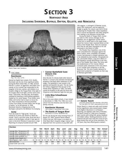
Devils Tower near Sundance.<br />
1 Food, Lodging<br />
Ranchester<br />
Pop. 701, Elev. 3,775<br />
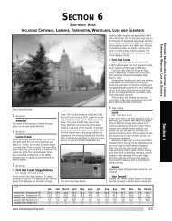
<strong>SECTION</strong> 3<br />
NORTHEAST AREA<br />
INCLUDING SHERIDAN, BUFFALO, DAYTON, GILLETTE, AND NEWCASTLE<br />
Named by English born senator, D.H. Hardin,<br />
Ranchester was the site of two significant battles<br />
during the Plains Indian Wars. In 1865, General<br />
Patrick E. Connor, an aggressive, anti-Indian commander<br />
at Fort Laramie, was responsible for the<br />
slaughter of 63 men, women, and children in an<br />
Arapaho village on the Tongue River. Only eight of<br />
his troopers died in the fight, and the victors took<br />
home 1100 ponies. Two days later, the Arapaho<br />
retaliated by attacking a road-building expedition<br />
headed by Col. James Sawyer. Three soldiers were<br />
killed, and Connor had to return to rescue the<br />
rest. Peace movements in the East prevented<br />
Connor from killing “all male Indians over the age<br />
of twelve,” as he had planned. In 1894,<br />
Ranchester became a shipping stop on the<br />
Burlington railroad for the McShane Tie Company.<br />
Acme<br />
From the Greek for “high grade,” Acme was<br />
named for its prime coal, known as “black diamonds.”<br />
Once a coal mine camp, Acme was also a<br />
station on the Burlington railroad. It later gave its<br />
name to the Acme Petroleum <strong>Corporation</strong>, a large<br />
Wyoming oil company founded around 1900.<br />
www.ultimatewyoming.com<br />
T Connor Battlefield State<br />
Historic Site<br />
In Ranchester<br />
Once the site of a bloody battle when General<br />
Patrick E. Connor’s army attacked and destroyed<br />
Arapahoe Chief Black Bear’s settlement of 250<br />
lodges. The battlefield is now located in the<br />
peaceful and beautiful city park. The site marks<br />
the military engagement that was part of the<br />
Powder River Expedition of 1865. The battle<br />
caused the Arapaho to ally with the Sioux and<br />
Cheyenne at the Fetterman Fight the next year.<br />
T Little Blue Schoolhouse<br />
In Ranchester<br />
One of the areas oldest schools, it was moved<br />
to Ranchester in 1988. This 1902 one-room<br />
school from the Parkman area has been completely<br />
restored.<br />
T Ranchester Museum<br />
145 Coffeen in Ranchester. 655-2284<br />
H The Battle of Tongue River<br />
Ranchester at Connor Battlefield Site.<br />
On this site during the early morning hours of<br />
August 29, 1865, General Patrick Edward<br />
Connor led over 200 troops in an attack on<br />
Chief Black Bear’s Arapaho village. Connor had<br />
departed from Fort Laramie on July 30th with<br />
184 wagons, a contingent of Pawnee scouts,<br />
nearly 500 cavalrymen, and the aging Jim<br />
Bridger as guide. His column was one of three<br />
comprising the Powder River Indian Expedition<br />
sent to secure the Bozeman and other emigrant<br />
trails leading to the Montana mining fields.<br />
During the Battle of Tongue River, Connor<br />
was able to inflict serious damage on the<br />
Arapahos, but an aggressive counter attack<br />
forced him to retreat back to the newly established<br />
Fort Connor (later renamed Reno) on the<br />
banks of the Powder River. There he received<br />
word that he had been reassigned to his old<br />
command in the District of Utah.<br />
The Powder River Expedition, one of the<br />
most comprehensive campaigns against the<br />
Plains Indians, never completely succeeded.<br />
Connor had planned a complex operation only<br />
to be defeated by bad weather, inhospitable terrain,<br />
and hostile Indians. Long term effects of<br />
the Expedition proved detrimental to the interests<br />
of the Powder River tribes. The Army, with<br />
the establishment of Fort Connor (Reno)<br />
increased public awareness of this area which<br />
in turn caused more emigrants to use the<br />
Bozeman Trail. This led to public demand for<br />
government protection of travelers on their way<br />
to Montana gold fields.<br />
LVF Eatons’ Ranch<br />
270 Eaton Ranch Rd near Sheridan. 655-9552.<br />
Toll free 800-210-1049. www.eatonsranch.com<br />
Eatons’ Ranch is a dude and cattle ranch located<br />
on the magnificent, pine-covered eastern slopes<br />
of the Bighorn Mountains in northeastern<br />
Wyoming. Just eighteen miles west of Sheridan,<br />
the Ranch consists of 7,000 acres of beautiful<br />
open country with rolling hills, grassy meadows<br />
and hidden valleys. Twisting processions of cottonwood<br />
and pine trees mark the course of tumbling<br />
streams that roll out of the mountains. For<br />
125 years, they have offered guests a western<br />
Sheridan<br />
Jan Feb March April May June July Aug Sep Oct Nov Dec Annual<br />
Average Max. Temperature (F) 33.3 38.5 45.6 56.5 66.6 76.4 86.2 85.5 73.7 61.3 45.5 36.3 58.8<br />
Average Min. Temperature (F) 9.0 14.4 20.9 30.4 39.6 47.6 53.8 52.4 42.4 31.9 20.0 11.9 31.2<br />
Average Total Precipitation (in.) 0.72 0.67 1.05 1.86 2.31 2.18 1.07 0.85 1.30 1.24 0.81 0.65 14.69<br />
Average Total SnowFall (in.) 10.9 10.3 12.4 10.5 1.7 0.1 0.0 0.0 1.4 4.7 8.5 11.1 71.5<br />
Average Snow Depth (in.) 3 3 1 0 0 0 0 0 0 0 1 2 1<br />
Wind Speed ( mph / kmh ) 8 / 13 8 / 13 9 / 15 10 / 17 9 / 15 8 / 13 8 / 12 8 / 12 8 / 13 8 / 13 8 / 12 8 / 13<br />
Wind Direction NW NW NW NW NW NW NW NW NW NW NW NW<br />
Cloud Cover (out of 8) 5.7 5.7 5.6 5.4 5.3 4.5 3.6 3.7 4.0 4.7 5.4 5.4<br />
141<br />
Section 3<br />
NORTHEAST AREA<br />
INCLUDING SHERIDAN, BUFFALO, DAYTON, GILLETTE, AND NEWCASTLE
Section 3<br />
All Wyoming Area Codes are 307<br />
Section 2<br />
142<br />
0 Miles 13 23<br />
One inch = approximately 11 miles<br />
87<br />
Section 5<br />
<strong>SECTION</strong> 3<br />
Montana<br />
Ultimate Wyoming Atlas and Travel Encyclopedia
Section 6<br />
www.ultimatewyoming.com<br />
39<br />
South Dakota<br />
143<br />
Section 3<br />
NORTHEAST AREA<br />
INCLUDING SHERIDAN, BUFFALO, DAYTON, GILLETTE, AND NEWCASTLE
Section 3<br />
All Wyoming Area Codes are 307<br />
14<br />
144<br />
17th St<br />
Railway St<br />
Kentucky St<br />
Highland Rd<br />
Map not to scale<br />
87 90<br />
15th St<br />
11th St<br />
5th St<br />
RANCHESTER<br />
345<br />
Betty St<br />
3rd Ave<br />
2nd Ave<br />
1st Ave<br />
Wears St<br />
Gillette St<br />
Halbert St<br />
Gillette St<br />
Main St<br />
Coffeen St<br />
Hardin St<br />
Campbell St<br />
Fort Rd<br />
Lewis St<br />
Barker Rd<br />
14<br />
Dana<br />
8th St<br />
Loucks St<br />
Burkitt St<br />
Airport Rd<br />
9<br />
345<br />
14 90<br />
Map not to scale<br />
20<br />
N Main St<br />
14<br />
Broadway St<br />
Main St<br />
5<br />
3<br />
1st St<br />
4<br />
Scott St<br />
Colorado Rd<br />
Sheridan Ave<br />
Brundage Rd<br />
SHERIDAN<br />
AREA<br />
5th St<br />
Tongue River Canyon Rd<br />
Coffeen Ave<br />
DAYTON<br />
87<br />
Map not to scale<br />
Smith St<br />
Dayton-Ohlman Rd<br />
14<br />
90<br />
23<br />
1st Ave<br />
25<br />
2nd Ave<br />
3rd Ave<br />
4th Ave Broadway Ave<br />
14<br />
14<br />
Legend for Section Map<br />
00<br />
f<br />
00<br />
k<br />
00<br />
Locator number (matches<br />
numeric listing in section)<br />
Campsite (number matches<br />
number in campsite chart)<br />
Fishing Site (number matches<br />
number in fishing chart)<br />
Rest stop<br />
Interstate<br />
U.S. Highway<br />
Paved State or County Road<br />
Gravel/unpaved road<br />
experience and shared with them a way of life.<br />
They are proud to carry on a tradition and preserve<br />
a ranching heritage that goes back five generations.<br />
The Eatons invite you to join them and<br />
experience everything Eatons’ Ranch has to offer.<br />
Once you have spent time here, you will always<br />
be part of Eatons’ and its history.<br />
2 Food, Lodging<br />
Dayton<br />
Pop. 678, Elev. 3,926<br />
Dayton was named for banker Joseph Dayton<br />
Thorn. It was established 1n 1882 and gained<br />
fame in 1911 when Susan Whissler, the first<br />
woman mayor in the nation was elected. Dayton<br />
is also home to Wyoming’s first rodeo held in<br />
the 1890s.<br />
Parkman<br />
No Services<br />
Named for Francis Parkman, author of The Oregon<br />
Trail, this railroad station town was established in<br />
1894.<br />
T Hans Kleiber Museum<br />
520 Story in Dayton. 655-2217<br />
The log cabin studio of watercolor artist Hans<br />
Kleiber has been preserved for use as a museum<br />
and visitors center. Known as the “Artist of the<br />
Big Horns”, Kleiber’s work is world renown. Born<br />
in Cologne, Italy in 1887, his family moved to<br />
Massachusetts in the early 1900s. He later moved<br />
West and after various jobs, moved to Dayton and<br />
established himself as an artist. The museum contains<br />
his press, art books and a number of etchings.<br />
The museum is open Monday through<br />
Saturday during the summer, closed in winter.<br />
T Bald Mountain City<br />
Fine-grained gold was discovered here in 1890,<br />
and for the next decade, prospectors flocked to<br />
the area. In 1892, the Fortunatas Mining and<br />
Mlling Company helped establish the town, one<br />
of the largest settlements in the Big Horn<br />
Mountains. The cost of panning, however, outweighed<br />
the value of the yields, and gold fever in<br />
the area ended by 1900.<br />
Ultimate Wyoming Atlas and Travel Encyclopedia
H Connor Battlefield State<br />
Historic Site<br />
Dayton and Gillette St in Dayton<br />
In 1865 General Patrick E. Connor led the<br />
Powder River Expedition into this area. This<br />
expedition was part of a broad military program<br />
to bring the Indians north of the Platte River<br />
under control and halt their depredations along<br />
the Western Trails.<br />
At this site Connor’s command located and<br />
attacked a large party of Araphao under Black<br />
Bear and Old David, destroying 250 lodges.<br />
Much of the fighting was hand-to-hand combat,<br />
and many women and children were<br />
killed and captured.<br />
Later events proved the campaign of 1865<br />
to be undecisive.<br />
H First Woman Mayor<br />
in Wyoming<br />
Bridge St and W 3rd Ave in Dayton<br />
Mrs. Susan Wissler, on May 9, 1911, was elected<br />
mayor of Dayton, Wyoming, then a community<br />
of about 175 people. She served two terms<br />
of two years each. Her administration was<br />
marked by civic improvement and community<br />
betterment as her campaign promise to curb<br />
gambling and regular the operation of saloons<br />
was, in a measure, fulfilled.<br />
Mrs. Wissler was truly a pioneer. She taught<br />
in the public schools of this area for several<br />
years and actively encouraged her students to<br />
go on for further study. As a practical nurse she<br />
is remembered for her ministrations in time of<br />
trouble. She also owned and operated a<br />
millinery and drygoods store for a number of<br />
years. Dayton became her home in 1890. She<br />
died in 1938.<br />
H Susan Wissler,<br />
1853-1938<br />
406 Main St in Dayton<br />
Mrs. Susan Wissler owned and operated a<br />
millinery shop at this location while serving as<br />
mayor of Dayton from 1911 to 1913. Mrs.<br />
Wissler was the first woman mayor in Wyoming<br />
and the first woman to serve consecutive terms as<br />
mayor in the United States. Mrs. Wissler was an<br />
excellent teacher and a successful business<br />
woman. It is appropriate that she was elected in<br />
the first state to grant equal suffrage to women.<br />
H Sibley Monument<br />
About 20 mi W of Dayton on U.S. Hwy 14<br />
Through this vicinity, a scouting party of the<br />
2nd Cavalry, led by Lt. Frederick W. Sibley, was<br />
attacked by Sioux and Cheyenne Indians on<br />
July 7, 1876. In the fight Chief White Antelope<br />
was killed. The party abandoned its horses,<br />
took to the rugged terain, and scouts Frank<br />
Gruard and Baptiste Poirier guided the 26 soldiers<br />
and Chicago <strong>Times</strong> reporter John F.<br />
Finerty over the mountains without food, back<br />
to their main camp.<br />
DAYTON DAYS<br />
The last week in July, Dayton Days boasts a<br />
large parade, games, duck races, crafts and<br />
food vendors in the park, pet parade, fun<br />
walk, softball games, Rotary Club breakfast,<br />
entertainment, outdoor dances, barbecue<br />
and firemen’s water fights.<br />
www.ultimatewyoming.com<br />
Victoria St<br />
Hillpond Dr<br />
Avon St<br />
Burton St<br />
Holmes St<br />
Yonkee St<br />
Greystone Av<br />
Pioneer St<br />
Woodworth St<br />
SHERIDAN<br />
DOWNTOWN<br />
AREA<br />
N Fork Piney Creek Rd<br />
Mt View Rd<br />
Penrose Ln<br />
Skylark Ln<br />
Rawhide Dr.<br />
Glacier St<br />
Fish Hatchery Rd<br />
Trapper Rd<br />
Loucks St<br />
Florence Av<br />
Stag Trl<br />
Buck Trl<br />
Highland Blvd<br />
Smith St<br />
W Brundage St<br />
LFVM The Passage Resort<br />
at Big Horn<br />
U.S. Hwy 14, Burgess Jct, Scenic Route to<br />
Yellowstone, near Dayton. 751-7599.<br />
www.thepassageresort.com<br />
The Passage Resort provides guests access to the<br />
spectacular Big Horn Mountains with stunning<br />
mountain meadows, pine forests, and abundant<br />
wildlife. You’ll see Moose, Elk, and Deer every<br />
day within minutes of the lodge. From the lodge<br />
step into the scenery by renting a Jeep, ATV or<br />
Mountain Bike and visit the many lakes, rivers,<br />
streams and waterfalls the Big Horns are famous<br />
for. Return to enjoy the rustic elegance of the<br />
newly remodeled lodge. Relax in the dining room<br />
Exeter Av<br />
Delphi Av<br />
Clarendon Av<br />
Ridgecrest Dr.<br />
Doe Trl<br />
Mt Horne Rd<br />
Bellevue Av<br />
Adair Av<br />
S Linden Ave<br />
Pine Dale Ave<br />
Businga Rd<br />
Cottage Grv<br />
Marion St<br />
Thurmond St<br />
Spaulding St<br />
Frontier Dr<br />
Map not to scale<br />
Val Vista St<br />
11th St<br />
10th St<br />
S Brooks St<br />
14<br />
14<br />
3<br />
Broadway St<br />
N Gould St<br />
Alger St<br />
Crook St<br />
E Grinnell St<br />
Conner St<br />
Custer St<br />
5th St<br />
3rd St<br />
2nd St<br />
1st St<br />
A St<br />
4<br />
N Custer St<br />
E Burkitt St<br />
14<br />
N Fork Piney Creek Rd<br />
Fish Hatchery Rd<br />
Young Meadow Ln<br />
Easy St<br />
Storybrook Ln<br />
Lobbin and Hine Rd<br />
N Sheridan Ave<br />
Sheridan Ave<br />
8th St<br />
7th St<br />
6th St<br />
E Works St<br />
Park St<br />
Alpenglow<br />
Rosebud Ln<br />
N Piney Rd<br />
Wheatley Dr<br />
French Pete Dr<br />
Fischer Dr<br />
Campbell Ln<br />
Hasburg Dr<br />
Skeel St<br />
Canby St<br />
Kroe Ln<br />
and savor the flavor of Wyoming with a 22oz Rib<br />
Eye steak or Elk smothered in Mushroom Brie<br />
Gravy. Our updated rooms await, with new topof-the-line<br />
pillow top mattresses, great pillows<br />
and cozy comforters for a refreshing night’s sleep.<br />
You’ll need it—the mountain has many more<br />
active days waiting, just off the road.<br />
S The Monastery<br />
Creations Gift Shop<br />
859 Main St in Dayton. 655-9013<br />
3 Food, Lodging<br />
Sheridan<br />
Pop. 15,804, Elev. 3,745<br />
The Sheridan area has been valuable territory<br />
since the days when only Native Americans<br />
roamed here, along with the buffalo and other<br />
wild game. Once a prized hunting ground, it was<br />
often disputed even before white men came. It<br />
was not until the establishment of the Bozeman<br />
Trail, however, that the Sioux, Cheyenne,<br />
Arapaho, and other tribes came together to fight<br />
off the increasing influx of settlers.<br />
Some of the bloodiest battles of the Plains<br />
Indian War, which took place in the 1860s and<br />
70s, occurred nearby. The Fetterman Fight,<br />
Wagon Box Fight, Connor and Sawyer Battles, the<br />
Battle of the Rosebud, the Dull Knife Battle, and<br />
Joe St<br />
Map not to scale<br />
Moraine Ave.<br />
Piney Ave.<br />
Red Cloud Dr<br />
Fish Hatchery Rd<br />
Beaver St<br />
22<br />
Washington St<br />
90<br />
Lodore Ave<br />
Smith Ave<br />
14<br />
STORY<br />
193<br />
145<br />
Section 3<br />
NORTHEAST AREA<br />
INCLUDING SHERIDAN, BUFFALO, DAYTON, GILLETTE, AND NEWCASTLE
Section 3<br />
All Wyoming Area Codes are 307<br />
the Battle of the Little Bighorn all took place<br />
within just miles of Sheridan. For that reason,<br />
this portion of the Bozeman Trail became known<br />
as the Bloody Bozeman. It was not until the surrender<br />
of leaders such as Red Cloud, Crazy<br />
Horse, and Sitting Bull that hostilities eased, and<br />
the area was open to settlement.<br />
In 1878, mountain man Jim Mason built the<br />
first permanent building here. A store and post<br />
office opened in 1881. Storeowner Harry Mandel<br />
sold the place to Jim Loucks, who planned the<br />
town and named it for his Civil War commander,<br />
General Philip Sheridan. Homesteaders and cattle<br />
ranchers moved into the area, creating an agricultural<br />
crossroads where the Burlington Railroad set<br />
up a stop in 1892. The discovery of coal in the area<br />
added to the towns growing prosperity. The building<br />
of several flourmills and a sugar beet factory<br />
contributed to the economy as well. The twentieth<br />
century brought several booms and busts, but now<br />
the city has settled into a serene mix of agriculture,<br />
energy production, and tourism.<br />
The lowest city in Wyoming, Sheridan’s elevation<br />
is 3745 feet.<br />
Beckton<br />
Also known as Beckton Junction, pioneer George<br />
W. Beck built a flourmill here and established a<br />
post office in 1883. The post office was discontinued.<br />
There are only a few houses here today.<br />
T Sheridan Travel and Tourism<br />
I-90 & E 5th St in Sheridan. 673-7120 or<br />
888-596-6787. www.sheridanwyoming.org<br />
T Sheridan Rest Stop & Visitor’s<br />
Center<br />
I-90 exit 23 in Sheridan<br />
T Wyoming Game and Fish Dept.<br />
Visitor Center<br />
Across road from Sheridan Rest Stop<br />
View taxidermist displays of native Wyoming<br />
creatures, and find out more about wildlife, hunting,<br />
and fishing in the West.<br />
T Wyoming State Bird Farm<br />
The Wyoming Game and Fish Department, along<br />
with sportsmen and women, rallied to build a<br />
game bird farm outside of Sheridan, Woming.<br />
George R. Wells was chosen to build and manage<br />
the farm. Pheasant eggs from Oregon and<br />
Montana were the first to be hatched and released<br />
in 1937. Currently, the Sheridan Farm produces<br />
nearly 13,000 birds each year. Touring the farm is<br />
encouraged. For private tours, the bird farm may<br />
be contacted directly.<br />
H Big Horns<br />
The abundance of Rocky Mountain bighorn<br />
sheep led the Indians to name this mountain<br />
range after these majestic animals. The Big<br />
Horn Mountains are a wildlife viewing paradise.<br />
Several native Indian tribes competed with each<br />
other and later with settlers for access to the<br />
mountains and surrounding river basins.<br />
Eventually settlers took possession of the land.<br />
Due to excessive hunting and introduced diseases,<br />
the once abundant bighorn sheep were<br />
almost eliminated from this area by the turn of<br />
the century. Today, bighorn sheep are being<br />
reintroduced to the Big Horn Mountains.<br />
At high elevations, mountain meadows are<br />
interspersed with timber stands which provide<br />
food and summer habitat for elk and mule<br />
deer. Willow stands provide forage for moose.<br />
The forests house black bears, snowshoe hares,<br />
marmots, chipmunks and blue grouse.<br />
At lower elevations, white-tailed deer, moun-<br />
146<br />
tain lions, sharp-tailed grouse, wild turkeys,<br />
black-billed magpies and over 300 other kinds<br />
of wildlife inhabit the foothills and riparian<br />
areas. Notice the diverse habitat types which<br />
make this area so productive for wildlife. The<br />
riparian zones bordered by stands of cottonwood<br />
trees and cropland provide excellent<br />
feeding areas. The steep foothills of the Big<br />
Horns furnish crucial winter range for big game.<br />
Discover more about the current status of<br />
bighorn sheep and the diverse wildlife communities<br />
of Wyoming by touring the Wyoming<br />
Game and Fish Department Visitor Center<br />
across the highway.<br />
LF Best Western Sheridan Center<br />
& Trolleyline Restaurant<br />
612 N Main St in Sheridan. 674-7421 or<br />
877-437-4326.<br />
www.bestwestern.com/sheridancenter<br />
All roads in the West lead to the Best Western<br />
Sheridan Center. Providing affordable top quality<br />
accommodations, the hotel features coffeemakers,<br />
hairdryers, iron/ironing boards, and free highspeed<br />
Internet in every room. Some rooms<br />
including microwaves, refrigerators, and Business<br />
Class features. Guests also enjoy indoor and outdoor<br />
heated pools, a Jacuzzi, complimentary fitness<br />
center use at the nearby YMCA, onsite<br />
laundry, and complete business services.<br />
Although numerous restaurants are within walking<br />
distance, the hotel conveniently serves delicious<br />
breakfasts, lunches, and dinners at the<br />
onsite Trolleyline Restaurant. As an added bonus,<br />
the hotel is on the Sheridan Trolley route and is<br />
just minutes from historic sites, museums, theaters,<br />
galleries, shopping, and outdoor recreation.<br />
With so many amenities and an ideal location,<br />
the Best Western Sheridan Center is your destination<br />
for both leisure and business travel!<br />
L Americas Best Value Inn<br />
580 E 5th St in Sheridan. 672-9757 or<br />
800-771-4761. www.americasbestvalueinn.com<br />
Located in a quite residential location just off I-<br />
90’s historical central Exit 23, Americas Best Value<br />
Inn is an ideal place to rest while in beautiful<br />
Sheridan. Each guest room includes a fridge,<br />
microwave, 50 cable TV channels, A/C, radio,<br />
alarm clock, iron/board, and more. WIFI and<br />
lobby internet, dataport telephones and wake-up<br />
calls offer guests comfort and convenience in<br />
addition to the 24-hour front desk, guest laundry,<br />
vending, barbeque area, outdoor plug-ins, and<br />
drive-up parking. Before exploring the area’s<br />
beautiful outdoors, historic sites, and great shopping,<br />
wake up to a complimentary deluxe breakfast<br />
including eggs, waffles, cereal, fruit, and<br />
gourmet coffee. With so many amenities and an<br />
ideal location halfway between Yellowstone and<br />
Mt. Rushmore, Americas Best Value Inn guarantees<br />
a great night’s sleep and an enjoyable stay.<br />
S L.A.’s Antiques and Things<br />
645 E 5th St in Sheridan. 673-0323<br />
M Sheridan Travel and Tourism<br />
E 5th St in Sheridan. 673-7120<br />
4 Food, Lodging<br />
T Sheridan Chamber<br />
of Commerce<br />
707 Sheridan in Sheridan. 672-2485 or<br />
800-453-3650. www.sheridanwy.com<br />
T Sheridan Heritage Center Inc<br />
856 Broadway in Sheridan. 674-2178<br />
TS King’s Saddlery Museum<br />
184 N Main in Sheridan. 672-2702<br />
This collection features over 500 custom-made<br />
saddles, including (but not limited to) several<br />
made by famed saddlemaker Don King. One of<br />
the museum’s most treasured item is a Japanese<br />
saddle from the 1600s. There is more craftsmanship<br />
on displays than just saddles. The museum<br />
also houses guns, chaps, spurs, wagons, Native<br />
American and frontier clothing, and an old horse<br />
drawn hearse. Admission is free. Call for hours.<br />
T Historic Sheridan Inn Museum<br />
Fifth St exit off of I-90 at Sheridan. 674-5440<br />
The Old Sheridan Inn was once the place to be if<br />
you were part of the elite in nothern Wyoming. It<br />
was originally built to accomodate passengers on<br />
the Burlington and Missouri Railroad. Over the<br />
years, such famous people have been here as<br />
Calamity Jane, Ernest Hemingway, President<br />
Herbert Hoover, and even Bob Hope. Buffalo Bill<br />
Cody used to stay here when he came to town to<br />
audition acts for his show. It became the first<br />
place in Sheridan to have steam heat, telephones,<br />
and electricity around the turn of the century.<br />
The Inn was partially restored in 1965, and then<br />
refurbished again when the Sheridan Heritage<br />
Center took responsibility for it. The SHC accepts<br />
donations to help further restore the Inn and<br />
keep it running. Call for hours.<br />
T Sheridan County<br />
Fulmer Public Library<br />
335 W Alger in Sheridan. 674-8585<br />
Permanent exhibits feature works of regional<br />
artists and Native American artifacts. There are<br />
also changing monthly exhibits. The Wyoming<br />
room features collections including local and<br />
regional history and U.S. genealogy. Open<br />
Monday through Thursday, 9 a.m. to 9 p.m.,<br />
Friday and Saturday, 9 a.m. to 5 p.m. Sundays,<br />
September to May, from 1 p.m. to 5 p.m.<br />
H Crook’s Campaign, 1876<br />
W Dow and Alger in Sheridan<br />
On this site, the junction of Big and Little Goose<br />
Ultimate Wyoming Atlas and Travel Encyclopedia
Creeks, General George Crook, with 15 troops<br />
of cavalry, 5 companies of infantry, 1325 men<br />
and 1900 head of transport animals, headquartered.<br />
Joined by Indian allies, the Crows under<br />
chiefs Old Crow, Medicine Crow and Plenty<br />
Coups, and Shoshoni under Washakie, he battled<br />
2500 Sioux 40 miles northeast, on the<br />
Rosebud, June 17. Defeated, Crook returned<br />
here, occupying these valleys, awaiting reinforcements<br />
which arrived in August. He then<br />
united with General Alfred Terry’s army, which<br />
included remnants of Custer’s 7th Cavalry, to<br />
campaign in Montana. Buffalo Bill, Calamity<br />
Jane, Frank Grouard, noted western characters,<br />
were with this expedition.<br />
F Oliver’s Bar & Grill<br />
55 N Main St in Sheridan. 672-2838.<br />
oliversbarngrill@qwest.net<br />
A relaxed, intimate setting complements the rich,<br />
savory fare of one of Sheridan’s finest restaurants.<br />
Under the creative genius of Chef Matt Wallop,<br />
www.ultimatewyoming.com<br />
Oliver’s Bar & Grill opened in January 2002 and<br />
has established itself as a Wyoming hotspot for<br />
incredible meals emphasizing the freshest ingredients.<br />
Sink your teeth into a tender rib-eye steak<br />
purchased from the area’s Legacy Cattle Company,<br />
savor Dungeness crab cakes featuring fresh<br />
seafood from Seattle, or delight in one of the<br />
many masterpieces highlighting seasonal ingredients.<br />
A full selection of wines complement each<br />
meal’s unique taste and texture, and decadent<br />
desserts add the crowning touch. In addition to<br />
exceptional food, Oliver’s welcomes patrons to its<br />
classy bar and the adjoining Brundage Street<br />
Gourmet. Visit Oliver’s Bar & Grill today, and<br />
immerse yourself in one of Wyoming’s most<br />
exquisite dining experiences!<br />
F Meritage<br />
123 N Main St in Sheridan. 675-1002<br />
Enjoy a refreshing break from the ordinary in the<br />
heart of historic downtown Sheridan. Meritage<br />
offers an evolving menu of over thirty-five wines<br />
by the glass, eighteen after dinner selections, and<br />
over 135 wines by the bottle. There is a variety to<br />
please every palate with labels to satisfy even the<br />
most discriminating wine lover. You will also find<br />
an enjoyable selection of twenty-nine premium<br />
beers and a light edibles menu. Meritage,<br />
Sheridan’s only wine lounge, offers a comfortable,<br />
inspiring, smoke free atmosphere. A perfect place<br />
to enjoy your favorite beverage. The beverage<br />
selection is available to enjoy at Meritage or to<br />
enjoy later. Better yet, consider a bottle for that<br />
special gift idea. The lounge opens Tuesday<br />
through Saturday at 4 p.m.<br />
FSJava Moon Coffee Co. & Bakery<br />
and Over the Moon Boutique<br />
176 N Main in Sheridan. 673-5991<br />
In the heart of historic downtown Sheridan, Java<br />
Moon Coffee Co. & Bakery is a local hotspot<br />
serving organic coffee drinks and espresso, plus<br />
cold beverages. Enjoy their fresh baked pastries,<br />
147<br />
Section 3<br />
NORTHEAST AREA<br />
INCLUDING SHERIDAN, BUFFALO, DAYTON, GILLETTE, AND NEWCASTLE
Section 3<br />
All Wyoming Area Codes are 307<br />
breads, and pizza. Open 6:30 a.m. to 5 p.m.,<br />
Monday through Friday, and 6:30 a.m. to 4 p.m.<br />
on Saturdays—Thursday nights and Sundays seasonally.<br />
Stop in, enjoy a treat, an amazing cup of<br />
coffee, and take advantage of free WiFi. Next<br />
door is Over the Moon women’s boutique, offering<br />
a great selection of clothing, handbags, and<br />
accessories. Featuring Eileen Fisher, Christopher<br />
Blue, Three Dot, Pandora Jewelry, and jewelry<br />
from local artists. Don’t hesitate to ask, Over the<br />
Moon is happy to make special orders, alterations,<br />
or ship out of state.<br />
S Accents of Wyoming<br />
250 N Main St in Sheridan. 675-2030.<br />
www.accentsofwyoming.com<br />
Accents of Wyoming is family owned and operated,<br />
located in the heart of beautiful downtown<br />
Sheridan. Their historic 100-year-old building<br />
provides a warm atmosphere for several lines of<br />
log furniture encompassing three showroom floors<br />
covering 15,000 square feet. They carry Pine,<br />
Aspen, Cedar, weathered timber, Diamond Willow<br />
and some Burl woods. Find such extraordinary<br />
accessories as barbwire towel bars and authentic<br />
wagon wheel chandeliers. They also have handmade<br />
western style quilt sets, southwestern style<br />
runners, mats, and many other gifts. They offer an<br />
extensive selection of moose and bear themed<br />
accents to compliment your lodge, cabin or western<br />
decor. There is furniture for every room in<br />
your home. They will ship anywhere in the United<br />
States, call or email them for a quote. Open<br />
Monday through Saturday, 9-5 p.m.<br />
S Lucinda’s Artisan Gallery<br />
and Handmade Hammocks<br />
160 N Main St in Sheridan. 674-2595<br />
S Crazy Woman<br />
Trading Company<br />
120 N Main St in Sheridan. 672-3939.<br />
www.CrazyWomanTradingCo.com.<br />
crazywomantradingco@wyoming.com<br />
The Crazy Woman Trading Company specializes in<br />
one-of-a-kind items featuring a variety of art,<br />
148<br />
antiques, fun gifts, fantastic jewelry, and logo clothing.<br />
Their T-shirts are worn around the world. A<br />
full line of Aspen Bay candles is also available. This<br />
is truly a unique and entertaining shop. You are<br />
guaranteed to enjoy this extraordinary shopping<br />
experience from the courtyard chock-full of yard<br />
art to the beautiful Ms. Murphy McDougal, the<br />
CEO and resident Labrador. You’ll also want to<br />
take a minute to meet the friendly proprietors,<br />
Linda and Willis. Located in historic Downtown<br />
Sheridan. Be sure and visit them on the web.<br />
M ERA Carroll Realty Co.<br />
306 N Main St in Sheridan. 672-8911.<br />
www.eracrc.com. eracrc@eracrc.com<br />
In 1913, George C. Carroll entered the real estate<br />
business and the first Carroll Realty office opened<br />
its doors with his son Granville Carroll, operating<br />
the company until 1955. The company continued<br />
to grow under the leadership of Don Carroll,<br />
grandson of George Carroll, affiliating with ERA,<br />
(Electronic Realty Associates) in 1978. The family-owned<br />
business developed the reputation for<br />
honesty and reliable service, which it upholds<br />
today. In 1990 the company was sold to long<br />
time employee, Dixie See, who aggressively<br />
expanded the business, always striving to provide<br />
new and enhanced services. The agency recently<br />
merged with Banner Realty which brought with it<br />
a strong ranch and rural real estate department.<br />
Tom Belus and Jane Clark joined Dixie as owners<br />
of this full service real estate organization.<br />
5 Food, Lodging<br />
T Sheridan College<br />
Martinson Gallery<br />
3059 Coffeen Ave in Sheridan.674-6446<br />
T Wyoming National Guard<br />
Armory Museum<br />
3219 Coffeen in Sheridan. 672-6442<br />
T Trail End State Historic Site<br />
400 Clarendon Ave in Sheridan. 674-4589.<br />
www.trailend.org<br />
From its authentically furnished rooms to its finely<br />
manicured lawns, the Trail End State Historic<br />
Site displays an elegantly different aspect of<br />
Wyoming’s colorful ranching history. Built in the<br />
Flemish Revival style in 1913, Trail End was the<br />
home of John Benjamin Kendrick. A cattle rancher<br />
who started out a Texas cowboy, Kendrick<br />
ended up as Governor of Wyoming and a United<br />
States Senator. Trail End is the perfect place to<br />
take a moment and just imagine what life might<br />
have been like in Wyoming during the early years<br />
of the 20th century.<br />
From laundry room to ballroom, Trail End<br />
offers an intriguing glimpse into life during the<br />
period 1913 to 1933. Exhibits and displays<br />
throughout the home’s fully-furnished historic<br />
interior provide information on daily life, entertainment,<br />
interior design and technology. The<br />
house and grounds were placed on the National<br />
Register of Historic Places in 1970. A state-held<br />
property since 1982, Trail End is currently operated<br />
by the State Parks & Historic Sites Division<br />
of the Wyoming Department of Parks and<br />
Cultural Resources.<br />
The house is closed to the public from<br />
December 15 through March 31. The site grounds<br />
are open year round until sunset. A fee is charged.<br />
T Kendrick City Park<br />
Near the Kendrick Mansion on Clarendon in<br />
Sheridan<br />
This is the home where the buffalo roam! The<br />
park’s small game preserve is home to bison and<br />
elk. An outdoor swimming pool, 90-foot long<br />
water slide, band shell, walking path, ice cream<br />
shop, and all-season playground add to the<br />
park’s charm.<br />
T Trail End<br />
400 Clarendon Ave in Sheridan. 674-4589.<br />
www.trailend.org<br />
The Building at Trail End<br />
Located on three and a half acres of groomed<br />
grounds, Trail End is an example of Flemish<br />
Revival architecture, one of the few found in the<br />
western United States.<br />
There are three main floors plus a basement,<br />
an attic, four balconies and four porches.<br />
Materials used on the outside include Kansas<br />
brick, Indiana limestone, Missouri roofing tile<br />
and Wyoming granite. Both the mansion and the<br />
Carriage House (located to the west of the mansion)<br />
were designed by architect Glenn Charles<br />
McAlister of Billings, Montana.<br />
Trail End took five years to finish, but not all<br />
that time was spent actually building. Workers<br />
were idle for over a year due to the combined<br />
effects of labor unrest in the eastern furniture mills<br />
and low prices in the midwestern cattle markets.<br />
During the delay in construction, the Kendricks<br />
lived in the Carriage House, completed in 1910.<br />
Instead of relying on the taste and judgement<br />
of strangers, John and Eula Kendrick acted as their<br />
own general contractors. They then employed<br />
designers and consultants from all over the United<br />
States to help them put together the home they<br />
envisioned. The wall paneling, cabinets, stairs and<br />
other carved pieces were custom made for the<br />
house, using the newest automated equipment. All<br />
of the woodwork was machine-tooled in Michigan<br />
and shipped to Sheridan via railroad.<br />
Like most large homes of the period, Trail<br />
End contained many labor saving devices: intercom,<br />
built-in stationary vacuum, laundry chute,<br />
dumbwaiter and elevator. Although never used,<br />
there was also an emergency fire suppression system<br />
with fire hoses located on each floor.<br />
Very few structural changes have been made<br />
at Trail End. You will see, however, several rooms<br />
that were redecorated over the years by the fami-<br />
Ultimate Wyoming Atlas and Travel Encyclopedia
ly. The alterations have not been removed because<br />
they are part of the history of the house.<br />
The Kendricks and Trail End<br />
Trail End was the home of John Benjamin<br />
Kendrick, former Wyoming Governor and United<br />
States Senator. Born in Texas in 1857, Kendrick<br />
was orphaned at an early age and raised by relatives<br />
until he went out on his own at age fifteen.<br />
In 1879, Kendrick came to Wyoming territory for<br />
the first time, as a trail rider on a cattle drive.<br />
John Kendrick married 17 year old Eula<br />
Wulfjen in 1891. For the next 18 years, they<br />
lived on the OW Ranch in southeastern Montana.<br />
This property was the start of what later became<br />
the Kendrick Cattle Company, a 200,000 acre collection<br />
of cattle ranches in northern Wyoming<br />
and southern Montana.<br />
While at the OW Ranch, the family’s size doubled.<br />
Rosa Maye (1897-1979) and Manville<br />
(1900-1992) were both born in Sheridan, but<br />
lived their early lives at the ranch.<br />
Construction began on Trail End in 1908.<br />
After it was finished in 1913, the family had only<br />
a short time to enjoy their new home. John<br />
Kendrick was elected Governor of Wyoming in<br />
1914 and the family moved to Cheyenne. Two<br />
years later he was chosen to serve in the United<br />
States Senate, an office he held until his death in<br />
1933. During that time, Trail End was used primarily<br />
as a summer home.<br />
From 1933 to 1961, Eula Kendrick lived at<br />
Trail End with her son and his family. After her<br />
The Carriage House<br />
death, the others moved out and the house stood<br />
empty for seven years.<br />
In 1968, when it was about to be torn down,<br />
Trail End was purchased by the Sheridan County<br />
Historical Society. They opened the home to the<br />
public as a community museum. Ownership was<br />
transferred to the State of Wyoming in 1982.<br />
On a tour of the house you will find special<br />
features in every room.<br />
Foyer: Hand-painted ceiling panels; dark mission<br />
oak woodwork; custom designed chandelier and<br />
wall sconces; elevator.<br />
Drawing Room: French silk damask wall coverings;<br />
piano-finish mahogany beams and panels; Italian<br />
marble fireplace; 1922 portraits of John and Eula<br />
Kendrick; peonies painted by Paul de Longpres;<br />
hand- made Kurdistan rug.<br />
Cloak Room: Intercom; coat closets.<br />
Library: Quarter-sawn golden oak panels and<br />
bookcases; gothic style chandelier; stained glass<br />
windows; 1917 Declaration of War against<br />
Germany; Sharp reproduc- tion over fireplace.<br />
Powder Room: Porcelain double pedestal sink with<br />
www.ultimatewyoming.com<br />
Trail End viewed from its spacious park-like grounds.<br />
German silver fixtures.<br />
Dining Room: Hand-painted ceiling and wall panels;<br />
piano-finish mahogany woodwork; Italian<br />
marble fireplace with carved mantle.<br />
Vault: Walk-in combination safe.<br />
Butler’s Pantry: Glass-front cabinets; German silver<br />
sink; dumb waiter; laundry chute; icebox.<br />
Kitchen: “Hospital White” porcelain tile walls,<br />
ceramic tile floor, marble trim; original wood/coal<br />
cookstove (later replaced by gas); porcelain sink;<br />
built-in spice cabinet and storage bins.<br />
Back Hallway: Intercom; fusebox; fire hose;<br />
annunciator; stairs to basement; stairs to second<br />
and third floor (closed: please use main staircase).<br />
Second Floor Hallway: Replication of original wallpaper;<br />
stained glass windows; hand-painted canvas<br />
ceilings.<br />
Manville’s Bedroom: Navajo-motif wall stenciling;<br />
red fir trim.<br />
Master Bedroom: Balcony overlooking rose garden;<br />
intercom.<br />
Rosa Maye’s Bedroom: Hand-tinted wall panels;<br />
custom designed light fixtures.<br />
Maid’s Closet: Hoses and nozzles for built-in stationary<br />
vacuum system; fusebox.<br />
Guest Wing: Three bedrooms, each with private<br />
bath (closed to public; they’re currently used as<br />
staff offices).<br />
Ballroom: Tiffany-styled chandeliers with verdigris<br />
finish; maple dance floor; Georgia pine ceiling<br />
beams; horsehair cushions; rotating lead glass<br />
windows for ventilation; musician’s loft.<br />
Staff Quarters: Three bedrooms (each with sink<br />
and closets); pine wood trim; intercom; laundry<br />
chute; dumbwaiter; communal bathroom.<br />
Attic: Musician’s loft; storage area; pulley for<br />
dumbwaiter (closed to public).<br />
Basement: Contains laundry room with three<br />
porcelain sinks, fireplace, stationary vacuum<br />
cleaner motor, vault; furnace room with boilers<br />
for steam heating system; coal bin; chauffeur’s<br />
bedroom; storage facilities; public restrooms.<br />
The Grounds<br />
The Carriage House<br />
Finished in 1910, it served as the Kendricks<br />
home during the construction of mansion. It was<br />
built to house carriages and horses, but never<br />
used for that purpose. By the time the family was<br />
ready to move out of their make-shift home, they<br />
were driving Cadillacs instead of buggies. It was<br />
converted to a theater and is currently the home<br />
of the Sheridan Civic Theater Guild. Phone 672-<br />
9886 for ticket information.<br />
The Mandel Cabin was built in 1879 by<br />
George Mandel and purchased in 1882 by<br />
Sheridan founder John Loucks. It served as the<br />
area’s first post office, store, school, law office,<br />
and bank. In 1976, the cabin was reconstructed<br />
from original logs and moved to Trail End State<br />
Historic Site. It is the property of the Colonial<br />
Dames of America.<br />
Also found on the grounds are a sunken rose<br />
garden, an English sundial, an apple orchard, a<br />
circular back driveway with original<br />
clothesline/drying yard, a lawn tennis court, and<br />
a wide variety of trees and bushes, both native<br />
and exotic.<br />
Reprinted from Wyoming State Parks and Historic<br />
Sites brochure.<br />
H Carneyville (Kleenburn)<br />
1904-1924<br />
I-90 Exit 25 at Sheridan Visitor’s Center<br />
This mine was located 9 miles North of<br />
Sheridan. Traveling North along Interstate 90,<br />
as you approach the 2nd exit after leaving<br />
Sheridan, you will turn right. You will notice a<br />
great deal of subsidence in the hillside. This is<br />
where the Carneyville mining shafts were. This<br />
mine employed 450 miners and had two tipple<br />
loadouts. In the valley to the right of the<br />
shafts lay the mining community of<br />
Carneyville (Kleenburn). This community had<br />
150 to 200 houses and approximately 2000<br />
people residing there.<br />
149<br />
Section 3<br />
NORTHEAST AREA<br />
INCLUDING SHERIDAN, BUFFALO, DAYTON, GILLETTE, AND NEWCASTLE
Section 3<br />
All Wyoming Area Codes are 307<br />
L Holiday Inn Atrium<br />
Hotel & Conference Center<br />
1809 Sugarland Dr in Sheridan. 672-8931 or<br />
672-6388. www.holiday-inn.com/sheridanwy<br />
A 2006 Quality Excellence Winner in the #1<br />
Western Town is an unbeatable award-winning<br />
combination. Details make the difference at the<br />
recently renovated Sheridan Holiday Inn. From<br />
well-appointed guest rooms featuring complimentary<br />
high-speed wireless Internet and the knowledgeable<br />
staff to full-service banquet and<br />
conference facilities, this hotel specializes in comfort<br />
and style. Utilize the onsite fitness center and<br />
personal trainer, visit the massage therapist, enjoy<br />
a cup of Starbuck’s Coffee in the Brew Garden, or<br />
relax in the indoor pool, sauna, and whirlpool.<br />
Hungry for a delicious meal? Visit The Greenery<br />
and Scooters Bar & Grill onsite for breakfast,<br />
lunch, or Sugarland Mining Company for dinner.<br />
During your stay, don’t miss the area’s shopping,<br />
year-round outdoor recreation, and historical sites<br />
just minutes away. Conveniently located off I-90<br />
halfway between Yellowstone and Mount<br />
Rushmore, the Sheridan Holiday Inn welcomes<br />
you to enjoy their real Wyoming hospitality!<br />
L Days Inn - Sheridan<br />
1104 E Brundage Ln in Sheridan. 672-2888 or<br />
(reservations) 800-329-7466<br />
The Days Inn in Sheridan is close to I-90 at exit 25<br />
and convenient to local attractions, shopping, and<br />
dining. This property offers plenty of amenities at<br />
reasonable rates. All rooms are provided with free<br />
local calls, cable TV and HBO, and free wireless<br />
internet. Wake up and start your day right with<br />
their complimentary continental breakfast. Guests<br />
can choose from smoking or nonsmoking rooms,<br />
suites with in-room spas, and fully equipped handicapped<br />
facilities. There are some larger rooms<br />
available with three queen beds. Relax year around<br />
in the indoor pool or hot tub.<br />
Wyoming Tidbits<br />
The geographical center of Wyoming is<br />
Fremont, 58 miles northeast of Lander.<br />
150<br />
6 Lodging<br />
Big Horn<br />
Pop. 217, Elev. 4,059<br />
At the foot of the mountains of the same name,<br />
Big Horn was once just a couple of cabins that<br />
sheltered outlaws. Officially founded as a town in<br />
1878 by O.P. Hanna, this was a much-needed rest<br />
stop on the Bozeman Trail. By 1881, it was the<br />
first real town in Sheridan County. Later, in 1894,<br />
it became the home of the first college in the area,<br />
the Wyoming College and Normal School, begun<br />
by the Congregational Missionary Society. The<br />
school had to close in 1898 when the students<br />
couldn’t pay the $100 tuition.<br />
T The Bradford Brinton<br />
Memorial Museum<br />
S of Big Horn on State Hwy 335. 672-3173<br />
This is ranch country; some of the finest in<br />
Wyoming and the Rocky Mountain West. It was<br />
settled late, in the 1870s and 1880s, but the<br />
well-watered, rich grasslands have produced<br />
excellent cattle and horse herds. The Quarter<br />
Circle A Ranch dates from this period and is typical<br />
of the more prosperous ranches of the Big<br />
Horn area. Here Bradford Brinton raised horses<br />
and cattle, entertained distinguished guests,<br />
enjoyed the scenic mountains and plains, and<br />
collected aspects of an older West. When he died<br />
in 1936, his sister, Helen Brinton, became the<br />
owner of the ranch. She kept it as a summer<br />
home until her death in 1960.<br />
The house was built in 1892 by two Scotsmen,<br />
William and Malcolm Moncreiffe, and in 1923 was<br />
purchased by Bradford Brinton, who enlarged it to<br />
its present 20 rooms. Bradford, and later Helen,<br />
tastefully decorated and furnished the house with<br />
fine furniture, his collections of western art, Indian<br />
crafts, books, and historic documents.<br />
Though a native of Illinois, Brinton loved the<br />
West and was particularly enamored of the work<br />
of western artists. He numbered many now<br />
famous artists among his friends, and they benefited<br />
from his encouragement and patronage.<br />
Helen Brinton, wishing to share her brother’s fine<br />
collections with future generations, established<br />
the Bradford Brinton Memorial Ranch in her will<br />
to commemorate western art and culture. The<br />
Bradford Brinton Memorial Ranch opened in<br />
1961. It is maintained and administered by The<br />
Northern Trust Company of Chicago, Illinois.<br />
The Indian conflicts, nature’s wonders, the<br />
harsh elements, and the often lonely but always<br />
exciting life of the cowboy inspired the artists of<br />
the West. The Brinton collection contains over<br />
600 oils, watercolors, and sketches by American<br />
artists including: Charles M. Russell, Frederic<br />
Remington, Edward M. Borein, E. W. Gollings,<br />
Hans Kleiber, Will James, Frank W. Benson, John<br />
J. Audubon, Joe De Yong, Winold Reiss, and<br />
Frank Tenney Johnson.<br />
Each year a different art exhibit is featured in<br />
the reception gallery, which is the only addition<br />
made to the ranch.<br />
The memorial is open daily 9:30 a.m. until 5<br />
p.m. May 15th through Labor Day.<br />
T Bozeman Trail Museum<br />
Main St in Big Horn<br />
Built in 1879 by the Rock Creek Stage Line, the<br />
Blacksmith Shop we now call the Bozeman Trail<br />
Museum originally satisfied the needs of travelers<br />
on the nearby Bozeman Trail, which connected<br />
southeastern Wyoming to Virginia City, Montana.<br />
O.P. Hanna was the first settler to make his per-<br />
manent home here, also in 1879. John DeWitt,<br />
another early settler, was the original owner of<br />
the Blacksmith Shop. It changed hands several<br />
times before Mr and Mrs Goelet Gallatin bought<br />
it and restored it in 1936. Eventually, it became a<br />
storehouse for a variety of historic items, and was<br />
completely refurbished in 1976 by the Big Horn<br />
Bi-Centennial Committee. In 1990, with the official<br />
establishment of the Big Horn Historical<br />
Society, the site became an official museum.<br />
T Bonanza<br />
Big Horn Basin<br />
Early travelers lubricated their wagon wheels in<br />
the natural oil seeps of this area. Settlers hoped to<br />
develop the town into an oil production center,<br />
but the industry never blossomed here. It is now<br />
a ghost town.<br />
H Bozeman Trail<br />
Blacksmith Shop<br />
Big Horn<br />
Near here emigrants traversed the Bozeman<br />
Trail, 1864-68, to Virginia City, Montana gold<br />
mines. Confronted with hostile Indians unwilling<br />
to share their hunting grounds, the trail became<br />
known as the “Bloody Bozeman” and was discontinued.<br />
Crossing Little Goose Creek to the south<br />
and Jackson Creek to the west, the trail was<br />
later used from 1879-94 by the Patrick Brothers<br />
Stage Line from Rock Creek near Laramie,<br />
Wyoimng to Fort Custer on the Big Horn River<br />
in Montana.<br />
This building was a blacksmith shop in the<br />
early 1880s to serve the stage line and ranchers<br />
of the valley.<br />
L Wingate Inn<br />
1950 E 5th St in Sheridan. 675-1101 or<br />
800-228-1000. www.wingateinnsheridan.com.<br />
wingatesheridansales@vcn.com<br />
The Wingate Inn offers beauty and views along<br />
with comfortable accommodations. Every room<br />
features complimentary high-speed Internet<br />
access, two-line cordless speakerphone with dataport,<br />
voicemail and conference call capabilities,<br />
free local calls and long distance access,<br />
microwave, refrigerator, coffeemaker, hairdryer,<br />
safe, iron/ironing board, 27-inch cable TV,<br />
Nintendo 64 games, and more. Their complimentary<br />
deluxe continental breakfast buffet, catering<br />
services, guest laundry, dry cleaning, free weekday<br />
newspapers, free fitness center, indoor pool,<br />
whirlpool, and a complimentary 24-hour selfservice<br />
business center with PC, printer, fax, and<br />
copier accommodate both business and leisure<br />
travelers. They offer affordable luxury conveniently<br />
situated just off I-90. The Wingate Inn welcomes<br />
you to experience its friendly retreat-like<br />
setting, outstanding service, free airport and shuttle<br />
service, and their spectacular views!<br />
Ultimate Wyoming Atlas and Travel Encyclopedia
7 Food, Lodging<br />
Story<br />
Pop. 650, Elev. 4,960<br />
This cozy little community was probably named<br />
for Nelson Story, the first man to bring cattle up<br />
the Texas Trail, through Wyoming, and into<br />
Montana. Charles P. Story, an early newspaperman<br />
in Sheridan, may also have given his name<br />
to the town. Nestled in the pine-covered Bighorn<br />
Mountains, this was where timber was collected<br />
to build Fort Phil Kearny.<br />
STORY DAY<br />
Held the last Saturday in August, this is a day<br />
full of food, fun, parades, games, music,<br />
American indian art show, quilt show, garage<br />
sales and flea markets, craft fair, drawings and<br />
vendors. This is the annual fall-festival-type<br />
celebration. The town of Story is south of<br />
Sheridan off Highway 87.<br />
Banner<br />
Pop. 40, Elev. 4,617<br />
The first postmaster here, a rancher, had a flag as<br />
a cattle brand. The locals called it a banner, and<br />
Wyoming State Parks and Historic Sites Map<br />
www.ultimatewyoming.com<br />
when the post office opened out of his dining<br />
room, the name became the place.<br />
T Story Fish Hatchery<br />
Visitor Center<br />
311R Fish Hatchery Rd 2 mi W of Story.<br />
683-224<br />
The center is a popular for both locals and visitors,<br />
receiving more than 14,000 guests annually.<br />
The hatchery stocks nearly 250,000 fish each year<br />
and processes up to four million trout eggs that<br />
will eventually end up in the state’s fish culture<br />
program or are shipped to other states in trade<br />
for species not raised in Wyoming’s hatcheries.<br />
Managed by the Wyoming Game and Fish<br />
Department, the hatchery is the oldest operating<br />
station in the state. The original hatchery was in<br />
Sheridan but was moved to the current location<br />
because of a better, colder water supply. Water is<br />
drawn from South Piney Creek 1.5 miles away.<br />
An underground waterway from the creek moderates<br />
the water’s temperature.<br />
The center is open from april 15 through<br />
September 15, and the grounds are open to visitors<br />
year-around.<br />
T Fort Phil Kearny - History<br />
Fort Phil Kearny<br />
Named for a popular Union general killed in<br />
the Civil War, Fort Phil Kearny was established<br />
at the forks of Big and Little Piney Creeks by<br />
Col. Henry B. Carrington of the 18th U.S.<br />
Infantry in July, 1866.<br />
The Mission of this fort and two other posts<br />
along the Bozeman Trail, Forts Reno and C. F.<br />
Smith, was three-fold: to protect travellers on the<br />
Trail; to prevent intertribal warfare between<br />
Native Americans in the area; and to draw attention<br />
of Indian forces opposed to Euro-American<br />
westward expansion away from the trans-continental<br />
railroad construction corridor to the south.<br />
All three Bozeman Trail forts were stockade fortifications,<br />
with Port Phil Kearny being the largest.<br />
Enclosing seventeen acres, the fort wall was eight<br />
feet high, 1,496 feet in length, and tapered in<br />
width from 600 feet on the north to 240 feet on<br />
the south. More than four thousand logs were used<br />
to erect the stockade, while over 606,000 feet of<br />
lumber and 130,000 bricks were produced in<br />
1867 alone for the extensive building construction.<br />
During its two year existence, Fort Phil Kearny<br />
was the focal point of a violent war between the<br />
U.S. Army and the Sioux, Cheyenne, and Arapaho<br />
Indians opposed to intrusions into the last great<br />
hunting grounds on the Northern Plains. Besides<br />
the Fetterman and Wagon Box battles, many<br />
smaller fights took place in the area.<br />
By 1868, the Union Pacific Railroad had<br />
reached a point to the west where travellers could<br />
bypass the Bozeman Trail route by going to<br />
Montana through Idaho, thus making the<br />
Bozeman Trail forts expensive liabilities. In the<br />
151<br />
Section 3<br />
NORTHEAST AREA<br />
INCLUDING SHERIDAN, BUFFALO, DAYTON, GILLETTE, AND NEWCASTLE
Section 3<br />
All Wyoming Area Codes are 307<br />
Treaty of 1868, the United States agreed to close<br />
the forts and the trail, Fort Phil Kearny was abandoned<br />
by the Army in early August, 1868, and<br />
burned soon afterwards by the Cheyenne.<br />
In 1963, Fort Phil Kearny was designated a<br />
National Historic Landmark. Today, portions of<br />
the fort site and the Fetterman and Wagon Box<br />
battlefields are included within the Fort Phil<br />
Kearny State Historic Site boundaries .<br />
Fetterman Fight.<br />
On December 21, 1866, Sioux, Cheyenne, and<br />
Arapaho warriors engaged a military force commanded<br />
by Captain William J. Fetterman.<br />
Ordered to rescue a besieged wagon train,<br />
Fetterman’s men pursued Crazy Horse and other<br />
warriors acting as decoys over Lodge Trail Ridge<br />
where over two thousand Indians waited in<br />
ambush The warriors attacked the soldiers, overwhelming<br />
the separated cavalry and infantry<br />
units. All eighty one men in Fetterman’s command<br />
were killed within thirty minutes. Only the<br />
Battle of the Little Big Horn stands as a worse<br />
defeat for the United States Army and a greater<br />
victory for the Plains Indians.<br />
Wyoming Tidbits<br />
The first polo field in the United States was<br />
built north of SHERIDAN.<br />
“Portugee” Phillips Ride<br />
Phillips is known for his heroic 236 mile ride to<br />
Fort Laramie following the Fetterman Fight.<br />
Riding in the deep of winter into the midst of a<br />
blizzard, he hid during the day and rode only at<br />
night as he passed through enemy territory. He<br />
pushed his horse beyond its limit and sacrificed it<br />
in the process, completing the ride in just four<br />
days, and arriving at Fort Laramie during a ball<br />
on Christmas night.<br />
Wagon Box Fight<br />
Indian forces attempted to repeat the Fetterman<br />
victory in the summer of 1867. On August 2,<br />
about eight-hundred Sioux attacked wood-cutters<br />
and soldiers camped at a cutting area five miles<br />
from Fort Phil Kearny. During initial stages of the<br />
battle, twenty-six soldiers and six civilians took<br />
cover inside an oval of wagon boxes used as a<br />
stock corral.<br />
After burning another camp, Sioux warriors<br />
launched a series of attacks against the corral.<br />
Armed with breechloading rifles, the soldiers and<br />
civilians commanded by Captain James Powell<br />
held off the massed warriors until a relief force<br />
arrived from the fort. Three men were killed and<br />
two wounded inside of the corral, while Indian<br />
casualties were estimated at from five to sixty or<br />
more killed, and five to one hundred twenty<br />
more wounded.<br />
Reprinted from Wyoming<br />
Department of Commerce brochure.<br />
H Fort Phil Kearny<br />
Interpretive Signs<br />
Fort Phil Kearny<br />
The Magazine:<br />
Storing Munitions and More<br />
All military posts had a magazine for storing<br />
munitions. At Fort Phil Kearny the Magazine was<br />
16 by 16 feet, with a 11 foot dirt covered ceiling<br />
152<br />
and it was buried eight feet in the southwest<br />
quadrant of the parade ground. It is referred to<br />
in numerous historical records. Carrington shows<br />
its location on his as-built map, and he did a<br />
design for its construction. Samuel Gibson indicates<br />
its location on his map of the fort.<br />
Margaret Carrington describes the location as<br />
“being in the center of one of the squares”.<br />
There are many colorful accounts centered<br />
around the magazine. Colonel Carrington was<br />
constantly frustrated with his lack of munitions<br />
and the shortage of ammunition at the post.<br />
This became very apparent following the<br />
Fetterman Fight when men were sent to guard<br />
the stockade with only five rounds of ammunition<br />
each. When Carrington left the fort on<br />
December 22, 1866 to retrieve the bodies of<br />
Fetterman’s command he left secret instructions<br />
which Francis Grummond recounted. ”If, in my<br />
absence, Indians in overwhelming numbers<br />
attack, put the women and children in the magazine<br />
in a last desperate struggle, destroy all<br />
together, rather than have any captured alive”.<br />
Results of the 1999 archaecological study provide<br />
no evidence of the magazine being in the<br />
southwest quadrant as historical records indicated.<br />
At present the magazine’s exact location is<br />
unknown, still one of the many unanswered<br />
questions about Fort Phil Kearny.<br />
Post Commander’s Quarters:<br />
The Best Structure on the Post<br />
1867 quartermaster inspections of Fort Phil<br />
Kearny indicated the poor condition of many of<br />
the buildings on post and that they needed<br />
rebuilding. These included the barracks, officer’s<br />
quarters, post headquarters and more. The post<br />
commander’s house was a 48 by 32 foot frame<br />
construction structure, built of fire dried trees,<br />
shingled with a 22 by 13 foot attached kitchen,<br />
and brick chimneys. This was probably the best<br />
structure on post.<br />
The house was built by the regimental band<br />
for Colonel Carrington. It initially housed the<br />
Colonel, his wife Margaret, their sons Jimmy<br />
and Harry, and butler George. It was then occupied<br />
in turn by later Post Commanders Henry<br />
Wessells and Jonathan Smith.<br />
Two archaeological pits have been left open<br />
for viewing. They show the remains of the interior<br />
ground structure of the commander’s house.<br />
The Guard House: Not Just a Jail<br />
Even though Fort Phil Kearny, like most frontier<br />
posts, had plenty of use for a jail this was not<br />
the main function of the Guardhouse. The 50<br />
by 43 foot, shingled building with a brick chimney,<br />
was used primarily for quard-mount.<br />
Guard-mount was the duty of protecting the<br />
post. Soldiers would be detached from their<br />
companies to this building on a repeated<br />
schedule for guard duty. From this building an<br />
individual soldier would be assigned to a guardstand<br />
where he would quard the post on intervals<br />
of 2-hours-on 4-hours-off, for 24 hours.<br />
This was not an easy duty, During the harsh<br />
winter months the interval could drop to as little<br />
as 20 minutes to prevent injury or death to the<br />
guard. Francis Grummond recounts a story in<br />
My Army Life of Indians sneaking up and shooting<br />
guards off the stand. One had to be vigilant.<br />
For soldiers convicted of serious crimes the<br />
building did serve as a jail. In August 1866<br />
records indicate that 24 prisoners were being<br />
held under guard in tents awaiting the completion<br />
of this building. Their crime was desertion.<br />
Lessor crimes might be punished by extra duty,<br />
CLOUD PEAK<br />
WILDERNESS AREA<br />
Cloud Peak Wilderness preserves many sharp<br />
summits and towering sheer rock faces<br />
standing above glacier-carved U-shaped valleys.<br />
Named for the tallest mountain in<br />
Bighorn National Forest—Cloud Peak at<br />
13,167 feet—the Wilderness is blanketed in<br />
snow for a large part of the year. Most of the<br />
higher ground doesn’t show bare ground<br />
until July. On the east side of Cloud Peak<br />
itself, a deeply inset cirque holds the last<br />
remaining glacier in this range. Several hundred<br />
beautiful lakes, many offering excellent<br />
trout fishing, cover the landscape and drain<br />
into miles of trout streams. The Cloud Peak<br />
Wilderness is part of the 106 million acre<br />
National Wilderness Preservation System.<br />
This System of lands provides clean air, water,<br />
and habitat critical for rare and endangered<br />
plants and animals. In wilderness, you can<br />
enjoy challenging recreational activities like<br />
hiking, backpacking, climbing, kayaking,<br />
canoeing, rafting, horse packing, bird watching,<br />
stargazing, and extraordinary opportunities<br />
for solitude. You plan an important role in<br />
helping to “secure for the American people of<br />
present and future generations the benefits<br />
of an enduring resource of wilderness” as<br />
called for by the Congress of the United<br />
States through the Wilderness Act of 1964.<br />
Use Leave No Trace techniques when visiting<br />
the Cloud Peak Wilderness to ensure protection<br />
of this unique area.<br />
Unless otherwise specified, no motorized<br />
equipment or mechanical transport is<br />
allowed. This is true for all federal lands managed<br />
as designated wilderness.<br />
Courtesy: U.S. Forest Service<br />
wearing a ball and chain, wearing a barrel with<br />
a sign stating your offense, or even flogging.<br />
The Cavalryman’s Quarters:<br />
Few and Far Between<br />
It is a false perception that the frontier posts of<br />
the American West were garrisoned with large<br />
troops of cavalry. Actually a post’s usual population<br />
was largely infantry with a rew cavalry for<br />
support, reconnaissance, escort, or mail delivery.<br />
Fort Phil Kearny was no exception. It was not<br />
until November 2, 1866 that any cavalry were<br />
stationed at the post. Though initially placed in<br />
a variety of quarters, they were finally housed in<br />
a large, new 100 by 25 foot log-panel constucted<br />
barracks with a shingle roof. Nearby was a<br />
250 by 32 foot board and batten stable with<br />
corral, saddler’s shop and a blacksmith.<br />
Company C, of the 2nd U.S. Cavalry<br />
Regiment was assigned to Fort Phil Kearny. They<br />
arrived, armed with single-shot Starr Carbines on<br />
poorly conditioned mounts. Colonel Carrington<br />
replaced their weapons with the band’s Spencer<br />
Carbines, but little could be done for the<br />
mounts. Few cavalry were ever at the Fort. They<br />
were constantly being requisitioned for mail,<br />
escort, or other duties by military inspectors traveling<br />
the trail. Unforunately, of those troops available<br />
on December 21, 1866, the majority wre<br />
killed in the Fetterman Fight, leaving their quarters<br />
sorrowfully near empty.<br />
Ultimate Wyoming Atlas and Travel Encyclopedia
The Civilians: Living Outside the Post<br />
Because the regulations would not allow nonmilitary<br />
dependent civilians to reside inside<br />
Fort Phil Kearny, several civilian dwellings<br />
existed outside the post stockade on the valley<br />
plain below, and in the Quartermaster<br />
corral to the south. These homes varied in<br />
size and degree of construction. Some were<br />
built as notched cornered log cabins with<br />
shingled roofs, others were of pole construction<br />
with sod roofs, while others were mere<br />
dugouts in the northeast slope of the stockade<br />
line. Depressions from these dugouts are<br />
still visible today.<br />
Civilians provided many services for the military<br />
and travelers of the Bozeman Trail. James<br />
Wheatley and Issac Fisher built a way-station<br />
and restaurant. Another eatery and the only<br />
known garden were managed by Mr. and Mrs.<br />
Charles Washington. Walter J. Harden and F.J.<br />
Fairbrast had a small “ranche” and billiard room.<br />
This building undoubtedly provided after-hours<br />
entertainment for the soldiers. One large group<br />
of about 40 gold-miners, under the leadership<br />
of Robert Bailey, arrived in the fall of 1866.<br />
They stayed through the winter working for both<br />
civilian contractors and the military. Occupations<br />
included wood cutters and forage gathers for<br />
civilian contractors and carpenters or blacksmiths<br />
for the military.<br />
Unfortunately, the civlians often got caught<br />
up in the military activities. Wheatley and Fisher<br />
volunteered to go with Captain Fetterman’s<br />
command on December 21, 1866 and lost<br />
their lives that day. Remarkably, Mrs. Wheatley<br />
continued to run the way-station until the fort’s<br />
closure. John “Portugee” Phillips, part of the<br />
Bailey miners, rode for relief following the<br />
Fetterman fight and later settled in Wyoming.<br />
Lessons Learned<br />
Archaeology at Fort Phil Kearny<br />
Documented archaeology began at Fort Phil<br />
Kearny in 1961 and reoccurred in 1970, 1991-<br />
92, 1999 and 2000. The initial work was done<br />
by Gene Gallaway who salvaged artifacts during<br />
the county road construction. In 1970-71<br />
George Frison studied the site, determining<br />
stockade, gate, southeast blockhouse and flagpole<br />
locations. Richard Fox searched for the<br />
southwest blockhouse, sutler store, and post<br />
commander’’s residence in 1991 and 1992. In<br />
1999-2000 Tom Larson and Lewis Somers<br />
studies, using subsurface mapping techniques,<br />
provided images of the under ground remains<br />
(see illustrations below) of the upper stockade<br />
and its diagonal blockhouses.<br />
These studies have provided a great deal<br />
of insight into understanding the fort site.<br />
Many historic features have been confirmed,<br />
including locations of the upper stockade,<br />
main gate, blockhouse, gun bastion, sutler<br />
store, and commander’s house. Various construction<br />
techniques have been identified,<br />
including frame and post/pole, and many personal<br />
artifacts have been recovered. We now<br />
know that the period historic maps are reasonably<br />
accurate, but questions remain. We do<br />
not know the exact location of the magazine,<br />
unidentified buildings have shown up on the<br />
ground radar research and historically recorded<br />
ones have not.<br />
The archaeology has provided us a better<br />
understanding of Fort Phil Kearny. It has given<br />
us some understanding of the reliability of the<br />
historical record, and pointed out new directions<br />
for study. There is still much to be learned.<br />
www.ultimatewyoming.com<br />
Quartermaster and Commissary Buildings:<br />
Supplying the Post<br />
The quartermaster and commissary departments<br />
provided the two categories of supplies<br />
for maintaining military posts. Quartermaster<br />
supplies included items like weapons, clothing,<br />
saddles, blankets, beds, and more. Commissary<br />
supplies were mainly food stuffs. At this fort<br />
these items were stored in five or more warehouses<br />
varying in size from 24 by 84 feet to 32<br />
by 160 feet. The buildings were of board and<br />
batten construction with shingle roofs and one<br />
building contained a cellar. Records indicate that<br />
some civilians bunked in the larger warehouse.<br />
Due to theft by soldiers and civilians, quards<br />
were placed at all warehouses.<br />
Included in this complex of buildings was<br />
the Quartermaster’s office. This building was 32<br />
by 64 feet, board constructed with a shingle<br />
roof. It straddled the stockade wall and from<br />
here the Quartermaster acted as liaison<br />
between civilian workers and the military.<br />
Captain Frederick Brown was the first<br />
Quartermaster and upon his death Captain<br />
George Dandy took over the duties.<br />
Fort Phil Kearny State Historic Site:<br />
A Guided Tour<br />
Fort Phil Kearny State Historic Site is administered<br />
by the Wyoming State Parks and Historic<br />
Sites Department and supported by the Fort<br />
Phil Kearny/Bozeman Trail Association. All parties<br />
are committed to the preservation and<br />
interpretation of the many aspects of the site.<br />
The Historic site has three components. Two<br />
of the components, the Getterman and Wagon<br />
Box fight sites, are approximately five miles from<br />
the fort. These sites offer interpretive trails with<br />
signing and help the viewer more fully understand<br />
the dramatic history of Fort Phil Kearny.<br />
At the fort site the visitor has several options.<br />
The interpretive center offers many exhibits<br />
describing the fort’s mission, archaeology, the<br />
Native Amercans, provides a video overview of<br />
the fort, distributes a site brochure, and offers a<br />
wide variety of books which further explain the<br />
area’s history. The Civilian Conservation Corp<br />
cabin interprets the living conditions of an officer<br />
or enlisted man. Outside the fort-proper interpretive<br />
signs explain crucial landmarks surrounding<br />
the fort and outlying structures.<br />
On the fort grounds visual and audio interpretive<br />
signs describe the structures, personalities,<br />
and short history of the post. To best view the<br />
fort grounds one should follow a clockwise route.<br />
Protecting the Travelers or the Garrison?<br />
The mission of the Fort Phil Kearny garrison was<br />
to guard travelers on the Bozeman Trail, but, it<br />
soon became apparent that the quards would<br />
also need protection. Therefore, on July 13,<br />
1866, Captain Tenador Ten Eyck began building<br />
a fort which had been designed by Colonel<br />
Henry Carrington before they left Fort Stephen<br />
Kearny. The fort’s 800 by 600 foot long walls<br />
were made of 11’ by 12” logs buried three feet<br />
in the ground. There were firing notches cut<br />
along the banquet at every fifth log, and blockhouses<br />
or gun-bastions on two opposite corners<br />
to provide enfilading fire along the walls. The<br />
main gate was located on the east wall, and<br />
smaller, five foot wide officer’s gates were originally<br />
located on each of the other walls. Each<br />
gate was provided with a locking mechanism.<br />
Five guard stands were located to provide 24<br />
hour surveillance of the grounds both inside<br />
and outside the post.<br />
Before you is a reproduction of the stockade,<br />
guard stand, officer’s gate and artillery bastion as<br />
originally built at Fort Phil Kearny. From this position<br />
we knew Col. Carrington fired artillery at the<br />
Native Americans who opposed the fort.<br />
At the time of construction few military forts<br />
in the West had stockades. Would it have been<br />
better to train the raw recruits to protect the<br />
travelers? Was the time used to build the 2,800<br />
feet of stockade wasted?<br />
Artist conceptual drawing prior to archaeological<br />
discoveries.<br />
An Enlisted Man’s Quarters:<br />
Better than Nothing<br />
Some of the first structures built at Fort Phil<br />
Kearny were the enlisted men’s barracks. The<br />
first four were 24 by 84 foot, green log, panel<br />
constructed buildings with dirt roofs and floors.<br />
In 1867 one additional 26 by 100 foot barrack<br />
was built to house the cavalry; kitchens were<br />
installed as basements in some of the previous<br />
barracks. Each barrack was expected to house<br />
an infantry or cavalry company averaging 87<br />
men. With the exception of noncommissioned<br />
officers, who lived in small rooms within the<br />
barracks, all men live in an open bay heated<br />
with cast-iron stoves. The buildings were said to<br />
be breezy in winter, cool in the summer and by<br />
1867: “fit to be torn down.”<br />
Wyoming Tidbits<br />
Wyoming’s most famous outlaws were<br />
Robert LeRoy Parker (“Butch Cassidy”) and<br />
Harry Longabaugh (“The Sundance Kid”).<br />
They were notorious for train robberies. Two<br />
other outlaws were “Persimmon Bill” and “Big<br />
Nose” George Parrott. Cattle rustling, horse<br />
stealing and murder were the most serious<br />
crimes in Wyoming in the late 1800s.<br />
The roofs leaked in the rain, and provided<br />
homes for snakes, mice, and all sorts of critters.<br />
The green log building material shrank as it dried,<br />
leaving gaps in the walls and the dirt floors<br />
turned to mud. All these factors made life in the<br />
barracks and for the enlisted men miserable.<br />
Some men came right from the Civil War,<br />
armed and clothed with four-year-old equipment.<br />
Others avoiding famine, and persecution<br />
in Europe emigrated, joined the army and<br />
came here. Their base pay was thirteen dollars<br />
a month supplemented with soured food for<br />
long marches and back breaking work.The<br />
enlisted man was poorly paid, poorly fed, and<br />
poorly housed. But it was better than nothing,<br />
if only slightly.<br />
The Military Stockade: Post Headquarters,<br />
Soldier Quarters and More<br />
Fort Phil Kearny’s design was based on standard<br />
military models of the time, with the post’s buildings<br />
located around a 400 by 400 foot parade<br />
grounds. The parade grounds were divided into<br />
four 200 by 200 quadrants, with walkways surrounding<br />
the parade grounds and dividing the<br />
quadrants. Soldiers were forbidden to walk across<br />
the open areas of the parade grounds except<br />
when performing official duties such as drill,<br />
parades or answering the Call to Arms.<br />
The military stockade was a constantly evolving<br />
complex of structures during the two years<br />
of Fort Phil Kearny’s existence. Many of the orig-<br />
153<br />
Section 3<br />
NORTHEAST AREA<br />
INCLUDING SHERIDAN, BUFFALO, DAYTON, GILLETTE, AND NEWCASTLE
Section 3<br />
All Wyoming Area Codes are 307<br />
inal buildings were improved or replaced over<br />
the life of the post. Some examples of these<br />
changes were the addition of brick chimneys,<br />
and the building of basement kitchens under<br />
the existing barracks and those newly constructed<br />
during 1867-1868, which not only helped<br />
save space in the cramped confines of the fort,<br />
but also provided some additional warmth for<br />
the barracks’ occupants.<br />
A List of the Structures<br />
1. Gun Bastion<br />
2. Infantry Barracks<br />
3. Officer Quarters<br />
4. Permanent Hospital<br />
5. Bakery<br />
6. Band Quarters<br />
7. Sutler Store<br />
8. Post Headquaters<br />
9. Guard House<br />
10. Main Gate<br />
11. Warehouses<br />
12. Laundry Quarters<br />
13. Saddle Shop<br />
14. Temporary Hospital<br />
15. Powder Magazine<br />
16. Commander Quarters<br />
17. Flag Pole Bandstand<br />
18. Artillery Park<br />
19. Guard Stand<br />
20. Chapel<br />
21. Civilian Dwelling (Wheatley)<br />
22. Cavalry Barracks<br />
23. Cavalry Stables<br />
24. NCO Quarters<br />
25. Guard Stands<br />
26. Sinks<br />
27. Quartermaster Office<br />
28. Civilian Dwellings<br />
The Post Headquarters: Administering<br />
Fort Phil Kearny and the Mountain District<br />
From this building the commander of the<br />
Mountain District of the U.S Army isssued<br />
orders to Forts Phil Kearny, C.F. Smith, and the<br />
Reno. The Mountain District was made up of<br />
the 2nd Battalion 18th Infantry until 1867 when<br />
it was reorganized into the 27th Infaantry<br />
Regiment. During this building’s existence, the<br />
25 by 50 foot, one inch plank boxs and batten<br />
structure was an office for Colonels Henry B.<br />
Carrington, Henry Wessells, and John E. Smith.<br />
The building was also the commuynication center<br />
for Fort Phil Kearny. Flag signalmen located<br />
on a lookout stand attached to building<br />
received and sent messages to Pilot Knob and<br />
other points.<br />
In 1887, Quartermaster Captain George<br />
Dandy described the building as “needing<br />
torn down”.<br />
Yet it continued to function in a number of<br />
ways until the closure of the fort. One use<br />
was as a school house, in which Chaplain<br />
White taught classes for the 10 children of 17<br />
families on post.<br />
The Quartermaster Corral:<br />
Civilian Quarters, Storage, and Shops<br />
While not as well built and fortified as the military<br />
stockade to the north, the quartermaster’s stockade<br />
provided protection for the Quartermaster<br />
Department’s supplies, draft animals, work shops<br />
and civilian employees. Most of the supplies<br />
brought to the fort, either by wagons up the<br />
Bozeman Trail or by contractors working local<br />
resources, came into the quartermaster’s corral.<br />
154<br />
Ultimate Wyoming Atlas and Travel Encyclopedia
By April 1867, the Quartermaster<br />
Department was employing 52 civilians, including<br />
mail carriers, guides, carpenters, wagon<br />
masters, coal miners, stock herders and others.<br />
Maintaining Fort Phil Kearny was expensive;<br />
laborers were paid $35-$45 a month, three<br />
times the salary of an Army enlisted man, while<br />
guides made from $5 to $10 a day, almost as<br />
much as an Army colonel.<br />
The Fort<br />
On July 13, 1866, Colonel Henry B. Carrington,<br />
leading four companies of the 18th Infantry,<br />
arrived at this site. Carrington, a competent<br />
engineer, immediately put his men to work.<br />
Through diligent labor they built, by October of<br />
that year, the basic units of what became an<br />
outstanding example of the complete, stockaded,<br />
“Indian Wars” military establishment.<br />
From here, as you face across this tablet,<br />
extends the ground where Fort Phil Kearny<br />
once stood. Replacement posts mark the original<br />
corners of the 800’ x 600’ stockade.<br />
Beyond, salient points of contiguous cavalry and<br />
quartermaster corrals are marked. At the southwest<br />
end an animal watering gap jutted into<br />
Little Piney Creek. The Bozeman Trail passed<br />
roughly parallel to the northeast side.<br />
Fort Phil Kearny was usually garrisoned by<br />
four to six infantry companies, plus one or<br />
two companies of cavalry. However, so slosely<br />
did Sioux and Cheyenne warriors, under the<br />
tactician Red Cloud, invest the post that these<br />
troops were frequently unable to perform<br />
Bozeman Trail convoy duty. Incidents of hostility<br />
were the daily rule and several of the most<br />
famous engagements of “Indian Wars” relate<br />
to this fort.<br />
The military abandoned the fort in August,<br />
1868, and it was burned by a band of<br />
Cheyenne.<br />
The Flagpole: A Relief to the Traveler<br />
The sight of a 20 by 36 foot American flag flying<br />
atop a 124 foot flagpole came as a great<br />
relief to the traveler on the Bozeman Trail. It<br />
meant the viewer was in sight of safe haven,<br />
temporarily free from the rigors of the trail, and<br />
safe from Indian attak. The pole which supported<br />
the flag was constructed of two pieces in a<br />
design similar to a ship mast. Made of lodgepole<br />
pine hauled from the wood-cutting areas<br />
on nearby Piney Island, the round poles were<br />
carved into octagons, painted black and the two<br />
pieces pinned together under the direction of<br />
civilian builder William Daley.<br />
The flagpole was raised on October 31,<br />
1866, with much fanfare. The first United<br />
States garrison flag to fly over the land<br />
between the North Platte and Yellowstone<br />
Rivers was hoisted. The band played on an<br />
octagonal stand erected at the pole’s base.<br />
Colonel Carrington addressed the post’s residents,<br />
and soldiers, dressed in newly issued<br />
uniforms. He spoke of their haardships, losses,<br />
and tribulations, and he didicated the new fort<br />
after nearly four months of occupation, naming<br />
it for a fallen Civil War hero.<br />
The Hospital: Any Attempt to Relieve the<br />
Suffering…<br />
at Fort Phil Kearny was seldom successful at<br />
either of its two hospitals. The original hospital<br />
was a 24 by 84 foot structure similar to the barracks<br />
in construction. During this hospital’s short<br />
service it sadly served as the morgue for<br />
Fetterman’s command. During most of its existence<br />
the building functioned as an officer’s<br />
www.ultimatewyoming.com<br />
Little remains of old Fort Kearny. The interpretive signs along the fort’s grounds do much to give the visitor<br />
an idea of what the original fort was like.<br />
quarters and was home to Captain Powell during<br />
his time at the post.<br />
The second and primary hospital was built<br />
in 1867. It was an L—shaped structure incorporating<br />
panel construction and was 25 by 156<br />
feet. The building either replaced or was<br />
attached to the bakery which was also located<br />
in this corner.The bakery attachment would<br />
have provided additional warmth and soothing<br />
aromas for the occupants. Little else is known<br />
abut this building.<br />
Suffering at the post was considerable.<br />
There was constant skirmishing with the Indians<br />
ouside the post resulting in numerous battle<br />
injuries. In addition to combat wounds the<br />
occupants might be suffering from disease<br />
including dysentery, scurvy, or tuberculosis<br />
which, records indicate, were prevalent at the<br />
fort due to poor diet and sanitation.<br />
The Band: For Conflict or Comfort<br />
The 18th Infantry’s 40-piece Regimental Band<br />
was housed at Fort Phil Kearny in a 24 by 64<br />
green log, panel constructed, dirt roofed barrack.<br />
The band provided drummers and buglers<br />
for drill, ceremony, and combat commands during<br />
the day. In the evening they would gather at<br />
an octagonal bandstand surrounding the<br />
flagstaff to serenade the post with martial or<br />
popular music of the day. On special occasions<br />
they would orchestrate waltzes at post dances.<br />
Their duties were truly ones of extremes;<br />
besides sounding commands or music to<br />
march by, members might also be called on to<br />
act as messengers, medical orderlies, or combat<br />
soldiers. Band members at the fort also built<br />
Colonel Carrington’s house in addition to serving<br />
as clerks or supply personnel.<br />
There is more historical information on the<br />
band at Fort Phil Kearny than some of the other<br />
units. It is known that the band members carried<br />
Spencer Carbines even though the men<br />
seldom went into combat as a complete unit.<br />
Following the December 6, 1866 skirmish<br />
Colonel Carrington transferred these weapons<br />
to the cavalry, hoping to increase their fire<br />
power. All these weapons were lost in the<br />
Fetterman Fight two weeks later. Sadly, it is also<br />
known that the first death at Fort Phil Kearny<br />
was the Bandmaster, Master Serveant William<br />
Curry,who died of typhoid and pneumonia, leaving<br />
behind a wife and two boys.<br />
”As we passed the Fort some distance we<br />
came to a halt for nearly an hour and a<br />
half…crossing the stream and ascending the<br />
bluffs beyond. As we lay there the brass band<br />
at the Fort commenced playing. Such sounds in<br />
such a scene! There was something in the wild,<br />
sweet strains that filled and floated through the<br />
deep reechoing valley that spoke of home; yet<br />
so far distant and in so wild a place that it partook<br />
of the nature of the scenes around it. It<br />
was like looking through the ‘glass of time’ into<br />
the dim Past…’<br />
From the diary of Davis Willson, August 7,<br />
1866, near Fort Phil Kearny<br />
The Land<br />
The land under view, where the Great Plains<br />
meet the Rocky Mountains, was once the Red<br />
man’s land of milk and honey. Then, as now,<br />
teeming with wildlife, it was most productive—<br />
thus favorite—hunting ground. But it was also a<br />
natural route for north-south travel, used from<br />
time immemorial by nomadic men and migratory<br />
beasts. Lying hundreds of miles beyond<br />
the 1860 frontier it was treaty-confirmed<br />
Indian Country.<br />
Here came a frontiersman, John Bozeman,<br />
pioneering a wagon road which followed buffalo,<br />
Indian and trapper trails. His time and energy<br />
saving short cut led to the booming mining<br />
fields of western Montana. This interloper was<br />
followed by others whose habitual frontier callousness<br />
easily stifled any scruple over trespass<br />
of an Indian passageway. Faint wheel marks<br />
soon became a beaten road known as the<br />
Bozeman Trail.<br />
High plains and mountain Indians, notably<br />
Sioux and Cheyenne, watching this transgression,<br />
resented both the physical act and the<br />
implied contempt of solemn treaty. They made<br />
155<br />
Section 3<br />
NORTHEAST AREA<br />
INCLUDING SHERIDAN, BUFFALO, DAYTON, GILLETTE, AND NEWCASTLE
Section 3<br />
All Wyoming Area Codes are 307<br />
Fort Phil Kearny<br />
war. The white transgressors called upon their<br />
army for protection. In the end the Indians won<br />
a brief respite-partly because of developing railroad<br />
far to the south canceled the Bozeman<br />
Trail’s short cut advantage.<br />
Pilot Hill Picket Post<br />
Pilot Hill—overlooking Piney and Little Piney<br />
Creek Valleys, the Bozeman Road, the Sullivant<br />
Ridge with its wood road was a constantly<br />
manned lookout. From this post the sentry signaled<br />
to the Fort news of events as they<br />
occured—how the wood detail progressed, what<br />
travelers fared the Bozeman Road, where and<br />
how a skirmish was developing, who was in<br />
desperate need of reinforcements.<br />
A Monument Honoring<br />
John “Portugee” Phillips<br />
One of history’s great but little celebrated<br />
rides was made between midnight December<br />
21st and Christmas night December 25th in the<br />
year 1866. From here at Fort Phil Kearny, where<br />
annihilation of Fetterman’s force had left the<br />
garrison in desperate straits, this ride spanned<br />
236 miles to strategic Fort Laramie, the nearest<br />
hope for any succor. John “Portugee” Phillips,<br />
shrouded in snow and driven by an arctic wind,<br />
made that ride. He rode the Commanding<br />
Officer’s superb thoroughbred and he rode by<br />
night and hid by day, or used the bitter yet<br />
advantageous storm to hide his movements<br />
and blot his tracks. Thus he eluded pursuing<br />
Indians who, anticipating a necessary dash for<br />
aid, sought to intercept the speeding pair—<br />
resourceful messenger and courageous steed.<br />
Site of a sawmill<br />
As explained in No. 1 of this series, wood was<br />
the life blood of Fort Phil Kearny. The founding<br />
soldiers had carried into this wilderness a<br />
sawmill. It was set up without the walls of the<br />
stockade as here illustrated. And here, as supplied<br />
by logs carried in wagon trains returning<br />
from the Pinery, were sawed the boards from<br />
which the Fort’s structures were built.<br />
Sullivant Ridge<br />
Fort Phil Kearny, built of wood and fueled by<br />
wood, required a never ending supply of wood.<br />
156<br />
A supply obtained despite hostile activity by<br />
Sioux and Cheyenne. Source was the Pinery<br />
four miles west against the mountains. The<br />
route followed by the crest of Sullivant Ridgepermitting<br />
observation of hostiles and preventing<br />
opportunity for an ambush.<br />
Lodge Trail Ridge<br />
Lodge Trail Ridge divided the drainages of both<br />
Piney Creeks with the drainage of Peno (now<br />
Prairie Dog) Creek. Up this divide, north beyond<br />
Phil Kearny, climbed the Bozeman Trail on its<br />
route to Montana. There, December 21, 1866,<br />
in violation of explicit orders, Fetterman led his<br />
command of eighty-one men. There were no<br />
survivors to return.<br />
Cemetery Site<br />
Because of a healthy climate plus a short existence,<br />
Phil Kearny’s cemetery might have<br />
remained an almost vacant place. But warfare<br />
prevented that idea. Here rested eighty-one victims<br />
of Fetterman’s impetuosity; three heros of<br />
the masterful Wagon Box defense; and a few<br />
casualties of less celebrated incidents. On June<br />
24, 1896 all bodies not previously exhumed<br />
were removed for re-interment in the Custer<br />
Battlefield National Cemetery.<br />
The Bozeman Trail…<br />
Its Approach from the South<br />
…so ran, through treaty guaranteed Indian<br />
Land, a white man’s route of commerce. Like<br />
any road it was an environment and ecology<br />
disturbing intrusion. Which, in this case, made it<br />
a challenge bound to produce a redman’s reaction—a<br />
resort to arms. Thus the white man’s<br />
government, supporting its citizens in violation<br />
of its own treaty, found justification to found a<br />
Fort Phil Kearny.<br />
H Fetterman Massacre<br />
Old U.S. Hwy 87 N of I-90 Exit 44<br />
Along this ridge on December 21, 1866, Capt.<br />
William J. Fetterman, 2 officers, 76 enlisted men<br />
and 2 civilians were decoyed into ambush and<br />
overwhelmed by a superior force of Sioux,<br />
Cheyenne, and Arapahoe Indians. Fort Phil<br />
Kearny, 2 miles south, was built in the summer<br />
of 1866 to protect travelers along the Bozeman<br />
Trail. The Indaians were bent on preventing<br />
such encroachment into their last hunting<br />
grounds which had been assigned them by the<br />
Fort Laramie Treaty of 1851. Sent out to relieve<br />
a wagon train that was under attack, Capt.<br />
Fetterman was ordered not to pursue the<br />
Indians beyond Lodge Trail Ridge. He disobeyed<br />
and led his command to this ridge, where they<br />
were engaged ina pitched battle. The final stand<br />
was made behind the large boulders at the<br />
monument. There were no survivors.<br />
H The Fateful Decision<br />
Old U.S. Hwy 87 N of I-90 Exit 44<br />
Fetterman relieved the wood train and chased<br />
its attackers to the limit prescribed in orders. His<br />
return was all that was necessary to complete a<br />
successful mission.<br />
But he continued the chase. He did not<br />
return and his decision remains unexplained.<br />
The brash young Captain’s decision to disobey<br />
orders and the resulting annihilation of his<br />
command has created a problem for generations<br />
of historians. Why did he continue pursuit?<br />
What “estimate of the situation” did he<br />
make? What thoughts influenced his decision?<br />
“None” appears to be a most charitable answer<br />
to the questions.<br />
The mixed command of infantry and cavalry<br />
had no hope of catching the fleet Indian horseman.<br />
Fetterman knew he would be punished<br />
for disobeying orders unless he successfully<br />
engaged the warriors.<br />
He gave little regard to the broken terrain,<br />
laced with pockets, ravines and ridges ideal fo<br />
concealment. He paid no heed to the fact that<br />
Indians did to fight according to the “rules of<br />
war” he learned in the Civil War. He descended<br />
the ridge and his comand stretched out—a tantalizing<br />
target for the attack. with little thought of<br />
the consequences, he charged blindly on, leading<br />
his command to its final engagement.<br />
H Farthest Pursuit Trap Sprung<br />
Retreat-Defeat-Death<br />
Old U.S. Hwy 87 N of I-90 Exit 44<br />
Pickets on Pilot Hill had signalled the fort when<br />
the wood train was attacked. They watched<br />
Fetterman’s command advance to the relief and<br />
pursue the attacking Indians who retreated over<br />
the crest of Lodge Trail ridge. They saw<br />
Fetterman’s men pause on the summit—the<br />
boundary that was supposed to be the limit of<br />
pursuit. But they only paused, then vanished<br />
over the ridge.<br />
Indian accounts of the subsequent engagement<br />
were long in coming and proved fragmentary.<br />
The best reconstruction of events was<br />
made by relief and recovery parties who found<br />
the bodies of their comrades on the field of<br />
battle.<br />
Fetterman, chasing decoys beond the ridge,<br />
met an overwhelming force of Indians. He<br />
turned about only to meet others who laid in<br />
ambush while he hotly pressed his pusuit.<br />
Retreat along the Bozeman Road was<br />
impossible and within an hour, the fate of<br />
Fetterman’s entire command was sealed.<br />
H Recovery of the Dead<br />
Old U.S. Hwy 87 N of I-90 Exit 44<br />
Two separate parties went forth from Fort Phil<br />
Kearny to recover the dead. The first party was<br />
sent while there was still hope that some of<br />
Fetterman’s men might be alive. Captain<br />
Tenodor Ten Eyck and 76 men reached an<br />
observation point on Lodge Trail Ridge before<br />
Ultimate Wyoming Atlas and Travel Encyclopedia
the Indians left the battleground. Though seen<br />
and challenged by the exuberant victors, he<br />
refused to commit his command against such<br />
overwhelming odds. When the Indians withdrew,<br />
he ventured down the slope and recovered<br />
49 bodies found in one group where the<br />
fight climaxed.<br />
Next morning Colonel Carrington led a second<br />
party which found the remaining 32 bodies<br />
scattered along more than a mile of the<br />
Bozeman Road. Most of the bodies had been<br />
stripped, scalped and mutilated. The corpses<br />
of captains Fetterman and Brown had powder<br />
burns at their temples suggesting suicide.<br />
Three pools of blood—within ten feet of the<br />
body of Lieutenant George Grummond—evidence<br />
of Indian casualties—gave moot testimony<br />
to the frenzied fighting. James S. Wheatley<br />
and Isaac Fisher, two civilian volunteers, had<br />
wanted to test their new Henry repeating rifles.<br />
The hundred or more expended cartridges<br />
near their mutilated bodies showed how dearly<br />
they sold their lives.<br />
The recovery parties found more than 60<br />
separate pools of blood, suggesting removed<br />
Indian casualties. Indian spokesmen later<br />
acknowledged the loss of thirteen warriors.<br />
H Fetterman Monument<br />
At Fetterman Massacre Memorial near Banner<br />
On July 3, 1908, Henry B. Carrington, Frances<br />
Grummond Carrigton and veterans of the Fort<br />
Phil Kearny garrison attended a memorial ceremony<br />
to dedicate this monument. Colonel<br />
Carrington and others recounted the events surrounding<br />
the battle of December 21, 1866, and<br />
their experiences at the fort.<br />
To honor the battlefield dead, the monument<br />
had been constrcted during the previous<br />
two years by local stonemasons. There are<br />
however, several inaccurcies in the legend and<br />
some of language reflects the racial feeling of<br />
the times. Historical records show that only two<br />
civilians were killed, not the four mentioned in<br />
legend. Current scholars also question whether<br />
Red Cloud led or was even at the battle. Native<br />
Amercan histories do not mention his presence,<br />
but do mention numerous other Sioux and<br />
Cheyenne leaders. Finally, the plaque<br />
www.ultimatewyoming.com<br />
states”there were no survivors,” but it obviously<br />
refers only to U.S. military casualties since<br />
approximately 1,500 Sioux and Cheyenne did<br />
in fact survive.<br />
Today, this monument still honors the battlefield<br />
dead, but it should be remembered that<br />
members of two cultures died here, both fighting<br />
for their nations.<br />
By 1866, twenty years of confrontation had<br />
occurred on the Northern Plains. European<br />
Americans pressured all the tribes in the quest<br />
of mineral wealth and settlement lands.<br />
The Fort Laramie Treaty of 1851 attempted<br />
to curtail these confrontations. It established territorial<br />
boundaries for man of the Plains Indians<br />
and the United States Government was allowed<br />
to build roads and forts. All signators were<br />
allowed to cross on another’s territory unmolested<br />
and unhindered. But the diminishing buffalo<br />
herds and discoveries of gold led to<br />
continuing and escalating confrontation.<br />
The discovery of gold in southwest<br />
Montana led to the establishment of the<br />
Bozeman Trail in 1863. By the fall of 1865<br />
numerous fights with the European Americans<br />
had allied the Sioux, Cheyenne and Arapaho.<br />
The Crow Indians supported the military against<br />
these tribes. The high cost of military campaigns<br />
and the need for new roads with safe<br />
travel impressed upon the United States<br />
Government the need for new negotiations<br />
with the Northern Plains Indians. These negotiations<br />
began at Fort Laramie in June, 1866.<br />
While the intent of the Treaty of 1866 was<br />
to allow the construction of forts and roads in<br />
exchange for bi-annual annuities, government<br />
officials failed to recognize the complexity of<br />
tribal politics. Some Indian leaders did sign the<br />
treaty and government officials assumed they<br />
had a treaty with all members of the tribes.<br />
When Carrington’s command arrived under<br />
orders to establish three forts on the Bozeman<br />
Trail, Red Cloud and other Indian leaders walked<br />
out of the talks declaring that war would occur if<br />
the trail was used and forts constructed.<br />
Carrington followed orders regarrisoning Fort<br />
Reno and established Forts Phil Kearny and C.F.<br />
Smith. The Indian leaders who refused to sign<br />
the treaty prepared for war.<br />
With the arrival of reinforcements, supplies<br />
and two successive commanders, Fort Phil<br />
Keanry was reorganized and and the training of<br />
the soldiers increased. Skirmishes between the<br />
soldiers and the Indians continued through the<br />
spring and summer of 1867. Better arms and<br />
ammunition resulted in successful defenses at<br />
the Hay Field Fight and Wagon Box Fight on<br />
August 1 and 2.<br />
<strong>New</strong>s of the Fetterman Fight intensified the<br />
debate in the East between U.S. citizens with<br />
differing philosophies about the Indians. Some<br />
people avocated annihilation of the Indian<br />
nations while others advocated peaceful resolution<br />
of hostilities on the Western Plains.<br />
The nation had survived four years of Civil<br />
War but the toll had been tremendous. Fighting<br />
Indians on the frontier was expensive and<br />
unpopular to those who wanted peace. Conflict<br />
in the West had created severe equipment and<br />
logstics problems for the post-war military.<br />
In 1867, the military established Fort<br />
Fetterman, but the Treaty of 1868 closed the<br />
Bozeman Trail and Forts Phil Kearny, Reno and<br />
C.F. Smith. The treaty established reservations<br />
for the Sioux much like those set up for<br />
Cheyenne and Arapaho in 1866. The Interior<br />
Department became responsible for care and<br />
control of the tribes. It was hoped that the<br />
Indians would adopt Christian ways, become<br />
farmers and cease hostilities on the frontier<br />
For six years, until gold was discovered in<br />
the Black Hills in 1874, an uneasy peace existed<br />
in the Powder River country. Soon thereafter,<br />
the Sioux, Cheyenne and Arapaho were at war<br />
on the Little Big Horn River.<br />
H The Fetterman Fight…<br />
December 21, 1866<br />
At Fetterman Massacre Memorial near Banner<br />
During the fall of 1866, Red Cloud gathered<br />
Sioux, Cheyenne, and Arapaho warriors. As the<br />
Indians strength grew to the north on the<br />
Tongue River, they increased their raids on the<br />
Bozeman Trail forts. Colonel Henry B. Carrington<br />
received orders from the Department<br />
Commander to be more aggressive and carry<br />
out “punitive strikes against the raiding Indians.”<br />
Carrington requested more troops, better arms<br />
and more ammunition. Captain William J.<br />
Fetterman, a recent arrival to the fort, said that<br />
he could ride through the Sioux nation with 80<br />
men. The stage was set for the Fetterman Fight.<br />
December 21, 1866 was a clear day, with<br />
snow drifted on the north slopes of the hills<br />
and ridges from earlier storms. That morning<br />
Captain Fetterman requested command of a<br />
force to relieve a wood train under attack by<br />
Indians. His command included Lieutenant<br />
George Grummond, Captain Frederick Brown,<br />
49 infantry, 27 cavalry and civilians James<br />
Wheatley and Issac Fisher, totaling 81 men.<br />
Earlier in the day 800 to1,200 Sioux,<br />
Cheyenne and Arapaho warriors had arrived in<br />
the Peno Creek Valley. Some were sent to<br />
attack the wood train, others to decoy the<br />
Army’s relief party and the rest took up positions<br />
for the planned ambush. The decoys lured<br />
Fetterman’s command over Lodge Trail Ridge.<br />
As the soldiers approached Peno Creek, the<br />
ambush was sprung. In the ensuing battle, as<br />
the troops retreated south toward Lodge Trail<br />
Ridge, they were surrounded and defeated.<br />
In approximately one hour the battle was<br />
over. Captain Tenodor Ten Eyck’s relief column<br />
arrived to find the bodies of Fetterman’s command<br />
in three sparate groups along what is<br />
now known as Massacre Hill. Fort Phil Kearny<br />
had lost 81 men. Indian oral history indicates<br />
that their casualties were 20 or more.<br />
H The Aftermath:<br />
Two Views of Victory<br />
At Fetterman Massacre Memorial near Banner<br />
By the end of the fight the Indians, through the<br />
heroics of fellow warriors, managed to remove<br />
all but one or two of their dead and wounded<br />
from the battlefield. These were taken to a<br />
spring near the present day Fish Hatchery for<br />
cleansing and treatment. Estimates very greatly<br />
as to the number of Indian caualties. Traditional<br />
Indian oral history places the number as low as<br />
six and as high as 100. Captain Powell estimated<br />
the dead at 60 and wounded at 120. As<br />
the Indians withdrew from the field, so did the<br />
soldiers. Following their rescue by Major<br />
Smith’s column the surgeon treated the<br />
wouned and gave each survivor a drink of<br />
whiskey to settle their nerves. The military<br />
casualties consisted of three dead in the corral,<br />
four dead at the side camp, and two wounded<br />
in the corral.These caualties and the day long<br />
fight would cause the military to rethink their<br />
position at the pineries.<br />
157<br />
Section 3<br />
NORTHEAST AREA<br />
INCLUDING SHERIDAN, BUFFALO, DAYTON, GILLETTE, AND NEWCASTLE
Section 3<br />
All Wyoming Area Codes are 307<br />
Although the military felt they had won the<br />
fight, which gave a great boost to the morale of<br />
soldiers on the western plains, they knew the<br />
existing corral had its weaknesses. Immediately<br />
following the fight Lieutenant Alexander Wishart<br />
created a new position south and west of the<br />
Wagon Box Fight corral. The new corral was<br />
placed further out in open, giving a better field<br />
of fire, and was constructed in a stronger defensive<br />
position. A trench was dug around the exterior,<br />
and the wagon boxes were placed upon<br />
the excavated dirt, creating a formidable barrier<br />
to any attack. A new camp site was located to<br />
south of this corral.<br />
To the Indians the Wagon Box fight was also<br />
a victory. They had succeeded in destroying the<br />
side camp, burned several wagons, captured a<br />
large mule herd and killed or wounded several<br />
of the enemy. Their goal of harassing the forts<br />
had been fulfilled. One lesson learned was that<br />
the soldiers had new weapons and that if the<br />
Indians expected to win they would need modern<br />
guns. In November 1867, Lieutenant<br />
Shurley’s command was attacked on Big Goose<br />
Creek and after a day long fight, the Indians<br />
were driven off. It is believed that the Indian<br />
objective was to capture a mountain howitzer<br />
and weapons. This ongoing fighting kept the<br />
Bozeman Trail closed to all but military traffic,<br />
and the maintenance of the forts became a<br />
great expense for the military. Through continuous<br />
skirmishing and the husbanding of his<br />
resources, Red Cloud was winning his war. The<br />
war continued into the summer of 1868 with<br />
raids at all three forts along the Bozeman Trail<br />
and at the new Fort Fetterman located on the<br />
North Platte River. In 1868 treaty negotiators<br />
were again ready to discuss the Bozeman Trail.<br />
The results of the negotiations would make<br />
“Red Cloud’s War” one of the few, though temporary,<br />
victories by American Indians against the<br />
western expansion of the United States.<br />
H The Interpretive Trail<br />
At Fetterman Massacre Memorial near Banner<br />
For an in-depth understanding of the Fetterman<br />
Fight, you are invited to walk the interpretive<br />
trail. Approximately one mile in length, it consists<br />
of two separate but overlapping trails traversing<br />
more than half of the actual battlefield.<br />
The first trail provides specific information<br />
about the battle and its participants and is<br />
accessible for the physically impaired. The second<br />
trail requires you to use your imagination,<br />
to visualize the battlefield as it was in 1866<br />
from the Indian and soldier perspectives, at<br />
positions occupied during the battle.<br />
Archaeological studies have been conducted<br />
on the battlefield. Since artifact collecting began<br />
soon after the fighting, few artifacts remain, but<br />
you are reminded that their removal is UNLAW-<br />
FUL. Please report any findings to the vistor<br />
center immediately.<br />
H Attack-Relief-Decoy-Pursuit<br />
Old U.S. Hwy 87 N of I-90 Exit 44<br />
By December, 1866, For Phil Kearny was in the<br />
final phases of construction. Logs for the stockaded<br />
post were hauled by wood train from the<br />
pinery six miles west of the fort.<br />
On december 21, a heavily escorted wood<br />
train left for the pinery. It came under Indian<br />
attack about three miles to the west. When<br />
pickets on Pilot Hill signaled the train was being<br />
attacked, Colonel Henry B. Carrington ordered<br />
out a relief party and reluctantly put Captain<br />
William J. Fetterman in command. It included<br />
158<br />
two other officers, 76 enlisted men and two<br />
civilians. the soldiers in the party were from four<br />
companies of the 18th Infantry and one company<br />
of the 2nd Cavalry.<br />
The Indians had broken off the attack by<br />
the time the relief party was under way but<br />
Fetterman pursued them to the crest of<br />
Lodge Trail Ridge—so far keeping within range<br />
of his orders.<br />
H Wagon Box Fight<br />
Interpretive Signs<br />
At Wagon Box Memorial site<br />
5 mi NW of Fort Phil Kearny<br />
Wagon Box Monument<br />
Before you stands a monument dedicated to<br />
the courage and bravery of the defenders in the<br />
Wagon Box fight of August 2, 1936. This monument<br />
was built in 1936 by the Civilian<br />
Conservation Corps. The legend was written by<br />
local historians and although it was accurate with<br />
the information available at the time,it is now<br />
known to contain several discrepancies. Also, it<br />
makes no mention of the Lakota warriors who<br />
died on this field in defense of their cullture.<br />
It is not known if Red Cloud was the actual<br />
leader during this battle and the number of<br />
Lakota warriors who were involved in the<br />
Wagon Box Fight is now estimated to be 1,000<br />
to 1500. Native American casualty estimates,<br />
based on oral histories, vary from six to sixty.<br />
Two Lakota individuals mentioned in both<br />
white and Indian accounts of the battle should<br />
be noted: one is Red Cloud’s nephew whose<br />
name is unknown; the other is a Miniconjou<br />
Sioux name Lipala. Both were killed during the<br />
battle, but they displayed unusual courage and<br />
leadership in their numerous attempts to defeat<br />
the corral defenders.<br />
Wagon Box Fight, August 2, 1867<br />
This monument is erected to perpetrate the<br />
memory of one of the famous battles of history.<br />
It is dedicated to the courage and bravery of<br />
twenty-eight soldiers in Comany C.27th United<br />
States Infantry, and four civilians who held their<br />
improvised fort made of fourteen ordinary<br />
wagon-boxes, against 3000 Sioux warriors,<br />
under the leadership of Red cloud for a period<br />
of six or seven hours under continuous fire. the<br />
number of indians killed has been variously<br />
estimated from three hundred to eleven hundred.<br />
The following participated in this engagement:<br />
Capt. Jas. Powell, 1st Sgt. John M.<br />
Hoover, 1st Sgt. John H. Mcquiery, 1st Lt. John<br />
C. Jenness, corp. Max Littman, Corp. Francis<br />
Roberts, Privates: Wm. Baker, Ashton Barton,<br />
wm. Black Nolan, Chas. Brooks, Alexander<br />
Brown, Dennis Brown, John Buzzard, Frederick<br />
Clause, John Condon, Thomas Doyle, V.<br />
Deming, John Grady, John M. Garreett, Henry<br />
Gross, Samuel Gibson, Henry Haggerty, Mark<br />
Haller, Phillip C. Jones, Freeland Phillips, John L.<br />
Somers, Chas. A. Stevens, Julius Strache, 4<br />
unknown civilians.<br />
Battle, August 2, 1867<br />
On August 2, 1867, 51 men of Company C,<br />
27th Infantry under the command of Captain<br />
James Powell and Lieutenant John Jenness are<br />
assigned to the wood cutting detail. Fourteen of<br />
these men escort a wood train toward the fort.<br />
Another 13 are protecting wood cutters; nine at<br />
the upper pinery and four at the Little Piney<br />
Camp. While the soldiers at the corral prepared<br />
breakfast, the herders turned out the mules,<br />
and sentries took up position, the battle begins.<br />
Crazy Horse and Hump led a small number<br />
of warriors across the hills to the west in a<br />
decoy attack on the Little Piney Camp. Here<br />
three soldiers are killed and the remaining<br />
wood cutters are chased into the mountains.<br />
This attack is followed by attacks on the wood<br />
train at the upper pinery, and the mule herd.<br />
Soldiers, drivers and wood cutters from the<br />
wood train and pinery escape into the mountains,<br />
but the mule herd is captured. Powell<br />
leads an attack to rescue the herders, as outlying<br />
sentries and hunters from the fort make for the<br />
safety of the corral. By nine o’clock 26 soldiers<br />
and six civilians are surrounded in the corral facing,<br />
by Powell’s estimate, 800 to 1000 warriors.<br />
Indian spectators, including leaders, women,<br />
and children watch from the surrounding hills,<br />
as mounted warriors make the first attack,<br />
charging the corral from the Southwest. The<br />
Indians expect a volley from the soldiers who<br />
will then pause to reload, and the warriors will<br />
then overrun the corral. But the pause never<br />
occurs as the soldiers quickly reload their new<br />
rifles. Discouraged by the continuous fire the<br />
Indians withdraw. During the lull, the soldiers<br />
pass ammunition about the corral, holding it in<br />
their caps and the Indians prepare to charge on<br />
foot from behind the ridge to the north.<br />
The second attack is made from behind the<br />
ridge to the north by warriors on foot while<br />
mounted warriors demonstrate to the south and<br />
snipers located along the rim fire into the corral.<br />
During this attack all the casualties in the<br />
corral occur. But again the soldier’s firepower<br />
turns the Indians back. A third attack comes<br />
from the northeast. The soldiers hear loud<br />
chanting as Indians burst from cover singing<br />
their war song and surge to within a few yards<br />
of the corral before being turned back. The<br />
Indians again retreat to the protection of the<br />
rim, sniping at the corral as others attempt to<br />
retrieve the dead and wounded. The final attack<br />
comes on horse back from the southeast.<br />
By now it is early afternoon and the fight<br />
has not gone unnoticed at the fort. Major<br />
Benjamin Smith leaves the fort with a relief column<br />
of 102 men and a mountain howitzer. As<br />
the column nears the corral, they fire on Indian<br />
spectators viewing from a high knob east of the<br />
corral. With the arrival of reinforcements for the<br />
soldiers, the Indians decide to withdraw and the<br />
Wagon Box Fight ends.<br />
Wood Cutting: A Hazardous Harvest<br />
Though construction of Fort Phil Kearny was<br />
complete by August of 1867, the need of wood<br />
for burning and alterations continued. Colonel<br />
John E. Smith, the post commander, located<br />
wood cutting camps on Big and Little Piney<br />
Creeks five miles west of the fort. A company of<br />
infantry armed with the 50-70 Allin Conversion<br />
Rifle (a converted Springfield musket, which<br />
was breach-loading and fired metal cased cartridges)<br />
were assigned to protect the cutters<br />
and wood train. Their duties were rotated with<br />
other companies on a monthly basis. The soldiers<br />
operated out of a camp located at a corral<br />
built by the wood contractors to hold the mules<br />
at night. The corral was made of 14 wagon<br />
boxes, removed from the running gears, and<br />
placed in an oval measuring 30’ by 70’. It was<br />
located on a plateau between Big and Little<br />
Piney Creeks, at the junction of the wood roads,<br />
and visible from Pilot Knob, a lookout point<br />
near the fort. One box at the west end of the<br />
corral and another on the south side were covered<br />
to protect the supplies for the soldiers and<br />
Ultimate Wyoming Atlas and Travel Encyclopedia
Drawing by Wyoming State Parks and Historic Sites<br />
civilains. An additional supply wagon was located<br />
ten feet to the west. The soldiers and civilains<br />
slept in tents ouside of the corral.<br />
To Save The Powder River Country<br />
In July, 1867, many Lakotas of the Ogalala,<br />
Miniconjou and Sans Arc tribes gathered with<br />
the Cheyennes along the Rosebud Valley to<br />
participate in the sacred Sun Dance ceremony.<br />
After fulfilling the religious duties, the headmen<br />
and fighting chiefs turned their attention once<br />
more to warfare against the Bozman Trail Forts.<br />
One year of fighting had failed to drive the<br />
soldiers from the Powder River country. Small<br />
groups of warriors struck during the spring and<br />
summer, but there had been no victory to equal<br />
the winter battle known as “One Hundred in<br />
the Hands,” which had annihilated Fetterman’s<br />
soldiers near Fort Phil Kearny. Now, with almost<br />
one thousand fighting men concentrated on the<br />
Rosebud, the Indian leaders planned another<br />
great battle. Disagreement over which fort to<br />
attack led to a split in the Indian forces. Most of<br />
the Cheyennes would go to attack Fort C.F.<br />
Smith, while the Lakota and some Cheyenne<br />
chose Fort Phil Kearny.<br />
Led by Crazy Horse, Hump, Thunderhawk,<br />
Ice and other war leaders, hundreds of Lakota<br />
and Cheyenne warriors rode to their destiny in<br />
battle. Traveling with them were Red Cloud,<br />
Flying By, other older headmen, and many<br />
woman and children. All hoped fo a great victory<br />
that would save and protect the land.<br />
A Fight To Survive (See diagram)<br />
Inside the corral the small body of soldiers<br />
expected defeat and the same fate as<br />
Fetterman’s command. As they took up positions<br />
of their choosing, between, behind, or<br />
inside the wagon boxes, the men prepared for<br />
the worst. Some removed their shoe laces so<br />
that the string could be used to attach their toe<br />
to the rifle trigger when the end was near.<br />
Others stockpiled ammunition and weapons.<br />
While the Allin Conversion was the most<br />
prominent weapon of the fight, Spencer carbines<br />
and an assortment of pistols were also<br />
used. Some accounts indicate that only the<br />
marksmen fired while others reloaded the rifles<br />
for them. During the fight Powell gave few<br />
orders other than an initial command of “shoot<br />
to kill.” Jenness took up a position in the covered<br />
box with four civilians. It is reportedly here<br />
that after being told to keep down, Jenness<br />
replied “I know how to fight Indians” and<br />
promptly fell dead of a head wound.<br />
Acts of valor were quite common in the corral.<br />
A private named Max Littman stepped from<br />
the safety of the corral to give covering fire for<br />
the retreating sentries at the beginning of the<br />
www.ultimatewyoming.com<br />
A Fight to Survive<br />
fight. On two occasions Privates Sam Gibson<br />
and John Grady ventured from the corral, once<br />
to knock down tents which were obscuring the<br />
field of fire, and a second time to retrieve water<br />
for the thirsting defenders. Indian fire arrows<br />
ignited the dry hay and manure, which, combined<br />
with the hot August sun and gun powder<br />
smoke, made conditions in the corral miserable.<br />
In the corral, in addition to death of Lieutenant<br />
Jenness, Privates Haggerty and Doyle were<br />
killed, and two others wounded.<br />
1. Pvt. Gibson (drawing based on his descriptions)<br />
2. Pvt. Gradey<br />
3. Sgt. Hoover<br />
4. Captain Powell<br />
5. Max Littman (behind a barrel of beans,<br />
he provided cover fire as Gibson retreated<br />
to the corral)<br />
6. Private Condon (behind a barrel of salt)<br />
7. Lieut. Jenness killed<br />
8. and 9 Bullwackers (6 civilians were in fight)<br />
10. Private Doyle killed<br />
11. Private Haggerty killed<br />
12. Somers wounded in wagon box<br />
13. Grain stored and used as protection in corral<br />
14. Ammunition placed about corral, men would<br />
retreive it in their hats to their firing position.<br />
15. A horse and mule were tied in the corral,<br />
they died of wounds suffered during the fight<br />
16. Using fire arrows, Indians set fire to manure<br />
and straw within the corral, causing discomfort<br />
for the defenders<br />
17. Civilian and soldier tents<br />
18. Coffee pots containing the only water<br />
available during the fight<br />
19. Supply Wagon<br />
Valor in Attack<br />
The Indian leaders had hoped the soldiers<br />
would pursue a small decoy party of warriors<br />
led by Hump into an ambush, but the soldiers<br />
refused to follow, and the last pickets retreated<br />
safely into the corral after wounding the Ogalala<br />
warrior Paints Yellow. The side camp was taken<br />
and some soldiers killed, but now the only<br />
option for quick success was to launch massed<br />
attacks at the corral, and hope to overrun the<br />
soldiers’ improvised wagon box fortress.<br />
Soon, mounted warriors circled around the<br />
corral. Using their horses as shields, they quickly<br />
rode in close to fire arrows or guns, and then<br />
zigzagged away from the soldiers’ rifles. During<br />
the first attack from the south, Hairy Hand, a<br />
Miniconjou, rode straight at the corral to count<br />
coup. Hit by a soldier’s bullet, he laid out in the<br />
open until a young warrior named White Bull<br />
ran in and dragged him to safety. The mounted<br />
charge failed, and the war leaders Crazy Horse<br />
of the Ogalalas and Hump of the Miniconjous<br />
organized the warriors for an assault on foot. As<br />
the foot charge moved toward the corral, the<br />
Ogalala Only Man rushed ahead, almost reaching<br />
the wagon boxes before the bullets killed<br />
him. The attack stalled, and some warriors concealed<br />
themselves in the brush and started firing<br />
into the corral with guns captured during the<br />
battle of One Hundred in the Hands. These<br />
snipers inflicted most of the casualties suffered<br />
by the soldiers.<br />
During a lull before the next attack, one of<br />
the bravest acts of the day took place. Jipala, a<br />
tall, impressive Miniconjou, walked toward the<br />
corral, carrying a shield, lance and bow. Singing<br />
his death song, he ran forward, jumping in the<br />
air and firing arrows at the corral. Finally, the soldiers<br />
bullets found him, and he lay dead before<br />
the corral. Both warriors and soldiers talked of<br />
his bravery for many years to come.<br />
Two more Miniconjous, Muskrat Stands of<br />
His Lodge and Packs His Leg, died in foot<br />
charges. During the final attack, the Lakota<br />
Young Duck was shot dead leading the assault,<br />
and three of his people wounded attempting to<br />
recover his body.<br />
Once more, the warriors attempted a mounted<br />
charge, but the soldiers’ guns kept up a fierce<br />
fire. The assault ended before reaching the corral,<br />
but not before Sun’s Road of the Cheyennes<br />
was killed. His death was the last of the day.<br />
The boom of Smith’s howitzer signaled the<br />
end of fighting. As the Lakota and Cheyennes<br />
left the battlefield, they paused near local<br />
springs to care for their wounded and dead<br />
before moving north to their camps.<br />
Red Cloud’s Victory<br />
By 1868 the Union Pacific Rail Road had been<br />
completed through southern Wyoming and<br />
northern Utah and a new and shorter road ran<br />
north to the southwestern Montana gold fields.<br />
The Bozeman Trail became obsolete. The U.S.<br />
Government once again sought negotiations<br />
with the Lakota and Cheyenne, hoping for a<br />
solution to the fighting along the trail. Red Cloud<br />
refused to talk until the forts and the trail were<br />
abandoned, but others did negotiate and a<br />
treaty was settled upon. The Fort Laramie Treaty<br />
of 1868 stipulated that in exchange for the military<br />
abandoning the forts along and the use of<br />
the Bozeman Trail, the Lakota would accept for<br />
their reservation the western half of South<br />
Dakota from the Missouri River to the Black Hills.<br />
The Powder River country was to remain unceded<br />
Indian land, open for hunting by all tribes.<br />
The United States Government signed this treaty<br />
as did several bands of Lakota, but it was not<br />
until the forts were actually abandoned that Red<br />
Cloud finally signed in October of 1868. For the<br />
Lakota and Cheyenne, even though greater conflicts<br />
lay in the years ahead, the Powder River<br />
Country had been saved.<br />
Continuing Controversies<br />
Over the years a controversy has arisen about<br />
the exact location of the Wagon Box Corral,<br />
Indian casualties, and the length of the battle.<br />
The most disputed fact is the location of the<br />
159<br />
Section 3<br />
NORTHEAST AREA<br />
INCLUDING SHERIDAN, BUFFALO, DAYTON, GILLETTE, AND NEWCASTLE
Section 3<br />
All Wyoming Area Codes are 307<br />
corral. In the early 1900’s area residents<br />
brought survivors of the fight, both Indian and<br />
white, to the area in hopes of pinpointing the<br />
exact location of the corral. Unfortunately, the<br />
survivors were not at the site at the same<br />
time and did not agree on the location. One<br />
site chosen is the location laid out near where<br />
you are standing. The other location is a brass<br />
marker several hundred yards to the southeast.<br />
There has been much study in an<br />
attempt to resolve this debate, including correspondence<br />
with early residents, aerial photography,<br />
and archaeological surverys. The<br />
strongest evidence come from archaeology<br />
done over several years, which indicates that<br />
the laid out corral may be close to correct.<br />
But if the actual participants could not agree<br />
on a location, then the best and most accurate<br />
description of the location of the corral is<br />
to say that it was placed somewhere atop the<br />
plateau, between Big and Little Piney Creeks.<br />
As to the other controversies, Indian casualties<br />
can probably be estimated at between six and<br />
sixty and the time of the fight from 8:00 A.M.<br />
to 1:00 P.M. As with all historical events<br />
research will continue and new facts will<br />
come to the surface.<br />
F Kimmeri’s Restaurant<br />
6 N Piney Rd in Story. 683-3332<br />
8 Food, Lodging<br />
T DeSmet Lake<br />
At I-90 Exit 51<br />
The lake was named for Father Pierre DeSmet, a<br />
Jesuit missionary back in the early 1800s. It is<br />
now known for its terrific fishing opportunities,<br />
boating and skiing, and swimming. There are<br />
many facilities at the lake including ramps, docks,<br />
campgrounds and picnic shelters. You might even<br />
see the legendary “Smetty”, the lake monster.<br />
T DeSmet Lake Monster<br />
Lake Desmet not only attracts fishermen looking<br />
to catch the great rainbow trout or crappies it<br />
provides, but “Smetty” is another great attraction.<br />
Smetty is the legendary creature believed to<br />
inhabit Lake Desmet.<br />
The lake is named for a Jesuit missionary<br />
priest to the Indians, Father Pierre DeSmet,<br />
back in the early 1800’s. Rumor has it that the<br />
Indians were so frightened by this body of<br />
water, they refused to camp along the red shale<br />
shores. Some say that the Sioux Indians<br />
believed the waters had healing powers and the<br />
ability to prompt visions. The tribe legend was<br />
that a young brave turned against the love of<br />
his life because he was overpowered by the<br />
charms of a water maiden rising from its<br />
depths. His intended wife-to-be was so distraught<br />
by his rejection she subsequently<br />
drowned herself. Her father, the tribal chief<br />
seeking revenge, swiftly administered justice to<br />
the unfaithful young man. In the darkness of<br />
windy Wyoming nights, his spirit supposedly<br />
wanders around the shore bemoaning the loss<br />
of his Indian maiden.<br />
Local ranchers often told stories about seeing<br />
a 30 to 40 foot long looking like a “long<br />
telephone pole with a lard bucket attached.”<br />
Other recorded physical characteristics include<br />
a “bony ridge along the back, with a resemblance<br />
to a horse’s head coming out of the<br />
water in a swimming motion.”<br />
There have been tales about the lake’s dark<br />
side that range from a monster resembling an<br />
160<br />
alligator rising from the waters to a Loch Nesstype<br />
creature that seized an Indian papoose and<br />
disappeared into the murky depths.<br />
When imagination runs high, “Smetty” is<br />
said to dwell in the so-called bottomless lake’s<br />
subterranean caverns sometimes speculated to<br />
be a faraway outlet from the Pacific Ocean.<br />
Edward Gillette, author of “Locating the Iron<br />
Trail” wrote a book in 1925 chronicling the tales<br />
and observations surrounding “Smetty.” Visit<br />
Lake Desmet and judge for yourself, but don’t<br />
forget to take your fishing pole and bait so you<br />
don’t miss out on some great fishing!<br />
9 Food, Lodging<br />
Buffalo<br />
Pop. 3,900, Elev. 4,645<br />
Founded in 1879 by homesteaders, cattle<br />
ranchers, and miners, Buffalo was not named<br />
for the animal, but for Buffalo, <strong>New</strong> York,<br />
hometown of one early settler, Alvin J. McCray.<br />
By 1883, there were a dozen saloons in town,<br />
but no churches. While an old buffalo trail did<br />
once run down Main Street, Buffalo’s streets are<br />
most famous for being the only place in the US<br />
where you can make a legal U-turn on a highway<br />
bridge, right in the middle of town. As the<br />
Johnson County Seat, Buffalo also claims the<br />
distinction of having hosted the oldest county<br />
fair in the state in 1887.<br />
T Dry Creek Petrified Tree Forest<br />
I-90 E from Buffalo to the Red Hills exit,<br />
drive N off exit for 7 mi to the Petrified Tree<br />
Area access road<br />
The Dry Creek Petrified Tree Environmental<br />
Education Area (EEA), set aside as such in 1978,<br />
is located about 9 miles east of Buffalo,<br />
Wyoming. A parking area, picnic table, and<br />
interpretive facilities can be found here.<br />
As you travel around a loop nature trail<br />
about 0.8 mile long, you will go back 60 million<br />
years to the geologic era of the Early Eocene<br />
when this area was shaded woodlands and<br />
mossy glades. You will learn how the uplifting of<br />
the Big Horn Mountains helped to create the<br />
prairie ecosystem we see today. And you will<br />
also learn about early vegetation and the formation<br />
of coal, scoria, petrified trees and other<br />
indicators of the past.<br />
This area was very different from what can<br />
be seen today. Giant trees grew in a jungle-like<br />
area somewhat like the Okefenokee Swamp in<br />
southern Georgia. A large system of rivers<br />
flowed north to a distant ocean. Huge swamps<br />
filled the wide, flat plain between the Big Horn<br />
Mountains and the Black Hills. There may have<br />
been turtles, crocodile-like creatures, large<br />
fished similar to modern gars, and primitive<br />
mammals and birds.<br />
Scoria is a sort of natural brick formed from<br />
shale or sandstone that has been “fired” when<br />
coal seams caught fire and burned back into the<br />
ground. Scoria can be crushed and used as a<br />
rock aggregate for road pavement, hence some<br />
of the red color roads in the area, and as a road<br />
base for unimproved roads. The red color is<br />
produced by iron oxides in the rock. Scoria can<br />
be crushed and used as a rock aggregate for<br />
road pavement; hence, some of the red-colored<br />
roads in the area, and as a road base for unimproved<br />
roads.<br />
Coal forms slowly over great periods of time.<br />
The coal beds in the area originally accumulated<br />
as peat deposits that formed from the leaves,<br />
branches, stems, and roots of trees and other<br />
plants that grew in the swamps. The peat beds<br />
probably were buried when a nearby river flooded,<br />
covering the area with sand and mud. After<br />
millions of years under thousands of feet of sediment,<br />
the peat gradually changed to coal. (One<br />
coal seam near Buffalo, the Healey, is about 200<br />
feet thick in places.)<br />
As erosion and uplifting began to change the<br />
earth’s surface, many coal seams were exposed to<br />
air and caught fire. As the coal seams burned<br />
back into the hillsides, the intense heat changes<br />
the normally soft brown and gray rocks to a<br />
hard red material—scoria. At station 2 you will<br />
learn about plants that helped to form the coal.<br />
The ecosystem of the swampy plain played a<br />
significant part in the development of coal, an<br />
important energy resource today.<br />
Article courtesy of Bureau of Land Management.<br />
WHAT MAKES<br />
THE BIG HORNS<br />
SO SPECIAL?<br />
No region in Wyoming is provided with a<br />
more diverse landscape; from lush grasslands<br />
to alpine meadows, and rugged<br />
mountain tops to canyonlands and desert.<br />
Gorgeous canyon country is a hallmark<br />
of the forest. Shell, Tensleep and Crazy<br />
Woman Canyons are among those that can<br />
be enjoyed from your car window. Others,<br />
like Tongue and Devil’s Canyon are better<br />
viewed on foot.<br />
Geology is noteworthy in the Big Horns.<br />
Watch for highway signs that trace the geologic<br />
history of this regin as you travel the<br />
major highways.<br />
One of our many treasures is an abundance<br />
of large mountain meadows. These<br />
natural openings, caused by soil type and<br />
moisture levels, favor grasses and wildflowers<br />
rather than trees. Wildflowers are truly<br />
extraordinary in the Big Horns during June<br />
and July.<br />
Interspersed with mountain meadows<br />
are large patches of cool evergren forest<br />
extending from just above the foothills to<br />
timber line. Ponderosa pine and Douglas-fir<br />
populate the lower slopes with lodgepole<br />
pine, subalpine fir and Englemann spruce at<br />
the higher elevations.<br />
Open landscapes make for great<br />
wildlife viewing as well. Watch for moose<br />
munching on a tasty bite of willow streamside<br />
or a family of mule deer bounding<br />
away, then stopping to look back with large<br />
ears raised and listening.<br />
History buffs come to this region to<br />
explore the land that once felt the footsteps<br />
of legendary giants like Jim Bridger, Lewis<br />
and Clark, Red Cloud, Plenty coups and<br />
Buffalo Bill. Big Horn country was highly valued<br />
by tribes like the Crow, Sioux, Northern<br />
Cheyenne, Eastern Shoshone, and<br />
Arapahoe. Some of the most famous battles<br />
between American Indians and the U.S. military<br />
were waged at the foot of the Big Horn<br />
Mountains or in close proximity.<br />
Source: U.S. Forest Service<br />
Ultimate Wyoming Atlas and Travel Encyclopedia
10 Food, Lodging<br />
H Cloud Peak Ferris Wheel<br />
Behind Bozeman Crossing Restaurant<br />
The frame of this 1925 Spillman Carousel was<br />
manufactured 8t North Tonawanda, <strong>New</strong> York. It<br />
ran for 63 years on Gillian's Fun Deck in Ocean<br />
City , <strong>New</strong> Jersey.<br />
The horses that are now on the machine<br />
are fiberglass reproductions of original wood<br />
carvings by Buffalo wood carver Bill Jennings.<br />
The lead horse on the carousel is painted<br />
to represent Steamboat, the famous<br />
Wyoming bucking horse. Steamboat bucked<br />
at Cheyenne Frontier Days from 1903 to<br />
1914 and was ridden twice in his career. The<br />
Indian pony is Little Soldier, a pony ridden by<br />
a Crow scout at the Battle of the Little Big<br />
Horn. The Indian symbols painted on the<br />
pony represent various Indian signs to assist<br />
the horse in battle.<br />
The Seventh Cavalry horse, complete with<br />
authentically carved McClelland saddle and<br />
U.S. Cavalry issue bit, is painted to represent<br />
Commanche. Commanche was ridden by<br />
Captain Miles Keogh at the Battle of the Little<br />
Big Horn who was the sole survivor of<br />
General Custer's immediate command. The<br />
Spillman Carousel has been restored as closely<br />
as possible to its original colors. A picture of<br />
this machine in its original condition hangs in<br />
the Smithsonian Institute.<br />
H Six-Mule Army Wagon<br />
At Bozeman Crossing restaurant, 1-25 Exit 299<br />
near Buffalo<br />
This replica of a six mule Army wagon was built<br />
on the running gear of an 1864 design for this<br />
military wagon. The first design of this wagon in<br />
1857 and the Army brought out three models,<br />
the 1858 model, the 1864 model and the<br />
1878 model.<br />
Thousands of these wagons were built for<br />
use in the Civil War and design (with modifications)<br />
was in use by the United States military<br />
from 1858 until after World War 1.<br />
The wagon had a payload of 2000 lbs. and<br />
was pulled by six mules. The teamster or mule<br />
skinner did not ride in the wagon, but rode the<br />
“nigh” or left wheeler mule. The two mules that<br />
were closest to the wagon were called the<br />
“wheelers”, the next pair of mules were called<br />
the “swing team” and the front pair wre called<br />
the “leaders”. The teamster controlled the<br />
wagon by use of a jerk line to the bit of the<br />
nigh leader. The nigh leader had a stick from<br />
his harness collar to the off or right leaders bit.<br />
This stick was called a jockey stick. The wagon<br />
was turned to the left by pulling the rein or<br />
jerks line in a steady pull causing the nigh<br />
www.ultimatewyoming.com<br />
16<br />
12<br />
Johnson Creek Rd<br />
Klondike Rd Klondike Dr<br />
Airport Rd<br />
Mather St<br />
Munkres St<br />
Hogerson St<br />
N Desmet Ave<br />
Lott St<br />
16<br />
Hess St<br />
N Carrington Ave<br />
N Burritt Ave<br />
Adams Ave<br />
W Parmalee St<br />
S Desmet Ave<br />
Sesame Rd<br />
Hart St<br />
Fairground Rd<br />
Craig St<br />
Jefferson St<br />
McKinney St<br />
Foote St<br />
Holland St<br />
leader to come left pulling the off leader with<br />
him. Sharp jerks on the jerk line caused pain<br />
on the nigh leaders mouth causing him to<br />
move away from the pain or to the right. The<br />
jockey stick then forced the off leader to the<br />
right and the swing team and wheelers went<br />
with them. A certain amount of strong language<br />
went with this maneuvering, but when<br />
you consider the mule skinner had no protection<br />
from the elements save what he wore,<br />
perhaps it was justified.<br />
H Big Horn Mountains<br />
At Bozeman Crossing restaurant I-25 Exit 299<br />
The high country backdrop on top of the Big<br />
Horn Mountains encompasses much of the<br />
Cloud Peak Wilderness area. This 195,000<br />
acre area was designated as wilderness by<br />
Congress in 1984.<br />
The highest point in the wilderness area is<br />
Cloud Peak, which can be seen by looking<br />
through the peep hole on the right hand side of<br />
the sign. Cloud Peak is 13,005 feet high. The<br />
peak immediately to the South is Bomber<br />
Mountain, 12,436 feet high. It is named for a B-<br />
17 bomber that crashed there on June 28,<br />
1943 with the loss of 10 lives.<br />
There are 256 fishing lakes and 49 miles of<br />
fishing streams in the wilderness area. They feature<br />
Rainbow, Cutthroat, Brook, German Brown,<br />
California Golden, Mackinaw and Grayling fish<br />
species. Big game animals found in the wilderness<br />
area include elk, deer, moose, mountain<br />
sheep and black bear.<br />
A closer look at Cloud Peak wilderness area<br />
and the beautiful Big Horns can be had by taking<br />
US Highway 16 to Worland or by taking<br />
Crazy Woman Canyon/Pole creek loop tour.<br />
S Burritt Ave<br />
Westerm Ave<br />
Main St<br />
11<br />
High St<br />
Rodeo Ln<br />
Snider St<br />
Bennett St<br />
87<br />
25<br />
Thom St<br />
E Parmalee St<br />
E Gatchell St<br />
E Keays St<br />
King Ln<br />
10<br />
87<br />
87<br />
25<br />
13<br />
299<br />
87<br />
13<br />
25<br />
16<br />
90<br />
BUFFALO<br />
Deer Park Rd<br />
Stockyard Rd<br />
Town Rd<br />
Map not to scale<br />
F Dash Inn Restaurant<br />
620 E Hart in Buffalo. 684-7930<br />
LF Super 8 at Carousel Park &<br />
Bozeman Trails Steakhouse<br />
655 E Hart in Buffalo. 684-2531.<br />
www.bozemancrossing.com<br />
Located in the Historic Bozeman Crossing &<br />
Conference Center, the Super 8 Motel features 48<br />
comfortable and clean rooms close to the Bighorn<br />
Mountains & Walking Trail. They offer a continental<br />
breakfast, cable TV including ESPN and<br />
CNN and free local calls. In the cold winter<br />
months you can utilize the outside outlets in their<br />
large parking area. Step into The Bozeman Trail<br />
Steakhouse for fine family dining for lunch and<br />
dinner, 7 days a week. They specialize in steaks<br />
and ribs, and also serve buffalo. The Buffalo<br />
Room has a complete bar and a casual dining<br />
atmosphere. Tour buses and groups are always<br />
welcome. Don’t forget to stop by and ride the<br />
Cowboy Carousel, a “one of a kind” bucking<br />
horse carousel.<br />
16<br />
9<br />
58<br />
161<br />
Section 3<br />
NORTHEAST AREA<br />
INCLUDING SHERIDAN, BUFFALO, DAYTON, GILLETTE, AND NEWCASTLE
Section 3<br />
All Wyoming Area Codes are 307<br />
11 Food, Lodging<br />
T Johnson County Tourism<br />
Association<br />
55 N Main, Hwy 16 at I-90 & I-25, Buffalo<br />
Chamber of Commerce. 684-5544 or<br />
800-227-5122. www.buffalowyo.com<br />
T Buffalo Chamber of Commerce<br />
55 N Main in Buffalo. 684-5544<br />
or 800-227-5122<br />
T Cattle Wars Sculptures<br />
S edge of downtown on Main St<br />
Plaques<br />
Living on the Edge<br />
Sculptor: D. Michael Thomas<br />
An independent cowboy, or small rancher,<br />
brands a calf on the open range. Surprised at<br />
his work, he turns to see a rider from a large<br />
cattle outfit galloping threateningly toward him.<br />
Small ranchers, like this cowboy, rode south<br />
from Buffalo on the morning of April 11, 1892,<br />
to confront “The Invaders” at the TA Ranch.<br />
Sheriff Red Angus, citizens of Buffalo, and small<br />
ranchers laid siege to the gunmen. Three days<br />
later, troops from Fort McKinney, near Buffalo,<br />
arrived on the scene. The invaders surrendered<br />
and were escorted to the fort, then sent to<br />
Cheyenne. They were never brought to trial.<br />
Ridin’ for the Brand<br />
Sculptor: D. Michael Thomas<br />
In the late 1800s, independent Johnson County<br />
ranchers began branding calves before the<br />
spring and fall roundups. The practice angered<br />
larger ranchers of the day, who resented this<br />
infringement on the open range. So began the<br />
Johnson County Cattle War.<br />
The conflict peaked on April 6, 1892, when<br />
a group of large ranchers and hired guns rode<br />
north from Casper toward Buffalo, “the<br />
invaders” carried with them a black list of<br />
alleged rustlers, two of whom they killed near<br />
present day Kaycee. On April 10th they fortified<br />
and spent the night at the TA Ranch 13<br />
miles south of Buffalo. The stage was set for<br />
162<br />
THE COWBOY CAROUSEL AT HISTORIC BOZEMAN CROSSING<br />
Once known as the “poor man’s vacation” in a<br />
reference to the ride around central scenery<br />
panels, carousels have brought joy to the hearts<br />
and smiles to the faces of young and old alike.<br />
The Cowboy Carousel at Historic Bozeman<br />
Crossing is no exception, but it does have a<br />
unique twist.<br />
Owned and operated by Ann and Emerson<br />
Scott, the carousel is a restored 1925 Spillman.<br />
Manufactured in Tonawanda, NY, the<br />
carousel was originally built to be a traveling<br />
model - but it found a stationery home for 60<br />
years, from 1927 to 1987, on Gillian’s Fun Deck<br />
in Ocean City, NJ.<br />
In 1987, the Scotts purchased the carousel<br />
frame at an auction.<br />
From his research, Emerson knew that the<br />
machinery is relatively inexpensive but carousel<br />
animals are collectors’ items and would command<br />
high prices.<br />
An authority on carousels at the auction suggested<br />
that the Scotts have new animals carved.<br />
An idea was born: a carousel with a herd of<br />
“western” horses, the only one in the world.<br />
“This area was once at the heart of the conflict<br />
between Native Americans and settlers, and<br />
since then it has been ranch and rodeo country.<br />
I wanted a carousel that reflected the history and<br />
culture of the area and its people”, said Emerson.<br />
The Scotts hired award winning master<br />
wood carver Bill Jennings of Buffalo, WY, to<br />
sculpt three Western animals.<br />
Steamboat, the bucking bronco is the lead<br />
horse—and was the first horse carved.<br />
From 1902 to 1914, Steamboat was the<br />
toughest horse to ride at the Cheyenne Frontier<br />
Days Rodeo. Only two men ever completed<br />
eight-second rides on the bronc. He died in<br />
1914 after being injured in an electrical storm.<br />
In 1936 he was immortalized on Wyoming’s<br />
automobile license plates.<br />
Steamboat is portrayed on the carousel<br />
wearing a saddle fashioned after a 1903 Sears<br />
one of the most notable confrontations in<br />
frontier history.<br />
This bronze portrays a rider for one of the<br />
big outfits challenging a homesteader branding<br />
a “maverick” calf.<br />
LF The Occidental Hotel &<br />
The Virginian Restaurant<br />
10 N Main St in Buffalo. 684-0451.<br />
www.occidentalwyoming.com<br />
The Occidental Hotel is an award-winning<br />
restoration of a famous old west hotel. Take<br />
pleasure in authentic historic accommodations,<br />
modern comforts, an elegant 1908 historic<br />
and Roebuck Cheyenne model.<br />
Since it seemed natural to include an Indian<br />
pony, the second horse was patterned after<br />
Little Soldier, a paint pony ridden by one of<br />
General Custer’s Crow Indian scouts in the battle<br />
of the Little Big Horn. The site is two hours<br />
north of Buffalo.<br />
Little Soldier is adorned with appropriate<br />
painted symbols representing what the Crow<br />
may have used to assist and protect the horse<br />
in battle. The pony is saddled with a Hudson<br />
Bay blanket, often used by the Native<br />
Americans.<br />
The third horse is Comanche, a 7th cavalry<br />
mount ridden in the Battle of the Little Big Horn<br />
by Captain Miles Keogh. Comanche is the only<br />
known survivor of the 7th cavalry under General<br />
Custer’s immediate command in fighting.<br />
For 17 years Comanche was a pet for the<br />
7th at various posts. After his death, he was<br />
mounted on display at the University of Kansas,<br />
where he remains.<br />
Comanche’s saddle is a McClellan, standard<br />
military issue for the day. The saddle blanket is<br />
a 7th Cavalry parade blanket.<br />
Carousel horses are of two main types,<br />
standers that have at least three feet on the<br />
platform, and jumpers that have all four feet off<br />
the platform.<br />
The Cowboy Carousel is comprised of<br />
jumpers.<br />
The horses were carved of wood by<br />
Jennings, then reproduced in fiberglass by Dave<br />
Loden, also of Buffalo. Todd Windsor of<br />
Sheridan, WY, built the sleigh and wagon.<br />
A new carousel pavilion houses the<br />
carousel and Buffalo’s finest gift shop. The<br />
carousel has been restored as closely as is possible<br />
to it’s original colors. A photograph of this<br />
carousel as originally constructed hangs in the<br />
Smithsonian Institution in Washington, D.C.<br />
Taken from the Bozeman Trail Sentinel<br />
saloon, and fine dining in the Virginian<br />
Restaurant. Walk on ground that was once trod<br />
by the likes of Butch Cassidy and Calamity Jane<br />
and experience the way it really was in the frontier<br />
days. The accommodations are decorated in<br />
elegant period style, combining historic authenticity<br />
with modern comforts, such as private<br />
baths, queen or king beds, and central air conditioning.<br />
The Virginian Restaurant has an excellent<br />
reputation for fine western dining, incredible<br />
steaks, seafood, and prime rib. Sidle up to the<br />
25-foot bar and you will be standing in the exact<br />
spot where cowboys, sheriffs, desperados, and<br />
cattle barons gathered. You can still count 23<br />
original bullet holes in the ceiling.<br />
Wyoming Tidbits<br />
A “nester” is a farmer or homesteader who<br />
settled in cattle-grazing country. Cattlemen<br />
and nesters were in constant conflict, and<br />
one of the most historic events in Wyoming’s<br />
history involves such a conflict in the Johnson<br />
County War of 1892.<br />
Ultimate Wyoming Atlas and Travel Encyclopedia
LF Best Western Crossroads Inn<br />
75 N Bypass Rd in Buffalo. 684-2256.<br />
www.bestwestern.com<br />
Nestled at the foot of the Big Horn Mountains lies<br />
the town of Buffalo and the Best Western<br />
Crossroads Inn. Conveniently located at the intersection<br />
of Interstate 25 and Interstate 90, the Best<br />
Western Crossroads Inn is Buffalo’s premier fullservice<br />
hotel including a restaurant, pool,<br />
whirlpool and their pub offering great food, live<br />
entertainment, dancing, sports parties, games and<br />
more. They are within walking distance of fishing,<br />
bike paths, fast food, art galleries, museums<br />
shopping and a health club. Try the Hoot and<br />
Howl Pub and Restaurant, on premises, serving<br />
some of Buffalo’s best sandwiches and complete<br />
American lunch and dinner fare. The smoke-free<br />
Hoot and Howl also serves American breakfast<br />
from 6 a.m. ‘til 11 a.m.<br />
M Coldwell Banker:<br />
The Smith Brokerage<br />
75 N Main in Buffalo. 684-5563<br />
M Century 21 - Buffalo Realty<br />
360 N Main St in Buffalo. 684-9531 or<br />
877-449-5684.<br />
www.century21buffalorealty.com.<br />
gmjensen@collinscom.net<br />
Century 21 Buffalo Realty welcomes you to<br />
Buffalo, Wyoming and the Bighorn Mountains of<br />
north-central Wyoming. Owned by Broker Geoff<br />
Jensen, Century 21 Buffalo Realty is a full-service<br />
agency loaded with Realtors® possessing over<br />
Buffalo<br />
www.ultimatewyoming.com<br />
100 years combined area real estate experience.<br />
Proud to offer integrity and knowledge of the<br />
Buffalo community, the brokerage strives to help<br />
clients make an educated decision regarding the<br />
purchase or sale of property. The Realtors® offer<br />
a variety of listings, from residential and commercial<br />
to ranches and mountain cabins, and they<br />
treat all clients with care, honesty, and loyalty.<br />
Whether you’re moving to or from Buffalo, count<br />
on Century 21 Buffalo Realty to make your future<br />
relocation as easy as possible. Stop by, call, or<br />
visit them on the web to see what this professional<br />
agency can do for you.<br />
M RE/MAX<br />
Mountain West Realtors ®<br />
490 N Main St in Buffalo.<br />
684-8886 or 877-579-8874.<br />
www.buffalowyominghomes.com<br />
The Realtors® at RE/MAX Mountain West<br />
Realtors® feel that their office reflects their love<br />
of Buffalo and Wyoming, and their dedication to<br />
their community. While maintaining their heritage,<br />
they are also committed to staying at the<br />
forefront of modern technology and innovation in<br />
the real estate industry. Behind the walls of their<br />
turn-of-the-century offices, a computer network<br />
links their offices to the rest of the world. The<br />
global network capabilities and cutting edge philosophy<br />
of the RE/MAX franchise, along with old<br />
west values of honesty and integrity provide the<br />
best of both worlds to customers and clients in<br />
residential, commercial and land real estate needs.<br />
12 Food, Lodging<br />
T Jim Gatchell Memorial<br />
Museum<br />
100 Fort St in Buffalo. 684-9331.<br />
www.jimgatchell.com<br />
In 1900, as the western frontier period was drawing<br />
to a close, Jim Gatchell opened a little drugstore<br />
in Buffalo, Wyoming. His customers<br />
included famous army scouts, cowboys, lawmen<br />
and cattle barons. He was also a trusted friend of<br />
the region’s Native Americans, many of whom<br />
fought at the Battle of the Little Big Horn and<br />
who called Gatchell a “Great Medicine Man.” For<br />
Jim Gatchell Memorial Museum<br />
more than 50 years, Gatchell cherished these<br />
friendships. In turn, the old timers presented him<br />
with the priceless artifacts of a vanishing era.<br />
From this grassroots beginning in a crowded<br />
drugstore, the Jim Gatchell Museum today houses<br />
one of the most historically significant collections<br />
in the Rocky Mountain West.<br />
Buffalo, Wyoming has been called the crucible<br />
of the American Frontier. More than a century<br />
ago, many of the pivotal events in the history of<br />
the west took place within 30 miles of here. Near<br />
the center of town, the Jim Gatchell Museum<br />
lends evidence to that time when this country<br />
was neither so tame nor so friendly. Scenes from<br />
the Wagon Box Fight, the Johnson County Cattle<br />
War and Buffalo’s Main Street from the 1800s are<br />
depicted in detailed dioramas in the museum’s<br />
main building.<br />
The museum offers a large collection of<br />
American Indian artifacts, along with memorabilia<br />
from the Bozeman Trail and the Johnson County<br />
Cattle War of 1892. Mingled with the legends of<br />
Calamity Jane, Weasel Bear, Tom Horn, Red<br />
Cloud, Captain Fetterman and Portuguese<br />
Phillips is an extensive frontier guns collection,<br />
saddles of men who once rode the open range<br />
and items passed down through the families of<br />
pioneers who settled “in” and then “settled” the<br />
Powder River Region.<br />
Museum visitors can view beadwork of Native<br />
Americans, relax outside near the restored western<br />
wagons, and meet the past face-to-face by<br />
viewing over 800 photographs of people who<br />
made history.<br />
The Jim Gatchell Museum of the West is nestled<br />
near the tall pines at the corner of Main and<br />
Fort Streets overlooking historic downtown<br />
Buffalo. The museum is contained on four levels<br />
within two buildings: the main museum built in<br />
1956 houses the original collection and the<br />
Carnegie Building built in 1909 is home to traveling<br />
displays, educational programs, children’s<br />
hands on exhibits and the museum’s gift store. It<br />
is open from mid-April through December 24.<br />
Reprinted from museum brochure.<br />
Jan Feb March April May June July Aug Sep Oct Nov Dec Annual<br />
Average Max. Temperature (F) 36.0 40.1 47.1 56.9 67.1 77.0 85.9 85.1 74.0 61.6 46.0 38.6 59.6<br />
Average Min. Temperature (F) 9.6 14.3 21.2 30.4 39.5 48.3 54.3 52.4 42.2 31.7 20.0 12.4 31.4<br />
Average Total Precipitation (in.) 0.52 0.43 0.72 1.56 2.23 2.27 1.37 0.82 1.31 0.97 0.58 0.44 13.23<br />
Average Total SnowFall (in.) 5.8 5.3 5.0 2.6 0.6 0.0 0.0 0.0 0.1 1.9 5.1 6.7 33.1<br />
Average Snow Depth (in.) 2 1 0 0 0 0 0 0 0 0 0 2 0<br />
Wind Speed ( mph / kmh ) 8 / 13 8 / 13 9 / 15 10 / 17 9 / 15 8 / 13 8 / 12 8 / 12 8 / 13 8 / 13 8 / 12 8 / 13<br />
Wind Direction NW NW NW NW NW NW NW NW NW NW NW NW<br />
Cloud Cover (out of 8) 5.7 5.7 5.6 5.4 5.3 4.5 3.6 3.7 4 4.7 5.4 5.4<br />
163<br />
Section 3<br />
NORTHEAST AREA<br />
INCLUDING SHERIDAN, BUFFALO, DAYTON, GILLETTE, AND NEWCASTLE
Section 3<br />
All Wyoming Area Codes are 307<br />
T Mosier Gulch Recreation Area<br />
5 mi W of Buffalo along U.S. Hwy 16<br />
This area lies at the foothills of the Big Horn<br />
Mountains (map). With almost 900 acres of ponderosa<br />
pine-forested lands, Mosier Gulch canyon<br />
is a popular hiking area.<br />
A developed roadside picnic area complete<br />
with picnic tables, pedestal fire grates, and a vault<br />
toilet is available. In addition, the picnic area is a<br />
trailhead for the Clear Creek walking path which<br />
leads back to Buffalo.<br />
At an elevation between 5,500 and 6,800 feet,<br />
this area is also home to mule deer, antelope,<br />
eagles, and ocassionally black bear and elk.<br />
This area is open for hunting with a Wyoming<br />
Game and Fish Department. license. Trout fishing<br />
is available on adjacent city of Buffalo lands along<br />
Clear Creek.<br />
Article courtesy of Bureau of Land Management.<br />
T Bud Love Winter Range<br />
W of Buffalo on Fort St<br />
Here you’ll see some of the most scenic mountain<br />
views imaginable. As you pass through a wildlife<br />
preserve you will see mule deer, white tail deer,<br />
game birds including wild turkey, antelope, and<br />
in the winter, elk.<br />
H Fort McKinney<br />
U.S. Hwy 16 W of Buffalo just off entrance to<br />
Soldier’s and Sailor’s Home<br />
Established at Powder River Crossing of the<br />
Bozeman Trail in 1876 as Cantonment Reno was<br />
moved to this site in 1878. The fort was built by<br />
two companies of the Ninth Infantry, in command<br />
of Captain Pollock, for the protection of the<br />
Powder River country from the hostile Sioux,<br />
Cheyenne, and Arapahoe Indians. The post was<br />
named for John McKinney, Lieut. of the Fourth<br />
Cavalry, killed in the Dull Knife fight on Red Fork<br />
of Powder River November 26, 1876.<br />
It was abandoned in 1894 and the land was<br />
deeded to the State of Wyoming for a Soldier’s<br />
and Sailor’s Home.<br />
13 Food<br />
H Tisdale Divide<br />
7 mi S of Exit 298 on Hwy 196<br />
Wyoming in the 1880s was an open range<br />
controlled by cattle kings. Some of the powerful<br />
stockgrowers thought rustling was a problem,<br />
but others were just as concerned about<br />
the influx of small operators who used government<br />
land grants which threatened the open<br />
range. John A. Tisdale, one of the small operators,<br />
was dry-gulched in a gully just north and<br />
east of this spot as he returned home from a<br />
shopping trip to Buffalo in late November,<br />
1891. Locals were outraged by the killing of<br />
this respected family man.<br />
Frank Canton, a former Johnson County<br />
sheriff was accused of the murder, but he was<br />
never brought to trial. Stock detectives, such as<br />
Canton, were hired by the Wyoming Stock<br />
Growers Association to protect their large herds<br />
and to intimidate would-be ranchers.<br />
164<br />
This incident, coupled with the murder of<br />
Orley E. Jones a few days earlier, set the stage<br />
for the infamous invasion of Johnson County in<br />
April, 1892.<br />
L T-A Guest Ranch<br />
28623 Old Hwy 87 in Buffalo. 684-5833.<br />
www.taranch.com. taranch@trib.com<br />
Whether you choose to explore the breathtaking<br />
mountains and valleys of the Powder River country<br />
or simply kick back on their porch and take in<br />
the beautiful star-filled sky, you are sure to enjoy<br />
the historical T-A Ranch as a getaway like no<br />
other. Their carefully restored ranch dwellings will<br />
make you feel right at home. Each room is warm<br />
and inviting and steeped in history. With one of<br />
the best-in-the-west riding programs, guests are<br />
able to ride the Powder River Range in terrain that<br />
best matches your skill level. Riding in Big Horn<br />
Mountains is available upon request, and<br />
overnight pack tours can also be arranged. Guests<br />
are also able to participate in daily ranching operations<br />
such as roping, cattle work, range riding,<br />
and branding. (See page 187 for information<br />
about the Johnson County Wars and T-A Ranch.)<br />
M Folded Hills Ranch &<br />
Little Bighorn Outfitters<br />
28759 Old Hwy 87 in Buffalo. 684-5179.<br />
www.foldedhillsranch.com.<br />
ticoinc@wavecom.net<br />
Nestled in the foothills of the Bighorn<br />
Mountains, just south of Buffalo, the Folded<br />
Hills Ranch is a perfect place for any occasion.<br />
Six newly constructed individual cabins, each<br />
including two queen beds, one full bathroom, a<br />
fully equipped kitchenette, barbeque, satellite<br />
T.V., telephone, internet, and a cozy front deck.<br />
Free local calls and an on-site laundry room are<br />
available. Their Great Room is perfect for<br />
WHICH IS THEBEST WAY<br />
OVER THE MOUNTAIN?<br />
There are three major highways traversing the<br />
Big Horns in an east-west direction. Each<br />
offers its own distinct and memorable<br />
scenery, with relatively equal travel distances<br />
and comparable surfaces. So the choice is up<br />
to you depending on your travel objectives.<br />
Big Horn Scenic Byway (U.S. Hwy. 14)<br />
connects Sheridan and surrounding communities<br />
with Greybull, Wyoming and includes<br />
45 miles of scenic mountain driving. Look out<br />
over spectacular valley views from one of<br />
several roadside turnouts. On a clear day, you<br />
can see for miles and miles. Interesting stops<br />
include Shell Falls, Burges Junction Visitor<br />
Center and Sand Turn. Open year-round.<br />
Cloud Peak Skyway (U.S. Hwy. 16) traverses<br />
the southern Big Horn Mountains and<br />
offers breathtaking vistas of distant snowcapped<br />
peaks along its 45-mile length. This<br />
route connects Buffalo and Tensleep,<br />
Wyoming. Highlights include Hospital Hill,<br />
Powder River Pass, Meadowlark Lake and<br />
Tensleep Canyon. Open year-round.<br />
Medicine Wheel Passage (U.S. Hwy. 14A)<br />
rises sharply from the Big Horn Basin near<br />
Lovell, Wyoming and winds 25 miles through<br />
steep canyon terrain and high alpine meadows<br />
to Burgess Junction. This route provides<br />
primary access to the Medicine Wheel<br />
National Historic Landmark. This may not be<br />
the best choice for those pulling or driving an<br />
RV. Grades exceed 10%. Open from memorial<br />
Day to mid-November.<br />
Source: U.S. Forest Service<br />
accommodating meetings, reunions, seminars,<br />
conventions, parties, or any type of special<br />
occasion. Hunting opportunities with their<br />
Upland Bird Hunting Packages or with Little Big<br />
Horn Outfitters are available. They hold exclusive<br />
rights to 65,000 acres of rugged country<br />
filled with beautiful game. All of their hunting<br />
trips, whether it’s for deer or antelope, promise<br />
to be an unforgettable experience. Reel in<br />
15+lb. trout on three large reservoirs that are<br />
totally private. Fishing and hunting packages<br />
include all accommodations.<br />
Wyoming Tidbits<br />
The country’s first national monument,<br />
Devil’s Tower, was dedicated by President<br />
Teddy Roosevelt on September 14, 1906.<br />
The 600 foot-high volcanic rock was later<br />
featured in the movie, “Close Encounters of<br />
the Third Kind.”<br />
Burgess Junction<br />
Jan Feb March April May June July Aug Sep Oct Nov Dec Annual<br />
Average Max. Temperature (F) 27.3 29.6 33.8 40.4 50.9 60.6 69.8 68.5 58.0 46.9 34.7 28.3 45.7<br />
Average Min. Temperature (F) 5.3 6.2 9.9 17.5 28.0 35.0 40.2 38.7 31.4 22.5 12.5 6.4 21.1<br />
Average Total Precipitation (in.) 1.40 1.31 1.98 2.66 2.30 2.15 1.48 1.25 1.88 1.87 1.42 1.37 21.06<br />
Average Total SnowFall (in.) 31.2 28.6 38.4 37.0 14.6 3.7 0.1 0.2 8.2 21.9 27.0 30.9 241.6<br />
Average Snow Depth (in.) 28 33 34 28 10 0 0 0 0 2 9 18 14<br />
Ultimate Wyoming Atlas and Travel Encyclopedia
14 Food, Lodging<br />
T Ucross Foundation<br />
& Art Gallery<br />
30 Bid Red Ln in Clearmont. 737-2291<br />
Arvada<br />
Originally named Suggs, the Burlington Railroad<br />
was responsible for renaming this town with a<br />
respectable biblical name.Natural gas, which<br />
flowed from an artesian well nearby, created a<br />
strange cocktail. Brave citizens would light it and<br />
drink the flaming water.<br />
Clearmont<br />
Pop. 115, Elev. 3,921<br />
Situated on Clear Creek, Clearmont has an old<br />
hometown feel to it, with tree-lined streets and a<br />
friendly little park and an old jail.<br />
Leiter<br />
This post office was named for Joseph Leiter, who<br />
was a principle in the Lake DeSmet Irrigation<br />
Project.<br />
Recluse<br />
When this post office opened in 1918, it seemed<br />
very far away from the ranches it served. Only a<br />
recluse would want to be that far away, the ranchers<br />
thought.<br />
Spotted Horse<br />
This discontinued post office was named for a<br />
Cheyenne chief, Spotted Horse. The post office is<br />
gone, but the restaurant/ bar and gas station remain.<br />
Ucross<br />
Pop. 25, Elev. 4,085<br />
Named for a cattle brand that had a U with a<br />
cross under it, this post office was once named<br />
Cedar Rapids, after the city in Iowa from which<br />
local settlers had emigrated.<br />
H Powder River<br />
On 1-90 halfway between Buffalo and Gillette<br />
Too thin to plow, too thick to drink.” That was<br />
the humor of early settlers describing the mud<br />
swept down stream each spring in the Powder.<br />
The river named the “Powder” because its<br />
banks have a black brittle gunpowder appearance.<br />
This river carries water from melting<br />
Moorcroft<br />
www.ultimatewyoming.com<br />
snows high in the Bighorn Mountains north to<br />
the Yellowstone River in Montana.<br />
Powder River country is a land of heritage<br />
and tradition. Native Americans lived here for<br />
over 8000 years before the first explorers and<br />
immigrants. The famous “Hole-in-the-Wall” hide<br />
out of Butch Cassidy and the Sundance Kid was<br />
on the Middle Fork of Powder River, 60 miles<br />
southwest of where you now stand. Today<br />
these open expanses of prairie are home to<br />
hard working ranch families a cultural heritage<br />
passed on from the pioneer cattle barons of the<br />
late 1800’s.<br />
Once the habitat for great herds of bison,<br />
Powder River country now supports a blend of<br />
agriculture and native prairie wildlife. Cattle and<br />
sheep graze the lands along with herds of antelope,<br />
deer and elk. Riparian areas (the lush<br />
green areas bordering the river) are of special<br />
importance in fulfilling the habitat needs of people,<br />
livestock and wildlife.<br />
This country has seen years of oil development,<br />
and is now a prime source of low sulfur<br />
coal for the U.S.- helping to reduce air pollution<br />
from power generation plants in many parts of<br />
the country. The Powder River basin now produces<br />
one-sixth of the world’s energy.<br />
As you pass through this area it appeaars<br />
endless and barren, but life abounds on the<br />
vast Powder River landscapes. Land ownership<br />
along the river is mixed between private, state<br />
and federal. Pioneers tended to homestead the<br />
low lands close to water, leaving the federal<br />
lands now administered by BLM. These lands<br />
are currently used for grazing. wildlife, minerals<br />
and other multiple uses. Prairie vegetation is<br />
produced on soil rich in nutrients and minerals<br />
and nourished by sunshine, snow and rain.<br />
Ranchers raise cattle and sheep, which convert<br />
prairie plants to meat, wool, leather and other<br />
products used to feed and clothe the nation.<br />
Through good stewardship and cooperative<br />
management of the prairies wildlife and livestock<br />
coexist.<br />
You are in the Heart of Powder River country<br />
- a special place for wildlife and people. A<br />
land of cowboy culture and wildland romance.<br />
Wyoming Tidbits<br />
Built south of the Big Horn Mountains in 1890,<br />
the Sheridan Inn was featured in “Ripley’s<br />
Believe it or Not” as “The House of 69 Gables”.<br />
H Stagecoach Roads<br />
in Sheridan County<br />
Bingham Post Office and Stage Station<br />
Bingham Post Office and stage station on the<br />
Rock Creek stage line was located from 1879 to<br />
1885 at Benjamin F. Smith’s ranch on the north<br />
side of the Tongue River, where the stage road<br />
crossed. The site is in a field west of the ranch<br />
buildings, about a half mile southeast of this<br />
sign. The ranch was one of twenty-three stage<br />
stations, eighteen to twenty miles apart, on the<br />
Rock Creek to Montana stage road. The stations<br />
consisted of stables and houses for the employees<br />
on the route, and nine of them, including<br />
Bingham, also served as post offices.<br />
Bingham Post office was named for John T.<br />
Bingham, superintendent from 1879 to 1882 of<br />
the northern half of the stage line (from Powder<br />
River, Wyoming, to Junction, Montana). A bridge<br />
was built here in the early 1880’s that washed<br />
out in 1884. B.F. Smith died about the same<br />
time, and Frank Mock took over the stage station<br />
and post office. In 1885 the post office<br />
was moved two and a half miles southeast to<br />
Frank McGrath’s Keystone Ranch on Wolf Creek,<br />
retaining the name of Bingham until 1894. After<br />
the post office was moved, the Rock Creek line<br />
adopted a new route on the south side of the<br />
Tongue River to Dayton, where a bridge had<br />
been built.<br />
H Minnows and Mud<br />
Rest area 30 mi E of Buffalo on I-90<br />
Powder River, flowing north to Montana, has a<br />
far different character than the clear, trout-filled<br />
mountain streams that form it. Here the water<br />
is wide and shallow and in spring the run-off<br />
Jan Feb March April May June July Aug Sep Oct Nov Dec Annual<br />
Average Max. Temperature (F) 31.4 36.3 43.9 55.0 65.8 76.7 86.1 85.4 73.7 60.2 44.4 34.4 57.8<br />
Average Min. Temperature (F) 7.6 12.9 19.9 29.3 39.6 48.5 54.8 53.2 42.3 31.5 19.9 10.4 30.8<br />
Average Total Precipitation (in.) 0.37 0.37 0.65 1.25 2.52 2.38 1.54 1.27 1.03 0.87 0.48 0.41 13.13<br />
Average Total SnowFall (in.) 5.4 3.9 5.3 4.2 3.1 0.1 0.0 0.0 0.4 1.6 3.8 6.3 34.1<br />
Average Snow Depth (in.) 2 2 1 0 1 0 0 0 0 0 0 1 1<br />
165<br />
Section 3<br />
NORTHEAST AREA<br />
INCLUDING SHERIDAN, BUFFALO, DAYTON, GILLETTE, AND NEWCASTLE
Section 3<br />
All Wyoming Area Codes are 307<br />
from the mountains transforms the river into a<br />
heavy current of muddy water.<br />
Unique fish live in the Powder River and are<br />
adapted to life in murky conditions. The<br />
stonecat and three minnows (flathead chub,<br />
sturgeon chub and longnose dace) have flattened<br />
or streamlined bodies to help them stay<br />
near the bottom and fight the current. They<br />
have small eyes since good eyesight is of little<br />
use in muddy water. Near their mouth they<br />
have “Barbles” or “whiskers” which they use to<br />
smell and taste potential food. In June, the river<br />
is also host to the shovelnose sturgeon, channel<br />
catfish and goldeye, which swim by on their<br />
long trek to tributary streams to spawn.<br />
The Powder River—one of the unique habitats,<br />
which supports unique species of Wyoming<br />
wildlife.<br />
H 1811 Astorian<br />
Overland Expedition<br />
At Spotted Horse<br />
The Astorians, first organized white expedition to<br />
enter this region, passed near this point on<br />
August 25, 1811. The party under the leadership<br />
of Wilson Price Hunt, was composed of 60<br />
men, 1 Indian squaw and 2 children and was<br />
bound for the mouth of the Columbia River to<br />
help establish the Pacific Fur Company, headed<br />
by John Jacob Astor.<br />
Leaving the Missouri River near the mouth<br />
of the Grand River in South Dakota, they traveled<br />
overland having one horse for each two<br />
men. After many hardships they reached their<br />
destination on February 15, 1812. Edward Rose<br />
acted as guide through this area.<br />
LFT Blair Hotels - Ranch at Ucross<br />
2673 Hwy 14 E in Clearmont. 737-2281 or<br />
800-447-0194. www.blairhotels.com<br />
Want to experience a vacation at a different pace?<br />
The serenity of the Ranch at Ucross is just the<br />
place! Nestled at the foothills of the Big Horn<br />
Mountains, Ucross is 27 miles southeast of<br />
Sheridan and 18 miles northwest of Buffalo, a<br />
convenient half-day drive from Yellowstone<br />
National Park or the Black Hills of South Dakota.<br />
The Ranch features deluxe accommodations,<br />
including swimming, horseback riding, tennis,<br />
166<br />
15<br />
1st St<br />
90<br />
Metz Dr<br />
fishing…the list is as endless as your imagination.<br />
Get off the interstate! Take a short ride on<br />
Wyoming Highway 14 or 16. You’ll find a little<br />
piece of heaven – the Ranch at Ucross!<br />
15 Food, Lodging<br />
Westover Rd<br />
Gillette<br />
Pop. 23,161, Elev. 4,544<br />
The Founding of Gillette<br />
The area now known as Gillette began when<br />
Frank Murrey, Robert, and George Durley, and<br />
Charles T. Weir filed homestead rights in<br />
Rockpile Draw. The new railroad crossed these<br />
90<br />
Map not to scale<br />
homesteads, so the Lincoln Land and Livestock<br />
company bought them. In July, 1891, the livestock<br />
company planned the town of Gillette and<br />
sold lots. The town grew with the arrival of the<br />
railroad in August, 1891.<br />
The Naming of Gillette<br />
Edward Gillette was born December 14,<br />
1854, in <strong>New</strong> Haven, Connecticut. He graduated<br />
from the Yale Scientific School in 1876. His<br />
first job was with the U.S. Geological Survey.<br />
Later, he became locating engineer and chief<br />
draftsman for the Rio Grande and Western<br />
Railway. He then worked as a surveyor and civil<br />
engineer for the Burlington and Missouri<br />
Railroad. While working for the Burlington and<br />
Gillette<br />
Jan Feb March April May June July Aug Sep Oct Nov Dec Annual<br />
Average Max. Temperature (F) 32.2 36.7 43.9 55.3 65.6 75.7 86.3 85.0 73.5 60.4 44.0 35.3 57.8<br />
Average Min. Temperature (F) 11.1 15.2 21.2 30.5 40.0 48.3 55.6 54.0 44.0 33.8 22.1 14.5 32.5<br />
Average Total Precipitation (in.) 0.57 0.54 0.99 1.87 2.62 2.75 1.49 1.14 1.29 1.11 0.70 0.60 15.67<br />
Average Total SnowFall (in.) 8.2 7.4 10.4 8.6 1.7 0.1 0.0 0.0 0.7 3.5 7.5 8.4 56.7<br />
Average Snow Depth (in.) 2 1 1 0 0 0 0 0 0 0 1 2 1<br />
Wind Speed ( mph / kmh ) 8 / 13 8 / 13 9 / 15 10 / 17 9 / 15 8 / 13 8 / 12 8 / 12 8 / 13 8 / 13 8 / 12 8 / 13<br />
Wind Direction NW NW NW NW NW NW NW NW NW NW NW NW<br />
Cloud Cover (out of 8) 5.7 5.7 5.6 5.4 5.3 4.5 3.6 3.7 4.0 4.7 5.4 5.4<br />
16<br />
Juniper Ln<br />
N Brooks Ave<br />
Longmont Dr<br />
W 2nd St<br />
W 3rd St W 3rd St<br />
W 4th St<br />
W 4th St<br />
W 5th St<br />
W 6th St<br />
W 7th St E 7th St<br />
W 8th St<br />
W 8th St<br />
W 9th St<br />
10th St<br />
11th St<br />
12th St<br />
E 8th St<br />
18<br />
GILLETTE<br />
DOWNTOWN<br />
AREA<br />
Echeta Rd<br />
Richards Ave<br />
Rose Ave<br />
Warren Ave<br />
Gillette Ave<br />
E Laramie St<br />
90<br />
124<br />
2nd 16<br />
4th<br />
6th<br />
7th<br />
17<br />
128<br />
90<br />
12th St<br />
Skyline Dr<br />
14<br />
16<br />
4th Ave<br />
15<br />
Lakeway Rd<br />
Oakcrest<br />
Westover Rd<br />
Southern Dr<br />
1st<br />
4J Rd<br />
Brooks<br />
18<br />
Hwy 59<br />
Gurley Ave<br />
Burlington<br />
Lake<br />
126<br />
19<br />
Kendrick Ave<br />
Garner<br />
Lake<br />
Carey Ave<br />
Butler-Spaeth<br />
Emerson Ave<br />
Osborne Ave<br />
Brooks Ave<br />
Kluver Dr<br />
Warlow Dr<br />
Ultimate Wyoming Atlas and Travel Encyclopedia<br />
Miller Ave<br />
Hwy 59 S<br />
19<br />
Boxeider Rd<br />
Bundy Ave<br />
Garner Lake Rd<br />
Camel Dr<br />
N Gurley Ave<br />
N Works Ave<br />
4th St<br />
E 8th St<br />
E 9th St<br />
E 12th St<br />
E Lincoln St<br />
Map not to scale GILLETTE AREA<br />
17<br />
Stanley Ave<br />
Church Ave
Missouri Railroad in Sheridan, he married the<br />
daughter of H.A. Coffeen, who at one time was<br />
Wyoming’s congressman. After he quit working<br />
for the railroad, he was elected Wyoming State<br />
Treasurer on the Republican ticket. He served<br />
from 1907-1911. He also served as Wyoming<br />
Water Superintendent.<br />
The city of Gillette was named after Edward<br />
Gillette because his survey saved the railroad<br />
money.<br />
Gillette Grows<br />
For several years after Gillette was formed, no<br />
doctors lived here. Until 1900, Dr. Baker would<br />
come from Sundance to see patients. At that time,<br />
he and his family moved to Gillette. Other doctors<br />
began coming to Gillette about 1902. Some<br />
of the early doctors also operated drug stores.<br />
One of the first hospitals in Gillette was established<br />
by Dr. A.G. Hoadley. Since there was no<br />
hospital, some of these early doctors kept patients<br />
in their homes.<br />
The first bank, The Bank of Gillette, was started<br />
in Gillette in 1902. Before the first bank was<br />
started, John Larimore offered a check cashing<br />
service. He charged 10% to cash a check.<br />
In 1904, Mr. Perry began printing the<br />
Gillette <strong>New</strong>s. In 1913 a second newspaper<br />
was estab- lished. The Campbell County<br />
Record. The two newspapers were combined<br />
into one paper, The <strong>New</strong>s-Record, in 1925 by<br />
Arthur Nisselius.<br />
The First Baptist church was the first church<br />
built in Gillette. It was started in 1902 and was<br />
the only church until 1907. Most of the early<br />
churches did not have full-time ministers when<br />
they were started. Traveling ministers usually<br />
came about once a month.<br />
The first telephone service in Gillette and<br />
Campbell County was started in 1905. At this<br />
time, several ranchers built telephone lines into<br />
town. Later, in 1910, the Northern Wyoming<br />
Telephone Company started an exchange in<br />
THE WILD BUNCH<br />
Everyone knows the Hollywood version of<br />
“Butch Cassidy and the Sundance Kid,” but the<br />
Wyoming mountains and trails hold many of<br />
their real stories and a lot of their secrets. The<br />
Wild Bunch, also known as the “Hole-in-the-<br />
Wall Gang” was an every changing group of<br />
outlaws that thrived during a period of five<br />
years from 1896 through 1901. The gang was<br />
a group of ten or so outlaws banded together<br />
by Robert Parker (“Butch Cassidy”) and Harry<br />
Longabaugh (“Sundance Kid”). The membership<br />
included a Montana fugitive, Harvey Logan,<br />
known as “Kid Curry”, George Currie, alias “Flat<br />
Nose”, Bob Lee, and Lonny Logan, Bob Meeks<br />
and William Ellsworth, known as Elza Lay, Deaf<br />
Charley Hanks, William Carver, and Walter “Wat<br />
the Watcher” Punteney, among others.<br />
Wild Bunch outlaws worked out of the Hole<br />
in the Wall, a well hidden hideout for the outlaws,<br />
located in the southern Big Horn<br />
Mountains of Wyoming west of Kaycee. A second<br />
home for the Wild Bunch Brown’s Hole<br />
located in a desolate valley near the Wyoming,<br />
Colorado and Utah border In the winter Wild<br />
Bunch outlaws other ‘s worked out of Robber’s<br />
Roost located in the desert of southeastern<br />
Utah a famous outlaw winter resort.<br />
The Wild Bunch spent most of their time<br />
www.ultimatewyoming.com<br />
Gillette. Calls could be made in Gillette and to<br />
the towns of Moorcroft, Upton, Sundance, and<br />
<strong>New</strong>castle. The company offered telephone service<br />
from 7:00 a.m. to 10:30 p.m.<br />
Electricity was first supplied to Gillette in<br />
1915, and the first motion picture theater was<br />
opened in the same year. Admission was 10 and<br />
15 cents. A regular feature at the first theater was<br />
a pianist and violinist to accompany the silent<br />
movies. Residents of Gillette also enjoyed roller<br />
skating and public dances as recreation.<br />
The first school in Gillette was built in 1891.<br />
The first schools included students of all grades.<br />
The Gillette High School had its first graduating<br />
class in 1912 and there were two students in that<br />
first graduating class.<br />
Agriculture in Campbell County<br />
After the end of the Civil War, Texas cattlemen<br />
moved their herds of Longhorn cattle north looking<br />
for open range. The Longhorns were allowed<br />
to roam free all winter and fend for themselves<br />
until the spring roundup. Then the calves were<br />
branded and cattle selected for market.<br />
The railroads were rapidly expanding west in<br />
the late 1880s, providing a way to market for<br />
Western beef and minerals. For a brief period<br />
Gillette was the rough and ready terminus of the<br />
Burlington and Missouri Railway, boasting twenty<br />
saloons, a large stock yard, and more than its<br />
fair share of rustlers, stock detectives, and shady<br />
characters. Then the railroad continued building<br />
to the west and Gillette matured into a typical<br />
small Western town serving as a division point<br />
on the railroad and a supply center for ranchers<br />
and farmers.<br />
During the very dry years of the 1930s farmers<br />
learned that they must use the land more<br />
wisely. Today, farmers protect their land by using<br />
such methods as strip farming, shelter belts, crop<br />
rotation, and contour farming.<br />
The G Bar M and 4J ranches raised as many<br />
as 40,000 sheep. Sheep were popular with<br />
robbing banks, and collecting mine payrolls particularly<br />
from Union Pacific Railroad trains. The<br />
infamous train robbery portrayed in the movie,<br />
The Great Train Robbery, occurred on June 2,<br />
1899 near Wilcox, Wyoming. The Wild Bunch<br />
outlaws flagged down the Union Pacific<br />
Railroad ‘s Overland Limited and detached the<br />
express car and dynamited the door wide and<br />
blew cash like rain as the outlaws scrambled to<br />
retrieve some of the loot. Other robberies took<br />
place, including one at Tipton, Wyoming, and<br />
another at Malta, Montana which netted them<br />
over $40,000. The Union Pacific finally got<br />
ahead of the outlaws and outfitted them with<br />
professional gunmen on horses packing high<br />
powered rifles.<br />
With the last known holdup at Malta the<br />
Wild Bunch outlaws dispersed with Cassidy and<br />
Sundance leaving for South America in 1901,<br />
along with Sundance’s beautiful lady friend, Etta<br />
Place. Some believed they were both killed in a<br />
shoot-out with Bolivian troops, following a<br />
series of robberies and living a quiet life there<br />
as peaceful ranchers for a few years. Some say<br />
that after Sundance was killed in the confrontation,<br />
that Cassidy shot himself.<br />
Many of Wyoming’s old timers believe that<br />
Cassidy returned to the United States and lived<br />
another 20 years of so, attempting to recover<br />
stolen loot hidden in the Wind River Mountains.<br />
ranchers because they provided two products,<br />
meat and wool.<br />
Minerals in Campbell County<br />
Early homesteaders found deposits of coal<br />
close to the surface. This provided an inexpensive<br />
fuel for them to use in heating their homes.<br />
Starting in 1909, small mines were built around<br />
the county. The first major coal mine in Campbell<br />
County was Wyodak, east of Gillette. This was<br />
the first surface mine in the west, and the coal<br />
seam at Wyodak averages 80 feet thick. This mine<br />
continues to produce coal for the nearby power<br />
plant. Campbell County contains more coal than<br />
any other county in Wyoming. This coal has a<br />
very low sulfur content, and is clean burning.<br />
Increased concerns about air pollution in the<br />
United States encouraged the mining of Campbell<br />
County’s low sulfur coal. During the 1970s coal<br />
companies planned and built large surface mines<br />
in Campbell County. Most of the coal produced<br />
in the County is shipped by train to coal-fired<br />
power plants in the Midwest. The increased coal<br />
production in Campbell County caused the railroad<br />
to build 116 miles of new track in the<br />
1970s. In 1984, the Chicago Northwestern<br />
Railroad began serving southern Campbell<br />
County coal mines.<br />
In 1999, Campbell County produced 316.9<br />
million tons of coal. The state total for 1999 was<br />
334 million.<br />
The first oil explorations began in the 1940s.<br />
Although the first wells were dry, the constant<br />
visitations of geologists and their crews suggested<br />
that oil and gas would soon be found in<br />
Campbell County. The first commercial oil field<br />
discovery was made in 1948. Oil discoveries near<br />
the Crook County line in 1956 touched off the<br />
first oil boom. Other major oil and gas discoveries<br />
were made in the 1960s and 1970s at Belle<br />
Creek, Hilite, and Harzog. In 1983, 21,000,000<br />
barrels of oil were pro- duced in Campbell<br />
County. Campbell County is the second largest<br />
producer of oil in the state. Some of Campbell<br />
County’s oil is piped to refineries in Casper and<br />
<strong>New</strong>castle. There the oil is changed into gasoline<br />
and oil for your car and fuel oil for heating<br />
homes and buildings.<br />
In 1969, a total of 758 oil wells were drilled.<br />
Four hundred thirteen were producing wells.<br />
Gas is also produced in Campbell County.<br />
Most gas produced in Campbell County is piped<br />
south to Colorado and east to Nebraska. Most of<br />
the gas is used to heat homes and other buildings.<br />
Production of coal bed methane began in<br />
the late 1990s. Coal bed methane originates in<br />
coal beds and is recovered before the coal is taken<br />
from the ground. It is estimated that there will be<br />
over 100,000 methane gas wells in Northeast<br />
Wyoming by the year 2010. The importance of<br />
minerals in Campbell County has been increasing<br />
over the last 30 years. Campbell County now<br />
leads the state in assessed mineral valuation. The<br />
1983 production of oil, gas, and coal was valued<br />
at $1,313,619,608.<br />
The Future of Campbell County<br />
Continuing mineral development will bring<br />
more growth to Gillette and Campbell County.<br />
Billions of tons of coal lie undeveloped in<br />
Campbell County. Future growth will come from<br />
existing coal mines and gas exploration and<br />
development. These continuing developments<br />
assure the citizens of Campbell County an exciting<br />
and promising future.<br />
Reprinted from Gillette Convention<br />
& Visitors Bureau pamphlet.<br />
167<br />
Section 3<br />
NORTHEAST AREA<br />
INCLUDING SHERIDAN, BUFFALO, DAYTON, GILLETTE, AND NEWCASTLE
Section 3<br />
All Wyoming Area Codes are 307<br />
Much of the nation’s coal reserves are in the area surrounding Gillette. The Eagle Butte Mine shown here<br />
is one of the nation’s largest open pit mines.<br />
16 Food, Lodging<br />
T Rockpile Museum<br />
900 W 2nd St in Gillette. 682-5723<br />
The Campbell County Rockpile Museum is located<br />
in Gillette on the arid high plains of<br />
Northeastern Wyoming. Gillette had its start as a<br />
“tough as they come” railroad and ranching community.<br />
Many of the famous desperadoes and<br />
lawmen of the Old West, from the Tom Horn to<br />
Butch Cassidy and the Sundance Kid, plied their<br />
trades in the wild country of Wyoming. Cattle<br />
barons built ranches and homesteaders settled the<br />
country a quarter-section at a time. The Museum<br />
celebrates the rich history of the area exhibiting<br />
outstanding collections of stone Indian artifacts,<br />
saddles and other horse equipment, rifles, ranch<br />
and farming equipment. An original<br />
Homesteader’s cabin from the early twentieth century<br />
helps demonstrate the sometimes bleak life<br />
early settlers endured.<br />
Since the 1950’s the Powder River Basin has<br />
been an important source of energy for the<br />
United States. Today a quarter of the Nation’s coal<br />
is mined within 60 miles of the Museum and coal<br />
Wyoming Tidbits<br />
Raising sheep was a hazardous occupation<br />
in the late 1800s in Wyoming. Sheepmen<br />
and cattle ranchers warred over the range,<br />
and cattlemen marked “dead lines” in the<br />
soil. Sheep and people could be killed for<br />
crossing the lines.<br />
Hulett<br />
168<br />
bed and methane is an increasingly important<br />
source of natural gas. Video presentations and<br />
static exhibits in the Rockpile Museum illustrate<br />
this vital history. Open daily, June 1 – September 1.<br />
Call for winter hours. Free admission.<br />
S Quilt Nook, Inc.<br />
211 W 2nd St in Gillette. 682-9196<br />
17 Food, Lodging<br />
T Cam-Plex<br />
1635 Reata Dr in Gillette. 682-0552<br />
The CAM-PLEX Multi-Event Facilities just east<br />
of Gillette, provides 1,100 acres of activity for<br />
residents and vistors to Gillette and Campbell<br />
County. Located on the high rolling plains of<br />
Northeast Wyoming, this unique combination<br />
of facilities offers a performing arts theater, a<br />
convention /exhibit hall, two large multi-purpose<br />
pavilions, rodeo grounds, RV campgrounds,<br />
a horse race track and a 21-acre park<br />
and picnic area.<br />
H Wyodak Coal Mine<br />
On State Hwy 51 about 8 mi E of Gillette<br />
This open pit coal mine is the source of fuel for<br />
generating electricity in northeastern Wyoming,<br />
southeastern Montana and the Black Hills<br />
region of South Dakota.<br />
The coal was first mined in 1923 by removing<br />
the overburden with horse drawn scrapers<br />
and then hauling coal to the surface with horse<br />
drawn wagons.<br />
The Marion shovel and the P & H crane<br />
seen here were used 40 years ago and were<br />
some of the first mechanized pieces of equipment<br />
purchased for the mine. Wyodak<br />
Resources Development Corp. was incorporated<br />
in 1958 at which time it purchased mining<br />
equipment and leased coal reserves from<br />
Homestake Mining Company.<br />
Located in the upper portion of what is<br />
known geologically as the Fort Union<br />
Formation are three important and remarkable<br />
coal seams. The three seams are composed<br />
of the upper Wyodak with a thickness of 40<br />
feet, the middle Wyodak with a thickness of<br />
12 feet, and the lower Wyodak with a thickness<br />
of 40 feet.<br />
The coal lies in a practically continuous bed<br />
varying in thickness from 70 feet to about 110<br />
feet. It is classified as subbituminous coal with<br />
an average heat content of 8,000 BTU’s per<br />
pound. The present coal reserves will provide<br />
home heating for the Gillette area and electrical<br />
generation until the year 2027.<br />
Upon removal of the coal the area will be<br />
reclaimed providing rangeland for cattle grazing<br />
and additional habitat for deer and antelope.<br />
C High Plains Campground<br />
1600 Garner Lake Rd in Gillette. 687-7339<br />
18 Food, Lodging<br />
F Prime Rib Restaurant<br />
& Blue Martini Lounge<br />
1205 S Douglas Hwy in Gillette. 682-2944<br />
When visiting out of town and looking for a<br />
good place to grab a bite, it’s been said that one<br />
should look to where the locals go. So naturally,<br />
as a local favorite since 1983, Prime Rib<br />
Restaurant and Blue Martini Lounge is the place<br />
to go. The menu features their popular slow<br />
roasted prime rib, hand-cut USDA Choice<br />
steaks, and fresh seafood daily. This multiple<br />
award winning restaurant and wine bar must<br />
not be missed, with accolades such as: “Beef<br />
Backer” Award, Elite Dining’s “Neighborhood<br />
Favorites” Award, “Where the Locals’ Eat Best<br />
Steaks” Award, American Express “My Favorite<br />
Restaurant” Award, and Wine Spectator “Award<br />
of Excellence.” Open for lunch at 11 a.m.<br />
Monday- Friday, and dinner at 4 p.m. seven<br />
days a week. Conveniently located near I-90,<br />
Exit 126.<br />
19 Food, Lodging<br />
T Gillette Convention and<br />
Visitors Bureau<br />
1810 S Douglas Hwy in Gillette. 686-0040 or<br />
800-544-6136. www.gillettewyoming.net<br />
20 No services<br />
Lightning Flat<br />
Right by the border of Montana, this one-time<br />
post office town was named for the violent lightning<br />
storms that often occur on the plain.<br />
<strong>New</strong> Haven<br />
Postmaster Harry Wilson named this post office<br />
for <strong>New</strong> Haven, Connecticut, where his favorite<br />
ball team played.<br />
Jan Feb March April May June July Aug Sep Oct Nov Dec Annual<br />
Average Max. Temperature (F) 33.8 39.8 46.4 56.9 68.0 77.4 85.9 85.8 74.6 63.2 45.2 37.2 59.5<br />
Average Min. Temperature (F) 7.5 12.7 19.1 28.3 39.0 48.0 53.3 51.2 41.0 30.9 20.0 11.7 30.2<br />
Average Total Precipitation (in.) 0.65 0.60 0.95 1.85 2.52 3.05 1.88 1.33 1.28 1.41 0.83 0.59 16.94<br />
Average Total SnowFall (in.) 11.6 9.1 11.2 9.4 1.0 0.2 0.0 0.0 0.7 2.9 8.9 9.9 64.8<br />
Average Snow Depth (in.) 5 4 2 1 0 0 0 0 0 0 1 2 1<br />
Ultimate Wyoming Atlas and Travel Encyclopedia
RIVER’S EDGE APARTMENTS<br />
Oshoto<br />
Sam Rathburn, a former Indian scout, suggested<br />
this Native American word for bad weather when<br />
clouds gathered over the meeting to decide the<br />
town name in 1911.<br />
Rockypoint<br />
Once only a post office, general store, and filling<br />
station named for their location.<br />
Weston<br />
Like the county of the same name, Weston was<br />
probably named for geologist/ surveyor John B.<br />
Weston, who was responsible for mapping much of<br />
the northeastern part of the state in the late 1880s.<br />
T Weston Hills Recreational Area<br />
25 mi N of Gillette on the W side<br />
of State Hwy 59<br />
At an elevation ranging between 3,800 feet to<br />
over 4,500 feet, the area is managed jointly<br />
between the Bureau of Land Management and<br />
Forest Service.<br />
In this area, the lower elevations are grasslands<br />
with some juniper, while the upper elevations<br />
are ponderosa pine-covered hills and steep<br />
drainages interspersed with meadows and scoria<br />
outcrops. In the distance you can see the Big<br />
Horn Mountains and Devil’s Tower.<br />
With 7 miles of roads and trails, this area is<br />
popular for hunting, hiking, and ATV-riding. And<br />
you may even see mule deer, antelope, elk,<br />
turkey, and eagles. Of course, if you want to hunt<br />
in the area, you’ll need to get a license from the<br />
Wyoming Game and Fish Department. Camping<br />
is permitted, and campfires are allowed (unless<br />
banned because of high fire danger) but must be<br />
kept under control. No water is available here.<br />
The entire Weston Hills Recreation Area is a<br />
limited use vehicle travel area. This means that<br />
motorized vehicle travel is limited to roads and<br />
vehicle routes marked with “white arrows.”<br />
The “ATV Loop Trail” is closed to motorized<br />
vehicles from September 15 to October 20 so as<br />
not to disturb wildlife before and during the big<br />
game hunting season.<br />
Article courtesy of Bureau of Land Management.<br />
21 Food, Lodging<br />
Alva<br />
Pop. 50, Elev. 3,995<br />
Alva is another tiny town named for its first postmaster,<br />
Alva S. Bender, appointed in 1891. The<br />
first post office was merely a dugout. The Bear<br />
Lodge Mountains, the Belle Fourche River, and<br />
some grassy, cattle-filled hills surround Alva.<br />
www.ultimatewyoming.com<br />
Short-Term Furnished Apartments<br />
on the Belle Fourche River in<br />
Hulett for Your Base Camp...<br />
CONTACT:<br />
CRAZY WOMAN REALTY<br />
“The Buyer’s Advocate”<br />
Missy McAmis, Broker<br />
crazywomanrealty@wyoming.com<br />
307-360-7771 CELL<br />
307-367-2548 HOME<br />
307-367-2547 FAX<br />
Hulett<br />
Pop. 408, Elev. 3,755<br />
Lewis M. Hulett, first postmaster here, gave his<br />
name to the town when the post office opened in<br />
1886. Located within sight of Devil’s Tower, this<br />
little community depends mostly on logging and<br />
agriculture to thrive.<br />
H Custer’s Expedition<br />
Midway between Alva and Aladdin<br />
On July 20, 1874, General George A. Custer,<br />
leading the first official government exploring<br />
expedition in the Black Hills, crossed at this<br />
point en route to the Black Hills to investigate<br />
rumors of gold in paying quantities. The trail in<br />
the foreground was left by his party whch consisted<br />
of 110 wagons, 2,000 animals and<br />
1,000 men, including engineers, scouts, geologists<br />
and practical miners. This expedition was<br />
in violation of the Treaty of 1868, which guaranteed<br />
the region to the Indians. In 1875, after<br />
government negotiations with the Indians to<br />
purchase the Black Hills broke down, miners<br />
and settlers poured into this area.<br />
H Camp Devin<br />
At Wyoming-Montana border on<br />
State Hwy 112<br />
The Ft. Laramie treaties of 1851 & 1868 set<br />
aside the Black Hills for the Sioux, for as long<br />
as the grass shall grow and the rivers shall<br />
flow. Nevertheless, in 1874 Lt. George<br />
Armstrong Custer was sent to investigate<br />
rumors of gold in the area giving rise to a<br />
flood of goldseekers and camp followers who<br />
poured into the hills violating the treaties.<br />
Sioux representatives were called to<br />
Washington to negotiate, but in November,<br />
1875, before a new agreement could be<br />
reached, President Grant used attacks by<br />
Sioux on trespassing miners to order the<br />
Indians to give up their sacred hills and go to<br />
Hotel and<br />
Convention Center<br />
Taste the True West<br />
159 Rooms<br />
Bootleggers Roaring 20s<br />
Restaurant<br />
25” TVs<br />
High Speed Wireless Internet<br />
Voice Mail<br />
Movie Channels<br />
Gillette’s Finest<br />
Full Service Hotel<br />
& Convention Center<br />
For Reservations<br />
Clarion Western Plaza<br />
2009 S. Douglas Highway<br />
Res. 1-800-686-3368<br />
(307) 686-3000<br />
www.westernplaza.com<br />
assigned agencies by January of 1876. That<br />
spring the military began a campaign to round<br />
up all remaining “hostiles” resulting in the<br />
Battle of the Little Big Horn, the Dull Knife<br />
Battle and the eventual forced surrender of all<br />
remaining Indian lands, Native Americans who<br />
had once roamed the high plains freely were<br />
confined to small reservations, often far from<br />
their sacred places.<br />
Two years later the military was still at<br />
work protecting settlers and miners. June 1,<br />
1878 Lt. Col. Luther P. Bradley and 520 men<br />
left Ft. Laramie following the Cheyenne-<br />
169<br />
Section 3<br />
NORTHEAST AREA<br />
INCLUDING SHERIDAN, BUFFALO, DAYTON, GILLETTE, AND NEWCASTLE
Section 3<br />
All Wyoming Area Codes are 307<br />
Deadwood Stage route to the Black Hills.<br />
Their mission was to construct a telegraph<br />
line between Deadwood and Ft. Keogh, thus<br />
tieing together Montana, Wyoming, and<br />
Dakota Territories. At the conclusion of a 30day<br />
march they established a summer<br />
bivouac near here. Camp Devin, named for<br />
Col. Thomas Devin of the Third U.S. Cavalry,<br />
had a life of only two months. Although the<br />
existence of the camp was short, its occupants<br />
fulfilled their mission. The completed<br />
telegraph line resulted in improved communications<br />
between forts and white settlements,<br />
opening the way for domestication of northeast<br />
Wyoming.<br />
22 Lodging<br />
Aladdin<br />
Pop. 15, Elev. 3,740<br />
Another stop on the Burlington Railroad to the<br />
Wyoming coalfields, this town was named for the<br />
character in Arabian Nights to inspire good luck<br />
and riches. The name was also given to the<br />
Aladdin Coal Mine Company which developed<br />
here. The “Liar’s Bench” in front of the bright red<br />
Aladdin General Store is known for the tellers of<br />
tall tales who have sat there over the years.<br />
Aladdin is the lowest settlement in Wyoming, at<br />
3740 feet elevation, and a basin just to the north<br />
is the lowest point in Wyoming, at 3125 feet. The<br />
Aladdin area is also rich in fossil remains, from<br />
petrified tree trunks to lizard footprints.<br />
Colony<br />
When homesteaders established a post office<br />
here, they hoped to start a colony for retired<br />
schoolteachers from the East. No colony formed,<br />
and the post office later closed.<br />
23 Food<br />
Beulah<br />
Pop. 33, Elev. 3,510<br />
A well-loved schoolteacher, Mrs. Beulah Sylvester<br />
did not actually live here when some of her former<br />
pupils named this town for her. They were<br />
settlers from Exira, Iowa, and much to their<br />
delight, Beulah soon followed and taught in<br />
Crook County just a few miles west of South<br />
Dakota’s Black Hills. The first post office was<br />
established in 1883 in the corner of one of the<br />
town’s saloons.<br />
T Tinton<br />
On the Wyoming/South Dakota border<br />
Initially a gold mining town, the deposits were<br />
thought to be mined out by the early 1900s.<br />
Recently, tantalum mining exploration has been<br />
conducted in the area.<br />
T Vore Buffalo Jump<br />
5 mi W of the Wyoming-South Dakota border<br />
on U.S. Hwy 14 near I-90. 283-1192<br />
The Vore Buffalo Jump is on U.S. Highway 14,<br />
near I-90 between Sundance and Beulah. This<br />
unique site is a natural sinkhole approximately<br />
Tumbleweeds congregate along a fenceline in Rocky Point. They’re pretty much the only residents of this<br />
town anymore.<br />
200 feet in diameter and 40 feet deep. The area<br />
was used by many Indian tribes for several hundred<br />
years to stampede buffalo into the hole.<br />
They were then salvaged for food, clothing, and<br />
supplies. The bones of thousands of buffalo<br />
remain at the site. The site is rich with artifacts in<br />
near perfect condition. A nonprofit corporation<br />
based in Sundance is beginning a major fund<br />
drive to pay for the first stage of an interpretive<br />
center site. Organizers promise that it will be a<br />
jewel for the region when it’s finished, featuring a<br />
world-class museum and visitors center.<br />
H Vore Bison Jump<br />
U.S. Hwy 14 between Sundance and Beulah.<br />
283-1192<br />
Between 1500 and 1800 A.D. the ancestors of<br />
at least five Plains Indian tribes killed and<br />
butchered as many as 20,000 bison at the Vore<br />
Buffalo Jump. Herds of bison were gathered<br />
from the surrounding valley and stampeded<br />
over the edge of this large round sinkhole providing<br />
tons of meat for winter storage thick layers<br />
of butchered bone extend almost 20 feet<br />
below the present bottom of the sink.<br />
24 Food, Lodging<br />
Sundance<br />
Pop. 1,161, Elev. 4,750<br />
The nearby mountain of the same name was a<br />
sacred spot for many Native American tribes.<br />
Numbers of people came here to participate in<br />
the sun dance, a grueling ceremony that involved,<br />
among other things, staring at the sun. The first<br />
white settler here, Albert Hoge, set up a supply<br />
station for ranchers in 1879. Cattle and lumber<br />
became the primary industries over the next cen-<br />
tury or so, with a few other influences on the<br />
economy coming and going, like an airfield and<br />
energy services.<br />
Harry Longabaugh, the Sundance Kid, hailed<br />
from here. When Robert Redford played<br />
Longabaugh in Butch Cassidy and the Sundance<br />
Kid, it became his favorite character. He named<br />
the area where he built a home in central Utah<br />
Sundance. Later, he helped promote the<br />
Sundance Film Festival in Park City, which is<br />
known worldwide. So the name has come a long<br />
way from where it began.<br />
T Crook County Museum<br />
309 Cleveland St in the lower level of the<br />
Crook County Courthouse in Sundance.<br />
283-3666<br />
Crook County was created in 1875, as part of<br />
the Wyoming Territory. The County is named<br />
for General George Crook, a famous Indian<br />
fighter. Crook County can boast of several other<br />
famous people who have touched its history.<br />
The Plains Indians who camped, hunted and<br />
held religious ceremonies here; General George<br />
Custer who in 1874, made several camps in the<br />
County on his Black Hills Expedition; The<br />
Sundance Kid, in 1887, spent 18 months in the<br />
county jail for horse stealing; and Teddy<br />
Roosevelt who visited and fished on Sand Creek<br />
in the early 1900s.<br />
The Crook County Museum reflects the history<br />
of the count—the Indians, the cowboys and<br />
the pioneers who settled it. Step back in time<br />
and view a re-creation of a prehistoric buffalo<br />
jump, plus other early native American artifacts.<br />
Visit the turn of the century rooms for a glimpse<br />
of domestic life of these adventurous settlers.<br />
Take a look at authentic cowboy gear, including<br />
guns, saddles and branding irons. These are just<br />
Sundance<br />
Jan Feb March April May June July Aug Sep Oct Nov Dec Annual<br />
Average Max. Temperature (F) 31.5 35.4 42.1 53.7 64.1 74.3 83.0 81.9 71.7 58.9 42.7 33.9 56.1<br />
Average Min. Temperature (F) 9.2 12.5 18.7 28.9 38.9 47.7 54.5 52.8 42.9 32.5 20.9 12.7 31.0<br />
Average Total Precipitation (in.) 0.74 0.70 1.06 1.89 2.75 3.30 1.99 1.45 1.42 1.32 0.87 0.74 18.25<br />
Average Total SnowFall (in.) 11.2 10.7 12.1 11.1 2.4 0.3 0.0 0.0 0.7 4.7 9.3 12.0 74.5<br />
Average Snow Depth (in.) 7 6 3 1 0 0 0 0 0 0 1 4 2<br />
170 Ultimate Wyoming Atlas and Travel Encyclopedia
90<br />
14<br />
SUNDANCE<br />
Canyon Rd<br />
a few of the exhibits on display. The museum is<br />
open year round and admission is free.<br />
Excerpted from museum brochure.<br />
H Crook County<br />
E of Sundance at Sundance Rest Area on I-90<br />
Exit 189<br />
Serving as a western gateway to the Black<br />
Hills, Crook County, Wyoming is a place of<br />
beauty and diversity. The varied terrain<br />
includes the state’s lowest elevation, 3,125<br />
feet, situated north of the town of Aladdin,<br />
while rugged Warren Peak rises to a height of<br />
6,800 feet. Among the county’s many communities<br />
is nearby Sundance from which<br />
famous desperado Harry Longabaugh took the<br />
name ‘Sundance Kid” after being imprisoned<br />
there for horse stealing.<br />
Long a favorite hunting ground of Plains<br />
Indian tribes, a few white men had entered<br />
what is now Crook County before 1874. In that<br />
year an elaborate military expedition led by<br />
Lieutenant Colonel George A. Custer passed<br />
near this point prior to discovering gold in the<br />
Black Hills. Hoards of gold hungry prospectors<br />
quickly descended on the area, although the<br />
Fort Laramie Treaty of 1868 had reserved the<br />
Black Hills for the Sioux Nation. Bloody conflict<br />
ensued, but General George Crook, for whom<br />
the county is named, played an instrumental<br />
role in defeating the Indians and confining them<br />
to reservations. Crook County was thus opened<br />
to white settlement.<br />
In 1876, gold seekers founded Beulah,<br />
Crook County’s oldest town. Despite the initial<br />
lure of gold, ranching provided the county’s<br />
enduring wealth. After the Civil War, great cattle<br />
drives brought Texas Longhorns to the<br />
Northwestern plains. Herds were driven through<br />
Moorcroft and western Crook County on the<br />
Texas Trail, leaving in their dusty wake the<br />
beginnings of a cattle kingdom in Wyoming.<br />
Stock raising, lumbering, oil and tourism all play<br />
an important role in the modern day Crook<br />
County economy. Tourists enjoy the abundant<br />
recreational opportunities offered by scenic<br />
Devil’s Tower-the nation’s first national monument-the<br />
Black Hills National Forest and<br />
Keyhole State Park. LOCATION: Sundance Rest<br />
S 1st St<br />
E Oak St<br />
E Main St<br />
S 2nd St<br />
E Edna St<br />
www.ultimatewyoming.com<br />
E Sewell St<br />
S 3rd St<br />
E Park St<br />
E Ryan St<br />
E Tompson St<br />
E Alden St<br />
Moonlight Ave<br />
E Hill St<br />
Frontage St<br />
90<br />
14<br />
Pleasent Valley Rd<br />
Map not to scale<br />
Industreal Ave<br />
Area and Information Center south of 1-90 just<br />
east of Sundance, Wyoming.<br />
H The Custer Expedition<br />
About 16 mi S of Sundance on State Hwy 585<br />
Camped here July 22-23, 1874. General<br />
George Custer and officers climbed Inyan Kara<br />
Mountain. Two soldiers died while in camp and<br />
were buried on the mountain side to the east<br />
H Inyan Kara Methodist<br />
Episcopal Church<br />
About 11 mi S of Sundance on State Hwy 585<br />
One of the first country churches in Wyoming<br />
was built by Rev. 0. B. Chassell, pastor of<br />
Sundance Circuit, and member of Inyan Kara<br />
Community in 1891. Site one mile west.<br />
L Best Western Inn at Sundance<br />
2719 E Cleveland in Sundance. 283-2800 or<br />
800-238-0965. www.blackhillslodging.com<br />
Sundance is the gateway to the Devils Tower<br />
area, and the Best Western Inn at Sundance is a<br />
great base camp while exploring the area. They<br />
have an indoor pool which features a beautiful<br />
inlaid cedar finish and a hot tub and sun deck.<br />
Their oversized guest rooms have a great view of<br />
the Black Hills and include free HBO® and<br />
Disney® channel with expanded cable TV. They<br />
offer free deluxe continental breakfast with<br />
French toast and waffles. Other in-room amenities<br />
include iron and ironing board, hairdryer,<br />
and coffee/tea maker. Pets are welcome for a<br />
small extra charge. And high-speed internet<br />
keeps you in touch with the rest of the world.<br />
There’s plenty of free parking with winter hookups<br />
and room for oversized vehicles.<br />
S Sundance Mercantile<br />
Western Gifts & Antiques<br />
109 N 3rd in Sundance.<br />
283-2274 or 800-299-2606.<br />
www.sundancemerchantile.com.<br />
sundancemerc@yahoo.com<br />
Nestled in downtown Sundance is the Mercantile<br />
where you can enjoy a bit of the West from long<br />
ago and the present day. Discover their collections<br />
of authentic western souvenirs from local and<br />
regional artisans. Items you will enjoy perusing<br />
include: pottery, jewelry, furniture, music, art,<br />
and hunting and fishing gear. Log furniture and<br />
accessories come from the mountains of<br />
Wyoming and the Black Hills. Authentic<br />
Arapahoe, Sioux, Northern Cheyenne, and<br />
Shoshone collectibles are also featured. Western<br />
collectibles and antiques will delight you as you<br />
find special treasures to take home. There is plenty<br />
of parking, even for RV’s in the center lane.<br />
M United Country<br />
Western Properties, Inc<br />
304 Cleveland in Sundance. 283-1901 or<br />
888-283-1901.<br />
www.unitedcountrywyoming.com<br />
The Black Hills are an incredible place to own<br />
property, but finding the right piece can be a<br />
challenge. Pat Donahue and his staff can save you<br />
time and money locating the property of your<br />
dreams in Wyoming, Montana and South Dakota.<br />
They offer one of the finest selections of residential<br />
property, country homes, historic estates,<br />
retirement property, waterfront and commercial<br />
real estate available anywhere. They specialize in<br />
finding the right farm, ranch, wooded acreage,<br />
hunting tract, or recreational land for their<br />
clients. Let them help you stake your claim at<br />
171<br />
Section 3<br />
NORTHEAST AREA<br />
INCLUDING SHERIDAN, BUFFALO, DAYTON, GILLETTE, AND NEWCASTLE
Section 3<br />
All Wyoming Area Codes are 307<br />
beautiful Sundance Canyon Ranch only 15 miles<br />
southwest of the historic town of Sundance.<br />
Parcels available from 35 acres and up. Wyoming<br />
has low real estate taxes, no state income tax, and<br />
no death tax. Doesn’t get any better than that.<br />
25 Food, Lodging<br />
Carlile<br />
Cecil S. Handcock, first postmaster, named this<br />
post office for an unknown relative in 1887. Also<br />
a railroad station, the post office later closed.<br />
T Devils Tower National<br />
Monument Visitor Center<br />
On Hwy 110 at Devils Tower. 467-5283<br />
Learn about the First National Monument<br />
Proclaimed September 24, 1906 by President<br />
Theodore Roosevelt. The Visitor Center is located<br />
at the end of the park road at the base of the<br />
Tower. See a variety of exhibits and a Natural<br />
History Association bookstore. There are outdoor<br />
wayside exhibits throughout the monument area.<br />
Open daily April through mid-October. Call for<br />
specific hours.<br />
T Devils Tower<br />
“A dark mist lay over the Black Hills, and the<br />
land was like iron,” N. Scott Momaday wrote. “At<br />
the top of the ridge I caught sight of Devils Tower<br />
upthrust against the gray sky as if in the birth of<br />
time the core of the earth had broken through its<br />
crust and the motion of the world was begun.<br />
There are things in nature that engender an awful<br />
quiet in the heart of man; Devil’s Tower is one of<br />
them.” Several Indian nations of the Great Plains<br />
share similar legends on the origin of this prominent<br />
butte. The Kiowa people say:<br />
“Eight children were there at play, seven sisters<br />
and their brother. Suddenly the boy was<br />
struck dumb; he trembled and began to run upon<br />
his hands and feet. His fingers became claws, and<br />
his body was covered with fur. Directly there was<br />
a bear where the boy had been. The sisters were<br />
terrified; they ran, and the bear after them. They<br />
came to the stump of a great tree, and the tree<br />
spoke to them. It bade them climb upon it, and<br />
as they did so it began to rise into the air. The<br />
bear came to kill them, but they were just beyond<br />
its reach. It reared against the tree and scored the<br />
bark all around with its claws. The seven sisters<br />
were borne into the sky, and they became the<br />
stars of the Big Dipper.”<br />
“Bear Lodge” is one American Indian name for<br />
the Tower. The name Devils Tower was affixed in<br />
1875 by Col. Richard I. Dodge. Gen. George<br />
Armstrong Custer had confirmed gold reports in<br />
today’s South Dakota portion of the Black Hills.<br />
Dodge’s expedition was sent to survey the area. In<br />
the late 19th century, science had an explanation<br />
for every natural occurrenceor would shortly.<br />
Devils Tower was determined to be the core of an<br />
ancient volcano.<br />
On July 4, 1893, with fanfare and more than<br />
1,000 spectators, William Rogers and Willard<br />
Ripley made the first ascent, using a wooden ladder<br />
they had built that spring for the first 350<br />
feet. The fact that they already had a flagpole<br />
waiting for raising Old Glory atop the Tower suggests<br />
the “first ascent” might have been one day<br />
before. The climbers’ wives ran the refreshment<br />
stand and sold pieces of the flag as souvenirs.<br />
Such was life in the Old West. The Tower became<br />
a Fourth of July meeting place for families from<br />
area ranches, who might see each other but once<br />
a year. At the annual picnic in 1895, Mrs. Rogers<br />
used her husband’s ladder to become the first<br />
172<br />
woman to reach the summit.<br />
Records of Tower climbs have been kept since<br />
1937. Approximately 5,000 climbers come here<br />
every year from all over the world to climb on the<br />
massive columns. More than 220 routes have<br />
now been used in climbing the Tower.<br />
But there is more to this area than the Tower.<br />
Life thrives around its base. Here in Wyoming’s<br />
northeast corner, the Black Hills pine forests<br />
merge with rolling plains grasslands. At Devils<br />
Tower you can see every step in the process of<br />
establishing a forest-from bare rock to pines. And<br />
because mountains and plains converge here, you<br />
may find a great variety of birds. More than 150<br />
species have been counted-including hawks, bald<br />
and golden eagles, prairie falcon, turkey vulture,<br />
and American kestrel. No one will miss the<br />
brightness of the male mountain bluebird, the<br />
industriousness of the nuthatches, or the feistiness<br />
of the black-billed magpie. Predominant<br />
mammals are the white-tailed deer and blacktailed<br />
prairie dog. You can spend hours watching<br />
busy, playful prairie dogs in their “town” on the<br />
grasslands below the Tower.<br />
Wildlife has been protected here since 1906,<br />
when President Theodore Roosevelt proclaimed<br />
Devils Tower the first national monument under<br />
the new Antiquities Act. His action made<br />
Wyoming the home of our first national park-<br />
Yellowstone in 1872-and our first national monument.<br />
During the Great Depression, the Civilian<br />
Conservation Corps built road improvements,<br />
camping and picnicking facilities, and a museum.<br />
The roughhewn log museum still serves as a visitor<br />
center, book sales outlet, and the registration<br />
office for rock climbers.<br />
1. About 60 million years ago molten magma<br />
forced its way into overlying sedimentary rocks<br />
and cooled underground. The cooling igneous<br />
rock contracted, fracturing into columns. An earlier<br />
flow formed today’s Little Missouri Buttes. 2.<br />
and 3. Over millions of years the sedimentary<br />
rock eroded to expose Devils Tower and accentuate<br />
Little Missouri Buttes. The Tower rises 867<br />
feet from its base, 1,267 above the river, and<br />
5,112 feet above sea level. The area of its teardrop<br />
shaped top is 1.5 acres. Its base diameter is<br />
1,000 feet.<br />
Reprinted from National Parks Brochure<br />
Devil’s Tower—<br />
A Sacred Site to Indians<br />
How is Devils Tower A<br />
Sacred Site to American Indians?<br />
George L. San Miguel August 1994<br />
Courtesy of National Park Service<br />
“A review of the ethnographic literature demonstrates<br />
that Devils Tower was a sacred area for<br />
several Plains Tribes, and that it has been encoded<br />
as an important landmark in tribal narratives.” 1<br />
According to the National Park Service, over<br />
twenty tribes have potential cultural affiliation<br />
with Devils Tower National Monument: 1<br />
Assiniboine & Lakota (MT), Blackfeet, Blood<br />
(Canada), Crow, Cheyenne River Lakota, Crow<br />
Creek Lakota, Devil’s Lake Lakota, Eastern<br />
Shoshone, Flandreau Santee Dakota, Kootnai &<br />
Salish, Lower Brule Lakota, Northern Arapaho,<br />
Northern Cheyenne, Oglala Lakota, Pigeon<br />
(Canada), Rosebud Lakota, Sissteon-Wahpeton<br />
Dakota, Southern Arapaho, Southern Cheyenne,<br />
Standing Rock Lakota, Three Affiliated Tribes,<br />
Turtle Mountain Chippewa, and Yankton Dakota.<br />
Tribes with historical and geographical ties to<br />
the Devils Tower area include: 1<br />
Arapaho, Crow, Lakota, Cheyenne, Kiowa, and<br />
the Shoshone.<br />
Traditional ceremonial activities which demon-<br />
Ultimate Wyoming Atlas and Travel Encyclopedia
strate the sacred nature of Devils Tower to<br />
American Indians include: 1<br />
Personal Rituals:<br />
Prayer offerings (bundles and cloths), sweatlodge<br />
ceremonies, vision quests, funerals.<br />
Group Rituals:<br />
Sun Dance<br />
Sacred Narratives:<br />
Origin legends, legends of culture heros, and legends<br />
of the origins of ceremonies and sacred<br />
objects.<br />
Among these rituals, all are still practiced at<br />
Devils Tower except for funerals. The Arapaho,<br />
Cheyenne, Crow, Kiowa, and Lakota all have a similar<br />
sacred origin legend for Devils Tower. See<br />
Gunderson 1988 for descriptions of these legends. 2<br />
Arapaho<br />
The Arapaho call Devils Tower “Bear’s Tipi.”<br />
The Arapaho people have a sacred narrative<br />
or legend on the origin of Bear’s Tipi. 1<br />
Sherman Sage, an Arapaho, said that his<br />
grandfather, Drying-Up-Hide, was buried near<br />
Devils Tower. 2<br />
Cheyenne<br />
The Cheyenne call Devils Tower “Bear’s Lodge,”<br />
“Bear’s House,” “Bear’s Tipi,” and “Bear Peak.”<br />
The Cheyenne camped and hunted at Devils<br />
Tower in the winter. 1<br />
“This (Devils Tower) was a very holy place<br />
to us.” 2<br />
The Cheyenne people have a sacred narrative<br />
or legend on the origin of Bear’s Lodge. 1<br />
“A band of Cheyenne Indians went on one of<br />
its visits to ‘Bear’s Tipi’ to worship the Great<br />
Spirit, as did many other tribes before the white<br />
man came. The Cheyenne braves took their families<br />
with them as they felt that would be safe, as<br />
Bear’s Tipi was a holy place.” 2<br />
Devils Tower is where Sweet Medicine died and<br />
it is his final earthly resting place. Sweet Medicine is<br />
the great culture hero of the Cheyenne who<br />
brought the Four Sacred Arrows to the tribe. The<br />
Four Sacred Arrows’ sanctuary was located within a<br />
secret cave on the south side of Bear’s Lodge. 1 Sweet<br />
Medicine also founded the Cheyenne Warrior<br />
Societies, tribal government, special laws, and ceremonies.<br />
As Sweet Medicine lay dying in a hut by<br />
Bear’s Lodge, he foretold a dark prophecy of the<br />
coming of the horse; the disappearance of the old<br />
ways and the buffalo, to be replaced by slick animals<br />
with split hoofs the people must learn to eat<br />
(cattle). He told of the coming of white men,<br />
strangers called Earth Men who could fly above the<br />
earth, take thunder from light, and dig up the earth<br />
and drain it until it was dead. 2<br />
Crow<br />
The Crow call Devils Tower “Bear’s House” and<br />
“Bear’s Lair.”<br />
The Crow have a sacred narrative or legend<br />
on the origin of Bear’s House. 1<br />
The Crow people were known to fast and<br />
worship at Devils Tower and built small stone<br />
“dream houses” there as part of these vision<br />
www.ultimatewyoming.com<br />
NATIONAL GRASSLANDS<br />
Flowing east of the Rocky Mountains, from<br />
the badlands of North Dakota and Wyoimng<br />
to north-central Texas, spilling into the Great<br />
Plains, are 17 National Grasslands. West of the<br />
Rockies, in the Great Basin states of Oregon,<br />
California and Idaho, are three more National<br />
Grassland expanses. These wind swept seas<br />
of grass and wildflowers have witnessed the<br />
pageant of the frontier, the Dust Bowl and<br />
reclamation of 20 publicly owned National<br />
Grasslands totaling almost four million acres<br />
administered by the USDA Forest Service.<br />
The grass seemed eternal, teeming with<br />
abundant buffalo herds, elk and other wildlife.<br />
It was also home to many tribes including:<br />
Sitting Bull’s Hunkpapa Sioux, Apache,<br />
Arapaho, Arikara Assiniboine, Atsina, Bannock,<br />
Blackfeet, Cheyenne, Chippewa, Ojibwa,<br />
Bungi, Comanche, Cree, Crow, Hidsata,<br />
Kiowa, Klamath, Kootnei, Mandan, Metis,<br />
Modoc, Pawnee, Santee, Shasta, Shoshone,<br />
Teton, Wichita, Yankton and Yanktonia. The<br />
United States acquired most of the Great<br />
Plains and Great Basin from France with the<br />
Louisiana Purchase of 1803. Until the late<br />
1860s, the Great Plains region was perhaps<br />
America’s last frontier.<br />
The Homestead Act of 1862 brought<br />
almost six million settlers by 1890 who tried to<br />
replace grass with crops more beneficial to<br />
economic aspirations. The settlers soon discovered,<br />
however, that while these vast grasslands<br />
were productive in wet years, they were<br />
also subject to serious drought and bitter winters.<br />
Land that should never have been plowed<br />
yielded its topsoil to incessant dry winds.<br />
Above parts of Oklahoma, Texas, Wyoming,<br />
Nebraska, Kansas, Colorado and the Dakotas,<br />
dust clouds rose to over 20,000 feet. Ten-foot<br />
drifts of fine soil particles piled up like snow in<br />
a blizzard, burying fences and closing roads.<br />
During the same time, bison were largely<br />
eliminated by westward expansion. Ranchers<br />
filled the large open ranges of the plains and<br />
the Great Basin with cattle and sheep.<br />
Soldiers, prospectors, railroad builders and a<br />
host of others seeking the west helped push<br />
back the last frontier as they crossed and settled<br />
these lands.<br />
By the early 1930s, the broad midsection<br />
of America was in trouble. Not only because of<br />
the Dust Bowls, but the Great Depression was<br />
reaching its economic depths. Emergency<br />
measures were taken to save the farmers and<br />
settlers. The National Industrial Recovery Act of<br />
1933 and the Emergency Relief Appropriations<br />
Act of 1935 allowed the federal government to<br />
purchase and restore damaged lands and to<br />
resettle destitute families.<br />
From these disastrous days, a hundred<br />
years after the Homestead Act, on June 23,<br />
1960, the National Grasslands were born.<br />
Grass is the key to maintaining the productivity<br />
of these areas. Remove it, and the soil blows<br />
away. When rain falls, the barren ground can’t<br />
absorb water and it runs off quickly carrying silt<br />
into streams and ponds. These grasslands<br />
must be used wisely for the benefit of the land<br />
and its inhabitants.<br />
Our nation’s 20 National Grasslands are<br />
an outstanding conservation success story.<br />
They are examples of progressive agriculture<br />
in arid grass country. Revegetated to provide<br />
for soil and water conservation, these intermingled<br />
public and private lands are managed<br />
to complement each other and to<br />
conserve the natural resources of grass, water<br />
and wildlife habitat.<br />
Clean water flows off restored watersheds<br />
to be used miles downstream. Wildlife, including<br />
many declining, threatened or endangered<br />
species, thrives in reborn habitats. And, under<br />
a nurturing shield of vegetation, once wounded<br />
soil rebuilds its fertility. Water developments<br />
have provided additional wetland<br />
resources to benefit livestock operations,<br />
wildlife and recreation.<br />
Private farmlands within the National<br />
Grassland boundaries add diversity to the<br />
prairie habitat. The presence of prairie dog<br />
colonies creates habitat favorable for such<br />
wildlife as burrowing owls, which use the abandoned<br />
burrows. The rare black-footed ferret<br />
preys on the prairie dogs and use their burrows,<br />
as well. Rattlesnakes are the only poisonous<br />
snakes found in the grassland; they are seldom<br />
seen during the heat of the day.<br />
National Grasslands are rich in mineral, oil<br />
and gas resources. They also provide diverse<br />
recreational uses, such as mountain biking,<br />
hiking, hunting, fishing, photography, birding<br />
and sightseeing. Fossils, prehistoric and historic<br />
resources, as well as many cultural sites<br />
are being discovered. The National<br />
Grasslands are being managed to protect<br />
these important legacy resources.<br />
The National Grasslands are important<br />
lands managed for sustainable multiple uses<br />
as part of the National Forest System. They<br />
have made important contributions to conserving<br />
grassland ecosystems while producing<br />
a variety of goods and services which, in<br />
turn, have helped to maintain rural<br />
economies and lifestyles.<br />
Reprinted from U.S. Forest Service brochure.<br />
Devils Tower<br />
Jan Feb March April May June July Aug Sep Oct Nov Dec Annual<br />
Average Max. Temperature (F) 34.1 39.5 47.9 59.2 69.3 79.0 87.3 86.7 75.5 62.9 45.3 35.9 60.2<br />
Average Min. Temperature (F) 4.7 10.2 18.5 27.8 37.6 47.0 52.6 50.1 39.7 28.3 16.9 7.4 28.4<br />
Average Total Precipitation (in.) 0.61 0.59 0.89 1.82 2.61 3.16 1.89 1.45 1.39 1.31 0.73 0.69 17.15<br />
Average Total SnowFall (in.) 9.3 7.9 9.1 6.6 0.7 0.0 0.0 0.0 0.5 2.2 6.5 10.5 53.3<br />
Average Snow Depth (in.) 7 7 4 0 0 0 0 0 0 0 1 4 2<br />
173<br />
Section 3<br />
NORTHEAST AREA<br />
INCLUDING SHERIDAN, BUFFALO, DAYTON, GILLETTE, AND NEWCASTLE
Section 3<br />
All Wyoming Area Codes are 307<br />
quests. 2 The stone dream houses were about as<br />
long as a man is tall. A man would recline inside<br />
with his head to the east and feet to the west,<br />
“like the rising and setting sun.”<br />
The Crow believe Devils Tower was “put there<br />
by the Great Spirit for a special reason, because it<br />
was different from other rocks.” 2 It is looked<br />
upon as a holy place.<br />
Kiowa<br />
The Kiowa call Devils Tower “Aloft on a Rock”<br />
and “Tree Rock.”<br />
The Kiowa people have a sacred narrative or<br />
legend on the origin of Tree Rock. 1<br />
“…origin memories of American Indian people<br />
reveal none anywhere ‘as bright- and remote-’<br />
as the Kiowas memories of their days in the Black<br />
Hills and at Devils Tower.” 2<br />
Lakota (Sioux)<br />
The Lakota call Devils Tower “Bear Lodge,” “Bear<br />
Lodge Butte,” “Grizzly Bear’s Lodge,” “Penis<br />
Mountain,” “Mythic-owl Mountain,” “Grey Horn<br />
Butte,” and “Ghost Mountain.” The Lakota people<br />
have a sacred narrative or legend on the origin of<br />
Bear Lodge. 1<br />
The Lakota often had winter camps at Devils<br />
Tower. 2 This is documented at least as far back<br />
as around 1816. 1<br />
The Lakota claim to have an ancient and<br />
sacred relationship with the Black Hills of South<br />
Dakota and with Devils Tower and Inyan Kara in<br />
the Black Hills of Wyoming. The Black Hills are<br />
the Lakota’s place of creation. 1<br />
A Sioux legend tells of a Lakota band camped<br />
in the forest at the foot of Bear Lodge. They were<br />
attacked by a band of Crow. With the supernatural<br />
assistance of a huge bear, the Lakota were able<br />
to defeat the Crow. 2<br />
At Devils Tower, they fasted, prayed, left offerings,<br />
worshipped the “Great Mystery” (the<br />
essence of Lakota spiritual and religious life), and<br />
performed sweatlodge ceremonies. Lakota pray<br />
for health, welfare, and personal direction. 1<br />
The healing ceremony is known to have been<br />
performed at Bear Lodge, conducted by a healing<br />
shaman. The Great Bear Hu Nump imparted the<br />
sacred language and ceremonies of healing to<br />
Lakota shamans at Bear Lodge. In this way, Devils<br />
Tower is considered the birthplace of wisdom. 1<br />
“White Bull told of ‘honor men’ among the<br />
people who went up close to Devils Tower for<br />
four-day periods, fasting and praying. There they<br />
slept on beds of sagebrush, taking no food or<br />
water during this time. Once, five great Sioux<br />
leaders-Sitting Bull, Crazy Horse, Red Cloud,<br />
Gall, and Spotted Tail-went there together to worship.<br />
We did not worship the butte, but worshipped<br />
our God.” 2<br />
Vision quests are a very intense form of<br />
prayer requiring much preparation, fasting,<br />
sweating (sweatlodge), and solitude 1 . It is a ritual<br />
integral to the construction of Lakota identity. In<br />
addition to learning lore and moral teachings,<br />
individuals who seek visions, “often regain clarity<br />
of purpose in their lives and a secure identity as a<br />
member of their tribe.” Men and women may<br />
seek a vision for a variety of reasons: to give<br />
thanks, to ask for spiritual guidance, or simply to<br />
pray in solitude. 3 One of Devils Tower National<br />
Monument’s archeological sites, assessed by<br />
archeologist Bruce Jones in 1991, is a post-1930’s<br />
shelter made of stone and wood which could<br />
have been used for vision quests.<br />
A Lakota legend tells of a warrior undergoing<br />
a vision quest at the base of Bear Lodge for two<br />
days. Suddenly, he found himself on the summit.<br />
174<br />
He was frightened since he did not know how to<br />
get back down. After praying to the Great Spirit<br />
for assistance he fell asleep. Upon awakening, he<br />
found himself back down from the butte. 2<br />
The Lakota traditionally held their sacred Sun<br />
Dance at Devils Tower around the summer solstice.<br />
The Belle Fourche River was known to the Lakota<br />
as the Sun Dance River1. Bear Lodge is considered<br />
a sacred place of renewal. The Sun Dance is a<br />
group ceremony of fasting and sacrifice that leads<br />
to the renewal of the individual and the group as a<br />
whole. The Sun Dance takes away the pain of the<br />
universe or damage to Nature. The participant suffers<br />
so that Nature stops suffering. The Sun Dance<br />
is “…the supreme rite of intensification for the<br />
society as a whole…” and “…a declaration of individual<br />
bravery and fortitude…” “Young men went<br />
through the Sun Dance annually to demonstrate<br />
their bravery as though they themselves had been<br />
captured and tortured, finally struggling to obtain<br />
their freedom.” 3 The tearing of the pierced flesh is<br />
symbolic of obtaining freedom and renewal. NPS<br />
records indicate that modern Sun Dance ceremonies<br />
have been held at Devils Tower since 1983.<br />
The Lakota also received the White Buffalo<br />
Calf Pipe, the most sacred object of the Lakota<br />
people, at Bear Lodge by White Buffalo Calf<br />
Woman, a legendary spiritual being. The sacred<br />
pipe’s sanctuary was located within a secret cave<br />
on the north side of Bear Lodge. 1 In 1875,<br />
General George A. Custer swore by the pipe that<br />
he would not fight Indians again. “He who swears<br />
by the pipe and breaks oaths, comes to destruction,<br />
and his whole family dies, or sickness comes<br />
upon them.” 3 Pipes often are held as sacred<br />
objects used in vision quests, Sun Dances, sweatlodge<br />
rites, and in making peace.<br />
Eastern Shoshone<br />
The Eastern (Plains) Shoshone claim to have a<br />
sacred association with Devils Tower. Their religious<br />
world, however, is kept very secret and, as<br />
a result, cannot be documented at this time. 1<br />
1. Hanson, J. R. and S. Chirinos. 1991. “Ethnographic<br />
Overview and Assessment of Devils Tower National<br />
Monument.” University of Texas, Arlington.<br />
2. Gunderson, M. A. 1988. “Devils Tower - Stories in<br />
Stone.” High Plains Press. Glendo, Wyoming.<br />
3. Evans, M. J. et. al. “NAGPRA Consultation and the<br />
National Park Service.” An Ethnographic Report on<br />
Pipe Springs National Monument, Devils Tower<br />
National Monument, Tuzigoot National Monument,<br />
Montezuma National Monument, and the Western<br />
Archeological and Conservation Center. March 4,<br />
1993. Bureau of Applied Research in Anthropology,<br />
University of Arizona.<br />
Devil’s Tower Geology<br />
The Tower’s Geology<br />
Devils Tower rises above the surrounding grassland<br />
and Ponderosa pine forests like a rocky sentinel.<br />
Northern Plains tribes worshipped at this<br />
remarkable geologic formation long before white<br />
men wandered into the West, and fur trappers,<br />
explorers, and settlers alike were awed by the<br />
Tower’s majesty. In 1906, President Theodore<br />
Roosevelt established Devils Tower as our nation’s<br />
first national monument. Many have gazed at the<br />
Tower and wondered, “How did this amazing formation<br />
get here? How did it form?”<br />
The Stage is Set<br />
Most of the landscape surrounding Devils<br />
Tower is composed of sedimentary rocks. These<br />
are rocks which are formed from broken or dis-<br />
National Park Service Graphic<br />
solved fragments of other rocks and are usually<br />
deposited by water or wind. The oldest rocks visible<br />
in Devils Tower National Monument were laid<br />
down in a shallow sea during the Triassic time,<br />
225 to 195 million years ago. This dark red sandstone<br />
and maroon siltstone, interbedded with<br />
shale, can be seen along the Belle Fourche River.<br />
Oxidation of iron minerals causes the redness of<br />
the rocks. This rock layer is known as the<br />
Spearfish formation. Above the Spearfish formation<br />
is a thin band of white gypsum, called the<br />
Gypsum Spring formation. This layer of gypsum<br />
was deposited during the Jurassic time, 195 to<br />
136 million years ago. Seas retreated and<br />
returned. Climates changed and changed again.<br />
Gray-green shales (deposited in low-oxygen environments<br />
such as marshes) were interbedded with<br />
fine-grained sandstones, limestones, and sometimes<br />
thin beds of red mudstone. This composition,<br />
called the Stockade Beaver member, is part of<br />
the Sundance formation. The Hulett Sandstone<br />
member, also part of the Sundance formation, is<br />
composed of yellow fine-grained sandstone.<br />
Resistant to weathering, it forms the nearly vertical<br />
cliffs which encircle the Tower itself. Seas again<br />
retreated and advanced. Landforms were eroded;<br />
new sediments were deposited. About 65 million<br />
years ago, during the Tertiary time, pressures<br />
within the earth climaxed, uplifting the Rocky<br />
Mountains and the Black Hills. Molten magma<br />
welled up toward the surface of the earth, intruding<br />
into already-existing sedimentary rock layers.<br />
The Tower is Formed—An Ongoing Debate<br />
Geologists agree that Devils Tower was formed<br />
by the intrusion (the forcible entry of molten rock<br />
into or between other rock formations) of igneous<br />
material. What they cannot agree upon is how,<br />
exactly, that process took place!<br />
Numerous theories have evolved since the official<br />
discovery of Devils Tower. Geologists<br />
Carpenter and Russell studied Devils Tower in the<br />
late 1800s and came to the conclusion that the<br />
Tower was indeed formed by an igneous intrusion.<br />
Later geologists searched for further explanations.<br />
In 1907, scientists Darton and O’Hara decided<br />
that Devils Tower must be an eroded remnant<br />
of a laccolith. A laccolith is a large mass of<br />
igneous rock which is intruded through sedimentary<br />
rock beds but does not actually reach the<br />
surface, producing a rounded bulge in the sedi-<br />
Ultimate Wyoming Atlas and Travel Encyclopedia
INDIAN LEGENDS OF<br />
DEVILS TOWER<br />
Arapaho Legend<br />
An Arapaho lodge was camped at Bears Tipi. The<br />
father of this lodge was a head lodge and had<br />
seven children, five boys and two girls. The two<br />
girls had made an arrangement between themselves<br />
that the one who found the end bond<br />
(end rib) of a buffalo should receive the most<br />
favors from the brothers. The boys often made<br />
trips to other tribes. After a long search one of<br />
the girls found an end bone of a buffalo and on<br />
picking it up she turned into a bear and made<br />
some big scratches on her sister’s back. The<br />
bear-girl told her sister, “if you tell the dogs will<br />
howl and this will be a signal so I will know that<br />
you have told.” The sister did tell her brothers<br />
and when they heard the dogs howl and give the<br />
signal they were scared and started to run.<br />
The bear-girl heard the signal and ran after<br />
them. The girl who had told was carrying a ball<br />
in her hand which she dropped and accidentally<br />
kicked. The ball bounded up on the big, high<br />
rock. The bear-girl reached over her sister’s<br />
shoulder to grab the ball, slipped and made very<br />
big scratches on the big rock and fell on her sister<br />
and broke the sister’s chest. The bear-girl<br />
climbed to the top of the big, high rock and told<br />
her family that there would be seven stars in the<br />
shape of a diamond appear in the east and the<br />
first star out would be off to one side and would<br />
be brighter than the other stars. This first star<br />
would be called Broken Chest Star. From this<br />
time on the Arapaho called this big, high rock<br />
“Bears Tipi”.<br />
This legend was told to Dick Stone by Sherman<br />
Sage, 81 years old. Otto Hungary, Interpreter.<br />
Cheyenne Legend<br />
A band of Cheyenne Indians went on one of<br />
their visits to Bears Tipi to worship the Great<br />
Spirit; as did many other tribes before the white<br />
man came. The Cheyenne braves took their<br />
families with them as they felt that would be<br />
safe as Bears Tipi was a holy place.<br />
After having camped there for several days,<br />
one of the Cheyenne braves noticed that his<br />
wife was often gone from camp, staying away<br />
for a short time. As time went on he noticed that<br />
she was gone longer than before. This brave<br />
could not understand why his wife should be<br />
gone from their lodge so much as he had<br />
always been devoted to her and being a good<br />
hunter, as well as a brave warrior, she always<br />
had much buffalo, antelope, and deer meat. He<br />
furnished her fine skins to make nice clothes.<br />
Becoming suspicious that some other<br />
brave in his band might be courting his wife,<br />
he watched to see what man was missing<br />
when his wife left camp. He found that no man<br />
was missing when his wife was gone. This man<br />
also saw that his wife had a skin over her<br />
shoulders now that she did not wear before<br />
coming to this camp.<br />
One day when she had been gone longer<br />
than usual, he laid in wait for her, on her<br />
return he asked her where she had been and<br />
www.ultimatewyoming.com<br />
what drew her from camp so much of the<br />
time. She would not answer any of his questions.<br />
Then the man became mad and tore<br />
the skin from her shoulders and saw that she<br />
was covered with scratches.<br />
He demanded that she tell him which man<br />
had abused her. Becoming frightened at the<br />
way her husband was acting she told him that<br />
she had been charmed by a very big bear that<br />
lived in the big rock. The bear had no mate and<br />
had become infatuated with her while she was<br />
out gathering fruit. Fearing for the safety of the<br />
camp, she had submitted to the bear’s<br />
embraces, which accounted for the scratches on<br />
her shoulders.<br />
Then the warrior told his wife to lead him to<br />
the bear so he could kill it. When they found the<br />
bear, the man had great fear because the bear<br />
was big, very big. The bear slapped the woman<br />
with his paw and changed her into a bear. The<br />
man ran to the camp to get the rest of the<br />
braves to help him kill the big bear.<br />
They found the bear had crawled into a<br />
cave, leaving his hind feet in the door. The<br />
bear’s feet were so big that nobody could get<br />
past them. They could not get close enough to<br />
the bear to kill him so they shot at his feet to<br />
make him come out. When the bear came out<br />
he was so big that all the warriors were scared<br />
and climbed up on a big rock.<br />
There men were so scared that they<br />
prayed to the Great Spirit to save them. In<br />
answer to their prayers, the rock began to<br />
grow up out of the ground and when it<br />
stopped it was very high. The bear jumped at<br />
the men and on the fourth jump his claws<br />
were on the top. The Great Spirit had helped<br />
the men and now they had great courage and<br />
they shot the bear and killed him. When the<br />
bear fell, he fell backwards and pushed the big<br />
rock which made it lean.<br />
After that, the bear-woman made this big<br />
rock her home, so the Cheyennes called it<br />
Bears Tipi.<br />
This legend was told to Dick Stone by Young<br />
Bird. Samuel Weasel Bear, Interpreter.<br />
Crow Legend<br />
Once when some Crows were camped at Bears<br />
House, two little girls were playing around some<br />
big rocks there. There were lots of bears living<br />
around that big rock and one big bear seeing<br />
the girls alone was going to eat them. The big<br />
bear was just about to catch the girls when they<br />
saw him. The girls were scared and the only<br />
place they could get was on top of one of the<br />
rocks around which they had been playing.<br />
The girls climbed the rock but still the bear<br />
could catch them. The Great Spirit, seeing the<br />
bear was about to catch the girls, caused the<br />
rock to grow up out of the ground. The bear<br />
kept trying to jump to the top of the rock, but he<br />
just scratched the rock and fell down on the<br />
ground. The claw marks are on the rock now.<br />
The rock kept growing until it was so high that<br />
the bear could not get the girls. The two girls are<br />
still on top of the rock.<br />
This legend was told to Dick Stone by Rides the<br />
White Hip Horse. Goes to Magpie, Interpreter.<br />
Kiowa Legend<br />
Before the Kiowa came south they were<br />
camped on a stream in the far north where<br />
there were a great many bears, many of them.<br />
One day, seven little girls were playing at a distance<br />
from the village and were chased by<br />
some bears. The girls ran toward the village and<br />
the bears were just about to catch them when<br />
the girls jumped on a low rock, about three feet<br />
high. One of the girls prayed to the rock, “Rock<br />
take pity on us, rock save us!” The rock heard<br />
them and began to grow upwards, pushing the<br />
girls higher and higher. When the bears jumped<br />
to reach the girls, they scratched the rock, broke<br />
their claws, and fell on the ground.<br />
The rock rose higher and higher, the bears<br />
still jumped at the girls until they were pushed<br />
up into the sky, where they now are, seven little<br />
stars in a group (The Pleiades). In the winter, in<br />
the middle of the night, the seven stars are right<br />
over this high rock. When the people came to<br />
look, they found the bears’ claws, turned to<br />
stone, all around the base.<br />
No Kiowa living has ever seen this rock, but<br />
the old men have told about it—it is very far<br />
north where the Kiowa used to live. It is a single<br />
rock with scratched sides, the marks of the<br />
bears’ claws are there yet, rising straight up, very<br />
high. There is no other like it in the whole country,<br />
there are no trees on it, only grass on top.<br />
The Kiowa call this rock “Tso-aa”, a tree rock,<br />
possibly because it grew tall like a tree.<br />
Told by I-See-Many-Camp-Fire-Places, Kiowa<br />
soldier at Fort Sill, Oklahoma, 1897.<br />
Sioux Legend<br />
In the Sioux tribe long ago was a brave warrior<br />
who often went alone into the wilderness where<br />
he would fast and worship the Great Spirit in<br />
solitude. Being alone helped him to strengthen<br />
his courage so that in the future he could carry<br />
out his plans.<br />
One day this warrior took his buffalo skull<br />
and went along into the wilderness to worship.<br />
Standing at the base of Mato Tipila after he had<br />
worshipped for two days he suddenly found<br />
himself on top of this high rock. He was very<br />
much frightened as he did not know how he<br />
would get down. After appealing to the Great<br />
Spirit he went to sleep. When he awoke he was<br />
very glad to find that he was again at the base<br />
of this high rock.<br />
He saw that he was standing at the door of<br />
a big bear’s lodge as there was foot prints of a<br />
very big bear there. He could tell that the cracks<br />
in the big rock were made by the big bear’s<br />
claws. So he knew that all the time he had been<br />
on top of this big rock he had been standing on<br />
a big bear’s lodge.<br />
From this time on his nation called this big<br />
high rock Mato Tipila and they went there often to<br />
worship. The buffalo skull is still on top of this big<br />
high rock and can be seen on the highest point.<br />
This legend told to Dick Stone by Short Bull,<br />
who lived a short distance west of Ogalala,<br />
South Dakota, on July 31, 1932. Mark Running<br />
Eagle, Interpreter.<br />
Article courtesy of National Park Service.<br />
175<br />
Section 3<br />
NORTHEAST AREA<br />
INCLUDING SHERIDAN, BUFFALO, DAYTON, GILLETTE, AND NEWCASTLE
Section 3<br />
All Wyoming Area Codes are 307<br />
mentary layers above. This theory was quite popular<br />
in the early 1900s since numerous studies<br />
had earlier been done on a number of laccoliths<br />
in the Southwest.<br />
Other theories have suggested that Devils<br />
Tower is a volcanic plug or that it is the neck of<br />
an extinct volcano (an unlikely theory, for there is<br />
no evidence of volcanic activity - volcanic ash,<br />
lava flows, or volcanic debris - anywhere in the<br />
surrounding countryside)!<br />
No one yet has a definite answer as to how<br />
exactly Devils Tower was formed - other than that<br />
it was an igneous intrusion into the sedimentary<br />
layers above and that the molten rock comprising<br />
the Tower did not surface.<br />
In any case, geologists agree, the igneous material<br />
intruded and then cooled as phonolite porphyry,<br />
a light to dark-gray or greenish-gray igneous<br />
rock with conspicuous crystals of white feldspar.<br />
As the lava cooled, hexagonal (and sometimes 4-,<br />
5-, and 7-sided) columns formed. As the columns<br />
continued to cool, vertical cracks developed as the<br />
columns shrank horizontally in volume.<br />
The Tower is Uncovered<br />
Until erosion began its relentless work, Devils<br />
Tower was not visible above the overlying sedi-<br />
176<br />
BEFORE YOU CLIMB<br />
Rock climbing at Devils Tower is a popular recreational<br />
sport. The tower is acclaimed as one of<br />
the premier crack climbing areas in North<br />
America and boasts a colorful 100-year climbing<br />
history. With this popularity, regulations are<br />
essential in order to protect climbers, the general<br />
public, and the Tower itself. We ask all climbers<br />
to act responsibly and observe park regulations.<br />
The final climbing management plan for<br />
Devils Tower National Monument was released<br />
in March 1995 and currently guides climbing<br />
management. For the first time, Devils Tower<br />
National Monument will manage the Tower as a<br />
cultural resource as well as a natural and recreational<br />
resource. Management of recreational<br />
climbing will be approached from this broader<br />
perspective. The plan stipulates that there will<br />
be no new physical impacts to the rock. Out of<br />
respect to American Indian beliefs, a key element<br />
of the plan is a voluntary closure to climbing<br />
during the month of June. (See March 2000<br />
Climbing Management Plan Press Release)<br />
Regulations<br />
Register before your climb and check in immediately<br />
upon your return.<br />
Observe any route closures posted on bulletin<br />
boards and on the Tower Trail. Some routes are<br />
closed from mid-March to mid-summer to protect<br />
nesting Prairie Falcons. Contact the monument<br />
for specific closure areas.<br />
Camp only in the designated campground.<br />
Camping is not permitted on the Tower.<br />
Leave pets where they are comfortable and<br />
safe. Do not leave pets unattended. Pets are not<br />
allowed on trails or away from parking lots, the<br />
campground, or the picnic area. All pets must be<br />
leashed or confined in a vehicle.<br />
Pull your ropes when you are finished climbing<br />
for the day. Leaving unattended ropes on the<br />
Tower is not permitted. Please do not leave<br />
webbing on the Tower.<br />
mentary rocks. But the forces of erosion - particularly<br />
that of water - began to wear away the sandstones<br />
and shales. The much harder igneous rock<br />
survived the onslaught of erosional forces, and<br />
the gray columns of Devils Tower began to appear<br />
above the surrounding landscape.<br />
As rain and snow continue to erode the sedimentary<br />
rocks surrounding the Tower’s base, and<br />
the Belle Fourche River carries away the debris,<br />
more of Devils Tower will be exposed. But at the<br />
same time, the Tower itself is slowly being eroded.<br />
Rocks are continually breaking off and falling<br />
from the steep walls. Rarely do entire columns<br />
fall, but on remote occasions, they do. Piles of<br />
rubble - broken columns, boulders, small rocks,<br />
and stones - lie at the base of the Tower, indicating<br />
that it was, at some time in the past, larger<br />
than it is today.<br />
Eventually, at some time far in the future,<br />
even Devils Tower itself will be eroded away!<br />
Climbing Devil’s Tower<br />
How Do They Get Up There?<br />
For over a hundred years, rock climbers have<br />
tested their skills on the vertical faces of Devils<br />
Tower. Using various techniques and innovative<br />
Leave the rock as you found it. Chipping holds,<br />
gluing holds, gardening, and excessive route<br />
cleaning are prohibited.<br />
A permit is required to replace existing bolts or<br />
fixed pitons. Do not install new bolts or fixed<br />
pitons.<br />
Power drills are prohibited at Devils Tower<br />
National Monument. A permit is required to use<br />
manual drills.<br />
Registration<br />
All persons planning to climb or scramble<br />
above the boulder field are required to register at<br />
the Visitor Center April through October or at the<br />
Administration Building during winter months.<br />
Climbers are required to check in at the end of<br />
their climb. During off hours, a registration board<br />
with blank registration cards and check-in sheets<br />
is posted on the outside of the Visitor Center or<br />
Administration Building door. During peak visitation—May<br />
through September—climbers are<br />
asked to leave their vehicles in the lower parking<br />
lot, located immediately to the right as you enter<br />
the main visitor center parking lot.<br />
Climbing Guides<br />
Several climbing guide companies hold<br />
commercial use permits for Devils Tower. Check<br />
with Devils Tower for a current list of guides with<br />
permits. When using a commercial guide service<br />
make certain that the guide has a valid permit.<br />
Establishing <strong>New</strong> Routes<br />
Climbers completing new routes are asked<br />
to describe them on forms available at the<br />
Visitor Center. <strong>New</strong> route descriptions are made<br />
available to all interested climbers. Please<br />
remember that the installation of new bolts and<br />
fixed pitons is not permitted.<br />
A Word of Caution<br />
Rescue: The National Park Service does not<br />
maintain a rescue team at Devils Tower. Make<br />
plans for self-rescue or assistance from other<br />
and specialized equipment, climbers have inched<br />
their way up - and down - the steep walls. As you<br />
gaze at the Tower, you will very likely see<br />
climbers clinging to the precipitous rock.<br />
Brave Souls and Foolish<br />
In 1875, an expedition under the leadership<br />
of Colonel Richard Dodge and geologists Walter<br />
Jenney and Henry <strong>New</strong>ton set out to look for<br />
gold in the Black Hills. <strong>New</strong>ton recorded the first<br />
detailed description of Devils Tower, “as inaccessible<br />
to anything without wings.”<br />
There are those, however, who are eager to<br />
take on any challenge, no matter how impossible<br />
it may at first seem. William Rogers and Willard<br />
Ripley, two local ranchers, were determined to<br />
climb Devils Tower!<br />
The two ranchers made elaborate preparations<br />
for the climb. They built a 350-foot wooden ladder<br />
to the summit by driving pegs into a continuous<br />
vertical crack running between two columns<br />
on the southeast side of the Tower. The pegs were<br />
braced and secured to each other by a continuous<br />
wooden strip. Sometime before the “official”<br />
ascent scheduled for the 4th of July, the two men<br />
took a 12-foot flagpole to the top of the Tower<br />
and planted it solidly in the ground.<br />
climbers should an unexpected incident arise.<br />
Available park staff will provide assistance to the<br />
limit of their abilities. Response to an incident<br />
may take several hours.<br />
Injury: The closest medical facility which<br />
can treat significant trauma is 60 miles from<br />
Devils Tower. Caution should dictate your<br />
actions while climbing!<br />
Weather: Storms can develop quickly, creating<br />
danger from lightning, slippery rock surfaces,<br />
and hypothermia. Obtain forecast<br />
information before beginning your climb and<br />
observe changing weather conditions.<br />
Dehydration is common during hot, dry weather.<br />
Always carry plenty of water.<br />
Rappelling: Accidents often occur when<br />
rappelling if proper care is not taken. The<br />
National Park Service does not maintain bolts.<br />
Inspect all anchors and back them up if you feel<br />
they are inadequate. Make sure that you know<br />
where your rappel route is before you begin.<br />
Always rappel over the nose of a column and<br />
take extreme care to prevent ropes from jamming<br />
in cracks when pulled. Avoid knocking off<br />
loose rock.<br />
Other Hazards: Climbing helmets are<br />
strongly recommended due to frequent rock<br />
falls. Significant hazards should be reported to a<br />
ranger so that future climbers can be warned of<br />
the situation. Watch for snakes, spiny plants, poison<br />
ivy, falcon attacks, wasps, and falling rocks<br />
while climbing on the Tower.<br />
Planning<br />
Some routes are closed to protect nesting<br />
Prairie Falcons from mid-March to mid-summer.<br />
Please check for route closures when you register<br />
to climb.<br />
A key element of climbing management<br />
at Devils Tower is a voluntary closure to<br />
climbing during the month of June. The<br />
National Park Service asks climbers to consider<br />
the voluntary closure in planning a<br />
climbing trip to Devils Tower.<br />
Ultimate Wyoming Atlas and Travel Encyclopedia
On July 4, 1893, a thousand spectators<br />
watched in awe as Rogers made the first ascent of<br />
the Tower. To the wild cheers of the crowd,<br />
William Rogers ascended the ladder and ran an<br />
American flag up the flagpole. Devils Tower had<br />
officially been climbed!<br />
Others quickly followed in Roger’s footsteps,<br />
utilizing the ladder to ascend to the summit.<br />
(Portions of the ladder can still be seen from the<br />
south side of the Tower Trail.) On July 4, 1895,<br />
William’s wife Linnie Rogers, wearing knee-high<br />
leather boots and navy-blue bloomers, became<br />
the first woman to climb the ladder to the top of<br />
the Tower.<br />
Until the late 1930s, all who ascended the<br />
Tower utilized William Rogers’ ladder. In 1937,<br />
Fritz Weissner led three mountain climbers from<br />
the American Alpine Club of <strong>New</strong> York City to<br />
the summit using rock-climbing techniques only.<br />
Their ascent took 4 hours and 46 minutes. The<br />
classic - and easiest - route to the top was pioneered<br />
the next year by Jack Durrance.<br />
George Hopkins was the only person to climb<br />
down the Tower - without climbing up first! In<br />
1941, as a publicity stunt, George parachuted<br />
onto the summit of Devils Tower. But his untried<br />
preparations for an easy descent did not work.<br />
Food and supplies were dropped by plane to the<br />
stranded man. For six days, George waited, eating<br />
well, while attempts were made to locate climbers<br />
with the expertise to rescue him. George was<br />
eventually - and successfully rescued - becoming<br />
the only person to reach the top of the Tower<br />
without first climbing up.<br />
Today, modern rock climbers use a variety of<br />
techniques and equipment to scale the nearly vertical<br />
walls of Devils Tower.<br />
Scaling the Heights<br />
Most climbers free climb Devils Tower, utilizing<br />
naturally occuring ledges, cracks, and projections<br />
to inch their way up the Tower. Ropes and<br />
equipment are used only as safety precautions -<br />
to catch climbers if they should fall. Some<br />
climbers utilize aid climbing, using equipment for<br />
holds and upward movement. Climbers are NOT<br />
allowed to chip the rock or modify Devils Tower<br />
in any way.<br />
Climbers usually wear climbing shoes which<br />
are very tight-fitting and have a special rubber<br />
sole to help the climber retain their foothold safely<br />
on the rock. Many climbers wear helmets to<br />
protect their heads from possible rock falls. On<br />
harder climbing routes, climbers may wear chalkbags<br />
filled with gymnasts’ chalk to keep fingers<br />
and hands dry while clinging to precarious holds.<br />
A harness enables a climber to be roped to their<br />
partner and to attach themselves to safety equipment<br />
on the rock.<br />
The climbing rope is the most important<br />
piece of technical equipment. These ropes are<br />
made of nylon and are tested for flexibility and<br />
elasticity. Most ropes last for only two or three<br />
years before they are too worn to provide safety.<br />
Pitons are steel wedges which are hammered<br />
into cracks. Climbers are no longer allowed to<br />
install fixed pitons into the rock at Devils Tower.<br />
Today, most climbers use chocks for protection<br />
www.ultimatewyoming.com<br />
rather than pitons. Chocks come in various sizes<br />
and shapes and are easily placed in and removed<br />
from rock cracks without damaging the rock. A<br />
carabiner is clipped to the chock, and the climbing<br />
rope is clipped through the carabiner, effectively<br />
attaching the climber to the rock face.<br />
Climbers usually climb with partners. The<br />
leader ascends the rock first while their partner,<br />
who is anchored to the wall, belays them, feeding<br />
out or taking in the rope attaching them. When<br />
the leader reaches the end of the rope, they<br />
secure themselves well and belay their partner.<br />
The second climber then ascends, taking out<br />
whatever chocks have been placed in the cracks.<br />
Most climbers rappel to descend from the<br />
Tower. With a rope well anchored, a climber can<br />
literally walk down the face of the rock, slowing<br />
the descent by braking on the rope as it slides<br />
through the harness. There are several standard<br />
rappel routes on Devils Tower. These have fixed<br />
anchors so that climbers do not have to leave any<br />
of their own equipment. The ropes pass through<br />
rappel rings and can be pulled down after the<br />
rappel.<br />
Sacred Tower, Climbing Mecca<br />
Climbing is considered an historical recreational<br />
use at Devils Tower. But long before<br />
climbers found their way to the area, American<br />
Indians regarded the Tower as a sacred site.<br />
Today, Northern Plains tribes still view Devils<br />
Tower as a sacred place. The Climbing<br />
Management Plan, implemented in 1995, allows<br />
for management of Devils Tower as a cultural<br />
resource as well as a natural and recreational<br />
resource. Out of respect for American Indian<br />
beliefs, climbers are asked to voluntarily refrain<br />
from climbing during the month of June.<br />
Article courtesy of National Park Service<br />
H Devils Tower<br />
Midway between Devils Tower<br />
and Devils Tower Jct<br />
Devils Tower, an important landmark for Plains<br />
Indian tribes long before the white man<br />
reached Wyoming, was called Mateo Tepee, or<br />
Grizzly Bear Lodge, by the Sioux. A number of<br />
Indian legends describe the origin of Devils<br />
Tower. One legend tells about seven little girls<br />
being chased onto a low rock to escape attacking<br />
bears. Their prayers for help were heeded.<br />
The rock carried them upward to safety as the<br />
claws of the leaping bears left furrowed<br />
columns in the sides of the ascending tower.<br />
Ultimately, the rock grew so high that the girls<br />
reached the sky where they were transformed<br />
into the constellation known as the Pleiades.<br />
Fur trappers may have visited Devils Tower,<br />
but they left no written evidence of having done<br />
so. The first documented visitors were several<br />
members of Captain W. F. Raynold’s<br />
Yellowstone Expedition who arrived in 1859.<br />
Sixteen years later, Colonel Richard I. Dodge led<br />
a U.S. Geological Survey party to the massive<br />
rock formation and coined the name Devils<br />
Tower. Recognizing its unique characteristics,<br />
Congress designated the area a U.S. forest<br />
reserve in 1892 and in 1906 Devils Tower<br />
became the nation’s first national monument.<br />
Rising dramatically to a height of 1,280 feet<br />
above the Belle Fourche River, Devils Tower has<br />
become a rock climbing mecca. On July 4,<br />
1893, local rancher William Rogers became the<br />
first person to complete the climb after constructing<br />
a ladder of wooden pegs driven into<br />
cracks in the rock face. Technical rock climbing<br />
techniques were first used to ascend the Tower<br />
in 1937 when Fritz Wiessner conquered the<br />
summit with a small party from the American<br />
Alpine Club. Today hundreds of climbers scale<br />
the sheer rock walls each summer. All climbers<br />
must register with a park ranger before and<br />
after attempting a climb.<br />
H Devil’s Tower<br />
Midway between Devils Tower<br />
and Devils Tower Jct<br />
Although Devils Tower has long been a prominent<br />
landmark in northeastern Wyoming, the<br />
origin of the mammoth rock obelisk remains<br />
somewhat obscure. Geologists agree that Devils<br />
Tower consists of molten rock forced upwards<br />
from deep within the earth. Debate continues,<br />
however, as to whether Devils Tower is solidified<br />
lava from the neck of an ancient volcano,<br />
the wall of which eroded long ago, or whether it<br />
is a sheet of molten rock which was injected<br />
between rock layers. The characteristic furrowed<br />
columns are apparently the result of uniformlyarranged<br />
cracks which appeared during the<br />
cooling of the volcanic magma. Geologic estimates<br />
have placed the age of Devils Tower at<br />
greater than fifty million years, although it is likely<br />
that erosion uncovered the rock formation<br />
only one or two million years ago.<br />
The unique geological attributes of Devils<br />
Tower stimulated several early preservation<br />
efforts. In 1892 Wyoming Senator Francis E.<br />
Warren persuaded the General Land Office to<br />
create a timber reserve which surrounded the<br />
tower. Senator Warren also launched an unsuccessful<br />
effort to declare the entire area a national<br />
park. In 1906 Congress passed the<br />
Antiquities Act, which empowered the President<br />
to bestow national monuments status upon<br />
federally owned land that contain historic landmarks,<br />
historic or prehistoric structures, and<br />
other significant historic or scientific objects.<br />
President Theodore Roosevelt quickly invoked<br />
the Antiquities Act, designating Devil’s Tower the<br />
nation’s first national monument in 1906. The<br />
National Park Service was created in 1916 and<br />
eventually assumed administrative control of all<br />
national monuments.<br />
H Devil’s Tower … the first<br />
National Monument<br />
Devil’s Tower Natl’ Monument Visitor’s Center<br />
President Theodore Roosevelt proclaimed<br />
Devil’s Tower a national monument on<br />
September 24, 1906.<br />
President Roosevelt acted under the authority<br />
of the Antiquities Act of 1906 which<br />
declared, “that the President of the United<br />
States is hereby authorized, in his discretion, to<br />
Upton<br />
Jan Feb March April May June July Aug Sep Oct Nov Dec Annual<br />
Average Max. Temperature (F) 30.8 35.8 44.6 56.6 67.6 78.3 87.0 85.7 74.5 60.6 42.8 32.9 58.1<br />
Average Min. Temperature (F) 6.0 11.1 19.4 28.9 39.7 48.9 55.3 53.4 42.4 30.8 18.4 8.7 30.2<br />
Average Total Precipitation (in.) 0.44 0.48 0.63 1.53 2.37 2.61 1.84 1.45 1.03 1.05 0.58 0.54 14.55<br />
Average Total SnowFall (in.) 7.0 6.5 7.4 4.9 0.4 0.2 0.0 0.0 0.3 1.9 6.3 8.4 43.3<br />
Average Snow Depth (in.) 4 4 1 0 0 0 0 0 0 0 1 3 1<br />
177<br />
Section 3<br />
NORTHEAST AREA<br />
INCLUDING SHERIDAN, BUFFALO, DAYTON, GILLETTE, AND NEWCASTLE
Section 3<br />
All Wyoming Area Codes are 307<br />
90<br />
Map not to scale<br />
W Main St 29<br />
5th Ave<br />
6th Ave<br />
7th Ave<br />
Map not to scale<br />
Map not to scale<br />
16<br />
4th Ave<br />
East Rd<br />
Walnut Ave<br />
Cypress Ave<br />
Cotton Wood Ave<br />
Campbell St<br />
3rd Ave<br />
West Rd<br />
Crook St<br />
Carr Rd<br />
1st Ave 2nd Ave<br />
Riley St.<br />
N Wood St<br />
Spruce St<br />
Cambria St<br />
Fairgrounds Rd.<br />
W Goshen St<br />
N Powder River Ave<br />
Railroad St<br />
S Pine St<br />
Birch St<br />
Maple St<br />
Main St<br />
N Cheyenne Ave<br />
S Big Horn Ave<br />
30<br />
N Big Norn Ave<br />
Wakefield St<br />
2nd St1st St<br />
Roosevelt St<br />
UPTON<br />
Sawmill Ave<br />
Minter St<br />
Laurel Ave<br />
Aspen Ave<br />
Redwood Ave<br />
Antelope St<br />
Stampede St<br />
4th St<br />
Rodeo St.<br />
N Yellowstone Ave<br />
N Belle Fourche Ave<br />
Johnson St<br />
Sheridan St<br />
Woodstock St<br />
Warwick St<br />
Frontier Ave<br />
Lincoln St<br />
Summit St<br />
Sumner St<br />
Seneca St<br />
Railroad St<br />
Cascade Ave<br />
W Hill St<br />
Sheridan St<br />
Weston St<br />
Main St<br />
Sonora<br />
Sheridan St<br />
Pine St<br />
Willow St<br />
Oak St<br />
Wentworth St<br />
Converse St<br />
Winthrop St<br />
Divide Ave<br />
Wolcott St<br />
Cherry Ave.<br />
Faye Ave.<br />
Country Ln<br />
Kellogg St<br />
Division St<br />
5th St<br />
Elm St<br />
Nester Rd<br />
Salem Ave.<br />
Deanne Ave<br />
Boyd Ave<br />
Summit Ave.<br />
4th Ave<br />
3rd Ave<br />
MOORCROFT<br />
Tongue River Ave<br />
York St<br />
Howell St<br />
4th St<br />
6th Ave<br />
Half St<br />
Juniper St<br />
6th St<br />
5th Ave<br />
Wind River Ave<br />
31<br />
Cedar Dr.<br />
Sage St<br />
Gray Blvd<br />
90<br />
NEWCASTLE<br />
East St<br />
Claire Ave<br />
Poplar St<br />
Cedar St<br />
16<br />
Oil St<br />
Old Hwy 85<br />
Ponderosa Ave<br />
declare by public proclamation historic landmarks,<br />
historic and prehistoric structures, and<br />
other objects of historic or scientific interest that<br />
are situated upon the lands owned or controlled<br />
by the Government of the United States<br />
to be national monuments. . .”<br />
CLFS Devils Tower KOA<br />
60 State Hwy 110 at Devils Tower. 467-5395<br />
or reservations 800-562-5785<br />
The Devils Tower KOA is located in the shadows<br />
of Devils Tower National Monument on the<br />
banks of the Belle Fourche River. Located on the<br />
filming site of the movie “Close Encounters of<br />
the Third Kind”, the movie is shown nightly.<br />
There are 15 acres for tent campers, 56 shady<br />
and spacious RV sites, and 11 Kamping Kabins®<br />
and a full service cafe open for breakfast, lunch,<br />
and dinner, along with 2 gift shops. You can<br />
even enjoy hay rides, horseback rides, and hand<br />
dipped ice cream. Devils Tower KOA welcomes<br />
families, buses, groups, family reunions, and caravans.<br />
They are just 30 minutes off of I-90 from<br />
Sundance or Moorcroft.<br />
S Devils Tower Trading Post<br />
57 Hwy 110 at the base of Devils Tower.<br />
467-5295. www.devilstowertradingpost.com<br />
Devils Tower Trading Post is located at the gateway<br />
to our nation’s first national monument. It is<br />
also home to the world’s largest Harley Davidson<br />
flag. It is flown only one week a year during the<br />
Sturgis Motorcycle Rally and dedicated to all the<br />
bikers that make it a huge success. Stop by for<br />
lunch and dinner and enjoy homemade BBQ<br />
Beef, pizza, chili. Enjoy a refreshing sarsaparilla<br />
or a sweet treat from the ice cream parlor. You<br />
can find everything to fill your picnic basket or<br />
cooler. You will also find an enormous selection<br />
of souvenirs, apparel, gifts, books, calendars,<br />
magnets, glassware, and other unique items<br />
including buffalo hides and local crafts. They also<br />
carry official Sturgis Rally products and licensed<br />
Harley-Davidson products.<br />
26 Food<br />
Pine Haven<br />
Elev. 4,200 Pop. 222<br />
On the banks of the Keyhole Reservoir, this community<br />
is named for the surrounding trees.<br />
178 Ultimate Wyoming Atlas and Travel Encyclopedia
T Keyhole State Park<br />
353 McKean Rd, 12 mi E of Moorcroft. 756-3596<br />
History<br />
The magnetism of names like “Sundance” and<br />
“Devils Tower” draw the traveler to this spacious<br />
park. The area was reserved by treaty for the Sioux<br />
tribes until the great Black Hills gold rush in 1874.<br />
Conflicts with Native Americans grew during this<br />
time, and the Sioux lost control of the lands.<br />
Keyhole State Park was named for the<br />
“Keyhole” livestock brand that was used by two<br />
brothers by the name of McKean. They had established<br />
a ranch in the area.<br />
Keyhole Dam, an earthfill structure, was completed<br />
by the Bureau of Reclamation in 1952.<br />
Facts & Figures<br />
The Keyhole area centers on the reservoir,<br />
approximately 14,720 acres of water recreation<br />
opportunity.<br />
The elevation at Keyhole is about 4,100 feet.<br />
The four seasons are comparatively mild with glorious<br />
weather from spring through fall, and some<br />
of the finest ice fishing in the state during the<br />
winter months.<br />
Attractions<br />
Keyhole State Park is located on the western edge<br />
of the famed Black Hills, between Sundance and<br />
Moorcroft, and is easily accessed off 1-90 at exit<br />
165, or take exit 153 or 154 in Moorcroft, then<br />
Hwy 14 north 6 miles, then take Hwy 113.<br />
Within sight of Devils Tower, Keyhole State Park<br />
is situated along the south east shore of Keyhole<br />
Reservoir and offers excellent fishing for walleye,<br />
catfish, small mouth bass, and northern pike.<br />
Keyhole is a mecca for both resident and<br />
migrating birds of all species. Visitors have the<br />
opportunity to view many types of wildlife<br />
including white tailed deer and wild turkeys. A<br />
marina, motel and cafe are located on<br />
Headquarters Road, adjacent to the lakeshore.<br />
www.ultimatewyoming.com<br />
Birds, Birds, Birds<br />
Approximately 225 species of birds can be<br />
observed at Keyhole or within a mile of park<br />
boundaries. During the summer the most abundant<br />
species include the White Pelican, Osprey,<br />
Common Yellowthroat and Savannah Sparrow.<br />
Birds migrate from the area during the winter.<br />
Winter birds that are commonly observed at<br />
the park include Bald Eagles, Red and White-<br />
Breasted Nuthatches and Red Crossbills.<br />
Excerpted from Wyoming State Parks Brochure<br />
27 Food, Lodging<br />
Moorcroft<br />
Pop. 807, Elev. 4,206<br />
Alexander Moorcroft, the first white man to build<br />
a cabin in these parts, may have given his name<br />
to this town. The name might also have come<br />
from the English hometown of first postmaster,<br />
Stocks Miller. A “Dr. Moorcroft” also came here to<br />
hunt every year around the time the town was<br />
established, in 1889. Perhaps the town was<br />
named for all three men.<br />
Once a key point on the Texas Trail,<br />
Moorcroft was once the largest shipping point in<br />
the US during the 1890s. Cattle from all across<br />
the state, as well as Montana and South Dakota,<br />
rode the rails on the Burlington and Santa Fe<br />
trains from here to all points of the country.<br />
Although ranching continues to be at the heart of<br />
Moorcroft’s economy, the oil and gas industries<br />
Wyoming Tidbits<br />
Look out, Kentucky! In 1988, Wyoming<br />
became the top coal-producing state in the<br />
country, knocking out Kentucky with 163 million<br />
tons production.<br />
have impacted it in recent years, as has the attraction<br />
of the wild country that surrounds it.<br />
Rozet<br />
Elev. 4,286<br />
This tiny town may have been named for the<br />
abundance of wild roses that grow in the area.<br />
T Helen Robinson Zimmerscheid<br />
Western-Texas Trail Museum<br />
in Moorcroft<br />
Get a taste of the Western heritage that surrounds<br />
the Texas Trail. This small but charming collection<br />
of local historical artifacts is open M-F,<br />
Noon-4 summers only. There is no charge, but<br />
you’ll gain a wealth of information from the<br />
museum’s displays.<br />
H Lifeline<br />
At Moorcroft Exit Rest Stop<br />
The arid basins and prairies of Wyoming lie in<br />
the rainshadows of our great mountain ranges.<br />
The shortgrass prairie of eastern Wyoming and<br />
Colorado are all that is left of this native grassland<br />
type. Buffalo grass and grama grasses typify<br />
the shortgrass prairie. The shortgrasses grow<br />
on the arid, wind blown prairies of the Rocky<br />
Mountain front.<br />
Water on the shortgrass prairie is limited to<br />
a few potholes filled from early snow melt,<br />
holding water in early summer. Man has<br />
pumped water, using windmills, creating summer<br />
long water for livestock and wildlife. Some<br />
of the buttes in the area also provide spring and<br />
seep water.<br />
The life line for wildlife on the prairies,<br />
however, are the rivers, like the Belle Fourche,<br />
providing water year-long. The winding Belle<br />
Fourche bisects a myriad of coulees and<br />
breaks and places water within daily travelling<br />
distance of large numbers of wildlife. Large<br />
cottonwoods and lush vegetation grow near<br />
179<br />
Section 3<br />
NORTHEAST AREA<br />
INCLUDING SHERIDAN, BUFFALO, DAYTON, GILLETTE, AND NEWCASTLE
Section 3<br />
All Wyoming Area Codes are 307<br />
the banks of the river, providing food and shelter<br />
for the pronghorn antelope, jackrabbits,<br />
sage grouse, mule deer and other wildlife that<br />
live on the shortgrass prairie.<br />
Water, especially in arid areas, is an essential<br />
element in maintaining Wyoming’s abundance<br />
and diversity of wildlife.<br />
F Donna’s Diner<br />
203 W Converse in Moorcroft. 756-3422<br />
28 Food, Lodging<br />
Upton<br />
Pop. 872, Elev. 4,234<br />
This railroad station town went through several<br />
name changes. Originally called Irontown, the<br />
water here had a rusty taste. It was later changed<br />
to Merino, reflecting a breed of sheep favored by<br />
sheepherders in the area. Finally, the town<br />
received its current name, Upton, from a<br />
Burlington Railroad surveyor, George S. Upton.<br />
Osage<br />
Pop. 350, Elev.4,300<br />
Osage is an Indian name for “on top of the<br />
world”. Named for the oil regions in Oklahoma,<br />
the first oil well was drilled here in 1890. Later<br />
when a gusher well was drilled in 1920 the tiny<br />
flag stop community along the railroad became a<br />
booming oil town with a refinery and a population<br />
of 1,500 in less than a year.<br />
T Red Onion Museum<br />
609 Pine St in Upton. 468-2672<br />
The Red Onion Museum is located in uptown<br />
Upton in the old time “Red Onion Saloon”. The<br />
museum reflects the history of Weston and Upton<br />
counties. Various exhibits display tools and<br />
household items used during early settler’s day.<br />
There is also an extensive collection of photographs,<br />
artwork, and items of interest including a<br />
2-headed calf. The museum is open Monday<br />
through Friday from 10 a.m. to 5 p.m. and there<br />
is no admission charge<br />
T Old Town (Old Upton)<br />
W of Upton on Hwy 16<br />
The “Old Town” project began in 1995 to relocate<br />
cabins and other structures essential to the<br />
late 1800s and early 1900s life in Wyoming.<br />
These cabins and structures have been moved to<br />
the original site of Upton, then known as Iron<br />
Town, and restored to preserve an important era<br />
of local heritage.<br />
H Pine Paradise<br />
Rest stop S of Upton<br />
You are amidst a stand of ponderosa pines.<br />
These majestic trees, which can reach<br />
heights of 180 feet, provide a variety of<br />
habitats for wildlife.<br />
Porcupines, pygmy nuthatches, red squirrels<br />
and mule deer inhabit ponderosa pine forests.<br />
Porcupines find abundant food here in the form<br />
of tree bark, buds and twigs. A slow-moving<br />
mammal, the porcupine climbs trees to escape<br />
danger. Porcupines are very fond of salt and<br />
because of this, they are often killed on roads<br />
where salt has been used to thaw ice.<br />
Ponderosa pine forests are sometimes the<br />
subject of attacks by insects and for this reason,<br />
the pygmy nuthatch is a very beneficial resident.<br />
A mere four inches long, this small bird eats<br />
insects which may attack the pines. Nuthatches<br />
are unique to the bird world because of their<br />
ability to travel head first down trees.<br />
180<br />
<strong>New</strong>castle train depot.<br />
Red squirrels find abundant food in pine<br />
forests in the form of pine seeds. Look around<br />
and you may see a squirrel midden. A midden<br />
is a pile of cone scales which has been left after<br />
the squirrel has eaten the seeds inside the<br />
cone. Red squirrels may also find fungus, eggs<br />
and other seeds to eat.<br />
29 Food, Lodging<br />
<strong>New</strong>castle<br />
Pop. 3,065, Elev. 4,334<br />
Named for the English coal port town, <strong>New</strong>castleon-Tyne,<br />
this Weston County seat is in the heart<br />
of one of Wyoming’s best coal reserves at the<br />
Cambria Mines. In addition to sitting on plenty of<br />
“black diamonds,” the economy has been built up<br />
by “black gold” (oil) as well, and signs hail it as<br />
the “Gateway to the Black Hills.” Lumber and<br />
livestock also provide local employment.<br />
The <strong>New</strong>castle area was first settled in 1875<br />
by a group of army engineers, surveyors, and<br />
researchers led by Lt. Col. R. I. Dodge and<br />
Professor Walter P. Jenney. They built the Jenney<br />
Stockade, and set up a station for the Cheyenne-<br />
Deadwood Stage. In 1888, a community named<br />
Tubb Town sprung up, made up mostly of<br />
saloons. When the railroad swung further west,<br />
<strong>New</strong>castle took the place of Tubb Town, and the<br />
wilder elements drifted elsewhere.<br />
30 Food, Lodging<br />
H The Hanging of<br />
Diamond L. Slim Clifton<br />
Downtown <strong>New</strong>castle across from train station<br />
Beyond this sign, this side of the bridge on the<br />
main track, there was once a bridge on the spur<br />
that ran up the canyon to the Cambria Mining<br />
Camp. In imagination you might see the ghost<br />
of “Diamond L. Slim” Clifton hanging from this<br />
phantom bridge.<br />
Slim was hung in 1903 for the murder of a<br />
young couple, Louella and John Church, Slim’s<br />
neighbors and friends. People throughout<br />
northeastern Wyoming, angered by the grisly<br />
deed, stormed the jail, took the prisoner from<br />
Sheriff Billy Miller at gun point and dragged<br />
Slim to the bridge. Masked men slipped the<br />
noose around Slim’s neck and dropped him<br />
from the bridge neatly decapitating him. Such<br />
was vigilante justice.<br />
31 Food, Lodging<br />
T Accidental Oil Company<br />
5297 U.S. Hwy 16, 4 mi E of <strong>New</strong>castle.<br />
746-2042<br />
Al Smith, a lifetime oilman, was convinced that<br />
oil could be found at shallow depths as well as<br />
at the usual depth of 4,000 feet or more.<br />
Seeking oil on land he had leased from the government<br />
in 1966 and unable to find a rig, he<br />
began to dig by hand, using only a pick and a<br />
shovel and a few sticks of dynamite. About four<br />
weeks later he astounded the experts by striking<br />
oil at a depth of 24 feet. At the peak of its production<br />
the well yielded a little more than five<br />
barrels of crude oil per day. At the Accidental<br />
Oil Company, a 120-foot ramp leads to a viewing<br />
room at the bottom of a 24-foot well. In the<br />
ultraviolet lighting the oil oozing from the<br />
cracks in the 100-million-year-old rock appears<br />
to be a bright fluorescent yellow, and the process<br />
of seepage is easy to see. Antique drilling equipment,<br />
including a 1912 steam-powered cabletool<br />
drill rig, is displayed on the grounds. An<br />
1880 derrick still stands. Unfortunately, it is<br />
now closed to the public.<br />
Ultimate Wyoming Atlas and Travel Encyclopedia
T Anna Miller Museum<br />
401 Delaware in <strong>New</strong>castle. 746-4188<br />
Built in the 1930s, the museum was originally a<br />
WPA project for Company !, 115th Cavalry of the<br />
Wyoming National Guard. The structure is built<br />
of hand-hewn sandstone blocks, quarried from<br />
nearby Salt Creek. Originally there were three<br />
main areas: the tack room, the stables and the<br />
sergeant’s quarters, which all now house many of<br />
the exhibits.<br />
Included with the museum complex is the<br />
Green Mountain School. This one-room building<br />
is typical of rural schoolhouses of the<br />
1890-1930s. It contains a wood burning stove,<br />
school desks, maps, blackboards, globe, bell,<br />
water bucket and dipper along with lunch<br />
boxes and more.<br />
Also on the complex is the Homesteader’s<br />
House and the Jenny Stockade, true models of<br />
pioneer cabins and representative of how the<br />
westerners once lived. The Jenny Stockade Cabin<br />
is the oldest existing building of the Black Hills<br />
gold rush. It was also a stage station along the<br />
Cheyenne Deadwood Trail.<br />
Wyoming Tidbits<br />
Frewen’s Castle near Sussex was the home of<br />
Winston Churchill’s Aunt Clara. The Castle<br />
was built by Clara and Moreton Frewen.<br />
The museum houses many interesting artifacts<br />
from the Old Cambria Coal Camp. A crew of<br />
men, who worked for the Kilpatrick Brothers and<br />
Collins Co., discovered the coal in 1887, 7 miles<br />
northwest of <strong>New</strong>castle. Cambria was known as<br />
the “Model Coal Camp of the World.” Saloons<br />
couldn’t be built in the coal-mining town,<br />
because of a promise the Kilpatrick brothers<br />
made to their mother. A police force was never<br />
formed because the town of Cambria never incorporated.<br />
A lone sheriff, armed with brass knuckles<br />
and a gun, enforced the law.<br />
The museums display of fossils thrills young<br />
and old alike. The collection includes the skullcap<br />
of Pachysephalosaures, sections of<br />
Tyrannosaurs Rex and Triceratops.<br />
Yesteryear comes alive in the museum’s country<br />
store. It is filled with nostalgic items like P&G<br />
bar soap used by pioneer women to scrub clothes<br />
on washboards. The store brings back memories<br />
for some. For others it provides a glimpse of<br />
turn-of-the-century life.<br />
The museum was named after Anna Cecelia<br />
McMoran Miller, the daughter of a pioneer family,<br />
and the widow of Sheriff Billy Miller, who was<br />
killed in what is known as the last Indian battle<br />
in the area. She was <strong>New</strong>castle’s first librarian, a<br />
pioneer schoolteacher and school superintendent.<br />
www.ultimatewyoming.com<br />
It is open year round Monday through Friday<br />
from 9 a.m. to 5 p.m. Summertime it opens on<br />
Saturdays from 9 a.m. to 12 p.m.<br />
H Camp Jenney<br />
About 4 mi E of <strong>New</strong>castle on U.S. Hwy 16<br />
Campsite of the first authorized military expedition<br />
into the Black Hills. on September 12,<br />
1857, Lt. G. K. Warren of the U. S. Topographical<br />
Engineers and his party, camped here and<br />
erected a log corral, 17 years before the famous<br />
Custer Expedition. On June 3, 1875 the expedition<br />
headed by Prof. Walter P. Jenney, under<br />
military escort commanded by Col. R. I. Dodge<br />
of Ft. Laramie, camped on the location of Lt.<br />
Warren’s camp and corral. A stockade was<br />
erected and became known as Camp Jenney.<br />
The stockade was a stopover for gold seekers<br />
during the winter 75-76 and later became a<br />
stage station. The Stockade is now located by<br />
the Anna Miller Museum.<br />
32 Food, Lodging<br />
T Moskee<br />
U.S. Hwy 85 near the Hardy Ranger Station<br />
In the early 1900s, the McLaughlin Tie & Timber<br />
Company started this sawmill town. In 1907,<br />
however, they ceased operations. In 1921, the<br />
Homestake Mining Company began lumbering<br />
and sawmilling for mine timbers. During the<br />
Second World War, the mill and town were<br />
closed and never reopened. Not much remains of<br />
this old site, which was almost all leveled by<br />
Homestake.<br />
H Salt Creek Overlook<br />
About 7 mi N of <strong>New</strong>castle on Hwy 85<br />
The Black Hills, named after the dark green<br />
carpets of pines that cover the hills, are a<br />
geological wonder. Covering some 125 miles<br />
north to south and 65 miles east to west, the<br />
Hills rise 3,000 to 4,000 feet above the red<br />
valley floor. Below you are Salt and Beaver<br />
creeks where the bur oak grows. Above the<br />
valley floor, ponderosa pine and aspen<br />
groves cling to the limestone cliffs, clay soil<br />
and red sandstone.<br />
History, geology and wildlife are alive and<br />
well in the Salt Creek Valley. The Sioux believed<br />
the Great Spirit lived in these hills. Pioneers<br />
came here to mine for coal and oil. Small<br />
towns, like nearby Cambria, sprang up as fast as<br />
they were deserted. Tales of gunfights, stage<br />
robberies and gambling are kept alive by those<br />
who never left.<br />
White-tailed deer roam through the pines<br />
and aspens. Wild turkeys scratch through leaves<br />
and needles along the creek bottoms, in search<br />
of acorns and seeds. Brought here from <strong>New</strong><br />
Mexico in 1948, turkeys are now the most<br />
widespread game bird in northeastern<br />
Wyoming. These shy, elusive birds don’t let<br />
humans get too close. At night, they roost in<br />
treetops and return to the ground at daybreak<br />
to forage. Watch closely and you could see one<br />
of these magnificent birds!<br />
H Flying V Cambria Inn<br />
N of <strong>New</strong>castle on U.S. Hwy 85<br />
In 1923 Cambria Coal Company started construction<br />
of a resort retreat type facility for the<br />
town of Cambria and the surrounding areas.<br />
Completed in 1928 it was first known as<br />
Cambria Casino Park. Today the Flying V operates<br />
as a restaurant, B&B and Lounge.<br />
H Cambria Salt Mine<br />
Midway between <strong>New</strong>castle and Four Corners<br />
In the early days of the development of the<br />
Black Hills, the nearest railroad was nearly 200<br />
miles away. Wagon transportation costs to the<br />
mines were high, so a bulky, yet necessary,<br />
commodity like salt had high value. Springs with<br />
a heavy salt content were discovered in the<br />
canyon below on July 8, 1877. In November,<br />
1878, James LeGraves came to the area to produce<br />
salt for the growing Black Hills mining<br />
market. He erected a furnace with two evaporating<br />
pans, the larger of the two being six feet<br />
wide and sixty feet long. For the next six years<br />
LeGraves produced salt by evaporating off<br />
spring water during the summer months and<br />
shipping his product to the mining districts.<br />
Some of the salt went to the general stores of<br />
Deadwood and Lead but its chief use was in<br />
chloridizing the gold and silver ores mined in<br />
the Black Hills.<br />
N. H. Darton reported in 1904 that the<br />
spring along Salt Creek flowed at the rate of<br />
about 1 gps (gallon per second) and the water<br />
contained a little more than 5% sodium chloride<br />
(salt). According to Darton’s calculations,<br />
about 35,000 pounds of salt were produced<br />
every 24 hours.<br />
The Cambria Salt Company was organized<br />
in 1907 and prepared to manufacture and<br />
refine salt for the large western market. In an<br />
unsuccessful effort to locate the bed of rock salt<br />
from which the brine comes, several wells were<br />
drilled, one having a depth of 825 feet. The<br />
evaporating and purifying plant, arranged for<br />
coal fuel, was located over the divide to the<br />
west near the Cambria coal mine and the brine<br />
was pumped to it.<br />
The Cambria Salt Company failed. The company’s<br />
equipment was sold at a bankruptcy sale<br />
May 11, 1909 essentially ending salt production<br />
at the Salt Mine.<br />
H Cambria Mining Camp<br />
6 mi N of <strong>New</strong>castle on U.S. Hwy 85<br />
About 5 miles west is the site of the once picturesque<br />
Cambria Mining Camp—now a vacantly<br />
ghostly place. In 1887 Frank Mondell, sent by<br />
the construction firm, Kilpatrick Brothers and<br />
Collins, discovered coal at Cambria. This was<br />
the first coal found along a proposed rail route<br />
suitable for use in the locomotives of the day.<br />
It made possible the extension of the<br />
Burlington through previously isolated northeastern<br />
Wyoming, and the founding of<br />
<strong>New</strong>castle in 1889.<br />
Cambria was a prideful community of three<br />
churches and nary a saloon. Fifteen hundred<br />
people of 23 nationalities lived harmoniously<br />
there; 13,000,000 tons of coal were mined<br />
before seams played out in 1928.<br />
Reminiscing old-timers sigh, “there was<br />
never a place like it”.<br />
33 Lodging<br />
Four Corners<br />
At the intersection of Highways 85 and 585, this<br />
crossroads town has a post office and a small<br />
store.<br />
H Canyon Springs Stage Station<br />
U.S Hwy 85 at Four Corners<br />
The scene of the only successful raid on a<br />
Deadwood treasure coach. On September 26,<br />
1878, the treasure coach, carrying between<br />
181<br />
Section 3<br />
NORTHEAST AREA<br />
INCLUDING SHERIDAN, BUFFALO, DAYTON, GILLETTE, AND NEWCASTLE
Section 3<br />
All Wyoming Area Codes are 307<br />
20,000 and 140,000-reports vary-was held up<br />
at this place. Hugh Cambell, a passenger, was<br />
killed and the driver, Gale Hill, was badly<br />
wounded. Scott Davis, the shotgun messenger,<br />
killed one of the outlaws and fatally wounded<br />
another, the others escaped.<br />
Part of the treasure was recovered. Legend<br />
has it that some of the gold was buried near<br />
here. The little log station was torn down a<br />
few years ago.<br />
34 Food, Lodging<br />
Buckhorn<br />
A post office close to the South Dakota border,<br />
Buckhorn was named by the first postmaster,<br />
Isaac Sawyer, for the mountain sheep often seen<br />
in the area.<br />
Wyoming Tidbits<br />
Native Americans call the mountains of<br />
northaestern Wyoming and western South<br />
Dakota “Paha Sapa” (Black Hills) or Mess<br />
Sapa (Black Mountains). White people call<br />
them the Black Hills.<br />
35 No services<br />
Hampshire<br />
Nestled within the Thunder Basin National<br />
Grassland, this tiny village has no services.<br />
H Texas Trail—1866-1897<br />
23 mi SW of <strong>New</strong>castle on U.S. Hwy 450<br />
Following the Civil War, construction of the<br />
transcontinental Railroad opened the West,<br />
ensuring elimination of vast buffalo herds and<br />
forcing Native American Indians onto reservations<br />
where the military provided food.<br />
Leggy Texas Longhorns were moved as far<br />
north as Canada to take advantage of open<br />
range grazing and lucrative government contracts.<br />
These routes became known collectively<br />
as the Texas Trail. One entered Wyoming near<br />
Cheyenne, headed north past Fort Laramie,<br />
<strong>New</strong>castle, Upton, into Moorcroft and then west<br />
to Powder River where it unraveled like a poor<br />
piece of rope. Cowhand Bob Fudge recalled a<br />
drive in northeast Wyoming. “We had been told<br />
that from the Cheyenne River to Powder River<br />
there was likely no water, which we surely found<br />
out.…The weather was hot and at the end of<br />
the second day the cattle commenced to grind<br />
their teeth in their suffering…their groans were<br />
enough to raise the hair on a wooden Indian.”<br />
Drovers learned the best size herd to move<br />
a long distance was 2,500 head. The herd<br />
stretched out for a mile or more with cowboys<br />
placed along the edges depending on their skill.<br />
Experienced cowboys rode point to direct the<br />
herd. Others rode drag at the back, eating the<br />
dust of those ahead. The rest were spaced in<br />
between at flank and swing. Herds moved slowly<br />
to avoid stampede. Cattle could be moved<br />
10-15 miles a day, 300-500 miles a month and<br />
could gain weight if skillfully managed. Cowboys<br />
were paid at the end of the ride and usually<br />
returned home with the wagon and horses.<br />
Some stayed behind and started ranches of<br />
their own. One cowboy, John B. Kendrick, came<br />
to Wyoming with a Texas herd, married the cattleman’s<br />
daughter, and eventually became<br />
Governor. Such is the stuff of legend.<br />
182<br />
36 Food, Lodging<br />
Savageton<br />
This discontinued post office was not named for<br />
the Indians, as might be expected here in the<br />
heart of Powder River Country. Rather, it was<br />
named for storeowner and postmaster, Bailey<br />
Savage.<br />
Wright<br />
Pop. 1,347, Elev. 4,980<br />
Established in 1976, this is a coal-mining town<br />
that popped up almost overnight during the energy<br />
boom of the 70s. A very modern community,<br />
it was named for the first postmaster, R. A.<br />
Wright, in grand Wyoming tradition.<br />
T The Wright Centennial Museum<br />
In Wright<br />
The mission of the Wright Museum is to interpret<br />
and preserve the history, culture and development<br />
of Southern Campbell County. Here you’ll find<br />
historic mining equipment and supplies, artifacts<br />
from the homestead days, World War I memorabilia<br />
and various individual displays, and historic<br />
farm implements and tools. One of the items on<br />
display outside the museum is a 70-ton truck that<br />
was used at the Black Thunder Mine southeast of<br />
Wright until the mines began to use the much<br />
larger trucks in use today. ARCO donated this<br />
truck to the museum in 1990.<br />
H # 100 First Truck<br />
at Black Thunder Mine<br />
Truck #100 - 170 Ton Unit Rig Mark 36 with<br />
Dirt Box Commissioned October 13, 1976.<br />
Retired June 1, 1989<br />
Material Moved by Truck# 100<br />
Overburden 12,325, 000 BCY-80BCY/Load<br />
Coal 913,000 Tons-100 Tons/Load<br />
Scoria 365,000 BCY-l00 BCY/Load<br />
Topsoil 151,000 BCY-75 BCY/Load<br />
Total number of Operating Hrs 36,741 hrs<br />
Total Fuel Consumed 926,000 Gal.<br />
Total Number of Tires Replaced 54<br />
Total Number of Engines Replaced 6<br />
Total Number of Miles 650,000<br />
Truck #100 Specifications<br />
Empty Vehicle Weight 194,825 Lbs.<br />
Gross Vehicle Weight 534,825 Lbs.<br />
Height 18’ 3”<br />
Width 22’ 1”<br />
Net Horsepower 1,600 HP<br />
Fuel Tank Capacity 760 Gallons<br />
Engine oil Capacity 48 Gallons<br />
Hydraulic Oil Capacity 170 Gallons<br />
Wyoming Tidbits<br />
The unusual terrain outside Gillette results<br />
from layers of clinker (burned coal and clay)<br />
that is erosion resistant.<br />
Wyoming Tidbits<br />
A billboard at the edge of GILLETTE touts the<br />
city as “America’s Answer to OPEC”.<br />
Geologists estimate nearly a trillion tons of<br />
coal lie beneath the region.<br />
37 Food, Lodging<br />
Edgerton<br />
Pop. 169, Elev. 5,000<br />
This town was named for being right on the edge<br />
of the great Salt Creek oil field.<br />
Linch<br />
Named for the Linch family, who settled in the<br />
area, this little town became an oil-drilling site in<br />
the late 1940s.<br />
Midwest<br />
Pop. 408, Elev. 4,851<br />
Named for the Midwest Oil Company, Midwest<br />
became the first town in the nation to have electric<br />
lighting for a football game in 1925.<br />
T Salt Creek Museum<br />
The Museum’s exhibits cover the Salt Creek oilfields<br />
from 1889 to present. Exhibits include a<br />
furnished doctor’s office that was in use from<br />
1937 to 1993, a school room, kitchen, dining<br />
room, barber shop and various household artifacts.<br />
The Museum’s research facilities include a<br />
full set of midwest Refining Company Books from<br />
1920-1930, which detail the operations in Salt<br />
Creek Oil Fields. The Museum is open by<br />
request. Admission by donations only.<br />
T Pumpkin Buttes<br />
30 mi E of Midwest on State Hwy 387<br />
These five flat-topped landmarks rise 1,000 feet<br />
above the surrounding plains of southern<br />
Campbell County. Col. James Sawyer rote in his<br />
diary, “Made 13 miles over good roads, to a gap in<br />
Pumpkin Buttes, from whence we looked down<br />
on an immense valley, if such an abyss of hill tops<br />
can be so called.” The buttes boast hundreds of<br />
tipi rings. The area is rich with uranium deposits.<br />
H 1863 Bozeman Trail<br />
State Hwy 387 about 8 mi W of Pine Tree Jct<br />
John Bozeman and John Jacobs laid out this route<br />
from Fort Laramie to the Virginia City, Montana<br />
gold fields. In 1865 the Powder River Military<br />
Expedition under Gen. P. E. Connor, established<br />
Ft. Connor on the Powder River. In 1866 Forts<br />
Reno, Phil Kearny, and C. F. Smith were built for<br />
its protection against the Indians who fought bitterly<br />
to hold their last hunting grounds. It became<br />
known as the Bloody Bozeman. Portugee Phillips<br />
rode over this trail to Ft. Laramie to report the<br />
Fetterman Massacre. In 1866 Nelson Story trailed<br />
the first herd of Texas longhorns to cross<br />
Wyoming along this road. Indian hostiles forced<br />
abandonment of the trail in 1868.<br />
H Salt Creek Oil Field<br />
Jct of State Hwys 387 and 259 at Midwest<br />
Stockmen were aware of pools of oil in the<br />
creek bottoms during cattle trailing days. These<br />
oil seeps led to the discovery of Salt Creek, one<br />
of Wyoming’s largest oil fields, nine miles long<br />
by five miles wide.<br />
In 1883, the first claims were filed in the<br />
22,000 acre Salt Creek Field. The first strike in<br />
the field occurred in 1908 at a depth of 1,050<br />
Ultimate Wyoming Atlas and Travel Encyclopedia
BLACK HILLS<br />
NATIONAL FOREST<br />
The Black Hills National Forest is located in<br />
southwestern South Dakota and northeastern<br />
Wyoming on 1.2 million ponderosa pine-studded<br />
acres ranging in elevation as high as 7,242<br />
feet. Amid the splendid scenery are 11 reservoirs,<br />
30 campgrounds, 32 picnic areas, 2 scenic<br />
byways, 1,300 miles of streams, 13,000<br />
acres of wilderness, 353 miles of trails, and<br />
much more. As the forest is managed for multiple<br />
use, visitors will see mining, logging, cattle<br />
grazing, and summer homes on their travels.<br />
Some of the more spectacular features nestled<br />
among the hills are seen from the Peter<br />
Norbeck National Scenic Byway with its onelane<br />
tunnels that frame Mount Rushmore and<br />
curly pig-tail bridges along the Iron Mountain<br />
Road and Needles Highway. Breath-taking views<br />
of waterfalls, sheer cliff walls, springs, a roaring<br />
stream, and plenty of wildlife can be enjoyed<br />
along the Spearfish Canyon National Forest<br />
Scenic Byway.<br />
Black Hills National Forest: A Brief History<br />
For many people, from early Native<br />
Americans to today’s visitors, the Black Hills has<br />
been a special place to come for physical and<br />
spiritual renewal. In August 1874, A.B.<br />
Donaldson, one of several newspaper correspondents<br />
with General George A. Custer’s historic<br />
Black Hills Expedition, wrote the following:<br />
The lover of nature could here find his soul’s<br />
delight; the invalid regain his health; the old, be<br />
rejuvenated; the weary find sweet repose and<br />
invigoration; and all who could come and spend<br />
the heated season here would find it the pleas-<br />
feet. Many wells are still active.<br />
Salt Creek was one of the first unitized oil<br />
fields in the United States. Under unitization one<br />
company operates properties for all owners and<br />
more efficient recovery methods can be used.<br />
Improved practices in Salt Creek have recovered<br />
many additional milions of barrels of oil.<br />
38 Food, Lodging<br />
T Hoofprints of the Past Museum<br />
344 Nolan Ave in Kaycee. 738-2381<br />
What began as a Wyoming Centennial project in<br />
1990 has grown into a great hands on collection of<br />
Powder River Country history. The Museum is<br />
headquartered in the oldest standing structure in<br />
Kaycee, but has since acquired a blacksmith shop,<br />
a country schoolhouse, a homestead cabin, and the<br />
original twn jail, relocated to be near all the rest.<br />
Collections include relevent artifacts from the<br />
Johnson County Cattle War, homesteaders and<br />
pioneers, Native American battles, and outlaws like<br />
the Wild Bunch and the Hole-in-the-Wall. The<br />
Museum is also the headquarters for area tours.<br />
Mayoworth<br />
This post office was named in 1890 for the postmistress’s<br />
daughter, May Worthington.<br />
Sussex<br />
Mrs. Davis, the wife of the rancher who ran the<br />
first post office here, came from Sussex County,<br />
Delaware.<br />
www.ultimatewyoming.com<br />
antest summer home in America.<br />
Millions of visitors who come to the Black<br />
Hills each year still find it a pleasant place during<br />
any season.<br />
The name “Black Hills” comes from the<br />
Lakota words Paha Sapa, which mean “hills that<br />
are black.” Seen from a distance, these pine-covered<br />
hills, rising several thousand feet above the<br />
surrounding prairie, appear black. The Black Hills<br />
are in western South Dakota and northeastern<br />
Wyoming, covering an area 125 miles long and<br />
65 miles wide. They encompass rugged rock<br />
formations, canyons and gulches, open grassland<br />
parks, tumbling streams, deep blue lakes,<br />
and unique caves.<br />
The Black Hills area has a rich, diverse cultural<br />
heritage. Archaeological evidence suggests<br />
the earliest known use of the area occurred<br />
about 10,000 years ago. Later Native<br />
Americans, such as the Arapaho, Cheyenne,<br />
Kiowa, and Lakota, came to the Black Hills to<br />
seek visions and to purify themselves. The Black<br />
Hills was also a sanctuary where tribes at war<br />
could meet in peace.<br />
Exploration of the Black Hills by fur traders<br />
and trappers occurred in the 1840s. In 1874,<br />
General George A. Custer led an Army exploration<br />
into the area and discovered gold.<br />
Settlement of the Black Hills rapidly followed the<br />
discovery of gold. The need for wood to build<br />
mines, railroads, towns and for use as a fuel<br />
increased demand for timber. As settlement<br />
continued, agriculture and livestock grazing<br />
added to the area’s economic diversity.<br />
A series of large forest fires in 1893 focused<br />
attention on the need to protect the timber<br />
resource. On February 22, 1897, President<br />
Grover Cleveland established the Black Hills<br />
Forest Reserve. This land was protected against<br />
Kaycee<br />
Pop. 249, Elev. 4,660<br />
Kaycee has a wild history as home to infamous<br />
outlaws. Established as a cowman’s town in<br />
1900 and named for the brand, KC, owned by<br />
Peters and Alston. Kaycee is probably the smallest<br />
town to told a Professional Rodeo Cowboy’s<br />
Association (PRCA) rodeo and the community<br />
pride shows. Kaycee was an important site of<br />
the Johnson County War, one of the most significant<br />
events in Old West history. The<br />
Bozeman Trail, which linked the Oregon Trail to<br />
the Montana gold mines, can still be viewed<br />
east of town. The infamous “Hole-in-the-Wall”<br />
country and outlaw cave where the legendary<br />
outlaws Butch cassidy and the Sundance Kid<br />
and the rest of the Hole-in-the-wall gang hid<br />
out is just west of town.<br />
T Frewen Castle<br />
Near Sussex<br />
Two brothers, Moreton and Richard Frewen, left<br />
England bound for the wilds of Wyoming to<br />
hunt buffalo. Once they spotted the verdant<br />
Powder River country, however, they vowed to<br />
stay and invest in cattle. Moreton also invested<br />
in a wife, Clara Jerome of <strong>New</strong> York, aunt of<br />
Winston Churchill. Erecting an exquisite twostory<br />
log “castle”, the Frewens filled the home<br />
with every known luxury. Locals dubbed the<br />
home Frewen Castle. English hunting parties<br />
and high teas filled their social calendar, and<br />
ladies who visited were treated to hothouse bou-<br />
fires, wasteful lumbering practices, and timber<br />
fraud. In 1898, the first commercial timber sale<br />
on Federal forested land in the United States<br />
was authorized in the area of Jim and Estes<br />
Creeks (near the town of Nemo). Cutting began<br />
around Christmas 1899. In 1905, the Black Hills<br />
Forest Reserve was transferred to the Forest<br />
Service, an agency of the U.S. Department of<br />
Agriculture. Two years later it was renamed the<br />
Black Hills National Forest.<br />
The Black Hills National Forest Visitor Center<br />
at Pactola Reservoir includes exhibits on Black<br />
Hills natural history and a self-guiding nature<br />
trail. The Visitor Center is open daily from<br />
Memorial Day to Labor Day.<br />
Congress established the Norbeck Wildlife<br />
Preserve in 1920 for the “protection of game<br />
animals and birds and to be recognized as a<br />
breeding place therefore.” The preserve covers<br />
about 35,000 acres, 25,000 of which are managed<br />
by the Forest Service. Most of the rest of<br />
Norbeck is part of Custer State Park. Norbeck is<br />
home to a variety of wildlife, including elk, deer,<br />
bighorn sheep, and mountain goats. It also contains<br />
rugged granite formations, small lakes, scenic<br />
drives, and hiking trails.<br />
Black Elk Wilderness is in the center of the<br />
Norbeck Wildlife Preserve. The 13,605-acre<br />
wilderness was named for Black Elk, an Oglala<br />
Lakota holy man. Congress established the<br />
wilderness on December 22, 1980; legislation<br />
in 2002 increased its size by 3,774 acres.<br />
Harney Peak, at 7,242 feet above sea level,<br />
is the highest point in the United States east of<br />
the Rockies. From a historic lookout tower on<br />
the summit, one has a panoramic view of parts<br />
of South Dakota, Nebraska, Wyoming, and<br />
Montana, as well as the granite formations and<br />
cliffs of the Black Elk Wilderness.<br />
25<br />
1st St<br />
Old Hwy 87<br />
Nolan Ave<br />
2nd St<br />
Sussex Hwy<br />
Barber St<br />
Center St<br />
quets delivered on horseback. British nobility<br />
graced the castle with their presence, and it was<br />
a magical kingdom. Then, the disastrous winter<br />
of 1886-87 devastated the cattle herd. Moreton<br />
suffered financial losses from which he could<br />
not recover. He and his family returned to<br />
England, where he deposited Clara and their<br />
three children in an English countryside while<br />
he travelled extensively. Very little remains of the<br />
Frewen Castle today.<br />
Ritter Ave<br />
KAYCEE<br />
Campbell Ave.<br />
Hold St<br />
Map not to scale<br />
183<br />
Section 3<br />
NORTHEAST AREA<br />
INCLUDING SHERIDAN, BUFFALO, DAYTON, GILLETTE, AND NEWCASTLE
Section 3<br />
All Wyoming Area Codes are 307<br />
T Crazy Woman Battlefield<br />
E of I-25 between Kaycee and Buffalo<br />
The site of numerous skirmishes between native<br />
tribes and white travelers, the battlefield is bisected<br />
by a creek of the same name. There are two<br />
varying accounts of how the area received its<br />
name. One story is that an Indian woman living<br />
alone and slowly went mad. A second version is<br />
that a white traveler’s wife went insane when she<br />
witnessed Indians scalp her husband.<br />
T Outlaw Cave and Canyon<br />
About 20 mi SW of Kaycee<br />
Outlaw Cave is a prehistoric rock shelter and<br />
Indian Pictographs can be found nearby. The<br />
Middle Fork of the Powder River is also viewed<br />
along this route as well as beautiful panoramas of<br />
the red mountain walls, the canyon at the Middle<br />
Fork of the Powder River and the Dull Knife<br />
Battlefield. The deep cave was also a popular<br />
hideout for outlaws including the Wild Bunch<br />
from the nearby Hole-in-the-Wall hideout.<br />
H The Dull Knife Battle<br />
Kaycee Rest Stop I-25 Exit 254<br />
On November 25th the final battle of the Sioux<br />
campaign of 1876 was fought approximately 28<br />
miles west of this point. Colonel Ranald<br />
Mackenzie with 750 cavalrymen and 400<br />
Indian scouts and auxiliaries attacked a Northern<br />
Cheyenne encampment at dawn. Leaders Dull<br />
Knife and Little Wolf were among the<br />
Cheyenne.<br />
This village consisted of about 175 lodges<br />
housing 1400 people, some of whom had participated<br />
in the defeat of Custer at the Battle of<br />
the Little Bighorn the previous summer.<br />
Cheyenne women and children fled to the surrounding<br />
mountains, but the men checked the<br />
army’s advance during the day-long battle.<br />
The army lost 1 officer, 6 soldiers and had<br />
more than 20 wounded. At least 25 Cheyenne<br />
184<br />
TEAPOT DOME SCANDAL<br />
Long before the Watergate Scandal in<br />
Washington D.C. the Teapot Scandal shocked<br />
the nation. During the administration of<br />
Theodore Roosevelt the nation’s first true interest<br />
in conservation began to emerge. While<br />
national parks and reserves were being developed,<br />
locations of vast mineral wealth were put<br />
under the control of the U.S. government. The<br />
National Oil Reserve Law passed in 1904. The<br />
purpose of this law was to provide necessary<br />
fuel for the Navy, which had converted from<br />
coal to oil around the turn of the century.<br />
President Taft designated an area of nearly<br />
10,000 acres north of Casper as a Naval<br />
Reserve and closed it to private exploration. The<br />
area was called Teapot Dome, named for the<br />
huge rounded sandstone formation with a column<br />
and arch that appeared to have a handle,<br />
that has since eroded.<br />
In 1920 Warren Harding was elected and<br />
the policies towards conservation were loosened<br />
and the oil field control was transferred to<br />
the Department of the Interior from the<br />
Department of the Navy. The Secretary of the<br />
Interior, Albert B. Fall, decided that the reserves<br />
were unnecessary. He leased the Teapot Dome<br />
Reserve to Harry F. Sinclair, an oil tycoon, of the<br />
Mammoth Oil Company. The lease had been<br />
arranged secretively and without competitive<br />
bids. Rumors began to fly with the largest gusher<br />
of oil that anyone had ever seen in Wyoming.<br />
The “The Teapot began to steep” when<br />
Senator John Kendrick of Wyoming heard the<br />
rumors about the lack of competitive bidding. He<br />
forced the disclosure that Sinclair’s oil company<br />
had received the sole lease. Hearings on the<br />
Teapot Dome oil lease began on October 15,<br />
1923 before the Senate Committee on Public<br />
Lands and Surveys. Senator Thomas J. Walsh, a<br />
Democrat from Montana, led the committee’s<br />
investigation.. Senate hearings in 1923 disclosed<br />
that Secretary Fall had received over $400,000 in<br />
no interest loans from Sinclair, along with other<br />
gifts. A civil suit filed against the Mammoth Oil<br />
Company in 1925 found the practices legal.<br />
However, the U.S. Supreme Court upheld a later<br />
government appeal and that decision was<br />
reversed. The lease was invalidated .<br />
The government regained control of the<br />
reserves in 1928 and Sinclair was ordered to<br />
serve prison time and pay fines to the United<br />
States for the oil that had been pumped from<br />
Teapot Dome. Secretary Fall was convicted of<br />
fraud and bribery in 1929. He was fined and<br />
served prison time for his actions. The extent of<br />
President Harding’s guilt in the scandal has<br />
never been fully determined.<br />
died. Mackenzie ordered the village destroyed<br />
and 500 ponies were captured. This proved disastrous<br />
for the Cheyenne who were left destitute.<br />
They found sanctuary with the Sioux in<br />
Montana and South Dakota but by May 1877<br />
surrendered. The U.S. government, thus,<br />
secured control of the Powder River country. In<br />
1884 it established the present Northern<br />
Cheyenne reservation in southeast Montana.<br />
H Mountain Lion<br />
Kaycee Rest Stop I-25 Exit 254<br />
Mountain lions, also known as pumas, cougars,<br />
panthers and catamounts, live in the rugged<br />
mountains and foothills of Wyoming. The<br />
foothills of the Bighorn Mountains provide some<br />
of the best mountain lion and mule deer habitat<br />
in America.<br />
Mountain lions prefer rugged canyon country<br />
in mixed conifer or mountain mahogany<br />
cover. Mule deer and elk compose a majority of<br />
their diet. They also prey on small mammals<br />
like jackrabbits, snowshoe hares, porcupines,<br />
yellow-bellied marmots and other small rodents.<br />
Coal trains are as common as sagebrush in this part of the state.<br />
In localized parts of the Bighorn Mountains, lion<br />
predation on domestic sheep is a chronic problem,<br />
thereby necessitating special management<br />
strategies and tightly regulated harvest to maintain<br />
a delicate balance between man and the<br />
cat.<br />
Mountain lions once roamed from northern<br />
Canada to the southern tip of South America,<br />
but along with the colonizing of the Americas<br />
by European man, came the persecution and<br />
extensive habitat changes which greatly reduced<br />
the cat’s range. In Wyoming, however, vast,<br />
unbroken expanses of habitat still remain.<br />
The Bighorns are home to the big cat. While<br />
seeing one is rare, mere knowledge of their<br />
presence adds something special to that place<br />
called Wyoming. A place where quality of life is<br />
oftentimes defined in wildlife terms.<br />
H Powder River Country<br />
Kaycee Rest Stop I-25 Exit 254<br />
Twelve thousand years ago, the rich grasslands<br />
and abundant wildlife attracted Native American<br />
hunters into the area. As the United States<br />
expanded, commerce and conflict occurred. The<br />
Portuguese Houses, east of Kaycee, were part<br />
of the fur trade industry during the early nineteenth<br />
century. The establishment of the<br />
Bozeman Trail in 1863 brought on warfare<br />
between some of the tribes and the United<br />
States Army ending with the expulsion of the<br />
Native Americans from the area in 1877.<br />
Historic sites like Fort Reno and Crazy Woman<br />
Battlefield reflect this struggle. During the last<br />
two decades of the nineteenth century, disputes<br />
between open range ranchers and homesteaders<br />
resulted in many confrontations, ending with<br />
the 1892 Johnson County War fights at KC and<br />
TA ranches.<br />
Today, ranching exists alongside minerals<br />
and recreation industries. The land’s wealth<br />
however, is not infinite. Only through careful<br />
stewardship can the land be cared for and<br />
maintained. Wildlife viewing, hunting and fishing,<br />
tours of museums and historic sites, traveling<br />
historic roads, and camping and hiking allow<br />
all to appreciate Powder River Country.<br />
H Killing of Champion and Rae<br />
U.S. Hwy 87 S of bridge over Middle Fork of<br />
the Powder River<br />
About 100 yards west of this point stood the<br />
buildings of the Kaycee Ranch, a log cabin and<br />
a barn. These buildings were surrounded<br />
before daylight on April 9, 1892, by invading<br />
cattlemen. Occupying the cabin were Nate<br />
Champion and Nick Rae, alleged rustler and<br />
two trappers who were captured by the cattle-<br />
Ultimate Wyoming Atlas and Travel Encyclopedia
BOMBER MOUNTAIN: A MYSTERY IN WYOMING’S BIGHORN MOUNTAINS<br />
As America entered World War II, thousands<br />
of young men from all across the US<br />
were drafted to serve their country. While<br />
some were as young as seventeen and had no<br />
real-world experience under their belts, others<br />
had led full lives complete with careers and<br />
families. Once drafted, these men put their<br />
personal lives on hold, but some would never<br />
be given the opportunity to return to the prewar<br />
life they had known. One such fated flight<br />
crew made it only as far as Wyoming’s vast<br />
Cloud Peak Wilderness Area, and the circumstances<br />
surrounding their death remain an<br />
intriguing mystery with questions that will likely<br />
never be answered.<br />
After completing their various forms of training,<br />
ten men reported for flight duty to the<br />
318th Bomber Squadron at the Army Air Base in<br />
Walla Walla, Washington. Under the command<br />
of pilot 2nd Lieutenant William R. Ronaghan, the<br />
crew was reassigned to the Plummer Provisional<br />
Group at Pendleton Army Air Base in Oregon.<br />
The Plummer Group was required to have thirty<br />
B-17F Bombers in its unit. Since one of the original<br />
crews was unable to accompany the group,<br />
Ronaghan’s Bomber was ordered to fill the thirtieth<br />
spot on June 27th, 1943. In addition to<br />
being a replacement, Ronaghan’s plane was<br />
also missing one of its original ten members. In<br />
this man’s absence, assistant radio operator<br />
Charles E. <strong>New</strong>burn, Jr. became the crew’s<br />
unlucky tenth member.<br />
Upon arriving at Pendleton at 4:00 PM on<br />
June 28th, 1943, Ronaghan and the rest of the<br />
crew were to fly to the Plummer Group’s home<br />
base in Grand Island, Nebraska later that<br />
evening. After filling up with fuel and picking up<br />
the remaining cargo in Grand Island, the<br />
Plummer Group would leave to participate in<br />
the bombing campaign against Nazi Germany.<br />
At 8:52 PM on June 28th, Ronaghan’s B-17F<br />
Flying Fortress was cleared for take-off along<br />
with one other remaining B-17F from the<br />
Plummer Group. Ordered to fly in formation<br />
with the other plane, Ronaghan’s flight plan was<br />
a four-hour direct flight at 15,000 feet. At 9:00<br />
PM, Ronaghan and his men departed Pendleton<br />
with all of the crew’s records on board. The<br />
plane never arrived at its scheduled destination,<br />
and the crew was never seen alive again.<br />
Around midnight on June 28th, Pilot<br />
Ronaghan radioed in the plane’s position near<br />
Powder River, Wyoming, forty miles from the<br />
then operating Casper Army Air Base. Following<br />
this report, nothing further was heard from the<br />
ten men. On June 29th, Pendleton was notified<br />
that the plane was missing, and on July 18th<br />
and July 21st, notices were sent to the crew’s<br />
next of kin that the plane was missing. No further<br />
details were released, leaving family members<br />
to speculate that neither the plane nor<br />
crew had yet been recovered.<br />
As the Army set out to search for the missing<br />
aircraft, several problems were encountered.<br />
First, all the crew’s records and flight<br />
orders were on board the plane. Since the<br />
group had been a replacement crew, little was<br />
known about the crew’s members. The<br />
group’s former assignment at Walla Walla was<br />
www.ultimatewyoming.com<br />
able to provide information on the crew’s four<br />
officers, but nothing was known about the six<br />
enlisted men. The Adjutant General of the<br />
Army had to supply this information. Another<br />
problem arose from the flight’s last position<br />
report. If the crew had been flying at cruising<br />
speed and was following its flight orders, the<br />
plane should have been in Nebraska by midnight<br />
on June 28th. Instead, it appeared that<br />
Pilot Ronaghan believed he was flying south of<br />
Wyoming’s Bighorn Mountains. Unsure where<br />
the plane crashed, officials from the Casper<br />
Army Air Base searched the central third of<br />
Wyoming from the Idaho border to the South<br />
Dakota border from June 29th to July 5th.<br />
Finding no sign of the plane, the search was<br />
called off and the US War Department notified<br />
the crew’s families that over a quarter of the<br />
US was searched, but the plane was still not<br />
found. The War Department also stated that<br />
nothing would really be known about the<br />
crew’s fate until a hunter or some passerby<br />
discovered the wreckage.<br />
Since the plane was still missing in August<br />
1944, the Army suggested a search of<br />
Wyoming’s Wind River Mountains, Absaroka<br />
Mountains, and the Bighorn Mountains. Despite<br />
help from the Utah Mountain and Ski Corp, no<br />
wreckage was found. When the Army contacted<br />
forestry officials for each of the three ranges, the<br />
Bighorn Mountain Forest Supervisor suggested<br />
that the only area untouched during the previous<br />
year was a five-mile radius around the<br />
Bighorn’s tallest peak, Cloud Peak. Mysteriously,<br />
the wreckage was still not spotted.<br />
Then, on Sunday, August 12th, 1945,<br />
Wyoming cowboys Berl Bader and Albert<br />
Kirkpatrick noticed something shiny on the skyline.<br />
Climbing up the unnamed mountain ridge<br />
to investigate, the two discovered the wreckage<br />
and the deceased crew. Reporting the<br />
wreckage to the nearest Forest Service work<br />
site, men from Rapid City, South Dakota’s Army<br />
Air Base and personnel from Colorado’s 2nd<br />
Air Force Headquarters joined in the recovery<br />
effort on August 13th. Civilians enjoying<br />
Wyoming’s mountains who encountered the<br />
recovery team were asked to help in transporting<br />
the bodies down the mountain. On August<br />
17th, 1945, the crewmembers were taken to<br />
Rapid City to be returned to their families, and<br />
on August 18th, the Army began contacting<br />
families with word that the plane and their<br />
loved ones had finally been found.<br />
The conditions surrounding the crash have<br />
continued to puzzle Army officials and family<br />
members. Although the plane reported its last<br />
position 40 miles northwest of Casper, the<br />
wreckage was found 110 miles north of<br />
Casper, indicating that the plane was either offcourse<br />
or its navigational instruments were<br />
malfunctioning. This factor alone was significant<br />
in the delay of finding the missing plane.<br />
Weather may have also been a factor in the<br />
crash. No moon was visible on the evening of<br />
June 28th, 1945, so it is likely that Pilot<br />
Ronaghan would not have noticed the<br />
approaching unnamed mountain peak rising<br />
before him until it was too late. Secondly, area<br />
residents reported a freak snowstorm on that<br />
evening which may have played a role in the<br />
plane’s crash. Army reports indicate that the<br />
crew was young and likely inexperienced, and<br />
the plane was flying too low. When Ronaghan<br />
noticed the looming peak, the engines were<br />
put to full throttle. While Ronaghan pulled up<br />
the plane’s nose at the last minute, the tail section<br />
could not clear the mountain and the<br />
plane ripped in half, explaining the disbursement<br />
of wreckage on both the east and west<br />
sides of the mountain. It appears that the<br />
plane needed just 50 to 100 feet more to have<br />
cleared the mountain ridge. No matter what<br />
caused the plane to crash, it is surmised that<br />
the plane simply was not found earlier as its<br />
paint allowed the wreckage to blend in with<br />
the mountain’s giant rocks. Not until the paint<br />
began to wear off and the shiny aluminum<br />
reflected in the sunlight was the plane spotted.<br />
All ten members of the crew died in the<br />
tragic event. Some rescuers, however, feel that<br />
at least one of the crew may have miraculously<br />
survived the crash. During the recovery<br />
operation, one well-clothed man was found<br />
propped next to a rock. Beside him were an<br />
open Bible and his open billfold with family<br />
members’ pictures lying next to him. Among<br />
the wreckage were letters to and from sweethearts<br />
and wives of the crewmembers, an<br />
artist’s kit of paints, well-preserved clothing<br />
and flight jackets, and several other personal<br />
effects of the crew. Several items are surely<br />
buried underneath the massive boulders.<br />
Today, much of the wreckage remains,<br />
although more and more curious spectators<br />
are carrying off pieces of the plane as mementos<br />
instead of preserving the site. Dispersed<br />
across a wide radius are the plane’s engines,<br />
landing gear, pieces of the fuselage, the<br />
plane’s tail section, the horizontal stabilizer, a<br />
radio, pieces of a gun turret, and several other<br />
massive pieces of twisted aluminum that<br />
smashed into the mountainside.<br />
In honor of the fallen men, the Sheridan,<br />
Wyoming, War Dads and Auxiliary suggested<br />
that the Forest Service name the undistinguished<br />
mountain, Bomber Mountain.<br />
Following this recommendation, the Forest<br />
Service christened the 12,887-foot ridge on<br />
August 22nd, 1946. The Sheridan War Dads<br />
and Auxiliary also placed a plaque recognizing<br />
the fallen men 1.5 miles southwest of the<br />
crash site on the shores of Florence Lake in<br />
late August 1945. The memorial reads: “The<br />
following officers and enlisted men of the<br />
United States Army Air Force gave their lives<br />
while on active duty in flight on or about June<br />
28th, 1943. Their bomber crashed on the<br />
crest of the mountain above this place.<br />
Lieutenants: Leonard H. Phillips, Charles H.<br />
Suppes, William R. Ronaghan, Anthony J.<br />
Tilotta; Sergeants: James A. Hinds, Lewis M.<br />
Shepard, Charles E. <strong>New</strong>burn, Jr., Lee V. Miller,<br />
Ferguson T. Bell, Jr., Jake E Penick.”<br />
Despite the mystery surrounding their tragic<br />
deaths, this crew is now forever memorialized in<br />
Wyoming’s Bighorn Mountains. Their sacrifice to<br />
their country will always be remembered.<br />
185<br />
Section 3<br />
NORTHEAST AREA<br />
INCLUDING SHERIDAN, BUFFALO, DAYTON, GILLETTE, AND NEWCASTLE
Section 3<br />
All Wyoming Area Codes are 307<br />
men, but were unharmed. Rae appeared and<br />
was shot down. He was dragged inside the<br />
cabin by Champion, who fought off the attackers<br />
alone until late afternoon, when the cabin<br />
was set afire. He attempted to escape but was<br />
shot and killed. Rae died of his wounds during<br />
the forenoon.<br />
F Invasion Bar & Restaurant<br />
343 Nolan Ave in Kaycee. 738-2211.<br />
ctaylor@kaycee.smalltown.net<br />
The Invasion Bar and Restaurant is the area’s<br />
“office” for the locals, day or night. Their motto<br />
is, “Everyone who comes in as a stranger leaves as<br />
a friend.” You can enjoy great family dining in<br />
their historical building, which was restored in<br />
the 1960’s. The menu offers great, down-home<br />
cooking with selections such as real mashed potatoes,<br />
homemade pies and soups, and daily lunch<br />
specials to make your mouth water. Be sure to try<br />
their specialties, such as pork fritters or their<br />
Rueben sandwich. Thursdays are Mexican Night<br />
and Fridays you can enjoy their own countrystyle<br />
BBQ pork ribs. Be sure to check for nights<br />
with live music and dancing.<br />
S Kaycee General Store<br />
102 Park Ave at Exit 254 in Kaycee. 738-2500.<br />
kcgeneralstore@rtconnect.net<br />
Kaycee General Store is located right next to the<br />
Visitor’s Center with easy access from I-25. Here<br />
you can find all your grocery needs with meats,<br />
fresh produce, freshly baked goods, and deli<br />
trays. You can also find great antiques,<br />
Wyoming made gifts, books, pottery cards, and<br />
Indian jewelry. Need something for your outdoor<br />
activities? Kaycee General Store carries<br />
sporting goods including ammo, fishing gear,<br />
<strong>New</strong>castle<br />
186<br />
the famous Carhartt work wear, and rugged<br />
Buck Boots. Check out their $1.00 grocery sections,<br />
or grab yourself an ice cold drink or<br />
snack. Stop into the Espresso Bar. This is<br />
Kaycee’s hometown gathering place, which<br />
makes it a great place for tips on the area. Open<br />
7 days a week, year round. Sunday’s hours are<br />
only from 10 a.m. to 2 p.m.<br />
39 No Services<br />
Morrissey<br />
This discontinued post office was named for a<br />
rancher. It has been reported on various occasions<br />
that folks driving through this area see vivid<br />
tumbling lights or Ghost Lights.<br />
H Robbers’ Roost Station<br />
Cheyenne and Black Hills Stage Route<br />
About three miles north of Mule Creek Junction<br />
on U.S. Highway 85.<br />
Along the Cheyenne-Deadwood Stage<br />
Route, stories still are told of outlaws and buried<br />
gold. But the swaying Concord stagecoaches<br />
stopped rolling in 1887, eleven years after<br />
beginning service to the gold regions of the<br />
Black Hills in 1876.<br />
Located at the Cheyenne River crossing,<br />
Robbers’ Roost was a station of the Cheyenne<br />
and Black Hills Stage and Express Company.<br />
Built in 1877 on a new shortcut, it derived its<br />
name from the many robberies in the area. The<br />
crossing was the spot most dreaded by stage<br />
driveres; steep river banks slowed the coaches<br />
to a crawl and provided concealment from<br />
which lurking road agents could watch the<br />
approach of their intended victims.<br />
Station agent at Robber’s Roost was D.<br />
Boone May, also a deputy U. S. marshall and<br />
a shotgun messenger for the gold-laden<br />
treasure coaches from the “Hills”. In<br />
September, 1878, south of here, May and<br />
John Zimmerman surprised desperadoes in<br />
the act of robbin gthe southbound coach. the<br />
outlaws opened fire and one of them, Frank<br />
Towle, wa fatally wounded. Outnumbered,<br />
May and Zimmerman escorted the coach to<br />
safety and the outlaws made their escape.<br />
Towle was buried by his companions. May<br />
later found the grave, removed Towle’s head<br />
and took it to Cheyenne in a sack to try to<br />
claim a reward.<br />
The era of the gold rush to the Black Hills<br />
was a flamboyant one, bringing together a<br />
diverse gathering of frontier characters Indians,<br />
soldiers; miners, stage drivers; tradesmen,<br />
housewives; gamblers, prostitutes and outlaws.<br />
According to legend Robbers’ Roost Station<br />
was burned by Indians.<br />
Wyoming Tidbits<br />
The largest coal mine in the USA is Black<br />
Thunder located near Wright.<br />
SCENIC DRIVES<br />
Beaver Creek Tour<br />
The 50 mile Beaver Creek loop tour is designed<br />
to provide you an opportunity to explore a<br />
diverse and beautiful country. It is a trip through<br />
time and has 26 marked sites of historic, scenic<br />
or other interest.<br />
Each site has an area where you may pull<br />
your vehicle off the road. The drive offers you the<br />
opportunity to see plenty of wildlife during your<br />
drive. Better opportunities exist in the early<br />
morning until about 10 a.m. and in the latter part<br />
of the afternoon from about 4 p.m. It seems most<br />
animals and birds have the sense to stay out of<br />
the noonday sun. The slant light accompanying<br />
these hours sculpts and contours the countryside<br />
in a most photogenic manner. This light is a<br />
pleasant contrast to the starkness of the harsh<br />
midday sun of the High Plains West.<br />
You may begin or end the tour at the Anna<br />
Miller Museum—Site 1—on Delaware Avenue.<br />
Even if you don’t take the tour a visit is time well<br />
spent and admittance is free. Don’t miss this gem<br />
of a small museum and its displays. The mileage<br />
count for the tour begins at the intersection of<br />
U.S. 16 & U.S. 85.<br />
To gain the most from this trip, let your imagination<br />
roam free—the history of this area is not<br />
just the history of man the past few hundred<br />
years, that is only part of the story, a small part—<br />
the real story began 2.5 billion years ago.<br />
Two and one-half billion years; over one-half<br />
the Earth’s history. The continent was coming<br />
together and geological forces were at work forming<br />
the base from which the Black Hills would<br />
finally thrust. Think about the passage of time,<br />
measured not in years, but in millions of years as<br />
the land evolves. Imagine a land covered by<br />
advancing and retreating marine and inland seas,<br />
eroding and laying down layers of black and gray<br />
sediment destined in time to become today’s coal<br />
and oil. Imagine, as the seas recede for the last<br />
time, the land with its rivers and swamps, its<br />
dinosaurs and the red and green mud of its flood<br />
plains that will become their tomb. Finally, imagine,<br />
some 36 million years ago, the Black Hills’<br />
central core of hard metamorphic and igneous<br />
rock rising from the earth like a blister, pushing<br />
and tilting all above and around it.<br />
What a difference time makes! Today, the<br />
Black Hills stand as a green oasis rising from a sea<br />
of grass, the last bastion of the mixed grass prairie<br />
before it gives way to the short grass prairies to<br />
the south and west. They are the same hills as that<br />
earlier blister—like a lot of us, they are just weathered<br />
and wrinkled by time—some 6,500 feet of<br />
sediment and softer formations having eroded<br />
away to leave today’s diverse and varied landscape.<br />
Like four ovals, one inside the other, the<br />
Black Hills cover some 120 miles north to south<br />
and 40 to 50 miles east to west. The hard core of<br />
weather resistant metamorphic and igneous rock<br />
that started the process is in the center. As you<br />
move outward from this center, the land opens to<br />
the Limestone Plateau. Densely covered with pine<br />
Jan Feb March April May June July Aug Sep Oct Nov Dec Annual<br />
Average Max. Temperature (F) 34.0 38.4 45.8 57.4 68.2 78.3 87.6 85.6 74.3 61.0 44.9 36.3 59.3<br />
Average Min. Temperature (F) 11.3 14.9 22.0 32.1 42.4 51.6 59.0 57.0 46.6 35.3 22.7 14.4 34.1<br />
Average Total Precipitation (in.) 0.45 0.47 0.72 1.50 2.45 2.64 2.02 1.66 1.15 0.99 0.59 0.48 15.11<br />
Average Total SnowFall (in.) 6.3 5.6 6.8 3.9 0.5 0.0 0.0 0.0 0.2 1.9 5.0 6.2 36.2<br />
Average Snow Depth (in.) 2 2 1 0 0 0 0 0 0 0 1 2 1<br />
Ultimate Wyoming Atlas and Travel Encyclopedia
and aspen, this plateau is composed primarily of<br />
a variety of limestones and sandstones laid down<br />
during different geologic periods. The Limestone’s<br />
cliffs tower above the Red Valley. This valley, the<br />
product of erosion, is named for its soft red sandstones,<br />
clays and shales and runs full circle of the<br />
Black Hills. Almost devoid of trees, except where<br />
streams follow its course, the Red Valley’s grasslands<br />
have been valued by both man and beast<br />
for their forage.<br />
The outer edge of the Black Hills is marked<br />
by the Hogback. Like a breastwork, the Hogback<br />
protects the Hills from intrusion by making entry<br />
difficult. An erosion resistant sandstone ridge covered<br />
by Ponderosa Pine, the Hogback rises from<br />
the surrounding shale plains on an incline, and<br />
then, abruptly and at times precipitously, drops to<br />
the Red Valley’s floor. The only gaps in this almost<br />
continuous circle are those created by major<br />
streams as they leave the Black Hills for the surrounding<br />
prairie. Your trip will cover portions of<br />
the Red Valley and the Hogback.<br />
<strong>New</strong>castle sits tucked into the outer edge of<br />
the Hogback on dark gray Belle Fourche shale<br />
dating from the upper part of the Cretaceous<br />
Period (65–140 million years ago). This was the<br />
time when South America and Africa separated,<br />
the dinosaurs and large reptiles reached their<br />
peak and then disappeared, and flowering plants<br />
and modern trees began their development.<br />
<strong>New</strong>castle owes its existence and economic wellbeing<br />
to the area’s geology. The discovery of coal<br />
in a Hogback canyon brought the Burlington &<br />
Missouri River Railroad to the area and, in 1889,<br />
the town was built where the spur from the mine<br />
met the main track. Today, the area’s geologic heritage<br />
still provides the basis for the area’s economy:<br />
coal, oil, bentonite (a clay formed from<br />
volcanic ash and found in everything from face<br />
powder to kitty litter), timber, rich farming land<br />
and grass for grazing.<br />
1. Anna Miller Museum—401 Delaware<br />
The Anna Miller Museum is located in an old<br />
National Guard cavalry barn built by the WPA in<br />
the 1930s. Constructed of native sandstone quarried<br />
from the Hogback, the building was to be<br />
part of a larger complex for <strong>New</strong>castle’s horse cavalry<br />
unit. The existing native stone armory downtown<br />
housed the adminstrative offices, arms<br />
room, an indoor range and dismounted drill area.<br />
This building was to provide living quarters for<br />
the full-time stable sergeant, a feed room and<br />
stalls for the horses, while immediately to the east<br />
and attached to it, there was to be a large indoor<br />
riding hall. Construction on the riding hall progressed<br />
to a point where the walls where up<br />
about halfway when Pearl Harbor occurred. With<br />
the outbreak of war, construction ceased, and the<br />
uncompleted riding hall was torn down after the<br />
war. The building has been enrolled in the registry<br />
of National Historic Places.<br />
The Anna Miller Museum’s varied and diverse<br />
collection makes description difficult, but its collection<br />
captures the history of the area and provides<br />
an excellent background for your trip. The<br />
museum contains Cambria mining camp displays,<br />
period rooms, a country store and early day doc-<br />
Kaycee<br />
www.ultimatewyoming.com<br />
JOHNSON COUNTY WAR<br />
The Johnson County War took place in northern<br />
Wyoming in April 1892, a short and bitter<br />
page in United States history. Hollywood has<br />
immortalized the event, but the real facts are<br />
found in the Big Horn Mountain country. Back<br />
in 1868 when Wyoming became a territory in<br />
1868, and later, a state in 1890. It was settled<br />
with peace loving, honest and God-fearing<br />
people. This didn’t stop a fierce battle to<br />
break in 1892 between the cattlemen and<br />
the homesteaders.<br />
Cattlemen came in first, setting up ranches,<br />
and becoming quite wealthy in the process.<br />
The educated entrepreneurs from the East as<br />
well as those from England were drawn to the<br />
promises of the territory. Most of the land was<br />
free government land and cattle were not<br />
fenced in but allowed to graze freely. The cattlemen<br />
formed the Wyoming Stock Growers’<br />
Association. When Wyoming became a State in<br />
1890, the Governor joined this association<br />
adding to its power.<br />
Homesteaders began to move in along the<br />
Bozeman and Oregon Trails in the late 1880s<br />
claiming the land. The cattlemen accused the<br />
homesteaders of taking their watering holes<br />
and rustling their cattle which was a hanging<br />
offense. The homesteaders said they had not<br />
rustled the cattle and had the support and protection<br />
of Sheriff ‘Red’ Angus.<br />
The 1880s eventually brought hardships<br />
for everyone. Cattlemen did not keep an accurate<br />
count of their herds and this would have<br />
disastrous results after the blizzards of 1886-<br />
87, which just wouldn’t stop. The cattlemen<br />
who survived these years bitterly resented the<br />
farmers who had supposedly taken over their<br />
land. The losses and lack of records caused<br />
many of the ranchers to go bankrupt, thus<br />
leaving more land for the taking. Every time a<br />
farmer claimed land, especially near a water<br />
hole, and often fencing it off, the cattlemen’s<br />
anger and resentment grew. The fences and<br />
the ownership of water holes led to two fiercely<br />
diverse factions.<br />
It was actually the accusations of cattle<br />
tor’s office, Indian artifacts and a fossil collection<br />
which includes a Pachycephalosaurus skull cap<br />
and sections of both Tyrannosaurus Rex and<br />
Triceratops, to name but a few of its exhibits. On<br />
the museum’s grounds, you will find also a homesteader’s<br />
cabin, an early country school and the<br />
oldest standing building in the Black Hills—the<br />
Jenney Stockade—as well as a Burlington<br />
Northern train caboose.<br />
Site 2-The Visitors Center-is located approximately<br />
4 blocks east of the museum on U.S.<br />
16/Washington Boulevard.<br />
2. Visitor Center—U.S. Hwy 16<br />
If you look to the east from the parking lot of<br />
the Visitors Center you can see a fountain spraying<br />
water into the air. (As you drive to Site 3 it<br />
rustling, more than the homesteaders’ fences,<br />
that festered as a sore spot for cattlemen and<br />
their rift with the farmers. The ranchers’ charge<br />
of rustling done by the farmers was probably<br />
unjust. Most of the farmers were hardworking<br />
folk who just wanted to make an honest living.<br />
Yep, it’s possible though, that they might have<br />
needed a cow now and then.<br />
The pot was boiling in 1889 when a rancher,<br />
A. J. Bothwell, wanted to take over some<br />
land that belonged to James Averill, a saloon<br />
owner. Averill lived on the land with a prostitute,<br />
Ella Watson, who was alleged to frequently<br />
receive payment in stolen cattle. James Averill<br />
accused Bothwell of being a land grabber.<br />
Bothwell accused Averill of rustling cattle. Averill<br />
and Watson were taken by force and hanged<br />
without trial. The men who lynched them were<br />
not brought to trial either.<br />
The accusations exploded in 1892 when<br />
Wyoming cattlemen attempted to sort out the<br />
rustlers and were sponsored by some of the<br />
most powerful men in the state and the Union<br />
Pacific Railroad. The railroad people offered to<br />
transport a load of gunmen up from Texas.<br />
These regulators attacked the KC Ranch, killing<br />
two alleged rustlers, Nathan Champion and<br />
Nick Ray. They then headed for Buffalo, to the<br />
cattlemen friendly TA Ranch.<br />
In the meantime, Sheriff Angus had been<br />
tipped off and the regulators found themselves<br />
under attack. The mission backfired and two of<br />
the Texans were killed. Governor, Amos W.<br />
Barber, supporter of the regulators, interceded<br />
and cabled President Harrison for help. Army<br />
troops rescued the Texas invaders and at the<br />
trial all were released under the pretense that<br />
the county was not able to pay for their keep.<br />
After receiving pay from the cattlemen they<br />
skipped back to Texas.<br />
Governor Barber and Senators Carey and<br />
Warren, were later implicated as supporters of<br />
the raid. The invasion by the regulators had<br />
been a direct violation of the Wyoming State<br />
Constitution. Cattlemen remained, often living<br />
in fear of retribution, and the end of free range<br />
ranching. The Panic of 1893 followed and the<br />
Union Pacific Railroad folded. The fences continued<br />
to go up.<br />
will be on your left as you cross the junction of<br />
U.S. 16 & U.S. 85.) This fountain draws its water<br />
from a well drilled 2,700 feet into the Paha Sapa<br />
or Madison Limestone formation of the lower<br />
Carboniferous Period (280-345 million years<br />
ago). The water has been carbon dated as being<br />
about 2,500 years old. It has its source in the<br />
snow and rain that fell in the Big Horn Mountains<br />
some 150 miles to the west, or possibly even farther<br />
north in Canada. The fountain requires no<br />
pump and flows to the surface under 120 pounds<br />
of pressure. <strong>New</strong>castle has drilled four of these<br />
wells to supply its needs and others have been<br />
drilled either privately, or by water districts to<br />
provide service to outlying areas.<br />
If you have not been born in the West, or<br />
lived here, you might not understand the preoccu-<br />
Jan Feb March April May June July Aug Sep Oct Nov Dec Annual<br />
Average Max. Temperature (F) 37.4 41.7 48.1 57.8 67.9 78.8 87.9 86.7 75.6 63.1 47.6 39.7 61.0<br />
Average Min. Temperature (F) 6.6 12.6 19.7 28.3 38.2 46.4 52.3 50.1 39.9 29.3 17.5 9.5 29.2<br />
Average Total Precipitation (in.) 0.41 0.37 0.70 1.47 2.26 2.09 1.14 0.82 1.05 1.00 0.52 0.38 12.21<br />
Average Total SnowFall (in.) 6.7 6.3 7.3 6.7 1.3 0.1 0.0 0.0 0.4 2.4 5.6 6.6 43.3<br />
Average Snow Depth (in.) 2 1 0 0 0 0 0 0 0 0 1 1 1<br />
187<br />
Section 3<br />
NORTHEAST AREA<br />
INCLUDING SHERIDAN, BUFFALO, DAYTON, GILLETTE, AND NEWCASTLE
Section 3<br />
All Wyoming Area Codes are 307<br />
pation with water, or its importance to the residents<br />
here. The annual moisture in this area is 12<br />
to 15 inches. A desert is defined as an area that<br />
receives 12 inches or less. The area is certainly<br />
arid and an adequate supply of water touches<br />
every aspect of the lives and livelihoods of the<br />
people who live here. As you drive this country<br />
you will notice almost every little draw with any<br />
drainage whatsoever is the proud possessor of an<br />
earthen dam to catch whatever bounty nature<br />
sends its way. You might also notice the number of<br />
pickup trucks with fiberglass tanks in their beds.<br />
They belong to individuals who have found that<br />
special place to live, but which is without water.<br />
They are willing to put up with the inconvenience<br />
of hauling water—water to drink, with which to<br />
cook and to wash—in order to live in this special<br />
place. It says something about their character.<br />
They are the true inheritors of the spirit shown by<br />
the early pioneers of <strong>New</strong>castle and the area.<br />
When the town was founded there was no<br />
water on the site. Water was brought in barrels<br />
from a spring 3 miles up in Cambria Canyon or<br />
from Beaver Creek about 6 miles away. As an<br />
early resident wrote many years later, “A five gallon<br />
square tin kerosene can filled with water cost<br />
you fifty cents. But who cared about water, as<br />
very few drank water, and it was not then necessary<br />
to take a bath every morning. Water was all<br />
right to wash dishes in, and for the ‘Milk Man’ to<br />
mix with the cows’ milk to make it go to more<br />
satisfied customers.”<br />
Now look south to the ridge with the orange<br />
water tank. (By the way, the colors, black and<br />
orange, are the school’s colors and their teams are<br />
known as the Dogies.) There you see the light<br />
colored Pierre shale of the Upper Cretaceous.<br />
This is truly an important shale as it possesses the<br />
ability when wet to mire your vehicle like you<br />
would not believe—the plastic clays we know as<br />
“gumbo” weather from it. Gumbo can pack your<br />
fender wells so tightly your wheels won’t move,<br />
or you might slip and slide so badly, even with a<br />
four-wheel drive vehicle, that you are positive you<br />
are driving on grease. This little byproduct of the<br />
Pierre is the reason we suggest that when you<br />
drive the country roads, you stick to the gravel.<br />
From here to Site 5 watch for Mule (Blacktailed)<br />
deer in the open Ponderosa Pine habitat.<br />
Your next site, Site 3, is Tubb Town-Field City.<br />
It is on the left of U.S. 16 going east, 3 miles from<br />
the Junction of U.S. 16 & U.S. 85.<br />
Wyoming Tidbits<br />
The largest coal mine in the USA is Black<br />
Thunder located near Wright.<br />
3. Tubb Town—Field City<br />
The state’s site marker provides the broad outline<br />
of the short, but notorious history of “Satan’s<br />
Toadstool of Prairie Dog Flats,” as Tubb Town was<br />
sometimes called. It was a rowdy town located<br />
astride Salt Creek on the Custer-Belle Fourche<br />
Trail. As such, it saw its share of transients, to<br />
include Calamity Jane. Calamity came to town<br />
one day driving an ox team, stopped in a store,<br />
saw a bolt of bright pink, silk cloth. She bought<br />
15 yards to have a wrapper made with Watteau<br />
Pleats on the back. Calamity Jane? It is an eyewitness<br />
account.<br />
Salt Creek’s water wasn’t fit to drink in 1888.<br />
Still isn’t. In fact, many argued that it was composed<br />
of equal parts water, alkali and Epsom<br />
188<br />
salts. Mr. Tubb’s public privy was very busy; as<br />
was one of his other businesses—hauling water<br />
from Beaver Creek and selling it for fifty cents a<br />
barrel. However, lousy water didn’t stop the<br />
“crick” from being used for bathing.<br />
With as many men as there were, the “girls”<br />
had followed. One young resident, whose family<br />
lived on the respectable west bank of the creek,<br />
recalled that there were at least 30 to 40 sporting<br />
ladies hanging around the saloons. These ladies<br />
used the crick to bathe, and more than one young<br />
man received part of his education doing a little<br />
spying. That probably didn’t bother the “soiled<br />
doves” much; what bothered them was when<br />
some young cowboy might happen on them, steal<br />
their clothes with great glee and leave them to<br />
find their way back to town dressed in a sagebrush<br />
chemise.<br />
When the railroad changed its route and it<br />
was time to move, Tubb Town moved. And boy<br />
did it move! In no way was a little thing like<br />
moving allowed to interfere with business. One<br />
saloon owner just jacked up his bar, loaded it on<br />
a wagon, and sold drinks all the way to<br />
<strong>New</strong>castle. Didn’t break a glass or spill a drop.<br />
On arrival, he set the bar on the ground, leveled<br />
it and built the new building around it. What one<br />
would call real customer oriented service.<br />
The boisterous crowd from Tubb Town didn’t<br />
seem to realize that they had been sitting on oil.<br />
Oil in sands that reached close to the surface.<br />
They must not have been paying attention. Ten<br />
years earlier in 1878 oil had been found in the<br />
area, “bubbling,” or at least seeping, from a spring<br />
or outcropping. On this news, many miners from<br />
the hills flocked in and filed their claims. For a<br />
time claims cabins dotted the landscape to the<br />
south and west. The boom didn’t last, though<br />
some continued to seek their riches in black gold.<br />
These oil seeps were not infrequent. It was a<br />
common practice where one existed to dig a hole<br />
and let the oil and water accumulate. The sand<br />
filtered green oil rose to the top and when it was<br />
about three or four inches deep it was skimmed<br />
off and filtered through cheese cloth. Mixed with<br />
flour the oil made a very satisfactory axle grease.<br />
It was also used to treat animal cuts and wounds.<br />
In 1966 a local resident decided to see if he<br />
could dig an oil well by hand. It took about three<br />
weeks of hard pick and shovel work with a bit of<br />
dynamite, but 21 feet down he found oil. Enough<br />
oil accumulates to pump to the surface with an<br />
old-fashion hand pump. If you look east across<br />
the creek (this was the disreputable side of Tubb<br />
Town), you will see the site of that hand dug oil<br />
well.<br />
Site 4—Jenney Stockade—is located 1.0 miles<br />
to the east on the right side of the highway.<br />
4. Jenney Stockade—LAK Ranch<br />
Lt. Warren’s expedition wasn’t the first entry<br />
into the southern Black Hills by whites. The first<br />
recorded entry was by a party of twelve men<br />
under the command of famed mountain man<br />
Jedediah Smith who crossed the Cheyenne River<br />
near the mouth of Beaver Creek in 1823. [We<br />
need to clarify a point. The Beaver Creek you<br />
travel today is properly Stockade Beaver. It flows<br />
south and west into the Beaver Creek mentioned<br />
here.] The party entered the Hills through the<br />
Buffalo Gap and then crossed the southern part of<br />
the Hills on their way west. Given the terrain, it is<br />
logical to assume they passed nearby while moving<br />
west. While in the Hills, a member of the<br />
party, Bill Sublette, also to gain fame as a mountain<br />
man, found, or so it was reported, a “’putrified’<br />
forest with ‘putrified’ trees on which<br />
‘putrified’ birds sang ‘putrified’ songs.” Finding<br />
such “putrifaction” caused Sublette no harm, but<br />
Smith ended up losing an ear when a grizzly<br />
charged him and ripped it off. One story has<br />
Smith inventing the phrase, ‘Well, don’t just stand<br />
there, do something,” after his companions killed<br />
the bear. According to the story, Smith then proceeded<br />
to take a hand in sewing his chewed up<br />
skin back on.<br />
There were other scientific and military expeditions<br />
to the Black Hills that preceded or followed<br />
Warren’s of 1857; however, none of these<br />
organized expeditions appear to have ventured far<br />
into this area until Custer’s in 1874 which passed<br />
just north of this loop. The 1875 Jenney expedition<br />
was organized specifically to check Custer’s<br />
report and determine as accurately as possible<br />
how much gold there was in the Black Hills. The<br />
party of geologists, topographers, astronomers,<br />
and “practical” miners, spent 5 months in the<br />
Hills protected by Lt. Col. Dodge’s 400 infantrymen.<br />
They didn’t find much gold—the miners<br />
accomplished that as they violated the treaty with<br />
the Indians and its off-limits rules and sneaked<br />
into the Hills in ever increasing numbers.<br />
Colonel Dodge’s own words describe best<br />
what the expedition felt and found when they<br />
reached the site of Warren’s corral built some 18<br />
years earlier; which according to another report<br />
had been occupied, at least for a time in the sixties,<br />
by a trading post run by one Nick Janis:<br />
“As we go up the Beaver the country gets in<br />
every way worse. A dreary, monotonous, alkaline<br />
plain, no timber except an occasional scrubby<br />
cotton-wood. The water, acrid and bitter, irritating<br />
to the mouth, throat, and alimentary canal,<br />
stands in long, narrow, and deep pools, in which<br />
there seems no life, either animal or vegetable.<br />
Every man was more or less affected, and all<br />
were glad to turn our faces to what seems a gap<br />
in the apparently impenetrable mass of mountains<br />
to the north.<br />
“A few hours brought us to this gorge, when<br />
we went into camp in a spot which, after our trying<br />
journey over the horrible alkaline desert,<br />
seemed a paradise. “A lovely stream, of apparently<br />
pure water, rushed swiftly from its mountain<br />
home, through a grassy mead, smooth as a lawn,<br />
green as emerald, and carpeted with flowers of<br />
every hue. Overhanging the stream, and dotted<br />
singly or in clumps about the lawn were hundreds<br />
of box-elder, the most graceful and picturesque<br />
of plains trees. Just at the entrance of a<br />
narrow canon, the mountains to the east and west<br />
tower to the height of from one thousand to fifteen<br />
hundred feet, their summits and the deep<br />
gorges scored in their sides clothed with dark<br />
forests of pine.<br />
“The brook was named Spaulding’s Creek.<br />
The spot, Camp Jenney. It is one of the most<br />
beautiful camps I ever saw.”<br />
The creek was named, no doubt, after Capt.<br />
Spaulding of Dodge’s command. You can imagine<br />
it was his reward for having led the scouting<br />
party which brought them to this break in the<br />
hills and decent water.<br />
The Jenney Party built a stockade on the east<br />
bank of Beaver Creek where Warren’s corrals had<br />
been, just about where you see today’s ranch buildings.<br />
The stockade was some 85 feet wide and 122<br />
feet long. Two cabins were built within it to store<br />
provisions. One of these cabins is the same cabin<br />
you had the opportunity to see at the Anna Miller<br />
Museum. As the expedition moved on, the stockade<br />
and its remaining provisions were left in the<br />
care of one man and served as a stopping place for<br />
miners and others headed for the Black Hills.<br />
Ultimate Wyoming Atlas and Travel Encyclopedia
In June of 1877, the stockade became a station<br />
for the Cheyenne and Black Hills Stage Company<br />
after it changed its route to Deadwood from the<br />
Red Canyon gap in the Hogback to the shorter<br />
one provided by the Beaver Creek gap. The stockade<br />
remained a stage stop until October 1878<br />
when a new, much smoother and easier route well<br />
to the east was opened. Passengers were pleased<br />
with the change. The new route avoided the Hills<br />
entirely and they would not be “all shook up” as<br />
they had been before, particularly on that part of<br />
the trail north of Jenney Stockade.<br />
J. C. Spencer and two other men bought the<br />
stockade and the land around it in the summer of<br />
1877. That same winter, three Chicago investors<br />
put up money for Spencer to buy cattle in Texas<br />
and drive them north to the ranch. It was from<br />
their names—Lake, Allerton and King—the ranch<br />
received its name. The cabin served as the LAK’s<br />
headquarters until 1924 when a new ranch house<br />
was built. A few years later the cabin, minus eight<br />
rooms that had been added over the years, was<br />
dismantled and moved to <strong>New</strong>castle.<br />
Spencer continued to operate the ranch until<br />
1914 when his health failed and he was forced to<br />
sell. Throughout the years he had been a pioneer—one<br />
of the first to bring ranching to the<br />
Black Hills and northeastern Wyoming, in stocking<br />
purebred Hereford cattle and in irrigating and<br />
raising alfalfa for hay. Those hay fields, the same<br />
fields as Colonel Dodge’s grassy mead, are still in<br />
use as you can see, thriving on the rich alluvial<br />
soil washed from the canyon and on Beaver<br />
Creek’s plentiful water. Today, the well-run ranch<br />
not only raises cattle, but also feeds them in its<br />
lots. The aroma can be “interesting,” but it is a<br />
small price to pay for a good steak.<br />
Site 5—Cheyenne-Deadwood Stage—is located<br />
0.8 mile to the east on the left side of the road.<br />
5. Cheyenne-Deadwood Stage<br />
As the Cheyenne-Deadwood stage passed<br />
through this gap in the Hogback, it entered a new<br />
world, an entirely different world from the one<br />
characterizing the trip so far from Cheyenne. Up<br />
to this point on the average fifty to fifty-two hour<br />
trip to Deadwood, the passengers in the big red,<br />
yellow-wheeled Concord coaches with their six<br />
horse teams had been subjected in summer to<br />
sun and wind, the possibility of hail, and, if it<br />
rained, swollen creeks and that ever present<br />
gumbo. In winter, it was cold, with plenty of<br />
snow and wind. It could be bitterly cold, 20, 30,<br />
maybe 40 or more below zero, with blinding blizzards<br />
that would white-out the countryside and<br />
pile drifts high.<br />
If it wasn’t the weather, it was road agents<br />
between Jenney Stockade and the Hat Creek<br />
Station farther south. After 1876 the Indians were<br />
not the trouble they had been; but, road agents<br />
seemed to hit this section of the line with regularity,<br />
a great deal of impunity and a lot of gall. In<br />
fact, they once wrote a letter asking the stage<br />
company to send them a set of gold scales. In<br />
their letter they said, “dividing dust with a spoon<br />
is not always satisfactory.” More than once the<br />
coaches had to be escorted by the cavalry. The<br />
passengers received all this for a fare which<br />
ranged from $30 for first class to $10 for third.<br />
From this point on water was more plentiful,<br />
but the ride was rougher, the land rose and fell<br />
dramatically as the trail followed the Red Valley<br />
and crossed the Limestone Plateau. Stations were<br />
closer together as the horses needed to be<br />
changed more frequently. There wasn’t as much<br />
wind and in summer it was cooler, but there were<br />
swift, sudden thunder storms and cloudbursts of<br />
www.ultimatewyoming.com<br />
rain or hail. In winter, while warmer than the<br />
open plains, the snow could be deep, requiring<br />
that the coaches be equipped with runners. In<br />
fact, it was entirely possible that there might be<br />
snow any month of the year.<br />
What wasn’t different was the food at those<br />
stops which served it and not all did. At some<br />
stops the food rated praise, but at most the fare<br />
consisted of fried salt pork, soda biscuits or hard<br />
tack and coffee “thick enough to float worn-out<br />
horses shoes.” Just the meal to settle a queasy<br />
stomach on a coach which swayed enough on its<br />
leather slings to induce sea sickness. As you drive<br />
this road, look off to the sides and imagine what<br />
it would be like in a car, for all its power and<br />
modern suspension system, let alone in a stage<br />
coach.<br />
Costing about $1,300 apiece, the great coaches<br />
were eight and a half feet long and eight feet<br />
tall. They required a high degree of skill on the<br />
part of their tough and resilient drivers in order<br />
to handle three sets of reins in one hand and a<br />
whip in the other.<br />
Site 6—Frannie Peak-LAK Lake—is located 0.9<br />
miles to the north on the gravel Beaver Creek Road.<br />
Wyoming Tidbits<br />
The country’s first artificially lit football game<br />
was in Midwest in 1925.<br />
6. Frannie Peak-LAK Lake<br />
You should take a little time at this location.<br />
You are in the Red Valley, hemmed by the 360<br />
million year old Devonian limestone cliffs of the<br />
Plateau to the east and the 160 or so million years<br />
old Jurassic sandstone walls of the Hogback to<br />
the west. Looking the way you came, you see the<br />
Beaver Creek gap, a gate standing open to the<br />
High Plains. In the other direction, drawing you<br />
on to the higher hills, lies a thin green line of<br />
well-watered rich alluvial soil bounded by arid<br />
slopes covered with Rabbit Bush, Rocky<br />
Mountain Juniper and Mountain Mahogany.<br />
The Beaver Creek gap attracted more than<br />
miners and stage lines as a route into and out of<br />
the Hills. There is evidence that man has used<br />
this area for more than 12,000 years. Recent<br />
archaeological excavations just to the east of the<br />
gap have placed man in the Black Hills around<br />
12,000 years ago. Rock art in the area has been<br />
dated at about 11,500 years old.<br />
Imagine these early men as they lived and<br />
walked this area, seeking shelter in its canyons<br />
from the weather and the seasons as they bore and<br />
raised their children. There is evidence they quarried<br />
hard flints from outcroppings in the area to<br />
make tools for daily living and the weapons used<br />
to kill the big horned bison, elk and other large<br />
animals during their communal hunts. It is not<br />
difficult to imagine them fishing the creeks and<br />
drinking from the valley’s springs as they gathered<br />
the abundant fruits, berries and other plants that<br />
could be easily found then as they can be now.<br />
These early men must have climbed and used<br />
Frannie Peak as a lookout as did Dr. V.T.<br />
McGillicuddy, a topographer with the Jenney<br />
party. He went up to get a better look at the<br />
countryside and he probably had a better view<br />
than you would if you climbed it today. The Black<br />
Hills were not as forested then as they are now—<br />
wildfires kept them thinned and open. The lush,<br />
densely forested hills we see today came with the<br />
advent of modern forest and fire management<br />
practices. The pipe on the site marker will locate<br />
Frannie Peak for you.<br />
There are no natural lakes in the Black Hills.<br />
Today’s lakes are manmade and were built, with<br />
few exceptions, to provide water for the use of<br />
towns or crop irrigation. Any recreational use<br />
was considered secondary, the LAK Lake is no<br />
exception. Built and owned by the ranch, the<br />
present dam, constructed in the 1940s, replaced<br />
the original smaller dam. It serves to store and<br />
divert water to ditches which carry it to the fields<br />
below the ranch.<br />
Each owner of the ranch has been most gracious<br />
and opened the lake for fishing and other<br />
recreation. In 1994 a unique private, public and<br />
civic cooperative development effort was undertaken<br />
when the ranch owners, the Wyoming<br />
Game and Fish Commission, the Weston County<br />
Commissioners and <strong>New</strong>castle’s Cambria Lions<br />
Club joined to improve and expand the lake’s<br />
recreational opportunities. If you wish to use the<br />
area, all that is asked is that you stop at the<br />
ranch, the Visitors Center or Crum’s in <strong>New</strong>castle<br />
and ask for a permit. No charge.<br />
Enjoy the lake and its opportunities, but<br />
please don’t abuse the area. That’s true for all the<br />
land along this trip. It is private land. Enjoy it,<br />
but don’t leave your mark on it. A caution is well<br />
worth making at this point: The roads aren’t<br />
wide, but they are wide enough if you keep to<br />
your side of the road. Be particularly careful on<br />
the curves and hills.<br />
Around the lake, watch for waterfowl and<br />
water birds such as the Mallard Duck, Canada<br />
Goose, Phalaropes (shore birds), the Spotted<br />
Sandpiper and, occasionally, the Common Loon,<br />
as well as the Red-winged blackbird. Raptors to<br />
watch for include the Osprey and the Red-tailed<br />
Hawk in summer and the Bald Eagle in winter.<br />
During the next few stops, watch for Passerines<br />
(perching birds) and song birds like the Wood<br />
Thrush, Yellow Warbler, Common Yellowthroat in<br />
the shrubs and trees along the creek, to name but<br />
a few. Also, begin to watch for White-tailed deer<br />
along the brushy streamside and Mule (Blacktailed)<br />
deer in the higher open country.<br />
Site 7—Sawmills—is located 2.3 miles to the<br />
north on the right.<br />
7. Sweet Sawmill<br />
While the buildings at this location are of<br />
recent vintage, there has been a ranch here since<br />
sometime before 1881 when the Stockade Ranch<br />
or Stockade Beaver Ranch was started along the<br />
old Cheyenne to Deadwood stage trail.<br />
The Stockade Ranch was the location of one<br />
of the earliest saw mills in the area. With the<br />
abundance of timber and a growing demand for<br />
lumber, sawmills flourished wherever strong<br />
creeks flowed. Most of the lumber used in building<br />
Tubb Town came from this area and much of<br />
it came from the Hanson, Davis and Sweet<br />
sawmill which was in operation in 1888.<br />
The mill was located on the creek and the<br />
creek powered its great wooden water wheel. The<br />
logs were cut high in the hills and reached the<br />
valley floor by way of dry flumes (chutes). The<br />
steepness of the grade caused the logs to gain<br />
such speed in their descent they would be on fire<br />
when they reached the bottom, where workers<br />
doused them with water to put the fire out. That<br />
is, according to one story. Others say they were<br />
just too hot to handle and needed the water to<br />
cool them down. You can see evidence of that<br />
flume if you look through the pipe attached to<br />
the site marker. The mill itself was located on the<br />
189<br />
Section 3<br />
NORTHEAST AREA<br />
INCLUDING SHERIDAN, BUFFALO, DAYTON, GILLETTE, AND NEWCASTLE
Section 3<br />
All Wyoming Area Codes are 307<br />
creek. The mill’s location is also identified by a<br />
pipe on the site marker.<br />
Along with dimension lumber, the mill<br />
undoubtedly produced wooden lath, those thin<br />
wood strips used to hold plaster to the walls in the<br />
days before metal lath or sheetrock. As you drove<br />
here, you probably didn’t notice a large hole on the<br />
right hand side of the road. It is all that remains of<br />
a kiln where the area’s limestone was burned to<br />
produce the lime used in mixing plaster.<br />
This lime also had a mundane, but important,<br />
daily use: It was a common practice for every<br />
home or business to keep a small bucket of lime<br />
handy in their outhouse. Thoughtful users would<br />
throw a scoopfull down the seat hole to speed<br />
decomposition and control odors.<br />
Between here and Site 11 drive slowly and<br />
watch for wildlife. Watch the meadows. Any<br />
turkeys you see are not some farmer’s flock—they<br />
are wild. In the spring, you might just see them<br />
strutting and displaying. During the winter, Bald<br />
Eagles may be observed along the creek, as can<br />
other raptors in the summer. The Great Blue<br />
Heron is also around in the summer, drawn no<br />
doubt by the fish hatchery.<br />
Site 8—Sweet School—is located one mile<br />
north on the right.<br />
8. Sweet School<br />
The memories stirred by this dying building<br />
are those of isolated rural communities and<br />
country schools. The building is actually two<br />
buildings. On the right is the original building<br />
on the site, the Sweet School. In the 1940s, the<br />
men of the Beaver Creek community moved the<br />
LAK School eight miles and built a kitchen<br />
between the two buildings so it could serve as a<br />
community center, as well as a school. For many<br />
who drive by today, the building sparks pleasant<br />
memories of parties, dances, meetings,<br />
romance—to say nothing of the “readin’, writin’<br />
and ‘rithmetic” of one room schools with as<br />
many as 32 students in eight grades.<br />
The Sweet School remained open until 1959.<br />
After that, students were bussed to <strong>New</strong>castle.<br />
Community activities continued, but became<br />
fewer, until they finally died out in the 1970s—<br />
improved roads, the loss of activities associated<br />
with country schools, off-ranch jobs all took their<br />
toll and changed the fabric of rural community life.<br />
While one of the earlier schools in the county,<br />
the Sweet School was not the oldest; that<br />
honor went to the Beaver Creek School located<br />
up the road. It opened in 1888 with six or eight<br />
books with the floor serving as its blackboard. In<br />
the early years, country school teachers usually<br />
found their room and board with a nearby family.<br />
Like the students, they sometimes had a ways<br />
to go by foot or horseback to the school. In winter,<br />
it was not at all unusual to find the inside<br />
walls of the school covered with frost when they<br />
arrived in the morning.<br />
The Sweet School wasn’t always located here.<br />
The moving of a school building was not at all<br />
uncommon. School board politics, large families<br />
moving in or out, a neighborhood feud, or a land<br />
dispute (whatever, sometimes it didn’t take much)<br />
and the school would be on the road again. The<br />
building would be jacked up, put on log rollers<br />
or skids and hauled off to its new location by a<br />
team of 8 to 10 horses.<br />
If you look 360 degrees you might conclude<br />
Colonel Dodge was describing the view from this<br />
spot when he wrote:<br />
“The scenery is very grand and beautiful. The<br />
valley, owing to the number of streams, is a rich<br />
green. On each side rise ranges from one to two<br />
190<br />
thousand feet, their tops covered with the dark,<br />
thick growth of pine which gives the name ‘Black’<br />
to the ‘Hills.’ The face of these ranges shows near<br />
their tops a stratum of several hundred feet of red<br />
sandstone; below this, a belt of very uniform thickness<br />
of white limestone; below this, a greenish formation,<br />
which the geologists pronounce ‘Jurassic;’<br />
near the bottom are beds of great thickness, of a<br />
stiff red clay; and against the base of these are<br />
immense dirty-white beds of gypsum; below all<br />
this is the green valley, graceful with trees and<br />
shrubbery. The combination and variety of colors,<br />
the towering precipices and broken crags, make a<br />
picture as delightful to the eye as may be found.”<br />
Site 9—Grist Mill—is located 0.6 of a mile<br />
north on the right.<br />
9. Harper Grist Mill<br />
Up until the 1940s when it was torn down, a<br />
large two storied, rather plain Victorian building<br />
occupied the area next to the old shed which<br />
leans against the rock. The shed was the ranch’s<br />
blacksmith shop and the larger building was used<br />
to house the hired hands working on the place.<br />
When the building was built is unknown, but the<br />
main ranch house across the road did have a parlor,<br />
dining room and three bedrooms added to<br />
what had been a kitchen in 1902.<br />
This building was more than a little unique. It<br />
had a water wheel under the first floor—a wheel<br />
which reflected ingenuity, constructed as it was<br />
from the wheel of a horsedrawn hay mowing<br />
machine with cups attached. Water to move the<br />
wheel and drive the grinders of its attached grist<br />
mill came through a wooden flume from a spring<br />
located higher on the hill and some distance<br />
away. The spring is still there, but its water is<br />
diverted and now used for irrigation of fields<br />
down the creek.<br />
The ranch was blessed with springs, as were<br />
many ranches along Beaver Creek. They provided<br />
good water for livestock and gardens, but they also<br />
created swamps and a bumper crop of brush that<br />
the rancher burnt out each year. It took (and still<br />
takes) a lot of hard work and a great deal of sweat<br />
to get ahead of Mother Nature to create and keep<br />
up the meadows you see along the creek today.<br />
It would be an odd ranch that didn’t have a<br />
large garden to provide for its own needs—<br />
enough to eat fresh in season and enough to can<br />
or store for the long winter months. The soil and<br />
water on Beaver Creek were productive and some<br />
early ranchers, in addition to their cattle, carried<br />
on market garden operations to supply the area’s<br />
growing needs.<br />
On your way to the next site, take note of the<br />
yellow Victorian house 0.6 of a mile up the road.<br />
The owner of this ranch purchased it in 1883,<br />
but didn’t move on to it until 1900. He replaced<br />
the original log cabin with this house in 1904.<br />
Along its south side there was a long utility room<br />
through which ran a very small stream fed by a<br />
spring up the hill. This boxed-in stream served as<br />
the family’s refrigerator, keeping milk and other<br />
perishables cool and unspoiled. Undoubtedly, the<br />
family also had an ice house where ice for warm<br />
weather use was kept. This ice was cut in winter<br />
from ponds and stored under sawdust for insulation.<br />
The ice lasted the summer. This system continued<br />
in use until the late 1940s when rural<br />
electrification was undertaken seriously.<br />
Site 10—Fish Hatchery—is located 1.2 miles<br />
north on the left.<br />
10. Fish Hatchery<br />
The Cedar Ridge Hatchery takes advantage of<br />
spring water to raise Rainbow, Brook and German<br />
Brown trout. At any one time, about 20,000 to<br />
150,000 are in residence. Of course, any beyond<br />
25,000 are small fry. Some end up stocking<br />
streams, some end up on a dinner plate and some<br />
stick around to make sure that there are more<br />
next year.<br />
The spring is a strong one, a million and a<br />
half gallons of pure mountain water per day. Its<br />
temperature is about 50 degrees Fahrenheit. The<br />
source of this water is the same as that of the<br />
fountain in <strong>New</strong>castle—the Paha Sapa (Madison)<br />
Formation. Here, however, the formation has<br />
been thrust far closer to the surface of the<br />
Limestone Plateau and, as you may have noticed<br />
as you drove the road, many springs exist. It is<br />
their flow which makes Beaver Creek the strong<br />
stream it is. Farther up the road, particularly at<br />
the point where the road crosses Beaver Creek<br />
there is no water. The natural flow of the creek<br />
disappears, going underground to reappear later.<br />
This is not an unusual occurrence in the Black<br />
Hills given its geology. The entrance to the hatchery<br />
is 0.2 of a mile from here. If the gate is open,<br />
you are welcome to drive in and see some very<br />
nice trout.<br />
Site 11—Wooden Waterline—is 1.0 miles<br />
north on the right.<br />
11. Wooden Waterline<br />
For many years <strong>New</strong>castle received part of its<br />
water supply through a wooden waterline that<br />
had its start some twelve miles north of here on<br />
the EVA Ranch. Built in 1920, the line continued<br />
in use until the early 1950s when <strong>New</strong>castle<br />
drilled its wells into the Paha Sapa Formation.<br />
Constructed of oak planks and bound with spirals<br />
of heavy gauge wire, the line crossed hill and<br />
dale. You can still see from here where part of<br />
that line ran if you look through the pipe on the<br />
sign. You can only marvel at the skill of the surveyor<br />
who laid out the route for this gravity fed<br />
system unaided by modern maps or today’s satellite<br />
surveying technology.<br />
Relics of the line continue to exist. At one<br />
spot there is a manhole cover that even today<br />
when lifted reveals cold, clear water rushing<br />
through the pipe. Within hangs an old tin dipper,<br />
a clear invitation to drink. But, as good and plentiful<br />
as the water was, the line was not without its<br />
troubles. Simply, it was a maintenance nightmare<br />
and more than one <strong>New</strong>castle resident remembers<br />
water restrictions being enforced because the line<br />
was down. One of the jokes often repeated ran,<br />
“How do you fix a leak in a wooden water line?”<br />
Answer: “Just dump a couple of gunny sacks of<br />
sawdust into the line and pray some of it will<br />
catch in the holes, swell and stop the leak.”<br />
Even after drilling its wells, <strong>New</strong>castle did not<br />
relinquish its water rights to this source until<br />
sometime in the 1970s. It did so then only after<br />
some considerable thought and discussion. That<br />
it took some twenty years is not surprising when<br />
you consider how water is valued in this country.<br />
As you leave this stop begin to watch for elk.<br />
A small herd resides in the area and you just<br />
might see them on the high meadows early in the<br />
morning or later in the afternoon or evening.<br />
Site 12—Thomson Canyon—is 1.7 miles up<br />
the road on the left.<br />
12. Thomson Canyon<br />
The Thomson Ranch homesteaded by Ed<br />
Thomson was located on the left side of the road.<br />
The canyon is off to the right. His grandson,<br />
Keith, distinguished himself in World War II and<br />
was later elected to serve Wyoming in both the<br />
U.S. House of Representatives and the U.S. Senate.<br />
Ultimate Wyoming Atlas and Travel Encyclopedia
Ed and his brother Dan came by rail to<br />
Deadwood in 1886 and then trailed their livestock<br />
here to homestead. They stayed the first<br />
winter in the old Beaver Creek stage station<br />
which was located up the road from here near the<br />
EVA ranch. Like most stations built to do no<br />
more than accommodate the changing of horses,<br />
it probably wasn’t much more than a stable with a<br />
room for the stock tender.<br />
The Winter of 1886-1887 was a tough one, a<br />
real tough one. One cattle company out on the<br />
open plains lost 93,000 head of cattle that winter.<br />
It was little better for the two Thomson families.<br />
They lived on turnips and wild game. By March<br />
they were in real trouble, so Ed hitched a team to<br />
a two-wheel cart made out of the rear wheels of a<br />
wagon and took off for supplies. For the newcomer,<br />
it was a long, hard winter trip through the<br />
hills to Buffalo Gap in South Dakota, but he made<br />
it there and back—120 plus miles of nothing but<br />
snow and cold.<br />
With the coming of better weather that<br />
spring, they built log houses and barns, dug<br />
ditches and began irrigating their land. Later, they<br />
even farmed up on the Limestone, and for a while<br />
they ran a saw mill until it burned. They raised<br />
livestock, hay, grain, and vegetables. They milked<br />
cows and made cheese which they sold in<br />
Cambria along with beef and fresh vegetables.<br />
Each of the Thomson families raised seven<br />
children and those children went to the first<br />
school on Beaver Creek. It was built on Thomson<br />
land. The Thomson brothers and their wives were<br />
typical of those who homesteaded this country<br />
and made it. Decent, tough, determined souls,<br />
they took the opportunities offered them by this<br />
new part of the nation and made something of<br />
those opportunities through hard work.<br />
The next site, Site 13—Hank Mason—is 7.5<br />
miles from here. As you drive to it, you are beginning<br />
the climb to the Canyon Springs Prairie. In<br />
those miles the land begins to change: You find<br />
fewer springs and Beaver Creek spends part of its<br />
time underground. The valley opens out and<br />
seems drier. The wildlife habitat ceases to be<br />
riparian, becoming more meadow-like with pines<br />
defining its edges. The elk herd may be here, and<br />
it’s good Mule (Black-tailed) deer country. There<br />
is also the chance you just might see Mountain<br />
Bluebirds flitting across the road or American<br />
Kestrels, either sitting on a fence or hovering over<br />
the fields adjacent to the road.<br />
13. Hank Mason<br />
Jedediah Smith lost his ear to a bear, but<br />
gained fame as a mountain man. Hank Mason,<br />
who ran a saw mill on upper Beaver Creek, lost<br />
his life to a bear and thereby assured himself a<br />
place in local folk lore. Hank was an old-timer in<br />
the area and his buffalo camp had been the first<br />
habitation by whitemen in the area of Campbell<br />
County south of what is now Gillette, Wyoming.<br />
He had also been the first county road supervisor<br />
of Crook County, which originally encompassed<br />
what we now know as Weston, Crook and<br />
Campbell counties.<br />
Hank had a saw mill, but the mill was not<br />
operating in the spring of 1893. A broken wheel<br />
caused a shut-down and the help had been temporarily<br />
laid off. Hank and his wife Rose were in<br />
the canyon alone when a couple of inches of<br />
snow fell on the night of May 18. When Hank got<br />
up on the morning of the 19th, he told Rose he<br />
was going up to the cabin on his mining claim<br />
and pick up some bacon as they were getting low.<br />
When he stepped outside there were large bear<br />
tracks near the doorstep. It is said that he picked<br />
www.ultimatewyoming.com<br />
up his rifle and told Rose, “I’m going up in the<br />
canyon and try to get my twenty-second bear.”<br />
Hank didn’t come home that night. Worried,<br />
Rose kept a light burning all night. When morning<br />
came, alone and unarmed, she set out to find<br />
him. She followed his tracks in the snow for<br />
about three miles until they went into the brush.<br />
Another half mile on the trail she found him.<br />
Seeing he was dead, Rose removed her apron and<br />
covered his face. She also must have stretched<br />
him out on his back and folded his hands on his<br />
breast, as that is how the men later found him.<br />
On foot, she worked her way 6 miles down<br />
the creek to the EVA Ranch. Arriving at the ranch<br />
about 11 o’clock, she told her story. Nobody<br />
believed her. She went on another half mile to<br />
where another rancher and his daughter were<br />
planting potatoes in a field. She told the daughter<br />
what had happened. The daughter went to her<br />
father and told him. He disbelieved the story also,<br />
but the daughter convinced him he should investigate.<br />
He agreed and sent his sons to gather some<br />
more men. With Rose, they then started out for<br />
the canyon in a wagon.<br />
The wagon could only go so far in the<br />
rough canyon and the party walked the rest of<br />
the way in. What they found and surmised<br />
happened is best described by the rancher who<br />
gathered the party:<br />
“There were bear tracks everywhere, going<br />
and coming, and we found where Mason had on<br />
the morning of the 19th trailed the bear to where<br />
he had a bed under the overhanging branches of<br />
a large spruce tree. When within fifty feet, the<br />
bear evidently jumped up and stood in his bed<br />
facing Mason. Or he may of charged. Mason had<br />
a 40-60 caliber Winchester repeating rifle and<br />
shells he had reloaded himself. He shot the bear<br />
in the shoulder, the bullet striking the shoulder<br />
blade and then following the blade a short distance,<br />
not doing any serious damage. Mason<br />
threw out the empty and threw another cartridge<br />
into the barrel. But it didn’t go all the way in<br />
because it was too large. So he got out his jacket<br />
knife [sic-jack knife?] and tried to pry it out but<br />
the bear didn’t give him time. He threw his gun<br />
down and started up a quaking asp tree tight by<br />
him but didn’t quite make it. The bear got him<br />
by the heel and pulled him out. His fingers<br />
peeled the bark from the limb where he had a<br />
hand hold. An awful fight had taken place there.<br />
Man and bear blood was on the rocks, logs and<br />
snow. Now the bear evidently thinking that<br />
Mason was dead left him and went to a spring<br />
and got a drink. Mason could not walk so began<br />
to crawl down the canyon towards home. The<br />
bear came back and trailed Mason about one<br />
hundred yards or a little more, caught up with<br />
him and finished him there.”<br />
Hank put up a good fight, but he had 32<br />
wounds and any one of five would have been<br />
fatal. It was a tough job for six men to get Hank’s<br />
mangled body back over the rough terrain to<br />
where the rancher had left the wagon. On the<br />
21st of May they buried Hank at the mill. He was<br />
quickly avenged when four heavily armed friends<br />
and two dogs went after the bear. Following the<br />
bear’s trail, the dogs soon found the grizzly, but it<br />
took eight hits before he was finally brought<br />
down. He was an old bear with teeth worn down<br />
smooth. Six and half feet long, he was thin after<br />
the winter and dressed out at 600 pounds by one<br />
report. The old “silver-tips’ was mounted by a<br />
<strong>New</strong>castle taxidermist in a standing position and<br />
more than one young man had his picture taken<br />
re-enacting the struggle.<br />
There is also another story. Like married men<br />
everywhere, Hank had a mother-in-law. Mrs.<br />
Colclosure spent several years with Hank and<br />
Rose at the saw mill down in the canyon. She disliked<br />
the canyon passionately—she felt closed in.<br />
Quite ill her last winter, she made it very clear<br />
before she died that she didn’t want to be buried<br />
in the canyon. It is reported she said, “Please<br />
bury me up on the ridge where I can see out.”<br />
They honored her wish.<br />
As you drive to the next stop, Site 14—Mallo<br />
Road—3.4 miles up the road, watch the fields for<br />
Mule deer and predators like the Coyote and the<br />
Red Fox and raptors like the Swainson’s and the<br />
Red-tailed hawk.<br />
14. Mallo Road<br />
You entered the Canyon Springs Prairie when<br />
you broke out on top after leaving Beaver Creek<br />
canyon. This prairie is part of the Red Valley and<br />
better represents the general topographic nature<br />
of the Red Valley than does Beaver Creek. The<br />
“Prairie” has been Weston County’s prime farming<br />
country since homesteaders started arriving with<br />
the opening of the Black Hills to mining.<br />
You have two choices at this point. You can<br />
turn to the left and continue the tour or you can<br />
take a side trip to the location of the Canyon<br />
Springs stage robbery and Mallo Camp beyond. If<br />
you choose this option, you will then backtrack to<br />
this point and continue the tour to the west on<br />
Mallo Road. The station location—Site 15—is<br />
located 1.8 miles east on the right side of the road.<br />
The area you just crossed does not seem to be<br />
much changed from Colonel Dodge’s day and the<br />
Canyon Springs are probably the same springs he<br />
found as he escorted the Jenney party across the<br />
same area you have just traveled. Dodge found:<br />
“The topographical features are here very<br />
remarkable, mountain and plain, forest and<br />
prairie, smooth level surfaces and rocky deep<br />
canons being all jumbled together. We stand on a<br />
high, level, treeless plain, apparently limitless to<br />
the west and northwest; behind us are the long<br />
slopes terminating in the valley from which we<br />
have recently emerged; in front, and on the same<br />
level with us is a heavy mass of pine forest; to the<br />
east, immediately to our right, is the canon of<br />
Spaulding’s creek, five hundred feet deep, and<br />
impassable for anything but a bird; and close<br />
from its further brink, broken and precipitous<br />
mountains, covered with dense black forests of<br />
pine, rise yet a thousand feet above us.<br />
“Our route led along the brink of the canon of<br />
Spaulding’s Creek, from the almost precipitious<br />
sides of which gushed numerous springs of pure<br />
water. One of these, which could be got at by animals,<br />
was evidently a favorite resort of Indians, as<br />
many camps were found, of all ages. This we<br />
named ‘Indian Spring.”<br />
15. Canyon Springs Robbery<br />
Just through the trees in the open area sat a<br />
small building roughly constructed of logs.<br />
Primarily a stable, it had a room that served as<br />
living quarters for the station’s stock tender.<br />
Think back on your trip and imagine the stage<br />
climbing up and out of the Beaver Creek canyon,<br />
the horses tired from pulling a heavily loaded<br />
road coach with as many as eighteen passengers<br />
up and over that rough country. The open and<br />
level terrain was a relief and the Canyon Springs<br />
station gave everyone a quick chance to stretch as<br />
the horses were changed.<br />
Ten million dollars worth of gold had been<br />
taken out of the Deadwood area by the end of<br />
1877. Road agents were always after it and they<br />
got more than a little, until the summer of 1877<br />
191<br />
Section 3<br />
NORTHEAST AREA<br />
INCLUDING SHERIDAN, BUFFALO, DAYTON, GILLETTE, AND NEWCASTLE
Section 3<br />
All Wyoming Area Codes are 307<br />
when the stage company had the “salamander,” a<br />
16x30 inch iron safe lined with chilled steel, constructed.<br />
The manufacturer “warranted’ that with<br />
the latest Yale lock, the safe could not be opened<br />
inside of six days, by any means except a knowledge<br />
of the combination.” The stage company<br />
installed it in a regular coach for the weekly “treasure”<br />
run to Cheyenne.<br />
With the use of the “salamander” widely<br />
known, the road agents’ interest in gold waned<br />
and shifted to registered mail. As always, the passengers<br />
were fair game. However, it was obvious<br />
to the stage company this disinterest would not<br />
continue as times were changing: the day of the<br />
small mining operation was over, stamping mills<br />
were now operating and large capital intensive<br />
operations were becoming the norm. This development<br />
could only mean larger treasure shipments<br />
and renewed interest by the ever-present<br />
road agent. Consequently, the company decided<br />
to build a coach whose sole purpose was to carry<br />
valuable cargo. They lined a regular coach with<br />
five-sixteenth inch steel plate; that is, except the<br />
roof. Firing ports were added to the doors and<br />
the “salamander” was bolted to the floor. Only<br />
two were built—the first was called “The<br />
Monitor” and the second, “The Johnny Slaughter,”<br />
after a stage driver who had been killed earlier by<br />
road agents just outside of Deadwood.<br />
The Monitor was scheduled for the September<br />
26, 1878 run to Cheyenne. Not long before it was<br />
due to arrive at the Canyon Springs station, five<br />
men rode in and took the station over. They<br />
locked the stock tender in the grain room and<br />
proceeded to knock the chinking from between<br />
the logs by the stable door where the stage pulled<br />
up. Having set the scene for the “most daring,<br />
biggest and bloodiest” holdup of the stage line,<br />
they waited and around 3 o’clock the Monitor<br />
rolled to a halt about ten feet from the stable<br />
door.<br />
Five men were aboard the coach—the driver<br />
and an armed guard on the boot with him, two<br />
armed guards inside and an unarmed telegraph<br />
agent on his way to the Jenney Stockade. The<br />
guard climbed down to block the wheels after<br />
calling for the tender to help them with the seven<br />
minute change of horses. As he started for the<br />
stable he met a hail of bullets. Hit in the arm, he<br />
fired back and wounded a robber. Then, he was<br />
hit again, this time in the chest. Knocked down,<br />
he continued to fire and wounded another robber.<br />
Finally, he crawled behind the barn out of<br />
the line of fire.<br />
A round through the top of the coach grazed<br />
and stunned one of the guards inside. The<br />
remaining guard, while firing through the ports,<br />
couldn’t get a good view as close as the stage was<br />
to the door. He and the telegraph agent dismounted<br />
and ran for the trees. The telegraph<br />
agent was killed. After reaching the trees the<br />
guard wounded a robber trying to take control of<br />
the horses. Just then another holdup man got<br />
hold of the driver and used him as a shield in an<br />
attempt to get the guard to surrender. It didn’t<br />
work. Believing the safe would hold for at least<br />
24 hours, the guard took off on foot for the ranch<br />
nearest to the Beaver Creek station, a trip of seven<br />
miles. There he could get a horse and go for help<br />
from the station where three new armed guards<br />
were waiting to take over the stage.<br />
With all opposition gone, the hold-up men<br />
loaded the driver and the remaining unwounded<br />
guard on the stage and drove off into the trees,<br />
leaving the wounded guard behind the barn and<br />
the stock tender locked in the feed room. The<br />
tender freed himself and headed north to the<br />
192<br />
Cold Springs Ranch station for help. By the time<br />
any help arrived at the station the robbers were<br />
long gone. In the trees, they tied their “guests” to<br />
the coach wheels and with a sledge hammer and<br />
cold chisel had the “salamander” open in about<br />
two hours. Not much to be said for manufacturer’s<br />
warrantees. It wouldn’t happen again, at least<br />
not here; a month later the station closed when<br />
the stage line shifted its route to the east.<br />
The loot? Twenty-seven thousand dollars<br />
mostly in bullion, but some currency, diamonds<br />
and jewelry. The hunt was extensive and justice<br />
sometimes swift. In less than six weeks some<br />
three-fifths of the loot was recovered. Eleven<br />
thousand two hundred dollars of gold were never<br />
recovered. That translates into some 650 ounces<br />
at $17.25 an ounce which appears to have been<br />
gold’s value at the time. At today’s prices—well<br />
over two million dollars. Local legend has it<br />
buried somewhere around here.<br />
The stage company was not about to be outdone<br />
by road agents. They ordered another safe.<br />
This one was one ton in weight and guaranteed<br />
by its maker to hold up under 56 hours of uninterrupted<br />
work. What happened with this first<br />
one is not known, but a similar safe delivered five<br />
months later was opened by the line’s superintendent<br />
after just one and a half hours of unassisted<br />
effort.<br />
The Site 16—Mallo—is just 0.4 of a mile<br />
down the road.<br />
16. Mallo<br />
When you drive through the ranch style gates<br />
you arrive at Mallo, a recreational complex owned<br />
and operated by Weston County. In 1935, a pioneer<br />
Cambria resident purchased 160 acres from<br />
the Mallo family and then donated it to the county<br />
for use as a recreational center.<br />
The upper camp to your right is known as the<br />
Mallo Resort. Some refer to it as the Russian<br />
Motel or the County Commissioner’s Motel. It<br />
was built to house U.S. and Russian scientists<br />
when they come to monitor nuclear weapons<br />
tests from the seismic facility located up the road.<br />
The lower camp, farther down the road at the<br />
bottom of the canyon, is known as Mallo Camp.<br />
Twenty-five men spent the winter of 1935-36<br />
clearing trees downed by a strong storm. The<br />
development of the area was taken on as a WPA<br />
project and a large log lodge and eleven cabins<br />
were finished in 1938. The log lodge burned in<br />
1977 and a new lodge was built in 1980 to<br />
replace it. It’s a gorgeous place nestled in the<br />
spruce with Beaver Creek running through.<br />
Together, the facilities provide exceptional<br />
recreational opportunities. Each February, Mallo<br />
hosts Weston County’s Winter Festival with its<br />
horse drawn sleds, snowmobile races and a host<br />
of other winter activities aimed at both young and<br />
old. It sits next to a cross-county ski area developed<br />
through the cooperation of private<br />
landowners, Weston County and the US Forest<br />
Service, and it serves as a snowmobiler’s base<br />
camp providing easy access to the over three hundred<br />
miles of groomed trails in the Black Hills. In<br />
warmer weather, it is home to school science<br />
camps, sports camps, church camps, conferences,<br />
family reunions—you name it.<br />
You might want to give a second thought to<br />
going down to the lower camp during inclement<br />
weather. The road is steep with sharp curves and<br />
can be slippery coming back up. If you are driving<br />
one of the larger recreational vehicles, you<br />
probably shouldn’t go down in any weather.<br />
Remember Colonel Dodge’s 500 foot deep canon,<br />
impassable to anything but a bird? In a half mile<br />
the road will have you down in the bottom of<br />
that same canyon.<br />
Site 17—Boyd Cemetery—is located 1.2 miles<br />
to the west of Site 14, Mallo Road, the intersection<br />
where you turned right. As you drive back<br />
along Mallo Road, compare the vegetation to that<br />
you saw when you were driving along Beaver<br />
Creek. Here spruce and quaking asp join the pine<br />
with spreading juniper in the gladelike open<br />
areas.<br />
17. Boyd Cemetery<br />
The Boyd Cemetery contains the graves of<br />
some of the Canyon Spring Prairies’ earliest pioneers<br />
and it is still used by those families. It once<br />
had a church. Originally built as a community<br />
church, it became a Methodist Church in 1909.<br />
With infrequent use the building deteriorated and<br />
it was moved in 1957 at a cost of $700 to Four<br />
Corners to serve as a community hail and a place<br />
for 4-H and Farmer’s Union meetings. This use<br />
did not last and for quite a few years the church<br />
sat quiet and boarded; like the settlers of the<br />
Prairie, it was resilient and refused to roll over, lie<br />
down and die. Today, it has a new life—it is again<br />
a church.<br />
There was a Boyd Post Office from 1894 to<br />
1917. You passed the site on your way here from<br />
Mallo. About 10 by 12 feet in size, it also served<br />
as a general store and living quarters for the postmaster.<br />
Nothing of note happened at the post<br />
office, but the Brown family, who lived nearby,<br />
had a friend named Stoian. Like most homesteaders,<br />
Stoian worked in the Cambria mines and<br />
proved up on his homestead at the same time.<br />
Stoian also made the best sauerkraut you ever<br />
tasted. The Brown’s really enjoyed it and Stoian<br />
told them to come and get some whenever they<br />
ran out. One day they did. Stoian was happy to<br />
see them and led them to the kitchen where a big<br />
open sauerkraut crock sat with several hens roosted<br />
along its rim. It was the last time the Brown’s<br />
ate Stoian’s delicious sauerkraut.<br />
Site 18—Inyan Kara Mountain-is located 0.6<br />
of a mile down the road.<br />
18. Inyan Kara<br />
As you look northwest across the Canyon<br />
Springs Prairie, a series of mountains marking the<br />
Hogback rise on the horizon. The one on the<br />
extreme right is Inyan Kara Mountain. (There are<br />
so many different meanings given to those words<br />
we won’t go into them and have someone tell us<br />
we are wrong.) What we do know is that Kara<br />
rises some 6,368 feet above sea level and covers<br />
an area of some 12 square miles. Geologically,<br />
Inyan Kara is not part of the Hogback; like the<br />
Devils Tower, it is an igneous intrusion that<br />
forced its way up through the formations lying<br />
over it. Early expeditions, such as Gore’s in 1854<br />
and Warren’s in 1857, mentioned the mountain<br />
in their reports.<br />
George Custer was sent on a reconnaissance of<br />
the Black Hills in 1874. Entering the Hills from<br />
the north, he traveled down the Red Valley roughly<br />
along what is now Wyoming Highway 585. He<br />
stopped 4 miles east of the mountain and<br />
remained in camp for a couple of days. On the<br />
23rd of July, accompanied by his staff, the expedition’s<br />
scientists, a reporter and some cavalry,<br />
Custer climbed the mountain. He hoped to get a<br />
good view of the Black Hills and the surrounding<br />
plains. However, he was frustrated as the area was<br />
obscured by smoke and haze from large prairie<br />
fires. Some surmise the fires were started by<br />
Indians, but the more likely case is that they were<br />
Ultimate Wyoming Atlas and Travel Encyclopedia
caused by lightning from summer thunder storms.<br />
Custer left his mark. The expedition’s journal<br />
records that “In the hard and flinty album of the<br />
summit, engraven with cold chisel and hammer,<br />
in large and distinct characters, Arabic and<br />
Roman is a date and an autograph thus, ‘74.<br />
CUSTER.” It is still up there.<br />
Custer also left a couple of his troopers in the<br />
area—Private Cunningham, who died on the 21st<br />
of diarrhea, and a Private Turner, who was killed<br />
by another trooper on the 22nd in a dispute over a<br />
horse. They were buried and a fire was built over<br />
their graves to conceal their location. [There is a<br />
historical marker for this site on WY 585.] Custer<br />
then departed to the east and crossed Cold Springs<br />
Creek in the area where the stage line later built its<br />
Cold Springs station. Present day Buckhorn,<br />
Wyoming on U.S. 85 is near that location.<br />
19. Four Corners<br />
There are more than a few places in Wyoming<br />
known as “Four Corners,” but there is only one<br />
Four Corners, Wyoming. Its story began when an<br />
early 1890’s homesteader decided he needed to<br />
add something “more profitable than dry farming”<br />
to the family income So, sometime in the<br />
middle 1910s, he went up the road about a mile<br />
to where two country roads crossed and built the<br />
Four Corners Mercantile. The store was successful,<br />
very successful, as Prairie residents came from<br />
miles around to trade. There were no roads as we<br />
know them today to <strong>New</strong>castle, Sundance or<br />
Cambria and travel was difficult. In the winter, if<br />
you had a car, you put it away. Travel was by a<br />
horsedrawn sleigh. The store was located 1.3<br />
miles north on WY 585 from the intersection of<br />
U.S. 85 and WY 585 at the junction with Pzinski<br />
Road. A large hole at the junction, the store’s<br />
basement is all that remains.<br />
The dry farmer turned merchant also saw the<br />
area needed a post office and in May of 1916 the<br />
Four Corners, Wyoming Post Office opened in<br />
his general store with himself as postmaster. The<br />
post office remained at this location until 1935<br />
when it moved to the Prairie Store when the<br />
“Mercantile” finally closed its doors. Today, the<br />
post office is a rural branch of the <strong>New</strong>castle Post<br />
Office and is located in the Four Corners General<br />
Store and Diner.<br />
The Prairie Store opened in 1932 and for<br />
fifty-eight years provided, the area’s residents with<br />
gas, groceries, and mail, to say nothing of serving<br />
as a place to stop and learn what was going on in<br />
the area. Today, it is a bed and breakfast, but the<br />
role it played in the life of the area is not gone; it<br />
just moved next door to the Four Corners<br />
General Store & Diner located in the old school.<br />
Stores like the Prairie Store were not uncommon.<br />
You didn’t go to town more than once a<br />
week, if that. There were as many as five of these<br />
small stores open on U.S. 85 between <strong>New</strong>castle<br />
and the South Dakota line in the late 1930s. The<br />
7-11s of their day, they offered travelers a chance<br />
to gas, the opportunity for a soda, a snack, and,<br />
the kids, car sick from rough, curvy, bumpy<br />
roads, a chance to stretch. Maybe even a bathroom,<br />
if they hadn’t already had to go on the side<br />
of the road. The Prairie Store was a little different<br />
though; it had a refinery across the road, a few<br />
remnants of which are still visible. Oil was hauled<br />
from the Osage oil field and refined into gasoline<br />
and kerosene that the store then sold. Highly<br />
developed refining and distribution systems didn’t<br />
exist in this sparsely populated part of the<br />
nation and if you desired the products at a reasonable<br />
price, it had to be done locally. For a<br />
time, almost every small town and by-way in this<br />
www.ultimatewyoming.com<br />
part of Wyoming had its own refinery, as did<br />
many small stores like this one.<br />
As you can see, the old Boyd Church still<br />
stands. Again a church, nondenominational, its<br />
congregation numbers 40 to 50 on Sundays and<br />
they come from <strong>New</strong>castle, Osage, Upton and<br />
Sundance as well as the Prairie. Some remodelling<br />
work has been done (like the lean-to on the<br />
side) and the church has changed a little, but the<br />
old lines and feel are still there. One thing hasn’t<br />
changed: the original and unique pot bellied<br />
stove still heats the church.<br />
Site 20—The Roundhouse—is 3.1 miles<br />
south on U.S. 85 on the left.<br />
As you drive to your next site at the<br />
Roundhouse notice how the Hogback rises to<br />
protect the Red Valley from intrusion. The mountain<br />
to your right, as you look south along the<br />
highway, is Sweetwater Mountain and the one to<br />
the left is Mt. Pisgah.<br />
Water was piped from springs on Mt. Pisgah<br />
and Sweetwater Mountain to a tunnel at the bottom<br />
of Salt Creek canyon near the Flying V. From<br />
there it was piped through a tunnel in the<br />
Hogback as far as the mines at Cambria. While<br />
the line was built to supply the mines, some of it<br />
found its way to <strong>New</strong>castle. Early on, a water line<br />
had been built from Cambria down the canyon to<br />
<strong>New</strong>castle to supply the railroad. It was the day<br />
of the steam locomotive and a lot of water was<br />
required. The town tagged on to this supply.<br />
The more than 6,000 feet high Sweetwater<br />
Mountain has an interesting climate and some<br />
species of sub-alpine shrubs and flowers are<br />
found on its heavily wooded slopes, along with<br />
the plants and other trees typical of a Ponderosa<br />
pine forest. It is a rare winter Sweetwater is not<br />
deeply buried in snow. When spring arrives, the<br />
mountain comes ablaze with high country flowers<br />
and blooming wild fruits like chokecherry, serviceberry,<br />
thorn apple and gooseberry, among<br />
others. In the fall of the year, the Sweetwater<br />
again puts on a spectacular show of color. The<br />
quaking aspens turn an almost fluorescent yellow<br />
and the sumac, chokecherry and wild currant add<br />
bright patches of red.<br />
20. The Roundhouse<br />
Doesn’t look like much, it never did—BUT—<br />
What a Place! The Roundhouse had its grand<br />
opening on the 4th of July in 1932. From then<br />
until it closed it was dances, dances and dances.<br />
The 4th, Easter, birthdays, weddings, Christmas<br />
and just plain Saturday night dances. Everybody<br />
invited and everybody welcome. You made your<br />
way from wherever to the Red Butte Store for a<br />
dance at the Roundhouse. It didn’t make any difference<br />
what the weather was, you came—ten<br />
below or not.<br />
The Roundhouse had great hardwood floors<br />
to dance on, the walls were lined with benches<br />
and there was a small kitchen where the ladies<br />
fixed a bite to eat for the midnight “supper”<br />
break. That break was when all of the younger<br />
ones paired off and more than one romance got<br />
its start—all under the watchful eye of mom, dad,<br />
the grandparents, relatives and all the neighbors.<br />
The little and the littlest ones came with their<br />
folks, no one stayed home, and when they were<br />
tired of playing and devilling the dancers, or having<br />
mom or dad teach them how to dance, they<br />
just laid down on the benches and went to sleep<br />
as their folks danced the rest of the night away.<br />
A dance at the Roundhouse was family, one<br />
great big family which extended itself throughout<br />
the better part of the county. One lady summed<br />
up what people thought of those dances and how<br />
they were one of the brighter spots of our history<br />
when she said, “I’ve never been to a dance at the<br />
Roundhouse. For the 28 years I’ve lived here, I<br />
have heard the stories and waited for them to<br />
have another one. Now they are and I’m going to<br />
be out of town. I don’t want to wait another<br />
twenty-eight years.” She didn’t leave town. That<br />
dance took place on June 5, 1993 and the house<br />
was packed.<br />
The small two story building to the south was<br />
the Red Butte Store, another of those 7-11s of<br />
their day.<br />
Site 21-Red Butte-is 2.1 miles down the road.<br />
21. Red Butte<br />
Local folklore has it that the Indians and the<br />
whiteman used Red Butte as a lookout. That’s<br />
probably arguable, but it is true that some bootleggers<br />
had their stills in the area during<br />
Prohibition and there are some stories that local<br />
law officers might have been in the habit of talking<br />
too much in public about when federal revenue<br />
authorities were to be around. Earlier, the<br />
Buck Hanby gang had their “hold-out” somewhere<br />
near Red Butte’s base. This gang of murderers<br />
and holdup men were reported by an early<br />
resident of the area to have been “wanted by the<br />
‘law’ all along the old Chisholm cattle trail from<br />
the Mexican border to Wyoming.” In the Spring<br />
of 1889 sheriff’s deputies killed Hanby nearby<br />
and broke up the gang. Hanby was “planted’<br />
where he fell in a slab board box of native pine<br />
from Tom Sweet’s sawmill.” This was the same<br />
sawmill you saw the location of on Beaver Creek.<br />
Red Butte is also a good example of how a<br />
good roof of sandstone and greenish gray shale<br />
with fossiliferous limestone from the Jurassic’s<br />
Morrison Formation can keep the weather at bay.<br />
The red soil is Spearfish shale from the Triassic.<br />
You have seen a lot of it as it is the dominate geologic<br />
feature in the Red Valley.<br />
Site 22-Salt Springs-is located 2.4 miles ahead<br />
on the left.<br />
22. Salt Springs<br />
A group of prospectors found seventy or more<br />
salt springs in this area in 1877. The volume of<br />
water and the salt content was higher than it is<br />
193<br />
Section 3<br />
NORTHEAST AREA<br />
INCLUDING SHERIDAN, BUFFALO, DAYTON, GILLETTE, AND NEWCASTLE
Section 3<br />
All Wyoming Area Codes are 307<br />
Salt Creek Overlook<br />
today, yielding, according to reports, three-quarters<br />
of a pound of salt per gallon of water. One of<br />
the prospectors had past experience in salt production<br />
by evaporation and, realizing the find’s<br />
value, he persuaded his partners to develop the<br />
springs and produce salt for sale. They did and<br />
the salt was well received in the area. Not only<br />
was it produced for table use, but a coarser variety<br />
was manufactured which cattlemen bought<br />
for their livestock and the mines in the central<br />
Black Hills at Galena purchased for use in the<br />
extraction of silver.<br />
When and why production ceased is a mystery,<br />
but it did. In 1905 a new corporation was<br />
formed to exploit the springs. Stock was sold,<br />
some facilities were constructed and there was an<br />
attempt to drill well into the salt formation. More<br />
than one problem was encountered. One might<br />
be solved, but it seemed another quickly arose.<br />
The crowning blow or excuse may have been<br />
events associated with the following report from<br />
the <strong>New</strong>castle <strong>New</strong>s Journal in July 1907: “The<br />
banks of Salt Creek from the milk ranch to a<br />
distance above the Salt Springs are lined with<br />
carcasses of dead cattle killed by drinking salt<br />
water. Most of the cattle killed in this manner<br />
are cattle that have been driven from the range<br />
around Sweetwater by sheep located there and<br />
as they are not accustomed to drinking the<br />
water it kills them.” The news item indicates less<br />
concern with the salt water as the cause of the<br />
cattle’s deaths than it does with sheep as the<br />
cause. A not unexpected view for the time as<br />
sheep really were not popular. The company<br />
went bankrupt and its assets were sold on the<br />
courthouse steps.<br />
Site 23—Flying V—is 1.5 miles down the<br />
highway to the left. You will leave the highway at<br />
this point.<br />
From here on back to <strong>New</strong>castle you may see<br />
large soaring birds. They are not eagles. They are<br />
just Turkey vultures, or buzzards as we would say.<br />
Graceful, they are a pleasure to watch as they<br />
look for something to eat—road kill or anything<br />
else that’s dead.<br />
194<br />
23. Flying V<br />
The Flying V-Cambria Inn was built by the<br />
mining company as a resort for and a memorial to<br />
the Cambria miners. It was completed in 1928,<br />
only months before the mine closed. Originally<br />
known as the Cambria Park and Casino, its construction<br />
of native sandstone from the Hogback<br />
was overseen by a master mason the company<br />
brought over from Germany. It had two swimming<br />
pools—one salt water and one fresh—with gravel<br />
bottoms. The bath house featured fresh and salt<br />
water showers. The stone entrance to the wooden<br />
bath house is now on the National Register of<br />
Historic Places. The lodge featured a dining room,<br />
six modern rooms with both tubs and showers,<br />
and upstairs a ballroom surrounded by a wide,<br />
open, covered porch. Across the hill behind the<br />
pools, there was a not unchallenging golf course.<br />
The Flying V has had a varied history. In 1931,<br />
the mining company leased the park and casino,<br />
and the brothers who leased it renamed it after<br />
their livestock brand, the Flying V. At one time it<br />
was home to a bible college, but for the most part<br />
it has been a place to eat and play. Today, it is a<br />
restaurant and bed and breakfast. It is well worth a<br />
trip inside to see the building’s stonework and the<br />
chapel which was originally built to be a museum<br />
focused on the mine and its miners.<br />
It was in this area water brought from<br />
Sweetwater Mountain and Mt. Pisgah passed<br />
through the tunnel cut through the Hogback to<br />
the mines at Cambria.<br />
Site 24—Salt Creek Overlook—is 2.8 miles<br />
up the hill.<br />
24. Salt Creek Overlook<br />
This is one spectacular view. You are on the<br />
side of the Hogback looking out over the Salt<br />
Creek and Beaver Creek valleys to the Limestone<br />
Plateau. From here you can see those same vertical<br />
cliffs that were to your east when you stopped<br />
at the LAK Lake.<br />
A mile or so down in the valley is a ranch<br />
known as the ‘Wantz Place.” The original building<br />
was a road house and saloon located halfway<br />
between Tubb Town and the Cambria mining<br />
camp. The mining company did not allow the<br />
selling of liquor in Cambria, so the miners just<br />
walked over the hill to “Schuh’s Saloon” for some<br />
socializing. (Later, the company did allow a beer<br />
wagon to come from <strong>New</strong>castle on Sunday and<br />
many miners imported grapes and made wine.)<br />
Old newspaper reports and passed down stories<br />
tell a tale of missing persons, rumored graves and<br />
other events that suggest it might have been wiser<br />
for the prudent traveler to choose another route.<br />
Mr. Wantz bought the saloon and homesteaded<br />
the place in 1899. Wantz family members recall<br />
that before Mr. Wantz enlarged and sided the<br />
house they could find bullet holes in the walls.<br />
Site 25—Cambria—is 0.4 of a mile ahead on<br />
the right.<br />
25. Cambria<br />
The state’s historical marker outlines Cambria’s<br />
history, but it doesn’t tell its story. One can only<br />
speculate what this country would have been like<br />
had the railroad not found its coal here. Where<br />
would the Burlington and Missouri River Railroad<br />
have laid its tracks as it reached to meet the<br />
Northern Pacific in Montana? If you look at a map<br />
of Wyoming, you will see that most of its towns,<br />
at least those that lasted, reached and maintained<br />
any size, are almost all located on a railroad.<br />
While <strong>New</strong>castle has a town because coal was<br />
found here, it was Cambria itself which made them<br />
what they are today. No! Not the mine, but those<br />
adventurous, determined and independent souls<br />
from 23 countries who worked there as they sought<br />
a better life for themselves and their families.<br />
Twenty-three nationalities who lived in harmony,<br />
intermarried, and who, while working at the mine,<br />
homesteaded the surrounding area or gained their<br />
stake to build businesses. If the United States ever<br />
had an area that demonstrates all the good implied<br />
in the melting pot theory, it is here in this area.<br />
Site 26—High Plains Overlook—is located<br />
1.8 miles south on the right.<br />
26. High Plains Overlook<br />
You are standing on top of the Hogback. The<br />
view stretching before you is the last of the<br />
mixed grass and the beginning of the short grass<br />
prairie of the High Plains which extends west<br />
some 150 miles until they reach the Big Horn<br />
Mountains. To the south, they go all the way to<br />
Cheyenne and beyond. An idea of the distances<br />
you can see: On a clear day, an exceptionally<br />
clear day, you can see Laramie Peak 130 miles<br />
away; on most other days about 50 to 70 miles.<br />
The small butte, standing all alone, is Alkali<br />
Butte—out 20 miles; and the Rochelle Hills on<br />
the horizon are about 55 miles distant.<br />
This is an ideal place to watch summer storms<br />
moving across the plains, to watch thunderheads<br />
form and drift east, and to watch a sunset. There<br />
is no such thing as a bad sunset in this country.<br />
This is a place to come at night, undisturbed by<br />
Ultimate Wyoming Atlas and Travel Encyclopedia
city lights, and watch the stars reach right down<br />
to the ground. It is a place to imagine cattle herds<br />
raising clouds of dust as they trail north across<br />
the arid plains. It is a perfect place to stand and<br />
imagine it covered with water in which the long<br />
necked Plesiosaurus and sharklike <strong>New</strong><br />
Ichthyosaur swim and in which Ammonites,<br />
Belemnites, Baculites and Crinoids lived out their<br />
lives. Or, imagine the sights you might see after<br />
the seas recede, when the thickheaded<br />
Paschysephalosaurus, the duckbilled<br />
Antatosaurus, Tyrannosaurus Rex, and Triceratops<br />
walk the land—to name a few whose fossilized<br />
remains have been found.<br />
Later, imagine early man emerging from the<br />
Hills to hunt on its grasslands the mammoth, the<br />
big horned bison, Pleistocene camels, elk and<br />
antelope. It’s changed a lot since the dinosaur, but<br />
has it really changed that much from the time of<br />
early man? It is generally accepted that the prairie<br />
you see today, though changed by modern man,<br />
closely resembles and retains much of the character<br />
of its earlier state. What you see today is the<br />
same as what the Lakota found as they moved<br />
west in the middle 1700s and the early whiteman<br />
found in the 1800s. Today, deer, antelope and elk<br />
share the grasslands with cattle and sheep instead<br />
of sharing it the bison, the camel or the mammoth.<br />
This is the last site on the tour. The junction<br />
of U.S. 16 & 85 is 1.5 miles down the road.<br />
If you did not stop by the Anna Miller Museum,<br />
you really should do so. It is a gem. If you did<br />
visit, you are always welcome to come back again.<br />
On the way back to the junction, you might<br />
notice to your left just a bit down the road a<br />
complex of buildings. They are the Wyoming<br />
Honor Camp, a part of the state penal system.<br />
The men there work for the state forestry department<br />
and have been superb in giving time to<br />
community projects. The camp is also home to a<br />
“boot” camp, designed to provide a disciplined<br />
program for youthful, first time offenders in an<br />
effort to give them a chance to straighten out<br />
without prison incarceration. The Honor Camp is<br />
a good and trusted neighbor.<br />
If you go out on the prairie at night, the<br />
lights of the camp give the impression of a flying<br />
saucer soaring through the night sky over the<br />
seemingly never ending open space of this great<br />
part of the country.<br />
This tour was developed by interested individuals<br />
with the cooperation of the Anna Miller Museum, the<br />
Weston County Museum District, the Weston County<br />
Preservation Commission, and the Weston County<br />
Historical Society. Special thanks to Pope & Talbot,<br />
Inc. for providing the site sign materials and the Honor<br />
Camp for making them. Reprinted with permission.<br />
Cloud Peak Skyway<br />
This is the southern-most route across the<br />
Bighorn National Forest in the Big Horn<br />
Mountains. The designated 47-mile stretch on US<br />
16 shares its boundaries with the National Forest.<br />
The highway can be reached via Tenleep from the<br />
west of Buffalo from the east. Allow one hour<br />
minimum driving time.<br />
The road is a paved tow-lane highway, with<br />
occasional pullouts as it ascends toward 9666foot<br />
Powder River Pass. This route makes a more<br />
gradual ascent of the mountain range than<br />
routes to the north. Mountain weather can be<br />
extreme and snow can fall in any month at these<br />
elevations, but rarely does it affect travel in the<br />
summer and early fall.<br />
Reprinted from Wyoming Department of<br />
Transportation Brochure<br />
www.ultimatewyoming.com<br />
Bud Love Winter Range<br />
On this drive, you’ll see some of the most scenic<br />
mountain views imaginable, as well as deer, antelope,<br />
wild turkey, and in the winter, elk. It takes<br />
about one or two hours to drive it, depending on<br />
how much you stop and look at what surrounds<br />
you. Start in Buffalo at Fort Street and Main Street<br />
(US 16 west), then head west on Fort and turn<br />
right (north) on DeSmet. Follow this route out of<br />
town on CR 91.5 (French Creek Road). When the<br />
road forks at 5.4 miles, bear left and travel another<br />
5 miles to the Bud Love Winter Range. The road<br />
forks again at 15 miles, where you should stay<br />
right and follow Rock Creek Road back to Buffalo.<br />
Reprinted from Wyoming Department<br />
of Transportation Brochure<br />
Crazy Woman Canyon<br />
One of the favorite drives for Johnson County<br />
locals, and visitors as well, this tour takes you<br />
along a single lane dirt road past stunning canyon<br />
walls into the mountains. Begin at the intersection<br />
of Fort and Main in Buffalo, taking US 16<br />
west towards the mountains. After about 25<br />
miles, watch for a well-signed Crazy Woman<br />
Canyon Road, which branches left off of US 16.<br />
To return to Buffalo, follow the gravel road which<br />
brought you through the canyon and joins<br />
Wyoming 196. Turn left onto Wyoming 196 on<br />
which you’ll drive ten miles back to Buffalo.<br />
Reprinted from Wyoming Department of<br />
Transportation Brochure<br />
Outlaw Cave/<br />
Dull Knife Battlefield<br />
This tour takes you to the land of Butch Cassidy<br />
and the Sundance Kid. Johnson County locals<br />
and visitors favor the area’s wildlife and scenery<br />
as much as the tales of these outlaws. This is also<br />
the area of the Middle Fork of the Powder River.<br />
High clearance vehicle are recommended for this<br />
route. Beginning at Kaycee, take the I-25 interchange<br />
and head west about a mile to the<br />
Barnum Road sign (Wyoinng 190). Follow<br />
Barnum Road 17.1 miles to a sign designating the<br />
Middle Fork Management Area of the Powder<br />
River. Turn left at the sign onto a gravel/dirt road.<br />
This will take you another 8.5 miles to the<br />
Outlaw Cave sign, where you should turn and<br />
drive another 2 miles to the hideout. Another .3<br />
miles past the cave you can find a prehistoric<br />
rock shelter and Indian pictographs.<br />
Reprinted from Wyoming Department of<br />
Transportation Brochure<br />
HIKES<br />
Black Hills Area<br />
Carson Draw Trails<br />
Distance: 6.8 miles total<br />
Climb: 800 feet<br />
Rating: easy to moderate<br />
Usage: moderate<br />
Location: Three miles north on FDR 838 off of US 14<br />
from Sundance.<br />
The Carson Draw Trails are Four-season, nonmotorized<br />
trails that wind through Carson Draw.<br />
They are off the beaten path and offer solitude<br />
to those searching for a more primitive trail<br />
experience. Pine, aspen and oak stands surround<br />
the trails and provide habitat for the<br />
abundant wildlife that uses the area. From<br />
spring to fall, the trails are busy with multiple<br />
types of users, including hikers, mountain bikers,<br />
and horse riders. The trails are a pleasant<br />
diversion into the peaceful backwoods. Users<br />
may find that the trails are much like the<br />
Sundance system in their beauty and serenity,<br />
and offer a refreshing level of solitude.<br />
Sundance Trails<br />
Distance: 47.3 miles total<br />
Climb: 1600 feet<br />
Rating: easy to difficult<br />
Usage: moderate<br />
Location: Three and a half miles north on FDR 838 off<br />
of US 14 from Sundance.<br />
This trail system weaves through the network of<br />
densely forested canyons and winding open<br />
ridges that form the Bearlodge Mountains. From<br />
some ridge tops you can see such sites as the<br />
Custer Expedition Route, Devil’s Tower and the<br />
Twin Missouri Buttes. Elk, deer, and turkey are<br />
among the wildlife. This rugged but serene country<br />
is ideal for horseback riding. The secluded<br />
trails provide one of the most primitive recreational<br />
opportunities in the Black Hills. Water for<br />
horses is normally available along many of the<br />
trails. These trails are also popular for mountain<br />
biking because of the rough topography. Be sure<br />
to look for bypasses designed specifically for<br />
more challenging mountain biking, especially<br />
South Fork Tent, and Edge Trails.<br />
Cliff Swallow and Cook Lake Trails<br />
Distance: 3.5 miles and 1 mile<br />
Climb: 600 feet/ 100 feet<br />
Rating: difficult/ easy<br />
Usage: moderate<br />
Location: 20 miles north of Sundance on FDR 838,<br />
843, and 842.<br />
These trails are designed and maintained for hiking,<br />
mountain biking and nature study. Below<br />
Cook Lake and along Beaver Creek, you can see<br />
beaver in their natural habitat, plus many species<br />
of birds and other wildlife. Cliff swallows nest in<br />
the limestone bluffs above Beaver Creek. From<br />
the rim there is a stunning view of the surrounding<br />
Bearlodge Mountains as well as Beaver Creek<br />
Valley and Cook Lake. The trail takes you<br />
through ponderosa pines, aspen, birch and oak.<br />
You may see white-tailed deer, mule deer, and elk<br />
grazing in the meadows.<br />
Bighorn National Forest<br />
(Tongue District, west of Dayton)<br />
South Tongue Trail<br />
Climb: gentle<br />
Rating: easy<br />
Usage: light<br />
Location: Take FDR 193 off of Hwy. 14 about 10 miles<br />
south of Dayton, then go 150 yards south of<br />
Arrowhead Lodge.<br />
This is a fairly easy day hike offering a variety of<br />
scenery. The trail goes through meadows, across<br />
several streams, through stands of timber, and<br />
past unique rock formations. There fishing<br />
opportunities in several pools and riffles along the<br />
way. The trail ends just off FDR 26, about 1/2<br />
mile from the Tie Flume Campground.<br />
Black Mountain Fire Lookout<br />
Distance: 1 mile (plus)<br />
Climb: steep<br />
Rating: easy/ moderate<br />
Usage: light<br />
Location: Take FDR 16 off of Hwy. 14 about 9<br />
miles south of Dayton, then turn onto FDR 222 on<br />
the east side.<br />
It’s possible to drive to within a mile of the lookout<br />
if you have a high clearance vehicle. The trail<br />
up to the lookout is steep, but the bird’s-eye view<br />
from the top, at 9489 feet, is worth it. At the<br />
summit you’ll find a historic cabin and a 360degree<br />
view of the Bighorn Mountains.<br />
Blue Creek Loop Trail<br />
Distance: 2.4 miles<br />
195<br />
Section 3<br />
NORTHEAST AREA<br />
INCLUDING SHERIDAN, BUFFALO, DAYTON, GILLETTE, AND NEWCASTLE
Section 3<br />
All Wyoming Area Codes are 307<br />
Climb: moderate<br />
Rating: easy/ moderate<br />
Usage: light<br />
Location: Take Hwy. 14 about 9 miles south of Dayton<br />
to the Sibley Recreation Area turnout.<br />
This trail follows Prune Creek for a short distance<br />
then proceeds through a small meadow, to arrive<br />
in some lodgepole pine stands. The trail then<br />
loops and returns to the Sibley Lake Campground.<br />
There are also two other marked loop hiking trails<br />
accessible from the Blue Creek Trailhead. The<br />
Prune Creek Loop travels 2.7 miles and the Dead<br />
Horse Park Loop is 6 miles long.<br />
Barrs Hill Trail<br />
Distance: 6.5 miles<br />
Climb: steep<br />
Rating: difficult<br />
Usage: light<br />
Location: Take Hwy. 14 south of Dayton to FDR 196,<br />
about a mile north of Arrowhead Lodge. Follow this<br />
road past the stone cabin , then branch off to your right<br />
at the first fork. Continue following the main road<br />
until you come to the Barrs Hill sign. A high clearance<br />
vehicle is recommended.<br />
This trail is on a steep slope, which drops into<br />
the Tongue River drainage area. The North and<br />
South Tongue Rivers meet along this riparian<br />
zone. The trail parallels the river on the south<br />
side, winding through aspen, pine, and cottonwood<br />
until it ends at the Cutler Creek and Box<br />
Canyon area. This is where the historic sawmill<br />
town of Rockwood once stood. There are several<br />
old cabins still standing and other interesting<br />
sawmill remnants. These are a part of our heritage,<br />
so please don’t disturb them. You must<br />
travel the same trail back to the starting point,<br />
which is a considerable uphill climb.<br />
Steamboat Point Trail<br />
Distance: about 3 miles<br />
Climb: steep<br />
Rating: moderately difficult<br />
Location: Take Hwy. 16 about 13 miles south and<br />
west. There is a parking area just across the highway<br />
from Steamboat Point.<br />
Follow the tire ruts up to the Point. The trail<br />
then heads to the right side of the mountain and<br />
follows the base of the south wall. Reaching the<br />
back of the rock is challenging, but no ropes or<br />
equipment are necessary: just strength and caution.<br />
From the top, there is a sheer drop to the<br />
rocks below, and only a makeshift railing, so use<br />
extreme caution, especially if there is wind. Do<br />
not attempt this hike if a thunderstorm is threatening;<br />
lightning has struck here more than once.<br />
The view on all sides is breathtaking.<br />
Tongue River Canyon Trail<br />
Distance: 4 miles<br />
Climb: moderate<br />
Rating: easy/ moderate<br />
Location: Turn right on County Rd. 92, between<br />
Dayton and Ranchester, and travel about 5 miles, staying<br />
to the left and heading into the canyon. This road<br />
is accessible to most vehicles. The trail is at the north<br />
end of the parking area.<br />
This trail is a gradual climb through the canyon,<br />
with a few precarious overlooks down to the river<br />
along the way. There are also a few steep ravines<br />
leading down to the riverside.<br />
Buffalo Area<br />
French Creek Trail #42<br />
Distance: 2 – 3.5 miles<br />
Climb: gentle<br />
Rating: easy<br />
Usage: light<br />
Location: Travel about 10 miles west of Buffalo on Hwy.<br />
16, then turn right (north) on FDR 368 (French Creek<br />
Rd.). Cars and two wheel drive vehicles need to park<br />
about 1/4 mile down the rode. High clearance, 4WD<br />
vehicles can go another 1.5 miles in before parking.<br />
196<br />
The trail begins at the creek. You may follow it<br />
either west or east; the trail circles back to the<br />
same point. Either way, you’ll see views of the<br />
Buffalo area and surrounding countryside.<br />
Pole Creek Road<br />
Distance: 11 miles<br />
Climb: flat<br />
Rating: easy<br />
Usage: light<br />
Location: Travel 19 miles west, then south of Buffalo<br />
on Hwy. 16, then turn right (west) on FH 31 (Pole<br />
Creek Rd.).<br />
This is a gravel road, passable for most vehicles,<br />
which reconnects with Hwy. 16 about 11 miles<br />
south. There is seldom any traffic, and it is flat,<br />
so it’s easy to walk or ride on. Along the way, you<br />
will find several old logging roads, which are<br />
gated and closed to motorized vehicles, but open<br />
to walkers, bikers, and horses.<br />
Crazy Woman Canyon<br />
Distance: varies<br />
Climb: steep<br />
Rating: difficult<br />
Usage: light<br />
Location: Travel 25 miles west, then south of Buffalo<br />
on Hwy. 16, then turn left (east) onto FDR 33<br />
(Crazy Woman Canyon Rd.). The road drops quickly<br />
into some side drainages, which offer some challenging<br />
hiking.<br />
There are no trails, so caution needs to be exercised<br />
on these hikes. Experience with mountaineering<br />
and orienteering is recommended. The<br />
main advantage is that very few people will be<br />
encountered in this canyon.<br />
Poison Creek Road<br />
Distance: varies<br />
Climb: steep<br />
Rating: difficult<br />
Usage: light<br />
Location: Travel about 29 miles west/southwest of<br />
Buffalo on Hwy. 16, then turn left (south) onto FDR<br />
484 (Poison Creek Rd.). This road will take you to the<br />
base of the Hazelton Peaks area. The road is rough,<br />
but passable for most vehicles.<br />
There are no marked trails on the mountains, but<br />
many routes along the drainages of the peaks will<br />
lead you to the top, where you will find a spectacular<br />
panorama of both the Powder River Basin<br />
and the Bighorn Basin.<br />
Grouse Mountain Road<br />
Distance: varies<br />
Climb: gentle<br />
Rating: moderate<br />
Usage: light<br />
Location: Travel about 10 miles west of Buffalo on<br />
Hwy. 16, then turn left (south) onto FDR 402/403<br />
(Grouse Mountain Rd.). Park just off the road.<br />
There are no trails maintained in this area, but<br />
the surrounding meadows and view of the valley<br />
make walking here enjoyable and easy.<br />
(* These hikes are in the Cloud Peak Wilderness<br />
Area, so registration is required.)<br />
Sherd Lake/ South Fork Trails*<br />
Distance: varies<br />
Climb: gentle/ moderate<br />
Rating: easy/ moderate<br />
Usage: heavy<br />
Location: Travel about 16 miles west of Buffalo on<br />
Hwy. 16, then turn right (west) on FDR 20 (Circle<br />
Road). This will take you about 2.5 miles to the Circle<br />
Park Trailhead, where both trails begin.<br />
The Sherd Lake Trail begins on TR 182, which<br />
turns into TR46, and goes about a mile to the<br />
lake. Beyond the lake, the elevation climbs, and<br />
the trail becomes the South Fork Trail. This trail<br />
turns into TR 095, then 1/4 mile farther along<br />
becomes TR 046 at Rainey Lake. Head south<br />
past Old Crow Trail. After crossing Duck Creek,<br />
go north on TR 095 to complete the loop back to<br />
Sherd Lake at the South Fork Ponds crossing.<br />
Hunter/ Ant Hill Trail*<br />
Distance: about 7 miles<br />
Climb: steep<br />
Rating: quite difficult<br />
Usage: heavy<br />
Location: Travel about 12 miles west of Buffalo on<br />
Hwy. 16, then turn right (west) on FDR 19 (Hunter<br />
Park Rd.). The Hunter Trailhead is about 3 miles<br />
west, where you can park.<br />
This is a fairly strenuous hike, and should be<br />
planned for overnight, at least. Take FDR 496<br />
northwest from the trailhead through the French<br />
Creek Swamp, to where it intersects with FDR<br />
399. Follow this northwest to South Rock Creek,<br />
where it intersects with TR 7. Take TR 7 to TR<br />
219 then follow it until you reach TR 38 at Elk<br />
Lake. This trail circles the lake, then heads south<br />
over the saddle of North Clear Creek, turning<br />
east into TR 24, then TR 44, which goes to the<br />
Seven Brothers Lakes. At Lake One, turn east<br />
onto TR 45 heading for Buffalo Park. Go east<br />
through the park, until you reach FDR 396,<br />
which will take you back to the Hunter Trailhead.<br />
Solitude Loop Trail #38*<br />
Distance: 50 miles<br />
Climb: moderate<br />
Rating: moderate/ difficult<br />
Usage: light<br />
Location: Travel about 12 miles west of Buffalo on<br />
Hwy. 16, then turn right (west) on FDR 19 (Hunter<br />
Park Rd.). The Hunter Trailhead is about 3 miles<br />
west, where you can park.<br />
This hike takes about five days to complete, but it<br />
takes you past several of the prettiest lakes in the<br />
Bighorn Mountains. Go west from the trailhead<br />
on FDR 394 (Soldier Park Rd.) to TR 24.<br />
Continue west until you reach TR 38, which is<br />
the Solitude Loop Trail. It is well marked and<br />
will eventually lead you back to TR 24, and<br />
Soldier Park Rd. Other spurs diverge from this<br />
trail, including the West Tensleep Trail.<br />
West Tensleep/ Misty Moon Trail #63*<br />
Distance: about 7 – 57 miles<br />
Climb: moderate<br />
Rating: moderate/difficult<br />
Usage: heavy<br />
Location: Travel 44 miles west/ southwest of Buffalo or<br />
17 miles east of Tensleep, then turn north on FDR 27,<br />
continuing 7 miles to the West Tensleep Trailhead.<br />
This trail meets with the Solitude Loop Trail,<br />
which means hikers may chose to make it an<br />
overnight hike, or a several day trip. The trail<br />
follows West Tensleep Creek to Lake Helen, Lake<br />
Marion, and finally to Misty Moon Lake, which is<br />
the 7 mile portion of the journey. TR 63 intersects<br />
with TR 38 (the Solitude Loop Trail) north<br />
of Misty Moon Lake. Following this loop can add<br />
as much as 50 miles to your trip (see Solitude<br />
Loop Trail).<br />
Lost Twin Lakes Trail #65*<br />
Distance: about 6 miles<br />
Climb: moderate<br />
Rating: moderate/difficult<br />
Usage: heavy<br />
Location: Travel 44 miles west/southwest of Buffalo or<br />
17 miles east of Tensleep, then turn north on FDR 27,<br />
continuing 7 miles to the West Tensleep Trailhead.<br />
This trail climbs through lodgepole pine forest<br />
and meadows by the Middle Tensleep Creek to<br />
Mirror Lake, then on to Lost Twin Lakes. The<br />
forest changes from pine to often stunted spruce<br />
and fir along the way, until the treeline is crossed,<br />
and an open view of the area can be seen at the<br />
top of the trail.<br />
Middle Tensleep Falls Trail<br />
Distance: 2 miles<br />
Ultimate Wyoming Atlas and Travel Encyclopedia
Climb: flat<br />
Rating: easy<br />
Usage: light<br />
Location: Travel 44 miles west/ southwest of Buffalo or<br />
17 miles east of Tensleep, then turn north on FDR 27,<br />
continuing 7 miles to the West Tensleep Trailhead.<br />
This trail follows Middle Tensleep Creek south to<br />
the falls. Take the same route back.<br />
Baby Wagon Creek Trail*<br />
Distance: about 3 miles<br />
Climb: gentle<br />
Rating: easy<br />
Usage: light<br />
Location: Travel 38 miles west/ southwest of Buffalo or<br />
27 miles east of Tensleep, then turn north on FDR 422,<br />
then north again onto FDR 419, which is a rough road,<br />
so high clearance, 4WD vehicles are recommended.<br />
The road ends at Baby Wagon Creek, which is where<br />
the trail begins.<br />
This trail meanders along the riparian zone of the<br />
creek towards McLain and Maybelle Lakes. TR<br />
69 runs east and west and connects with TR 98,<br />
which passes by the lakes, with a possible loop<br />
by way of TR 79, which leads to FDR 430 and<br />
returns east on TR 69.<br />
Middle Rock Creek Trail*<br />
Distance: about 8 miles<br />
Climb: 4500 feet<br />
Rating: very difficult<br />
Usage: light<br />
Location: In Buffalo, turn north off of Fort St. (Hwy.<br />
16) onto N. DeSmet St. This street turns into French<br />
Creek Rd. Take this road 8 miles north to the entrance<br />
of the Bud Love Winter Game Refuge. Go through the<br />
gate and head west on the dirt road for 2 miles until<br />
you reach the Taylor Cabin site. The cabin is no longer<br />
there, but a barn is. Motor vehicles are not permitted<br />
beyond this point.<br />
This is probably an overnight trek. From the<br />
cabin site, follow TR 51 to Firebox Park then take<br />
TR 41 to the junction of Middle and South Rock<br />
Creek. Take TR 41 south along Keno Creek,<br />
where it meets up with FDR 399/396. For a<br />
longer loop, head north along TR 40 until it<br />
intersects with TR 10, which will take you back<br />
down to FDR 399/ 396 also. This road connects<br />
with FDR 388, which will take you north to TR<br />
41, then TR 51, which takes you back to Taylor<br />
Cabin.<br />
Johnson Park/ Cougar Canyon Trail*<br />
Distance: about 8 miles<br />
Climb: steep<br />
Rating: very difficult<br />
Usage: light<br />
Location: In Buffalo, turn north off of Fort St. (Hwy.<br />
16) onto N. DeSmet St. This street turns into French<br />
Creek Road. Take this road 8 miles north to the<br />
entrance of the Bud Love Winter Game Refuge. Go<br />
through the gate and head west on the dirt road for 2<br />
miles, until you reach the Taylor Cabin Site: The cabin<br />
is no longer there, but a barn is. Motor vehicles are<br />
not permitted beyond this point.<br />
Take TR 51 west along the North Fork of Sayles<br />
Creek. At Firebox Park take TR 41 then go onto<br />
TR 549 about a half mile after that. Take this trail<br />
south onto TR 550, which intersects with FDR<br />
396. Take this road south to TR 42, then head<br />
northeast to the National Forest boundary. As you<br />
drop in elevation, leaving the forest area, follow the<br />
tree line back to Taylor Cabin, about 2.5 miles.<br />
Firebox Park Trail<br />
Distance: varies<br />
Climb: steep<br />
Rating: moderate/difficult<br />
Usage: light<br />
Location: In Buffalo, turn north off of Fort St. (Hwy.<br />
16) onto N. DeSmet St. This street turns into French<br />
Creek Road. Take this road 8 miles north to the<br />
entrance of the Bud Love Winter Game Refuge. Go<br />
through the gate and head west on the dirt road for 2<br />
www.ultimatewyoming.com<br />
miles, until you reach the Taylor Cabin Site: The cabin<br />
is no longer there, but a barn is. Motor vehicles are<br />
not permitted beyond this point.<br />
Take TR 51 up North Sayles Creek to Firebox<br />
Park. Turn onto TR 41 and go west along Middle<br />
Rock Creek to TR 43. Then follow TR 10 south to<br />
TR 41 on Keno Creek. Return on TR 41 north to<br />
TR 51 at Firebox Park and back to Taylor Cabin.<br />
Battle Park/Paint Rock Creek Trail*<br />
Distance: about 7 miles<br />
Climb: moderate<br />
Rating: moderate<br />
Usage: moderate<br />
Location: Travel 44 miles west/ southwest of Buffalo on<br />
Hwy. 16, or 17 miles east of Tensleep, then turn north<br />
on FDR 27. Continue 1 mile north, then turn left on<br />
FDR 24 (Battle Park Rd.). Drive 15 miles to reach to<br />
Battle Park Trailhead.<br />
This trail passes through high mountain meadows,<br />
pine stands, and along several streams.<br />
From the trailhead, go north on TR 164 west of<br />
Grace Lake, then go west on TR 38. Continue on<br />
this trail to TR 62, on Paint Rock Creek, by the<br />
cow camp. Just south of the camp, turn southeast<br />
to TR 172, which returns to TR 164, then<br />
back to the trailhead.<br />
Upper Paint Rock Lake Loop Trail*<br />
Distance: 18 miles<br />
Climb: steep<br />
Rating: difficult<br />
Usage: light<br />
Location: Travel 44 miles west/ southwest of Buffalo on<br />
Hwy. 16, or 17 miles east of Tensleep, then turn north<br />
on FDR 27. Continue 1 mile north, then turn left on<br />
FDR 24 (Battle Park Rd.). Drive 15 miles to reach the<br />
Battle Park Trailhead.<br />
Go north on TR 164 west of Grace Lake to TR 38,<br />
where you’ll travel west, and then east, around<br />
Poacher Lake to TR 59 in the Teepee Pole Flats.<br />
Take this trail to Lower Paint Rock Lake, turning<br />
south onto TR 116 and then onto TR 94. This will<br />
take you to TR 62, then south to TR 173 and back<br />
to TR 164 and eventually the Battle Park Trailhead.<br />
Lily Lake Trail<br />
Distance: 3 miles<br />
Climb: moderate<br />
Rating: moderate<br />
Usage: moderate<br />
Location: Travel 44 miles west/ southwest of Buffalo on<br />
Hwy. 16, or 17 miles east of Tensleep, then turn north<br />
on FDR 27. Continue 1 mile north, then turn left on<br />
FDR 24 (Battle Park Rd.). Drive 15 miles to reach to<br />
Battle Park Trailhead.<br />
This is a reasonable day hike - not too strenuous,<br />
not too easy. Go north on TR 164 until it intersects<br />
with TR 66. Follow this trail to the lake,<br />
and return by the same route.<br />
Lake Angeline Trail*<br />
Distance: 6 miles<br />
Climb: steep<br />
Rating: difficult<br />
Usage: moderate<br />
Location: Travel west of Buffalo on Hwy. 16 to FDR 391<br />
(Schoolhouse Park Rd.). This road requires a high clearance,<br />
4WD vehicle. The trail begins at Weber Park.<br />
Follow TR 88 west up to Lake Angeline. The trail<br />
is rather difficult to follow through the Lost Fire<br />
area, with its many blown-down trees. Once<br />
above the timberline, it is marked with rock<br />
cairns. Lake Angeline and its environs offer excellent<br />
views and climbing opportunities. From the<br />
top of the surrounding peaks, climbers can get a<br />
magnificent view of the west slope of the Bighorn<br />
Mountains and the Bighorn Basin beyond.<br />
Elgin Park Trails<br />
Distance: varies<br />
Climb: varies<br />
Rating: moderate<br />
THUNDER BASIN<br />
NATIONAL GRASSLAND<br />
Thunder Basin National Grassland covers<br />
572,211 acres of northeastern Wyoming’s<br />
Powder River Basin between the Bighorn<br />
Mountains and the Black Hills. It offers wide<br />
expanses of rolling plateaus, steep rocky<br />
escarpments, and rolling plains. It is one of the<br />
largest intact grassland habitats left in the<br />
Northern Great Plains. This ecosystem is home<br />
to rare species that include the ferruginous<br />
hawk, swift fox, mountain plover, burrowing<br />
owl, and black-tailed prairie dog. The Bozeman<br />
and Texas trails cross a section of the grassland.<br />
Recreational activities abound. You can<br />
fish in mountain streams, stay in a campground<br />
or hike into the backcountry and find<br />
pristine solitude. Excellent opportunities await<br />
you, no matter what type of outdoor recreation<br />
you enjoy, from ATV trails and 4WD<br />
roads to mountain biking and hiking. From skiing<br />
champagne powder to visiting the largest<br />
coal mine in the Northern Hemisphere.<br />
For use information, permits, and othe<br />
questions, contact the Laramie Ranger District<br />
at at 2468 Jackson Street in Laramie or<br />
phone 745-2300. www.fs.fed.us<br />
Usage: light<br />
Location: Travel 20 miles west/ southwest of Buffalo<br />
on Hwy. 16, then turn left (east) onto FDR 22 (Elgin<br />
Park Rd.). Go 1 mile east to FDR 460, then 1 ile<br />
north, to turn left on FDR 372. Follow this road 1.3<br />
miles to the trailhead. This road accommodates large<br />
trailers and RVs.<br />
There are numerous loop hikes or rides available<br />
from the Elgin Park Trailhead. The trails are<br />
marked with yellow diamonds, and a handout is<br />
available. The Elgin Park area offers exceptional<br />
views of the backbone of the Bighorn Mountains,<br />
camping, and stream fishing. Best of all, it<br />
receives little use. Designed for horse travel, but<br />
open to hikers, backpackers, and mountain bikers,<br />
there are exceptional views along the trails,<br />
and they are easy to follow. Motorized vehicles,<br />
such as ATV’s and dirt bikes, are permitted here<br />
also, so use caution.<br />
High Park Lookout Trail<br />
Climb: moderate<br />
Rating: easy<br />
Usage: moderate<br />
Location: Travel 41 miles west/ southwest of Buffalo,<br />
or 20 miles east of Tensleep, on Hwy. 16, then turn<br />
south on FDR 429. Follow the signs to the Lookout<br />
Parking Lot.<br />
This trail goes up to the summit where an old fire<br />
lookout post stands. It is well marked, and easy<br />
to follow. From the top, there are spectacular<br />
views of the Bighorn Mountains and Bighorn<br />
Basin. The building itself cannot be entered<br />
because it is no longer safe.<br />
Devil’s Tower Hikes<br />
Tower Trail - 1.3 miles (2 km)<br />
The Tower Trail is the easiest and most popular<br />
trail in the monument. You will enjoy close up<br />
views of the Tower, while walking through strikingly<br />
different environments. Expect close views<br />
of the boulder field, ponderosa pine forest, and<br />
the fringe of meadow habitats.<br />
Interpretive exhibits along the way point out<br />
such natural processes as the formation of the<br />
Tower, erosion of the landscape, local wildlife,<br />
and the flora of the base. The Tower Trail is paved<br />
with benches provided at various points. The<br />
197<br />
Section 3<br />
NORTHEAST AREA<br />
INCLUDING SHERIDAN, BUFFALO, DAYTON, GILLETTE, AND NEWCASTLE
Section 3<br />
All Wyoming Area Codes are 307<br />
steepest part of the trail is the very beginning but<br />
soon levels into a rolling trail. Plan to take 45<br />
minutes to 1 hour to complete this loop trail.<br />
Joyner Ridge Trail - 1.5 miles (2.4 km)<br />
Joyner Ridge provides visitors with the full picture<br />
of different life zones of the area. Located<br />
away from the Tower in the northern section of<br />
the park, it takes hikers on a tour of the ridgetop<br />
forest, and provides fine views of the north and<br />
west faces of Devils Tower. The trail drops past<br />
sandstone cliffs into a secluded meadow, where<br />
you can often see deer and a variety of birds.<br />
Meander through a grove of deciduous trees and<br />
shrubs, into the prairie, and back to the trailhead.<br />
A few interpretive exhibits provide insight into<br />
the ecological checks and balances of the area.<br />
Joyner Ridge is a spectacular sunset hike with<br />
wonderful photographic opportunities. Allow<br />
1-1/2 hours to complete this loop trail.<br />
Red Beds Trail - 3 miles (4.5 km)<br />
The Red Beds Trail is the longest trail in the monument.<br />
In a counterclockwise direction, the trail<br />
leaves the Visitor Center and takes you through<br />
pine groves and meadows with good views of the<br />
valley floor and distant hills, winding down<br />
toward the Belle Fourche River. You may choose<br />
to take a 30 minute loop down the South Side<br />
Trail through Prairie Dog Town to the campground<br />
or continue along the river via the Valley<br />
View Trail. The Red Beds Trail continues through<br />
the iron-stained bluffs known as the Red Beds<br />
and emerges into a broad prairie with good views<br />
of the Tower. From the prairie you climb back up<br />
through the forest to the Visitor Center. Allow<br />
yourself 2 hours to complete this loop trail.<br />
INFORMATION PLEASE<br />
Tourism Information<br />
Sheridan Travel and Tourism 673-7120<br />
Johnson County Tourism Association 684-5544<br />
Gillette Convention and Visitors Bureau<br />
686-0040<br />
Chamber of Commerce - Buffalo 684-5544<br />
Devils Tower Chamber of Commerce 467-5395<br />
Hulett Chamber of Commerce 467-5430<br />
Kaycee Visitors Center &<br />
Chamber of Commerce 738-2444<br />
Moorcroft Chamber of Commerce 756-3386<br />
<strong>New</strong>castle Area Chamber of Commerce746-2739<br />
Chamber of Commerce - Sheridan 672-2485<br />
Sundance Chamber of Commerce 283-1000<br />
Wright Chamber of Commerce 464-1312<br />
Government<br />
BLM Buffalo Field Office 684-1100<br />
BLM <strong>New</strong>castle Field Office 476-6600<br />
Gillette Project Office 686-6750<br />
Bighorn National Forest - Tongue Ranger District<br />
674-2600<br />
Bighorn National Forest - Buffalo Ranger District<br />
684-1100<br />
Black Hills National Forest - Hell Canyon District<br />
746-2782<br />
Bighorn National Forest - Medicine<br />
Wheel/Paintrock Ranger District 548-6541<br />
Black Hills National Forest -<br />
Bear Lodge Ranger District 283-1361<br />
Car Rentals<br />
Enterprise Gillette 686-5655<br />
Hertz Gillette 686-0550<br />
U-Save Auto Rental Gillette 682-2815<br />
Truck Corral Auto Rentals Sheridan 672-7955<br />
Enterprise Sheridan 672-6910<br />
Frank’s Rentals Gillette 682-5620<br />
198<br />
Hospitals<br />
Campbell County Memorial Hospital<br />
Gillette 682-8811<br />
Memorial Hospital of Sheridan County<br />
Sheridan<br />
Airports<br />
672-1000<br />
Gillette 686-1042<br />
Sheridan<br />
Golf<br />
Horseshoe Mountain Golf Club<br />
674-4222<br />
Dayton 655-9525<br />
Powderhorn Golf Club Sheridan 672-5323<br />
Kendrick Golf Course Sheridan 674-8148<br />
Sundance Golf Club Sundance 283-1191<br />
Buffalo Golf Course Buffalo 684-5266<br />
Devils Tower Golf Club Hulett 467-5773<br />
Keyhole Country Club Pine Haven 756-3775<br />
Salt Creek Country Club Midwest 437-6859<br />
<strong>New</strong>castle Country Club <strong>New</strong>castle 746-2639<br />
Cedar Pines Golf Club Upton 468-2847<br />
Haycreek Golf Club Wright 464-0747<br />
Gillette Golf Club Gillette 682-4774<br />
Bell Nob Golf Course Gillette<br />
Ski Areas<br />
686-7069<br />
Antelope Butte Ski Area<br />
Guest Ranches<br />
655-9530<br />
The Ranch at Ucross Clearmont 737-2281<br />
Eatons Ranch Sheridan 655-9552<br />
Folded Hills Ranch Buffalo 684-5179<br />
TA Ranch Buffalo 684-5833<br />
Diamond L Guest Ranch Hulett 467-5236<br />
Willow Creek Ranch at Hole-in-the-Wall<br />
Kaycee 738-2294<br />
Diamond Seven Bar Ranch Alva 467-5786<br />
Rocking Horse Ranch Arvada 736-2488<br />
Little Piney Ranch Banner 683-2008<br />
Canyon Ranch Big Horn 674-6239<br />
Klondike Guest Ranch Buffalo 684-2390<br />
Paradise Guest Ranch Buffalo 684-7876<br />
Dry Creek Ranch Buffalo 684-7433<br />
Gardner’s Muddy Creek Angus Buffalo 684-7797<br />
Triple Three Ranch Buffalo 684-2832<br />
Sweetgrass Ranch Buffalo 684-8851<br />
Sky Bow Castle Ranch, Inc. Gillette 682-3228<br />
Heartspear Hideaway Gillette 682-0812<br />
7W Ranch Hulett 878-4493<br />
Lake Guest Ranch Hulett 467-5908<br />
Tumbling T Guest Ranch Hulett 467-5625<br />
Wyoming Edge Outfitters Hulett 467-5588<br />
Pine Ridge Ranch Hulett 467-5843<br />
Dampier Lodge <strong>New</strong>castle 746-4797<br />
Paleo Park <strong>New</strong>castle 334-2270<br />
Buffalo Creek Ranch Recluse 682-8728<br />
HF Bar Ranch Saddlestring 684-2487<br />
Spear-O-Wigwam Ranch Sheridan 673-5543<br />
Hawken Guest Ranch Sundance 756-9319<br />
Eaton's Ranch Wolf<br />
Lodges and Resorts<br />
655-9285<br />
The Ranch at Ucross Clearmont 737-2281<br />
Passage Resort at Big Horn Dayton 751-7599<br />
Bear Lodge Resort Dayton 752-2444<br />
Bear Track Lodge & Outfitters Buffalo 684-2528<br />
South Fork Mountain Lodge Buffalo 684-1225<br />
Lake Stop Resort & Marina Buffalo 684-9051<br />
Pines Lodge Buffalo<br />
Vacation Houses,<br />
Cabins & Condos<br />
351-1010<br />
River’s Edge Apartments Hulett 360-7771<br />
Folded Hills Ranch Buffalo 684-5179<br />
Mountain Cabin by the Stream Story<br />
Wagon Box Inn, Restaurant & Cabins<br />
672-8260<br />
Story<br />
Little Goose Coop Guest House<br />
683-2444<br />
Sheridan<br />
Sundance Mountain Hideaway<br />
672-0886<br />
Sundance<br />
Bed and Breakfasts<br />
283-3766<br />
Four Pines B&B Dayton 655-3764<br />
Cameo Rose B&B Sheridan 673-0500<br />
The Jost House Inn B&B Gillette 687-1240<br />
The Bunkhouse Aladdin 283-3542<br />
White Horse B&B Dayton<br />
EVA - Great Spirit Ranch B&B<br />
655-9441<br />
<strong>New</strong>castle 746-2537<br />
Graves B&B Kaycee 738-2319<br />
Historic Mansion House Inn Buffalo 684-2218<br />
Piney Creek Inn B&B Story 683-2911<br />
Bozeman Trail Inn Big Horn 672-9288<br />
Spahn’s B&B Big Horn<br />
Four Corners Country Inn<br />
674-8150<br />
Four Corners 746-4776<br />
Devils Tower Lodge B&B 467-5267<br />
Powder River Experience Clearmont 758-4381<br />
GranMa’s B&B Hulett 467-5410<br />
Bozeman Trail B&B Big Horn 672-2381<br />
Double Eagles Nest B&B Buffalo 684-8841<br />
Empire Guest House<br />
Bunkhouse Country Experience<br />
756-9707<br />
B&B Adaddin 283-3542<br />
Spear Ranch B&B Big Horn 673-0079<br />
Historic Old Stone House Ranchester 655-9239<br />
Greenhorn B&B Kaycee 738-2548<br />
Clear Creek B&B Buffalo 684-2317<br />
Stonehearth Inn Buffalo 684-9446<br />
Flying V Campbria Inn <strong>New</strong>castle 746-2096<br />
Foothills B&B Parkman 655-9362<br />
Kroger House B&B Sheridan<br />
Meadows at the Powder Horn<br />
674-6222<br />
Sheridan 674-9545<br />
Ranch Willow B&B Sheridan 674-1510<br />
Auntie M’s B&B Sheridan<br />
Outfitters and Guides<br />
674-7035<br />
Big Horn Mountain Lodge H 751-7599<br />
Trail West Outfitters FHEG 684-5233<br />
Just Gone Fishing F 684-2755<br />
Bear Track Lodge & Outfitters H 684-2528<br />
Nelson Outfitters H 672-6996<br />
Triple Three Ranch FHE 684-2832<br />
Simon’s Hunting H 283-2664<br />
Western Gateway Outfitters H 467-5824<br />
P Cross Bar Ranch Trophy Hunts H 682-3994<br />
Tumbling T Guest Ranch/Whitetail Creek<br />
Outfitters FEG 467-5625<br />
Platt’s Guides & Outfitters FHRE 327-5539<br />
Edwards Outfitters HF 464-1518<br />
Sagebrush Outfitters H 682-4394<br />
Windows to the West G 682-3334<br />
Wyoming Edge Outfitters H 467-5588<br />
Double Rafter Cattle Drive EG 655-9463<br />
Northern Wyoming Outfitters H 672-2515<br />
Cloud Peak Llama Treks G 683-2548<br />
Rimrock West Adventures H 683-2911<br />
Baker Hunts H 750-2464<br />
Eagle Creek Outfitters HFE 672-6520<br />
Antelope Outfitters H 685-1132<br />
Big Buck Outfitters H 751-0448<br />
Bare Tracks Trophies H 896-3914<br />
Big Horn Mountain Oufitters H 674-4691<br />
Greer Outfitters H 687-7461<br />
Little Bighorn Outfitters H 684-5179<br />
North By Northwest H 684-9633<br />
Rafter B Outfitters R 684-2793<br />
Seven J Outfitters H 283-3443<br />
Ultimate Wyoming Atlas and Travel Encyclopedia
Dining Quick Reference<br />
Price Range refers to the average cost of a meal per person: ($) $ 1- $ 6, ($$) $ 7- $ 11, ($$$) $ 12-up. Cocktails: “Yes” indicates full bar; Beer (B)/Wine (W),<br />
Service: Breakfast (B), Brunch (BR), Lunch (L), Dinner (D). Businesses in bold print will have additional information under the appropriate map locator<br />
number in the body of this section.<br />
MAP# RESTAURANT TYPE PRICE CHILD COCKTAILS MEALS CREDIT<br />
CUISINE RANGE MENU BEER SERVED CARDS<br />
WINE ACCEPTED<br />
1 Kelly’s Kitchen Family $$ Yes L/D M/V<br />
2 Copper Mine at the Passage Steakhouse $$/$$$ Yes Yes B/L/D M/V/AX<br />
2 Bear Lodge Resort Family $$ Yes Yes B/L/D Major<br />
2 Branding Iron Restaurant Homestyle $$ Yes B/W L/D/B Major<br />
2 Mountain Inn Bar food $ Yes Yes L/D Major<br />
3 Trolley Line Restaurant American $$ Yes Yes B/L/D Major<br />
3 Domi’s Pizza Pizza $$ L/D Major<br />
3 Kentucky Fried Chicken Fast Food $ Yes L/D<br />
3 Pizza Hut Pizza $$ Yes B L/D Major<br />
3 Pablo’s Mexican Restaurant & Cantina Mexican/American $$ Yes Yes L/D Major<br />
3 Silver Spur Café Family $/$$ Yes B/L<br />
3 Kim Family Restaurant Korean $$ L/D Major<br />
3 Sutton’s Tavern Bar $ Yes D/L<br />
3 Trails End Restaurant Family $/$$ Yes Yes D/L/B Major<br />
3 Country Kitchen Family $$ Yes L/D/B Major<br />
4 Oliver’s Bar & Grill <strong>New</strong> American $$$ Yes L/D Major<br />
4 Meritage Wine Lounge Tappas $$ Yes D Major<br />
4 Java Moon Bakery & Deli Coffee House $/$$ B/L Major<br />
4 Sheridan Center Restaurant Family $$ Yes Yes B/L/D Major<br />
4 Wyoming’s Rib & Chop House Family $$$/$$ Yes Yes L/D Major<br />
4 Sheridan Palace Restaurant Homecooking $ Yes B/L Major<br />
4 Quiz’s Sandwiches $ Yes L/D Major<br />
4 Dairy Queen Fast Food $ Yes L/D<br />
4 Ole's Pizza and Spaghetti Italian $$ Yes B/W L/D Major<br />
4 Dragon Wall Chinese $$ L/D M/V<br />
4 Empire Grill Fine Dining $$$ Yes D Major<br />
4 Tumbleweed Coffee Shop $ B/L M/V<br />
4 Perkins Family $$ Yes L/D/B Major<br />
4 Subway Sandwiches $ Yes L/D M/V<br />
4 Sanford’s Grub & Pub Brew Pub $$/$$$ Yes Yes D/L Major<br />
4 PO <strong>New</strong>s Specialties & Tea Shoppe Coffee Shop $ L/B<br />
4 Papa Guyos Mexican $$ Yes Yes L/D/B<br />
4 Bear Claw Donut Company Coffee Shop $ Yes L/B V/M<br />
4 Quiz’s Sandwiches $ Yes L/D V/M<br />
4 Hardee’s Sandwiches $ Yes L/D/B<br />
4 Beaver Creek Saloon American $$ Yes L/D M/V<br />
4 Pony Bar & Grill American $$ Yes L/D Major<br />
4 The Mint Bar Bar $$ Yes L/D Major<br />
5 Holiday Inn Atrium Hotel American $$$ Yes Yes B/L/D Major<br />
5 Sugarland Mining Co. Fine Dining $$/$$$ Yes Yes D Major<br />
5 Scooters Bar & Grill American $$/$$$ Yes L/D M/V<br />
5 The Greenery Restaurant Family $$/$$$ Yes Yes B/L/D Major<br />
5 PrimeTime Steakhouse & Saloon Steak/Seafood $$ Yes D Major<br />
5 Arctic Circle Burgers $ Yes L/D Major<br />
5 Blimpie/Nach-O-Fast/Ice Box Fast Food $ Yes L/D Major<br />
5 Burger King Fast Food $ Yes L/D M/V<br />
5 Dadio's Pizza Pizza $$ Yes L/D Major<br />
5 Golden China Chinese $$ L/D M/V<br />
5 McDonald’s Fast Food $ Yes L/D/B Major<br />
5 Taco Bell Fast Food $ Yes L/D Major<br />
5 Taco John’s/ Fast Food $ Yes L/D Major<br />
5 Cowgirl's Subs and Deli Sandwiches $ L/D M/V<br />
5 Wendy’s Fast Food $ Yes L/D Major<br />
5 Los Agaves Mexican $$ W/B L/D M/V<br />
5 Las Margaritas Mexican $$ Yes Yes L/D Major<br />
5 JB’s Family $$ Yes L/D/B Major<br />
5 Arby’s Fast Food $ Yes L/D Major<br />
5 Taco Bell Mexican $ Yes L/D Major<br />
5 Perkins Family $$ Yes L/D/B Major<br />
5 Subway Sandwiches/ $ Yes L/D M/V<br />
7 Kimmerie's Restaurant Fine Dining $$$ Yes D Major<br />
7 Tunnel Inn Dining Room and Bar Fine Dining $$/$$$ Yes Yes D M/V<br />
www.ultimatewyoming.com<br />
199<br />
Section 3<br />
NORTHEAST AREA<br />
INCLUDING SHERIDAN, BUFFALO, DAYTON, GILLETTE, AND NEWCASTLE
Section 3<br />
All Wyoming Area Codes are 307<br />
Dining Quick Reference—Continued<br />
Price Range refers to the average cost of a meal per person: ($) $ 1- $ 6, ($$) $ 7- $ 11, ($$$) $ 12-up. Cocktails: “Yes” indicates full bar; Beer (B)/Wine (W),<br />
Service: Breakfast (B), Brunch (BR), Lunch (L), Dinner (D). Businesses in bold print will have additional information under the appropriate map locator<br />
number in the body of this section.<br />
MAP# RESTAURANT TYPE PRICE CHILD COCKTAILS MEALS CREDIT<br />
CUISINE RANGE MENU BEER SERVED CARDS<br />
WINE ACCEPTED<br />
7 The Waldorf A’ Story Eclectic $$$ W/B L/D M/V<br />
8 Lake Stop American $$ Yes D/L/B Major<br />
9 The Virginian Fine Dining $$$ Yes Yes D Major<br />
10 Dash Inn Restaurant Fast Food $ Yes L/D Major<br />
10 Colonel Bozeman Restaurant Tavern Eclectic $$ Yes Yes L/D M/V<br />
10 Hoot ‘n Howl Pub Family $$ Yes Yes B/L/D Major<br />
10 The Breadboard Sub Shop Sandwiches $ L/D M/V<br />
10 Duffy’s Bluff Café Family $$ Yes D/L/B Major<br />
10 Hardee’s Fast Food $$/$ D/L/B Major<br />
10 La Crocevia Family $$ Yes Yes D/L/B Major<br />
10 McDonald’s Fast Food $ D/L/B Major<br />
10 Pizza Hut Pizza $$ B D/L Major<br />
10 Subway Sandwiches $$/$ Yes D/L M/V<br />
10 Taco Johns Fast food $ Yes D/L Major<br />
10 Winchester Steak House Fine Dining $$$ Yes Yes D Major<br />
11 The Virginian Restaurant Fine Dining $$$ Yes Yes D Major<br />
11 The Sagewood Gift Store & Cafe Soup & Sandwich $$ L Major<br />
11 Creekside Café Family $$ Yes D/L Major<br />
11 Deer Field Boutique & Espresso Bar Café Coffee House $ B/L V/M<br />
11 Tavern on the Creek Homestyle cooking $ Yes Yes L/D M/V<br />
11 Cowgirl Coffee Café Coffee House $ L/B Major<br />
11 Country Delight & Daylite Donuts Family $$ Yes L/D Major<br />
11 China Garden Chinese $/$$ L/D M/V<br />
11 Tom’s Main Street Diner Homecooked $ L/B<br />
11 Pistol Pete’s Family $ Yes L/B Major<br />
12 Stagecoach Inn Restaurant Western $$ Yes Yes L/D/B M/V<br />
12 South Fork Mountain Lodge Family $$ Yes B/L/D Major<br />
13 Domi's Pizza Pizza $$ L/D Major<br />
13 Di’s Pizza Pizza $$ Yes L/D Major<br />
15 Hong Kong Restaurant Chinese $$ Yes L/D Major<br />
15 Long John Silver’s Fast Food $ Yes L/D<br />
15 Burger King Fast Food $ Yes L/D/B M/V<br />
15 Sugar Shack Family $$ Yes L/D Major<br />
15 Lariat Café American $$ Yes Yes L/D Major<br />
15 The Great Wall Chinese $$ L/D Major<br />
16 Coffee Friends Soup & Sandwich $ Yes B/L M/V<br />
16 Domi’s Pizza Pizza $$ Yes W/B L/D Major<br />
16 Hardee’s Fast Food $ L/D/B<br />
16 Pizza Hut Pizza $$ Yes B L/D Major<br />
16 Bailey’s Sandwich Bar & Grill American $$ Yes Yes L/D Major<br />
16 Chophouse Restaurant Steak/Seafood $$$ Yes Yes L/D Major<br />
16 Subway Sandwiches $ Yes L/D M/V<br />
16 Granny’s Kitchen Family $$ Yes L/D/B Major<br />
16 Casa Del Rey Mexican $$ Yes Yes L/D Major<br />
17 Taco John’s Fast Food $ Yes L/D Major<br />
17 Village Inn Family $$ Yes L/D/B Major<br />
17 Tully’s-to-Go Fast Food $ B/L/D Major<br />
17 Boot Hill Nightclub American $$$ Yes Yes D Major<br />
17 Mona’s Café Mexican $$ Yes B L/D M/V<br />
17 Perkin’s Family $$ Yes L/D/B Major<br />
18 Prime Rib Restaurant Steakhouse $$$ Yes L/D Major<br />
18 Polar Bear Frozen Yogurt/Espresso Cyber Café Soup & Sandwich $ B/L<br />
18 Pizza Etc. Pizza $$ Yes L/D Major<br />
18 Breanna’s Bakery $ Yes L/B<br />
18 Main Bagel Co. Deli $ B/L<br />
19 Bootlegger's Family $$$/$$ Yes Yes B/D/L Major<br />
19 Godfather’s Pizza Pizza $$ Yes B L/D Major<br />
19 Las Margaritas Mexican $$ Yes Yes L/D Major<br />
19 Papa Murphy’s Pizza Pizza $$ L/D Major<br />
19 Perkin’s Family $$ Yes L/D/B Major<br />
19 Pokey's BBQ BBQ $$ Yes B/W L/D Major<br />
19 Taco Bell Fast Food $ Yes L/D Major<br />
19 Wendy’s Fast Food $ Yes L/D Major<br />
200<br />
Ultimate Wyoming Atlas and Travel Encyclopedia
Dining Quick Reference—Continued<br />
Price Range refers to the average cost of a meal per person: ($) $ 1- $ 6, ($$) $ 7- $ 11, ($$$) $ 12-up. Cocktails: “Yes” indicates full bar; Beer (B)/Wine (W),<br />
Service: Breakfast (B), Brunch (BR), Lunch (L), Dinner (D). Businesses in bold print will have additional information under the appropriate map locator<br />
number in the body of this section.<br />
MAP# RESTAURANT TYPE PRICE CHILD COCKTAILS MEALS CREDIT<br />
CUISINE RANGE MENU BEER SERVED CARDS<br />
WINE ACCEPTED<br />
19 China Buffet Chinese $$ Yes L/D Major<br />
19 Dairy Queen Fast Food $ Yes L/D Major<br />
19 Applebee’s American $$ Yes Yes L/D Major<br />
19 Arby’s Fast Food Yes L/D Major<br />
19 Blimpie’s Sandwiches $ Yes L/D Major<br />
19 Packard’s Grill Family $$ Yes B/D/L Major<br />
19 Subway Sandwiches $ Yes L/D M/V<br />
19 Quiz’s Subs Sandwiches $ Yes L/D Major<br />
19 Burger King Fast Food $ Yes L/D/B M/V<br />
19 Old Time Pizza Pizza $$ Yes B L/D Major<br />
19 Flying J Travel Plaza Family $$ B/L/D Major<br />
19 Countryside Café Family $ Yes L/B<br />
19 Kentucky Fried Chicken fast Food $$ Yes L/D<br />
19 Tully’s-to-Go Fast Food $ B/L/D Major<br />
19 Golden Corral Family $$ Yes L/D Major<br />
19 Lula Belle's Coffee Shop Family $$ Yes L/D/B<br />
19 Humphrey’s Bar & Grill Eclectic $$/$$$ Yes Yes D/L Major<br />
21 Ponderosa Café Steakhouse $$ Yes Yes D/L/B Major<br />
21 Charlie T's Pizza/Subs $ B B/L/D M/V<br />
22 Aladdin Cafe Family $$ Yes B/W B/L M/V<br />
23 Sand Creek Trading Post Steakhouse Steakhouse $$ Yes Yes B/L/D Major<br />
24 Aro Restaurant Family $$ Yes B/L/D Major<br />
24 Flo’s Place Restaurant American $$ Yes B/L/D M/V<br />
24 Crispy Taco Mexican $ L/D<br />
24 Subway Sandwiches $ Yes L/D M/V<br />
24 Higbee’s Restaurant Family $ Yes Yes B/L/D M/V<br />
24 Log Cabin Café Family $$ Yes B/L/D Major<br />
25 Devils Tower Trading Post Fast Food $/$$ Yes L/D Major<br />
25 Devil's Tower KOA Cafe Family $$$/$$$ Yes B B/L/D Major<br />
25 Crook Country Saloon & Dining Emporium Steakhouse $$ Yes Yes L/D M/V<br />
26 Anchor Bar Bar $ Yes L/D M/V<br />
26 Haven Bar & Grill Restaurant Family $$ Yes Yes L/D/B M/V<br />
27 Donna's Diner Family $$ Yes Yes B/L/D Major<br />
27 Wildside Family $ L<br />
27 Taco Time Mexican $ Yes L/D D/M/V<br />
27 Subway Sandwiches/ $ Yes L/D M/V<br />
27 Bryan’s Place American $$ Yes D/L<br />
27 Rozet Bar & Grill American $$ Yes L/D V/M<br />
27 Hub Café Family $ L/D V/M<br />
28 Cowgirl’s Subs Sandwiches $ Yes L/D M/V<br />
28 Remy's Diner Family $$ Yes L/D M/V<br />
28 Polly's Pub & Grub American $$ Yes Yes B/L/D M/V<br />
29 Hi-16 Drive In Restaurant Family $ Yes L/D<br />
29 Old Mill Inn Restaurant Family $ Yes Yes L/D/B<br />
30 Howdy Drive In Family $ Yes L/D<br />
30 The Hop Restaurant Family $$ Yes L/D/B Major<br />
30 Isabella's Italian $$ Yes L/D<br />
30 Taco John’s Fast Food $ Yes Major<br />
31 Subway Sandwiches $ Yes L/D M/V<br />
31 Fountain Motor Inn & Crystal Campground Family $$ Yes B/L/D Major<br />
31 Flying V Campbria Inn & RV Campground Family $$/$$$ Yes Yes D Major<br />
31 Hot Stuff Pizza Fast Food $ L/D Major<br />
31 Pizza Hut Pizza $ Yes Major<br />
31 Pizza Barn Pizza $ D/L M/V<br />
32 Flying V Restaurant & Bar Family $$ Yes Yes L/D Major<br />
34 Buckhorn Bar & Grill American $$ Yes D/L Major<br />
36 Little Thunder Café American $$ Yes D/L/B M/V<br />
36 Subway Sandwiches $ Yes L/D M/V<br />
36 Wright Slice Pizza $$ L/D Major<br />
36 Re Junction Café Family $$ Yes D/L Major<br />
37 Edgerton Café Family $$ Yes B/L/D M/V<br />
37 Whiners Family $$ Yes L/D Major<br />
38 Invasion Bar & Restaurant Family $$/$$$ Yes Yes B/L/D M/V<br />
38 Kaycee Sinclair Grab-n'-Dash Fast Food $ Yes B/L/D Major<br />
www.ultimatewyoming.com<br />
201<br />
Section 3<br />
NORTHEAST AREA<br />
INCLUDING SHERIDAN, BUFFALO, DAYTON, GILLETTE, AND NEWCASTLE
Section 3<br />
All Wyoming Area Codes are 307<br />
Motel Quick Reference<br />
Price Range: ($) Under $40 ; ($$) $40-$60; ($$$) $60-$80, ($$$$) Over $80. Pets [check with the motel for specific policies] (P), Dining (D), Lounge<br />
(L), Disabled Access (DA), Full Breakfast (FB), Cont. Breakfast (CB), Indoor Pool (IP), Outdoor Pool (OP), Hot Tub (HT), Sauna (S), Refrigerator (R),<br />
Microwave (M) (Microwave and Refrigerator indicated only if in majority of rooms), Kitchenette (K). All Wyoming area codes are 307.<br />
MAP # HOTEL PHONE NUMBER PRICE BREAKFAST POOL/ NON OTHER CREDIT<br />
ROOMS RANGE HOT TUB SMOKE AMENITIES CARDS<br />
SAUNA ROOMS<br />
1 Eaton's Ranch 655-9285 $$$/$$$$ FB Yes V/M/D<br />
1 Ranchester Western Motel 655-2212 18 $$ Yes P<br />
1 Western Ranchester Motel 655-2212 18 $ OP Yes Major<br />
2 The Passage Resort at Big Horn 751-7599 16 $$$/$$$$ Yes P/D/L/DA/K Major<br />
2 Wigwam Motel 587-3861 14 $ K D/M/V<br />
2 Foothills Motel & Campgrounds 655-2547 10 $ Yes P/K<br />
3 Eaton's Ranch 655-9285 $$$/$$$$ FB Yes V/M/D<br />
3 Best Western Sheridan Center 674-7421 138 $$$ HT/IP/OP Yes P/D/L/R Major<br />
3 Americas Best Value 672-9757 39 $$$ CB Yes DA/M/R/P Major<br />
3 Wingate Inn 675-1101 66 $$$$ CB IP/HT Yes DA/M/R Major<br />
3 Alamo Motel 672-2455 19 $$ Yes P M/V<br />
3 Budget Host 674-7496 15 $$ Yes P/M/R Major<br />
3 Aspen Inn 674-9064 24 $$ Yes P/K Major<br />
3 Bramble Motel & RV Park 674-4902 15 $$ Yes P/K Major<br />
3 Super Saver Inn 672-0471 37 Yes P V/M<br />
3 Trails End Motel 672-2477 84 $/$$$ CB Yes P/K/D/L Major<br />
3 Americas Best Value 672-9757 39 $$$ CB Yes DA/M/R/P Major<br />
3 Guest House Motel 674-7496 44 $$$ Yes P Major<br />
3 Stage Stop Motel 672-3459 18 $ P/K<br />
3 Motel 6 673-9500 67 $$/$$$ IP Yes P/DA/M/R Major<br />
3 Sundown Motel 672-2439 23 $$ OP K/P Major<br />
3 Super 8 - Sheridan 672-9725 39 $$ Yes P/M/R Major<br />
5 Holiday Inn Atrium Hotel & Conference Center 672-8931 212 $$$$ IP/HT/S Yes P/L/D/DA Major<br />
5 Days Inn - Sheridan 672-2888 47 $$$/$$$$ CB IP/HT Yes DA Major<br />
5 Holiday Lodge 672-2407 22 $$/$$$ OP Yes M/R Major<br />
5 Historic Mill Inn 672-6401 45 $$$ CB DA/P Major<br />
5 Apple Tree Inn 672-2428 24 $$$ S Yes P Major<br />
5 Comfort Inn 672-5098 61 $$$$ CB HT Yes P/DA Major<br />
5 Parkway Motel 674-7259 14 $$ Yes K/P Major<br />
6 Days Inn 234-9125 59 $$ OP Yes P/DA Major<br />
7 Wagon Box Inn 683-2120 6 $$$ HT Yes P D/M/V<br />
10 Historic Bozeman Crossing Super 8 684-2531 48 $$ CB Yes P/D/L/DA Major<br />
10 Best Western Crossroads Inn 684-2256 60 $$$ CB OP/HT Yes D/L/DA Major<br />
10 Motel 6 684-7000 44 $$ Yes DA/P Major<br />
10 Comfort Inn Buffalo 684-9564 41 $$$ CB HT Yes P Major<br />
10 EcoLodge 684-2219 44 $$ Yes P/DA M/V<br />
10 Wyoming Motel 684-5505 27 $$ IP K/P Major<br />
10 Best Western Crossroads Inn 684-2256 60 $$$ CB OP/HT Yes D/L/DA Major<br />
11 Folded Hills Guest Ranch & Cabins 684-5179 7 $$$/$$$$ FB Yes Major<br />
11 T-A Guest Ranch 684-5833 6 $$$$ FB Yes Major<br />
11 The Occidental Hotel & Virginian Restaurant 684-0451 14 $$$$ CB Yes P/D/L/K Major<br />
11 Blue Gables Motel 684-2574 17 $$ OP Yes P/L/D/K Major<br />
11 Big Horn Motel 684-7822 18 $$ Major<br />
11 Historic Mansion House Inn 684-2218 18 $$$ CB Yes Major<br />
12 Z-Bar Motel 684-5535 26 $$/$$$ Yes M/R/K/P Major<br />
12 Arrowhead Motel 684-9453 13 $$/$ CB Yes DA/K M/V<br />
12 Cowboy Town Motel 684-0603 19 $$ L/P/K M/V<br />
12 Mountain View Motel & Campground 684-2881 13 $$ P/K<br />
14 The Ranch at Ucross 737-2281 31 $$$$ FB Yes Major<br />
15 Super 8 Motel 682-8078 60 $$$ CB IP Yes P/DA Major<br />
15 Best Western Tower West Lodge 686-2210 189 $$$$ IP/HT Yes DA/P/R/M Major<br />
15 Motel 6 686-8600 74 $$$ HT/S Yes DA/P Major<br />
15 Budget Inn Express 686-1989 50 $$$ CB HT/S/IP Yes DA/P Major<br />
16 Circle L Motel 682-9375 32 $$ Yes P Major<br />
16 Comfort Inn & Suites 685-2223 $$$$ CB IP/HT Yes P/DA Major<br />
16 Arrowhead Motel 686-0909 32 $ Yes P/DA/K Major<br />
16 Hampton Inn 686-2000 60 $$$$ CB IP/HT Yes DA Major<br />
16 Mustang Motel 682-4784 30 $$ CB Yes P Major<br />
17 National 9 Inn 682-5111 80 $$$ OP Yes P/D/L Major<br />
17 Quality Inn 682-2616 62 $$$$ CB IP/HT Yes Major<br />
202<br />
Ultimate Wyoming Atlas and Travel Encyclopedia
Motel Quick Reference-Continued<br />
Price Range: ($) Under $40 ; ($$) $40-$60; ($$$) $60-$80, ($$$$) Over $80. Pets [check with the motel for specific policies] (P), Dining (D), Lounge<br />
(L), Disabled Access (DA), Full Breakfast (FB), Cont. Breakfast (CB), Indoor Pool (IP), Outdoor Pool (OP), Hot Tub (HT), Sauna (S), Refrigerator (R),<br />
Microwave (M) (Microwave and Refrigerator indicated only if in majority of rooms), Kitchenette (K). All Wyoming area codes are 307.<br />
MAP # HOTEL PHONE NUMBER PRICE BREAKFAST POOL/ NON OTHER CREDIT<br />
ROOMS RANGE HOT TUB SMOKE AMENITIES CARDS<br />
SAUNA ROOMS<br />
17 Ecolodge Motel 682-4757 62 $$$ Yes P Major<br />
18 America’s Best Value Inn 682-9341 76 $$$ CB HT/OP Yes DA/P Major<br />
19 Clarion Western Plaza Inn 686-3000 159 $$$$ S/HT Yes P/D/L/DA/K<br />
19 Holiday Inn Express 686-9576 83 $$$$ CB IP/HT Yes DA/P Major<br />
19 Wingate Inn 685-2700 84 $$$$ CB IP/HT Yes DA/P/R/M/K Major<br />
19 Days Inn 682-3999 130 $$$$ Yes P Major<br />
19 Holiday Inn 686-3000 158 $$$$ IP Yes L/D/DA/P Major<br />
21 Hulett Motel 467-5220 12 $$ Yes L/P Major<br />
21 Pioneer Motel 467-5656 15 $$ Yes L/P/K Major<br />
22 The Bunkhouse 283-3542 $$$ FB Yes Major<br />
24 Best Western at Sundance 283-8300 44 $$$/$$$$ CB IP/HT Yes DA/P Major<br />
24 Arrowhead Motel, Budget Host 283-3307 12 $$ Yes Major<br />
24 Bear Lodge Motel 283-1611 37 $$ Yes P Major<br />
24 Dean’s Pineview Motel 283-2262 12 $ Yes P/K M/V<br />
24 Sundance Mountain Inn 283-3737 42 $$ IP P Major<br />
26 Empire Guest House 756-9707<br />
27 Rangeland Court Motel & RV Park 756-3595 10 $ M/V<br />
27 Wyoming Motel, & RV Park 756-9529 6 $ P V/M<br />
27 Moorcroft Motel 756-3411 30 $$/$$$ K/P Major<br />
28 Weston Inn 468-2401 24 $$ P Major<br />
28 Upton Motel 468-9282 13 $$ K/P<br />
29 Auto-Inn Motel & RV Park 746-2734 21 $$ CB Yes P/R/M Major<br />
29 Sundowner Inn 746-3344 22 $$ CB Yes P/R/M/K Major<br />
29 Roadside Motel 746-9640 10 $ Yes R/M/P V/M<br />
30 Stardust Motel 746-4719 16 $ Yes P/K M/V<br />
31 Sage Motel 746-2724 12 $/$$ Yes P/R/M Major<br />
31 Fountain Motor Inn 746-4426 86 $$$ OP Yes P/D/L/K Major<br />
31 Hilltop Motel 746-4494 15 $/$$ Yes P/R/M/K Major<br />
31 Mallo Camp & Motel 746-4094 16 $$/$ Yes K/P M/V<br />
31 Morgan’s Motel 746-2715 9 $$/$ Yes P M/V<br />
31 Pines Motel 746-4334 12 $$ Yes P/K Major<br />
36 National 9 Inn 464-1510 27 $$ Yes P Major<br />
37 Teapot Motor Lodge 437-6541 20 $ P Major<br />
38 Kaycee Bunkhouse 738-2213 4 $$ Yes P Major<br />
38 Cassidy Inn Motel 738-2250 18 $ Yes P Major<br />
38 Siesta Motel Country Inn 738-2291 13 $$ Yes D/P M/V<br />
NOTES:<br />
www.ultimatewyoming.com<br />
203<br />
Section 3<br />
NORTHEAST AREA<br />
INCLUDING SHERIDAN, BUFFALO, DAYTON, GILLETTE, AND NEWCASTLE
J.S. Drake Originals<br />
Wolf Toilet Paper Holder<br />
Made of heavy gauge metal,<br />
triple-coated with copper<br />
and sealed with a urethane<br />
topcoat, this delightful piece<br />
is durable. Complete a fun<br />
bathroom look by adding<br />
the wolf towel bar and single<br />
hook. An American<br />
artist known for his wolf,<br />
bear and deer switch plates,<br />
J.S. Drake created this<br />
piece. 10” tall, 6-1⁄2” long.<br />
Item # GC31163<br />
WWW. GIFTCORRAL. COM<br />
Montana Silversmiths<br />
Elmer Paper Towel<br />
Holder Western artist<br />
Phyllis Driscoll created<br />
this handsome horse<br />
piece for Montana<br />
ilversmiths. This paper<br />
towel holder makes an<br />
impressive horse gift.<br />
17” tall, 10” wide.<br />
Item # GC36212<br />
Searching for that perfect western gift or<br />
decorative item? Don't miss the huge selection<br />
of quality-crafted items at the Gift Corral. A full selection of their<br />
signature products are available online, including handmade bath<br />
and body products, Moose Drool novelty items, whimsical bear<br />
and moose figurines, stuffed animals, wood carvings, Christmas<br />
ornaments reflecting the Western spirit, clothing, antler art,<br />
handcrafted jewelry, gourmet foods, Montana Silversmiths<br />
items, household décor items ranging from lamps to rustic<br />
furniture to picture frames, and much, much more!<br />
Big Sky Brewing Co. Long Sleeve<br />
Moose Drool Script T-Shirt<br />
Lightweight, stylish, and comfortable,<br />
this 100% cotton white long sleeve beer<br />
t-shirt proudly sports the Moose Drool<br />
logo across the chest. Great for Skiing,<br />
Mountain Biking, Sleeping, or watching<br />
TV at your friends house. Show your<br />
love of the brown ale with this awesome<br />
beer t-shirt. Item # GC26036<br />
Big Sky Carvers Moosetivity II<br />
Pair this set with Moosetivity I for an awesome Christmas<br />
display. Western artist Phyllis Driscoll designed this set of resin<br />
figurines for Big Sky Carvers. The full set makes a wonderful<br />
moose gift. Drummer Boy: 2-1⁄2” long, 3-1⁄4” wide, 3-3⁄4” tall.<br />
Shepherd: 3-1⁄4” long, 3” wide,<br />
5-1⁄4” tall. King: 5” long,<br />
2-1⁄2” wide, 4-3⁄4” tall.<br />
Item # GC35676<br />
Big Sky Carvers Last Glance —<br />
Whitetail Deer Sculpture Montana artist<br />
Dick Idol designed this serialized and<br />
numbered cold cast bronze piece for<br />
Big Sky Carvers. Made of a bronze<br />
and resin mixture, this sculpture<br />
makes a great wildlife gift. 17” long,<br />
5” wide, 15-3⁄4” tall.<br />
Item # GC39472<br />
Search these items and hundreds more at...<br />
WWW. GIFTCORRAL. COM