The AnTonine WAll - Falkirk Council
The AnTonine WAll - Falkirk Council
The AnTonine WAll - Falkirk Council

You also want an ePaper? Increase the reach of your titles
YUMPU automatically turns print PDFs into web optimized ePapers that Google loves.
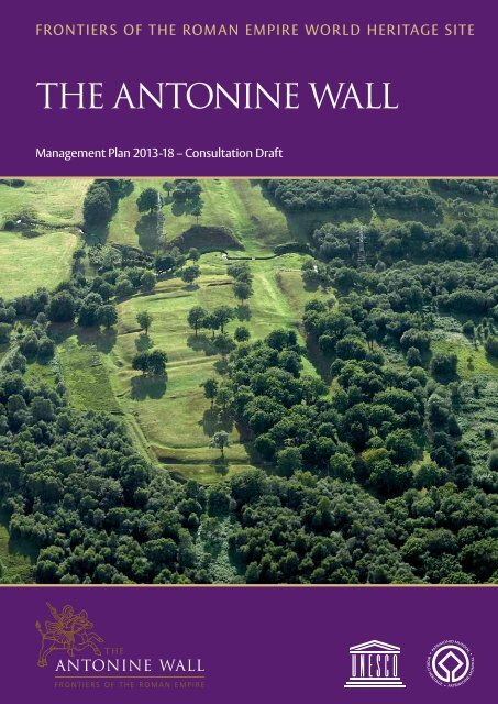
Frontiers oF the roman empire World heritage site<br />
<strong>The</strong> <strong>AnTonine</strong> <strong>WAll</strong><br />
management plan 2013-18 – Consultation draft
Frontiers oF the roman empire World heritage site<br />
<strong>The</strong> <strong>AnTonine</strong> <strong>WAll</strong><br />
management plan 2013-18 – Consultation draft<br />
COVER: Rough Castle © Crown Copyright: RCAHMS<br />
Unless otherwise specified, images are © Crown Copyright reproduced courtesy of Historic Scotland. www.historicscotlandimages.gov.uk
CONTENTS<br />
chapter one<br />
introduCtion 3<br />
chapter two<br />
requirement For a management plan 4<br />
chapter three<br />
preparation oF the Consultative draFt 5<br />
chapter four<br />
Consultation proCess 6<br />
chapter five<br />
responses to this Consultation 7<br />
chapter six<br />
handling your response 8<br />
chapter seven<br />
the statement oF outstanding universal value 9<br />
chapter eight<br />
managing the World heritage site 13<br />
chapter nine<br />
delivery oF the 2007-12 management plan 18<br />
chapter ten<br />
looking ForWard 23<br />
10.1 A Vision for the Antonine Wall World Heritage Site<br />
10.2 Long-Term Aims: 2013-43<br />
10.3 Current Issues and Medium-Term Objectives<br />
appendices<br />
Appendix A Statement of Outstanding Universal Value 36<br />
Appendix B Bibliography 37<br />
Appendix C Report on the Consultation Workshops 39<br />
Appendix D Strategic Environmental Assessment: Environmental Report 44<br />
Appendix E Respondent Information Form 90<br />
Appendix F Scottish Government Consultation Response 93<br />
Appendix G Governance Model for the Antonine Wall World Heritage Site 94<br />
Appendix H Glossary 95<br />
LEFT: Seabegs<br />
1
CHAPTER ONE introduction<br />
1.1 This Management Plan provides a broad<br />
framework for the management, conservation<br />
and enhancement of the Frontiers of the Roman<br />
Empire (Antonine Wall) World Heritage Site,<br />
henceforth referred to as the Antonine Wall, in<br />
accordance with its Outstanding Universal Value<br />
(OUV – see Appendix A). It does so by setting<br />
out aims and objectives to guide those who<br />
are involved in making decisions affecting the<br />
management of the Site. <strong>The</strong> Management Plan<br />
is not intended to be prescriptive but does rely<br />
on all stakeholders working in partnership to<br />
achieve the management aims and objectives.<br />
1.2 <strong>The</strong> Frontiers of the Roman Empire World<br />
Heritage Site (FREWHS) is a serial transnational<br />
World Heritage Site (WHS). It currently<br />
comprises Hadrian’s Wall (inscribed in 1987),<br />
the German Limes (inscribed in 2005) and<br />
the Antonine Wall (inscribed in 2008). <strong>The</strong>se<br />
Partners work internationally to protect and<br />
promote the FREWHS. In Scotland, a partnership<br />
of key local authorities and government<br />
agencies delivers strategic and operational<br />
functions specifically for the Antonine Wall.<br />
1.3 <strong>The</strong> first Management Plan for the Antonine<br />
Wall covered the five-year period from<br />
nomination (2007-12). This draft, five-year<br />
Management Plan for 2013-18 draws on the<br />
work that has already been delivered and builds<br />
on the aspirations of the Partners and other<br />
stakeholders.<br />
LEFT: Nomination documents 2007<br />
3<br />
1.4 It summarises the actions delivered from the<br />
2007-12 Management Plan, outlines a long-term<br />
vision for the Site, identifies key issues for the<br />
forthcoming Management Plan, and proposes<br />
aims and objectives to tackle these over the<br />
next five-year period.<br />
1.5 <strong>The</strong> Antonine Wall Draft Management Plan<br />
does not provide a comprehensive contextual<br />
history or physical analysis of the Antonine<br />
Wall and its surroundings. This detailed<br />
information can be found in a range of other<br />
documents, publications and references<br />
including the Nomination of the Antonine<br />
Wall for Inscription in the World Heritage List<br />
(Historic Scotland, 2007). An update of the work<br />
that has been undertaken during the period of<br />
the first Management Plan can be found in the<br />
bibliography in Appendix B.<br />
Map illustrating the boundary of the Roman empire during the<br />
second century AD
CHAPTER TWO requirement for a<br />
management plan<br />
2.1 <strong>The</strong> UK has obligations under the World<br />
Heritage Convention (WHC) in relation to<br />
the effective management of World Heritage<br />
Sites which require that every Site has an<br />
appropriate management structure in<br />
place. Although Management Plans are not<br />
a statutory requirement in the UK, national<br />
policy encourages their use as best practice.<br />
As working documents they should follow<br />
the advice in the ‘Operational Guidelines for<br />
the Implementation of the World Heritage<br />
Convention’ and should be regularly reviewed,<br />
evaluated, monitored and updated.<br />
Lilia, Rough Castle, <strong>Falkirk</strong><br />
4<br />
2.2 <strong>The</strong> key purpose of a Management Plan<br />
is to provide a framework for the overall<br />
management of the WHS in a manner specific to<br />
its character and needs to ensure maintenance<br />
of its Outstanding Universal Value. <strong>The</strong> plan’s<br />
aims and objectives are thus based on an<br />
analysis of the Site’s significance and the issues<br />
which currently affect it, ensuring that solutions<br />
are identified to Site specific problems. A<br />
Management Plan is, therefore, a means by<br />
which a Site can demonstrate to the United<br />
National Educational, Scientific and Cultural<br />
Organisation (UNESCO) that it has adequate<br />
management mechanisms in place to ensure<br />
the Site’s conservation for future generations.<br />
2.3 Management Plans depend, for their<br />
effectiveness, on consensus and commitment<br />
from the key Partners and stakeholders. For this<br />
reason the Antonine Wall Management Plan will<br />
be endorsed by those bodies and individuals<br />
responsible for its implementation. This plan<br />
will be the framework for long-term detailed<br />
decision making on the conservation and<br />
enhancement of the WHS and the maintenance<br />
of its OUV. <strong>The</strong> plan’s vision, aims and objectives<br />
should be, wherever possible, incorporated<br />
into other relevant local guidance, plans and<br />
strategies.<br />
2.4 <strong>The</strong> Antonine Wall Management Plan will cover<br />
a five-year period from 2013 to 2018 after<br />
which it will be further reviewed in line with the<br />
International <strong>Council</strong> on Monument and Sites<br />
(ICOMOS) guidance.
CHAPTER THREE preparation of the<br />
consultative draft<br />
3.1 <strong>The</strong> Antonine Wall Draft Management Plan has<br />
been developed by the Antonine Wall World<br />
Heritage Site Co-ordinator and the Partners<br />
involved in managing the WHS. <strong>The</strong> Partners<br />
are East Dunbartonshire <strong>Council</strong> (EDC), <strong>Falkirk</strong><br />
<strong>Council</strong> (FC), Glasgow City <strong>Council</strong> (GCC),<br />
Historic Scotland (HS), North Lanarkshire<br />
<strong>Council</strong> (NLC), and West Dunbartonshire<br />
<strong>Council</strong> (WDC). <strong>The</strong> preparation of the plan<br />
has been guided at every stage by the Partners<br />
and has been informed by discussions with key<br />
stakeholders.<br />
3.2 <strong>The</strong> Draft Management Plan seeks the views<br />
of the local and wider community including<br />
residents, businesses, organisations with an<br />
interest in the Site and any other parties. It<br />
should be regarded not as a finished article but<br />
as a discussion document which seeks further<br />
input from a range of stakeholders and users.<br />
3.3 After the twelve-week period of public<br />
consultation has ended, all comments provided<br />
on the draft will be analysed to inform the<br />
development of the finalised Management Plan<br />
which will seek to further refine the proposed<br />
aims and objectives as necessary.<br />
5
CHAPTER FOUR consultation process<br />
4.1 This Draft Management Plan has been<br />
developed following an initial period of<br />
stakeholder and public consultation, in the<br />
form of a series of workshops held between<br />
July and November 2012. <strong>The</strong>se were led by an<br />
independent facilitator and a report of the full<br />
process can be read at Appendix C.<br />
4.2 An initial Visioning workshop with the<br />
partnership Steering Group identified a shared<br />
vision, key aims and issues for the long-term<br />
management of the Antonine Wall. <strong>The</strong>se aims<br />
and issues were then discussed and refined<br />
through three stakeholder workshops, involving<br />
representatives from government agencies,<br />
local authorities and other organisations. This<br />
produced the six Long-Term Aims and a key issues<br />
list, with associated draft objectives, which were<br />
then taken to a series of five public workshops,<br />
one in each of the local authority areas along the<br />
Antonine Wall. <strong>The</strong>se public workshops sought<br />
to refine the draft objectives, and learn of local<br />
concerns and priorities for action.<br />
4.3 <strong>The</strong> results of those workshops have been used<br />
to draft the Issues and Objectives sections<br />
of this document. This consultative Draft<br />
Management Plan for the Antonine Wall WHS<br />
now invites wider views on how it should be<br />
managed over the next five years.<br />
4.4 <strong>The</strong> time period for the public consultation<br />
exercise is twelve weeks.<br />
Kelvin Valley from the Antonine Wall<br />
6<br />
4.5 Your comments will inform the revision of the<br />
draft plan prior to its finalisation and adoption.<br />
4.6 A ‘Strategic Environmental Assessment’ (SEA)<br />
of this draft has been undertaken in accordance<br />
with the requirements of the Environmental<br />
Assessment (Scotland) Act 2005. <strong>The</strong><br />
Environmental Report accompanying this draft<br />
Management Plan can be found in Appendix D.<br />
4.7 <strong>The</strong> draft Management Plan and Environmental<br />
Report are available to download from<br />
the consultation web pages of the Historic<br />
Scotland website at: www.historic-scotland.<br />
gov.uk/index/about/consultations/<br />
currentconsultations.htm. Printed copies<br />
of the plan are also available to view in East<br />
Dunbartonshire <strong>Council</strong> at the Kirkintilloch<br />
Community Hub, William Patrick Library,<br />
2 West High Street, Kirkintilloch G66 1AD;<br />
<strong>Falkirk</strong> <strong>Council</strong>’s Development Services at<br />
Abbotsford House, David’s Loan, <strong>Falkirk</strong><br />
FK2 7YZ; Glasgow City <strong>Council</strong>’s Development<br />
and Regeneration Services, 231 George Street,<br />
Glasgow G1 1RX; Historic Scotland’s office at<br />
Longmore House, Salisbury Place, Edinburgh<br />
EH9 1SH; North Lanarkshire <strong>Council</strong>’s Planning<br />
& Development Service at Fleming House,<br />
2 Tryst Road, Cumbernauld G67 1JW; and<br />
West Dunbartonshire <strong>Council</strong>’s Forward<br />
Planning Department at Rosebery Place,<br />
Clydebank G81 1TG.
CHAPTER FIVE responses to this<br />
consultation<br />
5.1 We are inviting written responses to the<br />
questions set out in this consultative Draft<br />
Management Plan and the SEA Environmental<br />
Report by 28 June 2013. We should be grateful<br />
if you could clearly indicate in your response<br />
to which parts of the consultative draft plan<br />
or Environmental Report you are responding,<br />
as this will aid our analysis of the responses<br />
received. A copy of the Respondent Form is<br />
available at Appendix E.<br />
5.2 Please send your response:<br />
By email: hs.awconsultation@scotland.gsi.gov.uk<br />
By post: Patricia Weeks, Antonine Wall World<br />
Heritage Site Co-ordinator,<br />
c/o Historic Scotland,<br />
Longmore House, Edinburgh EH9 1SH<br />
7<br />
5.3 Alternatively you can hand in your response<br />
to the service or reception desks at any of<br />
the following locations: FAO Ian Arnott, East<br />
Dunbartonshire <strong>Council</strong>, at the Kirkintilloch<br />
Community Hub, William Patrick Library,<br />
2 West High Street, Kirkintilloch G66 1AD;<br />
FAO Alan Rodger at <strong>Falkirk</strong> <strong>Council</strong>’s<br />
Development Service Department at Abbotsford<br />
House, David’s Loan, <strong>Falkirk</strong> FK2 7YZ; FAO Gillian<br />
Dick at Glasgow City <strong>Council</strong>’s Development<br />
and Regeneration Services, 231 George Street,<br />
Glasgow G1 1RX; FAO Patricia Weeks at Historic<br />
Scotland’s office at Longmore House, Salisbury<br />
Place, Edinburgh EH9 1SH; FAO Lorna Bowden<br />
at North Lanarkshire <strong>Council</strong>’s Planning &<br />
Development Service at Fleming House, 2 Tryst<br />
Road, Cumbernauld G67 1JW, and FAO Alan<br />
Williamson at West Dunbartonshire <strong>Council</strong>’s<br />
Forward Planning Department at Rosebery<br />
Place, Clydebank G81 1TG.<br />
5.4 If you have any queries, please contact Patricia<br />
Weeks on 0131 668 8600.
CHAPTER SIX handling your<br />
response<br />
6.1 We need to know how you wish your response<br />
to be handled and, in particular, whether you<br />
are happy for your response to be made public.<br />
Please complete and return the Respondent<br />
Information Form enclosed with this<br />
consultation paper as this will ensure that we<br />
treat your response appropriately. If you<br />
ask for your response not to be published we<br />
will regard it as confidential and we will treat<br />
it accordingly.<br />
6.2 All respondents should be aware, however, that<br />
Historic Scotland, as an agency of the Scottish<br />
Government, is subject to the provisions of the<br />
Freedom of Information (Scotland) Act 2002<br />
and the Environmental Information (Scotland)<br />
Regulations 2004 and would therefore have to<br />
consider any request made to it under these<br />
Acts for information relating to responses made<br />
to this consultation exercise.<br />
8<br />
6.3 Where respondents have given permission for<br />
their response to be made public and, after we<br />
have checked that they contain no potentially<br />
defamatory material, responses will be made<br />
available to the public.<br />
6.4 Following the closing date, all responses will be<br />
analysed and considered along with any other<br />
available evidence. A final version of the Antonine<br />
Wall Management Plan and its SEA post-adoption<br />
statement/consultation report will be published<br />
as soon as possible thereafter and will be<br />
available through the Historic Scotland website<br />
(www.historic-scotland.gov.uk).<br />
6.5 If you have any comments about how this<br />
consultation exercise has been conducted,<br />
please send them to Patricia Weeks as detailed<br />
above. Further information about the Scottish<br />
Government consultation process which<br />
Historic Scotland follows can be found in<br />
Appendix F.
CHAPTER SEVEN the statement of<br />
outstanding<br />
universal value<br />
7.1 <strong>The</strong> Antonine Wall is protected and managed in<br />
accordance with its Statement of Outstanding<br />
Universal Value (SOUV). <strong>The</strong> World Heritage<br />
Committee has asked that an SOUV is developed<br />
for every World Heritage Site. This defines the<br />
elements within a Site which make it important<br />
and which should be protected in order to<br />
maintain its significance. <strong>The</strong> Committee and<br />
their advisory bodies use this document to assess<br />
any potential threats to the WHS.<br />
7.2 <strong>The</strong>re are strict guidelines governing the<br />
development of an SOUV which can only<br />
include the elements for which the Site was<br />
originally inscribed. OUV is defined in paragraph<br />
49 of the UNESCO Operational Guidelines as<br />
‘cultural and/or natural significance which is so<br />
exceptional as to transcend national boundaries<br />
and to be of common importance for present<br />
and future generations of humanity. As such,<br />
the permanent protection of this heritage is<br />
of the highest importance to the international<br />
community as a whole’. What this actually<br />
means is that the range of values a property<br />
displays must be considered to go beyond<br />
national borders and has significance for<br />
everyone in the world now, and in the future.<br />
A Site is deemed to have Outstanding Universal<br />
Value if it can be shown to satisfy at least one<br />
of the ten criteria for assessment as set out in<br />
Section 77 of the Operational Guidelines.<br />
7.3 <strong>The</strong> current SOUV for the Antonine Wall can<br />
be found at Appendix A. This was adopted<br />
upon inscription in 2008. It is, however, likely<br />
to change over the period of the 2013-18<br />
Management Plan as one SOUV for the entire<br />
FREWHS is developed and submitted to<br />
UNESCO for adoption by the World Heritage<br />
Committee.<br />
significance<br />
<strong>The</strong> base of the Antonine Wall visible in New Kilpatrick Cemetery Bar Hill Fort: bath-house<br />
9<br />
7.4 <strong>The</strong> Antonine Wall is one part of a much larger<br />
World Heritage Site. <strong>The</strong> Roman Empire, in<br />
its territorial extent, was one of the greatest<br />
empires the world has known. Enclosing the<br />
Mediterranean world and surrounding areas,<br />
it was protected by a network of frontiers<br />
stretching from the Atlantic Coast in the<br />
west, to the Black Sea in the east; from central<br />
Scotland in the north to the northern fringes<br />
of the Sahara Desert in the south. It was largely<br />
constructed in the second century AD when the<br />
Empire reached its greatest extent. Together, the<br />
inscribed remains, and those to be nominated
chapter seven<br />
in the future, form an extensive relict cultural<br />
landscape which displays the unifying character<br />
of the Roman Empire, through its common<br />
culture, but also its distinctive responses to<br />
local geography and political and economic<br />
conditions. Each component part is a substantial<br />
reflection of the way resources were deployed<br />
in a particular part of the Empire.<br />
7.5 <strong>The</strong> FRE as a whole has an extraordinarily high<br />
cultural value. It was the border of one of the<br />
most extensive civilizations in human history,<br />
which has continued to affect the western world<br />
and its peoples till today. It had an important<br />
effect on urbanisation and on the spread of<br />
cultures among remote regions. <strong>The</strong> scope<br />
and extent of the frontier reflects the unifying<br />
impact of the Roman Empire on the wider<br />
Mediterranean world, an impact that persisted<br />
long after the empire had collapsed, while the<br />
frontiers are the largest single monument to the<br />
Roman civilization.<br />
Section through Rough Castle<br />
10<br />
7.6 <strong>The</strong> FRE illustrate and reflect the complex<br />
technological and organisational abilities of<br />
the Roman Empire which allowed it to plan,<br />
create and protect a frontier of some 5000 km<br />
in length, with a garrison of tens of thousands of<br />
men, and to manage the social, economic and<br />
military implications of this frontier. <strong>The</strong> frontier<br />
demonstrates the variety and sophistication<br />
of the response to topography and political,<br />
military and social circumstances which include<br />
walls, banks, rivers, and sea.<br />
7.7 <strong>The</strong> Antonine Wall formed the most northwest<br />
part of the Empire’s general system of defence<br />
or Limes. In use for only a generation, this barrier<br />
incorporated several technical and design<br />
components not seen on earlier frontiers and<br />
was one of the last of the linear frontiers to be<br />
built by the Romans.<br />
7.8 <strong>The</strong> contribution of this part of the Frontier to<br />
the Outstanding Universal Value of the WHS<br />
FRE is expressed as follows: <strong>The</strong> Antonine Wall
<strong>The</strong> line of the Antonine Wall across Scotland<br />
bears testimony to the maximum extension<br />
of the power of the Roman Empire, by the<br />
consolidation of its frontiers in the north of the<br />
British Isles, in the middle of the second century<br />
AD. <strong>The</strong> property is a physical manifestation of<br />
change in Roman imperial foreign policy at the<br />
time. <strong>The</strong> Antonine Wall is one of the significant<br />
elements of the Roman Limes present in Europe,<br />
the Middle East and North Africa. It exhibits<br />
important interchanges of cultural values at<br />
the apogee of the Roman Empire. <strong>The</strong> Antonine<br />
Wall fully illustrates the effort of building the<br />
Limes on the frontiers of the Roman Empire.<br />
It embodies a high degree of expertise in the<br />
technical mastery of stone and turf defensive<br />
constructions, in the construction of a<br />
strategic system of forts and camps, and in the<br />
general military organisation of the Limes. <strong>The</strong><br />
Antonine Wall is an outstanding example of the<br />
technological development of Roman military<br />
architecture and frontier defence.<br />
integrity<br />
7.9 <strong>The</strong> property includes all the upstanding and<br />
buried remains necessary for understanding its<br />
outstanding universal value and to demonstrate<br />
why it is an exceptional example of the use of<br />
artificial barriers as an aspect of the overall<br />
military frontier system of the Roman Empire.<br />
As a primarily earthen monument,<br />
environmental concerns and potential impacts<br />
of development offer a particular challenge<br />
to managing the Site, and balancing access<br />
and conservation is addressed within the<br />
Management Plan.<br />
the statement of outstanding universal value<br />
11<br />
7.10 <strong>The</strong> property is of adequate size to ensure the<br />
complete representation of the features and<br />
process which convey the significance of the<br />
property; all the archaeological remains of the<br />
monument, within present understanding of<br />
the Site, are contained within the property. <strong>The</strong><br />
Buffer Zone of the property provides protection<br />
for the setting of the monument. Although<br />
the monument sits in a highly varied modern<br />
urban and rural landscape, the setting of the<br />
monument has been largely retained across the<br />
length of the Wall allowing the mindset of the<br />
Roman engineers to be envisaged and its scale<br />
and setting appreciated.<br />
authenticity<br />
7.11 <strong>The</strong> property has a high level of authenticity.<br />
All remains of the property are known and<br />
proven through archaeological investigations<br />
as authentic Roman constructions, erected<br />
during the reign of Antoninus Pius. It is visible as<br />
a sometimes impressive feature in the modern<br />
landscape for over one-third of its total length,<br />
while archaeological excavations undertaken<br />
over the last 100 years, have demonstrated that<br />
the rest survives well as buried archaeology<br />
beneath both fields and urban areas.<br />
7.12 Given the short duration of the frontier system,<br />
the materials are highly authentic to the primary<br />
use of the monument in the mid to late second<br />
century AD. Currently displayed elements of the<br />
frontier have been undertaken on the basis of<br />
full documentation through modern excavation.<br />
Recent interventions are conservationorientated<br />
and kept to a minimum.
CHAPTER EIGHT managing the world<br />
heritage site<br />
8.1 This section sets out the roles and responsibilities<br />
of those involved in the management of the<br />
Antonine Wall WHS including the UK and<br />
Scottish Governments, the Partners who take<br />
an active role in day-to-day management, and<br />
the diverse range of stakeholders who have an<br />
interest in the Site. A governance model for the<br />
Antonine Wall is available at Appendix G.<br />
8.2 <strong>The</strong> process of developing a Management Plan<br />
involves bringing together all key Partners and<br />
stakeholders to agree a common vision for the<br />
future of the Site. <strong>The</strong> implementation of the<br />
Management Plan then relies on the effective<br />
co-operation and commitment of Partners and<br />
other key stakeholders to take actions forward.<br />
8.3 All management roles are delivered within<br />
a clear management structure and context,<br />
defined internationally by UNESCO and refined<br />
at local level.<br />
state party<br />
8.4 State Parties are countries which have ratified<br />
the UNESCO World Heritage Convention. Since<br />
International Treaties are reserved under the<br />
Scotland Act 1998 the UK government is State<br />
Party to the Convention. <strong>The</strong> Department of<br />
Culture, Media and Sport (DCMS) is responsible<br />
for the UK’s overall policy on World Heritage<br />
Sites but since management of the historic<br />
environment is devolved, Scottish Ministers<br />
are responsible for selecting Scottish sites for<br />
nomination, for ensuring that World Heritage<br />
Sites in Scotland are well managed, and that<br />
the Outstanding Universal Value of each Site<br />
is protected. In Scotland, Historic Scotland<br />
undertakes that role on their behalf.<br />
LEFT: Watling Lodge<br />
13<br />
frewhs international partners<br />
8.5 As a serial transnational World Heritage Site,<br />
the FREWHS presently includes Partners in<br />
Scotland, England and Germany. <strong>The</strong> number<br />
of international Partners could grow further<br />
in the future as other countries with sections<br />
of the second century Roman frontier submit<br />
nomination bids to UNESCO. Co-ordination<br />
and delivery of this complicated international<br />
management arrangement is undertaken at<br />
several levels within the partnership, from<br />
strategic to operational.<br />
8.6 At a strategic level, the Inter Governmental<br />
Committee (IGC) meets annually and consists<br />
of delegations of the State Parties from the<br />
countries already inscribed. Delegations include<br />
at least one member of the administration in<br />
charge of the national section(s) of the FREWHS<br />
as well as at least one archaeological expert. <strong>The</strong><br />
rules and function of the IGC are approved and<br />
accepted by all the participating State Parties<br />
in the FREWHS, and the IGC is responsible for<br />
the co-ordination of the joint international<br />
management of the FREWHS and for maintaining<br />
compliance with WHC obligations. Delegations<br />
of State Parties caring for a section of the Roman<br />
frontier not yet inscribed are welcomed as<br />
observers, particularly if considering nomination,<br />
or already on the tentative list.<br />
8.7 At an academic level, a panel of international<br />
experts (the Bratislava Group) meets annually,<br />
and advises the FREWHS IGC on all cultural<br />
heritage management issues. This group forms<br />
a key link for passing on ‘lessons learned’ from<br />
inscribed sections to those on the tentative list<br />
or considering nomination.<br />
8.8 At an operational level, co-ordinators and Site<br />
managers (the Hexham Group) meet at least once<br />
a year, usually more often, to discuss monitoring<br />
issues and share best practice approaches to Site<br />
management and presentation.
chapter eight<br />
fre (antonine wall) whs scottish<br />
partners<br />
8.9 Within Scotland, there are six signatory Partners<br />
to the Antonine Wall Management Plan. <strong>The</strong>se<br />
Partners are accountable for ensuring that the<br />
aims and objectives within the Management<br />
Plan are delivered appropriately.<br />
<strong>The</strong>se six Partners are:<br />
east dunbartonshire council<br />
East Dunbartonshire <strong>Council</strong> is part landowner of the<br />
Antonine Wall (2.2 km/17 ha, including Kirkintilloch<br />
Fort and New Kilpatrick Cemetery) with responsibility<br />
for the East Dunbartonshire Leisure and Culture<br />
trust, an arms-length Trust whose remit includes the<br />
management of Auld Kirk Museum in Kirkintilloch. <strong>The</strong><br />
Museum, situated next to the line of the Wall in the<br />
neighbouring Peel Park, has a small Roman display and<br />
runs outreach events for schools and the community.<br />
<strong>The</strong> <strong>Council</strong> is responsible for a wide range of services<br />
which are relevant to the management of the Antonine<br />
Wall. <strong>The</strong>se include planning, economic development,<br />
tourism, roads and education. Archaeological services<br />
are provided to the <strong>Council</strong> by Rathmell Archaeology.<br />
<strong>The</strong> Antonine Wall runs through Peel Park, Kirkintilloch<br />
falkirk council<br />
<strong>Falkirk</strong> <strong>Council</strong> has responsibility for a wide range<br />
of services, related to the management of the WHS,<br />
which include planning, economic development,<br />
tourism, roads and education. <strong>The</strong> <strong>Council</strong> is also<br />
partial landowner of the Site (about 5.4 km/40 ha<br />
including Kinneil fortlet and a section at Polmont) and<br />
has responsibility for an arms-length Community Trust<br />
which provides archaeological advice to the <strong>Council</strong><br />
and manages the Callendar House Museum and Kinneil<br />
Museum, both of which have Roman displays and run<br />
outreach events. <strong>The</strong> Trust also acts as advisor to the<br />
<strong>Council</strong> on collections management and heritage<br />
interpretation.<br />
14<br />
Kinneil Fortlet, <strong>Falkirk</strong><br />
glasgow city council<br />
Glasgow City <strong>Council</strong> <strong>Council</strong> has the smallest<br />
landholding of the Partners, with responsibility for<br />
0.07 km/0.16 ha at Cleddans Burn but is also<br />
responsible for a wide range of services which are<br />
important to the wider management of the WHS.<br />
<strong>The</strong>se include planning, economic development,<br />
tourism, roads and education. Archaeology Services<br />
are provided to the <strong>Council</strong> by West of Scotland<br />
Archaeology Services. Museums services are delivered<br />
through a Trust, Glasgow Life.<br />
historic scotland<br />
Historic Scotland is an executive agency of the Scottish<br />
Government responsible for advising Scottish Ministers<br />
on the protection and presentation of Scotland’s<br />
historic environment and promoting its understanding<br />
and enjoyment. In regard to the Antonine Wall: the<br />
agency’s Policy Group carry out Scotland’s State Party<br />
function on behalf of Scottish Ministers; the agency<br />
directly manages 7.7 km/72 ha of the WHS (including<br />
Rough Castle, Bar Hill and Bearsden Bath-house) as<br />
Properties in Care on behalf of Scottish Ministers;<br />
and the agency’s Heritage Management Directorate<br />
considers scheduled monument applications on<br />
behalf of Scottish Ministers, provides advice to local<br />
planning authorities on listed building/conservation<br />
Bearsden Bath-house
area consent applications and planning applications,<br />
and is also a consultee, through Scottish Government,<br />
on Environmental Impact Assessments and Strategic<br />
Environmental Assessments.<br />
north lanarkshire council<br />
North Lanarkshire <strong>Council</strong> are also partial landowners<br />
of the Site with responsibility for 0.6 km/12.5 ha at<br />
Garnhall, Castlecary which is let for seasonal grazing. <strong>The</strong><br />
<strong>Council</strong> is responsible for a wide range of services which<br />
contribute to the wider management of the Antonine<br />
Wall WHS. <strong>The</strong>se include planning, regeneration,<br />
tourism, roads and education. Archaeology services<br />
are provided to the <strong>Council</strong> by Rathmell Archaeology.<br />
<strong>The</strong> <strong>Council</strong> runs several museums as well as outreach<br />
activities on Roman themes.<br />
west dunbartonshire council<br />
West Dunbartonshire <strong>Council</strong> is responsible for a<br />
wide range of services which are relevant to the<br />
management of the Site. <strong>The</strong>se include planning,<br />
economic development, tourism, heritage, roads,<br />
education and museums. <strong>The</strong> <strong>Council</strong> is also<br />
partial landowner of the Site (0.8 km/ 4.8 ha) with<br />
responsibility for Golden Hill Park which is the site of<br />
Duntocher Fort and fortlet. Archaeology services are<br />
provided by West of Scotland Archaeology Service.<br />
Golden Hill Park, Duntocher<br />
8.10 To facilitate delivery of the Management Plan<br />
aims and objectives, a governance structure<br />
(Appendix G) has been established for the<br />
Antonine Wall WHS, led by the Management<br />
Plan Steering Group. This group includes one<br />
representative of each of the Scottish Partners<br />
named above, and directs the work of a suite<br />
of delivery groups. <strong>The</strong>se delivery groups<br />
include key operational staff from the partner<br />
organisations as well as representatives from<br />
wider stakeholder organisations, such as<br />
Forestry Commission Scotland, Scottish Canals<br />
and Scottish Natural Heritage.<br />
15<br />
managing the world heritage site<br />
8.11 the stakeholders<br />
A wide range of other individuals, organisations and<br />
groups have an interest, and a role to play, in how the<br />
Antonine Wall is managed and promoted. Stakeholders<br />
are crucial to the development of a Management<br />
Plan that works and is successful. <strong>The</strong>y can help by<br />
identifying the relevant issues to be addressed and<br />
by supporting the achievement of objectives. <strong>The</strong><br />
Partners intend to engage the opinions and input<br />
of stakeholders regularly and ensure that they feel<br />
involved in decisions about the WHS that affect them.<br />
Stakeholders for the Antonine Wall WHS can be<br />
broadly grouped as follows:<br />
landowners<br />
<strong>The</strong>re are a number of other public and private<br />
landowners who have a sizeable stake in the Antonine<br />
Wall WHS. Many of the issues facing the Site, including<br />
land management and rural issues, will be shared by<br />
these landowners and it is vital that they have a say in<br />
decisions which affect their landholdings or properties.<br />
local community<br />
Goodwill, community responsibility and stewardship<br />
are vital in order to ensure that the Site and the area<br />
around it are managed appropriately. People who<br />
live and work in and around the Antonine Wall WHS<br />
have a vested interest in the ongoing preservation of<br />
the Site, how access (both physical and intellectual)<br />
is provided to it, and how the planning process deals<br />
with development proposals that relate to the setting<br />
of the Site. Many local community groups and societies<br />
already actively engage with the Antonine Wall –<br />
running events and facilitating wider public access. <strong>The</strong><br />
relationship between the Antonine Wall WHS Partners<br />
and the community is important. <strong>The</strong> community<br />
Ministerial visit to the Antonine Wall
chapter eight<br />
<strong>The</strong> Antonine Wall runs through many highly populated areas,<br />
as here at Callendar Park, <strong>Falkirk</strong> © Crown Copyright: RCAHMS<br />
must be aware of the importance of protecting the<br />
Site’s OUV and feel that they can make an effective<br />
contribution to management decisions.<br />
education and research<br />
Many schools, universities and further education<br />
organisations use, or could use, the Antonine Wall WHS<br />
as part of their learning programmes. Representatives<br />
from several Scottish Universities currently sit on the<br />
Research Group as do representatives from specialist<br />
bodies such as the Society of Antiquaries of Scotland,<br />
the Scottish Archaeological Research Framework and<br />
Glasgow Archaeological Society.<br />
<strong>The</strong> Forth and Clyde Canal running alongside the Antonine Wall at Seabegs<br />
16<br />
tourism, access and local Business<br />
Local and national transport operators provide<br />
the key facilities for visitors to reach many of the<br />
individual sites and monuments along the Antonine<br />
Wall WHS but, to date, have not been widely involved<br />
in the delivery of Management Plan objectives. Visit<br />
Scotland is currently represented on the Access and<br />
Interpretation group for national tourism input, but<br />
there are also individual service providers in the<br />
hospitality and tourism sectors who have a significant<br />
role to play in the wider success of the Management<br />
Plan at a more local level. <strong>The</strong>se can range from<br />
B&B’s, hotels and restaurants, to local tour guiding<br />
companies, craftspeople and leisure activity providers<br />
across central Scotland.<br />
culture and natural heritage<br />
Heritage and environment bodies are keen to know<br />
how the cultural assets of the Antonine Wall WHS<br />
and its immediate surroundings are maintained; how<br />
access is provided to them; and how issues of climate,<br />
sustainability and ecosystems management are being<br />
considered. Key stakeholders in this field include<br />
Forestry Commission Scotland, Scottish Natural<br />
Heritage, Central Scotland Green Network/Central<br />
Scotland Forest Trust, Scottish Canals, Archaeology<br />
Scotland, the Hunterian Museum, Scottish Geological<br />
Society, Scottish Wildlife Trust, SEPA and the Royal<br />
Society for the Protection of Birds.
question one<br />
have we fully identified all key stakeholders<br />
or can you identify others?<br />
fre (antonine wall) whs co-ordination<br />
8.12 <strong>The</strong> scale and complexity of the Antonine Wall<br />
WHS, with both national and international<br />
involvement, requires there to be a strong degree<br />
of co-ordination between the Partners. During<br />
the period of the first Plan, an Antonine Wall<br />
WHS Co-ordinator was appointed to co-ordinate<br />
the implementation of actions and objectives in<br />
the 2007-12 Management Plan, to help lead the<br />
review of the 2007-12 Management Plan and to<br />
prepare the 2013-18 version.<br />
8.13 <strong>The</strong> Co-ordinator has been responsible for<br />
managing and facilitating the various meeting<br />
cycles for the Steering Group and delivery<br />
groups, assisting Partners with project planning,<br />
and arranging appropriate marketing and<br />
promotional work. This co-ordination function<br />
is an important one: bringing together the<br />
work of the International and Scottish Partners;<br />
maintaining and enhancing relationships with<br />
other organisations and individuals who have<br />
an interest in the management of the WHS;<br />
and ensuring that all stakeholders are aware<br />
of the importance of the Site and feel they can<br />
contribute effectively to its management.<br />
8.14 Central to the successful implementation of the<br />
2013-18 Plan, will be continued and effective<br />
co-ordination. <strong>The</strong>re are clear benefits in the<br />
continuation of a dedicated Co-ordinator’s<br />
post/function. It will aid continued collaboration<br />
with international Partners (currently both<br />
Hadrian’s Wall and the German Limes have<br />
co-ordinators who meet regularly to discuss<br />
joint working) which is crucial in ensuring<br />
alignment between the Sites.<br />
17<br />
managing the world heritage site<br />
8.15 Projects between national Partners will<br />
continue to benefit from central co-ordination,<br />
ensuring that there is an overall awareness<br />
of the achievements and progress being<br />
made with Management Plan objectives. <strong>The</strong><br />
benefit of having a single point of contact for<br />
managing the ‘front end’ of the WHS, such as<br />
public enquiries and community engagement;<br />
general administrative duties which include<br />
managing meetings, marketing and promotion,<br />
and advisory work, is central to the effective<br />
management of the Site. Dedicated<br />
co-ordination supports partner organisations<br />
and facilitates a single approach to key matters.<br />
At a time of limited resources and funds, this is<br />
a sensible approach that benefits all Partners.<br />
8.16 Effective co-ordination also enables delivery<br />
of much of the day-to-day requirements as set<br />
out by UNESCO: these include producing action<br />
plans, monitoring reports and further versions<br />
of the Management Plan, all of which amount to<br />
significant amounts of work, especially for a site<br />
of the nature of the Antonine Wall.<br />
8.17 However it is achieved, successful co-ordination<br />
is a necessity for a complicated Site that requires<br />
the maintaining of a variety of relationships on<br />
local, regional, national and international levels.<br />
<strong>The</strong> loss of this function would significantly<br />
hinder the successful implementation of the<br />
2013-18 Plan and is therefore considered as a<br />
potential risk for the Site.<br />
<strong>The</strong> Antonine Wall across Croy Hill
CHAPTER NINE delivery of the 2007-12<br />
management plan<br />
9.1 <strong>The</strong> 2007-12 Plan period saw a review of the<br />
governance model for the Antonine Wall<br />
WHS, in line with changes within local and<br />
national government. Originally an overarching<br />
Management Plan Steering Group included<br />
both Partners and stakeholders. Three original<br />
delivery groups covered Protection, Research,<br />
and Access and Interpretation. An originally<br />
constituted Landscape group had not met for<br />
many years. <strong>The</strong>se groups were considered<br />
sufficient to meet the inaugural needs of the<br />
delivery of the 2007-12 Management Plan.<br />
9.2 During 2012, this structure was further<br />
developed and refined to enable greater<br />
accountability and quicker decision making.<br />
<strong>The</strong> Management Plan Steering Group was<br />
slimmed down to the six key Partners plus<br />
the chairs of the delivery groups. <strong>The</strong> delivery<br />
groups remained as they were, but an Education<br />
and Learning Group was established and a new<br />
Conservation and Landscape group is planned.<br />
This structure will allow the Steering Group<br />
to take a strategic overview of the work of<br />
the delivery groups, each of which will deliver<br />
operationally on specific aims and objectives in<br />
the Management Plan.<br />
9.3 To further facilitate discussion within Partner<br />
organisations, a series of internal working groups<br />
have been, or are being, established within the<br />
five local authorities and Historic Scotland to<br />
ensure cross departmental working and resource<br />
allocation is as effective as possible.<br />
Bridgeness Slab © National Museums of Scotland<br />
18<br />
9.4 For the Access and Interpretation Group, key<br />
successes over the last five-year plan period<br />
have included: the joint development of an<br />
Interpretation Plan and Access Strategy to guide<br />
the work of all Partners and stakeholders; the<br />
development by the group of a ‘brand identity’<br />
and design guidelines for the Antonine Wall<br />
which is now being rolled out on all signage<br />
and advertising materials; the completion by<br />
North Lanarkshire <strong>Council</strong> of a series of path<br />
and signage improvements to the stretch of<br />
the Antonine Wall running through the local<br />
authority; work by West Dunbartonshire<br />
<strong>Council</strong> to install a series of markers along<br />
the line of the Antonine Wall and interpretive<br />
signage at Golden Hill Park; <strong>Falkirk</strong> <strong>Council</strong>’s<br />
project with Bo’ness Community <strong>Council</strong> to<br />
create and erect a replica of the Bridgeness<br />
slab; Friends of Kinneil’s annual Big Roman<br />
Week; and the commencement of a project<br />
by East Dunbartonshire <strong>Council</strong> to improve<br />
access to Bar Hill by constructing a car park at<br />
Twechar and developing associated interpretive<br />
materials. In March 2012, North Lanarkshire<br />
<strong>Council</strong> will develop the first signage strategy<br />
for the Antonine Wall, covering the section in<br />
their care and preceding physical improvements<br />
to signage over the course of the 2013-18 Plan<br />
period while Glasgow <strong>Council</strong> have prepared a<br />
council-specific Interpretation and Action Plan<br />
which will be carried forward during 2013-14.
Grass management to reveal Duntocher Fort, Golden Hill Park © Crown Copyright: RCAHMS<br />
9.5 <strong>The</strong> Protection Group, during the first Plan period,<br />
have worked on producing Supplementary<br />
Planning Guidance (SPG) for the WHS. This<br />
has been an immense achievement as it was<br />
produced collaboratively by planning and<br />
development staff in all five local authorities and<br />
adopted by all five planning committees. This<br />
represents a tremendous engagement by both<br />
elected members and officers in the commitment<br />
to protection of the Antonine Wall WHS.<br />
9.6 <strong>The</strong> Research group have been working on<br />
identifying the research gaps in relation to the<br />
Antonine Wall and will use this information to<br />
develop a Research Strategy for the Site over<br />
the period of the 2013-18 Plan. Although there<br />
are many visible remains of the Antonine Wall,<br />
19<br />
a large part of it is buried underground. This<br />
offers incredible preservation and research<br />
opportunities but also poses particular<br />
challenges with regard to presentation and<br />
management. <strong>The</strong> Research Strategy will thus<br />
need to marry with, and feed into, the work of the<br />
access and conservation focused working groups.<br />
9.7 <strong>The</strong> Education and Learning Group have<br />
commissioned an audit of education provision<br />
along the Antonine Wall and a survey into<br />
views of current and potential educational<br />
users. <strong>The</strong> results of this work will be fed into<br />
the development and delivery of an education<br />
strategy for the Antonine Wall WHS over the<br />
period of the new Management Plan.
9.8 During the first Plan period one of the<br />
key stakeholders, the Hunterian Museum,<br />
completed work on the redevelopment of their<br />
Antonine Wall Gallery.<br />
9.9 On behalf of all the Partners, national and<br />
international, two websites were created to<br />
promote the FREWHS (www.romanfrontiers.<br />
org) generally and the Antonine Wall (www.<br />
antoninewall.org) specifically. Unfortunately,<br />
due to staff resourcing issues, these have not<br />
been updated or redeveloped for some time,<br />
but still provide a good level of background<br />
information on the Antonine Wall WHS for the<br />
general public.<br />
9.10 As well as the Management Plan having<br />
deliverable objectives, it is also designed to<br />
allow reaction to other wider developments<br />
and projects that relate to the Antonine Wall.<br />
Examples of such projects that have emerged<br />
during the first Plan period are the Helix<br />
project in <strong>Falkirk</strong> and the John Muir Trail<br />
across central Scotland. Both projects will<br />
include sections of the Antonine Wall in their<br />
development and Partners have been involved<br />
in contributing to this.<br />
Rough Castle, <strong>Falkirk</strong> where an improved access<br />
path links the site with the <strong>Falkirk</strong> Wheel<br />
delivery of the 2007-12 management plan<br />
lessons learned during the 2007-12<br />
management plan period<br />
managing the whs<br />
9.11 As a relatively new WHS, the Antonine Wall is<br />
still in a period of developing and confirming<br />
policy approaches; establishing effective<br />
engagement with and communication between<br />
Partners and Stakeholders; and developing<br />
projects that contribute to sustainable growth.<br />
Based on an appreciation of the work of<br />
International Partners to date, it is important to<br />
recognise that this is an ongoing process that<br />
will continue beyond the lifetime of this Plan.<br />
9.12 <strong>The</strong> scale of the Antonine Wall WHS (including<br />
the international dimension), coupled with the<br />
complexity of interests in it, make its effective<br />
management inherently challenging. It is<br />
essential to have a clear governance structure<br />
which all Partners support, and with clearly<br />
defined responsibilities for development and<br />
delivery of projects, initiatives and programmes.<br />
9.13 To assist in the clear setting of annual targets, and<br />
the successful overall delivery of the Management<br />
Plan objectives, appropriate systems of<br />
monitoring and review need to be established.<br />
9.14 A strong research framework and a clear<br />
conservation approach are necessary to underpin<br />
all work, and need to be accepted and applied<br />
equally by all Partners and key stakeholders.<br />
resourcing the whs<br />
9.15 Resourcing the delivery of the Management Plan,<br />
in terms of financial input and staff time, requires<br />
a staged delivery, with clear prioritisation and<br />
step-by-step incremental growth.<br />
9.16 For successful delivery, projects need to be<br />
embedded in all Partners’ annual planning<br />
frameworks and suitably, and sustainably,<br />
resourced.<br />
9.17 Collaborative working/partnership delivery<br />
of projects is likely to become increasingly<br />
important to seek and secure external funding,<br />
perhaps in some instances from more creative<br />
than traditional sources.<br />
LEFT: Bar Hill Fort, a focus for partnership projects between East Dunbartonshire <strong>Council</strong>, Historic Scotland and Forestry Commission Scotland<br />
21
chapter nine<br />
9.18 <strong>The</strong> Antonine Wall has not yet achieved<br />
its potential in the areas of sustainable<br />
economic development, education, research<br />
or ecosystems management. To achieve<br />
growth in these areas, investment in physical<br />
improvements such as signage, paths,<br />
interpretive materials and educational resources<br />
will be important.<br />
9.19 Active co-ordination is vital to ensure that there<br />
is consistency across the WHS, that appropriate<br />
contacts and relationships are maintained, not<br />
only locally and nationally, but internationally,<br />
and that delivery of key aims and objectives is<br />
monitored.<br />
promoting the whs<br />
9.20 Greater engagement with, and more effective<br />
communication between, all relevant<br />
stakeholders is important.<br />
9.21 Wider public understanding of the importance<br />
and values of the Antonine Wall WHS remains<br />
limited; public surveys show an awareness of<br />
where and what the Antonine Wall is but not<br />
why it is important to preserve and present it.<br />
9.22 Multiple ownership of sections of the Wall,<br />
plus the fact that it is invisible (surviving below<br />
ground) for significant sections, offer particular<br />
challenges to ensuring a coherent approach to<br />
promoting access to, and understanding of, the<br />
monument as a whole.<br />
9.22 <strong>The</strong> Antonine Wall WHS needs to be<br />
appreciated both as a linear entity, linking<br />
Scotland to its international Partners, and also<br />
as a set of individual places and artefacts that<br />
are valuable in their own right.<br />
22<br />
question two<br />
have we fully summarised the projects<br />
delivered, and lessons learned from the first<br />
management plan, or are there projects/<br />
lessons we have missed?
CHAPTER TEN looking forward<br />
ICOMOS advises that Management Plans for World<br />
Heritage Sites should be based on a strategic view<br />
over 20-30 years. This allows the development of a<br />
framework of longer term aims, which in turn inform<br />
the priorities for medium-term objectives, based on<br />
the analysis of key current issues. <strong>The</strong>se medium-term<br />
objectives can then be used to construct annual action<br />
plans to deliver specific projects.<br />
Rough Castle<br />
10.1 a vision for the antonine wall<br />
world heritage site<br />
<strong>The</strong> 30-year vision for the Antonine Wall is as follows:<br />
<strong>The</strong> Antonine Wall will be a World Heritage Site<br />
that is well maintained and sustainably managed to<br />
safeguard its Outstanding Universal Value; a property<br />
that is established as a world-class visitor experience;<br />
a catalyst to connect and transform communities<br />
locally, nationally and internationally; a focus to<br />
realise sustainable benefits economically, socially<br />
and environmentally for locals and visitors alike;<br />
and a resource for inspiring learning and creating<br />
opportunity for participation and discovery.<br />
question three<br />
is the vision appropriate or is anything<br />
missing from it?<br />
23<br />
10.2 long-term aims: 2013-43<br />
<strong>The</strong> six long-term aims to guide future decision making<br />
have been identified as follows:<br />
1. Safeguard and enhance the Outstanding<br />
Universal Value of the World Heritage Site by<br />
managing, conserving and protecting the Site<br />
and its cultural and natural landscape setting<br />
2. Promote awareness and understanding of this<br />
Outstanding Universal Value to local, regional,<br />
national and global audiences by improving<br />
physical and intellectual accessibility<br />
3. Realise the World Heritage Site’s full potential<br />
as an education and learning resource<br />
4. Build strong structural and organisational<br />
partnerships with local, national and<br />
international organisations; strengthen<br />
engagement with local communities; and<br />
contribute to sustainable economic growth<br />
5. Balance wider environmental concerns in<br />
the sustainable management of the World<br />
Heritage Site<br />
6. Increase research opportunities nationally<br />
and internationally and use this new research<br />
to underpin work to protect and promote the<br />
World Heritage Site<br />
question four<br />
are there any other strategic, long-term<br />
aims which you think should have been<br />
considered?<br />
10.3 current issues and medium-term<br />
oBJectives<br />
Drawing on the longer term, strategic, aims as laid<br />
out above, the next step considers the key issues for<br />
each of them and identifies medium-term objectives<br />
to meet the longer term aims. <strong>The</strong>se medium-term
chapter ten<br />
objectives will form the core management of the<br />
Antonine Wall WHS for the five-year period between<br />
2013 and 2018.<br />
<strong>The</strong> Antonine Wall, as a recently inscribed WHS, has<br />
only been through one five-year management plan<br />
period, which focused on achieving nomination and<br />
putting in place policy and governance foundations.<br />
<strong>The</strong> next plan period will need to build on this,<br />
delivering more on an operational level, but also<br />
completing some of the strategic planning work that<br />
is required to underpin operational work and project<br />
delivery. By necessity, this will include several aims<br />
and objectives to bring the Antonine Wall to a similar<br />
point on certain key issues as the other international<br />
Partners, whose Management Planning is several years<br />
in advance due to earlier inscription. While it will not<br />
achieve complete parity within the five years, this<br />
will go some way to aligning the Antonine Wall more<br />
closely with other sections of the FREWHS.<br />
For the Scottish Partners, the aims and objectives also<br />
take account of central and local government priorities<br />
and the effective delivery of appropriate outcomes,<br />
both individually and collectively. Overall, the<br />
principle of sustainability must run through all aspects<br />
of the management, protection and promotion of the<br />
WHS, and in realising its potential to contribute to<br />
economic growth.<br />
aim one<br />
safeguard and enhance the outstanding<br />
universal value of the world heritage site by<br />
managing, conserving and protecting the site<br />
and its cultural and natural landscape setting<br />
issue<br />
the antonine wall whs and its Buffer Zone<br />
<strong>The</strong> boundary of the Antonine Wall WHS was defined<br />
during the nomination process as a 50m wide corridor,<br />
except where scheduled parts of the monument<br />
extend beyond this corridor, in which case the<br />
boundaries of the Site are coeval with the limits of the<br />
scheduled area. <strong>The</strong> corridor includes: the rampart;<br />
ditch and upcast mound; Military Way; forts, fortlets,<br />
expansions and small enclosures; civilian settlements;<br />
and labour camps. <strong>The</strong> Buffer Zone was defined, on<br />
behalf of the Partners, by Land Use Consultants, using<br />
existing mapped features to protect the amenity and<br />
setting of the monument. It was envisaged in the<br />
first Management Plan, that any future amendments<br />
24<br />
to the boundary or Buffer Zone of the WHS would<br />
be minor in scale, and this is still the case. However,<br />
should archaeological investigations, development<br />
work, or wider research programmes alter the<br />
understanding of the boundary or Buffer Zone (by<br />
changing our understanding of the location or scale<br />
of archaeological sites for example), then it may be<br />
necessary to amend these.<br />
Objective 1.1<br />
<strong>The</strong> boundary of the Antonine Wall WHS and its<br />
Buffer Zone will be kept under review to ensure that<br />
its outstanding universal significance is adequately<br />
protected<br />
<strong>The</strong> Antonine Wall and its Buffer Zone<br />
issue<br />
legislative and regulatory process of protection<br />
Nationally, the period of the first Management Plan<br />
has seen the development of the Scottish Historic<br />
Environment Policy (SHEP) and the review of the 1979<br />
Ancient Monuments and Archaeological Areas Act and<br />
emerging powers of enforcement. <strong>The</strong> development<br />
of the Supplementary Planning Guidance (SPG) for<br />
the Antonine Wall has been the key product of the<br />
Planning and Protection delivery group during 2011<br />
and it was adopted formally by all Partners in 2012.<br />
From 2013 onwards, monitoring its implementation<br />
and use will be an important target for the Planning<br />
and Protection group along with awareness-raising<br />
through training programmes, initially for<br />
Development Planning and Management staff in the<br />
local authorities but with the possibility of extending<br />
this to elected members and staff in partner agencies.<br />
Regionally, local authorities are in the process of<br />
producing revised strategic and local development<br />
plans, and it will be critical that Partners continue to<br />
feed into the review of local authority planning policy<br />
as it continues over the next few years. <strong>The</strong> SPG will<br />
also need to be ‘re-adopted’ by all local authorities as<br />
Supplementary Guidance as part of this process.
Objective 1.2<br />
Include the Antonine Wall WHS in all relevant planning,<br />
regulatory and policy documents prepared by central<br />
and local government<br />
Objective 1.3<br />
Monitor the effectiveness of the SPG in planning<br />
and protection decision making across all Partners’<br />
organisations<br />
Objective 1.4<br />
Capacity Building to ensure that knowledge and<br />
understanding of the OUV of the World Heritage Site<br />
remains current amongst decision makers<br />
issue<br />
risk preparedness<br />
<strong>The</strong>re is a range of risks (physical, intellectual,<br />
organisational) that affects the Antonine Wall WHS.<br />
Physical risks include: threats to the fabric of the<br />
earthwork monument, particularly from erosion;<br />
changes to (mainly beneficial) traditional farming<br />
practices; potential impacts on setting from nearby<br />
development; and issues around managing visitor<br />
access to the WHS. Recent physical issues affecting<br />
the Antonine Wall include old mining collapse in<br />
the North Lanarkshire area, issues of poaching by<br />
cattle on pathways on the line of the WHS, and deep<br />
ploughing without consent of a section of bank and<br />
ditch. To date, there is still no agreed partnership<br />
approach to condition survey and monitoring, and the<br />
development of such a framework will be important<br />
in the period of this new Management Plan.<br />
Intellectual risks include public apathy and /or lack<br />
of awareness or understanding of the Antonine<br />
Wall WHS. <strong>The</strong> delivery of several Partners’ projects<br />
during the period of the last Management Plan,<br />
such as North Lanark’s access project in 2011 and<br />
West Dunbartonshire’s signage project, has seen the<br />
mitigation of some access related risks, improving<br />
access for the general public and raising awareness of<br />
World Heritage Site status. It will also be important to<br />
facilitate access by as many Partners and stakeholders<br />
as possible to all Antonine Wall WHS documentation<br />
in order to avoid loss of institutional memory.<br />
Organisational risks include poor change management,<br />
lack of co-ordination, lack of succession planning<br />
around key staffing, and economic risk locally and<br />
nationally. A risk specific to the FREWHS is that all<br />
international Partners are bound by risk across the<br />
three Sites; any identified risk that threatens World<br />
Heritage Status in one country also puts the others at<br />
25<br />
risk. Thus international co-operation and management<br />
of the sections of the FREWHS in line with best practice<br />
will be essential.<br />
Objective 1.5<br />
Development of a risk strategy, and associated<br />
mitigation measures<br />
Objective 1.6<br />
Development of an agreed approach, nationally<br />
and internationally, to gathering and monitoring<br />
information on condition survey, and for implementing<br />
appropriate plans to counter any emergent problems<br />
Cattle poaching can damage the site<br />
looking forward<br />
issue<br />
a conservation framework for the antonine<br />
wall whs<br />
<strong>The</strong> Antonine Wall WHS runs through both farmland<br />
and urban areas, with differing pressures and potential<br />
threats caused by each. Large swathes include, or lie<br />
adjacent to, both native woodland and commercial<br />
forestry plantation (much of which is now nearing the<br />
end of its life). <strong>The</strong> size of the Antonine Wall means that<br />
there are multiple owners, ranging from public bodies<br />
to private individuals. It is primarily an earthwork<br />
monument, but there are some consolidated stone<br />
elements that require a different conservation<br />
approach.<br />
Excavations have revealed that in areas where little<br />
may be visible above ground, there is still a good<br />
state of preservation of the archaeological remains<br />
below ground. As land management approaches on<br />
and around the Antonine Wall may alter over time,<br />
there needs to be a focus by the Partners on ensuring<br />
that such change does not affect the OUV or impact<br />
adversely on the Site and its setting. Integrating and
chapter ten<br />
managing both cultural and natural heritage concerns<br />
may warrant further discussion between Partners<br />
and wider stakeholders on topics such as land use,<br />
mowing regimes, landscape character, and ecosystems<br />
management.<br />
Objective 1.7<br />
<strong>The</strong> development of an agreed conservation<br />
framework, to assist in the management of change in<br />
the landscape of the Antonine Wall WHS<br />
Objective 1.8<br />
Encourage farmers and landowners to enter<br />
into schemes that benefit the conservation and<br />
sustainability of the Antonine Wall WHS<br />
Objective 1.9<br />
<strong>The</strong> development of agreed management plans,<br />
especially for sections of the Site in multiple<br />
ownership/management, that will seek to integrate<br />
cultural and natural heritage<br />
issue<br />
monitoring and regulation frameworks<br />
<strong>The</strong>re are several potential requirements for<br />
monitoring frameworks for the Antonine Wall: for<br />
UNESCO, an exercise known as Periodic Reporting<br />
must be undertaken every six years; nationally<br />
and internationally, there are issues that must be<br />
considered for the Antonine Wall as part of the<br />
FREWHS to ensure the long-term future of World<br />
Heritage Site status; in Scotland, there is a need for<br />
Partners to monitor and evaluate the implementation<br />
of both Management Plan objectives and their local<br />
action plans that flow from this.<br />
A strong monitoring framework should include<br />
carefully chosen and applied monitoring variables,<br />
monitoring methodologies and key indicators.<br />
Ideally, rather than just being project related, it<br />
will also include technical conservation measures,<br />
environmental monitoring and consideration of<br />
tourism and development pressures. During the life<br />
of the first Management Plan, as no single monitoring<br />
framework has existed, individual Partners have<br />
undertaken monitoring reports ‘as and when’<br />
necessary; for example HS monument wardens have<br />
produced monitoring reports of scheduled sites but<br />
these have not been deliberately tailored to fit the<br />
Antonine Wall.<br />
26<br />
Objective 1.10<br />
<strong>The</strong> establishment of a joint monitoring and evaluation<br />
framework for the Management Plan, to include<br />
monitoring indicators that will allow meaningful<br />
comparison with international FREWHS Partners<br />
Objective 1.11<br />
<strong>The</strong> development of a set of management principles<br />
for the use of the international community on the<br />
identification, recording, research, protection,<br />
conservation, management, presentation and<br />
understanding of the Roman frontier<br />
issue<br />
implementing the management plan<br />
All Partner bodies (and some key stakeholders) have<br />
contributed various resources to the successful<br />
delivery of objectives from the first Management<br />
Plan; staff time, organisational resources and financial<br />
contributions to specific projects have all helped to<br />
improve protection, conserve the monument and<br />
facilitate public access. Joint working and identifying<br />
shared priorities for delivery have been, and will<br />
continue to be, important.<br />
<strong>The</strong> evolving governance model will hopefully make<br />
it simpler to identify lead groups and organisations<br />
for specific projects, but the Steering Group and<br />
delivery groups will undoubtedly have to work more<br />
creatively in a difficult economic climate. While<br />
this Management Plan sets out specific Aims and<br />
Objectives for the Antonine Wall as an entire entity,<br />
successful delivery will rely on individual Partners and<br />
stakeholders transferring the relevant actions to their<br />
own corporate frameworks and recording relevant<br />
outcomes, indicators and targets.<br />
During the period of the first Management Plan, threeyear<br />
funding for a Co-ordinator post has been provided<br />
by Historic Scotland, with office facilities provided by<br />
North Lanarkshire <strong>Council</strong>. This has been an important<br />
role, providing a single point of contact for the public,<br />
and a support to the Partners in the delivery and<br />
co-ordination of disparate projects. A key concern for<br />
the period of the 2013-18 Management Plan will be for<br />
Partners to determine how the co-ordination function<br />
is to be delivered, and whether the Co-ordinator role<br />
will continue. Without a clear mechanism in place,<br />
there is a risk to the successful co-ordination and<br />
delivery of the Management Plan objectives.
Objective1.12<br />
<strong>The</strong> Management Plan Steering Group, assisted by<br />
the delivery groups, will oversee the implementation,<br />
co-ordination and monitoring of the objectives in the<br />
Management Plan, in consultation and partnership<br />
with other stakeholders where appropriate<br />
Objective 1.13<br />
<strong>The</strong> integration of actions into Partners’ corporate<br />
planning frameworks<br />
Objective 1.14<br />
<strong>The</strong> Management Plan Steering Group will be<br />
responsible for drawing up annual action plans derived<br />
from the medium-term objectives<br />
Objective 1.15<br />
<strong>The</strong> Partners will keep under review financial and<br />
economic impacts, specifically approaches by Partners<br />
to capital and revenue spend, that will affect delivery of<br />
the Management Plan objectives<br />
issue<br />
capacity Building<br />
A key component to the successful longer term<br />
delivery of Management Plan aims, lies in building<br />
the capacity of both Partners and stakeholders to<br />
engage in and undertake specific tasks and projects.<br />
Critical to this is sharing expertise, knowledge and<br />
training as enhanced workforce development will<br />
enable more successful implementation of objectives;<br />
areas identifiable in this Management Plan include<br />
conservation and management, site interpretation,<br />
landscape conservation, monitoring methodologies,<br />
integrated management strategies (such as<br />
fundraising), placemaking, communication strategies<br />
and participating mechanisms.<br />
Objective 1.16<br />
To determine a strategy for building capacity across<br />
the Antonine Wall WHS<br />
question five<br />
have we identified the key objectives to<br />
manage, conserve and protect the antonine<br />
wall whs?<br />
27<br />
aim two<br />
looking forward<br />
promote awareness and understanding of this<br />
outstanding universal value to local, regional,<br />
national and global audiences by improving<br />
physical and intellectual accessibility<br />
issue<br />
ensuring a strong visitor experience on site<br />
An Interpretation Plan and Access Strategy was written<br />
during the period of the first Management Plan, with<br />
part of the work including an audience survey to<br />
determine public perceptions of the wall and to gather<br />
evidence of needs and expectations from visitors. It<br />
highlighted a suite of works along the length of the<br />
Wall that should be undertaken to optimise visitors’<br />
experiences, enhance enjoyment and understanding<br />
for both local people and other visitors, and extend<br />
overall appreciation of the universal significance and<br />
status of the Antonine Wall WHS and its setting. As<br />
part of the process a new ‘brand identity’ was created<br />
for the Wall with a logo and guidance for all Partners<br />
on the standardised production of interpretive and<br />
promotional materials. Following a public consultation<br />
exercise the plan has been adopted by all Partners and<br />
they are now drawing up action plans to deliver key<br />
elements of these proposals.<br />
North Lanarkshire <strong>Council</strong> have already completed<br />
a substantial project to improve pathways on, and<br />
access points to, the Antonine Wall. <strong>The</strong> new branding<br />
has been used and focal point ‘gateways’ created to<br />
attract attention to the Site. In West Dunbartonshire,<br />
approaches have focused on improving the visibility<br />
of the Antonine Wall – careful land management and<br />
presentation regimes such as the mowing regime at<br />
Duntocher to pick out the line of the ramparts of fort<br />
and fortlet have been used alongside plaques to mark<br />
the Wall line in urban areas. In Bridgeness, in a project<br />
run by <strong>Falkirk</strong> <strong>Council</strong> and Bo’ness community council,<br />
a scanned stone replica of the distance slab has been<br />
created, and was erected in 2012, offering a focal<br />
point for visitors at the eastern end of the Antonine<br />
Wall. Other initiatives in <strong>Falkirk</strong> include signposting by<br />
the <strong>Council</strong> rangers from the <strong>Falkirk</strong> Wheel to Rough<br />
Castle, the delivery of an annual events programme<br />
in Bo’ness for Big Roman Week, and the inclusion of<br />
the Mumrills fort site in the planning for the new Helix<br />
development.
chapter ten<br />
In East Dunbartonshire, work is underway at Bar Hill<br />
to improve car parking and interpretation. This will<br />
enhance visitor experience and link with, and expand<br />
on, the work completed on the adjoining North<br />
Lanarkshire section and Forestry Commission Scotland<br />
path works in and around Croy Hill. Meanwhile,<br />
Glasgow <strong>Council</strong> have prepared a council specific<br />
Interpretation Plan, with associated actions to be<br />
carried forward through 2013-14. Opportunities<br />
remain, however, along the length of the Antonine<br />
Wall WHS to improve physical access, visitor facilities,<br />
and interpretation, as well as more closely integrating<br />
cultural and natural (biodiversity and geodiversity<br />
focused) site interpretation to improve the breadth<br />
of the visitor experience and allow a deeper<br />
understanding of a ‘sense of place’.<br />
Objective 2.1<br />
To implement key recommendations in the approved<br />
interpretation plan and access strategy: improving<br />
signage, interpretation, visitor information, access<br />
routes and visitor facilities at individual sites along<br />
the Wall<br />
Objective 2.2<br />
To promote and enhance the use of the Antonine Wall<br />
WHS as a long-distance route and visitor facility that<br />
links communities across central Scotland<br />
Objective 2.3<br />
To consider sustainable transportation opportunities<br />
around the WHS and build business partnerships<br />
to facilitate access for visitors in and around the<br />
Antonine Wall<br />
Objective 2.4<br />
To develop and foster links and partnerships with local<br />
tourism providers and other businesses, to provide an<br />
enhanced visitor experience and develop collaborative<br />
business opportunities<br />
<strong>The</strong> Antonine Wall Logo, inspired by the Bridgeness slab<br />
28<br />
Historic signposting at Castlecary<br />
issue<br />
digital technologies and digital resources<br />
Increasingly, digital technology can offer an improved<br />
visitor experience at cultural heritage attractions<br />
both on and off site. Internationally, the German<br />
Limes have produced an app for visitors, and Hadrian’s<br />
Wall has dedicated online resources that encompass<br />
a wide range of visitor needs. In 2008 websites were<br />
created for both the FREWHS and the Antonine Wall,<br />
but due to staffing difficulties, have not been actively<br />
updated or developed for some time. Each of the<br />
Scottish Partners has a webpage or multiple pages<br />
on their own organisation’s website, but there is little<br />
consistency between them on content or links from<br />
one to the other.<br />
To create an effective virtual gateway to the Antonine<br />
Wall, relevant information needs to be included in a<br />
redeveloped website. As one of five Scottish World<br />
Heritage Sites, the Antonine Wall has been included in<br />
the government’s ‘Scottish Ten’ project – a campaign<br />
to digitally scan and record the Scottish Sites alongside<br />
five international World Heritage Sites. <strong>The</strong> first stage<br />
of the Antonine Wall project has seen LiDAR scanning<br />
completed of the whole Wall, and further work<br />
will be undertaken over the course of the 2013-18<br />
Management Plan.
Objective 2.5<br />
To develop and improve the web presence for the<br />
Antonine Wall<br />
Objective 2.6<br />
To explore new opportunities for digital interpretation<br />
both on and off site<br />
Objective 2.7<br />
To make use of the work of the Scottish Ten scanning of<br />
the Antonine Wall<br />
issue<br />
museum collections and intangible heritage<br />
Alongside the physical remains of the Antonine Wall in<br />
the Scottish landscape, the artefactual evidence held<br />
in museum collections, and the intangible cultural<br />
heritage such as folklore or personal stories and<br />
recollections, form an important part of the interpretive<br />
story of the Antonine Wall WHS. Several museums<br />
exist along the length of the WHS, operated by local<br />
authorities, a university, and central government, which<br />
curate and display artefacts found on the Antonine Wall.<br />
In Glasgow, the Hunterian Museum’s Antonine Wall<br />
redisplay opened in September 2011 and other<br />
museums with Roman interpretation exist at Callendar<br />
House in <strong>Falkirk</strong>, the National Museum of Scotland in<br />
Edinburgh, the Auld Kirk Museum in Kirkintilloch, and<br />
Kinneil Museum in Bo’ness. Other public and private<br />
bodies also run interpretive programmes or displays,<br />
which are non-collections based, related to the<br />
Antonine Wall, such as the <strong>Falkirk</strong> Wheel, Croy Miners<br />
Welfare, and Lambhill Stables in Glasgow.<br />
Within the international context of the FREWHS, a<br />
number of very successful projects have seen the<br />
development of new museum displays and community<br />
based projects both on Hadrian’s Wall and across the<br />
German Limes. Further opportunities exist over the<br />
term of this Management Plan to better integrate<br />
site and collections based interpretive work, and<br />
to facilitate greater joint working between the<br />
organisations listed above.<br />
Objective 2.8<br />
To explore greater partnership working, both within<br />
Scotland and internationally across the FREWHS,<br />
between museum, and heritage centre, partners.<br />
Objective 2.9<br />
To encourage wider community engagement and<br />
participation with collections and intangible heritage<br />
related to the Antonine Wall<br />
29<br />
<strong>The</strong> <strong>Falkirk</strong> Wheel lies adjacent to Rough Castle<br />
looking forward<br />
issue<br />
marketing, tourism and communications<br />
<strong>The</strong> development of the Interpretation Plan and<br />
Access Strategy has included a small number of visitor<br />
studies, focusing mainly on qualitative data. <strong>The</strong><br />
implementation of elements from this document will<br />
allow the development of an improved visitor ‘offering’<br />
but more work is required on gathering quantitative<br />
data; on events development, management and<br />
delivery; on monitoring and tracking visitors to the<br />
Site; on consultation (owners, managers and users,<br />
businesses and communities); and on market analysis,<br />
segmentation and profiling.<br />
Awareness and understanding of the archaeological,<br />
historical and other values of the Antonine Wall can<br />
be undertaken through publications of all types, and<br />
through increased promotion via the media, museums,<br />
on-site interpretation and digital resources. To date<br />
such work has been carried out on an ad hoc basis by<br />
Partners as new resources have been developed, and in<br />
a slightly more structured way through the use of the<br />
Antonine Wall website.<br />
In 2011 and 2012, small-scale events to mark World<br />
Heritage Day on the Wall sought to raise the profile of<br />
the Antonine Wall WHS. A suite of information leaflets<br />
and display boards on Scottish World Heritage Sites<br />
produced by Historic Scotland, includes versions for<br />
the Antonine Wall, in Gaelic and German as well as
tion<br />
.romanfrontiers.org<br />
House, Salisbury Place,<br />
istoric-scotland.gov.uk<br />
Bernard Terrace,<br />
rcahms.gov.uk<br />
IL, Development and Enterprise,<br />
th Road, Kirkintilloch G66 1TF<br />
astdunbartonshire.gov.uk<br />
Service, Abbotsford House,<br />
2 7YZ<br />
lkirk.gov.uk<br />
pment and Regeneration Services,<br />
George Street, Glasgow G1 1RX<br />
lasgow.gov.uk<br />
Environmental Services,<br />
ernauld G67 1JW<br />
orthlan.gov.uk<br />
IL, Planning, Housing,<br />
velopment, <strong>Council</strong> Offices, Rosebery<br />
est-dunbarton.gov.uk<br />
Heritage, East Peterel Field,<br />
umberland NE46 2JT<br />
fo@hadrians-wall.org<br />
ommissionen,<br />
50 Bad Homburg<br />
onen.de<br />
Avenue, Glasgow G12 8QQ<br />
unterian-enquiries@glasgow.ac.uk<br />
ND, Chambers Street, Edinburgh EH1 1JF<br />
ms.ac.uk www.nms.ac.uk<br />
Bo’ness EH51 0PR. Tel: (+44) 01506 778530<br />
llendar House, Callendar Park,<br />
03770<br />
g/heritage<br />
irkintilloch G66 1AB<br />
.gov.uk<br />
otherwise specified<br />
n Copyright: RCAHMS.<br />
oin of Antoninus Pius and Distance Slab<br />
chapter ten<br />
English. <strong>Falkirk</strong> <strong>Council</strong> and North Lanarkshire <strong>Council</strong><br />
have both produced walking guides to the Antonine<br />
Wall in their areas.<br />
Going forward, it is proposed that a more targeted<br />
media and communications approach be adopted,<br />
in the form of a formal plan. It is also proposed that<br />
greater links with national and international tourism<br />
bodies be developed to identify and target key<br />
markets and audiences that may not be captured<br />
through the implementation of the Interpretation<br />
Plan and Access Strategy.<br />
Objective 2.10<br />
A visitor profile will be developed for each section of<br />
the Antonine Wall where public access is facilitated<br />
Objective 2.11<br />
A Tourism and Marketing Strategy will be developed<br />
that takes into account the need for a sustainable<br />
approach to Site development<br />
Objective 2.12<br />
A Media and Communications Plan will be developed<br />
Objective 2.13<br />
<strong>The</strong> Antonine Wall branding will be consistently used<br />
by all Partners and Stakeholders for relevant projects<br />
World Heritage Site<br />
Promotional leaflet using new branding<br />
question six<br />
have we identified the key objectives to<br />
promote awareness and understanding of<br />
the antonine wall whs?<br />
30<br />
aim three<br />
realise the world heritage site’s full potential<br />
as an education and learning resource<br />
issue<br />
strengthening the use of the antonine wall<br />
whs in formal education<br />
Over the period of the last five-year Management Plan,<br />
several projects have been undertaken to promote<br />
educational use of the Antonine Wall WHS by schools.<br />
Work has taken place with schools in Glasgow, in<br />
association with the Village Storytelling Centre, on<br />
a project where secondary school pupils mentored<br />
primary school pupils to explore cultural identity<br />
and the Antonine Wall. Ranger services, from local<br />
authorities and agencies along the Antonine Wall, have<br />
delivered programmes for pupils but have cited a need<br />
for more supplementary resources and training in<br />
cultural heritage. <strong>The</strong> Antonine Wall was represented<br />
by schools at the World Heritage Education Conference<br />
in New Lanark in September 2010 and World Heritage<br />
Day 2011 saw an event for primary pupils at Callendar<br />
Park in <strong>Falkirk</strong>. Individual museums offer Roman<br />
themed workshops in East Dunbartonshire, Glasgow,<br />
North Lanarkshire and <strong>Falkirk</strong>, while National Museums<br />
Scotland also runs an outreach programme.<br />
A need for universal resources available at key points<br />
along the Antonine Wall WHS for use both on site and<br />
in the classroom has been flagged by many individual<br />
organisations who have limited materials to draw<br />
on themselves, and by teachers responding to the<br />
Education Audit commissioned by the Education<br />
delivery group. <strong>The</strong> Hunterian Museum’s redisplay<br />
now offers opportunities to develop education<br />
material to link with the new displays, and a focus for<br />
tertiary and continuing education. Going forward,<br />
the development of closer contacts between the<br />
protection and conservation bodies, museums,<br />
schools, universities and other educational bodies will<br />
be important in building educational use. <strong>The</strong> results<br />
of the Education audit are now being used to develop<br />
an Education Strategy for the Antonine Wall.<br />
For the period of the 2013-18 Management Plan, a<br />
key focus must be to raise awareness of the European<br />
dimension of the FREWHS and the UNESCO values<br />
relating to World Heritage Sites.<br />
Objective 3.1<br />
To develop and implement an education strategy for<br />
the Antonine Wall WHS
Objective 3.2<br />
To promote UNESCO WHS values<br />
Objective 3.3<br />
To strengthen international education links between<br />
FREWHS Partners<br />
Objective 3.4<br />
To encourage CPD opportunities for education staff, to<br />
build capacity in teaching about the Antonine Wall WHS<br />
Meeting a Roman soldier<br />
issue<br />
strengthening use of the antonine wall whs<br />
in informal education and outreach<br />
As well as being a focus for formal educational use,<br />
the Antonine Wall is also regularly used for informal<br />
education work, by communities and for outreach<br />
events. In 2012, a World Heritage Day event was held at<br />
Croy, which linked communities from all five Scottish<br />
World Heritage Sites, and an annual community led<br />
event, Big Roman Week, runs in the <strong>Falkirk</strong> <strong>Council</strong><br />
area. Healthy lifestyle walking groups in the Glasgow,<br />
North Lanarkshire, East Dunbartonshire, and <strong>Falkirk</strong><br />
<strong>Council</strong> areas use sections of the wall for weekly events,<br />
while community development at Lambhill Stables<br />
in Glasgow has seen the Antonine Wall included in a<br />
walking map for the area, and in planning for future<br />
interpretive and outreach work. Ranger services,<br />
based in various organisations along the Antonine<br />
Wall, regularly lead events related to both natural and<br />
cultural heritage, using the WHS as a venue.<br />
Objective 3.5<br />
To support local communities to use the Antonine Wall<br />
WHS in informal education and outreach initiatives<br />
Objective 3.6<br />
To build a programme of events and activities for<br />
families, special interest groups and the general public<br />
31<br />
Fortlet at Kinneil, in Bo’ness, where community events take<br />
place annually<br />
question seven<br />
have we identified the key objectives to<br />
realise the educational potential of the<br />
antonine wall whs?<br />
aim four<br />
Build strong structural and organisational<br />
partnerships with local, national and<br />
international organisations, strengthen<br />
engagement with local communities, and<br />
contribute to sustainable economic growth<br />
issue<br />
international partnerships<br />
looking forward<br />
As well as being a monument of international<br />
importance in its own right, the Antonine Wall is<br />
also part of the wider Roman frontier, a monument<br />
stretching over 5000km from the Atlantic Ocean to<br />
the Black Sea, from Egypt to the Atlantic coast of Africa.<br />
Although at present there are only three international<br />
partners in the FREWHS, this could increase in future<br />
years as other countries who care for sections of<br />
this frontier seek to join. <strong>The</strong> international Partners<br />
to the FREWHS are interdependent on one another<br />
for the long-term existence of the World Heritage<br />
Site; if one country has a part of its section placed on<br />
the endangered list, then the whole FREWHS is also<br />
included. A high degree of cooperation is therefore<br />
required between the international Partners to ensure<br />
best practice approaches to the conservation and<br />
management of the FREWHS are in place and that<br />
information and skills are shared between one another.<br />
For other countries who may be interested in joining<br />
the FREWHS, academic and professional links with<br />
existing international Partners are maintained through<br />
the Bratislava group, giving the opportunity to discuss
chapter ten<br />
future development of the FREWHS. <strong>The</strong> period of<br />
the last Management Plan has seen the Antonine Wall<br />
successfully integrate into the pre-existing partnership<br />
between Hadrian’s Wall and the German Limes. <strong>The</strong><br />
next five-year Management Plan will need to focus on<br />
the development of these relationships, the sharing of<br />
best practice approaches between all three Partners,<br />
and the alignment of visions, aims and objectives to<br />
support collaborative working.<br />
Objective 4.1<br />
To maintain and enhance appropriate international<br />
links, sharing best practice in governance and<br />
management of the FREWHS<br />
Objective 4.2<br />
To contribute to the development of management<br />
principles for the international community on the<br />
identification, recording, research, protection,<br />
conservation, management, presentation and<br />
understanding of the Roman frontier<br />
International partners from the Antonine Wall, Hadrian’s Wall and<br />
the German Limes<br />
issue<br />
local, regional and national partnerships<br />
<strong>The</strong> nomination and first Management Plan were<br />
steered and adopted by a Partnership of five local<br />
authorities (through which the Antonine Wall runs),<br />
Historic Scotland, and the Royal Commission on<br />
Ancient and Historical Monuments of Scotland. This<br />
Partnership is now the driving force behind this<br />
consultation on, and revision of, the Management Plan.<br />
Critical also to the successful delivery of Management<br />
Plan objectives, is the relationship with the other UK<br />
Partner to the FREWHS, Hadrian’s Wall. Hadrian’s Wall<br />
has the longest experience of managing an individual<br />
section of the FREWHS, having been inscribed in 1987<br />
and is thus well placed to offer support and advice to<br />
the Antonine Wall as a UK Partner facing many similar<br />
regional and national issues.<br />
32<br />
At a local and regional level, critical projects could not<br />
be delivered without the support and engagement of<br />
a wide range of stakeholders, from other government<br />
agencies and universities, to individual businesses and<br />
charitable organisations. Successful implementation of<br />
many of the objectives in this Management Plan<br />
will rely on these partnerships continuing to grow<br />
and strengthen.<br />
More widely, the Antonine Wall is one of five World<br />
Heritage Sites in Scotland, and an important element<br />
of national partnership working over the 2013-18<br />
period should be focused on strengthening and<br />
promoting the Antonine Wall in this context.<br />
Objective 4.3<br />
To maintain and strengthen strong working<br />
relationships between the Scottish Antonine Wall<br />
Partners<br />
Objective 4.4<br />
To build and develop a close working relationship<br />
between the Antonine Wall and Hadrian’s Wall<br />
Objective 4.5<br />
To develop closer links with other Scottish World<br />
Heritage Sites<br />
issue<br />
engagement with local communities<br />
Key challenges remain in relation to ongoing<br />
management and engagement of the Site,<br />
particularly with regard to how to devise and agree<br />
a structure for the monitoring of the Management<br />
Plan which engages all stakeholders in the process.<br />
<strong>The</strong> strengthening and cohesion of stakeholder<br />
partnerships and local relationships is essential to the<br />
success of the Site and for improving outcomes for<br />
communities. Improved communication should aid<br />
all stakeholders’ understanding of the management<br />
issues affecting the Site in its entirety.<br />
<strong>The</strong> physical diversity and disparate nature of the Site<br />
makes engagement with the wider local community<br />
challenging, so a positive, long-term and sustainable<br />
way to deliver this needs to be identified. Links have<br />
been established between many Partners and their local<br />
communities, including but not exclusively, Croy Miners<br />
Welfare, Lambhill Stables, and Bo’ness Community<br />
<strong>Council</strong>. In 2012, World Heritage Day events focused<br />
on engaging communities and saw a successful event<br />
held in Croy. This project could, in future years, offer<br />
a medium to advance and strengthen links between<br />
communities and World Heritage.
Objective 4.6<br />
To maintain and develop strong partnerships between<br />
Partners and local and regional stakeholders and<br />
improve local mechanisms for consultation and<br />
engagement<br />
Objective 4.7<br />
Strengthen links with local interest groups to create<br />
positive partnerships<br />
question eight<br />
have we identified the key objectives to<br />
improve partnership working across the<br />
antonine wall whs?<br />
aim five<br />
Balance wider environmental concerns in<br />
the sustainable management of the world<br />
heritage site<br />
issue<br />
Balancing cultural and natural heritage<br />
Although the Antonine Wall WHS runs through the<br />
highly urbanised and industrialised central belt of<br />
Scotland, large areas of it still remain in rural or non<br />
urban settings. <strong>The</strong>se areas may include protected<br />
habitats or species, important geological sites, or sites<br />
with natural heritage designations as well as cultural<br />
heritage designations. Balancing the needs of both<br />
can sometimes prove challenging for Partners and<br />
stakeholders. Land management regimes, for example,<br />
that benefit the cultural heritage and landscape,<br />
may not meet biodiversity needs, and could even<br />
be harmful for certain species or habitats. Similarly,<br />
managing the impact of nature on the archaeological<br />
resource, in terms of land use/maintenance and animal<br />
activity, poses specific pressures at different areas<br />
of the Site. Agricultural activity such as ploughing or<br />
stock control issues may require discussion on land<br />
management approaches.<br />
Woodland and trees form an important part of the<br />
landscape of the Antonine Wall, and can make both a<br />
positive and negative contribution to Site management.<br />
Felling and replanting regimes offer opportunities<br />
for Partners to influence and improve the planting in<br />
and around the WHS. Local authorities are developing<br />
Woodland Management Plans and these should include<br />
provisions to safeguard the OUV of the Antonine Wall.<br />
During the course of the 2013-18 Management Plan,<br />
33<br />
Forestry Commission Scotland will be thinning areas of<br />
woodland at Bar Hill which will create opportunities for<br />
re-assessing visitor experience and Site presentation.<br />
Across the Antonine Wall WHS, new planting schemes<br />
should consider the OUV for the Site, and not be<br />
permitted to detract from open areas of landscape<br />
where this is the dominant character.<br />
Environmental bodies including Forestry Commission<br />
Scotland and Scottish Natural Heritage are already<br />
involved as key stakeholders to the delivery of the<br />
Antonine Wall Management Plan, but more work<br />
remains to be done on a site by site basis with<br />
regard to balancing the natural and cultural heritage<br />
interests. Indeed there may even be specific benefits<br />
for the Antonine Wall WHS flowing from the more<br />
effective integration of ecosystems management<br />
into cultural heritage management and encouraging<br />
the development of greener services. To this end,<br />
the development of a sustainability checklist for the<br />
evaluation of actions stemming from the Management<br />
Plan should be considered.<br />
Objective 5.1<br />
Develop a sustainable and holistic approach to the<br />
inclusion of natural heritage issues within policies,<br />
plans and checklists for the Antonine Wall<br />
Objective 5.2<br />
Identify, prioritise and review areas of specific<br />
natural heritage concern across the Antonine Wall,<br />
and implement sustainable approaches to Site<br />
management to mitigate against future damage<br />
Objective 5.3<br />
Develop guidance for the maintenance and<br />
enhancement of woodland on, and adjacent to, the line<br />
of the Antonine Wall WHS<br />
Objective 5.4<br />
Integrate the Antonine Wall into Partners’ and<br />
Stakeholders’ emerging woodland management plans<br />
Bar Hill, East Dunbartonshire<br />
looking forward
chapter ten<br />
issue<br />
impact of climate change<br />
An emerging issue of concern for the cultural<br />
heritage sector is the impact of climate change on the<br />
management of the archaeological resource. This is a<br />
global issue and one that UNESCO is concerned about<br />
for its effects on World Heritage Sites. As the Antonine<br />
Wall is primarily an earthwork structure, and one<br />
which provides important ecosystems services, it is at<br />
significant risk from a variety of factors including, but<br />
not necessarily limited to: torrential rain and flooding;<br />
fluvial erosion; changes to wetting and drying cycles;<br />
changes to flora and fauna; and changes to farming<br />
practice which can have a subsequent effect on the<br />
Antonine Wall WHS. <strong>The</strong>se factors can also compound<br />
the effects of visitor erosion or livestock issues such as<br />
poaching by cattle, potentially damaging fragile areas<br />
of the WHS. <strong>The</strong> growth of green/alternative energy<br />
approaches also has the potential to impact on the<br />
wider setting of the monument.<br />
Objective 5.5<br />
Identify areas of the Site at risk from climate change<br />
and integrate monitoring, mitigation and adaptation<br />
measures<br />
Objective 5.6<br />
Implement and monitor measures to improve<br />
sustainability and energy efficiency in relation to Site<br />
management<br />
question nine<br />
have we identified the key objectives to<br />
balancing wider environmental issues<br />
across the antonine wall whs?<br />
Ditch at Callendar Park, <strong>Falkirk</strong><br />
34<br />
aim six<br />
increase research opportunities nationally<br />
and internationally and use this new<br />
research to underpin work to protect and<br />
promote the world heritage site<br />
issue<br />
developing a research strategy<br />
In 2010 the Research delivery group was established,<br />
with representatives from universities, museums,<br />
and Partner organisations. An initial meeting was<br />
held which set out a timetable and objectives for<br />
the development of a Research Strategy. Members<br />
of the group will identify gaps in existing knowledge,<br />
and hold a workshop to discuss potential research<br />
themes. <strong>The</strong> Research Strategy will adopt the format<br />
of that already developed for Hadrian’s Wall while also<br />
drawing on the strategies developed by the Scottish<br />
Archaeological Research Framework (SCARF). This<br />
will give the greatest value to the proposals and avoid<br />
duplication of effort whilst ensuring relevancy across<br />
the FREWHS.<br />
<strong>The</strong> Research Strategy is not intended to be<br />
prescriptive or to control the nature of research<br />
undertaken on the Antonine Wall WHS. Rather it<br />
will seek to encourage research by highlighting key<br />
areas of consensus in the archaeological community<br />
for future development, and prioritising areas that<br />
could maximise academic and public benefit. More<br />
widely, opportunities will be encouraged that seek to<br />
explore, and better understand, the effects of climate<br />
change on the WHS and the ecosystems services<br />
that the Antonine Wall provides. As it is an earthwork<br />
monument there is research that could be undertaken<br />
that would not only lead to a better understanding of<br />
the Antonine Wall, but also contribute substantially to<br />
effective management of the Site.<br />
Objective 6.1<br />
A strategy for research on the Antonine Wall will be<br />
prepared. This will be taken forward in conjunction<br />
with all bodies undertaking research on the Antonine<br />
Wall in universities, museums, archaeological societies<br />
and commercial archaeological units<br />
Objective 6.2<br />
A programme for ongoing survey, fieldwork and<br />
analytical research will be developed, derived from the<br />
priorities identified in the Research Strategy
Objective 6.3<br />
Opportunities for international collaboration will be<br />
sought, to link wider Roman frontier studies and the<br />
Antonine Wall<br />
1959 Excavations at Tentfield Plantation<br />
issue<br />
disseminating information from research<br />
It will be important that the Research Strategy, once<br />
complete, is shared and applied widely by Partner<br />
organisations and stakeholders and that knowledge<br />
acquired is kept up to date. It will also be important to<br />
apply the Strategy uniformly across the length of the<br />
Plan of 1923-24 excavations of Old Kilpatrick Fort<br />
35<br />
Antonine Wall WHS to ensure that the highest standards<br />
of knowledge, excavation and recording are maintained.<br />
Objective 6.4<br />
Information provided publicly about the Antonine<br />
Wall by Partners will be peer reviewed as appropriate<br />
by the Access and Research groups to ensure<br />
acceptable standards<br />
Objective 6.5<br />
<strong>The</strong> results of research will be disseminated as<br />
widely as possible, and the results communicated in<br />
accessible, inclusive, informative and imaginative ways<br />
question ten<br />
have we identified the key objectives to<br />
increasing research across the antonine<br />
wall whs?<br />
question eleven<br />
looking forward<br />
do you agree with the results of the<br />
environmental assessment in appendix d<br />
and have the key issues associated with the<br />
environmental implications of the draft<br />
plan been identified?
APPENDIX A statement of<br />
outstanding<br />
universal value<br />
<strong>The</strong> Antonine Wall, as a Roman Frontier, is a physical<br />
and visual testimony to the former extent of one<br />
of the world’s greatest states, the Roman empire. It<br />
formed part of a frontier system which surrounded and<br />
protected that empire.<br />
<strong>The</strong> Antonine Wall has a particular value in being the<br />
most highly developed frontier of the Roman empire: it<br />
stands at the end of a long period of development over<br />
the previous hundred years and therefore facilitates a<br />
better understanding of the development of Roman<br />
frontiers in Britain and beyond. It is one of only three<br />
artificial barriers along the 5000 km European, North<br />
African and Middle Eastern frontiers of the Roman<br />
empire. <strong>The</strong>se systems are unique to Britain and<br />
Germany, though more fragmentary linear barriers<br />
are known in Algeria and Romania. Built following an<br />
invasion of what is now Scotland during 139-142 and<br />
occupied for possibly only 20 years, it served as the<br />
most northerly frontier of the Roman empire at the<br />
high point of its power and influence in the ancient<br />
world. It has many unique features which demonstrate<br />
the versatility of the Roman army, while its short life<br />
is of considerable value in offering a snap-shot of a<br />
Roman frontier in its most advanced state. As the most<br />
northerly frontier, it stands as an example of Rome’s<br />
stated intention to rule the world.<br />
<strong>The</strong> Antonine Wall has a distinctive value as a unique<br />
physical testimony to the nature of the constitution<br />
of the Roman empire and the requirement of the<br />
emperor for military prestige. <strong>The</strong> abandonment of<br />
Hadrian’s Wall and the construction of a new northern<br />
frontier at the behest of a new emperor reflects the<br />
realities of power politics in Rome during Edward<br />
Gibbon’s ‘Golden Age’. It also stands as a physical<br />
manifestation of the statements of writers flourishing<br />
during the reign of Antoninus Pius about the measures<br />
which Rome took to protect its inhabitants, even those<br />
living in its most distant province.<br />
36<br />
<strong>The</strong> Antonine Wall is of significant value in terms<br />
of its rarity, scale, preservation, and historical and<br />
archaeological value; the engineering and planning<br />
skills of its builders; the understanding of Roman<br />
frontier policy and management, and its influence on<br />
the landscape and history of local peoples during the<br />
Roman period and beyond; and also in terms of its<br />
contribution to the economic, educational and social<br />
values of today’s society.<br />
criteria under which property is<br />
nominated<br />
ii on the basis that the Antonine Wall is the most<br />
complex and developed of all Roman frontiers;<br />
iii as the most northerly frontier of the Roman empire,<br />
the Antonine Wall reflects the wish of Rome to rule the<br />
world; and is a physical manifestation of a change in<br />
Roman imperial foreign policy following the death of<br />
the emperor Hadrian in 138;<br />
iv on the basis that the Antonine Wall was constructed<br />
at the time when writers were extolling the virtues<br />
of Roman frontiers; that it bears an exceptional<br />
testimony to the military traditions of Rome; and is an<br />
exceptional example of the methods developed by the<br />
Romans to protect their empire.
APPENDIX B BiBliography<br />
This bibliography lists publications/legislation updates<br />
for the period 2007 to 2012.<br />
Extensive bibliographies for the Antonine Wall pre<br />
2007 exist online at the Royal Commission on the<br />
Ancient and Historical Monuments of Scotland, and in<br />
the Antonine Wall Management Plan 2007-12.<br />
Books<br />
Breeze, D J. (2008) Edge of Empire, Rome’s Scottish<br />
Frontier, the Antonine Wall.<br />
Breeze, D J. & Jilek, S. (eds) (2008) Frontiers of the<br />
Roman Empire, <strong>The</strong> European Dimension of a World<br />
Heritage Site.<br />
Breeze, D J., Jilek, S. & Thiel, A. (2009) Frontiers of<br />
the Roman Empire, <strong>The</strong> Antonine Wall, A World<br />
Heritage Site.<br />
Breeze, D J. (2011) <strong>The</strong> Frontiers of Imperial Rome.<br />
Barnsley.<br />
Coupar, S A. & Bateson, D. (2012) Hunterian Treasures:<br />
<strong>The</strong> Antonine Wall An Illustrated Guide.<br />
Jones, R H. (2011) Roman Camps in Scotland.<br />
Jones, R H. (2012) Roman Camps in Britain.<br />
Keppie, L. (2012) <strong>The</strong> Antiquarian Rediscovery of the<br />
Antonine Wall.<br />
Poulter, J. (2010) <strong>The</strong> Planning of Roman Roads and<br />
Walls in Northern Britain. Stroud<br />
articles<br />
Bailey, G. (2010) ‘An early Antonine fort at Mumrills’<br />
in Proceedings of the Society of Antiquaries of<br />
Scotland 140, 93-103<br />
Breeze, D J. & Jilek, S. (2008) ‘<strong>The</strong> Frontiers of the<br />
Roman Empire World Heritage Site’ in Breeze, D J.<br />
& Jilek, S. (eds) Frontiers of the Roman Empire,<br />
<strong>The</strong> European Dimension of a World Heritage Site.<br />
37<br />
Breeze, D J. & Young, C. (2008) ‘Frontiers of the Roman<br />
Empire Summary Nomination Statement’ in Breeze,<br />
D J. & Jilek, S. (eds) Frontiers of the Roman Empire,<br />
<strong>The</strong> European Dimension of a World Heritage Site.<br />
Breeze, D J. (2009) ‘<strong>The</strong> Antonine Wall’ in H Swain and<br />
P Ottaway (eds), Glasgow, the Antonine Wall and Argyll,<br />
Royal Archaeological Institute,11-8, 30-9<br />
Breeze, D J. (2009) ‘<strong>The</strong> Antonine Wall’, in N Hodgson<br />
(compiler), Roman Scotland, 14-36. Newcastle upon Tyne<br />
Breeze, D J. (2011) ‘<strong>The</strong> Antonine Wall – the Making of<br />
a World Heritage Site’ in Scottish Geographical Journal<br />
Vol 127 issue 2, 87-93<br />
Devine, J. (2008) ‘Open frontiers: accessing the Antonine<br />
Wall through multimedia technologies’ in Breeze,<br />
D J. & Jilek, S. (eds) Frontiers of the Roman Empire, <strong>The</strong><br />
European Dimension of a World Heritage Site, 181-185<br />
Dower, B. (2008) ‘<strong>The</strong> Antonine Wall: the definition<br />
of buffer zones’ in Breeze, D J. & Jilek, S. (eds) Frontiers<br />
of the Roman Empire, <strong>The</strong> European Dimension of a<br />
World Heritage Site, 112-117<br />
Hodgson, N (2009) ‘<strong>The</strong> abandonment of Antonine<br />
Scotland: its date and causes’ in Hanson, W S (ed)<br />
<strong>The</strong> army and frontiers of Rome (Journal of Roman<br />
Archaeology Supplementary series 74), 185-93.<br />
Hodson, Y. (2011) ‘<strong>The</strong> Lucubrations of his Leisure<br />
Hours: William Roy’s Military Antiquities of the Romans<br />
in Britain 1793’ in Scottish Geographical Journal<br />
Vol 127 issue 2, 117-132<br />
Jones, R H. & Breeze, D J. (2012) ‘Der Antoninuswall:<br />
Roms Nordwestgrenze’ in Der Limes (Nachrichtenblatt<br />
der deutschen limeskommission) 6/2012 Heft, 28-31<br />
Jones, R H. & McKeague, P. (2011) ‘Mapping the<br />
Antonine Wall’ in Scottish Geographical Journal<br />
Vol 127 issue 2, 146-162
appendix B<br />
Jones R H. & Thiel A. (2008) ‘Guidelines for the mapping<br />
of archaeological monuments along the frontiers of<br />
the Roman empire in preparation for their nomination<br />
as a World Heritage Site’ in Breeze, D J. & Jilek, S.<br />
(eds) Frontiers of the Roman Empire, <strong>The</strong> European<br />
Dimension of a World Heritage Site, 99-105<br />
Keppie, L. (2007) ‘<strong>The</strong> garrison of the Antonine Wall:<br />
endangered species or disappearing asset’ in Morillo,<br />
A., Hanel, N. & Martin, E. (eds.), <strong>The</strong> XXth International<br />
Conference of Roman Frontiers Studies, 1135-46<br />
Keppie, L. (2009) ‘<strong>The</strong> Antonine Wall at New Kilpatrick<br />
cemetery, Bearsden’ in Scottish Archaeological<br />
Journal 31, 49–60<br />
Keppie, L. (2011) ‘Early Mapping of the Antonine Wall’<br />
in Scottish Geographical Journal Vol 127 issue 2, 94-107<br />
Leslie, A., Macgregor, G. & Duffy, P. (2007) ‘Excavations<br />
of the defensives ditches at Balmuildy Roman fort,<br />
Glasgow 1999’ in Scottish Archaeological Journal 29.2,<br />
113-54.<br />
Poulter, J. (2009) Surveying Roman Military Landscapes<br />
across Northern Britain. <strong>The</strong> Planning of Roman<br />
Dere Street, Hadrian’s Wall and the Vallum, and the<br />
Antonine Wall in Scotland. British Archaeological<br />
Reports British Series 492. Oxford<br />
Poulter, J. (2011) ‘<strong>The</strong> Use of Maps to Help Diagnose the<br />
Processes by Which the Romans May Have Planned <strong>The</strong>ir<br />
Roads and Walls in Northern Britain, with Particular<br />
Reference to the Antonine Wall in Scotland’ in Scottish<br />
Geographical Journal Vol 127 issue 2, 133-145.<br />
Rohl, D J. (2011) ‘<strong>The</strong> chorographic tradition and<br />
seventeenth- and eighteenth-century Scottish<br />
antiquaries’ in Journal of Art History 5, 1-18.<br />
Stephens, C., Jones R.E. & Gater, J. (2008) ‘Geophysical<br />
survey on the Antonine Wall’ in Breeze, D J. & Jilek, S.<br />
(eds) Frontiers of the Roman Empire, <strong>The</strong> European<br />
Dimension of a World Heritage Site, 79-93.<br />
Woolliscroft, D J 2008 ‘Excavations at Garnhall on the<br />
line of the Antonine Wall’, Proceedings of the Society<br />
of Antiquaries of Scotland 138, 129-76.<br />
38<br />
http://www.scottishheritagehub.com/, accessed<br />
21 February 2013<br />
maps<br />
Jones, B H., Breeze D J. & Devine, J. (2008) 1:25000 map,<br />
<strong>The</strong> Antonine Wall. Edinburgh<br />
legislation, policy and guidance<br />
<strong>The</strong> Town and Country Planning Act (Scotland) 1997<br />
as amended by <strong>The</strong> Planning etc. (Scotland) Act 2006.<br />
From 3 August 2009 the majority of the 2006 Act came<br />
into force<br />
Scottish Planning Policy (2010)<br />
Planning Advice Note 2/2011 Planning and<br />
Archaeology<br />
Historic Environment (Amendment) Scotland Act 2011<br />
<strong>The</strong> Act amends three pieces of primary legislation:<br />
• <strong>The</strong> Historic Buildings and Ancient Monuments<br />
Act 1953;<br />
• <strong>The</strong> Ancient Monuments and Archaeological<br />
Areas Act 1979; and,<br />
• <strong>The</strong> Planning (Listed Buildings and Conservation<br />
Areas) (Scotland) Act 1997.<br />
Scottish Historic Environment Policy (SHEP),<br />
December 2011<br />
Managing Change in the Historic Environment<br />
Guidance Notes, Historic Scotland, various dates<br />
Supplementary Planning Guidance for the Antonine<br />
Wall World Heritage Site, 2012
APPENDIX C report on the<br />
consultation<br />
workshops<br />
management plan 2013-18<br />
facilitation and puBlic consultation<br />
exercise<br />
main report<br />
introduction<br />
1. <strong>The</strong> Antonine Wall is a very special place in<br />
Scotland. It formed the North-West Frontier<br />
of the vast Roman Empire, a complex part of a<br />
frontier system extending for 5000km through<br />
Europe, the Middle East and North Africa. It<br />
stretches from the Forth to the Clyde, and was<br />
only occupied for a generation, but it remains<br />
Scotland’s largest and most important Roman<br />
monument.<br />
2. Its importance was recognised by UNESCO<br />
in 2008 as part of the Frontiers of the Roman<br />
Empire World Heritage Site, joining Hadrian’s<br />
Wall and the German Limes, and together<br />
forming a trans-national WHS. It is therefore a<br />
young WHS, even though nearly 2000 years old.<br />
3. Responsibility for its management lies with a<br />
Partnership of the 5 Local Authorities on the<br />
line of the Wall (West Dunbartonshire, Glasgow,<br />
East Dunbartonshire, North Lanarkshire and<br />
<strong>Falkirk</strong>), together with Historic Scotland and the<br />
Royal Commission on the Ancient and Historical<br />
Monuments of Scotland. <strong>The</strong> requirements<br />
for a Management Plan are set out in UNESCO<br />
Guidelines. <strong>The</strong> first 5-year plan is now coming<br />
to an end, and so a new plan for 2013-18 is being<br />
prepared, to be completed in 2013.<br />
4. This new plan has to be subject to public<br />
consultation. <strong>The</strong> consultation process was<br />
undertaken by an independent facilitator<br />
working alongside the Antonine Wall WHS<br />
Co-ordinator. This report summarises the<br />
process and its main outcomes; it also includes<br />
an assessment by the independent facilitator.<br />
Detailed records of each stage of the process<br />
supplement this report, and have been lodged<br />
with the Co-ordinator.<br />
39<br />
the consultation process<br />
5. <strong>The</strong> consultation process was conducted in<br />
three carefully planned stages:<br />
• An initial Visioning Exercise with the<br />
Partnership Steering Group held in<br />
Edinburgh on 31 July 2012. <strong>The</strong> aim was to<br />
identify the key issues for the long-term<br />
future potential for the Wall.<br />
• Three Stakeholder Workshops with key<br />
stakeholders from government agencies,<br />
local authorities and other organisations,<br />
held in Glasgow and Edinburgh on 28-29<br />
August and 10 October 2012. <strong>The</strong> aim of<br />
these sessions was to identify the issues<br />
which the new plan should address, and<br />
complement these by suggestions of<br />
practical actions.<br />
• Five Public Consultation events, each open<br />
to a wide range of participants, one held in<br />
each local authority area over the period<br />
20-29 November 2012. A draft list of issues,<br />
objectives and actions for the new Plan, based<br />
on the previous two stages, was circulated<br />
to all participants. <strong>The</strong>se workshops sought<br />
reactions to this draft, and to learn of local<br />
concerns and priorities for action.<br />
<strong>The</strong>se three stages are to be followed by a<br />
further opportunity for consultation on the<br />
draft Management Plan as part of the Strategic<br />
Environmental Assessment (SEA) process.<br />
6. In all, over 150 participants from a wide range<br />
of organisations and communities from<br />
across the Central Belt of Scotland took part<br />
in the 9 events. Each event included briefing<br />
presentations on the WHS and the stage<br />
reached in the consultation. Breakout groups<br />
then explored the more strategic issues and<br />
the practical actions which participants would<br />
like to see in the new Management Plan. At<br />
the conclusion of each event there was an<br />
opportunity for a brief summary of the progress<br />
made. To supplement group discussions, short<br />
individual questionnaires were completed<br />
within the events, so that everyone had a further
appendix c<br />
opportunity to contribute. A high response rate<br />
was achieved, with 37 completed questionnaires<br />
from the Stakeholder Workshops and a further<br />
64 from the Public Consultation.<br />
7. <strong>The</strong> consultation process did not start from<br />
a blank canvas. <strong>The</strong> briefing presentations<br />
made clear that the consultation did not cover<br />
the format for the new Plan, the Statement of<br />
Outstanding Universal Value or governance<br />
arrangements, all of which are already<br />
determined. <strong>The</strong> new Plan also takes into<br />
account the legacy of the 2007-12 plan and<br />
its achievements and experiences. What the<br />
consultation does cover is all other aspects of<br />
the new Management Plan.<br />
outcomes<br />
<strong>The</strong> Visioning Session<br />
8. This event with the Partnership Steering<br />
Group set the scene for the consultation by<br />
re-affirming the long-term aspiration for the<br />
Antonine Wall. <strong>The</strong>y identified 5 key facets:<br />
• Protecting, maintaining and enhance<br />
the value of the heritage resource and its<br />
environmental context<br />
• Building strong partnerships and<br />
engagement with local communities<br />
• Raising awareness and understanding about<br />
the Antonine Wall<br />
• Enabling public access and enjoyment,<br />
including enhancing visualisation of the<br />
heritage resource<br />
• Realising the Wall’s potential as an<br />
educational and research resource.<br />
9. Two other aspects were also identified as essential:<br />
• <strong>The</strong> Wall needs to be appreciated both as a<br />
linear entity, linking across Scotland and to<br />
its wider Scottish and international context,<br />
and also as a set of individual places and<br />
artefacts that are valuable in themselves and<br />
should benefit local communities.<br />
• All the above facets are inter-dependent.<br />
<strong>The</strong> paramount aim of protection of the<br />
heritage resource will only be secured if<br />
the Wall is understood and valued. In turn,<br />
the enjoyment, research and educational<br />
roles can only take place if the Wall is there,<br />
protected and accessible. <strong>The</strong>se factors need<br />
to be locked together in a learning process<br />
40<br />
so they become mutually supportive and<br />
provide multiple benefits.<br />
10. In support of this vision, the Steering Group<br />
wanted to see:<br />
• A clear vision for the future of the Wall, to<br />
enable the effective targeting of resources<br />
• An effective Partnership, with annual Actions<br />
Plans, to deliver this vision, including reaching<br />
agreement on funding the Co-ordinator post<br />
• Raising awareness and visibility of the Wall<br />
(not least at its Western end), but also not<br />
raising its profile and expectations beyond<br />
its capacity to deliver<br />
• <strong>The</strong> development of tools and products,<br />
especially for education and enhancing the<br />
visitor experience.<br />
<strong>The</strong> Stakeholder Workshops<br />
11. <strong>The</strong> three stakeholder workshops endorsed the<br />
outcomes from the Steering Group. In terms<br />
of the emerging draft Management Plan, these<br />
were set out as 6 aims which are, in summary:<br />
1. Safeguard and enhance the Outstanding<br />
Universal Value of the WHS<br />
2. Promote awareness and understanding<br />
3. Realise the WHS’s full potential as an<br />
education and learning resource<br />
4. Build strong partnerships and strengthen<br />
community engagement<br />
5. Balance wider environmental concerns in<br />
sustainable management of the WHS<br />
6. Increase research opportunities & use to<br />
protect and promote the WHS.<br />
12. In discussion, and particularly in the<br />
questionnaire responses, stakeholders<br />
tended to focus most on aims 1, 2 and 4. <strong>The</strong><br />
other aims were not seen as unimportant,<br />
but more the province of those particularly<br />
involved in them. Many aspects of promoting<br />
awareness and understanding were explored,<br />
including improved interpretation, signage<br />
and access, digital and traditional media, and<br />
communications. Holding an annual research<br />
or networking seminar was suggested.<br />
Stakeholders recognised that the Wall is of<br />
international as well as local importance, a point<br />
stressed in the questionnaires received from the<br />
FRE Partners at Hadrian’s Wall and the Limes.
13. It was also acknowledged that the Wall can<br />
be difficult to appreciate, especially when<br />
in places it is either not visible, or the most<br />
evident remains are not a wall but a ditch. <strong>The</strong><br />
need for clarity in marketing, and not raising<br />
unrealistic expectations, was stressed. Because<br />
of this lack of visibility, there is a role for both<br />
quality reconstruction (with a potential role for<br />
experimental archaeology) to convey the scale<br />
of the Wall, and for one or more Visitor Centres –<br />
themes discussed further in the public sessions.<br />
Those who raised these matters thought that<br />
public funding would be unlikely to be available<br />
during the management plan period, but argued<br />
that preparatory work should be undertaken.<br />
It was also noted that if a single centre could be<br />
seen as drawing people away from other parts<br />
of the Wall, it would be unlikely to command<br />
Partnership support.<br />
14. Prominent amongst the practical actions<br />
advocated by stakeholders were:<br />
• Having a well-linked up to date website.<br />
It was thought this should link to local<br />
authority web pages; to specialist sites; and<br />
to guidance for visitors.<br />
• Development of a path or trail network<br />
along the length of the wall, enabling a<br />
variety of visitor experiences, from circular<br />
walks to being able to traverse the length<br />
of the monument. Developing a forestry,<br />
habitat & landscape strategy was also<br />
advocated.<br />
• Foster links with private landowners,<br />
establishing who owns what and access<br />
arrangements. This could extend to<br />
supporting landowners to access funds<br />
which could lead to enhancing the Wall and<br />
its environment, and business opportunities<br />
related to visitors (and exploring the<br />
business development potential of the wall<br />
more generally).<br />
<strong>The</strong> Public Consultations<br />
15. Each of the five public consultation events had<br />
its own character and emphasis, and added new<br />
ideas. A strong case was made for wanting more,<br />
i.e. more visible, Wall in West Dunbartonshire;<br />
they also supported having a long-distance<br />
route which would make Kilpatrick a<br />
destination. It was argued here (and elsewhere)<br />
that we should tell the story of the Wall, but<br />
also link to local history and peoples, and to<br />
report on the consultation workshops<br />
41<br />
the nearby canal. In Glasgow an emphasis was<br />
‘do more with the resources we have’, such as<br />
better links between the sites and the artefacts<br />
held in collections. <strong>The</strong>y also pressed the need<br />
for facilities for visitors – transport, car parks,<br />
toilets – and better signage and interpretation.<br />
At Kirkintilloch in East Dunbartonshire,<br />
communication was a theme, including the<br />
potential for knowledge exchange about who<br />
is doing what along the Wall, the need to train<br />
planners and monitor decisions, and to<br />
establish dialogue with farmers and landowners.<br />
In both North Lanarkshire and <strong>Falkirk</strong>, there was<br />
evident enthusiasm of groups from Twechar,<br />
Croy, Kinneil House, and the Antonine Guard.<br />
Again the case for an Antonine Wall longdistance<br />
route and for one or more visitor<br />
centres was made.<br />
16. <strong>The</strong>se emphases were in the context of<br />
comprehensive discussions at each event.<br />
Overall, participants supported the draft list of<br />
issues, objectives and actions which had been<br />
informed by the previous workshops. <strong>The</strong>re<br />
were some valuable additions: for example,<br />
at Kirkintilloch a strong case was made for<br />
inclusion of geodiversity alongside biodiversity.<br />
<strong>The</strong>re were numerous suggestions for practical<br />
actions, both in the discussion groups and on<br />
questionnaire responses. For example, a strong<br />
case was made for better access to Bar Hill.<br />
Amongst the many evocative suggestions were<br />
the need to bring the Wall to life, with<br />
re-enactments, stories and hands-on experiences<br />
(such as sampling Roman cooking), and marking<br />
the line of the Wall with beacons or more replicas<br />
of the Wall’s unique distance slabs.<br />
17. <strong>The</strong> responses to the individual questionnaires<br />
showed that the greatest benefit of the Wall<br />
is seen as being an educational resource for all<br />
age groups. This is followed by its historic and<br />
heritage value; the opportunities it provides for<br />
recreation and walking; its scenic and landscape<br />
value; and its potential for tourism. By far the<br />
greatest use made of the Wall is for walking and<br />
recreation, followed by education including<br />
school visits. Its uses for tourism, community<br />
activities, history and heritage, and open space<br />
and natural heritage were also frequently cited.<br />
18. In terms of the actions participants would like<br />
to see in the new Plan, 6 groups stood out above<br />
the others:
appendix c<br />
• Signage and improved interpretation<br />
• <strong>The</strong> need for one or more Visitor Centres and<br />
reconstructions, with more use of existing<br />
centres as a starting point<br />
• A range of paths, including a long-distance<br />
route, with improved access, transport and<br />
facilities<br />
• Better digital and information resources<br />
• Networking and co-ordination of public<br />
bodies and interest groups, including<br />
drawing on voluntary resources<br />
• Archaeology, preservation and research:<br />
monitoring and securing the heritage, but<br />
also making more it visible, e.g. at Kinneil<br />
Fortlet, Rough Castle, Castle Cary or Kilpatrick.<br />
assessment<br />
<strong>The</strong> Consultation Process<br />
19. This was an unusually extensive and interactive<br />
consultation process. It was extensive because<br />
the Antonine Wall spans across Scotland. It<br />
affects many places and communities of interest,<br />
running through 5 local authorities with both<br />
rural and urban areas, which present different<br />
challenges. As the report shows, there many<br />
aspects to consider, including the protection and<br />
enhancement of the heritage, and its education,<br />
research, recreation, tourism and environmental<br />
dimensions. This required a substantial<br />
consultation process if these different interests<br />
were to be taken into account.<br />
20. It was also an interactive process, not seeking<br />
responses to an already prepared draft<br />
plan. Instead it sought to develop ideas in<br />
consultation with the many affected and<br />
relevant interests. <strong>The</strong> aim was not only to<br />
enable people to contribute, but also hope that<br />
they will feel it is, in part at least, ‘their’ plan.<br />
This kind of process takes time, and while direct<br />
costs may be modest, there is a considerable<br />
staff time involved, particularly for the<br />
Co-ordinator and the local authority officers<br />
who hosted events in their area. However, this<br />
is likely to be worthwhile if the result does<br />
secure a wide sense of ownership of the<br />
emerging Management Plan.<br />
21. It also took time to arrange the meetings<br />
and ensure that a wide range of people and<br />
organisations were informed. While the<br />
attendance and venues varied from <strong>Council</strong><br />
42<br />
Chambers to village halls, the numbers<br />
attending each event (10-25) were sufficient<br />
to generate good discussion, yet small enough<br />
for everyone to have a chance to contribute.<br />
<strong>The</strong>re was no sign that holding 9 events led<br />
to diminishing returns: each event produced<br />
additional ideas, and hopefully enabled people<br />
to feel part of the process.<br />
<strong>The</strong> Responses<br />
22. <strong>The</strong> consistent character of all the sessions was<br />
that participants were positive, knowledgeable,<br />
enthusiastic, yet at the same time realistic<br />
about what might be achievable in the<br />
current economic situation. Collectively, they<br />
represented a significant potential resource in<br />
support of the WHS.<br />
23. Overall, there was also a clear consensus<br />
of support for the framework set out by<br />
the Steering Group, which advocates a<br />
comprehensive approach to the management<br />
of the Wall. <strong>The</strong> only exception was that a few<br />
people thought that most importance should<br />
be attached to community engagement. <strong>The</strong><br />
public sessions suggested that this aspect<br />
should take as its starting point the local history<br />
and amenity societies, and other voluntary<br />
resources, who contributed to the consultation.<br />
24. <strong>The</strong>re will be some significant choices to be<br />
made, particularly relating to the prospects<br />
for one or more visitor centres. Here again,<br />
participants were realistic that it was unlikely<br />
that major funding would be available in the<br />
short term. <strong>The</strong>y therefore advocated both<br />
that more use should be made of existing<br />
facilities, and that preparatory work should<br />
be undertaken to assess the best longer-term<br />
options. Every session championed its own<br />
area, though for very different reasons: West<br />
Dumbarton arguing because they have little of<br />
the Wall currently visible; North Lanarkshire and<br />
<strong>Falkirk</strong> arguing that they have some of the best<br />
visible remains.<br />
25. This pragmatic, phased and realistic approach<br />
characterised the discussions, which often<br />
suggested modest first steps to start to move<br />
to more strategic objectives. For example,<br />
the objective of a path network, including an<br />
Antonine Way route across Scotland, should<br />
start with improved signage and markers for<br />
the route of the Wall, and build on existing
initiatives such as the John Muir Way and<br />
link to walks along the canal. Identifying, in<br />
consultation with landowners, potential routes<br />
and access agreements might come next.<br />
Managing the Complexity<br />
26. One of the key challenges in managing the<br />
Antonine Wall is handling the many different<br />
aspects, and trying to co-ordinate the myriad<br />
of agencies and groups with relevant interests.<br />
At present there are many separate strategies<br />
relating to aspects of the management of the<br />
WHS, already prepared or underway. As well as<br />
securing a common framework so that these<br />
component parts support one another, it will be<br />
essential to delegate responsibilities – in the way<br />
that the Supplementary Planning Guidance has<br />
become part of the Development Plan of each<br />
local authority.<br />
27. For the Management Plan itself, the risk with a<br />
logical hierarchical approach to planning is that<br />
with 6 main Aims, each of which is then fleshed<br />
out with successive layers of Issues, Objectives,<br />
and Actions, the result is a vast number of things<br />
to try to do simultaneously. When the core<br />
resource for the Antonine Wall is just one<br />
Co-ordinator, there is a need to try to find more<br />
of a focus.<br />
28. Following the themes of the Steering Group<br />
and Stakeholder sessions to be realistic about<br />
likely resource levels, and where possible to<br />
secure multiple benefits from the actions taken,<br />
the following suggestions distilled from the<br />
workshops illustrate a range of potential early<br />
action priorities:<br />
• a long-distance walking route: start with<br />
signs marking the full route of the Wall, and<br />
existing and proposed path networks; then<br />
explore the further potential in consultation<br />
with landowners, with a view to access<br />
agreements, and improving access and<br />
facilities along the Wall.<br />
• visitor centres: start with existing facilities,<br />
and the scope for more replicas following<br />
the success of the Bridgeness Slab. Relate<br />
to the history of the locality, and explain<br />
the timelines, and include the potential for<br />
reconstructions.<br />
• improved communications: start by updating<br />
the current website, then examine<br />
a range of digital and traditional media to<br />
report on the consultation workshops<br />
43<br />
enhance how to share and disseminate<br />
information.<br />
• networking: start with an annual event –<br />
a seminar for both researchers and interest<br />
groups to exchange ideas and information;<br />
explore options such as setting up a Friends<br />
of the Antonine Wall, and a Facebook page.<br />
• education: produce a pack for teachers;<br />
and develop the potential for school visits,<br />
especially drawing on volunteer resources<br />
to enable lively and memorable hands-on<br />
experiences, and telling a Scottish as well<br />
as a Roman story.<br />
Criteria for Project Selection<br />
29. In the last consultation sessions, participants<br />
noted that projects might come forward<br />
which had not been envisaged as part of the<br />
Management Plan. While it was not formally<br />
discussed, the tenor of the consultation<br />
responses make it feasible to suggest the kind<br />
of criteria which would be appropriate to guide<br />
project design and selection. <strong>The</strong> questions<br />
to ask are whether a proposed project would<br />
contribute to the WHS by:<br />
• Securing its protection and enhancement<br />
• Improving its visibility and interpretation<br />
• Aiding communication and its educational<br />
and research roles<br />
• Enhancing facilities for recreation, enjoyment<br />
and tourism<br />
• Being economically sustainable (in terms of<br />
benefits and maintenance costs)<br />
• Strengthening connections, both locally and<br />
further afield.<br />
Acknowledgements<br />
30. Thanks are due to everyone who took part in<br />
this consultation process. This includes everyone<br />
from public bodies who came to contribute and<br />
to listen, including those who hosted the various<br />
events; and the members of the public and a<br />
wide range of community organisations who<br />
gave up an evening or an afternoon to contribute<br />
to the discussions. Inevitably this report has had<br />
to be selective, but it is hoped that it reflects the<br />
main points and the supportive mood which<br />
pervaded this whole process.<br />
Tim Birley<br />
12 December 2012
APPENDIX D strategic environmental<br />
assessment:<br />
environmental report<br />
contents<br />
1. non-technical summary<br />
2. introduction<br />
2.1 Background<br />
2.2 Content and Purpose of the Plan<br />
2.3 <strong>The</strong> SEA Process<br />
3. context<br />
3.1 Other Plans, Programmes and Strategies<br />
3.2 Environmental Baseline<br />
3.3 Environmental Issues<br />
4. assessment approach and methods<br />
4.1 Scope and Level of Detail of the<br />
Environmental Assessment<br />
4.2 Scoping the Parts of the Consultation<br />
Document to be included in the assessment<br />
4.3 Evolution of the environment in the<br />
absence of the Plan<br />
4.4 How was the Consultation Document<br />
assessed?<br />
4.5 Alternatives considered during the<br />
preparation of the Plan<br />
5. assessment findings<br />
5.1 Summary<br />
Table 5 – Overarching Objectives<br />
Table 6 – Strategic Actions<br />
Table 7 – Sustainability Checklist<br />
5.2 Cumulative, secondary and synergistic<br />
effects<br />
6. mitigation and monitoring<br />
7. appropriate assessment<br />
8. next steps<br />
annex a – assessment matrices<br />
annex B – other relevant plans, programmes<br />
& environmental objectives<br />
annex c – environmental Baseline<br />
44<br />
1. non-technical summary<br />
1.1 introduction<br />
In July 2008 the Antonine Wall achieved international<br />
recognition by being inscribed as part of the Frontiers<br />
of the Roman Empire World Heritage Site. World<br />
Heritage Sites are places of outstanding universal<br />
significance.<br />
<strong>The</strong> first Management Plan for the Antonine Wall<br />
covered the five-year period from nomination<br />
(2007-12). We are now consulting on draft five-year<br />
Management Plan for 2013-18 which draws on the<br />
work that has already been delivered and builds on<br />
the aspirations of the partners and other stakeholders.<br />
It summarises the actions delivered from the 2007-12<br />
Management Plan, outlines a long-term strategy for<br />
the site, identifies key issues for the forthcoming<br />
Management Plan, and proposes aims and objectives<br />
to tackle these over the next five-year period.<br />
Plans, programmes and strategies with the potential<br />
to have significant environmental effects are to<br />
be subject to environmental assessment prior to<br />
adoption. This is called ‘strategic environmental<br />
assessment’ – or ‘SEA’. Historic Scotland considered<br />
that the Antonine Wall World Heritage Site<br />
Management Plan 2013-18 has the potential to result<br />
in significant environmental effects and so have<br />
undertaken an assessment. This report documents<br />
the assessment process and our findings.<br />
1.2 what is strategic environmental<br />
assessment (sea)?<br />
SEA is a systematic method for considering the likely<br />
environmental effects of certain plans, programmes<br />
and strategies. SEA aims to:<br />
• integrate environmental factors into plan<br />
preparation and decision-making<br />
• improve strategies and enhance environmental<br />
protection<br />
• increase public participation in decision-making<br />
• facilitate openness and transparency
SEA is required by the Environmental Assessment<br />
(Scotland) Act 2005. <strong>The</strong> key stages involve:<br />
Stage Activity<br />
screening Determining whether the Plan<br />
is likely to have significant<br />
environmental effects and<br />
whether an SEA is required.<br />
scoping Deciding on the scope and level<br />
of detail for the assessment and<br />
the consultation period. This<br />
is done in liaison with Scottish<br />
Natural Heritage (SNH) and the<br />
Scottish Environment Protection<br />
Agency (SEPA).<br />
assessment,<br />
mitigation &<br />
enhancement<br />
environmental<br />
report<br />
adoption &<br />
monitoring<br />
Testing the contents of the Plan<br />
as it is developed, identifying<br />
mitigation measures and looking<br />
at ways to enhance positive<br />
effects.<br />
Publishing an Environmental<br />
Report on the findings of the<br />
assessment and consulting on<br />
that report and the Plan.<br />
Providing information on the<br />
adopted Plan, how consultation<br />
comments have been taken<br />
into account and methods<br />
for monitoring the significant<br />
environmental effects arising<br />
from its implementation.<br />
<strong>The</strong> assessment process is structured around SEA topic<br />
areas. <strong>The</strong>se topic areas are the range of environmental<br />
issues which should be explored through the<br />
assessment. <strong>The</strong>y include biodiversity, flora and fauna,<br />
population and human health, water, soil, air, climate,<br />
material assets, cultural heritage and landscape.<br />
This Environmental Report:<br />
• describes the context of the Management Plan<br />
• describes the relevant aspects of the<br />
environmental baseline<br />
45<br />
• explains how the environmental assessment<br />
was carried out and which parts of the plan<br />
were assessed<br />
• sets out the findings of the environmental<br />
assessment<br />
• makes recommendations for improving the<br />
positive effects and mitigating the negative<br />
effects of the plan<br />
• proposes indicators for monitoring significant<br />
or unknown effects<br />
SEPA and SNH were consulted on the approach taken<br />
to the environmental assessment. <strong>The</strong> environmental<br />
report shows how their views have been taken into<br />
account.<br />
1.3 context<br />
One of the early stages of the SEA process is to<br />
consider the relationship of the Plan to other relevant<br />
policies, plans, strategies (PPS) and environmental<br />
objectives. This allows key environmental protection<br />
objectives to be identified for consideration during its<br />
preparation. It is also important to identify both the<br />
plans and strategies that will influence the Plan and<br />
those that will be influenced by it. An understanding<br />
of the context and the hierarchy that the Management<br />
Plan sits within is also useful for giving early thought<br />
to mitigation measures and where they may be best<br />
implemented. Annex A sets out in more detail the PPS<br />
which have relevance to the Management Plan.<br />
We also considered, in consultation with SNH &<br />
SEPA, the scope of our assessment. We decided to<br />
focus upon six topics – biodiversity, flora and fauna,<br />
material assets, cultural heritage and landscape and<br />
geodiversity. Section 4 sets out our reasoning for this.<br />
In order to help consider the effects of the Plan<br />
we gathered information for each of the five Local<br />
Authorities that contain a section of the Wall. Section<br />
3 and Annex B of the Environmental Report summarise<br />
the environmental baseline.
appendix d<br />
1.4 assessment of the environmental<br />
effects of the draft antonine wall whs<br />
management plan<br />
A set of questions, called SEA objectives, were used<br />
to help predict the environmental effects of the Plan.<br />
<strong>The</strong>se are shown in Table 4. This is a common way of<br />
assessing the environmental effects of plans, and helps<br />
to make the assessment systematic and consistent.<br />
Overall the vision, aims and objectives of the draft<br />
Plan were found to have generally neutral or positive<br />
effects for the majority of the environmental topics<br />
with significant positive effects in particular arising<br />
for cultural heritage, due to this being the core driver<br />
of the Plan. <strong>The</strong>re is the potential for some minor<br />
negative effects associated with increased access and<br />
potential compromise between natural and cultural<br />
heritage priorities. Potential to increase positive<br />
effects for natural heritage, including landscape and<br />
geodiversity, have been identified and will be delivered<br />
through use of a Sustainability Checklist during the<br />
delivery of objectives. <strong>The</strong> checklist will help to identify<br />
opportunities to increase positive effects, and also to<br />
implement mitigation where appropriate.<br />
1.5 mitigation measures/recommendations/<br />
monitoring<br />
A key part of the environmental assessment is to<br />
identify mitigation measures and these can be<br />
achieved in a number of different ways. It can involve<br />
making changes to the Plan itself e.g. amending our<br />
priorities, adding environmental priorities to the Plan<br />
to strengthen the inclusion of environmental issues<br />
or proposing more detailed measures that should be<br />
considered as the Plan is implemented.<br />
No significant negative effects were predicted during<br />
the course of the assessment which would require<br />
specific mitigation measures to be identified. In<br />
some cases, alternative wording was identified which<br />
would increase positive effects. In most cases this was<br />
identified during the development of the Plan, and the<br />
changed wording has already been implemented. In<br />
carrying out the assessment it became apparent that<br />
the negative, neutral or uncertain effects predicted<br />
were likely to be of a nature and scale that could be<br />
mitigated or enhanced in the implementation of<br />
objectives and actions. In light of this the assessment<br />
has recommended that many of the objectives,<br />
and actions related to them, should be subject to a<br />
Sustainability Checklist that can embed consideration<br />
of environmental objectives into detailed delivery of<br />
the Plan, and mitigate accordingly. <strong>The</strong> information<br />
46<br />
gathered from these checklists will also aid in the<br />
monitoring of the effects of the Plan.<br />
In addition to what is set out within this report,<br />
we would also welcome your views on any other<br />
environmental matters which you think we should<br />
consider in finalising the Management Plan.<br />
1.6 consultation<br />
This Environmental Report accompanies the<br />
Management Plan Consultation Document for a<br />
twelve-week period of public consultation which will<br />
run until 28 June 2013, and any comments that you<br />
would like to make on either document are welcomed.<br />
We would be grateful if you could clearly indicate<br />
in your response which parts of the Consultation<br />
Document and/or Environmental Report you are<br />
responding to, as this will aid our analysis of the<br />
responses received. You may wish to respond to the<br />
questions provided within the Response Form but<br />
please do not restrict comments to these if there<br />
are any other matters you want to raise. Section 5 of<br />
the draft Plan provides more information on how to<br />
respond to this consultation.<br />
2. introduction<br />
2.1 Background<br />
<strong>The</strong> Antonine Wall is the most substantial and<br />
important Roman monument in Scotland. Built on<br />
the orders of the Emperor Antoninus Pius in the years<br />
following 140 AD, it extends for some 60 kilometres<br />
across central Scotland from Bo’ness on the River Forth<br />
to Old Kilpatrick on the River Clyde and marked the<br />
north western frontier of the Roman Empire.<br />
<strong>The</strong> Wall functioned both as a frontier control and<br />
military defence. It comprised a substantial turf<br />
rampart built on a solid stone base fronted to the<br />
north by a broad, deep ditch and outer mound.<br />
To the south of the rampart was a road, the Military<br />
Way, which permitted the movement of troops, goods<br />
and materials and connected the series of permanent<br />
stone built forts which occur at roughly two mile<br />
intervals along its length. Between some of the forts<br />
there are smaller fortlets. Camps used by the troops<br />
building the Wall also occur at regular distances along<br />
the frontier.<br />
<strong>The</strong> Antonine Wall represents one of many sections<br />
of a massive military system which stretched over<br />
5000 km from northern Britain, through Europe to the<br />
Black Sea, and from there to the Red Sea and across<br />
North Africa to the Atlantic coast. This frontier helped
to protect – and define – the Roman Empire, one of<br />
the greatest states ever to have existed. <strong>The</strong> Antonine<br />
Wall was the most northerly frontier of the Empire, the<br />
last of a series of planned frontiers built in the second<br />
century AD and, at the time, the most complex ever<br />
constructed by the Romans.<br />
2.2 content and purpose of the<br />
management plan<br />
In July 2008 the Antonine Wall achieved international<br />
recognition by being inscribed as part of the Frontiers<br />
of the Roman Empire World Heritage Site (FREWHS).<br />
World Heritage Sites are places of outstanding<br />
universal significance. <strong>The</strong> Frontiers of the Roman<br />
Empire World Heritage Site (FREWHS) is a serial<br />
transnational World Heritage Site (WHS). It currently<br />
comprises Hadrian’s Wall (inscribed in 1987), the<br />
German Limes (inscribed in 2005) and the Antonine<br />
Wall (inscribed in 2008). <strong>The</strong>se partners work<br />
internationally to protect and promote the FREWHS.<br />
In Scotland, a partnership of key local authorities and<br />
government agencies deliver strategic and operational<br />
functions specifically for the Antonine Wall.<br />
strategic environmental assessment: environmental report<br />
<strong>The</strong> key purpose of a Management Plan is to provide<br />
for the overall management of the WHS in a manner<br />
specific to its character and needs to ensure<br />
maintenance of its Outstanding Universal Value.<br />
<strong>The</strong> Plan’s aims and objectives are thus based on an<br />
analysis of the site’s significance and the issues which<br />
currently face it, ensuring that solutions are identified<br />
to site specific problems. A Management Plan is,<br />
therefore, a means by which a site can demonstrate<br />
to the United National Educational, Scientific and<br />
Cultural Organisation (UNESCO) that it has adequate<br />
management mechanisms in place to ensure the Site’s<br />
conservation for future generations.<br />
<strong>The</strong> first Management Plan for the Antonine Wall WHS<br />
covered the five-year period from nomination (2007-12).<br />
This draft five-year Management Plan for 2013-18<br />
draws on the work that has already been delivered<br />
and builds on the aspirations of the partners and other<br />
stakeholders. It summarises the actions delivered<br />
from the 2007-12 Management Plan, outlines a long<br />
term vision for the site, identifies key issues for the<br />
forthcoming Management Plan, and proposes aims and<br />
objectives to tackle these over the next five-year period.<br />
Table 1 sets out the key facts about the Plan including the area it covers and its purpose.<br />
Responsible Authority Historic Scotland (on behalf of the Antonine Wall Management Group)<br />
Title of PPS <strong>The</strong> Antonine Wall WHS: Management Plan 2013-18<br />
PPS subject Historic environment<br />
Period covered by the plan Five years<br />
What prompted the plan? <strong>The</strong> UK has obligations under the World Heritage Convention 1972 in relation to<br />
effective management of WHSs which require that every site has an appropriate<br />
management structure in place. It is UK policy that every World Heritage Site<br />
should have an up to date management plan.<br />
Frequency of updates Every 5 years<br />
Area covered by the plan <strong>The</strong> plan relates to the entire length of the Antonine Wall which spans five Local<br />
Authority areas.<br />
Purpose of plan A management plan is required by UNESCO to specify how the outstanding<br />
universal value of the World Heritage Site will be protected and managed for<br />
future generations. <strong>The</strong> Management Plan will provide a strategic framework for<br />
achieving the protection and management of the cultural and natural assets in<br />
the WHS and will identify specific aims & objectives for implementation of the<br />
framework within the WHS.<br />
Contact point for queries Patricia Weeks<br />
Antonine Wall World Heritage Site Co-ordinator<br />
Historic Scotland<br />
Longmore House<br />
Salisbury Place<br />
Edinburgh EH9 1SH<br />
47
appendix d<br />
2.3 the strategic environmental assessment<br />
process<br />
<strong>The</strong> requirement for SEA comes from the<br />
environmental assessment (scotland) act 2005.<br />
<strong>The</strong> purpose of SEA is to ensure that information on<br />
the environmental effects of a plan or programme<br />
is gathered and made available to plan-makers and<br />
decision takers as it is prepared and implemented.<br />
In light of this an environmental assessment has been<br />
undertaken of the Antonine Wall WHS Management<br />
Plan 2013-18 (the Plan). This report documents and<br />
presents the findings of our assessment.<br />
Under section 5(3) of the above Act, plans,<br />
programmes and strategies with the potential to have<br />
significant environmental effects are to be subject to<br />
environmental assessment prior to adoption. As part<br />
of the SEA process, the environmental assessment<br />
was ‘scoped’ and SNH and SEPA were consulted on the<br />
proposed scope and level of detail of the assessment.<br />
In general, both SEPA and SNH were content to agree<br />
with approach to the scope of the assessment. In the<br />
scoping report we specifically requested SEPA’s views<br />
on the scope of the assessment in relation to the<br />
consideration of effects on air, soil and water as part<br />
of the assessment. We welcome the views offered<br />
by SEPA on this and in view of these we have scoped<br />
these topics out of the assessment. Further details<br />
on this are documented within section 4 of this<br />
Environmental Report.<br />
Following on from the scoping stage, we undertook<br />
an environmental assessment of the vision, long-term<br />
aims and medium term objectives of the Plan. This<br />
report presents the results of that environmental<br />
assessment, sets out the measures proposed to<br />
mitigate the potentially adverse effects of the Plan<br />
and provides further detail regarding our intentions<br />
for the monitoring of those effects.<br />
<strong>The</strong> Environmental Report accompanies the<br />
Consultation Document for a twelve-week period of<br />
public consultation which will run until 28 June 2013.<br />
<strong>The</strong> Response Form that accompanies the Consultation<br />
Document provides details of how to make comments<br />
on the Consultation Document and the Environmental<br />
Report and will help to structure your response.<br />
48<br />
Following the closing date, all responses will be<br />
analysed and considered along with any other<br />
available evidence. We will finalise the Management<br />
Plan and prepare an SEA Post-Adoption statement<br />
which, amongst other things, will summarise the<br />
representations received during the consultation<br />
process. We aim to finalise the Plan and SEA Statement<br />
within the next few months at which point it will<br />
become available through the Historic Scotland<br />
website: www.historic-scotland.gov.uk<br />
3. context<br />
3.1 other plans, programmes, strategies<br />
and environmental objectives<br />
One of the early stages of the SEA process is to consider<br />
the relationship of the Plan to other relevant policies,<br />
plans, strategies and environmental objectives.<br />
This allows key environmental protection objectives<br />
to be identified for consideration during the plan<br />
preparation process. It is also important to identify<br />
both the plans and strategies that will influence the<br />
Management Plan and those that will be influenced by<br />
it. An understanding of the context and the hierarchy<br />
that the Management Plan sits within is also useful for<br />
giving early thought to mitigation measures and where<br />
they may be best implemented.<br />
<strong>The</strong> key environmental objectives identified from the<br />
review of legislation, policies, plans and strategies are<br />
illustrated here:
Issues to consider & objectives we can help deliver?<br />
What are the key environmental drivers?<br />
protect and enhance the water environment (with a<br />
requirement to ensure that the status of all waters are<br />
protected from deterioration)<br />
manage access appropriately to avoid damage to archaeological<br />
sites or habitats, and disturbance to wildlife, especially breeding<br />
birds, by heavy public use of sensitive areas<br />
strategic environmental assessment: environmental report<br />
enhance and, where appropriate, restore landscape character,<br />
local distinctiveness and scenic value<br />
promote and encourage opportunities for people of all abilities<br />
to enjoy access to wildlife and the countryside<br />
National<br />
Scenic Areas<br />
Programme<br />
protect and where appropriate enhance the historic<br />
environment – specifically, protecting the archaeological<br />
remains, the line and the setting of the Antonine Wall (an<br />
ancient monument of international importance)<br />
Antonine Wall<br />
Supplementary<br />
Planning<br />
Guidance<br />
Scottish Historic<br />
Environment<br />
Policy<br />
Scottish<br />
Biodiversity<br />
Strategy<br />
halt the loss of biodiversity and continue to reverse previous<br />
losses through targeted action for species and habitats<br />
Central Scotland<br />
Green Network<br />
protect and enhance species and habitats<br />
Antonine<br />
Wall WHS<br />
Management<br />
Plan 2013-18<br />
49<br />
minimise the impact of recreational access on other areas of<br />
natural and semi-natural vegetation<br />
Antonine Wall<br />
Interpretation<br />
Plan & Access<br />
Strategy<br />
Improving health<br />
in Scotland –<br />
the challenge<br />
Local<br />
Development<br />
Plans<br />
promote sustainable development<br />
Scottish Forestry<br />
Strategy<br />
contribute towards the Central Scotland Green Network/<br />
John Muir Trail<br />
Core Path Plans<br />
reduce the exposure of sensitive receptors to poor air quality<br />
Land Use<br />
Strategy<br />
protect landscape character, local distinctiveness and<br />
scenic value<br />
Scottish Soil<br />
Framework<br />
protect soil resources and promote soil function<br />
reduce our contribution to climate change and be positioned<br />
to respond to the predicted effects of climate change<br />
increase awareness, understanding and enjoyment of the<br />
natural and historic environment
appendix d<br />
3.2 environmental Baseline<br />
In order to establish the environmental effects of the<br />
Plan it is necessary to understand the environmental<br />
baseline of the area that is likely to be affected.<br />
schedule 3 of the Act lists the environmental topics<br />
that should be considered in SEA. As stated in the<br />
scoping report, due to the very wide geographic<br />
coverage of the Plan and the large number of<br />
environmental assets potentially affected, it is not<br />
possible to go down to a very detailed level. This<br />
description of the environmental baseline and a list of<br />
data sources can be found in Annex B.<br />
<strong>The</strong> following summarises the gaps and/or unreliability<br />
of the SEA baseline data, and how they were minimised:<br />
• <strong>The</strong> Antonine Wall WHS and buffer zone is a<br />
specific linear feature which occupies a small<br />
area of land within each local authority area. <strong>The</strong><br />
environmental baseline information available<br />
across the SEA topic areas is typically produced<br />
at a local authority level, and therefore wider<br />
trends have had to be extrapolated as relevant<br />
to Antonine Wall WHS and buffer zone.<br />
• <strong>The</strong>re is a lack of information on landscape<br />
trends and the implications of climate change<br />
on the landscape and townscape, or historic<br />
environment. SNH is currently undertaking<br />
research to explore the landscape implications<br />
of climate change.<br />
• <strong>The</strong>re is limited information on local amenity,<br />
which can be extrapolated to some extent from<br />
the results of open space audits, which reflect<br />
the quality of open spaces. However although<br />
open space audits are underway or completed<br />
in the local authorities in question the results of<br />
the analysis are not widely available.<br />
3.3 environmental issues<br />
<strong>The</strong>re are a number of environmental trends and issues<br />
involved with the management and promotion of the<br />
Antonine Wall WHS. <strong>The</strong> Antonine Wall is an extensive<br />
linear monument with varying degrees of above and<br />
below ground remains along its length, and passes<br />
through urban, suburban, semi rural and rural areas,<br />
requiring its management to be flexible and responsive<br />
to changing circumstances along its length. In terms<br />
of biodiversity, there is some continued habitat loss,<br />
fragmentation and deterioration. Woodland and trees<br />
form an important part of the landscape of the Antonine<br />
Wall WHS, and also have value in terms of biodiversity<br />
and the management of soil erosion and water flow.<br />
Developing land and woodland management regimes<br />
50<br />
which balance the sometimes conflicting priorities<br />
of the natural and historic environments is a key<br />
challenge for the Plan. For example, land and woodland<br />
management schemes which would have positive<br />
impacts on the historic environment and landscape<br />
of the Antonine Wall WHS could potentially have<br />
negative impacts on biodiversity, flora and fauna and<br />
geodiversity. <strong>The</strong> effect of climate change is an emerging<br />
issue of concern for the cultural heritage sector, and<br />
is also a key issue across several other environmental<br />
areas. In many areas, including the historic environment,<br />
understanding of potential impacts and mitigation<br />
options is at an early stage. <strong>The</strong>re is potential for<br />
climate change mitigation actions to have cross-cutting<br />
environmental benefits, but there may also be tensions<br />
and conflict between mitigation actions which focus on<br />
impacts in one area, but which could have negative sideeffects<br />
on other environmental topics.<br />
4. assessment approach and methods<br />
4.1 scope and level of detail of the<br />
environmental assessment<br />
A key part of the scoping process in SEA is to identify<br />
whether the environmental parameters set out in<br />
schedule 3 of the Act are likely to be affected by the Plan.<br />
This can lead to some environmental parameters being<br />
‘scoped out’ of the assessment. <strong>The</strong> scoping process<br />
helps to focus the SEA on the key significant issues.<br />
An initial assessment was undertaken to identify the<br />
environmental parameters that are likely to be affected<br />
by the Plan and this is set out in Table 2. Following<br />
consultation with SEPA and SNH the scope of the<br />
assessment was confirmed. We particularly sought<br />
SEPA’s views regarding effects on air, water and soil.<br />
SEPA agreed that significant effects on these topics<br />
were not likely, and consequently these topics have<br />
been scoped out of the assessment.
Table 2: Scoping In/Out<br />
Environmental<br />
parameter<br />
Biodiversity,<br />
flora and fauna<br />
population and<br />
human health<br />
strategic environmental assessment: environmental report<br />
Scoped Potential issues arising from the Plan and justification for scoping in/out<br />
in/out<br />
in <strong>The</strong>re is potential for elements of the Plan, particularly those which set a<br />
framework for physical interventions, to have negative impacts upon biodiversity<br />
(e.g. through removal of trees or through site management actions). Conversely,<br />
there is also the potential for positive effects through establishment of a<br />
conservation framework and management regimes which integrate natural<br />
environment issues and priorities.<br />
out <strong>The</strong> Plan will include some objectives and actions relating to increasing<br />
opportunities for outdoor recreation and access, providing both physical and<br />
mental health benefits, improved social inclusion and reduced levels of isolation<br />
linked. However, these elements of the Plan are set out in the Antonine Wall<br />
Interpretation and Access Strategy, which has recently (2011-12) been through<br />
the SEA process. As the Management Plan is not expected to have any significant<br />
additional effects in this area, Population and Human Health have been scoped out.<br />
soil out <strong>The</strong> management of the Antonine Wall, particularly in relation to the approach<br />
to tree and woodland management, has the potential for effects on soil erosion<br />
rates. Landscape management restraints relating to farming practices may also<br />
have positive or negative effects on soil. We do not envisage that these effects are<br />
likely to be significant, and SEPA’s scoping response agreed that any effects would<br />
be likely to be localised and not significant. Consequently, soil has been scoped<br />
out of the assessment.<br />
water out We have not identified any interactions between the Plan and coastal water or<br />
groundwater quality. None of the objectives will involve water abstraction or<br />
activities that may alter the groundwater table or discharge contaminants to it.<br />
However, there is potential for the approach to tree and woodland management<br />
to have effects on soil erosion rates, which in turn may have impacts on<br />
groundwater flow and management. We do not envisage that these effects are<br />
likely to be significant, and SEPA’s scoping response agreed that any effects would<br />
be likely to be localised and not significant. Consequently, soil has been scoped<br />
out of the assessment.<br />
air out We have not identified any interactions between the Plan and air quality, other<br />
than those connected with objectives to increase and/or manage access to the<br />
Antonine Wall. <strong>The</strong> majority of these elements of the Plan are set out in the<br />
Antonine Wall Interpretation and Access Strategy, which has recently (2011-12)<br />
been through the SEA process. However, other objectives relating to public<br />
transport have the potential for both negative (increase in services to specific<br />
locations with localised effects on air) and positive (increased use of public rather<br />
than private transport with localised effects on air) effects. We do not envisage<br />
that these effects are likely to be significant, and SEPA’s scoping response agreed<br />
with this view. Consequently, soil has been scoped out of the assessment.<br />
climatic factors out It is considered that the Plan will not have a significant effect on climate change in<br />
terms of emission of greenhouse gases. As with Air, the plan might affect the mode<br />
of transport chosen by visitors to come to visit the Antonine Wall, but it is unlikely<br />
that this will have a significant effect on climatic factors. In view of this, we intend to<br />
scope effects from the Plan on climatic factors out of the assessment.<br />
<strong>The</strong> effects of climatic change on the Antonine Wall and their relevance to the<br />
Plan will be considered under the relevant environmental topics.<br />
51
appendix d<br />
material assets in We consider that the Plan has the potential for significant effects on tourism<br />
resources and forestry. Effects relating to public transport could be considered<br />
under the air parameter, if considered likely to be significant (see Air above).<br />
Where possible, we will seek to encourage the use of local and sustainable<br />
materials and in development of recreation infrastructure (e.g. as set out in<br />
Historic Scotland’s Corporate Plan and accompanying SEA).<br />
cultural heritage in We consider that the Plan should have positive effects for the promotion and<br />
conservation of the Antonine Wall and other heritage features. <strong>The</strong>re is the<br />
possibility of conflicts between the priorities of cultural and natural heritage,<br />
with the potential to reduce positive effects.<br />
landscape and<br />
geodiversity<br />
in Establishment of land management strategies and guidance could potentially<br />
have negative and/or positive effects on landscape and scenic value, and<br />
geodiversity; the assessment process will allow identification and mitigation<br />
of any potential conflicts between cultural heritage priorities, including those<br />
relating to the landscape setting of the Antonine Wall WHS, and broader<br />
landscape priorities.<br />
4.2 scoping the parts of the consultation document to be included in the assessment<br />
In the scoping report we noted that the assessment would be undertaken at a level of detail that enabled<br />
us to broadly predict the likely significant effects. Table 3 clarifies which elements of the consultative draft<br />
Management Plan we have assessed.<br />
Table 3: Sections of Consultation Document to be assessed<br />
Section/s Assessed Y/N Reasons<br />
1. introduction No <strong>The</strong>se sections set the context of both<br />
2. requirement for a management plan<br />
3. consultative draft<br />
Plan and assessment, and describe the<br />
consultation process.<br />
4. consultation<br />
5. responses to this consultation<br />
6. handling your response<br />
7. managing the world heritage site No This section sets out the roles and<br />
responsibilities of those involved in the<br />
management of the Antonine Wall WHS,<br />
and the range of stakeholders who have an<br />
interest in the site.<br />
8. delivery of the 2007-12 management plan No This section reviews achievements and<br />
developments over the life of the 2007-12<br />
Management Plan, and draws out lessons<br />
learnt over this period.<br />
9. looking forward Yes This section introduces the vision and long-term<br />
aims of the Plan, and sets out underlying issues<br />
and medium-term objectives; the content of<br />
this section will underpin all outcomes from the<br />
Management Plan.<br />
52
4.3 evolution of the environment in the<br />
absence of the plan<br />
If the Plan were not developed, it is considered that<br />
the likely future changes to the area could include:<br />
• fewer people would enjoy, understand and<br />
value the cultural and natural heritage of the<br />
Antonine Wall WHS and its landscape;<br />
• continuing risk of negative impacts on cultural<br />
and natural heritage through land management<br />
actions;<br />
• more conflicts between cultural heritage and<br />
natural heritage through land management<br />
actions;<br />
• less understanding of the impacts of climate<br />
change on the Antonine Wall WHS and its<br />
landscape, and consequently less likelihood<br />
of mitigating those impacts; and<br />
• some negative effects possible from the lack<br />
of a proactive approach to site management/<br />
monitoring (lack of a coordinated effort).<br />
strategic environmental assessment: environmental report<br />
53<br />
4.4 how was the consultation document<br />
assessed?<br />
We identified a series of questions designed to focus<br />
the assessment on those aspects of the Plan that<br />
will potentially lead to significant environmental<br />
effects. <strong>The</strong>se questions were formulated through<br />
consideration of the environmental parameters<br />
that have been scoped into the assessment and the<br />
existing environmental baseline. In developing the<br />
questions we have sought to ensure that they are<br />
able to identify potential for maximising positive<br />
impacts as well as identifying negative impacts and<br />
opportunities for mitigation.
appendix d<br />
Table 4: Assessment Questions<br />
Environmental SEA Objective<br />
Parameter<br />
Will the aim/objective/action…<br />
Biodiversity,<br />
• Prevent damage and encourage favourable<br />
flora and fauna<br />
condition to designated sites and protected<br />
species and undesignated biodiversity, flora<br />
and fauna?<br />
• Promote and enhance where appropriate<br />
enjoyment and understanding of the site<br />
from a natural heritage perspective?<br />
• Contribute to effective adaptation to<br />
potential impacts of climate change on<br />
natural heritage?<br />
material assets • Maintain or enhance (where appropriate)<br />
the tourism resource of the WHS and the<br />
wider area?<br />
• Support national forestry policy?<br />
cultural heritage • Protect and where appropriate enhance the<br />
historic environment?<br />
• Promote positive effects for the historic<br />
environment through land management?<br />
• Promote and enhance where appropriate<br />
enjoyment and understanding of the site<br />
from a cultural heritage perspective?<br />
• Contribute to effective adaptation to<br />
potential impacts of climate change on<br />
cultural heritage?<br />
landscape and • Protect and enhance the landscape and<br />
geodiversity<br />
geodiversity value of the WHS?<br />
• Promote positive effects for the landscape<br />
through land management?<br />
• Contribute to effective adaptation to<br />
potential impacts of climate change on<br />
the landscape?<br />
• Promote and enhance where appropriate<br />
enjoyment and understanding of the<br />
landscape value and geodiversity of the site?<br />
4.5 alternatives considered during<br />
preparation of the plan<br />
SEA requires the consideration of reasonable<br />
alternatives – including the ‘do nothing’ scenario.<br />
At the highest level, we do not consider the ‘do<br />
nothing’ alternative (i.e. not to have a Management<br />
Plan) to be reasonable in this case. This is because<br />
the UK has obligations under the World Heritage<br />
Convention 1972 in relation to effective management<br />
of World Heritage Sites which require that every site<br />
54<br />
SEA Criteria<br />
How will the plan affect…<br />
…SSSIs<br />
…protected species<br />
…ancient Woodland and veteran<br />
species<br />
…wider biodiversity<br />
…the quality and quantity of tourism<br />
resource provided by the WHS and<br />
wider area<br />
…existing and future areas of forestry<br />
…the Antonine Wall WHS and its<br />
setting<br />
…historic environment features and<br />
their setting<br />
…the landscape value (including<br />
natural, aesthetic and cultural) of<br />
the WHS<br />
…the landscape value of the wider<br />
landscape<br />
…the geodiversity and geological<br />
value of the WHS<br />
has an appropriate management structure in place.<br />
It is UK policy that every World Heritage Site should<br />
have an up to date Management Plan.<br />
<strong>The</strong> SEA has assessed all reasonable alternatives which<br />
are identified in the course of developing the vision,<br />
aims and objectives which will be set out in the plan.<br />
At the highest level, we assessed the vision statement<br />
which underpins the subsequent aims and objectives.<br />
At the next level, we assessed alternative approaches<br />
(retention of current management aims or development
of amended aims) to establishing the overarching aims<br />
of the Plan. At the more detailed level of objectives<br />
alternatives were generated by consideration of the key<br />
issues related to each overarching aim, in conjunction<br />
with the relevant environmental baseline and issues,<br />
and predominantly took the form of alternative wording<br />
or phrasing of objectives. <strong>The</strong> majority of alternatives<br />
took the form of minor wording alterations which were<br />
identified and implemented during the iteration of the<br />
Management Plan.<br />
5. assessment findings<br />
This assessment was carried out using a matrix<br />
approach of considering the vision, aims and<br />
objectives against a set of defined environmental<br />
questions. <strong>The</strong> matrix also includes a summary, and<br />
identifies mitigation options where relevant. <strong>The</strong><br />
detailed findings of the assessment can be found in<br />
matrix tables provided in annex A. In addition to text<br />
commentary, scoring symbols have also been used:<br />
Table 5: Scoring Key<br />
?<br />
strategic environmental assessment: environmental report<br />
significant positive effect<br />
minor positive effect<br />
neutral effect<br />
minor negative effect<br />
significant negative effect<br />
uncertain effects<br />
5.1 summary of findings<br />
Vision<br />
<strong>The</strong> assessment found that whilst the vision naturally<br />
focuses on a positive outcome for the Antonine Wall<br />
WHS from a cultural heritage perspective, it is also<br />
worded in such a way as to provide scope for the Plan<br />
to have broader environmental benefits.<br />
Whilst developing the vision, it was recognised that<br />
inclusion of an emphasis on sustainability in the<br />
management of the site, and a recognition of the<br />
environmental benefits which the site can provide,<br />
would result in more positive environmental outcomes<br />
than the alternative of focusing solely on the historic<br />
environment aspect of the site. However, the level<br />
55<br />
of benefit will depend on the aims and objectives<br />
at lower levels of the plan. No negative effects were<br />
identified. Matrix 1 in Annex A provides the detailed<br />
assessment findings for the vision.<br />
Long-term aims<br />
<strong>The</strong> assessment of options for long-term aims found<br />
that, whilst neither option was likely to have negative<br />
impacts, the revised aims offered greater certainty<br />
and scope for potential positive effects across the<br />
environmental topics. This is the preferred option<br />
which has been taken forward to the consultative draft<br />
Management Plan. Matrix 2 in Annex A provides the<br />
detailed assessment findings for the long-term aims.<br />
Medium-Term Objectives<br />
Whilst the majority of significant positive effects<br />
were on cultural heritage objectives, the assessment<br />
found that there were some positive effects for<br />
other environmental factors, and that in many cases,<br />
there was the potential to increase these benefits<br />
through consideration of wider environmental<br />
factors in the delivery of objectives. Consequently, in<br />
many cases the assessment has recommended that<br />
a sustainability checklist should be applied to the<br />
delivery of objectives and actions which stem from<br />
them. More detail on the sustainability checklist is<br />
provided in the section on mitigation, below. No<br />
significant negative effects were identified, although<br />
the potential for minor, localised negative effects were<br />
identified. <strong>The</strong> assessment found that the likelihood<br />
of reduced positive effects, or minor negative effects,<br />
for the historic environment was increased by the<br />
proposal to integrate a commitment to balancing<br />
wider environmental concerns in the sustainable<br />
management of the WHS. At this level it is not possible<br />
to identify these effects in any detail, but use of the<br />
sustainability checklist will provide a mechanism for<br />
identifying and mitigating these effects as objectives<br />
are delivered. Matrix 3 in Annex A provides the detailed<br />
assessment findings for the medium-term objectives.<br />
5.2 cumulative, secondary and synergistic<br />
effects<br />
<strong>The</strong> cumulative and synergistic effects of the Plan for<br />
the environment as a whole are likely to be positive.<br />
<strong>The</strong>re will also be synergistic positive effects when the<br />
outcome of this Plan are combined with the outcomes<br />
of other relevant PPS, for instance Local Development<br />
Plans, the Antonine Wall SPG or Core Path Plans. We<br />
have also looked at the effects on the key ‘benefits and<br />
uses’ of the site which were identified by stakeholders<br />
during the plan making process which did not fit<br />
neatly into the SEA topics because of their crosscutting
appendix d<br />
nature. Matrix 4 in Annex A shows how the Plan is<br />
expected to affect these benefits and uses; in general,<br />
the overall trend is for cumulative positive effects.<br />
6. mitigation and monitoring<br />
<strong>The</strong> development and use of a sustainability checklist<br />
has been recommended in relation to several groups of<br />
objectives within the plan, in order to ensure that the<br />
potential for achieving positive effects, and mitigating<br />
negative effects, is embedded within the process<br />
for delivering the plan objectives. <strong>The</strong> sustainability<br />
checklist will be developed from the environmental<br />
objectives and criteria which have been used in this<br />
assessment, and will be published as part of the Post<br />
Adoption Statement.<br />
Although no significant negative effects have been<br />
predicted through the assessment it will still be<br />
important to understand how the guidance is affecting<br />
the environment once it is being implemented. This<br />
will help to identify any effects arising which were<br />
not predicted through the assessment and allow<br />
appropriate mitigation to be sought. Monitoring of the<br />
environmental effects will be incorporated into overall<br />
monitoring strategy for the Plan (see objective 1.10).<br />
<strong>The</strong> Sustainability Checklist will play an important role<br />
in monitoring the identified effects. Our approach to<br />
monitoring will be considered further and outlined in<br />
our Post Adoption Statement.<br />
7. appropriate assessment<br />
<strong>The</strong> plan qualifies as a land use plan to which<br />
Appropriate Assessment is applicable, in order to<br />
comply with Article 6 of the Habitats Directive.<br />
<strong>The</strong> Antonine Wall and buffer zone adjoin the Firth<br />
of Forth SPA within the <strong>Falkirk</strong> <strong>Council</strong> area. As<br />
such, consideration has been given to the potential<br />
requirement for an Appropriate Assessment of the<br />
content of the plan.<br />
However, given that the role of the Management Plan<br />
is to protect the status and setting of the Antonine<br />
Wall and its buffer zone (in particular, its OUV) and it<br />
is not a means for promoting development, there is no<br />
clear connectivity between this role and the qualifying<br />
interests of the Firth of Forth SPA. <strong>The</strong>refore it is unlikely<br />
that the Plan or the actions flowing from it would<br />
undermine the conservation objectives of the site,<br />
nor have a significant effect on any qualifying interests<br />
either directly or indirectly. We are therefore of the view<br />
that an Appropriate Assessment is not required.<br />
56<br />
8. next steps<br />
<strong>The</strong> public consultation period on the consultative<br />
Draft Management Plan and the SEA Environmental<br />
Report will run for twelve weeks until 28 June 2013.<br />
Information on how to provide comments on this<br />
Environmental Report, and the draft Management<br />
Plan itself, can be found at section 5 of the main Plan<br />
document.<br />
A final version of the Management Plan will be<br />
prepared following the consultation period to take into<br />
account comments made. All changes will be screened<br />
to consider if they raise significant environmental<br />
issues that have not already been considered in<br />
the environmental assessment. If the potential for<br />
significant environmental effects is identified, an<br />
assessment will be undertaken of their impact, and<br />
reported in the SEA Post Adoption Statement. This will<br />
be published along with the finalised Plan.<br />
<strong>The</strong> SEA Post Adoption Statement, which will be<br />
published along with the final version of the plan,<br />
will demonstrate how the ER (and all the comments<br />
expressed on it) have been taken into account<br />
in the adopted Management Plan. <strong>The</strong> SEA Post<br />
Adoption Statement will also include a final version<br />
of the Sustainability Checklist to take into account<br />
comments made, and set out the monitoring strategy<br />
in further detail.<br />
Contact point for queries:<br />
Patricia Weeks<br />
Antonine Wall World Heritage Site Co-ordinator<br />
Historic Scotland<br />
Longmore House<br />
Salisbury Place<br />
Edinburgh, EH9 1SH<br />
0131 668 8853 / patricia.weeks@scotland.gsi.gov.uk
annex a – assessment matrices<br />
Matrix 1: Assessment of the Vision for the Antonine Wall WHS Management Plan 2013-18<br />
SEA topics Biodiversity, flora and fauna Material assets Cultural heritage Landscape and geodiversity Summary and mitigation<br />
• protect and enhance the<br />
landscape and geodiversity<br />
value of the whs?<br />
• protect and where<br />
appropriate enhance the<br />
historic environment?<br />
• maintain or enhance (where<br />
appropriate) the tourism<br />
resource of the whs and the<br />
wider area?<br />
• prevent damage and<br />
encourage favourable<br />
condition to designated sites<br />
and protected species and<br />
undesignated biodiversity,<br />
flora and fauna?<br />
will the overarching<br />
vision….<br />
• promote positive effects for<br />
the historic environment<br />
through land management?<br />
• support national forestry<br />
policy?<br />
• promote and enhance where<br />
appropriate enjoyment<br />
and understanding of the<br />
site from a natural heritage<br />
perspective?<br />
strategic environmental assessment: environmental report<br />
• promote positive effects for<br />
the landscape through land<br />
management?<br />
• contribute to effective<br />
adaptation to potential<br />
impacts of climate change<br />
on the landscape?<br />
• promote and enhance where<br />
appropriate enjoyment<br />
and understanding of<br />
the landscape value and<br />
geodiversity of the site?<br />
• promote and enhance where<br />
appropriate enjoyment and<br />
understanding of the site<br />
from a cultural heritage<br />
perspective?<br />
• contribute to effective<br />
adaptation to potential<br />
impacts of climate change<br />
on cultural heritage?<br />
• contribute to effective<br />
adaptation to potential<br />
impacts of climate change<br />
on natural heritage?<br />
vision wording<br />
Whilst developing the<br />
vision, it was considered<br />
that introduction of an<br />
emphasis on sustainability<br />
in the management of the<br />
site, and a recognition of the<br />
environmental benefits which<br />
the site can provide, would<br />
provide scope for the plan to<br />
have broader environmental<br />
benefits, rather than focusing<br />
solely on the historic<br />
environment aspect of the site.<br />
/<br />
/<br />
<strong>The</strong> vision contains an<br />
explicit commitment to<br />
substantially enhancing the<br />
visitor experience of the site;<br />
this will be an enhancement<br />
of the tourism resource with<br />
potentially significant benefits.<br />
In general, the vision is likely<br />
to have an overall positive<br />
environmental effect, although<br />
the level of benefit will depend<br />
to some extent on the content<br />
of aims and objectives at lower<br />
levels of the plan. No specific<br />
mitigation is recommended in<br />
respect of the vision.<br />
<strong>The</strong> wording of the vision,<br />
particularly the inclusion of a<br />
commitment to sustainable<br />
management and to realising<br />
environmental benefits,<br />
provides scope within the<br />
management plan to have<br />
positive impacts for landscape<br />
and geodiversity. <strong>The</strong> emphasis<br />
on creating opportunity for<br />
participation and discovery<br />
is not limited to focusing on<br />
the cultural heritage aspects<br />
of the site, and therefore has<br />
the flexibility contributed to<br />
promotion and enhancement of<br />
the site from a landscape value<br />
and geodiversity perspective.<br />
However, the level of benefit<br />
will depend on aims and<br />
objectives at lower levels of the<br />
plan.<br />
<strong>The</strong> vision is underpinned by<br />
a commitment to protect and<br />
enhance the site from a historic<br />
environment perspective. <strong>The</strong><br />
introduction of commitments<br />
to consider the sustainable<br />
management of the site provide<br />
scope for the lower levels of<br />
the plan to address issues of<br />
climate change adaptation in a<br />
positive manner. However, the<br />
introduction of a commitment<br />
to realise sustainable benefits<br />
economically, socially<br />
and environmentally has<br />
the potential to require<br />
compromise where tensions<br />
arise between different<br />
sectors; this is unlikely to have<br />
negative impacts, although it<br />
could potentially temper the<br />
level of positive benefit for the<br />
historic environment in some<br />
circumstances.<br />
Whilst the vision does not<br />
specifically refer to commercial<br />
forestry, there is scope within<br />
it to ensure that forestry policy<br />
is supported. At this level, the<br />
vision is likely to have a neutral<br />
effect in respect of this criteria.<br />
<strong>The</strong> wording of the vision,<br />
particularly the inclusion of a<br />
commitment to sustainable<br />
management and to realising<br />
environmental benefits,<br />
provides scope within<br />
the management plan to<br />
have positive impacts for<br />
biodiversity, flora and fauna.<br />
<strong>The</strong> emphasis on creating<br />
opportunity for participation<br />
and discovery is not limited<br />
to focusing on the cultural<br />
heritage aspects of the site,<br />
and therefore has the flexibility<br />
contributed to promotion and<br />
enhancement of the site from<br />
a natural heritage perspective.<br />
However, the level of benefit<br />
will depend on aims and<br />
objectives at lower levels of the<br />
plan.<br />
<strong>The</strong> Antonine Wall will<br />
be: a World Heritage Site<br />
that is well maintained<br />
and sustainably<br />
managed to safeguard its<br />
Outstanding Universal<br />
Value; a property that is<br />
established as a world<br />
class visitor experience;<br />
a catalyst to connect and<br />
transform communities<br />
locally, nationally and<br />
internationally; a focus to<br />
realise sustainable benefits<br />
economically, socially<br />
and environmentally<br />
for locals and visitors<br />
alike; and a resource for<br />
inspiring learning and<br />
creating opportunity<br />
for participation and<br />
discovery.<br />
57
appendix d<br />
Matrix 2: Assessment of Options for establishing Long-Term Aims for the Antonine Wall Management Plan 2013-18<br />
SEA topics Biodiversity, flora and fauna Material assets<br />
will the management plan objective… • prevent damage and encourage<br />
• maintain or enhance (where appropriate)<br />
favourable condition to designated sites the tourism resource of the WHS and the<br />
and protected species and undesignated wider area?<br />
biodiversity, flora and fauna?<br />
• promote and enhance where appropriate<br />
enjoyment and understanding of the site<br />
from a natural heritage perspective?<br />
• contribute to effective adaptation to<br />
potential impacts of climate change on<br />
natural heritage?<br />
• support national forestry policy?<br />
options for establishing long-term aims<br />
option 1: carry forward existing long-term<br />
aims as set out in existing (2007-12)<br />
management plan<br />
option 2: use a revised set of long-term<br />
aims for the 2013-18 plan<br />
? <strong>The</strong> existing aims do not incorporate any<br />
explicit consideration of biodiversity, flora<br />
and fauna. As the aims focus principally on<br />
the site (and its associated landscape) as<br />
a heritage asset, the potential impacts on<br />
biodiversity, flora and fauna are uncertain.<br />
One of the revised aims focuses on<br />
balancing wider environmental concerns<br />
in the sustainable management of the<br />
WHS. This aim encompasses biodiversity,<br />
flora and fauna, but does not refer to them<br />
specifically; to ensure that the potential<br />
positive effects of this aim are optimised,<br />
and negative impacts from conflicts of<br />
priority are avoided, lower level objectives<br />
and actions related to the plan should<br />
incorporate more specific reference to<br />
incorporation of these issues into the<br />
balanced management of the WHS.<br />
58<br />
<strong>The</strong> aims incorporate an aspiration to<br />
improve access to, and presentation of,<br />
the site. <strong>The</strong> focus is principally on the<br />
Wall and its immediate environs rather<br />
than the wider area. <strong>The</strong>re could therefore<br />
be a minor positive effect for the tourism<br />
resource provided by the site itself.<br />
?<br />
Forestry and woodland issues are not<br />
explicitly referenced in the aims, and so the<br />
effects here are uncertain.<br />
/<br />
<strong>The</strong> aims include aspirations to protect and<br />
enhance the WHS, and improve physical and<br />
intellectual accessibility. This should have<br />
a positive effect on the WHS as a tourism<br />
resource. <strong>The</strong> focus remains on the WHS<br />
itself, and so impacts on wider tourism are<br />
likely to be neutral.<br />
As with the existing aims, forestry and<br />
woodland issues are not explicitly<br />
referenced in the revised aims; however,<br />
they have the potential for neutral or<br />
positive effects relating to national forestry<br />
strategy. This could be enhanced by<br />
ensuring that at a lower level measures are<br />
in place for the consideration of this issue.
Matrix 2: Continued<br />
strategic environmental assessment: environmental report<br />
Cultural heritage Landscape and geodiversity Summary and mitigation<br />
• protect and where appropriate enhance<br />
the historic environment?<br />
• promote positive effects for the historic<br />
environment through land management?<br />
• promote and enhance where appropriate<br />
enjoyment and understanding of the site<br />
from a cultural heritage perspective?<br />
• contribute to effective adaptation to<br />
potential impacts of climate change on<br />
cultural heritage?<br />
/<br />
<strong>The</strong> aims focus on positive management<br />
of the Antonine Wall and its landscape,<br />
and also on increasing knowledge and<br />
awareness of the Wall. <strong>The</strong> aims focus on<br />
the Wall and its immediate environs, and<br />
so whilst there would be localised positive<br />
effects, the effects on wider cultural<br />
heritage are likely to be neutral. <strong>The</strong> aims<br />
do not indicate any potential consideration<br />
or adaption to climate change, and so the<br />
effects in that area are uncertain.<br />
/<br />
As with the existing aims, the revised<br />
aims focus on the positive management<br />
of the WHS and its landscape, and also on<br />
increasing knowledge and understanding.<br />
However, the revised aims contain a more<br />
explicit commitment to the safeguarding<br />
and enhancing the Outstanding Universal<br />
Value of the WHS. <strong>The</strong> introduction of<br />
an aim to balance wider environmental<br />
concerns with the management of the<br />
WHS has the potential to reduce positive<br />
impacts, however, this is not likely to have<br />
a significant impact on the overall positive<br />
effects of this option. An emphasis on<br />
sustainable management provides scope for<br />
consideration of climate change adaptation<br />
measures at lower levels of the plan.<br />
<strong>The</strong> aims focus on the WHS itself, and so<br />
they are likely to have a neutral effect on the<br />
wider cultural heritage.<br />
• protect and enhance the landscape and<br />
geodiversity value of the WHS?<br />
• promote positive effects for the<br />
landscape through land management?<br />
• contribute to effective adaptation to<br />
potential impacts of climate change on<br />
the landscape?<br />
• promote and enhance where<br />
appropriate enjoyment and<br />
understanding of the landscape value<br />
and geodiversity of the site?<br />
?<br />
<strong>The</strong> aims include some elements which<br />
address landscape, which could potentially<br />
have positive effects. However, there could<br />
also be potential for ‘historic’ landscape<br />
priorities to outweigh and conflict with<br />
other landscape values such as aesthetic<br />
and natural. <strong>The</strong> aims do not explicitly<br />
address enjoyment and understanding, or<br />
adaptation to climate change, with regard<br />
to landscape and geodiversity, so the effect<br />
on these SEA objectives is uncertain.<br />
<strong>The</strong> revised aims contain explicit reference<br />
to the management, conservation and<br />
protection of the natural landscape of the<br />
WHS. To ensure that positive effects are<br />
optimised, geodiversity could be explicitly<br />
referenced at the lower level of objectives/<br />
actions.<br />
59<br />
Overall, there are positive effects for<br />
site in an historic environment and<br />
tourism context, but the impact on wider<br />
environmental topics is uncertain as the<br />
aims do not indicate whether or how these<br />
may be taken into account in achieving the<br />
plan’s aims.<br />
recommendation: the aims should<br />
acknowledge that the site provides<br />
environmental benefits beyond tourism<br />
and the historic environment, and should<br />
provide more certainty about how these<br />
will be taken into consideration through<br />
implementation of the aims and at lower<br />
levels of the plan.<br />
<strong>The</strong>re are predominantly positive effects<br />
across the environmental topics. <strong>The</strong> aims<br />
are worded to provide scope for the level of<br />
positivity to be increased at lower levels of<br />
the plan, where more detailed objectives<br />
will be set, that will lead to specific actions<br />
and outcomes.<br />
recommendation: consideration should<br />
be given to how positive benefits for more<br />
biodiversity, flora and fauna, forestry<br />
and woodland issues, and landscape and<br />
geodiversity might be enhanced at the<br />
lower levels of the plan.
appendix d<br />
Matrix 3: Assessment of Medium-Term Objectives for the Antonine Wall WHS Management Plan 2013-18:<br />
AIM 1: SAFEGUARD AND ENHANCE THE OUTSTANDING UNIVERSAL VALUE OF THE WORLD HERITAGE SITE BY MANAGING, CONSERVING AND PROTECTING ITS CULTURAL AND<br />
NATURAL LANDSCAPE<br />
SEA topics Biodiversity, flora and fauna Material assets Cultural heritage Landscape and geodiversity Summary and mitigation<br />
• protect and enhance the<br />
landscape and geodiversity<br />
value of the whs?<br />
• protect and where<br />
appropriate enhance the<br />
historic environment?<br />
• maintain or enhance (where<br />
appropriate) the tourism<br />
resource of the whs and the<br />
wider area?<br />
• prevent damage and<br />
encourage favourable<br />
condition to designated sites<br />
and protected species and<br />
undesignated biodiversity,<br />
flora and fauna?<br />
will the management plan<br />
objective…<br />
• promote positive effects for<br />
the landscape through land<br />
management?<br />
• promote positive effects for<br />
the historic environment<br />
through land management?<br />
• support national forestry<br />
policy?<br />
• contribute to effective<br />
adaptation to potential<br />
impacts of climate change on<br />
the landscape?<br />
• promote and enhance where<br />
appropriate enjoyment and<br />
understanding of the site<br />
from a cultural heritage<br />
perspective?<br />
• promote and enhance where<br />
appropriate enjoyment<br />
and understanding of the<br />
site from a natural heritage<br />
perspective?<br />
• promote and enhance where<br />
appropriate enjoyment<br />
and understanding of<br />
the landscape value and<br />
geodiversity of the site?<br />
• contribute to effective<br />
adaptation to potential<br />
impacts of climate change on<br />
cultural heritage?<br />
• contribute to effective<br />
adaptation to potential<br />
impacts of climate change on<br />
natural heritage?<br />
medium-term issues/<br />
objectives<br />
Issue: <strong>The</strong> ANTONINE WALL WHS and its Buffer Zone<br />
<strong>The</strong> preferred option, which<br />
will keep the boundary and<br />
buffer under review, will overall<br />
have more positive effects<br />
than the alternative. No further<br />
mitigation is recommended.<br />
Changes to the boundary and<br />
buffer would primarily be<br />
determined in reference to the<br />
OUV, which focuses on historic<br />
environment and landscape.<br />
Although any changes would<br />
be likely to be minor in scale,<br />
this alternative would provide<br />
flexibility to ensure the altered<br />
understanding of the site can<br />
influence its protection and<br />
management.<br />
Changes to the boundary and<br />
buffer would be determined<br />
in reference to the OUV, rather<br />
than tourism or forestry issues.<br />
Any changes would be likely to<br />
be minor in scale, and would be<br />
unlikely to have any significant<br />
impact on these factors.<br />
Changes to the boundary and<br />
buffer would be determined<br />
in reference to the OUV, rather<br />
than biodiversity, flora and fauna<br />
issues. Any changes would be<br />
likely to be minor in scale, and<br />
would be unlikely to have any<br />
impact on the level of protection<br />
for biodiversity, flora and fauna<br />
objective 1.1<br />
<strong>The</strong> boundary of the<br />
ANTONINE WALL WHS and<br />
its buffer zone will be kept<br />
under review to ensure that<br />
its outstanding universal<br />
significance is adequately<br />
protected<br />
60<br />
This alternative would have no<br />
effect on material objectives.<br />
This alternative would have no<br />
effect on biodiversity, flora and<br />
fauna objectives<br />
alternative<br />
<strong>The</strong> boundary of the<br />
ANTONINE WALL WHS and<br />
its buffer zone will remain<br />
unaltered<br />
This alternative would limit the<br />
ability of the plan to react to<br />
changes in understanding of the<br />
site, and could potentially reduce<br />
ability to achieve landscape<br />
objectives.<br />
This alternative would limit the<br />
ability of the plan to react to<br />
changes in understanding of<br />
the site, and could potentially<br />
reduce ability to achieve cultural<br />
heritage objectives.
Issue: Legislative and regulatory process of protection<br />
<strong>The</strong> overall effects of this group<br />
of objectives will be neutral to<br />
minor positive. No reasonable<br />
alternative objectives or<br />
mitigation options related to this<br />
issue were identified during the<br />
plan making process.<br />
This group of objectives will<br />
have a positive effect on the<br />
protection of the historic<br />
landscape value of the site, and<br />
will promote appreciation and<br />
understanding. However, it is not<br />
anticipated that effects will be<br />
significantly more positive than<br />
the current baseline situation in<br />
this context.<br />
This group of objectives will<br />
have a positive effect on the<br />
protection of the cultural<br />
heritage of the site, and will<br />
promote appreciation and<br />
understanding. However, it is not<br />
anticipated that effects will be<br />
significantly more positive than<br />
the current baseline situation in<br />
this context.<br />
This group of objectives focus on<br />
protecting the OUV of the site,<br />
and will be neutral in terms of<br />
effects on these material asset<br />
objectives. <strong>The</strong> objectives are<br />
not expected to affect the way<br />
in which other PPS might deliver<br />
positive effects for this SEA topic.<br />
This group of objectives focus<br />
on protecting the OUV of the<br />
site, and will be neutral in terms<br />
effects on biodiversity, flora<br />
and fauna. <strong>The</strong> objectives are<br />
not expected to affect the way<br />
in which other PPS might deliver<br />
positive effects for this SEA topic.<br />
objective 1.2<br />
Ongoing inclusion of the<br />
ANTONINE WALL WHS<br />
in the preparation and<br />
implementation of all<br />
planning, regulatory and<br />
policy documents by central<br />
and local government,<br />
which may affect it<br />
strategic environmental assessment: environmental report<br />
objective 1.3<br />
Monitoring the<br />
effectiveness of the SPG in<br />
planning and protection<br />
decision making across all<br />
Partners’ organisations<br />
objective 1.4<br />
Capacity Building to<br />
ensure that knowledge and<br />
understanding of the OUV<br />
of the World Heritage Site<br />
remains current amongst<br />
decision makers<br />
61<br />
Issue: Risk Preparedness<br />
This group of objectives will<br />
have risk preparedness for the<br />
historic environment at its core,<br />
so positive effects are predicted<br />
for cultural heritage objectives<br />
and some aspects of landscape.<br />
<strong>The</strong> level of significance of these<br />
effects is not yet clear, and may<br />
change over time.<br />
/ ?<br />
It is known that the historic<br />
environment (including historic<br />
landscape) values of the site<br />
are key drivers for this group of<br />
objectives and so positive effects<br />
are expected for the historic<br />
aspect of landscape. <strong>The</strong> level<br />
of positive benefit will depend<br />
to some extent on the level of<br />
risk: the greater the risks, the<br />
more significant the benefit of<br />
risk preparedness. <strong>The</strong> extent to<br />
which there would be effects on<br />
other aspects of landscape and<br />
geodiversity are less clear.<br />
?<br />
This group of objectives does<br />
not specify the scope of the<br />
risk strategy or approach to<br />
monitoring, and so the extent to<br />
which there might be effects on<br />
these material asset objectives<br />
is uncertain.<br />
?<br />
This group of objectives does<br />
not specify the scope of the<br />
risk strategy or approach to<br />
monitoring, and so the extent<br />
to which there might be effects<br />
on biodiversity, flora and fauna<br />
is uncertain.<br />
objective 1.5<br />
Development of a risk<br />
strategy, and associated<br />
mitigation measures<br />
It is known that the historic<br />
environment (including historic<br />
landscape) values of the site<br />
are key drivers for this group of<br />
objectives. <strong>The</strong> level of positive<br />
benefit will depend to some<br />
extent on the level of risk: the<br />
greater the risks, the more<br />
significant the benefit of risk<br />
preparedness.<br />
<strong>The</strong>re is potential for<br />
positive effects on the other<br />
environmental topics, provided<br />
that they are taken into<br />
consideration as the risk strategy<br />
and monitoring approach are<br />
developed.<br />
objective 1.6<br />
Development of an agreed<br />
approach, nationally<br />
and internationally, to<br />
gathering and monitoring<br />
information on<br />
condition survey, and for<br />
implementing appropriate<br />
plans to counter any<br />
emergent problems<br />
recommendation: the<br />
sustainability checklist should be<br />
applied to actions which ensue<br />
from these objectives.
appendix d<br />
Issue: A conservation framework for the ANTONINE WALL WHS<br />
As this group of MP objectives<br />
developed, it was identified<br />
that a focus on conservation<br />
the OUV of the site would<br />
limit scope to achieve positive<br />
benefits for environmental<br />
areas beyond historic<br />
environment and landscape,<br />
and could potentially lead to<br />
negative effects. <strong>The</strong> wording<br />
was amended and there is now<br />
scope for consideration of<br />
natural heritage issues.<br />
/<br />
/<br />
/<br />
/<br />
<strong>The</strong> wording of the objectives<br />
allows scope for benefits for<br />
aspects of landscape value<br />
beyond the historic, and also for<br />
geodiversity. <strong>The</strong> assessment<br />
process identified that potential<br />
for positive effects on landscape<br />
value and geodiversity could<br />
be increased by removing the<br />
specific focus on the OUV in<br />
developing the conservation<br />
framework. This will allow<br />
a more balanced approach<br />
which will benefit from the<br />
collaborative approach to<br />
conservation which is promoted<br />
by this group of objectives.<br />
<strong>The</strong> degree of positive benefit<br />
will depend on the extent to<br />
which the objectives relating to<br />
landscape and geodiversity are<br />
embedded within the process of<br />
delivering these MP objectives.<br />
Widening the scope of the<br />
conservation framework<br />
to incorporate wider<br />
environmental issues may<br />
in some circumstances lead<br />
to compromise in terms of<br />
positive effects on cultural<br />
heritage. However, the<br />
historic environment will<br />
remain the key driver for this<br />
group of objectives, and the<br />
collaborative approach to<br />
conservation which is promoted<br />
by this group of objectives will<br />
have positive effects, some of<br />
which may be significant.<br />
This group of objectives<br />
originally focused on the<br />
OUV of the site. This limited<br />
the scope of the objectives<br />
to incorporate benefits for<br />
other environmental factors.<br />
<strong>The</strong> assessment process<br />
identified that potential for<br />
positive effects in the context<br />
of supporting forestry strategy<br />
could be increased by removing<br />
the specific focus on the OUV<br />
in developing the conservation<br />
framework. This will allow<br />
a more balanced approach<br />
which will benefit from the<br />
collaborative approach to<br />
conservation which is promoted<br />
by this group of objectives.<br />
<strong>The</strong> degree of positive benefit<br />
will depend on the extent to<br />
which the objectives relating to<br />
forestry strategy are embedded<br />
within the process of delivering<br />
these MP objectives. No specific<br />
benefits to the tourism resource<br />
are anticipated.<br />
This group of objectives<br />
originally focused on the OUV<br />
of the site. This limited the<br />
scope of the objectives to<br />
incorporate benefits for other<br />
environmental factors. <strong>The</strong><br />
assessment process identified<br />
that potential for positive<br />
effects on biodiversity, flora<br />
and fauna could be increased<br />
by removing the specific focus<br />
on the OUV in developing the<br />
conservation framework. This<br />
will allow a more balanced<br />
approach which will benefit<br />
from the collaborative<br />
approach to conservation<br />
which is promoted by this<br />
group of objectives. <strong>The</strong><br />
degree of positive benefit<br />
will depend on the extent to<br />
which the objectives relating to<br />
biodiversity, flora and fauna are<br />
embedded within the process of<br />
delivering these MP objectives.<br />
objective 1.7<br />
<strong>The</strong> development of an<br />
agreed conservation<br />
framework, to assist in the<br />
management of change<br />
in the landscape of the<br />
ANTONINE WALL WHS<br />
objective 1.8<br />
Encourage farmers and<br />
landowners to enter into<br />
schemes that benefit<br />
the conservation and<br />
sustainability of the<br />
ANTONINE WALL WHS<br />
Overall, the effect of these<br />
objectives is likely to be neutral<br />
– positive; the level of positivity<br />
will depend on how well natural<br />
heritage issues are integrated<br />
as the objectives are taken<br />
forward.<br />
objective 1.9<br />
<strong>The</strong> development of<br />
agreed management plans,<br />
especially for sections<br />
of the site in multiple<br />
ownership / management,<br />
that will seek to integrate<br />
cultural and natural<br />
heritage<br />
recommendation: the<br />
sustainability checklist<br />
should be applied to actions<br />
which ensue from these MP<br />
objectives, to ensure that wider<br />
environmental objectives are<br />
embedded at a lower level of<br />
the plan.<br />
62
Issue: Monitoring and regulation frameworks<br />
Overall, the effects of these MP<br />
objectives are likely to be neutral<br />
in the short term, developing to<br />
minor positive as opportunities<br />
to act on the monitoring and<br />
evaluation findings develop<br />
over time. Positive effects are<br />
stronger for cultural heritage<br />
as it will be at the core of the<br />
framework, and the introduction<br />
of international principles will<br />
bring additional advantages.<br />
/<br />
Introduction of a more<br />
co-ordinated approach to<br />
management principles across<br />
the Roman frontier will have<br />
positive effects not only for<br />
the site, but also for wider<br />
cultural heritage, nationally and<br />
internationally.<br />
It is intended that the<br />
monitoring frameworks<br />
will incorporate monitoring<br />
on wider environmental<br />
factors, leading to a better<br />
understanding of trends and<br />
risks for the tourism resource<br />
of the site. In the short term<br />
effects are likely to be neutral,<br />
moving to minor positive in<br />
the medium – long term, as<br />
the findings of monitoring and<br />
evaluation are used to inform<br />
future PPS affecting the site.<br />
objective 1.10<br />
<strong>The</strong> establishment of<br />
a joint monitoring and<br />
evaluation framework for<br />
the Management Plan,<br />
to include monitoring<br />
indicators that will allow<br />
meaningful comparison<br />
with international FREWHS<br />
Partners<br />
strategic environmental assessment: environmental report<br />
recommendation: the<br />
sustainability checklist should be<br />
applied to actions which ensue<br />
from these MP objectives, to<br />
ensure that wider environmental<br />
objectives are embedded at a<br />
lower level of the plan.<br />
It is intended that the<br />
monitoring frameworks<br />
will incorporate monitoring<br />
on wider environmental<br />
factors, leading to a better<br />
understanding of trends and<br />
risks for the landscape value and<br />
geodiversity of the site, including<br />
in the context of climate change.<br />
In the short term effects are<br />
likely to be neutral, moving to<br />
minor positive in the medium<br />
– long term, as the findings of<br />
monitoring and evaluation<br />
are used to inform future PPS<br />
affecting the site.<br />
It is intended that the<br />
monitoring frameworks<br />
will incorporate monitoring<br />
on wider environmental<br />
factors, leading to a better<br />
understanding of trends and<br />
risks for the biodiversity, flora<br />
and fauna of the site, including<br />
in the context of climate<br />
change. In the short term<br />
effects are likely to be neutral,<br />
moving to minor positive in<br />
the medium – long term, as<br />
the findings of monitoring and<br />
evaluation are used to inform<br />
future PPS affecting the site.<br />
objective 1.11<br />
<strong>The</strong> creation of a set of<br />
management principles<br />
for the use of the<br />
international community<br />
on the identification,<br />
recording, research,<br />
protection, conservation,<br />
management, presentation<br />
and understanding of the<br />
Roman frontier.<br />
Issue: Implementing the Management Plan<br />
63<br />
objective 1.12<br />
<strong>The</strong> Management Plan Steering Group, assisted by the delivery groups, will oversee the implementation, co-ordination and monitoring of the objectives in the Management Plan, in consultation and<br />
partnership with other stakeholders where appropriate<br />
objective 1.13<br />
<strong>The</strong> integration of actions into Partners’ corporate planning frameworks<br />
objective 1.14<br />
<strong>The</strong> Management Plan Steering Group will be responsible for drawing up annual action plans derived from the medium-term objectives<br />
objective 1.15<br />
<strong>The</strong> Partners will keep under review financial and economic impacts, specifically approaches by Partners to capital and revenue spend, that will affect delivery of the Management Plan objectives<br />
<strong>The</strong>se objectives focus on procedure, with no strong links to effects on the environmental objectives.<br />
Issue: Capacity Building<br />
objective 1.16<br />
To determine a strategy for building capacity across the ANTONINE WALL WHS<br />
This objective focuses on procedure, with no strong links to effects on the environmental objectives.
appendix d<br />
AIM 2: PROMOTE AWARENESS AND UNDERSTANDING OF THIS OUTSTANDING UNIVERSAL VALUE TO LOCAL, REGIONAL, NATIONAL AND GLOBAL AUDIENCES BY IMPROVING<br />
PHYSICAL AND INTELLECTUAL ACCESSIBILITY<br />
SEA topics Biodiversity, flora and fauna Material assets Cultural heritage Landscape and geodiversity Summary and mitigation<br />
• protect and enhance the<br />
landscape and geodiversity<br />
value of the whs?<br />
• protect and where<br />
appropriate enhance the<br />
historic environment?<br />
• promote positive effects for<br />
the landscape through land<br />
management?<br />
• promote positive effects for<br />
the historic environment<br />
through land management?<br />
• maintain or<br />
enhance (where<br />
appropriate) the<br />
tourism resource<br />
of the whs and the<br />
wider area?<br />
• support national<br />
forestry policy?<br />
• contribute to effective<br />
adaptation to potential<br />
impacts of climate change on<br />
the landscape?<br />
• promote and enhance where<br />
appropriate enjoyment and<br />
understanding of the site<br />
from a cultural heritage<br />
perspective?<br />
• promote and enhance where<br />
appropriate enjoyment<br />
and understanding of<br />
the landscape value and<br />
geodiversity of the site?<br />
• contribute to effective<br />
adaptation to potential<br />
impacts of climate change on<br />
cultural heritage?<br />
will the management plan objective… • prevent damage and<br />
encourage favourable<br />
condition to designated sites<br />
and protected species and<br />
undesignated biodiversity,<br />
flora and fauna?<br />
• promote and enhance where<br />
appropriate enjoyment<br />
and understanding of the<br />
site from a natural heritage<br />
perspective?<br />
• contribute to effective<br />
adaptation to potential<br />
impacts of climate change on<br />
medium-term issues/objectives<br />
natural heritage?<br />
Issue: Ensuring a strong visitor experience on site<br />
This group of objectives<br />
has the potential for<br />
mixed effects; use of the<br />
sustainability checklist<br />
is already embedded for<br />
those actions stem from<br />
the interpretation plan and<br />
access strategy, and should<br />
identify and help to mitigate<br />
negative effects at lower<br />
levels of the plan.<br />
/ /<br />
/ /<br />
<strong>The</strong> SEA of the Interpretation and<br />
Access Strategy indicates that<br />
objective 2.1 has the potential<br />
for negative effects through<br />
actions which have direct<br />
impacts, but also for positive<br />
effects in terms of promotion of<br />
understanding and enjoyment of<br />
the site from a natural heritage<br />
perspective.<br />
objective 2.1<br />
To implement key recommendations<br />
in the approved interpretation plan<br />
and access strategy: improving signage,<br />
interpretation, visitor information,<br />
access routes and visitor facilities at<br />
individual sites along the Wall.<br />
64<br />
<strong>The</strong> SEA of the Interpretation and<br />
Access Strategy indicates that<br />
objective 2.1 has the potential<br />
for negative effects through<br />
actions which have direct<br />
impacts, but also for positive<br />
effects in terms of promotion of<br />
understanding and enjoyment of<br />
the site from a landscape value<br />
and geodiversity perspective.<br />
<strong>The</strong> SEA of the Interpretation and<br />
Access Strategy indicates overall<br />
positive effects for the historic<br />
environment from objective 2.1.<br />
<strong>The</strong> remainder of this group of<br />
objectives is considered to have<br />
the potential for similar effects.<br />
This group of<br />
objectives is directly<br />
related to the<br />
enhancement of the<br />
tourism resource<br />
of the site, and is<br />
consequently likely<br />
to have a significant<br />
positive effect in<br />
this area.<br />
objective 2.2<br />
To promote and enhance use of the<br />
ANTONINE WALL WHS as a longdistance<br />
route and visitor facility that<br />
links communities across central<br />
Scotland.<br />
recommendation: the<br />
sustainability checklist<br />
should be applied to actions<br />
which ensue from these MP<br />
objectives, to ensure that wider<br />
environmental objectives are<br />
embedded at a lower level of<br />
the plan.<br />
At this level it is difficult to<br />
identify to any specific degree<br />
the nature of these negative<br />
effects, but in many cases,<br />
effects are likely to be minimal<br />
and localised. <strong>The</strong> remainder<br />
of this group of objectives is<br />
considered to have the potential<br />
for similar effects.<br />
<strong>The</strong>re are no strong<br />
links to forestry<br />
strategy, so the<br />
effects here are likely<br />
to be neutral.<br />
At this level it is difficult to<br />
identify to any specific degree<br />
the nature of these negative<br />
effects, but in many cases,<br />
effects are likely to be minimal<br />
and localised. <strong>The</strong> remainder<br />
of this group of objectives is<br />
considered to have the potential<br />
for similar effects.<br />
objective 2.3<br />
To consider transportation<br />
infrastructure more widely around the<br />
WHS and build business partnerships<br />
to facilitate access for visitors in and<br />
around the ANTONINE WALL WHS.<br />
objective 2.4<br />
To develop and foster links and<br />
partnerships with local tourism<br />
providers and other businesses, to<br />
provide an enhanced service for visitors.
Issue: Digital technologies and digital resources<br />
As this group of objectives is<br />
likely to focus on the historic<br />
environment value of the site,<br />
neutral effects are likely for<br />
the majority of environmental<br />
objectives.<br />
objective 2.5<br />
To develop and improve the web<br />
presence for the Antonine Wall<br />
<strong>The</strong>re are no strong links<br />
between this group of MP<br />
objectives and the landscape<br />
value and geodiversity<br />
objectives. Although there may<br />
be the opportunity for positive<br />
impacts through being able<br />
to use digital interpretation<br />
to reduce or replace access to<br />
fragile areas of the site, these will<br />
likely be minor and localised;<br />
overall the effect is expected<br />
to be neutral.<br />
This group of objectives relates<br />
directly to the promotion and<br />
enhancement of the site from<br />
a cultural heritage perspective.<br />
<strong>The</strong>re may also be minor,<br />
localised positive impacts<br />
through being able to use digital<br />
interpretation to reduce or<br />
replace access to fragile areas<br />
of the site.<br />
<strong>The</strong>re are no strong links<br />
between this group of MP<br />
objectives and the biodiversity,<br />
flora and fauna objectives.<br />
Although there may be the<br />
opportunity for positive impacts<br />
through being able to use digital<br />
interpretation to reduce or<br />
replace access to fragile areas of<br />
the site, these will likely be minor<br />
and localised; overall the effect<br />
is expected to be neutral.<br />
objective 2.6<br />
To explore new opportunities for<br />
digital interpretation both on and<br />
off site<br />
objective 2.7<br />
To make use of the Scottish Ten<br />
scanning of the Antonine Wall<br />
strategic environmental assessment: environmental report<br />
This group of<br />
objectives will<br />
contribute to an<br />
improvement of the<br />
visitor experience<br />
on the site. However,<br />
there will be a neutral<br />
effect on the physical<br />
tourism resource of<br />
the site.<br />
<strong>The</strong>re are no strong<br />
links between this<br />
group of MP objectives<br />
and the forestry<br />
strategy objective,<br />
so the effect will be<br />
neutral.<br />
Issue: Museum Collections and Intangible Heritage<br />
As this group of objectives is<br />
likely to focus on the historic<br />
environment value of the site,<br />
neutral effects are likely for<br />
the majority of environmental<br />
objectives.<br />
<strong>The</strong>re are no strong links<br />
between this group of MP<br />
objectives and the landscape<br />
value and geodiversity<br />
objectives.<br />
This group of objectives relates<br />
directly to the promotion and<br />
enhancement of the site from a<br />
cultural heritage perspective.<br />
<strong>The</strong>re are no strong<br />
links between this<br />
group of MP objectives<br />
and the tourism<br />
resource and forestry<br />
strategy objectives.<br />
<strong>The</strong>re are no strong links<br />
between this group of MP<br />
objectives and the biodiversity,<br />
flora and fauna objectives.<br />
objective 2.8<br />
To explore greater partnership<br />
working, both within Scotland and<br />
internationally across the FREWHS,<br />
between museum, and heritage<br />
centre, partners<br />
65<br />
objective 2.9<br />
To encourage wider community<br />
engagement and participation with<br />
collections and intangible heritage<br />
related to the ANTONINE WALL WHS
appendix d<br />
Issue: Marketing, Tourism and Communications<br />
As this group of objectives is<br />
likely to focus on the historic<br />
environment value of the site,<br />
neutral effects are likely for<br />
the majority of environmental<br />
objectives.<br />
objective 2.10<br />
A visitor profile will be developed for<br />
each section of the Antonine Wall<br />
where public access is facilitated<br />
This group of MP objectives<br />
relates directly to the<br />
promotion and enhancement of<br />
enjoyment and understanding<br />
of the site from a cultural<br />
heritage perspective.<br />
Recommendation: the<br />
sustainability checklist<br />
should be applied to actions<br />
which contribute to these<br />
MP objectives, to ensure<br />
that wider environmental<br />
objectives are embedded in<br />
the delivery of the plan.<br />
This group of MP objectives has<br />
the potential to contribute to<br />
an increased understanding and<br />
enjoyment of the landscape and<br />
geodiversity values of the site.<br />
However, the degree to which<br />
this might occur is not clear at<br />
this level, and the effects are<br />
likely to be neutral without<br />
further measures to ensure<br />
this objective is embedded in<br />
delivery of these MP objectives.<br />
This group of MP<br />
objectives will<br />
contribute to an<br />
improvement of the<br />
visitor experience on<br />
the site. However,<br />
there will be a neutral<br />
effect on the physical<br />
tourism resource of<br />
the site.<br />
This group of MP objectives has<br />
the potential to contribute to<br />
an increased understanding<br />
and enjoyment of the natural<br />
heritage values of the site.<br />
However, the degree to which<br />
this might occur is not clear at<br />
this level, and the effects are<br />
likely to be neutral without<br />
further measures to ensure<br />
this objective is embedded in<br />
delivery of these MP objectives.<br />
objective 2.11<br />
A Tourism and Marketing Strategy will<br />
be developed that takes into account<br />
the need for a sustainable approach to<br />
site development<br />
objective 2.12<br />
A Media and Communications Plan will<br />
be developed<br />
<strong>The</strong>re are no strong<br />
links between<br />
this group of MP<br />
objectives and the<br />
forestry strategy<br />
objective, so the<br />
effect will be neutral.<br />
66
AIM 3: REALISE THE WORLD HERITAGE SITE’S FULL POTENTIAL AS AN EDUCATION AND LEARNING RESOURCE<br />
SEA topics Biodiversity, flora and fauna Material assets Cultural heritage Landscape and geodiversity Summary and mitigation<br />
• protect and enhance the<br />
landscape and geodiversity<br />
value of the whs?<br />
• protect and where<br />
appropriate enhance the<br />
historic environment?<br />
• maintain or enhance (where<br />
appropriate) the tourism<br />
resource of the whs and the<br />
wider area?<br />
• prevent damage and<br />
encourage favourable<br />
condition to designated sites<br />
and protected species and<br />
undesignated biodiversity,<br />
flora and fauna?<br />
will the management plan<br />
objective…<br />
• promote positive effects for<br />
the landscape through land<br />
management?<br />
• promote positive effects for<br />
the historic environment<br />
through land management?<br />
• support national forestry<br />
policy?<br />
• contribute to effective<br />
adaptation to potential<br />
impacts of climate change on<br />
the landscape?<br />
• promote and enhance where<br />
appropriate enjoyment<br />
and understanding of the<br />
site from a natural heritage<br />
perspective?<br />
strategic environmental assessment: environmental report<br />
• promote and enhance where<br />
appropriate enjoyment and<br />
understanding of the site<br />
from a cultural heritage<br />
perspective?<br />
• promote and enhance where<br />
appropriate enjoyment<br />
and understanding of<br />
the landscape value and<br />
geodiversity of the site?<br />
• contribute to effective<br />
adaptation to potential<br />
impacts of climate change on<br />
cultural heritage?<br />
• contribute to effective<br />
adaptation to potential<br />
impacts of climate change on<br />
natural heritage?<br />
medium-term issues/<br />
objectives<br />
Issue: Strengthening the use of the ANTONINE WALL WHS in formal education<br />
As this group of objectives is<br />
likely to focus on the historic<br />
environment values of the site,<br />
neutral effects are likely for<br />
the majority of environmental<br />
objectives. However, there is<br />
potential to introduce positive<br />
effects for other aspects of the<br />
environment.<br />
objective 3.1<br />
To develop and implement<br />
an education strategy for<br />
the ANTONINE WALL WHS<br />
This group of MP objectives has<br />
the potential to contribute to<br />
an increased understanding and<br />
enjoyment of the landscape and<br />
geodiversity values of the site.<br />
However, the degree to which<br />
this might occur is not clear at<br />
this level, and the effects are<br />
likely to be neutral without<br />
further measures to ensure<br />
this objective is embedded in<br />
delivery of these MP objectives.<br />
This group of MP objectives<br />
relates directly to the promotion<br />
and enhancement of enjoyment<br />
and understanding of the<br />
site from a cultural heritage<br />
perspective.<br />
<strong>The</strong>re are no strong links<br />
between this group of MP<br />
objectives and the tourism<br />
resource and forestry strategy<br />
objective, so the effect will be<br />
neutral.<br />
This group of MP objectives has<br />
the potential to contribute to<br />
an increased understanding<br />
and enjoyment of the natural<br />
heritage values of the site.<br />
However, the degree to which<br />
this might occur is not clear at<br />
this level, and the effects are<br />
likely to be neutral without<br />
further measures to ensure<br />
this objective is embedded in<br />
delivery of these MP objectives.<br />
67<br />
objective 3.2<br />
To promote UNESCO WHS<br />
values<br />
recommendation: the<br />
sustainability checklist<br />
should be applied to actions<br />
which contribute to these MP<br />
objectives, to ensure that wider<br />
environmental objectives are<br />
embedded in the delivery of<br />
the plan.<br />
objective 3.3<br />
To strengthen international<br />
education links between<br />
FRE Partners<br />
objective 3.4<br />
To encourage CPD<br />
opportunities for<br />
education staff, to build<br />
capacity in teaching about<br />
the ANTONINE WALL WHS
appendix d<br />
Issue: Strengthening use of the Wall in informal education and outreach<br />
As this group of objectives is<br />
likely to focus on the historic<br />
environment values of the site,<br />
neutral effects are likely for<br />
the majority of environmental<br />
objectives. However, there is<br />
potential to introduce positive<br />
effects for other aspects of the<br />
environment.<br />
This group of MP objectives has<br />
the potential to contribute to<br />
an increased understanding and<br />
enjoyment of the landscape and<br />
geodiversity values of the site.<br />
However, the degree to which<br />
this might occur is not clear at<br />
this level, and the effects are<br />
likely to be neutral without<br />
further measures to ensure<br />
this objective is embedded in<br />
delivery of these MP objectives.<br />
This group of MP objectives<br />
relates directly to the<br />
promotion and enhancement of<br />
enjoyment and understanding<br />
of the site from a cultural<br />
heritage perspective.<br />
<strong>The</strong>re are no strong links<br />
between this group of MP<br />
objectives and the tourism<br />
resource and forestry strategy<br />
objective, so the effect will be<br />
neutral.<br />
This group of MP objectives has<br />
the potential to contribute to<br />
an increased understanding<br />
and enjoyment of the natural<br />
heritage values of the site.<br />
However, the degree to which<br />
this might occur is not clear at<br />
this level, and the effects are<br />
likely to be neutral without<br />
further measures to ensure<br />
this objective is embedded in<br />
delivery of these MP objectives.<br />
objective 3.5<br />
To support local<br />
communities to use the<br />
ANTONINE WALL WHS in<br />
informal education and<br />
outreach initiatives<br />
objective 3.6<br />
To build a programme of<br />
events and activities for<br />
families, special interest<br />
groups and the general<br />
public<br />
recommendation: the<br />
sustainability checklist<br />
should be applied to actions<br />
which contribute to these MP<br />
objectives, to ensure that wider<br />
environmental objectives are<br />
embedded in the delivery of<br />
the plan.<br />
68
AIM 4: BUILD STRONG STRUCTURAL AND ORGANISATIONAL PARTNERSHIPS WITH LOCAL, NATIONAL AND INTERNATIONAL ORGANISATIONS AND STRENGTHEN ENGAGEMENT<br />
WITH LOCAL COMMUNITIES, AND CONTRIBUTE TO SUSTAINABLE ECONOMIC GROWTH<br />
SEA topics Biodiversity, flora and fauna Material assets Cultural heritage Landscape and geodiversity Summary and mitigation<br />
• protect and enhance the<br />
landscape and geodiversity value<br />
of the whs?<br />
• protect and where appropriate<br />
enhance the historic<br />
environment?<br />
• promote positive effects for the<br />
historic environment through<br />
land management?<br />
• promote and enhance where<br />
appropriate enjoyment and<br />
understanding of the site from a<br />
cultural heritage perspective?<br />
• contribute to effective adaptation<br />
to potential impacts of climate<br />
change on cultural heritage?<br />
• maintain or<br />
enhance (where<br />
appropriate) the<br />
tourism resource<br />
of the whs and the<br />
wider area?<br />
• support national<br />
forestry policy?<br />
• prevent damage and encourage<br />
favourable condition to<br />
designated sites and protected<br />
species and undesignated<br />
biodiversity, flora and fauna?<br />
• promote and enhance where<br />
appropriate enjoyment and<br />
understanding of the site from a<br />
natural heritage perspective?<br />
• contribute to effective adaptation<br />
to potential impacts of climate<br />
change on natural heritage?<br />
will the management plan<br />
objective…<br />
• promote positive effects for<br />
the landscape through land<br />
management?<br />
strategic environmental assessment: environmental report<br />
• contribute to effective adaptation<br />
to potential impacts of climate<br />
change on the landscape?<br />
• promote and enhance where<br />
appropriate enjoyment and<br />
understanding of the landscape<br />
value and geodiversity of the site?<br />
medium-term issues/<br />
objectives<br />
Issue: International partnerships<br />
objective 4.1<br />
To maintain and enhance appropriate international links, sharing best practice in governance and management of the FREWHS<br />
objective 4.2<br />
To contribute to the development of management principles for the international community on the identification, recording, research, protection, conservation, management, presentation and<br />
understanding of the Roman frontier<br />
69<br />
<strong>The</strong>se objectives focus on methods of working, with no strong links to effects on the environmental objectives.<br />
Issue: Local, Regional And National Partnerships<br />
objective 4.3<br />
To maintain and build strong working relationships between the Scottish Partners<br />
objective 4.4<br />
To build and develop a close working relationship between the Antonine Wall and Hadrian’s Wall<br />
<strong>The</strong>se objectives focus on methods of working, with no strong links to effects on the environmental objectives.<br />
Issue: Engagement with local communities<br />
objective 4.5<br />
To maintain and develop strong partnerships between Partners and local and regional stakeholders and improve local mechanisms for consultation and engagement<br />
objective 4.6<br />
Strengthen links with local interest groups to create positive partnerships<br />
<strong>The</strong>se objectives focus on methods of working, with no strong links to effects on the environmental objectives.
appendix d<br />
AIM 5: BALANCE WIDER ENVIRONMENTAL CONCERNS IN THE SUSTAINABLE MANAGEMENT OF THE WORLD HERITAGE SITE<br />
SEA topics Biodiversity, flora and fauna Material assets Cultural heritage Landscape and geodiversity Summary and<br />
mitigation<br />
• protect and enhance the<br />
landscape and geodiversity<br />
value of the whs?<br />
• protect and where<br />
appropriate enhance the<br />
historic environment?<br />
• maintain or enhance (where<br />
appropriate) the tourism<br />
resource of the whs and<br />
the wider area?<br />
• prevent damage and<br />
encourage favourable<br />
condition to designated sites<br />
and protected species and<br />
undesignated biodiversity,<br />
flora and fauna?<br />
will the management plan<br />
objective…<br />
• promote positive effects for<br />
the landscape through land<br />
management?<br />
• promote positive effects for<br />
the historic environment<br />
through land management?<br />
• support national forestry<br />
policy?<br />
• contribute to effective<br />
adaptation to potential<br />
impacts of climate change on<br />
the landscape?<br />
• promote and enhance<br />
where appropriate<br />
enjoyment and<br />
understanding of the site<br />
from a cultural heritage<br />
perspective?<br />
• contribute to effective<br />
adaptation to potential<br />
impacts of climate change<br />
on cultural heritage?<br />
• promote and enhance where<br />
appropriate enjoyment<br />
and understanding of the<br />
site from a natural heritage<br />
perspective?<br />
• promote and enhance where<br />
appropriate enjoyment<br />
and understanding of<br />
the landscape value and<br />
geodiversity of the site?<br />
• contribute to effective<br />
adaptation to potential<br />
impacts of climate change<br />
on natural heritage?<br />
medium-term issues/<br />
objectives<br />
Issue: Balancing cultural and natural heritage<br />
Whilst there is potential for a<br />
reduction in positive effects<br />
for the historic environment<br />
through these MP objectives,<br />
the overall effects are likely<br />
to be positive.<br />
/ /<br />
?<br />
This group of MP objectives<br />
directly relates to the forestry<br />
strategy objective. At this<br />
stage, it is not clear how far<br />
objectives 5.3 and 5.4 might<br />
go towards supporting the<br />
national forestry strategy,<br />
although significant negative<br />
effects are not likely. <strong>The</strong>re may<br />
however be conflicts between<br />
the priorities of the various<br />
environmental topics<br />
in this context.<br />
This group of MP objectives<br />
directly relates to the<br />
biodiversity, flora and fauna<br />
objectives, and aims to embed<br />
consideration of them within<br />
both this plan and others<br />
relating to the site.<br />
objective 5.1<br />
Develop a sustainable and holistic<br />
approach to the inclusion of<br />
natural heritage issues within<br />
policies, plans and checklists for<br />
the Antonine Wall<br />
70<br />
recommendation: ensure<br />
that delivery of objectives<br />
5.3 and 5.4 is informed by an<br />
understanding of national<br />
forestry strategy.<br />
This group of MP objectives<br />
directly relates to the landscape<br />
value and geodiversity<br />
objectives, and aims to embed<br />
consideration of them within<br />
both this plan and others<br />
relating to the site.<br />
In committing to balance the<br />
cultural and natural heritage,<br />
there is the potential that some<br />
management actions may<br />
reduce the level of positive<br />
effect on cultural heritage,<br />
as there will be an increased<br />
likelihood of compromise<br />
where tensions between<br />
cultural and natural heritage<br />
priorities occur. However,<br />
there is also likelihood of<br />
neutral and positive effects, as<br />
many actions will be mutually<br />
beneficial, or will not impact<br />
on the historic environment<br />
values of the site.<br />
objective 5.2<br />
Identify, prioritise and review areas<br />
of specific natural heritage concern<br />
across the Antonine Wall, and<br />
implement sustainable approaches<br />
to site management to mitigate<br />
against future damage<br />
objective 5.3<br />
Develop guidance for the<br />
maintenance and enhancement of<br />
woodland on, and adjacent to, the<br />
line of the Antonine Wall WHS<br />
<strong>The</strong>re are not expected to be<br />
any notable effects on the<br />
tourism resource of the site.<br />
objective 5.4<br />
Integrate the Antonine Wall<br />
into Partners’ and Stakeholders’<br />
emerging woodland management<br />
plans
Issue: Impact of climate change<br />
Overall, the effects of these<br />
objectives will be positive.<br />
objective 5.5<br />
Identify areas of the site at risk<br />
from climate change and integrate<br />
monitoring, mitigation and<br />
adaptation measures<br />
recommendation: the<br />
sustainability checklist<br />
should be applied to actions<br />
which contribute to these<br />
MP objectives, to ensure<br />
that a holistic environmental<br />
approach is taken to their<br />
delivery.<br />
<strong>The</strong>se MP objectives will allow<br />
the plan to contribute to<br />
effective adaptation to potential<br />
impacts of climate change on<br />
landscape value and geodiversity<br />
<strong>The</strong>se MP objectives will<br />
allow the plan to contribute<br />
to effective adaptation to<br />
potential impacts of climate<br />
change on cultural heritage.<br />
<strong>The</strong>re are no strong links<br />
between these MP objectives<br />
and the material assets<br />
objectives.<br />
<strong>The</strong>se MP objectives will allow<br />
the plan to contribute to<br />
effective adaptation to potential<br />
impacts of climate change on<br />
natural heritage.<br />
objective 5.6<br />
Implement and monitor measures<br />
to improve sustainability and<br />
energy efficiency in relation to site<br />
management<br />
strategic environmental assessment: environmental report<br />
71
appendix d<br />
AIM 6: INCREASE RESEARCH OPPORTUNITIES NATIONALLY AND INTERNATIONALLY AND USE THIS NEW RESEARCH TO UNDERPIN WORK TO PROTECT AND PROMOTE THE<br />
WORLD HERITAGE SITE<br />
SEA topics Biodiversity, flora and Material assets Cultural heritage Landscape and<br />
Summary and mitigation<br />
fauna<br />
geodiversity<br />
will the management plan<br />
• prevent damage and<br />
• maintain or enhance (where • protect and where<br />
• protect and enhance the<br />
objective…<br />
encourage favourable<br />
appropriate) the tourism appropriate enhance the landscape and geodiversity<br />
condition to designated resource of the whs and historic environment?<br />
value of the whs?<br />
sites and protected<br />
the wider area?<br />
• promote positive effects for • promote positive effects for<br />
species and undesignated • support national forestry the historic environment the landscape through land<br />
biodiversity, flora and<br />
policy?<br />
through land management? management?<br />
fauna?<br />
• promote and enhance • contribute to effective<br />
• promote and enhance<br />
where appropriate<br />
adaptation to potential<br />
where appropriate<br />
enjoyment and<br />
impacts of climate change<br />
enjoyment and<br />
understanding of the site on the landscape?<br />
understanding of the site<br />
from a cultural heritage • promote and enhance<br />
from a natural heritage<br />
perspective?<br />
where appropriate<br />
perspective?<br />
• contribute to effective<br />
enjoyment and<br />
• contribute to effective<br />
adaptation to potential<br />
understanding of the<br />
adaptation to potential<br />
impacts of climate change landscape value and<br />
impacts of climate change<br />
on cultural heritage?<br />
geodiversity of the site?<br />
medium-term issues/<br />
on natural heritage?<br />
objectives<br />
72<br />
Issue: Developing a Research Strategy<br />
With the exception of<br />
cultural heritage, which<br />
forms the focus of these<br />
objectives, the overall effect<br />
on wider environmental<br />
factors is expected to be<br />
neutral. However, there is<br />
an opportunity to increase<br />
positive effects though<br />
consideration of incorporation<br />
of research relating to climate<br />
change impacts.<br />
<strong>The</strong>se MP objectives will focus<br />
on the historic environment<br />
values of the site, and<br />
consequently there are no<br />
strong links with the landscape<br />
and geodiversity objectives.<br />
However, there may be<br />
opportunity for research to<br />
increase understanding of the<br />
effects of climate change on<br />
these aspects of the site.<br />
<strong>The</strong>se objectives will<br />
contribute to understanding<br />
and enjoyment of the site.<br />
<strong>The</strong>re is also potential for an<br />
increased understanding of<br />
the effects of climate change<br />
on the cultural heritage on the<br />
site, which would increase the<br />
positive effects.<br />
<strong>The</strong>se MP objectives will focus<br />
on the historic environment<br />
values of the site, and<br />
consequently there are no<br />
strong links with the material<br />
assets objectives.<br />
<strong>The</strong>se MP objectives will<br />
focus on the historic<br />
environment values of the<br />
site, and consequently there<br />
are no strong links with the<br />
biodiversity, flora and fauna<br />
objectives. However, there may<br />
be opportunity for research to<br />
increase understanding of the<br />
effects of climate change on<br />
these aspects of the site.<br />
objective 6. 1<br />
A strategy for research on the<br />
Antonine Wall will be prepared. This<br />
will be taken forward in conjunction<br />
with all bodies undertaking research<br />
on the Antonine Wall in universities,<br />
museums, archaeological societies<br />
and commercial archaeological<br />
units.<br />
objective 6.2<br />
A programme for ongoing survey,<br />
fieldwork and analytical research<br />
will be developed, derived from the<br />
priorities identified in the Research<br />
Strategy<br />
recommendation: the<br />
research strategy objectives<br />
should consider the potential<br />
for increased understanding<br />
of climate change impacts on<br />
the site, in the context of both<br />
cultural and natural heritage.<br />
objective 6.3<br />
Opportunities for international<br />
collaboration will be sought, to link<br />
wider Roman frontier studies and<br />
the ANTONINE WALL WHS
Issue: Disseminating information from Research<br />
With the exception of<br />
cultural heritage, which<br />
forms the focus of these<br />
objectives, the overall effect<br />
on wider environmental<br />
factors is expected to be<br />
neutral.<br />
objective 6.5<br />
Information provided publicly<br />
about the Antonine Wall will<br />
be accurate and to the highest<br />
standards<br />
<strong>The</strong>se MP objectives will focus on<br />
the historic environment values<br />
of the site, and consequently<br />
there are no strong links with<br />
the landscape and geodiversity<br />
objectives.<br />
<strong>The</strong>se objectives will<br />
contribute to understanding<br />
and enjoyment of the site from<br />
a cultural heritage perspective.<br />
<strong>The</strong>se MP objectives will focus<br />
on the historic environment<br />
values of the site, and<br />
consequently there are no<br />
strong links with the material<br />
assets objectives.<br />
<strong>The</strong>se MP objectives will focus on<br />
the historic environment values<br />
of the site, and consequently<br />
there are no strong links with<br />
the biodiversity, flora and fauna<br />
objectives.<br />
objective 6.6<br />
Decisions about excavation and<br />
recording of sites on the Wall, and<br />
conservation and publications of<br />
finds should be informed both by<br />
appropriate legislative frameworks,<br />
and by the Antonine Wall Research<br />
Strategy<br />
strategic environmental assessment: environmental report<br />
objective 6.7<br />
Research discoveries, old and<br />
new, will be disseminated as<br />
widely as possible, and the results<br />
communicated in accessible,<br />
inclusive, informative and<br />
imaginative ways<br />
73
appendix d<br />
Matrix 4: Assessment of effects on key ‘benefits and uses’ from the aims of the Antonine Wall WHS Management Plan 2013-18:<br />
Aim 6:<br />
Increase research<br />
opportunities nationally<br />
and internationally and<br />
use this new research to<br />
underpin work to protect<br />
and promote the World<br />
Heritage Site<br />
Aim 5:<br />
Balance wider<br />
environmental concerns<br />
in the sustainable<br />
management of the World<br />
Heritage Site<br />
Aim 4:<br />
Build strong structural<br />
and organisational<br />
partnerships with local,<br />
national and international<br />
organisations, strengthen<br />
engagement with local<br />
communities, and<br />
contribute to sustainable<br />
economic growth<br />
Aim 3:<br />
realise the world<br />
heritage site’s full<br />
potential as an education<br />
and learning resource<br />
Aim 2:<br />
promote awareness and<br />
understanding of this<br />
outstanding universal<br />
value to local, regional,<br />
national and global<br />
audiences by improving<br />
physical and intellectual<br />
accessibility<br />
Aims of the Plan Aim 1:<br />
safeguard and enhance<br />
the outstanding<br />
universal value of the<br />
world heritage site by<br />
managing, conserving and<br />
protecting the site and<br />
its cultural and natural<br />
landscape setting<br />
crosscutting benefits<br />
and uses of the antonine<br />
wall whs (identified<br />
by stakeholders during<br />
development of the plan)<br />
Educational resource/<br />
outdoor classroom<br />
Historical connections to<br />
Europe and beyond<br />
Recreation/leisure/<br />
contribution to healthy<br />
lifestyle<br />
74<br />
Local pride/community<br />
focus and cohesion/<br />
sense of place<br />
Inspiration/arts<br />
(e.g photography)<br />
/ /<br />
Foraging<br />
summary and recommendation<br />
No significant negative effects were identified for the crosscutting benefits and uses. <strong>The</strong>re is some potential for the foraging uses of the site to be negatively impacted if they are not taken into account in the<br />
delivery of Aim 5 objectives. Aim 2 is strongest in achieving accumulated positive effects on these topics. <strong>The</strong> majority of the benefits and uses are expected to receive positive effects from an accumulation<br />
through the delivery of the objectives connected with Aim 5, but education and community have greatest accumulation of likely positive effects.<br />
recommendation: that in delivery of aim 5, consideration is given to the value of the site for foraging; this could be done through the sustainability checklist.
strategic environmental assessment: environmental report<br />
annex B – other relevant plans, programmes and environmental oBJectives<br />
SEA Parameter Summary of Environmental Objectives Plan, Programme or Plan<br />
Biodiversity,<br />
flora & fauna<br />
population &<br />
human health<br />
Biodiversity policies from international to local<br />
levels aim in particular to conserve habitats,<br />
species and ecosystems. Halting the decline of<br />
key species is important, and where possible<br />
remedial action and enhancement should be<br />
implemented in degraded areas. Policies also<br />
note the importance of an ecosystem approach<br />
– a holistic, landscape approach to biodiversity<br />
conservation that goes beyond the traditional<br />
emphasis on protecting individual sites.<br />
Policy outlines the need to seek to improve<br />
health and quality of life.<br />
soil Policies on soil seek to protect resources from<br />
a range of impacts, including soil sealing by<br />
development, increased susceptibility to erosion,<br />
soil pollution and compaction.<br />
water Water related policies aim to protect water<br />
resources, and achieve an improvement in their<br />
ecological condition where appropriate. River<br />
Basin Management Plans, which were prepared<br />
under the Water Framework Directive and WEWS<br />
Act set specific objectives for the protection and<br />
improvement of water resources within each<br />
river basin.<br />
air Air quality targets have been set at the European<br />
and UK levels. <strong>The</strong> Air Quality Strategy for<br />
England, Scotland, Wales and Northern Ireland<br />
sets objectives for Particulate Matter (PM), oxides<br />
of nitrogen (NO ), sulphur dioxide (SO ) and<br />
x 2<br />
ozone (O ) amongst others. Good progress is<br />
3<br />
being made towards meeting them.<br />
climatic factors Policies focus on the need to cut greenhouse<br />
gas emissions. National targets are for an 80%<br />
reduction by 2050 making a contribution to<br />
climate change abatement targets set at the UK,<br />
EU and international levels. Energy policy highlights<br />
the importance of energy efficiency, and the need<br />
to achieve a shift from fossil fuels to renewable<br />
sources of energy. In addition the importance of<br />
adequate, planned adaptation to future climates<br />
is noted in order to increase the resilience of<br />
communities, and natural and economic systems.<br />
cultural heritage Historic environment policies aim to identify<br />
and protect historic buildings and sites from<br />
inappropriate development and damage. Policies<br />
extend beyond specific designated sites to reflect<br />
the value of wider townscapes, the setting of<br />
monuments and historic buildings, and wider<br />
cultural landscapes.<br />
75<br />
<strong>Council</strong> Directive 79/409/EEC on the conservation<br />
of wild birds<br />
<strong>Council</strong> 92/43/EEC the conservation of natural<br />
habitats and of wild fauna and flora<br />
Wildlife and Countryside Act 1981<br />
Conservation (Natural habitats &c.) Amendment<br />
(Scotland) Regulations 2007<br />
Nature Conservation (Scotland) Act 2007<br />
UK Biodiversity Action Plan<br />
Scotland’s Biodiversity – It’s In Your Hands<br />
Improving Health in Scotland – the Challenge<br />
Scottish Soil Framework (2009)<br />
<strong>The</strong> State of Scotland’s Soil [a report prompted by<br />
the Scottish Soil Framework 2009]<br />
Water Framework Directive 2000/60/EC<br />
Water Environment and Water Services<br />
(Scotland) Act 2003 (WEWS) Act<br />
Scotland River Basin Management Plan (2009)<br />
2008/50/EC Directive on ambient air quality and<br />
cleaner air for Europe<br />
<strong>The</strong> Air Quality Strategy for England, Scotland,<br />
Wales and Northern Ireland (2007)<br />
UK Climate Change Act 2008<br />
Climate Change (Scotland) Act 2009<br />
Climate Change Delivery Plan (2009)<br />
Climate Change Adaptation Framework (2009)<br />
UK Low Carbon Transition Plan (2009)<br />
Conserve and Save: Consultation on the Energy<br />
Efficiency Action Plan (2009)<br />
Scottish Historic Environment Policy (SHEP) 2011<br />
Scottish Planning Policy (SPP)<br />
Managing Change in the Historic Environment<br />
Guidance Notes<br />
FRE (Antonine Wall) WHS Management Plan<br />
Convention Concerning the Protection of the<br />
World Cultural and Natural Heritage (1972)
appendix d<br />
SEA Parameter Summary of Environmental Objectives Plan, Programme or Plan<br />
landscape and<br />
geodiversity<br />
Landscape policies aim to not only safeguard<br />
protected areas, but to recognise and conserve<br />
wider landscapes. <strong>The</strong>se may not be formally<br />
designated but make an important contribution<br />
to the quality of environment.<br />
Geodiversity is an integral and vital part of our<br />
environment. Scotland’s Geodiversity Charter<br />
aims to maintain and enhance our geodiversity<br />
and increase understanding and awareness of<br />
its importance.<br />
material assets Agricultural and forestry policies promote<br />
sustainable land use, environmental protection<br />
and stewardship, and emphasise the importance<br />
of delivering public goods out with market<br />
mechanisms. Policy sets a target of increasing<br />
forest cover to 25% of land cover. <strong>The</strong> planning<br />
system highlights the need to allow the<br />
development of high quality, well designed,<br />
energy efficient housing. Efficient design will<br />
contribute to climate change abatement targets,<br />
as will transport emission reductions.<br />
Scotland’s Zero Waste Plan (2010) sets out key<br />
actions, including new targets, to tackle the near<br />
20 million tonnes of waste produced by Scotland<br />
every year. <strong>The</strong> two new targets that will apply<br />
to all waste are 70 per cent target recycle and<br />
maximum five per cent sent to landfill, both<br />
by 2025. Action 10 of the Plan recognises that<br />
energy from waste has an important role to play<br />
in the delivery of the Low Carbon Strategy and<br />
states that the Scottish Government will ‘support<br />
the utilisation of renewable energy generated<br />
from resource management facilities thereby<br />
contributing to Scotland’s renewable energy<br />
targets’. Energy from waste could contribute up<br />
to 31% of Scotland’s renewable heat target and up<br />
to 4.3% of Scotland’s renewable electricity target.<br />
76<br />
<strong>Council</strong> of Europe, European Landscape<br />
Convention (2000)<br />
SNH Natural Heritage Futures<br />
Section 263A of the Town & Country Planning<br />
(Scotland) Act 1997 [legislative framework for<br />
the National Scenic Areas Programme]<br />
Landscape Character Assessment reports<br />
for Scotland<br />
National Planning Framework 2 [strategic<br />
landscape objectives/Central Green Network]<br />
Scotland’s Geodiversity Charter (2012)<br />
Scottish Forestry Strategy<br />
Strategic Transport Review Project<br />
National Transport Plan<br />
Local Housing Strategy<br />
Scottish Planning Policy<br />
A Vision for Scottish Agriculture<br />
<strong>The</strong> Zero Waste Plan for Scotland
annex c – Baseline information<br />
strategic environmental assessment: environmental report<br />
<strong>The</strong> following sections highlight the key baseline information we have reviewed in determining the scope of our<br />
assessment. Information relating to all local authorities has been grouped under the environmental parameter.<br />
We refer to Buffer Zones throughout this section. <strong>The</strong> Buffer Zones along the Antonine Wall have been defined<br />
in relation to local circumstances, including the landscape and modern features such as towns and villages, roads<br />
and railways. <strong>The</strong> aim is to protect the setting of the monument and, in this case, continue to allow understanding<br />
of why the Antonine Wall was erected in a particular location. <strong>The</strong> Buffer Zone is shown below in Figure 1.<br />
Figure 1: Antonine Wall and its Buffer Zone in the context of the local authority areas through which it runs<br />
Biodiversity, flora and fauna<br />
Although covering a relatively small land area, <strong>Falkirk</strong> <strong>Council</strong> has a diverse range of habitats and species. <strong>The</strong><br />
Local Biodiversity Action Plan identifies 6 priority habitats and 24 priority species. Predominant habitats within<br />
the area include rivers and streams, canals and other wetlands, quarries, spoil heaps, bogs and urban greenspace.<br />
Internationally important habitats within the area are the estuarine mudflats and salt marsh which form part<br />
of the Firth of Forth SPA, which is of international importance for wintering birds. <strong>The</strong> Forth and Clyde Canal has<br />
wildlife site status and the Union Canal has a number of Sites of Special Scientific Interest (SSSI) along its length.<br />
Species of importance include wintering waders and wildfowl (such as bean geese, pink footed geese, shelduck,<br />
teal, dunlin, knot, redshank, curlew, and great crested grebe) and various other species in decline locally and<br />
nationally such as the water vole and skylark.<br />
77
appendix d<br />
Designated Sites within <strong>Falkirk</strong><br />
Designation No. of<br />
sites<br />
Details<br />
Special Areas of<br />
Conservation (SAC)<br />
1 Black Loch Moss<br />
Ramsar Site 1 Firth of Forth (adjacent<br />
to Buffer Zone 1)<br />
Special Protection<br />
Area<br />
1 Firth of Forth (adjacent<br />
to Buffer Zone 1)<br />
Proposed SPA 1 Slamannan plateau<br />
(managed mainly for<br />
Bean Geese)<br />
Sites of Special<br />
Scientific Interest<br />
(SSSI)<br />
8 Avon Gorge SSSI within<br />
Buffer Zone 6<br />
Wildlife Sites 65 Numerous sites<br />
within Buffer Zones,<br />
particularly 9 and 12<br />
Sites of Importance<br />
for Nature<br />
Conservation<br />
(SINC)<br />
28 Milnquarter SINC<br />
Buffer Zone 11.<br />
Glenyards SINC Buffer<br />
Zone 12.<br />
<strong>The</strong>re is no comprehensive information on the trends<br />
in the biodiversity resource, although <strong>Falkirk</strong> <strong>Council</strong><br />
Sustainability Indicators (2004) indicate that for<br />
biodiversity there has been a trend or movement<br />
away from sustainable development. Threats to the<br />
resource in urban and urban fringe locations include<br />
development, predominantly housing and retail, and<br />
within more rural areas agricultural practices and<br />
tourism and recreational activities.<br />
North Lanarkshire has a diverse range of habitats<br />
with a series of designated sites of European, national<br />
and local importance. <strong>The</strong> Local Biodiversity Action<br />
Plan (LBAP) identifies four habitats and 15 species of<br />
particular importance for conservation. <strong>The</strong> diversity<br />
of the ecological resource within North Lanarkshire<br />
is influenced by the variety in the geography and<br />
topography of the <strong>Council</strong> area.<br />
78<br />
Designated Sites within North Lanarkshire 1<br />
Designation No. of sites Ha<br />
Special Areas of Conservation<br />
(SAC)<br />
4 211<br />
Special Protection Area 1 520<br />
Sites of Special Scientific<br />
Interest (SSSI)<br />
13 1004<br />
Local Nature Reserves (LNR) 3 115<br />
Country Parks 3 934<br />
Sites of Importance for<br />
Nature Conservation (SNC)<br />
358 6257<br />
RSPB Reserves 2 344<br />
Scottish Wildlife Trust<br />
Reserves<br />
5 344<br />
Wildlife Sites (2 of which are<br />
SWT reserves and 8 of which<br />
are SSSI)<br />
22 911<br />
Designated Sites within the WHS Buffer Zone:<br />
• Dullatur Marsh SSSI and SWT Reserve are within<br />
the buffer zone (this marsh is a remnant of the<br />
once extensive Kelvin Valley marshes, adjacent<br />
to the Forth and Clyde Canal);<br />
• Dumbreck Marsh LNR is within the buffer zone<br />
(this is an area of grassland and woodland);<br />
• <strong>The</strong>re are several SINCS within the buffer area and<br />
the scheduled areas including Nethercroy SINC<br />
and Westerwood Ponds and Heath SINC; and<br />
• Floodplain grazing marsh (which includes<br />
Dullatur Marsh SSSI and Dumbreck Marsh LNR)<br />
is identified as a priority habitat within North<br />
Lanarkshire and a Priority Action Plan has been<br />
drawn up to reverse further habitat loss and<br />
increase habitat area.<br />
<strong>The</strong> following have been identified in the North<br />
Lanarkshire Biodiversity Action Plan and are relevant<br />
to the WHS area and Buffer Zone:<br />
• Barn owl: <strong>The</strong> SAP estimates that there are<br />
less than five pairs thought to remain within<br />
the countryside of North Lanarkshire, mostly<br />
located within the Kelvin Valley. In particular,<br />
for foraging, Barn Owls favour grassland and<br />
hedgerows.<br />
• Bluebell: <strong>The</strong> SAP identifies that Bluebells are<br />
indicator species for woodland growing best on<br />
brown forest types on clay.<br />
1 North Lanarkshire State of the Environment 2005
A survey undertaken by North Lanarkshire <strong>Council</strong><br />
in 1997 involving observations from members of the<br />
public revealed the plant to be most common in the<br />
Clyde Valley (Motherwell, Wishaw and Overtown), in<br />
relict woodlands in the Gartcosh/Coatbridge/Airdrie<br />
area, and in the glens around Cumbernauld and in the<br />
Kelvin Valley.<br />
• Daubenton Bat: <strong>The</strong> SAP identifies that these<br />
bats are widely spread through river valleys<br />
within North Lanarkshire and are primarily<br />
associated with slow flowing water courses<br />
with wooded bankside vegetation.<br />
• Great Crested Newts: Great crested newts<br />
favour standing water. A 1999 study reportedly<br />
found great crested newts present at nine<br />
waterbodies in North Lanarkshire, three main<br />
locations being Gartcosh Industrial Park,<br />
Drumcavel Quarry and Croy Hill.<br />
• Otter: Otters are commonly found in almost all<br />
wetland habitats including lochs, rivers, burns,<br />
ditches, reedbeds and marshes. Otters require<br />
clean water with a plentiful supply of food and<br />
bankside vegetation.<br />
• Small Pearl-bordered Fritillary: <strong>The</strong> SAP<br />
identifies that the preferred habitats are rushy<br />
grassland and wet rides or glades at the edges of<br />
moorland/woodland. Concentrations are noted<br />
from Kilsyth Hills to Harthill and around Croy<br />
Hill/Dullatur, to the south of Cumbernauld and<br />
in the Caldercruix-Hillend Reservoir area.<br />
<strong>The</strong>re are no European designated sites (i.e. SPAs,<br />
SACs) or Ramsar sites in East Dunbartonshire.<br />
However, the area contains a rich, diverse tapestry<br />
of locally important landscape features and wildlife<br />
habitats, including:<br />
• 6 Sites of Special Scientific Interest (SSSI) (Cadder<br />
Wilderness SSSI is within Buffer Zone 14);<br />
• 17 Gardens and Designed Landscapes;<br />
• 66 Sites of Importance for Nature Conservation<br />
(SINCs) (Buffer Zones 13 and 15) ;<br />
• A network of wildlife corridors and<br />
undesignated open spaces of varying size<br />
(Important Wildlife Corridors within Buffer<br />
Zone 13 include: route of the Forth and Clyde<br />
Canal; River Kelvin and tributaries; route of<br />
dismantled railway; Buffer Zone 14: River Kelvin;<br />
Cadder Wilderness; Forth and Clyde Canal).<br />
<strong>The</strong> East Dunbartonshire Local Biodiversity Action<br />
Plan (LBAP) identifies 23 priority species and 13 broad<br />
strategic environmental assessment: environmental report<br />
79<br />
habitats for conservation action. <strong>The</strong> habitats include<br />
farmland (general, hedgerows, arable), the Forth<br />
and Clyde Canal, golf courses, urban, wetlands and<br />
woodland. <strong>The</strong> plan also identifies a further 4 habitats<br />
of conservation concern (blanket bog, quarries, bings,<br />
sandpits, reedbed and scrub).<br />
<strong>The</strong> network of green and open spaces within Glasgow<br />
supports a range of biodiversity. <strong>The</strong> biodiversity<br />
resource includes:<br />
• 5 sites of special scientific interest (SSSI);<br />
• 11 corridors of wildlife and/or landscape<br />
importance;<br />
• 5 local nature reserves (LNR);<br />
• 36 citywide sites of importance for nature<br />
conservation (C-SINC);<br />
• 39 local sites of importance for nature<br />
conservation (L-SINC);<br />
• Areas of ancient, long established or seminatural<br />
woodland and numerous tree<br />
preservation orders; and<br />
• 3 historic gardens and designed landscapes.<br />
Within Buffer Zone 14 there is the River Kelvin<br />
Landscape and Wildlife Corridor, the Millichen Flood<br />
SINC and the Summerston Site of Special Landscape<br />
Importance. Within Buffer Zone 15 there is Garscadden<br />
Wood SINC and part of the Garscadden Wood Proposed<br />
LNR. <strong>The</strong> Garscadden Wood area is also within the<br />
boundary of a Site of Special Landscape Importance.<br />
Designated sites within West Dunbartonshire:<br />
Designation No. of sites<br />
Special Protection Area 1<br />
Ramsar Site 1<br />
Sites of Special Scientific 8 (Buffer Zone 17:<br />
Interest (SSSI)<br />
Hawcraigs SSSI and<br />
Glenarbuck SSSI)<br />
Local Nature Reserves (LNR) 1<br />
Sites of Importance for<br />
Nature Conservation (SNC)<br />
48<br />
Additionally, the Kilpatrick hills (Buffer Zone 17) with<br />
Dumbarton Muir to their north provide a large area<br />
of upland moorland for a variety of species. <strong>The</strong> map<br />
below illustrates the location of designated sites in<br />
relation to the Antonine Wall and Buffer Zone for all<br />
local authority areas.
appendix d<br />
Figure 2: <strong>The</strong> Antonine Wall in relation to heritage assets<br />
Reproduced by permission of Ordnance Survey on behalf of HMSO. © Crown copyright and database (2011). All rights reserved. Ordnance Survey Licence number 160017609.<br />
80
landscape and geodiversity<br />
Scotland has a rich variety of landscapes, not limited<br />
to places where there has been no development.<br />
More than one million hectares are designated as<br />
National Scenic Areas, reflecting areas of the highest<br />
landscape value and National and Regional Parks afford<br />
protection to scenic areas of national and regional<br />
importance, respectively. Landscapes are dynamic,<br />
shaped by the interaction of natural processes and<br />
human activities. <strong>The</strong>y can be strongly influenced by<br />
built development and land management.<br />
Landscapes are a key part of our cultural heritage<br />
having huge economic potential and are a vital part<br />
of our sense of place and general well being. Scottish<br />
Planning Policy requires consideration of development<br />
impacts on landscapes and emphasises the importance<br />
of a sympathetic approach. Consideration should be<br />
given to landscapes outwith designated areas and<br />
should be managed to safeguard and enhance their<br />
distinct identity. Designated areas should be managed<br />
in such ways that are consistent with safeguarding<br />
their scenic value. <strong>The</strong> Antonine Wall stretches from<br />
the coastal landscape at Bo’ness through the broad<br />
valleys and agricultural farmland, to Glasgow and<br />
West Dunbartonshire. Three Areas of Great Landscape<br />
Value (AGLV) cover the surrounding upland and<br />
valley landscapes of the Antonine Wall within <strong>Falkirk</strong><br />
council area. <strong>The</strong> pace and scale of landscape change<br />
has increased with technological progress. Pressures<br />
on the landscape include insensitive development,<br />
development pressure in the urban fringe (particularly<br />
<strong>Falkirk</strong> and North Lanarkshire) and wide scale visual<br />
effects such as wind farms.<br />
Geodiversity is a vital and integral part of our natural<br />
heritage and environment, and is important in<br />
maintaining and enhancing many other elements of<br />
Scotland’s natural resources, including biodiversity,<br />
soil and landscape. <strong>The</strong> geological diversity which<br />
is found along the length of the Antonine Wall WHS<br />
has value in terms of the role it plays in the functions<br />
of the natural environment as a whole, and in terms<br />
of the educational opportunities it offers. Scotland’s<br />
Geodiversity Charter sets out future actions for<br />
increasing conservation, enhancement, understanding<br />
and awareness of Scotland’s rich geodiversity resource.<br />
strategic environmental assessment: environmental report<br />
81<br />
cultural heritage<br />
Scotland has five 2 World Heritage Sites, over 47,000<br />
listed buildings and more than 600 conservation areas.<br />
386 sites are currently identified in the Inventory of<br />
Gardens and Designed Landscapes. <strong>The</strong> actual extent<br />
of archaeological remains in Scotland is unknown<br />
with 8,151 Scheduled Monuments representing only a<br />
small proportion of the archaeological sites for which<br />
the royal commission on the ancient and historical<br />
monuments of scotland (rcahms) holds records<br />
and the myriad of unrecorded and unknown sites<br />
throughout the country.<br />
Designation helps to protect important aspects of our<br />
cultural and historic environment by ensuring that<br />
they are considered in the management of change<br />
introduced by development. It is important that<br />
consideration goes beyond the designated buildings<br />
and sites to reflect the value of wider townscapes,<br />
the setting of historic resources and wider cultural<br />
landscapes, including the Antonine Wall.<br />
In July 2008, the international cultural and<br />
archaeological importance of the Antonine Wall was<br />
recognised when the World Heritage Committee of<br />
unesco 3 inscribed the site as Scotland’s fifth World<br />
Heritage Site (WHS). <strong>The</strong> Antonine Wall then became<br />
an extension of the trans-national Frontiers of the<br />
Roman Empire World Heritage Site (FREWHS) which<br />
already includes Hadrian’s Wall in England and the<br />
Upper Raetian German Limes. <strong>The</strong> intention is that the<br />
WHS will eventually include all surviving sections of<br />
the frontiers of the Romans in Europe, Africa and the<br />
Middle East.<br />
<strong>The</strong> Antonine Wall is of great significance for a number<br />
of reasons. It represents one of many sections of a<br />
massive military system which stretched over 5000<br />
km from northern Britain, through Europe to the Black<br />
Sea, and from there to the Red Sea and across North<br />
Africa to the Atlantic coast. This frontier helped to<br />
protect – and define – the Roman Empire, one of the<br />
greatest states ever to have existed. <strong>The</strong> Antonine Wall<br />
was the most northerly frontier of the Empire, the<br />
last of a series of planned frontiers built in the second<br />
century AD and, at the time, the most complex ever<br />
constructed by the Romans.<br />
2 New Lanark, Edinburgh Old and New Towns, St Kilda,<br />
<strong>The</strong> Heart of Neolithic Orkney, <strong>The</strong> Frontiers of the Roman<br />
Empire (Antonine Wall)<br />
3 United Nations Educational, Scientific and Cultural<br />
Organisation
appendix d<br />
<strong>The</strong> Antonine Wall runs through the northern part of<br />
North Lanarkshire, from Castlecary in the east to Croy<br />
Hill in the west. This is one of the most visible sections<br />
of the Wall, as it passes along the south side of the<br />
Kelvin valley and over the hills. As a result, the Wall has<br />
a particularly strong presence in the surrounding area.<br />
Other features of interest include the Forth and Clyde<br />
Canal, colliery pits and a foundry. <strong>The</strong>re are numerous<br />
listed buildings, including a number within the buffer<br />
zones of the Antonine Wall.<br />
<strong>The</strong> parts of the Antonine Wall in <strong>Falkirk</strong> include the<br />
best surviving stretches of the rampart, ditch, outer<br />
mound and Military Way, the best surviving fort and<br />
annexe earthworks, some visible remains of the stonewalled<br />
fort at Castle Cary (the only visible fortlet).<br />
<strong>The</strong> area also includes nine Conservation Areas and<br />
numerous listed buildings, many of which are within<br />
the WHS buffer zones.<br />
Within East Dunbartonshire the Antonine Wall and<br />
the Roman Bathhouse in Bearsden are two of the most<br />
important Roman relics. <strong>The</strong> best evidence of the wall<br />
can be seen at New Kilpatrick Cemetery, Bearsden,<br />
where the stone base is clearly visible. <strong>The</strong> ditch to the<br />
north of the rampart can be seen to best effect at Bar<br />
Hill, Twechar. <strong>The</strong> Antonine Wall buffer zone includes<br />
listed buildings, conservation areas and townscape<br />
protection areas.<br />
<strong>The</strong> Antonine Wall can be found in two locations in<br />
Glasgow to the northern edge of the City boundary<br />
at Summerston and Drumchapel. Other sites of<br />
importance include the Forth and Clyde Canal. West<br />
Dunbartonshire contains the western terminus of<br />
the Antonine Wall. <strong>The</strong> area of the wall within West<br />
Dunbartonshire runs from Cleddans Burn in the<br />
east, to Duntocher and ends in Old Kilpatrick at the<br />
Gavinburn Roman fort. Other sites of importance<br />
include the Forth and Clyde Canal.<br />
With World Heritage Site status comes a commitment<br />
to protect the exceptional cultural significance of<br />
the Antonine Wall and Outstanding Universal Values<br />
(OUV) for which the site was inscribed. It is imperative<br />
that development does not compromise the values<br />
for which the Antonine Wall was inscribed as a World<br />
Heritage Site, nor its authenticity or integrity.<br />
82<br />
population and human health<br />
<strong>The</strong> environment provides a variety of services that are<br />
beneficial to human health including opportunities<br />
for education and recreation. Access to historic<br />
environment sites, forests, woodlands and nature<br />
conservation sites as well as the wider environment<br />
can help to promote healthier lifestyles having positive<br />
effects on both physical and mental health.<br />
<strong>The</strong> Antonine Wall is therefore an important resource<br />
for education, recreation and tourism, allowing<br />
visitors to experience and understand the site first<br />
hand. <strong>The</strong> quality of the environment in which we<br />
live can also impact on our quality of life. High quality<br />
urban environments, including natural landscapes<br />
can create a sense of place, influencing well being. For<br />
these values to be retained the Antonine Wall needs<br />
to be managed in a sustainable way to ensure that the<br />
positive and distinctive contribution it can make to our<br />
landscape, sense of history and identity, sense of place<br />
and well being can be realised.<br />
<strong>The</strong> FRE (Antonine Wall) WHS and buffer zone is<br />
typically close to fairly densely populated areas.<br />
Recently, the area close to the Antonine Wall in North<br />
Lanarkshire has experienced change through recent<br />
releases of housing land. This has resulted in some<br />
significant population increases at Croy, Gartcosh and<br />
Dullatur. Unemployment is below the Scottish average<br />
in <strong>Falkirk</strong> and East Dunbartonshire, but with higher<br />
than average levels in North Lanarkshire, Glasgow and<br />
West Dunbartonshire. This trend is reflected for the<br />
local authorities in lower average life expectancy, and<br />
higher levels of poor health and multiple deprivation.<br />
soil<br />
Soils are an important natural asset on which life<br />
depends. <strong>The</strong>y perform a wide range of essential<br />
environmental, social and economic functions, such<br />
as growing food, controlling the quality and quantity<br />
of water flow, and storing carbon 4 . Scottish soils are<br />
distinguished by their high organic content, water<br />
content and leached character 5 . Soil also protects<br />
archaeological remains and provides a record within<br />
it of previous cultivation and improvement and,<br />
therefore, of the historical development of landscapes<br />
and societies.<br />
4 <strong>The</strong> State of Scotland’s Soils, SEPA Report (2011):<br />
www.sepa.org.uk/land/soil.aspx<br />
5 Scottish Soil Framework: www.scotland.gov.uk/<br />
publications/2009/05/20145602/13
Within <strong>Falkirk</strong> the soil resource varies from higher<br />
quality agricultural land in the valley lowlands to the<br />
poorer soils of the more elevated areas. For example,<br />
the large rural area of the Slamannan plateau and<br />
smaller outliers around Denny, to the north at<br />
Airth and east of Polmont, support a largely open<br />
agricultural landscape. To the west, the soils are<br />
typically of lower quality for agriculture. <strong>The</strong>re is a high<br />
percentage of agricultural land considered to be of<br />
high quality with land capability for agriculture classes<br />
2 to 4 (wide to narrow ranges of crops) occurring<br />
throughout the lower lying areas of the Forth estuary<br />
and Carron Valley.<br />
All of the local authority areas have a long history of<br />
industrial activity. Each has a legacy of vacant, derelict<br />
and contaminated land to varying degrees. Trends in<br />
the quantities of vacant and derelict land are uncertain,<br />
as there have been recent phases of re-development.<br />
Development pressure (including agricultural land<br />
management, forestry and industrial operations) is<br />
identified as the key threat to soils.<br />
water<br />
<strong>The</strong> new framework as a result of the Water Framework<br />
Directive 2007 and the Water Environment and Water<br />
Services (Scotland) Act 2003 has resulted in greater<br />
protection and an improvement in water quality. This<br />
includes new regulatory regimes and a new monitoring<br />
and classification system along with River Basin<br />
Management Plans to ensure environmental objectives<br />
for all water bodies.<br />
<strong>The</strong>re are over 220 km of rivers, streams and ditches<br />
with flowing water in the area. <strong>The</strong>re are two major<br />
river catchments – the River Carron and the River Avon.<br />
<strong>The</strong> two canals (the Forth and Clyde and the Union)<br />
also perform a significant land drainage function.<br />
Other considerable bodies of open water include<br />
the Black Loch, Loch Ellrig, and artificial reservoirs at<br />
Drumbowie and Denny.<br />
Coastal flooding is an issue along the estuary,<br />
with particular implications for the <strong>Falkirk</strong> area<br />
(Grangemouth and Bo’ness) given the prospect of sea<br />
level rise (Buffer Zones 1 and 3). <strong>The</strong>re are localised<br />
flooding problems associated with a number of other<br />
watercourses in the area including the River Avon<br />
around Polmont and the Bonny Water (Buffer Zone 12)<br />
and Forth and Clyde Canal around Bonnybridge,<br />
Haggs and Longcroft. SUDS are now routinely used<br />
for surface water treatment and/or attenuation in<br />
new development.<br />
strategic environmental assessment: environmental report<br />
83<br />
Restoration work on the Forth & Clyde and Union<br />
Canals involved their dredging and decontamination,<br />
and a consequent improvement in quality.<br />
North Lanarkshire lies predominately within the<br />
River Clyde catchment with part of the area draining<br />
eastwards to the Firth of Forth. North Lanarkshire<br />
<strong>Council</strong>’s flooding report (2003) notes that there are<br />
approximately 89 rivers and burns, two main canals<br />
and 35 lochs and reservoirs.<br />
Pollution of surface waters within North Lanarkshire is<br />
also likely due to the extensive historical underground<br />
coal mine industry and the potential for rising mine<br />
water levels associated with cessation of mine water<br />
pumping. Within North Lanarkshire flood risk areas<br />
are identified mainly along River Kelvin, North Calder<br />
Water and South Calder Water.<br />
East Dunbartonshire is bisected by the River Kelvin, its<br />
tributaries and the Forth & Clyde Canal. <strong>The</strong> Kelvin is a<br />
tributary of the River Clyde. <strong>The</strong> main tributaries of the<br />
Kelvin include the Glazert, the Luggie and the Allander<br />
Waters. <strong>The</strong>re are no SEPA groundwater monitoring<br />
boreholes within East Dunbartonshire, however there<br />
are several groundwater bodies intersected by this<br />
area. <strong>The</strong> primary pressure on groundwater in this<br />
area is diffuse pollution from agriculture. <strong>The</strong>re are 45<br />
stretches of water monitored by SEPA for water quality<br />
of around 137km.<br />
East Dunbartonshire has suffered from flooding over a<br />
number of years. <strong>The</strong> most recent significant flooding<br />
event was in January 2005, caused by very heavy rain.<br />
<strong>The</strong> main concern for flooding in East Dunbartonshire<br />
<strong>Council</strong> is the River Kelvin (and occasionally tributaries<br />
– the Glazert and Luggie Waters). <strong>The</strong> River Kelvin<br />
floodplain takes up much of the central area of<br />
buffer zone 14. <strong>The</strong>re is an identified potential risk of<br />
flooding where the River Kelvin crosses the route of<br />
the Antonine Wall on the A807 and on the watercourse<br />
which crosses the Antonine Wall at Cadder.<br />
East Dunbartonshire <strong>Council</strong> has completed a strategic<br />
flood defence scheme at the Kelvin, Luggie and Glazert<br />
river systems. <strong>The</strong>se have been designed as a minimum<br />
to protect existing built up areas from the effects of<br />
a predicted ‘100 year flood event’. In most areas the<br />
defence scheme has actually been designed to more<br />
than accommodate a ‘200 year flood event’, such as<br />
that seen in the area in 1994. <strong>The</strong> Milngavie reservoirs<br />
and Woodburn reservoir are of significant value and<br />
there are a number of small dams throughout the area.
appendix d<br />
<strong>The</strong> main bodies of water and watercourses in Glasgow<br />
City are the River Clyde (which is tidal up to the Weir at<br />
Glasgow Green), the Forth and Clyde Canal, the White<br />
Cart Water and the River Kelvin. <strong>The</strong> water quality of<br />
the rivers and Canal is regularly monitored by SEPA.<br />
<strong>The</strong> major watercourse in West Dunbartonshire is the<br />
River Leven, an important wildlife corridor linking the<br />
Clyde Estuary into Loch Lomond and beyond into the<br />
Highlands. Feeding into the Clyde Estuary, the Leven<br />
is tidal from around Dumbarton Golf Course and is<br />
a nationally important migration route for Atlantic<br />
Salmon, Sea Trout and Sea Lamprey. On the lower<br />
reaches of the River Leven and Clyde Estuary, mudflats<br />
are exposed at low tide and extend along until Milton<br />
(on the north side). <strong>The</strong>se have been designated as a<br />
Site of Special Scientific Interest (SSSI), Ramsar Site<br />
and Special Protection Area (SPA). <strong>The</strong> Forth & Clyde<br />
Canal has its westerly point in West Dunbartonshire<br />
and is a key wildlife corridor in the area, along with the<br />
Cochno and Duntocher Burns. Duntocher Burn, which<br />
runs close to Buffer Zone 16, was classified in 2011 as<br />
having overall poor ecological value. <strong>The</strong> SEPA flood<br />
map also indicates that there is a risk of flooding from<br />
the Duntocher Burn.<br />
air quality and climatic factors<br />
Information provided within the Department of<br />
Environment, Food and Rural Affairs (DEFRA) Inventory<br />
of Greenhouse Gases provides a summary of the key<br />
trends in emissions that have occurred between 1990<br />
and 2002 for the key main greenhouse gases. Overall<br />
there has been a decrease in greenhouse gas emissions<br />
across the United Kingdom with the majority of<br />
greenhouse gas emissions decreasing within Scotland.<br />
No figures are presented on emissions within different<br />
areas of Scotland.<br />
Although Government targets for some pollutants<br />
have been met within the <strong>Falkirk</strong> <strong>Council</strong> area, several<br />
have been exceeded and these include sulphur dioxide,<br />
nitrogen dioxide and also particles of PM 10 . Air quality<br />
is largely affected by the industries in Grangemouth,<br />
although air quality is monitored carefully in this area,<br />
and Longannet Power Station which can produce<br />
high sulphur dioxide levels depending on the wind<br />
direction. An increase in car ownership and the impact<br />
of traffic on the two motorways that traverse the<br />
<strong>Council</strong> area also have an effect. <strong>The</strong> Sustainable <strong>Falkirk</strong><br />
Indicators (2004) however show a trend or movement<br />
towards sustainable development for air quality.<br />
84<br />
<strong>The</strong> air quality varies across North Lanarkshire with<br />
predicted background concentrations of the key air<br />
pollutants highest in the urban areas and key transport<br />
routes. Road traffic emissions play an important role<br />
in the air quality and North Lanarkshire <strong>Council</strong> have<br />
identified three areas as Air Quality Management Areas<br />
where further monitoring and action is required, these<br />
being parts of Airdrie, Chapelhall and Motherwell.<br />
<strong>The</strong>re are a range of emissions sources that contribute<br />
to local air quality within North Lanarkshire. In<br />
summary these include:<br />
• Vehicle Emissions;<br />
• Other Transport Emissions (such as railways, rail<br />
depots and airports);<br />
• Domestic Fuel Burning;<br />
• Industrial Activities (including quarries etc); and<br />
• Regional, National and Global Sources (including<br />
nearby conurbations such as Glasgow).<br />
<strong>The</strong> contribution from traffic sources is generally<br />
considered to be the most significant and data exists<br />
within North Lanarkshire for traffic figures on the main<br />
road network.<br />
Overall air quality in East Dunbartonshire is good.<br />
However, a corridor along the A803 through<br />
Bishopbriggs has been designated as an Air Quality<br />
Management Area (AQMA). This is currently the only<br />
AQMA in East Dunbartonshire, having the highest<br />
predicted level of PM 10 and Nitrogen Dioxide. In<br />
common with most local authorities, the main source<br />
of air pollution in East Dunbartonshire is transport<br />
related. Correspondingly the ‘hotspots’ for air pollution<br />
are located at busy road junctions. <strong>The</strong> busiest roads<br />
that are of concern in relation to air quality are the<br />
A803 and B812 at Bishopbriggs; the A81 through<br />
Milngavie; the A809 and A739 through Bearsden.<br />
Locally, there are a number of factors that contribute<br />
to climate change, particularly transport emissions<br />
and energy consumption. In 2006-07, the <strong>Council</strong>’s<br />
carbon footprint was 34,991 tonnes 6 . While the<br />
<strong>Council</strong> already takes various actions to reduce the<br />
use of energy and fuel in its own activities, there are<br />
opportunities for doing significantly more to cut<br />
carbon emissions and associated costs. <strong>The</strong> indicators<br />
for consumption within East Dunbartonshire are<br />
higher than the Scottish average and the travel to work<br />
method is predominantly the private car.<br />
6 www.sustainable-scotland.net/documents/6991_east_<br />
dunbartonshire_council_sip.pdf
<strong>The</strong> increase in traffic volumes is creating issues<br />
concerning air quality is some parts of Glasgow City.<br />
In the City Centre, nitrogen dioxide and particulate<br />
matter emissions exceed recommended levels. As a<br />
consequence, and as required under the Regulations,<br />
the City Centre has been declared an Air Quality<br />
Management Area (AQMA). An Air Quality Action<br />
Plan has been prepared by the <strong>Council</strong>. This sets out<br />
actions to achieve a reduction in the emission levels<br />
in this area. <strong>The</strong>se measures include local transport<br />
management schemes, implementation of quality bus<br />
corridors and the development of travel plans.<br />
<strong>The</strong> SEA undertaken for the Joint Structure Plan<br />
Alteration 2006 indicates that Glasgow’s ecological<br />
footprint compares reasonably favourably with other<br />
UK cities, and is better than all the other Scottish cities.<br />
<strong>The</strong> <strong>Council</strong> is committed to promoting renewable<br />
energy projects but as Glasgow is predominantly<br />
urban, it is likely that most renewable energy sources<br />
within the City will be small-scale wind, solar, waste<br />
biomass and hydro projects.<br />
<strong>The</strong>re are two permanent air monitoring stations<br />
in West Dunbartonshire. <strong>The</strong> West Dunbartonshire<br />
<strong>Council</strong> Air Quality Progress Report 2008 (based on<br />
2007 monitoring) states that air quality within the<br />
West Dunbartonshire <strong>Council</strong> area remains good<br />
with only one nitrogen dioxide result breaching the<br />
National Objective levels (this was at Milton) 7 .<br />
In terms of climate, transport contributes significantly<br />
to greenhouse gas emissions from the West<br />
Dunbartonshire area. Traffic congestion is also a major<br />
problem in the WD area particularly in town centres<br />
and on the A82 – the main trunk road in the area.<br />
material assets (minerals)<br />
Mineral extraction has diminished in recent times,<br />
with activity currently limited to hard rock quarrying<br />
in the west, sand and gravel extraction in the <strong>Falkirk</strong><br />
area (near Polmont) and some peat extraction at<br />
Letham Moss. However, there are still exploitable coal<br />
reserves within <strong>Falkirk</strong>.<br />
7 West Dunbartonshire <strong>Council</strong> Air Quality Progress Report<br />
20085 (online)<br />
strategic environmental assessment: environmental report<br />
85<br />
Deep coal has been mined in the area, under the<br />
Forth from Longannet Mine Complex however this,<br />
the last deep mine in Scotland, closed in 2002. <strong>The</strong>re<br />
are no active opencast workings in the area, although<br />
significant reserves of shallow opencast coal areas<br />
remain. Overall this activity has subsided since the<br />
1980s when 13 sites in the <strong>Council</strong> area were being<br />
worked simultaneously. Sand and gravel is worked near<br />
Polmont (Avondale Quarry – this is within Buffer Zone<br />
6), but resources are limited. <strong>The</strong>re is a good supply<br />
of hard rock aggregates found in the west of the area<br />
and this is worked near Denny (Northfield Quarry and<br />
the Boards Quarry), and Banknock near Bonnybridge<br />
(Cowdenhill Quarry).<br />
<strong>The</strong>re are two mineral working sites in East<br />
Dunbartonshire: Inchbelly, sand quarry, (Buffer Zone<br />
13) and Douglas Muir (sand and gravel quarry) to the<br />
west of the area.<br />
<strong>The</strong> legacy of the minerals industry and old industrial<br />
workings affects many areas in Glasgow. This includes<br />
shallow stoop and room mine workings that are<br />
rapidly decaying, leading to subsidence, contaminated<br />
land (particularly in infilled quarries), and polluted<br />
groundwater. Old mine workings have been capped.<br />
(Source: British Geological Survey Natural Environment<br />
<strong>Council</strong> – www.bgs.ac.uk). <strong>The</strong>re is evidence of disused<br />
workings within Buffer Zone 14 at Balmuildy.<br />
<strong>The</strong>re are a number of quarries (disused and active) in<br />
West Dunbartonshire such as Bonhill Quarry, Dalreoch<br />
Quarry, North Lodge Quarry, Carman Muir Quarry,<br />
Dumbain Quarry and former sites at Dalmonach and<br />
Drumkinnon. <strong>The</strong>se mainly supply aggregates.<br />
<strong>The</strong> geology of North Lanarkshire provides a range<br />
of natural resources that are and have been mined<br />
and worked. This includes reserves of coal along with<br />
deposits of gravels. Key areas for underground mining<br />
included the northern area along the River Kelvin<br />
valley around Kilsyth. <strong>The</strong> Land Use Survey undertaken<br />
by North Lanarkshire <strong>Council</strong> in 2004 identified<br />
1,814 ha of mineral workings and quarries – this is<br />
approximately 4% of North Lanarkshire’s area (however<br />
this does not specify which sites are active). <strong>The</strong>re are<br />
several disused quarries within and surrounding the<br />
WHS buffer zone. Aggregate quarrying takes place at<br />
Croy Quarry which is within the buffer zone.
appendix d<br />
material assets (energy)<br />
At present there are no large-scale commercial<br />
renewable energy developments within the <strong>Falkirk</strong><br />
area and the <strong>Falkirk</strong> <strong>Council</strong> Renewable Energy Study<br />
(2003) concluded that there is limited potential<br />
for large scale renewables generation in the area.<br />
Key findings included the potential for small scale<br />
commercial and community projects subject to key<br />
constraints (e.g. migratory birds). For wind energy<br />
of approximately 10kw the following locations<br />
were identified: the Denny Hills, Slamannan Plateau<br />
(avoiding the Bean geese migrating population) and<br />
Letham Moss. In addition it was identified that biomass<br />
may have commercial potential and hydro has very<br />
limited community scale potential (e.g. micro-HEP<br />
project at Muiravonside). A number of smaller scale<br />
carbon management projects are however underway<br />
and these include:<br />
• Callendar house district heating scheme;<br />
• Limeriggs woodchip/biomass project;<br />
• Grangemouth district heating scheme; and<br />
• Avondale landfill site methane harvesting.<br />
<strong>The</strong> Sustainable <strong>Falkirk</strong> Indicators (2004) noted no<br />
discernable change or an unclear trend in the Climate<br />
Change Renewable Energy Indicator based on data<br />
from 1998-2003.<br />
With the exception of Black Law wind farm, there are<br />
no major energy generation projects within North<br />
Lanarkshire and therefore the majority of energy<br />
supply is obtained from plants outwith the area.<br />
<strong>The</strong>re are a number of small scale projects including<br />
landfill sites producing energy from landfill gas and the<br />
consideration of biofuel generation. It is likely that the<br />
supply of energy from renewable sources will continue<br />
and areas to the south and east of North Lanarkshire<br />
have been identified as providing potential for wind<br />
energy generation (this is not within the WHS area).<br />
<strong>The</strong> aim of the East Dunbartonshire Carbon<br />
Management Programme Strategy and Implementation<br />
Plan is to achieve a 25% reduction in carbon emissions<br />
between 2008 and 2013. Carbon cutting actions include<br />
a number of individual renewables projects and these<br />
include a private dwelling air source heat pump; a school<br />
wind turbine and consideration of ground-source heat<br />
pump or wood chip boiler for remote educational<br />
establishment 8 .<br />
8 www.sustainable-scotland.net/documents/6991_east_<br />
dunbartonshire_council_sip.pdf<br />
86<br />
Despite Glasgow’s urban nature, potential exists<br />
for renewable energy generation particularly<br />
through small-scale wind, hydro and geothermal<br />
projects. Some examples of the type project under<br />
consideration in Glasgow are:<br />
• wind projects such as the development of<br />
buildings integrated wind turbines;<br />
• investigation/trial of alternative vehicle fuels<br />
from renewable sources.<br />
Energy capture takes place at the Summerston<br />
Landfill site within Buffer Zone 14. <strong>The</strong> power<br />
generated from the utilization of the landfill gas is<br />
supplied to Scottish Power 9 .<br />
<strong>The</strong>re are no major energy generation projects within<br />
West Dunbartonshire, however the potential for wind<br />
generation is acknowledged. <strong>The</strong> Local Plan states<br />
that any proposals must not be to the detriment of<br />
key environmental resources such as the Kilpatrick<br />
Hills. <strong>The</strong> West Dunbartonshire Local Plan also states<br />
that ‘proposals for micro-renewable technologies to<br />
reduce predicted CO 2 emissions in new developments<br />
will be encouraged where they can be satisfactorily<br />
accommodated into their surroundings without<br />
adverse impact on residential amenity and the historic<br />
and built environment’. 10<br />
material assets (waste)<br />
In terms of waste production, figures from 1996-97<br />
to 2003-04 show a marked increase (21% over a<br />
7-year period, or an annual increase of 3%). <strong>The</strong> bulk<br />
of household and commercial/industrial waste is<br />
landfilled with only 7.3% of household waste being<br />
recycled in 2001-02. Rates of recycling however did<br />
increase by 4% between 2002-03 and 2003-04.<br />
<strong>The</strong> main waste management sites in the <strong>Falkirk</strong> area are:<br />
• kinneil kerse – an unlined site that has accepted<br />
a range of active, inert and liquid waste. Now<br />
restricted to inert material as part of long-term<br />
restoration plan (north of Buffer Zone 6).<br />
• avondale – a modern lined facility and is<br />
licensed for household, commercial, industrial<br />
and some special wastes. It involves the infilling<br />
of land formerly used for sand and gravel<br />
quarrying (within Buffer Zone 6).<br />
9 www.esru.strath.ac.uk/eande/web_sites/04-05/landfill/<br />
case_study22.html<br />
10 West Dunbartonshire Local Plan Finalised Draft<br />
(August 2007).
• west carron – accepts commercial and<br />
industrial waste.<br />
• Roughmute transfer facility.<br />
<strong>The</strong> Sustainable <strong>Falkirk</strong> Indicators (2004) show that for<br />
the indicator of Waste Production and Recycling Rates<br />
there was a trend towards sustainable development<br />
based on data from 1996-97 – 2003-04.<br />
Data on Municipal Solid Waste (MSW) arisings within<br />
North Lanarkshire comes from the Audit Scotland<br />
report on Local Authority Performance Indicators for<br />
2003-04 (Issued February 2005). This identifies that in<br />
2003-04 North Lanarkshire <strong>Council</strong> collected 200,000<br />
tonnes of household, commercial and industrial<br />
waste, of this 14.7% was recycled and composted<br />
which compares with the Scottish average of 12.3% for<br />
the same period. <strong>The</strong> remaining 85.3% was disposed<br />
to landfill. Data relating to Non-Municipal Wastes<br />
(construction and demolition, waste tyres, end of<br />
life vehicles) is limited as there is no requirement for<br />
organisations to report non-municipal waste to SEPA.<br />
<strong>The</strong> network of waste management facilities within<br />
North Lanarkshire includes two municipal landfill sites<br />
which also receive waste from other areas (at Auchinlea<br />
and Greengairs), a recycling centre (also at Auchinlea),<br />
70 recycling points and an extensive kerbside recycling<br />
scheme for paper, garden waste and glass. In addition<br />
there are also 57 closed landfills within North<br />
Lanarkshire. None of the principal waste management<br />
facilities however are within the WHS buffer zone.<br />
Overall, figures show that there has been a steady<br />
increase in the quantities of Municipal Solid Waste<br />
being generated within North Lanarkshire; however<br />
it is likely that increased recycling rates required by<br />
legislative targets will help diversion from landfill.<br />
East Dunbartonshire <strong>Council</strong> currently exports most of<br />
the household and commercial waste that it collects to<br />
landfill sites outside the <strong>Council</strong> area. <strong>The</strong> only active<br />
landfill site is the former sand quarry at Inchbelly,<br />
Kirkintilloch (Buffer Zone 13). Under the requirements<br />
of the EU Directives and the Area Waste Management<br />
Plan, the <strong>Council</strong> is seeking to increase the amount<br />
of waste that is recycled or reused within the local<br />
area, by reducing the waste that is produced and by<br />
providing improved recycling facilities.<br />
Glasgow disposes of its waste mainly at the Cathkin<br />
Landfill site, located in South Lanarkshire. This facility<br />
has planning consent until 2013. <strong>The</strong> <strong>Council</strong> operates<br />
four civic amenity waste transfer stations in Glasgow,<br />
strategic environmental assessment: environmental report<br />
87<br />
located at Dawsholm, Easter Queenslie, Polmadie<br />
and Shieldhall. <strong>The</strong> Polmadie plant also deals with<br />
reclamation and processes up to a maximum of 25,000<br />
tonnes of material annually, such as paper, food and<br />
drink cans. In addition, there are around 300 multipurpose<br />
recycling sites located throughout the City.<br />
<strong>The</strong>se provide recycling facilities to dispose of items,<br />
such as paper, magazines, cans, glass, garden waste,<br />
batteries and textiles. <strong>The</strong> amount of recycling in<br />
Glasgow is increasing. <strong>The</strong> Summerston landfill site,<br />
which closed in 2002, lies within Buffer Zone 14.<br />
Landfill gas is recovered at the site.<br />
According to the SEPA Waste Data Flow Annual<br />
Report for West Dunbartonshire 2007-08 a total of<br />
40,573 tonnes was landfilled by or on behalf of West<br />
Dunbartonshire <strong>Council</strong> in 2007-08, no incineration or<br />
energy recovery took place. <strong>The</strong>re are 2 landfill sites in<br />
operation within the West Dunbartonshire boundary.<br />
<strong>The</strong> recycling and composting rate for West<br />
Dunbartonshire <strong>Council</strong> in 2007-08 was 32.4 %. West<br />
Dunbartonshire <strong>Council</strong> operates 45 recycling points<br />
and 3 recycling centres within the local authority area.<br />
material assets (tourism)<br />
<strong>The</strong> importance of the tourism sector in <strong>Falkirk</strong> has<br />
grown over recent years. Key attractions are the <strong>Falkirk</strong><br />
Wheel (Buffer Zone 9) and both of the canals. Other<br />
attractions include stately homes (Kinneil House,<br />
Buffer Zone 6 and Callendar Park Buffer Zone 8),<br />
museums and the Bo’ness and Kinneil Railway (Buffer<br />
Zone 6). <strong>The</strong> Sustainable <strong>Falkirk</strong> Indicators (2004) show<br />
a growth in tourism numbers between 2002 and 2003,<br />
most likely due to new attractions such as the <strong>Falkirk</strong><br />
Wheel and the canal infrastructure.<br />
<strong>The</strong> tourism resource in North Lanarkshire includes<br />
museums and parks, gardens and country parks.<br />
Within the WHS area the Kilsyth Hills and Kelvin Valley<br />
are key recreation resources. <strong>The</strong> Kilsyth Hills provide<br />
a resource to the local communities and also the<br />
wider population of North Lanarkshire. Woodlands<br />
and forests are also an important community facility<br />
for access to open space, health and wellbeing. <strong>The</strong><br />
extent of access to woodlands and forests varies<br />
however there are many locations where public<br />
access is provided and actively facilitated. <strong>The</strong> Country<br />
Parks in North Lanarkshire are particular locations<br />
where extensive woodland has public access through<br />
networks of footpaths. <strong>The</strong> Central Scotland Forest<br />
Trust is also working to increase the woodland cover of<br />
North Lanarkshire and public access is a key objective<br />
for all woodlands.
appendix d<br />
<strong>The</strong> canal is also important community resources<br />
through its role as accessible open space and for the<br />
recreation, health and wellbeing role. Footpaths along<br />
both canals are managed and the Forth and Clyde Canal<br />
forms part of the millennium link between Glasgow and<br />
Edinburgh. Urban parks comprise a key part of the local<br />
recreation resource and within North Lanarkshire there<br />
are 43 urban parks, this includes Auchinstarry Quarry<br />
which is within the WHS buffer zone.<br />
Tourism in East Dunbartonshire is based largely<br />
around attractions such as the West Highland Way,<br />
the Campsie Fells, Roman heritage and the Forth &<br />
Clyde Canal. <strong>The</strong> Auld Kirk Museum in Kirkintilloch<br />
has interpretation relating to the Roman heritage<br />
of the Antonine Wall. <strong>The</strong>se attractions are some of<br />
the area’s key selling points and form the basis of its<br />
tourism product. East Dunbartonshire is also popular<br />
for weekend and short breaks due to its proximity to<br />
Glasgow and other major centres such as Stirling and<br />
East Dunbartonshire.<br />
<strong>The</strong> West Dunbartonshire <strong>Council</strong>’s Tourism and<br />
Hospitality Strategy states that tourism in West<br />
Dunbartonshire generates an estimated £94.46<br />
million and attracts approximately 968,000 visitors<br />
per annum. Visitors to the area tend to be typically<br />
transient visitors or short break visitors with families.<br />
Important tourism resources include those relating to<br />
heritage themes such as the Clyde Waterfront. Other<br />
recreation resources include National Cycle Route No 7,<br />
the Forth and Clyde Canal and the Kilpatrick Hills.<br />
Tourism within Glasgow includes a variety of culture<br />
related activities such as museums, galleries,<br />
architecture and history. <strong>The</strong> Hunterian Museum has<br />
a dedicated Antonine Wall display which re-opened in<br />
September 2011. <strong>The</strong> parks and gardens of the city are<br />
also popular for recreation. <strong>The</strong> Kelvin Walkway longdistance<br />
route goes through Summerston in Buffer<br />
Zone 14.<br />
woodland/forestry<br />
Overall woodland cover is 8% of land area with<br />
broadleaved woodland contributing 3.35%. This<br />
relatively rare resource is locally important and occurs<br />
in small, fragmented pockets. <strong>The</strong> Central Scotland<br />
Forest covers the entire area, and while tree coverage<br />
is presently small in area, planting is actively promoted.<br />
<strong>The</strong>re are limited, but significant, areas of ancient or<br />
long-established woodland which include:<br />
88<br />
• 27 Ancient Woodlands (including those within<br />
Buffer Zone 6 and 9);<br />
• 5 Long established woodlands (semi-natural<br />
origin);<br />
• 26 Long established woodlands (plantation<br />
origin); and<br />
• <strong>The</strong>re are 49 designated Tree Preservation<br />
Orders (TPOs).<br />
<strong>The</strong>re is a range in the nature and extent of forestry<br />
and woodland within North Lanarkshire. This includes<br />
commercial plantations and natural native woodland<br />
with significance for nature conservation. Within<br />
the central belt of Scotland there is extensive forest /<br />
woodland cover with the Central Scotland Forest Trust<br />
(CSFT) and the Forestry Commission (FC) undertaking<br />
to manage and promote woodland for a range of social,<br />
economic and environmental purposes. Significantly,<br />
much of the WHS lies within areas identified as being<br />
significant components of the Forest Habitat Network.<br />
Throughout North Lanarkshire there are urban areas,<br />
many villages and towns having been established<br />
alongside industrial activities such as coal mining and<br />
steel making. Large settlements are now focussed<br />
in the south-western and central parts of North<br />
Lanarkshire generally on areas of lower lying land.<br />
Growth of urban areas has also been affected by<br />
the use of North Lanarkshire’s towns as commuter<br />
settlements for Glasgow in particular. <strong>The</strong> Glasgow and<br />
Clyde Valley Structure Plan identifies an anticipated<br />
rise in household numbers.<br />
<strong>The</strong> Forest Habitat Network (FHN) is extensive within<br />
East Dunbartonshire. Within Buffer Zone 13 Barr Hill<br />
wood and the Kelvin/Forth and Clyde canal corridors<br />
are major aspects of the forest habitat network in<br />
the buffer zone. Much of the WHS lies within areas<br />
identified as being part of the FHN. Within Buffer Zone<br />
14 significant areas are also part of the FHN including<br />
Cadder Wilderness.<br />
Significant areas of Buffer Zone 14 are included within<br />
the Forest Habitat Network most notably within the<br />
Glasgow City boundary, these are: West Barmuildy and<br />
route of the Kelvin. Garscadden Wood (Buffer Zone 15)<br />
is also within the Forest Habitat Network. Buffer Zone<br />
14 is also a preferred area for woodland expansion in<br />
the GCV Structure Plan indicative forestry strategy.
<strong>The</strong> broadleaved woodlands of West Dunbartonshire<br />
have undergone a dramatic transformation in recent<br />
times due to agricultural and developmental pressures.<br />
In upper valleys, extensive woodland has been reduced<br />
to patches along river banks and streams, while<br />
lower valley forests have suffered as a result of urban<br />
development. Buffer Zone 17 includes significant<br />
components of the Forest Habitat Network (FHN);<br />
however these are more fragmented in the immediate<br />
vicinity of the wall.<br />
Large scale afforestation has not occurred within<br />
the <strong>Falkirk</strong> area although recent years have seen an<br />
increasing number of woodland initiatives including<br />
the Forestry Commission’s Forest Habitat Network<br />
and the Central Scotland Forest. <strong>The</strong> Forest Habitat<br />
Network is well spread throughout the <strong>Falkirk</strong> <strong>Council</strong><br />
area and includes large areas of Buffer Zones 3, 6 and 9.<br />
Buffer Zone 6 also lies within the <strong>Falkirk</strong> Structure Plan<br />
Potential Area for Forest Expansion.<br />
strategic environmental assessment: environmental report<br />
89
APPENDIX E respondent<br />
information form<br />
Your Details<br />
title first<br />
name<br />
organisation/agent<br />
(if applicable)<br />
representing<br />
(if applicable)<br />
postal address<br />
Draft Antonine Wall<br />
Management Plan 2013-18<br />
Consultation Response Form<br />
last name<br />
Job title<br />
(if applicable)<br />
post code phone no.<br />
email<br />
signature date<br />
if you are submitting this form electronically and unable to include an electronic signature,<br />
by ticking this box you are confirming that you are the person detailed above.<br />
(double-click box to edit)<br />
Returning Your Response<br />
By email hs.awconsultation@scotland.gsi.gov.uk<br />
By post Patricia Weeks, Historic Scotland, Longmore House, Salisbury Place, Edinburgh EH9 1SH<br />
<strong>The</strong> closing date for responses is 28 June 2013<br />
For more information<br />
If you have any questions about the consultation paper or accompanying documents, please contact<br />
Patricia Weeks by phoning 0131 668 8600 or by email at the above address.<br />
Q1 Have we fully identified all key stakeholders or can you identify others?<br />
Comment:<br />
90
Q2 Have we fully summarised the projects delivered, and lessons learned from the first Management<br />
Plan, or are there projects/lessons we have missed?<br />
Comment:<br />
Q3 Is the vision appropriate or is anything missing from it?<br />
Comment:<br />
Q4 Are there any other strategic, long-term aims which you think should have been considered?<br />
Comment:<br />
Q5 Have we identified the key objectives to manage, conserve and protect the Antonine Wall WHS?<br />
Comment:<br />
Q6 Have we identified the key objectives to promote awareness and understanding of the Antonine<br />
Wall WHS?<br />
Comment:<br />
Q7 Have we identified the key objectives to realise the educational potential of the Antonine Wall WHS?<br />
Comment:<br />
Q8 Have we identified the key objectives to improve partnership working across the Antonine Wall WHS?<br />
Comment:<br />
Q9 Have we identified the key objectives to balancing wider environmental issues across the Antonine<br />
Wall WHS?<br />
Comment:<br />
Q10 Have we identified the key objectives to increasing research across the Antonine Wall WHS?<br />
Comment:<br />
91
appendix e<br />
Q11 Do you agree with the results of the Environmental Assessment in Appendix D and have the key<br />
issues associated with the environmental implications of the draft Plan been identified?<br />
Comment:<br />
Important – how do you want us to handle your response?<br />
Freedom of Information (Scotland) Act 2002, Environmental Information (Scotland) Regulations 2004<br />
and Data Protection Act 1998<br />
Your comments will inform the preparation of the finalised Antonine Wall Management Plan 2013-18.<br />
<strong>The</strong> information you provide, including personal details, will be recorded by Historic Scotland. This will be<br />
used to send you notification and updates in relation to the consultation paper and will be retained on a<br />
database for approximately five years.<br />
Following consultation, a report containing a summary of all the responses, which may include your<br />
personal details, will be published on our website. Copies of the responses will be available to the public<br />
on request. We will assume that you agree to your response being made public, but shall endeavour to<br />
withhold your personal data from the public domain. If you do not wish your personal data to be made<br />
publicly available, please tick the box below and we will redact or omit your personal data if your response<br />
is requested. However you should be aware that Historic Scotland is subject to the Freedom of Information<br />
(Scotland) Act 2002 and the Environmental Information (Scotland) Regulations 2004, and we will have to<br />
consider any requests to see full responses made under the terms of this legislation, regardless of whether<br />
or not respondents have asked for their personal data to be treated as confidential.<br />
do you agree to your response being made available to the public?<br />
(made available in Historic Scotland/<strong>The</strong> Scottish Government library and/or websites)<br />
Where confidentiality is not requested, we will make your responses available to the public on the<br />
following basis.<br />
Please tick one of the following boxes<br />
yes, make my response, name and address all available<br />
yes, make my response available, but not my name and address<br />
yes, make my response available, but not my address<br />
We will share your response internally with other Scottish Government policy teams who may be<br />
addressing the issues you have mentioned. <strong>The</strong>y may wish to contact you again in the future, but we<br />
require your permission to do so.<br />
are you content for historic scotland/the scottish government to contact you again<br />
in relation to this consultation exercise?<br />
92<br />
yes no<br />
yes no
APPENDIX F scottish government<br />
consultation process<br />
Consultation is an essential and important aspect of<br />
Scottish Government working methods. Given the<br />
wide ranging areas of work of the Scottish Government,<br />
there are many varied types of consultation. However,<br />
in general, Scottish Government consultation exercises<br />
aim to provide opportunities for all those who wish to<br />
express their opinions on a proposed area of work to<br />
do so in ways which will inform and enhance that work.<br />
<strong>The</strong> Scottish Government encourages consultation<br />
that is thorough, effective and appropriate to the<br />
issue under consideration and the nature of the<br />
target audience.<br />
Consultation exercises take account of a wide range of<br />
factors, and no two exercises are likely to be the same.<br />
Typically, Scottish Government consultations involve<br />
a written paper inviting answers to specific questions<br />
or more general views about the material presented.<br />
Written papers are distributed to organisations and<br />
individuals with an interest in the issue and they are<br />
also placed on the Scottish Government website<br />
enabling a wider audience to access the paper and<br />
submit their responses. Consultation exercises may<br />
also involve seeking views through public meetings,<br />
focus groups or questionnaire exercises.<br />
93<br />
Copies of all the written responses received to<br />
a consultation exercise (except those where the<br />
individual or organisation requested confidentiality)<br />
are placed in the Scottish Government library. All<br />
Scottish Government consultation papers and related<br />
publications (e.g. analysis of response reports) can<br />
be accessed at: Scottish Government consultations<br />
(www.scotland.gov.uk/consultations).<br />
<strong>The</strong> views and suggestions detailed in consultation<br />
responses are analysed and used as part of the<br />
decision-making process. Final decisions on the<br />
issues under consideration will also take account of<br />
a range of other factors, including other available<br />
information and research evidence. While details<br />
of particular circumstances described in a response<br />
to a consultation exercise may usefully inform the<br />
Management Plan process, consultation exercises<br />
cannot address individual concerns and comments.<br />
<strong>The</strong>se should be directed to the relevant public body.
APPENDIX G governance model for<br />
the antonine wall whs<br />
KEY<br />
Strategic<br />
UNESCO<br />
Operational<br />
Advisory<br />
ICOMOS<br />
DCMS<br />
ICOMOS UK<br />
ENGLISH HERITAGE<br />
scottish<br />
government/<br />
historic scotland<br />
frontiers of the<br />
roman empire<br />
inter-governmental<br />
committee<br />
awwhs management plan steering group<br />
Bratislava<br />
group<br />
HS Line Manager<br />
(East Dunbartonshire <strong>Council</strong>, <strong>Falkirk</strong> <strong>Council</strong>, Glasgow City<br />
<strong>Council</strong>, Historic Scotland, RCAHMS, North Lanarkshire<br />
<strong>Council</strong> and West Dunbartonshire <strong>Council</strong>)<br />
94<br />
hexham group<br />
antonine wall whs co-ordinator<br />
UK NATIONAL<br />
COMMISSION FOR<br />
UNESCO includes:<br />
landscape<br />
group<br />
research<br />
group<br />
education<br />
group<br />
access<br />
group<br />
protection<br />
group<br />
– CULTURE COMMITTEE<br />
AND WORKING GROUP<br />
– SCOTLAND COMMITTEE<br />
AND ADVISORY<br />
NETWORK<br />
Glasgow City<br />
<strong>Council</strong> Internal<br />
Liaison Group<br />
<strong>Falkirk</strong> <strong>Council</strong><br />
Internal Liaison<br />
Group<br />
West<br />
Dunbartonshire<br />
<strong>Council</strong> Internal<br />
Liaison Group<br />
East Dunbartonshire<br />
<strong>Council</strong><br />
Internal Liaison<br />
Group<br />
North<br />
Lanarkshire<br />
<strong>Council</strong> Internal<br />
Liaison Group<br />
Historic Scotland<br />
Internal Liaison<br />
Group
APPENDIX H glossary<br />
antonine wall<br />
<strong>The</strong> Roman Empire frontier system running across<br />
central Scotland from the Firth of Forth to the Clyde<br />
Estuary, constructed c AD 142 on the orders of the<br />
Emperor Antoninus Pius. Inscribed as part of the<br />
Frontiers of the Roman Empire World Heritage Site in<br />
July 2008.<br />
authenticity<br />
Depending on the type of cultural heritage, and its<br />
cultural context, properties may be understood to<br />
meet the conditions of authenticity if their cultural<br />
values (as recognized in the nomination criteria<br />
proposed) are truthfully and credibly expressed<br />
through a variety of attributes including: form and<br />
design; materials and substance; use and function;<br />
traditions, techniques and management systems;<br />
location and setting; language, and other forms of<br />
intangible heritage; spirit and feeling; and other<br />
internal and external factors.<br />
Biodiversity<br />
<strong>The</strong> variety of plant and animal life in the world or in<br />
a particular habitat, a high level of which is usually<br />
considered to be important and desirable.<br />
Brand identity<br />
This is a means/method by which an organisation can<br />
promote itself to customers, for example by the use<br />
of a name, trademark or logo, communications, and<br />
visual appearance, that clearly distinguish it from other<br />
organisations.<br />
Buffer Zone<br />
For the purposes of effective protection of the<br />
nominated property, a buffer zone is an area<br />
surrounding the nominated property which has<br />
complementary legal and/or customary restrictions<br />
placed on its use and development to give an added<br />
layer of protection to the property. This should include<br />
the immediate setting of the nominated property,<br />
important views and other areas or attributes that are<br />
functionally important as a support to the property<br />
and its protection. <strong>The</strong> area constituting the buffer<br />
zone should be determined in each case through<br />
appropriate mechanisms.<br />
95<br />
capacity Building<br />
Capacity building is a participatory process through<br />
which individuals, groups, organizations and societies<br />
enhance their ability to identify and meet challenges<br />
themselves, through improving knowledge, skills and<br />
resources.<br />
criteria for selection of world heritage sites<br />
To be included on the World Heritage List, Sites<br />
must be of outstanding universal value and meet at<br />
least one out of ten selection criteria. <strong>The</strong>se criteria<br />
are explained in the Operational Guidelines for the<br />
Implementation of the World Heritage Convention<br />
which, besides the text of the Convention, is the<br />
main working tool on World Heritage. <strong>The</strong> criteria<br />
are regularly revised by the Committee to reflect the<br />
evolution of the World Heritage concept itself.<br />
earthwork<br />
A bank or mound of earth used as a rampart or<br />
fortification.<br />
ecosystems<br />
A biological community of interacting organisms and<br />
their physical environment. Ecosystems are defined<br />
by the network of interactions among organisms, and<br />
between organisms and their environment. Ecosystem<br />
services can be defined as the benefits people obtain<br />
from ecosystems.<br />
environmental report<br />
An Environmental Report is the culmination of a<br />
Strategic Environmental Assessment. It sets out how<br />
the plan has been assessed, and how that assessment<br />
has influenced plan-making process (usually through<br />
recommended changes or mitigation). Consultation<br />
on an Environmental Report, alongside consultation<br />
on the plan itself, is a formal stage required for all plans<br />
likely to have significant environmental effects.<br />
geodiversity<br />
Geodiversity is the variety of rocks, minerals, fossils,<br />
landforms, sediments and soils, together with the<br />
natural processes which form and alter them.
appendix h<br />
german limes (obergermanisch raetische limes)<br />
<strong>The</strong> Roman frontier system developed under the<br />
Emperors Hadrian and Antoninus Pius between the<br />
Rhine and the Danube in south-western Germany,<br />
inscribed as part of the Frontiers of the Roman Empire<br />
World Heritage Site in 2005.<br />
governance model<br />
A governance model sets out the way an organisation<br />
is steered and controlled identifying, for example,<br />
roles and responsibilities as well as reporting and<br />
management structures.<br />
hadrian’s wall<br />
<strong>The</strong> complex of frontier systems originally built on<br />
the orders of Emperor Hadrian in AD 122 and including<br />
its subsequent Roman modifications. Also used to<br />
refer to the linear stone and earthwork barrier itself.<br />
<strong>The</strong> Site was originally inscribed in 1987, becoming<br />
part of the Frontiers of the Roman Empire World<br />
Heritage Site in 2005.<br />
icomos<br />
<strong>The</strong> International <strong>Council</strong> on Monuments and Sites,<br />
a non-governmental organization, was founded in<br />
1965 after the adoption of the Charter of Venice, in<br />
order to promote the doctrine and the techniques of<br />
conservation. ICOMOS provides the World Heritage<br />
Committee with evaluations of properties with<br />
cultural values proposed for inscription on the World<br />
Heritage List, as well as with comparative studies,<br />
technical assistance and reports on the state of<br />
conservation of inscribed properties.<br />
icomos uk<br />
ICOMOS UK is the UK national committee of ICOMOS<br />
and is an independent charity that advises on aspects<br />
of World Heritage and sites for nomination across<br />
the UK. It promotes and supports best practice in the<br />
conservation, care and understanding of the historic<br />
environment.<br />
inscription<br />
<strong>The</strong> formal process through which the World Heritage<br />
Committee decides whether a property should or<br />
should not be added to the World Heritage List. When<br />
deciding to inscribe a property on the World Heritage<br />
List, the Committee, guided by the Advisory Bodies,<br />
adopts a Statement of Outstanding Universal Value<br />
for the property. At the time of inscription, the<br />
Committee may also make other recommendations<br />
concerning the protection and management of the<br />
World Heritage property.<br />
96<br />
intangible heritage<br />
Intangible cultural heritage is the practices, expressions,<br />
knowledge and skills that communities, groups and<br />
sometimes individuals recognise as part of their cultural<br />
heritage. Also called living cultural heritage, it is usually<br />
expressed in one of the following forms: oral traditions;<br />
performing arts; social practices, rituals and festive<br />
events; knowledge and practices concerning nature<br />
and the universe; and traditional craftsmanship.<br />
integrity<br />
Integrity is a measure of the wholeness and intactness<br />
of the natural and/or cultural heritage and its attributes.<br />
Examining the conditions of integrity, therefore requires<br />
assessing the extent to which the property: includes all<br />
elements necessary to express its Outstanding Universal<br />
Value; is of adequate size to ensure the complete<br />
representation of the features and processes which<br />
convey the property’s significance; suffers from adverse<br />
effects of development and/or neglect.<br />
landscape character<br />
<strong>The</strong> distinct and recognisable pattern of elements that<br />
occurs consistently in a particular type of landscape.<br />
lidar survey<br />
Light Detection And Ranging Survey is undertaken by<br />
attaching a 3D laser scanner to an aircraft or helicopter.<br />
A cloud of measurement points across the landscape<br />
is produced as the laser-beam is fired at the ground<br />
and measured when it is reflected back to the sensor<br />
on the scanner on board the aircraft. Detailed terrain<br />
models can then be produced from this data, allowing<br />
mapping and identification of archaeological features,<br />
even those which are barely visible above ground.<br />
limes<br />
<strong>The</strong> Latin term for ‘frontier’<br />
nomination<br />
Countries (or States Parties) that have signed the<br />
World Heritage Convention, pledging to protect their<br />
natural and cultural heritage, can submit nomination<br />
proposals for properties on their territory to be<br />
considered for inclusion in UNESCO’s World Heritage<br />
List. Nominations to the World Heritage List are<br />
not considered unless the nominated property has<br />
already been included on the State Party’s Tentative<br />
List. If the Committee determines, based on the<br />
recommendations of its Advisory Bodies (ICOMOS and<br />
IUCN), that the nomination meets at least one of the<br />
necessary criteria, then the property proposed by the<br />
State Party is inscribed on the World Heritage List.
outstanding universal value<br />
Outstanding Universal Value means cultural and/<br />
or natural significance which is so exceptional as to<br />
transcend national boundaries and to be of common<br />
importance for present and future generations of<br />
all humanity. As such, the permanent protection<br />
of this heritage is of the highest importance to the<br />
international community as a whole. At the time of<br />
inscription of a property on the World Heritage List,<br />
the World Heritage Committee adopts a Statement<br />
of Outstanding Universal Value which will be the<br />
key reference for the future effective protection and<br />
management of the property.<br />
partner<br />
Organisations that have formally agreed to work<br />
together to deliver the WHS management plan.<br />
periodic reporting<br />
States Parties are requested to submit reports, every<br />
six years, to the UNESCO General Conference through<br />
the World Heritage Committee on the legislative and<br />
administrative provisions they have adopted and other<br />
actions which they have taken for the application of the<br />
Convention, including the state of conservation of the<br />
World Heritage properties located on their territories.<br />
Periodic Reporting serves four main purposes: to provide<br />
an assessment of the application of the World Heritage<br />
Convention by the State Party; to provide an assessment<br />
as to whether the Outstanding Universal Value of the<br />
properties inscribed on the World Heritage List is being<br />
maintained over time; to provide up-dated information<br />
about the World Heritage properties to record the<br />
changing circumstances and state of conservation of the<br />
properties; to provide a mechanism for regional cooperation<br />
and exchange of information and experiences<br />
between States Parties concerning the implementation<br />
of the Convention and World Heritage conservation.<br />
placemaking<br />
Placemaking describes the process of planning,<br />
designing and managing public spaces which are<br />
inviting to communities and create a sense of<br />
ownership and involvement.<br />
poaching<br />
<strong>The</strong> churning up of ground by livestock.<br />
post adoption statement<br />
Once the consultation for a plan, programme or<br />
strategy is complete, a post-adoption statement is<br />
completed which will set out how environmental<br />
considerations have been integrated into the<br />
plan, programme or strategy. <strong>The</strong> statement will<br />
97<br />
glossary<br />
normally cover: how the environmental report and<br />
consultation responses have been taken into account;<br />
the reasons for choosing the selected approach over<br />
the alternatives considered; and the arrangements for<br />
monitoring the significant environmental effects of<br />
the plan, programme or strategy.<br />
scottish ten<br />
<strong>The</strong> Scottish Ten is a five-year project using cuttingedge<br />
3D technologies to create exceptionally accurate<br />
digital models of Scotland’s five World Heritage Sites<br />
and five international heritage sites in order to better<br />
conserve and manage them. It primarily uses 3D laser<br />
scanning to record sites on the ground and from the<br />
air (see LiDAR Survey).<br />
serial property<br />
Serial properties include two or more component<br />
parts related by clearly defined links. Component<br />
parts should reflect cultural, social or functional links<br />
over time that provide, where relevant, landscape,<br />
ecological, evolutionary or habitat connectivity. Each<br />
component part should contribute to the Outstanding<br />
Universal Value of the property as a whole in a<br />
substantial, scientific, readily defined and discernible<br />
way, and may include, amongst other things, intangible<br />
attributes. <strong>The</strong> resulting Outstanding Universal Value<br />
should be easily understood and communicated. A<br />
serial nominated property may occur on the territory<br />
of a single State Party (serial national property); or<br />
within the territory of different States Parties, which<br />
need not be contiguous (serial transnational property).<br />
significance<br />
Importance, distinctiveness, why a place is valued<br />
stakeholder<br />
A person/organisation/business with an interest or<br />
concern in the WHS<br />
states parties<br />
States Parties are countries which have ratified<br />
the World Heritage Convention. <strong>The</strong>y identify and<br />
nominate sites on their national territory to be<br />
considered for inscription on the World Heritage List.<br />
States Parties have the responsibility to protect the<br />
World Heritage values of the sites inscribed and report<br />
periodically on their condition.<br />
strategic and local development plans<br />
Strategic Development Plans are prepared by<br />
‘Strategic Development Planning Authorities’ (SDPAs)<br />
to cover the four largest city regions around Aberdeen,<br />
Dundee, Edinburgh and Glasgow. <strong>The</strong> Strategic<br />
Development Plan is a ‘visionary’ document which
appendix h<br />
sets out a long-term strategy for the development of<br />
the city region so that it can be used when preparing<br />
Local Development Plans.<br />
Local Development Plans cover a smaller area than<br />
Strategic Development Plans and are more detailed<br />
in terms of policies and land uses. <strong>The</strong>y include a<br />
spatial strategy and a vision statement outside SDP<br />
areas. For example, they will identify the locations<br />
for housing, business and retail development. All<br />
planning authorities are required to produce a Local<br />
Development Plan, which must cover the whole of<br />
the authority area. This includes authorities who are<br />
covered by a Strategic Development Plan. A planning<br />
authority may also produce more than one Local<br />
Development Plan if it is required for a different<br />
purpose, such as a Minerals Plan.<br />
strategic environmental assessment<br />
Strategic Environmental Assessment (SEA) is a<br />
systematic process for identifying, predicting, reporting,<br />
mitigating and monitoring the environmental effects<br />
(positive and negative) of plans, programmes, strategies<br />
and policies (abbreviated to PPS). SEA applies to all<br />
public bodies, and aims to ensure that information on<br />
the significant environmental effects of a PPS is available<br />
to decision makers, so that they can make a decision in<br />
full knowledge of the environmental effects. SEA is not<br />
separate from the PPS-making process, and should be<br />
thought of as a tool that can be used to help influence<br />
and improve it.<br />
sustainable<br />
Able to be maintained at a certain rate or level.In the<br />
context of sustainable development and management,<br />
it can be described as meeting ‘the needs of the<br />
present without compromising the ability of future<br />
generations to meet their own needs’ (Brundtland<br />
Commission, United Nations, 1983.)<br />
sustainability checklist<br />
A checklist containing a series of questions which can<br />
be applied to a proposed action or project, to ensure<br />
that all localised environmental effects are identified<br />
and considered, before choosing any given option.<br />
<strong>The</strong> checklist can also be used to identify options for<br />
the mitigation of potential environmental effects.<br />
tentative list<br />
<strong>The</strong> first step a States Party must take in proposing a<br />
site for the World Heritage List is to make an ‘inventory’<br />
of the important natural and cultural heritage sites<br />
located within its boundaries, that it considers to be<br />
of outstanding universal value. This is known as the<br />
98<br />
Tentative List, and provides a forecast of the properties<br />
that a State Party may decide to submit for inscription<br />
in the next five to ten years and which may be updated<br />
at any time. It is an important step since the World<br />
Heritage Committee cannot consider a nomination<br />
for inscription on the World Heritage List unless the<br />
property has already been included on the State<br />
Party’s Tentative List.<br />
transboundary/transnational property<br />
A nominated property may occur on the territory of<br />
all concerned States Parties having adjacent borders.<br />
Extensions to an existing World Heritage property<br />
located in one State Party may be proposed to become<br />
transboundary properties.<br />
unesco<br />
<strong>The</strong> United Nations Organization for Education,<br />
Science and Culture (UNESCO) was founded on<br />
16 November 1945. UNESCO has 195 Members<br />
and eight Associate Members. As defined by the<br />
Constitution, the purpose of the Organization is:<br />
‘to contribute to peace and security by promoting<br />
collaboration among nations through education,<br />
science and culture in order to further universal<br />
respect for justice, for the rule of law and for the<br />
human rights and fundamental freedoms which<br />
are affirmed for the peoples of the world, without<br />
distinction of race, sex, language or religion, by the<br />
Charter of the United Nations’.<br />
world heritage centre<br />
<strong>The</strong> World Heritage Centre is responsible for the<br />
day-to-day management of the Convention and for<br />
the administration of the World Heritage Fund.<br />
world heritage committee<br />
<strong>The</strong> World Heritage Committee meets once a year, and<br />
consists of representatives from 21 of the States Parties<br />
to the Convention elected for terms up to six years. <strong>The</strong><br />
Committee is responsible for the implementation of the<br />
World Heritage Convention, allocates financial assistance<br />
from the World Heritage Fund and has the final say on<br />
whether a site is inscribed on the World Heritage List.<br />
It examines reports on the state of conservation of<br />
inscribed sites and decides on the inscription or removal<br />
of Sites on the List of World Heritage in Danger.<br />
world heritage convention<br />
<strong>The</strong> Convention Concerning the Protection of<br />
the World Cultural and Natural Heritage is an<br />
international agreement that was adopted by the<br />
General Conference of UNESCO in 1972. It is based<br />
on the premise that certain places on Earth are of
outstanding universal value and should therefore<br />
form part of the common heritage of mankind. <strong>The</strong><br />
countries who ratify the Convention (States Parties)<br />
have become part of an international community,<br />
united in a common mission to identify and<br />
safeguard our world’s most outstanding natural and<br />
cultural heritage. While fully respecting the national<br />
sovereignty, and without prejudice to property rights<br />
provided by national legislation, the States Parties<br />
recognize that the protection of the World Heritage is<br />
the duty of the international community as a whole.<br />
<strong>The</strong> UNESCO World Heritage Convention is a treaty<br />
that has become, over the past 30 years, the foremost<br />
international legal tool in support of the conservation<br />
of the world’s cultural and natural heritage. Today,<br />
187 countries (called States Parties) have ratified the<br />
Convention, making it an almost universally accepted<br />
set of principles and framework of action.<br />
world heritage list<br />
In general, the World Heritage Committee adds about<br />
25-30 Sites per year to the list. Today there are 911 Sites<br />
on the list, located in 151 countries around the world.<br />
99<br />
glossary