

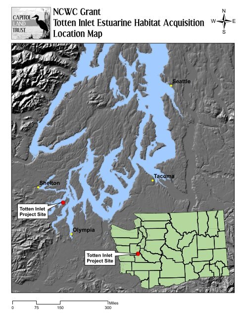
totten inlet location map ncwc
totten inlet location map ncwc
totten inlet location map ncwc

You also want an ePaper? Increase the reach of your titles
YUMPU automatically turns print PDFs into web optimized ePapers that Google loves.
!(<br />
Totten Inlet<br />
Project Site<br />
Shelton<br />
NCWC Grant<br />
Totten Inlet Estuarine Habitat Acquisition<br />
Location Map<br />
!(<br />
0 75 150<br />
Miles<br />
300<br />
!(<br />
Olympia<br />
Totten Inlet<br />
Project Site<br />
!(<br />
!(<br />
!(<br />
Tacoma<br />
Seattle<br />
/
Pacific Ocean<br />
NCWC Grant<br />
Totten Inlet Estuarine Habitat Acquisition<br />
Puget Sound Area Map<br />
Strait of Juan de Fuca<br />
Totten Inlet<br />
Project Site<br />
!(<br />
Puget Sound<br />
Region<br />
Olympia<br />
Seattle<br />
0 15 30<br />
Miles<br />
60
Map for approximate <strong>location</strong> information<br />
only. Map created by Capitol Land Trust<br />
with information from Thurston County.<br />
NCWC Grant<br />
Totten Inlet Estuarine Habitat Acquisition<br />
Project Site<br />
0 125 250<br />
Feet<br />
500
Mason County<br />
NCWC Grant<br />
Totten Inlet Estuarine Habitat Acquisition<br />
Nearby Conservation Areas<br />
Oakland Bay<br />
tu 101<br />
3<br />
Thurston County<br />
CLT In Progress<br />
Skookum Inlet<br />
Eld Inlet Conservation Easement<br />
NCWCG #C-49-L-1<br />
CLT Conserved Lands<br />
Squaxin Island Indian Reservation<br />
Natural Area Preserves, WA Dept of Natural Resources<br />
State, County, and City Parks<br />
Totten Inlet<br />
Twin Rivers Estuary Acquisition<br />
NCWCG #C-63-L-1<br />
Eld Inlet<br />
Hope<br />
Island<br />
Squaxin<br />
Current Project Site<br />
Budd Inlet<br />
Island<br />
Harstine<br />
Island<br />
Lower Eld Inlet Acquisition<br />
NCWCG #C-64-L-1<br />
Case Inlet<br />
/<br />
Pierce<br />
County<br />
0 1.25 2.5<br />
Miles<br />
5
NCWC Grant<br />
Totten Inlet Estuarine Habitat Acquisition<br />
Aerial view of the Project site, showing feeder bluffs, baymouth spit, upland forested wetlands,<br />
and pocket estuary. Adjacent tidelands, in the picture’s foreground, are owned and harvested by<br />
Taylor Shellfish Company. Photo from Washington Department of Ecology.<br />
The estuary at low tide.<br />
Forested shoreline and cobble beach.
NCWC Grant<br />
Totten Inlet Estuarine Habitat Acquisition<br />
Salt marsh and baymouth spit at the entrance<br />
of the estuary.<br />
The salt marsh and forested shoreline along<br />
the estuary.
NCWC Grant<br />
Totten Inlet Estuarine Habitat Acquisition<br />
Feeder bluffs and forested shoreline.<br />
Forested wetlands which drain into the<br />
estuary.<br />
Tributary stream flowing to the estuary.