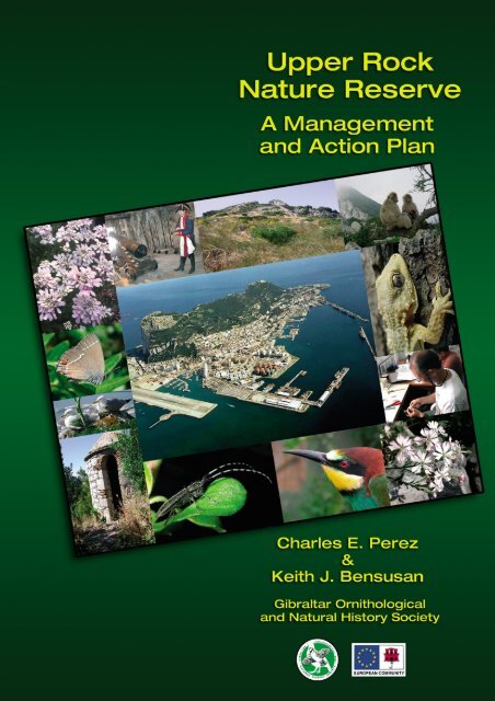
Upper Rock Nature Reserve: A Management and Action Plan
Upper Rock Nature Reserve: A Management and Action Plan
Upper Rock Nature Reserve: A Management and Action Plan

Create successful ePaper yourself
Turn your PDF publications into a flip-book with our unique Google optimized e-Paper software.
<strong>Upper</strong> <strong>Rock</strong><br />
<strong>Nature</strong> <strong>Reserve</strong>:<br />
A <strong>Management</strong><br />
<strong>and</strong> <strong>Action</strong> <strong>Plan</strong><br />
Charles E. Perez<br />
&<br />
Keith J. Bensusan<br />
Gibraltar Ornithological <strong>and</strong><br />
Natural History Society<br />
Produced for the<br />
Government of Gibraltar
Copyright © 2005 The Gibraltar Ornithological & Natural History Society<br />
Jews’ Gate, <strong>Upper</strong> <strong>Rock</strong> <strong>Nature</strong> <strong>Reserve</strong>, P.O. Box 843, Gibraltar<br />
Citation: Perez, C.E. & Bensusan, K. (2005) The <strong>Upper</strong> <strong>Rock</strong> <strong>Nature</strong> <strong>Reserve</strong>,<br />
A <strong>Management</strong> <strong>and</strong> <strong>Action</strong> <strong>Plan</strong>. The Gibraltar Ornithological & Natural History Society.<br />
Gibraltar.<br />
Published by the Gibraltar Ornithological & Natural History Society.<br />
Feasibility study <strong>and</strong> publication funded by the Government of Gibraltar generously assisted by<br />
the European Union under the European Regional Development Fund Objetive 2 Programme.<br />
Printed <strong>and</strong> bound by Roc-a-Graphics Ltd.<br />
Tuckey’s Lane, Gibraltar. Tel. +(350) 59755 - From Spain: (9567) 59755
Gibraltar Ornithological <strong>and</strong> Natural History Society - GONHS<br />
Contents<br />
Contents Foreword . . . . . . . . . . . . . . . . . . . . . . . . . . . . . . . . . . . . . . . . . . . .VI<br />
Acknowledgements . . . . . . . . . . . . . . . . . . . . . . . . . . . . . . . . . . . . . . . . . . . .VI<br />
1) Introduction . . . . . . . . . . . . . . . . . . . . . . . . . . . . . . . . . . . . . . . . . . . . .1<br />
1.1. The <strong>Upper</strong> <strong>Rock</strong> <strong>Nature</strong> <strong>Reserve</strong> . . . . . . . . . . . . . . . . . . . .3<br />
1.2. Research . . . . . . . . . . . . . . . . . . . . . . . . . . . . . . . . . . . . . .5<br />
2) GONHS & The <strong>Nature</strong> <strong>Reserve</strong> . . . . . . . . . . . . . . . . . . . . . . . . . . . . . . . . . . . . . . . . . .7<br />
2.1. Introduction . . . . . . . . . . . . . . . . . . . . . . . . . . . . . . . . . . . .9<br />
2.2. History . . . . . . . . . . . . . . . . . . . . . . . . . . . . . . . . . . . . . . .9<br />
2.3. Current Work . . . . . . . . . . . . . . . . . . . . . . . . . . . . . . . . . . .9<br />
2.4. The Future . . . . . . . . . . . . . . . . . . . . . . . . . . . . . . . . . . . .10<br />
3) Legislation . . . . . . . . . . . . . . . . . . . . . . . . . . . . . . . . . . . . . . . . . . . .11<br />
3.1. Administration . . . . . . . . . . . . . . . . . . . . . . . . . . . . . . . . .14<br />
3.2. Recommendations . . . . . . . . . . . . . . . . . . . . . . . . . . . . . .14<br />
3.3. Traffic . . . . . . . . . . . . . . . . . . . . . . . . . . . . . . . . . . . . . . . .15<br />
3.4. Recommendations . . . . . . . . . . . . . . . . . . . . . . . . . . . . . .17<br />
3.5. V<strong>and</strong>alism, Defacement <strong>and</strong> Litter . . . . . . . . . . . . . . . . . . .18<br />
3.6. Recommendations . . . . . . . . . . . . . . . . . . . . . . . . . . . . . .18<br />
3.7. Buildings <strong>and</strong> Structures . . . . . . . . . . . . . . . . . . . . . . . . . .19<br />
3.8. Recommendations . . . . . . . . . . . . . . . . . . . . . . . . . . . . . .19<br />
3.9. Wildlife Wardens . . . . . . . . . . . . . . . . . . . . . . . . . . . . . . .20<br />
3.10. Recommendations . . . . . . . . . . . . . . . . . . . . . . . . . . . . . .20<br />
3.11. Disturbance to Fauna . . . . . . . . . . . . . . . . . . . . . . . . . . . .21<br />
3.12. Recommendations . . . . . . . . . . . . . . . . . . . . . . . . . . . . . .22<br />
3.13. Introduced Fauna <strong>and</strong> Flora . . . . . . . . . . . . . . . . . . . . . . .22<br />
3.14. Recommendations . . . . . . . . . . . . . . . . . . . . . . . . . . . . . .25<br />
3.15. Poisons . . . . . . . . . . . . . . . . . . . . . . . . . . . . . . . . . . . . . .25<br />
3.16. Recommendations . . . . . . . . . . . . . . . . . . . . . . . . . . . . . .26<br />
3.17. ‘The Authority’ . . . . . . . . . . . . . . . . . . . . . . . . . . . . . . . . .27<br />
3.18. The Role of the Royal Gibraltar Police . . . . . . . . . . . . . . . .27<br />
3.19. Recommendations . . . . . . . . . . . . . . . . . . . . . . . . . . . . . .28<br />
4) European Wildlife Directives & the Convention on Biodiversity . . . . . . . . . . . . . . . . . .29<br />
4.1. Natura 2000 . . . . . . . . . . . . . . . . . . . . . . . . . . . . . . . . . . .31<br />
4.2. The Habitats Directive . . . . . . . . . . . . . . . . . . . . . . . . . . . .31<br />
4.3. The Gibraltar Habitats Directive Report . . . . . . . . . . . . . . .32<br />
4.4. Additional notes & comments . . . . . . . . . . . . . . . . . . . . .34<br />
4.5. The Natura 2000 network . . . . . . . . . . . . . . . . . . . . . . . .36<br />
4.6. Eurobat . . . . . . . . . . . . . . . . . . . . . . . . . . . . . . . . . . . . . .40<br />
4.7. The Biodiversity Convention . . . . . . . . . . . . . . . . . . . . . . .41<br />
5) The Face of the <strong>Upper</strong> <strong>Rock</strong> . . . . . . . . . . . . . . . . . . . . . . . . . . . . . . . . . . . . . . . . . .47<br />
5.1. Litter . . . . . . . . . . . . . . . . . . . . . . . . . . . . . . . . . . . . . . . .49<br />
5.2. Graffiti . . . . . . . . . . . . . . . . . . . . . . . . . . . . . . . . . . . . . . .50<br />
5.3. Roads . . . . . . . . . . . . . . . . . . . . . . . . . . . . . . . . . . . . . . .51<br />
5.4. Sewerage <strong>and</strong> Disused Pipes . . . . . . . . . . . . . . . . . . . . . .52<br />
5.5. Paths . . . . . . . . . . . . . . . . . . . . . . . . . . . . . . . . . . . . . . . .53<br />
5.6. Structures . . . . . . . . . . . . . . . . . . . . . . . . . . . . . . . . . . . .55<br />
5.7. Picnic Sites . . . . . . . . . . . . . . . . . . . . . . . . . . . . . . . . . . .57<br />
5.8. Recommendations . . . . . . . . . . . . . . . . . . . . . . . . . . . . . .58<br />
6) Geology & Caves . . . . . . . . . . . . . . . . . . . . . . . . . . . . . . . . . . . . . . . . . . . .61<br />
6.1. Geological Features . . . . . . . . . . . . . . . . . . . . . . . . . . . . .63<br />
6.2. Caves . . . . . . . . . . . . . . . . . . . . . . . . . . . . . . . . . . . . . . .64<br />
6.3. Threats to Cliffs . . . . . . . . . . . . . . . . . . . . . . . . . . . . . . . .71<br />
6.4. Threats to Caves . . . . . . . . . . . . . . . . . . . . . . . . . . . . . . .73<br />
6.5. GONHS . . . . . . . . . . . . . . . . . . . . . . . . . . . . . . . . . . . . . .73<br />
6.6. Recommendations . . . . . . . . . . . . . . . . . . . . . . . . . . . . . .74<br />
7) Heritage . . . . . . . . . . . . . . . . . . . . . . . . . . . . . . . . . . . . . . . . . . . .75<br />
7.1. Caves . . . . . . . . . . . . . . . . . . . . . . . . . . . . . . . . . . . . . . .77<br />
7.2. Moors . . . . . . . . . . . . . . . . . . . . . . . . . . . . . . . . . . . . . . .77<br />
7.3. Spaniards . . . . . . . . . . . . . . . . . . . . . . . . . . . . . . . . . . . .78<br />
7.4. British . . . . . . . . . . . . . . . . . . . . . . . . . . . . . . . . . . . . . . .78<br />
7.5. World War II . . . . . . . . . . . . . . . . . . . . . . . . . . . . . . . . . . .79<br />
7.6. Water Catchments . . . . . . . . . . . . . . . . . . . . . . . . . . . . . .80<br />
7.7. Recommendations . . . . . . . . . . . . . . . . . . . . . . . . . . . . . .80<br />
8) Introduced Flora . . . . . . . . . . . . . . . . . . . . . . . . . . . . . . . . . . . . . . . . . . . .85<br />
8.1. Senecio angulatus . . . . . . . . . . . . . . . . . . . . . . . . . . . . . .89<br />
8.2. Chasmanthe floribunda . . . . . . . . . . . . . . . . . . . . . . . . . . .91<br />
8.3. Lantana camara . . . . . . . . . . . . . . . . . . . . . . . . . . . . . . . .93<br />
8.4. Opuntia ficus-indica . . . . . . . . . . . . . . . . . . . . . . . . . . . . .94<br />
8.5. Carpobrotus acinaciformis . . . . . . . . . . . . . . . . . . . . . . . .95<br />
8.6. Oxalis pes-capre . . . . . . . . . . . . . . . . . . . . . . . . . . . . . . .97<br />
8.7. Ailanthus altissima . . . . . . . . . . . . . . . . . . . . . . . . . . . . . .99<br />
8.8. Tecoma capensis . . . . . . . . . . . . . . . . . . . . . . . . . . . . . .100<br />
8.9. Aloe arboresecens . . . . . . . . . . . . . . . . . . . . . . . . . . . . .101<br />
8.10. Agave americana . . . . . . . . . . . . . . . . . . . . . . . . . . . . . .102<br />
8.11. Problem Areas . . . . . . . . . . . . . . . . . . . . . . . . . . . . . . . .104<br />
8.12. Proposed list of Exotic <strong>Plan</strong>t Species that should<br />
not be grown within the <strong>Upper</strong> <strong>Rock</strong> <strong>Nature</strong> <strong>Reserve</strong> . . .106
Contents<br />
9) Pine Trees . . . . . . . . . . . . . . . . . . . . . . . . . . . . . . . . . . . . . . . . . . .107<br />
9.1. Introduction . . . . . . . . . . . . . . . . . . . . . . . . . . . . . . . . . .109<br />
9.2. Methods . . . . . . . . . . . . . . . . . . . . . . . . . . . . . . . . . . . . .111<br />
9.3. Results . . . . . . . . . . . . . . . . . . . . . . . . . . . . . . . . . . . . . .112<br />
9.4. Discussion . . . . . . . . . . . . . . . . . . . . . . . . . . . . . . . . . . .116<br />
10) Habitats . . . . . . . . . . . . . . . . . . . . . . . . . . . . . . . . . . . . . . . . . . .119<br />
10.1. Introduction . . . . . . . . . . . . . . . . . . . . . . . . . . . . . . . . . . .121<br />
10.2. Methods . . . . . . . . . . . . . . . . . . . . . . . . . . . . . . . . . . . .122<br />
10.3. Results . . . . . . . . . . . . . . . . . . . . . . . . . . . . . . . . . . . . . .124<br />
10.4. Discussion . . . . . . . . . . . . . . . . . . . . . . . . . . . . . . . . . . .129<br />
10.5. Recommendations . . . . . . . . . . . . . . . . . . . . . . . . . . . . .133<br />
11) Fire <strong>and</strong> Firebreaks . . . . . . . . . . . . . . . . . . . . . . . . . . . . . . . . . . . . . . . . . . .135<br />
11.1. Location of Firebreaks . . . . . . . . . . . . . . . . . . . . . . . . . .137<br />
11.2. Flora <strong>and</strong> Fauna of the Firebreaks . . . . . . . . . . . . . . . . . .138<br />
11.3. Fire <strong>and</strong> Firebreaks . . . . . . . . . . . . . . . . . . . . . . . . . . . . .139<br />
11.4. The Gibraltar City Fire Brigade <strong>and</strong><br />
the <strong>Upper</strong> <strong>Rock</strong> <strong>Nature</strong> <strong>Reserve</strong> . . . . . . . . . . . . . . . . . . .139<br />
11.5. <strong>Management</strong> of the Firebreaks . . . . . . . . . . . . . . . . . . . .140<br />
11.6. Clearing of the Firebreaks . . . . . . . . . . . . . . . . . . . . . . . .140<br />
11.7. Recommendations . . . . . . . . . . . . . . . . . . . . . . . . . . . . .141<br />
12) Birds . . . . . . . . . . . . . . . . . . . . . . . . . . . . . . . . . . . . . . . . . . .143<br />
12.1. Directives <strong>and</strong> Conventions . . . . . . . . . . . . . . . . . . . . . . .145<br />
12.2. How are these applied in the<br />
<strong>Upper</strong> <strong>Rock</strong> <strong>Nature</strong> <strong>Reserve</strong>? . . . . . . . . . . . . . . . . . . . . .146<br />
12.3. International Importance of Gibraltar for Birds . . . . . . . . .146<br />
12.4. Migrants . . . . . . . . . . . . . . . . . . . . . . . . . . . . . . . . . . . . .146<br />
12.5. Breeding Birds . . . . . . . . . . . . . . . . . . . . . . . . . . . . . . . .151<br />
12.6. Recommendations . . . . . . . . . . . . . . . . . . . . . . . . . . . . .153<br />
13) Mammals . . . . . . . . . . . . . . . . . . . . . . . . . . . . . . . . . . . . . . . . . . .155<br />
13.1. Mammal Reintroductions . . . . . . . . . . . . . . . . . . . . . . . .159<br />
13.2. Recommendations . . . . . . . . . . . . . . . . . . . . . . . . . . . . .160<br />
14) Barbary Macaques . . . . . . . . . . . . . . . . . . . . . . . . . . . . . . . . . . . . . . . . . . .163<br />
14.1. Documentation & Research . . . . . . . . . . . . . . . . . . . . . .165<br />
14.2. Feeding . . . . . . . . . . . . . . . . . . . . . . . . . . . . . . . . . . . . .166<br />
14.3. Illegal Feeding . . . . . . . . . . . . . . . . . . . . . . . . . . . . . . . .168<br />
14.4. Population Control . . . . . . . . . . . . . . . . . . . . . . . . . . . . .169<br />
14.5. Routine <strong>Management</strong> . . . . . . . . . . . . . . . . . . . . . . . . . . .171<br />
14.6. Other Recommendations . . . . . . . . . . . . . . . . . . . . . . . .173<br />
15) The Yellow-legged Gull . . . . . . . . . . . . . . . . . . . . . . . . . . . . . . . . . . . . . . . . . . .175<br />
15.1. History . . . . . . . . . . . . . . . . . . . . . . . . . . . . . . . . . . . . . .177<br />
15.2. Control . . . . . . . . . . . . . . . . . . . . . . . . . . . . . . . . . . . . . .177<br />
15.3. Discussion . . . . . . . . . . . . . . . . . . . . . . . . . . . . . . . . . . .179<br />
15.4. Recommendations . . . . . . . . . . . . . . . . . . . . . . . . . . . . .179<br />
16) The Lower Slopes . . . . . . . . . . . . . . . . . . . . . . . . . . . . . . . . . . . . . . . . . . .181<br />
16.1. Orchids . . . . . . . . . . . . . . . . . . . . . . . . . . . . . . . . . . . . .183<br />
16.2. Fauna of the Lower Slopes . . . . . . . . . . . . . . . . . . . . . . .185<br />
16.3. Habitat Succession on the Lower Slopes . . . . . . . . . . . . .185<br />
16.4. Other Threats . . . . . . . . . . . . . . . . . . . . . . . . . . . . . . . . .186<br />
16.5. Recommendations . . . . . . . . . . . . . . . . . . . . . . . . . . . . .186<br />
17) Research on the <strong>Upper</strong> <strong>Rock</strong> . . . . . . . . . . . . . . . . . . . . . . . . . . . . . . . . . . . . . . . . .187<br />
17.1. Research . . . . . . . . . . . . . . . . . . . . . . . . . . . . . . . . . . . .189<br />
17.2. Biological <strong>Reserve</strong> . . . . . . . . . . . . . . . . . . . . . . . . . . . . .189<br />
17.3. Monitoring . . . . . . . . . . . . . . . . . . . . . . . . . . . . . . . . . . .190<br />
17.4. Field Courses . . . . . . . . . . . . . . . . . . . . . . . . . . . . . . . . .190<br />
17.5. Bird Ringing . . . . . . . . . . . . . . . . . . . . . . . . . . . . . . . . . .192<br />
17.6. Macaques . . . . . . . . . . . . . . . . . . . . . . . . . . . . . . . . . . .193<br />
17.7. Archaeology . . . . . . . . . . . . . . . . . . . . . . . . . . . . . . . . . .194<br />
17.8. Others . . . . . . . . . . . . . . . . . . . . . . . . . . . . . . . . . . . . . .194<br />
17.9. The Future… . . . . . . . . . . . . . . . . . . . . . . . . . . . . . . . . . .194<br />
17.10. Recommendations . . . . . . . . . . . . . . . . . . . . . . . . . . . . .195<br />
18) MOD sites . . . . . . . . . . . . . . . . . . . . . . . . . . . . . . . . . . . . . . . . . . .197<br />
18.1. <strong>Rock</strong> Gun <strong>and</strong> Middle Hill . . . . . . . . . . . . . . . . . . . . . . . .200<br />
18.2. Aerial Farm <strong>and</strong> Firebreaks . . . . . . . . . . . . . . . . . . . . . .202<br />
18.3. Spyglass . . . . . . . . . . . . . . . . . . . . . . . . . . . . . . . . . . . .202<br />
18.4. Ince’s Farm Residential Area . . . . . . . . . . . . . . . . . . . . .202<br />
19) Parque Natural Breña y Marismas del Barbate: a Case Study . . . . . . . . . . . . . . . .203<br />
19.1. The Breña <strong>Reserve</strong> . . . . . . . . . . . . . . . . . . . . . . . . . . . .206<br />
19.2. Flora <strong>and</strong> Fauna . . . . . . . . . . . . . . . . . . . . . . . . . . . . . . .207<br />
19.3. General <strong>Management</strong> . . . . . . . . . . . . . . . . . . . . . . . . . . .207<br />
19.4. Environmental <strong>Management</strong> . . . . . . . . . . . . . . . . . . . . . .208<br />
19.5. Economic Interests . . . . . . . . . . . . . . . . . . . . . . . . . . . .209<br />
19.6. Visitor Provisions . . . . . . . . . . . . . . . . . . . . . . . . . . . . . .209<br />
<strong>Upper</strong> <strong>Rock</strong> <strong>Nature</strong> <strong>Reserve</strong>: A <strong>Management</strong> <strong>and</strong> <strong>Action</strong> <strong>Plan</strong>
Gibraltar Ornithological <strong>and</strong> Natural History Society - GONHS<br />
Contents<br />
19.7. Urbanisation Pressures . . . . . . . . . . . . . . . . . . . . . . . . . .210<br />
19.8. Comparisons . . . . . . . . . . . . . . . . . . . . . . . . . . . . . . . . .210<br />
20) Tourist Sites . . . . . . . . . . . . . . . . . . . . . . . . . . . . . . . . . . . . . . . . . . .213<br />
20.1. Access . . . . . . . . . . . . . . . . . . . . . . . . . . . . . . . . . . . . . .215<br />
20.2. Jews Gate . . . . . . . . . . . . . . . . . . . . . . . . . . . . . . . . . . .215<br />
20.3. St. Michael’s Cave . . . . . . . . . . . . . . . . . . . . . . . . . . . . .218<br />
20.4. Ape’s Den . . . . . . . . . . . . . . . . . . . . . . . . . . . . . . . . . . .219<br />
20.5. <strong>Upper</strong> Galleries . . . . . . . . . . . . . . . . . . . . . . . . . . . . . . .220<br />
20.6. Princess Caroline’s Battery . . . . . . . . . . . . . . . . . . . . . . .222<br />
20.7. City Under Siege . . . . . . . . . . . . . . . . . . . . . . . . . . . . . .222<br />
20.8. The Moorish Castle . . . . . . . . . . . . . . . . . . . . . . . . . . . .223<br />
20.9. Cable Car Top Station . . . . . . . . . . . . . . . . . . . . . . . . . .223<br />
20.10.Recommendations . . . . . . . . . . . . . . . . . . . . . . . . . . . . .224<br />
21) Transport, Traffic & Tourism . . . . . . . . . . . . . . . . . . . . . . . . . . . . . . . . . . . . . . . . .227<br />
21.1. Roads . . . . . . . . . . . . . . . . . . . . . . . . . . . . . . . . . . . . . .229<br />
21.2. Access . . . . . . . . . . . . . . . . . . . . . . . . . . . . . . . . . . . . .232<br />
21.3. Recommendations . . . . . . . . . . . . . . . . . . . . . . . . . . . . .233<br />
21.4. Tourism . . . . . . . . . . . . . . . . . . . . . . . . . . . . . . . . . . . . .233<br />
21.5. Revenue . . . . . . . . . . . . . . . . . . . . . . . . . . . . . . . . . . . .237<br />
21.6. Recommendations . . . . . . . . . . . . . . . . . . . . . . . . . . . . .238<br />
21.7. Vehicles Survey . . . . . . . . . . . . . . . . . . . . . . . . . . . . . . .239<br />
21.8. The Proposed Funicular Project . . . . . . . . . . . . . . . . . . .247<br />
21.9. Recommendations . . . . . . . . . . . . . . . . . . . . . . . . . . . . .249<br />
22) Opportunities . . . . . . . . . . . . . . . . . . . . . . . . . . . . . . . . . . . . . . . . . . .251<br />
22.1. Overseas Territories Environment Programme . . . . . . . .253<br />
22.2. The EUROPARC Federation . . . . . . . . . . . . . . . . . . . . . .255<br />
22.3. The Charter . . . . . . . . . . . . . . . . . . . . . . . . . . . . . . . . . .257<br />
22.4. Recommendations . . . . . . . . . . . . . . . . . . . . . . . . . . . . .258<br />
23) <strong>Management</strong> <strong>Plan</strong> . . . . . . . . . . . . . . . . . . . . . . . . . . . . . . . . . . . . . . . . . . .261<br />
23.1. Structure . . . . . . . . . . . . . . . . . . . . . . . . . . . . . . . . . . . .263<br />
23.2. Proposed <strong>Plan</strong> Implementation . . . . . . . . . . . . . . . . . . . .263<br />
23.3. Proposal 1 . . . . . . . . . . . . . . . . . . . . . . . . . . . . . . . . . . .264<br />
23.4. Proposal 2 . . . . . . . . . . . . . . . . . . . . . . . . . . . . . . . . . . .264<br />
23.5. Division of Responsibility . . . . . . . . . . . . . . . . . . . . . . . .265<br />
23.6. Implementation Methods . . . . . . . . . . . . . . . . . . . . . . . .265<br />
23.7. Principles . . . . . . . . . . . . . . . . . . . . . . . . . . . . . . . . . . . .266<br />
23.8. Goals <strong>and</strong> Objectives . . . . . . . . . . . . . . . . . . . . . . . . . . .247<br />
24) <strong>Action</strong> <strong>Plan</strong> . . . . . . . . . . . . . . . . . . . . . . . . . . . . . . . . . . . . . . . . . . .273<br />
1. Legislation . . . . . . . . . . . . . . . . . . . . . . . . . . . . . . . . . . .275<br />
2. The Face of the <strong>Upper</strong> <strong>Rock</strong> <strong>Nature</strong> <strong>Reserve</strong> . . . . . . . . .276<br />
3. Transport, Traffic & Tourism . . . . . . . . . . . . . . . . . . . . . .277<br />
4. Introduced Flora . . . . . . . . . . . . . . . . . . . . . . . . . . . . . . .277<br />
5. Fire & Firebreaks . . . . . . . . . . . . . . . . . . . . . . . . . . . . . .278<br />
6. Heritage . . . . . . . . . . . . . . . . . . . . . . . . . . . . . . . . . . . .278<br />
7. Mammals . . . . . . . . . . . . . . . . . . . . . . . . . . . . . . . . . . . .278<br />
8. Birds . . . . . . . . . . . . . . . . . . . . . . . . . . . . . . . . . . . . . . .279<br />
9. Habitats . . . . . . . . . . . . . . . . . . . . . . . . . . . . . . . . . . . . .279<br />
10. Research <strong>and</strong> Monitoring . . . . . . . . . . . . . . . . . . . . . . . .279<br />
11. Tourist Sites . . . . . . . . . . . . . . . . . . . . . . . . . . . . . . . . . .279<br />
12. Pine Trees . . . . . . . . . . . . . . . . . . . . . . . . . . . . . . . . . . .281<br />
13. Geology & Caves . . . . . . . . . . . . . . . . . . . . . . . . . . . . . .281<br />
14. Lower Slopes . . . . . . . . . . . . . . . . . . . . . . . . . . . . . . . . .281<br />
15. European Wildlife Directives . . . . . . . . . . . . . . . . . . . . . .281<br />
16. Barbary Macaques . . . . . . . . . . . . . . . . . . . . . . . . . . . . .282<br />
17. Works Programme for 9.1 . . . . . . . . . . . . . . . . . . . . . . .282<br />
Appendix 1: Species Lists . . . . . . . . . . . . . . . . . . . . . . . . . . . . . . . . . . . . . . . . . . .285<br />
2.1. Vascular <strong>Plan</strong>ts . . . . . . . . . . . . . . . . . . . . . . . . . . . . . . .285<br />
2.2. Birds . . . . . . . . . . . . . . . . . . . . . . . . . . . . . . . . . . . . . . .288<br />
2.3. Mammals . . . . . . . . . . . . . . . . . . . . . . . . . . . . . . . . . . .289<br />
2.4. Reptiles & Amphibians . . . . . . . . . . . . . . . . . . . . . . . . . .289<br />
2.5. Beetles (Coleoptera) . . . . . . . . . . . . . . . . . . . . . . . . . . .290<br />
2.6. Butterflies & Moths (Lepidoptera) . . . . . . . . . . . . . . . . . .290<br />
2.7. Dragonflies & Damselflies (Odonata) . . . . . . . . . . . . . . . .292<br />
2.8. Isopods . . . . . . . . . . . . . . . . . . . . . . . . . . . . . . . . . . . . .292<br />
2.9. Molluscs . . . . . . . . . . . . . . . . . . . . . . . . . . . . . . . . . . . .292<br />
Appendix 2: V<strong>and</strong>alism Litter & Defacement Photographs . . . . . . . . . . . . . . . . . . . . . .295
Foreword<br />
The <strong>Upper</strong> <strong>Rock</strong> has seen many changes, even in recent<br />
decades. As a schoolboy, a young birdwatcher <strong>and</strong> a Scout I used to<br />
w<strong>and</strong>er through lonely roads <strong>and</strong> paths across areas of low vegetation,<br />
not ever chancing on a stray cat, <strong>and</strong> certainly never experiencing<br />
a traffic jam, <strong>and</strong> I used to assume, as one does at that age, that<br />
things would never change. The <strong>Upper</strong> <strong>Rock</strong> was busy in those days<br />
of a closed frontier, when many Gibraltarians would visit “el monte” for<br />
a stroll or a picnic at weekends. But other than that, it was for the<br />
wildlife – <strong>and</strong> for a dedicated few.<br />
Times moved on, <strong>and</strong> with an open frontier <strong>and</strong> increasing tourism,<br />
with growing vegetation <strong>and</strong> the encouraging of exotic species of animals<br />
<strong>and</strong> plants, as well as an ever-increasing amount of litter, the<br />
<strong>Upper</strong> <strong>Rock</strong> is no longer the quiet place it once was.<br />
As urban areas in Gibraltar become more densely populated, as<br />
bits of open ground get converted into buildings, as even its quiet<br />
heights of wilderness are threatened by Mickey Mouse ideas, the<br />
importance of the <strong>Upper</strong> <strong>Rock</strong> to Gibraltar has increased. As we<br />
acquire more <strong>and</strong> more knowledge about its natural inhabitants our<br />
concern for their survival also increases, <strong>and</strong> our realisation that we<br />
can do something about it becomes all the stronger. And so does our<br />
responsibility as a mature Community to protect the natural riches in<br />
our custody.<br />
Tourists abound on the <strong>Upper</strong> <strong>Rock</strong>, <strong>and</strong> often complain about it.<br />
Locally, individuals <strong>and</strong> organisations periodically raise the issue, but<br />
then all goes quiet. In 2002, following another spate of negative comments<br />
in the press, GONHS considered the possibility of initiating a campaign<br />
to improve the <strong>Upper</strong> <strong>Rock</strong>, based on its already extensive knowledge<br />
of the area. But the opportunity afforded by the possibility of<br />
European Union Funds for a study of the feasibility of managing the area<br />
for all its users, but consistent with the protection <strong>and</strong> enhancement of<br />
nature, was not one to be missed. With the support of the then Minister<br />
for the Environment, the Hon E M Britto, <strong>and</strong> after reassuring all parties<br />
that our work would be a scientific, factual one with the aim of asking the<br />
right questions <strong>and</strong> providing fair answers, we embarked on this project.<br />
Acknowledgements<br />
The authors would like to thank all the persons that assisted us<br />
with information <strong>and</strong> provided interviews. These were:<br />
• Major Derek Bathgate, L<strong>and</strong> Operations; Ministry Of Defence<br />
• Mr Joe Desoiza, Chairman; Gibraltar Heritage Trust<br />
• P.C. Andrew Fortuna, Wildlife Liaison Officer;<br />
Royal Gibraltar Police<br />
• Mr Tony Almeida, Divisional Officer; Gibraltar City Fire Brigade<br />
• Dr William Kunin; Senior Lecturer in Ecology at the University<br />
of Leeds<br />
• Mr Peter Canessa, Chief Executive; Gibraltar Tourist Board<br />
• Mr Paul Origo, Town <strong>Plan</strong>ner; Dept. of Trade, Industry &<br />
Communications<br />
• Mr Aurelio Falero, Director; L<strong>and</strong> Property Services<br />
• Mr John Gaggero <strong>and</strong> Mr George Gaggero; Directors,<br />
M.H. Bl<strong>and</strong> Ltd.<br />
• Mr Brian Bagu, Highways Engineer; Support Services<br />
Department<br />
• Mr Carl Viagas, Conservation Officer; Heritage <strong>and</strong> <strong>Plan</strong>ning<br />
Division<br />
• Mr J. Delgado, Chief Environmental Officer, <strong>and</strong> Mr Francis<br />
Martin, Senior Environmental Officer; Environmental Agency Ltd<br />
• Prof. Clive Finlayson, Director <strong>and</strong> Dr Darren Fa; The Gibraltar<br />
Museum<br />
• Ms Janet Howitt <strong>and</strong> Mr Moses Benrimoj; Environmental Safety<br />
Group<br />
• Mr Clive Zammit, President, Mr Thomas Vella, Secretary <strong>and</strong><br />
Mr Alfred Roman, Treasurer; Gibraltar Taxi Association<br />
- VI -<br />
Acknowledgements<br />
We were lucky to be able to count on the services of two dedicated<br />
<strong>and</strong> extremely knowledgeable people, longst<strong>and</strong>ing members of<br />
GONHS, Charles Perez <strong>and</strong> Keith Bensusan, whose work primarily<br />
this is. Their enthusiasm, energy <strong>and</strong> thoroughly likeable personalities<br />
have all contributed in equal measure with their sound scientific discipline<br />
to producing a fine piece of work.<br />
A management plan, an action plan, <strong>and</strong> an assessment of the<br />
feasibility of these, provide more than just a nice report. They provide<br />
an essential tool for facilitating improvement, <strong>and</strong> this document<br />
already fulfils much of what would be required of Gibraltar as a World<br />
Heritage Site, a Natura 2000 site, or even as part of the Strait of<br />
Gibraltar Biosphere <strong>Reserve</strong> of the future.<br />
We acknowledge the confidence shown in us by the Government<br />
of Gibraltar in supporting the production of this report, despite the<br />
problems that implementing some of the recommendations may present.<br />
We acknowledge also that progress may be slow. But knowing in<br />
detail what the problems are is always the first step to resolving them.<br />
It is clear, <strong>and</strong> important to underst<strong>and</strong>, that as a result of this document,<br />
we now know a great deal more about what makes up the <strong>Upper</strong><br />
<strong>Rock</strong> <strong>and</strong> about what can be done to improve it.<br />
We present it to the Government of Gibraltar with a commitment to<br />
co-operate in whatever way we can in implementing the recommendations<br />
which it is their prerogative to accept. But the proper management<br />
of the <strong>Upper</strong> <strong>Rock</strong> as a resource for Gibraltar <strong>and</strong> a reserve<br />
for nature depends on all its users having a long term vision <strong>and</strong> being<br />
willing to work towards it.<br />
GONHS will continue to work with all interested parties in providing<br />
a nature reserve that is an asset useful to all, but abused by none.<br />
John E. Cortes<br />
MBE, JP, D. Phil, C.Biol, M.I.Biol, MIEEM, FLS<br />
General Secretary<br />
The Gibraltar Ornithological & Natural History Society<br />
January 2005<br />
Thanks are also due to Mr Leslie Linares for the invaluable contribution<br />
of his knowledge of the botany of the <strong>Upper</strong> <strong>Rock</strong> <strong>and</strong> for kindly<br />
providing a number of his photographs, to Mr Jason Easter for providing<br />
a provisional list of Isopods, to Mr Alex Menez for providing a list<br />
of Molluscs, <strong>and</strong> to Mr Eric Shaw, Mr Damien Holmes <strong>and</strong> Mr Dale<br />
Laguea for facilitating access to Barbary macaque data.<br />
The authors would like to thank the extensive contribution made<br />
by Dr J.E. Cortes from GONHS in Chapter 4 on ‘European Directives’,<br />
particularly in the preparation of habitat types. Dr Cortes has been<br />
instrumental in the preparation <strong>and</strong> research of Gibraltar’s administrative<br />
obligations with regard to our natural environment, in the Natura<br />
2000 <strong>and</strong> Habitats Directive for submission to the European Union.<br />
In addition, special thanks are due to Mr Paul Rocca, Mr Roger<br />
Rutherford, Mr Michael Wahnon <strong>and</strong> Mr Julien Martinez who, by helping<br />
us cover parts of our vehicles survey, endured many long hours of<br />
counting. We are also grateful to Ms Lorna Swift of the Garrison<br />
Library for her tireless help retrieving all the material we required.<br />
Special thanks goes to Wildlife Gibraltar who furnished us with an<br />
office <strong>and</strong> equipment within the Alameda Gardens from which we<br />
worked.<br />
Finally the authors would like to express their gratitude to Dr John<br />
Cortes, Mr Eric Shaw <strong>and</strong> Mr Brian Gomila for their useful comments<br />
on the manuscript.<br />
Distribution maps were produced using ‘DMAP for Windows’ version<br />
7.1f by Alan Morton.<br />
The work involved in the production of this report was funded<br />
under the European Union Structural Funds Objective 2 Programme<br />
by the European Union <strong>and</strong> the Government of Gibraltar. Special<br />
thanks are due to Mr Francis Sheriff of the Ministry for Trade, Industry<br />
<strong>and</strong> Communications for his help <strong>and</strong> advice in accessing these funds.<br />
<strong>Upper</strong> <strong>Rock</strong> <strong>Nature</strong> <strong>Reserve</strong>: A <strong>Management</strong> <strong>and</strong> <strong>Action</strong> <strong>Plan</strong>
1. Introduction
1. Introduction<br />
Gibraltar Ornithological <strong>and</strong> Natural History Society - GONHS<br />
Introduction<br />
1.1 The <strong>Upper</strong> <strong>Rock</strong> <strong>Nature</strong> <strong>Reserve</strong><br />
The <strong>Upper</strong> <strong>Rock</strong> has undergone several transformations in its habitats <strong>and</strong><br />
uses. Habitats have ranged from a once (presumably) forested l<strong>and</strong>scape to a<br />
totally denuded slope during the Great Siege, to a succession of vegetation back<br />
to dense maquis with scattered patches of garrigue <strong>and</strong> pseudosteppe in recent<br />
times. In earlier days, goats <strong>and</strong> some cattle grazed the slopes, trees were felled<br />
for fuel, <strong>and</strong> the military installed batteries on the higher reaches of the northern<br />
part of the <strong>Rock</strong> for the protection of the fortress. The <strong>Upper</strong> <strong>Rock</strong> continued to<br />
play a mainly military role until well into the 20 th Century. More recently, the<br />
emphasis has changed to that of a <strong>Nature</strong> <strong>Reserve</strong> <strong>and</strong>, most noticeably, a tourist<br />
attraction.<br />
During the early part of the 20 th century the <strong>Upper</strong> <strong>Rock</strong> was reinforced <strong>and</strong><br />
more gun batteries <strong>and</strong> military installations were constructed, especially on the<br />
advent of WWII. The area became a total exclusion zone to the resident population,<br />
<strong>and</strong> an ‘unclimbable fence’ was erected. Soon after the war the area was<br />
again opened to the public, but only during daylight hours. The area was controlled<br />
by the ‘Security Police’, (now the Gibraltar Services Police), <strong>and</strong> firebreak<br />
<strong>and</strong> vegetation maintenance on the lower slopes <strong>and</strong> <strong>Upper</strong> <strong>Rock</strong> was carried out<br />
by the MOD.<br />
In the mid to late 1900’s most of the <strong>Upper</strong> <strong>Rock</strong> was ceded to the Gibraltar<br />
Government, with the MOD retaining control of Middle Hill, <strong>Rock</strong> Gun, Spyglass<br />
<strong>and</strong>, significantly, the Barbary macaques. St. Michael’s cave <strong>and</strong> the <strong>Upper</strong><br />
Galleries where the first two sites to be developed for tourism, but the macaques<br />
quickly became (<strong>and</strong> still remain) the most important attraction enticing tourists to<br />
Gibraltar. The macaques continued under the responsibility of the military under<br />
the Gibraltar Regiment until 1990, when ‘MEDAMBIOS’, a company run by<br />
macaque expert Dr John Fa, took over for the following two years under contract<br />
to the Gibraltar Tourism Agency Ltd.<br />
In the meantime, the Gibraltar Ornithological <strong>and</strong> Natural History Society<br />
(GONHS) was striving for a more conservation-oriented policy for the natural habitats<br />
in Gibraltar. Some keen conservationists (many of whom were founder members<br />
of GONHS) published ‘Environmental Conservation in Gibraltar’ <strong>and</strong> the first<br />
basis of a management plan for Gibraltar’s natural environment was drawn up as<br />
early as 1978 by Dr John Cortes in his document ‘Conservation – A Future? Seminatural<br />
nature reserve GIBRALTAR: A management <strong>Plan</strong>’ (Cortes 1978). These<br />
were the first steps towards an awareness campaign aimed at the authorities.<br />
Cortes (1978) analysed the problems <strong>and</strong> provided solutions, noting that the Town<br />
<strong>and</strong> City <strong>Plan</strong> of 1976 recognised the need for conservation. Very little heed was<br />
paid to this. These documents are unfortunately probably gathering dust in the<br />
Government’s archives.<br />
Eventually, the Government of Gibraltar Recognised that it had to take steps in<br />
conserving the <strong>Rock</strong>’s Natural Heritage. The GONHS was instrumental in drafting<br />
the ‘<strong>Nature</strong> Protection Ordinance, 1991’ (L/N11 1991), which affords protection to<br />
numerous species <strong>and</strong> provides for the protection of habitats. This ordinance was<br />
based on the United Kingdom’s legislation on wildlife, <strong>and</strong> was amended <strong>and</strong><br />
improved to suit Gibraltar’s needs <strong>and</strong> peculiarities.<br />
In 1992 ‘Sights <strong>Management</strong> Ltd.’ was given a management contract that<br />
included the tourist sites <strong>and</strong> the Barbary macaques, <strong>and</strong> overall responsibility for<br />
the <strong>Upper</strong> <strong>Rock</strong>. The ‘<strong>Nature</strong> Conservation Area (<strong>Upper</strong> <strong>Rock</strong>) Designation Order,<br />
1993’ (L/N 51 of 1993) was drafted in 1993 when the <strong>Upper</strong> <strong>Rock</strong> was designated<br />
a <strong>Nature</strong> <strong>Reserve</strong>, <strong>and</strong> was published as a regulation as provided by the ‘<strong>Nature</strong><br />
Protection Ordinance, 1991’. A map of the area designated as a <strong>Nature</strong> <strong>Reserve</strong><br />
by the Designation Order can be seen in Fig. 1. As a result entrance fees to the<br />
<strong>Upper</strong> <strong>Rock</strong> were now collected, which included entry to all sites. A concerted<br />
effort, presumably using gate monies, was made to improve sites, <strong>and</strong> roadsides<br />
were cleaned <strong>and</strong> firebreaks cleared on a regular basis. This arrangement continued<br />
until 1997 when the Gibraltar Tourist Board ended the contract <strong>and</strong> took over<br />
responsibility for the management of the <strong>Upper</strong> <strong>Rock</strong> <strong>Nature</strong> <strong>Reserve</strong>. The feeding<br />
<strong>and</strong> watering for the Barbary macaques was contracted to GONHS in 1999.<br />
- 3 -
- 4 -<br />
Figure 1. Outline map of Gibraltar with the boundary of<br />
the <strong>Upper</strong> <strong>Rock</strong> <strong>Nature</strong> <strong>Reserve</strong> in blue.<br />
Introduction<br />
During this period, the Gibraltar Tourist Board invested very little time <strong>and</strong> money towards<br />
improving the condition <strong>and</strong> appearance to many of their sites, except for a lighting facility for<br />
the cave costing close to £750,000. The natural environment was totally disregarded,<br />
despite regular increases in the entrance fees with the audacious inclusion of an environmental<br />
levy, from which the environment never benefited. Adverse publicity in the press<br />
prompted the authorities to contract Master Services to clean the <strong>Upper</strong> <strong>Rock</strong>, but contractual<br />
constraints have limited this to a face-saving exercise, clearing only roadsides that are<br />
visible to visitors, <strong>and</strong> only recently cliff areas.<br />
Uncontrolled entry into the <strong>Reserve</strong> at night, v<strong>and</strong>alism, graffiti <strong>and</strong> refuse depositions are<br />
just a few of the immense problems facing the existence of the <strong>Upper</strong> <strong>Rock</strong> as a <strong>Nature</strong><br />
<strong>Reserve</strong>. Added to this is a lack of regular maintenance of sites, footpaths, firebreaks <strong>and</strong><br />
roadways, which together with insufficient sanitation facilities compound the problem. At<br />
least some of these problems, those relating to nature conservation, would have been solved<br />
if many of the European Directives on nature protection <strong>and</strong> the environment had been implemented,<br />
<strong>and</strong> especially if the <strong>Nature</strong> Protection Ordinance were enforced rigidly.<br />
These concerns prompted one of the authors, Charles Perez, to write a report entitled<br />
‘The <strong>Upper</strong> <strong>Rock</strong> <strong>Nature</strong> <strong>Reserve</strong>. An Environmental Impact Assessment Report 2002’<br />
(Perez 2002), dated 15 th March 2002, on the state of the <strong>Upper</strong> <strong>Rock</strong> <strong>Nature</strong> <strong>Reserve</strong>.<br />
Copies were submitted to the Chief Minister <strong>and</strong> to the Ministers for the Environment <strong>and</strong><br />
Tourism. The report was acknowledged, but very little action was taken on the many issues<br />
that had been put forward. As the deterioration of the <strong>Nature</strong> <strong>Reserve</strong> continued during the<br />
summer months of that year, numerous letters of complaint appeared in the press <strong>and</strong> several<br />
articles appeared in the Gibraltar Chronicle, highlighting the problems. These came<br />
from, amongst others, opposition parties who had been approached by concerned citizens<br />
<strong>and</strong> significantly from the Taxi Association, who carried out a cleaning campaign spurred on<br />
by the negative response they got from their clients, the tourists themselves.<br />
<strong>Upper</strong> <strong>Rock</strong> <strong>Nature</strong> <strong>Reserve</strong>: A <strong>Management</strong> <strong>and</strong> <strong>Action</strong> <strong>Plan</strong>
1.2 Research<br />
1 <strong>Nature</strong> Protection Ordinance, 1991<br />
(Amendment) Regulation, 1995<br />
Gibraltar Ornithological <strong>and</strong> Natural History Society - GONHS<br />
Introduction<br />
The GONHS took a passive st<strong>and</strong> <strong>and</strong> observed how the situation evolved, taking note<br />
of the developments. The GONHS could have backed <strong>and</strong> substantiated the numerous,<br />
often totally justified criticisms <strong>and</strong> accusations, <strong>and</strong> even exp<strong>and</strong>ed on these. However, it<br />
decided to adopt this stance with a view to looking at constructive ways to approach the situation.<br />
The consensus was to produce a feasibility study <strong>and</strong> management plan, not only on<br />
environmental matters but also on all factors affecting the well being of the <strong>Upper</strong> <strong>Rock</strong><br />
<strong>Nature</strong> <strong>Reserve</strong>, as all of these have a direct bearing on the sustainable development of the<br />
<strong>Upper</strong> <strong>Rock</strong> as a <strong>Nature</strong> <strong>Reserve</strong>. Success in obtaining European funding was crucial in<br />
instigating this report, <strong>and</strong> research on the same commenced at the beginning of 2003.<br />
When the Government of Gibraltar resumed responsibility for the <strong>Reserve</strong>, very little<br />
money was re-invested into the product. This resulted in an intensification <strong>and</strong> accumulation<br />
of the many problems that one can read about in this report. It is therefore unwise that the<br />
Government of Gibraltar maintains this status without recognising how vitally important it is<br />
to regularly maintain all aspects of the <strong>Nature</strong> <strong>Reserve</strong>. We argue that there should be a concerted<br />
effort to re-invest the profits of the gate money of the <strong>Upper</strong> <strong>Rock</strong>. This <strong>Management</strong><br />
<strong>Plan</strong>, therefore, specifically tackles all areas of concern within the <strong>Upper</strong> <strong>Rock</strong>, many of<br />
which are particularly important <strong>and</strong> have a direct bearing on the sustainable interests <strong>and</strong><br />
development of the <strong>Nature</strong> <strong>Reserve</strong>. It focuses particularly on the natural environment,<br />
which has been totally neglected by management, but also on other sectors of socio-economic<br />
interests, which would complement the running <strong>and</strong> well being of the <strong>Reserve</strong>.<br />
This plan will need the implementation of the requirements of the numerous European<br />
Directives <strong>and</strong> Conventions on wildlife <strong>and</strong> heritage conservation, such as the Bern<br />
Convention, Bonn Convention, the Biodiversity Convention, the World Heritage Convention,<br />
the EC Birds Directive <strong>and</strong> the EC Habitats Directive. Some of the requirements were transposed<br />
into Gibraltar law 1 , but implementation <strong>and</strong> designation of sites is still awaited. Even<br />
implementation alone is insufficient without the enforcement of the ‘<strong>Nature</strong> Protection<br />
Ordinance, 1991’ law <strong>and</strong> its subsequent amendments.<br />
In elaborating this plan we have adopted an open minded approach in considering the<br />
requirements, fundamentally for the survival of the <strong>Upper</strong> <strong>Rock</strong> as a <strong>Nature</strong> <strong>Reserve</strong>, but<br />
also including socio-economic interests within the reserve, which ultimately will provide the<br />
means for the maintenance <strong>and</strong> development of the area as a whole. Taking this<br />
approach, we identified all departments, agencies <strong>and</strong> other bodies that had vested interests<br />
or participated in any way in the use, control, maintenance or development of the<br />
<strong>Upper</strong> <strong>Rock</strong> <strong>Nature</strong> <strong>Reserve</strong>. These are the stakeholders. In this respect the majority,<br />
especially those that had a greater bearing toward the survival or development of the<br />
<strong>Nature</strong> <strong>Reserve</strong>, were interviewed.<br />
In addition, we embarked on research into uses of the <strong>Upper</strong> <strong>Rock</strong> throughout its long<br />
history. The Garrison Library was instrumental in furnishing us with numerous books, directories<br />
<strong>and</strong> journals, all of which provided a detailed account of the development of the environment<br />
of the <strong>Upper</strong> <strong>Rock</strong> <strong>and</strong> the transitions it has undergone through the ages to the<br />
present day. It also provided us with an account of all the articles that were published in the<br />
Gibraltar Chronicle in relation to the <strong>Upper</strong> <strong>Rock</strong> in the last two years before this report was<br />
written, <strong>and</strong> therefore gave us an excellent background on the condition of the area <strong>and</strong> the<br />
concerns of the general public <strong>and</strong> political parties.<br />
Additional research was required to assess the condition of the environment. This was<br />
undertaken in the field <strong>and</strong> consisted of the mapping of the vegetation by types, height <strong>and</strong><br />
species <strong>and</strong> a census of all the pine trees on the <strong>Rock</strong>, which was carried out during the<br />
spring <strong>and</strong> summer of 2003. In conjunction with this, invasive species of plants were also<br />
recorded <strong>and</strong> mapped <strong>and</strong> a detailed account of the findings can be obtained in their respective<br />
chapters. The aesthetic nature of the area, the condition of main paths <strong>and</strong> health <strong>and</strong><br />
safety aspects were also of prime importance in elaborating the management plan for these<br />
specific topics.<br />
Legislation was given priority <strong>and</strong> the ‘<strong>Nature</strong> Protection Ordinance, 1991’ (L/N 11 of<br />
1991) <strong>and</strong> subsequent additions were scrutinised. A proposed summary of possible improvements<br />
<strong>and</strong> subsequent measures is given. Also included is an account of the necessary<br />
implementation, <strong>and</strong> in particular the enforcement of the laws, <strong>and</strong> consideration is given to<br />
many of our findings. In addition, EC directives <strong>and</strong> conventions that apply to the <strong>Upper</strong><br />
<strong>Rock</strong> were investigated. Measures proposed would, in our opinion, improve the situation<br />
drastically.<br />
- 5 -
- 6 -<br />
Introduction<br />
Transport <strong>and</strong> traffic were some of the issues that particularly worried us. The visual<br />
impact of traffic jams at bottlenecks in the <strong>Nature</strong> <strong>Reserve</strong>, the ensuing pollution <strong>and</strong> the<br />
detrimental effect to all sectors spurred us on to analyse this problem. In this respect we<br />
established a survey of all traffic, commencing at the beginning of 2003, on a monthly basis.<br />
This gave us the necessary figures to be able to quantify traffic flow through the <strong>Reserve</strong> <strong>and</strong><br />
make subsequent speculations on environmental impact. This problem is a difficult one to<br />
resolve, but there are possible ways in which the interested parties could investigate more<br />
environmentally friendly ways in their approach whilst at the same time not undermining their<br />
own economic benefits.<br />
Residential areas within the reserve were also investigated. L<strong>and</strong> Property Services<br />
were contacted <strong>and</strong> a synopsis of the situation was obtained. It emerged that all residents<br />
are now owner-occupiers except for the housing complex of Poca Roca, which is still rented<br />
accommodation <strong>and</strong> is the responsibility of the Housing Department. The Town <strong>Plan</strong>ning<br />
Department closely monitors additions <strong>and</strong>/or extensions to existing buildings.<br />
Research into the geology <strong>and</strong> especially caves was carried out <strong>and</strong> obtained from the<br />
Garrison Library in many old books <strong>and</strong> journals <strong>and</strong> also the excellent publications <strong>and</strong> writings<br />
by Rose & Rosenbaum (1991) <strong>and</strong> Palao (Unpubl.). Most of the caves were also visited<br />
to assess their condition. In addition, historical buildings <strong>and</strong> World War II installations<br />
were mapped <strong>and</strong> their condition described. We sought the opinion of the two heritage bodies,<br />
the Gibraltar Museum <strong>and</strong> the Gibraltar Heritage Trust, together with the Government’s<br />
Heritage <strong>and</strong> <strong>Plan</strong>ning Division, on their strategy towards the historical heritage on the<br />
<strong>Nature</strong> <strong>Reserve</strong>. Their suggestions <strong>and</strong> comments will form the basis of the proposed programme<br />
dealing with this subject.<br />
As part of our investigation into the ways nature reserves are managed we decided to<br />
visit a small <strong>Nature</strong> <strong>Reserve</strong> in the immediate vicinity. We chose the ‘Parque Natural Breña<br />
y Marismas del Barbate’, a reserve that suited our needs due to several factors that it has in<br />
common with the <strong>Upper</strong> <strong>Rock</strong>. The Directors of the reserve hosted our visit <strong>and</strong> provided us<br />
with ample documentation that allowed us to make comparisons <strong>and</strong> include suggestions<br />
within our own management plan.<br />
Finally, a note on the style in which this document has been written. The reader may be<br />
struck by the occasional repetition of themes from one chapter to another. This is deliberate,<br />
given that some people may choose to read some chapters <strong>and</strong> not others according to their<br />
interests <strong>and</strong>/or responsibilities, <strong>and</strong> so the same points have to be stressed time <strong>and</strong> again.<br />
In addition, information on each subject being tackled is extensive for the reasons that, a) this<br />
provides a greater underst<strong>and</strong>ing of the issues raised <strong>and</strong>, b) literature on many aspects of<br />
the <strong>Nature</strong> <strong>Reserve</strong> (including much on its wildlife) is lacking.<br />
References<br />
• Cortes, J.E. (1978) Conservation – A Future? Semi-natural nature reserve GIBRALTAR A <strong>Management</strong> <strong>Plan</strong>. Gibraltar: J.E. Cortes.<br />
• Gibraltar Gazette (1991) <strong>Nature</strong> Protection Ordinance, 1991 (L/N 11 of 1991).<br />
• Gibraltar Gazette (1993) <strong>Nature</strong> Conservation Area (<strong>Upper</strong> <strong>Rock</strong>) Designation Order, 1993 (L/N 51 of 1993).<br />
• Perez, C.E. (2002) The <strong>Upper</strong> <strong>Rock</strong> <strong>Nature</strong> <strong>Reserve</strong>. An Environmental Impact Assessment Report. Gibraltar: Charles E. Perez.<br />
<strong>Upper</strong> <strong>Rock</strong> <strong>Nature</strong> <strong>Reserve</strong>: A <strong>Management</strong> <strong>and</strong> <strong>Action</strong> <strong>Plan</strong>
2. GONHS <strong>and</strong><br />
The <strong>Nature</strong> <strong>Reserve</strong>
2. GONHS <strong>and</strong> The <strong>Nature</strong> <strong>Reserve</strong><br />
2.1 Introduction<br />
2.2 History<br />
2.3 Current Work<br />
Gibraltar Ornithological <strong>and</strong> Natural History Society - GONHS<br />
GONHS <strong>and</strong> The <strong>Nature</strong> <strong>Reserve</strong><br />
The relationship between GONHS <strong>and</strong> the <strong>Upper</strong> <strong>Rock</strong> began many years ago. GONHS<br />
was originally set up by a group of school students from the Grammar School in 1969 as a birdwatching<br />
group. It was composed of approximately a dozen people <strong>and</strong> was eventually affiliated<br />
in 1972 to the ‘Gibraltar Society’, a cultural institution, as the Gibraltar Ornithological Group.<br />
Most of the groups’ activities took place within the <strong>Upper</strong> <strong>Rock</strong> where most of the recording of<br />
bird migration took place. Here the members of the group acquired the necessary experience<br />
<strong>and</strong> skills <strong>and</strong> more importantly the appreciation of our natural heritage. This encouraged some<br />
of its members to dedicate <strong>and</strong> further their studies in the field of biology <strong>and</strong> natural history, with<br />
some researching <strong>and</strong> completing their doctoral studies on work done within the <strong>Nature</strong><br />
<strong>Reserve</strong>, in Gibraltar. With such an academic base <strong>and</strong> the contribution of many experienced<br />
amateurs in the field, the Gibraltar Ornithological Society was established in 1976. The interest<br />
of many members in other fields of natural history, especially flora, bats, reptiles, marine life <strong>and</strong><br />
lepidoptera prompted the inclusion of ‘Natural History’ in the title of the society although it still<br />
retained the original ornithological connotations due to its historical foundations. Thus the<br />
‘Gibraltar Ornithological & Natural History Society’ of today saw the light of day in 1982.<br />
In 1977, a GONHS member (John Cortes) prepared a report entitled ‘Conservation: A<br />
Future? Gibraltar: A <strong>Management</strong> <strong>Plan</strong>’ (Cortes 1977), which was the first attempt to provide<br />
guidelines for overall conservation management within the <strong>Upper</strong> <strong>Rock</strong>.<br />
GONHS members who were concerned with the state of the <strong>Upper</strong> <strong>Rock</strong> <strong>and</strong> other areas<br />
later brought this to the attention of the authorities. A document entitled ‘Environmental<br />
Conservation in Gibraltar’, published by several members of GONHS under the banner of ‘The<br />
Gibraltar Environmental Group’ (Bensusan, et.al. 1980) highlighted many of the problems that<br />
the <strong>Upper</strong> <strong>Rock</strong> is still suffering from. Several recommendations, including greater legal <strong>and</strong><br />
administrative control, wardening of the <strong>Upper</strong> <strong>Rock</strong>, cat control, <strong>and</strong> the litter problem still form<br />
part of environmental problems the <strong>Nature</strong> <strong>Reserve</strong> faces now.<br />
In 2002, Charles Perez, also a GONHS member <strong>and</strong> one of the authors of this report prepared<br />
a further report on the <strong>Upper</strong> <strong>Rock</strong> (Perez 2001), on which much of this document is<br />
based. Despite wide distribution, no action ensued.<br />
The GONHS has been instrumental in researching, documenting <strong>and</strong> studying the flora <strong>and</strong><br />
fauna of the <strong>Upper</strong> <strong>Rock</strong> for many decades <strong>and</strong> this was one of the factors that led to the designation<br />
of the area as a ‘<strong>Nature</strong> <strong>Reserve</strong>’. Bird migration has constantly been monitored from<br />
Jews’ Gate <strong>and</strong> the Cable Car top station for over 35 years, <strong>and</strong> a study on the distribution of the<br />
flora, reptiles, mammals, Lepidoptera <strong>and</strong> Coleoptera is ongoing. This has resulted in many publications<br />
in scientific journals (e.g., Cortes 1983, 1994a, Cortes 1994b; Linares 1993, 1994;<br />
Menez 1993) <strong>and</strong> has included several books (e.g., Cortes et. al.1980; Finlayson 1992; Linares<br />
et al. 1996) on some of the better-known subjects. GONHS has also produced papers based<br />
on the <strong>Upper</strong> <strong>Rock</strong>, its development, fauna <strong>and</strong> flora, habitats <strong>and</strong> future. All of this has helped<br />
situate the <strong>Upper</strong> <strong>Rock</strong> as a unique environment within the region of the Strait of Gibraltar.<br />
The establishment of the Jews’ Gate Field Study Centre in 1990 set the foundations for<br />
the Gibraltar Ringing Group, the only section of the British Trust for Ornithology outside the<br />
United Kingdom. This has enabled hundreds of researchers to visit <strong>and</strong> work on<br />
Mediterranean birds within the <strong>Upper</strong> <strong>Rock</strong>. During this time the GONHS also prepared the<br />
draft for the <strong>Nature</strong> Protection Ordinance, which was published on the 9 th May 1991 (L/N 11<br />
of 1991), <strong>and</strong> included protection for many species of flora <strong>and</strong> fauna found within the <strong>Nature</strong><br />
<strong>Reserve</strong>. On the 20 th June 1991, the Governor, by the <strong>Nature</strong> Conservation Area (<strong>Upper</strong><br />
<strong>Rock</strong>) Designation Order 1991 (Legal Notice No 116 of 1991) in exercise of the powers conferred<br />
upon him by section 18 (1) of the Ordinance <strong>and</strong> after consultation with the <strong>Nature</strong><br />
Conservancy Council, designated an area of the <strong>Upper</strong> <strong>Rock</strong> as a <strong>Nature</strong> Conservation Area.<br />
The creation of the Gibraltar Trust for Natural History whose trustees were members of the<br />
committee of GONHS followed this, <strong>and</strong> the Lower Bruce’s Farm quarters, Governor’s Cottage<br />
<strong>and</strong> the PSA nursery came into the h<strong>and</strong>s of GONHS. The former was developed into a<br />
research centre <strong>and</strong> accommodation for visiting students. A healthy relationship with Zurich<br />
University through Professor Bob Martin <strong>and</strong> other similar institutions <strong>and</strong> universities guaranteed<br />
regular visits from students studying in particular the Barbary macaques, but also other<br />
wildlife. This programme continues.<br />
A programme for the replanting of indigenous tree species was initiated in the former PSA<br />
nursery with the propagation of pine, oak, <strong>and</strong> carob trees. This goes h<strong>and</strong> in h<strong>and</strong> with the<br />
- 9 -
2.4 The future<br />
References<br />
- 10 -<br />
GONHS <strong>and</strong> The <strong>Nature</strong> <strong>Reserve</strong><br />
removal of invasive species that is currently taking place there. In addition, some habitat management<br />
has also been carried out by GONHS volunteers in areas such Governor’s Lookout <strong>and</strong><br />
Inglis Way, entailing vegetation control in what would otherwise be very dense maquis.<br />
In 1994 the GONHS published ‘The Biodiversity Initiative: Gibraltar. A Case for Maintaining<br />
Biodiversity’ (GONHS 1994). Around this time a group of volunteers with an interest in nature<br />
<strong>and</strong> proud of the natural environment of the <strong>Upper</strong> <strong>Rock</strong>, agreed to undertake some habitat management<br />
within the <strong>Nature</strong> <strong>Reserve</strong>. They successfully demolished the illegal construction at<br />
Governor’s Lookout <strong>and</strong> set about clearing the dense vegetation <strong>and</strong> commenced a pinereplanting<br />
programme in the area to replace those that had died in the drought. Other areas<br />
have been similarly cleared, but the task for the whole of the <strong>Upper</strong> <strong>Rock</strong> would need a total commitment<br />
from permanently employed workers.<br />
In 1997 the GONHS was contracted to control the yellow-legged gull population. Most of the<br />
culling takes place within the <strong>Nature</strong> <strong>Reserve</strong> <strong>and</strong> therefore GONHS maintains an active presence<br />
in the area. The awarding of the contract for the feeding <strong>and</strong> management of the Barbary<br />
macaques in 1999 followed this, <strong>and</strong> has placed GONHS in an enviable <strong>and</strong> solid position as<br />
the most capable <strong>and</strong> effective organisation in the management of the environmental heritage of<br />
the <strong>Upper</strong> <strong>Rock</strong> <strong>Nature</strong> <strong>Reserve</strong>.<br />
GONHS been relied upon to advise on nature conservation <strong>and</strong> other environmental issues<br />
while at the same time, as an NGO, being able to carry out in dependent work <strong>and</strong> if necessary<br />
publicly take issue with the authorities. This is clearly true within the <strong>Upper</strong> <strong>Rock</strong>. While some<br />
would question the logic of this arrangement, it is important to judge by the results. There is no<br />
doubt that while many things in the <strong>Upper</strong> <strong>Rock</strong> need improving, much has been achieved in<br />
general terms on nature conservation issues.<br />
The strategy of GONHS, to ensure a constant dialogue with key players, including Gibraltar<br />
Government, Ministry of Defence, as well as private firms <strong>and</strong> organisations has nowhere been<br />
more clearly demonstrated than in the events<br />
leading up to the preparation of this report.<br />
These relationships are in the interests of all<br />
players, in particular of the natural systems<br />
that GONHS wishes to protect.<br />
It is for this reason that within its proposals,<br />
the <strong>Management</strong> <strong>Plan</strong> (chapter 23) includes a<br />
key role for GONHS in each of its options. It is<br />
inconceivable that the firm base of research,<br />
<strong>and</strong> experience in the principles of conservation<br />
that in Gibraltar can only be provided by<br />
GONHS should not be used as a basis for the<br />
necessary further improvements.<br />
Jews’ Gate Field Centre<br />
• Bensusan, J., Cortes, J.E., Fa, J.M., Finlayson, J.C., Mosquera, M.A., (1980) Environmental Conservation in Gibraltar. Gibraltar.<br />
The Gibraltar Environmental Group.<br />
• Bensusan, K.J., & Perez, C.E., GONHS (2003) A Conservation <strong>Action</strong> <strong>Plan</strong> for MOD sites in Gibraltar. Gibraltar: GONHS.<br />
• Cortes, J.E. (1978) Conservation – A Future? Semi-natural nature reserve GIBRALTAR. A <strong>Management</strong> <strong>Plan</strong>. Gibraltar: J.E. Cortes.<br />
• Cortes, J.E., (1983) A Checklist of the current Herpetofauna of Gibraltar. Alectoris, 5: 22-23.<br />
• Cortes, J.E., (1994a) The Floras of Gibraltar. Almoriama, 11: 139-153.<br />
• Cortes, J.E., (1994b) The History of the Vegetation of Gibraltar. Almoriama, 11: 155-169.<br />
• Finlayson, J.C., (1992) Birds of the Strait of Gibraltar. London: T. &A. D. Poyser Ltd.<br />
• Gibraltar Gazette (1991) <strong>Nature</strong> Protection Ordinance, 1991 (L/N 11 of 1991).<br />
• Linares, L., (1993) Checklist of the Gibraltar Flora. Gibraltar. Alectoris, 8: 30-49.<br />
• Linares, L., (1994) The Orchid family in Gibraltar. Almoriama, 11: 63-69.<br />
• Linares, L., Harper, A. & Cortes, J. (1996) The Flowers of Gibraltar – FLORA CALPENSIS. Gibraltar: Wildlife (Gibraltar) Limited.<br />
• Perez, C.E., (2002) The <strong>Upper</strong> <strong>Rock</strong> <strong>Nature</strong> <strong>Reserve</strong>. An Environmental Impact Assessment Report. Gibraltar: Charles E. Perez.<br />
• The Gibraltar Ornithological & Natural History Society (1994) The Biodiversity Initiative: Gibraltar. A Case for Maintaining Biodiversity.<br />
Gibraltar: GONHS.<br />
<strong>Upper</strong> <strong>Rock</strong> <strong>Nature</strong> <strong>Reserve</strong>: A <strong>Management</strong> <strong>and</strong> <strong>Action</strong> <strong>Plan</strong>
3. Legislation
3. Legislation<br />
1 i.e. those wildlife protection regulations<br />
that apply within the boundaries of the<br />
<strong>Nature</strong> <strong>Reserve</strong> <strong>and</strong> are not covered in<br />
the ‘<strong>Nature</strong> Protection Ordinance 1991’<br />
Gibraltar Ornithological <strong>and</strong> Natural History Society - GONHS<br />
Legislation<br />
Wildlife protection laws in Gibraltar are centred around the ‘<strong>Nature</strong> Protection Ordinance,<br />
1991’ (L/N 11 of 1991). This item of legislation deals with the protection of plants <strong>and</strong> animals<br />
on the <strong>Rock</strong>, including those that are rare <strong>and</strong> endangered, in terms of the conservation<br />
of our own indigenous flora, fauna <strong>and</strong> habitats. Also included in the ‘<strong>Nature</strong> Protection<br />
Ordinance’ is legislation relating to practices, such as fishing, that affect local natural communities.<br />
The <strong>Nature</strong> Protection Ordinance was drafted using as a guide the UK Wildlife &<br />
Countryside Act (1981), the EU Birds Directive, <strong>and</strong> early drafts of the EU Habitats Directive<br />
(see Chapter 4). In addition, more general legislation on the trade of wild animals <strong>and</strong> plants<br />
is included in the Endangered Species Ordinance (L/N 54 of 1990) <strong>and</strong> its subsequent<br />
amendments, incorporating the requirements of the Convention on International trade in<br />
Endangered Species of Flora <strong>and</strong> Fauna (1976) <strong>and</strong> the European Directives that transposed<br />
this.<br />
The ‘<strong>Nature</strong> Conservation Area (<strong>Upper</strong> <strong>Rock</strong>) Designation Order 1993’ (L/N 51 of 1993)<br />
was published in 1993 when the <strong>Upper</strong> <strong>Rock</strong> was designated a <strong>Nature</strong> <strong>Reserve</strong>, although<br />
part of it had already been designated a <strong>Nature</strong> Conservation Area in L/N 11 of 1991. In it<br />
are included all of the wildlife protection laws that are unique to the <strong>Nature</strong> <strong>Reserve</strong> 1 . These<br />
include sections on traffic, introduced fauna, access, administration, protection of wildlife,<br />
structures, nuisances <strong>and</strong> wildlife wardens. The laws that this Designation Order stipulates<br />
are not, however, adhered to with any rigour. In fact, it is incredible to see, on examining the<br />
Designation Order, that most of these laws are disregarded flagrantly. This is a result of several<br />
factors. Ignorance of the law is an important reason behind this, although one has to<br />
take into account when saying this that, apart from those with legal training, people are generally<br />
oblivious to most items of legislation, <strong>and</strong> yet this does not stop the authorities from<br />
enforcing these laws (<strong>and</strong> in any case, ignorance of the law does not excuse one from breaking<br />
it). Having said this, a greater effort should be made to make people aware of some of<br />
the more important laws that apply within the <strong>Nature</strong> <strong>Reserve</strong>, as has been done, for example,<br />
with the erection of signs at sites where tourists view macaques.<br />
A lack of responsibility on behalf of some tour operators <strong>and</strong> taxi drivers also plays a considerable<br />
role. These people are familiar with many of the laws that apply within the <strong>Nature</strong><br />
<strong>Reserve</strong> (particularly those banning the feeding of wild animals <strong>and</strong> litter control laws), <strong>and</strong><br />
yet do little to stop tourists from breaking the law, even breaking the law themselves frequently.<br />
It is commonplace, for example, to observe some tour operators amusing their customers<br />
by feeding the macaques (this can be observed daily), an offence that is supposedly<br />
punishable by a £500 fine; a fine which has still to be imposed on an offender.<br />
Figure 1. Warning sign at Hayne’s Cave Pumping Station site.<br />
- 13 -
3.1 Administration<br />
2 Pp. 110.<br />
3 Pp. 160.<br />
3.2 Recommendations<br />
- 14 -<br />
Legislation<br />
Most worrying of all is the lack of enforcement of the law within the <strong>Nature</strong> <strong>Reserve</strong>. The<br />
<strong>Upper</strong> <strong>Rock</strong> <strong>Nature</strong> <strong>Reserve</strong> is not patrolled by the Royal Gibraltar Police as often as it<br />
should be (given that during our vehicle survey we recorded only a single patrol car accessing<br />
the <strong>Nature</strong> <strong>Reserve</strong> a few times in 48 days throughout the year). However, the main<br />
problem with regard to law enforcement is due to the lack of specialised Wildlife Wardens<br />
within the <strong>Reserve</strong>, whose job it would be to ensure that all of the laws concerning the conservation<br />
of wildlife <strong>and</strong> the environment are enforced. All of these problems are highlighted<br />
in the sections that follow, together with lists of proposals that seek possible solutions to<br />
these problems.<br />
The ‘<strong>Nature</strong> Conservation Area (<strong>Upper</strong> <strong>Rock</strong> <strong>Nature</strong> <strong>Reserve</strong>) (Fees <strong>and</strong> Admission)<br />
Regulations, 1993’ (L/N 50 of 1993) dealt with fees <strong>and</strong> admissions in the <strong>Nature</strong> <strong>Reserve</strong>.<br />
This has since been superseded. Section 3 2 of these regulations stated that ‘The fees provided<br />
for in regulation 2 shall be collected by Sights <strong>Management</strong> Limited on behalf of the<br />
Gibraltar Tourism Agency <strong>and</strong> shall be retained by the Gibraltar Tourism Agency for the purposes<br />
of the administration of the <strong>Nature</strong> Conservation Area.’ Sights <strong>Management</strong> Limited<br />
no longer exists on the <strong>Upper</strong> <strong>Rock</strong> <strong>and</strong> the Gibraltar Tourism Agency has been replaced by<br />
the Gibraltar Tourist Board, which now manages the <strong>Upper</strong> <strong>Rock</strong> <strong>Nature</strong> <strong>Reserve</strong>. L/N 50 of<br />
1993 was therefore revoked <strong>and</strong> replaced with the ‘<strong>Upper</strong> <strong>Rock</strong> <strong>Nature</strong> <strong>Reserve</strong> (Admission<br />
Fees) Regulations, 2001’ (L/N 137 of 2001), but the resulting item of legislation has been less<br />
than satisfactory. Whilst the 2001 regulations supersede the entire L/N 50 of 1993 regulations,<br />
no replacement has been provided for section 3, which stated that money paid as fees<br />
should be spent on administering the <strong>Nature</strong> <strong>Reserve</strong>. In other words, there is now clearly<br />
no obligation to spend money gathered at the gates of the <strong>Reserve</strong> on the <strong>Reserve</strong> <strong>and</strong> its<br />
administration. What is particularly worrying is the fact that this was done without publicity,<br />
possibly surreptitiously, with the result that money earned at the <strong>Nature</strong> <strong>Reserve</strong> is spent<br />
elsewhere. The possibility that section 3 was not replaced due to an oversight seems less<br />
likely. Either way, an amendment to the current regulations should be made stating that<br />
money earned at the <strong>Nature</strong> <strong>Reserve</strong> gates (or at least a large percentage of this) should go<br />
towards the administration, maintenance <strong>and</strong> conservation of the <strong>Nature</strong> <strong>Reserve</strong>.<br />
In addition to L/N 137 of 2001, the year 2001 also saw the introduction of the ‘<strong>Nature</strong><br />
Protection (Amendment) Ordinance, 2001’ (L/N 23 of 2001). Section 2 3 of L/N 23 of 2001<br />
states that:<br />
The Minister with responsibility for the environment may by order published in the Gazette set-<br />
(a) the terms <strong>and</strong> conditions of entry, including times <strong>and</strong> dates; <strong>and</strong><br />
(b) the fees for entry,<br />
to a nature conservation area or tourist or other sites within or comprising that area in<br />
respect of different classes of persons <strong>and</strong> vehicles.<br />
It is interesting that the Minister with responsibility for the environment should set the fees<br />
for entry, given that his ministry is not responsible for the management of the <strong>Upper</strong> <strong>Rock</strong> or<br />
the money that the <strong>Nature</strong> <strong>Reserve</strong> generates. In other words, the Government uses this<br />
item of <strong>Nature</strong> Protection legislation to run a business, with none of the income being used<br />
to conserve wildlife or improve the environment, let alone the rest of the <strong>Upper</strong> <strong>Rock</strong>.<br />
Furthermore, although the Tourist Board’s management may be apt for the tourist sites, it is<br />
far from ideal from the point of view of management of the natural aspects of the <strong>Nature</strong><br />
<strong>Reserve</strong>, which in actual fact comprise the vast majority of the <strong>Upper</strong> <strong>Rock</strong>. It is the authors’<br />
opinion that the Tourist Board should, if anything, only manage the tourist sites. The actual<br />
<strong>Nature</strong> <strong>Reserve</strong> should be managed by either a designated private enterprise or a<br />
<strong>Management</strong> Board as recommended in the <strong>Management</strong> <strong>Plan</strong> (Chapter 23), <strong>and</strong> administered<br />
by the Department of the Environment under the Ministry for the Environment, Roads<br />
<strong>and</strong> Utilities.<br />
1) Legislation should be drafted to state that at least a large percentage of fees should<br />
be reinvested in the <strong>Nature</strong> <strong>Reserve</strong>, <strong>and</strong> in broad terms at least how the money earned<br />
through admission fees at the Gate is to be spent on the <strong>Nature</strong> <strong>Reserve</strong>.<br />
2) A substantial percentage of the fees collected at the gate should be invested in environmental<br />
management, heritage, awareness, supervision <strong>and</strong> research of the <strong>Upper</strong> <strong>Rock</strong><br />
<strong>Nature</strong> <strong>Reserve</strong>.<br />
3) The Tourist Board should not be responsible for the management of the whole <strong>Nature</strong><br />
<strong>Upper</strong> <strong>Rock</strong> <strong>Nature</strong> <strong>Reserve</strong>: A <strong>Management</strong> <strong>and</strong> <strong>Action</strong> <strong>Plan</strong>
3.3 Traffic<br />
4 Section 4.(4), pp.114 of L/N 51 of 1993.<br />
5 Section 8.(b), pp.117 of L/N 51 of 1993.<br />
Gibraltar Ornithological <strong>and</strong> Natural History Society - GONHS<br />
Legislation<br />
<strong>Reserve</strong>. Rather, the <strong>Nature</strong> <strong>Reserve</strong> should be the responsibility of a <strong>Management</strong> Board<br />
with the administration duties carried out by the Ministry for the Environment, Roads <strong>and</strong><br />
Utilities, if it is to be managed as a <strong>Nature</strong> <strong>Reserve</strong> at all. This would then mirror the situation<br />
found in other countries, where <strong>Nature</strong> <strong>Reserve</strong>s are better administered <strong>and</strong> conserved.<br />
The Tourist Board should only manage tourist sites. Those sites considered apt for management<br />
by the Tourist Board are listed below:<br />
• St. Michael’s Cave<br />
• O’Hara’s Battery<br />
• <strong>Upper</strong> Galleries<br />
• Princess Caroline’s Battery<br />
• ‘City Under Siege’ Exhibition<br />
• Moorish Castle (which lies at the edge of the <strong>Nature</strong> <strong>Reserve</strong>).<br />
The <strong>Upper</strong> <strong>Rock</strong> <strong>Nature</strong> <strong>Reserve</strong> should come under the proposed <strong>Management</strong> Board<br />
<strong>and</strong> be administered by the Ministry for the Environment. This should include the Barbary<br />
Macaques, which are currently managed by GONHS for the Gibraltar Tourist Board (the reason<br />
for this is fully explained in Chapter 14).<br />
There are several sections in the ‘<strong>Nature</strong> Conservation Area (<strong>Upper</strong> <strong>Rock</strong>) Designation<br />
Order 1993’ which apply, either directly or indirectly, to traffic within the <strong>Upper</strong> <strong>Rock</strong> <strong>Nature</strong><br />
<strong>Reserve</strong>. These are highlighted below, together with an account of how most of these are<br />
not enforced <strong>and</strong> suggestions for improvements.<br />
3.3.1 Parking<br />
The Designation Order states that ‘No vehicle shall be parked in the <strong>Reserve</strong> except in<br />
an area designated for this purpose by the Authority’ 4 . There are two main problems concerning<br />
parking within the <strong>Nature</strong> <strong>Reserve</strong>. Firstly, there are very few suitable areas within<br />
the <strong>Upper</strong> <strong>Rock</strong> <strong>Nature</strong> <strong>Reserve</strong> that are clearly designated as parking areas. Lay-bys, etc.<br />
are taken to be parking places by the general public. Most people, locals <strong>and</strong> tourists alike,<br />
park in such places, where no obstruction to traffic occurs. These areas should be clearly<br />
demarcated as parking areas.<br />
Taxi <strong>and</strong> coach drivers, particularly at Jews’ Gate, St. Michael’s Cave, Prince Phillip’s<br />
Arch <strong>and</strong> at Princess Caroline’s Battery aggravate this problem. At Jews’ Gate taxis <strong>and</strong><br />
coaches block access to the parking area to private vehicles in order not to lose their queue<br />
priority on arrival at the <strong>Reserve</strong>. This problem is further compounded at St Michael’s Cave<br />
where, despite the best efforts of the security guards to manage traffic, taxis queue up in the<br />
middle of the road preventing access of authorised vehicles to the upper roads. This problem<br />
is repeated at Prince Phillip’s Arch <strong>and</strong> at the approaches to Princess Caroline’s Battery<br />
on Queen’s Road, where during the height of the summer, up to twenty vehicles are left unattended<br />
in the middle of the road whilst taxi-drivers show their clients the attractions. There<br />
have been occasions where the authors have witnessed the emergency services (i.e., ambulance)<br />
stuck in the queue at the Jews’ Gate ticket office for an inordinate amount of time<br />
whilst the security guard tried his best to clear the way. On both occasions none of the public<br />
service vehicles moved on <strong>and</strong> after a long time, only manoeuvred their vehicles sufficiently<br />
to allow the ambulance through on a medical emergency. This brings to light the problems<br />
that this would pose if a serious fire were to occur on the <strong>Upper</strong> <strong>Rock</strong> <strong>Nature</strong> <strong>Reserve</strong>.<br />
The problem has been exacerbated by the decision to increase the already saturated <strong>Nature</strong><br />
<strong>Reserve</strong> by a further twenty coaches, also adding to the noise <strong>and</strong> pollution levels already<br />
prevalent on the <strong>Upper</strong> <strong>Rock</strong> <strong>Nature</strong> <strong>Reserve</strong>.<br />
3.3.2 Traffic <strong>and</strong> Noise<br />
The Designation Order requires that a person must not ‘use a radio, television, cassette<br />
or disc player except where such equipment is fitted with headphones <strong>and</strong> is operated in<br />
such a manner as to be inaudible to any person other than the person wearing the headphones’<br />
5 . This law applies to vehicles within the <strong>Nature</strong> <strong>Reserve</strong>. Whilst the authors consider<br />
it unreasonable that a person should not be able to listen to music within his vehicle<br />
without the use of headphones, the law should state that the volume of the appliance should<br />
not be set at a level to cause an unreasonable degree of disturbance to persons <strong>and</strong>/or fauna<br />
within the <strong>Upper</strong> <strong>Rock</strong>. The law controlling the volume at which music can be played from a<br />
vehicle in other areas of Gibraltar exists, <strong>and</strong> should be adopted with a clause to include disturbance<br />
to wildlife. The regulations should however allow for total prohibition of such noise<br />
in particular areas <strong>and</strong> circumstances (e.g. in the proposed Biological <strong>Reserve</strong> (see chapters<br />
17, 18 & 23) or close to the nesting site of a rare bird).<br />
- 15 -
6 Section 3.(3), pp.114 of L/N 51 of 1993.<br />
7 Section 4.(4), pp.114 of L/N 51 of 1993.<br />
8 Section 3.(3), pp.114 of L/N 51 of 1993.<br />
- 16 -<br />
Legislation<br />
Rather more worrying than loud music, though, is the constant use of vehicle horns in certain<br />
parts of the <strong>Nature</strong> <strong>Reserve</strong> due to traffic congestion. This has been most evident at<br />
Jews’ Gate, where taxis <strong>and</strong> coaches that arrived via Lathbury Barracks used to sound their<br />
horns constantly in order to be let through the barrier. Since the erection of a second booth<br />
addressing this traffic the noise levels <strong>and</strong> hooting has improved. Sometimes, some of the<br />
blame goes to the inconsiderate way in which these tour vehicles, both taxis <strong>and</strong> coaches,<br />
are parked in this area. The sounding of horns is a cause of serious concern given the negative<br />
effect that this must undoubtedly have on local, <strong>and</strong> in particular, breeding fauna.<br />
3.3.3 Access<br />
It is stated in the Designation Order that ‘The Authority may, in its discretion <strong>and</strong> for the<br />
purpose of the good management of the <strong>Reserve</strong>, close or restrict access to any part of the<br />
<strong>Reserve</strong> or to any road or path in the <strong>Reserve</strong>’ 6 . This is taken by the authors to apply to the<br />
temporary closure of paths <strong>and</strong> roads, possibly in view of road repairs, safety issues, etc.<br />
However, it may in some cases also be useful to apply this law for the benefit of the <strong>Nature</strong><br />
<strong>Reserve</strong>’s wildlife. For example, vehicular traffic could be restricted in certain areas temporarily<br />
during the breeding season, if a species that is vulnerable to traffic pollution <strong>and</strong>/or<br />
noise <strong>and</strong> disturbance is found to be breeding in the area. This is common practice is other<br />
<strong>Nature</strong> <strong>Reserve</strong>s.<br />
The Designation Order also states that ‘No vehicle shall be used on the <strong>Reserve</strong> except<br />
on permitted routes or with the prior written consent of the Authority’ 7 . This law has been disregarded<br />
excessively. Although traffic is not supposed to ascend beyond St. Michael’s cave,<br />
it is abundantly clear that most traffic does so. An effort has been made to control this<br />
through the use of security guards at the hill leading to St. Michael’s cave. However, these<br />
people are only present during working hours (09:00 – 17:00), before <strong>and</strong> after which there<br />
is nobody to ensure that anyone ‘without written consent of the Authority’ does not drive up<br />
beyond St. Michael’s cave.<br />
The Government of Gibraltar’s decision to grant access to taxis beyond St. Michael’s<br />
Cave, which dates back to the early 1990s (ironically the time when the <strong>Nature</strong> <strong>Reserve</strong> was<br />
created), is regrettable. This causes excessive noise <strong>and</strong> pollution along the upper reaches<br />
of the <strong>Nature</strong> <strong>Reserve</strong>, as well as a deplorable amount of litter around sites such as Prince<br />
Phillip’s Arch. Evidence of the amount of disturbance that this activity causes is given, for<br />
example, in the drastic decrease in the number of migratory booted eagles (Hieraaetus pennatus)<br />
(which is considered ‘Rare’ by BirdLife International, <strong>and</strong> is protected under Annex 1<br />
of Council Directive 79/409/EEC) roosting along the upper reaches of the <strong>Upper</strong> <strong>Rock</strong> <strong>Nature</strong><br />
<strong>Reserve</strong>.<br />
The increased level of traffic that currently utilises the roads along the upper reaches of<br />
the <strong>Nature</strong> <strong>Reserve</strong> may also in the long run cause considerable problems to the infrastructure<br />
of these roads, given that these were never designed to support such heavy traffic, having<br />
originally been MOD roads (B. Bagu, pers. comm.). The effect that this increased stress<br />
has on sections of these roads can be seen at the section of Signal Station Road running<br />
down to the Governor’s Lookout, where part of the road is subsiding. Access along this road<br />
has been restricted as a result (although since July 2003, it was sometimes used by taxis <strong>and</strong><br />
others vehicles, even though access is still restricted, until several barriers were erected).<br />
3.3.4 Access at Night<br />
With regard to access to the <strong>Nature</strong> <strong>Reserve</strong> at night, the Designation Order states that<br />
‘No person shall enter or remain in the <strong>Reserve</strong> between sunset <strong>and</strong> sunrise except with prior<br />
written consent of the Authority to do so which consent may specify the part or parts of the<br />
<strong>Reserve</strong> that the person may enter or remain in’ 8 .<br />
There are two main problems that are associated with this section.<br />
The first of these problems is that this law is typically not adhered to. Cars are frequently<br />
encountered within the <strong>Nature</strong> <strong>Reserve</strong> after sunset, <strong>and</strong> after the entrance gate (below<br />
Jews’ Gate) has been locked. This is hardly surprising, given that the barrier at the Moorish<br />
Castle end of the <strong>Nature</strong> <strong>Reserve</strong> frequently remains open all night, <strong>and</strong> there is nobody<br />
employed to ensure that people do not remain within the reserve after sunset. This could be<br />
tackled by the police or, for example, if Wildlife Wardens were employed. Traffic within the<br />
<strong>Upper</strong> <strong>Rock</strong> <strong>Nature</strong> <strong>Reserve</strong> after sunset causes undue disturbance to the fauna of the<br />
reserve. Furthermore, activities undertaken after dark within the <strong>Nature</strong> <strong>Reserve</strong> are often<br />
illegal.<br />
The second problem that arises from this section is that although it states that no person<br />
should enter or remain in the reserve between sunset <strong>and</strong> sunrise, an actual time is not stat-<br />
<strong>Upper</strong> <strong>Rock</strong> <strong>Nature</strong> <strong>Reserve</strong>: A <strong>Management</strong> <strong>and</strong> <strong>Action</strong> <strong>Plan</strong>
3.4 Recommendations<br />
Gibraltar Ornithological <strong>and</strong> Natural History Society - GONHS<br />
Legislation<br />
ed, given that the time at which the sun rises or sets changes throughout the year. It is important<br />
to note that the time at which the entrance below Jews’ Gate is locked is consistent<br />
throughout the year (at about 10pm). In light of this fact, perhaps it would be better to specify<br />
a time in the Designation Order in accordance with the time at which the gate is locked.<br />
Figure 2. Closing time is inconsistent with the regulation that does<br />
not allow anyone after sunset, especially in the winter months.<br />
Although virtually all persons encountered within the <strong>Nature</strong> <strong>Reserve</strong> after dark are in<br />
vehicles, pedestrians are not exempt. This section of the Designation Order not only applies<br />
to motor vehicles, but also to pedestrians, <strong>and</strong> should be applied to these with equal rigour.<br />
1) Areas that are suitable for parking within the <strong>Nature</strong> <strong>Reserve</strong> should be clearly demarcated<br />
as being so. At present, many of these areas are not properly designated as parking<br />
areas.<br />
2) The Designation Order should be amended to include a section or sub-section on<br />
obstruction of roads by cars, particularly taxis <strong>and</strong> coaches (at places such as St. Michael’s<br />
Cave <strong>and</strong> Prince Phillip’s Arch). The problem of obstruction by taxis <strong>and</strong> coaches could be<br />
alleviated by restricting access to all roads beyond St. Michael’s Cave, given that there are<br />
two other sites for Barbary Macaques, namely Haynes Cave pumping Station <strong>and</strong> Princess<br />
Caroline’s Battery, which were not available when access was granted for taxis to reach the<br />
Prince Phillip’s pack. This would also reduce noise pollution <strong>and</strong> emanations <strong>and</strong> relieve the<br />
taxi <strong>and</strong> coach drivers’ fuel bill.<br />
3) Anyone with authority to enforce the sections specified in the Designation Order should<br />
have the power to stop <strong>and</strong> fine the driver of a vehicle if that vehicle is playing music at a volume<br />
that is causing a nuisance <strong>and</strong> that is audible from outside the vehicle. Persons with<br />
this authority should include the Royal Gibraltar Police <strong>and</strong> Wildlife Wardens.<br />
4) A serious effort should be made to reduce the amount of horn sounding that occurs in<br />
some areas of the <strong>Upper</strong> <strong>Rock</strong> <strong>Nature</strong> <strong>Reserve</strong>. This is not in any way consistent with the<br />
aims of a <strong>Nature</strong> <strong>Reserve</strong>, <strong>and</strong> does not give tourists a good image of the way that such<br />
areas are managed in Gibraltar. This horn sounding could be tackled, for example, through<br />
more sensible use of parking by taxis <strong>and</strong> coaches <strong>and</strong> through a little patience by the drivers<br />
of these vehicles.<br />
5) The <strong>Management</strong> of the <strong>Nature</strong> <strong>Reserve</strong> should consider temporary restrictions of<br />
access along roads or paths for the purpose of road repairs, safety issues or wildlife<br />
concerns.<br />
- 17 -
- 18 -<br />
Legislation<br />
6) It is the authors’ opinion that all vehicular access, including public service vehicles, to<br />
the upper reaches of the <strong>Nature</strong> <strong>Reserve</strong> should be restricted unless the reason for use is<br />
consistent with wildlife conservation aims, <strong>Nature</strong> <strong>Reserve</strong> staff requirements or emergency<br />
<strong>and</strong> essential vehicular use.<br />
7) Residents of the <strong>Upper</strong> <strong>Rock</strong> <strong>Nature</strong> <strong>Reserve</strong> should be issued with an <strong>Upper</strong> <strong>Rock</strong><br />
<strong>Nature</strong> <strong>Reserve</strong> disk, which should be displayed on the windscreen <strong>and</strong> which permits authorised<br />
access to their residences via Willis’s Road, through the barrier at Moorish Castle<br />
entrance, after closing time.<br />
8) Closing <strong>and</strong> opening times to be amended <strong>and</strong> set at 07:00hrs <strong>and</strong> 22:00hrs during the<br />
change to summer time at GMT+2 <strong>and</strong> set at 07:00hrs <strong>and</strong> 20:00hrs during the change to<br />
wintertime at GMT +1. These opening <strong>and</strong> closing times should be known as the ‘specified<br />
time’.<br />
9) The barrier at the Moorish Castle should remain down after the specified time, unless<br />
the driver of the vehicle requesting entry to the <strong>Nature</strong> <strong>Reserve</strong> is a resident with a valid<br />
<strong>Upper</strong> <strong>Rock</strong> <strong>Nature</strong> <strong>Reserve</strong> disk, or guest of the same <strong>and</strong> produces proof of permission or<br />
identity <strong>and</strong> specifies location or residence where he will be visiting. In this last case, visitors<br />
should only be allowed to proceed after the Security Guard confirms destination via a<br />
phone call to the residence in question.<br />
10) An effort should be made to ensure that no person without permission remains within<br />
the <strong>Upper</strong> <strong>Rock</strong> <strong>Nature</strong> <strong>Reserve</strong> after the specified time. This could be achieved through<br />
patrolling, following the recruitment of Wildlife Wardens.<br />
11) The time at which no person shall remain within the <strong>Nature</strong> <strong>Reserve</strong> in the evening<br />
should be clearly stated in the Designation Order. After these hours, authorised access to<br />
the <strong>Nature</strong> reserve should be via Willis’ Road at the barrier at Moorish Castle.<br />
12) The security guard must close the gates at Lathbury Barracks at the specified time in<br />
conjunction with the main gates on Engineer Road in order to ensure no unauthorised<br />
access.<br />
3.5 V<strong>and</strong>alism, Defacement <strong>and</strong> Litter<br />
Litter poses one of the <strong>Nature</strong> <strong>Reserve</strong>’s greatest problems. It can be seen everywhere,<br />
lining the roads <strong>and</strong> accumulated around sites, <strong>and</strong> does much to mar the aesthetic appeal<br />
of the <strong>Upper</strong> <strong>Rock</strong>. The Designation Order states that ‘No person shall, in the <strong>Reserve</strong>,<br />
…deposit litter or waste’ 9 , yet the amount of litter that can be seen within the <strong>Nature</strong> <strong>Reserve</strong>,<br />
particularly around popular stopping points, is of grave concern (see Chapter 5, section 5.1).<br />
Although legislation exists, laws are typically not enforced (due mostly to the fact that usually,<br />
there is nobody present to enforce such laws). The visual impact that litter causes within<br />
the <strong>Nature</strong> <strong>Reserve</strong> is illustrated in Appendix 2.<br />
9 Section 8.(a), pp.117 of L/N 51 of 1993.<br />
10 Section 6.(2), pp.116 of L/N 51 of 1993.<br />
3.6 Recommendations<br />
Similarly, large areas of the <strong>Upper</strong> <strong>Rock</strong> have been v<strong>and</strong>alised <strong>and</strong> defaced with graffiti.<br />
Graffiti is evident, for example, at Spur Battery (graffiti was actually painted over during<br />
August 2003, but has since returned) <strong>and</strong> O’Hara’s Battery. V<strong>and</strong>alism is of particular concern<br />
given that amongst structures <strong>and</strong> objects v<strong>and</strong>alised are fire-fighting cisterns <strong>and</strong><br />
equipment (see Chapter 11). Although v<strong>and</strong>alism, <strong>and</strong> in particular graffiti abounds on the<br />
<strong>Upper</strong> <strong>Rock</strong>, this is restricted to roadsides <strong>and</strong> areas with very easy access, <strong>and</strong> could therefore<br />
be tackled effectively with relative ease.<br />
The Designation Order states that ‘No person shall damage or deface any structure<br />
including any natural structure in the <strong>Reserve</strong>’ 10 . In addition to this, more general legislation<br />
against v<strong>and</strong>alism <strong>and</strong> defacement exists. The problem here, once again, is that of enforcement<br />
of legislation <strong>and</strong> regular policing. If there is an absence of a police or warden presence<br />
within the <strong>Nature</strong> <strong>Reserve</strong>, then these practices will continue.<br />
1) A greater effort should be made to clean the <strong>Upper</strong> <strong>Rock</strong> effectively, as is described in<br />
more detail in Chapter 5.<br />
2) It may be an idea to place CCTV cameras at spots where large amounts of litter are<br />
deposited. This would not only expose offenders, but also act as a deterrent to those who<br />
are about to commit an offence.<br />
3) Tour operators should be held responsible for the actions of their clients. This should<br />
apply to litter offences as well as to the feeding of the macaques. In this way, tour operators<br />
<strong>Upper</strong> <strong>Rock</strong> <strong>Nature</strong> <strong>Reserve</strong>: A <strong>Management</strong> <strong>and</strong> <strong>Action</strong> <strong>Plan</strong>
Gibraltar Ornithological <strong>and</strong> Natural History Society - GONHS<br />
Legislation<br />
would be encouraged to properly inform their clients that litter should not be discarded <strong>and</strong><br />
macaques should not be fed, <strong>and</strong> that these practices constitute breaches of the law.<br />
4) Police <strong>and</strong>/or Wildlife Wardens should be present within the <strong>Nature</strong> <strong>Reserve</strong> to ensure<br />
that acts of v<strong>and</strong>alism <strong>and</strong> defacement, <strong>and</strong> the deposition of litter do not take place.<br />
3.7 Buildings <strong>and</strong> Structures The Designation Order states that ‘No person shall erect whether permanently or temporarily<br />
any structure which may obstruct the visibility of the <strong>Reserve</strong> or change the appearance<br />
of the <strong>Reserve</strong> except with the prior written consent of the Authority <strong>and</strong> subject to such<br />
conditions as the Authority may impose for the protection of the <strong>Reserve</strong>’ 11 . One of the problems<br />
regarding this section is that it refers to the written consent of the Authority (at present<br />
the Government) <strong>and</strong> makes no reference to the <strong>Nature</strong> Conservancy Council, or for that<br />
matter the Heritage Trust. This is of some concern, given that the interests of the<br />
Government may sometimes be at odds with the aims of the <strong>Nature</strong> <strong>Reserve</strong> <strong>and</strong> its effective<br />
conservation. The most notable proposal for a new structure was the ‘Lumen Christi’<br />
Millennium sanctuary that was proposed by the Catholic Church for the area just behind the<br />
cable-car top station in 1999. Although allegedly the Government originally favoured the<br />
erection of this shrine, it did in fact go against not only legislation, but also ‘The Gibraltar<br />
Development <strong>Plan</strong>’ (1991). This contains a policy on the <strong>Upper</strong> <strong>Rock</strong> known as ‘Policy Z19’,<br />
which states that:<br />
11 Section 6.(1), pp.116 of L/N 51 of 1993.<br />
3.8 Recommendations<br />
‘<strong>Plan</strong>ning Permission will only be granted for new development within the <strong>Upper</strong> <strong>Rock</strong><br />
<strong>Nature</strong> <strong>Reserve</strong> where it can be demonstrated that:<br />
(1) It is compatible with the preservation <strong>and</strong> enhancement of the existing character of the area,<br />
(2) There is no adverse environmental effect,<br />
(3) Any permanent buildings are:<br />
(a) essential<br />
(b) of limited size, <strong>and</strong><br />
(c) are located <strong>and</strong> designed so as to fit into the Natural L<strong>and</strong>scape.’<br />
The ‘Lumen Christi’, even when reduced in size response to public objections, failed to<br />
meet these objectives (see Gibraltar <strong>Nature</strong> News No. 6), <strong>and</strong> after a lengthy public debate<br />
in which popular opinion turned against the idea of the shrine, the Catholic Church finally<br />
aborted this enterprise. Similarly, permission should not be granted to any project that would<br />
affect the integrity of the <strong>Nature</strong> <strong>Reserve</strong>.<br />
On the subject of existing dwellings within the <strong>Nature</strong> <strong>Reserve</strong>, ‘Policy Z20’ of ‘The<br />
Gibraltar Development <strong>Plan</strong>’ (1991) states that:<br />
‘The extension <strong>and</strong> replacement of existing dwellings within the <strong>Upper</strong> <strong>Rock</strong> <strong>Nature</strong><br />
<strong>Reserve</strong> will only be considered in exceptional circumstances, <strong>and</strong> will be subject to the following<br />
criteria:<br />
(1) They satisfy the criteria contained in policy H9<br />
(2) There is no increase in the site area, <strong>and</strong><br />
(3) The amount of accommodation does not exceed the existing dwelling by more than 20%.’<br />
In actual fact, plenty of work seems to take place in all residential areas of the <strong>Upper</strong><br />
<strong>Rock</strong>, <strong>and</strong> this regularly seems to include extensions. If permission has been granted in all<br />
cases, then circumstances do not seem to be as exceptional as suggested in the development<br />
plan.<br />
1) No building or structure should be erected within the <strong>Upper</strong> <strong>Rock</strong>, without prior<br />
approval from the Board of <strong>Management</strong>, <strong>and</strong> then only for the purposes of the administration<br />
<strong>and</strong> conservation of the <strong>Nature</strong> <strong>Reserve</strong>, or the enhancement of existing <strong>and</strong> future<br />
tourist sites.<br />
2) Section 6.(1) of the Designation Order should be amended to include the phrase,<br />
‘…except with the prior written consent of the Authority, in consultation with the <strong>Nature</strong><br />
Conservancy Council…’.<br />
3) Policies within ‘The Gibraltar Development <strong>Plan</strong>’ pertaining to the integrity of the <strong>Upper</strong><br />
<strong>Rock</strong> as a <strong>Nature</strong> <strong>Reserve</strong> should be included within the ‘<strong>Nature</strong> Conservation Area (<strong>Upper</strong><br />
<strong>Rock</strong>) Designation Order’.<br />
- 19 -
3.9 Wildlife Wardens<br />
12 Section 21.(1), pp.71 of L/N 51 of 1993.<br />
13 Section 21.(2), pp.71 of L/N 51 of 1993.<br />
3.10 Recommendations<br />
- 20 -<br />
Legislation<br />
The ‘<strong>Nature</strong> Conservation Area (<strong>Upper</strong> <strong>Rock</strong>) Designation Order 1993’ includes a section<br />
concerning Wildlife Wardens. Some of the issues concerning this matter are highlighted in<br />
the sub-sections below.<br />
3.9.1 The Wardens’ Powers<br />
Section 21 of the ‘<strong>Nature</strong> Protection Ordinance, 1991’ deals with the appointment of<br />
Wildlife Wardens in Gibraltar, appointed by the Governor after consultation with the <strong>Nature</strong><br />
Conservancy Council, either professional or honorary 12 , adding that the Governor ‘…may<br />
make regulations for the purpose of determining the powers <strong>and</strong> duties of any person<br />
appointed…’ 13 . It is interesting to note that authority is h<strong>and</strong>ed to the Governor, who both<br />
appoints <strong>and</strong> regulates the Wildlife Wardens. Although the former is done after consultation<br />
with the <strong>Nature</strong> Conservancy Council, the latter is left solely to the Governor. Although in<br />
these cases ‘Governor’ is usually deemed to read ‘Government’, in either case it is the<br />
authors’ opinion that the ‘Governor’ should refer to the <strong>Nature</strong> Conservancy Council in all<br />
matters relating to Wardens <strong>and</strong> not just to their appointment.<br />
More specifically, in relation to the <strong>Upper</strong> <strong>Rock</strong> <strong>Nature</strong> <strong>Reserve</strong>, section 9.(1) of the<br />
‘<strong>Nature</strong> Conservation (<strong>Upper</strong> <strong>Rock</strong>) Designation Order, 1993’ states that ‘Any person<br />
appointed as a Wildlife Warden in accordance with section 21 of the <strong>Nature</strong> Protection<br />
Ordinance 1991, shall carry out such duties in the <strong>Reserve</strong> as the Authority shall specify <strong>and</strong><br />
shall have the power, in the <strong>Reserve</strong>, to stop any person who, it appears to the wildlife warden,<br />
has failed to comply with the requirements of these regulations <strong>and</strong> require that person<br />
to give to the warden details of the person’s name <strong>and</strong> address evidenced by the production<br />
of an identity card or passport’. Again, the ‘Governor’ should not hold absolute power in this<br />
matter, <strong>and</strong> everything should be carried out in consultation with the <strong>Nature</strong> Conservancy<br />
Council.<br />
The powers of the Warden within the reserve are given in section 9.(2) of the Designation<br />
Order, which states that ‘Any wildlife warden shall have, in the <strong>Reserve</strong>, the powers specified<br />
in section 16 of the <strong>Nature</strong> Protection Ordinance 1991’. Section 16 of the ‘<strong>Nature</strong><br />
Protection Ordinance, 1991’ (pp. 65) gives a person appointed to enforce the Ordinance<br />
power to stop <strong>and</strong> search any person suspected of committing an offence <strong>and</strong> to seize any<br />
evidence for the purposes of proceedings. This clearly does not go far enough in elucidating<br />
the role <strong>and</strong> powers of a Warden. The Warden’s role should thus be specified to include<br />
the implementation of all laws within the Designation Order that concern the Conservation of<br />
wildlife <strong>and</strong> the environment within the <strong>Nature</strong> <strong>Reserve</strong>.<br />
3.9.2 Application of Section 9 of the ‘<strong>Nature</strong> Conservation Area<br />
(<strong>Upper</strong> <strong>Rock</strong>) Designation Order, 1993’<br />
The section dealing with the introduction of Wardens into the <strong>Nature</strong> <strong>Reserve</strong>, section 9,<br />
is one of the most important sections contained in the Designation Order, in that it is vital to<br />
the implementation of wildlife protection laws within the <strong>Nature</strong> <strong>Reserve</strong>. Given the vital<br />
importance of Wildlife Wardens within any nature reserve, it is tantamount to the gross mismanagement<br />
of the <strong>Upper</strong> <strong>Rock</strong> <strong>Nature</strong> <strong>Reserve</strong> that our <strong>Reserve</strong> has, for many years, found<br />
itself without any Wildlife Wardens. This is extremely worrying, given that the <strong>Reserve</strong> finds<br />
itself in a state of dereliction <strong>and</strong> deterioration. Also, the macaques, our largest economic<br />
asset within the reserve, find themselves being fed <strong>and</strong> harassed constantly, due to there not<br />
being any authority to ensure that this does not happen (see Chapter 14, on Barbary<br />
macaques for more details). Wildlife Wardens are therefore desperately needed in the <strong>Upper</strong><br />
<strong>Rock</strong> <strong>Nature</strong> <strong>Reserve</strong> if it is to carry on being a site of considerable importance for wildlife.<br />
1) Section 9 of the Designation Order does not specify the number of Wardens that<br />
should be appointed in the <strong>Upper</strong> <strong>Rock</strong> <strong>Nature</strong> <strong>Reserve</strong>. There should be at the very least<br />
a minimum of six Wardens employed by the <strong>Nature</strong> <strong>Reserve</strong> to cover the 40% of Gibraltar<br />
that comprises the <strong>Nature</strong> <strong>Reserve</strong>. This is vital given the pressures that are exerted on<br />
wildlife in the <strong>Nature</strong> <strong>Reserve</strong> by the very large number of tourists who enter it daily.<br />
2) Granting certain people the title of ‘honorary warden’ may also prove useful, in addition<br />
to the appointment of professional wardens. For example, people who are employed by<br />
GONHS for the maintenance of macaques or gull culling, <strong>and</strong> who are knowledgeable in matters<br />
of Natural History <strong>and</strong> spend a considerable amount of time within the <strong>Nature</strong> <strong>Reserve</strong><br />
could be appointed as ‘honorary wardens’. This would allow them to take action upon anyone<br />
who they witness to be in breach of wildlife protection laws.<br />
3) All wardens should have considerable experience in matters of natural history, <strong>and</strong><br />
should be well versed with all of the Gibraltar wildlife protection laws that apply within the<br />
<strong>Upper</strong> <strong>Rock</strong> <strong>Nature</strong> <strong>Reserve</strong>: A <strong>Management</strong> <strong>and</strong> <strong>Action</strong> <strong>Plan</strong>
Gibraltar Ornithological <strong>and</strong> Natural History Society - GONHS<br />
<strong>Upper</strong> <strong>Rock</strong> <strong>Nature</strong> <strong>Reserve</strong>.<br />
Legislation<br />
4) All wardens should have a knowledge <strong>and</strong> underst<strong>and</strong>ing of matters relating to the<br />
<strong>Upper</strong> <strong>Rock</strong>’s historical value, <strong>and</strong> should be willing to act as a ready source of information,<br />
should any visitor to the <strong>Nature</strong> <strong>Reserve</strong> have any queries.<br />
5) The ‘Governor’ should not have exclusive authority over the appointment <strong>and</strong> role of<br />
Wildlife Wardens. All sections or sub-sections which do not already do so should be amended<br />
to include the words ‘…after consultation with the <strong>Nature</strong> Conservancy Council,’ when a<br />
decision is to be made by the Governor. This applies both to section 9 of the ‘<strong>Nature</strong><br />
Conservation Area (<strong>Upper</strong> <strong>Rock</strong>) Designation Order 1993’ <strong>and</strong> to section 21 of the ‘<strong>Nature</strong><br />
Protection Ordinance, 1991’.<br />
6) The ‘<strong>Nature</strong> Conservation Area (<strong>Upper</strong> <strong>Rock</strong>) Designation Order 1993’ should be<br />
amended to include a detailed account of the Wardens’ responsibilities <strong>and</strong> authority. This<br />
should include authority to enforce any law that deals with the conservation of wildlife <strong>and</strong> the<br />
environment, within the <strong>Nature</strong> <strong>Reserve</strong>. It should also include a responsibility to have a constant<br />
awareness of all matters that are of environmental <strong>and</strong>/or wildlife concern within the<br />
<strong>Nature</strong> <strong>Reserve</strong>.<br />
7) Most importantly, an effort should be made to employ Wildlife Wardens within the<br />
<strong>Nature</strong> <strong>Reserve</strong> as soon as possible, as this is vital in ensuring that the <strong>Upper</strong> <strong>Rock</strong>’s natural<br />
heritage is properly conserved.<br />
8) Finally, the Designation Order uses the term ’Wild Life Warden’. This should be<br />
changed to ‘Wildlife Warden’, which is the correct term for such a position.<br />
3.11 Disturbance to Fauna Although considerable disturbance is caused to fauna within the <strong>Upper</strong> <strong>Rock</strong> <strong>Nature</strong><br />
<strong>Reserve</strong>, little direct disturbance actually occurs. The vast majority of disturbance is caused<br />
indirectly, through such factors as unrestricted access to traffic, traffic at night <strong>and</strong> excessively<br />
loud music. There have been instances in the past where there have been problems<br />
with finch catchers in the autumn <strong>and</strong> with persons hunting rabbits <strong>and</strong> partridges with air<br />
rifles <strong>and</strong>/or dogs. Fortunately, this appears not to have happened now for a number of<br />
years. There are, however, a few cases where direct, deliberate disturbance has occurred<br />
recently, or still occurs regularly. These are highlighted below.<br />
14 Section 5.(1)(c), pp.115 of L/N 51 of 1993.<br />
15 Pp. 116.<br />
3.11.1 Bats<br />
The Designation Order decrees that no person may (without written consent) ‘enter in to<br />
any cave or tunnel used as a roost by bats’ 14 . It is worrying to note that a great deal of disturbance<br />
has in the past been caused at sites that are used as a roost by bats. Noticeable<br />
in this respect is Martin’s cave, which regularly held very large numbers of bats. For example,<br />
during the 1960’s, an estimated 5000 Schreiber’s bats Miniopterus schreibersii, <strong>and</strong><br />
1000 large mouse-eared bats Myotis myotis, were recorded in this cave (Palao, Unpubl.).<br />
However, no bats were recorded during a survey carried out during December 2002<br />
(Santana, A., pers. comm.).<br />
Martin’s Cave has suffered greatly from repeated intrusions, particularly from youths, who<br />
have at times deliberately disturbed the bats to the extent of setting fireworks off within the<br />
cave. Grilles have been placed at the entrance to the cave on several occasions to prevent<br />
people from entering, but these have been repeatedly v<strong>and</strong>alised. Apart from contravening<br />
Section 5.(1)(c) of the Designation Order, it also goes against Section 6.(2) 15 , which states<br />
that ‘No person shall damage or deface any structure including any natural structure in the<br />
<strong>Reserve</strong>’.<br />
All bat species are protected under the ‘<strong>Nature</strong> Protection Ordinance, 1991’.<br />
Furthermore, Miniopterus schreibersii <strong>and</strong> Myotis myotis are protected within the ‘Habitats<br />
Directive’ under Council Directive 92/43/EEC on the conservation of natural habitats <strong>and</strong> of<br />
wild fauna <strong>and</strong> flora. This Directive not only recommends the conservation of these species,<br />
but also their habitats, stating that ‘These caves <strong>and</strong> feeding habitats require designation as<br />
Special Areas of Conservation (SACs)’. An effort has been made over the years to protect<br />
both populations of these bats <strong>and</strong> their roosting sites. However, this effort has largely been<br />
a result of hard work by volunteers rather than by local authorities or the <strong>Upper</strong> <strong>Rock</strong> management,<br />
who are actually responsible for this. As a result, the effort has not been adequate<br />
in ensuring the conservation of these bats <strong>and</strong> their habitats.<br />
Council Directive 92/43/EEC also specifies that the feeding habitats of these bats should<br />
be conserved. These bats feed within the <strong>Upper</strong> <strong>Rock</strong> <strong>Nature</strong> <strong>Reserve</strong>, especially in open<br />
- 21 -
16 Section 5.(1)(i), pp.115 of L/N 51 of 1993.<br />
17 Section 5.(1)(j), pp.115 of L/N 51 of 1993.<br />
3.12 Recommendations<br />
- 22 -<br />
Legislation<br />
areas, such as firebreaks. Most of the firebreaks on the <strong>Upper</strong> <strong>Rock</strong> are mismanaged <strong>and</strong><br />
are becoming increasingly dense (see Chapter 11), <strong>and</strong> are consequently becoming unsuitable<br />
as bat feeding sites. Bats provide just one of the reasons why firebreaks should be<br />
cleared regularly. Bats could also, for example, be feeding over the newly restored Great<br />
S<strong>and</strong> Slopes of the East Side, which as yet has no formal protection. Legislation should<br />
therefore be provided to ensure that feeding habitats for these species are conserved.<br />
3.11.2 Barbary Macaques<br />
Barbary macaques within the <strong>Upper</strong> <strong>Rock</strong> <strong>Nature</strong> <strong>Reserve</strong> present a considerable problem<br />
from a conservation perspective, given that they are unique in that they freely interact<br />
with humans. All of the problems associated with these animals are dealt with in the Chapter<br />
on Barbary macaques. However, two specific points need to be highlighted here in relation<br />
to the ‘<strong>Nature</strong> Conservation Area (<strong>Upper</strong> <strong>Rock</strong>) Designation Order 1993’.<br />
The Designation Order states that it is illegal to ‘feed any wild animal within the reserve’ 16 ,<br />
adding that it is also illegal to ‘disturb any wild animal or wild bird in the reserve’ 17 . Whilst this<br />
first part was included largely in view of the way that macaques are fed by tourists <strong>and</strong> locals<br />
alike, it is blatantly disregarded. Furthermore, macaques are frequently disturbed <strong>and</strong><br />
harassed whilst being fed or observed by tourists <strong>and</strong> locals. As mentioned above, this is<br />
dealt with more fully in the Chapter on Barbary macaques (see Chapter 14).<br />
1) There should be a greater effort to ensure that people, who have not obtained prior<br />
consent from the proposed Cave <strong>Management</strong> Committee <strong>and</strong> from the <strong>Nature</strong> <strong>Reserve</strong><br />
<strong>Management</strong>, do not enter caves or tunnels that are used as roosts by bats. A list of these<br />
caves should be included as an amendment to the ‘<strong>Nature</strong> Protection Ordinance, 1991’.<br />
Protective grilles should be placed at the entrance to any cave or tunnel that is of importance<br />
to roosting bats within the <strong>Upper</strong> <strong>Rock</strong> <strong>Nature</strong> <strong>Reserve</strong>, <strong>and</strong> these should be checked on a<br />
regular basis to ensure that they have not been v<strong>and</strong>alised. This work should be carried out<br />
by those departments responsible for this, namely the management of the <strong>Upper</strong> <strong>Rock</strong>.<br />
2) Natural areas that are important as feeding sites for bats should be protected in accordance<br />
with Council Directive 92/43/EEC. This should include sites that fall outside the<br />
boundary of the <strong>Upper</strong> <strong>Rock</strong> <strong>Nature</strong> <strong>Reserve</strong>.<br />
3) Recommendations for the Barbary macaques are dealt with in Chapter 14.<br />
3.13 Introduced Fauna <strong>and</strong> Flora<br />
The ‘<strong>Nature</strong> Conservation Area (<strong>Upper</strong> <strong>Rock</strong>) Designation Order 1993’ includes sections<br />
dealing with the introduction of faunal <strong>and</strong> floral species which are not indigenous to the<br />
<strong>Upper</strong> <strong>Rock</strong>. Section 5.(1)(h) of the Designation Order states that it is illegal to ‘introduce<br />
any animal or plant which is of a kind which is not ordinarily resident or is not a regular visitor<br />
to Gibraltar in a wild state or does not grow in the wild in Gibraltar, as the case may be’.<br />
As with most sections of this Designation Order, these laws are, for the most part, ignored.<br />
This is highlighted in the next sub-sections.<br />
3.13.1 Domestic cats<br />
A rapidly growing number of domestic cats Felis catus, can be found within the <strong>Upper</strong><br />
<strong>Rock</strong> <strong>Nature</strong> <strong>Reserve</strong>. This is nowhere more obvious than in the St. Michael’s cave area <strong>and</strong><br />
the <strong>Upper</strong> Galleries, where cats are routinely fed. This increase in cats within the <strong>Nature</strong><br />
<strong>Reserve</strong> is of grave concern, given the devastating effect that the introduction of domestic<br />
cats has had on native faunas all over the world. Our native rabbit Oryctolagus cuniculus,<br />
Barbary partridge Alectoris barbara, <strong>and</strong> white-toothed shrew Crocidura russula, populations<br />
are particularly vulnerable to predation from domestic cats, especially given that the populations<br />
of these species within the <strong>Upper</strong> <strong>Rock</strong>, particularly the rabbit, are becoming increasingly<br />
depauperate.<br />
Apart from contravening the section highlighted above, this also goes against section<br />
5.(2) of the Designation Order, which states that ‘…no animal other than a wild animal, may<br />
be taken into or kept in the <strong>Reserve</strong>’, given that once inside the <strong>Reserve</strong>, these animals are<br />
also being actively fed, <strong>and</strong> encouraged to stay within the <strong>Reserve</strong> boundary.<br />
<strong>Upper</strong> <strong>Rock</strong> <strong>Nature</strong> <strong>Reserve</strong>: A <strong>Management</strong> <strong>and</strong> <strong>Action</strong> <strong>Plan</strong>
18 Section 5.(1)(i), pp.115 of L/N 51 of 1993.<br />
19 Section 5.(3), pp.115 of L/N 51 of 1993.<br />
20 Section 2.(1), pp.113 of L/N 51 of 1993.<br />
Gibraltar Ornithological <strong>and</strong> Natural History Society - GONHS<br />
Figure 3. A domestic cat at St. Michael’s Cave, within the <strong>Nature</strong> <strong>Reserve</strong>.<br />
Cats are routinely fed at this site, where up to sixteen cats have been seen together.<br />
Legislation<br />
The ‘<strong>Nature</strong> Conservation Area (<strong>Upper</strong> <strong>Rock</strong>) Designation Order 1993’ should therefore<br />
be amended to include a section stating that it is illegal to feed an exotic species within the<br />
<strong>Upper</strong> <strong>Rock</strong> <strong>Nature</strong> <strong>Reserve</strong>, given that at present, it is only illegal to ‘feed any wild animal<br />
within the reserve’ 18 . Although this can <strong>and</strong> should apply to introduced animals such as cats,<br />
exotic species are not sufficiently specified.<br />
3.13.2 Feral goats<br />
There is currently a population of feral goats in the Royal Anglian Way area consisting of<br />
between twenty <strong>and</strong> thirty individuals, as well as a smaller population consisting of about a<br />
dozen individuals in the area below <strong>Rock</strong> Gun. These animals originate from several goats<br />
that were imported into Gibraltar illegally <strong>and</strong> kept just above the <strong>Upper</strong> Town area. The<br />
goats, although kept outside of the <strong>Nature</strong> <strong>Reserve</strong>, frequently made their way into the<br />
<strong>Nature</strong> <strong>Reserve</strong> limits, being frequently seen in the Bruce’s Farm area. Whilst the<br />
Designation order clearly states, in section 5.(1)(f), that it is illegal to ‘graze or permit to graze<br />
any domestic livestock’, the owners of the goats apparently made no attempt to stop this from<br />
occurring, to the extent that the goats eventually stayed within the <strong>Nature</strong> <strong>Reserve</strong> permanently.<br />
3.13.3 Pets<br />
It is clearly evident, when walking past houses within the <strong>Nature</strong> <strong>Reserve</strong>, that many people<br />
living within the boundaries of the <strong>Upper</strong> <strong>Rock</strong> like to keep pets within their homes. It is<br />
commonplace, for example, for people living within the <strong>Nature</strong> <strong>Reserve</strong> to keep dogs. Also,<br />
a number of residents have aviaries, as well as other pets. Whilst the 1993 Designation<br />
Order states that ‘Any person resident in the <strong>Reserve</strong> or having the exclusive use of property<br />
in the area of the <strong>Reserve</strong>, may apply for a licence to take into the <strong>Reserve</strong>, an animal<br />
other than a wild animal’ 19 , it is doubtful whether any of the residents in the <strong>Upper</strong> <strong>Rock</strong><br />
<strong>Nature</strong> <strong>Reserve</strong> have a specific licence to keep pets within the reserve.<br />
Some of the residents <strong>and</strong> workers of the <strong>Upper</strong> <strong>Rock</strong> keep chickens, pheasants <strong>and</strong><br />
peacocks as pets. These are, in some cases, allowed to roam in areas of the <strong>Nature</strong><br />
<strong>Reserve</strong> adjacent to the homes or places of work in which they are kept. For example, one<br />
frequently encounters peacocks <strong>and</strong> pheasants in the garden at Bruce’s farm, <strong>and</strong> these<br />
birds belong to one of the neighbouring houses. Similarly, chickens <strong>and</strong> pheasants can be<br />
seen roaming freely at Bruce’s Farm, the PSA Nursery, St. Michael’s Cave, the area south of<br />
the Cable Car top station <strong>and</strong> on the road that leads to Farringdon Battery <strong>and</strong> the <strong>Upper</strong><br />
Galleries. This is illegal, as section 5.(1)(f) of the Designation Order, which states that it is<br />
illegal to ‘graze or permit to graze any domestic livestock’ applies to poultry 20 . These free-<br />
- 23 -
21 Section 5.(1)(h), pp.115.<br />
- 24 -<br />
Legislation<br />
roaming chickens, pheasants <strong>and</strong> peacocks are particularly worrying in that they occupy similar<br />
niches to our Barbary partridge <strong>and</strong> are therefore in direct competition with these birds.<br />
In addition, domestic fowl are known carriers of diseases that can be transmitted to similar<br />
species (such as the partidges), <strong>and</strong> some that are even dangerous to humans.<br />
3.13.4 Flora<br />
A number of introduced species of plants are to be found on the <strong>Upper</strong> <strong>Rock</strong> in a wild<br />
state, some of these fully naturalised, i.e., with a regularly occurring, self-sustained population.<br />
These include Pelargonium inquinans, Lantana camara, Oxalis pes-caprae, Aloe<br />
arborescens, Senecio angulatus, Chasmanthe floribunda, Freesia refracta, Tecoma capensis,<br />
Carpobrotus edulis, Agave americana <strong>and</strong> Ailanthus altissima (for more information on<br />
these see Chapter 8). Some species of exotic plants do not seem to pose a threat to the<br />
indigenous flora of the <strong>Upper</strong> <strong>Rock</strong> <strong>Nature</strong> <strong>Reserve</strong>. For example, healthy individuals of both<br />
Eucalyptus camaldulensis <strong>and</strong> E. globulus survive where they were originally planted, but it<br />
is unlikely that these trees will spread beyond these roadside sites, due to both the shallow<br />
depth of the soil on the <strong>Upper</strong> <strong>Rock</strong> <strong>and</strong> a seeming inability to establish themselves in this<br />
habitat through seed. Similarly, species such as Pelargonium inquinans <strong>and</strong> Aloe<br />
arborescens seem to have a limited dispersal ability within the <strong>Nature</strong> <strong>Reserve</strong>.<br />
There are, however, some introduced species that give cause for concern. For example,<br />
it is illegal in South Africa to keep the exotic Lantana camara (which is native to the West<br />
Indies) in gardens (A. Abrines, pers. comm.), given the rapidity with which this species<br />
invades neighbouring habitats. Although Lantana camara is not found extensively within the<br />
<strong>Upper</strong> <strong>Rock</strong> it is encountered with increasing frequency in the area between the entrance to<br />
the <strong>Nature</strong> <strong>Reserve</strong> <strong>and</strong> Jews Gate, no doubt having spread from the gardens in the Mount<br />
area. The fruit that this plant produces is frequently taken by birds, which then deposit the<br />
seeds in their droppings. This plant therefore has the potential to spread all over the <strong>Nature</strong><br />
<strong>Reserve</strong> in a short period of time, given the mobility of the birds that feed on these berries.<br />
Another plant that is of considerable concern is the South African creeper Senecio angulatus,<br />
which also grows in <strong>and</strong> around Ince’s <strong>and</strong> <strong>Upper</strong> Bruce’s Farms. Its yellow flowers<br />
are clearly visible from town during December, when it can clearly be seen to be dominating<br />
the whole area. Furthermore, this species grows profusely just outside the boundary of the<br />
<strong>Nature</strong> <strong>Reserve</strong>, where it can be seen to be dominating over the local flora. The species is<br />
especially prevalent in the area behind the <strong>Rock</strong> Hotel. It is worrying to note that this species<br />
may spread into the <strong>Upper</strong> <strong>Rock</strong> <strong>Nature</strong> <strong>Reserve</strong> with ease in the near future.<br />
The Designation Order states that it is illegal to introduce a plant that is not found naturally<br />
on the <strong>Upper</strong> <strong>Rock</strong> within the <strong>Reserve</strong> 21 . This includes the residences <strong>and</strong> built up<br />
areas. The authorities need to monitor the introduction of exotic plant species to gardens<br />
within these residences within the <strong>Upper</strong> <strong>Rock</strong>. Specific wording is necessary in the said legislation,<br />
such as has been done in the case of animals, in section 5.(3). It is reasonable for<br />
residents to be able to plant exotics in their gardens, as long as they pose no threat to the<br />
local flora <strong>and</strong> in particular do not clash with <strong>and</strong> spoil the character of the <strong>Nature</strong> <strong>Reserve</strong>.<br />
Measures should be taken to ensure that those species that are potential invasives are not<br />
be planted. These points are further emphasised in Chapter 8.<br />
3.13.5 Peripheral Areas<br />
At present, there is no legislation concerning the threat that activities in peripheral areas<br />
to the <strong>Upper</strong> <strong>Rock</strong> could pose to the <strong>Nature</strong> <strong>Reserve</strong>. This is rather worrying, given that<br />
some of the species that currently pose, or threaten to pose problems within the <strong>Nature</strong><br />
<strong>Reserve</strong> have originated from houses or sites immediately outside the <strong>Nature</strong> <strong>Reserve</strong><br />
boundary. This is the case, as illustrated above for example, with the domestic goats, <strong>and</strong> is<br />
probably also what has contributed most significantly to the rapid inflation of the domestic cat<br />
population within the <strong>Nature</strong> <strong>Reserve</strong> in recent years. The same can be said of Lantana<br />
camara <strong>and</strong> Senecio angulatus, both of which seem to have originated from the gardens<br />
immediately outside as well as within the <strong>Nature</strong> <strong>Reserve</strong>.<br />
‘Policy Z21’ of ‘The Gibraltar Development <strong>Plan</strong>’ (1991) deals with areas that are peripheral<br />
to the <strong>Nature</strong> <strong>Reserve</strong>, where it states that:<br />
‘Within areas adjacent to the boundaries of the <strong>Nature</strong> <strong>Reserve</strong> new development will<br />
normally be restricted to:<br />
(1) Essential infrastructure works,<br />
(2) Limited low-density residential proposals,<br />
(3) Tourism projects.<br />
<strong>Upper</strong> <strong>Rock</strong> <strong>Nature</strong> <strong>Reserve</strong>: A <strong>Management</strong> <strong>and</strong> <strong>Action</strong> <strong>Plan</strong>
3.14 Recommendations<br />
3.15 Poisons<br />
Gibraltar Ornithological <strong>and</strong> Natural History Society - GONHS<br />
Legislation<br />
It is encouraging to see that the Development <strong>Plan</strong> recognises the importance of peripheral<br />
areas to the <strong>Nature</strong> <strong>Reserve</strong>. However, this should not be restricted to town planning<br />
alone, <strong>and</strong> wildlife conservation considerations should be included in light of the obvious sensitivities<br />
of the <strong>Nature</strong> <strong>Reserve</strong>.<br />
1) There should be an active programme designed to eradicate feral domestic cats Felis<br />
catus, from within the <strong>Reserve</strong>, given that they are not native to the <strong>Upper</strong> <strong>Rock</strong> <strong>and</strong> pose a<br />
serious danger to the wildlife of the <strong>Nature</strong> <strong>Reserve</strong>. Sterilising cats <strong>and</strong> releasing them is<br />
not enough as these individuals will continue to hunt the native wildlife <strong>and</strong> in any case the<br />
subsequent release is illegal.<br />
2) Section 5.(1) of the ‘<strong>Nature</strong> Conservation Area (<strong>Upper</strong> <strong>Rock</strong>) Designation Order 1993’<br />
should be amended to include legislation regarding the feeding of exotic (i.e., non-native)<br />
species within the <strong>Nature</strong> <strong>Reserve</strong>, so that feeding is prohibited. Providing that it is enforced,<br />
this should ensure that cats are not fed within the <strong>Upper</strong> <strong>Rock</strong>, as currently occurs. Although<br />
the authors feel that this is already covered in the Designation Order, it is somewhat ambiguous<br />
in this respect, <strong>and</strong> clearer wording is required.<br />
3) There should be separate terms in the legislation for indigenous fauna <strong>and</strong> introduced<br />
fauna, as the term ‘wild animal’ is quite ambiguous in this respect.<br />
4) The feral goats on the <strong>Upper</strong> <strong>Rock</strong> must be removed, given that several young are born<br />
each year, <strong>and</strong> if the population grows further, this could result in habitat degradation <strong>and</strong> erosion.<br />
This also conflicts with plans to introduce large herbivores (see Chapters 10 & 13).<br />
5) Residents who keep pets within the <strong>Nature</strong> <strong>Reserve</strong> should apply for a valid licence for<br />
these pets.<br />
6) All chicken runs <strong>and</strong> poultry should be removed from the <strong>Upper</strong> <strong>Rock</strong>, as this goes<br />
against Section 5.(1)(f) of the Designation Order, <strong>and</strong> these birds could conceivably compete<br />
with our local Barbary partridge for food <strong>and</strong> territory, <strong>and</strong> also pass on diseases to our native<br />
birds.<br />
7) Section 5.(3) of the Designation Order should be amended to include control over the<br />
introduction of exotic plant species into gardens belonging to homes within the <strong>Upper</strong> <strong>Rock</strong>.<br />
As part of this, a list should be legally adopted containing potentially invasive species that are<br />
not allowed to be grown within the <strong>Nature</strong> <strong>Reserve</strong> boundary. A proposed list of these plants<br />
is given in Chapter 8, section 8.12, which deals with invasive <strong>and</strong> potentially invasive exotic<br />
flora.<br />
8) Gardens within the <strong>Upper</strong> <strong>Rock</strong> <strong>Nature</strong> <strong>Reserve</strong> boundary should be checked on a regular<br />
basis (e.g., annually) by a competent authority to ensure that no potentially invasive<br />
plants that may endanger the local flora are grown in these gardens. This authority should<br />
have the power to decide whether species grown in gardens are potentially problematic or<br />
not, regardless of whether or not they are actually listed as so, <strong>and</strong> should consequently have<br />
the power to add species to this list.<br />
9) In cases where exotic plant species have already been introduced into the <strong>Upper</strong> <strong>Rock</strong><br />
<strong>Nature</strong> <strong>Reserve</strong>, programmes should be initiated for the purposes of eradicating problematic<br />
species. These are described in Chapter 10.<br />
10) Legislation should be created to control what animals or plants are kept in peripheral<br />
areas to the <strong>Nature</strong> <strong>Reserve</strong>. A buffer zone should be created around the reserve, to<br />
include the areas of the lower slopes below the western cliffs, <strong>and</strong> all vegetated areas<br />
between the <strong>Nature</strong> <strong>Reserve</strong>’s boundary <strong>and</strong> the town area. This area should include the<br />
areas below Devil’s Gap <strong>and</strong> extend behind the <strong>Rock</strong> Hotel, behind the Casino <strong>and</strong> include<br />
the Humphrey’s Bungalows area where the <strong>Nature</strong> <strong>Reserve</strong>’s boundary is met. It should also<br />
include the Lathbury Barracks Industrial Park as a peripheral area within this buffer zone.<br />
Special licences should be required in this buffer zone to keep pets, <strong>and</strong> a prohibition on the<br />
growth of certain species of plants as proposed in the list in recommendation 7 above.<br />
The ‘<strong>Nature</strong> Protection Ordinance, 1991’ (L/N 11 of 1991) <strong>and</strong> subsequent legislation concerning<br />
nature protection <strong>and</strong> the <strong>Upper</strong> <strong>Rock</strong> <strong>Nature</strong> <strong>Reserve</strong>, do not cover the use of poisons,<br />
herbicides, fungicides or pesticides. The indiscriminate use of these frequently affects<br />
<strong>and</strong> kills other species that are not targeted, <strong>and</strong> has the potential of eliminating protected<br />
species such as the northern raven Corvus corax.<br />
- 25 -
3.16 Recommendations<br />
- 26 -<br />
Legislation<br />
The species most frequently targeted by poison in the <strong>Nature</strong> <strong>Reserve</strong> is the black rat<br />
Rattus rattus alex<strong>and</strong>rinus. This animal, although originating from Asiatic countries, can now<br />
be considered fully naturalised on the <strong>Upper</strong> <strong>Rock</strong>, <strong>and</strong> this subspecies survives mainly on<br />
berries, fruit <strong>and</strong> seeds occurring naturally in the <strong>Reserve</strong>. Occasionally, pockets of higher<br />
densities of this species are found where food supplies or discarded food items abound, <strong>and</strong><br />
as we well know from our Barbary macaques, an animal will take advantage of an easy food<br />
source. The areas around Jews’ Gate, St. Michael’s Cave, the Ape’s Den, Cable Car Top<br />
Station <strong>and</strong> <strong>Upper</strong> Galleries are the locations where on occasions the Tourist Board has<br />
received complaints of rat infestation. It is no coincidence that these areas hold the highest<br />
densities of humans within the <strong>Nature</strong> <strong>Reserve</strong>. It must be stressed that this problem is the<br />
making of man <strong>and</strong> often care taken in preventing or disposing of accumulations of rubbish<br />
can prevent rat problems occurring in the first place.<br />
Usually it only takes the report of the sighting of a rat in a tourist site to ring alarm bells.<br />
During the winter months these animals often prefer the warmer temperatures of the caves<br />
<strong>and</strong> tunnels, <strong>and</strong> it is very often in these two places where these animals have been targeted.<br />
In such cases the Tourist Board inform the Environmental Agency, which then plants poison<br />
inside these sites, <strong>and</strong> lays the matter to rest. In such cases the rats will ingest the poison<br />
<strong>and</strong> will often w<strong>and</strong>er about before dying. This may not necessarily take place inside the<br />
building, cave or tunnel that was being tackled, <strong>and</strong> sometimes the animal will die out in the<br />
open where it will be consumed by other animals, which will also die in the process. Even in<br />
the cases where the rat dies inside a site, there is a community of invertebrates that consume<br />
the body as part of the natural cycle of decomposition, <strong>and</strong> subsequently these smaller animals<br />
will die in the process. The point made is that poisons are an indiscriminate way of eliminating<br />
the problem, <strong>and</strong> one that obviously eliminates more animals than are targeted. All<br />
this is happening within a <strong>Nature</strong> <strong>Reserve</strong>. It is important in this respect to point out once<br />
again that some of the species that are vulnerable to poisons are protected by law.<br />
It is unclear whether residents of the <strong>Nature</strong> <strong>Reserve</strong> use poisons within their homes.<br />
However, given that poisons are commonly purchased <strong>and</strong> administered by people who have<br />
problems with pests, it is likely that they do so. The use of poisons by private individuals within<br />
their residences in the <strong>Upper</strong> <strong>Rock</strong> <strong>Nature</strong> <strong>Reserve</strong> is not currently monitored. Since poisons<br />
can have an impact on animals other than pests, residents of the <strong>Upper</strong> <strong>Rock</strong> should<br />
be instructed to report infestations of pests to the management of the <strong>Upper</strong> <strong>Rock</strong> <strong>Nature</strong><br />
<strong>Reserve</strong> rather than taking the matter into their own h<strong>and</strong>s. The management of the <strong>Nature</strong><br />
<strong>Reserve</strong> should then advise on the best ways to tackle the problem. In addition, the unauthorised<br />
use of poisons should be banned within the <strong>Upper</strong> <strong>Rock</strong> <strong>Nature</strong> <strong>Reserve</strong>.<br />
There are adequate trapping methods that will only target specific species of a particular<br />
size <strong>and</strong> strength, <strong>and</strong> this means that only rats <strong>and</strong> possibly the occasional mouse will be<br />
caught. Moreover there are live trapping methods that will capture more than one individual<br />
within the same trap, <strong>and</strong> also traps that will kill the rat instantly. These are preferable to poisons.<br />
The results of the method employed are more easily monitored in this manner, <strong>and</strong> the<br />
density of the infestation can be quantified <strong>and</strong> analysed more accurately. In the case of poisons,<br />
only the occasional rat that is found dead will give any indication of the success of the<br />
method. There again, live trapping requires regular monitoring of the traps, but the benefits<br />
to the <strong>Reserve</strong> outweigh the minor disadvantage that the effort entails.<br />
In the same way, the use of chemicals for the control of vegetation or treatment of wooden<br />
structures against fungi or termites, or chemical control of ants, etc. within the <strong>Nature</strong><br />
<strong>Reserve</strong> must be regulated. Any chemical agent has the effect of attacking other non-target<br />
species, <strong>and</strong> adequate legislation needs to be drawn up to restrict the use of these agents<br />
within the <strong>Nature</strong> <strong>Reserve</strong>. This should apply to all persons using poisons within the <strong>Nature</strong><br />
<strong>Reserve</strong>, including those under contract by the management authorities.<br />
1) There should be a total prohibition on the use of poisons within the <strong>Upper</strong> <strong>Rock</strong> <strong>Nature</strong><br />
<strong>Reserve</strong>, i.e., pesticides, herbicides <strong>and</strong> fungicides.<br />
2) The use of live trapping methods for vermin should be encouraged.<br />
3) There must be monitoring <strong>and</strong> analysis of the degree of any infestation problem, which,<br />
using the methods applied at present, cannot be quantified.<br />
4) The use of herbicide or fungicide for specific target species should be authorised only<br />
under supervision by qualified personnel. Supervision should consist, not only of the chemicals<br />
<strong>and</strong> methods used, but also of the species targeted <strong>and</strong> other flora found in the area,<br />
which might be sensitive <strong>and</strong> in need of protection.<br />
<strong>Upper</strong> <strong>Rock</strong> <strong>Nature</strong> <strong>Reserve</strong>: A <strong>Management</strong> <strong>and</strong> <strong>Action</strong> <strong>Plan</strong>
3.17 ‘The Authority’<br />
22 Section 2.(1), pp.113 of L/N 51 of 1993.<br />
Gibraltar Ornithological <strong>and</strong> Natural History Society - GONHS<br />
Legislation<br />
The <strong>Nature</strong> Protection Ordinance makes repeated reference to ‘The Authority’, which is<br />
defined as ‘Authority’ means the Government or such undertaking as may be appointed by<br />
the Government from time to time to be the Authority” 22 . During the years that Sights<br />
<strong>Management</strong> Ltd managed the <strong>Upper</strong> <strong>Rock</strong>, this company served as the Authority.<br />
Whenever nature conservation aspects were directly involved, this was usually in consultation<br />
with GONHS. The body that shall serve as the Authority needs to be identified. This<br />
should be the Board of <strong>Management</strong> or its equivalent (see Chapter 23).<br />
3.18 The Role of the Royal Gibraltar Police<br />
The following information is based mainly on our analysis of an interview with P.C.<br />
Andrew Fortuna, Wildlife Liaison Officer with the Royal Gibraltar Police.<br />
The Wildlife Liaison Officer is responsible for matters dealing with the relationship<br />
between wildlife <strong>and</strong> the law. In this respect, he is responsible for liasing with environmental<br />
<strong>and</strong> natural history organisations <strong>and</strong> authorities, <strong>and</strong> providing a point of contact between<br />
them <strong>and</strong> the police. In actual fact, the Wildlife Liaison Officer spends very little time on<br />
wildlife duties, <strong>and</strong> only acts in this role on some of the occasions when environmental <strong>and</strong><br />
wildlife matters are brought to the attention of the police.<br />
P.C. Fortuna was appointed to the role of Wildlife Liaison Officer in November 2002<br />
approximately a year after the position had been vacated (the previous WLO, Mr Albert<br />
Yome, left the service), <strong>and</strong> only after insistence by GONHS to the Royal Gibraltar Police that<br />
the position should be filled. There was no official h<strong>and</strong>over, <strong>and</strong> it was therefore impossible<br />
for PC Fortuna to liase with the previous WLO. He has only been able to do this through his<br />
relationship with Mr Yome within GONHS. Mr Fortuna was not briefed on matters relating to<br />
the <strong>Upper</strong> <strong>Rock</strong> <strong>Nature</strong> <strong>Reserve</strong> by his superiors prior, nor indeed after his appointment. Mr<br />
Fortuna does, however, have a sound knowledge of the ‘<strong>Nature</strong> Protection Ordinance, 1991’<br />
<strong>and</strong> all legal notices related to this, <strong>and</strong> his working relationship with GONHS is a very good<br />
one.<br />
Despite covering about 40% of Gibraltar’s surface, the <strong>Upper</strong> <strong>Rock</strong> is not policed regularly.<br />
There is an occasional presence in the form of the odd patrol car or motorcycle, but<br />
personal observations during traffic surveys have shown that these are few <strong>and</strong> far between.<br />
Furthermore, Royal Gibraltar Police patrols during the nighttime are practically non-existent,<br />
<strong>and</strong> only occur if the police are following up on a report. Most patrols are mobilised to apprehend<br />
spotters related to drug <strong>and</strong> tobacco smuggling. Apart from their practices, these spotters<br />
are also in breach of the law in that they remain within the <strong>Nature</strong> <strong>Reserve</strong> after sunset<br />
(which goes against section 3.(3), pp.114 of L/N 51 of 1993) <strong>and</strong> that they frequently deposit<br />
large amounts of litter (which breaches section 8.(a), pp.117 of L/N 51 of 1993, as well as<br />
other more general laws on litter). However, the police do not generally address the matter<br />
relating to litter, even when these individuals have been apprehended.<br />
It was highlighted to PC Fortuna that people not only remain within the <strong>Nature</strong> <strong>Reserve</strong><br />
after the entrance at Engineer Road has been shut, but also regularly enter after sunset. It<br />
is of grave concern that the <strong>Upper</strong> <strong>Rock</strong> is not patrolled after the gates have shut in order to<br />
ask those who remain inside to leave, but it is even more worrying that people are rarely challenged<br />
when entering the <strong>Nature</strong> <strong>Reserve</strong> via Moorish Castle after sunset, where the barrier<br />
almost always remains open. The management of the <strong>Upper</strong> <strong>Rock</strong> <strong>Nature</strong> <strong>Reserve</strong> contracts<br />
the security guards at the gate, <strong>and</strong> they are responsible for ensuring that the <strong>Upper</strong> <strong>Rock</strong><br />
remains secure throughout the night. However, it is also, or even primarily the police’s job to<br />
enforce the law where this is being breached, as is clearly the case here.<br />
The Royal Gibraltar Police regularly seeks cooperation with the Gibraltar Services Police<br />
on matters related to criminal offences <strong>and</strong> drug <strong>and</strong> tobacco smuggling taking place within<br />
the <strong>Nature</strong> <strong>Reserve</strong>. The Services Police did in fact voluntarily clean Douglas’ Path a few<br />
years back, <strong>and</strong> placed a barrier at the southern entrance to the path in order to prevent spotters<br />
from entering with their mopeds. Unfortunately, however, the barrier was dismantled by<br />
spotters, after which the area fell back into a dilapidated state.<br />
With regard to Barbary macaques, the police have only received reports when the<br />
macaques have posed a nuisance in residential areas outside the <strong>Nature</strong> <strong>Reserve</strong>, whence<br />
the management of the macaques has been informed. With regard to feeding, the police rely<br />
on persons coming forward to give a statement of the infraction committed <strong>and</strong> act as witnesses<br />
in the follow up. It was pointed out by us that this would prove futile, as by the time<br />
the authorities arrived at the scene of the infraction the culprit would be long gone.<br />
- 27 -
3.19 Recommendations<br />
References<br />
- 28 -<br />
Legislation<br />
1) The Wildlife Liaison Officer should have a role policing the <strong>Upper</strong> <strong>Rock</strong> <strong>Nature</strong><br />
<strong>Reserve</strong>. Wildlife Wardens should be appointed, <strong>and</strong> these should liase closely with the<br />
WLO. The wardens would alleviate the WLO’s responsibility, <strong>and</strong> he would then have time<br />
to address matters outside the <strong>Nature</strong> <strong>Reserve</strong>, both within <strong>and</strong> outside of his role as WLO.<br />
2) A greater effort should be made by the Royal Gibraltar Police to ensure that no persons<br />
remain within the <strong>Upper</strong> <strong>Rock</strong> after sunset, <strong>and</strong> that the barriers at Moorish Castle are<br />
closed to all except for resident <strong>and</strong> other with permission to enter the <strong>Nature</strong> <strong>Reserve</strong> at<br />
night.<br />
large psammodromus Julien Martinez / GONHS<br />
• Gibraltar Gazette (1990) Endangered Species Ordinance, 1990 (L/N 54 of 1990).<br />
• Gibraltar Gazette (1991) <strong>Nature</strong> Protection Ordinance, 1991 (L/N 11 of 1991).<br />
• Gibraltar Gazette (1993) <strong>Nature</strong> Conservation Area, 1993 (<strong>Upper</strong> <strong>Rock</strong> <strong>Nature</strong> <strong>Reserve</strong>) (Fees <strong>and</strong> Admission) Regulations (L/N 50 of 1993).<br />
• Gibraltar Gazette (1993) <strong>Nature</strong> Conservation Area (<strong>Upper</strong> <strong>Rock</strong>) Designation Order, 1993 (L/N 51 of 1993).<br />
• Gibraltar Gazette (2001) <strong>Nature</strong> Protection (Amendment) Ordinance, 2001 (L/N 23 of 2001).<br />
• Gibraltar Gazette (2001) <strong>Upper</strong> <strong>Rock</strong> <strong>Nature</strong> <strong>Reserve</strong> (Admission Fees) Regulations, 2001 (L/N 137 of 2001).<br />
• Gibraltar Ornithological <strong>and</strong> Natural History Society (1999) A Sanctuary for Wildlife? Gibraltar <strong>Nature</strong> News, 6: 1 & 3.<br />
• Government of Gibraltar, Department of Trade & Industry (1991) The Gibraltar Development <strong>Plan</strong> 1991 (Amendments to the Final Draft).<br />
Gibraltar: Government of Gibraltar.<br />
• Linares, L., Harper, A. & Cortes, J. (1996) The Flowers of Gibraltar, FLORA CALPENSIS. Gibraltar: Wildlife (Gibraltar) Limited.<br />
<strong>Upper</strong> <strong>Rock</strong> <strong>Nature</strong> <strong>Reserve</strong>: A <strong>Management</strong> <strong>and</strong> <strong>Action</strong> <strong>Plan</strong>
4. European Wildlife<br />
Directives <strong>and</strong><br />
the Convention<br />
on Biodiversity
European Wildlife Directives <strong>and</strong> the Convention on Biodiversity<br />
4. European Wildlife Directives <strong>and</strong> the Convention on Biodiversity<br />
4.1 Natura 2000<br />
Gibraltar Ornithological <strong>and</strong> Natural History Society - GONHS<br />
The Natura 2000 Network is a network of protected areas set up under European COUN-<br />
CIL DIRECTIVE 79/409/EEC on the conservation of wild birds <strong>and</strong> COUNCIL DIRECTIVE<br />
92/43/EEC on the conservation of natural habitats <strong>and</strong> of wild fauna <strong>and</strong> flora. These require<br />
action by Member States in the setting up of procedures that will enable the establishment<br />
of a Europe wide network of protected areas that will guarantee the survival of threatened<br />
plants, animals <strong>and</strong> habitats. The COUNCIL DIRECTIVE 92/43/EEC of May 1992, also<br />
known as the Habitats Directive, complements the requirements of the earlier EC Birds<br />
Directive which refers specifically to the protection of birds.<br />
The Gibraltar Ornithological <strong>and</strong> Natural History Society contributed to the preparation of<br />
the main text of the Habitats Directive both directly <strong>and</strong> through its UK representatives in the<br />
Overseas Territories Conservation Forum of NGO’s, <strong>and</strong> its contacts in UK with environmental<br />
bodies, namely the Royal Society for the Protection of Birds RSPB <strong>and</strong> Worldwide<br />
Fund for <strong>Nature</strong> (WWF-UK). The Directive was transposed into the laws of Gibraltar on 25 th<br />
August 1995 (<strong>Nature</strong> Protection Ordinance, 1991, (Amendment) Regulations 1995; L/N 118<br />
of 1995) by the then Minister for the Environment, the Hon. Joe Pilcher.<br />
The ‘<strong>Nature</strong> Protection Ordinance, 1991’ (L/N 11 of 1991) already fulfils most of the obligations<br />
of the Directive, but the Directive requires the protection of particular habitats of<br />
importance, known as Special Areas of Conservation (SAC’s), <strong>and</strong>/or species of importance<br />
<strong>and</strong> envisages the provision of funding towards these aims. In this respect, GONHS feels<br />
that the <strong>Upper</strong> <strong>Rock</strong> <strong>Nature</strong> <strong>Reserve</strong> meets the requirements of the Directive in holding particular<br />
species of global <strong>and</strong> national importance that should be considered by the<br />
Commission to be Sites of Community Importance (SCI’s).<br />
4.2 The Habitats Directive The Bern Convention on the Conservation of European Wildlife <strong>and</strong> Natural Habitats ratified<br />
by the United Kingdom in 1982 is also of relevance in this context.<br />
Its principal aims are:<br />
• to ensure conservation <strong>and</strong> protection of all wild plants <strong>and</strong> animal species;<br />
• to increase co-operation between States in these areas; <strong>and</strong><br />
• to afford special protection to the most vulnerable of threatened species<br />
(including migratory species).<br />
The Convention thus protects over 500 wild plants species <strong>and</strong> more than 1000 wild animal<br />
species. It is open – that is, not limited to Europe – <strong>and</strong> is now in force in 45 member<br />
states. This convention was the inspiration for the ‘EC Habitats <strong>and</strong> Wild Birds Directives’<br />
<strong>and</strong> had a direct influence on the UK’s main conservation legislation, the Wildlife <strong>and</strong><br />
Countryside Act 1981 (as amended).<br />
The Habitats Directive, also known as ‘The European Community Directive on the<br />
Conservation of Natural Habitats <strong>and</strong> of Wild Fauna <strong>and</strong> Flora 92/43/EEC 1992’, identifies<br />
habitats <strong>and</strong> species of special interest within the European Community, <strong>and</strong> legislates for<br />
the notification of Special Areas of Conservation (SACs). The Directive (92/43/EEC) requires<br />
Member States to designate certain sites as SACs. From these national lists, Member States<br />
<strong>and</strong> the Commission will agree the Sites of Community Importance, which will become designated<br />
SACs. The UK forwarded 331 sites to Brussels as Sites of Community Importance<br />
or C<strong>and</strong>idate Special Areas of Conservation (cSACs). Together with Special Protection Areas<br />
classified under the Council Directive on the Conservation of Wild Birds (79/409/EEC), SACs<br />
will constitute the European Union's Natura 2000 network.<br />
The Habitats Directive was transposed into Gibraltar law on 25 th August 1995 (<strong>Nature</strong><br />
Protection Ordinance 1991 (Amendment) Regulations 1995) as its obligation as part of the<br />
member state. A number of aspects have yet to be applied <strong>and</strong> several factors affecting this<br />
Directive have to be addressed by Gibraltar. This information, which was compiled by<br />
GONHS <strong>and</strong> presented to the Gibraltar Government, is being submitted by the Gibraltar<br />
Government to the Commission through the Minister of State for the Environment. A list of<br />
all requirements <strong>and</strong> factors affecting Gibraltar that affect the implementation of the Directive,<br />
can be seen below.<br />
- 31 -
4.3 The Gibraltar Habitats Directive Report<br />
The situation at present.<br />
- 32 -<br />
European Wildlife Directives <strong>and</strong> the Convention on Biodiversity<br />
Abbreviations<br />
GONHS The Gibraltar Ornithological & Natural History Society<br />
GOG Government of Gibraltar<br />
MOD Ministry of Defence<br />
JNCC Joint <strong>Nature</strong> Conservation Committee<br />
SPA Special Protection Areas<br />
SAC Special Area of Conservation<br />
CSAC C<strong>and</strong>idate Special Area of Conservation<br />
SCI Sites of Community Importance<br />
IBA Important Bird Areas<br />
Comments requested below:<br />
Legal/institutional framework<br />
i) Directive 92/43/EEC was transposed into the laws of Gibraltar on 25 th August<br />
1995 by <strong>Nature</strong> Protection Ordinance 1991. (Amendment) Regulations 1995.<br />
An additional appendix was required to include some species, which were not<br />
already offered protection by the <strong>Nature</strong> Protection Ordinance.<br />
No sites have as yet been designated.<br />
Responsibility for implementation lies with the Government of Gibraltar (GOG),<br />
although there is Ministry of Defence (MOD) involvement in certain areas.<br />
ii) The environment falls within the competency of the Government of Gibraltar<br />
as a defined domestic matter under the Constitution of Gibraltar.<br />
4.3.1 Conservation of natural habitats <strong>and</strong> habitats of species<br />
(Natura 2000 network)<br />
a) Proposals for Sites of Community Importance<br />
i) The proposals have been prepared by GONHS using its inventories <strong>and</strong><br />
databases.<br />
ii) The proposals were submitted by GONHS to GOG. Because the sites<br />
include l<strong>and</strong> held for the Crown by the MOD, the latter Ministry was consulted. A<br />
number of constraints were placed by MOD, which have held up the designation<br />
process to the point that the formal proposal has not yet been made. It was suggested<br />
that stricter conditioning of the designation was expected than within the<br />
UK. This has been found to be unacceptable in Gibraltar.<br />
iii) MOD subsequently agreed to Government proposals in mid 2004.<br />
iv) The recommended sites, based on the original data forms prepared by<br />
GONHS were submitted to the Commission through the Secretary of State.<br />
b) Protection <strong>and</strong> management of the Natura 2000 sites.<br />
i) In view of the fact that the sites have not yet been designated, no such measures<br />
have yet been prepared. However, this report on the <strong>Upper</strong> <strong>Rock</strong> in itself<br />
goes much of the way towards fulfilling the need for management plans for the terrestrial<br />
site. It is likely that the work to prepare the management plans for other<br />
areas will be done by GONHS, largely as part of its work in preparing a<br />
Biodiversity <strong>Action</strong> <strong>Plan</strong>, as the Habitats Directive encompasses the Territory of<br />
Gibraltar <strong>and</strong> it’s Territorial waters.<br />
ii) No formal measures exist. GONHS treats the sites as if they had already<br />
been designated <strong>and</strong> acts as a “watchdog” on steps that might cause deterioration/disturbance,<br />
using as a tool the provisions of the <strong>Nature</strong> Protection Ordinance<br />
wherever possible. This is done both informally <strong>and</strong> through its membership of the<br />
Development & <strong>Plan</strong>ning Commission. Habitat maintenance <strong>and</strong> restoration are<br />
carried out either as voluntary tasks, or incidentally as a result of other initiatives,<br />
<strong>Upper</strong> <strong>Rock</strong> <strong>Nature</strong> <strong>Reserve</strong>: A <strong>Management</strong> <strong>and</strong> <strong>Action</strong> <strong>Plan</strong>
Gibraltar Ornithological <strong>and</strong> Natural History Society - GONHS<br />
c) Financing<br />
European Wildlife Directives <strong>and</strong> the Convention on Biodiversity<br />
as in the restoration of the vegetation of the Great S<strong>and</strong> Slopes (Cortes et al.<br />
1999).<br />
iii) No mechanisms are in place for the evaluation <strong>and</strong> authorisation of new<br />
activities affecting the sites.<br />
i) This report in partially fulfilling the need to estimate the cost for Natura 2000<br />
sites. Additional work of this nature is envisaged in the Biodiversity <strong>Action</strong> <strong>Plan</strong><br />
being prepared by GONHS.<br />
ii) No funds have yet been sourced, as the sites have not been designated.<br />
LIFE applications in 1995 were unsuccessful, partly because of non-designation<br />
of sites. Gibraltar has acquired Structural Funds, none of which have as yet been<br />
requested for Natura 2000 projects in view of non-designation of sites. However,<br />
preparation of this report is funded from this source.<br />
d) Surveillance<br />
i) Because the sites have not yet been designated, there are no tolls (databases,<br />
methodologies, etc.) as yet set up for surveillance of the conservation status<br />
of species <strong>and</strong> habitats. There is considerable surveillance in some fields<br />
(e.g. botany <strong>and</strong> ornithology), but this is NGO-led. These will need to be<br />
formalised in the future following designation.<br />
ii) Surveys <strong>and</strong> censuses carried out by GONHS are limited due to limited<br />
funding.<br />
4.3.2 Protection of species<br />
a) Measures taken for the strict protection of species<br />
i) There is strict legal protection of species under the <strong>Nature</strong> Protection<br />
Ordinance 1991. GONHS projects include captive breeding <strong>and</strong> release of lesser<br />
kestrel Falco naumanni <strong>and</strong> peregrine falcon Falco peregrinus.<br />
ii) There is currently no control system for incidental capture <strong>and</strong> killing.<br />
b) Taking of wild animals<br />
i) Under the <strong>Nature</strong> Protection Ordinance, the use of poisons, gill <strong>and</strong> seine<br />
nets, mist-nets, rake nets, or the use of other indiscriminate methods of capture<br />
are either prohibited or regulated through licensing. Legal prohibition of taking of<br />
all species (including reverse-listing of plants).<br />
ii) Derogations are only given in the case of control of the yellow-legged gull<br />
Larus michahellis <strong>and</strong> in certain situations culling of Barbary macaques Macaca<br />
sylvanus.<br />
4.3.3 Other supporting measures <strong>and</strong> additional provisions<br />
a) Research efforts<br />
i) No specific research programmes are in place, pending formal designation<br />
<strong>and</strong> funding availability. Only NGO (GONHS) led research programmes exist currently<br />
not directly linked to the Habitats Directive.<br />
b) Introduction or reintroduction of Annex IV species<br />
i) Reintroduction of endemic Silene tomentosa (surprisingly omitted from<br />
Annex II but extinct in the wild in 1995) is being carried out by GONHS <strong>and</strong><br />
Gibraltar Botanic Gardens (GOG funded) with moderate success. Non-native<br />
plant species are excluding native species. Notably, Carpobrotus edulis x acinaciformis<br />
affecting Limonium emarginatum in coastal habitats <strong>and</strong> Chasmanthe<br />
floribunda excluding several species including Iris filifolia in clearings in the<br />
matorral.<br />
- 33 -
- 34 -<br />
c) Education <strong>and</strong> information<br />
4.3.4 General questions<br />
European Wildlife Directives <strong>and</strong> the Convention on Biodiversity<br />
i) There is increasing incorporation of local conservation issues in school<br />
national curriculum, including field visits, etc., <strong>and</strong> also NGO (GONHS) led work in<br />
the press, radio <strong>and</strong> television.<br />
The planning process.<br />
i) <strong>Plan</strong>ning is co-ordinated through the Development & <strong>Plan</strong>ning Commission<br />
which includes a representative from GONHS. This usually ensures that conservation<br />
of habitats <strong>and</strong> species is integrated into the formal planning procedures at<br />
this level. The Commission is serviced by the Town <strong>Plan</strong>ning Section of the<br />
Ministry for Trade, Industry <strong>and</strong> Communications. The Assistant Town planner is<br />
currently drafting a new development plan that aims to integrate the requirements<br />
of nature conservation (including the provisions of the Habitats Directive).<br />
However, these considerations are not integrated at inter-departmental nor<br />
Ministerial level.<br />
ii) Very few human resources are directly available within the administration for<br />
the implementation of the Directive. Government contracts include personnel<br />
from a botanic garden <strong>and</strong> through contracts with GONHS to manage the<br />
macaques <strong>and</strong> the yellow-legged gulls; some additional basic practical work is<br />
carried out, but mainly on a voluntary basis. The Government Environment<br />
Department is staffed only by three people, a Senior Officer <strong>and</strong> two<br />
Administrative Officers, with some typing support. This requires reviewing <strong>and</strong><br />
either the employment of additional staff or the contracting out of further activities.<br />
4.4 Additional notes <strong>and</strong> comments<br />
The Gibraltar Ornithological & Natural History Society (GONHS) is an NGO dedicated to<br />
research into <strong>and</strong> conservation of nature. It is consulted on environmental matters by both<br />
the Government of Gibraltar <strong>and</strong> of the UK <strong>and</strong> hold several Government wildlife management<br />
contracts in Gibraltar. In the absence of biologists, ecologists or conservationists in the<br />
employment of the Government of Gibraltar, the latter uses the expertise within GONHS to<br />
provide it with advice on matters relating to the natural environment. Much of this (including<br />
all the work on the Habitats Directive <strong>and</strong> the <strong>Nature</strong> Protection Ordinance) has been provided<br />
on a voluntary (non-fee-paid) basis.<br />
In Gibraltar, the <strong>Nature</strong> Protection Ordinance of 1991 was the l<strong>and</strong>mark in nature conservation<br />
equivalent to the UK Wildlife <strong>and</strong> Countryside Act. Drafted by GONHS <strong>and</strong> passed<br />
unanimously at the Gibraltar House of Assembly, it also confirmed the close working relationship<br />
of GONHS <strong>and</strong> the Government of Gibraltar, with GONHS still retaining its independent<br />
NGO status <strong>and</strong> sometime being critical of Government.<br />
The Habitats Directive was transposed quite promptly. However, difficulties in ironing out<br />
the defence points of view expressed by MOD significantly delayed proper implementation of<br />
the Directive in Gibraltar. This was holding up the development of administrative <strong>and</strong> practical<br />
structures in the Territory to provide the necessary information on <strong>and</strong> protection of the<br />
habitats <strong>and</strong> species.<br />
There has been similar difficulty to that experienced in UK over the occurrence of some<br />
of the habitats. Because of Gibraltar’s size, some of the areas in question are very small <strong>and</strong><br />
representation is hard to determine. Concepts such as “percentage of habitat” <strong>and</strong> “percentage<br />
of the national territory” have to be placed in perspective.<br />
As in the UK, site selection has used the best available information, <strong>and</strong> adapting the definitions<br />
contained in the Interpretation Manual of European Union Habitats (EC 1994) to the<br />
specialised communities of Gibraltar, some of which have only just been described (Galán<br />
de Mera et al. 2000). But again, because of the small size of the Territory, the important habitats<br />
(including priority habitats) are in most cases very small in extent. Proposing a patchwork<br />
of small sites was not practical, nor would it be effective as a conservation measure.<br />
Therefore, these sites were linked into a terrestrial site <strong>and</strong> a marine site (GONHS 1994).<br />
Because of the presence of these habitats <strong>and</strong> of species found within them, <strong>and</strong> the potential<br />
danger posed to all of them by the intimate proximity of human activity, much of the<br />
Territory <strong>and</strong> Territorial waters of Gibraltar have been included in the proposed Natura 2000<br />
sites.<br />
<strong>Upper</strong> <strong>Rock</strong> <strong>Nature</strong> <strong>Reserve</strong>: A <strong>Management</strong> <strong>and</strong> <strong>Action</strong> <strong>Plan</strong>
Gibraltar Ornithological <strong>and</strong> Natural History Society - GONHS<br />
European Wildlife Directives <strong>and</strong> the Convention on Biodiversity<br />
Some endemics, including the plant Silene tomentosa <strong>and</strong> a number of sea slugs, were<br />
never included in the Annexes, as the EU did not consult Gibraltar experts during the preparation<br />
of the Directive. Gibraltar however treats these species as if they were included in the<br />
Directive’s Annexes.<br />
It should be noted that although the requirements of the Birds Directive (79/409/EEC)<br />
were included in the ‘<strong>Nature</strong> Protection Ordinance, 1991’ no SPAs were ever designated, <strong>and</strong><br />
the proposal under the Natura 2000 system is also seen as covering this requirement for<br />
Gibraltar.<br />
Because of the delays in designation of the sites, no financial provision has been made<br />
for implementing Natura 2000, nor have possible EU sources of funding been fully explored.<br />
While GONHS has carried out inventories of a great deal of Gibraltar’s biological<br />
resources, including vascular plants, molluscs, butterflies <strong>and</strong> moths, reptiles, birds, mammals,<br />
<strong>and</strong> many marine groups, there are significant gaps 1 . There are no inventories for terrestrial<br />
invertebrates (other than the mollusca <strong>and</strong> lepidoptera) or in non-vascular plants.<br />
There are several important <strong>and</strong> specific factors that will have a bearing on the Habitats<br />
Directive. These are listed below.<br />
1) The ‘<strong>Nature</strong> Protection Ordinance, 1991’, reverse-lists plants, listing only those that<br />
may be picked.<br />
2) The <strong>Nature</strong> <strong>Reserve</strong> Regulations prohibit uprooting of all species within the <strong>Upper</strong><br />
<strong>Rock</strong> <strong>Nature</strong> <strong>Reserve</strong>.<br />
3) The Ordinance prohibits the taking of all wild animals except rats <strong>and</strong> mice <strong>and</strong> feral<br />
cats, dogs <strong>and</strong> pigeons. All wild amphibians, reptiles, birds <strong>and</strong> mammals (including<br />
cetaceans) are protected against intentional killing.<br />
4) Members of GONHS carry out all monitoring <strong>and</strong> research on a voluntary basis.<br />
5) The <strong>Nature</strong> Protection Ordinance allows licensed taking for similar purposes to the UK<br />
Wildlife <strong>and</strong> Countryside Act.<br />
6) The licensing authority is the Governor of Gibraltar, under advice from the Gibraltar<br />
<strong>Nature</strong> Conservancy Council. In practice licences are issued by the Deputy Governor <strong>and</strong><br />
the advice is channelled through the Minister for the Environment.<br />
7) Licences have been granted for research (e.g. bird ringing), <strong>and</strong> conservation (e.g. taking<br />
plants into the botanic gardens for propagation <strong>and</strong> re-introduction).<br />
8) Licences have also been granted for the control of the yellow-legged gull, a pest<br />
species, <strong>and</strong> on occasions for the exportation <strong>and</strong> culling of Barbary macaques to maintain<br />
sensible manageable levels. Culling has only been allowed in the case of macaques that<br />
have become a nuisance in built-up areas.<br />
Introduction of non-native species is prohibited under the <strong>Nature</strong> Protection Ordinance.<br />
There are problems with introduced plants affecting diversity of native species (e.g.,<br />
Chasmanthe floribunda, Senecio angulatus & Pennisetum cl<strong>and</strong>estinum; see Chapter 8).<br />
Introduced animals also cause problems. For example, feral pigeons displace lesser kestrels<br />
Falco naumanni from nesting sites, released pet rabbits interbreed with the native form <strong>and</strong><br />
chickens have been found running freely on the <strong>Upper</strong> <strong>Rock</strong> in the Princess Caroline’s<br />
Battery area, Bruce’s Farm area <strong>and</strong> recently chicken coops has been erected beside the<br />
Cable Car top station <strong>and</strong> at St Michael’s Cave where the chickens w<strong>and</strong>er amongst the<br />
tourists. There is a danger that these chickens could pass on diseases to the Barbary<br />
Partridge. There is, in addition, no doubt that these chickens will compete with the partridges<br />
for food.<br />
GONHS is attempting a captive breeding programme of lesser kestrels with a view to setting<br />
up a second colony in Gibraltar additional to a long-established but numerically decreasing<br />
colony on the North Face of the <strong>Rock</strong>.<br />
GOG <strong>and</strong> MOD are funding a project to restore vegetation of stabilised dunes on the east side<br />
of Gibraltar following the removal of corrugated iron sheets formerly used to collect rain water.<br />
Human resources involved in Natura 2000 work at present are basically provided by<br />
- 35 -
4.5 The Natura 2000 network<br />
- 36 -<br />
GONHS, on a part-time (unpaid) basis.<br />
European Wildlife Directives <strong>and</strong> the Convention on Biodiversity<br />
Following acceptance of the sites, more resources will be required <strong>and</strong> further documents,<br />
including management plans <strong>and</strong> a biodiversity action plan, will have to be prepared.<br />
This will complement the <strong>Upper</strong> <strong>Rock</strong> <strong>Nature</strong> <strong>Reserve</strong> management plan.<br />
The Annex I habitats <strong>and</strong> Annex II species occurring in Gibraltar are listed at the end of<br />
the chapter.<br />
4.5.1 Species<br />
Annex II of the Natura 2000 Directive lists ‘Animal <strong>and</strong> <strong>Plan</strong>t species of community interest<br />
whose conservation requires the designation of special areas of conservation; SAC’s’.<br />
These include three bat species, namely the lesser horseshoe bat Rhinolophus hipposideros<br />
(passage/accidental), <strong>and</strong> two resident species, the Schreiber’s bat Miniopterus schreibersii,<br />
<strong>and</strong> the greater mouse-eared bat Myotis myotis. The resident species make use of the many<br />
caves <strong>and</strong> tunnels in Gibraltar to breed <strong>and</strong> roost, but have declined in recent years (A.<br />
Santana, pers. comm.). Their caves <strong>and</strong> feeding habitats require designation as Special<br />
Areas of Conservation (SAC’s). Other species whose world status is as precarious as some<br />
listed in this Annex have been excluded from the directive, as there was no consultation on<br />
the appendices which led to several rare species with their only European location in<br />
Gibraltar being omitted. These include the endemic Gibraltar campion Silene tomentosa,<br />
thought extinct until 1994 (Cortés & Linares 1993). Species in Annex IV of relevance to the<br />
<strong>Nature</strong> <strong>Reserve</strong>, of community interest <strong>and</strong> in need of strict protection that are covered by<br />
the <strong>Nature</strong> Protection Ordinance include all bats, the horseshoe whip-snake Coluber hippocrepis,<br />
<strong>and</strong> the Gibraltar funnel-web spider Macrothele calpeiana.<br />
There are species that occur in Gibraltar which need protection because they are of local<br />
interest, even if not included in the Directive, (see Table 1). Of particular importance are<br />
those species, sub-species or varieties that occur only in Gibraltar. These may have been<br />
excluded from the Directive due to lack of knowledge of Gibraltar’s natural history on the part<br />
of those drawing up legislation in London or Brussels, or due to the fact that they are not recognized<br />
as separate species, but are considered as sub-species. This does not make them<br />
any less important in conservation terms. This importance is afforded to them in the ‘<strong>Nature</strong><br />
Protection Ordinance, 1991’.<br />
Table 1. Species <strong>and</strong> subspecies of particular importance to Gibraltar, but excluded from<br />
the Directives.<br />
Group Species Population Motivation<br />
<strong>Plan</strong>ts Silene tomentosa 1 A,B<br />
<strong>Plan</strong>ts Ononis natrix var. ramosissima 251-500 A,B<br />
<strong>Plan</strong>ts Saxifraga globulifera 101-250 A,D<br />
<strong>Plan</strong>ts Thymus wildenowii 101-250 A,D<br />
<strong>Plan</strong>ts Iberis gibraltarica 1001-10000 A,D<br />
<strong>Plan</strong>ts Limonium emarginatum 1001-10000 A,D<br />
<strong>Plan</strong>ts Cerastium gibraltaricum 251-500 A,D<br />
Mammals Macaca sylvanus 101-250 D<br />
Reptiles Hemidactylus turcicus V A<br />
Invertebrates Cecilioides spp. R B<br />
Invertebrates Zygaena fausta gibraltarica C A<br />
Population: C=common, R=rare, V=very rare<br />
Motivation: A = National Red Data List, B = Endemics, C = International Conventions<br />
(incl. Bern, Bonn <strong>and</strong> Biodiversity), D = Other reasons<br />
Species not found on the <strong>Upper</strong> <strong>Rock</strong> <strong>Nature</strong> <strong>Reserve</strong><br />
4.5.2 Sites<br />
Annex I of the Habitats Directive defines the natural habitat types of community interest whose<br />
conservation requires the designation of Special Areas of Conservation (SAC’s). Sites within<br />
Gibraltar that fall into these categories have been considered in accordance with the criteria set out<br />
in Annex III of the Directive. This is in order to assess the national level of relative importance for<br />
each natural habitat where ‘national’ refers in this context to the Territory of Gibraltar <strong>and</strong> its<br />
Territorial waters. Although the Member State is the United Kingdom, Gibraltar <strong>and</strong> the UK are<br />
found within different biomes. Therefore Gibraltar represents, in virtually all the cases, 100% of the<br />
habitat type or species in question, even if Gibraltar <strong>and</strong> the UK were taken together.<br />
<strong>Upper</strong> <strong>Rock</strong> <strong>Nature</strong> <strong>Reserve</strong>: A <strong>Management</strong> <strong>and</strong> <strong>Action</strong> <strong>Plan</strong>
Gibraltar Ornithological <strong>and</strong> Natural History Society - GONHS<br />
European Wildlife Directives <strong>and</strong> the Convention on Biodiversity<br />
The habitat types described next are taken from the document prepared by GONHS entitled<br />
‘The Habitats Directive <strong>and</strong> Gibraltar’ (1994).<br />
4.5.3 Natural Habitat Types of Community Interest whose Conservation<br />
Requires the Designation of Special Areas of Conservation<br />
Vegetated sea cliffs of the Mediterranean coasts<br />
(with endemic Limonium spp)<br />
Location:<br />
Sea cliffs from S<strong>and</strong>y Bay to Europa Point <strong>and</strong> Rosia Bay. This includes the sea cliffs,<br />
which rise up to Martins Cave around Mediterranean Step’s where Limonium emarginatum,<br />
Gibraltar sea lavender can also be found growing.<br />
a) Degree of representativity of the natural habitat type on the site.<br />
Representative of Mediterranean limestone sea cliff with perennial plant community<br />
including Aeonium korneliuslemsii <strong>and</strong> Limonium emarginatum, endemic<br />
to the Strait of Gibraltar.<br />
b) Area of site covered by habitat in relation to the habitat in Gibraltar.<br />
50%<br />
c) Degree of conservation.<br />
Poor to very good. Areas have accumulated rubbish <strong>and</strong> rubble, <strong>and</strong> others<br />
have been polluted by effluent from the refuse incinerator. The area within the<br />
<strong>Nature</strong> <strong>Reserve</strong> is unspoiled due to its inaccessibility <strong>and</strong> remoteness.<br />
d) Global assessment.<br />
The occurrence of an endemic makes this an area of global importance. It is<br />
also unique in l<strong>and</strong>scape value together with the rest of the Mediterranean Steps.<br />
Mediterranean Arborescent Matorral<br />
Matorral with Laurus nobilis<br />
Location:<br />
The western slopes of the <strong>Rock</strong> of Gibraltar, within the <strong>Upper</strong> <strong>Rock</strong> <strong>Nature</strong> <strong>Reserve</strong>,<br />
especially the south-western <strong>and</strong> extreme north-eastern slopes.<br />
a) Degree of representation of the natural habitat type on the site.<br />
Representative of Mediterranean matorral, dominated by Olea europea, wild<br />
olive, Osyris quadripartita, Rhamnus alaternus, Mediterranean buckthorn <strong>and</strong><br />
Pistacia lentiscus, lentisc with individual Laurus nobilis, sweet laurel <strong>and</strong> Celtis<br />
australis, nettle tree scattered within them, being most common in the stated<br />
areas.<br />
b) Area of site covered by habitat in relation to the habitat in Gibraltar.<br />
100%<br />
c) Degree of conservation.<br />
Fair. Existing trees <strong>and</strong> shrubs must be protected.<br />
d) Global assessment.<br />
Small areas of laurel-containing matorral, but such habitats are rare. The<br />
<strong>Upper</strong> <strong>Rock</strong> is important under the Birds Directive. Macrothele calpeiana,<br />
Gibraltar funnel-web spider <strong>and</strong> Coluber hippocrepis, horseshoe whip-snake<br />
occur in this habitat.<br />
Thermo-mediterranean <strong>and</strong> Pre-Steppe Brush<br />
All types<br />
Location:<br />
Parts of the western slopes of the <strong>Rock</strong> of Gibraltar, within the <strong>Upper</strong> <strong>Rock</strong> <strong>Nature</strong><br />
<strong>Reserve</strong>, especially the area known as <strong>Rock</strong> Gun.<br />
a) Degree of representation of the natural habitat type on the site.<br />
Representative of pseudosteppe <strong>and</strong> garrigue. Nesting site for Alectoris barbara,<br />
Barbary partridge <strong>and</strong> an important stopover site for migrant passerines.<br />
Also a foraging site for Macaca sylvanus, Barbary macaque.<br />
- 37 -
- 38 -<br />
European Wildlife Directives <strong>and</strong> the Convention on Biodiversity<br />
b) Area of site covered by habitat in relation to the habitat in Gibraltar.<br />
100%<br />
c) Degree of conservation<br />
Good in the area although beginning to regenerate into arborscent matorral.<br />
d) Global assessment.<br />
Representative of limestone-based pseudosteppe <strong>and</strong> garrigue vegetation,<br />
together with importance for migratory birds.<br />
Mediterranean Sclerophyllous Forests<br />
Olea <strong>and</strong> Ceratonia forests<br />
Location:<br />
The western slopes of the <strong>Rock</strong> of Gibraltar, within the <strong>Upper</strong> <strong>Rock</strong> <strong>Nature</strong> <strong>Reserve</strong>.<br />
a) Degree of representation of the natural habitat type on the site.<br />
The <strong>Upper</strong> <strong>Rock</strong> was historically covered by Olea <strong>and</strong> Ceratonia forest, which<br />
was removed during the 18 th Century (Cortes 1994). Olea is now the dominant<br />
species of the scrub, <strong>and</strong> in areas has developed into woodl<strong>and</strong> (Cortes 1979,<br />
1994). Ceratonia siliqua, carob tree is re-establishing itself more slowly.<br />
b) Area of site covered by habitat in relation to the habitat in Gibraltar.<br />
100%<br />
c) Degree of conservation.<br />
Unspoilt in areas where woodl<strong>and</strong> has already become re-established. The<br />
particular interest of the site is enhanced by the fact that it allows the study of<br />
recovery of an area of Olea <strong>and</strong> Ceratonia woodl<strong>and</strong>.<br />
d) Global assessment.<br />
The importance of this area is the natural recovery of the woodl<strong>and</strong> that is taking<br />
place in what is already a protected area. Macrothele calpeiana <strong>and</strong> Coluber<br />
hippocrepis occur in this habitat.<br />
Chasmophytic Vegetation on <strong>Rock</strong>y Slopes<br />
Calcareous sub-types<br />
Location:<br />
Northern <strong>and</strong> eastern cliffs of the <strong>Rock</strong> of Gibraltar, <strong>and</strong> the outcrops of the cliffs on the<br />
western side of the <strong>Rock</strong>.<br />
a) Degree of representation of the natural habitat type on the site.<br />
Extensive areas of mostly unspoilt chasmophytic vegetation representative of<br />
the habitat. <strong>Plan</strong>t species of particular interest include Saxifraga globulifera gibraltarica,<br />
Gibraltar saxifrage, Cerastium gibraltaricum, Gibraltar chickweed, Thymus<br />
wildenowii, Gibraltar thyme, Helichrysum rupestre, wall helichrysum <strong>and</strong> Iberis<br />
gibraltarica, Gibraltar c<strong>and</strong>ytuft. The endemic species Silene tomentosa, Gibraltar<br />
campion, until recently presumed extinct (Cortés & Linares 1993) has been rediscovered<br />
in this habitat where the known world population is of two plants.<br />
b) Area of site covered by habitat in relation to the habitat in Gibraltar.<br />
60%<br />
c) Degree of conservation.<br />
Very good. Some sites more accessible <strong>and</strong> close to human habitation require<br />
monitoring.<br />
d) Global assessment.<br />
The chasmophytic vegetation of the <strong>Rock</strong> of Gibraltar is representative of<br />
areas of limestone in the Mediterranean, but has added global importance in the<br />
occurrence within it of taxa which are either endemic or with affinities to North<br />
Africa.<br />
<strong>Upper</strong> <strong>Rock</strong> <strong>Nature</strong> <strong>Reserve</strong>: A <strong>Management</strong> <strong>and</strong> <strong>Action</strong> <strong>Plan</strong>
Gibraltar Ornithological <strong>and</strong> Natural History Society - GONHS<br />
Other <strong>Rock</strong>y Habitats<br />
Caves not opened to the public.<br />
Location:<br />
Scattered throughout Gibraltar.<br />
European Wildlife Directives <strong>and</strong> the Convention on Biodiversity<br />
a) Degree of representation of the natural habitat type on the site.<br />
Largely unspoiled caves in limestone, some being roosts <strong>and</strong> breeding caves<br />
for Miniopterus schreibersii, Schreiber’s bat, Tadarida teniotis, European freetailed<br />
bat <strong>and</strong> possibly Myotis myotis, mouse-eared bat.<br />
b) Area of site covered by habitat in relation to the habitat in Gibraltar.<br />
40%<br />
c) Degree of conservation.<br />
Fair to excellent. Some caves contain debris <strong>and</strong> rubbish <strong>and</strong> need to be<br />
cleaned <strong>and</strong> closed, leaving access to bats. Bat numbers have declined drastically<br />
of late <strong>and</strong> all bat roosts <strong>and</strong> potential roosts need protection.<br />
d) Global assessment.<br />
All populations of bat species found in Gibraltar are globally important.<br />
4.5.4 Conclusions<br />
Within the areas considered to be Sites of Community Importance (SCI’s) <strong>and</strong> requiring<br />
listing as Special Areas of Conservation (SAC’s) six are found within the <strong>Upper</strong> <strong>Rock</strong> <strong>Nature</strong><br />
<strong>Reserve</strong>, with their locations indicated in Fig. 1. These areas should have been considered<br />
by the Commission of the European Community as Gibraltar’s recommendations under the<br />
Directive, which were published in a report prepared by the Gibraltar Ornithological <strong>and</strong><br />
Natural History Society (1994), <strong>and</strong> have only just been submitted to the Commission<br />
through the Secretary of State for the Environment by the Gibraltar Government.<br />
The Gibraltar <strong>Nature</strong> Protection Ordinance (1991) already allows for the designation of<br />
nature conservation areas. Amendments to the <strong>Nature</strong> Protection Ordinance will need to<br />
take place to accommodate the Directive requirements once the areas in question are designated<br />
their corresponding status.<br />
A list of the percentage coverage of the habitat sites in question that were submitted can<br />
be found in Table 2. Although this document deals specifically with the <strong>Upper</strong> <strong>Rock</strong>, the<br />
whole environment of Gibraltar can not be excluded as all these areas have a particular influence<br />
<strong>and</strong> bearing on the broader picture.<br />
Table 2. List <strong>and</strong> percentage cover of Habitat Classes found in Gibraltar.<br />
Habitat Classes % Cover<br />
Shingle, Sea cliffs, Islets 22<br />
Heath, Scrub, Maquis <strong>and</strong> Garrigue, Phrygana 60<br />
Dry grassl<strong>and</strong>, Steppes 8<br />
Broad-leaved evergreen woodl<strong>and</strong> 3<br />
Non-forest areas cultivated with woody plants<br />
(including Orchards, groves, Vineyards, Dehesas) 2<br />
Inl<strong>and</strong> rocks, Screes, S<strong>and</strong>s, Permanent snow <strong>and</strong> Ice 5<br />
Total Habitat Cover 100%<br />
Other site characteristics: Site includes Olea-dominated maquis <strong>and</strong> clearings on the<br />
west side with some woodl<strong>and</strong> with Olea <strong>and</strong> Pinus <strong>and</strong> scattered Larus nobilis. Garrigue.<br />
Tall sea cliffs on North <strong>and</strong> East with smaller cliffs on West <strong>and</strong> South. Caves <strong>and</strong> tunnels<br />
present.<br />
Underlying rock is mainly Jurassic Limestone.<br />
4.5.5 Funding<br />
Designation is, however, not enough, <strong>and</strong> proper enforcement of nature conservation is<br />
required. This includes the prevention of deterioration of habitats, which is a significant problem<br />
in Gibraltar at the moment. The Habitats Directive includes provision for co-financing of<br />
work to uphold its requirements. Apart from the specific requirements of the habitats, there<br />
is a need to strengthen research, monitoring <strong>and</strong> database consolidation. An estimate (as at<br />
end 2003), of what it would cost in the ideal situation to carry out all direct <strong>and</strong> supporting<br />
work in the habitats found within the <strong>Upper</strong> <strong>Rock</strong> <strong>Nature</strong> <strong>Reserve</strong> is given in table 3. Savings<br />
- 39 -
4.6 EUROBAT<br />
- 40 -<br />
European Wildlife Directives <strong>and</strong> the Convention on Biodiversity<br />
in recurrent expenditure could be made if overall supervision <strong>and</strong> a management team were<br />
provided, as recommended in Chapters 23 & 24, rather than relying on separate action in<br />
each habitat type.<br />
Table 3. Summary of cost of financing Habitats Directive requirements in Gibraltar. This<br />
table, including costs, has been amended to incorporate management recommendations<br />
(see Chapter 24, <strong>Action</strong> 15.2).<br />
Habitat <strong>Action</strong> Cost<br />
Vegetated Sea Cliffs Initial costs (non-recurring)<br />
Habitat/site restoration £100,000.00<br />
Clearing of rubbish £20,000.00<br />
Recurrent expenditure (p.a.)<br />
Habitat management £30,000.00<br />
Site supervision £15,000.00<br />
Matorral with Laurus Initial cost (non-recurring)<br />
Habitat/site restoration £100,000.00<br />
Clearing of rubbish/debris £30,000.00<br />
Recurrent expenditure (p.a.)<br />
Habitat management £40,000.00<br />
Site supervision £35,000.00<br />
Thermo-mediterranean Initial cost (non-recurring)<br />
<strong>and</strong> Presteppe Brush Habitat/site restoration, <strong>Rock</strong> Gun area £100,000.00<br />
Recurrent expenditure (p.a.)<br />
Habitat management £30,000.00<br />
Site supervision £30,000.00<br />
Chasmophytic Initial cost (non-recurring)<br />
vegetation Surveying of site <strong>and</strong> remedial action £30,000.00<br />
Recurrent expenditure (p.a.)<br />
Habitat management £20,000.00<br />
Site supervision £20,000.00<br />
Caves Initial cost (non-recurring)<br />
Habitat/site restoration £20,000.00<br />
Protection of caves £10,000.00<br />
Recurrent expenditure (p.a.)<br />
Monitoring/Supervision/Conservation £25,000.00<br />
Total Capital Recurrent<br />
Annual £440,000.00 £245,000.00<br />
0ver 3 yrs £440,000.00 £735,000.00<br />
Gr<strong>and</strong> Total over three years £1,175,000.00<br />
EUROBAT was set up as part of the Bonn Convention, also known as ‘The Convention<br />
on the Conservation of Migratory Species of Wild Animals’ <strong>and</strong> specifically under ‘The<br />
Agreement on the Conservation of Bats in Europe (1994). This agreement recognises that<br />
endangered migratory-species can only be properly protected if activities are carried out over<br />
the entire migratory range of the species. To date, twenty-six European range states, from<br />
North, South, East <strong>and</strong> West, are signatories to this Agreement. The aims of the Bat<br />
Agreement are to protect all 37 species of bats identified in Europe, through legislation, education,<br />
conservation measures <strong>and</strong> international co-operation with Agreement members <strong>and</strong><br />
with those who have not yet joined. This is one of the Multilateral Environment Agreements<br />
that applies to Gibraltar, <strong>and</strong> to which the United Kingdom is a signatory, as the member<br />
state, (see section 4.51).<br />
<strong>Upper</strong> <strong>Rock</strong> <strong>Nature</strong> <strong>Reserve</strong>: A <strong>Management</strong> <strong>and</strong> <strong>Action</strong> <strong>Plan</strong>
European Wildlife Directives <strong>and</strong> the Convention on Biodiversity<br />
4.7 The Biodiversity Convention<br />
The European Community is a party to the Convention on Biological Diversity, better<br />
known as the ‘Biodiversity Convention’. The United Kingdom Prime Minister signed this convention<br />
at the ‘Earth Summit’ in Rio de Janeiro in June 1992, <strong>and</strong> as a result the concept of<br />
a Global Biodiversity Forum was set up. Therefore, as part of the member state, Gibraltar<br />
has accepted the commitment to apply the convention in its territory.<br />
Gibraltar Ornithological <strong>and</strong> Natural History Society - GONHS<br />
Biodiversity is a portmanteau term that means ‘biological diversity’. It is essentially the<br />
variation <strong>and</strong> variety of all life on earth, composed of millions of organisms of plants, animals<br />
<strong>and</strong> micro-organisms that inhabit the planet. The genes they contain <strong>and</strong> the intricate communities<br />
these species comprise is in effect what we commonly know as <strong>Nature</strong>; the product<br />
of four billion years of evolution (DDP Services 1995).<br />
The aims of the Biodiversity Convention are to conserve biodiversity, to use it sustainably,<br />
<strong>and</strong> to ensure fair <strong>and</strong> equitable distribution of benefits resulting from the exploitation of<br />
genetic resources.<br />
In January 1994 the Prime Minister launched ‘Biodiversity’: The UK <strong>Action</strong> <strong>Plan</strong>, where<br />
he announced that a Biodiversity Steering Group would be established, with representatives<br />
drawn from key sectors <strong>and</strong> chaired by the Department of the Environment which would<br />
oversee the following tasks: -<br />
• Developing costed targets for key species <strong>and</strong> habitats;<br />
• Suggesting ways of improving the accessibility <strong>and</strong> co-ordination of information on<br />
biodiversity;<br />
• Recommending ways of increasing public awareness <strong>and</strong> involvement in conserving<br />
biodiversity;<br />
• Recommending ways of ensuring that commitments in the plan were properly carried<br />
out;<br />
• Publishing findings before the end of 1995<br />
The United Kingdom, as the member state in the European Union with responsibility for<br />
Gibraltar, published these findings in their ‘Biodiversity: The UK Steering Group Report’<br />
Volumes I <strong>and</strong> II `, HMSO (1995), where they referred to Gibraltar in ‘Annex B’ under the<br />
‘Dependent Territories Progress Report’<br />
In this report, Gibraltar figures as ecologically significant <strong>and</strong> sensitive, stemming from its<br />
location on a major migration route, with very substantial flora for its area <strong>and</strong> important<br />
marine biological assets, but vulnerable because of its small area with a high population.<br />
They have recognised the sound, scientifically based work that has been carried out over a<br />
number of years <strong>and</strong> welcome the implementation of the ‘<strong>Nature</strong> Protection Ordinance, 1991’<br />
<strong>and</strong> the creation of the <strong>Upper</strong> <strong>Rock</strong> <strong>Nature</strong> <strong>Reserve</strong> together with transposition of EU<br />
Directives. They also state that Gibraltar has implemented the Habitats Directive, which<br />
unfortunately is not fully the case, as a number of actions are still waiting to occur. What has<br />
happened is that the Habitats Directive has been transposed into the laws of Gibraltar under<br />
the heading of ‘Implementation of the Habitats Directive’, without any sites actually being<br />
designated as yet.<br />
The report recognizes the excellent human resources backing the conservation efforts in<br />
the form of the Gibraltar Ornithological & Natural History Society <strong>and</strong> the partnership that<br />
exists between this organization <strong>and</strong> the Gibraltar Government, providing expert advice <strong>and</strong><br />
preparing reports. It also mentions that Gibraltar is considered as a location for one of the<br />
global Geographical Observatories under a programme initiated by the Royal Geographical<br />
Society, <strong>and</strong> refers to the main problem Gibraltar faces, which is lack of funds dedicated to<br />
biodiversity conservation.<br />
Finally the European Union, in its European Biodiversity Strategy (2003), is committed to<br />
halt all declines in biodiversity by 2010.<br />
The implementation of the Convention takes into consideration policy decisions across a<br />
wide range of economic activities, including agriculture, fisheries, forestry <strong>and</strong> transport.<br />
Most of these sectors do not apply to Gibraltar itself but some, as in the case of fisheries,<br />
have wide political implications. Although there is no large scale commercial fishing activity,<br />
the fish stocks in Gibraltar’s territorial waters were allowed, under a “fishing agreement”<br />
negotiated by the Chief Minister, to be exploited by a member state, even though as pointed<br />
out by GONHS, these stocks were unsustainable, <strong>and</strong> that in so doing the Spanish fishermen<br />
were contravening the ‘<strong>Nature</strong> Protection Ordinance, 1991’.<br />
- 41 -
- 42 -<br />
European Wildlife Directives <strong>and</strong> the Convention on Biodiversity<br />
The implementation of the Biodiversity Convention <strong>and</strong> all other environmental directives<br />
requires, primarily political will <strong>and</strong> secondly, the establishment of a fund raising mechanism;<br />
whether through direct Governmental funding or accessing Community funds such as LIFE<br />
or Structural Funds. The benefits to Gibraltar are potentially great, yet failure through the<br />
years to successfully access such funds, for a variety of reasons, has seen the environment<br />
suffer <strong>and</strong> this is reflected in the dilapidated state of the <strong>Upper</strong> <strong>Rock</strong> <strong>Nature</strong> <strong>Reserve</strong>. It is<br />
hoped that the current initiative under which this report is being prepared, will result in<br />
improvements in this area.<br />
There are two aspects of the Biodiversity Convention that relate directly to the <strong>Upper</strong><br />
<strong>Rock</strong> <strong>Nature</strong> <strong>Reserve</strong>. The first deals with energy <strong>and</strong> transport in which the European<br />
Community has developed a wide range of initiatives to deal with these problems. The<br />
Community is committed to achieving an 8% reduction on 1990 levels of emissions of six<br />
greenhouse gases by 2010, <strong>and</strong> on transport a package of measures addresses road transport<br />
emissions. The commitment by M. H. Bl<strong>and</strong> Ltd to substitute diesel fuel to ‘Biodiesel’ in<br />
their fleet of tour buses is the first step in achieving these aims, <strong>and</strong> also one of the objectives<br />
of the management plan for the <strong>Upper</strong> <strong>Rock</strong> <strong>Nature</strong> <strong>Reserve</strong>.<br />
The other aspect that is directly relevant but has been neglected as a potential source of<br />
Community funding is tourism. Tourism activities within the European Community have in the<br />
past often been concentrated in zones that may be the subject of intense seasonal influxes<br />
of visitors. Gibraltar is a zone that has seen a spectacular rise in the number of visitors over<br />
the last fifteen years. From 782,630 visitors in 1993 to a staggering 7,608,461 in 2002,<br />
(Statistics Office 2002). Sustainable development of the tourism sector depends on maintaining<br />
a high-quality natural <strong>and</strong> man-made environment. A number of initiatives have been<br />
developed in the European Community that aim to integrate environmental protection <strong>and</strong><br />
tourism. With this in mind, a large part of the budget under the Community’s action plan to<br />
assist tourism is earmarked for sustainable tourism projects, <strong>and</strong> the Community’s Structural<br />
Funds have been applied to many projects that combine tourism activities with biodiversity<br />
conservation. Although the Biodiversity Convention has been adopted in Gibraltar as part of<br />
the member state, its recommendations have unfortunately not been implemented, <strong>and</strong><br />
therefore sources of funding, such as Leader II (1994-1999), Gibraltar could have applied for,<br />
<strong>and</strong> would have ultimately benefited sustainable tourism programmes within the <strong>Upper</strong> <strong>Rock</strong><br />
<strong>Nature</strong> <strong>Reserve</strong>, have not been tapped. Notwithst<strong>and</strong>ing this, other sources of funding,<br />
essentially Structural Funds, have been used. For example, the road widening that took<br />
place at Cave Branch Road on the <strong>Upper</strong> <strong>Rock</strong> <strong>Nature</strong> <strong>Reserve</strong> <strong>and</strong> the preparation of this<br />
report benefited from European funding.<br />
An example of the way these funds have been accessed by other member states can be<br />
seen in Portugal (EC 1998), where the Envireg fund, a part of the Structural Fund, has been<br />
used to co-finance integrated protection schemes to manage areas of scenic interest for<br />
tourism <strong>and</strong> promote rural tourism as part of the Community initiative of the Leader II (1994-<br />
1999) funds.<br />
To quote from the report on the implementation of the Biodiversity Convention, (1998),<br />
“Achieving the Community’s biodiversity goals is only possible if the legal framework is properly<br />
implemented. Unless Community law is properly complied with <strong>and</strong> effectively enforced<br />
in all Member States, the Community’s biodiversity strategy cannot be effective”.<br />
We are fortunate that through the work of GONHS our legal framework is in place through<br />
the ‘<strong>Nature</strong> Protection Ordinance, 1991’. The implementation of the same lets us down (see<br />
Chapter 2); there is practically no enforcement of these laws <strong>and</strong> without this, the implementation<br />
of these Directives will not achieve the goals <strong>and</strong> expectations. In Gibraltar, all<br />
environmental European Directives transposed by the United Kingdom as the member state<br />
<strong>and</strong> accepted <strong>and</strong> adopted by Gibraltar should be implemented. The Gibraltar Government<br />
has just recently reported back to the European Commission with the information that was<br />
prepared by GONHS gratis, as regards Natura 2000, the Birds <strong>and</strong> Habitats Directive.<br />
Acceptance by the Commission, which is expected, should now accelerate the implementation,<br />
with the designation of special areas of conservation (SACs), special protection areas<br />
(SPAs) <strong>and</strong> other recommendations listed within these Directives. It should also open up<br />
the possibility of accessing Community funds from the Structural Fund, Cohesion Fund <strong>and</strong><br />
the revised LIFE Funds to establish the various programmes required for the implementation<br />
of the Directives, before we miss the boat altogether.<br />
Ironically, the designation of the ‘Marine <strong>Reserve</strong>’ encompassing all Gibraltar’s territorial<br />
waters <strong>and</strong> included in the ‘<strong>Nature</strong> Protection Ordinance, 1991’ <strong>and</strong> the Marine <strong>Reserve</strong><br />
Regulations 1996, is also not being enforced, partly due to the Spanish Fishing conflict of<br />
1997/98. At a time when Spanish politicians have designated their own marine reserve on<br />
<strong>Upper</strong> <strong>Rock</strong> <strong>Nature</strong> <strong>Reserve</strong>: A <strong>Management</strong> <strong>and</strong> <strong>Action</strong> <strong>Plan</strong>
Gibraltar Ornithological <strong>and</strong> Natural History Society - GONHS<br />
European Wildlife Directives <strong>and</strong> the Convention on Biodiversity<br />
the other side of the Bay (‘Párque Natural del Estrecho’ in 2003), <strong>and</strong> are dem<strong>and</strong>ing that<br />
Gibraltar implement all environmental European Directives, especially those dealing with<br />
maritime <strong>and</strong> marine connections, Gibraltar should comply with European measures. We<br />
should apply our own existing marine legislation to protect our waters from the continuous<br />
onslaught of Spanish commercial <strong>and</strong> sports fishermen <strong>and</strong> divers, who are prevented from<br />
carrying out their activities within their own waters by the establishment of reserves.<br />
Although this has no direct bearing to the <strong>Upper</strong> <strong>Rock</strong> <strong>Nature</strong> <strong>Reserve</strong>, it primarily serves to<br />
highlight the problems that exist in enforcing environmental legislation.<br />
Not long ago, Gibraltar was the benchmark in the region for environmental affairs. The<br />
GONHS was the template for some of the ornithological, environmental <strong>and</strong> botanical organisations,<br />
not only in the Cadiz province but also in other parts of Spain. The Society was frequently<br />
visited <strong>and</strong> consulted on many aspects of the environment <strong>and</strong> natural history, but<br />
many things have changed in the last decade. The tables have turned. Spanish politicians<br />
have become experts in European Community affairs <strong>and</strong> accessing Community funding.<br />
This has had a tremendous impact, especially in the environmental field where they have<br />
spent vast sums of money, much of it from European Community sources. Much of the funding<br />
has also come from the central <strong>and</strong> particularly the regional Government, the Junta de<br />
Andalucía, which now have strong <strong>and</strong> firm environmental policies, <strong>and</strong> a belief that improving<br />
the environmental product gets reflected in the general state of the region. Their environmental<br />
infrastructure is now very impressive, <strong>and</strong> the authors have witnessed this in the<br />
regional offices of the ‘Delegación Provincial de Medio Ambiente’ in Cádiz. They have established<br />
a network of reserves (see Chapter 19) all around the country <strong>and</strong> have created<br />
employment in the environmental field, including a special environmental police, the<br />
SEPRONA, ‘Servicio de Protección de la Naturaleza’.<br />
So where does this leave Gibraltar? Unfortunately, we now find ourselves very far<br />
behind. Obviously, we cannot expect to compare or compete on the environmental field with<br />
a large country. However, it must be said that we have fallen behind largely due to a lack of<br />
commitment on the part of the authorities, <strong>and</strong> we are now paying the consequences of this<br />
lack of investment of resources. Over ten years ago Gibraltar did manage to achieve some<br />
results through the designations of the ‘<strong>Nature</strong> Protection Ordinance, 1991’, <strong>and</strong> the <strong>Upper</strong><br />
<strong>Rock</strong> <strong>Nature</strong> <strong>Reserve</strong>. Since then there have been recent definite moves to implement the<br />
Habitats Directive, this report was commissioned, <strong>and</strong> other steps, such as wider consultation,<br />
GONHS representation in the planning process <strong>and</strong> being otherwise consulted have<br />
also been welcomed. But this has to be followed with tangible results, consistent with the<br />
international instruments outlined in this chapter, including of course a facelift to the <strong>Upper</strong><br />
<strong>Rock</strong> <strong>Nature</strong> <strong>Reserve</strong>.<br />
Table 4. Birds listed on Annex 1 of Council Directive 79/409/EEC that are found on the <strong>Upper</strong> <strong>Rock</strong>.<br />
Population Site Assessment<br />
Code Name Resident Migratory Population Conservation Isolation Global<br />
Breed Winter Stage<br />
A079 Aegypius monachus 1-5i A A C<br />
A111 Alectoris barbara 50p A B A A<br />
A225 Anthus campestris 11-50i A B C<br />
A243 Cal<strong>and</strong>rella brachydactyla 1-5i A A C C<br />
A224 Caprimulgus europaeus 6-10i A A C<br />
A031 Ciconia ciconia 251-500i A A C<br />
A030 Ciconia nigra 11-50i A A C<br />
A080 Circaetus gallicus 251-500i A A C<br />
A081 Circus aeruginosus 101-250i A A C<br />
A082 Circus cyaneus 1-5i A A C<br />
A084 Circus pygargus 101-250i A A C<br />
A379 Emberiza hortulana 11-50i A B C<br />
A098 Falco columbarius 1-5i A A C<br />
A110 Falco eleonorae 6-10i A A C<br />
A095 Falco naumanii 6-10p 11-50i A C C C<br />
A103 Falco peregrinus 4-5p A A C B<br />
A096 Falco tinnunculus 5p 51-100i A A C C<br />
CONTINUE >><br />
- 43 -
- 44 -<br />
European Wildlife Directives <strong>and</strong> the Convention on Biodiversity<br />
Population Site Assessment<br />
Code Name Resident Migratory Population Conservation Isolation Global<br />
Breed Winter Stage<br />
A078 Gyps fulvus 51-100i A A C<br />
A093 Hieraaetus fasciatus 1-5i A A C<br />
A092 Hieraaetus pennatus 1-5i 251-500i A A C<br />
A246 Lullula arborea 1-5i A A C<br />
A272 Luscinia svecica 1-5i A A C<br />
A073 Milvus migrans >10000i A A C<br />
A077 Neophron percnopterus 51-100i A A C<br />
A094 P<strong>and</strong>ion haliaetus 11-50i A A C<br />
A072 Pernis apivorus >10000i A A C<br />
A302 Sylvia undata 11-50i 11-50i A B C<br />
i = individuals; p = pairs.<br />
Population: A: 100% > = p>15%. B: 15%> = p>2%. C: 2% = p>0%.<br />
Conservation: A: Conservation excellent. B: Good conservation. C: average or reduced conservation.<br />
Isolation: A: Population almost isolated. B: Population not isolated, but on margins of area of distribution.<br />
C: Population not isolated within extended distribution range.<br />
Table 5. Regularly occurring migrant birds not listed on Annex 1 of the Council Directive 79/409/EEC.<br />
Population Site Assessment<br />
Code Name Resident Migratory Population Conservation Isolation Global<br />
Breed Winter Stage<br />
A086 Accipiter nisus 101-250i A A C<br />
A257 Anthus pratensis 51-100i 501-1000i A A C<br />
A256 Anthus trivialis 50-100i A A C<br />
A226 Apus apus 2000p >10000i B A C C<br />
A228 Apus melba 25p 251-500i A A C C<br />
A227 Apus pallidus 2000p 1001-10000i B A C C<br />
A087 Buteo buteo 1-5i 251-500i A A C<br />
A431 Cal<strong>and</strong>rella rufescens 11-50i A A C<br />
A225 Caprimulgus ruficollis 6-10i A A C C<br />
A366 Carduelis cannabina 11-50i1001-10000i A A C<br />
A364 Carduelis carduelis 51-100i1001-10000i A A C<br />
A363 Carduelis chloris 15p 51-1000i1001-10000i A A C<br />
A365 Carduelis spinus 11-50i 251-500i A A C<br />
A268 Cercotrichias galactotes 1-5i A A C<br />
A335 Certhia brachydactyla 6-10i A A C<br />
A289 Cisticola juncidis 1-5p 11-50i 101-250i A A C<br />
A113 Coturnix coturnix 11-50i A A C<br />
A212 Cuculus canorus 6-10i A A C<br />
A253 Delichon urbica 6-10p 1001-10000i A A C<br />
A269 Erithracus rubercula 1-5p 251-500i1001-10000i B A C<br />
A099 Falco subbuteo 11-50i A A C<br />
A322 Ficedula hypoleuca 251-500i A A C<br />
A359 Fringilla coelebs 1-5p 101-250i1001-10000i B A C<br />
A438 Hippolais pallida 1-5i A A C<br />
A300 Hippolais polyglotta 1001-10000i A A C<br />
A252 Hirundo daurica 51-100i A A C<br />
A251 Hirundo rustica 1001-10000i A A C<br />
A233 Jynx torquilla 1-5i 51-100i A A C<br />
A340 Lanius excubitor 1-5i A A C<br />
A341 Lanius senator 101-250i A B C<br />
A290 Locustella naevia 11-50i A A C<br />
CONTINUE >><br />
<strong>Upper</strong> <strong>Rock</strong> <strong>Nature</strong> <strong>Reserve</strong>: A <strong>Management</strong> <strong>and</strong> <strong>Action</strong> <strong>Plan</strong>
Gibraltar Ornithological <strong>and</strong> Natural History Society - GONHS<br />
European Wildlife Directives <strong>and</strong> the Convention on Biodiversity<br />
Population Site Assessment<br />
Code Name Resident Migratory Population Conservation Isolation Global<br />
Breed Winter Stage<br />
A290 Locustella naevia 11-50i A A C<br />
A271 Luscinia megarhynchos 1001-10000i A A C<br />
A230 Merops apiaster 1001-10000i A A C<br />
A383 Miliaria cal<strong>and</strong>ra 1-5i 51-100i A B C<br />
A280 Monticola saxatilis 1-5i A A C<br />
A281 Monticola solitarius 30p P A A C<br />
A262 Motacilla alba 101-250i501-1000i B A C<br />
A261 Motacilla cinerea 11-50i 501-1000i B A C<br />
A260 Motacilla flava 501-1000i A A C<br />
A319 Muscicapa striata 501-1000i A A C<br />
A278 Oenanthe hispanica 251-500i A B C<br />
A277 Oenanthe oenanthe 251-500i A B C<br />
A337 Oriolus oriolus 11-50i A A C<br />
A214 Otus scops 6-10i B B C<br />
A273 Phoenicurus ochrurus 501-100i1001-10000i A A C B<br />
A313 Phylloscopus bonelli 1001-10000i A A C<br />
A315 Phylloscopus collybita 501-1000i1001-10000i B A C C<br />
A316 Phylloscopus trochilus 1001-10000i A A C<br />
A267 Prunella collaris 11-50i A A C<br />
A266 Prunella modularis 11-50i A A C<br />
A250 Ptyonoprogne ruprestis 251-500i1001-10000i A B C B<br />
A318 Regulus ignicapillus 11-50i A A C<br />
A249 Riparia riparia 51-100i A A C<br />
A275 Saxicola rubetra 51-100i A A C<br />
A276 Saxicola torquata 11-50i 101-250i A A C<br />
A155 Scolopax rusticola 1-5i 1-5i B A C<br />
A361 Serinus serinus 1-5p 11-50i 251-500i A A C<br />
A351 Sturnus vulgaris 1001-10000i P A A C<br />
A311 Sylvia atricapilla 251-500p 501-1000i1001-10000i B A B C<br />
A310 Sylvia borin 501-1000i A A C<br />
A304 Sylvia cantillans 101-250i A A C<br />
A309 Sylvia communis 101-250i A B C<br />
A303 Sylvia conspicillata 6-10i A A C<br />
A306 Sylvia hortensis 51-100i A B C<br />
A305 Sylvia melanocephala 251-500p P A B B C<br />
A286 Turdus iliacus 11-50i A B C<br />
A283 Turdus merula 251-500p B B B<br />
A285 Turdus philomelos 51-100i 501-1000i B B C<br />
A282 Turdus torquatus 11-50i B B C<br />
A287 Turdus viscivorus 1-5i 1-5i B B C<br />
A232 Upupa epops A A C<br />
i = individuals; p = pairs.<br />
Population: A: 100% > = p>15%. B: 15%> = p>2%. C: 2% = p>0%.<br />
Conservation: A: Conservation excellent. B: Good conservation. C: average or reduced conservation.<br />
Isolation: A: Population almost isolated. B: Population not isolated, but on margins of area of distribution.<br />
C: Population not isolated within extended distribution range.<br />
- 45 -
- 46 -<br />
European Wildlife Directives <strong>and</strong> the Convention on Biodiversity<br />
Table 6. Mammals listed under Annex II of Council Directive 92/43/EEC that are found on the <strong>Upper</strong> <strong>Rock</strong>.<br />
Population Site Assessment<br />
Code Name Resident Migratory Population Conservation Isolation Global<br />
Breed Winter Stage<br />
1310 Miniopterus schreibersii 101-250i A B C<br />
1324 Myotis myotis 11-50i A B C<br />
i = individuals; p = pairs.<br />
Population: A: 100% > = p>15%. B: 15%> = p>2%. C: 2% = p>0%.<br />
Conservation: A: Conservation excellent. B: Good conservation. C: average or reduced conservation.<br />
Isolation: A: Population almost isolated. B: Population not isolated, but on margins of area of distribution.<br />
C: Population not isolated within extended distribution range.<br />
Table 7. Species listed under Annex IV of Council Directive 92/43/EEC that are found on the <strong>Upper</strong> <strong>Rock</strong>.<br />
Group Species Population Motivation<br />
Mammals Tadarida teniotis R A,D<br />
Reptiles Coluber hippocrepis C D<br />
Invertebrates Macrothele calpeiana R B<br />
Population: C=common, R=rare, V=very rare<br />
Motivation: A. = National Red Data List, B = Endemics, C = International Conventions (incl. Bern, Bonn <strong>and</strong> Biodiversity), D. = Other reasons<br />
References<br />
Macrothele calpeiana<br />
• Bensusan, J., Cortes, J.E., Fa, J.M., Finlayson, J.C., Mosquera, M.A. (1979) Environmental Conservation in Gibraltar. Gibraltar.<br />
The Gibraltar Environmental Group.<br />
• Cortés, J.E., & Linares, L. (1993). The Gibraltar Campion Silene tomentosa Otth in DC.: probable extinction of a Gibraltar endemic.<br />
Alectoris, 8: 64-65.<br />
• Department for International Development <strong>and</strong> the Foreign <strong>and</strong> Commonwealth Office (2003)<br />
Overseas Territories Environment Programme. Programme Memor<strong>and</strong>um.<br />
• DDP Services (1995). Biodiversity: The UK Steering Group Report. Vol. 2: <strong>Action</strong> <strong>Plan</strong>s. London. HMSO.<br />
• European Communities (1998). First Report on the implementation of the Convention on Biodiversity by the European Community.<br />
Luxembourg. Directorate-General. Environment, Nuclear Safety <strong>and</strong> Civil Protection.<br />
• European Commission. (1992). The Environment <strong>and</strong> the Regions: Towards Sustainability. p. 20. Brussels, Belgium: European Commission.<br />
• European Commission. Directorate-General. Environment. Nuclear Safety <strong>and</strong> Civil Protection. (1994).<br />
Manual for the Interpretation of Annex I Priority Habitat Types of the Directive 92/43/EEC. Brussels, Belgium: European Commission.<br />
• Galán de Mera, A., Cortés, J. E., & Sánchez García, I., (2000). La Vegetación del Peñón de Gibraltar. Acta Botanica Malacitana, 25: 107-130.<br />
• Gibraltar Ornithological & Natural History Society (1994). The Habitats Directive <strong>and</strong> Gibraltar. Gibraltar. GONHS.<br />
• Gibraltar Gazette (1991). <strong>Nature</strong> Protection Ordinance, 1991 (L/N 11 of 1991).<br />
• Gibraltar Gazette (1993). <strong>Nature</strong> Conservation Area (<strong>Upper</strong> <strong>Rock</strong>) Designation Order, 1993 (L/N 51 of 1993).<br />
• Gibraltar Gazette (1995). <strong>Nature</strong> Protection Ordinance, 1991, (Amendment) Regulations, 1995 (L/N 118 of 1995).<br />
• HMSO (1995). Biodiversity: The UK Steering Group Report. Vol. 1: Meeting the Rio Challenge. London, UK: HMSO.<br />
• Joint <strong>Nature</strong> Conservation Committee. JNCC (2001). Draft; Habitats Directive Report. UK: JNCC.<br />
<strong>Upper</strong> <strong>Rock</strong> <strong>Nature</strong> <strong>Reserve</strong>: A <strong>Management</strong> <strong>and</strong> <strong>Action</strong> <strong>Plan</strong>
5. The Face of<br />
the <strong>Upper</strong> <strong>Rock</strong><br />
<strong>Nature</strong> <strong>Reserve</strong>
5. The Face of the <strong>Upper</strong> <strong>Rock</strong> <strong>Nature</strong> <strong>Reserve</strong><br />
5.1 Litter<br />
Gibraltar Ornithological <strong>and</strong> Natural History Society - GONHS<br />
The Face of the <strong>Upper</strong> <strong>Rock</strong> <strong>Nature</strong> <strong>Reserve</strong><br />
The <strong>Upper</strong> <strong>Rock</strong> <strong>Nature</strong> <strong>Reserve</strong> does not receive the sort of maintenance that such a<br />
place requires if it is to continue being an important tourist attraction. Litter <strong>and</strong> graffiti<br />
abound, <strong>and</strong> roads <strong>and</strong> paths are often in a less than desirable state. As a result, the <strong>Nature</strong><br />
<strong>Reserve</strong> has been criticised severely in the local press, particularly during the last two years.<br />
Criticism has come from opposition parties such as the Labour Party, the G.S.L.P./Liberal<br />
Alliance <strong>and</strong> the Independent Liberal Forum (now known as the Reform Party), as well as<br />
more independent organisations such as the Gibraltar Women’s Association <strong>and</strong> the<br />
Gibraltar Taxi Association, <strong>and</strong> even features in the Gibraltar Chronicle written by their own<br />
reporters. All of these groups have been absolutely correct in stating that many parts of the<br />
<strong>Upper</strong> <strong>Rock</strong> are in a filthy state, <strong>and</strong> that considerable measures need to be taken if the<br />
image of the <strong>Rock</strong> that tourists take home with them is not to be one of rubbish, dilapidation<br />
<strong>and</strong> neglect. The photographs in Appendix 2 illustrate these problems extensively.<br />
Litter poses one of the biggest problems to the <strong>Nature</strong> <strong>Reserve</strong>. Although roadsides are<br />
cleared of their litter regularly <strong>and</strong> effectively, those areas that fall outside the roads receive<br />
no attention. This has led to very embarrassing accumulations of litter in areas adjacent to<br />
roads <strong>and</strong> paths, which have been highlighted in the press due to the negative impact that<br />
this has on both our natural environment <strong>and</strong> tourists’ perception of Gibraltar. Litter accumulates<br />
mainly around areas at which a large number of people frequently stop. This is<br />
exacerbated around locations at which macaques are found, as a result of illegal feeding<br />
(food packets <strong>and</strong> containers are frequently discarded after the macaques have been illegally<br />
fed). Equally, the area surrounding sites that tourists regularly visit are in a deplorable state.<br />
Other sites where litter abounds are areas that are used by ‘smuggling spotters’, who frequently<br />
take their take-aways <strong>and</strong> refreshments with them <strong>and</strong> consequently dispose of their<br />
containers in their immediate surroundings. Given that this sometimes occurs on a daily<br />
basis, the problem is a large one. Such areas include Douglas Path, O’Hara’s <strong>and</strong> Spur<br />
Battery <strong>and</strong> the area immediately south of the Cable Car top station. This problem is caused<br />
partly by the lack of enforcement of laws that apply to the <strong>Nature</strong> <strong>Reserve</strong>, given that nonresidents<br />
are not, by law, allowed within the <strong>Upper</strong> <strong>Rock</strong> after sunset.<br />
An example of the way that litter accumulates off the sides of roads can be seen in Fig. 1.<br />
Figure 1. Litter accumulates off the roadsides of the <strong>Nature</strong> <strong>Reserve</strong>, particularly at<br />
places where people frequently stop such as Hayne’s Pumping Station, seen above.<br />
If the present contractors are reluctant to clear these areas, then it might be an idea to<br />
hire another contractor to tackle these problems, whilst leaving the present contractor to<br />
- 49 -
5.2 Graffiti<br />
- 50 -<br />
The Face of the <strong>Upper</strong> <strong>Rock</strong> <strong>Nature</strong> <strong>Reserve</strong><br />
fulfil its current obligations. Since this litter is the result of accumulation over long periods,<br />
then this probably occurs relatively slowly <strong>and</strong> so clearing probably does not have to take<br />
place on a very regular basis. This means that these areas can be tackled only a few times<br />
a year, by either a fairly large work force that clears all areas at once or a small team that<br />
moves from site to site. It would be an idea, if all areas were to be tackled irregularly, for<br />
clearing to take place at critical periods, such as before the summer when the receding vegetation<br />
reveals litter accumulations or after the summer when the <strong>Nature</strong> <strong>Reserve</strong> has<br />
already received most of its visitors.<br />
Graffiti is unfortunately a very prevalent feature of the <strong>Upper</strong> <strong>Rock</strong>. Walls, including those<br />
of historical structures <strong>and</strong> water tanks are most commonly affected, although even bare rock<br />
is not immune to this treatment. It is quite depressing to see that these areas often carry<br />
graffiti for years on end before anything is done about them, particularly when one considers<br />
the lurid content of much of this ‘art work’. It is also extremely regrettable that, although it<br />
has occurred to a lesser extent (due mainly to inaccessibility), graffiti can also be seen within<br />
some of the caves of the <strong>Upper</strong> <strong>Rock</strong>. This is noticeable, for example, within the Goat’s<br />
Hair Twin Caves that lie on the Mediterranean Steps.<br />
Although it has come rather late, it is heartening to see that something has finally been<br />
done about the graffiti at Spur Battery, where such slogans as ‘Smoke your joint with pride’<br />
provided a very embarrassing welcome to the many tourists who, whilst looking for parking<br />
in order to visit St. Michael’s Cave, often visit Spur Battery. However, other historical sites<br />
that have been marred by similar artistic endeavours remain untouched by the management<br />
of the <strong>Nature</strong> <strong>Reserve</strong>. Notorious sites include Farringdon Battery, Douglas Path,<br />
Mediterranean Steps, O’Hara’s Battery (where the immense graffiti lying below the gun can<br />
be read from Europa Point through binoculars), <strong>and</strong> in fact anywhere that v<strong>and</strong>als find<br />
accessible.<br />
As has already been said, one particularly worrying aspect of much of the graffiti within<br />
the <strong>Nature</strong> <strong>Reserve</strong> is the sordid content of most of the material that these ‘artistes’ seem to<br />
have a penchant for. The authors of this report remember one particular occasion when ex-<br />
US President George Bush (Sr.) was visiting Gibraltar for half a day, <strong>and</strong> would be ascending<br />
the <strong>Rock</strong> in the Cable Car before being escorted on a walk towards St. Michael’s Cave<br />
by dignitaries. The roads along this route had been cleared of litter beautifully <strong>and</strong> were looking<br />
immaculate, except for one small but very embarrassing detail. One of the water tanks<br />
along this road had been tarnished with graffiti, including one item, whose title ‘The <strong>Rock</strong>et’<br />
lay alongside a space shuttle that had been drawn in the likeness of a phallus. What makes<br />
this even worse is that the ‘artist’ had even signed his ‘work’. We are sure that the sight of<br />
this must not have impressed Mr Bush particularly, <strong>and</strong> the many visitors who had actually<br />
paid to get into the <strong>Nature</strong> <strong>Reserve</strong> must not have been especially amused either (entry to<br />
the National Gallery in London is free, <strong>and</strong> the art is of a far superior st<strong>and</strong>ard).<br />
O’Hara’s Battery was in fact restored recently by military personnel from the UK.<br />
However, the largest ‘mural’ (that immense graffiti) was missed, <strong>and</strong> remains there to this day<br />
as highlighted in Fig. 2. It is also sad to see that Princess Caroline’s Battery, a site of considerable<br />
historic interest, was affected by litter <strong>and</strong> graffiti for many years, <strong>and</strong> has only been<br />
cleared up once that very direct economic gains from these actions have been discernable<br />
to the management of the <strong>Reserve</strong> (this site is presumably to become another tourist attraction).<br />
Rather that focusing on a site only when this is set to become a direct money earner,<br />
the whole of the <strong>Upper</strong> <strong>Rock</strong> should receive the same attention, given particularly that these<br />
areas are equally visible to visitors.<br />
Figure 2. The graffiti<br />
at O’Hara’s Battery<br />
is visible from<br />
Europa Point.<br />
<strong>Upper</strong> <strong>Rock</strong> <strong>Nature</strong> <strong>Reserve</strong>: A <strong>Management</strong> <strong>and</strong> <strong>Action</strong> <strong>Plan</strong>
5.3 Roads<br />
Gibraltar Ornithological <strong>and</strong> Natural History Society - GONHS<br />
The Face of the <strong>Upper</strong> <strong>Rock</strong> <strong>Nature</strong> <strong>Reserve</strong><br />
The very heavy traffic that flows through the <strong>Nature</strong> <strong>Reserve</strong> on a daily basis can be very<br />
taxing on the roads, particularly those that are not designed to hold such a volume of vehicles.<br />
Due to this, some of the roads on the<br />
<strong>Upper</strong> <strong>Rock</strong> are in a state of deterioration, particularly<br />
those that lead upwards from St.<br />
Michael’s Cave, through which traffic has only<br />
been allowed in recent years. Furthermore,<br />
repairs along these roads often take a very<br />
long time, <strong>and</strong> makeshift barriers erected to<br />
protect roads from further deterioration are<br />
often present for lengthy periods, such as has<br />
occurred at St. Michael’s Cave or above the<br />
Governor’s Lookout. These constitute quite a<br />
striking eyesore, <strong>and</strong> cannot make the <strong>Nature</strong><br />
<strong>Reserve</strong> look very appealing to visiting tourists,<br />
as can be seen in Fig. 3.<br />
Figure 3. Road works – this makeshift barrier<br />
has been present at St. Michael’s Cave for<br />
over a year, where nothing has been done to<br />
improve the situation.<br />
In addition to this, another striking example of the length of time that it takes to get roads<br />
repaired on the <strong>Upper</strong> <strong>Rock</strong> were the potholes along Queen’s Road, which rather than being<br />
repaired straight away, were<br />
marked by painting a white or yellow<br />
square around them, as can be<br />
seen in Fig 4. These then stayed<br />
like this for a long period of time, so<br />
much so that they were eventually<br />
repainted after several months of<br />
inactivity. So boldly marked were<br />
these holes (which were less than<br />
difficult to spot in the first place)<br />
that visitors to the <strong>Nature</strong> <strong>Reserve</strong><br />
were now alerted to the fact that<br />
roads were in a bad condition.<br />
These potholes were thankfully<br />
filled eventually (after a few<br />
months), but at a prime tourist site<br />
such as the <strong>Upper</strong> <strong>Rock</strong> <strong>Nature</strong><br />
<strong>Reserve</strong> works should take place<br />
as soon as they are required.<br />
Figure 4. Potholes along Queen’s<br />
Road remained marked by a white<br />
or yellow, square perimeter for a<br />
long time before being filled.<br />
An interview with Mr Brian Bagu of the Support Services Department made us fully aware<br />
of some of the issues that roads within the <strong>Nature</strong> <strong>Reserve</strong> are faced with, <strong>and</strong> these are discussed<br />
next.<br />
Most of the roads on the <strong>Upper</strong> <strong>Rock</strong> were never designed to deal with such heavy traffic,<br />
particularly those along the upper reaches. Therefore, although monitoring of road conditions<br />
within the <strong>Upper</strong> <strong>Rock</strong> only began in 2003, it is possible that these have been subjected<br />
to deterioration with the large increase in traffic, <strong>and</strong> this has made many retaining<br />
walls unsafe. Although most of these retaining walls have subsequently been made safe,<br />
some still need some work, particularly the one above Royal Anglian Way, which, in the<br />
- 51 -
5.4 Sewerage <strong>and</strong> Disused Pipes<br />
- 52 -<br />
The Face of the <strong>Upper</strong> <strong>Rock</strong> <strong>Nature</strong> <strong>Reserve</strong><br />
opinion of the Support Services Department, may be eroding due to macaque <strong>and</strong> goat activity<br />
around the wall. In this sense, a shuttle service would be beneficial to the <strong>Upper</strong> <strong>Rock</strong> in<br />
that it would relieve pressures on the roads.<br />
Repairs along the roads of the <strong>Upper</strong> <strong>Rock</strong> are particularly difficult, since the <strong>Nature</strong><br />
<strong>Reserve</strong> operates a one-way traffic system. Sites will continue to operate regardless of<br />
whether repairs are taking place, <strong>and</strong> so heavy traffic will continue to flow through the roads<br />
of the <strong>Upper</strong> <strong>Rock</strong>, making work impossible. In addition, facilities to work at night do not<br />
exist, <strong>and</strong> so road repairs are faced with an impossible situation.<br />
The railings that run alongside many of the roads are not in a good state with many of the<br />
railings being bent or dilapidated, <strong>and</strong> even those that continue to st<strong>and</strong> straight are less than<br />
attractive. In light of this, serious consideration should be given to a complete refitting of railings<br />
along roadsides on the <strong>Upper</strong> <strong>Rock</strong>. If this occurs, then the use of a railing that is both<br />
more appealing to the eye <strong>and</strong> more in line with the <strong>Upper</strong> <strong>Rock</strong>’s natural heritage should be<br />
considered.<br />
A worrying aspect of roadside management from a wildlife viewpoint is the clearing of<br />
roadside vegetation. Roadsides provide small, open areas amidst the thick maquis, <strong>and</strong> are<br />
of disproportionate importance to herbaceous plants that cannot survive in areas dominated<br />
by maquis vegetation. Thus, some orchid species (all of which are rare on the <strong>Rock</strong>) such<br />
as the two-leaved Gennaria, Gennaria diphylla <strong>and</strong> the yellow-bee orchid, Ophrys lutea grow<br />
regularly on roadsides within the <strong>Nature</strong> <strong>Reserve</strong>. This means that, although the regular<br />
clearance of roadside vegetation is important, the manner in which this is done, <strong>and</strong> its timing,<br />
is crucial to the continuation of these areas as an important habitat for plants. It is a<br />
common sight, for example, to see workers clearing roadside vegetation at the height of the<br />
flowering season during the spring, <strong>and</strong> this cannot be justified on any grounds (Linares<br />
1997). It is advisable to cut back woody vegetation, as this will accommodate both traffic <strong>and</strong><br />
floral considerations. However, the clearing of smaller plants <strong>and</strong> flowers can only be justified<br />
once most plants have set seed <strong>and</strong> dried up, during the early summer. In addition to<br />
this, the way in which plants are cleared leaves a lot to be desired. Frequently, plants are<br />
scraped away rather than cut <strong>and</strong> the removal of these plants’ roots accelerates the erosion<br />
of roadside soil. What is more, even the soil is sometimes scraped or brushed off the roadsides,<br />
leaving only bare rock! These practices have sometimes caused roadside rocks to<br />
become loose <strong>and</strong> roll onto the roads. All of this causes the deterioration of what is an important<br />
habitat for plants within the <strong>Nature</strong> <strong>Reserve</strong>.<br />
A number of disused pipes can be seen around<br />
the <strong>Nature</strong> <strong>Reserve</strong>. One prominent example is<br />
that near the beginning of Mediterranean steps, an<br />
illustration of which can be seen in Fig. 5.<br />
Figure 5. Disused pipes are often not removed,<br />
marring the aesthetic appeal of the <strong>Nature</strong><br />
<strong>Reserve</strong>.<br />
This pipe is a particularly good example in that<br />
it has been disused for many years, <strong>and</strong> provides<br />
a sharp eyesore in what is a very beautiful garrigue<br />
habitat with a wide variety of flowering plants.<br />
Such pipes are concentrated mainly on the southern<br />
side of the <strong>Rock</strong> (around Mediterranean Steps<br />
<strong>and</strong> its surrounding area), Anglian Way, the area<br />
south of the Cable Car Top Station <strong>and</strong> Princess<br />
Caroline’s Battery, although individual pipes are<br />
scattered around the whole of the <strong>Nature</strong> <strong>Reserve</strong>. Most if not all of these disused pipes<br />
once belonged to the MOD, although MOD argue that these are now the responsibility of the<br />
Government of Gibraltar, since they are responsible for all aspects of l<strong>and</strong> once this has been<br />
accepted.<br />
One particularly worrying matter has been the ongoing sewerage leak at Martin’s Path,<br />
just below St. Michael’s Cave. This has been caused by what seems to be a blockage of the<br />
sewerage system leading down from St. Michael’s Cave, possibly due to a combination of<br />
inadequate pipe diameter, increased usage <strong>and</strong> a lack of maintenance. As a result of this, a<br />
<strong>Upper</strong> <strong>Rock</strong> <strong>Nature</strong> <strong>Reserve</strong>: A <strong>Management</strong> <strong>and</strong> <strong>Action</strong> <strong>Plan</strong>
5.5 Paths<br />
Gibraltar Ornithological <strong>and</strong> Natural History Society - GONHS<br />
The Face of the <strong>Upper</strong> <strong>Rock</strong> <strong>Nature</strong> <strong>Reserve</strong><br />
stretch of approximately thirty metres is covered in sewerage, making access along the path<br />
impossible. This is clearly a health hazard to those who try to use the path, <strong>and</strong> in addition<br />
chemicals contained in the effluent may affect the flora <strong>and</strong> fauna of the immediate surroundings.<br />
It is important to consider, for example, that Martin’s Path is one of the only sites<br />
in Gibraltar where the sawfly orchid, Ophrys tenthredinifera is known to grow, <strong>and</strong> the sewerage<br />
could seriously affect sensitive species such as this. In addition, the leakage is located<br />
directly above the beautiful New St. Michael’s Cave, whose immaculate formations could<br />
be adversely affected by seepage of chemicals contained in this sewage.<br />
Paths on the <strong>Upper</strong> <strong>Rock</strong> are regrettably not in a good state. Maintenance of these paths<br />
does not exist, <strong>and</strong> as a result many of them are overgrown, surrounded by litter <strong>and</strong> in some<br />
cases dangerous to visitors. Given that during the day roads are used by the very heavy traffic,<br />
then paths are extremely important to those who wish to appreciate the natural aspects<br />
of the <strong>Nature</strong> <strong>Reserve</strong> in peace <strong>and</strong> tranquillity. All paths should therefore be cleared of their<br />
litter, <strong>and</strong> vegetation should be cut back to allow visitors to negotiate these trails easily. In<br />
addition, paths should also be signposted clearly, <strong>and</strong> should include panels with information<br />
on points of interest such as the difficulty of the terrain, the nature <strong>and</strong> wildlife of the area,<br />
length <strong>and</strong> estimated walking time, <strong>and</strong> rules to observe when on these paths. An example<br />
of such panels <strong>and</strong> signposts, taken from the ‘Parque Natural los Alcornocales’, is given in<br />
Fig. 6.<br />
Figure 6. Information panel <strong>and</strong> path signpost in the ‘Parque Natural los Alcornocales’. Such<br />
panels <strong>and</strong> signposts should be erected at the beginning <strong>and</strong> end of paths within the <strong>Upper</strong><br />
<strong>Rock</strong> <strong>Nature</strong> <strong>Reserve</strong>.<br />
The problems that concern these paths are highlighted next, together with suggestions<br />
for their improvements.<br />
5.5.1 Mediterranean Steps<br />
Mediterranean Steps is undoubtedly the most important, <strong>and</strong> equally the most worrying<br />
of all paths. Although it has long been a favourite trail amongst both locals <strong>and</strong> visitors, the<br />
path has fallen into a state of disrepair that makes some sections dangerous to visitors.<br />
Large boulders block the path at a few points, the result of occasional rockfalls. Visitors have<br />
to climb over or around these in order to follow the trail, <strong>and</strong> given that some of these areas<br />
border cliffs, serious accidents are certainly possible. In addition, some parts of the lower<br />
path have eroded away, leaving slippery inclines that are dangerous to walkers. The h<strong>and</strong>rail<br />
that once existed along this stretch is also, sadly, gone. This is certainly one of the reasons<br />
why this path is not used as often as it once was.<br />
Litter has also been allowed to accumulate, given that the cleaning contractors do not<br />
clean any area that falls outside of the roads. This is particularly noticeable within the Goat’s<br />
- 53 -
- 54 -<br />
The Face of the <strong>Upper</strong> <strong>Rock</strong> <strong>Nature</strong> <strong>Reserve</strong><br />
Hair Twin Caves, where plenty of graffiti also exists. As can be imagined, the last thing that<br />
a walker wants to see on a path through a <strong>Nature</strong> <strong>Reserve</strong> is an abundance of litter <strong>and</strong> graffiti.<br />
These problems can be tackled by either<br />
extending the contract of the present cleaning contractors<br />
or awarding a contract to other contractors<br />
to tackle areas that are outside the contractual<br />
duties of the present contractors.<br />
The lookout point that overlooks the eastern<br />
side of the <strong>Rock</strong>, about halfway up the steps, once<br />
had two benches <strong>and</strong> a protective railing to ensure<br />
the safety of visitors enjoying the view. This is no<br />
longer the case. The benches have almost ceased<br />
to exist (only the foundations of these are now visible)<br />
<strong>and</strong> the railing has completely disappeared,<br />
leaving the viewpoint in a dangerous condition.<br />
This is illustrated in Fig. 7.<br />
Figure 7. The lookout point that overlooks the<br />
eastern side of the <strong>Rock</strong> is in a state of severe<br />
neglect.<br />
All sites along the steps that suffer from similar conditions should be tackled to ensure<br />
that walking along the path is safe. A lawsuit from visitors who have suffered an accident<br />
could cost the Government, who are ultimately responsible for the management of the <strong>Nature</strong><br />
<strong>Reserve</strong> as much or even in excess of the repairs that are required at these sites. Similarly,<br />
all of the WWII buildings that are located on these steps should be repaired <strong>and</strong> maintained<br />
to provide walkers with sights of interest.<br />
In addition to those points highlighted above, the clearing of encroaching vegetation<br />
along the path on an annual basis is essential if visitors are to enjoy the use of this trail.<br />
5.5.2 Martin’s Path<br />
The path that leads from Jews’ Gate to St. Michael’s Cave is in a state of serious neglect.<br />
The trail is littered with fallen pine trees (those that died during the drought of the 1990s; see<br />
Chapter 9), <strong>and</strong> these prove difficult for the visitor to negotiate. In addition, the vegetation<br />
along this path is dense <strong>and</strong> encroaches heavily on the trail, making access even more problematic.<br />
Perhaps the most serious problem along this path is the sewage that leaks out onto<br />
the path. This has made the trail impossible to traverse, given that about thirty metres of path<br />
are constantly covered in sewage. This is both extremely inconvenient to those who wish to<br />
use this path <strong>and</strong> unhygienic to those visitors who suddenly come across it.<br />
The maintenance of this path is particularly important in that it is a trail that can be used<br />
by pedestrians in order to avoid what is the busiest stretch of road within the <strong>Nature</strong> <strong>Reserve</strong>.<br />
Furthermore, it is of interest to those who wish to appreciate the natural aspects of the <strong>Upper</strong><br />
<strong>Rock</strong>, such as botanists <strong>and</strong> ornithologists.<br />
5.5.3 Inglis Way<br />
Inglis Way is the second longest path on the <strong>Upper</strong><br />
<strong>Rock</strong>, shorter only than the Mediterranean Steps. It<br />
cuts straight through the thick maquis that dominates<br />
the middle section of the <strong>Nature</strong> <strong>Reserve</strong>, <strong>and</strong> constitutes<br />
one of the only walks on the <strong>Upper</strong> <strong>Rock</strong> where<br />
the visitor can be away from roads <strong>and</strong> traffic for a considerable<br />
period of time. However, this path, like all<br />
other paths, is in a state of serious neglect. The vegetation<br />
that borders the path increasingly encroaches<br />
on the walker’s space, <strong>and</strong> litter problems mirror those<br />
of the <strong>Nature</strong> <strong>Reserve</strong> in general. Even building materials<br />
such as plastic pipes have been deposited along<br />
<strong>and</strong> around the path, as can be seen in Fig. 8.<br />
Figure 8. Plenty of refuse can be found along Inglis<br />
Way, even discarded building materials.<br />
<strong>Upper</strong> <strong>Rock</strong> <strong>Nature</strong> <strong>Reserve</strong>: A <strong>Management</strong> <strong>and</strong> <strong>Action</strong> <strong>Plan</strong>
5.6 Structures<br />
Gibraltar Ornithological <strong>and</strong> Natural History Society - GONHS<br />
The Face of the <strong>Upper</strong> <strong>Rock</strong> <strong>Nature</strong> <strong>Reserve</strong><br />
Some WWII fortifications are to be found along Inglis Way, but these are in a state of<br />
severe neglect, <strong>and</strong> should be repaired <strong>and</strong> maintained in order to provide the visitor with<br />
sights of interest along the path.<br />
The last section of the Inglis Way path cuts across the Bruce’s Farm firebreak, which is<br />
no longer maintained as a firebreak <strong>and</strong> is therefore extremely overgrown (see Chapter 9, &<br />
10 section 10.5). This therefore restricts access to the walker, cutting the path short. This<br />
firebreak needs to be maintained for this reason, as well as for the more important reason of<br />
safety to tourists, <strong>and</strong> above all the residents of the Bruce’s Farm residential area.<br />
A few years ago a number of GONHS volunteers cleared some areas around the Inglis<br />
Way path, leaving the predominantly olive canopy but providing openings amongst the thick<br />
vegetation. These areas have developed beautifully, <strong>and</strong> now carry a far greater diversity of<br />
flora than they originally did. This has enhanced the appeal of the trail considerably, <strong>and</strong> has<br />
improved the situation for wildlife in general. Indeed, the Eurasian woodcock, Scolopax rusticola,<br />
a rare bird in this area, has wintered in this area on several occasions since clearing<br />
began. However, clearing of these areas needs to be maintained, otherwise the vegetation<br />
will gradually thicken again to form the impenetrable maquis that once dominated these now<br />
open patches.<br />
5.5.4 Royal Anglian Way<br />
Royal Anglian Way could conceivably be developed into one of the most attractive, <strong>and</strong><br />
certainly most accessible walks within the <strong>Nature</strong> <strong>Reserve</strong>. The walk, if cleared of rocks, is<br />
an easy one, <strong>and</strong> the combination of beautiful views both of the <strong>Rock</strong> <strong>and</strong> the Bay, a pack of<br />
macaques <strong>and</strong> a series of historical structures would make this trail ideal for visitors who wish<br />
to get away from the roads. Unfortunately, Royal Anglian Way is in the bad state that characterises<br />
all of the paths <strong>and</strong> trails within the <strong>Upper</strong> <strong>Rock</strong>. The path <strong>and</strong> steps are in many<br />
places covered in rubble <strong>and</strong> large rocks, litter is as prevalent as throughout the rest of the<br />
<strong>Nature</strong> <strong>Reserve</strong>, railings are dilapidated <strong>and</strong> some sections of the trail are therefore unsafe<br />
for visitors. Furthermore, historical buildings <strong>and</strong> structures have been neglected, making<br />
some of the WWII fortifications look very shabby. Repairs <strong>and</strong> adequate maintenance is<br />
therefore required if visitors are to be expected to enjoy this trail.<br />
5.5.5 Douglas’ Path<br />
Douglas’ path still receives a relatively high number of visitors, <strong>and</strong> as such the accumulation<br />
of litter throughout the whole of this trail is quite alarming. The sides of the path are<br />
strewn with litter, <strong>and</strong> many of the historical buildings <strong>and</strong> structures have been v<strong>and</strong>alised<br />
(particularly with graffiti) or used as refuse tips <strong>and</strong> latrines. The problem of encroaching<br />
vegetation that most other paths are faced with are not encountered along Douglas’ Path,<br />
given that the trail is still used regularly <strong>and</strong> so vegetation is kept away by the trampling <strong>and</strong><br />
brushing of walkers.<br />
The steps that lead towards the ‘Moorish’ lookout are in a state of severe disrepair, <strong>and</strong><br />
are thus dangerous to visitors. The path <strong>and</strong> steps are crumbling away at many places, <strong>and</strong><br />
the railing along the steps is damaged along most of its length, <strong>and</strong> at some places non-existent.<br />
The ‘Moorish’ lookout itself, which should be maintained as a tourist attraction, is used<br />
as a latrine on a regular basis <strong>and</strong> visitors are thus always encountered with a very foul smell.<br />
This, as well as the WWII fortifications which offer superb views along both the west <strong>and</strong> east<br />
sides of the <strong>Rock</strong> should be properly maintained with the respect that potential tourist sites<br />
<strong>and</strong> important parts of our heritage deserve.<br />
5.5.6 Other Paths<br />
In addition to those mentioned above, other, shorter paths exist within the <strong>Nature</strong><br />
<strong>Reserve</strong>. These should be managed in a similar manner to the longer paths, with consideration<br />
given to their cleanliness <strong>and</strong> to the management of vegetation surrounding these<br />
paths. Furthermore, visitors who wish to appreciate the <strong>Upper</strong> <strong>Rock</strong>’s wildlife without the<br />
hassle of heavy traffic would certainly benefit from an extensive system of paths <strong>and</strong> trails,<br />
<strong>and</strong> it may be an idea to create new paths in addition to those that already exist. These could<br />
include circle paths, where trails begin <strong>and</strong> end at the same point. If this were to occur, then<br />
an idea may be to publish a pamphlet that includes a map with all of the different trails on the<br />
<strong>Upper</strong> <strong>Rock</strong> to be h<strong>and</strong>ed to tourists as they enter the <strong>Nature</strong> <strong>Reserve</strong>. Pedestrian use of<br />
the <strong>Upper</strong> <strong>Rock</strong> should certainly be encouraged, <strong>and</strong> in this sense it would also be beneficial<br />
not to allow traffic through the roads that lead upwards from St. Michael’s cave.<br />
In addition to the problems highlighted above, some of the structures found within the<br />
<strong>Upper</strong> <strong>Rock</strong> are either unsafe or mar what are otherwise beautiful views <strong>and</strong> l<strong>and</strong>scapes.<br />
- 55 -
- 56 -<br />
The Face of the <strong>Upper</strong> <strong>Rock</strong> <strong>Nature</strong> <strong>Reserve</strong><br />
One particularly serious problem, as highlighted in Chapter 7, section 7.3 & 7.6, is Charles V<br />
Wall. This wall, which should be maintained as one of the most important historical assets<br />
of the <strong>Nature</strong> <strong>Reserve</strong> is in a state of neglect, with severely damaged railings making the<br />
walk up or down the steps along the wall dangerous.<br />
One building which merits a mention due to its visual impact is the private kennel that is<br />
found at Princess Caroline’s Battery. This shabby building is extremely unsightly, <strong>and</strong> has no<br />
place at a site that many tourists visit. Furthermore, the development of the actual Battery<br />
as a new tourist site means that,<br />
when this is eventually opened to<br />
tourists, all visitors will have to<br />
pass directly beside the extremely<br />
unattractive kennel. Their first<br />
impression of the site would not<br />
therefore be a positive one. In light<br />
of this, we recommend that the<br />
owner or occupier of the kennel be<br />
relocated to premises outside the<br />
<strong>Upper</strong> <strong>Rock</strong> <strong>Nature</strong> <strong>Reserve</strong>. A<br />
photograph of the building can be<br />
seen in Fig. 9.<br />
Figure 9. The kennel at Princess<br />
Caroline’s Battery is extremely<br />
unsightly, <strong>and</strong> should be relocated<br />
outside the <strong>Nature</strong> <strong>Reserve</strong>.<br />
Some of the military installations within the <strong>Upper</strong> <strong>Rock</strong> are less than attractive. This is<br />
particularly the case with the aerials in the <strong>Rock</strong> Gun <strong>and</strong> Middle Hill area (some of which<br />
have already been brought down), which can clearly be seen at a distance from the <strong>Rock</strong>,<br />
<strong>and</strong> which break the <strong>Rock</strong>’s impressive outline <strong>and</strong> shape. The worst of these are the two<br />
relatively new, large, iron aerials that sit at the very top of <strong>Rock</strong> Gun, on the crest of the <strong>Rock</strong>.<br />
Although it is acknowledged (although not fully accepted) that the MOD considers its priorities<br />
to override environmental or heritage considerations, it is unfortunate that these structures<br />
have such a noticeable impact on our <strong>Rock</strong>.<br />
However, other MOD-owned eyesores do have some more achievable remedies. MOD<br />
cables run along railings that line many of the roads <strong>and</strong> cut down the centre of the firebreaks<br />
at St. Michael’s Cave <strong>and</strong> Bruce’s Farm (as can be seen in Fig. 10), making both roadsides<br />
<strong>and</strong> the seasonally colourful firebreaks look unattractive. A small effort is all that is needed<br />
in order to relocate these cables, perhaps<br />
beneath the soil or below the<br />
walls that line most of the roads, in<br />
order to make the <strong>Upper</strong> <strong>Rock</strong> look<br />
more attractive. This was done several<br />
years ago along the stretch of<br />
Queen’s Road above Jews’ Gate,<br />
where new MOD cables were placed<br />
in a culvert in the gutter east of the<br />
road. Furthermore, any cables that<br />
are no longer in use should be<br />
removed. In fact, the railings themselves<br />
are unattractive, <strong>and</strong> an effort<br />
should be made to replace these with<br />
railings that are more ‘in character’<br />
with the <strong>Nature</strong> <strong>Reserve</strong>.<br />
Figure 10. The cables that run down<br />
the centre of firebreaks at St. Michael’s<br />
Cave <strong>and</strong> Bruce’s Farm make these<br />
seasonally beautiful open areas look<br />
unattractive.<br />
<strong>Upper</strong> <strong>Rock</strong> <strong>Nature</strong> <strong>Reserve</strong>: A <strong>Management</strong> <strong>and</strong> <strong>Action</strong> <strong>Plan</strong>
5.7 Picnic Sites<br />
Gibraltar Ornithological <strong>and</strong> Natural History Society - GONHS<br />
The Face of the <strong>Upper</strong> <strong>Rock</strong> <strong>Nature</strong> <strong>Reserve</strong><br />
Another problem regarding aesthetics is the thoughtlessness with which the garage at<br />
Jews’ Gate, which is allocated to the Gibraltar Tourist Board, has been located. This sits<br />
directly below a tourist attraction, <strong>and</strong> one at which practically all visitors to the <strong>Nature</strong><br />
<strong>Reserve</strong> stop. Not only is the garage unsightly, but the almost constant excess of noise that<br />
emanates from the works that take place at this garage (with equipment such as drills <strong>and</strong> a<br />
noisy compressor) must prove very frustrating to those visitors who wish to admire the spectacular<br />
views that the location offers peacefully, as well as to researchers lodging at Jews’<br />
Gate. It would therefore be advisable to relocate this garage to an area outside the <strong>Nature</strong><br />
<strong>Reserve</strong>, where its activities will not have an impact on visitors’ <strong>and</strong> locals’ enjoyment of the<br />
site. One good place to locate this garage would be at the new industrial park at Lathbury<br />
Barracks, where it would be located only metres away from the Jews’ Gate site, without actually<br />
having an impact on the <strong>Nature</strong> <strong>Reserve</strong> itself.<br />
The monument that st<strong>and</strong>s on the lookout at Jews’ Gate could be improved dramatically.<br />
Visitors to the GONHS’ field centre at this site unfailingly comment on the ugliness of the socalled<br />
‘Pillars of Hercules’, in fact a less-than-impressive structure composed of cheap-looking,<br />
composite material. This could for example be replaced with a well-maintained gun<br />
(given that this site was formally a battery) or even a cafeteria. The impressive views that<br />
this site offers, together with its very large number of visitors make it ideal for a circular cafeteria<br />
with large windows, which could even rotate to offer the customer views in all directions<br />
(although this would prove very expensive to install!). In fact, Spur Battery would provide an<br />
even better location for this sort of venture, as the views that it offers are even more spectacular.<br />
Access could however be a problem (as well as the number of visitors who visit this<br />
site, compared to Jews’ Gate at present), but one must consider in this case that more cars<br />
can park on the road that leads up to Spur Battery than at Jews’ Gate, <strong>and</strong> that this would<br />
also produce fewer problems in terms of traffic congestion.<br />
A drinking fountain sits next to the ‘Pillars of Hercules’ monument at Jews’ Gate.<br />
However, visitors who try to drink from this fountain quickly find that there is no water supply<br />
<strong>and</strong> so the fountain does not produce any drinking water. This should either be repaired or<br />
removed, as at the moment the fountain only serves to highlight the state of neglect into<br />
which most features of the <strong>Upper</strong> <strong>Rock</strong> <strong>Nature</strong> <strong>Reserve</strong> have fallen.<br />
The Scouts’ camp at Governor’s Lookout could also be improved to make it look less<br />
unattractive. This applies in particular to the perimeter fence that surrounds the camp (as the<br />
access to the camp itself is prohibited to visitors to the <strong>Nature</strong> <strong>Reserve</strong>). At present, the<br />
fence looks very haphazard due to the constant, makeshift repairs that seem to take place,<br />
no doubt due to v<strong>and</strong>als who create breaches in the fence in order to gain access to the<br />
camp. This has two solutions. Firstly, a new fence that is more resistant to v<strong>and</strong>alism (but<br />
still friendly to wildlife) should be erected to replace the one that currently st<strong>and</strong>s. Second,<br />
as has been said before, the <strong>Upper</strong> <strong>Rock</strong> needs to be policed more regularly, either by the<br />
Royal Gibraltar Police or by wardens to ensure that v<strong>and</strong>alism does not take place to the<br />
extent that it does now.<br />
Finally as is mentioned in Chapter 8, some of the gardens belonging to houses within the<br />
<strong>Upper</strong> <strong>Rock</strong>, although perhaps attractive in their own right, are out of character with the<br />
<strong>Nature</strong> <strong>Reserve</strong> due to their layout <strong>and</strong> composition. As discussed in Chapter 8, a policy<br />
could be implemented whereby gardens have to conform to the general character of the<br />
<strong>Nature</strong> <strong>Reserve</strong>. Alternatively, fences surrounding these gardens can be covered (in an<br />
attractive manner) so that the garden <strong>and</strong> its plants do not have a visual impact on the aesthetics<br />
of the <strong>Upper</strong> <strong>Rock</strong>.<br />
At present, no official picnic sites exist within the <strong>Upper</strong> <strong>Rock</strong> <strong>Nature</strong> <strong>Reserve</strong>. This is in<br />
contrast to most nature reserves anywhere else in Western Europe, <strong>and</strong> is a problem that<br />
needs to be addressed, particularly if the <strong>Upper</strong> <strong>Rock</strong> is to be enjoyed by a greater number<br />
of walkers. Formerly, the area around Governor’s Lookout was popular with local families,<br />
who would frequently used it as a picnic site during weekends. However, even then, facilities<br />
for picnics such as wooden tables <strong>and</strong> benches were not provided, <strong>and</strong> users of the site<br />
had to provide their own tables <strong>and</strong> chairs. The creation of a number of picnic sites within<br />
the <strong>Nature</strong> <strong>Reserve</strong> would go a long way towards encouraging pedestrian use of the <strong>Upper</strong><br />
<strong>Rock</strong>, particularly amongst locals who at this moment in time do not make as much use of<br />
the <strong>Nature</strong> <strong>Reserve</strong> as they perhaps should.<br />
- 57 -
5.8 Recommendations<br />
- 58 -<br />
The Face of the <strong>Upper</strong> <strong>Rock</strong> <strong>Nature</strong> <strong>Reserve</strong><br />
1) The litter problem on the <strong>Upper</strong> <strong>Rock</strong> needs to be addressed seriously. As well as a<br />
tighter enforcement of litter control laws, serious thought should be given to how cleaning<br />
firms are to be contracted in the future. It is strongly recommended that the cleaning of all<br />
parts of the <strong>Upper</strong> <strong>Rock</strong> (including paths), <strong>and</strong> not only the roads, should be one of the conditions<br />
to be met by contractors in any future negotiations. If the management of the <strong>Upper</strong><br />
<strong>Rock</strong> is contractually tied to one cleaning firm that will only clean the roads, then it should<br />
consider hiring another contractor to clean all areas that fall outside of the roads. Although<br />
many of these areas are not readily accessible <strong>and</strong> are therefore difficult to clean, litter accumulates<br />
slowly <strong>and</strong> so cleaning probably only has to be carried out several times a year at<br />
each site.<br />
2) Signs should be erected at tourist sites <strong>and</strong> popular stopping areas that should both<br />
educate on the impact of litter to the <strong>Nature</strong> <strong>Reserve</strong> <strong>and</strong> warn of the fine that is brought upon<br />
anybody who is caught littering.<br />
3) An effort should be made to paint over all the graffiti that is currently found within the<br />
<strong>Nature</strong> <strong>Reserve</strong>, as these constitute a very serious blemish to the visual appeal of the <strong>Upper</strong><br />
<strong>Rock</strong>. Since graffiti seems to be a popular pass-time, then this will have to take place on a<br />
semi-regular basis. A more effective way to control this would be to police the <strong>Upper</strong> <strong>Rock</strong><br />
adequately. Since the Royal Gibraltar Police seem reluctant to do this intensively, then wardens<br />
should be employed for this purpose (amongst others).<br />
4) The monitoring of road conditions that the Support Services Department has begun<br />
very recently is greatly welcomed. It is hoped that this will lead to a recommendation of a<br />
reduction in traffic through the <strong>Nature</strong> <strong>Reserve</strong>, as the structural damage that has occurred<br />
at several places has no doubt come about as a result of this.<br />
5) The roads along the upper reaches of the <strong>Nature</strong> <strong>Reserve</strong> were clearly not designed<br />
to withst<strong>and</strong> the volume of traffic that they are currently traversed by. It would therefore be<br />
a good idea to restrict traffic along these roads once again (as occurred prior to the mid-<br />
1990s). This would be beneficial in several ways. First, it would relieve the roads from the<br />
immense pressure that they are currently under. It would also benefit walkers, with whom<br />
these roads were formally very popular. Finally, the wildlife of the <strong>Upper</strong> <strong>Rock</strong> would benefit<br />
greatly from areas with little or no traffic. Booted eagles, Hieraaetus pennatus, (as well as<br />
other birds of prey) sometimes roosted along the upper reaches of the <strong>Nature</strong> <strong>Reserve</strong> in<br />
good numbers, but this is now rarely the case due to the increase in traffic.<br />
6) Roadsides should only be cleared during the period after plants have set seed, so<br />
these practices should take place during the early summer.<br />
7) Care should be taken to ensure that the correct methods are employed in the clearing<br />
of roadsides. Soil should by no means be brushed off, <strong>and</strong> plants should not be scraped off<br />
but rather cut back so that their roots are not removed.<br />
8) Some roadsides should be cleared up to a distance of about four metres from the road.<br />
This will ensure that cars are not scraped by overhanging vegetation <strong>and</strong> will substantially<br />
reduce the risk of fire. It will also ensure the continued survival of plant species that rely on<br />
such areas, whilst having little impact on the maquis habitat. In addition, litter control on<br />
roadsides will be far easier as a result. Such roadsides could include Cave Branch Road,<br />
<strong>and</strong> parts of Queen’s Road <strong>and</strong> Signal Station Road.<br />
9) All disused pipes within the <strong>Nature</strong> <strong>Reserve</strong>, be they property of the Government of<br />
Gibraltar or the MOD, should be removed promptly, as these tend to spoil otherwise beautiful<br />
l<strong>and</strong>scapes <strong>and</strong> views.<br />
10) Paths should be clearly signposted, <strong>and</strong> information panels should be placed at the<br />
entrance to each path. These panels should include information such as the length of the<br />
path, its difficulty, history, what is likely to be seen (in terms of both heritage <strong>and</strong> natural history)<br />
<strong>and</strong> where the path takes the rambler.<br />
11) The boulders, rocks <strong>and</strong> rubble that currently abound over some parts of the<br />
Mediterranean Steps should be cleared to facilitate access to walkers.<br />
12) Repairs should be made in areas where the path along Mediterranean Steps has<br />
eroded, <strong>and</strong> a h<strong>and</strong>rail should be situated adjacent to the path over sections of the path<br />
where a fall over the edge could result in injury or death.<br />
<strong>Upper</strong> <strong>Rock</strong> <strong>Nature</strong> <strong>Reserve</strong>: A <strong>Management</strong> <strong>and</strong> <strong>Action</strong> <strong>Plan</strong>
Gibraltar Ornithological <strong>and</strong> Natural History Society - GONHS<br />
13) Litter <strong>and</strong> graffiti along all paths should be removed.<br />
The Face of the <strong>Upper</strong> <strong>Rock</strong> <strong>Nature</strong> <strong>Reserve</strong><br />
14) Serious repairs should be made to the lookout point half way up the Mediterranean<br />
Steps that overlooks the eastern side of the <strong>Rock</strong>. This should include the construction of<br />
new benches to replace those that have fallen into neglect <strong>and</strong> a railing around the perimeter<br />
of the lookout to prevent accidents.<br />
15) Historical buildings <strong>and</strong> structures along Mediterranean Steps should be repaired <strong>and</strong><br />
maintained, as these provide sights of interest to visiting walkers. These could include<br />
Perspex plaques with information on the history of the structures <strong>and</strong> of the path in general.<br />
16) The overgrown vegetation that encroaches on all paths, particularly those that have fallen<br />
into disuse, should be sensitively cut back <strong>and</strong> cleared to ensure easy access to walkers.<br />
17) All dead pine trees that have fallen across Martin’s Path should be moved to one side<br />
or removed.<br />
18) The sewerage system that runs along Martin’s Path should be repaired or replaced<br />
to keep sewage from overflowing onto the path. Any material left on the path should be<br />
cleared so that visitors can once again enjoy the use of this trail.<br />
19) All materials that cause an impact on the aesthetic appeal of the Inglis Way trail<br />
should be removed.<br />
20) WWII fortifications along Inglis Way should be repaired <strong>and</strong> maintained in a similar<br />
manner to that recommended for those along Mediterranean Steps.<br />
21) The firebreak at Bruce’s Farm should be cleared <strong>and</strong> maintained in the manner<br />
described in Chapter 11.<br />
22) Some habitat management should continue along Inglis Way. This was initially carried<br />
out by volunteers, who cannot be expected to then go back <strong>and</strong> clear vegetation every<br />
time this is needed - the clearing of vegetation is a difficult job.<br />
23) <strong>Rock</strong>s, boulders <strong>and</strong> rubble along the Royal Anglian Way should be cleared.<br />
24) Railings along Royal Anglian Way should be repaired to ensure the safety of visitors.<br />
25) Historical buildings <strong>and</strong> structures should be repaired <strong>and</strong> maintained along Royal<br />
Anglian Way, complete with information plaques, as these would be of interest to visitors.<br />
26) Historical buildings along Douglas’ Path should be repaired <strong>and</strong> maintained. Some<br />
of these offer magnificent views towards both sides of the <strong>Rock</strong>, <strong>and</strong> would no doubt be<br />
appreciated by visiting tourists (who still visit this path regularly) if they were in prime<br />
condition.<br />
27) The steps along Douglas’ Path, as well as the railings that line them should be<br />
repaired in order to ensure the safety of walkers.<br />
28) All other paths on the <strong>Upper</strong> <strong>Rock</strong> should be managed in a similar manner to the main<br />
paths.<br />
29) The maintenance of paths <strong>and</strong> trails on the <strong>Upper</strong> <strong>Rock</strong> is extremely important given<br />
that, at the moment, visitors can only get away from the heavy traffic <strong>and</strong> enjoy a peaceful<br />
walk by using these paths. In fact, the management of the <strong>Nature</strong> <strong>Reserve</strong> should consider<br />
extending the current network of paths, possibly to include circular trails, where the walker<br />
begins <strong>and</strong> ends at the same point.<br />
30) Pedestrian use of the <strong>Upper</strong> <strong>Rock</strong> should be encouraged both amongst tourists <strong>and</strong><br />
locals who use the <strong>Upper</strong> <strong>Rock</strong>. A pamphlet with a map illustrating all of the different paths<br />
<strong>and</strong> trails that are found on the <strong>Upper</strong> <strong>Rock</strong> should be produced <strong>and</strong> h<strong>and</strong>ed to visitors entering<br />
the <strong>Nature</strong> <strong>Reserve</strong>.<br />
31) The railing along Charles V Wall should be replaced with a new railing in order to<br />
ensure safety to visitors.<br />
32) The kennel at Princess Caroline’s Battery is extremely unattractive <strong>and</strong> should be<br />
- 59 -
- 60 -<br />
The Face of the <strong>Upper</strong> <strong>Rock</strong> <strong>Nature</strong> <strong>Reserve</strong><br />
removed. The owner or occupier of this kennel should be granted alternative premises that<br />
fall outside the boundaries of the <strong>Nature</strong> <strong>Reserve</strong>.<br />
33) All military cables, aerials <strong>and</strong> pipelines on the <strong>Upper</strong> <strong>Rock</strong> should be removed by the<br />
MOD as soon as these are no longer in use. This includes cables that run alongside roads<br />
<strong>and</strong> down firebreaks.<br />
34) Cables that are still in use should be hidden from the public eye. These could be<br />
located below the ground or below the retaining walls that line most of the roads.<br />
35) The metal railings that line most of the roads on the <strong>Upper</strong> <strong>Rock</strong> are not attractive,<br />
<strong>and</strong> should be replaced gradually. New railings should have a more ‘natural’ or ‘rustic’ look.<br />
A perfect example of the type of railing that should be used lines the road that leads down<br />
towards the Ape’s Den. These are thick <strong>and</strong> sturdy, <strong>and</strong> fashioned as if they were constructed<br />
of wood, even though they are comprised of synthetic material.<br />
36) The garage at Jews’ Gate should be relocated, perhaps to the new industrial park at<br />
Lathbury Barracks.<br />
37) The monument at Jews’ Gate should be replaced with some other attraction that provides<br />
visiting tourists with a better ‘first impression’ of the <strong>Nature</strong> <strong>Reserve</strong>.<br />
38) The drinking fountain at Jews’ Gate should be either repaired or replaced.<br />
39) The fence that surrounds the scout camp at Governor’s lookout is tacky, <strong>and</strong> should<br />
be replaced.<br />
40) There should be some sort of control over what residents of the <strong>Nature</strong> <strong>Reserve</strong> grow<br />
within their gardens, as described in more detail in Chapter 8.<br />
41) A few picnic sites (perhaps two or three) should be created within the <strong>Nature</strong> <strong>Reserve</strong><br />
in order to provide further amenities to visitors <strong>and</strong> to encourage pedestrian use of the <strong>Upper</strong><br />
<strong>Rock</strong>. One such picnic site could be located at Governor’s Lookout, where the fairly gentle<br />
slope <strong>and</strong> presence of shady stone pines, Pinus pinea makes the site ideal. Another picnic<br />
site we recommend is the large, flat area at Princess Caroline’s Battery. Picnic sites should<br />
be furnished with wooden tables, seats <strong>and</strong> dustbins, <strong>and</strong> signs urging the public to deposit<br />
its litter in the bins should be erected. Shade is also important to picnickers, <strong>and</strong> in this sense<br />
the presence of stone pines at picnic sites is ideal. Picnic sites could therefore be located at<br />
sites with pines, or alternatively pines could be planted at picnic sites. It is important that<br />
these picnic sites are close to roads <strong>and</strong> easily accessible, as litter is bound to accumulate<br />
in these areas <strong>and</strong> they must therefore be cleaned on a regular basis.<br />
References<br />
• Linares, L. (1997) Clearing of the firebreaks in the <strong>Upper</strong> <strong>Rock</strong> <strong>Nature</strong> <strong>Reserve</strong>. Unpubl.<br />
<strong>Upper</strong> <strong>Rock</strong> <strong>Nature</strong> <strong>Reserve</strong>: A <strong>Management</strong> <strong>and</strong> <strong>Action</strong> <strong>Plan</strong>
6. Geology<br />
<strong>and</strong> Caves
6. Geology <strong>and</strong> Caves<br />
6.1 Geological Features<br />
Gibraltar Ornithological <strong>and</strong> Natural History Society - GONHS<br />
Geology <strong>and</strong> Caves<br />
Gibraltar is composed of several different types of sedimentary rock. Fossiliferous limestone<br />
dating back from the Jurassic period, some 200 million years ago, forms the main<br />
structure of the <strong>Rock</strong> of Gibraltar (Rose & Rosenbaum 1991). This shows striking evidence<br />
that this limestone mass overturned, with the older rock now forming the main ridge. Other<br />
sedimentary deposits found around Gibraltar are composed of mudstones <strong>and</strong> s<strong>and</strong>stones.<br />
These sediments were formed in what was once a tropical ocean called Tethys. During these<br />
200 million years the Tethys Ocean contracted. Tectonic plate movements brought the continents<br />
of Europe <strong>and</strong> Africa closer together, therefore crumpling the mountain chains bordering<br />
the Mediterranean Sea. This produced an arc of mountain chains known as the ‘Arc<br />
of Gibraltar’ <strong>and</strong> is composed of the Betic Cordillera running along the mountain chain near<br />
Alicante, down through the Sierra Nevada <strong>and</strong> Sierra de los Filabres curving through the<br />
mountains on either side of the Strait <strong>and</strong> forming the southerly arc encompassing the Rif<br />
mountain chain of Morocco. In the process, the deposits lying between the two, mainly composed<br />
of limestone like that that now forms the <strong>Rock</strong> of Gibraltar, were overturned <strong>and</strong> thrust<br />
100km towards the west, fracturing <strong>and</strong> faulting in the process. A tectonic plate that is split<br />
along the Strait area by the ‘East Azores Fracture Zone’ separates the two parts of this curve.<br />
The thrust sheet forming the area of the Strait is composed of several geological units of<br />
which the <strong>Rock</strong> of Gibraltar is classified under the ‘Tariquides’ unit (Didon, in Rose <strong>and</strong><br />
Rosenbaum, 1991). This type of rock is only found at Gibraltar, the mountain of Jebel Musa<br />
on the African side of the Strait, <strong>and</strong> a small outcrop south of Algeciras, which is being quarried.<br />
The uniqueness of the geology of the <strong>Rock</strong> of Gibraltar in relation to the surrounding<br />
countryside is a determining factor in the variety of flora that can be found here <strong>and</strong> signifies<br />
the importance Gibraltar has in contributing to the diversity of flora <strong>and</strong> fauna of the Strait<br />
area.<br />
The collisions between the thrust plates closed up the Mediterranean Sea at both the<br />
eastern end, about 20 to 15 million years ago, <strong>and</strong> the western end between 6.7 <strong>and</strong> 5.2 million<br />
years ago. Intense evaporation took place, largely drying up the Mediterranean basin.<br />
This dry period eventually came to an end when the Atlantic Ocean broke through. Some<br />
authors (e.g., Hsu, in Drooger, 1973) believe that this event occurred several times before<br />
eventually filling the basin, but Hsu (1983) then states it to have been one cataclysmic event<br />
that produced an immense waterfall that took approximately 100 years to finally flood the<br />
Mediterranean basin <strong>and</strong> convert it back to a sea. Since then, major changes in the relative<br />
sea level have taken place. These changes were caused by the upheaval of the <strong>Rock</strong>, <strong>and</strong><br />
also by changes in the polar ice cap during the ice ages that have resulted in the formation<br />
of several raised beaches <strong>and</strong> wave-cut platforms, a feature that is unique in the region.<br />
These changes in sea level have also resulted in numerous caves being formed through the<br />
action of the sea <strong>and</strong> the erosion of the rock by groundwater flowing to the sea (Rose &<br />
Rosenbaum 1991).<br />
The <strong>Upper</strong> <strong>Rock</strong> <strong>Nature</strong> <strong>Reserve</strong> is located above the 100m above sea level mark. It is<br />
bordered to the west by the limestone cliffs that rise above the lower slopes <strong>and</strong> form the<br />
boundary between the limestone of the <strong>Upper</strong> <strong>Rock</strong> <strong>and</strong> the shale series found along much<br />
of the lower slopes. To the north, the limits are set by a series of impressive cliffs known as<br />
the North Face, which rise vertically from sea level up to 411.5m at <strong>Rock</strong> Gun Battery. The<br />
cliffs along the eastern side of the <strong>Rock</strong> drop vertically down to the talus <strong>and</strong> wind blown s<strong>and</strong><br />
slopes, <strong>and</strong> reach their highest points at Spyglass Battery (424m), <strong>and</strong> O’Hara’s Battery<br />
(416m). To the south, the <strong>Rock</strong> slopes steeply down toward the raised beach of Windmill Hill<br />
Flats.<br />
The <strong>Reserve</strong> runs approximately north to south for nearly 2.5km, forming a sharp-ridged<br />
crest along its eastern border. An east west cross section of the <strong>Rock</strong> shows the features of<br />
an escarpment, with the western side sloping steeply at angles of approximately 18° to 39°<br />
to the edge of the reserve along the limestone cliff edge, <strong>and</strong> the eastern side dropping vertically<br />
down to the s<strong>and</strong> slopes. Most of the rock found within the <strong>Reserve</strong> is composed of<br />
two series of limestone. The older rock found on the upper reaches is composed of fossiliferous<br />
limestone, whereas the younger rock below is known as the barren limestones. This<br />
is due to the overturning of the <strong>Rock</strong> in its early development. Small outcrops of shale are<br />
found around the Jews’ Gate area, where the shale series found along the Lower Slopes<br />
curve into. Another outcrop can be found in the Governor’s Lookout area.<br />
The bedding plane of the limestone on the <strong>Upper</strong> <strong>Rock</strong> corresponds closely to the angle<br />
of the western slope, <strong>and</strong> one can see the strata from the main ridge at the Cable Car Station<br />
- 63 -
6.2 Caves<br />
- 64 -<br />
Geology <strong>and</strong> Caves<br />
if you look towards the north. The rocks found along the main ridge show evidence of fracturing<br />
caused by the action of ice during the numerous glaciation periods. This has loosened<br />
blocks of limestone that lie on top of each other, held by gravity at the angle of the western<br />
slope, in line with the bedding plane. Because of this, major rockfalls on the eastside of the<br />
<strong>Rock</strong> originating from the ridge area are rare, <strong>and</strong> even those that are held by chains along<br />
the upper St. Michael’s road along the main ridge will not pose a threat for some time to<br />
come.<br />
Caves have been forming for thous<strong>and</strong>s of years, as weakly acidic ground water has<br />
flowed down the cracks <strong>and</strong> fissures of the fractured Gibraltar limestone, reacting with <strong>and</strong><br />
dissolving the rock. This has resulted in numerous caves around Gibraltar, with some located<br />
below sea level <strong>and</strong> formed during the ice ages when the level of the sea around Gibraltar<br />
was much lower, or when the l<strong>and</strong>mass rose above the level of the sea (Rose & Rosenbaum<br />
1991).<br />
Some of caves within the <strong>Nature</strong> <strong>Reserve</strong> show evidence of occupation by early man.<br />
Testimony of this can be found in the results of many excavations carried out by enthusiastic<br />
military personnel in the 19 th century, which prompted some renowned archaeologists to<br />
visit <strong>and</strong> excavate some of our caves in the 20 th century. Amongst these were Abbe Breuil,<br />
Dorothy Garrod <strong>and</strong> G. Waechter. The former two investigated the site of the Ne<strong>and</strong>erthal<br />
skull at Forbes Quarry <strong>and</strong> also the Mousterian rock shelter at Devil’s Tower Cave. The latter<br />
accomplished a comprehensive excavation of Gorham’s Cave at Governor’s beach using<br />
the archaeological methods available at the time. No consideration was given to the caves<br />
located on the <strong>Upper</strong> <strong>Rock</strong>. This was possibly due to military restrictions in force during the<br />
two World Wars. These restrictions continued into the 1960s, during which time access was<br />
permitted to the local population only during daylight hours. It was during this period that the<br />
Gibraltar Cave Research Group was formed. This group had a major impact on the knowledge<br />
we now have at our disposal. One of the members of this group, George L. Palao,<br />
recorded in an unpublished map of 1966-68, over 107 caves, some of which have since been<br />
excavated <strong>and</strong> surveyed. Since then, other speleological enthusiasts have discovered a few<br />
more. In this chapter we will only be dealing with some of those that are found in a natural<br />
state within the <strong>Upper</strong> <strong>Rock</strong> <strong>Nature</strong> <strong>Reserve</strong>, or have been discovered within main cave systems<br />
or in tunnels that can be accessed within the <strong>Reserve</strong>. Fig. 1 shows the position of<br />
most the caves found within the <strong>Upper</strong> <strong>Rock</strong> <strong>Nature</strong> <strong>Reserve</strong>.<br />
Courtesy Gibraltar Tourist Board<br />
<strong>Upper</strong> <strong>Rock</strong> <strong>Nature</strong> <strong>Reserve</strong>: A <strong>Management</strong> <strong>and</strong> <strong>Action</strong> <strong>Plan</strong>
5<br />
6<br />
7<br />
8<br />
10<br />
12<br />
Gibraltar Ornithological <strong>and</strong> Natural History Society - GONHS<br />
2<br />
15<br />
16<br />
18<br />
19<br />
23<br />
27<br />
28<br />
29<br />
3 4<br />
Figure 1. Some of the main caves found within the <strong>Upper</strong> <strong>Rock</strong> <strong>Nature</strong> <strong>Reserve</strong>.<br />
9<br />
Geology <strong>and</strong> Caves<br />
1. <strong>Rock</strong> Gun Cave.<br />
2. Poca Roca Cave.<br />
3. Transmitter fissure<br />
4. Shed Cave<br />
5. Ronald’s Delight<br />
6. Devil’s Gap Cave<br />
7. Ince’s Cave<br />
8. Pete’s Paradise Cave<br />
9. Bellman’s Cave<br />
10. Ape’s Den Cave<br />
11. Mount Misery fissure<br />
12. Hayne’s Cave<br />
13. Bray’s Cave<br />
14. Douglas Cave<br />
15. St. Michael’s Guard<br />
16. Old St. Michael’s Cave<br />
& Leonora’s Cave<br />
17. St. Michael’s Roof Passage<br />
18. Old Lower St. Michael’s Cave<br />
19. New St. Michael’s Cave<br />
20. Spur Road Cave<br />
21. Stone Pine Cave<br />
22. Martin’s Guards<br />
23. Spider Cave<br />
24. Martin’s Cave<br />
25. Fig Tree Cave<br />
26. Goat’s Hair twin Caves<br />
27. Gibbon’s Cave<br />
28. George’s Bottom Cave<br />
29. Levant Cave<br />
30. Tina’s Fissure<br />
Many of the caves within the <strong>Upper</strong> <strong>Rock</strong> <strong>Nature</strong> reserve are important for their wildlife,<br />
archaeological deposits <strong>and</strong> touristic value. Five are located in the area of Mediterranean<br />
steps. Eight can be found around <strong>and</strong> within the St. Michael’s Cave complex. Another four<br />
are situated between Levant <strong>and</strong> Spur Batteries. A few are located along a fault line from<br />
Anglian Way to Spyglass <strong>and</strong> another fault area around the Ape’s Den to Ince’s Farm <strong>and</strong><br />
Devil’s Gap. The rest can be found at the northern of the <strong>Rock</strong>, around Middle Hill, <strong>Rock</strong> Gun<br />
<strong>and</strong> near Governor’s Lookout.<br />
During the process of tunnelling operations by the military, some caves were accidentally<br />
discovered. These obviously do not bear any archaeological deposits <strong>and</strong> have very little<br />
value to wildlife. They do however reveal some stunning formations, of which the ones found<br />
in New St. Michael’s Cave are a prime example. A summary of some of the caves with biological,<br />
historical, archaeological <strong>and</strong> touristic value is included <strong>and</strong> is based largely on the<br />
valuable contribution that Mr. George Palao of the Gibraltar Cave Research Group <strong>and</strong> his<br />
colleagues made in the 1960s. In addition, one of the author’s (C. Perez) experience in this<br />
field during the 1970s-80s has helped in the writing of this chapter.<br />
1<br />
11 13<br />
14<br />
17<br />
21 20<br />
22<br />
24<br />
25<br />
26<br />
30<br />
- 65 -
- 66 -<br />
Geology <strong>and</strong> Caves<br />
6.2.1 The Mediterranean steps series<br />
• Martin’s Cave: The most important cave in this area is Martin’s Cave. This cave was<br />
named after a gunner of the Royal Artillery in 1821. According to Palao (1969), the cave was<br />
first explored in 1840 by Captain Webber-Smith of the 48 th Regiment. In 1867 Captain<br />
Frederic Brome also visited <strong>and</strong> excavated part of the cave. He unearthed two ancient<br />
swords of the 12 th –13 th century, together with a number of human remains including pottery,<br />
stone axes <strong>and</strong> flints. A number of bones were also retrieved, which included birds <strong>and</strong> reptiles.<br />
To commemorate his visit there is an inscription close to the entrance wall that reads,<br />
“This cave was explored by authority in June <strong>and</strong> July, by J. F. Brome Esq.”.<br />
In 1957 a further excavation was carried out by the Gibraltar Archaeological Society<br />
under the leadership of the archaeologist Mrs. Celia Topp. They excavated around a platform<br />
in front of a set of columns that had been disturbed due to the laying of cables by the<br />
Army during WWII. In this area they found two neolithic sherds, one with carvings of concentric<br />
arcs on the exterior <strong>and</strong> the other bearing some impressions on the surface <strong>and</strong> possessing<br />
a lug around the rim. Several worked flints <strong>and</strong> cherts were unearthed together with<br />
shells <strong>and</strong> beach pebbles. There was a later excavation into the inner cave, but no record<br />
of the findings exists.<br />
Cpl. J. Acock, who found bone points <strong>and</strong> blades of jasper, carried out the last known<br />
excavation in 1962-63. However, no formal record of this excavation remains (Palao 1969).<br />
This cave is situated 170m above sea level at the end of the Mediterranean steps path,<br />
before the climb begins. The ledge below the entrance to the cave has been undercut by<br />
wave action, forming a wave cut platform at what was once at sea level. This feature corresponds<br />
to the Gunz glaciation (Palao 1969). S<strong>and</strong>y deposits here <strong>and</strong> to the south of the<br />
cave, together with a shell breccia deposit 16m above the cave entrance are further evidence<br />
of this.<br />
Martin’s Cave has a large entrance facing the Mediterranean. Access to the cave is<br />
gained along a narrow ledge of s<strong>and</strong>stone <strong>and</strong> conglomerate. Inside is a large chamber with<br />
the floor sloping down westwards. There are several columns <strong>and</strong> some small stalactites<br />
<strong>and</strong> stalagmites. At the end of the chamber the floor levels off into a muddy pool formed by<br />
water percolating through fissures <strong>and</strong> dripping from the formations above. The roof is quite<br />
dry in places, without the classic build-up of calcite deposits. The rest of the cave shows evidence<br />
of a time when the climate was much wetter, producing the formations found along the<br />
walls of the slope <strong>and</strong> nearer the entrance, which have now dried up. Cpl. J. C. Marshall (in<br />
Palao 1969) said that ‘during <strong>and</strong> after rain one can hear torrents of water gushing in the roof<br />
of the cave’. Cpl. Marshall also stated that the cave was home to hordes of common bats,<br />
which ‘all of a sudden disappear <strong>and</strong> then return at a later date’.<br />
In the 1960s the cave held a very important breeding colony of bats, with an estimated<br />
5000 Schreiber’s bat Miniopterus schreibersi, <strong>and</strong> 1000 mouse-eared bat Myotis myotis<br />
(Palao 1969). From the 5 th to the 12 th November 1966, the Cave Research Group recorded<br />
hundreds on the roof <strong>and</strong> caught two, yet by the 19 th November only small groups were present<br />
<strong>and</strong> a week later none were seen. On the 24 th March 1967 the Gibraltar Cave Research<br />
Group recorded the presence of a noctule bat Nyctalus noctula, inside the cave (Palao 1969).<br />
Protection for the bats was provided by a strong metal gate that was installed by the military,<br />
presumably as part of the fortifications during WWII, as there are numerous power cables littered<br />
within this cave. This gate permitted little disturbance to the bats for many years, especially<br />
when the <strong>Upper</strong> <strong>Rock</strong> was in MOD h<strong>and</strong>s.<br />
With the transition of the <strong>Upper</strong> <strong>Rock</strong> to the Gibraltar Government, the number of visitors<br />
to this area increased. V<strong>and</strong>als forced entry into the cave, breaking the gate <strong>and</strong> disturbing<br />
the colony of bats. There is also evidence that fires were lit inside the cave to force the bats<br />
out of their hiding places. With so many disturbances, the colony dramatically decreased in<br />
numbers by down to 10% or less of the original number. Therefore, during the late 1990s the<br />
GONHS’s Mammal section, under the auspices of Mr. A. Santana, embarked on a project to<br />
seal off the entrance to the cave to visitors by installing a new gate. Some of the bats moved<br />
up to a tunnel at the top of Mediterranean steps where G. Palao recorded some 200 individuals,<br />
but this colony, which only consists of Schreiber’s bats, now numbers a few dozen at<br />
most. This is augmented by wintering Schreiber’s moving down from Malaga province to<br />
hibernate in this tunnel. Evidence of this has been found from two ringed individuals, one of<br />
which came from a cave close to the town of Benabarra in Malaga province (J. Cortes, pers.<br />
comm.).<br />
Several interesting plants <strong>and</strong> ferns grow in the shade <strong>and</strong> cool environment that the cave<br />
entrance has to offer, including the maidenhair fern Adiantum capillus-veneris. In the sum-<br />
<strong>Upper</strong> <strong>Rock</strong> <strong>Nature</strong> <strong>Reserve</strong>: A <strong>Management</strong> <strong>and</strong> <strong>Action</strong> <strong>Plan</strong>
Gibraltar Ornithological <strong>and</strong> Natural History Society - GONHS<br />
Geology <strong>and</strong> Caves<br />
mer fruit flies aestivate in the caves on Mediterranean steps. The walls of the cave turn black<br />
with millions of individuals covering the entire surface close to the entrance, an incredible<br />
spectacle worth seeing. It is possible that this formed part of the food resource for the bats<br />
that lived within, <strong>and</strong> is probably also of immense benefit to the many spiders living around<br />
the entrance. Hibernating moths also use the caves in the area during the winter.<br />
• Fig Tree Cave: A small cave, only 80m to the south <strong>and</strong> level with Martin’s Cave. It is<br />
located 3m above the path, <strong>and</strong> has a narrow <strong>and</strong> low opening, widening into a small chamber<br />
barely 1m high, <strong>and</strong> 2m by 3m with a narrow passage at a 40º angle ending in a muddy<br />
pit. The cave floor is composed of damp earth, <strong>and</strong> there is evidence of a small excavation<br />
although there is no record of such. This cave has a small invertebrate fauna similar to that<br />
found in Martin’s Cave.<br />
• Goat’s Hair Twin Caves: Located at 190m above sea level, these two caves lie side by<br />
side 30m above the path leading to Martin’s Cave. They have both been formed along vertical<br />
fractures, <strong>and</strong> water percolating along these has dissolved most of the rock. Both caves<br />
have a large, triangular entrance tapering off some 15m towards the end of the cave. This<br />
indicates the likelihood of marine erosion, as there is also a wave-cut platform <strong>and</strong> evidence<br />
of s<strong>and</strong> conglomerate outside the entrance that could indicate a past sea level. A small population<br />
of 300 Schreiber’s bats was recorded in the 1960’s, but in the last 20 years none have<br />
been seen in these caves. This cave holds similar wildlife to Martin’s Cave, including a type<br />
of gelatinous, black fungus. The southern cave was excavated by the Gibraltar Cave<br />
Research Group in 1969 with some of the finds on display at the Gibraltar Museum, but the<br />
northern cave is still intact, although it is full of litter.<br />
• Spider Cave: This is a very small cave located near the summit of Mediterranean steps<br />
at around the 400m mark. It st<strong>and</strong>s at the southern bend of the last flight of steps near the<br />
top. It is formed within a solution cavity in a fracture leading down from Lord Airey’s Battery.<br />
The cave was widened to provide shelter <strong>and</strong> accommodation to the military during WWII so<br />
that now very little remains of the original formations. Nevertheless, Palao recorded up to<br />
100 Schreiber’s bats during the late 1960’s. However, none have been seen there in recent<br />
times. The cave lives up to its name, with a good community of spiders found within, including<br />
the Gibraltar funnel-web spider Macrothele calpeiana.<br />
One of the Goat’s Hair Twin Caves, which has still to be excavated<br />
- 67 -
- 68 -<br />
Geology <strong>and</strong> Caves<br />
6.2.2 The St. Michael’s series<br />
• Old St. Michael’s Cave: Of all the caves in Gibraltar, the most famous <strong>and</strong> frequently<br />
visited cave is St. Michael’s Cave. The site was inhabited by neolithic man, <strong>and</strong> was also<br />
known to the Romans, who gave an account of this cave. Captain Fredric Brome, who was<br />
the Governor of Prisons in 1876, carried out the first excavations <strong>and</strong> employed the prison<br />
inmates for this task. He discovered various artefacts <strong>and</strong> implements providing an insight<br />
to man’s early presence in this cave. Further evidence of the inhabitants of this cave came<br />
when the Gibraltar Scouts discovered a neolithic earthenware pot in one of the recesses<br />
between the pillars, on a clean-up operation of the cave in the 1970s.<br />
This cave has two natural entrances; a roof passage located above the main chamber<br />
with a drop of approx. 25m that was sealed off, for safety reasons, <strong>and</strong> the entrance, that now<br />
consists of the main exit from the cave located beside the bar <strong>and</strong> shop area. The natural<br />
entrance of the cave is extensively fractured a few metres in to the north, possibly due to the<br />
blasting that took place when building the roadway. The cave widens <strong>and</strong> slopes south<br />
steeply to open into a magnificent chamber with a splendid backdrop of columns, called the<br />
Cathedral Cave. The area immediately in front of the Cathedral Cave was converted into a<br />
stage <strong>and</strong> the slope terraced to accommodate the seating area. The roof is approx. 25m high<br />
<strong>and</strong> is covered in stalactites along the fractures in the rock. To the southwest the cave drops<br />
vertically down another 10m, across which is located a bridge leading to the visitors’ main<br />
entrance.<br />
St. Michael’s Cave provided cover during air raids. A further exit was required during this<br />
time, so this one was tunnelled through during WWII, with a further tunnel to reach the lower<br />
level where an operating theatre was being set up. In the process New St Michael’s Cave<br />
was discovered. The passageway beneath the bridge provides spectacular views of the formations<br />
along this stretch. A section of one of the collapsed columns has been polished to<br />
reveal the beautiful structure of the rings that form this formation. Floodlights have been<br />
installed all around the cave to enhance the appearance of the structures with coloured lighting<br />
<strong>and</strong> this also provides the illumination for many of the functions that take place within this<br />
cave. To the east of the slope where the public seating is located is a small passage, which<br />
leads to a further series of the cave named Leonora’s Cave.<br />
• Leonora’s Cave: Leonora’s Cave is found within the Old St. Michael’s Cave, to the east<br />
of the central area of seating above the main chamber. It is not known who discovered the<br />
cave but there is an engraving with a date hewn on a rock immediately in front of the<br />
entrance. Access is gained from the seating area 6m down a small scree slope, under a<br />
recess of the eastern wall of the Old St. Michael’s Cave. Here the discoverer must have<br />
noticed either a slight breeze of air through a crack in a wall of columns signifying the continuation<br />
of a cave, or the hollow sound behind these columns. Whatever the reason, the<br />
result was that a gap was widened through these columns enabling access to the rest of this<br />
system. Leonora’s Cave is a relatively small cave, but has wonderful formations that have<br />
not been affected by excessive visitor pressure, as has happened in the Old St. Michael’s<br />
Cave. This is obviously due to this system not forming part of the touristic aspect of the cave<br />
<strong>and</strong> therefore being out of bounds to the public, <strong>and</strong> also because the chambers containing<br />
the formations lie well away from the entrance where the excessive dust found in the main<br />
chamber of Old St. Michael’s Cave will not affect them.<br />
• New St. Michael’s Cave: This cave was discovered as a result of a tunnelling operation<br />
in 1942 that was initiated to provide access to the lower level of Old St. Michael’s Cave,<br />
where an operating theatre was being constructed. In the process of blasting operations, the<br />
engineers noticed, when the dust had settled, that all the rubble had disappeared down a<br />
hole in the ground. Further investigation revealed the system now known as New St.<br />
Michael’s Cave. Since the discovery, the Royal Engineers, as the custodians of the cave,<br />
installed a lighting system <strong>and</strong> improved the safety of the cave with a network of ropes in the<br />
chamber known as the boxing ring. They also provided ropes around the lake <strong>and</strong> along difficult<br />
areas. They allowed public access only under supervision of one of their guides, normally<br />
a Royal Engineer. However, in the 1970s, some local residents were included in the<br />
guide unit.<br />
In the late 1980s the responsibility of the cave passed on to the Gibraltar Tourist Office<br />
(now the Gibraltar Tourist Board) <strong>and</strong> they now control maintenance <strong>and</strong> provision of guides<br />
through their cave co-ordinator Mr. Ernest Vallejo. The cave itself is a prime example of the<br />
wonders that water can produce, percolating <strong>and</strong> dissolving limestone over thous<strong>and</strong>s of<br />
years to create remarkable formations, coloured in shades of yellows, whites <strong>and</strong> browns,<br />
reflecting the light of the torches <strong>and</strong> leaving visitors spellbound.<br />
<strong>Upper</strong> <strong>Rock</strong> <strong>Nature</strong> <strong>Reserve</strong>: A <strong>Management</strong> <strong>and</strong> <strong>Action</strong> <strong>Plan</strong>
Gibraltar Ornithological <strong>and</strong> Natural History Society - GONHS<br />
Geology <strong>and</strong> Caves<br />
The cave runs north to south for a distance of approximately 370m. The entrance is<br />
located beneath a trapdoor 20m from the tunnel entrance. Here, the visitor descends a flight<br />
of steps <strong>and</strong> arrives in a small debris-strewn chamber. From here, a small crawl <strong>and</strong> a 3m<br />
descent brings one into the wet <strong>and</strong> live surrounding of the initial part of the cave.<br />
Immediately, one is aware of the constant flow of water down the sides of the walls. Curtain<br />
formations <strong>and</strong> flowstones are also immediately noticeable. A small passage opens up into<br />
the Great Rift or boxing ring, a large chamber with an intricate network of ropes to ensure the<br />
safety of visitors. Here, formations are scarce <strong>and</strong> the pattern of large blocks of rock cemented<br />
together by the precipitation of calcium carbonate indicates a more recent history than the<br />
rest of the cave.<br />
Below this, a narrow passage drops down into another small chamber that is rich in formations<br />
<strong>and</strong> includes a pool of water. The cave now proceeds south through three magnificent<br />
stalagmite halls each bearing the most outst<strong>and</strong>ing flowstones, curtains, helictites, stalagmites<br />
<strong>and</strong> stalactites that can be found in the surrounding region. As if this was not enough,<br />
the visitor is presented with beautiful reflections of the formations on this exceptional lake<br />
present within this cave. Incredibly, you can traverse the lake by walking along a narrow rim<br />
of up to 20cm around the edge of the lake. This rim is the result of deposits of calcium carbonate<br />
floating on the water <strong>and</strong> adhering to the edges of the lake over millennia. The final<br />
chamber, known as the southern chamber, narrows considerably at its southernmost point<br />
close to where is found a perfect palette. This unusual formation is reminiscent of a painter’s<br />
palette, at an angle of 45º. The development of this formation cannot be explained. Three<br />
other perfect palettes can also be found in Pete’s Paradise Cave. Due to the presence of lighting<br />
installation within the cave there are colonies of green algae growing on the walls close to<br />
the light bulbs. Other flora or fauna have not been discovered within this cave.<br />
• Lower Old St. Michael’s Cave: The entrance to this cave lies close to that of New St.<br />
Michael’s Cave, near the west wall of the operating theatre area. Here, situated beneath a<br />
trapdoor, the entrance to the cave winds vertically down a narrow shaft of loose fractured<br />
rock known as the Corkscrew. Once at the bottom, a passage continues north <strong>and</strong> the rock<br />
walls are more stable. This opens up into a small chamber with several formations called the<br />
Grotto. An even narrower passage, which only very small-chested persons can negotiate,<br />
known as the Letterbox, continues to another small chamber. This second chamber is called<br />
the Prison because of the several columns reminiscent of a prison window. The air at this<br />
stage is dank <strong>and</strong> the cave narrows considerably with no further passages. The cave contains<br />
a small series of formations, but due to the small nature of the series it has none of the<br />
fabulous formations found in New St. Michael’s Cave. There does not seem to be any evidence<br />
of any flora or fauna in this cave.<br />
• St. Michael’s roof passage: The roof passage lies 60m to the south of the natural<br />
entrance of St. Michael’s Cave, <strong>and</strong> some 20m up the slope. Here the entrance is enclosed<br />
within a concrete compound <strong>and</strong> was covered with iron bars which have now rusted away.<br />
There are some calcite formations <strong>and</strong> an opening, along which is a small narrow ledge from<br />
where you can observe the Old St. Michael’s Cave some 25m below. This exposed drop is<br />
extremely dangerous <strong>and</strong> the roof passage should be sealed off to prevent accidents.<br />
• Spur Road Cave: This cave lies south of the Roof passage to the Old St. Michael’s<br />
Cave. It has a small entrance, which opens into a chamber of 10m by 6m <strong>and</strong> 2m in height.<br />
There are relatively few formations, most of which show signs of having been broken for souvenirs.<br />
This chamber was used as a dump in the 1970s <strong>and</strong> the floor was covered with bottles<br />
<strong>and</strong> tins. At the southern end is a small opening or crawl that leads into another smaller<br />
chamber, again with no complete formations. The floor in the two chambers is composed<br />
of soft earth <strong>and</strong> does not seem to have undergone any excavation. The narrow entrance<br />
<strong>and</strong> small chamber would have provided early man with ideal living conditions <strong>and</strong> protection<br />
from predators. This <strong>and</strong> the following cave would seem to be the most promising c<strong>and</strong>idates<br />
for an excavation that would provide an insight into the living conditions of early man in the<br />
St. Michael’s series of caves.<br />
• Stone Pine Cave: This cave lies just 20m south of Spur Road Cave. In appearance it<br />
is a replica of the previous cave except that it only contains one chamber. It also has a small<br />
entrance <strong>and</strong> an earthen floor, which again does not seem to have been excavated.<br />
• St. Michael’s Guard Cave: This small cave lies some 14m north of the Roof Passage.<br />
Its entrance is located 13m above the main entrance to Old St. Michael’s Cave, <strong>and</strong> can be<br />
found by following some water pipelines that run along here. The entrance is 1_m tall by 1m<br />
wide <strong>and</strong> runs south for 7m. A passage slowly narrows at the end with the roof meeting the<br />
floor of the cave. There are no formations whatsoever <strong>and</strong> the walls are relatively dry. The<br />
walls around the cave entrance have been painted over <strong>and</strong> some graffiti can also be seen.<br />
- 69 -
- 70 -<br />
Geology <strong>and</strong> Caves<br />
6.2.3 The Levant Cave series<br />
• Levant Cave: Levant Cave was discovered during tunnelling operations to accommodate<br />
the comm<strong>and</strong> centre for the 9.2" guns. The cave runs on a north to south axis, along<br />
the same fault where New St Michael’s Cave is located, <strong>and</strong> rumour has it that a very narrow<br />
passage connects these two caves (G. Palao, pers. comm.). The tunnelling has widened<br />
most of the cave, but there remain several areas with some beautiful formations of the kind<br />
found in New St. Michael’s Cave.<br />
• Gibbon’s Cave: Further east along the tunnel where Levant Cave is located, another<br />
much smaller cave was discovered <strong>and</strong> named Gibbon’s Cave. This cave was virtually<br />
destroyed through tunnelling action but some holes containing formations can be found along<br />
the walls of the tunnel. None extend very far, but they do offer refuge in the winter months<br />
to numbers of black rats Rattus rattus alex<strong>and</strong>rinus, as was observed in the 1970s.<br />
• George’s Bottom Cave: Obviously named after George Palao, the precise sequence of<br />
events that led to this remains a mystery that we have not dared to investigate. On the 27 th<br />
November 1965 an expedition of the Gibraltar Cave Research Group, searching for new<br />
caves, came upon a small hole on the slope just below Spur Battery at a point 310m above<br />
sea level. The entrance was obstructed by a large boulder, but along the sides a fresh<br />
breeze emanated from the hole, indicating a potential cave. With the use of heavy lifting<br />
equipment, the boulder was subsequently removed <strong>and</strong> the entrance was revealed. This is<br />
only 90cm high by 1m wide <strong>and</strong> opens slightly once you crawl in. The cave opens out into<br />
numerous chambers <strong>and</strong> fissures on six different descending levels, the lowest of which<br />
could connect to Levant Cave (Palao 1969). Most of the chambers in this cave are difficult to<br />
manoeuvre in, <strong>and</strong> in places only allow for crawling space. Formations are plentiful <strong>and</strong><br />
include curtains, columns, straws, helictites <strong>and</strong> corals, the last of which dominate parts of<br />
the chambers over which one has to crawl on one’s h<strong>and</strong>s <strong>and</strong> knees. There are a few soil<br />
deposits within this cave. These can mainly be found near the entrance <strong>and</strong> in the lower levels<br />
where it has collected down the numerous fissures present. Only recent remains of rabbit<br />
Oryctolagus cuniculus, <strong>and</strong> black rat Rattus rattus alex<strong>and</strong>rinus, <strong>and</strong> small invertebrates<br />
have been found in this cave.<br />
6.2.4 Other caves<br />
• Poca Roca Cave: This cave is located 210m above sea level, at the northern end of the<br />
<strong>Nature</strong> <strong>Reserve</strong>. It is found just west of Signal Station Road within the compound of the old<br />
Isolation Hospital, which is now a residential area. Located behind the buildings is a small<br />
vertical cliff that measures about 4m at its highest point. This spans north to south in a shallow<br />
arc, <strong>and</strong> the main entrance of this cave is situated along the central portion. The first reference<br />
to this cave comes in a manuscript by Capt. John Drinkwater (in Palao 1969) where<br />
he stated that ‘there are several caves on different parts of the Hill in which water possessed<br />
petrifying qualities. One on Middle Hill called Poca Roca, was fitted up, previous to bombardment<br />
for the Governor’s reception’. The Governor at the time was General O’Hara, who<br />
comm<strong>and</strong>ed Gibraltar from 1784-1790. It was left up to Lieutenant Holloway of the<br />
Engineers to fit the cave up as the residence of the Governor, an account of which is recorded<br />
in his diary on the 7 th August 1789. However, it was never used as such, <strong>and</strong> eventually<br />
it was converted to a powder magazine (Palao 1969). The main chamber of this cave was<br />
converted into a bakery during WWII <strong>and</strong> evidence of the bread racks still remained there in<br />
1975.<br />
In 1869, Lieutenant Alex<strong>and</strong>er B. Brown R.A. published a paper on the geology of<br />
Gibraltar where he mentions that a large fissure was uncovered near the entrance. This fissure<br />
contained numerous bones of small animals <strong>and</strong> some large ones including ibex Capra<br />
pyrenaeica, red deer Cervus elaphus, <strong>and</strong> rodents, similar to ones found during the excavations<br />
into the Galleries (Palao 1969). The cave has been excavated several times in the last<br />
two hundred years <strong>and</strong> has revealed artefacts dating to an occupation by neolithic man. It<br />
had undergone major changes to the main chamber before Captain Frederic Brome started<br />
excavations in 1867. Busk (1868) believed the entrance could have been widened by marine<br />
action, <strong>and</strong> he believed that the cave connected to the eastern face above Catalan Bay. He<br />
based his assumption on Capt. Brome, who stated that the back chamber was filled with the<br />
same s<strong>and</strong> as that which formed the wind blown s<strong>and</strong> of the eastern slopes.<br />
In January 1966 the Gibraltar Cave Research Group surveyed the cave. This was followed<br />
by a small excavation of the lower level chamber of the cave in 1966 by two of its members,<br />
George Palao <strong>and</strong> Luis Payas. They uncovered deposits of charcoal throughout the<br />
entire length of the excavation together with deposits of red <strong>and</strong> yellow ochre. Evidence of<br />
human occupation came from fragments of pottery, together with remains of edible terrestrial<br />
<strong>and</strong> marine shells in all the layers. A quantity of bones was unearthed together with the<br />
<strong>Upper</strong> <strong>Rock</strong> <strong>Nature</strong> <strong>Reserve</strong>: A <strong>Management</strong> <strong>and</strong> <strong>Action</strong> <strong>Plan</strong>
6.3 Threats to Cliffs<br />
Gibraltar Ornithological <strong>and</strong> Natural History Society - GONHS<br />
skull, vertebrae <strong>and</strong> a complete hoof of an ibex.<br />
Geology <strong>and</strong> Caves<br />
The survey of the cave revealed that the Main Chamber is 23m long by 12m wide. This<br />
is the chamber that was modified to accommodate the Governor, <strong>and</strong> most of the formations<br />
here have been destroyed. There is an extension to the main chamber, but this is choked<br />
with boulders. A flight of concrete steps leads down to the Lower Chamber, which is 23m<br />
long <strong>and</strong> 6m wide. Half of this chamber has also been built within, but there still exists a magnificent<br />
flowstone at the eastern end. From here, a small passage 20m long by 2m high,<br />
which seems to have been widened due to the presence of drill holes, leads to a small cavern<br />
5m long <strong>and</strong> 6m wide. Here, on the floor of the cave, are the s<strong>and</strong> deposits that Brome<br />
<strong>and</strong> Busk referred to as similar to the eastern s<strong>and</strong> slopes (Palao 1966).<br />
• Pete’s Paradise Cave: The Gibraltar Cave Research Group discovered this cave on the<br />
26 th February 1966, while practising abseiling down the western cliffs near the Ape’s Den (G.<br />
Palao, pers. comm.). The cave is located 16m below Queen’s Road, just south of the<br />
‘Moorish wall’. The entrance is composed of a narrow fissure of 6m in width by 1m in height.<br />
This opens slightly into the initial chamber, which has a very low roof <strong>and</strong> an earthen floor.<br />
Here, an initial excavation took place, which uncovered numerous sherds of the type found<br />
in Poca Roca Cave. Also found were an engraved bone bead <strong>and</strong> several tools composed<br />
of chert, together with small mammal bones. This was followed by another excavation during<br />
the 1970s, results of which are unpublished. This cave was also surveyed by the Palao<br />
team, who registered the formations to be ‘…of exceptional value’ (Palao 1969).<br />
There is little st<strong>and</strong>ing room inside this cave, <strong>and</strong> the chambers with the important formations<br />
are accessed from the entrance chamber via a narrow crawl 8m long, 50cm high <strong>and</strong><br />
60cm wide. Here, Palao named four chambers, each of which contains unique <strong>and</strong> beautiful<br />
formations, the likes of which are nowhere to be found in other caves in Gibraltar. The<br />
Nun’s Chamber contains a fresh water trough within a large rimstone pool of 45cm in depth.<br />
This is filled by precipitation flowing down a flowstone immediately behind the pool. The<br />
Rimstone chamber is composed of a set of terraced rimstone pools, the levels of which vary<br />
according to the annual rainfall. There are some stalactites <strong>and</strong> columns in this chamber <strong>and</strong><br />
a set of beautiful curtain formations.<br />
Beyond this, one arrives at the Pearl Chamber, a small 6m by 4m area, which contains a<br />
small shallow rimstone pool that contains unique cave pearls. These are tiny beads of calcite<br />
that have formed when the calcium carbonate has adhered to small grains of s<strong>and</strong> <strong>and</strong><br />
coated the grain annually with layer after layer. Some of the pearls measure up to 3cm in<br />
diameter whereas many more are very tiny <strong>and</strong> have fused with the cave floor. The last of<br />
the chambers, the Hall of Pillars, is according to Palao (1966), ‘the most beautiful section’.<br />
Here the chamber measures 12m by 8m <strong>and</strong> is surrounded by magnificent columns, with a<br />
pool of water within another rimstone of 35cm in depth. The value of this cave is tremendous,<br />
since it also contains three of the four perfect palette formations in existence in<br />
Gibraltar. The fourth can be seen in New St. Michael’s Cave, near the end of the Southern<br />
Chamber.<br />
• Bray’s Cave: This cave is located 10m below St. Michael’s Road <strong>and</strong> 35m south of the<br />
viewing platform at the northern end of Douglas Path. There is no record of the discovery of<br />
this cave, possibly because it really is very small <strong>and</strong> was not considered noteworthy. The<br />
cave is in reality a rock shelter, where the front wall extends north to south some 8m in length<br />
<strong>and</strong> 5m in height with the top overhanging to form the shelter. At the southern end there is<br />
a small crevice where some formations can be found, including a few curtains <strong>and</strong> some stalagmites<br />
<strong>and</strong> stalactites. The cave floor here is composed of calcite from the percolation of<br />
water through the fissures. There is a possibility that the cave could extend beyond these<br />
formations <strong>and</strong> that these have blocked the continuation of the cave. The rest of the rock<br />
shelter was covered in a combination of damp earth <strong>and</strong> small rocks <strong>and</strong> stones that had<br />
accumulated here over the centuries. The excavation in 2002 revealed an Iron Age burial<br />
site, which is unique in the region together with remains of Ibex <strong>and</strong> other small mammals.<br />
Threats concerning the geology of the <strong>Upper</strong> <strong>Rock</strong> <strong>Nature</strong> <strong>Reserve</strong> can come in various<br />
forms.<br />
1) The outline of the <strong>Rock</strong> must be protected as it represents the unique silhouette of our<br />
homel<strong>and</strong>. In this respect no other buildings (either large or small), monuments or erections<br />
other than the ones in place should be granted planning permission, as this would break the<br />
skyline <strong>and</strong> disrupt the shape of our <strong>Rock</strong>. This should apply equally to the MOD areas of<br />
<strong>Rock</strong> Gun, Middle Hill <strong>and</strong> Spyglass (see L/N 51 of 1993 6. (1), pp.116).<br />
- 71 -
- 72 -<br />
Geology <strong>and</strong> Caves<br />
2) Buildings <strong>and</strong> erections that break the outline of the <strong>Rock</strong> <strong>and</strong> do not serve any purpose<br />
<strong>and</strong> have no historical or touristic value should be removed forthwith. In this respect,<br />
work has now begun on the removal of aerials within the MOD Aerial Farm around Middle<br />
Hill, which posed an eyesore to this beautiful part of the <strong>Rock</strong>, <strong>and</strong> some of the wooden towers<br />
have already been dismantled.<br />
3) Up to 80% of the boundary of the <strong>Upper</strong> <strong>Rock</strong> <strong>Nature</strong> <strong>Reserve</strong> is composed of cliffs.<br />
Some of these are relatively small (30m to 50m in height), whereas others rise from the base<br />
of the <strong>Rock</strong> near sea level to 400m in height at <strong>Rock</strong> Gun on the North Face of the <strong>Rock</strong>.<br />
Although the Jurassic limestone is a very stable rock, there are areas along the top ridge<br />
where the rock has fractured. Also, in some places along the North Face, the rock composition<br />
is unstable <strong>and</strong> brittle, due to the emanations of the old Refuse incinerator mixing with<br />
rainwater to form weak acid, which partly dissolved <strong>and</strong> weakened the structure of the rock.<br />
This presents the problem of rockfalls in the areas immediately below these, <strong>and</strong> ways of<br />
tackling this threat that do not prejudice the geology <strong>and</strong> the living environment have to be<br />
found. First of all, there should be a safety zone/perimeter fence erected at an adequate distance<br />
away from the cliff base that should guarantee the safety of persons <strong>and</strong> buildings<br />
close by. In the case of the base of the cliff sloping away, a catchment area should be excavated<br />
around the base of the perimeter, as this would hold falling rocks <strong>and</strong> prevent them<br />
from rolling down the slope.<br />
4) Cliff ‘stabilisation’ is really not an option. No matter how much work is done <strong>and</strong> money<br />
is spent on this, the topography of Gibraltar is such that rockfalls are bound to occur. Firstly,<br />
it would not be feasible to stabilise all the cliffs. The size <strong>and</strong> surface area is considerable<br />
<strong>and</strong> the aesthetic appeal of these cliffs, as well as their important fauna <strong>and</strong> flora (which merit<br />
‘Natura 2000’ designation) would be lost. A prime example can be found at Camp <strong>and</strong> Little<br />
Bays, where cliff stabilisation has taken place. The problem of Camp Bay was compounded<br />
by the tunnel that was driven through an unstable section of rock close to a shale boundary.<br />
Likewise, Little Bay area is the remnants of a rock quarry. Therefore, loose rocks were likely<br />
to abound. The cliffs there have now lost a lot of their character due to the rock surface<br />
being coated in a mass of concrete, whereas in other areas stabilising metal rods have been<br />
drilled into the cliff, destroying the natural appearance <strong>and</strong> in the process also destroying<br />
many cliff loving plants in a unique habitat. It is only natural that the Government has to protect<br />
itself from lawsuits in this day <strong>and</strong> age, where health <strong>and</strong> safety regulations have<br />
reached new heights. However, one must look at the other side of the coin <strong>and</strong> not try to prevent<br />
any <strong>and</strong> every possibility at the expense of destroying the natural habitat <strong>and</strong> aesthetic<br />
value that our cliffs have. This would not occur in a <strong>Nature</strong> <strong>Reserve</strong> that contains globally<br />
important cliffs in any part of the world.<br />
Obviously, prevention is better than the cure <strong>and</strong> in this respect the authorities should be<br />
extremely careful when granting planning permission to buildings that are to be constructed<br />
close to the base of cliffs. This applies equally to buildings at the base of slopes above which<br />
cliffs are situated. Prime examples of the risks involved are to be found at the Both Worlds<br />
development, above which the MOD have installed a series of strong metallic nets to prevent<br />
rockfalls. Another area where rockfalls occur frequently is at Catalan Bay, where an unstable<br />
area of cliff to the south of the entrance to William’s Way tunnel has rendered the<br />
Government’s asphalt plant below unusable. This area has now become the catchment for<br />
rockfalls, but due to the instability of the cliff it would be a wise measure to construct an<br />
embankment <strong>and</strong> erect strong metallic nets close to the roadway to prevent large rocks<br />
rolling across this.<br />
5) The south corner of Catalan Bay village has been the area to suffer the majority of<br />
rockfalls, originating from the cliffs of the <strong>Upper</strong> <strong>Rock</strong>, in recent history. Here the slope is<br />
contiguous with the south side of the village, affording no protection whatsoever, except for<br />
the roadway, which offers little in the way of a catchment area. The angle of the slope in this<br />
area is too steep <strong>and</strong> the velocities attained by rocks rolling down the slope too great to be<br />
retained at this point, as they would bounce over <strong>and</strong> continue downhill into the buildings in<br />
the village. Even the presence of palm trees <strong>and</strong> acacias on the slope is insufficient to break<br />
the fall <strong>and</strong> velocity of some of these rocks, <strong>and</strong> therefore it would again be wise to erect a<br />
similar rockfall defence on the s<strong>and</strong> slopes as that found at the southern end within the MOD<br />
area.<br />
6) To achieve full protection of the cliffs, the boundary of the <strong>Nature</strong> <strong>Reserve</strong> should run<br />
along the base of the cliff line surrounding the <strong>Upper</strong> <strong>Rock</strong>.<br />
<strong>Upper</strong> <strong>Rock</strong> <strong>Nature</strong> <strong>Reserve</strong>: A <strong>Management</strong> <strong>and</strong> <strong>Action</strong> <strong>Plan</strong>
6.4 Threats to caves<br />
6.5 GONHS<br />
Gibraltar Ornithological <strong>and</strong> Natural History Society - GONHS<br />
Geology <strong>and</strong> Caves<br />
1) There was no adequate protection for the caves of Gibraltar considering the natural,<br />
archaeological <strong>and</strong> touristic value they have. Ever since their discoveries, caves have been<br />
robbed of their archaeological treasures, most of which have been deposited in the British<br />
Natural History Museum. This used to take place in the 1800s <strong>and</strong> early 1900s after which legislation,<br />
first under the ‘Gibraltar Museum <strong>and</strong> Antiquities Ordinance, 1982’ (L/N 20 of 1982) <strong>and</strong><br />
subsequently under the ‘Gibraltar Heritage Trust Ordinance, 1989’ (L/N 12 of 1989) <strong>and</strong> its subsequent<br />
amendments, currently under review, prohibits unauthorised excavations. Every effort<br />
should be made for the return of these artefacts <strong>and</strong> their deposition in the Gibraltar Museum.<br />
2) Many of the caves in Gibraltar have had pieces of stalagmites <strong>and</strong> stalactites broken off<br />
<strong>and</strong> taken as mementoes, <strong>and</strong> the walls of many caves abound in graffiti, some dating back over<br />
one hundred years. Pete’s Paradise Cave is a prime example of the v<strong>and</strong>alism that some of the<br />
caves have endured. This cave was only discovered in 1966 <strong>and</strong> contains some unique examples<br />
of formations. However, many of its formations have been broken off, cave pearls have<br />
been removed <strong>and</strong> some of the rimstone pools have been broken, whilst others have had the<br />
muddy deposits on their beds disturbed, allowing the water to filter through <strong>and</strong> disappear.<br />
Legislation is in place under the ‘<strong>Nature</strong> Conservation Area (<strong>Upper</strong> <strong>Rock</strong>) Designation Order,<br />
1993’ (L/N 51 of 1993), which states, “No person shall damage or deface any structure including<br />
any natural structure in the reserve”. This should be sufficient to dissuade any v<strong>and</strong>alism,<br />
but enforcement is paramount.<br />
3) Refuse deposition within caves is an escalating problem. Those caves which provide easy<br />
access to visitors, especially those found along Mediterranean Steps <strong>and</strong> St. Michael’s area are<br />
found in an appalling state with rubbish accumulating over the years. Some of these caves still<br />
contain the remnants of rusting debris from the occupation of the military during WWII, with the<br />
additional refuse of constant visitations since. This effect was compounded when the <strong>Upper</strong><br />
<strong>Rock</strong> was opened to the public, <strong>and</strong> has not improved since the h<strong>and</strong>over to the Gibraltar<br />
Government, because there has never been an adequate management plan.<br />
4) Access to caves is not controlled in any way. Anybody can visit the caves on the <strong>Upper</strong><br />
<strong>Rock</strong> <strong>Nature</strong> <strong>Reserve</strong> except those in MOD areas <strong>and</strong> those found within the tunnels. Mr. Ernest<br />
Vallejo <strong>and</strong> his team of approved guides manage access to new St. Michael’s Cave, <strong>and</strong> bookings<br />
can be made through the Gibraltar Tourist Board, which is ultimately responsible for the<br />
cave. A limit is imposed as to the number of visitors per guide for health <strong>and</strong> safety reasons, <strong>and</strong><br />
this is closely adhered to. Visitor numbers to Old St. Michael’s Cave are not controlled <strong>and</strong> statistics<br />
are therefore unavailable. Visitor pressure is enormous bearing in mind that nearly all the<br />
tourists that enter the reserve visit the cave. Although the opening hours of this cave are from<br />
09:30hrs to 18:00hrs, there is no limit as to how many visitors can access the cave throughout<br />
the day <strong>and</strong> no limit on the numbers present within the cave at any one time. Entry is not allowed<br />
half an hour before closing time to allow visitors to exit the cave, <strong>and</strong> the cave is checked every<br />
evening to ensure that nobody remains behind. These uncontrolled numbers of visitors throughout<br />
the years has resulted in a major deterioration of the cave. Most of the formations are now<br />
‘dead’; i.e., the formations have no water flowing over them or percolating down from the roof of<br />
the cave to formations below, <strong>and</strong> have therefore stopped growing. This is mainly the result of<br />
smoking <strong>and</strong> dust <strong>and</strong> fine silt (disturbed by the feet of hundreds of thous<strong>and</strong>s of visitors to the<br />
cave over the years) being deposited on the wet surface of the formations <strong>and</strong> preventing the<br />
entry of water through narrow fissures, stemming their flow until the formation dries out <strong>and</strong> dies.<br />
This problem is compounded by the amount of rubbish found in recesses in the cave <strong>and</strong> along<br />
dark unlit sections where visitors frequently deposit this. Adequate cleaning <strong>and</strong> availability of<br />
more litterbins would improve this situation, <strong>and</strong> certainly a limitation on visits would be a step in<br />
the right direction. The numbers permitted daily should be assessed by the Board of<br />
<strong>Management</strong> based on the impact these visitations have on the cave, <strong>and</strong> there should be<br />
restoration works <strong>and</strong> cleaning programme that would affect the formations to restore the same<br />
back to their former glory.<br />
It is worth mentioning that a small group of agile <strong>and</strong> experienced persons form the speleological<br />
<strong>and</strong> rock climbing group of GONHS. This autonomous group is based at the<br />
Governor’s Cottage on Mediterranean Road <strong>and</strong> have surveyed most of the caves to be<br />
found on the <strong>Upper</strong> <strong>Rock</strong>. They frequently participate in rock climbing <strong>and</strong> have several training<br />
areas around their base. Their contribution to GONHS is extremely valuable since they<br />
are able to survey inaccessible areas of cliffs for all types of wildlife. They were also actively<br />
involved in the environmental impact assessment on the cliff stabilisation project of Little<br />
Bay, <strong>and</strong> were recently involved in active measures to ensure the conservation of one of our<br />
pairs of the peregrine Falco peregrinus. As such, they are a fundamentally important asset<br />
to the aims <strong>and</strong> objectives of the management of the <strong>Upper</strong> <strong>Rock</strong> <strong>Nature</strong> <strong>Reserve</strong>.<br />
- 73 -
6.6 Recommendations<br />
- 74 -<br />
Geology <strong>and</strong> Caves<br />
1) All caves along Mediterranean Steps should be cleaned of all refuse <strong>and</strong> debris.<br />
2) Access to Martin’s Cave should be restricted on the grounds that the bats should be<br />
allowed to re-establish themselves as breeding colony <strong>and</strong> a winter roost.<br />
3) A panel should be erected outside caves informing the public of the historical <strong>and</strong> natural<br />
heritage each contains. This should include a warning against refuse deposition <strong>and</strong><br />
v<strong>and</strong>alism/graffiti, <strong>and</strong> there should be a separate sign indicating this <strong>and</strong> fire hazards before<br />
the approaching walk towards the area where the caves are located.<br />
4) There should be a cleaning campaign of all the St. Michael’s series of caves. In the<br />
Old St. Michael’s Cave this requires not only the removal of refuse, debris <strong>and</strong> obsolete lighting<br />
cables <strong>and</strong> ancillary equipment, but a concerted effort to ‘mop up’ the inside of the cave<br />
<strong>and</strong> remove all the excess dust, dirt <strong>and</strong> fine earth. Since expertise on cave restoration does<br />
not exist on the <strong>Rock</strong>, advice <strong>and</strong> assistance should be sought from outside Gibraltar. Given<br />
that works are likely to require special, expert attention, it is possible that an external workforce<br />
may also have to be sought. These are potentially huge tasks that may require tackling<br />
in several stages.<br />
5) There should be an information plaque on the road above Bray’s Cave, indicating the<br />
position of the cave <strong>and</strong> containing a summary of the archaeological wealth unearthed there.<br />
This cave requires the removal of the debris of the excavation, which was dumped further<br />
down the slope. The cave shelter itself must be rendered safe since large crevices between<br />
boulders <strong>and</strong> rocks, the result of the excavation, pose a danger to the public.<br />
6) A Cave <strong>Management</strong> Committee should be appointed, <strong>and</strong> should hold responsibility<br />
for all the caves of Gibraltar. This could be constituted of employees of the management of<br />
the <strong>Nature</strong> <strong>Reserve</strong>, organisations or bodies with an interest in caves <strong>and</strong> amateurs with a<br />
long-term interest <strong>and</strong> association to the caves. The Committee should thus be composed<br />
of members such as GONHS (flora <strong>and</strong> fauna) Heritage Trust, Gibraltar Museum (historical<br />
<strong>and</strong> archaeological heritage), MOD (caves located within their l<strong>and</strong>), Cave Research Groups<br />
(support <strong>and</strong> liaison with projects, surveys, excavations, etc.) Ministries of the Environment<br />
<strong>and</strong> of Heritage (regular maintenance, signposting, information plaques/panels <strong>and</strong> finances<br />
for caves outside the <strong>Upper</strong> <strong>Rock</strong>) <strong>and</strong> the <strong>Upper</strong> <strong>Rock</strong> <strong>Nature</strong> <strong>Reserve</strong> <strong>Management</strong><br />
(access, regular maintenance, signposting, information plaques <strong>and</strong> the financing of all of the<br />
above from the entrance fees into the <strong>Reserve</strong>).<br />
7) The Committee should regulate access to caves of a sensitive nature, e.g., bats breeding<br />
or roosting, archaeological excavations in progress, or caves located within MOD<br />
property.<br />
8) The Committee should ensure that all cavers <strong>and</strong> visitors to caves designated in a<br />
high-risk category are covered by adequate personal <strong>and</strong> unlimited liability insurance.<br />
References<br />
• Busk, G. (1868) Unknown title. International Congress of Prehistoric Archaeology. Norwich, UK.<br />
• Didon, J ., Dur<strong>and</strong>-Delga, M. & Kornpbrost, J. (1973) Homologies géologiques entre les deux rives du détroit de Gibraltar.<br />
Bull. Soc. géol. France, seér.7, vol. 15, p.121-127.<br />
• Drooger, C.W. (ed). (1973) Messinian events in the Mediterranean. Amsterdam, Netherl<strong>and</strong>s: North Holl<strong>and</strong> Publishing Co.<br />
• Gibraltar Gazette (1984). The Gibraltar Museum <strong>and</strong> Antiquities Ordinance (L/N 20 of 1982).<br />
• Gibraltar Gazette (1989). The Gibraltar Heritage Trust Ordinance, 1989 (L/N 12 of 1989).<br />
• Hsu, K.J. (1983) The Mediterranean was a Desert. A voyage of the Glomar Challenger. Princeton, USA: Princeton University Press.<br />
• Palao, G.L., (1969) The Caves of Gibraltar. Unpubl.<br />
• Rose, E.P.F. <strong>and</strong> Rosenbaum, M.S. (1991) A Field Guide to the Geology of Gibraltar. Gibraltar: The Gibraltar Museum.<br />
<strong>Upper</strong> <strong>Rock</strong> <strong>Nature</strong> <strong>Reserve</strong>: A <strong>Management</strong> <strong>and</strong> <strong>Action</strong> <strong>Plan</strong>
7. Heritage
7. Heritage<br />
7.1 Caves<br />
7.2 Moors<br />
Gibraltar Ornithological <strong>and</strong> Natural History Society - GONHS<br />
Heritage<br />
The presence of man on the <strong>Rock</strong> of Gibraltar reaches from as far back as the Ne<strong>and</strong>erthals<br />
to the present day. Throughout this period the <strong>Rock</strong> has been visited by Phoenicians,<br />
Carthaginians, Greeks, Romans, Visigoths, <strong>and</strong> colonised by Moors, Spaniards <strong>and</strong> the British.<br />
Vestiges of the occupation by some of these civilizations can be seen around Gibraltar, but only<br />
a few, though quite notable, are to be found within the <strong>Upper</strong> <strong>Rock</strong> <strong>Nature</strong> <strong>Reserve</strong>. These<br />
assets form part of the historical wealth of the <strong>Nature</strong> <strong>Reserve</strong>, <strong>and</strong> as such must be conserved<br />
<strong>and</strong> protected for future generations. They should, however, also be developed for their touristic,<br />
educational <strong>and</strong> scientific value. In this respect all historical heritage must fall under the<br />
management plan of the <strong>Upper</strong> <strong>Rock</strong> <strong>Nature</strong> <strong>Reserve</strong>. Some of the most important of these sites<br />
are listed next under their corresponding period or locations, together with a brief history of how<br />
these constructions came into being.<br />
The caves on the <strong>Upper</strong> <strong>Rock</strong> <strong>Nature</strong> <strong>Reserve</strong> are covered in Chapter 6, <strong>and</strong> immediate <strong>and</strong><br />
remedial action for the caves is dealt with there. Only St Michael’s Cave has been developed<br />
as a tourist site, <strong>and</strong> this includes a display of a family of ‘early man’ residing within this cave.<br />
Some other caves are in a pitiful state <strong>and</strong> all have as yet not been cleared of refuse, preserved,<br />
developed or incorporated into a management plan.<br />
Tarik Ibn Ziyad invaded the region <strong>and</strong> l<strong>and</strong>ed successfully at his second attempt near<br />
Gibraltar in the spring of 711 AD. He marched westwards <strong>and</strong> took the ports of Algeciras <strong>and</strong><br />
Tarifa, followed by Gibraltar. Arab Chroniclers recorded that the <strong>Rock</strong> of Gibraltar, ‘Mons Calpe’<br />
was renamed ‘Jebel Tarik’, (Tarik’s mountain) after the location close to where he had l<strong>and</strong>ed,<br />
<strong>and</strong> this name was corrupted to the name we now know as Gibraltar (Jackson 1987).<br />
In 1068 AD the Arab governor of Algeciras was ordered to build a fort on Jebel Tarik. The<br />
Moorish Castle was built <strong>and</strong> the fort was held until 1146 when the Almohades took over from<br />
the Almoravides. In 1160 Abdu-l-Mumin was so impressed by Jebel Tarik’s strategic importance<br />
that he ordered the building of a fortified city, which he called Medina-al Fath (Jackson 1987). It<br />
is difficult to determine how much of the city was built, but most must have been included within<br />
the castle walls. During this period, the engineer <strong>and</strong> mathematician Haji Ya’ysh built a windmill<br />
at the top of the <strong>Rock</strong> (Jackson 1987). No evidence of this construction remains at this site.<br />
The only other historical structures attributed to this period are the ‘Moorish’ wall, which runs<br />
from Genoese Battery along the southern part of Ince’s Farm up to the top of the <strong>Rock</strong> near the<br />
Cable Car top station, <strong>and</strong> a ‘Moorish Tower’ on the ridge along Douglas Path. However, it has<br />
since been revealed that these two constructions may be attributed to the Spanish <strong>and</strong> British<br />
periods (C. Finlayson, pers. comm.). The ‘Moorish’ wall it seems, was the first attempt at the<br />
construction of the Charles V Wall that now lies further south, <strong>and</strong> the ‘Moorish Tower’ was probably<br />
built during the very early British era.<br />
The Tower of Homage (the most noticeable <strong>and</strong> well-known part of the Moorish castle) <strong>and</strong><br />
its walls lie on the fringes of the <strong>Upper</strong> <strong>Rock</strong> <strong>Nature</strong> <strong>Reserve</strong>. Therefore, access to this site is<br />
included as part of the payment for entry into the <strong>Nature</strong> <strong>Reserve</strong>. A refurbishment programme<br />
is presently being carried out at this site by the Gibraltar Tourist Board, under the supervision of<br />
the Gibraltar Museum. Tourist access will not be allowed until the works are completed. The<br />
site will be extended to include those used presently as the prison, once these facilities are transferred<br />
to the new location at Lathbury Barracks. This is welcome news, but continued efforts for<br />
restoration should also include those other historical monuments <strong>and</strong> buildings found within the<br />
<strong>Upper</strong> <strong>Rock</strong> <strong>Nature</strong> <strong>Reserve</strong>.<br />
The ‘Moorish’ wall, which experts have recently determined to have been constructed within<br />
the Spanish period (C. Finlayson, pers. comm.) shows evidence that it was once higher than it<br />
presently is. For the sake of this document we will continue to call it the ‘Moorish’ wall, as it is<br />
commonly known locally <strong>and</strong> in all publications so far. The whole stretch of wall seems to have<br />
been partly dismantled <strong>and</strong> used as building material for the Charles V wall, only a few hundred<br />
metres to the south. The height along most of the wall is approximately 2m, but nearer the top<br />
of the rock the wall almost disappears, as most of the material must have been removed, possibly<br />
to build the signal tower at the location where the wall ended. Along its length the wall is<br />
totally concealed by the tall vegetation <strong>and</strong> the visitor is totally unaware of its whereabouts except<br />
where the roadway has breached this, <strong>and</strong> there is but one plaque with a few lines of information<br />
that reveals its presence.<br />
There is also a building along the ‘Moorish’ wall, just above Charles V Road that George<br />
- 77 -
7.3 Spaniards<br />
7.4 British<br />
- 78 -<br />
Heritage<br />
Palao refers to as a ‘Visigoth’ building, in his account of bat populations in Gibraltar (Palao,<br />
Unpubl.). This building seems to be of the same age <strong>and</strong> construction as the ‘Moorish’ wall, has<br />
a pitched roof <strong>and</strong> very thick walls <strong>and</strong> might have been a water cistern, although an outlet on<br />
the west-facing wall would not seem to indicate this. The entrance to the building is raised above<br />
the floor, which is damp <strong>and</strong> muddy, <strong>and</strong> the walls are covered in graffiti. The surprising thing is<br />
that since this building is not visible from the roadway, not many people know of its location or<br />
have ventured inside, <strong>and</strong> the graffiti that is found there seemingly dates back to the 18 th or 19 th<br />
century, with etchings of the mast sailing ships <strong>and</strong> man-o-wars of that period.<br />
The ‘Moorish Tower’ located on Douglas Path has also been determined by experts to have<br />
been constructed during the British period, <strong>and</strong> not by the Moors (C. Finlayson pers. comm.).<br />
For the purposes of this document it will remain under the Moorish section as it was popularly<br />
regarded as Moorish. It is situated at the top of the steps leading up from the viewing platform<br />
on St. Michael’s Road. It is a small round tower some 2m in height, which can accommodate<br />
two st<strong>and</strong>ing individuals, <strong>and</strong> is rugged in its construction. Unfortunately the tower is used as a<br />
toilet <strong>and</strong> for depositing refuse, <strong>and</strong> there is no information panel at this location indicating the<br />
history of this tower.<br />
In 1462 the Count of Arcos, Rodrigo Ponce de Leon <strong>and</strong> the Duke of Medina Sidonia captured<br />
the <strong>Rock</strong> of Gibraltar from the Moors <strong>and</strong> left the Guzmans in possession (Jackson 1987).<br />
The town of Gibraltar grew, <strong>and</strong> with this growth came extensions to the mole. In 1502 Gibraltar<br />
received a Royal Warrant granting it new Royal Arms to replace those of Medina Sidonia. The<br />
Royal Arms depict the Castle <strong>and</strong> Key, <strong>and</strong> can be seen on the Southport Gates. They also form<br />
part of the Gibraltar flag.<br />
In 1540, Corsairs l<strong>and</strong>ed after dark near Europa Point <strong>and</strong> raided the town enslaving many<br />
of the citizens. Pleas by the residents to improve the defences were answered twelve years<br />
later. Charles V, King of Spain <strong>and</strong> emperor of the Holy Roman Empire sent an eminent Italian<br />
military engineer, Giovanni Battista Calvi, to see what could be done. He built the wall known as<br />
Charles V wall, to the south, in order to protect the town, but the city was still vulnerable to attack<br />
along the <strong>Upper</strong> <strong>Rock</strong>. Therefore, another Italian engineer by the name of Fratino extended the<br />
wall, just a few hundred metres south of the ‘Moorish’ wall, to the top of the <strong>Rock</strong> (Jackson 1987).<br />
During Philip IV’s reign, Gibraltar’s fortifications were modernised <strong>and</strong> several gun batteries<br />
were built to protect the town. Of these, two were located on the <strong>Upper</strong> <strong>Rock</strong> with San Domingo<br />
on the site of Ape’s Den at the lower end of Charles V Wall, <strong>and</strong> the other on the site of Genoese<br />
Battery, at the lower end of the ‘Moorish’ wall. Only the foundations of these batteries remain at<br />
these two sites.<br />
During the Spanish period many churches <strong>and</strong> chapels were established. One of these,<br />
Nuestra Señora de Guadalupe, was located at Signal Station on the location of ‘El Hacho’.<br />
There appear to be no remains of this church at this site (Chichon 1983).<br />
On the 4 th August 1704, Admiral Sir George Rooke <strong>and</strong> Prince George of Hesse-D’Armstadt<br />
took possession of Gibraltar. The Spanish population fled <strong>and</strong> based itself on a hill where they<br />
founded the town of San Roque. The fortifications were reinforced for the counter offensive <strong>and</strong><br />
a stable population based mainly on military personnel slowly grew. Thus the British occupation<br />
of Gibraltar was firmly established <strong>and</strong> remains to this day.<br />
Among the many fortifications that were mounted in Gibraltar, some batteries were established<br />
towards the northern end of the <strong>Rock</strong> overlooking the Spanish lines. Willis’s Battery,<br />
named after a Captain Willis, was built where Princess Royal Battery now st<strong>and</strong>s, <strong>and</strong> the Salto<br />
del Lobo Battery where Princess Caroline’s Battery is located (Jackson 1987). No evidence of<br />
these batteries remains at these sites, but some of the magazines that are located on Willis’s<br />
Road form part of a tourist attraction called ‘A City Under Siege’. Colonel Green established<br />
another battery at a point 200m below <strong>Rock</strong> Gun, now known as Green Lodge Battery. The cannonballs<br />
from this gun reached much further than Willis’s Battery owing to its height, so the gunners<br />
then installed a new gun at the highest point of the northern end of the <strong>Rock</strong> thereby establishing<br />
<strong>Rock</strong> Gun Battery.<br />
In 1782 renewed activity within the Spanish lines prompted Eliott to find new ideas from his<br />
garrison to counter the Spanish efforts. One such idea came from Warrant Officer Ince, who<br />
suggested mounting a gun battery on the notch, which was located half way up the North Face.<br />
In order to achieve this, tunnelling was commenced, <strong>and</strong> after mining approximately 15m an<br />
aperture was drilled to provide ventilation. It was then realized that these would make for excellent<br />
gun emplacements. Mining continued <strong>and</strong> the area below the notch was hollowed out allow-<br />
<strong>Upper</strong> <strong>Rock</strong> <strong>Nature</strong> <strong>Reserve</strong>: A <strong>Management</strong> <strong>and</strong> <strong>Action</strong> <strong>Plan</strong>
7.5 World War II<br />
Gibraltar Ornithological <strong>and</strong> Natural History Society - GONHS<br />
Heritage<br />
ing for five guns, which together with Lieutenant Koehler’s invention of the depressing gun<br />
proved successful in countering the Spanish offensive. This set of tunnels is now known as the<br />
<strong>Upper</strong> Galleries <strong>and</strong> constitutes one of the main tourist sites run by the Gibraltar Tourism Agency.<br />
In the late 1700’s, the Governor of Gibraltar, General Charles O’Hara had a tower built at the<br />
southern end of the ridge of the <strong>Rock</strong> in the belief that he should be able to see Spanish ships<br />
as they left the port of Cadiz. This proved a total failure, but the tower remained in place until<br />
1888 when the captain of the HMS Wasp fired a shell through it. It was subsequently totally<br />
demolished in the 1900’s <strong>and</strong> O’Hara’s Battery with its 9.2-inch gun was established there.<br />
Throughout the nineteenth century the Royal Engineers constantly strengthened <strong>and</strong> modernized<br />
the fortifications in Gibraltar, including those gun emplacements <strong>and</strong> batteries on the<br />
<strong>Upper</strong> <strong>Rock</strong>. Another two relics of this period, Healy’s Mortar <strong>and</strong> the Lime Kiln on Willis’s Road,<br />
can also be seen on the <strong>Upper</strong> <strong>Rock</strong>. Healy’s Mortar can be found close to the Ape’s Den. It<br />
was excavated from solid rock <strong>and</strong> was designed to propel over 1000 stones weighing 1lb each<br />
to the enemy forces attacking Ragged Staff. After several trials, where many of the stones fell<br />
short <strong>and</strong> showered the town, it was decided to ab<strong>and</strong>on the venture (Ellicott 1975).<br />
In 1938, on the advent of WWII, the Governor of Gibraltar, General Sir Edmund Ironside<br />
began strengthening the <strong>Rock</strong>’s defences, especially those facing north, against the possibility<br />
of a l<strong>and</strong>-based attack (Jackson 1987). Naval guns were deployed at Princess Charlottes<br />
Battery <strong>and</strong> 9.2-inch guns around the southern end of the <strong>Rock</strong> to defend the Strait of Gibraltar.<br />
Anti-aircraft gun batteries <strong>and</strong> searchlight emplacements were also located all around the <strong>Upper</strong><br />
<strong>Rock</strong> together with machine gun pill box emplacements<br />
to guard the batteries, <strong>and</strong> these included magazines<br />
<strong>and</strong> accommodation in the form of Nissen huts,<br />
usually inside tunnels, for the personnel manning<br />
these guns. . The location of the main gun emplacements<br />
<strong>and</strong> other WWII buildings <strong>and</strong> constructions<br />
can be seen in Fig. 1.<br />
WWII fortifications <strong>and</strong> gun emplacements.<br />
‘Moorish’ wall.<br />
Charles V Wall.<br />
Main roads.<br />
Figure 1. Location of the main gun<br />
emplacements <strong>and</strong> other WWII buildings.<br />
After the War, all the smaller guns <strong>and</strong> searchlights<br />
were dismantled. The large guns were left in place<br />
until the early 60’s when the 9.2-inch gun at Jews’<br />
Gate Battery was removed. This was followed in<br />
the1980’s by the removal <strong>and</strong> transportation of the<br />
gun at Spur Battery to the Imperial War Museum in<br />
London. Levant Battery followed suit <strong>and</strong> was<br />
scrapped in the late 1980’s. The three surviving 9.2inch<br />
guns, O’Hara’s, Lord Airey’s <strong>and</strong> Spyglass, are all<br />
located close to the summit of the <strong>Rock</strong>. The Royal<br />
Gibraltar Regiment’s artillery unit manned O’Hara’s<br />
Battery until the late 1960’s, when the gun was last<br />
fired. O’Hara’s <strong>and</strong> Lord Airey’s Batteries is now in the<br />
h<strong>and</strong>s of the Gibraltar Tourist Board <strong>and</strong> has been<br />
opened regularly to tourists by special arrangement.<br />
The guns at Princess Caroline’s Battery were left in<br />
place <strong>and</strong> this area has also been refurbished, but has<br />
remained out of bounds to the public for over a year<br />
now. The rest of the fortifications <strong>and</strong> historic remains<br />
do not form part of any management plan <strong>and</strong> many<br />
are deteriorating rapidly.<br />
Serious thought must be given to all other WWII<br />
heritage, for some of this is in a poor condition. The<br />
- 79 -
7.6 Water Catchments<br />
7.7 Recommendations<br />
- 80 -<br />
Heritage<br />
most significant areas where these other gun emplacements <strong>and</strong> WWII remains can be seen are<br />
along the walk up Mediterranean Steps, along Douglas Path <strong>and</strong> the area immediately south of<br />
the Cable Car top station. These three areas are the most frequented by visitors, locals <strong>and</strong><br />
tourists <strong>and</strong> to say the least, the state in which they can be found is embarrassing (for recommendations<br />
see 8).<br />
To begin with, the area to the south of the Cable Car Top Station is steeped in history. The<br />
‘Moorish’ wall ends here, <strong>and</strong> there was possibly was some sort of lookout post or tower similar<br />
to that on Douglas Path. After this, in the 19t h Century a signal tower was built to communicate<br />
with shipping, obviously on clear days. Finally, the military installed an anti aircraft gun battery<br />
on the site of the top station with ancillary buildings, smaller guns, accommodation <strong>and</strong> magazine<br />
on the adjacent area. All the tourists who venture on the Cable Car to the top of the <strong>Rock</strong><br />
visit this area. What they find there is appalling. Although the contracted cleaning company<br />
cleans the access road, refuse litters the whole place, especially around the nooks <strong>and</strong> crannies<br />
surrounding the buildings <strong>and</strong> in particular on the east <strong>and</strong> west side slopes where people have<br />
thrown their rubbish. This is noticeable in the summer months when the vegetation dries <strong>and</strong><br />
exposes the refuse, which unfortunately also coincides with the peak season for tourism.<br />
Recently, a chicken coop has been located there <strong>and</strong> chickens run about in plain sight of the<br />
tourists.<br />
Douglas Path starts 30m up O’ Hara’s Road on the eastern side where Douglas Cave, after<br />
which the path is named, is located. The cave was mainly hollowed out <strong>and</strong> a shed is located<br />
there. The Gibraltar Services Police<br />
refurbished this path in the late 1990’s,<br />
after it had fallen into misuse <strong>and</strong> disrepair.<br />
They installed a railing to prevent<br />
access to ‘spotters’ (lookouts for tobacco<br />
<strong>and</strong> drug smugglers), on mopeds<br />
who littered the place, but this was soon<br />
dismantled <strong>and</strong> the place reverted back<br />
to its shameful state.<br />
Figure 2. Railing dismantled at<br />
entrance to Douglas Path.<br />
A few metres into the walk there is a small tunnel where accommodation <strong>and</strong> supplies were<br />
kept for the gun that was located outside. The path continues to wind its way north reaching a<br />
most magnificent set of gun emplacements with one facing west <strong>and</strong> the other east, the last<br />
accessed through the <strong>Rock</strong>. Both provide splendid views of the Bay <strong>and</strong> the eastern side<br />
respectively <strong>and</strong> on the whole the battery is in good condition with its original paintwork.<br />
Unfortunately spotters have frequently used this area <strong>and</strong> evidence of this can be seen in the<br />
accumulations of refuse <strong>and</strong> graffiti found in this place.<br />
As part of our recent heritage we consider it would be a good idea to preserve one of the<br />
water catchments in its natural state. This is not new for there was the intention of clearing the<br />
catchment area by the ticket office at Jews Gate precisely for that purpose. However, we feel<br />
that this catchment was developing a good cover of natural vegetation <strong>and</strong> moreover is relatively<br />
featureless <strong>and</strong> does not provide the same impact as the one a few metres further down the<br />
road. Here, the topography of the catchment, with the large rocky outcrops painted in white, displays<br />
better the efforts that were undertaken to provide water, <strong>and</strong> the adjacent lay-by provides<br />
ample parking for the tourists. Of course, ample information in the way of graphic panels would<br />
enhance this site <strong>and</strong> provide yet another example of our heritage to the visitors.<br />
1) Details of remedial action <strong>and</strong> a management plan on the caves of Gibraltar are dealt with<br />
in Chapter 6.<br />
2) The ‘Moorish’ wall is obscured from view by the dense vegetation that grows on either side<br />
of it. The vegetation could <strong>and</strong> should be cleared 30m either side of the wall, obviously taking<br />
due care <strong>and</strong> under supervision by supervisors who are knowledgeable in the <strong>Upper</strong> <strong>Rock</strong>’s<br />
botany <strong>and</strong> habitats, thereby revealing the wall <strong>and</strong> at the same time providing a necessary firebreak<br />
in this densely vegetated part of the <strong>Upper</strong> <strong>Rock</strong> <strong>Nature</strong> <strong>Reserve</strong>. This will also reveal the<br />
small building just above the Charles V Road, with its interesting graffiti <strong>and</strong> the ‘Moorish’ archway<br />
on the wall by Ince’s Farm. This graffiti should be protected by covering the walls in transparent<br />
perspex <strong>and</strong> information plaques should be provided on the ‘Moorish’ wall where this is<br />
<strong>Upper</strong> <strong>Rock</strong> <strong>Nature</strong> <strong>Reserve</strong>: A <strong>Management</strong> <strong>and</strong> <strong>Action</strong> <strong>Plan</strong>
Figure 4. The horrendous<br />
supporting wall on the<br />
approaches to the <strong>Upper</strong><br />
Galleries.<br />
Gibraltar Ornithological <strong>and</strong> Natural History Society - GONHS<br />
Heritage<br />
breached by one of the four roads that cut through it. In the same way the ‘Moorish tower’ on<br />
Douglas Path should be provided with an information plaque <strong>and</strong> be cleaned <strong>and</strong> restored.<br />
Access along the path, which is in a dangerous state, must be improved. Railings need replacing<br />
<strong>and</strong> the steps, many of which are crumbling away, must be repaired. The Moorish castle is<br />
at present undergoing restoration works.<br />
3) Charles V Wall, a strong construction that has lasted over four hundred years, needs<br />
attention. The stairway running along the length of the wall has deteriorated due to constant use<br />
<strong>and</strong> exposure to the elements. Restoration works should commence using appropriate materials<br />
that will blend with the wall. The railings along some sections running up the stairway on the<br />
wall are missing <strong>and</strong> are loose in others. This was reported to the Tourist Board as far back as<br />
2002 (Perez 2002). There is no point in disclaiming responsibility with a sign saying ‘This staircase<br />
<strong>and</strong> h<strong>and</strong>rail can be dangerous <strong>and</strong> unsafe. Use is entirely at your own risk’. The staircase<br />
<strong>and</strong> h<strong>and</strong>rail have been unsafe for well<br />
over two years now <strong>and</strong> continue to be<br />
dangerous, yet nothing has been done to<br />
remedy this situation. There is a moral<br />
<strong>and</strong> legal obligation for the Tourist Board<br />
to maintain the condition of the <strong>Nature</strong><br />
<strong>Reserve</strong> in an appropriate manner particularly<br />
when visitors are charged for entry,<br />
<strong>and</strong> principally when aspects of health<br />
<strong>and</strong> safety are involved. The railings must<br />
be replaced immediately <strong>and</strong> the steps<br />
closed to the public until such works commence.<br />
Figure 3. Disclaimer at<br />
the top of Charles V Wall.<br />
4) The firebreak along the north side<br />
of the wall is cleared annually of vegetation,<br />
revealing the full extent of this majestic<br />
wall. However, the southern side has<br />
grown very high, obscuring most it. This<br />
could also be removed to the same extent<br />
as the northern side. In addition, plants that can have a destructive effect on the structure of the<br />
wall, i.e., woody shrubs, should be removed from the wall itself. The information on the plaques<br />
along the wall should be extended to include more details as has been done on the plaque at<br />
the top of the wall.<br />
5) The <strong>Upper</strong> Galleries remain the most significant heritage construction of the early British<br />
period. Thankfully, this site has been developed <strong>and</strong> maintained as a prime tourist attraction by<br />
the Gibraltar Tourist Board. It was refurbished in the 1990’s by Sights <strong>Management</strong> <strong>and</strong> has since<br />
been improved upon. Yet the exterior of the site is in a pitiful state, with most of the concrete structure<br />
<strong>and</strong> viewing point suffering considerable deterioration. Accumulations of refuse can be seen<br />
in the summer once the vegetation dries <strong>and</strong> exposes the same.<br />
The ticket office, which lacked an aesthetic appeal, has thankfully<br />
been considerably improved. The roadway at the top of this hill was<br />
subsiding <strong>and</strong> has finally being tackled by the Support Services,<br />
Highways Section. Unfortunately, the plans for the wall did not<br />
progress through the Development <strong>and</strong> <strong>Plan</strong>ning Commission<br />
(DPC), where they would have been reviewed by representatives<br />
from the Heritage Trust, GONHS <strong>and</strong> the Heritage <strong>and</strong> <strong>Plan</strong>ning<br />
Division. Due to a lack of consultation, a horrendous supporting<br />
wall has been built, that does not blend in with the character of the<br />
area or any other wall within the <strong>Upper</strong> <strong>Rock</strong>. Furthermore, it<br />
obstructs the view. It is understood that Government buildings <strong>and</strong><br />
structures do not require the approval of the DPC. The authors consider<br />
that within the <strong>Nature</strong> <strong>Reserve</strong> every project should require the<br />
consideration of the DPC, including Government structures. Even<br />
then, the road still remains closed, since the area of the platform is<br />
relatively unsafe <strong>and</strong> will require extensive repairs. One would have thought that all works would<br />
have been carried out at the same time, thereby consolidating the work effort <strong>and</strong> reducing the<br />
disruptive effects to the tourism (see Chapter 20 on Tourist Sites).<br />
- 81 -
- 82 -<br />
Heritage<br />
6) Toilet facilities were non-existent at the northern end of the <strong>Rock</strong> <strong>and</strong> this was of particular<br />
concern especially for the workers at the ticket office <strong>and</strong> visitors to this site. This problem<br />
has finally been addressed by the Gibraltar Tourist Board.<br />
7) The ‘City Under Siege’ exhibition on Willis’s Road was heavily criticized during the summer<br />
of 2002. The displays were unkempt, with some of the models dirty <strong>and</strong> bleached by the<br />
sun, <strong>and</strong> the place was strewn with refuse. The site was subsequently closed, cleaned <strong>and</strong><br />
refurbished. Sites on the <strong>Upper</strong> <strong>Rock</strong> should not be allowed to reach this state of neglect whereby<br />
adverse publicity from visitors <strong>and</strong> members of the public could result in a decrease of<br />
tourists, <strong>and</strong> a negative response from tour operators declining to visit Gibraltar on this basis.<br />
8) Many of the batteries, gun emplacements, searchlight positions <strong>and</strong> other associated<br />
buildings of the WWII period are now covered with encroaching vegetation. Most of their structure<br />
is deteriorating <strong>and</strong> corroding, with a few in a dangerous state. Only two sites have received<br />
any attention, namely O’Hara’s Battery <strong>and</strong> the combined Princess Caroline’s <strong>and</strong> Princess<br />
Charlotte’s Batteries. O’Hara’s Battery, which until the late 1960’s was manned by the Royal<br />
Gibraltar Regiment, has undergone several refurbishments. On one occasion this was carried<br />
out by a private company who planned to develop the site into a tourist attraction. This was then<br />
carried out again when the site was in the h<strong>and</strong>s of Sights <strong>Management</strong>, <strong>and</strong> recently in 2002<br />
by visiting military personnel, at the request of the Gibraltar Tourist Board, as part of their initiatives<br />
to help out with special local projects. This site offers spectacular views from the top of the<br />
<strong>Rock</strong> but is open to the elements <strong>and</strong> in particular the salt-laden winds <strong>and</strong> humid levanter cloud<br />
which regularly shroud the gun during easterlies. This has the effect of quickly corroding the<br />
metal around the gun with subsequent maintenance required periodically. Unfortunately this<br />
maintenance does not take place <strong>and</strong> the gun is deteriorating rapidly. The other two guns at Lord<br />
Airey’s <strong>and</strong> Spyglass batteries have received no refurbishment at all <strong>and</strong> are therefore in a very<br />
poor condition, (see Fig. 5). The three heritage bodies, namely the Gibraltar Museum, the<br />
Gibraltar Heritage Trust <strong>and</strong> the Heritage <strong>and</strong> <strong>Plan</strong>ning Division should identify <strong>and</strong> create an<br />
inventory of all WWII heritage <strong>and</strong> then consider which of these structures merits restoration on<br />
the grounds of historical significance, <strong>and</strong> in particular cases, touristic value. In such cases a<br />
site or structure would benefit from sustainable tourism development programmes.<br />
Figure 5. Lord Airey’s Battery rusting away.<br />
9) A serious consequence of the lack of wardening is the proliferation of<br />
paintings <strong>and</strong> graffiti that can be seen on most walls <strong>and</strong> historical heritage<br />
around the <strong>Rock</strong>. During the last refurbishment that took place in 2002, the<br />
military overlooked a huge graffiti display painted on the south facing concrete<br />
base of the gun. This is still there <strong>and</strong> can be seen in its full ‘splendour’<br />
from the southern end of the <strong>Rock</strong>, especially Europa Point <strong>and</strong> from<br />
any passing cruise ship in the Strait. The management should remove this<br />
<strong>and</strong> other graffiti around the <strong>Nature</strong> <strong>Reserve</strong>.<br />
Figure 6. O’Hara’s Battery, sporting the largest graffiti that can be seen<br />
on the <strong>Upper</strong> <strong>Rock</strong>.<br />
<strong>Upper</strong> <strong>Rock</strong> <strong>Nature</strong> <strong>Reserve</strong>: A <strong>Management</strong> <strong>and</strong> <strong>Action</strong> <strong>Plan</strong>
Gibraltar Ornithological <strong>and</strong> Natural History Society - GONHS<br />
Heritage<br />
10) All that remains of Spur Battery is the gun emplacement <strong>and</strong> a few derelict buildings.<br />
The area affords magnificent views across the Strait <strong>and</strong> Gibraltar Bay but has been in a<br />
state of total ab<strong>and</strong>onment <strong>and</strong> has suffered from constant v<strong>and</strong>alism with shocking graffiti,<br />
(see Chapter 5). In mid 2002 the Gibraltar Tourist Board enhanced this site <strong>and</strong> all the graffiti<br />
was painted over. In less than six months graffiti once again appeared on the walls at this<br />
site. There are at present no<br />
plans to develop this fabulous<br />
area, which is within easy<br />
reach of all tourists visiting<br />
the cave. The views from the<br />
walls surrounding the battery<br />
are spectacular, but access is<br />
difficult. The management<br />
should build a viewing platform<br />
that would better serve<br />
visitors until such time as a<br />
development plan for the<br />
area is formulated.<br />
Figure 7. Spur Battery.<br />
New graffiti a few months<br />
after the site was painted.<br />
11) Levant Battery is in a similar state, but access to this site is difficult, hence the area<br />
has not suffered as much at the h<strong>and</strong>s of v<strong>and</strong>als. This Battery, located further down than<br />
Spur Battery again affords wonderful views of the southern end of the <strong>Rock</strong> <strong>and</strong> the Straits<br />
<strong>and</strong> should therefore be developed <strong>and</strong> improved as one of the viewpoints for persons walking<br />
the Mediterranean Steps route.<br />
12) The Princess Caroline’s Battery, together with Princess Royal <strong>and</strong> Princess Anne’s<br />
Batteries lie at the northern end of the <strong>Rock</strong> on one of the few level areas which exist in the<br />
<strong>Nature</strong> <strong>Reserve</strong>. It has therefore frequently been used as a picnic <strong>and</strong> recreational area by<br />
the local population, but has not formed part of a maintenance or management plan, with the<br />
resulting consequence of accumulations of refuse, together with v<strong>and</strong>alism <strong>and</strong> graffiti. A<br />
series of refurbishments to improve the area was attempted by the Gibraltar Tourist Board.<br />
This was to little avail, since shortly after the place resumed the ram-shackled state it was<br />
previously in. In an attempt to improve this situation the Gibraltar Tourist Board has<br />
embarked on a serious refurbishment programme, including the installation of CCTV cameras<br />
to curtail the acts of v<strong>and</strong>alism <strong>and</strong> graffiti. The site is at present closed to the general<br />
public <strong>and</strong> will be opened in due course once the development <strong>and</strong> management programme<br />
of the Lower Galleries, which will run in conjunction with these batteries, is completed (P.<br />
Canessa pers. comm.). We encourage this, but are concerned that delays will lead to more<br />
degeneration <strong>and</strong> v<strong>and</strong>alism, as is already the case.<br />
13) The small area south of the Cable Car Top Station could be quickly refurbished with<br />
an anti aircraft gun, supplied with replicas of the paraphernalia of the period together with lifesize<br />
models depicting the soldiers <strong>and</strong> equipment of the time. This, together with an interpretation<br />
centre detailing the historical heritage <strong>and</strong> natural history of this area, selling appropriate<br />
literature <strong>and</strong> souvenirs <strong>and</strong> converting the<br />
most southerly point into an observation platform<br />
would enhance this area <strong>and</strong> entice the tourists<br />
arriving on the Cable Car into the <strong>Nature</strong> <strong>Reserve</strong>.<br />
14) The Douglas Path area should be cleaned,<br />
<strong>and</strong> should form part of the pathways management<br />
plan.<br />
15) Information panels about the former role of<br />
the water catchment area on Engineer Road adjacent<br />
to the lay-by should be provided, instead of the<br />
incongruous welcome sign that is currently found<br />
there.<br />
Figure 8. Engineer road water catchment<br />
should have a panel explaining the former<br />
role of this structure.<br />
- 83 -
References<br />
- 84 -<br />
Heritage<br />
16) The Board of <strong>Management</strong> of the <strong>Upper</strong> <strong>Rock</strong> <strong>Nature</strong> <strong>Reserve</strong> should be ultimately<br />
responsible for the repairs, maintenance <strong>and</strong> cleaning of Historical Heritage in consultation<br />
with the Gibraltar Museum <strong>and</strong> the Heritage <strong>and</strong> <strong>Plan</strong>ning Division, or by the establishment<br />
of a committee, which would report back to the Board of <strong>Management</strong>, composed of persons<br />
with interest in the subject <strong>and</strong> related matters; i.e., Museum, Heritage Trust, Heritage <strong>and</strong><br />
<strong>Plan</strong>ning Division, GONHS, Tourist Board, MOD. The committee should The committee<br />
should:<br />
Tower of Homage<br />
(a) develop a works programme to assess the condition of all historical structures<br />
on the <strong>Upper</strong> <strong>Rock</strong> <strong>Nature</strong> <strong>Reserve</strong>.<br />
(b) with the development programme <strong>and</strong> management plan, to include reparation<br />
<strong>and</strong> periodic maintenance of all historical heritage, this programme to take<br />
into consideration the natural heritage of the area.<br />
(c) to focus on ways of enhancing some of these historic sites <strong>and</strong> developing<br />
the same with tourism <strong>and</strong> in particular interpretation in mind.<br />
• Chichon, H. (1983) A Short History of Gibraltar. Gibraltar: H. Chichon.<br />
• Ellicott, D. (1975) Our Gibraltar. Gibraltar: Gibraltar Museum Committee.<br />
• Jackson, W.G.F. (1987) The <strong>Rock</strong> of the Gibraltarians. London, UK: Associated University Presses.<br />
• Perez, C.E. (2002) The <strong>Upper</strong> <strong>Rock</strong> <strong>Nature</strong> <strong>Reserve</strong>. An Environmental Impact Assessment Report. Gibraltar: Charles E. Perez.<br />
<strong>Upper</strong> <strong>Rock</strong> <strong>Nature</strong> <strong>Reserve</strong>: A <strong>Management</strong> <strong>and</strong> <strong>Action</strong> <strong>Plan</strong>
8. Introduced Flora
8. Introduced Flora<br />
1 L/N 51 of 1993. Section 5.(1)(h), pp.115.<br />
Gibraltar Ornithological <strong>and</strong> Natural History Society - GONHS<br />
Introduced Flora<br />
Of the 363 species of vascular plant that occur within the <strong>Upper</strong> <strong>Rock</strong> <strong>Nature</strong> <strong>Reserve</strong> in<br />
a wild state (Linares 2003), 24 species have been introduced from exotic environments.<br />
Many of these species were originally introduced from other parts of the former British<br />
Empire. Thus, for example, South African plants (which are native to an environment that is<br />
very similar to that of the Mediterranean) st<strong>and</strong> out. Many of these introduced species pose<br />
little or no threat to local flora; they have poor reproductive <strong>and</strong> dispersal abilities <strong>and</strong> find it<br />
difficult to establish local populations. However, a number of introduced species of plants<br />
are to be found on the <strong>Upper</strong> <strong>Rock</strong> in a wild state, i.e., with a regularly occurring, self-sustained<br />
population. Furthermore, a few of these species pose a very real threat to our local<br />
flora.<br />
The ‘<strong>Nature</strong> Conservation Area (<strong>Upper</strong> <strong>Rock</strong> <strong>Nature</strong> <strong>Reserve</strong>) (Protection <strong>and</strong><br />
Regulation) Regulations 1993’ (L/N 52 of 1993) includes sections dealing with the introduction<br />
of faunal <strong>and</strong> floral species that are not indigenous to the <strong>Upper</strong> <strong>Rock</strong>. Section 5.(1)(h)<br />
of L/N 52 of 1993 states that it is illegal to ‘introduce any animal or plant which is of a kind<br />
which is not ordinarily resident or is not a regular visitor to Gibraltar in a wild state or does<br />
not grow in the wild in Gibraltar, as the case may be’. Why then are introduced plants to be<br />
found within the <strong>Upper</strong> <strong>Rock</strong> <strong>Nature</strong> <strong>Reserve</strong>?<br />
Firstly, many of these species had established populations within the <strong>Nature</strong> <strong>Reserve</strong><br />
boundary prior to the ‘<strong>Nature</strong> Conservation Area (<strong>Upper</strong> <strong>Rock</strong>) Designation Order 1993’ (L/N<br />
51 of 1993), when the <strong>Upper</strong> <strong>Rock</strong> was designated a <strong>Nature</strong> <strong>Reserve</strong>. Also, some populations<br />
of exotic flora within the <strong>Upper</strong> <strong>Rock</strong> have their origins in the gardens belonging to those<br />
people who live within the <strong>Nature</strong> <strong>Reserve</strong>. Even some of those species that were already<br />
established within the <strong>Upper</strong> <strong>Rock</strong> prior to its designation as a nature reserve have had their<br />
populations augmented by individuals spreading from gardens.<br />
It is interesting to note that, whilst it is illegal to introduce a plant which is not found naturally<br />
on the <strong>Upper</strong> <strong>Rock</strong> into within the <strong>Reserve</strong> boundary 1 , no legislation has been drafted<br />
to ensure that the introduction of exotic plant species to gardens belonging to houses within<br />
the <strong>Upper</strong> <strong>Rock</strong> is controlled, such as has been done in the case of animals, in section 5.(3)<br />
of L/N 52 of 1993. It is considered reasonable by the authors of this report for residents to<br />
plant exotics in their gardens, as long as they pose no threat to the local flora. However,<br />
more care should be taken with regard to what species are planted in the Gardens within the<br />
<strong>Nature</strong> <strong>Reserve</strong>, as, at present, there is no control over this whatsoever. Perhaps it would<br />
be wise to draft a list of potentially problematic species, <strong>and</strong> ban the growing of these in gardens<br />
within the <strong>Nature</strong> <strong>Reserve</strong>.<br />
At present, there is also no legislation concerning the threat that activities in areas peripheral<br />
to the <strong>Upper</strong> <strong>Rock</strong> could pose to the <strong>Nature</strong> <strong>Reserve</strong>. This is rather worrying, given that<br />
some, or even most of the species that currently pose, or threaten to pose problems within<br />
the <strong>Nature</strong> <strong>Reserve</strong> have originated from houses or sites immediately outside the <strong>Nature</strong><br />
<strong>Reserve</strong> boundary. This is the case for example with such species as Lantana camara <strong>and</strong><br />
Senecio angulatus, as shall be seen further on. In light of this fact, legislation should be provided<br />
to ensure that a buffer zone exists around the boundary of the <strong>Upper</strong> <strong>Rock</strong> <strong>Nature</strong><br />
<strong>Reserve</strong>, where the growing of certain species of garden plants is restricted.<br />
Several introduced species that have become naturalised both within <strong>and</strong> around the<br />
<strong>Nature</strong> <strong>Reserve</strong> st<strong>and</strong> out, either because of their appearance or because they pose a serious<br />
threat to local flora (<strong>and</strong> by implication to local fauna as well) (GONHS 1994), or both.<br />
The table on the following page gives a brief account of some of these more prominent<br />
<strong>and</strong>/or problematic species, as well as an assessment of the problems that they may pose.<br />
After this, a more detailed account of each problematic species is given, including their identification<br />
<strong>and</strong> their distribution within the <strong>Nature</strong> <strong>Reserve</strong>, followed by an identification of<br />
‘problem areas’ for exotic invasives within the <strong>Nature</strong> <strong>Reserve</strong>.<br />
- 87 -
- 88 -<br />
Introduced Flora<br />
Table 1. List of the most prominent introduced flora of the <strong>Upper</strong> <strong>Rock</strong> <strong>Nature</strong> <strong>Reserve</strong>,<br />
particularly those invasive species that pose a threat to local flora. A basic assessment<br />
of the threat that each species poses is given along with the account.<br />
Species Account Threat<br />
Chasmanthe floribunda Bulbous annual. Grows in some open P<br />
areas of <strong>Upper</strong> <strong>Rock</strong>. Dominates over<br />
indigenous species of open ground.<br />
Spreads to nearby areas.<br />
Carpobrotus acinaciformis Creeping succulent. Restricted range PP<br />
x edulis within <strong>Upper</strong> <strong>Rock</strong>. Poses severe threat<br />
to local species where it is widespread.<br />
Ailanthus altissima Dangerously invasive tree found within PP<br />
PSA gardens. Spreads rapidly.<br />
Senecio angulatus Creeping invasive that covers local trees VP<br />
<strong>and</strong> bushes. Large st<strong>and</strong>s within <strong>and</strong><br />
around <strong>Upper</strong> <strong>Rock</strong>. Spreads rapidly<br />
<strong>and</strong> dominates extensively.<br />
Tecoma capensis A bushy creeper found in PSA <strong>and</strong> lower SP<br />
<strong>Rock</strong> gardens. Dominates over <strong>and</strong> covers<br />
local bushes, but does not spread rapidly.<br />
Freesia refracta Small annual. Widespread within <strong>Upper</strong> NP<br />
<strong>Rock</strong>. Threat to local flora probably minimal.<br />
Pelargonium inquinans Only found at a few sites within <strong>Upper</strong> <strong>Rock</strong>. NP<br />
Limited dispersal abilities.<br />
Poses minimal threat to local flora.<br />
Opuntia ficus-indica Large succulent. A few st<strong>and</strong>s exist within P<br />
<strong>Upper</strong> <strong>Rock</strong>. Can form extensive st<strong>and</strong>s<br />
that dominate over local flora.<br />
Similar O. vulgaris is far less common.<br />
Agave americana Large succulent. Spreads slowly to nearby SP<br />
areas, where can form relatively dense st<strong>and</strong>s.<br />
Limited distribution within <strong>Upper</strong> <strong>Rock</strong><br />
Aloe arborescens Large succulent. Spreads slowly <strong>and</strong> SP<br />
vegetatively. Forms large st<strong>and</strong>s that<br />
dominate over local flora. Localised within<br />
<strong>Upper</strong> <strong>Rock</strong>.<br />
Oxalis pes-capre Small annual. Extremely widespread <strong>and</strong> P<br />
common on <strong>Upper</strong> <strong>Rock</strong>, where naturalised.<br />
Almost spread to its full capacity. Initial<br />
effect unknown, but excludes native species.<br />
Plumbago auriculata A few bushes on <strong>Upper</strong> <strong>Rock</strong>, mainly around NP<br />
<strong>Upper</strong> <strong>Rock</strong> gardens <strong>and</strong> Jews’ Gate.<br />
Limited dispersal abilities.<br />
Lantana camara Small to sometimes large bush. Spreading PP<br />
into <strong>Upper</strong> <strong>Rock</strong> from peripheral gardens.<br />
Seeds spread by birds, giving it strong<br />
dispersal ability.<br />
Threat: NP = not problematic<br />
SP = slightly problematic<br />
PP = potentially problematic<br />
P = problematic<br />
VP = very problematic<br />
<strong>Upper</strong> <strong>Rock</strong> <strong>Nature</strong> <strong>Reserve</strong>: A <strong>Management</strong> <strong>and</strong> <strong>Action</strong> <strong>Plan</strong>
8.1 Senecio angulatus L.<br />
Gibraltar Ornithological <strong>and</strong> Natural History Society - GONHS<br />
Figure 1. Senecio angulatus in flower.<br />
Description<br />
Commonly known as the Canary Creeper, this<br />
climbing perennial has flexible branched <strong>and</strong> twining<br />
hairless stems that can reach heights of over 10 metres<br />
on the shrubs <strong>and</strong> trees where it attaches itself. The<br />
leaves are broad <strong>and</strong> triangular, quite thick <strong>and</strong> succulent.<br />
The flowers, which are out from late November till<br />
the end of January, (with a less intense flowering also in<br />
June <strong>and</strong> early July), are 2 cm in diameter, bright yellow<br />
<strong>and</strong> form bunches of up to 12 together in the form of a<br />
disc (Cullen et al. 2000).<br />
Range<br />
Native to coastal regions of Natal in Southern Africa.<br />
Locally this plant has been a favourite of many gardeners<br />
for its ability to cover extensive areas of walls<br />
<strong>and</strong> fencing. It can be found on the East Side of the<br />
<strong>Rock</strong> opposite the entrance to Catalan Bay where the<br />
house ‘<strong>Rock</strong>fall’ was situated. The plant is also found<br />
extensively from the north side of the Casino along the<br />
lower <strong>Rock</strong> all the way to just below Devil’s Gap, <strong>and</strong><br />
around the ‘Royal Naval Hospital’ at North Gorge.<br />
Within the <strong>Upper</strong> <strong>Rock</strong> <strong>Nature</strong> <strong>Reserve</strong> this plant<br />
has spread from the residential area around Bruce’s<br />
Farm <strong>and</strong> now covers an extensive area, which<br />
includes the northern part of the old PSA nursery <strong>and</strong><br />
<strong>Upper</strong> Bruce’s Farm. There is also a small st<strong>and</strong> above<br />
the entrance to St. Michael’s Cave.<br />
Threat<br />
Very problematic. The species reproduces vegetatively<br />
producing numerous shoots that cover the ground<br />
<strong>and</strong> the surrounding vegetation, reducing the amount of<br />
light reaching other plants <strong>and</strong> thereby restricting <strong>and</strong><br />
eliminating the competition. This plant is a very aggressive<br />
invasive species that has spread from nearby gardens<br />
in the <strong>Rock</strong> Hotel to cover large areas of the Lower<br />
Introduced Flora<br />
Figure 2. Map showing the<br />
distribution of Senecio<br />
angulatus within the <strong>Upper</strong><br />
<strong>Rock</strong> <strong>Nature</strong> <strong>Reserve</strong>.<br />
- 89 -
- 90 -<br />
Introduced Flora<br />
<strong>Rock</strong>. Here the plant has smothered large olive trees <strong>and</strong> other shrubs <strong>and</strong> has spread<br />
quickly. Large areas below Devil’s Gap Battery have also been colonised with many of the<br />
disused chicken runs covered by the vines of the species.<br />
Figure 4. Senecio angulatus<br />
has spread extensively<br />
behind the <strong>Rock</strong> Hotel <strong>and</strong><br />
Casino area, threatening<br />
local flora.<br />
Figure 3. Senecio angulatus<br />
smothering native wild olives<br />
(Olea europea) <strong>and</strong> surrounding<br />
shrubs.<br />
This problem is also apparent on the <strong>Upper</strong> <strong>Rock</strong> where again the species has spread<br />
from the gardens along Lower Bruce’s Farm, across the road to cover a large area of the old<br />
PSA nursery <strong>and</strong> <strong>Upper</strong> Bruce’s Farm. The plant has also recently spread from the entrance<br />
to St. Michael’s Cave covering just a small area to date.<br />
Figure 5. Senecio angulatus has spread extensively<br />
within some parts of the <strong>Upper</strong> <strong>Rock</strong>.<br />
<strong>Upper</strong> <strong>Rock</strong> <strong>Nature</strong> <strong>Reserve</strong>: A <strong>Management</strong> <strong>and</strong> <strong>Action</strong> <strong>Plan</strong>
8.2 Chasmanthe floribunda (Salisbury) Brown<br />
Gibraltar Ornithological <strong>and</strong> Natural History Society - GONHS<br />
Introduced Flora<br />
Senecio angulatus produces large quantities of wind-blown seeds with a pappus of soft,<br />
feathery hairs. The seeds germinate readily within gardens, although it is unclear whether<br />
they do so in the wild (Cortes & Abrines 1994). However, a large quantity of seeds that were<br />
collected from both garden <strong>and</strong> wild locations during the winter of 2003 were planted at the<br />
Alameda Botanic Gardens <strong>and</strong> none of these germinated, signifying that the spread of this<br />
species through seed dispersal is probably minimal at the very most.<br />
<strong>Action</strong><br />
This plant needs to be eliminated from all areas in Gibraltar as its invasive characteristic<br />
poses a threat to native species on the <strong>Rock</strong>. The peripheral areas along the Lower <strong>Rock</strong><br />
pose a threat to the <strong>Upper</strong> <strong>Rock</strong> <strong>Nature</strong> <strong>Reserve</strong> for the spread of the species has been very<br />
rapid <strong>and</strong> the only barrier preventing the spread at the moment is the line of cliffs forming the<br />
perimeter to the <strong>Reserve</strong>. Volunteers of GONHS are already tackling the area in the old PSA<br />
nursery, but the area in question is extensive <strong>and</strong> will take many years to clear unless the<br />
pertinent authorities address the problem <strong>and</strong> a concerted effort is made to eliminate this <strong>and</strong><br />
other potentially aggressive species from the <strong>Upper</strong> <strong>Rock</strong> <strong>Nature</strong> <strong>Reserve</strong>. The Bruce’s<br />
Farm firebreak should be cleared annually as this would prevent the spread of the species,<br />
<strong>and</strong> the small patch by St. Michael’s Cave should be cleared before the situation in this area<br />
gets out of h<strong>and</strong>. Furthermore, the planting of this species in gardens within the <strong>Nature</strong><br />
<strong>Reserve</strong> should be prohibited.<br />
Range<br />
Chasmanthe floribunda is native to South Africa.<br />
Figure 6. Chasmanthe<br />
floribunda in flower.<br />
Description<br />
This bulbous, annual plant<br />
can grow up to a metre or more.<br />
It has long, tapering leaves,<br />
about 200mm to 650mm in<br />
length <strong>and</strong> 25mm to 55mm in<br />
width. The leaves have a conspicuous<br />
false midrib. Flowers<br />
are arranged in a spike of 20 to<br />
30 orange-red flowers in two<br />
rows (Walters et al. 1986). The<br />
plant grows well in open areas,<br />
where it can form large st<strong>and</strong>s.<br />
As with most of the plants in this chapter, Chasmanthe floribunda is a popular garden<br />
plant locally. Thus, it can be seen growing mainly in areas with gardens. It is common, for<br />
example, in some parts of the South District where plants have spread from private gardens,<br />
forming small populations.<br />
Chasmanthe floribunda has a widespread distribution within the <strong>Upper</strong> <strong>Rock</strong> <strong>Nature</strong><br />
<strong>Reserve</strong>. Populations are concentrated around areas where gardens exist, such as Bruce’s<br />
farm, Ince’s Farm <strong>and</strong> Tovey Cottage, but small st<strong>and</strong>s of this plant can also be found at a<br />
distance from these areas. The largest st<strong>and</strong>s occur on the firebreak immediately to the<br />
north of St. Michael’s cave, where many individuals can be seen.<br />
- 91 -
- 92 -<br />
Introduced Flora<br />
Figure 7. Map showing the distribution of Chasmanthe<br />
floribunda within the <strong>Upper</strong> <strong>Rock</strong> <strong>Nature</strong> <strong>Reserve</strong>.<br />
Threat<br />
Chasmanthe floribunda poses considerable problems<br />
within some parts of its local range. This plant spreads<br />
well from areas where it has been planted, <strong>and</strong> so st<strong>and</strong>s<br />
can be found outside gardens throughout the <strong>Nature</strong><br />
<strong>Reserve</strong>.<br />
Figure 8.<br />
Chasmanthe floribunda<br />
spreads from<br />
gardens where it has<br />
been planted within<br />
<strong>and</strong> around the<br />
<strong>Upper</strong> <strong>Rock</strong> <strong>Nature</strong><br />
<strong>Reserve</strong>. Here, it<br />
can be seen growing<br />
outside a garden in<br />
the Bruce’s Farm<br />
residential area.<br />
Judging by its dispersal<br />
abilities, Chasmanthe floribunda seems to produce<br />
fertile seeds that germinate well. Although most of the<br />
patches of this species within the <strong>Upper</strong> <strong>Rock</strong> are not<br />
large, some large, dense patches occur in open areas<br />
where this species has been able to spread easily.<br />
Nowhere is this more apparent than on the Firebreak to<br />
the north of St. Michael’s cave, where extensive st<strong>and</strong>s of<br />
this plant occur.<br />
Chasmanthe floribunda seems to out-compete indigenous<br />
bulbous plants. This is evidenced by the exclusion<br />
of native flora, especially bulbous <strong>and</strong> rhizomatous<br />
species, in areas that have been colonised by this invasive<br />
species (Cortes & Abrines 1994). Given that this species can cover large areas, as<br />
shown by Fig. 9 <strong>and</strong> 10, the threat that it poses to local flora is very real.<br />
Figure 9. The St. Michael’s Cave<br />
firebreak holds impressive st<strong>and</strong>s<br />
of Chasmanthe floribunda. This<br />
picture shows the extent of spread<br />
that has occurred below the road<br />
leading to the cave.<br />
Figure 10. Chasmanthe floribunda<br />
growing on the firebreak, above the<br />
road leading to St. Michael’s Cave.<br />
<strong>Upper</strong> <strong>Rock</strong> <strong>Nature</strong> <strong>Reserve</strong>: A <strong>Management</strong> <strong>and</strong> <strong>Action</strong> <strong>Plan</strong>
8.3 Lantana camara L.<br />
Gibraltar Ornithological <strong>and</strong> Natural History Society - GONHS<br />
Introduced Flora<br />
<strong>Action</strong><br />
No action is currently being taken to eradicate this species from within the <strong>Nature</strong><br />
<strong>Reserve</strong>. Given the threat that the spread of this species poses to local flora, measures<br />
should be taken to ensure that feral populations of this species within <strong>and</strong> around the <strong>Nature</strong><br />
<strong>Reserve</strong> boundary are eliminated. This would involve clearing areas where this invasive<br />
species grows <strong>and</strong> uprooting the bulbs to ensure that st<strong>and</strong>s of this plant cannot regenerate.<br />
It is also advisable to prohibit or restrict the growing of this plant in private gardens within the<br />
<strong>Nature</strong> <strong>Reserve</strong>.<br />
Figure 11. Lantana camara in flower.<br />
Description<br />
An evergreen shrub, about 1m to 2m, with a rounded<br />
appearance, often spreading. Stems are downy, often with<br />
small, recurved prickles. Leaves are bristly above <strong>and</strong><br />
downy or hairless below. They have an oval shape, <strong>and</strong> are<br />
toothed. Flower heads are flattish, <strong>and</strong> the inflorescence<br />
consists of flowers of several colours, mainly white, yellow<br />
<strong>and</strong> pink (Cullen et al. 2000).<br />
Range<br />
Lantana camara is native to the West Indies, but it is<br />
widely naturalised in the tropics generally (Cullen et al.<br />
2000).<br />
In Gibraltar, Lantana camara is a popular garden plant.<br />
Large numbers can be seen, for example, in the Gardens of<br />
the South District. Individuals that have seeded from these<br />
gardens can also be found in this area, as they can in other<br />
areas where this species is grown.<br />
It is from the gardens of the South District that this<br />
species has found its way into within the boundary of the<br />
<strong>Upper</strong> <strong>Rock</strong> <strong>Nature</strong> <strong>Reserve</strong>, in <strong>and</strong> around the Jews’ Gate<br />
area, where a growing number of individuals of this species<br />
can be found. Large bushes of Lantana camara can also be<br />
found within the PSA nursery, where they were purposefully<br />
planted.<br />
Figure 12. Map showing the distribution<br />
of Lantana camara within the <strong>Upper</strong> <strong>Rock</strong><br />
<strong>Nature</strong> <strong>Reserve</strong>.<br />
- 93 -
8.4 Opuntia ficus-indica (L.) Miller<br />
- 94 -<br />
Introduced Flora<br />
Figure 13. A large bush of Lantana<br />
camara growing within the PSA<br />
nursery, a site that holds an abundance<br />
of introduced flora.<br />
Threat<br />
Lantana camara is a noxious<br />
weed in Hawaii <strong>and</strong> many other<br />
areas in the tropics (Cullen et al.<br />
2000). The planting of this species<br />
in gardens is discouraged in South<br />
Africa, due to it’s invasive ability (A.<br />
Abrines, pers. comm.).<br />
In Gibraltar, Lantana camara has not caused any problems yet. However, seeds germinate<br />
readily (Cortes & Abrines 1994) <strong>and</strong> the species is spreading at an alarming rate in<br />
some parts of the <strong>Upper</strong> <strong>Rock</strong>, particularly below Jews’ Gate where an increasing number of<br />
individuals are encountered. Lantana camara has the potential to spread extensively, given<br />
that it produces berries that are a favoured food-source of local birds, which probably play a<br />
role in seed dispersal. The reason that this species has not spread faster <strong>and</strong> more extensively<br />
is that it is likely that this species does not fare well during the summer drought.<br />
<strong>Action</strong><br />
As with most invasive species, no action is currently being taken to control the spread of<br />
this species within the <strong>Nature</strong> <strong>Reserve</strong>. It is advisable to begin to clear <strong>and</strong> uproot individuals<br />
of the species whilst they have still not spread extensively, as this would both reduce the<br />
workload <strong>and</strong> avoid any adverse effect that Lantana camara may have on the local flora if it<br />
is allowed to spread.<br />
Figure 14. Opuntia ficus-indica,<br />
a cactus native to South<br />
America, has become naturalised<br />
on the <strong>Rock</strong>. Here it<br />
can be seen with Senecio<br />
angulatus <strong>and</strong> the native<br />
Ephedra fragilis outside a<br />
garden within the <strong>Upper</strong> <strong>Rock</strong><br />
<strong>Nature</strong> <strong>Reserve</strong>.<br />
Description<br />
A fleshy, spiny, branching<br />
perennial that forms tree-like<br />
growths up to 3-4m in height.<br />
Branches consist of several<br />
joints or pads that are thick,<br />
green, flat <strong>and</strong> oval shaped.<br />
These are about 300-450mm<br />
long. This cactus produces<br />
fairly large, bright yellow flowers<br />
that are visible from June<br />
to July. The fruit of this plant<br />
is edible (Linares et al. 1996).<br />
Range<br />
Opuntia ficus-indica is a<br />
native of South America.<br />
In Gibraltar, this species has become fully naturalised (Cortes & Abrines 1994). Most<br />
large st<strong>and</strong>s of Opuntia ficus-indica are found outside the <strong>Upper</strong> <strong>Rock</strong> <strong>Nature</strong> <strong>Reserve</strong>, the<br />
largest population occurring in the Hole-in-the-wall area above Europa Advance Road.<br />
However, this plant is found at a number of locations within the <strong>Nature</strong> <strong>Reserve</strong>, primarily<br />
around areas with gardens such as Bruce’s Farm, Ince’s Farm <strong>and</strong> Devil’s Gap. It is especially<br />
abundant on the cliffs of the western edge of the <strong>Nature</strong> <strong>Reserve</strong>.<br />
<strong>Upper</strong> <strong>Rock</strong> <strong>Nature</strong> <strong>Reserve</strong>: A <strong>Management</strong> <strong>and</strong> <strong>Action</strong> <strong>Plan</strong>
8.5 Carpobrotus acinaciformis x edulis<br />
Gibraltar Ornithological <strong>and</strong> Natural History Society - GONHS<br />
Figure 15. Map showing the distribution of<br />
Opuntia ficus-indica within the <strong>Upper</strong> <strong>Rock</strong><br />
<strong>Nature</strong> <strong>Reserve</strong>.<br />
Threat<br />
Opuntia ficus-indica is a popular garden plant, <strong>and</strong> it<br />
quickly spreads into surrounding areas. Where it forms large<br />
st<strong>and</strong>s, this tough <strong>and</strong> dominating species quickly excludes<br />
local flora. Although its distribution is limited within the <strong>Nature</strong><br />
<strong>Reserve</strong>, the several patches that occur seem to be spreading<br />
steadily. On the cliffs around the Devil’s Gap area, this<br />
species is already extremely well established <strong>and</strong> widespread,<br />
as can be seen in Fig. 16.<br />
Figure 16. Large st<strong>and</strong>s of Opuntia ficus-indica occur<br />
on the cliffs of the western periphery of the <strong>Upper</strong> <strong>Rock</strong><br />
<strong>Nature</strong> <strong>Reserve</strong>, where this species has become firmly<br />
established <strong>and</strong> poses a threat to local flora.<br />
Introduced Flora<br />
Opuntia ficus-indica already poses a threat to the indigenous plants of these cliffs. There<br />
is also a very real possibility that this species may spread into other areas in the lower reaches<br />
of the <strong>Nature</strong> <strong>Reserve</strong>, as it already seems to be doing at some sites.<br />
<strong>Action</strong><br />
So far, no action has been taken to control the spread of this species within the <strong>Nature</strong><br />
<strong>Reserve</strong>. Those st<strong>and</strong>s that grow on the cliffs will no doubt prove very difficult to clear, given<br />
the inaccessibility of the sites at which they grow. However, in other more accessible areas<br />
where this species grows, a concerted effort to eradicate these populations should be made<br />
before this plant spreads more extensively, making its control more difficult.<br />
Figure 17. Carpobrotus<br />
acinaciformis x edulis, a<br />
succulent creeper from<br />
South Africa, is found at a<br />
number of sites within<br />
Gibraltar, <strong>and</strong> it grows<br />
profusely at many of<br />
these sites. It was introduced<br />
into some of these<br />
areas to stabilise s<strong>and</strong><br />
slopes.<br />
Description<br />
Carpobrotus acinaciformis x edulis is a stabilised hybrid of Carpobrotus acinaciformis (L.)<br />
Bolus <strong>and</strong> Carpobrotus edulis (L.) N.E. Br. that is unable to reproduce sexually (Ernst J. van<br />
Jaarsveld, pers. comm.). The plant has long stems of about 1.5m, with short lateral branches.<br />
The leaves are curved <strong>and</strong> green, <strong>and</strong> are broadest at or above the middle. Flowers are<br />
- 95 -
- 96 -<br />
Introduced Flora<br />
up to 120mm in diameter, <strong>and</strong> petals are of a bright purple colour, or rarely yellow or white.<br />
C. acinaciformis grows with great vigour in s<strong>and</strong>y soil, <strong>and</strong> is commonly used to prevent erosion<br />
(van der Spuy 1971). This is also true of this hybrid.<br />
Range<br />
Carpobrotus acinaciformis <strong>and</strong> C. edulis are native to the Cape Province, South Africa.<br />
In Gibraltar, this hybrid occurs mainly outside the <strong>Upper</strong> <strong>Rock</strong> <strong>Nature</strong> <strong>Reserve</strong> boundary.<br />
It has been grown primarily as a s<strong>and</strong> <strong>and</strong> scree stabiliser on the North Front, east s<strong>and</strong><br />
slopes, Europa Advance Road, Europa Point <strong>and</strong> cliffs on the south west of the <strong>Rock</strong>, but it<br />
is also a garden escapee in various locations in the <strong>Upper</strong> <strong>Rock</strong> (Cortes & Abrines 1994, who<br />
give this plant as Carpobrotus edulis).<br />
Figure 18. Map showing the distribution<br />
of Carpobrotus acinaciformis x edulis<br />
within the <strong>Upper</strong> <strong>Rock</strong> <strong>Nature</strong> <strong>Reserve</strong>.<br />
Threat<br />
At many sites outside the <strong>Nature</strong> <strong>Reserve</strong> boundary,<br />
Carpobrotus acinaciformis x edulis causes substantial problems<br />
to local flora. Once it has formed a reasonably sized<br />
patch, it quickly replaces <strong>and</strong> excludes local flora (Cortes &<br />
Abrines, 1994). This is evident, for example, on the east side<br />
s<strong>and</strong> slopes, where large st<strong>and</strong>s of this plant occur. This can<br />
also be seen at Windmill Hill flats, where the only indigenous<br />
plant that grows through the dense mats that it forms is<br />
Ephedra fragilis. In fact, in an area of the Windmill Hill flats<br />
where a large st<strong>and</strong> of Carpobrotus acinaciformis x edulis<br />
was recently cleared, a large diversity of local flora can now<br />
be seen growing (pers. obs.).<br />
Figure 19. Carpobrotus acinaciformis x edulis poses a<br />
severe threat to indigenous flora where it forms large<br />
st<strong>and</strong>s. Here, it can be seen growing on slopes on the east<br />
side where it has been planted to stabilise scree <strong>and</strong> s<strong>and</strong>,<br />
<strong>and</strong> where much displacement of local flora has occurred.<br />
Within the <strong>Nature</strong> <strong>Reserve</strong>, only two small<br />
patches of this species exist, <strong>and</strong> they do not<br />
signify a threat to indigenous flora at present.<br />
The patch at Princess Caroline’s Battery is<br />
restricted by concrete surroundings <strong>and</strong> cannot<br />
spread any further, but the patch at<br />
Governor’s Cottage could eventually cause<br />
problems if not tackled.<br />
Figure 20. Carpobrotus acinaciformis x<br />
edulis within the <strong>Upper</strong> <strong>Rock</strong> <strong>Nature</strong><br />
<strong>Reserve</strong>, at Princess Caroline’s Battery.<br />
<strong>Upper</strong> <strong>Rock</strong> <strong>Nature</strong> <strong>Reserve</strong>: A <strong>Management</strong> <strong>and</strong> <strong>Action</strong> <strong>Plan</strong>
8.6 Oxalis pes-caprae L.<br />
Gibraltar Ornithological <strong>and</strong> Natural History Society - GONHS<br />
Introduced Flora<br />
Carpobrotus acinaciformis x edulis does not set seed, <strong>and</strong> so propagation is local by<br />
means of runners (Cortes & Abrines 1994).<br />
<strong>Action</strong><br />
At present, Carpobrotus acinaciformis x edulis is only being removed by the MOD in the<br />
Windmill Hill flats area. Within the <strong>Upper</strong> <strong>Rock</strong> <strong>Nature</strong> <strong>Reserve</strong>, no action is being taken to<br />
control this problematic species. As previously mentioned Carpobrotus acinaciformis x edulis<br />
can only spread by means of runners. This is significant in that it cannot spread beyond the<br />
patch or mat that it forms. This, combined with the small amount of this plant growing within<br />
the <strong>Nature</strong> <strong>Reserve</strong> means that control is relatively easy.<br />
Note<br />
The identity of the species of Carpobrotus that grows on Gibraltar has long been subject<br />
to debate. Although initially identified as C. acinaciformis by Linares (L. Linares, pers.<br />
comm.), the species found on the <strong>Rock</strong> was later re-identified as C. edulis (see, e.g., Linares<br />
et al. 1996). The authors of this report found that most of the characters exhibited by the<br />
Carpobrotus spp. of Gibraltar correspond to those of C. acinaciformis according to Walters<br />
et al. (1989) <strong>and</strong> van der Spuy (1971), with only a few features being more similar to descriptions<br />
of C. edulis. However, Akeroyd (1994) argues that plants found in Gibraltar belong to<br />
Carpobrotus edulis L. var. rubescens Druce (a purple flowered variety), <strong>and</strong> that these are<br />
often mistaken for C. acinaciformis, which Akeroyd had never recorded in the Mediterranean<br />
(Akeroyd & Preston 1990). In fact, the identity of this plant has now been established. Ernst<br />
J. van Jaarsveld of the National Botanic Garden at Kirstenbosch in Cape Town, South Africa<br />
recognised this plant as a stabilised hybrid of these species, <strong>and</strong> commented that this plant<br />
is very vigorous <strong>and</strong> often causes problems as a weed.<br />
Figure 21. Oxalis pes-caprae in flower.<br />
Description<br />
This plant is a bulbous, stemless perennial of about 200-400mm. The bulb has a vertical<br />
stem that rises to the soil surface, <strong>and</strong> this bears numerous stalkless bulbils. Leaves are<br />
numerous <strong>and</strong> consist of 3 heart-shaped leaflets. These are bright green, often with dark<br />
purple spots. Flowers consist of five petals, <strong>and</strong> are a deep golden-yellow colour (Cullen et<br />
al. 1997) although some are double-flowered.<br />
The species only reproduces by bulbils in Europe, as only the short-styled variant was<br />
introduced to this region, <strong>and</strong> therefore fertile seed does not set (Cullen et al. 1997).<br />
Range<br />
Oxalis pes-caprae is a native of the Cape Province of South Africa.<br />
- 97 -
- 98 -<br />
Introduced Flora<br />
In Gibraltar, this species is widespread <strong>and</strong> abundant, growing mainly in open ground<br />
(Linares et al. 1996). Oxalis pes-caprae is found growing throughout the <strong>Upper</strong> <strong>Rock</strong> <strong>Nature</strong><br />
<strong>Reserve</strong>, <strong>and</strong> so a map showing its distribution has not been produced. However, its distribution<br />
is patchy, with some areas, such as for example the <strong>Rock</strong> Gun area having a far lower<br />
density of the species than other areas. The areas that are most affected seem to be roadsides<br />
<strong>and</strong> cliffs. On non-cliff habitats, Oxalis pes-caprae seems to do best in areas that have<br />
recently been disturbed by humans. Thus, the recent intensive clearing of roadsides seems<br />
to have caused a proliferation of this species in some areas.<br />
This species seems to do particularly<br />
well in areas with little soil. Thus, it is often<br />
the first plant to be seen growing on cliffs<br />
<strong>and</strong> in areas of rocky debris, such as tunnelling<br />
deposits.<br />
Figure 22. Oxalis pes-caprae<br />
grows well on walls.<br />
Threat<br />
Being a South African plant, Oxalis pescaprae<br />
flowers between December <strong>and</strong> May<br />
(Linares et al. 1996). This means that when<br />
most local plants begin to flower, this<br />
species is already receding. However, this is<br />
not exclusively the case. Many local species<br />
of open areas flower before this period <strong>and</strong><br />
competition between these species <strong>and</strong><br />
Oxalis pes-caprae is inevitable.<br />
Furthermore, although Oxalis pes-caprae<br />
recedes in the spring, their bulbils remain in the soil, <strong>and</strong> it seems that many indigenous bulbous<br />
species, such as for example orchids may be excluded from areas where a high density<br />
of bulbils are present (Linares 1994).<br />
The problems caused by Oxalis pes-caprae within the <strong>Nature</strong> <strong>Reserve</strong> are aggravated by<br />
the new way in which roadsides are being cleared. When roadsides are cleared vigorously,<br />
to the extent that even the soil in between rocky crevices is swept away (pers. obs.), Oxalis<br />
pes-caprae is the first plant to re-colonise the area, to the exclusion of native flora possibly<br />
from the odd bulbils that are left behind. Furthermore, the raking <strong>and</strong> stripping of roadside<br />
vegetation assists the distribution of bulbils into nearby areas.<br />
Figure 23. Oxalis pescaprae<br />
is particularly<br />
successful in areas that<br />
have been disturbed by<br />
humans, such as recently<br />
cleared roadsides, to<br />
the exclusion of indigenous<br />
flora.<br />
<strong>Action</strong><br />
Currently, no action is<br />
being taken to control<br />
populations of Oxalis<br />
pes-caprae within the<br />
<strong>Upper</strong> <strong>Rock</strong>. The extent<br />
of its distribution within<br />
the <strong>Upper</strong> <strong>Rock</strong> <strong>Nature</strong> <strong>Reserve</strong> means that populations of Oxalis pes-caprae cannot be<br />
eradicated or perhaps even reduced. However, a serious effort should be made to try to limit<br />
its spread. This would primarily involve a change in the way that roadsides are cleared.<br />
Local flora should not be pruned <strong>and</strong> trimmed as vigorously as it currently is, <strong>and</strong> soil should<br />
certainly not be swept away from these areas. The measures adopted to limit the spread of<br />
Oxalis pes-caprae require no extra costs, but rather a change in roadside clearing practice.<br />
<strong>Upper</strong> <strong>Rock</strong> <strong>Nature</strong> <strong>Reserve</strong>: A <strong>Management</strong> <strong>and</strong> <strong>Action</strong> <strong>Plan</strong>
8.7 Ailanthus altissima (Miller) Swingle<br />
Gibraltar Ornithological <strong>and</strong> Natural History Society - GONHS<br />
Figure 24. Ailanthus altissima is<br />
a tall tree that is native to China.<br />
Introduced Flora<br />
Description<br />
Ailanthus altissima is a narrow deciduous<br />
tree that can reach up to 20-30m in<br />
height. It has yellow-grey, deeply fissured<br />
bark. Leaves are about 450-600mm in<br />
length, <strong>and</strong> carry from 11 to 25 leaflets. The<br />
leaflets are lanceolate in shape <strong>and</strong> have<br />
two or three coarse teeth near the base.<br />
Flowers are white, <strong>and</strong> have small petals<br />
(Cullen et al. 1997).<br />
Range<br />
Ailanthus altissima is native to China.<br />
In Gibraltar, this species is fully naturalised,<br />
having spread from gardens by<br />
means of suckers <strong>and</strong> seeds. It is particularly<br />
noticeable in <strong>and</strong> around the gardens<br />
of the South District, but is also found in other areas, such as the s<strong>and</strong> slopes on the east<br />
side of the <strong>Rock</strong> (Cortes & Abrines 1994).<br />
Within the <strong>Upper</strong> <strong>Rock</strong> <strong>Nature</strong> <strong>Reserve</strong>, Ailanthus altissima occurs in the PSA nursery,<br />
where the species is spreading mainly by means of suckers.<br />
This species also occurs in a part of the Mount garden<br />
that lies just outside of the <strong>Nature</strong> <strong>Reserve</strong>, <strong>and</strong> could easily<br />
spread into the southern lower <strong>Rock</strong> from here.<br />
Figure 25. Map showing the distribution<br />
of Ailanthus altissima within the <strong>Upper</strong><br />
<strong>Rock</strong> <strong>Nature</strong> <strong>Reserve</strong>.<br />
Threat<br />
Ailanthus altissima spreads quickly by means of suckers<br />
<strong>and</strong> seeds, <strong>and</strong> is an aggressive coloniser. Where it<br />
does spread, it excludes native trees, such as can be seen<br />
in the Mount Garden (Cortes & Abrines 1994). In the PSA<br />
garden, this species is spreading quickly, <strong>and</strong> could conceivably<br />
become the<br />
dominant tree in many<br />
parts of that garden.<br />
Furthermore, the danger<br />
of this species<br />
spreading to different<br />
areas of the <strong>Upper</strong><br />
<strong>Rock</strong> is a very real one,<br />
particularly at sites with<br />
a considerable soil<br />
depth. Areas immediately<br />
surrounding the<br />
PSA nursery for example<br />
are particularly vulnerable.<br />
Figure 26. Ailanthus<br />
altissima spreads by<br />
means of suckers <strong>and</strong><br />
seeds. Here, suckers<br />
can be seen growing in<br />
the PSA nursery.<br />
- 99 -
8.8 Tecoma capensis (Thunberg) Lindley<br />
- 100 -<br />
Introduced Flora<br />
<strong>Action</strong><br />
At the moment, no action is being taken to control the population of Ailanthus altissima,<br />
although a group of GONHS volunteers are discussing the possibility of tackling the problem.<br />
However, effective eradication of this species is difficult without the necessary resources to<br />
tackle the problem effectively. This species needs to be dug up in order to be eradicated<br />
effectively. There has been some success in reducing the problem in the Botanic Gardens<br />
at the Alameda. Mature trees have been cut <strong>and</strong> the stumps killed by treating with SBK. This<br />
has been followed by regular strimming any seedlings or new growth from surviving suckers<br />
<strong>and</strong>/or spraying these with glyphosphate. In any event, considerable man-power is needed<br />
if an effective eradication campaign is to be successful at both the PSA nursery <strong>and</strong> the<br />
Mount.<br />
Figure 27. Tecoma<br />
capensis in flower.<br />
Description<br />
Tecoma capensis is a<br />
shrub or woody-based herb,<br />
sometimes climbing. Leaves<br />
consist of 7-11 leaflets<br />
arranged opposite to each<br />
other. Leaflets are elliptic or<br />
almost circular. The inflorescence<br />
consists of a raceme<br />
or raceme-like panicle.<br />
Corolla are 35-50mm, 6-<br />
7mm wide at mouth, tubular, slightly curved, orange-red <strong>and</strong> mostly hairless. Lobes have<br />
marginal hairs. Fruit are 70-110mm x 7-12mm <strong>and</strong> slightly<br />
wrinkled (Cullen et al. 2000).<br />
Range<br />
Tecoma capensis is native to South Africa <strong>and</strong> southern<br />
Mozambique.<br />
In Gibraltar, Tecoma capensis can be found growing in<br />
many gardens, particularly in the south district. Here, individuals<br />
sometimes propagate into areas immediately outside<br />
of gardens by means of runners (Cortes & Abrines 1994,<br />
where this species is given as Tecoma capensis). Within the<br />
<strong>Nature</strong> <strong>Reserve</strong>, Tecoma capensis grows mainly within <strong>and</strong><br />
around gardens, such as in the Bruce’s farm area, St.<br />
Michael’s cabin <strong>and</strong> the Ince’s Farm area. A st<strong>and</strong> also<br />
grows in the area below Jews’ Gate, originating from adjacent<br />
gardens.<br />
Figure 28. Map showing the distribution<br />
of Tecoma capensis within the <strong>Upper</strong><br />
<strong>Rock</strong> <strong>Nature</strong> <strong>Reserve</strong>.<br />
Threat<br />
Seed setting in Gibraltar of Tecoma capensis is limited,<br />
<strong>and</strong> there is no evidence of successful germination in the<br />
wild (Cortes & Abrines 1994). Furthermore, propagation by<br />
means of runners only ever results in the extension of<br />
st<strong>and</strong>s, <strong>and</strong> so there is no evidence of true naturalisation of<br />
this species in Gibraltar (Cortes & Abrines 1994). This<br />
species does not, therefore, pose a large threat to local flora.<br />
However, where st<strong>and</strong>s do occur, they can quickly smother<br />
<strong>and</strong> cover native vegetation. This has occurred to a large<br />
extent, for example, at the PSA nursery (Wheeler, R., pers.<br />
comm.). Clearing of st<strong>and</strong>s of Tecoma capensis that occur<br />
outside of gardens is therefore important.<br />
<strong>Upper</strong> <strong>Rock</strong> <strong>Nature</strong> <strong>Reserve</strong>: A <strong>Management</strong> <strong>and</strong> <strong>Action</strong> <strong>Plan</strong>
8.9 Aloe arborescens Miller<br />
Gibraltar Ornithological <strong>and</strong> Natural History Society - GONHS<br />
Figure 29. A st<strong>and</strong> of Tecoma capensis growing within the <strong>Upper</strong> <strong>Rock</strong><br />
<strong>Nature</strong> <strong>Reserve</strong>. St<strong>and</strong>s such as these often smother indigenous flora.<br />
Introduced Flora<br />
<strong>Action</strong><br />
Some st<strong>and</strong>s of this species growing at the PSA nursery have been cleared by GONHS<br />
volunteers. Manpower is required to ensure that st<strong>and</strong>s that occur outside gardens are cut<br />
back <strong>and</strong> eliminated. Garden owners should be responsible for ensuring that st<strong>and</strong>s of this<br />
plant, or any other exotic, do not spread beyond the garden boundary.<br />
Figure 30. Aloe<br />
arborescens in flower.<br />
Description<br />
Aloe arborescens is a<br />
succulent with stems of 2-<br />
3m, each bearing a rosette<br />
of leaves. Leaves are<br />
numerous on each rosette,<br />
widely spreading <strong>and</strong><br />
curved downwards<br />
towards their apices.<br />
Leaves are 500-600 x 50-<br />
70mm, lanceolate, dull<br />
green <strong>and</strong> with pale, firm<br />
teeth on the margins. The<br />
inflorescence is usually<br />
simple, with flower stalks<br />
of 35-40mm <strong>and</strong> bracts of<br />
15-20mm. The perianth of<br />
about 40mm is cylindrical,<br />
slightly constricted above<br />
the ovary <strong>and</strong> orange-red<br />
(Walters et al. 1986).<br />
Range<br />
Aloe arborescens is<br />
native to parts of southern<br />
Africa, from South Africa<br />
north to Malawi.<br />
- 101 -
8.10 Agave americana L.<br />
- 102 -<br />
In Gibraltar, large st<strong>and</strong>s of this species grow where<br />
they have been planted, such as in gardens, along Europa<br />
Advance Road <strong>and</strong> the east side. A few st<strong>and</strong>s of Aloe<br />
arborescens occur within the <strong>Upper</strong> <strong>Rock</strong>. For example,<br />
there are several st<strong>and</strong>s around Mediterranean Road,<br />
where the largest population occurs, <strong>and</strong> also around<br />
Bruce’s <strong>and</strong> Ince’s farms. The full range of Aloe<br />
arborescens within the <strong>Upper</strong> <strong>Rock</strong> can be seen on the<br />
map in Fig. 31.<br />
Figure 31. Map showing the distribution<br />
of Aloe arborescens within the <strong>Upper</strong><br />
<strong>Rock</strong> <strong>Nature</strong> <strong>Reserve</strong>.<br />
Threat<br />
In Gibraltar, Aloe arborescens does not set seed <strong>and</strong><br />
does not spread to new sites by natural means (Cortes &<br />
Abrines 1994). Furthermore, most st<strong>and</strong>s of this plant that<br />
are found within the <strong>Upper</strong> <strong>Rock</strong> <strong>Nature</strong> <strong>Reserve</strong> are small.<br />
This species does not, therefore pose a significant threat to<br />
local flora. However, in the areas where it does occur in<br />
large numbers, Aloe arborescens forms very dense st<strong>and</strong>s<br />
that exclude native flora.<br />
<strong>Action</strong><br />
Since this species does not cause problems within the<br />
<strong>Upper</strong> <strong>Rock</strong> <strong>Nature</strong> <strong>Reserve</strong>, no real action needs to be<br />
taken against it. However, vigilance is necessary to ensure<br />
that st<strong>and</strong>s of this plant do not increase in size dramatically.<br />
Aloe arborescens incurs no costs, as control of this<br />
species within the <strong>Nature</strong> <strong>Reserve</strong> is not necessary at this<br />
stage.<br />
Figure 32. Agave americana<br />
in flower.<br />
Introduced Flora<br />
Description<br />
Succulent with a large, trunkless<br />
rosette of 2-3m in diameter with 20-<br />
60 leaves. Produces suckers.<br />
Leaves of about 1-2m x 150-300mm,<br />
narrowed towards base, rigidly<br />
spreading or reflexed towards the<br />
apex. Leaves are smooth <strong>and</strong> leathery,<br />
with toothed margins. Marginal<br />
spines are about 8mm in length,<br />
curved <strong>and</strong> blackish brown, later<br />
turning to grey. Terminal spine of<br />
leaf 30-50mm. Floral spike or panicle<br />
of 5-8m, slender with 25-30<br />
branches. Pale yellow flowers of 70-<br />
100mm (Walters et al. 1986).<br />
Range<br />
Agave americana is native to<br />
Mexico, but is widely naturalised<br />
elsewhere, including the<br />
Mediterranean.<br />
This species has become naturalised in Gibraltar, <strong>and</strong> is a feature of open areas such as<br />
the east side <strong>and</strong> Europa Foreshore (Cortes & Abrines 1994). Within the <strong>Nature</strong> <strong>Reserve</strong>,<br />
Agave americana grows mainly below the Queen’s lookout, with some scattered individuals<br />
<strong>Upper</strong> <strong>Rock</strong> <strong>Nature</strong> <strong>Reserve</strong>: A <strong>Management</strong> <strong>and</strong> <strong>Action</strong> <strong>Plan</strong>
Gibraltar Ornithological <strong>and</strong> Natural History Society - GONHS<br />
Introduced Flora<br />
elsewhere, <strong>and</strong> so a map of its distribution has not been produced. The st<strong>and</strong> that grows at<br />
this site seems to be spreading slowly.<br />
Figure 33. Agave americana growing within the <strong>Upper</strong> <strong>Rock</strong> <strong>Nature</strong> <strong>Reserve</strong>,<br />
below the Queen’s lookout.<br />
Threat<br />
In Gibraltar, Agave americana reproduces by means of plantlets developing on flower<br />
spikes (Cortes & Abrines 1994) <strong>and</strong> also seems to produce suckers. Although the possibility<br />
that this species might exclude indigenous flora where it grows is a very real one, only very<br />
small numbers occur within the <strong>Nature</strong> <strong>Reserve</strong>, <strong>and</strong> the impact on local flora is therefore<br />
minimal.<br />
<strong>Action</strong><br />
Since Agave americana does not cause significant problems at present, little action is<br />
necessary against this species within the <strong>Nature</strong> <strong>Reserve</strong>. The small st<strong>and</strong>s that currently<br />
exist should be eliminated.<br />
Cost<br />
At present, Agave americana incurs no costs.<br />
In addition to the plants described above, other introduced species also occur. However,<br />
these are not as problematic as those listed above. Examples include Dracaena draco,<br />
Pelargonium inquinans, Freesia refracta <strong>and</strong> Plumabago auriculata. There are also several<br />
species of exotic invasive that cause problems in other parts of Gibraltar but are not found<br />
(or are very rare) within the <strong>Upper</strong> <strong>Rock</strong> <strong>Nature</strong> <strong>Reserve</strong>. Two of these in particular st<strong>and</strong><br />
out, as they are both found immediately outside the boundary of the <strong>Nature</strong> <strong>Reserve</strong>. The<br />
first of the these the Australian tree Acacia cyanophylla, which, together with Acacia<br />
retinoides has caused considerable trouble on the east side s<strong>and</strong> slopes, where large st<strong>and</strong>s<br />
of these Acacia occur. Acacia cyanophylla can also be found growing elsewhere in Gibraltar,<br />
including along the upper reaches of Windmill Hill, from where this species could easily<br />
spread into the Jews’ Gate area of the <strong>Upper</strong> <strong>Rock</strong> <strong>Nature</strong> <strong>Reserve</strong>. Two individuals of this<br />
species are also found in the PSA nursery, from where it could also spread into neighbouring<br />
areas.<br />
The second invasive species that could pose problems in the future is the East African<br />
grass Pennisetum cl<strong>and</strong>estinum, also known as ‘Kikuyu grass’. This is an aggressive<br />
species that forms dense mats, smothering <strong>and</strong> excluding indigenous flora. It also releases<br />
allelopathic chemicals that kill most plants. This can be seen for example on Windmill Hill<br />
Flats, where a huge mat has formed at the northern end of the flats, excluding practically all<br />
local flora. Another large st<strong>and</strong> of Pennisetum cl<strong>and</strong>estinum occurs along the lower reaches<br />
- 103 -
8.11 Problem Areas<br />
- 104 -<br />
Introduced Flora<br />
of Engineer Road, where again all indigenous flora is being smothered. This st<strong>and</strong> of<br />
Pennisetum cl<strong>and</strong>estinum poses an immediate threat to the flora of the <strong>Upper</strong> <strong>Rock</strong> <strong>Nature</strong><br />
<strong>Reserve</strong>, given that it presently grows at only about 100m from the southern entrance of the<br />
<strong>Nature</strong> <strong>Reserve</strong>, <strong>and</strong> is rapidly spreading.<br />
Although not found within the <strong>Nature</strong> <strong>Reserve</strong> yet, individuals or populations of potentially<br />
invasive species such as Pennisetum cl<strong>and</strong>estinum <strong>and</strong> Acacia cyanophylla that lie within<br />
close proximity of the <strong>Upper</strong> <strong>Rock</strong> <strong>Nature</strong> <strong>Reserve</strong> should be tackled <strong>and</strong> eradicated as part<br />
of an <strong>Upper</strong> <strong>Rock</strong> management plan. This would ensure that invasion of the <strong>Nature</strong> <strong>Reserve</strong><br />
by these exotic species does not occur.<br />
Although some of the exotic, invasive plant species found on the <strong>Upper</strong> <strong>Rock</strong> have quite<br />
a widespread range within the <strong>Nature</strong> <strong>Reserve</strong>, it is evident from the distribution maps that<br />
most are concentrated in similar areas, <strong>and</strong> that some sites within the <strong>Nature</strong> <strong>Reserve</strong> can<br />
be identified as ‘problem areas’. These can be seen on the map of the <strong>Upper</strong> <strong>Rock</strong> in<br />
Fig. 34.<br />
Figure 34. Map showing the distribution of all invasives on the <strong>Upper</strong> <strong>Rock</strong>.<br />
Some of the more prominent non-invasive exotics have been included as well.<br />
As can be seen on the map, there are four main ‘problem areas’ for exotic plants within<br />
the <strong>Upper</strong> <strong>Rock</strong>. These are the Bruce’s farm area, the Ince’s farm area, the Jews’ Gate <strong>and</strong><br />
Mount area, <strong>and</strong> the St. Michael’s cave area. These sites are all discussed next.<br />
<strong>Upper</strong> <strong>Rock</strong> <strong>Nature</strong> <strong>Reserve</strong>: A <strong>Management</strong> <strong>and</strong> <strong>Action</strong> <strong>Plan</strong>
8.11.2 Bruce’s farm<br />
Figure 35. Map showing the density of<br />
exotic invasives growing in the Bruce’s<br />
Farm area, which is contained in the<br />
black box.<br />
This area, which includes a number<br />
of houses with gardens as well as the<br />
PSA nursery, is the area that is most<br />
badly affected by exotic invasives in the<br />
<strong>Upper</strong> <strong>Rock</strong>. Chasmanthe floribunda,<br />
Aloe arborescens, Lantana camara,<br />
Oxalis pes-caprae, Ailanthus altissima,<br />
Senecio angulatus, Tecoma capensis<br />
<strong>and</strong> Opuntia ficus-indica all occur within<br />
the Bruce’s Farm area. Additionally,<br />
Freesia refracta, Pelargonium inquinans<br />
<strong>and</strong> Plumbago auriculata also occur. It<br />
is clear that the problem that this area<br />
faces with regard to exotic invasive flora<br />
comes as a result of these species having<br />
been grown within gardens in the<br />
residential area <strong>and</strong> in the PSA nursery.<br />
Gibraltar Ornithological <strong>and</strong> Natural History Society - GONHS<br />
8.11.3 Ince’s Farm<br />
Figure 36. Map showing the density<br />
of exotic invasives in the Ince’s Farm<br />
area, which is surrounded by the<br />
black box.<br />
Ince’s Farm has almost as high a<br />
density of exotic invasives as the<br />
Bruce’s Farm area, with Chasmanthe<br />
floribunda, Aloe arborescens, Lantana<br />
camara, Oxalis pes-caprae, Senecio<br />
angulatus, Tecoma capensis <strong>and</strong><br />
Opuntia ficus-indica all occurring.<br />
These occur around the fringes of the<br />
gardens, <strong>and</strong> many of these species<br />
have now established populations<br />
around these gardens. Particularly<br />
noticeable are the st<strong>and</strong>s of Senecio<br />
angulatus <strong>and</strong> Opuntia ficus-indica that<br />
occur on the opposite side of the road to<br />
Ince’s Farm <strong>and</strong> further down towards<br />
Devil’s Gap. In fact, the largest population<br />
of Opuntia ficus-indica occurs in<br />
this area; the cliffs below harbour large<br />
st<strong>and</strong>s of this species.<br />
8.11.4 Jew’s Gate<br />
& The Mount<br />
Introduced Flora<br />
Figure 37. Map showing the density<br />
of exotic invasives in the Jews’<br />
Gate <strong>and</strong> Mount area, which is<br />
surrounded by the black box.<br />
The exotic invasives that occur in<br />
this area are Chasmanthe floribunda,<br />
Aloe arborescens, Carpobrotus acinaciformis<br />
x edulis, Lantana camara <strong>and</strong><br />
Oxalis pes-caprae. Aloe arboresecens<br />
<strong>and</strong> Carpobrotus acinaciformis x edulis<br />
occur below the Governor’s Cottage,<br />
having probably been planted there to<br />
stabilise the scree slope. Chasmanthe<br />
floribunda <strong>and</strong> Lantana camara have<br />
spread into the area from the gardens of<br />
the Mount <strong>and</strong> from the garden at the<br />
Jews’ Gate Field Centre, where a st<strong>and</strong><br />
has been established for more than<br />
twelve years. Plumbago auriculata <strong>and</strong><br />
Freesia refracta also occur at this site.<br />
- 105 -
8.11.5 St. Michael’s<br />
Cave area<br />
Figure 38. Map showing the density<br />
of exotic invasives growing in<br />
the St. Michael’s Cave area, which<br />
is surrounded by the black box.<br />
The St. Michael’s Cave area, which<br />
includes the adjacent firebreak, harbours<br />
an array of exotic invasives. The<br />
largest st<strong>and</strong>s of Chasmanthe floribunda<br />
found within the <strong>Nature</strong> <strong>Reserve</strong> (or<br />
in Gibraltar, for that matter) grow on this<br />
firebreak. These have spread to the<br />
extent that large parts of the firebreak<br />
are now dominated by this species, to<br />
the exclusion of local flora. Senecio<br />
angulatus <strong>and</strong> Tecoma capensis were<br />
planted in the small garden behind the<br />
cabin, <strong>and</strong> st<strong>and</strong>s of this species have<br />
grown larger <strong>and</strong> are beginning to<br />
spread into adjacent areas. The exotic<br />
Freesia refracta also occurs.<br />
- 106 -<br />
Introduced Flora<br />
8.12 Proposed list of exotic plant species that should<br />
not be grown in gardens within the <strong>Nature</strong> <strong>Reserve</strong><br />
As can be seen, the areas within the <strong>Upper</strong> <strong>Rock</strong> <strong>Nature</strong> <strong>Reserve</strong> that have the<br />
gravest problem with exotic invasives all include gardens within them, from which<br />
these plants spread. It therefore seems logical that the most effective way to control<br />
the further spread of exotic invasives within the <strong>Upper</strong> <strong>Rock</strong> would be to ban the<br />
growing of certain problematic species, particularly those with a high potential for<br />
seed dispersal (such as bird or wind dispersed seeds). The authors of this report<br />
advise that legislation be put in place to prohibit the growing or keeping of the following<br />
exotic plant species in gardens <strong>and</strong> homes within the <strong>Nature</strong> <strong>Reserve</strong> (<strong>and</strong><br />
within a buffer zone surrounding the <strong>Nature</strong> <strong>Reserve</strong>), as these species pose a substantial<br />
threat to local flora when feral populations are established:<br />
Pennisetum cl<strong>and</strong>estinum Chiov. ex. Hochst.<br />
Senecio angulatus de C<strong>and</strong>olle<br />
Chasmanthe floribunda (Salisbury) Brown<br />
Ailanthus altissima (Miller) Swingle<br />
Carpobrotus acinaciformis (L.) Bolus<br />
Carpobrotus acinaciformis x edulis<br />
Carpobrotus edulis (L.) N.E. Br.<br />
Opuntia ficus-indica (L.) Miller<br />
Lantana camara L.<br />
In addition, the management of the <strong>Nature</strong> <strong>Reserve</strong>, in conjunction with the Town<br />
<strong>Plan</strong>ner, should give serious consideration to the implementation of a policy of not<br />
allowing garden types or garden plants that are out of character with the rest of the<br />
<strong>Nature</strong> <strong>Reserve</strong>, particularly when these gardens are visible to those who visit the<br />
<strong>Upper</strong> <strong>Rock</strong>. It is the authors’ opinion, for example, that a garden consisting solely<br />
of succulents, attractive as it may look in itself, does very little for the overall aesthetic<br />
appeal of the <strong>Nature</strong> <strong>Reserve</strong>. Those who enter the <strong>Upper</strong> <strong>Rock</strong> are after all<br />
visiting a Mediterranean nature reserve <strong>and</strong> not one in the Sonora or Somali deserts.<br />
However, it is recognised that defining a policy regarding the definition of a garden<br />
that is deemed to be ‘in character’ with the <strong>Nature</strong> <strong>Reserve</strong> may be problematic, but<br />
a discretionary policy (perhaps enforced by the Town <strong>Plan</strong>ner) may be a good idea,<br />
providing that it is carried out fairly, of course.<br />
References<br />
• Akeroyd, J.R. & Preston, C.D. (1990) Notes on some of the Aizoaceae naturalised in Europe.<br />
Bot. J. Linn. Soc., 103, 197-200.<br />
• Akeroyd, J.R. (1994) Gibraltar’s flora in a European context. Almoraima, 11, 15-28.<br />
• Cortes, J. & Abrines, A. (1994) The exotic flora of Gibraltar. Almoraima, 11, 155-169.<br />
• Cullen, J., Alex<strong>and</strong>er, J.C.M., Brickell, C.D., Edmondson, J.R., Green, P.S., Heywood, V.H.,<br />
Jorgensen, P.-M., Jury, S.L., Knees, S.G., Matthews, V.A., Maxwell, H.S., Miller, D.M.,<br />
Nelson, E.C., Robson, N.K.B., Walters, S.M. & Yeo, P.F. (Eds.) (1997) The European Garden<br />
Flora, Volume V – Limnanthaceae to Oleaceae. Cambridge: Cambridge University Press.<br />
• Cullen, J., Alex<strong>and</strong>er, J.C.M., Brickell, C.D., Edmondson, J.R., Green, P.S., Heywood, V.H.,<br />
Jorgensen, P.-M., Jury, S.L., Knees, S.G., Maxwell, H.S., Miller, D.M., Robson, N.K.B.,<br />
Walters, S.M. & Yeo, P.F. (Eds.) (2000) The European Garden Flora, Volume VI – Loganiceae<br />
to Compositae. Cambridge: Cambridge University Press.<br />
• Gibraltar Gazette (1991) <strong>Nature</strong> Protection Ordinance, 1991 (L/N 11 of 1991).<br />
• Gibraltar Gazette (1993) <strong>Nature</strong> Conservation Area (<strong>Upper</strong> <strong>Rock</strong>) Designation Order, 1993<br />
(L/N 51 of 1993).<br />
• The Gibraltar Ornithological <strong>and</strong> Natural History Society (GONHS) (1994) The Biodiversity<br />
Initiative: Gibraltar. A Case for Maintaining Biodiversity. Gibraltar: GONHS.<br />
• Linares, L. (1994) The orchid family in Gibraltar. Almoraima, 11, 63-69.<br />
• Linares, L., Harper, A. & Cortes, J. (1996) The Flowers of Gibraltar – FLORA CALPENSIS.<br />
Gibraltar: Wildlife (Gibraltar) Limited.<br />
• Linares, L. (2003) Flowers found in the <strong>Upper</strong> <strong>Rock</strong>, including lower slopes, Martin’s Path<br />
<strong>and</strong> Mediterranean Steps. Unpubl.<br />
• van der Spuy, U. (1971) Wild Flowers of South Africa for the Garden.<br />
Johannesburg: Hugh Keartl<strong>and</strong> (Publishers) Ltd.<br />
• Walters, S.M., Brady, A., Brickell, C.D., Cullen, J., Green, P.S., Lewis, J., Matthews, V.A.,<br />
Webb, D.A., Yeo, P.F. & Alex<strong>and</strong>er, J.C.M. (Eds.) (1986) The European Garden Flora,<br />
Volume I – PTERIDOPHYTA; GYMNOSPERMAE; ANGIOSPERMAE – Alismataceae to<br />
Iridaceae. Cambridge: Cambridge University Press.<br />
• Walters, S.M., Alex<strong>and</strong>er, J.C.M., Brady, A., Brickell, C.D., Cullen, J., Green, P.S., Heywood,<br />
V.H., Matthews, V.A., Robson, N.K.B., Yeo, P.F. & Knees, S.G. (Eds.) (1989) The European<br />
Garden Flora, Volume III – Casuarina to Aristolochiaceae. Cambridge: Cambridge University Press.<br />
<strong>Upper</strong> <strong>Rock</strong> <strong>Nature</strong> <strong>Reserve</strong>: A <strong>Management</strong> <strong>and</strong> <strong>Action</strong> <strong>Plan</strong>
9. Pine Trees
9. Pine Trees<br />
9.1 Introduction<br />
Gibraltar Ornithological <strong>and</strong> Natural History Society - GONHS<br />
Pine Trees<br />
An edited version of this chapter was submitted to the ‘Almoraima’, the Journal of the<br />
Instituto de Estudios Campo-gibraltareños where it appears as Bensusan & Perez (2004).<br />
Two species of pine tree occur on the <strong>Upper</strong> <strong>Rock</strong>, both introduced to Gibraltar but probably<br />
native to nearby Spain. These are Pinus pinea L. (stone pine) <strong>and</strong> Pinus halepensis<br />
Miller (Aleppo pine). P. pinea is a tall tree that reaches up to 30m in height. It usually has a<br />
straight trunk, with an umbrella-shaped canopy, <strong>and</strong> can most easily be told from P. halepensis<br />
by its reddish bark with large scales <strong>and</strong> its rounded cones. P. halepensis is generally a<br />
smaller tree, reaching about 20m in height, has elongated cones, lacks the large scales of P.<br />
pinea on it’s bark <strong>and</strong> often has twisted branches <strong>and</strong> trunk (Linares et al. 1996). P. pinea is<br />
a native of light s<strong>and</strong>y soils in <strong>and</strong> around the Mediterranean, such as coastal areas, <strong>and</strong> is<br />
the most common pine in the Campo de Gibraltar, where several woods of this species occur.<br />
P. halepensis is also native to the Mediterranean <strong>and</strong> is particularly drought resistant<br />
(Humpries et al. 1981). Photographs showing key features in the identification of both<br />
species are shown in Fig. 1 & 2.<br />
Figure 1. Pinus halepensis. The photograph on the left shows the structure of a<br />
typical individual of this species, whilst that on the right illustrates its elongated cones.<br />
Figure 2. Pinus pinea. A tree belonging to this species can be seen on the left.<br />
Its umbrella-shaped canopy is a diagnostic feature. The photograph on the right<br />
shows this species’ rounded cones, a feature that distinguishes it from P. halepensis<br />
(Photo by L. Linares/GONHS).<br />
- 109 -
- 110 -<br />
Pine Trees<br />
Pine trees were originally planted on the <strong>Upper</strong> <strong>Rock</strong> by the garrison, <strong>and</strong> as such, pines<br />
are found mainly on roadsides <strong>and</strong> pathways. We therefore attempted to investigate the age<br />
of the trees by searching through Gibraltar Directories, from the 1880s to the 1930s.<br />
Although the exact dates when these trees were planted could not be found, Wolley-Dod<br />
(1914) mentions that ‘…in recent years a considerable number of pines <strong>and</strong> other trees have<br />
been planted on the western slopes.’ Growth rings were counted on a number of individuals<br />
that had been sawed down once dead, <strong>and</strong> this did indeed show that most pines on the<br />
<strong>Upper</strong> <strong>Rock</strong> are between 80 <strong>and</strong> 100 years old. Those whose rings were counted ranged<br />
between 84 <strong>and</strong> 98 years old. Therefore, most pines were probably planted on the <strong>Upper</strong><br />
<strong>Rock</strong> some time between the 1900s <strong>and</strong> the 1920s.<br />
A severe drought occurred in the 1990’s, from 1993 to 1996. Table 1 shows total annual<br />
rainfall data for Gibraltar from 1988 to 2002.<br />
Table 1. Total annual rainfall in mm for Gibraltar from 1988 to 2002. Total rainfall for each<br />
month is also given (data provided by the Gibraltar Met Office).<br />
1988 1989 1990 1991 1992 1993 1994 1995 1996 1997 1998 1999 2000 2001 2002<br />
January 70 191 136 61 18 71 55 28 482 212 75 70 111 107 24<br />
February 54 101 0 95 111 102 83 36 57 0 160 40 0 48 112<br />
March 26 22 90 118 42 204 2 21 130 4 54 77 20 1 94<br />
April 23 50 132 64 49 100 58 28 123 24 22 33 145 79 67<br />
May 19 42 10 3 3 58 23 10 80 39 27 10 43 21 22<br />
June 15 1 2 4 147 1 2 27 5 5 4 0 0 1 13<br />
July 8 0 0 0 1 0 1 1 0 2 0 1 0 0 0<br />
August 0 0 0 3 0 5 0 0 1 1 0 0 0 0 0<br />
September 13 15 5 56 15 22 18 9 25 30 30 27 9 39 22<br />
October 102 102 76 195 142 158 49 1 58 70 1 149 86 72 204<br />
November 263 369 55 66 11 143 62 97 161 230 2 43 90 55 260<br />
December 0 556 292 145 112 7 4 357 652 182 64 35 287 306 133<br />
Total 594 1448 799 810 650 869 358 613 1774 799 440 485 791 730 952<br />
As can be seen, rainfall from the end of 1993 to the end of 1995 was extremely low. This<br />
is illustrated on the graph in Fig. 2.<br />
Figure 2. Annual rainfall in Gibraltar, from 1988 to 2002.<br />
During the drought period, the pine tree population of the <strong>Upper</strong> <strong>Rock</strong> seems to have suffered<br />
dramatically from a lack of water, to the extent that a large number of trees died. As<br />
can be seen, 1994 was an exceptionally dry year. There was also a two year period of<br />
exceptionally low rainfall during 1998 <strong>and</strong> 1999, but this seems to have had less of an impact<br />
on the pine population of the <strong>Upper</strong> <strong>Rock</strong>, given that most of the trees that are found dead<br />
today were already dead or dying by then due to the earlier drought (pers. obs.). 1995 does<br />
not seem, from the bar chart, to have been as dry a year as would be expected during a<br />
drought. However, an inspection of the data in table 1 will show that most of the rain recorded<br />
during 1995 fell in December, <strong>and</strong> that month for month 1995 was an even dryer year than<br />
1994. In fact, the data on table 1 shows that the drought began during December 1993 <strong>and</strong><br />
ended at December 1995, lasting exactly two years. Therefore, in order to show the two-year<br />
drought more effectively in Fig. 3, we have changed December 1995’s rainfall data for that<br />
of 1993, <strong>and</strong> vice-versa.<br />
<strong>Upper</strong> <strong>Rock</strong> <strong>Nature</strong> <strong>Reserve</strong>: A <strong>Management</strong> <strong>and</strong> <strong>Action</strong> <strong>Plan</strong>
Figure 3. Annual rainfall in<br />
Gibraltar, from 1988 to 2002.<br />
The December rainfall data of<br />
1993 <strong>and</strong> 1995 have been<br />
switched to show the two-year<br />
drought period more effectively.<br />
9.2 Methods<br />
Gibraltar Ornithological <strong>and</strong> Natural History Society - GONHS<br />
Pine Trees<br />
It is evident, when the drought period is correlated to the period during which many trees<br />
died that these pines probably did not survive due to the 1993-1996 drought. In discussing<br />
this, we considered that the drought may have affected our two pine species differently, <strong>and</strong><br />
that rates of mortality may differ spatially. With this in mind, we decided to investigate pine<br />
tree mortality <strong>and</strong> distribution on the <strong>Upper</strong> <strong>Rock</strong>.<br />
Since pine trees are distributed mainly along roadsides <strong>and</strong> pathways <strong>and</strong> are clearly visible<br />
from a distance, trees were observed <strong>and</strong> counted by walking along the roads <strong>and</strong> paths of the<br />
<strong>Upper</strong> <strong>Rock</strong>, <strong>and</strong> individual pine trees were recorded on maps. Trees were given a score<br />
according to the state or ‘health’ of their canopy by recording an approximate percentage of<br />
foliage cover. The scores given are as follows; 0 = dead, 1 = 0.05. It is customary in such a situation, where more than one test has been carried<br />
out, to alter p values according to the number of tests used, as the probability of arriving at<br />
a figure at r<strong>and</strong>om increases with every test. This would render some of our x 2 values insignificant.<br />
However, since sample sizes were very small in most cases, it was decided to consider<br />
any x 2 value with a p value of
9.3 Results<br />
- 112 -<br />
The results obtained from the analyses described above are given next.<br />
Pine Trees<br />
9.3.1 How many pine trees remain alive within<br />
the <strong>Upper</strong> <strong>Rock</strong> <strong>Nature</strong> <strong>Reserve</strong>?<br />
A total of 307 trees of both species were counted within the <strong>Upper</strong> <strong>Rock</strong> <strong>Nature</strong> <strong>Reserve</strong>,<br />
108 P. halepensis <strong>and</strong> 199 P. pinea. Of these, 113 individuals were alive whilst 194 were<br />
dead. This means that 63.2% of pine trees found within the <strong>Nature</strong> <strong>Reserve</strong> are dead, with<br />
only 36.8% alive. This is best illustrated in Fig. 4, which shows a map of all pine trees found<br />
on the <strong>Upper</strong> <strong>Rock</strong> (including dead individuals) <strong>and</strong> another map showing the distribution of<br />
live pine trees only on the <strong>Upper</strong> <strong>Rock</strong>.<br />
N<br />
Figure 4. The map on<br />
the left shows the distribution<br />
of all pine<br />
trees within the <strong>Upper</strong><br />
<strong>Rock</strong> <strong>Nature</strong> <strong>Reserve</strong>,<br />
including dead individuals.<br />
The map on the<br />
right includes only live<br />
pine trees.<br />
Figure 5. Many of the<br />
pine trees found on the<br />
<strong>Upper</strong> <strong>Rock</strong> died during<br />
the drought of 1994-1996.<br />
Shown are some dead<br />
stone pines Pinus pinea,<br />
along Mediterranean<br />
Road.<br />
<strong>Upper</strong> <strong>Rock</strong> <strong>Nature</strong> <strong>Reserve</strong>: A <strong>Management</strong> <strong>and</strong> <strong>Action</strong> <strong>Plan</strong>
Gibraltar Ornithological <strong>and</strong> Natural History Society - GONHS<br />
Pine Trees<br />
9.3.2 Differences between the survivorship of Pinus pinea L.<br />
<strong>and</strong> Pinus halepensis Miller<br />
The proportions of dead <strong>and</strong> live trees differ from species to species. Of the 108 P.<br />
halepensis counted, 59 were alive <strong>and</strong> 49 were dead, i.e., 54.6% are alive whilst 45.4% are<br />
dead. This contrasts sharply with P. pinea. Of the 199 individuals of this species counted,<br />
54 were alive <strong>and</strong> 145 were dead, i.e., 27.1% are alive whilst 72.9% are dead. There is a<br />
marked difference in the probability of survival of both species, with P. halepensis having a<br />
significantly higher survivorship (x 2 = 21.58, d.f. = 1, p =
- 114 -<br />
Pine Trees<br />
• Spur Battery Road – The proportion of trees of both species found dead along this road<br />
did not differ significantly from the proportion found within the <strong>Upper</strong> <strong>Rock</strong> (x 2 = 0.51,<br />
d.f. = 1, p- = >0.05).<br />
• Signal Station Road – at 63%, a much higher proportion of Pinus pinea remain alive<br />
along this road than within the <strong>Upper</strong> <strong>Rock</strong> as a whole (x 2 = 19.93, d.f. = 1, p- =
Gibraltar Ornithological <strong>and</strong> Natural History Society - GONHS<br />
a)<br />
Pine Trees<br />
Figure 5. Map of Gibraltar, showing<br />
the lines of intersection at which westeast<br />
sections of the <strong>Rock</strong> have been<br />
produced. These are labelled A, B, C,<br />
D, E & F.<br />
The angle of the slope at this intersection is, on average, about 18º. The angle at<br />
Governor’s lookout, where most of the pines at this intersection grow, is about 5º.<br />
b)<br />
The angle of the slope at this intersection is steeper than the previous, at about 25º.<br />
c)<br />
The angle of the slope at this intersection is far greater than the previous two, at about 35º.<br />
- 115 -
Figure 6. West-east sections<br />
of the <strong>Rock</strong>, showing the<br />
angle of the western slope of<br />
the <strong>Rock</strong> at different positions<br />
from north to south.<br />
9.4 Discussion<br />
- 116 -<br />
d)<br />
The angle of the slope at this intersection is about 36º.<br />
e)<br />
The angle of the slope at this intersection is about 39º.<br />
f)<br />
The angle of the slope at this intersection is about 38º.<br />
Pine Trees<br />
Many of our eleven sites cut through more than one of our six intersections of the <strong>Rock</strong>, <strong>and</strong><br />
so a correlation between angle of slope <strong>and</strong> pine tree survivorship cannot be carried out.<br />
However, it is plain to see that the angle of the slope at the southern end of the <strong>Upper</strong> <strong>Rock</strong><br />
<strong>Nature</strong> <strong>Reserve</strong> is markedly steeper than that at the northern end, with slope angles ranging<br />
between averages of 18º <strong>and</strong> 25º at our northern sites, <strong>and</strong> between 35º <strong>and</strong> 39º at our southern<br />
sites. It is also evident from our results that the two sites at which pine trees have done best,<br />
Governor’s Lookout <strong>and</strong> Signal Station Road, occur towards the northern end of the <strong>Upper</strong> <strong>Rock</strong>.<br />
There may therefore be a relationship between slope steepness <strong>and</strong> pine tree survivorship, with<br />
pine trees doing better on slopes that are less steep. This may be due to the possibility of two<br />
factors; that run-off of water is less drastic on these slopes, <strong>and</strong> that soil depth is greater. These<br />
two factors may aid the continued growth <strong>and</strong> health of pine trees within the <strong>Nature</strong> <strong>Reserve</strong>.<br />
It can be seen from our results that pine tree mortality does not occur at r<strong>and</strong>om within the<br />
<strong>Upper</strong> <strong>Rock</strong> <strong>Nature</strong> <strong>Reserve</strong>; rates of mortality differ between our two species, <strong>and</strong> patterns of<br />
mortality differ spatially. Furthermore, it is evident, given that a very large number of trees on the<br />
<strong>Upper</strong> <strong>Rock</strong> died during or immediately after the drought period of the mid 1990s, that rainfall is<br />
a factor that determines pine mortality. Other factors that may affect the health of pines are not<br />
<strong>Upper</strong> <strong>Rock</strong> <strong>Nature</strong> <strong>Reserve</strong>: A <strong>Management</strong> <strong>and</strong> <strong>Action</strong> <strong>Plan</strong>
Gibraltar Ornithological <strong>and</strong> Natural History Society - GONHS<br />
Pine Trees<br />
deemed to have contributed significantly to tree mortality during this period. For example, the<br />
pine processionary moth Thaumetopoea pityocampa, although common in Gibraltar, has never<br />
occurred in high enough densities to cause serious damage to pines, as frequently happens in<br />
pinewoods in the neighbouring area. Also, it can be argued that the basic nature of the soil on<br />
the <strong>Upper</strong> <strong>Rock</strong> <strong>Nature</strong> <strong>Reserve</strong> favours P. halepensis <strong>and</strong> not P. pinea, yet if this were the<br />
primary factor, then it would be difficult to explain how many of these trees survived in an<br />
apparently healthy state for more than 80 or 90 years.<br />
Another factor to consider is why these trees were affected at this point in time. If they have<br />
been around for more than 80 or 90 years, then it seems highly likely that one or more droughts<br />
comparable to that of the mid 1990s will have occurred during these trees’ lifetime. Why then<br />
did the trees perish during this period? A factor that may have affected pine trees on the <strong>Upper</strong><br />
<strong>Rock</strong> is the large increase in traffic along all roads over the 1990s. It is not unreasonable to<br />
assume that pollution emanating from car exhaust may have affected <strong>and</strong> weakened trees (particularly<br />
since most pines are found along or close to the road), further exposing them to the<br />
effect of the drought. What is certain is that pine trees, <strong>and</strong> more specifically P. pinea, are very<br />
sensitive to pollution (Quezel 1977; Cortes 1979). Furthermore, the situation may be aggravated<br />
during years of low rainfall, when an increased volume of solids originating from car exhaust<br />
may accumulate on trees.<br />
Our findings on pine fitness <strong>and</strong> mortality within the <strong>Upper</strong> <strong>Rock</strong> <strong>Nature</strong> <strong>Reserve</strong> are discussed<br />
next, in relation to their significance to pine tree management on the <strong>Upper</strong> <strong>Rock</strong> <strong>Nature</strong><br />
<strong>Reserve</strong>.<br />
9.4.1 Are Pine Trees Important to the <strong>Upper</strong> <strong>Rock</strong> <strong>Nature</strong> <strong>Reserve</strong>?<br />
Before deciding whether or not to recommend the replanting of pine trees in the <strong>Nature</strong><br />
<strong>Reserve</strong>, we must examine the role that pine trees have played within the <strong>Upper</strong> <strong>Rock</strong> <strong>and</strong><br />
whether their presence is important.<br />
Pine trees undoubtedly give character to the <strong>Nature</strong> <strong>Reserve</strong>; they have over the years lent<br />
an aesthetic appeal to the <strong>Upper</strong> <strong>Rock</strong>, <strong>and</strong> in particular it’s roadsides. Their large canopies,<br />
when the majority of pine trees were healthy, provided ample shade for drivers <strong>and</strong> walkers, <strong>and</strong><br />
this was particularly important during the summer months when temperatures regularly exceed<br />
30ºC. Likewise, pine trees provide shade to picnickers in the Governor’s Lookout area. Pines<br />
have also provided stability to the sides of roads, <strong>and</strong> this seems particularly important nowadays<br />
given the amount of traffic that passes through the <strong>Nature</strong> <strong>Reserve</strong>.<br />
These trees are also beneficial to some of the wildlife of the <strong>Nature</strong> <strong>Reserve</strong>. Within the<br />
<strong>Upper</strong> <strong>Rock</strong>, the pine processionary moth Thaumetopoea pityocampa, is obviously only found<br />
on pine trees, <strong>and</strong> the buprestid beetle Buprestis (Buprestis) magica is found on P. halepensis.<br />
Some of the birds that use the <strong>Upper</strong> <strong>Rock</strong> also show an association to pine trees. For example,<br />
wintering firecrests Regulus ignicapillus, are almost always found on pine trees, whilst booted<br />
eagles Hieraaetus pennatus, (a species which is afforded the SPEC category of 3 <strong>and</strong> is<br />
deemed ‘Rare’ by BirdLife International (Tucker & Heath 1994)) regularly roost in pine trees during<br />
the post-nuptial migration, when prolonged easterlies produce large concentrations of this<br />
species on the northern shore of the Strait. Similarly, pine trees are frequently used by passerine<br />
migrants such as Phylloscopus warblers, <strong>and</strong> in particular the western Bonelli’s warbler<br />
Phylloscopus bonelli, <strong>and</strong> also the spotted flycatcher Muscicapa striata, <strong>and</strong> the pied flycatcher<br />
Ficedula hypoleuca, amongst others.<br />
It seems, therefore, that pine trees have had an important role to play in the <strong>Nature</strong> <strong>Reserve</strong>,<br />
<strong>and</strong> that some form of pine tree replanting would be beneficial to the <strong>Upper</strong> <strong>Rock</strong>. However, this<br />
should be restricted to sites at which these trees were originally planted, <strong>and</strong> their present range<br />
within the <strong>Nature</strong> <strong>Reserve</strong> should not be extended. Rather, broad-leaved trees that are known<br />
to have occurred on the <strong>Upper</strong> <strong>Rock</strong> prior to its deforestation or that occur on nearby limestone<br />
mountains should be used in any afforestation programme, as these are known to harbour a<br />
higher biodiversity. Such species could include carob Ceratonia siliqua, narrow-leaved ash<br />
Fraxinus angustifolia, round-leaved oak Quercus rotundifolia, Algerian oak Quercus canariensis,<br />
sweet bay Laurus nobilis, <strong>and</strong> possibly nettle tree Celtis australis (although the use of this last<br />
species must be considered carefully, as it may not in fact be native to this region). For more<br />
information on replanting programmes see Chapter 10 <strong>and</strong> Bensusan & Perez (2003).<br />
9.4.2 Recommendations<br />
Given the proportion of pine trees found within the <strong>Upper</strong> <strong>Rock</strong> <strong>Nature</strong> <strong>Reserve</strong> that are<br />
dead, it is obvious that an intensive replanting programme is necessary if a pine tree population,<br />
which has been characteristic of the <strong>Upper</strong> <strong>Rock</strong> over the years, is to continue existing. Some<br />
lessons can be learnt from the analysis above, <strong>and</strong> the following points should be taken into<br />
account when replanting pine trees on the <strong>Upper</strong> <strong>Rock</strong>:<br />
- 117 -
Firecrest,<br />
a species associated<br />
with pine trees.<br />
References<br />
- 118 -<br />
Pine Trees<br />
1) Any dead tree should be replaced with a live tree. This should apply equally to any tree<br />
that dies after the implementation of this report.<br />
2) In areas where a good number of pines still remain alive, an additional number of trees<br />
should be planted. Pine trees do especially well along Signal Station road <strong>and</strong> around<br />
Governor’s Lookout, probably because the slope is less steep at these sites than along most of<br />
the <strong>Upper</strong> <strong>Rock</strong>. In the event of a tree-replanting programme, a special effort should be made<br />
to repopulate these two sites with a good number of trees, as these are most likely to survive<br />
here.<br />
3) Many pine trees that are currently found in a live state within the <strong>Upper</strong> <strong>Rock</strong> <strong>Nature</strong><br />
<strong>Reserve</strong> are not in a good condition. A replanting programme should therefore be quite intensive,<br />
as many of the trees that remain alive can perhaps be expected to die in the near future.<br />
This should include areas where a good number of pine trees still remain alive.<br />
4) Given that there is no significant difference between the ‘fitness’ of live trees of both<br />
species, the only important factor to consider in a replanting programme is the difference in survivorship<br />
between both species. Pinus halepensis is better adapted to environments such as<br />
that found on the <strong>Upper</strong> <strong>Rock</strong> than P. pinea. This is shown by the much higher proportion of P.<br />
halepensis that survived the severe drought of 1994 – 1996, as is evident from our analysis.<br />
Therefore, in any replanting programme, P. halepensis <strong>and</strong> not P.<br />
pinea should be used. If any P. pinea are to be used, then these<br />
should be planted along <strong>and</strong> around Signal Station Road (on the<br />
northern end of the <strong>Rock</strong>), where survivorship for this species<br />
was highest.<br />
5) Pine trees seem to do particularly badly along the road that<br />
leads upwards from St. Michael’s Cave, Mediterranean Road<br />
<strong>and</strong> Cave Branch Road. It is not surprising that these three sites<br />
are located towards the southern end of the <strong>Nature</strong> <strong>Reserve</strong>, as<br />
the slope is steeper in this area <strong>and</strong> therefore one would expect<br />
a lower depth of soil <strong>and</strong> greater runoff of water here. In fact, it<br />
can be seen clearly from the maps in Fig. 4 that the southern end<br />
of the <strong>Upper</strong> <strong>Rock</strong> has lost many more pine trees than the northern<br />
end. These areas should therefore be avoided in a pine treereplanting<br />
programme. Rather, the planting of drought-resistant,<br />
broad-leaved species that provide shade should be looked into for these sites.<br />
6) It is interesting to note that pine trees are very susceptible to pollution (Quezel 1977). This<br />
may be one of the reasons why these trees perished; the combination of a severe drought <strong>and</strong><br />
increased traffic may have provided the deathblow. Restricted use of the roads along the upper<br />
reaches of the <strong>Nature</strong> <strong>Reserve</strong> would therefore benefit any pine-replanting programme.<br />
7) A total of 194 dead pine trees can be found on the <strong>Upper</strong> <strong>Rock</strong>. It is the authors’ opinion<br />
that these should be felled <strong>and</strong> left where they are, as they provide a habitat for a large diversity<br />
of invertebrates, as well as hibernating reptiles. If any dead tree poses a danger (e.g., if it<br />
overhangs a road precariously), then this should be felled <strong>and</strong> left lying in the same spot where<br />
it grew. This will not only provide a habitat for wildlife but also enrich the soil in the decaying<br />
process. Dead pine trees within the <strong>Nature</strong> <strong>Reserve</strong> are quickly attacked by wood-boring invertebrates,<br />
such as the termite Reticulitermes lucifugus, <strong>and</strong> beetles of the families Buprestidae<br />
<strong>and</strong> Cerambycidae. This accelerates the decomposition of dead trees. Although dead pine<br />
trees could be seen by some as a fire hazard, they are not any more of a hazard than any dead<br />
or live tree within the <strong>Nature</strong> <strong>Reserve</strong>. In fact, live pine trees burn for a longer period of time due<br />
to their resinous nature. Dead pine tree removal should not, therefore, be justified through these<br />
means.<br />
• Bensusan, K.J. & Perez, C.E. (2003) A Conservation <strong>Action</strong> <strong>Plan</strong> for MOD Sites in Gibraltar. Gibraltar: GONHS.<br />
• Bensusan, K.J. & Perez, C.E. (2004) Pinus pinea L. <strong>and</strong> Pinus halepensis Miller within the <strong>Upper</strong> <strong>Rock</strong> <strong>Nature</strong> <strong>Reserve</strong>; patterns of<br />
survivorship <strong>and</strong> future management. Almoraima, in press.<br />
• Cortes, J.E. (1979) A description of the vegetation of Gibraltar - with considerations on its development. Unpubl. B.Sc. thesis,<br />
Royal Holloway College, University of London.<br />
• Humpries, C.J., Press, J.R. & Sutton, D.A. (1981) Trees of Britain <strong>and</strong> Europe. Middlesex: Country Life Guides.<br />
• Linares, L. (1994) The variety of Gibraltar’s flora. Almoraima, 11, 117-123.<br />
• Linares, L., Harper, A. & Cortes, J. (1996) The Flowers of Gibraltar – FLORA CALPENSIS. Gibraltar: Wildlife (Gibraltar) Limited.<br />
• Quezel, P. (1977) Forests of the Mediterranean Basin. MAB Technical Notes 2. UNESCO.<br />
• Tucker, G.M. & Heath, M.F. (1994) Birds in Europe: their conservation status. Cambridge, UK: Birdlife International (Birdlife Conservation Series no. 3).<br />
• Wolley-Dod, A.H. (1914) Aflora of Gibraltar <strong>and</strong> the neighbourhood. Jour. Bot. (Supplement), 52.<br />
<strong>Upper</strong> <strong>Rock</strong> <strong>Nature</strong> <strong>Reserve</strong>: A <strong>Management</strong> <strong>and</strong> <strong>Action</strong> <strong>Plan</strong>
10. Habitats
10. Habitats<br />
10.1 Introduction<br />
Gibraltar Ornithological <strong>and</strong> Natural History Society - GONHS<br />
Habitats<br />
The <strong>Upper</strong> <strong>Rock</strong> boasts a rich flora, with 363 species having been recorded within the<br />
boundary of the <strong>Nature</strong> <strong>Reserve</strong> (Linares 2003). The vegetation of the <strong>Upper</strong> <strong>Rock</strong> <strong>Nature</strong><br />
<strong>Reserve</strong> is dominated by closed Mediterranean shrubl<strong>and</strong> known as maquis (a tall, thick type<br />
of Mediterranean matorral), which consists of a dense community of evergreen, sclerophyllous<br />
shrubs that typically replaces evergreen woodl<strong>and</strong> after fire or deforestation (Rocamora<br />
1997), as was the case with the <strong>Upper</strong> <strong>Rock</strong> following the initial removal of its Mediterranean<br />
woodl<strong>and</strong>. Maquis habitats are not determined by any species of trees or bushes in particular<br />
(Tomaselli 1977), but the typical shrub genera that dominate in this habitat, depending<br />
on location, soil <strong>and</strong> other conditions, are Arbutus, Cistus, Erica, Olea, Phyllirea, Genista,<br />
Calycotome, Sarothamnus, Quercus, Ulex, Rhamnus, Pistacia <strong>and</strong> Myrtus (Rocamora<br />
1997).<br />
All indications are that the vegetation of the <strong>Upper</strong> <strong>Rock</strong> once consisted of Mediterranean<br />
woodl<strong>and</strong>. It is certain that Ceratonia siliqua <strong>and</strong> Olea europea were once dominant trees<br />
on the <strong>Upper</strong> <strong>Rock</strong> (Portillo ca. 1620). If the woodl<strong>and</strong> that is found on nearby limestone<br />
mountains is taken as an indication of what tree species may have occurred on Gibraltar,<br />
then it is likely that Quercus rotundifolia, Fraxinus angustifolia <strong>and</strong> Pinus halepensis (which<br />
is now found on the <strong>Upper</strong> <strong>Rock</strong> again, having been introduced during the early 1900s<br />
(Wolley-Dod 1914; Bensusan & Perez 2004)) were possibly found on the <strong>Rock</strong> as well<br />
(Bensusan & Perez 2003, 2004). In addition, Quercus canariensis <strong>and</strong>/or Quercus faginea<br />
may have grown in areas that retain more moisture.<br />
In fact, we know that Quercus rotundifolia probably occurred on the <strong>Rock</strong> until at least<br />
150 years ago. Kelaart (1846) mentions Quercus ilex as growing in inaccessible areas of the<br />
western slope of the <strong>Rock</strong> (Q. rotundifolia was formally considered a subspecies of Q. ilex,<br />
i.e., Q. ilex rotundifolia, <strong>and</strong> so Kelaart (1846) presumably refers to this species). These were<br />
probably the last vestiges of the woodl<strong>and</strong> once found on the <strong>Upper</strong> <strong>Rock</strong>. In addition, the<br />
wooded area above the Mount, which still retains a woodl<strong>and</strong> character, harbours a number<br />
of apparently indigenous Fraxinus angustifolia.<br />
Most of the woodl<strong>and</strong> of the <strong>Upper</strong> <strong>Rock</strong> was eventually cleared by the British Garrison<br />
during the great siege, when firewood was in dem<strong>and</strong>. Vegetation was subsequently kept<br />
very low by the goats that grazed on the <strong>Upper</strong> <strong>Rock</strong> (Cortes 1994). It is for this reason that<br />
photographs of the <strong>Rock</strong> taken in the late 1800s reveal a very stony l<strong>and</strong>scape with little vegetation.<br />
It was in fact the removal of goats from the <strong>Upper</strong> <strong>Rock</strong> that caused the vegetation<br />
to develop into the maquis that can be seen today (Cortes 1979).<br />
The maquis species composition that is found in Gibraltar today is unique in the region<br />
(Cortes, in Heath & Evans 2000; Galán de Mera et al. 2000) due largely to the <strong>Rock</strong>’s basic<br />
soils, <strong>and</strong> includes such species as Olea europea, Osyris quadripartita, Pistacia lentiscus,<br />
Pistacia terebinthus, Rhamnus alaternus, Jasminum fruticans, Lonicera implexa, Rubia peregrina,<br />
Ruscus hypophyllum, Calicotome villosa, Coronilla valentina <strong>and</strong> Genista linifolia<br />
(Linares 1994). This already dense maquis is made impenetrable in places by the climbing<br />
plants Smilax aspera, Aristolochia baetica, Tamus communis <strong>and</strong> Clematis cirrhosa (Linares<br />
et al. 1996). In addition, scattered individuals of Laurus nobilis, Rhamnus lycioides, Clematis<br />
flammula, Quercus coccifera, Celtis australis, Anagyris foetida, Ceratonia siliqua, Crataegus<br />
monogyna <strong>and</strong> Phillyrea latifolia also occur (Linares 1994).<br />
The <strong>Upper</strong> <strong>Rock</strong> also holds several smaller areas that hold habitats other than maquis.<br />
Some areas are dominated by garigue; a discontinuous, low matorral which on the <strong>Upper</strong><br />
<strong>Rock</strong> occurs where soil is thin or covered by scree, or where mismanaged pseudosteppe<br />
(which will be described next) is slowly reverting back to maquis (Cortes 1979). Its heterogeneity<br />
means that areas that are dominated by garigue-type vegetation are often rich in<br />
flora. This is evident, for example, in the southernmost slopes of the <strong>Upper</strong> <strong>Rock</strong>; those that<br />
lead downward from Governor’s Cottage to beyond the initial stretch of the path leading to<br />
the Mediterranean Steps. Garigue is in fact fairly rare <strong>and</strong> localised on the <strong>Upper</strong> <strong>Rock</strong>, <strong>and</strong><br />
decreasing, as we shall see later.<br />
In addition to those vegetation types that can be classified under the broad term ‘matorral’,<br />
open areas such as firebreaks <strong>and</strong> disused water catchments exist on the <strong>Upper</strong> <strong>Rock</strong>,<br />
<strong>and</strong> these support a very wide diversity of flora (about 37% of plant species found on the<br />
<strong>Upper</strong> <strong>Rock</strong> can be found growing on firebreaks (Linares 1997)). These areas can be classified<br />
as pseudosteppe, a mainly herbaceous vegetation with low plant cover that has been<br />
caused by man through regular clearing (Cortes 1979). Since roadsides are cleared, these<br />
- 121 -
10.2 Methods<br />
- 122 -<br />
Habitats<br />
can be considered as pseudosteppe (albeit extremely small areas of this habitat), <strong>and</strong> in fact<br />
the flora of roadsides on the <strong>Upper</strong> <strong>Rock</strong> shares many similarities with those of the firebreaks.<br />
Although we have a very good knowledge of the species that are found on the <strong>Upper</strong><br />
<strong>Rock</strong> (<strong>and</strong> where on the <strong>Upper</strong> <strong>Rock</strong> these are found), the vegetation of the <strong>Upper</strong> <strong>Rock</strong> has<br />
not been seriously analysed since 1979. Cortes (1979) recorded five different vegetation<br />
types on the <strong>Upper</strong> <strong>Rock</strong>: High Maquis, Low Maquis, Maquio-garigue, Garigue, <strong>and</strong><br />
Pseudosteppe <strong>and</strong> Steppe. However, given that this vegetation is gradually becoming thicker<br />
<strong>and</strong> taller, some features may have changed since then. We therefore set about analysing<br />
the vegetation types found on the <strong>Upper</strong> <strong>Rock</strong> with a view to comparing our results to those<br />
of Cortes (1979) <strong>and</strong> then taking considerations on the future of the <strong>Upper</strong> <strong>Rock</strong>’s vegetation,<br />
including possible recommendations on the future management of habitats.<br />
A comprehensive survey of the <strong>Upper</strong> <strong>Rock</strong>’s vegetation is a very laborious <strong>and</strong> time-consuming<br />
task. Cortes (1979) carried his study out selecting a number of r<strong>and</strong>om quadrats<br />
within the <strong>Upper</strong> <strong>Rock</strong>. He then analysed their vegetation using the ‘Domin Scale’, with<br />
‘Domin’ values ascribed to each of the most characteristic species of the sample area. The<br />
Domin scale is shown in table 1.<br />
Table 1. Domin scale, with the definition of each value.<br />
Amount of cover/species Domin value<br />
cover about 100% 10<br />
cover >75% 9<br />
cover 50-75% 8<br />
cover 33-50% 7<br />
cover 25-33% 6<br />
abundant, cover about 20% 5<br />
abundant, cover about 5% 4<br />
scattered, cover small 3<br />
very scattered, cover small 2<br />
scarce, cover small 1<br />
isolated, cover small X<br />
Choosing <strong>and</strong> marking out quadrats is a task in itself. Since our time was limited, we<br />
chose to use boundaries defined by the roads of the <strong>Upper</strong> <strong>Rock</strong>, as well as by the vegetation<br />
itself. Otherwise, our methods were similar to those employed by Cortes in his 1979<br />
study.<br />
The <strong>Upper</strong> <strong>Rock</strong> was divided into 57 different sample areas, <strong>and</strong> the vegetation within<br />
each of these was assessed using the Domin Scale. Once this was done, areas were classified<br />
according to their vegetation. Cortes identified five different vegetation-types on the<br />
<strong>Upper</strong> <strong>Rock</strong> using the Domin method. These are given in table 2.<br />
<strong>Upper</strong> <strong>Rock</strong> <strong>Nature</strong> <strong>Reserve</strong>: A <strong>Management</strong> <strong>and</strong> <strong>Action</strong> <strong>Plan</strong>
Gibraltar Ornithological <strong>and</strong> Natural History Society - GONHS<br />
Habitats<br />
Table 2. Cortes’ (1979) classification of vegetation types on the <strong>Upper</strong> <strong>Rock</strong>. Domin values<br />
are given as approximations, <strong>and</strong> both these <strong>and</strong> species compositions may obviously differ<br />
slightly from one area to another.<br />
Vegetation Type Species (Approximate) Domin Value<br />
High Maquis Olea europea 8<br />
Pistacia lentiscus 5<br />
Rhamnus alaternus 5<br />
Osyris quadripartita 4<br />
Chamaerops humilis 3<br />
Calicotome villosa 2<br />
Genista linifolia 2<br />
Acanthus mollis 5<br />
Pinus pinea (in some areas) 8-9<br />
Low Maquis Genista linifolia 9<br />
Calicotome villosa 5<br />
Olea europea 5<br />
Pistacia lentiscus 4<br />
Osyris quadripartita 3<br />
Coronilla valentina 3<br />
Maquio-garigue Olea europea 6<br />
Oxalis pes-capre 6<br />
Hyparrhenia hirta 6<br />
Rhamnus alaternus 5<br />
Osyris quadripartita 3<br />
Calicotome villosa 3<br />
Genista linifolia 3<br />
Pistacia lentiscus 3<br />
Coronilla valentina 2<br />
Garigue bare ground 5<br />
Oxalis pes-capre 5<br />
Narcissus papyraceus 5<br />
Acanthus mollis 4<br />
Pistacia lentiscus 3<br />
Asphodelus aestivus 3<br />
Chamaerops humilis 3<br />
Pseudosteppe & Steppe bare ground 5<br />
Dactylis glomerata 5<br />
Ferula tingitana 3<br />
Smyrnium olusatrum 3<br />
Asteriscus maritimus 3<br />
Asphodelus aestivus 3<br />
Narcissus papyraceus 3<br />
Gladiolus communis 2<br />
The vegetation classifications used in this study are based broadly on those recorded by<br />
Cortes (1979) <strong>and</strong> shown in table 2. However, it must be stressed when looking at different<br />
habitats on the <strong>Upper</strong> <strong>Rock</strong> that vegetation types are very hard to define (Cortes 1979), <strong>and</strong><br />
that since these tend to develop from one form to another (with pseudosteppe at the bottom<br />
of the scale <strong>and</strong> high maquis on the top, as shall be seen later), it is inevitable that some<br />
forms or structures of vegetation will fall in-between the broad categorisations that describe<br />
our different vegetation types. This is evident from our study, as some of the vegetation types<br />
recorded within the <strong>Nature</strong> <strong>Reserve</strong> do indeed constitute intermediate forms of vegetation.<br />
In addition to those recorded by Cortes (1979), four new types of vegetation were recorded,<br />
with nine different vegetation-types identified in total. These were High Maquis, Low<br />
- 123 -
10.3 Results<br />
- 124 -<br />
Habitats<br />
Maquis, Maquio-garigue, Garigue, Pseudosteppe, Low Maquis/High Maquis,<br />
Pseudosteppe/Garigue, Open, Semi-exotic woodl<strong>and</strong> <strong>and</strong> Mediterranean Woodl<strong>and</strong> with<br />
some Exotics.<br />
Once all sample areas were classified according to their vegetation, Average Domin values<br />
were calculated for each species within each habitat. In addition, the number of sample<br />
areas in which each species was recorded was also calculated. Average Domin values were<br />
calculated only from the number of samples in which the species was recorded. Thus, giving<br />
a value for the number of samples in which a species was found gives an idea of distribution<br />
(although it is recognised that some samples differ greatly in size), whilst the average<br />
Domin value shows the species’ dominance within the samples in which it was found. It must<br />
be stressed that species may well have been found in more samples than recorded, only not<br />
in a high enough density to score a Domin value.<br />
Our results on each habitat type are given below. The average Domin value (given to 1<br />
d.p.), taken from those samples in which the species was recorded only, is given alongside<br />
each species. The number of sample areas in which each species was recorded is given in<br />
brackets, <strong>and</strong> species are listed in order of the number of samples that they were recorded in.<br />
10.3.1 High Maquis; 2.00-5.00m (27 samples)<br />
Olea europea 8.5 (27) Pinus halepensis 1.8 (4)<br />
Osyris quadripartita 4.6 (27) Coronilla valentina 2.7 (3)<br />
Rhamnus alaternus 3.2 (26) Ficus carica 1 (3)<br />
Pistacia lentiscus 2.8 (24) Crataegus monogyna 1 (3)<br />
Clematis cirrhosa 4 (17) Senecio angulatus 4 (2)<br />
Smilax aspera 3.4 (15) Asparagus albus 3 (2)<br />
Pistacia terebinthus 1.9 (15) Opuntia ficus-indica 2.5 (2)<br />
Aristolochia baetica 3.5 (14) Ferula tingitana 2.5 (2)<br />
Acanthus mollis 3.1 (13) Ephedra fragilis 1.5 (2)<br />
Lonicera implexa 2.8 (12) Laurus nobilis 1.5 (2)<br />
Genista linifolia 2.1 (12) Ceratonia siliqua 1 (2)<br />
Tamus communis 2.8 (10) Prunus spp. 1 (2)<br />
Calicotome villosa 2 (10) Prasium majus 3 (1)<br />
Teucrium fruticans 2.8 (8) Hyparrhenia hirta 3 (1)<br />
Carthamus arborescens 2 (8) Asphodelus aestivus 2 (1)<br />
Celtis australis 1.8 (6) Stipa tenacissima 2 (1)<br />
Bupleurum fruticosum 2.6 (5) Eucalyptus camaldulensis 2 (1)<br />
Chamaerops humilis 1.6 (5) Thapsia villosa 2 (1)<br />
Phylliera latifolia 3 (4) Psoralea bituminosa 2 (1)<br />
Pinus pinea 2.5 (4) Anagyris foetida 1 (1)<br />
bare rock/open areas 2.5 (4) Clematis flammula 1 (1)<br />
10.3.2 Low Maquis; 1.00-1.80m (5 samples)<br />
Olea europea 5.4 (5) Cistus albidus 3 (1)<br />
Osyris quadripartita 4 (5) Clematis cirrhosa 2.5 (2)<br />
Rhamnus alaternus 2.8 (5) Hyparrhenia hirta 2.5 (2)<br />
Pistacia lentiscus 4 (4) Coronilla valentina 2 (2)<br />
Chamaerops humilis 3.8 (4) Lonicera implexa 1.5 (2)<br />
Calicotome villosa 2.3 (4) open rock 2 (1)<br />
Pistacia terebinthus 2 (4) Malva sylvestris 2 (1)<br />
Stipa tenacissima 2.5 (4) Diplotaxis siifolia 2 (1)<br />
Acanthus mollis 3.3 (3) Psoralea bituminosa 2 (1)<br />
Genista linifolia 2.7 (3) Teucrium fruticans 2 (1)<br />
Rhamnus lycioides 2 (2) Carthamus arborescens 2 (1)<br />
Asparagus albus 4 (1) Bupleurum fruticosum 2 (1)<br />
Jasminum fruticans 4 (1) Opuntia ficus-indica 2 (1)<br />
grasses 4 (1) Rosmarinus officinalis 2 (1)<br />
Quercus coccifera 1 (1) Clematis flammula 1 (1)<br />
<strong>Upper</strong> <strong>Rock</strong> <strong>Nature</strong> <strong>Reserve</strong>: A <strong>Management</strong> <strong>and</strong> <strong>Action</strong> <strong>Plan</strong>
Gibraltar Ornithological <strong>and</strong> Natural History Society - GONHS<br />
10.3.3 Maquio-garigue; 0.50-4.00m (7 samples)<br />
Olea europea 5.7 (7) Avena spp. 2 (2)<br />
Osyris quadripartita 3.1 (7) Thapsia villosa 1.5 (2)<br />
Asphodelus aestivus 2.8 (5) Celtis australis 1 (2)<br />
Stipa tenacissima 5.3 (4) Galactites tomentosa 3 (1)<br />
Carthamus arborescens 3 (4) Compositae spp. 3 (1)<br />
open rock 5.3 (3) Lav<strong>and</strong>ula dentata 3 (1)<br />
Pistacia lentiscus 4.3 (3) Genista linifolia 3 (1)<br />
Asteriscus maritimus 3 (3) Acanthus mollis 3 (1)<br />
Calicotome villosa 2.7 (3) Ephedra fragilis 3 (1)<br />
Hyparrhenia hirta 3.5 (2) Smyrnium olusatrum 3 (1)<br />
Asparagus albus 3 (2) grasses 3 (1)<br />
Chamaerops humilis 3 (2) Euphorbia squamigera 2 (1)<br />
Teucrium fruticans 3 (2) Rhamnus lycioides 1 (1)<br />
Rhamnus alaternus 2.5 (2) Aristolochia baetica 1 (1)<br />
Pistacia terebinthus 2.5 (2) Rosmarinus officinalis 1 (1)<br />
Ferula tingitana 2.5 (2) Lonicera implexa 1 (1)<br />
Teucrium lusitanicum 2 (2) Prasium majus 1 (1)<br />
Opuntia ficus-indica 2 (2)<br />
10.3.4 Garigue; 0.25-0.50m (3 samples)<br />
bare rock/scree 8 (2) Asphodelus aestivus 3 (1)<br />
Osyris quadripartita 1 (2) Olea europea 3 (1)<br />
Acanthus mollis 8 (1) Chamaerops humilis 3 (1)<br />
Grasses/herbs 7 (1) Genista linifolia 2 (1)<br />
Hyparrhenia hirta 6 (1) Coronilla valentina 2 (1)<br />
Stipa tenacissima 6 (1) Prasium majus 2 (1)<br />
Pistacia lentiscus 5 (1) Carpobrotus acinaciformis 1 (1)<br />
Aloe arborescens 4 (1) Opuntia ficus-indica 1 (1)<br />
10.3.5 Pseudosteppe; 0.20-0.75m (5 samples)<br />
Acanthus mollis 4.4 (5) Antirrhinum majus 3 (1)<br />
Carthamus arborescens 3.4 (5) Reseda alba 3 (1)<br />
Ferula tingitana 2.6 (5) Euphorbia squamigera 3 (1)<br />
Smyrnium olusatrum 6 (3) Diplotaxis siifolia 3 (1)<br />
bare rock-ground 5.7 (3) Shinus molle 3 (1)<br />
Galactites tomentosa 5 (3) Chamaerops humilis 3 (1)<br />
Teucrium fruticans 5 (3) Pistacia lentiscus 3 (1)<br />
Asphodelus aestivus 2.7 (3) Echium creticum 2 (1)<br />
Thapsia villosa 3 (2) Iberis gibraltarica 2 (1)<br />
Convolvulus althaeoides 3 (2) Verbascum sinuatum 2 (1)<br />
Asteriscus maritimus 2.5 (2) Foeniculum vulgare 2 (1)<br />
grasses 8 (1) Celtis australis 1 (1)<br />
Chasmanthe floribunda 7 (1) Chrysanthemum coronarium 1 (1)<br />
Hyparrhenia hirta 4 (1) Olea europea 1 (1)<br />
Malva sylvestris 4 (1) Rhamnus alaternus 1 (1)<br />
Oxalis pes-capre 4 (1) Nicotiana glauca 1 (1)<br />
Genista linifolia 3 (1) Eucalyptus camaldulensis 1 (1)<br />
Ecbalium elaterium 3 (1)<br />
Habitats<br />
In addition to the above vegetation types, some others were also identified. Two of these<br />
were intermediates between two vegetation types; low maquis/high maquis <strong>and</strong> pseudosteppe/garigue.<br />
These are given next, together with their species composition.<br />
- 125 -
- 126 -<br />
10.3.6 Low Maquis/High Maquis; 2.00m (1 sample)<br />
Olea europea 8 Genista linifolia 2<br />
Osyris quadripartita 5 Acanthus mollis 2<br />
Teucrium fruticans 3 Stipa tenacissima 2<br />
Carthamus arborescens 3 Ferula tingitana 2<br />
Pistacia lentiscus 2 Laurus nobilis 1<br />
Aristolochia baetica 2 Smilax aspera 1<br />
Clematis cirrhosa 2 Tamus communis 1<br />
Chamaerops humilis 2 Pistacia terebinthus 1<br />
Rhamnus alaternus 2<br />
10.3.7 Pseudosteppe/Garigue; 0.40-1.00m (3 samples)<br />
open/bare rock 7 (3) Avena spp. 2.5 (2)<br />
Psoralea bituminosa 4 (3) Osyris quadripartita 1.5 (2)<br />
Dittrichia viscosa 4(3) Pistacia lentiscus 1 (2)<br />
Genista linifolia 2.7 (3) Rhamnus alaternus 3 (1)<br />
Calicotome villosa 2.3 (3) Acanthus mollis 2 (1)<br />
Phagnalon saxatile 2.3 (3) Clematis flammula 2 (1)<br />
Asteriscus maritimus 2 (3) Coronilla valentina 1 (1)<br />
Foeniculum vulgare 5.5 (2) Olea europea 1 (1)<br />
Hyparrhenia hirta 3 (2) Lonicera implexa 1 (1)<br />
Habitats<br />
Finally, two woodl<strong>and</strong> habitats were identified within our samples. These were ‘open,<br />
semi-exotic woodl<strong>and</strong>’ (PSA Nursery) <strong>and</strong> ‘Mediterranean woodl<strong>and</strong> with some exotics’<br />
(<strong>Upper</strong> Mount Garden)’. Their species compositions are given next.<br />
10.3.8 Open, Semi-exotic Woodl<strong>and</strong>; 10.00m (1 sample)<br />
Olea europea 5 Plumbago auriculata 3<br />
Senecio angulatus 5 Rosmarinus officinalis 3<br />
Acanthus mollis 5 Eucalyptus camaldulensis 3<br />
Ailanthus altissima 4 Eucalyptus globulus 3<br />
Opuntia ficus-indica 4 Celtis australis 2<br />
Rhamnus alaternus 3 Pittosporum japonica 2<br />
Ficus carica 3 Jasminum fruticans 2<br />
Tecoma capensis 3 Pinus halepensis 1<br />
Osyris quadripartita 3 Cupressus sempervirens 1<br />
Genista linifolia 3 Prunus communis 1<br />
10.3.9 Mediterranean Woodl<strong>and</strong> with some Exotics;<br />
10.00m (1 sample)<br />
Olea europea 7 Cupressus sempervirens 4<br />
Celtis australis 5 Aristolochia baetica 4<br />
Ulmus minor 5 Lantana camara 4<br />
Laurus nobilis 5 Rubus ulmifolius 3<br />
Acanthus mollis 5 Ficus carica 2<br />
Ailanthus altissima 4 Ceratonia siliqua 1<br />
Using the data collected, the habitats of the <strong>Upper</strong> <strong>Rock</strong> can be mapped, as shown in Fig. 1.<br />
In addition, Figs. 2-8 show examples of vegetation-types on the <strong>Upper</strong> <strong>Rock</strong>.<br />
<strong>Upper</strong> <strong>Rock</strong> <strong>Nature</strong> <strong>Reserve</strong>: A <strong>Management</strong> <strong>and</strong> <strong>Action</strong> <strong>Plan</strong>
Gibraltar Ornithological <strong>and</strong> Natural History Society - GONHS<br />
Figure 1. Map of the <strong>Upper</strong> <strong>Rock</strong> <strong>Nature</strong> <strong>Reserve</strong><br />
showing the extent of each habitat recorded.<br />
Habitats<br />
- 127 -
Figure 2. High Maquis.<br />
Figure 3. Low Maquis, contrasting with High Maquis in the<br />
background.<br />
Figure 4. Maquio-garigue.<br />
- 128 -<br />
Figure 5. Garigue<br />
Figure 6. Pseudosteppe.<br />
Figure 7. Open, semi-exotic woodl<strong>and</strong> at Bruce’s Farm.<br />
Habitats<br />
<strong>Upper</strong> <strong>Rock</strong> <strong>Nature</strong> <strong>Reserve</strong>: A <strong>Management</strong> <strong>and</strong> <strong>Action</strong> <strong>Plan</strong>
10.4 Discussion<br />
Gibraltar Ornithological <strong>and</strong> Natural History Society - GONHS<br />
Figure 8. Mediterranean woodl<strong>and</strong> with Celtis australis in the Mount.<br />
Habitats<br />
10.4.1 Development <strong>and</strong> Succession of<br />
Vegetation on the <strong>Upper</strong> <strong>Rock</strong><br />
It is evident that the maquis on the <strong>Upper</strong> <strong>Rock</strong> has developed considerably since Cortes<br />
(1979) carried out his study. A look at Cortes’ (1979) results <strong>and</strong> our own shows that the vegetation<br />
of the <strong>Upper</strong> <strong>Rock</strong> has progressed to the extent that the composition of the maquis is<br />
now different to what it was 24 years ago. Although discrepancies between values recorded<br />
for herbaceous plants can be explained through seasonality (i.e., the effect of carrying out<br />
two similar studies at different times of the year), it is the dominating, woody shrubs, which<br />
are present all year round that provide the most noticeable differences. The taller Olea europea<br />
has remained the dominant shrub of the <strong>Upper</strong> <strong>Rock</strong>’s maquis, but its continued growth<br />
has resulted in the gradual exclusion of smaller shrubs such as Calicotome villosa <strong>and</strong><br />
Genista linifolia, which, although still not rare, are certainly far less common now than when<br />
Cortes (1979) carried out his study. Although an in depth study using an identical methodology<br />
to that employed by Cortes (1979) would be welcomed in order to accurately ascertain<br />
the development of the maquis on the <strong>Upper</strong> <strong>Rock</strong>, the very large differences between our<br />
results <strong>and</strong> his mean that a fairly accurate indication is given on the new status of most<br />
species.<br />
Although this next point is not shown in our data, it is evident on visual examination of the<br />
<strong>Upper</strong> <strong>Rock</strong>’s maquis that most of the Calicotome villosa, Genista linifolia <strong>and</strong> Coronilla<br />
valentina that now grows on the <strong>Upper</strong> <strong>Rock</strong> does so in two main areas. The first are the<br />
neglected firebreaks where the matorral has still not developed to a height that excludes<br />
these species. In addition, these species are also common on roadsides <strong>and</strong> firebreak<br />
edges. In this last case,<br />
it is the continued clearing<br />
of these habitats that<br />
allows these species to<br />
maintain a presence in<br />
these areas.<br />
Cortes (1979)<br />
attempted to schematise<br />
the development of vegetation<br />
on the <strong>Upper</strong><br />
<strong>Rock</strong>. The diagram produced<br />
can be seen in<br />
Fig. 9.<br />
Figure 9. Vegetation<br />
succession as it occurs<br />
on the <strong>Upper</strong> <strong>Rock</strong><br />
(taken from Cortes<br />
(1979)).<br />
- 129 -
- 130 -<br />
Habitats<br />
It is interesting to note that, whereas the scheme continues to be correct in its progression,<br />
there seems to be some disagreement between Cortes (1979) <strong>and</strong> us over what constitutes<br />
each habitat. For example, Domin figures given by Cortes for some of the species<br />
in his high maquis correspond to those recorded in our low maquis. This can be easily<br />
explained though. Cortes (1979) obviously classified his maquis according, in part, to the<br />
highest <strong>and</strong> lowest maquis found on the <strong>Rock</strong>, as have we. Thus, for example, shrubs<br />
belonging to the Papilionaceae (= Fabaceae or Leguminosae) <strong>and</strong> Labiatae are far less<br />
prevalent in our low maquis than in that of Cortes (1979). In fact, these discrepancies<br />
between our results <strong>and</strong> his illustrate the very dynamic nature of vegetation progression, <strong>and</strong><br />
how quickly vegetation-types can disappear, being replaced by new ones. If the vegetation<br />
on the <strong>Upper</strong> <strong>Rock</strong> continues to develop at the rate that it has done since 1979, then it can<br />
only be supposed that the already ubiquitous Olea europea, being the tallest shrub, will eventually<br />
become even more dominant. This may result in the eventual exclusion of species that<br />
are still very common components of the <strong>Upper</strong> <strong>Rock</strong>’s matorral, such as Osyris quadripartita<br />
<strong>and</strong> Pistacia lentiscus. Rhamnus alaternus, which also grows well in shady woodl<strong>and</strong><br />
understories, would possibly remain a common shrub in most areas. At the same time the<br />
continued presence on the <strong>Upper</strong> <strong>Rock</strong> of some of the species of the more open habitats,<br />
such as Lav<strong>and</strong>ula multifida, Lav<strong>and</strong>ula dentata <strong>and</strong> Daphne gnidium may under threat.<br />
10.4.2 Acanthus mollis<br />
It seems that the problematic species Acanthus mollis subsp. platyphyllos was underrecorded<br />
by us within the maquis, but our methodology explains this. Habitats were<br />
assessed visually from the sides of roads, <strong>and</strong> so understorey plants were under-recorded.<br />
Cortes (1979) obviously penetrated the vegetation in his efforts to record its composition. We<br />
did not have the time to do this. Thus, Cortes gives A. mollis a Domin score of 5, whereas<br />
this species scored 3.1 on average in our study. It is unlikely that this species has decreased<br />
within the maquis, given that A. mollis is more common on the <strong>Upper</strong> <strong>Rock</strong> now than it was<br />
25 years ago (Linares et al. 1996; Linares 1997). In this sense, an analysis of the understorey<br />
of maquis habitats on the <strong>Rock</strong> would be desirable for a full comparison with Cortes’<br />
(1979) findings.<br />
A larger discrepancy is noticeable between our Domin values for A. mollis <strong>and</strong> those<br />
recorded by Cortes (1979) in areas of pseudosteppe. Neither methodology would have<br />
missed its presence <strong>and</strong> thus this must be a true reflection of the relative position in the two<br />
studies. In table 2, we can see that A. mollis did not form an important component of the<br />
pseudosteppe of the <strong>Upper</strong> <strong>Rock</strong> in 1979, to the extent that no value is given for this species<br />
at all. This contrasts sharply with our findings. In 2003, A. mollis was found to be the most<br />
common <strong>and</strong> most dominant species of the pseudosteppe; it was found growing in all five<br />
samples of this habitat, <strong>and</strong> scored a higher Domin value than any other species. These findings<br />
illustrate that the spread of A. mollis into open habitats on the <strong>Upper</strong> <strong>Rock</strong> has been a<br />
recent phenomenon. This is interesting, given that A. mollis has always been associated with<br />
shaded areas. The reasons behind this recent spread are unclear. However, it is possibly<br />
related to the less intense clearing regime to which the pseudosteppe (largely within the firebreaks)<br />
is currently subjected.<br />
A. mollis poses a serious threat to the flora of these open, pseudosteppe habitats. The<br />
leaves of this species are large, <strong>and</strong> thus allow little sunlight to reach the ground. This means<br />
that few if any other plants can grow where this species has spread. If left unchecked, this<br />
will no doubt cause a reduction in the biodiversity of the <strong>Upper</strong> <strong>Rock</strong> <strong>Nature</strong> <strong>Reserve</strong> (Linares<br />
1997). A. mollis currently threatens all open habitats on the <strong>Upper</strong> <strong>Rock</strong>. This includes roadsides,<br />
which are also extremely important to the maintenance of floral diversity on the <strong>Upper</strong><br />
<strong>Rock</strong>.<br />
Every effort should be made to control the spread of A. mollis on the <strong>Upper</strong> <strong>Rock</strong>. This<br />
could be done as part of the firebreaks <strong>and</strong> roadsides clearing operation (see section 10.43,<br />
<strong>and</strong> Chapters 5 & 11). Personnel entrusted with the clearing of these areas could be instructed<br />
to target this species in particular. However, any programme to control the spread of this<br />
species <strong>and</strong> remove it from open areas should ideally be timed a few months earlier that the<br />
actual clearing operation (during the early spring) when these plants are in leaf but have not<br />
yet produced seed. <strong>Plan</strong>ts could be cleared either manually or with the use of herbicide. If<br />
herbicide is used, then the utmost care should be taken to ensure that Acanthus leaves alone<br />
are sprayed, <strong>and</strong> that this affects no other species. A herbicide containing glyphosphate<br />
would be suitable for this.<br />
It is interesting to note that populations of Acanthus mollis in nearby Spain do not show<br />
the same tendencies as those on the <strong>Rock</strong>. This species is not found growing in open areas<br />
in southern Spain, <strong>and</strong> even in shaded areas A. mollis does not seem to be as abundant as<br />
in Gibraltar. This may suggest that natural enemies (such as large herbivores, see 10.47)<br />
<strong>Upper</strong> <strong>Rock</strong> <strong>Nature</strong> <strong>Reserve</strong>: A <strong>Management</strong> <strong>and</strong> <strong>Action</strong> <strong>Plan</strong>
Gibraltar Ornithological <strong>and</strong> Natural History Society - GONHS<br />
Habitats<br />
that this species may have in the hinterl<strong>and</strong> are absent from Gibraltar. Certainly, sweep-netting<br />
of A. mollis in Gibraltar has revealed that this plant does not seem to support an entomofauna<br />
on the <strong>Rock</strong>. A study into the reasons for these differences would be greatly welcomed,<br />
as the results <strong>and</strong> findings of such research would provide some important aid in the<br />
control of this species (see Chapter 17, section 9).<br />
10.4.3 Firebreaks <strong>and</strong> Roadsides<br />
The management of firebreaks on the <strong>Upper</strong> <strong>Rock</strong>, including considerations on their vegetation,<br />
is dealt with in Chapter 11. The regular clearing of roadsides is also thoroughly<br />
important to the maintenance of floral diversity within the <strong>Nature</strong> <strong>Reserve</strong>, given the features<br />
that these areas share with firebreaks <strong>and</strong> their importance to herbaceous plants. This is<br />
dealt with in Chapter 5, section 9.<br />
10.4.4 <strong>Rock</strong> Gun<br />
The disused water catchment within the MOD site at <strong>Rock</strong> Gun <strong>and</strong> Middle Hill forms the<br />
largest open area in the whole of the <strong>Upper</strong> <strong>Rock</strong> <strong>Nature</strong> <strong>Reserve</strong>. As such, it is of considerable<br />
importance to the flora of the <strong>Upper</strong> <strong>Rock</strong> <strong>Nature</strong> <strong>Reserve</strong>, <strong>and</strong> the many species that<br />
grow at this site include some endemic <strong>and</strong> near-endemic taxa. Indeed, Silene tomentosa,<br />
one of the rarest plants in the world, was last recorded growing wild at this site. <strong>Rock</strong> Gun’s<br />
importance to local wildlife <strong>and</strong> its proposed management are discussed in Chapters 18 &<br />
17, <strong>and</strong> also in Bensusan & Perez (2003).<br />
10.4.5 The Mount <strong>and</strong> PSA Gardens<br />
The Mount <strong>and</strong> PSA Gardens form the only st<strong>and</strong>s of woodl<strong>and</strong> within the <strong>Upper</strong> <strong>Rock</strong><br />
<strong>Nature</strong> <strong>Reserve</strong>. The Mount in particular boasts an array of Mediterranean woodl<strong>and</strong> tree<br />
species that, within Gibraltar, either find their stronghold here or are found nowhere else.<br />
This is the case, for example, with Celtis australis, Ulmus minor <strong>and</strong> Laurus nobilis. In addition,<br />
the understorey at the Mount, which is composed mainly of Vinca difformis, Acanthus<br />
mollis, Rubus ulmifolius <strong>and</strong> Hedera helix has a unique character that gives the site a true<br />
woodl<strong>and</strong> feel. This is accentuated by the presence of woodl<strong>and</strong> plant species such as Arum<br />
italicum, which also grows well in shady areas within some of the taller vegetation of the<br />
<strong>Upper</strong> <strong>Rock</strong>, such as the Ince’s Farm area.<br />
Since both of our woodl<strong>and</strong> sites were once gardens, exotic flora is unfortunately a prevalent<br />
feature of these habitats. This is particularly the case with the PSA nursery, which, as<br />
can be seen from the results, is composed mainly of exotic species. Some exotic species,<br />
such as Eucalyptus spp. or Cupressus sempervirens pose little or no threat to native flora,<br />
given that they rarely or never produce fertile seeds <strong>and</strong> do not form suckers, <strong>and</strong> cannot<br />
therefore spread. However, other exotics such as Senecio angulatus pose a very serious<br />
threat given the rate at which they spread <strong>and</strong> their effect on other flora (this is described in<br />
Chapter 8). These exotics should be removed from these habitats. Methods with which to<br />
deal with such species as Senecio angulatus, Opuntia ficus-indica, Tecoma capensis <strong>and</strong><br />
Ailanthus altissima are given in Chapter 8. In addition, some of the more common exotic<br />
shrubs in the PSA nursery, such as Pittosporum japonica <strong>and</strong> Plumbago auriculata should be<br />
removed.<br />
The planting of species that are either native to Gibraltar or are thought to have been<br />
native prior to the <strong>Rock</strong>’s deforestation should follow the removal of exotic shrubs within<br />
these two habitats. Species to be used in such replanting programmes should include<br />
Ceratonia siliqua, Fraxinus angustifolia, Quercus rotundifolia <strong>and</strong> Quercus canariensis. In<br />
addition, exotic trees or shrubs that have died should be felled <strong>and</strong> replaced with the species<br />
listed above. Felled trees should not be removed, but rather left on the ground, as these provide<br />
a habitat for a large diversity of invertebrates, as well as reptiles in winter. In this sense,<br />
it would probably be best to cut any felled trunks into lengths of one or two metres.<br />
10.4.6 Cliffs<br />
The vegetation of the cliffs of the <strong>Upper</strong> <strong>Rock</strong> was not surveyed in this study. However,<br />
cliffs are known to be extremely important to plants in Gibraltar. Of Gibraltar’s seven endemic<br />
plant taxa, six are cliff-loving species. In addition, other plants that are ‘special’ to Gibraltar<br />
due to restricted ranges grow especially well on cliffs. This includes species such as<br />
Petroselinum crispum, Succowia balearica <strong>and</strong> Ephedra fragilis, which have extremely<br />
restricted ranges within the area of western Andalucia <strong>and</strong> Gibraltar (within this area, the first<br />
two species are found in Gibraltar alone) (Valdés et al. 1987). As such, the cliffs of the <strong>Rock</strong><br />
constitute an extremely important habitat for the plants of Gibraltar, making a huge contribution<br />
to the <strong>Rock</strong>’s biodiversity. In fact, all of the cliffs of Gibraltar fall under one of two EC<br />
Habitats Directive priority categories that require the designation of Special Areas of<br />
Conservation. These are Vegetated Sea Cliffs of the Mediterranean Coast (with endemic<br />
Limonium spp.) <strong>and</strong> Chasmophytic Vegetation of <strong>Rock</strong>y Slopes (see Chapter 4, section 5).<br />
- 131 -
- 132 -<br />
Habitats<br />
Any cliffs adjacent to the <strong>Upper</strong> <strong>Rock</strong> <strong>Nature</strong> <strong>Reserve</strong> that do not fall within the <strong>Nature</strong><br />
<strong>Reserve</strong> boundary should be included within a revised boundary. In addition, all cliffs in<br />
Gibraltar should be protected as part of a NATURA 2000 site under the EC Habitats Directive.<br />
10.4.7 <strong>Management</strong> of Garigue Habitats<br />
Most areas of the <strong>Upper</strong> <strong>Rock</strong> should be left to develop naturally, so that apart from those<br />
sites mentioned above, habitats on the <strong>Upper</strong> <strong>Rock</strong> should remain largely untouched.<br />
However, some small areas of garigue (including some which at present consist of maquiogarigue)<br />
should be managed, so that these do not gradually develop a maquis vegetation.<br />
This is because garigue on the <strong>Upper</strong> <strong>Rock</strong>, although not extensive, supports a very large<br />
proportion of the <strong>Nature</strong> <strong>Reserve</strong>’s plant diversity (L. Linares, pers. comm.). The continued<br />
importance of these sites to floral diversity could be undermined if maquis is allowed to develop<br />
here, as the taller shrubs would gradually exclude the smaller plants, including the herbaceous<br />
species. It is important to realise that many of the plants found on the <strong>Upper</strong> <strong>Rock</strong> are<br />
found mainly or solely in garigue habitats, <strong>and</strong> so these should be conserved on this basis.<br />
In particular, garigue areas to be cleared of taller vegetation should include the slope from<br />
Governor’s Cottage to Levant Battery, which is one of the most floristically diverse areas of<br />
the <strong>Upper</strong> <strong>Rock</strong> <strong>Nature</strong> <strong>Reserve</strong>. In such areas, shrubs removed should include the more<br />
common components of the <strong>Upper</strong> <strong>Rock</strong>’s maquis, such as Olea europea, Rhamnus alaternus,<br />
Osyris quadripartita <strong>and</strong> Pistacia lentiscus. Other, smaller shrubs such as Chamaerops<br />
humilis <strong>and</strong> Ephedra fragilis should not be removed, as these have always formed part of<br />
these areas’ vegetation, <strong>and</strong> lend them a very unique aesthetic appeal. In the case of<br />
Ephedra fragilis, this species also supports a very distinct entomofauna, <strong>and</strong> the bushes<br />
found from Governor’s Cottage to Levant Battery in particular hold an important population<br />
of the rare buprestid beetle Buprestis (Yamina) sanguinea.<br />
The clearing of tall shrubs in garigue habitats should only be carried out by GONHSsupervised<br />
personnel.<br />
10.4.8 Ungulates<br />
As mentioned in Chapter 13, one method of habitat maintenance <strong>and</strong> management would<br />
be the introduction of ungulates. It is particularly interesting to note in this respect that the<br />
feral goats that currently roam parts of the <strong>Upper</strong> <strong>Rock</strong> seem to enjoy feasting on the problematic<br />
Acanthus mollis. The introduction of wild goats would probably, therefore, cause an<br />
impact on the spread <strong>and</strong> success of this plant. In addition, wild ungulates with browsing<br />
habits would help to control <strong>and</strong> maintain shrubs <strong>and</strong> bushes in areas that need clearing,<br />
such as the firebreaks <strong>and</strong> the disused water catchment at <strong>Rock</strong> Gun.<br />
Three possibilities exist for introduction. These are the Spanish ibex Capra pyrenaica,<br />
the Barbary sheep Ammotragus lervia <strong>and</strong> the roe deer Capreolus capreolus. The roe deer<br />
is a browser, whilst the Barbary sheep <strong>and</strong> Spanish ibex would both browse <strong>and</strong> graze. The<br />
acquisition of these <strong>and</strong> their possible contributions to the <strong>Upper</strong> <strong>Rock</strong> <strong>Nature</strong> <strong>Reserve</strong> are<br />
discussed fully in Chapter 13.<br />
Apart from helping to manage <strong>and</strong> maintain habitats, the presence of ungulates in the<br />
<strong>Nature</strong> <strong>Reserve</strong> would enhance the aesthetic appeal of the <strong>Upper</strong> <strong>Rock</strong> for tourists <strong>and</strong> locals<br />
who are keen on observing wildlife.<br />
10.4.9 Habitat <strong>Management</strong><br />
The task of managing the vegetation of the <strong>Upper</strong> <strong>Rock</strong> as described above is one that is not<br />
extremely intensive (given that most of the <strong>Nature</strong> <strong>Reserve</strong>’s vegetation requires little or no management),<br />
but which needs constant, year-round attention. In this sense, it would be desirable<br />
to employ a team of 10-12 persons in order to address all aspects of management of the <strong>Upper</strong><br />
<strong>Rock</strong>’s vegetation. This would include the clearing of the firebreaks <strong>and</strong> roadsides, management<br />
of garigue habitats, clearing <strong>and</strong> management of the disused water catchments at <strong>Rock</strong> Gun,<br />
control <strong>and</strong> eradication of exotic flora within the <strong>Upper</strong> <strong>Rock</strong>, removal of exotic species from the<br />
PSA <strong>and</strong> Mount Gardens <strong>and</strong> the replanting, maintenance <strong>and</strong> care of native species at these<br />
two sites. This team should be trained <strong>and</strong> supervised by GONHS personnel, <strong>and</strong> should carry<br />
out their works in accordance with the guidelines set out in this report. The responsibilities of<br />
this team of workers could easily be combined with matters that do not relate to habitat management,<br />
as described in the <strong>Action</strong> <strong>Plan</strong> (Chapter 24).<br />
<strong>Upper</strong> <strong>Rock</strong> <strong>Nature</strong> <strong>Reserve</strong>: A <strong>Management</strong> <strong>and</strong> <strong>Action</strong> <strong>Plan</strong>
10.5 Recommendations<br />
Gibraltar Ornithological <strong>and</strong> Natural History Society - GONHS<br />
Habitats<br />
1) Most areas of high maquis, the habitat that dominates on the <strong>Upper</strong> <strong>Rock</strong>, should be<br />
left to develop naturally.<br />
2) Every effort should be made to control the aggressive species Acanthus mollis. This<br />
should particularly be the case in open areas, where this species has only recently established<br />
itself, <strong>and</strong> where its impact to other species is greatest. This could be carried out using<br />
a herbicide that contains glyphosphate. If this is done, then care must be taken not to eliminate<br />
surrounding plants in the process. Alternatively, open areas can be cleared of<br />
A. mollis manually during the early spring. The introduction of large herbivores, as described<br />
in Chapter 13 <strong>and</strong> section 10.47, would almost certainly cause an immediate negative impact<br />
on the success of this plant.<br />
3) Research on the reasons behind the recent success of Acanthus mollis in Gibraltar<br />
would be greatly welcomed, as the findings would go a long way towards determining suitable<br />
methods of control.<br />
4) Firebreaks should be cleared annually using the methods highlighted in Chapter 11.<br />
5) Roadsides should be cleared annually, but only using the guidelines stated in Linares<br />
(1997), which are explained in Chapter 5. This will help to maintain the <strong>Upper</strong> <strong>Rock</strong>’s floral<br />
diversity. Given that open areas are being lost, <strong>and</strong> that even some matorral species now<br />
find their strongholds on roadsides, it would also be useful to widen the area of vegetation<br />
cleared on roadsides so that three or four metres remain clear on each side of the road. This<br />
is also stated in Chapter 5.<br />
6) The disused water catchment at <strong>Rock</strong> Gun requires immediate habitat management if<br />
it is to remain an area of importance to plants <strong>and</strong> animals of open, rocky areas. All trees<br />
<strong>and</strong> woody shrubs should be removed from this area. The introduction of ungulates to this<br />
area would help to maintain the vegetation permanently low. This is discussed in more detail<br />
in Chapter 18 <strong>and</strong> in Bensusan & Perez (2003).<br />
7) The removal of exotic species from both woodl<strong>and</strong> sites (PSA gardens & the Mount)<br />
would be an important step in the restoration of the last vestiges of Gibraltar’s original woodl<strong>and</strong><br />
habitat. Particularly important is the removal of Ailanthus altissima from both sites, as<br />
this species spreads extremely quickly through seeds <strong>and</strong> suckers <strong>and</strong> excludes native<br />
species. The control of A. altissima is discussed fully in Chapter 8, section 7.<br />
8) <strong>Plan</strong>ting programmes should take place at both woodl<strong>and</strong> sites. Ideally, each exotic<br />
tree removed should be replaced with a native tree. Species suitable for replanting are<br />
Quercus rotundifolia, Q. canariensis, Fraxinus angustifolia, Laurus nobilis <strong>and</strong> Ceratonia siliqua.<br />
In addition, there is much scope for replanting at the PSA nursery (in addition to the<br />
replacement of exotic species with native ones) where an example of Mediterranean woodl<strong>and</strong><br />
could be planted <strong>and</strong> managed.<br />
9) The PSA nursery should continue being utilised as a site at which to propagate native<br />
species. This is already being carried out by a group of GONHS volunteers, who have grown<br />
hundreds of saplings that are suitable for replanting on the <strong>Upper</strong> <strong>Rock</strong>. Significantly, this<br />
includes many pines, which could be used to replace those that have died (see Chapter 9).<br />
10) All cliffs surrounding the <strong>Upper</strong> <strong>Rock</strong> <strong>Nature</strong> <strong>Reserve</strong> should be included within the<br />
<strong>Nature</strong> <strong>Reserve</strong> boundary. Many of these cliffs are already included, but the boundary<br />
around cliffs is not clearly defined. In addition, all cliffs in Gibraltar should be designated as<br />
Special Areas of Conservation under the EC Habitats Directive.<br />
11) Garigue habitats are amongst the most important areas for flora on the <strong>Upper</strong> <strong>Rock</strong>.<br />
Therefore, these should be managed to prevent them from developing into maquis. Woody<br />
shrubs such as Olea europea, Rhamnus alaternus, Pistacia lentiscus <strong>and</strong> Osyris quadripartita<br />
should be removed from these areas, as well as from areas that are currently composed<br />
of Maquio-garigue. As ever, GONHS should be consulted before any removal takes place.<br />
12) The introduction of ungulates to the <strong>Upper</strong> <strong>Rock</strong> <strong>Nature</strong> <strong>Reserve</strong> could prove an<br />
effective measure in controlling <strong>and</strong> maintaining the vegetation of the <strong>Upper</strong> <strong>Rock</strong>. This is<br />
discussed fully in Chapter 13.<br />
- 133 -
References<br />
- 134 -<br />
Habitats<br />
13) A team of 10-12 persons should be employed to tackle every aspect of habitat management<br />
within the <strong>Nature</strong> <strong>Reserve</strong>. This would include the clearing of firebreaks, roadsides<br />
<strong>and</strong> disused water catchments, the control <strong>and</strong> eradication of exotic flora <strong>and</strong> replanting programmes.<br />
This team could also tackle other aspects of <strong>Nature</strong> <strong>Reserve</strong> management, such<br />
as the clearing of pathways, etc. The team should be trained <strong>and</strong> supervised by GONHS<br />
personnel.<br />
Southern polypody, a fern of shady areas of the <strong>Upper</strong> <strong>Rock</strong>.<br />
• Bensusan, K.J. & Perez, C.E. (2003) A Conservation <strong>Action</strong> <strong>Plan</strong> for MOD Sites in Gibraltar. Gibraltar: GONHS.<br />
• Bensusan, K.J. & Perez, C.E. (2004) Pinus pinea L. <strong>and</strong> Pinus halepensis Miller within the <strong>Upper</strong> <strong>Rock</strong> <strong>Nature</strong> <strong>Reserve</strong>; patterns of survivor<br />
ship <strong>and</strong> future management. Almoraima, in press.<br />
• Cortes, J.E. (1979) A description of the vegetation of Gibraltar, with considerations on its development. B.Sc. Thesis, Royal Holloway College.<br />
• Cortes, J.E. (1994) The History of the Vegetation of Gibraltar. Almoraima, 11, 39-50.<br />
• Galán de Mera, A., Cortés, J.E. & Sánchez García, I. (2000) La vegetación del Peñon de Gibraltar. Acta Botanica Malacitana, 25: 107-130.<br />
• Heath, F., & Evans, M.I. (2000) Important Bird Areas of Europe, Priority Sites for Conservation Vol. 2, Southern Europe – Birdlife Conservation<br />
Series No. 8. Cambridge, UK: Birdlife International.<br />
• Kelaart, E.F. (1846) Flora calpensis. London: John van Voorst.<br />
• Linares, L. (1994) The variety of Gibraltar’s flora. Almoraima, 11, 117-123.<br />
• Linares, L., Harper, A. & Cortes, J. (1996) The Flowers of Gibraltar - FLORA CALPENSIS. Gibraltar: Wildlife (Gibraltar) Limited.<br />
• Linares, L. (1997) Clearing of the firebreaks in the <strong>Upper</strong> <strong>Rock</strong> <strong>Nature</strong> <strong>Reserve</strong>. Unpubl.<br />
• Linares, L. (2003) Flowers found in the <strong>Upper</strong> <strong>Rock</strong>, including the lower slopes, Martin’s Path <strong>and</strong> Mediterranean Steps. Unpubl.<br />
• Portillo, A.F. (ca.1620) Historia de la muy noble y más leal ciudad de Gibraltar. Manuscript.<br />
• Rocamora, G. (1997) Mediterranean forest, shrubl<strong>and</strong> <strong>and</strong> rocky habitats. In: Habitats for Birds in Europe: A Conservation Strategy for the<br />
Wider Environment – Birdlife Conservation Series No. 6, pp.239-266. Birdlife International, Cambridge, UK.<br />
• Tomaselli, R. (1977) Degradation of the Mediterranean maquis. MAB Technical Notes 2. UNESCO.<br />
• Valdés, B., Talavera, S. & Fernández-Galiano, E. (eds.) (1987) Flora Vascular de Andalucía Occidental (3 vols.).<br />
Barcelona, Spain: Ketres Editoria, S.A.<br />
• Wolley-Dod, A.H. (1914) Aflora of Gibraltar <strong>and</strong> the neighbourhood. Jour. Bot. (Supplement), 52.<br />
<strong>Upper</strong> <strong>Rock</strong> <strong>Nature</strong> <strong>Reserve</strong>: A <strong>Management</strong> <strong>and</strong> <strong>Action</strong> <strong>Plan</strong>
11. Fire <strong>and</strong><br />
Firebreaks
11. Fire <strong>and</strong> Firebreaks<br />
Gibraltar Ornithological <strong>and</strong> Natural History Society - GONHS<br />
Fire <strong>and</strong> Firebreaks<br />
The <strong>Upper</strong> <strong>Rock</strong> can become extremely dry during the summer months, <strong>and</strong> the abundance<br />
of dry vegetation during this period makes fires a very definite possibility. Indeed, several<br />
large fires have occurred on the <strong>Upper</strong> <strong>Rock</strong>, the most recent of which took place during<br />
the summer of 1988. Therefore, precautions against fires are extremely important both<br />
to the residents of the <strong>Upper</strong> <strong>Rock</strong> <strong>and</strong> to the many thous<strong>and</strong>s of tourists who visit the <strong>Nature</strong><br />
<strong>Reserve</strong> every year, as well as to the wildlife of the area.<br />
In spite of the threat that fire causes, not enough precautionary measures are taken to<br />
ensure that the risk of fire on the <strong>Upper</strong> <strong>Rock</strong> is minimal. A series of firebreaks exists on the<br />
<strong>Upper</strong> <strong>Rock</strong> <strong>Nature</strong> <strong>Reserve</strong> in order to contain any fire to specific areas <strong>and</strong> limit the spread<br />
of the same. However, firebreaks are not cleared as regularly as they should be <strong>and</strong> some<br />
are not cleared at all, as shall be seen later. In addition to this, the visitor is not made adequately<br />
aware of the dangers that some of their actions may pose to the <strong>Upper</strong> <strong>Rock</strong> during<br />
the summer months. Very few signs warning of the danger of fires remain, <strong>and</strong> the abundance<br />
of litter, which includes glass <strong>and</strong> tin aggravate what is already a serious threat.<br />
11.1 Location of Firebreaks The location of the firebreaks found on the <strong>Upper</strong> <strong>Rock</strong> <strong>Nature</strong> <strong>Reserve</strong> can be seen in<br />
Fig. 1.<br />
Figure 1. Map of <strong>Upper</strong> <strong>Rock</strong> <strong>Nature</strong> <strong>Reserve</strong> showing location of firebreaks.<br />
- 137 -
- 138 -<br />
Fire <strong>and</strong> Firebreaks<br />
Fig. 1 shows that firebreaks are spread out along the length of the <strong>Nature</strong> <strong>Reserve</strong>, with<br />
the highest concentration at the MOD aerial farm towards the northern end of the <strong>Reserve</strong>.<br />
These are in fact the best-maintained firebreaks on the <strong>Upper</strong> <strong>Rock</strong>. The three southernmost<br />
firebreaks are cleared from time to time, but not as regularly as they used to be, or indeed<br />
should be if they are to prove effective in the event of fire (A. Almeida, pers. comm.). The<br />
firebreak behind the Bruce’s Farm residential area (labelled ‘Bruce’s Farm firebreak’ on our<br />
map) has not been cleared for a number of years.<br />
Firebreaks on the <strong>Upper</strong> <strong>Rock</strong> have different histories. Whilst those at Mediterranean<br />
Road, St. Michael’s Cave, Charles V Wall <strong>and</strong> Bruce’s Farm were created to control the<br />
spread of fire generally, those that are found within the MOD’s aerial farm are there to protect<br />
the military installations <strong>and</strong> property. It is therefore likely that as these installations are<br />
dismantled or vacated, these firebreaks will cease to exist unless responsibility for their maintenance<br />
is assumed by the Government.<br />
11.2 Flora <strong>and</strong> Fauna of the Firebreaks<br />
The firebreaks on the <strong>Upper</strong> <strong>Rock</strong> are also extremely important for indigenous flora. They<br />
provide large clearings among the dense maquis that covers most of the <strong>Nature</strong> <strong>Reserve</strong>, a<br />
habitat that limits light penetration to the ground cover resulting in a limited growth of annuals<br />
(Linares 1997). Firebreaks therefore help to maintain the impressive diversity of plants<br />
found on Gibraltar, <strong>and</strong> 37% of the <strong>Rock</strong>’s flora (213 species) can be found in these areas<br />
(Linares 1994). Some of the plants that grow on the firebreaks grow nowhere else in<br />
Gibraltar. Others, although not found exclusively on the firebreaks, find their main populations<br />
in these areas. Table 1 illustrates this.<br />
Table 1. <strong>Plan</strong>ts that grow mainly or exclusively on the firebreaks. These are categorised as<br />
either only or mainly on the third column (taken from Linares 2003).<br />
Species Common Name Only or Mainly<br />
Ajuga iva lesser ground pine Mainly<br />
Bellardia trixago bellardia Mainly<br />
Campanula rampunculus rampion Only<br />
Centaurium pulchellum lesser centaury Only<br />
Cuscuta planiflora dodder Mainly<br />
Daphne gnidium Mediterranean mezereon Mainly<br />
Euphorbia exigua dwarf spurge Mainly<br />
Euphorbia pterococca Only<br />
Hypericum perforatum common St. John's wort Only<br />
Logfia gallica narrow-leaved cudweed Only<br />
Medicago tornata Mainly<br />
Nepeta tuberosa greater catmint Only<br />
Ononis pubescens hairy restharrow Mainly<br />
Ononis viscosa ssp. subcordata sticky restharrow Mainly<br />
Ophrys fusca ssp. fusca brown-bee orchid Mainly<br />
Ophrys lutea ssp. lutea yellow-bee orchid Mainly<br />
Orobanche sanguinea Mainly<br />
Parentucellia viscosa yellow bartsia Mainly<br />
Pulicaria odora fleabane Only<br />
Sideritis arborescens ssp. arborescens shrubby sideritis Only<br />
Trifolium glomeratum clustered clover Only<br />
Dulia geniculata Mainly<br />
Firebreaks are also important for the fauna of the <strong>Upper</strong> <strong>Rock</strong> <strong>Nature</strong> <strong>Reserve</strong>. Barbary<br />
Partridges Alectoris barbara, (which are endangered in Europe (Tucker & Heath 1994) <strong>and</strong><br />
are a Schedule 3 species under the ‘<strong>Nature</strong> Protection Ordinance, 1991’ (L/N 11 of 1991))<br />
require open areas in order to survive, <strong>and</strong> this habitat is becoming less common on the<br />
<strong>Upper</strong> <strong>Rock</strong>. Similarly, rabbits Oryctolagus cuniculus, favour open ground, <strong>and</strong> the clearing<br />
of firebreaks is important to their survival within the <strong>Upper</strong> <strong>Rock</strong> <strong>Nature</strong> <strong>Reserve</strong>. This is also<br />
the case for bats, most reptile species (see Cortes 1982) <strong>and</strong> invertebrates, being particularly<br />
important for phytophagous insects due to the floristic diversity that such areas harbour.<br />
Rabbits, bats, reptiles <strong>and</strong> many species of butterfly that use these sites are protected under<br />
Schedule 1 of the ‘<strong>Nature</strong> Protection Ordinance, 1991’.<br />
<strong>Upper</strong> <strong>Rock</strong> <strong>Nature</strong> <strong>Reserve</strong>: A <strong>Management</strong> <strong>and</strong> <strong>Action</strong> <strong>Plan</strong>
11.3 Fire <strong>and</strong> Firebreaks<br />
Gibraltar Ornithological <strong>and</strong> Natural History Society - GONHS<br />
Fire <strong>and</strong> Firebreaks<br />
Despite being of such importance to the fauna <strong>and</strong> flora of the <strong>Nature</strong> <strong>Reserve</strong>, nowadays<br />
most of the firebreaks on the <strong>Upper</strong> <strong>Rock</strong> are not managed properly, <strong>and</strong> shrubs <strong>and</strong><br />
small trees now grow on the majority of the firebreaks that are no longer cleared. Nowhere<br />
is this more evident than on the firebreak above the Bruce’s Farm area (which is actually the<br />
firebreak that is richest in flora) where woody vegetation now reaches shoulder height, as<br />
seen in Fig. 2.<br />
Figure 2. The vegetation on the Bruce’s Farm firebreak has grown to such an<br />
extent that woody plants, some of which reach shoulder height, now dominate it.<br />
If the vegetation on this firebreak continues to grow, the area will eventually lose its importance<br />
to indigenous flora. Furthermore, the development of a canopy over this until now<br />
open area may facilitate the spread of the exotic invasive Senecio angulatus, which already<br />
grows profusely in the Bruce’s Farm area <strong>and</strong> the PSA nursery (see Chapter 8, section 8.1),<br />
into areas within <strong>and</strong> beyond the firebreak.<br />
In an interview, Divisional Officer of Operations <strong>and</strong> Training, Gibraltar City Fire Brigade<br />
Mr Tony Almeida expressed serious concerns regarding the threat of fire on the <strong>Upper</strong> <strong>Rock</strong>.<br />
In particular, Officer Almeida expressed the view that firebreaks are not cleared nearly as<br />
often as they should be, <strong>and</strong> added that the City Fire Brigade had expressed concern about<br />
this in the past to the management of the <strong>Upper</strong> <strong>Rock</strong> <strong>Nature</strong> <strong>Reserve</strong>, the Gibraltar Tourist<br />
Board. Officer Almeida also made reference to residential areas, highlighting that these are<br />
all surrounded by thick vegetation, <strong>and</strong> that none of these are protected by firebreaks. This<br />
is of particular concern given that some of the older buildings are constructed partly from timber.<br />
Particular reference was made to the Bruce’s Farm residential area, <strong>and</strong> the fact that<br />
the firebreak surrounding these buildings has become extremely dense <strong>and</strong> now poses a<br />
threat. Surrounding vegetation should therefore be cut back around these buildings to provide<br />
firebreaks.<br />
11.4 The Gibraltar City Fire Brigade <strong>and</strong> the <strong>Upper</strong> <strong>Rock</strong> <strong>Nature</strong> <strong>Reserve</strong><br />
The following is based on information received during an interview with Officer Tony<br />
Almeida of the Gibraltar City Fire Brigade.<br />
The City Fire Brigade considers that there are two main seasons throughout the year, in<br />
terms of the threat of fire on the <strong>Upper</strong> <strong>Rock</strong>. These are the low-risk season (from the end<br />
of October to the end of May) <strong>and</strong> the high-risk season (from late May to late October). No<br />
checks are carried out on the <strong>Upper</strong> <strong>Rock</strong> during the low-risk season. During the high-risk<br />
season, the <strong>Upper</strong> <strong>Rock</strong> is divided into three main routes, <strong>and</strong> each one is checked every<br />
three weeks. Checks are always carried out on Fridays, <strong>and</strong> hydrants, tanks, general equipment<br />
<strong>and</strong> hazards are checked on every inspection. A report is produced that is sent to the<br />
Gibraltar Tourist Board, which manages the <strong>Nature</strong> <strong>Reserve</strong>. This report highlights all fire<br />
hazards identified, <strong>and</strong> suggests improvements to lessen the chances of fire.<br />
The Fire Brigade has a contingency plan in case of fire on the <strong>Upper</strong> <strong>Rock</strong>. As soon as<br />
there is any indication of a fire within the <strong>Nature</strong> <strong>Reserve</strong>, all traffic is stopped at the Casino,<br />
<strong>and</strong> within the <strong>Nature</strong> <strong>Reserve</strong>, traffic is moved either on along the road or back towards the<br />
entrance, always away from the fire. Help from the cable car is also available to transport<br />
- 139 -
- 140 -<br />
Fire <strong>and</strong> Firebreaks<br />
equipment, etc. However, accessibility to the <strong>Upper</strong> <strong>Rock</strong> <strong>Nature</strong> <strong>Reserve</strong> during peak traffic<br />
hours is of grave concern to the Fire Brigade. Whereas before 10am it will only take a few<br />
minutes for a fire engine to reach the <strong>Upper</strong> <strong>Rock</strong>, this will take substantially longer during<br />
later hours of the day given that traffic can be heavy at times, <strong>and</strong> that roads within the <strong>Nature</strong><br />
<strong>Reserve</strong> are narrow <strong>and</strong> unsuitable to clear such heavy traffic in the event of a fire. The fact<br />
that tour operators visit the <strong>Upper</strong> <strong>Rock</strong> more often during the high-risk season makes the<br />
situation particularly worrying. There are some traffic bottlenecks within the <strong>Nature</strong> <strong>Reserve</strong><br />
that are of particular concern to the Fire Brigade, namely St. Michael’s Cave, Jews’ Gate,<br />
Prince Phillip’s Arch <strong>and</strong> to a lesser extent Princess Caroline’s Battery.<br />
The Fire Brigade considers that v<strong>and</strong>alism is a problem within the <strong>Nature</strong> <strong>Reserve</strong>, particularly<br />
at night. City Fire Brigade equipment on the <strong>Upper</strong> <strong>Rock</strong>, such as water tanks, is<br />
frequently v<strong>and</strong>alised. When water tanks were filled with fresh water, people often used this<br />
water to wash their cars, with little regard to the dangers that this might pose. Due partly to<br />
v<strong>and</strong>alism, the supply of water hydrants within the <strong>Reserve</strong> is less than adequate. Many of<br />
these are not in a fit state, <strong>and</strong> it is unclear whom they belong to in any case (i.e., whether<br />
they belong to the MOD or the Government of Gibraltar). These should be replaced with<br />
fibreglass tanks, which would prove cheaper to maintain. The largest water tank within the<br />
<strong>Nature</strong> <strong>Reserve</strong> is found at Mount Misery, but the water level was down to about 50%,<br />
although the problem is being addressed (at 28/4/03). The supply of water to the <strong>Nature</strong><br />
<strong>Reserve</strong> is the responsibility of the Government of Gibraltar.<br />
There should be more signs on the <strong>Upper</strong> <strong>Rock</strong> making people aware of possible fire hazards.<br />
Cigarette ends <strong>and</strong> items of discarded litter such as shards of glass <strong>and</strong> tins can all<br />
cause fire. The litter problem on the <strong>Upper</strong> <strong>Rock</strong> aggravates the situation, <strong>and</strong> as a result<br />
the number of fire hazards on the <strong>Upper</strong> <strong>Rock</strong> is currently higher than it should be. Likewise,<br />
derelict cars, some of which can be found within the <strong>Nature</strong> <strong>Reserve</strong>, are of some concern.<br />
Whilst a smoking ban within the <strong>Reserve</strong> would be impossible to police, people should be<br />
advised or encouraged not to smoke by being made aware of the dangers that this may pose.<br />
The density of some of the vegetation on the <strong>Upper</strong> <strong>Rock</strong>, <strong>and</strong> in particular dry vegetation<br />
during the summer months is of concern to the Fire Brigade, which would favour a policy of<br />
vegetation clearing in some areas.<br />
In addition to fires, the City Fire Brigade also carries out rescues, including cliff rescues,<br />
<strong>and</strong> has a small team that is trained for these purposes. In the event of a fire on the <strong>Upper</strong><br />
<strong>Rock</strong>, the whole Fire Brigade Staff is called in, as is the Services Fire Brigade. As long as<br />
there are sufficient fire-fighting capabilities, half the battle is won, so availability <strong>and</strong> protection<br />
of equipment within the <strong>Nature</strong> <strong>Reserve</strong> is particularly important.<br />
11.5 <strong>Management</strong> of the Firebreaks<br />
Originally, all firebreaks within the <strong>Upper</strong> <strong>Rock</strong> <strong>Nature</strong> <strong>Reserve</strong> were managed by the<br />
MOD. This is no longer the case, <strong>and</strong> the MOD now clear only those firebreaks that form<br />
part of the aerial farm at <strong>Rock</strong> Gun <strong>and</strong> Middle Hill. This will presumably cease after 2004<br />
as these areas are being h<strong>and</strong>ed over to the Gibraltar Government. The firebreak at Bruce’s<br />
Farm, which at present falls within MOD l<strong>and</strong> (see Bensusan & Perez 2003, <strong>and</strong> Chapter 10,<br />
section 10.33), is no longer cleared, <strong>and</strong> as such has developed dense, woody vegetation<br />
such as has already been described. The rest of the firebreaks on the <strong>Upper</strong> <strong>Rock</strong> fall under<br />
the responsibility of the management of the <strong>Upper</strong> <strong>Rock</strong> <strong>Nature</strong> <strong>Reserve</strong>, the Gibraltar Tourist<br />
Board.<br />
11.6 Clearing of the Firebreaks<br />
It is the authors’ view <strong>and</strong> that of the City Fire Brigade, that firebreaks on the <strong>Upper</strong> <strong>Rock</strong><br />
are mismanaged. This is especially the case with regard to those that are the responsibility<br />
of the Government of Gibraltar, but the state of the Bruce’s Farm firebreak, which currently<br />
belongs to the MOD, is particularly worrying. The responsibility for maintaining these firebreaks<br />
will soon pass to the Gibraltar Government. All firebreaks should be cleared every<br />
year. Furthermore, the timing for clearing the firebreaks is crucial to the maintenance of floral<br />
diversity at these sites. The majority of the important plant species found on firebreaks<br />
will have gone to seed by the middle of July (this may vary somewhat depending on the<br />
length of the rainy season), <strong>and</strong> so clearing should not take place before this time (Linares<br />
1997). This in fact ties in with the beginning of the high-risk season as defined by the City<br />
Fire Brigade.<br />
Most of the important plants grow in fairly well defined areas within the firebreaks, <strong>and</strong> so<br />
with the right instruction <strong>and</strong> direction, clearing can begin sooner than mid-July, providing that<br />
these areas are avoided <strong>and</strong> left until the end. Linares (1997) highlights that if a certain order is<br />
adhered to, the clearing of the firebreaks can begin as early as the beginning of June without<br />
endangering any species. The order of clearing recommended by Linares (1997) is given next.<br />
<strong>Upper</strong> <strong>Rock</strong> <strong>Nature</strong> <strong>Reserve</strong>: A <strong>Management</strong> <strong>and</strong> <strong>Action</strong> <strong>Plan</strong>
11.7 Recommendations<br />
Gibraltar Ornithological <strong>and</strong> Natural History Society - GONHS<br />
Fire <strong>and</strong> Firebreaks<br />
1 st St. Michael’s Cave firebreak <strong>and</strong> sections A, B, C <strong>and</strong> D of Bruce’s Farm firebreak,<br />
in that order (Bruce’s Farm firebreak sections are shown in Fig. 3).<br />
2 nd Charles V Wall firebreak.<br />
3 rd Mediterranean Road firebreak<br />
4 th Sections E to G of Bruce’s Farm firebreak (as shown in Fig. 3). These are the most<br />
important areas for plants on any of the firebreaks, <strong>and</strong> should be cleared in<br />
alphabetical order (E, F, G).<br />
B<br />
E<br />
A<br />
C<br />
G<br />
F<br />
Figure 3. Diagram of the firebreak<br />
<strong>and</strong> aerial farm above<br />
Bruce’s Farm. This is divided<br />
into seven sections, A-G,<br />
which should be cleared in<br />
succession to ensure the<br />
maintenance of the site’s floral<br />
diversity (taken from<br />
Linares 1997).<br />
When this clearing takes place, it is important that all woody vegetation be removed. The<br />
amount of woody vegetation varies from one firebreak to another. Some have little, whilst<br />
others, in particular the Bruce’s Farm firebreak, are covered in bushes <strong>and</strong> small trees,<br />
namely Calicotome villosa, Coronilla valentina, Olea europea, Osyris quadripartita, Pistacia<br />
lentiscus, Pistacia terebinthus, Rhamnus alaternus, Rhamnus lycioides <strong>and</strong> Genista linifolia.<br />
These should be cut down, with stumps treated with a wood killer such as SBK to prevent<br />
these from sprouting again. The rest of the vegetation can be cleared with the use of rakes<br />
or shears, but care should be taken not to remove the topsoil, as this contains both the nutrients<br />
<strong>and</strong> the seeds that are necessary for the continued survival of interesting plant communities<br />
(Linares 1997). It is also important that the shrubs <strong>and</strong> bushes on the fringes of the<br />
firebreaks be cut back when firebreaks are being cleared, as these are encroaching on the<br />
open areas with the result that firebreaks, even when cleared, are gradually becoming smaller<br />
<strong>and</strong> smaller.<br />
Further to the clearing of firebreaks, an effort should be made to open up the vegetation<br />
in some areas. This would lessen the threat of fire in these areas, <strong>and</strong> would assist the<br />
development of the vegetation <strong>and</strong> promote floral diversity within the <strong>Nature</strong> <strong>Reserve</strong>. It<br />
would also be useful to introduce ungulates such as Spanish ibex Capra pyrenaeica, or<br />
Barbary sheep Ammotragus lervia, to keep vegetation down on the firebreaks once these<br />
have been adequately cleared, as is also discussed in Chapter 13. This should in no way<br />
detract the importance of the maquis, which is a unique habitat not only in Gibraltar but also<br />
in southern Iberia, where the existence of this type of vegetation is relatively unique to the<br />
<strong>Rock</strong>.<br />
1) The visitor to the <strong>Upper</strong> <strong>Rock</strong> <strong>Nature</strong> <strong>Reserve</strong> should be made more aware of the dangers<br />
of fire within the reserve. Signs should be erected highlighting that the deposition of<br />
matches, cigarette ends, glass bottles, tin cans, etc., all pose a serious fire hazard. Visitors<br />
to the <strong>Nature</strong> <strong>Reserve</strong> should be encouraged not to smoke, particularly during the summer<br />
months.<br />
2) Collection <strong>and</strong> clearing of litter should be more effective to ensure that glass, tin <strong>and</strong><br />
other objects that could pose a fire risk do not accumulate <strong>and</strong> are removed promptly.<br />
3) Those firebreaks that currently exist within the MOD’s aerial farm should not cease to<br />
exist once the military installations at these sites have fallen out of use. Rather, these should<br />
continue to be cleared by the managers of the l<strong>and</strong>, be they the MOD or the Government of<br />
Gibraltar. This would be beneficial to both fire safety <strong>and</strong> the maintenance of biodiversity<br />
within the <strong>Nature</strong> <strong>Reserve</strong>.<br />
D<br />
4) Traffic on the <strong>Upper</strong> <strong>Rock</strong> is of some concern to fire safety. If a fire occurs during peak<br />
- 141 -
References<br />
- 142 -<br />
Fire <strong>and</strong> Firebreaks<br />
hours, the heavy congestion of traffic at certain bottlenecks within the <strong>Nature</strong> <strong>Reserve</strong> will<br />
cause problems; it will make access difficult for the fire Brigade <strong>and</strong> will also make a quick<br />
evacuation of the <strong>Upper</strong> <strong>Rock</strong> problematic. This is just one of the reasons why the traffic<br />
problem within the reserve, including the use of the upper roads, needs to be tackled.<br />
5) There is an insufficient number of water hydrants in some areas of the <strong>Upper</strong> <strong>Rock</strong>,<br />
<strong>and</strong> this should be increased in order to tackle large fires effectively.<br />
6) Water tanks within the <strong>Nature</strong> <strong>Reserve</strong> are sometimes v<strong>and</strong>alised, rendering these<br />
useless. What is more, they are rarely replaced. Any damaged tanks should be replaced<br />
with fibreglass tanks, which would prove cheaper to maintain.<br />
7) All firebreaks on the <strong>Upper</strong> <strong>Rock</strong> should be cleared on an annual basis. This is particularly<br />
important in the case of the Bruce’s Farm firebreak, which has not been cleared for<br />
many years now <strong>and</strong> which was originally intended to protect a still active residential area<br />
from the threat of fire. As l<strong>and</strong> owners within the <strong>Nature</strong> <strong>Reserve</strong>, the MOD should not be<br />
any less responsible for the safety of residents <strong>and</strong> visitors than the Government of Gibraltar,<br />
<strong>and</strong> as such should ensure that all of the firebreaks within their l<strong>and</strong>, including the Bruce’s<br />
Farm firebreak are cleared effectively on an annual basis.<br />
8) Shrubs <strong>and</strong> bushes growing along the edges of the firebreaks should be cut back<br />
annually to ensure that these do not encroach on the firebreaks, reducing their size as they<br />
currently do.<br />
9) Firebreaks should be<br />
cleared during the time of the<br />
year highlighted above, <strong>and</strong> in<br />
the sequence described in detail<br />
above.<br />
10) In relation to the risk of<br />
fire on the <strong>Upper</strong> <strong>Rock</strong> the<br />
authors propose an ‘<strong>Upper</strong> <strong>Rock</strong><br />
Disaster Exercise’ whereby the<br />
pertinent authorities would put<br />
into practice their <strong>Upper</strong> <strong>Rock</strong><br />
Disaster <strong>Plan</strong> <strong>and</strong> enable the<br />
necessary planned infrastructure<br />
<strong>and</strong> strategy to tackle a<br />
major fire, serious traffic accident<br />
or any other serious incident<br />
that may occur on the<br />
<strong>Upper</strong> <strong>Rock</strong>. This exercise<br />
would highlight the problems<br />
<strong>and</strong> deficiencies, <strong>and</strong> enable the<br />
authorities to provide solutions in<br />
the event of a real disaster.<br />
yellow-bee orchid Leslie Linares / GONHS<br />
• Bensusan, K.J. & Perez, C.E. (2003) A Conservation <strong>Action</strong> <strong>Plan</strong> for MOD sites in Gibraltar. Gibraltar: GONHS.<br />
• Cortes, J.E. (1982) The herpetofauna of Gibraltar – status, recent history <strong>and</strong> current research. British Journal of Herpetology, 6(7), 273-275.<br />
• Linares, L. (1994) The variety of Gibraltar’s flora. ALMORAIMA, 11, 117-124.<br />
• Linares, L. (1997) Clearing of the firebreaks in the <strong>Upper</strong> <strong>Rock</strong> <strong>Nature</strong> <strong>Reserve</strong>. Unpubl.<br />
• Linares, L. (2003) <strong>Plan</strong>ts found exclusively or mainly in the Firebreaks. Unpubl.<br />
• Tucker, G.M. & Heath, M.F. (1994) Birds in Europe: their conservation status. Cambridge, UK: Birdlife International (Birdlife Conservation Series no. 3).<br />
<strong>Upper</strong> <strong>Rock</strong> <strong>Nature</strong> <strong>Reserve</strong>: A <strong>Management</strong> <strong>and</strong> <strong>Action</strong> <strong>Plan</strong>
12. Birds
12. Birds<br />
Gibraltar Ornithological <strong>and</strong> Natural History Society - GONHS<br />
Birds<br />
The <strong>Upper</strong> <strong>Rock</strong> <strong>Nature</strong> <strong>Reserve</strong> boasts an impressive diversity of birds. This is largely<br />
due to its geographical position; the Strait of Gibraltar provides the most important bottleneck<br />
for migrating birds in Western Europe. An estimated 250,000 raptors cross the Strait in a<br />
season, <strong>and</strong> many passerines <strong>and</strong> near-passerines use the <strong>Rock</strong> as a stop-over site (Heath<br />
& Evans 2000). The number of these that cross the Strait undoubtedly exceeds that of soaring<br />
birds by many thous<strong>and</strong>s (Moreau 1961). As well as this, a number of species that<br />
BirdLife International deem to be of European conservation concern (SPECs) breed regularly<br />
within the <strong>Upper</strong> <strong>Rock</strong>. These include the lesser kestrel Falco naumanni, which is of global<br />
conservation concern (Tucker & Heath 1994; Heath & Evans 2000). This chapter highlights<br />
the Importance of the <strong>Upper</strong> <strong>Rock</strong> <strong>Nature</strong> <strong>Reserve</strong> to both migrant <strong>and</strong> resident birds<br />
<strong>and</strong> discusses the challenges that these species face within the <strong>Nature</strong> <strong>Reserve</strong>.<br />
12.1 Directives <strong>and</strong> Conventions<br />
In addition to local legislation, several international conventions relevant to birds have<br />
been ratified by the United Kingdom Government on behalf of Gibraltar, <strong>and</strong> European Union<br />
Directives <strong>and</strong> Regulations also apply here (Heath & Evans 2000). The following all apply to<br />
Gibraltar (as given by Heath & Evans 2000):<br />
• ‘Biodiversity Convention: Convention on Biological Diversity (CBD)’. This convention<br />
has three objectives, namely the conservation of biological diversity, the sustainable use of<br />
its components, <strong>and</strong> the fair <strong>and</strong> equitable sharing of the benefits arising out of the use of<br />
genetic resources. This convention applies not only to birds, but also to all other forms of<br />
life.<br />
• ‘Bonn Convention: Convention on the conservation of migratory species of wild animals<br />
(CMS)’ aims to protect migratory species in recognition of the fact that these species need<br />
adequate protection throughout all parts of their migratory range if they are to be conserved,<br />
<strong>and</strong> that this requires international cooperation <strong>and</strong> action. Again, all migratory species, not<br />
just birds, are included under this convention. In Gibraltar, this would include birds, butterflies<br />
<strong>and</strong> moths, dragonflies, fish, marine turtles <strong>and</strong> cetaceans.<br />
• ‘EC Birds Directive’: Council Directive on the conservation of wild birds (79/409/EEC).<br />
This Directive concerns the conservation <strong>and</strong> protection of all wild bird species in the<br />
European territory of the Member States of the European Union. All member states are committed<br />
to providing a variety of habitats <strong>and</strong> to preserve, maintain or restore an adequate proportion<br />
of these for all wild bird species in their territory. The number <strong>and</strong> the area of habitats<br />
to be designated as Special Protection Areas should be determined on the basis of the<br />
protection requirements <strong>and</strong> the conservation status of the species involved. One of the<br />
requirements of this Directive is the classification of Special Protected Areas that are considered<br />
the most suitable for the conservation of species or subspecies listed under Annex 1<br />
of the Directive. These species include the lesser kestrel Falco naumanni, peregrine Falco<br />
peregrinus <strong>and</strong> Barbary partridge Alectoris barbara, all of which breed within the <strong>Nature</strong><br />
<strong>Reserve</strong>. In addition to this, many of the migrant birds that occur within the <strong>Upper</strong> <strong>Rock</strong> are<br />
listed under Annex 1 of the Directive, <strong>and</strong> as such the <strong>Nature</strong> <strong>Reserve</strong> merits classification<br />
on this basis.<br />
• ‘EC Habitats Directive’: Council Directive on the conservation of natural habitats of wild<br />
fauna <strong>and</strong> flora (92/43/EEC). The main aim of this Directive is to create a coherent ecological<br />
network (Natura 2000) of Special Areas for Conservation (SACs), setting a minimum<br />
st<strong>and</strong>ard for biodiversity conservation within the EU. The network should be designed to<br />
maintain the distribution <strong>and</strong> abundance of threatened species <strong>and</strong> habitats, <strong>and</strong> member<br />
states are required to take necessary <strong>and</strong> appropriate conservation measures for SACs.<br />
Member states are required to avoid significant disturbance <strong>and</strong> habitat deterioration within<br />
SACs. Any plans within or around SACs are also to be considered in accordance to the aims<br />
of the Natura 2000 Network, <strong>and</strong> works that affect the integrity of these networks should not<br />
be considered.<br />
• ‘World Heritage Convention: Convention concerning the Protection of the World<br />
Cultural <strong>and</strong> Natural Heritage’. The aim of the World Heritage Convention is the protection<br />
of natural <strong>and</strong> cultural areas of outst<strong>and</strong>ing universal value. The Convention imposes a legal<br />
duty on each party to do its utmost to protect designated sites.<br />
- 145 -
12.2 How are these applied in the Gibraltar?<br />
Although the Government of Gibraltar is committed to those directives <strong>and</strong> conventions<br />
listed above, most of these have so far not been fully implemented. Most of the provisions<br />
of the Birds Directive were incorporated into the <strong>Nature</strong> Protection Ordinance (1991), but no<br />
“special protection areas” (SPAs) have yet been declared; <strong>and</strong> for example, although the<br />
Habitats Directive was transposed into Gibraltar law in 1995 (L/N118/95), nevertheless ‘special<br />
areas of conservation’ (SAC’s) have not yet been designated. In fact, the European<br />
Union has considered initiating infraction proceedings against the United Kingdom due to the<br />
lack of implementation of the EC Habitats Directives, ‘Natura 2000’ Network in the UK, including<br />
specifically Gibraltar (given that Gibraltar is a member of the EU under the UK). This has<br />
prompted the Government of Gibraltar to initiate once again the implementation of this aspect<br />
of the Directive, although progress on this <strong>and</strong> on similar requirements relating to its sister<br />
Directive, the EC Birds Directive, had so far been slow. Similarly, no significant measures<br />
have been taken to conserve Gibraltar’s biodiversity in accordance with the Biodiversity<br />
Convention. However, an effective implementation of the Habitats Directive that designates<br />
a wide cross-section of the habitats found in Gibraltar under the ‘Natura 2000’ Network, which<br />
also covers the requests of the Birds Directive, would also be seen as a measure taken in<br />
the spirit of the Biodiversity Convention, thus killing two (proverbial) birds with one stone.<br />
- 146 -<br />
The World Heritage Convention is similarly not adhered to. Both cultural <strong>and</strong> natural heritage,<br />
both within the <strong>Upper</strong> <strong>Rock</strong> <strong>and</strong> outside, are largely neglected. Historic buildings <strong>and</strong><br />
sites within the <strong>Nature</strong> <strong>Reserve</strong> are largely in a state of neglect (except in a few cases where<br />
they provide direct money-earners for the management of the reserve), <strong>and</strong> a management<br />
plan for the natural aspects of the <strong>Upper</strong> <strong>Rock</strong> simply does not yet exist. This last point in<br />
particular is rather striking, given that the <strong>Upper</strong> <strong>Rock</strong> is after all a <strong>Nature</strong> <strong>Reserve</strong>, <strong>and</strong> was<br />
designated without any appropriate plan.<br />
The only convention that can be said to have been implemented is the Bonn Convention,<br />
which aims to protect migratory species (be they birds or others) throughout the whole of their<br />
ranges. This convention has been implemented in that all migratory birds <strong>and</strong> cetaceans are<br />
protected in Gibraltar (in fact, all birds are protected in Gibraltar) under the ‘<strong>Nature</strong> Protection<br />
Ordinance, 1991’ (L/N 11 of 1991)), <strong>and</strong> should any illegal action be taken against such birds,<br />
this would no doubt result in prosecution.<br />
12.3 International Importance of Gibraltar for Birds<br />
The whole 600 ha. that comprise the <strong>Rock</strong> of Gibraltar is considered an Important Bird<br />
Area by BirdLife International, being classed as Gibraltar IBA 001 (the Strait is Gibraltar’s<br />
second IBA, 002). It is important to stress that sites selected as IBAs have true significance<br />
for the international conservation of bird populations (Heath & Evans 2000). The criteria for<br />
international importance of IBAs is as follows:<br />
12.4 Migrants<br />
*<br />
A1= The site regularly holds significant<br />
numbers of a globally threatened species,<br />
or other species of global concern.<br />
A4iv= The site is known or thought to be a<br />
‘bottleneck’ site where at least 20,000<br />
storks (Ciconiidae) raptors (Accipiteriformes<br />
<strong>and</strong> Falconiformes) or cranes<br />
(Gruidae) regularly pass during spring or<br />
autumn migration.<br />
B1iv= The site is a ‘bottleneck’ where over<br />
5,000 storks, or over 3,000 raptors or<br />
cranes regularly pass on spring or<br />
autumn migration.<br />
B2= The site is one of the ‘n’ most important<br />
in the country for a species with an unfavourable<br />
conservation status in Europe<br />
(SPEC 2, 3) <strong>and</strong> for which the site protection<br />
approach is thought to be appropriate.<br />
C1= This site regularly holds significant<br />
numbers of a globally threatened species,<br />
or other species of global conservation<br />
concern.<br />
C5= The site is a ‘bottleneck’ site where at<br />
least 5,000 storks <strong>and</strong>/or at least 3,000<br />
raptors <strong>and</strong>/or 3,000 cranes regularly pass<br />
on migration.<br />
(Taken from Heath et al. (2002).)<br />
A= site of global importance<br />
B = site of European importance<br />
C = site of importance within the EC<br />
Gibraltar is afforded the IBA criteria A1, A4iv, B1iv, B2, C1 <strong>and</strong> C5* (Heath & Evans 2000).<br />
The <strong>Rock</strong> of Gibraltar, <strong>and</strong> in particular the <strong>Upper</strong> <strong>Rock</strong> <strong>Nature</strong> <strong>Reserve</strong> is dominated by<br />
a dense cover of mostly maquis, with some garrigue, <strong>and</strong> these habitats include many important<br />
fruit-bearing shrubs that support large passerine populations during passage periods<br />
<strong>and</strong> in winter (Heath et al. 2000). The slopes of the <strong>Rock</strong> also serve as a staging site for<br />
large numbers of passerine <strong>and</strong> near-passerine migrants. Most migratory western European<br />
species can occur at Gibraltar during the northward or southward migration periods (Cortes<br />
1996). The passerine <strong>and</strong> near-passerine species that occur within the <strong>Nature</strong> <strong>Reserve</strong> on<br />
migration are listed in table 1, which shows that a number of these birds have an<br />
unfavourable conservation status within Europe.<br />
In addition, many migratory birds of prey <strong>and</strong> storks congregate at the Strait of Gibraltar<br />
on their way towards their wintering grounds in Africa. When westerly winds blow across the<br />
Strait, Gibraltar itself sees the majority of raptor passage during both the pre-nuptial (northerly)<br />
<strong>and</strong> post-nuptial (southerly) migrations, <strong>and</strong> most of these birds fly directly over the <strong>Upper</strong><br />
<strong>Rock</strong> <strong>Nature</strong> <strong>Reserve</strong>. The species that can be observed over the <strong>Rock</strong> on migration are listed<br />
in table 2. It is interesting to note, as can be observed from the table, that most of these<br />
birds have an unfavourable conservation status.<br />
During the post-nuptial passage, when prolonged easterlies create windy, cloudy conditions,<br />
large congregations of raptors often form on the northern shore of the strait. The most<br />
Birds<br />
<strong>Upper</strong> <strong>Rock</strong> <strong>Nature</strong> <strong>Reserve</strong>: A <strong>Management</strong> <strong>and</strong> <strong>Action</strong> <strong>Plan</strong>
Gibraltar Ornithological <strong>and</strong> Natural History Society - GONHS<br />
Birds<br />
noticeable species during these periods is the booted eagle Hieraaetus pennatus (a bird with<br />
an unfavourable conservation status (Tucker & Heath 1994)), of which flocks of several hundred<br />
birds can occur, but many other species are also common. During these days, a varying<br />
number of birds, particularly booted eagles <strong>and</strong> Eurasian sparrowhawks Accipiter nisus<br />
roost on the <strong>Rock</strong>, particularly on taller trees such as those that line many of the roads. It is<br />
useful to point out that the number of birds roosting on the <strong>Rock</strong> has decreased substantially<br />
since the <strong>Upper</strong> Roads have been used by ordinary traffic, contrary to the requirements of<br />
what are rare <strong>and</strong> declining birds.<br />
Eurasian sparrowhawk<br />
Barbary partridge John Cortes / GONHS<br />
Table 1. Migrant passerines <strong>and</strong> near-passerines of the <strong>Upper</strong> <strong>Rock</strong> <strong>Nature</strong> <strong>Reserve</strong>,<br />
together with their frequency of occurrence <strong>and</strong> conservation status <strong>and</strong> category<br />
attributed to them by BirdLife International.<br />
European<br />
Frequency of SPEC Threat<br />
Common Name Scientific Name Occurrence Category Status<br />
stone curlew Burhinus oedicnemus O 3 V<br />
woodpigeon Columba palumbus O 4 S<br />
turtle dove Streptopelia turtur R 3 D<br />
great spotted cuckoo Clamator gal<strong>and</strong>rius R S<br />
common cuckoo Cuculus canorus O S<br />
European scops owl Otus scops R 2 D<br />
common nightjar Caprimulgus europaeus R 2 D<br />
red-necked nightjar Caprimulgus ruficollis R S<br />
common swift Apus apus R S<br />
pallid swift Apus pallidus R S<br />
alpine swift Apus melba R S<br />
European bee-eater Merops apiaster R 3 D<br />
CONTINUE >><br />
- 147 -
- 148 -<br />
European<br />
Frequency of SPEC Threat<br />
Common Name Scientific Name Occurrence Category Status<br />
European roller Coracias garrulus O 2 D<br />
Eurasian hoopoe Upupa epops R S<br />
Eurasian wryneck Jynx torquilla R 3 D<br />
short-toed lark Cal<strong>and</strong>rella brachydactyla R 3 V<br />
woodlark Lullula arborea O 2 V<br />
common skylark Alauda arvensis R 3 V<br />
s<strong>and</strong> martin Riparia riparia R 3 D<br />
crag martin Ptyonoprogne rupestris R S<br />
barn swallow Hirundo rustica R 3 D<br />
red-rumped swallow Hirundo daurica R S<br />
house martin Delichon urbica R S<br />
tawny pipit Anthus campestris R 3 V<br />
tree pipit Anthus trivialis R S<br />
meadow pipit Anthus pratensis R 4 S<br />
yellow wagtail Motacilla flava R S<br />
grey wagtail Motacilla cinerea R S<br />
white wagtail Motacilla alba R S<br />
rufous bush robin Cercotrichas galactotes O S<br />
European robin Erithacus rubecula R 4 S<br />
common nightingale Luscinia megarynchos R 4 S<br />
black redstart Phoenicurus ochruros R S<br />
common redstart Phoenicurus phoenicurus R 2 V<br />
whinchat Saxicola rubetra R 4 S<br />
stonechat Saxicola torquata R 3 D<br />
northern wheatear Oenanthe oenanthe R S<br />
black-eared wheatear Oenanthe hispanica R 2 V<br />
rock thrush Monticola saxatilis O 3 D<br />
ring ouzel Turdus torquatus R 4 S<br />
Song thrush Turdus philomenos R 4 S<br />
redwing Turdus iliacus R 4 S<br />
zitting cisticola Cisticola juncidis R S<br />
grasshopper warbler Locustella naevia R 4 S<br />
sedge warbler Acrocephalus schoenobaenusO 4 S<br />
European reed warbler Acrocephalus scirpaceus R 4 S<br />
olivaceous warbler Hippolais pallida O 3 V<br />
melodius warbler Hippolais polyglotta R 4 S<br />
Dartford warbler Sylvia undata R 2 V<br />
spectacled warbler Sylvia conspicillata R S<br />
subalpine warbler Sylvia cantillans R 4 S<br />
Orphean warbler Sylvia hortensis R 3 V<br />
common whitethroat Sylvia communis R 4 S<br />
garden warbler Sylvia borin R 4 S<br />
blackcap Sylvia atricapilla R 4 S<br />
western Bonelli's warbler Phylloscopus bonelli R 4 S<br />
wood warbler Phylloscopus sibilatrix O 4 S<br />
common chiffchaff Phylloscopus collybita R S<br />
willow warbler Phylloscopus trochilus R S<br />
firecrest Regulus ignicapillus R 4 S<br />
spotted flycatcher Muscicapa striata R 3 D<br />
pied flycatcher Ficedula hypoleuca R 4 S<br />
Short-toed treecreeper Certhia brachydactyla O 4 S<br />
golden oriole Oriolus oriolus R S<br />
woodchat shrike Lanius senator R 2 V<br />
Spanish sparrow Passer hispaniolensis O S<br />
Birds<br />
CONTINUE >><br />
<strong>Upper</strong> <strong>Rock</strong> <strong>Nature</strong> <strong>Reserve</strong>: A <strong>Management</strong> <strong>and</strong> <strong>Action</strong> <strong>Plan</strong>
Gibraltar Ornithological <strong>and</strong> Natural History Society - GONHS<br />
European<br />
Frequency of SPEC Threat<br />
Common Name Scientific Name Occurrence Category Status<br />
chaffinch Fringilla coelebs R 4 S<br />
brambling Fringilla montifringilla O S<br />
European serin Serinus R 4 S<br />
greenfinch Carduelis chloris R 4 S<br />
goldfinch Carduelis carduelis R S<br />
siskin Carduelis spinus R 4 S<br />
linnet Carduelis cannabina R S<br />
common crossbill Loxia curvirostra O S<br />
Ortolan bunting Emberiza hortulana R 2 V<br />
Frequency of Occurrence:<br />
R = regular (every year)<br />
O = occasional<br />
SPEC category (Taken from Tucker & Heath (1994)):<br />
1 = species of global conservation concern<br />
2 = concentrated in Europe <strong>and</strong> with an unfavourable conservation status<br />
3 = not concentrated in Europe but with an unfavourable conservation status<br />
4 = concentrated in Europe <strong>and</strong> with a favourable conservation status<br />
European Threat Status (Taken from Tucker & Heath (1994)):<br />
E = Endangered<br />
V = Vulnerable<br />
D = Declining<br />
R = Rare<br />
S = Stable<br />
Birds<br />
Table 2. Raptor, stork <strong>and</strong> crane species that can be seen from the <strong>Upper</strong> <strong>Rock</strong> <strong>Nature</strong><br />
<strong>Reserve</strong> on migration, together with their frequency of occurrence <strong>and</strong> conservation status<br />
<strong>and</strong> the category attributed to them by BirdLife International (which follow those of table 1).<br />
European<br />
Frequency of SPEC Threat<br />
Common Name Scientific Name Occurrence Category Status<br />
black stork Ciconia nigra R 3 R<br />
white stork Ciconia ciconia R 2 V<br />
honey buzzard Pernis apivorus R 4 S<br />
black-winged kite Elanus caeruleus O 3 V<br />
black kite Milvus migrans R 3 V<br />
red kite Milvus milvus R 4 S<br />
griffon vulture Gyps fulvus R 3 R<br />
cinereous vulture Aegypius monachus O 3 V<br />
short-toed eagle Circaetus gallicus R 3 R<br />
marsh harrier Circus aeruginosus R S<br />
hen harrier Circus cyaneus R 3 V<br />
Montagu's harrier Circus pygargus R 4 S<br />
goshawk Accipiter gentilis O S<br />
sparrowhawk Accipiter nisus R S<br />
common buzzard Buteo buteo R S<br />
Spanish imperial eagle Aquila adalberti O 1 E<br />
booted eagle Hieraaetus pennatus R 3 R<br />
Bonelli's eagle Hieraaetus fasciatus R 3 E<br />
osprey P<strong>and</strong>ion haliaetus R 3 R<br />
lesser kestrel Falco naumanni R 1 V<br />
common kestrel Falco tinnunculus R 3 D<br />
merlin Falco columbarius O S<br />
hobby Falco subbuteo R S<br />
Eleonora's falcon Falco eleonorae R 2 R<br />
lanner Falco biarmicus O 3 E<br />
peregrine Falco peregrinus R 3 R<br />
European crane Grus grus O 3 V<br />
- 149 -
- 150 -<br />
In addition to passage migrants, many migrants arrive from northern Europe every year<br />
to spend their winter in Gibraltar, augmenting the passerine density on the <strong>Upper</strong> <strong>Rock</strong> considerably.<br />
Species that winter on the <strong>Rock</strong> are listed in table 3.<br />
common kestrel Juan Tébar/GONHS<br />
Table 3. Birds that occur on the <strong>Upper</strong> <strong>Rock</strong> <strong>Nature</strong> <strong>Reserve</strong> during the winter, together with<br />
their frequency of occurrence <strong>and</strong> conservation status <strong>and</strong> the category attributed to them by<br />
BirdLife International with which they can be seen <strong>and</strong> conservation status criteria attributed<br />
to them by BirdLife International (which follow those of table 1).<br />
European<br />
Frequency of SPEC Threat<br />
Common Name Scientific Name Occurrence Category Status<br />
short-toed eagle Circaetus gallicus O 3 R<br />
common buzzard Buteo buteo O S<br />
booted eagle Hieraaetus pennatus R 3 R<br />
Eurasian woodcock Scolopax rusticola O 3w Vw<br />
tawny owl Strix aluco O 4 S<br />
crag martin Ptyonoprogne rupestris R S<br />
grey wagtail Motacilla cinerea R S<br />
white wagtail Motacilla alba R S<br />
Dunnock Prunella modularis R 4 S<br />
alpine accentor Prunella collaris R S<br />
European robin Erithacus rubecula R 4 S<br />
black redstart Phoenicurus ochruros R S<br />
Stonechat Saxicola torquata R 3 D<br />
song thrush Turdus philomelos R S<br />
Redwing Turdus iliacus O S<br />
Blackcap Sylvia atricapilla R 4 S<br />
common chiffchaff Phylloscopus collybita R S<br />
Firecrest Regulus ignicapillus R 4 S<br />
coal tit Parus ater O S<br />
common starling Sturnus vulgaris R S<br />
common chaffinch Fringilla coelebs O 4 S<br />
European serin Serinus serinus R 4 S<br />
European greenfinch Carduelis chloris R 4 S<br />
European goldfinch Carduelis carduelis R S<br />
Siskin Carduelis spinus O S<br />
Birds<br />
<strong>Upper</strong> <strong>Rock</strong> <strong>Nature</strong> <strong>Reserve</strong>: A <strong>Management</strong> <strong>and</strong> <strong>Action</strong> <strong>Plan</strong>
12.5 Breeding Birds<br />
Gibraltar Ornithological <strong>and</strong> Natural History Society - GONHS<br />
Birds<br />
Although most of the birds that winter within<br />
the <strong>Nature</strong> <strong>Reserve</strong> have a secure conservation<br />
status, some habitat management measures<br />
could ensure that parts of the <strong>Upper</strong> <strong>Rock</strong> provide<br />
an optimal habitat for these species. Opening up<br />
some of the vegetation <strong>and</strong> regular clearing of the<br />
firebreaks (as discussed in Chapters 10 & 11)<br />
would benefit most of these species, including the<br />
stonechat Saxicola torquata which is declining in<br />
Europe, <strong>and</strong> which can no longer be seen on the<br />
<strong>Upper</strong> <strong>Rock</strong> as often as it used to due to the<br />
increasingly dense vegetation.<br />
European bee-eater<br />
Table 4. Breeding birds of the <strong>Upper</strong> <strong>Rock</strong> <strong>Nature</strong> <strong>Reserve</strong>, together with frequency with<br />
which they breed at the site <strong>and</strong> conservation status <strong>and</strong> criteria attributed to them by BirdLife<br />
International (which follows that of table 1).<br />
European<br />
Frequency of SPEC Threat<br />
Common Name Scientific Name Occurrence Category Status<br />
lesser kestrel Falco naumanni R 1 V<br />
common kestrel Falco tinnunculus R 3 D<br />
Peregrine Falco peregrinus R 3 R<br />
Barbary partridge Alectoris barbara R 3 E<br />
yellow-legged gull Larus cachinnans R S<br />
barn owl Tyto alba O 3 D<br />
European scops owl Otus scops O 2 D<br />
little owl Athene noctua R 3 D<br />
Pallid swift Apus pallidus R S<br />
alpine swift Apus melba R S<br />
crag martin Ptyonoprogne rupestris O S<br />
winter wren Troglodytes troglodytes R S<br />
European robin Erithacus rubecula R 4 S<br />
Nightingale Luscinia megarhynchos O 4 S<br />
blue rock thrush Monticola solitarius R 3 V<br />
Blackbird Turdus merula R 4 S<br />
Sardinian warbler Sylvia melanocephala R 4 S<br />
Blackcap Sylvia atricapilla R 4 S<br />
western Bonelli's warbler Phylloscopus bonelli O 4 S<br />
blue tit Parus caeruleus R 4 S<br />
Great tit Parus major R S<br />
common raven Corvus corax O S<br />
spotless starling Sturnus unicolor R 4 S<br />
house sparrow Passer domesticus R S<br />
common chaffinch Fringilla coelebs O 4 S<br />
European serin Serinus serinus R 4 S<br />
European greenfinch Carduelis chloris R 4 S<br />
European goldfinch Carduelis carduelis O S<br />
rock bunting Emberiza cia O 3 V<br />
As can be seen from the table 3, twenty species of birds breed regularly (i.e., every year)<br />
within the <strong>Upper</strong> <strong>Rock</strong> <strong>Nature</strong> <strong>Reserve</strong>. This number is augmented by some 9 species that,<br />
although not breeding every year, breed occasionally. Of these 29 species, 9 have an<br />
unfavourable conservation status, with the lesser kestrel Falco naumanni, being a species of<br />
global conservation concern, <strong>and</strong> the Barbary partridge Alectoris barbara, being endangered<br />
within Europe (as well as being a Schedule 3 species).<br />
One of the species that breeds regularly within the <strong>Nature</strong> <strong>Reserve</strong>, the peregrine Falco<br />
peregrinus is given a European Threat Status of ‘Rare’ by BirdLife International, as well as hav-<br />
- 151 -
- 152 -<br />
ing a globally unfavourable conservation status. It is significant to point out that this species<br />
occurs in Gibraltar at a far higher density than in most parts of the world, due to the amount of<br />
food that occurs in the Strait area in the form of migrant birds. Within our two <strong>and</strong> a half square<br />
miles, 4-6 pairs of this species nest, with 4-5 of these nesting on the cliffs of the <strong>Upper</strong> <strong>Rock</strong><br />
<strong>Nature</strong> <strong>Reserve</strong>. In the spring of 2002, six pairs nested on the <strong>Rock</strong>, five of these within the<br />
<strong>Nature</strong> <strong>Reserve</strong> (V. Robba & S. Olivero, pers. comm.).<br />
Three of these 29 species are attributed a European Threat Status of ‘Vulnerable’. These<br />
are the lesser kestrel Falco naumanni, the blue rock thrush Monticola solitarius, <strong>and</strong> the rock<br />
bunting Emberiza cia. Of these three species, the first two breed within the <strong>Nature</strong> <strong>Reserve</strong><br />
every year. The blue rock thrush is found breeding on the cliffs in some numbers, <strong>and</strong> the population<br />
size has remained fairly stable over the years. This is not the case with the lesser kestrel<br />
however. This species breeds on the Cliff at North Front, directly below Princess Caroline’s battery,<br />
where a colony of this bird finds itself in steady decline. Irby (1895) recorded vast numbers<br />
breeding here in 1895, <strong>and</strong> these had dropped to about 15 pairs by 1980 (Cortes et al. 1980).<br />
The count in 2002 recorded seven pairs (P. Rocca, pers. comm.) whilst five pairs were recorded<br />
in 2003 (V. Robba, pers. comm.), but the number of pairs has gone down to four in some<br />
years. The cause of decline seems to be a combination of habitat loss (given that its hunting<br />
grounds in the Spanish hinterl<strong>and</strong> have been reduced due to increased urbanisation in the La<br />
Linea area) <strong>and</strong> competition for nesting sites with the larger <strong>and</strong> more robust feral pigeon, an<br />
introduced species. This is significant in that habitat loss <strong>and</strong> loss of nest sites is a problem that<br />
this species faces throughout the whole of its range (Heredia et al. 1996). The second factor<br />
seems to be a problem at many lesser kestrel breeding colonies in the vicinity, such as that at<br />
the castle at Vieja Castellar, where an increasing number of nest holes are being taken by<br />
pigeons, resulting in a decrease in lesser kestrel numbers (pers. obs.).<br />
The Barbary partridge Alectoris barbara, is seen by many as Gibraltar’s ‘National bird’, the<br />
reason for which it is depicted in various local artefacts, most notably on Government of Gibraltar<br />
one-penny coins <strong>and</strong> twenty pound notes. Gibraltar is the only place in mainl<strong>and</strong> Europe where<br />
this species is to be found, <strong>and</strong> the only place in Europe where the hunting of this species is<br />
banned (this bird is also found in Sardinia <strong>and</strong> the Canary Isl<strong>and</strong>s, where it is hunted extensively<br />
(Tucker et al. 1994)). Our partridge is given a European Threat Status of ‘Endangered’, <strong>and</strong><br />
has an unfavourable global conservation status. Although the population of partridges on the<br />
<strong>Rock</strong> is small when compared to those of Sardinia <strong>and</strong> the Canaries, it is a population of<br />
European importance, not only because it is located on the mainl<strong>and</strong>, but also because it is<br />
unique in that it is free of human persecution.<br />
There are however some problems which face the local population of the Barbary partridge,<br />
a large proportion of which is found within the <strong>Upper</strong> <strong>Rock</strong> <strong>Nature</strong> <strong>Reserve</strong>. The first of these is<br />
that there has been a notable reduction in suitable habitat for this species due to the pronounced<br />
neglect that some of the firebreaks have suffered from. Secondly, <strong>and</strong> equally serious problem<br />
is that there has been a marked increase in the feral population of the domestic cat Felis catus,<br />
with up to sixteen counted at one time at St Michael’s cave, for example. Cats have a strong<br />
predatory instinct, <strong>and</strong> partridges, <strong>and</strong> in particular their chicks are easy prey for these animals.<br />
A female Barbary partridge lost seven chicks within the space of 24 hours, having its brood<br />
reduced from nine to two (J.P. Acolina, pers. comm.). Although the cause of death of these<br />
chicks is unknown, it is likely that domestic cats were responsible for at least some of them. An<br />
added problem is the rise in illegal chicken coops on the <strong>Upper</strong> <strong>Rock</strong> with one at St. Michael’s<br />
cave, another beside the Cable Car Top Station <strong>and</strong> chickens around Bruce’s Farm <strong>and</strong> Princess<br />
Caroline’s Battery. These wildfowl can transmit diseases to the Barbary partridge <strong>and</strong> may compete<br />
for food. Predation by yellow-legged gulls Larus michahellis, is also a possibility <strong>and</strong> they<br />
may take some chicks from time to time (GONHS 1994).<br />
The last confirmed nesting record of common raven Corvus corax in Gibraltar was back in<br />
1972. However, a pair of ravens recolonised the <strong>Rock</strong> in 2000 <strong>and</strong> nesting was attempted at<br />
Anglian Way in 2001 <strong>and</strong> the cliffs above Catalan Bay in 2002 <strong>and</strong> 2003, although the raising of<br />
fledglings was unlikely on both occasions. Apart from further enhancing Gibraltar’s biodiversity,<br />
there is one very clear benefit to the presence of ravens on the <strong>Rock</strong>; they are undoubtedly a<br />
nuisance to the gulls. These birds will readily feed on unattended eggs <strong>and</strong> chicks, <strong>and</strong> they<br />
have in fact been observed feeding on feral pigeon chicks <strong>and</strong> eggs as well (V. Robba, pers.<br />
comm.). The role of the raven in controlling both gull <strong>and</strong>, perhaps more effectively, feral pigeon<br />
reproductive success could in fact be an important one, since they have been seen to raid feral<br />
pigeons nests on the cliffs above Catalan Bay, (V. Robba, pers. comm.).<br />
A number of bird species were lost as residents of the <strong>Upper</strong> <strong>Rock</strong> at the beginning of the<br />
Twentieth Century, either due to habitat loss or disturbance in WWII, during the quarrying of rock<br />
for the creation of the runway. Species that were lost include Bonelli’s eagle Hieraaetus fasciatus,<br />
Egyptian vulture Neophron percnopterus, western jackdaw Corvus monedula, Dartford war-<br />
Birds<br />
<strong>Upper</strong> <strong>Rock</strong> <strong>Nature</strong> <strong>Reserve</strong>: A <strong>Management</strong> <strong>and</strong> <strong>Action</strong> <strong>Plan</strong>
12.6 Recommendations<br />
1 Pp.919,2A.(d).<br />
Gibraltar Ornithological <strong>and</strong> Natural History Society - GONHS<br />
Birds<br />
bler Sylvia undata, <strong>and</strong> black wheatear Oenanthe leucura. Of these, two species disappeared<br />
due to habitat loss; the Dartford warbler due to the changing nature of the vegetation on the<br />
<strong>Upper</strong> <strong>Rock</strong> <strong>and</strong> the black wheatear due to both this <strong>and</strong> the development of the water-catchments<br />
on the s<strong>and</strong> slopes of the east side of the <strong>Rock</strong>. The other species, all of which bred on<br />
cliffs, were lost during the disturbance that the development of the runway caused.<br />
It is significant to note that on the 19 th June 2003, a female, h<strong>and</strong>-reared Bonelli’s eagle was<br />
released in Gibraltar, after having been expertly trained by Vincent Robba <strong>and</strong> Stanley Olivero<br />
of the GONHS Raptor Rehabilitation Unit. The bird had been fed on yellow-legged gull carcasses<br />
<strong>and</strong> had been trained to hunt <strong>and</strong> attack gulls. For at least eight weeks the bird remained<br />
in Gibraltar, relying on the large yellow-legged gull population for food. However, as gulls began<br />
to undertake their post-breeding dispersal, the eagle moved away from the <strong>Rock</strong>. It was hoped<br />
that this bird would return to Gibraltar once the gulls did so, but it has not been seen since <strong>and</strong><br />
the possibility that it found a mate in the territory in nearby Spain seems feasible. It was successful<br />
in disrupting the gull colony during its short stay <strong>and</strong> it might be an idea to acquire a pair<br />
of captive-bred Bonelli’s eagles in order to try to establish a breeding pair. This would probably<br />
go a long way towards controlling the gull population, as these birds would predate on both adult<br />
<strong>and</strong> young gulls, <strong>and</strong> provide a source of constant disturbance to the gulls.<br />
1) It is strongly advised that all Directives <strong>and</strong> conventions that Gibraltar is committed to, be<br />
fully implemented as soon as possible. Apart from avoiding infraction proceedings against the<br />
UK, these would be of unquestionable benefit to Gibraltar’s wildlife. It would also ensure that<br />
Gibraltar is seen within these Directives <strong>and</strong> conventions as a responsible, respectable partner<br />
who is equally committed to conservation issues as other partners in these international efforts.<br />
The ‘Natura 2000’ Network in particular is important in that it covers many of the aspects of other<br />
conventions <strong>and</strong> Directives, as well as the Habitats Directive. A diverse cross-section of habitats<br />
in Gibraltar should therefore be protected on this basis. In addition, action plans should also<br />
be considered for species with unfavourable status (both locally <strong>and</strong> internationally), in order to<br />
ensure that important elements of our biodiversity are conserved.<br />
2) There should be a co-ordinated programme for the control of the feral pigeon within <strong>and</strong><br />
around the <strong>Upper</strong> <strong>Rock</strong> <strong>Nature</strong> <strong>Reserve</strong>. This would allow the globally threatened lesser kestrel<br />
to make maximum use of breeding sites available at the North Face of the <strong>Rock</strong>.<br />
3) Heredia et al. (1996) recommend that all lesser kestrel colonies should be designated as<br />
protected areas. The cliffs of the North Face of the <strong>Rock</strong> <strong>and</strong> most of the cliffs along the <strong>Nature</strong><br />
<strong>Reserve</strong> boundary are not included within the <strong>Upper</strong> <strong>Rock</strong> <strong>Nature</strong> <strong>Reserve</strong>. These cliffs should<br />
certainly be included within the <strong>Nature</strong> <strong>Reserve</strong> especially the North Face, given that it hosts an<br />
extremely vulnerable colony of lesser kestrels, as well as a range of Gibraltar’s rare plants. In<br />
addition, other cliff sites that hold breeding lesser kestrels, peregrines, or other birds with an<br />
unfavourable status should be protected.<br />
4) Heredia et. al. (1996) also recommend that colonies of lesser kestrels should be protected<br />
from accidental <strong>and</strong> deliberate disturbance. This applies to work carried out at Princess<br />
Caroline’s Battery, which, when close to the colony, should take place outside the lesser kestrel’s<br />
breeding season. This should also apply to any occurrences in Devil’s Tower Road <strong>and</strong> its vicinity.<br />
It is also noted that a scrap-yard is located directly below the colony, <strong>and</strong> an effort should be<br />
made to create awareness of these birds amongst those who run <strong>and</strong> work at the scrap-yard,<br />
<strong>and</strong> to keep disturbance to a minimum. <strong>Rock</strong> climbing on any of the cliffs of Gibraltar should also<br />
be restricted during the breeding season. It is interesting to note that under the ‘<strong>Nature</strong> Protection<br />
Ordinance, 1991’ (L/N 11 of 1991) it is illegal to ‘deliberately disturb any wild bird’ 1 . In keeping<br />
with amendments of the UK Wildlife <strong>and</strong> Countryside Act (2000), this should be amended to<br />
include the word recklessly as well as deliberately, as for example, an excess of disturbance in<br />
the vicinity of a lesser kestrel colony, whilst not deliberate, could result in the loss of this bird as<br />
a breeding species on the <strong>Rock</strong>. It is worth noting that lesser kestrels frequently breed within<br />
town centres, in old buildings such as churches, <strong>and</strong> are therefore tolerant of some disturbance.<br />
People within the vicinity of a lesser kestrel colony can therefore go about their business normally,<br />
providing an excess of disturbance is not produced.<br />
5) An effort should be made to increase the number of lesser kestrels breeding at the North<br />
Front colony or within the <strong>Nature</strong> <strong>Reserve</strong> through a reintroduction programme.<br />
6) As has been said, one of the factors that has led to the sharp decline in lesser kestrels has<br />
been habitat loss. These birds once fed on the isthmus, <strong>and</strong> the habitat in this area has all but<br />
disappeared. It is interesting to note that one of the last vestiges of isthmus habitat is the MOD<br />
Aerial Farm on Devil’s Tower Road. Aerials at this site are being dismantled, <strong>and</strong> the site will<br />
eventually be, in MOD parlance, ‘alienated’, i.e., released to the Government of Gibraltar. Given<br />
- 153 -
- 154 -<br />
the site’s potential importance to the maintenance of our lesser kestrel colony, it would be wise<br />
to include this area within the ‘Natura 2000’ network, under the EC Birds Directive (of which the<br />
lesser kestrel is an ‘Annex 1’ species) <strong>and</strong> EC Habitats Directive, a system that is designed to<br />
conserve globally threatened species such as the lesser kestrel, <strong>and</strong> to which Gibraltar, under<br />
the UK, is committed. Not only this, but the site can be actively enhanced <strong>and</strong> restored back to<br />
its original state, with invertebrate, reptile <strong>and</strong> amphibian reintroductions (the spiny-footed lizard<br />
Acanthodactylus erythrurus, <strong>and</strong> western spadefoot toad Pelobates cultripes, were once found<br />
in this area), This would undoubtedly improve the site immensely for the lesser kestrels. Being<br />
an ‘Annex 1’ species, the Government of Gibraltar is required to participate actively in lesser<br />
kestrel conservation efforts.<br />
7) An action plan should be drawn up for the conservation of lesser kestrels on the <strong>Rock</strong>, taking<br />
all of the above points into consideration. This is currently being prepared.<br />
8) Regular clearing of the firebreaks should be carried out outside of the Barbary partridge’s<br />
breeding season. This would ensure that partridges are not disturbed whilst they are breeding.<br />
It would also ensure that enough habitat is available to maintain a healthy population of Barbary<br />
partridges.<br />
9) Stray cats provide a serious threat to much of the <strong>Upper</strong> <strong>Rock</strong>’s fauna, not just birds. A<br />
serious attempt should be made to eradicate this pest species from within the <strong>Nature</strong> <strong>Reserve</strong>.<br />
10) Deliberate release of this <strong>and</strong> any other animal <strong>and</strong> the feeding of the same should be<br />
made illegal, <strong>and</strong> the law enforced.<br />
11) The establishment of chicken coops within the <strong>Upper</strong> <strong>Rock</strong> should be prohibited <strong>and</strong> the<br />
introduction <strong>and</strong>/or rearing of any wild animal or plant even in residential areas should be allowed<br />
only through the express permission of the Board of <strong>Management</strong> after consultation with the<br />
Scientific Authority.<br />
12) The regeneration of the east side s<strong>and</strong> slopes means that a reintroduction programme<br />
for the black wheatear could prove successful, <strong>and</strong> is recommended, as the highly sedentary<br />
nature of this species makes natural recolonisation unlikely. This should extend to the cliffs of<br />
the <strong>Upper</strong> <strong>Rock</strong> <strong>and</strong> other suitable areas within the <strong>Nature</strong> <strong>Reserve</strong>, such as the area immediately<br />
below <strong>Rock</strong> Gun.<br />
13) A possible reintroduction of the western jackdaw could be looked into, as these could<br />
possibly control the gull population in some areas with some success, given that gull eggs would<br />
provide a major food-source. However, these birds formally bred at the site where the lesser<br />
kestrels are to be found, <strong>and</strong> so any plans for reintroduction should be treated with caution, as<br />
this species could compete with the lesser kestrels for nest sites, <strong>and</strong> the lesser kestrels could<br />
also suffer from egg-theft as a result of the introduction. Should a reintroduction take place therefore<br />
(albeit after careful consideration), it is recommended that this be carried out at a different<br />
site to their former nesting site. A possibility for this could be the Moorish Castle, where, as well<br />
as being away from the lesser kestrels, the jackdaws would have easy access to the nests of<br />
those gulls that breed in the town area.<br />
14) As well as tackling those species that are endangered at a European or global level, it is<br />
important to point out that BirdLife International recommends that ‘absence of species from the<br />
SPEC list or its allocation to a low European Threat Status does not automatically justify its exclusion<br />
from national conservation action’ (Tucker, et al., 1994). It is therefore justifiably recommended<br />
that measures be maintained to protect the whole of the <strong>Upper</strong> <strong>Rock</strong>’s breeding avifauna.<br />
References<br />
• Cortes, J.E., Finlayson, J.C., Mosquera, M.A. & Garcia, E.F.J. (1980) The Birds of Gibraltar. Gibraltar: Gibraltar Bookshop.<br />
• Cortes, J.E. (1996) Windmill Hill Flats: a good view of migration across the Strait of Gibraltar. Almoriama, 15, 163-184.<br />
• Gibraltar Gazette (1991) <strong>Nature</strong> Protection Ordinance, 1991 (L/N 11 of 1991).<br />
• The Gibraltar Ornithological <strong>and</strong> Natural History Society (GONHS) (1994) The Biodiversity Initiative: Gibraltar.<br />
A Case for Maintaining Biodiversity. Gibraltar: GONHS.<br />
• Heath, F. & Evans, M.I. eds. (2000) Important Bird Areas of Europe, Priority Sites for Conservation Vol. 2, Southern Europe.<br />
Cambridge, UK: BirdLife International (BirdLife Conservation Series no. 8).<br />
• Heredia, B., Rose, L. & Painter, M. (1996) Globally Threatened Birds in Europe – <strong>Action</strong> <strong>Plan</strong>s.<br />
Strasbourg, France: Council of Europe Publishing.<br />
• Irby, L.H. (1895) The Ornithology of the Straits of Gibraltar, Second Edition. London, UK: Taylor& Francis.<br />
• Moreau, R.E. (1961) Problems of Mediterranean-Saharan migration. Ibis, 103, 373-427, 580-623.<br />
• Tucker, G.M. & Heath, M.F. (1994) Birds in Europe: their conservation status.<br />
Cambridge, UK: BirdLife International (BirdLife Conservation Series no. 3).<br />
Birds<br />
<strong>Upper</strong> <strong>Rock</strong> <strong>Nature</strong> <strong>Reserve</strong>: A <strong>Management</strong> <strong>and</strong> <strong>Action</strong> <strong>Plan</strong>
13. Mammals
13. Mammals<br />
Gibraltar Ornithological <strong>and</strong> Natural History Society - GONHS<br />
Mammals<br />
Mammals are not well represented within the <strong>Upper</strong> <strong>Rock</strong> <strong>Nature</strong> <strong>Reserve</strong>. The list of<br />
species that are found within the <strong>Nature</strong> <strong>Reserve</strong> is therefore small, <strong>and</strong> is given in table 1,<br />
together with IUCN classifications. This is followed by a brief account of the status of each<br />
species within the <strong>Nature</strong> <strong>Reserve</strong>.<br />
Table 1. Mammals currently occurring within the <strong>Upper</strong> <strong>Rock</strong> <strong>Nature</strong> <strong>Reserve</strong>, together with<br />
their IUCN classifications, which are as follows: DD = data deficient, LC = lower concern,<br />
VU = vulnerable. Classifications taken from Rowe (1996) <strong>and</strong> Palomo & Gisbert (2002).<br />
Common Name Scientific Name IUCN Classification<br />
Greater white-toothed shrew Crocidura russula russula LC<br />
Greater mouse-eared bat Myotis myotis myotis<br />
Mediterranean pipistrelle Pipistellus mediterraneus<br />
Schreiber's bat Miniopterus schreibersii<br />
European free-tailed bat Tadarida teniotis teniotis<br />
Barbary macaque Macaca sylvanus VU<br />
black rat Rattus rattus alex<strong>and</strong>rinus DD<br />
house mouse Mus domesticus LC<br />
Rabbit Oryctolagus cuniculus LC<br />
As can be seen in table 1, none of the European bats are given a category by the IUCN.<br />
However, both the Schreiber’s bat Miniopterus schreibersii, <strong>and</strong> the large mouse-eared bat<br />
Myotis myotis, are protected by European law, under ‘The Convention on the Conservation<br />
of Migratory Species of Wild Animals’ also known as the Bonn Convention, <strong>and</strong> more specifically<br />
in the ‘The Agreement on the Conservation of Bats in Europe (1994)’ (see Chapter 4,<br />
European Directives).<br />
The status of each species within the <strong>Upper</strong> <strong>Rock</strong> <strong>Nature</strong> <strong>Reserve</strong> is given below.<br />
• Greater white-toothed shrew Crocidura russula russula – small numbers can be found<br />
within the <strong>Nature</strong> <strong>Reserve</strong>, where it seems to be relatively common. Feral domestic cats<br />
Felis catus, are a threat to this species, as are discarded empty bottles <strong>and</strong> cans which these<br />
animals frequently enter in search of prey, only to find themselves trapped subsequently.<br />
• Greater mouse-eared bat Myotis myotis myotis – large numbers formally occurred in the<br />
caves of the <strong>Upper</strong> <strong>Rock</strong>, where roosts of up to about 1000 were recorded in the 1960s<br />
(Palao Unpubl.) (a breakdown of the number recorded within each cave can be seen in table<br />
2). The status of this species within the <strong>Nature</strong> <strong>Reserve</strong> (<strong>and</strong> in Gibraltar) is now uncertain,<br />
but numbers have certainly declined dramatically, <strong>and</strong> this bat has not been recorded for a<br />
number of years (although this may also be due to a lack of observers). Disturbance at roosting<br />
sites such as Martin’s Cave is undoubtedly one of the reasons why this species has<br />
declined, as may be the loss of feeding habitat, although population patterns observed at<br />
Gibraltar may also mirror regional trends.<br />
• Mediterranean pipistrelle Pipistrellus mediterraneus – this species is fairly common within<br />
the <strong>Nature</strong> <strong>Reserve</strong>, <strong>and</strong> throughout Gibraltar as a whole.<br />
• Schreiber’s bat Miniopterus schreibersii – caves in Gibraltar formally held large populations<br />
of this endangered species; about 6800 were recorded in caves within the <strong>Upper</strong> <strong>Rock</strong><br />
in the 1960s (Palao Unpubl.) (a breakdown of the number recorded within each cave can be<br />
seen in table 2). However, like the greater mouse-eared bat, numbers have dropped substantially,<br />
<strong>and</strong> the largest number recorded recently has been 210 in 2002. These included<br />
two individuals that had been ringed at a roost about 200km northeast in Málaga province,<br />
Spain. Reasons for this sharp decline in numbers are likely to be similar to those for the<br />
greater mouse-eared bat, with disturbance to roosting sites <strong>and</strong> possibly loss of feeding habitat,<br />
being important factors, although another reason is disease, which has been noted in this<br />
species in Iberia in 2003 (A. Hutton. pers. comm.).<br />
• European free-tailed bat Tadarida teniotis teniotis – this large bat is common within the<br />
<strong>Nature</strong> <strong>Reserve</strong>, <strong>and</strong> can frequently be heard at night. It roosts on cliffs, ledges <strong>and</strong> buildings<br />
in the Town, <strong>and</strong> is present throughout the year. Since it does not rely on caves <strong>and</strong> tunnels<br />
as roosting sites, it does not seem to suffer the same threats as the greater mouseeared<br />
<strong>and</strong> Schreiber’s bats.<br />
- 157 -
- 158 -<br />
Mammals<br />
• Barbary macaque Macaca sylvanus – the Barbary macaques found within the <strong>Upper</strong><br />
<strong>Rock</strong> <strong>Nature</strong> <strong>Reserve</strong> are the only free-ranging non-human primates in the whole of Europe,<br />
<strong>and</strong> a population of 209 can currently be found within the <strong>Nature</strong> <strong>Reserve</strong>. Chapter 11 deals<br />
with the macaques at length.<br />
• House mouse Mus domesticus – small populations of this species are located around<br />
human habitation, <strong>and</strong> some can be found at the Ape’s Den.<br />
• Black rat Rattus rattus alex<strong>and</strong>rinus – the black rat, originally introduced, is abundant<br />
within the <strong>Nature</strong> <strong>Reserve</strong>. Although these will feed on practically anything, within the <strong>Nature</strong><br />
<strong>Reserve</strong> they seem to be mainly frugivorous in nature, with a particular taste for pine seeds<br />
(pine cones that have been attacked by rats are a common sight on the <strong>Upper</strong> <strong>Rock</strong>). The<br />
black rat is preyed upon by some of the predators of the <strong>Nature</strong> <strong>Reserve</strong>, particularly the larger<br />
snakes such as the horseshoe whip-snake Coluber hippocrepis, Montpellier snake<br />
Malpolon monspessulanus, <strong>and</strong> ladder snake Elaphe scalaris. It was also no doubt an<br />
important source of prey for the red fox before this species disappeared from Gibraltar.<br />
• Rabbit Oryctolagus cuniculus algirus – a small population of rabbits can be found on the<br />
<strong>Upper</strong> <strong>Rock</strong>. Although found mainly in clearings, rabbits can also be seen within the scrub.<br />
Numbers fluctuate according to the prevalence of the Myxomatosis virus, but are never high.<br />
Another problem is that of pet rabbits which are often released on the <strong>Upper</strong> <strong>Rock</strong>. These<br />
have the potential to interbreed with the indigenous population, <strong>and</strong> can have a negative<br />
effect on the local genetic stock. Since numbers have in the past been hit hard by<br />
Myxomatosis, <strong>and</strong> given that the population on the <strong>Upper</strong> <strong>Rock</strong> is completely isolated, a reintroduction<br />
<strong>and</strong> captive breeding programme would help to maintain a healthy population.<br />
Table 2. Breakdown of bat totals at different caves within the <strong>Upper</strong> <strong>Rock</strong> during the 1960s<br />
(taken from Palao Unpubl.).<br />
Site Species Number<br />
Goat's hair Twin Caves Miniopterus schreibersii 300<br />
Martins Cave Miniopterus schreibersii 5000<br />
Myotis myotis 1000<br />
Spider Cave Miniopterus schreibersii 100<br />
Old Hut, top of Med. Steps Miniopterus schreibersii 50<br />
Tunnel below O'Hara's Battery Miniopterus schreibersii 200<br />
Lower series, St Michael's Cave Miniopterus schreibersii 500<br />
Leonora's Cave Miniopterus schreibersii 300<br />
Breakneck Battery Myotis myotis 30<br />
Haynes Cave Pipistrellus spp. 100<br />
Ancient Moorish lookout Miniopterus schreibersii 5<br />
Ancient Visigothic guardhouse Miniopterus schreibersii 200<br />
Devil's Gap Battery, south magazine Miniopterus schreibersii 20<br />
Poca Roca cave Miniopterus schreibersii 100<br />
Willis's Magazine Unknown sp. 200<br />
In addition to these, several species occurred until relatively recently (i.e., the last few<br />
hundred years). These are listed in table 3 together with their IUCN classifications, <strong>and</strong> an<br />
account of each species follows.<br />
Table 3. Mammals that have become extinct within recent history, together with their IUCN<br />
categories.<br />
Common Name Scientific Name IUCN Classification<br />
Algerian hedgehog Atelerix algirus algirus DD<br />
red fox Vulpes vulpes silacea LC<br />
small-spotted genet Genetta genetta LC<br />
wild boar Sus scrofa boeticus LC<br />
Spanish ibex Capra pyrenaeica VU<br />
Of these five species, the red fox, small-spotted genet <strong>and</strong> probably the Algerian hedgehog<br />
survived on the <strong>Rock</strong> into the twentieth century. The other two species disappeared long<br />
before this.<br />
<strong>Upper</strong> <strong>Rock</strong> <strong>Nature</strong> <strong>Reserve</strong>: A <strong>Management</strong> <strong>and</strong> <strong>Action</strong> <strong>Plan</strong>
Gibraltar Ornithological <strong>and</strong> Natural History Society - GONHS<br />
Mammals<br />
• Algerian hedgehog Atelerix algirus algirus – it is not certain whether this species ever<br />
actually formed a part of our fauna (at least in recent times). However, hedgehogs of this<br />
species were at one time seen or recovered from the <strong>Upper</strong> <strong>Rock</strong> with some frequency,<br />
although this is no longer the case. This species was in fact introduced to the Iberian<br />
Peninsula by man (Palomo & Gisbert 2002), <strong>and</strong> so is not native to the region, the native<br />
species being the western hedgehog Erinaceus europeus. However, this species does better<br />
in drier maquis <strong>and</strong> garrigue habitats than does its European counterpart, <strong>and</strong> is therefore<br />
more suited to the <strong>Rock</strong>’s conditions.<br />
• Red fox Vulpes vulpes silacea – the red fox was once found on the <strong>Upper</strong> <strong>Rock</strong> but<br />
became extinct in the 1980s. There are some who believe that foxes were originally introduced<br />
to Gibraltar by the British for the purposes of hunting. Jackson (1987) states of the<br />
early 1800s that ‘it was at this time that the Reverend M.A. Mackereth, chaplain to the Duke<br />
of Kent, <strong>and</strong> a local lawyer, Mr. Ralph, imported the first two English foxhounds to hunt foxes<br />
on the <strong>Upper</strong> <strong>Rock</strong>’. This suggests that foxes already occurred on the <strong>Upper</strong> <strong>Rock</strong> naturally,<br />
<strong>and</strong> so the British decided to hunt them. However, the possibility of importations of foxes<br />
to bolster the local population cannot be ruled out.<br />
• Small-spotted genet Genetta genetta – this animal, which was probably introduced to<br />
Iberia by the Moors, was certainly present in Gibraltar in recent history, possibly as late as<br />
the early 1900s, when genets were reportedly a nuisance to those who kept chickens (Miles<br />
1920).<br />
• Wild boar Sus scrofa baeticus – wild boars disappeared from the <strong>Upper</strong> <strong>Rock</strong> in the late<br />
1700s.<br />
• Spanish ibex Capra pyrenaeica – records of ibex in Gibraltar are prehistoric, <strong>and</strong> it is<br />
not known exactly when these animals disappeared from the <strong>Rock</strong>. Records of wildlife in<br />
Gibraltar before the 1700s are not good, <strong>and</strong> it may be that these animals were still present<br />
a few hundred years ago.<br />
13.1 Mammal Reintroductions<br />
Some scope exists for the reintroduction of certain species of mammals into the <strong>Upper</strong><br />
<strong>Rock</strong> <strong>Nature</strong> <strong>Reserve</strong>. As mentioned previously, it would be a good idea to release rabbits<br />
on the <strong>Upper</strong> <strong>Rock</strong> in order to replenish the local population. Wild rabbits are bred in nearby<br />
Spain <strong>and</strong> can be easily obtained by GONHS.<br />
A red fox breeding programme was attempted by GONHS based on the rationale that a<br />
fox population within the <strong>Nature</strong> <strong>Reserve</strong> would go a long way towards controlling the gull<br />
population of the <strong>Rock</strong>, <strong>and</strong> restricting these birds to cliffs (foxes would feed on adult gulls,<br />
young birds <strong>and</strong> even their eggs). This began in 1995, using animals from nearby Spain that<br />
had previously been kept in captivity. Unfortunately, due possibly to the fact that the male<br />
fox was profoundly imprinted these animals did not breed, <strong>and</strong> have not bred to this day.<br />
Although this was indeed a considerable setback, the option of a red fox reintroduction still<br />
remains open for the <strong>Upper</strong> <strong>Rock</strong> <strong>Nature</strong> <strong>Reserve</strong>. This would be beneficial, not only to the<br />
<strong>Nature</strong> <strong>Reserve</strong>, but to the whole of Gibraltar in the sense that a red fox reintroduction would<br />
go some way towards reducing the gull population of the <strong>Upper</strong> <strong>Rock</strong> effectively. GONHS<br />
have access to foxes from nearby Spain (which are frequently trapped <strong>and</strong> even culled in<br />
some areas) <strong>and</strong> so would have no problem in obtaining animals for the purposes of reintroduction.<br />
Furthermore, rather than embark on another attempt to breed foxes in captivity, it<br />
would be preferable to bring wild animals in from Spain, screen these for diseases, vaccinate<br />
them against any disease that might pose a danger to the public <strong>and</strong> then release them<br />
immediately.<br />
Vegetation succession presents a serious problem to open areas in the <strong>Upper</strong> <strong>Rock</strong>, particularly<br />
given that areas such as firebreaks are not cleared as often as they used to be<br />
(some are not cleared at all). One solution to this problem would be to introduce large herbivores<br />
into these open areas. If this is carried out following the clearing of the area, then<br />
these animals will keep the vegetation permanently low. Perhaps this could be done using<br />
livestock such as cattle, sheep or goats. However, these animals would lend very little to the<br />
aesthetic appeal of the <strong>Nature</strong> <strong>Reserve</strong>. In this sense, it would seem far better to introduce<br />
wild ungulates such as Spanish ibex Capra pyrenaeica, or Barbary sheep Ammotragus<br />
lervia. Both of these species are considered vulnerable by the IUCN (Palomo & Gisbert<br />
2002), <strong>and</strong> so maintaining a population of any of these two species on the <strong>Rock</strong> would also<br />
assist in the conservation of these animals. The Spanish ibex would perhaps be the favoured<br />
option, given that this animal once occurred on the <strong>Rock</strong> <strong>and</strong> is still found in the mountains<br />
to the north of Gibraltar. However, there is no reason why both species cannot be introduced.<br />
These animals would help to both clear the vegetation <strong>and</strong> provide a natural attraction with-<br />
- 159 -
13.2 Recommendations<br />
- 160 -<br />
Mammals<br />
in the <strong>Nature</strong> <strong>Reserve</strong>. Both Spanish ibex <strong>and</strong> Barbary sheep are readily available to<br />
GONHS. However, the two herds of domestic goat that are currently found on the <strong>Upper</strong><br />
<strong>Rock</strong> (one at Royal Anglian Way <strong>and</strong> the other at <strong>Rock</strong> Gun) should be eliminated before this<br />
occurs to ensure that these do not interbreed with the introduced animals, as they are certainly<br />
capable of doing with the ibex.<br />
The possibility of introducing roe deer Capreolus capreolus, to Gibraltar has been considered<br />
in some detail. Discussions with Spanish roe deer expert Dr Cristina San Jose<br />
Huguenot, which included a visit to the <strong>Upper</strong> <strong>Rock</strong>, have reached the conclusion that the<br />
habitat is suitable for the species. Many of the components of the Gibraltar maquis are<br />
known food plants for these small deer. Dr San Jose however recommended that in order to<br />
maintain a population of these animals, a number of watering points would be needed on the<br />
<strong>Upper</strong> <strong>Rock</strong>, with running water. She supported the initiative as this would set up a new population<br />
of the relatively uncommon Andalusian form of the Roe Deer.<br />
Initial consideration is being given to the area above Bruce’s Farm <strong>and</strong> the proposed<br />
Middle Hill/<strong>Rock</strong> Gun Biological <strong>Reserve</strong> as the most suitable in which to locate a source of<br />
water for these animals, <strong>and</strong> the possibility of setting up a number of watering points with running<br />
water is being studied. A number, probably four, young Roe Deer, which would be made<br />
available by the Cádiz Conserjería Provincial de Medio Ambiente would then be released on<br />
the site, fitted with radio collars, <strong>and</strong> their movements monitored by GONHS.<br />
Since the roe deer is a largely solitary browser that lives in low densities (compare a few<br />
smaller, solitary animals to a whole herd of the larger <strong>and</strong> more voracious ibex or sheep),<br />
then this herbivore would probably have a limited effect on vegetation control, but the main<br />
purpose of the introduction would be to enhance the diversity <strong>and</strong> interest of the fauna of the<br />
<strong>Upper</strong> <strong>Rock</strong>. There is no doubt that the chance of seeing a roe deer on an early morning or<br />
late evening walk would enhance the appeal of the <strong>Upper</strong> <strong>Rock</strong> <strong>Nature</strong> <strong>Reserve</strong> considerably<br />
to both tourist <strong>and</strong> local nature enthusiasts. However, given that the species is hard to<br />
see in its native habitats due to its secretive habits, the roe deer would not be an animal that<br />
most visitors to the <strong>Upper</strong> <strong>Rock</strong> would be able to observe. Furthermore, introducing roe deer<br />
would incur the cost of constructing <strong>and</strong> maintaining several watering points. The advantages<br />
<strong>and</strong> disadvantages of introducing this animal must be seriously weighed out before a<br />
firm decision is made on the possibility of its introduction to the <strong>Upper</strong> <strong>Rock</strong> <strong>Nature</strong> <strong>Reserve</strong>.<br />
1) A more effective system of litter control <strong>and</strong> clearance (taking in the whole of the <strong>Nature</strong><br />
<strong>Reserve</strong> <strong>and</strong> not only the roadsides) is needed on the <strong>Upper</strong> <strong>Rock</strong>, as cannot be stressed<br />
enough. Discarded cans <strong>and</strong> bottle pose a serious threat to shrews, <strong>and</strong> is just one of the<br />
many reasons why the litter problem on the <strong>Upper</strong> <strong>Rock</strong> should be addressed effectively.<br />
2) Although grilles <strong>and</strong> fences have been erected close to the entrances of some of the<br />
caves <strong>and</strong> tunnels that bats use as roosts, the actual management of the <strong>Nature</strong> <strong>Reserve</strong><br />
should take a more active part in the conservation of bats, <strong>and</strong> in particular bat roosts on the<br />
<strong>Upper</strong> <strong>Rock</strong>. This should include erection of <strong>and</strong> repairs to fences <strong>and</strong> grilles when these are<br />
needed, as well as monitoring of bat populations. Monitoring should always be carried out<br />
in a responsible manner, <strong>and</strong> should not take place without the advice <strong>and</strong> supervision of<br />
experts (such as GONHS members).<br />
3) Some thought should be given to the introduction of wild rabbits in the <strong>Nature</strong> <strong>Reserve</strong><br />
in order to replenish the depleting local population. These can be obtained by GONHS from<br />
nearby Spain, where wild rabbits are bred in large numbers. This would, for example, make<br />
the local population less vulnerable to extinction due to factors such as severe outbreaks of<br />
the Myxomatosis virus, which sometimes affects the local population dramatically (although<br />
it is now a number of years since large numbers of rabbits suffering from this disease were<br />
last observed). Steps should also be taken to remove released domestic rabbit <strong>and</strong> to prevent<br />
future releases of this type.<br />
4) The reintroduction of red foxes to the <strong>Upper</strong> <strong>Rock</strong> <strong>Nature</strong> <strong>Reserve</strong> should be attempted<br />
once again. Young animals can be procured from Spain, screened for diseases <strong>and</strong> vaccinated<br />
against any possible disease such as rabies, canine distemper, etc. Those animals<br />
that are clear of disease should be released after a small period of familiarisation, within the<br />
current fox pen. This release could be carried out at a time during which gulls are common<br />
on the <strong>Upper</strong> <strong>Rock</strong>, such as the gulls’ breeding season. An abundance of food would certainly<br />
make the animals adapt to the <strong>Upper</strong> <strong>Rock</strong> more quickly (although foxes are highly<br />
adaptable creatures, <strong>and</strong> food sources such as rats, berries etc. are always available).<br />
5) Large grazers such as Spanish ibex or Barbary sheep should be introduced to areas<br />
<strong>Upper</strong> <strong>Rock</strong> <strong>Nature</strong> <strong>Reserve</strong>: A <strong>Management</strong> <strong>and</strong> <strong>Action</strong> <strong>Plan</strong>
References<br />
Gibraltar Ornithological <strong>and</strong> Natural History Society - GONHS<br />
Mammals<br />
of the <strong>Nature</strong> <strong>Reserve</strong> where vegetation is low, such as the firebreaks <strong>and</strong> the <strong>Rock</strong> gun<br />
water catchment. If this is preceded by a clearance of the vegetation, then these ungulates<br />
will help to maintain the vegetation permanently low. Since the ibex was formally found on<br />
the <strong>Rock</strong> <strong>and</strong> is still native to southern Spain, then this would possibly be the preferred<br />
option. However, it must also be considered that the Barbary sheep is an animal that is seriously<br />
threatened with extinction within its native range. The maintenance of a herd on the<br />
<strong>Upper</strong> <strong>Rock</strong> would then justifiably serve as a case of ex situ conservation. The possibility of<br />
introducing a herd of each species, perhaps with ibex introduced to the disused water catchment<br />
at <strong>Rock</strong> Gun <strong>and</strong> sheep introduced to the lower firebreaks, could also be considered.<br />
Access to these animals would present little problem. Barbary sheep can be readily obtained<br />
from Jerez zoo, whilst, as in the case of the roe deer, the Cádiz Consejería Provincial de<br />
Medio Ambiente would make ibex available to us.<br />
6) The introduction of the roe deer is a more complex issue, <strong>and</strong> one that requires serious<br />
consideration before making any decision. This animal would undoubtedly enhance the<br />
appeal of the <strong>Upper</strong> <strong>Rock</strong> <strong>Nature</strong> <strong>Reserve</strong>, <strong>and</strong> the chance of catching an elusive view of one<br />
of these animals during the early morning or late evening is something that would excite any<br />
person with a love or appreciation of nature. However, it must also be considered that roe<br />
deer need a constant supply of water, <strong>and</strong> any attempted introduction must take into account<br />
that a water supply must be properly maintained, <strong>and</strong> that this will undoubtedly incur some<br />
sort of cost.<br />
7) The population of feral cats Felis catus, that currently exists on the <strong>Upper</strong> <strong>Rock</strong> should<br />
be eradicated, as these pose a serious threat to smaller mammals such as shrews <strong>and</strong> rabbits,<br />
as well as birds, reptiles <strong>and</strong> amphibians, <strong>and</strong> may compete with introduced red foxes.<br />
red fox Eric Shaw / GONHS<br />
• Jackson, W.G.F. (1987) The <strong>Rock</strong> of the Gibraltarians – A History of Gibraltar. Gibraltar: Gibraltar Books.<br />
• Miles, B.R. ed. (1920) Gibraltar Directory <strong>and</strong> Guide Book for 1920. Gibraltar: Garrison Library Printing Establishment.<br />
• Palomo, J.L. & Gisbert, J. eds. (2002) Atlas de los Mamíferos Terrestres de España. Madrid: OGCNA – MIMAM, SECEM, SECEMU.<br />
• Rowe, N. (1996) The Pictorial Guide to the Living Primates. New York: Pogonias Press.<br />
- 161 -
14. Barbary<br />
Macaques
14. Barbary Macaques<br />
Gibraltar Ornithological <strong>and</strong> Natural History Society - GONHS<br />
Barbary Macaques<br />
The Barbary macaque Macaca sylvanus, known locally as the <strong>Rock</strong> Ape, is the only freeranging<br />
wild primate in Europe. Its European range is restricted to the <strong>Rock</strong> of Gibraltar,<br />
where they have possibly been present since the Moorish occupation of the Iberian<br />
Peninsula from 711ad. Records of their presence during the British occupation date back as<br />
far as 1740 (Burton 1972; Dawn Carroll 2001).<br />
In 1915, the Armed Forces in Gibraltar took on responsibility for the Barbary macaques<br />
on the <strong>Rock</strong>, with the Gibraltar Volunteer Corps managing the population (MacRoberts &<br />
MacRoberts1966; Dawn Carroll 2001). This consisted of regular feeding, allegedly in order<br />
to prevent the macaques from w<strong>and</strong>ering down to town in search of food, <strong>and</strong> maintaining<br />
the population at a fixed number through culling. Initially, the population was maintained at<br />
twenty-five animals, <strong>and</strong> then at a minimum of thirty-four as from 1955 (Burton & Sawchuk<br />
1974; Dawn Carroll 2001). Between 1939 <strong>and</strong> 1945 the population was restocked repeatedly<br />
with animals from North Africa (MacRoberts 1970, Burton & Sawchuk 1974; 1984, Dawn<br />
Carroll 2001, Cortes & Shaw 2003 in press). At one time during this period the population<br />
was critically low <strong>and</strong> was restocked at the request of the Prime Minister of the United<br />
Kingdom at the time, Sir Winston Churchill, on the basis of the legend that Gibraltar would<br />
only remain under British rule as long as there were Barbary macaques on the <strong>Rock</strong> of<br />
Gibraltar (Cortes & Finlayson 1988).<br />
Originally, the macaques were restricted to one group at Queen’s Gate, also known as<br />
the ‘Apes Den’. At a later date a second group became established at Middle Hill. These<br />
two packs remained under the responsibility of The Gibraltar Regiment until 1990, when the<br />
Gibraltar Tourism Agency, owned by the Gibraltar Government, took over the responsibility of<br />
the Queen’s Gate group at the ‘Apes’ Den’. The management of this group was contracted<br />
out to ‘MEDAMBIOS’ from 1990 until 1992, after which the Gibraltar Tourism Agency took<br />
over the management of the site, together with responsibility over the entire population. In<br />
1992 Sights <strong>Management</strong> Ltd. was contracted by the Gibraltar Tourism Agency to manage<br />
the Barbary macaques (Fa & Lind 1996; Isola & Isola 1993; Dawn Carroll 2001). This<br />
arrangement continued until 1997 when the Gibraltar Tourism Agency ended the contract <strong>and</strong><br />
took over responsibility for the management for the next two years. In 1999, after lengthy<br />
discussions, the contract was awarded to the Gibraltar Ornithological & Natural History<br />
Society (GONHS). At present the responsibility for the feeding <strong>and</strong> management of the<br />
Barbary macaques still lies with this organisation.<br />
14.1 Documentation & Research<br />
In 1915 the Army took over responsibility for the Barbary macaques, but it was not until<br />
1920 that a record of numbers was kept, although this was not consistent until the early<br />
1940’s (MacRoberts & MacRoberts 1966; Dawn Carroll 2001). All the observed births since<br />
World War II were recorded in the Regimental Records up to 1992, with the names of different<br />
personalities in Gibraltar bestowed on new macaques. Twice a year the Regiment would<br />
carry out a census of the Barbary macaques. Obviously identification of individuals was not<br />
always conclusive <strong>and</strong> inaccuracies in this <strong>and</strong> exact numbers were possible (Burton &<br />
Sawchuk 1974; Dawn Carroll 2001), but since only one person of the Regiment was charged<br />
with the task of looking after the macaque’s interests, the possibility of error was greatly<br />
reduced. Only four persons, usually sergeants, were tasked with this appointment between<br />
1935 <strong>and</strong> 1990. The last two were Sergeant Alfred Holmes <strong>and</strong> Private Kenneth Asquez.<br />
In 1992 Sights <strong>Management</strong> took over the responsibility of the macaques on contract<br />
from the Gibraltar Tourism Agency. During this period, the Barbary macaque population<br />
increased from the two groups at Queen’s Gate <strong>and</strong> Middle Hill, the former splitting into three<br />
to form a new group at Anglian Way <strong>and</strong> another at Prince Philip’s Arch, <strong>and</strong> the latter forming<br />
the groups at Farringdon’s Battery, Princess Caroline’s Battery <strong>and</strong> Middle Hill. The feeding<br />
staff in charge of the macaques, now headed by Mr. Mark Zammitt, recorded newly born<br />
individuals. However, documentation for this period is sparse.<br />
During the early 1980s Dr John Fa researched the Barbary macaque in Gibraltar for his<br />
doctoral thesis. His research <strong>and</strong> subsequent papers (e.g., Fa 1984; Fa <strong>and</strong> Lind 1986), on<br />
this subject made him a world authority on this particular animal. Based on his wide knowledge<br />
<strong>and</strong> experience on the subject he was awarded the contract for the management of the<br />
macaques, under the company name ‘MEDAMBIOS’, from 1990 to 1992. During this time<br />
he introduced a rudimentary interpretation centre at Queen’s Gate with the introduction of<br />
wardens to control traffic <strong>and</strong> provide information to tourists at the site. He also improved the<br />
feeding of the animals <strong>and</strong> focused on the conservation of the species.<br />
- 165 -
14.2 Feeding<br />
- 166 -<br />
Barbary Macaques<br />
When the contract between both parties was rescinded in 1997, the Gibraltar Tourism<br />
Agency took over management for a period of two years, using the same feeding staff. In<br />
1999 GONHS was awarded the contract for the management of the macaques. This organisation’s<br />
background <strong>and</strong> knowledge, together with contacts with various institutions have<br />
provided a constant flow of students researching different aspects of the biology of the<br />
species, which will ensure that the future of the Barbary macaque in Gibraltar is secure.<br />
Apart from Fa’s work, research on the Barbary macaque population at Gibraltar has been<br />
ongoing since the 1960’s. Before the 1960’s only general descriptions <strong>and</strong> a brief population<br />
study was published (Anonymous 1834; Kenyon 1938; Hooton 1942). In the 1960’s,<br />
MacRoberts <strong>and</strong> MacRoberts (1966) studied the Macaques’ social behaviour <strong>and</strong> reproductive<br />
cycles (Dawn Carroll 2001). In addition, Burton <strong>and</strong> her colleagues conducted initial<br />
research in a variety of disciplines of the biology of the macaques between the 1970s <strong>and</strong><br />
early 1980s (Burton 1972; Burton & Sawchuk 1974, 1984, 1982, 1984; Burton & de Pelham<br />
1979; Burton & Underwood 1987; Zeller 1980, 1986; Dawn Carroll 2001).<br />
During the early 1980s Dr John Fa researched the Barbary macaque in Gibraltar for his<br />
doctoral thesis. His research <strong>and</strong> subsequent papers (e.g., Fa 1984; Fa <strong>and</strong> Lind 1986), on<br />
this subject made him a world authority on this particular animal. Based on his wide knowledge<br />
<strong>and</strong> experience on the subject he was awarded the contract for the management of the<br />
macaques, under the company name ‘MEDAMBIOS’, from 1990 to 1992. During this time<br />
he introduced a rudimentary interpretation centre at Queen’s Gate with the introduction of<br />
wardens to control traffic <strong>and</strong> provide information to tourists at the site. He also improved the<br />
feeding of the animals <strong>and</strong> focused on the conservation of the species.<br />
Links were established by GONHS with the Anthropological Institute of Zurich in the early<br />
1990s. This led to the establishment of an ongoing research relationship between Professor<br />
Robert Martin of Zurich University <strong>and</strong> GONHS, based at the ‘Bruce’s Farm Research<br />
Centre’, which has produced numerous studies of the biology of the Barbary macaque with<br />
particular emphasis on genetics. After numerous visits Professor Martin presented GONHS<br />
with a proposed management plan, known popularly as ‘The Martin <strong>Plan</strong>’ (Martin 1997) that<br />
helped GONHS secure the contract for the management of the macaques in 1999. As part<br />
of the research <strong>and</strong> monitoring of the macaques, GONHS, together with the Veterinary Clinic<br />
initiated a programme to tattoo <strong>and</strong> microchip all the macaques. This project, together with a<br />
population control scheme is continuing at present.<br />
After Professor Martin’s departure to the Chicago Field Museum, research contact was<br />
established with the German Primate Centre, under Professor Keith Hodges. Other institutions<br />
currently active in research in Gibraltar under the GONHS co-ordinated “Gibraltar<br />
Barbary Macaque Project” are Notre Dame University, Indiana, USA <strong>and</strong> the University of<br />
Vienna, Austria.<br />
One of the reasons that the Army was tasked with the management of the Barbary<br />
macaques in 1915 was that these animals would venture down to the town in search of food,<br />
<strong>and</strong> were becoming a nuisance, frequently raiding kitchens <strong>and</strong> taking fruit from gardens in<br />
close proximity to the <strong>Upper</strong> <strong>Rock</strong>. It was thought, erroneously as it turned out, that if they<br />
were fed up the <strong>Rock</strong> they would not venture into areas of human habitation. Initially, the<br />
Army was tasked with maintaining the population to within twenty-five animals <strong>and</strong> after 1955<br />
to a minimum of thirty-four (Burton & Sawchuk 1974). Fa (1984) distinguishes four distinct<br />
periods of provisioning, distinguished by type <strong>and</strong> volume. From 1936 to 1946 only a proportion<br />
of the daily food requirement was provided, <strong>and</strong> some of this consisted of refuse from<br />
the cookhouse, resulting in widespread enteritis. The rest was obtained by the macaques<br />
through foraging. A similar volume of food was provided from 1946 to 1960, but in this case<br />
no cookhouse refuse was given. The absence of cooked <strong>and</strong> waste food during this period<br />
was responsible for the revival of the colony (Zeuner 1952; Fa 1984).<br />
There was an increase in the size of the population between 1960 <strong>and</strong> 1967, resulting in<br />
the macaques being promoted as an important tourist attraction. This resulted in an increase<br />
in the volume of food provided. The provisioning of the second group took place at Princess<br />
Caroline’s Battery, but this was later moved to Middle Hill. The quantity of food was<br />
increased a second time in 1970 with the aim of preventing animals w<strong>and</strong>ering down to town.<br />
In 1980, culling of the population, which had been carried out by the Army without publicity,<br />
ceased (Fa & Lind 1996). This resulted in an increase in the population from 33 in two<br />
groups in 1970, to 105 in 1993 <strong>and</strong> 190 in 2001 (see Fig 1 & 2).<br />
<strong>Upper</strong> <strong>Rock</strong> <strong>Nature</strong> <strong>Reserve</strong>: A <strong>Management</strong> <strong>and</strong> <strong>Action</strong> <strong>Plan</strong>
Gibraltar Ornithological <strong>and</strong> Natural History Society - GONHS<br />
Barbary Macaques<br />
Figure 1. Home range sizes for both Barbary Macaque troops in Gibraltar before <strong>and</strong> after<br />
1969. Data from MacRoberts <strong>and</strong> MacRoberts (1970) <strong>and</strong> Fa (Unpublished data).<br />
The amount of food given throughout this period is difficult to quantify, but the actual<br />
expenditure on provisioned food found in the ‘Gibraltar Government, Revenue <strong>and</strong><br />
Expenditure Estimates’ gives us an insight into the history of the management of the<br />
macaques. This started with £10 from 1940-50, <strong>and</strong> increased to £81 per animal per year in<br />
1981 (Fa 1984). Roaming <strong>and</strong> foraging of the macaque groups was reduced (but not halted),<br />
possibly as a result of the increase in food supplied. Significantly, the Queen’s Gate<br />
group greatly reduced its home range, presumably as a result of this <strong>and</strong> the considerable<br />
interaction <strong>and</strong> feeding by tourists. This is in stark contrast to the Middle Hill group, which<br />
although also experiencing a reduced home range, still foraged for extra sustenance.<br />
Figure 2. Current home<br />
ranges of the macaque<br />
groups (2004).<br />
- 167 -
14.3 Illegal Feeding<br />
- 168 -<br />
Barbary Macaques<br />
In his conclusions, Fa (1984) stated that there were current problems in overfeeding <strong>and</strong><br />
overall disturbance from people visiting, <strong>and</strong> that the effect of this was proving detrimental to<br />
the breeding of the species <strong>and</strong> could present further problems in the future. Although this<br />
might be true, what in fact happened was an increase in the population coinciding with a<br />
huge increase in visitor numbers. Sights <strong>Management</strong> made considerable dietary improvements,<br />
on advice from GONHS, by providing a range of fruits <strong>and</strong> vegetables in the early<br />
morning <strong>and</strong> sunflower seeds <strong>and</strong> peanuts in the afternoon. Water was supplied daily but no<br />
vitamin or mineral supplements were provided, although the animals showed no deficiencies<br />
(Lewis 1997).<br />
When GONHS took over the feeding, emphasis on “natural foods” <strong>and</strong> ensuring a nutritionally<br />
complete diet in accordance with the ‘Martin <strong>Plan</strong>’ (Martin 1997) was adopted.<br />
Additional nutritional advice was obtained from Dr. Jutta Küster, the biologist responsible for<br />
the captive population in Salem <strong>and</strong> later Daun in Germany. A minimum of 500g per animal<br />
per day was introduced on her recommendation. A breakdown of food provisioned during<br />
2000 <strong>and</strong> 2001 is shown in Table 1 as an example. Recommendations on the feeding <strong>and</strong><br />
routine management of the sites were undertaken where possible but not all sites have running<br />
water for adequate cleaning of the feeding area.<br />
Table 1. Breakdown of food in kg /yr. for the years 2000 <strong>and</strong> 2001.<br />
Total Amount In kg /year<br />
2000 2001<br />
Potato 9042.5 Potato 4512.5<br />
Carrot 6305.0 Carrot 7280.0<br />
Swede 1360.0 Red Cabbage 23.0<br />
Orange 5639.0 Orange 2491.0<br />
Cabbage 3901.5 Cabbage 5176.5<br />
Onion 3627.0 Onion 3655.0<br />
Sweet Potato 899.5 Sweet Potato 67.5<br />
Pear 2607.0 Pear 2085.0<br />
Celeriac 818.0 Cauliflower 486.0<br />
Tomato 1552.0 Tomato 4829.0<br />
Turnip 45.0 Pumpkin 6.0<br />
Apple 5934.5 Apple 7467.0<br />
Cucumber 1552.5 Cucumber 1322.0<br />
Aubergine 10.0 Melon 3180.0<br />
Banana 50.0 Celery 1300.0<br />
Green Bean 20.0<br />
Total 43363.5 Total 43879.5<br />
It must be stated that the amount of food given in Table 1 supplements the diet of the<br />
Barbary macaque. The macaques tend to forage frequently in search of their dietary preferences.<br />
This includes berries <strong>and</strong> wild fruit, roots <strong>and</strong> leaves <strong>and</strong> occasionally invertebrates.<br />
The problems caused by unauthorised feeding of the macaques dates back to the early<br />
1900’s when a law was passed prohibiting feeding. This was also incorporated in the ‘<strong>Nature</strong><br />
Protection Ordinance, 1991’ (L/N 11 of 1991), but some taxi drivers <strong>and</strong> tour operators have<br />
continued this practice. They entice macaques to their vehicles using a variety of highly<br />
calorific <strong>and</strong> attractive foods such as chocolates <strong>and</strong> sweets, in the hope of receiving a substantial<br />
tip at the end of the tour. Many visitors <strong>and</strong> even locals do likewise <strong>and</strong> this has led<br />
to overweight <strong>and</strong> unhealthy individuals displaying lethargic behaviour <strong>and</strong> developing such<br />
diseases as diabetes. Nowhere is this more obvious than with the Ape’s Den group, which<br />
until recently received the greatest number of visitors. The macaques also then associate<br />
humans, <strong>and</strong> their bags, with food, <strong>and</strong> tend to accost visitors <strong>and</strong> grab backpacks, etc.,<br />
expecting the usual titbits.<br />
Notices at all the sites warn of the dangers that these wild animals could pose, <strong>and</strong> signs<br />
bring to the attention that feeding is illegal <strong>and</strong> harmful to the animals. However, since there<br />
has been no enforcement of this law, many tour operators, taxi drivers <strong>and</strong> visitors have<br />
turned a blind eye. In 2002, the penalty for feeding macaques was substantially increased<br />
to £500, <strong>and</strong> larger signs were erected. There has been a subsequent improvement, but<br />
most people continue to feed the macaques. Many of those who chose to continue this prac-<br />
<strong>Upper</strong> <strong>Rock</strong> <strong>Nature</strong> <strong>Reserve</strong>: A <strong>Management</strong> <strong>and</strong> <strong>Action</strong> <strong>Plan</strong>
14.4 Population Control<br />
Gibraltar Ornithological <strong>and</strong> Natural History Society - GONHS<br />
Barbary Macaques<br />
tice have nevertheless realised the detrimental effects that chocolates <strong>and</strong> sweets were having<br />
on the animals due to concerns voiced by GONHS in the press. Now most people tend<br />
to feed them pasta, nuts <strong>and</strong> fruit, which although better food is still unacceptable (pasta <strong>and</strong><br />
nuts in particular have very high carbohydrate contents <strong>and</strong> the problem of associating visitors<br />
with food continues). In addition, the problem posed by disease transmission through<br />
direct interaction is independent of the type of food presented. It must be highlighted that,<br />
since macaques are closely related to humans, both species potentially share many<br />
diseases.<br />
One can underst<strong>and</strong> the enjoyment of feeding a wild animal, <strong>and</strong> it also makes for better<br />
photographs. So what is the solution? Since there is no enforcement, despite the penalties<br />
being increased, the best solution would be to have food packets with appropriate nutritional<br />
items on sale to visitors at only one site, preferably the Ape’s Den. This would supplement<br />
the daily requirements of the macaques <strong>and</strong> would provide an income to support the feeding<br />
costs <strong>and</strong> improve the nature of interactions between the animals <strong>and</strong> visitors. This of course<br />
excludes direct feeding, <strong>and</strong> food items must be placed on the ground to eliminate the possibility<br />
of disease transmission to <strong>and</strong> from the macaques.<br />
Feeding outside the <strong>Upper</strong> <strong>Rock</strong> <strong>Nature</strong> <strong>Reserve</strong>, or at sites other than the Ape’s Den<br />
should still be prohibited. This causes severe problems with groups w<strong>and</strong>ering down to town,<br />
establishing themselves around areas where they can access rubbish bins <strong>and</strong> close to<br />
schools <strong>and</strong> restaurants, where they also receive h<strong>and</strong>outs. They delight the public until<br />
such time when they enter dwellings with open windows <strong>and</strong> raid kitchens, damage <strong>and</strong> soil<br />
cars <strong>and</strong> washing <strong>and</strong> try to snatch bags from shoppers <strong>and</strong> schoolchildren, etc., which they<br />
associate with food. When this happens, the authorities have to call out the macaque management<br />
staff, which is faced with the unenviable task of luring the macaques back to the<br />
<strong>Reserve</strong>, in the knowledge that there will be a repetition of the problem the following day.<br />
Urbanised macaques will not readily become un-urbanised <strong>and</strong> will ultimately need to be<br />
culled. This has been done on several occasions since 1998, <strong>and</strong> has been the cause of<br />
considerable controversy.<br />
This situation could be further aggravated in the future, as the Gibraltar population grows<br />
the dem<strong>and</strong>s for housing will put pressure on areas of the lower rock for development. This<br />
will inevitably mean more interactions with groups of macaques <strong>and</strong> the residents with an<br />
increase in the problems outlined above.<br />
The ‘Martin <strong>Plan</strong>’ recommended that the <strong>Rock</strong> of Gibraltar could accommodate a managed<br />
population of 400 macaques in 10-11 groups. With adequate feeding sites <strong>and</strong> a thinning<br />
of the vegetation to provide more foraging <strong>and</strong> ranging of the groups, it was envisaged<br />
that the macaques would be restricted to the <strong>Upper</strong> <strong>Rock</strong> <strong>Nature</strong> <strong>Reserve</strong> without ranging<br />
down to the town area. He estimated that without proper controls the population could reach<br />
400 in 2001 <strong>and</strong> 800 in 2006. GONHS agreed that the potential population on the <strong>Rock</strong> could<br />
be 400 individuals but the clearing of vegetation would have an adverse effect on other<br />
wildlife <strong>and</strong> erosion would damage sensitive plant life. With this in mind, the suggested ‘manageable’<br />
population would be in the region of 180 - 200 macaques in a maximum of six<br />
groups, <strong>and</strong> this is roughly the number of the population at the end of 2003 (see Table 2). So<br />
how can this number be maintained at a stable level?<br />
Table 2. Status of the Barbary Macaque population on 1st Jan 2004.<br />
Site Males Females Total<br />
Prince Phillip's Arch 31 31 62<br />
Royal Anglian Way 15 24 39<br />
Apes Den 19 18 37<br />
Middle Hill 35 25 60<br />
Farringdon Battery 14 12 26<br />
Total 114 110 224<br />
14.4.1 Culling<br />
The number of Barbary macaques in Gibraltar was in the past maintained artificially by<br />
the British Army, including the Gibraltar Regiment. This was done by culling animals that<br />
allegedly presented a threat to people or property. Also, since numbers had to be kept low,<br />
any fragmentation of a group or aggression between young males resulted in the culling of<br />
these. Obviously, no publicity was given to this <strong>and</strong> for years the general public was unaware<br />
of this fact, assuming that the population was naturally stable. This cl<strong>and</strong>estine methodolo-<br />
- 169 -
- 170 -<br />
Barbary Macaques<br />
gy only became clearer once culling ceased, with the transfer of management to the Gibraltar<br />
Tourism Agency, after which the population levels rose considerably. In recent years, approximately<br />
seventy-five animals have been culled as a result of a lack of dem<strong>and</strong> for zoos or<br />
wildlife parks to take the surplus animals, <strong>and</strong> also because of aggressive behaviour on the<br />
part of some individuals.<br />
In 1998 a group of macaques from the former <strong>Rock</strong> Gun/Princess Caroline’s group took<br />
up residence in the Moorish Castle Estate area, remaining there as they were fed by residents.<br />
A decision to cull was taken <strong>and</strong> about 19 animals were put down.<br />
In 1999 the increase in population levels resulted in a group establishing themselves at<br />
Catalan Bay outside the Caleta Hotel. They remained there because of the frequent illegal<br />
feeding on the part of tourists <strong>and</strong> the general public <strong>and</strong> because of lack of enforcement of<br />
the feeding laws. After all attempts to relocate/export the group had been exhausted, the<br />
decision to cull them was taken, <strong>and</strong> the twenty-four animals were regrettably put down.<br />
In 2003 a section of the Middle Hill group again settled down at Catalan Bay outside the<br />
Caleta Hotel, as a result of enticement with food items <strong>and</strong> the presence of the Hotel’s refuse<br />
bins, that provided the macaques with additional titbits. The macaque management officials<br />
where frequently called out to tackle the problem, but the group would descend on a daily<br />
basis. They would also frequently make their way across to the s<strong>and</strong> slopes above S<strong>and</strong>y<br />
Bay, where workers were dismantling the MOD area of the water catchment’s corrugated<br />
metal sheets. The problem came to a head in late July, a period when the beaches <strong>and</strong> the<br />
Hotel are full to the brim. This provided the macaques with the greatest interaction with people.<br />
There were frequent letters in the Gibraltar Chronicle complaining about this issue,<br />
especially by the residents of the area beside the hotel. This lead to the controversial decision<br />
on the part of the Ministry for Tourism, who instructed the Gibraltar Veterinary Clinic to<br />
cull the animals. The Ape <strong>Management</strong> officials <strong>and</strong> the GONHS were not fully informed. By<br />
the time GONHS had intervened, 27 macaques had been culled, including whole family lineages<br />
<strong>and</strong> mature animals, leaving many females with young on the basis that they were<br />
cute. This endeavour was illegal. It was not licensed under the <strong>Nature</strong> Protection Ordinance<br />
<strong>and</strong> was carried out at r<strong>and</strong>om, not respecting the family lineage <strong>and</strong> hierarchy. It also<br />
destroyed very valuable, ongoing data collection <strong>and</strong> the work of two postgraduate students<br />
from Zurich University.<br />
This action led to cancellation, in protest, of the visit of the co-organiser <strong>and</strong> speaker Prof.<br />
Bob Martin to the Barbary Macaque conference in November 2003. In a press statement,<br />
Prof. Martin complained about the action taken by the Gibraltar authorities against the group<br />
of macaques that had been the focus of an ongoing study for more than two decades. This<br />
major setback resulted in a loss of confidence in academic students visiting Gibraltar, an<br />
embarrassment to GONHS, particularly on the eve of the conference, <strong>and</strong> the resulting financial<br />
implications, which include £2500 per annum in lab fees.<br />
14.4.2 Re-location<br />
The first option to be considered, <strong>and</strong> the most desirable is exportation. The ‘Martin <strong>Plan</strong>’<br />
favoured this, with the possibility of exporting macaques to zoological parks in North America.<br />
Another possibility was to re-introduce some animals back into the wild in Morocco (Martin<br />
1997). This is a costly affair, which involves a great deal of time <strong>and</strong> trouble, but the rewards<br />
would outweigh the problems. GONHS embarked in such a project in 1999 when the<br />
Farringdon group was captured <strong>and</strong> shipped in a specially chartered Antonov plane to the<br />
Wildpark, Daun, in Germany, (see Fig. 1). The cost was borne by the Gibraltar Government<br />
<strong>and</strong> received much publicity in the local press, but at £32,000 it was expensive, <strong>and</strong> the public<br />
purse could ill afford to spend such large sums regularly.<br />
Figure 3. Barbary<br />
macaques from Gibraltar,<br />
foraging in their new<br />
home at Wildpark, Daun,<br />
Germany.<br />
<strong>Upper</strong> <strong>Rock</strong> <strong>Nature</strong> <strong>Reserve</strong>: A <strong>Management</strong> <strong>and</strong> <strong>Action</strong> <strong>Plan</strong>
Gibraltar Ornithological <strong>and</strong> Natural History Society - GONHS<br />
Barbary Macaques<br />
Other attempts at exportation have met with political impediments at the l<strong>and</strong> frontier with<br />
Spain. Here, the Spanish authorities have blocked attempts to introduce the macaques into<br />
the country, even when in transit to other countries, although the animals had their veterinary<br />
certificates <strong>and</strong> CITIES papers in order. A recent export to Portugal was faced with such<br />
problems, <strong>and</strong> the animals eventually had to be transported by air via London. As a result of<br />
this, other avenues of population control were investigated, with the possibility of contraception<br />
favoured. This would certainly have more public acceptance than culling. In addition,<br />
the possibility of re-introduction to Morocco remains <strong>and</strong> is currently being investigated by<br />
GONHS as part of GIBMANATUR, an EU co-funded project under the INTERREG IIIA<br />
Gibraltar – Morocco programme.<br />
14.4.3 Contraception<br />
GONHS accepted the recommendations of the ‘Martin <strong>Plan</strong>’ to attempt to implant some<br />
female macaques with contraceptives every year. This would involve trapping from<br />
September to November, <strong>and</strong> would require about five people dedicated to this operation on<br />
a full time basis for the duration of this period. An estimate of the costs was prepared by<br />
GONHS for one of the groups <strong>and</strong> is reproduced in table 3.<br />
Table 3. Implanting of females at Middle Hill 1998 (taken from Martin (1997)).<br />
Staff & Equipment Duration (weeks) Cost (£)<br />
Feeding cage 2,500.00<br />
Veterinarian from Salem 1 1,000.00<br />
Dr. Walter Angst (Salem). 1 1,000.00<br />
Travel costs for Salem team. 1,000.00<br />
Accommodation for Salem team 1 500.00<br />
GONHS personnel (5 including one veterinarian) 3 5,000.00<br />
Transport, etc 3 1,000.00<br />
Tranquilliser darts, <strong>and</strong> related equipment etc. 3 5,000.00<br />
Total 17,000.00<br />
Dr Walter Angst, the Managing Director of the macaque park at Affenberg, Salem, would<br />
train GONHS personnel, who would be able to carry out the work in future years, <strong>and</strong> the veterinarian<br />
from Salem would do likewise with the local vet. These costs <strong>and</strong> the construction<br />
of the feeding cage would not be incurred in future years. Initially, only a representative from<br />
Zurich University would be needed for the collection of samples for the ongoing genetic work<br />
<strong>and</strong> to supervise the operation. The recurrent expenditure would be in the region of £13,000.<br />
This, multiplied by the number of groups, works out to between £50,000 <strong>and</strong> £65,000 per<br />
annum plus the cost of the contraceptives. It was felt that the cost should be borne from the<br />
entrance fees to the <strong>Upper</strong> <strong>Rock</strong> <strong>Nature</strong> <strong>Reserve</strong>. Bearing in mind that the Barbary<br />
macaques are the main attraction for tourists visiting the <strong>Rock</strong>, the Gibraltar Tourism Agency<br />
should re-invest whatever is necessary into maintaining a healthy <strong>and</strong> well-managed<br />
macaque population, which after all is its key product in the <strong>Nature</strong> <strong>Reserve</strong>. Unfortunately<br />
this project never got off the ground.<br />
Recently, in early 2003 GONHS, together with the Veterinary Clinic, managed to acquire<br />
a new contraceptive that was effective for a period of two years. These implants could be<br />
applied at any time of the year, even to pregnant females that would, after giving birth, remain<br />
sterile for the rest of the period. Females from all the groups are presently being implanted<br />
with the contraceptive, leaving a few to rear young so as not to disrupt the cohesion provided<br />
by the interactivity of sexes <strong>and</strong> ages within the groups. The ability to work throughout<br />
the year <strong>and</strong> the duration of the implants has reduced the cost of the exercise <strong>and</strong> made it<br />
viable. At the time of writing eleven females have been implanted.<br />
14.5 Routine <strong>Management</strong> In the ‘Martin <strong>Plan</strong>’, Prof. Martin made a number of suggestions that GONHS listed as a<br />
number of recommendations. These are reproduced here together with the action that has<br />
been taken.<br />
a) Feeding of the six groups should be in set locations. At present the sixth group<br />
(Formerly at <strong>Rock</strong> Gun) has no set location. This should now be relocated at the bottom of<br />
Green Lodge Road. The MOD is now considering the acceptability of this option as regards<br />
radiation hazards.<br />
The sixth group moved down from <strong>Rock</strong> Gun to the <strong>Upper</strong> Galleries <strong>and</strong> was then enticed<br />
down to a fixed feeding point at Farringdon Battery. This group was exported to Wildpark,<br />
Daun, Germany in 1998, but re-formed from some animals that had evaded capture <strong>and</strong> a<br />
- 171 -
- 172 -<br />
Barbary Macaques<br />
few additions apparently from Middle Hill. They are still provided for at Farringdon’s.<br />
b) Feeding should be twice a day, at 07:00hrs <strong>and</strong> 16:00hrs.<br />
This practice was not fully adopted. The need to have staff on duty further hours was<br />
costed, but the funds were not provided. Instead, a second feeding of seeds <strong>and</strong> grain is<br />
carried out at 13:00hrs.<br />
c) Only natural foods should be used <strong>and</strong> should include native species such as figs Ficus<br />
carica, <strong>and</strong> the fruit of the strawberry trees Arbutus unedo, when in season.<br />
Natural foods have been encouraged since then whenever possible, <strong>and</strong> when in season.<br />
Figs have been supplied but strawberry tree fruits are not grown for commercial purposes,<br />
<strong>and</strong> therefore it has been impossible to find these. The groups have been provided with fresh<br />
fruit <strong>and</strong> vegetables <strong>and</strong> this has been augmented with grain that the macaques quite enjoy.<br />
d) Two of the groups should be out of bounds to tourists <strong>and</strong> other visitors except for<br />
approved research purposes.<br />
Obviously, it is very difficult in a <strong>Reserve</strong> the size of the <strong>Upper</strong> <strong>Rock</strong> <strong>Nature</strong> <strong>Reserve</strong> to<br />
restrict visitations to not one, but two groups, particularly as there is no direct on-site management<br />
or wardening. The only group that fulfils this criterion is at Middle Hill, where the<br />
security fences erected by the military have shielded the interaction of this group with<br />
humans to a large extent. This does not restrict the movement of this group within that area<br />
<strong>and</strong> interactions with tourists <strong>and</strong> other visitors do occur outside. However, this is limited.<br />
This group, therefore, is considered the most suited for research purposes that do not involve<br />
interaction with man, as they remain in a fairly wild state. Since the summer of 2003, members<br />
of this group have been frequenting the east side down by the Caleta Hotel where they<br />
interact with humans. Twenty-seven members of this group were culled between July <strong>and</strong><br />
August 2003. Despite this, individuals of this group continue to visit the area.<br />
e) One group should be accessible to visitors only on foot.<br />
This would have been an ideal concept were it not for the fact that Sights <strong>Management</strong><br />
<strong>and</strong> the Tourism Agency allowed the taxis access to all the upper roads on the <strong>Rock</strong>, which<br />
had been exclusively for essential military vehicles, <strong>and</strong> the only area where visitors could<br />
walk free of traffic pressures. The few groups that could have been accessed on foot, the<br />
Anglian Way group <strong>and</strong> the remnants of the Farringdon Battery group, were enticed with food<br />
away from those areas by taxi drivers <strong>and</strong> can now be found at the road by Hayne’s Cave<br />
pumping station <strong>and</strong> the lookout <strong>and</strong> entrance to Princess Caroline’s Battery.<br />
f) Three groups should be visited in rotation only for one month at a time.<br />
So as to avoid too much visitor pressure, GONHS recommended that all visitors should<br />
be allowed access to only one site for a month at a time. This proposal was never adopted,<br />
as it would have involved too much traffic congestion at the single site <strong>and</strong> would not have<br />
been favoured by the tour operators, although the proposal was sound.<br />
g) Feeding of the monkeys is at present contracted out to Sights <strong>Management</strong> Ltd. This<br />
will have to continue while the contract lasts, but direct supervision of this should now be contracted<br />
out to GONHS in a manner similar to the gull cull arrangement where GONHS supervises<br />
a team from Community Projects Ltd. The post of Ape Keeper, recently vacated by resignation,<br />
should therefore not be filled by Sights <strong>Management</strong> <strong>and</strong> the money saved should<br />
be redirected to GONHS to employ a person to supervise year round macaque management.<br />
Shortly after this report was submitted to GONHS the Tourist Board ended its contract<br />
with Sights <strong>Management</strong> Ltd. The Tourist Board continued the management of the monkeys,<br />
engaging the staff employed to feed the macaques for a further two years, after which management<br />
of the Barbary macaques was contracted out to GONHS. The experienced feeding<br />
staff was kept on <strong>and</strong> Mr. Eric Shaw, who had formed part of the MEDAMBIOS management<br />
plan back in the 1990, was appointed to take charge of supervision, feeding <strong>and</strong> management.<br />
This arrangement continues at present with the support of the Gull Cull unit, which<br />
supplies manpower to provide cover at weekends.<br />
h) GONHS should also be entrusted, under contract, to establish an interpretation centre<br />
exclusively on macaque biology, to produce an up to date brochure on the macaques <strong>and</strong> to<br />
provide trained guides.<br />
An interpretation centre in at least one or two of the most visited sites is essential. At the<br />
Queen's Gate site there is sufficient area to build a covered/indoor centre that would provide<br />
all the required information on the history, biology <strong>and</strong> future of the macaques. This should<br />
also focus on the commercial aspect of these animals, where you have the opportunity to sell<br />
souvenirs <strong>and</strong> additional information on the biology <strong>and</strong> natural history of the macaques. It<br />
is unfortunate that the Gibraltar Tourist Board has not taken this recommendation on board<br />
<strong>and</strong> has not budgeted for this. Indeed, creation of interpretation facilities should have been<br />
<strong>Upper</strong> <strong>Rock</strong> <strong>Nature</strong> <strong>Reserve</strong>: A <strong>Management</strong> <strong>and</strong> <strong>Action</strong> <strong>Plan</strong>
Gibraltar Ornithological <strong>and</strong> Natural History Society - GONHS<br />
Barbary Macaques<br />
provided for by the Gibraltar Tourist Board as part of the current management contract with<br />
GONHS. Instead, we still have the old souvenir vendor at his rundown wooden kiosk at the<br />
Ape’s Den.<br />
14.6 Other Recommendations<br />
1) Steps should be taken, always in consultation with the Anthropological Institute of<br />
Zurich, to import a number of macaques from Morocco in order to introduce new genetic<br />
material.<br />
This is a step that should be taken, given that recent studies have demonstrated that the<br />
population of macaques on the <strong>Rock</strong> are beginning to show the effects of inbreeding,<br />
although there still is a high level of genetic variability, showing that there is still time to counter<br />
its effect before it is to late.<br />
2) It is proposed that the British Government, through the Convent, formally make contact<br />
with the Government of the Kingdom of Morocco to attempt to organise a re-introduction<br />
programme of Gibraltar animals to Morocco.<br />
This proposal should counter the problems of inbreeding <strong>and</strong> ensure genetic variability<br />
that will maintain future populations of macaques in a healthy state. With the right contacts,<br />
GONHS should be able to achieve this venture <strong>and</strong> there should be fewer problems <strong>and</strong> a<br />
greater chance of success than that endured at the Spanish frontier, with exportation problems.<br />
There should ideally be a two-way exchange of animals to increase genetic variability<br />
in both populations. This is now being studied by GONHS <strong>and</strong> the Institut Scientifique in<br />
Rabat as part of the INTERREG IIIA Programme.<br />
Eric Shaw / GONHS<br />
- 173 -
References<br />
- 174 -<br />
Barbary Macaques<br />
• Anonymous (1834) Monkeys at Gibraltar. (From a correspondent). The Penny Magazine, January. 6-7.<br />
• Burton, F.D (1972) The integration of biology <strong>and</strong> behaviour in the socialisation of Macaca sylvanus of Gibraltar.<br />
In Primate Socialisation, Poirier, F.E., ed. 29-62. New York: R<strong>and</strong>om House.<br />
• Burton, F.D., & de Pelham, A. (1979) A twinning event in Macaca sylvanus of Gibraltar. Journal of Medical Primatology. 8: 105-122.<br />
• Burton, F.D., & Sawchuk, L.A. (1974) Demography in Macaca sylvanus of Gibraltar. Primates. 15(2-3): 271-278.<br />
• Burton, F.D., & Sawchuk, L.A. (1982) Birth intervals in M. sylvanus of Gibraltar. Primates. 23(1): 140-144.<br />
• Burton, F.D., & Sawchuk, L.A. (1984) The genetic implications of effective population size for the Barbary Macaque in Gibraltar.<br />
In The Barbary Macaque: A Case Study in Conservation. Fa, J.E., ed. 307-315. New York: Plenum Press.<br />
• Burton, F. D., & Underwood, C. (1987) Intestinal helminths in the Barbary Macaques of Gibraltar.<br />
Canadian Journal of Zoology. 56: 1406-1407.<br />
• Cortes, J. & Finlayson, J.C. (1988) The Flowers <strong>and</strong> Wildlife of Gibraltar. Gibraltar: Gibraltar Books.<br />
• Dawn Carroll, A. (2001) ATest for Natural Population Regulation in the Macaca sylvanus population of Gibraltar. A Thesis Proposal<br />
Submitted to the Department of Anthropology in Partial Fulfilment of the Requirements for the Degree of Doctor of Philosophy in<br />
Anthropology (Unpublished). University of Toronto.<br />
• Fa, J.E. (1984) Structure <strong>and</strong> dynamics of the Barbary Macaque population in Gibraltar. In The Barbary Macaque: A Case Study in Conservation.<br />
Fa, J.E., ed. 263-306. New York: Plenum Press.<br />
• Fa, J.E., & Lind, R. (1996) Population management <strong>and</strong> viability of the Gibraltar Barbary Macaques.<br />
In Evolution <strong>and</strong> Ecology of Macaque Societies. Fa, J.E., & Lindburg, D.G., eds. 235-262. Cambridge. Cambridge University Press.<br />
• Gibraltar Gazette (1991) <strong>Nature</strong> Protection Ordinance, 1991 (L/N 11 of 1991).<br />
• Hooton, E.A. (1942) Man’s Poor Relations. Garden City, New York: Doubleday, Doran <strong>and</strong> Company.<br />
• Keynon, E.R. (1938) Gibraltar under Moor, Spaniard <strong>and</strong> Briton. London: Methuen <strong>and</strong> Company.<br />
• Isola, & Isola (1993) Barbary Macaques in Gibraltar. Oryx, 27(3): 189.<br />
• MacRoberts, M.H. (1970) The social organisation of Barbary apes (Macaca sylvanus) on Gibraltar.<br />
American Journal of Physical Anthropology, 33: 83-100.<br />
• MacRoberts, M.H. & MacRoberts, B.R. (1966) The annual reproductive cycles of the Barbary ape (Macaca sylvanus) in Gibraltar.<br />
American Journal of Physical Anthropology, 25: 299-304.<br />
• Martin, R.D. (1997) Outline proposal for effective management of the Gibraltar colony of Barbary Macaques (“<strong>Rock</strong> Apes”).<br />
Anthropological Institute, University of Zurich.<br />
• Zeller, A. (1986) Comparison of component patterns in threatening <strong>and</strong> friendly gestures in Macaca sylvanus of Gibraltar. In Current Perspectives<br />
in Primate Social Dynamics, D. M. Taub, <strong>and</strong> F. A. King eds., 487-504. New York: Van Nostr<strong>and</strong> Reinhold.<br />
• Zeuner, F.E. (1952) Monkeys in Europe past <strong>and</strong> present. Oryx, I: 265-273.<br />
<strong>Upper</strong> <strong>Rock</strong> <strong>Nature</strong> <strong>Reserve</strong>: A <strong>Management</strong> <strong>and</strong> <strong>Action</strong> <strong>Plan</strong>
15. The<br />
Yellow-legged<br />
Gull
15. The Yellow-legged Gull<br />
15.1 History<br />
15.2 Control<br />
Gibraltar Ornithological <strong>and</strong> Natural History Society - GONHS<br />
The Yellow-legged Gull<br />
This chapter consists of a summary of the history <strong>and</strong> current situation regarding the status<br />
of the yellow-legged gull, Larus michahellis, in Gibraltar. A more complete appraisal of<br />
the current status of this species in Gibraltar can be gathered from Cortes et al. (2004) <strong>and</strong><br />
the annual reports that the GONHS prepares for the Ministry for the Environment.<br />
The yellow-legged gull Larus michahellis (formerly Larus cachinnans) is the most common,<br />
<strong>and</strong> certainly most conspicuous bird that nests in Gibraltar, but this has not always been<br />
the case. Although it was recorded in the 19 th <strong>and</strong> early 20 th Century by several writers,<br />
amongst them Saunders (1871), Irby (1895) <strong>and</strong> Verner (1909), it was not until 1934 that<br />
Rait-Kerr mentions definite breeding (Cortes et al. 2004). Since then, the population of this<br />
species has slowly increased, mainly breeding on inaccessible sea cliffs around the ridge of<br />
the <strong>Upper</strong> <strong>Rock</strong> <strong>and</strong> the south district.<br />
In the 1970s the nesting population was estimated to be 600 breeding pairs (Cortes et al.<br />
1980). Nesting extended to roofs in the town, <strong>and</strong> exposed areas within the <strong>Upper</strong> <strong>Rock</strong><br />
became the focus of the gulls as they extended their breeding grounds. One particular site,<br />
<strong>Rock</strong> Gun <strong>and</strong> the adjacent cliffs on the North Face of the <strong>Rock</strong>, was the cause of grave concern<br />
to the Royal Air Force. The first flight of the fledged chicks would take them down to the<br />
runway where the risk of a collision with an aircraft was menacing. In fact due to several bird<br />
strikes <strong>and</strong> the resultant damage to aircraft, the RAF decided to carry out a gull cull. This<br />
cull, which commenced in the spring of 1979, focused not only on the eggs <strong>and</strong> chicks, but<br />
also on adult birds using the stupefacient alpha chloralose, <strong>and</strong> took place during the birds’<br />
breeding season. The main area covered was the northern end of the <strong>Rock</strong>, which posed<br />
the greatest threat to the aircraft l<strong>and</strong>ing on or taking off from the runway. This obviously did<br />
not curtail the increase in the population, as other areas were not covered, <strong>and</strong> the yellowlegged<br />
gull continued its expansion throughout the rest of the <strong>Upper</strong> <strong>Rock</strong> <strong>and</strong> other areas<br />
around Gibraltar.<br />
In 1982, as a result of a substantial <strong>and</strong> visually obvious increase in the population, the<br />
RAF extended its operation to include other areas of the <strong>Upper</strong> <strong>Rock</strong> <strong>and</strong> the south district.<br />
This practice continued on a yearly basis during the breeding season, targeting eggs <strong>and</strong><br />
chicks almost exclusively (a method that is known to be largely ineffective) until the MOD<br />
reduced their presence in Gibraltar. Finlayson (1992) estimates the population at 2500 pairs,<br />
although Cortes et al. (2004), gives a much higher estimate based on a survey by Mr. Peter<br />
<strong>Rock</strong> (pers. comm.), of 30,000 birds at the end of the nesting season. The Royal Gibraltar<br />
Regiment then continued with the venture, but by 1999 a combination of ineffective methods<br />
<strong>and</strong> reduced culling meant that the gull population had grown to enormous proportions.<br />
GONHS had been monitoring the situation <strong>and</strong> was well aware of the detrimental effects<br />
this increase could have on the stability of the natural environment within the <strong>Upper</strong> <strong>Rock</strong><br />
<strong>Nature</strong> <strong>Reserve</strong>, as has occurred elsewhere. It was also conscious of the problems the gulls<br />
were causing to the residents of the town area, <strong>and</strong> presented some suggestions to the<br />
authorities. These arguments were accepted <strong>and</strong> a contract was awarded to GONHS. The<br />
Gull Control Unit was therefore created in July 1997. This unit was tasked to control <strong>and</strong> cull<br />
the gull population throughout the whole year as opposed to culling only during the breeding<br />
season as had taken place in the past.<br />
All areas in Gibraltar were targeted, but obviously the upper reaches of the <strong>Nature</strong><br />
<strong>Reserve</strong> <strong>and</strong> the eastern slopes were the most densely populated. Several methods were<br />
examined <strong>and</strong> used, <strong>and</strong> for the first three years poison, h<strong>and</strong> nets, nest raking in the breeding<br />
season, <strong>and</strong> catapults were the main techniques employed. Results during this period<br />
were insufficient to make any significant inroads into the large population. Finally in 2000 the<br />
acquisition of air rifles greatly improved the situation. Nest raking <strong>and</strong> the destruction of eggs<br />
continued during the breeding season, but by far the most successful method was the targeting<br />
of adult birds. By killing the adult bird, the nesting success of the pair had been eliminated,<br />
whereas birds that are relieved of their clutch of eggs very often lay a second brood.<br />
The yearly results to date, shown in table 1, demonstrates the efficient <strong>and</strong> substantial elimination<br />
of a large percentage of the population.<br />
- 177 -
- 178 -<br />
The Yellow-legged Gull<br />
Table 1. Methods <strong>and</strong> totals of gulls eliminated during the period 1997-2003.<br />
Total Culled<br />
Year Method (including chicks <strong>and</strong> eggs)<br />
1997 (Jul. to Dec. only) Poison; h<strong>and</strong> nets; catapults 50<br />
1998 Clap nets; catapults; nest raking 1760<br />
1999 Catapults; nest raking 2498<br />
2000 Shooting 4298<br />
2001 Shooting 3952<br />
2002 Shooting 4056<br />
2003 Shooting; nest raking 5025<br />
The effects, as shown in table 1, have been quite noticeable. From an observer’s point<br />
of view, 2003 saw a considerable reduction in the yellow-legged gull population. There was<br />
one passing comment of the gull problem in the press <strong>and</strong> call-out requests for removal of<br />
gull nests dropped from 47 in 2001 to 22 in 2003 (Cortes et al. 2004).<br />
Other methods of control have been considered by GONHS. A captive breeding programme<br />
of the red fox, Vulpes vulpes, with the intention to re-introduce the animals, commenced<br />
in 1992. These animals would consume large numbers of eggs <strong>and</strong> chicks <strong>and</strong> the<br />
occasional adult bird. Moreover the disruption caused to the breeding colony would deter<br />
many pairs from nesting, as evidenced from the effect of foxes on seabird colonies in other<br />
parts of the world. The programme has so far been unsuccessful, but in mid 2003 an adult<br />
was released after having been fed constantly on a diet of gull chicks. It has now set up territory<br />
<strong>and</strong> hopefully will continue to wreak havoc on the gulls.<br />
A pair of ravens, Corvus corax nested in Gibraltar until 1972. These large crows predated<br />
on the chicks <strong>and</strong> eggs of the yellow-legged gull, <strong>and</strong> it was unfortunate to lose them probably<br />
due to poisoning in Spain, just as the gull population was increasing. GONHS had<br />
thought of a re-introduction programme <strong>and</strong> two were secured from Jerez Zoo for captive<br />
breeding purposes. As luck would have it a pair was seen in early 1999 <strong>and</strong> shortly after,<br />
attempted to breed below Royal Anglian Way. The pair was unsuccessful but during their<br />
stay they were seen to harass the breeding gulls <strong>and</strong> must have fed on many of the eggs <strong>and</strong><br />
chicks available close by. What is certain is that these birds have taken a liking to feral<br />
pigeon chicks (another problematic species) <strong>and</strong> regularly feed on these in the area behind<br />
Catalan Bay (V. Robba, pers comm.). Since then, the pair of Ravens has remained in the<br />
vicinity, returning to Gibraltar <strong>and</strong> attempting to breed every year since. In the process, they<br />
have now become a major predator of the gulls, especially during the breeding season when<br />
they cause the most disruption.<br />
Another form of control that was successfully utilised as from 2000 by GONHS included<br />
the use of the raptors of the GONHS ‘Bird of Prey Unit’. A Harris hawk, Parabuteo unicinctus<br />
was trained to catch juvenile <strong>and</strong> immature gulls, mainly at the runway, Hole-in-the-Wall<br />
<strong>and</strong> Windmill Hill. The following year a female goshawk, Accipiter gentilis <strong>and</strong> two hybrid gyr<br />
x saker falcons, Falco rusticolus x F. cherrug were also used against the gulls. A female<br />
Bonelli’s eagle, Hieraaetus fasciatus was also flown along the eastern side s<strong>and</strong> slopes<br />
causing immense disruption of the breeding pairs of gulls there. This eagle was subsequently<br />
released in early July 2003, after a substantial diet of young gulls, <strong>and</strong> remained in<br />
the area until early August when it was last seen. The hope is that this eagle will return in<br />
the breeding season to the <strong>Rock</strong> <strong>and</strong> entice a male to set up a breeding territory, but that has<br />
so far not happened.<br />
In 2002 a group of observers from the Royal Air Force Ornithological Society participated<br />
in a project, formulated by GONHS, to determine the breeding population of yellow-legged<br />
gulls in Gibraltar. The survey, which accounted for non-breeders, placed the total figure at<br />
20,090 birds (Cortes et al. 2004). Compared to less comprehensive surveys carried out by<br />
GONHS in 1998, 2001 <strong>and</strong> 2002 that estimated the population at 30,000 birds, the figures<br />
display a 39% reduction of the population <strong>and</strong> augers well at maintaining <strong>and</strong> controlling the<br />
numbers of yellow-legged gull in the future.<br />
Table 2. Estimated number of gulls present at end of nesting season. RAFOS Survey.<br />
Adult nesting birds 8036<br />
Non-breeders 4018<br />
Fledged young 8036<br />
Total 20,090<br />
<strong>Upper</strong> <strong>Rock</strong> <strong>Nature</strong> <strong>Reserve</strong>: A <strong>Management</strong> <strong>and</strong> <strong>Action</strong> <strong>Plan</strong>
15.3 Discussion<br />
15.4 Recommendations<br />
References<br />
Gibraltar Ornithological <strong>and</strong> Natural History Society - GONHS<br />
The Yellow-legged Gull<br />
It is gratifying to see that the Gibraltar Government has had the confidence to confer the<br />
responsibility of the management of the yellow-legged gull population to GONHS. In the<br />
past, culling was launched primarily to safeguard the aircraft l<strong>and</strong>ing at RAF Gibraltar. This<br />
did not stem the huge increase in the population, which was due in part to the expansion of<br />
the human population in the region. This resulted in several rubbish tips that were targeted<br />
as a food source by the gulls. However, the Los Barrios tip may soon close, <strong>and</strong> this could<br />
have a serious <strong>and</strong> welcome impact on the gull population in Gibraltar. This factor may contribute<br />
to the eventual decrease in numbers, but the authorities must not be complacent. The<br />
problem needs continual control <strong>and</strong> systematic culling if these numbers are to be maintained<br />
at an adequate level that will ensure the impact to the general public is kept at a minimum.<br />
1) There is a need to reconfigure <strong>and</strong> analyse the gull cull strategy of the last decade in<br />
order to prepare the ground for the next ten years. This analysis has been partly done in the<br />
paper by Cortes et al. (2004) ‘The Control of the Yellow-legged Gull in Gibraltar’, which deals<br />
with the matter more thoroughly than the overview that this chapter provides.<br />
2) Prepare a gull control management programme based on the research <strong>and</strong> experience<br />
gained over the last few years. This plan to collaborate with the general management plan<br />
for the <strong>Upper</strong> <strong>Rock</strong> <strong>Nature</strong> <strong>Reserve</strong>, since a large proportion of Gibraltar’s gull population<br />
breeds in or around the <strong>Nature</strong> <strong>Reserve</strong>.<br />
yellow-legged gulls<br />
• Cortes, J. C., Finlayson, J. C., Mosquera, M. A., Garcia, E. F. J., (1980) The Birds of Gibraltar. Gibraltar. Gibraltar Bookshop.<br />
• Cortes, J. C., Shaw, E., Blair, M., C<strong>and</strong>elin, G., (2003) The control of the Yellow-legged Gull, Larus michahellis, in Gibraltar. Almoraima, in press.<br />
• Finlayson, J. C. (1992) Birds of the Strait of Gibraltar. London: T. &A. D. Poyser Ltd.<br />
• GOS (1980) Report on Herring Gull Cull at Gibraltar. Spring 1980. Gibraltar: Gibraltar Ornithological Society.<br />
• Irby, L. H. (1895) The Ornithology of the Straits of Gibraltar, 2nd Ed. London: Taylor & Francis.<br />
• Saunders, H. (1871) A list of the birds of southern Spain. Ibis, (3)1: 54-68, 205-225, 384-402.<br />
• Verner, W. (1909) My life among the wild birds of Spain. London: John Bale, Sons & Danielsson, Ltd.<br />
- 179 -
16. The Lower<br />
Slopes
16. The Lower Slopes<br />
16.1 Orchids<br />
Gibraltar Ornithological <strong>and</strong> Natural History Society - GONHS<br />
The Lower Slopes<br />
The lower slopes of the <strong>Upper</strong> <strong>Rock</strong> extend in a north-south direction for about 300m,<br />
from the area know as Calpe to Devil’s Gap. They run from an elevation of about 160m<br />
above sea level below Queen’s Road down to 90m above sea level behind Arengo’s Palace<br />
<strong>and</strong> Sacred Heart School. The site covers about 30 000 m/sq. (7 _ acres), sits on a bed that<br />
is partly shale (Rose & Rosenbaum 1991) <strong>and</strong> is an extremely interesting <strong>and</strong> important area<br />
for local flora (Linares 1990). Its position relative to the <strong>Upper</strong> <strong>Rock</strong> <strong>Nature</strong> <strong>Reserve</strong> can be<br />
seen on the map below.<br />
Figure 1. Map of Gibraltar, showing the position of the lower slopes in relation to the <strong>Upper</strong><br />
<strong>Rock</strong> <strong>Nature</strong> <strong>Reserve</strong>. The <strong>Nature</strong> <strong>Reserve</strong> is shaded in green, whilst the area shaded in<br />
yellow represents the lower slopes.<br />
The lower slopes are intercepted by two gullies that run from east to west, <strong>and</strong> cliffs bind<br />
the southern end. A number of habitats occur on the lower slopes, including some that are<br />
practically unique to Gibraltar, such as open, grassy areas, shady, damp areas, rocky outcrops<br />
<strong>and</strong> cliffs, <strong>and</strong> the garigue <strong>and</strong> maquis that are characteristic of the <strong>Upper</strong> <strong>Rock</strong><br />
(Linares 1990). It is this that makes the area such an important one for flora, <strong>and</strong> about half<br />
of Gibraltar’s plant species can be found growing on the lower slopes. Of these, 27 species<br />
are protected under Part II, section 11 of the ‘<strong>Nature</strong> Protection Ordinance 1991’ (L/N 11 of<br />
1991) in that they are not specified under Schedule 2 of the Ordinance (Schedule 2 specifies<br />
all plant species found in Gibraltar that are not protected by law). These include most of the<br />
orchids found in Gibraltar, <strong>and</strong> these are discussed in the section below. Other than orchids,<br />
some rare plant species are also found on the lower slopes. These include:<br />
Sc<strong>and</strong>ix pecten-veneris L. (shepherd’s needle)<br />
Parentucellia viscosa (L.) Caruel (yellow bartsia)<br />
Lav<strong>and</strong>ula multifida L. (cut-leaved lavender)<br />
Linum bienne Miller (pale flax)<br />
Lathyrus setifolius L. (narrow-leaved red vetchling)<br />
Anagyris foetida L. (bean trefoil)<br />
Selaginella denticullata (L.) Spring (clubmoss)<br />
Of these, Sc<strong>and</strong>ix pecten-veneris is found nowhere else in Gibraltar.<br />
The lower slopes are particularly rich in, <strong>and</strong> important for orchids. The following species<br />
of orchid occur on the lower slopes:<br />
Ophrys lutea (Gouan) Cav. subsp. lutea (yellow-bee orchid)<br />
Ophrys fusca Link subsp. fusca (brown-bee orchid)<br />
Ophrys speculum Link subsp. speculum (mirror orchid)<br />
Ophrys bombiliflora Link (bumble-bee orchid)<br />
Serapias parviflora Parl. (small-flowered serapias)<br />
Spiranthes spiralis (L.) Chevall (autumn lady’s tresses orchid)<br />
Gennaria diphylla (Link) Parl. (two-leaved gennaria)<br />
Ten species of orchid occur in Gibraltar. Seven of these are found on the lower slopes.<br />
This makes the lower lopes the stronghold for the orchid family in Gibraltar. Of the seven<br />
species that grow here, one species, Ophrys speculum, grows nowhere else on the <strong>Rock</strong>.<br />
- 183 -
- 184 -<br />
The Lower Slopes<br />
The more open habitat that is provided by the lower slopes is ideal for the growth of orchids,<br />
<strong>and</strong> these grow mainly below cliff-faces <strong>and</strong> north-facing sides of gullies, where shaded,<br />
damp conditions that are important for these plants prevail (Linares 1988, 1990, 1994). A<br />
map showing the distribution of orchids within the lower slopes is shown is Fig. 2.<br />
Figure 2. Map showing the distribution of orchids within the lower slopes area.<br />
Sites where orchids grow are shaded in green.<br />
In addition to the lower slopes, the deep gully that runs south of Willis’s magazines (above<br />
<strong>and</strong> to the north of the lower slopes) is also important for orchids (Linares 1988), <strong>and</strong> this<br />
area falls within the <strong>Nature</strong> <strong>Reserve</strong> boundary. The complete distribution of orchids in<br />
Gibraltar can be seen on the map in Fig. 3.<br />
Figure 3. Map showing distribution of orchids in Gibraltar. As can be seen,<br />
there are scattered populations on the <strong>Upper</strong> <strong>Rock</strong> <strong>and</strong> one on Jacob’s Ladder,<br />
but the most extensive site where orchids are found is the lower slopes area.<br />
The three other species of orchid that are found in Gibraltar all occur within the <strong>Upper</strong><br />
<strong>Rock</strong> <strong>Nature</strong> <strong>Reserve</strong>. These are listed below, together with an account of their distribution.<br />
Anacamptis pyramidalis (L.) L.C.M. Richardson (pyramidal orchid)<br />
Only three plants found along the Mediterranean steps up to the mid 1990s (Linares<br />
1994). Now thought to be extinct.<br />
Ophrys tenthredinifera Willd. (sawfly orchid)<br />
Very Rare in Gibraltar. Only found in Willis’s Gully <strong>and</strong> along St. Michael’s Path.<br />
Ophrys apifera Hudson subsp. apifera (bee orchid)<br />
A few individuals of this locally very rare plant can be found along St. Michael’s Path <strong>and</strong><br />
at Jew’s Gate.<br />
<strong>Upper</strong> <strong>Rock</strong> <strong>Nature</strong> <strong>Reserve</strong>: A <strong>Management</strong> <strong>and</strong> <strong>Action</strong> <strong>Plan</strong>
Gibraltar Ornithological <strong>and</strong> Natural History Society - GONHS<br />
The Lower Slopes<br />
In most European countries, all orchid species are protected by law (Linares 1990). This<br />
is the case in Gibraltar, where all ten orchid species are protected under Part II, section 11<br />
of the ‘<strong>Nature</strong> Protection Ordinance, 1991’. For more information on the status of orchids<br />
within the <strong>Nature</strong> <strong>Reserve</strong>, see Appendix 2.1.<br />
16.2 Fauna of the Lower Slopes<br />
The lower slopes are also important for indigenous fauna. As with the rest of the <strong>Upper</strong><br />
<strong>Rock</strong>, this area is of unquestionable importance for birds, particularly passerine migrants. It<br />
is also one of the only sites in Gibraltar where the woodchat shrike Lanius senator, (which is<br />
given a SPEC category of ‘2’ <strong>and</strong> is deemed to have a ‘vulnerable’ European threat status by<br />
BirdLife International (Tucker & Heath 1994)) is suspected to have bred in the past. Given<br />
the impressive diversity of its flora, the lower slopes are also of extreme local importance for<br />
invertebrates, <strong>and</strong> in particular phytophagous insects. A combination of this area’s features<br />
(<strong>and</strong> in particular it’s relatively open habitat) also make the lower slopes an important habitat<br />
for local herpetofauna. The ocellated lizard Lacerta lepida, once considered abundant on the<br />
<strong>Rock</strong> (Ayala 1782; Cortes 1982), has now all but disappeared due to the changing nature of<br />
the vegetation (Cortes 1982) <strong>and</strong> the lower slopes area, with its open habitat, could be one<br />
of the few places where this species continues to survive in Gibraltar.<br />
16.3 Habitat Succession on the Lower Slopes<br />
Since the late 1700s, the whole of the <strong>Upper</strong> <strong>Rock</strong> <strong>and</strong> the lower slopes were bare of<br />
trees, these having being removed by the garrison to use as fuel during times of siege<br />
(Cortes 1994; Linares 1994). Subsequently, goats roamed the whole of the <strong>Upper</strong> <strong>Rock</strong>,<br />
keeping the vegetation low <strong>and</strong> treeless. The lower slopes were eventually cut off from the<br />
<strong>Upper</strong> <strong>Rock</strong> through the erection of the ‘unclimbable fence’. Goats remained on the lower<br />
slopes, but were excluded from the <strong>Upper</strong> <strong>Rock</strong>. This led to an increase in the height of the<br />
vegetation of the <strong>Upper</strong> <strong>Rock</strong> that eventually led to the present maquis, but the habitat on the<br />
lower slopes remained open due to the continued presence of goats (Linares 1994), as well<br />
as persistent clearing of the lower slopes by the military, who managed the area for security<br />
reasons. This can be seen in Fig. 4.<br />
Figure 4. The lower slopes in the early 20 th Century.<br />
Although the habitat on the lower slopes is still more open than the majority of the <strong>Upper</strong><br />
<strong>Rock</strong>, there are now very few goats in the area (<strong>and</strong> these were introduced relatively recently,<br />
having been absent for about forty or fifty years) <strong>and</strong> the vegetation is no longer cleared.<br />
Therefore, the vegetation is gradually becoming taller <strong>and</strong> thicker. This will eventually<br />
become maquis like that of the <strong>Upper</strong> <strong>Rock</strong> if nothing is done to control it. Some form of habitat<br />
management is therefore important for this area if it is to remain such an important site for<br />
local flora (Linares 1994). The development of the lower slopes from the 1970s to the present<br />
day is shown in Fig. 5.<br />
- 185 -
16.4 Other Threats<br />
16.5 Recommendations<br />
- 186 -<br />
Figure 5. The photograph on the right shows the vegetation on the lower slopes<br />
during the late 1970s, whilst the one on the left shows the same area in 2003<br />
(photos courtesy L. Linares).<br />
The Lower Slopes<br />
In 1993, some local developers, notably RLS, together with the Japanese firm Kumagai<br />
Gumi, expressed an interest, which was entertained by the Gibraltar Government, to construct<br />
a road that would link the Calpe area with Green Lane. This road would take traffic from the<br />
<strong>Upper</strong> <strong>Rock</strong> <strong>and</strong> direct it to Europa Road by the entrance to the Casino, after passing through a<br />
new tunnel under Devil’s Gap. The construction of this road would have gone h<strong>and</strong> in h<strong>and</strong> with<br />
major urban developments, as it was intended to construct houses on both sides of the new<br />
road. The project would have obliterated virtually all the lower slopes. GONHS strongly objected<br />
to these plans <strong>and</strong> held a number of discussions with the developers <strong>and</strong> Government. At<br />
these discussions, the value of the lower slopes to plants <strong>and</strong> animals was highlighted, as well<br />
as the possibility that the intended outcome would not be achieved. Traffic would have to take<br />
a sharp right turn on entering Europa Road, <strong>and</strong> the residences planned would generate considerable<br />
traffic themselves. GONHS argued that it appeared more like a moneymaking exercise<br />
for those involved than a true attempt at solving the traffic problem. The high cost of the<br />
works <strong>and</strong> the impact on the upper town were also arguments used. Eventually, these arguments<br />
won through <strong>and</strong> the plans for the road <strong>and</strong> associated development were shelved.<br />
Furthermore, Town <strong>Plan</strong>ner Mr. Paul Origo recently suggested to us that the construction of a<br />
relief road at Willis’s could be avoided with the proper management of traffic within -<strong>and</strong> consequently<br />
descending through the <strong>Upper</strong> Town area from- the <strong>Nature</strong> <strong>Reserve</strong>. This could include<br />
redirection of traffic through the Great North Road.<br />
Given the unquestionable importance of the site for flora, the lower slopes of the <strong>Upper</strong> <strong>Rock</strong><br />
should be protected under Part III of L/N 11 of 1991, i.e., it should be regarded as an area of special<br />
interest that is protected for the purpose of nature conservation. Thus, the present boundary<br />
of the <strong>Upper</strong> <strong>Rock</strong> <strong>Nature</strong> <strong>Reserve</strong> should be extended to include the lower slopes.<br />
It would be advisable to manage the vegetation of the lower slopes, as this would ensure that<br />
the vegetation remains open <strong>and</strong> does not develop into the thick, virtually impenetrable maquis<br />
that is characteristic of large parts of the <strong>Upper</strong> <strong>Rock</strong>. This would improve the area’s value for<br />
flora. This action is essential if the lower slopes are to remain such an important site for indigenous<br />
flora. It would also benefit animals that are dependent on open areas such as the ocellated<br />
lizard Lacerta lepida, which may still survive in the area. A reintroduction programme would<br />
also be of considerable benefit to the local population of ocellated lizard. In this sense, the introduction<br />
of a large herbivore such as the Barbary sheep Ammotragus lervia (see Chapter 13) may<br />
be beneficial to the management of the vegetation of the Lower Slopes.<br />
Given the rarity of all orchid species in Gibraltar, the level of legal protection afforded to the<br />
orchid family (Orchidaceae) should be elevated so that all species of orchid are included in<br />
Schedule 3 of the ‘<strong>Nature</strong> Protection Ordinance, 1991’.<br />
References<br />
• Ayala, I. Lopez de. (1782) Historia de Gibraltar. Madrid: La Sancha.<br />
• Cortes, J.E. (1982) The herpetofauna of Gibraltar – status, recent history <strong>and</strong> current research. British Journal of Herpetology, 6(7): 273-275.<br />
• Cortes, J. (1994) The history of the vegetation of Gibraltar. ALMORAIMA, 11: 39-50.<br />
• Linares, L. (1988) Distribution of orchids. Unpubl.<br />
• Linares, L. (1990) The lower slopes of the <strong>Upper</strong> <strong>Rock</strong>. Unpubl.<br />
• Linares, L. (1994) The orchid family in Gibraltar. ALMORAIMA, 11: 63-69.<br />
• Rose, E.P.F. & Rosenbaum, M.S. (1991) A Field Guide to the Geology of Gibraltar.<br />
Gibraltar: The Gibraltar Museum.<br />
<strong>Upper</strong> <strong>Rock</strong> <strong>Nature</strong> <strong>Reserve</strong>: A <strong>Management</strong> <strong>and</strong> <strong>Action</strong> <strong>Plan</strong>
17. Research,<br />
Monitoring<br />
<strong>and</strong> Education
17. Research, Monitoring <strong>and</strong> Education<br />
Bruce’s Farm Field Centre<br />
17.1 Research<br />
Gibraltar Ornithological <strong>and</strong> Natural History Society - GONHS<br />
Research, Monitoring <strong>and</strong> Education<br />
Research <strong>and</strong> monitoring programmes are fundamental tools in<br />
the development of the management of the <strong>Upper</strong> <strong>Rock</strong> <strong>Nature</strong><br />
<strong>Reserve</strong>; these rely on the <strong>Nature</strong> <strong>Reserve</strong> for their data, with the<br />
<strong>Nature</strong> <strong>Reserve</strong> in turn benefiting from their results <strong>and</strong> conclusions.<br />
Their application allows the researcher to obtain the necessary information<br />
on different aspects of the environment <strong>and</strong> their inter-relationship<br />
with socio-economic factors. These can then form the basis for<br />
the planning <strong>and</strong> use of the resources within a <strong>Nature</strong> <strong>Reserve</strong><br />
(EUROPARC-Spain 2002), thus ensuring that activities occurring within<br />
the <strong>Nature</strong> <strong>Reserve</strong> are compatible with the sustainability of the<br />
‘products’ of the <strong>Nature</strong> <strong>Reserve</strong> (i.e., wildlife <strong>and</strong> heritage in the case<br />
of the <strong>Upper</strong> <strong>Rock</strong>).<br />
Only monitoring programmes with continual research <strong>and</strong> investigation<br />
can assess the impact of decisions taken in the management<br />
of a <strong>Nature</strong> <strong>Reserve</strong>. These will serve to diagnose changes in environmental<br />
<strong>and</strong> socio-economic activities, <strong>and</strong> in the long term will provide<br />
indicators to continually upgrade the development of the <strong>Reserve</strong> <strong>and</strong> its management plan.<br />
The results of these programmes will indicate the level of success <strong>and</strong> effectiveness of the objectives<br />
set in the management plan (EUROPARC-Spain 2002), as well as any subsequent decisions<br />
made <strong>and</strong> plans put into place by the management of the <strong>Nature</strong> <strong>Reserve</strong>. It is crucial that adequate<br />
funding is set aside to address these two factors as a fundamental part of the overall plan,<br />
in order to guarantee the success of a properly structured <strong>and</strong> well managed <strong>Nature</strong> <strong>Reserve</strong>.<br />
In addition to research, the <strong>Upper</strong> <strong>Rock</strong> <strong>Nature</strong> <strong>Reserve</strong> has a lot of potential as a site within<br />
which to base school <strong>and</strong> university field trips <strong>and</strong> excursions. All aspects of research, monitoring<br />
<strong>and</strong> education are discussed within this chapter.<br />
Scientific research has over the years been carried out in Gibraltar on a wide variety of subjects,<br />
but has mainly centred on fauna, flora <strong>and</strong> other natural aspects. This has often formed part<br />
of the work carried out by university students, but Gibraltar-based amateurs have also carried out<br />
other studies that have been just as important to the <strong>Upper</strong> <strong>Rock</strong>. These studies have together<br />
resulted in a wealth of information that has allowed us to evaluate the principal resources that can<br />
be applied to programmes dealing with conservation <strong>and</strong> sustainable development. The application<br />
of these results was fundamental in the designation of the <strong>Upper</strong> <strong>Rock</strong> <strong>Nature</strong> <strong>Reserve</strong>, <strong>and</strong><br />
today research on both natural <strong>and</strong> historical aspects continues on a regular basis.<br />
Amongst locals, studies on the <strong>Upper</strong> <strong>Rock</strong> are carried out almost exclusively by GONHS, <strong>and</strong><br />
recently by the Gibraltar Museum in archaeological digs in caves. In recent years numerous students<br />
from foreign universities <strong>and</strong> institutes have been carrying out research on a number of disciplines<br />
on the <strong>Upper</strong> <strong>Rock</strong>, in cooperation with <strong>and</strong> co-ordinated by the GONHS. The acquisition<br />
of Bruce’s Farm was instrumental in the development of a research centre where these students<br />
can effectively carry out their studies within the confines of the <strong>Nature</strong> <strong>Reserve</strong>. The different forms<br />
of research that take place within the <strong>Upper</strong> <strong>Rock</strong> <strong>Nature</strong> <strong>Reserve</strong> are highlighted in this chapter,<br />
<strong>and</strong> ways in which to improve the <strong>Upper</strong> <strong>Rock</strong> for these purposes are examined.<br />
17.2 The Biological <strong>Reserve</strong> As part of GONHS’s on-going work in the field of conservation, negotiations had been taking<br />
place with the MOD to use the area of <strong>Rock</strong> Gun <strong>and</strong> Middle Hill as the prime location for the introduction<br />
of large species of mammals, such as the Spanish ibex Capra pyrenaica or Barbary sheep<br />
Ammotragus lervia, with a view to introducing them to other areas of the <strong>Upper</strong> <strong>Rock</strong> <strong>Nature</strong><br />
<strong>Reserve</strong>. This locality was identified as suitable because of the restricted <strong>and</strong> isolated character of<br />
the area, <strong>and</strong> also because the topography suited these species.<br />
The area of <strong>Rock</strong> Gun <strong>and</strong> Middle Hill also harbours most of Gibraltar’s endemic <strong>and</strong> endangered<br />
species of flora, <strong>and</strong> holds stable populations of the Barbary partridge Alectoris barbara, a<br />
pair of peregrine falcon Falco peregrinus, <strong>and</strong> notably an eagle owl Bubo bubo, a species that nested<br />
in this particular area until the early 1900s, <strong>and</strong> has recolonised the <strong>Rock</strong>. It also supports the<br />
group of macaques that is commonly known as the ‘wild’ pack, which has been studied intensively<br />
by numerous university students from around the world.<br />
Taking into account the importance of its biological wealth <strong>and</strong> the isolated nature of the area,<br />
where flora <strong>and</strong> fauna flourish with relatively little interference by man, it was decided to propose<br />
this area as a Biological <strong>Reserve</strong>. Biological <strong>Reserve</strong>s are found in many <strong>Nature</strong> <strong>Reserve</strong>s. They<br />
- 189 -
17.3 Monitoring<br />
17.4 Field Courses<br />
- 190 -<br />
Research, Monitoring <strong>and</strong> Education<br />
are composed of special areas of particular importance to the flora <strong>and</strong> fauna of the locality that<br />
require that extra amount of protection. They also serve as control areas where, due to the restriction<br />
of visitors, monitoring <strong>and</strong> research programmes are carried out with little external interference.<br />
One of the aims of Biological <strong>Reserve</strong>s is also to promote these research programmes, as these<br />
will ultimately benefit the rest of the reserve. Access is, quite naturally, strictly controlled in these<br />
areas.<br />
In April 2004, the MOD h<strong>and</strong>ed a large percentage of their l<strong>and</strong> holdings to the Gibraltar<br />
Government. <strong>Rock</strong> Gun <strong>and</strong> Middle Hill were included within this package, with the final h<strong>and</strong>-over<br />
date being April 2005. It is imperative that the Gibraltar Government realise the ecological importance<br />
of this area <strong>and</strong> take on board the authors’ suggestion to designate the area as a Biological<br />
<strong>Reserve</strong>. The rest of the <strong>Upper</strong> <strong>Rock</strong> <strong>Nature</strong> <strong>Reserve</strong> is already under intense visitor pressure,<br />
<strong>and</strong> as a result bears the scars of years of neglect. This area can do without this. It has much to<br />
offer in the way of providing an isolated location for the re-introduction of flora <strong>and</strong> fauna that can<br />
then be relocated to other parts of the <strong>Nature</strong> <strong>Reserve</strong>. It also provides a unique opportunity for<br />
conserving healthy, untouched populations of Gibraltar’s most important <strong>and</strong> endangered taxa.<br />
The <strong>Rock</strong> Gun <strong>and</strong> Middle Hill area is already one where much biological research is taking<br />
place, in conjunction with GONHS <strong>and</strong> it’s research facility at Bruce’s Farm. The site could bring<br />
many more people to study a wide variety of subjects concerning the biology <strong>and</strong> conservation of<br />
Gibraltar’s special wildlife. However, this can only be sustainable if the focus of the study is kept<br />
free from interference <strong>and</strong> interaction by man, particularly if visitor densities are high. Having said<br />
this, there is scope for visits for a limited number of people. Authorised, guided visits to the<br />
Biological <strong>Reserve</strong> could be available to small groups. The guide, preferably a <strong>Nature</strong> <strong>Reserve</strong><br />
warden with experience <strong>and</strong> knowledge in the field of natural history, would conduct these visits<br />
along approved routes, preferably along the roadway. No interaction with the macaques or any<br />
other animals would take place <strong>and</strong> an appropriate distance would be maintained from these.<br />
Visits should not take place on a daily basis, <strong>and</strong> should be pre-booked. Visiting frequency <strong>and</strong><br />
visitor numbers should vary according to the seasonal requirements <strong>and</strong> sensitivity of the wildlife<br />
of the Biological <strong>Reserve</strong>, <strong>and</strong> should always be kept low. Visitors wishing to enter the Biological<br />
<strong>Reserve</strong> should pay an extra fee, the proceeds of which should all be invested in the maintenance<br />
of the site.<br />
A scientific body should supervise <strong>and</strong> administer the Biological <strong>Reserve</strong> as part of the <strong>Nature</strong><br />
<strong>Reserve</strong>. This body would perform the role of natural history consultants to the <strong>Management</strong> Board<br />
of the <strong>Upper</strong> <strong>Rock</strong> <strong>Nature</strong> <strong>Reserve</strong>. At the moment this role is performed by GONHS for the whole<br />
of the <strong>Nature</strong> <strong>Reserve</strong>. This should include, not only consultation, but also discussion, arbitration<br />
<strong>and</strong> decision making processes.<br />
The Biological <strong>Reserve</strong> should be conditioned to meet the needs of a biological centre. With<br />
this in mind, some of the old buildings at Middle Hill should be provisioned with facilities that provide,<br />
encourage <strong>and</strong> meet the basic requirements of researchers working in this area.<br />
Provisioning of watering <strong>and</strong> feeding areas for the macaques would continue to be supplied<br />
<strong>and</strong> maintained by the Gibraltar Government or their contracted or authorised managers. Watering<br />
holes for the large herbivores must be constructed to suitable dimensions <strong>and</strong> the area must meet<br />
the approval of the scientific body before the animals are introduced.<br />
Monitoring should begin as soon as the management plan comes into effect. This should<br />
address both environmental <strong>and</strong> socio-economic aspects of the <strong>Nature</strong> <strong>Reserve</strong>. The development<br />
of monitoring programmes should form an integral part of the management plan <strong>and</strong> its application.<br />
The requirements of this monitoring would be structured around certain objectives <strong>and</strong><br />
problems that need evaluation <strong>and</strong> diagnosis over the long term, providing an indication of the<br />
effectiveness of management programmes. Monitoring of certain aspects of the environment, heritage<br />
<strong>and</strong> socio-economic problems have been accomplished by the authors in an effort to analyse<br />
<strong>and</strong> assess the overall state of the <strong>Nature</strong> <strong>Reserve</strong>. This should form the template for ongoing,<br />
long-term monitoring programmes for conservation <strong>and</strong> sustainable development in the future. All<br />
projects <strong>and</strong> developments within the <strong>Nature</strong> <strong>Reserve</strong> should be monitored closely, <strong>and</strong> their effect<br />
on all aspects of the <strong>Nature</strong> <strong>Reserve</strong> taken on board in any future plans <strong>and</strong> actions.<br />
Several factors make the <strong>Upper</strong> <strong>Rock</strong> <strong>Nature</strong> <strong>Reserve</strong> an ideal place in which to host field<br />
courses by both schools <strong>and</strong> universities. However, until now, this resource has been underexploited.<br />
Facilities for hosting these field courses do exist within the <strong>Nature</strong> <strong>Reserve</strong>. The<br />
Gibraltar Trust for Natural History’s premises at Bruce’s Farm are ideal for hosting small field courses<br />
(of up to sixteen persons). However, although individual students <strong>and</strong> researchers have been<br />
using the facilities on a fairly regular basis for a number of years (mainly for work on macaques)<br />
<strong>Upper</strong> <strong>Rock</strong> <strong>Nature</strong> <strong>Reserve</strong>: A <strong>Management</strong> <strong>and</strong> <strong>Action</strong> <strong>Plan</strong>
1 There was only one shower when the<br />
Leeds group visited due to problems with<br />
the plumbing, but this has now been resolved<br />
<strong>and</strong> there are now two working showers<br />
(20/09/2004)<br />
Gibraltar Ornithological <strong>and</strong> Natural History Society - GONHS<br />
Research, Monitoring <strong>and</strong> Education<br />
university field courses have been lacking. In fact, the first field course to be hosted at Bruce’s Farm<br />
took place over the end of March <strong>and</strong> the beginning of April of 2003, during which the University of<br />
Leeds, liasing with GONHS, held its undergraduate Ecology field course here for the first time, <strong>and</strong><br />
did so again in 2004. Dr William Kunin, senior lecturer in Ecology at the School of Biology of the<br />
University of Leeds, led this field course. We asked him for his opinions on the <strong>Upper</strong> <strong>Rock</strong> <strong>and</strong><br />
Bruce’s Farm as a place at which to hold field courses, <strong>and</strong> his views are given next. Since Dr<br />
Kunin commented on a range of aspects, <strong>and</strong> not just matters of research <strong>and</strong> monitoring, all of his<br />
comments have been included in the following section.<br />
17.4.1 Dr Kunin’s Views<br />
“The <strong>Upper</strong> <strong>Rock</strong> is very useful as a venue for field courses. It has a range of habitats, all of<br />
which are at an easy walking distance from the field centre at Bruce’s Farm. The <strong>Nature</strong> <strong>Reserve</strong><br />
also holds several species that are charismatic <strong>and</strong> accessible (such as the Barbary macaques),<br />
<strong>and</strong> these appeal to the students. The Bruce’s Farm field centre is particularly useful. There are<br />
very few places in the Mediterranean that have adequate facilities <strong>and</strong> have easy access to the<br />
sites at which the research is being carried out. Bruce’s Farm is one of these places, <strong>and</strong> is particularly<br />
important in this respect. Also, many global conservation problems are happening in<br />
Gibraltar in a visible way, albeit on a smaller scale. It is thus a good place for students to get a visible<br />
picture of what is the bigger problem.”<br />
“Some improvements could be made to the field centre, such as increased bed space or more<br />
showers 1 . More can be done with the grounds at Bruce’s Farm, particularly the garden where representations<br />
of indigenous habitats can be simulated <strong>and</strong> these can be utilised for the purposes of<br />
manipulative field experiments (although this would take a lot of work!). Local endemics can also<br />
be grown. The same can be said of the nearby former plant nursery, which can also be utilised to<br />
grow trees that were presumably once present on the <strong>Rock</strong> in order to repopulate the <strong>Rock</strong> with its<br />
original trees <strong>and</strong> replace some of the Maquis with Mediterranean woodl<strong>and</strong>. The reintroduction<br />
can also be carried out experimentally, <strong>and</strong> students can use this in itself as an area of study.”<br />
“More generally, the <strong>Upper</strong> <strong>Rock</strong> <strong>Nature</strong> <strong>Reserve</strong> faces several challenges. Firstly, the <strong>Nature</strong><br />
<strong>Reserve</strong> seems to be quite an earner, <strong>and</strong> some of the money made should be used to improve<br />
the park. As the saying goes, ‘You have to keep feeding the goose for it to keep laying golden<br />
eggs’.”<br />
“The management of the <strong>Upper</strong> <strong>Rock</strong> <strong>Nature</strong> <strong>Reserve</strong> should be improved. In particular,<br />
stronger enforcement of existing laws is required. This is particularly the case with the macaques.<br />
The worst offenders should primarily be targeted, <strong>and</strong> these seem to be tour operators such as<br />
coach drivers <strong>and</strong> taxi drivers. Only responsible people should be allowed to conduct tourist tours,<br />
<strong>and</strong> thus it may be an idea for taxi drivers <strong>and</strong> coach drivers to have a tour licence that is independent<br />
of their taxi or coach licence. This can be suspended temporarily or permanently if they<br />
or their clients are caught feeding the macaques. This would force them not only to stop feeding<br />
the animals, but also to discourage their clients from doing so. There should generally be slighter<br />
fines for these offences (since fines that are too expensive run the risk of not being enforced), <strong>and</strong><br />
there should be wardens within the <strong>Upper</strong> <strong>Rock</strong> <strong>Nature</strong> <strong>Reserve</strong> who are empowered to h<strong>and</strong><br />
these out. If penalties were enforced once or twice, then this behaviour would cease. Furthermore,<br />
the German example (at Wild Park, Daun, Germany) shows that people are quite happy to observe<br />
the macaques without feeding them.”<br />
“It would be desirable to depopulate the <strong>Nature</strong> <strong>Reserve</strong> gradually. This can be approached in<br />
different ways. For example, residents can only pass houses on to their offspring, or if the houses<br />
are to be sold then the park could have the right of first refusal.”<br />
“The native invasive plant Acanthus mollis is a problem. It may be an idea to investigate why<br />
it isn’t as common in nearby Spain as it is here. The answer may lie with some disease or herbivore<br />
(insects to mammals) that is not found in Gibraltar. One idea may be to introduce large grazers<br />
such as ungulates into the <strong>Upper</strong> <strong>Rock</strong> <strong>Nature</strong> <strong>Reserve</strong>. Ibex may stick mainly to cliffs, <strong>and</strong><br />
could even pose a threat to local endemic plants that grow mainly or exclusively on cliffs. One idea<br />
could be to introduce Barbary sheep, as these are severely endangered within their native range.<br />
Thus, this could also be an exercise of ‘ex situ’ conservation as well as habitat management. It<br />
may also be an idea to look at archaeological records of Gibraltar to determine which ungulates<br />
were originally present here (North African roe deer? This is a maquis species). An effort could also<br />
be made to re-establish some of the native woodl<strong>and</strong>. There may be some way of finding out what<br />
tree species were originally here from archaeological or historical records, or it may be an idea to<br />
examine the woodl<strong>and</strong> of nearby limestone mountains.”<br />
“Pedestrian use of the <strong>Nature</strong> <strong>Reserve</strong> should be encouraged, <strong>and</strong> a more extensive trail system<br />
might be a way to go about this. This could include circle walk paths, <strong>and</strong> a good map of the<br />
<strong>Upper</strong> <strong>Rock</strong> trail system could be made <strong>and</strong> h<strong>and</strong>ed out free at the gate with the admission fees.<br />
- 191 -
17.5 Bird Ringing<br />
- 192 -<br />
Research, Monitoring <strong>and</strong> Education<br />
An improved system of paths would also facilitate student projects. But then again, encouraging<br />
dispersal of people may spread human impact that at present is concentrated mainly around tourist<br />
traps. If some roads are closed other than to licensed individuals, then this would lessen the general<br />
impact of humans on the whole <strong>Nature</strong> <strong>Reserve</strong>.”<br />
17.4.2 The Role of GONHS<br />
Although GONHS has been very successful in attracting Barbary macaque researchers <strong>and</strong><br />
students, little effort has so far gone into establishing Bruce’s Farm Field Centre as a place at which<br />
field courses regularly take place. This is unfortunate, given that the location is of such obvious<br />
value to universities. It must be said that the field centre at Bruce’s Farm has not received enough<br />
promotion around universities, <strong>and</strong> in this sense GONHS would do well to adopt a new strategy of<br />
promotion <strong>and</strong> advertisement, focusing on universities in the UK, which are the institutes that are<br />
most likely to visit. This could include posters, leaflets, etc., as well as more formal approaches. It<br />
is interesting to note that field courses to Mediterranean countries are popular amongst British universities,<br />
with many of them running courses in southern Spain. Given this fact, a lot more could<br />
be done to attract field courses in Gibraltar.<br />
On the other h<strong>and</strong>, GONHS has been very successful in attracting visitors to their Jews’ Gate<br />
Field Centre, where bird-ringing activities take place. Although accommodation facilities are limited<br />
there has been a steady flow of ringers <strong>and</strong> birdwatchers mainly from the United Kingdom, but<br />
also from Germany, Sweden, the Netherl<strong>and</strong>s <strong>and</strong> France. This has placed Gibraltar firmly on the<br />
map as a destination where ornithologists can observe <strong>and</strong> ring interesting birds <strong>and</strong> as a base<br />
from where to visit neighbouring areas in Spain (see 17.5).<br />
17.4.3 Local Schools<br />
Field trips to the <strong>Upper</strong> <strong>Rock</strong> by local schools do not occur as frequently as they should (in fact,<br />
they hardly ever occur at all). In particular, comprehensive schools carrying out GCSE or A-level<br />
field courses could make better use of the <strong>Nature</strong> <strong>Reserve</strong> <strong>and</strong> Bruce’s Farm Centre, rather than<br />
visiting nearby Spain every time that there is a field course to be held (although the current state of<br />
the <strong>Nature</strong> <strong>Reserve</strong> makes this underst<strong>and</strong>able). However, it was encouraging to see in 2003, that<br />
the Ministry for the Environment <strong>and</strong> Health <strong>and</strong> the Ministry for Education <strong>and</strong> Culture jointly<br />
launched a series of environmental education modules for primary <strong>and</strong> secondary schools entitled<br />
‘<strong>Action</strong> – Research for Sustainable Development’. This programme includes a module on<br />
‘Conservation in Gibraltar <strong>and</strong> the Surrounding Area’, which will include one or more field visits within<br />
Gibraltar, <strong>and</strong> examples on conservation management include the firebreaks on the <strong>Upper</strong> <strong>Rock</strong><br />
<strong>and</strong> the setting up of nature reserves such as the <strong>Upper</strong> <strong>Rock</strong> <strong>Nature</strong> <strong>Reserve</strong> (which it would be<br />
useful to explain to students that whilst designated a nature reserve, the <strong>Upper</strong> <strong>Rock</strong> is certainly<br />
not managed as one). It has long been our opinion that schools do not do enough to promote <strong>and</strong><br />
educate on local conservation, <strong>and</strong> this has therefore been a very positive step. It must be said<br />
that although better than in the past decades, there is a particular ignorance amongst Gibraltarians<br />
<strong>and</strong> other local residents regarding conservation <strong>and</strong> general environmental matters, <strong>and</strong> young<br />
students are the best people to target <strong>and</strong> make aware of these issues. It is after all from amongst<br />
these young people that the conservationists <strong>and</strong> environmentalists of the future are most likely to<br />
emerge.<br />
Finally, since local schools regularly visit nature reserves <strong>and</strong> natural areas in Spain as part of<br />
their curriculum (such as the ‘Parque Natural Los Alcornocales’ or dune systems on the Costa del<br />
la Luz), it may be an idea to encourage schools in nearby Spain (particularly those within municipalities<br />
that are most cooperative with Gibraltar, such as Los Barrios) to hold field trips to the <strong>Upper</strong><br />
<strong>Rock</strong> <strong>Nature</strong> <strong>Reserve</strong>, particularly since it offers features that cannot be seen in nearby Spain.<br />
These include the <strong>Rock</strong>’s geology, its flora (which largely results from the <strong>Rock</strong>’s basic soils) <strong>and</strong><br />
of course the Barbary macaques. However, if this were to occur, then it would be important to clean<br />
up the <strong>Nature</strong> <strong>Reserve</strong> of both its litter <strong>and</strong> its graffiti if the impression that the <strong>Upper</strong> <strong>Rock</strong> makes<br />
on visiting schools is to be a good one.<br />
Sporadic bird ringing studies were first carried out in Gibraltar by visiting MOD personnel<br />
during the 1940s <strong>and</strong> early 1970s. Members of the Gibraltar Ornithological Society also<br />
started ringing during the 1970s. GONHS has been running an intensive bird-ringing programme,<br />
based mainly at the Jews’ Gate Field Centre since 1991. This basically consists of<br />
catching birds (mainly small passerines), putting a small, very light ring around their leg,<br />
recording biometric data <strong>and</strong> then releasing the bird. In this way, if a bird is re-trapped, it is<br />
possible to find out where the bird came from, how much it weighed, etc.<br />
Two licences are required in order to ring birds in Gibraltar. The first, obtained from the<br />
British Trust for Ornithology (BTO), is the actually ringing licence that ensures that those who<br />
ring are competent in both h<strong>and</strong>ling birds <strong>and</strong> collecting data. The second licence is granted<br />
by the Deputy Governor under the ‘<strong>Nature</strong> Protection Ordinance, 1991’ (L/N 11 of 1991),<br />
<strong>Upper</strong> <strong>Rock</strong> <strong>Nature</strong> <strong>Reserve</strong>: A <strong>Management</strong> <strong>and</strong> <strong>Action</strong> <strong>Plan</strong>
17.6 Macaques<br />
Gibraltar Ornithological <strong>and</strong> Natural History Society - GONHS<br />
Research, Monitoring <strong>and</strong> Education<br />
<strong>and</strong> this grants holders of a ringing licence permission to trap <strong>and</strong> ring birds in Gibraltar for<br />
scientific or conservation purposes.<br />
As explained more fully in the Chapter 14, research into our macaques takes place on a<br />
regular <strong>and</strong> continuous basis. This is carried out largely by foreign universities <strong>and</strong> institutes,<br />
such as the University of Zurich, the Chicago Field Museum, the German Primate Centre, the<br />
University of Vienna <strong>and</strong> Notre Dame University in Indiana, as well as other individual<br />
researchers. In addition, GONHS carries out research of its own, consisting mainly of keeping<br />
a database of group sizes, social structures <strong>and</strong> identity <strong>and</strong> a record on each individual<br />
macaque. In 2003, GONHS contracted a young postgraduate, Mr Brian Gomila, to carry out<br />
some behavioural research into the macaques. As a result, Mr Gomila is now undergoing a<br />
Masters course (M.Res.) in Primatology that includes further work on Gibraltar’s macaques.<br />
The ongoing research on the macaques <strong>and</strong> of interest in the species was reflected in a<br />
very successful conference in the Calpe Series (Calpe 2003) funded by the Government of<br />
Gibraltar’s Ministry for Heritage. Entitled ‘The Barbary Macaque – Comparative <strong>and</strong><br />
Evolutionary Perspectrives’, it attracted most of the prominent macaque researchers in the<br />
world. The lectures <strong>and</strong> workshops were useful too in improving management of the<br />
Gibraltar macaque population, as well as in focusing the needs for conserving the species in<br />
a wild state in Morocco.<br />
Overall, it was extremely<br />
positive in promoting<br />
Gibraltar <strong>and</strong> scientific<br />
work on the <strong>Rock</strong>. This<br />
shows the added value of<br />
proper research <strong>and</strong> management,<br />
something that<br />
could be extended to other<br />
fields in an improved <strong>Upper</strong><br />
<strong>Rock</strong> <strong>Nature</strong> <strong>Reserve</strong>.<br />
Research into the<br />
macaques will continue<br />
under the Gibraltar Barbary<br />
Macaque Programme,<br />
which includes work on<br />
behaviour, ecology, diseases,<br />
<strong>and</strong> macaquehuman<br />
interaction.<br />
Summaries of some of the<br />
ongoing projects are given<br />
in Fig. 1.<br />
Figure 1. An overview of<br />
the Gibraltar Barbary<br />
Macaque project,<br />
including current research<br />
<strong>and</strong> main participants.<br />
- 193 -
17.7 Archaeology<br />
17.8 Others<br />
17.9 The Future…<br />
- 194 -<br />
Research, Monitoring <strong>and</strong> Education<br />
There is a wealth of historical heritage on the <strong>Upper</strong> <strong>Rock</strong> dating from early man right<br />
through the Moorish <strong>and</strong> Spanish occupations, up to the present time, (see Chapter 7).<br />
Recently, excavations at Bray’s Cave have revealed an Iron Age burial site together with<br />
numerous important artefacts. The potential for further excavations, research <strong>and</strong> investigation<br />
into other caves <strong>and</strong> historical buildings <strong>and</strong> structures is great, <strong>and</strong> will no doubt form<br />
part of the ongoing research <strong>and</strong> development programme of the Gibraltar Museum. It is<br />
important, however, that researchers into archaeology are sensitive to the ecology of the<br />
caves <strong>and</strong> adjacent areas.<br />
In addition to the above, other forms of research take place within the <strong>Nature</strong> <strong>Reserve</strong>.<br />
Bird monitoring is regularly carried out for example; soaring bird migration <strong>and</strong> ringing in particular<br />
are covered extensively. GONHS is currently carrying out surveys into Gibraltar’s biodiversity<br />
with the aim of cataloguing the <strong>Rock</strong>’s fauna, flora <strong>and</strong> fungi. As part of this, the<br />
<strong>Upper</strong> <strong>Rock</strong> has over the past year been surveyed for its invertebrate fauna, particularly the<br />
Lepidoptera (butterflies <strong>and</strong> moths), Coleoptera (beetles) <strong>and</strong> Odonata (dragonflies <strong>and</strong><br />
damselflies). The vascular plants, molluscs, reptiles, amphibians, birds <strong>and</strong> mammals of the<br />
<strong>Upper</strong> <strong>Rock</strong> have already been well documented, but much remains to be learnt, <strong>and</strong> it is the<br />
aim of GONHS to try to secure the kind of funding for equipment, books, etc., that will make<br />
the research into cataloguing our entire flora, fauna <strong>and</strong> fungi a realistic aim. There will be<br />
clear benefits to the <strong>Nature</strong> <strong>Reserve</strong> resulting from all this work.<br />
It is clear that, whereas some aspects of research such as bird ringing <strong>and</strong> the macaques<br />
receive regular attention, others are fairly neglected. The management of the <strong>Nature</strong><br />
<strong>Reserve</strong> should take a proactive approach towards encouraging research within the <strong>Upper</strong><br />
<strong>Rock</strong>. This is currently not the case. Research on all aspects of the <strong>Nature</strong> <strong>Reserve</strong> should<br />
be promoted. However, problem areas should receive priority. In this sense, research into<br />
such matters as traffic flow, the effect on macaques of visitor numbers <strong>and</strong> interactions, control<br />
<strong>and</strong> maintenance of macaque populations, monitoring <strong>and</strong> management of habitats to<br />
maximise their value to vulnerable or endangered species <strong>and</strong> general biodiversity should<br />
take priority. Other areas of research, such as archaeology <strong>and</strong> geographical aspects (e.g.,<br />
geology, speleology), should also be given special attention due to the importance of<br />
Gibraltar for these. Furthermore, the management of the <strong>Nature</strong> <strong>Reserve</strong> should make every<br />
effort to give publicity to research within the <strong>Upper</strong> <strong>Rock</strong>. Thus, for example, panels at some<br />
of the macaque sites highlighting the main findings on aspects of macaque behaviour should<br />
be erected, with references to the institutions that have been <strong>and</strong> still are involved in<br />
macaque research on the <strong>Rock</strong>. Similarly, some sort of reference to the Iron Age burial site<br />
found at Bray’s cave would illustrate to the tourist both the historical importance of the <strong>Nature</strong><br />
<strong>Reserve</strong> <strong>and</strong> the type of work in which the Gibraltar Museum is involved. These, <strong>and</strong> numerous<br />
other examples, would show visitors that serious <strong>and</strong> useful research is carried out <strong>and</strong><br />
encouraged on the <strong>Upper</strong> <strong>Rock</strong>.<br />
It would be of great benefit to the <strong>Upper</strong> <strong>Rock</strong> – <strong>and</strong> indirectly to Gibraltar - if the <strong>Upper</strong><br />
<strong>Rock</strong> <strong>Nature</strong> <strong>Reserve</strong> were to gain a reputation as a centre for academic research. If this is<br />
to be achieved, the <strong>Nature</strong> <strong>Reserve</strong> should be managed in a manner that will facilitate such<br />
studies, with some areas specially protected for this purpose. It is recognised that such<br />
research may not bring as much money to the <strong>Nature</strong> <strong>Reserve</strong> as tourism. However, both<br />
can easily be accommodated. Tourism already brings a great deal of money to the <strong>Reserve</strong>,<br />
<strong>and</strong> there is no need to exp<strong>and</strong> the areas that are exposed to tourists. In addition, the <strong>Upper</strong><br />
<strong>Rock</strong>, <strong>and</strong> Gibraltar in general would gain a reputation as a centre of academic excellence.<br />
As such, we would urge that every effort be made to ensure that the <strong>Rock</strong> Gun <strong>and</strong> Middle<br />
Hill Area be conserved as a special Biological <strong>Reserve</strong>, carefully managed <strong>and</strong> accessed,<br />
<strong>and</strong> free of the excessive visitor pressures that affect most other areas of the <strong>Upper</strong> <strong>Rock</strong>.<br />
A system whereby grants are awarded by the Ministry for the Environment for projects<br />
that are in Gibraltar’s interest could certainly be looked into. This would of course require<br />
experts within or outside the Ministry (perhaps a panel) in order to determine which are the<br />
<strong>Nature</strong> <strong>Reserve</strong>’s, or more generally Gibraltar’s needs before planning a project outline <strong>and</strong><br />
granting funding to the most successful applicant(s) (who may or may not be from Gibraltar).<br />
In addition, the option should be left open for applicants to present their own project proposals,<br />
which would then be considered by the panel. Projects on any aspect of the <strong>Nature</strong><br />
<strong>Reserve</strong> should be welcomed, <strong>and</strong> a system should be put in place whereby grants are<br />
awarded to an equal proportion of projects covering all subjects. This would fulfil two roles;<br />
it would allow Gibraltar to tackle its environmental needs effectively <strong>and</strong> would give the<br />
Government of Gibraltar a reputation of promoting academic excellence.<br />
<strong>Upper</strong> <strong>Rock</strong> <strong>Nature</strong> <strong>Reserve</strong>: A <strong>Management</strong> <strong>and</strong> <strong>Action</strong> <strong>Plan</strong>
Gibraltar Ornithological <strong>and</strong> Natural History Society - GONHS<br />
Research, Monitoring <strong>and</strong> Education<br />
17.10 Recommendations<br />
1) The establishment of lines of communication <strong>and</strong> a common forum between research<br />
<strong>and</strong> management bodies. Whereas the work of these two bodies is essential towards the formulation<br />
of working protocols they each have differing priorities <strong>and</strong> objectives. The<br />
researcher should work on medium to long-term specific projects achieving hypothetical <strong>and</strong><br />
academic results. The managers should work towards practical, short-term decision-making<br />
processes, based as far as possible on the findings <strong>and</strong> recommendations of research <strong>and</strong><br />
monitoring programmes. The basis of a common forum is to provide the scientific committees,<br />
i.e., the <strong>Nature</strong> Conservancy Council, GONHS, <strong>and</strong> other specific bodies the opportunity<br />
to take decisions as part of the fruits of debate involving the managerial sector of the<br />
<strong>Nature</strong> <strong>Reserve</strong>.<br />
2) Emphasis should be placed on a sound, stable <strong>and</strong> continual long-term relationship<br />
<strong>and</strong> collaboration between researchers, the Gibraltar Government <strong>and</strong> the management of<br />
the <strong>Upper</strong> <strong>Rock</strong> <strong>Nature</strong> <strong>Reserve</strong>. This will ensure that the work of scientists <strong>and</strong> researchers<br />
will continue to provide the necessary recommendations to focus on the problems for a rapid<br />
assessment <strong>and</strong> solution to managerial, evaluation <strong>and</strong> monitoring programmes.<br />
3) The provision of funding for research projects related in particular to the <strong>Upper</strong> <strong>Rock</strong><br />
<strong>Nature</strong> <strong>Reserve</strong> <strong>and</strong> the purchase of the equipment <strong>and</strong> instruments necessary in obtaining,<br />
consulting <strong>and</strong> analysing the data produced by researchers. Research undertaken by foreign<br />
students is provisioned by their respective universities. A lot of research carried out by<br />
locals has been self-financed or supported wholly or in part by GONHS. GONHS has provided<br />
its support to both local <strong>and</strong> foreign students through the use of reference material from<br />
their library, supplying essential scientific equipment <strong>and</strong> offering sound advice <strong>and</strong> recommendations.<br />
The authorities should meet this financial burden, as the results of research are<br />
of benefit not only to the <strong>Nature</strong> <strong>Reserve</strong>, but also to Gibraltar’s environment as a whole.<br />
4) The establishment of an on-going monitoring programme once the management plan<br />
has been instigated, in order to identify, diagnose <strong>and</strong> address problems that might occur in<br />
the near future. It is important to stress that this must be carried out by trained personnel, or<br />
persons with experience in their respective fields.<br />
Monitoring is recommended for the following:<br />
• State of monuments, structures, heritage, paths, roads etc.<br />
• Species with unfavourable status, e.g., invasives, vulnerable or<br />
threatened, restricted distribution, etc.<br />
• Macaques, e.g., status, population, feeding etc.<br />
• Human impact, e.g., visitor numbers, refuse accumulations, traffic, pollution etc.<br />
5) The promotion of multidisciplinary studies to improve the definition of conservation <strong>and</strong><br />
management objectives. This should include all thematic areas, i.e., environmental education,<br />
recreational use, relationship with the local population, legislation, environmental<br />
accounting, arbitration <strong>and</strong> decision making processes <strong>and</strong> monitoring <strong>and</strong> evaluation<br />
(EUROPARC-Spain 2002).<br />
Among the principal areas of interest are:<br />
• L<strong>and</strong>scape ecology.<br />
• Cave geography <strong>and</strong> ecology.<br />
• Ecosystems management.<br />
• Establishment <strong>and</strong> use of ecological indicators.<br />
• Establishment <strong>and</strong> use of socio-economic indicators.<br />
• Disturbance <strong>and</strong> regeneration cycles.<br />
• Macaque/visitor interactions <strong>and</strong> macaque population management.<br />
• Repercussions of public use: environmental impact, tourism <strong>and</strong> services<br />
<strong>and</strong> the effect of visitor numbers.<br />
• Conflict resolutions <strong>and</strong> managerial processes.<br />
• Relationship of the <strong>Nature</strong> <strong>Reserve</strong> with the rest of the territory.<br />
6) The dissemination <strong>and</strong> publication of the results of research <strong>and</strong> monitoring programmes,<br />
both from a scientific <strong>and</strong> a managerial aspect. This will result in a better underst<strong>and</strong>ing<br />
of the values of the <strong>Nature</strong> <strong>Reserve</strong> from a public perspective, will serve as a useful<br />
tool in environmental education <strong>and</strong> provide the means for the future development of managerial<br />
strategies.<br />
7) The development of environmental educational programmes for schools that will make<br />
use of the resources of the <strong>Upper</strong> <strong>Rock</strong>, <strong>and</strong> provide a better underst<strong>and</strong>ing of the ecology<br />
- 195 -
- 196 -<br />
Research, Monitoring <strong>and</strong> Education<br />
<strong>and</strong> requirements of the <strong>Nature</strong> <strong>Reserve</strong>. Schoolchildren should primarily focus on their<br />
homel<strong>and</strong>’s environment before embarking on rural <strong>and</strong> environmental trips to Almoriama,<br />
Chiclana, etc. This should serve to support <strong>and</strong> recognise the wealth of knowledge <strong>and</strong> facilities<br />
that the <strong>Upper</strong> <strong>Rock</strong> should provide. Any such programme should be developed by the<br />
Department of Education <strong>and</strong> Training, in conjunction with the management of the <strong>Nature</strong><br />
<strong>Reserve</strong>.<br />
8) The establishment of a Biological <strong>Reserve</strong> in the current (2004) MOD area of <strong>Rock</strong><br />
Gun <strong>and</strong> Middle Hill, once this l<strong>and</strong> holding is h<strong>and</strong>ed to the Gibraltar Government in April<br />
2005. This is already an area where much research is currently taking place in conjunction<br />
with GONHS <strong>and</strong> its research facility at Bruce’s Farm. The site could bring many more people<br />
to study a wide variety of subjects, but only if the focus of the study is kept free from interference<br />
<strong>and</strong> interaction by humans.<br />
9) Members of the public should be allowed to appreciate the beauty <strong>and</strong> tranquillity of<br />
the Biological <strong>Reserve</strong>. However, the sensitivities of this site should be highlighted as a priority<br />
in any plans to allow persons within the area. Therefore, authorised guided visits to the<br />
Biological <strong>Reserve</strong> should be limited to small groups, <strong>and</strong> the frequency with which visits take<br />
place should be low. Visits should be led by a warden with ample experience on the natural<br />
history of the <strong>Upper</strong> <strong>Rock</strong>, who would act as a guide. Visits should ideally be conducted<br />
along the roadway, or clearly designated pathways. No interaction with any of the animals<br />
of the Biological <strong>Reserve</strong> should take place, <strong>and</strong> an appropriate distance should be maintained<br />
from these.<br />
10) The Biological <strong>Reserve</strong> should receive special management, conducted by a scientific<br />
body that includes experts on diverse subjects relating to the site. Facilities should be<br />
granted to this scientific body to ensure the smooth management of the site. The Biological<br />
<strong>Reserve</strong> should be conditioned to meet the needs of a biological centre. Some of the old<br />
buildings at Middle Hill should be provisioned with facilities that provide, encourage <strong>and</strong> meet<br />
the requirements of researchers working in this area. In addition, a fee for visitors can be<br />
introduced, the proceeds of which would all go towards the upkeep <strong>and</strong> management of the<br />
Biological <strong>Reserve</strong>. These funds should not replace, but rather complement money allotted<br />
to the Biological <strong>Reserve</strong> by the management of the <strong>Upper</strong> <strong>Rock</strong> <strong>Nature</strong> <strong>Reserve</strong>.<br />
11) The Biological <strong>Reserve</strong> should be managed to the benefit of all wildlife found within<br />
this site. Feeding <strong>and</strong> watering sites for macaques <strong>and</strong> any introduced herbivores should be<br />
installed <strong>and</strong> properly maintained. In addition, any measures that are deemed beneficial to<br />
the wildlife of the Biological <strong>Reserve</strong> should be put into action. This would be carried out<br />
using Biological <strong>Reserve</strong> funds.<br />
12) Research, monitoring <strong>and</strong> management should take place throughout the whole of<br />
the <strong>Nature</strong> <strong>Reserve</strong>. The existence of a Biological <strong>Reserve</strong> should in no way undermine the<br />
importance of the whole of the <strong>Upper</strong> <strong>Rock</strong> <strong>Nature</strong> <strong>Reserve</strong> to natural history <strong>and</strong> heritage.<br />
Environmentally sound management, after carefully considered research <strong>and</strong> monitoring,<br />
should take place within the entire <strong>Nature</strong> <strong>Reserve</strong>.<br />
References<br />
• EUROPARC-Spain (2002) <strong>Action</strong> <strong>Plan</strong> for the Protected Natural Areas of the Spanish State.<br />
Madrid, Spain: Fundación Fern<strong>and</strong>o Gonzàlez Bernàldez. 168pp.<br />
• Gibraltar Gazette (1991) <strong>Nature</strong> Protection Ordinance, 1991 (L/N 11 of 1991).<br />
<strong>Upper</strong> <strong>Rock</strong> <strong>Nature</strong> <strong>Reserve</strong>: A <strong>Management</strong> <strong>and</strong> <strong>Action</strong> <strong>Plan</strong>
18. MOD sites
18. MOD sites<br />
Gibraltar Ornithological <strong>and</strong> Natural History Society - GONHS<br />
MOD Sites<br />
The <strong>Upper</strong> <strong>Rock</strong> was once totally controlled by the military, where they installed numerous<br />
batteries <strong>and</strong> searchlight emplacements that operated during WWII. The area was<br />
fenced off by what was popularly known as the ‘unclimbable fence’. This area became a total<br />
exclusion zone to the resident population, but soon after the war the area was again opened<br />
to the public but only during daylight hours. The <strong>Upper</strong> <strong>Rock</strong> was controlled by the ‘Security<br />
Police’, (now the Gibraltar Services Police), <strong>and</strong> firebreak <strong>and</strong> vegetation maintenance on the<br />
lower slopes <strong>and</strong> <strong>Upper</strong> <strong>Rock</strong> was carried out by the MOD. . However, most of this was eventually<br />
h<strong>and</strong>ed over to the Government of Gibraltar. Consequently, four main sites within the<br />
<strong>Nature</strong> <strong>Reserve</strong> remain under the control of the MOD. These are <strong>Rock</strong> Gun <strong>and</strong> Middle Hill,<br />
The aerial farm <strong>and</strong> firebreak above Bruce’s Farm, Ince’s Farm <strong>and</strong> Spyglass. The map in<br />
Fig. 1 shows existing MOD sites within the <strong>Nature</strong> <strong>Reserve</strong>.<br />
Figure 1. Map of Gibraltar. MOD<br />
sites (as at 2003) are shaded green.<br />
Those that fall within the <strong>Upper</strong> <strong>Rock</strong><br />
<strong>Nature</strong> <strong>Reserve</strong> are highlighted. Map<br />
provided by the MOD.<br />
It is important to point out that<br />
Gibraltar nature conservation legislation,<br />
including the ‘<strong>Nature</strong><br />
Conservation Area (<strong>Upper</strong> <strong>Rock</strong>)<br />
Designation Order, 1993’ (L/N 51 of<br />
1993), equally applies to these sites.<br />
The h<strong>and</strong>over, according to recent<br />
information from MOD sources, consisted<br />
of everything that remained on<br />
this l<strong>and</strong>, including all military installations.<br />
Although this was said in reference<br />
to disused pipelines, the same<br />
logic would dictate that all other military<br />
installations, including guns <strong>and</strong><br />
batteries, would fall under the administration<br />
of the Government of Gibraltar.<br />
The authors of this report therefore<br />
cannot comprehend why the 9.2” guns<br />
at Levant <strong>and</strong> Spur Batteries were<br />
removed by the MOD after the h<strong>and</strong>over,<br />
given that these were on<br />
Government of Gibraltar l<strong>and</strong>. It would<br />
be interesting to find out what happened<br />
to these guns. If they were<br />
sold, then who kept the money? If on<br />
the other h<strong>and</strong> the removal of these<br />
guns by the MOD was legitimate, then<br />
they should likewise remove all other<br />
redundant former MOD installations,<br />
disused pipelines <strong>and</strong> cables that mar the aesthetic value of the <strong>Nature</strong> <strong>Reserve</strong>.<br />
Some of the MOD sites within the <strong>Nature</strong> <strong>Reserve</strong> are of considerable importance to the<br />
fauna, <strong>and</strong> in particular the flora of Gibraltar. The firebreaks <strong>and</strong> aerial farm above Bruce’s<br />
Farm <strong>and</strong> the old <strong>Rock</strong> Gun water catchment hold breeding Barbary partridge Alectoris barbara,<br />
as well as populations of rabbits Oryctolagus cuniculus, <strong>and</strong> other animals that rely on<br />
open areas. Similarly, plants that favour open areas grow well on the firebreaks, <strong>and</strong> the area<br />
above Bruce’s Farm is in fact the most important of all firebreaks on the <strong>Upper</strong> <strong>Rock</strong> in terms<br />
of floral diversity (see Chapter 11).<br />
Some of the ‘special’ plants of Gibraltar find their strongholds within MOD sites. The<br />
Gibraltar campion Silene tomentosa, which is endemic to the <strong>Rock</strong>, was rediscovered at<br />
<strong>Rock</strong> Gun in 1994, having last been seen nearby nine years earlier. It is possible therefore,<br />
that apart from a few plants that have been cultivated at the Alameda Botanic Gardens <strong>and</strong><br />
reintroduced elsewhere, the only wild Silene tomentosa in the world may still be found with-<br />
- 199 -
- 200 -<br />
MOD Sites<br />
in MOD l<strong>and</strong>. Similarly, the endemic Gibraltar chickweed Cerastium gibraltaricum, grows<br />
very well at both Spyglass <strong>and</strong> <strong>Rock</strong> Gun.<br />
The conservation management of all MOD sites in Gibraltar, including those on the <strong>Upper</strong><br />
<strong>Rock</strong>, is covered extensively in Bensusan & Perez (2003). Here, we will give a brief account<br />
of what conservation measures are required on MOD sites within the <strong>Upper</strong> <strong>Rock</strong> <strong>Nature</strong><br />
<strong>Reserve</strong>, based on our previous report. Costings are not included, as these have already<br />
been provided in Bensusan & Perez (2003), <strong>and</strong> are in any case for the attention of the MOD<br />
<strong>and</strong> not the Government of Gibraltar.<br />
18.1 <strong>Rock</strong> Gun <strong>and</strong> Middle Hill<br />
<strong>Rock</strong> Gun <strong>and</strong> Middle Hill constitute what is by far the largest MOD site within the <strong>Nature</strong><br />
<strong>Reserve</strong>. It is situated at the northernmost end of the <strong>Rock</strong> <strong>and</strong> is extremely important for a<br />
variety of flora <strong>and</strong> fauna, particularly species of open <strong>and</strong> rocky areas. Important populations<br />
of some of the special plants of Gibraltar occur in this area, particularly on the cooler,<br />
north-facing ledges <strong>and</strong> cliffs. Silene tomentosa our most endangered special plant, was<br />
rediscovered at this site in 1994 (having last been seen in 1985 in this same area), <strong>and</strong> very<br />
small, wild population probably still occurs here.<br />
This area that served as a water catchment was once frequently cleared, but the practice<br />
ceased once the catchment became redundant. The vegetation still remains more open in<br />
this area than in most parts of the <strong>Nature</strong> <strong>Reserve</strong>, <strong>and</strong> is thus an important breeding site for<br />
Barbary partridge Alectoris barbara, <strong>and</strong> wintering site for birds such as black redstarts<br />
Phoenicurus ochruros, <strong>and</strong> alpine accentors<br />
Prunella collaris. <strong>Plan</strong>ts of open<br />
areas, especially those that favour rocky<br />
areas, also find strongholds on this slope.<br />
However, clearing of this area ceased<br />
many years ago, <strong>and</strong> vegetation now covers<br />
the slope to such an extent that the<br />
area may soon be covered by the dense<br />
maquis that is typical of the <strong>Upper</strong> <strong>Rock</strong> if<br />
nothing is done to prevent this. Fig. 2<br />
shows how the vegetation on the <strong>Rock</strong><br />
Gun water catchment has developed<br />
over recent years.<br />
Figure 2. The photo shows the <strong>Rock</strong> Gun<br />
catchment during the 1980s, whilst the<br />
photo below shows this same area in<br />
2003. As can be seen, the vegetation is<br />
rapidly growing denser (taken from<br />
Bensusan & Perez 2003).<br />
The development of maquis on these slopes is detrimental to the maintenance of the biodiversity<br />
of the <strong>Nature</strong> <strong>Reserve</strong>. Given the importance of this area for both flora <strong>and</strong> fauna,<br />
every effort should be made to clear this slope. Once cleared, the low vegetation could be<br />
maintained with the introduction of large grazers such as Spanish ibex Capra pyrenaeica or<br />
Barbary sheep Ammotragus lervia. Sources from which to obtain these animals have<br />
already been identified by GONHS, <strong>and</strong> individuals are readily available. Furthermore, perhaps<br />
some sponsorship could be sought to reduce the cost of introduction (or reintroduction,<br />
in the case of the ibex). There is no doubt that, apart from maintaining vegetation low, large<br />
grazers, easily visible from roads <strong>and</strong> paths, would add to the aesthetic appeal of the <strong>Upper</strong><br />
<strong>Rock</strong> <strong>Nature</strong> <strong>Reserve</strong>. However, a herd of feral goats is presently found at this site, having<br />
been introduced illegally several years ago. These would have to be eliminated prior to the<br />
introduction of wild ungulates to avoid competition <strong>and</strong> interbreeding.<br />
Barbary macaques are also resident in this part of the <strong>Nature</strong> <strong>Reserve</strong>. Until the summer<br />
of 2003, Middle Hill <strong>and</strong> <strong>Rock</strong> Gun held the largest (<strong>and</strong> most thoroughly researched) pack<br />
of macaques in Gibraltar. However, of the 65 individuals that were found at this site before<br />
this period, 27 were culled after the whole pack took to descending to Catalan Bay on an<br />
almost daily basis (see Chapter 14, section 14.5). In order to ensure the continued wellbeing<br />
of the macaques at this site, it is necessary to provide proper tiled <strong>and</strong> roofed feeding<br />
areas <strong>and</strong> a watering site (e.g., a pond) in order to improve conditions for the macaques <strong>and</strong><br />
maintain the feeding site clean.<br />
<strong>Upper</strong> <strong>Rock</strong> <strong>Nature</strong> <strong>Reserve</strong>: A <strong>Management</strong> <strong>and</strong> <strong>Action</strong> <strong>Plan</strong>
Gibraltar Ornithological <strong>and</strong> Natural History Society - GONHS<br />
MOD Sites<br />
The <strong>Rock</strong> Gun area is of special importance to wildlife. This, at least in part, is due to the<br />
isolation of this site from visitors. Although at present access is restricted due to the presence<br />
of the MOD, this may no longer be the case when the MOD eventually h<strong>and</strong> the site (or<br />
most of the site) over to the Government of Gibraltar. (An announcement was made in mid<br />
April 2004, that this site would become the property of the Gibraltar Government in April<br />
2005).<br />
It is important to stress that an increase in visitor numbers would be very detrimental to<br />
the wildlife of this site, including the endemic, near-endemic <strong>and</strong> endangered plants <strong>and</strong> animals<br />
that exist at <strong>Rock</strong> Gun <strong>and</strong> Middle Hill. With this in mind, it is recommended that, should<br />
a h<strong>and</strong>-over take place, this area should be designated a ‘Biological <strong>Reserve</strong>’, with access<br />
restricted to researchers <strong>and</strong> administrators. Furthermore, wardens of the reserve (should<br />
these be employed) could lead guided tours of the site to small groups of a limited size.<br />
These tours would be particularly attractive if ibex or Barbary sheep are introduced at this<br />
site, <strong>and</strong> if the wardens leading these tours have a good knowledge of the flora <strong>and</strong> fauna of<br />
the <strong>Nature</strong> <strong>Reserve</strong>.<br />
A recent development since this report was being compiled is the proposed Funicular<br />
Project. This funicular railway would run from Gr<strong>and</strong> Battery at Casemates, up through the<br />
lower <strong>Rock</strong>, through a proposed tunnel 230m in length coming out at the bottom of the road<br />
leading up to the <strong>Upper</strong> Galleries, as seen in Fig. 1. It would then cut directly through the<br />
open area of former catchment to a top terminal station to the south of the summit at <strong>Rock</strong><br />
Gun. This proposal is in conflict with the environmental importance of the area <strong>and</strong> incompatible<br />
with the proposals for the Biological <strong>Reserve</strong> stipulated in this document.<br />
Figure 3. Proposed Funicular route from Casemates to <strong>Rock</strong> Gun.<br />
The contractors have presented a ‘Technical Feasibility Report No.2’(P. Glassey 2003),<br />
where they have tried to integrate the trackway into the l<strong>and</strong>scape, by lowering the rails to<br />
the ground wherever possible <strong>and</strong> diminishing the visual impact of the line through afforestation.<br />
Even in a photograph of the view of <strong>Rock</strong> Gun from the city, they have doctored the picture<br />
to include more vegetation around the proposed line, as seen in Fig. 4. This is in totally<br />
against the recommendations put by the authors of this report for the clearing of the vegetation<br />
of this area in an effort to<br />
restore the habitat for the survival<br />
of important species of flora <strong>and</strong><br />
fauna in the <strong>Nature</strong> <strong>Reserve</strong>.<br />
Figure 4. Proposed Funicular<br />
route from Casemates to <strong>Rock</strong><br />
Gun.<br />
- 201 -
- 202 -<br />
MOD Sites<br />
18.2 Aerial Farm <strong>and</strong> Firebreaks<br />
Firebreaks are extremely important to the maintenance of floral diversity within the <strong>Nature</strong><br />
<strong>Reserve</strong>. About 213 species of vascular plants (some 37% of Gibraltar’s flora) have been<br />
recorded on the firebreaks (Linares 1994). Those that occur within MOD l<strong>and</strong>, <strong>and</strong> in particular<br />
the firebreak above Bruce’s Farm, are of most importance to the flora of the <strong>Nature</strong><br />
<strong>Reserve</strong>. It is important to stress here that, although the status of the Bruce’s Farm firebreak<br />
seems ambiguous to most people we have spoken to (both Government of Gibraltar employees<br />
<strong>and</strong> MOD staff), this area clearly falls within MOD l<strong>and</strong>. This is clearly shown on the map<br />
in Fig. 1, which was provided to us by the MOD. The clearing of these firebreaks is discussed<br />
in both Bensusan & Perez (2003) <strong>and</strong> in Chapter 8 of this report.<br />
18.3 Spyglass<br />
Spyglass, situated at the southernmost peak of the <strong>Rock</strong> (just north of O’Hara’s battery)<br />
is a small area that is controlled by the MOD. In spite of its small size, this site contains populations<br />
of some of the special plants of Gibraltar, most notably the endemic Cerastium<br />
gibraltaricum, a plant whose population within Spyglass is of national, <strong>and</strong> therefore international<br />
(given that this species is found only in Gibraltar) importance. It is therefore very<br />
important that the sensitivity of the flora of this area be taken into account when works are<br />
being carried out.<br />
An area on the cliffs below <strong>and</strong> to the east of Spyglass that is only accessible from this<br />
site, known as Monkey’s Alameda, has recently been explored <strong>and</strong> found to contain a large<br />
st<strong>and</strong> of sweet bay or laurel Laurus nobilis, (J.P. Latin, pers. obs.; Bensusan & Perez 2003).<br />
The sensitivity of the flora of this site should also be considered, <strong>and</strong> further investigations<br />
into the flora <strong>and</strong> fauna of this isolated site may yield some interesting results.<br />
18.4 Ince’s Farm Residential Area<br />
The Ince’s Farm residential area is divided into two main areas; one of these is the Girl<br />
Guide camp <strong>and</strong> the other was until recently the home of the American Liaison Officer, who<br />
earlier this year was moved down to North Front due to security implications. While not of<br />
such outst<strong>and</strong>ing importance to the wildlife of the <strong>Nature</strong> <strong>Reserve</strong> as some of the other MOD<br />
sites, it is certainly no less so than any other section of the <strong>Upper</strong> <strong>Rock</strong>. In past years there<br />
have been records of nesting Barbary partridges within the garden areas which are fairly open<br />
in nature. Moreover, all laws contained within the ‘<strong>Nature</strong> Protection Ordinance, 1991’ (L/N 11<br />
OF 1991) <strong>and</strong> the ‘<strong>Nature</strong> Conservation Area (<strong>Upper</strong> <strong>Rock</strong>) Designation Order, 1993’ (L/N 51<br />
of 1993) apply to this area. Furthermore, this area has a less steep gradient than that of most<br />
of the <strong>Upper</strong> <strong>Rock</strong>, <strong>and</strong> so would be a good area to replant with Mediterranean woodl<strong>and</strong> tree<br />
species, should a regeneration programme take place. Indeed, olive trees Olea europea, are<br />
taller in this area than in most other areas of the <strong>Nature</strong> <strong>Reserve</strong>, <strong>and</strong> typical herbaceous<br />
woodl<strong>and</strong> species such as the Italian arum Arum italicum, do particularly well here. Ince’s<br />
Farm is also one of the problem areas highlighted in Chapter 8, which deals with invasive flora,<br />
<strong>and</strong> all of the recommendations made in this chapter should be applied to this site.<br />
References<br />
• Bensusan, K.J. & Perez, C.E. (2003) A Conservation <strong>Action</strong> <strong>Plan</strong> for MOD Sites in Gibraltar. Gibraltar: GONHS.<br />
• Gibraltar Gazette (1991) <strong>Nature</strong> Protection Ordinance, 1991 (L/N 11 of 1991).<br />
• Gibraltar Gazette (1993) <strong>Nature</strong> Conservation Area (<strong>Upper</strong> <strong>Rock</strong>) Designation Order, 1993 (L/N 51 of 1993).<br />
• Glassey, P. (2003) Gr<strong>and</strong> St Bernard FUNICULAR PROJECT –GIBRALTAR-.<br />
Technical FEASIBILITY REPORT No.2. Switzerl<strong>and</strong>: PAUL GLASSEY SA<br />
• Linares, L. (1994) The variety of Gibraltar’s flora. Almoraima, 11: 117-123.<br />
<strong>Upper</strong> <strong>Rock</strong> <strong>Nature</strong> <strong>Reserve</strong>: A <strong>Management</strong> <strong>and</strong> <strong>Action</strong> <strong>Plan</strong>
19. Parque Natural<br />
Breña y Marismas<br />
de Barbate:<br />
A Case Study
Parque Natural Breña y Marismas de Barbate: A Case Study<br />
19. Parque Natural Breña y Marismas de Barbate: A Case Study<br />
Gibraltar Ornithological <strong>and</strong> Natural History Society - GONHS<br />
The Pinewood at Parque Natural Breña. Notice the wooden boundary fence.<br />
One of the objectives we contemplated would give us a better underst<strong>and</strong>ing of the<br />
requirements of the <strong>Upper</strong> <strong>Rock</strong> <strong>Nature</strong> <strong>Reserve</strong> was to visit a nature reserve of similar size<br />
to ours. This should have similar urbanisation pressures, economic activities within the<br />
reserve <strong>and</strong> an ample tourism <strong>and</strong> visitor base, which would enable us to compare the type<br />
of management structure required to manage the same <strong>and</strong> provide us with a background in<br />
the way other reserves cater for their needs.<br />
With these aims in mind we found that the ‘Parque Natural Breña y Marismas del Barbate’<br />
suited our needs. Although this park encompasses an area of marismas which has no comparison<br />
to the <strong>Upper</strong> <strong>Rock</strong>, the town of Barbate is s<strong>and</strong>wiched between this <strong>and</strong> the ‘Parque<br />
Natural Breña’ that is composed of an extensive pinewood forest, <strong>and</strong> compares favourably<br />
in size <strong>and</strong> structure to the <strong>Upper</strong> <strong>Rock</strong> <strong>Nature</strong> <strong>Reserve</strong>.<br />
Rio Barbate<br />
- 205 -
19.1 The Breña <strong>Reserve</strong><br />
- 206 -<br />
Zone A. Maximum protection<br />
for its cultural <strong>and</strong> ecological<br />
value.<br />
Zone B. Medium protection.<br />
Economic <strong>and</strong> commercial<br />
interests permitted.<br />
Zone C. Still protected but<br />
minimal vigilance <strong>and</strong> full<br />
access to the public.<br />
Terrestrial Zone<br />
Maritime Zone<br />
Parque Natural Breña y Marismas de Barbate: A Case Study<br />
Figure 1. Map of the ‘Parque Natural Breña y Marismas de Barbate’<br />
(Taken from Junta de Andalucía (1994)).<br />
The ‘Parque Natural Breña y Marismas de Barbate’ is situated mid-way between the<br />
towns of Tarifa <strong>and</strong> Cádiz, <strong>and</strong> just south of the town of Vejer. It forms part of the very ridge<br />
upon which Vejer is located <strong>and</strong> runs in a north-south direction down to the town of Barbate.<br />
The reserve is composed of a large pinewood bordered to the south by impressive s<strong>and</strong>stone<br />
cliffs, which rise up from the Atlantic to a height of 50m. These cliffs were famous for its<br />
breeding colony of herons from the 1960 to 1990s when little egrets Egretta garzetta, <strong>and</strong><br />
cattle egrets Bubulcus ibis, that had been displaced by the draining of the immense lagoon<br />
of La J<strong>and</strong>a, found suitable nesting sites on the ledges along the cliff (Francisco Bravo, pers.<br />
comm.). Most of the herons have now left <strong>and</strong> have been replaced by yellow–legged gulls<br />
Larus michahellis, <strong>and</strong> western jackdaws Corvus monedula, with some pairs of rock dove<br />
Columba livia. These cliffs afford magnificent views of coastline to the east where Barbate<br />
is situated <strong>and</strong> to the west where one can contemplate Cape Trafalgar, steeped in the history<br />
of the famous naval battle which bears its name, <strong>and</strong> the ‘Caños de Meca’, a small urbanisation,<br />
progeny of the camp-site which is situated there. The park is bordered on the eastern<br />
side by the road that runs from the crossroads near Vejer to Barbate <strong>and</strong> is dissected by<br />
another road that runs from Barbate to Caños de Meca at Cape Trafalgar. From these two<br />
roads numerous s<strong>and</strong>y tracks run into the park that can only be traversed on four by four<br />
vehicles or on foot.<br />
Caños de Meca with Cape Trafalgar, as seen from the Breña reserve.<br />
<strong>Upper</strong> <strong>Rock</strong> <strong>Nature</strong> <strong>Reserve</strong>: A <strong>Management</strong> <strong>and</strong> <strong>Action</strong> <strong>Plan</strong>
19.2 Flora <strong>and</strong> Fauna<br />
Gibraltar Ornithological <strong>and</strong> Natural History Society - GONHS<br />
Parque Natural Breña y Marismas de Barbate: A Case Study<br />
The ‘Parque Natural Breña’ is situated on a large ridge of s<strong>and</strong>stone, which is covered in<br />
a vast plantation of pine trees. This is composed mainly of stone pine Pinus pinea, with some<br />
Aleppo pines Pinus halepensis, <strong>and</strong> just a few maritime pines Pinus pinaster. There is a<br />
small belt of Eucalyptus trees of many different species that were planted in the Franco era<br />
to assess the precise species that was best suited to the habitat in order to establish plantations.<br />
This st<strong>and</strong> of Eucalyptus is now an important asset to the park. The underlying vegetation<br />
is controlled to a large extent to prevent fires from raging out of control. However,<br />
large areas are allowed to flourish with bushes of the prickly juniper Juniperus oxycedrus,<br />
<strong>and</strong> Phoenician juniper Juniperus phoenicata, strawberry tree Arbutus unedo, Osyris quadripartita,<br />
numerous broom species <strong>and</strong> a large variety of wild flowers that colour the understory<br />
surrounding the pine trees.<br />
The pinewood habitat that dominates the Breña reserve.<br />
The proximity of the reserve to the western entrance of the Strait of Gibraltar provides the<br />
area with a notable influx of migrant birds in spring <strong>and</strong> autumn. Nest boxes are provided in<br />
many areas of the pinewoods <strong>and</strong> a variety of passerines take these up. There is also nesting<br />
booted eagles Hieraaetus pennatus, long-eared owl Asio otus, <strong>and</strong> Eagle owl Bubo bubo.<br />
Pinewoods are a favourite habitat of the red-necked nightjar Caprimulgus ruficollis, <strong>and</strong> this<br />
area is no exception with a good population of this species. The cliffs provide a good vantage<br />
point to observe seabird passage <strong>and</strong> the ledges serve as an ideal nesting habitat for<br />
the few species mentioned previously.<br />
The waters surrounding the Parque Breña also form part of the protected area <strong>and</strong> therefore<br />
constitute a marine reserve, <strong>and</strong> are afforded the same protection as the terrestrial<br />
reserve itself.<br />
19.3 General <strong>Management</strong> <strong>Reserve</strong>s in Spain have a very complex management structure that mainly works quite<br />
well, but this has no comparison to the management structure of the <strong>Upper</strong> <strong>Rock</strong> <strong>Nature</strong><br />
<strong>Reserve</strong>. Notwithst<strong>and</strong>ing, it is useful to underst<strong>and</strong> the way in which the reserves are managed<br />
in Spain, as it could perhaps form the basis on which to constitute a similar structure in<br />
Gibraltar.<br />
The ‘Parque Natural de Breña y Marismas de Barbate’ comes under the authority of the<br />
‘Delegación Provincial de Medio Ambiente’. This is an official Government body of the ‘Junta<br />
de Andalucía’ namely its Environment Department, which is headed by a specific Regional<br />
minister. The autonomous region has its own office in Sevilla, <strong>and</strong> in turn this is further divided<br />
by provinces. The Delegación Provincial de Medio Ambiente de Cádiz deals with many<br />
problems of an environmental nature <strong>and</strong> carries responsibility for the numerous protected<br />
areas that it has at its disposal. These are divided into three separate degrees of importance.<br />
- 207 -
- 208 -<br />
Parque Natural Breña y Marismas de Barbate: A Case Study<br />
• Reserva Natural: Areas nominated as such are fully protected <strong>and</strong> public access is totally<br />
restricted. Authorisation to those areas is only granted for scientific purposes.<br />
• Parque Natural: These areas are fully protected but access is open to the general public.<br />
Economic <strong>and</strong> commercial interests within the park are permitted.<br />
• Paraje Natural: Full protection is still afforded but with minimal vigilance <strong>and</strong> with full<br />
access to the public.<br />
The Cádiz office employs a Director in charge of all the protected areas of the three types<br />
mentioned above. He is Francisco Bravo <strong>and</strong> we were very grateful to have him at our disposal<br />
throughout the tour of the reserve. His knowledge <strong>and</strong> experience in the management<br />
<strong>and</strong> day to day running of this reserve was extremely useful to us. Sr. Jose Manuel López,<br />
who is his technical advisor, accompanied him. He also holds the office of Director of the<br />
Parque Jardín Botánico San Fern<strong>and</strong>o, <strong>and</strong> also heads the Bald Ibis project (a proposed reintroduction<br />
of this endangered species into the Parque Natural de Breña from captive stock<br />
held in Jérez Zoo.). His knowledge of the area <strong>and</strong> the historical background together with<br />
his vast experience of plantlife was particularly beneficial providing comparisons with the biodiversity<br />
of this area <strong>and</strong> Gibraltar.<br />
Each one of the network of reserves has a Board of Directors (Junta Rectora), which is<br />
constituted to advise on all interests within the reserves <strong>and</strong> parks. It is formed of members<br />
of the public who have a vested interest in the running of the affairs of the park, be it economical,<br />
social or environmental.<br />
Policing of the reserves <strong>and</strong> parks is carried out by a contingent of Guarda Forestales,<br />
(wardens), who do not come under the authority of the Delegación de Medio Ambiente. They<br />
have under their responsibilities very large areas as far away as La J<strong>and</strong>a <strong>and</strong> Paterna <strong>and</strong><br />
including this reserve. They work in co-ordination with the needs of the Delegación de Medio<br />
Ambiente <strong>and</strong> report back on all aspects of the reserve including areas which may need<br />
maintenance, tree cutting, visitor co-ordination, fire break maintenance, control of pest<br />
species <strong>and</strong> act as fire lookouts during high risk periods. In this respect they are in touch<br />
with the forest fire control agency in Spain, ‘INFOCA’. They also liase with the ‘SEPRONA’,<br />
the environmental liaison officers of the Guardia Civil, on infringements of local wildlife laws.<br />
We were fortunate to have as our driver <strong>and</strong> guide the top warden, ‘Jefe de Guardas<br />
Forestales’, Sr. Juan Sanchez. He was to our mind a charismatic person with profound<br />
knowledge of wildlife, for he had spent most of his life in the role of warden in many areas of<br />
Spain, as far away as Segovia, down through Jaén, <strong>and</strong> has now returned back to his homel<strong>and</strong><br />
at Barbate. He spoke of the area as if it was his own; then again it was, for the passion<br />
with which he described the plants, trees <strong>and</strong> scenery of this wonderful area created a sense<br />
of admiration within us, but also brought to us the realisation of the failings within our own<br />
<strong>Upper</strong> <strong>Rock</strong> <strong>Nature</strong> <strong>Reserve</strong>.<br />
Furthermore the Delegación Provincial de Medio Ambiente formed the company<br />
EGMASA sa, (Sociedad anonima). This limited company was supposed to accelerate the<br />
bureaucracy that slowed down the endeavours of the Agencia de Medio Ambiente<br />
(Environmental Agency), the precursor of the Delegación Provincial. It was meant to co-ordinate<br />
<strong>and</strong> manage the economic interests held within the Parques Naturales. It is administered<br />
by many ex-oficio government officials <strong>and</strong> political c<strong>and</strong>idates who are not elected in<br />
municipal elections <strong>and</strong> has since also acquired the rights to all works within the areas held<br />
by the Delegación, even those going out to tender. It has been found to be in breach of the<br />
European Directive in contravention of unfair competition procedures, <strong>and</strong> will be undergoing<br />
a complete restructuring after sanctions were brought against them.<br />
19.4 Environmental <strong>Management</strong><br />
There is a certain amount of environmental management that takes place within the<br />
reserve on an annual basis. This consists mainly of trimming of young pine trees, removal<br />
of trees around denser areas to allow for expansion of the canopy of stone pines Pinus pinea,<br />
<strong>and</strong> the maintenance of the undergrowth around the woodl<strong>and</strong> <strong>and</strong> the upkeep of firebreaks.<br />
This work is done in keeping with the economic interests of the pinewoods following recommendations<br />
from the Guarda Forestal who surveys the condition of the reserve. With this in<br />
mind the Delegación de Medio Ambiente retains a small herd of cattle in this reserve that is<br />
allowed to graze around areas that are in need of vegetation maintenance. This is a good,<br />
environmentally friendly way of managing the vegetation <strong>and</strong> should be considered in<br />
Gibraltar, perhaps with ‘wild’ species such as the Spanish ibex Capra pyrenaeica, or Barbary<br />
sheep Ammotragus lervia (see Chapter 13, section 13.1).<br />
Firebreaks are a common sight within the Barbate pinewoods. They form an intricate network<br />
needed to prevent the spread of fires. These are constantly maintained with a small<br />
<strong>Upper</strong> <strong>Rock</strong> <strong>Nature</strong> <strong>Reserve</strong>: A <strong>Management</strong> <strong>and</strong> <strong>Action</strong> <strong>Plan</strong>
19.5 Economic Interests<br />
19.6 Visitor Provisions<br />
Gibraltar Ornithological <strong>and</strong> Natural History Society - GONHS<br />
Parque Natural Breña y Marismas de Barbate: A Case Study<br />
workforce with tractors <strong>and</strong> heavy plant that removes most of the vegetation. An observation<br />
tower is situated in the middle of the reserve, which serves as a vantage point from which the<br />
Guarda Forestal maintains a watchful eye for fires during the high-risk period from the end of<br />
May until the end of September.<br />
The most valuable asset the Parque Natural Breña has is its immense pine woodl<strong>and</strong>.<br />
This is mainly made up of the species ‘stone’ or ‘umbrella pine’, Pinus pinea that provides a<br />
valuable natural resource, namely the ‘piñon’ or pine nut. The average annual harvest of pine<br />
cones is usually about 1500kg <strong>and</strong> in a good year can reach as much as 2000kg. The thinning<br />
<strong>and</strong> cutting of trees also provides firewood, which is sold locally, <strong>and</strong> some heads of cattle<br />
from the local herd of the reserve are also sold annually to the local market. Profits made<br />
from these resources are re-invested back within the reserve.<br />
The Parque Natural Breña has several areas designated as picnic sites. These are<br />
always within easy reach of the main road <strong>and</strong> provide fresh water, seating fashioned out of<br />
the excess wood in the area <strong>and</strong> suitably located fireplaces. The area provided is located<br />
under large, mature pines that provide the visitor with adequate shade <strong>and</strong> the vegetation<br />
around the picnic site is kept to a minimum to prevent any fires. There are suitable parking<br />
facilities <strong>and</strong> the picnic site is bordered by fencing made of pine logs thereby maintaining an<br />
aesthetic environmental appeal <strong>and</strong> preventing the encroachment of vehicles. Obviously<br />
these picnic sites are mainly used in the months of low fire risk periods. During the high risk<br />
periods no fires are allowed within any reserve in the area <strong>and</strong> access is sometimes limited<br />
<strong>and</strong> controlled at entry points where a record of your car’s number plate is taken by the<br />
Guarda Forestal at the point of entry.<br />
We noticed many foreign visitors taking a pleasant walk around the woods <strong>and</strong> the cliff<br />
area, <strong>and</strong> were surprised to encounter a party of schoolchildren enjoying a ramble along one<br />
of the glades in the pinewoods, as shown in Fig. 2. Having seen this activity we asked the<br />
Director Francisco Bravo if there was extensive literature <strong>and</strong> pamphlets with maps describing<br />
the reserve, <strong>and</strong> if they had established a centre that would provide information about the<br />
reserve <strong>and</strong> describe the interesting commercial activities taking place within it. Unfortunately<br />
he told us that none of these were available <strong>and</strong> it was the only <strong>and</strong> most important factor<br />
that was missing from what we found to be a well-managed <strong>and</strong> administered reserve.<br />
Figure 2. A party of schoolchildren enjoying an educational walk through the Breña reserve.<br />
- 209 -
Parque Natural Breña y Marismas de Barbate: A Case Study<br />
19.7 Urbanisation Pressures The ‘Parque Natural Breña y Marismas de Barbate’ is made up of two separate areas with<br />
the town of Barbate s<strong>and</strong>wiched between the two. The town’s main economic activity has<br />
always been fishing with a large fleet, which operates in the Moroccan banks <strong>and</strong> two separate<br />
tuna fishing traps that run from the shoreline to a distance of a mile <strong>and</strong> interrupts the<br />
migration of these large fish. They are penned into a holding net <strong>and</strong> are then sold to<br />
Japanese fishing boats for enormous sums of money. The Moroccan authorities have now<br />
rescinded permits to fish in their waters <strong>and</strong> the tuna catches are decreasing annually. This<br />
has meant a decrease in the growth of the town with many of the younger inhabitants leaving<br />
to find a better future elsewhere. This has taken some of the pressures of encroachment<br />
on the reserves away for the time being, although there are plans to build an educational<br />
facility within the eastern borders of the reserve. The Director told us that even though this<br />
was going ahead, the l<strong>and</strong> would remain within the administration <strong>and</strong> management of the<br />
Delegación de Medio Ambiente. With this exception the growth of the town has taken place<br />
along the narrow margin that borders the two reserves, but growth is slow at the moment,<br />
although the tendency of the municipality is to invest in tourism as the alternative.<br />
19.8 Comparisons<br />
- 210 -<br />
This is not the case at the western end of the area where the Caños de Meca, which was<br />
a small hamlet with a campsite, is now growing at a very fast pace with many buildings being<br />
erected without the necessary municipal building permits. Encroachment at both these<br />
places is difficult since the terrain rises steeply up to the ridge where the reserve is situated.<br />
Yet the reserve boundary starts at the base so there is the danger of not only illegal buildings<br />
being built but also the problem of invasive species, pests <strong>and</strong> fires affecting the well being<br />
of the reserve. The problems are very similar to what we find in Gibraltar, but so far we have<br />
the Lower Slopes as our buffer zone. How long will they last <strong>and</strong> how will it affect the <strong>Upper</strong><br />
<strong>Rock</strong> <strong>Nature</strong> <strong>Reserve</strong> if <strong>and</strong> when this area disappears?<br />
With the designation of the <strong>Upper</strong> <strong>Rock</strong> <strong>Nature</strong> <strong>Reserve</strong> in 1993 (L/N 51 of 1993), no formal<br />
management structure was implemented to address the problems <strong>and</strong> complexities of<br />
the area. The Gibraltar Ornithological & Natural History Society (GONHS) has acted in its<br />
capacity as the consultative body, at no expense to the Government, in providing advice <strong>and</strong><br />
suggestions on matters concerning natural history <strong>and</strong> the environment. This advice has<br />
been heeded in some cases <strong>and</strong> not in others, but the problem lies in that there is no formal<br />
body where all matters can be discussed <strong>and</strong> dealt with expeditiously. In the same way as<br />
the Breña reserve, the <strong>Upper</strong> <strong>Rock</strong> <strong>Nature</strong> <strong>Reserve</strong> should have an advisory Board made up<br />
of members of the community with vested interests in all the affairs that concern the area.<br />
These should deal with the economic, environmental, cultural <strong>and</strong> historical aspects of the<br />
reserve to ensure a viable <strong>and</strong> adequate management solution.<br />
The <strong>Upper</strong> <strong>Rock</strong> <strong>Nature</strong> <strong>Reserve</strong> has no restrictions for public access except for entry<br />
after 22:00hrs. There is only one type of <strong>Reserve</strong> designation in comparison to the three in<br />
Spain, <strong>and</strong> the only areas out of bounds are within the MOD properties of <strong>Rock</strong> Gun, Middle<br />
Hill aerial farm <strong>and</strong> Spyglass. As <strong>and</strong> when these areas are h<strong>and</strong>ed to the Gibraltar<br />
Government, GONHS suggests that in the same way Spain holds on to Reserva Natural for<br />
scientific research purposes, these areas that are now used by GONHS for those same purposes<br />
should be retained as restricted areas for the public (see Chapter 17). This would<br />
enable the ongoing research on the Middle Hill group of Macaques to continue protected<br />
from public <strong>and</strong> touristic interaction, <strong>and</strong> would provide the ideal area for the introduction of<br />
either the Spanish ibex Capra pyrenaeica, or the Barbary sheep Ammotragus lervia, which<br />
would then be used, as foraging animals, to control firebreaks <strong>and</strong> areas of dense vegetation<br />
<strong>and</strong> would enhance the attractiveness of the <strong>Reserve</strong> (see also Chapter 13). This would be<br />
Gibraltar’s equivalent to the herd of cattle used in Spanish reserves.<br />
The Breña <strong>Reserve</strong> has a team of Guardas Forestales that constantly inspects the conditions<br />
of the reserve <strong>and</strong> administers some of the lesser tasks that take place within the<br />
area. Gibraltar’s <strong>Upper</strong> <strong>Rock</strong> has no one. GONHS employs a supervisor specifically for the<br />
macaques, who is assisted by a team of two people that feed <strong>and</strong> water the Macaques.<br />
Another four persons use the <strong>Nature</strong> <strong>Reserve</strong> as part of the control area for the gull cull effort.<br />
These people have a good environmental background <strong>and</strong> are particularly concerned with<br />
the condition of the <strong>Upper</strong> <strong>Rock</strong> <strong>Nature</strong> <strong>Reserve</strong>, yet it is not within their remit to undertake<br />
warden duties, nor do they have the time to neglect their responsibilities, nevertheless<br />
GONHS does get plenty of feedback from these keen <strong>and</strong> concerned workers who spend<br />
most of the day appreciating nature on the <strong>Reserve</strong> <strong>and</strong> seeing the degradation that is taking<br />
place. The implementation of wardens as stipulated in the ‘<strong>Nature</strong> Conservation Area<br />
(<strong>Upper</strong> <strong>Rock</strong>) Designation Order, 1993’ (L/N 51 of 1993) is paramount if the <strong>Upper</strong> <strong>Rock</strong><br />
<strong>Nature</strong> <strong>Reserve</strong> is to have a future.<br />
<strong>Upper</strong> <strong>Rock</strong> <strong>Nature</strong> <strong>Reserve</strong>: A <strong>Management</strong> <strong>and</strong> <strong>Action</strong> <strong>Plan</strong>
References<br />
Gibraltar Ornithological <strong>and</strong> Natural History Society - GONHS<br />
Parque Natural Breña y Marismas de Barbate: A Case Study<br />
Economic interests within nature reserves are always most welcome as this takes the<br />
pressure away from the cost of maintaining a reserve in an adequate condition. In the United<br />
Kingdom most reserves charge a small fee on entry that is usually re-invested in the upkeep<br />
of the area. In the Breña <strong>Reserve</strong> entry is free of charge but economic activity generated<br />
within the <strong>Reserve</strong> together with an adequate management structure ensures a good<br />
turnover that is also re-invested into the <strong>Reserve</strong>. In Gibraltar the economic activity generates<br />
so much money that, I am sure, we are the envy of most <strong>Nature</strong> <strong>Reserve</strong>s or National<br />
Parks in the world! Yet what percentage is re-invested back into the <strong>Nature</strong> <strong>Reserve</strong>? Very<br />
little.<br />
Apart from contracting ‘Master Services’ for the cleaning of the roadways, the occasional<br />
maintenance of the Tourist sites, <strong>and</strong> the sporadic clearing of some of the firebreaks, little<br />
else has been done to the rest of the appearance of the <strong>Upper</strong> <strong>Rock</strong> <strong>Nature</strong> <strong>Reserve</strong>. This<br />
basically constitutes a cosmetic facelift for the benefit of the tourists, but our <strong>Upper</strong> <strong>Rock</strong> is<br />
a sick patient in need of antibiotics <strong>and</strong> not just an aspirin. At the very least a large percentage<br />
of the entry fees should return to the <strong>Reserve</strong> in the way of maintenance <strong>and</strong> repairs to<br />
all the different aspects of the <strong>Reserve</strong>, be it environmental, historical or just aesthetic<br />
appearances.<br />
The economic activity generated has a bearing on the visitor pressure the <strong>Upper</strong> <strong>Rock</strong><br />
<strong>Nature</strong> <strong>Reserve</strong> has to endure, <strong>and</strong> the amount of traffic this generates. The Breña <strong>Reserve</strong><br />
in comparison has few visitors so there is not much erosion of the s<strong>and</strong> tracks in the area<br />
<strong>and</strong> litter is easier to control. In Gibraltar, the majority of visitors are taken into the reserve<br />
on tour buses or taxis <strong>and</strong> thereby stick to a specified route. The sites are frequently congested<br />
<strong>and</strong> the traffic on the roads is extremely heavy, making it impassable with blockages<br />
lasting a long time. Pollution from the diesel engines makes walking unhealthy <strong>and</strong> coats the<br />
vegetation in the proximity with soot. The <strong>Upper</strong> <strong>Rock</strong> <strong>Nature</strong> <strong>Reserve</strong> has reached saturation<br />
point in view of the amount of vehicles being allowed up the <strong>Rock</strong>, including the extra ten<br />
coach licenses granted recently.<br />
Urbanisation pressures are very similar to the Breña <strong>Reserve</strong>. Barbate has a thin strip of<br />
l<strong>and</strong> with which to exp<strong>and</strong> whereas the possibility of l<strong>and</strong> reclamation from the sea is impossible<br />
due to the deep coastal waters <strong>and</strong> the Atlantic breakers that pound the coastline. In<br />
Gibraltar the possibility of further<br />
l<strong>and</strong> reclamation is viable within the<br />
harbour area, whilst still allowing the<br />
use of the port facilities. Therefore<br />
the pressure from urbanisation on<br />
the lower slopes should be minimal<br />
because the expense of building on<br />
the lower slopes <strong>and</strong> providing a<br />
roadway to communicate with the<br />
buildings would be greater than the<br />
previous option <strong>and</strong> building costs<br />
on level ground are more economical<br />
than on a slope. Residential<br />
areas within the <strong>Upper</strong> <strong>Rock</strong> should<br />
be closely monitored to ensure that<br />
extensions to buildings are not carried<br />
out without planning permission<br />
<strong>and</strong> that there are no new buildings.<br />
Government should relocate those<br />
residents who live in Government<br />
houses to other areas within the<br />
Government estate.<br />
• Gibraltar Gazette (1993) <strong>Nature</strong> Conservation Area (<strong>Upper</strong> <strong>Rock</strong>) Designation Order, 1993 (L/N 51 of 1993).<br />
The cliffs at Barbate.<br />
• Junta de Andulcía (1994) <strong>Plan</strong> de Ordenación de los Recursos Naturales del Parque Natural de La Breña y Marismas del Barbate.<br />
Anexo 1. Spain. Junta de Andalucía.<br />
- 211 -
20. Tourist Sites
20. Tourist Sites<br />
20.1 Access<br />
20.2 Jews’ Gate<br />
Gibraltar Ornithological <strong>and</strong> Natural History Society - GONHS<br />
Tourist Sites<br />
The tourist sites are an integral part of the <strong>Upper</strong> <strong>Rock</strong> <strong>Nature</strong> <strong>Reserve</strong> that serves to<br />
bring large numbers of visitors to Gibraltar. It requires a reliable infrastructure in place to<br />
ensure that smooth running of that aspect of the <strong>Nature</strong> <strong>Reserve</strong>. The human resources<br />
involved are employed directly by the Gibraltar Tourist Board, at a cost equivalent to using a<br />
substantial amount of the proceeds from the <strong>Nature</strong> <strong>Reserve</strong>. To portray a better underst<strong>and</strong>ing<br />
of the processes the authors have provided a breakdown of the revenue <strong>and</strong> expenditure<br />
involved.<br />
Visitors to the <strong>Upper</strong> <strong>Rock</strong> <strong>Nature</strong> <strong>Reserve</strong> pay an entrance fee, <strong>and</strong> the sum of the fees<br />
collected in 2002/2003 amounted to about £2.1m, with expenditure on the sites for the same<br />
period calculated at £1.2m. The total number of persons in employment dealing directly with<br />
the <strong>Upper</strong> <strong>Rock</strong> is thirty-eight. This is divided into six administration staff, nine cleaning <strong>and</strong><br />
maintenance crew (over <strong>and</strong> above those contracted with Master Services), <strong>and</strong> twenty-three<br />
site officers. Apart from the salaries of the employees, there is also the added cost of the<br />
maintenance of firebreaks <strong>and</strong> other slopes, the Group 5 security arrangements, miscellaneous<br />
expenses <strong>and</strong> a small amount for the maintenance of exhibits (P. Canessa, pers.<br />
comm.). The Master Services contract falls under the responsibility <strong>and</strong> budget of the<br />
Ministry for the Environment. After taking all this into account there is still a sum left over of<br />
approximately £750,000.<br />
A total of £750,000 was invested in the new sound <strong>and</strong> lighting display for St. Michael’s<br />
Cave, but apart from the recurrent costs little else has gone into a repairs <strong>and</strong> maintenance<br />
programme for the sites (P. Canessa, pers. comm.), <strong>and</strong> as such there are several aspects<br />
that have deteriorated <strong>and</strong> need attention. In this chapter we highlight some of those deficiencies<br />
<strong>and</strong> propose changes <strong>and</strong> improvements to some of the sites. Finally, we list a<br />
series of recommendations under each site which we feel would drastically improve the situation<br />
<strong>and</strong> provide value for money to the large number of tourists visiting the <strong>Upper</strong> <strong>Rock</strong><br />
<strong>Nature</strong> <strong>Reserve</strong>.<br />
How well is the <strong>Upper</strong> <strong>Rock</strong> <strong>Nature</strong> <strong>Reserve</strong> depicted on signposts on roads leading up<br />
to the entrance? In the past these signs were inadequate, due to their small size <strong>and</strong> scattered<br />
location. We have recently seen an improvement, with the first graphic <strong>and</strong> text signs<br />
(as opposed to the old signs) providing directions on arrival to Gibraltar as early as Winston<br />
Churchill Avenue. The bottleneck at the Queen’s Hotel <strong>and</strong> the road leading up from<br />
Southport Gates have large signs indicating the route to the <strong>Nature</strong> <strong>Reserve</strong>, yet it is surprising<br />
how many tourists miss this turn <strong>and</strong> head up towards Prince Edward’s Road instead.<br />
An additional sign on the left, at the bottom of Europa Road would prevent lost tourists the<br />
harrowing experience of negotiating not only the narrow Prince Edwards Road but also<br />
Willis’s Road with the prospect of oncoming traffic. Some will eventually arrive at the Moorish<br />
Castle barrier from where they will only be able to access the City under Siege <strong>and</strong> the <strong>Upper</strong><br />
Galleries <strong>and</strong> of course, the Tower of Homage.<br />
Once on Europa Road a large sign opposite the Casino directs the tourist up Engineer Road<br />
where a more comprehensive sign with substantial information is located. Here at the beginning<br />
of Engineer Road, especially during the peak months, a security guard will redirect the tourist<br />
back down to town <strong>and</strong> advise them to use public transport. This usually happens between the<br />
hours of 10:00hrs <strong>and</strong> 16:00hrs when the <strong>Nature</strong> <strong>Reserve</strong> is saturated with traffic.<br />
Continuing the journey past this point, the tourist arrives at the entrance gates to the<br />
<strong>Upper</strong> <strong>Rock</strong> <strong>Nature</strong> <strong>Reserve</strong>. Here, another sign provides information on entrance fees <strong>and</strong><br />
opening <strong>and</strong> closing times. There is no excuse then for the tourist not willing to pay when he<br />
arrives at the ticket booth, for this information is made substantially clear. Despite this, many<br />
tourist vehicles that are unwilling to pay the entrance fee, reach Jews’ Gate, <strong>and</strong> then have<br />
to be redirected down through Lathbury Barracks.<br />
The <strong>Nature</strong> <strong>Reserve</strong>’s ticket offices are located at Jews’ Gate. These were moved here<br />
from another location further down Engineer Road, where the problems of redirecting tourists<br />
back to Town against the traffic made the siting of the ticket booths unsuitable. Now the<br />
booth is located in the middle of the road to access taxis <strong>and</strong> coaches to the west <strong>and</strong> tourists<br />
<strong>and</strong> local vehicles to the east. Recently, in mid 2003, a further booth was placed on the side<br />
of the road adjacent to the central booth. This has alleviated the cramped conditions that the<br />
Tourist Board workers had to endure. An additional booth was transformed from a container<br />
<strong>and</strong> is used as the restroom of the security guard; although this is, at the time of complet-<br />
- 215 -
- 216 -<br />
Tourist Sites<br />
ing this chapter, not in operation, it continues to be used as the restroom for both the security<br />
guard <strong>and</strong> the Tourist Board workers. This container has been aligned in a northerlysoutherly<br />
direction <strong>and</strong> located alongside the roadway leading up from Lathbury Barracks. It<br />
has finally been refurbished to conform to the appearance of the original booth. Its large size<br />
has taken up valuable parking space, <strong>and</strong> its orientation hinders the manoeuvrability of large<br />
vehicles, especially coaches.<br />
Figure 1. Second ticket booth at Jews’ Gate, with bollards protecting the structure.<br />
To prevent damage to the container, several bollards were installed, again reducing parking.<br />
These bollards have been the cause of several accidents whereby taxi drivers backing<br />
their vehicles have gauged their distance to the container <strong>and</strong> backed into the bollards. They<br />
should be removed <strong>and</strong> a metal barrier placed on the outer wall of the container visible to taxi<br />
drivers parking their vehicles.<br />
For the last few years the roadway down through Lathbury Barracks had been primarily<br />
used to redirect tourist vehicles. However, with the disappearance of the security guards at<br />
Lathbury Barracks in the last 20 months, it now is also utilised by public service vehicles<br />
heading to the <strong>Nature</strong> <strong>Reserve</strong> from Europa Point, <strong>and</strong> increasingly by locals, especially during<br />
weekends. The Tourist Board has plans to direct coach traffic up Lathbury Barracks <strong>and</strong><br />
the taxis up Engineer Road (P. Canessa, pers. comm.). That is why they have refurbished<br />
the container <strong>and</strong> relocated it.<br />
The parking area at Jews’ Gate is extremely limited <strong>and</strong> the area is frequently saturated,<br />
with taxis <strong>and</strong> coaches arriving together <strong>and</strong> frequently stretching all the way down the road.<br />
Local vehicles trying to access the vacant parking area close to the viewing point frequently<br />
have to wait, causing a traffic jam, until the taxis <strong>and</strong> coaches move on.<br />
Figure 2. Traffic at Jews’ Gate. Bollards protecting booth,<br />
forcing cars to park further into the road.<br />
This Jews’ Gate area is in need of refurbishment. Better still, a totally new concept is<br />
required for this area. The rather cheap <strong>and</strong> fake-looking fibreglass ‘Pillars of Hercules’<br />
based on top of the Battery should be replaced with a more suitable structure in keeping with<br />
the historical <strong>and</strong> scenic value of this site. This does not mean that the significance of the<br />
Pillars of Hercules is lost, but rather that a better use is made of the area, as this is the first<br />
<strong>Upper</strong> <strong>Rock</strong> <strong>Nature</strong> <strong>Reserve</strong>: A <strong>Management</strong> <strong>and</strong> <strong>Action</strong> <strong>Plan</strong>
Gibraltar Ornithological <strong>and</strong> Natural History Society - GONHS<br />
Tourist Sites<br />
stop tourists make <strong>and</strong> so the site should provide a window to the rest of the natural <strong>and</strong> historical<br />
attributes of the <strong>Nature</strong> <strong>Reserve</strong>. The possibility of transferring one of the 9.2” guns<br />
down to Jews’ Gate Battery, (something which has already been proposed in the past), would<br />
greatly enhance the area. It would also provide the visitor with the opportunity to see this<br />
otherwise inaccessible historical heritage, given that O’Hara’s <strong>and</strong> Lord Airey’s Batteries are<br />
behind locked gates. The additional shelter provided at this location, away from the levanter<br />
cloud, would substantially increase the gun’s’ life.<br />
There are other aspects of this site that could be developed. Emphasis, together with<br />
information, should be given to the historical background <strong>and</strong> significance of the Jews’<br />
Cemetery. The importance of Gibraltar as a bottleneck in the migration route of most western<br />
European birds across the Strait could also be exploited. No information plaques are<br />
provided at this site apart from those mounted on the Pillars of Hercules, this being accompanied<br />
only by a couple of old rundown telescopes that are also located here. These are<br />
covered by numerous layers of red paint <strong>and</strong> seem to be the only maintenance they receive,<br />
<strong>and</strong> the telescopes are hard to swivel <strong>and</strong> turn. The quality of the optics is extremely poor<br />
<strong>and</strong> their condition is such that they detract from the value of an already rundown site.<br />
A welcome addition at the viewing platform was the location of a water drinking fountain.<br />
Tourists frequently used this, especially during the summer months. However, the fountain<br />
stopped working in 2002.<br />
The siting of a garage <strong>and</strong> mechanical workshop, which is situated below this main tourist<br />
structure in full view of visitors, is something we have never been able to underst<strong>and</strong>. It is illogical<br />
<strong>and</strong> totally out of character with sound tourism practises. It is also incompatible within a<br />
<strong>Nature</strong> <strong>Reserve</strong>. There are usually some repairs to vehicles undertaken there in full view of<br />
tourists, <strong>and</strong> the situation gets worse when the mechanic is operating drills <strong>and</strong> compressors.<br />
You can hardly hear yourself speak. There is now ample space at Lathbury Barracks to relocate<br />
this facility. The space vacated could be converted to house interpretation facilities.<br />
Figure 3. Jews’ Gate viewing point, Pillars of Hercules <strong>and</strong> Garage <strong>and</strong> workshop.<br />
As soon as you arrive at Jews’ Gate, problems regarding the illegal feeding of macaques<br />
are sometimes visible. One macaque frequently visits this site; he is called ‘Lonely’, <strong>and</strong> his<br />
name reflects his somewhat introverted character. He sometimes eats scraps around the<br />
Jews’ Gate area, <strong>and</strong> is also fed by tourists <strong>and</strong> the security guard. There is no sign here<br />
warning that feeding macaques is illegal. Furthermore, security guards should refrain from<br />
feeding the macaques, as this sets a bad example. The current management of the <strong>Nature</strong><br />
<strong>Reserve</strong> should ensure that security guards are informed that feeding of the macaques is<br />
strictly prohibited.<br />
Toilet facilities are available at Jews’ Gate. These were refurbished by Community<br />
Projects three years ago, yet these facilities are inadequate for three reasons. Firstly, there<br />
are no signs pointing out the location of these toilets. Also, they are inadequate due to the<br />
number of tourists that descend on Jews’ Gate at any one time, with queues sometimes<br />
developing. This problem is exacerbated due to the fact that security guards <strong>and</strong> the Tourist<br />
Board’s workers have to share these toilets with tourists. It must be very frustrating for<br />
employees to have to wait at the end of a long line of tourists in order to use the toilets. The<br />
condition of these toilets is also poor, with one lavatory <strong>and</strong> a line of urinals that suffers daily<br />
from a loss of water pressure (water is supplied by MOD), <strong>and</strong> therefore does not flush as<br />
regularly as it should. They are cleaned, or rather hosed down every morning by Master<br />
Services, but every effort should be made to improve the sanitary conditions at this site.<br />
- 217 -
20.3 St. Michael’s Cave<br />
- 218 -<br />
Tourist Sites<br />
The tourist is provided with a map of the sites at the ticket office. Nevertheless, some are<br />
always confused <strong>and</strong> turn in towards Mediterranean Road despite a small sign indicating St<br />
Michael’s Cave on the left of the turn off. A second, very large sign is provided just before<br />
arriving at the Queen’s Lookout. The sign is perfectly adequate, although some v<strong>and</strong>alism<br />
<strong>and</strong> graffiti has tainted it for a long time now. In addition, part of the black paint has been<br />
peeled back <strong>and</strong> should be repaired or replaced.<br />
Figure 4. V<strong>and</strong>alised sign close to Queen’s Lookout.<br />
Once on Cave Branch Road the tourist is back on track, but has to be careful to avoid<br />
oncoming traffic <strong>and</strong> the protection barriers at the top indicating subsidence of the road.<br />
Figure 5. Road subsidence at the top of Cave Branch Road.<br />
If the tourist is lucky he will not have to queue behind a long row of stationary taxis that<br />
prefer to line up along the road rather than use the vacant spaces in the car park, despite all<br />
efforts by the security guards. Once through this obstacle the security guards will indicate<br />
parking facilities, not at the Cave but halfway up Spur Battery Road. This is underst<strong>and</strong>able<br />
because the coaches utilise most of the space within the cave car park, but is indicative of<br />
the serious saturation problems suffered by the <strong>Nature</strong> <strong>Reserve</strong> (see Chapter 21). It is also<br />
unsightly because there is a constant two-way traffic flow of cars <strong>and</strong> coaches immediately<br />
in front of the cave entrance. Finally, with a parking space secured the tourist can then proceed<br />
down the one hundred or so metres of road to the cave entrance. Here, the site is shoddy<br />
compared to the exit of the cave at the cabin. There is a porta-cabin located outside <strong>and</strong><br />
the ticket office <strong>and</strong> the Tourist Board’s workers park their mopeds <strong>and</strong> cars on the brow of<br />
the hill leading down towards Lower St. Michael’s Cave.<br />
<strong>Upper</strong> <strong>Rock</strong> <strong>Nature</strong> <strong>Reserve</strong>: A <strong>Management</strong> <strong>and</strong> <strong>Action</strong> <strong>Plan</strong>
20.4 Apes’ Den<br />
Gibraltar Ornithological <strong>and</strong> Natural History Society - GONHS<br />
Tourist Sites<br />
There are also numerous cats at this location <strong>and</strong> at the top of Cave Branch Road, with<br />
up to sixteen individuals counted. These animals, <strong>and</strong> the food provided for them are<br />
unsightly. Cats also pose a grave threat to wildlife in the <strong>Nature</strong> <strong>Reserve</strong>. As such, these<br />
should be removed. Instead, they are being encouraged <strong>and</strong> regularly fed, a practice inconsistent<br />
with the proper function of a <strong>Nature</strong> <strong>Reserve</strong> (see Chapter 5).<br />
One or two groups of macaques regularly visit this site <strong>and</strong> the animals await tourists to<br />
alight from the vehicles. These animals are also encouraged in the area <strong>and</strong> are illegally fed<br />
even, as witnessed by the authors, by the security guards themselves. Signs warning visitors<br />
not to feed the macaques are not present here. To make matters worse, the authors<br />
have seen chickens running around the entrance to the ticket office, obviously in full view of<br />
tourists. The introduction of any non-native species to the <strong>Upper</strong> <strong>Rock</strong> <strong>Nature</strong> <strong>Reserve</strong> is<br />
strictly illegal without a licence. The presence of chickens is particularly worrying given that<br />
these compete with Barbary partridges Alectoris barbara, for food, <strong>and</strong> that chickens can<br />
often be the source of health problems in humans.<br />
The ticket office at St. Michael’s Cave has been improved with a suitable covering for<br />
tourists queuing in the rain. Numbers of visitors to the cave were once monitored by the<br />
Tourist Board (J.C. Finlayson, pers. comm.) but this practice has, regrettably, now ceased. A<br />
control on the numbers of visitors into the cave should be established, to ensure that the cave<br />
does not deteriorate any further. Visitors to the cave are allowed to w<strong>and</strong>er about on their<br />
own, but there should also be the option of a guided tour at regular intervals, especially for<br />
groups from coaches. The information within the cave is limited <strong>and</strong> there is ample scope to<br />
increase this both at a historical <strong>and</strong> geological level. The lighting system was refurbished<br />
at the cost of approximately one million pounds (P. Canessa, pers. comm.) <strong>and</strong> two light<br />
shows are presented at 10:00hrs <strong>and</strong> 12:00hrs. This places the onus on taxis <strong>and</strong> coach<br />
operators to arrive en masse at these times, with the resultant congestion.<br />
On occasions, rats are reported within the cave. This is a natural habitat for these animals,<br />
where they look for warmth during the winter months. Unfortunately they sometimes<br />
cause damage to the lighting cables <strong>and</strong> have to be controlled. It only takes the sighting of<br />
one or two of these animals, which is then reported to the Tourist Board, for panic bells to<br />
ring. The Environmental Agency is then called in <strong>and</strong> tackles, what it calls ‘an infestation’,<br />
with rat poison. This is totally incompatible with the function of a <strong>Nature</strong> <strong>Reserve</strong>, as these<br />
poisons are totally indiscriminate <strong>and</strong> can be ingested by any other animal within the cave.<br />
The poisoned rat can also die outside the cave <strong>and</strong> be consumed by other animals that will<br />
also succumb. This practice poses a threat to the cave ecology of St. Michael’s <strong>and</strong> other<br />
nearby caves. The very fact that this practice is illegal under the ‘<strong>Nature</strong> Protection<br />
Ordinance, 1991’ (L/N 11 1991) has not stopped either the Tourist Board nor the<br />
Environmental Agency from tackling the problem with poison. This practice must stop forthwith;<br />
there are other trapping methods which are not indiscriminate <strong>and</strong> that will enable the<br />
authorities to evaluate the problem <strong>and</strong> quantify the infestation, with no harm to the environment.<br />
With the removal of the cats, macaques <strong>and</strong> the chicken coop, proper disposition of<br />
refuse <strong>and</strong> macaque-proof bins, half of the battle against the rats would be won.<br />
We now retrace our route down Cave Branch Road again <strong>and</strong> along Queen’s Road to the<br />
junction that leads down Old Queen’s Road, in the direction of the Apes’ Den. Before we<br />
reach this junction, we find another tourist stop, <strong>and</strong> this time an unofficial one where many<br />
coaches unload their passengers to observe another group of macaques, the Anglian Way<br />
group. Here, a small group of macaques was enticed a few years ago by Taxi drivers, presumably<br />
to avoid the congestion at the Apes’ Den (they were also attracted to the top of<br />
Charles V Wall at Prince Phillip’s Arch, which is where most taxis now choose to go). This<br />
stop, at the lay-by near Hayne’s Cave, is mainly utilised by coaches <strong>and</strong> private tourist vehicles.<br />
The advantage of the group at this location is that they do alleviate traffic problems<br />
down at the Apes’ Den, which does not have sufficient parking space, <strong>and</strong> once the visitors<br />
have seen <strong>and</strong> taken their photographs, they can then move on along Queen’s Road. The<br />
site is provided with large (<strong>and</strong> rather unsightly) signs indicating that feeding the macaques<br />
is prohibited. However, the practise continues unabated despite the warnings, <strong>and</strong> as a<br />
result the ground at this site is frequently covered with peanut shells <strong>and</strong> other food items<br />
that have been fed to the monkeys. Large signs <strong>and</strong> hefty fines are of little use if the legislation<br />
is not going to be enforced.<br />
Continuing on from here we arrive at three forks in the road. The sign there is confusing,<br />
for tourists believe that if they take the road down towards the Apes’ Den they will miss out<br />
on the other sites directed down the centre road. The sign should indicate that the Apes’ Den<br />
route rejoins the other <strong>and</strong> also leads to the rest of the tourist sites.<br />
- 219 -
20.5 <strong>Upper</strong> Galleries<br />
- 220 -<br />
Figure 6. The ambiguous sign at the junction of Queen’s Road<br />
with Old Queen’s Road <strong>and</strong> Charles V Road.<br />
Tourist Sites<br />
Taking the left turn at the junction, a small sign indicates ‘Apes, Monos’. We should try<br />
to use the correct terminology <strong>and</strong> use ‘Monkeys’, or better still ‘Macaques’. This sign is a<br />
small one which directs the visitor to the ‘Apes’ Den’, but by now he has probably already<br />
seen macaques at Jews’ Gate, St. Michael’s Cave <strong>and</strong> at the Haynes Cave lay-by.<br />
Down the hair-raising, steep Old Queen’s Road we arrive, if we are lucky not to encounter<br />
any traffic, at the Apes’ Den. Parking here is scant <strong>and</strong> can only accommodate three coaches.<br />
The rest are forced to disembark their passengers on the hill; there is nowhere else to<br />
go. For the tourist caught in this jam in the middle of the summer months it can be quite hot<br />
<strong>and</strong> frustrating. The whole place is in dire need of a restructuring programme. This not only<br />
refers to the parking situation. Paint is peeling off all the buildings <strong>and</strong> structures, <strong>and</strong> the<br />
site shows a characteristic lack of maintenance. A paint job will help, but can only achieve a<br />
temporary solution. Again as recommended for St. Michael’s Cave, on-site guides to provide<br />
information, instruct visitors not to feed the macaques <strong>and</strong> provide a guided tour of the site<br />
would complement the <strong>Nature</strong> <strong>Reserve</strong> tourist’s experience <strong>and</strong> eliminate some of the careless<br />
interactions with the macaques that sometimes lead to bites inflicted.<br />
One of the buildings at the Apes’ Den should be converted into an interpretation centre,<br />
where there should be a permanent exhibition on the history of the macaques, together with<br />
adequate information <strong>and</strong> educational material available <strong>and</strong> on sale on the biology, distribution<br />
<strong>and</strong> welfare of these animals. There should also be ample space to include the sale<br />
of souvenirs <strong>and</strong> other paraphernalia connected primarily with the macaques, <strong>and</strong> also other<br />
related items in connection with the <strong>Nature</strong> <strong>Reserve</strong>. This site should also provide the only<br />
official tourist macaque-feeding occasion whereby only the shop can sell approved items of<br />
food to the tourists for their photo opportunity (see Chapter 14, section 8).<br />
The souvenir vendor located at this site operates a shabby wooden stall from where he<br />
sells his wares. The appearance of this does nothing to improve the situation of this site.<br />
The area is cleaned by Master Services who hose down the site frequently <strong>and</strong> a team from<br />
this company has been clearing the refuse-strewn cliffs in the area. This last point is a step<br />
in the right direction, as the cliff below Apes’ Den suffers from very large accumulations of litter.<br />
With an official presence at this site, (guides, attendants or interpretation centre manager),<br />
the condition, requirements <strong>and</strong> facilities of this site could be monitored on a regular<br />
basis <strong>and</strong> prevent the deterioration that has taken place.<br />
Moving on from the Apes’ Den, we follow the road down towards the junction with Devil’s<br />
Gap <strong>and</strong> then proceed to join Queen’s Road. Following this for another 300m we come to<br />
Princess Caroline’s Battery <strong>and</strong> a sign indicating a turn off towards the <strong>Upper</strong> Galleries. We<br />
follow this <strong>and</strong> come to a lay-by where we are instructed by a security guard to park our vehicles.<br />
Up until mid-2003 taxis were allowed up to the top, but recently the road began to subside<br />
<strong>and</strong> the authorities had to close the road at the bottom of the hill until this was repaired.<br />
Many taxis are now not prepared to wait here for their fare to return from the <strong>Upper</strong> Galleries,<br />
as they have no control of them once they emerge from the tunnels <strong>and</strong> can therefore take<br />
quite a long time to return. From here we walk up the hill to the platform by the entrance.<br />
<strong>Upper</strong> <strong>Rock</strong> <strong>Nature</strong> <strong>Reserve</strong>: A <strong>Management</strong> <strong>and</strong> <strong>Action</strong> <strong>Plan</strong>
Gibraltar Ornithological <strong>and</strong> Natural History Society - GONHS<br />
Figure 7. Waiting area for tour operators at the <strong>Upper</strong> Galleries site.<br />
Tourist Sites<br />
The subsidence on the roadside has been repaired by Support Services but no consultation<br />
was sought for the wall structure, (see Chapter 7, section 7.6). The result is a horrendous<br />
stepped wall that is out of place with the surroundings <strong>and</strong> does not conform to any<br />
other wall or structure within the <strong>Upper</strong> <strong>Rock</strong>, <strong>and</strong> therefore looks totally out of place.<br />
Furthermore, the road has not been opened since it was discovered that the platform <strong>and</strong><br />
walls surrounding the site are dangerous <strong>and</strong> also in need of urgent repairs. One would have<br />
thought that all works would have been carried out at the same time, thereby consolidating<br />
the work effort <strong>and</strong> reducing the disruptive effects to tourism.<br />
The ticket office has recently been refurbished with a new covered walkway into the<br />
Galleries, the provision of air-conditioning for the workers <strong>and</strong> the erection of toilet facilities.<br />
A new, extended, semi-circular terrace on a cantilever basis should be constructed to<br />
incorporate the views to the north <strong>and</strong> east over the North Face of the <strong>Rock</strong>. Part of the terrace<br />
should be covered <strong>and</strong> include the ticket office <strong>and</strong> toilets. The toilets would flush into<br />
septic tanks in the cavity below the terrace to eliminate costly pipelines <strong>and</strong> related works.<br />
This could then be easily emptied on a regular basis.<br />
Once inside the tunnels we come to an area where we can have a photo opportunity in<br />
period costume, the brainchild of Mr. <strong>and</strong> Mrs. Derek <strong>and</strong> Giselle Duarte. This enterprising<br />
venture, ‘The Great Siege Tunnels Photo Experience’ is a bold move in the development of<br />
this site <strong>and</strong> as such has received the approval <strong>and</strong> encouragement of the authorities.<br />
However, due to the road closure <strong>and</strong> the length of time it is taking to begin repairs, this enterprise<br />
is suffering from a vast reduction in the tourists accessing this site.<br />
The last large refurbishment to this site was undertaken by the old Gibraltar Tourist Office,<br />
who developed the use of life-size human models in period costume located around the guns<br />
to good effect. This enterprise was most noteworthy <strong>and</strong> successful <strong>and</strong> was completed by<br />
Sights <strong>Management</strong> when they took over the management of the <strong>Upper</strong> <strong>Rock</strong>. Since then,<br />
the models have endured the damp <strong>and</strong> humid conditions of the tunnels for various years<br />
<strong>and</strong> are in need of refurbishment.<br />
The tourist can only access the tunnel as far as St. George’s Hall, since the wooden platform<br />
at the opening over the east side of the <strong>Rock</strong> was fraught with problems, mainly<br />
because of the serious issue of rock falls. Access from this tunnel down to the lower level<br />
would enable the visitors more scope in this experience <strong>and</strong> provide them access to Jock’s<br />
Balcony, after which they could exit via Princess Anne’s Battery at the bottom of Princess<br />
Caroline’s Battery. This location would be an ideal collection point for the fare as there is<br />
ample car parking space. Otherwise, the visitors could walk up to the top at Princess<br />
Caroline’s Battery where they can join their tour vehicles. This would certainly alleviate congestion<br />
at the top of the <strong>Upper</strong> Galleries. Not only this, but it would also extend the tour to<br />
include the WWII installations at this site. These have been wonderfully restored but have<br />
as-yet not had the benefit of being used for the development of the tourism product. Such a<br />
long tour would require the employment of site guides who would rotate on a regular basis<br />
throughout the day to accommodate the groups of tourists. This tour could also work very<br />
well in reverse <strong>and</strong> finish at the interpretation centre <strong>and</strong> viewing platform we propose at the<br />
<strong>Upper</strong> Galleries. More extended combined vehicle/pedestrian tours could incorporate the<br />
Lower Galleries <strong>and</strong> even end down at Gr<strong>and</strong> Casemates Battery, in the process incorporating<br />
the Kings <strong>and</strong> Queen’s Lines of the Lower <strong>Rock</strong>.<br />
- 221 -
Tourist Sites<br />
20.6 Princess Caroline’s Battery<br />
Although not an official tourist site, we have already talked about the possibilities <strong>and</strong> opportunities<br />
available to this <strong>and</strong> the corresponding batteries further down from this site, under the<br />
<strong>Upper</strong> Galleries development. Princess Caroline’s Battery is specifically the battery situated at<br />
the extreme north of Queen’s Road, at the junction of the road leading up to the <strong>Upper</strong> Galleries.<br />
However, the whole area leading down from here, <strong>and</strong> incorporating Princess Royal’s, Princess<br />
Ann’s <strong>and</strong> Princess Amelia’s Batteries has been popularly referred to as ‘Princess Caroline’s<br />
Battery’. The Tourist Board refurbished this area in 2002, at a substantial cost. It was equipped<br />
with CCTV cameras to prevent v<strong>and</strong>alism, but it has remained closed to the public since then.<br />
Due to lack of monitoring <strong>and</strong> vigilance, the area has again been open to v<strong>and</strong>alism despite the<br />
cameras. This area should be opened to the public <strong>and</strong> form part of the official tourist sites, with<br />
official presence throughout the daylight hours to ensure security <strong>and</strong> provide the infrastructure<br />
to the tourist product. In addition, a picnic site could be situated in the large, open areas that this<br />
site contains (see Chapter 5, sections 7 & 8).<br />
20.7 City Under Siege<br />
- 222 -<br />
Let us begin with the Princess Caroline’s Battery proper. Parking is again extremely limited,<br />
with only enough spaces for three vehicles. Coaches park alongside the west viewing area <strong>and</strong><br />
occasionally cause traffic jams. Any more vehicles than this, <strong>and</strong> you can rest assured that you<br />
will have to endure a long wait in a queue stretching back along Queen’s Road, which in summer<br />
is not particularly pleasant, especially for the residents of the area.<br />
The viewing platform is the base of another group of macaques that frequently sun themselves<br />
at the back of this area. It is also the base of a WWII gun battery, yet there is no information<br />
available to the visitor on the significance of this <strong>and</strong> the other batteries in the area including<br />
the old siege gun located close by. A small <strong>and</strong> useful WWII exhibition was once provided<br />
by Sights <strong>Management</strong> in the vacant rooms available below this battery, but this has unfortunately<br />
been closed for many years now. This viewing point is in need of attention. The numerous<br />
olive trees surrounding <strong>and</strong> obstructing the view should be considerably pruned (but not cut<br />
down, as this would encourage erosion).<br />
Many of the visitors wanting to see the macaques, w<strong>and</strong>er to the back of the site <strong>and</strong> are<br />
immediately confronted by the view of the dog kennel. This unsightly structure should be<br />
removed forthwith <strong>and</strong> the owners provided, if necessary, with an alternative <strong>and</strong> appropriate site<br />
outside the <strong>Upper</strong> <strong>Rock</strong> <strong>Nature</strong> <strong>Reserve</strong>. The impact of howling <strong>and</strong> barking dogs, flocks of<br />
pigeons, <strong>and</strong> chickens running about in the area is totally incompatible with the proper function<br />
of a <strong>Nature</strong> <strong>Reserve</strong>. To make matters worse, the waste from this compound has often been<br />
dumped on an open area across the road from the kennel. This constitutes a health hazard.<br />
It seems incredible that Princess Caroline’s Battery <strong>and</strong> the access road leading down,<br />
including the dog kennel <strong>and</strong> the other military installations there, did not form part of the costly<br />
refurbishment to this area. If <strong>and</strong> when it is eventually opened to tourism, these areas will have<br />
to be tackled. Work should, however, start immediately so that the opportunity is not wasted. In<br />
addition, the provision of toilet facilities in this area in the form of septic tanks, as explained in the<br />
<strong>Upper</strong> Galleries sub-chapter, should be a priority.<br />
From Princess Caroline’s Battery we continue down the hill, down Willis’s Road, towards the<br />
City Under Siege exhibition. Half way down we pass the lime-kiln, an old remnant of Gibraltar’s<br />
heritage located at this point. There is a unique, elaborate information panel here. Although this<br />
is greatly welcomed, the site could do with a more graphic interpretation of the processes<br />
involved in the preparation of the lime together with the uses they were put to in those days. This<br />
would certainly be appreciated by all visitors who encounter this structure.<br />
At the City Under Siege site, parking is again at a premium. A proposal for solving this site’s,<br />
<strong>and</strong> the Moorish Castle’s parking problem is to utilise part of the entrance roadway <strong>and</strong> surface<br />
area of the Waterworks entrance as the parking area for the two sites. Visitors to the City Under<br />
Siege would be dropped off at the site. After their tour they could then walk, not down the hill,<br />
but along a path provided along the disused water catchment area to the car park, whilst the<br />
Moorish Castle visitors could access the entrance via a stairway down from the car park, thereby<br />
providing safety away from the road.<br />
At the City Under Siege site, we find the Tourist Board employee in a cramped ticket office.<br />
This area needs to be developed to provide more room for the workers, whilst at the same time<br />
provide an insight to the historical features found within. This will stimulate more visitors to enter.<br />
The site needs additional information about the period in which it was built <strong>and</strong> utilised. This<br />
should be provided by the Gibraltar Museum.<br />
<strong>Upper</strong> <strong>Rock</strong> <strong>Nature</strong> <strong>Reserve</strong>: A <strong>Management</strong> <strong>and</strong> <strong>Action</strong> <strong>Plan</strong>
Gibraltar Ornithological <strong>and</strong> Natural History Society - GONHS<br />
Tourist Sites<br />
The life-size human models in period costume have endured the weather conditions over the<br />
years <strong>and</strong> have been restored recently, but due to the exposed location of some of these the<br />
authorities should have replacements at h<strong>and</strong>, whereby they can send the soiled ones back for<br />
restoration. A small amount of habitat management is also required in the area to allow adequate<br />
space around the buildings. This should be done by trained personnel or under supervision<br />
of a person with an adequate knowledge of the habitats <strong>and</strong> natural heritage of the <strong>Nature</strong><br />
<strong>Reserve</strong>, such as GONHS personnel. A section of the vegetation should be cleared to resemble<br />
the vegetation of the <strong>Upper</strong> <strong>Rock</strong> immediately after it was denuded. In addition, information<br />
<strong>and</strong> pictures depicting the impoverished vegetation during the Great Siege <strong>and</strong> describing the<br />
conditions endured by the garrison <strong>and</strong> the people of Gibraltar should be provided. The Heritage<br />
<strong>and</strong> <strong>Plan</strong>ning Division should carry out the monitoring of the condition of these buildings <strong>and</strong> all<br />
other historical heritage within the <strong>Nature</strong> <strong>Reserve</strong>, with assessments at least bi-annually. The<br />
results would be presented to the <strong>Management</strong> of the <strong>Upper</strong> <strong>Rock</strong> <strong>Nature</strong> <strong>Reserve</strong> who would<br />
then pass on any necessary action to the competent authorities.<br />
20.8 The Moorish Castle The proposal under the section on the City Under Siege covers the question of car-parking.<br />
The parking area, we believe, would have sufficient space to accommodate toilet facilities for<br />
both. Here, the proximity to sewerage pipelines eliminates the need for septic tanks.<br />
The Moorish Castle, or to be precise, the Tower of Homage, lies at the very boundary of the<br />
<strong>Nature</strong> <strong>Reserve</strong> but is included as it parties one of the official sites located on the <strong>Upper</strong> <strong>Rock</strong><br />
<strong>and</strong> has a direct bearing on much of the development <strong>and</strong> future plans for the <strong>Upper</strong> <strong>Rock</strong><br />
<strong>Nature</strong> <strong>Reserve</strong>. During 2003, the Tower underwent restoration, which was carried out on behalf<br />
of the Gibraltar Museum. The site has been closed to the general public since the 7 th April 2003<br />
<strong>and</strong> will remain closed until works have been completed. The announced move of the Prison to<br />
a new location at Lathbury Barracks will release an important part of the Castle which, according<br />
to the Museum Director Prof. Finlayson, will open up a huge section of the Moorish Castle<br />
with historical connotations through several periods of Gibraltar’s history. The prospects of this<br />
news should encourage the authorities to sit with the Gibraltar Museum’s experts <strong>and</strong> commence<br />
discussions on the way forward in the development of this new venture, which encompasses<br />
the whole of the Moorish Castle.<br />
There remains little to say, as the interior will have undergone a tremendous transformation<br />
<strong>and</strong> the prospects for the rest of the Castle is encouraging. There is, on the other h<strong>and</strong>, a particular<br />
facet that remains <strong>and</strong> this is the external appearance. The area around the tower needs<br />
a certain amount of habitat management, otherwise the vegetation will encroach to such an<br />
extent as to shield the base of the Tower from view. This should also apply to the Castle walls<br />
running all the way down towards Casemates. This area was cleared of all vegetation a number<br />
of years ago during ‘Operation Steep-slope’ by volunteers from various bodies including<br />
youth clubs, Scouts <strong>and</strong> the Heritage Trust, <strong>and</strong> the walls illuminated. Since then the vegetation<br />
has grown back extensively due to absence of maintenance. The walls <strong>and</strong> the tower do not<br />
require any clearing of herbaceous plants, many of which are protected species, for these lend<br />
an aesthetic appeal that enable the viewer to appreciate the age of these structures (C. Viagas<br />
pers. comm.). However, woody plants such as the olive Olea europea, or in particular fig tree<br />
Ficus carica, growing on the walls should be removed immediately since the roots of these<br />
shrubs will eventually cause extensive damage to these structures <strong>and</strong> walls.<br />
20.9 Cable Car Top Station The Cable Car is one of the means by which tourists access the <strong>Upper</strong> <strong>Rock</strong>. Approximately<br />
140,000 visitors used this method in 2003 1 , the majority between the months of April <strong>and</strong> October<br />
inclusive. The Middle Station is the drop off point for visitors wanting to see the Apes’ Den, <strong>and</strong> the<br />
Top Station is clearly the prime location for the visitors, where they have magnificent views over<br />
both sides of the <strong>Rock</strong>.<br />
1 Data provide by the<br />
Gibraltar Tourist Board.<br />
The Top Station has evolved throughout the years. Built on an anti-aircraft battery that was<br />
manned by the Gibraltar Defence Force, it has a unique historical value. Initially it consisted of the<br />
main block incorporating the arrival area <strong>and</strong> a coffee <strong>and</strong> shop facility on the top floor. Part of the<br />
roof area was utilised as a terrace that overlooked the town centre to the west. Since then, a new<br />
cable car was put into service with the capacity to carry more passengers <strong>and</strong> a new, semi-circular<br />
terrace was built to the north of the main building. This provides the visitor with spectacular<br />
views of the north area <strong>and</strong> both sides of the <strong>Rock</strong>. A restaurant now provides adequate food <strong>and</strong><br />
drink <strong>and</strong> the whole building has now received a new coat of green paint, which tends to blend better<br />
into the environment than the former bright white.<br />
A pack of macaques, the Prince Phillip’s Arch group, is based one hundred metres south from<br />
here <strong>and</strong> is accessed by the visitors to the Top Station. Since the middle of 2003 about fifteen individuals<br />
partially split from this group <strong>and</strong> established themselves on the WWII installations to the<br />
- 223 -
20.10 Recommendations<br />
- 224 -<br />
Tourist Sites<br />
south of the Top Station. They now regularly frequent the Station itself <strong>and</strong> are to be found there<br />
on a daily basis. The management of the Cable Car, M.H. Bl<strong>and</strong>, has now provided a feeding <strong>and</strong><br />
watering area built to design that should be copied in the official sites.<br />
The Gibraltar Government installed a ticket booth immediately outside the station to target<br />
tourists entering the <strong>Nature</strong> <strong>Reserve</strong>, for they only pay a specific amount for the Cable Car <strong>and</strong><br />
extra if they want to access the sites. This booth has not been used, as the vendor at the Bottom<br />
Station in fact provides tickets for access to the <strong>Nature</strong> <strong>Reserve</strong>. With the macaques based at the<br />
Top Station, tourists no longer need to pay extra for this privilege. That said, the macaques do<br />
cause some disruption on the terraces where they snatch at bags <strong>and</strong> steal food from tourists having<br />
their meal. Signs should be erected to remind tourists not to feed the macaques. It is encouraging<br />
to note in this respect that the Cable Car management have taken steps <strong>and</strong> entrusted one<br />
of their employees to controlling human-macaque interaction.<br />
The terraces at the Top Station are equipped with the same old telescopes as found at Jews’<br />
Gate. Here again the management should replace these with new, better quality, <strong>and</strong> value for<br />
money scopes. The ones found there are very old with many layers of paint <strong>and</strong> are very stiff <strong>and</strong><br />
do not pan <strong>and</strong> tilt properly.<br />
After consultation with GONHS, the management of the Cable Car Station is preparing some<br />
panels that will provide information on the macaques, historical heritage <strong>and</strong> the fauna <strong>and</strong> flora of<br />
the <strong>Upper</strong> <strong>Rock</strong>, especially birds of prey, as this site is used for the observation of the migration<br />
throughout the southerly passage period of these birds. Birdwatchers from many countries worldwide<br />
come to Gibraltar in the late summer <strong>and</strong> autumn <strong>and</strong> are regularly seen spending many<br />
hours at the Top Station observing the migration.<br />
The Cable Car <strong>Management</strong> has also produced palm-held interpretation facilities in the form of<br />
a virtual tour with ample information on Gibraltar <strong>and</strong> the site, a most welcome pioneering step within<br />
the <strong>Upper</strong> <strong>Rock</strong>, which should be emulated by the <strong>Upper</strong> <strong>Rock</strong> <strong>Management</strong>.<br />
The area to the south of the Top Station is of historical importance. This was the site of the signal<br />
station during the 19 th Century, <strong>and</strong> was also converted to an anti-aircraft battery during WWII,<br />
remnants of which lie below the foundations of the Top Station <strong>and</strong> the north terrace. This site,<br />
which is visited by the majority of visitors to the Cable Car, is in a derelict state, with part of the wall<br />
along the cliff boundary in a state of collapse. It is used by spotters for smuggling operations <strong>and</strong><br />
their rubbish is strewn everywhere. Master Services clean the roadway to the top, but accumulations<br />
of refuse can be seen over the sides of the road, in corners of the military installations <strong>and</strong><br />
down the cliffs on the east side. This is obviously more apparent in the summer months when the<br />
vegetation has dried, as this reveals all the accumulated refuse. This occurs during the time of the<br />
year when greater numbers of tourists frequent Gibraltar. There is an opportunity to facilitate this<br />
site with all the paraphernalia of the period <strong>and</strong> equip it with life-size models, a gun <strong>and</strong> an interpretation<br />
centre with ample information on the period together with graphic information panels <strong>and</strong><br />
educational material. Unfortunately, at the moment one of the buildings is used as a chicken coop,<br />
with chickens running all over the place. The smell is terrible, the place is a health hazard <strong>and</strong> the<br />
whole site is an embarrassment to anyone with any pride in trying to portray Gibraltar as a tourist<br />
destination.<br />
Jews’ Gate<br />
1) Bollards to be replaced with a visible barrier with a view to saving valuable space <strong>and</strong> preventing<br />
accidents.<br />
2) Access to the <strong>Nature</strong> <strong>Reserve</strong> via Lathbury Barracks must be closed at 22:00hrs on a daily<br />
basis <strong>and</strong> opened again at 07:00hrs in the same way as the main entrance at Engineer Road.<br />
3) Complete rethink <strong>and</strong> restructuring of the Jews’ Gate site, with a proposal of the transfer<br />
of one of the 9.2”guns to this site. This should include information panels <strong>and</strong> interpretation centre<br />
possibly using the garage space that should be relocated.<br />
4) Toilet facilities to be upgraded <strong>and</strong> if possible relocated.<br />
5) Water drinking fountain to be connected to the mains again <strong>and</strong> water pressure for this<br />
<strong>and</strong> the toilets to be increased.<br />
6) Telescopes to be replaced with newer versions with the authorities ensuring regular maintenance<br />
<strong>and</strong> replacement of these on a regular basis.<br />
<strong>Upper</strong> <strong>Rock</strong> <strong>Nature</strong> <strong>Reserve</strong>: A <strong>Management</strong> <strong>and</strong> <strong>Action</strong> <strong>Plan</strong>
2 Repairs have been carried out<br />
but road still closed since the<br />
balcony structure is unsafe.<br />
Gibraltar Ornithological <strong>and</strong> Natural History Society - GONHS<br />
7) Garage <strong>and</strong> workshops should be relocated.<br />
St. Michael’s Cave<br />
1) Priority must be given to the repairs at the top of Cave Branch Road.<br />
2) Proper control of taxi queues so as not to block access to the upper roads.<br />
Tourist Sites<br />
3) Resurfacing of the road leading down to New (Lower) St. Michael’s Cave to allow space<br />
for the parking of the workers’ vehicles, <strong>and</strong> remove them from sight of the entrance to the cave.<br />
4) Porta-cabin to be removed <strong>and</strong> ticket office to be extended to replace the cabin space.<br />
5) A programme for the eradication of cats from within the <strong>Nature</strong> <strong>Reserve</strong>.<br />
6) Consideration should be given for the removal or transfer of the macaque group from this<br />
site. Otherwise the installation of notices advising against feeding, <strong>and</strong> the provision of<br />
macaque-proof bins.<br />
7) The chicken coop to be removed immediately <strong>and</strong> the persons responsible advised<br />
against the installation of the same again.<br />
8) Annual census <strong>and</strong> control of visitor numbers into the <strong>Nature</strong> <strong>Reserve</strong>, St. Michael’s Cave,<br />
<strong>and</strong> all other sites.<br />
9) The introduction of Tour guides in the Cave, together with improved information panels.<br />
10) Rat control to be regularly undertaken within <strong>and</strong> outside the cave using environmentally<br />
friendly methods.<br />
Ape’s Den<br />
1) Provide an adequate sign at the top of Lower Queen’s Road indicating the ‘Ape’s Den’ or<br />
preferably a sign saying ‘Macaques, Queen’s Gate Group’.<br />
2) The complete refurbishment of this site that will hereafter include an annual repairs <strong>and</strong><br />
maintenance programme.<br />
3) The provision of an interpretation centre to provide an exhibition on the macaques, together<br />
with information <strong>and</strong> educational material on the same. This building to also accommodate a<br />
shop to replace the shabby cart, <strong>and</strong> provide souvenirs <strong>and</strong> other material in relation to the<br />
<strong>Upper</strong> <strong>Rock</strong> <strong>Nature</strong> <strong>Reserve</strong>.<br />
4) Provide this site as the only point where you can officially feed macaques with authorised<br />
food items sold only by this shop with instructions to be adhered to forbidding feeding by h<strong>and</strong>.<br />
5) Employ a number of guides/wardens to provide guided tours, monitor feeding, interaction<br />
with tourists, <strong>and</strong> report back to the Board of <strong>Management</strong>.<br />
<strong>Upper</strong> Galleries<br />
1) Repair the subsidence of the road close to the entrance to the <strong>Upper</strong> Galleries. 2<br />
2) Construct a large new terrace <strong>and</strong> enclosed entrance complex, to incorporate the views<br />
to the north <strong>and</strong> east, part of which will be covered to provide an area for the ticket office, <strong>and</strong><br />
toilet facilities.<br />
3) The toilet facilities to flush to septic tanks beneath the terrace.<br />
4) Employ guides/wardens who would conduct tours, monitor aspects of the <strong>Upper</strong> <strong>and</strong><br />
Middle Galleries (interior <strong>and</strong> exterior), <strong>and</strong> report back to the Board of <strong>Management</strong>.<br />
5) Provide a regular repair <strong>and</strong> maintenance programme <strong>and</strong> assess the condition of the displays<br />
within the tunnels with a view to replacing when necessary.<br />
6) Connect the <strong>Upper</strong> to the Middle Galleries via a lift or spiral staircase, with a view to<br />
extending the touristic opportunity to include Jock’s Balcony, terminating at Princess Ann’s<br />
Battery <strong>and</strong> include the refurbished area below Princess Caroline’s Battery.<br />
City Under Siege<br />
1) Parking facilities for the site to transfer down the road to the Waterworks entrance. (see<br />
- 225 -
References<br />
- 226 -<br />
Moorish Castle). Visitors will be dropped off at this point.<br />
2) Ticket office should be enlarged to accommodate a rest area.<br />
3) Toilet facilities for this site to be located down at the Waterworks area.<br />
Tourist Sites<br />
4) Employment of guides/wardens for this <strong>and</strong> the Moorish Castle to rotate on a regular<br />
basis, <strong>and</strong> provide tours <strong>and</strong> relevant information to visitors.<br />
5) Replacement life-size models should be available in stock, to substitute those that are<br />
sent back for cleaning <strong>and</strong> repairs.<br />
6) Habitat management of the area around the site should take place on an annual basis by<br />
suitably trained staff <strong>and</strong> an area several metres from this site should provide a firebreak.<br />
7) A path should be provided along the old catchment area of the waterworks down to the<br />
parking facility <strong>and</strong> entrance to the Moorish Castle. This will provide a safe means for visitors to<br />
transfer on foot to the next site.<br />
Moorish Castle<br />
1) Parking facilities for this <strong>and</strong> the City Under Siege site to be constructed within the area of<br />
the entrance to the Waterworks.<br />
2) A building that will incorporate the ticket office for the Moorish Castle should be sited here<br />
<strong>and</strong> access the Castle via a bridge over the road.<br />
3) The building to include toilet facilities <strong>and</strong> a shop for this <strong>and</strong> the above site.<br />
4) Guides/wardens employed for this <strong>and</strong> above site.<br />
5) Establishment of a programme of habitat management <strong>and</strong> clearing of vegetation around<br />
the Castle walls to be carried out or supervised by trained personnel.<br />
Cable Car Top Station<br />
1) Information on the history of the site as a WWII anti aircraft battery together with details of<br />
the flora <strong>and</strong> fauna <strong>and</strong> especially the birds of prey on suitable large panels should be provided<br />
(currently being dealt with).<br />
2) Removal or replacement of the telescopes with better quality ones.<br />
South of Cable Car Top Station<br />
1) Complete refurbishment of the area in question.<br />
• Gibraltar Gazette (1991) <strong>Nature</strong> Protection Ordinance, 1991 (L/N 11 of 1991).<br />
2) Development of this area into an open-air exhibition<br />
of the WWII installations there, including life-size<br />
models <strong>and</strong> related paraphernalia of that period.<br />
3) Immediate clearing of all refuse on the east cliffs<br />
<strong>and</strong> the western slope of this area.<br />
Finally, at the end of the tour the coaches <strong>and</strong> taxis<br />
should provide a leaflet, to be filled in by visitors, in the<br />
form of a quality <strong>and</strong> value for money control poll that<br />
would permit the <strong>Upper</strong> <strong>Rock</strong> <strong>Nature</strong> <strong>Reserve</strong> authorities<br />
to gauge the response of visitors to the <strong>Nature</strong><br />
<strong>Reserve</strong> <strong>and</strong> the quality of its products. This feedback<br />
would allow the authorities enough response time to<br />
address any failings that might occur without their<br />
knowledge, <strong>and</strong> address these issues before any further<br />
deterioration occurred.<br />
The <strong>Upper</strong> Galleries<br />
<strong>Upper</strong> <strong>Rock</strong> <strong>Nature</strong> <strong>Reserve</strong>: A <strong>Management</strong> <strong>and</strong> <strong>Action</strong> <strong>Plan</strong>
21. Transport,<br />
Traffic <strong>and</strong><br />
Tourism
21. Transport, Traffic <strong>and</strong> Tourism<br />
21.1 Roads<br />
Gibraltar Ornithological <strong>and</strong> Natural History Society - GONHS<br />
Transport, Traffic <strong>and</strong> Tourism<br />
The network of roads on the <strong>Upper</strong> <strong>Rock</strong> <strong>Nature</strong> <strong>Reserve</strong> is not suited to the large quantity<br />
of traffic that has ensued since the opening of the border with Spain. These roads were<br />
built by the MOD on some of the existing pathways <strong>and</strong> tracks that were used during the 18 th<br />
<strong>and</strong> 19 th Century with the sole objective of communicating with the military installations that<br />
can be found there. All the roads are single lane except for Cave Branch Road, which was<br />
widened recently in the 1990s, <strong>and</strong> the northern end of Queen’s Road, which is opened to<br />
two-lane traffic during the evening for access for residents on the northern end of the <strong>Rock</strong>.<br />
Until the early 1980’s, the <strong>Upper</strong> <strong>Rock</strong> roads above St Michael’s cave were the responsibility<br />
of the MOD <strong>and</strong> were only used by military vehicles, as well as authorised civilian vehicles<br />
with specific interests, e.g., Cable Car management <strong>and</strong> GBC engineers for maintenance<br />
to television <strong>and</strong> radio transmitters. They were also frequently patrolled by the GSP<br />
(Gibraltar Services Police). On the whole, however, these roads were relatively free of traffic<br />
<strong>and</strong> were enjoyed by the general public who partook of tranquil walks, particularly in the<br />
weekend winter months, before retiring to the St Michael’s Cabin for afternoon tea. This situation<br />
changed drastically when responsibility for the upper roads passed to the Gibraltar<br />
Government.<br />
The managing company in charge of the reserve at the time, Sights <strong>Management</strong> Ltd.,<br />
was under pressure from the Taxi Association to provide them with an alternative area for<br />
viewing the macaques, as the one at Ape’s Den clashed with the tour buses with the ensuing<br />
traffic jams. Despite objections from GONHS, Sights <strong>Management</strong>, in conjunction with<br />
the Gibraltar Tourist Office, opened the upper roads to taxis. The taxi drivers enticed the<br />
macaques to the area of Prince Phillip’s Arch at the top of Charles V Wall, where the animals<br />
established a group, but also to the top of Anglian Way, <strong>and</strong> therefore had two new groups<br />
to access. This decision now in effect opened up all roads on the <strong>Upper</strong> <strong>Rock</strong> <strong>Nature</strong><br />
<strong>Reserve</strong> to traffic.<br />
Increased density of vehicles, bottlenecks at Jews’ Gate <strong>and</strong> St Michael’s Cave <strong>and</strong> the<br />
unavailability of adequate close <strong>and</strong> safe parking soon prevented the local population from<br />
enjoying their walks on the <strong>Upper</strong> <strong>Rock</strong>. Tourists accessing the <strong>Rock</strong> via the Cable Car who<br />
walk down to St Michael’s Cave are now subjected to a virtual assault course, avoiding<br />
oncoming traffic <strong>and</strong> manoeuvring around the rows of taxis parked at Prince Phillip’s Arch.<br />
In an attempt to resolve the problem at St Michael’s Cave, the Government at the time<br />
(1994) proposed to build a multi-storey car park cantilevered out over the woodl<strong>and</strong> area<br />
below St Michael’s Cabin, <strong>and</strong> proposed to co-fund this with European Union funds. GONHS<br />
objected to both the Government <strong>and</strong> the Deputy Governor, on the grounds of the unacceptable<br />
effect on the l<strong>and</strong>scape if the <strong>Upper</strong> <strong>Rock</strong>, <strong>and</strong> carried out a traffic survey at the<br />
Cave to establish whether there was a need for the car park. This study concluded that the<br />
main problem was not the lack of parking, but the fact that only a single line of cars was possible<br />
on Cave Branch Road. Widening the road would enable cars to travel back down (<strong>and</strong><br />
not along the upper roads) <strong>and</strong> would allow taxis on that stretch to wait for passengers without<br />
blocking access. GONHS also recommended that there should be parking provided<br />
along Spur Batter Road. This last recommendation was implemented, <strong>and</strong> Cave Branch<br />
Road was widened, also avoiding earlier plans for a new road to access the Cave from the<br />
south (see below). While the overall problem was ameliorated for a while, the upper roads<br />
remained in use <strong>and</strong> taxis chose to await passengers on the part of the road nearest the<br />
Cave where the road was not widened <strong>and</strong> therefore traffic jams continued to occur.<br />
Obviously, the roads of the <strong>Upper</strong> <strong>Rock</strong> are totally inadequate to accommodate both<br />
vehicular traffic <strong>and</strong> pedestrians, <strong>and</strong> this applies to all the roads on the <strong>Upper</strong> <strong>Rock</strong>. There<br />
is no safe way to venture around on the <strong>Upper</strong> <strong>Rock</strong>, since no consideration has been given<br />
to pedestrian usage. Pavements do not exist <strong>and</strong> walkers on the roads are subjected to<br />
walking along the drainage ditches to avoid traffic. This, together with exhaust emissions<br />
from the high density of vehicles (particularly on steep hills), makes a walk on the <strong>Upper</strong><br />
<strong>Rock</strong> a somewhat hazardous <strong>and</strong> unhealthy endeavour. It is quite possibly due to this that<br />
most locals now rarely walk around the <strong>Upper</strong> <strong>Rock</strong>, <strong>and</strong> only partake in a weekend vehicle<br />
circuit on Gibraltar’s roads that includes the <strong>Nature</strong> <strong>Reserve</strong>. An alternative would be to use<br />
the <strong>Upper</strong> <strong>Rock</strong> paths, but Mediterranean Steps is considered dangerous by the Gibraltar<br />
Tourist Board (although they will not address the problems that exist) <strong>and</strong> the rest of the<br />
paths are overgrown, strewn with refuse <strong>and</strong>, in the case of Martin’s Path, obstructed by fallen<br />
trees <strong>and</strong> with a regularly broken sewerage pipe.<br />
- 229 -
- 230 -<br />
Transport, Traffic <strong>and</strong> Tourism<br />
In the majority of cases, the road surface in the <strong>Nature</strong> <strong>Reserve</strong> is tarmac. This surface tends<br />
to soften during the summer months from the excessive heat as the hard, aggregate material<br />
sinks very slowly to the bottom. This tends to make the surface very slippery, especially in wet<br />
conditions. On slopes, the surface has a tendency of running <strong>and</strong> forming wavelike shapes. In<br />
the winter months the tarmac tends to shrink <strong>and</strong> sometimes crack, allowing rainwater to penetrate<br />
<strong>and</strong> weaken the structure. This has the propensity to eventually break with the continual<br />
passage of vehicles over these sections, causing potholes to appear. These potholes are eventually<br />
repaired with tarmac. However, it has recently been the case that potholes are marked<br />
with painted squares prior to repair. The time lag between identification <strong>and</strong> repair has sometimes<br />
been so long that the authorities have had to resend their man to repaint the squares, as<br />
the original paintwork had practically worn away (see Chapter 5).<br />
The Military had obviously identified the problem of road surfaces on hills <strong>and</strong> therefore<br />
applied a different method to tackle the ascent up Queen’s Road. In the section of Queen’s road<br />
between Jews’ Gate <strong>and</strong> the bottom of Cave Branch Road, they removed the tarmac surface<br />
<strong>and</strong> applied a corrugated concrete base to allow for water run off <strong>and</strong> maximise grip. This venture,<br />
which was carried out in the late 1960s, obviously took a long time to apply. However, it<br />
had the advantage that this surface did not require short-term maintenance. In fact this section<br />
of road has not required attention until recently when some potholes have appeared <strong>and</strong> been<br />
repaired by the highways section, (B. Bagu, pers. comm.).<br />
A suggestion was made by us to the Support Services Section to have this type of low maintenance<br />
road surface applied on the <strong>Upper</strong> <strong>Rock</strong>, but the reply was that it would require the closing<br />
down of large sections of the <strong>Upper</strong> <strong>Rock</strong> roads for long periods of time while the surface<br />
was applied, <strong>and</strong> in some cases the complete closure of the <strong>Nature</strong> <strong>Reserve</strong>. Obviously, residents<br />
would be able to access their homes via the Moorish Castle entrance, but the tour operators<br />
would be adversely affected, as although the sites could be accessed in a loop via Cave<br />
Branch Road up to the Cable Car <strong>and</strong> back down Signal Station Road, the access up to the<br />
Moorish Castle via Willis’s Road would not be able to endure the heavy two way traffic of public<br />
service vehicles. The other possibility is to effect repairs <strong>and</strong> road maintenance during the nighttime<br />
when vehicular traffic has supposedly stopped.<br />
Another aspect is the deterioration of roadsides with the degradation <strong>and</strong> slippage of road<br />
edges. This can be seen at the top of Cave Branch Road, where the road has been protected<br />
by a series of posts to prevent vehicles approaching too close to the edge <strong>and</strong> thereby exacerbating<br />
the problem. Bright orange plastic netting surrounds this area, highlighting the obstacle<br />
as a precaution to drivers but at the same time emphasising the poor condition of the roads of<br />
the <strong>Nature</strong> <strong>Reserve</strong> to the many tourists arriving at the cave.<br />
The road at the bottom of Signal Station Road is in an even worse state of disrepair. This<br />
section is situated upon a retaining wall that is located 6m above an area of water catchment<br />
<strong>and</strong> is beginning to subside. The area has been closed to vehicular traffic since early 2002, <strong>and</strong><br />
posts <strong>and</strong> orange plastic netting demarcate the danger zone. The Tourist Board, realising the<br />
dangerous situation, notified the Taxi Association <strong>and</strong> organised an alternative route. They<br />
placed ‘No Entry’ signs at the crossroads leading along Signal Station Road towards <strong>Rock</strong> Gun<br />
to the north, but this was blatantly ignored time <strong>and</strong> again. Notwithst<strong>and</strong>ing the signs, some taxi<br />
drivers incessantly bypassed this dangerous area in an effort to circumvent the alternative route<br />
<strong>and</strong> thereby avoid traffic congestion at the junction with Queen’s Road. Eventually, the Tourist<br />
Board placed chained, padlocked barriers at either end of this obstruction, but on several occasions<br />
the chains <strong>and</strong> the padlocks were cut, <strong>and</strong> some taxi drivers took this opportunity to<br />
resume this dangerous route. In October 2003, the authors witnessed that a huge boulder had<br />
been placed, as a last resort, in the middle of the road at the top of Signal Station Road, to prevent<br />
further incursions. This only lasted a few days until the boulder was moved sufficiently to<br />
allow vehicles through. Since then the chained padlocked barriers have been restored.<br />
Finally, the top section of the road leading up to the <strong>Upper</strong> Galleries has also suffered from<br />
the problem of slippage. This was repaired at the end of 2003 <strong>and</strong> a large unsightly wall erected<br />
on the side of the road. Since then, the authors have heard that the balcony area, which was<br />
in need of repairs, will now have to be replaced since the supporting pillars have become dilapidated.<br />
In connection with these works, the Tourist Board has closed the road off for all vehicles,<br />
<strong>and</strong> visitors wishing access must alight at the parking area at the bottom of the road. Obviously,<br />
this includes taxis, <strong>and</strong> many taxi drivers are not prepared to wait for the lengthy period of time<br />
it takes their customers to walk to <strong>and</strong> from the site. Hopefully repairs will be rapid <strong>and</strong> the site<br />
back <strong>and</strong> running in a short period of time.<br />
Many roads do not have balustrades or railings, <strong>and</strong> those that do are in need of repairs.<br />
Some are composed of metal piping whereas wires hold others. In many places these are broken,<br />
rusty or non-existent. In some areas the MOD has made use of the railings to anchor their<br />
<strong>Upper</strong> <strong>Rock</strong> <strong>Nature</strong> <strong>Reserve</strong>: A <strong>Management</strong> <strong>and</strong> <strong>Action</strong> <strong>Plan</strong>
Gibraltar Ornithological <strong>and</strong> Natural History Society - GONHS<br />
Transport, Traffic <strong>and</strong> Tourism<br />
communications cables, creating an unsightly roadside. In other areas they have hidden these<br />
cables below the road level. This practice is far more acceptable from an aesthetic point of view,<br />
<strong>and</strong> is to be encouraged.<br />
Queen’s Road, from Jews’ Gate to the Queen’s lookout at the bottom of Cave Branch Road,<br />
is only demarcated along this section by a series of white ‘guide’ stones. Although this helps the<br />
drivers keep within the road section, especially at night, the road has no protection whatsoever<br />
on its western flank, where a precipice of over one hundred metres drops away. Fortunately<br />
enough no accident has occurred along this stretch of road, but the necessary safety requirements,<br />
in the way of a low strong wall, needs to be constructed before we lament a catastrophe.<br />
Similarly, the (roughly) 250m section of Engineer Road leading up to the ticket offices at Jews’<br />
Gate lacks any protection for vehicles <strong>and</strong> pedestrians. It is surprising, given that two accidents<br />
have already happened along this stretch in the last few years, that the Tourist Board has not<br />
addressed this serious issue. In one case a motorcyclist was knocked over <strong>and</strong> fell 2m down,<br />
with his motorcycle, onto a concrete base that once held a water tank. He sustained serious<br />
injuries <strong>and</strong> was conveyed to hospital. In the other case an elderly tourist also fell at this same<br />
place <strong>and</strong> suffered minor injuries <strong>and</strong> was also conveyed to hospital (P. Acolina, pers. comm.).<br />
This area lies adjacent to the ticket office <strong>and</strong> very often tourists have to walk between the vehicles<br />
<strong>and</strong> the edge of the road to access the viewing point, putting them at risk. The last section<br />
of Queen’s road at its northern end, nearing Princess Caroline’s Battery also has no protection,<br />
but in this case the topography of the area does not require immediate action as the sides of the<br />
road do not drop off steeply <strong>and</strong> could just do with a railing or balustrade.<br />
We have now identified several problems with roadsides, so how best to approach these? It<br />
seems that Sights <strong>Management</strong> identified a solution to this, but before it could be applied totally<br />
to the <strong>Upper</strong> <strong>Rock</strong> their term ended. They procured <strong>and</strong> placed the black, rustic, wooden-style<br />
plastic railing that one can see at the Ape’s Den. This has all the appearance of the real thing.<br />
This type of railing is certainly more attractive than the metal piping or the wire balustrade that<br />
one can see mainly on the upper roads, <strong>and</strong> it has the advantage that it is weather proof, long<br />
lasting <strong>and</strong> maintenance free. It would be ideal to have all the metal railings replaced by this<br />
type wherever possible, as this would enhance the <strong>Upper</strong> <strong>Rock</strong> <strong>Nature</strong> <strong>Reserve</strong>’s image. In<br />
areas where a stronger structure needs to be erected, the authors suggest that low strong walls<br />
or rectangular solid structures be built. This will blend in with the existing rectangular stone wall<br />
structures that can be found lining the roadsides along the middle section of Queen’s Road.<br />
Roads <strong>and</strong> roadsides are frequently cleaned by Master Services, on contract to the Tourist<br />
Board. They do a good job. A maintenance team from the Tourist Board also tackle encroaching<br />
vegetation, <strong>and</strong> cut this back from the sides of the road. This is perfectly reasonable except<br />
when they tackle the steep inner sides of the road when, in their zealous nature to maintain a<br />
spotless image, they denude the vegetation totally, causing erosion <strong>and</strong> frequent rockfalls that<br />
block the gutters <strong>and</strong> drainage ditches. Removal of encroaching vegetation, including bushes<br />
<strong>and</strong> overhanging branches is certainly what is required, but many of the smaller plants must not<br />
be removed. These not only add colour <strong>and</strong> aesthetic value, but many of the plants that grow<br />
in these situations are extremely interesting biologically <strong>and</strong> in some cases rare, <strong>and</strong> their roots<br />
prevent soil erosion. Even when dry, these plants do not pose a fire risk.<br />
Figure 1. Removal of plants increases soil erosion <strong>and</strong> leads to rockfalls.<br />
- 231 -
21.2 Access<br />
- 232 -<br />
Transport, Traffic <strong>and</strong> Tourism<br />
Some of the roads on the <strong>Upper</strong> <strong>Rock</strong> operate a two-way traffic system. The Cave<br />
Branch Road leading up to St. Michael’s Cave was enduring very heavy traffic <strong>and</strong> causing<br />
traffic jams, <strong>and</strong> a suggestion for the construction of a new road was made in the late 1980s.<br />
This would have been extremely expensive <strong>and</strong> intrusive, <strong>and</strong> the alternative was to widen<br />
the existing road, which only had a few lay-bys where traffic could pass. Some time later,<br />
with the added consideration of the thwarted plans to build a multi-storey car park at St<br />
Michael’s Cave, the works commenced <strong>and</strong> were mainly carried out at night to avoid the daily<br />
traffic density. This proved a useful exercise <strong>and</strong> the problem was partially solved in a short<br />
period of time. Another area where two-lane traffic is in operation is the section of road from<br />
the Moorish Castle to the residential areas on the <strong>Upper</strong> <strong>Rock</strong>. However, this is only the case<br />
after the gate on Engineer Road leading to Jews’ Gate is locked, whatever time that may happen<br />
to be.<br />
The final area in question is Engineer Road, from the <strong>Upper</strong> <strong>Rock</strong> <strong>Nature</strong> <strong>Reserve</strong><br />
entrance to the ticket office at Jews’ Gate. This section of road endures all traffic arriving at<br />
the bottleneck at Jews’ Gate, <strong>and</strong> frequently many tourist cars unwilling to pay the fees are<br />
either now normally sent down Lathbury Barracks road or down Engineer Road. Lathbury<br />
Barracks is a two-lane road but Engineer Road is single lane <strong>and</strong> can only accommodate two<br />
vehicles in very a few places. Vehicles often have to back uphill to allow oncoming traffic<br />
through <strong>and</strong> not all tourists have that capability. The road is winding <strong>and</strong> there is one blind<br />
corner above Air House that is particularly dangerous, <strong>and</strong> traffic accidents have taken place<br />
there. Although there are signs warning drivers that this section of road is two-way, when<br />
negotiating this particular corner there is no opportunity to see what is behind the bend.<br />
Drivers heading downhill solely depend on sounding their horn <strong>and</strong> take a great risk. Bearing<br />
in mind that further down this section of road, the road was shored up due to slippage, it<br />
would be beneficial if the bend were straightened out, <strong>and</strong> the road constructed further in,<br />
avoiding any further potential slippage. The rock in this area is not limestone, but rather<br />
shale <strong>and</strong> mudstones that could easily be removed <strong>and</strong> there is ample space between the<br />
existing road <strong>and</strong> the base of the cliff to construct this new section.<br />
Figure 2. Engineer Road bend, looking north. Same bend looking south.<br />
Up until the end of 2000 there were two official points of vehicular entry into the <strong>Upper</strong><br />
<strong>Rock</strong> <strong>Nature</strong> <strong>Reserve</strong>. The main entrance at the southern end of the <strong>Rock</strong> on Engineer<br />
Road, at the back of Mount Alvernia <strong>and</strong> the northern entrance at Willis’s Road, by the<br />
Moorish Castle. These two entry points were controlled by the ticket offices at Jews’ Gate<br />
<strong>and</strong> Moorish Castle, providing access to visitors to all the sites on the <strong>Rock</strong>.<br />
Entry times, or rather opening times of the gate to the reserve are at 07:00hrs until it is<br />
officially closed at 22:00hrs by the security guard who then proceeds to the northern post at<br />
Moorish Castle where he mans the barrier to allow residents <strong>and</strong> their guests access to their<br />
homes. The security guard should check for vehicles as he proceeds north along the <strong>Upper</strong><br />
<strong>Rock</strong> <strong>and</strong> amicably request that they leave the <strong>Nature</strong> <strong>Reserve</strong>, for the <strong>Nature</strong> Protection<br />
Ordinance (L/N 1991) states that no persons shall remain within the <strong>Nature</strong> <strong>Reserve</strong> after<br />
sunset. Obviously he is unable to check every road <strong>and</strong> this problem is covered in Chapter<br />
3. Unfortunately the security guard does not challenge persons entering via Moorish Castle<br />
at night <strong>and</strong> this exacerbates the problem. In spite of this, the <strong>Upper</strong> <strong>Rock</strong> was relatively<br />
quiet at night until a third entry point was recently opened.<br />
The entrance via Lathbury Barracks was, until recently, controlled by security guards at<br />
<strong>Upper</strong> <strong>Rock</strong> <strong>Nature</strong> <strong>Reserve</strong>: A <strong>Management</strong> <strong>and</strong> <strong>Action</strong> <strong>Plan</strong>
21.3 Recommendations<br />
21.4 Tourism<br />
Gibraltar Ornithological <strong>and</strong> Natural History Society - GONHS<br />
Transport, Traffic <strong>and</strong> Tourism<br />
the Lathbury Barracks guardhouse, who would allow public service vehicles through during<br />
the day. In the evening the gate beside Jews’ Gate giving access to the <strong>Upper</strong> <strong>Rock</strong> <strong>Nature</strong><br />
<strong>Reserve</strong> was closed until the following morning. Since the construction of the industrial park<br />
<strong>and</strong> other facilities at Lathbury Barracks, the gate is no longer closed in the evenings <strong>and</strong><br />
access to the <strong>Upper</strong> <strong>Rock</strong> <strong>Nature</strong> <strong>Reserve</strong> remains uncontrolled, despite the laws that maintain<br />
that no one must be allowed or remain within after sunset. The Tourist Board has been<br />
informed but nothing has been done despite the continued high cost of security.<br />
This entry point has had such intense usage that a second ticket office/restroom has been<br />
adapted from what was once the eyesore container that provided the restroom to the security<br />
guard. At least some effort has gone into restoring a semblance of rural appearance to<br />
this structure although having said that, it does look like part of a set for a ‘Western’. This<br />
entry point, as communicated by the Tourist Board (P. Canessa, pers. comm.), is intended to<br />
take the coach traffic whereas the Engineer Road will carry all smaller vehicles including<br />
taxis. At the moment the majority of coaches do enter via Lathbury but all other vehicles<br />
including private cars make use of both. The security guard used to send tourist cars, not<br />
willing to pay the entry fee, down via Lathbury but now with an increasing amount of traffic,<br />
often blocking this hill, congestion often forms at the ticket offices, often for several minutes<br />
until he can solve the traffic problem.<br />
There is one other point of access to the <strong>Upper</strong> <strong>Rock</strong>, albeit a private one. This is Green<br />
Lane, a road that runs behind the <strong>Rock</strong> Hotel <strong>and</strong> is leased to the owners of the Hotel. This<br />
road is used, on a verbal arrangement, by the emergency services, <strong>and</strong> in particular the City<br />
Fire Brigade, when they need access to the <strong>Upper</strong> <strong>Rock</strong> in case of emergency when tackling<br />
serious fires (A. Almeida, pers. comm.). Under the circumstances this arrangement has<br />
proved beneficial <strong>and</strong> we hope that this compromise continues in the future. The possibility<br />
of using this road for evacuation of vehicles in the case of fire or similar catastrophe should<br />
be noted by the authorities <strong>and</strong> should form part of our proposal to set up an ‘<strong>Upper</strong> <strong>Rock</strong><br />
Fire Disaster <strong>Plan</strong>’. (see Chapter 11).<br />
1) Immediate reparation of areas of subsidence on Cave Branch Road <strong>and</strong> Signal Station<br />
Road.<br />
2) Establishment of an annual road repairs <strong>and</strong> maintenance programme.<br />
3) Straightening of bend on Engineer Road.<br />
4) Provision of paved areas along roadways for pedestrians where possible.<br />
5) Replacement of, improvement <strong>and</strong> addition of road signs, site signs, road painted signs<br />
<strong>and</strong> fire hazard signs.<br />
6) Cleaning of roadside vegetated areas to be carried out with care <strong>and</strong> attention to flora.<br />
<strong>Plan</strong>ts may be cut but not uprooted, to avoid erosion, <strong>and</strong> overhanging shrubs to be pruned<br />
back.<br />
Since the opening of the border in 1982 for pedestrians, <strong>and</strong> fully in 1985, the number of<br />
persons crossing into Gibraltar has increased dramatically, from 2 million to over 7 million in<br />
2002. Obviously this number includes daily crossings of a workforce of Spaniards <strong>and</strong><br />
Gibraltarians who live in Spain, as well as locals who shop <strong>and</strong> spend leisure time in Spain.<br />
Notwithst<strong>and</strong>ing this, the figures still point to a very sharp increase in the number of tourists<br />
visiting the <strong>Upper</strong> <strong>Rock</strong>. Most of these are day visitors from the Costa del Sol who arrive on<br />
organised tour buses <strong>and</strong> as part of their package transfer to local tour buses for the <strong>Rock</strong><br />
tour, which includes the <strong>Nature</strong> <strong>Reserve</strong>. Others make use of the Taxi Association’s facilities<br />
<strong>and</strong> a considerable number also travel in their own vehicles.<br />
A total of 7,375,112 persons were counted crossing into Gibraltar in 2002. Of these a<br />
daily workforce of 2374 registered Spanish workers, (as at 31 st December 2002, courtesy of<br />
the Ministry of Employment), plus a couple of hundred Gibraltarians living in Spain <strong>and</strong> working<br />
in Gibraltar, <strong>and</strong> locals shopping <strong>and</strong> spending leisure time in Spain need to be subtracted<br />
from the gr<strong>and</strong> total to be able to have a reasonable idea of the number of tourists arriving<br />
at Gibraltar through the l<strong>and</strong> frontier. Table 1 shows annual totals into Gibraltar by l<strong>and</strong>,<br />
air <strong>and</strong> sea since 1970.<br />
The numbers of visitors by air has dropped slightly since the late 1980s. These figures<br />
relate largely to Gibraltarian passengers <strong>and</strong> visitors on transit, with only a few tourists who<br />
- 233 -
- 234 -<br />
Transport, Traffic <strong>and</strong> Tourism<br />
occupy hotel beds in Gibraltar. This total is insignificant in relation to that of persons arriving<br />
through the l<strong>and</strong> frontier, even when eliminating non-tourists from the equation. Visitors arriving<br />
by sea are composed primarily of tourists disembarking from cruise ships <strong>and</strong> a relatively<br />
small number arriving at the yacht marinas. The figures have remained fairly stable in 2001<br />
<strong>and</strong> 2002 with 117,183 visitors in cruise ships <strong>and</strong> 17,659 visitors in yachts (Statistics Office<br />
2002). Significantly, the majority of cruise visitors tour Gibraltar as part of a pre-arranged<br />
package whereas the remainder are taken on <strong>Rock</strong> tours by taxis. The number of visitors<br />
arriving on cruise ships has substantially increased in the last thirty years (see tables 1& 2).<br />
Table 1. Visitor arrivals to Gibraltar by l<strong>and</strong>, sea <strong>and</strong> air from 1970 to 2002.<br />
Year By Air By Sea By L<strong>and</strong> Total<br />
1970 47,726 92,943 0 140,669<br />
1971 48,255 83,754 0 132,009<br />
1972 49,109 90,169 0 139,278<br />
1973 57,460 77,140 0 134,600<br />
1974 53,399 86,525 0 139,924<br />
1975 53,958 75,685 0 129,643<br />
1976 44,490 80,729 0 85,219<br />
1977 43,585 77,584 0 121,169<br />
1978 47,066 72,300 0 119,366<br />
1979 54,079 94,369 0 148,448<br />
1980 51,035 102,721 0 153,756<br />
1981 47,528 84,845 0 132,373<br />
1982 46,180 81,063 46,595 173,838<br />
1983 45,565 93,456 643,609 782,630<br />
1984 47,813 80,654 477,571 606,038<br />
1985 73,664 77,952 2,260,039 2,411,655<br />
1986 89,842 83,808 2,634,250 2,807,900<br />
1987 123,287 97,955 2,963,248 3,184,490<br />
1988 156,075 85,539 3,529,005 3,770,619<br />
1989 162,438 78,014 3,743,725 3,984,177<br />
1990 132,468 84,815 4,155,975 4,373,258<br />
1991 92,829 63,655 3,909,741 4,066,225<br />
1992 87,826 92,312 4,096,033 4,276,171<br />
1993 80,449 81,560 4,117,986 4,279,995<br />
1994 70,180 87,857 4,011,370 4,169,407<br />
1995 72,017 102,924 5,329,717 5,504,658<br />
1996 66,219 113,988 6,270,235 6,450,442<br />
1997 73,698 87,043 5,834,434 5,995,175<br />
1998 76,477 111,172 6,516,934 6,704,583<br />
1999 81,922 145,211 5,917,946 6,145,079<br />
2000 85,255 159,097 7,031,221 7,275,573<br />
2001 92,553 145,987 7,048,108 7,286,648<br />
2002 96,439 136,910 7,375,112 7,608,461<br />
Courtesy Gibraltar Government Statistics Office.<br />
<strong>Upper</strong> <strong>Rock</strong> <strong>Nature</strong> <strong>Reserve</strong>: A <strong>Management</strong> <strong>and</strong> <strong>Action</strong> <strong>Plan</strong>
Table 2. Visitor arrivals by l<strong>and</strong> 2000-2002.<br />
Gibraltar Ornithological <strong>and</strong> Natural History Society - GONHS<br />
Transport, Traffic <strong>and</strong> Tourism<br />
Persons Motor Vehicles Coaches<br />
2000 2001 2002 2000 2001 2002 2000 2001 2002<br />
January 481,212 492,126 505,046 125,119 129,464 132,451 587 666 584<br />
February 507,167 504,911 483,337 125,676 128,190 121,635 850 843 766<br />
March 584,973 571,687 565,678 132,705 142,307 132,610 1,317 1,416 1,197<br />
April 602,004 586,251 620,623 126,991 133,789 145,037 1,483 1,405 1,306<br />
May 589,039 614,651 650,833 130,146 142,418 155,518 1,593 1,569 1,372<br />
June 571,807 554,929 581,788 129,563 128,130 137,351 1,260 1,468 1,074<br />
July 606,867 656,416 668,174 135,571 151,004 157,911 1,176 1,243 938<br />
August 710,620 715,361 763,598 145,934 155,861 158,667 1,205 1,202 948<br />
Septemb. 652,972 621,760 664,206 136,082 137,624 156,104 1,621 1,418 1,316<br />
October 650,227 650,739 700,965 140,196 145,257 161,613 1,730 1,550 1,421<br />
Novemb. 558,418 553,557 593,041 132,898 131,495 146,973 1,170 1,029 867<br />
Decemb. 515,915 525,720 577,823 128,229 129,999 152,590 771 619 618<br />
Total 7,031,221 7,048,108 7,375,112 1,589,110 1,655,538 1,758,460 14,763 14,428 12,407<br />
Courtesy Gibraltar Government Statistics Office.<br />
So what is the potential tourist total that Gibraltar receives annually? Working on the statistics<br />
provided by Government up to the end of 2002 <strong>and</strong> the employment figures, together<br />
with visitor arrivals via l<strong>and</strong>, sea <strong>and</strong> air, we have calculated an estimate for that year. This<br />
is shown in Fig. 3 below.<br />
• Total visitors through the l<strong>and</strong> frontier at the end 2002 = 7,375,112. as per statistics.<br />
• Total Spanish registered workers = 2374. as at 31 st December 2002.<br />
• Estimated total Spanish unregistered workers = 200. (our own estimate).<br />
• Estimated total Gibraltarians living in Spain <strong>and</strong> working in Gibraltar<br />
• Minimum = 100 <strong>and</strong> Maximum = 300<br />
• Total workers minimum = 2474 Total workers maximum = 2874<br />
• Multiplied by 5 weekdays <strong>and</strong> 48 weeks to allow for four weeks leave:<br />
• 2474 x 5 x 48 = 593,760 minimum workers crossing the l<strong>and</strong> frontier in 2002.<br />
• 2874 x 5 x 48 = 689,760 maximum workers crossing the l<strong>and</strong> frontier in 2002.<br />
Estimated number of Gibraltarians crossing for shopping <strong>and</strong> leisure per week<br />
• Minimum = 1,500 <strong>and</strong> Maximum 5,000<br />
• Minimum = 78,000 <strong>and</strong> Maximum 260,000 per annum<br />
Estimated number of Spaniards entering Gibraltar per week for shopping, i.e. petrol,<br />
tobacco, sugar etc.<br />
• Minimum = 1,500 <strong>and</strong> Maximum = 5,000<br />
• Minimum = 78,000 <strong>and</strong> Maximum 260,000 per annum<br />
• Total minimum entry = 593,760 + 78,000 + 78,000 = 749,760<br />
• Total maximum entry = 689,760 + 260,000 + 260,000 = 1,209,760<br />
• Total less minimum = 7,375,112 – 749,760 = 6,625,352<br />
• Total less maximum = 7,375,112 – 1,209,760 = 6,165,352<br />
• Total maximum plus cruise visitors = 6,625,352 + 116,918 = 6,742,270<br />
• Total minimum plus cruise visitors = 6,165,352 + 116,918 = 6,282,270<br />
Adding these two totals to the cruise ship arrivals we arrive at a hypothetical tourist figure<br />
for Gibraltar. Visitor numbers arriving by air is minimal <strong>and</strong> will probably not influence the<br />
final calculations. Even when a hypothetical minimum is considered, the final number<br />
remains extremely high. Let us inflate the following figures to an unrealistic hypothetical<br />
maximum to see what happens:<br />
• Total Spanish registered workers = 2374. as at 31 st December 2002.<br />
• Total hypothetical unregistered Spanish workers = 1000. Our own estimate.<br />
• Estimated total Gibraltarians living in Spain <strong>and</strong> working in Gibraltar = 1500.<br />
• Multiplied by 5 weekdays <strong>and</strong> 48 weeks to allow for four weeks<br />
leave = 4874 x 5 x 48 = 1,169,760 workers crossing the l<strong>and</strong> frontier in 2002.<br />
• Estimated hypothetical number of Gibraltarians crossing for shopping <strong>and</strong> leisure:<br />
per week = 10,000; per annum = 520,000<br />
• Estimated hypothetical number of Spaniards entering Gibraltar per week for shopping,<br />
i.e. petrol, tobacco, sugar etc: per week = 20,000, per annum = 1,040,000<br />
- 235 -
- 236 -<br />
Transport, Traffic <strong>and</strong> Tourism<br />
• Total hypothetical maximum = 1,169,760 + 520,000 + 1,040,000 = 2,729,760 nontourists.<br />
• Total hypothetical number of tourist = 7,375,112 – 2,729,760 = 4,645,352<br />
• Add to this the number of visitors from cruise ships = 4,645,352 + 116,918 = 4,762,270<br />
So we arrive at three figures: high maximum = 6,742,270; conservative maximum =<br />
6,282,270; hypothetical minimum = 4,762,270.<br />
Figure 3. Estimates of total number of tourists visiting Gibraltar during 2002.<br />
Fig. 3 demonstrates that even when using inflated figures, the potential catchment for<br />
tourists present in Gibraltar, most of whom could visit the <strong>Upper</strong> <strong>Rock</strong> <strong>Nature</strong> <strong>Reserve</strong>, may<br />
approximately st<strong>and</strong> between 5 million <strong>and</strong> 7 million. Given the unrealistic or inflated figures<br />
used in this last demonstration the final or true figure must lie closer to approximately 5.5 to<br />
6 million tourists mark. Now that we have arrived at the potential number of tourists that can<br />
access the <strong>Upper</strong> <strong>Rock</strong> <strong>Nature</strong> <strong>Reserve</strong> <strong>and</strong> other tourist sites, what is the true figure?<br />
Table 3. Monthly visitor numbers to the <strong>Upper</strong> <strong>Rock</strong> <strong>Nature</strong> <strong>Reserve</strong>.<br />
2000 2001 2002 2003<br />
January 25756 21786 26193<br />
February 32773 33134 32924<br />
March 54038 53363 47289<br />
April 77913 73046 65766 67422<br />
May 86913 85759 77434 75909<br />
June 74412 74242 63225 73027<br />
July 80094 80324 83299 84664<br />
August 92855 82810 104307 90257<br />
September 88636 82738 89456 78834<br />
October 89594 81715 96109 79018<br />
November 48557 43390 42897 38702<br />
December 25642 22376 26009 24680<br />
Total 664616 738967 756785 718919<br />
Data provided by the Government of Gibraltar.<br />
By looking at table 3, we can instantly see that in relation to the estimate given above, a<br />
relatively low number of the potential tourist total visits the <strong>Upper</strong> <strong>Rock</strong> <strong>Nature</strong> <strong>Reserve</strong>. Yet<br />
we find that the <strong>Nature</strong> <strong>Reserve</strong> <strong>and</strong> especially the sites are fully saturated with both vehicles<br />
<strong>and</strong> tourists. On the <strong>Upper</strong> <strong>Rock</strong> we have found that in many instances several of the<br />
sites are at times overflowing with vehicles <strong>and</strong> tourists at certain times of the day. So how<br />
can the saturation levels be alleviated whilst at the same time maintaining visitor numbers at<br />
a sustainable level for both the environment <strong>and</strong> the tourist sites? Although alleviating the situation<br />
by reducing the number of visitors would seem difficult to achieve, an alternative would<br />
be to increase the quality of the tours, providing more time <strong>and</strong> a richer interaction with<br />
guides. This could include specialist tours such as historical or nature walks. Obviously, the<br />
price of these tours would be greater than a normal tour. This would mean that the<br />
<strong>Management</strong> would gain extra revenue per capita. If such a programme could be shown to<br />
work, then considerations on visitor number control could be made without a loss of income.<br />
Part of the problem is, we suggest, the making of the Tourist Board. The special light<br />
show at St. Michael’s Cave at 10:00hrs <strong>and</strong> 12:00hrs in the morning attracts an inordinate<br />
amount of taxis <strong>and</strong> coaches with several hundred tourists specifically at these times. The<br />
other problem is that all the tour operators undertake the same route as they pick up their<br />
fare from the coach park or the frontier. This means that all sites around Gibraltar receive<br />
the same amount of traffic at specific times. To make matters worse, the first vehicle to leave<br />
one site is very quickly followed by all the others. They sometimes try to outdo each other<br />
to be the first to arrive at the next site, <strong>and</strong> on occasions, rowdy discussions ensue. If these<br />
fares were staggered by sites, i.e., one coach goes to Europa Point first while the next visits<br />
the <strong>Nature</strong> <strong>Reserve</strong>, <strong>and</strong> then vice versa, the whole situation could be improved. This is<br />
especially true for coaches, as there are very few parking facilities at any of the sites for these<br />
large vehicles.<br />
It is plain to see that although the number of tourists accessing the <strong>Nature</strong> <strong>Reserve</strong> is<br />
<strong>Upper</strong> <strong>Rock</strong> <strong>Nature</strong> <strong>Reserve</strong>: A <strong>Management</strong> <strong>and</strong> <strong>Action</strong> <strong>Plan</strong>
21.5 Revenue<br />
Gibraltar Ornithological <strong>and</strong> Natural History Society - GONHS<br />
Transport, Traffic <strong>and</strong> Tourism<br />
small compared to the potential catchment available, the number already visiting the <strong>Upper</strong><br />
<strong>Rock</strong> has reached just about saturation point. This cannot be increased without a detrimental<br />
effect on the sites <strong>and</strong> the environment, something that is already beginning to happen.<br />
In the last decade visitor numbers have increased substantially (see Table 1), <strong>and</strong> this<br />
has seen a rise in the number of tourists visiting the <strong>Upper</strong> <strong>Rock</strong> <strong>Nature</strong> <strong>Reserve</strong>. However,<br />
although the <strong>Upper</strong> <strong>Rock</strong>’s infrastructure for cleansing, maintenance <strong>and</strong> site control has<br />
improved, it is still not adequate. This has brought about negative consequences, not only<br />
for the tourist product <strong>and</strong> the visitors themselves, but also in the general appearance of the<br />
place <strong>and</strong> the environment as a whole. Basically, these are the consequences of a lack of<br />
vision of ‘sustainable tourist development’ (see Chapter 22) in that we are ‘milking the cow<br />
dry’! There are responsibilities linked to any business enterprise to ensure that it continues<br />
to reap benefits <strong>and</strong> unfortunately these have been neglected. These responsibilities involve<br />
quality of the product, product information, continual maintenance <strong>and</strong> repairs of sites, paths<br />
<strong>and</strong> heritage, value for money, environmental management, general maintenance <strong>and</strong> cleaning<br />
of all areas <strong>and</strong> anything else to improve the product. This requires a great deal of investment,<br />
not only on the sites <strong>and</strong> the tourist product but also to the general appearance <strong>and</strong><br />
well being of the environment of the <strong>Nature</strong> <strong>Reserve</strong> as a whole.<br />
To put the <strong>Upper</strong> <strong>Rock</strong> into perspective, the ecological impacts of tourism are equally as<br />
important as economic concerns. If tourism destroys the resources on which the industry<br />
depends, then the activity cannot be considered a conservation tool (Ziffer 1989). The<br />
Galapagos National Park, once thought to be a model of conservation through tourism,<br />
became an example of how excessive <strong>and</strong> uncontrolled tourism can cause severe environmental<br />
degradation (de Groot 1983). The original management plan for the park called for a<br />
maximum of 12,000 visitors. When the dem<strong>and</strong> for the park increased, government officials<br />
simply increased the visitor quota to three times the original allotment. Thus tourism has the<br />
potential not only to raise incentives for preservation but also to increase incentives for misuse.<br />
Even with good intentions, the sheer numbers of visitors can collectively lead to a<br />
resource strain.<br />
Although hugely different examples, a comparison between impact to wildlife in the<br />
Galapagos <strong>and</strong> on the <strong>Upper</strong> <strong>Rock</strong> can still be made. When we then consider the <strong>Upper</strong><br />
<strong>Rock</strong> <strong>Nature</strong> <strong>Reserve</strong>, which is a fraction of the surface area of the Galapagos National Park<br />
<strong>and</strong> with an uncontrolled number of over 700,000 visitors a year, plus an estimated annual<br />
total of over 60,000 vehicles, we can appreciate the magnitude of the problem. There is a<br />
saturation problem, <strong>and</strong> the best way to address this problem is to increase quality, diversify<br />
tours away from the <strong>Upper</strong> <strong>Rock</strong>, find an alternative environmentally friendly transport system<br />
<strong>and</strong> increase revenue without increasing visitors.<br />
The <strong>Upper</strong> <strong>Rock</strong> <strong>Nature</strong> <strong>Reserve</strong> made £1.7m in 2000/2001 <strong>and</strong> £2.2m in 2002, so we<br />
believe that there are sufficient resources to invest substantially both in the tourist product<br />
<strong>and</strong> in the natural environment <strong>and</strong> heritage, on an annual basis.<br />
Table 4. <strong>Nature</strong> <strong>Reserve</strong> revenue <strong>and</strong> comparisons with visitor, concessionary rate <strong>and</strong><br />
other.<br />
2001 2002 2003<br />
Number of Visitors 738967 756785 718919<br />
Actual Revenue £2,248,571.50 £2,284,478.50 £2,139,850.50<br />
Average per visitor £3.04 £3.02 £2.98<br />
If all Adults full fare £5,172,769.00 £5,297,495.00 £5,032,433.00<br />
If all Visitors pay<br />
concessionary rate £3 £2,216,901.00 £2,270,355.00 £215,675,700<br />
Difference between<br />
concessionary <strong>and</strong><br />
actual Revenue -£31,670.50 -£14,123.50 £16,906.50<br />
In table 4, the revenue for 2001 includes revenue for the 100-Ton Gun. The average<br />
earnings from this site are approximately £4,000 <strong>and</strong> are therefore insignificant when considering<br />
the <strong>Upper</strong> <strong>Rock</strong> in total. The total sum is made up of four core elements. These are<br />
given in table 5, together with the amount of visitors <strong>and</strong> money that each sector contributes.<br />
- 237 -
21.6 Recommendations<br />
- 238 -<br />
Transport, Traffic <strong>and</strong> Tourism<br />
Table 5. Breakdown of contribution of each of the main four elements to the <strong>Nature</strong> <strong>Reserve</strong>.<br />
Vehicle Class Number of Visitors Income (£)<br />
2001 2002 2003 2001 2002 2003<br />
Coaches 322,161 305,932 287,533 966,483 917,814 862,599<br />
Taxis 171,969 166,536 164,555 515,907 499,608 493,665<br />
Private (Tourist) 83,381 77,937 73,576 610,301 570,383 537,921<br />
Cable Car 155,490 196,621 184,172 260,652 250,398 199,976<br />
Visitors accessing the <strong>Upper</strong> <strong>Rock</strong> on Coaches <strong>and</strong> Taxis are charged at the concessionary<br />
rate of £3. Tourists in private or hired vehicles pay £7 (£4 for a child) <strong>and</strong> £1.50 per<br />
vehicle. The authors believe this to be rather expensive, especially when taking into consideration<br />
a family party. Visitors via the Cable Car accessing the sites provide £3, with the rest<br />
contributing £0.50 as a royalty for using the <strong>Upper</strong> <strong>Rock</strong>. Pedestrian tourists wishing to<br />
access the sites are asked to pay the full amount (£7 adults <strong>and</strong> £4 children), which the<br />
authors again believe to be on the expensive side. Walking only within the <strong>Upper</strong> <strong>Rock</strong> costs<br />
£2 <strong>and</strong> the average total this sector brings per year is only £44,000.<br />
In the last three years the Gibraltar Government has made £6,672,900.50 from the fees<br />
at the <strong>Nature</strong> <strong>Reserve</strong> entrance, including the Cable Car <strong>Upper</strong> <strong>Rock</strong> fees <strong>and</strong> royalty payments.<br />
At the same time the running costs of the Tourism sites re: Government of Gibraltar<br />
estimates 2002/03, as at forecast outturn 2001/2002, (Statistics 2002), were divided between<br />
running expenses costing approximately £110,000, Gibraltar Development Corporation Staff<br />
Services costing £738,000 <strong>and</strong> Contracted Services, i.e. security services, for £108,000.<br />
Since then Master Services have also formed part of the contracted services but, as a consequence,<br />
must have had a marked reduction in the wage bill for the GDC staff services. All<br />
told, if we take this to be the running costs of the tourist sites as at the present time, then the<br />
total annual running costs is £956,000 annually or £2,868,000 from 2001 to 2003 inclusive.<br />
Therefore, there is a surplus of approximately £3,804,900.5 in the last three years. This is<br />
a considerable amount taking into account that the recurrent costs have been accounted for<br />
<strong>and</strong> that this amount reflects the profit made from just the <strong>Upper</strong> <strong>Rock</strong> <strong>Nature</strong> <strong>Reserve</strong> in the<br />
last three years. This total is sufficient to initiate the management plan with the preliminary<br />
necessary works programmes listed <strong>and</strong> establish the groundwork for the annual recurrent<br />
works programmes.<br />
One recommendation that we believe should be taken into consideration is the lowering<br />
of the fee for the private adult tourist. At the moment the private adult tourist pays £7. This<br />
should be reduced to £6 with the child paying the stipulated £4. Similarly adult tourist walkers<br />
visiting sites or the same accessing the <strong>Upper</strong> <strong>Rock</strong> on the Cable Car <strong>and</strong> visiting the<br />
sites should also pay £6. To lessen the impact on the total, the concessionary rate should<br />
be increased from the current £3 to £4. These changes are relatively small <strong>and</strong> would not<br />
impact greatly on the tour operators since the fees have remained unchanged for some years<br />
now, <strong>and</strong> they would still only be paying a child fare to the Government. This minor change<br />
would amount to an increase of approximately £500,000 per year to the total amount <strong>and</strong><br />
could be justified if the tour operators saw a significant improvement to the <strong>Upper</strong> <strong>Rock</strong><br />
<strong>Nature</strong> <strong>Reserve</strong>. To put things into perspective table 6 gives the total revenue for the years<br />
2001-2003, <strong>and</strong> then applies the changes in fees <strong>and</strong> gives the new totals for comparison.<br />
Table 6. Total revenue if concessionary rate is increased to £4 <strong>and</strong> adult private tourist<br />
reduced to £6.<br />
2001 2002 2003<br />
Actual revenue £2,248,571.50 £2,284,478.50 £2,139,850.50<br />
Revenue with concessionary<br />
rate increased to £4 <strong>and</strong> adult<br />
private tourist rate down to £6 £2,861,992.00 £2,740,425.00 £2,648,159.50<br />
1) There is a saturation problem, <strong>and</strong> the best way to address this problem is to increase<br />
quality, diversify tours away from the <strong>Upper</strong> <strong>Rock</strong>, find an alternative environmentally friendly<br />
transport system <strong>and</strong> increase revenue without increasing numbers of visitors.<br />
2) Tour operators should diversify into quality, specialised tours, e.g., history, natural history<br />
or geology.<br />
3) The <strong>Management</strong> Board of the <strong>Upper</strong> <strong>Rock</strong> <strong>Nature</strong> <strong>Reserve</strong> should provide specialised<br />
<strong>and</strong> knowledgeable guides to focus on the specialised tours.<br />
<strong>Upper</strong> <strong>Rock</strong> <strong>Nature</strong> <strong>Reserve</strong>: A <strong>Management</strong> <strong>and</strong> <strong>Action</strong> <strong>Plan</strong>
21.7 Vehicles Survey<br />
Gibraltar Ornithological <strong>and</strong> Natural History Society - GONHS<br />
Transport, Traffic <strong>and</strong> Tourism<br />
4) Increase concessionary rate to £4 <strong>and</strong> reduce the private tourist rate to £6, only when<br />
all the priority recommendations in this report have been applied <strong>and</strong> the <strong>Upper</strong> <strong>Rock</strong> <strong>Nature</strong><br />
<strong>Reserve</strong> is in the state where the authorities can then provide quality <strong>and</strong> value for money.<br />
In order to gain an indication of the total number of all vehicles entering the <strong>Nature</strong><br />
<strong>Reserve</strong> <strong>and</strong> the main times of entry, the authors embarked on a vehicle survey at the beginning<br />
of 2003. The method chosen was to count all vehicles entering the <strong>Reserve</strong> between<br />
the hours of 09:30hrs <strong>and</strong> 18:00hrs during four separate days each month. Two weekdays,<br />
a Tuesday <strong>and</strong> a Wednesday of another week <strong>and</strong> a weekend, a Saturday <strong>and</strong> Sunday of<br />
another week were chosen. Vehicles were separated into five classes: locals, tourists, taxis,<br />
coaches <strong>and</strong> motorcycles. Pedestrians were also included at the beginning of the survey,<br />
but because the numbers were so insignificant <strong>and</strong> also difficult to quantify when large numbers<br />
of tourists dismounted before arriving at the ticket office, it was decided not to count<br />
them further. Some survey days coincided with particularly wet weather, including hail,<br />
whereas others were carried out in the intense heat of July <strong>and</strong> August. Some fell on days<br />
when cruise ships arrived in port (see table 6), whilst others were fairly quiet. The following<br />
section contains an analysis on a monthly basis, together with a synopsis of the traffic situation<br />
throughout the year. All the data collected are presented in electronic format in Appendix<br />
3 (on a CD), together with bar charts that reveal the daily trends of the individual classes of<br />
vehicles <strong>and</strong> a pie chart showing the distribution of the classes of vehicles on a daily basis.<br />
Table 7. Cruise arrivals during the traffic survey out of a total of 168 cruise ships for 2003.<br />
Individual Total potential Total potential<br />
Potential capacity during capacity for<br />
Date Vessel Capacity survey the Month<br />
Sat 29 th Mar. Kristina Regina 245 245 1145<br />
Sat 12 th Apr. Oriana 1975 4201 6841<br />
Sun 27 th Apr. Carousel 1012<br />
Sun 27 th Apr. Noordam 1214<br />
Sun 11 th May Oriana 1975 2506 23133<br />
Wed 28 th May World Renaissance 531<br />
Wed 4 th Jun. World Renaissance 531 3231 11842<br />
Tue 10 th Jun. Monterey 600<br />
Sun 22 nd Jun. Costa Mediterranea 2100<br />
Wed 16 th Jul. World Renaissance 531 2506 18356<br />
Tue 22 nd Jul. Oriana 1975<br />
Wed 6 th Aug. World Renaissance 531 1031 12215<br />
Sat 16 th Aug. Van Gogh 500<br />
Sun 7 th Sep. Golden Princess 2600 8222 21935<br />
Sat 13 th Sep. Funchal 439<br />
Tue 16 th Sep. Queen Elizabeth 2 1531<br />
Wed 24 th Sep. Oriana 1975<br />
Wed 24 th Sep. World Renaissance 531<br />
Wed 24 th Sep. Sundream 1146<br />
Wed 8 th Oct. World Renaissance 531 5927 30101<br />
Wed 8 th Oct. Oceana 1950<br />
Sat 18 th Oct. Sundream 1146<br />
Tue 28 th Oct. C. Colombus 400<br />
Tue 28 th Oct. Millenium 1900<br />
Tue 18 th Nov. Oosterdam 1848 7460 27331<br />
Tue 18 th Nov. Maxim Gorkiy 788<br />
Tue 18 th Nov. Van Gogh 500<br />
Sun 23 rd Nov. Noordam 1214<br />
Sun 23 rd Nov. Isl<strong>and</strong> Escape 1512<br />
Sat 29 th Nov. Van Gogh 500<br />
Sat 29 th Nov. Melody 1098<br />
Sun 7 th Dec. Costa Tropicale 1022 1022 8731<br />
Total 36351 161630<br />
- 239 -
- 240 -<br />
Transport, Traffic <strong>and</strong> Tourism<br />
JANUARY<br />
January is usually a month with few visitors accessing the <strong>Upper</strong> <strong>Rock</strong>, but it is also the<br />
time of the year when the Cable Car is closed for maintenance. Therefore, those tourists who<br />
want to visit the <strong>Upper</strong> <strong>Rock</strong> using public transport will avail themselves of taxis, or are<br />
already booked on tours by coach tour operators. Although numbers are small for the time<br />
of the year, the majority of visitors to the <strong>Upper</strong> <strong>Rock</strong> will enter the <strong>Reserve</strong> via the Jews’<br />
Gate entry point.<br />
During weekdays, visitor numbers, although low, were relatively steady with 26 <strong>and</strong> 33<br />
coaches respectively on the Tuesday <strong>and</strong> Wednesday <strong>and</strong> 68 <strong>and</strong> 82 taxis accessing the<br />
<strong>Nature</strong> <strong>Reserve</strong>. Coaches, conveying day visitors, were mainly observed during the morning<br />
<strong>and</strong> early afternoon between the hours of 10:00hrs <strong>and</strong> 13:00hrs, whereas taxis also<br />
peaked during the morning but continued with a small trickle of visitors during the afternoon.<br />
Private tourist vehicles maintained a steady flow during the whole of the period surveyed.<br />
Local vehicles arrived at the <strong>Upper</strong> <strong>Rock</strong> throughout the day with an average of 8 vehicles<br />
every half hour without any noticeable peak. The trend for motorcycles during weekdays<br />
seems to be notable in the mid to late afternoon when youngsters, using this form of transport,<br />
tend to ride up the <strong>Rock</strong> after work or school.<br />
On weekends the pattern changes, with an increase of foreign visitors using their private<br />
vehicles <strong>and</strong> taxis, especially during the Sunday. Coach traffic was significantly lower with<br />
only one on the Saturday <strong>and</strong> 18 on the Sunday. Day-trippers prefer to book tours during<br />
weekdays, <strong>and</strong> weekends are also the departure <strong>and</strong> arrival times for tourists, hence the<br />
notable decrease in this type of visitor. Locals make up the most noticeable increase in traffic.<br />
During the winter months, it is customary for many locals to take a ride around Gibraltar<br />
after lunchtime when there is a monumental increase in traffic between the hours of 15:00hrs<br />
<strong>and</strong> 18:00hrs. A huge total of 699 vehicles were counted for the Saturday <strong>and</strong> Sunday, making<br />
up 72.5% of the total amount of traffic carried on the <strong>Upper</strong> <strong>Rock</strong> <strong>Nature</strong> <strong>Reserve</strong> roads.<br />
This is a very large number of vehicles on the road with a density which reached, on occasions,<br />
one vehicle every 30 seconds, bringing the total for local vehicles on that Sunday to<br />
434. Similarly, the majority of motorcycles are local <strong>and</strong> therefore access the <strong>Upper</strong> <strong>Rock</strong> in<br />
a like manner to local cars. Although the Tourist Board carries out a count of vehicles entering<br />
the <strong>Nature</strong> <strong>Reserve</strong>, it does not take account of local vehicles. The significant totals for<br />
this sector have a bearing on road usage, pollution <strong>and</strong> deterioration of our roads. However,<br />
it is significant to note that, although local vehicles often make up the majority of vehicles on<br />
the <strong>Upper</strong> <strong>Rock</strong>, these peak during a different time of the day to tour operators (see Appendix<br />
3). Therefore, the exclusion of local vehicles would do little to improve the problem of traffic<br />
congestion. The difference in pattern of peak times can be observed consistently throughout<br />
the year.<br />
FEBRUARY<br />
It is a policy of the Tourist Board that when a cruise ship is in port a prohibition on the flow<br />
of private tourist vehicles to the <strong>Upper</strong> <strong>Rock</strong> is activated until such time as it is deemed that<br />
this category of vehicle will not pose a traffic problem. This was the case on the 12 th February<br />
when this type of vehicle was not allowed to enter until midday. There were only 26 such<br />
vehicles in the remainder of the day. However, 153 private tourist vehicles entered on<br />
Tuesday 25 th February, significantly higher than on any day in January. The increase in visitor<br />
numbers is reflected in the taxi total for the weekdays, with a total of 224 taxis during the<br />
two days surveyed. Tour operators utilising coaches employed 26 <strong>and</strong> 54 vehicles respectively<br />
on the Tuesday <strong>and</strong> Wednesday, a small increase compared to a similar period in<br />
January. In contrast, local vehicles <strong>and</strong> motorcycles were down in numbers.<br />
Weekends reflected the winter trend found in January. Taxi <strong>and</strong> coach numbers were<br />
down in comparison to weekdays, with a total of 99 taxis <strong>and</strong> 28 coaches; approximately half<br />
of those numbers recorded during weekdays. Again, maximum density for both these sectors<br />
was recorded during the morning <strong>and</strong> early afternoon. Private foreign vehicles were<br />
making far more use of this period to visit the <strong>Upper</strong> <strong>Rock</strong> than on weekdays, <strong>and</strong> numbers<br />
had increased from the January total during the similar period with 73 on Saturday <strong>and</strong> 110<br />
on Sunday, a small increase on the previous month. Local vehicles <strong>and</strong> motorcycle numbers<br />
dropped, with a total of 413 vehicles <strong>and</strong> 29 motorcycles for the weekend. Again, as in<br />
January, most numbers of vehicles <strong>and</strong> motorcycles were recorded between the hours of<br />
15:00hrs <strong>and</strong> 18:00hrs. During the winter weekends, a lot of locals make use of the scant<br />
parking area at Jews’ Gate to take a walk in the <strong>Nature</strong> <strong>Reserve</strong>. Very soon this whole area<br />
is filled with parked cars, some blocked in, <strong>and</strong> access to the observation area by tourists is<br />
hampered.<br />
MARCH<br />
Numbers of private tourist vehicles remained consistent during weekdays in comparison<br />
<strong>Upper</strong> <strong>Rock</strong> <strong>Nature</strong> <strong>Reserve</strong>: A <strong>Management</strong> <strong>and</strong> <strong>Action</strong> <strong>Plan</strong>
Gibraltar Ornithological <strong>and</strong> Natural History Society - GONHS<br />
Transport, Traffic <strong>and</strong> Tourism<br />
to the last two months. Tuesdays saw a larger number of this type of vehicle than on<br />
Wednesdays. The reason for this is not clear, but the trend follows this pattern throughout<br />
the year. The reverse is true for taxis <strong>and</strong> coaches. Taxi numbers were similar to February<br />
with 231 vehicles in March in comparison to 224 vehicles in February, yet coach activity<br />
increased from 80 in February to 117 in March, possibly reflecting small increases in numbers<br />
of tourists entering via the frontier. Local vehicles again were the largest sector of vehicles<br />
on the <strong>Upper</strong> <strong>Rock</strong> roads with a total of 323 vehicles for the two weekdays surveyed <strong>and</strong><br />
an average of 8 vehicles every half-hour throughout the two days. Numbers of motorcycles<br />
were relatively insignificant with a total of 21 for the two days with the majority recorded in<br />
the afternoon.<br />
Activity during the weekend continued along the winter trend with local vehicles making<br />
up the bulk, with 130 counted on Saturday <strong>and</strong> 268 on Sunday following the afternoon drive<br />
trend. Numbers were markedly less than in January <strong>and</strong> slightly less again than February.<br />
Motorcycle numbers were again fairly insignificant <strong>and</strong> so do not show any trend. Taxi numbers<br />
for the weekend remained consistent with the previous month, with a total of 105 for the<br />
two days. There was a drop in numbers between the hours of 12:30hrs <strong>and</strong> 13:30hrs which<br />
would imply either drivers or their fares going for a lunch break. Coach numbers remained<br />
high for the Saturday with 28 vehicles recorded but only 11 on the Sunday. Private tourist<br />
vehicles slowly increased in numbers as the spring season arrived with 66 vehicles on the<br />
Saturday <strong>and</strong> 130 on the Sunday. Most of these vehicles accessed the <strong>Upper</strong> <strong>Rock</strong> between<br />
the hours of 11:00hrs <strong>and</strong> 16:00hrs demonstrating the allowance made for arrival <strong>and</strong> departure<br />
times to <strong>and</strong> from Gibraltar.<br />
APRIL<br />
Easter fell in the middle of the month with the main official holiday period between the 18 th<br />
<strong>and</strong> 21 st inclusive, <strong>and</strong> obviously visitors to Gibraltar took advantage of this to visit the <strong>Upper</strong><br />
<strong>Rock</strong>. Yet as we can see from our results, it appears that a substantial number of tourists<br />
spent an extended holiday in Spain <strong>and</strong> frequently visited the <strong>Rock</strong> throughout this month.<br />
Private tourist vehicles numbers increased substantially during the weekdays with 153 on<br />
the Tuesday <strong>and</strong> 93 on the Wednesday. The highest density for this type of vehicle during<br />
both days was found after midday. This may be due to the long queues on the Spanish side<br />
of the frontier, preventing access to Gibraltar until mid morning. Taxi activity also increased<br />
this month with 137 vehicles on the Tuesday <strong>and</strong> 178 on the Wednesday. Taxi numbers were<br />
consistent throughout the day with just small fluctuations during mid morning <strong>and</strong> shortly after<br />
midday. Local vehicle numbers remained steady throughout these two days with 139 on<br />
Tuesday <strong>and</strong> 149 on the Wednesday. Motorcycle numbers were relatively low on the<br />
Tuesday, but 36 on the Wednesday was the largest weekday total since the beginning of the<br />
year.<br />
The spring weather saw a substantial increase in local vehicle usage during the weekends<br />
with 241 on the Saturday <strong>and</strong> 281 on the Sunday. Again, numbers were concentrated<br />
during the afternoons with an average of one car a minute. Private tourist vehicles totalled<br />
152 for both days, surprisingly lower than the weekend totals for the previous two months.<br />
However, taxis had their largest totals for the year so far with 83 on Saturday <strong>and</strong> 90 on<br />
Sunday. Coaches also reflected this upward trend with their highest totals, with 41 for<br />
Saturday <strong>and</strong> 29 for Sunday. Motorcycles achieved their highest total for the weekend with<br />
76 vehicles, of which 50 were counted on the Sunday (mostly during the afternoon).<br />
MAY<br />
Near the middle of this month private tourist vehicles were banned from the <strong>Upper</strong> <strong>Rock</strong><br />
because of repairs to Cave Branch Road <strong>and</strong> the area of St Michael’s Cave. As a result, the<br />
survey of Tuesday 20 th only produced 6 of this class of vehicle that managed to slip through<br />
the controls. By the end of the month traffic was back to normal with 83 private tourist vehicles<br />
on the Wednesday. Taxi numbers were down compared to the previous month with 116<br />
on the Tuesday <strong>and</strong> 147 on Wednesday, but coaches maintained their numbers with a total<br />
of 114 vehicles for the two days. Local vehicles reached their highest total for the weekdays<br />
with 175 on the Tuesday <strong>and</strong> 158 on the Wednesday, with an average of 8 vehicles every<br />
half-hour throughout the day. Likewise motorcycles totalled 51, achieving their highest total<br />
since January.<br />
Local vehicle numbers remained high for the weekends with 128 on Saturday <strong>and</strong> 251 on<br />
Sunday. Flow remained fairly constant during the Saturday with an average of 7 vehicles<br />
every half-hour, but this increased (as usual) on the Sunday afternoon to 22 vehicles every<br />
half-hour. Motorcycle numbers remained high with a total of 45 for the two days, reflecting<br />
the fair weather <strong>and</strong> warmer climate for the month. This also accounted for good numbers<br />
of private tourist vehicles with 78 on Saturday <strong>and</strong> 98 on Saturday. Taxi numbers were com-<br />
- 241 -
- 242 -<br />
Transport, Traffic <strong>and</strong> Tourism<br />
paratively down with 72 on the Saturday <strong>and</strong> only 41 on Sunday, <strong>and</strong> the authors overheard<br />
one driver comment that this May had been relatively poor in comparison to the same period<br />
last year. Coaches on the other h<strong>and</strong> maintained their numbers <strong>and</strong> actually had their<br />
best Sunday in the year with 35 vehicles.<br />
JUNE<br />
Weekdays during this month again saw local vehicle numbers totalling 264 on both days<br />
surveyed, a decrease of 69 for the same period the previous month. The density remained<br />
relatively constant throughout both days without any discernible peaks. Surprisingly motorcycles<br />
totalled 78 with a large total of 59 counted on the Tuesday. This count was the largest<br />
weekday total for the year. The private tourist vehicle weekday trend was finally broken, with<br />
99 vehicles on the Tuesday <strong>and</strong> 114 on the Wednesday. Numbers for the weekdays were<br />
similar to other months, yet taxi numbers had increased this month (after a decrease in May),<br />
indicating an increase in the tourist population in Spain as summer approached. Coach tour<br />
operations remained relatively stable, with only a slight drop in vehicle numbers, for a total of<br />
96 vehicles for both days.<br />
Significantly, local vehicle numbers decreased substantially as the fair weather signalled<br />
the start of the bathing season, <strong>and</strong> families now frequented the beaches. Vehicle numbers<br />
for the weekends had dropped to 95 for Saturday <strong>and</strong> 98 for Sunday, a result of the summer<br />
trend. Both these numbers must include the residents of the <strong>Upper</strong> <strong>Rock</strong> <strong>and</strong> vehicles providing<br />
services to the sites <strong>and</strong> residential areas together with military <strong>and</strong> official local vehicles.<br />
This core element will access the <strong>Nature</strong> <strong>Reserve</strong> almost on a daily basis, the rest composed<br />
of the usual ‘drive around Gibraltar’ elements. We only counted a total of 53 motorcycles,<br />
divided between 21 on Saturday <strong>and</strong> 32 on Sunday. Similar numbers of private<br />
tourist vehicles were encountered on these two days with 64 <strong>and</strong> 61, spread throughout the<br />
morning <strong>and</strong> afternoon with relatively little activity around lunchtime. However, taxis had their<br />
biggest turnout during the middle of the day with maxima of 8 vehicles in half an hour<br />
between 12:30hrs <strong>and</strong> 15:00hrs on the Saturday <strong>and</strong> a maximum of 20 vehicles on Sunday<br />
between 12:00hrs <strong>and</strong> 13:00hrs, for a total of 157 for both days. Coaches on Saturday<br />
reached 33 vehicles, but Sundays are usually lax for organised tours, consequently they only<br />
mustered 16 vehicles up the <strong>Rock</strong>.<br />
JULY<br />
Local vehicle numbers during the summer weekdays had now established themselves at<br />
around the 250 mark for both days. This compared favourably with the previous month,<br />
which saw 264 vehicles. This number was spread out evenly throughout the day, with a slight<br />
decrease during the lunch period. Motorcycle numbers saw a small decrease. The holiday<br />
period was now upon us <strong>and</strong> this resulted in a substantial increase in tourist numbers.<br />
Private tourist vehicles reached similar totals when compared to Easter for both days, with<br />
138 for Tuesday <strong>and</strong> 106 for Wednesday. Many more tourists used taxis for transport with<br />
a total of 356 vehicles for both days <strong>and</strong> a day record of 204 vehicles on Wednesday 16 th .<br />
Coaches again maintained their steady numbers for the weekdays with a total of 98 vehicles<br />
with a trend developing for the use of these vehicles during the mornings <strong>and</strong> early afternoons.<br />
Despite this, a few coaches were counted much later in the afternoon, possibly as a<br />
result of late arrivals of tours at the coach park.<br />
Weekend numbers of local vehicles maintained themselves at a total of 181 vehicles with<br />
92 for Saturday <strong>and</strong> 89 for Sunday. Likewise, the motorcycle numbers remained low. The<br />
weekend figures for taxis did not reflect the high numbers encountered in the middle of the<br />
week, with a total of 131 for both days; 26 vehicles less than in the month of June. Coaches<br />
fared little better, with only 23 vehicles on the Saturday <strong>and</strong> 4 on Sunday.<br />
AUGUST<br />
Numbers of local vehicles for weekdays increased throughout this month with a total of<br />
297 vehicles -up 44 on last month- <strong>and</strong> numbers were evenly distributed throughout the day.<br />
Motorcycles on the other h<strong>and</strong> maintained their numbers with a total of 48 for both days. A<br />
total of 172 private tourist vehicles for the two days represented a marked decline in this form<br />
of transport accessing the <strong>Upper</strong> <strong>Rock</strong>. This can be explained by the ban on tourist vehicles<br />
that is in force during the height of the summer until 15:00hrs, after which only 96 vehicles<br />
were counted. In contrast, a massive influx of tourists represented record daily totals of taxis<br />
for Tuesday with 209 vehicles <strong>and</strong> Wednesday with 217, with up to 28 taxis in a 30-minute<br />
period in the morning. Coaches fared just as well with 52 vehicles on Tuesday <strong>and</strong> a record<br />
58 on Wednesday, mainly operating throughout the morning <strong>and</strong> early afternoon.<br />
Weekend numbers of local vehicles were fairly stable with a total of 210 for both days,<br />
spread out through the day. Similarly, the pattern for motorcycles had not changed throughout<br />
the hot summer period <strong>and</strong> a total of 67 were counted for both days. A total of 242 pri-<br />
<strong>Upper</strong> <strong>Rock</strong> <strong>Nature</strong> <strong>Reserve</strong>: A <strong>Management</strong> <strong>and</strong> <strong>Action</strong> <strong>Plan</strong>
Gibraltar Ornithological <strong>and</strong> Natural History Society - GONHS<br />
Transport, Traffic <strong>and</strong> Tourism<br />
vate tourist vehicles represented the highest weekend total for the year with daily totals of<br />
116 on Saturday <strong>and</strong> 126 on Sunday. Greatest vehicle density was found throughout the late<br />
morning <strong>and</strong> early afternoon, with a lot of vehicles taking advantage of the cooler late afternoon<br />
<strong>and</strong> entering just as the ticket office closed. Taxis <strong>and</strong> coaches did well on Saturday<br />
with 103 <strong>and</strong> 37 vehicles respectively, but on Sunday the taxis could only muster tourists for<br />
48 vehicles <strong>and</strong> coaches did little better with only 7 vehicles to show for their efforts.<br />
SEPTEMBER<br />
Local vehicles continued along their summer trend with a consistent figure for the summer<br />
months of 142 vehicles for Tuesday <strong>and</strong> 133 for Wednesday, distributed fairly evenly<br />
throughout the day. There were a total 50 motorcycles for the two days, again consistent with<br />
recent monthly weekdays survey totals. Private tourist vehicle numbers decreased substantially<br />
with 106 on the Tuesday <strong>and</strong> only 34 on the Wednesday. This last figure could be as a<br />
result of the survey being carried out toward the end of the month by which time tourist numbers<br />
are well down. Low numbers were also influenced by wet weather throughout the morning<br />
<strong>and</strong> a total ban of traffic between 16:00hrs <strong>and</strong> 17:00hrs when a small fire broke out in<br />
the vicinity of Apes’ Den. Taxi numbers were down on August figures with 150 vehicles on<br />
Tuesday <strong>and</strong> 161 on the Wednesday, but were still within a healthy margin, totalling 311 vehicles,<br />
a figure that fell between June <strong>and</strong> July’s weekday totals. Density was distributed fairly<br />
evenly throughout the day, but toward the end of the month the majority of vehicles were<br />
counted in the morning <strong>and</strong> early afternoon. Surprisingly, coach figures were extremely high<br />
for this month, even surpassing the main holiday period of August. A total of 77 vehicles were<br />
recorded on the Tuesday <strong>and</strong> a record 85 on the Wednesday. This coincided with the arrival<br />
of the Queen Elizabeth II, for between 09:30hrs <strong>and</strong> 10:00hrs on the 16 th , 14 vehicles were<br />
recorded contributing to the largest influx of visitors recorded within a short space of time,<br />
creating traffic jams at the bottlenecks of Jews’ Gate <strong>and</strong> St. Michael’s Cave.<br />
Numbers of local vehicles increased to the highest total during the weekend of the summer<br />
months to 295, with 133 on Saturday <strong>and</strong> 162 on Sunday. This reflects the end of the<br />
bathing season <strong>and</strong> more importantly the start of the school term. Motorcycle figures continued<br />
the high numbers recorded in August with a total of 65 vehicles but private tourist vehicles<br />
dropped to 92 on Saturday <strong>and</strong> 81 on Sunday demonstrating the end of the holiday season.<br />
However the month of September heralded the arrival of 27 cruise ships with a potential<br />
of 21,000 passengers, which maintained a healthy tourist trade for both the taxi <strong>and</strong><br />
coach tour operator. Taxis had their best weekend all year with 92 vehicles on the Saturday<br />
<strong>and</strong> 127 on the Sunday mainly during the morning <strong>and</strong> early afternoon. Coaches did likewise<br />
with 38 vehicles on Saturday <strong>and</strong> a record 66 on Sunday.<br />
OCTOBER<br />
Local vehicle numbers had begun to establish themselves back to the winter trend with a<br />
total of 154 vehicles on Tuesday <strong>and</strong> 139 on the Wednesday. The density again saw a slight<br />
rise in the middle of the afternoon. Motorcycle figures totalled 42 vehicles. Numbers of private<br />
tourist vehicles were similar to the previous month with the Tuesday total (98) greater<br />
than the Wednesday total (67), maintaining the trend seen during the earlier part of the year.<br />
The weekday total for taxis, at 362 vehicles, was an improvement on the previous month,<br />
with the Tuesday total of 214 vehicles surpassing that of Wednesday. Coach tours fared just<br />
as well, with 44 vehicles on the Tuesday <strong>and</strong> 88 vehicles on the Wednesday. After 15:00hrs<br />
very few coaches were counted.<br />
The winter trend for local vehicles was now establishing itself with 202 on Saturday <strong>and</strong><br />
181 on Sunday, with large peaks of vehicles now obvious during the afternoon after 15:00hrs.<br />
In contrast, motorcycle numbers were down to 28 <strong>and</strong> 9 vehicles on the two days. Private<br />
tourist vehicles were much in evidence during the weekend with 80 vehicles on the Saturday<br />
<strong>and</strong> a large total of 145 on the Sunday. Tourist numbers were still healthy. This was reflected<br />
in the high numbers achieved by taxis, which managed 90 vehicles on the Saturday <strong>and</strong><br />
only 59 vehicles on Sunday. Again, this was obviously due to cruise ships boosting numbers<br />
with a total of 27 ships <strong>and</strong> a potential capacity of 30,000 passengers for the month. The<br />
trend shows peaks in mid-morning on Saturday, correlating with the earlier arrival of the<br />
cruise ship Sundream with a potential capacity of 1146 passengers. Coaches reflected this<br />
trend with 40 on Saturday but only 13 on the Sunday.<br />
NOVEMBER<br />
By now, local vehicles maintained their autumn/winter numbers on weekdays with a total<br />
of 281 vehicles compared to last month’s total of 293, the density again showing the characteristic<br />
afternoon peak. Likewise, motorcycles numbers reflected the exact same numbers<br />
as the previous month with 42 vehicles. Private tourist vehicle numbers were slowly dropping<br />
with 77 on the Tuesday <strong>and</strong> 47 on Wednesday, <strong>and</strong> this was reflected in tourists conveyed<br />
in taxis, which had also decreased substantially to 132 vehicles on Tuesday <strong>and</strong> 107<br />
- 243 -
- 244 -<br />
Transport, Traffic <strong>and</strong> Tourism<br />
on Wednesday. Coach tour operators managed to muster a total of 108 vehicles for the two<br />
days. Most of this traffic was concentrated in the mornings.<br />
Weekend local vehicle traffic remained similar to the previous month with a total of 386<br />
vehicles compared to the total of 383 the previous month, again concentrated in the afternoons.<br />
However, motorcycle numbers were well down. Numbers of private tourist vehicles<br />
were much the same as the weekday total with only 119 counted. Similarly, figures for taxis<br />
for the weekend were much the same as the previous month with a total of 158 vehicles<br />
reflecting the customary figure of this sector during the autumn <strong>and</strong> winter months. This pattern<br />
was reflected in coach numbers with a comparable total to last month of 50 vehicles for<br />
the two days.<br />
DECEMBER<br />
The survey for this month included three of the days during the Christmas holiday period;<br />
namely Tuesday 23 rd , Saturday 27 th <strong>and</strong> the last day of the year, Wednesday the 31 st . The<br />
authors expected a low turn out during this period, but the results were surprising. On the<br />
Tuesday the authors counted 169 local vehicles. This was a little above that days’ total for<br />
the last few months, but on the Wednesday 208 local vehicles were recorded with the majority<br />
counted during the afternoon, when employers released their workers <strong>and</strong> granted the<br />
afternoon off. Coincidentally the weather on that day was marvellous for the time of the year<br />
<strong>and</strong> the locals took the opportunity for a ride around Gibraltar, producing a similar result as<br />
on Sundays. Motorcycles also had their best on Wednesday with 37 vehicles up the <strong>Rock</strong>.<br />
Likewise, private tourist vehicle numbers were average on Tuesday with 98 vehicles, but on<br />
the Wednesday 141 vehicles decided to visit the <strong>Upper</strong> <strong>Rock</strong>. The improved dry weather on<br />
the 31 st also benefited the tour operators with taxi numbers up from November to a total of<br />
198 for the two days. Likewise coach numbers did well on Wednesday with 40 vehicles but<br />
only managed 19 vehicles on the Tuesday.<br />
The figures for local vehicles on Saturday totalled 171, but on Sunday a record number<br />
of vehicles were counted with 307, mainly during the afternoon reaching an incredible rate of<br />
43 per half hour between 15:30hrs <strong>and</strong> 16:30 hrs. Tourist capacity during December must<br />
have increased, producing totals of 121 <strong>and</strong> 131 vehicles on both days surveyed, <strong>and</strong> taxi<br />
numbers for the Saturday were up from the last three months to 105 vehicles, <strong>and</strong> a<br />
respectable 92 on the Sunday. The coach tour operators did not fare as well with only a total<br />
of 27 vehicles for the two days, of which only two accessed the <strong>Nature</strong> <strong>Reserve</strong> on Sunday.<br />
*<br />
The summary above reflects the monthly trends throughout the year, but as can be<br />
appreciated in the summary, there are striking differences between the weekday <strong>and</strong> weekend<br />
traffic. To establish a clearer picture of the movements of all sectors of vehicles throughout<br />
the year, estimated monthly weekend & weekday means have been used to plot graphs<br />
(Figs. 4 & 5) that show the density of each sector of vehicle.<br />
Figure 4. Estimated weekend mean for all months,<br />
for all sectors of vehicles surveyed in 2003.<br />
<strong>Upper</strong> <strong>Rock</strong> <strong>Nature</strong> <strong>Reserve</strong>: A <strong>Management</strong> <strong>and</strong> <strong>Action</strong> <strong>Plan</strong>
Gibraltar Ornithological <strong>and</strong> Natural History Society - GONHS<br />
Transport, Traffic <strong>and</strong> Tourism<br />
Local vehicles are by far the most dominant sector on the <strong>Upper</strong> <strong>Rock</strong> during weekends.<br />
The largest figures are found during the winter months, after which a steady decrease is<br />
noted with a marked increase during the Easter period. Between mid May <strong>and</strong> mid<br />
September numbers drop considerably as the local population spends more leisure time at<br />
the beaches, avoiding the hot <strong>Upper</strong> <strong>Rock</strong> roads. Towards the end of September the winter<br />
trend resumes as can be seen in the graph, as the locals make more recreational use of the<br />
<strong>Nature</strong> <strong>Reserve</strong>, if only for a drive.<br />
Private tourist vehicles <strong>and</strong> taxis are the next most frequent sectors but they almost never<br />
reach the numbers of local vehicles, except for private tourists during the summer months<br />
(especially the peak holiday season between the end of July <strong>and</strong> August, when locals are at<br />
an all time low). Even then numbers rarely exceed 150 vehicles for both categories.<br />
Weekends are particularly slow for coaches, as most cruise ship arrivals take place during<br />
weekdays, <strong>and</strong> weekends are the time for arrivals <strong>and</strong> departures of the tourist element<br />
in the Costa del Sol. Therefore there is little activity in the way of organised tours to Gibraltar<br />
during this period of the week. Even then it is interesting to note the similarity in the peaks<br />
<strong>and</strong> troughs that this sector shares with taxis. This shows the year-through fluctuations in<br />
tourism at Gibraltar, especially in Easter <strong>and</strong> late summer. Motorcycle numbers are extremely<br />
low, only displaying a slight increase during the Easter period.<br />
Figure 5. Estimated weekday mean for all months,<br />
for all sectors of vehicles surveyed in 2003.<br />
Fig. 5 displays the estimated weekday mean for each month. Here, there is a noticeable<br />
difference in the vehicle densities observed in the estimated weekend mean. The two sectors<br />
that dominate the density of vehicles throughout the year are local vehicles <strong>and</strong> taxis.<br />
Local vehicles do not show a trend <strong>and</strong> numbers fluctuate irregularly, with only a slight<br />
decrease during the summer months <strong>and</strong> increases throughout December <strong>and</strong> January. This<br />
contrasts sharply with the taxis, which show very evident peaks. These are attributable to<br />
the increase of tourism to the <strong>Rock</strong>, with peaks at Easter, the summer months <strong>and</strong> early<br />
autumn when the arrival of cruise ships increased trade. Private tourist vehicles reflect the<br />
fluctuations of the taxis <strong>and</strong> mirrors the increases in the density of the arrival of tourists to<br />
Gibraltar. Coaches show a similar pattern. Although numbers never reach the high figures<br />
of the other three sectors, coaches convey more visitors. Again, motorcycle numbers are<br />
extremely low.<br />
- 245 -
- 246 -<br />
Figure 6. Estimated monthly totals for all vehicles entering<br />
the <strong>Upper</strong> <strong>Rock</strong> <strong>Nature</strong> <strong>Reserve</strong> during 2003.<br />
Transport, Traffic <strong>and</strong> Tourism<br />
In Fig. 6, estimated monthly totals have been calculated for the year. The largest elements<br />
here are local cars, which peak at over 6000 per month during the winter. This sector<br />
is only surpassed during the summer months by the taxis. Coaches reflect the same<br />
trend as taxis <strong>and</strong> tourist vehicles, with more visitors using this mode of transport than the<br />
other two. From the point of view of impact, although coach numbers are less than half that<br />
of taxis, they probably pollute as much as several taxis together. Thankfully, daily local vehicle<br />
density <strong>and</strong> the rest of the other sectors do not usually coincide. The majority of the taxis,<br />
coaches, <strong>and</strong> private tourist vehicles arrive at the <strong>Nature</strong> <strong>Reserve</strong> during the morning <strong>and</strong><br />
early afternoon, whereas the largest densities of local vehicles <strong>and</strong> motorcycles are registered<br />
during mid to late afternoons.<br />
Obviously, the weekday <strong>and</strong> weekend mean <strong>and</strong> estimated monthly totals are based on<br />
just one weekend <strong>and</strong> two weekdays in the month. In order to quantify this error margin, the<br />
authors have calculated the ‘st<strong>and</strong>ard deviation’ for each figure given. Tables 3, 4 <strong>and</strong> 5 at<br />
the end of Appendix 3 contains all the data available that were used to plot the graphs in Figs.<br />
4 to 7 <strong>and</strong> includes the weekday <strong>and</strong> weekend mean <strong>and</strong> weekday <strong>and</strong> weekend st<strong>and</strong>ard<br />
deviation, <strong>and</strong> also the daily mean, estimated monthly <strong>and</strong> annual total <strong>and</strong> monthly <strong>and</strong><br />
annual st<strong>and</strong>ard deviation of each sector of vehicle surveyed.<br />
Figure 7. Comparisons between local vehicles,<br />
other vehicles <strong>and</strong> total number of vehicles in 2003.<br />
The graph in Fig. 7 shows the total estimated number of vehicles using the <strong>Upper</strong> <strong>Rock</strong><br />
<strong>Nature</strong> <strong>Reserve</strong>. The density numbers between 12000 vehicles in the winter months to a<br />
<strong>Upper</strong> <strong>Rock</strong> <strong>Nature</strong> <strong>Reserve</strong>: A <strong>Management</strong> <strong>and</strong> <strong>Action</strong> <strong>Plan</strong>
Gibraltar Ornithological <strong>and</strong> Natural History Society - GONHS<br />
Transport, Traffic <strong>and</strong> Tourism<br />
maximum of 16000 vehicles in the Easter period <strong>and</strong> slightly smaller numbers during the<br />
summer period. When eliminating the local vehicles from this equation we can see that the<br />
peaks <strong>and</strong> troughs of the tourist sector match those for all vehicles significantly, showing that<br />
the increases <strong>and</strong> decreases are determined not by the local vehicles but by significant<br />
increases <strong>and</strong> decreases in the tourist trade. When the local vehicles, including motorcycles,<br />
are plotted on the graph the graph does not mirror the tourist sector or the vehicle total <strong>and</strong><br />
shows a significant decrease during the summer months where the local population reverts<br />
to the beaches, returning to the <strong>Nature</strong> <strong>Reserve</strong> in numbers only during the mild weather<br />
periods of the other three seasons. Although we see in the weekday <strong>and</strong> weekend mean that<br />
local vehicles are a dominant feature of the <strong>Upper</strong> <strong>Rock</strong> roads, when we take into account<br />
the tourist trade as a whole, i.e. taxis, coaches <strong>and</strong> private tourist vehicles, we find that it is<br />
the tourist sector <strong>and</strong> not the local sector that has a greater bearing on traffic with all the detrimental<br />
effects this has with regard to atmospheric <strong>and</strong> noise pollution, road wear <strong>and</strong> tear<br />
<strong>and</strong> traffic conglomeration in the <strong>Nature</strong> <strong>Reserve</strong>. Local vehicles mainly drive through the<br />
<strong>Upper</strong> <strong>Rock</strong> without stopping, <strong>and</strong> therefore cause very little in the way of traffic jams. Local<br />
vehicles especially avoid the St. Michael’s cave area, since it is well known to residents that<br />
there are usually large concentrations of tour operator <strong>and</strong> private tourist vehicles <strong>and</strong> very<br />
little parking available. It can be said, therefore, that eliminating local vehicles would do little<br />
to alleviate traffic problems.<br />
Clearly though, locals have a considerable interest in the <strong>Upper</strong> <strong>Rock</strong> <strong>and</strong> should be considered<br />
when improvements are being planned. Facilities should therefore be improved <strong>and</strong><br />
made available at times when locals use the <strong>Upper</strong> <strong>Rock</strong>.<br />
21.8 The Proposed Funicular Project<br />
The Funicular project is being led by a consortium of United Kingdom businessmen from<br />
Knightsbridge Investment Trust Limited, who are represented locally by Mr. Leslie Ratcliffe<br />
<strong>and</strong> the Swiss company ‘Paul Glassey SA’. They are registered under the company name<br />
‘21 st Century <strong>Rock</strong> Ltd.’ <strong>and</strong> have engaged the services of local architect Mr. Michael<br />
Azzopardi <strong>and</strong> Chartered Surveyors ‘Brian Francis <strong>and</strong> Associates’.<br />
Mr. Ratcliffe contacted GONHS’ General Secretary in the summer of 2002 to discuss the<br />
funicular project <strong>and</strong> gauge GONHS’ views with regards to the environment <strong>and</strong> the possibilities<br />
of carrying out an environmental impact assessment. The view of GONHS was that<br />
this project was detrimental to the objectives of the Society <strong>and</strong> would have a negative impact<br />
in several of the key issues <strong>and</strong> objectives which GONHS had identified <strong>and</strong> were being<br />
investigated as part of the <strong>Upper</strong> <strong>Rock</strong> <strong>Nature</strong> <strong>Reserve</strong> management plan. The General<br />
Secretary categorically told Mr. Ratcliffe that GONHS was opposed to such a project <strong>and</strong> that<br />
this venture would not receive their support at any stage.<br />
Subsequently a meeting was held at the Europort Offices of the Department of Trade <strong>and</strong><br />
Industry hosted by Mr. Richard Garcia of the Gibraltar Tourist Board <strong>and</strong> Mr. Paul Origo, the<br />
Town <strong>Plan</strong>ner. GONHS’ General Secretary John Cortes was present as were Prof. Clive<br />
Finlayson <strong>and</strong> Mr. Carl Viagas of the Heritage <strong>and</strong> <strong>Plan</strong>ning Division <strong>and</strong> Mr. Joe Desoiza of<br />
the Heritage Trust. After lengthy discussions the three aforementioned bodies clearly stated<br />
that they did not support the project. These discussions did not mean that the project had<br />
been rejected by the Development <strong>and</strong> <strong>Plan</strong>ning Division, but all three bodies expected, <strong>and</strong><br />
were under the impression that the project would be withdrawn.<br />
It came as quite a surprise then that after several months a second report, ‘Feasibility Report<br />
2’ dated 31 st July 2003 (Glassey 2003) was released in November 2003. This report played on<br />
the many reservations that the three bodies had brought up in their discussions, <strong>and</strong> proceeded<br />
to attempt to address the issues. The main differences with the initial report were the relocation<br />
of the track to a more direct route to the top <strong>and</strong> diminishing the visual impact by locating the rail<br />
track on the ground as opposed to an elevated rail (this having a greater direct impact on the<br />
vegetation). The project also envisaged a 230m tunnel taking the rail from the Northern<br />
Defences <strong>and</strong> emerging at a location close to Princess Caroline’s Battery<br />
Late in 2003 the matter was raised at the Development <strong>and</strong> <strong>Plan</strong>ning Commission where<br />
the Town <strong>Plan</strong>ner recommended that the project would require an environmental impact<br />
assessment. The developers then engaged the services of ‘Environmental Gain Ltd.’ to carry<br />
out this assessment. This company’s representative, Ms. Nikki Wood, met with representatives<br />
of GONHS <strong>and</strong> had frank discussions over the issues <strong>and</strong> problems relating to the funicular.<br />
The discussions were obviously related to environmental <strong>and</strong> ecological perspectives,<br />
<strong>and</strong> Ms Wood also held meetings with the other concerned bodies to gauge their opinions in<br />
the lead up to the preparation of the Scoping Report (Wood 2004) which was submitted on<br />
3 rd March 2004 to the Development <strong>and</strong> <strong>Plan</strong>ning Commission in the lead up to the final environmental<br />
impact assessment.<br />
- 247 -
- 248 -<br />
Transport, Traffic <strong>and</strong> Tourism<br />
The Funicular project is a different means of proposed transport that intends to operate<br />
within the <strong>Upper</strong> <strong>Rock</strong> <strong>Nature</strong> <strong>Reserve</strong>. Will this solve any of the <strong>Nature</strong> <strong>Reserve</strong>s problems?<br />
To begin with, this is not an alternative means of transport that will alleviate the traffic congestion<br />
on the <strong>Upper</strong> <strong>Rock</strong> <strong>Nature</strong> <strong>Reserve</strong>. This project is initially, solely aimed at targeting<br />
pedestrian tourists in the Casemates area, but will eventually also tap the cruise ship <strong>and</strong><br />
trans-frontier visitors. It does not, however, provide an alternative to those tours offered by<br />
taxis <strong>and</strong> coaches, for reasons explained below. Therefore, like the Cable Car some<br />
decades before, it will not lessen to any degree the vehicular impact on the <strong>Upper</strong> <strong>Rock</strong><br />
roads.<br />
Will the funicular convey visitors to the existing tourist sites thereby alleviating pressure<br />
from vehicular traffic to reach these sites? The answer is no. The funicular will exploit a completely<br />
new area with a proposed top terminal station south of <strong>Rock</strong> Gun. This also envisages<br />
a walkway around the whole of the <strong>Rock</strong> Gun area. The whole area is still in MOD<br />
h<strong>and</strong>s, <strong>and</strong> will be up to 2005. Despite numerous meetings with the MOD, whenever the<br />
funicular project has been raised, much to our surprise we have been met with blank faces,<br />
<strong>and</strong> kept very much in the dark. At no time had the MOD mentioned that the Middle Hill <strong>and</strong><br />
<strong>Rock</strong> Gun area would be h<strong>and</strong>ed to the Gibraltar Government, neither has the Gibraltar<br />
Government hinted in that direction either. Nevertheless we believe that the consortium of<br />
businessmen would not have embarked on<br />
such a project if the appropriate guarantees<br />
<strong>and</strong> commitment to this had not been granted<br />
by both the Gibraltar Government <strong>and</strong> the<br />
MOD.<br />
Figure 8. Second more direct proposed<br />
funicular route. (taken from Glassey (2003)).<br />
The Funicular Project intends to cut<br />
through the Northern Defences close to the<br />
Moorish Castle walls, <strong>and</strong> then continue<br />
through a tunnel exiting close to Princess<br />
Caroline’s Battery where the funicular would<br />
continue its ascent, dissecting the old water<br />
catchments to terminate south of <strong>Rock</strong> Gun. The construction <strong>and</strong> implementation would<br />
have grave repercussions on the environment, with the construction of the track at ground<br />
level, sectioning this scenic part of the <strong>Nature</strong> <strong>Reserve</strong> in two. Visually, the track will be seen<br />
from the town area to the north, <strong>and</strong> although the developers have implied that they can hide<br />
this by planting trees along the length of the track, given the soil depth, <strong>and</strong> the steep incline<br />
of the slope, this is virtually impossible. The best that can be achieved are olive bushes <strong>and</strong><br />
these will take many years to even begin to obscure any construction. However, even this<br />
measure will obscure the characteristic white face of the area below <strong>Rock</strong> Gun, which can<br />
be seen in many brochures <strong>and</strong> most postcards in town.<br />
Figure 9. Second proposed<br />
route. View from the City.<br />
(taken from Glassey (2003).<br />
Ecologically this is a key<br />
area of vital importance to<br />
most of the Gibraltar endemic<br />
<strong>and</strong> endangered plants. It<br />
also holds the ‘wild’ group of<br />
macaques that has served<br />
<strong>and</strong> continues to serve as research material for numerous university students worldwide, <strong>and</strong><br />
is the authors’ proposed biological reserve as the only area within the <strong>Nature</strong> <strong>Reserve</strong> where<br />
man has little impact (<strong>and</strong> now we want to let everybody loose in the area?).<br />
A Funicular type of transport would be more appropriate if it was an alternative to alleviate<br />
the existing traffic <strong>and</strong> transport problem, if it utilised or was located adjacent to existing<br />
roadways <strong>and</strong> also if it served to convey visitors to existing sites. The location of a funicular<br />
alongside or on existing roadways would reduce the environmental impact since visually it<br />
would follow <strong>and</strong> merge with existing roadways. More importantly it would not section or fragment<br />
any part of the <strong>Nature</strong> <strong>Reserve</strong> more than the roads themselves do at the moment, <strong>and</strong><br />
<strong>Upper</strong> <strong>Rock</strong> <strong>Nature</strong> <strong>Reserve</strong>: A <strong>Management</strong> <strong>and</strong> <strong>Action</strong> <strong>Plan</strong>
21.9 Recommendations<br />
Gibraltar Ornithological <strong>and</strong> Natural History Society - GONHS<br />
Transport, Traffic <strong>and</strong> Tourism<br />
the construction <strong>and</strong> operation of the funicular would be aided by the communicating roadways.<br />
This has to be visualised with a drastic reduction in traffic, thereby opening up the<br />
roadways to residents, essential <strong>and</strong> emergency vehicles <strong>and</strong> more importantly to pedestrians,<br />
now that the roadways would significantly be practically traffic free.<br />
In any alternative transport system, consultation, agreement <strong>and</strong> direct involvement of the<br />
existing tour operators are paramount. The Taxi Association <strong>and</strong> coach tour operators are<br />
ultimately responsible for conveying most of the visitors to the <strong>Nature</strong> reserve at present. A<br />
system that undermines this arrangement, leading to a substantial loss in their takings,<br />
would, the authors believe, not be appropriate morally or legally, as these sectors have<br />
acquired rights. In this respect any alternative should include a direct involvement of these<br />
sectors <strong>and</strong> should not affect their economic benefits.<br />
1) In the authors’ opinion, the difficult problem of transport <strong>and</strong> traffic congestion is by far<br />
the most difficult of subjects for which to find suitable answers <strong>and</strong> alternatives. We underst<strong>and</strong><br />
that the Gibraltar Government makes a large profit from the <strong>Nature</strong> <strong>Reserve</strong> <strong>and</strong> wishes<br />
to continue to do so. Similarly the taxis, <strong>and</strong> coach tour operators want to see a continuation<br />
of their healthy trade. But realistically the increasing problems that continue to plague<br />
the <strong>Upper</strong> <strong>Rock</strong> <strong>Nature</strong> <strong>Reserve</strong>, which all the aforementioned sectors recognise, are a combination<br />
of the mistakes of all three. None of them contribute anything to improve the situation<br />
within the <strong>Upper</strong> <strong>Rock</strong> <strong>Nature</strong> <strong>Reserve</strong>, considering the substantial economic benefits<br />
they all obtain. Only M. H. Bl<strong>and</strong>, managers of the Cable Car, have contributed by providing<br />
a computerised interpretation facility. The authorities simply apply necessary <strong>and</strong> cosmetic<br />
arrangements to conform to statutory obligations <strong>and</strong> appease public criticisms, i.e. firebreak<br />
maintenance or road cleaning, <strong>and</strong> the other two sectors reproach the Government for not<br />
carrying out improvements. If we are to see a drastic change in the <strong>Upper</strong> <strong>Rock</strong> <strong>Nature</strong><br />
<strong>Reserve</strong>, we must expect commitments <strong>and</strong> sacrifices on the part of all three. To begin with,<br />
we need substantial economic contributions to the <strong>Nature</strong> <strong>Reserve</strong> on the part of the<br />
Gibraltar Government, tied in with relevant <strong>and</strong> meaningful negotiations with the taxi <strong>and</strong><br />
coach tour operators, which will result in a constructive approach to the transport <strong>and</strong> traffic<br />
problem <strong>and</strong> substantial improvements to the <strong>Nature</strong> <strong>Reserve</strong>.<br />
2) Traffic flow coming down through the <strong>Upper</strong> Town area from the <strong>Upper</strong> <strong>Rock</strong> should be<br />
redirected through the tunnel system that includes the Great North Road. This would avoid<br />
traffic congestion in what is an awkward sector of the town for tourist drivers. In addition, it<br />
would also give tourists an insight to the WWII tunnels <strong>and</strong> their history. Also, adequate control<br />
of traffic coming down through the <strong>Upper</strong> Town could relieve this area of the traffic problems<br />
that currently affect it (P. Origo, pers. comm.).<br />
3) Promotion of an environmentally friendly mode of transport as an alternative to the<br />
present system of coaches <strong>and</strong> taxis. Ideally a hop on hop off loop-system with regular stops<br />
at all sites would solve many of the traffic problems. This could be a tramway or funicular<br />
system, or even a mini van shuttle, located at the Lathbury Barracks, which would pick up<br />
the tourists from taxis <strong>and</strong> coaches. They would then be conveyed to all the sites travelling<br />
then back through the Great North Road <strong>and</strong> dismounting at the Casino exit from where they<br />
would walk through the Alameda Gardens <strong>and</strong> down to the pick up point at Gr<strong>and</strong> Parade.<br />
4) All tour operators should operate their vehicles on Biodiesel. This is currently being<br />
investigated by M.H. Bl<strong>and</strong> Ltd.<br />
5) Any alternative transport modality for the <strong>Upper</strong> <strong>Rock</strong> <strong>Nature</strong> <strong>Reserve</strong> must not impact<br />
negatively on the natural assets of the area, <strong>and</strong> at the same time be in the interest of the<br />
present tour operators <strong>and</strong> should involve consultation, approval <strong>and</strong> ultimately direct<br />
involvement <strong>and</strong> a share in the new enterprise.<br />
References<br />
• de Groot, R.S. (1983) Tourism <strong>and</strong> conservation in the Galápagos Isl<strong>and</strong>s. Biological Conservation, 26: 291-300.<br />
• Glassey, P. (2003) Gr<strong>and</strong> St. Bernard Funicular Project GIBRALTAR Technical Feasibility Report Nr. 1<br />
Switzerl<strong>and</strong>. Paul Glassey SA.<br />
• Glassey, P. (2003) Gr<strong>and</strong> St. Bernard Funicular Project GIBRALTAR Technical Feasibility Report Nr. 2<br />
Switzerl<strong>and</strong>. Paul Glassey SA.<br />
• Wood, N. (2004) Proposed Funicular, Gibraltar. Environmental Scoping Report. UK: Environmental Gain Ltd.<br />
• Statistics Office (2002) Approved Government of Gibraltar Estimates of Revenue <strong>and</strong> Expenditure 2002/2003. June 2002.<br />
• Statistics Office (2003) Abstract of Statistics 2002.<br />
• Statistics Office (2003) Tourist Survey Report 2002.<br />
• Ziffer, K.A. (1989) Ecotourism: the Uneasy Alliance. Washington D.C.: Conservation International.<br />
- 249 -
22. Opportunities
22. Opportunities<br />
Gibraltar Ornithological <strong>and</strong> Natural History Society - GONHS<br />
Opportunities<br />
Gibraltar has the chance to improve its environmental profile at international <strong>and</strong> national<br />
levels by applying a set of strict rules <strong>and</strong> objectives that will ensure the protection <strong>and</strong><br />
conservation of its flora <strong>and</strong> fauna, that will create awareness of environmental issues among<br />
the local population, promote sustainable tourism projects <strong>and</strong> ensure a rich, sound <strong>and</strong><br />
healthy environment for future generations. This set of strict rules <strong>and</strong> objectives is arranged<br />
in a document known as an ‘Environmental Charter’. The Charter is composed in a way that<br />
will suit the needs of the area to which it is applied, <strong>and</strong> is formulated by experts in the field<br />
to cover all environmental issues <strong>and</strong> their sustainable development, rural economic development<br />
<strong>and</strong> educational needs. In fact, environmental charters vary very little indeed from<br />
area to area or country to country, because the requirements of the natural environment <strong>and</strong><br />
sustainable development are broadly similar everywhere, with very little variation. These<br />
Charters are applied by city councils, boroughs, municipalities <strong>and</strong> provinces in the United<br />
Kingdom <strong>and</strong> the rest of Europe <strong>and</strong> the World, <strong>and</strong> also by NGO’s in Natural Parks, <strong>Nature</strong><br />
<strong>Reserve</strong>s <strong>and</strong> protected areas.<br />
Two of these charters, the ‘Environment Charter for the UK Overseas Territories’ <strong>and</strong> the<br />
‘Europarc Charter’ could form the basis of Gibraltar’s Environmental Charter. In view of this,<br />
we have reproduced their main objectives <strong>and</strong> supplied some background information on<br />
these.<br />
22.1 Overseas Territories Environment Programme<br />
The Programme Memor<strong>and</strong>um for the Overseas Territories Programme was published in<br />
September 2003. It consists of a joint programme from the Department for International<br />
Development <strong>and</strong> the Foreign <strong>and</strong> Commonwealth Office to support the implementation of<br />
the Environmental Charters, <strong>and</strong> environmental management more generally, in the UK<br />
Overseas Territories.<br />
This programme provides a source of funding for an action plan to implement the<br />
Environmental Charter that was signed jointly with HMG in September 2001. Gibraltar <strong>and</strong><br />
the British Antarctic Territory did not participate as signatories in this Charter. This came at a<br />
time when the FCO was considering the joint sovereignty proposals, <strong>and</strong> the Chief Minister<br />
opted out as he wanted to make the point that Gibraltar is internally self-governing with<br />
regard to the environment. Even if the Gibraltar Government did not want to accept a ‘m<strong>and</strong>ate’<br />
from the UK, the principles of the Charter are sound <strong>and</strong> can still form part of the<br />
Gibraltar Government’s own Environmental Charter (a manifesto commitment in the 2004<br />
General Elections). We have therefore transcribed the Environmental Charter for the UK<br />
Overseas Territories into this document to provide the authorities with the opportunity to use<br />
these guiding principles as a way forward in our efforts to unite Gibraltar with sound environmental<br />
practices. This does not exclude Gibraltar from requesting funds, but it does put<br />
the onus on the Gibraltar Government to apply a sound <strong>and</strong> credible environmental policy<br />
across the whole of its territory.<br />
ENVIRONMENT CHARTER FOR THE UK OVERSEAS TERRITORIES:<br />
Guiding Principles<br />
For the UK Government, the Government of Gibraltar <strong>and</strong> for the people of Gibraltar.<br />
1) To recognise that all people need a healthy environment for their well-being <strong>and</strong> livelihoods<br />
<strong>and</strong> that all can help to conserve <strong>and</strong> sustain it.<br />
2) To use our natural resources wisely, being fair to present <strong>and</strong> future generations.<br />
3) To identify environmental opportunities, costs <strong>and</strong> risks in all policies <strong>and</strong> strategies.<br />
4) To seek expert advice <strong>and</strong> to consult openly with interested parties on decisions affecting<br />
the environment.<br />
5) To aim for solutions which benefit both the environment <strong>and</strong> development.<br />
6) To contribute towards the protection <strong>and</strong> improvement of the global environment.<br />
7) To safeguard <strong>and</strong> restore native species, habitats <strong>and</strong> l<strong>and</strong>scape features, <strong>and</strong> control<br />
or eradicate invasive species.<br />
- 253 -
- 254 -<br />
8) To encourage activities <strong>and</strong> technologies that benefit the environment.<br />
9) To control pollution, with the polluter paying for prevention or remedies.<br />
Opportunities<br />
10) To study <strong>and</strong> celebrate our environmental heritage as a treasure to share with our<br />
children.<br />
Commitments<br />
The Government of the UK will:<br />
1) Help build capacity to support <strong>and</strong> implement integrated environmental management,<br />
which is consistent with Gibraltar’s own plans for sustainable development.<br />
2) Assist Gibraltar in reviewing <strong>and</strong> updating environmental legislation.<br />
3) Facilitate the extension of the UK’s ratification of Multilateral Environmental<br />
Agreements to benefit Gibraltar <strong>and</strong> which Gibraltar has the capacity to implement.<br />
4) Keep Gibraltar informed regarding new developments in relevant Multilateral<br />
Environmental Agreements <strong>and</strong> invite Gibraltar to participate where appropriate in the UK’s<br />
delegation to international environmental negotiations <strong>and</strong> conferences.<br />
5) Help Gibraltar to ensure it has the legislation, institutional capacity <strong>and</strong> mechanisms it<br />
needs to meet international obligations.<br />
6) Promote better cooperation <strong>and</strong> the sharing of experience <strong>and</strong> expertise between<br />
Gibraltar, other Overseas Territories <strong>and</strong> small isl<strong>and</strong> states <strong>and</strong> communities, which face<br />
similar environmental problems.<br />
7) Use UK, regional <strong>and</strong> local expertise to give advice <strong>and</strong> improve knowledge of technical<br />
<strong>and</strong> scientific issues. This includes regular consultation with interested non-governmental<br />
organisations <strong>and</strong> networks.<br />
8) Use the existing Environment Fund for Overseas Territories (now superseded by the<br />
joint FCO/DFID UK Overseas Territories Environment Programme), <strong>and</strong> promote access to<br />
other sources of public funding, for projects of lasting benefit to Gibraltar’s environment.<br />
9) Help Gibraltar identify further funding partners for environmental projects, such as<br />
donors, the private sector <strong>and</strong> non-governmental organisations.<br />
10) Recognise the diversity of the challenges facing the Overseas Territories in very different<br />
socio-economic <strong>and</strong> geographical situations.<br />
11) Abide by the principles set out in the Rio Declaration on the environment <strong>and</strong> development<br />
<strong>and</strong> work towards meeting the International Development Targets (superseded by<br />
the Millennium Development Goals) on the environment.<br />
The Government of Gibraltar will:<br />
1) Bring together Government departments, representatives of local industry <strong>and</strong> commerce,<br />
environment <strong>and</strong> heritage organisations, the Governor’s office, individual environment<br />
champions <strong>and</strong> other community representatives in a forum to formulate a detailed<br />
strategy for action.<br />
2) Ensure the restoration <strong>and</strong> protection of key habitats, species <strong>and</strong> l<strong>and</strong>scape features<br />
through legislation <strong>and</strong> appropriate management structures <strong>and</strong> mechanisms, including a<br />
protected areas policy, <strong>and</strong> attempt the control <strong>and</strong> eradication of invasive species.<br />
3) Ensure that environmental considerations are integrated within social <strong>and</strong> economic<br />
planning processes; promote sustainable patterns of production <strong>and</strong> consumption within the<br />
territory.<br />
4) Undertake environmental impact assessments before approving major projects <strong>and</strong><br />
while developing our growth management strategy.<br />
5) Commit to open <strong>and</strong> consultative decision-making on developments <strong>and</strong> plans which<br />
may affect the environment; ensure that environmental impact assessments include consul-<br />
<strong>Upper</strong> <strong>Rock</strong> <strong>Nature</strong> <strong>Reserve</strong>: A <strong>Management</strong> <strong>and</strong> <strong>Action</strong> <strong>Plan</strong>
Gibraltar Ornithological <strong>and</strong> Natural History Society - GONHS<br />
tation with stakeholders.<br />
Opportunities<br />
6) Implement effectively obligations under Multilateral Environmental Agreements already<br />
extended to Gibraltar <strong>and</strong> work to the extension of other relevant agreements.<br />
7) Review the range, quality <strong>and</strong> availability of baseline data for natural recourses <strong>and</strong><br />
biodiversity.<br />
8) Ensure that legislation <strong>and</strong> policies reflect the principle that the polluter should pay for<br />
prevention or remedies; establish effective monitoring <strong>and</strong> enforcement mechanisms.<br />
9) Encourage teaching within schools to promote the value of our local environment (natural<br />
<strong>and</strong> built) <strong>and</strong> to explain its role within the regional <strong>and</strong> global environment.<br />
10) Promote publications that spread awareness of the special features of the environment<br />
in Gibraltar; promote within the territory the guiding principles set out above.<br />
11) Abide by the principles set out in the Rio Declaration on the environment <strong>and</strong> development<br />
<strong>and</strong> work towards meeting international development Targets (now superseded by<br />
the Millennium Development Goals) on the environment.<br />
Many of these goals have been achieved through GONHS’ own initiative. Some have<br />
been realised in collaboration with the Gibraltar Government, but GONHS, although clearly<br />
committed to the environment, has not got the resources or funding to continue to produce,<br />
support, advise or address environmental developments at the rate these developments<br />
arise. They are certainly not ignored, but are processed as <strong>and</strong> when they crop up, all within<br />
the limitations of the Society, which h<strong>and</strong>les all these matters on a voluntary basis. The<br />
Gibraltar Government, although aware of the important contribution GONHS makes on environmental<br />
matters, should recognise the limitations <strong>and</strong> provide the necessary funding <strong>and</strong><br />
resources, especially for the role played in advising, providing <strong>and</strong> assessing developments<br />
in the environmental field where the Gibraltar Government depends entirely on the expertise<br />
<strong>and</strong> knowledge base of the members of GONHS.<br />
22.2 The EUROPARC Federation<br />
The condition of the <strong>Upper</strong> <strong>Rock</strong> as a <strong>Nature</strong> <strong>Reserve</strong> <strong>and</strong> a nature protection area needs<br />
to be established as such. One European body that can help stimulate the authorities in<br />
attaining <strong>and</strong> sustaining a reasonable level that will help enhance, exp<strong>and</strong> <strong>and</strong> improve the<br />
tourist product in relation to the natural environment within a sustainable environmental level<br />
is the Europarc Federation.<br />
This opportunity is especially aimed at the Tourism Agency, since one of the key elements<br />
of the Europarc Federation has been the development of ‘The European Charter for<br />
Sustainable Tourism in Protected Areas’. We should adopt this document <strong>and</strong> become c<strong>and</strong>idate<br />
members of Europarc, <strong>and</strong> in the process learn from other Charter members about<br />
their problems, concerns <strong>and</strong> achievements from which we can further underst<strong>and</strong> the meaning<br />
<strong>and</strong> practical use of the term ‘sustainable tourism.’<br />
This is not a question of making more money; we probably make more than most, if not<br />
all of the European Parks, <strong>Nature</strong> <strong>Reserve</strong>s <strong>and</strong> protected areas. It is a question of values;<br />
our natural values, the quality of the environment <strong>and</strong> heritage, <strong>and</strong> the sustainable use <strong>and</strong><br />
development of the same, in order to ensure that future generations of Gibraltarians will be<br />
able to enjoy <strong>and</strong> reap the benefits from Gibraltar’s <strong>Upper</strong> <strong>Rock</strong> <strong>Nature</strong> <strong>Reserve</strong> <strong>and</strong> unique<br />
environment.<br />
22.2.1 Europarc<br />
The EUROPARC Federation was founded in 1973 <strong>and</strong> brings together a wide range of<br />
organisations <strong>and</strong> individuals involved in the policy <strong>and</strong> practice of managing parks <strong>and</strong> protected<br />
areas across Europe. Europarc believes that parks <strong>and</strong> protected areas can play a<br />
key role in conserving <strong>and</strong> enhancing the continent’s natural <strong>and</strong> cultural heritage <strong>and</strong> in<br />
charting the path towards more environmentally sustainable lifestyles <strong>and</strong> approaches to<br />
development in society as a whole.<br />
Their aims are to:<br />
• Facilitate the establishment of new parks <strong>and</strong> protected areas.<br />
• Promote good practice in the management of such areas.<br />
• Raise their profile as a vital means of safeguarding many of the continent’s most valuable<br />
natural heritage assets <strong>and</strong> thereby increasing support for their future protection.<br />
- 255 -
- 256 -<br />
Opportunities<br />
• Influence the future development of public policies <strong>and</strong> programmes, at the international<br />
level, to the benefit of their objectives.<br />
Membership of the Europarc Federation brings with it useful benefits. The Federation<br />
has access to information about parks <strong>and</strong> other protected areas <strong>and</strong> their management<br />
throughout Europe, which can be consulted <strong>and</strong> applied to the <strong>Upper</strong> <strong>Rock</strong> <strong>Nature</strong> <strong>Reserve</strong>.<br />
There is also the opportunity for a range of services for the exchange of experience <strong>and</strong> staff,<br />
enabling them to increase expertise <strong>and</strong> knowledge for daily work in protected areas. They<br />
facilitate the exchange of information on protected area management <strong>and</strong> natural heritage<br />
conservation between European <strong>and</strong> Worldwide organisations.<br />
An interesting aspect of Europarc is the relationship of trans-border cooperation in conservation<br />
management. In certain parts of Europe some protected areas extend their boundaries<br />
into other countries <strong>and</strong> Europarc facilitates the protocols taken in conservation management<br />
across the entire area. In Gibraltar we do not have this problem, for the <strong>Nature</strong><br />
<strong>Reserve</strong> falls entirely within the territorys’ boundary. However, with the proposed ‘Natural<br />
Park of the Straits’, which is to include Northern Morocco <strong>and</strong> Southern Spain, <strong>and</strong> could also<br />
include Gibraltar, there might be a logical case for a non-political entity such as Europarc to<br />
assist in any future discussions of an environmental nature.<br />
Europarc has identified a series of objectives, which we now copy for the benefit of the<br />
readers of this chapter.<br />
1) to facilitate the exchange of expertise on management skills <strong>and</strong> management planning<br />
among protected area staff in Europe, through the organisation of workshops, seminars,<br />
study visits <strong>and</strong> staff exchanges.<br />
2) to develop <strong>and</strong> implement a strategy for supporting trans-frontier protected areas<br />
across Europe.<br />
3) to develop <strong>and</strong> implement a strategy for supporting protected areas in their management<br />
of tourism through the European Charter for Sustainable Tourism in Protected Areas.<br />
4) to demonstrate <strong>and</strong> apply the wealth of experience of the EUROPARC membership in<br />
the management of sensitive l<strong>and</strong>scapes to the management of Natura 2000 sites.<br />
5) to influence the future of rural development policy in the EU to reflect the experience<br />
of the membership in reconciling nature conservation with socio-economic objectives.<br />
6) to maintain a system of publications, reviewed periodically to assess its effectiveness.<br />
This shall include regular information bulletins / newsletters (3-4 per year), topical reports <strong>and</strong><br />
conference / seminar reports.<br />
7) to develop a network of EUROPARC websites, with benefit (if possible) of commercial<br />
sponsorship.<br />
8) to organise an Annual General Assembly <strong>and</strong> Conference.<br />
9) to promote active cooperation <strong>and</strong> partnership between protected areas within Europe<br />
<strong>and</strong> also, where appropriate, with counterparts in other continents.<br />
10) to set up <strong>and</strong> maintain a database of members <strong>and</strong> protected area experts.<br />
11) to disseminate specialised information on protected area management through a<br />
suite of topic networks.<br />
Although many of these objectives do not apply to Gibraltar (as in the case of the rural<br />
development policy) it would be of great benefit if the management of the <strong>Nature</strong> <strong>Reserve</strong><br />
formed part of this network of European parks, protected areas <strong>and</strong> <strong>Nature</strong> <strong>Reserve</strong>s, <strong>and</strong><br />
more importantly adopted ‘The European Charter for Sustainable Tourism in Protected<br />
Areas’. Here, again, we have taken the liberty to detail the background, statute <strong>and</strong> aims of<br />
the Charter.<br />
22.2.2 The Charter’s framework<br />
The European Charter for Sustainable Tourism in Protected Areas reflects worldwide <strong>and</strong><br />
European priorities, as expressed in the recommendations of Agenda 21 adopted at the<br />
Earth Summit in Rio in 1992, <strong>and</strong> by the European Union in its 6 th Environment <strong>Action</strong><br />
Programme <strong>and</strong> Strategy for Sustainable Development. The Charter belongs to the<br />
<strong>Upper</strong> <strong>Rock</strong> <strong>Nature</strong> <strong>Reserve</strong>: A <strong>Management</strong> <strong>and</strong> <strong>Action</strong> <strong>Plan</strong>
22.3 The Charter<br />
Gibraltar Ornithological <strong>and</strong> Natural History Society - GONHS<br />
Opportunities<br />
EUROPARC Federation, the umbrella organisation of protected areas in Europe. It was<br />
developed by a European group representing protected areas, the tourism industry <strong>and</strong> their<br />
partners, under the EUROPARC umbrella, <strong>and</strong> builds on the recommendations of<br />
EUROPARC Federation (2001). The Charter was one of the priorities defined in the World<br />
Conservation Union's action programme for protected areas in Europe, "Parks for Life"<br />
(1994). The growing importance of sustainable tourism development as an area of international<br />
concern has been underlined by the recent elaboration of “International Guidelines for<br />
Sustainable Tourism” under the Convention on Biological Diversity. The European Charter<br />
directly addresses key principles of these International Guidelines, <strong>and</strong> represents a practical<br />
tool for their implementation at the regional level of protected areas.<br />
22.2.3 Implementing the concept of sustainable development<br />
This Charter promotes implementation of the concept of sustainable development, i.e.<br />
"development that meets the needs of present generations, without compromising the capacity<br />
of future generations to meet their needs" (Bruntdl<strong>and</strong> Report). This form of development<br />
involves the preservation of resources for future generations, viable economic development<br />
<strong>and</strong> equitable social development.<br />
The European Charter for Sustainable Tourism in Protected Areas is a valuable <strong>and</strong> practical<br />
tool for ensuring that tourism development in Europe’s protected areas is sustainable. In<br />
becoming members of the Charter, protected areas demonstrate that they are cooperating to<br />
a high level with local stakeholders <strong>and</strong> tourism partners to address strategic tourism issues,<br />
<strong>and</strong> receive official recognition for their achievements in this field. At the same time, in joining<br />
the Charter they are making a 5-year commitment to further that cooperation, to implement<br />
agreed joint actions with their partners, <strong>and</strong> to continue striving for excellence in the<br />
management of tourism in their regions. The European Charter is thus neither a conventional<br />
quality label, nor a conventional partnership agreement, but combines elements of both<br />
to encourage <strong>and</strong> support a truly sustainable development of tourism in Europe’s protected<br />
areas.<br />
Developing tourism in protected areas according to the principles of sustainable<br />
development<br />
The underlying aims of the European Charter for Sustainable Tourism are:<br />
• To increase awareness of, <strong>and</strong> support for, Europe’s protected areas as a fundamental<br />
part of our heritage, that should be preserved for <strong>and</strong> enjoyed by current <strong>and</strong> future generations.<br />
• To improve the sustainable development <strong>and</strong> management of tourism in protected<br />
areas, which takes account of the needs of the environment, local residents, local businesses<br />
<strong>and</strong> visitors.<br />
Asmall Charter, you might think, with one statute <strong>and</strong> two aims that can easily be<br />
achieved by Gibraltar. However, the realisation of this charter comes at a price, <strong>and</strong> the price<br />
to pay is the implementation of, not only all the key goals <strong>and</strong> objectives in our management<br />
plan, but the execution of the key tourism objectives listed below as required by the Charter.<br />
1. To protect <strong>and</strong> enhance the area’s natural <strong>and</strong> cultural heritage, for <strong>and</strong> through<br />
tourism, <strong>and</strong> to protect it from excessive tourism development, by:<br />
• monitoring impact on flora <strong>and</strong> fauna <strong>and</strong> controlling tourism in sensitive locations.<br />
• encouraging activities, including tourism uses, which support the maintenance of<br />
historic heritage, culture <strong>and</strong> traditions.<br />
• controlling <strong>and</strong> reducing activities, including tourism impacts, which: adversely affect the<br />
quality of l<strong>and</strong>scapes, air <strong>and</strong> water; use non-renewable energy; <strong>and</strong> create<br />
unnecessary waste <strong>and</strong> noise.<br />
• encouraging visitors <strong>and</strong> the tourism industry to contribute to conservation.<br />
2. To provide all visitors with a high quality experience in all aspects of their visit, by:<br />
• researching the expectations <strong>and</strong> satisfaction of existing <strong>and</strong> potential visitors.<br />
• meeting the special needs of disadvantaged visitors.<br />
• supporting initiatives to check <strong>and</strong> improve the quality of facilities <strong>and</strong> services.<br />
- 257 -
22.4 Recommendations<br />
- 258 -<br />
3. To communicate effectively to visitors about the special qualities of the area, by:<br />
Opportunities<br />
• ensuring that the promotion of the area is based on authentic images, <strong>and</strong> is sensitive<br />
to needs <strong>and</strong> capacity at different times <strong>and</strong> in different locations.<br />
• providing readily available <strong>and</strong> good quality visitor information in <strong>and</strong> around the area,<br />
<strong>and</strong> assisting tourism enterprises to do so.<br />
• providing educational facilities <strong>and</strong> services that interpret the area’s environment <strong>and</strong><br />
heritage to visitors <strong>and</strong> local people, including groups <strong>and</strong> schools.<br />
4. To encourage specific tourism products which enable discovery <strong>and</strong> underst<strong>and</strong>ing of<br />
the area, by:<br />
• providing <strong>and</strong> supporting activities, events <strong>and</strong> packages involving the interpretation of<br />
nature <strong>and</strong> heritage.<br />
5. To increase knowledge of the protected area <strong>and</strong> sustainability issues amongst all<br />
those involved in tourism, by:<br />
• providing or supporting training programmes for staff of the protected area, other<br />
organizations <strong>and</strong> tourism enterprises, based on assessing training needs.<br />
6. To ensure that tourism supports <strong>and</strong> does not reduce the quality of life of local residents,<br />
by:<br />
• involving local communities in the planning of tourism in the area.<br />
• ensuring good communication between the protected area, local people <strong>and</strong> visitors.<br />
• identifying <strong>and</strong> seeking to reduce any conflicts that may arise.<br />
7. To increase benefits from tourism to the local economy, by:<br />
• promoting the purchase of local products (food, crafts, local services) by visitors <strong>and</strong><br />
local tourism businesses.<br />
• encouraging the employment of local people in tourism.<br />
8. To monitor <strong>and</strong> influence visitor flows to reduce negative impacts, by:<br />
• keeping a record of visitor numbers over time <strong>and</strong> space, including feedback from local<br />
tourism enterprises.<br />
• creating <strong>and</strong> implementing a visitor management plan.<br />
• promoting use of public transport, cycling <strong>and</strong> walking as an alternative to private cars.<br />
• controlling the siting <strong>and</strong> style of any new tourism development.<br />
It is our opinion that the implementation of the key issues set above, as part of the<br />
requirements of the Charter, can only serve to improve <strong>and</strong> benefit the state of play of the<br />
<strong>Upper</strong> <strong>Rock</strong> <strong>Nature</strong> <strong>Reserve</strong>. At the present moment these objectives are not achievable.<br />
Only through a conscientious <strong>and</strong> programmatic approach of the implementation of the<br />
<strong>Management</strong> <strong>Plan</strong> will the <strong>Upper</strong> <strong>Rock</strong> <strong>Nature</strong> <strong>Reserve</strong> be in a position to embark upon the<br />
objectives set out, specifically aimed at a sustainable tourism product.<br />
Government will have to reconfigure their tourism strategy for the <strong>Upper</strong> <strong>Rock</strong> once the<br />
management plan is in operation. Amongst some of the key issues we have identified are:<br />
• Quality of the product.<br />
• Value for money.<br />
• Consideration for the environment.<br />
• Regulation of visitors.<br />
• Regulation of vehicles.<br />
• Pollution control.<br />
• Transport policy.<br />
• Credible infrastructure for environmental management <strong>and</strong> conservation issues.<br />
• Interpretation centres for nature <strong>and</strong> heritage.<br />
• Publications, specific or otherwise.<br />
• Educational needs.<br />
• Improved sanitary conditions.<br />
<strong>Upper</strong> <strong>Rock</strong> <strong>Nature</strong> <strong>Reserve</strong>: A <strong>Management</strong> <strong>and</strong> <strong>Action</strong> <strong>Plan</strong>
Gibraltar Ornithological <strong>and</strong> Natural History Society - GONHS<br />
Opportunities<br />
When the management plan has been in operation for a few years <strong>and</strong> the major issues<br />
of the <strong>Upper</strong> <strong>Rock</strong> <strong>Nature</strong> <strong>Reserve</strong> <strong>and</strong> other environmental issues around Gibraltar have<br />
been addressed, then the authorities will be in a position to be able to adopt an<br />
Environmental Charter. Once this is in operation, the management of the <strong>Nature</strong> <strong>Reserve</strong><br />
should apply for c<strong>and</strong>idate membership of the Europarc Federation <strong>and</strong> adopt their charter<br />
for sustainable tourism. All this will result in the application of a sound environmental strategy<br />
throughout the territory of Gibraltar, <strong>and</strong> provide future generations with opportunity to<br />
enjoy the benefits of a clean, healthy <strong>and</strong> sound environment.<br />
References<br />
• Bruntdl<strong>and</strong> Report (Year unknown) Our Common Future. World Commission on Environment <strong>and</strong> Development.<br />
• EUROPARC Federation (2001) Loving Them to Death? Sustainable Tourism in Europe’s <strong>Nature</strong> <strong>and</strong> National Parks.<br />
Grafenau, Germany: EUROPARC<br />
• EUROPARC-Spain (2002) <strong>Action</strong> <strong>Plan</strong> for the Protected Natural Areas of the Spanish State.<br />
Madrid, Spain: Fundación Fern<strong>and</strong>o Gonzàlez Bernàldez. 168pp.<br />
• The Department for International Development <strong>and</strong> the Foreign <strong>and</strong> Commonwealth Office (2003) Overseas Territories Environment<br />
Programme – Programme Memor<strong>and</strong>um.<br />
- 259 -
23. <strong>Management</strong><br />
<strong>Plan</strong>
23. <strong>Management</strong> <strong>Plan</strong><br />
23.1 Structure<br />
23.2 Proposed <strong>Plan</strong> Implementation<br />
Gibraltar Ornithological <strong>and</strong> Natural History Society - GONHS<br />
<strong>Management</strong> <strong>Plan</strong><br />
Gibraltar is unique in that about 40% of its surface area is designated a <strong>Nature</strong> <strong>Reserve</strong>.<br />
The unique topography <strong>and</strong> the Barbary macaques are without doubt the prime attractions<br />
enticing vast numbers of tourists to the <strong>Rock</strong>. This has created an economic source for the<br />
Government of Gibraltar that is of great benefit to the community as a whole. This must<br />
clearly continue. Yet we must not forget the unique environment that provides us with these<br />
benefits. The environmental integrity of the <strong>Upper</strong> <strong>Rock</strong> is not without its threats <strong>and</strong> challenges,<br />
<strong>and</strong> this could, <strong>and</strong> is, seriously affecting the stability of the <strong>Nature</strong> <strong>Reserve</strong>. It is our<br />
opinion that the way forward is a <strong>Management</strong> <strong>Plan</strong> that adopts a pragmatic approach,<br />
enabling the <strong>Nature</strong> <strong>Reserve</strong> to develop in a sustainable manner by combining economic<br />
interests together with the clear environmental requirements. This plan <strong>and</strong> its supporting<br />
chapters encompass the first step towards a self sustainable <strong>Nature</strong> <strong>Reserve</strong> that should<br />
benefit future generations of the people of Gibraltar for years to come.<br />
To enable us to clearly underst<strong>and</strong> the requirements necessary for the creation of a suitable<br />
structure in the development of the management plan for the <strong>Upper</strong> <strong>Rock</strong> <strong>Nature</strong><br />
<strong>Reserve</strong>, several documents were consulted. Some of these, like the ‘Environmental<br />
<strong>Management</strong> <strong>Plan</strong> for Seychelles’ (2000), <strong>and</strong> the ‘Falkl<strong>and</strong>s Conservation Five Year <strong>Plan</strong><br />
1999-2004’ (1999), encompass whole territories composed of several isl<strong>and</strong>s, <strong>and</strong> include<br />
thematic areas in marine resources, agriculture, energy etc. These areas have no bearing<br />
on our <strong>Reserve</strong>. However, other thematic areas have similar environmental pressures <strong>and</strong><br />
problems, e.g., invasive species, environmental sustainability, biodiversity, l<strong>and</strong> use, etc.<br />
Other plans, like the ‘<strong>Nature</strong> Conservation <strong>Management</strong> <strong>Plan</strong> for Predannack Airfield’ (1999),<br />
are of a smaller nature but with similar problems that are addressed in a comparable fashion.<br />
Some include tourist development programmes whereas others have military constraints<br />
within their location <strong>and</strong> these were chosen because of the similarities in environmental,<br />
ecological, <strong>and</strong> touristic pressures, <strong>and</strong> other aspects of use that these areas have<br />
with Gibraltar.<br />
At a local level, the ‘Biodiversity Initiative: Gibraltar. A Case for Maintaining Biodiversity’<br />
by GONHS (1994) was consulted. This provided us with a background to the structure of the<br />
environmental aspects of the management plan. Finally the ‘<strong>Upper</strong> <strong>Rock</strong> <strong>Nature</strong> <strong>Reserve</strong>.<br />
An Environmental Impact Assessment Report 2002’ by C.E. Perez (2002), highlighted details<br />
<strong>and</strong> provided suggestions for the improvement of the <strong>Upper</strong> <strong>Rock</strong> <strong>Nature</strong> <strong>Reserve</strong>. This<br />
proved fundamental in the composition of the programmed approach to much of the management<br />
plan.<br />
23.2.1 Institutional Arrangements <strong>and</strong> Composition<br />
The <strong>Upper</strong> <strong>Rock</strong> <strong>Nature</strong> <strong>Reserve</strong> requires the input of several different Government<br />
departments, institutional bodies, businesses <strong>and</strong> entities (i.e., stakeholders), all of which<br />
have either vested interests or participate in one way or another in the use, repairs, maintenance<br />
<strong>and</strong> general condition of the area. These are:<br />
• Gibraltar Tourist Board: currently responsible for the sites <strong>and</strong> the whole of the <strong>Nature</strong><br />
<strong>Reserve</strong><br />
• Ministry for the Environment: should be responsible for the <strong>Nature</strong> <strong>Reserve</strong> other than<br />
the sites, ticket sales, etc.<br />
• MOD: still own <strong>and</strong> control a large portion of the <strong>Upper</strong> <strong>Rock</strong>, until these are passed<br />
over to the Gibraltar Government<br />
• GONHS: acts as consultant on environmental matters, <strong>and</strong> actively participates in<br />
research on all environmental aspects of the <strong>Reserve</strong>, including macaques, bats in<br />
caves, etc. Also responsible for the feeding <strong>and</strong> management of the macaques<br />
• Heritage Trust: historical heritage found within the <strong>Reserve</strong><br />
• Gibraltar Museum: archaeological <strong>and</strong> historical heritage found within the <strong>Reserve</strong><br />
• M.H. Bl<strong>and</strong>: the Cable car <strong>and</strong> Bl<strong>and</strong> <strong>and</strong> Calypso tour buses<br />
• Taxi Association: taxis <strong>and</strong> Persian Rose tour buses<br />
• City Fire Brigade: fire hazards <strong>and</strong> maintenance of water tanks, fire hydrants, ancillary<br />
equipment, etc.<br />
• Royal Gibraltar Police: security, wildlife liaison officer <strong>and</strong> enforcement of <strong>Nature</strong><br />
Protection Ordinance<br />
• Support Services: highways repairs, maintenance <strong>and</strong> sewerage<br />
- 263 -
23.3 Proposal 1<br />
23.4 Proposal 2<br />
- 264 -<br />
<strong>and</strong> to a lesser extent,<br />
<strong>Management</strong> <strong>Plan</strong><br />
• L<strong>and</strong> Property Services: as the management company for the <strong>Upper</strong> <strong>Rock</strong> residents<br />
• Housing Department: representing the residents at Poca Roca<br />
• GONHS Caving <strong>and</strong> Climbing section: activities within the <strong>Reserve</strong> <strong>and</strong> additional<br />
backing for cave digs <strong>and</strong> rescues<br />
• Gibtelecom: telephone lines, aerials, etc.<br />
• Aquagib: water supply <strong>and</strong> pipelines<br />
• Environmental Agency Ltd.: pest control<br />
• Gibraltar Scout Association <strong>and</strong> Gibraltar Girl Guide Association: camps located<br />
within <strong>Reserve</strong><br />
• <strong>and</strong> of course, the general public.<br />
1) Based on our findings <strong>and</strong> the situation at present, the authors believe that the best<br />
management system for the <strong>Upper</strong> <strong>Rock</strong> <strong>Nature</strong> <strong>Reserve</strong> is one that must work independently<br />
from any governmental constraints, but in keeping with governmental policy <strong>and</strong> programme<br />
of works, where the contractors would be paid a percentage of the takings to allow<br />
the economic means to provide the maintenance, repairs, improvements, stability <strong>and</strong> wellbeing<br />
of the rest of the <strong>Nature</strong> <strong>Reserve</strong>.<br />
2) <strong>Management</strong> policy <strong>and</strong> works programmes for the <strong>Upper</strong> <strong>Rock</strong> <strong>Nature</strong> <strong>Reserve</strong><br />
should be developed by a newly constituted Board of <strong>Management</strong> made up of the main<br />
stakeholders, who would have direct input on decision making <strong>and</strong> formulation of policy, dealing<br />
with subjects other than that related to the tourist sites (where these have no direct bearing<br />
on the <strong>Nature</strong> <strong>Reserve</strong>).<br />
3) This would release the Gibraltar Tourist Board to concentrate <strong>and</strong> diversify on the<br />
<strong>Upper</strong> <strong>Rock</strong> sites <strong>and</strong> other aspects of tourism that would complement the efforts made by<br />
the management company for the <strong>Upper</strong> <strong>Rock</strong> <strong>Nature</strong> <strong>Reserve</strong>, thereby increasing the overall<br />
potential <strong>and</strong> benefits for the community as a whole.<br />
4) Responsibility for policy on tourism <strong>and</strong> transport on the <strong>Upper</strong> <strong>Rock</strong> <strong>and</strong> including the<br />
sites would fall under the Ministry for Tourism <strong>and</strong> Transport <strong>and</strong> the Gibraltar Tourist Board,<br />
whereas responsibility for policy on the environment <strong>and</strong> other matters relating to the <strong>Upper</strong><br />
<strong>Rock</strong> <strong>Nature</strong> <strong>Reserve</strong> would fall under the Ministry for the Environment.<br />
5) There should be close <strong>and</strong> regular liaison between the Tourist Board <strong>and</strong> the <strong>Upper</strong><br />
<strong>Rock</strong> Board of <strong>Management</strong>.<br />
1) The Government of Gibraltar to maintain overall responsibility for the administration<br />
<strong>and</strong> management of the <strong>Upper</strong> <strong>Rock</strong> <strong>Nature</strong> <strong>Reserve</strong>, under the management structure proposed<br />
below.<br />
2) The Government, within the Ministry for the Environment, to set up a ‘Board of<br />
<strong>Management</strong>’ of the <strong>Upper</strong> <strong>Rock</strong> <strong>Nature</strong> reserve, to be constituted from the departments,<br />
organisations, institutional bodies, etc., as listed in the ‘Institutional Arrangements <strong>and</strong><br />
Composition’ paragraph (23.21). Not all of these need representation, for many have only<br />
but a small role, but should be consulted whenever necessary.<br />
3) The Board to formulate policy, provide advice <strong>and</strong> guidance <strong>and</strong> act as arbitrators in<br />
cases of conflicts or disagreements regarding implementation, funding or programme proposals<br />
<strong>and</strong>/or formulation.<br />
4) The Board of <strong>Management</strong> to liase with both the Ministry for the Environment <strong>and</strong> the<br />
Gibraltar Tourist Board, both of which would have representation on the board. These two<br />
departments, working together, should provide the ‘Secretariat’, as they are ideally suited to<br />
providing the logistical <strong>and</strong> secretarial support to the Board. This to involve administrative<br />
support in monitoring, co-ordination, reviews <strong>and</strong> implementation of policy decisions.<br />
5) The Board of <strong>Management</strong> to employ a Manager that would organise <strong>and</strong> implement<br />
the policy decisions, works programmes <strong>and</strong> recommendations arrived at by the Board.<br />
In both Proposal 1 <strong>and</strong> 2, the Government, may decide to engage, though its Board of<br />
<strong>Management</strong>, a <strong>Management</strong> Body, a competent firm or organisation to carry out the latter’s<br />
policies <strong>and</strong> to act as the Executive of the Board in management, etc. This role would be<br />
roughly equivalent to that carried out by the “Director Conservador” of an Andalusian ‘Parque<br />
<strong>Upper</strong> <strong>Rock</strong> <strong>Nature</strong> <strong>Reserve</strong>: A <strong>Management</strong> <strong>and</strong> <strong>Action</strong> <strong>Plan</strong>
Gibraltar Ornithological <strong>and</strong> Natural History Society - GONHS<br />
<strong>Management</strong> <strong>Plan</strong><br />
Natural’. It would involve generating ideas for the Board to consider, keeping up to date with<br />
Directives <strong>and</strong> other international initiatives, <strong>and</strong> implementing the policies.<br />
Figure 1. <strong>Management</strong> structure for Proposal 2.<br />
23.5 Division of Responsibility<br />
In our scheme, the Ministry of Tourism <strong>and</strong> Transport would be the Agency with responsibility<br />
for all existing <strong>and</strong> future tourist sites. This should include the ticket offices at entry to<br />
the <strong>Reserve</strong> <strong>and</strong> the control of traffic at Jews Gate <strong>and</strong> St. Michael’s cave <strong>and</strong> any other<br />
points thereafter including security on the <strong>Rock</strong>, especially after hours at the Moorish Castle<br />
entry point. The Ministry has adequate experience dealing with these sites in the past, <strong>and</strong><br />
is therefore ideally suited to maintaining the product from a tourism perspective.<br />
23.6 Implementation Methods<br />
Similarly, the Ministry of the Environment would be the Agency with responsibility for all<br />
environmental matters within the <strong>Upper</strong> <strong>Rock</strong> <strong>Nature</strong> <strong>Reserve</strong>, including the Barbary<br />
macaques. This should include heritage, highways, cleaning <strong>and</strong> other related subjects. The<br />
environment <strong>and</strong> heritage on the <strong>Upper</strong> <strong>Rock</strong> has long been neglected <strong>and</strong> this Ministry’s<br />
remit is adequate in incorporating <strong>and</strong> addressing those needs whilst allowing the Ministry for<br />
Tourism to tackle the tourist product, <strong>and</strong> consulting the Ministry for Heritage where necessary.<br />
It is wise that this Ministry should have taken over the Barbary macaques as one of its<br />
responsibilities since, although directly related with the tourism, the requirements for the<br />
management <strong>and</strong> feeding of these animals, as well as the interaction <strong>and</strong> impact they have<br />
on their surroundings, falls better under an environmental department rather than a tourism<br />
directed one.<br />
The monies collected for entry into the <strong>Upper</strong> <strong>Rock</strong> <strong>Nature</strong> <strong>Reserve</strong> <strong>and</strong> the sites should<br />
be administered by the Board of <strong>Management</strong> of the <strong>Nature</strong> <strong>Reserve</strong>. An ‘Annual &<br />
Recurrent Works Programme’ including a financial breakdown of recurrent expenditure would<br />
be submitted by the Ministry for the Environment, re environmental management, etc, <strong>and</strong><br />
the Ministry for Tourism re management of sites, security etc. The <strong>Management</strong> Body would<br />
manage this through the <strong>Management</strong> Board.<br />
23.6.1 Implementation<br />
The Board should establish an ‘Annual Works Programme’ elaborated by the management<br />
body based on the programmes presented in the <strong>Management</strong> <strong>Plan</strong>. Financing <strong>and</strong><br />
implementation agreements would form the basis of the implementation.<br />
23.6.2 Workforce<br />
The workforce of the <strong>Upper</strong> <strong>Rock</strong> <strong>Nature</strong> <strong>Reserve</strong> to be composed of a habitat <strong>and</strong> environmental<br />
management workforce of 10-12 persons <strong>and</strong> a contingent of 6 wardens.<br />
23.6.3 <strong>Management</strong><br />
The Board of <strong>Management</strong> would employ a Manager who would organise <strong>and</strong> implement<br />
- 265 -
23.7 Principles<br />
- 266 -<br />
<strong>Management</strong> <strong>Plan</strong><br />
the policy decisions, works programmes <strong>and</strong> recommendations arrived at by the Board. He<br />
would have, under his authority, the Habitat <strong>Management</strong> work force <strong>and</strong> the Wardens contingent.<br />
The Manager would monitor progress of all works programmes, <strong>and</strong> report back to<br />
the Board on a regular basis.<br />
23.6.4 Monitoring <strong>and</strong> Review<br />
The structure of the <strong>Management</strong> <strong>Plan</strong> dictates that it is reviewed annually so that the<br />
elaboration, implementation <strong>and</strong> revision of the programmes can take place. The Secretariat<br />
should work with the <strong>Management</strong> Body that would submit new programmes for the<br />
<strong>Management</strong> <strong>Plan</strong>. These programmes are to be reviewed by the Board. Continuous monitoring<br />
is of critical importance for the success of the <strong>Plan</strong> <strong>and</strong> would be the m<strong>and</strong>ate of the<br />
Secretariat.<br />
23.6.5 Reporting<br />
Implementing Agencies to supply aspects of the development of programmes <strong>and</strong> implementation<br />
to the Secretariat on a regular basis, which in turn would report to the Board of<br />
<strong>Management</strong>.<br />
23.6.6 Public Relations & Perception<br />
The Secretariat to hold briefing sessions with other interested organisations <strong>and</strong> public<br />
bodies to invite participation <strong>and</strong> suggestions to the <strong>Plan</strong> in the form of new programmes <strong>and</strong><br />
initiatives. It is recommended that information on the development of programmes is made<br />
available to the public on a regular basis, namely through press releases, media coverage or<br />
even in the form of a newsletter.<br />
23.6.7 Financing<br />
The costs for the annual maintenance, repairs <strong>and</strong> improvements <strong>and</strong> the development<br />
of the <strong>Nature</strong> <strong>Reserve</strong>, including staff costs, should be provided by the entrance fees. Capital<br />
<strong>and</strong> emergency expenditure for large projects, e.g., road widening, installation of sanitation<br />
facilities <strong>and</strong> infrastructure, etc., should be borne in full by the Gibraltar Government as part<br />
of the improvements to the <strong>Nature</strong> <strong>Reserve</strong> under the '‘Gibraltar Development <strong>Plan</strong>’ (1991),<br />
subject to approval by the Development & <strong>Plan</strong>ning Commission, after an environmental<br />
impact assessment has been carried out.<br />
Chapter 24, ‘<strong>Action</strong> <strong>Plan</strong>’, includes a specific breakdown of the costs required as part of<br />
the <strong>Management</strong> <strong>Plan</strong>, <strong>and</strong> includes recurrent expenditure. Financial details are approximate<br />
<strong>and</strong> based on current rates at the time of the publication of this document.<br />
23.6.8 Future Improvement<br />
To ensure the success of the <strong>Management</strong> <strong>Plan</strong> it is crucial that the Secretariat implement<br />
a training <strong>and</strong> facilitation programme for sectors needing this type of improvement, expertise<br />
<strong>and</strong> skills. In this respect it is important to build partnerships with organisations, especially<br />
GONHS, the Heritage Trust <strong>and</strong> the Gibraltar Museum who have the knowledge <strong>and</strong> skills,<br />
in their respective fields that are capable of supporting <strong>and</strong> improving the programmes in the<br />
<strong>Management</strong> <strong>Plan</strong>.<br />
The strategy that has to be pursued should integrate the following core principles:<br />
• Integration of factors<br />
The realisation that social, economic <strong>and</strong> natural systems are really part of the greater<br />
environment as a whole.<br />
• Ecological Integrity<br />
The productivity, health <strong>and</strong> diversity of the ecosystems of the <strong>Upper</strong> <strong>Rock</strong> have to be<br />
restored.<br />
• Continual Improvement<br />
The need for a constructive approach towards evaluating <strong>and</strong> improving the product from<br />
a tourism, historical <strong>and</strong> environmental perspective.<br />
• Focus<br />
Adopting a programmatic approach to facilitate an ongoing continual improvement<br />
around sustainable management.<br />
• The Precautionary Principle<br />
The recognition that the environment is complex <strong>and</strong> extremely diverse requires a conservative<br />
approach to developments with unknown consequences.<br />
• Future Development<br />
Strategies to encourage the sustainable development <strong>and</strong> interests of environmental, historical<br />
<strong>and</strong> touristic programmes.<br />
<strong>Upper</strong> <strong>Rock</strong> <strong>Nature</strong> <strong>Reserve</strong>: A <strong>Management</strong> <strong>and</strong> <strong>Action</strong> <strong>Plan</strong>
<strong>Management</strong> <strong>Plan</strong><br />
23.8 Goals <strong>and</strong> Objectives A number of important goals have been identified <strong>and</strong> these are supported below by a<br />
series of objectives (in italics) that will help implement <strong>and</strong> achieve these aims. Some of<br />
these goals are already in the implementation stage <strong>and</strong> only require continual monitoring,<br />
whereas others can only be achieved through specific training <strong>and</strong> education to meet the<br />
necessary skills to accomplish these targets. A number of programmes have been devised<br />
to run on a continual basis with constant revision <strong>and</strong> monitoring. As the implementation of<br />
the programmes <strong>and</strong> objectives develop, new goals will be identified <strong>and</strong> so the process of<br />
managing the <strong>Upper</strong> <strong>Rock</strong> <strong>Nature</strong> <strong>Reserve</strong> will be achieved through mutual collaboration<br />
between the secretariat <strong>and</strong> implementing agencies, <strong>and</strong> the continual renewal <strong>and</strong> appraisal<br />
by the Board of <strong>Management</strong>.<br />
1 ‘The Gibraltar Biodiversity Project’<br />
launched in Jan. 2004 by GONHS.<br />
Gibraltar Ornithological <strong>and</strong> Natural History Society - GONHS<br />
1) Establish <strong>and</strong> maintain the biodiversity <strong>and</strong> ecological integrity of the <strong>Upper</strong> <strong>Rock</strong><br />
<strong>Nature</strong> <strong>Reserve</strong> <strong>and</strong> ensure the sustainable capacity of core life support systems.<br />
1.1 Programme to establish the biodiversity of the flora <strong>and</strong> fauna of the <strong>Nature</strong> <strong>Reserve</strong><br />
in keeping with the m<strong>and</strong>ate of the ‘Biodiversity Convention’ 1 . Once there is a better underst<strong>and</strong>ing<br />
of the ecosystem, a strategy can be developed to protect specific areas <strong>and</strong> implement<br />
environmental impact assessment procedures <strong>and</strong> laws. This report goes some way<br />
towards achieving this aim.<br />
1.2 Programmes to facilitate the rehabilitation of ecosystems that have been damaged as<br />
a result of human activity.<br />
2) Build active partnerships <strong>and</strong> sound public involvement between the Gibraltar<br />
Government, the private sector <strong>and</strong> society in general in order to foster co-responsibility for<br />
the environmental management of the <strong>Reserve</strong> <strong>and</strong> the environment of Gibraltar.<br />
2.1 Programme for involving all sectors of society (NGO’s, Government, private sector,<br />
schools) to participate <strong>and</strong> co-operate in the environmental management <strong>and</strong> use the<br />
resources more effectively.<br />
2.2 Programme to facilitate <strong>and</strong> encourage the participation of the Gibraltar Government,<br />
NGO’s, businesses <strong>and</strong> the general public to sponsor biodiversity projects <strong>and</strong> actively foster<br />
conservation.<br />
3) To fulfil <strong>and</strong> implement international directives <strong>and</strong> responsibilities as part of the<br />
Member State, the UK, in recognition of the fact that Gibraltar, at the crossroads of two continents<br />
<strong>and</strong> two seas plays a vital role in the conservation of ecosystems in the region.<br />
3.1 Ensure that Natura 2000, the Biodiversity Convention, the Bonn Convention, the<br />
World Heritage Convention, Eurobat, the EC Birds Directive <strong>and</strong> the EC Habitats Directive<br />
are implemented with the designation of the sites.<br />
3.2 Establish the requirements of all Directives <strong>and</strong> prepare the groundwork for the implementation<br />
of the same including special areas of conservation (SACs).<br />
3.3 Prepare the financial budget to solicit community-funding sources (i.e. LIFE,<br />
Structural funds, Leader) for the implementation of the said Directives.<br />
3.4 Ensure that Gibraltar is consulted when relevant Directives <strong>and</strong> other international<br />
instruments are being drafted or revised.<br />
4) Develop programmes to effectively establish sustainable measures in the area of environmental<br />
management.<br />
4.1 The establishment of an environmental management unit of 10-12 persons to effectively<br />
tackle habitat succession, pathways, firebreaks, <strong>and</strong> invasive species.<br />
4.2 Programme for the training <strong>and</strong> management of personnel employed in key areas of<br />
environmental habitat management.<br />
5) Establish the control <strong>and</strong> eradication of invasive species.<br />
5.1 Programme for the identification, <strong>and</strong> location of key invasive species <strong>and</strong> a strategy<br />
of eradication using environmentally friendly means <strong>and</strong> devices (see Chapter 8).<br />
5.2 A public perception programme on the damage invasive species can <strong>and</strong> do cause,<br />
especially aimed at the residents of the <strong>Reserve</strong>.<br />
6) Develop a re-introduction programme of fauna <strong>and</strong> flora beneficial to the <strong>Nature</strong><br />
reserve.<br />
6.1 Establish a programme of co-operation with local <strong>and</strong> international NGO’s <strong>and</strong> other<br />
- 267 -
- 268 -<br />
<strong>Management</strong> <strong>Plan</strong><br />
bodies to grow all endemic <strong>and</strong> near endemic plants <strong>and</strong> indigenous tree species of Gibraltar,<br />
with a view to replanting <strong>and</strong> re-introducing these.<br />
6.2 A programme to introduce the Spanish ibex, Barbary sheep <strong>and</strong> roe deer with 1) the<br />
view of enhancing the tourist product, <strong>and</strong> more importantly 2) as a means of controlling the<br />
vegetation in specific areas, with these grazing <strong>and</strong> browsing animals.<br />
7) Develop a conservation action plan for the MOD l<strong>and</strong> within the reserve.<br />
7.1 A conservation action plan for MOD areas was published in 2003 by GONHS<br />
(Bensusan & Perez 2003).<br />
7.2 Monitor the implementation of the suggestions in the MOD action plan, even once current<br />
MOD sites pass into Government custody, <strong>and</strong> revise <strong>and</strong> review where appropriate.<br />
8) Continuously reconfigure <strong>and</strong> develop the strategies for the population control of the<br />
yellow-legged gull <strong>and</strong> control <strong>and</strong> management of the Barbary macaque, based on recent<br />
research.<br />
8.1 Analyse past gull-control strategies <strong>and</strong> reconfigure to incorporate recent trends <strong>and</strong><br />
population distribution.<br />
8.2 Develop a population control strategy for Barbary macaques based on recent<br />
research, but also on the requirements of the <strong>Reserve</strong> in keeping with sound environmental<br />
practices.<br />
8.3 Take into consideration all the recommendations <strong>and</strong> suggestions that were discussed<br />
at the 2003 conference ‘The Barbary Macaque: Comparative <strong>and</strong> Evolutionary<br />
Perspectives’.<br />
9) Establish <strong>and</strong> implement guidelines for a sustainable management policy for the<br />
Barbary macaques.<br />
9.1 Continuously reassess adequate group size <strong>and</strong> numbers to enable efficient management<br />
strategy.<br />
9.2 Establish interpretation centres at key locations to inform <strong>and</strong> educate the general<br />
public <strong>and</strong> promote the Barbary macaques.<br />
9.3 Establish a sound <strong>and</strong> practical working relationship with the veterinary authorities to<br />
ensure the welfare of the macaques.<br />
10) Establish a cave management <strong>and</strong> conservation programme.<br />
10.1 Constitute the establishment of a cave management plan with suggestions <strong>and</strong> recommendations<br />
from, <strong>and</strong> through the involvement of, organisations <strong>and</strong> bodies with a legitimate<br />
interest in caves.<br />
10.2 Establish the biodiversity of cave habitats <strong>and</strong> initiate programmes to research <strong>and</strong><br />
conserve our cave ecology.<br />
10.3 Establish guidelines for non-environmentally intrusive archaeological digs in caves,<br />
<strong>and</strong> insist on environmental impact assessments before the same may proceed.<br />
10.4 Increase public awareness <strong>and</strong> underst<strong>and</strong>ing of the value of our caves <strong>and</strong> promote<br />
these concepts through publications, lectures <strong>and</strong> school curricula.<br />
11) Develop a conservation strategy <strong>and</strong> management programme for all historical constructions<br />
<strong>and</strong> heritage on the <strong>Upper</strong> <strong>Rock</strong>.<br />
11.1 Programme to identify all the historical sites, together with a management plan for<br />
the same (see Chapter 7).<br />
11.2 Programme to develop key historical sites with tourism in mind, including improvements<br />
to existing ones.<br />
11.3 Ensure the co-operation of implementing agencies with the environmental lobby to<br />
guarantee that the conservation strategy <strong>and</strong> management plan for heritage, encompasses<br />
an environmental impact assessment.<br />
12) Reconfigure <strong>and</strong> develop new strategies for the tourist product.<br />
12.1 Programme for the enhancement of existing <strong>and</strong> development of new tourist sites<br />
on the <strong>Upper</strong> <strong>Rock</strong>.<br />
12.2 Programme to incorporate new technological advances to improve the tourist product,<br />
re: sound, vision <strong>and</strong> robotics.<br />
12.3 Restructuring of the façade of all tourist sites using environmentally friendly material<br />
<strong>and</strong> methods.<br />
<strong>Upper</strong> <strong>Rock</strong> <strong>Nature</strong> <strong>Reserve</strong>: A <strong>Management</strong> <strong>and</strong> <strong>Action</strong> <strong>Plan</strong>
Gibraltar Ornithological <strong>and</strong> Natural History Society - GONHS<br />
<strong>Management</strong> <strong>Plan</strong><br />
13) Establish commercial concessions at the tourist sites with the vision of re-investing a<br />
percentage back into the <strong>Nature</strong> <strong>Reserve</strong>.<br />
13.1 The development of commercial concessions at key sites should form part of the<br />
sustainable development plan for the <strong>Nature</strong> <strong>Reserve</strong>.<br />
13.2 Encourage articles <strong>and</strong> publications of a historical <strong>and</strong> environmental nature appertaining<br />
to the site, to be the key elements on sale.<br />
14) Establish adequate informative plaques <strong>and</strong> signs at key tourist sites <strong>and</strong> at strategic<br />
locations around the <strong>Nature</strong> <strong>Reserve</strong>.<br />
14.1 Installation of plaques with suitable graphical information appertaining to the site in<br />
question, preferably in several languages, or utilising self-explanatory graphic symbols.<br />
14.2 Installation of plaques with suitable graphical information at either end of pathways<br />
indicating the route, average time of the walk <strong>and</strong> specific features of natural <strong>and</strong> historical<br />
heritage the walker may encounter.<br />
15) Establish ways to develop <strong>and</strong> promote Eco-tourism, in keeping with the natural environment.<br />
15.1 Programme for the development of an eco-tourism pathway network <strong>and</strong> management<br />
resource.<br />
15.2 The establishment of interpretation centres at key points, i.e., Apes’ Den,<br />
Mediterranean Steps, Princess Caroline’s Battery, etc.<br />
15.3 The marketing <strong>and</strong> promotion of the products of the <strong>Nature</strong> <strong>Reserve</strong> focusing on the<br />
sustainable management of the same.<br />
16) Establish proper environmental research facilities <strong>and</strong> promote the use of our<br />
resources efficiently.<br />
16.1 Programme to build on the promotional efforts by GONHS <strong>and</strong> existing infrastructure,<br />
<strong>and</strong> establish <strong>and</strong> equip present <strong>and</strong> future research facilities with increase in dem<strong>and</strong>.<br />
16.2 Programme to encourage the use of research facilities for local educational needs.<br />
16.3 The establishment of lines of communication <strong>and</strong> a common forum between<br />
research <strong>and</strong> management bodies.<br />
17) Develop <strong>and</strong> augment more effective environmental public information <strong>and</strong> education.<br />
17.1 Build on the increasing environmental information that would be available through<br />
the many programmes that will be pursued in this plan <strong>and</strong> develop the same through press<br />
releases, frequent publications <strong>and</strong> with environmental education curricula in mind.<br />
18) Develop a competent transport system, capable of adequately conveying large numbers<br />
of people, quickly, silently <strong>and</strong> with a minimal impact to the environment.<br />
18.1 Encourage the participation of all tour operators i.e., (Gibraltar Taxi Association,<br />
Persian Rose, Parodytur, M.H. Bl<strong>and</strong> Ltd) in discussions to find an amicable solution to the<br />
traffic <strong>and</strong> transport problems encountered in the <strong>Nature</strong> <strong>Reserve</strong>.<br />
18.2 Programme for the development of an environmentally friendly system of transport<br />
to be used efficiently taking into consideration the economic interests of all tour operators.<br />
19) Limit the emission of greenhouse gases <strong>and</strong> other air pollutants in the <strong>Nature</strong><br />
<strong>Reserve</strong>.<br />
19.1 A programme to encourage <strong>and</strong> if possible enforce the use of ‘Bio diesel’ or similar<br />
non-polluting fuel, for public service vehicles.<br />
20) Minimise the adverse impact of highways infrastructure on the environment.<br />
20.1 Encourage a programme of road maintenance <strong>and</strong> resurfacing, at a suitable time of<br />
the day <strong>and</strong> year, which will cause minimum impact to the environment <strong>and</strong> to users <strong>and</strong> residents<br />
of the <strong>Nature</strong> <strong>Reserve</strong>.<br />
20.2 Establish objective communications with appropriate agencies for an environmental<br />
impact assessment before works are approved. This to include works commissioned by the<br />
Gibraltar Government.<br />
20.3 Encourage the use of low maintenance road surfaces, which will allow unimpeded<br />
traffic flow.<br />
20.4 Establishment of a programme for the replacement of road railings using environ-<br />
- 269 -
2 A unit from ‘Master Services’<br />
commenced removal of refuse<br />
from cliffs in the summer of 2003.<br />
- 270 -<br />
<strong>Management</strong> <strong>Plan</strong><br />
mentally friendly materials, <strong>and</strong>/or those materials with an aesthetic appeal in a <strong>Nature</strong><br />
<strong>Reserve</strong>.<br />
20.5 Encourage the implementing agency to review their highways strategy in the <strong>Nature</strong><br />
<strong>Reserve</strong> on an annual basis.<br />
21) Ensure that proper sanitation facilities are constructed at key locations <strong>and</strong> guarantee<br />
that wastewater disposal <strong>and</strong> infrastructure is effectively <strong>and</strong> discretely located.<br />
21.1 Identify those key locations <strong>and</strong> assess the environmental impact that these constructions<br />
will have.<br />
21.2 Ensure constructions are built with <strong>and</strong> utilise environmentally friendly materials <strong>and</strong><br />
blend in with their surroundings.<br />
21.3 Ensure that wastewater disposal <strong>and</strong> related infrastructure is located effectively <strong>and</strong><br />
discretely <strong>and</strong> safeguard the environment from the possibility of pipeline bursts.<br />
21.4 Insist on the usage of potable water in sanitation facilities, as this will have a minimal<br />
impact in case of pipeline burst or water seepage.<br />
22) Establish a proper refuse collection strategy to include peripheral areas, pathways<br />
<strong>and</strong> picnic sites.<br />
22.1 Provide key tourist <strong>and</strong> picnic sites with adequate refuse bins that are aesthetically<br />
<strong>and</strong> environmentally suited in a <strong>Nature</strong> <strong>Reserve</strong>.<br />
22.2 Provide key Barbary macaque sites with monkey proof refuse bins that are aesthetically<br />
<strong>and</strong> environmentally suited to a <strong>Nature</strong> <strong>Reserve</strong>.<br />
22.3 Establish a unit to clean peripheral areas, slopes, pathways, caves <strong>and</strong> picnic sites,<br />
with environmental sensitivity in mind. 2<br />
22.4 Encourage training <strong>and</strong> environmental management skills of unit personnel to<br />
achieve the aims of 21.3.<br />
23) Encourage the establishment of an ‘<strong>Upper</strong> <strong>Rock</strong> Disaster Exercise’, with the corresponding<br />
agencies, to effectively assess the ‘<strong>Upper</strong> <strong>Rock</strong> Disaster <strong>Plan</strong>’ <strong>and</strong> test accessibility,<br />
suitable fire prevention infrastructure, evacuation measures <strong>and</strong> back up.<br />
23.1 Establish with the relevant agencies an adequate network of fire hydrants, water<br />
tanks <strong>and</strong> related equipment on the <strong>Upper</strong> <strong>Rock</strong>.<br />
23.2 Emphasise the use of potable water to extinguish fires within the <strong>Nature</strong> <strong>Reserve</strong>.<br />
23.3 Insist on the establishment of an annual firebreak maintenance programme, which<br />
could operate in conjunction <strong>and</strong> collaborate with the proposed environmental maintenance<br />
<strong>and</strong> habitat management bodies.<br />
23.4 Seek the cooperation <strong>and</strong> services of the ‘INFOCA’ fire-fighting hydroplanes from the<br />
‘Agencia de Medio Ambiente de Cádiz’ in the event of a catastrophic fire.<br />
24) Seek the establishment of a permanent police presence, e.g., Wildlife Liaison Officer,<br />
patrols <strong>and</strong> Warden facilities to monitor <strong>and</strong> establish the enforcement of the ‘<strong>Nature</strong><br />
Protection Ordinance, 1991’.<br />
24.1 Implementation of the post of ‘Warden’ as stipulated in the ‘<strong>Nature</strong> Protection<br />
Ordinance, 1991’ (L/N 11).<br />
24.2 Establishment of a permanent police presence on the <strong>Nature</strong> <strong>Reserve</strong>, together with<br />
regular patrols both day <strong>and</strong> night.<br />
24.3 Active participation from the law enforcement authorities, Wardens, implementing<br />
agencies, environmental organisations, tour operators <strong>and</strong> members of the public to foster<br />
good environmental behaviour <strong>and</strong> ensure the nature protection laws are upheld.<br />
25) The establishment of a Biological <strong>Reserve</strong> in the enclosed area known as <strong>Rock</strong> Gun<br />
<strong>and</strong> Middle Hill.<br />
25.1 Establish the Biological <strong>Reserve</strong>, as an area restricted to the public, where the<br />
development of scientific research will not be tainted by visitor pressure or interaction.<br />
25.2 Establish an administrative body of scientists to manage the Biological <strong>Reserve</strong> for<br />
the purpose of research into Gibraltar’s fauna <strong>and</strong> flora <strong>and</strong> for containing <strong>and</strong> maintaining<br />
populations of Gibraltar’s endangered species of wildlife, with the intention of re-introduction<br />
to other areas of the <strong>Upper</strong> <strong>Rock</strong> <strong>Nature</strong> <strong>Reserve</strong>.<br />
25.3 Promote local <strong>and</strong> international scholars to participate in the research of the fauna<br />
<strong>and</strong> flora within the Biological <strong>Reserve</strong> <strong>and</strong> continue to encourage primate researchers with<br />
their on-going studies into the macaques.<br />
25.4 Establish the proposed introduction programme of Spanish ibex <strong>and</strong>/or Barbary<br />
sheep, <strong>and</strong> roe deer within the Biological <strong>Reserve</strong>, as discussed in 6.2.<br />
<strong>Upper</strong> <strong>Rock</strong> <strong>Nature</strong> <strong>Reserve</strong>: A <strong>Management</strong> <strong>and</strong> <strong>Action</strong> <strong>Plan</strong>
References<br />
Gibraltar Ornithological <strong>and</strong> Natural History Society - GONHS<br />
<strong>Management</strong> <strong>Plan</strong><br />
25.5 Authorise small, guided groups of visitors to the Biological <strong>Reserve</strong> only under strict<br />
supervision, preferably by the Warden who would be able to inform on the work being carried<br />
out there.<br />
25.6 Continue the collaboration of researchers with GONHS, <strong>and</strong> the use of GONHS’<br />
Research facilities at Bruce’s Farm.<br />
Courtesy Gibraltar Tourist Board<br />
• Bensusan, J., Cortes, J.E., Fa, J.M., Finlayson, J.C. & Mosquera, M.A. (1980), Environmental Conservation in Gibraltar.<br />
Gibraltar: The Gibraltar Environmental Group.<br />
• Bensusan, K.J., & Perez, C.E. (2003) A Conservation <strong>Action</strong> <strong>Plan</strong> for MOD sites in Gibraltar. Gibraltar: GONHS.<br />
• Cortes, J.E. (1978) Conservation – A Future? Semi-natural nature reserve GIBRALTAR. A <strong>Management</strong> <strong>Plan</strong>. Gibraltar: J.E. Cortes.<br />
• Falkl<strong>and</strong>s Conservation (1999) Falkl<strong>and</strong>s Conservation. Five Year <strong>Plan</strong> 1999-2004. London: Falkl<strong>and</strong>s Conservation.<br />
• Government of Gibraltar, Department of Trade & Industry (1991) The Gibraltar Development <strong>Plan</strong> 1991 (Ammendments to the Final Draft).<br />
Gibraltar: Government of Gibraltar.<br />
• Gibraltar Gazette (1991) <strong>Nature</strong> Protection Ordinance, 1991 (L/N 11 of 1991).<br />
• Perez, C.E. (2002) The <strong>Upper</strong> <strong>Rock</strong> <strong>Nature</strong> <strong>Reserve</strong>. An Environmental Impact Assessment Report. Gibraltar: Charles E. Perez.<br />
• Rose, E.P.F <strong>and</strong> Rosenbaum, M.S (1991) A Field Guide to the Geology of Gibraltar. Gibraltar: The Gibraltar Museum.<br />
• Shah, N.J. (2000) Environmental <strong>Management</strong> <strong>Plan</strong> for Seychelles 2000. Draft.<br />
• The Gibraltar Ornithological & Natural History Society (1994) The Biodiversity Initiative: Gibraltar.<br />
A Case for Maintaining Biodiversity. Gibraltar: GONHS.<br />
• Toynton, P. (1999) ‘<strong>Nature</strong> Conservation <strong>Management</strong> <strong>Plan</strong> for Predannack Airfield’. Hampshire; Defence Estates.<br />
- 271 -
24. <strong>Action</strong> <strong>Plan</strong>
24. <strong>Action</strong> <strong>Plan</strong><br />
1. Legislation<br />
Gibraltar Ornithological <strong>and</strong> Natural History Society - GONHS<br />
<strong>Action</strong> <strong>Plan</strong><br />
The <strong>Upper</strong> <strong>Rock</strong> <strong>Nature</strong> <strong>Reserve</strong> has largely been allowed to fall into a state of neglect.<br />
Since the actions required to improve the <strong>Reserve</strong> <strong>and</strong> raise this to the level of most Western<br />
European <strong>Nature</strong> <strong>Reserve</strong>s <strong>and</strong> Tourist Sites are numerous <strong>and</strong> expensive, we have divided<br />
actions into three main categories according to their level of priority. These are given below.<br />
Red = High Priority<br />
Blue = Medium Priority<br />
Green = Low Priority<br />
The cost of carrying out all of the actions costed below is an estimated £363,755, plus<br />
£250,000 per annum (based on approximate estimates for 2004). It would be unrealistic (but<br />
nevertheless highly desirable) to carry out all of these actions in a year, from the point of view<br />
of both financial <strong>and</strong> workforce constraints. Therefore, those given a high priority should be<br />
acted upon first. <strong>Action</strong>s with a lower level of priority should not be neglected, but tackled as<br />
soon as high priority actions have been carried out.<br />
This section includes some proposed amendments to the ‘<strong>Nature</strong> Conservation Area<br />
(<strong>Upper</strong> <strong>Rock</strong>) Designation Order’. The legal draftsman involved in making these amendments<br />
should work in close consultation with the GONHS to ensure that the resulting legislation<br />
is satisfactory.<br />
Table 1.<br />
<strong>Action</strong> Requirement Cost (£)<br />
1.1. The establishment of a team of a minimum of six Wardens 15000 p.a., p.p.<br />
1.2. Ongoing programme for the eradication of feral cats within tackled by 1.1.<br />
the <strong>Nature</strong> <strong>Reserve</strong><br />
1.3. Eradication of feral goats subject to method<br />
1.4. Removal of chicken runs <strong>and</strong> poultry within the<br />
<strong>Nature</strong> <strong>Reserve</strong> removed by owners<br />
1.5. Legislation to be drafted to state that money generated through admission is to be<br />
spent on the <strong>Nature</strong> <strong>Reserve</strong>, <strong>and</strong> exactly how this money is to be spent on the <strong>Upper</strong><br />
<strong>Rock</strong>. Some of these funds must go towards the conservation of the <strong>Reserve</strong>’s natural<br />
history <strong>and</strong> heritage.<br />
1.6. The management of the <strong>Nature</strong> <strong>Reserve</strong> to be the responsibility of the Ministry for the<br />
Environment. The Ministry for Tourism <strong>and</strong> Leisure to be responsible only for the management<br />
of the tourist sites, namely St. Michael’s Cave, O’Hara’s Battery, the <strong>Upper</strong><br />
Galleries, Princess Caroline’s Battery, the ‘City Under Siege’ exhibition <strong>and</strong> the Moorish<br />
Castle.<br />
1.7. Amendment of the Designation Order to include a section or sub-section on obstruction<br />
of roads by cars, particularly taxis <strong>and</strong> coaches (at places such as St. Michael’s Cave<br />
<strong>and</strong> Prince Phillip’s Arch).<br />
1.8. Proper enforcement of the law to reduce the excessive use of horns <strong>and</strong> loud music by<br />
vehicles.<br />
1.9. Restriction of all traffic on upper roads (i.e., beyond St. Michael’s Cave), unless the reason<br />
for use is consistent with wildlife conservation aims, <strong>Nature</strong> <strong>Reserve</strong> staff requirements<br />
or emergency <strong>and</strong> essential vehicular use.<br />
1.10. Residents of the <strong>Upper</strong> <strong>Rock</strong> <strong>Nature</strong> <strong>Reserve</strong> to be issued with a disc that is to be displayed<br />
on windscreens, authorising access through Willis’s Road after closing time.<br />
1.11. Amendment of Designation Order to stipulate new closing <strong>and</strong> opening times, <strong>and</strong> set<br />
these at 07:00hrs <strong>and</strong> 22:00hrs during the change to summer time at GMT+2 <strong>and</strong> set<br />
at 07:00hrs <strong>and</strong> 20:00hrs during the change to wintertime at GMT +1. Opening <strong>and</strong><br />
closing times to be known as the ‘specified time’.<br />
1.12. Barrier at the Moorish Castle to remain down after the specified time. Access to be<br />
granted only if the driver of the vehicle requesting entry is a resident with a valid <strong>Upper</strong><br />
<strong>Rock</strong> <strong>Nature</strong> <strong>Reserve</strong> disk, or guest of the same <strong>and</strong> produces proof of permission or<br />
identity <strong>and</strong> specifies location or residence where he/she will be visiting. In this last<br />
case, visitors are only to be allowed to proceed after the Security Guard confirms destination<br />
via a phone call to the residence in question. In addition, persons may be<br />
granted permission if access is compatible with the needs/aims of the <strong>Nature</strong> <strong>Reserve</strong>.<br />
In this case, documentary evidence must be produced.<br />
1.13. No person without permission to remain within the <strong>Nature</strong> <strong>Reserve</strong> after the specified<br />
time.<br />
1.14. Gates at Engineer Road <strong>and</strong> Lathbury Barracks to be closed at the specified time.<br />
- 275 -
2. The Face of the <strong>Upper</strong> <strong>Rock</strong> <strong>Nature</strong> <strong>Reserve</strong><br />
- 276 -<br />
<strong>Action</strong> <strong>Plan</strong><br />
1.15. Amendment of Designation order to stipulate that tour operators be held responsible for<br />
the actions of their clients in relation to macaques <strong>and</strong> litter.<br />
1.16. No building or structure to be erected within the <strong>Upper</strong> <strong>Rock</strong>, without prior approval<br />
from the Board of <strong>Management</strong>, <strong>and</strong> then only for the purposes of the administration<br />
<strong>and</strong> conservation of the <strong>Nature</strong> <strong>Reserve</strong>, or the enhancement of existing <strong>and</strong> future<br />
tourist sites.<br />
1.17. Section 6.(1) of the Designation Order to be amended to include the phrase, ‘…except<br />
with the prior written consent of the Authority, in consultation with the <strong>Nature</strong><br />
Conservancy Council…’<br />
1.18. Policies within ‘The Gibraltar Development <strong>Plan</strong>’ pertaining to the integrity of the <strong>Upper</strong><br />
<strong>Rock</strong> as a <strong>Nature</strong> <strong>Reserve</strong> to be included within the ‘<strong>Nature</strong> Conservation Area (<strong>Upper</strong><br />
<strong>Rock</strong>) Designation Order’.<br />
1.19. Designation Order to be amended to include a detailed account of the Wardens’ authority.<br />
1.20. Designation Order to be amended to replace the term ’Wild Life Warden’ with ‘Wildlife<br />
Warden’.<br />
1.21. All sections or sub-sections of the Designation Order which do not already do so to be<br />
amended to include the words ‘…after consultation with the <strong>Nature</strong> Conservancy<br />
Council,’ when a decision is to be made by the Governor.<br />
1.22. Restriction on access to caves holding roosting <strong>and</strong>/or breeding bats. Access to be<br />
granted only by the Cave <strong>Management</strong> Committee.<br />
1.23. Natural areas that are important as feeding sites for bats to be protected in accordance<br />
with Council Directive 92/43/EEC. This to include sites outside the <strong>Nature</strong> <strong>Reserve</strong><br />
boundary.<br />
1.24. Amendment of section 5.1 of the Designation Order to prohibit the feeding of exotic<br />
<strong>and</strong>/or introduced species within the <strong>Nature</strong> <strong>Reserve</strong>.<br />
1.25. Amendment of the Designation Order, so that the term ‘wild animal’ be replaced by the<br />
terms ‘indigenous fauna’ <strong>and</strong> ‘introduced fauna’.<br />
1.26. Residents who keep pets within the <strong>Nature</strong> <strong>Reserve</strong> to apply <strong>and</strong> obtain a valid licence<br />
for these pets, in accordance with the Designation Order.<br />
1.27. Designation Order to be amended to include a ‘buffer zone’ around the boundary of the<br />
<strong>Nature</strong> <strong>Reserve</strong>.<br />
1.28. Legislation to be drafted to control what animals or plants are kept in peripheral areas<br />
to the <strong>Nature</strong> <strong>Reserve</strong>.<br />
1.29. Designation Order to be amended to include the total prohibition on possession <strong>and</strong>/or<br />
use of pesticides, herbicides <strong>and</strong> fungicides within the <strong>Upper</strong> <strong>Rock</strong> <strong>Nature</strong> <strong>Reserve</strong>,<br />
unless under licence.<br />
Table 2.<br />
<strong>Action</strong> Requirement Cost (£)<br />
2.1. Thorough enforcement of litter-control laws tackled by police<br />
<strong>and</strong> 1.1.<br />
2.2. Contract for clearing of litter throughout areas of the<br />
<strong>Nature</strong> <strong>Reserve</strong> that are not currently cleared. 12000 p.a.<br />
2.3. Litter-control signs 1500<br />
2.4. CCTV cameras at frequently v<strong>and</strong>alised sites 30000<br />
2.5. Macaque-proof bins to replace current bins 10000<br />
2.6. Eradication of all graffiti, <strong>and</strong> consequent maintenance tackled by 9.1.<br />
2.7. Annual clearing of roadsides, carried out as specified<br />
by GONHS. tackled by 9.1.<br />
2.8. Disused pipes <strong>and</strong> ancillary equipment to be removed tackled by 9.1.<br />
2.9. Signposts <strong>and</strong> information panels some currently<br />
being developed<br />
using <strong>Management</strong><br />
<strong>Plan</strong> budget,<br />
+ 15000<br />
2.10. Clearing of boulders <strong>and</strong> rubble on paths MOD community<br />
project<br />
2.11. Structural damage to paths <strong>and</strong> steps to be repaired assessment by<br />
M.E.R.U.<br />
2.12. Erection <strong>and</strong> maintenance of h<strong>and</strong>rails along more assessment by<br />
dangerous sections of paths <strong>and</strong> steps M.E.R.U.<br />
2.13. Repair <strong>and</strong> maintenance of heritage sites along paths assessment by<br />
GoG Conservation<br />
Officer<br />
<strong>Upper</strong> <strong>Rock</strong> <strong>Nature</strong> <strong>Reserve</strong>: A <strong>Management</strong> <strong>and</strong> <strong>Action</strong> <strong>Plan</strong>
3. Transport, Traffic & Tourism<br />
4. Introduced Flora<br />
Gibraltar Ornithological <strong>and</strong> Natural History Society - GONHS<br />
<strong>Action</strong> <strong>Plan</strong><br />
<strong>Action</strong> Requirement Cost (£)<br />
2.14. Clearing of vegetation along paths tackled by 9.1.<br />
2.15. Removal of dead trees lying across paths tackled by 9.1.<br />
2.16. Replacement of sewerage system along Martin’s Path assessment by<br />
M.E.R.U.<br />
2.17. Development <strong>and</strong> production of pamphlet or booklet for being developed<br />
pedestrian use of the <strong>Nature</strong> <strong>Reserve</strong>, indicating routes using <strong>Management</strong><br />
of interest <strong>Plan</strong> budget<br />
2.18. Relocation of kennel at Princess Caroline’s Battery provision of<br />
alternative site<br />
by GoG<br />
2.19. Military aerials, cables <strong>and</strong> pipelines to be removed to be borne by<br />
by the MOD on release of l<strong>and</strong> to Government of Gibraltar proprietors,<br />
i.e., MOD<br />
2.20. Relocation of existing cables that remain in use, to to be borne<br />
increase attractiveness of firebreaks <strong>and</strong> roadsides by proprietors,<br />
i.e., MOD<br />
2.21. Railings along roadside to be replaced by more<br />
attractive railings 60000<br />
2.22. Garage at Jews’ Gate to be relocated provision of<br />
alternative site<br />
by GoG<br />
2.23. Replacement of monument at Jews’ Gate.<br />
Pending recommendations undetermined<br />
2.24. Fence that surrounds Scout camp at GLO to be replaced 2900<br />
2.25. Picnic sites to be created at Governor’s Lookout <strong>and</strong><br />
Princess Caroline’s Battery. Benches, tables <strong>and</strong><br />
monkey-proof bins to be installed, vegetation to be cleared, etc. 2500<br />
Table 3.<br />
<strong>Action</strong> Requirement Cost (£)<br />
3.1. Repair subsidence, Cave Branch Road, Signal Station Road assessment by<br />
<strong>and</strong> any other area where structural damage has occurred M.E.R.U.<br />
3.2. Establishment of an annual road repairs <strong>and</strong><br />
maintenance programme no cost<br />
3.3. Straightening of bend on Engineer’s Road assessment by<br />
M.E.R.U.<br />
3.4. Provision of paved areas along roadways for assessment by<br />
pedestrians where possible M.E.R.U.<br />
3.5. Improvement <strong>and</strong> addition of road <strong>and</strong> site signs 3000<br />
3.6. Increase concessionary rate to £4 no cost<br />
3.7. Reduce the private tourist rate to £6 no cost<br />
3.8. Redirection of traffic through Great North Road assessment by<br />
M.E.R.U.<br />
3.9. Promotion of environmentally friendly mode of transport 2000<br />
3.10. All tour operators to operate their vehicles on Biodiesel responsibility of GoG<br />
<strong>and</strong> tour operators<br />
Table 4. <strong>Action</strong> is required to remove the following species.<br />
Duration<br />
<strong>Action</strong> Species Manpower (weeks) Cost (£)<br />
4.1. Senecio angulatus 10 12 24000<br />
4.2. Chasmanthe floribunda 6 2 tackled by 9.1.<br />
4.3. Lantana camara 2 1 tackled by 9.1.<br />
4.4. Opuntia ficus-indica 3 24 14000<br />
4.5. Carpobrotus acinaciformis x edulis 2 1 tackled by 9.1.<br />
4.6. Ailanthus altissima 3 3 tackled by 9.1.<br />
4.7. Agave americana 3 1 tackled by 9.1.<br />
- 277 -
5. Fire & Firebreaks<br />
6. Heritage<br />
7. Mammals<br />
- 278 -<br />
<strong>Action</strong> <strong>Plan</strong><br />
4.8. Amendment of ‘<strong>Nature</strong> Conservation Area (<strong>Upper</strong> <strong>Rock</strong>) Designation Order, 1993’ (L/N<br />
51 of 1993) to include a ban on the growing or keeping of the following plants by residents:<br />
• Pennisetum cl<strong>and</strong>estinum Chiov. ex. Hochst.<br />
• Senecio angulatus de C<strong>and</strong>olle<br />
• Chasmanthe floribunda (Salisbury) Brown<br />
• Ailanthus altissima (Miller) Swingle<br />
• Carpobrotus acinaciformis (L.) Bolus<br />
• Carpobrotus acinaciformis x edulis<br />
• Carpobrotus edulis (L.) N.E. Br.<br />
• Opuntia ficus-indica (L.) Miller<br />
• Lantana camara L.<br />
…plus any other that are deemed to be potential invasives by the <strong>Nature</strong> Conservancy<br />
Council.<br />
Table 5.<br />
<strong>Action</strong> Requirement Cost (£)<br />
5.1. Continuation of current clearing of firebreaks no added cost<br />
5.2. Annual clearing of Bruce's Farm & Aerial Farm firebreaks 20000 p.a.<br />
5.3. New fire hazard signs to be erected 1500<br />
5.4. Damaged water tanks to be replaced by fibreglass tanks assessment by<br />
City Fire Brigade<br />
5.5. Number of water hydrants to be increased assessment by<br />
City Fire Brigade<br />
Table 6.<br />
<strong>Action</strong> Requirement Cost (£)<br />
6.1. Vegetation around Moorish wall to be cleared,<br />
30m on either side tackled by 9.1.<br />
6.2. Historical graffiti at 'Moorish' wall to be protected with<br />
perspex sheet 300<br />
6.3. Restoration of Charles V Wall, particularly steps <strong>and</strong> railings assessment by<br />
M.E.R.U.<br />
6.4. Removal of tall vegetation to the south of Charles V Wall tackled by 9.1.<br />
6.5. Provision of sanitary facilities at Princess Caroline's Battery assessment<br />
by G.T.B.<br />
6.6. Batteries, gun emplacements <strong>and</strong> other WWII structures assessment by<br />
to be refurbished GoG Conservation<br />
Officer<br />
6.7. Information panel at disused water catchment on Engineer Road 1000<br />
Table 7.<br />
<strong>Action</strong> Requirement Cost (£)<br />
7.1. Monitoring of bat populations tackled by 1.1.<br />
7.2. Erection of grilles <strong>and</strong> fences to protect bat caves 4000<br />
7.3. Replenish depleting rabbit population using wild stock from Spain no cost<br />
7.4. Reintroduction of red fox no cost<br />
7.5. Introduction of Spanish ibex <strong>and</strong>/or Barbary sheep 2000<br />
7.6. Introduction of roe deer being investigated<br />
<strong>Upper</strong> <strong>Rock</strong> <strong>Nature</strong> <strong>Reserve</strong>: A <strong>Management</strong> <strong>and</strong> <strong>Action</strong> <strong>Plan</strong>
8. Birds<br />
9. Habitats<br />
10. Research <strong>and</strong> Monitoring<br />
11. Tourist Sites<br />
Gibraltar Ornithological <strong>and</strong> Natural History Society - GONHS<br />
Table 8.<br />
<strong>Action</strong> Requirement Cost (£)<br />
8.1. Control of feral pigeon extension of<br />
GONHS Gull<br />
Cull licence<br />
8.2. Monitoring of lesser kestrel population tackled by 1.1.<br />
8.3. Replenishing of lesser kestrel population 2000<br />
8.4. Reintroduction of black wheatear no cost<br />
<strong>Action</strong> <strong>Plan</strong><br />
9.1. A team of 10-12 persons to be employed to tackle every aspect of habitat management<br />
within the <strong>Nature</strong> <strong>Reserve</strong>. This is to include habitat management, the clearing of roadsides<br />
<strong>and</strong> disused water catchments, the control <strong>and</strong> eradication of exotic flora <strong>and</strong><br />
replanting programmes. This team can also tackle other aspects of <strong>Nature</strong> <strong>Reserve</strong><br />
management, such as the clearing of pathways, clearing of rubbish in habitats (including<br />
caves), etc. The team is to be trained <strong>and</strong> supervised by GONHS personnel.<br />
Cost: £13000 p.a., p.p.<br />
Table 9.<br />
<strong>Action</strong> Requirement Cost (£)<br />
9.2. Control of Acanthus mollis tackled by 9.1.<br />
9.3. Removal of woody vegetation on <strong>Rock</strong> Gun water catchment tackled by 9.1.<br />
9.4. <strong>Plan</strong>ting programme at woodl<strong>and</strong> sites using<br />
Mediterranean tree species tackled by 9.1.<br />
9.5. All cliffs surrounding the <strong>Nature</strong> <strong>Reserve</strong> to be<br />
included within revised boundary no cost<br />
9.6. All cliffs to be included as SACs under the<br />
EU Habitats Directive no cost<br />
9.7. Removal of woody shrubs in garigue habitats tackled by 9.1.<br />
Table 10.<br />
<strong>Action</strong> Requirements Cost (£)<br />
10.1. Designation of <strong>Rock</strong> Gun <strong>and</strong> Middle Hill as a<br />
Biological <strong>Reserve</strong> no cost<br />
10.2. Establishment of a management body for the<br />
Biological <strong>Reserve</strong> no cost<br />
10.3. Watering site to be established for introduced herbivores 5000<br />
10.4. Monitoring programme recommended in Chapter 17.10 tackled by 1.1.<br />
10.4. Establishment of Environmental education<br />
programmes for schools see Chapter 17.10<br />
Table 11.1. Jews’ Gate<br />
<strong>Action</strong> Requirements Cost (£)<br />
11.1. Bollards to be replaced with a visible barrier 300<br />
11.2. Water drinking fountain to be connected to the mains 200<br />
11.3. Water pressure for drinking fountain <strong>and</strong> toilets to be to be investigated<br />
increased by G.T.B.<br />
11.4. Telescope to be replaced 4055<br />
- 279 -
- 280 -<br />
<strong>Action</strong> <strong>Plan</strong><br />
Table 11.2. St. Michael’s Cave<br />
<strong>Action</strong> Requirements Cost (£)<br />
11.5. Resurfacing of the road leading down to assessment by<br />
New St. Michael’s Cave M.E.R.U.<br />
11.6. Porta-cabin to be removed <strong>and</strong> ticket office to be extended 8000<br />
11.7. Implementation of Tour guides in the Cave to be assessed<br />
by G.T.B.<br />
11.8. Regular, environmentally friendly vermin control Environmental<br />
Agency, no<br />
additional cost<br />
Table 11.3. Ape’s Den<br />
<strong>Action</strong> Requirements Cost (£)<br />
11.9. Adequate sign at the top of Lower Queen’s<br />
Road indicating ‘Ape’s Den’ covered by 3.5.<br />
11.10. Complete refurbishment of this site 30000<br />
11.11. Provision of an interpretation centre 9000<br />
11.12. Establishment of a quality souvenir shop to be negotiated<br />
Table 11.4. <strong>Upper</strong> Galleries<br />
<strong>Action</strong> Requirements Cost (£)<br />
11.13. Construction of large new terrace assessment by<br />
M.E.R.U.<br />
11.14. Connect the <strong>Upper</strong> to the Middle Galleries assessment<br />
via a lift or spiral staircase by G.T.B.<br />
Table 11.5. City Under Siege<br />
<strong>Action</strong> Requirements Cost (£)<br />
11.15. Parking facilities for the site at Waterworks entrance assessment by<br />
M.E.R.U.<br />
11.16. Provision of path from parking facilities to the site assessment by<br />
M.E.R.U.<br />
11.17. Enlargement of ticket office 9000<br />
11.18. Toilet facilities for this site to be located at the assessment<br />
Waterworks entrance by G.T.B.<br />
11.19. Habitat management of the area around the site tackled by 9.1.<br />
Table 11.6. Moorish Castle<br />
<strong>Action</strong> Requirements Cost (£)<br />
11.20. Parking facilities for the site at Waterworks entrance see 11.16.<br />
11.21. Establishment of a quality souvenir shop for this site<br />
<strong>and</strong> the above to be negotiated<br />
11.22. Habitat management <strong>and</strong> clearing of vegetation<br />
around the Castle walls tackled by 9.1.<br />
Table 11.7. Cable Car Top Station<br />
<strong>Action</strong> Requirements Cost (£)<br />
11.23. Replacement of telescopes borne by<br />
M.H. Bl<strong>and</strong> Ltd.<br />
11.24. Information panels borne by<br />
M.H. Bl<strong>and</strong> Ltd.<br />
Table 11.8. South of Cable Car Top Station<br />
<strong>Action</strong> Requirements Cost (£)<br />
11.25. Complete refurbishment 20000<br />
11.26. Development into an exhibition of the WWII installations 30000<br />
11.27. Clearing of refuse on the east cliffs to be tackled by<br />
Master Services<br />
<strong>Upper</strong> <strong>Rock</strong> <strong>Nature</strong> <strong>Reserve</strong>: A <strong>Management</strong> <strong>and</strong> <strong>Action</strong> <strong>Plan</strong>
12. Pine Trees<br />
13. Geology <strong>and</strong> Caves<br />
14. The Lower Slopes<br />
15. European Wildlife Directives<br />
Gibraltar Ornithological <strong>and</strong> Natural History Society - GONHS<br />
<strong>Action</strong> <strong>Plan</strong><br />
Table 12.<br />
<strong>Action</strong> Requirements Cost (£)<br />
12.1. Dead pine trees to be felled tackled by 9.1.<br />
12.2. Dead pine trees to be replaced with live trees 500, tackled by 9.1.<br />
12.3. Additional pine trees to be planted in suitable areas 500, tackled by 9.1.<br />
12.4. Pinus halepensis to be favoured in any replanting programme no cost<br />
Table 13.<br />
<strong>Action</strong> Requirements Cost (£)<br />
13.1. Cleaning of all refuse <strong>and</strong> debris in caves tackled by 9.1.<br />
13.2. Restriction of access to Martin's Cave tackled by 7.2.<br />
13.3. Information panels outside key caves 3000<br />
13.4. Removal of obsolete cables <strong>and</strong> ancillary equipment in caves MOD community<br />
project<br />
13.5. Bray's cave to be made safe borne by<br />
Gibraltar Museum<br />
13.6. Establishment of Cave <strong>Management</strong> Committee no cost<br />
Table 14.<br />
<strong>Action</strong> Requirements Cost (£)<br />
14.1. Inclusion of all orchid species under Schedule 3 of<br />
<strong>Nature</strong> Protection Ordinance no cost<br />
14.2. Habitat management tackled by 9.1.<br />
14.3. Extension of <strong>Nature</strong> <strong>Reserve</strong> boundary to<br />
include Lower Slopes no cost<br />
15.1. Designation of <strong>Upper</strong> <strong>Rock</strong> <strong>Nature</strong> <strong>Reserve</strong> as an SAC under the EU Habitats<br />
Directive.<br />
15.2. Preparation of an action plan for the conservation of lesser kestrels in Gibraltar.<br />
Currently being prepared by GONHS.<br />
Table 15.<br />
15.3. - summary of cost of financing Habitats Directive requirements<br />
Habitat <strong>Action</strong> Cost (£)<br />
Vegetated Sea Cliffs Site supervision tackled by 1.1.<br />
Matorral with Laurus Initial cost (non-recurring)<br />
Habitat/site restoration none required<br />
Clearing of rubbish/debris<br />
Recurrent expenditure (p.a.)<br />
tackled by 9.1.<br />
Habitat management none required<br />
Site supervision tackled by 1.1.<br />
Thermo-mediterranean Initial cost (non-recurring)<br />
<strong>and</strong> Presteppe Brush Habitat/site restoration, <strong>Rock</strong> Gun area<br />
Recurrent expenditure (p.a.)<br />
30000<br />
Habitat management tackled by 9.1.<br />
Site supervision tackled by 1.1.<br />
Chasmophytic vegetation Initial cost (non-recurring)<br />
Surveying of site <strong>and</strong> remedial action<br />
Recurrent expenditure (p.a.)<br />
10000<br />
Habitat management none<br />
Site supervision tackled by 1.1.<br />
CONTINUE>><br />
- 281 -
16. Barbary macaques<br />
17. Works Programme for 9.1.<br />
- 282 -<br />
<strong>Action</strong> <strong>Plan</strong><br />
Habitat <strong>Action</strong> Cost (£)<br />
Caves Initial cost (non-recurring)<br />
Habitat/site restoration tackled by 13.1.<br />
Protection of caves tackled by 7.2.<br />
Recurrent expenditure (p.a.)<br />
Monitoring/Supervision/Conservation tackled by 1.1.<br />
Total Capital Recurrent<br />
Annual £40,000.00* £0.00*<br />
Gr<strong>and</strong> Total £40,000.00*<br />
* Provided arrangements described in 1.1., 7.2., 9.1. & 13.1. have already been implemented.<br />
Many of the actions required for Barbary macaques are covered in previous sections.<br />
This is the case, for example, with illegal feeding, maintenance <strong>and</strong> refurbishment of sites,<br />
restriction of access to at least one pack <strong>and</strong> traffic restrictions along the <strong>Upper</strong> Roads. In<br />
addition, those requirements that have not yet been covered are listed in table 16.<br />
Table 16.<br />
<strong>Action</strong> Requirements Cost (£)<br />
16.1. Importation of macaques from North Africa to<br />
replenish local genetic stock 10000<br />
16.2. Exportation of macaques to North Africa in order to<br />
replenish genetic stock of small populations <strong>and</strong> to<br />
repopulate sites where the species has disappeared 20000<br />
16.3. Exportation of macaques to Zoological parks to be Cost depends<br />
favoured over culling on dem<strong>and</strong><br />
Table 17. Works programme for the 9.1. team. <strong>Action</strong>s have been categorised according to<br />
the frequency with which works need to be carried out.<br />
<strong>Action</strong> Once Every Year Every 2 Years Every 5 Years Every 10 Years<br />
2.6. •<br />
2.7. •<br />
2.8. •<br />
2.14. •<br />
2.15. •<br />
4.2. •<br />
4.3. •<br />
4.5. •<br />
4.6. •<br />
4.7. •<br />
6.1. •<br />
6.4. •<br />
9.2. •<br />
9.3. •<br />
9.4. •<br />
9.7. •<br />
11.21. •<br />
11.25. •<br />
12.1. •<br />
12.2. •<br />
12.3. •<br />
13.1. •<br />
14.2. •<br />
15.3. •<br />
It is evident when looking through the action plan that the workload for the team of 10-12<br />
individuals appointed under action 9.1. is considerable. However, whereas some of these<br />
jobs must be tackled on a regular basis, others require only one action. Table 16 shows the<br />
frequency with which each action must be addressed.<br />
<strong>Upper</strong> <strong>Rock</strong> <strong>Nature</strong> <strong>Reserve</strong>: A <strong>Management</strong> <strong>and</strong> <strong>Action</strong> <strong>Plan</strong>
Gibraltar Ornithological <strong>and</strong> Natural History Society - GONHS<br />
<strong>Action</strong> <strong>Plan</strong><br />
Some of the problems listed under ‘Once’ may recur. These should be tackled as <strong>and</strong><br />
when required. New dead trees may occasionally fall across paths, <strong>and</strong> likewise, pines along<br />
roadsides may occasionally die. However, this is the exception rather than the norm, <strong>and</strong> the<br />
workforce will only have to tackle these small tasks as <strong>and</strong> when they occur (i.e., very rarely).<br />
The removal of exotic invasives will likewise require only one action. Obviously, if these<br />
species re-establish themselves within the <strong>Reserve</strong>, or if any new exotic invasives appear,<br />
then these problems will have to be tackled anew. However, this will only occur sporadically,<br />
<strong>and</strong> tackling a new invasive species is a simple task as long as the problem is identified<br />
<strong>and</strong> tackled promptly before the plant has had a chance to spread. Tree planting programmes<br />
are also listed under this column. Such a programme could be ongoing, but providing<br />
that enough healthy saplings take root, each area tackled will only have to be<br />
addressed once.<br />
<strong>Action</strong>s that need to be addressed frequently include litter problems outside of the areas<br />
tackled by Master Services (specifically within caves <strong>and</strong> habitats) <strong>and</strong> graffiti. Unfortunately,<br />
these are problems that will surface year after year, <strong>and</strong> so permanent vigilance <strong>and</strong> action<br />
is required. It is significant to note that tighter enforcement of laws <strong>and</strong> the presence of wardens<br />
may reduce these problems considerably. This would therefore reduce the workload of<br />
the 9.1. team.<br />
Some of the actions listed in table 17 require the clearing of vegetation, in particular<br />
woody vegetation. In open areas such as the disused water catchment at <strong>Rock</strong> Gun, the<br />
introduction of large herbivores would go some way towards controlling woody vegetation<br />
permanently. Such an action would therefore reduce the team’s workload considerably.<br />
Large herbivores could also be introduced to some of the large firebreaks towards the<br />
Northern end of the <strong>Rock</strong>.<br />
The problematic plant Acanthus mollis must be tackled annually. This does not mean that<br />
the whole of the <strong>Upper</strong> <strong>Rock</strong> must be denuded of this plant every single year. This would not<br />
be a feasible task. Rather, different areas could be tackled in different years, <strong>and</strong> some areas<br />
may require more attention than others. Such areas include firebreaks <strong>and</strong> paths, which will,<br />
in any case, be tackled regularly. When these areas are being cleared, special attention<br />
must be given to the removal of Acanthus mollis. The careful, licensed use of a paraquat<br />
herbicide such as 0.5% or 1% glyphosphate or Dalapon, could eliminate this plant from areas<br />
where it causes the gravest problems.<br />
- 283 -
Appendix 1: Species Lists<br />
2.1 Vascular <strong>Plan</strong>ts<br />
Gibraltar Ornithological <strong>and</strong> Natural History Society - GONHS<br />
Appendix 1: Species Lists<br />
The following plants are found within the <strong>Upper</strong> <strong>Rock</strong> <strong>and</strong> the Lower Slopes, <strong>and</strong> are listed<br />
alphabetically rather than taxonomically, as given by Linares (2003). Those highlighted<br />
with an * are not native.<br />
Acanthus mollis<br />
Achyranthes sicula<br />
Aetheorhiza bulbosa<br />
Agave americana*<br />
Ailanthus altissima*<br />
Ajuga iva<br />
Allium ampeloprasum<br />
Allium pallens pallens<br />
Allium sphaerocephalon<br />
Allium triquetrum<br />
Aloe arborescens*<br />
Anacamptis pyramidalis<br />
Anacyclus radiatus<br />
Anagallis arvensis<br />
Anagyris foetida<br />
Andryala integrifolia<br />
Anogramma leptophylla<br />
Anthyllis tetraphylla<br />
Antirrhinum majus<br />
Arenaria leptoclados<br />
Arisarum simorrhinum<br />
Aristolochia baetica<br />
Arum italicum<br />
Asparagus albus<br />
Asparagus aphyllus<br />
Asphodelus aestivus<br />
Asphodelus albus<br />
Asphodelus fistulosus<br />
Asplenium billotii<br />
Asplenium onopteris<br />
Asplenium trichomanes<br />
Aster squamatus<br />
Asteriscus acuaticus<br />
Asteriscus maritimus<br />
Astragalus baeticus<br />
Astragalus hamosus<br />
Atractylis cancellata<br />
Atriplex halimus<br />
Avena barbata<br />
Avena sterilis<br />
Avenula gervaisii<br />
Bellardia trixago<br />
Bellis sylvestris<br />
Beta vulgaris<br />
Biscutella megacarpaea<br />
Biscutella sempervirens<br />
Blackstonia perfoliata<br />
Borago officinalis<br />
Brachypodium distachyon<br />
Brachypodium retusum<br />
Briza maxima<br />
Bromus di<strong>and</strong>rus<br />
Bromus hordeaceus<br />
Bromus madritensis<br />
Bromus rigidus<br />
Bupleurum fruticosum<br />
Calamintha sylvatica<br />
Calamintha arvensis<br />
Calendula suffruticosa<br />
Calicotome villosa<br />
Campanula erinus<br />
Campanula rapunculus<br />
Campanula velutina<br />
Cardamine hirsute<br />
Carduus pycnocephalus<br />
Carduus tenuiflorus<br />
Carex hallerana<br />
Carlina corymbosa<br />
Carpobrotus acinaciformis x edulis*<br />
Carthamus arborescens<br />
Carthamus lanatus<br />
Celtis australis<br />
Centaurea melitensis<br />
Centaurea pullata<br />
Centaurium erythraea<br />
Centaurium pulchellum<br />
Centranthus clacitrapae<br />
Centranthus ruber<br />
Cerastium gibraltaricum<br />
Cerastium glomeratum<br />
Ceratonia siliqua<br />
Ceterach officinarum<br />
Chaenorrhinum villosum<br />
Chamaerops humilis<br />
Chasmanthe floribunda*<br />
Cheilanthes vellea<br />
Chenopodium album<br />
Chenopodium ambrosioides<br />
Chenopodium murale<br />
Chrysanthemum coronarium<br />
Cistus albidus<br />
Cistus salvifolius<br />
Clematis cirrhosa<br />
Clematis flammula<br />
Colchicum lusitanum<br />
Convolvulus althaeoides<br />
Convolvulus siculus<br />
Conyza albida*<br />
Conyza bonariensis*<br />
Coronilla valentina<br />
Crataegus monogyna<br />
Crepis capillaries<br />
Crepis vesicaria<br />
Cuscuta planiflora<br />
Cymbalaria muralis<br />
Cynara humilis<br />
Dactylis glomerata<br />
Daphne gnidium<br />
Daucus carota<br />
Delphinium pentagynum<br />
Desmazeria rigida<br />
Dianthus carophyllus<br />
Dittrichia viscosa<br />
Dracaena draco*<br />
Ecballium elaterium<br />
Echium boissieri<br />
Echium creticum<br />
Echium plantagineum<br />
Elaeoselinum foetidum<br />
Ephedra fragilis<br />
Erodium chium<br />
Erodium malacoides<br />
Erodium moschatum<br />
Eucalyptus camaldulensis*<br />
Eucalyptus globulus*<br />
Euphorbia characias<br />
Euphorbia exigua<br />
Euphorbia helioscopia<br />
Euphorbia segetalis<br />
Euphorbia squamigera<br />
Fedia cornucopiae<br />
Ferula tingitana<br />
Ficus carica<br />
Filago pyramidata<br />
Foeniculum vulgare<br />
Freesia refracta*<br />
Fumaria capreolata<br />
Fumaria sepium<br />
Galactites tomentosa<br />
Galium murale<br />
Galium verrucosum<br />
Genista linifolia<br />
Gennaria diphylla<br />
Geranium molle<br />
Geranium purpureum<br />
Geranium rotundifolium<br />
Gladiolus communis<br />
Gyn<strong>and</strong>riris sisyrinchium<br />
Hedypnois arenaria<br />
Hedypnois cretica<br />
Helianthemum origanifolium<br />
Helichrysum rupestre<br />
Hippocrepis multisiliquosa<br />
Hirschfeldia incana<br />
Hordeum leporinum<br />
Hyoseris radiata<br />
Hyparrhenia hirta<br />
Hypericum perforatum<br />
Iberis gibraltarica<br />
Iris albicans*<br />
Iris filifolia<br />
Jasminum fruticans<br />
Kundmannia sicula<br />
Lactuca tenerrima<br />
Lagurus ovatus<br />
Lantana camara*<br />
Lathyrus amphicarpos<br />
Lathyrus clymenum<br />
Lathyrus setifolius<br />
Laurus nobilis<br />
Lav<strong>and</strong>ula dentata<br />
Lav<strong>and</strong>ula multifida<br />
Lavatera arborea<br />
Lavatera cretica<br />
Leontodon longirrostris<br />
Leucojum autumnale<br />
Linaria amethystea<br />
Linaria tristis<br />
Linum bienne<br />
Linum strictum<br />
Lobularia maritima<br />
Logfia gallica<br />
Lolium rigidum<br />
- 285 -
- 286 -<br />
Lonicera implexa<br />
Lotus arenarius<br />
Lotus collinus<br />
Lotus edulis<br />
Lotus ornithopodioides<br />
Magydaris panacifolia<br />
Malva hispanica<br />
Medicago minima<br />
Medicago orbicularis<br />
Medicago polymorpha<br />
Medicago tornata<br />
Medicago truncatula<br />
Melica arrecta<br />
Melica magnolii<br />
Melica minuta<br />
Melilotus indica<br />
Melilotus sulcata<br />
Mercurialis annua<br />
Micromeria graeca<br />
Minuartia geniculata<br />
Minuarta hybrida<br />
Misopates orontium<br />
Muscari comosum<br />
Narcissus papyraceus<br />
Nepeta tuberosa<br />
Nicotiana glauca*<br />
Olea europea<br />
Ononis pubescens<br />
Ononis reclinata<br />
Ononis viscosa<br />
Ophrys apifera<br />
Ophrys bombyliflora<br />
Ophrys fusca<br />
Ophrys lutea<br />
Ophrys speculum<br />
Ophrys tenthredinifera<br />
Opuntia ficus-indica*<br />
Opuntia vulgaris*<br />
Ornithogalum orthophyllum<br />
Orobanche amethystea<br />
Orobanche crenata<br />
Orobanche minor<br />
Orobanche ramosa<br />
Orobanche sanguinea<br />
Osyris quadripartita<br />
Oxalis pes-caprae*<br />
Pallenis spinosa<br />
Parentucellia viscosa<br />
Parietaria judaica<br />
Parietaria lusitanica<br />
Parietaria mauretanica<br />
Paronychia argentea<br />
Pelargonium inquinans*<br />
Peterorhagia nanteuilii<br />
Petroselinum crispum<br />
Phagnalon saxatile<br />
Phalaris canariensis<br />
Phillyrea latifolia<br />
Phlomis purpurea<br />
Pinus halepensis*<br />
Pinus pinea*<br />
Piptatherum caerulescens<br />
Piptatherum miliaceum<br />
Pistacia lentiscus<br />
Pistacia terebinthus<br />
Pisum sativum<br />
Plumbago auriculata*<br />
<strong>Plan</strong>tago afra<br />
<strong>Plan</strong>tago coronopus<br />
<strong>Plan</strong>tago lagopus<br />
Poa infirma<br />
Polycarpon tetraphyllum<br />
Polygala rupestris<br />
Polypodium cambricum<br />
Prasium majus<br />
Psoralea bituminosa<br />
Pulicaria odora<br />
Quercus coccifera<br />
Ranunculus bullatus<br />
Ranunculus paludosus<br />
Raphanus raphanistrum<br />
Rapistrum rugosum<br />
Reichardia intermedia<br />
Reseda alba<br />
Rhamnus alaternus<br />
Rhamnus lycioides<br />
Romulea clusiana<br />
Rosmarinus officinalis<br />
Rostraria cristata<br />
Rubia peregrina<br />
Rumex intermedius<br />
Ruscus hypophyllum<br />
Ruta angustifolia<br />
Sagina apetala<br />
Sanguisorba minor<br />
Saxifraga globulifera<br />
Scabiosa atropurpurea<br />
Sc<strong>and</strong>ix pectin-veneris<br />
Scilla autumnalis<br />
Scilla peruviana<br />
Scorpiurus muricatus<br />
Sedum album<br />
Sedum rubens<br />
Sedum sediforme<br />
Selaginella denticulata<br />
Senecio angulatus*<br />
Senecio vulgaris<br />
Serapias parviflora<br />
Sherardia arvensis<br />
Report on Rare <strong>and</strong> Special <strong>Plan</strong>ts: by Leslie Linares<br />
Gibraltar chickweed Cerastium gibraltaricum Boiss.<br />
Appendix 1: Species Lists<br />
Sideritis arborescens<br />
Silene colorata<br />
Silene gallica<br />
Silene latifolia<br />
Silene nocturna<br />
Silene tomentosa<br />
Smilax aspera<br />
Smyrnium olusatrum<br />
Solanum alatum<br />
Solanum sodomeum*<br />
Solanum villosum<br />
Sonchus asper<br />
Sonchus oleraceus<br />
Sonchus tenerrimus<br />
Spartium junceum<br />
Spiranthes spiralis<br />
Stachys circinata<br />
Stellaria media<br />
Stellaria pallida<br />
Stipa tenacissima<br />
Stipa capensis<br />
Succowia balearica<br />
Tamus communis<br />
Tecoma capensis*<br />
Teucrium fruticans<br />
Teucrium lusitanicum<br />
Thapsia villosa<br />
Theligonum cynocrambe<br />
Thesium humile<br />
Thymus willdenowii<br />
Trifolium campestre<br />
Trifolium glomeratum<br />
Trifolium scabrum<br />
Trifolium stellatum<br />
Trifolium tomentosum<br />
Trisetaria panicea<br />
Tropaeolum majus*<br />
Umbilicus horizontalis<br />
Umbilicus rupestris<br />
Urguinea maritima<br />
Urospermum picroides<br />
Urtica membranacea<br />
Valantia hispida<br />
Valantia muralis<br />
Verbascum sinuatum<br />
Veronica arvensis<br />
Veronica cymbalaria<br />
Vicia benghalensis<br />
Vicia lutea<br />
Vicia sativa<br />
Vicia villosa<br />
Vinca difformis<br />
Vulpia ciliata<br />
Vulpia geniculata<br />
This plant is believed endemic to Gibraltar, <strong>and</strong> used to be more common than at present.<br />
In the past it has been found in the <strong>Rock</strong> Gun /Green’s Lodge Road area; along the ridge<br />
above <strong>and</strong> along Douglas Path; on <strong>and</strong> below the ridge from Signal Hill to the lookout at the<br />
start of Douglas Path; along Martin’s Path; at the top of Mediterranean Steps. At present, the<br />
populations from Signal Hill to Douglas Path have disappeared. The reasons for this are not<br />
clear, but could be due to the increase in gull population altering the soil composition, <strong>and</strong><br />
the increased activity of the monkeys in that area. The other populations are holding their<br />
own, though the ones along Martin’s Path seem to be on the decline. One new population<br />
<strong>Upper</strong> <strong>Rock</strong> <strong>Nature</strong> <strong>Reserve</strong>: A <strong>Management</strong> <strong>and</strong> <strong>Action</strong> <strong>Plan</strong>
Gibraltar Ornithological <strong>and</strong> Natural History Society - GONHS<br />
was seen last year on the cliff face below Devil’s Gap.<br />
Gibraltar campion Silene tomentosa Otth. in DC.<br />
Appendix 1: Species Lists<br />
This plant is endemic to Gibraltar <strong>and</strong> is extremely rare. It was believed extinct for over<br />
100 years until a couple of plants were seen along Green’s Lodge Road in 1979. The next<br />
sighting was in 1985, again along Green’s Lodge Road <strong>and</strong> also at the entrance to the<br />
Galleries, when six plants were noted. The last sighting in the wild was of three plants in<br />
1994, this time along <strong>Rock</strong> Gun Road. <strong>Plan</strong>ts have been successfully raised at the Alameda<br />
Gardens, from seeds collected from the last find, but attempts at re-introducing them to the<br />
wild have not met with great success. It is possible that plants may be growing on the more<br />
inaccessible parts of the <strong>Rock</strong>’s northern <strong>and</strong> eastern cliffs.<br />
Wild carnation Dianthus caryophyllus L.<br />
This beautifully scented plant used to be quite common from the <strong>Rock</strong> Gun / Green’s<br />
Lodge area, all along the upper ridge of the <strong>Rock</strong>, including from Signal Hill to Douglas Path,<br />
<strong>and</strong> also along Martin’s Path. In the past 10 years or so, not a single plant has been seen<br />
growing anywhere along this route, though there may be some still growing in the restricted<br />
<strong>Rock</strong> Gun / Green’s Lodge area. The disappearance of this species seems to go h<strong>and</strong> in<br />
h<strong>and</strong> with that of the Gibraltar Chickweed; these two species seemed to coincide in habitat.<br />
Gibraltar saxifrage Saxifraga globulifera Desf. var. gibraltarica Ser.<br />
This variety of S. globulifera is believed to be endemic to Gibraltar. It is a rare plant. Three<br />
populations have been observed: a small one at the top of Mediterranean Steps, another<br />
small one at the top of the road to the Galleries, <strong>and</strong> a larger one at <strong>Rock</strong> Gun. The plants<br />
at Med Steps <strong>and</strong> <strong>Rock</strong> Gun, seem to be faring reasonably well, but the ones near the<br />
Galleries are suffering the effects of the mindless scraping <strong>and</strong> clearing that the <strong>Upper</strong> <strong>Rock</strong><br />
roadsides are subjected to. This population has dwindled from a healthy state to one of near<br />
extinction.<br />
Gibraltar thyme Thymus willdenowii Boiss.<br />
This species is believed to be a native of North Africa, but grows well in Gibraltar. It is<br />
quite widespread along the <strong>Upper</strong> <strong>Rock</strong>, growing from cracks on the limestone, <strong>and</strong> very<br />
commonly along roadsides <strong>and</strong> footpaths. Because of this, many plants are, again, being lost<br />
to the indiscriminate <strong>and</strong> over-enthusiastic clearing of roadsides. At present, this species is<br />
quite common, but its future could be in the balance.<br />
Orchids<br />
All species of the orchid family found in Gibraltar are rare. These species grow best on<br />
undisturbed soil, in unexposed clearings. On the <strong>Rock</strong> these conditions are met in rocky outcrops<br />
<strong>and</strong> clearings in the Maquis, on firebreaks, <strong>and</strong> along footpaths <strong>and</strong> roadsides.<br />
Clearings in the Maquis are few <strong>and</strong> far between; firebreaks are not being maintained regularly;<br />
<strong>and</strong> roadsides are continuously being disturbed. As a result of disturbance, <strong>and</strong> of loss<br />
<strong>and</strong> change of habitat, the number of orchids has suffered a serious decline over the last 15<br />
years or so.<br />
The most common species is the two-leaved Gennaria, Gennaria diphylla (Link) Parl..<br />
This is quite common <strong>and</strong> widespread along footpaths <strong>and</strong> roadsides all along the <strong>Upper</strong><br />
<strong>Rock</strong>. Next comes the autumn ladies tresses orchid, Spiranthes spiralis (L.) Chevall. This is<br />
also quite widespread, but not common. These are difficult to find, <strong>and</strong> usually grow in clearings<br />
<strong>and</strong> firebreaks. Then comes the small-flowered Serapias Serapias parviflora Parl.. This<br />
species is also quite widespread on the <strong>Upper</strong> <strong>Rock</strong>, but is rare. It grows best on clearings<br />
<strong>and</strong> along roadsides <strong>and</strong> footpaths. The brown bee orchid Ophrys fusca Link, <strong>and</strong> the yellow<br />
bee orchid Ophrys lutea (Gouan) Cav., are the two species of insect orchid which one is more<br />
likely to see on the <strong>Upper</strong> <strong>Rock</strong>, but their number has dropped so dramatically over the last<br />
15 years or so, that only 5 or 6 of each are visible throughout the <strong>Upper</strong> <strong>Rock</strong>. In the past,<br />
the bulk of their number was to be found growing along most of the roadsides of the <strong>Reserve</strong>.<br />
Their decline can only be attributed to road clearing. The mirror orchid Ophrys speculum<br />
Link, has only been found on the lower slopes of the <strong>Upper</strong> <strong>Rock</strong>. Up to 40 plants were once<br />
counted in this area. At the last count, only 3 were seen. Here the problem is one of the once<br />
clear, open habitat (once kept clear by goats), now becoming more overgrown, <strong>and</strong> returning<br />
to Maquis. The bee orchid Ophrys apifera Hudson, is very rare, with only 2 or 3 plants<br />
seen. They have never been common; their numbers having dwindled from a maximum of<br />
around 10. They grow best in clearings <strong>and</strong> along footpaths. The bumblebee orchid Ophrys<br />
bombyliflora Link, used to be fairly common, though not widespread on the <strong>Upper</strong> <strong>Rock</strong>.<br />
- 287 -
2.2 Birds<br />
- 288 -<br />
Appendix 1: Species Lists<br />
Today, not one has been seen for over 10 years or so. The same fate has befallen the sawfly<br />
orchid Ophrys tenthredinifera Willd.. This species was always rare, with only 5 or 6 having<br />
been seen in the past, mainly along footpaths. Lastly, the pyramidal orchid Anacamptis pyramidalis<br />
(L.) L.C.M.Richardson, which has not been seen for about 15 years. This species was<br />
found on Mediterranean Steps, where up to 5 were once noted. Their decline was probably<br />
due to an increase in the growth of surrounding vegetation.<br />
All species of bird that have been recorded within or from the <strong>Upper</strong> <strong>Rock</strong> (198 species)<br />
are listed below:<br />
Cory’s shearwater Calonectris diomedea<br />
Balearic shearwater Puffinus mauretanicus<br />
yelkouan shearwater Puffinus yelkouan<br />
great cormorant Phalacrocorax carbo<br />
shag Phalacrocorax aristotelis<br />
northern gannet Morus bassanus<br />
little bittern Ixobrychus minutus<br />
black-crowned night heron Nycticorax nycticorax<br />
cattle egret Bubulcus ibis<br />
little egret Egretta garzetta<br />
grey heron Ardea cinerea<br />
purple heron Ardea purpurea<br />
black stork Ciconia nigra<br />
white stork Ciconia ciconia<br />
glossy ibis Plegadis falcinellus<br />
European spoonbill Platalea leucorodia<br />
greater flamingo Phoenicopterus ruber<br />
European honey buzzard Pernis apivorus<br />
black kite Milvus migrans<br />
red kite Milvus milvus<br />
black-shouldered kite Elanus caeruleus<br />
Egyptian vulture Neophron percnopterus<br />
Lammergeier Gypaetus barbatus<br />
cinereous vulture Aegypius monachus<br />
griffon vulture Gyps fulvus<br />
marsh harrier Circus aeruginosus<br />
hen harrier Circus cyaneus<br />
Montagu’s harrier Circus pygargus<br />
pallid harrier Circus macrourus<br />
northern goshawk Accipiter gentilis<br />
Eurasian sparrowhawk Accipiter nisus<br />
spotted eagle Aquila clanga<br />
lesser spotted eagle Aquila pomarina<br />
Spanish imperial eagle Aquila adalberti<br />
golden eagle Aquila chrysaetos<br />
booted eagle Hieraaetus pennatus<br />
Bonelli’s eagle Hieraaetus fasciatus<br />
common buzzard Buteo buteo<br />
long-legged buzzard Buteo rufinus<br />
short-toed eagle Circaetus gallicus<br />
osprey P<strong>and</strong>ion haliaetus<br />
merlin Falco columbarius<br />
lesser kestrel Falco naumanni<br />
common kestrel Falco tinnunculus<br />
European hobby Falco subbuteo<br />
red-footed falcon Falco vespertinus<br />
peregrine Falco peregrinus<br />
lanner Falco biarmicus<br />
Eleonora’s falcon Falco eleonorae<br />
Barbary partridge Alectoris barbara<br />
common quail Coturnix coturnix<br />
common crane Grus grus<br />
stone curlew Burhinus oedicnemus<br />
Eurasian avocet Recurvirostra avoceta<br />
northern lapwing Vanellus vanellus<br />
ringed plover Charadrius hiaticula<br />
Eurasian woodcock Scolopax rusticola<br />
whimbrel Numenius phaeopus<br />
great skua Cartharacta skua<br />
Arctic skua Stercorarius parasiticus<br />
black-headed gull Larus ridibundus<br />
Audouin’s gull Larus audouinii<br />
yellow-legged gull Larus michahellis<br />
lesser black-backed gull Larus fuscus<br />
common tern Sterna hirundo<br />
S<strong>and</strong>wich tern Sterna s<strong>and</strong>vicensis<br />
black tern Chlidonias niger<br />
pin-tailed s<strong>and</strong>grouse Pterocles alchata<br />
woodpigeon Columba palumbus<br />
rock dove Columba livia<br />
stock dove Columba oenas<br />
collared dove Streptopelia decaocto<br />
European turtle dove Streptopelia turtur<br />
great-spotted cuckoo Clamator gl<strong>and</strong>arius<br />
common cuckoo Cuculus canorus<br />
barn owl Tyto alba<br />
Eurasian eagle owl Bubo bubo<br />
European scops owl Otus scops<br />
little owl Athene noctua<br />
tawny owl Strix aluco<br />
long-eared owl Asio otus<br />
common nightjar Caprimulgus europaeus<br />
red-necked nightjar Caprimulgus ruficollis<br />
alpine swift Tachymarptis melba<br />
common swift Apus apus<br />
pallid swift Apus pallidus<br />
river kingfisher Alcedo atthis<br />
European bee-eater Merops apiaster<br />
European roller Coracias garrulus<br />
Eurasian hoopoe Upupa epops<br />
great spotted woodpecker Dendrocopos major<br />
green woodpecker Picus viridis<br />
Eurasian wryneck Jynx torquilla<br />
short-toed lark Cal<strong>and</strong>rella brachydactyla<br />
Eurasian skylark Alauda arvensis<br />
crested lark Galerida cristata<br />
thekla lark Galerida theklae<br />
woodlark Lullula arborea<br />
Eurasian s<strong>and</strong> martin Riparia riparia<br />
crag martin Ptyonoprogne rupestris<br />
red-rumped swallow Hirundo daurica<br />
barn swallow Hirundo rustica<br />
house martin Delichon urbica<br />
tawny pipit Anthus campestris<br />
tree pipit Anthus trivialis<br />
meadow pipit Anthus pratensis<br />
Richard’s pipit Anthus richardi<br />
yellow wagtail Motacilla flava<br />
grey wagtail Motacilla cinerea<br />
white wagtail Motacilla alba<br />
winter wren Troglodytes troglodytes<br />
hedge accentor Prunella modularis<br />
alpine accentor Prunella collaris<br />
rufous bush robin Cercotrichas galactotes<br />
<strong>Upper</strong> <strong>Rock</strong> <strong>Nature</strong> <strong>Reserve</strong>: A <strong>Management</strong> <strong>and</strong> <strong>Action</strong> <strong>Plan</strong>
2.3 Mammals<br />
Gibraltar Ornithological <strong>and</strong> Natural History Society - GONHS<br />
Eurasian robin Erithacus rubecula<br />
common nightingale Luscinia megarynchos<br />
bluethroat Luscinia svecica<br />
black redstart Phoenicurus ochruros<br />
common redstart Phoenicurus phoenicurus<br />
stonechat Saxicola torquata<br />
whinchat Saxicola rubetra<br />
northern wheatear Oenanthe oenanthe<br />
black-eared wheatear Oenanthe hispanica<br />
red-tailed rock thrush Monticola saxatilis<br />
blue rock thrush Monticola solitarius<br />
ring ouzel Turdus torquatus<br />
blackbird Turdus merula<br />
song thrush Turdus philomelos<br />
redwing Turdus iliacus<br />
mistle thrush Turdus viscivorus<br />
zitting cisticola Cisticola juncidis<br />
common grasshopper warbler Locustella naevia<br />
Savi’s warbler Locustella luscinoides<br />
sedge warbler Acrocephalus schoenobaenus<br />
common reed warbler Acrocephalus scirpaceus<br />
great reed warbler Acrocephalus arundinaceus<br />
Blyth’s reed warbler Acrocephalus dumetorum<br />
Cetti’s warbler Cettia cetti<br />
western olivaceous warbler Hippolais pallida<br />
melodious warbler Hippolais polyglotta<br />
Icterine warbler Hippolais icterina<br />
garden warbler Sylvia borin<br />
Dartford warbler Sylvia undata<br />
Marmora’s warbler Sylvia sarda<br />
subalpine warbler Sylvia cantillans<br />
spectacled warbler Sylvia conspicillata<br />
common whitethroat Sylvia communis<br />
lesser whitethroat Sylvia curruca<br />
Sardinian warbler Sylvia melanocephala<br />
orphean warbler Sylvia hortensis<br />
blackcap Sylvia atricapilla<br />
common chiffchaff Phylloscopus collybita<br />
Iberian chiffchaff Phylloscopus ibericus<br />
mountain chiffchaff Phylloscopus sindianus<br />
western Bonelli’s warbler Phylloscopus bonelli<br />
wood warbler Phylloscopus sibilatrix<br />
Appendix 1: Species Lists<br />
The (non-human) mammals that are currently found within the <strong>Nature</strong> <strong>Reserve</strong> are listed<br />
below<br />
greater white-toothed shrew Crocidura russula<br />
greater mouse-eared bat Myotis myotis<br />
Mediterranean pipistrelle Pipistrellus mediterraneus<br />
Schreiber’s bat Miniopterus schreibersii<br />
European free-tailed bat Tadarida teniotis<br />
2.4 Reptiles <strong>and</strong> Amphibians<br />
The reptiles <strong>and</strong> amphibians that occur within the <strong>Upper</strong> <strong>Rock</strong> <strong>Nature</strong> <strong>Reserve</strong> are listed<br />
below:<br />
common toad Bufo bufo<br />
Perez’ marsh frog Rana perezi<br />
amphisbaenian Blanus cinereus<br />
Turkish gecko Hemidactylus turcicus<br />
Moorish gecko Tarentola mauretanica<br />
ocellated lizard Lacerta lepida<br />
Iberian wall lizard Podarcis hispanica<br />
willow warbler Phylloscopus trochilus<br />
Pallas’s warbler Phylloscopus proregulus<br />
yellow-browed warbler Phylloscopus inornatus<br />
firecrest Regulus ignicapillus<br />
goldcrest Regulus regulus<br />
spotted flycatcher Muscicapa striata<br />
pied flycatcher Ficedula hypoleuca<br />
long-tailed tit Aegithalos caudatus<br />
crested tit Parus cristatus<br />
coal tit Parus ater<br />
blue tit Parus caeruleus<br />
great tit Parus major<br />
wallcreeper Tichodroma muraria<br />
short-toed treecreeper Certhia brachydactyla<br />
Eurasian golden oriole Oriolus oriolus<br />
woodchat shrike Lanius senator<br />
Southern grey shrike Lanius meridionalis<br />
common magpie Pica pica<br />
red-billed chough Pyrrhocorax pyrrhocorax<br />
yellow-billed chough Pyrrhocorax graculus<br />
western jackdaw Corvus monedula<br />
northern raven Corvus corax<br />
spotless starling Sturnus unicolor<br />
common starling Sturnus vulgaris<br />
house sparrow Passer domesticus<br />
Spanish sparrow Passer hispaniolensis<br />
common linnet Carduelis cannabina<br />
common chaffinch Fringilla coelebs<br />
brambling Fringilla montifringilla<br />
Eurasian serin Serinus serinus<br />
greenfinch Carduelis chloris<br />
goldfinch Carduelis carduelis<br />
siskin Carduelis spinus<br />
hawfinch Coccothraustes coccothraustes<br />
common crossbill Loxia curvirostra<br />
bullfinch Pyrrhula pyrrhula<br />
scarlet rosefinch Carpodacus erythrinus<br />
indigo bunting Passerina cyanea<br />
ortolan bunting Emberiza hortulana<br />
cirl bunting Emberiza cirlus<br />
rock bunting Emberiza cia<br />
corn bunting Miliaria cal<strong>and</strong>ra<br />
Barbary macaque Macaca sylvanus<br />
house mouse Mus domesticus<br />
black rat Rattus rattus<br />
common rabbit Oryctolagus cuniculus<br />
large psammodromus Psammodromus algirus<br />
horseshoe whip-snake Coluber hippocrepis<br />
Montpellier snake Malopogon monspessulanus<br />
ladder snake Elaphe scalaris<br />
southern smooth snake Coronella girondica<br />
false smooth snake Macroprotodon cucullatus<br />
grass snake Natrix natrix<br />
The two amphibians (Bufo bufo <strong>and</strong> Rana perezi) have been introduced to areas were<br />
ponds have been constructed by man. All the reptiles are native to Gibraltar.<br />
- 289 -
- 290 -<br />
Appendix 1: Species Lists<br />
2.5 Beetles (Coleoptera)<br />
The authors of this report are currently conducting a study of the beetle fauna of Gibraltar.<br />
Although a detailed picture of the beetles of the <strong>Upper</strong> <strong>Rock</strong> <strong>Nature</strong> <strong>Reserve</strong> cannot be provided,<br />
some interesting data have already arisen. Many different areas of Gibraltar have<br />
their own distinctive insect faunas due to the sharp differences in habitat that exist. Thus,<br />
species that are common in some areas may be rare or absent from others. For example,<br />
the tenebrionid Akis acuminata, probably the most well known beetle in Gibraltar (the typical<br />
‘escarabajo’ people can remember), is very common <strong>and</strong> conspicuous in s<strong>and</strong>ier areas such<br />
as those found on the eastern side, the isthmus <strong>and</strong> the gardens of the south district <strong>and</strong> yet<br />
this species seems to be absent from the <strong>Nature</strong> <strong>Reserve</strong>, whose rocky terrain dose not suit<br />
this beetle.<br />
2.6 Butterflies & Moths (Lepidoptera)<br />
A list of butterflies:<br />
In addition, some interesting species have been identified. The carabid Laemostenus<br />
(Ceuthostenes) mauretanicus subsp. polymephus is a cave-dwelling taxon that has only<br />
been recorded from Gibraltar, San Roque <strong>and</strong> two caves in Cadiz <strong>and</strong> Málaga (Serrano<br />
2003). Given this species’ habits, it may well be that Gibraltar, with its numerous caves, is<br />
one of this beetle’s strongholds. Similarly, the tenebrionid Alphasida (Betasida) argentolimbata,<br />
which has been recorded from the <strong>Upper</strong> <strong>Rock</strong>, is only found in nearby San Roque <strong>and</strong><br />
Algeciras (J. de Ferrer, pers. comm.). The cerambicid beetle Lucasianus levaillantii, a mainly<br />
North African species, has also been recorded from the <strong>Upper</strong> <strong>Rock</strong>, where it probably<br />
feeds on the small population of Cupressus sempervirens that is found in the gardens of the<br />
Bruce’s Farm residential area (Perez & Bensusan, in prep.). This beetle was first recorded<br />
in Iberia in 1987, where it is thought that it was introduced from North Africa (Vives 2000).<br />
Another interesting find has been that of Buprestis (Yamina) sanguinea, a beetle belonging<br />
to the family Buprestidae that is a popular species amongst Spanish Coleopterists. This<br />
species was previously known only from a few locations in Madrid, Cataluña <strong>and</strong> Aragón, as<br />
well as a few records from North Africa that may correspond to a closely related species <strong>and</strong><br />
not B. (Yamina) sanguinea itself (Cobos 1986). B. (Yamina) sanguinea feeds on plants that<br />
belong to the genus Ephedra. Ephedra fragilis is relatively common in Gibraltar, <strong>and</strong> it is on<br />
this plant that this beetle can be located. Although B. (Yamina) sanguinea has so far only<br />
been found on the southernmost slopes of the upper <strong>Rock</strong> <strong>Nature</strong> <strong>Reserve</strong>, it is likely that it<br />
has a more widespread distribution within Gibraltar. Since Ephedra fragilis is a very rare<br />
plant in the hinterl<strong>and</strong>, the population of B. (Yamina) sanguinea that exists in Gibraltar is a<br />
very isolated one, <strong>and</strong> is thus of great value <strong>and</strong> importance.<br />
swallowtail Papilio machaon<br />
scarce swallowtail Iphiclides podalirius feisthameli<br />
Spanish festoon Zerynthia rumina<br />
large white Pieris brassicae<br />
small white Artogeia rapae<br />
Bath white Pontia daplidice<br />
dappled white Euchloe crameri<br />
Portuguese dappled white Euchloe tagis<br />
green-striped white Euchloe belemia<br />
desert orange tip Colotis evagore nouna<br />
Morocco orange tip Anthocharis belia euphenoides<br />
clouded yellow Colias crocea<br />
brimstone Gonopteryx rhamni<br />
Cleopatra Gonopteryx cleopatra<br />
wood white Leptidea sinapis<br />
Ilex hairstreak Satyrium ilicis<br />
blue-spot hairstreak Strymonidia spini<br />
small copper Lycaenea phlaeas<br />
long-tailed blue Lampides boeticus<br />
A provisional list of moths:<br />
Nemophora raddella latrellella<br />
Melasina ciliaris<br />
Deuterohyalina albida<br />
Reisserita chrysopterella<br />
Tinea pellionella<br />
Dialectica scalariella<br />
Batia lunaris<br />
Esperia sulphurella<br />
Pleurota ericella<br />
Agonopterix heracliana<br />
Agonopterix scopariella<br />
Depressaria pastinacella<br />
Coleophora dianthi<br />
Ethmia bipunctella<br />
Pyroderces argyrogrammos<br />
Epidola stigma<br />
Lang’s short-tailed blue Leptotes pirithous<br />
geranium bronze Carcyreus marshalii<br />
holly blue Celastrina argiolus<br />
southern brown argus Aricia cramera<br />
common blue Polyommatus icarus<br />
two-tailed pasha Charaxes jasius<br />
red admiral Vanessa atalanta<br />
painted lady Cynthia cardui<br />
striped grayling Pseudotergumia fidia<br />
meadow brown Maniola jurtina<br />
southern gatekeeper Pyronia cecilia<br />
Spanish gatekeeper Pyronia bathsheba<br />
speckled wood Pararge aegeria<br />
wall brown Lasiommata megera<br />
monarch Danaus plexippus<br />
sage skipper Muschampia proto<br />
mallow skipper Carcharodus alceae<br />
red-underwing skipper Spialia sertorius<br />
Lulworth skipper Thymelicus action<br />
Mirificarma eburnella<br />
Eurodachtha pallicornella<br />
Pterolonche (Gomezbustillus) pulverulenta<br />
Enolmis acanthella<br />
Phtheochroa rugosana<br />
Aethes rutilana<br />
Aethes smeathmanniana<br />
Cnephasia alticolana<br />
<strong>Upper</strong> <strong>Rock</strong> <strong>Nature</strong> <strong>Reserve</strong>: A <strong>Management</strong> <strong>and</strong> <strong>Action</strong> <strong>Plan</strong>
Gibraltar Ornithological <strong>and</strong> Natural History Society - GONHS<br />
Avaria hyerana<br />
Cacoecimorpha pronubana<br />
Clepsis consimilana<br />
Epinotia thapsiana<br />
Crocidosema plebejana<br />
Cydia pomonella<br />
Brachodes cass<strong>and</strong>rella<br />
Paranthrene tabaniformis synagriformis<br />
Choreutis pariana<br />
Zygaena fausta gibraltarica<br />
Zygaena hilaris<br />
Alucita hexadactyla<br />
Alucita desmodactyla<br />
Galleria mellonella<br />
Corcyra cephalonica<br />
Lamoria jordanis<br />
Pyralis obsoletalis<br />
Pyralis farinalis<br />
Orthopygia glaucinalis<br />
Aglossa pinguinalis<br />
Aglossa caprealis<br />
Hypsopygia costalis<br />
Ulotricha egregialis<br />
Actenia brunnealis<br />
Endotrichia flammealis<br />
Bradyrrhoa cantenerella<br />
Etiella zinckenella<br />
Pempeliella ardosiella<br />
Oxybia transversella<br />
Apomyelois ceratoniae<br />
Zophodia grossulariella<br />
Homoeosoma sinuellum<br />
Plodia interpunctella<br />
Ephestia kuehniella<br />
Ematheudes punctella<br />
Agriphila geniculea<br />
<strong>and</strong>alusiella<br />
Ancylolomia tentaculella<br />
Hellula undalis<br />
Eudonia lineola<br />
Nymphula stagnata<br />
Evergestis limbata<br />
Evergestis isatidalis<br />
Pyrausta purpuralis<br />
Pyrausta sanguinalis<br />
Uresiphita limbalis<br />
Udea numeralis<br />
Udea ferrugalis<br />
Mecyna asinalis<br />
Nomophila noctuella<br />
Dolicharthria punctalis<br />
Dolicharthria bruguieralis<br />
Duponchelia fovealis<br />
Antigastra catalaunalis<br />
Diasemiopsis ramburalis<br />
Metasia supp<strong>and</strong>alis<br />
Hydriris ornatalis<br />
Palpita unionalis<br />
Merrifieldia tridactyla<br />
Emmelina monodactyla<br />
Oidaematophorus lithodactylus<br />
Crombrugghia distans<br />
Crombrugghia tristis<br />
Amblyptilia acanthodactyla<br />
Stenoptilia stigmatodactyla<br />
Stenoptilia zophodactyla<br />
Agdistis frankeniae<br />
Agdistis pseudocanariensis<br />
Lantanophaga pusillidactylus<br />
Zeuzera pyrina<br />
Drepana binaria<br />
Cilix glaucata<br />
Abraxas pantaria<br />
Stegania trimaculata<br />
Rhoptria asperaria<br />
Athroolopha pennigeraria<br />
Menophra abruptaria<br />
Menophra japygiaria<br />
Peridobates rhomboidarius<br />
Biston stratarius<br />
Campaea honoraria<br />
Crocallis dardoinaria<br />
Petrophora narbonea<br />
Gnophos (Dicrognophos) perspersatus<br />
Gnophos (Euchrognophos) mucidarius mucidarius<br />
Aspitates ochrearius<br />
Onychroa agaritharia<br />
Pseudoterpna coronillaria<br />
Chlorissa etruscaria<br />
Microloxia herbaria<br />
Bustilloxia menadiara<br />
Hemistola biliosata<br />
Xenochlorodes olympiaria<br />
Xenochlorodes beryllaria<br />
Idaea mediaria<br />
Idaea attenuaria<br />
Idaea alyssumata<br />
Idaea belemiata<br />
Idaea elongaria<br />
Idaea inquinata<br />
Idaea seriata<br />
Idaea camparia<br />
Idaea cervantaria<br />
Idaea eugeniata<br />
Idaea degeneraria<br />
Cyclophora puppillaria<br />
Cyclophora porata<br />
Tim<strong>and</strong>ra griseata<br />
Scopula marginepunctata<br />
Scopula imitaria<br />
Rhodometra sacaria<br />
Casilda consecraria<br />
Orthonama obstipata<br />
Xanthorhoe montanata<br />
Xanthorhoe fluctuata<br />
Nebula ibericata<br />
Horisme scorteata<br />
Eupithecia unedonata<br />
Eupithecia centaureata<br />
Eupithecia gratiosata<br />
Eupithecia dodoneata<br />
Eupithecia scopariata<br />
Gymnoscelis rufifasciata<br />
Chesias rufata<br />
Lasiocampa trifolii<br />
Malacosoma neustria<br />
Streblote p<strong>and</strong>a<br />
Acherontia atropos<br />
Polyptychus trisecta<br />
Agrius convolvuli<br />
Macroglossum stellatarum<br />
Hyles livornica<br />
Hyles celerio<br />
Hyles euphorbiae<br />
Appendix 1: Species Lists<br />
Thaumetopoea pityocampa<br />
Orgyia trigotephras<br />
Lymantria dispar<br />
Lymantria atlantica<br />
Eilema lurideola<br />
Eilema complana<br />
Eilema caniola<br />
Coscinia cribaria<br />
Phragmatobia fulignosa<br />
Cymbalophora pudica<br />
Epicallia villica villica<br />
Utetheisa pulchella<br />
Nodaria nodosalis<br />
Pechipogo plumigeralis<br />
Polypogon crinalis<br />
Hypena obsitalis<br />
Hypena lividalis<br />
Catocala (Catocala) conjucta<br />
Catocala (Catocala) elocata<br />
Catocala (Catocala) nymphagoga<br />
Catocala (Catocala) conversa<br />
Catocala (Catocala) nymphaea<br />
Ophiusa tirhaca<br />
Dysgonia algira<br />
Tyta luctuosa<br />
Tathorynchus exsiccata<br />
Catephia alchymista<br />
P<strong>and</strong>esma robusta<br />
Eutelia adulatrix<br />
Nola cicatricalis<br />
Nola cristatula<br />
Earias clorana<br />
Earias insulana<br />
Raphia hybris<br />
Acronicta psi<br />
Acronicta rumicis<br />
Cryphia algae<br />
Cryphia ravula<br />
Cryphia raptricula<br />
Cryphia muralis<br />
Zeebeda falsalis<br />
Acontia lucida<br />
Eublemma ostrina<br />
Eublemma parva<br />
Eublemma pura<br />
Metachrostis velox<br />
Trichoplusia ni<br />
Trichoplusia orichalcea<br />
Ctenoplusia limberena<br />
Chrysodeixis chalcites<br />
Abrostola triplasia<br />
Autographa gamma<br />
Cucullia chamomillae<br />
Calophasia platyptera<br />
Heliothis peltigera<br />
Helicoverpa armigera<br />
Periphanes incarnata<br />
Aegle vespertinalis<br />
Synthymia fixa<br />
Caradrina clavipalpis<br />
Eremodrina oberthuri<br />
Hoplodrina ambigua<br />
Spodoptera exigua<br />
Spodoptera littoralis<br />
Sesamia nonagrioides<br />
Anthracia ephialtes<br />
Phlogophora meticulosa<br />
- 291 -
2.7 Dragonflies & Damselflies (Odonata)<br />
2.8 Isopods (by Jason Easter)<br />
2.9 Molluscs (by Alex Menez)<br />
- 292 -<br />
Callopistria latreillei<br />
Aporophyla nigra<br />
Xylena vetusta<br />
Xylocampa areola<br />
Dichonioxa tenebrosa<br />
Polymixis dubia<br />
Blepharita spinosa<br />
Dicestra trifolii<br />
Diataraxia oleracea<br />
Hecatera dysodea<br />
Hecatera bicolorata<br />
Hadena perplexa<br />
Mythimna putrescens<br />
Aeshna mixta<br />
Hemianax ephippiger<br />
Anax imperator<br />
Appendix 1: Species Lists<br />
Other orders of insects have not been so well documented, <strong>and</strong> even those that are listed<br />
are by no means complete. However, amongst other insect <strong>and</strong> invertebrate taxa, there<br />
are some well-known species that can also be found within the <strong>Nature</strong> <strong>Reserve</strong>. These<br />
include the scorpion Buthus occitanus, the Gibraltar funnel-web spider Macrothele calpeiana,<br />
the centipede Scolopendra cingulatus, the violet carpenter bee Xylocopa violacea <strong>and</strong> the<br />
praying mantis Mantis religiosa. An intensive study of the entire biodiversity of the <strong>Upper</strong><br />
<strong>Rock</strong> <strong>Nature</strong> <strong>Reserve</strong>, to include all invertebrates, would be highly desirable.<br />
A provisional list of the Isopods of the <strong>Upper</strong> <strong>Rock</strong> is given next. Those recorded on the<br />
Lower Slopes have been included in this list.<br />
Iberoniscus beruili<br />
Armadillo officinalis<br />
Armadillidium granulatum<br />
Armadillidium vulgare<br />
Mythimna albipuncta<br />
Mythimna vitellina<br />
Mythimna l-album<br />
Mythimna prominens<br />
Mythimna (Morphopoliana) languida<br />
Mythimna loreyi<br />
Mythimna unipuncta<br />
Panolis flammea<br />
Ochopleura plecta<br />
Ochopleura leucogaster<br />
Diarsia dahlii<br />
Noctua pronuba<br />
Noctua fimbriata<br />
Noctua comes<br />
Noctua janthe<br />
Xestia c-nigrum<br />
Cerastis faceta<br />
Peridroma saucia<br />
Agrotis obesa<br />
Agrotis crassa<br />
Agrotis ipsilon<br />
Agrotis segetum<br />
Agrotis puta<br />
Agrotis biconica<br />
Anax parthenope<br />
Sympetrum fonscolombei<br />
Sympetrum striolatum<br />
The area defined as the upper rock is based on Menez (1993). Nomenclature <strong>and</strong> order<br />
of the systematic list follows Ortiz de Zárate (1962); Kerney & Cameron (1979); Kerney et al.<br />
(1983); Vaught (1989); Giusti et al. (1995); Kerney (1999) <strong>and</strong> Falkner et al. (2002).<br />
Acicula norrisi<br />
Lauria cylindracea<br />
Pyramidula rupestris<br />
Chondrina calpica<br />
Granopupa granum<br />
Truncatellina cylindrica<br />
Cecilioides acicula<br />
Cecilioides jani<br />
Cecilioides petitiana<br />
Cecilioides connollyi<br />
Ferussacia folliculus<br />
Rumina decollata<br />
Vitrea contracta<br />
Oxychilus draparnaudi<br />
Porcellio flavocinctus<br />
Porcellio scaber<br />
Porcellionides pruinosus<br />
Oxychilus hydatinus<br />
Milax gagates<br />
Limacus flavus<br />
Deroceras ponsonbyi<br />
Geomalacus malagensis<br />
Caracollina lenticula<br />
Oestophora calpeana<br />
Trochoidea spp.<br />
C<strong>and</strong>idula intersecta<br />
Pseudotachea litturata<br />
Otala lactea<br />
Cornu aspersum<br />
Iberus marmoratus<br />
<strong>Upper</strong> <strong>Rock</strong> <strong>Nature</strong> <strong>Reserve</strong>: A <strong>Management</strong> <strong>and</strong> <strong>Action</strong> <strong>Plan</strong>
References<br />
Cream spot tiger<br />
Gibraltar Ornithological <strong>and</strong> Natural History Society - GONHS<br />
Appendix 1: Species Lists<br />
• Cobos, A. (1986) Fauna Ibérica de coleópteros Buprestidae. Madrid: C.S.I.C..<br />
• Falkner, G., Ripken, T.H.E.J. & Falkner, M. (2002) Mollusques continentaux de France. Liste de Référence annotée et Bibliographie.<br />
Patrimoines <strong>Nature</strong>ls, 52. Paris: Publications Scientifiques du Muséum National d’Histoire <strong>Nature</strong>lle.<br />
• Giusti, F., Manganelli, G. & Schembri, P.J. (1995) The non-marine molluscs of the Maltese Isl<strong>and</strong>s. Monografie XV.<br />
Torino: Museo Regionale di Scienze Naturali.<br />
• Kerney, M. (1999) Atlas of the L<strong>and</strong> <strong>and</strong> Freshwater Molluscs of Britain <strong>and</strong> Irel<strong>and</strong>. Colchester: Harley.<br />
• Kerney, M.P. & Cameron, R.A.D. (1979) A field guide to l<strong>and</strong> snails of Britain <strong>and</strong> north-west Europe. London: Collins.<br />
• Kerney, M.P., Cameron, R.A.D. & Jungbluth, J.H. (1983) Die L<strong>and</strong>schnecken Nord- und Mitteleuropas. Hamburg: Paul Parey.<br />
• Linares, L. (2003) Flowers found in the <strong>Upper</strong> <strong>Rock</strong>, including lower slopes, Martin’s Path <strong>and</strong> Mediterranean Steps. Unpubl.<br />
• Menez, A. (1993) A systematic list of the Gibraltar non-marine Mollusca, with comments on the status of selected species <strong>and</strong> sites.<br />
Alectoris, 8: 50-57.<br />
• Ortiz de Zárate, A. (1962) Observaciones anatómicas y posición sistemática de varios helícidos españoles.<br />
Boletino de la Real Sociedad Española de Historia Natural (B), 60: 81-104.<br />
• Perez, C.E. & Bensusan, K.J. The family Cerambycidae (Coleoptera) in Gibraltar. In prep.<br />
• Serrano, J. (2003) Catálogo de los Carabidae (Coleoptera) de la Península Ibérica. Monografías SEA, vol. 9.<br />
• Vaught, K.C. (1989) A classification of the living Mollusca. Florida: American Malacologists.<br />
- 293 -
Appendix 2: V<strong>and</strong>alism, Litter <strong>and</strong> Defacement<br />
Gibraltar Ornithological <strong>and</strong> Natural History Society - GONHS<br />
Appendix 2: V<strong>and</strong>alism, Litter <strong>and</strong> Defacement<br />
Photographs highlighting the extent of v<strong>and</strong>alisms, defacement <strong>and</strong> litter within the <strong>Upper</strong> <strong>Rock</strong> <strong>Nature</strong> <strong>Reserve</strong> are shown<br />
below.<br />
Litter<br />
- 295 -
Graffiti<br />
- 296 -<br />
Appendix 2: V<strong>and</strong>alism, Litter <strong>and</strong> Defacement<br />
<strong>Upper</strong> <strong>Rock</strong> <strong>Nature</strong> <strong>Reserve</strong>: A <strong>Management</strong> <strong>and</strong> <strong>Action</strong> <strong>Plan</strong>
Structures, Roads <strong>and</strong> Damage<br />
Gibraltar Ornithological <strong>and</strong> Natural History Society - GONHS<br />
Appendix 2: V<strong>and</strong>alism, Litter <strong>and</strong> Defacement<br />
- 297 -