

Metro North - Fingal County Council
Metro North - Fingal County Council
Metro North - Fingal County Council

You also want an ePaper? Increase the reach of your titles
YUMPU automatically turns print PDFs into web optimized ePapers that Google loves.
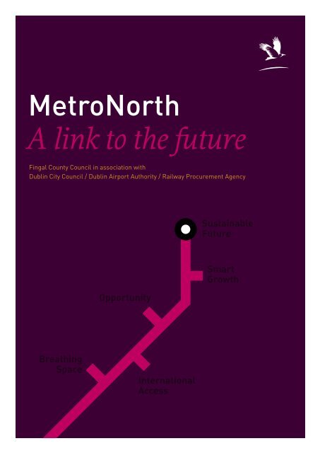
<strong>Metro</strong><strong>North</strong><br />
A link to the future<br />
<strong>Fingal</strong> <strong>County</strong> <strong>Council</strong> in association with<br />
Dublin City <strong>Council</strong> / Dublin Airport Authority / Railway Procurement Agency<br />
Breathing<br />
Space<br />
Opportunity<br />
International<br />
Access<br />
Sustainable<br />
Future<br />
Smart<br />
Growth
<strong>Metro</strong><strong>North</strong><br />
A link to the future<br />
February 2005
<strong>Metro</strong><strong>North</strong><br />
Introduction 7<br />
Executive Summary 9<br />
1 From the European to the Local Context 13<br />
Europe and the World 13<br />
Ireland 14<br />
The Dublin Region 16<br />
Swords 18<br />
2 <strong>Metro</strong><strong>North</strong> 25<br />
Proposed Route 26<br />
Catchment Area 27<br />
Relative Benefits 27<br />
The Benefits 28<br />
Costs /Funding Strategy 33<br />
3 Conclusion 38<br />
appendices<br />
a Demographics 40<br />
b Economic Trends 43<br />
c Dublin Airport 45<br />
d Swords 52<br />
e Costs & Funding Strategy 60
Introduction<br />
<strong>Metro</strong><strong>North</strong><br />
A link to the future<br />
Dublin’s success as a leading European city comes<br />
with many challenges. Progress puts greater<br />
demand on our land, infrastructure and resources<br />
and it challenges us to manage this growth.<br />
<strong>Metro</strong><strong>North</strong> is a link from Dublin city centre to<br />
<strong>North</strong> Dublin servicing the airport and Swords.<br />
However <strong>Metro</strong><strong>North</strong> is more than a link<br />
between the capital city and the nation’s primary<br />
airport – it is a link to the future: a future that<br />
sees the airport and north Dublin developed to<br />
the best principles of sustainable growth to meet<br />
challenges facing the city region; a future that<br />
ensures Ireland remains within easy reach of<br />
Europe and the wider global economy; a future that<br />
responds to the demands of working and living in<br />
the Greater Dublin Area and a future that offers<br />
opportunity, choice and prosperity for our children.<br />
The chance is available now to introduce<br />
<strong>Metro</strong><strong>North</strong> in the best way and deliver all these<br />
benefits. This window of opportunity will only<br />
remain open for a short time and we must decide<br />
now if we wish to make this link to the future.<br />
7
<strong>Metro</strong><strong>North</strong><br />
8
<strong>Metro</strong><strong>North</strong><br />
Executive Summary<br />
Context<br />
The challenge facing the Dublin City region is to consolidate the strong<br />
foundation put in place by recent economic success ensuring sustainable<br />
economic prosperity and quality of life for future generations. To<br />
manage and maximize sustainable growth, the opportunities need to be<br />
understood in their broader context.<br />
International City regions such as Dublin are the drivers of economic success<br />
and in response to the need for smart growth of these centres<br />
conurbations are being planned and developed.<br />
National As an island on the edge of Europe Dublin Airport, and the<br />
link it provides to Europe and the World, is vital to Ireland’s<br />
economic success. The transport void that currently exists<br />
around the airport is a threat to the future of the airport and in<br />
turn the national economy.<br />
Regional Dublin City Region’s increasing population and decreasing<br />
household size is putting additional pressure on the need for new<br />
housing.<br />
Local Currently the Swords configuration offers an ideal location to<br />
address many of the pressures facing <strong>Fingal</strong> and the Dublin City<br />
Region. This configuration cannot be maintained indefinitely<br />
and the chance now exists to maximise the opportunity<br />
presented.<br />
Currently Dublin is the only capital city airport in western Europe<br />
not serviced by metro or rail. By 2010 projections show the road-based<br />
transport will not cope with the growth of Dublin Airport, our National<br />
Gateway. <strong>Metro</strong><strong>North</strong> is the only proposal that addresses this particular<br />
transport need while enabling sustainable development in line with the<br />
National Spatial Strategy.<br />
9
<strong>Metro</strong><strong>North</strong><br />
Communities or Commuters?<br />
The need for quality, affordable housing and reasonable transit times are<br />
at the heart of the challenge facing the Dublin City Region. <strong>North</strong> Dublin<br />
offers the best opportunities for growth in the Greater <strong>Metro</strong>politan area.<br />
<strong>Fingal</strong>’s population is expected to grow by 56% between 1996 and 2010.<br />
Due to decreasing household sizes this equates to a 100% increase in the<br />
number of dwellings.<br />
The opportunities presented are complementary: We can maintain<br />
the Airport gateway while providing sustainable communities where they<br />
are most needed.<br />
Why <strong>Metro</strong>?<br />
<strong>Metro</strong>’s strength over bus and other rail options is its capacity, speed and<br />
reliability. Currently the whole of north Dublin sits in a transport void.<br />
Dublin Airport is located in the centre of this void. The proposed route of<br />
<strong>Metro</strong><strong>North</strong> serves the greatest number of people, provides an essential<br />
link to the Airport and enables smart growth for Swords and its hinterland.<br />
Why <strong>Metro</strong> to Swords?<br />
The city centre route can develop a limited number of brown-field sites. To<br />
yield the best planning and infrastructure value, the City to Airport link<br />
needs to continue to Swords.<br />
Green Belts and flight paths constrain development on the east-west<br />
corridor from Sea to Airport. The lands to the north hold the opportunities<br />
of development levies and ease of procurement. The provision of a<br />
terminus at Swords will include park and ride, bus interchange and a rapid<br />
rail access to a wide catchment.<br />
The town of Swords offers a potential for smart growth while<br />
avoiding sprawl. The brownfield sites within the metro catchment can<br />
be re-invented to an increased density. This will allow the critical mass<br />
required for the provision of local schools, medical facilities, parks and<br />
amenities without gridlock.<br />
10
<strong>Metro</strong><strong>North</strong><br />
Viability<br />
A successful cost benefit analysis has been carried out by the Rail<br />
Procurement Agency for <strong>Metro</strong><strong>North</strong>. As a terminus Swords offers an<br />
improved cost benefit ratio for the entire line. This arises through:<br />
> Alternative and improved Airport access<br />
> Commuters on rail not road<br />
> Social and Community benefits<br />
<strong>Metro</strong><strong>North</strong> can provide a service to 145,000 people within 10<br />
minutes walking distance along it’s route. It can remove traffic from<br />
the roads and serve a projected 60% of Airport users. This is essential for<br />
national economic growth if the Airport expansion is to be supported and<br />
our national gateway is to remain firmly open. A Cost/Funding Strategy is<br />
detailed in Appendix E of this document.<br />
Conclusion<br />
The opportunity provided by <strong>Metro</strong><strong>North</strong> addresses the realities of<br />
people’s lives. It is a necessary long term solution at a critical stage in<br />
our capital city’s growth. The impacts are only positive and have been<br />
welcomed through the consultation process. <strong>Metro</strong><strong>North</strong> is a means to an<br />
end – the end being a thriving region within a thriving European economy<br />
that offers opportunity, choice and prosperity to future generations.<br />
11
<strong>Metro</strong><strong>North</strong><br />
1 From the European<br />
to the local context<br />
1.1 EUROPE AND THE WORLD<br />
As the economy of the European Union progresses a recognition<br />
has developed that it is the economic mass embodied in city regions,<br />
not nation states, that will be the driver of future economic success.<br />
The success of city region-based development brings with it a range of<br />
challenges – top among these being the ability to best manage the growth<br />
that comes with that success.<br />
Urban sprawl is not a sustainable or desirable option. Conurbations<br />
created by effective transport links are allowing for smarter growth,<br />
healthier communities and effective use of limited resources.<br />
Examples such as Oresund (Copenhagen/Malmo) and ‘The Delta<br />
<strong>Metro</strong>polis’ grouping in the Netherlands (Amsterdam/The Hague/<br />
Rotterdam/Utrecht) illustrate these strategies in action.<br />
In the European model illustrating the development of such<br />
groupings Ireland, northern England and Scotland are grouped in the<br />
“Islands Region” with a strong link shown along the Dublin/Belfast<br />
corridor.<br />
For an island nation the air and sea links that form these groupings<br />
have a strategic significance that is international. Twin challenges exist for<br />
these strategic pieces of infrastructure viz. –<br />
12<br />
Access to these assets must at all times be optimised, and those<br />
access routes must be the most effective possible for the greatest<br />
numbers of passengers and the greatest amount of goods to<br />
afford optimum value from those assets.<br />
While developing the right transport links to the airport within the<br />
Dublin city region, there exists an opportunity to take advantage of the<br />
optimum delivery of these links so to maximise sustainable economic<br />
growth for that region.
Oresund<br />
Copenhagen—Malmo<br />
A bridge linking Copenhagen<br />
in Denmark and Malmo in<br />
Sweden has created a new and<br />
thriving economic zone which<br />
transcends national boundaries<br />
and encourages sustainable<br />
patterns of growth.<br />
<br />
<br />
<br />
<br />
<br />
The Delta <strong>Metro</strong>polis<br />
Amsterdam—The Hague—<br />
Rotterdam–Utrecht<br />
Effective transport links and<br />
enlightened planning allowed<br />
these cities to retain their<br />
respective characters while<br />
collectively ensuring the<br />
economic competitiveness of<br />
the region.<br />
<br />
<br />
<br />
<br />
<br />
<strong>Metro</strong><strong>North</strong><br />
13
<strong>Metro</strong><strong>North</strong><br />
1.2 IRELAND<br />
As volumes of airborne inbound and outbound travellers have<br />
increased, the transport infrastructure supporting the airport has come<br />
under increased stress to the point where our national competitiveness is<br />
being compromised.<br />
Currently Dublin is the only capital city airport in western Europe<br />
not serviced by a metro or rail link.<br />
Despite the significant recent and ongoing investment in road transport<br />
infrastructure in the immediate area, the road network around the Airport<br />
is already under stress. It is clear that road-based transport alone will not<br />
provide even the medium-term answer to coping with the growth of the<br />
national strategic asset that is the Airport.<br />
Studies compiled in recent months for <strong>Fingal</strong> <strong>County</strong> <strong>Council</strong><br />
illustrate that the M50 and M1 spine to the city are already under stress<br />
for significant lengths of the working day. This will remain the case post<br />
tunnel completion. The relief anticipated from the opening of the tunnel<br />
will not materialise as additional traffic destined for the port will then use<br />
these routes having been diverted from passing through the city.<br />
Much of the existing local and regional highway network is<br />
currently operating at or beyond capacity. Significant improvements,<br />
both to the highway infrastructure and public transport network, will be<br />
required to address the forecast increases in airport use.<br />
Given the importance of Dublin airport to the national, regional and<br />
local economy, it is essential that achievable capacities in the transport<br />
and road infrastructure should be allocated first and foremost to future<br />
development at the airport.<br />
Without the metro the road system will not cope with forecast airport<br />
growth, and certainly not with additional commercial development.<br />
The overall priority must be to reserve capacity for the access needs of the<br />
Airport – which is not only an important national asset, but also a major<br />
source of employment growth potential in its own right.<br />
14
Road Stress Levels 2004<br />
Analysis shows that the new<br />
M1 is already under stress from<br />
traffic as it approaches the<br />
airport turnoff to the north.<br />
Road Stress Levels 2010<br />
Without the <strong>Metro</strong><br />
Projections show that the vital<br />
access roads to the airport<br />
will not withstand any future<br />
exceptional/singular event.<br />
Airport access and exit would<br />
be severely compromised.<br />
<strong>Metro</strong><strong>North</strong><br />
15<br />
2004<br />
Road Capacity<br />
75% or less<br />
75 – 90%<br />
90 – 100%<br />
100 – 120%<br />
120%+<br />
M50<br />
2004 2010 / No <strong>Metro</strong><br />
Road Capacity<br />
75% or less<br />
75 – 90%<br />
90 – 100%<br />
100 – 120%<br />
120%+<br />
M50<br />
M50<br />
Airport<br />
City<br />
Airport<br />
Airport<br />
City<br />
Ballymun<br />
Interchange<br />
Ballymun<br />
Interchange<br />
Ballymun<br />
Interchange<br />
Santry<br />
Santry<br />
Santry<br />
Swords<br />
M1<br />
Airport / M1 Interchange<br />
M50/M1 Interchange<br />
Swords<br />
M1<br />
M1<br />
Airport / M1 Interchange<br />
Airport / M1 Interchange<br />
M50/M1 Interchange<br />
M50/M1 Interchange<br />
‘WITHOUT THE METRO THE ROAD SYSTEM CANNOT COPE WITH<br />
FORECAST AIRPORT GROWTH, AND CERTAINLY NOT WITH<br />
ADDITIONAL COMMERCIAL DEVELOPMENT.’
<strong>Metro</strong><strong>North</strong><br />
Without the <strong>Metro</strong> there will be:<br />
> Unconstrained growth of car movements (except by congestion) to<br />
and from the airport resulting in serious congestion on the M1 and<br />
M50 with long delays for passengers and workers at the airport and<br />
those travelling on the extended road network.<br />
> Increases in the demands for car parking at the airport and the<br />
consequent need to provide larger car park facilities.<br />
> A need for serious limitation to future development in <strong>Fingal</strong>.<br />
1.3 THE DUBLIN REGION<br />
Dublin city and the surrounding region has been at the heart of<br />
Ireland’s economic success. It is however undergoing massive change as<br />
it responds to the pressures of economic growth, changing demographics,<br />
public service delivery, business competitiveness and the support of<br />
healthy, thriving communities.<br />
The need for quality, affordable housing and reasonable transit<br />
times are at the heart of this challenge.<br />
The National Spacial Strategy identifies the Dublin/Belfast<br />
economic corridor as a key National Transport Corridor, which is also<br />
classified as a strategic link of the ‘Islands Region’ in the European Growth<br />
Model. In addition, the Dublin Transport Office strategy: ‘A Platform for<br />
Change’ distinguishes the <strong>Metro</strong> between Dublin City and Swords town<br />
via Dublin Airport as a key link. The Regional Planning Guidelines the<br />
development of the <strong>Metro</strong> to Dublin airport is a Strategic Regional Priority<br />
in provision of public transport.<br />
The importance of the Airport for the region justified an<br />
airport-oriented plan to be prepared by <strong>Fingal</strong> <strong>County</strong> <strong>Council</strong>, i.e. the<br />
South <strong>Fingal</strong> Planning Study, which is a major study of the long term<br />
development of Dublin Airport and Environs and the South <strong>Fingal</strong> Fringe.<br />
The study concluded that the introduction of a metro-type rapid transit<br />
link serving the airport and the region would:<br />
> ensure that the potential of the airport area and environs will<br />
most effectively be harnessed in the interests of the long term<br />
development of the area;<br />
> remove constraints and limits on economic development for the<br />
nation, city and region;<br />
16
Population Growth<br />
<strong>Fingal</strong>’s population is projected<br />
to grow to over 400,000 by 2027<br />
with a large proportion of this<br />
being accommodated by Swords<br />
and its hinterland.<br />
<strong>Metro</strong><strong>North</strong><br />
17<br />
196,413<br />
82,668<br />
Projected Population of <strong>Fingal</strong> 400,552<br />
Swords & its<br />
Hinterland<br />
164,000<br />
2002 2027
<strong>Metro</strong><strong>North</strong><br />
> reduce serious congestion on the existing national road<br />
infrastructure;<br />
> remove early requirements for road pricing in order to maintain<br />
essential capacity on the city road network;<br />
> improve the quality of life for communities along the route, ensure<br />
less congestion, pollution etc; and<br />
> remove the requirement for massive additional investment in<br />
developing additional commuter bus services.<br />
<strong>Fingal</strong> <strong>County</strong> <strong>Council</strong> has risen to the challenge of housing provision for<br />
the region. The annual number of new house starts achieved has addressed<br />
any supply-side deficit bringing stability to the housing market. The<br />
<strong>Council</strong> seeks to continue with this work, but the necessity for strategic<br />
investment in rapid public transport solutions has become essential.<br />
<strong>Fingal</strong>’s population is projected to grow by 56% to 250,000 between 1996<br />
and 2010. Because of decreasing household size over that same time <strong>Fingal</strong><br />
will need 100% more dwellings to house this growth in population.<br />
Projecting forward to 2027, <strong>Fingal</strong> will have a population of<br />
400,000, with 162,000 living in the Swords/airport hinterland. However the<br />
latter is a conservative figure and with <strong>Metro</strong> in place a figure of 200,000<br />
is possible. Timely planning can deliver optimum results for the city and<br />
region alike and ensure the best use of our national gateway.<br />
In examining the case for rapid transit metro for the airport two options<br />
have been considered. The first option examined was the provision of the<br />
City–Airport–City link. The second was the City–Airport–Swords–Airport–<br />
City configuration.<br />
The first City – Airport – City option provides a route that is<br />
predominantly underground serving existing city communities of whom<br />
only few have marginal access (Drumcondra station on the Maynooth<br />
line) to rapid transit. It will only be possible to develop a limited number<br />
of brown-field sites along this route so the potential for infrastructurebased<br />
development levies yield as a contribution to cost is marginal.<br />
New commercial or industrial lands may be developed north of the M50<br />
between it and the airport, but due to the presence of the flight path from<br />
the cross-runway no new communities are possible here. In addition<br />
terminating the metro in the airport will make the airport a metro<br />
18
Housing requirements<br />
Because of decreasing<br />
household size <strong>Fingal</strong> needs<br />
100% more new dwellings to<br />
house the projected growth<br />
in population between 1996<br />
and 2010.<br />
<strong>Metro</strong><strong>North</strong><br />
19<br />
Dwellings required<br />
+100% increase<br />
Population<br />
+56% increase<br />
Household size<br />
decrease<br />
1996 2010
<strong>Metro</strong><strong>North</strong><br />
destination of itself adding to the traffic and parking problems already<br />
evident with it.<br />
The second City – Airport – Swords – Airport – City configuration achieves<br />
benefits for the line that far outweigh the marginal (in relative terms)<br />
additional costs. The primary benefit will be the provision of a terminus,<br />
proposed to be north of Swords at a Lissenhall interchange, which will<br />
include a park and ride provision and bus interchange along the line<br />
within Swords. This will deliver the benefit of rapid rail access to a wide<br />
catchment. A strong airport employment link with Swords and the north<br />
county will reduce significantly the need for employee parking at the<br />
airport.<br />
Development levies in support of the infrastructure are projected later<br />
here to raise half the additional cost of bringing the line an additional<br />
6.5km to Lissenhall. Perhaps most importantly the opportunity that a<br />
metro line will bring to Swords is that of developing a real sustainable<br />
community with a life-work balance through smart planning, land use<br />
and development initiatives that can be pursued for our thriving nation.<br />
Capacity to best house the population needed to continue our national<br />
economic success will be realised in locations such as those that can<br />
become available through initiatives such as these.<br />
1.4 SWORDS<br />
Swords, with a current population close to 40,000, has the potential<br />
to provide the right environment from which to develop a smart growth<br />
strategy that encompasses the benefits of the kind of conurbation<br />
envisaged by the EU and set out in their “City Region” model above.<br />
In support of this the current and draft <strong>Fingal</strong> <strong>County</strong> Development<br />
Plan employs an Urban Development strategy based on a hierarchy of<br />
development centres wherein Swords is a designated main urban centre.<br />
To date it has been difficult to plan concentrated development in the<br />
absence of transport services that have sufficient capacity without creating<br />
gridlock or promoting unsustainable development.<br />
20
The existing Swords road<br />
network forces all traffic<br />
through the centre. Few crosstown<br />
routes exist. Public<br />
transport is compromised<br />
into cul-de-sacs with few long<br />
routes.<br />
Existing land uses follow the<br />
incremental development of the<br />
town. Residential areas have<br />
relatively low density. There is a<br />
need to contain growth.<br />
<strong>Metro</strong><strong>North</strong><br />
21
<strong>Metro</strong><strong>North</strong><br />
In Swords, where until recently the N1 traversed and divided the town,<br />
advantage can now be taken of a new reality. Any rail-based rapid transit<br />
route can use the old N1, where all the land from the airport, with the<br />
exception of circa 2.5ha, for a proposed distance of 6.5km is in public<br />
ownership.<br />
As the natural hub for the north county, Swords has the facility to grow in<br />
a sustainable manner. Through the provision of a strong transport link it<br />
can reduce the stress on roads around the Airport, while providing housing<br />
and mixed development opportunities with the right critical mass to<br />
support third level education, health and other amenities.<br />
The <strong>Fingal</strong> Development Plan and zoning around Swords can ensure that<br />
an opportunity can be assembled now to put in place a solution that is<br />
cost-effective and an enabler for the sustained growth and prosperity of<br />
<strong>Fingal</strong>, Dublin and Ireland.<br />
The vision for Swords in the county Development Plan sees the town<br />
> Consolidating existing and future development within well defined<br />
town boundaries;<br />
> Providing for a much expanded civic, cultural, retail, commercial<br />
and employment base at a level appropriate for a vibrant major<br />
<strong>County</strong> town;<br />
> Developing high quality public transport links to Dublin City,<br />
Dublin Airport and the Greater Dublin area; and<br />
> Promoting the development of high quality living and working<br />
environments.<br />
Swords, with a population of 100,000 people can be vital part of the future<br />
growth of the Greater Dublin Area. The measures to achieve this are in<br />
place if rapid transit delivery is progressed.<br />
In addition, the shadow benefit that such coherent growth in Swords can<br />
deliver for the surrounding countryside, towns and villages should not<br />
be underestimated. Rush, Lusk and Donabate will all benefit from this<br />
sustainable approach to future development.<br />
22
Through the provision of a<br />
strong transport link Swords<br />
has the facility to grow in a<br />
sustainable manner, while<br />
providing housing and mixed<br />
development opportunities<br />
with the right critical mass to<br />
support third level education,<br />
health and other amenities.<br />
<strong>Metro</strong><strong>North</strong><br />
23
TYPICAL CAPACITIES<br />
METRO<br />
DART<br />
LUAS<br />
BUS<br />
H<br />
G<br />
5,000<br />
F<br />
<strong>Metro</strong><strong>North</strong><br />
24<br />
C<br />
E<br />
D<br />
10,000 15,000 20,000<br />
B<br />
THEORETICAL CAPACITY<br />
Frequency PPH*<br />
A <strong>Metro</strong>, 90m 1.5min 18,720<br />
B Upgraded DART 7.5min 10,880<br />
C Existing DART 10min 6,120<br />
D Luas, 50m 3min 7,400<br />
E Luas, 40m 3min 6,200<br />
F Luas, 40m 4min 4,650<br />
G Luas, 40m 5min 3,720<br />
H Typical QBC 2min 2,820<br />
*Passengers per hour<br />
A
<strong>Metro</strong><strong>North</strong><br />
2 <strong>Metro</strong><strong>North</strong><br />
Planning for rapid transit public transport solutions to Dublin airport<br />
To date on two occasions –1999 and 2004 – <strong>Fingal</strong> <strong>County</strong> <strong>Council</strong> has had<br />
to consider for itself the optimum realistic solutions for the delivery of<br />
rapid public transport for Dublin airport in its operational area.<br />
On both occasions submissions were made and examined. In the<br />
1999 Plan two rapid rail routes were reserved:<br />
> for a new south-north line from the city through Ballymun;<br />
> and an west-east reservation for heavy rail from the Maynooth line<br />
to the airport.<br />
The published Draft <strong>Fingal</strong> <strong>County</strong> Development Plan for 2005 to 2011<br />
has only a single route from the city through Ballymun. This strategy<br />
was recently endorsed by the new <strong>Council</strong> at the second stage of the<br />
Development Plan review.<br />
Amongst the factors that contributed to a decision to favour <strong>Metro</strong> on<br />
a dedicated line was the carrying capacity of that transport mode that<br />
outperformed any rival. Other factors included:<br />
> a prejudice against cross-country routes to the airport that might<br />
lead to development in the reserved green belt under the air<br />
approaches to the airport runway(s);<br />
> opposition to any measure that would remove train slots per hour<br />
from the already inadequate rail service on the northern commuter<br />
line as far as Drogheda; and<br />
> that any measure should benefit the greatest number of people<br />
possible along any route, especially if they had no access already to<br />
such facilities.<br />
25
Dublin Airport sits in the middle<br />
of a north county Dublin rail<br />
transport void. Suggestions<br />
of a spur connection from<br />
the existing costal line would<br />
do little solve this transport<br />
void. The opportunity to serve<br />
a significant segment of the<br />
population of Dublin with rapid<br />
rail would be missed.<br />
<strong>Metro</strong><strong>North</strong><br />
2.1 THE PROPOSED ROUTE<br />
In a current rail map of the Dublin region there is an entire empty<br />
segment of the city region. Dublin airport sits in the centre of that rail<br />
transport void. Existing rail-based commuter services on the north side<br />
of the city are concentrated on the coastline – missing half the potential<br />
catchment area that a centred line could provide.<br />
The proposed route addresses this transport void making a direct<br />
link between the city, Dublin Airport and Swords.<br />
26<br />
Kildare<br />
Newbridge<br />
Kilcock<br />
Maynooth<br />
Leixlip Intel<br />
Leixlip Confey<br />
Lucan<br />
<strong>North</strong><br />
Sallins<br />
Hazelhatch<br />
South Lucan<br />
TRANSPORT VOID<br />
Kishoge<br />
Clonsilla<br />
Coolmine Castleknock River Road Ashtown Ashington Broombridge<br />
Porterstown<br />
CherryOrchard<br />
West Park<br />
Clondalkin<br />
Belgard<br />
Inchicore Kilmainham<br />
Museum<br />
Heuston<br />
Smithfield<br />
Jervis Abbey Busaras<br />
Ballyfermot<br />
Rialto<br />
Suir Road<br />
Goldenbridge<br />
Drimnagh<br />
Blackhorse<br />
Bluebell<br />
Kylemore<br />
Red Cow<br />
Kingswood<br />
Dundalk<br />
Drogheda<br />
Laytown<br />
Mosney<br />
Gormanstown<br />
Balbriggan<br />
Skerries<br />
Donabate<br />
Malahide<br />
Portmarno<br />
Baldoyle<br />
side Sutton<br />
Liffey Jtn Prospect<br />
Drumcondra<br />
Howth Jtn.<br />
Kilbarrack<br />
Raheny<br />
Harmonstown<br />
Croke Pk<br />
Killester<br />
Clontarf<br />
East Wall Junction<br />
Four Courts<br />
Connolly Tara St.<br />
Pearse<br />
Pearse<br />
Rush<br />
Stephenʼs Green<br />
Lansdowne<br />
Harcourt<br />
Sandymount<br />
Charlemont<br />
Sydney Parade<br />
Ranelagh<br />
Beechwood<br />
Booterstown<br />
Cowper<br />
Blackrock<br />
Milltown<br />
Seapoint<br />
Windy Arbour<br />
Dundrum<br />
Salthill / Monkstown<br />
Balally<br />
Kilmacud<br />
Dún Laoghaire<br />
Stillorgan<br />
Sandycove<br />
Sandyford<br />
Glenageary<br />
Dalkey<br />
Killiney<br />
Shankill<br />
Shanganagh<br />
Bray<br />
Greystones<br />
Kilcoole<br />
Wicklow<br />
Rathdrum<br />
Arklow<br />
Howth
<strong>Metro</strong><strong>North</strong><br />
2.2 CATCHMENT AREA<br />
The catchment area for the <strong>Metro</strong><strong>North</strong> will include many north<br />
Dublin towns and villages already served by the coastal commuter service.<br />
These towns include Skerries (10,940), Donabate/Portrane (6,141), Lusk<br />
(4,131) and Rush (6,759). In addition bus services serving towns in east<br />
Meath and south Louth, from where significant commuter numbers now<br />
originate will be able to terminate at Swords <strong>North</strong> (Lissenhall).<br />
2.3 RELATIVE BENEFITS<br />
The cost benefit analysis exercise carried out by the Rail<br />
Procurement Agency for the <strong>Metro</strong> to Airport route gave a factor of 1:1.36<br />
return on investment for that route. The extension of the line to Swords for<br />
a net cost of circa €150m for 6.5km of overground line (the second €150m<br />
being raised locally through dedicated levy contributions) improves the<br />
cost benefit ratio for the entire line. This arises from the benefits associated<br />
with ease of congestion at the airport, the removal of commuter traffic<br />
from national primary routes together with major benefits in social and<br />
community terms.<br />
<strong>Metro</strong><strong>North</strong> can provide a rail service to 85,000 people within 10 minutes<br />
walk of its catchment area on its proposed route in the existing Dublin<br />
City areas. Through the linkages within the city transportation network<br />
more than 250,000 citizens will have access to <strong>Metro</strong><strong>North</strong>. In <strong>Fingal</strong> it<br />
can provide services today for a further 25,000 living within the same 10<br />
minutes walk. Should the route be approved to Swords that <strong>Fingal</strong> figure<br />
can rise to at least 60,000 through the provision of a new metro-oriented<br />
sustainable community along the northern edge of Swords in lands where<br />
the line is suitable to terminate.<br />
In addition to the communities served, an optimum of 60% of airport<br />
users – the proportion who do not travel and park their cars, will use the<br />
service as set out in the RPA case already submitted. This includes the<br />
4 million visitors annually for whom Dublin City is a destination of itself.<br />
<strong>Metro</strong> in the preferred model here can remove 89 million vehicle kms per<br />
annum when working at optimum – a huge potential saving in traffic<br />
congestion.<br />
27
<strong>Metro</strong><strong>North</strong><br />
2.4 THE BENEFITS<br />
National<br />
An additional runway together with associated terminal facilities will<br />
increase trip generation to significantly above current levels. <strong>Metro</strong><strong>North</strong><br />
will support the required expansion of the airport which will be the most<br />
significant source of increased travel demand in the Airport environs.<br />
It is essential that future development at Dublin Airport is<br />
prioritised when considering transport infrastructure.<br />
Regional<br />
The introduction of <strong>Metro</strong><strong>North</strong> has the potential to address housing<br />
needs by offering genuine choice, an opportunity to those who want to be<br />
part of this thriving city and region. This potential is available along all the<br />
route of <strong>Metro</strong><strong>North</strong>.<br />
The potential of brownfield city sites such as that at the Mater metro<br />
stop and the former printworks at Botanic Avenue add to the potential of<br />
the renewed Ballymun town.<br />
For sites in the <strong>Fingal</strong> area, the <strong>County</strong> Development Plan sets aside<br />
the area between the airport and the M50 for a special Local Area Plan once<br />
a <strong>Metro</strong> route is determined.<br />
In Swords there exists the opportunity to develop a location in the area<br />
that will provide real benefits for the region. Planning for this town,<br />
identified as a ‘consolidation’ town in the Regional Planning Guidelines,<br />
developed significantly when in the 1999 <strong>County</strong> Development Plan an<br />
outer boundary was set for its growth. The town has played a significant<br />
part in contributing to the housing demand. Thriving new suburbs and<br />
sub-centres have been created and there is a young population. Into<br />
the future however planning will be increasingly circumscribed by our<br />
inability to consolidate to the optimum extent to grow an efficient town,<br />
in land-use terms, due to lack of rapid public transport links to remove<br />
road-based travel as the sole option. This is even more the case for the<br />
surrounding smaller towns and villages.<br />
Planning for <strong>Metro</strong><strong>North</strong> provides a singular opportunity to grow a<br />
sustainable community. Such concentrated ‘smart growth’ in turn allows<br />
pressures on those surrounding communities to ease, enabling the north<br />
28
<strong>Metro</strong><strong>North</strong> route and new<br />
development areas<br />
The potential of brownfield<br />
city sites such as that at the<br />
Mater metro stop, the former<br />
printworks at Botanic Avenue<br />
add to the potential of the<br />
renewed Ballymun town.<br />
For the sites in <strong>Fingal</strong> area,<br />
the <strong>County</strong> Development Plan<br />
sets aside the area between<br />
the airport and the M50 for a<br />
special Local Area Plan once a<br />
<strong>Metro</strong> route is determined.<br />
<strong>Metro</strong><strong>North</strong><br />
29<br />
<strong>Metro</strong>park<br />
Ballymun Central<br />
Botanics<br />
Centre<br />
Lissenhall<br />
Estuary<br />
Seatown<br />
Swords Pavilions<br />
Airside<br />
Dublin Airport<br />
Ballymun <strong>North</strong><br />
Dublin City<br />
University<br />
Mater<br />
Grade<br />
Elevated<br />
Grade<br />
Tunnel<br />
Grade<br />
Elevated<br />
Tunnel
<strong>Metro</strong><strong>North</strong><br />
Dublin towns to retain their character rather that each being the mirror of<br />
its neighbour – continually growing out into the countryside.<br />
<strong>Fingal</strong> <strong>County</strong> <strong>Council</strong> has made provision that the potential for this<br />
area to maximise the added value available from an international airport<br />
location in one of the world’s most open economies will not be wasted by<br />
premature development.<br />
Local<br />
This document sets out a vision of the potential for Swords and the<br />
hinterland, already alluded to in the description of the context for this<br />
infrastructural investment.<br />
The town will become an attractor for major investment in the<br />
residential, commercial and industrial sectors and the catchment area for<br />
retail and commercial services provided in the town will immediately<br />
and significantly increase. Opportunities exist to intensify undeveloped<br />
lands and brownfield areas in the vicinity of <strong>Metro</strong><strong>North</strong> to maximise<br />
the benefits and efficiency of the metro. The town will also be better<br />
positioned to maximise the benefits of its location immediately adjacent to<br />
the airport.<br />
It is important to state that in researching this report and proposal that<br />
many and repeated contacts were made with many stakeholders including<br />
business interests, land owners and other groups who were needed to be<br />
included at this initial stage. Again during the preparation for the review<br />
of the draft Development Plan 2005 – 2011 the <strong>Council</strong> was briefed on<br />
the proposal and the opportunities it afforded the town of Swords and the<br />
hinterland areas.<br />
In all cases approval and support was given without hesitation. Each party,<br />
from their perspective could see the overall benefits that would flow and<br />
cooperation and support was offered in all cases.<br />
30
Map showing the potential<br />
development or redevelopment<br />
sites in Swords that are<br />
proximate to the <strong>Metro</strong> route<br />
Undeveloped Unzoned<br />
lands in the Lissenhall area<br />
Zoned lands where<br />
permissions have been<br />
granted or development<br />
has occurred but that<br />
offer opportunities for<br />
redevelopment<br />
Zoned undeveloped lands<br />
for which permissions have<br />
yet to be completed<br />
<strong>Metro</strong><strong>North</strong><br />
31
New standards for work / life<br />
balance can be introduced<br />
in areas in the vicinity of the<br />
<strong>Metro</strong><strong>North</strong>. In these areas<br />
residents are not tied to<br />
car-based commuting and<br />
amenities are provided on their<br />
doorstep.<br />
<strong>Metro</strong><strong>North</strong><br />
32<br />
Full of life and<br />
opportunity
<strong>Metro</strong><strong>North</strong><br />
2.5 COSTS/FUNDING STRATEGY – AIRPORT TO SWORDS<br />
The costs for the <strong>Metro</strong><strong>North</strong> City to Dublin Airport section has<br />
already been submitted to Government by the Rail Procurement Agency.<br />
This section deals in particular with the Costs / Funding Strategy for the<br />
section from the Airport to Swords north.<br />
c o s t s ¤ m i lli o n s<br />
Civil Engineering Works 110<br />
Railway Infrastructure 74<br />
Stations (5 no. at €2m) 10<br />
Land 10<br />
Enabling Works 11<br />
Operational Systems 26<br />
Contingency 24<br />
Sub-Total 265<br />
Planning and Design 25<br />
Total 290<br />
The Planning and Development Act 2000 allows for the adoption by the<br />
local authority of a supplementary development contribution scheme in<br />
respect of public infrastructure. Lands benefiting from the provision of<br />
the infrastructure are included in the scheme and planning permissions<br />
granted on those lands would attract the levy.<br />
Experience elsewhere is that the prospect of delivery of quality<br />
public transport raises land values. This premium can be captured in the<br />
public interest and utilized in the funding arrangements for the system.<br />
A levy scheme has been put in place in Dun Laoghaire Rathdown in<br />
advance of approval of the line itself, in respect of the extension of Luas to<br />
Cherrywood (Line B1). The scheme has been in operation, since January<br />
2003 raising levies on new developments with the funds being routed to<br />
the Rail Procurement Agency.<br />
33
Areas around Swords outlined<br />
for section 49 status.<br />
<strong>Metro</strong><strong>North</strong><br />
Specification of Area to which the Scheme Relates<br />
The primary catchment for rail based quality public transport, as<br />
recognised by the Dublin Transportation Office and other authorities,<br />
extends to lands within 1 kilometre of the line. In effect therefore the<br />
corridor is a 2 kilometre wide band centred on the line. This equates to<br />
a 10-12 minute walking distance. This is considered to be a conservative<br />
view of the beneficial impact.<br />
However, it is important for the business case that must be made for<br />
the scheme that it be grounded in acceptable parameters. In this regard<br />
whilst there is a ‘benefit’ from the <strong>Metro</strong> to a wide area, even beyond<br />
<strong>Fingal</strong>, the primary direct benefit is within the walking catchment where<br />
it delivers a perceived benefit to the individual greater than the perceived<br />
cost of taking the car.<br />
Anticipated Yield from a Supplementary Development Contribution Scheme<br />
Because of the high capacity of <strong>Metro</strong>, a large population and high density<br />
commercial uses are required within the primary catchment to take up the<br />
capacity of the system and contribute to its viability. The line of the <strong>Metro</strong><br />
in <strong>Fingal</strong> runs through a number of distinct areas, each with a different<br />
potential to contribute to the intensity of activity in the catchment area.<br />
34
Undeveloped zoned lands in<br />
Swords<br />
<strong>Metro</strong><strong>North</strong><br />
The airport will be subject to major growth in accordance with a master<br />
plan for the Designated Airport Area. Because of serious road congestion,<br />
however, any significant expansion of the airport is contingent on the<br />
provision of the <strong>Metro</strong>. As in the case of the lands south of the airport,<br />
potential levies are likely to be attributed to the City to Airport section of<br />
the scheme.<br />
Lands between the existing southern boundary of Swords and the<br />
airport lie partly within the red approach zone and the outer public safety<br />
zone. Development will be restricted in this area which should be retained<br />
as part of the green belt / green lung separating the airport from Swords.<br />
An area of land lies between the development boundary of Swords<br />
and the outer public safety zone. A part of this, at Fosterstown and<br />
Nevinstown would be suitable for zoning for employment uses and for<br />
development as a southern ‘gateway’ for Swords.<br />
Undeveloped zoned lands within Swords are indicated on the maps below.<br />
These lands are generally capable of development to high densities in<br />
accordance with the vision set out in this report.<br />
35
<strong>Metro</strong><strong>North</strong><br />
There are also lands within Swords the present use of which are low<br />
intensity and unsustainable in the context of a <strong>Metro</strong> line. These have<br />
a potential for redevelopment over time. It is not possible, however, to<br />
predict the extent to which these lands will be subject to redevelopment<br />
proposals even though their redevelopment would undoubtedly make a<br />
significant contribution to the reorientation of Swords along the <strong>Metro</strong>.<br />
Expansion of Swords to the south is constrained by the airport and to the<br />
east by the M1 and the green belt separating Swords and Malahide. To the<br />
west there are no constraints but the zoned area is already in excess of<br />
2km from the <strong>Metro</strong> line. To the <strong>North</strong> there is a substantial area which<br />
lies within the 1km catchment of the <strong>Metro</strong> and between the development<br />
boundary of Swords and the M1. This area, in addition to its capacity to<br />
provide for park and ride, has a high potential to assist in building up the<br />
necessary critical mass for the effective operation of <strong>Metro</strong> and to provide<br />
the opportunity for a higher yield from a supplementary development<br />
contribution levy scheme.<br />
Application of Supplementary Development Contribution Scheme<br />
It is intended that a similar approach be adopted for the <strong>Metro</strong> scheme in<br />
<strong>Fingal</strong> as was adopted in Dun Laoghaire Rathdown for their Section 49<br />
scheme. An amount would be levied per hectare thus encouraging the<br />
maximization of development density on the site. This would result in a<br />
reduced effect on individual house buyers in higher density schemes.<br />
The rates of levy in Dun Laoghaire Rathdown were fixed at €250,000<br />
per gross site hectare for residential and €570,000 per gross site area for<br />
commercial. By 2005, these figures, updated by a compound interest of<br />
5% would be €275,625 for residential and €628,425 for commercial. These<br />
figures are used for the purposes of estimating the levy yield in <strong>Fingal</strong>.<br />
It is important that the public / private contribution to the funding<br />
of the scheme be on an equal basis. Given the cost estimates provided<br />
in this report this would give rise to a requirement for €145m. The final<br />
figure will in addition need to include an additional amount to cover<br />
financing costs and risk. The working figure for 50% of cost is therefore<br />
taken as €150m.<br />
36
<strong>Metro</strong><strong>North</strong><br />
Assuming that lands identified as zoned but without planning permission<br />
and land unzoned within the 1km band are most likely to be delivered<br />
within the timeframe, the updated levies stated could yield the following:<br />
z o ned lands y i e ld ¤ m<br />
Commercial 77ha 48.3<br />
Residential 20.9ha 5.7<br />
u n z o ned lands<br />
Commercial 123.5 ha 77.6<br />
Residential 50.5ha 13.9<br />
Total 145<br />
The outcome would therefore be:<br />
Yield from zoned and unzoned lands 145<br />
Cost (at 50%) 150<br />
Shortfall 5<br />
This is an estimation of potential yield, assuming the development of<br />
100% of the zoned and unzoned lands identified.<br />
The redevelopment of lands which are already developed would<br />
potentially yield additional levy income. They are unlikely to come<br />
on stream to any great extent in the medium term, however, as much<br />
of the development is of comparatively recent construction. From the<br />
perspective of a business case there would not be confidence on the yield<br />
being achieved from these lands. If say, 10% comes on stream this will<br />
provide for the shortfall of €5m as set out above plus a possible shortfall<br />
from the forecasted yield.<br />
37
<strong>Metro</strong><strong>North</strong><br />
3 Conclusion<br />
Dublin airport and the city region cannot cope with projected levels of<br />
growth without the provision of a <strong>Metro</strong><strong>North</strong> type service as proposed.<br />
This will have major repercussions for our international competitiveness,<br />
national economic growth, regional development and city centre viability.<br />
This is an opportunity to plan sustainably for the region in support of the<br />
protection of the airport – a vital asset of infrastructure.<br />
It is also an opportunity for Swords and its hinterland to offer a new<br />
vision where work / life balance can be achieved for new communities<br />
supporting our continued economic growth.<br />
<strong>Metro</strong><strong>North</strong> addresses the transport void in the Dublin City Region and<br />
becomes the critical enabler of growth for the Dublin/Swords conurbation.<br />
<strong>Metro</strong><strong>North</strong> can provide optimum services for visitors and communities<br />
heretofore unserved by rapid public transport services. It is not an upgrade<br />
for services that already exist.<br />
Rather than attempt to retrofit solutions in the future there is a window of<br />
opportunity to plan sustainable development for Dublin, the Airport and<br />
Swords..<br />
38
<strong>Metro</strong><strong>North</strong><br />
Appendices<br />
39<br />
A
<strong>Metro</strong><strong>North</strong> / Appendix A / Demographics<br />
Appendix A Demographics<br />
A.1 THE FINGAL POPULATION<br />
A.1.1 Existing Population in <strong>Fingal</strong> [source 2002 Census]<br />
Population 196,413<br />
Number of Households 60,999<br />
Occupancy rate 3.23 persons per household<br />
A.1.2 Medium Term population projections [2002- 2012] for <strong>Fingal</strong><br />
A variety of Medium Term population projections for <strong>Fingal</strong> have been<br />
prepared by differing authorities. These <strong>County</strong> projections result are<br />
broadly similar, and that summary is as follows:<br />
Year 2002 2006 2011<br />
Population Projection 1 * 196,413 236,629 284,725<br />
Occupancy (persons/house) 3.23 3 2.9<br />
* This estimate, by <strong>Fingal</strong> <strong>County</strong> <strong>Council</strong>, assumes that not all of the zoned lands will be developed<br />
in certain areas within the <strong>County</strong> [including Balbriggan, Lusk, Rush, Donabate and Portmarnock<br />
South] by the year 2011 due to infrastructural constraints [e.g. water and drainage]. It is also<br />
assumed that areas closer to Dublin City are more likely to be developed.<br />
Year 2002 2007 2012<br />
Population Projection 2 * 196,413 252,975 298,588<br />
Occupancy (persons/house) 3.23 3 2.9<br />
* This estimate was prepared by Mr.Joe Durkan, UCD, for 2002-2012. In his projections the <strong>County</strong><br />
population is not broken down by areas within <strong>Fingal</strong>. An assumption is made that in-migration will<br />
be 45-50,000 by 2010.<br />
Year 2002 2010<br />
Population Projection 3 * 196,413 259,757<br />
Occupancy (persons/house) 3.23 2.75<br />
* These Projections are prepared for the Regional Planning Guidelines. House occupancy rates are<br />
similar to the rates applied in the <strong>Fingal</strong> <strong>County</strong> <strong>Council</strong> projections.<br />
40
Swords and its hinterland<br />
comprises: Swords,<br />
Skerries, Lusk, Rush,<br />
Donabate, Portrane,<br />
Malahide, Portmarnock<br />
and Loughshinney, but not<br />
Balbriggan.<br />
<strong>Metro</strong><strong>North</strong> / Appendix A / Demographics<br />
Long-Term Population Projections – 20 to 25 years<br />
Year 2002 2027<br />
Population & Projected Population * 196,413 400,552<br />
Households 59,229 151.078<br />
Occupancy (persons/house) 3.2 2.6<br />
* Assumptions are made with regard to decreasing in-migration levels over this period in this<br />
projection by Mr. Joe Durkan, UCD.<br />
A.2 SWORDS AREA AND ITS HINTERLAND<br />
FUTURE POPULATION FORECASTS<br />
Year 2002<br />
Population 82,688<br />
Households 25,569<br />
Occupancy (person/house) 3.23<br />
In the most recent county-wide housing count figures prepared by <strong>Fingal</strong><br />
[June 2004] 40% of ‘occupied houses’, ‘houses under construction’ and<br />
‘potential infill’ housing were located in ‘Swords area and its hinterland’.<br />
The future population in ‘Swords and its Hinterland’ could grow from:<br />
Year 2002 2027<br />
Population 82,688 164,064 (81,376 * increase)<br />
Households 25,569 56,573 (31,004 increase)<br />
Occupancy (person/house) 3.23 2.9<br />
* This is 39 % of all <strong>Fingal</strong> population growth to 2027 as prepared by J. Durkan. He further states that<br />
it is not unreasonable to assume that, of the projected additional number of housing units [92,000],<br />
some 40,000 could be located within the ‘Swords area and its hinterland’ over the 2002-2027 period.<br />
It should also be noted that this scenario is exclusive of <strong>Metro</strong>.<br />
41<br />
A
<strong>Metro</strong><strong>North</strong> / Appendix A / Demographics<br />
A.3 SWORDS<br />
A.3.1 Current Figures<br />
Year 2002<br />
Population 34,576<br />
Households 10,717<br />
Occupancy (persons/house) 3.2<br />
The existing population and population structure for Swords is<br />
predominantly youthful in structure - proportion of people over the age of<br />
45 years of 16 %.<br />
Age Population %<br />
0 – 14 8,823 25.5<br />
15 – 24 5,517 15.9<br />
25 – 44 13,335 38.5<br />
45 – 64 5,574 16.1<br />
65+ 1,327 0.3<br />
Total 34,576<br />
A.3.2 Medium term population projections for Swords<br />
Year 2002 2011<br />
Population 34,576 53,133<br />
Households 10,717<br />
Occupancy (persons/house) 3.2<br />
Assuming a continuance of current trends, the proportion of the<br />
population over 45 years of age may grow from 16% in 2002 to 26% in<br />
2011, with 65% of the projected population under the age of 40. Significant<br />
development in the meantime however, will continue to keep a greater<br />
proportion of the population under 40 – a huge asset to any economic<br />
development potential.<br />
42
Appendix B Economic Trends<br />
South City<br />
<strong>Fingal</strong><br />
<strong>North</strong> City<br />
100%<br />
90%<br />
80%<br />
70%<br />
60%<br />
50%<br />
40%<br />
30%<br />
20%<br />
10%<br />
0%<br />
<strong>Metro</strong><strong>North</strong> / Appendix B / Economic Trends<br />
B.1 LABOUR RESOURCES<br />
Location of Employment of <strong>Fingal</strong> Labour force 2002<br />
The breakdown of employment patterns for the <strong>Fingal</strong> <strong>County</strong> reveals the<br />
following:<br />
Within <strong>Fingal</strong> 39%<br />
<strong>North</strong> city 28%<br />
South city 22%<br />
South Dublin <strong>County</strong> <strong>Council</strong> area 5%<br />
Dun Laoghaire Rathdown <strong>County</strong> <strong>Council</strong> area 3%<br />
Dublin City is the location of employment for approximately half of those<br />
living in <strong>Fingal</strong>, with north Dublin City accounting for 28% and south<br />
Dublin City accounting for 22%. Just over 40% of the Swords labour force<br />
works in <strong>Fingal</strong> with circa 27% working in either in the north or south<br />
City.<br />
% <strong>Fingal</strong> Area Labour force by Location of Employment<br />
(sorted by Total City Employment)<br />
Howth/S/B<br />
43<br />
<strong>North</strong> Subs<br />
SE Blanch<br />
Malahide<br />
Portmarnock<br />
Donabate<br />
SW Blanch<br />
Swords<br />
Skerries<br />
N Blanch<br />
Balbriggan<br />
Rush<br />
Rural<br />
Lusk<br />
Mid-East +<br />
External<br />
DLR<br />
South Dublin<br />
Dublin City S<br />
Dublin City N<br />
<strong>Fingal</strong><br />
B
South City<br />
<strong>Fingal</strong><br />
<strong>North</strong> City<br />
<strong>Metro</strong><strong>North</strong> / Appendix B / Economic Trends<br />
The source of workers for Dublin Airport<br />
The importance of <strong>Fingal</strong> as the source of all workers at Dublin airport is<br />
evident with 34% resident in <strong>Fingal</strong>. 67% of all workers at Dublin airport<br />
are resident either in <strong>Fingal</strong> or <strong>North</strong> dublin City which is very significant<br />
as the route of the <strong>Metro</strong> travels through the north city to airport and on to<br />
Swords<br />
<strong>Fingal</strong> 34%<br />
<strong>North</strong> city 33%<br />
South city 5%<br />
South Dublin <strong>County</strong> <strong>Council</strong> area 7%<br />
Dun Laoghaire Rathdown <strong>County</strong> <strong>Council</strong> area 4%<br />
Meath 9%<br />
Kildare 3%<br />
Wicklow 1%<br />
External 4%<br />
Internal commuting within <strong>Fingal</strong><br />
30,000 <strong>Fingal</strong> workers travel to work in <strong>Fingal</strong>, the majority (17,500) travel<br />
to work in their home area.<br />
The only significant level of commuting is from:<br />
– Swords/Donabate to the Airport (1,684) and Malahide (712)<br />
– <strong>North</strong>ern Railway towns to Swords (1,373) and the Airport (810).<br />
– Malahide/Portmarnock to the Airport (705) and Swords (527).<br />
– Blanchardstown to the Airport (549)<br />
The flows back along the railway (Sutton/Howth/Malahide/Portmarnock<br />
– Lusk/Rush/Skerries/Balbriggan are insignificant (55) compared to the<br />
inward flow (563)<br />
44
<strong>Metro</strong><strong>North</strong> / Appendix C / Dublin Airport<br />
Appendix C Dublin Airport<br />
The status of Dublin Airport is that it is a key element of national<br />
infrastructure. Prudent planning must be exercised in relation to the<br />
protection of this asset, the continued optimum operation of the Airport<br />
being of vital national interest.<br />
Decisions taken about the way the Airport develops will have<br />
far-reaching implications for the national economy. The Airport is also<br />
a major source of employment and a generator of employment growth<br />
potential in its own right.<br />
For its part, both Dublin <strong>County</strong> <strong>Council</strong> and <strong>Fingal</strong> <strong>County</strong><br />
have signalled its acceptance of the possibility of a second parallel<br />
runway (currently the subject of a Planning Application) on successive<br />
Development Plans since the first Plan of 1972.<br />
C.1 FINGAL COUNTY COUNCIL AND THE AIRPORT REGION<br />
The 1999-2004 <strong>County</strong> Development Plan generated the “South <strong>Fingal</strong><br />
Planning Study”, described in Section 3.2 above, set a vision around three<br />
principal roles for the area, namely as:-<br />
> A gateway to Dublin, <strong>Fingal</strong> and Ireland:<br />
> A hub of the sub-regional economy; and<br />
> A ‘Green Lung’ for the whole of the northside<br />
The Policy recommendations in respect of the Airport are summarised as<br />
follows:<br />
> Airport Action Plan to be agreed for land within a Designated Airport<br />
Area,<br />
> A Designated Airport Area to define future expansion to take place<br />
with priority for airport–related uses, covering the area between the<br />
two runways.<br />
> A 2-Runway 2-Terminal configuration major expansion of the<br />
Airport from its current form of 1 Terminal + 1 main/1 minor (cross)<br />
runway.<br />
> Forecast growth is a national priority, and the scale is immense:<br />
in passenger traffic, from 14 million passengers/ year to over 20<br />
million in 2011 and over 30 million in 2020; air freight, too, is<br />
growing at over 5% per annum.<br />
45<br />
C
<strong>Metro</strong><strong>North</strong> / Appendix C / Dublin Airport<br />
> The second runway must be part of the Action Plan and should<br />
encourage its development by the end of this decade.<br />
> The use of the existing cross-runway should be as limited as possible<br />
to minimise the extent of environmental intrusion to residents<br />
beneath the flight path.<br />
> The proposal for a cargo centre should be at a terminal between the<br />
two parallel runways;<br />
> A second terminal should disperse airport activity and traffic away<br />
from the increasingly busy and congested M1/N1 spine and its<br />
junction with the M50 at Turnapin.<br />
> Parking supply total, long and short term will need to be 30,000<br />
spaces by 2011.<br />
> The existing road capacity is a major concern on the strategic roads<br />
within the study area. The M50 and the M1 spine are already under<br />
stress for significant lengths of the working day. The road system<br />
will need significant strengthening as well as the relief that will<br />
come from major new public transport capacity.<br />
> A second airport western access road may be required from around<br />
2007 due to forecast congestion on the existing eastern access road<br />
network and in association with the development of a second<br />
parallel runway and the relocation of airport operations westward<br />
within the DAA. The design and programming of this needs to be<br />
harmonised with both the proposed upgrading of the N2 and the<br />
Action Plan to be prepared.<br />
> The development of a <strong>Metro</strong> connecting Dublin City, the Airport and<br />
Swords is essential to the efficient sustainable access in anything<br />
but the short term. The corridor which includes the preferred<br />
alignment for the <strong>Metro</strong> should be protected and not compromised.<br />
Without the <strong>Metro</strong>, the road system cannot cope with forecast<br />
airport growth and certainly not with additional commercial<br />
development.<br />
> In the short term only, continuing improvements to bus services<br />
and controlled expansion of parking provision will be essential<br />
to cope with continued growth at the airport. A clear and speedy<br />
Government decision to proceed with the <strong>Metro</strong> is vital to the<br />
effective functioning of the South <strong>Fingal</strong> area.<br />
46
Maximum operational<br />
limit for one runway<br />
1990<br />
1990 5.5m<br />
2000<br />
2000<br />
Past and projected<br />
aircraft movements<br />
2010<br />
2020<br />
34m<br />
Past and projected<br />
passenger numbers<br />
2010<br />
2020<br />
Source of information on future<br />
airport growth: Dublin Airport<br />
Authority<br />
<strong>Metro</strong><strong>North</strong> / Appendix C / Dublin Airport<br />
FUTURE AIRPORT GROWTH – THE ISSUES<br />
The strategic matters that have potential to limit capacity of the Airport<br />
are as follows:<br />
1. Runway capacity<br />
The number of aircraft movements has grown from circa 83,000 in 1990<br />
to 165,000 in 2004 to circa 330,000 movements in 2020 . Maximum safe<br />
operational limit of 44 aircraft movements per hour per runway at Dublin<br />
means that, at the current rate of growth, the airport will have reached<br />
capacity of operation with one runway before 2010.<br />
2. Passenger growth and Air Freight<br />
The current operation level of the airport mean that, without dedicated<br />
cargo areas separate from passenger terminals, cargo operations are catered<br />
for during night-time off-peak periods. Similarly the configuration of the<br />
current stands is not best arranged to cater for the necessary variety of<br />
aircraft body types to allow those stands to operate at optimum capacity.<br />
This arrangement for cargo is operated in a vacuum of policy about the<br />
optimum operation of Air Freight for the national economy.<br />
3. Passenger Handling<br />
Passenger numbers have grown from approximately 5.5 million in 1990 to<br />
just under 16 million in 2003 .The number of passengers at Dublin airport<br />
is expected to grow from circa 17.4 million in 2004 to 34 million in 2020.<br />
It is inevitable that the configuration of passenger handling must change<br />
from the current configuration – whereby virtually all passengers are<br />
funnelled though a single entrance – must change. This issue is secondary<br />
only however, to the more serious medium to long-term matter of Airport<br />
Access for those increasing passenger numbers.<br />
47<br />
C
<strong>Metro</strong><strong>North</strong> / Appendix C / Dublin Airport<br />
4. Access by Road - projected growth<br />
To minimise capacity problems in the interim, it is essential that<br />
development of zoned areas progresses in parallel with improvements to<br />
infrastructure rather than in advance.<br />
5. Car parking at Dublin airport<br />
Existing Car Parking Spaces Totals<br />
Spaces with permanent planning permission 11,000<br />
Spaces with permission expiring in May ’05 14,600 25,610<br />
Short term Public Car Parking Spaces 3,800<br />
Long Term Public Car Parking Spaces 14,600 18,400<br />
Staff Spaces 5,360<br />
Car hire 910<br />
Taxis 140<br />
Executive 120<br />
Overall Total 25,610<br />
Parking supply total by 2011 long and short term will need to be 30,000 spaces<br />
6. Employees<br />
In 2001 the number of employees on site at the Airport was estimated to<br />
be circa 13,000 in over 100 companies. The number of jobs is forecast to<br />
rise in line with airport throughput at the rate of 1000 jobs per million<br />
passengers. On this basis, total employment is expected to exceed 30,000<br />
persons by 2020.<br />
48
Road Stress Levels 2004<br />
Analysis shows that the new<br />
M1, just opened is already<br />
under stress from traffic as it<br />
approaches the airport turnoff<br />
to the north.<br />
Road Stress Levels 2010<br />
Without the <strong>Metro</strong><br />
Projections for 2010 show that<br />
many of the vital airport access<br />
roads will not withstand any<br />
exceptional event, as it would<br />
compromise access and exit<br />
from there.<br />
<strong>Metro</strong><strong>North</strong> / Appendix C / Dublin Airport<br />
AIRPORT ACCESS<br />
Continuance of Airport Access is of central importance in planning for<br />
this vital national asset. The Airport Authority must assume less reliance<br />
on the private car as a primary means of access to the Airport. The<br />
proportion using cars is expected to fall from 54% in 2004 to 45% in 2010.<br />
Notwithstanding this decreasing share - the actual number of car trips<br />
increases by 1 million over this period. Even with a significant increase in<br />
use of public transport, car trips to the airport are forecast to increase. This<br />
has direct implications for congestion on roads and car parking demands<br />
at the airport.<br />
49<br />
2004<br />
Road Capacity<br />
75% or less<br />
75 – 90%<br />
90 – 100%<br />
100 – 120%<br />
120%+<br />
M50<br />
2010 / No <strong>Metro</strong><br />
M50<br />
Airport<br />
City<br />
Airport<br />
City<br />
Ballymun<br />
Interchange<br />
Ballymun<br />
Interchange<br />
Santry<br />
Santry<br />
Swords<br />
M1<br />
Airport / M1 Interchange<br />
M50/M1 Interchange<br />
Swords<br />
M1<br />
Airport / M1 Interchange<br />
M50/M1 Interchange<br />
C
<strong>Metro</strong><strong>North</strong> / Appendix C / Dublin Airport<br />
If new public transport provision does not deliver the projected modal<br />
shift or a <strong>Metro</strong> link is not operational until later than assumed in the<br />
Dublin Airport Authority modelling [2008], which is very likely, the<br />
increase in the number of car trips will be greater. The modal split figures<br />
show how reliant the airport will need to be on public transport. Public<br />
transport improvements are at the core of the strategy for access to the<br />
airport, and for a workable transport system all round the airport area<br />
which includes two of the state’s most crucial links, the M1 corridor and<br />
the M50 C Ring.<br />
Realities without a <strong>Metro</strong> link<br />
> The M1 and M50 will simply grind to a halt resulting from<br />
unconstrained [except by congestion] growth of car movements to<br />
and from the airport as well as those travelling along the national<br />
road network.<br />
> Increasing demands for car parking at the airport will require<br />
consequent need to provide larger areas of car parking.<br />
> Serious limits must be placed on new development, including<br />
especially housing, in the entire east <strong>Fingal</strong> area.<br />
50
1990<br />
5.5m<br />
<strong>Metro</strong><strong>North</strong> / Appendix C / Dublin Airport<br />
PAST AND PROJECTED PASSENGER NUMBERS FOR DUBLIN AIRPORT<br />
51<br />
2000<br />
2010<br />
34m<br />
2020<br />
C
<strong>Metro</strong><strong>North</strong> / Appendix D / Swords<br />
Appendix D Swords<br />
Developing Swords for the <strong>Metro</strong><br />
TRAFFIC MOVEMENT STRATEGY WITH METRO IN PLACE<br />
Swords can be a transport hub with an integrated public transport system.<br />
Large increases in the population to the region of 100,000 and over are<br />
possible . The existing and planned road network will be placed under<br />
severe pressure by this level of growth, even at the lower range.<br />
A very significant shift to public transport will be required to match such<br />
major population growth.<br />
A wide range of new roads will be required to support the growth of<br />
Swords. These will allow bus services to develop for local transport needs<br />
and for connections to the proposed <strong>Metro</strong> at interchange stations.<br />
Local and regional traffic should be directed away from the centre of the<br />
town where the existing radial road system converges. A key aim should be<br />
to encourage orbital routes with a choice of cross connections on suitably<br />
segregated roads that do not adversely affect residential amenity.<br />
Distribution of future traffic to an expanded road network will indicate<br />
what changes may be considered for the existing roads such as the R132<br />
Swords Bypass in the context of projected traffic volumes and other<br />
functions for buses and cyclists.<br />
52
Potential cross-town bus routes<br />
using new road links.<br />
The extent of new road<br />
(indicated in yellow)<br />
connections is small for a huge<br />
return in inter-connectivity for<br />
the town of Swords<br />
<strong>Metro</strong><strong>North</strong> / Appendix D / Swords<br />
53<br />
B<br />
C<br />
A<br />
D<br />
A<br />
D<br />
B<br />
C<br />
D
<strong>Metro</strong><strong>North</strong> / Appendix D / Swords<br />
THE NEW URBAN STRUCTURE<br />
In a developing, strengthened role, Swords will be a place with a welldefined<br />
and consolidated historic core balanced with a new model of<br />
sustainable living / working community in the newer areas along the<br />
<strong>Metro</strong> route and surrounding the <strong>Metro</strong> as it travels to the north.<br />
Swords will develop to be:<br />
> A place with a thoroughly integrated network of routes for pedestrians<br />
and cyclists and integrated public open spaces, linking, not dividing, its<br />
neighbourhoods with one another, and especially with the town core<br />
and the employment areas.<br />
> A location for major social/ cultural infrastructure facilities including<br />
a hospital, theatres and cinemas, sporting facilities and a third level<br />
college.<br />
> Highly accessible for a wide labour force.<br />
> A major attractor for investment in residential, retail, office and<br />
industrial uses.<br />
> Set in its surrounding countryside with well defined town boundaries<br />
separating it through the mechanism of designated green belt areas.<br />
54
The new Swords town<br />
map showing a thoroughly<br />
integrated town.<br />
<strong>Metro</strong><strong>North</strong> / Appendix D / Swords<br />
55<br />
D
<strong>Metro</strong><strong>North</strong> / Appendix D / Swords<br />
A NEW URBAN FABRIC<br />
A design strategy for integrating <strong>Metro</strong>:<br />
56
<strong>Metro</strong><strong>North</strong> / Appendix D / Swords<br />
For Housing<br />
> Plan for the sustainable development of new residential districts on the<br />
north and west side of the town;<br />
> Promote a hierarchy of spaces, scales that give a legibility of, within and<br />
between each of the distinctive residential districts/places and promote<br />
the development of improved local and service facilities in existing and<br />
planned neighbourhood centres;<br />
> Provide for a wide range of housing types to facilitate a diverse<br />
community;<br />
> Provide a model for the development of some residential use in mixed<br />
development areas on the east side of the R132 and in or close to the<br />
expanding town centre.<br />
For the Historic Core<br />
> Clearly define that area as a resource for the town in a way that does not<br />
threaten its identity;<br />
> Promote the identity of a ‘Civic’ area in vicinity of the Castle and<br />
<strong>County</strong> Hall.<br />
For Commercial identity and sustainability<br />
> Develop a strategy to give identity and containment to new places.<br />
To establish connections between these and the Historic Core, while<br />
ensuring that those areas can expand and develop to accommodate the<br />
future demands of a place with a population of upwards of 100,000.<br />
> To use this opportunity to remove and minimise to the greatest extent<br />
possible the real and psychological severance arising from the old N1<br />
bypass.<br />
For Connectivity<br />
> Develop a network of public open spaces that link the ‘places’ within<br />
the town and cease to act as a barrier.<br />
> Link residential areas to one another, to the town core, <strong>Metro</strong> stations<br />
and employment areas using bus, cycle and pedestrian routes<br />
> Develop bus, pedestrian and cycle routes Mitigate the physical and<br />
psychological ‘severance’ arising from the existing bypass by reducing<br />
the ‘Barrier’ effect of the R132<br />
57<br />
D
<strong>Metro</strong><strong>North</strong> / Appendix D / Swords<br />
For the Economy of Swords<br />
> Due to its very favourable population profile Swords is poised to take<br />
full advantage of an increased level of economic growth. Factors that<br />
will improve on this capacity include:<br />
– The accessibility of the town to a wider catchment area in the GDA.<br />
– The strengthened relationship of the town to an expanding Dublin<br />
Airport.<br />
– Future development within the South <strong>Fingal</strong> Area.<br />
– Future changing employment structure<br />
– The critical mass arising from higher population that will sustain<br />
facilities such as:<br />
Hospitals,<br />
Third level institutions<br />
Major employers that desire to locate to a strategically important<br />
location adjoining the motorway network, airport and <strong>Metro</strong>.<br />
For Strengthened Local facilities<br />
> Develop local shopping and service facilities in the existing<br />
neighbourhood centres which are under utilised and encourage the<br />
provision of a residential component within these centres.<br />
> In the proposed residential zoned areas on the western edge of the<br />
town, as part of the LAP process provision should be made for a<br />
mixed use area to allow for the development of a local service centre<br />
incorporating some employment uses.<br />
For Recreation and Amenity<br />
> Maximise the recreational potential, permeability and accessibility of<br />
the Ward and Broadmeadow river Valley parks and Malahide estuary<br />
> Improve linkages between the three water bodies and in particular<br />
between the Broadmeadow river and the estuary at Lissenhall.<br />
58
Sustainable communities<br />
involve the integration of<br />
different uses, such as business<br />
and residential, and the<br />
promotion interaction between<br />
community members.<br />
<strong>Metro</strong><strong>North</strong> / Appendix D / Swords<br />
59<br />
D
<strong>Metro</strong><strong>North</strong> / Appendix E / Costs/Funding Strategy<br />
Appendix E Costs/Funding Strategy<br />
Consultant’s Report Capturing the Enhanced Value of Property on the Route<br />
BENEFITS OF METRONORTH<br />
The provision of quality rail based public transport to Swords will benefit<br />
the area as outlined above.<br />
> Facilitating the achievement of the objectives of the Development Plan<br />
in respect of sustainable development along public transport routes<br />
> Enabling significant time saving for commuters<br />
> Reducing overall travel costs<br />
> Improving the environment by reducing pollution due to emissions<br />
> Allowing the development of Swords, the <strong>County</strong> Town, to its optimum<br />
size<br />
> Encouraging economic growth with higher densities providing an<br />
increased local labour pool<br />
> Influencing the location decisions of employment providers by the<br />
provision of improved transportation<br />
The prospect of quality rail based public transport such as the <strong>Metro</strong><br />
will enhance the value of land and existing properties along the route.<br />
It is clearly desirable that some of this enhancement be captured in the<br />
public interest and utilized in the funding arrangements for the system.<br />
This has been achieved in Dun Laoghaire Rathdown in respect of the<br />
proposed extension of the Luas system from Sandyford to Cherrywood. A<br />
supplementary development contribution scheme has been in operation<br />
in the area since January 2003 raising levies on developments on foot of<br />
new planning permissions granted with the funds being routed to the<br />
Railway Procurement Agency to part fund the scheme.<br />
60
<strong>Metro</strong><strong>North</strong> / Appendix E / Costs/Funding Strategy<br />
SUPPLEMENTARY DEVELOPMENT CONTRIBUTION SCHEME<br />
The enabling legislation for the development levy is the Planning and<br />
Development Act 2000. Section 49 of the Act allows a planning authority<br />
when granting a planning permission, to impose a condition requiring the<br />
payment of a contribution in respect of ‘any public infrastructure service<br />
or project’ which meets with certain requirements.<br />
These requirements are that the public infrastructure service or project<br />
> is specified in a supplementary development contribution scheme<br />
made by the planning authority<br />
> is provided or carried out by the planning authority or by agreement<br />
with any other person and<br />
> will benefit the development to which the permission relates when<br />
carried out<br />
The amount and manner of payment of the contribution is determined in<br />
the supplementary development contribution scheme. The provisions of<br />
the Act also require that the both the area to which the scheme relates and<br />
the public infrastructure service or project is specified.<br />
The Act allows for a supplementary development contribution scheme to<br />
make provision for the payment of different contributions in respect of<br />
different classes or descriptions of development. This allows, for example<br />
for a particular land use, say residential to be levied at a particular rate and<br />
for another, say commercial, to be levied at a different rate<br />
There is no provision in the legislation for the levying of the same<br />
land use at differing rates. This would appear to rule out the idea of a<br />
variable scale of levy depending on the distance from the <strong>Metro</strong>.<br />
The making of a supplementary development contribution<br />
scheme is a reserved function. There is no appeal against the imposition of<br />
the levy in a planning permission except in certain limited circumstances.<br />
A public infrastructure service or project is defined to include<br />
the ‘provision of particular rail, light rail or other public transport<br />
infrastructure, including car parks and other ancillary development’.<br />
61<br />
E
<strong>Metro</strong><strong>North</strong> / Appendix E / Costs/Funding Strategy<br />
Other types of ‘public infrastructure and facilities’ such as<br />
62<br />
The provision of bus corridors and lanes, bus interchange facilities including<br />
car parks for those facilities), infrastructure to facilitate public transport,<br />
cycle and pedestrian facilities and traffic calming measures (Section 48.17 (d)<br />
Planning and Development Act 2000)<br />
can also be the subject of a levy scheme under Section 48 of the Act. The<br />
introduction of such a scheme would increase the accessibility of a wider<br />
area to the <strong>Metro</strong> line.<br />
SPECIFICATION OF AREA TO WHICH THE SCHEME RELATES<br />
The primary catchment for rail based quality public transport, as<br />
recognised by the Dublin Transportation Office, extends to lands within 1<br />
kilometre of the line. In effect therefore the corridor is a 2 kilometre wide<br />
band centred on the line. This equates to a 10-12 minute walking distance.<br />
This definition is further endorsed in the Residential Density Guidelines<br />
for Planning Authorities issued by the Department of the Environment<br />
and Local Government. The Guidelines define a Quality Public Transport<br />
Corridor as<br />
‘A route with dedicated, high frequency and reliable public transport services<br />
which are accessible, user-friendly and integrate with other parts of the<br />
public transport network The primary catchment for quality public transport<br />
corridors extends to:<br />
Rail – lands within 1km distance of a station<br />
LRT – lands within 1km distance along the route<br />
Bus – lands within 500 m along the route’<br />
The Guidelines recommend that in locations proximate to existing or<br />
proposed public transport corridors, densities in excess of 50 dwellings per<br />
hectare (20 dwellings per acre) should be permitted, subject to appropriate<br />
qualitative safeguards.
<strong>Metro</strong><strong>North</strong> / Appendix E / Costs/Funding Strategy<br />
It is considered that the 1km walking zone is smaller than would be the<br />
case for rail based transport in reality. Nevertheless this distance is widely<br />
accepted as the walking catchment of a rail based public transport route.<br />
In particular Dun Laoghaire Rathdown <strong>County</strong> <strong>Council</strong> has accepted it,<br />
in making the Section 49 scheme in that <strong>County</strong>. It has also been accepted<br />
by the Railway Procurement Agency, the Department of Transport and the<br />
Department of the Environment, Heritage and Local Government, being<br />
the Government Agencies with responsibility in the area.<br />
It is important for the business case that must be made for the scheme<br />
by the RPA to the Department of Transport, and to avoid the danger of<br />
successful challenges to the levy scheme, that it be grounded in acceptable<br />
parameters. In this regard whilst there is a ‘benefit’ from the metro to a<br />
wide area, even beyond <strong>Fingal</strong>, the primary direct benefit is within the<br />
walking catchment where it delivers a perceived benefit to the individual<br />
greater than the perceived cost of taking the car.<br />
ANTICIPATED YIELD FROM A SUPPLEMENTARY<br />
DEVELOPMENT CONTRIBUTION SCHEME<br />
A Luas system has a capacity band of up to 7,400 people per hour in each<br />
direction. A <strong>Metro</strong> can accommodate 18,720 people per hour. A large<br />
population and high intensity commercial uses are therefore required<br />
within the primary catchment to take up the high capacity of the system<br />
and contribute to its viability.<br />
Insofar as the generation of special development contribution levies is<br />
concerned, the line of the <strong>Metro</strong> through <strong>Fingal</strong> <strong>County</strong> runs through the<br />
following distinct types of area<br />
1. The undeveloped lands south of the Airport<br />
2. The airport and associated undeveloped lands<br />
3. Undeveloped lands within Swords<br />
4. Lands with a high potential for redevelopment within Swords<br />
5. The undeveloped lands north of Swords<br />
63<br />
E
<strong>Metro</strong><strong>North</strong> / Appendix E / Costs/Funding Strategy<br />
The undeveloped lands south of the Airport<br />
These lands have been the subject of a recent detailed study published in<br />
September 2004 as South <strong>Fingal</strong> Planning Study by Llewelyn Davies and<br />
others. The study concludes that a substantial area of land between the<br />
southern runway and the M50 has potential for development primarily as<br />
a high density <strong>Metro</strong>-focused employment node. None of the land should<br />
be released, however until the <strong>Metro</strong> is confirmed.<br />
There will therefore be the opportunity in the future, given that<br />
<strong>Metro</strong><strong>North</strong> proceeds, to generate levies in this area. It is unlikely, however,<br />
that the provision of the City to Airport section of the <strong>Metro</strong> will be built<br />
without a section 49 supplementary development contribution scheme<br />
to assist in its funding. The yield from these lands would not therefore be<br />
available for the Airport to Swords section.<br />
The airport and associated undeveloped lands<br />
Dublin Airport is expected to grow over the next 20 years to accommodate<br />
a doubling of existing passenger numbers from 17 million passengers<br />
(2004) to over 30 million in year 2020. Such development will include a<br />
second terminal, additional cargo and commercial facilities and possibly<br />
multi-storey car parking.<br />
Ultimately the future development potential of Dublin airport<br />
will depend on the production of an agreed master plan for the Designated<br />
Airport Area. It is clear, however that given the serious restrictions on<br />
road capacity in the vicinity of the airport, any significant expansion and<br />
development of the airport is contingent on the provision of the <strong>Metro</strong>.<br />
As in the case of the lands south of the airport, all potential levies<br />
within 1km of the airport station are likely to be attributed to the City<br />
to Airport section of the scheme and so will not be available to fund the<br />
Swords link.<br />
There is a substantial area of land, however, between the<br />
existing southern development boundary of Swords and the 1km airport<br />
catchment for the <strong>Metro</strong>. This lies partly within the airport red approach<br />
area and so would not be available for development. Another section of<br />
land lies between the red approach zone and the outer public safety zone.<br />
Whilst some development can be allowed in this area it is considered<br />
that it would not make a worthwhile contribution to the integrated<br />
development of Swords and that the area should be retained as part of the<br />
green belt / green lung separating the airport from Swords.<br />
64
<strong>Metro</strong><strong>North</strong> / Appendix E / Costs/Funding Strategy<br />
Finally there is a section of land at present zoned green belt lying between<br />
the development boundary of Swords and the outer public safety zone. A<br />
part of this, amounting to 26.2 hectares at Fosterstown and Nevinstown<br />
would be suitable for zoning for employment uses and for development as<br />
a southern ‘gateway’ for Swords without unduly compromising the green<br />
belt between Swords and the airport.<br />
Undeveloped zoned lands within Swords<br />
The total amount of commercial lands identified within Swords within<br />
the 1km catchment which are zoned but without planning permission<br />
amounts to 77ha. The corresponding figure for residential is 20.9 ha.<br />
Lands with a high potential for redevelopment within Swords<br />
It is important that the use of land within the 1km corridor of the<br />
<strong>Metro</strong> line is optimised in order to make a contribution to the national<br />
sustainable development objective of minimising the need to travel by<br />
private car. To that end areas have been identified the present use of which<br />
are low intensity and unsustainable in the context of a <strong>Metro</strong> line. It is<br />
likely that over time, some of these lands will be redeveloped at higher<br />
densities, encouraged by new development plan policies. It is not possible<br />
to predict with any level of accuracy, however, the extent to which these<br />
lands will be subject to proposals for redevelopment. It may be that<br />
from the perspective of a business case for the funding of the scheme the<br />
majority of these lands should not be relied on but considered as a bonus<br />
in terms of levy yield.<br />
The selection of lands under this category is policy driven and to<br />
an extent subjective. The total commercial lands identified with a high<br />
potential for redevelopment is 169 ha. The corresponding residential<br />
figure is 2ha.<br />
65<br />
E
<strong>Metro</strong><strong>North</strong> / Appendix E / Costs/Funding Strategy<br />
Undeveloped lands north of Swords<br />
Apart from an area between the M1 motorway and the R132, all of the<br />
lands north of the Broadmeadow River are, at present zoned green belt.<br />
It is desirable as a general principle that the capacity of lands within the<br />
catchment of the <strong>Metro</strong> is maximised.<br />
Expansion of Swords to the south is constrained by the airport<br />
and to the east by the M 50 and the green belt separating Swords and<br />
Malahide. To the west there are no constraints but the zoned area is already<br />
in excess of 2km from the <strong>Metro</strong> line. To expand further in a westward<br />
direction would be unsustainable in terms of the use of the <strong>Metro</strong>. To<br />
the <strong>North</strong> there is a substantial area (129 hectares) which lies within the<br />
1km catchment of the <strong>Metro</strong> and between the development boundary of<br />
Swords and the M1. This area, if included in development zoning has a<br />
high potential to assist in building up the necessary critical mass for the<br />
effective operation of <strong>Metro</strong> and to provide the opportunity for a higher<br />
yield from a supplementary development contribution levy scheme.<br />
Application of Supplementary Development Contribution Scheme<br />
There are basically two approaches to the application of a levy scheme.<br />
It can be based on an area with an amount being levied per hectare or it<br />
can be based on the quantum of development with an amount levied per<br />
square metre or per residential unit. The argument for the latter is that<br />
it can be seen to be equitable in that lands with a greater development<br />
density, and therefore higher value, are levied at a higher total amount<br />
than the lands that are at lower density and values. This could also,<br />
however have the unintended effect that developers could chose not to<br />
maximize densities in order to pay a lesser levy.<br />
In the case of the former (levy per hectare) the levy structure<br />
encourages the maximization of development density on the site in that<br />
the levy becomes less onerous per unit the more units are developed. This<br />
would result in a reduced effect on individual house buyers in higher<br />
density schemes.<br />
In Dun Laoghaire Rathdown the levy per hectare option was<br />
incorporated into the Section 49 scheme. It is recommended that a similar<br />
approach be adopted for the <strong>Metro</strong><strong>North</strong> scheme in <strong>Fingal</strong>.<br />
66
<strong>Metro</strong><strong>North</strong> / Appendix E / Costs/Funding Strategy<br />
Rates of Levy for Different Classes or Descriptions of Development<br />
It is possible under the Act to apply different rates of levy to different<br />
classes or descriptions of development. The approach adopted in Dun<br />
Laoghaire Rathdown was to opt for two types of land use – commercial<br />
and residential. An economic appraisal of the impact of the levy was<br />
carried out and ultimately a differential in the levy of the order of 1:2.28 as<br />
between residential and commercial was adopted.<br />
The rates of levy were fixed initially at €250,000 per gross site<br />
hectare for residential and €570,000 per gross site area for commercial. By<br />
the second anniversary of the adoption of the scheme, in January 2005,<br />
these figures, updated each year by a fixed compound interest of 5%<br />
would, in accordance with the provisions of the levy scheme, be €275,625<br />
per gross site hectare for residential and €628,425 per gross site hectare for<br />
commercial.<br />
Achieving an Equitable Public/Private Funding Mechanism<br />
Experience with public/private initiatives in respect of rail based public<br />
transport is limited to the Dun Laoghaire Rathdown to date. In that case<br />
it was a non-negotiable position of the public authorities that the balance<br />
had to be 50:50. In the event the projected levies did not meet the 50%<br />
required and the balance was made up by way of a cash contribution.<br />
Given the cost estimates provided in this report this would give<br />
rise to a requirement for €145m. The final figure will in addition need to<br />
include an additional amount to cover financing costs and risk. The risk<br />
element would include planning, design, contractor, construction and<br />
financial. The working figure for 50% of cost is therefore taken as €150m.<br />
67<br />
E
<strong>Metro</strong><strong>North</strong> / Appendix E / Costs/Funding Strategy<br />
The timeframe for the levy scheme is likely to be 25 years, as is the case in<br />
Dun Laoghaire. Assuming that the lands identified as being zoned but as<br />
yet without planning permission are most likely to be developed within<br />
the timeframe and that the unzoned lands within the 1km band will also<br />
come on stream, and applying the updated levies above would yield the<br />
following<br />
z o ned lands y i e ld ( m )<br />
Commercial 77ha €48.3<br />
Residential 20.9ha €5.7<br />
u n z o ned lands<br />
Commercial 123.5 ha €77.6<br />
Residential 50.5ha €13.9<br />
Total €145<br />
The outcome would therefore be:<br />
Yield from zoned and unzoned lands €145<br />
Cost (at 50%) €150<br />
Shortfall €5<br />
A more detailed examination may result in zoning changes being<br />
recommended for reasons of urban design. The above, in the interim gives<br />
an estimation of potential yield, assuming the development of 100% of the<br />
zoned and unzoned lands identified.<br />
The redevelopment of lands which are already developed would<br />
potentially yield €105m, if all of the lands identified were developed.<br />
They are unlikely to come on stream to any great extent in the medium<br />
term, however, as much of the development is of comparatively recent<br />
construction. From the perspective of a business case there would not be<br />
confidence on the yield being achieved from these lands. If say, 10% comes<br />
on stream this will provide for the shortfall of €5m as set out above plus a<br />
possible shortfall from the forecasted yield.<br />
68
<strong>Metro</strong><strong>North</strong><br />
69
<strong>Metro</strong><strong>North</strong><br />
This document has been created by<br />
<strong>Fingal</strong> <strong>County</strong> <strong>Council</strong> in association<br />
with Dublin City <strong>Council</strong>, Dublin<br />
Airport Authority and the Railway<br />
Procurement Authority and is for<br />
discussion purposes.<br />
February 2005<br />
70
<strong>Metro</strong><strong>North</strong><br />
<strong>Fingal</strong> <strong>County</strong> <strong>Council</strong> in association with<br />
Dublin City <strong>Council</strong> / Dublin Airport Authority / Railway Procurment Agency<br />
February 2005<br />
72


