

OFFICER PRECINCT STRUCTURE PLAN - Growth Areas Authority
OFFICER PRECINCT STRUCTURE PLAN - Growth Areas Authority
OFFICER PRECINCT STRUCTURE PLAN - Growth Areas Authority

You also want an ePaper? Increase the reach of your titles
YUMPU automatically turns print PDFs into web optimized ePapers that Google loves.
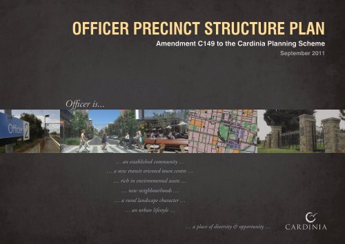
<strong>OFFICER</strong> <strong>PRECINCT</strong> <strong>STRUCTURE</strong> <strong>PLAN</strong><br />
Officer is...<br />
Old Princes Highway<br />
Thomas Street<br />
Cardinia Creek<br />
O’Neill Road<br />
May Road<br />
Kenilworth Avenue<br />
0 75 150 225<br />
… an established community …<br />
… a new transit oriented town centre …<br />
This plan has been prepared for<br />
Cardinia Shire Council. All enquiries<br />
should be directed to Council’s strategic<br />
planning department on 1300 787 624<br />
… rich in environmental assets …<br />
… new neighbourhoods …<br />
… a rural landscape character …<br />
… an urban lifestyle …<br />
Amendment C149 to the Cardinia Planning Scheme<br />
Brunt Road<br />
Whiteside Road<br />
SS<br />
Stephens Road<br />
PPS<br />
CC<br />
CC<br />
PS<br />
Princes Highway<br />
CC<br />
PS<br />
Princes Freeway<br />
Rix Road<br />
PrS<br />
CC<br />
PrS<br />
Hickson Road<br />
CC<br />
PS<br />
Scale: 1:7500 @ A1<br />
1:15000 @ A3<br />
0 150 300 450m<br />
Bayview Road<br />
Transmission Easement<br />
Gas Pipeline<br />
Station Street<br />
PrS<br />
PS<br />
Tivendale Road<br />
CC<br />
PrS<br />
Gum Leaf Lane<br />
PPS<br />
& SS<br />
Brown Road<br />
CC<br />
Starling Road<br />
PrS<br />
PrS<br />
PS<br />
CC<br />
Gum Scrub Creek<br />
PS<br />
please note:<br />
This plan is based on preliminary information<br />
only and may be subject to change as a result<br />
of formal Council/<strong>Authority</strong> advice, detailed site<br />
investigations and confirmation by survey<br />
CC<br />
Mc Mullen Road<br />
CC<br />
Plan 5: Future Urban Structure<br />
Officer Precinct Structure Plan<br />
ref.: 3410344U<br />
date: 16 September 2011<br />
rev.: F-1<br />
drawn: DM/DL<br />
checked: CD<br />
LEGEND<br />
Precinct Structure Plan Area<br />
Urban <strong>Growth</strong> Boundary<br />
Movement Network<br />
Arterial Road (VicRoads)<br />
Potential Future Arterial Road (VicRoads)<br />
Local Arterial / Connector Street (Boulevard)<br />
Connector Street<br />
Main Street<br />
Access Street - Level 2<br />
Access Place / Street - Level 1 (important connection)<br />
Access Street - Level 1 with Landscape trail<br />
Signalised intersections (arterial roads only)<br />
Grade Separated Crossing<br />
Railway Line, Station & Potential Bus Interchange<br />
PPTN - Principal Public Transport Network (Bus)<br />
Residential Land<br />
Residential Land<br />
Large Lot Residential<br />
Environmental Residential<br />
Creek<br />
Princes Highway<br />
Peck Road<br />
Employment Land<br />
Major Activity Centre (MAC)<br />
MAC Core Business<br />
MAC Peripheral Commercial<br />
Neighbourhood Centres<br />
Neighbourhood Activity Centre (NAC)<br />
Neighbourhood Convenience Centre (NCC)<br />
Core Business<br />
Peripheral Commercial<br />
Cardinia Road<br />
Community and Schools<br />
Community facilities and public uses<br />
(CC = Community Centre) CC<br />
Education facilities<br />
(PS = Primary School, PPS = Post Primary School,<br />
PrS = Private School, SS = Special School)<br />
PrS<br />
Open Space and Environment<br />
Public open space (unencumbered)<br />
PS<br />
Public open space (encumbered)<br />
Regional Open Space<br />
District sports reserves (8ha+)<br />
District Parks<br />
Proposed pedestrian crossings<br />
Existing creeks<br />
Major Drainage Lines<br />
Ecological Vegetation Classes (EVC’s) to be retained<br />
Other Land<br />
CC<br />
Existing Major Easements<br />
Conservation Living Area<br />
Future Development Area (subject to EPBC approval)<br />
planning & urban design<br />
melbourne<br />
© smec australia pty ltd<br />
abn 47 065 475 149<br />
trading as smec urban<br />
… a place of diversity & opportunity …<br />
September 2011<br />
CC<br />
PS
Cardinia Shire Council<br />
Henty Way, Pakenham<br />
PO Box 7, Pakenham 3810<br />
Phone 1300 787 624 Fax 03 5941 3784<br />
www.cardinia.vic.gov.au<br />
Prepared by Cardinia Shire Council in consultation<br />
with the <strong>Growth</strong> <strong>Areas</strong> <strong>Authority</strong><br />
Acknowledgements<br />
Ark Resources<br />
Ashton Traffic<br />
CPG Australia Pty Ltd<br />
Department of Sustainability and Environment<br />
Department of Transport<br />
Design Urban<br />
Hansen Partnership<br />
Melbourne Water<br />
Patrick Partners<br />
Stormy Water Solutions<br />
VicRoads<br />
VicUrban<br />
Document Produced: 30 September 2011 (Version: F-1)
Contents<br />
01 Introduction 5<br />
1.1 Composition of Documents 5<br />
1.2 The Officer Precinct Structure Plan 5<br />
1.3 The Officer Native Vegetation Precinct Plan 5<br />
1.4 Implementation 7<br />
1.5 Reference Material 7<br />
1.6 Monitoring and Review 7<br />
02 Local Context and Site Description 9<br />
2.1 Metropolitan & Regional Context 9<br />
2.2 Local Context 11<br />
2.3 Precinct Features 17<br />
03 Integrated Precinct Design 24<br />
3.1 Vision 24<br />
3.2 Future Urban Structure 24<br />
3.3 Land Use Budget 29<br />
3.4 Demographic Projections 33<br />
04 Elements 35<br />
4.1 Image and Character 35<br />
4.2 Housing 42<br />
4.3 Employment and Activity Centres 58<br />
4.4 Community Facilities 88<br />
4.5 Open Space and Natural Systems 96<br />
4.6 Transport and Movement 115<br />
4.7 Utilities, Energy & Sustainability 145<br />
05 Precinct Infrastructure Plan 152<br />
5.1 Introduction 152<br />
5.2 Infrastructure and Services Required 152<br />
5.3 Project Co-ordination 153<br />
5.4 Delivery and Monitoring 153<br />
06 Development Staging and Requirements 163<br />
6.1 Development Staging 163<br />
07 Other Information 166<br />
7.1 Acronyms 166<br />
7.2 Glossary of Terms 167<br />
7.3 References 173<br />
Appendix A: Small Lot Housing Code 175<br />
Key Requirements of Schedules 3 and 4 to the Urban <strong>Growth</strong> Zone<br />
Urban Design Framework - Officer Town Centre 84<br />
Urban Design Framework - Whiteside Road Neighbourhood Activity Centre 85<br />
Site Context Report - Neighbourhood Convenience Centres 86<br />
How to make a public open space contribution in this Precinct 107<br />
Sustainability Statement Requirements 151
Plans and Figures<br />
Plans Figures<br />
Plan 1: Precinct Structure Plan Area 6<br />
Plan 2: Metropolitan and Regional Context 10<br />
Plan 3: Local Context 12<br />
Plan 3a: PSP <strong>Areas</strong> 13<br />
Plan 4: Precinct Features 18<br />
Plan 5: Future Urban Structure 25<br />
Plan 6: Land Use Budget 30<br />
Plan 7: Image and Character 36<br />
Plan 8: Housing 43<br />
Plan 9: Employment and Activity Centres 60<br />
Plan 10: Community Facilities 89<br />
Plan 11: Open Space Network 97<br />
Plan 12: Integrated Water Management 98<br />
Plan 13: Biodiversity Management 108<br />
Plan 14: Heritage 111<br />
Plan 15: Road Network 116<br />
Plan 16: Public Transport 117<br />
Plan 17: Walking and Trails<br />
Tables<br />
118<br />
Table 1: Cardinia Planning Scheme Heritage Overlay sites in the Precinct 19<br />
Table 2: Proposed Cardinia Planning Scheme Heritage Overlay sites in the Precinct 19<br />
Table 3a: Summary Land Use Budget - Net Developable Area Calculation 31<br />
Table 3b: Summary Land Use Budget - Employment & Activity Centres Land <strong>Areas</strong> 32<br />
Table 3c: Summary Land Use Budget - Residential Yield Estimates 32<br />
Table 4: Population Estimates by Dwelling Types 34<br />
Table 5: Image and Character Planning and Design Guidelines 38<br />
Table 6: Distribution of Housing Densities 44<br />
Table 7: Housing Planning and Design Guidelines 45<br />
Table 8: Employment in the Precinct 61<br />
Table 9: Hierarchy of Activity Centres in the Precinct 62<br />
Table 10: Employment and Activity Centres Planning and Design Guidelines 63<br />
Table 10a: Officer Major Activity Centre 67<br />
Table 10b: Whiteside Neighbourhood Activity Centre Planning and Design Guidelines 80<br />
Table 11: Community facilities and services 90<br />
Table 12: Community Facilities Planning and Design Guidelines 92<br />
Table 13: Open Space Categories 99<br />
Table 14: Open Space Planning and Design Guidelines 102<br />
Table 15: Biodiversity Planning and Design Guidelines 109<br />
Table 16: Transport and Movement Planning and Design Guidelines 119<br />
Table 17a: Road Hierarchy for Officer Residential Area 124<br />
Table 17b: Road Hierarchy for Officer Town Centre 138<br />
Table 18: Utilities and Energy Planning and Design Guidelines 146<br />
Table 19: Environmentally Sustainable Design Planning and Design Guidelines 149<br />
Table 20: Infrastructure Project List - Within PSP Area 154<br />
Table 21: Infrastructure Project List - Outside PSP Area 161<br />
Figure 1: Indicative High Density Residential Typologies 53<br />
Figure 2: Indicative Medium Density Residential Typologies 54<br />
Figure 3: Indicative Building Envelopes for lots containing Native Vegetation to be retained 55<br />
Figure 4: Lots fronting onto Open Space 55<br />
Figure 5a: Interface to Railway Reservation 56<br />
Figure 5b: Interface with Princes Freeway 57<br />
Figure 6: Officer Town Centre Sub Precinct Plan 66<br />
Figure 6a: Indicative Design Solution - Core Town Centre Precinct 75<br />
Figure 6b: Indicative Design Solution - Gum Leaf Lane SoHo 76<br />
Figure 6c: Indicative Design Solution - MAC Gateway 77<br />
Figure 6d: Indicative Design Solution - Leber Conservation Reserve 78<br />
Figure 6e: Indicative Design Solution - Main Street Underpass 79<br />
Figure 7: Indicative Urban Design Framework Plan – Whiteside Road Neighbourhood Activity Centre 83<br />
Figure 8: Indicative Design Response – Neighbourhood Convenience Centre 87<br />
Figure 9: Indicative concept plan for the Community Hubs 94<br />
Figure 10a: Strategic Design Principles for Residential Interface to Wildfire Management Overlay 113<br />
Figure 10b: Fuel Managed Buffers 114<br />
Figure 11a: Arterial Road Sections 126<br />
Figure 11b: Local Arterial Road Sections 127<br />
Figure 11c: Connector Street Boulevard Section 128<br />
Figure 11d: Connector Street Sections 129<br />
Figure 11e: Connector Street Sections 130<br />
Figure 11f: Connector Street Sections 131<br />
Figure 11g: Access Street - Level 2 Sections 132<br />
Figure 11h: Access Street - Level 2 Sections 133<br />
Figure 11i: Access Street - Level 2 Sections 134<br />
Figure 11j: Access Street - Level 1 Sections 135<br />
Figure 11k: Access Street - Level 1 & Service Road Sections 136<br />
Figure 11l: Neighbourhood Activity Centre - Main Street Section 137<br />
Figure 12a: Major Activity Centre - Core Street Sections 139<br />
Figure 12b: Major Activity Centre - Connector Street Sections 140<br />
Figure 12c: Major Activity Centre - Connector Street Sections 141<br />
Figure 12d: Major Activity Centre - Access Street - Level 2 Sections 142<br />
Figure 12e: Major Activity Centre - Access Street - Level 2 Sections 143<br />
Figure 12f: Major Activity Centre - Access Street - Level 1 & Laneway Sections 144
01 Introduction<br />
1.1 Composition of Documents<br />
The Officer Precinct Structure Plan (PSP) has been<br />
prepared by the Cardinia Shire Council in conjunction<br />
with the <strong>Growth</strong> <strong>Areas</strong> <strong>Authority</strong> (GAA), government<br />
agencies, service authorities and major stakeholders.<br />
The Officer PSP should be read in conjunction with<br />
two other incorporated documents: the Officer Native<br />
Vegetation Precinct Plan (NVPP) and the Officer<br />
Development Contributions Plan (DCP). The role of<br />
the PSP and the NVPP and their inter-relationship are<br />
set out below.<br />
1.2 The Officer Precinct Structure<br />
Plan<br />
1.2.1 Role of the Precinct Structure Plan<br />
The PSP is a long term strategic plan to guide future<br />
urban development. It describes how the land is<br />
expected to be developed, the infrastructure and<br />
services planned to support the new community and<br />
how they will be delivered.<br />
The PSP:<br />
• enables the transition of non-urban land to urban<br />
land;<br />
• sets out the vision for how land should be<br />
developed and the desired outcomes to be<br />
achieved;<br />
• determines the overall layout of future land use and<br />
development;<br />
• outlines projects required to ensure that future<br />
residents, visitors and workers within the Precinct<br />
can be provided with timely access to services,<br />
transport, jobs, shops, open space and recreation<br />
facilities to support a quality, affordable lifestyle;<br />
• details the form and conditions that must be met by<br />
future land use and development;<br />
• informs the use and development controls that<br />
apply in the schedule to the Urban <strong>Growth</strong> Zone<br />
(UGZ) and what permits may be granted under the<br />
Schedule to the Zone; and,<br />
• provides developers, investors and local<br />
communities with certainty about future<br />
development.<br />
The PSP is informed by:<br />
• The State Planning Policy Framework set out in the<br />
Cardinia Planning Scheme, including the <strong>Growth</strong><br />
Area Framework Plans and the Precinct Structure<br />
Planning Guidelines (GAA 2009), and;<br />
• The Local Planning Policy Framework of the<br />
Cardinia Planning Scheme and other local policies<br />
and strategies (under Clause 21 and 22).<br />
1.2.2 Land to which the Precinct<br />
Structure Plan applies<br />
The PSP applies to land shown in Plan 1 (referred to<br />
as the Precinct) and shown on the Cardinia Planning<br />
Scheme maps as Schedules 3 and 4 to the UGZ<br />
(UGZ3 and UGZ4). The Officer PSP comprises<br />
approximately 1,000 hectares1 of land and is defined<br />
by:<br />
• The major electricity transmission line easement to<br />
the north;<br />
• Gum Scrub Creek to the east;<br />
• The Princes Freeway to the south; and<br />
• May Road, Princes Highway, Brunt Road (part),<br />
Kenilworth Avenue and Cardinia Creek to the west.<br />
The majority of the PSP area is within the suburb of<br />
Officer, while the area west of Whiteside Road and<br />
Brunt Road is located within Beaconsfield.<br />
1 Excludes the Freeway Services Centre.<br />
1.3 The Officer Native Vegetation<br />
Precinct Plan<br />
1.3.1 Role of the Native Vegetation<br />
Precinct Plan<br />
The Officer Native Vegetation Precinct Plan (NVPP) has<br />
been prepared for the purposes of Clause 52.16 of the<br />
Cardinia Planning Scheme. It identifies:<br />
• Native vegetation which may be removed without a<br />
planning permit;<br />
• The offsets that must be provided to remove the<br />
native vegetation which can be removed;<br />
• Native vegetation which cannot be removed without<br />
a planning permit; and<br />
• Conditions that must be met in relation to vegetation<br />
to be protected and removed.<br />
The Officer NVPP has been prepared concurrently<br />
to the PSP and implements the vision set out in the<br />
PSP. It is a separate stand-alone document which is<br />
incorporated within the planning scheme.<br />
Clause 52.16 forms the statutory basis for the<br />
preparation and implementation of the NVPP. Users of<br />
this document should note that the statutory basis for<br />
the NVPP is different to the PSP (which is implemented<br />
through Clause 37.07).<br />
1.3.2 Land to which the Native Vegetation<br />
Precinct Plan applies<br />
The NVPP applies to land identified in Map 1 of the<br />
NVPP (September 2011). It covers all land in the<br />
Precinct, unless otherwise shown on Map 1 of the<br />
NVPP.<br />
Officer Precinct Structure Plan 5
Plan 1: Precinct Structure Plan Area<br />
Old Princes Highway<br />
Thomas Street<br />
Cardinia Creek<br />
0 75 150 225<br />
6 Officer Precinct Structure Plan<br />
May Road<br />
Kenilworth Avenue<br />
Brunt Road<br />
Whiteside Road<br />
Princes Highway<br />
Stephens Road<br />
Water Easement<br />
Princes Freeway<br />
Rix Road<br />
Transmission Easement<br />
Gas Pipeline<br />
Bayview Road<br />
Hickson Road<br />
Officer South Road<br />
Station Street<br />
Tivendale Road<br />
Gum Leaf Lane<br />
Officer<br />
Railway Station<br />
Brown Road<br />
Starling Road<br />
Gum Scrub Creek<br />
Mc Mullen Road<br />
Plan 1: Precinct Structure Plan Area<br />
LEGEND<br />
Precinct Structure Plan Area<br />
Urban <strong>Growth</strong> Boundary<br />
State Freeway<br />
State Highway<br />
Existing Roads<br />
Railway Line & Station<br />
Major Easements<br />
Existing Urban <strong>Areas</strong><br />
Future Urban <strong>Areas</strong><br />
Green Wedge Land<br />
Existing Creeks
1.4 Implementation<br />
The Officer PSP will be implemented by:<br />
• development proponents who develop land<br />
generally in accordance with this PSP;<br />
• the Victorian Government and the Cardinia Shire<br />
Council by funding, delivering and managing a<br />
range of infrastructure and services to support the<br />
development of the Precinct; and,<br />
• non-government services providers and individuals<br />
such as volunteers who manage and deliver<br />
services.<br />
Amendment C149 to the Cardinia Planning Scheme<br />
will implement the Officer PSP through:<br />
• Schedules 3 and 4 to the Urban <strong>Growth</strong> Zone at<br />
Clause 37.07;<br />
• the Officer Development Contributions Plan<br />
(September 2011) to be incorporated into the<br />
Scheme at Clause 45.06 Schedule 4 (DCPO4);<br />
• the Officer Native Vegetation Precinct Plan<br />
incorporated in the Scheme at Clause 52.16; and<br />
• other requirements of the Planning Scheme, as<br />
appropriate.<br />
1.5 Reference Material<br />
A glossary and other information including details of<br />
technical studies supporting the preparation of this<br />
PSP are listed in Section 7 - Other Information.<br />
1.6 Monitoring and Review<br />
Cardinia Shire Council and the <strong>Growth</strong> <strong>Areas</strong> <strong>Authority</strong><br />
will jointly monitor the implementation of the Officer<br />
PSP. Its effectiveness will be evaluated regularly,<br />
at least every five years. The PSP may be revised<br />
and updated following review, which may trigger a<br />
review of the Officer Development Contributions Plan<br />
(September 2011).<br />
Officer Precinct Structure Plan 7
8 Officer Precinct Structure Plan<br />
This page has been left blank intentionally.
02 Local Context and Site Description<br />
2.1 Metropolitan & Regional<br />
Context<br />
The Officer Precinct is located in the western part of<br />
Cardinia Shire, between Beaconsfield and Pakenham.<br />
It is approximately 50 kilometres southeast of<br />
Melbourne Central Business District (CBD) and<br />
12 kilometres east of Narre Warren-Fountain Gate<br />
Principal Activity Centre (PAC) as shown in Plan 2.<br />
Occupying a significant land area, it is designated<br />
for residential development in the Casey-Cardinia<br />
<strong>Growth</strong> Area Framework Plan (DSE 2006). Planned to<br />
accommodate approximately 10,000 dwellings, it is<br />
expected that Officer Precinct will be home to 30,000<br />
residents at full development.<br />
Casey-Cardinia <strong>Growth</strong> Area<br />
The Casey-Cardinia <strong>Growth</strong> Area is located south-east<br />
of metropolitan Melbourne and includes land within<br />
the City of Casey and the Shire of Cardinia, within the<br />
Urban <strong>Growth</strong> Boundary (UGB). Cardinia’s Urban<br />
<strong>Growth</strong> Area generally extends from Cardinia Creek to<br />
Pakenham between the transmission line easements<br />
north and south of the Princes Highway and Princes<br />
Freeway respectively.<br />
The <strong>Growth</strong> Area Framework Plan (DSE 2006)<br />
anticipates that the Casey-Cardinia growth area will:<br />
• Grow by 135,000 to 170,000 people; and,<br />
• increase the number of jobs in the area by 100,000<br />
to 140,000.<br />
As shown in Plan 2, in the broader metropolitan and<br />
regional context, the development of the Precinct will<br />
be influenced by:<br />
• An extensive network of State freeways,<br />
highways and major roads such as<br />
– Princes Freeway that links to metropolitan<br />
Melbourne and EastLink (via the Monash<br />
Freeway) and Gippsland to the east; and,<br />
– Princes Highway that is a secondary link to<br />
metropolitan Melbourne, EastLink and Gippsland<br />
and forms part of the Strategic Road Network<br />
and the Principal Public Transport Network<br />
(PPTN) for a Bus Route.<br />
• An expanding activity centre network that<br />
includes:<br />
– Dandenong Central Activities District (CAD),<br />
intended to provide a ‘regional CBD’ to serve<br />
Melbourne’s south-east;<br />
– Principal Activity Centres (PACs) located at Narre<br />
Warren-Fountain Gate and Cranbourne; and,<br />
– Major Activity Centres (MACs) located at<br />
Pakenham, Officer (within the Precinct), Berwick,<br />
Casey-Central, Hampton Park and Endeavour<br />
Hills.<br />
• An established rail network, encompassing:<br />
– a metropolitan railway line which also forms<br />
part of the PPTN and which branches into the<br />
Pakenham and Cranbourne lines at Dandenong.<br />
The railway line runs parallel to the Princes<br />
Freeway, central to Cardinia Shire’s future<br />
residential area;<br />
– existing stations at Pakenham, Officer (within the<br />
Precinct) and Beaconsfield, with a new station<br />
under construction at Cardinia Road; and,<br />
– a V-Line regional railway service, connecting to<br />
Gippsland from Pakenham Station.<br />
• An extensive open space network, that includes:<br />
– Gum Scrub Creek which forms part of the<br />
Toomuc/Deep Creek Outfall Catchment and the<br />
Koo Wee Rup Flood Protection District; and,<br />
– Cardinia Creek, which defines the boundary of<br />
City of Casey and Cardinia Shire and provides a<br />
significant urban break between suburbs. It also<br />
forms part of a significant regional open space<br />
area known as Cardinia Creek Parklands which<br />
provides series of linked parks which stretch over<br />
400 hectares along 10 kilometres of Cardinia<br />
Creek;<br />
– Significant hills and ridgelines to the north (in part<br />
of the Precinct).<br />
• Established and planned employment areas<br />
such as:<br />
– The Cardinia Employment Corridor, which<br />
includes all land in Cardinia Shire, south of<br />
the Princes Freeway within the UGB. Covering<br />
an area of approximately 2,500 hectares, the<br />
Cardinia Employment Corridor is comprised<br />
of four precincts: Cardinia Road Employment<br />
Precinct, Officer Employment Precinct,<br />
Pakenham South Employment Precinct and<br />
Pakenham West Employment Precinct. Planned<br />
to accommodate a diverse range of industry<br />
types, the Cardinia Road Employment Precinct<br />
creating a jobs-intensive business park at the<br />
‘core’ of the corridor.<br />
– Narre Warren-Fountain Gate Business Park,<br />
located at the intersection of the Princes Highway<br />
and Princes Freeway. Designated for office<br />
development, the area is part of the Narre Warren<br />
- Fountain Gate Principal Activity Centre (PAC);<br />
Officer Precinct Structure Plan 9
Plan 2: Metropolitan and Regional Context<br />
SPRINGVALE<br />
20km<br />
Eastlink<br />
Eastlink<br />
Ballarto Road<br />
0 1 2 3km<br />
10 Officer Precinct Structure Plan<br />
Dandenong<br />
CAD<br />
Western Port Highway<br />
Endeavour<br />
Hills<br />
Hampton<br />
Park<br />
Heatherton Road<br />
Princes Freeway<br />
Hallam Road<br />
South Gippsland<br />
Glasscocks Road<br />
Highway<br />
Narre Warren Cranbourne Road<br />
Berwick - Cranbourne Road<br />
Cranbourne<br />
Royal Botanic<br />
Gardens<br />
Cranbourne<br />
Princes Highway<br />
Casey<br />
Central<br />
10km<br />
Fountain Gate<br />
Clyde Road<br />
Thompsons Road<br />
10km<br />
City of<br />
Casey<br />
Berwick<br />
Cardinia Cre ek<br />
5km<br />
5km<br />
Cardinia<br />
Shire<br />
Princes Highway<br />
Officer<br />
Princes Freeway<br />
Cardinia Creek<br />
City of<br />
Casey<br />
Upper Beaconsfield<br />
Cardinia<br />
Shire<br />
LEGEND<br />
Melbourne - Bairnsdale Railway<br />
Long Term Freeway Connection<br />
Pakenham<br />
Plan 2: Metropolitan & Regional Context<br />
Officer Precinct Structure Plan<br />
Urban <strong>Growth</strong> Boundary<br />
Rail Line<br />
Significant Waterways<br />
Officer Precinct Structure Plan Area<br />
Existing Employment<br />
Proposed Employment<br />
Urban Area<br />
Central Activities District (CAD)<br />
Existing & Proposed Principal Activity Centre (PAC)<br />
Existing & Proposed Major Activity Centre (MAC)<br />
Regional Open Space/Creek Corridors<br />
Municipal Boundary (Cardinia Creek)<br />
New Urban Area<br />
Existing State Freeway<br />
Future State Freeway<br />
Existing State Highway<br />
Future State Freeway (Upgrade from Highway)<br />
Existing Arterial Road<br />
Future / Potential Future Arterial Road<br />
Koo Wee Rup Road<br />
To Drouin/<br />
Warragul
– Casey Technology Park at Berwick, where<br />
Monash University Berwick and Casey Hospital<br />
are located. The area is planned to be developed<br />
for technology-related business and research<br />
and development activities; and<br />
– C21 Business Park, a new employment node<br />
located just south of the Princes Freeway,<br />
adjacent to Cardinia Creek.<br />
2.2 Local Context<br />
The local context for the Precinct is shown in Plan 3.<br />
2.2.1 History<br />
Before the early nineteenth century, the Precinct was<br />
in the custodianship of clans of the Bunurong and also<br />
possibly the Woiworung clans1 .<br />
Since European settlement, land in the Officer<br />
area has been predominantly used for farming and<br />
agricultural purposes.<br />
Officer’s Wood Siding, later abbreviated to Officer, was<br />
established in the 1880s and named after a family of<br />
local settlers.<br />
In 1877 the Oakleigh to Bunyip railway line opened<br />
with Officer Station completed by 1881. By the 1880s<br />
Officer had become important to the district’s timber<br />
trade and included a saw mill but the local population<br />
remained scattered. The rapid growth of Melbourne<br />
supported the growth of the local industry, which<br />
exported firewood, palings and other timber to the<br />
capital city. Five brickyards opened out of Officer<br />
but all closed during the 1890s depression. By the<br />
end of the nineteenth century Officer was developing<br />
into a dairying and fruit growing area along with other<br />
settlements in the district. Following the First World<br />
War a revival of brick making and related building and<br />
pottery supplies occurred with local firms such and<br />
James Hicks Pty Ltd and the Berwick Pottery being<br />
established or expanding during this time. Several<br />
buildings and sites from this period still occupy the<br />
landscape in Officer, representing an important period<br />
in the community’s past.<br />
1 Tardis Enterprises Pty Ltd, Officer Precinct Structure Plan, Desktop Cultural Heritage<br />
Assessment, July 2009, pg. 12.<br />
2.2.2 Lot size and ownership pattern<br />
At present, land within the Precinct is predominately<br />
being used for rural or farming purposes.<br />
Approximately:<br />
• 68% of the properties are less than 2 hectares;<br />
• 20% of properties range from 2 to 8 hectares;<br />
• 12% of the lots are greater than 8 hectares; and,<br />
• 16% of the Officer PSP area is within in the<br />
ownership of VicUrban.<br />
Unlike other PSP areas, the Precinct has a significantly<br />
higher number of individual property owners. Township<br />
scale lots associated with the existing Officer town<br />
centre are concentrated around Station Street south of<br />
the Princes Highway and Tivendale Road north of the<br />
Highway. Sales premises are also located along both<br />
the south and north side of Princes Highway.<br />
The area west of Brunt Road and north of Rix Road,<br />
bounded by Kenilworth Avenue to the north makes up<br />
around 5% of the Precinct. This area is currently zoned<br />
Low Density Residential (LDRZ) and parts of this area<br />
have limited subdivision potential.<br />
Around 32.2 hectares of land within the Precinct is<br />
occupied by private schools as identified on Plan 3.<br />
Officer Precinct Structure Plan 11
Plan 3: Local Context<br />
Transmission Easement<br />
Beaconsfield<br />
Old Princes Hig hway<br />
0 200 400 600m<br />
12 Officer Precinct Structure Plan<br />
Cardinia Creek<br />
(Shire Boundary)<br />
Whiteside Road<br />
Stephens Road<br />
Melbourne - Pakenham Railway<br />
Rix Road<br />
Gas Pipeline<br />
Bayview Road<br />
Officer South Road<br />
Water Easement<br />
Tivendale Road<br />
Grices / Glasscocks Road Extension<br />
Starling Road<br />
McMullen Road<br />
Officer<br />
DANDENONG R ANGES FOO THILLS DANDENON G RANGES FOOTHILLS<br />
Princes Freeway<br />
Gum Scrub Creek<br />
Cardinia Road<br />
Princes Highway<br />
Cardinia Road<br />
Transmission Easement<br />
Melbourne - Bairnsdale Railway<br />
Thompsons Road<br />
Gas Pipeline<br />
Toomuc Creek<br />
Transmission Easement<br />
Long Term<br />
Freeway Connection<br />
Toom uc Valley Road<br />
McGregor Road<br />
Greenhills Road<br />
Pakenham<br />
Princes Freeway<br />
Healesville - Koo Wee Rup Road<br />
Racecourse Road<br />
LEGEND<br />
Urban <strong>Growth</strong> Boundary<br />
Railway Line & Station<br />
Principal Public Transport Network (Bus)<br />
Significant Waterways<br />
Existing State Freeway<br />
Future State Freeway<br />
Existing State Highway<br />
Existing Arterial Road<br />
Future / Potential Future Arterial Road<br />
Main Road<br />
Officer Precinct Structure Plan Area<br />
Existing Employment<br />
Proposed Employment<br />
Existing Residential<br />
Proposed Residential<br />
Existing Schools & Community Facilities<br />
Proposed Schools & Community Facilities<br />
Designated Neighbourhood Activity Centre (NAC)<br />
Designated Major Activity Centre (MAC)<br />
60m Contour<br />
100m to Fire Threat<br />
Open Space & Drainage Corridors<br />
Existing and Proposed Activity Centre<br />
Municipal Boundary<br />
Deep Creek<br />
Plan 3: Local Context<br />
Officer Precinct Structure Plan
Plan 3a: PSP <strong>Areas</strong><br />
Old Princes Highway<br />
Beaconsfield<br />
C21 Business<br />
Park PSP Area<br />
Clyde North<br />
PSP Area<br />
New Urban<br />
Area<br />
Transmission Easement<br />
Cardinia Creek<br />
(Shire Boundary)<br />
Gas Pipeline<br />
Melbourne - Pakenham Railway<br />
Princes Freeway<br />
Officer South Road<br />
Officer<br />
Grices / Glasscocks Road Extension<br />
Officer Employment<br />
PSP Area<br />
DANDENONG RANGES FOOTHILL S DANDENONG RANGES FOOTHILLS<br />
Gum Scrub Creek<br />
Cardinia Road<br />
Princes Highway<br />
Cardinia Road<br />
Cardinia Road<br />
Employment<br />
PSP Area<br />
Cardinia Road<br />
PSP Area<br />
Melbourne - Bairnsdale Railway<br />
Thompsons Road<br />
Gas Pipeline<br />
Cardinia Road Employment<br />
PSP Area 2<br />
Toomuc Creek<br />
Pakenham West<br />
PSP Area<br />
Transmission Easement<br />
Long Term<br />
Freeway<br />
Connection<br />
Too muc Valley Road<br />
Transmission Easement<br />
McGregor Road<br />
Princes Freeway<br />
Greenhills Road<br />
Pakenham<br />
Racecourse Road<br />
Pakenham South<br />
Employment PSP Area<br />
Healesville - Koo Wee Rup Road<br />
Pakenham South<br />
Employment PSP Area 2<br />
Plan 3a: PSP <strong>Areas</strong><br />
Cardinia Road Employment Precinct Structure Plan<br />
Deep Creek<br />
LEGEND<br />
Urban <strong>Growth</strong> Boundary<br />
Railway & Transport Interchanges<br />
Significant Waterways<br />
Existing Freeway<br />
Future Freeway<br />
Highway<br />
Existing Arterial Road<br />
Future / Potential Future Arterial Road<br />
Main Road<br />
Officer Precinct Structure Plan Area<br />
60m Contour<br />
Municipal Boundary<br />
Existing Urban Development<br />
Officer Precinct Structure Plan 13
2.2.3 Surrounding Neighbourhoods and<br />
Land Use<br />
A number of existing neighbourhoods and precincts<br />
provide context for the development of Officer<br />
Precinct, influencing the PSP (refer Plan 3a). The key<br />
features of each of these areas are described below.<br />
Residential Precincts<br />
• Beaconhill Grange Estate / Bowman’s Track<br />
Estate is located in Beaconsfield on the western<br />
boundary of the Precinct (north of Princes<br />
Highway) and commenced development in<br />
2002. The Beaconhill Grange Estate contains a<br />
community node which includes the Beaconsfield<br />
Community Complex and a private childcare<br />
centre.<br />
• Low Density areas are located in Beaconsfield<br />
on the western boundary of the Precinct (south<br />
of Princes Highway) known as the Kenilworth<br />
Avenue area. Some of these areas have potential<br />
for further subdivision. This area contains<br />
approximately 40 lots ranging in size from around<br />
0.4 hectares through to around 8 hectares.<br />
• Arena Estate is located in Officer, on the eastern<br />
boundary of the Precinct (south of Princes<br />
Highway). Amendment C59 to the Cardinia<br />
Planning Scheme enabled the development of<br />
this land. Development commenced in 2008 and<br />
the area provides a diverse range of residential<br />
lot sizes, including some medium density housing<br />
as well as a Neighbourhood Activity Centre.<br />
The activity centre will provide approximately<br />
5,000 square metres of core retail floorspace,<br />
comprising a supermarket and associated<br />
shops and services, with supporting peripheral<br />
commercial uses.<br />
14 Officer Precinct Structure Plan<br />
• Cardinia Road Precinct Structure Plan is located<br />
on the eastern boundary of the Precinct.<br />
Amendment C92 to the Cardinia Planning Scheme<br />
enabled the development of this land, facilitating<br />
development a new suburb of approximately<br />
30,000 residents. It provides for:<br />
– a diversity of dwelling types and includes the<br />
provision for medium density housing (minimum<br />
of 20 dwellings per hectare) located within 400<br />
metres of activity centres and public transport.<br />
– grade separation of Cardinia Road and the<br />
railway line, substantially improving access to the<br />
new railway station, activity centre and proposed<br />
bus interchange.<br />
– protection of visually prominent ridges and hills<br />
by encompassing such land within public open<br />
space as well as placing controls on the type,<br />
density and design of development.<br />
Employment Precincts<br />
• The Cardinia Employment Corridor encompasses<br />
the land south of the Princes Freeway within the<br />
UGB. It has a total area of approximately of 2,500<br />
hectares, and is planned to accommodate a diverse<br />
range of industry types.<br />
• The corridor has been divided into four precincts,<br />
two of which abut the Officer PSP area:<br />
- Cardinia Road Employment Precinct is located<br />
south east of the Precinct. The Cardinia<br />
Road Employment Precinct is planned as<br />
an integrated commercial and industrial<br />
business park in a high amenity setting that is<br />
characterised by landscape wetland corridors,<br />
a diverse activity centre and quality residential<br />
area.<br />
- Officer Employment Precinct is located south<br />
of the Precinct, west of Gum Scrub Creek and<br />
extending across to Cardinia Creek. At 1,050<br />
hectares, it is the largest employment precinct<br />
in Cardinia and will provide a significant<br />
opportunity for job creation in the future.<br />
- Pakenham South Employment Precinct<br />
is located east of McGregor Road to the<br />
eastern edge of the UGB. It includes South<br />
East Business Park and is already partially<br />
zoned for industrial use. It is planned to<br />
accommodate local and regional industrial<br />
businesses, with some bulky goods.<br />
- Pakenham West Employment Precinct<br />
is located between Toomuc Creek and<br />
McGregor Road. Planning is underway for a<br />
freeway bypass from the Princes Freeway to<br />
Koo Wee Rup will run through the heart of this<br />
area in the future.<br />
Urban <strong>Growth</strong> Boundary<br />
• The northern boundary of the Officer Precinct<br />
is defined by the Urban <strong>Growth</strong> Boundary<br />
(UGB). Land north of the Precinct is located<br />
predominately in the Green Wedge Zone (GWZ)<br />
and is affected by the Environmental Significance<br />
Overlay – Schedule 1 (Northern Hills) (ESO1), with<br />
sections affected by the Floodway Overlay (FO)<br />
and Land Subject to Inundation Overlay (LSIO).<br />
• Recommendations in Melbourne 2030 Final<br />
Report: Casey - Cardinia Committee for Smart<br />
<strong>Growth</strong>, June 2005 make specific reference to<br />
recognising and protecting visual amenity and<br />
view lines to the significant green ridges; the<br />
visual backdrop to the southern foothills of the<br />
Dandenong Ranges; and, the significant hilltops of<br />
the area north of the Princes Highway.
• Melbourne @ 5 Million (DSE) 2008 reiterates<br />
the physical and environmental constraints<br />
of the foothills of the Dandenong Ranges to<br />
development, being fire prone and of scenic and<br />
environmental value.<br />
2.2.4 Transport and movement<br />
Princes Highway is an existing state arterial road which<br />
runs east-west through the centre of the Precinct. The<br />
Princes Highway is designated as a Principal Public<br />
Transport Network (PPTN) bus route.<br />
The Princes Freeway is located south of the existing<br />
Princes Highway route and provides full freeway<br />
conditions with two lanes each way between<br />
Beaconsfield and Nar Nar Goon. A freeway<br />
interchange is proposed at Officer South Road.<br />
With the exception of Princes Highway and the Princes<br />
Freeway, the existing road network within the Precinct<br />
is presently a combination of unsealed rural roads and<br />
sealed roads to a rural standard.<br />
There are two existing at-grade rail crossings in the<br />
Precinct, located on Station Street/Officer South Road<br />
and Brunt Road.<br />
The Principal Public Transport Network (PPTN) also<br />
includes the Gippsland / ‘Pakenham’ railway line which<br />
provide both suburban and V-Line services.<br />
Three rail stations are highly accessible to the Officer<br />
PSP area:<br />
• Officer station is located within the Precinct, just<br />
east of Station Street;<br />
• Beaconsfield station is located to the west of the<br />
Precinct; and<br />
• A new station is proposed in the Cardinia Road<br />
Precinct (east of the Precinct) immediately east of<br />
Cardinia Road, scheduled for completion in late<br />
2011.<br />
An inter-regional bus service currently serves the<br />
Princes Highway.<br />
2.2.5 Activity Centres and Employment<br />
Activity Centres<br />
The hierarchy of activity centres is established by the<br />
<strong>Growth</strong> Area Framework Plans (DSE) 2006 and further<br />
refined in Melbourne @ 5 Million (DSE) 2008.<br />
The network of activity centres outside the Officer PSP<br />
area are:<br />
• A Central Activity Centre (CAD) to the west at<br />
Dandenong (within the City of Dandenong).<br />
• A Principal Activity Centre (PAC) to the west at Narre<br />
Warren-Fountain Gate (within the City of Casey).<br />
• A Major Activity Centre (MAC) to the east at<br />
Pakenham Town Centre. MACs provide a wide<br />
range of goods and services, underpinned by<br />
multiple supermarkets and discount department<br />
stores. A diversity of services, commercial and<br />
entertainment uses co-locate with these major<br />
stores, serving a sub-regional catchment and<br />
supporting multiple suburbs and/or communities.<br />
• Neighbourhood Activity Centres (NACs) to the east,<br />
within the Cardinia Road Precinct Structure Plan:<br />
– Lakeside NAC, at the corner of Lakeside Drive<br />
and Princes Highway;<br />
– Cardinia Road (south) NAC, located east of<br />
Cardinia Road and south of the rail line, adjacent<br />
to the new Cardinia Road Station.<br />
– Cardinia Road (north), located at on the southwest<br />
corner of Cardinia Road and the Princes<br />
Highway.<br />
These provide for day-to-day and weekly needs,<br />
with a supermarket and supporting retail,<br />
commercial and community uses. NACs create a<br />
focus for social interaction for communities.<br />
• Neighbourhood Convenience Centres (NCCs) that<br />
are generally co-located with schools, community<br />
centres and open space in the residential areas.<br />
NCCs supplement the higher order centres in<br />
providing for day-to-day needs offering basic goods<br />
and services.<br />
Existing employment areas<br />
Pakenham Town Centre has historically been the<br />
focus for a range of retailing, medical, personal<br />
and professional services that support residents in<br />
Cardinia Shire and parts of Gippsland. Together with<br />
significant industrial development in close proximity<br />
to the Town Centre, Pakenham is an existing major<br />
source of employment in the Shire. Pakenham’s role<br />
as an employment hub will continue to evolve as the<br />
Cardinia Urban <strong>Growth</strong> Area develops. The proposed<br />
relocation of Pakenham Racecourse and development<br />
of a new Woolworths supermarket and Big W discount<br />
department store in the core retail area will strengthen<br />
the centre. Further investment and regeneration in the<br />
centre is expected.<br />
Two existing NACs are located in proximity to the<br />
Precinct, at Lakeside Pakenham on the Princes<br />
Highway and at Heritage Springs on McGregor Road.<br />
Existing employment areas within proximity to the<br />
Officer PSP area include:<br />
• South East Business Park, located east of the<br />
Precinct in the Pakenham South Employment<br />
Precinct;<br />
• industrial areas east of Pakenham Town Centre;<br />
and,<br />
Officer Precinct Structure Plan 15
• industrial areas along Princes Highway, where<br />
light industrial uses have established with some<br />
showrooms along the Highway. The implementation<br />
of the Cardinia Road Employment Precinct<br />
will provide a diverse range of employment<br />
opportunities. At full development, the Precinct is<br />
generate up to 18,500 jobs for the region, with 74 %<br />
in the Commercial area 2 .<br />
2.2.6 Open Space<br />
The Officer PSP area abuts a major regional passive<br />
open space area known as the Cardinia Creek<br />
Parklands which extends from the Harkaway foothills<br />
(in the City of Casey) to the open plains south of<br />
Beaconsfield. When fully developed, it is anticipated<br />
that the regional Parklands will be a series of linked<br />
parks that stretch for approximately 10 kilometres<br />
along Cardinia Creek, providing an important<br />
connection in the open space network planned<br />
between Cranbourne and Pakenham3 . It will also<br />
provide an important conservation area, creating a<br />
wildlife corridor that extends from the Dandenong<br />
Ranges through to Western Port.<br />
A linear open space corridor is also located along<br />
Gum Scrub Creek, which serves a variety of purposes<br />
including drainage and water management, wildlife<br />
corridor, visual buffer, and movement corridors (for<br />
pedestrians and cyclists).<br />
A number of open space areas are also provided<br />
within the Cardinia Road Precinct Structure Plan area<br />
(located east of the Precinct) ranging from local open<br />
space, passive open space (conservation/restoration<br />
areas and linear open space) and active open space<br />
(district sport reserves) to cater for the variety of<br />
2 Cardinia Road Employment Precinct Structure Plan, September 2010, Cardinia Shire,<br />
p.16.<br />
3 Parks Victoria, Cardinia Creek Parklands Future Directions Plan, December 2002.<br />
16 Officer Precinct Structure Plan<br />
interest and ages within the community. Similarly,<br />
Beaconsfield (located to the west of the Precinct)<br />
contains a number of existing areas of open space.<br />
2.2.7 Community Facilities<br />
The Officer PSP area contains a number of existing<br />
primary and secondary education facilities that<br />
include:<br />
• Maranatha Christian School, located on Rix Road<br />
(7.63 hectares);<br />
• Minaret College located on Tivendale Road (4.04<br />
hectares);<br />
• Berwick Grammar School located on Tivendale<br />
Road (7.84 hectares);<br />
• Heritage College, located on Starling Road (8.09<br />
hectares);<br />
• Glenvale School, located on Starling Road (0.70<br />
hectares);<br />
• St Brigid’s Catholic School, located on Bayview<br />
Road (4.00 hectares); and,<br />
• Officer Primary School (State Primary School),<br />
located on Tivendale Road (1.22 hectares).<br />
Under the Urban <strong>Growth</strong> Zone, where no Schedule<br />
applies, schools can obtain permits to develop a<br />
site. In Officer, many sites have existing permits and<br />
approved masterplans, enabling further expansion.<br />
The number, scale and siting of these schools<br />
influence the Future Urban Structure of the Precinct.<br />
The areas to the east and west of the Precinct include<br />
significant existing and planned social, health, and<br />
community infrastructure.<br />
Pakenham Town Centre is 5 kilometres east of the<br />
Precinct and includes independent and state primary<br />
and secondary schools; maternal and child health /<br />
children’s centre; library; and, several medical centres.<br />
The Cardinia Road Precinct Structure Plan plans<br />
for the activity centres within the area to have a<br />
community focus, clustering them with community<br />
facilities such as community buildings, open space<br />
and education uses. A network of community hubs<br />
will act as focal points for community activity and<br />
interaction. For example, the Lakeside NAC is colocated<br />
with Lakeside Primary School, Lutheran<br />
College, Cardinia Cultural Centre and Cardinia Life<br />
(swimming pool and basketball facilities).<br />
Beaconsfield Town Centre is located 1.6 kilometres<br />
west of the Precinct and includes existing primary<br />
and secondary schools; maternal and child health /<br />
children’s centre; a community centre and a number of<br />
medical centres.
2.3 Precinct Features<br />
The features of the Precinct are illustrated in Plan 4.<br />
2.3.1 Heritage<br />
2.3.1a Aboriginal Cultural Heritage<br />
Officer Precinct lies within the traditional land of the<br />
Bunurong4 , who belonged to the inter-marriage and<br />
language group known as the Kulin, which inhabited<br />
areas around Melbourne. The Woiworung clan, who<br />
may have also had reciprocal land use rights in the<br />
area, were from the Baluk-willam clan.<br />
In the early days of European settlement, Aboriginal<br />
people were known to reside in the district, cited<br />
as camping by the edge of dense vegetation and<br />
focusing activities along major watercourses.<br />
Cardinia Creek is not only a significant feature in the<br />
landscape, but is of great importance to Aboriginal<br />
people. Recognised as resource rich, it is considered<br />
that Aboriginal people will have used the area for<br />
extended periods of time, including using the creek<br />
environs for ceremony, visiting sacred sites in the hills<br />
to the north, making stone tools and other objects<br />
(Context 2010). It is believed there are many sacred<br />
sites along the Creek and in the foothills immediately<br />
north of the Princes Highway. A dreaming story about<br />
the creation of Cardinia Creek also exists.<br />
Sites of indigenous cultural heritage are known within<br />
the Precinct, with fifteen recorded sites comprising<br />
surface and sub-surface stone artefact scatters (Tardis<br />
2009). These sites are concentrated along Cardinia<br />
Creek, with over 73 percent of these sites along its<br />
eastern bank. Approximately one third of the Precinct<br />
has been subject to previous ground surface survey.<br />
4 Tardis Enterprises Pty Ltd, Officer Precinct Structure Plan, Desktop Cultural Heritage<br />
Assessment, July 2009, pg.12.<br />
These studies found that the highest density of sites<br />
occur near water sources such as the Cardinia and<br />
Gum Scrub Creeks 5 . It is expected that complex<br />
investigations incorporating sub-surface testing will<br />
be required as part of Cultural Heritage Management<br />
Plans as part of future subdivision proposals<br />
throughout the Precinct.<br />
2.3.1b European Heritage<br />
The historical theme for the Officer area includes the<br />
development of early small-scale farming, dairying,<br />
and orchards as well as industrial activities such as<br />
brick-making.<br />
Table 1 identifies places of heritage value within the<br />
Precinct as identified under the Heritage Overlay<br />
in the Cardinia Planning Scheme. The overlay<br />
currently covers entire properties; however as part of<br />
Amendment C149 to the Cardinia Planning Scheme,<br />
the overlay will be amended so that it is only applicable<br />
to the area on each property that is of significance.<br />
2.3.2 Biodiversity<br />
The Officer PSP area is located within the Gippsland<br />
Plain bioregion and the Port Phillip and Westernport<br />
catchment management authority.<br />
The area is relatively flat, gently sloping from north to<br />
south. Habitat currently exists in the form of several<br />
dams, ephemeral drainage lines and constructed<br />
wetlands. Cardinia Creek and Gum Scrub Creek are<br />
located along the west and east boundaries of the<br />
Precinct, providing habitat for species and creating<br />
opportunities for enhancement of biodiversity values.<br />
Native vegetation and habitat within the Precinct has<br />
varying levels of significance for biodiversity, from<br />
5 Tardis Enterprises Pty Ltd, Officer Precinct Structure Plan, Desktop Cultural Heritage<br />
Assessment, July 2009, pg.51.<br />
local to national. The majority of the area is highly<br />
modified and dominated by introduced flora species,<br />
particularly pasture grasses.<br />
2.3.2a Flora<br />
The majority of the Precinct has been highly modified<br />
by past and current agricultural practices, however<br />
where it exists, remnant vegetation is generally high<br />
quality and relatively intact.<br />
Large tracts of remnant vegetation exist in the northwest<br />
of the Precinct, particularly east of the northern<br />
section of Whiteside Road, providing a strong treed<br />
ridgeline that is prominent in views to the north across<br />
the Precinct. Two properties north of the railway line in<br />
the Officer township include a number of endangered<br />
Ecological Vegetation Classes (EVCs) in the Gippsland<br />
Plains Bioregion and two floristic communities listed<br />
under the Flora and Fauna Guarantee (FFG) Act<br />
(1998): Herb Rich Plains Grassy Wetland and South<br />
Gippsland Plains Grassland. The Herb Rich Plains<br />
Grassy Wetland is consistent with the Environmental<br />
Protection and Biodiversity Conservation (EPBC) Act<br />
(1999) nominated Temperate Lowlands Plains Grassy<br />
Wetland community.<br />
Other remnant native vegetation occurs in small<br />
isolated patches along roadsides and within the rail<br />
reserve, such as along Rix Road, Brunt Road and<br />
within proximity of Cardinia Creek.<br />
Current biodiversity mapping indicates that there are<br />
scattered trees dotted throughout the Precinct and<br />
nine EVCs (refer Officer NVPP for further details).<br />
In 2008/09, targeted surveys were undertaken for<br />
threatened flora species. Significant species found as<br />
part of these surveys or previously recorded include<br />
two nationally significant flora species, the endangered<br />
Matted Flax-lily and Maroon Leek Orchid.<br />
Officer Precinct Structure Plan 17
Plan 4: Precinct Features<br />
Old Princes Highway<br />
Thomas Street<br />
Cardinia Creek<br />
0 75 150 225<br />
O’Neill Road<br />
Water Easement<br />
18 Officer Precinct Structure Plan<br />
May Road<br />
Kenilworth Avenue<br />
Brunt Road<br />
Whiteside Road<br />
HO130<br />
HO102<br />
HO103<br />
Princes Highway<br />
Stephens Road<br />
Princes Freeway<br />
Rix Road<br />
HO105<br />
HO104<br />
HO144<br />
Bayview Road<br />
Hickson Road<br />
GILBERT<br />
LAND<br />
Transmission Easement<br />
Gas Pipeline<br />
Station Street<br />
Tivendale Road<br />
HO143<br />
Gum Leaf Lane<br />
LEBER<br />
LAND<br />
Brown Road<br />
Starling Road<br />
Gum Scrub Creek<br />
PS<br />
Mc Mullen Road<br />
CC<br />
LEGEND<br />
Plan 4: Precinct Features Plan<br />
Officer Precinct Structure Plan<br />
Precinct Structure Plan Area<br />
Urban <strong>Growth</strong> Boundary<br />
Railway Line & Existing Station<br />
Existing Creeks<br />
Drainage Lines<br />
Existing Water Bodies<br />
Hill Tops<br />
Ridgelines<br />
5m Contours<br />
Slope greater than 20%<br />
Land above 60m Contour<br />
Ecological Vegetation Classes (EVC’s) -to be retained<br />
Existing Short Views<br />
Existing Long Directional View<br />
Existing Schools<br />
Existing Business Zones<br />
Existing Industrial Zone<br />
Existing Major Easements<br />
Existing Roads<br />
Existing Traffic Signals<br />
Land Subject to Inundation (LSIO)<br />
Floodway Overlay (FO)<br />
Existing Open Space<br />
Wildfire Management Overlay<br />
100m to Fire Threat<br />
Hygain Feed Mill - Directional Buffer<br />
Hygain - existing buildings<br />
<strong>Areas</strong> of Aboriginal Cultural Heritage Sensitivity<br />
(Source: AAV Regulations 2007)<br />
Post-contact Heritage CC Site (existing Heritage overlay<br />
areas)<br />
Post-contact Heritage Site (additional areas proposed<br />
to be included in the Heritage overlay)<br />
Creek<br />
Princes Highway<br />
Peck Road<br />
Cardinia Road<br />
CC<br />
CC<br />
PS<br />
PS<br />
CC
Table 1: Cardinia Planning Scheme Heritage Overlay sites in the Precinct<br />
Heritage Overlay<br />
Number<br />
HO 102<br />
HO 103<br />
HO 104<br />
HO 105<br />
HO 130<br />
Location Citation / Key elements Significance<br />
250 Princes Highway<br />
(Primrose Park)<br />
265 Princes Highway<br />
(Firwood Park)<br />
365 Princes Highway<br />
(James Hicks Pty. Ltd. Pottery)<br />
350 Princes Highway<br />
(Berwick Pottery)<br />
36 Whiteside Road<br />
(Grant House)<br />
Brick Villa (19th century house), mature exotic trees in garden and mature monterey cypress hedge<br />
(External Paint & Tree Controls apply)<br />
Brick Villa (19th century cottage), mature exotic trees lining the driveway and mature oak east of cottage<br />
(External Paint & Tree Controls apply)<br />
Brick Kiln, chimney and former clay pit<br />
(External Paint & Internal Alterations Controls apply)<br />
Brick Kiln, office (small, tiled roof building), date palms and former clay pit<br />
(External Paint, Internal Alterations & Tree Controls apply<br />
House and garden<br />
(External Paint, Internal Alterations & Tree Controls apply)<br />
There are also several other sites within the Precinct that have been identified as having a heritage value of regional significance. These sites are identified in Table 2.<br />
Table 2: Proposed Cardinia Planning Scheme Heritage Overlay sites in the Precinct<br />
Heritage Overlay<br />
Number<br />
Proposed<br />
HO143<br />
Proposed<br />
HO144<br />
Regional<br />
Regional<br />
Regional<br />
Regional<br />
Location Citation / Key elements Significance<br />
16-18 Tivendale Road<br />
(Officer Union Church and Officer Public Hall)<br />
15 Bayview Road<br />
(Greenslopes)<br />
Church and Hall<br />
(Proposed Internal Alteration Controls)<br />
State<br />
Regional<br />
Significant tree Regional<br />
Officer Precinct Structure Plan 19
Other threatened flora species identified include<br />
Arching Flax-lily, Green Scentbark, Veined Spear Grass<br />
and Purple Diuris 6 .<br />
2.3.2b Fauna<br />
The Officer PSP area supports five broad habitat<br />
types: exotic grassland, drainage lines/depressions,<br />
created wetlands, remnant native woodland and<br />
scattered remnant trees.<br />
Targeted surveys were undertaken for Southern Brown<br />
Bandicoot, Growling Grass Frog, Dwarf Galaxias,<br />
Australian Grayling, Swamp Skink, Glossy Grass Skink<br />
and Southern Toadlet.<br />
Growling Grass Frog<br />
The EPBC and FFG listed Growling Grass Frog<br />
(nationally significant) has metapopulations within the<br />
Pakenham Urban <strong>Growth</strong> Corridor, which includes the<br />
Precinct. The species has been recorded in the south<br />
eastern portion of the Precinct, particularly along Gum<br />
Scrub Creek.<br />
The known presence of Growling Grass Frog and<br />
suitable habitat along Gum Scrub Creek, Cardinia<br />
Creek, drainage lines and other areas within the<br />
Precinct supports the need to protect and enhance<br />
habitat for the species7 .<br />
Swamp Skink and Glossy Grass Skink<br />
The Precinct contains habitat typically suitable for<br />
the FFG listed Swamp Skink and Glossy Grass Skink<br />
(state significance). It is considered there is a low to<br />
moderate likelihood they inhabit the Precinct.<br />
6 Ecology Partners Pty Ltd, Officer Precinct Structure Plan, Flora and Fauna Assessment,<br />
Victoria November 2009, pg.17.<br />
7 Ecology Partners Pty Ltd, Officer Precinct Structure Plan, Flora and Fauna Assessment,<br />
Victoria November 2009, pg.20.<br />
20 Officer Precinct Structure Plan<br />
Southern Toadlet<br />
The Southern Toadlet is of state significance.<br />
Habitat that may support the species is located north<br />
of Officer Station (the Gilbert and Leber properties),<br />
along the Princes Highway, drainage lines and Gum<br />
Scrub Creek, however there is a low likelihood that the<br />
species occurs within the remainder of the Precinct.<br />
Southern Brown Bandicoot<br />
The nationally significant Southern Brown Bandicoot has<br />
been found within Cardinia Shire. While it is considered<br />
unlikely to occur within the Precinct, there are recent<br />
DSE records within the vicinity of the Precinct.<br />
The north-west part of the Precinct contains<br />
vegetation typically suitable as habitat for the species.<br />
Improvement of Gum Scrub and Cardinia Creek provide<br />
opportunities to establish habitat corridors and enable<br />
movement of the species.<br />
Australian Grayling<br />
The EPBC and FFG listed Australian Grayling<br />
(nationally significant) has been identified in Cardinia<br />
Creek, south of the Precinct. Low streamflow within<br />
Cardinia Creek is likely to have adversely impacted on<br />
upstream migration in recent times (Ecology Australia<br />
2010). The Cardinia Creek environs provides future<br />
habitat for the species, with a 100 metre conservation<br />
zone providing a buffer that will be enhanced and<br />
managed to maintain its high conservation value,<br />
consistent with the commitments made under<br />
Melbourne’s Strategic Assessment for the species.<br />
Dwarf Galaxias<br />
Cardinia Creek and its floodplain is a known habitat for<br />
the EPBC and FFG listed Dwarf Galaxias.<br />
Primary and secondary habitat for this species<br />
depends on the permanency of water.<br />
Primary habitats have online water sources and<br />
permanent water, supporting long-term persistence of<br />
the species (ie Cardinia Creek). Secondary habitats<br />
are provided in the form of floodplains, shallow pools<br />
and watercourses, which tend to be more suitable for<br />
breeding (ie the Cardinia Creek floodplain).<br />
Fish migrate between the two types of habitat during<br />
flood events, however access to primary habitat<br />
is necessary for the long-term sustainability of the<br />
population (Ecology Australia 2010).<br />
2.3.2c Ecological Significance<br />
Regional Significance<br />
Elements of regional conservation significance in the<br />
Precinct include:<br />
• the presence of at least 150 regionally significant<br />
flora species within the Gippsland Plain bioregion;<br />
• the presence of nine EVCs that are endangered<br />
within the Gippsland Plain bioregion; and,<br />
• the presence of continuous vegetated corridors<br />
along roadsides and waterways which provide<br />
habitat for flora and fauna species, and that facilitate<br />
the movement of fauna across the landscape.<br />
State Significance<br />
Elements of state conservation significance in the<br />
Precinct include:<br />
• the ‘Gilbert’ property, just west of Station Street,<br />
where there are large areas of FFG listed Herb Rich<br />
Plains Grassy Wetland and South Gippsland Plains<br />
Grassland;<br />
• the ‘Leber’ property, just east of Station Street,<br />
where there is a large patch of Plains Grassy<br />
Woodland;<br />
• sites where Veined Spear-grass, Green Scentbark,<br />
Purple Diuris and Arching Flax-lily have been<br />
identified.
National Significance<br />
Some parts of the study area are of national<br />
conservation significance due to the presence of flora<br />
species (i.e. Matted Flax-lily) and habitat considered<br />
suitable for fauna species (i.e. Growling Grass Frog,<br />
Southern Brown Bandicoot, Australian Grayling and<br />
Dwarf Galaxias). Key areas of national conservation<br />
significance for fauna include waterbodies, creeks,<br />
drainage lines and floodplains which may potentially<br />
be occupied or provide important dispersal routes.<br />
2.3.3 Topography and landform<br />
The Precinct is located along the southern fringe of the<br />
foothills to the Dandenong Ranges and the northern<br />
fringe of the coastal plain of Westernport Bay including<br />
the former Koo Wee Rup Swamp (refer Plan 4).<br />
Hilltops and Ridgelines<br />
The land to the north of the Princes Highway is<br />
identified as ‘Foothill Ranges’ and is characterised<br />
by undulating topography with significant east west<br />
ridgelines. Land on the ridgelines and hilltops,<br />
particularly above the 60 metre contour, has been<br />
identified as a visually prominent landscape element<br />
within the region. The high points are visible from<br />
many locations within the Precinct and provide<br />
a distinct and familiar point of reference in the<br />
landscape. This is particularly evident for land in the<br />
north-west corner of the precinct.<br />
The land to the south of the Princes Highway is very<br />
flat with few landscape features.<br />
Creek network<br />
A distinctive natural creek environment is associated<br />
with Cardinia Creek, while Gum Scrub Creek is a highly<br />
altered waterway similar to an open cut channel.<br />
These waterways are part of a drainage system across<br />
the floodplains of the coastal lowlands that were once<br />
part of the Koo Wee Rup swamp, eventually draining<br />
into Westernport Bay.<br />
Vegetation<br />
Lines of vegetation along creeks, roads and<br />
paddock boundaries provide a sense of local<br />
visual containment. The Cardinia and Gum Scrub<br />
Creek corridors provide the opportunity to define a<br />
strong landscape character and sense of place for<br />
the Precinct. Some stands of remnant vegetation,<br />
particularly on the hills to the north-west, substantially<br />
contribute to the visual character and quality of the<br />
area.<br />
Built Form<br />
The key built form elements influencing the landscape<br />
are the transport infrastructure: the Gippsland railway<br />
and its overhead stanchions, platform and raised<br />
tracks, the Princes Highway which creates a strong<br />
linear feature that visually and physically divides the<br />
study area, and the Princes Freeway.<br />
The Princes Freeway is an elevated feature, enabling<br />
Officer South Road to pass beneath at-grade, and also<br />
to cross the Cardinia and Gum Scrub Creeks.<br />
Other than sporadically located buildings, built form<br />
is located in clusters around the existing Officer<br />
township, comprising commercial premises on the<br />
Princes Highway and industrial buildings south of the<br />
railway line, including feed-mill silos.<br />
Importantly, the Memorial Gates at the Recreation<br />
Reserve on the corner of Starling Road and the Princes<br />
Highway are the dominant cultural feature viewed<br />
when passing through the Precinct along the highway.<br />
2.3.4 Catchments and drainage<br />
Officer is located within the catchment of Western<br />
Port Bay. It is recognised as a site of international<br />
importance in terms of its wetlands and as a site for<br />
migratory shorebirds. The wellbeing of this ecosystem<br />
is directly related to the health of its catchment.<br />
The management of the quantity and quality of water<br />
discharged from the Precinct (and the growth area<br />
as a whole) is critical to protecting the environment of<br />
Western Port Bay, and in controlling erosion.<br />
There are two major waterways within the Precinct:<br />
Cardinia Creek and Gum Scrub Creek.<br />
These are supported by the Officer South Road drain<br />
(east of Station Street), which has been incorporated<br />
into the table-drain adjacent to the road south of the<br />
railway line, and the Gilbert channel to the west of<br />
Station Street. Floodplains associated with these<br />
waterways are defined in the Cardinia Planning<br />
Scheme.<br />
The Officer and Gum Scrub Creek Development<br />
Services Schemes (DSS) have been prepared for<br />
this Precinct which includes culverts (generally only<br />
for existing road crossings), a network of channels<br />
ranging from 16 metres to over 80 metres in width and<br />
retarding basins, which includes part of the Gilbert<br />
land. It is important to note that under the DSS, the<br />
Precinct will principally be drained to the east, with<br />
the Officer South Road Drain and Gum Scrub Creeks<br />
providing the main connections for drainage to areas<br />
south of the Princes Freeway.<br />
As part of the preparation of this PSP, the DSS has<br />
been partially reviewed, enabling:<br />
• remodelling of the Officer South Road Drain<br />
upstream of the railway into a series of retarding<br />
basins, incorporating some wetland systems to<br />
create an attractive waterway setting for higherdensity<br />
residential and commercial development;<br />
Officer Precinct Structure Plan 21
• conversion of the Officer South Road Drain south<br />
of the railway from an open-cut drain to a pipe,<br />
removing the need for land acquisition;<br />
• conversion of a wide open-cut drain along the<br />
northern side of the rail line to a pipe, reducing the<br />
extent of encumbered land;<br />
• a substantial reduction in the amount of fill across<br />
the area south of Princes Highway, north of the rail<br />
line between Brunt Road and Station Street;<br />
• creation of a sediment pond and wetland system<br />
within the Gilbert property to address outfall issues<br />
between Princes Highway and the rail line.<br />
2.3.5 Groundwater and salinity<br />
Large areas of land within the Cardinia Urban <strong>Growth</strong><br />
Area have a high salinity risk. The high groundwater<br />
table is partly caused by the loss of vegetation in the<br />
foothills to the north, particularly where the geology is<br />
of Silurian Sedimentary origin.<br />
Design and construction techniques are available to<br />
address and manage water table issues to ensure that<br />
urban development is not impacted by existing water<br />
table constraints.<br />
2.3.6 Industrial Zoned Land<br />
Industrial 1 zoned land (IN1Z) is located on Officer<br />
South Road, south of the railway reservation for a<br />
distance of approximately 385 metres, and includes<br />
Hickson Road and encompasses around 28.0<br />
hectares of land (as shown in Plan 4).<br />
The established uses in the IN1Z include HyGain<br />
Feeds (specialising in horse feeds and supplements),<br />
Bradco Equipment rental, Tunundra Park Nursery<br />
and Berwick Bus Lines Depot. Several other sites are<br />
utilised for small scale commercial operations as well<br />
as storage of construction materials and machinery.<br />
22 Officer Precinct Structure Plan<br />
Buffers<br />
Clause 52.10 of the Cardinia Planning Scheme relates<br />
to uses with adverse amenity potential. Of the existing<br />
uses within the existing Industrial 1 Zone, only one use<br />
generates a buffer (HyGain Feeds Pty Ltd).<br />
The provisions of Clause 52.10 trigger a requirement to<br />
consider buffers from sensitive uses within 300 metres<br />
of new industrial premises.<br />
When planning new development, in particular<br />
residential, schools and other sensitive uses in<br />
proximity of existing buffer-generating uses, the<br />
impacts of the existing use on the amenity of<br />
establishing uses should be considered.<br />
A directional buffer has been determined from HyGain<br />
(GHD 2011), to provide guidance on where sensitive<br />
uses should be located in proximity to the HyGain site.<br />
The preparation of the PSP and Schedule to the Urban<br />
<strong>Growth</strong> Zone (UGZ4) has taken into consideration the<br />
need to protect the amenity of surrounding residential<br />
areas and other sensitive uses, by either locating<br />
them outside the directional buffer zone (GHD 2011)<br />
or putting in place design provisions to ameliorate<br />
potential impacts from existing industry.<br />
2.3.7 Potentially Contaminated Land<br />
The General Practice Note for Potentially<br />
Contaminated Land (DSE) June 2005 identifies that<br />
potentially contaminated land generally applies to land<br />
used for industry, mining or the storage of chemicals,<br />
gas, wastes or liquid fuel.<br />
A desktop assessment was undertaken by Meinhardt<br />
(2011) in order to establish the suitability of sites for<br />
a future sensitive use (defined as residential, child<br />
care centre, pre school centre or primary school or<br />
open space 8 ). More detailed assessment of sites<br />
identified as medium or high contamination potential<br />
will be required to address the issues identified in the<br />
Meinhardt (2011) report.<br />
2.3.8 Low Density Residential Zoned<br />
Land<br />
Existing Low Density Residential zoned land (LDRZ) is<br />
located in the area bound by Kenilworth Avenue, Brunt<br />
Road, Rix Road, Cardinia Creek and Princes Freeway<br />
and encompasses around 48 hectares.<br />
The eastern portion of this area has the potential<br />
for further subdivision, enabling approximately<br />
50% of the area to redevelop to a standard urban<br />
density. The area adjacent to Cardinia Creek has<br />
much more limited development potential, due to its<br />
sensitive environmental surrounds and existing native<br />
vegetation9 .<br />
The Smart <strong>Growth</strong> Committee recommended that<br />
Cardinia Creek be protected by a substantial buffer<br />
typically 400 metres (each side, encompassing an<br />
inner corridor and outer corridor – typically 30 metres<br />
beyond the 1 in 100 year flood plain or edge of<br />
the core environmental values) in recognition of its<br />
environmental, landscape and heritage values.<br />
Maintaining the area adjacent to Cardinia Creek<br />
as low density residential will support the Cardinia<br />
Creek Parklands, enhance protection of the stream<br />
side environment, including potential for future trail<br />
development, and improve protection of the floodplain<br />
and aquatic habitat, including the habitat of threatened<br />
species.<br />
8 DSE, Potentially Contaminated Land, General Practice Note, June 2005.<br />
9 Melbourne 2030: Casey-Cardinia <strong>Growth</strong> Area, Final Report Casey-Cardinia Committee<br />
for Smart <strong>Growth</strong>, June 2005
2.3.9 Conservation Living Area<br />
An area of approximately 27.5 hectares in the northwest<br />
section of the Precinct has severely limited<br />
development potential. The majority of the area is<br />
affected by the Wildfire Management Overlay (WMO)<br />
and remnant vegetation that is to be protected under<br />
the NVPP, comprising large patches of high quality<br />
Grassy Forest EVC, which is endangered in the<br />
Gippsland Plains bioregion.<br />
The retention of this vegetation protects the character<br />
and biodiversity values of the area, maintaining the<br />
connection to the foothills of the Dandenong ranges.<br />
It also provides habitat considered suitable for the<br />
nationally-significant Southern Brown Bandicoot and is<br />
linked to other similar habitats.<br />
The following properties are affected by these<br />
constraints:<br />
• Part - 325 Princes Highway, Lot 2a PS517997 (PSP<br />
Property Number 152) (9.62 hectares);<br />
• Entire site - Whiteside Road, Lot 5 PS321195 (PSP<br />
Property Number 376) (11.99 hectares); and<br />
• Entire site - 130 Whiteside Road, Lot 2 PS327845<br />
(PSP Property Number 377) (8.52 hectares).<br />
Subject to meeting the assessment criteria, some<br />
limited development opportunity exists in parts of<br />
Property Number 152 and 376:<br />
• outside of the area where native vegetation is to be<br />
retained and its surrounding buffer; and<br />
• where bushfire risk can be addressed to the<br />
satisfaction of the CFA.<br />
The area is of high landscape value, providing a<br />
visually dramatic wooded backdrop to the Precinct.<br />
Its significance was recognised by the Smart <strong>Growth</strong><br />
Committee, which identified that:<br />
• the green backdrop of the southern foothills of<br />
the Dandenong Ranges should be protected as it<br />
provides a number of ridgelines at a local level that<br />
extend well into the urban area;<br />
• the visual quality of these ridges as green ridges<br />
(typically above the 60 metre contour) needs<br />
to be retained where possible as the corridor is<br />
urbanised;<br />
• particularly significant ridges should be incorporated<br />
within the local and regional open space system to<br />
preserve their landscape value; and,<br />
• urban development should be set back at least 500<br />
metres from the high conservation value forested<br />
areas of the southern foothills of the Dandenong<br />
Ranges (north of the UGB in Cardinia) to reduce<br />
urban interface impacts (i.e. the effects of weed<br />
dispersal and domestic animals) 10 .<br />
2.3.10 Bushfire Risk Management Zone<br />
Surrounding the Conservation Living Area is a zone<br />
that has a high risk of bushfire (100 metres from the<br />
‘fire threat’). The combination of typography, proximity<br />
to the Conservation Living Area and presence of<br />
vegetation to be retained in the NVPP limits the<br />
development potential of the area. Larger lots are<br />
required to achieve vegetation protection objectives,<br />
provide adequate defendable space around dwellings<br />
and ensure dwellings can be constructed to the<br />
relevant Australian Standards to protect the safety of<br />
residents in the event of a bushfire.<br />
The findings of the Bushfire Royal Commission<br />
have resulted in a State-wide review of bushfire<br />
risk management, including a review of the Wildfire<br />
Management Overlay (WMO).<br />
10 Melbourne 2030: Casey-Cardinia <strong>Growth</strong> Area, Final Report Casey-Cardinia Committee<br />
for Smart <strong>Growth</strong>, June 2005<br />
The State-wide review is expected to take several<br />
years and includes a review of the extent of the WMO<br />
mapping and the assessment methodology.<br />
Through the process of preparing the PSP, the Country<br />
Fire <strong>Authority</strong> have advised that rather than extending<br />
the WMO further into the Precinct, a mechanism<br />
should be put in place to manage bushfire risk through<br />
the subdivision process.<br />
These provisions are included in the PSP and<br />
Schedule to the Urban <strong>Growth</strong> Zone (UGZ3) and will<br />
be implemented as part of Amendment C149 to the<br />
Cardinia Planning Scheme.<br />
Officer Precinct Structure Plan 23
03 Integrated Precinct Design<br />
3.1 Vision<br />
The Precinct will offer its community a sustainable<br />
residential and working environment incorporating<br />
high quality urban design as an integral component.<br />
The Precinct will provide accessible transport and<br />
community links that maximise vehicle, bicycle and<br />
pedestrian permeability ensuring convenient access<br />
to shopping, local jobs, open space and a variety of<br />
community facilities.<br />
A transit oriented Major Activity Centre will form<br />
the heart of the Precinct. The highly urbanised<br />
built environment will incorporate leading practice<br />
Environmentally Sustainable Design standards and<br />
provide exceptional high quality urban design and<br />
amenity. Shared spaces will prioritise pedestrian<br />
access over vehicle movement to contribute to safer<br />
and more active shopping streets. A Neighbourhood<br />
Activity Centre and multiple Neighbourhood<br />
Convenience Centres will be located throughout the<br />
community to cater for residents’ daily needs.<br />
The Precinct will include a wide range of housing<br />
types catering for all sectors of the market, including<br />
affordable urban living, traditional residential houses<br />
and higher density housing near areas with increased<br />
amenity such as activity centres, the Officer Town<br />
Centre and Officer Railway Station as well as areas<br />
of open space. Lower density living will be provided<br />
where environmental constraints make denser living<br />
less suitable.<br />
The principal place of employment within the Precinct<br />
is the Officer Town Centre, which is the focus for retail<br />
and commercial investment. A diverse range and<br />
substantial number of jobs will also be available in<br />
the adjacent employment precincts located south of<br />
the Princes Freeway. Highly accessible employment<br />
opportunities reduce transport costs for households<br />
24 Officer Precinct Structure Plan<br />
and businesses, reduce carbon emissions through<br />
reduced car travel, enhance the quality of life for local<br />
communities and contribute to social stability.<br />
A combination of government and numerous non<br />
government schools at both primary and secondary<br />
levels will provide the community with a range of<br />
choices in education as well as generating additional<br />
employment within the Precinct.<br />
Officer Precinct will deliver urban development that<br />
respects and protects the various environmental and<br />
natural landscape features, including the foothills<br />
backdrop, prominent hilltops, the viewlines to and<br />
from the Precinct, significant remnant vegetation<br />
and significant fauna, Cardinia Creek and numerous<br />
other waterways. These features act not only to<br />
establish a strong sense of place, but also assist in<br />
providing functional, safe and aesthetically pleasing<br />
development solutions.<br />
The Precinct will embrace sustainable urban<br />
development practices such as maintaining and<br />
restoring native vegetation, providing treed road sides<br />
and landscape trails, incorporating water sensitive<br />
urban design solutions as well as the provision of<br />
recycled water to each home and business.<br />
A diverse range of passive, active and local open<br />
space areas will be provided to meet the needs of the<br />
local community. These open space areas have been<br />
planned and designed so that they are ‘fit for purpose’<br />
and can be viably managed and maintained in the<br />
long term. Residents will also enjoy the benefits of<br />
the adjacent regional park, Cardinia Creek Parklands<br />
which is an important conservation area within a<br />
wildlife corridor that extends from the Dandenong<br />
Ranges through to Western Port.<br />
3.2 Future Urban Structure<br />
This section describes how the Precinct Structure Plan<br />
delivers the vision of the Officer PSP.<br />
The Future Urban Structure is provided in Plan 5.<br />
3.2.1 To establish a sense of place and<br />
community<br />
The Officer PSP establishes a framework for the<br />
development of an environmentally, socially and<br />
economically sustainable urban structure.<br />
The structural elements of the plan are interlinked and<br />
combine to create a built environment that promotes<br />
healthy lifestyles and strong, diverse communities.<br />
Neighbourhoods within the Precinct are safe and<br />
efficiently designed, making it easy to walk or cycle to<br />
shops, local jobs, schools, community facilities and<br />
public transport stops.<br />
A sense of place and community is fostered through<br />
careful planning of public spaces and community<br />
facilities such as schools, a variety of open spaces<br />
and other community facilities which have an intimate<br />
spatial relationship with the neighbourhoods.<br />
The formula for positive community interaction is<br />
further enhanced by the location of the activity centres.<br />
Connector streets deliver the opportunity for<br />
accessible bus routes as well as the provision of tree<br />
planting to create a sense of place.<br />
The Officer PSP supports a buffer to Cardinia Creek<br />
Parklands through the retention of a low density<br />
residential area in proximity to Thomas Street and the<br />
western end of Rix Road.<br />
Strong local character is created through the distinct<br />
natural features of:
Plan 5: Future Urban Structure<br />
Old Princes Highway<br />
Thomas Street<br />
Cardinia Creek<br />
0 75 150 225<br />
O’Neill Road<br />
May Road<br />
Kenilworth Avenue<br />
Brunt Road<br />
Whiteside Road<br />
SS<br />
Stephens Road<br />
PPS<br />
CC<br />
CC<br />
PS<br />
Princes Highway<br />
CC<br />
PS<br />
Princes Freeway<br />
Rix Road<br />
PrS<br />
CC<br />
CC<br />
PrS<br />
Hickson Road<br />
PS<br />
Bayview Road<br />
Transmission Easement<br />
Gas Pipeline<br />
Station Street<br />
PrS<br />
PS<br />
Tivendale Road<br />
CC<br />
PrS<br />
Gum Leaf Lane<br />
PPS<br />
& SS<br />
Brown Road<br />
CC<br />
Starling Road<br />
PrS<br />
CC<br />
PrS<br />
PS<br />
Gum Scrub Creek<br />
PS<br />
CC<br />
Mc Mullen Road<br />
CC<br />
LEGEND<br />
Precinct Structure Plan Area<br />
Urban <strong>Growth</strong> Boundary<br />
Plan 5: Future Urban Structure<br />
Officer Precinct Structure Plan<br />
Movement Network<br />
Arterial Road (VicRoads)<br />
Potential Future Arterial Road (VicRoads)<br />
Local Arterial / Connector Street (Boulevard)<br />
Connector Street<br />
Main Street<br />
Access Street - Level 2<br />
Access Place / Street - Level 1 (important connection)<br />
Access Street - Level 1 with Landscape trail<br />
Signalised intersections (arterial roads only)<br />
Grade Separated Crossing<br />
Railway Line, Station & Potential Bus Interchange<br />
PPTN - Principal Public Transport Network (Bus)<br />
Residential Land<br />
Residential Land<br />
Large Lot Residential<br />
Environmental Residential<br />
Creek<br />
Employment Land<br />
Major Activity Centre (MAC)<br />
MAC Core Business<br />
MAC Peripheral Commercial<br />
Princes Highway<br />
Peck Road<br />
Neighbourhood Centres<br />
Neighbourhood Activity Centre (NAC)<br />
Neighbourhood Convenience Centre (NCC)<br />
Core Business<br />
Peripheral Commercial<br />
Cardinia Road<br />
Community and Schools<br />
Community facilities and public uses<br />
(CC = Community Centre) CC<br />
Education facilities<br />
(PS = Primary School, PPS = Post Primary School,<br />
PrS = Private School, SS = Special School)<br />
PrS<br />
Open Space and Environment<br />
Public open space (unencumbered)<br />
PS<br />
Public open space (encumbered)<br />
Regional Open Space<br />
District sports reserves (8ha+)<br />
District Parks<br />
Proposed pedestrian crossings<br />
Existing creeks<br />
Major Drainage Lines<br />
Ecological Vegetation Classes (EVC’s) to be retained<br />
Other Land<br />
CC<br />
Existing Major Easements<br />
Conservation Living Area<br />
Future Development Area (subject to EPBC approval)<br />
PS<br />
Officer Precinct Structure CC Plan 25
• The urban break provided by the Cardinia Creek<br />
Parklands (Regional Park) and the Gum Scrub Creek<br />
(and the abutting open space);<br />
• The key landscape feature provided by the wide<br />
drainage lines located north of Princes Highway and<br />
adjacent to the existing road alignment of Officer<br />
South Road (south of the railway line);<br />
• The retention of road side vegetation (where<br />
possible) that not only retains existing vegetation<br />
character but provides continuous vegetated<br />
corridors providing habitat for flora and fauna<br />
species, and facilitates the movement of avian fauna<br />
across the landscape;<br />
• The retention of significant vegetation in and around<br />
the Officer Town Centre that not only retains the<br />
existing vegetation character but assists in providing<br />
a unique attribute to the centre; and,<br />
• The significant view line which is visible upon entering<br />
the Precinct from the Princes Freeway which extends<br />
north easterly to the prominent ridgeline (Hilltop Park)<br />
in the Cardinia Road Precinct.<br />
3.2.2 To create greater housing choice<br />
diversity and affordable houses to<br />
live<br />
The Officer PSP encourages the development of a<br />
range of housing densities that will lead to the creation<br />
of a variety of lot sizes and housing types across<br />
various levels of affordability, catering for people in<br />
different stages of their lives.<br />
The mix of housing typologies in the Precinct will<br />
include:<br />
• High density housing, such as shop-top dwellings<br />
and apartment living within the Officer Town Centre;<br />
• Medium density housing in strategic locations within<br />
26 Officer Precinct Structure Plan<br />
and around activity centres, along bus routes and<br />
around the Officer Railway Station and ‘higher’<br />
amenity areas, such as public open space;<br />
• Standard density housing with a broad diversity<br />
across the range of lot sizes; and,<br />
• Low density housing in areas that require densities<br />
to be responsive to the character of the natural<br />
environment and site characteristics.<br />
There is an average net density of 15 dwellings per<br />
developable hectare within the Precinct.<br />
The Officer PSP promotes affordable housing through<br />
a mix of alternatives, such as private and social<br />
housing in and around the Officer Town Centre.<br />
3.2.3 To create highly accessible and<br />
vibrant activity centres<br />
The Officer PSP provides a clear hierarchy of a<br />
sustainable network of activity centres which will<br />
provide a mix of uses including housing, community<br />
facilities and a variety of employment opportunities.<br />
Major Activity Centre<br />
The new Officer Town Centre will be a Major Activity<br />
Centre (MAC) which will be founded on a transit<br />
oriented design with an active main street linking<br />
the Princes Highway (PPTN bus route) to the Officer<br />
Railway Station.<br />
The Officer Town Centre will:<br />
• have a regional retail function with regional and<br />
sub-regional core retail anchor stores, peripheral<br />
commercial and office uses with a diversity of<br />
discretionary and higher-order goods and services;<br />
• be a key focus of the Precinct providing residents<br />
with convenient access to office and retail<br />
developments, community facilities and jobs; and<br />
• be an attractive, accessible, functional MAC with<br />
an urbanised environment through the delivery of<br />
higher dwelling densities within and around the<br />
Town Centre.<br />
To ensure a high level of pedestrian activity in and<br />
around the Officer Railway Station, the station will<br />
be supported by a range of community facilities<br />
immediately adjacent to it, including the new regional<br />
library and potentially health services.<br />
A new grade separated crossing of the railway<br />
reservation and the new Main Street will form part of<br />
the Officer Town Centre contributing to safe pedestrian,<br />
bicycle and vehicle permeability to, from and within the<br />
Town Centre. It will also assist in bus circulation to/from<br />
the Officer Railway Station and future bus interchange.<br />
The Officer PSP envisages that Station Street will<br />
provide opportunities for a range of services, including<br />
professional/commercial, medical and personal<br />
services, in addition to service business within the<br />
Precinct. Importantly, it will complement the uses<br />
proposed for the core of the MAC and enable Station<br />
Street properties to progressively redevelop over time<br />
into more land-intensive uses.<br />
Neighbourhood Activity Centre &<br />
Neighbourhood Convenience Centres<br />
The Whiteside Road Neighbourhood Activity Centre is<br />
located at the corner of Whiteside Road and Princes<br />
Highway, on the PPTN bus route to encourage use<br />
of public transport. It includes a mix of uses such<br />
as retail, service business/office and peripheral<br />
commercial.<br />
Neighbourhood Convenience Centres are located<br />
throughout the Precinct and clustered with community<br />
facilities to encourage walking via a legible pedestrian<br />
and bicycle network and reduce the dependency on<br />
motorised private transport.
3.2.4 To provide for local employment<br />
and business activity<br />
The Officer Town Centre, the Neighbourhood Activity<br />
Centre and the Neighbourhood Convenience Centres<br />
within the Precinct provide a variety of employment<br />
opportunities for the community.<br />
Employment opportunities will also be provided in a<br />
variety of community facilities/services (public and<br />
private) and other uses (such as childcare centres,<br />
retirement and aged care facilities) that establish within<br />
the Precinct.<br />
Employment areas within the Precinct are planned to<br />
be easily accessible via public transport, as well as the<br />
pedestrian and bicycle network.<br />
The Precinct promotes:<br />
• the establishment of home based businesses,<br />
by putting in place provisions that ensure up-todate<br />
telecommunications are provided to every<br />
household;<br />
• the development of serviced and small offices<br />
located within and at the edge of the neighbourhood<br />
activity centres; and<br />
• the development of flexible buildings in particular<br />
parts of Officer Town Centre, that allows for<br />
conversion of premises from residential to<br />
commercial over time.<br />
3.2.5 To provide better transport choices<br />
Travel to Work Statement<br />
A key element in creating a more ecologically, socially<br />
and economically sustainable urban structure is to<br />
design it in a manner that reduces travel distances,<br />
increases travel time efficiency and reduces carbon<br />
emissions generated by journey to work trips.<br />
There is a need to provide for the employment needs<br />
of the future population within the Precinct, while also<br />
providing access to employment opportunities near<br />
the Precinct.<br />
The future urban structure reduces travel distances<br />
to work by providing local employment that reduces<br />
travel times and out commuting.<br />
Local employment opportunities will be generated<br />
through:<br />
• the retail and business opportunities and community<br />
oriented services within the Officer Town Centre<br />
(MAC) and Neighbourhood Activity Centre (NAC);<br />
• the core business and peripheral commercial areas<br />
along Princes Highway; and,<br />
• the provision of community hubs and local schools.<br />
Future employment opportunities will also be available<br />
in the nearby Cardinia Road Precinct Structure Plan<br />
area (located to the east of the Precinct) and the<br />
Cardinia Employment Corridor (located south of<br />
Princes Freeway).<br />
An efficient road and public transport network<br />
The arterial road and connector street network<br />
facilitates efficient road and public transport movement<br />
within the Precinct and provides strong connections<br />
with neighbouring precincts in all directions.<br />
Existing rural standard roads will be upgraded to an<br />
urban standard, with several upgrades funded through<br />
the Officer Development Contributions Plan.<br />
The future urban structure provides the basis for<br />
provision of efficient public transport by locating at<br />
least 95% of dwellings within 400 metres street walking<br />
distance of an existing or proposed bus stop.<br />
The road network supports safe and efficient<br />
movement throughout the Precinct through the<br />
provision of future grade separated crossings of the<br />
railway reservation and the following roads:<br />
• Brunt Road (currently an at grade rail crossing);<br />
• The new Officer Main Street; and,<br />
• The new North-South Arterial Road.<br />
The level crossing of the railway line at Station Street<br />
will be closed once the new North-South Arterial Road<br />
is constructed.<br />
In addition, a new Freeway overpass will be built at<br />
Stephens Road, providing an alternative north-south<br />
route to improve access from the Precinct to the<br />
employment area to the south.<br />
The Major Activity Centre is proposed adjacent to<br />
Officer Station and a new station is currently being<br />
developed at Cardinia Road (located east of the<br />
Precinct). In the future, local bus services will link<br />
employees and residents to the stations at PPTN bus<br />
routes.<br />
A walkable street structure orientated to<br />
promote energy efficient lot design<br />
The future urban structure provides a local street<br />
network with high levels of permeability, walkability and<br />
passive solar orientation throughout the Precinct.<br />
Officer Precinct Structure Plan 27
The Officer PSP provides for safe pedestrian and<br />
bicycle network via the:<br />
• road network; and,<br />
• the open space trail network, which includes<br />
pedestrian bridges over the creek network and<br />
pedestrian underpasses of the rail network.<br />
Activity centres, community facilities, sporting and<br />
recreational activities will be clustered along the<br />
pedestrian and bicycle network to support walking<br />
access to these key destinations.<br />
Promoting the rail corridor as a major<br />
movement corridor<br />
The establishment of frontage roads along the edge<br />
of the rail reserve promotes the rail line as a major<br />
movement corridor for all modes of transport.<br />
Planned to provide a linear trail abutting the rail<br />
reserve, it will establish a direct walking and cycling<br />
link from the east to the west of the Precinct.<br />
The provision of the Access Street Level 1 with<br />
Landscape Trail (refer Section 4.6 of the PSP) adjacent<br />
to the rail line creates an attractive interface with the<br />
rail corridor. It will provide a pleasant environment<br />
for those travelling through the Precinct by train and<br />
protect the amenity of future residential areas, by<br />
establishing an appropriate setback from the rail<br />
reserve.<br />
As the rail corridor is ultimately planned to<br />
accommodate up to six tracks, in some places the<br />
existing rail reserve may need to expand to provide for<br />
the additional infrastructure (depending on detailed<br />
design). The provision of the landscape trail will also<br />
ensures any potential future rail widening has little or<br />
no impact on the amenity or circulation within adjoining<br />
neighbourhoods.<br />
28 Officer Precinct Structure Plan<br />
Attractors located to promote walking to<br />
frequently used services<br />
The co-location of activity centres, community hubs<br />
and open space promotes a road, pedestrian and<br />
bicycle network that facilitates permeability and<br />
safe walking and cycling for all residents to these<br />
employment areas.<br />
3.2.6 To deliver accessible, integrated<br />
and adaptable community<br />
infrastructure<br />
Community Hubs<br />
A network of community hubs are provided within the<br />
Officer PSP and are used as a hierarchy to differentiate<br />
between the roles different localities within the Precinct<br />
play in the provision of services and facilities.<br />
Community hubs are focal points for community<br />
activity and interaction within each neighbourhood<br />
and are located along the connector street network to<br />
maximise community access by walking, cycling and<br />
public transport.<br />
The Precinct offers a wide range of education<br />
facilities (primary and secondary government and non<br />
government). Schools within the Precinct are located<br />
on the connector street network to provide easy<br />
access for the bus network and shared path access.<br />
The Officer PSP encourages the co location and<br />
integration of community facilities with activity centres.<br />
Higher order community facilities such as the regional<br />
library, aquatic centre are to be located in the Officer<br />
Town Centre. Higher education uses such as upper<br />
secondary, TAFE and university education are also<br />
encouraged within the Officer Town Centre.<br />
Open Space<br />
The open space network within the Precinct will<br />
cater for the variety of interest and ages within the<br />
community and is made up of a number of open<br />
space components.<br />
The Precinct abuts the Cardinia Creek Parklands,<br />
which, when fully developed will be a series of linked<br />
regional parks that stretch for approximately 10<br />
kilometres along Cardinia Creek.<br />
Other components of the open space network include<br />
local open space, passive open space (conservation<br />
/ restoration areas and linear open space) as well as<br />
active open space (district sport reserves).<br />
3.2.7 To respond to climate change<br />
and increase environmental<br />
sustainability<br />
The framework provided by Officer PSP strategically<br />
clusters land uses and activities to optimise the<br />
number of people who have access to a safe and<br />
efficient walking, cycling and public transport network.<br />
This supports a reduction in the extent of car use by<br />
minimising travel distances and also optimises the<br />
viability of alternative modes of travel to car use.<br />
Energy Efficiency<br />
Access to local jobs both within the Precinct and within<br />
close proximity to the Precinct, reduce journey-to-work<br />
travel distances. A greater range of choice in travel<br />
modes will be provided through implementation of the<br />
Officer PSP, with street design accommodating buses,<br />
cyclists and pedestrians.<br />
The Officer PSP provides a framework for subdivision<br />
design that promotes solar access, to minimise energy<br />
use of dwellings and buildings in the activity centres, in<br />
particular the Officer Town Centre.
Third pipe recycled water is mandated in the<br />
residential area, with requirements for development in<br />
the activity centres to demonstrate water and energy<br />
efficient design elements, such as rainwater harvesting<br />
or solar energy systems.<br />
Water Sensitive Urban Design<br />
Water Sensitive Urban Design (WSUD) aims to reduce<br />
the quantity of stormwater and improve the quality of<br />
water that is either discharged or re-used on site, while<br />
enhancing landscape amenity.<br />
WSUD techniques are able to be incorporated into the<br />
Precinct at a range of scales. Parks, existing drainage<br />
lines and creeks offer good opportunities to integrate<br />
WSUD into the landscape. Utilising the existing<br />
drainage systems on the site reduces the requirement<br />
for piping and channelling of water and maintenance<br />
costs.<br />
Native Vegetation<br />
Remnant native and indigenous vegetation will be<br />
retained as shown in the Officer Native Vegetation<br />
Precinct Plan. The NVPP will assist in creating a<br />
distinctive landscape character for the area and<br />
enhance biodiversity values and establish important<br />
bio-links through the growth corridor, substantially<br />
improving current habitat links.<br />
Significant Fauna Species<br />
The nationally significant Growling Grass Frog is<br />
present in parts of the Precinct. The delivery of<br />
drainage works along Gum Scrub Creek in particular,<br />
will establish biodiversity corridors that consolidated<br />
and enhance the Growling Grass Frog habitat and<br />
enable movement, compensating for the loss of<br />
suitable habitat through the development of the<br />
Precinct.<br />
The protection and enhancement of habitat for two<br />
threatened species (Dwarf Galaxias and Australian<br />
Grayling) will occur along Cardinia Creek.<br />
Revegetation of the Cardinia Creek and Gum Scrub<br />
Creek corridors will also create habitat for the Southern<br />
Brown Bandicoot, providing a movement corridor<br />
along these two key waterways.<br />
3.3 Land Use Budget<br />
The Precinct covers an area of approximately 1,020<br />
hectares and comprises a range of different land use<br />
components.<br />
The Land Use Budget is outlined in Tables 3a to 3c<br />
and depicted in Plan 6.<br />
The Precinct Structure Plan area has been divided into<br />
two neighbourhoods: the Major Activity Centre and<br />
the Officer Residential Area. The Land Use Budget<br />
provides sub-totals for each neighbourhood to show<br />
the relative development potential of each part of the<br />
Precinct.<br />
The Land Use Budget also includes details of land<br />
allocated for Employment and Activity Centres and<br />
different Residential Area Types, including Dwelling<br />
Yield Estimates for each Cell and across the Precinct.<br />
3.3.1 Net Developable Area<br />
The Net Developable Area (NDA) is land within the<br />
Precinct available for development.<br />
In order to determine the NDA, certain land use<br />
components have been deducted from the total area<br />
of the Officer PSP (refer Table 3a).<br />
The total Net Developable Area is approximately 645<br />
hectares.<br />
Private School Sites<br />
In the Officer PSP area, a high proportion of land is<br />
taken up by existing private school sites (over 32<br />
hectares). These sites have been excluded from the<br />
NDA to give a more accurate reflection of anticipated<br />
population and densities across the Precinct.<br />
3.3.2 Net Residential Area<br />
The residential yield estimates set out in Table 3c relate<br />
to the number of dwellings anticipated to be provided<br />
on land designated for residential development (refer<br />
Plans 5 and 6).<br />
As set out in subsequent sections of this PSP, where<br />
planning and design guidelines permit, dwellings may<br />
be provided on land identified for development of<br />
employment and activity centres in Table 3b, however<br />
the calculations set out in Table 3c do not include<br />
yields for these areas.<br />
Officer Precinct Structure Plan 29
Plan 6: Land Use Budget<br />
Old Princes Highway<br />
Thomas Street<br />
0 75 150 225<br />
O’Neill Road<br />
30 Officer Precinct Structure Plan<br />
May Road<br />
88<br />
86<br />
68<br />
69 72<br />
73<br />
67 70 71<br />
74<br />
310<br />
311 75<br />
312<br />
76 77<br />
79<br />
378<br />
322<br />
313<br />
314<br />
78<br />
80<br />
82<br />
83<br />
315<br />
317<br />
81<br />
316<br />
320<br />
318<br />
249<br />
248<br />
321 251 250<br />
246<br />
247<br />
245<br />
244<br />
379<br />
380<br />
85<br />
84<br />
Kenilworth Avenue<br />
232<br />
231<br />
96<br />
95<br />
94<br />
93<br />
92<br />
91<br />
90<br />
89<br />
87<br />
49<br />
50<br />
97<br />
141 142 143<br />
230<br />
47<br />
52<br />
48<br />
51<br />
229<br />
144<br />
45<br />
Brunt Road<br />
46<br />
53<br />
228<br />
367<br />
366<br />
365<br />
359<br />
364<br />
363<br />
362<br />
361 373<br />
360<br />
358<br />
374<br />
372<br />
356<br />
357 370<br />
371<br />
355<br />
354<br />
369<br />
43<br />
353<br />
Whiteside Road<br />
145 146 147<br />
148<br />
149 150<br />
179<br />
44<br />
227<br />
226<br />
42<br />
368<br />
243<br />
376<br />
Stephens Road<br />
309<br />
242<br />
151<br />
377<br />
375<br />
180<br />
241<br />
225<br />
181<br />
308<br />
240<br />
152<br />
PAKENHAM BYPASS<br />
153<br />
Princes Highway<br />
182<br />
239<br />
184<br />
Rix Road<br />
224<br />
238<br />
183<br />
154<br />
41<br />
40<br />
CELL 1 - <strong>OFFICER</strong><br />
RESIDENTIAL AREA<br />
7<br />
6<br />
3<br />
185<br />
186<br />
223<br />
5<br />
155<br />
236<br />
222<br />
237<br />
39<br />
187<br />
235<br />
119<br />
1<br />
38<br />
8<br />
2<br />
9<br />
4<br />
62<br />
37<br />
10<br />
Hickson Road<br />
234<br />
221<br />
Bayview Road<br />
Officer South Rd<br />
28<br />
29<br />
30<br />
27<br />
31<br />
Station Street<br />
338<br />
140<br />
139<br />
32<br />
Tivendale Road<br />
339<br />
33<br />
Gum Leaf Lane<br />
Brown Road<br />
257<br />
256<br />
14<br />
13<br />
12<br />
11<br />
CELL 2 - <strong>OFFICER</strong><br />
TOWN CENTRE<br />
15<br />
17<br />
16<br />
18<br />
19<br />
20<br />
212223<br />
24<br />
25<br />
26<br />
329<br />
328<br />
327<br />
253<br />
252<br />
262<br />
261<br />
260<br />
156<br />
326<br />
259<br />
189<br />
165<br />
167 323<br />
170<br />
171<br />
174<br />
201<br />
175<br />
176<br />
177<br />
178<br />
282 202<br />
205<br />
267 203<br />
208<br />
204<br />
213<br />
215<br />
188<br />
206 207<br />
275 55<br />
276<br />
277<br />
278 59<br />
279<br />
56<br />
57<br />
60 58<br />
214<br />
280<br />
216<br />
307<br />
281<br />
108<br />
63<br />
64<br />
120<br />
123<br />
124<br />
121<br />
122<br />
125 65<br />
126<br />
127<br />
66<br />
130<br />
233<br />
118<br />
117<br />
128<br />
129<br />
131<br />
134<br />
133<br />
132<br />
330<br />
331 332<br />
333 334<br />
335 336<br />
166<br />
337<br />
207a<br />
345<br />
344<br />
349<br />
348<br />
347<br />
346<br />
343<br />
342<br />
341<br />
340<br />
54<br />
61<br />
135<br />
136<br />
137<br />
138<br />
350<br />
351<br />
352<br />
255<br />
254<br />
258<br />
Starling Road<br />
36<br />
263<br />
265<br />
264<br />
PS<br />
266<br />
99<br />
98<br />
100<br />
217<br />
Mc Mullen Road<br />
101<br />
102<br />
CC<br />
35<br />
104<br />
103<br />
105<br />
218<br />
219<br />
220<br />
106<br />
34<br />
107<br />
LEGEND<br />
Precinct Structure Plan Area<br />
Urban <strong>Growth</strong> Boundary<br />
Cell Boundary<br />
TRANSPORT<br />
Railway Corridor & VicTrack Land<br />
Arterial Road - 6 lanes<br />
Arterial Road - 4 lanes<br />
Local Roads<br />
Existing Road Reserves<br />
COMMUNITY FACILITIES<br />
Community facilities<br />
Government Schools<br />
OPEN SPACE<br />
Unencumbered land for recreation<br />
Plan 6: Land Use Budget<br />
Officer Precinct Structure Plan<br />
Creek<br />
Princes Highway<br />
Peck Road<br />
Active open space - District Reserve<br />
Passive Open Space - District Park<br />
Passive Open Space - Local Open Space<br />
Encumbered land for conservation and recreation<br />
Conservation Reserve<br />
Creek Network<br />
Drainage Easement / WSUD / Wetland / Retarding<br />
Basin<br />
EMPLOYMENT LAND<br />
Core Business<br />
Peripheral Commercial<br />
RESIDENTIAL LAND<br />
High Density Residential A (avg. 50 dwellings/ha)<br />
High Density Residential B (avg. 35 dwellings/ha)<br />
Medium Density Residential (avg. 25 dwellings/ha)<br />
Standard Density Residential CC A (avg. 15 dwellings/ha)<br />
Environmental Residential A<br />
Environmental Residential B<br />
Environmental Residential C<br />
Large Lot Residential<br />
PS<br />
OTHER LAND<br />
Conservation Living area<br />
Heritage Overlay<br />
Major Easements (gas and water)<br />
Non Government Education<br />
Regional Open Space (Cardinia Creek Parklands)<br />
Cardinia Road<br />
CC<br />
CC<br />
PS
Table 3a: Summary Land Use Budget - Net Developable Area Calculation<br />
Description<br />
Officer Residential Area (Cell 1) Officer Town Centre (Cell 2) Total Precinct<br />
Hectares (ha) % of Cell Area Hectares (ha) % of Cell Area<br />
Hectares<br />
(ha)<br />
% of Total<br />
Precinct Area<br />
Total Area (ha) 894.39 100.00% 129.19 100.00% 1023.58 100.00% n/a<br />
Transport<br />
Railway Corridor / VicTrack Land 11.62 1.30% 1.57 1.22% 13.19 1.29% 2.04%<br />
Arterial Road - 6 Lanes 2.11 0.24% 0.00 0.00% 2.11 0.21% 0.33%<br />
Arterial Road - 4 Lanes 7.65 0.86% 0.00 0.00% 7.65 0.75% 1.18%<br />
Local Roads (including Connector Boulevards)* 23.55 2.63% 0.35 0.27% 23.90 2.33% 3.70%<br />
Existing Road Reserves 62.67 7.01% 0.00 0.00% 62.67 6.12% 9.70%<br />
Sub total<br />
Community Facilities<br />
107.60 12.03% 1.92 1.49% 109.52 10.70% 16.96%<br />
Community Facilities 2.28 0.25% 2.20 1.70% 4.48 0.44% 0.69%<br />
Government Schools 34.18 3.82% 0.00 0.00% 34.18 3.34% 5.29%<br />
Sub total<br />
Open Space<br />
Unencumbered Land for Recreation<br />
36.46 4.08% 2.20 1.70% 38.66 3.78% 5.99%<br />
Active Open Space - District Recreation<br />
Reserves*<br />
30.97 3.46% 0.00 0.00% 30.97 3.03% 4.80%<br />
Passive Open Space - District Park* 11.61 1.30% 0.00 0.00% 11.61 1.13% 1.80%<br />
Passive Open Space - Local Open Space 19.32 2.16% 3.99 3.09% 23.31 2.28% 3.61%<br />
Sub total - Unencumbered<br />
Encumbered Land for Conservation and Recreation<br />
61.90 6.92% 3.99 3.09% 65.89 6.44% 10.20%<br />
Creek network 12.09 1.35% 4.71 3.65% 16.80 1.64% 2.60%<br />
Drainage Easement / WSUD / Wetland /<br />
Retarding Basin<br />
20.11 2.25% 5.50 4.26% 25.61 2.50% 3.97%<br />
Conservation Reserve 0.00 0.00% 22.46 17.38% 22.46 2.19% 3.48%<br />
Sub total - Encumbered 32.20 3.60% 32.67 25.29% 64.87 6.34% 10.04%<br />
Sub total - Unencumbered & Encumbered<br />
Other Land<br />
94.10 9.19% 36.66 3.58% 130.76 12.77% 20.25%<br />
Heritage Overlay 6.59 0.74% 0.00 0.00% 6.59 0.64% 1.02%<br />
Major Easements (Gas & Water) 13.04 1.46% 0.00 0.00% 13.04 1.27% 2.02%<br />
Non Government Education 32.33 3.61% 0.00 0.00% 32.33 3.16% 5.01%<br />
Conservation Living Area 27.62 3.09% 0.00 0.00% 27.62 2.70% 4.28%<br />
Regional Open Space<br />
(Cardinia Creek Parklands)<br />
19.22 2.15% 0.00 0.00% 19.22 1.88% 2.98%<br />
Sub total 98.80 11.05% 0.00 0.00% 98.80 9.65% 15.30%<br />
Total Net Developable Area (ha) 557.43 62.33% 88.41 68.43% 645.84 63.10% 100.00%<br />
* Included in DCP as shown on Plan 6<br />
% of NDA<br />
Officer Precinct Structure Plan 31
Table 3b: Summary Land Use Budget - Employment & Activity Centres Land <strong>Areas</strong><br />
Description<br />
32 Officer Precinct Structure Plan<br />
Officer Residential Area (Cell 1) Officer Town Centre (Cell 2) Total Precinct<br />
Hectares (ha) % of Cell Area Hectares (ha) % of Cell Area Hectares (ha) % of Total Precinct Area % of NDA<br />
Activity Centre & Employment Land Type<br />
Core Business 4.97 0.56% 14.55 11.26% 19.52 1.91% 3.02%<br />
Peripheral Commercial 5.78 0.65% 37.43 28.97% 43.21 4.22% 6.69%<br />
NET DEVELOPABLE AREA (EMPLOYMENT) 10.75 1.20% 51.98 40.23% 62.73 6.13% 9.71%<br />
Table 3c: Summary Land Use Budget - Residential Yield Estimates<br />
Description Officer Residential Area (Cell 1) Officer Town Centre (Cell 2) Total Precinct<br />
Residential Land Type Hectares (ha) % of Cell Area Hectares (ha) % of Cell Area Hectares (ha) % of Total Precinct Area % of NDA<br />
High Density Residential A 0.00 0.00% 12.19 9.44% 12.19 1.19% 1.89%<br />
High Density Residential B 1.80 0.20% 15.56 12.04% 17.36 1.70% 2.69%<br />
Medium Density 135.34 15.13% 8.69 6.73% 144.03 14.07% 22.30%<br />
Standard Density 314.49 35.16% 0.00 0.00% 314.50 30.73% 48.70%<br />
Large Lot Residential 17.66 1.97% 0.00 0.00% 17.66 1.73% 2.73%<br />
Environmental Residential A 31.00 3.47% 0.00 0.00% 31.00 3.03% 4.80%<br />
Environmental Residential B 29.96 3.35% 0.00 0.00% 29.96 2.93% 4.64%<br />
Environmental Residential C 16.40 1.83% 0.00 0.00% 16.40 1.60% 2.54%<br />
NET DEVELOPABLE AREA (RESIDENTIAL LAND) 546.65 61.12% 36.44 28.21% 583.10 56.97% 90.28%
3.4 Demographic Projections<br />
The Precinct is estimated to provide approximately<br />
10,900 dwellings and an ultimate community of<br />
approximately 28,300 residents.<br />
The future residential community within the<br />
Precinct is likely to have the following demographic<br />
characteristics (as compared with Cardinia Shire and<br />
the Melbourne Statistical Division (MSD) – Melbourne<br />
Metropolitan Area):<br />
• A younger median age of 32 (compared with 36 for<br />
the MSD).<br />
• There will be a much higher proportion of children<br />
aged 0-4 and 5-11 years.<br />
• There will be a slighter higher proportion of adults<br />
aged 25-34 and 35-49 years.<br />
• There will be less young adults aged 18-24 years.<br />
• There will be less senior adults aged 55-64 and 65<br />
years and over.<br />
• A higher proportion of families with children<br />
households, and couples without children<br />
households.<br />
• A lower proportion of residents from cultural and<br />
linguistic diverse backgrounds.<br />
During the initial stages of development, the new<br />
precinct community will consist mainly of young<br />
couples and young families. This community structure<br />
will initially create high demand for children’s and<br />
related services. As the community develops and<br />
these young families age, there will be an increased<br />
demand for youth services.<br />
Over the longer term, the proportion of residents at<br />
or reaching retirement age by 2031 is projected to<br />
increase significantly in line with the metropolitan<br />
average.<br />
These demographic characteristics are relatively<br />
typical of establishing outer growth area communities.<br />
The future estimated population within the Precinct<br />
is based upon differential average household sizes<br />
related to density and dwelling types (as shown<br />
in Table 4). Increased population densities will<br />
be achieved through provision of higher housing<br />
densities around activity centres, open space and<br />
public transport routes, however it is recognised that<br />
the average number of people per household will<br />
decrease as dwelling density increases.<br />
Officer Precinct Structure Plan 33
Table 4: Population Estimates by Dwelling Types<br />
RESIDENTIAL AREA TYPE<br />
34 Officer Precinct Structure Plan<br />
Net Residential<br />
Hectares (NRHa)<br />
Dwellings<br />
per hectare<br />
Dwellings<br />
Average<br />
Household Size<br />
Estimated<br />
Population<br />
Officer Town Centre (Major Activity Centre) n/a n/a 620 1.80 1,116<br />
Whiteside Road Neighbourhood Activity Centre n/a n/a 100 2.40 240<br />
High Density Residential A 12.19 50 610 1.80 1,097<br />
High Density Residential B 17.36 35 608 1.80 1,094<br />
Medium Density 144.03 25 3,601 2.40 8,642<br />
Standard Density 314.50 15 4,717 3.00 14,152<br />
Large Lot Residential 17.66 9 159 3.00 477<br />
Environmental Residential A * 31.00 6 186 3.00 558<br />
Environmental Residential B * 29.96 9 270 3.00 809<br />
Environmental Residential C * 16.40 2.5 41 3.00 123<br />
Conservation Living Area n/a n/a 8 3.00 24<br />
TOTALS 583.10 18.73 10,919 2.59 28,332<br />
* Dwellings per hectare assumed to be lower due to some large lots being required to address site constraints. Table does not prescribe density or lot size.
04 Elements<br />
The Vision and Future Urban Structure of the Officer<br />
PSP is implemented through the Objectives and<br />
Planning and Design Guidelines of the following seven<br />
elements:<br />
1. Image & Character<br />
2. Housing<br />
3. Employment and Activity Centres<br />
4. Community Facilities<br />
5. Open Space and Natural Systems<br />
6. Transport and Movement<br />
7. Utilities, Energy & Sustainability<br />
Each element includes:<br />
• Objectives: an objective describes the desired<br />
outcome to be achieved by development.<br />
• Plans: the plans are the spatial expression of<br />
objectives.<br />
• Planning and Design Guidelines: are design<br />
guidelines including figures and tables that:<br />
– must be met; or<br />
– should be met.<br />
Any Planning and Design Guideline that:<br />
• ‘must be met’ is a requirement that must be<br />
reflected in planning permits, where the responsible<br />
authority considers that the guideline is relevant to a<br />
proposal.<br />
• ‘should be met’ is a preferred outcome for<br />
developments that should be reflected in planning<br />
permits. To meet the objective, an alternative may<br />
be proposed. If the responsible authority is satisfied<br />
that the alternative meets the objective, then the<br />
alternative may be considered to the satisfaction of<br />
the responsible authority.<br />
4.1 Image and Character<br />
4.1.1 Image and Character Objectives<br />
The objectives for image and character are to:<br />
• Create a strong sense of place that is functional,<br />
safe and aesthetically pleasing.<br />
• Create a distinctive character for different<br />
neighbourhoods, through the treatment of streets<br />
and public spaces.<br />
• Preserve and capitalise on view corridors to and<br />
from significant landscapes features and ensure<br />
development does not detract from the visual<br />
amenity of the area.<br />
• Recognise the strong contribution that the<br />
ridgelines, valleys and the backdrop of the<br />
Dandenong Ranges foothills make to the landscape<br />
character of the region.<br />
• Recognise the importance of the buffer to Cardinia<br />
Creek and its Parklands through:<br />
– the provision of a sensitive urban design<br />
response to the residential interface; and,<br />
– the creation of district open space adjacent<br />
to Cardinia Creek Parklands in order to further<br />
protect and enhance this significant waterway,<br />
associated wetlands and significant fauna<br />
species.<br />
• Ensure Gum Scrub Creek provides an urban break<br />
and forms a landscape feature of the Precinct.<br />
• Preserve the high environmental qualities on existing<br />
roads that have an anticipated low volume of traffic.<br />
• Conserve and enhance recognised heritage places.<br />
• Provide a range of design treatments along the<br />
edges of the Princes Freeway and railway reserve to<br />
create visual interest, maximise safety and amenity.<br />
Officer Precinct Structure Plan 35
Plan 7: Image and Character<br />
CA4a<br />
CA1d<br />
Cardinia Creek<br />
0 75 75 150 150 225 225<br />
36 Officer Precinct Structure Plan<br />
May Road<br />
CA4a<br />
CA2a<br />
Kenilworth Avenue<br />
CARDINIA CREEK<br />
PARKLANDS<br />
CA1c<br />
Brunt Road<br />
Whiteside Road<br />
Water Easement<br />
Princes Highway<br />
Stephens Road<br />
CA4b<br />
CA1b<br />
views to Officer Town Centre<br />
CA4c<br />
Princes Freeway<br />
Gas Pipeline<br />
Rix Road<br />
views to foothills<br />
CA2c<br />
CA5<br />
CA2d<br />
CA1a<br />
CA4a<br />
Tivendale Road<br />
Brown Road<br />
Bayview Road Transmission Easement<br />
Officer South Road<br />
Station Street<br />
Gum Leaf Lane<br />
CA6<br />
CA7<br />
CA2c<br />
Starling Road<br />
CA8<br />
CA1a<br />
Gum Scrub Creek<br />
PS<br />
Mc Mullen Road<br />
CA2b<br />
CC<br />
CA7<br />
LEGEND<br />
Precinct Structure Plan Area<br />
Major Road Network<br />
Major Easements<br />
Character Area 1 - Sensitive Development <strong>Areas</strong><br />
CA1a - Rural Interface<br />
CA1b - North-West Ridgeline<br />
CA1c - May / Whiteside Road Area<br />
CA1d - Cardinia Creek Parkland Interface<br />
Character Area 2 - Gateways<br />
CA2a - from the west<br />
CA2b - from the east<br />
CA2c - from the south<br />
CA2d - to Officer Town Centre<br />
Character Area 3 - Historical & Cultural Characteristics<br />
Character Area 4 - Interface <strong>Areas</strong><br />
CA4a - Rural Roads<br />
CA4b - Rail Corridor<br />
CA4c - Princes Freeway<br />
Character Area 5 (CA5) - Gilbert Conservation Reserve<br />
Character Area 6 (CA6) - Leber Conservation Reserve<br />
Character Area 7 (CA7) - Gum Scrub Creek<br />
Character Area 8 (CA8) - Officer Town Centre<br />
Existing Views<br />
Other Major Open Space<br />
Plan 7: Image and Character<br />
Officer Precinct Structure Plan<br />
Creek<br />
Princes Highway<br />
Peck Road<br />
Cardinia Road<br />
Wildfire Management OverlayCC<br />
Ecological Vegetation Classes (EVC’s to be retained)<br />
60m Contour<br />
Bushfire risk Management Area (100m to Fire Threat)<br />
PS<br />
Major Drainage Lines<br />
CC<br />
CC<br />
PS
• Minimise the visual and auditory impact of<br />
the Princes Freeway and rail line on adjacent<br />
development.<br />
• Provide lot diversity to complement existing features<br />
of the site.<br />
Officer Town Centre<br />
The objectives for image and character for the Officer<br />
Town Centre are to:<br />
• create a high profile image, in particular to be seen<br />
as a leading example of:<br />
– Environmentally Sustainable Development (refer<br />
Element 7: Utilities, Energy & Sustainability);<br />
and,<br />
– a centre of innovative mixed use urban<br />
development in Melbourne’s South East.<br />
• provide for a distinctive character through:<br />
– the provision of a highly urbanised, intensively<br />
developed, built form;<br />
– creating a contrast between the character<br />
of Officer Town Centre and surrounding<br />
neighbourhoods; and,<br />
– establishing streets with a strong urban feel.<br />
4.1.2 Implementation<br />
The objectives for image and character are met by<br />
implementation of all the following:<br />
• Element 2 through to Element 7 (Sections 4.2 to<br />
4.7);<br />
• Plan 5: Future Urban Structure;<br />
• Plan 7: Image and Character; and,<br />
• Table 5: Image and Character Planning and Design<br />
Guidelines set out in 4.1.3<br />
4.1.3 Planning and design guidelines<br />
The following general planning and design guidelines<br />
must be met:<br />
• Create compact neighbourhoods that:<br />
– are pedestrian friendly;<br />
– have a permeable street network;<br />
– provide a range of accessible urban parks;<br />
– are designed to accommodate public transport;<br />
– locate higher than conventional density housing<br />
along public transport corridors, adjacent to<br />
activity centres and strategic open space areas;<br />
– emphasise the landscape character, creek<br />
network and topographical features of the<br />
precinct; and,<br />
– encourage biodiversity and help support a<br />
balanced environment.<br />
• Capitalise on view corridors to and from significant<br />
landscape features.<br />
The following planning and design guidelines should<br />
be met:<br />
• Establish an urban structure capable of adaptation<br />
over time to meet changing needs and to promote<br />
the continued use of existing facilities and buildings.<br />
• Ensure development does not detract from visual<br />
amenity of the future urban context.<br />
A number of specific Character <strong>Areas</strong> (CAs) have been<br />
identified in the Precinct, for which specific planning<br />
and design guidelines apply. These are set out in<br />
Table 5.<br />
Officer Precinct Structure Plan 37
Table 5: Image and Character Planning and Design Guidelines<br />
Character Area (CA)<br />
Number & Description<br />
Planning and Design Guidelines that must be met Planning and Design Guidelines that should be met<br />
CA 1 - Sensitive Development <strong>Areas</strong><br />
CA1a - Rural Interface • Provide larger lots to ensure a natural transition between standard residential land and the Green • Design buildings that:<br />
Wedge zoned land to the north of the Precinct.<br />
- minimise the need to excavate or alter the natural<br />
• Subdivision layout and siting of dwellings is to:<br />
topography;<br />
- respond to topography, including slope of the land and any hilltops on or adjacent to the land; and - occupy less than 70 percent of the length of the lot’s<br />
- integrate remnant native vegetation and minimise the need for removal.<br />
principal road frontage;<br />
• Create a sense of openness and space through the siting and design of buildings, including:<br />
- ensuring dwellings are a low scale;<br />
- are no more than two storeys in height from any abutting<br />
road frontage.<br />
- achieving appropriate setbacks from title boundaries;<br />
- providing setbacks between buildings in the area shown as large lot residential in Plan 8: Housing,<br />
to achieve a rural living character;<br />
- minimising the number and extent of dwellings protruding above ridgelines and the existing tree<br />
canopy.<br />
CA1b - North West<br />
• Use natural colours and building materials that are sensitive to the surrounding environment.<br />
• Provide landscaping to minimise the visual impact of development, using species consistent with<br />
existing EVCs.<br />
• Provide for larger lots that address fire risk (including the existing Wildfire Management Overlay) and • Maximise views into the Officer Town Centre.<br />
Ridgeline<br />
the constraints of native vegetation.<br />
• Encourage the use of natural colours and building materials<br />
• Development is not to dominate the landscape.<br />
consistent with the surrounding environment.<br />
• Maximise views to and from the site.<br />
• Design buildings that minimise the need to excavate or alter the<br />
• Avoid impacts on areas identified as high or very high visual prominence in Officer West, Cardinia, natural topography.<br />
Landscape Assessment (Hansen Partnership 2011).<br />
• Provide landscaping to minimise the visual impact of<br />
development, using species consistent with existing EVCs.<br />
CA1c - May / Whiteside • Set back development from ridgelines and significant view points.<br />
• Maximise views into the Officer Town Centre.<br />
Road area<br />
• Provide for larger lots that retain and protect existing vegetation and address topography constraints. • Encourage the use of natural colours and building materials<br />
• Ensure development does not dominate the landscape.<br />
consistent with the surrounding environment.<br />
• Maintain vistas of the area’s treed ridgelines and hilltops from O’Neill Road, Whiteside Road,<br />
Panorama Estate and Officer Town Centre.<br />
• Encourage revegetation of native flora to enhance the<br />
relationship between the built form and surrounding area.<br />
• Avoid impacts on areas identified as high or very high visual prominence in Officer West, Cardinia,<br />
Landscape Assessment (Hansen Partnership 2011).<br />
• Maximise native vegetation that is retained above the 75 metre<br />
contour.<br />
• Integrate development with the existing vegetation.<br />
38 Officer Precinct Structure Plan
Character Area (CA)<br />
Number & Description<br />
Planning and Design Guidelines that must be met Planning and Design Guidelines that should be met<br />
CA1d - Cardinia Creek • Provide for larger lots to create a buffer adjacent to the Cardinia Creek and Cardinia Creek Parklands. • Retain the existing rural character of the area.<br />
Parklands interface<br />
• Create a sense of openness and space through the siting and design of buildings, including: • Design buildings that:<br />
- ensuring dwellings are a low scale;<br />
- occupy less than 70 percent of the length of the lot’s<br />
- achieving appropriate setbacks from title boundaries.<br />
principal road frontage;<br />
• Avoid further vegetation removal to protect the area’s character and sensitive environmental<br />
characteristics.<br />
- are no more than two storeys in height from any abutting<br />
road frontage; and<br />
- are set back sufficiently to provide space for landscaping<br />
that screens buildings from Cardinia Creek Parklands.<br />
• Encourage revegetation of native flora to enhance the<br />
relationship between the built form and conservation area.<br />
• Encourage the use of natural colours and building materials<br />
consistent with the surrounding environment.<br />
CA2 – Gateways<br />
CA2a - From the West • Provide an open and attractive interface with buildings that address the Princes Highway. The following apply to all Gateway character areas (CA2a-CA2d).<br />
CA2b - From the East • Strengthen the green break between the Cardinia Road and Officer Precinct through the provision of • Create distinctive entrances that visually differentiate character<br />
open space linked to the creek network.<br />
areas.<br />
• Maximise vegetation retention.<br />
• Subdivision and building design is to create landmark or<br />
CA2c - To the Officer<br />
Town Centre<br />
• Densely revegetate the creek corridor adjacent to the road reserve.<br />
Princes Highway<br />
• Create a strong built form edge to the Princes Highway to ensure a ‘sense of arrival’.<br />
• Ensure the scale of buildings is responsive to the natural topography.<br />
• Achieve a balance between the proportion and scale of buildings on both sides of the Princes<br />
Highway.<br />
• Provide a hard edge built form at the interface between the Gateway and surrounding land uses.<br />
Gum Leaf / Station Street / North South Arterial<br />
• Provide a strong green canopy along both sides of the North South Arterial, that meet VicRoads clear<br />
zone requirements.<br />
• Provide a hard urban edge through built form along Gum Leaf Lane and on the western side of the<br />
North South Arterial.<br />
• Ensure the design of the grade separated crossing maintains the sense of green space on the eastern<br />
side of the North South Arterial, to the satisfaction of VicRoads.<br />
• Emphasise Gum Leaf Lane as a key entry point through street planting and public art.<br />
• Facilitate the transition of Station Street from a high volume road to a local access street after the<br />
North-South Arterial has been constructed and the Station Street level crossing has been closed.<br />
gateway sites at arterial road entry points to the Precinct and at<br />
intersections along arterial roads, capable of accommodating<br />
larger buildings that provide visual markers and signature<br />
buildings at key locations.<br />
Officer Precinct Structure Plan 39
Character Area (CA)<br />
Number & Description<br />
Planning and Design Guidelines that must be met Planning and Design Guidelines that should be met<br />
CA2d - From the South • Built form on Officer South Road is to establish an attractive and prominent entry feature to the<br />
Precinct without obstructing the significant view corridor from Officer South Road / Princes Freeway<br />
looking north easterly to the Hilltop Parkland (located in the Cardinia Road Precinct Structure Plan<br />
area).<br />
CA3 - Historical and Cultural characteristics<br />
General • Integrate heritage sites with adjacent subdivision design.<br />
• Integrate existing heritage elements as a design feature of new<br />
• Respond to the key features of identified heritage sites.<br />
development, including:<br />
• Ensure viewlines to the front of heritage buildings from existing roads is maintained by:<br />
- reusing clay pits as part of the drainage system;<br />
-<br />
-<br />
siting new development and buildings to the side and rear;<br />
ensuring the land between the front of heritage buildings and existing road reserves is used for<br />
public open space, private open space or a road.<br />
-<br />
-<br />
ensuring new buildings maintain the prominence of kilns and<br />
chimneys in the landscape;<br />
locating heritage trees in open space or other public<br />
reserves, where possible.<br />
• Front new development onto heritage sites, to create an active<br />
interface between heritage features and new development.<br />
CA4 - Interface areas<br />
CA4a - Rural interface • Provide sealed rural standard roads on low volume roads that have high environmental qualities. • Avoid the removal of vegetation along the road reserve through<br />
roads (May Road,<br />
Brown Road, McMullen<br />
Road & Thomas Street)<br />
detailed design of the road cross section, where possible.<br />
CA4b - Rail corridor • Front development or provide an appropriate frontage to the rail corridor.<br />
• Increase public safety through passive surveillance and opportunities for pedestrian and bicycle links.<br />
• Provide a continual green corridor (such as canopy trees in street reserve, drainage corridor,<br />
landscaped pedestrian pathway) along the length of the rail reserve.<br />
CA4c - Princes<br />
• Incorporate consistent aspects to the treatment of the interface<br />
Freeway<br />
with the Freeway that:<br />
- responds to the site and surrounds; and<br />
- provides a clear image which is easily understandable and<br />
interesting for motorists, pedestrians and cyclists.<br />
CA5 - Gilbert<br />
• Create a strong ‘green break’ between the Officer residential area and Officer Town Centre, by<br />
Conservation Reserve maintaining Gilbert as an expansive, open grassland.<br />
• Provide a hard-edge built form along the northern and eastern edges of Gilbert to form a strong<br />
‘gateway’ to Officer Town Centre.<br />
• Ensure development fronts onto or overlooks Gilbert, rather than backing onto the grasslands.<br />
CA6 - Leber<br />
• Establish Leber as an ‘urban forest’ conservation reserve.<br />
• Manage public access through Leber by providing boardwalks<br />
Conservation Reserve<br />
• Provide for a range of passive recreation facilities on the edges of Leber, outside areas where<br />
vegetation is to be retained (refer Officer NVPP).<br />
or similar, demarcating the area as environmentally sensitive.<br />
40 Officer Precinct Structure Plan
Character Area (CA)<br />
Number & Description<br />
CA7 - Gum Scrub<br />
Creek<br />
Planning and Design Guidelines that must be met Planning and Design Guidelines that should be met<br />
• Ensure subdivision layout and design facilitates the delivery of Gum Scrub Creek as an urban break<br />
and landscape feature of the Precinct.<br />
CA8 - Cardinia Creek • Provide a district open space area adjacent to the Cardinia Creek Parklands to:<br />
- protect and enhance the conservation zone;<br />
- maximise the scale of the urban break provided along the Princes Freeway as it crosses Cardinia<br />
Creek.<br />
CA9 - Officer Town • Encourage innovative urban design and architecture that complements the character of the Precinct.<br />
Centre<br />
• Provide streetscape treatments that include the use of hard surfaces and innovative urban landscape<br />
treatments.<br />
• Provide a streetscape palette to ensure:<br />
- a continuous sense of place; and,<br />
- distinctive and comprehensive street furniture design.<br />
• Use hardstand landscape treatments for nature strips with tree pits or outstands.<br />
• Create a well integrated permeable environment through delivery of a fine grained urban street<br />
network.<br />
• Provide a traffic circulation loop within the Officer Town Centre to protect the integrity of main street as<br />
a primary pedestrian environment.<br />
• Provide a combination of subdivision, road and housing<br />
typologies adjacent to the creek corridor, ensuring properties<br />
‘overlook’ or ‘front onto’ the corridor.<br />
Officer Precinct Structure Plan 41
4.2 Housing<br />
4.2.1 Housing Objectives<br />
The objectives for housing are to:<br />
• Ensure greater housing choice, diversity and<br />
affordability.<br />
• Provide a range of lot sizes, housing types and<br />
lifestyle opportunities to satisfy the needs and<br />
aspirations of the community and provide for<br />
changing needs overtime.<br />
• Achieve a minimum of 15 dwellings per Net<br />
Residential Hectare across the entire Precinct.<br />
• Provide lot sizes and housing types that are<br />
responsive to the character of the natural and<br />
built environment in the area and the principles of<br />
Environmentally Sustainable Design.<br />
• Provide residential neighbourhoods with attractive<br />
streetscapes and a high quality urban design and<br />
distinct urban character.<br />
• Provide a variety of housing types and density at<br />
key amenity areas such as creek corridors, the<br />
pedestrian network and public open space.<br />
• Provide medium and high density housing sites<br />
and specialised housing forms including retirement<br />
villages close to services and amenities such as<br />
activity centres, open space, community hubs and<br />
public transport (in particular along PPTN routes).<br />
• Ensure the density of development responds to:<br />
– significant slopes and/or prominent ridgelines<br />
and hilltops;<br />
– vegetation to be retained in the NVPP;<br />
– fire risk, including the Wildfire Management<br />
Overlay (WMO);<br />
42 Officer Precinct Structure Plan<br />
– Cardinia Creek and surrounds (within 400 metres<br />
of the waterway); and/or<br />
– the rural interface at the edge of the Urban<br />
<strong>Growth</strong> Boundary.<br />
• Manage the interface between the Princes Freeway<br />
and rail line through careful subdivision design and<br />
choice of housing typology.<br />
• Encourage barrier housing along the Freeway to<br />
enhance visual interest and minimise adverse visual<br />
and amenity impacts.<br />
Officer Town Centre<br />
The objectives for housing for the Officer Town Centre<br />
are to:<br />
• Maximise housing density within the Officer Town<br />
Centre and within proximity of the public transport<br />
hub at Officer Railway Station.<br />
• Deliver an urban, multi level residential area.<br />
• Provide housing choice, in particular encourage:<br />
– shop top dwellings;<br />
– multi storey apartments;<br />
– multi storey retirement options;<br />
– housing that accommodates a working and living<br />
environment; and,<br />
– higher density town houses.<br />
• Provide for a full range of urban density housing<br />
across all price ranges within the Officer Town<br />
Centre area from more affordable housing such as<br />
small scale apartment living to larger townhouses<br />
with superior amenity.<br />
• Provide a high amenity urban environment,<br />
including active frontages to streets, as well as<br />
public access and permeability between buildings<br />
where appropriate.<br />
• Consolidate parking in off-street at-grade sites at<br />
the rear of developments to preserve opportunities<br />
for higher density development in the future.<br />
• Promote buildings of high architectural quality and<br />
visual interest.<br />
4.2.2 Implementation<br />
The objectives for housing and lot diversity are met by<br />
implementation of all the following:<br />
• Plan 5: Future Urban Structure;<br />
• Plan 8: Housing;<br />
• Table 6: Distribution of Housing Densities;<br />
• Table 7: Housing Planning and Design Guidelines<br />
set out in 4.2.3;<br />
• Figures 1 to 5b;<br />
• Figures 10a & 10b;<br />
• Section 4.1 Image and Character, in particular the<br />
Character Area assessment; and<br />
• Appendix A: Small Lot Housing Code.
Plan 8: Housing<br />
Old Princes Highway<br />
Thomas Street<br />
0 75 150 225<br />
O’Neill Road<br />
May Road<br />
Kenilworth Avenue<br />
Brunt Road<br />
Whiteside Road<br />
Stephens Road<br />
Princes Highway<br />
Princes Freeway<br />
Rix Road<br />
Bayview Road<br />
Hickson Road<br />
Station Street<br />
Tivendale Road<br />
Gum Leaf Lane<br />
Brown Road<br />
Starling Road<br />
PS<br />
Mc Mullen Road<br />
CC<br />
LEGEND<br />
Precinct Structure Plan Area<br />
Urban <strong>Growth</strong> Boundary<br />
Movement Network<br />
Arterial Road (VicRoads)<br />
Potential Future Arterial (VicRoads)<br />
Local Arterial / Connector Street (Boulevard)<br />
Connector Street<br />
Main Street - MAC<br />
Access Street - Level 2<br />
Access Place/Street - Level 1 (important connection)<br />
Access Street - Level 1 with landscape trail<br />
Signalised intersections (arterial roads only)<br />
Grade Separated Crossing<br />
Railway Line, Proposed Station & Bus Interchange<br />
PPTN - Principal Public Transport Network (Bus)<br />
Non-Residential Land<br />
Commercial Where Residential Use May be Permitted<br />
Schools & Community Centres<br />
Major Activity Centre (MAC)<br />
Neighbourhood Activity Centre (NAC)<br />
Neighbourhood Convenience Centre (NCC)<br />
Open Space<br />
Existing Major Easements<br />
Major Drainage Lines<br />
Conservation Living Area<br />
Residential Land<br />
High Density Residential A<br />
High Density Residential B<br />
Medium Density Residential<br />
CC<br />
Standard Density Residential<br />
Large Lot Residential<br />
Environmental Residential A<br />
Environmental Residential B<br />
PS<br />
Environmental Residential C<br />
Future Development Area (subject to EPBC approval)<br />
Plan 8: Housing<br />
Officer Precinct Structure Plan<br />
Creek<br />
Princes Highway<br />
Peck Road<br />
Cardinia Road<br />
CC<br />
Officer Precinct Structure CC Plan 43<br />
PS
4.2.3 Planning and design guidelines<br />
The following planning and design guidelines for<br />
subdivision design must be met:<br />
• Provide a high quality urban environment with a<br />
sense of identity.<br />
• Provide an appropriate distribution of lot and<br />
housing types to achieve diverse streetscapes.<br />
The following planning and design guidelines should<br />
be met:<br />
• Lots are to be:<br />
– generally rectangular in shape on streets aligned<br />
on a north-south or east-west axis to maximise<br />
building and energy efficiency; and,<br />
– designed so as to ensure garages are not the<br />
dominant front façade element of the house and/<br />
or the streetscape<br />
• Seek to ensure subdivision and lot layout provides<br />
creative and innovative design solutions for<br />
fragmented lot ownership in order to:<br />
– achieve the desired densities as outlined in the<br />
PSP; and<br />
– facilitate integration of development with<br />
adjoining properties.<br />
• Subdivision design should ensure that conventional<br />
density lots create a transition from medium density<br />
development to larger, low density lots.<br />
Ensure the transition between densities:<br />
– avoids creation of larger lots (with wide frontages)<br />
on one side of a road, facing small lots (with<br />
narrow frontages) on the other side; and,<br />
– uses rear fence lines as the transition from lower<br />
densities (1,000+ square metre lots) to standard<br />
density lots.<br />
44 Officer Precinct Structure Plan<br />
Table 6: Distribution of Housing Densities<br />
RESIDENTIAL AREA TYPE Net Residential<br />
Hectares (NRHa)^<br />
% Total<br />
NRHa<br />
Dwellings<br />
Average Lot<br />
Size (m²)<br />
% of Dwellings<br />
Officer Town Centre<br />
(Major Activity Centre)<br />
n/a n/a 620 n/a 5.68%<br />
Whiteside Road Neighbourhood<br />
Activity Centre<br />
n/a n/a 100 n/a 0.92%<br />
High Density Residential A 12.19 2.09% 610 160 5.58%<br />
High Density Residential B 17.36 2.98% 608 230 5.56%<br />
Medium Density 144.03 24.70% 3,601 280 32.98%<br />
Standard Density 314.50 53.94% 4,717 500 43.20%<br />
Large Lot Residential 17.66 3.03% 159 1,000 1.46%<br />
Environmental Residential A* 31.00 5.32% 186 1,500 1.70%<br />
Environmental Residential B* 29.96 5.14% 270 1,000 2.47%<br />
Environmental Residential C* 16.40 2.81% 41 3,600 0.38%<br />
Conservation Living Area n/a n/a 8 n/a 0.07%<br />
TOTALS 583.10 100.00% 10,919 n/a 100.00%<br />
* Average lot size assumed to be higher due to some large lots being required to address site constraints. Table does not prescribe density or lot size.
Table 7: Housing Planning and Design Guidelines<br />
Issue Planning and Design Guidelines that must be met Planning and Design Guidelines that should be met<br />
Housing Density Types<br />
High Density Residential<br />
A & B<br />
• High Density Residential is to be provided in the Officer Town Centre.<br />
• Incorporate retail space, cafes, restaurants or home offices in the<br />
• Deliver a higher density urban environment, comprising:<br />
ground floor street edges of new residential development to increase<br />
visual and physical connections between the interiors of new buildings<br />
- shop-top dwellings and multi storey apartments, especially within the retail core and<br />
and adjacent streets.<br />
within 400 metres of the Officer Railway Station;<br />
• Lots are to be no more than 230 square metres.<br />
- a minimum two storey built form, with higher density residential in buildings over two<br />
storeys that are in locations close to the retail core and the Officer Railway Station, unless<br />
otherwise specified in Table 10: Employment and Activity Centre Planning and Design<br />
Guidelines in Section 4.3 Employment and Activity Centres;<br />
- a range of high density dwelling types from affordable apartments to substantial<br />
townhouses; and,<br />
- mixed use buildings that co-locate residential with other uses, while ensuring co-location<br />
with uses likely to have amenity impacts is avoided (such as shop top dwellings above<br />
late night uses).<br />
• Building design is to:<br />
- maximise ground level windows, pedestrian entrances and verandahs to promote active<br />
frontages to ensure informal or passive surveillance of streets and other public open<br />
spaces;<br />
- provide high architectural quality and visual interest;<br />
- provide safe and convenient access between car parking and bicycle areas and the<br />
pedestrian entry to buildings;<br />
- provide integrated parking solutions which will minimise private garage access points and<br />
ensure private garage access will only be via rear or side lane;<br />
- ensure passive surveillance is provided from buildings overlooking laneways to provide a<br />
safe environment.<br />
• Subdivision design is to:<br />
- ensure lanes are well lit and provide a safe environment;<br />
- locations of single title townhouses do not compromise opportunities for higher density<br />
living in integrated housing sites adjacent to the Core Business Area and Officer Railway<br />
Station; and,<br />
- support and/or create a finer grain of streets that encourages higher levels of local<br />
pedestrian and cycle use.<br />
• The subdivision of land for housing that creates a lot less than 300 square metres must<br />
contain a building envelope that is in accordance with the Small Lot Housing Code forming<br />
part of this Precinct Structure Plan.<br />
Officer Precinct Structure Plan 45
Issue Planning and Design Guidelines that must be met Planning and Design Guidelines that should be met<br />
Medium Density • Additional sites for medium density and/or sites that propose a higher density will be • Medium density residential development is to:<br />
considered provided that sites are in strategic locations and satisfy the objectives of 4.2<br />
Housing.<br />
- include a mix of smaller lots ranging in size from 130 square metres<br />
to 350 square metres, as well as the provision of integrated housing<br />
• The subdivision of land for housing that creates a lot less than 300 square metres must<br />
sites;<br />
contain a building envelope that is in accordance with the Small Lot Housing Code forming<br />
part of this Precinct Structure Plan.<br />
- be located within 400 metres walking distance of an activity centre<br />
and / or 800 metres from the Officer Railway Station; and/or;<br />
• Integrated housing sites are to be provided:<br />
- be located in areas that overlook, abut or are within close proximity<br />
- within or at the edge of activity centres;<br />
of open space.<br />
- overlooking local and/or linear open space; or<br />
• Lots of 350 square metres or less are to be designed to minimise<br />
- adjacent to proposed public transport routes.<br />
garage dominated streetscapes.<br />
• A variety of styles and types of medium density development<br />
are encouraged to further enhance lot diversity, such as terrace /<br />
townhouse development, apartments, cottage lots, shared driveway<br />
housing, integrated development sites as well as retirement villages /<br />
aged care facilities.<br />
• Encourage development of integrated housing sites by a single builder<br />
to deliver a cohesive built form.<br />
• Lots with shared driveway access are to be designed to maximise<br />
frontage to the public realm.<br />
• Lots with direct park frontage or road /park frontage with rear access<br />
are encouraged. These lots are to be designed to ensure:<br />
- the rear lane access to garages lessens the visual impact on the<br />
streetscape;<br />
- strong built form along the park edge provides a backdrop and<br />
interface to open space; and,<br />
- wide pathways are provided along the frontage to ensure an<br />
‘address’ for dwellings.<br />
Standard Density • Lots are to designed to:<br />
• Standard density residential is to provide a broad diversity across the<br />
-<br />
-<br />
create a sense of street address and streetscape character;<br />
ensure garages are not the dominant front façade element across the width of the lot;<br />
and,<br />
range of lot sizes and include lots with sizes generally within the range<br />
of 350 square metres to 750 square metres.<br />
• Seek to ensure standard density development provides:<br />
- maximise the opportunity for useable private open space.<br />
- innovative design solutions for fragmented land ownership; and,<br />
• Provide a diversity of block widths and depths.<br />
• Existing township lots may be redeveloped into medium density or integrated housing sites.<br />
• Where a lot abuts land shown as Environmental Residential C on Plan 8, it must be no less<br />
than 1,000 square metres.<br />
- sensitive design solutions for topography and landscape features of<br />
the area.<br />
• Lots are to be designed to enable rear accessed garages on narrow<br />
fronted lots.<br />
46 Officer Precinct Structure Plan
Issue Planning and Design Guidelines that must be met Planning and Design Guidelines that should be met<br />
Large Lot Residential • Lots are to designed to:<br />
• Lots are to be designed to:<br />
- create a sense of street address and streetscape character;<br />
- be proportionally wider than deep; and<br />
- respond to the character of the area they are located in; and<br />
- maximise side setbacks and create openness between dwellings.<br />
• Building design is to utilise colours and materials that are reflective of<br />
the natural surrounds.<br />
Environmental<br />
Residential<br />
- minimise the loss of native vegetation either within the development or in adjacent road<br />
reserves (refer Officer NVPP).<br />
• Lots are to be a minimum of 1,000 square metres where the lot:<br />
- abuts an existing road reserve; and/or<br />
- is located at or above the 80 metre contour.<br />
• A building envelope plan is required for all land shown as Environmental Residential (A, B or<br />
C) in Plan 8.<br />
• The location of building envelopes are to:<br />
- maximise retention of native vegetation and protect adjacent environmentally sensitive<br />
areas;<br />
- be located on the flatter part of sites, to limit any cut and fill on the sites;<br />
- be located away from the tops of significant ridgelines to retain the prominence of the<br />
ridgeline and provide sufficient land for landscaping to obscure any buildings; and<br />
- address the bushfire risk management requirements that apply to Environmental<br />
Residential A or B (refer Section 4.5.11).<br />
• In the area shown as Environmental Residential A or B in Plan 8:<br />
- subdivision is to respond to topography and ensure that the construction of any dwelling<br />
requires minimal cut and/or fill; and<br />
- lots are no less than 600 square metres.<br />
• In the area shown as Environmental Residential B in Plan 8 and on Lot 2 PS312844, where<br />
vegetation is to be retained in a lot, that lot is to be no less than 4,000 square metres.<br />
• In the area shown as Environmental Residential C in Plan 8:<br />
- a density of 5 dwellings per hectare is to be achieved;<br />
- the setback of any dwellings from the Cardinia Creek Parklands is to be maximised; and<br />
- the visual bulk of development must not adversely impact on the rural character of the<br />
western end of Rix Road or Thomas Street.<br />
• In the area shown as Environmental Residential C in Plan 8:<br />
- encourage consolidation of existing lots to provide optimal<br />
subdivision layouts;<br />
- avoid creation of battle axe type lots; and/or,<br />
- create a sense of street address by fronting onto adjoining roads.<br />
• Lots are to be designed to:<br />
- be proportionally wider than deep, to maximise side setbacks and<br />
create openness between dwellings; and,<br />
- include the use of colours and materials that are reflective of the<br />
natural surrounds.<br />
• In the area shown as Environmental Residential A or B in Plan 8, where<br />
the slope is greater than 20 percent across half of a proposed lot, the<br />
size of the lot is to be greater than 1500 square metres.<br />
Officer Precinct Structure Plan 47
Issue Planning and Design Guidelines that must be met Planning and Design Guidelines that should be met<br />
Conservation Living • Ensure any development meets the requirements of:<br />
• Upon subdivision of the parent title, native vegetation to be retained is<br />
Area<br />
- the Officer NVPP; and<br />
to be included in one lot.<br />
- the bushfire management provisions set out in Section 4.5.11.<br />
• Development of up to 3 dwellings on Lot 5 PS321195 is permitted, provided that:<br />
- all dwellings are located in the south-west corner of the site;<br />
- each dwelling is located on a separate lot; and<br />
- native vegetation to be retained is located in a lot that contains a dwelling.<br />
• A single dwelling is permitted on Lot 2 PS327845.<br />
• Development of up to 4 dwellings on Lot 2a PS517997 is permitted, provided that:<br />
- each dwelling is located on a separate lot; and<br />
-<br />
Subdivision and Use of Land<br />
native vegetation to be retained is located in a lot that contains a dwelling.<br />
Aged Care Facilities/ • Retirement villages or residential aged care facilities are to be:<br />
• The design of retirement villages are not to compromise the<br />
Retirement Villages<br />
-<br />
-<br />
located within an activity centre; or<br />
within 400 metres of an activity centre and public transport node.<br />
permeability and accessibility of neighbourhoods, particularly for<br />
pedestrians.<br />
Existing dwellings<br />
• Safe pedestrian access to the nearest activity centre is to be provided, requiring the<br />
developer to deliver pedestrian crossing infrastructure external to the development to the<br />
satisfaction of the responsible authority.<br />
• Where:<br />
- an existing dwelling is located in an area other than Environmental Residential on Plan 8;<br />
and<br />
- the existing lot is greater than 2500 square metres;<br />
School sites<br />
subdivision of the existing lot must not create a lot of more than 1500 square metres to<br />
contain the existing dwelling.<br />
• Where land shown as a school in Plan 5 is proposed to be developed for residential<br />
(development for<br />
residential purposes)<br />
purposes, the density of housing on the land is be determined in the context of:<br />
- adjoining land use, including:<br />
∙ proximity to a designated Neighbourhood Convenience Centre;<br />
∙ proximity to a local park of 8,000 square metres or more.<br />
- housing densities identified for adjacent sites (refer Plan 8) or established through<br />
subdivision of adjacent sites.<br />
48 Officer Precinct Structure Plan
Issue Planning and Design Guidelines that must be met Planning and Design Guidelines that should be met<br />
Typology and Design<br />
Barrier Housing • Barrier housing is to be provided along the Princes Freeway from Officer South Road to Gum<br />
Scrub Creek.<br />
• Where barrier housing is provided:<br />
- dwellings are to be a minimum of two storeys;<br />
- a varied roof-line is to be provided;<br />
- the ‘barrier’ wall facing is to:<br />
∙ be articulated;<br />
∙ incorporate a varied palette of colour and textures; and<br />
∙ include windows where appropriate.<br />
- services must be obscured from view (from adjacent road reserves and residential area)<br />
by:<br />
∙ integrating services into the building design; or<br />
∙ use of screens.<br />
Rear Access Lanes • Where rear access lanes are provided, they are to:<br />
- be no more than 150 metres long;<br />
- be designed with no alcoves or obscured places, to maintain safety and security;<br />
- provide consistent setbacks from the road reserve;<br />
- not be heavily landscaped to ensure viewlines are not obscured, with<br />
∙ low-lying vegetation and climbing plants; and<br />
∙ clean-trunked canopy trees.<br />
• Where barrier housing is provided, dwellings of three storeys or more<br />
are encouraged.<br />
• Where rear access lanes are provided, they are to:<br />
- be linear, with no t-intersections or bends;<br />
- ensure garages and rear fences are constructed to the edge of the<br />
road reserve of the laneway (with zero setback); and<br />
- be a maximum paved width of 6 metres.<br />
• Lots with rear lane access are to:<br />
- encourage dwellings, home-based businesses or habitable areas<br />
over garages to ensure surveillance of the lane way; and,<br />
- ensure dwellings/offices are designed to add visual interest such as<br />
balconies over garages or articulated frontages.<br />
Officer Precinct Structure Plan 49
Issue<br />
Interface Treatments<br />
Planning and Design Guidelines that must be met Planning and Design Guidelines that should be met<br />
Public Open Space • Provide active frontages that address all public open space areas.<br />
• Ensure lots with an interface with public open space:<br />
• Where dwellings are adjacent to or abut public open space:<br />
- take advantage of views / aspect over open space by orienting lots<br />
- provision of no front fence is encouraged; or<br />
to face towards the open space area;<br />
- a low, visually transparent front fence may be provided to a maximum of 1.2 metres; and<br />
- if the lot is rear-loaded, then the frontage abutting open space is to be set back by no<br />
more than 3 metres.<br />
• Where a lot has a sideage to open space:<br />
-<br />
-<br />
overlook open space to increase the sense of safety / surveillance;<br />
and,<br />
where lots have direct frontage to parkland that footpath access is<br />
provided along the front boundary to provide for surveillance and a<br />
sense of address.<br />
- the dwelling is to be set back by a minimum of 2 metres from the title boundary abutting<br />
the open space;<br />
- the length of the side fence is to be minimised;<br />
- no more than 50% of the length of the lot is to be a solid fence or wall along the sideage;<br />
- the balance of the fence along the sideage is to be:<br />
- visually transparent; and<br />
- a maximum of 1.5 metres high.<br />
Future grade separated • Ensure subdivision design provides access to all lots which can be maintained when grade<br />
crossings of railway line<br />
(vehicle underpass/<br />
overpass)<br />
separation occurs in the future.<br />
50 Officer Precinct Structure Plan
Issue Planning and Design Guidelines that must be met Planning and Design Guidelines that should be met<br />
Princes Freeway • Provide an appropriate response to ameliorate noise impacts on adjacent residential areas. • Ensure that neighbourhoods are designed to either directly or indirectly<br />
• Development adjacent to the freeway reservation is to include an Acoustic and Vibration<br />
Assessment Report prepared by a qualified and experienced Acoustic Consultant. Such<br />
connect with the shared path along the Princes Freeway (as shown in<br />
Plan 17).<br />
report is to:<br />
• Lot design adjacent to the Princes Freeway is to provide appropriate<br />
- ensure the design of the proposed development provides high acoustic standards to<br />
minimise the amenity impact of the freeway; and<br />
amenity of private open space.<br />
- provide an innovative design response to ensure the design addresses the opportunities<br />
and constraints of the site.<br />
• Provide either:<br />
- a noise attenuation wall; or<br />
- barrier housing typology incorporating a noise attenuation wall.<br />
• Subdivision of land adjacent to an existing or proposed noise wall is to provide:<br />
- a minimum 3.2 metre wide easement in favour of VicRoads for maintenance and access;<br />
- adjacent to the noise wall one or more of the following interface treatments:<br />
∙ a drainage reserve;<br />
∙ an internal loop road;<br />
∙ a frontage road;<br />
∙ a minimum 3.2 metre wide reservation for a shared path;<br />
∙ other open space or public reserve.<br />
• Where a reservation for a shared path is created adjacent to a noise wall, subdivision design<br />
is to provide passive surveillance of the shared path.<br />
Officer Precinct Structure Plan 51
Issue Planning and Design Guidelines that must be met Planning and Design Guidelines that should be met<br />
Railway reservation • Front development or provide an appropriate frontage to the rail corridor where possible. • Ensure buildings, particularly residential buildings, incorporate<br />
• Adjacent to the railway line, subdivision is to:<br />
- maximise the number of lots fronting onto the railway line; and<br />
- provide a ‘tree reserve’ of 10 metres; or<br />
measures to attenuate the noise impacts associated with train<br />
movements (e.g. acoustic insulation, double glazing on windows etc.)<br />
• Ensure that where development is not fronting the rail corridor minimum<br />
lengths of fence abut the corridor to ensure surveillance of the space.<br />
- an Access Street Level 2 with Landscape Trail is provided parallel to the rail reserve.<br />
52 Officer Precinct Structure Plan<br />
• Tree reserves and landscape trails abutting the rail reserve must be designed to ensure safe<br />
use of these areas and minimise access to the rail reserve.<br />
• Visually transparent fencing along the boundary abutting the rail reserve is to be provided to<br />
the satisfaction of the Director of Public Transport and VicTrack.<br />
• Where front fences are provided they are to be:<br />
- visually transparent to allow passive surveillance of the rail corridor;<br />
- a maximum of 1.2 metres high.<br />
• Where a lot has a sideage to the rail corridor:<br />
- the length of the fence is to be minimised;<br />
- no more than 50% of the length of the lot is to be a solid fence or wall;<br />
- the balance of the fence along the sideage is to be:<br />
∙ visually transparent; and<br />
∙ a maximum of 1.5 metres high.<br />
• Development adjacent to the railway reservation is to include an Acoustic and Vibration<br />
Assessment Report prepared by a qualified and experienced Acoustic Consultant. Such<br />
report is to:<br />
- ensure the design of the proposed development provides high acoustic standards to<br />
minimise the amenity impact of the railway line; and<br />
- provide an innovative design response to ensure the design addresses the opportunities<br />
and constraints of the site.
Figure 1: Indicative High Density Residential Typologies<br />
0 20 40 60m<br />
Dwelling styles in high<br />
density areas should<br />
cater for a variety of<br />
household sizes<br />
Ensure strong street<br />
address with minimal<br />
setbacks to street<br />
Provide a mix of dwelling<br />
styles - apartments,<br />
townhouses etc at multiple<br />
levels (2+ storeys)<br />
Provide breaks in building form<br />
<strong>PLAN</strong><br />
0 10 20 30m<br />
SECTION<br />
Maximise opportunity for<br />
2+ storey development<br />
FRONT ELEVATION<br />
<strong>PLAN</strong><br />
Provide mix of front & rear<br />
loaded housing product<br />
where appropriate<br />
0 5 10 15m<br />
REAR ELEVATION<br />
FRONT ELEVATION<br />
<strong>PLAN</strong><br />
Maximise surveillence of street<br />
& internal spaces through use of<br />
balconies & windows<br />
Internalised block parking &<br />
private open space to<br />
maximise built form on street<br />
3-4 storey apartments<br />
Maximise opportunities for<br />
alternative living options.<br />
ie.(studios above garages)<br />
Rear Access Lane<br />
0 5 10 15m<br />
Officer Precinct Structure Plan 53
Figure 2: Indicative Medium Density Residential Typologies<br />
54 Officer Precinct Structure Plan<br />
0 20 40 60m<br />
FRONT ELEVATION<br />
<strong>PLAN</strong><br />
Rear access Townhouses with<br />
studios above garages<br />
Maximise opportunities for<br />
private open space with<br />
good solar access<br />
2-3 storey built form on the street<br />
0 2 4 6m<br />
<strong>PLAN</strong><br />
Provide for architectural interest<br />
in elevations<br />
Front loaded Townhouses<br />
Ensure garages do not dominate<br />
the streetscape<br />
Rear Laneway<br />
0 5 10 15m
Figure 3: Indicative Building Envelopes for lots<br />
containing Native Vegetation to be retained<br />
Figure 3: Building Envelopes<br />
RIDGELINE AND EXISTING<br />
VEGETATION PROTECTED<br />
AT REAR OF LOTS<br />
AREAS OF STEEP SLOPE<br />
ARE AVOIDED<br />
BUILDING ENVELOPES<br />
SITED TO PROTECT<br />
EXISTING VEGETATION<br />
AND AVOID MAXIMUM<br />
SLOPE<br />
ROAD ALIGNMENT WORKS<br />
WITH THE CONTOUR OF<br />
THE LAND<br />
Figure 4: Lots fronting onto Open Space<br />
Figure 4: Lots fronting Open Space<br />
REAR LANEWAY PROVIDES<br />
ACCESS TO PARK FRONT<br />
LOTS<br />
HIGHER DENSITY TWO<br />
STOREY DWELLINGS<br />
FRAME EDGE OF THE<br />
PARKLAND<br />
WIDE FOOTPATH<br />
PROVIDES ADDRESS AND<br />
ACCESS BY PEDESTRIANS<br />
AND CYCLISTS TO<br />
DWELLINGS<br />
STREETS SURROUND<br />
PARK TO PROVIDE<br />
ACCESS TO THE<br />
PUBLIC SPACE<br />
DWELLINGS FRONTING<br />
THE STREET AND PARK<br />
PROVIDE PASSIVE<br />
SURVEILLANCE OF<br />
PUBLIC SPACES<br />
Officer Precinct Structure Plan 55
Figure 5a: Interface to Railway Reservation<br />
56 Officer Precinct Structure Plan<br />
Access Street<br />
Level 1 with<br />
Landscape Trail<br />
2.5m Shared Path<br />
Fences to be provided<br />
along rail reserve<br />
Railway Reserve<br />
2.5m Shared Path<br />
Access Street<br />
Level 1 with<br />
Landscape Trail<br />
Figure 5a: Interface to Railway Reservation<br />
OPSP / revF1<br />
NOT TO SCALE<br />
ref.: 3410344U<br />
date: 16 September 2011<br />
drawn: RL<br />
checked: DL<br />
Scale: NTS
Figure 5b: Interface with Princes Freeway<br />
Noise wall<br />
along freeway<br />
boundary<br />
5-pack Housing<br />
Product Standard<br />
Density<br />
Product<br />
Freeway Reservation<br />
PRINCES FREEWAY<br />
Scale: NTS<br />
please note:<br />
This plan is based on preliminary information<br />
only and may be subject to change as a result<br />
of formal Council/<strong>Authority</strong> advice, detailed site<br />
investigations and confirmation by survey<br />
Rear-loaded<br />
Terrace<br />
Product<br />
Figure 5b: Princes Freeway Interface<br />
Officer Precinct Structure Plan<br />
ref.: 3410344U<br />
date: 8 September 2011<br />
rev.: F-1<br />
drawn: RL<br />
checked: DL<br />
planning & urban design<br />
melbourne - tel 9869 0800<br />
© smec australia pty ltd<br />
abn 47 065 475 149<br />
trading as smec urban<br />
Shared Path<br />
Maintenance<br />
Track<br />
LOCAL STREET<br />
Freeway Reservation<br />
PRINCES FREEWAY<br />
FRONT ELEVATION<br />
Private Open space provided away from<br />
noisewall to provide greater amenity<br />
Garage integrated with built form<br />
Noise barrier wall integrated<br />
with dwelling design<br />
N<br />
Transition to less<br />
dense housing types<br />
Housing built to<br />
integrate with noise<br />
wall (”barrier housing”)<br />
Noise Wall<br />
Noise Wall concealed<br />
from streetscape by<br />
scale of built form<br />
Officer Precinct Structure Plan 57
4.3 Employment and Activity<br />
Centres<br />
4.3.1 Employment and Activity Centre<br />
Objectives<br />
Employment<br />
The objectives for employment are to:<br />
• Strengthen the local and regional economy by<br />
creating opportunities for new business.<br />
• Provide a greater proportion of the community’s<br />
future job requirements within Cardinia and support<br />
a reduction in the level of out-commuting for work.<br />
• Facilitate the delivery of a wider range of<br />
employment opportunities within Cardinia, including<br />
providing jobs:<br />
– for a greater diversity of skills;<br />
– across a broader range of industries; and<br />
– to offer choice and flexibility in working hours.<br />
• Maximise accessibility to employment areas by<br />
public transport, cycling and/or walking.<br />
• Reduce commuting distances and travel to work<br />
times to:<br />
– improve quality of life and range of choices<br />
available to residents;<br />
– provide more time for family and community<br />
activity;<br />
– build a stable and locally based community; and,<br />
– reduce transport costs for households and<br />
businesses.<br />
• Boost access to local employment opportunities by:<br />
– providing a network of activity centres with a mix<br />
of retail, commercial, leisure and community<br />
services activities;<br />
58 Officer Precinct Structure Plan<br />
– facilitating the establishment of a wide range of<br />
both public and private community services and<br />
facilities; and,<br />
– improved connections to other employment<br />
areas via the arterial road, freight and public<br />
transport networks.<br />
• Concentrate high employment and/or visitorgenerating<br />
uses in and adjacent to activity centres<br />
and public transport.<br />
• Enable the transition of existing rural activity into its<br />
future urban context by:<br />
– facilitating redevelopment of existing rural and<br />
industrial premises; and,<br />
– minimising potential amenity impacts in the short<br />
term, as urban residential development occurs.<br />
• Encourage the development of small and homebased<br />
businesses.<br />
Activity Centres<br />
The objectives for activity centres are to:<br />
• Maximise the range, quantity and quality of goods<br />
and services available in Officer and the broader<br />
community through provision of an activity centre<br />
hierarchy.<br />
• Establish a network of activity centres, comprising<br />
the following hierarchy:<br />
– a Major Activity Centre (MAC), with a regional<br />
retail function and a diversity of discretionary and<br />
higher-order goods and services;<br />
– a Neighbourhood Activity Centre (NAC),<br />
providing for weekly goods and services; and,<br />
– 6 Neighbourhood Convenience Centres (NCC),<br />
providing for basic day-to-day goods and<br />
services.<br />
• Ensure the new Major Activity Centre provides a<br />
viable and attractive alternative to Narre Warren-<br />
Fountain Gate Principal Activity Centre (PAC).<br />
• Ensure the growth of the Neighbourhood Activity<br />
Centre does not compromise the growth of the<br />
Major Activity Centre.<br />
• Ensure that the Neighbourhood Convenience<br />
Centres deliver high amenity, well-serviced and<br />
accessible activity centres through quality design<br />
and thorough planning, to provide a focus for the<br />
new community, within a walkable catchment of<br />
most homes.<br />
• Provide for a mix of uses in activity centres across<br />
the Precinct, including retail, commercial, office,<br />
housing, recreation, entertainment, and community<br />
activities that provide for the needs of residents,<br />
workers, businesses and visitors.<br />
• Develop attractive ‘main street’ based activity<br />
centres with an active public realm, strong urban<br />
character and sense of place.<br />
• Ensure that building proportion, scale and character<br />
are appropriate to their urban context.<br />
• Facilitate high-density residential development in<br />
activity centres.<br />
• Integrate pedestrian, cycling and open space<br />
networks of activity centres with adjacent uses to<br />
create a permeable urban environment with direct<br />
and effective links.<br />
• Provide strong visual connections between activity<br />
centres and their surrounds, to protect and create<br />
key sightlines and views.<br />
• Enable change over time through design that<br />
creates and protects future opportunities for more<br />
intensive development.
Officer Town Centre<br />
In addition to the objectives for activity centres,<br />
objectives specific to the Officer Town Centre (MAC)<br />
are to:<br />
• Provide a clear structure and layout, including:<br />
– a grid that is well integrated with surrounding<br />
development;<br />
– a block size that is capable of accommodating<br />
additional development;<br />
– a central north-south Main Street from Princes<br />
Highway to Rix Road, that provides the primary<br />
activity spine;<br />
– supporting east-west streets, that provide<br />
secondary spines;<br />
– a ‘multiple-loop’ circulation system, with several<br />
roads providing access to the retail core and its<br />
edges;<br />
– a road hierarchy and reservation widths that cater<br />
for all modes of transport; and<br />
– a structure that allows for flexibility and change<br />
over time.<br />
• Establish sub-precincts to provide a clear<br />
framework for land use and development, including:<br />
– a defined retail core area north of the railway line<br />
as the primary location for major retail anchor<br />
stores;<br />
– civic and entertainment precincts, located in<br />
proximity to the Officer Railway Station;<br />
– a mixed use urban village south of the railway<br />
line; and,<br />
– dedicated high density residential areas in<br />
proximity to high amenity open space, creek<br />
corridors and public transport.<br />
• Respond to existing uses and manage change in<br />
use over time.<br />
4.3.2 Implementation<br />
The objectives for employment and activity centres are<br />
met by implementation of all of the following:<br />
• Plan 5: Future Urban Structure<br />
• Plan 9: Employment and Activity Centres<br />
• Table 8: Employment in the Precinct<br />
• Table 9: Hierarchy of Activity Centres in the Precinct<br />
• Table 10: Employment and Activity Centres Planning<br />
and Design Guidelines (which applies to all activity<br />
centres)<br />
• Table 10a: Officer Major Activity Centre<br />
• Table 10b: Whiteside Road Neighbourhood Activity<br />
Centre Planning and Design Guidelines<br />
• Urban Design Frameworks set out in 4.3.3a<br />
Officer Precinct Structure Plan 59
Plan 9: Employment and Activity Centres<br />
Old Princes Highway<br />
Thomas Street<br />
Cardinia Creek<br />
0 75 150 225<br />
O’Neill Road<br />
60 Officer Precinct Structure Plan<br />
May Road<br />
Kenilworth Avenue<br />
Brunt Road<br />
Officer<br />
Employment Precinct<br />
Whiteside Road<br />
NAC - Princes Hwy<br />
& Whiteside Rd<br />
SS<br />
NCC - Rix Rd<br />
West<br />
Stephens Road<br />
PPS PPS<br />
CC<br />
CC<br />
Princes Highway<br />
CC<br />
PS<br />
PS<br />
Princes Freeway<br />
Gas Pipeline<br />
Gas Pipeline<br />
NCC - Timbertop<br />
Boulevard North<br />
NCC - Timbertop<br />
Boulevard South<br />
Rix Road<br />
NCC - Rix Road East<br />
PrS<br />
CC<br />
CC<br />
PrS<br />
Hickson Road<br />
PS<br />
Bayview Road<br />
Transmission Easement<br />
Transmission Easement<br />
Station Street<br />
PrS<br />
PS<br />
Tivendale Road<br />
CC<br />
PrS<br />
Gum Leaf Lane<br />
Brown Road<br />
NCC - Starling Rd<br />
PPS &<br />
SS<br />
CC<br />
Starling Road<br />
PrS<br />
CC<br />
PrS<br />
PS<br />
Gum Scrub Creek<br />
PS<br />
CC<br />
Mc Mullen Road<br />
CC<br />
LEGEND<br />
Precinct Structure Plan Area<br />
Urban <strong>Growth</strong> Boundary<br />
Plan 9: Employment & Activity Centres<br />
Officer Precinct Structure Plan<br />
Movement Network<br />
Arterial Roads (existing & future)<br />
Local Arterial / Connector Streets<br />
Access Streets<br />
Signalised intersections (arterial roads only)<br />
Grade Separated Crossing<br />
Railway Line, Station & Potential Bus Interchange<br />
Officer Town Centre (MAC)<br />
Activity Centre Boundary<br />
Core Business<br />
Peripheral Commercial<br />
Creek<br />
Princes Highway<br />
CC<br />
Peck Road<br />
Neighbourhood and Convenience Centres<br />
Whiteside Road NAC Boundary<br />
Core Business<br />
Peripheral Commercial<br />
Neighbourhood Activity Centre (NAC)<br />
Neighbourhood Convenience Centre (NCC)<br />
1km catchment from MAC & NAC<br />
400m catchment from NCC<br />
Community and Schools<br />
Community facilities and public uses<br />
(CC = Community Centre)<br />
Education facilities<br />
(PS = Primary School, PPS = Post Primary School,<br />
PrS = Private School, SS = Special School)<br />
PrS<br />
Other Land<br />
Existing Major Easements<br />
Conservation Living Area<br />
Cardinia Road<br />
CC<br />
CC<br />
PS<br />
PS
Table 8: Employment in the Precinct<br />
Employment generators Measure Jobs Quantity Estimated Jobs<br />
Activity Centres<br />
Retail ‘shop’ floorspace* Jobs/100 sq m 3.5 57,000 2,000<br />
Other retail (including bulky goods) Jobs/100 sq m 2.5 25,000 600<br />
Non-retail commercial **<br />
Schools<br />
State Primary Schools<br />
Jobs/100 sq m 4.5 45,500 2,000<br />
New Jobs/School 40 4 160<br />
Existing Jobs/School 20 1 20<br />
State Secondary Schools Jobs/School 90 2 180<br />
State Special School Jobs/School 40 2 180<br />
Private Schools<br />
Community Facilities<br />
Average Jobs/School 80 6 480<br />
Kindergartens Jobs/Centre 5 4 20<br />
Multi Purpose Community Centre Jobs/Centre 10 1 10<br />
Library<br />
Other Potential Uses<br />
Jobs/Centre 10 1 10<br />
Home based business Jobs/Dwelling 0.1 9,955 995<br />
Total Estimated Jobs 6,555<br />
* Assumes:<br />
- Major retail stores occupy 26,000 square metres of floorspace in the Major Activity Centre, comprising 60% of total retail floor area.<br />
- The Neighbourhood Activity Centre provides 10,000 square metres of retail floorspace<br />
- Five Neighbourhood Convenience Centres (NCCs) develop in the Precinct, providing an average of 750 square metres of retail floorspace in each NCC.<br />
** Comprises all non-retail commercial uses, including:<br />
- Services occupying shopfront premises (eg. Retail / Personal services)<br />
- Hospitality and entertainment uses<br />
- Office-based uses, such as Professional / Commercial services<br />
- Medical services<br />
- Leisure and recreation uses<br />
Officer Precinct Structure Plan 61
4.3.3 Planning and design guidelines<br />
Table 9: Hierarchy of Activity Centres in the Precinct<br />
Hierarchy Activity Centre Indicative floor areas (*) Role & Function<br />
Major Activity Centre Officer Town Centre<br />
• Retail ‘shop’: minimum • Major Activity Centre (MAC) with retail, peripheral commercial and office uses.<br />
Located south of the Princes Highway, 30,000 square metres^ • Regional and sub regional retail role comprising Department Store and multiple Discount<br />
centred upon the new Main Street • Other retail (including bulky Department Stores.<br />
goods): 25,000 square<br />
metres<br />
• Neighbourhood retail role comprising several supermarkets and associated shops and<br />
services.<br />
• Non-retail commercial:<br />
25,000 square metres<br />
• Location for regional uses including:<br />
- bulky goods retailing associated with the Princes Highway;<br />
- commercial office and business centre with all support services;<br />
- hospitality and entertainment activities, including cinema;<br />
- health services, and government and municipal services;<br />
- senior educational facilities, for example Upper Secondary College, tertiary education (eg<br />
TAFE and/or University); and,<br />
- recreation and community services, including the proposed Library and aquatic centre.<br />
Neighbourhood Activity Whiteside Road Neighbourhood • Retail ‘shop’: 8,000 square<br />
• Optimisation of the Officer Railway Station location and the bus interchange to provide a Transit<br />
Oriented Development fully integrated with community facilities, health services and retail.<br />
• Transport interchange for PPTN services (rail and bus) and local bus services.<br />
• Provision of high density housing including shop top housing, apartments and SoHos.<br />
• Neighbourhood retail role comprising a full size supermarket (maximum floor space of 3,500<br />
Centre<br />
Activity Centre<br />
metres<br />
square metres) and associated shops.<br />
Princes Highway & Whiteside Road • Non-retail commercial: 1,500 • Location for peripheral commercial uses including offices, medical centres and other health<br />
Located north of Princes Highway square metres<br />
services, leisure, recreation and community services.<br />
• Opportunity for shop top housing and apartments.<br />
• Public transport access via Principal Public Transport Network (PPTN) bus route along the<br />
Princes Highway and local bus route along Whiteside Road and Brunt Road.<br />
Neighbourhood<br />
Generally:<br />
• Convenience retail role.<br />
Convenience Centres<br />
• Retail ‘shop’: 350 square • Generally comprising milkbar / general store and associated services.<br />
metres<br />
• Potential for minor supermarket (approximately 1,200 square metres).<br />
• Non-retail commercial: 150<br />
square metres<br />
• Opportunity for medical centres, office, housing, community services etc.<br />
* The floor areas are indicative of the size of the centre, based on the retail assessment undertaken as part of the preparation of the PSP. Variations from the indicative floor area may be permitted provided it does not change the role of the<br />
Activity Centre.<br />
^ Assumes single discount department store in the minimum development scenario. No floorspace limits apply to Officer Town Centre.<br />
62 Officer Precinct Structure Plan
Table 10: Employment and Activity Centres Planning and Design Guidelines<br />
Design Issue Planning and Design Guidelines that must be met Planning and Design Guidelines that should be met<br />
Layout and structure • The entrances to buildings are to be at ground level, providing an environment that promotes<br />
seamless movement for pedestrians between the public and private realm.<br />
• The road and pedestrian network is to be well integrated with (existing and planned) surrounding<br />
areas providing multiple route options that enabling safe and accessible movement to, from and<br />
within the centre, particularly for pedestrians.<br />
• Establish a pedestrian oriented environment that is visually interesting, well connected, safe and<br />
prioritises pedestrian movement over vehicle movement;<br />
• Avoid internalised retail developments which present a blank facade and extensive car parking<br />
areas to the street.<br />
Built form and massing • Prominent locations (including all corner sites) are to be developed to:<br />
- provide buildings with a greater number of storeys than otherwise provided in the centre; and<br />
- ensure frontages are well-articulated; or<br />
- create the illusion of building height through landmark architecture.<br />
• A high quality of building materials are to be demonstrated in the design.<br />
• Where SoHos are provided, they are to:<br />
- be designed to enable ground floor tenancies to be split from upper floor tenancies; and,<br />
- ensure entrances can be provided from the street frontage from both ground floor and upper<br />
floor tenancies.<br />
• Street blocks are to be highly permeable to allow ease of<br />
pedestrian and cyclist movement through and within the<br />
Activity Centre.<br />
• Key view lines / sight lines into and out of the activity centres<br />
are to be incorporated in the overall design.<br />
Officer Precinct Structure Plan 63
Design Issue Planning and Design Guidelines that must be met Planning and Design Guidelines that should be met<br />
Public domain • A central town square or similar public space is to be:<br />
• Blank walls facing streets or the public realm are to be<br />
- provided in scale with the role of the Activity Centre;<br />
no more than 10 metres in length or account for no more<br />
than 50 percent of any one side of a building (whichever is<br />
smaller).<br />
• Continuous awnings or verandahs are to be provided over<br />
the footpath on all streets.<br />
Interfaces and edges to the<br />
road network<br />
64 Officer Precinct Structure Plan<br />
- edged with the active frontages of specialty shops and be directly accessed by shop frontages<br />
to encourage outdoor dining;<br />
- well located in an area with high levels of pedestrian activity and where multiple paths or<br />
pedestrian desire lines intersect; and,<br />
- have good solar orientation.<br />
• Façades are to be articulated to contribute to the character of the street and provide visual interest.<br />
• Wider pathways are to be provided to:<br />
- enable outdoor dining and shopfront trading;<br />
- accommodate informal social interaction; and<br />
- provide clear paths of movement.<br />
• Street furniture and public art are to be provided to create a sense of place and provide informal<br />
spaces for social interaction.<br />
• The extent and visibility of blank walls from any public area is to be minimised, particularly from<br />
street frontages and public spaces.<br />
• The Activity Centre (including car park areas) is to be landscaped with clean-trunked canopy trees<br />
and low-lying vegetation to provide shade and safety.<br />
• A materials and colour palette is to be utilised to create a strong urban character that complements<br />
and is sensitive to the surrounds.<br />
• Suitable lighting is to be provided to maintain a sense of safety in the Activity Centre.<br />
• Provide slow-speed environments for vehicles.<br />
• The design of buildings in the Activity Centre is to respond to the scale and character of existing<br />
and planned adjoining development.<br />
• Corner sites that are located on an arterial road edge:<br />
- are to provide a visual anchor, with greater building mass and height; and,<br />
- are critical development sites and not suitable for single-storey fast food outlets or petrol<br />
stations.<br />
• Landscaping of any interface is to be of a high standard and is considered to be an important<br />
element to complement built form design.<br />
• Rooftop plants, telecommunications towers, etc are to be obscured from view by built form, screens<br />
or false facades.<br />
• Continuous pedestrian and bicycle links are to:<br />
- be provided in the Activity Centre; and,<br />
- be integrated with the network provided on local and arterial roads and open space corridors.
Design Issue Planning and Design Guidelines that must be met Planning and Design Guidelines that should be met<br />
Traffic & site access • Access to individual sites from arterial roads is subject to the approval of VicRoads.<br />
• Provide a slow-speed environment that is self enforcing.<br />
• Pedestrian crossings, slow zones, pedestrian priority areas and clearly indicated shared spaces are • Promote pedestrian safety through the use of stand up lanes<br />
to be used to deliver a pedestrian friendly environment.<br />
for vehicle access.<br />
• Where a ‘shared space’ is required to create an attractive street environment, it is to be designed to • The use of roundabouts to manage traffic is to be avoided<br />
ensure pedestrian priority is given over other forms of movement.<br />
wherever possible.<br />
• Use of slip lanes is to be avoided where significant pedestrian flows are expected and require • Where road is designed as a ‘shared space’, it is to be<br />
assessment on a case-by-case basis to the satisfaction of VicRoads<br />
generally characterised by continuous paving treatment from<br />
frontage to frontage.<br />
• Site servicing access and public car parking accesses is to<br />
be designed to be adequately separated.<br />
Parking • On-street parking is to be maximised.<br />
• Parking should be minimised to encourage use of other<br />
• Car parking within the Activity Centre is to be centralised to allow for shared usage between<br />
modes of travel.<br />
tenancies.<br />
• Multi decked or basement car parking is preferred to at-<br />
• The design of off-street car parking is to ensure that:<br />
grade car parking.<br />
-<br />
-<br />
it is accessible from the roads carrying higher volumes of traffic to the centre;<br />
it is screened from street frontages through the use of built form, landscaping, façade<br />
treatments, etc;<br />
• Any car park areas visible from streets in the short-term,<br />
are to be ‘built out’ in the longer term and replaced by<br />
commercial buildings and/or multi-storey or basement car<br />
parks.<br />
- it incorporates safely designed pathways to, from and within the car park;<br />
- appropriate detail has been considered such as landscaping and provision of canopy trees;<br />
and,<br />
- passive surveillance can be provided from adjacent development, while not adversely impacting<br />
on future development opportunities.<br />
Public Transport<br />
• Bicycle parking is to be provided in a number of prominent and easily accessible locations and<br />
must be clearly visible and well lit, and preferably under cover.<br />
• The Activity Centre design is to incorporate/respond to the proposed public transport network in<br />
consultation with the Department of Transport.<br />
• Public transport infrastructure and facilities are to be located in commuter friendly and convenient<br />
locations.<br />
Signage • Signage is to be integrated within the built form.<br />
• The transparency and visual permeability of windows at<br />
• A clear visual connection is to be maintained from ground floor tenancies onto the street so as not<br />
obscure sightlines at eye-level.<br />
ground level is to be maintained at at least 80%, ensuring<br />
tinting, films, paint or similar treatments do not impair<br />
passive surveillance to and from premises.<br />
Site Servicing • Service areas are to be internalised wherever possible. Where internalised service areas cannot be<br />
provided, they are to be secured and screened at the rear of buildings.<br />
• Where service areas are accessible from car parks, a well designed and secure façade must be<br />
presented to public areas (including carparking).<br />
Officer Precinct Structure Plan 65
PrS<br />
Figure 6: Officer Town Centre Sub Precinct Plan<br />
CC<br />
CC<br />
Hickson Road<br />
Urban <strong>Growth</strong> Zone 4 boundary<br />
Conservation Land<br />
TOWN CENTRE <strong>PRECINCT</strong>S<br />
Core<br />
Gateway<br />
Highway Business<br />
Mixed Use<br />
Residential<br />
Transition<br />
Urban Village<br />
PS<br />
SUB-<strong>PRECINCT</strong>S<br />
Core<br />
Gateway<br />
Highway Business<br />
Mixed Use<br />
Residential<br />
Transition<br />
Urban Village<br />
C1 Sub-Precinct Numbers<br />
Creek<br />
66 Officer Precinct Structure Plan<br />
HB2<br />
T3<br />
HB1<br />
Station Street<br />
Princes Highway<br />
PS<br />
MU1<br />
CC<br />
MU3<br />
Gum Leaf Lane<br />
T1<br />
MU2<br />
T2<br />
PPS<br />
& SS<br />
GTC<br />
HB1<br />
C2<br />
UV<br />
C1<br />
CC<br />
Scale: 1:7500 @ A3<br />
PrS<br />
R2<br />
0 75 150 225m<br />
CC<br />
PS<br />
R3<br />
Gum Scrub Creek<br />
PS<br />
CC<br />
R1<br />
Mc Mullen<br />
CC<br />
please note:<br />
This plan is based on preliminary information<br />
only and may be subject to change as a result<br />
of formal Council/<strong>Authority</strong> advice, detailed site<br />
investigations and confirmation by survey<br />
ref.: 3410344U<br />
date: 27 September 2011<br />
rev.: F<br />
drawn: RL<br />
checked: DL<br />
Urban <strong>Growth</strong> Zone 4 boundary<br />
Conservation Land<br />
TOWN CENTRE <strong>PRECINCT</strong>S<br />
Figure 6 illustrates Core the planned structure for Officer<br />
Town Centre. Gateway<br />
Sub-Precinct Plan<br />
Officer Precinct Structure Plan<br />
planning & urban design<br />
melbourne - tel 9869 0800<br />
© smec australia pty ltd<br />
abn 47 065 475 149<br />
trading as smec urban<br />
Creek<br />
There are seven Highway town Business centre precincts, which form<br />
the basis of the Mixed statutory Use controls outlined in Urban<br />
<strong>Growth</strong> Zone Residential 4.<br />
Within most town Transition centre precincts there are a<br />
number of sub-precincts. Urban Village Objectives are defined<br />
for each to clearly set out the intended outcome<br />
SUB-<strong>PRECINCT</strong>S<br />
and specific planning and design guidelines apply<br />
Core<br />
(refer Table 11a).<br />
Gateway<br />
These provisions provide guidance for the role,<br />
Highway Business<br />
function and character of each sub-precinct to<br />
ensure the specific<br />
Mixed Use<br />
context, elements and/or<br />
features are addressed Residential through the Urban Design<br />
Framework and Transition future development applications.<br />
Urban Village<br />
C1 Sub-Precinct Numbers<br />
Princes Highway
Table 10a: Officer Major Activity Centre<br />
TOWN CENTRE<br />
<strong>PRECINCT</strong><br />
CORE C1<br />
(Refer Figure 6a)<br />
Sub-Precinct Objectives Planning and Design Guidelines that must be met Planning and Design Guidelines<br />
that should be met<br />
• To establish a strong and vibrant ‘heart’<br />
for Officer Town Centre as a focus for<br />
social activity<br />
• To provide a fine-grain, active street<br />
environment that reinforces Main Street<br />
as the primary pedestrian spine<br />
• To establish Main Street a leading<br />
example of a shared space<br />
• To deliver a multi-storey built form that<br />
is in-scale and proportionate to the<br />
width of the street<br />
• To create a focus for retail activity in<br />
the centre, as the location for all major<br />
retail attractors and anchor stores<br />
• To encourage a diversity of uses,<br />
including hospitality, entertainment,<br />
commercial/professional/retail services,<br />
leisure and recreation activities and<br />
residential<br />
• To support an active and lively street<br />
environment from the early morning to<br />
late evening, seven days a week<br />
• Core retail blocks are to be designed with:<br />
• Buildings are to be a minimum of<br />
- buildings that front onto all four street frontages;<br />
three storeys.<br />
- the ability to accommodate additional major retail anchor stores in the • Creation of common property is to<br />
long term;<br />
be avoided.<br />
-<br />
-<br />
off street carparking at the middle of the block, consolidated into a • Where it does not constrain<br />
rectilinear site for future development; and,<br />
opportunities for future infill<br />
development, separate tenancies<br />
minimal use of carriageway easements and rear access rights, except<br />
with active frontages are to be<br />
where the middle of the block is being developed at the outset.<br />
provided to rear carparks as well as<br />
• Along Main Street, breaks in the built form are to be minimised except to street frontages.<br />
provide:<br />
• A vertical scale of at least three<br />
- a well-located town square that is integrated with and addressed by<br />
retail uses;<br />
storeys is to be achieved.<br />
- access to retail anchor stores; or<br />
- access to central car parking areas for pedestrians.<br />
• Supermarkets, discount department stores and department stores of<br />
more than 1,000 square metres must:<br />
- sit behind the fine-grained shopfront environment of Main Street;<br />
- not present long façades to the public realm with all edges ‘wrapped’<br />
or ‘hidden from’ the public realm with other tenancies or buildings;<br />
and,<br />
- be directly accessed only from Main Street.<br />
An alternative to the above planning and design guideline will only be<br />
considered if:<br />
- they are directly accessed from an arcade or galleria (refer Figure 6a)<br />
which has direct access from Main Street and runs parallel to the Main<br />
Street; or<br />
- the edge that is not ‘sleeved’ by small tenancies is the east-west road<br />
along the northern edge of C1.<br />
• Continuous active frontages are required along Main Street.<br />
• Where pedestrian arcades are provided, they are to:<br />
- provide a direct link between carparking and a significant anchor/<br />
attractor; or<br />
- link significant anchor/attractors to each other.<br />
• Creation of at-grade carparks in common property is not permitted.<br />
• A dense concentration of shop entries and extensive clear glazed<br />
windows are to characterise Main Street, enabling a high level of<br />
pedestrian amenity and engagement.<br />
• Buildings along street frontages are to be a minimum of two storeys.<br />
• Vehicle access to carparks and site servicing is not to be provided from<br />
the Main Street, with access provided from other roads abutting blocks<br />
in C1.<br />
Officer Precinct Structure Plan 67
TOWN CENTRE<br />
<strong>PRECINCT</strong><br />
CORE C2<br />
(refer Figure 6e)<br />
GATEWAY GTC<br />
(refer Figure 6c)<br />
68 Officer Precinct Structure Plan<br />
Sub-Precinct Objectives Planning and Design Guidelines that must be met Planning and Design Guidelines<br />
that should be met<br />
• To provide a focus for civic and<br />
community activities<br />
• To establish a safe and attractive<br />
pedestrian-prioritised street<br />
environment<br />
• To integrate the Main Street underpass<br />
with surrounding built form<br />
• To provide positive interfaces with the<br />
Officer Train Station and rail line<br />
• To provide a landmark entry to Officer<br />
Town Centre<br />
• To establish Princes Highway as a<br />
strong, attractive and interesting<br />
corridor that promotes a sense of<br />
arrival to Officer Town Centre<br />
• To promote high density commercial<br />
development with a range of<br />
supporting uses such as hotels and<br />
showrooms<br />
• To facilitate a coordinated development<br />
solution for existing small lots<br />
• Height and massing of buildings is to ensure passive surveillance is<br />
provided at street level, in addition to overlooking the station platform.<br />
• Ensure a high level of pedestrian safety at the railway interface by:<br />
- avoiding creation of pedestrian routes that are not subject to passive<br />
surveillance; and<br />
- using building location and scale to direct pedestrian movement to<br />
areas of maximum activity.<br />
• The grade separation of Main Street from the railway line is to ensure<br />
seamless transition from one side to the other, including:<br />
- provision of adequate lighting;<br />
- maximising natural light;<br />
- safe pedestrian access;<br />
- a minimal break in terms of distance between active frontages along<br />
Main Street; and,<br />
- clear viewlines through the underpass.<br />
• Avoid car parking areas that are visible from Main Street and ensure<br />
openings along other street frontages are minimised.<br />
• Buildings along street frontages are to be a minimum of two storeys.<br />
• Vehicle access to carparks and site servicing is not to be provided from<br />
the Main Street, with access provided from other roads abutting blocks<br />
in C2.<br />
• Buildings are to be a minimum of three storeys or equivalent height.<br />
• Zero setback of buildings are to be provided from the lot line on the<br />
Princes Highway.<br />
• Buildings are to be provided to the Princes Highway frontages, as well as<br />
to the corner sites of streets.<br />
• Off street carparking is to be provided.<br />
• Buildings are to obscure carparks from view from the Princes Highway.<br />
• A coordinated carparking system is to be provided between lots.<br />
• Access to carparks and site servicing is to be from the east-west street<br />
along the southern edge of GTC.<br />
• Shops and other premises may<br />
be integrated into the railway<br />
underpass in order to activate the<br />
crossing.<br />
• A vertical scale of at least three<br />
storeys is to be achieved.<br />
• Three-quarters of frontage height is<br />
to be a transparent, glazed facade.<br />
• Blank walls are not to comprise<br />
more than 30% of the length of a<br />
buildings frontage.<br />
• Any individual ‘shop’ is not to be<br />
more than 1,200 square metres.<br />
• Carparking is to be consolidated<br />
into a rectilinear site for future<br />
development.
TOWN CENTRE<br />
<strong>PRECINCT</strong><br />
HIGHWAY<br />
BUSINESS<br />
HIGHWAY<br />
BUSINESS<br />
Sub-Precinct Objectives Planning and Design Guidelines that must be met Planning and Design Guidelines<br />
that should be met<br />
HB1 • To provide the premier location for<br />
bulky goods and highway based sales<br />
in Officer Town Centre<br />
• To establish Princes Highway as a<br />
strong, attractive and interesting<br />
corridor that promotes a sense of<br />
arrival to Officer Town Centre<br />
• To achieve a cohesive built form and<br />
coordinated development solution for<br />
existing small lots<br />
• To rationalise access from the Princes<br />
Highway as development occurs<br />
HB2 • To provide opportunities for a range<br />
of convenience-oriented businesses,<br />
including convenience retail, food<br />
and drink premises and leisure and<br />
recreation<br />
• To establish Princes Highway as a<br />
strong, attractive and interesting<br />
corridor that promotes a sense of<br />
arrival to Officer Town Centre<br />
• To establish an appropriate, attractive<br />
interface with the Gilbert property to the<br />
south<br />
• Provide a rear access lane for site servicing.<br />
• A coordinated carparking system is to be provided between lots.<br />
• Provide a consistent parking solution, including:<br />
- minimising parking at the front of properties along Princes Highway;<br />
and<br />
- achieving a consistent building setback and car park depth at the front<br />
of properties.<br />
• Frontage height of buildings to be a minimum or equivalent of two storeys<br />
along Princes Highway.<br />
• The total floorspace for use as a ‘shop’ in this sub precinct is not to<br />
exceed 1,500 square metres.<br />
• Buildings are to be a minimum of two storeys or equivalent height.<br />
• Zero setback of buildings to be provided from the lot line on Princes<br />
Highway west of Station Street.<br />
• Buildings are to overlook the Gilbert conservation reserve to provide<br />
surveillance to the space.<br />
• Where properties directly abut the Gilbert conservation reserve, visually<br />
permeable fencing is to be provided to limit access to the site while<br />
maintaining site surveillance.<br />
• Encourage consolidation of lots<br />
to provide greater development<br />
opportunities.<br />
• Provide a coordinated carparking<br />
system that:<br />
- minimises the number of access<br />
points to the Princes Highway;<br />
and<br />
- sets carriageway easements<br />
through carparks, ensuring<br />
connectivity between lots.<br />
• Three-quarters of frontage height is<br />
to be a transparent, glazed facade.<br />
• Blank walls should not comprise<br />
more than 30% of the length of a<br />
buildings frontage.<br />
• Encourage ‘scaling down’ of<br />
building height towards residential<br />
properties at the rear of site.<br />
• Any individual ‘shop’ is not to be<br />
more than 250 square metres.<br />
• Provide integrated access to<br />
development sites if possible, rather<br />
than individual site access.<br />
• Any individual ‘shop’ is not to be<br />
more than 100 square metres.<br />
Officer Precinct Structure Plan 69
TOWN CENTRE<br />
<strong>PRECINCT</strong><br />
70 Officer Precinct Structure Plan<br />
Sub-Precinct Objectives Planning and Design Guidelines that must be met Planning and Design Guidelines<br />
that should be met<br />
MIXED USE MU1 • To facilitate the transition of the area<br />
from residential to mixed use over time<br />
• To manage more intensive<br />
development of sites in the short<br />
term in response to anticipated traffic<br />
volumes and limited parking until the<br />
North South Arterial is delivered<br />
• To provide an attractive, appropriate<br />
interface with the Gilbert property to<br />
the west<br />
MIXED USE MU2<br />
• To provide a high density mixed<br />
(Refer Figure 6d) use area, principally comprised of<br />
residential development<br />
• To optimise the amenity and<br />
landscape value offered by the Leber<br />
Conservation Reserve through the<br />
design of buildings<br />
• To design sensitive uses to mitigate<br />
any potential amenity impacts from<br />
industrial uses south of the rail line<br />
• To provide active interfaces with Officer<br />
Train Station and the rail line<br />
• Avoid creation of strata titled units in Station Street to allow for conversion<br />
of properties once the North South Arterial is constructed.<br />
• Redevelopment of lots is to provide a frontage to Station Street and<br />
where applicable, encumbered/unencumbered open space.<br />
• Ensure ‘gateway’ sites at the corners of Station Street/Gum Leaf Lane<br />
and Gum Leaf Lane/edge of the Gilbert property provide high quality<br />
multi-storey landmark buildings.<br />
• Provide high density residential development in a variety of dwelling types<br />
that are no less than two storeys in height.<br />
• Any buildings and works for sensitive uses must incorporate measures to<br />
protect residents from amenity impacts from nearby existing industry.<br />
• Minimise street setbacks to encourage strong built form along the street<br />
edge.<br />
• Provide streets abutting the Leber conservation reserve and the railway<br />
reserve.<br />
• Redevelopment of sites prior to<br />
the delivery of the North South<br />
Arterial is to be limited to ensure<br />
traffic generation from existing lots<br />
does not substantially increase and<br />
minimise potential for movement<br />
conflicts.<br />
• Encourage consolidation of lots.<br />
• Enable house conversions to<br />
business uses.<br />
• Encourage live/work opportunities.<br />
• Non-residential uses are to be<br />
located on the southern and eastern<br />
edges of the site, adjacent to<br />
the railway reserve and abutting<br />
collector streets.<br />
• Sensitive uses are to incorporate<br />
non-opening windows on any<br />
southern façade.<br />
• Private open space areas should<br />
be located on the north side of<br />
buildings containing dwellings.<br />
• Residential buildings with shared<br />
access are to incorporate an airlock<br />
where the primary pedestrian<br />
access is provided from the<br />
southern façade.<br />
• Buildings are to be designed to<br />
provide surveillance over the railway<br />
line.<br />
• Minimise garagescapes.
TOWN CENTRE<br />
<strong>PRECINCT</strong><br />
MIXED USE MU3<br />
(refer Figure 6b)<br />
Sub-Precinct Objectives Planning and Design Guidelines that must be met Planning and Design Guidelines<br />
that should be met<br />
• To provide a high density mixed<br />
use area, principally comprised of<br />
residential development<br />
• To ensure the Urban Park provides an<br />
urban open space in contrast to other<br />
parks and public spaces in Officer<br />
Town Centre<br />
• To optimise the amenity and landscape<br />
values offered by the Urban Park<br />
through the design of buildings<br />
• To establish a flexible built form that<br />
can adapt in use over time<br />
RESIDENTIAL R1 • To provide a higher density residential<br />
RESIDENTIAL R2<br />
area, offering a range of different<br />
housing types<br />
• To promote a distinct urban character<br />
through built form and landscape<br />
design<br />
• To establish strong east-west links to<br />
Gum Scrub Creek from the Main Street<br />
• Buildings are to be designed to be flexible in use, enabling residential<br />
to be converted into offices and other mixed commercial buildings over<br />
time.<br />
• Buildings are to be a minimum of two storeys.<br />
• Ensure a maximum setback of two metres from Gum Leaf Lane lot line to<br />
maintain strong built form edge.<br />
• Vehicle access is to be provided via rear access lanes, not directly onto<br />
Gum Leaf Lane.<br />
• Provide actives frontages to the Urban Park and provide passive<br />
surveillance.<br />
• Provide higher density residential development in a variety of dwelling<br />
types that are no less than two storeys in height.<br />
• Minimise street setbacks to encourage strong built form along the street<br />
edge.<br />
• Provide a fine-grained, highly permeable east-west road network that<br />
optimises sightlines from the commercial areas through to Gum Scrub<br />
Creek.<br />
• Stage development to ensure a substantial buffer is provided around the<br />
existing Turkeys Nest Dams on Gum Scrub Creek until such a time that<br />
they are removed or modified to be safe in an urban context (subject to<br />
approval under the EPBC Act).<br />
• Maximise on-street parking for residents and encourage single-car<br />
garages.<br />
• Consider mixed use properties to<br />
provide live/work options (ie. SoHo).<br />
• Use of rear-accessed parking<br />
groves for visitor parking is<br />
encouraged with pedestrian access<br />
to Gum Leaf Lane.<br />
• Development of properties along<br />
Gum Leaf Lane are to provide dual<br />
frontages as follows:<br />
- buildings are to front onto Gum<br />
Leaf Lane; and<br />
- studios are to be located above<br />
garages at rear; or<br />
- a dwelling is to be located at the<br />
rear; or<br />
- integrated developments are<br />
to be designed with buildings<br />
abutting and overlooking the rear<br />
lane.<br />
• Minimise garagescapes and<br />
encourage rear lane access.<br />
Officer Precinct Structure Plan 71
TOWN CENTRE<br />
<strong>PRECINCT</strong><br />
72 Officer Precinct Structure Plan<br />
Sub-Precinct Objectives Planning and Design Guidelines that must be met Planning and Design Guidelines<br />
that should be met<br />
RESIDENTIAL R3 • To establish a high density residential<br />
area with a strong urban character<br />
• To provide a flexible built form that can<br />
adapt in use over time<br />
• To encourage transition to a mixed use<br />
area in the longer term<br />
• To protect future development /<br />
redevelopment opportunities for sites<br />
TRANSITION T1 • To develop a strong gateway to the<br />
town centre along Rix / Bridge Road<br />
• To establish a flexible built form that<br />
can adapt in use over time<br />
• To protect future development /<br />
redevelopment opportunities for sites<br />
• To prohibit development of residential<br />
and other sensitive uses until such a<br />
time as nearby existing industry ceases<br />
operation<br />
• To encourage development of uses that<br />
are compatible to sensitive uses<br />
• To plan for a transition to mixed use,<br />
including higher density residential in<br />
the longer term<br />
• Street blocks are to be designed with:<br />
• Individual lot frontages are to be no<br />
- off street carparking at the middle of the block, consolidated into a more than 10 metres.<br />
rectilinear site for future development;<br />
• Buildings are to be at least three<br />
- buildings that front onto all street frontages;<br />
storeys.<br />
-<br />
-<br />
off street carparking; and,<br />
minimal use of carriageway easements and rear access rights.<br />
• Where it does not constrain<br />
opportunities for future infill<br />
development, separate tenancies<br />
• Minimise lot frontages and provide thinner, longer lots.<br />
with active frontages are to be<br />
• Include shared car parking areas at the rear of street front properties. provided to rear carparks as well as<br />
• Buildings are to be designed to be flexible in use, enabling residential to<br />
be converted into offices or other mixed commercial buildings over time.<br />
• Access to lots is to be provided from the local road network, not Princes<br />
Highway.<br />
street frontages.<br />
• Provide a strong built form edge along Rix / Bridge Road, comprising: • Encourage land extensive uses<br />
-<br />
-<br />
minimal setbacks of buildings from the road reserve;<br />
active frontages to Rix / Bridge Road; and<br />
that do not require construction of<br />
substantial buildings and works<br />
on lots abutting Hickson Road or<br />
- a minimum or equivalent frontage height of two storeys for buildings Officer South Road.<br />
along Rix / Bridge Road.<br />
• Encourage zero lot-line setbacks to<br />
• Minimise street setbacks to encourage strong built form along all other Rix / Bridge Road.<br />
streets.<br />
• Provide access for site servicing<br />
• Provide active frontages overlooking the drainage reserve.<br />
• Avoid creation of common property.<br />
• Ensure subdivision and development enables more intensive<br />
development of the area over time, including incorporation of higher<br />
density residential housing.<br />
• Avoid locating site servicing facilities where they are visible from Rix /<br />
Bridge Road.<br />
• Allow for conversion of existing industrial properties over time.<br />
• The boundary of sub-precinct T1 adjoining UV must be located parallel to<br />
and at least 30 metres east of the eastern boundary of Lot 30 LP7847.<br />
from Hickson Road.
TOWN CENTRE<br />
<strong>PRECINCT</strong><br />
Sub-Precinct Objectives Planning and Design Guidelines that must be met Planning and Design Guidelines<br />
that should be met<br />
TRANSITION T2 • To establish a flexible built form that<br />
can adapt in use over time<br />
• To protect future development /<br />
redevelopment opportunities for sites<br />
• To prohibit development of residential<br />
and other sensitive uses until such<br />
a time as existing industry ceases<br />
operation<br />
• To encourage development of uses that<br />
are compatible to sensitive uses<br />
• To plan for a transition to mixed use,<br />
including higher density residential in<br />
the longer term<br />
• To provide active interfaces with Officer<br />
Train Station and the rail line<br />
• Ensure development:<br />
- creates high amenity streetscapes suitable for future residential<br />
development within the area;<br />
- has minimal amenity impacts outside the boundaries of the individual<br />
property, to protect future residential development potential of the<br />
area; and<br />
- provides passive surveillance over the station and station carpark.<br />
• Minimise street setbacks to encourage strong built form, where<br />
appropriate.<br />
• Where offices, medical centres, leisure and recreation uses are<br />
proposed, buildings are to be a minimum of two storeys or equivalent<br />
height.<br />
• Encourage land extensive uses<br />
that do not require construction of<br />
substantial buildings and works on<br />
lots abutting Hickson Road.<br />
• Where offices, medical centres,<br />
leisure and recreation uses are<br />
proposed, buildings are to have a<br />
maximum setback of two metres<br />
from the street.<br />
TRANSITION T3 • To protect future development /<br />
• Provide access for site servicing from Hickson Road, where possible.<br />
• Encourage conversion of existing industrial properties over time.<br />
• Facilitate consolidation of existing activities on Lot 1 TP602076 through<br />
development of an additional warehouse.<br />
• Strongly discourage further expansion of existing industrial premises.<br />
• Ensure existing uses do not further encroach upon adjacent areas<br />
planned for development as sensitive uses.<br />
• Avoid creation of common property.<br />
• The boundary of sub-precinct T2 adjoining UV must be located parallel to<br />
and at least 65 metres east of the eastern boundary of Lot 1 TP602076.<br />
• Avoid creation of common property.<br />
• Encourage consolidation of lots.<br />
redevelopment opportunities for sites • Ensure existing uses do not further encroach upon adjacent areas • Encourage land extensive uses<br />
• To manage more intensive<br />
planned for development as sensitive uses.<br />
that do not require construction of<br />
development of sites in the short<br />
substantial buildings and works on<br />
term in response to anticipated traffic<br />
lots abutting Officer South Road.<br />
volumes and limited parking until the<br />
North South Arterial is delivered<br />
• Ensure the height of buildings<br />
abutting the proposed grade<br />
• To prohibit development of residential<br />
separated overpass of the rail<br />
and other sensitive uses until such a<br />
line obscure the overpass from<br />
time as nearby existing industry ceases<br />
surrounding areas to minimise its<br />
operation<br />
• To provide an active interface with the<br />
rail line<br />
• To deliver an attractive, appropriate<br />
interface with the future North South<br />
Arterial<br />
visual intrusion into the public realm.<br />
Officer Precinct Structure Plan 73
TOWN CENTRE<br />
<strong>PRECINCT</strong><br />
URBAN VILLAGE UV<br />
(refer Figure 6e)<br />
74 Officer Precinct Structure Plan<br />
Sub-Precinct Objectives Planning and Design Guidelines that must be met Planning and Design Guidelines<br />
that should be met<br />
• To establish a safe and attractive<br />
pedestrian-prioritised street<br />
environment<br />
• To integrate the Main Street underpass<br />
with surrounding built form<br />
• To provide a high density mixed use<br />
area, with commercial development<br />
focused on Main Street<br />
• To create a strong gateway to the Main<br />
Street at its intersection at Rix / Bridge<br />
Road<br />
• Where any building has facades to a street and internal car parking<br />
areas:<br />
- separate tenancies are to be provided fronting onto the street and<br />
internal car parking areas; or<br />
- where single tenancies exist, active frontages are to be provided on<br />
both sides; except where rear tenancies would overlook site servicing<br />
facilities of other uses.<br />
• Where pedestrian arcades are provided, they are to:<br />
- maximise the length of active frontages within the arcade; and<br />
- provide a direct link between car parking and a significant anchor/<br />
attractor; or,<br />
- link significant anchor/attractors to each other.<br />
• The grade separation of Main Street from the railway line is to ensure<br />
seamless transition from one side to the other, including:<br />
- provision of adequate lighting;<br />
- maximising natural light;<br />
- safe pedestrian access;<br />
- a minimal break in terms of distance between active frontages along<br />
Main Street; and,<br />
- clear viewlines through the underpass.<br />
• In the area where rail reserve widening is to occur, temporary buildings:<br />
- may occupy the space in the short term;<br />
- are to be of a high quality design and a standard that complements<br />
surrounding permanent buildings; and,<br />
- are to present active frontages to public streets and the railway<br />
station.<br />
• Buildings along street frontages are to be a minimum of two storeys.<br />
• Landmark buildings providing greater heights and massing than their<br />
surrounds are to be provided at the corner of Main Street and Rix / Bridge<br />
Road to mark the southern entry to Officer Town Centre.<br />
• Zero lot line setbacks are required to Main Street. Minimise street<br />
setbacks elsewhere.<br />
• Access to carparks and site servicing is not to be from Main Street.<br />
• The boundary of sub-precinct UV adjoining T2 must be located parallel to<br />
and at least 65 metres east of the eastern boundary of Lot 1 TP602076.<br />
• The boundary of sub-precinct UV adjoining T1 must be located parallel to<br />
and at least 30 metres east of the eastern boundary of Lot 30 LP7847.<br />
• Large format stores (including<br />
supermarkets) may provide part of<br />
their frontage to a street, provided<br />
it is:<br />
- the shorter edge; and,<br />
- has at least 70% glazing to the<br />
wall.<br />
• Minimise garagescapes and<br />
encourage rear lane access.
Figure 6a: Indicative Design Solution - Core Town Centre Precinct<br />
COMMERCIAL<br />
MIXED-USE<br />
MINI<br />
MAJOR<br />
COMMERCIAL COMMERCIAL<br />
BLOCK D<br />
BLOCK A<br />
COMMERCIAL<br />
BLOCK C<br />
GUM LEAF LANE GUM LEAF LANE<br />
CAR PARK<br />
MIXED-USE<br />
MIXED-USE<br />
RES<br />
MIXED-USE<br />
SUPERMARKET<br />
FUTURE RETAIL<br />
EXPANSION<br />
SPEC<br />
SPEC<br />
CAR PARK<br />
SUPERMARKET<br />
SPEC SPEC<br />
CAR PARK<br />
PRINCES HIGHWAY<br />
SPEC<br />
SPEC<br />
SPEC<br />
SPEC<br />
SPEC<br />
MAIN<br />
STREET MAIN<br />
STREET<br />
PUBLIC<br />
SPACE<br />
SPEC<br />
SPEC<br />
SPEC<br />
SPEC SPEC<br />
SPEC<br />
SPEC<br />
PUBLIC<br />
SPACE<br />
SPEC<br />
RAILWAY LINES<br />
SPEC<br />
YOUTH<br />
CENTRE<br />
FUTURE RETAIL<br />
EXPANSION<br />
SPEC<br />
SPEC<br />
PUBLIC<br />
SPACE<br />
LIBRARY<br />
DDS<br />
SPEC<br />
SPEC<br />
CAR PARK<br />
CAR PARK<br />
BLOCK B<br />
DDS<br />
COMMERCIAL<br />
MIXED-USE<br />
SPEC COMMERCIAL<br />
FUTURE AQUATIC<br />
CENTRE SITE<br />
MIXED-USE<br />
CAR PARK<br />
PROJECT NO. DATE<br />
SCALE DRAWING TITLE DRAWING NUMBER<br />
RES<br />
PRELIMINARY<br />
Officer Precinct Structure Plan 75
Figure 6b: Indicative Design Solution - Gum Leaf Lane SoHo<br />
Figure 6b: Gumleaf SoHo<br />
FRONT DWELLINGS TO<br />
DRAINAGE RESERVE AND<br />
PARKLAND, AS WELL AS<br />
ADDRESS GUM LEAF LANE<br />
ALL VEHICULAR ACCESS<br />
TO BE PROVIDED FROM<br />
THE REAR - NO<br />
VEHICULAR ACCESS<br />
DIRECT TO GUM LEAF<br />
LANE DUE TO TRAFFIC<br />
VOLUMES<br />
CONSIDER FORMS THAT<br />
ALLOW FOR BUSINESS<br />
ACCESS FROM GUM LEAF<br />
LANE AND RESIDENTIAL<br />
ACCESS FROM THE REAR<br />
ACCESS LANEWAYS (SoHo<br />
STYLE DEVELOPMENT)<br />
76 Officer Precinct Structure Plan<br />
LEBER CONSERVATION<br />
RESERVE<br />
LANE ACCESS<br />
URBAN PARK<br />
LANE ACCESS<br />
GUM LEAF LANE<br />
PROVIDE FOR BUILDING<br />
FORMS THAT ADDRESS<br />
BOTH GUM LEAF LANE AND<br />
THE URBAN PARK THROUGH<br />
DUAL FRONTAGES WITH<br />
COMMERCIAL FRONTING<br />
ONTO GUM LEAF LANE AND<br />
RESIDENTIAL TO REAR<br />
CONSIDER BUILT FORM<br />
OUTCOMES THAT PROVIDE<br />
FRONTAGE TO BOTH GUMLEAF<br />
LANE AND REAR ACCESSWAY
Figure 6c: Indicative Design Solution - MAC Gateway<br />
LANDSCAPE CARPARK<br />
AT REAR<br />
MINIMISE SETBACKS<br />
FROM ROAD RESERVE<br />
MAIN STREET<br />
ROAD RESERVE<br />
INCREASE BUILDING HEIGHT<br />
AND MASSING TOWARDS<br />
CORNER OF MAIN STREET<br />
MAXIMISE EXTENT OF<br />
BUILDING FRONTAGE<br />
ALONG PRINCES HIGHWAY<br />
MINIMISE BREAKS<br />
IN BUILT FORM<br />
Figure 6c Indicative Design Solution - MAC Gateway<br />
Officer Precinct Structure Plan 77
Figure 6d: Indicative Design Solution - Leber Conservation Reserve<br />
Figure 6d: Indicative Design Solution W2 - Leber Conservation Reserve<br />
OPSP / revF1<br />
Maximise use of north facing<br />
opportunities in building design<br />
adjacent to conservation reserve<br />
Minimum 10m wide shared use<br />
accessway providing vehicle<br />
access to residences, buffer to<br />
conservation areas & public space<br />
Buildings are to front all public<br />
spaces (reserves & streets) to<br />
provide for passive surveillence of<br />
these spaces<br />
Dwellings and other sensitive<br />
uses are to incorporate<br />
non-opening windows along<br />
southern facades to minimise<br />
amenity impacts from existing<br />
industry (whilst still in operation)<br />
78 Officer Precinct Structure Plan<br />
STATION STREET<br />
GUM LEAF LANE<br />
DRAINAGE RESERVE<br />
LEBER CONSERVATION LAND<br />
B<br />
A<br />
A<br />
RAILWAY RESERVE<br />
<strong>OFFICER</strong> RAILWAY<br />
STATION<br />
B<br />
Commercial fronting onto Gum Leaf Lane<br />
Residential overlooking reserve<br />
Extent of native vegetation to be<br />
retained is to be consistent with the<br />
Officer NVPP<br />
Maximise use of available spaces<br />
for informal passive recreation<br />
Provide for strong visual<br />
link between town centre<br />
& reserve<br />
Ensure active frontages are provided to<br />
street and car parks within core retail<br />
blocks<br />
Opportunity for buildings to<br />
contain ground floor uses that<br />
support the railway station. ie.<br />
convenience retail
Figure 6e: Indicative Design Solution - Main Street Underpass<br />
Retaining wall is to be vertical<br />
Retaining wall designed to<br />
provide attractive<br />
landscape/architectural feature<br />
Surface level graded to deliver<br />
natural transition to existing<br />
surface of surrounds<br />
1:20 Max<br />
Hardstand<br />
Verge<br />
Bike Lane<br />
1.7m<br />
Minimum Road<br />
Pavement<br />
7.0m<br />
Carriageway<br />
17.5m Road Reserve<br />
Bike Lane<br />
1.7m<br />
3.55m 10.4m<br />
3.55m<br />
Hardstand<br />
Verge<br />
Main Street - Underpass<br />
Landscaping of street to 'soften'<br />
appearance of underpass without<br />
obscuring sightlines<br />
Buildings to be constructed to<br />
address level changes between<br />
underpass and surrounds<br />
1:20 Max<br />
Officer Precinct Structure Plan 79
Table 10b: Whiteside Neighbourhood Activity Centre Planning and Design Guidelines<br />
Design Issue Planning and Design Guidelines that must be met Planning and Design Guidelines that<br />
should be met<br />
Layout and Structure • An active, pedestrianised east-west Main Street is to be provided, mid-way between Princes Highway and the East- • The frontages of specialty shops<br />
West Boulevard Connector Street, extending from Whiteside Road to a ‘village green’.<br />
tenancies will be a maximum of 10<br />
• The Main Street is to be lined with specialty shops within the core business area.<br />
• A town square is to be located on Main Street, at the axis of a t-intersection that provides access to the north.<br />
• All retail shops over 1,000 square metres are to be located south of the Main Street.<br />
metres in width, creating a fine-grained<br />
shopfront environment.<br />
• Within car parks, key circulation routes<br />
(with no direct access to car spaces) are<br />
• A single left-in, left out into the activity centre is to be provided from the Princes Highway on Lot 1 TP85082, to the to be provided in proximity the access<br />
satisfaction of VicRoads.<br />
• A clear internal circulation network is to be created within carparks.<br />
• Buildings are to be developed:<br />
points from public roads.<br />
- on the corner of Whiteside Road and Princes Highway, with frontages aligned with the lot line of the road<br />
reserves;<br />
- to the lot line of the Main Street, except where setbacks are provided to create a town square; and,<br />
- in all corners of the site, with frontages aligned to the lot line of adjacent road reserve/s.<br />
Built Form and Massing<br />
• The visual bulk of larger buildings fronting onto Main Street is to be obscured by taller buildings located along the<br />
Princes Highway frontage.<br />
• Subdivision is to ensure more intensive development can occur over time.<br />
• Upper storeys are to be provided on the majority of buildings along Whiteside Road and the south side of Main • All buildings are to be at least two<br />
Street.<br />
storeys.<br />
• Buildings along the Princes Highway frontage are to be a minimum of two storeys (or equivalent height).<br />
• Mixed use, ‘townhouse-style’<br />
• Where residential buildings are proposed to front onto the Main Street west of the core business area, they are to<br />
be designed to ensure they can be converted from residential to commercial use.<br />
development with ground floor facades<br />
providing ‘shop front’ or home office<br />
environments are encouraged:<br />
- fronting onto the East – West<br />
Connector Street Boulevard; and<br />
- fronting onto Main Street west of the<br />
core business area.<br />
80 Officer Precinct Structure Plan
Design Issue Planning and Design Guidelines that must be met Planning and Design Guidelines that<br />
should be met<br />
Uses – Distribution and Form • Retail shops are to dominate the Main Street within the core business area, providing for:<br />
- a finely grained shop front environment along its length;<br />
- a mix of retail uses;<br />
- small-scale offices or dwellings at upper storeys.<br />
• The highest order retail anchor store in the centre will be a supermarket of no more than 3,500 square metres.<br />
• Stand-alone offices will be:<br />
- multi -storey; or,<br />
- provide upper storey residential dwellings.<br />
• Medical centres and gyms are to be located:<br />
- at edge locations where they are a stand alone use (including along the east-west Connector Street Boulevard<br />
and Princes Highway west of the core business area; or<br />
- at upper storeys along the Main Street.<br />
• Cafes and restaurants are encouraged along the Main Street and around the town square.<br />
• Where childcare and other community uses are provided they are:<br />
- to be located adjacent to residential uses;<br />
- not to abut the Princes Highway; and<br />
- share car parking with other uses.<br />
• Showrooms are encouraged and may be located along the Princes Highway.<br />
• Offices, non retail services and leisure and recreation facilities are encouraged:<br />
- along the East-West Connector Street Boulevard;<br />
- along the Princes Highway frontage; and<br />
- along Whiteside Road.<br />
• High density residential uses are encouraged:<br />
- along the East-West Connector Street Boulevard;<br />
- at the western end of the activity centre, overlooking the ‘village green’; and,<br />
- above retail and commercial uses throughout the activity centre.<br />
Supermarkets and other ‘large • Supermarkets and other core retail uses of more than 1,000 square metres are to:<br />
box uses’<br />
- provide pedestrian access only from the Main Street, not directly from carparks;<br />
- sit behind a fine grained shop front environment of the Main Street;<br />
- be sleeved from the Princes Highway by multi-storey buildings; and,<br />
- minimise the length of any blank façades that present to the public realm (including carparks).<br />
Officer Precinct Structure Plan 81
Design Issue Planning and Design Guidelines that must be met Planning and Design Guidelines that<br />
should be met<br />
Public Domain • The town square is to:<br />
• Pedestrian paths are to be provided<br />
- be approximately 400 square metres in size;<br />
connecting the town square:<br />
-<br />
-<br />
-<br />
provide a longer frontage along the Main Street than its north-south dimension;<br />
be edged with the active frontages of specialty shops and be directly accessed by shop frontages to encourage<br />
outdoor dining;<br />
be the main pedestrian access from carparks to the Main Street; and<br />
-<br />
-<br />
through the carpark to sites to the<br />
south and potential bus stops on<br />
Princes Highway;<br />
to footpaths along the East-West<br />
Connector Street Boulevard to the<br />
- have good solar orientation.<br />
north;<br />
• Continuous active frontages are required along Main Street, with minimal breaks in the built form, except to provide - with the Main Street and surrounding<br />
access to any supermarket via a small internal plaza space which is to;<br />
areas.<br />
- be the equivalent of no more than two specialty shops in width; and,<br />
- is not to create any shop with frontage to the Main Street which is accessed from the internal plaza.<br />
• A dense concentration of shop entries and extensive clear glazed windows are to characterise Main Street,<br />
enabling a high level of pedestrian amenity and engagement.<br />
• Where any building has facades to a street and car parking areas:<br />
- separate tenancies are to be provided fronting onto the street and internal car parking areas; or<br />
- where single tenancies exist, active frontages are to be provided on both sides; except where rear tenancies<br />
would overlook site servicing facilities of other uses.<br />
82 Officer Precinct Structure Plan
Figure 7: Indicative Urban Design Framework Plan – Whiteside Road Neighbourhood Activity Centre<br />
PRINCES HIGHWAY<br />
WHITESIDE ROAD<br />
LEGEND<br />
Specialty Retail<br />
Supermarket<br />
Peripheral Commercial<br />
Service Business<br />
SoHo Residential w/ Commercial Use Allowed<br />
High Density Residential<br />
Medium Density Residential<br />
Standard Residential<br />
Shared Space<br />
Public Square<br />
Active Frontage<br />
Car Parking<br />
Village Green<br />
Internal Vehicle Circulation<br />
Primary Pedestran Links<br />
Secondary Pedestrian Links<br />
Servicing/Loading Bay<br />
Supermarket Entry Points<br />
Potential Bus Stop<br />
Figure 7: Indicative Urban Design Framework Plan<br />
Whiteside Officer Rd NACPrecinct<br />
Structure Plan<br />
ref.: 3410344U<br />
83
4.3.3a Urban Design Frameworks<br />
An Urban Design Framework (UDF) is required for the<br />
following areas:<br />
• Officer Town Centre (MAC) in relation to all land<br />
zoned Urban <strong>Growth</strong> Zone Schedule 4; and<br />
• Whiteside Road Neighbourhood Activity Centre<br />
(NAC) (as per the requirements of Urban <strong>Growth</strong><br />
Zone Schedule 3).<br />
The Responsible <strong>Authority</strong> has the discretion to waive<br />
the requirement for the UDF to be prepared prior to<br />
issuing permits for development.<br />
84 Officer Precinct Structure Plan<br />
Urban Design Framework – Officer Town<br />
Centre<br />
The purpose of the UDF is to facilitate the delivery<br />
of a well integrated urban form with building and<br />
subdivision design that responds to adjacent<br />
developments and features of the Precinct, ensuring a<br />
high quality and high amenity outcome.<br />
The Urban Design Framework (UDF) for the Officer<br />
Town Centre must be prepared prior to undertaking<br />
any development.<br />
The UDF must be prepared in detail for the Core,<br />
Gateway and Urban Village town centre precincts, with<br />
a broader, high-level framework being created to guide<br />
development of the balance of Officer Town Centre (ie<br />
all other land within UGZ4).<br />
The Urban Design Framework must:<br />
• Reflect consistency with the role and function for the<br />
Officer Town Centre set out in Table 9.<br />
• Address the planning and design guidelines for<br />
Employment and Activity Centres set out in Table<br />
10.<br />
• Address the planning and design guidelines for<br />
sub-precincts within the town centre precincts, as<br />
shown in Figure 6 and set out in Table 10a.<br />
• Address or improve upon the design solutions<br />
shown for Officer Town Centre illustrated in Figures<br />
6a to 6d, unless otherwise agreed with Council.<br />
• Address the Activity Centre Design Guidelines (DSE<br />
2005), Safer Design Guidelines for Victoria (DSE<br />
2005) and Guidelines for Higher Density Residential<br />
Development (DSE 2004).<br />
In relation to the Core, Gateway and Urban Village<br />
town centre precincts, the UDF must:<br />
• Set out guidelines for building design including<br />
interface with streets and other public spaces,<br />
heights and articulation to create a strong urban<br />
character.<br />
• Demonstrate how opportunities for future expansion<br />
can be incorporated into the development of these<br />
town centre precincts, enabling more intensive<br />
development over time.<br />
• Set out the building and paving materials to be<br />
used.<br />
• Set out guidelines for the integrated design of<br />
‘internal’ streets, including design and width of<br />
accessways, pedestrian and cyclist access and<br />
areas, car parking and where appropriate, street<br />
furniture. A framework must also be provided<br />
demonstrating how these connections should be<br />
integrated with sightlines and movement paths<br />
outside these town centre precincts.<br />
• Outline access arrangements from roads in and<br />
adjoining these town centre precincts, including<br />
intersections with streets and property access/<br />
egress points.<br />
• Provide a Transport Impact Assessment Report for<br />
the Activity Centre, prepared to the satisfaction of<br />
VicRoads and the Responsible <strong>Authority</strong>.<br />
• Outline guidelines for car parking including the<br />
location and design of car parking areas, as well as<br />
setting out car parking rates for proposed uses.<br />
• Demonstrate how the public transport interchange,<br />
as well as the Officer Railway Station, will be<br />
integrated with Officer Town Centre (to be<br />
developed in consultation with the Department of<br />
Transport).
• Identify locations of public spaces, particularly<br />
along the Main Street, including a town square and<br />
connections to other public spaces including open<br />
space and creek corridors.<br />
• Include a landscape concept.<br />
• Outline guidelines to improve environmental<br />
sustainability including integrated water<br />
management and energy conservation consistent<br />
with the minimum requirements set out in Table 19.<br />
• Provide guidelines for the provision of advertising<br />
signs.<br />
• Set out guidelines for the design of site servicing<br />
areas, including areas for deliveries and waste<br />
disposal including access for larger vehicles and<br />
measures to minimise amenity impacts.<br />
• Set out requirements for concealment of rooftop<br />
plants etc.<br />
• Include a plan for that shows proposed ownership<br />
patterns.<br />
For the Highway Business, Mixed Use, Residential and<br />
Transition town centre precincts, the UDF is to:<br />
• Provide a framework to integrate access and<br />
movement with the network established in the Core,<br />
Gateway and Urban Village town centre precincts;<br />
• Demonstrate how visual continuity will be achieved<br />
with the Core, Gateway and Urban Village<br />
town centre precincts, including creation and<br />
maintenance of sightlines to and from the area;<br />
• Address the interface between sub-precincts;<br />
• Provide indicative building siting and massing;<br />
• Set out the key elements of the paving, landscape<br />
and streetscape materials used in the Core,<br />
Gateway and Urban Village town centre precincts<br />
that are be utilised across the broader UGZ4 area;<br />
• Address key principles guidelines to optimise the<br />
amenity and character of Officer Town Centre.<br />
In relation to the Highway Business town centre<br />
precinct, the UDF must also:<br />
• provide an internal circulation system that:<br />
– establishes a car parking solution with common<br />
accessways and layouts;<br />
– rationalises access/egress to the Princes<br />
Highway;<br />
– creates a pedestrian network connecting<br />
between properties; and<br />
– ensures all site servicing is from the rear of<br />
properties.<br />
• determine building setbacks from the Princes<br />
Highway road reserve.<br />
• set out principles for building design, including:<br />
– Princes Highway frontage; and<br />
– interface with residential to the north.<br />
• provide a landscaping concept.<br />
• provide guidelines for the provision of advertising<br />
signs.<br />
Urban Design Framework - Whiteside Road<br />
Neighbourhood Activity Centre<br />
The Urban Design Framework (UDF) for the Whiteside<br />
Road Neighbourhood Activity Centre must be<br />
prepared prior to undertaking any development.<br />
The UDF is an application requirement. It may be<br />
submitted at the time of a planning permit application<br />
is made.<br />
The Urban Design Framework must:<br />
• Reflect consistency with the role and function for the<br />
Whiteside Road Neighbourhood Activity Centre as<br />
set out in Table 9.<br />
• Address the planning and design guidelines for<br />
Employment and Activity Centres set out in Table<br />
10.<br />
• Address the planning and design guidelines for the<br />
Whiteside Road Neighbourhood Activity Centre set<br />
out in Table 10b.<br />
• Be generally consistent with or improve upon the<br />
indicative design solution for the site shown in<br />
Figure 7.<br />
• Address the Activity Centre Design Guidelines (DSE<br />
2005), Safer Design Guidelines for Victoria (DSE<br />
2005) and Guidelines for Higher Density Residential<br />
Development (DSE 2004).<br />
• Set out guidelines for building design including<br />
interface with streets and other public spaces,<br />
heights and articulation to create a strong urban<br />
character.<br />
• Demonstrate how opportunities for future expansion<br />
can be incorporated into the development of<br />
the Activity Centre, enabling more intensive<br />
development of sites over time.<br />
• Set out the building and paving materials to be<br />
Officer Precinct Structure Plan 85
used.<br />
• Set out guidelines for the integrated design of<br />
‘internal’ streets and access ways, including<br />
design and width of access ways, pedestrian and<br />
cyclist access and areas, car parking and where<br />
appropriate, street furniture.<br />
• Outline access arrangements from adjoining arterial<br />
roads, including intersections with streets and<br />
property access/egress points.<br />
• Provide a Transport Impact Assessment Report,<br />
prepared to the satisfaction of VicRoads and the<br />
Responsible <strong>Authority</strong>.<br />
• Outline guidelines for car parking including the<br />
location and design of car parking areas, as well as<br />
setting out car parking rates for proposed uses.<br />
• Identify bus stop locations adjacent to the core<br />
business area, (in consultation with the Department<br />
of Transport).<br />
• Identify locations of public spaces and connections<br />
to other public spaces including open space.<br />
• Include a landscape concept for the Activity Centre.<br />
• Outline guidelines to improve environmental<br />
sustainability including integrated water<br />
management and energy conservation.<br />
• Provide guidelines for the provision of advertising<br />
signs.<br />
• Set out guidelines for the design of site-servicing<br />
areas, including areas for deliveries and waste<br />
disposal including access for larger vehicles and<br />
measures to minimise the impact on the amenity of<br />
the Activity Centre and other adjacent uses.<br />
• Set out requirements for concealment of rooftop<br />
plants etc throughout the commercial core.<br />
• Include a plan showing proposed ownership<br />
patterns.<br />
86 Officer Precinct Structure Plan<br />
4.3.3b Site Context Report - Neighbourhood<br />
Convenience Centres<br />
A Site Context Report is required for all Neighbourhood<br />
Convenience Centres (NCCs) in the Precinct.<br />
It is a site-specific assessment of the merits of a<br />
proposal in terms of the urban design standards set by<br />
the development and its relationship to its surrounds.<br />
It will required at planning permit stage.<br />
The Site Context Report must:<br />
• Demonstrate consistency with the role and function<br />
for the NCC as set out in Table 9.<br />
• Address the planning and design guidelines as set<br />
out in Table 10.<br />
• Illustrate building design principles, including how<br />
interfaces with streets and open space have been<br />
addressed, how heights, massing and articulation<br />
will create a local ‘landmark’ on the site.<br />
• Demonstrate how proposed building/s relate to<br />
existing and future adjacent buildings and lots,<br />
illustrating how facades and active frontages:<br />
- respond to existing adjacent buildings/lots; and/<br />
or<br />
- provide opportunities for integration with future<br />
adjacent developments.<br />
• Demonstrate how circulation and access will be<br />
provided, particularly for site servicing.<br />
• Show how site-servicing facilities will be provided,<br />
minimising the impact on the amenity of any<br />
adjoining sensitive land uses.<br />
• Show how car parking will be provided and its visual<br />
dominance from the street is minimised.<br />
• Include an assessment of how landscaping will<br />
contribute towards an attractive public realm.<br />
• Demonstrate how rooftop plants etc will be<br />
concealed.<br />
An indicative design response is provided in Figure 8.<br />
The Site Context Report would usually include a<br />
short report, a site plan showing key features and<br />
relationships with surrounds and where existing<br />
buildings and/or subdivision exists, photographs and<br />
elevations of the streetscape.
Figure 8: Indicative Design Response – Neighbourhood Convenience Centre<br />
MEDIUM<br />
DENSITY<br />
RESIDENTIAL<br />
400m² SPECIALTY RETAIL<br />
500m²<br />
SUPERMARKET<br />
CAR PARKING<br />
COMMERCIAL TO PROVIDE<br />
CONTINUOUS BUILT FORM<br />
TO STREET EDGE<br />
SERVICE / UTILITY ZONE<br />
AT REAR OF BUILDING<br />
VERGE TO BE HARDSTAND WITH TREE<br />
GRATES AND INDENTED PARKING<br />
REQUIRED<br />
SHARED ACCESSWAY<br />
ACCOMMODATING RETAIL AND<br />
RESIDENTIAL TRAFFIC WITH<br />
OPPORTUNITIES FOR INDENTED<br />
PARKING<br />
Figure 8b - Neighbourhood Convenience Centre<br />
Indicative Concept: 500m² Specialty Retail<br />
please note:<br />
This plan is based on preliminary information<br />
only and may be subject to change as a result<br />
of formal Council/<strong>Authority</strong> advice, detailed site<br />
investigations and confirmation by survey<br />
VERGE TO BE HARDSTAND WITH TREE<br />
GRATES AND INDENTED PARKING<br />
REQUIRED<br />
COMMERCIAL TO PROVIDE<br />
CONTINUOUS BUILT FORM TO<br />
STREET EDGE<br />
SERVICE / UTILITY ZONE AT<br />
REAR OF BUILDING<br />
OPPORTUNITY FOR STUDIO<br />
APARTMENTS TO AID SURVEILLENCE<br />
OF LANEWAY<br />
SHARED ACCESSWAY ACCOMMODATING<br />
RETAIL AND RESIDENTIAL TRAFFIC WITH<br />
OPPORTUNITIES FOR INDENTED<br />
PARKING<br />
OPPORTUNITY FOR STUDIO<br />
APARTMENTS TO AID SURVEILLENCE<br />
OF ACCESSWAY<br />
MEDIUM DENSITY RESIDENTIAL<br />
Figure 8a - Neighbourhood Convenience Centre<br />
Indicative Concept: 500m² specialty retail<br />
Type Plan Name Here<br />
Officer Precinct Structure Plan<br />
ref.: 3410344<br />
date: 13 April 2011<br />
rev.: A<br />
drawn: RL<br />
checked: DL<br />
planning & urban design<br />
melbourne - tel 9869 0800<br />
© smec australia pty ltd<br />
abn 47 065 475 149<br />
trading as smec urban<br />
Officer Precinct Structure Plan 87
4.4 Community Facilities<br />
4.4.1 Community Facilities Objectives<br />
The objectives for community facilities are to:<br />
• Provide a network of community hubs across the<br />
Precinct as focal points for community activity and<br />
interaction within each neighbourhood, co-located<br />
with activity centres, open space, and transport<br />
facilities.<br />
• Provide a range of community facilities and services<br />
to meet the varying needs of local residents.<br />
• Promote high quality architecture and flexible design<br />
and use of community facilities to accommodate<br />
changing community needs over time.<br />
• Maximise access to community facilities especially<br />
by public transport, walking and cycling.<br />
• Support the provision of community building<br />
facilities such as schools, children’s services,<br />
health services and formal recreation facilities as<br />
the population thresholds are reached and funding<br />
becomes available.<br />
• Provide for community facilities and services<br />
delivered by government and non-government<br />
education, health and community service providers.<br />
• Locate higher order community facilities to the<br />
Officer Town Centre, such as the Regional Library.<br />
88 Officer Precinct Structure Plan<br />
4.4.2 Implementation<br />
The objectives for community facilities are met by<br />
implementation of all the following:<br />
• Plan 5: Future Urban Structure;<br />
• Table 11: Community facilities and Services;<br />
• Plan 10: Community Facilities;<br />
• Figure 9: Indicative concept plan for the Community<br />
Hubs;<br />
• Table 12: Community Facilities Planning and Design<br />
Guidelines set out in Section 4.4.3; and,<br />
• Community Facilities Delivery Statement set out in<br />
Section 4.4.3a.
Plan 10: Community Facilities<br />
Old Princes Highway<br />
Thomas Street<br />
Cardinia Creek<br />
0 75 150 225<br />
O’Neill Road<br />
CC<br />
May Road<br />
Kenilworth Avenue<br />
Brunt Road<br />
Whiteside Road<br />
SS<br />
Stephens Road<br />
CC<br />
Princes Highway<br />
PPS<br />
Hub D: Brunt Road/<br />
Timbertop Boulevard<br />
South<br />
CC<br />
CC<br />
PS<br />
CC<br />
CC<br />
PS<br />
Princes Freeway<br />
Gas Pipeline<br />
Hub A: Timbertop<br />
Boulevard North<br />
Rix Road<br />
Hub E: Rix Road East<br />
PrS<br />
CC<br />
CC<br />
PrS<br />
Hickson Road<br />
PS<br />
Bayview Road<br />
Transmission Easement<br />
Station Street<br />
PrS<br />
PS<br />
Tivendale Road<br />
CC<br />
PrS<br />
Gum Leaf Lane<br />
Hub C: Starling -<br />
McMullen<br />
Hub B:<br />
Tivendale Road<br />
PPS &<br />
SS<br />
Brown Road<br />
CC<br />
Starling Road<br />
PrS<br />
Hub G: Gum Scrub<br />
Creek<br />
PS<br />
CC<br />
CC<br />
PrS<br />
Hub F: Officer Town<br />
Centre MAC<br />
Gum Scrub Creek<br />
PS<br />
CC<br />
Mc Mullen Road<br />
CC<br />
LEGEND<br />
Precinct Structure Plan Area<br />
Urban <strong>Growth</strong> Boundary<br />
Movement Network<br />
Arterial Roads (exisiting & future)<br />
Local Arterial / Connector Streets<br />
Access Streets<br />
Signalised intersections (arterial roads only)<br />
Grade Separated Crossing<br />
Railway Line, Station & Potential Bus Interchange<br />
PPTN - Principal Public Transport Network (Bus)<br />
Land Use within PSP<br />
Activity Centres<br />
Residential<br />
Community and Schools<br />
Community facilities and public uses<br />
(CC = Community Centre)<br />
Education facilities<br />
(PS = Primary School, PPS = Post Primary School,<br />
PrS = Private School, SS = Special School)<br />
PrS<br />
Plan 10: Community Facilities<br />
Officer Precinct Structure Plan<br />
Community Hubs<br />
Open Space and Environment<br />
Public open space (unencumbered)<br />
Public open space (encumbered)<br />
Regional Open Space<br />
District Parkland (Passive)<br />
District Sports Reserve (Active)<br />
Proposed pedestrian crossings<br />
Existing creeks<br />
Major Drainage Lines<br />
Creek<br />
Princes Highway<br />
Peck Road<br />
Other Land<br />
Existing Major Easements<br />
Conservation Living Area<br />
CC<br />
Future Development Area (subject to EPBC approval)<br />
Cardinia Road<br />
CC<br />
PS<br />
PS<br />
Officer Precinct Structure CC Plan 89
Table 11: Community facilities and services<br />
Location Facilities and Services Area (hectares) Responsibility<br />
Neighbourhood Hub A<br />
State Primary School 3.5 DEECD<br />
Timbertop Boulevard North<br />
Children’s Centre<br />
0.4 CSC(1) (potential DEECD funding grant)<br />
On local bus network<br />
- Double Kindergarten<br />
- Maternal Child Health Centre<br />
- Community Meeting Space<br />
Local Open Space (1 hectare) 1.0 CSC (3)<br />
Neighbourhood Hub B<br />
Existing State Primary School (Officer Primary School)* 1.2 DEECD<br />
Tivendale Road<br />
Existing Public Hall / Community Meeting Space 0.3 CSC<br />
On local bus network<br />
Existing Uniting Church 0.1 Private<br />
Neighbourhood Hub C<br />
State Primary School 3.5 DEECD<br />
Starling / McMullen Road<br />
Children’s Centre<br />
0.6 CSC (1) (potential DEECD funding grant)<br />
On local bus network and PPTN (bus)<br />
- Triple Kindergarten<br />
- Maternal Child Health Centre<br />
- Community Meeting Space<br />
Urban Hub D<br />
Children’s Centre<br />
0.4 CSC (1) (potential DEECD funding grant)<br />
Brunt Road / Timbertop Boulevard South<br />
- Double Kindergarten<br />
On local bus network and PPTN (bus)<br />
- Maternal Child Health Centre<br />
- Community Meeting Space<br />
Community Meeting Space (Youth) Located in Active Open<br />
Space area<br />
CSC<br />
Active Open Space Brunt Road<br />
10.0 CSC (2) (potential CFFP (S & R) funding<br />
- One senior standard oval with floodlighting.<br />
grant)<br />
- 1 cricket pitch and 2 practice nets<br />
- 1 netball court with lighting<br />
- Netball lighting<br />
- Small pavilion<br />
- Hockey facility - synthetic surface, pavilion and lights<br />
- 4 court indoor stadium<br />
State Post Primary School 8.4 DEECD<br />
State Special School 2.0<br />
State Primary School 3.5 DEECD<br />
90 Officer Precinct Structure Plan
Location Facilities and Services Area (hectares) Responsibility<br />
Neighbourhood Hub E<br />
Children’s Centre<br />
0.6 CSC (1) (potential DEECD funding grant)<br />
Rix Road East<br />
- Triple Kindergarten<br />
On local bus network<br />
- Maternal Child Health Centre<br />
- Community Meeting Space<br />
Local Open Space (1 hectare) 1.0 CSC (3)<br />
State Primary School 3.5 DEECD<br />
District Hub F<br />
Regional Library 0.6 CSC (2) (potential funding grant)<br />
Officer Town Centre (MAC)<br />
Aquatic Centre 0.9 CSC (2) (potential funding grant)<br />
On local bus network and PPTN (rail)<br />
Community Meeting Space 0.6 CSC (2) (potential funding grant)<br />
Senior Citizen’s Centre Within Community Meeting CSC (2) (potential funding grant<br />
Space<br />
Performing Arts Rehearsal Space Within Community Meeting CSC (2) (potential funding grant)<br />
Space<br />
Youth Services Within Library CSC (2) (potential funding grant)<br />
Local Open Space (1 hectare) 1.0 CSC (3)<br />
Neighbourhood Hub G<br />
State Post Primary School 5.0 DEECD<br />
Gum Scrub Creek<br />
State Special School 3.5 DEECD<br />
On local bus network<br />
Local Open Space (1 hectare) 1.0 CSC (3)<br />
Active Open Space (east of Gum Scrub Creek) 8.0 CSC (4)<br />
State Primary School (east of Gum Scrub Creek) 3.5 DEECD<br />
Children’s Centre (east of Gum Scrub Creek)<br />
0.4 CSC (4)<br />
- Double Kindergarten<br />
- Maternal Child Health Centre<br />
- Community Meeting Space<br />
1 Cardinia Shire Council (CSC) (1) – fully funded by the Officer Precinct Development Contributions Plan<br />
2 Cardinia Shire Council (CSC) (2) – partly funded by the Officer Precinct Development Contributions Plan<br />
3 Cardinia Shire Council (CSC) (3) – provided through the public open space contribution under Clause 52.01 of the Cardinia Planning Scheme<br />
4 Cardinia Shire Council (CSC) (4) – fully funded by the Cardinia Road Development Contributions Plan (2008)<br />
5 Over time the position of the Officer Primary School in the current Officer Provision Plan may be reviewed.<br />
6 **A Specialist School caters for students with additional learning needs.<br />
Officer Precinct Structure Plan 91
4.4.3 Planning and design guidelines<br />
Table 12: Community Facilities Planning and Design Guidelines<br />
Design Issue Planning and Design Guidelines that must be met Planning and Design Guidelines that should be met<br />
General • Locate community facilities so they are easily accessible by walking, • Ensure community infrastructure is:<br />
cycling or public transport.<br />
- integrated with council facilities and open spaces; and,<br />
• Where community facilities and services are proposed outside designated<br />
community hubs, ensure they are located:<br />
- co-located with proposed children’s playgrounds, recreation infrastructure,<br />
Children’s Centres (maternal child health centres / kindergartens) and<br />
- in or adjacent to activity centres; or<br />
education facilities.<br />
- adjacent to designated community hubs<br />
• Locate education and community services (public and private) and other activities<br />
• Ensure that the building proportion, scale and character are appropriate to (such as childcare centres and nursing homes) so that they are:<br />
their urban context.<br />
- within and or adjoining community hubs; and/or,<br />
• Ensure the principal entrances of buildings front onto streets and/or public - within and or on the edge of activity centres.<br />
spaces.<br />
• Ensure that where facilities are associated with schools, they are designed<br />
• Where community buildings and facilities are associated with active concurrently to ensue integrated facility delivery and maximise sharing<br />
recreation, ensure they are located in unencumbered open space.<br />
opportunities.<br />
• Where Emergency Services are proposed on sites other than those • Design community facilities so that they:<br />
designated on the plan, ensure they locate on sites with easy access to the<br />
arterial road network.<br />
• Where Justice Services are proposed, ensure they are located on sites<br />
with easy access to the Principal Public Transport Network (PPTN) and as<br />
part of a community hub or activity centre.<br />
-<br />
-<br />
-<br />
-<br />
provide for the multi-use of facilities by different groups within the community;<br />
facilitate the efficient and shared use of resources and facilities;<br />
provide for disability access and comply with DDA requirements; and,<br />
incorporate Crime Prevention Through Environmental Design Safe Design<br />
Principles where appropriate.<br />
Land allocation for Community<br />
• For sites of 0.4 hectares the preferred land allocation is approximately 80 metres<br />
Facilities<br />
(east west) and 50 metres (north south) with no major blockages of light to the<br />
north to ensure north facing playgrounds. Sites of 0.6 hectares are to be of a<br />
similar proportion.<br />
• The allocation of sites for community facilities is to ensure there is limited conflict<br />
with uses that may impact on the safety of children, increase noise levels or loss<br />
of amenity, such as roads with high traffic volumes, proximity to loading bays, etc.<br />
92 Officer Precinct Structure Plan
Design Issue Planning and Design Guidelines that must be met Planning and Design Guidelines that should be met<br />
Location of schools • Locate:<br />
- primary schools (both government and non government) on connector streets<br />
carrying a local bus service, with a bus stop at the school boundary; and,<br />
- secondary schools (both government and non government) on connector<br />
streets carrying a local bus service, with a bus stop at the school boundary,<br />
with direct access to the PPTN (rail and/or bus based), where possible.<br />
• Ensure non-government schools:<br />
- co-locate with open space, other schools and/or community facilities; and,<br />
- be located within walking distance to the public transport network..<br />
Officer Precinct Structure Plan 93
Figure 9: Indicative concept plan for the Community Hubs<br />
STRONG LINK & OPPORTUNITY FOR<br />
SHARED USE OF SPACE BETWEEN<br />
LOCAL PARK & SCHOOL PLAY AREAS<br />
Figure 9: Indicative Concept Plan for the Community Hubs<br />
94 Officer Precinct Structure Plan<br />
SCHOOL<br />
CC<br />
NCC<br />
STRONG BUILT FORM<br />
TO CORNERS & STREET<br />
FRONTAGES<br />
SHARED ACCESS TO COMMUNITY<br />
CENTRE & NCC ENTRANCE<br />
& CAR PARKING<br />
NORTH FACING PLAY AREA<br />
OPPORTUNITY FOR SHARED<br />
SCHOOL/COMMUNITY CENTRE<br />
ENTRANCE & ADMINISTRATION<br />
PARALLEL PARKING ALONG<br />
SCHOOL FRONTAGES<br />
SURROUNDING HOUSING<br />
TO FRONT STREETS &<br />
PUBLIC SPACES
4.4.3a Community Facilities Delivery<br />
Statement<br />
It is important that community facilities are delivered<br />
in an integrated and coordinated manner to maximise<br />
both early and cost effective provision.<br />
Integrated, efficient and timely provision<br />
• Funding opportunities and partnerships will be<br />
sought to support the early provision of community<br />
facilities.<br />
• Potential funding sources to be considered include:<br />
– Officer Development Contributions Plan.<br />
– Cardinia Road Precinct Development<br />
Contributions Plan (2008).<br />
– Cardinia Council Capital Works Program.<br />
– Development Proponent Funding.<br />
This may include and injection of additional<br />
funding, or potential for a development<br />
proponent to deliver an item in the Development<br />
Contribution Plan through ‘in-kind’ works.<br />
Provision of in-kind works requires approval by<br />
Cardinia Shire Council as the Collecting Agency.<br />
– State Grant programs. The State Government<br />
provides grant programs with funding potential<br />
across a broad range of community facilities and<br />
services.<br />
– Building New Communities Fund. Council may<br />
make application to the <strong>Growth</strong> <strong>Areas</strong> <strong>Authority</strong><br />
to apply funds from the fund to support the<br />
provision of community facilities in the precinct.<br />
– Non-government Organisations.<br />
Some community facilities may be able to be<br />
delivered by the Council working in partnership<br />
with non-government organisations.<br />
Community Hub Concept Planning<br />
• Delivery of integrated and timely community facilities<br />
is a complex and evolving task that takes place in<br />
stages over a long period of time. It is evolving in<br />
the sense that it involves many stakeholders, and<br />
the priorities of individual stakeholders are subject<br />
to change over time. Models for service delivery and<br />
the facilities designed to implement those models<br />
also change over time as new approaches are<br />
adopted.<br />
• Governance arrangements and engagement is<br />
an important part of identifying, discussing and<br />
resolving issues around facility design, ownership,<br />
leasing, capital works funding, service delivery<br />
funding, management and maintenance and<br />
upgrade over time.<br />
• Coordination will be greatly assisted by the<br />
establishment of:<br />
– the development of community hub concept<br />
plans; and,<br />
– masterplans that provide detail for the delivery of<br />
the concept plans.<br />
• Community facilities that have traditionally had<br />
single purpose functions (schools, sporting facilities,<br />
pre-schools) should be planned to respond to a<br />
wider range of community needs.<br />
• Community facilities should include appropriate and<br />
flexibly designed spaces which match the needs<br />
of the community in which it is located, and the<br />
services and programs identified to operate from it.<br />
• Community hubs should be designed to:<br />
– enable services and clubs to co-locate or cluster<br />
together; and<br />
– maximise opportunities for sharing of common<br />
spaces (reception, meeting rooms, toilets,<br />
storage, consulting rooms) between some or all<br />
providers/users where synergies exist.<br />
• Where possible, community facilities should be<br />
constructed in a manner that makes alterations to<br />
respond to changing needs and service delivery<br />
models both easy and cost effective.<br />
• Design of community hubs should be undertaken<br />
in consultation with the local community in which it<br />
is to be located, and the service providers likely to<br />
operate from it.<br />
Officer Precinct Structure Plan 95
4.5 Open Space and Natural<br />
Systems<br />
4.5.1 Open Space Objectives<br />
The objectives of open space are to:<br />
• Provide and develop a network of quality, well<br />
distributed, multi functional and appropriately sized<br />
open space areas that are well connected to meet<br />
the active and passive needs of the community.<br />
• Protect and enhance areas of environmental<br />
significance and integrate these areas with open<br />
space systems where practicable, in particular<br />
Cardinia Creek.<br />
• Create an attractive urban environment with a<br />
strong sense of place through the provision of well<br />
designed landscaping of open space and roads.<br />
• Maximise the integration and sharing of space with<br />
publicly accessible encumbered land.<br />
This parkland is to be suitable for the intended open<br />
space function/s, including maintenance.<br />
• Implement open space development standards<br />
which provide for a sustainable future maintenance<br />
regime.<br />
• Encourage and promote the early development of<br />
open space through subdivision works, the Officer<br />
Development Contributions Plan and / or Council’s<br />
Capital Works Programs.<br />
• Incorporate pedestrian and bicycle paths<br />
throughout the open space network.<br />
96 Officer Precinct Structure Plan<br />
4.5.2 Implementation<br />
The objectives for open space are met by<br />
implementation of all the following:<br />
• Plan 5: Future Urban Structure<br />
• Table 13: Open Space Categories<br />
• Table 14: Open Space Planning and Design<br />
Guidelines<br />
• Plan 11: Open Space Network<br />
• Plan 12: Integrated Water Management<br />
• Planning and design guidelines set out in 4.5.3.<br />
• How to make a public open space contribution in<br />
this Precinct set out in 4.5.4.
Plan 11: Open Space Network<br />
Old Princes Highway<br />
Thomas Street<br />
0 75 150 225<br />
O’Neill Road<br />
May Road<br />
Kenilworth Avenue<br />
Brunt Road<br />
Whiteside Road<br />
SS<br />
Stephens Road<br />
PPS<br />
PS<br />
Princes Highway<br />
PS<br />
Princes Freeway<br />
Rix Road<br />
PrS<br />
PrS<br />
PS<br />
Bayview Road<br />
Hickson Road<br />
Gas Pipeline<br />
Station Street<br />
PrS<br />
PS<br />
Tivendale Road<br />
PrS<br />
Gum Leaf Lane<br />
PPS<br />
& SS<br />
Brown Road<br />
Starling Road<br />
PrS<br />
PrS<br />
PS<br />
Mc Mullen Road<br />
LEGEND<br />
Precinct Structure Plan Area<br />
Urban <strong>Growth</strong> Boundary<br />
Plan 11: Open Space<br />
Officer Precinct Structure Plan<br />
Movement Network<br />
Arterial Roads (existing & future)<br />
Local Arterial / Connector Streets<br />
Access Streets<br />
Signalised intersections (arterial roads only)<br />
Grade Separated Crossing<br />
Railway Line, Station & Potential Bus Interchange<br />
PPTN - Principal Public Transport Network (Bus)<br />
Open Space and Environment<br />
Regional Open Space (Cardinia Creek Parklands)<br />
District Park (Passive)<br />
District Sports Reserve (Active)<br />
Conservation Reserve (encumbered)<br />
Other Encumbered Open Space<br />
Gum Scrub Creek Corridor *<br />
Local Parks<br />
Adjoining open space in Cardinia Road PSP<br />
Proposed pedestrian crossings<br />
Existing creeks<br />
Major Drainage Lines<br />
Ecological Vegetation Classes (EVCs) to be retained<br />
400m Catchment from Local Park<br />
1km Catchment from Active Open Space<br />
Creek<br />
Princes Highway<br />
Peck Road<br />
Schools<br />
Education facilities<br />
(PS = Primary School, PPS = Post Primary School,<br />
PrS = Private School, SS = Special School)<br />
Other Land<br />
Existing Major Easements<br />
Conservation Living Area CC<br />
Existing Turkeys Nest Dams & associated 30m<br />
landscape buffer<br />
PrS<br />
*Gum Scrub Creek Corridor minimum 50m from Creek centreline.<br />
Cardinia Road<br />
CC<br />
PS<br />
PS<br />
Officer Precinct Structure CC Plan 97
Plan 12: Integrated Water Management<br />
Old Princes Highway<br />
Thomas Street<br />
Cardinia Creek<br />
0 75 150 225<br />
O’Neill Road<br />
98 Officer Precinct Structure Plan<br />
May Road<br />
Kenilworth Avenue<br />
Brunt Road<br />
Whiteside Road<br />
Stephens Road<br />
Princes Highway<br />
Princes Freeway<br />
Gas Pipeline<br />
Rix Road<br />
Bayview Road<br />
Hickson Road<br />
Transmission Easement<br />
Station Street<br />
Tivendale Road<br />
Gum Leaf Lane<br />
Brown Road<br />
Starling Road<br />
Gum Scrub Creek<br />
PS<br />
Mc Mullen Road<br />
CC<br />
LEGEND<br />
Precinct Structure Plan Area<br />
Urban <strong>Growth</strong> Boundary<br />
Plan 12: Integrated Water Management<br />
Officer Precinct Structure Plan<br />
Movement Network<br />
Arterial Roads (existing & future)<br />
Local Arterial / Connector Streets<br />
Access Streets<br />
Signalised intersections (arterial roads only)<br />
Grade Separated Crossing<br />
Railway Line, Station & Potential Bus Interchange<br />
Open Space and Environment<br />
Public open space (unencumbered)<br />
Public open space (encumbered) *<br />
Regional Open Space (Parks Victoria)<br />
District Open Space<br />
Adjoining Open Space in Cardinina Road PSP<br />
Ecological Vegetation Classes (EVC’s) to be retained<br />
Existing creeks<br />
Major Drainage Lines and Stormwater Management<br />
Infrastructure<br />
5m Contours<br />
Extent of Retarding Basin<br />
Drainage Corridor (minimum width)<br />
Piped Drain & Overland Floodpath<br />
Area Subject to Inundation<br />
Creek<br />
Princes Highway<br />
CC<br />
Peck Road<br />
Other Land<br />
Existing Major Easements<br />
Conservation Living Area<br />
Future Development Area (subject to EPBC approval)<br />
*Gum Scrub Creek Corridor minimum 50m from Creek centreline.<br />
Cardinia Road<br />
CC<br />
CC<br />
PS<br />
PS
Table 13: Open Space Categories<br />
Role Location Responsibility<br />
Regional Open Space<br />
Cardinia Creek Parklands<br />
• To serve the regional recreation needs of the community, provide a clear urban break between suburban<br />
development in Casey and Cardinia and enhance the function of the creek environs as a major waterway and<br />
biodiversity corridor.<br />
• Cardinia Creek Parklands was reserved for future public open space in 1994 and will be progressively<br />
developed as a major regional park by Parks Victoria.<br />
• When fully developed, the Parklands will be a series of linked parks of around 405 hectares that stretch for<br />
approximately 10 kilometres along Cardinia Creek.<br />
• Some of the key values of Cardinia Creek Parklands include:<br />
- Remnant vegetation with high conservation value for flora and fauna, and opportunities for significant<br />
wildlife corridor linkages, particularly to create habitat for Southern Brown Bandicoot.<br />
- Intact Swamp Scrub and Grassy Woodland EVCs that are threatened within the Gippsland Plains<br />
bioregion and state wide.<br />
- Habitats that support a diverse range of fauna species, including the nationally significant Southern Brown<br />
Bandicoot, Dwarf Galaxias and Growling Grass Frog.<br />
- Archaeological significance and cultural heritage values associated with the Bunurong and Wurundjeri<br />
people.<br />
- Significant landscape values that reflect the semi-rural character and pastural history.<br />
- A green open space and transition area between urban developments.<br />
- A floodplain function and buffer to a regionally significant waterway.<br />
District Parkland (Passive)<br />
• To serve the regional recreation needs of the community, serving a catchment area of 15,000 to 25,000<br />
people.<br />
• This park will serve five distinct roles1 :<br />
- Conserve biological heritage including native vegetation. The park will be important for maintaining and<br />
providing a buffer to the high biodiversity values of Cardinia Creek.<br />
- Diversify recreational settings. It will provide a combination of rough natural, bushland and river based<br />
recreational settings that are in limited supply in the precinct.<br />
- Buffer visual, air quality and noise effects on residents, resulting from the Princes Freeway.<br />
- Provide for the most important recreation functions for adjacent residents; off road trails for walking and<br />
cycling, social /family recreation and relaxation.<br />
- Access to the regional park. The park will extend the accessibility and value of the Cardinia Creek<br />
Parklands by providing a conduit for residents through the parkland.<br />
• Part of Cardinia Creek Parklands is<br />
located along the south west boundary of<br />
the Precinct.<br />
• Adjacent to the Cardinia Creek Parklands,<br />
in the south west section of the Precinct.<br />
Parks Victoria<br />
CSC<br />
Officer Precinct Structure Plan 99
Role<br />
District Sports Reserve (Active)<br />
Location Responsibility<br />
• To provide for junior/senior training and competition.<br />
• Princes Highway & Starling Road CSC<br />
• To maximise the number of dwellings within 1 kilometre of active open space.<br />
(existing) (north of Princes Highway);<br />
• Princes Highway & McMullen Road (north<br />
of Princes Highway); and,<br />
• Brunt Road & railway reservation (south<br />
of Princes Highway).<br />
Conservation Reserve (Encumbered Land)<br />
• To provide for the protection of important native vegetation and habitats for fauna, including:<br />
- endangered EVCs;<br />
- floristic communities listed for protection under the FFG Act;<br />
- nationally endangered Matted Flax Lily;<br />
- state significant Veined Spear Grass;<br />
- habitat for Swamp Skink, Glossy Grass Skink and Southern Toadlet.<br />
100 Officer Precinct Structure Plan<br />
• The Gilbert property located west of<br />
Station Street, located between Princes<br />
Highway & the railway reservation.<br />
Part of the site also acts as a retarding<br />
basin for drainage as part of Melbourne<br />
Water’s Development Services Scheme;<br />
• The Leber property located east of<br />
Station Street, located between Gum<br />
Leaf Lane and the railway reservation,<br />
also accommodates some overland<br />
stormwater flows;<br />
• Between May Road and Whiteside Road,<br />
north of the water easement; and,<br />
• The ‘Conservation Living Area’ as<br />
shown on Plan 5, which includes three<br />
sites north of Princes Highway between<br />
Whiteside Road and Bayview Road.<br />
CSC, Melbourne Water or Private<br />
Other Encumbered Land (including Drainage & Cultural Heritage Reserves, Electricity & Gas Easements)<br />
• To provide for overland flows and stormwater retention.<br />
• To maintain access to services, particularly those underground.<br />
• To protect and conserve sites of cultural heritage significance (where known).<br />
Local Park<br />
• Throughout the PSP area. CSC, Melbourne Water or Private<br />
• To meet the local recreation needs of residents and provide usable and functional local open spaces.<br />
• Where located within activity centres, be a formal park managed to a high standard, usually with mown and<br />
irrigated lawns, paving, sculpture, shrubs or flower beds.<br />
• At least 95% of all dwellings are to be within 400 metres of a local park.<br />
• Throughout the PSP area. CSC
Role<br />
Linear Open Space (Encumbered and Unencumbered)<br />
Location Responsibility<br />
• To serve a variety of purposes including:<br />
• Gum Scrub Creek<br />
part Melbourne Water (encumbered),<br />
- drainage and/or water management;<br />
• Along drainage network<br />
part CSC (unencumbered)<br />
- wildlife corridors;<br />
- visual buffers; and,<br />
- movement corridors (for pedestrians, cyclists, and potentially horses where appropriate).<br />
• Includes both encumbered and unencumbered land.<br />
• At least 95% of all dwellings are to be within 1 kilometre of linear parks and trails (either along waterways,<br />
vegetation corridors and/or road reserves).<br />
(Footnotes)<br />
1 Jeavons & Jeavons Pty Ltd trading as @leisure, Assessment of the OPSP, September<br />
2008.<br />
Officer Precinct Structure Plan 101
4.5.3 Planning and Design Guidelines<br />
Table 14: Open Space Planning and Design Guidelines<br />
Design Issue Planning and Design Guidelines that must be met Planning and Design Guidelines that should be met<br />
Regional District Park<br />
Cardinia Creek Parklands<br />
102 Officer Precinct Structure Plan<br />
• Cardinia Creek is to be protected by a substantial buffer typically 400<br />
metres each side, in recognition of its environmental, landscape and<br />
heritage values.<br />
• All works must be in accordance with the Officer Precinct Structure<br />
Plan Cardinia Creek Conservation Management Plan (Ecology<br />
Australia, September 2011).<br />
• Provide for pedestrian and cyclist movement along the creek, south of<br />
the Princes Freeway and north of Kenilworth Avenue.<br />
District Parkland (Passive) • Conserve the vegetation and landscape character along Cardinia<br />
Creek.<br />
• Provide a landscape treatment along the boundary of the Cardinia<br />
Creek Parklands to demarcate the conservation zone from the<br />
recreation zone identified in the Officer Precinct Structure Plan<br />
Cardinia Creek Conservation Management Plan (Ecology Australia,<br />
September 2011).<br />
• Ensure lighting of the park does not impact on the Cardinia Creek<br />
conservation zone. Provide vegetation as a screen where necessary.<br />
• Ensure the design of the park boundary considers the relationship<br />
between residential areas and the park interface.<br />
District Sports Reserve (Active) • Be located within or adjacent to a community hub or activity centre.<br />
• Designed to maximise co-location and sharing opportunities between<br />
complementary sports and adjoining school facilities.<br />
• Linked to pedestrian and bicycle paths.<br />
• Be accessible from a connector street or arterial road and be<br />
accessible by public transport.<br />
• Provide recycled water, or other sustainable water supply for irrigated<br />
Conservation Reserve<br />
(Encumbered Land)<br />
grass sports grounds.<br />
• Be in accordance with the relevant:<br />
- Conservation Management Plan;<br />
- Cultural Heritage Management Plan; and/or,<br />
- Native Vegetation Precinct Plan.<br />
• Officer Recreation Reserve (McMullen Road) is to be at least 11 hectares.<br />
• The Starling Road Reserve is to be at least 10 hectares.<br />
• The Brunt Road Reserve is to be at least 10 hectares.<br />
• The reserves are to be appropriate for its intended open space use in terms of<br />
quality and orientation and are to be located on flat land.<br />
• Limit formal recreation use.
Design Issue Planning and Design Guidelines that must be met Planning and Design Guidelines that should be met<br />
Other Encumbered Land (including<br />
Drainage and Cultural Heritage<br />
Reserves, Electricity & Gas<br />
Easements)<br />
Gum Scrub Creek Open Space<br />
Corridor<br />
• Publicly accessible encumbered land will only be considered as<br />
productive open space where the land is suitable for the intended<br />
open space function/s including maintenance.<br />
• Ensure pedestrian and cycle paths on land encumbered by native<br />
vegetation is limited to the periphery of habitat zones identified to<br />
be retained in the Officer NVPP, unless otherwise agreed with the<br />
Department of Sustainability and Environment.<br />
• Provide appropriate signage and fencing to manage access to the<br />
Leber and Gilbert properties, encouraging use of defined paths or<br />
boardwalks.<br />
• A road is to be provided along the edge of all drainage reserves as<br />
the interface to development, unless a maintenance track is otherwise<br />
provided to the satisfaction of Melbourne Water or the responsible<br />
authority.<br />
• Provide a minimum width of 50 metres of open space (measured from<br />
centre line of creek) to provide habitat for significant flora and fauna<br />
species, as well as catering for drainage requirements.<br />
• Create significantly wider nodes for passive recreation by locating<br />
unencumbered local open space abutting the encumbered open<br />
space.<br />
• Part of the land set aside for the creek corridor may be creditable<br />
towards the landowner’s public open space contribution under Clause<br />
52.01 subject to the detailed design of the creek corridor north of the<br />
Princes Highway and agreement of the responsible authority.<br />
• Ensure dedicated Growling Grass Frog Ponds are created along the<br />
creek line between the Princes Highway and the Princes Freeway.<br />
• Provide vegetation that is a suitable species and density to create<br />
habitat for Southern Brown Bandicoot.<br />
• Accommodate shared pathways outside the 30 metre buffer zone to<br />
any dedicated Growling Grass Frog habitat.<br />
Officer Precinct Structure Plan 103
Design Issue Planning and Design Guidelines that must be met Planning and Design Guidelines that should be met<br />
Water Sensitive Urban Design • Design and layout of open space areas is to maximise efficient water • Explore opportunities to incorporate WSUD, including using:<br />
(WSUD)<br />
use, stormwater quality and the viability of vegetation through use of<br />
Water Sensitive Urban Design (WSUD) initiatives.<br />
• Use WSUD principles so that excess run-off water from within, or<br />
where appropriate, external to the park, is directed to support park<br />
planting and / or rain gardens rather than being diverted to drains.<br />
• Where Growling Grass Frog Ponds are provided, WSUD is to be<br />
incorporated into unencumbered open space abutting waterways –<br />
drainage corridors to provide an offline natural water replenishment<br />
source.<br />
• Incorporate stormwater management and techniques to improve<br />
stormwater quality, particularly along drainage lines.<br />
-<br />
-<br />
central medians of roads, including arterials and connector streets; and<br />
landscape trails associated with road cross sections.<br />
Integrated Open Space Network • Consider significant view lines to and within the Precinct to enhance • Plant species are to be indigenous (preferred) or Australian native species which<br />
open space opportunities within the urban area.<br />
will characterise the open space network.<br />
• Ensure open space has a road frontage to all edges except where • All species chosen must be appropriately robust to perform adequately in the<br />
they are otherwise addressed by an active frontage from residential, local urban environment.<br />
commercial or a community facility development.<br />
• Have regard the parks and open space objectives set out in the Safer Design<br />
• Ensure pedestrian and bicycle routes are provided with good<br />
Guidelines for Victoria (2005).<br />
surveillance.<br />
• Ensure development abutting open space:<br />
• Design streetscape planting, pedestrian / bicycle paths and<br />
landscaping of adjoining development to compliment and integrate<br />
with the adjoining parkland design.<br />
• Ensure residential, commercial and/or community facility adjacent to<br />
open space is designed to enhance the open space area.<br />
• Ensure the design of drainage reserves, retarding basins and wetlands<br />
are integrated with the open space network.<br />
-<br />
-<br />
-<br />
is well articulated and facilitates passive surveillance with windows, balconies,<br />
and pedestrian access points;<br />
avoids the rear of properties or blank walls abutting parklands; and,<br />
where fencing is required it be low scale and permeable to facilitate public<br />
safety and surveillance.<br />
Local Parks • Have an average size of 1 hectare across the PSP area. Local parks of<br />
less than 1 hectare will be considered on a case-by-case basis.<br />
• Provide grassed areas and simple play facilities.<br />
• Be generally located in accordance with Plan 11, subject to<br />
development staging and accessibility considerations, to the<br />
satisfaction of the responsible authority.<br />
104 Officer Precinct Structure Plan
Design Issue Planning and Design Guidelines that must be met Planning and Design Guidelines that should be met<br />
Other park landscape elements and<br />
infrastructure<br />
• Ensure open space areas are designed to be safe and comfortable<br />
places that encourage use by a wide range of people.<br />
• Use Crime Prevention Through Environmental Design design<br />
principles to guide the design of open space and the park<br />
infrastructure (refer Safety By Design Guidelines, DSE 2001).<br />
• Ensure open space path systems facilitate clear, direct and easy<br />
movement to and from key destinations.<br />
• Parks and sports fields are to be clearly signed.<br />
• Pedestrian / bicycle paths, bridges and boardwalks are to be designed<br />
to be above a minimum of the 1:10 year flood line to the satisfaction of<br />
the relevant authority.<br />
• Ensure the design and siting of landscape elements and infrastructure<br />
complements the urban area.<br />
• Park infrastructure is to be:<br />
- be clustered in nodes; and,<br />
- contemporary in design with materials and design complementing the<br />
planting character.<br />
• Park seating is to be provided with access by pathways at least every 400 metres<br />
along any open space path network, including open space corridors adjoining<br />
roads.<br />
• Bollards and fencing is to be generally kept to a minimum, but where required is<br />
to be designed to maximise transparency.<br />
• Ensure the location of car parking (where required within open space) is:<br />
- sensitively designed to minimise large areas of hard surfaces;<br />
- maximises tree and ground level planting; and,<br />
- integrates safe pedestrian access within the car park design.<br />
• Park buildings are to be:<br />
- contemporary in design with orientation, materials choices and design<br />
detailing to minimise resource use and maximise sustainability performance;<br />
- designed to make use of sustainable construction techniques (for example<br />
solar power lighting);<br />
- sited and designed to integrate with and complement landscaping and should<br />
not dominate the parkland; and,<br />
- sited to frame park spaces and avoid splitting up otherwise usable and<br />
effective spaces.<br />
• Signs within parks are to be:<br />
- kept to a minimum with locations focussed on key access points and major<br />
pedestrian / bicycle routes; and,<br />
- designed and include materials choice that are contemporary and<br />
complement other park design elements.<br />
• Lighting in open spaces is to be:<br />
- restricted to key pedestrian thoroughfares to encourage safe pedestrian<br />
movement throughout the network, but discourage inappropriate use of main<br />
parkland areas after dark; and<br />
- incorporate light fittings that are energy efficient and avoid unnecessary light<br />
spill.<br />
• Pedestrian / bicycle paths, bridges and boardwalks are to be designed to be<br />
above a minimum of the 1:100 year flood line.<br />
Officer Precinct Structure Plan 105
Design Issue Planning and Design Guidelines that must be met Planning and Design Guidelines that should be met<br />
Requirements for transfer of land • All open space is to be finished to the satisfaction of the responsible<br />
authority prior to the transfer of land, including:<br />
- cleared of all existing disused structures, foundations, pipelines or<br />
stockpiles;<br />
- cleared of all rubbish and environmental weeds; and<br />
- provision of bollards or other means of restricting vehicle access to<br />
open space areas.<br />
• In the case of unencumbered open space, the following ‘base<br />
requirements’ must also be finished:<br />
- site must be levelled, top soiled and grassed with warm climate<br />
grass;<br />
- planting of trees and scrubs in accordance with a planting<br />
schedule approved by Council in advance of the works;<br />
- construction of shared and local paths; and<br />
- provided with a water source suitable for the management of the<br />
open space.<br />
106 Officer Precinct Structure Plan<br />
• Where ‘community improvements’ such as parkland embellishment, playgrounds,<br />
sports facilities and infrastructure (such as car parking, BBQs or other structure)<br />
are funded through the Officer DCP, these are to be delivered concurrently to the<br />
‘base requirements’ for the site.<br />
• Where additional feature landscaping is proposed by a developer, the works<br />
must be fully funded by the developer and agreed with Council with respect to<br />
the future maintenance requirements generated by the works.
4.5.4 How to make a public open space<br />
contribution in this Precinct<br />
Clause 52.01 of the Cardinia Planning Scheme<br />
specifies a public open space contribution which<br />
must be made upon the subdivision of the land.<br />
This requirement is only in respect of local passive<br />
public open space. Passive district open space and<br />
active open space are addressed through the Officer<br />
Development Conrtibutions Plan (September 2011).<br />
Because the Officer PSP identifies a desired<br />
distribution of passive public open space across the<br />
area of the PSP (land shown as Local Parks in Plan<br />
11), all landowners must make a public open space<br />
contribution equivalent to the amount set out in the<br />
schedule to clause 52.01 either in land or in cash<br />
or a combination of both as advised by Council.<br />
Landowners who contribute more than the specified<br />
public open space contribution required by clause<br />
52.01 will be entitled to a payment. This process is<br />
referred to as equalisation and is explained further<br />
below.<br />
All land within the Officer Precinct Structure Plan area<br />
must make a public open space contribution specified<br />
at 5.5%.<br />
Where land is required by Council for unencumbered<br />
passive public open space purposes and that area<br />
of land is less than or equal to 5.5% of the Net<br />
Developable Area (NDA) of that land, that land is to be<br />
transferred to Council at no cost.<br />
Where no land or less than 5.5% of the NDA of any<br />
land is provided to Council for unencumbered passive<br />
public open space purposes, a cash contribution is<br />
to be made to Council to bring each property’s total<br />
passive public open space contribution up to an<br />
amount equivalent to 5.5% of the site value.<br />
Where the land required by Council for unencumbered<br />
passive public open space purposes is more than<br />
5.5% of the NDA of any land, Council will pay an<br />
amount equivalent to the site value of the additional<br />
land being provided by that property over the 5.5% of<br />
the site area required as a passive public open space<br />
contribution but Council will not pay an amount for<br />
land provided as public open space which is in excess<br />
of the land required by Council to be set aside as<br />
passive public open space.<br />
4.5.5 Biodiversity Objectives<br />
The objectives for biodiversity are to:<br />
• achieve a biological ‘net gain’ through:<br />
– protection and management of areas supporting<br />
ecological value;<br />
– significant improvements to habitat and<br />
connectivity in the Precinct and the broader<br />
Cardinia Urban <strong>Growth</strong> Area;<br />
– conservation management and enhancement of<br />
significant native vegetation and fauna habitat;<br />
and<br />
– management of open space corridors to avoid<br />
conflict between their ecological, drainage and<br />
recreation functions.<br />
• plan for long term conservation management of<br />
significant flora and fauna species and habitats in<br />
accordance with the:<br />
– Officer Native Vegetation Precinct Plan<br />
(September 2011);<br />
– Officer Precinct Structure Plan Conservation<br />
Management Plan (excluding Cardinia Creek)<br />
(Ecology Partners, September 2011);<br />
– Officer Precinct Structure Plan Cardinia Creek<br />
Conservation Management Plan (Ecology<br />
Australia, September 2011).<br />
• provide for the co-location of public recreation<br />
and open spaces areas to assist in buffering of<br />
significant reserves and waterways.<br />
• ensure that the removal, destruction or lopping<br />
of native vegetation specified to be protected is<br />
consistent with conserving the ecological values of<br />
these areas and is in accordance with the three-step<br />
approach to net gain as set out in Victoria’s Native<br />
Vegetation Management – a Framework for Action,<br />
DSE 2002.<br />
4.5.6 Implementation<br />
The objectives of biodiversity and cultural heritage<br />
management are met by implementation of all the<br />
following:<br />
• Plan 5: Future Urban Structure<br />
• Table 13: Open Space Categories<br />
• Table 14: Open Space Planning and Design<br />
Guidelines<br />
• Plan 13: Biodiversity Management<br />
• Planning and design guidelines set out in 4.5.7,<br />
including Table 15<br />
• Officer Native Vegetation Precinct Plan (September<br />
2011)<br />
• Officer Precinct Structure Plan Conservation<br />
Management Plan (excluding Cardinia Creek)<br />
(Ecology Partners, September 2011)<br />
• Officer Precinct Structure Plan Cardinia Creek<br />
Conservation Management Plan (Ecology Australia,<br />
September 2011).<br />
Officer Precinct Structure Plan 107
Plan 13: Biodiversity Management<br />
Old Princes Highway<br />
Thomas Street<br />
0 75 150 225<br />
O’Neill Road<br />
108 Officer Precinct Structure Plan<br />
May Road<br />
Kenilworth Avenue<br />
Brunt Road<br />
Whiteside Road<br />
Stephens Road<br />
Princes Highway<br />
Princes Freeway<br />
Rix Road<br />
Bayview Road<br />
Hickson Road<br />
Gas Pipeline<br />
Station Street<br />
Tivendale Road<br />
Gum Leaf Lane<br />
Brown Road<br />
Starling Road<br />
Leber Property<br />
Mc Mullen Road<br />
LEGEND<br />
Precinct Structure Plan Area<br />
Urban <strong>Growth</strong> Boundary<br />
Movement Network<br />
Arterial Roads (existing & future)<br />
Local Arterial / Connector Streets<br />
Access Streets<br />
Signalised intersections<br />
Grade Separated Crossing<br />
Railway Line, Station & Potential Bus Interchange<br />
Open Space and Environment<br />
Conservation Reserve (encumbered)<br />
Gum Scrub Creek Habitat Corridor (Southern Brown<br />
Bandicoot Habitats) *<br />
Gum Scrub Creek Corridor - Growling Grass Frog &<br />
Southern Brown Bandicoot Habitat *<br />
Other Encumbered Open Space<br />
District Sports Reserve (Active)<br />
Local Parks<br />
Adjoining open space in Cardinia Road PSP<br />
Existing creeks<br />
Major Drainage Lines<br />
Ecological Vegetation Classes<br />
Ecological Vegetation Classes (EVC’s) to be retained<br />
Plains Grassy Woodland (state significant)<br />
Plains Grassland (state significant)<br />
Plains Grassy Wetland (state significant, proposed for<br />
EPBC Act listing)<br />
Grassy Forest / Gully Woodland - high quality intact<br />
vegetation<br />
Other Land<br />
Creek<br />
Princes Highway<br />
Peck Road<br />
Cardinia Road<br />
CC<br />
Existing Major Easements<br />
Conservation Living Area<br />
Existing Turkeys Nest Dams (Growling Grass Frog<br />
Habitat)<br />
PS<br />
Officer Precinct Structure Plan: Conservation<br />
Management Plan (excluding Cardinia Creek)<br />
VicUrban Development Officer Conservation<br />
Management Plan<br />
Officer Precinct Structure Plan: Cardinia Creek<br />
Conservation Management Plan<br />
Conservation Zone (Growling Grass Frog, Southern<br />
Threatened Species Management<br />
Brown Bandicoot, Australian Grayling, Dwarf Galaxias)<br />
Recreation Zone<br />
CC<br />
Threatened Flora Species to be Retained (refer to<br />
Officer PSP CMP (excl. Cardinia Creek))<br />
*Gum Scrub Creek Corridor minimum 50m from Creek centreline.<br />
Plan 13: Biodiversity<br />
Officer Precinct Structure Plan<br />
CC<br />
PS
4.5.7 Planning and Design Guidelines<br />
Table 15: Biodiversity Planning and Design Guidelines<br />
Design Issue Planning and Design Guidelines that must be met Planning and Design Guidelines that should be met<br />
General • Be in accordance with the relevant:<br />
- Native Vegetation Precinct Plan; and/or<br />
- Conservation Management Plan.<br />
Biodiversity • Ensure building envelopes and development proposals provide<br />
setbacks from patches of native vegetation identified to be<br />
protected in the Officer NVPP to allow management access and fire<br />
buffers.<br />
• Ensure proposals enhance biodiversity in the region and enhance<br />
planting opportunities within urban areas by:<br />
- utilising Gum Scrub Creek to provide for vegetation buffers as<br />
well as the protection and enhancement of the creek system;<br />
- protecting and retaining significant vegetation, including<br />
remnant vegetation within open space areas; and.<br />
- maximising opportunities for revegetation in urban areas,<br />
particularly on ridgelines.<br />
• Design open space to enhance and preserve areas of conservation<br />
significance and protect sensitive areas from vehicle or pedestrian<br />
traffic by:<br />
- providing appropriate buffer zones between native vegetation<br />
conservation areas and ‘hard’ infrastructure such as paths,<br />
furniture, picnic shelters; and,<br />
- ensuring passive or low impact activities are provided closest<br />
to offset / conservation areas, with more high impact or formal<br />
activities to be located further away.<br />
• Ensure indigenous species are used exclusively in open spaces<br />
adjoining conservation areas.<br />
• Provide 40 metre wide patches of continuous native vegetation<br />
along Cardinia Creek and Gum Scrub Creek to create habitat for<br />
Southern Brown Bandicoot, spaced 20 to 30 metres apart.<br />
• Provide terrestrial grassed areas and dedicated Growling Grass<br />
Frog ponds spaced 200 to 300 metres apart along Cardinia Creek<br />
and Gum Scrub Creek corridors.<br />
• Ensure a 30 metre buffer zone is provided around all Growling<br />
Grass Frog ponds, with lights, paths and other activities causing<br />
direct impacts located outside this buffer.<br />
• Retain mature isolated trees through incorporation into open<br />
space, road reserves and larger lots.<br />
• Rehabilitation and conservation works on encumbered land<br />
is to be undertaken in accordance with the Officer Precinct<br />
Structure Plan Cardinia Creek Conservation Management<br />
Plan (Ecology Australia, September 2011) and the Officer<br />
Precinct Structure Plan Conservation Management Plan<br />
(excluding Cardinia Creek) (Ecology Partners, September<br />
2011).<br />
• Design vegetation for drainage reserves to ensure habitat<br />
appropriate for Swamp Skink, Glossy Grass Skink and the<br />
Southern Toadlet is provided, in accordance with the Officer<br />
Precinct Structure Plan Conservation Management Plan<br />
(excluding Cardinia Creek) (Ecology Partners, September<br />
2011).<br />
Officer Precinct Structure Plan 109
The Officer Precinct Structure Plan Cardinia Creek<br />
Conservation Management Plan (applying to open<br />
space areas adjacent to Cardinia Creek) and<br />
the Officer Precinct Structure Plan Conservation<br />
Management Plan (excluding Cardinia Creek)<br />
(applying to all other land within the Precinct) outline<br />
the requirements under Melbourne’s Strategic<br />
Assessment (under Part 10 of the EPBC Act) for all<br />
actions (development) within the Precinct.<br />
The Conservation Management Plans outline<br />
requirements in relation to the nationally threatened<br />
Southern Brown Bandicoot, Growling Grass Frog,<br />
Dwarf Galaxias, Australian Grayling and Matted<br />
Flax-Lily. The two Conservation Management Plans<br />
must be implemented to ensure compliance with<br />
the EPBC Act. The use and development of land,<br />
including all buildings and works, must be carried<br />
out in accordance with the requirements of the two<br />
Conservation Management Plans.<br />
Landowners with suitable Growling Grass Frog and<br />
Southern Brown Bandicoot habitat which is approved<br />
to be removed to allow for development are required to<br />
contribute funding to the protection and enhancement<br />
of habitat (as outlined in the Officer Precinct Structure<br />
Plan: Cardinia Creek Conservation Management Plan).<br />
4.5.8 Heritage Objectives<br />
The objectives for heritage are to:<br />
• acknowledge the significance of the land to the<br />
Bunurong and Wurundjeri people;<br />
• ensure indigenous archaeological sites are<br />
identified and managed in accordance with<br />
statutory requirements;<br />
• protect significant sites identified in the area; and<br />
• integrate significant sites with the open space<br />
network and surrounding development.<br />
110 Officer Precinct Structure Plan<br />
4.5.9 Implementation<br />
The objectives for heritage are met by implementation<br />
of all of the following:<br />
• Plan 5: Future Urban Structure<br />
• Plan 7: Image and Character<br />
• Plan 14: Heritage<br />
• Planning and design guidelines set out in 4.1.3<br />
• Planning and design guidelines set out in 4.5.10<br />
4.5.10 Planning and Design Guidelines<br />
The following planning and design guidelines must be<br />
met:<br />
• All planning permit applications are to comply with<br />
regulatory requirements in relation to preparation of<br />
an Aboriginal Cultural Heritage Management Plan<br />
(CHMP).<br />
• If a suitably qualified professional considers that a<br />
CHMP is not required for a property, a letter is to<br />
be provided by Aboriginal Affairs Victoria (AAV) to<br />
demonstrate satisfaction with this assessment.<br />
• Where a CHMP is prepared, the activity description<br />
in the CHMP must address all requirements of<br />
future public land managers for buildings and works<br />
on the property.<br />
• If any artefact or scatter is required by AAV to be<br />
retained in-situ and is proposed to be located in a<br />
public reserve:<br />
– the reserve must be of sufficient size to provide<br />
an unencumbered open space area that is<br />
functional;<br />
– the landscaping and design of the reserve is to<br />
be to the satisfaction of the responsible authority;<br />
and<br />
– the design of the reserve must comply with any<br />
policy or guidelines adopted by the responsible<br />
authority.<br />
• In relation to clay pits covered by the heritage<br />
overlay:<br />
– minimal modification is to occur; and<br />
– the design and landscaping of surrounding<br />
encumbered open space is to manage access<br />
and ensure public safety.<br />
• New development is to maintain sightlines from<br />
the main road frontage of a property to heritage<br />
buildings.<br />
• Use and development of sites covered by the<br />
heritage overlay is to ensure the protection,<br />
enhancement and maintenance of identified<br />
heritage features.<br />
• A Conservation Management Plan (refer Heritage<br />
Council of Victoria 2010) is to be prepared prior<br />
to the development of Lot 1 TP20791 and Lot 1<br />
TP20642 addressing the key elements identified on<br />
the site (refer Table 1).<br />
The planning and design guidelines should be met:<br />
• A Conservation Management Plan is to be prepared<br />
prior to the development of any site covered by the<br />
Heritage Overlay (refer Heritage Council of Victoria<br />
2010).<br />
• Where significant artefacts or scatters are found and<br />
are required by AAV to be retained in-situ:<br />
– the site, plus a 10 metre buffer, is to be set aside<br />
as encumbered open space;<br />
– unencumbered local open space of at least<br />
0.5 hectare is to be provided adjacent to the<br />
encumbered open space;<br />
– the total area of the open space reserve is to be<br />
at least 1 hectare.
Plan 14: Heritage<br />
Old Princes Highway<br />
Thomas Street<br />
Cardinia Creek<br />
0 75 150 225<br />
O’Neill Road<br />
May Road<br />
Kenilworth Avenue<br />
Brunt Road<br />
Whiteside Road<br />
HO130<br />
HO103<br />
HO102<br />
Stephens Road<br />
Princes Highway<br />
Princes Freeway<br />
Gas Pipeline<br />
HO105<br />
Rix Road<br />
HO104<br />
HO144<br />
Bayview Road<br />
Hickson Road<br />
Transmission Easement<br />
Station Street<br />
Tivendale Road<br />
HO143<br />
Gum Leaf Lane<br />
Brown Road<br />
Starling Road<br />
Gum Scrub Creek<br />
PS<br />
Mc Mullen Road<br />
CC<br />
LEGEND<br />
Precinct Structure Plan Area<br />
Urban <strong>Growth</strong> Boundary<br />
Plan 14: Heritage<br />
Officer Precinct Structure Plan<br />
Movement Network<br />
Arterial Roads (existing & future)<br />
Local Arterial / Connector Streets<br />
Access Streets<br />
Signalised intersections (arterial roads only)<br />
Grade Separated Crossing<br />
Railway Line, Station & Potential Bus Interchange<br />
Heritage<br />
Post-contact Heritage Site<br />
<strong>Areas</strong> of Aboriginal Cultural Heritage Sensitivity<br />
(Source: AAV Regulations 2007)<br />
Other Land<br />
Existing Major Easements<br />
Conservation Living Area<br />
Creek<br />
Princes Highway<br />
CC<br />
Peck Road<br />
Cardinia Road<br />
CC<br />
PS<br />
PS<br />
Officer Precinct Structure CC Plan 111
4.5.11 Bushfire Risk Management<br />
Objectives<br />
The objectives of bushfire risk management are to:<br />
• Identify land that is subject to adverse impacts from<br />
a bushfire.<br />
• Avoid development in areas where the fire intensity<br />
is too high to allow for the adequate protection of<br />
people and buildings.<br />
• Ensure that any new lot created minimises the risk<br />
from bushfire.<br />
• Ensure there is an appropriate interface treatment to<br />
bushfire risk areas.<br />
• Provide adequate buffers between native vegetation<br />
to be retained (refer Officer NVPP 2011) and new<br />
development to minimise the need for native<br />
vegetation removal to manage fire risk.<br />
• Ensure subdivision design responds to the effect of<br />
vegetation on the level of fire intensity.<br />
• Increase the level of protection from fire through the<br />
design, siting and layout of the subdivision.<br />
• Ensure that the design and siting of buildings and<br />
works improves protection for life and minimises the<br />
level of fire impact (including ember attack).<br />
• Provide a safe and high-level of access for<br />
emergency and other vehicles.<br />
112 Officer Precinct Structure Plan<br />
4.5.12 Implementation<br />
The objectives of bushfire risk management are met by<br />
implementation of all the following:<br />
• Plan 5: Future Urban Structure<br />
• Figure 10a: North-West Low Density Area – Design<br />
Response<br />
• Figure 10b: Fuel Managed Buffers<br />
• Officer Native Vegetation Precinct Plan (September<br />
2011)<br />
• Identification of bushfire risk areas through the<br />
adoption of a Direct Bushfire Impact Zone as shown<br />
in Figure 10a or through the adoption of a bushfire<br />
hazard map for use in Victorian planning schemes.<br />
• Planning and design guidelines set out in 4.5.13.<br />
4.5.13 Planning and Design Guidelines<br />
The following planning and design guidelines must be<br />
met:<br />
• Respond to any relevant policy in relation to bushfire<br />
and fire prevention.<br />
• Subdivision and development within the Direct<br />
Bushfire Impact Zone (as identified in Figure 10a)<br />
must address the objectives and outcomes of<br />
bushfire planning in Victoria to the satisfaction of<br />
CFA including (but not limited to):<br />
– Siting of development is to minimize bushfire risk.<br />
– Defendable Space is to be provided within<br />
the boundaries of each lot, consistent with the<br />
requirements for a Bushfire Attack Level (BAL)<br />
specified by CFA.<br />
– Buildings are not to be located:<br />
- in Defendable Space; or<br />
- within 30 metres of native vegetation retained<br />
in the relevant lot (whichever is greater).<br />
– Building construction standards (BAL rating)<br />
are to be determined at subdivision stage and<br />
registered to the title of each lot.<br />
• The road network is to provide each lot with access<br />
to at least two north-south routes to escape a fire<br />
threat without moving closer to the fire threat.<br />
• Provide water supplies for fire fighting purposes for<br />
both residents and firefighters to the satisfaction of<br />
CFA.<br />
NOTE: All applications for subdivision of land<br />
within the Direct Bushfire Impact Zone as outlined in<br />
Figure 10a or land identified as an area of bushfire<br />
hazard in a bushfire hazard map in the Victorian<br />
planning scheme, must provide a detailed fire risk<br />
assessment undertaken by a suitably qualified<br />
and experienced consultant that supports the<br />
subdivision design and siting of development to<br />
minimise bushfire risk.
Figure 10a: Strategic Design Principles for Residential Interface to Wildfire Management Overlay<br />
LOT SIZE IS SUBJECT TO<br />
ACCOMMODATING ADEQUATE<br />
BUILDABLE AREA , EXISTING<br />
SLOPE CONDITIONS AND<br />
NATIVE VEGETATION<br />
RETENTION<br />
PROVIDE LOTS OF 4000SQM<br />
OR MORE WHERE THE LOT<br />
CONTAINS VEGETATION THAT<br />
IS TO BE RETAINED<br />
MAY ROAD<br />
GAS PIPELINE<br />
WATER SUPPLY EASEMENT<br />
PRINCES HIGHWAY<br />
SUBDIVISION DESIGN TO<br />
ADDRESS STEEP SLOPE ON<br />
PROPERTY AND MINIMISE CUT<br />
AND FILL FOR DWELLINGS<br />
AD<br />
WHITESIDE ROAD<br />
DRAFT FOR DISCUSSION<br />
AREA WITHIN THE WMO<br />
AREA OF EXISTING VEGETATION<br />
HAS LIMITED CAPACITY FOR<br />
FURTHER SUBDIVISION GIVEN IT IS<br />
SITUATED WITHIN THE WMO AND<br />
VEGETATION TO BE RETAINED<br />
Scale: 1:3000 @ A1<br />
1:6000 @ A3<br />
PROVIDE A HIGHLY<br />
CONNECTED ROAD<br />
NETWORK AND MULTIPLE<br />
NORTH / SOUTH ROUTES TO<br />
ENABLE ACCESS / EGRESS<br />
DURING AN EMERGENCY<br />
EXISTING LOT SIZE, LOCATION<br />
OF FUEL MANAGED ZONE AND<br />
NATIVE VEGETATION AFFECTS<br />
SUBDIVISION POTENTIAL OF<br />
LOTS<br />
please note:<br />
This plan is based on preliminary information<br />
BUILDINGS TO BE SET<br />
BACK BY AT LEAST 30m<br />
FROM NATIVE VEGETATION<br />
WHERE IT IS RETAINED IN<br />
THE SAME LOT<br />
GAS PIPELINE<br />
LEGEND<br />
PSP BOUNDARY<br />
LAND OWNERSHIP BOUNDARIES<br />
INDICATIVE LOCAL ROAD NETWORK<br />
NATIVE VEGETATION TO BE RETAINED (under NVPP)<br />
NATIVE VEGETATION TO BE REMOVED (under NVPP)<br />
WILDFIRE MANAGEMENT OVERLAY<br />
NATIVE VEGETATION PROTECTION BUFFER (30m) -<br />
NO BUILD ZONE<br />
DIRECT BUSHFIRE IMPACT ZONE WITHIN UGB<br />
AREAS WHERE LOTS OF 600sqm+ MAY BE APPROPRIATE<br />
AREAS WHERE LOTS OF APPROXIMATELY 1500sqm+<br />
ARE ANTICIPATED<br />
AREAS WHERE LOTS OF 4000sqm + ARE ANTICIPATED<br />
LARGE LOT RESIDENTIAL<br />
PUBLIC OPEN SPACE<br />
PROTECTION ZONE<br />
EXISTING BUILDINGS<br />
45 CONTOURS (1m INTERVAL)<br />
* Dwellings within 100m of the fire threat (edge of retained vegetation) are<br />
to be located and constructed based on the relevant site specific BAL<br />
BAYVIEW ROAD<br />
Low Density Residential - Design Response<br />
Officer Precinct Structure Plan<br />
ref.: 3410344U<br />
date: 12 September 2011<br />
Officer Precinct Structure Plan 113<br />
planning & urban design<br />
melbourne - tel 9869 0800
Figure 10b: Fuel Managed Buffers<br />
114 Officer Precinct Structure Plan<br />
FIRE THREAT<br />
EXISTING NATIVE VEGETATION<br />
TO BE RETAINED<br />
OUTER VEGETATION<br />
MANAGEMENT ZONE<br />
(TO REDUCE FIRE INTENSITY)<br />
30m MINIMUM SETBACK FROM<br />
VEGETATION THAT IS<br />
RETAINED IN THE SAME LOT<br />
DEFENDABLE SPACE*<br />
*Varies according to a number of factors including vegetation<br />
characteristics and management, topography and orientation of slope.<br />
INNER VEGETATION MANAGEMENT ZONE<br />
(NO DIRECT FLAME CONTACT WITH BUILDINGS)<br />
New Building<br />
BAL standard of dwellings to be<br />
determined as part of site-specific fire<br />
firsk assessment at time of subdivision<br />
to the satisfaction of CFA<br />
NOT TO SCALE<br />
Figure 10b: Fuel Managed Buffers<br />
OPSP / revF-1<br />
ref.: 3410344U<br />
date: 12 September 2011
4.6 Transport and Movement<br />
4.6.1 Transport and Movement<br />
Objectives<br />
The objectives for transport and movement are to:<br />
• Provide a sustainable transport network that<br />
promotes public transport use, walking and cycling<br />
while reducing reliance on cars.<br />
• Provide an efficient, legible and safe local road<br />
network that:<br />
– enables safe and efficient bus operations;<br />
– complements the role and function of the arterial<br />
road networks; and,<br />
– provides good internal movement within and<br />
between neighbourhoods and good access to<br />
external destinations.<br />
• Provide for a bus network that connects residential<br />
areas to the Officer Railway Station.<br />
• Ensure Officer Railway Station:<br />
– becomes a key focus of the new activity centre;<br />
– accommodates safe and efficient bus<br />
movements;<br />
– enables easy interchange to bus services;<br />
– provides park and ride facilities; and<br />
– is well connected to the pedestrian and bicycle<br />
network.<br />
• Create an attractive and safe interface with arterial<br />
roads.<br />
• Provide for landscaping of roads and streets to<br />
create key public spaces, landscape corridors and<br />
contribute to an attractive urban environment.<br />
• Improve access from Officer to Beaconsfield via a<br />
new east-west road.<br />
• Recognise Kenilworth Avenue as an important<br />
connection to Beaconsfield for Officer residents.<br />
• Plan for the future grade separation of Brunt Road,<br />
new North South Arterial and the Officer Town<br />
Centre Main Street at the Gippsland Railway line.<br />
• Plan for the closure of Station Street at the ‘at grade’<br />
level crossing upon delivery of the new North South<br />
Arterial.<br />
• Plan for the delivery of the Stephens Road overpass<br />
across the Princes Freeway.<br />
• Support the early provision of a safe and efficient<br />
pedestrian and bicycle network that links Officer<br />
Railway Station, bus stops, activity centres and<br />
major community facilities.<br />
• Facilitate a regional bicycle path network linking<br />
important destination points such as Cardinia Creek<br />
Parklands, the Princes Freeway shared path, Officer<br />
Town Centre, Gum Scrub Creek, Beaconsfield, the<br />
Cardinia Road Precinct and future employment<br />
areas south of the Freeway.<br />
• Mitigate impacts of traffic noise from the Princes<br />
Freeway and the railway line to an acceptable level.<br />
• Ensure the transport network is planned to provide<br />
for the safety of all road users.<br />
• Ensure the transport network provides for the safe<br />
and efficient operation of the existing and future<br />
arterial network in the short and long term.<br />
• Limit access to arterial roads to protect their<br />
function and safety.<br />
4.6.2 Implementation<br />
The objectives for transport and movement are met by<br />
implementation of all the following:<br />
• Plan 15: Road Network;<br />
• Plan 16: Public Transport;<br />
• Plan 17: Walking and Trails;<br />
• Planning and design guidelines set out in 4.6.3,<br />
including Table 16;<br />
• Table 17a: Road Hierarchy for the residential area;<br />
• Table 17b: Road Hierarchy for Officer Town Centre;<br />
• Figure 11a-k: Road Cross Sections - residential<br />
area; and<br />
• Figure 12a-f: Road Cross Sections - Officer Town<br />
Centre.<br />
NOTE: The alignment of Local Access Streets<br />
Level 1 and 2 as shown in the plan series<br />
(including Plan 5 and Plan 15) are indicative and<br />
will be resolved at the subdivision stage. Where<br />
these roads are shown on private land, they will<br />
be delivered when landowners develop their<br />
properties. The alignments are indicative and in<br />
general, illustrate a requirement for a connection<br />
from one point to another.<br />
Officer Precinct Structure Plan 115
Plan 15: Road Network<br />
Old Princes Highway<br />
Thomas Street<br />
4C<br />
Cardinia Creek<br />
0 75 150 225<br />
O’Neill Road<br />
116 Officer Precinct Structure Plan<br />
6A<br />
May Road<br />
6A<br />
X<br />
Kenilworth Avenue<br />
4A<br />
4C<br />
4A<br />
X<br />
Brunt Road<br />
PRINCES FREEWAY<br />
Whiteside Road<br />
6A<br />
SS<br />
Stephens Road<br />
6B<br />
PPS<br />
Princes Highway<br />
6B<br />
6B<br />
PS<br />
PS<br />
Rix Road<br />
6B<br />
Gas Pipeline<br />
PrS<br />
1A<br />
1A<br />
PrS<br />
5A 5A 5A 5A<br />
4B<br />
4A<br />
Hickson Road<br />
PS<br />
Bayview Road<br />
M6A<br />
Officer South Road<br />
4D<br />
1<br />
1<br />
Transmission Easement<br />
Station Street<br />
PrS<br />
4B<br />
PS<br />
X<br />
Tivendale Road<br />
5C<br />
M3A<br />
M3B M3B M3B<br />
Brown Road<br />
5D<br />
M6A<br />
PrS<br />
Gum Leaf Lane<br />
PPS<br />
& SS<br />
4A<br />
M6A<br />
5B<br />
Starling Road<br />
PrS<br />
PrS<br />
M4A<br />
PS<br />
PS<br />
4A<br />
Gum Scrub Creek<br />
M4A<br />
CC<br />
6A<br />
Mc Mullen Road<br />
LEGEND<br />
Plan 15: Road Network<br />
Officer Precinct Structure Plan<br />
Precinct Structure Plan Area<br />
Urban <strong>Growth</strong> Boundary<br />
Road Network - Officer Residential Area<br />
State Freeway<br />
Arterial Road (VicRoads) - Section 1<br />
Future Arterial Road (VicRoads) - Section 1A<br />
Local Arterial Road - Section 2<br />
Connector Street Boulevard - Section 3<br />
Connector Street - Sections 4, 4a, 4b, 4c & 4d<br />
Access Street - Level 2 - Section 5, 5a, 5b, 5c & 5d<br />
Access Street - Level 1 (important connection)<br />
- Sections 6 & 6a<br />
Access Street- Level 1 with Landscape trail - Section 6b<br />
Main Street (Neighbourhood Activity Centre) - Section 8<br />
Road Network - Officer MAC<br />
Main Street - Major Activity Centre - Section M1<br />
Connector Street Boulevard - Parking Street - Section M2<br />
Connector Street - Sections M3 or M3a, M3b<br />
Access Street - Level 2 - Sections M4, M4a, M4b<br />
Access Street - Level 1 - Section M5<br />
Laneway - Commercial Access - Section M6a<br />
Road Network - other<br />
Existing Signalised Intersection<br />
Proposed Signalised Intersection<br />
Proposed Roundabout<br />
Grade Separated Crossing<br />
X Future Road Closure<br />
Railway and Station<br />
Principal Station Car Parking Area<br />
Creek<br />
Princes Highway<br />
Other Land<br />
CC<br />
Existing Major Easements<br />
Conservation Living Area<br />
Education Facilities<br />
Peck Road<br />
Cardinia Road<br />
Note: Refer to detailed road cross sections for actual road reserve and<br />
pavement width requirements.<br />
Note: Where the road is not labelled with a specific cross-section<br />
number on the plan, the first cross section number listed in the legend<br />
shall apply<br />
CC<br />
CC<br />
PS<br />
PS
Plan 16: Public Transport<br />
Old Princes Highway<br />
Thomas Street<br />
Cardinia Creek<br />
0 75 150 225<br />
O’Neill Road<br />
May Road<br />
Kenilworth Avenue<br />
Brunt Road<br />
Whiteside Road<br />
Stephens Road<br />
Princes Highway<br />
Princes Freeway<br />
Gas Pipeline<br />
Rix Road<br />
CC<br />
Bayview Road<br />
Hickson Road<br />
Transmission Easement<br />
Station Street<br />
Tivendale Road<br />
Gum Leaf Lane<br />
Brown Road<br />
Starling Road<br />
Gum Scrub Creek<br />
PS<br />
Mc Mullen Road<br />
CC<br />
LEGEND<br />
Precinct Structure Plan Area<br />
Urban <strong>Growth</strong> Boundary<br />
Movement Network<br />
Arterial Roads<br />
Connector Streets<br />
Access Streets<br />
Grade Separated Crossing<br />
Public Transport Reserve & Facilities<br />
Railway Line, Station & Potential Bus Interchange<br />
PPTN - Principal Public Transport Network (Bus)<br />
Potential PPTN (Bus Route)<br />
Potential Local Bus Routes<br />
Indicative Bus Stops - Arterial Roads<br />
Indicative Bus Stops - Local roads<br />
Land Use within PSP<br />
Activity Centres<br />
Residential<br />
Schools<br />
Community facilities and public uses<br />
(CC = Community Centre)<br />
Neighbourhood Activity Centre (NAC)<br />
Neighbourhood Convenience Centre (NCC)<br />
Plan 16: Public Transport<br />
Officer Precinct Structure Plan<br />
Creek<br />
Other Land<br />
Existing Major Easements<br />
Conservation Living Area<br />
Princes Highway<br />
CC<br />
Peck Road<br />
Cardinia Road<br />
CC<br />
PS<br />
PS<br />
Officer Precinct Structure CC Plan 117
Plan 17: Walking and Trails<br />
Old Princes Highway<br />
Thomas Street<br />
Cardinia Creek<br />
0 75 150 225<br />
118 Officer Precinct Structure Plan<br />
O’Neill Road<br />
May Road<br />
Kenilworth Avenue<br />
Brunt Road<br />
Whiteside Road<br />
Potential future shared path connection<br />
along Cardinia Creek to under the Stephens<br />
Road overpass<br />
Stephens Road<br />
Princes Highway<br />
CC<br />
CC<br />
CC<br />
Princes Freeway<br />
Gas Pipeline<br />
Rix Road<br />
CC<br />
CC<br />
Bayview Road<br />
Hickson Road<br />
Transmission Easement<br />
Station Street<br />
Tivendale Road<br />
CC<br />
Gum Leaf Lane<br />
Brown Road<br />
CC<br />
Starling Road<br />
CC<br />
Gum Scrub Creek<br />
PS<br />
CC<br />
Mc Mullen Road<br />
CC<br />
LEGEND<br />
Precinct Structure Plan Area<br />
Urban <strong>Growth</strong> Boundary<br />
Movement Network<br />
Signalised Intersections<br />
On Road Bike Lane<br />
Bike Way (off road)<br />
Potential On Road Bike Lane<br />
Key Local Footpaths<br />
Shared Path*<br />
Proposed pedestrian crossings<br />
Shared Space<br />
Land use within PSP<br />
Activity Centres<br />
Residential<br />
Open Space and Environment<br />
Unencumbered Open Space<br />
Encumbered Open Space<br />
Regional Open Space (Parks Victoria)<br />
District Open Space<br />
Existing Creeks<br />
Major Drainage Lines<br />
Community and Schools<br />
Schools<br />
Community facilities and public uses<br />
(CC = Community Centre)<br />
Plan 17: Walking & Trails<br />
Officer Precinct Structure Plan<br />
Creek<br />
Princes Highway<br />
Peck Road<br />
Other Land<br />
Existing Major Easements<br />
Conservation Living Area<br />
Future Development Area<br />
(subject to EPBC approval)<br />
PPTN - Principal Public Transport CC Network (Bus)<br />
Cardinia Road<br />
Note: Provision of bike ways along state arterial is subject to approval by<br />
VicRoads, Department of Transport and <strong>Growth</strong> Area <strong>Authority</strong>. Provision<br />
of bike ways along Connector Boulevard streets is subject to approval by<br />
Department of Transport and <strong>Growth</strong> Area <strong>Authority</strong>.<br />
*Note: Locations of all shared paths and trails are subject to detailed<br />
deisgn in the Public Open Space area.<br />
CC<br />
CC<br />
PS<br />
PS
4.6.3 Planning and design guidelines<br />
Table 16: Transport and Movement Planning and Design Guidelines<br />
Design Issue Planning and Design Guidelines that must be met Planning and Design Guidelines that should be met<br />
Signalised Intersections • All intersections with existing or proposed arterial roads as shown on Plan 15 must<br />
be designed, constructed and controlled to the satisfaction of the Roads Corporation<br />
and the municipal council. with the main design objective being to allow for a<br />
minimum 10 year design life having regard to the anticipated traffic growth on the<br />
affected roads from both the ultimate development of the Precinct and the external<br />
traffic.<br />
• Where a signalised intersection or roundabout is shown on Plan 15 and it is not<br />
included in the Development Contributions Plan, it is to be fully funded by the<br />
development proponent (except Gumleaf Lane extension/Bayview Road extension<br />
(North South Arterial)).<br />
• The construction of the McMullen Road intersection and removal of the southern<br />
weighbridge must not occur until an alternative weighbridge site has been secured<br />
by VicRoads or if VicRoads advises identification and/or construction of an alternative<br />
weighbridge site is not required before the weighbridge is removed.<br />
• Before development approval is granted for the Whiteside Road Neighbourhood<br />
Activity Centre, the land required for the upgrade of the Princes Highway/Whiteside<br />
Road intersection is to be secured, facilitating the timely upgrade of the intersection.<br />
• Any reasonable variation in the scope of the indicative intersection layouts provided<br />
in the Officer Precinct Structure Plan Future Traffic Estimates and Road Infrastructure<br />
Requirements (SMEC 2011) report are to be fully funded by the development<br />
proponent, to the satisfaction of Roads Corporation and/or the municipal council.<br />
• Staging of subdivisions must provide for the timely connection of road links between<br />
properties and to the arterial road network to optimise access for all modes of<br />
transport, to the satisfaction of the responsible authority.<br />
• Land must be provided for right of way flaring at all arterial road connections to<br />
existing and proposed arterial roads for the ultimate design of the intersection in<br />
accordance with VicRoads standards.<br />
• Access points (temporary and permanent) to the existing or proposed arterial road<br />
network beyond those shown on Plan 15 will not generally be permitted, but will<br />
be considered on a case by case basis where a need can be demonstrated in<br />
accordance with VicRoads access management policies.<br />
• Provide direct and safe crossing points along the arterial road network for<br />
pedestrians and cyclists.<br />
• Provide a safe environment within activity centres that prioritises pedestrian and<br />
cyclist movement.<br />
• Prior to the preparation of planning permit applications<br />
which require access to an arterial road as shown on<br />
Plan 15, permit applicants are to consult with VicRoads<br />
to confirm the appropriate extent of right of way flaring<br />
required for the intersection.<br />
• The location of an access close to an intersection (on<br />
approach or departure) has the potential to adversely<br />
affect both safety and capacity, and interference from side<br />
streets or parking should be avoided near intersections<br />
to the satisfaction of the Roads Corporation and the<br />
municipal council.<br />
• Side streets or parking should generally be located away<br />
from an arterial road intersection a minimum distance of:<br />
- 40 metres for an access street or place carrying up to<br />
1,000 vehicles per day;<br />
- 60 metres for an access street carrying between 1,000<br />
and 3,000 vehicles per day;<br />
- 100 metres on the approach side for a connector street;<br />
- 75 metres on the departure side for a connector street<br />
receiving a single right turn;<br />
- 100 metres on the departure side for a connector street<br />
receiving a double right turn.<br />
Notwithstanding the above, the appropriate distance<br />
of access restriction will be considered on a case by<br />
case basis within the context of the requirements of<br />
traffic management, safety, urban design and the urban<br />
environment.<br />
Officer Precinct Structure Plan 119
Design Issue Planning and Design Guidelines that must be met Planning and Design Guidelines that should be met<br />
Arterial Road Access / Frontages<br />
(including Internal Loop Roads)<br />
120 Officer Precinct Structure Plan<br />
• Long sections of rear fencing (more than 50 metres) along arterial roads will not be<br />
supported.<br />
• Access to lots fronting arterial roads is to be via frontage roads or ‘internal loop’<br />
roads rather than service roads.<br />
• The design treatments for arterial roads and internal loop/frontage roads outlined in:<br />
- Figure 5b: Interface with Princes Freeway;<br />
- Figure 11j: Section 7 - Service Road.<br />
• No direct property access to future arterial roads is permitted.<br />
• The location of and turning movements at unsignalised intersections with the Princes<br />
Highway are subject to the approval of VicRoads. An assessment is to be submitted<br />
to VicRoads for approval, addressing the relevant Access Management Policy<br />
requirements (VicRoads 2006) which will determine what access may be provided.<br />
Freeway Noise Attenuation • The developer will be required to attenuate traffic noise from the Freeway to a level<br />
of 63 dB (or level determined in consultation with Council and VicRoads) to the<br />
satisfaction of VicRoads.<br />
• Noise attenuation measures are to be designed and constructed (at the cost of<br />
developers) to the satisfaction of VicRoads and Council.<br />
Brunt Road Grade Separation • Brunt Road Grade Separation is to be designed to ensure:<br />
- efficient north and south bound traffic movement to and from the Princes Freeway;<br />
- improve safety at the rail line for all road uses;<br />
- provide for uninterrupted vehicle movement across the rail line; and,<br />
- an appropriate interface with surrounding land uses.<br />
• Any connection of Kenilworth Avenue to the proposed road network east of Brunt<br />
Road must be grade-separated from Brunt Road.<br />
North South Arterial Grade Separation • The new North South Arterial Road grade separation is to be designed to ensure:<br />
- efficient north and south bound traffic movement to and from the Princes Freeway;<br />
and,<br />
- an appropriate interface with surrounding land use and development.<br />
• Use a combination of design treatments along arterial<br />
roads to add visual interest.<br />
• The design of internal loop/frontage roads may include the<br />
following design solutions:<br />
- short sections of side or rear fencing incorporated in the<br />
overall design layout;<br />
- housing separated from, but still addressing the arterial<br />
road;<br />
- a reserve that allows for dense tree plantations;<br />
- open-ended courts, with associated landscape<br />
treatment;<br />
- limited access points to arterial roads to key points<br />
where traffic can be managed; and,<br />
- links and connections into the local road networks<br />
within residential development.<br />
• Subdivisions are to provide access arterial roads from<br />
roads shown on Plan 5. The creation of additional access<br />
points is to be avoided.<br />
• The preferred urban design outcome for Brunt Road grade<br />
separation is for an underpass.
Design Issue Planning and Design Guidelines that must be met Planning and Design Guidelines that should be met<br />
Officer Town Centre - Main Street<br />
Underpass<br />
• Provide a grade separated crossing of the railway reservation at the time of the<br />
construction of the new Main Street (in Officer Town Centre).<br />
• The carriageway of the Main Street underpass is to be constructed as per Section<br />
M3: Connector Street - Option 2 (refer Figure 12b).<br />
• The new Officer Town Centre - Main Street grade separation is to be designed to<br />
ensure:<br />
- Main Street is not the principal route for north/south bound traffic to/from the<br />
Princes Freeway to Rix Road;<br />
- an appropriate interface with surrounding commercial or retail development;<br />
- physical and visual connectivity between the Station, Town Centre, and<br />
surrounding development; and,<br />
- provision is made for pedestrian /bicycle link which runs parallel to the railway line<br />
reservation, or equivalent to enable east-west connectivity and provide a direct<br />
connection to Main Street.<br />
• The Officer Town Centre - Main Street grade separation is to be a ‘shallow dish’<br />
design that ensures the underpass is integrated with its surrounds with a gradual<br />
change in the surface levels from the base of the underpass to its surrounds rather<br />
than a ‘cutting’ (refer Figure 6e).<br />
Stephens Road Overpass • Set aside sufficient land for the future delivery of the Stephens Road overpass,<br />
enabling delivery of a new road connection from Officer Precinct to the Officer<br />
Employment Precinct to the south.<br />
Boulevard Collector Roads • Indented parking may be permitted to the satisfaction of the responsible authority,<br />
where:<br />
- traffic volumes permit; and<br />
- it does not adversely impact on the function of the roadway or adjacent<br />
intersection.<br />
• Kerbing of the median must be semi-mountable or mountable in accordance with the<br />
standards of the relevant road authority.<br />
Station Street • The Station Street level crossing is to be upgraded to ensure its safe operation for all<br />
users prior to the delivery of the North South Arterial.<br />
• At the time the North South Arterial is constructed, connecting Princes Highway to<br />
the intersection of Officer South Road and Rix Road, the closure of Station Street is to<br />
occur at:<br />
- the existing at grade railway crossing; and<br />
- Rix Road.<br />
• North-south pedestrian and cyclist access across the railway line is to be maintained<br />
by providing a pedestrian underpass at the time the road is closed.<br />
Officer Precinct Structure Plan 121
Design Issue Planning and Design Guidelines that must be met Planning and Design Guidelines that should be met<br />
Officer Railway Station • The design of Officer Railway Station is to maximise integration with Officer Town<br />
Centre Main Street.<br />
• Optimise opportunities for surveillance of the platforms and carparking from<br />
surrounding land uses and buildings.<br />
Bus Network • Roads designated as potential bus routes are to be designed to:<br />
- accommodate bus movements consistent with the Department of Transport’s<br />
Public Transport Guidelines for Land Use and Development; and,<br />
- provide bus stop facilities at strategic locations along the current and potential<br />
extensions to the PPTN (Bus) route and potential local routes.<br />
• Bus stop facilities are to:<br />
- have direct and safe pedestrian access connected to an existing pedestrian/<br />
shared path(s);<br />
- include a bus bay/stop, sealed pathway access and lighting for bus stops along<br />
the PPTN;<br />
- include a bus bay, and sealed pathway access for the local bus network; and,<br />
- be to the satisfaction of the Director of Public Transport.<br />
Walking and Trails Network • Provide a pedestrian underpass of the railway line for pedestrians and cyclists:<br />
- approximately at the mid point between Brunt Road and the North South Arterial<br />
Road ; and,<br />
- at Station Street.<br />
• 2.5 metre shared paths are to be provided along and within the open space network,<br />
in particular along the creek/drainage network.<br />
• The shared path shown within the freeway reservation is only indicative.<br />
The location and design of the path will be subject to detailed investigations of<br />
options for locating the path outside the freeway reserve. The location of the shared<br />
path either within or outside the freeway reservation must be resolved and agreed to<br />
by VicRoads in conjunction with any application to subdivide any land abutting the<br />
freeway reservation.<br />
• Provide for connections between the shared path abutting the Princes Freeway and<br />
adjacent residential development by:<br />
- incorporating the shared path into the design of encumbered open space<br />
corridors where they abut the Princes Freeway reservation; and<br />
- where the shared path abuts the freeway reservation and the rear of residential<br />
dwellings, access points to the path from the residential area are to be provided<br />
every 100 metres.<br />
122 Officer Precinct Structure Plan<br />
• Optimise pedestrian and cyclist access from all directions<br />
to the station platforms.<br />
• Provide bus stops facilities that:<br />
- are located as close as possible to Activity Centres and<br />
activity generating land uses;<br />
- have shelters to protect users from inclement weather;<br />
and,<br />
- have an average stop spacing of 300 metres between<br />
each stop.<br />
• Provide permeable and safe routes throughout the local<br />
street network for walking and cycling to activity centres,<br />
community facilities, parks and open space, major trail<br />
networks and public transport.
Design Issue Planning and Design Guidelines that must be met Planning and Design Guidelines that should be met<br />
Design of Bikeways and Shared Paths • Design of subdivisions abutting roads with bikeways and shared paths is to minimise<br />
possible conflict points with vehicle crossovers.<br />
• Any bikeway or shared path in a road reserve is to be designed in accordance with<br />
relevant guidelines/standards, give consideration to cyclist, pedestrian and motorist<br />
sightlines, consider adjoining land uses, and accommodate the necessary underand<br />
above-ground services.<br />
• Bicycle priority at intersections of minor streets is to be achieved through strong and<br />
consistent visual and physical clues and supportive road signs.<br />
• Design must allow for movement of cyclists travelling at least 20 km/h.<br />
• Connections must be provided to the adjoining bicycle network.<br />
• Provision of crossing points must be included at major attractors such as shops,<br />
schools and recreation facilities.<br />
• Design of all bikeways and shared paths is to be subject to safety audit prior to or at<br />
the time of application for subdivision permit.<br />
Bicycle Parking Facilities • Bicycle parking facilities are to be provided in activity centres, at the railway station<br />
and at other prominent and easily accessible locations to the satisfaction of the<br />
responsible authority.<br />
Tree plantings in road reserves • Street tree planting to be in accordance with the clear zone guidelines to the<br />
satisfaction of the relevant roads authority.<br />
Freeway Service Centre • No access is to be provided to the Freeway Service Centre from the Precinct for<br />
pedestrians, vehicles or any other form of transport.<br />
• Land adjacent to the Freeway Service Centre must provide for future road connection<br />
to the site from the Precinct to preserve the long-term option for redevelopment of the<br />
site, by:<br />
- providing a single row of lots that back onto the Freeway Service Centre;<br />
- providing an east-west road along the northern boundary of those lots;<br />
- ensuring the lot size and orientation of the subdivision would require a maximum<br />
of two dwellings to be purchased to deliver a Local Access Street connection to<br />
the Freeway Service Centre site.<br />
• Ensure pathways are designed and located to maximise<br />
passive surveillance and are provided in wide road verges<br />
with safe crossing points at key locations.<br />
• Reduce possible conflict points with vehicle crossovers by:<br />
- providing rear loaded lots;<br />
- creating open-ended courts abutting roads with<br />
bikeways/shared paths, enabling pedestrian access<br />
and minimising direct vehicle access.<br />
Officer Precinct Structure Plan 123
Table 17a: Road Hierarchy for Officer Residential Area<br />
Section Name Road Cross<br />
Arterial Roads<br />
Arterial Road: VicRoads Declared Road (6<br />
lanes)<br />
Arterial Road: Future VicRoads Declared<br />
Road (6 lanes)<br />
Arterial Road: Future VicRoads Declared<br />
Road (4 lanes)<br />
124 Officer Precinct Structure Plan<br />
Section Number<br />
Road / Street Existing Reserve<br />
(metres)<br />
Ultimate Reserve<br />
(metres)<br />
Access<br />
Management<br />
Policy (AMP)<br />
Indicative<br />
vehicles per day<br />
(VPD)<br />
1 Princes Highway (Princes Highway) 50 50 AMP 2 Up to 50,000 Up to 6 60 -<br />
80<br />
Traffic Lanes<br />
Speed Limit<br />
(km/h)<br />
Bus Compatible<br />
Property Access<br />
& Parking<br />
Median<br />
On Road Cycle<br />
Lane *<br />
Bikeway *<br />
Shared Path *<br />
Responsibility<br />
(Ultimate)<br />
Yes No Yes No Yes No Vic<br />
Roads<br />
Officer South Road (South of Rix Road) 20 50 AMP 2 Up to 40,000 Up to 6 80 Yes No Yes No Yes No Vic<br />
Roads<br />
1a New North South Arterial (Rix Road to Princes<br />
Highway)<br />
N / A 40 AMP 2 Up to 30,000 Up to 4 80 Yes No Yes No Yes No Vic<br />
Roads<br />
Local Arterial Roads<br />
Local Arterial Road (Council Road)<br />
Connector Street Boulevards<br />
2 New Road N / A 36.5 N / A Up to 20,000 4 60 Yes Limited Yes No Yes No CSC<br />
Connector Street Boulevard 3 New Roads N / A 33 N / A Up to 12,000 2 60 Yes Limited Yes No Yes No CSC<br />
Connector Streets<br />
O’Neill Road (Princes Highway to East-West<br />
Connector Street Boulevard)<br />
Brunt Road (Princes Highway to Rix Road)<br />
Rix Road (Stephens Road to Gum Scrub<br />
Creek)<br />
Stephens Road (South of Rix Road)<br />
20 33 N / A Up to 12,000 2 60 Yes Limited Yes No Yes No CSC<br />
Connector Street 4 New Roads N / A 25 N / A Up to 7,000 2 50 Yes Yes No Yes No Yes CSC<br />
Connector Street 4a Starling Road (Princes Highway to East-West<br />
Connector Street Boulevard)<br />
McMullen Road (Princes Highway to East-<br />
West Connector Street Boulevard)<br />
Rix Road (Part: West of Brunt Road)<br />
Bayview Road (North of East-West Connector<br />
Street - Boulevard)<br />
20 22.5 N / A Up to 7,000 2 50 Yes Yes No Yes No Yes CSC<br />
Connector Street 4b Tivendale Road (Princes Highway to East-<br />
West Connector Street Boulevard)<br />
20 20 N / A Up to 7,000 2 50 Yes Yes No Yes No Yes CSC<br />
Bayview Road (Princes Highway to East-West<br />
Connector Street - Boulevard)<br />
20 20 N / A Up to 7,000 2 50 Yes Yes No Yes No Yes CSC<br />
Connector Street 4c Kenilworth Avenue 20 20 N / A Up to 7,000 2 50 Yes Property<br />
Access<br />
= Yes<br />
Parking<br />
= No<br />
No No Yes No CSC<br />
* Provision of cyclist facilities (on-road lanes, bikeways or shared paths) on arterial and local roads is subject to further resolution and approval from relevant authorities.
Section Name Road Cross<br />
Section Number<br />
Road / Street Existing Reserve<br />
(metres)<br />
Connector Street 4d Gilbert Road (Through Gilbert property) N / A 17.7 N / A Up to 10,000 2 50 Yes No No Yes No Yes CSC<br />
Access Streets – Level 2<br />
Access Street - Level 2 5 New Roads N / A 20 N / A Up to 3,000 2 50 No Yes No No No No CSC<br />
Whiteside Road (Part: North of East-West<br />
Connector Street Boulevard)<br />
McMullen Road (South of East-West<br />
Connector Street Boulevard)<br />
20 20 N / A Up to 3,000 2 50 No Yes No No No No CSC<br />
Access Street - Level 2 Rural Style Road 5a Brown Road 18-32 18-32 N / A Up to 3,000 2 50 No Limited No No No No CSC<br />
Access Street - Level 2 5b Starling Road (North of East-West Connector<br />
Street Boulevard)<br />
20 20 N / A Up to 3,000 2 50 No Limited No No No No CSC<br />
Access Street - Level 2 5c Tivendale Road (Part: North of East-West<br />
Connector Street Boulevard)<br />
20 20 N / A Up to 3,000 2 50 No Yes No No No No CSC<br />
Access Street - Level 2<br />
Access Streets – Level 1<br />
5d Tivendale Road (Part: North of East-West<br />
Connector Street Boulevard)<br />
20 21.5 N / A Up to 3,000 2 50 No Limited No No No No CSC<br />
Access Street - Level 1 6 New Roads N / A 16 N / A<br />
(minimum)<br />
Up to 1,000 2 50 No Yes No No No No CSC<br />
Access Street - Level 1 Rural Style Road 6a May Road<br />
McMullen Road (North of East-West<br />
Connector Street Boulevard)<br />
20 20 N / A Up to 1,000 2 50 No Yes No No No No CSC<br />
Access Street - Level 1 with Shared<br />
Landscape Trail<br />
Internal Loop / Frontage / Service Road<br />
6b New Roads N / A 21 N / A Up to 1,000 2 50 No Yes No No No Yes CSC<br />
Internal Loop / Frontage / Service Road 7 Internal Loop / Frontage / Service Road N / A 10.5 N / A N / A 1 50 No Yes No No No No Relevant<br />
Main Street - Neighbourhood Activity<br />
Centre<br />
(Potentially abutting Sections 1 & 2)<br />
Roads<br />
<strong>Authority</strong><br />
Access Street Level 2 - Neighbourhood<br />
Activity Centre Main Street<br />
Laneways<br />
8 New Road N / A 20 N / A Up to 3,000 2 30 No Limited No No No No CSC<br />
Laneway - Residential Access Refer New Roads N / A 6 N / A N / A 1 - 2 N / A No Property No No No No CSC<br />
M6b<br />
Access<br />
= Yes<br />
Parking<br />
= No<br />
Ultimate Reserve<br />
(metres)<br />
Access<br />
Management<br />
Policy (AMP)<br />
Indicative<br />
vehicles per day<br />
(VPD)<br />
Traffic Lanes<br />
Speed Limit<br />
(km/h)<br />
Bus Compatible<br />
Property Access<br />
& Parking<br />
Median<br />
On Road Cycle<br />
Lane *<br />
Bikeway *<br />
Shared Path *<br />
Responsibility<br />
(Ultimate)<br />
Officer Precinct Structure Plan 125
Footpath<br />
Figure 11a: Arterial Road Sections<br />
Bikeway<br />
1.5m 2.5m 3.0m 3.5m 4.5m 3.5m 3.5m<br />
10.5m<br />
Section 1: Arterial Road: VicRoads Declared Road (6 lanes)<br />
Arterial Road: Future VicRoads Declared Road (6 lanes)<br />
Road reservation of 50m has been set aside.<br />
Provision for up to six lane Arterial Road.<br />
No direct vehicular access to Arterial Roads is permitted from abutting properties. For properties abutting Arterial Roads,<br />
access is to be provided from the internal street network, which should include ‘loop roads’ that run parallel to the Arterial<br />
Road (consistent with the Section 7 Service Road Cross Section).<br />
The implementation of this cross section is subject to approval by VicRoads, Department of Transport and the <strong>Growth</strong> <strong>Areas</strong><br />
<strong>Authority</strong>.<br />
Outside lane widths along the Princes Highway to be determined through detailed design.<br />
* ‘Grass Verge’ will form part of slip lanes, turning lanes etc where required. Otherwise it will form an extension of the nature<br />
strip.<br />
126 Officer Precinct Structure Plan<br />
11.5m<br />
6.0m<br />
50m Road Reserve<br />
3.5m 3.5m<br />
11.5m<br />
Nature Strip Carriageway Median Carriageway<br />
4.5m<br />
Bikeway<br />
3.5m 3.0m<br />
10.5m<br />
Nature Strip<br />
Footpath<br />
2.5m 1.5m<br />
Footpath<br />
Bikeway<br />
1.5m 2.0m 3.0m 2.5m 4.5m 3.5m 3.5m 4.5m 2.5m 3.0m 2.0m 1.5m<br />
9.0m 8.0m 6.0m 8.0m<br />
Nature Strip<br />
Carriageway Median Carriageway<br />
40m Road Reserve<br />
Section 1a: Arterial Road: Future VicRoads<br />
Declared Road (4 lanes)<br />
Road reservation of 40m has been set aside.<br />
No direct vehicular access to Arterial Roads is permitted from abutting properties. For properties abutting Arterial Roads,<br />
access is to be provided from the internal street network, which should include ‘loop roads’ that run parallel to the Arterial<br />
Road (consistent with the Section 7 Service Road Cross Section).<br />
The implementation of this cross section is subject to approval by VicRoads, Department of Transport and the <strong>Growth</strong><br />
<strong>Areas</strong> <strong>Authority</strong><br />
* ‘Grass Verge’ will form part of slip lanes, turning lanes etc where required.<br />
Otherwise it will form an extension of the nature strip.<br />
Road Cross Sections - Arterial Roads<br />
Officer Precinct Structure Plan<br />
Bikeway<br />
9.0m<br />
Nature Strip<br />
Footpath
Figure 11b: Local Arterial Road Sections<br />
Footpath<br />
1.5m 4.45m 3.0m 3.5m 3.5m 3.5m 3.5m<br />
1.5m<br />
Section 2: Local Arterial Road (Council Road)<br />
*<br />
9.95m<br />
Bikeway<br />
Nature Strip<br />
1.0m<br />
7.0m 6.0m<br />
7.0m<br />
Carriageway Median Carriageway<br />
36.5m Road Reserve<br />
Where this street type abuts a school, the verge should be hardstand with tree grates rather than<br />
grassed & planted.<br />
Widened to accommodate trunk services with all services including drainage at back of kerb.<br />
The implementation of this cross section is subject to approval by the Department of Transport and the<br />
<strong>Growth</strong> <strong>Areas</strong> <strong>Authority</strong>.<br />
1.5m setback from kerb to trees and poles.<br />
*<br />
6.55m<br />
Nature Strip<br />
Footpath<br />
Road Cross Sections - Bikeway Alternatives<br />
Officer Precinct Structure Plan<br />
Scale: 1:250m @ A3<br />
ref.: 3410344U<br />
date: 5 September 2011<br />
rev.: F1<br />
planning & urban design<br />
melbourne - tel 9869 0800<br />
© smec australia pty ltd<br />
Officer Precinct Structure Plan 127
Figure 11c: Connector Street Boulevard Section<br />
128 Officer Precinct Structure Plan<br />
Footpath<br />
Section 3: Connector Street Boulevard<br />
*<br />
*<br />
Bikeway<br />
Nature Strip<br />
On-street parking with indented bays and tree outstands are allowed subject to traffic volumes.<br />
Where this street type abuts a school, the verge should be hardstand with tree grates rather than<br />
grassed & planted.<br />
The implementation of this cross section is subject to approval by the Department of Transport and the<br />
<strong>Growth</strong> <strong>Areas</strong> <strong>Authority</strong>.<br />
To accommodate native vegetation on Rix Road between Brunt and Stephens Road, the dimensions of<br />
this cross section will vary, including narrowing of the median and widening of the nature strip.<br />
1.5m setback from kerb to trees and poles.<br />
* *<br />
Indented Parking<br />
1.5m 4.0m 3.0m 1.5m 2.3m 4.2m 4.2m 2.3m 2.5m<br />
1.5m<br />
10.0m 6.5m 6.0m<br />
6.5m 4.0m<br />
Carriageway Median Carriageway<br />
33m Road Reserve<br />
Indented Parking<br />
Footpath<br />
Nature<br />
Strip
Figure 11d: Connector Street Sections<br />
*<br />
Pathway<br />
2.5m<br />
* * *<br />
7.3m 10.4m<br />
Nature Strip<br />
Indented Parking<br />
Bike Lane<br />
2.5m 2.3m 1.7m<br />
Carriageway<br />
25m Road Reserve<br />
Section 4: Connector Street<br />
Where street abuts schools, indented parking and<br />
hardstand verge should be provided.<br />
1.5m setback from kerb to trees and poles.<br />
Bike Lane<br />
*<br />
Indented Parking<br />
7.3m<br />
Pathway<br />
7.0m 1.7m 2.3m 2.5m 2.5m<br />
Nature Strip<br />
Pathway<br />
*<br />
2.5m<br />
Indented Parking<br />
**<br />
2.3m 1.7m<br />
6.0m 10.4m<br />
Nature Strip<br />
Bike Lane<br />
7.0m 1.7m 2.3m<br />
Carriageway<br />
22.5m Road Reserve<br />
Section 4a: Connector Street<br />
This section applies to Starling Road & McMullen Road<br />
between the Connector Street Boulevard and the Princes<br />
Highway, part of Bayview Road and part of Rix Road (west of<br />
Brunt).<br />
2.5m widening of existing 20m road reserve and shared path<br />
to be provided from west side of Starling Road, to east side<br />
of McMullen Road, to east side of Bayview Road and south<br />
side of Rix Road.<br />
Where street abuts schools, indented parking and hardstand<br />
verge should be provided.<br />
1.5m setback from kerb to trees and poles.<br />
Bike Lane<br />
Indented Parking<br />
6.1m<br />
Pathway<br />
2.5m<br />
Nature Strip<br />
Officer Precinct Structure Plan 129
Figure 11e: Connector Street Sections<br />
Section 4b: Connector Street - Constrained Type 2 Section 4c: Connector Street - Constrained Type 3 - Option 1<br />
130 Officer Precinct Structure Plan<br />
approx.<br />
2.6m<br />
Section 4b: Connector Street<br />
*<br />
Pathway<br />
2.5m<br />
4.8m 10.4m<br />
Verge<br />
Existing Overhead<br />
Power Pole<br />
Indented Parking<br />
Bike Lane<br />
2.3m 1.7m<br />
Carriageway<br />
20m Road Reserve<br />
Bike Lane<br />
7.0m 1.7m 2.3m 2.5m<br />
This section applies to Bayview Road and Tivendale Road<br />
(between Princes Highway & the Connector Street<br />
Boulevard).<br />
Hardstand verge with indented parking to be provided<br />
between power poles, where possible.<br />
Outstands between powerpoles must be provided,<br />
incorporating street trees<br />
1.5m setback from kerb to trees and poles.<br />
Indented Parking<br />
4.8m<br />
Pathway<br />
**<br />
Verge<br />
approx.<br />
1.8m<br />
Pathway<br />
1.5m<br />
*<br />
*<br />
3.9m 8.4m<br />
Nature<br />
Strip<br />
Existing Overhead<br />
Power Pole<br />
Carriageway<br />
Bikeway #<br />
20m Road Reserve<br />
Section 4c: Connector Street<br />
This section applies to Kenilworth Avenue.<br />
1.5m setback from kerb to trees and poles.<br />
Existing<br />
Vegetation<br />
2.4m 2.5m 5.2m<br />
7.7m<br />
Nature<br />
Strip<br />
Railway<br />
Reservation<br />
Section 4c: Connector Street - Constrained Type 3<br />
Road Cross Sections - Connector Streets<br />
Officer Precinct Structure Plan
Figure 11f: Connector Street Sections<br />
**<br />
Section 4d: Connector Street<br />
*<br />
This is the typical cross section for the east-west road through<br />
the Gilbert reserve, from the North-South Arterial to Station<br />
Street.<br />
Assumes 1:1 batters.<br />
0.5m setback to shared pathway.<br />
Officer Precinct Structure Plan 131
Figure 11g: Access Street - Level 2 Sections<br />
132 Officer Precinct Structure Plan<br />
Section 5: Access Street - Level 2<br />
*<br />
Footpath<br />
Nature<br />
Strip<br />
* * * * ** *<br />
Transmission<br />
Easement &<br />
Rural Land<br />
Indented Parking<br />
Carriageway<br />
20m Road Reserve<br />
Indented Parking<br />
Two circulation lanes plus indented parking on both sides.<br />
Where road reserve abuts public open space, footpath is required<br />
on the developed edge only as long as footpaths are provided<br />
within the reserve & are readily accessible from the street.<br />
When this street type abuts a school, the verge should be<br />
hardstand with tree grates rather than grassed & planted.<br />
Trees must be provided in outstands.<br />
1.5m setback from kerb to trees and poles.<br />
Nature<br />
Strip<br />
Footpath<br />
1.5m 2.3m 2.3m<br />
1.5m<br />
7.0m 6.0m<br />
7.0m<br />
4 - 6m<br />
^ ^<br />
6.0m<br />
8 - 20m<br />
Nature<br />
Strip<br />
Carriageway<br />
Indented Parking<br />
2.3m<br />
18 - 32m Road Reserve<br />
Nature<br />
Strip<br />
Section 5a: Access Street -<br />
Level 2 Rural Style Road<br />
This section applies to Brown Road.<br />
Indented parking to be provided along developed edge, between<br />
existing native vegetation.<br />
Where native vegetation constrains delivery of a footpath and<br />
services within the existing road reserve, additional land may need<br />
to be provided as part of the subdivision of abutting land.<br />
Detailed road design to be prepared to the satisfaction of CFA.<br />
* 1.5m setback from kerb to trees and poles.<br />
# Location of footpath varies to fit with existing vegetation.<br />
^ Width varies to accommodate existing vegetation.<br />
Road Cross Sections - Access Street Level 2<br />
#<br />
Footpath<br />
1.5m<br />
Residential Edge
Figure 11h: Access Street - Level 2 Sections<br />
approx.<br />
2.6m<br />
Section 5b: Access Street - Level 2<br />
Constrained Type 1<br />
*<br />
#<br />
Footpath<br />
1.5m<br />
Nature<br />
Strip<br />
Existing Overhead<br />
Power Pole<br />
Indented Parking<br />
2.3m<br />
* *<br />
6.0m 6.0m<br />
8.0m<br />
Carriageway<br />
Indented Parking<br />
2.3m<br />
20m Road Reserve<br />
Two circulation lanes plus indented parking on both sides.<br />
Where road reserve abuts public open space, footpath is required<br />
on the developed edge only as long as footpaths are provided<br />
within the reserve & are readily accessible from the street.<br />
When this street type abuts a school, the verge should be<br />
hardstand with tree grates rather than grassed & planted.<br />
Trees must be provided in outstands on the side where overhead<br />
powerlines exist.<br />
On the side where native vegetation is to be retained, indented<br />
parking is to be provided between vegetated areas.<br />
Where native vegetation constrains delivery of a footpath and<br />
services within the existing road reserve, additional land may need<br />
to be provided as part of the subdivision of abutting land.<br />
1.5m setback from kerb to trees and poles.<br />
Location of footpath varies to fit with existing vegetation. 2.5m path<br />
required abutting school sites.<br />
*<br />
Nature<br />
Strip<br />
#<br />
Footpath<br />
1.5 - 2.5m<br />
Existing Property<br />
Boundary<br />
approx.<br />
2.6m<br />
Section 5c: Access Street - Level 2<br />
Constrained Type 2<br />
*<br />
#<br />
#<br />
Footpath<br />
2.5m<br />
Nature<br />
Strip<br />
Existing Overhead<br />
Power Pole<br />
** *<br />
5.5m 7.5m<br />
7.0m<br />
Existing<br />
Carriageway<br />
20m Road Reserve<br />
Indented Parking<br />
2.3m<br />
This section applies to Tivendale Road, north of the Connector<br />
Street Boulevard where the pavement, kerb and channel including<br />
major drainage pipes have already been constructed.<br />
1.5m setback from kerb to trees and poles.<br />
2.5m footpath required abutting school sites.<br />
Nature<br />
Strip<br />
Road Cross Sections - Access Street Level 2<br />
#<br />
Footpath<br />
2.5m<br />
Officer Precinct Structure Plan<br />
Officer Precinct Structure Plan 133
Figure 11i: Access Street - Level 2 Sections<br />
134 Officer Precinct Structure Plan<br />
Existing Property<br />
Boundary<br />
approx.<br />
2.6m<br />
#<br />
Footpath<br />
1.5m<br />
Section 5d: Access Street - Level 2<br />
Constrained Type 3<br />
*<br />
#<br />
Nature<br />
Strip<br />
Existing Overhead<br />
Power Pole<br />
4.5m 7.5m<br />
8.5m<br />
Carriageway<br />
This section applies to Tivendale Road, north of the Connector<br />
Street Boulevard, where there is no existing pavement.<br />
Additional land to be provided from west for footpath, enabling<br />
vegetation retention on the east side and street trees on the west<br />
side, avoiding existing power poles.<br />
1.5m setback from kerb to trees and poles.<br />
1.5m footpath to be delivered as part of abutting development on<br />
the west side.<br />
*<br />
21.5 m Road Reserve<br />
Footpath<br />
1.5m<br />
Nature<br />
Strip<br />
Road Cross Sections - Access Street Level 2<br />
Officer Precinct Structure Plan<br />
Scale: 1:250m @ A3<br />
ref.: 3410344U<br />
date: 8 September 2011<br />
planning & urban design<br />
melbourne - tel 9869 0800
Figure 11j: Access Street - Level 1 Sections<br />
*<br />
Footpath<br />
Nature<br />
Strip<br />
16m Road Reserve<br />
Section 6: Access Street - Level 1<br />
Sufficient pavement width for two circulation lanes plus ‘informal’<br />
on-street parking (unmarked spaces).<br />
Where road reserve abuts public open space, footpath is required<br />
on the developed edge only as long as footpaths are provided<br />
within the reserve & are readily accessible from the street.<br />
All services, including drainage, are to be located back of kerb.<br />
1.5m setback from kerb to trees and poles.<br />
Footpath<br />
1.5m 1.5m<br />
4.5m 7.3m<br />
4.2m<br />
Carriageway<br />
Nature<br />
Strip<br />
Section 6: Access Street - Level 1<br />
*<br />
#<br />
Footpath<br />
Nature<br />
Strip<br />
20m Road Reserve<br />
Meandering<br />
Footpath<br />
1.5m 1.5m<br />
4.7 - 6.0m 6 - 7.3m<br />
8.0m<br />
Carriageway<br />
Widened<br />
Nature Strip<br />
Section 6a: Access Street -<br />
Level 1 Rural Style Road<br />
This section applies to McMullen Road, north of the Connector<br />
Boulevard.<br />
Sufficient pavement width for two circulation lanes plus ‘informal’<br />
on-street parking (unmarked spaces).<br />
6m carriageway permitted if vehicle passing areas provided (i.e<br />
indented bays).<br />
Design should minimise impact on existing vegetation within road<br />
reserve.<br />
1.5m setback from kerb to trees and poles.<br />
Location of footpath varies to accommodate existing vegetation.<br />
Road Cross Sections - Access Street Level 1<br />
Officer Precinct Structure Plan<br />
Officer Precinct Structure Plan 135
Figure 11k: Access Street - Level 1 & Service Road Sections<br />
136 Officer Precinct Structure Plan<br />
Footpath<br />
1.5m<br />
*<br />
3.5m<br />
Nature<br />
Strip<br />
**<br />
7.5m<br />
Carriageway<br />
21m Road Reserve<br />
Section 6b: Access Street -<br />
Level 1 with Shared Landscape Trail<br />
Sufficient pavement width for two circulation lanes plus ‘informal’<br />
on-street parking (unmarked spaces).<br />
Where road reserve abuts public open space, footpath is required<br />
on the developed edge only as long as footpaths are provided<br />
within the reserve & are readily accessible from the street.<br />
2.5m shared path is to be constructed as a meandering trail.<br />
1.5m setback from kerb to trees and poles.<br />
Shared Pathway<br />
2.5m<br />
10.0m<br />
Landscape Trail<br />
*<br />
Footpath<br />
1.5m<br />
5.0m<br />
Nature<br />
Strip<br />
Section 7: Service Road<br />
Parallel parking on developed edge of road.<br />
Single-lane, one way traffic.<br />
May be utilised for either service roads, connecting to an<br />
Arterial Road (Section 1 or 2) or ‘loop roads’ that run<br />
parallel to an Arterial Road.<br />
1.5m setback from kerb to trees and poles.<br />
Road Cross Sections - Access Street Level 1 & Service Road<br />
Officer Precinct Structure Plan<br />
Scale: 1:250m @ A3<br />
*<br />
2.3m<br />
5.5m<br />
3.2m<br />
10.5m Road Reserve<br />
Abuts Arterial<br />
Section 1 or 2<br />
ref.: 3410344U<br />
date: 8 September 2011<br />
rev.: F1<br />
planning & urban design<br />
melbourne - tel 9869 0800<br />
© smec australia pty ltd
Figure 11l: Neighbourhood Activity Centre - Main Street Section<br />
South Side North Side<br />
5.0m<br />
Indented Parking<br />
Hardstand Verge<br />
w/ Tree Grates<br />
Carriageway<br />
20m Road Reserve<br />
Section 8: Access Street Level 2 - Neighbourhood Activity Centre Main Street<br />
Indented Parking<br />
2.3m 2.3m<br />
7.3m 6.0m<br />
6.7m<br />
4.4m<br />
Hardstand Verge<br />
w/ Tree Grates<br />
Road Cross Sections - NAC Main Streets<br />
Officer Precinct Structure Plan<br />
Scale: 1:250m @ A3<br />
ref.: 3410344U<br />
date: 26 May 2011<br />
rev.: A<br />
drawn: DM<br />
planning & urban design<br />
Officer Precinct Structure Plan 137<br />
melbourne - tel 9869 0800<br />
© smec australia pty ltd<br />
abn 47 065 475 149
Table 17b: Road Hierarchy for Officer Town Centre<br />
Road / Street Road Cross<br />
138 Officer Precinct Structure Plan<br />
Section<br />
Number<br />
Where it applies Existing<br />
Main Street - Major Activity Centre<br />
Main Street - Major Activity Centre M1 North of the Railway Underpass to Princes<br />
Highway<br />
Reserve<br />
(metres)<br />
Ultimate<br />
Reserve<br />
(metres)<br />
Access<br />
Management<br />
Policy (AMP)<br />
Lanes<br />
Indicative<br />
vehicles per<br />
day (VPD) Traffic<br />
N / A 23 N / A No more than<br />
10,000<br />
Speed Limit<br />
(km/h)<br />
Bus<br />
Compatible<br />
Property Access &<br />
Parking Median<br />
On Road<br />
Cycle Lane *<br />
Shared Path *<br />
Ultimate<br />
Responsibility<br />
2 40 Yes No No No No CSC<br />
Connector Street Boulevard<br />
Connector Street Boulevard - Parking Street<br />
Connector Streets<br />
M2 New East-West Road North of Rail Line N / A 30 N / A Up to 7,000 2 40 Yes Property Access = Limited Yes<br />
Parking = Yes<br />
Yes No CSC<br />
Connector Street M3 New Roads (Connector Street - Option 1) N / A 25 N / A Up to 7,000 2 50 Yes Property Access = Limited<br />
Parking = Yes<br />
No Yes No CSC<br />
New Roads (Connector Street - Option 2) N / A 22 N / A Up to 7,000 2 50 Yes Property Access = Limited<br />
Parking = Yes<br />
No Yes No CSC<br />
Connector Street M3a Gum Leaf Lane (Station Street to North-South<br />
Connector Street)<br />
18 18 N / A Up to 7,000 2 50 Yes No No Yes No CSC<br />
Connector Street<br />
Access Streets – Level 2<br />
M3b Station Street (Princes Highway to rail line)<br />
Officer South Road (Rix Road to rail line)<br />
20 20 N / A Up to 10,000 2 50 Yes Property Access = Yes<br />
Parking = No<br />
No No No CSC<br />
Access Street - Level 2 M4 New Roads N / A 17 N / A Up to 3,000 2 50 No Yes No No No CSC<br />
Access Street - Level 2 with Shared<br />
Landscape Trail<br />
M4a New Roads N / A 23.8 N / A Up to 3,000 2 50 No Yes No No Yes CSC<br />
Access Street - Level 2 Parking Street<br />
Access Street - Level 1<br />
M4d New Roads N / A 24.5 N / A Up to 1,000 2 50 No Yes Yes No No CSC<br />
Access Street - Level 1<br />
Laneways<br />
M5 New Roads N / A 15 N / A Up to 1,000 2 50 No Yes No No No CSC<br />
Laneway - Commercial Access M6a New Roads N / A 8 N / A N / A 1 N / A No Property Access = Yes<br />
Parking = No<br />
No No No CSC<br />
Laneway - Residential Access M6b New Roads N / A 6 N / A N / A 1 N / A No Property Access = Yes<br />
Parking = No<br />
No No No CSC<br />
* Provision of cyclist facilities (on-road lanes, bikeways or shared paths) on arterial and local roads is subject to further resolution and approval from relevant authorities.
Figure 12a: Major Activity Centre - Core Street Sections<br />
5.0m 13.0m 5.0m<br />
Hardstand<br />
Verge<br />
Section M1: Main Street - Major Activity Centre<br />
Hardstand verges & tree grates provided in indented<br />
parking areas.<br />
M1: Main Street - Major Activity Centre<br />
Indented Parking<br />
2.3m<br />
Minimum Road<br />
Pavement<br />
8.4m<br />
Carriageway<br />
23m Road Reserve<br />
Indented Parking<br />
2.3m<br />
Hardstand<br />
Verge<br />
Hardstand<br />
Verge<br />
Section M2: Connector Street Boulevard - Parking Street<br />
Road Cross Sections - MAC Main Streets<br />
Officer Precinct Structure Plan<br />
Scale: 1:250m @ A3<br />
Carriageway Carriageway<br />
Parking<br />
0 3 6 9m<br />
Hardstand verges with tree grates to be provided.<br />
Outstands must accommodate street trees.<br />
On-street parking design is to meet relevant standards/guidelines.<br />
ref.: 3410344U<br />
date: 12 September 2011<br />
rev.:F1<br />
drawn: RL<br />
Hardstand<br />
Verge<br />
planning & urban design<br />
melbourne - tel 9869 0800<br />
© smec australia pty ltd<br />
abn 47 065 475 149<br />
trading as smec urban<br />
Officer Precinct Structure Plan 139
Figure 12b: Major Activity Centre - Connector Street Sections<br />
140 Officer Precinct Structure Plan<br />
Hardstand<br />
Verge<br />
Bike Lane<br />
Section M3: Connector Street - Option 1<br />
Bike Lane<br />
Indented Parking<br />
Hardstand<br />
Verge<br />
Hardstand verges & tree grates provided in indented<br />
parking areas.<br />
If this cross section is applied it is to be to the satisfaction<br />
of the Department of Transport<br />
3.5m<br />
Hardstand<br />
Verge<br />
Indented Parking<br />
Section M3: Connector Street - Option 2<br />
Hardstand verges & tree grates provided in indented<br />
parking areas.<br />
Road Cross Sections - MAC Connector Streets<br />
Officer Precinct Structure Plan<br />
Scale: 1:250m @ A3<br />
Bike Lane<br />
2.3m 1.7m 7.0m<br />
0 3 6 9m<br />
15.0m<br />
Carriageway<br />
22m Road Reserve<br />
Bike Lane<br />
Indented Parking<br />
1.7m 2.3m<br />
ref.: 3410344U<br />
date: 27 May 2011<br />
rev.: B<br />
drawn: DM<br />
checked: DL<br />
3.5m<br />
Hardstand<br />
Verge<br />
planning & urban design<br />
melbourne - tel 9869 0800<br />
© smec australia pty ltd<br />
abn 47 065 475 149<br />
trading as smec urban
Figure 12c: Major Activity Centre - Connector Street Sections<br />
Section M3a: Connector Street - Constrained Type 1<br />
*<br />
3.8m<br />
Hardstand<br />
Verge<br />
**<br />
Bike Lane<br />
1.7m 3.5m<br />
10.4m<br />
3.5m<br />
Carriageway<br />
18m Road Reserve<br />
Bike Lane<br />
1.7m<br />
3.8m<br />
Hardstand<br />
Verge<br />
M3c: Connector Street - Constrained<br />
No on street parking provided.<br />
Hardstand verges & tree grates provided.<br />
This section applies to the existing length of Gum Leaf<br />
Lane.<br />
1.5m setback from kerb to trees and poles.<br />
Section M3b: Connector Street -<br />
Constrained Type 2<br />
*<br />
This section applies to Station Street and Officer South<br />
Road from Rix Road to Princes Highway.<br />
Extension of existing pavement kerb and channel in Station<br />
Street could accommodate up to three lanes with in<br />
carriageway.<br />
Existing footpath west side of rail line.<br />
Interim cross section. At Ultimate (when the North-South<br />
Arterial is constructed and the Station Street level crossing<br />
is closed) carriageway line marking could be modified to<br />
provide on-road bike lanes.<br />
1.5m setback from kerb to trees and poles.<br />
Road Cross Sections - MAC Connector Streets<br />
Officer Precinct Structure Plan<br />
Scale: 1:250m @ A3<br />
**<br />
Central Turning<br />
Lane<br />
Nature Strip Nature Strip<br />
0 3 6 9m<br />
ref.: 3410344U<br />
date: 27 May 2011<br />
rev.: B<br />
drawn: DM<br />
planning & urban design<br />
melbourne - tel 9869 0800 Officer Precinct Structure Plan 141<br />
© smec australia pty ltd<br />
abn 47 065 475 149
Figure 12d: Major Activity Centre - Access Street - Level 2 Sections<br />
142 Officer Precinct Structure Plan<br />
Section M4: Access Street - Level 2<br />
Hardstand verges & tree grates provided in indented<br />
parking areas.<br />
Road Cross Sections - MAC Access Street Level 2<br />
Officer Precinct Structure Plan<br />
Scale: 1:250m @ A3<br />
ref.: 3410344U<br />
date: 27 May 2011<br />
planning & urban design<br />
melbourne - tel 9869 0800
Figure 12e: Major Activity Centre - Access Street - Level 2 Sections<br />
3.2m<br />
Hardstand<br />
Verge<br />
*<br />
Indented Parking<br />
2.3m 6.0m<br />
10.6m<br />
Carriageway<br />
Indented Parking<br />
2.3m<br />
23.8m Road Reserve<br />
Where road reserve abuts public open space, footpath is required<br />
on the developed edge only as long as footpaths are provided<br />
within the reserve & are readily accessible from the street.<br />
2.5m pathway is to be constructed as a meandering trail.<br />
Hardstand verges & tree grates provided in indented parking<br />
areas.<br />
1.5m setback from kerb to trees and poles.<br />
*<br />
Section M4a: Access Street -<br />
Level 2 with Shared Landscape Trail<br />
M4c: Access Street - Level 2 with Shared Landscape Trail<br />
Shared Path<br />
2.5m<br />
10m<br />
Landscape Trail<br />
Hardstand Verge<br />
3.2m<br />
Hardstand<br />
Verge<br />
Indented Parking<br />
2.3m 3.5m<br />
5.8m<br />
Carriageway<br />
Indented<br />
Parking<br />
6.5m<br />
45° Angled<br />
Parking<br />
24.5m Road Reserve<br />
45° Angle Parking<br />
Figure 14: Road Sections<br />
Section M4b: Access Street - Level 2 Parking Street<br />
3.5m<br />
On street parking design is to meet relevant standards/guidelines<br />
5.8m<br />
Indented Parking<br />
2.3m<br />
Carriageway<br />
Indented<br />
Parking<br />
Hardstand Verge<br />
3.2m<br />
Bollards & Paved Strip to<br />
prevent through access<br />
Hardstand<br />
Verge<br />
Road Cross Sections - Access Street Level 2<br />
Officer Precinct Structure Plan<br />
Officer Precinct Structure Plan 143
Figure 12f: Major Activity Centre - Access Street - Level 1 & Laneway Sections<br />
Section M5: Access Street - Level 1<br />
Hardstand verges & tree grates provided in indented<br />
parking areas.<br />
Optional indented parking abutting open space to the<br />
satisfaction of the responsible authority.<br />
Subject to services being delivered in an alternative<br />
location (ie outside of this road reserve)<br />
144 Officer Precinct Structure Plan<br />
Minimum<br />
2 storey<br />
abutting<br />
development<br />
Maximum 8m<br />
Reservation<br />
Maximum 8m<br />
Reservation<br />
Property Boundary<br />
Property Boundary<br />
Loading<br />
Bay<br />
M6a: Laneway - Commercial Access<br />
Buildings & fences to be built to the edge of the Laneway Road<br />
Reserve.<br />
Fence<br />
Garage<br />
Fence<br />
max. 6m<br />
Property Boundary<br />
Property Laneway Property<br />
Maximum 6m<br />
Reservation<br />
Fence<br />
Garage<br />
Fence<br />
M6b: Laneway - Residential Access<br />
Section M6a: Laneway - Commercial Access Section M6b: Laneway - Residential Access<br />
Buildings & fences to be built to the edge of the Laneway Road<br />
Reserve.<br />
Road Cross Sections - Access Street - Level 1 & Laneways<br />
Officer Precinct Structure Plan
4.7 Utilities, Energy &<br />
Sustainability<br />
4.7.1 Utilities, Energy & Sustainability<br />
Objectives<br />
The objectives for utilities and energy are to:<br />
• Provide all developed lots in the Officer Precinct<br />
with:<br />
– a potable water service;<br />
– electricity;<br />
– a reticulated sewerage service;<br />
– drainage;<br />
– gas; and,<br />
– telecommunications.<br />
• Ensure that the all dwellings and tenancies in the<br />
Officer Precinct are connected to a broadband<br />
telecommunications network.<br />
• Encourage developers to provide superior<br />
technologies in terms of telecommunication<br />
services.<br />
• Integrate use of all water resources including<br />
rainwater, reused water, recycled water, greywater<br />
and stormwater.<br />
• Provide recycled water to all residential lots.<br />
• Implement the Development Services Scheme for<br />
Officer Precinct and Gum Scrub Creek.<br />
• Manage the quantity and quality of stormwater<br />
runoff and improve downstream water quality flows<br />
into Western Port.<br />
• Minimise fill requirements across the Precinct.<br />
• Ensure that Water Sensitive Urban Design treatment<br />
measures are provided in both the main and local<br />
drainage systems.<br />
• Achieve best practice Environmentally Sustainable<br />
Development in the planning and development of<br />
the Precinct.<br />
• Minimise potable water consumption generated by<br />
development.<br />
• Incorporate gravity feed for water wherever possible.<br />
• Ensure development is not unduly susceptible to<br />
flooding by providing peak overland flow paths<br />
connected to creeks and rivers.<br />
4.7.2 Implementation<br />
The objectives for utilities and energy are met by<br />
implementation of all the following:<br />
• Plan 12: Integrated Water Management;<br />
• Planning and design guidelines set out in 4.7.3;<br />
• Table 18: Utilities and Energy Planning and Design<br />
Guidelines;<br />
• Table 19: Environmentally Sustainable Design<br />
Planning and Design Guidelines;<br />
• 4.7.4 Energy Statement; and<br />
• 4.7.5 Sustainability Statement Requirements.<br />
Officer Precinct Structure Plan 145
4.7.3 Planning and design guidelines<br />
Table 18: Utilities and Energy Planning and Design Guidelines<br />
Design Issue Planning and Design Guidelines that must be met Planning and Design Guidelines that should be met<br />
General • Requirements of the relevant authority or provider are to be met.<br />
• Services are to cross waterways and creek corridors at the following<br />
• The location of services are:<br />
locations:<br />
- not to impede future road alignments;<br />
- planned road culverts and bridges;<br />
- to be located along the edges of open space/waterway corridors, ideally within abutting - existing culverts or underpasses (if they are being retained); or<br />
road reserves;<br />
- adjacent to or as part of existing easements for other service<br />
- have regard to the requirements for the location of stormwater wetlands, frog ponds<br />
and native vegetation to be retained, so as not to compromise biodiversity outcomes;<br />
infrastructure.<br />
- to be located on private land adjacent to the Princes Freeway, not within the freeway<br />
reservation.<br />
Electricity • Provide an electricity supply system that is designed in accordance with the requirements • All existing above ground electricity lines are to be removed and placed<br />
of SP AusNet and is provided to the boundary of all lots in the Precinct.<br />
underground as part of development to the satisfaction of the responsible<br />
• Ensure all new electricity supply infrastructure is provided underground (excluding<br />
substations).<br />
authority.<br />
Water • Provide a reticulated recycled water supply that is designed and constructed in<br />
• Use recycled water for purposes such as:<br />
accordance with the requirements of South East Water to provide a recycled water service<br />
to the boundary of all developed lots.<br />
- toilet flushing and garden watering on individual residential properties;<br />
and,<br />
• The siting of proposed South East Water recycled and potable water tanks must ensure<br />
visual impacts on the character and amenity of the Precinct are minimised.<br />
- watering of public open space in order to reduce the level of<br />
consumption of potable water.<br />
Sewerage • Provide a reticulated sewerage system that is designed and constructed in accordance<br />
with the requirements of South East Water to provide a reticulated sewerage service to the<br />
boundary of all developed lots in the Precinct.<br />
146 Officer Precinct Structure Plan
Design Issue Planning and Design Guidelines that must be met Planning and Design Guidelines that should be met<br />
Drainage • Underground drainage is to be designed to convey storm events to discharge into open<br />
drainage channel or waterways in the Precinct, accommodating:<br />
- 1 in 10 year flows for commercial uses; and<br />
- 1 in 5 year flows for residential uses.<br />
• Provide a drainage network that is designed and constructed in accordance with the<br />
requirements of relevant Development Services Scheme, Melbourne Water and Cardinia<br />
Shire.<br />
• Ensure water quality objectives outlined in Urban Stormwater – Best Practice<br />
Environmental Management Guidelines 1999 are met.<br />
• Drainage systems (including the design of arterial and connector roads) are to be<br />
designed to ensure that no increase in the 100 year ARI flood levels occur upstream or<br />
downstream.<br />
• The finished surface level of the area is to be at least 300 millimetres freeboard to the 100<br />
Year ARI flood level or as required by the responsible authority. The following applies:<br />
- all habitable buildings are to have a finished floor level of 600 millimetres freeboard to<br />
the 100 Year ARI flood level; and<br />
- the finished surface level of land within Activity Centres is to match the finished floor<br />
level of buildings, except as otherwise agreed with Cardinia Shire Council.<br />
• Where a drainage management strategy is required, it is to outline:<br />
- the 5 and 100 year drainage system;<br />
- water quality treatment measures; and<br />
- outfall arrangements.<br />
• Where a level difference exists between a site and its surrounds, a grade of<br />
1:40 is to be achieved to enable a seamless transition to the surface level of<br />
adjacent sites.<br />
Gas • Provide a gas supply network that is designed in accordance with the requirements of<br />
Origin Energy and is provided to the boundary of all lots in the precinct.<br />
Telecommunications • Fibre optic cable (or superior technology) is to be made directly available to every building, • Telecommunications towers are to be integrated within the built form.<br />
dwelling or separate leasable tenancy in the Precinct.<br />
• The best available technology for telecommunications at the time of development is to be<br />
made available to all properties and separate tenancies in the Precinct.<br />
• Development and staging is to be coordinated with Telstra and other potential providers to<br />
deliver the timely upgrading and extension of telecommunication facilities to meet demand<br />
within the Precinct.<br />
• Telecommunications towers are to be located where they have minimal impact on the<br />
visual amenity of the Precinct.<br />
Officer Precinct Structure Plan 147
Design Issue Planning and Design Guidelines that must be met Planning and Design Guidelines that should be met<br />
Gas Transmission • The Gas Easement is to be:<br />
• The Gas Easement is to be used as a road.<br />
Pipeline Easement<br />
- used as a road;<br />
- included in public open space; or<br />
- incorporated into the design of subdivisions to be at the front of lots, forming a setback<br />
for the dwelling.<br />
Water Easement • All land affected by the Melbourne Water Easement is to be:<br />
- transferred to Melbourne Water as a reserve; or<br />
- included in public open space; or<br />
- used as a road vested in Council; unless<br />
- it is shown as Conservation Living Area in Plan 5.<br />
• If the easement is used as a road, or crossed by a road, the following conditions apply:<br />
- The proposed road work over the Melbourne Water water main must be designed to<br />
ensure there are no point loads on the main, with a minimum cover of 1.2 metres to the<br />
final road surface level.<br />
- Any new road crossings, road reconstruction works, or other works that trigger a<br />
requirement to re-locate valves associated with the water main are to be funded by the<br />
landowner.<br />
• Detailed design plans must be provided to Melbourne Water for written approval prior to<br />
commencement of any works, landscaping or construction within the easement.<br />
At this time further detailed conditions will be provided.<br />
148 Officer Precinct Structure Plan
Table 19: Environmentally Sustainable Design Planning and Design Guidelines<br />
Element Planning and Design Guidelines that must be met Planning and design guidelines that should be met<br />
Energy and Greenhouse • Energy efficient street lighting is to be provided, as approved by SP AusNet<br />
and Council.<br />
Integrated Water<br />
Management<br />
• Provide for efficient use of potable water supplies.<br />
• Landscaping of private open space is to be designed to significantly minimise<br />
the demand for irrigation water from potable sources and to improve the<br />
quality of stormwater runoff.<br />
• Incorporate Water Sensitive Urban Design techniques into the subdivision<br />
(refer Water Sensitive Urban Design planning and design guidelines in Table<br />
14).<br />
• Street lighting should be solar-powered and incorporate light sensors to control on/<br />
off cycles.<br />
• Commercial buildings are to be designed to:<br />
- minimise lifecycle energy consumption and greenhouse emissions; and<br />
- maximise and monitor energy efficiency and demonstrate Australian Best<br />
Practice in GreenStar ratings.<br />
• Installation of renewable energy systems on individual sites and use of natural gas<br />
is encouraged.<br />
• Where tri-generation or other alternative energy source is available, connection<br />
should be provided.<br />
• Encouraged the following in both subdivision design and building construction:<br />
- use of alternative water sources to potable mains supply.<br />
- reuse and recycling of water.<br />
- use of integrated stormwater treatment systems<br />
• Artificial lakes, ponds, fountains etc are to utilise a recycled water source to ensure<br />
ongoing sustainability and efficient operation and maintenance.<br />
Materials • Use of concrete as a road pavement is encouraged to reduce radiant heat.<br />
• Buildings are to be constructed of durable materials (with low lifecycle<br />
environmental impact) that maximise the longevity and utilisation of a development,<br />
with minimal maintenance.<br />
• Materials choice is to minimise embodied energy and consider whole-oflife<br />
impacts, including mining, manufacturing, transport, construction/fitting,<br />
maintenance and disposal.<br />
Waste Minimisation • Facilities to enable recycling of materials are to be provided during<br />
occupation of the building.<br />
• The overall design of buildings is to provide an effective waste management<br />
and recycling system for all dwellings, tenancies and premises as part of the<br />
development.<br />
• Re-use or recycling of the building components at the end of the life of the building<br />
is to be considered.<br />
• Construction waste materials are to be re-used and recycled wherever possible.<br />
Officer Precinct Structure Plan 149
Element Planning and Design Guidelines that must be met Planning and design guidelines that should be met<br />
Transport • Within new non-residential developments, car parking spaces are to be nominated<br />
for the exclusive use of for share/pool cars.<br />
• Preparation of Green Travel Plans is encouraged for businesses employing over 20<br />
people.<br />
• Bicycle parking is to be provided as part of:<br />
- activity centre subdivisions;<br />
- construction of new commercial buildings; or<br />
- schools; unless<br />
Landscaping • Landscaped areas are to be designed to minimise potable water use.<br />
it has already been provided to the satisfaction of the responsible authority.<br />
• Showering and changing facilities are to be provided in association with bicycle<br />
parking.<br />
• All new developments are to be landscaped incorporating the “Australian<br />
• Trees are to maximise shade for protection of assets from solar radiation and Landscape” theme.<br />
reduce the urban heat island effect.<br />
• Landscaping is to be incorporated into the design of buildings and structures,<br />
maximising shade and providing “green” facades and roof gardens.<br />
• Permeable paving and footpath treatments are encouraged.<br />
• Impervious paving surfaces are to be avoided.<br />
150 Officer Precinct Structure Plan
4.7.4 Energy Statement<br />
Overall, the future urban structure of the Precinct and<br />
the planning and design guidelines to deliver the<br />
Vision, encourages minimisation of non-renewable and<br />
non-sustainable energy by:<br />
• providing a substantial number and diverse range of<br />
employment opportunities, particularly within Officer<br />
Town Centre, to better meet the needs of the local<br />
workforce and reduce out-commuting and travel<br />
distances within Casey-Cardinia;<br />
• encouraging alternative modes of transport,<br />
particularly for journey-to-work trips by providing<br />
extensive walking, cycling and public transport<br />
network within the Precinct;<br />
• encouraging rail use by locating Officer Town Centre<br />
adjacent to Officer train station and:<br />
– creating a safe and attractive interchange<br />
environment that encourages public transport<br />
use;<br />
– maximising the convenience of access to rail<br />
services, increasing its attractiveness as an<br />
alternative mode of transport to private vehicles;<br />
– the highest density of land use in the PSP area<br />
adjacent to the station, including higher density<br />
housing, major retail, commercial/office and<br />
regional community facilities.<br />
• encouraging bus use by intensifying development of<br />
housing, retail and other commercial development<br />
within close proximity of proposed public transport<br />
routes;<br />
• providing a road network that enables efficient<br />
transport movements with a hierarchical system of<br />
streets including direct arterial roads, a permeable<br />
network of lower order streets, cycle and walking<br />
paths;<br />
• providing an integrated path system connecting<br />
roads with the linear open space network’;<br />
• promoting development of a grid-based road<br />
network to enable subdivision layouts to incorporate<br />
passive solar orientation, reducing energy use and<br />
carbon dioxide emissions particularly for residential<br />
areas; and<br />
• encouraging innovative development design,<br />
with a requirement for non-residential buildings to<br />
demonstrate energy and water efficiency at the time<br />
of planning permit application.<br />
4.7.5 Sustainability Statement<br />
Requirements<br />
A Sustainability Statement should demonstrate how<br />
the development meets the sustainability objectives<br />
and planning and design guidelines including:<br />
• a site analysis plan that highlights the physical<br />
attributes of the site, including solar access,<br />
prevailing winds, topography, soil conditions,<br />
vegetation and visual links;<br />
• details of environmentally sustainable design<br />
strategies, initiatives and features integrated into the<br />
development;<br />
• details of all performance standards relating to<br />
the planning and design guidelines, met by the<br />
development including the assumptions forming the<br />
basis of any calculations;<br />
• response to any Environmentally Sustainable<br />
Design policy adopted by Council, including any<br />
evaluation criteria;<br />
• plans indicating the location of environmentally<br />
sustainable design features as appropriate;<br />
• a Construction Waste Management Plan which<br />
details the facilities and methods to be adopted<br />
to minimise construction waste and enhance<br />
opportunities for recycling; and<br />
• management protocols for systems requiring<br />
ongoing maintenance and management.<br />
Officer Precinct Structure Plan 151
05 Precinct Infrastructure Plan<br />
5.1 Introduction<br />
This Precinct Infrastructure Plan identifies a range of<br />
infrastructure and services required to meet the needs<br />
of the development of the Officer Precinct.<br />
This infrastructure is to be provided through a number<br />
of mechanisms including:<br />
• subdivision construction works by developers;<br />
• development contributions (community<br />
infrastructure levy and development infrastructure<br />
levy);<br />
• utility service provider contributions and<br />
infrastructure development schemes; and,<br />
• capital works projects by Council, state government<br />
agencies and non-government organisations,<br />
including community groups.<br />
5.1.1 Subdivision Construction Works by<br />
Developers<br />
As part of subdivision construction works, new<br />
development in the Precinct must meet the total<br />
cost of delivering the following infrastructure to the<br />
satisfaction of the responsible authority (except<br />
where a specific project is included in the Officer<br />
Development Contributions Plan (September 2011)):<br />
• Connector roads and local streets.<br />
• Landscaping of connector roads and local streets.<br />
• Intersection works and traffic management<br />
measures along connector roads and local streets.<br />
• Uncontrolled intersection works providing access<br />
from an arterial road to a connector road or local<br />
street.<br />
• Council approved fencing and landscaping (where<br />
required) along arterial roads.<br />
152 Officer Precinct Structure Plan<br />
• Local pedestrian and bicycle paths along connector<br />
roads and local streets and within local parks.<br />
• Basic improvements to local parks / open space<br />
including levelling, grassing, tree planting and<br />
footpaths and shared paths.<br />
• Landscaping, provision of playgrounds and other<br />
park infrastructure.<br />
• Local drainage systems.<br />
• Infrastructure as required by utility service providers<br />
including water, sewerage, drainage (except where<br />
the item is funded through a Development Services<br />
Scheme), electricity, gas, and telecommunications.<br />
5.1.2 Development Contributions Plan<br />
A Development Contributions Plan (DCP) has been<br />
prepared for the Officer Precinct in conjunction<br />
with this Precinct Structure Plan. The DCP is an<br />
incorporated document of the Cardinia Planning<br />
Scheme.<br />
The key infrastructure and services items to be<br />
included in the development contributions plan are<br />
outlined in this section. These items are either fully<br />
funded or partly funded by the Officer DCP.<br />
5.1.3 State Infrastructure<br />
Any projects where the Lead Agency (in Table 20 or<br />
21) is identified as a State Government Department<br />
or Agency are subject to funding availability in<br />
accordance with State budget processes unless<br />
another funding source is identified (for example a<br />
Commonwealth grant).<br />
5.2 Infrastructure and Services<br />
Required<br />
The initial list of infrastructure and services required to<br />
support the development of the Precinct are outlined in<br />
Table 20 (for projects within the Precinct) and Table 21<br />
(for projects outside the Precinct).<br />
The following details are set out in each table:<br />
• Infrastructure group and category;<br />
• Project title and description;<br />
• Lead Agency (ie. The agency responsible for the<br />
coordination and approval of the project, however<br />
other agencies and/or developers may have an<br />
involvement in the project); and<br />
• Indicative timing (short, medium or long term).<br />
NOTE: In relation to projects outside the PSP<br />
area (refer Table 21), the lead agency role may<br />
be transferred to developer requirements or other<br />
mechanisms over time as other PSPs are prepared.
5.3 Project Co-ordination<br />
The following projects have been grouped, as it has<br />
been identified that if delivered together or in a coordinated<br />
way, the projects will deliver significant<br />
benefits to the community beyond the benefits of each<br />
project being delivered individually.<br />
Where possible these projects should be delivered as<br />
a single package of works.<br />
• Project group 1<br />
New Main Street in Officer Town Centre and grade<br />
separation of railway line<br />
• Project group 2<br />
Community Facilities, Post Primary Schools and<br />
District Sport Reserves<br />
• Project group 3<br />
Trail network with rehabilitation and conservation<br />
works within creek corridor<br />
• Project group 4<br />
Bus stops on PPTN, street lighting and trail network<br />
along Princes Highway<br />
• Project group 5<br />
Community facilities (Children Services) and Primary<br />
Schools<br />
5.4 Delivery and Monitoring<br />
Cardinia Shire Council and the <strong>Growth</strong> <strong>Areas</strong> <strong>Authority</strong><br />
will jointly implement the Precinct Infrastructure Plan.<br />
Cardinia Shire Council and the <strong>Growth</strong> <strong>Areas</strong><br />
<strong>Authority</strong> will work in conjunction as part of the<br />
Cardinia Infrastructure Working Group to manage the<br />
monitoring, review, implementation and prioritisation of<br />
identified projects.<br />
Officer Precinct Structure Plan 153
Table 20: Infrastructure Project List - Within PSP Area<br />
Project Project Title Description Lead Agency Timing:<br />
Group Category<br />
S=2011-2016<br />
M=2017-2022<br />
L=2023+<br />
TRANSPORT<br />
Roads Bayview Road Construction (upgrade to urban standard) and realignment works at Princes<br />
Highway<br />
Cardinia Shire Council S-M<br />
Roads Bridge Road (Rix Road extension) Land acquisition and construction of duplicated carriageway from Officer<br />
South Road to Gum Scrub Creek<br />
Cardinia Shire Council S<br />
Roads Brown Road Construction (upgrade to sealed rural-style road) Developer L<br />
Roads Brunt Road Land acquisition and construction from Princes Highway to Rix Road Cardinia Shire Council M<br />
Roads Brunt Road at-grade rail crossing Safety upgrade, including road and rail line works Cardinia Shire Council M<br />
Roads Commercial Access Lane at the rear Land acquisition and construction from Bayview Road to western edge of Cardinia Shire Council M-L<br />
of Peripheral Commercial (North of<br />
Princes Highway)<br />
Officer Primary School<br />
Roads Commercial Access Lane south<br />
of Officer Hall (North of Princes<br />
Highway)<br />
Land acquisition and construction from Tivendale Road to Princes Highway Cardinia Shire Council M-L<br />
Roads East-West Connector Street<br />
Boulevard<br />
Land acquisition and construction from May Road to Timbertop Boulevard Cardinia Shire Council S-L<br />
Roads East-West Connector Street<br />
Land acquisition and construction from Timbertop Boulevard to Gum Scrub Cardinia Shire Council S-L<br />
Boulevard<br />
Creek<br />
Roads East-west Local Access Street Level 2 Land acquisition and construction from Brunt Road to end of shared<br />
boundary between school/district reserve<br />
Cardinia Shire Council M<br />
Roads Gum Leaf Lane upgrade (east of Land acquisition and construction from Station Street to end of Gum Cardinia Shire Council S<br />
Station Street)<br />
Leaf Lane, including land for intersection with north-south connector and<br />
associated roundabout<br />
Roads Gum Leaf Lane Extension (west) Construction of road through Gilbert land Cardinia Shire Council S-M<br />
Roads Kenilworth Avenue Construction from Brunt Road to Beaconsfield Cardinia Shire Council M<br />
Roads Main Street Construction from Princes Highway to Bridge Road Developer S<br />
Roads Main Street grade separated crossing Provision of land and construction of grade separated crossing of rail line Developer S<br />
Roads May Road Construction (to urban standard) north of East-West Connector Street<br />
Boulevard<br />
Cardinia Shire Council L<br />
Roads McMullen Road Construction (upgrade to urban standard) Cardinia Shire Council M<br />
154 Officer Precinct Structure Plan
Project<br />
Group<br />
Project Title Description Lead Agency Timing:<br />
Category<br />
S=2011-2016<br />
M=2017-2022<br />
L=2023+<br />
Roads North-South Arterial Upgrade of local road from Princes Highway to Gum Leaf Lane extension VicRoads L<br />
Roads North-South Arterial and grade Construction from Gum Leaf Lane extension to Rix Road (including grade- VicRoads L<br />
separated crossing<br />
separated overpass)<br />
Roads North-South Arterial / Officer South Construction of third lane of each carriageway from Princes Freeway to Rix VicRoads L<br />
Road<br />
Road<br />
Roads North-south connector street Land acquisition and construction from Rix Road extension to Kenilworth<br />
Avenue<br />
Cardinia Shire Council L<br />
Roads Princes Highway Construction of third lane of each carriageway east of Brunt Road VicRoads L<br />
Roads Rix Road extension From Brunt Road/Rix Road intersection to the west Cardinia Shire Council L<br />
Roads Rix Road upgrade Land acquisition and construction from Rix Road to Officer South Road Cardinia Shire Council S-L<br />
Roads Starling Road Construction (upgrade to urban standard) Cardinia Shire Council S-M<br />
Roads Station Street Interim upgrade from Princes Highway to Rix Road Cardinia Shire Council S<br />
Roads Station Street at-grade rail crossing Safety upgrade, including road and rail line works Cardinia Shire Council S-M<br />
Roads Stephens Road upgrade Land acquisition and partial construction from Rix Road to Princes Freeway Cardinia Shire Council S-M<br />
Roads Timbertop Boulevard Land acquisition and construction Cardinia Shire Council S<br />
Roads Tivendale Road Construction (upgrade to urban standard) Cardinia Shire Council S-M<br />
Roads Whiteside Road Land acquisition and construction from Princes Highway to East-West<br />
Connector Street Boulevard<br />
Cardinia Shire Council S-M<br />
Roads Whiteside Road Construction (to urban standard) north of East-West Connector Street<br />
Boulevard<br />
Cardinia Shire Council L<br />
Intersections Princes Highway & Bayview Road/<br />
North South Arterial<br />
Land acquisition and construction of signalised intersection Cardinia Shire Council S-M<br />
Intersections Princes Highway & Bayview Road/<br />
North South Arterial<br />
Upgrade of intersection to ultimate standard VicRoads L<br />
Intersections North-South Arterial & Gum Leaf Lane<br />
extension<br />
Construction of unsignalised intersection Developer S-M<br />
Intersections North-South Arterial & Gum Leaf Lane<br />
extension<br />
Upgrade of intersection to ultimate standard (including signals) VicRoads L<br />
Intersections Princes Highway & Whiteside\Brunt<br />
Road<br />
Land acquisition and construction of signalised intersection Cardinia Shire Council S-M<br />
Officer Precinct Structure Plan 155
Project<br />
Group<br />
156 Officer Precinct Structure Plan<br />
Project Title Description Lead Agency Timing:<br />
Category<br />
S=2011-2016<br />
M=2017-2022<br />
L=2023+<br />
Intersections Princes Highway & Whiteside\Brunt<br />
Road<br />
Upgrade of intersection to ultimate standard VicRoads L<br />
Intersections Princes Highway & Timbertop<br />
Boulevard<br />
Land acquisition and construction of signalised intersection Cardinia Shire Council S<br />
Intersections Princes Highway & Timbertop<br />
Boulevard<br />
Upgrade of intersection to ultimate standard VicRoads L<br />
Intersections Princes Highway & Tivendale Road Land acquisition and construction of signalised intersection to ultimate<br />
standard<br />
Cardinia Shire Council S<br />
Intersections Princes Highway & Starling Road Land acquisition and construction of signalised intersection Cardinia Shire Council S<br />
Intersections Princes Highway & Starling Road Upgrade of intersection to ultimate standard VicRoads / Developer L<br />
Intersections Princes Highway & McMullen Road Land acquisition and construction of signalised intersection, demolition of<br />
weighbridge<br />
Cardinia Shire Council M<br />
Intersections Princes Highway & McMullen Road Upgrade of intersection to ultimate standard VicRoads M-L<br />
Intersections North-South Arterial & Rix Road Land acquisition and construction of signalised intersection Cardinia Shire Council S<br />
Intersections North-South Arterial & Rix Road Upgrade of intersection to ultimate standard and closure of Officer South<br />
Road at Rix Road<br />
VicRoads L<br />
Intersections North-South Arterial & East-West<br />
Connector between Rix Road and<br />
Princes Freeway<br />
Construction of signalised intersection Developer S<br />
Intersections North-South Arterial & East-West<br />
Connector between Rix Road and<br />
Princes Freeway<br />
Upgrade of intersection to ultimate standard VicRoads L<br />
Intersections East West Connector Street<br />
Boulevard & Whiteside Road<br />
Construction of signalised intersection Cardinia Shire Council S-M<br />
Intersections East West Connector Street<br />
Boulevard & Timbertop Boulevard<br />
Construction of signalised intersection Cardinia Shire Council S<br />
Intersections Gum Leaf Lane & Station Street Construction of signalised intersection Cardinia Shire Council S<br />
Intersections Officer Town Centre Main Street &<br />
Officer Town Centre Loop Road<br />
Construction of signalised intersection (first intersection north of rail line) Developer S<br />
Intersections Officer Town Centre Main Street &<br />
Gum Leaf Lane extension<br />
Construction of signalised intersection (second intersection north of rail line) Developer S
Project<br />
Group<br />
Project Title Description Lead Agency Timing:<br />
Category<br />
S=2011-2016<br />
M=2017-2022<br />
L=2023+<br />
Intersections Bridge Road (Rix Road extension) &<br />
Main Street<br />
Construction of signalised intersection Developer S<br />
Intersections Bridge Road (Rix Road extension) &<br />
North-South Connector Street<br />
Construction of signalised intersection Developer S<br />
Intersections Princes Freeway & North South Land acquisition and construction for north-west ramp, including interim Cardinia Shire Council S<br />
Arterial (Officer South Road Freeway<br />
Interchange)<br />
signalised intersection of off ramp with Officer South Road<br />
Intersections Princes Freeway & North South<br />
Arterial (Officer South Road Freeway<br />
Interchange)<br />
Land acquisition for north-east ramp Cardinia Shire Council L<br />
Intersections Princes Freeway & North South Construction of north-east ramp, including upgrade of signalised intersection VicRoads L<br />
Arterial (Officer South Road Freeway<br />
Interchange)<br />
with Officer South Road<br />
Intersections East West Connector Street<br />
Boulevard & Bayview Road<br />
Construction of roundabout Cardinia Shire Council M<br />
Intersections East West Connector Street<br />
Boulevard & Tivendale Road<br />
Construction of roundabout Cardinia Shire Council S<br />
Intersections East West Connector Street<br />
Boulevard & Starling Road<br />
Construction of roundabout Cardinia Shire Council S<br />
Intersections East West Connector Street<br />
Boulevard & McMullen Road<br />
Construction of roundabout Cardinia Shire Council M<br />
Intersections East-West Connector Street (Gum<br />
Leaf Lane Extension) and North-<br />
South Connector Street (Timbertop<br />
Boulevard extension south of Princes<br />
Highway)<br />
Construction of roundabout Developer S<br />
Intersections Brunt Road & East-West Local<br />
Access Street Level 2 (north of rail<br />
line)<br />
Construction of roundabout Cardinia Shire Council M-L<br />
Intersections Rix Road & Brunt Road Construction of roundabout Cardinia Shire Council M<br />
Intersections Rix Road & Stephens Road Construction of roundabout Cardinia Shire Council S<br />
Bridges Bridge Road (Rix Road extension)<br />
over Gum Scrub Creek<br />
Funding to Match CRDCP Item #DI_RO_9b Cardinia Shire Council S<br />
Officer Precinct Structure Plan 157
Project Project Title Description Lead Agency Timing:<br />
Group Category<br />
S=2011-2016<br />
M=2017-2022<br />
L=2023+<br />
Bridges Officer Town Centre link road over<br />
Gum Scrub Creek<br />
Funding to Match CRDCP Item #DI_RO_9a Cardinia Shire Council M<br />
PUBLIC TRANSPORT<br />
Rail Officer Railway Station upgrade Department of Transport Undetermined<br />
Bus Principal Public Transport Network<br />
(PPTN) Services<br />
Upgrade of PPTN services through Precinct Department of Transport Undetermined<br />
Bus Principal Public Transport Network Provision of Bus Stops Along Northern and Southern Sides of Princes Developer (unless otherwise S-L<br />
(PPTN) Bus Stops<br />
Highway<br />
specified in the Officer<br />
Development Contributions<br />
Plan)<br />
Bus Local Bus Network Services Introduction or extension of existing services or delivery of new bus services<br />
into the Precinct<br />
Department of Transport Undetermined<br />
Bus<br />
COMMUNITY<br />
Local Bus Network Bus Stop Provision of Local Bus Stops Throughout the Precinct Developer (unless otherwise<br />
specified in the Officer<br />
Development Contributions<br />
Plan)<br />
S-L<br />
Community Library within Officer Town Centre Land acquisition and construction in Officer Town Centre Council S<br />
Centre (includes U3A)<br />
Community Aquatic Centre within Officer Town Land acquisition Council L<br />
Centre Centre<br />
Community Community Facility Community meeting place (Aged Services / Performing Arts Rehearsal Council S-M<br />
Centre<br />
Space)<br />
Community Community Facility (Children’s Land acquisition and construction in Hub A: Timbertop Boulevard North Council S<br />
Centre Services) - (MCH & double<br />
kindergarten)<br />
Community Community Facility (Children’s Land acquisition and construction in Hub C: Starling-McMullen Road Council M<br />
Centre Services) - (MCH & triple<br />
kindergarten)<br />
Community Community Facility (Children’s Land acquisition and construction in Hub D: Brunt Road / Timbertop Council S<br />
Centre Services) - (MCH & double<br />
kindergarten)<br />
Boulevard South<br />
158 Officer Precinct Structure Plan
Project Project Title Description Lead Agency Timing:<br />
Group Category<br />
S=2011-2016<br />
M=2017-2022<br />
L=2023+<br />
Community Community Facility - Youth Facility Construction in Hub D: Brunt Road / Timbertop Boulevard South (co-located Council L<br />
Centre<br />
with Active Open Space Buildings)<br />
Community Construction of Community Facility Land acquisition and construction in Hub E: Rix Road East Council S-M<br />
Centre (Children’s Services) - (MCH & triple<br />
kindergarten)<br />
Education Primary School Primary School in Hub A: Timbertop Boulevard North DEECD S<br />
Education Primary School Primary School in Hub C: Starling-McMullen Road DEECD M<br />
Education Primary School Primary School in Hub D: Brunt Road / Timbertop Boulevard South DEECD L<br />
Education Special School Special School in Hub D: Brunt Road / Timbertop Boulevard South DEECD L<br />
Education Secondary School (Post Primary<br />
School)<br />
Post Primary School in Hub D: Brunt Road / Timbertop Boulevard South DEECD L<br />
Education Secondary School (Post Primary<br />
School)<br />
Post Primary School in Hub G: Gum Scrub Creek DEECD S<br />
Education Special School Special School in Hub G: Gum Scrub Creek DEECD S<br />
OPEN SPACE & LANDSCAPING<br />
Active Open Sport and Recreation Reserve Land acquisition and construction in Hub D: Brunt Road / Timbertop Cardinia Shire Council M<br />
Space<br />
Boulevard South<br />
Active Open Sport and Recreation Reserve Land acquisition and construction at McMullen Road (Officer Recreation Cardinia Shire Council M<br />
Space<br />
Reserve)<br />
Passive Open Parklands Land acquisition and construction of district passive reserve adjacent to Cardinia Shire Council M-L<br />
Space<br />
Cardinia Creek Parklands<br />
Passive Open<br />
Space<br />
Leber Property - Bushland Park Embellishment of native vegetation reserve Developer S<br />
Urban Park<br />
TRAIL NETWORK<br />
Urban Park East of Station Street, located between Princes Highway and Gum Leaf Lane Cardinia Shire Council M<br />
Trail Network Shared path Princes Highway (North side) from O’Neill Road to Gum Scrub Creek Council/VicRoads M<br />
Trail Network Shared path Princes Highway (South side) from Brunt Road to North-South Arterial Council/VicRoads M<br />
Trail Network Shared path Princes Highway (South side) from North-South Arterial to Gum Scrub Creek Council/VicRoads M<br />
Officer Precinct Structure Plan 159
Project<br />
Group<br />
Project<br />
Category<br />
Pedestrian<br />
bridge<br />
Pedestrian<br />
bridge<br />
Pedestrian<br />
bridge<br />
Pedestrian<br />
bridge<br />
Pedestrian<br />
bridge<br />
Pedestrian<br />
underpass<br />
Pedestrian<br />
underpass<br />
160 Officer Precinct Structure Plan<br />
Title Description Lead Agency Timing:<br />
S=2011-2016<br />
M=2017-2022<br />
L=2023+<br />
Pedestrian bridge over drainage line Drainage line located between Tivendale & Starling Roads Cardinia Shire Council M-L<br />
Pedestrian bridge over Gum Scrub<br />
Creek<br />
South east of McMullen Road Sport & Recreation Reserve Cardinia Shire Council M<br />
Pedestrian bridge over Gum Scrub<br />
Creek<br />
Within proximity to Princes Highway Cardinia Shire Council S<br />
Pedestrian bridge over Gum Scrub<br />
Creek<br />
Central to Princes Highway and railway reservation Cardinia Shire Council S-M<br />
Pedestrian bridge over Gum Scrub<br />
Creek<br />
Within proximity to Hub G: Gum Scrub Creek Cardinia Shire Council S<br />
Pedestrian underpass of railway line Located between Brunt Road and North-South Arterial, aligned with<br />
Timbertop Boulevard (South)<br />
Cardinia Shire Council L<br />
Pedestrian underpass of railway line Within proximity of Station Street Cardinia Shire Council L<br />
Trail Network Shared path Along Gum Scrub Creek Cardinia Shire Council S-L<br />
Trail Network Shared path Along drainage line located between Tivendale & Starling Roads Cardinia Shire Council M-L<br />
Trail Network Shared path Adjacent to drainage line located between Princes Highway and the urban<br />
park west of Officer Town Centre<br />
Cardinia Shire Council S-M<br />
Trail Network Shared path Adjacent to drainage line located between Bridge/Rix Road and Princes<br />
Freeway<br />
Developer S<br />
Trail Network Shared path Adjacent to Princes Freeway Cardinia Shire Council S-L
Table 21: Infrastructure Project List - Outside PSP Area<br />
Project<br />
Group<br />
Project<br />
Category<br />
Title Description Lead Agency<br />
S=2011-2016<br />
M=2017-2022<br />
L=2023+<br />
TRANSPORT<br />
Roads Beaconsfield Freeway Interchange Construction of eastern ramps and second bridge over Freeway VicRoads L<br />
Roads Cardinia Road grade separation Construction of grade separation at rail line VicRoads L<br />
Roads Cardinia Road Freeway Interchange Construction of second bridge over Freeway VicRoads L<br />
Roads East-West Connector Street Land acquisition and construction from O’Neill Road to May Road Cardinia Shire Council / M<br />
Boulevard<br />
Developer<br />
Roads Grices Road Construction of Grices Road east of Cardinia Creek VicRoads / Cardinia Shire<br />
Council<br />
L<br />
Roads Grices Road bridge Construction of bridge over Cardinia Creek VicRoads L<br />
Roads Monash Freeway Construct the third lane of each carriageway from Hallam to Pakenham VicRoads L<br />
Roads North South Arterial / Officer South<br />
Road Freeway Interchange<br />
Construction of south eastern ramp VicRoads L<br />
Roads Officer South Road Upgrade from Officer South Road Freeway Interchange to the future Thompsons Cardinia Shire Council / M<br />
Road<br />
VicRoads<br />
Roads O’Neill Road upgrade Land acquisition and construction from old Princes Highway to the new East-West<br />
connector boulevard<br />
Cardinia Shire Council M<br />
Roads Rix Road Duplication east of Gum Scrub Creek Cardinia Shire Council S<br />
Roads Thompsons Road bridge Construction of bridge over Cardinia Creek VicRoads L<br />
Roads Thompsons Road Construction of Thompsons Road east of Cardinia Creek VicRoads / Cardinia Shire<br />
Council<br />
L<br />
Intersections Beaconsfield Freeway Interchange Construction of northern and southern signalised intersections VicRoads L<br />
Intersections Cardinia Road Freeway Interchange Upgrade of northern and southern intersections VicRoads L<br />
Intersections Princes Highway and Cardinia Road Upgrade Princes Highway and Cardinia Road Intersection VicRoads S<br />
Intersections Princes Freeway & North South Land acquisition and construction for south-west ramp, including land for interim on- Cardinia Shire Council S<br />
Arterial (Officer South Road Freeway ramp and signalised intersection with Officer South Road<br />
Interchange)<br />
Intersections Princes Freeway & North South<br />
Arterial (Officer South Road Freeway<br />
Interchange)<br />
Land acquisition and upgrade of south-west ramp to ultimate standard VicRoads M-L<br />
Timing<br />
Officer Precinct Structure Plan 161
Project<br />
Group<br />
Project<br />
Category<br />
Title Description Lead Agency<br />
S=2011-2016<br />
M=2017-2022<br />
L=2023+<br />
Intersections Princes Freeway & North South Construction of south-east ramp, including upgrade of signalised intersection with VicRoads L<br />
Arterial (Officer South Road Freeway Officer South Road<br />
Interchange)<br />
Intersections Princes Highway and O’Neill Road Land acquisition and construction of signalised intersection Cardinia Shire Council S-M<br />
Intersections<br />
PUBLIC TRANSPORT<br />
O’Neill Road and East West<br />
Connector Street Boulevard<br />
Land acquisition and construction of roundabout Cardinia Shire Council S-M<br />
Rail Cardinia Road Station Construction east of Cardinia Road Department of Transport S<br />
162 Officer Precinct Structure Plan<br />
Bus Principal Public Transport Network<br />
(PPTN) Services<br />
OPEN SPACE & LANDSCAPING<br />
Passive Open<br />
Space<br />
Passive Open<br />
Space<br />
Timing<br />
Upgrade of PPTN services along the Princes Highway Department of Transport Undetermined<br />
Gum Scrub Creek Creation and embellishment of Gum Scrub Creek reserve east<br />
and south of Precinct<br />
Cardinia Creek<br />
Parklands<br />
Expansion and embellishment of Cardinia Creek reserve north,<br />
west and south of Precinct<br />
Cardinia Shire Council S-L<br />
Parks Victoria Undetermined<br />
TRAIL NETWORK<br />
Pedestrian Gum Scrub Creek Pedestrian Improvement of north-south connection under Freeway Cardinia Shire Council Undetermined<br />
bridge Underpass<br />
Trail Network Gum Scrub Creek<br />
Shared Path<br />
South of Freeway, along waterway reserve Cardinia Shire Council Undetermined<br />
Trail Network Cardinia Creek Shared Path South of Freeway along creek reserve and north of Freeway via Kenilworth Avenue Parks Victoria Undetermined
06 Development Staging and Requirements<br />
6.1 Development Staging<br />
6.1.1 Objectives<br />
The objectives for development staging are to:<br />
• Provide for orderly delivery of infrastructure.<br />
• Identify projects that are to be developer-funded<br />
works.<br />
• Maintain access to properties as the road network<br />
develops.<br />
• Enable Station Street to transition from a highvolume<br />
road to a connector street once the North<br />
South Arterial has been delivered.<br />
• Ensure staging does not create circumstances in<br />
which residents will be unreasonably isolated from<br />
commercial and community facilities or public<br />
transport.<br />
6.1.2 Implementation<br />
The objectives for development staging are met by<br />
implementation of all of the following:<br />
• Plan 5: Future Urban Structure; and<br />
• Planning and design guidelines set out in Section<br />
6.1.3.<br />
6.1.3 Planning and Design Guidelines<br />
Generally, staging will be determined by the<br />
development program of developers within the<br />
Precinct and the availability of infrastructure services.<br />
The following planning and design guidelines must be<br />
met:<br />
Development Staging<br />
• Staging must, to the extent practicable, be<br />
integrated with adjoining developments, including<br />
the timely provision of connecting roads and<br />
walking/cycling paths.<br />
• Access to each new lot must be via a sealed road.<br />
• Stage development to enable the early delivery of<br />
community facilities.<br />
Road Closures<br />
• Access from May Road to Princes Highway is to be<br />
closed once alternative access is provided from the<br />
east-west Connector Street Boulevard.<br />
• Station Street is to close at the existing levelcrossing<br />
once the North South Arterial is<br />
constructed.<br />
• Access from Kenilworth Avenue to Brunt Road is<br />
to close at the time the grade separation of Brunt<br />
Road and the rail line occurs. Alternative access<br />
from Kenilworth to Brunt Road is to be provided<br />
from new roads to the south, delivered in advance<br />
of the grade separation works.<br />
Road Construction<br />
Permits for subdivision, use or buildings and works<br />
not related to pre-existing uses (whichever is first) will<br />
trigger the following road construction requirements.<br />
Each road is to be delivered to the satisfaction of the<br />
relevant road authority.<br />
• Prior to the transfer of land for the North-South<br />
Arterial to Council, the developer is to construct an<br />
intersection that connects:<br />
– the westerly extension of Gum Leaf Lane (through<br />
the Gilbert property)<br />
– the east-west connector street<br />
– the southerly extension of Bayview Road<br />
to the satisfaction of the relevant roads authority.<br />
• The section of Brown Road abutting the following<br />
properties is to be sealed as a condition of their<br />
development:<br />
– Lot 1 TP419319;<br />
– Lot 1 TP552980;<br />
– Lot 1 Block B LP433;<br />
– Lot 1 TP148724;<br />
– Lot 1 Block A LP433;<br />
– Lot 14 Block A LP433;<br />
– Lot 1 LP92392; and<br />
– Lot 1 PS422710.<br />
• The section of Hickson Road (west) abutting the<br />
following lots is to be sealed along the length of the<br />
shared property boundary to the nearest sealed<br />
road, as a condition of their development:<br />
– Lot 3 LP7847;<br />
– Lot 1 TP142643;<br />
– Lot 1 TP92937; and<br />
– Lot 1 TP94911.<br />
Officer Precinct Structure Plan 163
Access from Hickson Road (west of the future North<br />
South Arterial) to Officer South Road is to be closed<br />
once alternative access has been provided from Rix<br />
Road to the south.<br />
• Hickson Road (west) is to be extended to the north,<br />
east of the North South Arterial, as a requirement<br />
of the development of Lot 1 TP110576 and Lot 1<br />
TP117593. The road must provide a connection<br />
to the encumbered land abutting the rail line and<br />
accommodate an overland flow path.<br />
• The section of Hickson Road (east) abutting the<br />
following lots is to be sealed along the length of the<br />
shared property boundary to the nearest sealed<br />
road, as a condition of their development:<br />
– Lot 1 TP90608;<br />
– Lot 1 TP602076;<br />
– Lot 1 TP201594;<br />
– Lot 1 TP549293;<br />
– Lot 30 LP7847; and<br />
– Lot 1 TP549393.<br />
• The section of Rix Road (west of Brunt Road that<br />
is a Local Access Street Level 1) is to be sealed<br />
by abutting development along the length of the<br />
shared property boundary to the nearest sealed<br />
road, unless otherwise agreed in writing by the<br />
relevant roads authority.<br />
• Commercial access lanes to provide rear access to<br />
Peripheral Commercial lots between Tivendale and<br />
Starling Roads are to be provided to the satisfaction<br />
of the relevant roads authority.<br />
164 Officer Precinct Structure Plan<br />
• The subdivision of Lots 1 & 2 PS605125 must create<br />
access to the following lots to the satisfaction of the<br />
responsible authority:<br />
– Lot 1 TP557408;<br />
– Lot 1 TP298289;<br />
– Lot 1 TP234744;<br />
– Lot 1 PS428045;<br />
– Lot 1 TP417192; and<br />
– Lot 7 LP51354.<br />
Pedestrian / Path Facilities (including<br />
associated road widening)<br />
• Pedestrian crossings across boulevard connector<br />
roads for high pedestrian activity generating uses<br />
(such as private schools or retirement villages) are<br />
to be provided to the satisfaction of the responsible<br />
authority.<br />
Permits for subdivision, use or buildings and works<br />
not related to pre-existing uses (whichever is first) will<br />
trigger the requirements set out below.<br />
• Where McMullen Road is to be delivered to the<br />
standard of a Connector Road, a minimum of 2.5<br />
metres of land for road widening is to be provided<br />
from the following lots abutting the east side of the<br />
existing road reservation:<br />
– Lot 2 LP209820;<br />
– Lot 1 LP209820; and<br />
– Lot 1 LP124053.<br />
Prior to the transfer of the land, a 2.5 metre path is to<br />
be constructed to the satisfaction of Cardinia Shire<br />
Council.<br />
• Where Starling Road is to be delivered to the<br />
standard of a Connector Road, a minimum of 2.5<br />
metres of land for road widening is to be provided<br />
from the following lots abutting the west side of the<br />
existing road reservation:<br />
– Lot 8 Block B LP433;<br />
– Lot 1 TP223900; and<br />
– Lot 5 LP66670.<br />
Prior to the transfer of the land, a 2.5 metre path<br />
is to be constructed to the satisfaction of Cardinia<br />
Shire Council.<br />
• Where Bayview Road is to be delivered to the<br />
standard of a Connector Road north of the East<br />
West Connector Street Boulevard, a minimum of 2.5<br />
metres of land for road widening is to be provided<br />
from the following lots abutting the west side of the<br />
existing road reservation:<br />
– Lot 11 Block D LP433;<br />
– Lot 3 PS343758;<br />
– Lot 2 PS343758;<br />
– Lot 2 PS422710; and<br />
– Lot 1 PS422710.<br />
Prior to the transfer of the land, a 2.5 metre path<br />
is to be constructed to the satisfaction of Cardinia<br />
Shire Council.<br />
• Where Rix Road is to be delivered to the standard of<br />
a Connector Road west of Brunt Road, a minimum<br />
of 2.5 metres of land for road widening is to be<br />
provided from the following lots abutting the south<br />
side of the existing road reservation:<br />
– Lot 1 LP207729;<br />
– Lot 5 LP213919; and<br />
– Lot 4 LP213919.
Prior to the transfer of the land, a 2.5 metre path<br />
is to be constructed to the satisfaction of Cardinia<br />
Shire Council. The extent of road widening is to be<br />
determined by the location of the path and/or any<br />
services relative to native vegetation that is to be<br />
retained in the Officer Native Vegetation Precinct<br />
Plan (September 2011).<br />
• Where Rix Road is to be delivered to the standard of<br />
a Connector Street Boulevard east of Brunt Road, a<br />
minimum of 1.5 metres of land for road widening is<br />
to be provided from the following lots abutting the<br />
north side of the existing road reservation:<br />
– Lot 2 LP204371;<br />
– Lot 1 PS321354; and<br />
– Lot 2 PS321354.<br />
Prior to the transfer of the land, a 1.5 metre path<br />
is to be constructed to the satisfaction of Cardinia<br />
Shire Council. The extent of road widening is to be<br />
determined by the location of the path and/or any<br />
services relative to native vegetation that is to be<br />
retained in the Officer Native Vegetation Precinct<br />
Plan (September 2011).<br />
• Where Tivendale Road is to be delivered to the<br />
standard of Section 5e: Access Street Level 2, a<br />
minimum of 1.5 metres of land for road widening is<br />
to be provided from the following lots abutting the<br />
west side of the existing road reservation:<br />
– Lot 1 TP552980;<br />
– Lot 1 TP121672; and<br />
– Lot 1 TP202168.<br />
Prior to the transfer of the land, a 1.5 metre path<br />
is to be constructed to the satisfaction of Cardinia<br />
Shire Council.<br />
• Where Lot 1 TP433123 (Maranatha Christian<br />
School) abuts the rail line, a minimum 10 metre<br />
reservation along the length of the rail reservation is<br />
to be provided for the purposes of a landscape trail.<br />
Prior to the transfer of the land, a 2.5 metre path<br />
is to be constructed to the satisfaction of Cardinia<br />
Shire Council, unless otherwise agreed in writing.<br />
Open Space<br />
• Where landscaping and provision of park<br />
infrastructure is not funded by the DCP, it is to be<br />
fully funded by the developer.<br />
Public Transport Delivery (Bus Network)<br />
The Public Transport Plan (refer Plan 16) sets out the<br />
future public transport route(s) throughout the PSP<br />
area and identifies potential bus stops. Bus stops are<br />
identified as concrete hard stand areas, with shelters<br />
required in locations of higher activity including activity<br />
centres, schools and active open space reserves.<br />
The plan also details how the PSP area integrates<br />
with surrounding precincts to ensure connectivity for<br />
potential public transport routes.<br />
Subdivisions that contain roads identified for a<br />
potential public transport route and associated bus<br />
stops will require mandatory conditions as outlined in<br />
the Schedule to the Urban <strong>Growth</strong> Zone relevant to this<br />
Precinct Structure Plan (UGZ3 and UGZ4).<br />
For the purpose of Clause 52.36-1 of the Scheme, a<br />
development is consistent with the Officer Precinct<br />
Structure Plan (September 2011) where the following<br />
requirements are met:<br />
• A road nominated on Plan 16: Public Transport as<br />
a potential bus route is constructed in accordance<br />
with its corresponding cross section specified in<br />
Section 4.6.3; and<br />
• Signalised intersections that contain an existing or<br />
proposed Principal Public Transport Network (PPTN)<br />
route (refer Plan 16) include bus priority measures<br />
to mitigate delays to bus travel times, to the<br />
satisfaction of the Director of Public Transport; and<br />
• Any roundabouts or other road management<br />
devices on potential bus routes are constructed to<br />
accommodate ultra low floor buses in accordance<br />
with the Public Transport Guidelines for Land Use<br />
and Development (DOT 2008).<br />
Buildings and Works<br />
• Buildings and works on Lot 1 TP433123 (Maranatha<br />
Christian School) must not be located within 10<br />
metres of the rail reservation.<br />
The following planning and design guidelines should<br />
be met:<br />
• out-of-sequence development will be considered on<br />
a case-by-case basis, subject to considerations of<br />
land supply levels and housing affordability.<br />
Officer Precinct Structure Plan 165
07 Other Information<br />
7.1 Acronyms<br />
AAV Aboriginal Affairs Victoria<br />
ABS Australian Bureau of Statistics<br />
AMP Access Management Policy (VicRoads)<br />
AS Australian Standard<br />
B1Z Business 1 Zone<br />
B4Z Business 4 Zone<br />
BAL Bushfire Attack Level<br />
CAD Central Activities District<br />
CBD Central Business District<br />
CC Community Centre<br />
CFFP (S&R) Community Facility Funding Program (Sport &<br />
Recreation)<br />
CHMP Cultural Heritage Management Plan<br />
CIL Community Infrastructure Levy<br />
CPTED Crime Prevention Through Environmental Design<br />
CSC Cardinia Shire Council<br />
DCP Development Contributions Plan<br />
DCPO Development Contributions Plan Overlay<br />
DDA Disability Discrimination Act<br />
DDO Design and Development Overlay<br />
DDS Discount Department Store<br />
DEECD Department of Education and Early Childhood<br />
Development<br />
DIL Development Infrastructure Levy<br />
DoT Department of Transport<br />
DPCD Department of Planning and Community<br />
Development<br />
DSE Department of Sustainability and Environment<br />
DSS Development Services Scheme<br />
EAO Environmental Audit Overlay<br />
EPBC Environmental Protection and Biodiversity<br />
Conservation Act 1999<br />
ESO Environmental Significance Overlay<br />
EVC Ecological Vegetation Community<br />
FFG Flora & Fauna Guarantee Act 1998<br />
FO Floodway Overlay<br />
FTE Full Time Equivalent<br />
166 Officer Precinct Structure Plan<br />
GAA <strong>Growth</strong> <strong>Areas</strong> <strong>Authority</strong><br />
GDA Gross Developable Area<br />
GLA Gross Leasable Area<br />
GWZ Green Wedge Zone<br />
HACC Home and Community Care<br />
HO Heritage Overlay<br />
IN1Z Industrial 1 Zone<br />
LDR Low Density Residential<br />
LDRZ Low Density Residential Zone<br />
LPPF Local Planning Policy Framework<br />
LSIO Land Subject to Inundation Overlay<br />
MAC Major Activity Centre<br />
MSS Municipal Strategic Statement<br />
NAC Neighbourhood Activity Centre<br />
NCC Neighbourhood Convenience Centre<br />
NDA Net Developable Area<br />
NVPP Native Vegetation Precinct Plan<br />
OHSC Out of School Hours Care<br />
PAC Principal Activity Centre<br />
PAO Public Acquisition Overlay<br />
PCRZ Public Conservation & Recreation Zone<br />
PIP Precinct Infrastructure Plan<br />
PPRZ Public Park & Recreation Zone<br />
PPS Post Primary School<br />
PPTN Principal Public Transport Network<br />
PrS Private School<br />
PS Primary School<br />
PSP Precinct Structure Plan<br />
PUZ4 Public Use Zone 4 (Transport)<br />
R1Z Residential 1 Zone<br />
RDZ Road Zone<br />
SLA Statistical Local Area<br />
SLO Significant Landscape Overlay<br />
SoHo Small Office / Home Office<br />
SS Special School<br />
TOD Transit Oriented Development<br />
UDF Urban Design Framework<br />
UFZ Urban Floodway Zone<br />
UGB Urban <strong>Growth</strong> Boundary<br />
UGZ Urban <strong>Growth</strong> Zone<br />
VPD Vehicles per Day<br />
VPO Vegetation Protection Overlay<br />
WONS Weeds of National Significance<br />
WSUD Water Sensitive Urban Design
7.2 Glossary of Terms<br />
Active Open Space Land set aside for the specific purpose of formal outdoor sports by the community.<br />
Activity Centre Focus for business, shopping, working and leisure, and usually community facilities.<br />
Well served by public transport and containing higher density development. <strong>Growth</strong><br />
areas include Principal Activity Centres, Major Activity Centres, Specialised Activity<br />
Centres, Neighbourhood Activity Centres and Local Centres.<br />
Allotment (or Lot) A part (consisting of one or more pieces) of any land (except a road, a reserve, or<br />
common property) shown on a plan, which can be disposed of separately and includes<br />
a unit or accessory unit on a registered plan of strata subdivision and a lot or accessory<br />
lot on a registered cluster plan.<br />
Arterial Road A higher order road providing for moderate to high volumes at relatively high speeds.<br />
A minimum four lane cross section generally applies. See Local Arterial Road and<br />
Existing/Future State Arterial Road.<br />
Barrier housing A type of dwelling which incorporates sound barriers into the design of a wall or edge.<br />
Bulky Goods Large format retailing, generally comprising hardware, whitegoods, lighting, furniture<br />
and furnishings and other large showroom-based uses.<br />
Bushfire Attack Level The Bushfire Attack Level (BAL) is a rating system used to define the level of exposure<br />
a bushfire will have on a building. It is measured in terms of the radiant heat exposure<br />
or the direct flame contact from a bushfire as well as considering the impact from<br />
burning embers.<br />
The BAL rating for a dwelling takes into account a number of factors including<br />
predicted fire danger, the slope of land, types of surrounding vegetation and its<br />
proximity to any building.<br />
Capital Expenditure A payment made, or to be made for one-off long term infrastructure in terms of the<br />
Precinct Infrastructure Plan or Development Contributions Plan.<br />
Civic facilities Government offices and services. Generally Council facilities.<br />
Co-location Adjoining land uses to enable complementary programs, activities and services and<br />
shared use of resources. For example, the co-location of schools and active open<br />
space.<br />
Commercial Land used for office, administration and other commercial/business activities, such as<br />
finance, telecommunications and corporate headquarters.<br />
Community Facilities See Community Infrastructure<br />
Community Hub A cluster of facilities that enable people to meet and participate in a range of activities,<br />
programs, services and events. Often identifiable by the co-location of schools, open<br />
space, community facilities and local shops.<br />
Community Infrastructure Public and private, State, Council and non-council facilities which accommodate<br />
community support services, programs and activities (e.g. preschool, child care, youth<br />
services, aged services, community meetings, sporting competition, arts, performing<br />
arts, informal recreation, cultural activities, health programs, education activities,<br />
emergency services, civic, community support).<br />
Officer Precinct Structure Plan 167
Community services Encompasses a range of services including child care centres, support services,<br />
churches and Centrelink.<br />
Connector Street A lower order street providing for low to moderate volumes and moderate speeds<br />
linking local streets to the arterial network. A Council road.<br />
Convenience retail Includes convenience store/shop, milkbar, takeaway shop and convenience restaurant<br />
Convenience store A small store, which stocks a range of everyday goods including milk, bread and other<br />
basic groceries. Generally less than 500 square metres in size.<br />
Core Business Land generally used for a shop (i.e. a Supermarket) and other retail uses where a<br />
product is sold. For example a food store, bakery, clothing store, hairdresser etc.<br />
Council information Information kiosk co-located with other services.<br />
Cultural facilities Cultural centres and that perform a range of different roles such as performances and<br />
exhibition, functions and events and/or classes and cultural development activities.<br />
Defendable space Defendable Space is an area of land between the bushfire hazard (i.e. vegetation) and<br />
a building which is managed to reduce fuel loads and reduce potential radiant heat<br />
levels, flame, ember and smoke attack.<br />
Defendable space also provides an area from which buildings can be actively<br />
defended.<br />
Defendable space is made up of two components. An inner zone (to eliminate direct<br />
flame contact) and an outer zone (to reduce fire intensity). The inner zone is more<br />
intensively managed than the outer zone.<br />
Department store A regional store type, which offers a wide range of higher-order and discretionary<br />
household goods. Examples include David Jones and Myer.<br />
Development Contributions Plan (DCP) Sets out the contributions expected from each individual landowner to fund<br />
infrastructure and services. Refer to Part 3B of the Planning and Environment Act 1987.<br />
Discount department store A sub-regional store type, which offers a wide range of household goods. Examples<br />
include Big W, K-Mart, Target and Harris Scarfe.<br />
Existing/Future State Arterial Road A higher order road that is a declared State road or identified as a future declared<br />
State Road, under the Road Management Act 2004. Typically used for inter-suburban<br />
journeys and linking to freeways.<br />
Freeway A high speed and high volume road with the highest level of access control and<br />
typically used for longer distance journeys across the metropolitan area and country<br />
Victoria. All freeways are managed by VicRoads.<br />
Frontage The road alignment at the front of a lot. If a lot abuts two or more roads, the one to<br />
which the building, or proposed building, faces.<br />
General store See convenience store<br />
Green travel plan A plan produced by a business or organisation that encourages the use of public<br />
transport and other more sustainable means of travel by employees and customers.<br />
May include initiatives such as car sharing, incentives to walk and cycle, commitments<br />
to increasing efficiency of fleet vehicles and use of renewable energy sources for fuel.<br />
Gross Developable Area Total area bounded by the precinct boundary.<br />
168 Officer Precinct Structure Plan
<strong>Growth</strong> Area <strong>Areas</strong> on the fringe of metropolitan Melbourne designated for large-scale growth. The<br />
following municipal councils: Cardinia Shire; Casey City; Hume City; Melton Shire;<br />
Mitchell Shire; Whittlesea City; Wyndham City.<br />
<strong>Growth</strong> Area Framework Plan (GAFP) Government document that set long-term strategic planning direction to guide the<br />
creation of a more sustainable community in the growth areas.<br />
<strong>Growth</strong> <strong>Areas</strong> <strong>Authority</strong> (GAA) A statutory authority established by the Victorian Government to work in partnership<br />
with councils and government agencies, and provide advice to government on the<br />
coordination of land development, infrastructure and service provision in the growth<br />
areas.<br />
Hospitality Includes restaurants and cafes, hotel and tavern<br />
Housing Density (Gross) Housing yield divided by gross developable area.<br />
Housing Density (Net) Housing yield divided by net developable area.<br />
Housing yield Number of dwellings.<br />
Industrial Land used for heavy industry, manufacturing, engineering works, warehousing,<br />
distribution and supporting industry.<br />
Joint Use See Shared Use<br />
Large format retail store A retail store generally comprising 400 square metres or more, other than a<br />
Supermarket, Discount Department Store or Department Store. Includes mini majors.<br />
Local Arterial Road Similar to an arterial road, but generally more modest in terms of speed and volume.<br />
Supplements the declared arterial network and managed by the relevant local council.<br />
Major Activity Centre (MAC) Defined in Melbourne 2030, page 48.<br />
Anchored by Discount Department Store(s) and/or Department Store.<br />
Provides for a wide range of discretionary shopping and services needs, in addition to<br />
meeting the weekly needs of its catchment.<br />
Medical services Includes dental, optometry, sports medicine, chiropractic, physiotherapy and other<br />
medical services.<br />
Meeting space Includes local meeting rooms and amenities for a range of local resident activities<br />
(community meetings, community education, social and recreational groups).<br />
Mini major Includes stores such as Best & Less, Priceline, Rebel Sport and Borders.<br />
Native Vegetation Plants that are indigenous to Victoria, including trees, shrubs, herbs, and grasses.<br />
Native Vegetation Precinct Plan (NVPP) Sets out requirements for the protection and removal of native vegetation for a defined<br />
area or precinct.<br />
Neighbourhood Activity Centre (NAC) Defined in Melbourne 2030, page 49.<br />
To be anchored by a supermarket that is at least 2,500 square metres gross leasable<br />
floor area, with a broad range of supporting retail goods and services.<br />
Provides for weekly shopping and services needs of its catchment.<br />
Officer Precinct Structure Plan 169
Neighbourhood Convenience Centre<br />
(NCC)<br />
170 Officer Precinct Structure Plan<br />
An activity centre which provides for daily needs of its catchment. Generally anchored<br />
by a convenience store, NCCs provide a small range of goods and services.<br />
Generally does not contain a supermarket. Provision of minor supermarkets<br />
(approximately 1000 square metres) may be considered on a case-by-case basis,<br />
however the delivery of these stores must not prejudice the delivery or timing of full-size<br />
(over 3000 square metre stores) in NACs or MACs<br />
Net Developable Area (NDA) Area available for development for housing or employment. Includes lots and streets<br />
(local and most collector roads unless otherwise specified in the Land Use Budget -<br />
refer Plan 6). Excludes schools, open space, conservation areas, drainage, arterial and<br />
sub-arterial roads.<br />
The term ‘Net Developable Area’ is commonly used in reference to the Precinct,<br />
however may also be used in reference to the Net Developable Area of any property.<br />
Office Refer to the Land Use Terms at Clause 74 of the Cardinia Planning Scheme.<br />
Open Space Corridor Linear open space, generally along river and creek lines, railway lines or similar,<br />
which link together to form a network and provide active transport connections in the<br />
community to key destinations and facilities.<br />
Operational Expenditure An ongoing cost for infrastructure in terms of the Precinct Structure Plan or<br />
Development Contributions Plan (PSP Guidelines, 2008, Section 8).<br />
Passive Open Space Parks, gardens, linear corridors and reserves that are made available for passive<br />
recreation, play and relatively low levels of physical activity including walking, cycling,<br />
hiking, revitalisation, contemplation and enjoying nature.<br />
Peripheral Commercial Land used for a variety of uses other than ‘shop’. May include bulky goods,<br />
restaurants, cafes, hairdressers, medical centres and residential. Refer to the Schedule<br />
to the Urban <strong>Growth</strong> Zone that applies to the land in the Cardinia Planning Scheme.<br />
Personal services A range of retail services which include hairdressers and beauty salons.<br />
Precinct Infrastructure Plan (PIP) Summarises how infrastructure and services necessary for the precinct will be<br />
delivered.<br />
Precinct Structure Plan (PSP) A statutory document that describes how a precinct or series of sites within a growth<br />
area will be developed over time. A PSP sets out the broad environmental, social and<br />
economic parameters for the use and development of land within the precinct.<br />
Principal Activity Centre (PAC) Defined in Melbourne 2030, page 47.<br />
Principal Public Transport Network<br />
(PPTN)<br />
A high-quality public transport network that connects Principal and Major Activity<br />
Centres, and comprises the existing radial fixed-rail network, extensions to this radial<br />
network and new cross-town bus routes.<br />
Professional services Encompasses office-based uses, such as accountants, lawyers, employment<br />
agencies, computer services, drafting and surveying, architecture and design services,<br />
telecommunications and insurance.<br />
Public Open Space Land set aside in a plan or land in a plan zoned or reserved under a planning<br />
scheme for public recreation or public resort; or as parklands; or for similar purposes.<br />
Incorporates active and passive open space.
Public Transport Interchange Places where people can access or change between multiple public transport routes,<br />
for example, between train and bus or a multi-route bus station at a major activity<br />
centre.<br />
Recreation, leisure & gym facilities Includes fitness centres and gymnasiums, karate and calisthenics clubs, personal<br />
training studios.<br />
Retail services A range of commercial services available to the public and conducted from a shopfront<br />
environment, including banks, credit unions, travel agents, printing and photocopying<br />
services and post offices, as well as personal services. See personal services<br />
Road Includes highway, street, lane, footway, square, court, alley or right of way, whether a<br />
thoroughfare or not and whether accessible to the public generally or not.<br />
Rooftop plant Services located on the rooftop of buildings, including ventilation units,<br />
telecommunications facilities, lift shafts and aerials. May include satellite dishes.<br />
Service Business Land used for combined office/warehouse (sales/administration/warehouse/<br />
distribution) and outlets servicing local needs including trade supplies, equipment hire,<br />
motor repairs, motor vehicle sales, boat or caravan sales.<br />
Services for young people Services for young people that include the provision of opportunities to socialise,<br />
participate in activities and access meeting spaces.<br />
Shared Use When schools, councils and community organisations come together to plan, build and<br />
in some cases jointly manage a single facility to be used by multiple service providers,<br />
e.g. the concept of using a school as a community facility is about enabling the school<br />
to provide for wider community utilisation.<br />
Showroom A building with a high visibility, extensively glazed façade used to display goods. May<br />
sell motor vehicles, electrical appliances, lighting or Bulky Goods. Generally more than<br />
1000 square metres. See definition of Bulky Goods<br />
Small Lot Housing Code Planning and Design Guidelines setting out the requirements for building envelopes on<br />
plans of subdivision on lots with an area less than 300 square metres.<br />
Slip lane A slip lane is an area of road for left turning vehicles that is separated, at some point,<br />
from other parts of the road by a painted island or traffic island. It does not require left<br />
turning vehicles to enter the intersection to complete the manoeuvre. As opposed to<br />
stand up lane (see definition).<br />
Social Infrastructure Community Infrastructure and public open space.<br />
SoHo Small Office/Home Office. Generally provides a dwelling and an office space<br />
integrated into the one building, usually with a separate entrance for each use.<br />
Specialised Activity Centre Defined in Melbourne 2030, page 49.<br />
Stand up lane A stand-up lane is a road traffic lane that requires left turning vehicles to enter the<br />
intersection to complete the manoeuvre. As opposed to slip lane (see definition).<br />
Officer Precinct Structure Plan 171
Supermarket A store generally more than 1,000 square metres in size, which principally sells food<br />
and groceries (meat, fresh produce, baked goods, canned and packaged food,<br />
cleaning and other household products and pet supplies. Often includes liquor and<br />
a small range of discretionary items including basic clothing, pharmaceutical and<br />
stationery goods.<br />
Unencumbered land Land unencumbered by other constraints (such as land required by Melbourne Water<br />
for drainage purposes, land within service easements, land identified as having<br />
environmental or heritage significance).<br />
Urban <strong>Growth</strong> Boundary (UGB) A management tool to contain urban areas and limit their expansion. It divides land that<br />
is urban – to be used for housing, shops, factories – from land that is non-urban and to<br />
be used for purposes such as conservation, agriculture, mineral extraction, airports and<br />
the like.<br />
Urban <strong>Growth</strong> Zone (UGZ) Applies to land identified for future urban development to manage transition of nonurban<br />
land into urban land; to encourage development of well-planned and wellserviced<br />
new urban communities in accordance with an overall plan; to reduce the<br />
number of development approvals needed in areas where an agreed plan is in place;<br />
and to safeguard non-urban land from use and development that could prejudice its<br />
future urban development.<br />
Water Sensitive Urban Design (WSUD) Aims to provide water-quality treatment as well as flood management and to reduce the<br />
pollution carried to our waterways. Key principles include minimising water resistant<br />
areas; recharging natural groundwater aquifers (where appropriate) by increasing<br />
the amount of rain absorbed into the ground; encouraging on-site reuse of rain;<br />
encouraging on-site treatment to improve water quality and remove pollution; using<br />
temporary rainfall storage (retarding basins/wetlands) to reduce the load on drains.<br />
172 Officer Precinct Structure Plan
7.3 References<br />
Biosis Research Pty. Ltd. 2008: Growling Grass Frog Conservation Management Plan for the VicUrban Development,<br />
September 2008<br />
Biosis Research Pty. Ltd. 2006: Officer Structure Plan: Flora and fauna assessment draft report. Unpublished report prepared<br />
for Cardinia Shire Council<br />
Biosis Research Pty. Ltd. 2005: Pakenham Bypass: Conservation Management Plan for the Growling Grass Frog Litoria<br />
raniformis, Pakenham, Victoria. Unpublished report prepared for VicRoads<br />
Biosis Research Pty. Ltd. 2004: Pakenham Bypass: Growling Grass Frog Litoria raniformis 2003/04 survey, Pakenham and<br />
surrounds Victoria. Unpublished report prepared for VicRoads<br />
Biosis Research Pty. Ltd. 2006: Officer Structure Plan, Flora and Fauna Assessment, March 2006<br />
Buchan Group 2011: Officer Town Centre Masterplan, Revision E, May 2011<br />
Butler & Associates 1996: Cardinia Shire Heritage Study, Vol 3 Heritage Places<br />
Context Pty Ltd 2011: Response to GAA comments on revisions to Officer HO boundaries, January 2011<br />
Context Pty Ltd 2010: Proposed revisions of HO boundaries in Officer Township, Final Report, October 2010<br />
Department of Planning and Community Development (DPCD) 2007: Development Contributions Guidelines, March 2007<br />
Department of Sustainability and Environment (DSE) 2006: A Plan for Melbourne’s <strong>Growth</strong> <strong>Areas</strong><br />
Department of Sustainability and Environment (DSE) 2005: Potentially Contaminated Land, General Practice Note, June 2005<br />
Department of Sustainability and Environment (DSE) 2005: Safer Design Guidelines for Victoria, June 2005<br />
Department of Sustainability and Environment (DSE) 2005: Activity Centre Design Guidelines, January 2005<br />
Department of Sustainability and Environment (DSE) 2004: Guidelines for Higher Density Residential Development, October<br />
2004<br />
Department of Sustainability and Environment (DSE) 2002: Victoria’s Native Vegetation Management - a Framework for Action<br />
Department of Transport (DOT) 2008: Public Transport Guidelines for Land Use Development.<br />
Ecology Australia Pty. Ltd. 2011: Officer Precinct Structure Plan Cardinia Creek Conservation Management Plan, September<br />
2011<br />
Ecology Australia Pty. Ltd. 2004a: Shire of Cardinia, Indigenous Vegetation Survey, Pakenham <strong>Growth</strong> Corridor & adjoining<br />
area. Unpublished report by Ecology Australia Pty. Ltd. prepared for Cardinia Shire Council.<br />
Ecology Australia Pty. Ltd. 2004b: Shire of Cardinia, Indigenous Vegetation Survey, An Inventory of site of Biodiversity<br />
Significance in the Pakenham <strong>Growth</strong> Corridor and adjoining area. Unpublished report by Ecology Australia Pty. Ltd. prepared<br />
for Cardinia Shire Council.<br />
Ecology Partners Pty. Ltd. 2011a: Biodiversity Assessment Report: Officer Precinct Structure Plan, Officer, Victoria, May 2011<br />
Ecology Partners 2011b: Officer Precinct Structure Plan Conservation Management Plan (excluding Cardinia Creek), Officer,<br />
Victoria, September 2011<br />
Ecology Partners 2011c: Officer Native Vegetation Precinct Plan, September 2011<br />
Ecology Partners 2011d: Officer Net Gain Strategy, September 2011<br />
Ecology Partners 2009: Officer Precinct Structure Plan, Target Significant Flora and Fauna Surveys, Officer, Victoria April 2009<br />
Officer Precinct Structure Plan 173
Ecology Partners Pty. Ltd. 2008: Flora and Fauna Assessment of the Cardinia Employment Corridor (west), Officer, Victoria.<br />
Unpublished report by Ecology Partners Pty. Ltd. prepared for Cardinia Shire Council.<br />
Ecology Partners 2008: Officer Structure Plan, Flora and Fauna Assessment, Officer, Victoria June 2008<br />
Ecology Partners 2006: Strategic Advice on the Growling Grass Frog Litoria raniformis: Officer Structure Plan, Officer, Victoria<br />
June 2006<br />
<strong>Growth</strong> <strong>Areas</strong> <strong>Authority</strong> 2009: Precinct Structure Planning Guidelines<br />
Hansen Partnership 2011: Officer West, Cardinia, Landscape Assessment, Prepared by Hansen Partnership Pty Ltd for<br />
Cardinia Shire Council Pty Ltd, January 2011<br />
Heritage Council of Victoria 2010: Conservation Management Plans: Managing Heritage Places – A Guide, June 2010<br />
Meinhardt Infrastructure & Environment 2011: Officer Precinct Structure Plan Desktop Environmental, Hydrology and<br />
Geotechnical Assessment, Prepared for the <strong>Growth</strong> <strong>Areas</strong> <strong>Authority</strong>, February 2011<br />
Parks Victoria, Cardinia Creek Parklands Future Directions Plan, December 2002<br />
SMEC 2011a: Officer Precinct Structure Plan Future Traffic Estimates and Road Infrastructure Requirements report, September<br />
2011<br />
SMEC 2011b: Officer Development Contributions Plan Infrastructure Costs for Road, Traffic Management & Trail Items,<br />
September 2011<br />
SMEC 2011c: Officer Road Network – Intersection Layout Plans, September 2011<br />
SMEC 2011d: Officer Road Network – General Layout Plans, September 2011<br />
Stormy Water Solutions 2011: Officer South Road Drain, Officer, Proposed Drainage Strategy, September 2011<br />
Stormy Water Solutions 2011: Drainage Strategy – Officer Road Drain West, Downstream of the Railway, April 2011<br />
Stormy Water Solutions 2011: Grasslands Retarding Basin and Wetland Functional Design, Officer, April 2011<br />
Tardis Enterprises Pty Ltd 2011: Officer Precinct Structure Plan, Desktop Cultural Heritage Assessment, January 2011<br />
Tardis Enterprises Pty Ltd 2009: Officer Precinct Structure Plan, Desktop Cultural Heritage Assessment, May 2009<br />
Terramatrix Pty Ltd 2011: Fire Risk Assessment Study North West Corner - Officer Precinct Structure Plan, Report<br />
Commissioned by Cardinia Shire Council<br />
VicRoads 2006: Access Management Policies, Version 1.02 including Guidelines for Transport Impact Assessment Reports,<br />
May 2006<br />
174 Officer Precinct Structure Plan
Appendix A: Small Lot Housing Code<br />
1 Front street setback 1.1 The front wall of a dwelling must be set back from the front boundary of the lot at least the<br />
distance below:<br />
Land to which the standard applies Front setback as measured to face of wall<br />
Land specified in the Housing Plan in 1.5 metres or 4 metres for a declared road<br />
the PSP as High Density Residential<br />
A or High Density Residential B.<br />
Land specified in the Housing Plan in<br />
the PSP as Medium Density or land<br />
specified in a subdivision permit.<br />
3 metres or 4 metres for a declared road or 1.5<br />
metres if the dwelling fronts a public park<br />
Garage setback 1.2 A garage door or opening that is accessed from the front street must be set back from the<br />
front wall of the dwelling at least 0.8 metres.<br />
2 Encroachment into<br />
front setback<br />
2.1 Porches, verandahs and pergolas that have a maximum height of less than 3.6 metres above<br />
natural ground level and are open on at least two sides may encroach no more than 1.5<br />
metres into the front setback measured to the outermost point such as eaves fascia of the<br />
porch, verandah and pergola including gutters.<br />
2.2 Balconies at the second storey may project no more than 1 metre into the front setback<br />
measured to the outermost point such as eaves fascia of the porch, verandah and pergola<br />
including gutters.<br />
Officer Precinct Structure Plan 175
3 Building height 3.1 The maximum height of a dwelling must not exceed 10 metres from natural ground level<br />
unless the slope of the natural ground level where the building height is measured is 4% or<br />
more, in which case the maximum building height must not exceed 11 metres.<br />
4 Permeability 4.1 The following minimum areas of a lot must not be covered by impervious surfaces:<br />
176 Officer Precinct Structure Plan<br />
Land to which the standard applies Permeability<br />
Land specified in the Housing Plan in No minimum area<br />
the PSP as High Density Residential<br />
A or High Density Residential B.<br />
Land specified in the Housing Plan in 10%. The area may be the average of lots of attached<br />
the PSP as Medium Density or land dwellings that are constructed simultaneously.<br />
specified in a subdivision permit.<br />
5 On a lot carparking 5.1 Minimum number of car spaces to be provided:<br />
6 Side and rear<br />
setbacks<br />
Land to which the standard applies 3 bedrooms or more 2 bedrooms or less<br />
Land specified in the Housing Plan in<br />
the PSP as High Density Residential<br />
A or High Density Residential B.<br />
1 covered space 1 covered space<br />
Land specified in the Housing Plan in 2 car spaces including 1 1 covered space<br />
the PSP as Medium Density or land<br />
specified in a subdivision permit.<br />
covered space<br />
A car space provided in front of a garage must have a minimum depth of 5 metres.<br />
6.1 A wall not on or within 200mm of a boundary must be set back from side or rear boundaries 1<br />
metre, plus 0.3 metres for every metre of height over 3.6 metres up to 6.9 metres, plus 1 metre<br />
for every metre of height over 6.9 metres.<br />
Where the setback is to a laneway the setback may be reduced by up to half the width of the<br />
laneway.<br />
6.2 Sunblinds, verandahs, porches, fins, sunhoods, screens, eaves, fascias, gutters, masonry<br />
chimneys, flues, pipes, domestic fuel or water tanks, and heating or cooling equipment or<br />
other services may encroach not more than 0.5 metres into the setbacks of this standard.<br />
7 Side street setbacks 7.1 A wall that faces a side street must be setback from the boundary of the lot at least the<br />
distance specified in the table.
7.2 A corner wall at a splayed boundary must be set back from the boundary of the lot at least the<br />
distance in the table.<br />
7.3 A porch, verandah or pergola at a side street must be translucent on at least 2 sides and not<br />
more than 4 metres in length and set back from the side street at least the distance specified<br />
in the table.<br />
Land to which the standard applies Secondary<br />
boundary<br />
setback as<br />
measured to<br />
face of wall:<br />
Land specified in the Housing<br />
Plan in the PSP as High Density<br />
Residential A or High Density<br />
Residential B.<br />
Land specified in the Housing Plan<br />
in the PSP as Medium Density or<br />
land specified in a subdivision<br />
permit.<br />
Setback to<br />
corner splay as<br />
measured to<br />
face of wall:<br />
Setback of<br />
translucent<br />
element to<br />
a secondary<br />
boundary:<br />
Nil setback - Nil setback<br />
1.5 metres 1.0 metres 0.5 metres<br />
8 Walls on boundaries 8.1 A wall constructed on or within 200mm of a side or rear boundary of a lot or a carport<br />
constructed on or within 1 metre of a side or rear boundary of a lot may:<br />
• fully abut the boundary where the maximum height of the wall does not exceed 3.6 metres;<br />
and<br />
• abut the boundary above 3.6 metres for the length of an existing or simultaneously<br />
constructed wall.<br />
The height difference between abutting walls must be no more than 1 storey.<br />
These requirements do not apply to a wall constructed on or within 150mm of a boundary with<br />
a laneway.<br />
9 Overlooking above<br />
ground floor<br />
9.1 Windows at a second level and above must be set back 4.5 metres from a side or rear<br />
boundary; or<br />
• must be obscured to 1.7 metres; or<br />
• must have a sill height of 1.7 metres.<br />
The setback of a window to a laneway may be reduced by up to half the width of the laneway.<br />
Officer Precinct Structure Plan 177
178 Officer Precinct Structure Plan<br />
9.2 A roof top area that is private open space must be set back 4.5 metres from a side or rear<br />
boundary or must be obscured to a height of 1.7 metres at the perimeter of the rooftop area<br />
for any portion of the perimeter that is within 4.5 metres of a side or rear boundary.<br />
The setback to a laneway may be reduced by up to half the width of the laneway.<br />
10 Daylight 10.1 Eaves including gutters may project no more than 0.5 metres in to a side or rear setback.<br />
11 Private open space 11.1 If a dwelling has 3 or more bedrooms:<br />
• at least 25 square metres of private open space at the side or rear of the dwelling with a<br />
minimum dimension of 3 metres must be provided; or<br />
• a balcony of least 12 square metres of private open space with a minimum dimension of 3<br />
metres must be provided; or<br />
• a roof-top area of 12 square metres of private open space with a minimum dimension of 3<br />
metres must be provided.<br />
11.2 If a dwelling has two bedrooms or less:<br />
• at least 15 square metres of private open space at the side or the rear of the dwelling with<br />
a minimum dimension of 3 metres must be provided; or<br />
• if the private open space is provided as a balcony or rooftop area the minimum area may<br />
be reduced to no less than 10% of the dwelling (excluding garages) or 6 square metres<br />
with a minimum dimension of 2 metres,<br />
whichever is the greater.<br />
11.3 Private open space that is provided at the side or rear of the dwelling or as a balcony must be<br />
directly accessible from either a living room or dining room.
11.4 For the purposes of this Code a roof top area is not an additional storey.<br />
12 Front fence 12.1 A fence constructed forward of the front wall or encroachment in to the front setback must not<br />
exceed 1.2 metres in height. Above 0.7 metres the fence must be no more than 85% solid.<br />
This requirement does not apply to a front fence within 3 metres of a declared road.<br />
13 Side fence 13.1 Where a fence faces a secondary boundary (side street) solid fencing must not exceed 50%<br />
of the length of the front and side boundary with maximum unbroken lengths of 10 metres.<br />
The balance of the fence must be no more than 85% solid.<br />
The height of a fence must not exceed 2 metres.<br />
14 Integration with the<br />
street<br />
14.1 Where garage doors or openings are located at the front of a dwelling:<br />
• the width of the garage doors or openings must not exceed 40% of the lot’s total street<br />
front width if the dwelling is single storey, or<br />
• if the dwelling is 2 or 3 storeys the area of garage doors or openings must not exceed 25%<br />
of the area of the front facade of the dwelling.<br />
The area of the front facade of the dwelling is measured from a two-dimensional elevation<br />
plan and excludes any area of the roof of the dwelling.<br />
Vehicle access to a car space or garage on the lot must be from the rear of the dwelling if the<br />
lot has a front width of 6.0 metres or less.<br />
Officer Precinct Structure Plan 179
15 Front facade<br />
articulation<br />
180 Officer Precinct Structure Plan<br />
15.1 The front façade of each dwelling must have a minimum standard of articulation comprising<br />
at least two components of Group A OR at least one component of Group A and one<br />
component of Group B:<br />
Group A 1. A plan profile stepped a minimum 0.3 metre in depth for a<br />
length of at least 1 metre.<br />
2. An underhang or overhang architectural element stepped<br />
a minimum 0.3 metre for a distance of at least 1 metre.<br />
3. Balconies, porches, pergolas, fins, sunhoods and screens<br />
which have a minimum depth of 0.3 metre and a minimum<br />
aggregate dimension of 2 metres.<br />
Eaves are not articulation for this part.<br />
Group B 1. Two or more contrasting wall colours and/or tones.<br />
2. Feature materials including stained timber, stone, steel,<br />
metallic surfaces or profiled wall cladding.
16 Side facade<br />
articulation<br />
16.1 Where a wall of a dwelling exceeds 10 metres in length and faces a side street there must be<br />
a minimum standard of articulation of:<br />
• a plan profile stepped a minimum 0.3 metre in depth for a length of at least 1 metre to limit<br />
any unbroken length to 10 metres; or<br />
• contrasting material for at least 2 metres to limit any unbroken length to 10 metres; or<br />
• contrasting wall colours for at least 2 metres to limit any unbroken length to 10 metres.<br />
At least 50% of rooms including non-habitable rooms at the side of a dwelling that has an<br />
interface with a secondary boundary (side street) must have windows.<br />
Officer Precinct Structure Plan 181
17 Sunlight to private<br />
open space<br />
182 Officer Precinct Structure Plan<br />
17.1 Where private open space is provided at the side or rear of a dwelling it must have a minimum<br />
area of 6 square metres of direct sunlight with a minimum dimension of 2 metres measured<br />
at ground level at noon on the equinox. The length of the shadow cast by walls and fences is<br />
calculated as 0.9h where ‘h’ is the height of the wall or fence.<br />
This requirement does not apply to private open space provided as a balcony or roof top<br />
area.
18 Solar orientation 18.1 A house must contain a principal living space that faces within 45 degrees of true north and/or<br />
east. A principal living space is a living room or a dining room.<br />
19 Vehicle access 19.1 Vehicle access to a car space or garage on the lot must not be from a private road or access<br />
way.<br />
Officer Precinct Structure Plan 183
184 Officer Precinct Structure Plan


