diggers rest precinct structure plan - Growth Areas Authority
diggers rest precinct structure plan - Growth Areas Authority
diggers rest precinct structure plan - Growth Areas Authority
Create successful ePaper yourself
Turn your PDF publications into a flip-book with our unique Google optimized e-Paper software.
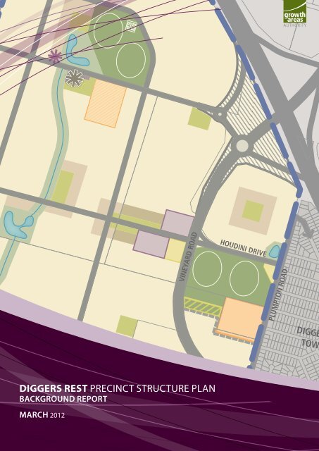
DIGGERS R<br />
VINEYARD ROAD<br />
DIGGERS REST <strong>precinct</strong> Structure <strong>plan</strong><br />
Background report<br />
MarcH 2012<br />
HOUDINI DRIVE<br />
PLUMPTON ROAD<br />
DIGGE<br />
TOWN<br />
LICENSE ROAD
Diggers Rest Precinct Structure Plan<br />
Background Report
Table of Contents<br />
2<br />
Diggers Rest Precinct Structure Plan<br />
Background Report‐ March 2012<br />
1. STRATEGIC CONTEXT…………………………………………………………………………………………………3<br />
1.1 Metropolitan and regional context………………………………………………………………….………….3<br />
1.1.1 Diggers Rest Precinct……………………………………………………………………….………….….4<br />
1.2 Local Context………………………………………………………………………………….……………………………6<br />
1.2.1 History………………………………………………………………………………………………………………6<br />
1.2.2 Surrounding Neighbourhoods…………………………………………………………………………..6<br />
1.2.3 Transport and Movement…………………………………………………………………………………7<br />
1.2.4 Employment and Activity Centres……………………………………………………………………7<br />
1.2.5 Community Facilities…………….…………………………………………………………………………8<br />
2. DIGGERS REST PRECINCT FEATURES……………………………………………………………………….10<br />
2.1 Heritage………………………………………………………………………………………………………………………10<br />
2.2 Biodiversity………………………………………….……….……………………………………………………………10<br />
2.2.1 Flora ………………………………………………………………………………………………………………10<br />
2.2.2 Fauna……………………………………………………………………………………………….…………….10<br />
2.3 Topography and Landform…………………………………………………………………………………………10<br />
2.4 Catchment and Drainage…………………………………………………………………………………………..11<br />
2.5 Geotechnical Assessment……………………………………………………………………………………….…11<br />
2.6 Melbourne Airport Environs Overlay………………………………………………………………………….12<br />
2.7 Servicing…………………………………………………………………………………………………………………….12<br />
3. BACKGROUND STUDIES……………………………………………………………………………………………14<br />
PLANS<br />
Plan 1 Metropolitan Context………………………………………………………………………………………5<br />
Plan 2 Local Context Plan………………………………………………………………………….………………9<br />
Plan 3 Existing Precinct Features……………………………………………………………………….……13
1 LOCAL CONTEXT AND SITE DESCRIPTION<br />
1.1 Metropolitan and Regional Context<br />
3<br />
Diggers Rest Precinct Structure Plan<br />
Background Report‐ March 2012<br />
The Diggers Rest Precinct Structure Plan (PSP) area is located approximately 30 kilometres<br />
north of the Melbourne CBD, within the south west periphery of the Sunbury <strong>Growth</strong><br />
Corridor.<br />
The draft Sunbury <strong>Growth</strong> Corridor Plan covers an area located predominantly to the east<br />
and north of the existing Sunbury Township. A small section of the growth area is located<br />
to the west of the existing Diggers Rest Township. The corridor is bounded by Jackson<br />
Creek and steep escarpments to the north and limitations presented by runway approaches<br />
to Melbourne Airport to the south.<br />
The Sunbury <strong>Growth</strong> Corridor is expected to accommodate an additional 21,000 new<br />
dwellings in both Sunbury and Diggers Rest over the next 30 years to accommodate growth<br />
in population of at least 60,000 people. Employment projections indicate around 10,000-<br />
15,000 new jobs will be generated in the growth area over this period to accompany the<br />
increased population.<br />
Major investment in new transport infra<strong>structure</strong> in the form of the electrification of the<br />
existing Sunbury railway line and improvement to the Diggers Rest station in addition to<br />
the Outer Metropolitan Ring Road (OMR) will underpin the Corridor’s urban growth and<br />
accessibility. Together the railway line and OMR will deliver important metropolitan<br />
accessibility benefits and open up strategic links to employment opportunities that will<br />
connect the Sunbury <strong>Growth</strong> Corridor to Metropolitan Melbourne.<br />
The draft Sunbury <strong>Growth</strong> Corridor Plan, which covers the City of Hume and Melton Shire,<br />
introduces a new strategic <strong>plan</strong> to guide the growth of the corridor. The Plan:<br />
Identifies several growth fronts some to the north east and south west.<br />
Supports limited biodiversity assets including some remnant individual Red Gum<br />
trees and only small degraded patches of remnant grasslands.<br />
Supports residential and employment growth and provides for the strategic<br />
integration of new urban areas within the existing Sunbury and Diggers Rest.<br />
Facilitates the long term connection of new urban areas with expanding growth<br />
fronts in the main Sunbury growth area within the City of Hume<br />
Recognises the need to facilitate access to existing and <strong>plan</strong>ned transport<br />
infra<strong>structure</strong> including the existing Calder Freeway, proposed Outer Metropolitan<br />
Ring Road and the existing Sunbury rail line<br />
Plans for employment activity within the Sunbury growth area<br />
Provides for the protection and enhancement of major creek corridors and adjacent<br />
habitat environments as regionally significant environmental and biodiversity assets<br />
for the corridor
4<br />
Diggers Rest Precinct Structure Plan<br />
Background Report‐ March 2012<br />
Creates new public transport and arterial road connections that will join the<br />
corridor with the existing and <strong>plan</strong>ned growth areas around Sunbury.<br />
Creates opportunity for transit orientated development around the existing and<br />
proposed rail stations on the Sunbury Rail Line.<br />
1.1.1 Diggers Rest Precinct<br />
The Diggers Rest Precinct forms a part of the Sunbury <strong>Growth</strong> Corridor however the<br />
township is separated from the main Sunbury growth area and by the Calder Freeway and<br />
functions as a distinct neighbourhood.<br />
Diggers Rest also falls within a separate municipality (Melton Shire Council) to the<br />
remainder of the corridor (Hume City Council). The Diggers Rest PSP will allow the<br />
Township to grow and become a community that will be supported by a Local Town<br />
Centre, community facilities and sports grounds. The growth area as it relates to Diggers<br />
Rest extends to the township, north of Diggers Rest-Coimadai Road to encompass an area<br />
to allow the township to grow to a population of approximately 1 people, a<br />
size capable of supporting higher order community services and infra<strong>structure</strong>.<br />
Diggers Rest will function as a sustainable component or neighbourhood of the larger<br />
Sunbury growth corridor, whilst maintaining its unique local character and aesthetic.
Code<br />
UGZ Area<br />
(ha)<br />
Proposed Precinct Area 'A'<br />
NDA (65%<br />
of UGZ)<br />
Dwelling<br />
Projection<br />
(15 dwl/ha)<br />
Population<br />
Projection<br />
(2.8 P/H)<br />
A1 172.95 112.42 1686 4722<br />
A2 124.21 80.74 1211 3391<br />
A3 170.92 111.10 1666 4666<br />
A4 254.71 165.56 2483 6954<br />
A5 83.32 54.16 812 2275<br />
A6 143.93 93.55 1403 3929<br />
A7* 13.19 8.57 129 360<br />
A8* 12.72 8.27 124 347<br />
A9* 4.28 2.78 42 117<br />
A10* 4.7 3.06 46 128<br />
A11 45.61 29.65<br />
A12* 33.16 21.55 323 905<br />
Total 1063.7 691.41 9926 27794<br />
Proposed Precinct Area 'B'<br />
B1 189.06 122.89 1843 5161<br />
B2 90.27 58.68 880 2464<br />
B3 24.74 16.08 241 675<br />
B4* 121.92 79.25 1189 3328<br />
B5* 89.96 58.474<br />
Total 515.95 335.37 4153 11630<br />
Proposed Precinct Area 'C'<br />
C1 108.28 70.38 1056 2956<br />
C2 51.62 33.55 503 1409<br />
C3 188.74 122.68 1840 5153<br />
C4* 3.17 2.06<br />
C5 390.85 254.05 3811 10670<br />
C6* 57.56 37.41 561 1571<br />
C7* 36.65 23.82 357 1001<br />
Total 836.87 543.97 8129 22760<br />
Proposed Precinct Area 'D'<br />
D1 86.64 56.32 845 2365<br />
D2 145.05 94.28 1414 3960<br />
D3 40.37 26.24 394 1102<br />
D4* 26.29 17.09 256 718<br />
Total 298.35 193.93 2909 8145<br />
Total 2715 1765 25117 70328<br />
Potential for rail crossing.<br />
Current rail alignment sits<br />
within a 3.5m cutting<br />
<strong>plan</strong> 1<br />
metropolitan & regional context<br />
<strong>diggers</strong> <strong>rest</strong> background report<br />
Calder Freeway<br />
Riddell Road<br />
Gap Road<br />
Diggers Rest<br />
Precinct Structure<br />
Plan<br />
Potential for rail crossing.<br />
Current rail alignment sits<br />
within a 7m cutting<br />
Vineyard Road<br />
36.8ha<br />
SUNBURY<br />
TOWNSHIP<br />
Watsons Road<br />
Existing level<br />
rail crossing<br />
Potential Watsons<br />
Road Extension<br />
DIGGERS REST<br />
TOWNSHIP<br />
45.7ha<br />
Lanceeld Road<br />
Opportunity for ‘terraced’<br />
Active Open Space to<br />
maximise usability<br />
Existing level<br />
rail crossing<br />
Existing level<br />
rail crossing<br />
Activity Centre to cater for existing<br />
rolling meadows community &<br />
proposed F1 & A1 neighbourhoods<br />
75.6ha<br />
Sunbury Road<br />
200m<br />
Creek Buer<br />
BULLA<br />
TOWNSHIP<br />
Rockbank Precinct Structure Plan Area<br />
Major Road Network<br />
OMR<br />
Railway Line<br />
Existing Road<br />
Proposed Road<br />
Railway Line & Station<br />
Sunbury Town Centre<br />
Major Activity Centre (MAC)<br />
Local Town Centre (NAC)<br />
Employment<br />
Urban <strong>Growth</strong> Zone<br />
Public Use Zone<br />
Farming Zone<br />
Open Space<br />
OMR Alignment<br />
1:25000 @ A1<br />
1:50000 @ A3<br />
0 250 500 750 1000 1250
1.2 Local Context<br />
1.2.1 History<br />
6<br />
Diggers Rest Precinct Structure Plan<br />
Background Report‐ March 2012<br />
The Diggers Rest study area is located within the language group of the Woi wurrung<br />
(spelling according to Clark 1990, 364), the group that occupied the basins of the Yarra and<br />
Maribyrnong Rivers. The Woi wurrung clan most closely associated with the Diggers Rest<br />
region were the Marin balug, who principally identified with the Kororoit Creek and the<br />
area around Sunbury (Clark 1990, 384).<br />
Today the Wurundjeri Tribe land Compensation and Cultural Heritage Council Incorporated<br />
is the registered Aboriginal party (RAP) under the Aboriginal heritage Act 2006 (Vic), with<br />
responsibilities in relation to the management and administration of Aboriginal Cultural<br />
Heritage matters in the Activity Area.<br />
European settlement saw the Diggers Rest area originally established as a hotel and<br />
“<strong>rest</strong>ing place” for gold prospectors heading to the Mount Alexander (Castlemaine)<br />
goldfields in the 1850s. In the 1870s, a railway line was extended to Sunbury which<br />
resulted in the establishment of a station at Diggers Rest. Despite these two assets, very<br />
little development occurred within the township prior to the 1970s.<br />
The existing residential township of Diggers Rest was laid out and developed in the 1970’s<br />
and early 1980’s. Diggers Rest is currently a small residential community with a population<br />
of approximately 1,800. The township has very limited retail and employment<br />
opportunities and underutilised community services and infra<strong>structure</strong>. Diggers Rest<br />
currently function as a small dormitory township to Melbourne’s western suburbs and the<br />
existing Sunbury Township. The isolated nature of the small urban residential community<br />
and the lack of capacity to support services was the stimulus for the Melton Shire Council<br />
to pursue actively the growth of Diggers Rest to a township capable of providing improved<br />
services and function as an effective residential community.<br />
1.2.2 Surrounding Neighbourhoods<br />
The following neighbourhoods exist in the surrounding context of the Diggers Rest PSP<br />
area:<br />
Sydenham/Taylors Lakes / Watergardens Town Centre<br />
Sydenham/Taylors Lakes is a residential community located in the City of Brimbank which<br />
has developed over the past 25 years and includes an established and expanding town<br />
centre known as Watergardens.<br />
Watergardens has become the focal point of the growing Sydenham Taylors Lakes<br />
communities and is close to Diggers Rest and accessible via the existing Melbourne – to<br />
Bendigo rail line (Watergardens is one station from Diggers Rest).
7<br />
Diggers Rest Precinct Structure Plan<br />
Background Report‐ March 2012<br />
Watergardens is a significant principal town centre in close proximity to the Diggers Rest<br />
community and will continue to provide higher order retailing, community facilities and<br />
services and employment for Diggers Rest.<br />
Taylors Lakes/Sydenham is located approximately 8 kilometres from the southern boundary<br />
of the Diggers Rest Township.<br />
Sunbury Township<br />
Sunbury is a major town centre, and includes community facilities and services which cater<br />
to a broader regional catchment. Sunbury is in close proximity to Diggers Rest and<br />
accessible via the existing Melbourne – to Bendigo rail line (Sunbury is one station from<br />
Diggers Rest). Currently Diggers Rest residents have a strong relationship with the Sunbury<br />
Township given the lack of a local town centre within the Diggers Rest Township.<br />
Diggers Rest is approximately 5 kilometres from the main Sunbury town centre.<br />
1.2.3 Transport and movement<br />
The existing Melbourne – to Bendigo rail line provides a major transport opportunity for<br />
Diggers Rest to function as an integrated part of metropolitan Melbourne. The<br />
improvements to the rail line including electrification and an upgraded station at Diggers<br />
Rest presents an opportunity to link Diggers Rest on a regular basis via the public transport<br />
network to employment areas between the township and the Melbourne CBD.<br />
The Calder Freeway provides one of Melbourne’s major freeway transport links to the CBD<br />
and the broader metropolitan freeway network. The future <strong>plan</strong>ned Outer Metropolitan<br />
Ring Road (OMR) will enhance the capacity of the freeway network to carry larger volumes<br />
of traffic and to distribute traffic movement more equitably to other areas of Melbourne.<br />
Local access to the freeway network is provided by Vineyard Road which forms the current<br />
western boundary of the township. This road also provides a direct link and potential bus<br />
route to the Sunbury town centre.<br />
1.2.4 Employment and Activity Centres<br />
Current employment opportunities within the Sunbury growth corridor are limited.<br />
Melbourne Airport and the Hume employment corridor provide the main job opportunities<br />
for local employment within the north-west employment area which the growth area forms<br />
part of.<br />
The draft Sunbury <strong>Growth</strong> Corridor Plan makes provision for 210 hectares of industrial land<br />
which will provide for service based industries and manufacturing but also potentially<br />
logistic and associated uses.<br />
The Major Town Centre which services Diggers Rest is located within Sunbury at the<br />
Sunbury town centre.
8<br />
Diggers Rest Precinct Structure Plan<br />
Background Report‐ March 2012<br />
Opportunities exist to provide a local town centre within Diggers Rest as the <strong>plan</strong>ned<br />
population catchment is of a critical size to support a supermarket based local town<br />
centre.<br />
Diggers Rest is currently incapable of supporting a basic level of retail and service activity<br />
at its current population. The existing local shops satisfy only some of the daily needs of<br />
local residents.<br />
With a new population of 12,000, there will be a need for a new Local Town Centre (LTC)<br />
with a total of 6,000sqm of floorspace and capable of generating approximately 200 new<br />
jobs in the local community. The optimal location for the LTC is on the western side of<br />
Vineyard Road in the proximity of Houdini Drive.<br />
In addition to the LTC, more localised retail opportunities may exist within the station<br />
<strong>precinct</strong> and existing township.<br />
Employment opportunities are provided in the proposed Diggers Rest business <strong>precinct</strong><br />
which will cater to local small scale manufacturing and service industry uses.<br />
1.2.5 Community Facilities<br />
Diggers Rest currently has a number of existing facilities within the township which are<br />
underutilised and inefficient due to a lack of critical population mass.<br />
The growth corridor <strong>plan</strong> provides an opportunity for the Diggers Rest Township to expand<br />
to a size that will improve service levels for current facilities, augment existing<br />
infra<strong>structure</strong> and provide additional facilities currently lacking in the township.<br />
Key existing facilities include:<br />
Existing Diggers Rest Primary School, located on Plumpton Road.<br />
A small community centre adjoining the Diggers Rest Primary School.<br />
Active open space including sports grounds and hard court surfaces.<br />
Proposed community infra<strong>structure</strong> for the Diggers Rest PSP consists of a mixture of new<br />
and upgraded facilities, including:<br />
New multi-purpose community centre.<br />
New dual-oval active open space and pavilion.<br />
New tennis courts at Diggers Rest Tennis Club.<br />
Extensive upgrades to existing pavilion at Diggers Rest Community Hub.<br />
Upgrades to facilities at Diggers Rest Bowling Club, Diggers Rest Tennis Club and<br />
the local skate park.<br />
Provision of public infra<strong>structure</strong> within the open space network throughout Diggers<br />
Rest.
to Gisbourne<br />
<strong>plan</strong> 2<br />
local context<br />
<strong>diggers</strong> <strong>rest</strong> psp background report<br />
Kororoit Creek<br />
Calder Freeway<br />
Big Hill<br />
Diggers Rest Township<br />
Sunbury Station<br />
Diggers Rest Station<br />
Holden Flora<br />
& Fauna Reserve<br />
Diggers Rest - Coimadai Road Bulla - Diggers Rest Road<br />
Plumpton Road<br />
Jacksons Creek<br />
to Melbourne CBD<br />
Outer Metropolitan Ring Road<br />
Emu Creek<br />
Precinct Area<br />
Existing Urban<br />
Freeway<br />
Arterial Road<br />
Railway Line<br />
Rail Station<br />
Town Centre<br />
Existing/Future Employment<br />
Existing/Future Regional Open Space<br />
Open Space<br />
Quarry<br />
Rivers & Creeks<br />
Waterway Corridor<br />
Bulla
2 Diggers Rest Precinct Features<br />
2.1 Heritage<br />
10<br />
Diggers Rest Precinct Structure Plan<br />
Background Report‐ March 2012<br />
The traditional indigenous owners of the <strong>precinct</strong> are the Wurundjeri tribe. A standard<br />
and desktop cultural heritage assessment has been undertaken for the area.<br />
A number of scatter sites and individual artefacts have been identified. Concentrations of<br />
artefacts exist in the central portion of the main drainage line and in the lots immediate<br />
west of Vineyard Road. Sites close to the freeway interchange west of Vineyard Road<br />
appear to have been disturbed and dispersed, possibly by agricultural activities. A<br />
standard Cultural Heritage Management Plan will be required a part of the development of<br />
the land.<br />
Four sites of historical heritage significance have been identified within the PSP area. The<br />
property at 2-188 Davis Road contains an intact farm house, constructed in approximately<br />
1914 and representative of timer Federation style architecture. The house, picket fence,<br />
surrounding trees and outbuildings are covered by Heritage Overlay HO47 in the Melton<br />
Planning Scheme.<br />
Elsewhere in the PSP area, there are remains of two farmhouses and remnants of farm<br />
activity. All appear to be constructed in the early twentieth century and consist of ruins or<br />
remnant features of buildings demolished several decades ago. All three of these sites are<br />
listed on the Victorian Heritage Register.<br />
2.2 Biodiversity<br />
The Diggers Rest Precinct is highly modified, and the majority of the <strong>precinct</strong> has been<br />
cleared for agriculture and is dominated by exotic vegetation.<br />
2.2.1 Flora<br />
Remnant vegetation within the <strong>precinct</strong> comprises two Ecological Vegetation Classes<br />
(EVCs), including Plains Grassland and Sedge Wetland. There are approximately 10.21<br />
habitat hectares of remnant vegetation present within the <strong>precinct</strong>: 10.19 habitat hectares<br />
of Plains Grassland, and 0.02 habitat hectares of Sedge Wetland.<br />
There are no trees within remnant patches, or scattered trees within the Precinct.<br />
2.2.2 Fauna<br />
The habitat quality for significant fauna is low due to the highly modified nature of the<br />
Precinct. No fauna species of national or state significance were recorded during<br />
assessments. There is a low likelihood that resident Growling Grass Frog, Golden Sun Moth,<br />
Striped Legless Lizard, Plains Wanderer and/or Brown Toadlet may occur within the<br />
Precinct.<br />
2.3 Topography and Landform
11<br />
Diggers Rest Precinct Structure Plan<br />
Background Report‐ March 2012<br />
The north west of Melbourne is characterised by extensive basalt plains and dominant<br />
volcanic hills. The natural landscape consists of grassy plains with occasional trees located<br />
along drainage lines. Post settlement, dryland agriculture predominated with extensive<br />
grain cropping occurring.<br />
The PSP area forms a component of the plains area and is characterised by relatively flat,<br />
treeless plains used for dryland cropping. A small shallow drainage line is located in the<br />
west of the PSP area but this provides little topographical relief. The only other landscape<br />
features of significance are degraded agricultural windrows in relatively poor health.<br />
The visual and landscape assessment for Diggers Rest recommends the following <strong>plan</strong>ning<br />
and design principles:<br />
Develop simple landscape treatments, preferably based around established<br />
indigenous or cultural landscape themes, and simple, large sale design forms that<br />
are compatible with the scale and character of the surrounding rural setting.<br />
Maintain visual links to surrounding landscape features such as volcanic cones and<br />
elevated ridgelines.<br />
Visually and physically reconnect the site where possible to regional landscape<br />
systems (i.e. water courses, reserve systems).<br />
2.4 Catchment and Drainage<br />
Central to the <strong>plan</strong>ned area is the drainage line that essentially drains high land to the<br />
north east and flows in a south westerly direction to become a more formalised stream<br />
close to Coimadai Road. This constitutes the main drainage catchment and focus for<br />
<strong>plan</strong>ned stormwater management.<br />
This central drainage line brings opportunities for stormwater treatment and retardation<br />
associated with the urban development.<br />
2.5 Geotechnical Assessment<br />
The geology of the site is characterised by basalt plains with relatively shallow soils<br />
overlaying basalt. The location is generally flat with a gentle fall from north east to south<br />
west. A review of environmental audits and a site walkover concluded that the area has a<br />
long historical use for agriculture, particularly dryland cropping and grazing.<br />
An environmental contamination assessment of the land revealed that the site has:<br />
Low potential for widespread gross site contamination;<br />
Medium potential for localised soil contamination;<br />
Low potential for groundwater contamination;<br />
Presence of general waste materials which are recommended for removal.<br />
Apart from some low level potential for soil contamination associated with farm sheds and<br />
outbuildings, overall contamination risk is low and generally limited to existing and former<br />
work shed and home sites. Additional targeted testing may be required as part of the<br />
future development of the area.
2.6 Melbourne Airport Environs Overlay<br />
12<br />
Diggers Rest Precinct Structure Plan<br />
Background Report‐ March 2012<br />
Partially impacting upon to the south of the <strong>precinct</strong> is the by the Melbourne Airport<br />
Environs Overlay. Designed to protect runway approaches to Melbourne Airport, the<br />
overlay limits or <strong>rest</strong>ricts residential development south of the <strong>precinct</strong>.<br />
2.7 Servicing<br />
Sewer reticulation: A pumping station serves Diggers Rest Township and discharges<br />
approximately 3.5 kilometres to the north at Sunbury Sewerage Treatment Plant. An<br />
additional sewerage pumping station will be required to service the majority of the PSP<br />
area, anticipated to be located at the western extent of Diggers Rest –Coimadai Road.<br />
Some augmentation of the existing sewerage system will be also required to service the<br />
PSP area, the extent of which will depend on the sequencing of development.<br />
Water supply: Potable water is currently supplied to the existing Diggers Rest Township via<br />
water mains along Vineyard Road and Plumpton Road. A new connection to Melbourne<br />
Water’s water supply system will be required to service the PSP area along Calder Freeway<br />
or Plumpton Road. A water supply pump station occupying approximately 1 hectare of<br />
land will also be required within the PSP area.<br />
Recycled water: Class B recycled water from the Sunbury Treatment Plant is available<br />
along Vineyard Road. Melbourne Water intends to construct a Class A treatment facility at<br />
the Sunbury Sewerage Treatment <strong>plan</strong>t in the coming years and this water could become<br />
available to the PSP area via a duplication of the existing Vineyard Road pipeline.<br />
Electricity supply: There is sufficient capacity in the existing electricity assets to supply<br />
the PSP area from the zone substation at Calder Park. Overhead power lines in Davis Road,<br />
Plumpton Road and Diggers Rest–Coimadai Road will be required to be augmented to serve<br />
the <strong>precinct</strong>.<br />
Gas Supply: The existing gas reticulation system supplying Diggers Rest will require<br />
augmentation to service the PSP area. This will include duplication or upsizing of the<br />
existing transmission line, extension of the existing transmission line, and the construction<br />
of a new pressure reduction station.<br />
Telecommunications – Development within the PSP area will require the installation of pit<br />
and pipe infra<strong>structure</strong> through the subdivision works to install fibre optic cable.<br />
Connection to the external NBN Co network (or via an alternative provider) will also be<br />
required.
<strong>plan</strong> 3<br />
<strong>precinct</strong> features <strong>plan</strong><br />
<strong>diggers</strong> <strong>rest</strong> <strong>precinct</strong> <strong>structure</strong> <strong>plan</strong><br />
1:15,000 @ A3<br />
0 150 300 450 N<br />
DAVIS ROAD<br />
CALDER FREEWAY<br />
VINEYARD ROAD<br />
DIGGERS REST - COIMDAI ROAD<br />
HOUDINI DRIVE<br />
DIGGERS REST<br />
COMMUNITY<br />
HUB<br />
PLUMPTON ROAD<br />
DIGGERS REST<br />
TOWNSHIP<br />
DIGGERS REST<br />
STATION<br />
Precinct Boundary<br />
Existing Roads<br />
Rail line and Station<br />
Existing State Primary School<br />
Existing Active Open Space<br />
Existing Community Facility<br />
Native Vegetation<br />
Further Biodiversity Assessment Required<br />
<strong>Areas</strong> of Cultural Sensitivity<br />
Surface Artifact<br />
Highpoint<br />
Ridgelines<br />
Lowpoint<br />
Overland Flow Paths<br />
Contours (0.5m interval)<br />
Calder FWY / Vineyard Road Interchange<br />
Future Urban Area<br />
Existing Urban Area
3 Background Studies<br />
14<br />
Diggers Rest Precinct Structure Plan<br />
Background Report – March 2012<br />
The Precinct Structure Plan for Diggers Rest has been informed by a number of background<br />
studies as follows:<br />
1. Arboricultural Assessment and Report: Diggers Rest Precinct (Tree Logic Pty Ltd) June 2011<br />
2. Assessment of Community Infra<strong>structure</strong> Requirements and Opportunities: Diggers Rest<br />
Precinct Structure Plan (ASR Research Pty Ltd) November 2011<br />
3. Diggers Rest Precinct Structure Plan – Aboriginal Heritage – Desktop and Standard Assessment and<br />
Historical Heritage Assessment (Parcels 3, 4, 5, 6 and 7) (Andrew Long and Associates Pty Ltd)<br />
November 2011<br />
4. Diggers Rest Precinct Structure Plan – Aboriginal Heritage – Desktop and Standard Assessment and<br />
Historical Heritage Assessment (Parcels 1 and 2) (Andrew Long and Associates Pty Ltd) November 2011<br />
5. Diggers Rest Precinct Structure Plan – Broad Hectare Assessment (O’Briens Valuers and Property<br />
Consultants) November 2011<br />
6. Diggers Rest Precinct Structure Plan – Development Contributions Plan Infra<strong>structure</strong> Costing<br />
(Meinhardt) December 2011<br />
7. Diggers Rest Expansion – Services Infra<strong>structure</strong> Report (Cardno Grogan Richards) November 2011<br />
8. Diggers Rest Retail and Employment Analysis (SGS Economics and Planning Pty Ltd) September 2011<br />
9. Draft Biodiversity Assessment for Area 1073, Digger Rest, Victoria (Ecology and Heritage Partners<br />
Pty Ltd) June 2011<br />
10. Diggers Rest Precinct Structure Plan Studies Hydrology and Drainage Assessment (Design Flow)<br />
November 2011<br />
11. Geotechnical Investigation: Diggers Rest Precinct Structure Plan (Tonkin & Taylor Ltd) July 2011<br />
12. Draft Landscape and Visual Assessment Report: Diggers Rest Precinct Structure Plan Background<br />
Study (Tract Consultants Pty Ltd) September 2011<br />
13. Phase 1 Environmental Site Assessment – Site History Review: Diggers Rest (Golder Associates Pty<br />
Ltd) August 2011<br />
14. Preliminary Geotechnical Investigation, Contamination and Flora and Fauna Report, Diggers Rest<br />
(Chadwick) September 2006<br />
15. Diggers Rest <strong>Growth</strong> Area Precinct Structure Plan Transport Assessment (GTA Consultants)<br />
December 2011<br />
16. Valuation Report of Diggers Rest Precinct Structure Plan (O’Briens Valuers and Property<br />
Consultants) November 2011<br />
17. Vineyard Road, Diggers Rest, Victoria, Updated Limited Phase I Environmental Site Assessment<br />
(Golder Associates) June 2010
<strong>Growth</strong> <strong>Areas</strong> <strong>Authority</strong> Level 29, 35 Collins Street MELBOURNE VIC 3000<br />
www.gaa.vic.gov.au<br />
partners in creating new communities


