

Botanic Ridge Botanic Ridge - Growth Areas Authority
Botanic Ridge Botanic Ridge - Growth Areas Authority
Botanic Ridge Botanic Ridge - Growth Areas Authority

You also want an ePaper? Increase the reach of your titles
YUMPU automatically turns print PDFs into web optimized ePapers that Google loves.
<strong>Botanic</strong> <strong>Ridge</strong> will be:<br />
• A place of beauty, where excellence in landscape,<br />
architectural and urban design contribute to a strong<br />
‘sense of place’, while also addressing important visual and<br />
environmental performance requirements.<br />
• A place of significant housing choice, that caters for a<br />
diversity of people with varying means.<br />
• A connected community with integrated transport and<br />
open space networks, community facilities and state of the<br />
art telecommunication.<br />
• Designed with nature in mind, utilising indigenous and<br />
native plants and integrating conservation areas to foster<br />
respect among residents for the environment.<br />
• A residential precinct that is a model for the conservation of<br />
urban ecology.<br />
• A place where residents have a sense of ownership and<br />
pride, which together with the beautiful environment and<br />
excellent amenities, contributes to a healthy community.<br />
• A place with inviting and thriving town centres, where it is<br />
natural for residents of all ages to meet, shop and carry out<br />
business.<br />
• A place that recognises the adjoining RBGC as a major<br />
strategic asset and conserves, enhances and integrates with<br />
its ecological and landscape qualities<br />
<strong>Botanic</strong> <strong>Ridge</strong><br />
PRECINCT STRUCTURE PLAN<br />
THE PLAN<br />
The <strong>Botanic</strong> <strong>Ridge</strong> Precinct Structure Plan as shown left covers an area of 318 hectares (786 acres). This plan shows the planned<br />
structural elements including main roads, parks, wetlands and urban development areas. The <strong>Botanic</strong> <strong>Ridge</strong> Precinct Structure Plan<br />
document details how each element is to be delivered. It can be viewed with the other detailed documents at: www.gaa.vic.gov.<br />
au/Precinct_Structure_Plans<br />
THE vISIoN<br />
<strong>Botanic</strong> <strong>Ridge</strong> will be a unique community where physical landform, landscape character and environmental management<br />
are the key planning and design drivers. <strong>Botanic</strong> <strong>Ridge</strong> will be an innovative model for the creation of an ecological,<br />
landscaped and environmentally sustainable residential area that provides for housing diversity, quality community<br />
facilities and vibrant town centres at urban densities.<br />
HoUSING QUALITY ANd CHoICE<br />
Providing for well designed and diverse housing is a key goal<br />
for the Precinct. Lots ranging from 300 square metres or less<br />
near town centres to 900 square metres or more adjoining the<br />
botanic gardens, will provide opportunities for families to create<br />
their homes in ways that suit them.<br />
FUTURE TRANSPoRT NETWoRk<br />
Key to the delivery of a strong transport network at <strong>Botanic</strong><br />
<strong>Ridge</strong> will be the upgrade of Craig Road and the delivery of a<br />
new road (Casey Fields Boulevard) linking to Cranbourne East.<br />
A bus-ready grid of roads, incorporating on road cycle paths will<br />
also be delivered within the precinct area, linking town centres,<br />
schools and key sports fields. This will be complemented by an<br />
extensive network of pedestrian and shared paths within the<br />
road reserves and alongside waterways and wildlife corridors.<br />
ENvIRoNmENT ANd INNovATIoN<br />
The plan implements the high standards for environmental<br />
housing recommended by the Victorian Bushfire Royal<br />
Commission, to ensure homes are able to take full advantage of<br />
the exceptional opportunities of the adjoining RBGC.<br />
Two significant wildlife corridors will be created to provide<br />
habitat and movement opportunities for the Nationally listed<br />
Southern Brown bandicoot, to and from RBGC. Additionally,<br />
waterways, wetlands streets and parks will be planted with<br />
indigenous and native plants, drawing inspiration from the<br />
award winning RBGC Australian Garden.<br />
Storm water from the precinct will be captured and treated so<br />
that it can be used by residents via the recycled water network<br />
that will service the area.<br />
PLANNING PERmITS<br />
Two permit applications and their associated draft planning<br />
permits are also being circulated as part of this consultation<br />
process. These applications seek to subdivide land for<br />
approximately 1400 residential lots including land for a town<br />
centre and two primary schools as shown.<br />
Where to Inspect the details and Have Your Say<br />
electronic copies of the draft amendment C133 to the Casey Planning Scheme, including the consultation drafts of the<br />
Precinct Structure Plan, Native Vegetation Precinct Plan and Development Contributions Plan are available from the<br />
<strong>Growth</strong> <strong>Areas</strong> <strong>Authority</strong> and the City of Casey websites:<br />
www.gaa.vic.gov.au | www.casey.vic.gov.au<br />
you can also review these documents in hardcopy during business hours at locations listed below:<br />
GRoWTH AREAS AUTHoRITY<br />
Level 29<br />
35 Collins Street<br />
MELBOURNE<br />
CoNTACT US<br />
<strong>Growth</strong> <strong>Areas</strong> <strong>Authority</strong><br />
Level 29, 35 Collins Street, Melbourne, Victoria, 3000<br />
Phone: (03) 9651 9600, Fax: (03) 9651 9623<br />
info@gaa.vic.gov.au<br />
www.gaa.vic.gov.au<br />
Printed with vegetable-based inks, using an alcohol-free process,<br />
on Australian Made 100% Recycled Paper<br />
CITY oF CASEY<br />
Customer Service Centre<br />
Shop 8<br />
(Bendigo Bank building)<br />
Amberly Park Shopping Centre<br />
101 Seebeck Drive<br />
NARRE WARREN SOUTH<br />
CITY oF CASEY<br />
Customer Service Centre<br />
Cranbourne Park Shopping<br />
Centre (opposite Post Office)<br />
CRANBOURNE<br />
The <strong>Growth</strong> <strong>Areas</strong> <strong>Authority</strong> is always interested in your<br />
views about our programs and initiatives, and the issues<br />
covered in this newsletter.<br />
If you would you like to receive regular email updates on<br />
the work of the <strong>Growth</strong> <strong>Areas</strong> <strong>Authority</strong>, please register via<br />
our website www.gaa.vic.gov.au<br />
CITY oF CASEY<br />
Customer Service Centre<br />
Municipal Offices<br />
Magid Drive<br />
NARRE WARREN<br />
making a Submission<br />
A submission must be made to the <strong>Growth</strong> <strong>Areas</strong> <strong>Authority</strong> at the below postal address or via email to amendments@<br />
gaa.vic.gov.au. Please ensure that any submissions in respect of draft amendment C133 of the Casey Planning Scheme are<br />
received by Friday the 23rd of December, 2011.<br />
Further information<br />
Paul Cassidy, Structure Planning Manager<br />
matthew Rogers, Urban Planning Manager<br />
GRowTh AReAS AUThoRITy<br />
Level 29, 35 Collins Street, Melbourne, 3000<br />
Phone: (03) 9651 9600 Fax: (03) 9651 9623<br />
Rebecca Scullion, Acting Team Leader Integrated Planning<br />
Peter Hobbs, Senior Strategic Planner<br />
CITy oF CASey<br />
Customer Service Centre<br />
Municipal offices<br />
Magid Drive<br />
NARRe wARReN 3805<br />
This publication may be of assistance to you but the<br />
<strong>Growth</strong> <strong>Areas</strong> <strong>Authority</strong> and its employees do not<br />
guarantee that the publication is without flaw of any kind<br />
or is wholly appropriate for your particular purposes and<br />
therefore disclaims all liability for any error, loss or other<br />
consequence which may arise from you relying on any<br />
information in this publication.<br />
p a r t n e r s i n c r e a t i n g n e w c o m m u n i t i e s<br />
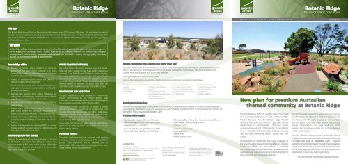
<strong>Botanic</strong> <strong>Ridge</strong><br />
PRECINCT STRUCTURE PLAN<br />
NOVEMBER 2011<br />
New plan for premium Australian<br />
themed community at <strong>Botanic</strong> <strong>Ridge</strong><br />
The <strong>Growth</strong> <strong>Areas</strong> <strong>Authority</strong> and the City of Casey have<br />
been working collaboratively to draft the <strong>Botanic</strong> <strong>Ridge</strong><br />
Precinct Structure Plan. The <strong>Botanic</strong> <strong>Ridge</strong> Precinct<br />
Structure Plan (PSP) sets out a 15 year plan for the<br />
development of approximately 3,200 new homes<br />
accommodating around 9,000 residents. The plan builds<br />
on and integrates with the Junction Village community<br />
and the new community around Settlers Run Golf<br />
Course.<br />
Incorporating the rolling hills and native landscape of<br />
the area, including the adjoining Royal <strong>Botanic</strong> Gardens<br />
Cranbourne (RBGC), the plan delivers a residential<br />
community embedded in a network of boulevards, parks<br />
and waterways that deliver significant enhancement of<br />
local landscape and conservation features.<br />
The Structure Plan provides for extensive housing choice<br />
including larger lots adjacent to the botanic gardens and<br />
townhouses and villa units focussed on town centres<br />
and local parks. Land is set aside for two state primary<br />
schools, kindergartens, two new multi-use sports<br />
reserves, two local town centres and a comprehensive<br />
road and trail network.<br />
The GAA wishes to hear your views on the plan. Please<br />
provide your comments to the <strong>Growth</strong> <strong>Areas</strong> <strong>Authority</strong><br />
by Friday the 23rd of December 2011. Pending<br />
resolution of any matters raised through the consultation<br />
period, the GAA intends to recommend that the Minister<br />
for Planning approve of the plan as a planning scheme<br />
amendment to the Casey Planning Scheme.<br />
See plan overleaf for proposed layout and details...
Precinct Structure Pla<br />
CRANBOURNE<br />
EAST<br />
BALLARTO ROAD<br />
AGE 4 (Possible<br />
Future)<br />
Urban <strong>Growth</strong> Bounda<br />
Town Centre<br />
Community Facilities<br />
Government Educatio<br />
JUNCTION<br />
VILLAGE<br />
Active Open Space/P<br />
Road Reserve Conve<br />
Passive Open Space<br />
BOTANIC DRIVE<br />
Biolink<br />
ROYAL BOTANIC<br />
GARDENS<br />
CRANBOURNE<br />
Precinct Structure Plan Area<br />
Fire buffer zone - RBG<br />
Urban <strong>Growth</strong> Boundary<br />
Conservation Open S<br />
Town Centre<br />
SOUTH GIPPSLAND HIGHWAY<br />
CRANBOURNE<br />
EAST<br />
BALLARTO ROAD<br />
STAGE 4 (Possible<br />
Future)<br />
Community Facilities<br />
Waterway / Drainage<br />
Government Education Facility (Primary)<br />
Waterway bodies / W<br />
Active Open Space/Playing Fields<br />
Tree Reserve along B<br />
Road Reserve Converted to Active Open Space<br />
Passive Open Space<br />
Combined Heritage &<br />
Heritage site / Open S<br />
Biolink<br />
Fire buffer zone - RBGC Perimeter (21 - 41m)<br />
Proposed New Road-Casey Blvd<br />
JUNCTION<br />
VILLAGE<br />
BOTANIC DRIVE<br />
ROYAL BOTANIC<br />
GARDENS<br />
CRANBOURNE<br />
Scattered Trees<br />
Conservation Open Space<br />
SOUTH GIPPSLAND HIGHWAY<br />
Waterway / Drainage<br />
AGE 1 (Under<br />
evelopment)<br />
Non Urban Land<br />
Waterway bodies / Wetlands<br />
Existing Urban Area<br />
Tree Reserve along Browns Roads<br />
Other Undeveloped L<br />
Combined Heritage & Conservation Open Space<br />
Major Arterial Road (S<br />
Heritage site / Open Space (Aboriginal)<br />
Proposed New Road-Casey Blvd<br />
Arterial Road (2 - 4 lane<br />
Connector Street (27m<br />
Connector Street (with<br />
Wetland/Retarding Scattered basin Trees<br />
located outside precinct<br />
Non Urban Land<br />
subject to MW approval<br />
Existing Urban Area<br />
Other Undeveloped Land Within UGB<br />
CRAIG ROAD<br />
Access Street - Level<br />
Major Arterial Road (South Gipps Highway)<br />
SMITHS LANE<br />
STAGE 1 (Under<br />
Development)<br />
APPLICATIoN NUmBER 1<br />
Access Street - Level<br />
Arterial Road (2 - 4 lane)<br />
DEVON<br />
MEADOWS<br />
Local Access Street -<br />
18m Standard<br />
19m + Key Green Stre<br />
15m Open Space Inte<br />
Connector Street (27m)<br />
Wetland/Retarding basin<br />
located outside precinct<br />
subject to MW approval<br />
Connector Street (with Landscape and trail 32m)<br />
CRAIG ROAD<br />
Access Street - Level 2 (22m)<br />
Access Street - Level 2 (with Landscape and trail 28m)<br />
Local Access Street -<br />
DEVON ROAD<br />
APPLICATIoN NUmBER 2<br />
SMITHS LANE<br />
DEVON<br />
MEADOWS<br />
<strong>Ridge</strong> Line<br />
Local Access Street - Level 1<br />
18m Standard<br />
19m + Key Green Streets<br />
15m Open Space Interface (May Vary)<br />
RBGC Potential Acce<br />
DEVON ROAD<br />
Local Access Street - Level 1 (with Landscape and trail 24m)<br />
<strong>Ridge</strong> Line<br />
RBGC Potential Access Point<br />
BROWNS ROAD<br />
KELLY ROAD<br />
FLETCHER ROAD<br />
SMITHS LANE<br />
FIONA DRIVE<br />
BROWNS ROAD<br />
KELLY ROAD<br />
FLETCHER ROAD<br />
SMITHS LANE<br />
FIONA DRIVE<br />
Scale: 1:12,500 @ A3<br />
N. T. S. @ A4<br />
Scale: 1:12,500 @ A3<br />
Date: October N. T. S. @ A4 2011<br />
Issue: Date: - October 2011<br />
Issue: -<br />
0100 100 200 200 400m 400m<br />
RNE<br />
E<br />
Pl<br />
Future Urban Structure<br />
Plan 2<br />
Future Urban Structure Plan<br />
botanic ridge precinct structure plan<br />
DRAFT<br />
DRAFT<br />
botanic ridge precinct structur<br />
p a r t n e r s i n c r e a t i n g n e w c o m m u n i t i e s<br />
dRAFT AmENdmENT To THE CASEY PLANNING SCHEmE<br />
The proposed changes to the Casey Planning Scheme (Amendment C133) include:<br />
Incorporation, via the Schedule to Clause 81.01, of:<br />
• the <strong>Botanic</strong> <strong>Ridge</strong> Precinct Structure Plan<br />
• the <strong>Botanic</strong> <strong>Ridge</strong> Development Contributions Plan<br />
• the <strong>Botanic</strong> <strong>Ridge</strong> Native Vegetation Precinct Plan<br />
Other changes include:<br />
• Rezoning 11ha of RBGC land and <strong>Botanic</strong> Drive from Urban <strong>Growth</strong> Zone to Public Conservation and Recreation<br />
Zone.<br />
• Rezoning the <strong>Botanic</strong> <strong>Ridge</strong> area (the plan area) to Urban <strong>Growth</strong> Zone 4 (UGZ4). This zone sets out the land use and<br />
development controls for the precinct. This zone requires land use and development to be generally in accordance<br />
with the incorporated <strong>Botanic</strong> <strong>Ridge</strong> Precinct Structure Plan.<br />
• Introduction and application of Schedule 15 to the Development Contributions Plan Overlay (DCPO15) to the<br />
precinct. This overlay requires planning permits to be consistent with the incorporated <strong>Botanic</strong> <strong>Ridge</strong> Development<br />
Contributions Plan (the DCP).<br />
• Removes the Environmental Significance Overlay Schedule 3 (ESO3) from the land within the precinct and part of<br />
the RBGC and extends the Environmental Significance Overlay Schedule 2 (ESO2) over the 11ha of RBGC land not<br />
currently covered by ESO2.<br />
• Removes the Wildfire Management Overlay (WMO) from the northern part of the precinct and extend it over the<br />
11ha of RBGC land not currently covered by the WMO.<br />
• Applying a Public Acquisition Overlay (PAO) in favour of Casey City Council to facilitate the connection of local roads<br />
on a number of parcels of land in the northern portion of the precinct.<br />
• Amending the Schedule to Clause 34.01 Business 1 Zone (B1Z) to include floor space provisions for shop uses, office<br />
and trade supplies in the <strong>Botanic</strong> <strong>Ridge</strong> Local Town Centres.<br />
• Use the <strong>Botanic</strong> <strong>Ridge</strong> Native Vegetation Precinct Plan (<strong>Botanic</strong> <strong>Ridge</strong> NVPP) to manage native vegetation within the<br />
amendment area by listing it in the Schedule to Clause 52.16.<br />
• Provide for public open space contributions when land is subdivided by amending the schedule to clause 52.01.<br />
• Updating the Schedule to Clause 61.03 to add a new map 18DPCO to the list of maps.<br />
PROPOSED<br />
BIOLINK<br />
PROPOSED<br />
BIOLINK<br />
DEFENDABLE SPACE<br />
0.14ha<br />
Version: 33<br />
Date: 9th November 2011<br />
Drainage Reserve 3.21ha 4.98%<br />
Drainage Channel<br />
0.54ha 0.84%<br />
Defendable Space - Outer Protection Zone 0.58ha 0.90%<br />
Cultural Heritage Open Space 0.35ha 0.54%<br />
Sub Total<br />
Unencumbered Land Available for Recreation<br />
4.68ha 7.25%<br />
Passive Open Space<br />
1.76ha 2.73%<br />
Sub Total 1.76ha 2.73%<br />
Total Open Space<br />
6.44ha 9.98%<br />
NET DEVELOPABLE AREA (NDA) Ha 56.883ha 87.52%<br />
Residential<br />
52.72ha<br />
Neighbourhood Activity Centre 3.740ha<br />
Note: Layout and Lot Yield may change as a result of strategic planning outcomes<br />
Boundaries shown are subject to survey and design changes<br />
A Town Square (0.14ha) will be provided as part of final design detail<br />
Lot Type<br />
No.<br />
High Density Lots 0-250sqm<br />
15<br />
Medium Density Lots 251-500sqm<br />
563<br />
Conventional Density Lots 501-750sqm 158<br />
Lower Density Lots 750sqm & above 15<br />
Total<br />
751<br />
RESERVE<br />
0.61ha<br />
RESERVE<br />
1.15ha<br />
Note: The digitial data in this plan is indicative only<br />
and can not be relied upon for engineering purposes.<br />
APPLICATIoN NUmBER 2<br />
P2000/11<br />
<strong>Botanic</strong> <strong>Ridge</strong> Developments<br />
99 & 101-103 Browns Road and<br />
248 & 266 Smiths Lane, <strong>Botanic</strong><br />
<strong>Ridge</strong><br />
This application seeks to<br />
subdivide land to provide for<br />
residential lots in the western<br />
area of the precinct. Primary<br />
access into the site will be via<br />
Browns Road. This application<br />
also sets land aside for a future<br />
primary school and community<br />
centre that will include a<br />
kindergarten.<br />
RESERVE<br />
RESERVE<br />
0.14ha<br />
Proposed School Site<br />
1.62ha<br />
(3.50ha)<br />
RESERVE<br />
BROWNS ROAD<br />
6 36 312m2 2<br />
7 59 328m2 3<br />
8 48 492m2 1<br />
9 36 587m2 1<br />
10A 14 473m2<br />
10B 24 339m2 1<br />
11A 38 414m2<br />
11B 38 305m2<br />
12A 38 477m2<br />
12B 30 353m2<br />
13 34 457m2<br />
14 29 482m2<br />
15 43 456m2<br />
16 32 516m2<br />
17 37 456m2<br />
Total 751<br />
HIGH DENSITY<br />
SITE<br />
0.47ha<br />
Encumbered Open Space<br />
Unencumbered Open Space<br />
Interface Zone A - 7 Lots (935m² average size)<br />
Interface Zone B - 6 Lots (823m² average size)<br />
Interface Zone D - 17 Lots (636m² average size)<br />
Village Zone - 250 Lots (329m² average size)<br />
Neighbourhood Zone - 471 lots (471m² average size)<br />
NAC<br />
0.93ha<br />
RESERVE<br />
0.54ha<br />
HIGH DENSITY<br />
SITE<br />
0.33ha<br />
Neighbourhood Activity Centre (NAC)<br />
2.55ha<br />
Overall - 3.64ha<br />
RESERVE<br />
RESERVE<br />
DEFENDABLE SPACE<br />
0.44ha<br />
RESERVE<br />
3.21ha<br />
NAC<br />
0.16ha<br />
HIGH DENSITY<br />
SITE<br />
0.27ha<br />
RESERVE<br />
0.35ha<br />
CRAIG ROAD<br />
<strong>Botanic</strong> <strong>Ridge</strong><br />
PRECINCT STRUCTURE PLAN<br />
APPLICATIoN NUmBER 1<br />
P2001/11<br />
Peet <strong>Botanic</strong> Village Syndicate<br />
Limited<br />
53-65 Craig Road, <strong>Botanic</strong> <strong>Ridge</strong><br />
This application seeks to<br />
subdivide land to provide for<br />
residential lots in the south<br />
eastern part of the precinct.<br />
Primary access into the site<br />
will be via Craig Road. This<br />
application also sets land aside<br />
for a future primary school.


