Geology for Austria
Geology for Austria
Geology for Austria

Create successful ePaper yourself
Turn your PDF publications into a flip-book with our unique Google optimized e-Paper software.
<strong>Geology</strong> <strong>for</strong> <strong>Austria</strong>
<strong>Geology</strong> is …<br />
Minerals (above left) and a raised relief globe<br />
(below) are displayed in the foyer of the<br />
Geological Survey of <strong>Austria</strong>. Water samples<br />
(above right) are analysed in the geochemical<br />
laboratory.<br />
Contents<br />
The Geological Survey of <strong>Austria</strong> ........ 2<br />
To in<strong>for</strong>m . . . . . . . . . . . . . . . . . . . . . . . . . . . 6<br />
To analyse .......................... 10<br />
To map . . . . . . . . . . . . . . . . . . . . . . . . . . . . 14<br />
To evaluate ......................... 18<br />
To research ......................... 22<br />
To archive .......................... 26<br />
Expertise ........................... 30<br />
Imprint . . . . . . . . . . . . . . . . . . . . . . . . . . . . 32<br />
<strong>Geology</strong> is everywhere. Our everyday life is linked to geology in many<br />
ways. How we perceive geology varies as much as the many aspects of<br />
this science which deals with the origin and structure of the Earth.<br />
Rocks, minerals and fossils are research objects of the geological<br />
sciences and their manifold disciplines such as petrology, mineralogy<br />
or palaeontology. Rocks convey the feeling of continuity even though<br />
they often have a dramatic history as seen from a geological point of<br />
view. Crystals shine like magic, fossils are witnesses of evolution and<br />
show step by step how life evolved.<br />
A wide variety of rocks, ores and minerals <strong>for</strong>m the basis of our<br />
civilization. Our day-to-day environment is mostly made of geological<br />
material. We live in stone houses, the steel of the cars we drive comes<br />
from ores, the plastic casing of our mobile phones is made of oil, we<br />
add salt to our soup and hope that all these resources–just like the<br />
water we drink– will never be depleted.<br />
In <strong>Austria</strong>, the highest mountain, Großglockner, reaching 3,798 m<br />
above sea level, and the deepest borehole, Zistersdorf ÜT2a, reaching<br />
8,553 m below ground, are geological benchmarks. In the “land of<br />
mountains” geology is of special significance. Important chapters of<br />
geological history were written in the Alps where the beauty of the<br />
landscape is closely related to natural hazards. <strong>Geology</strong> as a science<br />
has depth, it is literally a fundamental science.
The Geological Survey<br />
of <strong>Austria</strong><br />
2 | 3
The Geological Survey<br />
of <strong>Austria</strong><br />
The stone table in the inner courtyard (above<br />
left) originates from the Viennese World<br />
Exhibition of 1873. Director Peter Seifert<br />
(above right) and his team have all rocks under<br />
control (below).<br />
The mosaic “Richness Earth” by Christian Ludwig<br />
Attersee decorates the foyer (left page).<br />
To in<strong>for</strong>m<br />
6 | 7
To in<strong>for</strong>m<br />
The reading room of the largest geoscientific<br />
library of <strong>Austria</strong> is open to anybody interested<br />
in scientific studies.<br />
GBA’s mandate to serve the government as the centre <strong>for</strong> in<strong>for</strong>mation<br />
and advice in the field of geosciences is written into the law (FOG<br />
§ 18). Furthermore, the website provides access to data and in<strong>for</strong>mation<br />
anywhere and anytime. GBA’s geological maps are available as<br />
images and through web services, scientific journals can be downloaded<br />
in portable document <strong>for</strong>mat (pdf). The website offers applied<br />
geological map services as well as in<strong>for</strong>mation on mineral resources<br />
and mass movements.<br />
The largest geoscientific library in <strong>Austria</strong> keeps over 350,000<br />
items including more than 46,000 geological maps from all over the<br />
world, available to anyone interested in geological research. International<br />
library networks combined with geoscientific know-how<br />
provide answers to specific problems. Archives dating back as far as<br />
the 19 th century and modern data bases complement the sources of<br />
in<strong>for</strong>mation.<br />
GBA’s employees have gained specialised experience with strong<br />
regional context over decades. At the same time, steady contacts with<br />
experts in <strong>Austria</strong> and abroad keep the knowledge at a high international<br />
level. This becomes evident through numerous publications<br />
in German and English speaking journals, oral presentations, posters<br />
and the leading of field trips.<br />
8 | 9
To analyse<br />
10 | 11
To analyse<br />
Different scientific questions necessitate specific<br />
treatments of samples (above right) ranging<br />
from the clean-lab (above left) to making thin<br />
sections (middle) and to the washing of loose<br />
rocks (below).<br />
Measurements of the X-ray diffractometer are<br />
visualised in charts and interpreted in terms of<br />
clay mineral association (left page).<br />
Water, clay, sand, gravel, limestone, marble, sandstone, granite or<br />
gneiss–only the exact determination of material composition (geochemistry)<br />
permits the interpretation in terms of <strong>for</strong>mation, origin or<br />
usage.<br />
Well documented sampling and specimen preparation precede<br />
any chemical analysis. The first steps of preparation include cutting<br />
stones with diamond blades, crushing samples using a jaw crusher or<br />
washing clay and marl.<br />
Thin section analysis, X-ray fluorescence, X-ray diffraction and<br />
scanning electron microscopy are some of the analytical techniques<br />
used routinely at GBA to determine the rock or mineral composition<br />
of a sample both qualitatively and quantitatively. Accuracy is the top<br />
priority in this process, not only in the clean lab where mineral concentrates<br />
are chemically treated be<strong>for</strong>e measuring their absolute age.<br />
Analysis and expert knowledge <strong>for</strong> the interpretation of collected<br />
data are housed under the same roof at GBA. This constellation<br />
accommodates the necessary holistic approach to geoscientific problems.<br />
To map<br />
14 | 15
To map<br />
Hammer and geological compass (above left)<br />
are the most important tools <strong>for</strong> geologists.<br />
Fossils (above right) are used <strong>for</strong> determining<br />
geological age and depositional environment of<br />
sedimentary rocks. All field observations are<br />
integrated in geological maps (below).<br />
The accuracy and complexity of geological<br />
maps calls <strong>for</strong> multistage corrections during<br />
production (left page).<br />
To evaluate<br />
18 | 19
To evaluate<br />
Aerogeophysical measurements (above left),<br />
minerals (above right) and areas of mass movement<br />
(below) are professionally evaluated.<br />
Geoelectric measurements give insight into the<br />
underground (left page).<br />
To research<br />
22 | 23
To research<br />
Thin sections of rocks (above left) are examined<br />
using special microscopes (above<br />
right). Under polarised light, the thin section<br />
of a mica schist from the Hohe Tauern region<br />
displays a multitude of colours (middle). Cross<br />
sections of shells of marine protozoa as seen in<br />
a thin section (below).<br />
The scanning electron microscope magnifies<br />
minuscule fossils <strong>for</strong> the display on computer<br />
screens (left page).<br />
To archive<br />
26 | 27
To archive<br />
Historical documents are kept in an office<br />
archive (above left and right).<br />
The collections of the Geological Survey<br />
include fossils like Pontosaurus lesinensis<br />
(Kornhuber, 1873 – previous double page),<br />
Trachyceras armatum (Münster, 1841 – left<br />
page) as well as minerals and rocks samples<br />
(middle and below).<br />
Geoscientists, especially mineralogists and palaeontologists, are collectors<br />
with a scientific mission. Compared to laymen their motive is<br />
not the hunt <strong>for</strong> spectacular or big specimens but rather the responsibility<br />
to conserve pieces of evidence <strong>for</strong> future scientific work.<br />
The best preserved and typical specimen of a previously unknown<br />
fossil is described and given a scientific name. These specimens<br />
(holotypes) together with comparable pieces (syntypes) are stored at<br />
the GBA. Other fossils, minerals and rocks which are the objects of<br />
illustrations in GBA publications are equally conserved. The data base<br />
now contains more than 18,000 of these ‘types’.<br />
The archives at GBA include vast material collections of which<br />
the places of recovery often don’t exist any longer or have become<br />
inaccessible. Due to historic reasons, the majority of pieces originate<br />
from the <strong>for</strong>mer Austro-Hungarian monarchy. Exceptional specimens<br />
can be found in the minerals and fossils collections.<br />
Beside the specimen collections, the GBA archives are stores<br />
of knowledge <strong>for</strong> resource geology, engineering and hydrogeology.<br />
Unique features of these archives are the continuity and density of<br />
in<strong>for</strong>mation covering the entire country. A graphics collection holds<br />
images and photographs of geologists. An office archive reaches back<br />
to 1849 and contains all letters and correspondences from the founding<br />
day of the institute until today. Valuable documents record the<br />
history of the organisation as well as the history of geological research<br />
in <strong>Austria</strong>.<br />
28 | 29
Raw materials<br />
Natural hazard<br />
analysis<br />
Geogenic<br />
natural hazards<br />
Alternative<br />
energies<br />
Water<br />
Engineering<br />
geology<br />
Geothermal<br />
energy<br />
Publications<br />
Expertise<br />
IT<br />
Geophysics<br />
Geological mapping<br />
and surveying<br />
Cartography<br />
Publishing<br />
Department<br />
Geological<br />
maps<br />
Drinking water<br />
The Geological Survey of <strong>Austria</strong> fulfils a number<br />
of tasks focusing on geological mapping and<br />
surveying. The Survey is often called the<br />
“geological conscience” of <strong>Austria</strong>. Since its<br />
foundation in 1849 modern methods are used<br />
<strong>for</strong> answering questions concerning the<br />
geological underground.<br />
Archive<br />
Collections<br />
Library<br />
Laboratories<br />
Economic<br />
geology<br />
Geochemistry<br />
Hydrogeology<br />
Soil<br />
Rocks<br />
Thermal water<br />
Water<br />
Mineral<br />
resources<br />
Regional<br />
geopotential<br />
Mineral<br />
resources<br />
plan<br />
30 | 31
Imprint:<br />
Publishing Department of the Geological Survey of <strong>Austria</strong><br />
A 1030 Vienna, Neulinggasse 38<br />
<strong>Austria</strong> / Europe<br />
www.geologie.ac.at<br />
ISBN: 978-3-85316-054-1<br />
This brochure in<strong>for</strong>ms about activities of the<br />
Geological Survey of <strong>Austria</strong><br />
Responsible <strong>for</strong> content: Peter Seifert<br />
Text: Thomas Hofmann and Hans Georg Krenmayr<br />
Fotos: Lois Lammerhuber,<br />
Ralf Schuster (page 25 middle), Hans Egger (page 25 below)<br />
Graphic Design: Andreas Ortag<br />
Printed by: Ing. Janetschek, Heidenreichstein<br />
Printed on FSC certified paper<br />
Cover: Geological Survey of <strong>Austria</strong>, Foto: Lois Lammerhuber<br />
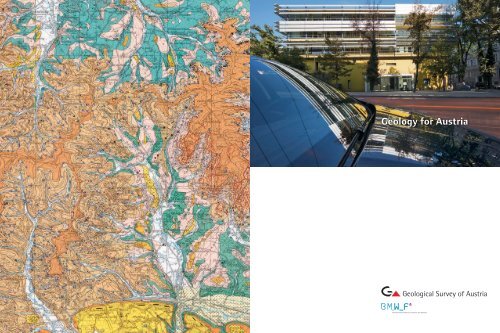
Backcover: Geological map of the Republic of <strong>Austria</strong> 1 : 50,000,<br />
map sheet 47 Ried im Innkreis, Detail in original size. Topography:<br />
<strong>Austria</strong>n Federal Office <strong>for</strong> Metrology and Surveying<br />
Vienna, October 2009<br />
All rights reserved<br />
The Geological Survey of <strong>Austria</strong> is a research unit of the<br />
<strong>Austria</strong>n Federal Ministry of Science and Research<br />
www.bmwf.gv.at<br />
and Member of the European Organisation of Geological Surveys<br />
(EuroGeoSurveys)<br />
www.eurogeosurveys.eu<br />
32