Visual Landscape Analysis - Hawkesbury City Council
Visual Landscape Analysis - Hawkesbury City Council
Visual Landscape Analysis - Hawkesbury City Council

Create successful ePaper yourself
Turn your PDF publications into a flip-book with our unique Google optimized e-Paper software.
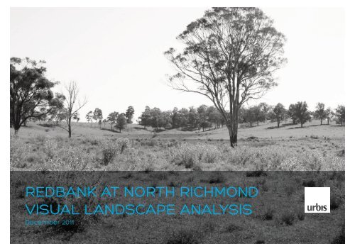
REDBANK AT NORTH RICHMOND<br />
VISUAL LANDSCAPE ANALYSIS<br />
December 2011
DISCLAIMER<br />
This report is prepared on the instructions of the party to whom or<br />
which it is addressed and is thus not suitable for use other than by<br />
that party. As the report involves future forecasts, it can be affected<br />
by a number of unforeseen variables. It represents for the party<br />
to whom or which it is addressed the best estimates of Urbis Pty<br />
Ltd, but no assurance is able to be given by Urbis Pty Ltd that the<br />
forecasts will be achieved.<br />
URBIS STAFF RESPONSIBLE FOR THIS REPORT WERE:<br />
Director<br />
Senior Consultant<br />
Job Code<br />
Report Number<br />
Version<br />
Rohan Dickson<br />
Jason Duda<br />
SD1117<br />
<strong>Visual</strong> <strong>Analysis</strong><br />
B<br />
2 NORTH RICHMOND RELEASE AREA
CONTENTS<br />
1 INTRODUCTION 5<br />
METHOD 6<br />
DEFINITION OF ANALYSIS CONCEPTS 6<br />
RESEARCH AND REVIEW 7<br />
DESIRED FUTURE CHARACTER 7<br />
2 ANALYSIS 8<br />
TOPOGRAPHY & VISUAL CATCHMENT 8<br />
LANDSCAPE CHARACTER ANALYSIS 9<br />
TYPE 1- REDBANK CREEK CORRIDOR 10<br />
TYPE 2- OPEN VALLEY 11<br />
TYPE 3- NORTH FACING SLOPES 12<br />
TYPE 4- RIDGETOPS 13<br />
LANDSCAPE CHARACTER UNIT SENSITIVITY 14<br />
KEY VANTAGE POINTS 15<br />
VANTAGE POINT 1 16<br />
VANTAGE POINT 2 17<br />
VANTAGE POINT 3 18<br />
VANTAGE POINT 4 19<br />
VANTAGE POINT 5 20<br />
VANTAGE POINT 6 21<br />
VANTAGE POINT 7 22<br />
VANTAGE POINT 8 23<br />
VANTAGE POINT 9 24<br />
VANTAGE POINT 10 25<br />
VANTAGE POINT 11 26<br />
VANTAGE POINT 12 27<br />
3 CONCLUSION & RECOMMENDATIONS 28<br />
VISUAL SENSITIVITY 28<br />
FUTURE CHARACTER 29<br />
RECOMMENDATIONS 29<br />
APPENDIX A - 108 GROSE VALE ROAD PROPOSED<br />
SENIORS HOUSING DEVELOPMENT<br />
VISUAL IMPACT ANALYSIS REPORT (URBIS 2008) 30<br />
VISUAL ANALYSIS<br />
3
4 NORTH RICHMOND RELEASE AREA
1 INTRODUCTION<br />
Urbis has been engaged by North Richmond Joint<br />
Venture Pty Ltd (NRJV) to undertake a visual landscape<br />
analysis of the subject site Redbank at North Richmond<br />
(108 Grose Vale Road, North Richmond - Lot 27<br />
DP1042890). The site is approximately 147 hectares in<br />
size adjacent to the existing North Richmond Village.<br />
The subject site is:<br />
• Within the North Richmond Future Growth Area as<br />
identified in the <strong>Hawkesbury</strong> Residential Land Strategy<br />
(2010) as shown in Figure 1.<br />
• Located north of Grose Vale Road, south of Redbank<br />
Road and Redbank Creek.<br />
Tabaraga Ridge<br />
foothills ~10km<br />
Belmont Grove<br />
Redbank Road<br />
Bells Line of Road<br />
• Located east of the rural residential area accessed<br />
from Bells Road.<br />
Redbank Creek<br />
• Predominantly used for grazing, with construction of<br />
an approved seniors living development located in the<br />
south eastern portion of the site.<br />
Bells Road<br />
• Part of the former Yobarnie which is of state<br />
heritage significance for its role as a Keyline system<br />
experimental and demonstration farm.<br />
*<br />
This analysis has been undertaken to create the baseline<br />
for assessment of the potential visual impact of any<br />
proposed development upon the subject lands.<br />
Grose Vale Road<br />
The objectives of this report are to:<br />
• Identify, assess and document the visual and<br />
landscape qualities of the land within the study area.<br />
*<br />
• Identify key vantage points and visual sensitivity.<br />
• Identify recommendations for potential development of<br />
the land.<br />
0 500m 1000m<br />
FIGURE 1: STUDY CONTEXT<br />
Redbank at North Richmond (Subject Site)<br />
Investigation Area - Future Growth<br />
(<strong>Hawkesbury</strong> Residential Land Strategy 2010)<br />
Approved Seniors Living Development<br />
*<br />
SREP 20 - Scenic Quality Study - Sub catchment boundary<br />
(<strong>Landscape</strong> unit 3.4.1 Yarramundi Weir to South Junction Creek)<br />
SREP 20 - Scenic Quality Study - Scenic Corridor Boundary<br />
SREP 20 - Scenic Quality Study - View point<br />
VISUAL ANALYSIS<br />
5
METHOD<br />
The method chosen for this analysis utilises a formal<br />
aesthetic model for describing the visual landscape units<br />
combined with a qualitative analysis approach.<br />
The process that Urbis has used to conduct this visual<br />
landscape analysis includes, but is not limited to:<br />
RESEARCH AND SITE SURVEY<br />
• Defining the topographic, distance and preliminary<br />
landscape units.<br />
• Photo-document potential key views from public<br />
domain vantage points. Potential private domain visual<br />
impacts are noted but not assessed in this report.<br />
CLASSIFICATION<br />
• Dividing the landscape into units and types that have<br />
distinct visual character and elements.<br />
• Identifying public domain vantage points and potential<br />
private domains that may experience visual change.<br />
ANALYSIS<br />
• Evaluating common elements of the landscape<br />
to understand the visual character and how it is<br />
experienced from vantage points.<br />
• Assessing the importance of views afforded from the<br />
identified vantage points and the level of change that<br />
will be experienced due to the development of the land<br />
(subject to the proposed rezoning).<br />
• Reviewing relevant <strong>Council</strong> documents and identifying<br />
the existing and desired future character.<br />
DOCUMENT FINDINGS & RECOMMENDATIONS<br />
• Documenting findings in a report format.<br />
DEFINITION OF ANALYSIS CONCEPTS<br />
The following are definitions of concepts used for the<br />
purpose of the analysis undertaken as part of this report.<br />
SCENIC QUALITY<br />
The scenic quality of the site and its surrounds is based<br />
on the extent to which the visual aesthetics and amenity<br />
of the landscape is valued from a human point of view.<br />
This value is based on professional opinion and an<br />
understanding of broad community values.<br />
VISUAL IMPACT<br />
The visual impact of a proposed development is<br />
determined by how much the proposed development<br />
imposes on the scenic quality, views and/or visual<br />
amenity afforded from landscapes<br />
The acceptability of the visual impact of the proposal is<br />
influenced by the weight/importance that is given to each<br />
of the vantage points. Identification of the importance of<br />
particular views of the landscape identified in this report<br />
are determined by the method described in the planning<br />
principle for views from Tenacity Consulting v Warringah<br />
[2004] NSWLEC 140.<br />
VISUAL LANDSCAPE SENSITIVITY<br />
The visual and landscape sensitivity is the level that<br />
which views and/or landscape that are experienced<br />
from vantage points can vary from the existing character<br />
or proposed future character without changing the<br />
fundamental elements or distinctive qualities that make<br />
the landscape recognisable.<br />
Determining the existing landscapes sensitivity to<br />
change also depends on the degree to which the<br />
landscape has already been altered. If the landscape has<br />
undergone recent change, the introduction of additional<br />
development, and therefore more change, may potentially<br />
have less perceived impacts than in an area that has<br />
remained substantially unchanged for an extended period<br />
time. However, it is noted that cumulative change may<br />
alter the key elements of the landscape, and hence alter<br />
the perceived key characteristics of the area.<br />
6 NORTH RICHMOND RELEASE AREA
RESEARCH AND REVIEW<br />
Aerial photography and topographic maps were used<br />
in a desktop analysis of the site. Boundaries of possible<br />
landscape units were refined during a field survey<br />
conducted by Urbis in November 2011.<br />
Relevant documents applicable to establishing the existing<br />
and future character of the visual catchment area include:<br />
• <strong>Hawkesbury</strong> Residential Land Strategy (Hassell 2010).<br />
• Draft <strong>Hawkesbury</strong> LEP 2011.<br />
• 108 Grose Vale Road Proposed Seniors Housing <strong>Visual</strong><br />
Impact <strong>Analysis</strong> (Urbis 2008).<br />
• Draft Conservation Management Plan Former Yobarnie<br />
(Urbis 2011).<br />
The site is also in the vicinity of the Sydney Regional<br />
Environmental Plan 20 (SREP 20) <strong>Hawkesbury</strong> - Nepean<br />
River (No. 2 - 1997). The <strong>Hawkesbury</strong> - Nepean Scenic<br />
Quality Study (DUAP 1996) which is referenced in the<br />
SREP identifies the landscape quality.<br />
While the subject site is located outside of the landscape<br />
units in the study it adjoins the Yarramundi Weir to South<br />
Junction Creek unit from which key vantage points are<br />
located. The key features of the study are identified in<br />
Figure 1.<br />
DESIRED FUTURE CHARACTER<br />
The desired future character establishes the anticipated<br />
setting and appearance for a defined area.<br />
The entire site is identified within the North Richmond<br />
Future Growth Area within the <strong>Hawkesbury</strong> Residential<br />
Land Strategy (HRLS). This anticipates that residential<br />
development as an extension of the existing village is to<br />
occur on the land not environmentally constrained.<br />
The HRLS also acknowledges that the rural lands are scenic<br />
as perceived by the community and visitors. Individual<br />
residential as part of an extension of the North Richmond<br />
village will not in itself change the character however the<br />
cumulative impacts must be considered.<br />
In relation to the subject site, the HRLS identifies heritage<br />
and character as important elements that have implications<br />
on the strategy. The keyline system elements including<br />
some dams are to be rectified/modified in order to retain<br />
as stormwater infrastructure in accordance with the<br />
Conservation Management Plan for 108 Grose Vale Road,<br />
North Richmond (Former Yobarnie).<br />
An opportunity exists to retain the appearance of a rural<br />
landscape from key vantage points while facilitating new<br />
residential development.<br />
FIGURE 2: EXAMPLE OF SCENIC RURAL LANDSCAPE<br />
VISUAL ANALYSIS<br />
7
2 ANALYSIS<br />
TOPOGRAPHY & VISUAL CATCHMENT<br />
The North Richmond village lies in a river flat valley and is<br />
surrounded by distant hills. Approximately 10km north west<br />
of the site are vegetated hills approximately 500-600m in<br />
elevation making them visible from both Grose Vale Road<br />
and from the higher elevation parts of the site. These hills<br />
form the backdrop for views afforded from Grose Vale Road<br />
and Bells Line of Road.<br />
The terrain immediately surrounding the subject site falls<br />
from Grose Vale Road (southern boundary) to permit<br />
limited views in to the site and out of the site. Mid-ground<br />
views along the Redbank Creek valley to the site can be<br />
experienced from land located west of Bells Line of Road.<br />
The site contains a ridgeline running east-west through the<br />
centre of the site. This ridgeline results in a valley draining<br />
to the south east to the subject site boundary and a valley<br />
draining the northern slopes to Redbank Creak which forms<br />
the northern boundary of the site.<br />
central ridgeline<br />
The southern boundary runs along a ridge line with an<br />
elevation of approximately 80m (AHD) on the western<br />
boundary of the site and an elevation of approximately<br />
70m on the eastern boundary. The lowest part of the site is<br />
situated to the northern boundary along Redbank Creek at<br />
an elevation of approximately 20m.<br />
The visual catchment for the site is defined as land where<br />
the subject site can be experienced as an individual<br />
element or majority portion of a view. Vantage points more<br />
than 1.5km from the site are not considered to be within<br />
the visual catchment as views from these points would<br />
experience as part of a distant setting.<br />
Figure 3 shows key topographic features, the extent of<br />
the visual catchment for the site, as well existing village<br />
gateways identified by physical signage.<br />
FIGURE 3: TOPOGRAPHY & VISUAL CATCHMENT<br />
Ridge line<br />
Local high point<br />
<strong>Visual</strong> catchment<br />
2m contours<br />
Subject site<br />
Existing town gateways<br />
Approved Seniors Living Development<br />
8 NORTH RICHMOND RELEASE AREA
LANDSCAPE CHARACTER ANALYSIS<br />
The existing landscape character types are defined by<br />
distinguishing features in the following categories:<br />
• Form<br />
• Line<br />
• Colour<br />
• Texture<br />
• Scale<br />
• Space<br />
The assessment is undertaken from a desktop analysis and<br />
from on site verification.<br />
TYPE # TYPE NAME KEY CHARACTERISTICS<br />
1 Redbank<br />
Creek<br />
Corridor<br />
Dense vegetation of under storey<br />
and mature trees.<br />
2 Open Valley Gentle sloping valleys and<br />
gullies with little or no tree cover.<br />
Generally below the keyline<br />
contour.<br />
3 North<br />
Facing<br />
Slopes<br />
Northern facing mid-slopes with<br />
scattered mature trees within<br />
grassland.<br />
4 Ridgetops Moderately vegetated ridge<br />
tops with mature trees within<br />
grassland.<br />
1<br />
2<br />
3<br />
4<br />
Redbank Creek Corridor<br />
Open Valley<br />
North Facing Slopes<br />
Ridgetops<br />
FIGURE 4: LANDSCAPE CHARACTER TYPES<br />
VISUAL ANALYSIS<br />
9
TYPE 1 - REDBANK CREEK CORRIDOR<br />
VISUAL CHARACTER STATEMENT<br />
This landscape type consists of a dense vegetated<br />
understory and mature trees surrounded by grasses.<br />
Form<br />
Line<br />
Liner dense vegetation with clusters of taller trees<br />
along winding corridor.<br />
Generally consistent canopies creating a strong<br />
horizontal element with taller trees creating vertical<br />
elements.<br />
Colour Dark green of the tree canopies with dark browns<br />
and gray of the trunks.<br />
Texture Dense foliage of shorter and less mature trees is<br />
broken up by vertical tree trunks.<br />
Scale<br />
Consistent with patches due to the relative<br />
size of trees, landscape components and their<br />
surroundings.<br />
Space Sense of enclosure due to the dense understory<br />
and mature trees.<br />
FIGURE 5: TYPE 1 - REDBANK CREEK CORRIDOR<br />
VISUAL CHANGE ANALYSIS<br />
This landscape type has a low to moderate capacity for<br />
change as the vegetation forms part of the Redbank Creek<br />
riparian corridor. This landscape character extends the<br />
entire northern boundary which should be retained to retain<br />
the consistency with how this landscape unit is treated on<br />
both eastern and western sides of the subject site.<br />
The vegetation forms a barrier between the subject site and<br />
existing development to the north.<br />
FIGURE 6: LOCATION TYPE 1 –<br />
REDBANK CREEK CORRIDOR<br />
Subject Site<br />
10 NORTH RICHMOND RELEASE AREA
TYPE 2 - OPEN VALLEY<br />
VISUAL CHARACTER STATEMENT<br />
Farm dams adjoining open gullies and surrounded by<br />
scattered trees grasses.<br />
Form<br />
Line<br />
Relativity flat, steeper on edges of the landscape<br />
unit.<br />
The dams generally sit in the gully alignment.<br />
mature trees form vertical elements.<br />
Colour Predominately light green and yellow from grasses<br />
with patches of light brown and red.<br />
Texture Mottled and flecked grasses and soil, contrasting<br />
with the consistent surface of the water on dams.<br />
Scale<br />
Wide, shallow and broad on the horizontal axis.<br />
Space Enclosure from slopes on the boarded the<br />
character unit.<br />
FIGURE 7: TYPE 2 – OPEN VALLEY<br />
VISUAL CHANGE ANALYSIS<br />
A moderate to high capacity to change applies as the<br />
landscape is highly modified from its original natural state.<br />
The setting of any retained or restored Keyline features<br />
should be considered, the open valley landform is an<br />
important part of this system.<br />
The requirement to drain stormwater limits capacity to<br />
change the landform form of valleys. Potential to use<br />
rectified/modified dams as waterbodies or dry basins to<br />
link vegetated corridors of the ridgetops and north facing<br />
slopes.<br />
FIGURE 8: LOCATION TYPE 2 –<br />
OPEN VALLEY<br />
Subject Site<br />
VISUAL ANALYSIS<br />
11
TYPE 3 - NORTH FACING SLOPES<br />
VISUAL CHARACTER STATEMENT<br />
This landscape type consists of intermittently spaced<br />
tree clusters, surrounded by grasses on slopes with<br />
predominately a northern aspect.<br />
Form<br />
Line<br />
Scattered clusters of trees amongst open space.<br />
The rounded canopies of the trees diffuse over<br />
gently undulating hills, piercing the line of the<br />
horizon.<br />
Colour Dark green of the tree canopies and dark browns<br />
and gray of the trunks give way to softer and lighter<br />
greens and browns of grasses underneath.<br />
Texture Varies, grass cover broken up by vertical tree<br />
trunks and foliage.<br />
Scale Broad with liner patches due to the relative<br />
size of trees, landscape components and their<br />
surroundings.<br />
FIGURE 9: TYPE 3 – NORTH FACING SLOPES<br />
Space General open space appearance with visibility<br />
beneath canopies sporadically interrupted<br />
through the scattered growth of trees.<br />
VISUAL CHANGE ANALYSIS<br />
A moderate to high capacity to change applies as the<br />
landscape is substantially modified from its original natural<br />
state.<br />
Use of carefully sited landscape elements such as native<br />
tree planting and landscape buffers will mitigate the visual<br />
impact of service infrastructure and built form in more<br />
visually sensitive areas such as the areas adjacent to Grose<br />
Vale Road.<br />
FIGURE 10: LOCATION TYPE 3 –<br />
NORTH FACING SLOPES<br />
Subject Site<br />
12 NORTH RICHMOND RELEASE AREA
TYPE 4 - RIDGETOPS<br />
VISUAL CHARACTER STATEMENT<br />
This landscape type consists of moderately vegetated<br />
ridgetops characterised by mature trees and grassland.<br />
Form<br />
Line<br />
Canopies of mature trees forming and edge in the<br />
landscape.<br />
The rounded canopies of the trees diffuse over<br />
gently undulating hills, piercing the line of the<br />
horizon.<br />
Colour Dark green of the tree canopies and dark browns<br />
and gray of the trunks give way to softer and lighter<br />
greens and browns of grasses underneath.<br />
FIGURE 11: TYPE 4 – RIDGETOPS<br />
Texture Grass cover broken up by vertical tree trunks.<br />
Scale<br />
Linear with patches due to the relative size of trees,<br />
landscape components and their surroundings.<br />
Space Enclosure for the topography as the ridgeline<br />
topped with mature trees forms a defined edge to<br />
the valley.<br />
VISUAL CHANGE ANALYSIS<br />
This landscape type has a low to moderate capacity for<br />
change as the vegetation forms part of a layered view across<br />
the site and beyond, to the Tabaraga Ridge and Wollemi<br />
National Park. Sensitively placed development within this<br />
landscape to maintain the visual characteristics of this type.<br />
The use of carefully placed landscape elements such as<br />
native tree planting and landscape buffers will likely mitigate<br />
visual impact of service infrastructure and built form when<br />
experienced from a distance; particularly the ridgeline that<br />
Grose Vale Road follows.<br />
FIGURE 12: LOCATION TYPE 4 –<br />
RIDGETOPS<br />
Subject Site<br />
VISUAL ANALYSIS<br />
13
LANDSCAPE CHARACTER UNIT SENSITIVITY<br />
Based on the quality and characteristics of the landscape in the<br />
setting, the following table summarises the capacity to change<br />
of each landscape type and the key opportunities this presents<br />
for development:<br />
TYPE NAME CAPACITY FOR CHANGE OPPORTUNITIES<br />
1 Redbank Creek<br />
Corridor<br />
Low to moderate to capacity for change<br />
Located predominantly within and adjacent to Redbank Creek, there is an<br />
opportunity to retain the vegetated riparian corridor consistent with other parts<br />
of the adjoining Redbank Creek. The vegetation forms a barrier between the<br />
subject site and existing development to the north.<br />
2 Open Valley Moderate to high capacity for change The requirement to drain stormwater limits the capacity to change the landform<br />
form of valleys. Potential use of rectified/modified dams as waterbodies or<br />
dry basins to link vegetated corridors allowing a sequence of dams to be<br />
experienced along a view corridor.<br />
3 North Facing<br />
Slopes<br />
Low to moderate capacity for change<br />
Sensitively sited development that retains existing trees within this landscape to<br />
maintain the visual quality of the area.<br />
Use of carefully placed landscape elements such as native tree planting and<br />
landscape buffers will mitigate visual impact of service infrastructure and built<br />
form in more visually sensitive areas such as the areas adjacent to Grose Vale<br />
Road.<br />
4 Ridgetops Low to moderate capacity for change Sensitively sited development within this landscape to maintain the visual<br />
characteristics of this type.<br />
Use of carefully placed landscape elements such as native tree planting and<br />
landscape buffers will mitigate visual impact of service infrastructure and built<br />
form when experienced from a distance, particularly ridgelines such as Grose<br />
Vale Road.<br />
14 NORTH RICHMOND RELEASE AREA
KEY VANTAGE POINTS<br />
Assessment of views experienced from key vantage points<br />
enables the overall assessment of sensitivity and potential<br />
locations for required mitigation. Key vantage points are<br />
view points in the public domain most likely to view the site<br />
with the greatest impact.<br />
The rationale for the selection of key view points was based<br />
on but not limited to:<br />
i. Topography<br />
ii. Distance from site<br />
iii. Distance between view points<br />
iv. Frequency and duration of view<br />
v. What the view is of<br />
vi. Where the view is experienced from<br />
FIGURE 13: KEY VANTAGE POINTS<br />
Existing town gateways<br />
Number and direction of vanatge point<br />
Approved Seniors Living Development<br />
2m contours<br />
Subject site<br />
Ridge line<br />
Local high point<br />
VISUAL ANALYSIS<br />
15
VANTAGE POINT 1<br />
This vantage point is located on the southern side of the<br />
Redbank Road reserve.<br />
Redbank Creek vegetation<br />
FIGURE 14: VANTAGE POINT 1<br />
x<br />
FIGURE 15: LOCATION OF VANTAGE POINT 1<br />
Type of viewer<br />
Duration of view<br />
ASSESSMENT<br />
Motorists and other road users of<br />
Redbank Road.<br />
Short due to mature trees along<br />
Redbank road and along the<br />
Redbank Creek corridor.<br />
Viewing distance The vantage point is located<br />
approximately 400m north of the<br />
site over existing rural residential<br />
allotments to Redbank Creek.<br />
<strong>Landscape</strong><br />
compatibility<br />
The amenity of the landscape<br />
immediately visible from this vantage<br />
point is separate to that of the site<br />
as the dense vegetation of Redbank<br />
Creek forms a buffer and end to the<br />
view.<br />
VISUAL SENSITIVITY<br />
This vantage point has been selected as it is located<br />
near the northern edge of site. A view of rural residential<br />
development in woodland is not experienced by a high<br />
volume of viewers.<br />
The subject site is not visible due to the visual obstructions<br />
in the foreground from this vantage point. The dense<br />
vegetation along Redbank Creek also limits visibility to<br />
the site from both Redbank Road and dwellings on the<br />
southern side of the road.<br />
Viewer sensitivity from this vantage point is low due to a low<br />
frequency of viewers, and a short length of view. However<br />
nearby dwellings which face the site are of a higher<br />
sensitivity.<br />
As the riparian vegetation along Redbank Creek forms a<br />
significant element of this view, any significant variation to<br />
the dense vegetation would alter this view. Private domain<br />
visual impact would need to be considered if a substantial<br />
amount of vegetation was proposed to be removed from<br />
the creek corridor.<br />
16 NORTH RICHMOND RELEASE AREA
VANTAGE POINT 2<br />
This vantage point is located on the southern side of the<br />
Redbank Road reserve.<br />
Redbank Creek vegetation<br />
Subject Site<br />
FIGURE 16: VANTAGE POINT 2<br />
x<br />
FIGURE 17: LOCATION OF VANTAGE POINT 2<br />
Type of viewer<br />
Duration of view<br />
ASSESSMENT<br />
Motorists and other road users of<br />
Redbank Road.<br />
Very short as viewers are generally<br />
travelling perpendicular to the view.<br />
View length is moderate with views<br />
into the site.<br />
Viewing distance Vantage point located<br />
approximately 300m north of the<br />
subject site, with a small part of the<br />
site visible.<br />
<strong>Landscape</strong><br />
compatibility<br />
The foreground is private domain,<br />
predominately grass with buildings<br />
and fences. Tree lines in the<br />
midground and distance form the<br />
horizon of the view which should be<br />
retained.<br />
VISUAL SENSITIVITY<br />
This vantage point has been selected as it is located near<br />
northern edge of site. While the site is visible it is distant and<br />
forms a small portion of this view. However tree canopies<br />
which are located on the site form the horizon of this view.<br />
It is considered that the viewer sensitivity from the vantage<br />
point is low due to a low frequency of viewers and a short<br />
length of view. However nearby dwellings which face the<br />
site are of a higher sensitivity.<br />
The Redbank Creek corridor treeline forms an important part<br />
of this view. Any significant variation to the dense vegetation<br />
would alter this view. Private domain visual impact will need<br />
to be considered if a substantial amount of vegetation was<br />
proposed to be removed from the creek corridor.<br />
VISUAL ANALYSIS<br />
17
VANTAGE POINT 3<br />
This vantage point is located on the southern side of the<br />
Redbank Road reserve.<br />
Redbank Creek vegetation<br />
FIGURE 18: VANTAGE POINT 3<br />
x<br />
Type of viewer<br />
Duration of view<br />
ASSESSMENT<br />
Motorists and other road users of<br />
Redbank Road.<br />
Short, viewers can see only a short<br />
distance on approach from the<br />
east.<br />
VISUAL SENSITIVITY<br />
This vantage point has been selected as it is located near<br />
northern edge of site and is located near a potential access<br />
point. The site is not visible due to the ridgeline located<br />
between vantage point and subject site.<br />
Viewing distance View point adjacent to north eastern<br />
corner of site. The site is not visible<br />
due to rise in topography between<br />
vantage point and subject site.<br />
<strong>Landscape</strong><br />
compatibility<br />
The private domain is located in<br />
the foreground, with predominately<br />
grass, buildings, transmission lines<br />
and fences. The subject site is not<br />
visible.<br />
FIGURE 19: LOCATION OF VANTAGE POINT 3<br />
18 NORTH RICHMOND RELEASE AREA
VANTAGE POINT 4<br />
This vantage point is located on at the entrance driveway of<br />
Rural Press on Bells Line of Road.<br />
Subject Site<br />
Redbank Creek vegetation<br />
Tabaraga Ridge<br />
foothills<br />
FIGURE 20: VANTAGE POINT 4<br />
FIGURE 21: LOCATION OF VANTAGE POINT 4<br />
x<br />
Type of viewer<br />
Duration of view<br />
ASSESSMENT<br />
Motorists and other road users of<br />
Bells Line of Road.<br />
Long views to the Tabaraga Ridge.<br />
Extent of vantage point is wide as<br />
viewers can see the site on Bells Line<br />
of Road for a stretch approximately<br />
100m between the Rural Press<br />
driveway and Crooked Road.<br />
Viewing distance The vantage point is located<br />
approximately 1km north-east of<br />
the site. Views are part way into the<br />
subject site.<br />
<strong>Landscape</strong><br />
compatibility<br />
The landscape is layered with<br />
buildings, a cemetery, transmission<br />
lines and fences in the foreground.<br />
Trees and open grassland are in<br />
the midground and the distance.<br />
The strong landscape character<br />
the Redbank Creek corridor and<br />
the vegetated ridgeline should be<br />
retained.<br />
VISUAL SENSITIVITY<br />
The view is adjacent to and across the St Phillips Cemetery<br />
and was selected for its visibility from Bells Line of Road A<br />
portion of the site is visible as a distant portion of this view.<br />
Tree canopies form the horizon of this view.<br />
It is considered that the viewer sensitivity from the vantage<br />
point is low due to a low frequency of viewers and a short<br />
length of view. However nearby dwellings which face the<br />
site are of a higher sensitivity.<br />
The Redbank Creek corridor treeline forms an important<br />
part of this view. Any significant variation to the dense<br />
vegetation would alter this view. Private domain visual<br />
impact would need to be considered if a substantial<br />
amount of vegetation was proposed to be removed from<br />
the creek corridor.<br />
VISUAL ANALYSIS<br />
19
VANTAGE POINT 5<br />
This viewing point is located on the western boundary of Peel<br />
Park.<br />
Central Ridgeline<br />
Tabaraga Ridge foothills<br />
Redbank Creek vegetation<br />
FIGURE 22: VANTAGE POINT 5<br />
x<br />
Type of viewer<br />
Duration of view<br />
ASSESSMENT<br />
Visitors and uses of Peel Park.<br />
Long as viewers are generally moving<br />
at slow speed or are stopped.<br />
Viewing distance View point adjacent to north eastern<br />
corner of site. Long as viewers can<br />
see almost across the entire site to<br />
the south and to Tabaraga Ridge to<br />
the North.<br />
<strong>Landscape</strong><br />
compatibility<br />
The compatibility to change is high<br />
with relatively flat unconstrained land.<br />
VISUAL SENSITIVITY<br />
This vantage point has been selected as it is located on the<br />
eastern edge of the site. Views from parks are considered<br />
to be of a higher value than from roadways. Views to a<br />
number of distant landscape feature are afforded from this<br />
location such as the foothills of the Tabaraga Ridge, keyline<br />
dams and the central ridgeline.<br />
These features can be experienced from other locations<br />
with a higher prominence. Therefore, the direct retention of<br />
views to these features from this location is not essential.<br />
However, an opportunity exists to frame views to these<br />
features the through alignment of roadways connecting to<br />
Peel Park.<br />
FIGURE 23: LOCATION OF VANTAGE POINT 5<br />
20 NORTH RICHMOND RELEASE AREA
VANTAGE POINT 6<br />
This viewing point is located at the southern end of Authur Phillip Drive.<br />
FIGURE 24: VANTAGE POINT 6<br />
x<br />
Type of viewer<br />
Duration of<br />
view<br />
Viewing<br />
distance<br />
<strong>Landscape</strong><br />
compatibility<br />
ASSESSMENT<br />
Motorists and other road users of<br />
Authur Phillip Drive.<br />
Moderate as viewers can see the<br />
site on approach along the relatively<br />
straight road; local 50km/h speed limit.<br />
Views part way into the subject site.<br />
Foreground subject to senior living<br />
development under construction.<br />
The amenity of the landscape<br />
immediately visible from this view point<br />
is considered compatible to change<br />
as it is predominately grass land. Tree<br />
line across ridge is broken and not<br />
consistent from this vantage point.<br />
Compatibility to change is very high.<br />
VISUAL SENSITIVITY<br />
This vantage point has been selected as it is located on<br />
the eastern bondary of the site. The approved seniors<br />
living development currently under construction forms a<br />
significant portion of this view. The view from intersection<br />
of Townsend Place and Authur Phillip Drive is examined<br />
in the 108 Grose Vale Road Proposed Seniors Housing<br />
Development <strong>Visual</strong> Impact <strong>Analysis</strong> Report (Urbis 2008).<br />
There are no particular elements of the view afforded from<br />
this vantage that should be retained.<br />
FIGURE 25: LOCATION OF VANTAGE POINT 6<br />
VISUAL ANALYSIS<br />
21
VANTAGE POINT 7<br />
This viewing point is located at the local highpoint adjacent to<br />
Grose Vale Road west of the existing village.<br />
Tabaraga Ridge<br />
foothills<br />
FIGURE 26: VANTAGE POINT 7<br />
ASSESSMENT<br />
VISUAL SENSITIVITY<br />
FIGURE 27: LOCATION OF VANTAGE POINT 7<br />
x<br />
Type of viewer<br />
Duration of<br />
view<br />
Viewing<br />
distance<br />
<strong>Landscape</strong><br />
compatibility<br />
Motorists and other road users of Grose<br />
Vale Road.<br />
Short as viewers can see the site on<br />
approach however existing vegetation<br />
and direction of road makes view oblique;<br />
motorists are also travelling at 70km/h<br />
speed limit which limits viewing time.<br />
View point adjacent to south eastern corner<br />
of site. Across subject site views to distant<br />
hills are afforded.<br />
Compatibility to change is high for the<br />
foreground and midground.<br />
This vantage point has been selected as it is located on a<br />
high point near the southern edge of the site. Views across<br />
the site to distant hills should be retained from this point.<br />
The views to distant hills informs the character of the village<br />
as being within a valley.<br />
The landscape rural character of the ridgeline that Grose<br />
Vale Road is situated along, is important as this forms the<br />
edge of the scenic landscape unit as identified in SREP<br />
20. There is potential to retain and enhance the landscape<br />
character by creating a corridor characterised by mature<br />
trees.<br />
The prominence of the landscape can be further enhanced<br />
by extending the vegetated ridgeline from the edge of the<br />
existing village (at which point the ridgeline becomes more<br />
prominent) to the ridgeline along the western boundary of<br />
the site.<br />
22 NORTH RICHMOND RELEASE AREA
VANTAGE POINT 8<br />
This viewing point is located on Grose Vale Road near the<br />
Belmont Trig Point.<br />
Tabaraga Ridge foothills<br />
Existing buildings in landscape<br />
(below tree line)<br />
Vegetated ridgeline<br />
FIGURE 28: VANTAGE POINT 8<br />
Type of viewer<br />
ASSESSMENT<br />
Motorists and other road users of Grose<br />
Vale Road.<br />
VISUAL SENSITIVITY<br />
This vantage point has been selected as it is located near a<br />
high point on southern edge of site.<br />
x<br />
FIGURE 29: LOCATION OF VANTAGE POINT 8<br />
Duration of<br />
view<br />
Viewing<br />
distance<br />
<strong>Landscape</strong><br />
compatibility<br />
Moderate as viewers can see the site<br />
on approach along the road; 70km/h<br />
speed limit.<br />
View point adjacent to southern<br />
boundary of site. Views of site in<br />
foreground with distant views to<br />
Tabaraga Ridge foothills and vegetated<br />
ridgeline to the north.<br />
The trigpoint identifies the local high<br />
point which is visible on Grose Vale<br />
Road. In order to maintain a rural<br />
character, retention of highpoints<br />
and ridgetops as natural elements.<br />
Compatibility to change is low.<br />
The ridge top and high point is sensitive due to its visibility.<br />
In order to retain and enhance the landscape rural character<br />
of the ridgeline that Grose Vale Road is located on, a<br />
corridor characterised by mature trees can be established.<br />
Views to the foothills of Tabaraga Ridge and the vegetated<br />
ridgeline to the north should be retained from this location.<br />
VISUAL ANALYSIS<br />
23
VANTAGE POINT 9<br />
This viewing point is located o on Grose Vale Road opposite the<br />
intersection with the driveway to St John of God Hospital.<br />
Tabaraga Ridge foothills<br />
Vegetated ridgeline<br />
FIGURE 30: VANTAGE POINT 9<br />
x<br />
Type of viewer<br />
Duration of<br />
view<br />
Viewing<br />
distance<br />
<strong>Landscape</strong><br />
compatibility<br />
ASSESSMENT<br />
Motorists and other road users of<br />
Grose Vale Road.<br />
Moderate as viewers can see the<br />
site on approach along the relatively<br />
straight road; 70km/h speed limit.<br />
View point adjacent to southern<br />
boundary of the site. Views part way<br />
into the subject site.<br />
Foreground and midground is<br />
predominately unconstrained<br />
grassland. Compatibility to change is<br />
high.<br />
VISUAL SENSITIVITY<br />
This vantage point has been selected as it is located near a<br />
high point on southern edge of site.<br />
The distant features of the view are important for retaining<br />
the natural landscape and valley character. The Grose Vale<br />
Road should be considered as an entry road to Redbank<br />
and retained as a rural corridor as identified in Vantage<br />
Point 7.<br />
FIGURE 31: LOCATION OF VANTAGE POINT 9<br />
24 NORTH RICHMOND RELEASE AREA
VANTAGE POINT 10<br />
This viewing point is located at the local high point on Grose<br />
Vale Road.<br />
Approximate boundary<br />
of subject site<br />
FIGURE 32: VANTAGE POINT 10<br />
x<br />
FIGURE 33: LOCATION OF VANTAGE POINT 10<br />
Type of viewer<br />
Duration of view<br />
ASSESSMENT<br />
Motorists and other road users of<br />
Grose Vale Road.<br />
Moderate as viewers can see the site<br />
on approach for a moderate period at<br />
the 70km/h speed limit.<br />
Viewing distance View point adjacent to south western<br />
corner of site. Views across adjacent<br />
site and part way into the subject site.<br />
<strong>Landscape</strong><br />
compatibility<br />
The vegetation along the roadway and<br />
into the valley provides a less modified<br />
rural character. A sequence of Keyline<br />
dams can be viewed from this location<br />
which provides a view containing<br />
water, open valley and woodland<br />
which is valued higher than a single<br />
landscape element.<br />
VISUAL SENSITIVITY<br />
This vantage point has been selected as it is located near a<br />
high point on southern edge of site.<br />
The view experienced comprises dams, open valley and<br />
woodland on two properties. This view is considered of a<br />
higher value due to the multiple landscape elements.<br />
Significant retention of this view including the mature trees,<br />
landform and sequence of dams should be considered,<br />
potentially with sensitively placed dwellings around the<br />
dams.<br />
VISUAL ANALYSIS<br />
25
VANTAGE POINT 11<br />
This viewing point is located at the local high point on Bells Road.<br />
Distant hills<br />
Boundary of site along ridge<br />
FIGURE 34: VANTAGE POINT 11<br />
x<br />
Type of viewer<br />
Duration of view<br />
ASSESSMENT<br />
Motorists and other road users of<br />
Bells Road.<br />
short due to the the foreground<br />
obstructions and oblique angle of<br />
views direction of Bells Road.<br />
Viewing distance View point is located 500m west of the<br />
subject site with views along valley<br />
to distant hills and ridgeline along<br />
boundary of subject site.<br />
<strong>Landscape</strong><br />
compatibility<br />
The trees along the ridgeline<br />
boundary are an important landscape<br />
element for creating enclosure of the<br />
valley that which the rural residential<br />
development.<br />
VISUAL SENSITIVITY<br />
This vantage point has been selected as it is located near a<br />
high point near the western edge of site.<br />
This vantage point is significantly obscured by rural<br />
residential development in the foreground. The boundary<br />
which runs along a ridgeline is visible with the higher<br />
elevation portion characterised by mature trees.<br />
While this vantage point has relatively few viewers due to<br />
limited number of road users, views afforded from dwellings<br />
facing the site should be considered at subdivision design.<br />
FIGURE 35: LOCATION OF VANTAGE POINT 11<br />
26 NORTH RICHMOND RELEASE AREA
VANTAGE POINT 12<br />
This viewing point is located on the eastern end of Belmont Grove.<br />
Redbank Creek vegetation<br />
Approximate boundary<br />
of subject site<br />
FIGURE 36: VANTAGE POINT 12<br />
x<br />
Type of viewer<br />
Duration of view<br />
ASSESSMENT<br />
Motorists and other road users of<br />
Belmont Grove.<br />
Moderate as viewers can see the site<br />
directly from the end of the road.<br />
Viewing distance View point adjacent to north western<br />
corner of site. Views part way into the<br />
subject site including along Redbank<br />
creek and ridgeline of western<br />
boundary.<br />
<strong>Landscape</strong><br />
compatibility<br />
The amenity of the landscape<br />
immediately visible from this view<br />
point is considered compatible to<br />
change as it is predominately grass<br />
land with scattered trees.<br />
VISUAL SENSITIVITY<br />
This vantage point has been selected as it is located on the<br />
western edge of site.<br />
There are no foreground obstructions from this view point<br />
to the subject site. A high visibility rating applies from this<br />
view viewpoint.<br />
It is considered that the viewer sensitivity is low as Belmont<br />
Grove is currently a dead-end road and has few users.<br />
Dwellings located near ridgeline boundary face away from<br />
subject site.<br />
FIGURE 37: LOCATION OF VANTAGE POINT 12<br />
VISUAL ANALYSIS<br />
27
3 CONCLUSION & RECOMMENDATIONS<br />
VISUAL SENSITIVITY<br />
The visual sensitivity is an overall assessment, with the<br />
land in the study area given a weighting relative to the<br />
study context. This weighting is based on the qualitative<br />
assessment described in the analysis section, including<br />
an analysis of the visual sensitivity of each external<br />
viewing situation from the key viewing points:<br />
1<br />
3<br />
• The activity of the viewer - identification of the<br />
predominant activity of the viewer from each given<br />
location;<br />
• The duration of view - an evaluation/grading of the<br />
period of time each view would last from each given<br />
location;<br />
• The viewing distance - an approximate estimation on<br />
how far away each given location is from the subject<br />
area, and an assessment on what can be viewed<br />
from each given location, in terms of foreground/midground/background<br />
elements; and<br />
• The landscape compatibility - the extent to which the<br />
visual landscape can accept change without loss of<br />
existing visual amenity, as viewed from each given<br />
location.<br />
2<br />
6<br />
7<br />
4<br />
8<br />
5<br />
9<br />
Using the analysis previously detailed, Figure 38 maps<br />
the weighting given to the visual sensitivity of areas.<br />
While some areas of the site have been determined to<br />
be of moderate sensitivity, sensitive and responsive<br />
development could be undertaken in these areas subject<br />
to resolution of the ability to address the desire future<br />
character and recommendations.<br />
FIGURE 38: SENSITIVITY<br />
28 NORTH RICHMOND RELEASE AREA
AREA #<br />
SENSITIVITY JUSTIFICATION SUMMARY<br />
1 Low sensitivity due to limited public vantage<br />
points.<br />
2 Moderate visual sensitivity due to proximity to<br />
Grose Vale Road and limited views screened by<br />
existing vegetation on the approach to the site.<br />
3 Moderate visual sensitivity due the existing<br />
consistency of visual character along Redbank<br />
Creek within and beyond the subject site. It is<br />
also noted that this area is closest to private<br />
dwellings overlook the creek corridor.<br />
4 Very low sensitivity due to limited landscape<br />
features, low in elevation and limited visibility<br />
from outside the site.<br />
5 Low sensitivity due to limited vantage points.<br />
6 Moderate sensitivity due to the area being<br />
located on highly visible ridge line, forming a<br />
part of a layered view from a number of public<br />
vantage points.<br />
7 Very low sensitivity due to limited landscape<br />
features, low in elevation and limited visibility<br />
from outside the site.<br />
8 Low sensitivity due to proximity to Grose Vale<br />
Road and views across site on the approach<br />
and adjacent to the site when travelling along<br />
Grose Vale Road.<br />
9 Moderate sensitivity due to a moderate<br />
frequency of viewers along a number points<br />
along Grose Vale Road<br />
FUTURE CHARACTER<br />
Future development as an extension to North Richmond<br />
should retain a character setting compatiable to the rural<br />
character of the sites surrounds. To retain a rural charcter<br />
setting, a modified landscape form can be achieved<br />
through:<br />
• Retaining the landscape character of the Redbank<br />
Creek Corridor and Ridgetops which are key<br />
landscape elements of views from key vantage points;<br />
• Retaining views to distant hills, including the Tabaraga<br />
Ridge, from key locations;<br />
• Retain and modify Keyline System elements in<br />
accordance with the CMP for the site; and<br />
• Adopting and implementing the recommendations<br />
identified below.<br />
RECOMMENDATIONS<br />
Recommendations have been prepared on the basis<br />
that the land is to be used for predominately residential<br />
development up to 10m in height, based on the relevant<br />
provisions in the <strong>Hawkesbury</strong> DLEP2011.<br />
Development will need to demonstrate the appropriate<br />
use of mitigation measures and have well sited<br />
development to alleviate or minimise the visual impact of<br />
development.<br />
The following recommendations should be considered<br />
during the ongoing design development for the site:<br />
• Use of street tree planting along all roads to mitigate<br />
the visual impact of built form.<br />
• Provide a minimum building setback from Grose Vale<br />
Road to enable views across and over the subject site<br />
to distant hills and to reduce visual impact of buildings<br />
in the landscape setting. Distance to be determined at<br />
master planning stage.<br />
• Ensure adequate deep soil zones are provided at rear<br />
of allotments.<br />
• Avoid buildings sited directly on top of ridges .<br />
• Retain individual native mature trees where possible<br />
and practical. Retention of tree lines along ridge tops<br />
required to maintain layering of landscape.<br />
• Position articulated building forms along contours to<br />
minimise the amount of necessary cut and fill and<br />
disturbance to the natural land form.<br />
• Provide adequate spacing between development,<br />
particularly on steeper slopes to allow tree planting to<br />
reduce visual impacts. Planting is to occur as discreet<br />
groupings along fences.<br />
• Apply mitigation measures to buildings including (but<br />
not limited to) choice of colours, materials, finishes<br />
and on-lot landscape planting to complement existing<br />
identified landscape units.<br />
• Use road alignments to frame views of key landsape<br />
and topographic features including the central<br />
ridgeline, the foothills of Tabaraga Ridge and retained<br />
features of the Keyline System.<br />
• Relocate town gateway (as defined by entry signage)<br />
to edge of the expanded village residential area.<br />
• Retain prominence of natural rural character along<br />
ridgeline that Grose Vale Road is located, including<br />
avoiding buildings interrupting the treeline when<br />
viewed from key vantage points.<br />
VISUAL ANALYSIS<br />
29
APPENDIX A<br />
108 GROSE VALE ROAD PROPOSED SENIORS HOUSING<br />
DEVELOPMENT VISUAL IMPACT ANALYSIS REPORT<br />
30 NORTH RICHMOND RELEASE AREA
VISUAL ANALYSIS<br />
31
32 NORTH RICHMOND RELEASE AREA
VISUAL ANALYSIS<br />
33
34 NORTH RICHMOND RELEASE AREA
VISUAL ANALYSIS<br />
35
36 NORTH RICHMOND RELEASE AREA
VISUAL ANALYSIS<br />
37
Sydney<br />
Level 21, 321 Kent Street<br />
Sydney, NSW 2000<br />
Tel: 02 8233 9900<br />
Fax: 02 8233 9966<br />
Melbourne<br />
Level 12, 120 Collins Street<br />
Melbourne, VIC 3000<br />
Tel: 03 8663 4888<br />
Fax: 03 8663 4999<br />
Brisbane<br />
Level 12, 120 Edward Street<br />
Brisbane, QLD 4000<br />
Tel: 07 3007 3800<br />
Fax: 07 3007 3811<br />
Perth<br />
Level 1, 55 St Georges Terrace<br />
Perth WA 6000<br />
Tel: 08 9346 0500<br />
Fax: 08 9221 1779<br />
Australia • Asia • Middle East<br />
urbis.com.au<br />
info@urbis.com.au