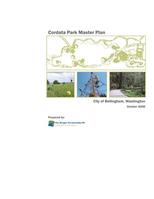
Cordata Park Master Plan - City of Bellingham, WA
Cordata Park Master Plan - City of Bellingham, WA
Cordata Park Master Plan - City of Bellingham, WA

You also want an ePaper? Increase the reach of your titles
YUMPU automatically turns print PDFs into web optimized ePapers that Google loves.
<strong>Cordata</strong> <strong>Park</strong> <strong>Master</strong> <strong>Plan</strong><br />
<strong>City</strong> <strong>of</strong> <strong>Bellingham</strong>, Washington<br />
October 2008<br />
Prepared by:
<strong>Cordata</strong> <strong>Park</strong> <strong>Master</strong> <strong>Plan</strong><br />
Table <strong>of</strong> Contents<br />
1.0 Introduction & Background<br />
2.0 Public <strong>Plan</strong>ning Process<br />
3.0 Site Analysis Summary<br />
4.0 Site <strong>Plan</strong> Alternatives<br />
5.0 Preferred <strong>Master</strong> <strong>Plan</strong><br />
6.0 Phased Implementation & Estimated Costs<br />
7.0 Appendix<br />
Project Team<br />
Civil Design Narrative<br />
Wetland Reconnaissance Confirmation<br />
Steering Committee/ Public Meeting Notes
Introduction & Background
<strong>Cordata</strong> <strong>Park</strong> <strong>Master</strong> <strong>Plan</strong><br />
Introduction &<br />
Background<br />
The process for creating <strong>Cordata</strong> <strong>Park</strong> began with a vision to purchase <strong>of</strong> a large tract <strong>of</strong> wooded<br />
land on the edge <strong>of</strong> the city limits with the goal <strong>of</strong> serving the needs <strong>of</strong> the Guide Meridian and<br />
<strong>Cordata</strong> Neighborhoods. <strong>Bellingham</strong> <strong>Park</strong>s acquired a 20-acre parcel, which together with<br />
the adjoining 7-acres <strong>of</strong> public land (including a stormwater pond) transferred from Whatcom<br />
County, presents an exciting opportunity to provide a desperately needed neighborhood park for<br />
this growing community.<br />
The collaborative public planning process began in April 2008 and has yielded a host <strong>of</strong> great<br />
ideas and generated excitement about the park. The process included citizen input obtained<br />
through interactive community meetings, park board presentations and staff discussions to help<br />
determine the park components and direction.<br />
The progression has involved working closely with stakeholders and designing for the long-term<br />
with an eye toward longevity, multiple uses and low maintenance. The undeveloped, diverse site<br />
also contains wetland complexes, streams, meadows and stands <strong>of</strong> mature trees. Therefore,<br />
a major challenge has been to provide increased recreational opportunities serving the<br />
neighborhood, while sensitively preserving natural areas and wildlife habitat from the pressures<br />
<strong>of</strong> development.<br />
Because <strong>of</strong> its size and strategic location, the park will not only be a destination and community<br />
gathering spot, but also provide greatly improved connectivity between Horton and Aldrich<br />
Roads, Birchwood Presbyterian Church, the new elementary school site, Whatcom Community<br />
College, the North <strong>Bellingham</strong> trail network and the surrounding residential neighborhood.<br />
This report is the culmination <strong>of</strong> the <strong>Cordata</strong> <strong>Park</strong> <strong>Master</strong> <strong>Plan</strong>ning process that occurred April<br />
through September 2008 and documents the public process, site analysis, design options and<br />
ultimately the preferred direction and vision for future development <strong>of</strong> <strong>Cordata</strong> <strong>Park</strong>.
<strong>Cordata</strong> <strong>Park</strong> <strong>Master</strong> <strong>Plan</strong>
<strong>Cordata</strong> <strong>Park</strong> <strong>Master</strong> <strong>Plan</strong>
Public Process to Date
<strong>Cordata</strong> <strong>Park</strong> <strong>Master</strong> <strong>Plan</strong><br />
<strong>Plan</strong>ning Process<br />
This <strong>Master</strong> <strong>Plan</strong> is the result <strong>of</strong> a multi-step process and was shaped by input from the <strong>Park</strong><br />
Steering Committee, the <strong>City</strong> <strong>of</strong> <strong>Bellingham</strong> <strong>Park</strong>s and Recreation Department, the <strong>Park</strong>s Board,<br />
<strong>City</strong> Council and general public.<br />
At the first public meeting in March 2008, the <strong>Park</strong> Steering Committee met with <strong>Park</strong>s staff and<br />
brainstormed ideas and activities the community might like to see in the park. All ideas were<br />
documented and presented to the design team. Those ideas generated at the first meeting,<br />
combined with the initial program developed by the <strong>Park</strong>s Department, were great insight into<br />
what the future <strong>of</strong> the park could be.<br />
At the next public meeting, held in April 2008, members <strong>of</strong> the consultant design team were<br />
introduced and got a chance to meet members <strong>of</strong> the surrounding community. The discussion<br />
involved the overall schedule and outlined how the planning process would unfold between that<br />
night and the completion <strong>of</strong> the <strong>Master</strong> <strong>Plan</strong> in September 2008. Monthly steering committee<br />
meeting dates were identified, with the purpose being to report progress, get the community’s<br />
feedback, and make sure everything was on track at each milestone.<br />
The design team emphasized that the community would shape the vision for the park and that<br />
there were not any preconceived ideas or concept plans. Instead, the intent was for everyone to<br />
work together to help carve a beautiful park out <strong>of</strong> this wooded, undeveloped site.<br />
At that same meeting, boards were presented to illustrate concept images and photos<br />
associated with the list generated at the first meeting. After brainstorming additional ideas<br />
and recording input, attendees were then asked to help prioritize some <strong>of</strong> the ideas and park<br />
elements that surfaced that evening. Each person was each given three dots to place on<br />
the board listing desired park program elements. This exercise clearly identified the highest<br />
priorities and was extremely helpful toward developing the design concepts.<br />
In May, Site Analysis boards were presented. They included information about topography,<br />
soils, solar exposure, winds, existing site character, and plant communities. Information on the<br />
wetlands and streams found onsite, as well as their respective buffers, was also reported. This<br />
information, as it turned out, would have a huge impact on the design <strong>of</strong> the park.
Site Analysis Summary
<strong>Cordata</strong> <strong>Park</strong> <strong>Master</strong> <strong>Plan</strong><br />
Site Analysis Summary<br />
Given the fact that the site is completely undeveloped, it was critical to begin the master<br />
planning process with an Inventory and Analysis phase about relevant natural and<br />
contextual aspects <strong>of</strong> the site. That process revealed some major challenges that needed to<br />
be taken into consideration once sensitive areas and their associated buffers were identified.<br />
This analysis identified many opportunities and constraints and laid a sound foundation <strong>of</strong><br />
information before exploring design alternatives.<br />
Existing Site: The 20-acre site is located in northwest <strong>Bellingham</strong>. The parcel is<br />
approximately 750 feet wide (east-west) by 1,100 feet long (north-south). An adjoining<br />
7-acre parcel with a stormwater pond was added at the northeast corner <strong>of</strong> the park and<br />
together they form an L-shaped site. Adjacent property uses include a church, multifamily<br />
residential, single family residential, and undeveloped natural areas. Current public<br />
pedestrian access points are either from the parking lot <strong>of</strong> the Birchwood Presbyterian<br />
Church to the north or the Horton Road street end at the south. Future vehicular access will<br />
be possible once the Horton Road extension project is completed.<br />
Topography & Slopes: There is approximately 30 feet <strong>of</strong> grade change across the site with<br />
generally smooth grade transitions. There is a slightly perceptible ridge running north-south<br />
on the western half <strong>of</strong> the site with the high point located in the western section <strong>of</strong> the site.<br />
On the eastern half <strong>of</strong> the site there are wetlands with some draining to the creek drainage<br />
that flows north and west away from the site.<br />
Vegetation: The site is completely forested and undeveloped. Dominant species include<br />
Red Alder, Vine Maple, Big Leaf Maple, Black Cottonwood, Douglas Fir and Western Red<br />
Cedar. The forested habitat appears to range from 20 to 35 years in age. Other species<br />
observed, but not limited to, are Douglas Spirea, Red Elderberry, Salmonberry, Sword Fern,<br />
Piggy Back <strong>Plan</strong>t, and several species <strong>of</strong> Trillium.<br />
Streams & Wetlands: The presence <strong>of</strong> several streams and wetlands contribute to the<br />
beautiful character <strong>of</strong> the future park site. However, when required buffers are taken into<br />
account based on the DOE classifications, the result is that nearly the whole eastern portion<br />
<strong>of</strong> the site is within a critical area.<br />
It should be noted that only a wetland reconnaissance confirmation has been performed<br />
at this time. A formal wetland and stream delineation would be required for submittal with<br />
any permit or land use applications associated with implementation. For more detailed<br />
information about streams, wetlands, soils and plant communities, as well as anticipated<br />
permitting requirements, see Section 7.0, Appendix for Wetland Reconnaissance<br />
Confirmation for the Aldrich Road Parcels, dated July 24, 2007 and prepared by Northwest<br />
Ecological Services, LLC.
Site <strong>Plan</strong> Alternatives
<strong>Cordata</strong> <strong>Park</strong> <strong>Master</strong> <strong>Plan</strong><br />
Site <strong>Plan</strong> Alternatives<br />
With a solid understanding about site opportunities, challenges, and a clear direction<br />
about the desired program, a range <strong>of</strong> graphic concepts were explored. Physical space<br />
was assigned to each program element in the form <strong>of</strong> concept diagrams.<br />
Three diagrams were presented to the steering committee as well as illustrative<br />
site design alternatives. Since analysis <strong>of</strong> the site yielded a large amount <strong>of</strong> useful<br />
information about the parameters <strong>of</strong> site, there was a conscious effort not to develop<br />
wildly different options that were <strong>of</strong> questionable feasibility. Instead, since the site had<br />
inherent constraints (e.g., wetlands, access issues), realistic concepts were explored<br />
where subtle refinements distinguished one plan from another. Primary differences<br />
between the concepts highlighted levels <strong>of</strong> activity, intensity, and the degree to which<br />
the site was impacted. Each <strong>of</strong> the alternatives identifies a common set <strong>of</strong> proposed<br />
elements, such as primary and secondary pedestrian circulation, parking and nonmotorized<br />
trails, unprogrammed open space, and site structures. Comparison between<br />
the options is very straightforward and intuitive. The goal was not to select one plan<br />
over another, but instead to find positive parts <strong>of</strong> each plan that reflected the collective<br />
community desire.<br />
A great discussion ensued and through a collaborative review process, patterns began<br />
to emerge about the placement <strong>of</strong> certain site features as well as aspects <strong>of</strong> each plan<br />
that resonated with the community. The challenge was to take that input and synthesize<br />
it into a refined plan.
Options ABC Concept Diagrams
Options ABC Schematic Site <strong>Plan</strong>s
Options ABC Character Images
Preferred <strong>Master</strong> <strong>Plan</strong>
7-Acre Parcel Transferred from Whatcom County
<strong>Cordata</strong> <strong>Park</strong> <strong>Master</strong> <strong>Plan</strong><br />
<strong>Master</strong> <strong>Plan</strong><br />
At the meeting in June, the process to date was recapped and the design alternatives were<br />
summarized. The meeting then transitioned to describing the refined plan. The presenters<br />
used bubble diagrams to identify where the major site program elements were located and<br />
then reviewed the illustrative site plan. The plan was a hybrid composite <strong>of</strong> the previous<br />
alternatives so there was familiarity with many elements, yet all arranged differently so as to<br />
create a truly unique scheme.<br />
While working through each <strong>of</strong> the elements <strong>of</strong> the plan, clarification questions were asked<br />
along the way. Many <strong>of</strong> the ideas contained within the refined plan were well-received. The<br />
result was that with some slight fine tuning, the refined plan could be finalized and become<br />
the preferred <strong>Cordata</strong> Site <strong>Master</strong> <strong>Plan</strong>.<br />
Site Elements<br />
The following are the major site elements and design principles identified in the <strong>Cordata</strong><br />
<strong>Park</strong> <strong>Master</strong> <strong>Plan</strong>:<br />
Preserve environmentally sensitive areas: Wet indicator species and an ephemeral<br />
stream are present in the forest that defines the eastern half <strong>of</strong> the park. Preservation <strong>of</strong><br />
these areas is important in maintaining the character <strong>of</strong> the park. Proposed improvements<br />
to these areas include strategically located trails, boardwalks and interpretive signage.<br />
Opportunities for environmental learning could be partnered with local schools or the nearby<br />
college.<br />
Improve Access & Connectivity: Non-motorized access from surrounding communities<br />
will consist <strong>of</strong> a combination <strong>of</strong> ADA pedestrian pathways and trails, regional bicycle trail<br />
connections, and low-impact raised boardwalks located in sensitive areas.<br />
Neighborhood Gathering Plaza: Centrally located next to the Great Lawn, the Restroom<br />
and the Children’s play area, the gathering plaza is at the heart <strong>of</strong> the park. The goal was<br />
to create a strong sense <strong>of</strong> place and identity that is unique to the park and reflects the<br />
surrounding community.<br />
Children’s Play Areas: A host <strong>of</strong> play opportunities are proposed throughout the park for a<br />
variety <strong>of</strong> ages. Closest to the community gathering plaza are formal play areas arranged<br />
to accommodate ages 2-5 and 5-12. Nearby is the skate spot. This is not a destination<br />
skateboard park, but instead a hardscape area with a few raised features that are designed<br />
to withstand the punishment that comes with heavy use and skateboards. Just beyond the<br />
skate spot, and adjacent to the parking lot, are the sport courts. Half-court basketball and<br />
other activities can be accommodated here. In addition to those distinctly identifiable play<br />
spaces, there are a number <strong>of</strong> sculptural rocks, logs and features throughout the site that<br />
can be seating opportunities or environmental play places for kids and adults alike.<br />
Restroom & Covered Shelter: A small-scale structure is proposed to adequately support<br />
the various uses throughout the park. Described in the community meetings as a small<br />
structure with a big ro<strong>of</strong>, this is strategically located to be the heart <strong>of</strong> the park. To the<br />
degree feasible, any park structures should be designed utilizing sustainable building<br />
techniques with the goal <strong>of</strong> translating into life-cycle costs savings and minimizing their<br />
impact on the natural environment. Measures to consider include ensuring that new<br />
structures make use <strong>of</strong> local building materials, increase the efficiency <strong>of</strong> water use,<br />
minimize waste, and make efficient use <strong>of</strong> energy. A few other small structures may include<br />
information kiosks at trailheads, simple picnic shelters, an overlook and a bird blind.<br />
Great Lawn: A high priority for the community was to create a large open space in the<br />
center <strong>of</strong> the park. While no formalized sports are proposed, the space is generally flat<br />
and is approximately the same size as a standard soccer field. This lawn area can be used<br />
for picnicking, Frisbee, bocce, informal gathering and other activities. A variety <strong>of</strong> seating<br />
opportunities exist along its edges so that the life <strong>of</strong> the park can be observed.
<strong>Cordata</strong> <strong>Park</strong> <strong>Master</strong> <strong>Plan</strong><br />
Site Elements<br />
Outdoor Rooms: While there is a need in the park for areas that have specific uses and get<br />
programmed accordingly, there is also a need to provide spaces that suit a variety <strong>of</strong> less<br />
formal uses. The “outdoor rooms” identified on the master plan are clearings in the forest<br />
that are linked via the trail system. These “rooms” can be used for picnics, small gatherings,<br />
casual bird watching or just experiencing nature. They not only provide a diversity <strong>of</strong><br />
experiences along the trail system, but also provide a more diverse habitat for plants and<br />
wildlife.<br />
LID <strong>Park</strong>ing Lot: Once <strong>Cordata</strong> <strong>Park</strong> becomes a reality, new amenities will draw visitors to<br />
the park from the surrounding community. Many visitors will arrive by foot or bicycle, and<br />
others will arrive by car. Rather than having one large parking lot, the design proposes two<br />
small lots for visitors arriving by car. This approach decentralizes the impervious surface<br />
<strong>of</strong> the parking lots and provides better access from both the north and south end <strong>of</strong> the<br />
park. See Civil Design Narrative for additional information about low-impact development<br />
techniques.<br />
Vegetation Management: Preservation <strong>of</strong> the maturing second-growth forest along<br />
the perimeters is important to maintain the buffer between park and the surrounding<br />
neighborhood. A management plan should be considered to identify how to handle blow<br />
down and emphasize the importance <strong>of</strong> keeping the biomass within the forest to complete<br />
healthy nutrient cycles. Incompatible uses have been kept out <strong>of</strong> this area so as not to<br />
damage the ecological functions <strong>of</strong> the park.<br />
Now that the major elements <strong>of</strong> the park have been identified, attention turned toward<br />
determining appropriate phasing and estimating associated cost information.
Section at Bridge
Section at Great Lawn<br />
Section at Play Area Plaza
Model – Birdseye Looking North
Model – <strong>Park</strong>ing, Courts, Play Area, Open Space
Model – Looking North from Play Area to Great Lawn
Phased Implementation & Estimated Costs
<strong>Cordata</strong> <strong>Park</strong> <strong>Master</strong> <strong>Plan</strong><br />
Phased Implementation<br />
Phasing: The <strong>Cordata</strong> <strong>Park</strong> <strong>Master</strong> <strong>Plan</strong> lays out a vision for these newly acquired and<br />
undeveloped properties. Due to budget and construction realities most park projects<br />
lend themselves to phasing. Implementing the proposed improvements at <strong>Cordata</strong><br />
<strong>Park</strong> will likely occur in more than one phase.<br />
However, it is important to recognize these priorities may change over time, based<br />
on project realities. Therefore, based on the needs identified in the master planning<br />
process, we <strong>of</strong>fer the following priorities for Phase 1 implementation.<br />
Phase 1 Implementation:<br />
1. Trailhead at Horton Road street end.<br />
2. Trailhead at Meadowbrook Court.<br />
3. Central pedestrian trail spine.<br />
4. Stream crossings (small bridges and/or elevated boardwalks).<br />
Optional Items to Include in Phase 1:<br />
• Establish the beginnings <strong>of</strong> the great lawn open space area.<br />
• Partial Horton Road extension to parking lot entrance. The road extension would<br />
require mitigation <strong>of</strong> affected wetlands.<br />
Phase 2 Implementation:<br />
1. All remaining park elements not included in Phase 1 and identified in the <strong>Cordata</strong><br />
<strong>Park</strong> <strong>Master</strong> <strong>Plan</strong>.<br />
Estimated Costs<br />
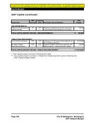
Estimated Costs: The following Probable Costs <strong>of</strong> Construction (PCC) represent<br />
budgeting figures, and do not reflect guaranteed construction costs, as the elements<br />
are not yet fully designed to provide that level <strong>of</strong> accuracy.<br />
This master plan is intended to serve as a decision-making guide for the <strong>City</strong>. It<br />
documents physical improvements that can be undertaken in the park to better meet<br />
the program needs <strong>of</strong> park users and the <strong>City</strong>. Decision-making frequently implies<br />
spending money and as a result, this plan includes preliminary cost ranges for major<br />
items in the park. It is important to note that these costs are intended to be used as<br />
budgeting figures and do not reflect a guaranteed construction cost, as the elements<br />
are not yet fully designed to ensure that level <strong>of</strong> accuracy.<br />
Extension <strong>of</strong> Horton Road is not included in this cost estimate.<br />
This Probable Cost <strong>of</strong> Construction (PCC) has been broken down into geographic<br />
sections within which specific construction items and tasks have been itemized. The<br />
cost estimate is intended to provide enough detail to allow cost information to be<br />
extracted in order to define the project scope and set budgets for possible future<br />
phases.<br />
This estimate has been prepared on the assumption that a general contractor will<br />
complete the work.<br />
Assumptions: A list <strong>of</strong> assumptions related to the estimate has been included. Given<br />
that the project is at an early level <strong>of</strong> development, much <strong>of</strong> the cost work must be<br />
based on assumptions <strong>of</strong> construction type, project scope, and allowances used to<br />
estimate quantities. Additionally, area square footages used to calculate some <strong>of</strong> the<br />
costs are based on the site aerial photo, leading to a reasonable but not exact level<br />
<strong>of</strong> accuracy. An awareness <strong>of</strong> these assumptions is critical in using this cost estimate<br />
as an effective tool. Assumptions include: This PCC is based on master plan level<br />
design. Fees such as permits, inspections, and utility connections are not included in<br />
this PCC. No maintenance costs are included in this PCC.<br />
Cost Ranges: Some elements included in the PCC are included as a range in order to<br />
identify range <strong>of</strong> scope/complexity <strong>of</strong> the respective park element and to allow the city<br />
further leeway in establishing a budget. In instances where a range has been listed, a<br />
mid range figure has been included in the cost estimate total. Therefore, total park cost<br />
may rise or fall dependant on the precise cost identified.
<strong>Cordata</strong> <strong>Park</strong> <strong>Master</strong> <strong>Plan</strong><br />
Estimated Costs<br />
Mark-up Definitions: There are numerous mark-ups that are generally applied to the direct<br />
construction costs, and the range <strong>of</strong> these mark-ups can vary greatly. For this reason,<br />
with the exception <strong>of</strong> a design contingency, we have not included mark-ups on the direct<br />
construction cost, but are including these possible mark-ups for your consideration in later<br />
budgeting.<br />
Mark-ups are generally required to allocate prime contractor costs beyond those that can be<br />
quantified under Direct Costs. Additional post-bid mark-ups may also be included to reflect<br />
additional costs to the project beyond those <strong>of</strong> the general contractor including sales tax,<br />
design fees and administrative costs. A typical percentage assigned to each <strong>of</strong> these markups<br />
is noted below and is typical for similar projects but may vary based upon a variety <strong>of</strong><br />
factors.<br />
Construction Contract Mark-ups:<br />
• Direct Construction Costs: The sum <strong>of</strong> line item costs in the estimate. These are the<br />
direct costs to the prime contractor.<br />
• Design Contingency: Design contingency is a reflection <strong>of</strong> the level <strong>of</strong> design on which<br />
the PCC is based. This contingency is an allowance to reflect unforeseen or nonquantifiable<br />
elements <strong>of</strong> the project that will be incorporated during subsequent design<br />
development work. This contingency is higher in the early phases <strong>of</strong> design and gets<br />
lower as the design approaches completion. This is not a bid contingency or an owner<br />
construction contingency. For this project, we would recommend a design contingency<br />
<strong>of</strong> 20%.<br />
• General Conditions: Direct field costs to the general contractor which cannot be<br />
charged to any particular item <strong>of</strong> work. These items include, but are not limited to:<br />
mobilization, job shack, phone and fax, storage shed, temporary work, demobilization,<br />
etc. General conditions are generally assumed to be 5%.<br />
• Contractor Overhead: Home <strong>of</strong>fice costs to the general contractor including, but<br />
not limited to: accounting, billing, estimating, project management, etc. Contractor<br />
overhead is generally assumed to be 5%.<br />
• Contractor Pr<strong>of</strong>it: This fee is a percentage <strong>of</strong> gross project costs. Contractor pr<strong>of</strong>it is<br />
generally assumed to be 6%.<br />
• Escalation: Escalation is a provision for inflation increasing the cost <strong>of</strong> labor, material<br />
and equipment over time. Escalation is typically applied from the date <strong>of</strong> the estimate<br />
projecting to the midpoint <strong>of</strong> future construction. For the purposes <strong>of</strong> this cost estimate,<br />
given no firm timeline, no escalation has been included in this cost estimate. While<br />
a rate <strong>of</strong> escalation is highly dependent on existing economic conditions, the rate is<br />
historically in the “ballpark” <strong>of</strong> around 3% annually. However, currently and for the<br />
last 2-3 years, escalation has been greatly accelerated and construction costs have<br />
increased at a very high rate <strong>of</strong> 12-15% a year or more.<br />
Post-Bid Costs (S<strong>of</strong>t Costs):<br />
• Sales Tax: This PCC assumes no sales tax. However, the local sales tax rate will<br />
ultimately be applied to the costs.<br />
• Estimated Design Fees: Design costs to the consultant team to develop the design,<br />
apply for permits, and produce Construction Documents to put the project out to bid.<br />
Design fees are generally assumed to be 10-13% <strong>of</strong> the total cost <strong>of</strong> construction.<br />
• Administrative Costs: Administrative costs are generally assumed to be 10%, and<br />
include budgeting <strong>of</strong> city department staff time in realizing a project. For this PCC, no<br />
such costs are included.<br />
Probable Cost <strong>of</strong> Construction Qualifications:<br />
This Probable Cost <strong>of</strong> Construction is prepared as a guide only. The Berger Partnership<br />
makes no warranty that actual costs will not vary from the amounts indicated and assumes<br />
no liability for such variance.
<strong>Cordata</strong> <strong>Park</strong> <strong>Master</strong> <strong>Plan</strong><br />
Probable Cost <strong>of</strong><br />
Construction<br />
Probable Cost <strong>of</strong> Construction<br />
Project: <strong>Cordata</strong> <strong>Park</strong> <strong>Master</strong> <strong>Plan</strong> Date: Oct-08<br />
Total<br />
PHASE 1<br />
Assumes Horton Road has not been built. Primary work<br />
includes site preparation and selective demolition required<br />
for building a trail connection through the property.<br />
Includes a path surfacing bridges and phasing <strong>of</strong> wetland<br />
mitigation work in anticipation <strong>of</strong> future phases.<br />
Phase 1 Cost Range $600-750,000<br />
PHASE 2a<br />
Assumes Horton Road has been constructed with water<br />
and sewer available on site. Primary work includes all<br />
infrastructure for the park (utility connections, pathways,<br />
parking, walls, planting, irrigation, some site furnishings<br />
and lighting)<br />
Phase 2a Cost Range<br />
$1.1 - $1.4 million<br />
PHASE 2b<br />
Assumes all infrastructure is in place. Phase includes<br />
constructing restroom/multi-use pavillion and bird blind,<br />
installing all play equipment and other furnishings.<br />
Phase 2b Cost Range $1.0 - $1.2 million<br />
TOTAL PROJECT<br />
Project Subtotal Cost Ranges $2,700,000.00 $3,350,000.00<br />
General Conditions (5%) $135,000.00 $167,500.00<br />
Subtotal $2,835,000.00 $3,517,500.00<br />
Contractor Overhead (5%) $141,750.00 $175,875.00<br />
Subtotal $2,976,750.00 $3,693,375.00<br />
Contractor Pr<strong>of</strong>it (6%) $178,605.00 $221,602.50<br />
TOTAL Construction Contract Cost Ranges $3,155,355.00 $3,914,977.50<br />
Escalation (undetermined %) $0.00 $0.00<br />
Not including W.S.S.T., design fees, permits, taxes
Appendix
<strong>Cordata</strong> <strong>Park</strong> <strong>Master</strong> <strong>Plan</strong><br />
Project Team<br />
<strong>City</strong> <strong>of</strong> <strong>Bellingham</strong><br />
The Berger Partnership PS<br />
Mayfly Engineers<br />
RMC Architects<br />
NW Ecological Services<br />
<strong>Park</strong>s Design & Development Division<br />
Leslie Bryson, Design & Development Manager<br />
Gina Gobo, PE, MASCE, Project Engineer<br />
Prime Consultant / Landscape Architecture<br />
Jonathan Morley, Principal<br />
Andy Mitton, Associate<br />
Jan Satterthwaite, Project Manager<br />
Matt Martenson, Landscape Architectural Staff<br />
Ann DeOtte, Marketing & Graphics Coordinator<br />
Civil Engineering<br />
Robin McKennon-Thayler, Principal<br />
Architectural Consulting<br />
Brad Cornwall, Principal<br />
Wetland & Environmental Consulting<br />
Vikki Jackson, Principal