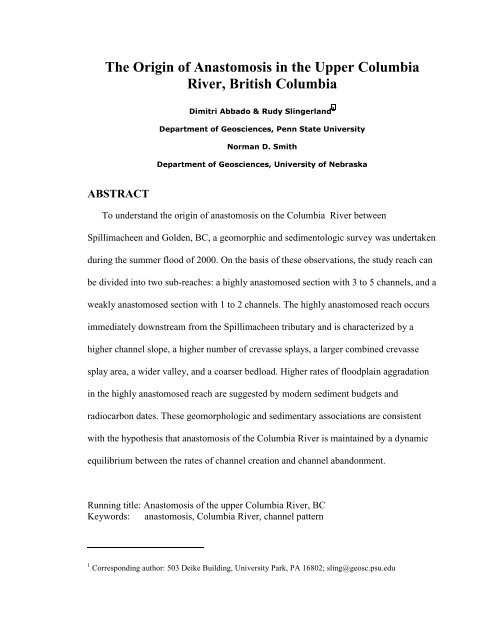
Origin of Anastomosis in the Upper Columbia River - Department of ...
Origin of Anastomosis in the Upper Columbia River - Department of ...
Origin of Anastomosis in the Upper Columbia River - Department of ...

You also want an ePaper? Increase the reach of your titles
YUMPU automatically turns print PDFs into web optimized ePapers that Google loves.
The <strong>Orig<strong>in</strong></strong> <strong>of</strong> <strong>Anastomosis</strong> <strong>in</strong> <strong>the</strong> <strong>Upper</strong> <strong>Columbia</strong><br />
<strong>River</strong>, British <strong>Columbia</strong><br />
'LPLWUL$EEDGR 5XG\6OLQJHUODQG Ã<br />
'HSDUWPHQWRI*HRVFLHQFHV3HQQ6WDWH8QLYHUVLW\<br />
1RUPDQ'6PLWK<br />
'HSDUWPHQWRI*HRVFLHQFHV8QLYHUVLW\RI1HEUDVND<br />
ABSTRACT<br />
To understand <strong>the</strong> orig<strong>in</strong> <strong>of</strong> anastomosis on <strong>the</strong> <strong>Columbia</strong> <strong>River</strong> between<br />
Spillimacheen and Golden, BC, a geomorphic and sedimentologic survey was undertaken<br />
dur<strong>in</strong>g <strong>the</strong> summer flood <strong>of</strong> 2000. On <strong>the</strong> basis <strong>of</strong> <strong>the</strong>se observations, <strong>the</strong> study reach can<br />
be divided <strong>in</strong>to two sub-reaches: a highly anastomosed section with 3 to 5 channels, and a<br />
weakly anastomosed section with 1 to 2 channels. The highly anastomosed reach occurs<br />
immediately downstream from <strong>the</strong> Spillimacheen tributary and is characterized by a<br />
higher channel slope, a higher number <strong>of</strong> crevasse splays, a larger comb<strong>in</strong>ed crevasse<br />
splay area, a wider valley, and a coarser bedload. Higher rates <strong>of</strong> floodpla<strong>in</strong> aggradation<br />
<strong>in</strong> <strong>the</strong> highly anastomosed reach are suggested by modern sediment budgets and<br />
radiocarbon dates. These geomorphologic and sedimentary associations are consistent<br />
with <strong>the</strong> hypo<strong>the</strong>sis that anastomosis <strong>of</strong> <strong>the</strong> <strong>Columbia</strong> <strong>River</strong> is ma<strong>in</strong>ta<strong>in</strong>ed by a dynamic<br />
equilibrium between <strong>the</strong> rates <strong>of</strong> channel creation and channel abandonment.<br />
Runn<strong>in</strong>g title: <strong>Anastomosis</strong> <strong>of</strong> <strong>the</strong> upper <strong>Columbia</strong> <strong>River</strong>, BC<br />
Keywords: anastomosis, <strong>Columbia</strong> <strong>River</strong>, channel pattern<br />
1 Correspond<strong>in</strong>g author: 503 Deike Build<strong>in</strong>g, University Park, PA 16802; sl<strong>in</strong>g@geosc.psu.edu
2<br />
INTRODUCTION<br />
Anastomosed rivers consist <strong>of</strong> two or more <strong>in</strong>terconnected, co-exist<strong>in</strong>g channels that<br />
typically enclose concave-upwards floodbas<strong>in</strong>s. The channels are usually straight or<br />
slightly s<strong>in</strong>uous, but braided and meander<strong>in</strong>g patterns are also known (Makaske, 2001).<br />
Thus, anastomosed rivers are different from braided rivers because <strong>the</strong> latter conta<strong>in</strong><br />
multiple thalwegs enclos<strong>in</strong>g convex bars with<strong>in</strong> a s<strong>in</strong>gle channel (Makaske, 2001)<br />
whereas anastomosis def<strong>in</strong>es a network <strong>of</strong> anabranched channels. Although <strong>the</strong><br />
geomorphic characteristics <strong>of</strong> anastomosed rivers have been recognized and described<br />
(Smith and Putnam, 1980; Smith and Smith, 1980; Smith, 1983, 1986; Miller, 1991;<br />
Knighton and Nanson, 1993; Smith et al., 1997; Makaske 1998, 2001; Smith et al, 1998),<br />
<strong>the</strong> orig<strong>in</strong> <strong>of</strong> anastomosis is still an unresolved matter (Nanson and Huang, 1999;<br />
Makaske 1998, 2001). Indeed, Makaske (1998) argues that understand<strong>in</strong>g <strong>the</strong> causes <strong>of</strong><br />
anastomosis “is one <strong>of</strong> <strong>the</strong> major challenges <strong>in</strong> current fluvial research”, and Nanson and<br />
Huang (1999) assert that anabranch<strong>in</strong>g rivers (<strong>in</strong>clud<strong>in</strong>g anastomosed rivers) “rema<strong>in</strong> <strong>the</strong><br />
last major category <strong>of</strong> alluvial systems to be described and expla<strong>in</strong>ed”.<br />
Three classes <strong>of</strong> explanation exist for <strong>the</strong> orig<strong>in</strong> <strong>of</strong> anastomosis. In <strong>the</strong> first,<br />
anastomosis is a consequence <strong>of</strong> frequent avulsions and slow abandonment <strong>of</strong> earlier<br />
channels. Accord<strong>in</strong>g to this po<strong>in</strong>t <strong>of</strong> view, <strong>the</strong> fluvial system exists <strong>in</strong> a perpetual<br />
transition state consist<strong>in</strong>g <strong>of</strong> multiple co-exist<strong>in</strong>g channels. <strong>Anastomosis</strong> is thus not a<br />
“graded” state, but ra<strong>the</strong>r a by-product <strong>of</strong> <strong>the</strong> competition between channel creation and<br />
abandonment. Makaske (2001), for example, def<strong>in</strong>es an anastomosed system as <strong>the</strong><br />
product <strong>of</strong> a dynamic balance between frequent avulsions that create multiple channels<br />
and slow channel abandonment. Accord<strong>in</strong>g to Makaske, <strong>the</strong> immediate causes <strong>of</strong> <strong>the</strong>
3<br />
frequent avulsions are a rise <strong>in</strong> base level, subsidence (Smith, 1983), and high rates <strong>of</strong><br />
aggradation, whe<strong>the</strong>r <strong>of</strong> <strong>the</strong> channel belt or with<strong>in</strong> <strong>the</strong> channel. The immediate cause <strong>of</strong><br />
slow abandonment is conjectured by Makaske (2001) to be low stream power, although<br />
few data exist.<br />
In explanations <strong>of</strong> <strong>the</strong> second class, anabranch<strong>in</strong>g, and <strong>in</strong> particular anastomosed,<br />
rivers are thought to be an equilibrium form where channels are adjusted <strong>in</strong> geometry and<br />
hydraulic friction to just transmit <strong>the</strong> imposed water and sediment discharges. In cases<br />
where gradient cannot easily be <strong>in</strong>creased to carry a larger sediment load, Nanson and<br />
Knighton (1996) and Nanson and Huang (1999) propose that a shift from s<strong>in</strong>gle to<br />
multiple channels leads to an <strong>in</strong>crease <strong>in</strong> sediment transport rate per unit water discharge.<br />
Thus, like changes <strong>in</strong> slope and channel form, anastomosis is conjectured to be ano<strong>the</strong>r<br />
mechanism whereby a fluvial system can ma<strong>in</strong>ta<strong>in</strong> grade. Makaske (1998) challenged this<br />
idea, however, argu<strong>in</strong>g that <strong>the</strong> multi-channel state <strong>of</strong> <strong>the</strong> upper <strong>Columbia</strong> <strong>River</strong> cannot<br />
be taken as a response <strong>of</strong> <strong>the</strong> system to maximize water and sediment throughput<br />
because, <strong>in</strong> spite <strong>of</strong> its anastomosed morphology, <strong>the</strong> bulk <strong>of</strong> its water and sediment<br />
moves through a s<strong>in</strong>gle channel.<br />
The third explanation was put forward by Galay et al. (1984) from a study <strong>of</strong> <strong>the</strong><br />
<strong>Columbia</strong> <strong>River</strong>. He postulated that pond<strong>in</strong>g beh<strong>in</strong>d alluvial fans led to <strong>the</strong> formation <strong>of</strong><br />
large lakes <strong>in</strong> <strong>the</strong> upper <strong>Columbia</strong> Valley. The lakes gradually were filled by riverdom<strong>in</strong>ated<br />
“bird’s-foot” deltas <strong>of</strong> which <strong>the</strong> present anastomosed river system is a f<strong>in</strong>al<br />
stage. A paleoenvironmental reconstruction from cores by Makaske (1998), however, has<br />
shown that this is not a viable hypo<strong>the</strong>sis, and it will not be considered fur<strong>the</strong>r.
4<br />
The purpose <strong>of</strong> this paper is to describe hydraulic and sedimentologic properties<br />
<strong>of</strong> <strong>the</strong> anastomosed reach <strong>of</strong> <strong>the</strong> upper <strong>Columbia</strong> <strong>River</strong> <strong>in</strong> British <strong>Columbia</strong>, Canada, <strong>in</strong><br />
order to assess <strong>the</strong> orig<strong>in</strong> <strong>of</strong> its anastomosis. The <strong>Columbia</strong> <strong>River</strong> near Golden, British<br />
<strong>Columbia</strong> is one <strong>of</strong> <strong>the</strong> best-known examples <strong>of</strong> anastomosis (Lock<strong>in</strong>g, 1983; Smith,<br />
1983; Makaske, 1998; Adams, 1999; Machusick (2000); Makaske 2001). Fur<strong>the</strong>rmore,<br />
hydrologic and photographic records are available start<strong>in</strong>g from <strong>the</strong> first half <strong>of</strong> <strong>the</strong><br />
1900’s. Our conclusion is that anastomosis <strong>of</strong> <strong>the</strong> <strong>Columbia</strong> <strong>River</strong> is best expla<strong>in</strong>ed as a<br />
by-product <strong>of</strong> roughly equal rates <strong>of</strong> channel creation and abandonment, consistent with<br />
Makaske’s conjecture.<br />
LOCATION AND GEOMORPHOLOGY OF THE STUDY AREA<br />
The study reach is a section <strong>of</strong> <strong>the</strong> upper <strong>Columbia</strong> <strong>River</strong> near Golden, British <strong>Columbia</strong>,<br />
Canada (Fig. 1). The <strong>Columbia</strong> <strong>River</strong> starts at <strong>Columbia</strong> Lake <strong>in</strong> sou<strong>the</strong>rn British<br />
<strong>Columbia</strong>, approximately 80 km sou<strong>the</strong>ast <strong>of</strong> <strong>the</strong> study reach, and flows north-northwest<br />
<strong>in</strong> a 1-2 kilometer-wide valley for a distance <strong>of</strong> 160 km along <strong>the</strong> Rocky Mounta<strong>in</strong><br />
Trench before turn<strong>in</strong>g west and southwest. It comprises a s<strong>in</strong>gle channel between<br />
<strong>Columbia</strong> Lake and <strong>the</strong> town <strong>of</strong> Radium and an anastomosed reach between Radium and<br />
Golden. <strong>Anastomosis</strong> is particularly evident downstream <strong>of</strong> Spillimacheen, and this<br />
report concentrates on <strong>the</strong> 55-km reach between Spillimacheen and Golden. Access is<br />
provided by Route 95 along <strong>the</strong> nor<strong>the</strong>ast side <strong>of</strong> <strong>the</strong> valley, by bridges at Nicholson,<br />
Parson, and Spillimacheen, and by a railroad right-<strong>of</strong>-way. The area lies with<strong>in</strong> <strong>the</strong><br />
Cassiar-<strong>Columbia</strong> Mounta<strong>in</strong> physiographic region and <strong>in</strong> <strong>the</strong> Interior Douglas-Fir<br />
biogeoclimatic zone (Farley, 1984). Mean annual precipitation varies between 40-50
5<br />
cm/yr, and mean daily temperature varies from –12 to 15 o C <strong>in</strong> January and July,<br />
respectively.<br />
Geomorphology <strong>of</strong> <strong>the</strong> study reach<br />
In <strong>the</strong> study reach, <strong>the</strong> <strong>Columbia</strong> <strong>River</strong> consists <strong>of</strong> multiple, relatively stable channel belts<br />
conta<strong>in</strong><strong>in</strong>g low-s<strong>in</strong>uosity to straight, low-gradient, sand-bed channels. Levees and<br />
crevasse splays <strong>of</strong> <strong>the</strong> channel belts bound floodbas<strong>in</strong>s conta<strong>in</strong><strong>in</strong>g shallow wetlands and<br />
lakes. Thirty-seven tributaries enter along <strong>the</strong> reach, form<strong>in</strong>g alluvial fans that narrow <strong>the</strong><br />
valley and act as local sediment sources. The two largest tributaries are <strong>the</strong> Spillimacheen<br />
<strong>River</strong> (dra<strong>in</strong>age bas<strong>in</strong> <strong>of</strong> 1430 km 2 ) and <strong>the</strong> Kick<strong>in</strong>g Horse <strong>River</strong> (dra<strong>in</strong>age bas<strong>in</strong> <strong>of</strong> 1850<br />
km 2 ), which respectively def<strong>in</strong>e <strong>the</strong> upstream and downstream limits <strong>of</strong> <strong>the</strong> study reach.<br />
The Spillimacheen <strong>River</strong> is a major sediment source for <strong>the</strong> study reach, contribut<strong>in</strong>g silt<br />
to f<strong>in</strong>e gravel.<br />
An important observation bear<strong>in</strong>g on <strong>the</strong> orig<strong>in</strong> <strong>of</strong> anastomosis is <strong>the</strong> number and<br />
location <strong>of</strong> channels and <strong>the</strong>ir evolution through time. Vibracores show that anastomosed<br />
channel deposits <strong>in</strong> <strong>the</strong> study reach are characteristically 5-15 m thick, narrow,<br />
<strong>in</strong>terconnected str<strong>in</strong>gers <strong>of</strong> sand (Smith, 1983) that conta<strong>in</strong> sandy crevasse-splay fr<strong>in</strong>ges.<br />
These facies are stacked vertically, <strong>in</strong>dicat<strong>in</strong>g that <strong>the</strong> channels occupy <strong>the</strong> same valley<br />
location for durations <strong>of</strong> one to approximately 3000 years (Smith, 1983; Makaske, 1998).<br />
Vertical aggradation ra<strong>the</strong>r than lateral accretion is <strong>the</strong> dom<strong>in</strong>ant sedimentation pattern, a<br />
conclusion also supported by <strong>the</strong> virtual absence <strong>of</strong> modern oxbow lake and po<strong>in</strong>t bar<br />
deposits. In one cross-valley stratigraphic section (Makaske, 1998), at least 11 channels<br />
have existed over <strong>the</strong> past 3000 years. Of <strong>the</strong>se, six came <strong>in</strong>to existence and five became<br />
ext<strong>in</strong>ct, <strong>in</strong>dicat<strong>in</strong>g <strong>the</strong> long-term existence <strong>of</strong> <strong>the</strong> anastomosed pattern and <strong>the</strong> episodic
6<br />
nature <strong>of</strong> channel creation. There is also some <strong>in</strong>dication that <strong>the</strong> longer last<strong>in</strong>g channels<br />
are wider than 30-50 m (Makaske, 1998), possibly because smaller channels can be<br />
occluded by logjams or have <strong>the</strong>ir gradient strongly dim<strong>in</strong>ished by beaver dams.<br />
The <strong>Columbia</strong> <strong>River</strong> sediment load consists <strong>of</strong> 59% to 82% suspended material<br />
(Makaske, 1998), or if wash load is also considered, 89% (Lock<strong>in</strong>g, 1983). Lock<strong>in</strong>g’s<br />
(1983) sediment budget <strong>in</strong>dicates that at <strong>the</strong> end <strong>of</strong> <strong>the</strong> anastomosed reach near Nicholson<br />
(6 km upstream <strong>of</strong> Golden) <strong>the</strong> supply <strong>of</strong> suspended load is much less than <strong>the</strong> transport<br />
capacity <strong>of</strong> <strong>the</strong> river. This decl<strong>in</strong>e <strong>in</strong> suspended load is evidence <strong>of</strong> a significant sediment<br />
s<strong>in</strong>k <strong>in</strong> <strong>the</strong> anastomosed reach (Lock<strong>in</strong>g, 1983). Permanent sequestration <strong>of</strong> <strong>the</strong> bedload<br />
also occurs. Sixty-six percent <strong>of</strong> <strong>the</strong> bedload goes <strong>in</strong>to channel storage (Smith, 1986) and<br />
10-20% is trapped <strong>in</strong> crevasse splays (Makaske, 1998).<br />
Hydrology<br />
Hydrographs for <strong>the</strong> <strong>Columbia</strong> at Nicholson (1947-present) and <strong>the</strong> Spillimacheen near<br />
its mouth (1950-present) <strong>in</strong>dicate that discharges for both rivers are highly seasonal (Fig.<br />
2). M<strong>in</strong>imum discharge for <strong>the</strong> <strong>Columbia</strong> occurs <strong>in</strong> February (average=24 m 3 /s), and<br />
maximum discharge occurs <strong>in</strong> June and July (average=321 m 3 /s), with overbank<br />
discharge <strong>of</strong> 45 days per year on average occurr<strong>in</strong>g almost every year (Lock<strong>in</strong>g, 1983).<br />
Our field observations were taken dur<strong>in</strong>g <strong>the</strong> year 2000 flood which was average <strong>in</strong><br />
magnitude but short <strong>in</strong> duration and somewhat delayed due to cold wea<strong>the</strong>r <strong>in</strong> June (Figs.<br />
2b and 2d). The peak flow frequency distribution shows that <strong>the</strong> maximum peak <strong>of</strong> 351<br />
m 3 /s registered at <strong>the</strong> Nicholson gaug<strong>in</strong>g station dur<strong>in</strong>g <strong>the</strong> year 2000 occurs on average<br />
every 1.2 years (1-year flood).
7<br />
LONGITUDINAL VARIATIONS IN ANASTOMOSIS AND<br />
RELATED FEATURES<br />
To better understand <strong>the</strong> necessary conditions that give rise to anastomosis, <strong>the</strong> degree <strong>of</strong><br />
anastomosis <strong>of</strong> <strong>the</strong> <strong>Columbia</strong> <strong>River</strong> was correlated with channel gradient, crevasse splay<br />
distribution, valley width, alluvial fan area, and channel-bed gra<strong>in</strong> size. These parameters<br />
were measured dur<strong>in</strong>g <strong>the</strong> summer <strong>of</strong> 2000 or were observed on aerial photographs taken<br />
<strong>in</strong> 1996 at high stage when <strong>the</strong> discharge measured at Nicholson was <strong>the</strong> third highest <strong>of</strong><br />
<strong>the</strong> previous 10 years. Given <strong>the</strong> hydrologic data available from Environment Canada<br />
(formerly Water Survey <strong>of</strong> Canada) from 1947 to present, <strong>the</strong> 1996 peak discharge (506<br />
m 3 /s) occurs on average every 3.3 years (3-year flood).<br />
For our purposes, a channel belt is def<strong>in</strong>ed as active, <strong>in</strong> contrast with non-active,<br />
dry, or abandoned, if channels with<strong>in</strong> it conta<strong>in</strong> turbid water on <strong>the</strong> 1996 aerial<br />
photograph, <strong>the</strong>reby imply<strong>in</strong>g at least modest through-flow. Ma<strong>in</strong> channels are def<strong>in</strong>ed as<br />
those wider than 40 m; narrower channels are here termed secondary channels. Figure 3<br />
shows a typical section <strong>of</strong> <strong>the</strong> study reach where active/non-active channels and crevasse<br />
splays are <strong>in</strong>dicated as well as def<strong>in</strong>ition sketches <strong>of</strong> alluvial fan area, splay area, and<br />
valley width.<br />
Degree <strong>of</strong> anastomosis<br />
To quantify <strong>the</strong> degree <strong>of</strong> anastomosis, <strong>the</strong> number <strong>of</strong> active channels at each <strong>of</strong> 29 valley<br />
cross sections was counted. The number <strong>of</strong> channels, used here as a measure <strong>of</strong><br />
anastomosis, varies from one to five with an average near two (Fig. 4a). On <strong>the</strong> basis <strong>of</strong><br />
<strong>the</strong>se differences, <strong>the</strong> study reach can be divided <strong>in</strong>to an upper highly anastomosed reach<br />
(3-5 channels), a weakly anastomosed reach (1-3 channels), a s<strong>in</strong>gle channel, and a lower
8<br />
braided reach. The braided reach occurs as <strong>the</strong> <strong>Columbia</strong> <strong>River</strong> crosses <strong>the</strong> alluvial fan <strong>of</strong><br />
<strong>the</strong> Kick<strong>in</strong>g Horse <strong>River</strong> and will not be discussed fur<strong>the</strong>r here.<br />
Longitud<strong>in</strong>al pr<strong>of</strong>ile<br />
Absolute water-surface elevations were measured at 34 po<strong>in</strong>ts along <strong>the</strong> <strong>Columbia</strong> <strong>River</strong><br />
us<strong>in</strong>g a Leica 500 differential GPS system with a sub-centimeter vertical accuracy. The<br />
po<strong>in</strong>ts were measured October 13-15, 2000, between <strong>the</strong> bridge at Spillimacheen and <strong>the</strong><br />
Kick<strong>in</strong>g Horse <strong>River</strong> and corrected for a fall<strong>in</strong>g water level <strong>of</strong> 1 cm per day. The water<br />
elevations (Fig. 4b) are plotted aga<strong>in</strong>st along-channel distance ra<strong>the</strong>r than valley distance<br />
to avoid anomalies <strong>in</strong>troduced by variable s<strong>in</strong>uosity or when <strong>the</strong> channel flows across <strong>the</strong><br />
valley.<br />
The longitud<strong>in</strong>al pr<strong>of</strong>ile is divisible <strong>in</strong>to three sections: two relatively steep<br />
portions, one each from Spillimacheen to Castledale (S = 0.000215) and at Golden (S =<br />
0.000442), and a more gentle central portion from Castledale to Golden (S = 0.000068).<br />
The o<strong>the</strong>r m<strong>in</strong>or fans along <strong>the</strong> valley show little, if any, effect on channel gradient.<br />
Distribution <strong>of</strong> active crevasse splays<br />
The study reach was divided <strong>in</strong>to 29 cross-valley swaths, each 2 km wide, <strong>in</strong> which we<br />
determ<strong>in</strong>ed <strong>the</strong> numbers <strong>of</strong> active crevasse splays and <strong>the</strong>ir total surface areas. A crevasse<br />
splay was considered to be active if turbid water was flow<strong>in</strong>g across its surface <strong>in</strong> <strong>the</strong><br />
1996 aerial photos. The number <strong>of</strong> active crevasse splays and total crevasse splay areas<br />
are both relatively high <strong>in</strong> <strong>the</strong> upper 12 km <strong>of</strong> <strong>the</strong> study reach (Fig. 4c). Figure 4d shows<br />
<strong>the</strong> percent <strong>of</strong> <strong>the</strong> valley floor covered by active crevasse splays. There are 12 active<br />
crevasse splays <strong>in</strong> <strong>the</strong> upper 18 km and only 6 crevasse splays along <strong>the</strong> rema<strong>in</strong><strong>in</strong>g reach.<br />
The area covered by active splays decreases monotonically with distance, <strong>the</strong> exception
9<br />
be<strong>in</strong>g an active avulsion site at kilometer 37. At this site, an on-go<strong>in</strong>g avulsion blankets<br />
<strong>the</strong> whole floodbas<strong>in</strong> with sediment, and small levees have formed s<strong>in</strong>ce 1960 (Adams,<br />
1999). The study reach <strong>the</strong>refore can be divided <strong>in</strong>to two sections: an upstream reach<br />
with a high number <strong>of</strong> crevasse splays and a downstream reach with a low number <strong>of</strong><br />
crevasse splays.<br />
Valley width<br />
Valley width is potentially an important parameter <strong>in</strong> determ<strong>in</strong><strong>in</strong>g anastomosis because it<br />
def<strong>in</strong>es <strong>the</strong> maximum available space <strong>in</strong> which channel belts can form. Variation <strong>in</strong><br />
valley width is controlled by prograd<strong>in</strong>g alluvial fans from side tributaries. Measurements<br />
from aerial photographs <strong>of</strong> valley width and alluvial fan area (Fig. 4e) show little<br />
correlation with anastomosis.<br />
Bed material gra<strong>in</strong> size<br />
Bed material was sampled dur<strong>in</strong>g high stage on June 24 and July 6, 2000 from <strong>the</strong> mouth<br />
<strong>of</strong> <strong>the</strong> Spillimacheen <strong>River</strong> to 5 km upstream <strong>of</strong> <strong>the</strong> town <strong>of</strong> Nicholson. Twenty-five<br />
samples were collected along <strong>the</strong> ma<strong>in</strong> thalweg us<strong>in</strong>g a bucket sampler (height 15 cm,<br />
diameter 10 cm) with three replicates each to capture cross-channel variability. Mean<br />
gra<strong>in</strong> size was computed us<strong>in</strong>g a Rapid Sediment Analyzer to obta<strong>in</strong> a mean fall velocity<br />
that was <strong>the</strong>n converted to mean particle diameter us<strong>in</strong>g <strong>the</strong> relationship <strong>of</strong> Dietrich<br />
(1982).<br />
Mean gra<strong>in</strong> size shows considerable scatter (Fig. 4f), probably due to variations <strong>in</strong><br />
texture at <strong>the</strong> crest and troughs <strong>of</strong> dunes and <strong>the</strong> occasional <strong>in</strong>troduction <strong>of</strong> coarse<br />
material from tributaries. Never<strong>the</strong>less, <strong>the</strong> bed material f<strong>in</strong>es appreciably downstream <strong>in</strong><br />
<strong>the</strong> study reach from 1.4-2.2 mm upstream to 0.5-1.1 mm downstream.
10<br />
Discussion<br />
The above data <strong>in</strong>dicate that <strong>the</strong> study reach <strong>of</strong> <strong>the</strong> <strong>Columbia</strong> <strong>River</strong> (exclud<strong>in</strong>g <strong>the</strong><br />
braided section) can be divided <strong>in</strong>to two sub-reaches, a 10-km long, highly anastomosed<br />
reach with 3-5 channels start<strong>in</strong>g immediately below <strong>the</strong> confluence with <strong>the</strong><br />
Spillimacheen <strong>River</strong>, and a 50-km long, weakly anastomosed reach conta<strong>in</strong><strong>in</strong>g 1-3<br />
channels. The highly anastomosed reach is characterized by a relatively steep channel<br />
slope, a higher number <strong>of</strong> crevasse splays, a higher total crevasse splay area, a higher<br />
splay-area/valley-area ratio, and coarser bed material (Table 1). These are particularly<br />
<strong>in</strong>terest<strong>in</strong>g observations because previous studies have concluded that low gradients and<br />
f<strong>in</strong>e gra<strong>in</strong> sizes are necessary conditions for anastomosis (cf., Makaske, 2001).<br />
We <strong>in</strong>terpret <strong>the</strong> <strong>in</strong>tensity <strong>of</strong> crevasse splay activity to <strong>in</strong>dicate that alluviation<br />
rates are higher <strong>in</strong> <strong>the</strong> upstream, highly anastomosed reach. Test<strong>in</strong>g this <strong>in</strong>terpretation<br />
with actual measured aggradation rates is difficult, however. The spatially averaged<br />
sedimentation rate dur<strong>in</strong>g <strong>the</strong> 1982 flood cycle for <strong>the</strong> entire reach from Spillimacheen to<br />
Nicholson was 3.7 mm/yr (Lock<strong>in</strong>g, 1983). This probably is an over-estimation <strong>of</strong> <strong>the</strong><br />
long-term average because it is based on <strong>the</strong> 1982 flood, which was well above average.<br />
A detailed sediment budget and geomorphic study <strong>of</strong> a floodbas<strong>in</strong> <strong>in</strong> <strong>the</strong> highly<br />
anastomosed reach (Fig. 1, Soles Bas<strong>in</strong>) dur<strong>in</strong>g <strong>the</strong> year 2000 flood (Abbado, 2001),<br />
shows that it is be<strong>in</strong>g actively filled at a rate <strong>of</strong> 2.2 mm/yr by a comb<strong>in</strong>ation <strong>of</strong> short-lived<br />
crevasse splays, <strong>in</strong>tra-floodbas<strong>in</strong> channels, and settl<strong>in</strong>g <strong>of</strong> gra<strong>in</strong>s <strong>in</strong> temporary lakes. This<br />
must be considered a m<strong>in</strong>imum because <strong>the</strong> flood <strong>of</strong> 2000 was shorter <strong>in</strong> duration than<br />
<strong>the</strong> average flood (Fig. 2b) and only suspended load was measured. In contrast, 16 km<br />
fur<strong>the</strong>r down <strong>the</strong> study reach, an average aggradation rate <strong>of</strong> 1.7 mm/yr was obta<strong>in</strong>ed<br />
us<strong>in</strong>g a radiocarbon date <strong>of</strong> 4,500 yrs from Scirpus Lacustris nuts buried 7.9 m <strong>in</strong> a
11<br />
floodbas<strong>in</strong> (Makaske, 1998). Although <strong>the</strong> data are <strong>in</strong>conclusive, <strong>the</strong>y are at least<br />
consistent with our conjecture that aggradation rates are higher upstream <strong>in</strong> <strong>the</strong> more<br />
anastomosed reach. Also consistent is <strong>the</strong> steep slope observable <strong>in</strong> <strong>the</strong> longitud<strong>in</strong>al water<br />
pr<strong>of</strong>ile, which can be <strong>in</strong>terpreted as a wedge <strong>of</strong> sediments prograd<strong>in</strong>g downstream as<br />
alluviation occurs. F<strong>in</strong>ally, as Paola (2000) and Rob<strong>in</strong>son and Sl<strong>in</strong>gerland (1998) have<br />
argued, <strong>the</strong> downstream-f<strong>in</strong><strong>in</strong>g itself is suggestive <strong>of</strong> preferential aggradation <strong>in</strong> <strong>the</strong><br />
upstream reach. Although upstream bed-armor<strong>in</strong>g could produce a similar downstream<br />
f<strong>in</strong><strong>in</strong>g trend, we do not th<strong>in</strong>k this is a sufficient explanation for our data because at <strong>the</strong><br />
time <strong>of</strong> sampl<strong>in</strong>g <strong>the</strong> pavement appeared to be broken and <strong>the</strong> bed was <strong>in</strong> general motion.<br />
SEDIMENT TRANSPORT MODELING<br />
The observations presented so far do not discrim<strong>in</strong>ate between <strong>the</strong> two rema<strong>in</strong><strong>in</strong>g<br />
hypo<strong>the</strong>ses for <strong>the</strong> orig<strong>in</strong> <strong>of</strong> anastomosis <strong>in</strong> <strong>the</strong> <strong>Columbia</strong> because both predict that <strong>the</strong><br />
degree <strong>of</strong> anastomosis will be correlated with excess sediment supply. Here we explore<br />
whe<strong>the</strong>r <strong>the</strong> <strong>Columbia</strong> channels are adjusted to maximize sediment transport rate, as<br />
suggested by Nanson and Huang (1996). In traditional equilibrium channel <strong>the</strong>ory, a river<br />
adjusts its slope, geometry, and roughness to convey <strong>the</strong> supplied water and sediment<br />
discharge. Nanson and Knighton (1996) and Nanson and Huang (1999) suggested that a<br />
river might also change its number <strong>of</strong> channels to yield <strong>the</strong> same effect. Based on field<br />
observations, <strong>the</strong>y asserted that a reduction <strong>in</strong> total top-width causes a multi-channel<br />
network to convey more sediment per unit discharge than a s<strong>in</strong>gle channel. Thus if an<br />
orig<strong>in</strong>al channel is 100 m wide and say 3 m deep, three channels, each 25m wide and<br />
carry<strong>in</strong>g <strong>the</strong> same discharge at <strong>the</strong> same slope, will carry more bedload because a reduced<br />
width-depth ratio (W/D) is more conducive to water flow and sediment discharge.
12<br />
The hypo<strong>the</strong>sis to be tested here is that <strong>the</strong> highly anastomosed reach <strong>of</strong> <strong>the</strong><br />
<strong>Columbia</strong> <strong>River</strong> is adjusted <strong>in</strong> channel number and channel width/depth ratios to carry<br />
more sediment than a s<strong>in</strong>gle channel, all o<strong>the</strong>r factors be<strong>in</strong>g equal. To test <strong>the</strong> hypo<strong>the</strong>sis<br />
consider an idealized <strong>Columbia</strong> channel network (Fig. 5) <strong>in</strong> which cumulative top-width,<br />
depth, and bed slope are kept constant at 120 m, 3 m, and 10 -4 respectively, consistent<br />
with values observed <strong>in</strong> <strong>the</strong> upstream portion <strong>of</strong> <strong>the</strong> study reach. A s<strong>in</strong>gle channel with<br />
W/D≅40 progressively bifurcates <strong>in</strong>to second order channels with W/D≅20 and third<br />
order channels with W/D≅10. These values have been determ<strong>in</strong>ed from published and<br />
unpublished cross sections along <strong>the</strong> upper study reach (Fig. 6) where W/D is def<strong>in</strong>ed as<br />
top-width divided by <strong>the</strong> hydraulic depth (ratio <strong>of</strong> channel cross sectional area divided by<br />
its top-width). Inspection <strong>of</strong> Table 2 shows that <strong>the</strong> distribution <strong>of</strong> channel widths is<br />
bimodal with <strong>the</strong> division occurr<strong>in</strong>g between 40-50 m. Interest<strong>in</strong>gly, <strong>the</strong> width-depth<br />
ratios <strong>of</strong> ma<strong>in</strong> channels decrease with an <strong>in</strong>creas<strong>in</strong>g number <strong>of</strong> channels along any valley<br />
cross-section (Fig. 7), which could be <strong>in</strong>terpreted as consistent with <strong>the</strong> Nanson-Huang<br />
conjecture. In contrast, <strong>the</strong> ratio for secondary channels <strong>in</strong>creases. An additional<br />
important characteristic <strong>of</strong> secondary channels is that <strong>the</strong>ir thalwegs sit at higher<br />
elevations compared to <strong>the</strong> ma<strong>in</strong> channels and thus <strong>the</strong>y are active only dur<strong>in</strong>g high stage.<br />
Sediment transport through this idealized system is calculated under uniform and<br />
steady flow conditions assum<strong>in</strong>g channels <strong>of</strong> rectangular cross sectional shape <strong>in</strong> which:<br />
Q = VA<br />
(1)<br />
where Q (m 3 /s) is water discharge, V(m/s) is average velocity, and A (m 2 ) is channel<br />
cross sectional area. V is expressed by <strong>the</strong> Chezy formula:<br />
V = C RS<br />
(2)
13<br />
where R (m) is hydraulic radius, S is channel slope, and C (m 1/2 /s) is <strong>the</strong> Chezy constant.<br />
R and C are given by:<br />
A<br />
R = (3)<br />
2 D + W<br />
1 R<br />
1/<br />
n<br />
6<br />
C = (4)<br />
<strong>in</strong> which D (m) is <strong>the</strong> water depth, W (m) is <strong>the</strong> channel width, and n is <strong>the</strong> Mann<strong>in</strong>g<br />
constant. The system <strong>of</strong> Equations 1-4 yields <strong>the</strong> follow<strong>in</strong>g 10 th order exponential<br />
equation:<br />
4 10<br />
4<br />
3<br />
2 2<br />
3<br />
4<br />
W D −16xD<br />
− 32xWD<br />
− 24xW<br />
D − 8xW<br />
D − xW = 0 (5)<br />
6 6<br />
Q n<br />
where x = . For fixed Q, n, S, and width-depth ratio, Equation 5 can be solved for<br />
6 3<br />
W S<br />
D.<br />
Bedload and suspended load sediment transport rates are calculated by two<br />
methods: 1) <strong>the</strong> Bagnold (1977) bedload formula coupled with <strong>the</strong> Rouse (1937)<br />
suspended sediment formulation, and 2) <strong>the</strong> Van Rijn functions for bedload and<br />
suspended load (Van Rijn, 1984a, 1884b; Makaske, 1998). These methods were selected<br />
because <strong>the</strong>y are appropriate for <strong>the</strong> gra<strong>in</strong> sizes and slopes observed <strong>in</strong> <strong>the</strong> <strong>Columbia</strong><br />
<strong>River</strong> and because <strong>the</strong>y compute both bedload and suspended load.<br />
Solutions <strong>of</strong> <strong>the</strong> above system <strong>of</strong> equations for total sediment transport rate<br />
<strong>in</strong>dicate that total sediment load is reduced as <strong>the</strong> flow is divided <strong>in</strong>to additional channels<br />
(Table 3). Total transport rate decreases by approximately 11% and 21% for <strong>the</strong> Bagnold-<br />
Rouse and Van Rijn formulas, respectively. In particular, bedload transport rate, which is<br />
more important because it controls <strong>in</strong>-channel alluviation, decreases by 16% and 22%,
14<br />
respectively. Water velocities decrease by 2% mov<strong>in</strong>g from one to two channels, and 5%<br />
mov<strong>in</strong>g from two to four channels. Note that although <strong>the</strong> magnitudes <strong>of</strong> <strong>the</strong> transport<br />
rates are sensitive to <strong>the</strong> choice <strong>of</strong> Mann<strong>in</strong>g’s n, <strong>the</strong> general conclusions are not.<br />
DISCUSSION<br />
The multiple channels <strong>of</strong> <strong>the</strong> <strong>Columbia</strong> do not <strong>in</strong>crease water velocity and sediment<br />
transport rates over that <strong>of</strong> a s<strong>in</strong>gle channel, all o<strong>the</strong>r factors be<strong>in</strong>g equal. We <strong>in</strong>terpret<br />
<strong>the</strong>se results to mean that <strong>the</strong> Nanson and Huang (1999) hypo<strong>the</strong>sis does not apply to <strong>the</strong><br />
particular case <strong>of</strong> <strong>the</strong> <strong>Columbia</strong> <strong>River</strong>. This is not to say that <strong>the</strong> Nanson-Huang<br />
conjecture is everywhere <strong>in</strong>validated. In cases where <strong>the</strong> cumulative top width <strong>of</strong> multiple<br />
channels is reduced relative to a s<strong>in</strong>gle channel, we agree that sediment transport rates<br />
will be <strong>in</strong>creased. In <strong>the</strong> <strong>Columbia</strong> however, <strong>the</strong> observed width-depth ratios and<br />
cumulative top-widths do not effect <strong>in</strong>creases <strong>in</strong> sediment transport rates as <strong>the</strong> number <strong>of</strong><br />
channels is <strong>in</strong>creased.<br />
Ra<strong>the</strong>r, we conclude that anastomosis <strong>of</strong> <strong>the</strong> <strong>Columbia</strong> <strong>River</strong> is an <strong>in</strong>cidental<br />
consequence <strong>of</strong> frequent avulsions (i.e., crevass<strong>in</strong>g) and slow abandonment <strong>of</strong> earlier<br />
channels. High sediment flux from <strong>the</strong> Spillimacheen <strong>River</strong> has overloaded <strong>the</strong><br />
<strong>Columbia</strong>, caus<strong>in</strong>g high <strong>in</strong>-channel alluviation rates. These high alluviation rates <strong>in</strong>crease<br />
<strong>the</strong> probability <strong>of</strong> levee overtopp<strong>in</strong>g as well as levee crevass<strong>in</strong>g and crevasse splay<br />
formation. These <strong>in</strong> turn create numerous new channels through floodbas<strong>in</strong>s. The new<br />
channels, flow<strong>in</strong>g generally cross-valley, are usually superelevated compared to <strong>the</strong> ma<strong>in</strong><br />
channel. For this reason <strong>the</strong>y are ma<strong>in</strong>ly active dur<strong>in</strong>g high stage and are slowly<br />
abandoned because <strong>of</strong> low flow velocities. Thus, long-last<strong>in</strong>g channels and complete<br />
avulsions <strong>of</strong> <strong>the</strong> ma<strong>in</strong> channel are tied to gradient advantages. Because <strong>of</strong> <strong>the</strong> narrow
15<br />
valley, cross-valley gradient advantage rarely occurs and <strong>the</strong> ma<strong>in</strong> down-valley channels<br />
rema<strong>in</strong> active for hundreds to thousands <strong>of</strong> years. In contrast, secondary channels are<br />
short-lived. Therefore, <strong>the</strong> number <strong>of</strong> channels active at any time is proportional to <strong>the</strong><br />
rate <strong>of</strong> creation <strong>of</strong> new channels and to <strong>the</strong>ir average lifespan, and <strong>in</strong>versely proportional<br />
to <strong>the</strong>ir rate <strong>of</strong> abandonment. If <strong>the</strong> rate magnitudes are comparable and relatively<br />
constant through time, <strong>the</strong>n <strong>the</strong> number <strong>of</strong> active channels at any <strong>in</strong>stant is also relatively<br />
constant, <strong>the</strong> exact number be<strong>in</strong>g fixed by <strong>the</strong> channel lifespan. It is only <strong>in</strong> this sense that<br />
anastomosis <strong>of</strong> <strong>the</strong> <strong>Columbia</strong> <strong>River</strong> is a dynamic equilibrium pattern.<br />
It still rema<strong>in</strong>s for us to expla<strong>in</strong> <strong>the</strong> reduction <strong>of</strong> width-depth ratio <strong>of</strong> ma<strong>in</strong> channels as<br />
<strong>the</strong> number <strong>of</strong> channels <strong>in</strong> a valley cross-section <strong>in</strong>creases (Fig. 7). We th<strong>in</strong>k this reflects<br />
<strong>the</strong> fact that it is <strong>the</strong> ma<strong>in</strong> channels <strong>of</strong> <strong>the</strong> <strong>Columbia</strong> that transport most <strong>of</strong> <strong>the</strong> bedload.<br />
Because <strong>the</strong> bed elevations <strong>of</strong> <strong>the</strong> secondary channels are generally higher than <strong>the</strong> bed <strong>of</strong><br />
<strong>the</strong> ma<strong>in</strong> channel, more water than bedload is siphoned <strong>of</strong>f by secondary channels. The<br />
ma<strong>in</strong> channel must adjust to carry its bedload with less discharge, and does so by<br />
decreas<strong>in</strong>g its width-depth ratio by an amount greater than would arise from <strong>the</strong> reduction<br />
<strong>in</strong> water discharge alone. In this restricted sense <strong>the</strong> <strong>Columbia</strong> ma<strong>in</strong> channels are<br />
behav<strong>in</strong>g as postulated by Nanson and Huang (1999).<br />
This model <strong>of</strong> anastomosis is consistent with <strong>the</strong> correspondence between degree <strong>of</strong><br />
anastomosis and high slope. As shown by <strong>the</strong> sediment rout<strong>in</strong>g model, anastomosis<br />
<strong>in</strong>duces a decrease <strong>in</strong> sediment transport rates, which is manifested by differential<br />
deposition.
16<br />
CONCLUSIONS<br />
The anastomosed reach <strong>of</strong> <strong>the</strong> <strong>Columbia</strong> <strong>River</strong> can be divided <strong>in</strong>to highly anastomosed<br />
and weakly anastomosed sub-reaches. The highly anastomosed reach occurs immediately<br />
downstream <strong>of</strong> <strong>the</strong> confluence with <strong>the</strong> high-sediment-load Spillimacheen <strong>River</strong>. The<br />
highly anastomosed reach is characterized by a higher channel gradient, a greater number<br />
<strong>of</strong> crevasse splays, a greater crevasse splay area, greater splay-area to valley-area ratio,<br />
and coarser channel-bed gra<strong>in</strong> size. Circumstantial evidence <strong>in</strong>dicates aggradation rates<br />
are higher <strong>in</strong> <strong>the</strong> highly anastomosed reach as well.<br />
Calculations us<strong>in</strong>g Bagnold, Rouse, and Van Rijn sediment transport formulae show a<br />
decrease <strong>in</strong> sediment flux with <strong>in</strong>creas<strong>in</strong>g number <strong>of</strong> channels, given typical <strong>Columbia</strong><br />
channel geometries, bed slope, and gra<strong>in</strong> size. This is contrary to <strong>the</strong> predictions <strong>of</strong><br />
Nanson and Huang (1999), lead<strong>in</strong>g us to conclude that anastomosis <strong>of</strong> <strong>the</strong> <strong>Columbia</strong><br />
<strong>River</strong> is ma<strong>in</strong>ta<strong>in</strong>ed by a dynamic equilibrium between <strong>the</strong> rates <strong>of</strong> channel creation and<br />
channel abandonment.<br />
ACKNOWLEDGEMENTS<br />
This research was funded by <strong>the</strong> National Science Foundation under contract EAR<br />
9811860 awarded to Rudy Sl<strong>in</strong>gerland and Norman D. Smith. For assistance <strong>in</strong> <strong>the</strong> field<br />
we thank Ron and Jan van Vugt, Irv<strong>in</strong>e He<strong>in</strong>tz, Matt Machusick, and especially Manuel<br />
Filgueira <strong>River</strong>a who also shared his cross-section data with us.
17<br />
REFERENCES<br />
Abbado, Dimitri, (2001), The <strong>Orig<strong>in</strong></strong> <strong>of</strong> <strong>Anastomosis</strong> <strong>in</strong> <strong>the</strong> <strong>Upper</strong> <strong>Columbia</strong> <strong>River</strong>,<br />
British <strong>Columbia</strong>, Canada. Unpublished M.Sc. Thesis, The Pennsylvania State<br />
University, 86 pp.<br />
Adams, P. N. (1999), The <strong>Orig<strong>in</strong></strong> and Characteristics <strong>of</strong> Natural Levees. Unpublished M.<br />
Sc. Thesis, <strong>Department</strong> <strong>of</strong> Geosciences, The Pennsylvania State University, 95<br />
pp.<br />
Bagnold, R. A. (1977), Bed load Transport by natural <strong>River</strong>s. Water Resources Research,<br />
13, 2, 303-312.<br />
Brice, J. C. (1984), Planform properties <strong>of</strong> meander<strong>in</strong>g rivers. In: C. M. Elliot, Ed., <strong>River</strong><br />
Meander<strong>in</strong>g: Proceed<strong>in</strong>gs <strong>of</strong> <strong>the</strong> conference <strong>River</strong> ‘83, New Orleans, Louisiana,<br />
October 24-26, 1983. New York: American Society <strong>of</strong> Civil Eng<strong>in</strong>eers, pp. 1-15.<br />
Dietrich, W. E. (1982), Settl<strong>in</strong>g velocity <strong>of</strong> natural particles. Water Resources Research,<br />
18, 1615-1626.<br />
Farley, A. L., (1984), Atlas <strong>of</strong> British <strong>Columbia</strong>, pp.136.<br />
Galay, V. J., Tutt, D. B. and Kellerhals, R. (1984), The meander<strong>in</strong>g distributary channels<br />
<strong>of</strong> <strong>the</strong> upper <strong>Columbia</strong> <strong>River</strong>. In: C. M. Elliot, ed., <strong>River</strong> Meander<strong>in</strong>g:<br />
Proceed<strong>in</strong>gs <strong>of</strong> <strong>the</strong> conference <strong>River</strong>s ’83, New Orleans, Louisiana, October 24-<br />
26, 1983. New York: American Society <strong>of</strong> Civil Eng<strong>in</strong>eers, pp. 113-125.<br />
Knighton A. D. and Nanson, G. C. (1993), <strong>Anastomosis</strong> and <strong>the</strong> cont<strong>in</strong>uum <strong>of</strong> <strong>the</strong><br />
channel pattern. Earth Surface and Landforms, 18, 613-625.<br />
Leopold, L. B., and Wolman, M. G. (1957), <strong>River</strong> channel pattern: braided, meander<strong>in</strong>g<br />
and straight. U.S. Geological Survey pr<strong>of</strong>essional paper 282-B, Wash<strong>in</strong>gton.<br />
Lock<strong>in</strong>g, T. (1983), Hydrology and Sediment Transport <strong>in</strong> an Anastomos<strong>in</strong>g Reach <strong>of</strong> <strong>the</strong><br />
<strong>Upper</strong> <strong>Columbia</strong> <strong>River</strong>, B.C. Unpublished MS <strong>the</strong>sis. <strong>Department</strong> <strong>of</strong> Geography,<br />
University <strong>of</strong> Calgary, Canada, pp. 107.<br />
Machusick, M. D. (2000), The effect <strong>of</strong> floodbas<strong>in</strong> type on crevasse splay form.<br />
Unpublished Bachelor Thesis. <strong>Department</strong> <strong>of</strong> Geosciences, The Pennsylvania<br />
State University, pp. 55.<br />
Makaske, B. (1998), Anastomos<strong>in</strong>g <strong>River</strong>s: Forms, Processes and Sediments Nederlandse<br />
Geografische Studies vol. 249. Kon<strong>in</strong>klijk Nederlands<br />
Aardrijkskundig Genootschap/Faculteit Ruimtelijke Wetenschappen, Universiteit<br />
Utrecht, Utrecht, pp 287.<br />
Makaske, B. (2001), Anastomos<strong>in</strong>g rivers: a review <strong>of</strong> <strong>the</strong>ir classification, orig<strong>in</strong> and<br />
sedimentary products. Earth-Science Review, 53, 149-196.<br />
Miller, J. R. (1991), Development <strong>of</strong> anastomos<strong>in</strong>g channels <strong>in</strong> south-central Indiana.<br />
Geomorphology, 4, 221-229.<br />
Nanson, G. S. and Huang, H. Q. (1999), Anabranch<strong>in</strong>g rivers: divided efficiency lead<strong>in</strong>g<br />
to fluvial diversity. From Varieties <strong>of</strong> Fluvial Form, A. Miller and A. Gupta Eds,<br />
John Wiley and Sons, New York.<br />
Nanson , G. C. and Knighton A. D. (1996), Anabranch<strong>in</strong>g rivers: <strong>the</strong>ir cause, character<br />
and classification. Earth surface processes and Landforms, 21, 217-239.<br />
Paola, C. (2000), Quantitative models <strong>of</strong> sedimentary bas<strong>in</strong> fill<strong>in</strong>g: Sedimentology,<br />
vol.47, Suppl. 1, pp.121-178
Rouse, H. (1937), Modern Conceptions <strong>of</strong> mechanics <strong>of</strong> fluid turbulence. Transactions,<br />
ASCE, 102, 436-505.<br />
Rob<strong>in</strong>son, R. A. J., and Sl<strong>in</strong>gerland, R. L., (1998), <strong>Orig<strong>in</strong></strong> <strong>of</strong> fluvial gra<strong>in</strong>-size trends <strong>in</strong> a<br />
foreland bas<strong>in</strong>: <strong>the</strong> Pocono Formation <strong>of</strong> <strong>the</strong> Central Appalachian Bas<strong>in</strong>: Journal<br />
<strong>of</strong> Sedimentary Research, v. A68, p. 473- 486.<br />
Rust, B. R. (1978), A classification <strong>of</strong> alluvial channel systems. In: Miall, A. D. Ed.,<br />
Fluvial Sedimentology. Canadian Society <strong>of</strong> Petroleum Geologists Memoir 5,<br />
Calgary, 187-198.<br />
Schumm, S. A. (1968), Speculations concern<strong>in</strong>g paleohydraulic controls on terrestrial<br />
sedimentation. Geological Society <strong>of</strong> America Bullet<strong>in</strong> 79, 1573-1588.<br />
Schumm, S.A. (1977), The Fluvial System. John Wiley and Sons, New York.<br />
Sl<strong>in</strong>gerland, R. L. and Smith, N. D. (1998), Necessary Conditions for a Meander<strong>in</strong>g-<br />
<strong>River</strong> Avulsion. Geology 26, 5, 435-38.<br />
Smith, D. G. (1983), Anastomosed fluvial deposits: modern examples from Western<br />
Canada. In J. Coll<strong>in</strong>son and J. Lew<strong>in</strong>, Eds., Modern and ancient fluvial systems.<br />
Oxford: Blackwell (Special Publications <strong>of</strong> <strong>the</strong> International Association <strong>of</strong><br />
Sedimentologists 6), 155-168.<br />
Smith, D. G. (1986), Anastomos<strong>in</strong>g river deposits, sedimentation rates and bas<strong>in</strong><br />
subsidence, Magdalena <strong>River</strong>, northwestern Colombia, South America.<br />
Sedimentary Geology 46, 177-196.<br />
Smith D. G. and Putnam, P. E. (1980), Anastomosed river deposits: modern and ancient<br />
examples <strong>in</strong> Alberta, Canada. Canadian Journal <strong>of</strong> Earth Science,17 1396-1406.<br />
Smith, D. G. and Smith, N. D. (1980), Sedimentation <strong>in</strong> anastomos<strong>in</strong>g river systems:<br />
examples from alluvial valleys near Banff, Alberta. Journal <strong>of</strong> Sedimentary<br />
Petrology, 50, 157-164.<br />
Smith, N. D., McCarty, T.S., Ellery, W. N., Merry, C. L., Ru<strong>the</strong>r, H. (1997), Avulsion<br />
and anastomosis <strong>in</strong> <strong>the</strong> panhandle region <strong>of</strong> <strong>the</strong> Okavango Fan, Botswana.<br />
Geomorphology 20, 49-65.<br />
Smith, N. D., Sl<strong>in</strong>gerland, R. L., Perez-Arlucea, M., Morozova, G. S., (1998), The 1870s<br />
avulsion <strong>of</strong> <strong>the</strong> Saskatchewan <strong>River</strong>. Canadian Journal <strong>of</strong> Earth Sciences, 35, 4,<br />
453-466.<br />
Van Rijn, L. C. (1984a), Sediment transport, part I. Bed load transport. Journal <strong>of</strong><br />
Hydraulic Eng<strong>in</strong>eer<strong>in</strong>g 110, 1431-1456.<br />
Van Rijn, L. C. (1984b), Sediment transport, part II. Suspended load transport. Journal <strong>of</strong><br />
Hydraulic Eng<strong>in</strong>eer<strong>in</strong>g 110, 1613-1641.<br />
18
19<br />
Table 1. Comparison between <strong>the</strong> upper and lower anastomosed reaches <strong>of</strong> <strong>the</strong> <strong>Columbia</strong> <strong>River</strong> <strong>in</strong><br />
<strong>the</strong> study area.<br />
Reach <strong>Anastomosis</strong> Number<br />
<strong>of</strong><br />
channels<br />
Slope<br />
(cm/km)<br />
Number <strong>of</strong><br />
crevasse<br />
splay/10km*<br />
Area <strong>of</strong><br />
crevasse<br />
splay<br />
m 2 /km<br />
Splay<br />
area/valley<br />
area (%)<br />
Valley<br />
width<br />
(km<br />
Gra<strong>in</strong><br />
size<br />
(mm)<br />
<strong>Upper</strong> High 3-5 21.5 ~10 ~60000 3.3 1.4-2.2 0.5-1.1<br />
Lower Low 1-3 6.8 ~1 ~500** 0.035 0.7-1.8 0.3-0.6<br />
* Average number <strong>of</strong> crevasse splays per 10 km wide transverse swath. ** Exclud<strong>in</strong>g avulsion site.<br />
Table 2. Width-depth ratios <strong>of</strong> cross-sections <strong>in</strong> <strong>the</strong> upper study reach (ma<strong>in</strong> channels <strong>in</strong> bold).<br />
Time <strong>of</strong> Top-width<br />
L<strong>in</strong>e # measurement (W)<br />
Average depth<br />
(D)<br />
W/D<br />
# <strong>of</strong> Cumulative<br />
channels 1 width<br />
Source<br />
1 May 2000 125.7 2.86 44 1 126 This Work<br />
2 May 2000 19 1.96 10 2 Filgueira, 2000<br />
3* May 2000 18.7 2.23 8 2 This Work<br />
4 July 2000 125 2.9 43 2 120 This Work<br />
5 May 2000 88.9 2.87 31 3 120 Filgueira, 2000<br />
6 May 2000 88 2.88 31 3 120 Filgueira, 2000<br />
7 May 2000 23.2 2.07 11 3 Filgueira, 2000<br />
8 July 2000 90 2.95 31 3 180 This Work<br />
9 May 2000 13.7 2.25 6 3 Filgueira, 2000<br />
10 May 2000 38 2.95 13 4 172 Filgueira, 2000<br />
11 May 2000 55 2.82 20 4 188 Filgueira, 2000<br />
12 June 1988 67.6 2.6 26 3 150 Adams, 1999<br />
13 June 1988 30.4 1.58 19 5 160 Adams, 1999<br />
14 May 2000 38.9 2.9 13 5 Adams, 1999<br />
15 May 2000 31 3.64 9 5 Filgueira, 2000<br />
16 May 2000 35 3.49 10 4 Filgueira, 2000
20<br />
17 June 1988 84.5 2.94 29 4 160 Adams, 1999<br />
18 June 1988 20.3 1.25 16 4 Adams, 1999<br />
19 July 1994 22.5 1.84 12 4 Makaske, 1998<br />
20 July 1994 57.5 4.44 13 4 100 Makaske, 1998<br />
21 July 1994 22.5 2.1 11 4 Makaske, 1998<br />
22 May 2000 141 3.12 45 1 141 Filgueira, 2000<br />
23 May 2000 101.6 3.34 30 2 130 Filgueira, 2000<br />
24 May 2000 21 2.27 9 3 Filgueira, 2000<br />
1 Number <strong>of</strong> channels equals <strong>the</strong> sum <strong>of</strong> ma<strong>in</strong> plus secondary channels along a crossvalley<br />
transect runn<strong>in</strong>g through <strong>the</strong> channel cross-section.<br />
Table 3. Theoretical sediment transport magnitudes as a function sediment transport formula and<br />
number <strong>of</strong> channels. Q approximately 270 m 3 /s.Tot Q bl = total bedload flux; Tot Q sl = total suspended<br />
load flux; Tot Q s = total sediment load.<br />
Formula # channels Width<br />
(m)<br />
Depth<br />
(m)<br />
W/D Water<br />
Velocity (m/s)<br />
Tot Q bl<br />
(m 3 /s)<br />
Tot Q sl<br />
(m 3 /s)<br />
Tot Q s<br />
(m 3 /s)<br />
Bagnold 1 120 2.94 40.8 0.7795 0.0061 0.0161 0.0222<br />
and Rouse 2 60 3.00 20 0.7649 0.0058 0.0156 0.0214<br />
4 30 3.11 9.6 0.7369 0.0051 0.0147 0.0198<br />
Van Rijn 1 120 2.94 40.8 0.7795 0.0036 0.0336 0.0372<br />
2 60 3.00 20 0.7649 0.0033 0.0310 0.0343<br />
4 30 3.11 9.6 0.7369 0.0028 0.0264 0.0292
21<br />
FIGURE CAPTIONS<br />
Figure 1. Location <strong>of</strong> <strong>the</strong> Study area. The <strong>Columbia</strong> <strong>River</strong> flows NNW between <strong>the</strong><br />
Kootenay Range <strong>of</strong> <strong>the</strong> Rocky Mounta<strong>in</strong>s and <strong>the</strong> Purcell Mounta<strong>in</strong>s. Soles Bas<strong>in</strong>,<br />
selected as a typical floodpla<strong>in</strong> <strong>of</strong> <strong>the</strong> anastomos<strong>in</strong>g reach, lies immediately downstream<br />
<strong>of</strong> <strong>the</strong> Spillimacheen <strong>River</strong>, an important tributary.<br />
Figure 2. a) Discharge <strong>of</strong> <strong>the</strong> <strong>Columbia</strong> <strong>River</strong> at Nicholson 1947-2000; b) average<br />
monthly discharge <strong>of</strong> <strong>the</strong> <strong>Columbia</strong> over <strong>the</strong> <strong>in</strong>terval 1947-1999 compared with year 2000<br />
average monthly discharge; c) discharge <strong>of</strong> <strong>the</strong> Spillimacheen <strong>River</strong> at Spillimacheen<br />
1950-2000; d) average monthly discharge <strong>of</strong> <strong>the</strong> Spillimacheen over <strong>the</strong> <strong>in</strong>terval 1950-<br />
1999 compared with year 2000 average monthly discharge. Year 2000 flood was average<br />
<strong>in</strong> magitude but <strong>of</strong> short duration and delayed due to cold wea<strong>the</strong>r <strong>in</strong> June (Data from<br />
Environment Canada, 2001).<br />
Figure 3.a) 1998 aerial photograph <strong>of</strong> <strong>the</strong> <strong>Columbia</strong> <strong>River</strong> show<strong>in</strong>g active and <strong>in</strong>active<br />
channels and crevasse splays, and b) def<strong>in</strong>ition sketch show<strong>in</strong>g how crevasse splay area,<br />
alluvial fan area, and valley width were computed .<br />
Figure 4. Comparison <strong>of</strong> selected morphological parameters <strong>of</strong> <strong>the</strong> <strong>Columbia</strong> <strong>River</strong>: a)<br />
number <strong>of</strong> channels; b) elevation; c) number and area <strong>of</strong> splays; d) splay-valley area ratio;<br />
e) valley width and alluvial fan area; f) mean gra<strong>in</strong> size. See text for explanations.
22<br />
Figure 5. Generic model <strong>of</strong> anastomos<strong>in</strong>g river with width/depth (W/D) ratios typical <strong>of</strong><br />
<strong>the</strong> <strong>Columbia</strong>. W/D progressively decreases with <strong>in</strong>creas<strong>in</strong>g number <strong>of</strong> channels.<br />
Figure 6. Air photo collage <strong>of</strong> <strong>the</strong> highly anastomose reach <strong>of</strong> <strong>the</strong> <strong>Columbia</strong> <strong>River</strong>.<br />
Measured cross sections are <strong>in</strong>dicated with a white mark; W/D ratio <strong>in</strong> paren<strong>the</strong>ses.<br />
Figure 7. Width-depth ratios <strong>of</strong> channels as a function <strong>of</strong> number <strong>of</strong> channels pass<strong>in</strong>g<br />
flow through any valley cross-section. Ma<strong>in</strong> channels are def<strong>in</strong>ed as those possess<strong>in</strong>g<br />
widths greater than 40 m.