Pete Hollis Gateway Plan - City of Greenville
Pete Hollis Gateway Plan - City of Greenville
Pete Hollis Gateway Plan - City of Greenville

You also want an ePaper? Increase the reach of your titles
YUMPU automatically turns print PDFs into web optimized ePapers that Google loves.
<strong>Pete</strong> <strong>Hollis</strong> <strong>Gateway</strong> <strong>Plan</strong><br />
Transportation<br />
Vehicular Circulation<br />
The <strong>Pete</strong> <strong>Hollis</strong> <strong>Gateway</strong> study area is framed by two major north-south state<br />
highways, which at their southernmost points merge into Buncombe Street. <strong>Pete</strong><br />
<strong>Hollis</strong> Boulevard, a 7-lane highway, is the westernmost and ultimately passes<br />
beyond the northern city limits into adjacent rural communities. Bordering the<br />
study area to the east is the 5-lane highway Rutherford Street. Rutherford Street<br />
is a major access roadway to and from the Cherrydale retail area, Furman<br />
University, the <strong>City</strong> <strong>of</strong> Travelers Rest, and the mountains <strong>of</strong> North Carolina.<br />
Roads<br />
In 2005, the state highway department completed a roadway improvement<br />
project along <strong>Pete</strong> <strong>Hollis</strong> Boulevard. This project was part <strong>of</strong> the <strong>Greenville</strong> Area<br />
Transportation Study (GRATS), now the <strong>Greenville</strong> Pickens Transportation Study<br />
Area (GPATS), which “identified the need for easier accessibility to and from<br />
western <strong>Greenville</strong> County and the <strong>City</strong> <strong>of</strong> <strong>Greenville</strong>”. In 1991, a traffic impact<br />
analysis report indicated that average daily traffic volumes were between 15,500<br />
and 27,400. GRATS improvements to the highway included: roadway widening,<br />
lane re-striping, street re-alignments, adjacent street closures, lighting,<br />
landscaped medians, and sidewalks.<br />
The majority <strong>of</strong> the east-west streets within the study area are 2-lane and<br />
residential in nature. The 4-lane Stone Avenue is the exception and it continues<br />
outside the study boundary to the west with residential uses and neighborhood<br />
commercial uses to the east. These east-west streets create pedestrian and<br />
vehicular access across the major highways described above. Most <strong>of</strong> the<br />
residential streets are tree lined with adequate sidewalks, but could use improved<br />
lighting and pedestrian crossings, see Figure 1 on Page 34.<br />
Traffic Counts<br />
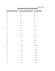
Tables 4-6 document traffic counts generated for <strong>Pete</strong> <strong>Hollis</strong> Boulevard,<br />
Buncombe Street, and Metropolitan Drive from November 15 through November<br />
22, 2005. Additional traffic counts for Stone Avenue and Rutherford Street are<br />
expected from Traffic Engineering 3/14/06.<br />
Volume I: Vision and Concept <strong>Plan</strong> 33