20101005_SWBG_COTWS_TPA_Presentations - Hanford Site
20101005_SWBG_COTWS_TPA_Presentations - Hanford Site
20101005_SWBG_COTWS_TPA_Presentations - Hanford Site

Create successful ePaper yourself
Turn your PDF publications into a flip-book with our unique Google optimized e-Paper software.
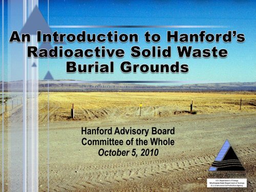
<strong>Hanford</strong> Advisory Board<br />
Committee of the Whole<br />
October 5, 2010<br />
1
1955 1955 1961 1961 2004<br />
Disposal Practices<br />
over the Years<br />
1955 1961 20<br />
SESSION 1: INTRODUCTION
Tri-Party Agency Opening Comments<br />
• Matt McCormick, Department of Energy, Richland<br />
Operation Office Manager<br />
• Jane Hedges, Washington State Department of<br />
Ecology, Nuclear Waste Program Manager<br />
• Dennis Faulk, Environmental Protection Agency,<br />
<strong>Hanford</strong> Project Office Manager<br />
3
1955 1955 1961 1961 2004<br />
Disposal Practices<br />
over the Years<br />
Matt McCormick,<br />
DOE-RL<br />
1955 1961 20<br />
SETTING CONTEXT FOR SW-2<br />
OPERABLE UNIT IN THE OVERALL<br />
HANFORD CLEANUP APPROACH
IU = Isolated Unit<br />
<strong>Hanford</strong> <strong>Site</strong> Cleanup Completion Framework<br />
Comprehensive Information<br />
Resource on <strong>Hanford</strong> <strong>Site</strong> Cleanup<br />
• Provides overview of <strong>Hanford</strong> cleanup<br />
strategy<br />
• Strives to make complexities of cleanup<br />
more understandable<br />
• Gives context for how<br />
individual activities support cleanup<br />
completion<br />
Content<br />
• Overarching goals for cleanup<br />
• Relationships between three main<br />
components of cleanup: River Corridor,<br />
Central Plateau and Tank Waste<br />
• Stages of cleanup completion building<br />
upon 2015 Vision, Central Plateau<br />
Strategy, new tank waste completion<br />
milestones<br />
• Cleanup challenges<br />
Richland Operations Office<br />
K East Basin Demolished<br />
K Area<br />
Interim Safe Storage of K East Reactor Complete<br />
K West Sludge Removed from the River Corridor<br />
Interim Safe Storage of K West Reactor Initiated<br />
All K Area Final ROD Remedial Actions Complete and<br />
TSD Units Closed with the exception of those<br />
associated with K West<br />
All K Area Groundwater Remedies Implemented<br />
2300 Tons of Scrap Nuclear Fuel Removed<br />
109 Facilities Demolished<br />
2 Waste <strong>Site</strong>s Remediated<br />
~361,000 Tons of Soil Removed<br />
Plutonium Finishing Plant Complex<br />
All Special Nuclear Material Shipped Off-site<br />
Slightly Irradiated Fuel Shipped to the Canister Storage<br />
Building for Safe Guarding<br />
PFP Complex Reduced to Slab on Grade<br />
18 Facilities Demolished<br />
B & C Area<br />
Interim Safe Storage of C Reactor Complete<br />
B Reactor Designated as a Museum or Interim<br />
Safe Storage Complete<br />
All B & C Area Final ROD Remedial<br />
Actions Complete<br />
All B & C Area Groundwater Remedies<br />
Implemented<br />
6 Facilities Demolished<br />
40 Waste <strong>Site</strong>s Remediated<br />
~381,000 Tons of Soil Removed<br />
* Does not reflect all work<br />
N Area<br />
Interim Safe Storage of N Reactor Complete<br />
All N Area Final ROD Remedial Actions Complete and<br />
TSD Units Closed<br />
All N Area Groundwater Remedies Implemented<br />
108 Facilities Demolished<br />
61 Waste <strong>Site</strong>s Remediated<br />
~157,000 Tons of Soil Removed<br />
400 Area<br />
Fast Flux Test Facility in<br />
Surveillance and Maintenance<br />
Safe and Effective Cleanup<br />
that Protects the Columbia River<br />
‣ Reduces the Active <strong>Site</strong> Footprint of Cleanup to 75 Square Miles (586 to 75)<br />
‣ Significantly Reduces Long-Term Mortgage Costs<br />
‣ At Completion, Shifts Emphasis and Resources to Full Scale Cleanup<br />
of the Central Plateau (75 square miles)<br />
‣ Reduces Costs by “Right Sizing” <strong>Hanford</strong>’s Infrastructure via a<br />
Mission Support Contract<br />
‣ Minimizes Injury to Natural Resources<br />
D & H Area<br />
Interim Safe Storage of D, DR, and H Reactors Complete<br />
All D & H Area Final ROD Remedial Actions Complete<br />
All D & H Area Groundwater Remedies Implemented<br />
16 Facilities Demolished<br />
56 Waste <strong>Site</strong>s Remediated<br />
~1,700,000 Tons of Soil Removed<br />
IU2 & IU6 Area<br />
Interim Safe Storage of F Reactor Complete<br />
All IU2 & IU6 Area Final ROD Remedial Actions Complete<br />
All IU2 & IU6 Area Final ROD Groundwater Remedial Actions<br />
Complete<br />
1 Facility Demolished<br />
50 Waste <strong>Site</strong>s Remediated<br />
~962,000 tons of Soil Removed<br />
Central Plateau Cleanup<br />
All 200 West Carbon Tetrachloride, Uranium and Technetium 99<br />
Groundwater Remedies Implemented<br />
Conduct Additional Cleanup as Funds Become Available<br />
300 Area<br />
All 300 Area Final ROD Remedial<br />
Actions Complete and TSD Units Closed<br />
All 300 Area Groundwater Remedies<br />
Implemented<br />
186 Facilities Demolished<br />
95 Waste <strong>Site</strong>s Remediated<br />
~923,000 Tons of Soil Removed<br />
Final Remediation of 618-10 & 618-11 Burial<br />
Grounds Complete<br />
ROD = Record of Decision<br />
TSD = Treatment, Storage, Disposal<br />
September 2008<br />
5
Key Cleanup Challenges<br />
• River Corridor<br />
– K Basin Sludge<br />
– Final Disposition of Surplus Production Reactors<br />
– Hexavalent Chromium at 100-D, 100-H and 100-K Areas<br />
– Strontium-90 Plume at 100-N Area<br />
– Uranium Plume at 300 Area<br />
• Central Plateau<br />
– Number, Variety, Complexity of Cleanup Actions<br />
– Deep Vadose Zone Contamination<br />
– Long-Term Effectiveness of Engineered Surface Barriers<br />
– Legacy Solid Waste Burial Grounds<br />
– Tank Waste Retrieval and Treatment<br />
– Tank Area Closure<br />
6
<strong>Hanford</strong> <strong>Site</strong> Cleanup Completion Framework<br />
Shrinking the <strong>Hanford</strong> <strong>Site</strong> Cleanup<br />
<strong>Hanford</strong> Lands<br />
586 sq. miles<br />
River Corridor<br />
Cleanup<br />
Underway<br />
Cleanup<br />
Footprint<br />
Reduced to<br />
75 sq. miles<br />
Cleanup<br />
Footprint<br />
Reduced to<br />
~ 10 sq. miles<br />
Long Term<br />
Management<br />
Area less than<br />
10 sq. miles<br />
We are Here<br />
7
Central Plateau Cleanup Approach<br />
Minimize the area used for<br />
waste disposal and<br />
containment of residual<br />
contamination -- resulting<br />
in the smallest practical<br />
footprint<br />
Central Plateau cleanup is<br />
focused in three areas:<br />
Inner Area<br />
Outer Area<br />
Groundwater<br />
8
Inner Area Approach<br />
• Minimize the size of the final<br />
footprint to less than<br />
10 square miles<br />
• Ensure waste disposal and<br />
residual contamination is<br />
protective of human health<br />
and the environment<br />
• Make comprehensive &<br />
consistent cleanup decisions<br />
• Implement cleanup decisions<br />
using a geographical approach<br />
• Monitor Inner Area to ensure<br />
cleanup remedies are<br />
protective<br />
Inner Area<br />
9
Setting the Stage For the Final Footprint<br />
Inner Area<br />
10
Outer Area Approach<br />
• Clean up waste sites<br />
comparable to the<br />
River Corridor with<br />
some exceptions<br />
• Demolish and dispose<br />
excess facilities<br />
• Make final cleanup<br />
decisions with one Record<br />
of Decision<br />
• Start cleanup with interim<br />
CERCLA actions using ARRA<br />
funds<br />
Outer Area<br />
11
Central Plateau Groundwater Approach<br />
• Contain key contaminants (carbon<br />
tetrachloride, technetium-99,<br />
iodine-129, uranium) to the Central<br />
Plateau and remediate to meet<br />
drinking water standards<br />
• Complete groundwater remediation<br />
on the Central Plateau using<br />
existing decision (200-ZP-1 Record<br />
of Decision) as a model<br />
• Implement pump & treat systems in<br />
next few years to continue to<br />
remove and contain key<br />
contaminants<br />
• Pursue multiple approaches to find<br />
effective long-term solutions for<br />
deep vadose zone challenges<br />
Groundwater plume will decay<br />
and disperse over time<br />
Columbia R.<br />
Richland<br />
12
The Path Ahead for SW-2<br />
• We’re early in the decision-making process<br />
• Your input and feedback (both past and future) is<br />
greatly appreciated<br />
• We are looking forward to continuing this discussion<br />
with you over the next several years as we arrive at a<br />
final decision<br />
13
1955 1955 1961 1961 2004<br />
Disposal Practices<br />
over the Years<br />
Jane A. Hedges<br />
Program Manager<br />
Ecology Nuclear Waste<br />
Program<br />
1955 1961 20<br />
REGULATORY HISTORY<br />
WORK PLAN REQUIRING INVESTIGATION<br />
OF HANFORD’S PAST-PRACTICE RADIOACTIVE<br />
SOLID WASTE BURIAL GROUNDS
Tri-Party Agreement history of200-SW-2<br />
investigation work plan<br />
• 1998 – new work plan milestones for 200 Area<br />
• 2002 (June): 200-SW-2 operable unit work plan<br />
specifically identified in <strong>TPA</strong> milestone<br />
• 2004 (Dec): DOE submits first draft work plan<br />
• 2005 (Mar): DOE & Ecology agree to extensive revamp,<br />
re-submittal of work plan<br />
• 2006 (Sep): revised <strong>TPA</strong> milestones –<br />
all 200 Area remedy proposals due 2011<br />
• 2008 (Dec): 200-SW-2 work plan approved<br />
15
Investigation history (continued)<br />
• 2008 – 2010 DOE completes work plan Phase 1<br />
“non-intrusive” investigations<br />
• March 2010 Tri-Party Tentative Agreement<br />
– 200-SW-2 Phase 2 work plan due Dec. 2011<br />
– 200-SW-2 Proposed decision due Dec. 2016<br />
• Today: public participation toward developing the<br />
work plan due Dec. 2011<br />
16
1955 1955 1961 1961 2004<br />
Disposal Practices<br />
over the Years<br />
1955 1961 20<br />
SESSION 2:<br />
LANDFILL DESCRIPTIONS/<br />
PHYSICAL SETTING
Introduction to Session 2<br />
• Overview of <strong>Hanford</strong> landfills<br />
• Location of landfills<br />
• Overview of waste disposal<br />
• General description of the landfill categories<br />
• Physical setting – design and configuration of landfills<br />
• Overview of waste packaging<br />
18
1955 1955 1961 1961 2004<br />
Disposal Practices<br />
over the Years<br />
Doug Hildebrand<br />
U.S. DOE - RL<br />
1955 1961 20<br />
SESSION 3: PROCESS KNOWLEDGE
Summary of Process Knowledge Documentation by Landfill<br />
20
Years of Operation<br />
21
Waste Containers Disposed of in Landfills<br />
• Design Considerations<br />
• Design specification began in the mid-1960s<br />
• Primary purpose of a fission waste container was<br />
to keep the waste in and let the heat out<br />
• Designed for a long life to prevent<br />
release of radioactive material.<br />
• Elements of design included:<br />
– Venting<br />
– Seals<br />
– Shielding<br />
– Shipment<br />
– Lifting devices<br />
– Labeling<br />
• Discontinued use of cardboard boxes in 1984<br />
• Interior void space was limited to 20% from<br />
1985-1990, and 10% from 1990 to current time.<br />
22
Waste Containers Disposed of in Landfills<br />
• A wide range of disposal containers have been used:<br />
– Bags (Burlap, cloth, paper or plastic)<br />
– Boxes/cartons/cases (Concrete, wood, paper, metal,<br />
fiberboard/plastic)<br />
– Cylinders/casks (concrete metal)<br />
– Ion exchange columns<br />
– Drums/barrels/kegs<br />
23
Volume of Waste Buried By Landfill<br />
24
Volume of Waste Buried by Landfill Pre-1970<br />
25
Plutonium Recovery in Pre-1970 Waste<br />
• The economic recovery value of Plutonium (Pu) over the<br />
years was a principle DOE strategy. This reduced the<br />
volume of material actually disposed of.<br />
• The 232-Z incinerator came on-line around 1960. Pu was<br />
recovered from the incinerated waste that ranged from a<br />
few grams to 250 g per box.<br />
• Pending construction of the incinerator there were >150<br />
boxes of Pu contaminated material in storage as of<br />
March 1959.<br />
• Some boxes were “damp with organic” and acids, which<br />
caused disintegration of the boxes and created a<br />
storage/fire hazard. These boxes were sent for burial<br />
before the incinerator was constructed.<br />
26
Grams<br />
218-W-2<br />
218-W-1<br />
218-W-3<br />
218-W-4A<br />
218-E-12A<br />
218-W-4B<br />
218-W-2A<br />
218-E-10<br />
218-E-5A<br />
218-W-1A<br />
218-E-12B<br />
218-E-1<br />
218-E-2<br />
218-E-5<br />
218-E-8<br />
218-E-4<br />
Estimated Pu Mass in Pre-1970 Landfills<br />
Estimated Pu Mass in Pre-1970 Burial Grounds<br />
250,000<br />
100.0%<br />
90.0%<br />
200,000<br />
80.0%<br />
70.0%<br />
150,000<br />
60.0%<br />
50.0%<br />
100,000<br />
Mass<br />
Cumulative %<br />
40.0%<br />
30.0%<br />
50,000<br />
20.0%<br />
10.0%<br />
0<br />
0.0%<br />
27
Estimated Plutonium and Uranium Inventories,<br />
Pre-1970<br />
BURIAL GROUND Plutonium, kgs Uranium, kgs<br />
218-E-1 1 400<br />
218-E-2 1 300<br />
218-E-4 0 1<br />
218-E-5 1 120<br />
218-E-5A 1 120<br />
218-E-8 0 2<br />
218-E-10 4 800<br />
218-E-12A 9 990<br />
218-E-12B 1 7<br />
218-W-1 94 700<br />
218-W-1A 2 900<br />
218-W-2 130 1,400<br />
218-W-2A 6 2,000<br />
218-W-3 68 70,000<br />
218-W-3A 1 4,400<br />
218-W-4A 35 400,000<br />
218-W-4B 9 3,200<br />
Total 363 485,340<br />
28
1955 1955 1961 1961 2004<br />
Disposal Practices<br />
over the Years<br />
1955 1961 20<br />
SESSION 4:<br />
ENVIRONMENTAL MONITORING
1955 1955 1961 1961 2004<br />
Disposal Practices<br />
over the Years<br />
Doug Hildebrand<br />
U.S. DOE - RL<br />
1955 1961 20<br />
SESSION 5:<br />
WASTE DETAILS
Objective of Session 5<br />
• Briefly discuss why we distinguish between Post-<br />
1970s waste and Pre-1970s waste.<br />
• Provide a summary of what information has been<br />
collected on the Post-1970 and Pre-1970 landfills<br />
that are in 200-SW-2.<br />
– Considerable volume of knowledge has been collected on<br />
these landfills including documentation and records as<br />
well as field investigations.<br />
• The current version of the 200-SW-2 Work Plan<br />
contains an extensive discussion of the current<br />
information.<br />
31
Overview of Landfills<br />
32
Years of Operation<br />
33
Why Pre- and Post- 1970 Waste?<br />
• March 20, 1970 the U. S. Atomic Energy Commission (AEC) issued<br />
Immediate Action Directive regarding solid waste burial after April<br />
30, 1970.<br />
• Directive implemented recommendations on costing, segregation<br />
and irretrievability of waste.<br />
• Directive calls for wastes with contamination of transuranic<br />
nuclides to be segregated, packaged and buried in a way that they<br />
can be retrieved.<br />
• All waste before 1970 considered LLW.<br />
• September 19, 1973 the AEC approved Radioactive Waste<br />
Management manual (Chapter 0511), defining how safe, long-term<br />
management of radioactive waste would be accomplished.<br />
• The segregation, storage and retrieval of transuranic waste will not<br />
be part of the 200-SW-2 RI/FS remedy selection process. (M-091<br />
Project)<br />
34
Lessons Learned on Post-1970 Landfill<br />
Excavation to Date<br />
• Typically the more recent the material was placed, the more<br />
intact it is<br />
• Cardboard containers: disintegrated<br />
• Metal boxes: intact and in good shape<br />
• Plywood containers: integrity is variable<br />
• Plastic: intact and aids in handling<br />
• Material ranged from small boxes to large 40-ton monoliths<br />
• Initial assumption was to require a 10% over pack. Actual over<br />
pack applied has been 100%<br />
• Contamination to date ranges from none to only within the<br />
immediate proximity of the container<br />
• Early this year, a release required modification to monitoring<br />
• Production has been less than anticipated due to weather<br />
(wind and rain) as well as excessive levels of radon<br />
35
Post-1970 Landfills<br />
• Landfills in this category include the eight Treatment,<br />
Storage and Disposal Landfills<br />
• They are included in the <strong>Hanford</strong> Facility Dangerous<br />
Waste Permit Application, Low-Level Burial Grounds<br />
• Included are: 218-E-10; 218-E-12B; 218-W3A; 218-<br />
W-3AE; 218-W-4B; 218-W-4C; and 218-W5 (218-W-6<br />
is included in this category but has not been used)<br />
36
Post-1970 TSD Unit Landfills<br />
37
218-E-10, TSD-200 East<br />
• Dates of Waste Receipt: 1955 to 2000<br />
• Area: 22.9 ha (56.6 acres)<br />
• General Description: Wastes include cover blocks, tube bundles, jumper vessels,<br />
pumps, columns, and filters. In June 1960, a partially covered burial box of PUREX<br />
tube bundles caused an airborne contamination spread (UPR-200-E- 23). In 1980,<br />
Trenches 1 through 5 were backfilled and stabilized. The section was vegetated with<br />
grasses. Surface stabilization also was completed for the eastern 10 ha (25 acres) in<br />
1980.<br />
• Landfill: Thirteen trenches running north–south and one trench running east-west.<br />
Trenches range from 264 m to 433 m (865 ft to 1,420 ft) long by 4.6 m to 5 m (15 ft<br />
to 16 ft) wide at the bottom.<br />
• Waste Volume, Pu/U Inventory, and Contaminant Inventory:<br />
– 26,900 m 3 (35,200 yd 3 ) of equipment/industrial wastes<br />
– LLW, MLLW, and unsegregated waste.<br />
– 4.94 kg Pu, 801 kg U. 4,700,00 Ci Beta-Gamma at burial<br />
– asbestos, lead, and di-n-octyl phthalate<br />
• Source Facilities Contributing More than 5% of Waste by Volume: 100 Area, B-Plant<br />
(221-B/224-B), Offsite, PUREX (202-A)<br />
38
218-E-10<br />
Characterization<br />
RCRA groundwater monitoring<br />
around LLWMA 1 wells have been<br />
sampled since 1988 for contaminant<br />
indicator parameters, groundwater<br />
quality parameters, drinking water<br />
parameters, and site specific<br />
parameters as required by WAC<br />
173-303-400(3) Waste Sources<br />
Total Volume: 18654.7 m 3<br />
39
218-E-12B, TSD-200 East<br />
• Dates of Waste Receipt: 1967 to present<br />
• Area: 73.6 ha (182 acres)<br />
• General Description: The southern portion of the site (Trenches 1<br />
through 17) were interim stabilized in 1981 with clean fill. In January<br />
2000, two contaminated tumbleweeds were removed from the site.<br />
• Trenches: The landfill has the design capacity for 138 trenches running<br />
north to south -- 38 trenches are filled, 2 were partially filled, and one was<br />
excavated and never used. The remaining trenches were never excavated.<br />
• Waste Volume, Pu/U Inventory, and Contaminant Inventory:<br />
– 65,600 m3 (85,800 yd3) industrial wastes<br />
– unsegregated, low-level, and transuranic wastes<br />
– 1.39 kg Pu, 7.64 kg U. 183,000 Ci Beta-Gamma at burial<br />
• Source Facilities Contributing More than 5% of Waste by Volume: 200<br />
East Area, B-Plant, Offsite, PUREX, Tank Farms<br />
40
218-E-12B<br />
Characterization<br />
RCRA groundwater monitoring at LLWMA 2-<br />
wells have been sampled since 1988 for<br />
contaminant indicator parameters, groundwater<br />
quality parameters, drinking water parameters,<br />
and site specific parameters as required by WAC<br />
173-303-400(3).<br />
41
218-W-3A TSD<br />
• Dates of Waste Receipt: 1970 to 1998<br />
• Area: 21.9 ha (54.2 acres)<br />
• General Description: West of the 221-T Building and north of the 218-W-3 Burial Ground, the site<br />
is located within the Low-Level Burial Ground TSD unit.<br />
• Trenches: Sixty-one trenches running east to west. Four trenches have not been dug, and the 57<br />
that have been constructed range from 127 m to 284 m (417 ft to 930 ft) in length.<br />
• Waste Volume, Pu/U Inventory, and Contaminant Inventory:<br />
– 97,500 m 3 (127,500 yd 3 ) dry waste and some equipment<br />
– TRU, TRUM, LLW, MLLW, and unsegregated wastes<br />
– 0.55 kg Pu, 634 kg U. 1,330,000 Ci Beta-Gamma at burial<br />
– 1,2,4-trimethylbenzene; acetic acid, butyl ester; acetonitrile; aliquat 336; anase; asbestos;<br />
barium; batteries; beryllium; cadmium; carbon tetrachloride; carcinogens; caustic; charcoal;<br />
chromium; coal tar; copper; cortisporin; cyclohexane; cyclohexanone; dibutyl phosphate;<br />
dibutyl-n, n-diethylcarbomyl phosphate; dioxane (1,4-diethylene dioxide); ethanol;<br />
ethanolamine; ethylene glycol; glycerin; isopropyl alcohol; kerosene; lead; lithium fluoride;<br />
mercury; methanol; naphthalene; napthylamine tritium; n-hexane; n-hexanol; nitric acid;<br />
normal paraffins; oil; organic; phosphoric acid; polyurethane; pseudocumene; silver; silver<br />
nitrate; slaked lime; sodium; sodium hydroxide; solvents; tetrahydrofuran; toluene; tributyl<br />
phosphate; trichloroethylene; trichlorofluoromethane; trioctylphosphine oxide; uranium<br />
fluoride; xylene (mixed isomers); zinc; zirconium<br />
• Source Facilities Contributing More than 5% of Waste by Volume: 100 Area, 200 West Area, 300<br />
Area, PFP, Tank Farms<br />
42
218-W-3A<br />
Waste Sources<br />
Characterization<br />
Passive soil-vapor sampling has been<br />
completed. Specific sampling locations were<br />
chosen based on detailed reviews of<br />
engineering drawings, historical documents,<br />
and waste burial record information located in<br />
the SWITS database.<br />
Passive soil vapor samples were analyzed for<br />
the presence of 28 organic compounds<br />
identified to be contaminants of potential<br />
concern.<br />
Two sample locations had CCl4 levels greater<br />
than 100 nanograms: trench 3-S had a reading<br />
of 149 nanograms; at another location, trench<br />
9-S had a CCl4 level of 1,185.<br />
Passive soil vapor sampling was also<br />
conducted by the 200-PW-1 OU in 218-W-3A.<br />
Vent riser vapor sampling was performed on<br />
retrievably stored TRU waste trench<br />
segments; although this waste is not in the<br />
scope of this investigation, these results are<br />
included in this RI/FS work plan for<br />
completeness. Vent riser sampling in non-RSW<br />
trenches was also conducted by the 200-PW-1<br />
OU in 218-W-3A.<br />
RCRA groundwater monitoring in LLWMA 3-<br />
wells since 1988 for contaminant indicator<br />
parameters, groundwater quality parameters,<br />
drinking water parameters, and site specific<br />
parameters as required by WAC 173-303-<br />
400(3).<br />
43
218-W-3AE, TSD<br />
• Dates of Waste Receipt: 1981 to 2004<br />
• Area: 22.9 ha (56.6 acres)<br />
• General Description: The location of this site also included a portion of the 216-T-4B Pond<br />
System. The site received miscellaneous wastes including rags, paper, rubber gloves,<br />
disposable supplies, broken tools, laboratory wastes and industrial waste such as failed<br />
equipment, tanks, pumps, ovens, agitators, heaters, hoods, jumpers, decommissioned<br />
change trailers, etc. Trenches 5 and 8 contain post-1987 mixed waste.<br />
• Trenches: Originally design contained 24 trenches. Re-designed to contain 12 trenches at<br />
deeper depths. Only eight of the trenches were excavated; three are only partially filled.<br />
• Waste Volume, Pu/U Inventory, and Contaminant Inventory:<br />
– 34,300 m3 (44,900 yd3) of miscellaneous wastes<br />
– TRU, LLW, and MLLW. The TRU at this site will be removed and processed; it is part of<br />
the <strong>TPA</strong> M-91 scope<br />
– 0.12 kg Pu, 439 kg U. 223,000 Ci Beta- Gamma at burial<br />
– aluminum nitrate; 2,4-dinotrotoluene; ammonium chloride; asbestos; beryllium; bis (2-<br />
ethylhexyl) phthalate; chromium; copper; dibutyl phosphate; ferric nitrate; ferrous<br />
ammonium sulfate; hydrobromic acid; lead; mercury; nickel hydroxide; nitrate; oil;<br />
polychlorinated biphenyls; potassium nitrate; silver; sodium hydroxide; sodium nitrate;<br />
sodium nitrite; sulfuric acid; tetrachloroethylene; trichloroethene;<br />
trichlorofluoromethane; zirconium<br />
• Source Facilities Contributing More than 5% of Waste by Volume: 100 Area, 1100 Area<br />
(1171 Transportation & Maintenance Building), 300 Area, Offsite<br />
44
218-W-3AE<br />
Waste Sources<br />
Characterization<br />
Passive soil-vapor sampling locations were chosen based on<br />
detailed reviews of engineering drawings, historical documents,<br />
and waste burial record information located in the SWITS<br />
database. Samples were analyzed for the presence of 28 organic<br />
compounds identified to be contaminants of potential concern.<br />
RCRA groundwater monitoring at LLWMA three wells sampled<br />
since 1988 for contaminant indicator parameters, groundwater<br />
quality parameters, drinking water parameters, and site specific<br />
parameters as required by WAC 173-303-400(3).<br />
45
218-W-4B<br />
• Dates of Waste Receipt: 1967 to 1990<br />
• Area: 4.07 ha (10.1 acres)<br />
• General Description: Contains debris including rags, paper, cardboard, plastic, and<br />
equipment. Trenches 7 and 11 and the alpha caissons contain TRU waste planned to be<br />
retrieved under M-91. Trenches 1 through 6 were surface stabilized and backfilled with clean<br />
soil in 1983. Trench 7 is covered with a 1.2 m (4 ft) soil mound. The remaining trenches were<br />
backfilled after use and stabilized with clean gravel in 1995. See slides 92 and 93 for more<br />
information on caissons.<br />
• Trenches: The site contains 13 trenches and one row of 12 caissons (5 alpha, 6 MFP, and 1<br />
deeper, silo-type which became plugged after receipt of two waste packages).<br />
• Waste Volume, Pu/U Inventory, and Contaminant Inventory:<br />
– 10,466 m3 (13,690 yd3) of waste as of September 30, 2005<br />
– TRU, LLW, and unsegregated wastes<br />
– 8.98 kg Pu and 21.6 kg U. 406,000 Ci Beta-Gamma at burial.<br />
– beryllium, lead, oil, and zirconium<br />
• Source Facilities Contributing More than 5% of Waste by Volume: 222-S, 300 Area, PFP, and<br />
T-Plant<br />
46
218-W-4B<br />
Characterization<br />
Passive soil-vapor sampling locations were<br />
chosen based on detailed reviews of<br />
engineering drawings, historical<br />
documents, and waste burial record<br />
information located in the Solid Waste<br />
Information and Tracking System data<br />
base. Samples were analyzed for the<br />
presence of 28 organic compounds<br />
identified to be contaminants of potential<br />
concern. One sample location had CCl4<br />
levels greater than 100 nanograms<br />
targeted location, trench 8 had CCl4 levels<br />
in excess of 70,000 nanograms.<br />
Vent riser vapor samples performed on<br />
retrievably stored TRU waste trench<br />
segments; although this waste is not in<br />
the scope of this investigation, these<br />
results are included in this RI/FS work plan<br />
for completeness.<br />
RCRA groundwater monitoring at LLWMA<br />
4 wells sampled since 1988 for<br />
contaminant indicator parameters,<br />
groundwater quality parameters, drinking<br />
water parameters, and site specific<br />
parameters as required by WAC<br />
173-303-400(3).<br />
47
218-W-4C<br />
• Dates of Waste Receipt: 1978 to 2005<br />
• Area: 22.8 ha (56.2 acres)<br />
• General Description: Divided into two parts; the section containing burial trenches to the west and an<br />
annex, (which never has been used) to the east. The Z Plant burning pit, which operated during the late<br />
1940s and early 1950s, was reportedly excavated in the 1970s during the construction of Trench 7. Some<br />
of the TRU-containing trenches are asphalt lined. Trenches 1, 4, 7, 20, 24, and 29 contain retrievably<br />
stored, suspect TRU waste. One drum of suspect TRU was buried in what is otherwise a LLW trench in<br />
1981; records were later examined, and the drum and trench were redefined as containing only LLW.<br />
Trenches NC, 14, and 58 contain post-1987 mixed waste.<br />
• Trenches: The landfill is designed to contain up to 65 trenches. Only 14 trenches have been excavated; 6<br />
of these are only partially filled. The landfill annex area never has been used. The trenches run east to<br />
west and range in length from 50 m to 232 m (162 ft to 760 ft).<br />
• Waste Volume, Pu/U Inventory, and Contaminant Inventory (In- Scope Low-Level & Unsegregated<br />
Wastes only) 15,200 m3 (19,900 yd3) of waste as of September 30, 2005. The site contains :<br />
– TRU, TRUM, LLW, and MLLW<br />
– 0.026 kg Pu, 215 kg U. 1,100,000 Ci Beta-Gamma at burial<br />
– 1,2-diaminopropane; 1-butene; 2,2,4- trimethylpentane; 3,4(benz-3,6)pyrene; acetic anhydride;<br />
acetophenone; acid; chromium; coal tar; copper; cumene hydroperoxide; di-t-butyl-p-cresol; indole<br />
picrate; isopropyl iodide; lead; mercury; n,n-disalicylidene; naphthalene; 2-methyl-naphthalene; oil;<br />
paint thinner; phenol; silver; slaked lime; sodium; t-butyl hydroperoxide; uranium fluoride; vinyl<br />
chloride (chloroethylene); zirconium<br />
• Source Facilities Contributing More than 5% of Waste by Volume: 100 Area, 300 Area, Offsite, PFP,<br />
REDOX<br />
48
218-W-4C<br />
Waste Sources<br />
Characterization<br />
Passive soil-vapor sampling locations were<br />
chosen based on detailed reviews of<br />
engineering drawings, historical documents,<br />
and waste burial record information located in<br />
the SWITS database. Samples were analyzed<br />
for the presence of 28 organic compounds<br />
identified to be contaminants of potential<br />
concern.<br />
Vent riser vapor samples performed on<br />
retrievably stored TRU waste trench segments;<br />
although this waste is not in the scope of this<br />
investigation, these results are included in this<br />
RI/FS work plan for completeness.<br />
Vent riser sampling was also conducted by<br />
200-PW-1 in 218-W-4C.<br />
RCRA groundwater monitoring at LLWMA 4<br />
wells sampled since 1988 for contaminant<br />
indicator parameters, groundwater quality<br />
parameters, drinking water parameters, and<br />
site specific parameters as required by WAC<br />
173-303-400(3).<br />
49
218-W-5<br />
• Dates of Waste Receipt: 1985 to present<br />
• Area: 38.6 ha (95.3 acres)<br />
• General Description: Trenches 22 and 24 contain post- August 19, 1987<br />
mixed waste.<br />
• Trenches: Contain 18 low-level and four mixed waste trenches. Currently<br />
there are 11 inactive low-level trenches.<br />
• Waste Volume, Pu/U Inventory, and Contaminant Inventory:<br />
– 71,000 m3 (92,900 yd3) of total wastes as of September 30, 2005. This site<br />
contains:<br />
– LLW and MLLW<br />
– 0.17 kg Pu, 6,915 kg U. 31,400 Ci Beta- Gamma at burial<br />
– lead, oil, and slaked lime<br />
• Source Facilities Contributing More than 5% of Waste by Volume: 100<br />
Area, 300 Area, Offsite, PFP, Tank Farms<br />
50
218-W-5<br />
Characterization<br />
Passive soil-vapor sampling locations were chosen<br />
based on detailed reviews of engineering drawings,<br />
historical documents, and waste burial record<br />
information located in the SWITS database. Samples<br />
were analyzed for the presence of 28 organic<br />
compounds identified to be contaminants of<br />
potential concern.<br />
Vent riser vapor samples performed on retrievably<br />
stored TRU waste trench segments; although this<br />
waste is not in the scope of this investigation, these<br />
results are included in this RI/FS work plan for<br />
completeness.<br />
Vent riser sampling was also conducted by<br />
200-PW-1 in 218-W-4C.<br />
Waste sources<br />
RCRA groundwater monitoring at LLWMA 4 wells<br />
sampled since 1988 for contaminant indicator<br />
parameters, groundwater quality parameters,<br />
drinking water parameters, and site specific<br />
parameters as required by WAC 173-303-400(3).<br />
51
Pre-1970 Landfills<br />
• The Pre-1970 landfills are categorized as:<br />
– Industrial Landfills<br />
– Dry Waste Alpha Landfills<br />
– Dry Waste Landfills<br />
– Construction Landfills<br />
52
INDUSTRIAL LANDFILLS<br />
There are eight landfills categorized as Industrial
218-E-2, Industrial-200 East<br />
• Dates of Waste Receipt: 1945 to 1953<br />
• Area: 2.05 ha (5.06 acres)<br />
• Historical Documentation Design and Operation: The unit was<br />
surface stabilized in 1979 with 0.3 m (1 ft) of clean backfill material<br />
and vegetated with wheat grass. Trench lengths vary from 27 m to<br />
142 m (90 ft to 465 ft). The site is co-located with Landfills 218-E-<br />
2A, 218-E-4, 218-E-5, 218-E-5A and 218-E-9.<br />
• Trenches: Nine industrial (wide) trenches.<br />
• Waste Volume, Pu/U Inventory, and Contaminant Inventory:<br />
– 9,033 m 3 (11,815 yd 3 ) of industrial wastes<br />
– 0.8 kg Pu, 300 kg U. 25,000 Ci Beta-Gamma at burial<br />
• Source Facilities Contributing More than 5% of Waste by Volume:<br />
200 East Area<br />
55
218-E-2<br />
Characterization<br />
September 2006 radiological soil<br />
measurements at the 218-E-2 and<br />
218-E-5 Burial Grounds were<br />
performed in support of the 200-<br />
SW-2 OU non-intrusive<br />
characterization effort.<br />
Eight survey locations (hot-spots)<br />
were selected for further<br />
radiological soil measurements in<br />
and around the two landfills,<br />
based on previously collected<br />
Mobile Surface Contamination<br />
Monitor data.<br />
Cesium contamination appears to<br />
be close to the surface and<br />
probably not directly related to<br />
the landfill.<br />
56
218-E-2A, Industrial-200 East<br />
• Dates of Waste Receipt: 1945 to 1950<br />
• Area: 0.372 ha (0.918 acres)<br />
• Historical Documentation Design and Operation: The site was<br />
used as an above-ground storage site for contaminated equipment.<br />
There are no records or inventories for this site. A 1978 inspection<br />
noted a number of sinkholes. During 1979, several loads of soil<br />
were placed over the sinkholes, and the stored above-ground<br />
equipment was buried in the 218-E-10 Landfill. The site was surface<br />
stabilized with 0.3 m (1 ft) of soil, re-vegetated, and posted/marked<br />
as an underground radioactive material area in 1980 to 1981. The<br />
site is co-located with Landfills 218-E-2, 218-E-4, 218-E-5, 218-E-5A<br />
and 218-E-9.<br />
• Trenches: One<br />
• Waste Volume, Pu/U Inventory, and Contaminant Inventory :<br />
– Nothing known about waste volume or inventories<br />
• Source Facilities Contributing More than 5% of Waste by Volume:<br />
Unknown<br />
57
218-E-2A<br />
Geophysical Anomalies<br />
Characterization<br />
Surface geophysical surveys conducted were<br />
an expansion of the area covered in the first<br />
phase of geophysical investigations.<br />
Results of the previous investigation<br />
appeared to show anomalies extending<br />
beyond the edge of the landfill boundary to<br />
the west. This investigation concluded no<br />
buried debris or objects are interpreted to be<br />
west of the landfill boundary.<br />
58
218-E-5, Industrial-200 East<br />
• Dates of Waste Receipt: 1954 to 1956<br />
• Area: 1.09 ha (2.69 acres)<br />
• General Description: The westernmost trench contains railroad boxcars<br />
contaminated by uranyl nitrate hexahydrate at the north end. The burial areas<br />
were stabilized and covered with 0.3 m (1 ft) of clean soil in 1980. The site is colocated<br />
with Burial Grounds 218-E-2, 218-E-2A, 218-E-4, 218-E-5A and 218-E-9.<br />
• Trenches: The site contains two areas of trenches. One area is 104 m (341 ft) long<br />
by 40 m (131 ft) wide and contains multiple narrow trenches that received<br />
industrial dry waste and small boxes. The second area is a single trench oriented<br />
north/south that is 102 m (335 ft) long by 20 m 64 ft) wide.<br />
• Waste Volume, Pu/U Inventory, and Contaminant Inventory:<br />
– 3,172 m3 (4,149 yd3) of miscellaneous debris<br />
– 0.62 kg Pu, 120 kg U. 3,500 Ci Beta-Gamma at burial<br />
• Source Facilities Contributing More than 5% of Waste 200 East Area: - PUREX<br />
(202-A)<br />
59
218-E-5<br />
Geophysical<br />
Anomalies<br />
Characterization<br />
In September 2006 radiological soil measurements at the 218-<br />
E-2 and 218-E-5 Burial Grounds were performed in support of<br />
the 200-SW-2 OU non-intrusive characterization effort.<br />
Eight survey locations (hot-spots) were selected for further<br />
radiological soil measurements in and around the two landfills,<br />
based on previously collected MSCM data.<br />
Cesium contamination appears to be close to the surface and<br />
probably not directly related to the landfill.<br />
Surface geophysical surveys of 218-E-5 and 218-E-5A Burial<br />
Grounds are contiguous and were investigated as a single<br />
landfill. Two trenches are documented in 218-E-5. Trench 2<br />
appears to be roughly 20 m to the west of its documented<br />
location. In the eastern half of the landfill, a second trench was<br />
detected that correlates well with the documented location of<br />
Trench 3 shown on <strong>Hanford</strong> <strong>Site</strong> Drawing H-2-55534.<br />
60
218-E-5A, Industrial-200 East Waste<br />
• Dates of Waste Receipt : 1956 to 1961<br />
• Area: 1.42 ha (3.51 acres)<br />
• General Description: Literature indicates that the site contains<br />
wooden boxes of spent PUREX equipment. The trench was<br />
backfilled in 1961. The site was stabilized in 1980, covered with 1 ft<br />
of clean backfill, and re-vegetated. The site is co-located with Burial<br />
Grounds 218-E-2, 218-E-2A, 218-E-4, 218-E-5, and 218-E-9.<br />
• Trenches: Probably one large pit.<br />
• Waste Volume, Pu/U Inventory, and Contaminant Inventory:<br />
– 6,173 m 3 (8,740 yd 3 ) of PUREX failed equipment<br />
– 1.38 kg Pu, 120 kg U. 16,500 Ci Beta-Gamma at burial<br />
• Source Facilities Contributing More than 5% of Waste by Volume:<br />
200 East Area – PUREX (202-A)<br />
61
218-E-5A<br />
Geophysical<br />
Anomalies<br />
Characterization<br />
Surface geophysical surveys for the 218-E-5 and<br />
218-E-5A Burial Grounds are contiguous and<br />
were investigated as a single landfill.<br />
Data indicates that there is one trench in the<br />
218-E-5A Burial Ground; an oblong-shape<br />
trench or pit containing a significant amount of<br />
metallic debris or objects.<br />
62
218-E-9, Industrial-200 East Regulated<br />
Equipment Storage<br />
• Dates of Waste Receipt: 1953 to 1958<br />
• Area: 0.572 ha (1.41 acres)<br />
• General Description: Used as an aboveground storage site for fission product<br />
equipment that became contaminated in the Uranium Recovery Process<br />
operations at tank farms. It is not certain that it ever was used as a landfill. The<br />
site is co-located with Burial Grounds 218-E-2, 218-E-2A, 218-E-4, 218-E-5, and<br />
218-E-5A and stabilized in 1980. The site was re-stabilized in 1991 when<br />
contaminated vegetation was found.<br />
• Trenches: The site consists of an unknown number of trenches. Some overlap with<br />
trenches in 218-E-2.<br />
• Waste Volume, Pu/U Inventory, and Contaminant Inventory:<br />
– Equipment<br />
– Nothing is known about waste volume or contaminant inventory<br />
• Source Facilities Contributing More than 5% of Waste by Volume: Unknown –<br />
believed to be uranium-recovery process operations at tank farms<br />
63
218-E-9<br />
Historical document(s) indicate that 218-E-9 is<br />
located as shown in the aerial photo but that<br />
there is uncertainty in its actual location (which is<br />
more likely to be the area east of trench 11)<br />
64
218-W-1A, Industrial 200 West<br />
• Dates of Waste Receipt: 1945 to 1961<br />
• Area: 4.86 ha (12.0 acres)<br />
• General Description: The site is the first landfill in the 200 West Area to<br />
receive large, contaminated equipment. Most of the equipment was<br />
disposed in wooden boxes that eventually rotted and settled, creating<br />
sinkholes. The sinkholes were filled in 1975 with 1.8 m (6-ft) thick<br />
concrete cell blocks and clean fill. Radiological surveys are performed<br />
annually.<br />
• Trenches: The site contains approximately ten burial areas. The areas<br />
include typical trenches and “burial holes.” The exact locations of the<br />
holes are not known.<br />
• Waste Volume, Pu/U Inventory, and Contaminant Inventory :<br />
– 13,700 m 3 (17,900 yd 3 ) equipment and industrial wastes<br />
– 2.0 kg Pu, 900 kg U. 48,000 Ci Beta- Gamma at burial<br />
• Source Facilities Contributing More than 5% of Waste by Volume: 200<br />
West Area<br />
65
218-W-1A<br />
Geophysical<br />
Anomalies<br />
Characterization<br />
Surface geophysical surveys indicate the<br />
landfill contains a large number of small,<br />
scattered shallow anomalies that confound<br />
the interpretation of distinct burial trenches<br />
in the GPR data. For this reason,<br />
concentrations of buried debris are inferred<br />
primarily from EMI and magnetic data.<br />
66
218-W-2A, Industrial<br />
• Dates of Waste Receipt: 1954 to 1985<br />
• Area: 16.5 ha (40.7 acres)<br />
• General Description: Includes tanks, concrete blocks, facility wastes, process equipment,<br />
contaminated soil scraped from the 216-T-4-1 Pond (Trench 27), REDOX centrifuges,<br />
jumpers, pumps, filters, and miscellaneous cell equipment and wastes. Trench 21 contains a<br />
plutonium glovebox. In January 1959, a contamination spread occurred when a burial box<br />
containing REDOX jumpers collapsed during backfill operations (UPR-200-W-53). The site was<br />
backfilled and surface stabilized in 1980. However, the site remained active until 1985<br />
because of two unused trenches and the cell block burial sites. An undocumented burial box<br />
was discovered in June 1983 while extending an active trench. The site was re-stabilized with<br />
clean fill and gravel in 2001.<br />
• Trenches: The site is an industrial burial area with 19 trenches; 17 run east to west and 2 run<br />
north to south.<br />
• Waste Volume, Pu/U Inventory, and Contaminant Inventory:<br />
– 25,100 m 3 (32,800 yd 3 ) equipment and industrial wastes<br />
– LLW<br />
– 6.38 kg Pu, 2,690 kg U. 247,000 Ci Beta- Gamma at burial<br />
• Source Facilities Contributing More than 5% of Waste by Volume: 200 Area facilities<br />
including T-Pond soil, REDOX, B Plant, and 234-5Z<br />
67
218-W-2A<br />
Geophysical<br />
Anomalies<br />
Characterization<br />
Surface geophysical survey data indicates that<br />
there are burial trenches at most of the<br />
locations shown for trenches on <strong>Hanford</strong> <strong>Site</strong><br />
Drawing H-2-32095. Most of the debris or<br />
objects in the trenches have a ferrous metal<br />
content; some have a significant ferrous<br />
content.<br />
68
218-W-11<br />
• Dates of Waste Receipt: 1960<br />
• Area: 1.43 ha (3.53 acres)<br />
• General Description: Before stabilization in 1983, a portion of the landfill<br />
was used for above-ground storage of contaminated equipment. The<br />
waste is low-level contaminated equipment. A surface radiological survey<br />
is performed annually.<br />
• Trenches: Two burial trenches 77 m (258 ft) and 46 m (150 ft) long.<br />
Sources conflict as to whether the southernmost of the two trenches ever<br />
was excavated and filled. Geophysics data collected in 2006 (D&D-30708)<br />
suggest that the trench does not exist.<br />
• Waste Volume, Pu/U Inventory, and Contaminant Inventory:<br />
– 1,160 m 3 (1,520 yd 3 ) miscellaneous solid debris<br />
– No plutonium, uranium, or beta-gamma inventories are reported for<br />
this site<br />
• Source Facilities Contributing More than 5% of Waste by Volume: Tank<br />
Farms – Uranium Recovery Process and Sr/Cs Recovery Operations<br />
69
218-W-11<br />
Geophysical Anomalies<br />
Characterization<br />
Surface geophysical survey data<br />
indicates that the investigation area<br />
contains two concentrations of buried<br />
debris or objects. One trench and one<br />
“pit” make up the 218-W-11 Burial<br />
Ground. The trench location correlates<br />
very well with the trench documented<br />
in <strong>Hanford</strong> <strong>Site</strong> Drawing H-2-31268.<br />
70
DRY WASTE ALPHA LANDFILLS
218-W-1, Dry Waste Alpha-200 West<br />
• Dates of Waste Receipt: 1944 to 1952<br />
• Area: 3.32 ha (8.19 acres)<br />
• General Description:“V” trenches typically used to dispose of small<br />
contaminated articles such as paper, filters, and small pieces of<br />
equipment. Flat-bottom trenches contain large pieces of<br />
contaminated equipment and wooden, metal, and concrete burial<br />
boxes. Trenches backfilled, and site stabilized in 1983. A surface<br />
radiological survey performed annually.<br />
• Trenches: Contains 15 trenches running east to west. Twelve<br />
trenches are “V” shaped 2.4 m (8 ft) deep and 5 m (16 ft) wide at<br />
ground level. The other three trenches are flat-bottomed at 2.7 m<br />
(9 ft) deep and 7.3 m (24 ft) wide at the surface.<br />
• Waste Volume, Pu/U Inventory, and Contaminant Inventory:<br />
– 7,164 m 3 (9,370 yd 3 ) dry waste. The site contains<br />
– 94 kg Pu, 700 kg U. 200 Ci Beta-Gamma at burial<br />
72
218-W-1<br />
Geophysical<br />
Anomalies<br />
Characterization<br />
Geophysical data for 218-W-1 indicates pockets of<br />
debris in each of the identified trenches. Discrete<br />
concentrations of metallic waste were identified in most<br />
of the trenches.<br />
Three east-west-oriented trenches were identified that<br />
are not shown on <strong>Hanford</strong> <strong>Site</strong> Drawing H-2-75149. They<br />
are north of the northernmost trench shown on the<br />
drawing (Trench 9) and south of the 218-W-11 Burial<br />
Ground.<br />
73
218-W-2, Dry Waste Alpha-200 West<br />
• Dates of Waste Receipt: 1953 to 1956<br />
• Area: 3.45 ha (8.51 acres)<br />
• General Description: Before backfilling, waste observed to be<br />
within 46 cm (18 in.) of the ground surfaces. Sinkholes filled in<br />
1974. The site was surface stabilized in 1983 with a minimum of 0.6<br />
m (2 ft) of clean fill and vegetated. A surface radiological survey<br />
performed annually.<br />
• Trenches: The site is a landfill that contains 20 trenches running<br />
east to west.<br />
• Waste Volume, Pu/U Inventory, and Contaminant Inventory:<br />
– 8,240 m 3 (10,778 yd 3 ) dry waste<br />
– 126 kg Pu, 1400 kg U. 500 Ci Beta-Gamma at burial<br />
• Source Facilities Contributing More than 5% of Waste by Volume:<br />
200 West Area<br />
74
218-W-2<br />
Geophysical<br />
Anomalies<br />
Characterization<br />
Surface geophysical surveys indicate that all<br />
20 of the trenches in 218-W-2 were clearly<br />
evident in the geophysical data. The<br />
geophysical data indicates that pockets/<br />
zones of debris are located and mapped in<br />
each of the identified trenches.<br />
75
218-W-3, Dry Waste Alpha<br />
• Dates of Waste Receipt: 1957 to 1961<br />
• Area: 3.97 ha (9.81 acres)<br />
• General Description: Received miscellaneous unsegregated wastes including<br />
drums of depleted uranium, a 1951 pickup truck, and other items, mainly in<br />
cardboard boxes. The site is backfilled and was surface stabilized in 1983. A<br />
surface radiological survey is performed annually.<br />
• Trenches: Although drawings (H-2-32095, Sheet 1, Rev. 11) indicate that the site<br />
consists of 20 east-west trenches that range from 122 m to 145 m (400 ft to 475<br />
ft) long with unknown widths, geophysical data collected in 2006 (D&D-30708)<br />
and unpublished 1960s logbook evidence show both east-west and north-south<br />
trenches that are different in location and differently numbered.<br />
• Waste Volume, Pu/U Inventory, and Contaminant Inventory:<br />
– 12,400 m 3 (16,220 yd 3 ) mostly dry wastes buried with some equipment<br />
– 68 kg Pu, 70,000 kg U. 900 Ci Beta-Gamma at burial<br />
• Source Facilities Contributing More than 5% of Waste by Volume: PFP<br />
76
218-W-3<br />
Geophysical<br />
Anomalies<br />
Characterization<br />
Geophysical data indicates that<br />
there are approximately 14 East-West<br />
oriented trenches containing varying<br />
amounts of metallic debris. Other than the<br />
two southernmost trenches, the interpreted<br />
trench locations do not correlate with the<br />
locations shown in drawings.<br />
77
218-W-4A<br />
• Dates of Waste Receipt: 1960 to 1968<br />
• Area: 7.29 ha (18.0 acres)<br />
• General Description: The vertical pipe units were installed near the east end of Trench 16. Each<br />
consists of two 55-gal drums welded together with the ends removed except the bottom of the<br />
lower drums; they were placed 4.6 m (15 ft) below grade surface. After each drop containing<br />
waste, dirt was shoveled into the well to shield the gamma radiation. Two vertical pipe units as<br />
deep as 15 m (48 ft) may be located near the east end of Trench 18. No information has been<br />
found on their contents. Drawing H-2-32487shows details of many individual burials. Unplanned<br />
releases to this site (Table B-2) include a fire in the landfill (UPR-200-W-16), spotty contamination<br />
release (UPR-200-W-26), a burial box collapse (UPR-200-W-53), and a release of previously buried<br />
waste (UPR-200-W-72). The site was stabilized in 1983.<br />
• Trenches: The site contains 21 trenches oriented east to west and six to eight vertical pipe units or<br />
drywells. In addition there is a special burial trench at the east end of Trench 11 containing a<br />
REDOX column. All trenches are 9 m (30 ft) wide, with 12.2 m (40 ft) between trench centerlines.<br />
They range in length from 153 m to 305 m (500 ft to 1000 ft).<br />
• Waste Volume, Pu/U Inventory, and Contaminant Inventory:<br />
– 16,700 m 3 (21,800 yd 3 ) dry wastes and some equipment.<br />
– 35.4 kg Pu, 394,000 kg U. 3,820 Ci Beta-Gamma at burial<br />
• Source Facilities Contributing More than 5% of Waste by Volume: 200 West Area, PFP, REDOX<br />
78
218-W-4A<br />
Characterization<br />
Surface geophysical surveys<br />
indicate five trenches were<br />
identified in the southern part<br />
of 218-W-4A during the<br />
geophysical investigation of<br />
218-W-11 in June 2006.<br />
79
DRY WASTE LANDFILLS
218-E-1, Dry Waste-200 East<br />
• Dates of Waste Receipt: 1945 to 1953<br />
• Area: 0.961 ha (2.37 acres)<br />
• Historical Documentation Design and Operation:<br />
In 1974, areas with surface depressions were filled to grade with<br />
cinders from the 284-E Powerhouse and topped with gravel. In<br />
October 1978, an area of previously buried waste was uncovered at<br />
the south end of a trench. The contamination was reburied and<br />
covered with clean soil. The entire landfill was surface stabilized<br />
with 46 cm (18 in.) of clean soil and vegetated with wheat grass.<br />
• Trenches: 15 north-to-south trenches 61 m (200 ft) long, ranging<br />
from 5 m to 6 m (16 ft to 20 ft) wide<br />
• Waste Volume, Pu/U Inventory, and Contaminant Inventory:<br />
– 3,030 m 3 (2,317 yd 3 ) dry waste<br />
– 0.9 kg Pu, 400 kg U. 100 Ci of Beta-Gamma at burial<br />
• Source Facilities Contributing More than 5% of Waste by Volume:<br />
200 East Area – believed to be mainly B-Plant wastes<br />
81
218-E-1<br />
Characterization<br />
Geophysical data indicates that 218-E-1<br />
contains 15 trenches with variable amounts of<br />
metallic material contained in each.<br />
The buried material does not appear to be<br />
continuous throughout the entire length of<br />
most trenches.<br />
Geophysical Anomalies<br />
82
218-E-12A, Dry Waste-200 East<br />
• Dates of Waste Receipt: 1953 to 1967<br />
• Area 12.1 ha (30.0 acres)<br />
• General Description: The site received cardboard boxes and plastic bags of<br />
radioactive waste. Trenches 4 through 11, 15, 16, and 26 through 28 contain acidsoaked<br />
material. The specific contents of Trench 28 are not listed. A waste<br />
inventory logbook documents burials of tank farm dip tubes, an impact wrench,<br />
contaminated cable, jumpers, animal carcasses from 108-F, and an off-site<br />
shipment of depleted uranium. The trenches were backfilled, and stabilization<br />
occurred in 1979 and 1980. The site was stabilized again in 1994 with 46 cm to 61<br />
cm (19.8 in. to 24 in.) of clean fill.<br />
• Trenches: 28 burial trenches<br />
• Waste Volume, Pu/U Inventory, and Contaminant Inventory:<br />
– 15,300 m 3 (20,000 yd 3 ) of dry waste<br />
– 8.9 kg Pu, 995 kg U. 890 Ci Beta-Gamma at burial<br />
• Source Facilities Contributing More than 5% of Waste by Volume:<br />
200 East Area<br />
83
218-E-12A<br />
Geophysical<br />
Anomalies<br />
Characterization<br />
Surface geophysical surveys in all of the dry waste<br />
trenches identified concentrations of metallic waste.<br />
Because of the depth of burial of the debris in<br />
trenches and the marginally favorable soil conditions,<br />
it is assumed that there is more debris in the<br />
trenches than was detected in the data.<br />
All of the acid trenches are documented as being in<br />
the eastern half of the landfill where the soil<br />
conditions are least favorable to GPR.<br />
84
CONSTRUCTION LANDFILLS
218-C-9, Dry Waste<br />
• Dates of Waste Receipt: Solid waste burial 1985 to 1989<br />
• Area: 1.81 ha (4.46 acres)<br />
• Historical Documentation Design and Operation: <strong>Site</strong> of the dried 216-C-<br />
9 Pond. The dried pond was covered with a layer of washed gravel, and<br />
material from the deactivation and demolition material of the Hot<br />
Semiworks Plant was disposed of. The entire site has been backfilled and<br />
surface stabilized. Debris at the site consists of radiologicallycontaminated<br />
concrete rubble, large equipment, roofing material, metal<br />
scrap, and other Hot Semiworks Plant demolition wastes. Contaminated<br />
soil from UN-216-E-37 and UN-216-E-39 also was placed in the pit. A<br />
routine radiological survey is performed annually.<br />
• Trenches: One large pit<br />
• Waste Volume, Pu/U Inventory, and Contaminant Inventory:<br />
– 7,580 m3 (9,920 yd3) of miscellaneous solid debris and soil<br />
– LLW only<br />
– no Pu, and less than a milligram of U. 43 Ci of Beta-Gamma at burial<br />
• Source Facilities Contributing More than 5% of Waste by Volume: Hot<br />
Semiworks (201-C) demolition<br />
86
Characterization 218-C-9<br />
Characterization<br />
Geophysical data indicates this<br />
landfill does not contain large,<br />
continuous concentrations of<br />
buried objects or debris in welldefined<br />
trenches or pits.<br />
Geophysical Anomalies<br />
87
218-E-4, Construction<br />
• OU & Category 200-SW-2, past practice<br />
• Dates of Waste Receipt: 1955 to 1956<br />
• Area: 1.38 ha (3.41 acres)<br />
• General Description: The site received repair and construction waste from the<br />
221-B modifications. In June 1960, UPR-200-E-23 occurred and contaminated the<br />
area to a maximum reading of 1 rad/h. The site was surface stabilized in 1980 and<br />
is posted as Underground Radioactive Material. A radioactive survey is performed<br />
annually. The site is co-located with Landfills 218-E-2, 218- E-2A, 218-E-5, 218-E-<br />
5A, and 218-E-9.<br />
• Trenches: The exact number of trenches remains unknown. It is believed that 2<br />
trenches run parallel to the railroad tracks.<br />
• Waste Volume, Pu/U Inventory, and Contaminant Inventory:<br />
– 1,586 m3 (2,074 yd3) of mainly construction debris<br />
– .01 kg Pu, 1 kg U<br />
– 10 Ci Beta-Gamma at burial<br />
• Source Facilities Contributing More than 5% of Waste by Volume: 200 East Area<br />
–(B-Plant [221-B]construction and modification<br />
88
218-E-4<br />
% of Total Volume<br />
89
218-E-8, Construction-200 East<br />
• Dates of Waste Receipt: 1958 to 1959<br />
• Area: 0.444 ha (1.10 acres)<br />
• General Description: In 1979, contaminated tumbleweed<br />
fragments were found that had blown in and accumulated inside<br />
the site and along the west boundary. The trenches were backfilled,<br />
and the site was surface stabilized in 1980. An annual radiological<br />
survey is performed. Debris included construction and repair<br />
wastes from 293-A Building and the PUREX crane addition.<br />
• Trenches: Consists of an unknown number of trenches.<br />
• Waste Volume, Pu/U Inventory, and Contaminant Inventory:<br />
– 2,265 m3 (2,963 yd3) miscellaneous solid construction debris<br />
– 0.02 kg Pu, 2 kg U. 10 Ci Beta-Gamma at burial<br />
• Source Facilities Contributing More than 5% of Waste by Volume:<br />
200 East Area - PUREX (202-A and 293-A)<br />
90
218-E-8<br />
Geophysical<br />
Anomalies<br />
Characterization<br />
Surface geophysical surveys of most of<br />
the landfill shows a scattering of<br />
anomalies of variable concentrations.<br />
A significant pit of buried debris, not<br />
fully characterized by this<br />
investigation, was located<br />
approximately 60 m east of the landfill.<br />
91
CAISSONS
Caissons<br />
• Vertical Pipe Units in 218-W-4A Burial Ground<br />
– 21 dry waste trenches oriented east to west<br />
– Six or eight vertical pipe unit style caissons<br />
– Group of six vertical pipe units installed near the east end of Trench 16 (five 55-gal drums welded together,<br />
lids and bottoms removed, and installed 4.6 m (15 ft) below ground surface)<br />
– Two deeper vertical pipe caissons may be located between the eastern end of Trenches 17, 18, and 19 and<br />
buried to depths of 16 m (48 ft)<br />
• Caissons in 218-W-4B Burial Ground<br />
– 12 caissons used for disposal of alpha and Mixed Fission Products containing waste<br />
– Five caissons (alpha caissons) planned for TRU waste and considered out of scope for 200-SW-2<br />
– From 1970 to 1988, retrievably stored TRU waste placed in four of the five caissons. Caisson Alpha #5 has<br />
never been used. These caissons are ~2.7 to 3 m (8.75 to 10 ft) in diameter, 3 m (10 ft) high concrete and<br />
steel covered vaults with steel lifting lugs and a 0.9 m (3 ft) diameter access chute, and weigh ~11,800 kg<br />
(26,000 lb).<br />
– Six general (dry waste or MFP) caissons containing LLW were filled from 1968 to 1979. These caissons are<br />
2.4 m (8 ft) in diameter and 3.1 m (10 ft) high. Two of these caissons were constructed the same way as<br />
the alpha caissons, except with corrugated metal instead of steel and concrete for the upright cylinder. Last<br />
shipment of caisson waste in 218-W-4B was deposited into MFP Caisson #6 in 1990.<br />
– One caisson is noted as a United Nuclear Industries (UNI) below grade silo-type caisson used for highactivity<br />
N Reactor waste. This caisson is 3 m (10 ft) in diameter and 9 m (30 ft) tall with corrugated pipe<br />
containers placed on a concrete foundation with a top concrete shielding slab. It has a 1.1 m (3.5 ft)<br />
diameter access chute. Waste is placed beneath a concrete slab 4.6 m (15 ft) below grade. The chute of<br />
this caisson became plugged shortly after it began receiving waste and was taken out of service.<br />
93
Caissons<br />
218-W-4B<br />
218-W-4B<br />
94
1955 1955 1961 1961 2004<br />
Disposal Practices<br />
over the Years<br />
Nick Ceto<br />
U.S. DOE - RL<br />
1955 1961 20<br />
SESSION 6: REGULATORY PROCESS
RCRA/CERCLA Process<br />
• Tri-Parties have reached a Tentative Agreement for new <strong>TPA</strong> Milestones<br />
that include 200-SW-2 OU. 200-SW-2 will continue as a stand alone<br />
Operable Unit for the purpose of investigation and remedy selection.<br />
– M-015-93A: Submit revised RFI/CMS/RI/FS 1 Work Plan for the 200-SW-<br />
2 OU to Ecology by 12/31/2011<br />
– M-015-93B: Submit RFI/CMS /RI/FS Report and Proposed Corrective<br />
Action Decision (PCAD) / Proposed Plan (PP) to Ecology by 12/13/2016<br />
• Decision documents to select the 200-SW-2 landfill remedy(ies) are to be<br />
completed following the public review of the PP and PCAD.<br />
• These will require integration of both RCRA and CERCLA requirements.<br />
1<br />
RFI/CMS/RI/FS – RCRA Facility Investigation/Corrective Measures<br />
Study/Remedial Investigation/Feasibility Study.<br />
96
200-SW-2 RFI/CMS/RI/FS<br />
• Objectives of the RFI/CMS/RI/FS Report for<br />
200-SW-2 are:<br />
– Determine the nature and extent of contamination from<br />
releases and potential for future releases from the<br />
landfills.<br />
– Identify and evaluate candidate technologies that may be<br />
applicable in addressing potential releases.<br />
– Determine appropriate alternatives to address any known<br />
or potential releases.<br />
– Conduct a comparative analysis of the alternatives using<br />
the CERCLA remedy evaluation criteria.<br />
97
Characterization Strategy<br />
Building on current knowledge from field investigations and historic records review<br />
• Post-1970 landfills generally well documented<br />
• Historical records are extensive, 147,000 records<br />
• Geophysical surveys:<br />
– Confirmed presences and depth to waste, trench boundaries.<br />
– Helped to confirm location of metal materials<br />
– Confirmed locations of trenches<br />
• Radiation surveys beneficial in locating high dose surface contamination<br />
• Passive surface soil vapor, 477 samples assisted in the identifying of location<br />
where there may be buried organic contamination<br />
• Inspection of unused TSDs did not identify any waste disposal had occurred.<br />
• Groundwater monitoring results do not indicate that the Low-Level Burial Grounds<br />
have contributed to the groundwater contamination<br />
Develop data needs for remediation alternatives development and evaluation based<br />
upon current knowledge<br />
98
Alternatives Development<br />
• Challenges in Remediation Alternatives Development:<br />
– The 200-SW-2 landfills since 1999 have been operating under a disposal<br />
authorization issued under DOE Order 435.1.and are considered<br />
permanent radioactive solid waste disposal sites and are operated and<br />
maintained in a manner consistent with this designation.<br />
– Select <strong>Hanford</strong> landfills are known to contain materials that are<br />
contaminated with long-live radionuclides.<br />
– The <strong>Hanford</strong> landfills contain low-level and mixed low-level waste 1 .<br />
• The non-radiological waste as appropriate is regulated under Ecology’s Corrective<br />
Action authority.<br />
• The radiological waste is regulated under DOEs authority.<br />
• Releases from radioactive and hazardous waste is regulated under CERCLA.<br />
– Existing data do not indicate there has been a release from the landfills.<br />
1<br />
The Post-1970 landfills the contain waste that is retrievably stored are outside the scope of 200-SW-2.<br />
Memorandum from J.J. Fiore and M.W. Frei, DOE Washington, D.C. to R.T. French, DOE/Office of River Protection, and<br />
K.A. Kline, DOE Richland Operations Office, dated October 25, 1999, Disposal Authorization Statement for the <strong>Hanford</strong><br />
<strong>Site</strong> Low-Level Waste Disposal Facilities.<br />
99
Potential Remediation Alternatives<br />
• No Action alternative.<br />
• Minimize the need for long-term management (RTD) –<br />
Unrestricted use at landfill sites.<br />
– Excavation, treatment (as necessary) and disposal of waste in ERDF<br />
landfill and/or off-site with institutional controls (ICs)<br />
– Excavation, treatment (as necessary) and disposal of waste from<br />
sections of individual landfills in ERDF landfill and/or off-site with ICs<br />
(targeted RTD)<br />
• Treatment as a primary component – Restricted use at landfill<br />
sites with ICs.<br />
– In-situ treatment (e.g., in-situ vitrification or grouting) of portions of<br />
individual landfills<br />
• Containment to prevent potential exposure – Restricted use<br />
at landfill sites with ICs.<br />
– Capping of individual landfills with ICs<br />
• Some combination of the above<br />
100
Characteristics of Landfills To Consider in Remedy<br />
Selection<br />
(from EPA guidance on presumptive remedies for landfills)<br />
• Key factors identified by EPA 1. in determining if containment<br />
as a remedy should be applied to a military landfill include:<br />
– the size of the landfill (Is it >0.4 ha[>1 acre]?);<br />
– volume of the landfill (Is it >76,000 m 3 [ >100,000 yd 3 ]?)<br />
– type of landfill contents (Is it mixed heterogeneous<br />
waste?);<br />
– future land use of the area; and<br />
– the presence, proportion, and distribution of wastes.<br />
1<br />
EPA Directive No. 9355.0-67FS. EPA/540/F-96/020 Application of the CERCLA<br />
Municipal Landfill Presumptive Remedy to Military Landfills. December 1996.<br />
101
Remedy Selection Process<br />
– Remedy(ies) are defined in PCAD/PP and provided to the<br />
public for comment<br />
– Public comment will occur on combined PCAD and<br />
CERCLA Proposed Plan<br />
• Public meetings will be single/joint meetings<br />
• Single responsiveness summary for public comments<br />
– Corrective Action Decision is made by the State<br />
(Ecology)1.<br />
– CERCLA ROD is the federal decision (DOE and EPA approve<br />
ROD, Ecology concurs)<br />
– Remedial Design/Remedial Action Work Plan<br />
1<br />
State Dangerous Waste Regulations and the Model Toxics Control Act<br />
do not include cleanup standards for radionuclides<br />
102
We are Early in the RCRA/CERCLA Decision<br />
Process<br />
103
1955 1955 1961 1961 2004<br />
Disposal Practices<br />
over the Years<br />
Deborah Singleton<br />
Washington State<br />
Department of Ecology<br />
1955 1961 20<br />
SESSION 6: REGULATORY PROCESS
Regulation of the Radioactive Solid Waste<br />
Landfills<br />
• Tri-Party Agreement commitment<br />
• CERCLA<br />
• RCRA/CERCLA Integration<br />
105
Regulation of Radioactive Solid Waste Landfills<br />
• Complete the Following Commitments:<br />
– Revision of Work Plan<br />
• Due December 31, 2011<br />
– Complete RI/FS Process<br />
• Due December 31, 2016<br />
106
Regulation of “active” and “inactive” landfills<br />
Active Landfills<br />
• Trench 31 and 34<br />
• Trench 94<br />
• Never Used<br />
Inactive Landfills<br />
• Received<br />
dangerous/radioactive<br />
waste after 1987<br />
• Did not receive<br />
dangerous/radioactive<br />
waste after 1987<br />
107
Washington laws & regulations<br />
• Washington Hazardous Waste Management Act<br />
– Administrative Code (WAC) 173-303<br />
– Operation of units that treat, store or dispose (TSD) of<br />
dangerous wastes<br />
– Closure of TSDs<br />
– Corrective Action<br />
108