Cowarra Dam Public Art Project Booklet.pdf (1.17 ... - Hastings Council
Cowarra Dam Public Art Project Booklet.pdf (1.17 ... - Hastings Council
Cowarra Dam Public Art Project Booklet.pdf (1.17 ... - Hastings Council

You also want an ePaper? Increase the reach of your titles
YUMPU automatically turns print PDFs into web optimized ePapers that Google loves.
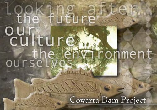
<strong>Cowarra</strong> <strong>Dam</strong> <strong>Project</strong>
<strong>Art</strong>work by Maria Ritchie.
Contents<br />
INTRODUCTION 2<br />
BIRPAI NATION 3<br />
BUNYAH LOCAL ABORIGINAL LAND COUNCIL 4<br />
BUNYAH JIMMEY 5<br />
BUILDING BRIDGES AND A BIG DAM 6<br />
WORKING TOGETHER 8<br />
INDIGENOUS HERITAGE 9<br />
CARING FOR THE ENVIRONMENT 10<br />
RECYCLING AND REUSING 11<br />
PUBLIC ART PROJECT 12<br />
THE ARTISTS 15<br />
PROVIDING A DROUGHT SECURE FUTURE 16<br />
COWARRA DAM DETAILS 18<br />
ACKNOWLEDGEMENTS 20
Introduction<br />
The <strong>Cowarra</strong> “Off-Creek Storage” <strong>Dam</strong> is located<br />
in the coastal ranges between Port Macquarie<br />
and Wauchope on the New South Wales Mid-<br />
North Coast. It was built on the upper catchment<br />
of a small unnamed tributary of King Creek<br />
approximately 4km south of the Oxley Highway<br />
and 3km west of the Pacific Highway.<br />
As guardians of the land and waterways in<br />
the Wauchope area, Bunyah Local Aboriginal<br />
Land <strong>Council</strong> (LALC) worked closely with<br />
<strong>Hastings</strong> <strong>Council</strong> during the development and<br />
construction of the <strong>Cowarra</strong> <strong>Dam</strong>.<br />
This booklet was written to remind people how<br />
the dam came about and to tell the story of the Bunyah people’s<br />
cooperation and active involvement in the <strong>Cowarra</strong> <strong>Dam</strong> and the<br />
strong partnerships that developed during its construction.<br />
Map depicting Local Aboriginal Land <strong>Council</strong> areas.<br />
It also explains why a new dam was needed to help ensure a drought<br />
secure future, while protecting environmental flows in the <strong>Hastings</strong><br />
River and how a public art project was developed to celebrate these<br />
positive partnerships and give meaningful recognition to the long<br />
term existence of the local Aboriginal community.<br />
2
Birpai Nation<br />
The land and waterways of the <strong>Hastings</strong> are part of<br />
the Birpai Nation which consisted of three groups.<br />
The Northern group was located on the coast north<br />
of the Wilson River; the Central, on the <strong>Hastings</strong> and<br />
Camden Haven Rivers; the Southern, to the south and<br />
west of the Manning River. Originally Port Macquarie and<br />
Wauchope areas both came under the Birpai Local Aboriginal<br />
Land <strong>Council</strong> (est. early 1980’s).<br />
There are a number of variations on<br />
the spelling of the Birpai tribal name<br />
including Biripi.<br />
3<br />
Original design by Lois Davis.
Bunyah Local<br />
Aboriginal Land <strong>Council</strong><br />
In 1985, Bunyah LALC was set up to meet the needs<br />
of Birpai people living in the Wauchope area.<br />
Bunyah LALC currently represents over<br />
200 members and is active in pursuing<br />
housing, employment, education and<br />
training opportunities and the return<br />
of land under the 1983 Land Rights<br />
Act for its people. It is responsible<br />
for protecting Aboriginal sites<br />
and preserving Aboriginal history,<br />
traditions and customs.<br />
The Bunyah LALC is the custodian of the<br />
land and waterways in the Wauchope area<br />
including the <strong>Cowarra</strong> <strong>Dam</strong> site.<br />
Founding members of Bunyah Local Aboriginal Land <strong>Council</strong>:<br />
Frank and Isabell Moran (left), Frances & Amos Donovan (above).<br />
4
Bunyah Jimmey<br />
Bunyah Local Aboriginal Land <strong>Council</strong> was named<br />
after the legendary koori “Bunyah Jimmey”.<br />
According to Bunyah LALC, Bunyah Jimmey was<br />
the leader of his people during the 1800’s and his<br />
movements ranged from the Wauchope to the<br />
Camden Haven areas including the <strong>Cowarra</strong> area.<br />
It is believed he was always at the head of the line<br />
when his people moved camp, indicating that Bunyah<br />
Jimmey was a respected leader and elder.<br />
He led his people through many turbulent times<br />
and earned the title “Bunyah Jimmey – King of the<br />
<strong>Hastings</strong>”. He is thought to have been more than 100<br />
years old when he died in 1905.<br />
Elder and leader Bunyah Jimmey<br />
5
Building Bridges<br />
and a Big <strong>Dam</strong><br />
Water is a precious resource especially during times of drought.<br />
Back in 1985, <strong>Hastings</strong> <strong>Council</strong> realised it needed a long-term strategy<br />
for drought-proofing <strong>Hastings</strong>’ water supply and decided that the<br />
growing district would need a second “off-creek storage” dam. Research<br />
indicated that <strong>Cowarra</strong> State Forest offered the best site.<br />
Aware that Bunyah LALC was the custodian of the land in this<br />
area, <strong>Hastings</strong> <strong>Council</strong> and the Department of Works and Services<br />
representatives (now Department of Commerce) approached the Land<br />
<strong>Council</strong> to seek support for the project and discuss how they might<br />
work together.<br />
These discussions identified that training and employment<br />
opportunities were a high priority for the Land <strong>Council</strong> and once<br />
sufficient trust and understanding was established, an agreement was<br />
reached. Bunyah LALC assisted in the process of extinguishing native<br />
title on the site to allow the <strong>Cowarra</strong> <strong>Dam</strong> to proceed and opened the<br />
doors to employment and training opportunities on the project for<br />
Bunyah people.<br />
6
The Bunyah people believe that<br />
water is an important resource to<br />
us all and that the <strong>Cowarra</strong> <strong>Dam</strong><br />
would ultimately benefit everyone.<br />
“We have a positive relationship<br />
with <strong>Hastings</strong> <strong>Council</strong> Water Supply<br />
people. The thing that won us over<br />
was the way they approached us,”<br />
a Bunyah spokesman said. “The<br />
<strong>Cowarra</strong> <strong>Dam</strong> <strong>Project</strong> has built<br />
bridges between <strong>Hastings</strong> <strong>Council</strong><br />
and Bunyah LALC”.<br />
Left: Photograph from the Thomas<br />
Dick Collection has been reproduced<br />
with permission from the Birpai Local<br />
Aboriginal Land <strong>Council</strong> and the<br />
Queensland Museum. This image was<br />
used to inform design development of<br />
some of the ceramic mosaic works.<br />
7
From the early planning stages Bunyah LALC was<br />
actively involved in investigating, developing and<br />
constructing <strong>Cowarra</strong> <strong>Dam</strong>. Along with <strong>Hastings</strong><br />
<strong>Council</strong>, they worked closely with the Department<br />
of Commerce, who managed dam design and<br />
construction.<br />
Bunyah people were contracted on works including<br />
construction of the access road, water supply<br />
trunk mains, dam embankment and Koree<br />
#3 Pumping Station. They also undertook<br />
site clearing and erosion control,<br />
catchment weed management, grass<br />
and tree planting.<br />
Ray Donovan<br />
Cooks Construction, which undertook the major<br />
construction works over a two-year period, also<br />
employed members of Bunyah LALC as clerical<br />
assistants, trade assistants and field staff during the<br />
construction of the dam embankment.<br />
Bunyah still has the important job of water<br />
sampling. Workers take water samples from<br />
downstream and upstream of the dam on a<br />
monthly and event basis. The data on water<br />
quality gathered throughout the construction<br />
and today is vital to monitoring the dam’s<br />
impact upon the environment.<br />
Tash Chatfield & Casey Roberts<br />
Working Together<br />
8<br />
Chris Donovan, Trevor Roberts and Stanley Chatfield
Anthony<br />
Gray<br />
Bunyah LALC members involved<br />
in the <strong>Cowarra</strong> <strong>Dam</strong> <strong>Project</strong>:<br />
Karen Baz, Rhonda Baxter,<br />
Warren Baxter, Cathy Chatfield,<br />
Tash Chatfield, Stanley Chatfield,<br />
Amos Donovan (Mossy),<br />
Ray Donovan, Pat Donovan,<br />
Jamie Donovan, Chris Donovan,<br />
Luke Donovan, Troy Durose,<br />
Anthony Gray, Nicholas Gray,<br />
Michael Gee, Bill Lee,<br />
Will Lee (Wonk), Fred Miller,<br />
Leanne Miller, Jennifer Morris (Annie),<br />
Sue Morris, Jodie Morris,<br />
Casey Roberts, Trevor Roberts<br />
and Trevor Roberts Jnr.<br />
Indigenous Heritage<br />
Bunyah LALC Sites Officers, Fred Miller, Trevor<br />
Roberts and Troy Durose, worked with consultant<br />
archaeologist, Jacqueline Collins, to survey the area<br />
before and during construction of the dam.<br />
10 Aboriginal sites including an open campsite<br />
were discovered, most of which showed<br />
evidence of tool making.<br />
The 39 artefacts found on the site are discards<br />
from stone tool making, a process which<br />
applied force to stones in certain ways to<br />
control the natural fracture process to create<br />
a range of flaked stone implements.<br />
The artefacts were removed before the dam was<br />
built and given to Bunyah LALC for safe keeping.<br />
9<br />
Cathy Chatfield, Tash Chatfield & Pat Donavan
Caring for the Environment<br />
<strong>Hastings</strong> <strong>Council</strong> has taken an environmentally sustainable<br />
approach towards ensuring a secure water supply for the<br />
<strong>Hastings</strong> rapidly growing population.<br />
The Bunyah people respect the environment and are closely<br />
connected to the land. They were very supportive of the<br />
project when they became aware that the <strong>Cowarra</strong> <strong>Dam</strong> was<br />
being built to save the <strong>Hastings</strong> River.<br />
The health of the <strong>Hastings</strong> River has been<br />
of paramount importance in all aspects<br />
of planning. The new Koree Island #3<br />
Pumping Station just west of Wauchope<br />
is designed to pump larger volumes of<br />
water to <strong>Cowarra</strong> <strong>Dam</strong> when the river<br />
has a good flow.<br />
During times of drought when river flow<br />
is low, <strong>Council</strong> stops pumping from the<br />
river and relies on Port Macquarie and<br />
<strong>Cowarra</strong> “Off-Creek Storage” dams to<br />
meet consumer needs.<br />
This operating arrangement also helps<br />
protect the platypuses, aquatic plants<br />
and fish passage in the river, which<br />
are regularly monitored by scientists<br />
employed to research how much<br />
water can be taken from the<br />
river without causing additional<br />
stress on the aquatic and riparian<br />
environments.<br />
<strong>Council</strong> is also developing reclaimed<br />
water supply schemes in the Port<br />
Macquarie, Wauchope and Camden<br />
Haven areas, to provide an alternative<br />
source of water. Advanced Reclaimed Water Plants will purify<br />
up to 20% of our wastewater, creating a win-win situation for<br />
the community and the environment.<br />
To minimise any environmental impact at the dam site,<br />
clearing was done in stages. Trees were left along creek beds<br />
and around the top of the dam to reduce the risk of erosion<br />
and run-off. Identified habitat trees were not removed and<br />
protected from disturbance until inhabitants had relocated<br />
elsewhere in the catchment.<br />
Bunyah workers spread grass seed and erected silt control<br />
fencing as each area was cleared to reduce the impact of soil<br />
eroding and “running off” into the waterways. They also hand<br />
cleared Lantana from steep hillsides so that chemical sprays<br />
were not needed.<br />
10
During construction, site<br />
clearing was only carried out<br />
from September to February<br />
each year so as not to disturb<br />
the Glossy Black Cockatoo<br />
breeding season.<br />
Tree seeds were collected on site<br />
so that the local flora could be<br />
replanted. The seedlings were all planted<br />
in drought time after completing major<br />
construction works. The average<br />
success rate for the seedlings has<br />
ranged between 50 % and 70 %.<br />
A total of 5,000 native trees were<br />
replanted in the catchment area<br />
including Ironbark, Tallowwood,<br />
Turpentine and Casuarinas.<br />
Approximately 70% of the tree seedlings<br />
planted were Casuarinas selected because their<br />
seed cones are the Glossy Black Cockatoos’ prime<br />
food source.<br />
100 rare Eucalyptus bancroftii (Orange Flower<br />
Gum) seedlings were replanted to replace<br />
14, which had to be disturbed for the<br />
construction of the southern access road.<br />
Recycling & Re-using<br />
About 80 % of the timber from site<br />
clearing was recycled and reused.<br />
State Forestry logged some<br />
of the trees, others were used<br />
as fence posts. Turpentine<br />
trees were salvaged by local<br />
oyster farmers and firewood<br />
suppliers salvaged other<br />
waste timber.<br />
The sculptural totems<br />
overlooking <strong>Cowarra</strong> <strong>Dam</strong><br />
picnic area were carved using<br />
timber cleared from the site.<br />
All timber cleared from the<br />
southern access road was chipped<br />
and mulched and used on other <strong>Council</strong><br />
landscaping projects and by members of the<br />
community who were invited to take mulch<br />
for their gardens.<br />
The remaining 20% of wood and timber waste<br />
from the clearing was burnt and the ashes<br />
buried on site.<br />
11
<strong>Public</strong> <strong>Art</strong> <strong>Project</strong><br />
From the outset, the <strong>Cowarra</strong> <strong>Dam</strong> project recognised<br />
the traditional custodians of the site.<br />
In 2004, <strong>Hastings</strong> <strong>Council</strong>’s Water Supply Section<br />
commissioned local artists to create public artworks<br />
to acknowledge and respect aboriginal cultural<br />
heritage and contribution to the dam, reflect the<br />
importance of water in our lives and enhance the<br />
dam’s public access area.<br />
The <strong>Cowarra</strong> <strong>Dam</strong> <strong>Public</strong> <strong>Art</strong> <strong>Project</strong> was also Section<br />
Manager, Murray Thompson’s vision for a special<br />
way to recognise Bunyah<br />
LALC’s ongoing involvement<br />
in developing the dam and<br />
the strong partnerships that<br />
developed during that time.<br />
The project was initiated with<br />
the support of <strong>Hastings</strong> <strong>Council</strong>’s Cultural Services<br />
section and involved project partners including<br />
Bunyah LALC, WaterWise NSW and Wauchope<br />
Campus, North Coast Institute of TAFE.<br />
In July 2004, NSW Premier, Bob<br />
Carr inspected the <strong>Cowarra</strong><br />
<strong>Dam</strong> and met with local<br />
artists working on the<br />
project.<br />
12
The project involved Wauchope TAFE Fine <strong>Art</strong> students<br />
and local Aboriginal artists who were employed as<br />
trainee public artists to work with experienced public<br />
artists and project mentors Stephen Killick, Guy<br />
Crosley and Jacky Beckhurst.<br />
Bunyah LALC nominated Aboriginal artists Lois Davis,<br />
Isabell Moran, Frank Dargin and Maria Ritchie to<br />
develop designs which were incorporated into public<br />
art installations for the picnic area overlooking the<br />
dam. The design artists studied Fine <strong>Art</strong> at Wauchope<br />
TAFE.<br />
A series of colourful and unique artworks were<br />
created which recognise the site’s significance, reflect<br />
local identity and create a sense of community<br />
ownership of the <strong>Cowarra</strong> <strong>Dam</strong>.<br />
Ceramic mosaic installations<br />
and seating benches<br />
coordinated by Guy Crosley,<br />
comprise four mosaic panels<br />
of handmade tiles and two<br />
ceramic boomerang viewing<br />
benches. The ceramics team<br />
included trainee public artists:<br />
Des Chapman, Olga Davis, Elaine<br />
Morris and Brett Ritchie.<br />
The Sculptural Poles installation coordinated by<br />
Stephen Killick comprises 20 carved and decorated<br />
totems which stand like sentinels overlooking the<br />
dam. The trainee public artists team of Gary Chapman,<br />
Amos Donovan, Kylie Dyson,<br />
Maria Ritchie and Shane<br />
Shields carved and painted<br />
the poles using timber<br />
reclaimed from the site.<br />
13
A stainless steel commissioned sculpture titled<br />
“The Drip” by Wauchope artist Peter Allison is<br />
appropriately located over the inlet chute,<br />
channeling water into the dam from the<br />
pumping station at Koree Island.<br />
Wauchope TAFE was a key project partner,<br />
having an existing Aboriginal <strong>Art</strong>s and<br />
Cultural Practices course and a good<br />
working relationship with many local<br />
indigenous artists.<br />
The project also provided a rare opportunity for Aboriginal artists and<br />
students to be mentored and gain hands-on work experience on a<br />
public art project and to learn public art skills such as working with<br />
local government, responding to a brief, developing a budget and<br />
maintaining a schedule. Through this experience, local Aboriginal artists<br />
have enhanced their skills and confidence assisting them to play an<br />
active role in future public art projects.<br />
The project has also been referred to as “reconciliation in<br />
action”, promoting an active dialogue between past and<br />
present and helping strengthen trust and understanding<br />
between different groups.<br />
“Drip”<br />
by Peter Allison<br />
14
The <strong>Art</strong>ists<br />
Lois Davis<br />
Frank Dargin<br />
Isabell Moran<br />
Frank Edward Dargin -<br />
Frank belongs to the Wauchope Reconciliation<br />
Group and hopes that the artworks will help<br />
to bring people together. He was born near<br />
Dubbo in 1941 and lived in Newcastle before<br />
moving to Wauchope in 1996.<br />
Lois Davis - Lois is one of the recognised<br />
Birpai Elders, her father Cecil Davis’ ancestors<br />
Amos Donovan<br />
farmed the Rollands Plains in the 1800s. Born<br />
in Taree in 1937, Lois has called Wauchope and Port Macquarie<br />
home since the 1980s and refers to this area as Ngamba. The design<br />
on the front gate of the dam is Lois’ work.<br />
Isabell Moran - Isabell belongs to the Thungutti people and has<br />
ancestors from the Rollands Plains area. She grew up in Kempsey<br />
and moved to Wauchope when she married. She established the<br />
Bindi Aboriginal Heritage and Culture Centre in Wauchope.<br />
Maria Ritchie - Maria from Kendall, is Isabell Moran’s<br />
daughter and helps to run the Bindi Aboriginal Heritage<br />
and Culture Centre. Maria has a chainsaw license and was<br />
one of the five artists employed to carve the poles.<br />
Stephen Killick, Gary Chapman, Kylie Dyson & Shane Shields<br />
PUBLIC ARTISTS & ARTIST MENTORS:<br />
Guy Crosley, Stephen Killick<br />
& Jacky Beckhurst<br />
TRAINEE PUBLIC ARTISTS:<br />
Sculptural Poles:<br />
Gary Chapman, Amos Donovan,<br />
Kylie Dyson, Maria Ritchie<br />
& Shane Shields<br />
Ceramic <strong>Art</strong>works:<br />
Des Chapman, Olga Davis,<br />
Elaine Morris & Brett Ritchie<br />
COMMISSIONED SCULPTURE:<br />
“Drip” by Peter Allision<br />
PROJECT MANAGEMENT:<br />
Kim Freeman & Janet Cohen<br />
Jacklynn Travers, Des Chapman, Jacky Beckhurst, Kylie Dyson,<br />
Elaine Morris, Ron Naden, Olga Davis, Guy Crosley & Michael Dumas<br />
Maria Ritchie<br />
15
Providing a drought secure future<br />
The <strong>Cowarra</strong> “Off-Creek”<br />
Storage <strong>Dam</strong> is part of the<br />
<strong>Hastings</strong> District Water Supply<br />
Augmentation Scheme.<br />
Port Macquarie <strong>Dam</strong><br />
It was built to meet the<br />
predicted long term urban growth demands for<br />
water supply, and will cater for a population of<br />
120,000, which is expected to be reached by 2025.<br />
Since 1985 <strong>Hastings</strong> <strong>Council</strong> has progressively<br />
developed a strategy for the augmentation of the<br />
water supply scheme. The dam was designed to<br />
protect environmental flows in the <strong>Hastings</strong> River<br />
and provide the <strong>Hastings</strong> area with a reliable water<br />
supply even during times of drought.<br />
The <strong>Cowarra</strong> “Off-Creek” Storage <strong>Dam</strong> is filled by taking<br />
water from the <strong>Hastings</strong> River at the Koree Island<br />
pumping station located just west of Wauchope.<br />
During times of drought when river flow is low,<br />
<strong>Council</strong> can stop pumping and rely upon the dam<br />
to meet consumer needs. The <strong>Cowarra</strong> <strong>Dam</strong> is a<br />
key component of the <strong>Council</strong>’s plan to provide the<br />
<strong>Hastings</strong> with a drought secure future.<br />
The design and project management<br />
for the dam construction was<br />
undertaken by the NSW Department<br />
of Commerce. Work on the<br />
foundations commenced on 11th<br />
January 1999, with the storage dam<br />
being completed on time on 12th<br />
October 2001.<br />
Left - Koree Island Pumping Station<br />
Below - <strong>Cowarra</strong> <strong>Dam</strong>, Wauchope<br />
The dam is large enough to hold 10,000 megalitres of<br />
water, which is equivalent to 6,700 Olympic swimming<br />
pools.<br />
16
The <strong>Cowarra</strong> <strong>Dam</strong> supplements<br />
the 2.5 megalitre Port<br />
Macquarie <strong>Dam</strong> which was<br />
constructed in 1978. The two<br />
dams provide water for the<br />
Port Macquarie, Wauchope and<br />
Camden Haven areas.<br />
WaterWise <strong>Hastings</strong> <strong>Council</strong><br />
has been actively involved<br />
in the <strong>Cowarra</strong> <strong>Dam</strong> <strong>Project</strong>,<br />
conducting informative public<br />
tours of the <strong>Cowarra</strong> <strong>Dam</strong> site<br />
since the beginning of the<br />
construction phase.<br />
They also provide community<br />
education on the need for and<br />
means of water conservation<br />
both on a domestic and<br />
commercial level.<br />
Main map - Reservoirs and trunk mains<br />
of the <strong>Hastings</strong> Water Supply System.<br />
Inset Map - Road access to <strong>Cowarra</strong> <strong>Dam</strong>.<br />
17
<strong>Cowarra</strong> <strong>Dam</strong> Details<br />
The 10,000 megalitre <strong>Cowarra</strong> “Off-Creek” Storage<br />
<strong>Dam</strong> is located 5 kilometres south east of Wauchope<br />
in the <strong>Cowarra</strong> State Forest. Water needed to fill the<br />
dam is pumped from the <strong>Hastings</strong> River at Koree<br />
Island, just west of Wauchope. The dam supplies<br />
water to the Wauchope, Camden Haven and Port<br />
Macquarie areas.<br />
Gross Capacity: 10,000 megalitres<br />
Full Supply Level (FSL): 58.8 metres (AHD)<br />
Catchment Area: 110 hectares<br />
Surface Area @ FSL: 70 hectares<br />
Main Embankment Wall<br />
Type:<br />
Earthfill with clay core and sand filters<br />
Volume of Material: 1,200,000 cubic metres<br />
Height:<br />
43 metres<br />
Length:<br />
545 metres<br />
Width at Top: 6 metres<br />
Width at Base: 250 metres<br />
Saddle <strong>Dam</strong><br />
Type:<br />
Earthfill, similar to main embankment<br />
Volume of Material: 28,000 cubic metres<br />
Height:<br />
17 metres<br />
Length:<br />
130 metres<br />
Width at Top: 6 metres<br />
Width at Base: 160 metres<br />
18
Spillway<br />
Type:<br />
Width:<br />
Outlet Channel:<br />
Concrete chute with crest weir<br />
6 metres<br />
Gabion rock filled mattress channel<br />
discharging into upper tributary of<br />
Sarah’s Creek through the <strong>Cowarra</strong><br />
State Forest<br />
Inlet Chute<br />
Type:<br />
Width:<br />
Depth:<br />
Length:<br />
Outlet Tower<br />
Type:<br />
Access:<br />
Outlet Pipe:<br />
Concrete chute channel with energy<br />
dissipation baffles<br />
2.4 metres<br />
0.75 metres<br />
150 metres<br />
Circular concrete tower (3.6 metres in<br />
diameter) with vertical openings for<br />
selective withdrawal of water<br />
Steel walkway from main embankment<br />
Steel pipe 911 mm diameter encased in<br />
concrete under dam wall embankment<br />
19
Acknowledgements<br />
<strong>Booklet</strong> compiled by with input from:<br />
Connie Chatfield<br />
Geoff Chenhall<br />
Janet Cohen<br />
Michael Dibbs<br />
Amos Donovan<br />
Kim Freeman<br />
Meredith Robertson<br />
Murray Thompson<br />
Photos:<br />
Geoff Chenhall<br />
Gordon “Squeak” McWhirter<br />
Murray Thompson<br />
20
Handmade lizard tiles by Frank Dargin.<br />
Boomerang by Olga Davis.
HASTINGS COUNCIL<br />
CNR LORD & BURRAWAN STREETS<br />
PORT MACQUARIE NSW 2444<br />
PHONE: 02 6581 8111<br />
www.hastings.nsw.gov.au<br />
M&S OFFSET - WAUCHOPE - 38293/01/05